The Geology of the Elat Sheet Explanatory Notes
The Geology of the Elat Sheet Explanatory Notes
The Geology of the Elat Sheet Explanatory Notes
You also want an ePaper? Increase the reach of your titles
YUMPU automatically turns print PDFs into web optimized ePapers that Google loves.
THE MINISTRY OF NATIONAL INFRASTRUCTURES<br />
GEOLOGICAL SURVEY OF ISRAEL<br />
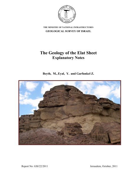
<strong>The</strong> <strong>Geology</strong> <strong>of</strong> <strong>the</strong> <strong>Elat</strong> <strong>Sheet</strong><br />
<strong>Explanatory</strong> <strong>Notes</strong><br />
Beyth, M., Eyal, Y. and Garfunkel Z.<br />
Report No. GSI/22/2011 Jerusalem, October, 2011
This map is dedicated to Pr<strong>of</strong>. Yakov Bentor who was our teacher and a pioneer in <strong>the</strong><br />
geological research <strong>of</strong> <strong>the</strong> <strong>Elat</strong> area.<br />
* Attached is <strong>the</strong> geological map 1:25,000 scale and a cd with associated photos.
THE MINISTRY OF NATIONAL INFRASTRUCTURES<br />
GEOLOGICAL SURVEY OF ISRAEL<br />
<strong>The</strong> <strong>Geology</strong> <strong>of</strong> <strong>the</strong> <strong>Elat</strong> <strong>Sheet</strong><br />
<strong>Explanatory</strong> <strong>Notes</strong><br />
Beyth, M., (1) Eyal, Y. (2) and Garfunkel Z. (3)<br />
(1) <strong>The</strong> Geological Survey <strong>of</strong> Israel<br />
(2) <strong>The</strong> Department <strong>of</strong> <strong>Geology</strong> and Environmental Sciences, Ben Gurion University<br />
(3) Earth Sciences Institute, <strong>The</strong> Hebrew University, Jerusalem<br />
Report No. GSI/22/2011 Jerusalem, October, 2011
1. Introduction<br />
Three major processes controlled <strong>the</strong> geological and geomorphological evolution <strong>of</strong> <strong>the</strong><br />
<strong>Elat</strong> area: 1) <strong>The</strong> creation <strong>of</strong> <strong>the</strong> Arabian-Nubian Shield during <strong>the</strong> Neoproterozoic as part<br />
<strong>of</strong> <strong>the</strong> East African Orogen and <strong>the</strong> enclosure <strong>of</strong> <strong>the</strong> Mozambique Ocean between <strong>the</strong> east<br />
and west Gondwana plates; 2) Accumulation <strong>of</strong> <strong>the</strong> Cambrian to Eocene sedimentary<br />
sequence on <strong>the</strong> Arabian Plate at <strong>the</strong> sou<strong>the</strong>ast margins <strong>of</strong> <strong>the</strong> paleo-Tethys and Tethys<br />
Sea; 3) <strong>The</strong> Miocene to Recent evolution <strong>of</strong> <strong>the</strong> Dead Sea Transform, a sinistral fault,<br />
which is <strong>the</strong> plate boundary between <strong>the</strong> Arabian Plate to <strong>the</strong> east and <strong>the</strong> African Plate to<br />
<strong>the</strong> west.<br />
<strong>The</strong> stratigraphy and structure <strong>of</strong> <strong>the</strong> well-exposed rocks in <strong>the</strong> extreme arid desert<br />
climate <strong>of</strong> <strong>the</strong> <strong>Elat</strong> area document <strong>the</strong> evolution <strong>of</strong> <strong>the</strong>se three processes and thus make<br />
<strong>the</strong> geology <strong>of</strong> <strong>the</strong> <strong>Elat</strong> <strong>Sheet</strong> so unique.<br />
<strong>The</strong>refore <strong>the</strong> extensive research done in <strong>the</strong> <strong>Elat</strong> area has turned this region into a field<br />
laboratory for geoscience students. <strong>The</strong> <strong>Elat</strong> <strong>Sheet</strong> geological map was prepared as part <strong>of</strong><br />
<strong>the</strong> 1: 50,000 scale geological mapping project <strong>of</strong> <strong>the</strong> Geological Survey <strong>of</strong> Israel and is<br />
based on previous maps updated by field work during <strong>the</strong> present study. This most recent<br />
effort <strong>of</strong> very detailed mapping was carried out on a 1:10,000 average scale using GIS<br />
and orthophoto as <strong>the</strong> base map.<br />
2. Geomorphology<br />
<strong>The</strong> eastern part <strong>of</strong> <strong>the</strong> <strong>Elat</strong> <strong>Sheet</strong> comprises <strong>the</strong> up-to 1,000 meters deep structural basins<br />
<strong>of</strong> <strong>the</strong> sou<strong>the</strong>rn Arava (Frieslander, 2000) and <strong>the</strong> Gulf <strong>of</strong> Aqaba/<strong>Elat</strong> with a water depth<br />
<strong>of</strong> up to 1,500 m (Sade et al., 2008). <strong>The</strong> geomorphological expression <strong>of</strong> <strong>the</strong>se<br />
depressions on land are <strong>the</strong> Avrona playa, <strong>Elat</strong> sabkha and <strong>the</strong> alluvial fans <strong>of</strong> <strong>the</strong> rivers<br />
draining eastward. <strong>The</strong> ephemeral rivers (wadis) draining into <strong>the</strong> sou<strong>the</strong>rn Arava and <strong>the</strong><br />
gulf are from south to north are: Taba and it's tributary Gishron, Shelomo, Gar<strong>of</strong>,<br />
Shahmon, Netafim, Roded with its tributary Yael, Shehoret, Amram, Zefunot, Avrona<br />
with its tributary Nizoz, and Raham with it's tributaries Shelalgon, Shani and Uzia. Most<br />
<strong>of</strong> <strong>the</strong>se rivers are incising at <strong>the</strong>ir upper parts, <strong>the</strong> sedimentary rocks <strong>of</strong> <strong>the</strong> Shelomo<br />
Graben on <strong>the</strong> west <strong>the</strong> metamorphic-magmatic rocks <strong>of</strong> <strong>the</strong> Roded and <strong>Elat</strong> blocks to <strong>the</strong><br />
sou<strong>the</strong>ast and Amram Block at <strong>the</strong> north. <strong>The</strong> topographic elevation in <strong>the</strong> east ranges<br />
from sea level to +40 m in <strong>the</strong> Avrona playa. <strong>The</strong> elevation in <strong>the</strong> west ranges from 700<br />
m at Mt. Shelomo to more than 800 m at Mt. Hizkyhu and Mt. Neshef. This sharp<br />
difference in east-west relief which spans less than 15 km is <strong>the</strong> major reason for <strong>the</strong><br />
canyon morphology <strong>of</strong> <strong>the</strong>se ephemeral rivers. Changes <strong>of</strong> stream direction as at Mt.<br />
Amram (Beyth and Mushkin, 2010), <strong>of</strong> <strong>the</strong> Shehoret and Roded rivers (Weissbrod and<br />
Sneh, 1990) and <strong>the</strong> "capture" <strong>of</strong> <strong>the</strong> Gishron by <strong>the</strong> Yehoshafat River (Eyal, 1967) were<br />
controlled by <strong>the</strong> young Pliocene, Pleistocene and Holocene tectonic activity <strong>of</strong> <strong>the</strong> Dead<br />
Sea Transform and its margins. Garfunkel (1970) presented a detailed study <strong>of</strong> <strong>the</strong> young<br />
stages <strong>of</strong> <strong>the</strong> evolution <strong>of</strong> <strong>the</strong> rift margins in <strong>the</strong> sou<strong>the</strong>rn Arava (Figs. 1&2).<br />
1
3. Stratigraphy<br />
<strong>The</strong> <strong>Elat</strong> area comprises three major rock sequences: 1) <strong>The</strong> Neoproterozoic metamorphic<br />
and magmatic basement; 2) <strong>the</strong> sedimentary rocks from Cambrian to Eocene and 3) <strong>the</strong><br />
young clastics and playa deposits accreted during <strong>the</strong> evolution <strong>of</strong> <strong>the</strong> Dead Sea<br />
Transform since <strong>the</strong> Miocene. <strong>The</strong> Early Cambrian peneplain separates between <strong>the</strong> first<br />
two sequences (Beyth and Heimann, 1999 ) and <strong>the</strong> Oligocene erosion surface between<br />
<strong>the</strong> second and <strong>the</strong> third sequences (Avni et al., 2011).<br />
3.1 <strong>The</strong> metamorphic and magmatic rocks (Bentor, 1961 ; Garfunkel, 1980, Fig. 3)<br />
were mapped at <strong>the</strong> <strong>Elat</strong>, Roded and Amram blocks as part <strong>of</strong> <strong>the</strong> nor<strong>the</strong>rn margins <strong>of</strong> <strong>the</strong><br />
Arabian-Nubian Shield. <strong>The</strong>se rocks formed during more than 300 milion years <strong>of</strong> <strong>the</strong><br />
Neoproterozoic crustal evolution (Beeri-Shlevin et al., 2009; Kolodner, 2007; Kroner et<br />
al., 1990; Morag et al., 2011). <strong>The</strong> oldest rock association was mapped at <strong>the</strong> Roded and<br />
<strong>Elat</strong> blocks and <strong>the</strong> youngest at Mt. Amram (Mushkin et al., 2003).<br />
3.1.1 <strong>The</strong> metamorphic rocks <strong>of</strong> <strong>the</strong> <strong>Elat</strong> block are built <strong>of</strong> <strong>the</strong> metapelitic and<br />
metapsammitic <strong>Elat</strong> Schist, 800-813 Ma <strong>of</strong> age (Kroner et al., 1990). <strong>The</strong> metamorphic<br />
minerals in <strong>the</strong> schist are biotite, garnet, staurolite, cordierite, andalusite and silimenite<br />
(Shimron, 1972). <strong>The</strong> <strong>Elat</strong> Schist is intruded by <strong>the</strong> quartz-diorite Taba Gneiss, 782-790<br />
Ma (Morag et al, 2011; Kroner et al., 1990) and by <strong>the</strong> <strong>Elat</strong> Granitic Gneiss, 740-744 Ma<br />
<strong>of</strong> age (Kolodner, 2007; Kroner et al., 1990). Garfunkel (1980, 1999) suggested <strong>the</strong><br />
existence <strong>of</strong> two orogenic phases separated by 50 million years. Two metamorphic<br />
phases are distinguished in <strong>the</strong> <strong>Elat</strong> metamorphic association, <strong>the</strong> amphibolitic, medium<br />
to high temperature and low pressure facies and <strong>the</strong> amphibolite-greenschist facies<br />
(Morag and Avigad, 2010). <strong>The</strong> mineralogic association suggests temperatures <strong>of</strong> 580 to<br />
660 C 0 and pressures between 4.6 to 3.8 Kbar (Mat<strong>the</strong>ws et al., 1989).<br />
<strong>The</strong> metamorphic rocks <strong>of</strong> <strong>the</strong> Roded block are comprised <strong>of</strong> <strong>the</strong> Roded Migmatites<br />
and Roded Schists, 800 Ma old (Morag et al., 2011). <strong>The</strong> metamorphic amphibolitic<br />
facies suggests temperatures up to 650 C 0 and pressure between 4 to 5 Kbar. <strong>The</strong> peak <strong>of</strong><br />
<strong>the</strong> metamorphic event was pre-750 Ma (Katz et al., 1998).<strong>The</strong> Roded Migmatites <strong>of</strong> Mt.<br />
Shelomo developed from <strong>the</strong> Roded Schist by metamorphic segregation while <strong>the</strong><br />
protolite <strong>of</strong> <strong>the</strong> Roded Gneiss was most probably magmatic (Gutkin and Eyal, 1998). At<br />
Nahal Netafim <strong>the</strong> metamorphic rocks form a belt at <strong>the</strong> east and south margins <strong>of</strong> <strong>the</strong><br />
younger plutonic rocks <strong>of</strong> <strong>the</strong> Roded Quartz Diorite.<br />
<strong>The</strong> metamorphic rocks <strong>of</strong> <strong>the</strong> <strong>Elat</strong> and Roded blocks represent an event <strong>of</strong> subduction,<br />
formation <strong>of</strong> island arcs, erosion <strong>of</strong> <strong>the</strong> arcs, deposition <strong>of</strong> <strong>the</strong> erosion products and<br />
metamorphism <strong>of</strong> <strong>the</strong>se sediments. This event took place between ~800 Ma (<strong>the</strong> age <strong>of</strong><br />
<strong>the</strong> zircons in <strong>the</strong> schists), to 780-790 Ma (<strong>the</strong> age <strong>of</strong> <strong>the</strong> zircons in <strong>the</strong> Taba Gneiss; Eyal<br />
et al., 1991). <strong>The</strong> schists were intruded by quartz dioritic and granitic plutons after <strong>the</strong><br />
first metamorphic event and metamorphosed like <strong>the</strong> <strong>Elat</strong> Granitic Gneiss. <strong>The</strong> andesitic<br />
magnesium-rich schist dykes (Garfunkel, 1970; Shimron, 1972; Avigad, 1984; Katz et<br />
al., 2004) <strong>of</strong> <strong>the</strong> low, greenschist, metamorphic facies and 705 Ma (Morag, et al, 2011)<br />
mark <strong>the</strong> end <strong>of</strong> <strong>the</strong> metamorphic events.<br />
3.1.2 <strong>The</strong> calc alkaline intrusions, <strong>the</strong> Shahmon Metabasite in <strong>the</strong> <strong>Elat</strong> block 640-644<br />
Ma (Kroner et el., 1990; Morag et al., 2011), Roded Granite Porphyry, 642 Ma (Morag et<br />
al., 2011), Roded Quartz Diorite, 634 Ma (Stein and Goldstein, 1996; Katz et al., 1998)<br />
2
and <strong>Elat</strong> Granite, 630 Ma (Beeri-Shlevin et al., 2009) in <strong>the</strong> <strong>Elat</strong> and Roded blocks mark<br />
<strong>the</strong> cratonization, post-collision phase <strong>of</strong> <strong>the</strong> orogen. Some foliation was observed in <strong>the</strong><br />
Shahmon Metabasite, Roded quartz Diorite and in <strong>the</strong> <strong>Elat</strong> Granite. Eyal et al., (2004)<br />
suggested that <strong>the</strong> <strong>Elat</strong> Granite is composed <strong>of</strong> two plutons; <strong>the</strong> one on <strong>the</strong> eastern<br />
margins <strong>of</strong> Mt. Shahmon is metamorphic and is <strong>the</strong>refore distinguished by <strong>the</strong>m as <strong>the</strong><br />
Shahmon Granitic Gneiss.<br />
<strong>The</strong> intrusions <strong>of</strong> <strong>the</strong> alkaline granites such as <strong>the</strong> Amram, Shahmon and Yehoshafat<br />
granites, 608 Ma ( Be'eri-Shelvin et al., 2009; Morag et al., 2011), is accompanied by<br />
rhyolite dykes, 609 Ma (Morag and Avigad, 2010), andesite and composite dykes which<br />
mark <strong>the</strong> extension phase (Beyth et al., 1994). In places such as <strong>the</strong> "Dyke Country" at<br />
Mt. Shelomo <strong>the</strong> dykes form 85% <strong>of</strong> <strong>the</strong> outcrop (Gutkin and Eyal, 1998). <strong>The</strong> Shahmon<br />
Granite intrudes <strong>the</strong> Quartz Diorite Roded in numerous small intrusions (Bentor, 1961).<br />
3.1.3 <strong>The</strong> volcano-conglomeratic event is <strong>the</strong> final major magmatic event in <strong>the</strong> <strong>Elat</strong><br />
area, represented by <strong>the</strong> Amram Rhyolites, basalts, andesits and conglomerates <strong>of</strong> <strong>the</strong><br />
Mapalim Formation in <strong>the</strong> Roded block (Paz, 1997), andesites and trachytes at Gevaot<br />
Shehoret (Peltz and Eyal, 1995), acid volcanic rocks at <strong>the</strong> Yotam Caldera (Eyal and<br />
Peltz, 1994), <strong>the</strong> basalt and andesite volcanic rocks in Mt. Shelomo in <strong>the</strong> <strong>Elat</strong> block,<br />
hypabyssal shallow intrusions <strong>of</strong> <strong>the</strong> Amram Monzonite and Amram Quartz Syenite<br />
(Mushkinet al., 2003).<br />
<strong>The</strong> Roded Conglomerate, <strong>the</strong> Mapalim Formation and <strong>the</strong> <strong>Elat</strong> Conglomerate in Mt.<br />
Shelomo (Gutkin and Eyal, 1998), dated at about 590 Ma (Morag et al., 2011), are <strong>the</strong><br />
products <strong>of</strong> a major erosion phase in which 12,000 m <strong>of</strong> <strong>the</strong> section were removed<br />
(Garfunkel, 1999). <strong>The</strong> <strong>Elat</strong> Conglomerate is a product <strong>of</strong> cohesive debris flows while <strong>the</strong><br />
Roded Conglomerate and <strong>the</strong> Mapalim Formation are fluviatile sediments (Kagan et al.,<br />
2010). Rhyolite, andesite and composite dykes 585 Ma.<strong>of</strong> age (Katzir et al., 2007)<br />
intrude <strong>the</strong>se conglomerates. A petrologic study <strong>of</strong> <strong>the</strong>se dykes intruding <strong>the</strong> <strong>Elat</strong> Granit<br />
at Mt. Shahmon was done by Kessel et al. (1998). <strong>The</strong> youngest dyke, 532 Ma <strong>of</strong> age<br />
(Beyth and Heimann, 1999) below <strong>the</strong> peneplain is <strong>the</strong> dolerite dyke which was mapped<br />
in <strong>the</strong> <strong>Elat</strong> <strong>Sheet</strong> at <strong>the</strong> sou<strong>the</strong>rn part <strong>of</strong> Mt. Amram. Identical ages were reported from<br />
<strong>the</strong> dolerite intrusions in <strong>the</strong> Zenifim Formation (Weissbrod, 2005). <strong>The</strong> Early Cambrian<br />
peneplain was formed by erosion <strong>of</strong> 2,000 m <strong>of</strong> <strong>the</strong> section (Garfunkel, 1999) and<br />
chemical wea<strong>the</strong>ring. At <strong>the</strong> junction <strong>of</strong> Nahal Amir and Nahal Shehoret <strong>the</strong> Roded<br />
Granite Porphyry was altered to kaolinite, suggested by Sandler et al., (2010) to be a<br />
relict <strong>of</strong> a thick lateritic section which was removed before <strong>the</strong> sedimentation <strong>of</strong> <strong>the</strong><br />
conglomerates <strong>of</strong> <strong>the</strong> Amudei Shelomo Formation.<br />
As a result <strong>of</strong> <strong>the</strong> geochronological studies two possible major breaks in <strong>the</strong><br />
Neoproterozoic magmatic activity are suggested: ~60 million years break between <strong>the</strong><br />
metamorphic rocks and <strong>the</strong> calc alkaline intrusions and ~55 million years between <strong>the</strong><br />
rhyolite, andesite and composite dykes and <strong>the</strong> dolerite dyke.<br />
3.2 <strong>The</strong> sedimentary rocks (Fig. 4). <strong>The</strong> pre-Dead Sea Transform sediments, from<br />
Cambrian to Eocene, consist in <strong>the</strong> <strong>Elat</strong> area <strong>of</strong> five groups: Yam Suf, Kurnub, Judea,<br />
Mount Scopus and Avdat.<br />
3.2.1 Yam Suf Group: <strong>The</strong> lower, Cambrian part <strong>of</strong> <strong>the</strong> sedimentary section comprises<br />
four formations: Amudei Shelomo, Timna, Shehoret and Netafim, which were described<br />
by Weissbrod (1969, 2005) and Segev (1986). <strong>The</strong>y onlap <strong>the</strong> Early Cambrian peneplain<br />
3
for example, at Mt. Amram. A paraconformity, a stratigraphic gap, <strong>of</strong> 380 million years<br />
separates between <strong>the</strong> Aptian Amir Formation and <strong>the</strong> Cambrian Netafim Formation.<br />
This gap is <strong>the</strong> result <strong>of</strong> erosion <strong>of</strong> approximately 2,500 m <strong>of</strong> mainly lower Paleozoic and<br />
less upper Paleozoic and lower Mesozoic rocks as a result <strong>of</strong> three uplift events<br />
(Weissbrod, 1995; Kohn et al., 1992). This paraconformity is well exposed in <strong>the</strong> north at<br />
Givat Yokheved and at <strong>the</strong> southwest margins <strong>of</strong> <strong>the</strong> Mt. Amir syncline. <strong>The</strong> sand <strong>of</strong><br />
Yam Suf Group must have been transported several thousand kilometers before<br />
deposition from south to north Gondwana (Morag et al., 2011c). <strong>The</strong> Amudei Shelomo<br />
Formation <strong>of</strong> Early Cambrian age is composed <strong>of</strong> sub-arkosic sandstones and<br />
conglomerates filling a moderate relief, which was formed along a drainage pattern<br />
aiming north and northwest (Karcz and Key, 1966). <strong>The</strong> base <strong>of</strong> this formation around<br />
Nahal Shehoret and Nahal Gishron is built <strong>of</strong> a dark-brown silty-clay bed a few meters<br />
thick. <strong>The</strong> Amudei Shelomo Formation was mapped at <strong>the</strong> sou<strong>the</strong>rn margins <strong>of</strong> Mt.<br />
Amram, at <strong>the</strong> sou<strong>the</strong>ast margins <strong>of</strong> <strong>the</strong> Mt. Amir syncline, south-east <strong>of</strong> Nahal Shehoret,<br />
at Nahal Shani <strong>the</strong> Red Canyon and at Nahal Gishron. <strong>The</strong> Timna Formation is exposed<br />
in <strong>the</strong> Timna basin to <strong>the</strong> north and <strong>the</strong> <strong>Elat</strong> basin to <strong>the</strong> south which are separated by <strong>the</strong><br />
east-west trending Mt. Amram and Mt. Neshef ridges (Segev, 1984). <strong>The</strong> formation was<br />
divided into <strong>the</strong> Hakhlil and Sasgon members. <strong>The</strong> lower Hakhlil Member is built <strong>of</strong> silt<br />
and sandstone with rhyolitic breccia at <strong>the</strong> base, and <strong>the</strong> upper Sasgon Member is built <strong>of</strong><br />
three lith<strong>of</strong>acies: dolomite, sand and clay (Segev, 1986). <strong>The</strong> dolomite at <strong>the</strong> <strong>Elat</strong> basin is<br />
dolomitic thrombolite. <strong>The</strong> sand is sub-arkosic with sandy columnar stromatolites<br />
(Soudry and Weissbrod, 1995). <strong>The</strong> age <strong>of</strong> <strong>the</strong> Timna Formation is Early Cambrian<br />
(Parnes, 1971) forming a transgressive-regressive cycle. This formation is exposed at <strong>the</strong><br />
Netafim pass, at <strong>the</strong> nor<strong>the</strong>rn margins <strong>of</strong> Mt. Amram and is associated with <strong>the</strong> Amudei<br />
Shelomo Formation. A full section <strong>of</strong> <strong>the</strong> Timna Formation with dolomite and limestone<br />
beds, manganese nodules and mud cracks occurs in Nahal Amir close to <strong>the</strong> junction with<br />
Nahal Shehoret. <strong>The</strong> Shehoret Formation is built <strong>of</strong> silt and sandstone deposited in a<br />
coastal environment. <strong>The</strong> formation was divided into three members along <strong>the</strong> margins <strong>of</strong><br />
<strong>the</strong> Mt. Amir syncline: <strong>the</strong> lower sub-arkosic multicolored Member, 30-40 m thick, <strong>the</strong><br />
White Member <strong>of</strong> sub-arkosic sandstones with Skolithus <strong>of</strong> maximum thickness <strong>of</strong> 52 m,<br />
and <strong>the</strong> upper Variegated Member up to 60 m thick built <strong>of</strong> red to brown clay alternating<br />
with white sub-arkosic to silt beds (Weissbrod, 2005). <strong>The</strong> Netafim Formation, 20 m<br />
thick is built <strong>of</strong> fine-grained sandstone deposited in a tidal environment, unconformably<br />
overlying <strong>the</strong> Shoehorned Formation. <strong>The</strong> upper members <strong>of</strong> <strong>the</strong> Shehoret Formation and<br />
<strong>the</strong> Netafim Formation are missing in <strong>the</strong> Timna Valley (Segev et al., 1992). <strong>The</strong> darkbrown<br />
color, which is very distinctive on <strong>the</strong> airphotos, is typical for <strong>the</strong> Yam Suf Group.<br />
3.2.2 <strong>The</strong> Kurnub Group (previously called <strong>the</strong> Hatira Formation) <strong>of</strong> <strong>the</strong> Lower<br />
Cretaceous period is composed <strong>of</strong> <strong>the</strong> Amir, Avrona and Samar formations. <strong>The</strong> Amir<br />
Formation is built <strong>of</strong> white friable, fine to mediun-grain quartz kaolinitic sandstone with<br />
recumbent cross-bedding, trace fossils and tidal channels (Weissbrod and Sneh, 1997)<br />
covered by a typical yellow-brown patina. <strong>The</strong> age <strong>of</strong> <strong>the</strong> Amir Formation is between<br />
about Late Barremian to Early Aptian and its thickness is around 50 m. <strong>The</strong> Avrona<br />
Formation up to 70 m thick, and is built <strong>of</strong> medium to coarse-grained sandstones with<br />
quartz pebbles <strong>of</strong> 5-10 cm in diameter. It is characterized by rounded cliffs and caves and<br />
large-scale cross bedding. Nodules <strong>of</strong> sulfidic copper mineralization with secondary<br />
green mineralization coating are common at <strong>the</strong> top <strong>of</strong> <strong>the</strong> Amir Formation and <strong>the</strong> base<br />
<strong>of</strong> <strong>the</strong> Avrona Formation. Copper mineralization was also found along fractures and was<br />
mined in ancient times at Amudei Amram. <strong>The</strong> Samar Formation <strong>of</strong> middle Albian to<br />
Late Albian age is 80 to 130 m thick and is built <strong>of</strong> quartz sandstone <strong>of</strong> fine to medium<br />
4
grain- size with lateritic beds. <strong>The</strong> Kurnub Group is <strong>of</strong> alluvial origin and forms <strong>the</strong> s<strong>of</strong>t<br />
geomorphological unit below <strong>the</strong> carbonate cliffs <strong>of</strong> <strong>the</strong> Judea Group. <strong>The</strong> Kurnub Group<br />
outcrops along <strong>the</strong> margins <strong>of</strong> Mt. Amram, Nahal Shani, sou<strong>the</strong>rn Mt. Shehoret, along<br />
Nahal Netafim and north and south <strong>of</strong> Nahal Gishron.<br />
During Late Barremian-Albian times <strong>the</strong> sou<strong>the</strong>rn margins <strong>of</strong> <strong>the</strong> Tethys Sea transgressed<br />
over <strong>the</strong> Arabian-Nubian continent in pulses evidenced by shallow marine sediments in<br />
between terrestrial clastics. Since <strong>the</strong> Early Cenomanian <strong>the</strong> sea covered <strong>the</strong> <strong>Elat</strong> region<br />
and gradually progressed southwards into Sinai (Egypt).<br />
3.2.3 <strong>The</strong> Judea Group <strong>of</strong> Cenomanian-Coniacian age comprises four marine<br />
formations: Hazera, Ora, Ger<strong>of</strong>it and Zihor which were described by Bartov et al. (1972).<br />
<strong>The</strong> Hazera Formation, which is 120 m thick, is divided into four members which are<br />
mappable at <strong>the</strong> Mt. Amir syncline. <strong>The</strong> lower Hevyon Member forms a light brown<br />
dolomite cliff 30 meters thick with an up to 10 m thick yellow glauconitic-dolomitic-<br />
sandstone bed at <strong>the</strong> base unconformably overlying <strong>the</strong> Samar Formation. <strong>The</strong> En<br />
Yorqe'am Member, 30 m thick, is built <strong>of</strong> a green marl and clayey limestone rich in<br />
bivalves, gastropods and echinoderms. <strong>The</strong> gray limestone with chert nodules and<br />
Nerinea <strong>of</strong> <strong>the</strong> Zafit Member forms a 30 m high cliff. <strong>The</strong> double cliff <strong>of</strong> <strong>the</strong> lower<br />
Hevyon Member and <strong>the</strong> upper Zafit Member with <strong>the</strong> marly En Yorqe'am Member in<br />
between is an important marker for geological mapping. <strong>The</strong> assignment <strong>of</strong> <strong>the</strong> members<br />
<strong>of</strong> <strong>the</strong> Hazera Formation described above and shown on <strong>the</strong> map assumes a particular<br />
correlation with <strong>the</strong> type section <strong>of</strong> this formation. However, ano<strong>the</strong>r correlation is also<br />
possible. <strong>The</strong> section in <strong>the</strong> <strong>Elat</strong> area may also be interpreted to comprise only <strong>the</strong> Zafit,<br />
Avnon and Tamar members (i.e what is shown as Hevyon may actually be <strong>the</strong> Zafit<br />
member, etc.). More study is needed to resolve this uncertainty.<br />
<strong>The</strong> upper Yotvata Member is built <strong>of</strong> white to gray well-bedded limestone at <strong>the</strong> lower<br />
parts, paper limestone at <strong>the</strong> middle and white limestone with <strong>the</strong> ammonite Neolobites<br />
Vibrayeanus indicative <strong>of</strong> <strong>the</strong> Late Cenomanian. A thin red-brown limonitic-dolomite<br />
bed at <strong>the</strong> top <strong>of</strong> <strong>the</strong> Yotvata Member marks <strong>the</strong> top Hazeva Formation. During <strong>the</strong> Late<br />
Cenomanian-Early Turonian elongated shallow basins striking nor<strong>the</strong>ast-southwest<br />
developed in <strong>the</strong> Negev (Freund, 1962). <strong>The</strong> biggest basin is in <strong>the</strong> <strong>Elat</strong> area with a water<br />
depth <strong>of</strong> 50 to 100 m where <strong>the</strong> Ora Formation (previously called Ora Shales) was<br />
deposited. <strong>The</strong> basin was situated between <strong>the</strong> coast to <strong>the</strong> south and <strong>the</strong> elevated<br />
carbonate platform belt (Ramon-Judea) to <strong>the</strong> north. Relative sea-level fluctuations<br />
temporarily turned <strong>the</strong> basin into a lagoon with brackish-water during influx <strong>of</strong> run<strong>of</strong>f<br />
water with plants, or hypersaline conditions depositing dolomite and gypsum. <strong>The</strong> Ora<br />
Formation is up to 108 m thick and is divided to three members: <strong>The</strong> lower member is<br />
build mainly <strong>of</strong> green to gray shales with gypsum veins and thin beds <strong>of</strong> yellow nodular<br />
limestone with Early Turonian ammonites. <strong>The</strong> middle member is known as <strong>the</strong><br />
fossiliferous dolostone Vroman Cliff in <strong>the</strong> Makhtesh Ramon area. Among <strong>the</strong> common<br />
fossils are <strong>the</strong> Turonian ammonite genus Ch<strong>of</strong>faticeras and <strong>the</strong> gastropod Tylostoma<br />
Cossoni <strong>of</strong> Early and Middle Turonian. <strong>The</strong> upper member is built <strong>of</strong> red and green beds<br />
<strong>of</strong> shale, a 5 m thick massive gypsum bed and thin beds <strong>of</strong> limestone and dolostone. <strong>The</strong><br />
s<strong>of</strong>t morphology and <strong>the</strong> red and green shales with <strong>the</strong> gypsum bed are good mapping<br />
markers. Complete sections <strong>of</strong> <strong>the</strong> Ora Formation are found at Nahal Shelalgon, <strong>the</strong><br />
eastern part <strong>of</strong> Nahal Shani, at <strong>the</strong> axis <strong>of</strong> <strong>the</strong> Mt. Amir syncline and north <strong>of</strong> Maale <strong>Elat</strong>.<br />
Along some faults <strong>the</strong> shales like at upper Nahal Shelomo, Nahal Shani and between<br />
Nahal Gishron and Nahal Yehoshafat are folded into diapir structures as a result <strong>of</strong><br />
faulting along <strong>the</strong> margins <strong>of</strong> <strong>the</strong> Dead Sea Transform and <strong>the</strong> <strong>The</strong>med Fault. West <strong>of</strong> Mt.<br />
Amram <strong>the</strong> shale <strong>of</strong> <strong>the</strong> Ora Formation comprise <strong>the</strong> lubricant for <strong>the</strong> eastward sliding <strong>of</strong><br />
5
ig massive blocks <strong>of</strong> <strong>the</strong> Gr<strong>of</strong>it Formation. <strong>The</strong> Ger<strong>of</strong>it Formation <strong>of</strong> Late Turonian<br />
age is 130 m thick and built <strong>of</strong> gray, finely crystallized limestone precipitated in a<br />
shallow sea.. <strong>The</strong> lower part is built <strong>of</strong> limestone interbedded with green clay.<br />
Disharmonic structure and block rotation like at Mt. Yoachaz, attest to horizontal<br />
shearing along <strong>the</strong> rift margins. <strong>The</strong> middle part <strong>of</strong> <strong>the</strong> formation is built <strong>of</strong> a white<br />
chalky limestone rich in ostracoda and foraminifera. This upper part is composed <strong>of</strong> wellbedded<br />
limestone and dolostone with thin beds <strong>of</strong> chert and chert nodules and a common<br />
crustaceae burrows. <strong>The</strong> upper part forms a brown distinct cliff above <strong>the</strong> s<strong>of</strong>t white<br />
carbonate. <strong>The</strong> rudist, Hippurites <strong>of</strong> Turonian age occurs at <strong>the</strong> top <strong>of</strong> <strong>the</strong> Gr<strong>of</strong>it<br />
Formation at <strong>the</strong> upper part <strong>of</strong> Nahal Shehoret indicating upward shallowing during <strong>the</strong><br />
deposition <strong>of</strong> <strong>the</strong> formation. <strong>The</strong> Gr<strong>of</strong>it Formation forms planes at <strong>the</strong> nor<strong>the</strong>rn parts <strong>of</strong><br />
<strong>the</strong> Shelomo Graben, Mt. Shehoret and at <strong>the</strong> structures along <strong>the</strong> Shelomo, Gishron and<br />
Yotam faults and at <strong>the</strong> Mt. Amir syncline. <strong>The</strong> inclined Gr<strong>of</strong>it Formation <strong>of</strong>ten slides<br />
over <strong>the</strong> shale <strong>of</strong> <strong>the</strong> Ora Formation, which tend to cover <strong>the</strong> contact between <strong>the</strong>se two<br />
formations and inferred contact are used on <strong>the</strong> map. <strong>The</strong> Zihor Formation <strong>of</strong> Late<br />
Turonian-Coniacian age was mapped by Bartov (1967) as <strong>the</strong> Eteq Formation. It forms a<br />
light red-brown distinctive unite, up to 30 m thick, overlying <strong>the</strong> light brown-grayish<br />
limestone <strong>of</strong> top Gr<strong>of</strong>it Formation. It is built <strong>of</strong> limestone, marl and dolostone rich in<br />
fossils such as stromatoporoids and oyster beds. A one meter thick massive brown bed <strong>of</strong><br />
clastic dolomite forms <strong>the</strong> base <strong>of</strong> <strong>the</strong> Zihor Formation at <strong>the</strong> upper part <strong>of</strong> Nahal<br />
Shehoret. Here at <strong>the</strong> top <strong>of</strong> <strong>the</strong> formation underlying <strong>the</strong> chalk <strong>of</strong> <strong>the</strong> Menuha Formation<br />
marl with oncolites (Lewy, 1972) <strong>of</strong> about 1 cm in diameter and <strong>the</strong> Coniacian ammonite<br />
Heterotissotia neoceratites were found. <strong>The</strong> Zihor Formation is mapped in <strong>the</strong> Taba,<br />
Rehav'am, Shelomo and Mt. Amir synclines and at Nahal Raham and upper Nahal<br />
Shehoret.<br />
3.2.4 Mount Scopus Group is built <strong>of</strong> four formations: Menuha, Mishash, Gareb and<br />
Taqiye. <strong>The</strong> Menuha and Mishash formations were integrated by Bartov et al. (1967) into<br />
<strong>the</strong> Sayyarim Formation. <strong>The</strong> Menuha Formation is built <strong>of</strong> two chaik units, <strong>the</strong> lower<br />
20 m thick and <strong>the</strong> upper 25 m thick. Occuring in between are (from bottom to top)<br />
sandstone beds, 10 m <strong>of</strong> dolostone beds and 20 m <strong>of</strong> marl and in places chert beds with<br />
phosphorite. <strong>The</strong> sandstone unit thins northward from 45 m at <strong>the</strong> Taba syncline, down<br />
to 25 m at <strong>the</strong> Shelomo Syncline and to 10 m at Nahal Raham (Bartov et al., 1972; Eyal,<br />
1967). This sandstone bed was previously described as <strong>the</strong> Sand Member which changes<br />
northward to a shaly–marly member. <strong>The</strong> big oyster Pycnodonte Vesicularis is common<br />
in <strong>the</strong> marly member. <strong>The</strong> sandstone bed was also mapped at <strong>the</strong> axis <strong>of</strong> <strong>the</strong> Mt. Amir<br />
syncline axis close to <strong>the</strong> Arava Fault. Chalks <strong>of</strong> marine pelagic origin are typical for <strong>the</strong><br />
Menuha Formation in central and nor<strong>the</strong>rn Israel and enriched in clastic sediments from<br />
continental origin southward in <strong>the</strong> <strong>Elat</strong> area. <strong>The</strong> overall thickness <strong>of</strong> this formation<br />
ranges from 80 to 100 m. <strong>The</strong> boundary between <strong>the</strong> Late Coniacian-earliest Campanian<br />
Menuha Formation and <strong>the</strong> Campanian Mishash Formation is at <strong>the</strong> contact between <strong>the</strong><br />
second chalk bed and <strong>the</strong> main chert <strong>of</strong> <strong>the</strong> Sayarim Formation <strong>of</strong> Bartov et al. (1972).<br />
<strong>The</strong> Mishash Formation is built <strong>of</strong> three units: <strong>The</strong> lower <strong>the</strong> main chert bed, 25 m<br />
thick, <strong>the</strong> middle s<strong>of</strong>t carbonate rock with phosphorite, 20 m thick and <strong>the</strong> upper<br />
porcelanite with phosphorite on top, 30 m thick. <strong>The</strong> upper part <strong>of</strong> <strong>the</strong> Mishash Formation<br />
is marked by concretions <strong>of</strong> chert and limestone >1 m diameter. <strong>The</strong>se two formations<br />
were mapped in <strong>the</strong> Taba, Rehavam, Shelomo, Shehoret west, Mt. Amir and Nahal<br />
Raham synclines and as small blocks along <strong>the</strong> north-south faulted at <strong>the</strong> nor<strong>the</strong>rn part <strong>of</strong><br />
<strong>the</strong> Shelomo Graben. Two chert beds with many concretions are exposed at <strong>the</strong> Rehavam<br />
and Shehoret west synclines. <strong>The</strong>se two formations Menuha and Mishash were deposited<br />
6
in very different environment than those <strong>of</strong> <strong>the</strong> Judea Group. Sedimentation <strong>of</strong> <strong>the</strong> Mt.<br />
Scopus Group occured in an unstable shelf rich in nutrients and organic material while<br />
<strong>the</strong> Judea Group was deposited in a shallow sea poor in nutrients and tectonically stable.<br />
<strong>The</strong> Gareb Formation <strong>of</strong> Maastrichian age is built <strong>of</strong> well-bedded yellow-reddish marly<br />
chalk with gypsum veins and is up to 70 m thick. It is exposed in <strong>the</strong> Taba, Rehavam,<br />
Shelomo and Shehoret west synclines and a in small outcrop at Nahal Netafim at <strong>the</strong><br />
nor<strong>the</strong>rn terminus <strong>of</strong> <strong>the</strong> Yotam Graben. <strong>The</strong> Taqiye Formation is built <strong>of</strong> green clay<br />
and marl with limonitic nodules with pyrite at <strong>the</strong> center. <strong>The</strong> Taqiye Formation was<br />
mostly mapped in association with <strong>the</strong> Gareb Formation. <strong>The</strong> thickness <strong>of</strong> both<br />
formations ranges from a few meters to a few tens <strong>of</strong> meters. <strong>The</strong> boundary between <strong>the</strong><br />
Gareb and Taqiye formations is <strong>the</strong> base <strong>of</strong> <strong>the</strong> Cenozoic Era and Tertiary System which<br />
is characterized by a biological turnover such as <strong>the</strong> extinction <strong>of</strong> <strong>the</strong> dinosaurs.<br />
Correlation, isopach and facies maps for <strong>the</strong> formations <strong>of</strong> <strong>the</strong> Judea and Mount Scopus<br />
groups for <strong>the</strong> nor<strong>the</strong>rn Negev and Sinai are presented by Bartov and Steinitz (1977).<br />
3.2.5 Avedat Group <strong>of</strong> Eocene age is built <strong>of</strong> four formations: Mor, Nizana, Horsha and<br />
Matred. <strong>The</strong> Eocene rocks are exposed in <strong>the</strong> Nahal Shelomo, Rehavam and Taba<br />
synclines are built <strong>of</strong> well bedded white chalk with chert interbeds and limestone<br />
concretions up to 1 m in diameter. <strong>The</strong> Eocene rocks are up to 100 m thick at Nahal Taba<br />
(Eyal, 1967) and <strong>the</strong>y are most probably <strong>the</strong> equivalent <strong>of</strong> <strong>the</strong> Mor Formation <strong>of</strong> Early to<br />
Middle Eocene. At Nahal Shelomo syncline <strong>the</strong> top <strong>of</strong> this formation is truncated by <strong>the</strong><br />
Raham Conglomerate.<br />
3.3 <strong>The</strong> young clastic rocks (previously called <strong>the</strong> Upper Clastic Unit) <strong>of</strong> Miocene-<br />
Pliocene-Pleistocene age were deposited as a result <strong>of</strong> <strong>the</strong> rifting. At <strong>the</strong> northwest rift<br />
margins at <strong>the</strong> Shaham planes and Nahal Shani <strong>the</strong> Arava Formation (Avni et al., 2001)<br />
and <strong>the</strong> Zehiha Formation (Ginat, 1997, 2001) were mapped overlying <strong>the</strong> Oligocene<br />
peneplain. <strong>The</strong> Arava Formation is a fluvio-lacustrine formation build <strong>of</strong> conglomerates<br />
<strong>of</strong> Pliocene age, deposited between 4-2 Ma at a relative tectonically stable phase along<br />
<strong>the</strong> margins <strong>of</strong> <strong>the</strong> rift after intensive rifting phase that controlled <strong>the</strong> Miocene-Pliocene<br />
drainage pattern (Avni et al., 2001). <strong>The</strong> Sagi Member <strong>of</strong> <strong>the</strong> Arava Formation up to 30<br />
meters was mapped in <strong>the</strong> <strong>Elat</strong> <strong>Sheet</strong> as a conglomerate consisting <strong>of</strong> boulders <strong>of</strong> local<br />
origin mainly <strong>of</strong> carbonates and less <strong>of</strong> chert and rhyolite, rounded and up to 3 meters in<br />
diameter. <strong>The</strong> average imbrication <strong>of</strong> <strong>the</strong> boulders indicate westward flow direction. <strong>The</strong><br />
Arava Formation unconformably overlays <strong>the</strong> Mt. Neshef rhyolites and <strong>the</strong> Judea and<br />
Mount Scopus groups. <strong>The</strong> Zhiha Formation <strong>of</strong> Pleistocene age is built <strong>of</strong> fine-grained<br />
sandstone to red clayey-silt and unconformably overlies <strong>the</strong> Arava Formation. Beds <strong>of</strong><br />
calcitic paleosoils with carbonate concretions formed by pedogenic processes are<br />
common in <strong>the</strong> Zhiha Formation different from <strong>the</strong> more recent gypsiferous soils. <strong>The</strong>se<br />
soils <strong>of</strong> <strong>the</strong> Zhiha Formation were developed in close basins along <strong>the</strong> Pleistocene major<br />
rift fault systems when <strong>the</strong> flow direction in <strong>the</strong> rivers changed from west toward <strong>the</strong> east.<br />
<strong>The</strong> calcitic paleosole probably indicate a more humid, semi-arid, climate than <strong>the</strong><br />
present extreme-arid climate. <strong>The</strong> thickness <strong>of</strong> <strong>the</strong> Zhiha Formation is around 10 meters.<br />
In <strong>the</strong> rift zone west <strong>of</strong> <strong>Elat</strong> at Nahal Shelomo <strong>the</strong> Miocene Raham Conglomerate was<br />
mapped (Garfunkel et al., 1974) and north and south <strong>of</strong> <strong>Elat</strong> <strong>the</strong> Elot and Gar<strong>of</strong><br />
formations (Ginat et al., 1994). <strong>The</strong> Raham Conglomerate is a poorly sorted, coarse<br />
conglomerate in which <strong>the</strong> boulders are rounded-angular and are composed mainly <strong>of</strong> <strong>the</strong><br />
Avdat Group with nummulites without magmatic and metamorphic boulders. Avni et al.,<br />
(2011) suggested <strong>the</strong> Raham Conglomerate to be <strong>of</strong> <strong>the</strong> Eocene age. <strong>The</strong> Elot Formation<br />
<strong>of</strong> Pliocene age is up to 20 meters thick and is built <strong>of</strong> two units: <strong>The</strong> lower brown-light<br />
7
ed and in places green, well-bedded clayey sandstone with carbonate concretions and <strong>the</strong><br />
upper medium-grained sandstone with fossil flora roots and pebble beds <strong>of</strong> magmatic<br />
origin. <strong>The</strong> Gar<strong>of</strong> Formation <strong>of</strong> Pleistocene age is up to 20 meters thick and overlies<br />
<strong>the</strong> Elot Formation with an angular unconformity at <strong>the</strong> Roland Forest, north <strong>of</strong> <strong>Elat</strong>. At<br />
<strong>the</strong> lower part pebbles up to 50 centimeter in diameter are embedded in a sandy matrix<br />
and conglomerate in <strong>the</strong> upper part with a bed <strong>of</strong> large boulder up to 3 meters in diameter.<br />
A white colored desert pavement developed at <strong>the</strong> top <strong>of</strong> <strong>the</strong> Gr<strong>of</strong> Formation. Old river<br />
terraces (Q1) were defined as ones that are ei<strong>the</strong>r not integrated in <strong>the</strong> recent drainage<br />
pattern or are at very high topographic elevation. <strong>The</strong> young terraces(Q2) are part <strong>of</strong> <strong>the</strong><br />
recent drainage system dated as Middle Pleistocene to Recent. <strong>The</strong> dating <strong>of</strong> six levels <strong>of</strong><br />
Q2 terraces was carried out by Porat et. Al., (2010) by <strong>the</strong> OSL method at Nahal Shehoret<br />
alluvial fan east <strong>of</strong> Gevaot Shehoret. <strong>The</strong> oldest age was >231,000 and <strong>the</strong> youngest<br />
14,000 years. At Nahal Shani close to <strong>the</strong> junction with Nahal Raham dating <strong>of</strong> <strong>the</strong> Q2<br />
terrace by OSL yielded <strong>the</strong> age <strong>of</strong> <strong>the</strong> last glacial, between 20,000 to 70,000 years<br />
(Zilberman, per. Com.). East <strong>of</strong> Mt. Neshef two areas covered with rhyolite scree, talus,<br />
are mapped as Q2. <strong>The</strong> accurate definition and stratigraphy <strong>of</strong> <strong>the</strong> river terraces in <strong>the</strong> <strong>Elat</strong><br />
<strong>Sheet</strong> needs additional research.<br />
4. Structure<br />
<strong>The</strong> structures <strong>of</strong> <strong>the</strong> <strong>Elat</strong> <strong>Sheet</strong> were classified into three types: 1) <strong>The</strong> ancient<br />
metamorphic/magmatic, 2) <strong>the</strong> young ones which are <strong>of</strong> <strong>the</strong> Dead Sea Transform and it's<br />
margins, and 3) <strong>the</strong> structures related to <strong>the</strong> <strong>The</strong>med east-west dextral fault system.<br />
4.1 <strong>The</strong> ancient structures <strong>of</strong> Neoproterozoic age are expressed in <strong>the</strong> metamorphic<br />
fabric or <strong>the</strong> dyke directions, which are all parts <strong>of</strong> <strong>the</strong> evolution <strong>of</strong> <strong>the</strong> East African<br />
Orogen and <strong>the</strong> development <strong>of</strong> <strong>the</strong> Arabian-Nubian Shield. This tectonic event was<br />
terminated by extension, exhumation and peneplanation.<br />
<strong>The</strong> structure <strong>of</strong> <strong>the</strong> metamorphic rocks in <strong>the</strong> <strong>Elat</strong> block is characterized by southward<br />
dipping foliation with east-west striking isoclinal folds (Shimron, 1972). <strong>The</strong>se folds<br />
vary from isoclinal to kink folds and <strong>the</strong>ir size ranges from a few centimeters up to few<br />
meters as observed in Nahal Shelomo. It was suggested that <strong>the</strong>se schists are <strong>the</strong> nor<strong>the</strong>rn<br />
flank <strong>of</strong> <strong>the</strong> east-west striking Murach Syncline, which it's east-west axis is along Wadi<br />
Murach 20 Km south <strong>of</strong> <strong>Elat</strong> and that <strong>the</strong> total thickness <strong>of</strong> <strong>the</strong> schists is approximately<br />
10 Km (Eyal, 1980). At Nahal Yael a tectonic contact (thrust?), was mapped between <strong>the</strong><br />
<strong>Elat</strong> Schist and <strong>the</strong> <strong>Elat</strong> Granitic Gneiss (Avigad, 1984). <strong>The</strong> foliation <strong>of</strong> <strong>the</strong> metamorphic<br />
rocks <strong>of</strong> <strong>the</strong> Roded block is vertical and <strong>the</strong> strike is north-south with isoclinal folding <strong>of</strong><br />
a few tens <strong>of</strong> centimeters in size (Katz et al., 1998).<br />
<strong>The</strong> Schist dykes intruding <strong>the</strong> <strong>Elat</strong> Granitic Gneiss at <strong>the</strong> <strong>Elat</strong> Block strike east-west<br />
(Shimron, 1972) and thus indicate a north-south extention during intrusion and<br />
subsequent parallel shearing. <strong>The</strong> dominant direction <strong>of</strong> <strong>the</strong> rhyolite, andesite and<br />
composite dykes in <strong>the</strong> <strong>Elat</strong> and Roded blocks is north-south and east-west in <strong>the</strong> Amram<br />
block. <strong>The</strong>se directions are an indication <strong>of</strong> perpendicular extention at <strong>the</strong> Late<br />
Neoproterozoic. Part <strong>of</strong> <strong>the</strong> Volcano-Conglomeratic complex at <strong>the</strong> Roded Block is<br />
preserved in east-west striking grabens (Garfunkel, 1999).<br />
<strong>The</strong> pink, thick morphologically positive rhyolite dykes are a useful marker <strong>of</strong> horizontal<br />
faults like <strong>the</strong> sinistral faults at Mt. Tzefahot, where <strong>the</strong>se dykes intrude <strong>the</strong> grey Taba<br />
Gneiss.<br />
8
4.2 <strong>The</strong> young faults (Figs. 2, 5 and 6): <strong>The</strong> major structures in <strong>the</strong> <strong>Elat</strong> area were<br />
developed as a result <strong>of</strong> <strong>the</strong> young tectonic activity associated with <strong>the</strong> rifting <strong>of</strong> <strong>the</strong> Dead<br />
Sea Transform. <strong>The</strong>se structures are <strong>the</strong> Gulf <strong>of</strong> <strong>Elat</strong>, <strong>the</strong> <strong>Elat</strong> Sabkha, Av'rona Playa and<br />
<strong>the</strong> Yotam and Shelomo grabens. <strong>The</strong> grabens and <strong>the</strong> step faulting along <strong>the</strong> margins <strong>of</strong><br />
<strong>the</strong> rift are controlled by north-north-east sinistral faults which also have a vertical<br />
component. <strong>The</strong> major faults at <strong>the</strong> south and central parts <strong>of</strong> <strong>the</strong> <strong>Elat</strong> <strong>Sheet</strong> are from west<br />
to east: <strong>the</strong> Gishron faults, Shelomo, Tzefahot, Yotam, Roded, Mahzevot and <strong>Elat</strong> faults<br />
(Eyal, 1967). <strong>The</strong> Yotam, Tzefahot and Mahzevot faults coalesce northward, north <strong>of</strong> <strong>the</strong><br />
Yotam Graben, in <strong>the</strong> subsurface to <strong>the</strong> north-east striking Arava Fault. (Frieslender,<br />
2000, Fig-2). <strong>The</strong> calculated amount <strong>of</strong> <strong>the</strong> sinistral movements <strong>of</strong> <strong>the</strong> <strong>Elat</strong> and Roded<br />
blocks in respect to <strong>the</strong> Sinai Block west <strong>of</strong> <strong>the</strong> Gishron Fault is 8 and 2.5 kilometers<br />
respectively (Garfunkel, 1980). Along <strong>the</strong> Roded Fault and <strong>the</strong> nor<strong>the</strong>rn part <strong>of</strong> Shelomo<br />
Fault, nor<strong>the</strong>ast plunging synclines and anticline oblique to <strong>the</strong> faults were mapped, like<br />
Shehoret Syncline East and Shehoret Sycline West. Similar structures were mapped<br />
along <strong>the</strong> southwest margines <strong>of</strong> <strong>the</strong> Shelomo Fault in <strong>the</strong> Shelomo Graben: Taba,<br />
Rehavam and Shelomo synclines and a series <strong>of</strong> dense small folds along <strong>the</strong> Nahal<br />
Yehoshafat (Eyal, Y., 1967). <strong>The</strong> axes <strong>of</strong> <strong>the</strong>se folds are also trending north-east oblique<br />
to <strong>the</strong> Shalomo Fault. Along Nahal Gishron half domes like <strong>the</strong> one north <strong>of</strong> upper Nahal<br />
Yehoshafat developed deflecting <strong>the</strong> direction <strong>of</strong> <strong>the</strong> stream. Most probably both <strong>the</strong><br />
folds and <strong>the</strong> faults were developed contemporaneously due to northwest sou<strong>the</strong>ast stress<br />
field. While <strong>the</strong> Shehoret synclines are broad with shallow dips <strong>of</strong> both flanks, <strong>the</strong> folds<br />
<strong>of</strong> <strong>the</strong> sou<strong>the</strong>rn parts <strong>of</strong> <strong>the</strong> Shelomo Graben are asymmetric with up to vertical dips <strong>of</strong><br />
<strong>the</strong> nor<strong>the</strong>rn flanks. <strong>The</strong> reason for this difference is that <strong>the</strong> Shehoret synclines were<br />
developed at an extending segment while <strong>the</strong> folds south <strong>of</strong> Nahal Yehoshafat express<br />
shortening for up to 30%. Sub-horizontal slickensides like along <strong>the</strong> Tzefahot, Shelomo<br />
and Roded fault planes are common and in upper Nahal Shelomo with rhomb structures<br />
indicating sinistral movement. Sub-vertical slickensides are common like at <strong>the</strong> fault<br />
planes <strong>of</strong> Yotam and Gishron faults. <strong>The</strong> east-nor<strong>the</strong>ast striking Mt. Amir Syncline and<br />
Nahal Raham Syncline (Bartov, 1967) are <strong>the</strong> biggest mapped in <strong>the</strong> <strong>Elat</strong> <strong>Sheet</strong>. <strong>The</strong> Mt.<br />
Amir Syncline, between <strong>the</strong> Roded and Amram blocks plunges eastward and in it's nor<strong>the</strong>astern<br />
edge is a recumbent syncline where <strong>the</strong> dips <strong>of</strong> both flanks reach 80 0 .<br />
<strong>The</strong> young-recent faults were first mapped by Quennel (1958) <strong>The</strong> general pattern <strong>of</strong> <strong>the</strong><br />
active faults along <strong>the</strong> Dead Sea Transform cross <strong>the</strong> Arava alluvial fans, <strong>the</strong> Avrona<br />
Playa and <strong>the</strong> <strong>Elat</strong> Sabkha was presented by Garfunkel et al.(1981). <strong>The</strong>se faults displace<br />
<strong>the</strong> Elot and Gar<strong>of</strong> formations (Ginat et al., 1994) and were partly active during <strong>the</strong> last<br />
10,000 years. It is possible to connect some <strong>of</strong> <strong>the</strong> fault activity to historical events (Amit<br />
et al., 1999). Amit et al.(1999) concluded that <strong>the</strong>re were at least six earthquake events <strong>of</strong><br />
magnitude 6 during <strong>the</strong> last 14,000 years at <strong>the</strong> Avrona Playa. During <strong>the</strong> last 1,000 years<br />
a relief inversion occurred in <strong>the</strong> Avrona Playa as a result <strong>of</strong> an uplift <strong>of</strong> <strong>the</strong> surface by 1<br />
meter due to a 6.1 magnitude earthquake. This event opened <strong>the</strong> previously closed<br />
drainage system and <strong>the</strong> Avrona Playa which is presently drained by Nahal Avrona to <strong>the</strong><br />
<strong>Elat</strong> Sabkha. <strong>The</strong> present major active faults which can create earthquakes like <strong>the</strong> one <strong>of</strong><br />
Nuweiba 22.11.1995, are <strong>the</strong> <strong>Elat</strong> Fault and <strong>the</strong> Avrona Fault (Tahal Engineering, 2002).<br />
Two systems <strong>of</strong> active faults were defined in detailed geotechnical studies <strong>of</strong> Tahal<br />
Engineers (Israeli and Harash, 1990; Tahal Engineers, 2002) and <strong>the</strong> Geological Survey<br />
(Zilberman et al., 2001) along <strong>the</strong> alluvial fans <strong>of</strong> Nahal Roded and sou<strong>the</strong>rn part <strong>of</strong> <strong>the</strong><br />
city <strong>of</strong> <strong>Elat</strong>, between Nahal Gar<strong>of</strong> and Nahal Shachmon. <strong>The</strong> youngest one, striking<br />
north-east, was active during <strong>the</strong> Holocene (year>11,000) and <strong>the</strong> Late Pleistocene, and<br />
<strong>the</strong> oldest one striking northwest, was active from <strong>the</strong> Pliocene-Middle Pliestocene to<br />
Late Pleistocene. In <strong>the</strong> city <strong>of</strong> <strong>Elat</strong> <strong>the</strong> Shahamon Fault was mapped in detail with a fault<br />
9
plane <strong>of</strong> ~80 0 /300 0 and a vertical down throw <strong>of</strong> 7-10 meters <strong>of</strong> <strong>the</strong> western block (Israeli<br />
and Harash, 1990). This fault was also detected in <strong>the</strong> alluvium and was defined as an<br />
active fault. South-west <strong>of</strong> Gevaot Shehoret, <strong>the</strong> river terraces and <strong>the</strong> Gar<strong>of</strong> Formation<br />
are cut by a north-west striking fault ("Roded Fault"), which was active from Late<br />
Pliocene, during <strong>the</strong> sedimentation <strong>of</strong> <strong>the</strong> Gar<strong>of</strong> Formation, to Late Pliestocene (?). Two<br />
additional faults, which displace <strong>the</strong> Gar<strong>of</strong> Formation, were mapped west <strong>of</strong> Gevaot<br />
Shehoret. <strong>The</strong> entire area between Gevaot Shehoret at <strong>the</strong> north and <strong>the</strong> city <strong>of</strong> <strong>Elat</strong> at <strong>the</strong><br />
south is crossed by numerous short faults and lineaments (Zilberman et al., 2001).<br />
<strong>The</strong> direction <strong>of</strong> <strong>the</strong> Amram Block is east-west while <strong>the</strong> <strong>Elat</strong> and Roded blocks are<br />
elongated in <strong>the</strong> north-east direction. <strong>The</strong> boundary faults <strong>of</strong> <strong>the</strong> Amram Block are: <strong>The</strong><br />
Arava Fault in <strong>the</strong> east, <strong>the</strong> Roded Fault in <strong>the</strong> west, Avrona Fault in <strong>the</strong> north and<br />
Amram Fault in <strong>the</strong> south. At <strong>the</strong> center it is separated into two sub-blocks by <strong>the</strong> Zefunot<br />
Fault. Arava and Roded faults are sinistral faults striking north-east and Avrona, Amram<br />
and Zefunot are dextral faults striking east-west. Part <strong>of</strong> <strong>the</strong>se faults like <strong>the</strong> Zefunot one,<br />
where <strong>the</strong> north block <strong>of</strong> Amram Granite Porphyry faces <strong>the</strong> Amram Rhyolite south<br />
block below <strong>the</strong> Early Cambrian peneplain, are reactivated Neoproterozoic faults. <strong>The</strong>se<br />
east-west striking faults like <strong>the</strong> Amram and Zefunot are a shear zone composed <strong>of</strong><br />
numerous faults. <strong>The</strong> expression <strong>of</strong> this shear is when it crosses <strong>the</strong> Multicolored Member<br />
<strong>of</strong> <strong>the</strong> Shehoret Formation at <strong>the</strong> Amram Pillars or north <strong>of</strong> Giv'at Bahat. <strong>The</strong> Avrona<br />
Fault is cut at <strong>the</strong> northwest corner <strong>of</strong> Mt. Amram by a north-south sinistral fault with a<br />
horizontal throw <strong>of</strong> 120 meters. Geophysical mapping (Frieslender, 2000) indicates that<br />
<strong>the</strong> Arava Fault at <strong>the</strong> north-east corner <strong>of</strong> Mt. Amram sinistraly <strong>of</strong>fsets <strong>the</strong> Avrona Fault<br />
by 1,138 meters assuming that <strong>the</strong> Be'er Ora Fault <strong>of</strong> Frieslender (2000) is <strong>the</strong><br />
continuation <strong>of</strong> <strong>the</strong> Avrona Fault. <strong>The</strong> sub-surface saddle between <strong>the</strong> Avrona and Yaalon<br />
basins is most probably <strong>the</strong> sub-surface eastward continuation <strong>of</strong> <strong>the</strong> Amram Block. <strong>The</strong><br />
Amram Block is an ancient reactivated east-west block marginal to <strong>the</strong> major regional<br />
<strong>The</strong>med Fault. <strong>The</strong> Mt. Amir Syncline was formed along <strong>the</strong> tectonic junction between<br />
<strong>the</strong> Roded Block, moving nor<strong>the</strong>ast and <strong>the</strong> east-west trending Amram Block. Change <strong>of</strong><br />
flow directions <strong>of</strong> Nahal Amram and it's tributaries is an indication for <strong>the</strong> recent activity<br />
<strong>of</strong> <strong>the</strong> Arava Fault (Beyth and Mushkin, 2010). <strong>The</strong> Nizoz Fault (Bartov, 1967) north-east<br />
<strong>of</strong> Mt. Amram is displaces <strong>the</strong> Shehoret Formation and Amram Rhyolite on <strong>the</strong> east<br />
block opposite to <strong>the</strong> Judea Group on <strong>the</strong> west block as a marginal structure <strong>of</strong> <strong>the</strong> Dead<br />
Sea Transform.<br />
4.3 <strong>The</strong> dextral <strong>The</strong>med Fault which is part <strong>of</strong> <strong>the</strong> Sinai-Negev Shear Zone (Bartov,<br />
1967) strikes west-nor<strong>the</strong>ast and extends from Nahal Shani at <strong>the</strong> west to Be'er Ora at <strong>the</strong><br />
Arava at <strong>the</strong> east (<strong>Elat</strong> and Be'er Ora <strong>Sheet</strong>s). Garfunkel (1970) suggested that it is a<br />
reactivated prerift marginal Neoproterozoic fault. <strong>The</strong> <strong>The</strong>med Fault in <strong>the</strong> <strong>Elat</strong> sheet is<br />
accompanied by marginal grabens with blocks <strong>of</strong> Zihor, Menuha and Mishash<br />
formations, and synclines and anticlines parallel to <strong>the</strong> main fault few hundreds meters in<br />
size. <strong>The</strong> biggest structure is <strong>the</strong> Raham Syncline south <strong>of</strong> <strong>the</strong> <strong>The</strong>med Fault. Faults<br />
striking north-south like <strong>the</strong> Nizoz Fault at <strong>the</strong> east or Neshef Fault at <strong>the</strong> west are cut by<br />
<strong>the</strong> <strong>The</strong>med Fault. <strong>The</strong> Late Pleistocene Zhiha Formation at Nahal Shani is not affected<br />
by <strong>the</strong> <strong>The</strong>med Fault.<br />
10
5. Landslides and rock collapse<br />
Landslides along <strong>the</strong> slopes <strong>of</strong> <strong>the</strong> rift margins are common as a result <strong>of</strong> <strong>the</strong> tectonic<br />
activity associated with <strong>the</strong> Dead Sea Transform and <strong>the</strong> stratigraphy where rigid<br />
dolomite and limestone beds overlie clay units that serve as <strong>the</strong> lubricant for sliding. <strong>The</strong><br />
common ones are <strong>the</strong> Ger<strong>of</strong>it Formation blocks that slide on top <strong>of</strong> <strong>the</strong> Ora Formation<br />
shales like along <strong>the</strong> Mt. Amram cliffs or <strong>the</strong> basal clays <strong>of</strong> <strong>the</strong> Ger<strong>of</strong>it Formation at <strong>the</strong><br />
upper Nahal Shehoret. Here a series <strong>of</strong> dip fructures striking nor<strong>the</strong>ast were mapped<br />
cutting <strong>the</strong> Gr<strong>of</strong>it Formation parallel to <strong>the</strong> cliffs <strong>of</strong> Nahal Shehoret tributaries. A massive<br />
landslide was observed here at <strong>the</strong> stream bed. Overlaying <strong>the</strong> limestone <strong>of</strong> <strong>the</strong> Gr<strong>of</strong>it<br />
Formation, dipping 10 0 to sou<strong>the</strong>ast, two big blocks <strong>of</strong> sliding Zihor Formation were<br />
mapped. Three landslide scarps in <strong>the</strong> top Hazera Formation <strong>of</strong> ~70X100 meters each<br />
were mapped at <strong>the</strong> south-east flank <strong>of</strong> <strong>the</strong> Raham Syncline. Rock collapse are common<br />
like at <strong>the</strong> upper Nahal Netafim, Nahal Raham and Nahal Shani where huge boulders <strong>of</strong><br />
limestone <strong>of</strong> <strong>the</strong> Zafit Member originally overlaying <strong>the</strong> marly beds <strong>of</strong> <strong>the</strong> En Yorqe'am<br />
Member fill <strong>the</strong> stream. Huge blocks weighting more than 10 tons weighting more than<br />
10 tons <strong>of</strong> <strong>the</strong> Amudei Shelomo and Shehoret formations were mapped along Nahal<br />
Amir.<br />
6. Economic aspects<br />
<strong>The</strong> geological mapping is a major tool for <strong>the</strong> sustainable use <strong>of</strong> natural resources. At <strong>the</strong><br />
<strong>Elat</strong> region where desert tourism is a major income <strong>the</strong> detailed geological map is an<br />
important tour guide. <strong>The</strong> map is also important for planning infrastructure and future<br />
development and to estimate and mitigate <strong>the</strong> high seismic risk <strong>of</strong> this area along <strong>the</strong><br />
Dead Sea Transform. Typical examples are <strong>the</strong> studies <strong>of</strong> Tahal Engineers (Tahal<br />
Engineers, 2002; Israeli and Harash, 1990) and <strong>of</strong> <strong>the</strong> Geological Survey (Zilberman et<br />
al., 2001) <strong>of</strong> <strong>the</strong> Roded and Shahmon sites. <strong>The</strong> intense solar radiation and <strong>the</strong> flat vacant<br />
plains make <strong>the</strong> area also an ideal location for <strong>the</strong> production <strong>of</strong> solar energy. <strong>The</strong><br />
elevated topography <strong>of</strong> <strong>the</strong> rift margins adjacent to <strong>the</strong> <strong>Elat</strong>/Aqaba Gulf is ideal for pump<br />
storage which is essential for solar energy and electrical net end users. At <strong>the</strong> Amram<br />
Pillars mainly in <strong>the</strong> Amir Formation ancient copper mines <strong>of</strong> <strong>the</strong> Egyptian and Muslim<br />
periods were excavated (Willies, 1991) and traces <strong>of</strong> gold were found in <strong>the</strong> rhyolite<br />
dykes <strong>of</strong> Nahal Shehoret and Nahal Roded (Bogosh et al., 1993). Twelve million m 3 <strong>of</strong><br />
brackish water are pumped annually and are desalinized for <strong>the</strong> use <strong>of</strong> <strong>the</strong> local<br />
population. This brackish water is a mix <strong>of</strong> <strong>the</strong> fossil salty water from <strong>the</strong> sandstone<br />
aquifer <strong>of</strong> <strong>the</strong> Yam Suf and Kurnub groups with fresh renewable water from <strong>the</strong> alluvial<br />
fans (Bein et al., 1993). <strong>The</strong> potential <strong>of</strong> raw material for <strong>the</strong> construction industry was<br />
summarized by Shirav and Segev (1995).<br />
7. Previous studies<br />
Numerous geological studies were carried out in <strong>the</strong> <strong>Elat</strong> area and not all <strong>of</strong> <strong>the</strong>m are<br />
included here. We refer mainly to those that directly contribute to <strong>the</strong> map and <strong>the</strong><br />
explanatory notes. <strong>The</strong> <strong>Elat</strong> area was previously mapped by Bentor and Vroman (1955) at<br />
1:100,000 scale; Garfunkel (1970) at 1:50,000 scale; Druckman et al. (1993) at 1:100,000<br />
scale and Garfunkel et al. (2000) at 1:100,000 scale. Specific areas previously mapped in<br />
more detail and compiled into <strong>the</strong> present map are: Y. Eyal (1967), Bartov (1967),<br />
11
Shimron (1972), Mushkin et al. (2003), Amit et al. (1999), Gutkin and Eyal, y. (1998),<br />
Avigad (1990), Katz et al. (2002), Katzir et al. (2007), Paz (1997), Peltz and Eyal, M.<br />
(1995), Eyal, M. and Peltz (1995), Ginat et al. (1994), Bartov et al. (2002), Weissbrod<br />
(1961) and Kagan (2006). Key studies for <strong>the</strong> understanding <strong>of</strong> <strong>the</strong> general structural<br />
geology are those <strong>of</strong> Garfunkel (1970), Y. Eyal (1967, 1973) focusing on <strong>the</strong> structural<br />
map <strong>of</strong> <strong>the</strong> Yotam and Shelomo grabens and Bartov (1967) for <strong>the</strong> structural map <strong>of</strong> <strong>the</strong><br />
Be'er Ora area and <strong>The</strong>med Fault. <strong>The</strong> study by Frieslander (2000) is important for <strong>the</strong><br />
subsurface geology along <strong>the</strong> Dead Sea Transform and <strong>the</strong> structural map included.<br />
Mushkin et al. (2003) mapped <strong>the</strong> Amram block. Amit et al. (1999) and Zilberman et al.<br />
(2001) mapped <strong>the</strong> recent faults along <strong>the</strong> Dead Sea Transform.<br />
Dating <strong>of</strong> <strong>the</strong> Neoproterozoic metamorphic and magmatic rocks was done by: Kroner et<br />
al. (1990), Stein and Goldstein (1996), Katz et al. (1998), Garfunkel (1999), Beyth and<br />
Heimann (!999), Kolodner (2007), Katzir et al. (2007), Be'eri-Shlevin et al.(2009) and<br />
Morag et al. (2010, 2011a.b.c).<br />
<strong>The</strong> maps by Shaw <strong>of</strong> Sou<strong>the</strong>rn Palestine (1947) and by Bentor and Vroman (1955) <strong>of</strong> <strong>the</strong><br />
<strong>Elat</strong> Area served as a base map for <strong>the</strong> subsequent mapping and <strong>the</strong> study by Bentor<br />
(1961) was <strong>the</strong> pioneering work on <strong>the</strong> Neoproterozoic metamorphic and magmatic<br />
complex. Shimron (1972) presented a structural framework <strong>of</strong> <strong>the</strong> metamorphic<br />
complex. Garfunkel (1980, 1999) analyzed in detail <strong>the</strong> petrology <strong>of</strong> <strong>the</strong> Neoproterozoic<br />
rocks and <strong>the</strong> erosion phases at <strong>the</strong> Late Neoproterozoic Early Cambrian transition. M.<br />
Eyal and Peltz described <strong>the</strong> Late Neoproterozoic volcanic rocks at <strong>the</strong>. Weissbrod (1969,<br />
2005) described <strong>the</strong> stratigraphy <strong>of</strong> Yam Suf and Kurnub groups and Bartov et al. (1972)<br />
summarized <strong>the</strong> stratigraphy <strong>of</strong> <strong>the</strong> Judea and Mt. Scopus groups. Regional magnetic and<br />
gravimetric data is presented in Segev et al. (1999).<br />
Acknowledgment<br />
Fieldwork: Shelomo Ashkenazi, Hanan Ginat, Oded Katz, Amit Mushkin, Yoav Avni,<br />
Amihai Sneh, Amit Segev, Dov Avigad, Rivka Amit, Ezra Zilberman, Hallel Lutzki and<br />
Raanan Budzin.<br />
Editing: Amihai Sneh, Zeev Lewy, Tuvia Weissbrod, Beverly Katz and also David<br />
Soudry, Rami Weinberger, Yhudit Harlavan, Uli Wetzel and Moshe Eyal.<br />
GIS: Alexiy Borshevsky, Rani Calbo, Onn Crouvi, Alexander Varshavsky and Marcelo<br />
Rosensaft.<br />
This mapping was carried out as project no. 40236-<strong>Elat</strong> <strong>Sheet</strong> geological mapping <strong>of</strong> <strong>the</strong><br />
Geological Survey <strong>of</strong> Israel.<br />
12
Referances<br />
Amit, R., Zilberman, E., Porat, N. and Enzel, Y., 1999, Relief Inversion in <strong>the</strong> Avrona playa as<br />
evidence <strong>of</strong> large-magnitude historical earthquakes, sou<strong>the</strong>rn Arava Valley, Dead Sea<br />
Rift: Qurternary Research 52:76-91.<br />
Avigad, D., 1984. <strong>The</strong> deformation and metamorphism <strong>of</strong> <strong>the</strong> schistose dikes in <strong>the</strong> <strong>Elat</strong> area<br />
(NE Sinai). M.Sc. <strong>the</strong>sis, Hebrew University, Jerusalem, 85 pp.<br />
Avigad, D., 1990, Geological map <strong>of</strong> <strong>the</strong> east-central part <strong>of</strong> <strong>the</strong> Roded area, 1:2500: Geol.<br />
Surv. Isr.<br />
Avni, Y., Bartov, Y., Garfunkel, Z. and Ginat, H., 2001. <strong>The</strong> Arava Formation - A Pliocene<br />
sequence in <strong>the</strong> Arava Valley and its western margin, sou<strong>the</strong>rn Israel. Isr. J. Earth Sci. 50:<br />
101-120<br />
Avni, Y., Segev, A. and Ginat. H., 2011, Oligocene peneplain in south Israel: Documentation<br />
<strong>of</strong> a major phase in <strong>the</strong> formation <strong>of</strong> <strong>the</strong> tectonic structure <strong>of</strong> <strong>the</strong> margins <strong>of</strong> <strong>the</strong> Dead Sea<br />
Transform: , Isr. Geol. Soc. Ann. Meeting, Mitzpe Ramon, Field Trips .<br />
Avni, Y., Segev, A. and Ginat. H., 2011, Oligocene regional denudation <strong>of</strong> <strong>the</strong> nor<strong>the</strong>rn Red<br />
Sea and Levant areas: early breakup stages <strong>of</strong> <strong>the</strong> Afro-Arabian plate and early activation<br />
<strong>of</strong> <strong>the</strong> Dead Sea Fault: Isr. Geol. Soc., Mitzpe Ramon, 2011, abstract p. 33.<br />
Bartov, J., 1967, <strong>The</strong> geology <strong>of</strong> Beer Ora area, unpublished M.Sc. <strong>the</strong>sis, Hebrew University,<br />
Jerusalem (in Hebrew), 39 pp.<br />
Bartov, J., Eyal, Y., Garfunkel, Z. and Steinitz, 1972, Late Cretaceous and Tertiary stratigraphy<br />
and paleogeography <strong>of</strong> sou<strong>the</strong>rn Israel: Isr. J. Earth Sci. 21:69-97.<br />
Bartov, Y. and Steinitz, G., 1977, <strong>The</strong> Judea and Mount Scopus groups in <strong>the</strong> Negev and Sinai<br />
with trend surface analysis <strong>of</strong> <strong>the</strong> thickness data: Isr. J. Earth Sci. 26:119-148.<br />
Bartov, Y., Sneh, A., Fleischer, L., Arad, V. and Rosensaft, M., 2002. Potentially active faults<br />
in Israel. Geol. Surv. Isr., Rep. GSI/29/2002.<br />
Basson, U., Ben-Avraham, Z., Garfunkel, Z. and Lyakhovsky, V., 2002, Development <strong>of</strong> recent<br />
faulting in <strong>the</strong> sou<strong>the</strong>rn Dead Sea Rift according to GPR imaging. In: Cloetingh S. A. P.<br />
L. and Ben –Avraham, Z. (eds). From continental extension to collision: Africa-Europe<br />
interaction, <strong>the</strong> Dead Sea and analogue natural laboratories. Stephan Mueller Spec. Publ.<br />
Series, Volume 2.<br />
Be`eri-Shlevin, Y., Katzir, Y. and Whitehouse, M., 2009, Post collisional tectonomagmatic<br />
evolution in <strong>the</strong> nor<strong>the</strong>rn Arabian-Nubian Shield: time constraints from ion-probe U-Pb<br />
dating <strong>of</strong> zircon: J. Geol. Soc. 166:71-85.<br />
13
Bein, A., Yechieli, Y. and Bensabat, J., 2001, Quatifying <strong>the</strong> groundwater resources <strong>of</strong> <strong>the</strong><br />
sou<strong>the</strong>rn Arava Rift Valley: A confined desert system recharged laterally by external<br />
sources: Isr. J. Earth Sci. 50:217-236.<br />
Bentor, Y. K., 1961, Petrographical outline <strong>of</strong> <strong>the</strong> Precambrian in Israel: Bul. Research Counc.<br />
Isr. 10G:19-63.<br />
Bentor, Y. K. and Vroman, A., 1955, <strong>The</strong> geological map <strong>of</strong> Israel. Series A. <strong>The</strong> Negev. <strong>Sheet</strong><br />
24: <strong>Elat</strong>. Geol. Surv. Isr.<br />
Beyth, M. and Heimann, A., 1999, <strong>The</strong> youngest igneous event in <strong>the</strong> crystalline basement <strong>of</strong><br />
<strong>the</strong> Arabian-Nubian Shield, Timna igneous complex: Isr. J. Earth Sci.: 48:113-120.<br />
Beyth, M., Stern, R., J., Al<strong>the</strong>rr, R. and Kroner, A., 1994, <strong>The</strong> Late Precambrian Timna<br />
Igneous Complex, sou<strong>the</strong>rn Israel: Evidence for comagmatic type Sanukitoid<br />
monsodiorite and alkali granite magma: Lithos 31:103-124.<br />
Beyth, M. and Mushkin, A., 2010, Mt. Amram, an E-W striking Neogene-Quarternary<br />
rejuvenated Early Cambrian structure: Isr. Geol. Soc. Ann. Meeting, Elot p. 37 (abstract).<br />
Bogosh, R., Shirav, M., Beyth, M. and Halicz, L., 1993, Geochemistry <strong>of</strong> ephemeral stream<br />
sediments in <strong>the</strong> Precambrian mountainous arid terrain <strong>of</strong> sou<strong>the</strong>rn Israel: J. Geochem.<br />
Explor.: 46:349-364.<br />
Collins, A. S. and Pisarevsky, S., A., 2005, Amalgamating eastern Gondwana: <strong>the</strong> evolution <strong>of</strong><br />
<strong>the</strong> Circum-Indian Orogens. Earth-Science Reviews. 71:229-270.<br />
Druckman, Y., Weissbrod, T. and Garfunkel, Z., 1993, Geological map <strong>of</strong> Israel, 1:100,000,<br />
Yotvata and <strong>Elat</strong>: Geol. Surv. Israel.<br />
Eyal, M. and Peltz, S., 1994, <strong>The</strong> structure <strong>of</strong> Ramat Yotam Caldera, sou<strong>the</strong>rn Israel: A deeply<br />
eroded Late Precambrian ash-flow caldera: Isr. J. Earth Sci.: 43:81-90.<br />
Eyal, M., Litvinovsky, B.A., Katzir, Y. and Zanvilevich, A N., 2004, <strong>The</strong> Pan-African high- K<br />
calc-alkaline peraluminous <strong>Elat</strong> Granite from sou<strong>the</strong>rn Israel: geology, geochemistry and<br />
petrogenesis: J. Afric. Earth Sci. 40:115-136.<br />
Eyal, Y., 1967, <strong>The</strong> geology <strong>of</strong> <strong>the</strong> sedimentary rocks at Nahal Shelomo-Nahal Netafim region,<br />
M.Sc. <strong>the</strong>sis, Hebrew University, Jerusalem, 38 pp. (in Hebrew).<br />
Eyal, Y., 1973, <strong>The</strong> tectonics <strong>of</strong> <strong>the</strong> Shelomo and Yotam grabens, <strong>Elat</strong>, Israel: Isr. J. Earth Sci.:<br />
22:165-184.<br />
Eyal, Y., 1980, <strong>The</strong> geological history <strong>of</strong> <strong>the</strong> Precambrian metamorphic rocks between Wadi<br />
Twaiba and Wadi Um-Mara, NE Sinai: Isr. J. Earth Sci., 29:53-66.<br />
Eyal, Y., Eyal, M. and Kroner, A., 1991, Geochronology <strong>of</strong> <strong>the</strong> <strong>Elat</strong> terrain, metamorphic<br />
basement and its implication for crustal evolution <strong>of</strong> <strong>the</strong> NE part <strong>of</strong> <strong>the</strong> Arabian-Nubian<br />
Shield: Isr. J. Earth Sci. 40:5-16.<br />
14
Fleischer, L., 2002, Stratigraphic Table <strong>of</strong> Israel, outcrops and subsurface, October 2002<br />
(compilation): Geophy. Inst. Isr..<br />
Freund, R., 1962, Problems in <strong>the</strong> stratigraphy <strong>of</strong> <strong>the</strong> Cenomanian-Turonian in Israel. Unpub.<br />
Ph.D. <strong>the</strong>sis: Hebrew University, Jerusalem (in Hebrew, English abstract).<br />
Freund, R., 1961, Distribution <strong>of</strong> Lower Turonian ammonites in Israel and <strong>the</strong> neighbouring<br />
countries. Bull. Res. Council Isr. 10:79-100.<br />
Frieslander, U., 2000, <strong>The</strong> structure <strong>of</strong> <strong>the</strong> Dead Sea Transform emphasizing <strong>the</strong> Arava using<br />
new geophysical data: Ph.D. <strong>the</strong>sis, Hebrew University, Jerusalem; 101 pp. (in Hebrew,<br />
English abstract)<br />
Garfunkel, Z., 1970, <strong>The</strong> tectonics <strong>of</strong> <strong>the</strong> western margin <strong>of</strong> <strong>the</strong> sou<strong>the</strong>rn Arava: Ph.D. <strong>the</strong>sis,<br />
Hebrew University, Jerusalem, 204 pp. (In Hebrew, English abstract)<br />
Garfunkel, Z., 1980, Contribution to <strong>the</strong> geology <strong>of</strong> <strong>the</strong> Precambrian <strong>of</strong> <strong>the</strong> <strong>Elat</strong> area; Is. J.<br />
Earth Sci. 20:25-40.<br />
Garfunkel, Z., 1999, History and paleogeography during <strong>the</strong> Pan-African orogen to stable<br />
platform transition: Reappraisal <strong>of</strong> <strong>the</strong> evidence from <strong>the</strong> <strong>Elat</strong> area and <strong>the</strong> nor<strong>the</strong>rn<br />
Arabian-Nubian Shield: Isr. J. Earth Sci.: 48:135-157.<br />
Garfunkel, Z., Bartov, J., Eyal, Y. and Steinitz, G., 1974, Raham Conglomerate-new evidence<br />
for Neogene tectonism in <strong>the</strong> sou<strong>the</strong>rn part <strong>of</strong> <strong>the</strong> Dead Sea Rift: Geol. Mag. 111:55-64.<br />
Garfunkel, Z., Zak,. I. and Freund, R., 1981, Active faulting in <strong>the</strong> Dead Sea Rift.<br />
Tectonophysics 80:1-26.<br />
Garfunkel, Z., Eyal, Y., Eyal, M., Weissbrod, T., Shimron, A., Peltz, S., Gutkin, V., Bartov, J.,<br />
Druckman, Y., Rosensaft, M. and Sneh, A., 2000, Geological map <strong>of</strong> <strong>the</strong> nor<strong>the</strong>rn Gulf <strong>of</strong><br />
<strong>Elat</strong> area, 1:100,000: <strong>The</strong> Geol. Surv. Isr.<br />
Ginat, H., 1997, <strong>The</strong> geology and landscape evolution <strong>of</strong> <strong>the</strong> Hiyyon and Zihor valleys: Ph.D<br />
<strong>the</strong>sis, Hebrew University, Jerusalem, 115 pp. (in Hebrew, English abstract).<br />
Ginat, H., Enzel, Y., Bartov, J. and Zilbermann, E., 1994, Mapping <strong>of</strong> young faults in alluvial<br />
fans in <strong>the</strong> city <strong>of</strong> Eilat. Geol. Surv. Isr. Rep. GSI/14/94, 11 pp. (in Hebrew)<br />
Ginat, H., Zilberman, E. and Amit, R., 2001, Red sedimentary unit as indicators for Early<br />
Pleistocene tectonic activity in <strong>the</strong> sou<strong>the</strong>rn Negev desert, Israel. Geomorphology 1146:<br />
127-146. .<br />
Gutkin, V. and Eyal, Y., 1998, <strong>Geology</strong> and evolution <strong>of</strong> Precambrian rocks, Mt. Shelomo, <strong>Elat</strong><br />
area: Isr. J. Earth Sci.: 47:1-17.<br />
Gvirtzman, G. and Weissbrod, T., 1984, <strong>The</strong> Hercynian geanticline <strong>of</strong> Helez and <strong>the</strong> Late<br />
Paleozoic history <strong>of</strong> <strong>the</strong> Levant. In: Dixon, J. E. and Robertson, A. H. F. (eds.), <strong>The</strong><br />
15
Geological Evol;ution <strong>of</strong> <strong>the</strong> Eastern Mediterranean. Geol. Soc. London, Spec. Publ. No.<br />
17, pp. 177-186.<br />
Israeli, A. and Harash, A., 1990, Shahmon area, Eilat, a geotechnical report for <strong>the</strong> master<br />
plane; Tahal Engineering, Rep. 04/90/10, 20 pp. (in Hebrew, an English appendix)<br />
Kagan, R., 2006, <strong>The</strong> development <strong>of</strong> <strong>the</strong> <strong>Elat</strong> Conglomerate in <strong>the</strong> <strong>Elat</strong> Massif: M.Sc. <strong>the</strong>sis,<br />
Ben- Gurion University, 79 pp.<br />
Kagan, R., Eyal, M. and Eyal, Y., 2010, <strong>The</strong> <strong>Elat</strong> Conglomerate and <strong>the</strong> adjacent volcanic<br />
rocks: Isr. Geol. Soc. Ann. Meeting, Field Trip, Elot, 60-68 pp. (in Hebrew).<br />
Karcz, I. and Key, C. A., 1966, Note on <strong>the</strong> pre-Paleozoic morphology <strong>of</strong> <strong>the</strong> basement in <strong>the</strong><br />
Timna area (sou<strong>the</strong>rn Israel): Isr. J. Earth Sci. 15:47-56.<br />
Karcz, I., Weiler, Y. and Key, C.A., 1971, Lithology and environment <strong>of</strong> deposition <strong>of</strong> <strong>the</strong><br />
Amudei Shelomo Sandstone (“NSP”) in Nahal Shani, <strong>Elat</strong>. Isr. J. Earth Sci. 20:119-124.<br />
Katz, O., 1997, <strong>The</strong> Metamorphism and <strong>the</strong> structure <strong>of</strong> <strong>the</strong> sou<strong>the</strong>astern Roded block,<br />
Contribution to <strong>the</strong> Precambrian basement evolution research: Geol. Surv. Isr. Rep.<br />
GSI/4/97, 97 pp. (in Hebrew, English abstract).<br />
Katz, O., Avigad, D., Mat<strong>the</strong>ws, A. and Heimann, A., 1998, Precambrian metamorphic<br />
evolution <strong>of</strong> <strong>the</strong> Arabian-Nubian Shield in <strong>the</strong> Roded area, sou<strong>the</strong>rn Israel: Isr. J. Earth<br />
Sci.:47:93-110.<br />
Katz, O, Beyth, M., Miller, N., Stern, R., Avigad, D., Basu, A. and Anbar, A., 2004, Late<br />
Neoproterozoic (~630 Ma) high-magnesium andesite suit from sou<strong>the</strong>rn Israel:<br />
implications for consolidation <strong>of</strong> Gondvanaland: Earth Planet Sci. Lett. 218:475-490.<br />
Katz, Y., Weinberger, R., and Starinsky, A. 2002. Faulting in porous sandstones, Amir<br />
Mountain, sou<strong>the</strong>rn Israel. Isr. Geol. Surv. Isr. Current Res. 13:59-63.<br />
Katzir, Y., Litvinovsky, B.A., Jahn, B. M., Eyal, M., Zanvilevich, A.N., Valley, J. W., Vapnik,<br />
Ye., Beeri, Y. and Spicuzza, M.J., 2007, Interrelations between coeval mafic and A-type<br />
silicic magmas from composite dykes in a bimodal suite <strong>of</strong> sou<strong>the</strong>rn Israel, nor<strong>the</strong>rnmost<br />
Arabian-Nubian Shield: Geochemical and isotope constraints: Lithos, 97:336-364.<br />
Kessel, R., Stein, M.and Navon, O., 1998, Petrogenesis <strong>of</strong> Late Neoproterozoic dikes in <strong>the</strong><br />
nor<strong>the</strong>rn Arabian-Nubian Shield. Implications for <strong>the</strong> origin <strong>of</strong> A-type granites.<br />
Precambrian Res. 92:195-213.<br />
Kohn, B. P., Eyal, M. and Feinstein, S., 1992, A major Late Devonian-Early Carboniferous<br />
(Hercynian) <strong>the</strong>rmotectonic event at <strong>the</strong> NW margin <strong>of</strong> <strong>the</strong> Arabian-Nubian Shield:<br />
Evidence from zircon fission-track dating . Tectonics 11:1018-1027.<br />
Kolodner, K., 2007, <strong>The</strong> provenance <strong>of</strong> <strong>the</strong> siliciclastic section in Israel and Jordan: U-Pb<br />
dating <strong>of</strong> detrital zircons. Ph.D. <strong>the</strong>sis, Hebrew University, Jerusalem, 133 pp.<br />
16
Kroner, A., Eyal, M. and Eyal, Y., 1990, Early Pan-African evolution <strong>of</strong> <strong>the</strong> basement around<br />
<strong>Elat</strong>, Israel, and <strong>the</strong> Sinai Peninsula revealed by single-zircon evaporation dating, and<br />
implications for crustal accretion rates: <strong>Geology</strong> 18:545-548.<br />
Lewy, Z., 1972, Recent and Senonian oncolites from Sinai and sou<strong>the</strong>rn Israel: Isr. J. Earth<br />
Sci. 21: 193-199.<br />
Mat<strong>the</strong>ws, A., Reymer, A. P. S., Avigad, D., Cochin, J. and Marco, S., 1989, Pressures and<br />
temperatures <strong>of</strong> Pan-African high-grade metamorphism in <strong>Elat</strong> Association, NE Sinai:<br />
Isr. J. Earth Sci. 38:1-17.<br />
Morag, N. and Avigad, D., 2010, Crustal evolution <strong>of</strong> <strong>the</strong> continental crust in <strong>the</strong> Arabian<br />
Nubian Shield in <strong>the</strong> <strong>Elat</strong> Area: Isr. Geol. Soc. Ann. Meeting, Eilot, Field Trip. pp. 49-57<br />
(in Hebrew).<br />
Morag, N., Avigad, D., Gerdes, A., Belousova, E. and Harlavan, Y., 2011 a, Crustal evolution<br />
and recycling in <strong>the</strong> nor<strong>the</strong>rn Arabian-Nubian Shield: new perspectives from zircon Lu-<br />
Hf and U-Pb systematics, Precambrian Res. 186:101-116..<br />
Morag, N., Avigad, D., Gerdes, A. and Harlavan, Y., 2011 b, Crustal evolution in <strong>the</strong> nor<strong>the</strong>rn<br />
Arabian-Nubian Shield revealed by <strong>the</strong> <strong>Elat</strong> Conglomerate detrital zircon archive. Isr.<br />
Geol. Soc. Ann Meet. Mitzpe Ramon, abstract p. 111.<br />
Morag, N., Avigad, D., Gerdes, A., Belousova, E. and Harlavan, Y., 2011 c, Detrital zircon Hf<br />
isotopic composition indicates long-distance transport <strong>of</strong> North Gondwana Cambrian-<br />
Ordovician sandstones: <strong>Geology</strong> 39/955-958.<br />
Mushkin, A., Navon, O., Halicz, L. and Hartmann, G., 2003, <strong>The</strong> petrogenesis <strong>of</strong> A-type<br />
magmas from <strong>the</strong> Amram Massif, sou<strong>the</strong>rn Israel. J. Petrol.: 44:815-832.<br />
Parnes, A., 1971, Late Lower Cambrian trilobites from <strong>the</strong> Timna area and Har Amram<br />
(sou<strong>the</strong>rn Negev, Israel): Isr. J. Earth Sci. 20:179-205.<br />
Paz, Y., 1997, <strong>The</strong> geology and <strong>the</strong> stratigraphy <strong>of</strong> <strong>the</strong> volcano-sedimentary units in Nahal<br />
Netafim and Nahal Roded in <strong>the</strong> <strong>Elat</strong> area: Implications for <strong>the</strong> history <strong>of</strong> <strong>the</strong> Late<br />
Precambrian in <strong>the</strong> <strong>Elat</strong> region: Unpubl. M.Sc. <strong>the</strong>sis, Ben –Gurion University (in<br />
Hebrew, English abstract): 121 pp.<br />
Peltz, S. and Eyal, M., 1995, Lithology and volcanic stratigraphy <strong>of</strong> Givot Shehoret, <strong>Elat</strong><br />
region, 1995, Geol. Sur. Isr. Rep. GSI/10/95, 16 pp.<br />
Porat, N., Amit, R., Enzel, Y., Zilberman, E., Avni, Y., Ginat, H. and Gluck, D., 2010,<br />
Abandonment ages <strong>of</strong> alluvial landforms in <strong>the</strong> hyperarid Negev determined by<br />
luminescence dating. J. Arid Environ., 74:861-869.<br />
Quennel, A. M., 1958, <strong>The</strong> structural and geomorphic evolution <strong>of</strong> <strong>the</strong> Dead Sea rift. Quater. J.<br />
Geol. Soc. 114:1-24.<br />
17
Sade, A.R., Hall, J., K., Tibor, G., Niemi, T., M., Ben-Avraham, Z., Hartman, G., Akawwi, F.,<br />
Alueladas, A. and Amit, G., 2008, Multibeam bathymetry <strong>of</strong> <strong>the</strong> nor<strong>the</strong>rn Gulf <strong>of</strong><br />
Aqaba/<strong>Elat</strong>. Geol. Surv. Isr. Rep. GSI/03/2008.<br />
Sandler, A., Teutsch, N. and Avigad, D., 2011, A sub-Cambrian pedogenesis recorded in<br />
wea<strong>the</strong>ring pr<strong>of</strong>iles <strong>of</strong> <strong>the</strong> Arabian-Nubian Shield: Sedimentology doi:10.1111/j.1365-<br />
3091.2011.01307.x.<br />
Segev, A., 1984, Lithostratigraphy and Paleogeography <strong>of</strong> <strong>the</strong> marine Cambrian sequence in<br />
sou<strong>the</strong>rn Israel and southwestern Jordan: Isr. J. Earth Sci. 33:26-33.<br />
Segev, A., 1986, Lith<strong>of</strong>acies relations and mineralization occurrences in <strong>the</strong> Timna Formation,<br />
Timna Valley. Geol. Sur. Isr. Rep. GSI/7/86, 131 pp. (in Hebrew, English abstract).<br />
Segev, A., Beyth, M. and Bar-Mat<strong>the</strong>ws, 1992, <strong>The</strong> geology <strong>of</strong> <strong>the</strong> Timna Valley with<br />
emphasis on copper and manganese mineralization-updating and correlation with <strong>the</strong><br />
eastern margins <strong>of</strong> <strong>the</strong> Dead Sea: Geol. Surv. Isr. Rep. GSI/14/92 30 pp.<br />
Segev, A., Rybakov, M., Weissbrod, T. and Beyth, M., 1995, Lower Cretaceous gabbroic<br />
intrusion at shallow depth in <strong>the</strong> Timna Valley, sou<strong>the</strong>rn Israel. Isr. J. Earth Sci. 44:137-<br />
148.<br />
Segev, A., Goldshmidt, V. and Rybakov, M., 1999, Late Precambrian-Cambrian tectonic<br />
setting <strong>of</strong> <strong>the</strong> crystalline basement in <strong>the</strong> nor<strong>the</strong>rn Arabian-Nubian Shield as derived from<br />
gravity and magnetic data: Basin-and-Range characteristics: Isr. J. Earth Sci. 48:159-178.<br />
Shaw, S. H., 1947, Sou<strong>the</strong>rn Palestine, Geological map on a scale <strong>of</strong> 1:250,000 with<br />
explanatory <strong>Notes</strong>: Government <strong>of</strong> Palestine, Government Printer, Jerusalem 42 pp.<br />
Shimron, A.E., 1972, <strong>The</strong> Precambrian Structural and Metamorphic History <strong>of</strong> <strong>the</strong> <strong>Elat</strong> Area:<br />
Ph.D. <strong>The</strong>sis, Hebrew University, Jerusalem: 244 pp.<br />
Shirav, M. and Segev, A., 1995, Raw materials for construction in sheets, Mt. Seguv (25-III),<br />
south Beer Ora (25-IV) and <strong>Elat</strong> (26-I, II): Geol. Surv. Isr. Rep. GSI/37/95, 18 pp. (In<br />
Hebrew).<br />
Soudry, D. and Weissbrod, T., 1995, Morphogenesis and facies relationships <strong>of</strong> thombolites<br />
and siliciclastic stromatolites in a Cambrian tidal sequence (<strong>Elat</strong> area sou<strong>the</strong>rn Israel).<br />
Palaeogeogr., Paleoclim., Paleoecol. 114:339-355.<br />
Stein, M. and Goldstein, S.L., 1996, From plum head to continental lithosphere in <strong>the</strong> Arabian-<br />
Nubian Shield: Nature 382:773-778<br />
Tahal Engineering, 2002, Study <strong>of</strong> <strong>the</strong> geotechnical aspects; faults; and earthquakes: <strong>Elat</strong> north-<br />
Roded site, for <strong>the</strong> detailed master plan: 15 pp. (in Hebrew).<br />
Vapnik, Y., 1993, Fluid inclusions in metamorphic rocks <strong>of</strong> <strong>the</strong> <strong>Elat</strong> area. Isr. J. Earth Sci.<br />
42:71-84.<br />
18
Weissbrod, T., 1961, <strong>The</strong> geology and petrography <strong>of</strong> <strong>the</strong> Roded Massif: unpubl. M.Sc. <strong>the</strong>sis<br />
Hebrew University, Jerusalem (in Hebrew), 64 pp.<br />
Weissbrod, T., 1969, <strong>The</strong> Paleozoic <strong>of</strong> Israel and adjacent countries, part II. Geol. Surv. Isr.<br />
Bull. 48, 32 pp.<br />
Weissbrod, T., 1980, <strong>The</strong> Paleozoic <strong>of</strong> Israel and adjacent countries (lithospheric study).<br />
unpubl. Ph.D. <strong>the</strong>sis, Hebrew University, Jerusalem, 275 pp. (In Hebrew, English<br />
abstract).<br />
Weissbrod, T. and Nachmias, J., 1986, Stratigraphic significance <strong>of</strong> heavy minerals in <strong>the</strong> Late<br />
Precambrian-Mesozoic clastic sequence ("Nubian Sandstone") in <strong>the</strong> near east. Sediment.<br />
Geol. 47:263-291.<br />
Weissbrod, 2002, Stratigraphy and correlation <strong>of</strong> <strong>the</strong> Lower Cretaceous exposures across <strong>the</strong><br />
Dead Sea Transform with emphasis on tracing <strong>the</strong> Amir Formation in Jordan: Isr. J. Earth<br />
Sci. 51:55-78.<br />
Weissbrod, T., 2005, <strong>The</strong> Paleozoic in Israel and Environs. In: Hall et al., (Eds), Geological<br />
Framework <strong>of</strong> <strong>the</strong> Levant Volume II: <strong>The</strong> Levantine Basin and Israel, Historical<br />
Production Hall, p. 283-316.<br />
Weissbrod, T. and Sneh, A., 1990, Capturing <strong>of</strong> streams in <strong>the</strong> Roded area- an indication for<br />
young tectonic activity along <strong>the</strong> rift margins: Isr. Geol. Soc. Ann. Meet., Field Trip,<br />
<strong>Elat</strong>, p. 25-26 (in Hebrew).<br />
Weissbrod, T. and Sneh, A., 1997, Stratigraphy and sedimentology <strong>of</strong> <strong>the</strong> Lower Cretaceous<br />
Amir Formation in Israel and Sinai: A marine clastic deposit with tidal channels. Isr. J.<br />
Earth Sci. 46:79-93.<br />
Weissbrod, T. and Bar<strong>the</strong>l, W. K., 1998, An Early Aptian ichn<strong>of</strong>ossil assemblage-zone in<br />
sou<strong>the</strong>rn Israel and Sinai (Egypt): An ichn<strong>of</strong>auna habitat in a chanelled tidal flat. J. Afr.<br />
Earth Sci. 26:225-239.<br />
Weissbrod, T. and Sneh, A., 2002, Sedimentology and paleogeography <strong>of</strong> <strong>the</strong> Late<br />
Precambrian- Early Cambrian arkosic and conglomeratic facies in <strong>the</strong> nor<strong>the</strong>rn margins<br />
<strong>of</strong> <strong>the</strong> Arabo-Nubian Shield. Isr. Geol. Surv., Bull., No. 87, 44 p.<br />
Weissbrod, T. and Segev, A., 2003, <strong>The</strong> Lower Cretaceous volcanic activity in <strong>the</strong> Timna<br />
Valley geological setting and 39 Ar/ 40 Ar dating. Isr. J. Earth Sci. 52:77-96.<br />
Weissbrod, T. and Bogoch, R., 2007, Distribution pattern and provenance implications <strong>of</strong> <strong>the</strong><br />
heavy minerals in Neproterozoic to Mesozoic siliciclastic successions in <strong>the</strong> Arabo-<br />
Nubian Shield and its nor<strong>the</strong>rn periphery: A review. In: Mange, M. A. and Wright, D. T.<br />
(eds.), Heavy Minerals in Use. Developments in Sedimentology, 58, pp. 647-676.<br />
Elsevier.<br />
19
Willies, L., 1991, Ancient copper mining at Wadi Amram, Israel, an archaeological survey:<br />
Bull. Peak District Mines Historical Soc., 11:109-138.<br />
Wurtzburger, U., 1959, <strong>The</strong> geology and petrography <strong>of</strong> <strong>the</strong> Amram mountains: M. Sc. <strong>The</strong>sis,<br />
Hebrew university, Jerusalem (in Hebrew).<br />
Zilberman, E., Amit, R. and Nachmias, Y. 2001, Mapping fault systems around Nahal Roded<br />
and Gevaot Shehoret : Israel Geol. Surv. Isr. Rep. GSI/25/2001, 14 pp. (in Hebrew).<br />
20
Fig. 1-Location map.<br />
21
Fig. 2 -Map <strong>of</strong> Bouguer anomalies in <strong>the</strong> sou<strong>the</strong>rn Arava and its margins<br />
(Frieslander, 2000). Main faults and basins are emphasized<br />
22
Fig. 3- Neoproterozoic basement.<br />
23
Fig. 4 - World Paleogeography <strong>of</strong> <strong>the</strong> Neoproterozoic. (Miller et al., 2011)<br />
24
Fig. 5 - Stratigraphic column <strong>of</strong> <strong>the</strong> sedimentary rocks.<br />
25
Fig. 6-Structural map, top Judea, Shelomo and Yotam grabens (Y. Eyal, 1973)<br />
26
Fig. 7- Structural map, top Judea, Nahal Raham. Prominent are <strong>the</strong> <strong>The</strong>med Fault and Raham syncline (Bartov, 1967).<br />
27


