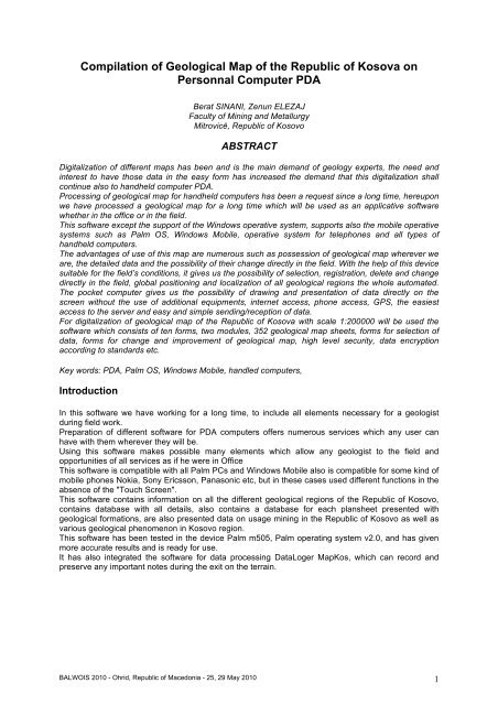
Compilation of Geological Map of the Republic of Kosova ... - Balwois
Compilation of Geological Map of the Republic of Kosova ... - Balwois
Compilation of Geological Map of the Republic of Kosova ... - Balwois

You also want an ePaper? Increase the reach of your titles
YUMPU automatically turns print PDFs into web optimized ePapers that Google loves.
<strong>Compilation</strong> <strong>of</strong> <strong>Geological</strong> <strong>Map</strong> <strong>of</strong> <strong>the</strong> <strong>Republic</strong> <strong>of</strong> <strong>Kosova</strong> on<br />
Personnal Computer PDA<br />
Berat SINANI, Zenun ELEZAJ<br />
Faculty <strong>of</strong> Mining and Metallurgy<br />
Mitrovicë, <strong>Republic</strong> <strong>of</strong> Kosovo<br />
ABSTRACT<br />
Digitalization <strong>of</strong> different maps has been and is <strong>the</strong> main demand <strong>of</strong> geology experts, <strong>the</strong> need and<br />
interest to have those data in <strong>the</strong> easy form has increased <strong>the</strong> demand that this digitalization shall<br />
continue also to handheld computer PDA.<br />
Processing <strong>of</strong> geological map for handheld computers has been a request since a long time, hereupon<br />
we have processed a geological map for a long time which will be used as an applicative s<strong>of</strong>tware<br />
whe<strong>the</strong>r in <strong>the</strong> <strong>of</strong>fice or in <strong>the</strong> field.<br />
This s<strong>of</strong>tware except <strong>the</strong> support <strong>of</strong> <strong>the</strong> Windows operative system, supports also <strong>the</strong> mobile operative<br />
systems such as Palm OS, Windows Mobile, operative system for telephones and all types <strong>of</strong><br />
handheld computers.<br />
The advantages <strong>of</strong> use <strong>of</strong> this map are numerous such as possession <strong>of</strong> geological map wherever we<br />
are, <strong>the</strong> detailed data and <strong>the</strong> possibility <strong>of</strong> <strong>the</strong>ir change directly in <strong>the</strong> field. With <strong>the</strong> help <strong>of</strong> this device<br />
suitable for <strong>the</strong> field’s conditions, it gives us <strong>the</strong> possibility <strong>of</strong> selection, registration, delete and change<br />
directly in <strong>the</strong> field, global positioning and localization <strong>of</strong> all geological regions <strong>the</strong> whole automated.<br />
The pocket computer gives us <strong>the</strong> possibility <strong>of</strong> drawing and presentation <strong>of</strong> data directly on <strong>the</strong><br />
screen without <strong>the</strong> use <strong>of</strong> additional equipments, internet access, phone access, GPS, <strong>the</strong> easiest<br />
access to <strong>the</strong> server and easy and simple sending/reception <strong>of</strong> data.<br />
For digitalization <strong>of</strong> geological map <strong>of</strong> <strong>the</strong> <strong>Republic</strong> <strong>of</strong> <strong>Kosova</strong> with scale 1:200000 will be used <strong>the</strong><br />
s<strong>of</strong>tware which consists <strong>of</strong> ten forms, two modules, 352 geological map sheets, forms for selection <strong>of</strong><br />
data, forms for change and improvement <strong>of</strong> geological map, high level security, data encryption<br />
according to standards etc.<br />
Key words: PDA, Palm OS, Windows Mobile, handled computers,<br />
Introduction<br />
In this s<strong>of</strong>tware we have working for a long time, to include all elements necessary for a geologist<br />
during field work.<br />
Preparation <strong>of</strong> different s<strong>of</strong>tware for PDA computers <strong>of</strong>fers numerous services which any user can<br />
have with <strong>the</strong>m wherever <strong>the</strong>y will be.<br />
Using this s<strong>of</strong>tware makes possible many elements which allow any geologist to <strong>the</strong> field and<br />
opportunities <strong>of</strong> all services as if he were in Office<br />
This s<strong>of</strong>tware is compatible with all Palm PCs and Windows Mobile also is compatible for some kind <strong>of</strong><br />
mobile phones Nokia, Sony Ericsson, Panasonic etc, but in <strong>the</strong>se cases used different functions in <strong>the</strong><br />
absence <strong>of</strong> <strong>the</strong> "Touch Screen".<br />
This s<strong>of</strong>tware contains information on all <strong>the</strong> different geological regions <strong>of</strong> <strong>the</strong> <strong>Republic</strong> <strong>of</strong> Kosovo,<br />
contains database with all details, also contains a database for each plansheet presented with<br />
geological formations, are also presented data on usage mining in <strong>the</strong> <strong>Republic</strong> <strong>of</strong> Kosovo as well as<br />
various geological phenomenon in Kosovo region.<br />
This s<strong>of</strong>tware has been tested in <strong>the</strong> device Palm m505, Palm operating system v2.0, and has given<br />
more accurate results and is ready for use.<br />
It has also integrated <strong>the</strong> s<strong>of</strong>tware for data processing DataLoger <strong>Map</strong>Kos, which can record and<br />
preserve any important notes during <strong>the</strong> exit on <strong>the</strong> terrain.<br />
BALWOIS 2010 - Ohrid, <strong>Republic</strong> <strong>of</strong> Macedonia - 25, 29 May 2010 1
The methodology <strong>of</strong> compilation geological map <strong>of</strong> Kosovo<br />
Designed for such a s<strong>of</strong>tware we have used many s<strong>of</strong>twares for this purpose, for geology and<br />
cartography.<br />
Perhaps we need to use more s<strong>of</strong>tware and data processing to him we thought to create s<strong>of</strong>tware that<br />
will contain all <strong>the</strong>se data into one s<strong>of</strong>tware into one PC into one pocket a s<strong>of</strong>tware which could have<br />
always with you on <strong>the</strong> terrain.<br />
Digitalization <strong>of</strong> data directly is necessary priority and need so we worked for a long time to have a<br />
s<strong>of</strong>tware in <strong>the</strong> field and enable us pocket PCs.<br />
Installing MAPKOS s<strong>of</strong>tware<br />
Installation <strong>of</strong> <strong>Map</strong>Kos for PDA computer needs some basics steeps, and after we will install into our<br />
Desktop Pc we need with special s<strong>of</strong>tware to Install into Palm device or s<strong>of</strong>tware but it is very simple<br />
and it can take few seconds for all this.<br />
Step Picture Description<br />
1 Installation wizard is already to Install,<br />
2 Installation wizard is ready to Install <strong>the</strong>se tools,<br />
3 Determine Installation folder,<br />
4 Name in <strong>the</strong> Start menu,<br />
5 Installation progress bar,<br />
BALWOIS 2010 - Ohrid, <strong>Republic</strong> <strong>of</strong> Macedonia - 25, 29 May 2010 2
6 Installation has been completed successfully,<br />
Work with MAPKOS<br />
After we have installing MAPKOS into PDA we will have <strong>the</strong> s<strong>of</strong>tware installed with this icon as you<br />
see into <strong>the</strong> next picture.<br />
MAPKOS has been installed successfully<br />
Now we can use MAPKOS, by clicking MAPKOS icon into PDA desktop.<br />
After clicking this icon we must wait for few second to display splash screen form which contain <strong>Map</strong> <strong>of</strong><br />
Kosovo and welcome logo.<br />
After initializing values and registry <strong>of</strong> s<strong>of</strong>tware MAPKOS will open main form as you see above.<br />
BALWOIS 2010 - Ohrid, <strong>Republic</strong> <strong>of</strong> Macedonia - 25, 29 May 2010 3
Where are included <strong>the</strong>se options:<br />
- <strong>Geological</strong> <strong>Map</strong> <strong>of</strong> Kosovo<br />
- GPS s<strong>of</strong>tware that gives us GPS coordinates<br />
- Google Earth service,<br />
- Camera that we can use in <strong>the</strong> terrain to capture anything.<br />
We can find everything by inserting X and Y coordinates.<br />
After we will choose one <strong>of</strong> this options we must click button.<br />
<strong>Map</strong> <strong>of</strong> <strong>Republic</strong> <strong>of</strong> Kosovo<br />
After we will choose first option , <strong>the</strong>n MAPKOS will open <strong>the</strong><br />
geological map <strong>of</strong> <strong>Republic</strong> <strong>of</strong> Kosovo, you also can add an additional<br />
elements <strong>of</strong> geology directly in this form by clicking buttons in this form.<br />
After you will click button for adding a point you will have ano<strong>the</strong>r form that<br />
display generally data for this point, you also can capture photo if you have<br />
integrated camera for your PDA computers, you can make photo and in this<br />
photo automatically will explain coordinates at bottom <strong>of</strong> this form.<br />
Now as you see we have one red point that we have saved,<br />
By double clicking we can view all saved details for this point or we can<br />
edit all this saved data until we haven’t sent it into server.<br />
Now we can delete by once click in this point and click button.<br />
BALWOIS 2010 - Ohrid, <strong>Republic</strong> <strong>of</strong> Macedonia - 25, 29 May 2010 4
GPS form<br />
After we have choosen option MAPKOS will open for us form<br />
that contain data directly reading into GPS, this form allow us to read<br />
coordinates <strong>of</strong> GPS if our device support or have integrated <strong>the</strong>se tools.<br />
We also can se in geological map <strong>of</strong> this region by clicking ,<br />
and we will see <strong>the</strong> geological map <strong>of</strong> this Region.<br />
GoogleEarth service<br />
After we have choose option and click OK <strong>the</strong>n MAPKOS<br />
will open web plugins that have integrated Google Earth service, but is<br />
necessary to have internet connection into your PDA computers. If<br />
everything wth internet connection is all right <strong>the</strong>n we will have every<br />
service <strong>of</strong> google earth in our Palm device. This service for you will be<br />
from:<br />
www.x-s<strong>of</strong>tdev.org/palm/web/googleearth.aspx.<br />
After installing this plugins you can view terrain from satellite view<br />
based on quality <strong>of</strong> your PDA graphics supports.<br />
Disadvantages <strong>of</strong> this part are converting coordinates that we need to<br />
do manullay into Google Earth coordinates system. When you want to<br />
search or make a point or everything you must convert from GPS<br />
coordinates to Google Earth coordinates.<br />
If you want you also can save this point in Google Earth coordinates by clicking button , and this<br />
point will be saved into Google Earth, not in your Palm.<br />
Work with camera<br />
Using camera in terrain is necessary tools, for this reason we have integrated ano<strong>the</strong>r tools that<br />
support capture images in terrain. Here also you must have a camera integrated in your PDA. If you<br />
have choosen and haven’t camera you will see <strong>the</strong> image into <strong>the</strong> left or if you have<br />
camera you will see <strong>the</strong> image <strong>of</strong> your terrain.<br />
without camera with camera<br />
BALWOIS 2010 - Ohrid, <strong>Republic</strong> <strong>of</strong> Macedonia - 25, 29 May 2010 5
Connecting to X-S<strong>of</strong>t Server<br />
For sending data, you first must have access into internet, <strong>the</strong> second you<br />
must have server that support PDA extensions.<br />
This option wil be active if you will click button as you see with red circle and<br />
will see Server menu in which we must click, after this will be open Server<br />
form.<br />
If we have many data <strong>the</strong>se will take many minutes based on capacity <strong>of</strong> this<br />
data, if we have capture any image will send in server and it will cost in time<br />
also.<br />
At <strong>the</strong> bottom <strong>of</strong> <strong>the</strong> form we have Progress bar that tell as about data<br />
sending into server, if we want to cancel sending data into server we can<br />
click button in <strong>the</strong> button <strong>of</strong> <strong>the</strong> form.<br />
BALWOIS 2010 - Ohrid, <strong>Republic</strong> <strong>of</strong> Macedonia - 25, 29 May 2010 6
CONCLUSIONS AND RECOMMENDATIONS<br />
This s<strong>of</strong>tware is tested and is ready to work in <strong>the</strong> field, and have all conditions to <strong>the</strong> needs <strong>of</strong> a field<br />
geologist.<br />
It is ready to get points on <strong>the</strong> field, to save points to make files and all data should be sent to <strong>the</strong><br />
server.<br />
These data can be sent in any o<strong>the</strong>r server but that is compatible with <strong>the</strong> PDA extension and be<br />
readable.<br />
The data are provided in a high level <strong>of</strong> confidence and reading or misuse <strong>of</strong> <strong>the</strong>se data is impossible<br />
due to security and present level.<br />
This s<strong>of</strong>tware is available for download from <strong>the</strong> Internet, but that version is only half for 15 days, while<br />
<strong>the</strong> use <strong>of</strong> many tools in <strong>the</strong> halved version is impossible, and is ready to be purchased as full version,<br />
This s<strong>of</strong>tware is ready for PDA computers and mobile phone platforms Nokia, Sonny Ericsson,<br />
Panasonic, etc..<br />
We recommend that during geological studies underway in <strong>the</strong> <strong>Republic</strong> <strong>of</strong> Kosovo, used and tested<br />
even more this s<strong>of</strong>tware which has given positive results and receiving data on <strong>the</strong> server has been<br />
completely wrong.<br />
BALWOIS 2010 - Ohrid, <strong>Republic</strong> <strong>of</strong> Macedonia - 25, 29 May 2010 7
Literature<br />
• Programming Visual Basic for Palm OS, Patrick Burton, Mat<strong>the</strong>w Holmes, Roger Knoell,<br />
O'Reilly, Aprill 2002.<br />
• Visual BASIC 6.0, Avni Rexhepi, Prishtinë 2004,<br />
• Introduction to GPS, The Global Positioning System, Ahmed El-Rabbany,<br />
• GIS for Web Developers, Scott Davis, North Carolina Dallas, Texas, 2007<br />
BALWOIS 2010 - Ohrid, <strong>Republic</strong> <strong>of</strong> Macedonia - 25, 29 May 2010 8