FLAGSHIP D - Iskandar Malaysia
FLAGSHIP D - Iskandar Malaysia
FLAGSHIP D - Iskandar Malaysia

You also want an ePaper? Increase the reach of your titles
YUMPU automatically turns print PDFs into web optimized ePapers that Google loves.
Telecommunications, Water Supply, Gas Supply And Power Supply Facilities<br />
Source: Comprehensive Development Plan (CDP)<br />
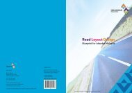
Road Networks<br />
Pasir Gudang is accessible via the Pasir Gudang Highway, also known as the Federal Route, a major<br />
highway in Johor that connects Tampoi Utara in the west to Pasir Gudang, Johor Port and Tanjung Langsat<br />
in the east. The existing four-lane highway will be expanded to a six-lane highway under the 9th <strong>Malaysia</strong><br />
Plan (9MP) in view of continuous traffic growth along the highway daily. Pasir Gudang is also accessible<br />
via local trunk roads.<br />
Road Network System Length Implementation Phase Total Cost<br />
(km) (RM million)<br />
Expressways 98.10 2004 - 2020 1,471.65<br />
New / Upgrading Of Primary Roads 212.00 2004 - 2020 2,317.50<br />
New / Upgraded Of Secondary Roads 113.85 2004 - 2020 983.65<br />
TOTAL 423.95 2004 - 2020 4,772.80<br />
Source: Comprehensive Development Plan (CDP)<br />
The Comprehensive Development Plan (CDP) has proposed a Road Network System of 423.96 km in<br />
<strong>Iskandar</strong> <strong>Malaysia</strong> at an estimated total cost of about RM4.8 billion, of which about RM1.4 billion has<br />
been identified for projects to upgrade roads in Pasir Gudang. The proposed road upgrade in Pasir Gudang<br />
should be completed by 2010, as proposed under the 9th <strong>Malaysia</strong> Plan (9MP).<br />
13<br />
Eastern Gate Development