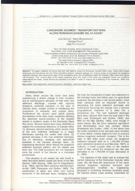
LONGSHORE SEDIMENT RANSPORT PATTERN ... - GeoEcoMar
LONGSHORE SEDIMENT RANSPORT PATTERN ... - GeoEcoMar
LONGSHORE SEDIMENT RANSPORT PATTERN ... - GeoEcoMar

You also want an ePaper? Increase the reach of your titles
YUMPU automatically turns print PDFs into web optimized ePapers that Google loves.
L. Giosan et al. - Longshore Sediment Transport Pattern along Romanian Danube Delta Coast<br />
<strong>LONGSHORE</strong> <strong>SEDIMENT</strong> T<strong>RANSPORT</strong> <strong>PATTERN</strong><br />
ALONG ROMANIAN DANUBE DELTA COAST<br />
Liviu Grosnru', Henry Boxulrtewtczl,<br />
Nicolae PANrN',<br />
lulian PosroLAcHE3<br />
1<br />
New York State University, Marine Geosciences Center,<br />
Stony Brook, USA, E-mail: giosan@sbmsOl.msrc.sunysb.edu<br />
2<br />
National Institute of Marine Geology and Geo-ecology of Romania <strong>GeoEcoMar</strong>,<br />
Dimikie Onciu Street, No.23-25, Bucharest 70318, Romania<br />
Tel/Fax: +4AJ -252.25,94, E-mail: panin-geomar@rolink.iiruc.ro<br />
3<br />
Romanian Marine Research Institute RMRI,<br />
Bd. Mamaia No.304, Constanta 8700, Romania<br />
Tel : +49-41 -643 .288, F ax. +40-41 -831 .27 4', E-mail: rmri@alpha rmri. ro<br />
Abstract. The paper presents the littoral sediment drift patterns along the Romanian Danube Delta coast. Using sand budget<br />
techniques and simulations with the "Shore Modelling System" software package of U.S.Army Corps of Engineers the longshore<br />
sediment transport was computed for each of the six sections taken into consideration within the Danube Delta coast zone (about<br />
140 Km-long). The current state of the beach dynamics along the coast of the Delta are presented herein and predictive<br />
observations are made. Some actions are proposed to be taken in order to improve the monitoring of the Romanian Black Sea<br />
coasl z0ne.<br />
Key words: littoral sediments, sedlment transport, simulation, coast zone, Black Sea<br />
INTRODUCTION<br />
Many deltas around the world have been the river, the entrapment of water and sediments in<br />
experiencing a drastic change in their evolution the drainage basin and deltaic plain for agricultural<br />
due to anthropogenic alteration of both water and purposes, the decrease in the rainfall pattern, have<br />
sediment discharge, coupled with vigorous been variously cited as important factors in<br />
longshore sediment transport. In the case of decreasing the rivers sediment discharge and<br />
Danube delia, coastal erosion is threatening the furthermore favouring the change from a general<br />
ecosystem of wetlands, and coastal lakes. progradational character of a delta into a<br />
Furtherrnore the chronic sand deficit extends recessional one. The river sediment discharge<br />
downstream of the delta coast, negatively affecting have been reduced 95% from the total load in the<br />
the important tourist-economy of the seaside Ebro case (Palanques and Guillen, 1995), and<br />
resorts in southern sector of the Romanian Black 98% for the Nile (Sestini, 1992), even though in<br />
Sea shore. Several factors have been identified to some places, like the Ebro extensive agriculture<br />
explain the recessional behaviour of Danube delta: and deforestation have had contrary effects<br />
(1) alternate channel switching which diverts most (Palanques and Guillen, 1995). At the same time<br />
of the river sediment discharge to a single the acute orientation to the principal wave direction<br />
distributary starving the earlier built lobes; (2) of some deltaic coastal segments tend to produce<br />
general decrease in the river sediment discharge intense longshore sediment transport. This is the<br />
due to damming, dredging and agricultural case of Nile delta coast where net longshore<br />
practices in the Danube drainage basin; (3) sediment transport rates up to 1,200,000 m'/year<br />
engineering structures which disrupt the longshore were estimated (Quelennic and Manohar, 1997), or<br />
sediment transport pattern; and (4) relative sea Volturno, a small cuspate delta on the western<br />
level rise. The tidal processes are not important coast of ltaly, where the maximum net rate was<br />
since the mouth of the Danube is a microtidal estimated to be 1,760,000 mt/year (Benassai et<br />
environment.<br />
al., 1995).<br />
This situation is not unique but also found in The objective of this study was to analyse the<br />
other microtidal deltaic coasts like those of the Nile current behaviour of the Romanian Danube delta<br />
(Sestini, 1992; Stanley, 1996), the Po (Capobianco coast. We will show the importance of the wave<br />
et al., 1995), and the Ebro (Jimenez and Sanchez- induced longshore sediment transport and<br />
Arcilla, 1993; Palanques and Guillen, 1995). The anthropogenically modified by engineering<br />
construction of dams and other river control structures in controlling shoreline dynamics along<br />
structures in the drainage basin, dredging along the Danube deltaic coast partially inaciivated by<br />
G EO-EC O-MARIN A, 2/1 997<br />
National lnstitute of Marine Geology and Geo-ecology of Romania<br />
Proc. lntern- Workshop on 'Fluvial-Marine<br />
lnteractions" in Malnas, Romania, Oct.1-7, 1996
L_ G i y:zl:!:!:j:tg:!",."- -2<br />
ediment Transport Pattem along Romanian Danube Delta Coast<br />
alternate channel switching. The energetic wave with the Black Sea. Reworked deltaic sands along<br />
regime in the caused by the preponderance of the shore have built a coastal barrier complex from<br />
local waves due to relatively short fetches, by the SfAntu Gheorghe to Midia. The barrier complex<br />
high angle of wave attack, and by the ineffective consists mainly of a baymouth barrier which<br />
refraction on a relatively steep nearshore.<br />
separates the large lagoon complex of Razim-<br />
STUDY AREA<br />
Geological Setting<br />
Sinoe, once open (Panin, 1983), from the sea. The<br />
shelf is broadest in the front of Danube delta and<br />
narrows to the south. The nearshore gradients to a<br />
The Romanian Black Sea coast (Fig.1) 12-15 m depth along the Danube delta coast,<br />
stretches over 245 km from the Chilia distributary<br />
of the Danube (45"12' N, 29"40' E) at the<br />
Romanian-Ukraine border to the town of Vama<br />
Veche (43"44' N, 28'35' E) at the border with<br />
range between 0.003 and 0.01, with the steepest<br />
slopes along the Sakhalin barrier island (Panin,<br />
1985). The beach profile is generally multibarred<br />
(Postolache et al., 1992).<br />
Bulgaria. The Romanian coast can be divided<br />
using geographic and geomorphic criteria into a<br />
northern unit and a southern unit (Panin et al.,<br />
'1979-1994).<br />
The northern unit is the low-relief<br />
Danube delta coastal zone while the southern unit<br />
The modern sediments on the nofthern sector<br />
of the coast consist of Danube-borne quartz sands<br />
(about 70% silica, Panin, 1989). The heavy mineral<br />
content is about 3%. Sands carried by the littoral<br />
drift from the region north of Danube delta have<br />
is characterised by eroding cliffs and loess,<br />
protected in places by narrow beaches (Charlier<br />
higher silica content than the Danubian sediments<br />
(90%). The subaerial beach sediments are<br />
and de Julio, 1985; Panin, 1979-1994).<br />
generally medium-fine sands (d50
1g<br />
,m<br />
]X<br />
lh<br />
nte<br />
il A<br />
;t,<br />
st<br />
n,<br />
)d<br />
cr<br />
IS<br />
al<br />
al<br />
/e<br />
ts<br />
'p<br />
)<br />
)-<br />
n<br />
d<br />
IS<br />
v c<br />
)f<br />
Ir<br />
rl<br />
tl<br />
r<br />
n<br />
L- Giosan et al. - Longshore Sediment Transport Paftern along Romanian Danube Delta Coast<br />
Driga, 1986). The Danube delta subsides with 1.3- sediment discharge decreased in the last century<br />
2 mmlyear, due to the compaction of deltaic mainly due to damming, the water discharge<br />
sediments and regional tectonics. The tide of the increased. Also the 25-30o/o sediment discharge<br />
Black Sea along the Romanian coast is reduction after Danube damming was not as<br />
semidiurnal, with a range of 7 lo 12 cm. lt has an extreme as in the case of the Nile (98%; Sestini,<br />
unnoticeable effect when compared with other 1992) or Ebro (95%; Jimenez and Sanchez-Arcilla,<br />
deformational fluctuations, such as seiches or 1993), but added to the previous regressive trend,<br />
storm surges which can reach a maximum of 2 m it amounts to 5E% of the total load. The increase in<br />
height, and 1 .2 to 1,5 m respectively (Bondar, water discharge can be attributed to climatic<br />
1972; Panin et al., 1979-1994). Other important changes, and partly after damming to marsh<br />
mean sea level fluctuations with multiannual and reduction. The lron Gates dams (lron Gates I and<br />
seasonal cyclicity are due to river discharge, lron Gates Il) were closed in 1970's in the upper<br />
changes in the water exchange through the sector of Danube lower course. Major rivers<br />
Bosphorus straight, and precipitation/evaporation draining the Carpathian and Balkan mountains are<br />
variations.<br />
dammed, and discharge is therefore insignificant.<br />
River Discharge<br />
The relatively small reduction in the sediment<br />
discharge after damming, was due to increased<br />
The most significant factor affecting the erosion of the river bottom and islets in the lower<br />
hydrologic budget of the Black Sea is the seasonal<br />
course of the river (Panin, 1979-1994; Mihailescu,<br />
variation of river discharge. The Danube provides<br />
1983), and to meander cut-offs in 1990's, along the<br />
38% of the river water entering the Black Sea distributaries in delta area (Panin, 1979-1994).<br />
(Glaskow, 1970). Other important rivers in terms of<br />
their water discharge are Dniepr, Southern Bug, Wind And Wave Regime<br />
and Dniestr. Danube's annual discharge is highest The average wind speed in the northwestem<br />
from April to July. ln response to the variation in Black Sea is between 6.5 and 5 m/s (Bulgakov et<br />
river discharge, the sea level fluctuates between al., 1992). The predominant wind directions during<br />
20 and 30 cm from season to season and about 20 the year, as they were measured at meteorological<br />
cm from year to year (Bondar, 1972). Between stations on the coast, are from the north, west and<br />
1858 and 1988 the Danube discharged annually south (Ciulache, 1993). The prevalent direction for<br />
about 191 km3 of water, of which 63% was the onshore blowing winds is from Northeast.<br />
discharged through the Chilia distributary, 17% During the summer months, however, the<br />
through the Sulina distributary and 20% through predominant direction is onshore from the souththe<br />
SfAntu Gheorghe distributary (Bondar et al., Southeast (Diaconu et al., undated, as cited by<br />
1992). The Danube water discharge increased Panin et al., 1979-1994). Because the Romanian<br />
from 178 km'in 1858 to 203 km'in 1988. The sector is relatively short, the wind regime does not<br />
mean total sediment discharge of the Danube was vary significantly along the coast especially for the<br />
about 52x106 metric tons per year between 1858 onshore winds (Ciulache, 1993). Storms are<br />
and 1966 (Bondar et al., 1992). The sediment prevalent from the north and Northeast, with an<br />
discharge in 1858 was 65x10o metric tons, but only average wind speed of 9.8 m/s and a duration<br />
38x10" metric tons in 1988 (Bondar et al., 1992). ranging between I to 22 hours (Diaconu et al.,<br />
This discharge was distributed 55% to the Chilia, undated, as cited by Panin et al, 1979-1994).<br />
214/o to the Sulina and 23% to the SfAntu Waves higher than 0.2 m occur about 50olo of<br />
Gheorghe arm. About 25-30% reduction of the the year; 60-85% of them are local wind waves,<br />
total sediment discharge has been recorded after and 15-40o/o swells (Bondar, 1972). The wave<br />
1970 when the first lron Gates dam was closed in regime was analysed for this study based on wave<br />
the Romanian-Yugoslavian sector of Danube observation made over a 1O-year period between<br />
(Panin et al., 1979-1994; Popa, 1992). The bed- 1972 and 1981 at a depth of 11m, offshore the<br />
load sediment discharge, that has a median grain southern town of Constantza (see "Methods"). We<br />
size between 0.1-0.5 mm, has been estimated to found that waves higher than 0.2 m (the lower limit<br />
be between 4.5o/o and 19o/o of the total sediment of the wave height that was measurable using the<br />
discharge. Today, ^the Chilia distributaryavailable<br />
instrumentation) arrived at the coast from<br />
discharges about 3x10o metric tons/year bed-load all offshore directions about 51% of the year<br />
sediments (between 57o/o afid 65% of Danube's (Fig.2). The annual average signiflcant wave<br />
total bed-load discharge), Sulina about 0.85- height was 0.8 m, with a mean period of 5 seconds<br />
1.3x10⁶ metric tons/yeir' (between 18.5% and (Fig.3). Most waves anived from the NE-SE<br />
24.5o/o of the total dischgrge), and Sfdntu quadrant, the predominant direction (about 3oo/o ot<br />
Gheorghe about 0.75-1x10" metric tons/year total waves) and energy flux being from E. The<br />
(between 19% and 20.5o/o of the total discharge; waves arriving from NE-ENE sectors occurred<br />
Bondar, 1972; Bondar and Harabagiu, 1992). lt more frequently and their mean energy flux was<br />
can be noticed from above data that while Danube<br />
GEO.ECO- MARINA, 2/1 997<br />
National lnstitute of Marine Geology and Geo-ecology of Romania<br />
Proc. lntern. Workshop on'Fluvial-Marine lnteractions" in Malnas, Romania, Oct.1-7, 1996<br />
13
L. Giosan et al. - Longshore Sedirnent Transport Pattern along Romanian Danube Delta Coast<br />
higher than those from ESE-SE sectors.<br />
Nearshore wave climate is controlled by the beach<br />
slope, thus implicitly by the shelf width which<br />
narrows southward to Sf6ntu Gheorghe mouth,<br />
and widens farther south (see Fig.7). The<br />
strongest wave activity is expected along Sakhalin<br />
island, due lo poor refraction and wave shoaling on<br />
thesteep<br />
be<br />
z<br />
p<br />
U<br />
a<br />
zp<br />
U z<br />
()<br />
e<br />
U<br />
-<br />
tr<br />
N NNE Ntr DNE E DSE SD SSD S<br />
1VAVE DIRECTION<br />
Fig.Z Frequency of occurrence of wave height as a function<br />
of their direction of approach to the coast.<br />
350h<br />
3001,<br />
25Ya<br />
20'<br />
l50h<br />
l0'A<br />
50<br />
aoh<br />
23456189<br />
PERIOD (seconds)<br />
Fig,3 Frequency of occurrence of wave period<br />
Engineering Works<br />
beach situated just south of the jetties was<br />
nourished with sand extracted from Sulina harbour,<br />
and two groins were also built.<br />
A revetment was recently built along the<br />
southern barrier beaches between Peritesca and<br />
Chituc (Postolache et al., 1995). In order to<br />
mitigate the beach erosion on these beaches,<br />
some Romanian hydrotechnical engineers have<br />
proposed to deviate part of the SfAntu Gheorghe<br />
distributary water and sediment load farther south,<br />
through a channel discharging between Ciotica<br />
and Perisor (Hangu et al., 1992). Midia harbour is<br />
protected by jetties extending about 5 km offshore;<br />
these jetties restrict the amount of sand carried<br />
southward by the longshore drift by redirecting it<br />
offshore (Fig.1).<br />
Shoreline Dynamics<br />
The northern part of delta coast which includes<br />
Chilia delta and Musura Bay beaches, most of it on<br />
the Ukrainian territory, has been intensely<br />
prograding in the last centuries (Panin, 1985;<br />
Mikhailova, 1995), ,After the Sulina jetties were<br />
built at the beginning of the century, the deltaic<br />
coast farlher was partly isolated from the sediment<br />
drift coming from northern Chilia coast. This<br />
isolation increased in time with the jetties<br />
extension. The jetties can be considered now as<br />
impermeable to the sediment drift.<br />
Beach profiles were measured on a network of<br />
benchmarks along the delta coast south of Sulina,<br />
including one landmark on Sakhalin lsland. Based<br />
on these, shoreline changes were analysed by<br />
Bondar et al., (1983) for the period between 1962<br />
and 1978, and by Vespremeanu and Stefanescu<br />
(1988; Fig.4, 5) forthe period between 1962 and<br />
Two jetties started to be built at the Sulina<br />
mouth (Fig.1) in 1856 and now extend as far as 8<br />
km offshore. These jetties were built to protect<br />
6l<br />
?E<br />
Sulina navigation channel against shoaling with<br />
sediments drifting from the nodh. The Sulina jetties<br />
strongly affect the evolution of the beaches farther<br />
a<br />
0510<br />
Snlin! IloxlI<br />
r5 20 25 30 35 40 45<br />
SLCbcotghc Mo!(h Srttrlir lillnd<br />
50<br />
south, by discharging the distributary sediment<br />
load offshore, as well as intercepting the longshore<br />
drift of sand from the north (Sp5taru, 1990; Panin<br />
et al., 1579-1994). During the second half of the<br />
19'ncentury, channels were cut to shorten the<br />
navigation route on Sulina distributary. When this<br />
was done, the southern arm of SfAntu Gheorghe<br />
f ost about 3Oo of its water discharge and<br />
consequently its sediment transport capacity in<br />
favour of the shortened arm of Sulina, (Sp5taru,<br />
F:or<br />
; ro'l<br />
3 0-lu-rol<br />
3<br />
,'<br />
1990). Sulina bed-load accumulates at the end of<br />
the jetties as a mouth bar, which is periodically<br />
dredged. The dredged sediments are discharged<br />
offshore, and thus are lost from the nearshore<br />
transport system (Panin et al., 1979-1994). Sulina<br />
-20 Fig.4 Shoreline change rates (1962 to 1987) from Sulina to<br />
Sf6ntu Gheorghe (from Vespremeanu and Stefdnescu, 1978)<br />
and for Sacalin lsland (1 962 to 1993; compiled from Breier and<br />
Teodor, 1979 and Panin et al.,1979-1994\.<br />
-l<br />
a*<br />
-:0 r--<br />
H304 50<br />
ciollc!<br />
60 70 80<br />
Prrisor<br />
90 I 00 110 120 r30<br />
rorlirn Midia<br />
ALONGSgORE DISTANCD (kB)<br />
Fig,S Shoreline change rates between 1962 and 1987 for the<br />
deltaic coast situated south of Sacalin lsland (data from<br />
Vespremeanu and Stefdnescu, 1 978).<br />
14 G EA.ECO.M AR INA, 2J1 9 97<br />
National lnstitute of Marine Geology and Geo-ecology of Romania<br />
Proc. lntern. Workshop on'Fluvial-Marine lnteractions" in Malnas, Romania, QcL1-7, 1996<br />
d^
as<br />
Jr,<br />
lre<br />
rd<br />
to<br />
rq<br />
,IF<br />
1e<br />
h,<br />
la<br />
is<br />
,A'<br />
:d<br />
it<br />
)s<br />
)n<br />
ly<br />
q.<br />
re<br />
ic<br />
nt<br />
is<br />
)S<br />
ls<br />
cf<br />
d,<br />
rd<br />
)y<br />
i2<br />
;tI<br />
to<br />
3)<br />
rd<br />
L. Giosan et al. - Longshore Sediment Transport Pattem along Romanian Danube Delta Coast<br />
1987. The actual shoreline Dositions were not Gheorghe. Under the influence of mainly<br />
published but only the calculated end-point southward sediment drift the mouth bar sands are<br />
shoreline change rates. Panin et al. (1979-1994) supposedly transfened south during storms<br />
collected annual beach profile measurements after causing a continuing increase in length of Sakhalin<br />
1978 within the framework of the Romanian Marine island (Panin et al., 1979-1994). At the same time,<br />
Geology and Geoecology institute s "Danube-Black as observed from successive maps and aerial<br />
Sea System Monitoring Program". GAstescu<br />
(1979, 1986) published shoreline change analyses<br />
photos, Sakhalin island shore is retreating, more<br />
intensely in its central and southern parts (Panin et<br />
for most of the Danube delta coast based on map al., 1979-1994). The northern half has already<br />
comparisons.<br />
been connected to the mainland marshes in 1975<br />
The shoreline is retreating over almost the due to both island retreat and SfAntu Gheorghe<br />
entire Danube defta coast situated south of Sulina secondary delta intensive progradation,<br />
mouth (Fig.4, 5). The maximum retreat rate for the transforming the island in a spit. Due to its low<br />
Sulina-Sfdntu Gheorghe sector is over 2A mlyr., relief (0.5-1.5 m), the retreat of the island is<br />
which is found at the latitude of Rosulet lake, about apparently controlled by ovenrvash and breaching<br />
15 km south of Sulina jetties. Almazov et al. (1963) processes as suggested by the numerous<br />
suggested that the highest retreat is due to the successive breaches which appeared over the<br />
divergent of the longshore sediment drift in this years following major storms (Panin et al., 1979zone<br />
which may be caused by an anticyclonal 1994). The breaches were generally rapidly closed<br />
eddy attached to the south lee side of the Sulina as the wind-induced, and secondarily tidal flows,<br />
jetties, generated by a quasipermanent coastal between the lagoon and the sea are not strong<br />
current directed southward. The existence of this enough to keep them open. The southern tip ofthe<br />
divergence zone is also recognised in other island recurves into the lagoon due to wave<br />
sediment drift studies based on radioactive or refraction pattern typical for this type of areas and<br />
fluorescent tracers (Dragota, 1973; Bondar and also because the low relief beach at the tip evolves<br />
Craciun, 1970), salinity distribution (Bondar, 1964), in an ovennrash mode (as conceptually described<br />
and physical modelling (Sp6taru, 1971). However in Kana, 1996). The analysis of island evolution for<br />
the divergence zone may be explained by the 1858-1968 period (Bondar et al., 1983) shows<br />
sheltering and diffraction of the waves coming from that the island platform built intensively in offshore<br />
the Northeast sector. Shoreline recession rates direction between 1850 and 1923. This process<br />
over 10 m/year were also registered along the ceased practically afteruards leaving the profile<br />
Sakhalin barrier island, and south of Ciotica and unaltered below 10 m depth until 1968. Above this<br />
between Portita and Chituc on the southern barrier depth the bathymetric contours show a retreat for<br />
beaches. The shoreline advances immediately the same period. Consequently the beach profile io<br />
south of Sulina jetties where it is accompanied by 10-12 m depth has flattened while the island<br />
intense shoaling of the submerged profile (Bondar retreated. Also bathymetric charts comparisons<br />
and Harabagiu, 1992). The shoreline advances show that the island platform has been building in<br />
behind Sakhalin island where Sfdntu Gheorghe the axial (longshore) direction (Jianu and Selariu,<br />
secondary delta is actively prograding, and slowly 1970). This process extends to a depth of about 12<br />
at Perigor, south of the Ciotica retreating zone, m and it was uninterrupted though cyclical,<br />
where the shore orientation changes from between 1858 and 1968 (Bondar et al., 1983). In<br />
approximately E-W to a NE-SW direction. summary, the island platform building in axial and<br />
Shoreline advance was registered on the southern possibly offshore direction, and also ovenrvash and<br />
Chituc spit due the sediment transport obstruction breaching are the processes that extract<br />
exerted by Midia harbour jetties. The submarine sediments from the Sakhalin nearshore system.<br />
slope also shoals on the sides of Midia structures Using the maps of Breier and Teodor (1979) and<br />
(Panin et al., 1979-1994).<br />
Panin et al. (1979-1994; Fig.6), the island<br />
shoreline changes for the 1962-1993 period were<br />
computed for this study (Fig.4).<br />
Nearshore Processes along Sakhalin<br />
Barrier<br />
Bratescu (1922), Panin et al. (1979-1994),<br />
Breier and Teodor (1979), Vespremeanu (1983),<br />
and Bondar et al, (1984) analysed Sakhalin lsland<br />
genesis and evolution. Sakhalin lsland (Fig.1)<br />
formed in 1897, from a bar developed south of the<br />
Sf6ntu Gheorghe mouth (Bratescu, 1922).<br />
Sediment discharged by SfAntu Gheorghe<br />
distributary, and also drifted from north,<br />
accumulate as a bar at the mouth of SfAntu<br />
Longshore Sediment Transport<br />
There are several direct indicators of the<br />
longshore sediment transport direction and<br />
magnitude including sand accumulation on<br />
opposite sides of engineering structures such as<br />
jetties and groins, and the longshore groMh of<br />
spits and barrier islands, methods which were<br />
previously applied on the Danube delta coast.<br />
These previous studies indicated that the<br />
magnitude of the net longshore transport is<br />
GEO.ECO-MARINA, U1997<br />
National lnstitute of Marine Geology and Geo-eaology of Romania<br />
Proc- lntern. Workshop on'Fluvial-Marine lnteractions" in Malnas, Romania, Oct.1-7, 1996<br />
15
L. Giosan et al. - Longshore Sediment Transport Pattem along Romanian Danube Delta Coast<br />
direction is also a direct indicator of the net<br />
longshore transport rate. By using previously<br />
estimated shoaling rates to 9 m depth (Bondar et<br />
al., 1983), the transport is directed southward at a<br />
rate of about 1,080,000 m'/year. Farther south<br />
along Chituc spit, Bondar et al. (1980) estimated<br />
the longshore transport by using synoptic wind<br />
data. The drift was directed southward at a rate of<br />
about 900,000-1,110,000 m3lyear down to the 9 m<br />
isobath.<br />
METHODS<br />
Sediment Budget<br />
A sand budget was used to estimate of the<br />
longshore sediment transport pattern. The active<br />
beach, the longshore transport, and the river<br />
sediment input were assumed to be the only<br />
sources or sinks for sediments for the entire study<br />
area. The above assumptions, however, would not<br />
be valid along barrier beach of Sakhalin the island,<br />
since the cross-shore sedimentation by ovenirrash<br />
and breaching (Panin et al., 1979-1994), and<br />
possibly offshore loss (Bondar et al., 1984; Jianu<br />
and Selariu, 1970) are likely to be important. The<br />
calculations therefore were not done for Sakhalin<br />
island but special consideration was given to the<br />
budget here.<br />
Fig.6 Consecutive posiiions of Sacalin barrier island<br />
(compiled from Breier and Teodor; 1979, Gdstescu, 1979; and<br />
The remaining study area was divided into two<br />
coastal cells based on the changes of the<br />
longshore transport direction and on Danube<br />
Panin et al., 1994).<br />
distributaries sediment discharge. The northern<br />
extremely high. From north to south, the sediment<br />
drift is directed southward along Chilia lobe, shows<br />
a reversal south of Sulina jetties, and continues<br />
cell was taken between Sulina mouth and SfAntu<br />
Gheorghe mouth. The Sulina mouth jetties were<br />
considered to be impermeable to sediment<br />
southward to Midia afterwards. Shuisky (1984) transport because they extend almost to the<br />
estimated the net sediment transport along Chilia estimated depth of closure. Thus the northern<br />
delta to be between 120,000 m'/year and 850,000 lateral boundary for this cell was considered<br />
mt/year, depending on the local orientation of the closed, while the southern one was left open. lt is<br />
coast. The southward drift along Chilia can be reasonable to assume that the Sf6ntu Gheorghe<br />
estimated from the shoaling rates on northern side<br />
of Sulina jetties. Bondar and Harabagiu (1992)<br />
proposed a^ value between 1 ,100,000 and<br />
1,900,000 m'/year for the shoaling rate but the<br />
perimeter for which it was calculated is not clearly<br />
distributary sediment discharge is largely directed<br />
to the south, in such a way there was no significant<br />
contribution from this source to the northern<br />
Sulina-Sfdntu Gheorghe cell. The southem cell<br />
was between Ciotica, situated on the deltaic<br />
specified. Thg shoaling rate of 500,000 m3/year to mainland shore, and Midia. The southern lateral<br />
1,300,000 m'/year (Bondar and Harabagiu, 1992)<br />
on the southern side of the jetties is a direct<br />
boundary was assumed to be closed because the<br />
jetties protecting Midia harbour disrupt the<br />
estimate of the net longshore transport in the longshore sediment transport by redirecting it<br />
reversal zone south of Sulina. The natural shoaling<br />
in this area was clearly overestimated since an<br />
offshore. The northern boundary of this cell was<br />
left open. Net longshore transport patterns for each<br />
unknown but substantial amount of sand retrieved cell were derived from the calculated volume<br />
from Sulina harbour was discharged on the beach changes by integrating them starting at the closed<br />
in 1980s. South of the reversal zone to SfAntu boundaries.<br />
Gheorghe,^the longshore drift was estimated to<br />
700,000 m'/year (Panin et al., 1979-1994) from the<br />
beach sand deficit. Shuisky (1985) suggested a<br />
net longshore sediment transport of 800,000-<br />
900,000 m'/year along the same sector. The<br />
Sakhalin barrier island platform building in the axial<br />
The active beach volume changes were<br />
calculated based on shoreline change rates for the<br />
period between 1962 and 1987 (Vespremeanu and<br />
Stefanescu, 1988; Fig.2 and Fig.3). Because these<br />
data do not extend as farther south as Midia<br />
harbour, the shoreline progradation rate was<br />
GEO.ECO.MARINA, A1997<br />
National lnstitute of Marine Geolagy and Geo-ecology of Romania<br />
Proc. lntern. Workshop on 'Fluvial-Marine<br />
lnteractions" in Malnas, Romania, Oct.1-7, 1996
net<br />
tsly<br />
ret<br />
ila<br />
ruth<br />
fted<br />
'ind<br />
)of<br />
)m<br />
the<br />
tive<br />
iver<br />
rnly<br />
udy<br />
not<br />
nd,<br />
ash<br />
lnd<br />
anu<br />
fhe<br />
alin<br />
the<br />
two<br />
the<br />
:be<br />
ern<br />
ntu<br />
ere<br />
ent<br />
the<br />
em<br />
red<br />
tis<br />
)he<br />
ted<br />
ant<br />
ern<br />
3ell<br />
aic<br />
rral<br />
the<br />
the<br />
it<br />
vas<br />
lch<br />
me<br />
;ed<br />
9Ie<br />
the<br />
rnd<br />
)se<br />
dia<br />
/as<br />
L. Giosan et al. - Longshore Sediment Transport Pattern along Romanian Danube Delta Coast<br />
considered to be constant southward of the last for the other advancing shoreline sectors (Perisor,<br />
measurement point and have the same value as and Chituc). Longshore net sand transport pattern<br />
measured at that last transect. Although the was derived from volume changes for the depths<br />
measurement station used for collecting the of closure of 6, 9, and 12 m. The result for the 6<br />
shoreline change data were widely spaced along and 12 m depth were used to estimate the<br />
the coast they were considered to represent well<br />
the actual shoreline behaviour being very similar to<br />
the estimates presented by others (Gdstescu,<br />
magnitude range of the net transport. However, the<br />
most plausible estimates were considered to be for<br />
the average depth of closure of g m, and they will<br />
1986 and 1993; IUCN,1992: Spdtaru, 1992). The be used in further discussions.<br />
shoreline change rates were corrected for sea Potential Longshore Sediment Transport<br />
level changes by applying Bruun's rule (lnman and Rate<br />
Dolan, 1989), assuming a 3 mm/year sea-level rise<br />
for the active deltaic shore (i.e. Sulina-Sf6ntu Wave characteristics have been recorded at<br />
Gheorghe cell) and a 1.2 mmlyear sea-level rise Constantza, in the southern part of the Romanian<br />
for the Ciotica-Midia cell. An average berm height Black Sea coast, since 1964 by the Romanian<br />
of 0.5 m was used for the entire coast as the<br />
Marine Sciences Research Institute. Significant<br />
landward boundary. Because suitable submerged wave height, mean period, and mean direction at<br />
beach profile measurement series were<br />
6-hour interval over a 1O-year period between<br />
unavailable for the Romanian coast, an average<br />
1972 and 1981 were used in the current study<br />
depth of closure of 9 m was estimated<br />
(Fig.2,<br />
using<br />
3). The measurements involved visual<br />
Halermeier's method (1981 a, b) based on the observations of a buoy fixed at a water depth of 11<br />
available wave data. The annual values for the m. The measured characteristics include mean<br />
estimated depth of closure, between 1972 and wave height, period, and direction three times daily<br />
1981, ranged between 6 and 12 m. Previous during the daylight. The wave direction tp<br />
studies of the long-term submerge profile evolution<br />
estimated visually, with an accuracy of about 20".<br />
suggest a closure depth between 10 and 12 m<br />
Gaps in the record due to periods of poor visibility<br />
(Jianu and Selariu, 1970, Bondar et al., 1984).<br />
were filled with statistically significant values<br />
(Kraus and Harikai, 1983). Wave data were sparse<br />
Volume changes were calculated using a hybrid for other sectors of the coast. Because the wind<br />
model as appropriate, either under assumption that regime does not vary significantly along the<br />
an equilibrium long term beach profile is conserved relatively short coast, the wave climate at<br />
("one-line" model; Pelnard-Considere, 1956; Constantza was assumed to represent that alone<br />
Hanson and Kraus, 1989), orthatthe beach profile<br />
for the entire coast.<br />
general shape is non-conservative during shoreline<br />
retreat. During delta formation phase, both the The bathymetry was obtained by digitising<br />
shoreline and the subaqueous delta advance at 1:50,000 scale maps published by the Romanian<br />
the same rate, while in the reduction process, the<br />
Navy Hydrographic Service, based on their 1979<br />
delta shoreline is retreating more rapidly than the<br />
survey. Then the observed waves were backward<br />
subaqueous delta (Refaat and Tsuchiya, 1991).<br />
refracted on the real bathymetry around the point<br />
This latter behaviour is due to the higher erosion<br />
were they were measured using iteratively a wave<br />
rates in the surf zone compared to farther offshore transformation program provided by U.S. Army<br />
following a decrease in the river sediment Corps of Engineers (RCPWAVE; Cialone et al.,<br />
discharge, which must occur to maintain the<br />
1992), in an attempt to transform the wave data for<br />
potential longshore sediment transport rate. Thus deepwater conditions (-30 m). However, because<br />
an equilibrium beach profile is not conserved<br />
the angle of approach is poorly resolved in the<br />
during the delta reduction process, since the profile original figures, the transformed data were not<br />
slope becomes more gradual. Jimenez and significantly different.<br />
Sanchez-Arcilla (1993) confirmed the above The potential longshore sedi.r-.nent transport was<br />
experimental results in the case of Ebro delta. The estimated using a nearshore sediment transport<br />
"one line" model seems appropriate to describe the model based on the wave energy flux (NSTRAN;<br />
beach volume changes on a delta coast in the U-S. Army Corps of Engineers, 1984; lnman and<br />
formation phase only. When a deltaic shoreline is Dolan, 1989). The constant k, which describes the<br />
retreating, as is the case of the Danube delta coast efficiency of longshore component of wave energy<br />
under study, it is more appropriate to compute the flux in transporting sediments, was considered an<br />
beach volume changes using a wedge-shaped adjustable parameter. A value of k=0.256,<br />
erosional prism. However the accreting sector of calibrated using the sand budget computations to a<br />
the shoreline south of Sulina jetties seems to depth of 9 m, was used. Both NSTRAN and<br />
conserve an equilibrium during its advance RCPWAVE are component programs of the<br />
(G6stescu, 1993). Therefore it was reasonable to "Shoreline Modelling System" (SMS) standardised<br />
use the "one-line" model tor this sector, as well as software ccllection crealed by the U.S.Army Corps<br />
GEO-ECO-MARINA, A1997<br />
National Institute of Marine Geology and Geo-ecology of Romania<br />
Proc. lntern. Workshop on'FluviaLMarine lnteractions" in Malnas, Romania, Oct.1-7, 1996<br />
17
L. Giosan et al. - Longshore Sediment Transport Pattem along Romanian Danube Delta Coast<br />
of Engineers (Hanson and Kraus, 1989), The 140<br />
km-long area extending from Sulina to Midia was<br />
divided in six sectors according to the shoreline<br />
mean orientation (Fig.7) and the potential net<br />
sediment transport was computed for each of<br />
them. The resulting patterns were compared to the<br />
transport rates computed from the sand budget.<br />
RESULTS<br />
The general pattern of the net longshore<br />
transport provided by the sediment budget<br />
compared favourably to that calculated by wave<br />
energy flux method (Fig.8, 9). The net longshore<br />
sediment transport along the entire studied coast is<br />
high on average, mainly as a result of both the<br />
prevailing E-NE waves superimposed on NNE-<br />
SSE general orientation of the coast.<br />
Sulina-Sfdntu Gheorghe<br />
farther south because of an increase in the<br />
submerged beach slope (Fig.7) and the sheltering<br />
effect of Sulina jetties.<br />
From Sulina to SfAntu Gheorghe, the resulting<br />
net sediment transport scheme was basically<br />
made up of two cells (Fig.8, 10): a sector of<br />
northward directed transport situated immediately<br />
south of the Sulina jetties with an average rate of<br />
190,000 m"/year (ranging between 130,000<br />
m"/year at 6 m depth, and 250,000 m'/year at 12<br />
m depth) and a longer sector of southward<br />
Fig.7 Bathymetry of the study area, and the average<br />
orientation of different coast sectors used in computing the<br />
potential longshore sediment transport.<br />
transport farther south to SfAntu Gheorghe which<br />
had an average rate of 620,p00 m'/year (with a<br />
rafige between 415,000 m'/year and 830,000<br />
4-t<br />
-/--'---.<br />
m"/year). The magnitude of the transport in the<br />
northern cell does not explain the shoaling rate of<br />
at least 500,000 m'/year south of Sulina jetties<br />
(Bondar et al., 1992). Presumably the artificial<br />
nourishment of the beach with an unknown<br />
c-,<br />
quantity of sand, is the main factor affecting the<br />
budget there. The potential transport calculation<br />
also showed a two-cell pattern, but for the northern<br />
cell both the length and the net transport were less<br />
than those obtained from the sand budget. The<br />
two-cell pattern is the result of the sheltering of<br />
waves coming from the NE quadrant, and<br />
diffraction around the jetties. The poor quality of<br />
wave data, poor performance of the wave<br />
refraction model adjacent to jetties, the corrupted<br />
sand budget, and probably the existence of an<br />
attached anticyclonic eddy in this shadow zone<br />
(Almazov et al., 1963), all concur in creating the<br />
difference between patterns. Other investigators<br />
have found that closed attached eddies may from<br />
in the lee of capes, jetties, or other topographic<br />
indentations of the coast, with consequent<br />
modifications to local distributions of sediment<br />
deposition (Ferentinos and Collins, 1980; Davies et<br />
al., 1995). In the southern cell, the net transport<br />
increased from zero at the nodal point, up to<br />
800,000 mt/year at CAsla VSdanei, remaining fairly<br />
constant up to the cell end, at Sf6ntu Gheorghe<br />
(Fig.8). The sediment transport rate north of C6sla<br />
VSdanei is lower relative to the rate of transport<br />
a<br />
05<br />
Suhrfl<br />
MDurh<br />
r0<br />
l<br />
*;-l;,-<br />
15 20 2s<br />
AIONGSHOnE DISTANCE {km)<br />
40 45<br />
Sncdin hled<br />
50<br />
Fig.8 Patterns of net longshore transport (circles) and<br />
potential transport (line) between Sulina and the southern tip of<br />
Sacalin lsland.<br />
t<<br />
ai^ |<br />
tE n,<br />
/- ,2<br />
ls o<br />
E<br />
^ -o.s<br />
d0 s0 60<br />
ciltritr<br />
70 80 90 100 ll0<br />
Porxh<br />
110 I30<br />
ctrihcrPil<br />
140<br />
llhlir<br />
^ron,rr,r",j,ln"lrrr^".o,"r,<br />
Fig.9 Patterns of net longshore sediment transport for the<br />
deltaic coast south of Sacalin barrier island (using same<br />
conventions as in fig.8).<br />
Sakhalin lsland<br />
Sakhalin island shoreline situated south of<br />
SfAntu Gheorghe mouth receded everywhere<br />
between 1962 and 1993, reaching the highest<br />
retreat rate on the Danube delta coast (66 m/yr.) at<br />
the island centre (Fig.4). Consequently the island<br />
convexity had been reduced (Fig.6). During this<br />
period not only did the island migrate landward but<br />
its length also increased with about 1.5 km at the<br />
northern tip and 5.5 km at the southern end. lt was<br />
,IB<br />
G EO-ECO.M A RI NA, 2/1 9 9 7<br />
National lnstitute of Marine Geology and Geo-ecology of Romania<br />
Proc. lntern. Workshop on 'Fluvial-Marine<br />
lnteractions" in Malnas, Romania, Oct.1-7, 1996<br />
3doo'
50<br />
td0<br />
lhlir<br />
rf<br />
'+<br />
tt<br />
It<br />
"l<br />
J<br />
S<br />
rt<br />
e<br />
S<br />
L. Giosan et al. - Longshore Sediment Transporl Pattern along Romanian Danube Delta Coast<br />
not possible to compute a sediment budget for the Romanian coast (Fig.9, 10). The general pattern of<br />
Sakhalin island because measurements of net transport calculated from the sand budget<br />
submerged beach profile were not available. resembled closely the pattern of the potential<br />
However, the pattern of potential longshore transport. In particular, the positions for local<br />
transport was estimated using the same value for k minima and maxima in the transport rate were the<br />
(i.e.0.256) as for the entire study area. The net same. lt was expected the cross-shore transport to<br />
transport directed to the south with an average be significant, where barrier beach separating the<br />
magnitude of about 1,230,000 m"/year, and a Razim-Sinoe lagoon complex from the sea was<br />
range between 820,000 m'/year and 1,640,000 narrowest, between Portita and Periboina (Fig.1),<br />
m'/year. This value was, not unexpectedly, the and therefore to alter the accuracy of the sand<br />
highest figure on the entire Danube delta coast budget, Estimates of the overurash processes in<br />
(Fig.10). Sakhalin average shoreline orientation this area would increase the accuracy of the<br />
increases the wave angle of attack, and the steep model. However, it is expected that the importance<br />
nearshore gradient minimises wave refraction. The of ovenruash will diminish as a result of the recently<br />
transport increased from about 900,000 m'/year built revetment.<br />
south of the SfAntu Gheorghe mouth to about<br />
1,750,000 mtlyear in the island median section<br />
(Fig.8). For the southern half of the island, the<br />
transport showed a decrease to 750,000 m"/year.<br />
This indicates that the southern half of the island<br />
should have been accreting but the shoreline<br />
retreated instead (Fig.4). Therefore, the shoreline<br />
variation must have been controlled by<br />
mechanisms other than the longshore sedimenl<br />
transport. Cross-shore sediment transfer<br />
processes such as ovenryash, breaching (Panin et<br />
al. , 1 994), and offshore sediment transport<br />
(Bondar et al., 1983 and Bondar et al., 1984)<br />
during storms could be more likely to have been<br />
responsible for the overall recession of the coast in<br />
the southern part of the Sakhalin lsland. The<br />
northern half of the island was wider and had a<br />
field of relatively high foredunes (Panin et al.,<br />
1979-1994), which would inhibit cross-island sand<br />
transport. The southern half of the island was<br />
narrower with a lower relief and more likely to be<br />
overtopped and breached during storms.<br />
There is a convergence iq net potential<br />
transport of about 500,000 m"/year of sand<br />
between the southern tip of the Sakhalin island<br />
(Fig.8) and Ciotica on the mainland (Fig.9). This<br />
amount of sand was apparently not transported<br />
farther south along the coast but accumulated on<br />
the axial zone of island platform. Bondar et al.<br />
(1983b) estimated this shoaling rate, to a depth of<br />
9 m, at 1,400,000 m"/year, but for the period<br />
between 1858 and 1968. lt is also possible that<br />
part of the sand entered the bay behind Sakhalin<br />
island. The bay behind Sakhalin is known to be<br />
shoaling due to Sfdntu Gheorghe secondary delta<br />
progradation (Panin et al., 1979-1994; GAstescu,<br />
A notable discrepancy is a 10 km-long reversal<br />
of the transport, along Periteasca beach (Fig.9),<br />
which was not found in calculation of the potential<br />
sediment transport. The magnitude of the reverse<br />
transport, however, was relatively small (8,000<br />
m"/year on average using the average 9 m depth<br />
of closure; taken as negligible, i.e. -0 in Fig.10). lt<br />
may have been merely due to uncertainties in the<br />
transport magnitudes calculated from the sand<br />
budget. Therefore the reversal zone at Perisor as<br />
resulted from sediment budget should be<br />
considered with caution until new data will improve<br />
the accuracy ofthe budget.<br />
Between Ciotica and Perisor, the net potential<br />
transport was directed southward at an average<br />
rate of about 270,000 m"/year (180,000 m'/year to<br />
6 m depth, and 360,000 m'/year to 12 m depth;<br />
Fig.10). The average rate of the net transport<br />
south of the reversal zone to Midia was about<br />
660,000 m3/year_to the south (440,000 mt/year<br />
and 880,000 m'/year to 6 and 12 m depth<br />
respectively; Fig.10). The rate increased from 0 to<br />
a maximum of 1,075,000 m'/year on the northern<br />
Chituc spit and decreased aftenruards to 775,000<br />
m"/year at Midia (Fig.9).<br />
The potential transport rate was southward for<br />
the entire Ciotica-Midia stretch. A decrease in the<br />
rate between km.78 and km.85 indicated that the<br />
shoreline in Perisor sector was advancing (Fig.9),<br />
but it underestimated both the intensity of<br />
accretion, and the alongshore extension of the<br />
accretionary zone. Further calibration based on a<br />
more accurate sand budget would be needed to<br />
clarify the discrepancies.<br />
DrscusstoN<br />
1979 and 1986; Vespremeanu, 1983), but because<br />
no quantitative studies were done in the area,<br />
there are no estimates for the sediment flux<br />
possibly coming from the offshore.<br />
Chilia lobe is the only part of Danube delta<br />
intensely prograding" SfAntu Gheorghe distributary<br />
is in equilibrium on its northern side,<br />
progradation being active in the secondary delta<br />
Giotica-Midia<br />
behind Sakhalin island. The earlier lobe of Sulina<br />
The net transport continued to be mainly<br />
southward in the Ciotica-Midia sector of the<br />
continues lo be reworked in an accelerated regime<br />
under anthropogenic influence (i.e. dredging,<br />
jettied mouth). Furthermore the entire coast south<br />
GEO-ECO-MARINA, A1997<br />
National Institute of Marine Geology and Geo-ecology of Romania<br />
Proc. lntern. Workshop on'Fluvial-Marine lnteractions" in Malnas, Romania, Oct.1-7, 1996<br />
t5
45"00<br />
44'00<br />
L. Giosan et al. - Longshore Sediment Transport Pattern along Romanian Danube Delta Coast<br />
tN<br />
I<br />
ROMAN<br />
(-':''a<br />
rl<br />
UKRATNE<br />
{1<br />
29"ti0<br />
\ \. ' l+F++ a<br />
.:-i Rseehn:-<br />
\ ) Lt<br />
( r'i:1;.ig/i<br />
rA ril l/<br />
rft 14/'<br />
.r.,ir-!k<br />
>('<br />
JT<br />
t,<br />
+r<br />
Mangalia 010 a0lCItrr<br />
1 * :.,.--.<br />
inurcnRt<br />
Fig.10 Longshore sediment transport model for the Danube Delta coast (the transport along Chilia lobe<br />
is from Shuisky, 1984). Transport rates in ihousands of cubic meters per year. Circled + and -<br />
represent advancing and retreating sectors respectively.<br />
GEO.ECO-MARINA, Y1997<br />
National lnstitute of Marine Geology and Geo-ecology of Romania<br />
Proc. lntem. Workshop on'Fluvial-Maine Interactions" in Malnas, Romania, Oct.1-7, 1996
L. Giosan et al. - Longshore Sediment Transport Pattern along Romanian Danube Delta Coast<br />
of Sulina is isolated form Chilia lobe by Sulina<br />
jetties. The coast between Sulina and Midia has<br />
retreated at very high rates in the last decades,<br />
under very energetic waves due to their acute<br />
angle of attack, and poor refraclion on relatively<br />
steep nearshore. Since this part of the coast is<br />
closed laterally to north and south by impermeable<br />
structures, shoreline changes were due to the<br />
longshore transport that redistributed sand from an<br />
area to another. Cross-shore landward sediment<br />
transfer processes appear to be important for the<br />
Sakhalin barrier island, and potentially for the<br />
narrow sandy barrier beach between Peritesca and<br />
Chituc. Sediment transfer to the offshore is<br />
even though the sand accumulation zone<br />
upstream the Midia jetties may eventually provide<br />
some positive effects on a longer time scale. On<br />
the other hand, the sand trapped upstream Midia<br />
harbour starves of sand the southern Romanian<br />
coast where most of public beaches and tourist<br />
objectives were developed. lt can be anticipated<br />
that the time when the trapped sand will be<br />
artiflcially bypassed south of Midia is not too far<br />
away since other protection solution applied<br />
Mamaia beach were not particularly successful.<br />
Alternately, the development pressure may<br />
relocate to the northern beaches on the Danube<br />
delta coast.<br />
probably active on the steep Sakhalin beach, and<br />
is also induced by the jetties at Midia.<br />
About 800,000 m3/year of sand are lost for the<br />
nearshore system by maintenance dredging of<br />
Sulina mouth. This amount would be enough to<br />
keep the shoreline south in equilibrium. lf<br />
bypassed south of the reversal zone adjacent to<br />
the jetties, it will possibly stop shoreline retreat.<br />
The sediment transport reversal is responsible for<br />
trapping sand in the side of the Sulina jetties,<br />
increasing downstream beach starvation.<br />
CONCLUSIONS and RECOMMENDATIONS<br />
The long-term recessional character of the<br />
beach between Sulina and Midia is prescribed by<br />
the alternate channel switching process,<br />
characteristic for Danube delta evolution. As a<br />
consequence in the last centuries, Danube<br />
discharged mostly through the northern distributary<br />
of Chilia. The shoreline of previously built lobe of<br />
Sulina retreats, as it is being reworked under the<br />
longshore sand transport induced by the high<br />
energetic level and acute angle of wave attack.<br />
Sf6ntu Gheorgle distributary also discharged SfAntu Gheorghe lobe has ceased to prograde,<br />
about 800,000 m'lyear of sand. The potential exceot for the sheltered area behind Sakhalin<br />
sediment transport indicates that the average rate island. The shoreline evolution was negatively<br />
of beach retreat on northern Sakhalin, which was influenced by the engineering works at Sulina<br />
about 35 m/year, would more than double if this mouth and Midia harbour, and most probably, by<br />
sediment input would disappear. The sand passing the natural and human induced decrease of the<br />
the southern tip of Sakhalin island contributes to Danube sediment discharge. The negative effect of<br />
the island platform building, and it is not able to damming on the Danube sediment load was<br />
feed the beaches farther south since the shoreline attenuated by erosion of the river bottom and islets<br />
orientation changes abruptly. Continued retreat of in the lower course and by artificial meander cut-<br />
the island will enhance bypassing of sediments to offs in the della. Because the sand deficit is<br />
the south.<br />
potentially high, the restoration of the entire coast<br />
The change in coast orientation south at<br />
Periteasca, under the present wave climate,<br />
favours longshore transport convergence, and thus<br />
beach accretion. This sector acts as a buffer for<br />
the sand transport farther south, increasing even<br />
more sand starvation of beaches. The proposed<br />
between Sulina and Midia may be financially<br />
prohibitive, and a system of priorities must be<br />
established. An array of restoration strategies with<br />
minimum negative effect for adjacent beaches,<br />
including beach nourishment, sand bypassing, and<br />
detached breakwaters, are needed.<br />
channel to deviate some of the Sf6ntu Gheorghe<br />
distributary discharge farther south, between<br />
lncreased coverage and accuracy of wave<br />
measurements would probably provide the<br />
Ciotica and Perisor, as a solution to reduce the greatest improvement in future studies. Three new<br />
erosion, would probably reduce the shoreline gauges are planned to be installed along the coast.<br />
locally in a zone of relatively reduced economic At least one of them should be situated between<br />
and ecological importance, but the Sakhalin beach Ciotica and Periteasca where shoreline orientation<br />
will have to compensate the loss via erosion. The changes abruptly. For the highly active Danube<br />
island beach, already has the highest shoreline delta coast, monitoring would include aerial<br />
retreat rate on the Romanian coast, would became coverage of the area at least once a year; beach<br />
additionally sand-starved by applying this plan, profiling to the depth of closure on an more closely<br />
endangering the rich Sakhalin bay wildlife habitat. spaced landmark network, at least twice a year in<br />
Furthermore, the solution does not seem viable for order to estimate both the annual and seasonal<br />
stabilising beaches south of the buffer zone. variations; and bathymetric surveys for the highly<br />
The area with highest potential risk is the<br />
narrow barrier between Periteasca and Periboina.<br />
dynamic areas such as Sulina and Sf6ntu<br />
Gheorghe mouths, and Sakhalin island at least<br />
G EO-ECA.MARINA, 2/1 9 97<br />
National lnstitute of Marine Geology and Geo-ecology of Romania<br />
Proc. lntern. Workshop ot1<br />
'Fluvial-Marine<br />
Interactions" in Malnas, Romania, Act.1-7, 1996
L. Giosan et al. - Longshore Sediment Transport Pattem along Romanian Danube Delta Coast<br />
once per decade. A potentially promising method<br />
for estimating send transport to be used in the<br />
model calibration would be the monitoring of the<br />
shoaling upstream Midia jetties, a site which is far<br />
enough from Danube distributaries mouths not to<br />
be dependent on their sediment discharge.<br />
REFERENCES<br />
Ar-unzov, A.A., BoruonR, C., DAcoNU, C., et al., 1963,<br />
Zona de virsare a Dundrii. Monografie hidrologici,<br />
Ed. Tehnicd, Bucuresti, 396<br />
BENASSAT, G., MArNoLFr, R., SRNsone, E., 1995,<br />
Monitoring of the CoastalZone at the Mouth of River<br />
Volturno, ltaly, in Ozhan, E., Proceedings of the<br />
Second International Conference on the<br />
Mediterranean Coastal Environment, MEDCOAST<br />
'95,<br />
965-974<br />
BoNDAR, C., 1964, Date asupra distributiel spatiale a<br />
salinititii in jurul gurilor Dun6rii, Studii de Hidrologie,<br />
Xl, Bucuresti.<br />
BoNonn, C., 1972, Probleme de hidraulicd ale<br />
contactului apelor fluviale cu apele Mirii Negre la<br />
Gurile Dundrii, Studii de Hidraulicd, XXXIl, Bucuresti.<br />
BoruonR, C., CnActutl, S., 1974, MSsurdtori asupra<br />
misc6rii aluviunilor marine la gura canalului Sulina<br />
utilizTnd nisip marcat radioactiv, Studii de Hidraulici,<br />
XXlX, Bucuresti.<br />
BononR, 8., Srnre, 1., CERNEA, D., Mruescu, F., 1980,<br />
Aplicarea metodei energetice imbundtitite la studiui<br />
oroceselor dinamicii tdrmului romdnesc al Mdrii<br />
Negre, Studii de Hidrologie, XLV|ll, Bucuresti<br />
BouonR, C,, Srnre, 1", Bure. C., 1983, Geneza si<br />
evolutia insulei Sahalin de la gura bratului Sfdntu<br />
Gheorghe, Studii de Hidrologie, L, Bucuresti.<br />
BoNDAR, C., Srnrr, 1., Burn, C., 1984, Caracte-risticile<br />
evolutiei versantului submarin al Deltei in perioada<br />
1830-1970, Studii de Hidrologie, 52, Bucuresti.<br />
BoruoeR, C., HnRneacru. E., 1992, Regimul depunerilor<br />
de aluviuni la gura canalului Sulina, Studii de<br />
HidraulicS. XXXII l. Bucuresti,<br />
Boruonn, C., Srnrr, 1., CERNEA, D., HnnRancru, E., 1992,<br />
Scurgerea de apd si aluviuni a Dun5rii la gurile<br />
bratelor Dundrii in anii 1858-1988, Studii de<br />
Hidraulicd, XXX|ll, Bucuresti.<br />
Bneren, A., TFoDoR, S.M., 1979, Utilizarea fotografiilor<br />
aeriene ln determinarea dinamicii albiilor r6urilor a<br />
regiunilor deltaice, Studii de Hidrologie, XLVI,<br />
Bucuresti.<br />
Bur-cAxov, N P., Golueev, Y.N., KurreRxov, A.Y., 1992,<br />
Energy Active Zones of the Black Sea, Doklady<br />
Rossiyskoy Akademii Nauk, 326, 1,177-180<br />
CepoernNco, M., AaRnur, G., Ruor-, P., '1995,<br />
lmpact of<br />
Climate Change on the Evolution of the Po Delta<br />
Plain. Framework for the Definition of Boundary<br />
Conditions, in Ozhan, E., Proceedings of the Second<br />
lnternational Conference on the Mediterranean<br />
Coastal Environment. MEDCOAST -95. Crulncne, S., 1992, TheWind on the Romanian Shore of<br />
the Black Sea, Analele Universitdtii Bucuresti, 1-'10.<br />
Deues, P.A., Dnxm, J.M., FnlcorlER, R.A., 1995, Eddy<br />
Formation Behind a Coastal Headland, Journal of<br />
Coastal Research, 11, 1, 154-167.<br />
Dnnoorn, G., 1973, Studiul circulatiei aluviunilor in zona<br />
gurii canalului Sulina, cu ajutorul nisipului cu<br />
luminorfi, Studii de Hidrologie, XL, Bucuresti.<br />
Fenerunruos, G., Collrrls, M.8., 1980, Effects of<br />
Shoreline irregularities on a Rectilinear Tidal Current<br />
and Their Significance in Sedimentation Processes,<br />
Journalof Sedimentary Petrology, 50, 4, 1081-1094.<br />
GAsrescu, P., 1979, Evolutia tdrmului Mirii Negre intre<br />
bratul Sfdntu Gheorghe si grindul Perisor, Studii si<br />
Cercetdri de Geologie, Geofizic6 si Geografie, XXVI,<br />
Bucuresti.<br />
GAsrescu, P.,<br />
754-767<br />
CHARLTER, R.H., De Juuo, E.W., 1985, Romania, in E.<br />
Bird and M.Schwartz, The World's Coastline, Van<br />
Nostrand Reinhold Co., New York, 459-465.<br />
Cnrorue, M.A., Mrnr, D.J. et al,, 1992, Coastal<br />
Modelling System (CMS) User's Manual, U.S.Army<br />
Corps of Engineers, Technical Repoft CERC-g1-1 .<br />
'1986, Modificarile t6rmului M6rii Negre,<br />
Universitatea din Bucuresti, Bucuresti.<br />
GAstescu, P., 1993, The Danube Delta: Geographical<br />
Characteristics and Ecological Recovery,<br />
GeoJournal, 29, 1, 57-67, Kluwer Publishers,<br />
Amsterdam.<br />
GAsrescu,P , Dnrce, 8., 1986, Morphohydrographical<br />
changes of Romanian accumulation Black Sea<br />
coast, Revue Roumaine de G6ologie, G€ographie et<br />
G6ophysique, 30, Bucuresti, 29-30.<br />
Grosnru, 1., 1993, Studiul evolutiei dinamice a sedimentelor<br />
in zona litoralS din fata Deltei Dundrii,<br />
Lucrare de diplomd, Universitatea din Bucuresti.<br />
Gllsxow, V., 1970, Three-Dimensional T-S Analysis of<br />
Water Masses of the Black Sea, Oceanology, 10,<br />
771-774.<br />
HALERMETER, R.J., 1981,A, Seaward Limit of Signiflcant<br />
Sand Transport by Waves: An Annual Zonation for<br />
Seasonal Profiles, U S Army Corps of Engineers,<br />
Technical Aid 81-2.<br />
HALERMETER, R.J., 19818, A Profile Zonation for<br />
Seasonal Sand Beaches from Wave Climate, Journal<br />
of the Waterway, Port, Coastal and Ocean Division,<br />
ASCE, New York, 253-277.<br />
HRrucu, S., Durun D., Slrueorrlr A., DnN P., GnrruoA T.,<br />
1992, Qercetdri hidraulice privind amenajirile din<br />
Delta Dun6rii, in scopul ameliordrii aliment6rii cu<br />
aluviuni a plajelor din sectorul litoral Sud<br />
Sf.Gheorghe-Cap Midia, Studii de Hidraulic6, XXXlll,<br />
Bucuresti.<br />
Hnrusoru, H., Knnus, N.C., 1989, GENESIS: Generalised<br />
Model for Simulating Shoreline Change-Report 1,<br />
Technical Reference, U.S. Army Corps of Engineers,<br />
Technical Repod CERC-89-1 9.<br />
IttunN, D.L., DoLAN, R., 1989, The Outer Banks of North<br />
Carolina: Budget of Sediment and Inlet Dynamics<br />
Along a Migrating Barrier System, Journal of Coastal<br />
Research. 5-2. 193-237 .<br />
IUCN, 1992, Conservation Status of the Danube Delta,<br />
Environmental Status Report, Volume 4, Cambridge,<br />
G EO.ECO-MARINA, 2/1 9 9 7<br />
National Institute of Marine Geology and Geo-ecology of Romania<br />
Proc. lntern. Workshop on'Fluvial-Marine lnteractions" in Malnas, Romania, Oct.1-7, 1996
is far<br />
r0t to<br />
ore of<br />
Eddy<br />
ral of<br />
zona<br />
icu<br />
;of<br />
'rrent<br />
;ses,<br />
)94.<br />
Inre<br />
lii si<br />
xvr,<br />
lgre,<br />
'ltcal<br />
'ery'<br />
rArc<br />
rrcal<br />
Sea<br />
-. et<br />
9dF<br />
irii,<br />
;of<br />
10,<br />
ant<br />
for<br />
for<br />
lal<br />
)n,<br />
f.,<br />
lin<br />
JO<br />
ll<br />
:d<br />
1,<br />
s,<br />
:n<br />
)S<br />
rl<br />
t,<br />
L. Giosan et al. - Longshore Sediment Transport Pattern along Romanian Danube Delta Coast<br />
uK,147<br />
Jnrlu, M. SELARIu,O., 1970, Processus morpho-logiques<br />
dans la zone terminale du bras Sf Gheorghe du<br />
Danube, in Hydrology of Deltas: Proceedings of the<br />
Bucharest Symposium,6-14 May, 1969 IASH-<br />
UNESCO, Gentbrugge (Belgium), Paris.<br />
JTMENEz, J.A., Serucnrz-ARcrLlA, A., 1993, Medium-Term<br />
Coastal Response at the Ebro Delta, Spain, Marine<br />
Geology, 114,105-118.<br />
K,qrun, T.W,, '1996 Signatures of Coastal Change at<br />
Mesoscale, in Dally, W.R., and Zeidler, R.B. (Coastal<br />
Dynamics -95, Danube River into the nodh-western Black Sea,<br />
Transport of Carbon and Nutrients in Lakes and<br />
Estuaries, Part 6, SCOPE/UNEP Sonderband, Mitt.<br />
Geol.-Palaeont. Inst., Univ. Hamburg, Hamburg.<br />
PosroLAcHE, 1., DncorueasR, D., SELARTU, O., 1992,<br />
Caracteristici morfohidrografice in domeniul pantei<br />
submarine, Studii de Hidraulica, XXX|ll, Bucuresti.<br />
Posromcnr, 1., Buen, L., DrncorueRsn, D., Mnlcru, V.,<br />
Proceedings of the International<br />
1995, Erosion Control in Romania, in Ozhan, E.,<br />
Proceedings of the Second International Conference<br />
on the Mediterranean Coastal Environment,<br />
MEDCOAST-',95, I 025-1 032.<br />
Conference on Coastal Research in Terms of Large ReErer, H., TsucHryA, Y.,'1 991, Formation and<br />
Scale Experiments, Gdansk, Poland, September 4-8, Reduction Processes of River Deltas: Theory and<br />
1995. ASCE.987-997.<br />
Experiments, Bull. Disaster Prevention Res. Inst.,<br />
KRnus, N.C., Henrxnr, S., 1983, Numerical Model of the Kyoto Univ., 41, 177-224.<br />
Shoreline Change at Oarai Beach, Coastal Seslrur, G., 1992, lmplications of Climatic Changes for<br />
Engineering, 7, 1-28.<br />
Mrnnrlrscu, N., 1983,Lower Danube Recent Alluvia<br />
Sediments and Sedimentary Factors, An lnst. Geol.<br />
Geof.. Bucuresti. 287 -296<br />
the Nile Delta, in Jeftic, L , Milliman, J.D., and<br />
Sestini, G.(editors),Climatic Change and the<br />
Mediterranean, Edward Arnold, New York, 535-601.<br />
Suursxy, Y.D., 1984, Dynamics of Kiliya Delta Coastline<br />
MtrnrulovR, M., 1995, Formation of the Danube and<br />
Rioni Deltas and Their Coasts, in Ozhan, E.,<br />
of the Danube River, Transactions of Soviet<br />
Oceanographic Institute, 172, 50-60.<br />
Proceedings of the Second International Conference Snutsrv, Y D , 1985, Sources of Sedimentary Material in<br />
on the Mediterranean Coastal Environment. Shore Zone of the Western Black Sea, Geological<br />
MEDCOAST-95, 912-920.<br />
Journal, Kiev, 45, 4,127-139 (in Russian).<br />
PALANoUES, A., Gurl1eru, J., 1995, The Ebro Delta SPATARU, A., 1971, Studii hidraulice asupra imbundtitirii<br />
Coastal Change: Natural and Human Factors, in navigatiei pe sectorul de intrare din mare in Dundrea<br />
Ozhan, E., Proceedings of the Second International maritim6, Studii de Hidraulica, XXll, Bucuresti.<br />
Conference on the Mediterranean Coastal<br />
Environment, MEDCOAST-95, 897-909.<br />
SPATARU, A., 1990, Breakwaters for the Protection of<br />
Romanian Beaches, Coastal Engineering, 14,<br />
PANIN, N., 1574, Evolutia Deltei Dundrii in timpul Amsterdam, 129-146.<br />
Holocenului, Institutul Geologic, Studii Tehnice si<br />
Economice, Seria H, Geologia Cuaternarului,5, 107-<br />
121.<br />
Pnrutru, N., 1983, Black Sea coast line changes in the last<br />
10,000 year. A new attempt at identifying the Danube<br />
mouths as described by ancients, Dacia, XXV|l, 174-<br />
184.<br />
Pnrutru, N., 1989, Danube Delta: Genesis, Evolution and<br />
Sedimentology, Revue Roumaine de G6ologie,<br />
G6ographie et G6ophysique, 33, 25-36, Bucuresti.<br />
Pnmru, N., Pnxru, S., HeRrz, N., NoAKEs, J.E., 1983,<br />
Radiocarbon Dating of Danube Delta Deposits,<br />
Quaternary Research, 19, 249-255.<br />
SeATARU, 4., 1992, Cercet6ri hidraulice pentru protectia<br />
plajelor, Studii de Hidraulica, XXXIll, Bucuresti.<br />
STANLEy, D.J , 1996, Nile Delta: Extreme Case of<br />
Sediment Entrapment on a Delta Plain and<br />
Consequent Coastal Land Loss, Marine Geology,<br />
129,189-195.<br />
U.S. Anuv CoRps oF ENGTNEERS, 1984, Shore Protection<br />
Manual, 2 volumes, Coastal Engineering Center,<br />
Vickburg, Mississlppi.<br />
VespneruEnruu, E., 1983, Geomorphological evolution of<br />
Sfdntu Gheorghe arm mouth (Danube delta, northwest<br />
of the Black Sea) in the last 200 years, Revue<br />
Roumaine de G6ologie, G6ographie et G6ophysique,<br />
PANTN, N., FnnxoncA, D., Cnnntvnru, G., Drr'ru, C., GnrrA, 27, Bucuresti, 61-68.<br />
C , Prrurru, S. et al., 1979-1994, Monitoringul VESPREMEANU, E., SrerAnEscu, D., 1988, Present-day<br />
geoecolog ic a I sistem u lu i Du ndre-Delta-Litoral-Marea geomorphological processes on the Romanian delta<br />
Neag16, 15 volumes, Institutul Geologic al Romdniei, and lagoon litoral of the Black Sea, Analele<br />
Centrul Rom6n de Geologie si Geoecologie Marin6, Universitdtii Bucuresti, Bucuresti.<br />
Bucuresti.<br />
WRrosr, L D., 1985 River Deltas, in DAMS, A.R , Jr.,<br />
PrlrunRo-CowSTDERE, R., 1956, Essai de Theorie de Coastal Sedimentary Environments, Springer-Verlag,<br />
l'6volution des Forms de Rivaqe en Plaqe de Sable 1_74<br />
et de Galetes, 4th Journ6es OJt'HyOraulr!ue, 1 289-<br />
298.<br />
Pope, A, 1992, Liquid and Sediment Inputs of the<br />
GEO.ECO-MARINA, U1997<br />
National tnstitute ol Marine Geology and Geo-ecology of Romania<br />
Prac. Intern. WorkshoD on 'Fluvial-Marine<br />
lnteractions'' in Malnas. Romania. Oct.1-7. 1996<br />
23