The Air Navigation System Plan - Nav Canada
The Air Navigation System Plan - Nav Canada
The Air Navigation System Plan - Nav Canada
Create successful ePaper yourself
Turn your PDF publications into a flip-book with our unique Google optimized e-Paper software.
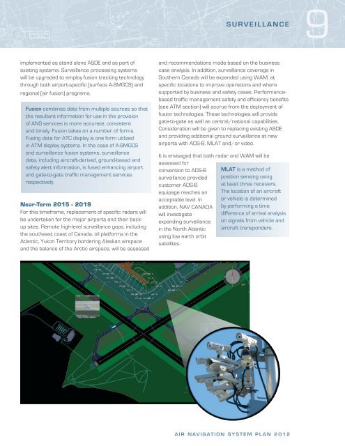
implemented as stand alone ASDE and as part of<br />
existing systems. Surveillance processing systems<br />
will be upgraded to employ fusion tracking technology<br />
through both airport-specific (surface A-SMGCS) and<br />
regional (air fusion) programs.<br />
Fusion combines data from multiple sources so that<br />
the resultant information for use in the provision<br />
of ANS services is more accurate, consistent<br />
and timely. Fusion takes on a number of forms.<br />
Fusing data for ATC display is one form utilized<br />
in ATM display systems. In the case of A-SMGCS<br />
and surveillance fusion systems, surveillance<br />
data, including aircraft-derived, ground-based and<br />
safety alert information, is fused enhancing airport<br />
and gate-to-gate traffic management services<br />
respectively.<br />
Near-Term 2015 - 2019<br />
For this timeframe, replacement of specific radars will<br />
be undertaken for the major airports and their backup<br />
sites. Remote high-level surveillance gaps, including<br />
the southeast coast of <strong>Canada</strong>, oil platforms in the<br />
Atlantic, Yukon Territory bordering Alaskan airspace<br />
and the balance of the Arctic airspace, will be assessed<br />
and recommendations made based on the business<br />
case analysis. In addition, surveillance coverage in<br />
Southern <strong>Canada</strong> will be expanded using WAM, at<br />
specific locations to improve operations and where<br />
supported by business and safety cases. Performancebased<br />
traffic management safety and efficiency benefits<br />
(see ATM section) will accrue from the deployment of<br />
fusion technologies. <strong>The</strong>se technologies will provide<br />
gate-to-gate as well as central/national capabilities.<br />
Consideration will be given to replacing existing ASDE<br />
and providing additional ground surveillance at new<br />
airports with ADS-B, MLAT and/or video.<br />
It is envisaged that both radar and WAM will be<br />
assessed for<br />
conversion to ADS-B<br />
surveillance provided<br />
customer ADS-B<br />
equipage reaches an<br />
acceptable level. In<br />
addition, NAV CANADA<br />
will investigate<br />
expanding surveillance<br />
in the North Atlantic<br />
using low earth orbit<br />
satellites.<br />
SURVEILLANCE<br />
MLAT is a method of<br />
position sensing using<br />
at least three receivers.<br />
<strong>The</strong> location of an aircraft<br />
or vehicle is determined<br />
by performing a time<br />
difference of arrival analysis<br />
on signals from vehicle and<br />
aircraft transponders.<br />
AIR NAVIGATION SYSTEM PLAN 2012<br />
9





![[ cac ] canadian airport charts - Nav Canada](https://img.yumpu.com/12328212/1/190x252/-cac-canadian-airport-charts-nav-canada.jpg?quality=85)
