North Carolina Visitor & Relocation Guide - Franklin Chamber of ...
North Carolina Visitor & Relocation Guide - Franklin Chamber of ...
North Carolina Visitor & Relocation Guide - Franklin Chamber of ...
You also want an ePaper? Increase the reach of your titles
YUMPU automatically turns print PDFs into web optimized ePapers that Google loves.
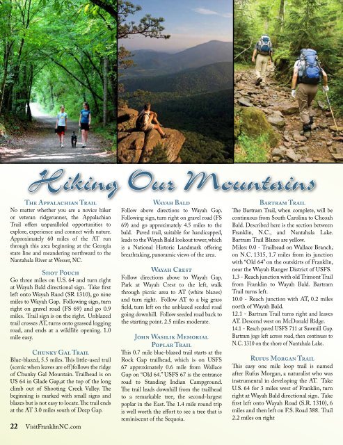
Hiking Our Mountains<br />
The Appalachian Trail<br />
No matter whether you are a novice hiker<br />
or veteran ridgerunner, the Appalachian<br />
Trail <strong>of</strong>fers unparalleled opportunities to<br />
explore, experience and connect with nature.<br />
Approximately 60 miles <strong>of</strong> the AT run<br />
through this area beginning at the Georgia<br />
state line and meandering northward to the<br />
Nantahala River at Wesser, NC.<br />
Shot Pouch<br />
Go three miles on U.S. 64 and turn right<br />
at Wayah Bald directional sign. Take first<br />
left onto Wayah Raod (SR 1310), go nine<br />
miles to Wayah Gap. Following sign, turn<br />
right on gravel road (FS 69) and go 0.9<br />
miles. Trail sign is on the right. Unblazed<br />
trail crosses AT, turns onto grassed logging<br />
road, and ends at a wildlife opening. 1.0<br />
mile easy.<br />
Chunky Gal Trail<br />
Blue-blazed, 5.5 miles. This little-used trail<br />
(scenic when leaves are <strong>of</strong>f )follows the ridge<br />
<strong>of</strong> Chunky Gal Mountain. Trailhead is on<br />
US 64 in Glade Gap,at the top <strong>of</strong> the long<br />
climb out <strong>of</strong> Shooting Creek Valley. The<br />
beginning is marked with small signs and<br />
blazes but is not easy to locate. The trail ends<br />
at the AT 3.0 miles south <strong>of</strong> Deep Gap.<br />
22 Visit<strong>Franklin</strong>NC.com<br />
Wayah Bald<br />
Follow above directions to Wayah Gap.<br />
Following sign, turn right on gravel road (FS<br />
69) and go approximately 4.5 miles to the<br />
bald. Paved trail, suitable for handicapped,<br />
leads to the Wayah Bald lookout tower, which<br />
is a National Historic Landmark <strong>of</strong>fering<br />
breathtaking, panoramic views <strong>of</strong> the area.<br />
Wayah Crest<br />
Follow directions above to Wayah Gap.<br />
Park at Wayah Crest to the left, walk<br />
through picnic area to AT (white blazes)<br />
and turn right. Follow AT to a big grass<br />
field, turn left on the unblazed seeded road<br />
going downhill. Follow seeded road back to<br />
the starting point. 2.5 miles moderate.<br />
John Wasilik Memorial<br />
Poplar Trail<br />
This 0.7 mile blue-blazed trail starts at the<br />
Rock Gap trailhead, which is on USFS<br />
67 approximately 0.6 mile from Wallace<br />
Gap on “Old 64.” USFS 67 is the entrance<br />
road to Standing Indian Campground.<br />
The trail leads downhill from the trailhead<br />
to a remarkable tree, the second-largest<br />
poplar in the East. The 1.4 mile round trip<br />
is well worth the effort to see a tree that is<br />
reminiscent <strong>of</strong> the Sequoia.<br />
Bartram Trail<br />
The Bartram Trail, when complete, will be<br />
continuous from South <strong>Carolina</strong> to Cheoah<br />
Bald. Described here is the section between<br />
<strong>Franklin</strong>, N.C., and Nantahala Lake.<br />
Bartram Trail Blazes are yellow.<br />
Miles: 0.0 - Trailhead on Wallace Branch,<br />
on N.C. 1315, 1.7 miles from its junction<br />
with “Old 64” on the outskirts <strong>of</strong> <strong>Franklin</strong>,<br />
near the Wayah Ranger District <strong>of</strong> USFS.<br />
1.3 - Reach junction with old Trimont Trail<br />
from <strong>Franklin</strong> to Wayah Bald. Bartram<br />
Trail turns left.<br />
10.0 - Reach junction with AT, 0.2 miles<br />
north <strong>of</strong> Wayah Bald.<br />
12.1 - Bartram Trail turns right and leaves<br />
AT. Descend west on McDonald Ridge.<br />
14.1 - Reach paved USFS 711 at Sawmill Gap.<br />
Bartram jogs left across road, then continues to<br />
N.C. 1310 on the shore <strong>of</strong> Nantahala Lake.<br />
Rufus Morgan Trail<br />
This easy one mile loop trail is named<br />
after Rufus Morgan, a naturalist who was<br />
instrumental in developing the AT. Take<br />
U.S. 64 for 3 miles west <strong>of</strong> <strong>Franklin</strong>, turn<br />
right at Wayah Bald directional sign. Take<br />
first left onto Wayah Road (S.R. 1310), 6<br />
miles and then left on F.S. Road 388. Trail<br />
2.2 miles on right


