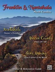
North Carolina Visitor & Relocation Guide - Franklin Chamber of ...
North Carolina Visitor & Relocation Guide - Franklin Chamber of ...
North Carolina Visitor & Relocation Guide - Franklin Chamber of ...

Create successful ePaper yourself
Turn your PDF publications into a flip-book with our unique Google optimized e-Paper software.
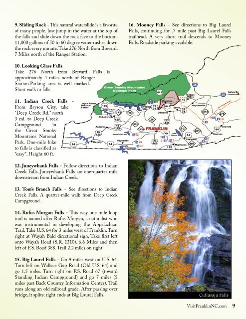
9. Sliding rock - This natural waterslide is a favorite<br />
<strong>of</strong> many people. Just jump in the water at the top <strong>of</strong><br />
the falls and slide down the rock face to the bottom.<br />
11,000 gallons <strong>of</strong> 50 to 60 degree water rushes down<br />
the rock every minute. Take 276 <strong>North</strong> from Brevard.<br />
7 Miles north <strong>of</strong> the Ranger Station.<br />
10. Looking Glass Falls<br />
Take 276 <strong>North</strong> from Brevard. Falls is<br />
approximately 4 miles north <strong>of</strong> Ranger<br />
Station.Parking area is well marked.<br />
Short walk to falls<br />
11. indian Creek Falls -<br />
From Bryson City, take<br />
“Deep Creek Rd.” north<br />
3 mi. to Deep Creek<br />
Campground in<br />
the Great Smoky<br />
Mountains National<br />
Park. One-mile hike<br />
to falls is classified as<br />
“easy”. Height 60 ft.<br />
12. Juneywhank Falls - Follow directions to Indian<br />
Creek Falls. Juneywhank Falls are one-quarter mile<br />
downstream from Indian Creek.<br />
13. tom’s branch Falls - See directions to Indian<br />
Creek Falls. A quarter-mile walk from Deep Creek<br />
Campground.<br />
14. rufus Morgan Falls - This easy one mile loop<br />
trail is named after Rufus Morgan, a naturalist who<br />
was instrumental in developing the Appalachian<br />
Trail. Take U.S. 64 for 3 miles west <strong>of</strong> <strong>Franklin</strong>. Turn<br />
right at Wayah Bald directional sign. Take first left<br />
onto Wayah Road (S.R. 1310). 6.6 Miles and then<br />
left <strong>of</strong> F.S. Road 388. Trail 2.2 miles on right.<br />
15. big Laurel Falls - Go 9 miles west on U.S. 64.<br />
Turn left on Wallace Gap Road (Old U.S. 64) and<br />
go 1.5 miles. Turn right on F.S. Road 67 (toward<br />
Standing Indian Campground) and go 7 miles (5<br />
miles past Back Country Information Center). Trail<br />
runs along an old railroad grade. After passing over<br />
bridge, it splits; right ends at Big Laurel Falls.<br />
16. Mooney Falls - See directions to Big Laurel<br />
Falls, continuing for .7 mile past Big Laurel Falls<br />
trailhead. A very short trail descends to Mooney<br />
Falls. Roadside parking available.<br />
Cullasaja Falls<br />
Visit<strong>Franklin</strong>NC.com 9