North Carolina Visitor & Relocation Guide - Franklin Chamber of ...
North Carolina Visitor & Relocation Guide - Franklin Chamber of ...
North Carolina Visitor & Relocation Guide - Franklin Chamber of ...

Create successful ePaper yourself
Turn your PDF publications into a flip-book with our unique Google optimized e-Paper software.
Rock Gap<br />
From <strong>Franklin</strong>, follow US64 West 11.4<br />
miles (from overpass where US23 goes<br />
South to Atlanta) to left turn at sign saying<br />
“Appalachian Trail” and “Standing Indian<br />
Campground”. Follow this road (Old Rt. 64)<br />
1.9 miles to sign reading “Standing Indian<br />
Campground” and turn right on paved road<br />
(FS67). Follow road for one-half mile to<br />
parking area with sign “Rock Gap”. The AT<br />
passes through area without crossing road, go<br />
left for <strong>North</strong>bound, right for Southbound.<br />
Standing Indian Area<br />
Access trails - (South to <strong>North</strong>) For all<br />
these trails, follow directions given for<br />
Rock Gap above, then CONTINUE on<br />
FS67 (when open) to these trailheads.<br />
Trails 1, 2, and 8 leave from the “Backcountry<br />
Information Area”, which is a parking area<br />
at the end <strong>of</strong> the paved part <strong>of</strong> FS67. Follow<br />
FS67 past Rock Gap Parking area for 1.6<br />
miles, bearing left at the Y at the entrance<br />
to Standing Indian Cg.<br />
1) Kimsey Creek Trail: Blue-blazed, 3.7<br />
miles. This popular trail follows the course<br />
<strong>of</strong> Kimsey Creek from the campground to<br />
Deep Gap. It begins at the Backcountry<br />
Information Center, crosses the river on<br />
the campground road, then turns right<br />
and skirts the campground on the north<br />
side. At 0.3 mile, it turns left and leaves<br />
the trails that follow the river. At 0.9 mile,<br />
it enters a clearing, where it turns right<br />
along a gated road following the creek. At<br />
2.1 miles, it crosses a log bridge over a side<br />
creek. The trail enters Deep Gap through<br />
the old picnic and camping area. Standing<br />
Indian Mountain can be reached by<br />
turning left on the AT.<br />
2) Lower Ridge Trail: Blue-blazed,4.2<br />
miles. This trail is the most direct (but<br />
a strenuous) way to reach Standing<br />
Indian Mountain from the Standing<br />
Indian Campground. It originates at<br />
the Backcountry Information Center,<br />
crosses the Nantahala River on the main<br />
campground road, skirts the campground<br />
area, then climbs rather steeply up Lower<br />
Trail Ridge directly to the mountain.<br />
It crosses the AT near the top <strong>of</strong> the<br />
mountain and continues 0.1 mile to end<br />
at the summit clearing.<br />
3) Beech Gap Trail: Blue-blazed,2.8<br />
miles. Trail starts at Beech Gap parking<br />
area on USFS 67, four miles south <strong>of</strong><br />
Backcountry Information Center. At<br />
0.5 mile, Big Indian Horse Trail (orange<br />
blazed) approaches from the right. At 2.0<br />
miles, reach Big Indian Road (also horse<br />
trail, orange blazes) and turn left. Reach<br />
AT at Beech Gap.<br />
4) Timber Ridge Trail: Blue-blazed, 2.3<br />
miles. This trail starts at the Timber Ridge-<br />
Big Laurel Falls parking area on USFS 67, 4.4<br />
miles south <strong>of</strong> the Backcountry Information<br />
Center. It passes through a charming variety<br />
<strong>of</strong> different woodlands while climbing to<br />
meet the AT. After Crossing a log bridge<br />
over a large brook, trail turns left and climbs<br />
through rhododendron, then enters a beech<br />
woods area. About halfway, it crosses Big<br />
Laurel Branch on a wood foot-bridge,<br />
then climbs through mixed woodlands to<br />
Timber Ridge, where it proceeds through<br />
open, fern-carpeted woods to the AT, 0.4<br />
mile south <strong>of</strong> Carter Gap.<br />
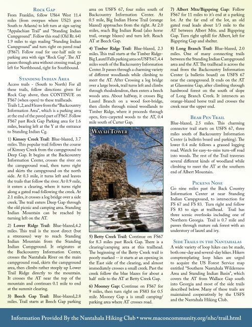
wayaH tower<br />
5) Betty Creek Trail: Continue on FS67<br />
for 8.3 miles past Rock Gap. There is a<br />
clearing/camping area at this trailhead.<br />
The beginning <strong>of</strong> the Betty Creek trail is<br />
poorly marked -- it starts at an opening in<br />
the East side <strong>of</strong> the clearing, and almost<br />
immediately crosses a small creek. Past the<br />
creek follow the blue blazes for about a<br />
half mile to the AT at Betty Creek Gap.<br />
6) Mooney Gap: Continue on FS67 for<br />
9 miles, then turn right on FS83 for 0.5<br />
mile. Mooney Gap a is small camping/<br />
parking area where AT crosses road.<br />
7) Albert Mtn/Bigspring Gap: Follow<br />
FS67 for 11 miles to it’s end at a parking<br />
lot. At the far end <strong>of</strong> the lot, an old<br />
gated road leads about 1/3 mile to the<br />
AT between Albert Mtn. and Bigspring<br />
Gap. Turn right uphill for Albert, left for<br />
Bigspring Gap and shelter.<br />
8) Long Branch Trail: Blue-blazed, 2.0<br />
miles. One <strong>of</strong> many connecting trails<br />
between the Standing Indian Campground<br />
area and the AT. The trailhead is across the<br />
road from the Backcountry Information<br />
Center (a bulletin board) on USFS 67<br />
near the campground. It ends on the AT<br />
at Glassmine Gap, after climbing through<br />
hardwood forest on the south <strong>of</strong> slope<br />
<strong>of</strong> Long Branch Creek. It intersects an<br />
orange-blazed horse trail and crosses the<br />
creek near the upper end.<br />
Bear Pen Trail<br />
Blue-blazed, 2.5 miles. This charming<br />
connector trail starts on USFS 67, three<br />
miles south <strong>of</strong> Backcountry Information<br />
Center (a bulletin board and parking). The<br />
lower 0.4 mile follows a grassed logging<br />
road. Watch for easy-to-miss turn-<strong>of</strong>f road<br />
into woods. The rest <strong>of</strong> the Trail traverses<br />
several different kinds <strong>of</strong> woodland while<br />
climbing to meet the AT at the southern<br />
end <strong>of</strong> Albert Mountain.<br />
Pickens Nose<br />
Go nine miles past the Back Country<br />
Information Center at near Standing<br />
Indian Campground, to intersection for<br />
FS 67 and FS 83. Turn right and follow<br />
FS 83 to sign at trailhead. Trail has<br />
three scenic overlooks including one <strong>of</strong><br />
<strong>North</strong>ern Georgia. Trail is 0.7 mile and<br />
passes through mature oak forest with an<br />
understory <strong>of</strong> laurel and ivy.<br />
Side Trails in the Nantahalas<br />
A wide variety <strong>of</strong> loop hikes can be made,<br />
both one-day and several-day hikes. Hikers<br />
comptemplating loop hikes are urged<br />
to acquire the US Forest Service map<br />
entitled “Southern Nantahala Wilderness<br />
Area and Standing Indian Basin”, which<br />
covers the AT from Wallace Gap south<br />
into Georgia and most <strong>of</strong> the side trails<br />
described below. Many <strong>of</strong> these trails are<br />
maintained cooperatively by the USFS<br />
and the Nantahala Hiking Club.<br />
Information Provided By the Nantahala Hiking Club • www.maconcommunity.org/nhc/trail.html