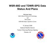
WSR-88D and TDWR-SPG Data Status And Plans - NEXRAD Radar ...
WSR-88D and TDWR-SPG Data Status And Plans - NEXRAD Radar ...
WSR-88D and TDWR-SPG Data Status And Plans - NEXRAD Radar ...
- TAGS
- plans
- nexrad
- radar
- www.roc.noaa.gov

Create successful ePaper yourself
Turn your PDF publications into a flip-book with our unique Google optimized e-Paper software.
<strong>WSR</strong>-<strong>88D</strong> <strong>and</strong> <strong>TDWR</strong>-<strong>SPG</strong> <strong>Data</strong><br />
<strong>Status</strong> <strong>And</strong> <strong>Plans</strong><br />
Michael Istok<br />
NWS Office of Science & Technology<br />
<strong>and</strong><br />
Tim Crum<br />
<strong>WSR</strong>-<strong>88D</strong> <strong>Radar</strong> Operations Center<br />
21 January 2010<br />
NOAA’s National Weather Service<br />
Family Of Services/Partners Meeting<br />
Atlanta, GA
Overview<br />
• Dual Polarization Modification<br />
• Level II <strong>Data</strong> <strong>and</strong> Architecture Refresh<br />
• Level III Products<br />
• <strong>WSR</strong>-<strong>88D</strong> Software <strong>Plans</strong><br />
• <strong>TDWR</strong>-<strong>SPG</strong> <strong>Data</strong>/Products<br />
• Wind Farms <strong>and</strong> Weather <strong>Radar</strong>s<br />
• Note: There is too much material <strong>and</strong> detail in this<br />
presentation to cover at the FOS meeting. Please consider<br />
the information as a resource to help you plan for the<br />
exciting planned increases in radar data for radar data<br />
users.<br />
1/21/10 FOS Meeting 2
Dual Polarization Modification<br />
• New Dual Pol moments to be generated in RDA:<br />
– Differential Reflectivity<br />
– Differential Phase<br />
– Correlation Coefficient<br />
• New Dual Pol moment to be generated in RPG<br />
– Specific Differential Phase (Kdp)<br />
• Expected improvements in:<br />
– Precipitation estimation<br />
– <strong>Data</strong> quality<br />
– Hail detection<br />
– Rain/snow discrimination<br />
– Tornado detection<br />
1/21/10 FOS Meeting 3
Dual Polarization Modification<br />
(Continued)<br />
• Major Initial Dual Pol algorithms:<br />
– Quantitative Precipitation Estimation (QPE)<br />
– Hydrometeor Classification<br />
– Melting Layer Detection<br />
• Major Initial New Dual Pol products<br />
– Quantitative Precipitation Estimation (QPE)<br />
– Hydrometeor Classification<br />
– Melting Layer Detection<br />
– Differential Reflectivity<br />
– Correlation Coefficient<br />
– Specific Differential Phase (Kdp)<br />
1/21/10 FOS Meeting 4
Dual Polarization Modification<br />
(Continued)<br />
• Major Program Milestone Start Dates (subject to change):<br />
– Beta Test at ~5 sites 4CY10<br />
– Full Deployment 1CY11; end 3CY12<br />
• Estimate each radar down ~2 weeks<br />
• Deployment sequence will consider many factors (e.g.,<br />
climatology, adjacent radar coverage, cost, site input)<br />
1/21/10 FOS Meeting 5
NWS Dual Polarization <strong>Plans</strong> for<br />
Informing Public/Private Users<br />
• Announce deployment sequence <strong>and</strong> schedule when<br />
finalized<br />
• Provide, in advance, as done for Super Resolution data:<br />
– Sample products<br />
– Sample Level II data (archive <strong>and</strong> real time)<br />
– Draft Interface Control Documents<br />
– FAQs<br />
– Technical Implementation Notice by March 2010<br />
• Dual Pol web site: http://www.roc.noaa.gov/<strong>WSR</strong><strong>88D</strong>/<br />
1/21/10 FOS Meeting 6
NWS Dual Polarization<br />
Level II <strong>Data</strong> <strong>Plans</strong><br />
• Add Dual Pol data (3 additional RDA moments) to Level<br />
II <strong>Data</strong> Collection <strong>And</strong> Distribution Network for at least<br />
NWS sites when Dual Pol deployed<br />
• Goal to distribute Super Resolution <strong>and</strong> Dual Pol Level II<br />
data from non-NWS <strong>WSR</strong>-<strong>88D</strong> sites also<br />
• NWS has submitted FY12 budget initiative request to fund<br />
1/21/10 FOS Meeting 7
Dual Polarization Level II <strong>Data</strong><br />
• RDA will always provide<br />
– Reflectivity data at 250 meter range resolution<br />
– Velocity <strong>and</strong> Spectrum Width up to 300 km max range<br />
• Version numbers will indicate type of data<br />
– NWS <strong>WSR</strong>-<strong>88D</strong>s to provide Version 6<br />
– DoD <strong>and</strong> FAA <strong>WSR</strong>-<strong>88D</strong>s to provide Version 4<br />
– Other Versions in special cases<br />
• <strong>Data</strong> characteristics vary to comply with NWS comms<br />
funding constraints<br />
RDA Super Res Control<br />
# <strong>Data</strong> Characteristic Disabled Enabled 3 4 5 6 7<br />
1 Azimuthal resolution on split cuts (deg) 1 0.5 0.5 1 1 0.5 1<br />
2 Azimuthal resolution on batch <strong>and</strong> above cuts (deg) 1 1 1 1 1 1 1<br />
3 Reflectivity range resolution on split cuts (m) 250 250 250 1000 250 250 250<br />
4 Reflectivity range resolution of batch <strong>and</strong> above cuts (m) 250 250 1000 1000 250 250 250<br />
5 Reflectivity data included on Doppler split cuts No Yes Yes No No Yes No<br />
6 Doppler data to 300 km Yes Yes na No Yes Yes Yes<br />
9 Dual pol data included Yes Yes No No Yes Yes Yes<br />
7 Dual pol data at 250m range resolution Yes Yes na na Yes Yes Yes<br />
8 Dual pol data to 300km range Yes Yes na na Yes Yes Yes<br />
RDA/RPG Link<br />
LDM Level II<br />
Volume Average Worst Case Throughput (kbps)<br />
3:1 Compression 4.1:1 Compression<br />
VCP 12 358 502 158 80 231 329 231<br />
VCP121 250 389 174 80 156 249 156<br />
Allocation 512 768 384 128 384 768 384<br />
1/21/10 FOS Meeting 8<br />
Build 10 Super-Res<br />
Recombined <strong>and</strong> delete Dual Pol<br />
Dual Pol w/ Super-Res Disabled<br />
Dual Pol w/ Super-Res Enabled<br />
Recombined Dual Pol<br />
Level II Version Number
Dual Polarization Level III<br />
<strong>Status</strong> <strong>and</strong> <strong>Plans</strong><br />
• Preparation for Dual Polarization<br />
– SDUS8i will be used for most Dual Pol products to support a<br />
fallback plan of restricting NOAAport distribution if comms load<br />
causes unacceptable operational impacts.<br />
– Reassign products using SDUS8i to SDUS5i (April 2010).<br />
• DPA Products from <strong>WSR</strong>-<strong>88D</strong> RPG or <strong>TDWR</strong> <strong>SPG</strong><br />
– RADAR HOURLY DIGITAL PRECIPITATION ARRAY<br />
(81/DPA)<br />
1/21/10 FOS Meeting 9
Dual Polarization Level III<br />
<strong>Status</strong> <strong>and</strong> <strong>Plans</strong><br />
(Continued)<br />
• Dual Polarization <strong>Radar</strong> Modification<br />
– General <strong>Status</strong> Message will report Dual Pol data enabled<br />
– Dual Pol Products will be RPCCDS/SBN distributed in Beta Test<br />
– Assess comms load <strong>and</strong> impacts during beta test to gain approval<br />
<strong>and</strong> adjust full scale deployment plan (if required)<br />
– Expect comms throughput of <strong>WSR</strong>-<strong>88D</strong> radar products to increase<br />
by factor of 2.8<br />
• Per radar, average hourly product volume via RPCCDS will be<br />
approximately 14.5 megabytes (MB) <strong>and</strong> the average daily volume<br />
will be 345.8 MB.<br />
• When fully implemented, the average daily volume for all 155 <strong>WSR</strong>-<br />
<strong>88D</strong> radars will be 55.8 gigabytes (GB).<br />
• Worst case hourly throughput is estimated to reach 53 MB for a single<br />
radar <strong>and</strong> 4.2 GB for all 200 radars.<br />
1/21/10 FOS Meeting 10
<strong>WSR</strong>-<strong>88D</strong> Level III <strong>Plans</strong><br />
Dual Polarization<br />
PRODUCT HEADERS<br />
NWSTG Average<br />
#<br />
PRODUCT<br />
RPG<br />
HEADER<br />
WMO HEADER<br />
ELEVATION ANGLES<br />
(DEGREES)<br />
RPCCDS Size<br />
FTP Dir (Kbytes)<br />
Name *estimate<br />
1 159/DZD SDUS8i cccc N0X xxx 0.5 DS.159x0 58*<br />
2 Differential Reflectivity - 159/DZD SDUS8i cccc NAX xxx 0.9 DS.159xa 50*<br />
3 0.13 nmi resolution, 159/DZD SDUS8i cccc N1X xxx 1.3, 1.5 DS.159x1 45*<br />
4 162 nmi max range, 159/DZD SDUS8i cccc NBX xxx 1.8 DS.159xb 40*<br />
5 256 data levels (0.0625 dB) 159/DZD SDUS8i cccc N2X xxx 2.4, 2.5 DS.159x2 36*<br />
6 159/DZD SDUS8i cccc N3X xxx 3.1, 3.4, 3.5 DS.159x3 30*<br />
7 161/DCC SDUS8i cccc N0C xxx 0.5 DS.161c0 59*<br />
8 Correlation Coefficient - 161/DCC SDUS8i cccc NAC xxx 0.9 DS.161ca 55*<br />
9 0.13 nmi resolution, 161/DCC SDUS8i cccc N1C xxx 1.3, 1.5 DS.161c1 50*<br />
10 162 nmi max range, 161/DCC SDUS8i cccc NBC xxx 1.8 DS.161cb 45*<br />
11 256 data levels (0.00333) 161/DCC SDUS8i cccc N2C xxx 2.4, 2.5 DS.161c2 37*<br />
12 161/DCC SDUS8i cccc N3C xxx 3.1, 3.4, 3.5 DS.161c3 33*<br />
13 163/DKD SDUS8i cccc N0K xxx 0.5 DS.163k0 7*<br />
14 Specific Differential Phase - 163/DKD SDUS8i cccc NAK xxx 0.9 DS.163ka 7*<br />
15 0.13 nmi resolution, 163/DKD SDUS8i cccc N1K xxx 1.3, 1.5 DS.163k1 7*<br />
16 162 nmi max range, 163/DKD SDUS8i cccc NBK xxx 1.8 DS.163kb 6*<br />
17 256 data levels (0.05 deg/km) 163/DKD SDUS8i cccc N2K xxx 2.4, 2.5 DS.163k2 6*<br />
18 163/DKD SDUS8i cccc N3K xxx 3.1, 3.4, 3.5 DS.163k3 5*<br />
1/21/10 FOS Meeting 11
<strong>WSR</strong>-<strong>88D</strong> Level III <strong>Plans</strong><br />
Dual Polarization<br />
PRODUCT HEADERS<br />
NWSTG Average<br />
#<br />
PRODUCT<br />
RPG<br />
HEADER<br />
WMO HEADER<br />
ELEVATION ANGLES<br />
(DEGREES)<br />
RPCCDS Size<br />
FTP Dir (Kbytes)<br />
Name *estimate<br />
19 165/DHC SDUS8i cccc N0H xxx 0.5 DS.165h0 14*<br />
20 Hydrometeror Classification - 165/DHC SDUS8i cccc NAH xxx 0.9 DS.165ha 13*<br />
21 0.13 nmi resolution, 165/DHC SDUS8i cccc N1H xxx 1.3, 1.5 DS.165h1 12*<br />
22 162 nmi max range, 165/DHC SDUS8i cccc NBH xxx 1.8 DS.165hb 11*<br />
23 8bit but only 12 categories 165/DHC SDUS8i cccc N2H xxx 2.4, 2.5 DS.165h2 10*<br />
24 165/DHC SDUS8i cccc N3H xxx 3.1, 3.4, 3.5 DS.165h3 9*<br />
25 166/ML SDUS8i cccc N0M xxx 0.5 DS.166m0 5*<br />
26<br />
27<br />
28<br />
29<br />
Melting Layer -<br />
162 nmi max range,<br />
4 levels (contours)<br />
166/ML<br />
166/ML<br />
166/ML<br />
166/ML<br />
SDUS8i cccc NAM xxx<br />
SDUS8i cccc N1M xxx<br />
SDUS8i cccc NBM xxx<br />
SDUS8i cccc N2M xxx<br />
0.9<br />
1.3, 1.5<br />
1.8<br />
2.4, 2.5<br />
DS.166ma<br />
DS.166m1<br />
DS.166mb<br />
DS.166m2<br />
5*<br />
5*<br />
5*<br />
5*<br />
30 166/ML SDUS8i cccc N3M xxx 3.1, 3.4, 3.5 DS.166m3 5*<br />
31 Digital Inst. Precip. Rate(in/hr) 176/DPR SDUS8i cccc DPR xxx Elev Angle Not Applicable DS.176pr 15*<br />
32 Hybrid Scan Hydrometeor Classificatio177/HHC SDUS8i cccc HHC xxx Elev Angle Not Applicable DS.177hh 4*<br />
33 One hour Accum 169/OHA SDUS8i cccc OHA xxx Elev Angle Not Applicable DS.169oh 5*<br />
34 Dig. Accum Array (unbiased) 170/DAA SDUS8i cccc DAA xxx Elev Angle Not Applicable DS.170aa 15*<br />
35 Storm Total Accum 171/STA SDUS3i cccc PTA xxx Elev Angle Not Applicable DS.171st 5*<br />
36 Dig. Storm Total Accum 172/DSA SDUS8i cccc DTA xxx Elev Angle Not Applicable DS.172dt 12*<br />
37 Dig. User-Selectable Accum:3hr/hrly 173/DUA SDUS8i cccc DU3 xxx Elev Angle Not Applicable DS.173u1 12*<br />
38 Dig. User-Selectable Accum:24hr/12Z 173/DUA SDUS8i cccc DU6 xxx Elev Angle Not Applicable DS.173u3 12*<br />
39 Dig. One Hour Difference Accum 174/DOD SDUS8i cccc DOD xxx Elev Angle Not Applicable DS.174od 10*<br />
40 Dig. Storm Total Difference Accum 175/DSD SDUS8i cccc DSD xxx Elev Angle Not Applicable DS.175sd 10*<br />
1/21/10 FOS Meeting 12
Level II <strong>Status</strong> <strong>and</strong> <strong>Plans</strong><br />
• Sites to be added to network:<br />
– 4 FAA sites in Hawaii; week of 1 Feb 2010<br />
– 8 remaining DoD CONUS sites; starting in July 2010<br />
with RPG Build 12 installation<br />
– Added sites will transmit Recombined <strong>Data</strong><br />
– Reference: TIN (09-051)<br />
• NWS will provide advance notice when/if able to switch<br />
Level II data flow from DOD <strong>and</strong> FAA sites to Super<br />
Resolution <strong>and</strong>/or Dual Pol<br />
1/21/10 FOS Meeting 13
Level II <strong>Data</strong> Throughput - 2009<br />
• 135 Level II <strong>Data</strong> Sites – 2009 max hourly average near 7 mbps<br />
– Super-Res from 125 sites<br />
– Recombined from 9 DoD <strong>and</strong> 1 FAA sites<br />
• Dual Pol estimated to increase throughput by a factor of 2.3<br />
– Max Hourly Average: 16 mbps for current network, 415 kbps for single site<br />
1/21/10 FOS Meeting 14
New Level II <strong>Data</strong> Collection <strong>and</strong><br />
Redistribution Architecture<br />
• Main transition tenets<br />
– Use NOAANet to send data to two national-level aggregation<br />
points (redundancy) with 24/7 communications support<br />
• Primary at NWSTG; backup at <strong>Radar</strong> Operations Center<br />
– Use LDM with server auto failover to promote backup to<br />
primary within ~5 minutes<br />
– Replace NWS Regional HQ aggregation points<br />
• Provide increased data delivery reliability<br />
• Use same Top Tier sites (Purdue, ERC, <strong>and</strong> OU)<br />
– Two Level II data streams available to Internet II users<br />
• Via MAX at U. of MD <strong>and</strong> IRADS at OU<br />
1/21/10 FOS Meeting 15
•<br />
NE<br />
XR<br />
AD<br />
s<br />
Eastern<br />
Region<br />
NOAAnet MPLS<br />
NOAAnet BackboneMPLS<br />
Backbone<br />
DS3 DS3 DS3 OC3<br />
Western<br />
Region<br />
Central<br />
Region<br />
Southern<br />
Region<br />
2010 Level II Architecture Refresh<br />
OC12<br />
DS3<br />
GATEWAY NODE<br />
LDM Server<br />
1<br />
LDM Server<br />
2<br />
Location: NWSTG Silver Spring<br />
ROC NODE<br />
LDM Server<br />
3<br />
LDM Server<br />
4<br />
Location: Norman<br />
Maryl<strong>and</strong> University<br />
(MAX)<br />
NCEP<br />
Camp Springs<br />
Top Tier LDM<br />
Server<br />
OU Top Tier<br />
LDM Server<br />
Top Tier LDM<br />
Server<br />
1/21/10 FOS Meeting 16<br />
OU<br />
Internet2 (Abilene)<br />
Internet2 (Abilene)<br />
ROC Node is “Active” with a full feed from the Gateway<br />
Node when it is up.<br />
ERC<br />
ERC/NCDC Top<br />
Tier LDM Server<br />
Purdue
Level II New <strong>Data</strong> Collection <strong>and</strong><br />
Redistribution Architecture<br />
(Continued)<br />
• Transition should be transparent to end users<br />
– ROC will advise Top Tier Sites of changes they need to make<br />
• Implementation plan<br />
– Transition sites over a ~3 month period<br />
• First site, Columbia SC (KCAE) scheduled for 1/20<br />
– Transition 2 sites/day (T <strong>and</strong> TH) starting next week<br />
– Transition 2 sites/day (T, W, TH) starting week of 2/9<br />
– Transition schedule sent weekly to Top Tiers as with ORDA <strong>and</strong><br />
posted on ROC web site: (http://www.roc.noaa.gov)<br />
1/21/10 FOS Meeting 17
RPCCDS - 2009<br />
1/21/10 FOS Meeting 18
RPCCDS - 2009<br />
1/21/10 FOS Meeting 19
Level III <strong>Plans</strong><br />
• Addition of Higher Resolution <strong>WSR</strong>-<strong>88D</strong> products (ref.<br />
TIN 09-041)<br />
– Lowest two angles of elevation base products (February 9, 2010)<br />
– Add remaining products by April 2010<br />
– Expect comms throughput of <strong>WSR</strong>-<strong>88D</strong> radar products to double<br />
• Per radar, average hourly product volume via RPCCDS will be<br />
approximately 5.2 MB; average daily volume will be 124 MB.<br />
• When fully implemented, the average daily volume for all 155<br />
<strong>WSR</strong>-<strong>88D</strong> radars will be 20 GB.<br />
• Worst case hourly throughput is estimated to reach 19 MB for<br />
a single radar <strong>and</strong> 1.5 GB for all 155 <strong>WSR</strong>-<strong>88D</strong> radars.<br />
1/21/10 FOS Meeting 20
<strong>WSR</strong>-<strong>88D</strong> Level III <strong>Plans</strong><br />
Higher Resolution Products<br />
PRODUCT HEADERS<br />
NWSTG Average<br />
#<br />
PRODUCT<br />
RPG<br />
HEADER<br />
WMO HEADER<br />
ELEVATION ANGLES<br />
(DEGREES)<br />
RPCCDS Size<br />
FTP Dir (Kbytes)<br />
Name *estimate<br />
1 94/DR SDUS5i cccc N0Q xxx 0.5 DS.p94r0 20<br />
2 Base Reflectivity -<br />
94/DR SDUS5i cccc NAQ xxx 0.9 DS.p94ra 16<br />
3 0.54 nmi resolution,<br />
94/DR SDUS2i cccc N1Q xxx 1.3, 1.5 DS.p94r1 12<br />
4 248 nmi max range,<br />
94/DR SDUS2i cccc NBQ xxx 1.8 DS.p94rb 11<br />
5 256 data levels (0.5 dBZ) 94/DR SDUS2i cccc N2Q xxx 2.4, 2.5 DS.p94r2 11<br />
6 94/DR SDUS2i cccc N3Q xxx 3.1, 3.4, 3.5 DS.p94r3 10<br />
7 99/DV SDUS5i cccc N0U xxx 0.5 DS.p99v0 55<br />
8 Base Velocity -<br />
99/DV SDUS5i cccc NAU xxx 0.9 DS.p99va 47<br />
9 0.13 nmi resolution,<br />
99/DV SDUS2i cccc N1U xxx 1.3, 1.5 DS.p99v1 30<br />
10 162 nmi max range,<br />
99/DV SDUS2i cccc NBU xxx 1.8 DS.p99vb 29<br />
11 256 data levels (0.5 or 1.0 m/s) 99/DV SDUS2i cccc N2U xxx 2.4, 2.5 DS.p99v2 27<br />
12 99/DV SDUS2i cccc N3U xxx 3.1, 3.4, 3.5 DS.p99v3 23<br />
13 High Res Vertical Integrated Liquid 134/DVL SDUS5i cccc DVL xxx Elev Angle Not Applicable DS.134il 7<br />
14 Enhanced Echo Tops 135/EET SDUS7i cccc EET xxx Elev Angle Not Applicable DS.135et 3<br />
1/21/10 FOS Meeting 21
<strong>WSR</strong>-<strong>88D</strong> Software <strong>Plans</strong><br />
• RPG Build 12 Beta (June 2010), Deployment (July 2010)<br />
• Will support non-Dual Pol <strong>and</strong> Dual Pol RDAs<br />
• Major changes<br />
– Legacy Mesocyclone Algorithm <strong>and</strong> associated products<br />
(including M, Product #60) will be deleted (ref: TIN 09-031)<br />
– Mesocyclone Detection algorithm (MD, Product #141) to use<br />
Super Resolution <strong>Data</strong> (no change in product format)<br />
– High Resolution Velocity product (DV, Product #99) max range<br />
increases from 124nmi to 162 nmi.<br />
– Dual Pol <strong>Data</strong> Processing Algorithms <strong>and</strong> products activated when<br />
RDA modified with Dual Pol<br />
– Automated Volume Scan Evaluation <strong>and</strong> Termination (AVSET)<br />
algorithm activated for use at field test at up to 8 sites starting in<br />
July 2010 (ref: upcoming TIN 10-0xx)<br />
1/21/10 FOS Meeting 22
• RDA Builds<br />
<strong>WSR</strong>-<strong>88D</strong> Software <strong>Plans</strong><br />
(continued)<br />
– Build 12 will be Dual Pol for single-thread RDAs<br />
– Build 12.x will be Dual Pol for dual-thread RDAs<br />
– Build 13 will be government build that merges contractor’s dual<br />
pol changes with government Build 11, plus security updates <strong>and</strong><br />
any major fixes<br />
– Note: Clutter Mitigation Decision (CMD) capability not<br />
in Dual Pol RDA Build 12; thus when Dual Pol<br />
modification made, no CMD available until RDA Build<br />
13<br />
1/21/10 FOS Meeting 23
<strong>TDWR</strong>-<strong>SPG</strong> <strong>Status</strong> <strong>and</strong> <strong>Plans</strong><br />
• Implementation of real-time collection, distribution, <strong>and</strong><br />
archive of <strong>TDWR</strong>-<strong>SPG</strong>s (Supplemental Product<br />
Generator) completed in early 2009<br />
– <strong>SPG</strong> emulates RPG function to generate products<br />
– Reference: TIN 08-85, 16 Oct 08<br />
• FY12 funding requested to add <strong>TDWR</strong>-<strong>SPG</strong> Level II realtime<br />
collection, distribution, <strong>and</strong> archive<br />
1/21/10 FOS Meeting 24
• Background<br />
Wind Farm – Weather <strong>Radar</strong><br />
Interaction<br />
– Growing number of wind farms <strong>and</strong> heights (over 450 ft common)<br />
will continue<br />
– Rotating wind turbine blades cause wind turbine clutter (WTC) for<br />
radars<br />
• <strong>Radar</strong>s see rotating turbine blades as moving targets;<br />
conventional clutter filters do not work<br />
• Impacts all three weather radar moments (R, V, SW)<br />
1/21/10 FOS Meeting 25
•<br />
Wind Farm – Weather <strong>Radar</strong><br />
Interaction Example<br />
(Not Impacting WFO Warning Operations)<br />
1/21/10 FOS Meeting 26
Why Discuss Wind Farm – Weather <strong>Radar</strong><br />
Interaction at FOS Meeting?<br />
• Some public <strong>and</strong> private sector radar data/product users<br />
confuse WTC with meteorological targets<br />
– Reports of advisories issued by broadcasters/private sector based<br />
on WTC when no advisory needed<br />
– Public inquiring local WFOs on what is wrong with radar/”what is<br />
that echo?”<br />
1/21/10 FOS Meeting 27
NWS Suggestions<br />
• Advise your customers of WTC <strong>and</strong> how to recognize <strong>and</strong><br />
“work around” the signature<br />
• Provide ROC recommendations on information we can<br />
provide radar users to improve awareness <strong>and</strong> “work<br />
arounds”: (http://www.roc.noaa.gov/<strong>WSR</strong><strong>88D</strong>/Comments.aspx)<br />
• Check ROC website for more radar – wind farm<br />
interaction information: (http://www.roc.noaa.gov/<strong>WSR</strong><strong>88D</strong>/)<br />
1/21/10 FOS Meeting 28
Wind Farm – Weather <strong>Radar</strong><br />
• NOAA’s NWS<br />
Interaction Bottom Line<br />
– Supports renewable energy<br />
– Reaches out to wind energy industry to inform them of<br />
• Weather radar locations<br />
• Potential radar impacts<br />
• Potential mitigation options for consideration<br />
– Seeks to help weather radar data users <strong>and</strong> the wind energy<br />
industry co-exist <strong>and</strong> meet our vital missions in support of the<br />
Nation<br />
1/21/10 FOS Meeting 29
Coming <strong>WSR</strong>-<strong>88D</strong><br />
<strong>Data</strong> <strong>and</strong> Product User Support<br />
• Dual Polarization Information<br />
– Project <strong>Status</strong>, Schedules, Sample <strong>Data</strong>/Products (March 2010),<br />
<strong>and</strong> Interface Control Documents<br />
• http://www.roc.noaa.gov/<strong>WSR</strong><strong>88D</strong>/DualPol/Default.aspx<br />
– Dual Pol Technology Training Page<br />
• http://www.wdtb.noaa.gov/modules/dualpol/<br />
• Level III products <strong>and</strong> Interface Control Documents<br />
– Higher Resolution Level III product samples<br />
– Dual Polarization Products<br />
– http://www.roc.noaa.gov/wsr88d/Level_III/Level3Info.aspx<br />
• Common Operations <strong>and</strong> Development Environment<br />
(CODE) for Dual Polarization (Build 12: March 2010)<br />
– http://www.weather.gov/CODE<strong>88D</strong><br />
1/21/10 FOS Meeting 30
Additional Information<br />
• Real-Time <strong>WSR</strong>-<strong>88D</strong> <strong>and</strong> <strong>TDWR</strong>-<strong>SPG</strong> Transmit/Receive<br />
<strong>Status</strong>:<br />
– http://weather.noaa.gov/monitor/radar/<br />
• NWS Real-Time Level II <strong>Data</strong> Monitoring Site:<br />
– http://weather.noaa.gov/monitor/radar2/<br />
• Project updates <strong>and</strong> other Level II information:<br />
– http://www.roc.noaa.gov/NWS_Level_2<br />
• <strong>WSR</strong>-<strong>88D</strong> Software/Program updates for product users:<br />
– http://www.nws.noaa.gov/tg/rpccds.html<br />
• <strong>WSR</strong>-<strong>88D</strong> software build specific training materials:<br />
– http://www.wdtb.noaa.gov/<br />
1/21/10 FOS Meeting 31
Additional Information<br />
(continued)<br />
• NCDC Weather <strong>Radar</strong> Resources:<br />
http://www.ncdc.noaa.gov/oa/radar/radarresources.html<br />
– Order <strong>WSR</strong>-<strong>88D</strong> Level II <strong>and</strong> Level III (including <strong>TDWR</strong> Level<br />
III) Archive <strong>Data</strong> Via FTP<br />
– Use NCDC Climate Tool Kit to View Level II <strong>and</strong> Level III<br />
Archive <strong>Data</strong><br />
– Obtain radar data information<br />
• Federal Meteorological H<strong>and</strong>book No. 11 (FMH-11) Part<br />
A Updated for Build 12 available in June<br />
– http://www.ofcm.gov/homepage/text/pubs.htm<br />
• Send follow-up questions to: Michael.Istok@noaa.gov or<br />
Tim.D.Crum@noaa.gov<br />
1/21/10 FOS Meeting 32