2010 Overboard in the Mojave - Biological Science - California State ...
2010 Overboard in the Mojave - Biological Science - California State ...
2010 Overboard in the Mojave - Biological Science - California State ...

You also want an ePaper? Increase the reach of your titles
YUMPU automatically turns print PDFs into web optimized ePapers that Google loves.
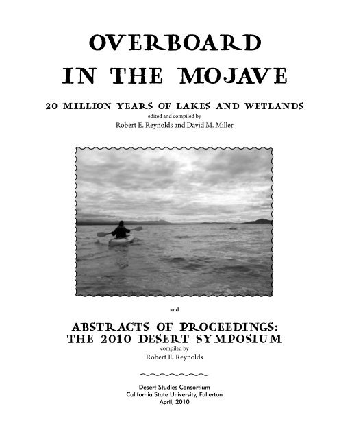
<strong>Overboard</strong><br />
<strong>in</strong> <strong>the</strong> <strong>Mojave</strong><br />
20 million years of lakes and wetlands<br />
edited and compiled by<br />
Robert E. Reynolds and David M. Miller<br />
and<br />
Abstracts of Proceed<strong>in</strong>gs:<br />
<strong>the</strong> <strong>2010</strong> Desert Symposium<br />
compiled by<br />
Robert E. Reynolds<br />
Desert Studies Consortium<br />
<strong>California</strong> <strong>State</strong> University, Fullerton<br />
April, <strong>2010</strong>
f r o n t c o v e r:<br />
The Troy Lake arm of Manix Lake laps aga<strong>in</strong>st <strong>the</strong><br />
Newberry Mounta<strong>in</strong>s, January 24, <strong>2010</strong>.<br />
b a c k c o v e r:<br />
Above: The Barstow Formation <strong>in</strong> <strong>the</strong> Mud Hills is <strong>the</strong><br />
type locality for <strong>the</strong> Barstovian land mammal age of<br />
<strong>the</strong> North American cont<strong>in</strong>ent. Biostratigraphic ranges<br />
of taxa are constra<strong>in</strong>ed by dated volcanic ashes and<br />
magnetostratigraphic polarity.<br />
Below: Strata of <strong>the</strong> Barstow Formation have been folded,<br />
faulted, and planed by erosion <strong>in</strong> <strong>the</strong> last 10 million years.<br />
The colorful Miocene sediments are unconformably overla<strong>in</strong><br />
by flat-ly<strong>in</strong>g tan arkosic sandstone.<br />
t i t l e pa g e:<br />
Rob Fulton kayaked on Silver Lake <strong>in</strong> 2005.<br />
2 <strong>2010</strong> Desert Symposium
<strong>2010</strong> Desert Symposium<br />
Table of contents<br />
<strong>Overboard</strong> <strong>in</strong> <strong>the</strong> <strong>Mojave</strong>: <strong>the</strong> field guide ......................................................................................................................... 7<br />
Robert E. Reynolds and David M. Miller<br />
Environments of nearshore lacustr<strong>in</strong>e deposition <strong>in</strong> <strong>the</strong> Pleistocene Lake Manix bas<strong>in</strong>,<br />
south-central <strong>California</strong> ............................................................................................................................................................24<br />
Marith C. Reheis and David M. Miller<br />
Stratigraphy and paleontology of <strong>the</strong> middle to late Pleistocene Manix Formation,<br />
and paleoenvironments of <strong>the</strong> central <strong>Mojave</strong> River, sou<strong>the</strong>rn <strong>California</strong> ....................................................38<br />
George T. Jefferson<br />
An <strong>in</strong>terview with Elmer Ellsworth, <strong>the</strong> first researcher to study <strong>the</strong> Pleistocene deposits<br />
<strong>in</strong> Afton bas<strong>in</strong> .................................................................................................................................................................................57<br />
Norman Meek<br />
A brief comparison of central <strong>Mojave</strong> Desert lakes: Miocene Barstow Formation and Pleistocene<br />
Lake Manix ......................................................................................................................................................................................66<br />
Robert E. Reynolds and George T. Jefferson<br />
Reconnaissance geochronology of tuffs <strong>in</strong> <strong>the</strong> Miocene Barstow Formation:<br />
implications for bas<strong>in</strong> evolution and tectonics <strong>in</strong> <strong>the</strong> central <strong>Mojave</strong> Desert .............................................70<br />
D. M. Miller, S. R. Leslie, J. W. Hillhouse, J. L. Wooden, J. A. Vazquez, and R. E. Reynolds<br />
Stratigraphy, age, and depositional sett<strong>in</strong>g of <strong>the</strong> Miocene Barstow Formation<br />
at Harvard Hill, central <strong>Mojave</strong> Desert, <strong>California</strong> ...................................................................................................85<br />
Shannon R. Leslie, David M. Miller, Joseph L Wooden, and Jorge A.Vazquez<br />
Correlation of <strong>the</strong> Miocene Peach Spr<strong>in</strong>g Tuff with <strong>the</strong> geomagnetic polarity time scale<br />
and new constra<strong>in</strong>ts on tectonic rotations <strong>in</strong> <strong>the</strong> <strong>Mojave</strong> Desert, <strong>California</strong> ............................................105<br />
John W. Hillhouse, David M. Miller, and Brent D. Turr<strong>in</strong><br />
John C. Merriam and <strong>the</strong> Barstow Syncl<strong>in</strong>e .................................................................................................................122<br />
Thomas Schweich<br />
The mammalian litho- and biochronology of <strong>the</strong> <strong>Mojave</strong> Desert Prov<strong>in</strong>ce ................................................124<br />
Michael O. Woodburne and Robert E. Reynolds<br />
Extend<strong>in</strong>g <strong>the</strong> boundaries of <strong>the</strong> Barstow Formation <strong>in</strong> <strong>the</strong> central <strong>Mojave</strong> Desert .............................148<br />
R. E. Reynolds, D. M. Miller, M. O. Woodburne, and L. B. Albright<br />
Miocene and Late Pleistocene stickleback sp<strong>in</strong>es from <strong>the</strong> <strong>Mojave</strong> Desert, <strong>California</strong> ......................162<br />
Michael A. Bell and Robert E. Reynolds<br />
75 years of fieldwork <strong>in</strong> <strong>the</strong> Barstow Formation by <strong>the</strong> Raymond Alf Museum of Paleontology ....169<br />
Don Lofgren and Rajsavi Anand<br />
Paleomagnetism of Miocene volcanic rocks <strong>in</strong> <strong>the</strong> Newberry Mounta<strong>in</strong>s, <strong>California</strong>:<br />
vertical-axis rotation and a polarity transition ...........................................................................................................177<br />
John W. Hillhouse, Ray E. Wells, and Brett F. Cox<br />
Geology and tectonic development of Alvord Mounta<strong>in</strong>, <strong>Mojave</strong> Desert, CA ...........................................196<br />
John H. Foster, Ph.D.<br />
Camel tracks from <strong>the</strong> Early Miocene Hector Formation, Cady Mounta<strong>in</strong>s, <strong>California</strong> .....................206<br />
Robert E. Reynolds<br />
The Palm Borate Company operations, Calico ..........................................................................................................209<br />
Larry M. Vredenburg<br />
3
Geology and ore genesis of epi<strong>the</strong>rmal silver–barite m<strong>in</strong>eralization <strong>in</strong> <strong>the</strong><br />
central <strong>Mojave</strong> Desert, <strong>California</strong> .....................................................................................................................................213<br />
David R. Jessey<br />
Biota of <strong>the</strong> Willow Tank Formation, late Early Cretaceous (Albian) from sou<strong>the</strong>rn Nevada ..........224<br />
Joshua W. Bonde, David J. Varricchio, and Frankie D. Jackson<br />
New mar<strong>in</strong>e sites from Member 4D of <strong>the</strong> Goler Formation of <strong>California</strong> ...............................................232<br />
Donald L. Lofgren, Brent A. Silver, Theodora A. H<strong>in</strong>kle, and Faizan Ali-Khan<br />
A juvenile specimen of Archaeohippus mourn<strong>in</strong>gi (Perissodactyla: Equidae) from <strong>the</strong><br />
Cajon Valley Formation (Middle Miocene) of <strong>California</strong> ......................................................................................241<br />
Darr<strong>in</strong> C. Pagnac and Robert E. Reynolds<br />
Early Pleistocene range extension for Microtus mexicanus <strong>in</strong> <strong>the</strong> southwestern <strong>Mojave</strong> Desert ...248<br />
Robert E. Reynolds<br />
The first tungsten-m<strong>in</strong><strong>in</strong>g boom at Atolia, as recorded <strong>in</strong> <strong>the</strong> Randsburg M<strong>in</strong>er,1904–1907 .........253<br />
Alan Hensher, compiler<br />
Thermal <strong>in</strong>frared airborne hyperspectral detection of ammonia vent<strong>in</strong>g on <strong>the</strong> Calipatria fault<br />
<strong>in</strong> <strong>the</strong> Salton Sea Geo<strong>the</strong>rmal Field, Imperial County ...........................................................................................273<br />
David K. Lynch, David M. Tratt, Kerry N. Buckland, Jeffrey L. Hall, Brian P. Kasper, Michael G. Mart<strong>in</strong>o, Luis J. Ortega,<br />
Karl Westberg, Stephen J. Young, and Patrick D. Johnson<br />
Abstracts of proceed<strong>in</strong>gs: <strong>the</strong> <strong>2010</strong> Desert Symposium .......................................................................................280<br />
Robert E. Reynolds, compiler<br />
Desert preservation: when is enough enough? ...................................................................................................280<br />
Richard Crowe<br />
Geochronology and paleoenvironment of pluvial Harper Lake, <strong>Mojave</strong> Desert, <strong>California</strong> ......281<br />
Anna L. Garcia, Jeffrey R. Knott, Jordon Bright, Shannon Mahan<br />
Coalescent analysis of fifteen nuclear loci reveals low genetic diversity and Pleistocene<br />
speciation <strong>in</strong> <strong>the</strong> <strong>Mojave</strong> Fr<strong>in</strong>ge-toed Lizard, Uma scoparia .......................................................................282<br />
Andrew Gottscho<br />
Water on <strong>the</strong> Moon: how we know and what it means ...................................................................................282<br />
David E. Harker<br />
Expand<strong>in</strong>g <strong>the</strong> late Oligocene/early Miocene tectonic, magmatic and sedimentary history<br />
<strong>in</strong> <strong>the</strong> South Bristol Mounta<strong>in</strong>s ....................................................................................................................................283<br />
Janet Harvey, Joann Stock, and David Miller<br />
The effects of drought on host plant canopy condition and survival of <strong>the</strong> endangered<br />
Astragalus jaegerianus (Fabaceae) ...........................................................................................................................284<br />
T. R. Hugg<strong>in</strong>s, B. A. Prigge, M. R. Sharifi, and P. W. Rundel<br />
Pliocene and Pleistocene lakes of Death Valley, <strong>California</strong> .........................................................................284<br />
Jeffrey R. Knott, Joseph C. Liddicoat, Elmira Wan, David Wahl, and Andrei M. Sarna-Wojcicki<br />
Paleomagnetic and radiocarbon record of <strong>the</strong> Searles Lake Formation (subunits A and ab)<br />
at Poison Canyon, San Bernard<strong>in</strong>o County, <strong>California</strong>....................................................................................285<br />
Jeffrey R. Knott, Joseph C. Liddicoat, and Robert S. Coe<br />
Stratigraphy, age, and depositional sett<strong>in</strong>g of <strong>the</strong> Miocene Barstow Formation at<br />
Harvard Hill, central <strong>Mojave</strong> Desert, <strong>California</strong> ................................................................................................285<br />
Shannon R. Leslie, David M. Miller, Joseph L. Wooden, and Jorge A Vazquez<br />
A prelim<strong>in</strong>ary review of <strong>the</strong> effects of utility-scale renewable energy development on<br />
terrestrial wildlife <strong>in</strong> <strong>the</strong> desert southwest with emphasis on <strong>the</strong> desert tortoise ...........................286<br />
Jeff Lovich<br />
4 <strong>2010</strong> Desert Symposium
Aerial surveys us<strong>in</strong>g consumer electronics: fast, cheap and best of all: useful! ..............................288<br />
David K. Lynch, Kenneth W. Hudnut, and David S. P. Dearborn<br />
Comparison of two Pliocene (Blancan) vertebrate fossil assemblages: Panaca Local Fauna<br />
(L<strong>in</strong>coln County, Nevada) and Hagerman Local Fauna (Tw<strong>in</strong> Falls County, Idaho) ........................288<br />
Vicki Meyers and Stephen Rowland<br />
Reconnaissance geochronology of Miocene bas<strong>in</strong>s <strong>in</strong> <strong>the</strong> central <strong>Mojave</strong> Desert;<br />
implications for bas<strong>in</strong> evolution and tectonics....................................................................................................289<br />
D. M. Miller, S. R. Leslie, J. W. Hillhouse, J. L. Wooden, J. A. Vazquez, and R.E. Reynolds<br />
Physiological responses of <strong>Mojave</strong> Desert shrubs to simulated summer stream channel flow 289<br />
April R. Newlander, David R. Bedford, David M. Miller, and Darren R. Sandquist<br />
Factors affect<strong>in</strong>g recruitment of desert holly (Atriplex hymenelytra) <strong>in</strong> <strong>the</strong><br />
<strong>Mojave</strong> National Preserve ..............................................................................................................................................290<br />
Odara E. P<strong>in</strong>eda<br />
A half-million years of paleoclimate and effects on landscape, <strong>Mojave</strong> Desert, <strong>California</strong> ......290<br />
Marith Reheis and David Miller<br />
Trackways of a gregarious, Early Jurassic <strong>the</strong>rapsid, Aztec Sandstone, Valley of Fire<br />
<strong>State</strong> Park, sou<strong>the</strong>rn Nevada ........................................................................................................................................291<br />
Stephen M. Rowland<br />
Late Holocene Lakes and Horticulture <strong>in</strong> <strong>the</strong> <strong>Mojave</strong> S<strong>in</strong>k ..........................................................................291<br />
Claude N. Warren<br />
Rock hounds and m<strong>in</strong><strong>in</strong>g claims..................................................................................................................................291<br />
Greg Wilkerson<br />
Fast-track<strong>in</strong>g solar development <strong>in</strong> <strong>the</strong> desert ...................................................................................................292<br />
Howard Wilshire<br />
<strong>2010</strong> Desert Symposium<br />
5
6 <strong>2010</strong> Desert Symposium
<strong>Overboard</strong> <strong>in</strong> <strong>the</strong> <strong>Mojave</strong>: <strong>the</strong> field guide<br />
<strong>2010</strong> Desert Symposium<br />
Robert E. Reynolds 1 and David M. Miller 2<br />
1 Redlands CA 92373, rreynolds220@verizon.net<br />
2 U.S. Geological Survey, Menlo Park CA<br />
Before we start<br />
Each of <strong>the</strong> three days on this trip starts at <strong>the</strong> Desert Studies Center at Zzyzx,<br />
<strong>California</strong>. Be certa<strong>in</strong> you have a full tank of gas at <strong>the</strong> start of each day—services<br />
are available <strong>in</strong> Baker.<br />
Discussion stops on this trip are numbered with respect to <strong>the</strong>me: Pleistocene (Q),<br />
Pliocene (P), and Miocene (M).<br />
Stops labeled Q are <strong>in</strong> Lake Manix sediments and discuss its Pleistocene history,<br />
depositional record and tectonic deformation.<br />
Stops labeled M are <strong>in</strong> Miocene sediments presumed to represent <strong>the</strong> Barstow Formation,<br />
which has an extended depositional record dur<strong>in</strong>g <strong>the</strong> early Miocene.<br />
Stops labeled P exhibit white carbonate deposits that represent ground water discharge<br />
(GWD) or marsh land along <strong>the</strong> <strong>Mojave</strong> River Valley.<br />
Day 1<br />
What we will see: early on Day 1, we will visit outcrops<br />
of late Pleistocene (~500 to 24 ka) Lake Manix sediments.<br />
Our goal is to exam<strong>in</strong>e <strong>the</strong> lake sediments <strong>in</strong> <strong>the</strong>ir<br />
geomorphic context, <strong>in</strong> order to describe depositional environments<br />
of several dist<strong>in</strong>ctive lacustr<strong>in</strong>e facies. Some<br />
of <strong>the</strong>se facies are somewhat unusual <strong>in</strong> that <strong>the</strong>y are not<br />
recognized <strong>in</strong> o<strong>the</strong>r paleolakes. In<br />
particular, <strong>in</strong>teraction between alluvial<br />
fan sediments and <strong>the</strong> lake produce<br />
cryptic lacustr<strong>in</strong>e sediments that look<br />
very similar to alluvial fan sediments.<br />
Comb<strong>in</strong><strong>in</strong>g depositional facies and<br />
dated packages of sediment help describe<br />
<strong>the</strong> events dur<strong>in</strong>g <strong>the</strong> evolution<br />
of Lake Manix. The lacustr<strong>in</strong>e facies<br />
and transgressive/regressive sequences<br />
can be compared to facies that we<br />
will exam<strong>in</strong>e <strong>in</strong> <strong>the</strong> Miocene Barstow<br />
Formation.<br />
Late on Day 1 we will visit newly dated<br />
lacustr<strong>in</strong>e deposits of <strong>the</strong> Miocene<br />
Barstow Formation (~20 to 13 Ma),<br />
us<strong>in</strong>g zircons from tuffs (dated by<br />
U-Pb) and a widespread marker unit,<br />
<strong>the</strong> Peach Spr<strong>in</strong>g Tuff, to establish age<br />
controls on <strong>the</strong> sediment. The deposits<br />
illustrate depositional environments at<br />
different times, and mostly near <strong>the</strong> marg<strong>in</strong> of <strong>the</strong> evolv<strong>in</strong>g<br />
Barstow Bas<strong>in</strong>.<br />
Convene at Zzyzx Desert Studies Center; proceed north<br />
to I-15.<br />
0.0 (0.0) Enter I -15 westbound. Re-set odometer.<br />
5.9 (5.9) Pass Rasor Road <strong>in</strong>terchange.<br />
Lake Manix filled <strong>the</strong> lower <strong>Mojave</strong> River bas<strong>in</strong> dur<strong>in</strong>g <strong>the</strong> Late Pleistocene.<br />
(adapted from a graphic courtesy Norman Meek).<br />
7
9.7 (3.8) Cont<strong>in</strong>ue past <strong>the</strong> Bas<strong>in</strong><br />
Road <strong>in</strong>terchange. East Cronese<br />
playa, visible to <strong>the</strong> north, is fed<br />
by <strong>the</strong> <strong>Mojave</strong> River dur<strong>in</strong>g floods.<br />
It has an extensive record of past<br />
lakes and human occupations<br />
(Schneider, 1989: Warren and<br />
Schneider, 2000). A recent paper<br />
(Miller and o<strong>the</strong>rs, this volume)<br />
demonstrates late Holocene lakes<br />
present dur<strong>in</strong>g <strong>the</strong> Little Ice Age<br />
(~ AD 1650) and Medieval Warm<br />
Period (~AD 1290).<br />
17.3 (7.6) Pass through faulted<br />
Miocene sediments <strong>in</strong> road cut.<br />
View west <strong>in</strong>to Afton Bas<strong>in</strong> which<br />
was filled by Lake Manix <strong>in</strong> late Pleistocene time.<br />
18.3 (1.0) Exit I-15 at Afton Road.<br />
18.6 (0.3) Stop at Afton Road, TURN RIGHT (north).<br />
18.8 (0.5) PARK north of frontage road, on north side of<br />
off ramp.<br />
STOP Q- 1—Afton Barrier Beach. Cuts along <strong>the</strong><br />
freeway and <strong>in</strong> dra<strong>in</strong>age channels show that lagoonal deposits<br />
capped by weak soils are overla<strong>in</strong> by beach gravels,<br />
illustrat<strong>in</strong>g multiple lake occupations at this elevation.<br />
Lake Manix reached highstands at or just below 543 masl<br />
(1781 ft) at least three times dur<strong>in</strong>g <strong>the</strong> late Pleistocene,<br />
as suggested by Meek (1990, 2000). Highstands at this<br />
elevation are marked by well-preserved constructional<br />
beach barriers. Most such barriers are flat-topped with<br />
slop<strong>in</strong>g, gently rilled flanks. Retrace and PROCEED<br />
WEST along freeway frontage road.<br />
19.3 (0.5) STOP Q-2—Stromatolites. PARK. Cuts<br />
along <strong>the</strong> road show breaks <strong>in</strong> lake deposits, one prom<strong>in</strong>ently<br />
decorated by a row of stromatolite-capped pebbles,<br />
<strong>in</strong>dicat<strong>in</strong>g precipitation of calcium carbonate <strong>in</strong> clear,<br />
shallow, sun-lit lake water. CONTINUE SOUTHWEST<br />
on paved highway frontage road.<br />
20.1 (0.8) Pavement turns sharply right.<br />
20.2 (0.1) End of pavement.<br />
20.3 (0.1) TURN LEFT on pipel<strong>in</strong>e road and BEAR<br />
RIGHT (north).<br />
20.5 (0.2) PARK <strong>in</strong> quarry. Caution! Do not enter <strong>the</strong><br />
deep gully at <strong>the</strong> wash.<br />
STOP Q-3—Dunn Wash Gravel Quarry. “Dunn” wash<br />
exhibits lake expression <strong>in</strong> alluvial fan sediments (GPS<br />
coord<strong>in</strong>ates are 551615 E, 3880169 N, Reheis and o<strong>the</strong>rs,<br />
r. e. reynolds and d. m. mller<br />
Stop Q-3. Medial distal fan deposits complexly <strong>in</strong>terf<strong>in</strong>ger with lacustr<strong>in</strong>e sands and<br />
muds. M. Reheis photo.<br />
2007). The follow<strong>in</strong>g is summarized from <strong>the</strong> report <strong>in</strong><br />
Reheis and Redw<strong>in</strong>e (2008; Figs. 2 and 4), which conta<strong>in</strong>s<br />
detailed description and measured sections.<br />
At <strong>the</strong> Dunn Wash sites, at least four lake fluctuations<br />
are recorded. Dunn Wash was an active dra<strong>in</strong>age dur<strong>in</strong>g<br />
<strong>the</strong>se fluctuations, and <strong>the</strong>refore lacustr<strong>in</strong>e and alluvial<br />
sediments are <strong>in</strong>terbedded. These two depositional<br />
environments are very difficult to dist<strong>in</strong>guish <strong>in</strong> places<br />
where alluvial gravel was only slightly reworked dur<strong>in</strong>g a<br />
subsequent lake-level rise.<br />
The oldest lake unit (unit 1 <strong>in</strong> section M05-19, fig. 4 of<br />
Reheis and Redw<strong>in</strong>e, 2008) has basal lacustr<strong>in</strong>e gravel<br />
with thick tufa coats on clasts, overla<strong>in</strong> by green mud,<br />
silt, and sand that coarsens and th<strong>in</strong>s shoreward. The<br />
tufa-coated gravel persists to an altitude of at least 539<br />
masl. This unit is overla<strong>in</strong> by alluvial gravel of unit 2 and a<br />
buried soil with a Btk horizon. The buried soil is overla<strong>in</strong><br />
by three packages of beach gravel and sand (units 3, 4, and<br />
5) that rise and th<strong>in</strong> shoreward, typically with tufa-coated<br />
clasts at <strong>the</strong> base of each package and separated by weak<br />
soils or alluvial units. Lake units 4 and 5 can be traced<br />
to an altitude of about 543 masl. Anodonta shells near<br />
<strong>the</strong> base of unit 1 yielded a f<strong>in</strong>ite but m<strong>in</strong>imum-limit<strong>in</strong>g<br />
age of 49,800±2,000 14C yr B.P. (table 1 of Reheis and<br />
Redw<strong>in</strong>e, 2008). A s<strong>in</strong>gle prelim<strong>in</strong>ary U-series age on <strong>the</strong><br />
basal tufa is 71±25 ka ( J. Paces, U.S. Geological Survey,<br />
written commun. to Miller, 2007). Lake unit 3 is only<br />
locally preserved and may represent a m<strong>in</strong>or fluctuation.<br />
Anodonta shells with<strong>in</strong> unit 4 below a weak buried soil,<br />
yielded ages of 34,680 ± 260 and 31,900 ± 200 14C yr<br />
B.P. At two o<strong>the</strong>r sites <strong>the</strong> uppermost unit 5 conta<strong>in</strong>ed<br />
Anodonta shells that yielded ages of 25,420 ± 120 and<br />
26,030±100 14C yr B.P.<br />
The gravels here are generally similar to alluvial fan<br />
gravels, but <strong>the</strong> presence of Anodonta and lateral trac<strong>in</strong>g<br />
8 <strong>2010</strong> Desert Symposium
to dist<strong>in</strong>ctive lake beds <strong>in</strong>dicates that part of <strong>the</strong> section<br />
represents gravels reworked at <strong>the</strong> lake marg<strong>in</strong>. This facies<br />
is common at several places <strong>in</strong> Lake Manix (Reheis and<br />
Miller, this volume). RETRACE toward Afton Road.<br />
20.8 (0.3) TURN RIGHT (south) on graded road.<br />
23.1 (2.3) Stop at Afton Road. TURN RIGHT (south)<br />
over I-15.<br />
23.3 (0.2) TURN RIGHT (west) on Dunn Road.<br />
24.5 (1.2) Dip. Prepare to turn left (south) at a white talc<br />
pile on <strong>the</strong> left.<br />
24.9 (0.4) TURN LEFT (south) on wide dirt road.<br />
25.3 (0.4) Cross under powerl<strong>in</strong>e.<br />
25.5 (0.2) Cont<strong>in</strong>ue past a cab<strong>in</strong>.<br />
25.6 (0.1) PARK <strong>in</strong> broad cleared area of former railroad<br />
station (Reheis and o<strong>the</strong>rs, 2007)..<br />
STOP Q-4—New Dunn. Lake Manix orig<strong>in</strong>ally was one<br />
cohesive bas<strong>in</strong> that lay west of Buwalda Ridge. The lake<br />
threshold near Buwalda Ridge failed midway through<br />
<strong>the</strong> lake history, ~185 ka, flood<strong>in</strong>g <strong>the</strong> Afton arm. This<br />
railroad cut is <strong>in</strong> <strong>the</strong> oldest lake deposits of <strong>the</strong> Afton arm<br />
of Lake Manix. The Manix ash helps determ<strong>in</strong>e when <strong>the</strong><br />
Afton Arm <strong>in</strong>tegrated with <strong>the</strong> rest of Lake Manix.<br />
The railroad cut (552284 E, 3878805 N, 478 masl; 1568<br />
ft) exposes, from top to bottom, a th<strong>in</strong> fan gravel overly<strong>in</strong>g<br />
~4.5 m of well-sorted sands exhibit<strong>in</strong>g long sweep<strong>in</strong>g<br />
crossbeds <strong>in</strong>dicat<strong>in</strong>g east-directed flow. The quartz- and<br />
feldspar-rich sands are similar to modern <strong>Mojave</strong> River<br />
sand. Green muddy sand forms a few th<strong>in</strong> (centimeters)<br />
layers <strong>in</strong> <strong>the</strong> upper part of <strong>the</strong> exposure on <strong>the</strong> south side<br />
of <strong>the</strong> cut; although <strong>the</strong>se muds conta<strong>in</strong>ed no ostracodes,<br />
deposits <strong>in</strong> similar stratigraphic positions conta<strong>in</strong> Limnocy<strong>the</strong>re<br />
ceriotuberosa ( J. Bright, Nor<strong>the</strong>rn Arizona<br />
University, written commun. to Reheis, 2006) typical of<br />
Lake Manix deposits. The basal sand conta<strong>in</strong>s carbonatecemented<br />
layers and nodules that resemble root casts<br />
suggest<strong>in</strong>g soil profiles. The sand overlies poorly sorted,<br />
<strong>in</strong>durated, distal alluvial-fan deposits, and represents a<br />
valley-axis facies, <strong>the</strong> first lake to occupy <strong>the</strong> Afton subbas<strong>in</strong>.<br />
In o<strong>the</strong>r locations to <strong>the</strong> south and west, this sand<br />
is thicker and conta<strong>in</strong>s th<strong>in</strong> <strong>in</strong>terbeds of distal-fan deposits,<br />
lack<strong>in</strong>g soils, suggest<strong>in</strong>g brief fluctuations <strong>in</strong> lake level.<br />
To <strong>the</strong> southwest, along <strong>the</strong> <strong>Mojave</strong> River, this same sand<br />
directly and conformably overlies fluvial gravel and sand,<br />
with clasts of dom<strong>in</strong>antly mafic volcanic rocks probably<br />
derived from older fan deposits upstream near Buwalda<br />
Ridge. In turn, <strong>the</strong>se fluvial deposits overlie <strong>the</strong> “Mayhem<br />
terrane,” a zone of chaotically mixed and plastically de-<br />
<strong>2010</strong> Desert Symposium<br />
overboard <strong>in</strong> <strong>the</strong> mojave: a field guide<br />
formed blocks of Lake Manix muds and sands mixed with<br />
locally derived playa muds formed by flood<strong>in</strong>g when <strong>the</strong><br />
waters from <strong>the</strong> lake bas<strong>in</strong> cut through <strong>the</strong> threshold at<br />
Buwalda Ridge. Strong currents evidently carried gravels<br />
of <strong>the</strong> threshold as well as former bottom sediment of<br />
Lake Manix down a channel and dumped <strong>the</strong>m near <strong>the</strong><br />
depocenter of <strong>the</strong> Afton arm. The Manix ash, ~185 ka,<br />
has been found <strong>in</strong> one place <strong>in</strong> <strong>the</strong> Afton sub-bas<strong>in</strong> with<strong>in</strong><br />
<strong>the</strong>se well-sorted sands; it provides a temporal tie to<br />
deposits of <strong>the</strong> ma<strong>in</strong> lake, show<strong>in</strong>g that <strong>the</strong> <strong>in</strong>tegration of<br />
<strong>the</strong> Afton arm took place shortly before 185 ka. The ash is<br />
well exposed at stop Q-5 and will be exam<strong>in</strong>ed later today.<br />
Retrace to paved Dunn Road and Afton Canyon onramp.<br />
26.3 (0.7) Stop at Dunn Road. TURN RIGHT (east).<br />
27.9 (1.6) Stop at Afton Canyon Road. TURN LEFT<br />
(north) across I-15.<br />
28.1 (0.2) TURN LEFT (west) and enter westbound<br />
I-15.<br />
31.9 (3.8) Cont<strong>in</strong>ue past <strong>the</strong> rest stop.<br />
35.9 (4.0) Cont<strong>in</strong>ue past Field Road and east-dipp<strong>in</strong>g<br />
Pliocene gravels.<br />
40.0 (4.1) Pass under <strong>the</strong> Alvord Mounta<strong>in</strong> overpass.<br />
41.6 (1.6) Cont<strong>in</strong>ue past <strong>the</strong> sou<strong>the</strong>ast arm of Lime Hill,<br />
with east-dipp<strong>in</strong>g Pliocene gravels.<br />
42.6 (1.0) EXIT at Harvard Road.<br />
42.9 (0.3) Stop at Harvard Road. TURN LEFT (south)<br />
onto Harvard Road.<br />
43.2 (0.3) Stop at Yermo Road. TURN LEFT (east) on<br />
Yermo Road.<br />
46.4 (3.2) Manix. TURN RIGHT (south) across tracks.<br />
The central road w<strong>in</strong>ds sou<strong>the</strong>ast to Vortac. SLOW<br />
through curves.<br />
46.7 (0.3) BEAR RIGHT (south) at road junction.<br />
47.6 (0.9) Slow through curves. The road bears sou<strong>the</strong>ast<br />
toward Vortac.<br />
48.3 (0.7) The road forks at Vortac; BEAR LEFT.<br />
48.5 (0.2) TURN LEFT (east) on graded road.<br />
49.6 (1.1) PARK near view of Lake Manix badlands.<br />
STOP Q -5—Wetterman (Blaire) Ranch. Discuss<br />
depositional environments at this location (Figure 5 <strong>in</strong><br />
Reheis and Miller, this volume). Walk down through <strong>the</strong><br />
badlands to exam<strong>in</strong>e sediments deposited <strong>in</strong> deep lake,<br />
alluvial tongues <strong>in</strong>to lake, mudflat, and fluviodeltaic environments.<br />
Paleosols provide records of local lake dry<strong>in</strong>g.<br />
9
. e. reynolds and d. m. mller<br />
56.5 (0.6) Cont<strong>in</strong>ue past Cherokee Road.<br />
60.0 (0.5) TURN RIGHT (west) on Golden Desert<br />
(power l<strong>in</strong>e) road.<br />
60.8 (0.8) The road bends.<br />
61.1 (0.3) The road bends; prepare for dips.<br />
61.7 (0.6) Cont<strong>in</strong>ue past deformed Lake Manix sediments.<br />
62.0 (0.3) BEAR RIGHT (north) between legs of double<br />
metal tower.<br />
62.1 (0.1) BEAR RIGHT on rutted dirt road head<strong>in</strong>g<br />
east-nor<strong>the</strong>ast toward m<strong>in</strong><strong>in</strong>g cuts on Harvard Hill.<br />
62.2 (0.1) Cross north over ruts <strong>in</strong> road and PARK near<br />
m<strong>in</strong><strong>in</strong>g cuts for stops Q-6 and M-1.<br />
62.7 (0.5) STOP Q-6—Harvard Hill M<strong>in</strong><strong>in</strong>g Cuts. A<br />
Stop Q-5. Wetterman Ranch Bluffs. Two red soil profiles Pleistocene thrust fault places Miocene limestone of <strong>the</strong><br />
developed on two sequences of lacustr<strong>in</strong>e silts and clays Barstow Formation over Pleistocene Lake Manix sedi-<br />
between lake fill<strong>in</strong>g events. M. Reheis photo.<br />
ments. Lake Manix sand, beach gravel, and m<strong>in</strong>or muds<br />
The white, f<strong>in</strong>e-gra<strong>in</strong>ed, water-laid Manix ash lies about are exposed <strong>in</strong> <strong>the</strong> pale badlands to <strong>the</strong> west. They repre-<br />
mid-section here. These exposures will be compared to sent folded sets of beach gravels <strong>in</strong>terbedded with sands.<br />
sediment recovered <strong>in</strong> a long core taken a few hundred These beds at <strong>the</strong>ir highest po<strong>in</strong>t lie at least 50 m above<br />
meters to <strong>the</strong> north. RETRACE to Vortac and Manix. <strong>the</strong>ir orig<strong>in</strong>al level, represent<strong>in</strong>g significant uplift <strong>in</strong> <strong>the</strong><br />
late Pleistocene and Holocene. Strands of <strong>the</strong> Manix fault<br />
50.7 (1.1) BEAR RIGHT (northwest) toward Vortac.<br />
lie to <strong>the</strong> north and south of <strong>the</strong> outcrops, and probably<br />
51.0 (0.3) Cont<strong>in</strong>ue past Vortac.<br />
<strong>in</strong>tersect with <strong>the</strong> Dolores Lake fault on <strong>the</strong> west to cause<br />
local compression. The thrust fault over <strong>the</strong> lake beds<br />
51.3 (0.3) Slow through curves.<br />
probably represents a more impressive manifestation of<br />
52.4 (1.1) Slow through curves.<br />
this same compression.<br />
52.8 (0.4) Cross railroad tracks and stop at Yermo Road. STOP M-1—South Harvard Hill stratigraphy and<br />
TURN LEFT (west).<br />
structure. WALK SOUTH to <strong>the</strong> contact between a high<br />
54.6 (1.8) Cont<strong>in</strong>ue past <strong>the</strong> sou<strong>the</strong>rn ridge of Lime<br />
ridge of silicified limestone and <strong>the</strong> sands that lie to <strong>the</strong><br />
Hill. Note <strong>the</strong> sou<strong>the</strong>ast-dipp<strong>in</strong>g Pliocene gravels (Byers,<br />
southwest of that ridge, <strong>the</strong>n proceed upsection across<br />
1960).<br />
<strong>the</strong> ridge, across ano<strong>the</strong>r ridge, and to <strong>the</strong> dark hill on <strong>the</strong><br />
nor<strong>the</strong>ast.<br />
55.0 (0.4) Cont<strong>in</strong>ue past a ridge supported by <strong>in</strong>durated<br />
round-cobble conglomerate (CRC, Reynolds and o<strong>the</strong>rs,<br />
Key observations here are <strong>the</strong> fac<strong>in</strong>g directions (north-<br />
this volume).<br />
east) for Miocene sediments, <strong>the</strong> ~19.1 Ma age of <strong>the</strong><br />
white tuff underly<strong>in</strong>g avalanche breccia, and correlation<br />
56.0 (1.0) TURN LEFT (south) at Harvard Road.<br />
of <strong>the</strong> limestone. Leslie and o<strong>the</strong>rs (this volume) argue<br />
that a thrust fault must lie <strong>in</strong><br />
this section because of older<br />
Miocene sediment ly<strong>in</strong>g on<br />
younger massive Miocene<br />
limestone that elsewhere lies on<br />
a 18.7 Ma tuff (Stop M-2). The<br />
coarse conglomerate and avalanche<br />
breccia <strong>in</strong> <strong>the</strong> Barstow<br />
Formation here <strong>in</strong>dicate prox-<br />
Stop Q-6. South Harvard Hill. Branches of <strong>the</strong> Manix Fault thrust Miocene sediments of<br />
imity to a steep bas<strong>in</strong> marg<strong>in</strong> to<br />
<strong>the</strong> Barstow Formation over late Pleistocene Manix Lake sediments.<br />
10 <strong>2010</strong> Desert Symposium
<strong>the</strong> south dur<strong>in</strong>g <strong>the</strong> early Miocene. Walk back to vehicles<br />
and drive west along access road.<br />
63.2 (0.5) TURN RIGHT (northwest) at <strong>the</strong> <strong>in</strong>tersection.<br />
63.4 (0.2) TURN RIGHT (north) on <strong>the</strong> road lead<strong>in</strong>g<br />
toward north Harvard Hill.<br />
63.9 (0.5) BEAR RIGHT (east).<br />
64.5 (0.6) At <strong>the</strong> complex <strong>in</strong>tersection, PROCEED<br />
EAST 0.1 miles.<br />
64.6 (0.1) PARK and walk sou<strong>the</strong>ast.<br />
STOP M-2—North Harvard Hill. Walk sou<strong>the</strong>ast to<br />
<strong>the</strong> pale green Shamrock tuff under silicified limestone<br />
beds. The Shamrock tuff may correlate with <strong>the</strong> ~18.7 Ma<br />
Peach Spr<strong>in</strong>g Tuff (Leslie and o<strong>the</strong>rs, this volume). The<br />
Shamrock tuff shows that <strong>the</strong> Barstow bas<strong>in</strong> was receiv<strong>in</strong>g<br />
water and lacustr<strong>in</strong>e silts prior to 18.7 Ma, and that<br />
<strong>the</strong> MSL at Harvard Hill may have been deposited earlier<br />
than <strong>the</strong> 16.7–16.9 MSL <strong>in</strong> <strong>the</strong> Mud Hills. North Harvard<br />
Hill stratigraphy differs from that at Stop M-1. The nor<strong>the</strong>rn<br />
section conta<strong>in</strong>s th<strong>in</strong> limestone beds <strong>in</strong>terbedded<br />
with sands represent<strong>in</strong>g reworked Shamrock tuff, overla<strong>in</strong><br />
by more massive limestone, partly silicified. The south<br />
section is virtually entirely massive limestone, strongly<br />
silicified. Correlat<strong>in</strong>g limestone units such as <strong>the</strong>se is difficult<br />
because <strong>the</strong>y change facies rapidly along strike (Leslie<br />
and o<strong>the</strong>rs, this volume). Walk back and RETRACE to<br />
complex <strong>in</strong>tersection.<br />
64.7 (0.1) TURN RIGHT (north).<br />
<strong>2010</strong> Desert Symposium<br />
overboard <strong>in</strong> <strong>the</strong> mojave: a field guide<br />
Stop M-2. The Shamrock Tuff at north Harvard Hill lies below th<strong>in</strong>bedded<br />
to massive lacustr<strong>in</strong>e limestone. The Shamrock Tuff is<br />
considered to be a lacustr<strong>in</strong>e facies of <strong>the</strong>18.7 Ma Peach Spr<strong>in</strong>g Tuff.<br />
64.9 (0.2) TURN RIGHT (east) on <strong>the</strong> south<br />
side of <strong>the</strong> railroad tracks.<br />
65.6 (0.7) Stop at Harvard Road, watch for<br />
traffic, and TURN RIGHT (south).<br />
66.3 (0.7) Stop at Harvard Road. Check for<br />
traffic, <strong>the</strong>n TURN RIGHT (south) on Harvard<br />
Road.<br />
67.4 (1.1) Cont<strong>in</strong>ue past Golden Desert<br />
(power l<strong>in</strong>e) road.<br />
68.2 (0.8) Cross <strong>the</strong> <strong>Mojave</strong> River.<br />
69.7 (1.5) The road turns right (west).<br />
70.7 (1.0) Stop, TURN LEFT (south) on<br />
Newberry Road.<br />
73.6 (2.9) Cont<strong>in</strong>ue past Newberry School.<br />
The Newberry Mounta<strong>in</strong>s tower ahead to <strong>the</strong><br />
south. Magnetostratigraphic studies <strong>in</strong> <strong>the</strong><br />
Newberry Mounta<strong>in</strong>s are discussed here<strong>in</strong><br />
(Hillhouse and o<strong>the</strong>rs, this volume).<br />
76.1 (2.5) Cross <strong>the</strong> railroad tracks and TURN RIGHT<br />
(west) on Pioneer Road.<br />
78.1 (2.0) Stop at National Trails Highway. TURN LEFT<br />
and <strong>the</strong>n RIGHT onto westbound I-40.<br />
83.9 (5.8) Cont<strong>in</strong>ue past <strong>the</strong> ramp to Barstow–Daggett<br />
Airport.<br />
88.9 (5.0) EXIT at Daggett Road.<br />
89.2 (0.3) Stop at Daggett Road (A Street) and TURN<br />
LEFT (south).<br />
89.6 (0.4) Stop at Pendleton Road on <strong>the</strong> south side of<br />
I-40 and TURN LEFT (east).<br />
90.6 (1.0) Pavement ends. BEAR RIGHT on Camp Rock<br />
Road.<br />
91.5 (0.9) Cont<strong>in</strong>ue past <strong>the</strong> first powerl<strong>in</strong>e road;<br />
wooden posts are on <strong>the</strong> right. Proceed 0.2 miles and<br />
TURN RIGHT at yellow metal posts on <strong>the</strong> south side of<br />
third powerl<strong>in</strong>e.<br />
91.7 (0.2) TURN RIGHT at yellow metal posts. Proceed<br />
0.5 miles west-southwest along <strong>the</strong> powerl<strong>in</strong>e road.<br />
92.2 (0.5) TURN LEFT (south) at Tower #449.2<br />
(marked on its sou<strong>the</strong>ast leg).<br />
93.8 (1.6) Cont<strong>in</strong>ue past a right turn to <strong>the</strong> west.<br />
94.2 (0.4) Cont<strong>in</strong>ue past <strong>the</strong> right fork and proceed south<br />
to <strong>the</strong> Columbus/Gem M<strong>in</strong>e.<br />
94.4 (0.2) BEAR LEFT (east) and PARK on drill pad.<br />
11
Stop M-3. Marker beds at <strong>the</strong> Columbus/Gem m<strong>in</strong>e,<br />
overturned stratigraphy, view east. SrB: strontium and<br />
borate beds; BPL: brown platy limestone; MSL: massive<br />
stromatolitic limestone.<br />
STOP M-3—Columbus/Gem M<strong>in</strong>e. This overturned<br />
section of Barstow Formation shows, <strong>in</strong> reverse stratigraphic<br />
order, p<strong>in</strong>k 18.7 Ma tuff (PST), strontium–borate<br />
layer (SRB), three brown platy limestones (BPL), thick<br />
granitic fanglomerate, and three strata of massive cyl<strong>in</strong>drical<br />
stromatolites (MSL), <strong>the</strong> stratigraphic lowest (now<br />
<strong>the</strong> uppermost) of which is silicified. Far<strong>the</strong>r south, across<br />
a branch of <strong>the</strong> Camp Rock Fault, are aplitic granite<br />
outcrops that, when uplifted <strong>in</strong> <strong>the</strong> Daggett Ridge event,<br />
contributed to <strong>the</strong> granitic debris now found elsewhere <strong>in</strong><br />
<strong>the</strong> lower part of <strong>the</strong> stratigraphic section. Zircons from<br />
<strong>the</strong> tuff at this location are ~18.7 Ma, <strong>in</strong>dicat<strong>in</strong>g correlation<br />
with <strong>the</strong> Peach Spr<strong>in</strong>g Tuff (Miller and o<strong>the</strong>rs, this<br />
volume). This suggests that <strong>the</strong> entire ~0.8 Ma duration<br />
marker sequence at this locality is older than 18.7 Ma and<br />
started be<strong>in</strong>g deposited around 19.5 Ma. Volcaniclastic<br />
sediments between <strong>the</strong> brown platy limestones look like<br />
<strong>the</strong>ir source was <strong>the</strong> Pickhandle Formation.<br />
Stoddard Valley to <strong>the</strong> south has a similar,<br />
but abbreviated, section of marker beds, with<br />
large tubular stromatolites represent<strong>in</strong>g <strong>the</strong><br />
MSL, a s<strong>in</strong>gle BPL layer and <strong>the</strong> PST (Wells<br />
and Hillhouse, 1989; Miller and o<strong>the</strong>rs, this<br />
volume). The SrB horizon is apparently not<br />
present <strong>in</strong> Stoddard Valley. RETRACE toward<br />
powerl<strong>in</strong>e road.<br />
94.8 (0.5) TURN LEFT (west) on dirt track.<br />
95.3 (0.5) TURN LEFT (south) to avoid<br />
gully.<br />
96.2 (0.9) BEAR RIGHT (west) at Y turn.<br />
97.7 (1.5) PARK.<br />
STOP M-4—West Gem Exposures. Look<br />
east at colorful badlands exposures which <strong>in</strong>-<br />
r. e. reynolds and d. m. mller<br />
clude a p<strong>in</strong>k tuff similar to <strong>the</strong> tuff we saw at <strong>the</strong> last stop.<br />
This p<strong>in</strong>k marker tuff is useful <strong>in</strong> trac<strong>in</strong>g this portion of<br />
<strong>the</strong> stratigraphic section westward. The p<strong>in</strong>k tuff sampled<br />
at this locality has <strong>the</strong> same remnant magnetism as <strong>the</strong><br />
PST, suggest<strong>in</strong>g a correlation (Hillhouse and o<strong>the</strong>rs, this<br />
volume). Here, unlike <strong>the</strong> section at Columbus/Gem, a<br />
th<strong>in</strong> section of lacustr<strong>in</strong>e beds lie above <strong>the</strong> p<strong>in</strong>k tuff. The<br />
marker sequence is not present here, apparently due to<br />
<strong>the</strong> <strong>in</strong>flux of granitic-sourced gravels that have th<strong>in</strong> lacustr<strong>in</strong>e<br />
beds with<strong>in</strong> <strong>the</strong>m. A Pleistocene analog can be seen<br />
<strong>in</strong> Lake Manix alluvial gravel <strong>in</strong>terbedded with lacustr<strong>in</strong>e<br />
silts (Miller and Reheis, this volume).<br />
Central Daggett Ridge is visible to <strong>the</strong> west, past Ord<br />
Mounta<strong>in</strong> Road. That portion of <strong>the</strong> Miocene sedimentary<br />
section is apparently separated from this portion by a<br />
north–south fault, as <strong>the</strong> p<strong>in</strong>k tuff is not present. The central<br />
Daggett Ridge section conta<strong>in</strong>s <strong>the</strong> marker sequence<br />
(MSL, BPL and SrB <strong>in</strong> drill records of US Borax).The<br />
Daggett Ridge P/L locality (SBCM 1-109-2; Reynolds,<br />
1991) has a fauna that conta<strong>in</strong>s small and large horses<br />
suggest<strong>in</strong>g <strong>the</strong> Hem<strong>in</strong>gfordian/Barstovian transition at 16<br />
Ma, similar to <strong>the</strong> faunal transition <strong>in</strong> <strong>the</strong> Toomey Hills<br />
(next stop). Proceed northwest to power l<strong>in</strong>e road.<br />
98.0 (0.3) TURN RIGHT (north) on <strong>the</strong> section l<strong>in</strong>e<br />
road toward <strong>the</strong> power l<strong>in</strong>e road.<br />
99.0 (1.0) Stop at <strong>the</strong> power l<strong>in</strong>e road. TURN RIGHT<br />
(nor<strong>the</strong>ast) on power l<strong>in</strong>e road and retrace to Camp Rock<br />
Road.<br />
101.5 (2.5) Stop at Camp Rock Road. TURN LEFT<br />
(north) and proceed to I-40.<br />
103.5 (2.0) TURN RIGHT (north) on “A” Street and<br />
cross I-40, enter<strong>in</strong>g <strong>the</strong> town of Daggett. The arrival of <strong>the</strong><br />
Stop M-4. West Gem locality. The p<strong>in</strong>k tuff exposed here appears similar<br />
to <strong>the</strong> friable, p<strong>in</strong>k Peach Spr<strong>in</strong>g Tuff at <strong>the</strong> Columbus/Gem M<strong>in</strong>e (Stop<br />
M-3). The Tuff is overla<strong>in</strong> by a th<strong>in</strong> sequence of lacustr<strong>in</strong>e sediments.<br />
12 <strong>2010</strong> Desert Symposium
Atlantic and Pacific Railroad at Waterman’s (northwest<br />
Barstow) <strong>in</strong> 1882 improved shipp<strong>in</strong>g of colemanite from<br />
Borate <strong>in</strong> <strong>the</strong> Calico Mounta<strong>in</strong>s and from Death Valley<br />
(Myrick, 1992). Colemanite was offloaded at Daggett,<br />
<strong>the</strong>n shipped to Alameda, <strong>California</strong>. Borax came to<br />
this railhead from Death Valley via <strong>the</strong> 1883 Saratoga<br />
Spr<strong>in</strong>gs–Cave Spr<strong>in</strong>gs–Garlic Spr<strong>in</strong>g route and via <strong>the</strong><br />
W<strong>in</strong>gate Wash–Pilot Knob route about <strong>the</strong> same time.<br />
Borax freight<strong>in</strong>g from Death Valley moved to a westerly<br />
route via Pilot Knob/Blackwater Well to <strong>Mojave</strong> between<br />
1884 and 1888. Borate m<strong>in</strong>erals from <strong>the</strong> Calico<br />
Mounta<strong>in</strong>s were freighted to Daggett until 1900 (Myrick,<br />
1992).<br />
104.2 (0.7) Cross National Trails Highway; cross railroad<br />
tracks.<br />
104.7 (0.5) Cross <strong>the</strong> <strong>Mojave</strong> River.<br />
105.1 (0.4) Cont<strong>in</strong>ue past <strong>the</strong> Waterloo Mill site <strong>the</strong> to<br />
left (west) at <strong>the</strong> base of Elephant Mounta<strong>in</strong>. The orig<strong>in</strong>al<br />
1884 mill was owned by <strong>the</strong> Oro Grande M<strong>in</strong><strong>in</strong>g Company,<br />
and boasted 75 stamps when it was purchased by <strong>the</strong><br />
Waterloo M<strong>in</strong><strong>in</strong>g Co. <strong>in</strong> 1889. A narrow gauge railroad<br />
connected <strong>the</strong> Atlantic and Pacific Railroad (later Santa<br />
Fe) at Daggett to <strong>the</strong> mill on <strong>the</strong> north side of <strong>the</strong> river,<br />
<strong>2010</strong> Desert Symposium<br />
overboard <strong>in</strong> <strong>the</strong> mojave: a field guide<br />
to <strong>the</strong> Waterloo and Silver K<strong>in</strong>g M<strong>in</strong>es at Calico, and to<br />
<strong>the</strong> narrow gauge railroad that led to <strong>the</strong> American Borax<br />
Company’s Columbia M<strong>in</strong>e (not Columbus) on <strong>the</strong> north<br />
side of Lead Mounta<strong>in</strong> (Myrick, 1992) .<br />
106.8 (1.7) Stop at Yermo Road. Gas and snacks available.<br />
Proceed a short distance north on Ghost Town Road and<br />
TURN RIGHT (east) onto I-15 eastbound. Return to <strong>the</strong><br />
Desert Studies Center at Zzyzx.<br />
End of Day 1<br />
Day 2<br />
What we will see: On Day 2 we will visit outcrops of lake<br />
deposits <strong>in</strong> <strong>the</strong> Barstow Formation at <strong>the</strong> Toomey and<br />
Yermo hills, at <strong>the</strong> Calico Mounta<strong>in</strong>s, and near its type<br />
section <strong>in</strong> <strong>the</strong> Mud Hills. New dates support previously<br />
determ<strong>in</strong>ed ages based on fossil mammals, and clarify<br />
stratigraphic and depositional relationships. The ages and<br />
sedimentary facies <strong>in</strong> <strong>the</strong> Yermo Hills–Calico Mounta<strong>in</strong>s<br />
area will be compared with deposits of <strong>the</strong> Barstow<br />
Formation that are of similar age, but somewhat different<br />
facies, at Owl Canyon <strong>in</strong> <strong>the</strong> Mud Hills. The Barstow Formation<br />
at <strong>the</strong> Calico Mounta<strong>in</strong>s was an important source<br />
13
of borate m<strong>in</strong>erals dur<strong>in</strong>g <strong>the</strong> very<br />
early 20th century and ru<strong>in</strong>s of<br />
m<strong>in</strong>es, railroads, and dwell<strong>in</strong>gs<br />
testify to <strong>the</strong> importance of <strong>the</strong><br />
m<strong>in</strong><strong>in</strong>g <strong>in</strong>dustry at this location.<br />
CONVENE at <strong>the</strong> Desert Studies<br />
Center with a full tank of gas. Enter<br />
westbound I-15 toward M<strong>in</strong>neola<br />
Road.<br />
0.0 (0.0) EXIT at M<strong>in</strong>neola Road.<br />
Re-set odometer.<br />
0.3 (0.3) Stop at M<strong>in</strong>neola Road.<br />
TURN RIGHT (north). The road<br />
will bear east.<br />
0.9 (0.6) Cont<strong>in</strong>ue past a left<br />
turn to <strong>the</strong> landfill and <strong>the</strong> Calico<br />
Mounta<strong>in</strong>s Archaeological Site .<br />
1.1 (0.2) BEAR RIGHT. When<br />
pavement ends, take <strong>the</strong> middle<br />
power l<strong>in</strong>e access road and bear<br />
nor<strong>the</strong>ast.<br />
1.3 (0.2) Avoid <strong>the</strong> left turn.<br />
1.4 (0.1) BEAR LEFT on power l<strong>in</strong>e road.<br />
2.3 (0.9) STOP M-5—Toomey Hills. PARK <strong>in</strong> open<br />
area north of road. The Barstow Formation is exposed on<br />
<strong>the</strong> north side of <strong>the</strong> Manix fault, as it is at Harvard Hill.<br />
Near <strong>the</strong> base of <strong>the</strong> section are fluvial gravels with wellrounded<br />
clasts and tubular stromatolites (CRC, Reynolds<br />
and o<strong>the</strong>rs, this volume) <strong>in</strong> a section of sandstone cemented<br />
by calcite. Above are f<strong>in</strong>e-gra<strong>in</strong>ed lacustr<strong>in</strong>e sandy<br />
silt beds <strong>in</strong>terlaced with tuffs. This outcrop produced fossil<br />
mammals which document <strong>the</strong> 16 Ma transition from<br />
<strong>the</strong> Hem<strong>in</strong>gfordian to Barstovian NALMA (Woodburne,<br />
1991; Woodburne and Reynolds, this volume; Tedford<br />
and o<strong>the</strong>rs, 2004). A local sequence of beds (CRC,<br />
Emerald Tuff, Lime Tuff) allow <strong>the</strong> Toomey sequence to<br />
be correlated with a datable section <strong>in</strong> <strong>the</strong> Yermo Hills to<br />
<strong>the</strong> northwest (Miller and o<strong>the</strong>rs this volume). The crest<br />
of <strong>the</strong> ridge here is a thick, strongly cemented soil, above<br />
which is <strong>the</strong> Pliocene–Pleistocene Yermo Gravel. RE-<br />
TRACE toward M<strong>in</strong>neola Road.<br />
3.6 (1.3) TURN RIGHT (north) at road to <strong>the</strong> county<br />
landfill and Calico Mounta<strong>in</strong>s Archaeological Site.<br />
4.8 (1.2) TURN LEFT (west) away from entrance to <strong>the</strong><br />
Calico site and landfill.<br />
5.6 (0.8) TURN RIGHT (north) <strong>in</strong>to Emerald Bas<strong>in</strong>.<br />
r. e. reynolds and d. m. mller<br />
Stop M-6. Yermo Hills, show<strong>in</strong>g lime-green sandstone and 15.3 Ma ash layer.<br />
6.0 (0.3) PARK <strong>in</strong> open area, avoid<strong>in</strong>g nails from burnt<br />
wood.<br />
STOP M-6—Overview of Emerald Bas<strong>in</strong> <strong>in</strong> <strong>the</strong> Yermo<br />
Hills. This section conta<strong>in</strong>s a sequence of beds (CRC,<br />
Emerald Tuff, Lime Tuff) similar to <strong>the</strong> Toomey Hills.<br />
A dated tuff near <strong>the</strong> top of <strong>the</strong> section is about 15.3<br />
Ma (Miller and o<strong>the</strong>rs, this volume). If <strong>the</strong> CRC here is<br />
equivalent to <strong>the</strong> CRC at <strong>the</strong> 16+ Ma Toomey Hills stop,<br />
<strong>the</strong>n <strong>the</strong> gray siltstone section represents at least 0.7 Ma.<br />
A thick, silicified limestone on <strong>the</strong> ridge l<strong>in</strong>e can be traced<br />
westward <strong>in</strong>to <strong>the</strong> eastern Calico Mounta<strong>in</strong>s where it<br />
overlies <strong>the</strong> 16.2+ Ma BPL. Retrace to ma<strong>in</strong> dirt road and<br />
proceed northwest.<br />
6.1 (0.2) TURN RIGHT (northwest) onto ma<strong>in</strong> dirt<br />
road and proceed northwest.<br />
7.0 (0.9) Jo<strong>in</strong> <strong>the</strong> pole l<strong>in</strong>e road and proceed north. This<br />
road co<strong>in</strong>cides with <strong>the</strong> approximate position of <strong>the</strong><br />
north-trend<strong>in</strong>g T<strong>in</strong> Can Alley fault, described and named<br />
by Dudash (2006). It is a right-lateral fault that <strong>in</strong> places<br />
exhibits scarps cutt<strong>in</strong>g Holocene materials.<br />
7.2 (0.2) TURN LEFT (west) onto Mule Canyon Road.<br />
8.3 (1.1) Cont<strong>in</strong>ue past <strong>the</strong> Sulfur Hole quarry <strong>in</strong> <strong>the</strong><br />
BPL which produced an unusual assemblage of hydrous<br />
iron sulfate m<strong>in</strong>erals oxide products from pyrite deposited<br />
by hot spr<strong>in</strong>gs (Dunn<strong>in</strong>g and Copper, 2002; Schuil<strong>in</strong>g,<br />
1999).<br />
14 <strong>2010</strong> Desert Symposium
8.5 (0.2) Cont<strong>in</strong>ue past Big Borate Canyon (Reynolds,<br />
1999b) on <strong>the</strong> south.<br />
8.6 (0.1) Cont<strong>in</strong>ue past T<strong>in</strong> Can Alley on <strong>the</strong> north.<br />
9.1 (0.5) Cont<strong>in</strong>ue past <strong>the</strong> entrance to Little Borate<br />
Canyon (Trestle Canyon) and <strong>the</strong> site of Happy Hollow<br />
(Reynolds, 1999b). The Barstow Formation section here<br />
consists of MSL on <strong>the</strong> north side of road and BPL and<br />
SrB on south side of road. The BPL nearby conta<strong>in</strong>s <strong>the</strong><br />
oldest proboscidean (gompho<strong>the</strong>re) tracks known from<br />
<strong>the</strong> North American cont<strong>in</strong>ent (Reynolds 1999a; Reynolds<br />
and Woodburne, 2001, 2002). Proceed uphill.<br />
9.7 (0.6) PULL LEFT (south) <strong>in</strong>to <strong>the</strong> turnout at <strong>the</strong> top<br />
of <strong>the</strong> grade and PARK.<br />
<strong>2010</strong> Desert Symposium<br />
overboard <strong>in</strong> <strong>the</strong> mojave: a field guide<br />
STOP M-7—Overview of Little<br />
Borate. We are at <strong>the</strong> po<strong>in</strong>t where<br />
<strong>the</strong> narrow gauge Borate and Daggett<br />
Railroad (Myrick, 1991; Hildebrand,<br />
1982) separated from Mule Canyon<br />
Road. The marker section here conta<strong>in</strong>s<br />
<strong>the</strong> MSL, BPL, and SrB. This<br />
section of <strong>the</strong> Barstow Formation<br />
lies on upper Pickhandle Formation<br />
beds dated at 19.0 Ma (S<strong>in</strong>gleton and<br />
Gans, 2005, 2008). They considered<br />
Stop M-7. View southwest at Little Borate Canyon. Massive stromatolitic<br />
andesite breccia (dated at 16.9 Ma)<br />
limestone (MSL) to <strong>the</strong> north. Look southwest at <strong>the</strong> chevron folds of brown platy<br />
to cap <strong>the</strong> Barstow section; however,<br />
limestone (BPL). The historic m<strong>in</strong>es conta<strong>in</strong><strong>in</strong>g borate and strontium m<strong>in</strong>erals<br />
(SrB) are upsection on <strong>the</strong> south side of Little Borate Canyon. The nodular mapp<strong>in</strong>g by Sadler (p. c. to RER,<br />
stromatolies conta<strong>in</strong><strong>in</strong>g silicified <strong>in</strong>sect fossils are <strong>in</strong> a horizon below <strong>the</strong> SRM <strong>2010</strong>) <strong>in</strong>dicates that <strong>the</strong>se volcanic<br />
(Reynolds and o<strong>the</strong>rs, this volume). To <strong>the</strong> south, <strong>the</strong> 17 Ma dacite breccias breccias <strong>in</strong>terf<strong>in</strong>ger with a section<br />
(S<strong>in</strong>gleton and Gahns, 2008) uncomformably overlie <strong>the</strong> compressionally folded<br />
of Barstow Formation that ranges <strong>in</strong><br />
0.8 Ma-duration marker bed sequence (Reynolds and o<strong>the</strong>rs, this volume).<br />
age from 16 to 14.8 Ma (Reynolds<br />
and o<strong>the</strong>rs, this volume). Proceed<br />
westerly downhill on Mule Canyon Road.<br />
10.9 (1.2) Cont<strong>in</strong>ue past <strong>the</strong> Phillips Drive exit.<br />
11.4 (0.5) Camp Rock and <strong>the</strong> entrance to Phillips Drive.<br />
Camp Rock was <strong>the</strong> halfway po<strong>in</strong>t on <strong>the</strong> two-day mule<br />
team run from Borate to Daggett (Reynolds, 1999b; Hildebrand,<br />
1982). To <strong>the</strong> north, <strong>in</strong> <strong>the</strong> beds of <strong>the</strong> Barstow<br />
Formation, fragments of bird eggs have been recovered<br />
from <strong>the</strong> MSL, which sits on a flat pebble conglomerate<br />
suggestive of a shale beach (Leggitt, 2002).<br />
12.9 (1.5) Stop at paved Calico Road and TURN RIGHT<br />
(north).<br />
M-7. Little Borate nodule horizon conta<strong>in</strong>s silifcified<br />
<strong>in</strong>sects, <strong>in</strong>clud<strong>in</strong>g midges show<strong>in</strong>g detailed preservation<br />
of compound eyes. SEM image courtesy of John Jenk<strong>in</strong>s<br />
(1986).<br />
13.9 (1.0) Cont<strong>in</strong>ue past Barber’s Mill (1880; Weber,<br />
1966, 1967) on <strong>the</strong> southwest side of <strong>the</strong> road.<br />
14.3 (0.4) Cont<strong>in</strong>ue past right turn to Doran Drive.<br />
14.6 (0.3) Cont<strong>in</strong>ue past <strong>the</strong> Garfield millsite for <strong>the</strong><br />
1880 Silver K<strong>in</strong>g m<strong>in</strong>e (Weber, 1966, 1967) on <strong>the</strong> right<br />
(north).<br />
14.8 (0.2) Cont<strong>in</strong>ue past <strong>the</strong> entrance to Calico Ghost<br />
Town.<br />
15.0 (0.2) Cont<strong>in</strong>ue past Cemetery Ridge on <strong>the</strong> right.<br />
15.8 (0.8) TURN RIGHT on Yermo Cutoff. PULL<br />
RIGHT and stop.<br />
STOP M-8— Cemetery Ridge: view nor<strong>the</strong>ast. The<br />
section west of <strong>the</strong> Calico cemetery is east of <strong>the</strong> Burcham<br />
Gold M<strong>in</strong>e (Weber, 1966, 1967). The upper of two white<br />
tuffaceous sandstone beds conta<strong>in</strong> zircons that give an <strong>in</strong>terest<strong>in</strong>g<br />
age of 19.0 Ma (Miller and o<strong>the</strong>rs, this volume).<br />
The section conta<strong>in</strong>s <strong>the</strong> BPL, and north, across a strand<br />
15
of <strong>the</strong> Calico Fault, tubular stromatolites of <strong>the</strong> MSL.<br />
The <strong>in</strong>ternal mold of a flam<strong>in</strong>go egg was found below <strong>the</strong><br />
Burcham M<strong>in</strong>e, re<strong>in</strong>forc<strong>in</strong>g <strong>the</strong> environment of a shallow<br />
lake marg<strong>in</strong> (Reynolds, 1998). PROCEED WEST to Ft.<br />
Irw<strong>in</strong> Road.<br />
17.5 (234.0) (1.7) Stop at Ft. Irw<strong>in</strong> Road; TURN<br />
RIGHT (north).<br />
21.5 (4.0) Cont<strong>in</strong>ue past Old Ft Irw<strong>in</strong> Road and proceed<br />
nor<strong>the</strong>ast toward Pickhandle Pass.<br />
22.4 (0.9) Slow, TURN RIGHT (sou<strong>the</strong>ast) at <strong>the</strong> BLM<br />
kiosk onto a road to <strong>the</strong> northwest Calico Mounta<strong>in</strong>s.<br />
Proceed approximately one mile to <strong>the</strong> sou<strong>the</strong>ast until <strong>the</strong><br />
road bends and enters narrows.<br />
23.3 (0.9) STOP M-9—Russ’ Mailbox Locality <strong>in</strong><br />
northwest Calico Mounta<strong>in</strong>s. The thick section of BPL<br />
overlies19Ma Pickhandle dacite. The dacite outcrop is<br />
r. e. reynolds and d. m. mller<br />
Stop M-8. Cemetery Ridge. A white tuff (above backpack) provided zircon<br />
dates of 19.1 Ma. Resistant beds to <strong>the</strong> right are brown limey sandstone.<br />
Stop M-8. Replica of fossil flam<strong>in</strong>go egg (center) found<br />
below Burcham m<strong>in</strong>e, flanked by eggs of lesser flam<strong>in</strong>go<br />
(left) and greater flam<strong>in</strong>go (right).<br />
covered by rounded and sub-rounded pebbles<br />
suggest<strong>in</strong>g a long period of wea<strong>the</strong>r<strong>in</strong>g,<br />
<strong>the</strong>refore, <strong>the</strong> age of <strong>the</strong> BPL is later than<br />
<strong>the</strong> wea<strong>the</strong>red dacite. The BPL conta<strong>in</strong>s<br />
approximately 50% pebbles at its base, but<br />
becomes f<strong>in</strong>er upward and has vertically<br />
oriented pores that resemble <strong>the</strong> texture of<br />
<strong>the</strong> tufa at Travert<strong>in</strong>e Po<strong>in</strong>t on <strong>the</strong> west side<br />
of <strong>the</strong> Salton Sea. This five-m-thick section<br />
of BPL may represent a lacustr<strong>in</strong>e onlap<br />
sequence. RETRACE to Ft. Irw<strong>in</strong> Road.<br />
24.3 (1.0) Stop at Ft. Irw<strong>in</strong> Road, TURN<br />
LEFT (southwest).<br />
25.1 (0.8) TURN RIGHT (northwest) on<br />
Old Ft Irw<strong>in</strong> Road; proceed west toward<br />
Fossil Bed Road.<br />
29.4 (4.3) Cont<strong>in</strong>ue past Copper City<br />
Road.<br />
30.3 (0.9) TURN RIGHT (west) on Fossil Bed Road.<br />
33.2 (2.9) TURN RIGHT (northwest) on Ra<strong>in</strong>bow<br />
Bas<strong>in</strong> Loop Road.<br />
Stop M-9. Northwestern Calico Mounta<strong>in</strong>s. A s<strong>in</strong>gle brown<br />
platy limestone (BPL)at this locality is 5+ meters thick, and<br />
is <strong>in</strong>terpreted as a near-shore, on-lapp<strong>in</strong>g sequence. The<br />
BPL conta<strong>in</strong>s sub-rounded dacite pebbles at its base, and<br />
becomes platy and spongy textured toward <strong>the</strong> top.<br />
16 <strong>2010</strong> Desert Symposium
Stop M-10. Owl Canyon Campground-Space 28.<br />
Concentric tufa deposits around plant.View west shows<br />
stromatolites (MSL) and two brown platy limestone (BPL)<br />
beds. U-Pb dates on stromatolite calcite at <strong>the</strong> campground<br />
are 15.3 Ma. Stromatolites of <strong>the</strong> MSL were deposited over<br />
a 1 my period at different portions of <strong>the</strong> bas<strong>in</strong>. One mile<br />
west, <strong>the</strong> marker sequence (MSL, BPL, SrB) spans 0.8 Ma,<br />
with <strong>the</strong> MSL dat<strong>in</strong>g to approximately 16.8 Ma.<br />
33.5 (0.3) Turn Right (north) on Owl Canyon Road,<br />
enter Campground and PARK at space #28.<br />
35.0 (1.5) STOP M-10—Owl Canyon Campground.<br />
View west across wash of stromatolitic limestone phytoherms<br />
(tufa around branch<strong>in</strong>g bushes) and two brown<br />
platy limestone beds. Cole et al (2005) used U-Pb methods<br />
to date branch<strong>in</strong>g tufa mounds. Results from three<br />
dated localities are 15.39 ± 0.15 Ma and 15.30 ± 0.25 Ma<br />
at Owl Canyon Campground, and 16.25 ± 0.25 Ma on <strong>the</strong><br />
north limb of <strong>the</strong> Barstow Syncl<strong>in</strong>e. Apparently, <strong>the</strong> MSL<br />
was actively deposit<strong>in</strong>g over a period of nearly 1 my along<br />
<strong>the</strong> south and north portion of <strong>the</strong> bas<strong>in</strong>. This would be<br />
expected dur<strong>in</strong>g lacustr<strong>in</strong>e deposition of an expand<strong>in</strong>g<br />
bas<strong>in</strong> event <strong>in</strong> tandem with alluvial fans develop<strong>in</strong>g from<br />
ris<strong>in</strong>g highlands to <strong>the</strong> north and south. The U-Pb dates<br />
may be useful <strong>in</strong> provid<strong>in</strong>g relative ages of lacustr<strong>in</strong>e car-<br />
<strong>2010</strong> Desert Symposium<br />
overboard <strong>in</strong> <strong>the</strong> mojave: a field guide<br />
bonates deposited across different portions of <strong>the</strong> bas<strong>in</strong>.<br />
In summary, dates on tubular stromatolites and phytoherms<br />
of <strong>the</strong> MSL from <strong>the</strong> Mud Hills span a period from<br />
15.3–16.2 Ma. One mile to <strong>the</strong> west, <strong>the</strong> entire marker<br />
sequence (MSL, BPL, SrB) spans 0.8 Ma, with <strong>the</strong> MSL<br />
dat<strong>in</strong>g to approximately 16.7–16.9 Ma (Reynolds and<br />
o<strong>the</strong>rs, this volume). MSL tubes ) RETRACE.<br />
36.8 (1.8) Stop at Fossil Bed Road, TURN LEFT (east).<br />
Retrace to Old Ft Irw<strong>in</strong> Rd.<br />
39.7 (2.9) STOP at Old Ft. Irw<strong>in</strong> Road. TURN LEFT<br />
(nor<strong>the</strong>ast) to Ft. Irw<strong>in</strong> Road. Proceed south to I-15, <strong>the</strong>n<br />
east on I-15 to Zzyzx Road and <strong>the</strong> Desert Studies Center.<br />
End Day 2<br />
Day 3<br />
What we will see: early on Day 3, we will cont<strong>in</strong>ue to<br />
explore outcrops of <strong>the</strong> Peach Spr<strong>in</strong>g Tuff, an 18.7 Ma<br />
time marker that has been identified <strong>in</strong> several sub-bas<strong>in</strong>s<br />
of <strong>the</strong> Barstow Formation. We will exam<strong>in</strong>e <strong>the</strong> overly<strong>in</strong>g<br />
lacustr<strong>in</strong>e deposits of <strong>the</strong> Barstow Formation near<br />
<strong>the</strong> west end of Daggett Ridge and contrast depositional<br />
facies and ages <strong>in</strong> various sub-bas<strong>in</strong>s <strong>in</strong> <strong>the</strong> Daggett Ridge<br />
area, us<strong>in</strong>g <strong>the</strong> Peach Spr<strong>in</strong>g Tuff as <strong>the</strong> tie po<strong>in</strong>t for all<br />
stratigraphic sections.<br />
Later on Day 3, we will turn to Pliocene (~5 to 2 Ma)<br />
deposits, when <strong>in</strong>stead of lakes <strong>the</strong>re were marshes, small<br />
shallow ponds, and wetlands (collectively grouped as<br />
groundwater discharge deposits). These deposits are<br />
typified by white carbonate-rich sand and silt. We will see<br />
that several Pliocene deposits of this type were deposited<br />
<strong>in</strong> an east-trend<strong>in</strong>g low area from near Helendale to near<br />
Barstow, and an even broader area far<strong>the</strong>r south near<br />
Victorville. The deposits at Victorville represent <strong>the</strong> damm<strong>in</strong>g<br />
of old dra<strong>in</strong>age systems to form a long-lived marshy<br />
bas<strong>in</strong> that eventually was filled with sediment, from which<br />
<strong>the</strong> ancestral <strong>Mojave</strong> River Valley flowed to Barstow and<br />
later to Lake Manix.<br />
CONVENE at <strong>the</strong> Desert Studies Center with a full tank<br />
of gas. Enter westbound I-15 toward Barstow Road. CAU-<br />
TION: when reach<strong>in</strong>g Barstow, I-40 merges with I-15<br />
near Barstow Road. You must be <strong>in</strong> <strong>the</strong> far right lane to<br />
exit on Barstow Road.<br />
0.0 (0.0) STOP at Barstow Road. Reset odometer. Services<br />
are available to <strong>the</strong> right.<br />
TURN LEFT (south) on Highway 247 (Barstow Road)<br />
toward Lucerne Valley and proceed through several traffic<br />
light <strong>in</strong>tersections.<br />
17
. e. reynolds and d. m. mller<br />
18 <strong>2010</strong> Desert Symposium
0.0 (0.3) Cont<strong>in</strong>ue past Armory Road.<br />
0.6 (0.6) Cont<strong>in</strong>ue past signal at Rimrock Road.<br />
1.0 (0.4) Cont<strong>in</strong>ue past Barstow College, BLM headquarters,<br />
and National Park Service offices.<br />
2.0 (1.0) Barstow Road (Highway 247) ascends hills<br />
composed of Pliocene and Pleistocene gravels, sands, and<br />
groundwater discharge (GWD) deposits.<br />
3.4 (1.4) Cont<strong>in</strong>ue past <strong>the</strong> summit of Daggett Ridge and<br />
<strong>the</strong> entrance to a landfill. Proceed downhill with caution.<br />
4.8 (1.4) Cont<strong>in</strong>ue past a right turn (west) to Stoddard<br />
Road.<br />
5.9 (1.1) TURN LEFT on unnamed Stoddard Road<br />
(graded dirt) section l<strong>in</strong>e road.<br />
6.6 (0.6) Cont<strong>in</strong>ue past a road on <strong>the</strong> left to P<strong>in</strong>k Tuff<br />
Quarry.<br />
Optional STOP M-11—P<strong>in</strong>k Tuff Quarry. Drive north<br />
1.4 miles and PARK on low hill south of quarry. The<br />
Peach Spr<strong>in</strong>g Tuff crops out discont<strong>in</strong>uously from Outlet<br />
Center Drive on I-15 eastward along <strong>the</strong> north flank of<br />
Daggett Ridge to where <strong>the</strong> Stoddard Cutoff Road runs<br />
through Opal Canyon. Where crossed by branches of<br />
<strong>the</strong> Lenwood Fault, <strong>the</strong> sections of <strong>the</strong> Peach Spr<strong>in</strong>g Tuff<br />
(Dibblee, 1968, 1970) appear to be right-laterally offset<br />
a total of 3.2 km (2 miles), slightly more than <strong>the</strong> 2.5 km<br />
(1.6 miles) of o<strong>the</strong>r estimates ( Jachens and o<strong>the</strong>rs, 2002).<br />
Retrace south to Stoddard Road, and proceed east on<br />
Stoddard Road.<br />
7.2 (0.6) TURN LEFT (nor<strong>the</strong>ast) onto Oxford Road.<br />
8.0 (0.8) PULL RIGHT (east) and PARK <strong>in</strong> loop.<br />
STOP M-12—Peach Spr<strong>in</strong>g Tuff. We are parked just east<br />
of a portion of <strong>the</strong> northwest-trend<strong>in</strong>g Lenwood fault.<br />
The PST to <strong>the</strong> east consists of p<strong>in</strong>k non-welded and<br />
purple welded facies. Hike east to a vantage po<strong>in</strong>t and<br />
look north-nor<strong>the</strong>ast toward outcrops of <strong>the</strong> MSL, approximately<br />
one-quarter mile nor<strong>the</strong>ast. The PST outcrop<br />
pattern has an attitude (N 32ºW) that suggest concordance<br />
with <strong>the</strong> MSL (N 30ºW, 20ºE). Hillhouse and o<strong>the</strong>rs<br />
(this volume) describe paleomagnetic results for this<br />
PST site; different orientations on ei<strong>the</strong>r side of a gully<br />
<strong>in</strong>dicate a buried fault <strong>in</strong> that gully. In contrast to <strong>the</strong> M-3<br />
stop at Columbus/Gem M<strong>in</strong>e on eastern Daggett Ridge,<br />
<strong>the</strong> marker sequence <strong>in</strong> Barstow lake beds apparently lies<br />
above <strong>the</strong> 18.7 Ma PST. The Barstow Fm <strong>in</strong> this area is<br />
capped by a calcareous silcrete—a paleosol composed of<br />
pedogenic carbonate cemented by silica, a siliceous duricrust).<br />
RETRACE route to Highway 247.8.8 (0.8) TURN<br />
RIGHT (west) onto “Gloucestor” (Stoddard) Road.<br />
<strong>2010</strong> Desert Symposium<br />
overboard <strong>in</strong> <strong>the</strong> mojave: a field guide<br />
10.1 (1.3) Stop at Highway 247. Watch for traffic. TURN<br />
RIGHT (north) and proceed toward Barstow on Ma<strong>in</strong><br />
Street.<br />
15.3 (5.2) Cont<strong>in</strong>ue past signal at Rimrock Road.<br />
15.8 (0.5) Cont<strong>in</strong>ue past signal at Armory Road on Ma<strong>in</strong><br />
Street.<br />
16.0 (0.2) TURN LEFT (west) and ENTER westbound<br />
I-15. Stay <strong>in</strong> <strong>the</strong> right lane and prepare to exit at “L” Street.<br />
17.5 (1.5) EXIT at “L” Street.<br />
17.9 (0.4) Stop at “L” Street. TURN RIGHT (north) and<br />
proceed to Ma<strong>in</strong> Street.<br />
18.3 (0.4) Stop at Ma<strong>in</strong> Street, TURN LEFT (west) onto<br />
Ma<strong>in</strong> Street and proceed west.<br />
19.6 (1.3) Cont<strong>in</strong>ue past Diamond Pacific<br />
19.8 (0.2) Slow, watch for oncom<strong>in</strong>g traffic. TURN LEFT<br />
(south) on dirt track (Osborne Road) toward <strong>the</strong> <strong>in</strong>terchange<br />
of I-15 and Highway 58.<br />
20.0 (0.2) TURN LEFT (sou<strong>the</strong>ast) <strong>in</strong>to <strong>the</strong> wash.<br />
20.3 (0.3) STOP P-1—West Barstow Ground Water<br />
Discharge (GWD). We have stopped near prom<strong>in</strong>ent<br />
white outcrops of gently north-dipp<strong>in</strong>g calcareous silt<br />
and sand. The vague bedd<strong>in</strong>g, relatively coarse gra<strong>in</strong> size<br />
and poor sort<strong>in</strong>g, cementation, and lack of beach facies<br />
suggest that <strong>the</strong> beds primarily represent GWD. To<br />
<strong>the</strong> west, <strong>in</strong> <strong>the</strong> freeway road cut and at an outcrop even<br />
far<strong>the</strong>r west, Brett Cox recovered tephra from two beds of<br />
this unit (Cox and o<strong>the</strong>rs, 2003). The tephras are identical,<br />
and have a poorly established correlation to tephra<br />
recovered at Honey Lake, CA, where beds are thought<br />
to be latest Pliocene or earliest Pleistocene between<br />
2.0 and 2.5 Ma. A weaker correlation is possible, with a<br />
tephra recovered by Jeff Knott at Zabriskie Po<strong>in</strong>t; that<br />
tephra is bracketed between 3.35 and 3.58 Ma (Elmira<br />
Wan, USGS, written commun. to Cox and Miller, <strong>2010</strong>).<br />
RETRACE to Ma<strong>in</strong> Street.<br />
20.8 (0.5) Stop at Ma<strong>in</strong> Street, watch for traffic. TURN<br />
LEFT (west) toward <strong>the</strong> Highway 58 underpass.<br />
21.2 (0.4) Pass under Highway 58.<br />
23.0 (1.8) Stop at Lenwood Boulevard. Proceed west.<br />
24.4 (1.4) Cont<strong>in</strong>ue past Delaney Road.<br />
25.9 (1.5) Cont<strong>in</strong>ue past “The Dunes” Motel on <strong>the</strong> left<br />
(south). Prepare to turn right (north) <strong>in</strong> 2.7 miles.<br />
26.6 (0.7) Ahead on <strong>the</strong> right at <strong>the</strong> top of <strong>the</strong> rise is a<br />
pole with reflectors. Prepare to turn right (north).<br />
19
27.1 (0.5) TURN RIGHT (north)<br />
at <strong>the</strong> pole with reflectors (Post # 2<br />
2404—Oak Grove Road).<br />
27.2 (0.1) PARK at utility road.<br />
STOP P-2—Johnston Corners<br />
Pliocene GWD. The sedimentary<br />
section at this locality starts at<br />
<strong>the</strong> railroad tracks to <strong>the</strong> north. It<br />
beg<strong>in</strong>s with coarse gravels that are<br />
angularly overla<strong>in</strong> by a section of<br />
f<strong>in</strong>e-gra<strong>in</strong>ed sand, very f<strong>in</strong>e gravelly<br />
sand, and calcareous sand and silt.<br />
Some calcareous beds are strongly<br />
cemented, similar to <strong>the</strong> upper<br />
carbonate cemented caps of late<br />
Pleistocene GWD (e.g., Forester<br />
et al, 2003). The section cont<strong>in</strong>ues<br />
south of <strong>the</strong> road and is capped<br />
on <strong>the</strong> skyl<strong>in</strong>e by a pediment<br />
marked by a veneer of boulders. A<br />
carbonate-cemented bed nearby<br />
conta<strong>in</strong>s silica, which yielded an<br />
approximate U-Pb age of 2.3 Ma<br />
(K. Maher, written commun. to Miller, 2005). This date<br />
suggests a correlation with <strong>the</strong> beds we saw at Stop P-1<br />
<strong>in</strong> Barstow. Return to vehicles, Retrace south to National<br />
Trails Highway.<br />
27.7 (0.4) Stop at National Trails Highway. TURN<br />
RIGHT and proceed west.<br />
28.7 (1.0) Cont<strong>in</strong>ue past H<strong>in</strong>kley Road and Hodge.<br />
33.6 (5.6) Cont<strong>in</strong>ue past Holcomb Ranch Road.<br />
34.5 (0.9) TURN RIGHT (north) on Indian Trails Road.<br />
Proceed toward railroad.<br />
35.2 (0.7) TURN LEFT (west) on <strong>the</strong> south railroad<br />
frontage road.<br />
36.3 (1.1) Pass through a dip and proceed 0.2 miles to an<br />
outcrop on <strong>the</strong> left (south).<br />
36.5 (0.2) STOP P-3—Helendale Ash (Reynolds and<br />
Cox, 1999). Helendale Ash sampled here is a Mono “W”<br />
type tephra, <strong>in</strong>dicat<strong>in</strong>g an age range from 5.0 to 0.7 Ma.<br />
It best correlates with a sample from <strong>the</strong> Ventura section<br />
that is between 0.9 and 1.18 Ma. The Helendale Ash is<br />
located at <strong>the</strong> base of <strong>the</strong> <strong>Mojave</strong> River gravels (2500 ft<br />
elev.), and overlies <strong>the</strong> f<strong>in</strong>e sediments of <strong>the</strong> Victorville<br />
Bas<strong>in</strong>. This sequence suggests that <strong>the</strong> river had f<strong>in</strong>ished<br />
fill<strong>in</strong>g <strong>the</strong> Victorville Bas<strong>in</strong> by ~1 Ma, and <strong>the</strong>n began<br />
carry<strong>in</strong>g coarse sands far<strong>the</strong>r east. The elevation of this<br />
~1 Ma ash helps constra<strong>in</strong> <strong>the</strong> section that we will see at<br />
r. e. reynolds and d. m. mller<br />
Stops P-4 and P-5. RETRACE east along <strong>the</strong> south side of<br />
<strong>the</strong> railroad for 0.2 miles.<br />
36.7 (0.2) TURN RIGHT (south) through a break <strong>in</strong> <strong>the</strong><br />
fence and follow OHV tracks <strong>in</strong> wash to reach terrace top.<br />
37.2 (0.5) Complex <strong>in</strong>tersection. TURN NORTH, <strong>the</strong>n<br />
bear west along bluff road. Do not turn south toward<br />
houses or pole l<strong>in</strong>e road.<br />
37.5 (0.3) Proceed west, pass<strong>in</strong>g a left (south) turn. Note<br />
lag gravels on <strong>the</strong> terrace top.<br />
37.9 (0.4) Bluff Road drops off terrace top (elevation<br />
2600 ft) <strong>in</strong>to broad canyon.<br />
38.1 (0.2) Stop P-4—Helendale Section (2480 ft elevation)<br />
<strong>in</strong> wash bottom. Note red paleosols, and green pond<br />
sediments that probably represent f<strong>in</strong>e sediments of <strong>the</strong><br />
early Pleistocene Victorville bas<strong>in</strong>. We will see <strong>Mojave</strong><br />
River sands at higher elevations as we follow <strong>the</strong> road<br />
uphill to <strong>the</strong> southwest. The GWD capp<strong>in</strong>g <strong>the</strong> bluffs may<br />
correlate with those at Johnston Corners and far<strong>the</strong>r east<br />
at Lenwood, suggest<strong>in</strong>g a broad, marshy, east–west valley<br />
bottom dur<strong>in</strong>g <strong>the</strong> late Pliocene and earliest Pleistocene.<br />
38.3 (0.2) Jo<strong>in</strong> a road that proceeds south to <strong>the</strong> pole l<strong>in</strong>e<br />
road. PARK on hill crest where space is available.<br />
38.6 (0.3) Stop P-5—Helendale GWD at 2600 ft on<br />
ridge top supported by GWD carbonates. This unit is<br />
similar to those above Stop P-4. About 10 km to <strong>the</strong> westnorthwest,<br />
Dibblee mapped similar white beds as lake<br />
20 <strong>2010</strong> Desert Symposium
deposits (Vitrlite deposits); if <strong>the</strong>se GWD beds correlate<br />
with <strong>the</strong> Helendale, Johnston Corners, and west Barstow<br />
beds, a length of nearly 40 km of possibly contemporaneous<br />
GWD conditions are <strong>in</strong>dicated. This white GWD<br />
horizon is arched along <strong>the</strong> northwest-trend<strong>in</strong>g Helendale<br />
fault, suggest<strong>in</strong>g activity along that fault with<strong>in</strong> <strong>the</strong> last<br />
few million years. Proceed southwest to National Trails<br />
Highway.<br />
38.0 (0.4) STOP at National Trails Highway. WATCH<br />
FOR cross traffic. Enter National Trails Highway westbound<br />
toward Helendale. Each car must watch for oncom<strong>in</strong>g<br />
down hill traffic. ENTER Highway ONE CAR<br />
AT A TIME!<br />
38.2 (0.2) Slow for curves.<br />
39.5 (1.3) Cont<strong>in</strong>ue past Vista Road to Silver Lakes.<br />
43.5 (4.0) Cont<strong>in</strong>ue past North Bryman Road.<br />
45.0 (1.5) Cont<strong>in</strong>ue past South Bryman Road.<br />
47.9 (2.9) Slow; pass under <strong>the</strong> railroad bridge at <strong>the</strong> Riverside<br />
Cement Company Plant. Proceed slowly through<br />
Oro Grande.<br />
50.8 (2.8) Cross <strong>the</strong> bridge over <strong>the</strong> <strong>Mojave</strong> River and<br />
cont<strong>in</strong>ue past Rockview Nature Park.<br />
51.4 (0.6) TURN RIGHT (west) at <strong>the</strong> signal for Air<br />
Expressway. Move to left lane.<br />
52.0 (0.6) Cont<strong>in</strong>ue past a left turn to Gas L<strong>in</strong>e Road.<br />
52.7 (0.7) TURN LEFT (south) on Village Drive and immediately<br />
pull right <strong>in</strong>to turnout and PARK.<br />
STOP P-6—Victorville<br />
Stratigraphy. View northwest<br />
toward Sou<strong>the</strong>rn<br />
<strong>California</strong> International<br />
Airport (formerly George<br />
Air Force Base). Stratigraphy<br />
described here consists of<br />
three units: lower, middle<br />
and upper (Reynolds and<br />
Cox, 1999; Cox and T<strong>in</strong>sley,<br />
1999; Sibbett, 1999; Cox<br />
and o<strong>the</strong>rs, 1998, 2003).<br />
The lower unit is a pebble–<br />
cobble arkosic sand deposited<br />
by a southward flow<strong>in</strong>g<br />
axial stream system. Clasts of<br />
Jurassic and early Miocene<br />
volcanic rocks are derived<br />
from <strong>the</strong> <strong>Mojave</strong> Desert, not<br />
from <strong>the</strong> Transverse Ranges,<br />
<strong>2010</strong> Desert Symposium<br />
overboard <strong>in</strong> <strong>the</strong> mojave: a field guide<br />
and <strong>in</strong>clude lithologies from <strong>the</strong> Kramer Hills and outcrops<br />
near Barstow. Borehole magnetostratigraphy suggests<br />
that <strong>the</strong> top of <strong>the</strong> south-flow<strong>in</strong>g lower unit is about<br />
2.5 Ma (Cox and o<strong>the</strong>rs, 1999). This would be with<strong>in</strong> <strong>the</strong><br />
4.1 to 1.5 Ma range of <strong>the</strong> Phelan Peak Formation on <strong>the</strong><br />
north slope of <strong>the</strong> San Gabriel Mounta<strong>in</strong>s west of Cajon<br />
Pass. The Phelan Peak Formation records a reversal <strong>in</strong> its<br />
dra<strong>in</strong>age direction from southward to northward <strong>in</strong> its<br />
depositional history (Meisl<strong>in</strong>g and Weldon, 1989), correspond<strong>in</strong>g<br />
approximately to <strong>the</strong> age of <strong>the</strong> upper limits of<br />
<strong>the</strong> south-flow<strong>in</strong>g lower unit <strong>in</strong> Victorville.<br />
The middle unit of lacustr<strong>in</strong>e sandy silt is seen <strong>in</strong> outcrop<br />
and on bore holes over a wide area. To <strong>the</strong> south, magnetostratigraphic<br />
data from bore holes <strong>in</strong>dicate that <strong>the</strong><br />
lacustr<strong>in</strong>e middle unit is late Pliocene to early Pleistocene,<br />
rang<strong>in</strong>g from 2.5 to ~2 Ma (Cox and o<strong>the</strong>rs, 1999; 2003).<br />
At this stop, ostracode data suggests a Pleistocene age for<br />
<strong>the</strong> lacustr<strong>in</strong>e middle unit.<br />
The upper unit overlies <strong>the</strong> lacustr<strong>in</strong>e middle unit, and<br />
is an upward coarsen<strong>in</strong>g fluvial sequence of silt, sand,<br />
and gravel. Clast lithologies <strong>in</strong>dicate a source for <strong>the</strong>se<br />
ancestral <strong>Mojave</strong> River gravels from <strong>the</strong> northwestern San<br />
Bernard<strong>in</strong>o Mounta<strong>in</strong>s. A suggested depositional history<br />
is that stream flow from <strong>the</strong> sou<strong>the</strong>ast deposited <strong>the</strong> lacustr<strong>in</strong>e<br />
middle unit <strong>in</strong> <strong>the</strong> Victorville bas<strong>in</strong> north of <strong>the</strong> San<br />
Bernard<strong>in</strong>o Mounta<strong>in</strong>s. As <strong>the</strong> ancestral <strong>Mojave</strong> became<br />
a cohesive dra<strong>in</strong>age, and as <strong>the</strong> mounta<strong>in</strong>s cont<strong>in</strong>ued to<br />
rise, sediments overwhelmed <strong>the</strong> bas<strong>in</strong>, and <strong>the</strong> river <strong>the</strong>n<br />
flowed northward and <strong>the</strong>n eastward to term<strong>in</strong>ate <strong>in</strong> Lake<br />
Manix (Reynolds and Cox, 1999).<br />
Stop P-6. Mammoth tusk and rib, Lex<strong>in</strong>gton development near Village Drive and Amargosa<br />
Road. Dire wolf tooth associated with <strong>the</strong> mammoth tusk <strong>in</strong>dicates a Rancholabrean<br />
(late Pleistocene) age for <strong>the</strong> greenish-gray clay overla<strong>in</strong> by coarse, orange arkosic sands<br />
(above white bucket) of <strong>the</strong> ancestral <strong>Mojave</strong> River. R. Hilburn photo.<br />
21
Fossil dire wolf, mammoth, and horse were recovered <strong>in</strong><br />
coarse <strong>Mojave</strong> River sands dur<strong>in</strong>g monitor<strong>in</strong>g of development<br />
near Village Drive and Amargosa Road (Reynolds,<br />
2006). The presence of <strong>the</strong> dire wolf (Canis dirus) suggests<br />
a 0.2 Ma Rancholabrean North American Land<br />
Mammal Age (Bell and o<strong>the</strong>rs, 2004) for <strong>the</strong> uppermost<br />
ancestral <strong>Mojave</strong> River sediments immediately below <strong>the</strong><br />
Victorville Fan sequence. Fossil mammals from north of<br />
Air Expressway (Air Base Road) <strong>in</strong>clude giant ground<br />
sloth (Paramylodon sp.), short-faced bear (Arctodus sp.),<br />
mammoth, horse, camel, llama, giant camel (Titanotylopus<br />
sp.), and a meadow vole (Microtus sp.) (Scott and o<strong>the</strong>rs,<br />
1997). These mammals, particularly Titanotylopus and<br />
Microtus, suggest an early Pleistocene age, less than 1.3 Ma,<br />
for ancestral <strong>Mojave</strong> River sediments. The occurrence of<br />
<strong>the</strong> fossil cotton rat (Sigmodon m<strong>in</strong>or) on Hesperia Road<br />
(Reynolds and Reynolds, 1994) suggests a Pliocene age<br />
for sediments along <strong>the</strong> <strong>Mojave</strong> River south of I-15.<br />
52.8 (0.1) TURN RIGHT (east) on to Air Expressway<br />
and proceed to National Trails Highway.<br />
54.0 (1.2) TURN RIGHT (south) on to Air Expressway<br />
and proceed toward Victorville and I-15.<br />
55.1 (1.1) Cont<strong>in</strong>ue past a thick sequence of sediments<br />
conta<strong>in</strong><strong>in</strong>g th<strong>in</strong> sections of <strong>the</strong> lower fluvial unit, <strong>the</strong> th<strong>in</strong>,<br />
lacustr<strong>in</strong>e middle unit, and a thick section of <strong>the</strong> ancestral<br />
<strong>Mojave</strong> River gravels as <strong>the</strong> upper unit (Reynolds and<br />
Cox, 1999).<br />
55.7 (0.6) Junction with I-15 <strong>in</strong> Victorville (services<br />
available) and <strong>the</strong> end of <strong>the</strong> trip. Options for routes<br />
home <strong>in</strong>clude follow<strong>in</strong>g I-15 east toward Barstow to reach<br />
Arizona and Nevada. I-15 west (southbound) reaches San<br />
Bernard<strong>in</strong>o and <strong>the</strong> Los Angeles bas<strong>in</strong>. Bakersfield can be<br />
reached by backtrack<strong>in</strong>g to Air Expressway, proceed<strong>in</strong>g<br />
west to Highway 395, <strong>the</strong>n north to Highway 58.<br />
End Day 3<br />
References cited<br />
Bell, C. J., and E. J. Lundelius Jr., and seven o<strong>the</strong>rs. 2004. The Blancan,<br />
Irv<strong>in</strong>gtonian and Rancholabrean mammal ages. Mammalian<br />
biochronology of <strong>the</strong> Arikareean through Hemphillian <strong>in</strong>terval,<br />
<strong>in</strong> Late Cretaceous and Cenozoic Mammals of North America: Biostratigraphy<br />
and Geochronology, M.O.Woodburne, ed. New York:<br />
Columbia University Press: 232-314.<br />
Byers, F. M., Jr. 1960. Geology of <strong>the</strong> Alvord Mounta<strong>in</strong> quadrangle,<br />
San Bernard<strong>in</strong>o County, <strong>California</strong>. U. S. Geological Survey Bullet<strong>in</strong>,<br />
1089-:71P.<br />
Cole, J. M., E. T. Rasbury, G. N. Hanson, I. P. Montañez and V. A.<br />
Pedone. 2005. Us<strong>in</strong>g U-Pb ages of Miocene tufa for correlation <strong>in</strong><br />
a terrestrial succession, Barstow Formation, <strong>California</strong>. Geological<br />
Society of America Bullet<strong>in</strong> 2005;117;276-287.<br />
Cox, B. F., J. W. Hillhouse, A. M. Sarna -Wojcicki, and J. C. T<strong>in</strong>sley.<br />
r. e. reynolds and d. m. mller<br />
1998. Pliocene-Pleistocene depositional history along <strong>the</strong> <strong>Mojave</strong><br />
River north of Cajon Pass, <strong>California</strong>—regional tilt<strong>in</strong>g and dra<strong>in</strong>age<br />
reversal dur<strong>in</strong>g uplift of <strong>the</strong> central Transverse Ranges: Geol.<br />
Soc. Amer. Abstracts with Programs, v. 30, no. 5, p.11.<br />
Cox, B. F., and J. C. T<strong>in</strong>sley, III. 1999. Orig<strong>in</strong> of <strong>the</strong> late Pliocene<br />
and Pleistocene <strong>Mojave</strong> River between Cajon Pass and Barstow,<br />
<strong>California</strong>. San Bernard<strong>in</strong>o County Museum Association Quarterly<br />
46(3):49-54.<br />
Cox, B.F., Hillhouse, J.W., and Owen, L.A. 2003. Pliocene and<br />
Pleistocene evolution of <strong>the</strong> <strong>Mojave</strong> River, and associated tectonic<br />
development of <strong>the</strong> Transverse Ranges and <strong>Mojave</strong> Desert, based<br />
on borehole stratigraphy studies and mapp<strong>in</strong>g of landforms and<br />
sediments near Victorville, <strong>California</strong>, <strong>in</strong> Paleoenvironments and<br />
paleohydrology of <strong>the</strong> <strong>Mojave</strong> and sou<strong>the</strong>rn Great Bas<strong>in</strong> Deserts,<br />
Y. Enzel, S.G. Wells, and N. Lancaster, eds. Geological Society of<br />
America Special Paper 368, p. 1-42.<br />
Cooper, J. F., Jr., G. E. Dunn<strong>in</strong>g, T. A. Hadley, W. P. Moller, and R. E.<br />
Reynolds. 2002. The Sulfur Hole, Calico District, San Bernard<strong>in</strong>o<br />
County, <strong>California</strong>, <strong>California</strong>. Calif. <strong>State</strong> Univ. Fullerton, Desert<br />
Symposium 2002 Proceed<strong>in</strong>gs Volume. p. 29-36.<br />
Dibblee, T. W., Jr. 1968. Geology of <strong>the</strong> Opal Mounta<strong>in</strong> and Fremont<br />
Peak quadrangles, <strong>California</strong>. <strong>California</strong> Division of M<strong>in</strong>es and<br />
Geology, Bullet<strong>in</strong> 188:64p.<br />
Dibblee, T. W., Jr. 1970. Geologic map of <strong>the</strong> Daggett quadrangle, <strong>California</strong>.<br />
San Bernard<strong>in</strong>o County, <strong>California</strong>. U. S. Geological Survey<br />
Miscellaneous Geologic Investigations Map I-592, 1:62,500.<br />
Dudash, Stephanie L. & Geological Survey (U.S.) 2006 Prelim<strong>in</strong>ary<br />
surficial geologic map of a Calico Mounta<strong>in</strong>s piedmont and part of<br />
Coyote Lake, <strong>Mojave</strong> Desert, San Bernard<strong>in</strong>o County, <strong>California</strong><br />
[electronic resource] / by Stephanie L. Dudash ; U.S. Department<br />
of <strong>the</strong> Interior, U.S. Geological Survey.<br />
Forester, R.M., D.M. Miller, and V.A. Pedone. 2003. Ground water<br />
and ground-water discharge carbonate deposits <strong>in</strong> warm deserts, <strong>in</strong><br />
Land of Lost Lakes, R.E. Reynolds, ed. Desert Studies Consortium,<br />
<strong>California</strong> <strong>State</strong> University, p. 27-36.<br />
Hildebrand, G. H. 1982. Borax Pioneer: Francis Marion Smith: San<br />
Diego, Howell-North Books, 318p.<br />
Hillhouse, J.W., R.E. Wells and B.F. Cox. <strong>2010</strong>. Paleomagnetism of<br />
Miocene volcanic rocks <strong>in</strong> <strong>the</strong> Newberry Mounta<strong>in</strong>s, <strong>California</strong>:<br />
vertical-asix rotation and a polarity transition, <strong>in</strong> <strong>Overboard</strong> <strong>in</strong> <strong>the</strong><br />
<strong>Mojave</strong>: 20 million years of lakes and wetlands, R.E. Reynolds<br />
and D.M. Miller, eds. <strong>California</strong> <strong>State</strong> University Fullerton, Desert<br />
Studies Consortium, this volume.<br />
Jachens, R. C., V. E. Langenheim, and J. C. Matti. 2002. Relationship of<br />
<strong>the</strong> 1999 Hector M<strong>in</strong>e and 1992 Landers fault ruptures to offsets<br />
on Neogene faults and distribution of Late Cenozoic bas<strong>in</strong>s <strong>in</strong> <strong>the</strong><br />
Eastern <strong>California</strong> Shear Zone. Bull. Seismological Soc. Amer.,<br />
92(4):1592-1605.<br />
Leggitt, V. L. 2002. Prelim<strong>in</strong>ary report on <strong>the</strong> stratigraphic sett<strong>in</strong>g and<br />
microstructure of avian dggshell fragments from <strong>the</strong> Calico Mounta<strong>in</strong>s:<br />
Barstow Formation, <strong>Mojave</strong> Desert, <strong>California</strong>. <strong>in</strong> Between<br />
<strong>the</strong> bas<strong>in</strong>s: explor<strong>in</strong>g <strong>the</strong> western <strong>Mojave</strong> and sou<strong>the</strong>rn Bas<strong>in</strong> and<br />
Range Prov<strong>in</strong>ce, R.E. Reynolds, ed. <strong>California</strong> <strong>State</strong> University,<br />
Fullerton, Desert Studies Symposium: 51-57.<br />
Leslie, S.R., D.M. Miller, J.L. Wooden, and J.A. Vazquez. <strong>2010</strong>.<br />
Stratigraphy, age, and depositional sett<strong>in</strong>g of <strong>the</strong> Miocene Barstow<br />
Formation at Harvard Hill, central <strong>Mojave</strong> Desert, <strong>California</strong>, <strong>in</strong><br />
<strong>Overboard</strong> <strong>in</strong> <strong>the</strong> <strong>Mojave</strong>: 20 million years of lakes and wetlands,<br />
R.E. Reynolds and D.M. Miller, eds. <strong>California</strong> <strong>State</strong> University<br />
Fullerton, Desert Studies Consortium, this volume.<br />
Meek, Norman. 1990. Late Quaternary geochronology and geomorphology<br />
of <strong>the</strong> Manix Bas<strong>in</strong>, San Bernard<strong>in</strong>o County, <strong>California</strong>.<br />
Ph. D. dissertation: Los Angeles, CA. Univ. of <strong>California</strong>, 212 p.<br />
22 <strong>2010</strong> Desert Symposium
Meek, Norman. 2000. The late Wiscons<strong>in</strong>an history of <strong>the</strong> Afton Canyon<br />
area. San Bernard<strong>in</strong>o County Museum Association Quarterly<br />
47(2):32-34.<br />
Meisl<strong>in</strong>g, K.E., and R .J. Weldon. 1989. Late Cenozoic tectonics of <strong>the</strong><br />
northwestern San Bernard<strong>in</strong>o Mounta<strong>in</strong>s, sou<strong>the</strong>rn <strong>California</strong>.<br />
Geological Society of America Bullet<strong>in</strong> 101:106-128.<br />
Miller, D.M., K.M. Schmidt, S.A. Mahan, J.P. McGeeh<strong>in</strong>, L.A.<br />
Owen, J.A. Barron, F. Lehmkuhl, and R. Löhrer. <strong>2010</strong>. Holocene<br />
landscape response to seasonality of storms <strong>in</strong> <strong>the</strong> <strong>Mojave</strong> Desert:<br />
Quaternary International, v. 215, p. 45-61.<br />
Miller, D.M., S.R. Leslie, J.W. Hillhouse, J.L. Wooden, J.A. Vazquez,<br />
and R.E. Reynolds. <strong>2010</strong>. Reconnaissance geochronology of tuffs<br />
<strong>in</strong> <strong>the</strong> Miocene Barstow Formation: implications for bas<strong>in</strong> evolution<br />
and tectonics <strong>in</strong> <strong>the</strong> central <strong>Mojave</strong> Desert, <strong>in</strong> <strong>Overboard</strong> <strong>in</strong><br />
<strong>the</strong> <strong>Mojave</strong>: 20 million years of lakes and wetlands, R.E. Reynolds<br />
and D.M. Miller, eds. <strong>California</strong> <strong>State</strong> University Fullerton, Desert<br />
Studies Consortium, this volume.<br />
Myrick, D. F. 1992. Railroads of Nevada and Eastern <strong>California</strong>, Vol.<br />
II, <strong>the</strong> sou<strong>the</strong>rn roads. University of Nevada Press, Reno, 933p.<br />
Reheis, M.C., and D.M. Miller. <strong>2010</strong>, Environments of near shore<br />
lacustr<strong>in</strong>e deposition <strong>in</strong> <strong>the</strong> Pleistocene Lake Manix bas<strong>in</strong>, southcentral<br />
<strong>California</strong>: <strong>in</strong> <strong>Overboard</strong> <strong>in</strong> <strong>the</strong> <strong>Mojave</strong>: 20 million years of<br />
lakes and wetlands, R.E. Reynolds and D.M. Miller, eds. <strong>California</strong><br />
<strong>State</strong> University Fullerton, Desert Studies Consortium, this<br />
volume.<br />
Reheis, M.C., D.M. Miller, and J.L. Redw<strong>in</strong>e. 2007, Quaternary stratigraphy,<br />
dra<strong>in</strong>age-bas<strong>in</strong> development, and geomorphology of <strong>the</strong><br />
Lake Manix bas<strong>in</strong>, <strong>Mojave</strong> Desert: Guidebook for Fall Field Trip,<br />
Friends of <strong>the</strong> Pleistocene, Pacific Cell, October 4-7, 2007: U.S.<br />
Geological Survey Open-File Report v. 2007-1281, 31 p.<br />
Reheis, M.C., and J. L. Redw<strong>in</strong>e. 2008, Lake Manix shorel<strong>in</strong>es and<br />
Afton Canyon terraces: Implications for <strong>in</strong>cision of Afton Canyon,<br />
<strong>in</strong> Late Cenozoic dra<strong>in</strong>age history of <strong>the</strong> southwestern Great Bas<strong>in</strong><br />
and lower Colorado River region, M.C. Reheis, R. Hershler, and<br />
D.M. Miller, eds. Geologic and biotic perspectives: Geological<br />
Society of America Special Paper 439, p. 227-260.<br />
Reynolds, R. E. 1991. Hem<strong>in</strong>gfordian/Barstovian Land Mammal Age<br />
faunas <strong>in</strong> <strong>the</strong> central <strong>Mojave</strong> Desert, exclusive of <strong>the</strong> Barstow Fossil<br />
Beds, <strong>in</strong> Inland Sou<strong>the</strong>rn <strong>California</strong>: The last 70 million years, M.O.<br />
Woodburne, R.E. Reynolds, and D.P. Whistler, eds. Redlands: San<br />
Bernard<strong>in</strong>o County Museum Association Quarterly 38(3,4):88-90.<br />
Reynolds, R. E. 1998. Flam<strong>in</strong>go egg from <strong>the</strong> Miocene sediments of<br />
<strong>the</strong> Calico Mounta<strong>in</strong>s, San Bernard<strong>in</strong>o County, <strong>California</strong>. San<br />
Bernard<strong>in</strong>o County Museum Association Quarterly, 45(1, 2):106.<br />
Reynolds, R.E. 1999a. Gompho<strong>the</strong>re tracks <strong>in</strong> sou<strong>the</strong>rn <strong>California</strong>,<br />
<strong>in</strong> Fossil footpr<strong>in</strong>ts, R.E. Reynolds, ed. San Bernard<strong>in</strong>o County<br />
Museum Association Quarterly, 46(2): 31-32.<br />
Reynolds, R.E. 1999b. A walk through Borate, rediscover<strong>in</strong>g a borax<br />
m<strong>in</strong><strong>in</strong>g town <strong>in</strong> <strong>the</strong> Calico Mounta<strong>in</strong>s. San Bernard<strong>in</strong>o County<br />
Museum Association Quarterly, 46(1): 31.<br />
Reynolds, R. E., and B.F. Cox. 1999. Tracks along <strong>the</strong> <strong>Mojave</strong>: a field<br />
guide from Cajon Pass to <strong>the</strong> Manix Bas<strong>in</strong> and Coyote Lake. San<br />
Bernard<strong>in</strong>o County Museum Association Quarterly 46(3):1-26.<br />
Reynolds, R.E., and M.O. Woodburne. 2001. Review of <strong>the</strong> Proboscidean<br />
datum with<strong>in</strong> <strong>the</strong> Barstow Formation, <strong>Mojave</strong> Desert,<br />
<strong>California</strong>. Journal of Vertebrate Paleontology, Abstracts of Papers,<br />
21(3): 93A.<br />
Reynolds, R.E., and M.O. Woodburne. 2002. Review of <strong>the</strong> Proboscidean<br />
datum with<strong>in</strong> <strong>the</strong> Barstow Formation, <strong>Mojave</strong> Desert, <strong>California</strong><br />
[abs], <strong>in</strong> Between <strong>the</strong> bas<strong>in</strong>s: explor<strong>in</strong>g <strong>the</strong> western <strong>Mojave</strong> and<br />
sou<strong>the</strong>rn Bas<strong>in</strong> and Range Prov<strong>in</strong>ce, R.E. Reynolds, ed. <strong>California</strong><br />
<strong>State</strong> University, Desert Studies Consortium: 82-83.<br />
Reynolds, R.E. 2006. Paleontological resources monitor<strong>in</strong>g program,<br />
<strong>2010</strong> Desert Symposium<br />
overboard <strong>in</strong> <strong>the</strong> mojave: a field guide<br />
KB Homes Saratoga Project (Tract 13908), Victorville, <strong>California</strong>.<br />
LSA Associates, Inc. for KB Homes, 16 p.<br />
Reynolds, R.E. and R.L. Reynolds, 1994. The Victorville Fan and <strong>the</strong><br />
Occurrence of Sigmodon. San Bernard<strong>in</strong>o County Museum Association<br />
Special Publication, pp. 31–33.<br />
Sibbett, B. S. 1999. Pleistocene channels of <strong>the</strong> <strong>Mojave</strong> River near Victorville,<br />
<strong>California</strong>. San Bernard<strong>in</strong>o County Museum Association<br />
Quarterly 46(3):p. 65-68.<br />
Scott, E., K. Spr<strong>in</strong>ger, and L. K. Murray. 1997. New records of Early<br />
Pleistocene vertebrates from <strong>the</strong> west-central <strong>Mojave</strong> Desert, San<br />
Bernard<strong>in</strong>o County, CA. Jour. Vert. Paleo. Vol. 17(3), p. 75A.<br />
Schneider, J. S. 1989. Fresh Water Bivalves as Paleoenvironmental Indicators.<br />
Abstracts of Proceed<strong>in</strong>gs, 1989 <strong>Mojave</strong> Desert Quaternary<br />
Research Symposium, San Bernard<strong>in</strong>o County Museum Association<br />
Quarterly, V. XXXVI, No. 2, p. 65<br />
Schuil<strong>in</strong>g, W. T., 1999. A Miocene hot spr<strong>in</strong>g exhalite <strong>in</strong> <strong>the</strong> sou<strong>the</strong>rn<br />
Calico Mounta<strong>in</strong>s. San Bernard<strong>in</strong>o County Museum Association<br />
Quarterly 46(3):89-94.<br />
S<strong>in</strong>gleton, J. S., and P. B. Gans. 2005. Geologic evolution of <strong>the</strong><br />
sou<strong>the</strong>astern Calico Mounta<strong>in</strong>s, central <strong>Mojave</strong> Desert, <strong>California</strong>:<br />
Geologic Society of America, Cordilleran Section, v. 37, p. 73.<br />
S<strong>in</strong>gleton, J.S., and P.B. Gans. 2008. Structural and stratigraphic evolution<br />
of <strong>the</strong> Calico Mounta<strong>in</strong>s: Implications for early Miocene extensions<br />
and Neogene transpression <strong>in</strong> <strong>the</strong> central <strong>Mojave</strong> Desert,<br />
<strong>California</strong>: Geosphere, v. 4, p. 459-479.<br />
Tedford, R. H., L. B. Albright III, A. D. Barnosky, I. Ferrusquia-<br />
Villafranca, R. M. Hunt Jr., J. E. Storer, C. C. Swisher III, M.<br />
R. Voorhies, S. D. Webb and D. P. Whistler. 2004. Mammalian<br />
Biochronology of <strong>the</strong> Arikareean through Hemphillian Interval,<br />
<strong>in</strong> Late Cretaceous and Cenozoic Mammals of North America: Biostratigraphy<br />
and Geochronology, M.O.Woodburne, ed. New York:<br />
Columbia University Press: 169-231.<br />
Warren, C. N. and J. S. Schneider. 2000. Archaeology <strong>in</strong> Cronese Bas<strong>in</strong>:<br />
a history. San Bernard<strong>in</strong>o County Museum Association Quarterly<br />
47(2):40-41.<br />
Weber, H. F., Jr. 1966. Silver M<strong>in</strong><strong>in</strong>g <strong>in</strong> Old Calico. M<strong>in</strong>eral Information<br />
Service, Calif. Div. M<strong>in</strong>es & Geol., Vol. 19 (5), p. 71-80.<br />
Weber, H. F., Jr. 1967. Silver Deposits of <strong>the</strong> Calico District. M<strong>in</strong>eral<br />
Information Service, Calif. Div. M<strong>in</strong>es & Geol., Vol. 20 (1), p. 3-8.<br />
Wells, R. E., and J. W. Hillhouse. 1989. Paleomagnetism and tectonic<br />
rotation of <strong>the</strong> lower Miocene Peach Spr<strong>in</strong>gs Tuff: Colorado<br />
Plateau, Arizona, to Barstow, <strong>California</strong>, Geol. Soc. Am. Bull., 101,<br />
846-863.<br />
Woodburne, M.O. 1991. The <strong>Mojave</strong> Desert Prov<strong>in</strong>ce, <strong>in</strong> Inland<br />
Sou<strong>the</strong>rn <strong>California</strong>: <strong>the</strong> last 70 million years, M.O. Woodburne,<br />
R.E. Reynolds, and D.P. Whistler, eds. Redlands: San Bernard<strong>in</strong>o<br />
County Museum Association Quarterly 38(3,4):60-77.<br />
Woodburne, M.O. and R. E. Reynolds. <strong>2010</strong>. The mammalian litho-<br />
and biochronology of <strong>the</strong> <strong>Mojave</strong> Desert Prov<strong>in</strong>ce, <strong>in</strong> <strong>Overboard</strong> <strong>in</strong><br />
<strong>the</strong> <strong>Mojave</strong>: 20 million years of lakes and wetlands, R.E. Reynolds<br />
and D.M. Miller, eds. <strong>California</strong> <strong>State</strong> University Fullerton, Desert<br />
Studies Consortium, this volume.<br />
23
Environments of nearshore lacustr<strong>in</strong>e<br />
deposition <strong>in</strong> <strong>the</strong> Pleistocene Lake Manix<br />
bas<strong>in</strong>, south-central <strong>California</strong><br />
Marith C. Reheis and David M. Miller<br />
USGS, Menlo Park, CA mreheis@usgs.gov, dmiller@usgs.gov<br />
Abstract<br />
Lake Manix, <strong>in</strong> <strong>the</strong> central <strong>Mojave</strong> Desert of sou<strong>the</strong>rn <strong>California</strong>, was <strong>the</strong> term<strong>in</strong>us<br />
of <strong>the</strong> <strong>Mojave</strong> River from about 500 to 25 ka. Deposits of this lake provide excellent<br />
examples of depositional environments of a low-desert, clastic-dom<strong>in</strong>ated lake<br />
susta<strong>in</strong>ed by a mostly perennial river, a sett<strong>in</strong>g atypical for most Great Bas<strong>in</strong> pluvial<br />
lakes. We characterize and provide examples of <strong>the</strong> nearshore environments of<br />
deposition of Lake Manix, which <strong>in</strong>clude extensive low-gradient fluvial-deltaic and<br />
mudflat deposits and ephemeral alluvial-fan–lake-marg<strong>in</strong>al deposits, to aid <strong>in</strong> <strong>the</strong>ir<br />
recognition <strong>in</strong> o<strong>the</strong>r sett<strong>in</strong>gs and <strong>in</strong> <strong>the</strong> geologic record. The sedimentary character<br />
and stratigraphic architecture of <strong>the</strong>se nearshore deposits depend on proximity to<br />
<strong>the</strong> mouth of <strong>the</strong> <strong>Mojave</strong> River, to position on fr<strong>in</strong>g<strong>in</strong>g alluvial fans, to steepness of<br />
fan slope, and to presence of active channels. Recognition of <strong>the</strong>se nearshore deposits,<br />
some of which are enigmatic or difficult to discern <strong>in</strong> <strong>the</strong> geologic record, may<br />
provide valuable <strong>in</strong>formation on response of desert lakes to past climate change.<br />
Introduction<br />
Deposits of paleolakes have been studied for well over<br />
a century (e.g., Russell, 1885; Gilbert, 1890; Morrison,<br />
1991; Adams, 2007). Characterization of lake sediments<br />
and stratigraphy provides <strong>in</strong>formation on age, hydrologic<br />
environments (water temperature and chemistry), water<br />
depth, relations to feeder streams, and bas<strong>in</strong> evolution.<br />
Sedimentary and chemical facies of lakes<br />
also provide analogues for <strong>in</strong>terpretation of ancient<br />
sediments <strong>in</strong> <strong>the</strong> rock record (e.g., Smith et<br />
al., 1983; Lowenste<strong>in</strong> et al., 1999; Adams, 2007;<br />
Waldmann et al., 2009). The large pluvial lakes<br />
<strong>in</strong> <strong>the</strong> Great Bas<strong>in</strong>, such as Lakes Bonneville, Lahontan,<br />
Russell, and Owens, have been magnets<br />
for geological <strong>in</strong>vestigations of both outcrops and<br />
cores. These lakes lie <strong>in</strong> <strong>the</strong> higher, less arid part<br />
of <strong>the</strong> Great Bas<strong>in</strong>, received direct runoff from extensive<br />
mounta<strong>in</strong> glaciers, and were fed by sizable<br />
rivers. Nearshore deposits of <strong>the</strong>se lakes, such as<br />
beach barrier and deltaic complexes along steep<br />
range fronts, have been thoroughly studied (Rus-<br />
sell, 1885; Gilbert, 1890; Komar, 1998; Adams<br />
and Wesnousky, 1998).<br />
In contrast, only a few sedimentologic studies have targeted<br />
lake bas<strong>in</strong>s <strong>in</strong> <strong>the</strong> sou<strong>the</strong>rn low deserts of <strong>the</strong> Great<br />
Bas<strong>in</strong>, and none have focused on nearshore deposits o<strong>the</strong>r<br />
than beach complexes. Sou<strong>the</strong>rn lake records <strong>in</strong>clude<br />
Lake Estancia, <strong>in</strong> central New Mexico (outcrop studies<br />
Figure 1. Location map of <strong>the</strong> <strong>Mojave</strong> River watershed and<br />
paleolakes susta<strong>in</strong>ed by <strong>the</strong> river. Modified from Wells et al. (2003).<br />
24 <strong>2010</strong> Desert Symposium
environments of nearshore lacustr<strong>in</strong>e deposition <strong>in</strong> <strong>the</strong> pleistocene lake manix bas<strong>in</strong><br />
Figure 2. Geographic features of <strong>the</strong> Manix bas<strong>in</strong>, show<strong>in</strong>g subbas<strong>in</strong>s, playas (dotted), <strong>the</strong> <strong>Mojave</strong> River fluvial fan, and<br />
major faults (modified from Reheis and Redw<strong>in</strong>e, 2008). Medium-weight l<strong>in</strong>e is <strong>the</strong> 543-m highstand level that depicts<br />
<strong>the</strong> m<strong>in</strong>imum extent of Lake Manix dur<strong>in</strong>g <strong>the</strong> late Pleistocene; western marg<strong>in</strong> is not known due to progradation<br />
dur<strong>in</strong>g highstands and later burial by <strong>Mojave</strong> River alluvium. Stars and numbers (e.g., 06-135; prefix “M” omitted for<br />
convenience) show locations of sites described <strong>in</strong> text and figures 3-9.<br />
summarized <strong>in</strong> Allen and Anderson, 2000) and Lake<br />
Babicora of Chihuahua state <strong>in</strong> Mexico (cor<strong>in</strong>g studies by<br />
Metcalfe et al., 2002). Nei<strong>the</strong>r lake was susta<strong>in</strong>ed by substantial<br />
rivers, and Babicora lay at relatively high altitude<br />
(~2140 m). In <strong>the</strong> low <strong>Mojave</strong> Desert, well-characterized<br />
pluvial lakes <strong>in</strong>clude Lake <strong>Mojave</strong> (Enzel et al., 1992;<br />
Wells et al., 2003), <strong>the</strong> present term<strong>in</strong>us of <strong>the</strong> <strong>Mojave</strong><br />
River (Fig. 1), and Lakes Searles, Panam<strong>in</strong>t, and Manly<br />
(Smith, 1976; Smith et al., 1983; Forester et al., 2005;<br />
Jayko et al., 2008; Knott et al., 2008; Phillips, 2008).<br />
These lakes lay along <strong>the</strong> episodic overflow route of <strong>the</strong><br />
Owens River and, for Lake Manly, also <strong>the</strong> Amargosa<br />
<strong>2010</strong> Desert Symposium<br />
River (Menges, 2008). Most sedimentologic <strong>in</strong>terpretations<br />
of <strong>the</strong> latter three lakes focus on <strong>the</strong> features <strong>in</strong> <strong>the</strong>ir<br />
deep-water sett<strong>in</strong>gs and especially chemical precipitates<br />
as seen <strong>in</strong> cores.<br />
Lake Manix, <strong>the</strong> term<strong>in</strong>al bas<strong>in</strong> of <strong>the</strong> <strong>Mojave</strong> River<br />
from about 500,000 to 25,000 years ago ( Jefferson, 2003)<br />
(Figs. 1 and 2), was susta<strong>in</strong>ed by <strong>the</strong> <strong>Mojave</strong> River, which<br />
has its source <strong>in</strong> <strong>the</strong> Transverse Ranges. Dur<strong>in</strong>g historic<br />
time, and likely dur<strong>in</strong>g much of <strong>the</strong> Holocene, <strong>the</strong> <strong>Mojave</strong><br />
River was ephemeral <strong>in</strong> its lower reaches below Victorville<br />
(Enzel and Wells, 1997). Short-duration Holocene<br />
lakes that formed <strong>in</strong> <strong>the</strong> Silver Lake bas<strong>in</strong> are <strong>in</strong>terpreted<br />
25
to have been susta<strong>in</strong>ed by extreme w<strong>in</strong>ter storms <strong>in</strong> <strong>the</strong><br />
headwaters that persisted over years to decades (Enzel<br />
et al., 1992; Enzel and Wells, 1997). Enzel et al. (2003)<br />
<strong>in</strong>ferred that susta<strong>in</strong><strong>in</strong>g a lake dur<strong>in</strong>g <strong>the</strong> late Pleistocene,<br />
when evaporation rates were reduced and transmission<br />
losses to groundwater may have been lower, would have<br />
required an average annual discharge at least an order of<br />
magnitude larger than today. Although Lake Manix was<br />
far<strong>the</strong>r upstream <strong>in</strong> <strong>the</strong> fluvial system than <strong>the</strong> younger<br />
Lake <strong>Mojave</strong> studied by Enzel et al., and likely had lower<br />
transmission losses as a result, river <strong>in</strong>puts that susta<strong>in</strong>ed<br />
Lake Manix were almost certa<strong>in</strong>ly highly variable. Prelim<strong>in</strong>ary<br />
results from outcrop study and from analysis of<br />
sedimentology and stable isotopes <strong>in</strong> <strong>the</strong> U.S. Geological<br />
Survey (USGS) Manix core (Reheis et al., 2009a, b)<br />
suggest large variability <strong>in</strong> lake level on timescales rang<strong>in</strong>g<br />
from possibly seasonal to millennial. Variable river <strong>in</strong>put,<br />
comb<strong>in</strong>ed with relatively high evaporation rates <strong>in</strong> this<br />
low-desert sett<strong>in</strong>g (Meyers, 1962), would have caused<br />
lake level to fluctuate cont<strong>in</strong>ually and would have created<br />
dynamic and generally unstable nearshore environments.<br />
The general history of Lake Manix was established by<br />
Jefferson and Meek (Ellsworth, 1932; Meek, 1990, 2000;<br />
Jefferson, 2003; Meek, 2004), and our recent mapp<strong>in</strong>g,<br />
stratigraphic studies, and dat<strong>in</strong>g (Miller and McGeeh<strong>in</strong>,<br />
2007; Reheis et al., 2007b; Reheis and Redw<strong>in</strong>e, 2008;<br />
Reheis et al., 2009a, 2009b) have added much new<br />
<strong>in</strong>formation. The Manix bas<strong>in</strong> conta<strong>in</strong>s a spectacularly<br />
well-exposed record of lake fluctuations <strong>in</strong> sett<strong>in</strong>gs that<br />
are somewhat atypical for Great Bas<strong>in</strong> pluvial lakes, <strong>in</strong><br />
that <strong>the</strong> sediments <strong>in</strong>clude extensive low-gradient fluvialdeltaic<br />
and mudflat deposits, as well as ephemeral alluvialfan–lake-marg<strong>in</strong>al<br />
deposits. The exposures are unusual<br />
because <strong>the</strong> lake dra<strong>in</strong>ed by threshold failure, with stream<br />
flow eventually cutt<strong>in</strong>g <strong>in</strong>to <strong>the</strong> floor of <strong>the</strong> lake, <strong>in</strong>cis<strong>in</strong>g<br />
lake and alluvial deposits <strong>in</strong> a wide variety of geomorphic<br />
sett<strong>in</strong>gs. The purpose of this short paper is to characterize<br />
and provide examples of <strong>the</strong> nearshore environments<br />
of deposition of Lake Manix, to aid <strong>in</strong> <strong>the</strong>ir recognition<br />
<strong>in</strong> o<strong>the</strong>r sett<strong>in</strong>gs and <strong>in</strong> <strong>the</strong> geologic record. We make<br />
no attempt to provide detailed sedimentologic or stratigraphic<br />
characteristics or to adopt formal bas<strong>in</strong>-analysis<br />
procedures, as <strong>the</strong>se are abundantly well documented <strong>in</strong><br />
textbooks (e.g., Read<strong>in</strong>g and Coll<strong>in</strong>son, 1996; Talbot and<br />
Allen, 1996; Komar, 1998) and research papers. Ra<strong>the</strong>r,<br />
our <strong>in</strong>tent is to po<strong>in</strong>t out some unique depositional features<br />
of this low-desert, fluvially controlled paleolake.<br />
Nearshore environments of Lake Manix<br />
Throughout <strong>the</strong> geologic history of Lake Manix, <strong>the</strong> lake<br />
<strong>in</strong>teracted with a variety of depositional sett<strong>in</strong>gs <strong>in</strong>flu-<br />
m. c. reheis and d. m. miller<br />
enced by proximity to <strong>the</strong> <strong>Mojave</strong> River, <strong>the</strong> amount of<br />
alluvial activity, surface slope, and bas<strong>in</strong> configuration.<br />
There was an abrupt contrast <strong>in</strong> sedimentary environments<br />
near <strong>the</strong> migrat<strong>in</strong>g mouth of <strong>the</strong> <strong>Mojave</strong> River and<br />
<strong>the</strong> rest of <strong>the</strong> bas<strong>in</strong>’s marg<strong>in</strong>s, which are alluvial fans, <strong>in</strong><br />
places mantled by or <strong>in</strong>terbedded with eolian deposits.<br />
The Manix bas<strong>in</strong> consists of four <strong>in</strong>terl<strong>in</strong>ked subbas<strong>in</strong>s<br />
(Fig. 2). Although all of <strong>the</strong>se subbas<strong>in</strong>s are traversed by<br />
faults, some of <strong>the</strong>m active as recently as <strong>the</strong> Holocene,<br />
<strong>the</strong>ir marg<strong>in</strong>s are not fault-bounded; hence, most of <strong>the</strong><br />
nearshore environments are characterized by fluvial, alluvial-fan,<br />
and locally, eolian sediments. Three exceptions<br />
of steep topography adjacent to <strong>the</strong> lake are (1) <strong>the</strong> south<br />
face of Buwalda Ridge, which is underla<strong>in</strong> by a Pliocene<br />
fanglomerate that is bounded by <strong>the</strong> Manix fault, (2) <strong>the</strong><br />
north face of Soldier Mounta<strong>in</strong>, and (3) <strong>the</strong> eastern end<br />
of <strong>the</strong> Afton subbas<strong>in</strong>, where <strong>the</strong> lake abutted <strong>the</strong> bedrock<br />
of Shorel<strong>in</strong>e Hill and slopes to <strong>the</strong> south. The Cady and<br />
Troy Lake subbas<strong>in</strong>s lay nearest <strong>the</strong> entry po<strong>in</strong>t of <strong>the</strong><br />
<strong>Mojave</strong> River, and thus <strong>the</strong>ir sediments record <strong>in</strong>teraction<br />
of <strong>the</strong> lake with <strong>the</strong> encroach<strong>in</strong>g fluvial fan of <strong>the</strong> <strong>Mojave</strong><br />
River, as well as with alluvial fans of local dra<strong>in</strong>ages. The<br />
Coyote Lake subbas<strong>in</strong>, surrounded by alluvial fans, is<br />
separated by a shallow bedrock sill from <strong>the</strong> Cady subbas<strong>in</strong><br />
(Meek, 1990, 1994), and hence served as a release<br />
valve for high lake levels <strong>in</strong> <strong>the</strong> rest of <strong>the</strong> Manix bas<strong>in</strong>. As<br />
such, Coyote Lake was shallow or even dry dur<strong>in</strong>g part<br />
of <strong>the</strong> history of Lake Manix. The Afton subbas<strong>in</strong> is most<br />
distant from <strong>the</strong> <strong>Mojave</strong> River <strong>in</strong>let, and is bounded on<br />
<strong>the</strong> north and south by alluvial fans. On <strong>the</strong> east end, this<br />
subbas<strong>in</strong> is characterized by steep marg<strong>in</strong>s with relatively<br />
high-gradient fans and bedrock. The Afton subbas<strong>in</strong> was<br />
abruptly <strong>in</strong>tegrated <strong>in</strong>to Lake Manix shortly before <strong>the</strong><br />
deposition of <strong>the</strong> Manix tephra (Reheis et al., 2007b;<br />
Reheis et al., 2009a) at about 185 ka ( Jefferson, 2003).<br />
The nearshore depositional environments of Lake<br />
Manix are subdivided on <strong>the</strong> basis of adjacent deposits<br />
and <strong>the</strong>ir gradients as follows: (1) deltaic, <strong>in</strong>teract<strong>in</strong>g with<br />
fluvial <strong>in</strong>puts of <strong>the</strong> <strong>Mojave</strong> River, ei<strong>the</strong>r proximal or distal<br />
to <strong>the</strong> river mouth; (2) <strong>in</strong>teract<strong>in</strong>g with active alluvial<br />
fan channels of ei<strong>the</strong>r gentle or moderate to steep gradients;<br />
(3) <strong>in</strong>teract<strong>in</strong>g with alluvial-fan deposits with no<br />
active channels, with gentle or moderate gradients; and<br />
(4) <strong>in</strong>teract<strong>in</strong>g with colluvium and very steep fans along<br />
mounta<strong>in</strong> fronts. These <strong>in</strong>teractions resulted <strong>in</strong> characteristic<br />
suites of sediments and stratigraphic architectures,<br />
many of which of course overlap among <strong>the</strong>se groups.<br />
One reliable <strong>in</strong>dicator of nearshore environments <strong>in</strong><br />
Lake Manix is <strong>the</strong> presence of stromatolitic carbonatecoated<br />
clasts, termed “oncoids” by Awramik et al. (2000).<br />
These coats consist of relatively dense, commonly lam<strong>in</strong>ar,<br />
s<strong>in</strong>gle to multiple, wavy layers rang<strong>in</strong>g from
<strong>2010</strong> Desert Symposium<br />
environments of nearshore lacustr<strong>in</strong>e deposition <strong>in</strong> <strong>the</strong> pleistocene lake manix bas<strong>in</strong><br />
Figure 3. Upper ~8 m of section<br />
(“member D” of Jefferson,<br />
2003) exposed along bluffs<br />
north of river at <strong>in</strong>tersection<br />
of <strong>Mojave</strong> River and Manix<br />
Wash. A, wea<strong>the</strong>red outcrop<br />
appearance of parallel-bedded<br />
sand and <strong>in</strong>tercalated f<strong>in</strong>ergra<strong>in</strong>ed<br />
sediment consist<strong>in</strong>g<br />
of stacked fluvial and m<strong>in</strong>or<br />
lacustr<strong>in</strong>e deposits. Most beds of<br />
fluvial sand are oxidized (darker<br />
bands). Pack for scale at top.<br />
B, oscillatory ripple-bedded<br />
lam<strong>in</strong>ated f<strong>in</strong>e-gra<strong>in</strong>ed sand<br />
(lacustr<strong>in</strong>e) overla<strong>in</strong> by wavy<br />
white bands of ground-water<br />
carbonate, <strong>in</strong> turn overla<strong>in</strong> by<br />
poorly sorted coarse-gra<strong>in</strong>ed<br />
sand (fluvial). Dashed l<strong>in</strong>e<br />
<strong>in</strong>dicates possible erosional<br />
disconformity truncat<strong>in</strong>g white<br />
sand <strong>in</strong> center right. C, crossbedded<br />
sands with th<strong>in</strong> mud<br />
drapes. In lower part, beds f<strong>in</strong>e<br />
upward; <strong>in</strong> upper part, beds<br />
coarsen upward from a basal<br />
mud. D, basal coarse-gra<strong>in</strong>ed,<br />
planar-bedded sand is overla<strong>in</strong><br />
by mud rip-ups, <strong>the</strong>n by pale<br />
cross-bedded well-sorted sand,<br />
<strong>in</strong> turn capped by more mud ripups.<br />
Photographs by D. Miller.<br />
27
to several cm <strong>in</strong> thickness. They are nearly always found<br />
at or just above <strong>the</strong> contact of alluvial fan gravels with<br />
overly<strong>in</strong>g lacustr<strong>in</strong>e deposits and are associated with lake<br />
transgression (Awramik et al., 2000). Our observations<br />
<strong>in</strong>dicate that oncoid coats tend to be th<strong>in</strong> (or absent) <strong>in</strong><br />
distal fan positions, where s<strong>in</strong>gle layers of coated clasts<br />
may be found, and on active fan-lake marg<strong>in</strong>s, where<br />
multiple layers of clasts with th<strong>in</strong> coats may be deposited.<br />
Distal fans <strong>in</strong> <strong>the</strong> Manix bas<strong>in</strong> are typified by oxidized<br />
muddy sand and f<strong>in</strong>e gravel with little soil development.<br />
F<strong>in</strong>e gravel is easily wave-transported and this, comb<strong>in</strong>ed<br />
with rapid lake transgression over low-gradient distal fans,<br />
may <strong>in</strong>hibit oncoid formation. Thick oncoid coats are<br />
most common along stable medial to proximal fan-lake<br />
marg<strong>in</strong>s, where <strong>the</strong>y accreted on pebbles to boulders<br />
compos<strong>in</strong>g, or reworked from, a desert pavement overly<strong>in</strong>g<br />
moderately to well-developed soils formed on fan<br />
m. c. reheis and d. m. miller<br />
gravel. These relations, toge<strong>the</strong>r with <strong>the</strong> absence of tufa<br />
towers or mounds constructed by groundwater—lake <strong>in</strong>teraction<br />
as is common today at Mono Lake and Pyramid<br />
Lake, suggest that <strong>the</strong> calcium required to construct <strong>the</strong><br />
oncoids is derived from near-surface pedogenic carbonate<br />
of <strong>the</strong> subjacent alluvial fan dur<strong>in</strong>g lake transgression.<br />
1. Fluvial-deltaic deposits<br />
Fluvial-deltaic deposits at <strong>the</strong> junction of <strong>the</strong> perennial<br />
<strong>Mojave</strong> River and Lake Manix are widely exposed as <strong>the</strong><br />
uppermost 8-10 m of outcrop along <strong>the</strong> nor<strong>the</strong>rn bluffs<br />
of <strong>the</strong> modern <strong>Mojave</strong> River near and west of <strong>the</strong> USGS<br />
Manix core site (Fig. 2). They were described as “Member<br />
D” of <strong>the</strong> Manix Formation by Jefferson (2003) and accumulated<br />
between about 50 and 25 ka (Miller and Mc-<br />
Geeh<strong>in</strong>, 2007; Reheis et al., 2007b). These deposits form<br />
nearly parallel-bedded exposures on faces parallel to <strong>the</strong><br />
Figure 4. Fluvial-deltaic and nearshore sediments<br />
photographed <strong>in</strong> <strong>the</strong> USGS Manix core. Depths below<br />
surface shown <strong>in</strong> headers; scale <strong>in</strong> cm. A, core segment<br />
MX-3; note 10-15° dips <strong>in</strong> bottom half. B, core segment<br />
MX-7; note lam<strong>in</strong>ated sand <strong>in</strong> middle of core and brown<br />
lam<strong>in</strong>ated silty clay at base. Photographs by J. Honke (U.S.<br />
Geological Survey).<br />
28 <strong>2010</strong> Desert Symposium
environments of nearshore lacustr<strong>in</strong>e deposition <strong>in</strong> <strong>the</strong> pleistocene lake manix bas<strong>in</strong><br />
modern <strong>Mojave</strong> River (Fig. 3A), that is, oriented parallel<br />
to past streamflow, and form notably lenticular-bedded<br />
deposits <strong>in</strong> faces perpendicular to stream flow. Lenses fill<br />
channels cut <strong>in</strong>to adjacent deposits and <strong>in</strong>to <strong>the</strong> top of<br />
older Lake Manix deposits, and generally channels are<br />
draped by mud and sand <strong>in</strong>terpreted as overbank deposits.<br />
The overbank deposits f<strong>in</strong>e upward from pebble gravel<br />
to mud beds with rip-up mud balls common near <strong>the</strong> base<br />
and mudcracks common at <strong>the</strong> top. The sand beds <strong>in</strong> places<br />
conta<strong>in</strong> calcium-carbonate nodules and plates (Fig. 3B)<br />
that we <strong>in</strong>terpret as form<strong>in</strong>g from groundwater discharge;<br />
locally, shell beds were dissolved and re-precipitated as<br />
soft nodules (G. Jefferson, written commun., <strong>2010</strong>). Most<br />
beds are composed of grussy sand and f<strong>in</strong>e-gra<strong>in</strong>ed gravel,<br />
with less common mud beds and lam<strong>in</strong>ae (Figs. 3C and<br />
D); <strong>the</strong> clast composition <strong>in</strong>dicates deposition by <strong>the</strong> <strong>Mojave</strong><br />
River. Sedimentary facies and structures are largely<br />
fluvial and <strong>in</strong>clude “cross-bedded channel-fill deposits,<br />
crevasse-splay deposits, marsh, and floodpla<strong>in</strong> deposits”<br />
(D. Miller, p. 23-24 <strong>in</strong> Reheis et al., 2007b). The rare beds<br />
that least ambiguously <strong>in</strong>dicate lacustr<strong>in</strong>e deposition are<br />
planar-bedded, very th<strong>in</strong>, and composed of well-sorted<br />
f<strong>in</strong>e-gra<strong>in</strong>ed sand (Fig. 3B), some of which are diatomaceous.<br />
Intervals of poorly sorted sand and silt, <strong>in</strong>clud<strong>in</strong>g<br />
armored mud balls, are locally observed <strong>in</strong> <strong>the</strong> USGS<br />
Manix core (Fig. 4A). Poorly sorted sands and those with<br />
curv<strong>in</strong>g crossbeds are <strong>in</strong>terpreted as fluvial, whereas wellsorted,<br />
oscillatory ripple-bedded sands are <strong>in</strong>terpreted<br />
as lacustr<strong>in</strong>e (Fig. 3B). Th<strong>in</strong> <strong>in</strong>tervals (10-20 cm) of very<br />
well sorted, sometimes gently dipp<strong>in</strong>g, sand and silt are<br />
also <strong>in</strong>terpreted as lacustr<strong>in</strong>e (beach) deposits (Fig. 4B),<br />
and th<strong>in</strong> <strong>in</strong>tervals of steeply dipp<strong>in</strong>g deltaic foreset beds<br />
are present (Reheis et al., 2007). Moderately sorted,<br />
planar-bedded sands (basal sand, Fig. 3D) may represent<br />
ei<strong>the</strong>r lacustr<strong>in</strong>e or fluvial deposition.<br />
The fluvial-deltaic sediments conta<strong>in</strong> fossils of freshwater<br />
<strong>in</strong>vertebrates and some vertebrates ( Jefferson, 1987,<br />
2003). Beds with abundant Anodonta shells found <strong>in</strong> <strong>the</strong>se<br />
deposits have provided radiocarbon ages. Some beds also<br />
conta<strong>in</strong> freshwater snails and turtle rema<strong>in</strong>s (Clemmys marmorata;<br />
Jefferson, 2003). However, modern representatives<br />
of <strong>the</strong>se fossils live <strong>in</strong> a variety of freshwater habitats<br />
<strong>in</strong>clud<strong>in</strong>g streams, rivers, ponds, lakes, and bogs. Jefferson<br />
(1987) <strong>in</strong>terpreted <strong>the</strong> mixture of fossils from different<br />
habitats <strong>in</strong> two beds near <strong>the</strong> bottom and top of <strong>the</strong><br />
fluvial-deltaic section to represent deposition by floods.<br />
Anodonta occupy both fluvial and lacustr<strong>in</strong>e habitats, and<br />
were historically present <strong>in</strong> <strong>the</strong> <strong>Mojave</strong> River (reported<br />
<strong>in</strong> Meek, 1990); thus, <strong>the</strong>ir presence is not diagnostic of<br />
depositional sett<strong>in</strong>g. The Anodonta beds we sampled for<br />
dat<strong>in</strong>g were composed of clusters of whole and half shells<br />
with no o<strong>the</strong>r species present, and likely grew <strong>in</strong>-situ or<br />
<strong>2010</strong> Desert Symposium<br />
were little reworked. Fish fossils (Gila bicolor mojavensis; Jefferson,<br />
2003) and lacustr<strong>in</strong>e ostracodes (Ste<strong>in</strong>metz, 1987;<br />
Bright et al., 2006), have been identified <strong>in</strong> older, f<strong>in</strong>er<br />
gra<strong>in</strong>ed sediments of Lake Manix and also <strong>in</strong> younger<br />
lacustr<strong>in</strong>e sands <strong>in</strong> <strong>the</strong> Afton subbas<strong>in</strong> (K. Gobalet, CSU<br />
Bakersfield, written commun., 2005), but have not been<br />
reported <strong>in</strong> <strong>the</strong> fluvial-deltaic deposits. Th<strong>in</strong> white beds of<br />
diatomaceous sand occur <strong>in</strong> <strong>the</strong> central part of “Member<br />
D” <strong>in</strong> some sections north of <strong>the</strong> core site. Diatoms identified<br />
by Scott Starratt (USGS, written commun., 2008),<br />
are mostly benthic forms that populate shallow (
m. c. reheis and d. m. miller<br />
Figure 5. Distal fluvial-deltaic and mudflat deposits. A, segment MX-11 of <strong>the</strong> USGS Manix core shows fluvial f<strong>in</strong><strong>in</strong>gupward<br />
sequences with clay rip-ups and mudcracks. Photograph by J. Honke, U.S. Geological Survey. B, oscillat<strong>in</strong>g<br />
shallow-water and mudflat deposits exposed on <strong>the</strong> sou<strong>the</strong>astern marg<strong>in</strong> of <strong>the</strong> Coyote Lake subbas<strong>in</strong>. Numbers mark<br />
10-cm <strong>in</strong>crements on scale. Photograph by D. Miller. C, vertisols formed on desiccated lake sediments<br />
tion, proximity to <strong>the</strong> encroach<strong>in</strong>g front of <strong>the</strong> <strong>Mojave</strong><br />
fluvial fan <strong>in</strong>creased <strong>the</strong> frequency of <strong>in</strong>cursion of fluvial<br />
sediment dur<strong>in</strong>g low to moderate lake levels.<br />
The distal deltaic and mudflat deposits typically<br />
consist of normally graded sequences of sand, silt, and<br />
clay (Figure 5A). The basal arkosic, coarse- to mediumgra<strong>in</strong>ed<br />
sands are commonly oxidized and locally crossbedded.<br />
In some <strong>in</strong>tervals <strong>the</strong>y grade up through th<strong>in</strong>ly<br />
bedded and sorted, pale gray, very f<strong>in</strong>e-gra<strong>in</strong>ed sand<br />
and silt to lam<strong>in</strong>ated clay and silt, suggest<strong>in</strong>g delta-front<br />
sedimentation. In o<strong>the</strong>r <strong>in</strong>tervals, <strong>in</strong>terpreted as fluvial<br />
sedimentation on a mudflat surface possibly from a s<strong>in</strong>gle<br />
flood<strong>in</strong>g event, <strong>the</strong> sands grade up through brown muddy<br />
sand and sandy mud to blocky clay with burrows and<br />
sand-filled cracks. Some f<strong>in</strong>e-gra<strong>in</strong>ed beds appear con-<br />
torted and brecciated, and some sand beds are mixed with<br />
rip-up mud clasts. Muds that are cracked and oxidized<br />
(7.5 to 5 YR colors) are <strong>in</strong>terpreted to represent episodes<br />
of soil formation on an exposed mudflat. These sequences<br />
differ from sandflats and mudflats previously described<br />
for <strong>the</strong> marg<strong>in</strong>s of arid closed bas<strong>in</strong>s (e.g., Talbot and Allen,<br />
1996) because of <strong>the</strong> <strong>in</strong>fluence of <strong>the</strong> <strong>Mojave</strong> River.<br />
O<strong>the</strong>r mudflat deposits <strong>in</strong> <strong>the</strong> Manix bas<strong>in</strong>, such as <strong>in</strong><br />
<strong>the</strong> Coyote subbas<strong>in</strong> (Fig. 5C), share some characteristics<br />
with <strong>the</strong> distal deltaic deposits <strong>in</strong> that <strong>the</strong>y are characterized<br />
by rapidly chang<strong>in</strong>g, <strong>in</strong>terbedded, f<strong>in</strong><strong>in</strong>g-upward<br />
sand, silt, and clay beds, with <strong>the</strong> clays cracked and<br />
oxidized. However, <strong>the</strong>y lack evidence for fluvial sediment<br />
transport, and <strong>in</strong>stead are similar to <strong>the</strong> sandflat and<br />
mudflat environments of o<strong>the</strong>r closed-bas<strong>in</strong> lakes (Allen<br />
30 <strong>2010</strong> Desert Symposium
<strong>2010</strong> Desert Symposium<br />
environments of nearshore lacustr<strong>in</strong>e deposition <strong>in</strong> <strong>the</strong> pleistocene lake manix bas<strong>in</strong><br />
Figure 6. Deposits of gently slop<strong>in</strong>g active fan-lake marg<strong>in</strong>s. A, measured section M05-19 <strong>in</strong> upper Dunn wash at pipel<strong>in</strong>e<br />
cross<strong>in</strong>g (modified from Reheis and Redw<strong>in</strong>e, 2008). Filled black circles are l<strong>in</strong>es of oncoid carbonate-coated clasts; size<br />
of circle proportional to oncoid thickness. Ticks on horizontal l<strong>in</strong>es represent buried soils. M05-19I is a radiocarbon age<br />
obta<strong>in</strong>ed from Anodonta shell. B and C, photographs keyed to measured section; note barrier-bar structure with backset<br />
and frontset beds <strong>in</strong> second unit from base. Dashed l<strong>in</strong>es are unit boundaries commonly marked by oncoid-coated clasts;<br />
only <strong>the</strong> lowest unit is alluvial. 50-cm trench<strong>in</strong>g shovel for scale <strong>in</strong> both photographs (by M. Reheis).<br />
and Anderson, 2000; Wells et al., 2003). In addition,<br />
<strong>in</strong>tervals of bedded to massive silt and clay <strong>in</strong> <strong>the</strong> older,<br />
deeper-water sediments of Lake Manix (unit “lower C” of<br />
Jefferson, 2003) are commonly capped by prom<strong>in</strong>ent red<br />
soils (5YR colors; Fig. 5B), similar to those <strong>in</strong> <strong>the</strong> mudflat<br />
deposits. These soils resemble vertisols and represent<br />
subaerial wea<strong>the</strong>r<strong>in</strong>g on desiccated lake sediments.<br />
2. Active fan-lake <strong>in</strong>terface deposits<br />
Active alluvial fans are characterized by ephemeral dra<strong>in</strong>ages<br />
that episodically transport water and sediment. Due<br />
to <strong>the</strong> dynamic nature of <strong>the</strong> fan channels, which may<br />
shift laterally across <strong>the</strong> fan, <strong>the</strong> episodic nature of runoff,<br />
and rapid lake-level fluctuations, <strong>the</strong> fan-lake marg<strong>in</strong> is a<br />
very dynamic environment. The sedimentary structures<br />
and stratigraphic architecture of <strong>the</strong>se environments<br />
around <strong>the</strong> Manix bas<strong>in</strong> depend primarily on slope. Previ-<br />
ous studies have not well characterized such deposits<br />
formed <strong>in</strong> low-gradient sett<strong>in</strong>gs.<br />
Gently slop<strong>in</strong>g active fan-lake marg<strong>in</strong>s are characterized<br />
by sediments that strongly resemble clast-supported<br />
alluvial-fan sediments. However, close exam<strong>in</strong>ation<br />
reveals that <strong>in</strong> some beds, <strong>the</strong> sediments have been modified<br />
by lacustr<strong>in</strong>e processes and (or) conta<strong>in</strong> lacustr<strong>in</strong>e<br />
fossils such as Anodonta shells and lacustr<strong>in</strong>e ostracodes.<br />
Such sequences are well exposed <strong>in</strong> <strong>the</strong> upper reaches of<br />
Dunn wash, <strong>in</strong> nor<strong>the</strong>astern Afton subbas<strong>in</strong> (Figs. 2 and<br />
6; Reheis and Redw<strong>in</strong>e, 2008). Here, <strong>the</strong> upper several<br />
meters consist of gravel and sand atop an erosional unconformity<br />
channeled <strong>in</strong>to older, f<strong>in</strong>e-gra<strong>in</strong>ed lacustr<strong>in</strong>e<br />
sediment (Fig. 6A). The gravelly deposits exhibit rapid<br />
lateral and vertical changes <strong>in</strong> bedd<strong>in</strong>g and sort<strong>in</strong>g characteristics,<br />
but <strong>in</strong>dividual beds are laterally cont<strong>in</strong>uous and<br />
can be traced 25 m or more along outcrop unlike typical<br />
31
m. c. reheis and d. m. miller<br />
Figure 7. Deposits of steeply slop<strong>in</strong>g active fan-lake marg<strong>in</strong>s. A, fan-delta and offshore-bar features exposed at site<br />
M06-135, east of <strong>the</strong> North Afton beach ridge. This section, oriented nearly N-S, lies at an oblique angle to SW-trend<strong>in</strong>g<br />
depositional slope, thus apparent bedd<strong>in</strong>g dip is low; where parallel to depositional slope, basal fan deposits slope ~7°<br />
bas<strong>in</strong>ward. Section represents alternat<strong>in</strong>g sequences of barrier structures with frontset and backset beds and deltaic<br />
structures with foreset and bottomset beds. Modified from Reheis et al. (2007b). B, closeup of bedd<strong>in</strong>g <strong>in</strong> part of upper<br />
photograph. 50-cm trench<strong>in</strong>g shovel for scale. C, fan-delta deposits exposed at site M06-141 just north of Shorel<strong>in</strong>e Hill;<br />
note rightward dip of gravel beds <strong>in</strong> middle unit. Photographs by M. Reheis.<br />
lenticular-bedded fan deposits. The dom<strong>in</strong>antly fluvial<br />
units consist of planar-bedded coarse-gra<strong>in</strong>ed sand to<br />
cobble gravel and <strong>in</strong> places, exhibit alluvial clast imbrication<br />
<strong>in</strong>dicat<strong>in</strong>g downslope flow (Fig. 6C). Due to shift<strong>in</strong>g<br />
fan channels and lake levels, fluvial channel fills may be<br />
<strong>in</strong>set with<strong>in</strong> dom<strong>in</strong>antly lacustr<strong>in</strong>e sequences. Fluvial<br />
units that have been modified by nearshore processes<br />
have similar gra<strong>in</strong>-size distribution, but are better sorted<br />
and somewhat better bedded (Fig. 6B). As a result, <strong>the</strong>y<br />
are commonly looser and less <strong>in</strong>durated than <strong>the</strong> purely<br />
alluvial units because <strong>the</strong>y have fewer f<strong>in</strong>es mixed with<br />
<strong>the</strong> coarser sediment. Lake-reworked fluvial deposits are<br />
typified by th<strong>in</strong> lacustr<strong>in</strong>e oncoid carbonate coat<strong>in</strong>gs on<br />
clasts (Awramik et al., 2000) especially at <strong>the</strong> base of each<br />
unit, locally conta<strong>in</strong> Anodonta shells, and may f<strong>in</strong>e upward<br />
<strong>in</strong>to muddy sand. In addition, <strong>the</strong>y may exhibit gently<br />
dipp<strong>in</strong>g frontset (toward <strong>the</strong> lake) and backset beds of a<br />
barrier beach (Fig. 6B).<br />
Steeply slop<strong>in</strong>g active fan-lake marg<strong>in</strong>s are similar to<br />
<strong>the</strong> gently slop<strong>in</strong>g marg<strong>in</strong>s <strong>in</strong> that <strong>the</strong>y are characterized<br />
by lake-modified alluvial deposits. Although such deposits<br />
locally exhibit oncoid coat<strong>in</strong>gs on clasts, <strong>the</strong>y rarely<br />
conta<strong>in</strong> fossils due to <strong>the</strong> higher-energy environment, and<br />
must be recognized on <strong>the</strong> basis of bedd<strong>in</strong>g, sort<strong>in</strong>g, and<br />
stratigraphy. Such deposits are abundantly exposed <strong>in</strong> <strong>the</strong><br />
deeply dissected dra<strong>in</strong>ages around and north of Shorel<strong>in</strong>e<br />
Hill, <strong>in</strong> <strong>the</strong> eastern end of <strong>the</strong> Afton subbas<strong>in</strong> (Fig. 2).<br />
Here, an alluvial-fan complex was built on <strong>the</strong> steep eastern<br />
flank of Cave Mounta<strong>in</strong>. After <strong>the</strong> <strong>in</strong>tegration of <strong>the</strong><br />
Afton subbas<strong>in</strong> <strong>in</strong>to Lake Manix, <strong>the</strong> style of deposition<br />
shifted abruptly from that of coarse-gra<strong>in</strong>ed, angular clastsupported<br />
and debris-flow beds with depositional slopes<br />
of 5–7° and common buried soils formed dur<strong>in</strong>g periods<br />
of stability, to shorel<strong>in</strong>e-modified fluvial beds (Fig. 7;<br />
Reheis et al., 2007b). Site M06-135 is unique <strong>in</strong> this area<br />
<strong>in</strong> expos<strong>in</strong>g <strong>the</strong> architecture of a Gilbert-type fan-delta<br />
and lacustr<strong>in</strong>e bar. The basal unit consists of <strong>in</strong>terbedded<br />
moderately sorted, well-bedded medium-gra<strong>in</strong>ed<br />
to coarse-gra<strong>in</strong>ed sand and pebble to cobble gravel; <strong>the</strong><br />
clasts have th<strong>in</strong> scattered oncoid coats, but <strong>the</strong> gravelly<br />
32 <strong>2010</strong> Desert Symposium
environments of nearshore lacustr<strong>in</strong>e deposition <strong>in</strong> <strong>the</strong> pleistocene lake manix bas<strong>in</strong><br />
beds form channel fills (Fig. 7B). To <strong>the</strong> left and right,<br />
however, <strong>the</strong> channel gravel appears to grade <strong>in</strong>to beach<br />
frontset and backset beds, respectively. Stratigraphically<br />
above this unit are sets of f<strong>in</strong><strong>in</strong>g-upward, well-bedded<br />
sand and locally, pebble gravel arranged <strong>in</strong> alternat<strong>in</strong>g sequences<br />
of bar structures with frontset and backset beds<br />
and deltaic structures with foreset and bottomset beds<br />
(Fig. 7A).<br />
<strong>2010</strong> Desert Symposium<br />
Figure 8. Deposits of distal fan-lake marg<strong>in</strong>s.<br />
A, distal-fan and overly<strong>in</strong>g nearshore sediments<br />
at site M06-81 near Midway wash. Nearshore<br />
sediments are capped by a th<strong>in</strong> distal-fan<br />
unit and ano<strong>the</strong>r transgressive sequence<br />
with lam<strong>in</strong>ated, deeper-water muds at top.<br />
Geologist, dog, and daypack for scale. B, distalfan<br />
and overly<strong>in</strong>g nearshore sediments at site<br />
M08-131 on <strong>the</strong> east side of Manix Wash. Note<br />
transgressive lag of oncoid carbonate-coated<br />
pebbles and cobbles at base. 50-cm trench<strong>in</strong>g<br />
shovel for scale. Photographs by M. Reheis.<br />
O<strong>the</strong>r exposures of <strong>the</strong> steeply slop<strong>in</strong>g fan-lake<br />
environment are more like that at site M06-141, where<br />
deposits of two lake cycles overlie dipp<strong>in</strong>g, <strong>in</strong>durated<br />
older fan deposits capped by a strong calcic buried soil<br />
(“old fan,” Fig. 7C). The basal unit consists of two parts:<br />
<strong>the</strong> lower part is 2 m of stratified, <strong>in</strong>terbedded moderately<br />
to poorly sorted sand and lesser angular pebble-cobble<br />
gravel, with local th<strong>in</strong> lenses of sandy mud, <strong>in</strong>terpreted<br />
as alluvial-fan deposits at <strong>the</strong> photograph site. However,<br />
33
downstream (to <strong>the</strong> right) <strong>the</strong>se beds become sandier and<br />
better sorted, suggest<strong>in</strong>g this lower unit was deposited <strong>in</strong><br />
a lake-marg<strong>in</strong>al sett<strong>in</strong>g. This lower part is capped by about<br />
30 cm of coarse-gra<strong>in</strong>ed gravel with abundant th<strong>in</strong> oncoid<br />
carbonate coats, and this <strong>in</strong> turn is overla<strong>in</strong> by <strong>the</strong> upper<br />
part, about 2 m of <strong>in</strong>terbedded, f<strong>in</strong><strong>in</strong>g-upward packets of<br />
angular to subangular cobble gravel and coarse-gra<strong>in</strong>ed<br />
m. c. reheis and d. m. miller<br />
Figure 9. Deposits of medial to proximal fan-lake<br />
marg<strong>in</strong>s. A, photograph of basal part of section<br />
M05-19 (see measured section <strong>in</strong> Fig. 5A). 50-cm<br />
trench<strong>in</strong>g shovel for scale. B, beach sand and<br />
gravel overlie oncoid-coated clasts at top of a<br />
prom<strong>in</strong>ent, red calcic soil formed on alluvial-fan<br />
gravel; many clasts are rotted. 20-cm trowel<br />
for scale. C, measured section M05-71 on east<br />
side of North Afton beach ridge. Beach gravel<br />
was deposited dur<strong>in</strong>g <strong>in</strong>itial transgression over<br />
calcic soils formed <strong>in</strong> massive eolian (?) sand.<br />
Photographs by M. Reheis.<br />
to medium-gra<strong>in</strong>ed sand capped by a buried soil. Beds <strong>in</strong><br />
this upper part dip 10° and f<strong>in</strong>e <strong>in</strong> a downslope direction,<br />
and are <strong>in</strong>terpreted as delta foresets. The upper unit above<br />
<strong>the</strong> buried soil is overall sandier and better sorted and<br />
bedded than <strong>the</strong> lower unit, but still conta<strong>in</strong>s channel-fill<br />
gravels.<br />
34 <strong>2010</strong> Desert Symposium
<strong>2010</strong> Desert Symposium<br />
environments of nearshore lacustr<strong>in</strong>e deposition <strong>in</strong> <strong>the</strong> pleistocene lake manix bas<strong>in</strong><br />
In summary, active alluvial fan-lake hybrid deposits are<br />
expected to vary laterally on scales of tens to hundreds<br />
of meters. Indicators of lake <strong>in</strong>teractions can be very<br />
subtle, but commonly take <strong>the</strong> form of <strong>in</strong>creased lateral<br />
persistence of beds, greater size sort<strong>in</strong>g, and th<strong>in</strong> oncoid<br />
clast coats. Gently slop<strong>in</strong>g fan-lake marg<strong>in</strong>al deposits may<br />
preserve lacustr<strong>in</strong>e fossils.<br />
3. Stable fan-lake <strong>in</strong>terface deposits<br />
Away from active alluvial-fan channels, fan surfaces are<br />
relatively stable with little aggradation. On distal fan<br />
slopes, <strong>in</strong>termittent sheetwash flow may cause slow sedimentation<br />
such that sediments are generally somewhat<br />
oxidized throughout, but soil horizons are weak to absent.<br />
On medial to proximal parts of fans, surfaces are generally<br />
stable enough that soils form, with typical desert pavement.<br />
These different substrates <strong>in</strong>fluence <strong>the</strong> depositional<br />
environment of <strong>the</strong> fan-lake <strong>in</strong>terface.<br />
Distal fan-lake marg<strong>in</strong>s generally exhibit sharp<br />
transitions <strong>in</strong> color, <strong>in</strong>duration, and sort<strong>in</strong>g of sediments<br />
from <strong>the</strong> fan to <strong>the</strong> lake environment, but little change<br />
<strong>in</strong> particle-size distribution (Fig. 8). Distal fan deposits<br />
consist ma<strong>in</strong>ly of planar-bedded, moderately to poorly<br />
sorted silt, sand, and f<strong>in</strong>e-pebble gravel with scattered<br />
larger clasts, generally arranged <strong>in</strong> f<strong>in</strong><strong>in</strong>g-upward sets and<br />
parallel to fan slope, with little or no channel<strong>in</strong>g apparent.<br />
They are generally slightly to moderately <strong>in</strong>durated. Lake<br />
trangression across this surface may produce a s<strong>in</strong>gleclast-thick<br />
lag deposit (Fig. 8B) that locally has very<br />
th<strong>in</strong> oncoid carbonate coats. The transgressive surface is<br />
overla<strong>in</strong> by a generally f<strong>in</strong><strong>in</strong>g-upward sequence of non<strong>in</strong>durated,<br />
moderately to well-bedded and sorted pebble<br />
gravel, sand, and silt that is planar bedded and may be<br />
wave-ripple-lam<strong>in</strong>ated (Fig. 8A). The f<strong>in</strong>er-gra<strong>in</strong>ed sands<br />
commonly conta<strong>in</strong> lacustr<strong>in</strong>e ostracodes.<br />
Medial to proximal fan-lake marg<strong>in</strong>s are easily recognized<br />
by abrupt contacts between oxidized, poorly to<br />
moderately sorted, coarse-gra<strong>in</strong>ed gravelly fan deposits,<br />
typically with preserved soils, and overly<strong>in</strong>g reduced,<br />
well-bedded, f<strong>in</strong>e-gra<strong>in</strong>ed lacustr<strong>in</strong>e deposits (Fig. 9).<br />
In such cases, <strong>the</strong> sediment is likely supplied by longshore<br />
drift along with m<strong>in</strong>imal rework<strong>in</strong>g of <strong>the</strong> local fan<br />
surface, such that <strong>the</strong> lacustr<strong>in</strong>e sequence is constructed<br />
on top of an <strong>in</strong>active fan. The trangressive surface typically<br />
has a concentration of clasts with prom<strong>in</strong>ent oncoid<br />
Figure 10. Deposits of mounta<strong>in</strong>front—lake<br />
marg<strong>in</strong>s. A, view to<br />
north show<strong>in</strong>g two buried wave-cut<br />
platforms separated by a wave-cut<br />
scarp on bedrock at site M06-50.<br />
Platforms are overla<strong>in</strong> by <strong>in</strong>terbedded<br />
lacustr<strong>in</strong>e sand and gravel (very th<strong>in</strong><br />
on <strong>the</strong> upper platform). Mid-ground<br />
field of view about 75 m across. B,<br />
oncoid tufa-coated angular clasts<br />
reworked from talus slope up to a<br />
wave-cut scarp on bedrock at site<br />
M06-51, just south of <strong>the</strong> previous<br />
site. 2-m white antenna and black<br />
dog for scale. Photographs by M.<br />
Reheis.<br />
35
coats (Figs. 9A and B); oncoid carbonate coats tend to<br />
be thicker on larger clasts and where underla<strong>in</strong> by buried<br />
calcic soils. Overly<strong>in</strong>g lacustr<strong>in</strong>e deposits are typically<br />
well-bedded and sorted, f<strong>in</strong><strong>in</strong>g-upward pebble gravel,<br />
sand, silt, lam<strong>in</strong>ated where f<strong>in</strong>er-gra<strong>in</strong>ed. Some locations<br />
(e.g., M05-71, Fig. 9C) exhibit dipp<strong>in</strong>g <strong>in</strong>terbedded sand<br />
and gravel represent<strong>in</strong>g a transgressive beach sett<strong>in</strong>g,<br />
locally overla<strong>in</strong> by f<strong>in</strong>er-gra<strong>in</strong>ed green or brown muddy<br />
sand and mud that are <strong>in</strong>terpreted as lagoonal deposits on<br />
<strong>the</strong> landward side of a beach berm.<br />
4. Mounta<strong>in</strong>-front deposits<br />
Steep bedrock slopes are erosional environments, and<br />
lakes that abut such slopes have limited detritus to rework<br />
and deposit, as well as reduced longshore transport. In<br />
addition, sediments that are deposited have low potential<br />
for preservation and are probably largely absent from <strong>the</strong><br />
rock record. At <strong>the</strong> eastern end of <strong>the</strong> Afton subbas<strong>in</strong> (Fig.<br />
2), where wave energy was high due to <strong>the</strong> long fetch, a<br />
few lacustr<strong>in</strong>e deposits that <strong>in</strong>terf<strong>in</strong>ger with talus and very<br />
steep small fans are preserved (Fig. 10). These deposits<br />
consist of <strong>in</strong>terbedded, moderately bedded and sorted<br />
gravel and sand, commonly overly<strong>in</strong>g a wave-eroded<br />
shorel<strong>in</strong>e platform cut on rock (Fig. 10A) or fan deposits<br />
and locally with oncoid-coated clasts at <strong>the</strong> base (Fig.<br />
10B). The angular clasts show little or no sign of round<strong>in</strong>g.<br />
Fossils are rare or absent due to <strong>the</strong> high-energy<br />
environment, and typically no beach-barrier bedd<strong>in</strong>g is<br />
preserved.<br />
Conclusions<br />
Nearshore sett<strong>in</strong>gs of Lake Manix vary <strong>in</strong> sedimentary<br />
character and stratigraphic architecture, depend<strong>in</strong>g on<br />
proximity to <strong>the</strong> mouth of <strong>the</strong> <strong>Mojave</strong> River, to position<br />
on fr<strong>in</strong>g<strong>in</strong>g alluvial fans, or to bedrock. Depositional<br />
features are also related to steepness of slope on <strong>the</strong> fan,<br />
presence of active channels, and length of fetch. These<br />
lake-marg<strong>in</strong>al features are by no means unique to Lake<br />
Manix, but <strong>the</strong>y have not been well characterized for<br />
lakes <strong>in</strong> low-desert sett<strong>in</strong>gs, where <strong>the</strong> pr<strong>in</strong>cipal focus has<br />
been on <strong>in</strong>terpret<strong>in</strong>g lake fluctuations from cores taken<br />
<strong>in</strong> <strong>the</strong> deeper parts of <strong>the</strong> bas<strong>in</strong>s. Some of <strong>the</strong> most useful<br />
markers <strong>in</strong> Lake Manix deposits are <strong>the</strong> oncoid carbonate<br />
coats <strong>in</strong> transgressive sett<strong>in</strong>gs. Tufa-coated clasts have<br />
been reported <strong>in</strong> Lake <strong>Mojave</strong> beach deposits (Ore and<br />
Warren, 1971; Wells et al., 2003) and <strong>in</strong> many o<strong>the</strong>r Great<br />
Bas<strong>in</strong> lakes, but <strong>the</strong>ir association with lake transgression<br />
has not been previously noted. Although some of <strong>the</strong><br />
sett<strong>in</strong>gs we have described are enigmatic (i.e., <strong>the</strong> fluvialmudflat<br />
sett<strong>in</strong>g), are <strong>in</strong>itially difficult to recognize (<strong>the</strong><br />
active fan-lake marg<strong>in</strong>), or have low preservation potential<br />
(<strong>the</strong> mounta<strong>in</strong>-front deposits), valuable <strong>in</strong>formation on<br />
response of desert lakes to past climate change can be<br />
m. c. reheis and d. m. miller<br />
obta<strong>in</strong>ed by us<strong>in</strong>g such features for reconstruction of lake<br />
altitude.<br />
References cited<br />
Adams, K.D., 2007, Late Holocene sedimentary environments and<br />
lake-level fluctuations at Walker Lake, Nevada, USA: Geological<br />
Society of America Bullet<strong>in</strong>, v. 119, p. 126-139.<br />
Adams, K.D., and Wesnousky, S.G., 1998, Shorel<strong>in</strong>e processes and <strong>the</strong><br />
age of <strong>the</strong> Lake Lahontan highstand <strong>in</strong> <strong>the</strong> Jessup embayment, Nevada:<br />
Geological Society of America Bullet<strong>in</strong>, v. 110, p. 1318-1332.<br />
Allen, B.D., and Anderson, R.Y., 2000, A cont<strong>in</strong>uous, high-resolution<br />
record of late Pleistocene climate variability from <strong>the</strong> Estancia<br />
bas<strong>in</strong>, New Mexico: Geological Society of America Bullet<strong>in</strong>, v. 112,<br />
p. 1444-1458.<br />
Awramik, S.M., Bucheim, H.P., Leggitt, L., and Woo, K.S., 2000,<br />
Oncoids of <strong>the</strong> late Pleistocene Manix Formation, <strong>Mojave</strong> Desert<br />
region, <strong>California</strong>, <strong>in</strong> Reynolds, R.E., and Reynolds, J., eds., Empty<br />
bas<strong>in</strong>s, vanished lakes: San Bernard<strong>in</strong>o County Museum Association<br />
Quarterly, v. 47(2), p. 25–31.<br />
Bright, J., Reheis, M.C., and Miller, D.M., 2006, Ostracode faunal and<br />
<strong>in</strong>itial stable isotope (O and C) analysis of a 45-m-long core from<br />
Manix bas<strong>in</strong>, <strong>California</strong>: Geological Society of America Abstracts<br />
with Programs, v. 39, no. 6, p. 271.<br />
Ellsworth, E.W., 1932, Physiographic History of <strong>the</strong> Afton Bas<strong>in</strong>: Palo<br />
Alto, Stanford, PhD <strong>the</strong>sis, 99 p.<br />
Enzel, Y., Brown, W.J., Anderson, R.Y., McFadden, L.D., and Wells,<br />
S.G., 1992, Short-duration Holocene lakes <strong>in</strong> <strong>the</strong> <strong>Mojave</strong> River<br />
dra<strong>in</strong>age bas<strong>in</strong>, sou<strong>the</strong>rn <strong>California</strong>: Quaternary Research, v. 38, p.<br />
60-73.<br />
Enzel, Y., and Wells, S.G., 1997, Extract<strong>in</strong>g Holocene paleohydrology<br />
and paleoclimatology <strong>in</strong>formation from modern extreme flood<br />
events: An example from sou<strong>the</strong>rn <strong>California</strong>: Geomorphology, v.<br />
19, p. 203-226.<br />
Enzel, Y., Wells, S.G., and Lancaster, N., 2003, Late Pleistocene lakes<br />
along <strong>the</strong> <strong>Mojave</strong> River, sou<strong>the</strong>ast <strong>California</strong>, <strong>in</strong> Enzel, Y., Wells,<br />
S.G., and Lancaster, N., eds., Paleoenvironments and paleohydrology<br />
of <strong>the</strong> <strong>Mojave</strong> and sou<strong>the</strong>rn Great Bas<strong>in</strong> Deserts: Geological<br />
Society of America Special Paper 368, p. 61-77.<br />
Forester, R.M., Lowenste<strong>in</strong>, T.K., and Spencer, R.J., 2005, An ostracode<br />
based paleolimnologic and paleohydrologic history of Death<br />
Valley: 200 to 0 ka: Geological Society of America Bullet<strong>in</strong>, v. 117,<br />
p. 1379-1386.<br />
Gilbert, G.K., 1890, Lake Bonneville: U.S. Geological Survey Monograph<br />
1, 438 p.<br />
Jayko, A.S., Forester, R.M., Kaufman, D.S., Phillips, F.M., Yount, J.C.,<br />
McGeeh<strong>in</strong>, J., and Mahan, S.A., 2008, Late Pleistocene lakes and<br />
wetlands, Panam<strong>in</strong>t Valley, Inyo County, <strong>California</strong>, <strong>in</strong> Reheis,<br />
M.C., Hershler, R., and Miller, D.M., eds., Late Cenozoic dra<strong>in</strong>age<br />
history of <strong>the</strong> southwestern Great Bas<strong>in</strong> and lower Colorado River<br />
region: Geologic and biotic perspectives: Geological Society of<br />
America Special Paper 439, p. 151-184.<br />
Jefferson, G.T., 1987, The Camp Cady local fauna: Paleoenvironment<br />
of <strong>the</strong> Lake Manix bas<strong>in</strong>, <strong>in</strong> Reynolds, J., ed., Proceed<strong>in</strong>gs of 1987<br />
<strong>Mojave</strong> Desert Quaternary Research Symposium: San Bernard<strong>in</strong>o<br />
County Museum Association Quarterly, v. 34 (3-4), p. 3-35.<br />
Jefferson, G.T., 2003, Stratigraphy and paleontology of <strong>the</strong> middle to<br />
late Pleistocene Manix Formation, and paleoenvironments of <strong>the</strong><br />
central <strong>Mojave</strong> River, sou<strong>the</strong>rn <strong>California</strong>, <strong>in</strong> Enzel, Y., and Wells,<br />
S.G., eds., Paleoenvironments and paleohydrology of <strong>the</strong> <strong>Mojave</strong><br />
and sou<strong>the</strong>rn Great Bas<strong>in</strong> Deserts: Geological Society of America<br />
Special Paper 368, p. 43-60.<br />
Knott, J.R., Machette, M.N., Kl<strong>in</strong>ger, R.E., Sarna-Wojcicki, A.M., Lid-<br />
36 <strong>2010</strong> Desert Symposium
environments of nearshore lacustr<strong>in</strong>e deposition <strong>in</strong> <strong>the</strong> pleistocene lake manix bas<strong>in</strong><br />
dicoat, J.C., T<strong>in</strong>sley, J.C., III, David, B.T., and Ebbs, V.M., 2008, Reconstruct<strong>in</strong>g<br />
late Pliocene to middle Pleistocene Death Valley lakes<br />
and river systems as a test of pupfish (Cypr<strong>in</strong>odontidae) dispersal<br />
hypo<strong>the</strong>ses, <strong>in</strong> Reheis, M.C., Hershler, R., and Miller, D.M., eds.,<br />
Late Cenozoic dra<strong>in</strong>age history of <strong>the</strong> southwestern Great Bas<strong>in</strong><br />
and lower Colorado River region: Geologic and biotic perspectives:<br />
Geological Society of America Special Paper 439, p. 1-26.<br />
Komar, P.D., 1998, Beach Processes and Sedimentation (2nd ed.):<br />
Englewood Cliffs, New Jersey, Prentice-Hall, 544 p.<br />
Lowenste<strong>in</strong>, T.K., Li, J., Brown, C., Roberts, S.M., Ku, T.-L., Luo, S.,<br />
and Yang, W., 1999, 200 k.y. paleoclimate record from Death Valley<br />
salt core: Geology, v. 27, p. 3-6.<br />
Meek, N., 1990, Late Quaternary Geochronology and Geomorphology<br />
of <strong>the</strong> Manix Bas<strong>in</strong>, San Bernard<strong>in</strong>o County, <strong>California</strong>: Los<br />
Angeles, University of <strong>California</strong>, PhD <strong>the</strong>sis, 212 p.<br />
Meek, N., 1994, The stratigraphy and geomorphology of Coyote bas<strong>in</strong>,<br />
<strong>in</strong> Reynolds, J., ed., Calico, Coyote Bas<strong>in</strong> & Lake Havasu Giants:<br />
San Bernard<strong>in</strong>o County Museum Association Quarterly, v. 41, no.<br />
3, p. 5-13.<br />
Meek, N., 2000, The late Wiscons<strong>in</strong>an history of <strong>the</strong> Afton Canyon<br />
area, <strong>Mojave</strong> Desert, <strong>California</strong>, <strong>in</strong> Reynolds, R.E., and Reynolds,<br />
J., eds., Empty Bas<strong>in</strong>s, Vanished Lakes: The Year 2000 Desert Symposium<br />
Field Guide: Redlands, San Bernard<strong>in</strong>o County Museum<br />
Association Quarterly, p. 32-34.<br />
Meek, N., 2004, <strong>Mojave</strong> River history from an upstream perspective,<br />
<strong>in</strong> Reynolds, R.E., ed., Break<strong>in</strong>g Up--<strong>the</strong> 2004 Desert Symposium<br />
Field Trip and Abstracts: Fullerton, Calif., <strong>California</strong> <strong>State</strong> University,<br />
Desert Studies Consortium, p. 41-49.<br />
Menges, C.M., 2008, Multistage late Cenozoic evolution of <strong>the</strong> Amargosa<br />
River dra<strong>in</strong>age, southwestern Nevada and eastern <strong>California</strong>,<br />
<strong>in</strong> Reheis, M.C., Hershler, R., and Miller, D.M., eds., Late Cenozoic<br />
dra<strong>in</strong>age history of <strong>the</strong> southwestern Great Bas<strong>in</strong> and lower Colorado<br />
River region: Geologic and biotic perspectives: Geological<br />
Society of America Special Paper 439, p. 39-90.<br />
Metcalfe, S., Say, A., Black, S., McCulloch, R., and O’Hara, S., 2002,<br />
Wet conditions dur<strong>in</strong>g <strong>the</strong> last glaciation <strong>in</strong> <strong>the</strong> Chihuahuan<br />
Desert, Alta Babicora bas<strong>in</strong>, Mexico: Quaternary Research, v. 57,<br />
p. 91-101.<br />
Meyers, J.S., 1962, Evaporation from <strong>the</strong> 17 western states: U.S. Geological<br />
Survey Professional Paper 272-D, p. 71-100.<br />
Miller, D.M., and McGeeh<strong>in</strong>, J.P., 2007, Depositional environment and<br />
radiocarbon chronology of <strong>the</strong> upper Lake Manix deposits, <strong>Mojave</strong><br />
Desert, <strong>California</strong>: Geological Society of America Abstracts with<br />
Programs, v. 39, no. 6, p. 271.<br />
Morrison, R.B., 1991, Quaternary stratigraphic, hydrologic, and<br />
climatic history of <strong>the</strong> Great Bas<strong>in</strong>, with emphasis on Lakes Lahontan,<br />
Bonneville, and Tecopa, <strong>in</strong> Morrison, R.B., ed., Quaternary<br />
Nonglacial Geology: Conterm<strong>in</strong>ous U.S: Boulder, Colorado,<br />
Geological Society of America, The Geology of North America, v.<br />
K-2, p. 283-320.<br />
Ore, H.T., and Warren, C.N., 1971, Late Pleistocene-early Holocene<br />
geomorphic history of Lake <strong>Mojave</strong>, <strong>California</strong>: Geological Society<br />
of America Bullet<strong>in</strong>, v. 82, p. 334-346.<br />
Oviatt, C.G., Reheis, M.C., Miller, D.M., and Lund, S.P., 2007, Stratigraphy<br />
of Lake Manix beds <strong>in</strong> <strong>the</strong> Manix subbas<strong>in</strong>, <strong>Mojave</strong> Desert,<br />
CA: Geological Society of America Abstracts with Programs, v. 39,<br />
no. 6, p. 271.<br />
Phillips, F.M., 2008, Geological and hydrological history of <strong>the</strong> paleo-<br />
Owens River dra<strong>in</strong>age s<strong>in</strong>ce <strong>the</strong> late Miocene, <strong>in</strong> Reheis, M.C.,<br />
Hershler, R., and Miller, D.M., eds., Late Cenozoic dra<strong>in</strong>age history<br />
of <strong>the</strong> southwestern Great Bas<strong>in</strong> and lower Colorado River region:<br />
Geologic and biotic perspectives: Geological Society of America<br />
Special Paper 439, p. 115-150.<br />
<strong>2010</strong> Desert Symposium<br />
Read<strong>in</strong>g, H.G., and Coll<strong>in</strong>son, J.D., 1996, Clastic coasts, <strong>in</strong> Read<strong>in</strong>g,<br />
H.G., ed., Sedimentary Environments: Processes, Facies, and Stratigraphy:<br />
(3rd ed.) Oxford, Blackwell <strong>Science</strong>, Inc., p. 154-231.<br />
Reheis, M., Lund, S.P., and Bright, J., 2009a, Middle to late Pleistocene<br />
fluctuations of Lake Manix, <strong>Mojave</strong> Desert, <strong>California</strong>: Geological<br />
Society of America Abstracts with Programs, v. 41, no. 7, p. 656.<br />
Reheis, M.C., Miller, D.M., and McGeeh<strong>in</strong>, J.P., 2009b, Late Pleistocene<br />
shorel<strong>in</strong>e fluctuations of Lake Manix, <strong>Mojave</strong> Desert: Paleoclimate<br />
implications: PACLIM Conference Abstracts, Asilomar,<br />
April 2009.<br />
Reheis, M.C., Miller, D.M., and Oviatt, C.G., 2007a, Pluvial Lake<br />
Manix, <strong>Mojave</strong> Desert, USA: Effects of subbas<strong>in</strong> <strong>in</strong>tegration on<br />
sedimentary record: Quaternary International, Abstracts, XVII<br />
INQUA Congress, Cairns, Australia, p. 339-340.<br />
Reheis, M.C., Miller, D.M., and Redw<strong>in</strong>e, J.L., 2007b, Quaternary stratigraphy,<br />
dra<strong>in</strong>age-bas<strong>in</strong> development, and geomorphology of <strong>the</strong><br />
Lake Manix bas<strong>in</strong>, <strong>Mojave</strong> Desert: Guidebook for Fall Field Trip,<br />
Friends of <strong>the</strong> Pleistocene, Pacific Cell, October 4-7, 2007: U.S.<br />
Geological Survey Open-File Report 2007-1281, 31 p.<br />
Reheis, M.C., and Redw<strong>in</strong>e, J.L., 2008, Lake Manix shorel<strong>in</strong>es and<br />
Afton Canyon terraces: Implications for <strong>in</strong>cision of Afton Canyon,<br />
<strong>in</strong> Reheis, M.C., Hershler, R., and Miller, D.M., eds., Late Cenozoic<br />
dra<strong>in</strong>age history of <strong>the</strong> southwestern Great Bas<strong>in</strong> and lower<br />
Colorado River region: Geologic and biotic perspectives: Boulder,<br />
Geological Society of America Special Paper 439, p. 227-260.<br />
Russell, I.C., 1885, Geological history of Lake Lahontan, a Quaternary<br />
lake of northwestern Nevada: U.S. Geological Survey Monograph<br />
11, 288 p.<br />
Smith, G.I., Barczak, V.J., Moulton, G., and Liddicoat, J.C., 1983, Core<br />
KM-3, a surface to bedrock record of late Cenozoic sedimentation<br />
<strong>in</strong> Searles Valley, <strong>California</strong>: U.S. Geological Survey Professional<br />
Paper 1256, 24 p.<br />
Smith, R.S.U., 1976, Late-Quaternary Fluvial and Tectonic History of<br />
Panam<strong>in</strong>t Valley, Inyo and San Bernard<strong>in</strong>o Counties, <strong>California</strong>:<br />
Pasadena, <strong>California</strong> Institute of Technology, PhD <strong>the</strong>sis, 295 p.<br />
Ste<strong>in</strong>metz, J.J., 1987, Ostracodes from <strong>the</strong> late Pleistocene Manix<br />
Formation, San Bernard<strong>in</strong>o County, <strong>California</strong>, <strong>in</strong> Reynolds, J., ed.,<br />
Quaternary History of <strong>the</strong> <strong>Mojave</strong> Desert: San Bernard<strong>in</strong>o, San<br />
Bernard<strong>in</strong>o County Museum Association Quarterly, p. 47-47.<br />
Talbot, M.R., and Allen, P.A., 1996, Lakes, <strong>in</strong> Read<strong>in</strong>g, H.G., ed.,<br />
Sedimentary Environments: Processes, Facies, and Stratigraphy:<br />
Oxford, Blackwell <strong>Science</strong>, Inc., p. 83-124.<br />
Waldmann, N., Ste<strong>in</strong>, M., Ariztegui, D., and Star<strong>in</strong>sky, A., 2009, Stratigraphy,<br />
depositional environments and level reconstruction of<br />
<strong>the</strong> last <strong>in</strong>terglacial Lake Samra <strong>in</strong> <strong>the</strong> Dead Sea bas<strong>in</strong>: Quaternary<br />
Research, v. 72, no. 1, p. 1-15.<br />
Wells, S.G., Brown, W.J., Enzel, Y., Anderson, R.Y., and McFadden,<br />
L.D., 2003, Late Quaternary geology and paleohydrology of pluvial<br />
Lake <strong>Mojave</strong>, sou<strong>the</strong>rn <strong>California</strong>, <strong>in</strong> Enzel, Y., Wells, S.G., and<br />
Lancaster, N., eds., Paleoenvironments and paleohydrology of <strong>the</strong><br />
<strong>Mojave</strong> and sou<strong>the</strong>rn Great Bas<strong>in</strong> Deserts: Boulder, Colo., Geological<br />
Society of America Special Paper 368, p. 79-114<br />
37
Stratigraphy and paleontology of <strong>the</strong><br />
middle to late Pleistocene Manix Formation,<br />
and paleoenvironments of <strong>the</strong><br />
central <strong>Mojave</strong> River, sou<strong>the</strong>rn <strong>California</strong><br />
__________<br />
George T. Jefferson<br />
Colorado Desert District Stout Research Center, Anza-Borrego Desert <strong>State</strong> Park<br />
200 Palm Canyon Drive, Borrego Spr<strong>in</strong>gs, <strong>California</strong> 92004, gjefferson@parks.ca.gov<br />
Abstract<br />
The Manix Formation consists of lacustr<strong>in</strong>e, fluvial and alluvial sediments that<br />
were deposited with<strong>in</strong> and adjacent to Lake Manix. This middle to late Pleistocene<br />
pluvial lake was probably <strong>the</strong> largest along <strong>the</strong> <strong>Mojave</strong> River dra<strong>in</strong>age system, which<br />
heads <strong>in</strong> <strong>the</strong> Transverse Ranges of sou<strong>the</strong>rn <strong>California</strong> and runs nor<strong>the</strong>ast to Death<br />
Valley. Dur<strong>in</strong>g high lake stands, <strong>the</strong> lake covered ~236 km 2 of <strong>the</strong> central <strong>Mojave</strong><br />
Desert. Lake Manix deposits record much of <strong>the</strong> early hydrological history of <strong>the</strong><br />
upper <strong>Mojave</strong> River.<br />
Atta<strong>in</strong><strong>in</strong>g an exposed thickness of ~40 m, <strong>the</strong> Manix Formation overlies playa<br />
lake deposits of <strong>the</strong> Pliocene-Pleistocene <strong>Mojave</strong> River Formation, and is locally<br />
overla<strong>in</strong> by latest Pleistocene and Holocene fluvial deposits. The Manix Formation<br />
is mappable as four laterally equivalent members. Generally from oldest to youngest<br />
<strong>the</strong>se were deposited as: bas<strong>in</strong> marg<strong>in</strong> fanglomerates, alluvial and fluvial deposits,<br />
lacustr<strong>in</strong>e and paralimnic deposits, and fluvial/deltaic deposits. The <strong>in</strong>terf<strong>in</strong>ger<strong>in</strong>g<br />
relationships of <strong>the</strong>se sediments, especially between <strong>the</strong> lacustr<strong>in</strong>e and fluvial<br />
systems, documents at least four major transgressive/regressive lacustr<strong>in</strong>e events<br />
with<strong>in</strong> <strong>the</strong> last 0.5 m.y. Transgressive lacustr<strong>in</strong>e events are <strong>in</strong> phase with relatively<br />
cool/moist regional climatic conditions <strong>in</strong>ferred to be present dur<strong>in</strong>g even-numbered<br />
mar<strong>in</strong>e oxygen isotope stages. The chronology of <strong>the</strong>se deposits is relatively<br />
well constra<strong>in</strong>ed by paleomagnetic data, U/Th series ages, tephra chronology, and<br />
14 C ages.<br />
Molluscan, ostracode, and aquatic and terrestrial vertebrate assemblages have been<br />
recovered primarily from <strong>the</strong> fluvial, paralimnic and lacustr<strong>in</strong>e deposits with<strong>in</strong> <strong>the</strong><br />
formation. Included are 55 taxa of fossil vertebrates that range between 350+ ka and<br />
ca. 20 ka, spann<strong>in</strong>g possibly late Irv<strong>in</strong>gtonian through late Rancholabrean North<br />
American Land Mammal Ages. The assemblage comprises ext<strong>in</strong>ct and extralocal<br />
extant taxa that reflect climatic and biogeographic conditions dramatically different<br />
from <strong>the</strong> present xeric environment.<br />
from Jefferson, G.T., 2003, Stratigraphy and paleontology of <strong>the</strong> middle to late Pleistocene Manix Formation, and<br />
paleoenvironments of <strong>the</strong> central <strong>Mojave</strong> River, sou<strong>the</strong>rn <strong>California</strong>, <strong>in</strong> Enzel, Y., Wells, S.G., and Lancaster, N., eds.,<br />
Paleoenvironments and paleohydrology of <strong>the</strong> <strong>Mojave</strong> and sou<strong>the</strong>rn Great Bas<strong>in</strong> Deserts: Boulder, Colorado, Geological<br />
Society of America Special Paper 368, p. 43-60. © 2003 Geological Society of America.<br />
38 <strong>2010</strong> Desert Symposium
stratigraphy and paleontology of <strong>the</strong> middle to late pleistocene manix formation<br />
Introduction<br />
Lake Manix was probably <strong>the</strong> largest <strong>in</strong> a<br />
cha<strong>in</strong> of Pleistocene lakes that extended<br />
across <strong>the</strong> central <strong>Mojave</strong> Desert region<br />
of <strong>California</strong> along <strong>the</strong> <strong>Mojave</strong> River<br />
dra<strong>in</strong>age (Fig. 1). The lake was located<br />
about midway between <strong>the</strong> headwaters of<br />
<strong>the</strong> <strong>Mojave</strong> River <strong>in</strong> <strong>the</strong> San Bernard<strong>in</strong>o<br />
Mounta<strong>in</strong>s to <strong>the</strong> southwest, and Death<br />
Valley to <strong>the</strong> nor<strong>the</strong>ast, where <strong>the</strong> ancestral<br />
<strong>Mojave</strong> River episodically jo<strong>in</strong>ed <strong>the</strong><br />
Amargosa River and ended <strong>in</strong> Pleistocene<br />
Lake Manly. Lake Manly also was <strong>the</strong> term<strong>in</strong>us<br />
of <strong>the</strong> Owens River system, which<br />
dra<strong>in</strong>ed <strong>the</strong> east side of <strong>the</strong> sou<strong>the</strong>rn Sierra<br />
Nevada Mounta<strong>in</strong>s and bas<strong>in</strong>s with<strong>in</strong><br />
<strong>the</strong> nor<strong>the</strong>rn <strong>Mojave</strong> Desert region (see<br />
Blackwelder, 1954; Blanc and Cleveland,<br />
1961a, 1961b; Snyder et al., 1964).<br />
With a highstand of 543 m above mean<br />
sea level, Lake Manix occupied a cloverleaf-shaped<br />
area of ~236 km 2 (Meek,<br />
1990) <strong>in</strong>clud<strong>in</strong>g <strong>the</strong> present Coyote Lake and Troy Lake<br />
playa bas<strong>in</strong>s and <strong>the</strong> Afton bas<strong>in</strong> (Fig. 2). Well-developed<br />
wave-cut terraces and beach bars typify its eastern and<br />
sou<strong>the</strong>rn shorel<strong>in</strong>es (Meek,<br />
2000). The ancestral <strong>Mojave</strong><br />
River began to fill <strong>the</strong> Lake<br />
Manix bas<strong>in</strong> ca. 0.5 Ma, and<br />
Lake Manix persisted with<br />
several, apparently short-lived<br />
low level stands until <strong>the</strong> late<br />
Wiscons<strong>in</strong>.<br />
Geologic and paleontologic<br />
<strong>in</strong>vestigations <strong>in</strong> Lake<br />
Manix bas<strong>in</strong> began with<br />
Buwalda’s (1914) description<br />
of <strong>the</strong> Pleistocene “Manix<br />
Beds of <strong>the</strong> eastern <strong>Mojave</strong><br />
Desert.” Buwalda described<br />
<strong>the</strong> stratigraphy, depositional<br />
history, and recognized <strong>the</strong><br />
climatic implications of such<br />
deposits. A year later, <strong>in</strong><br />
his summary of <strong>the</strong> ext<strong>in</strong>ct<br />
faunas of <strong>the</strong> <strong>Mojave</strong> Desert,<br />
Merriam (1915) confirmed<br />
Buwalda’s age assessment and<br />
compared <strong>the</strong> terrestrial vertebrate<br />
fossils from Manix to<br />
those from Rancho La Brea<br />
<strong>2010</strong> Desert Symposium<br />
Figure 1. Regional map of Pleistocene lakes along <strong>the</strong> <strong>Mojave</strong> River<br />
dra<strong>in</strong>age. Pleistocene lakes (shaded) are shown at highest stands. The<br />
modern <strong>Mojave</strong> River course is <strong>in</strong>dicated by a long-short dashed l<strong>in</strong>e.<br />
<strong>in</strong> Los Angeles, <strong>California</strong>. S<strong>in</strong>ce <strong>the</strong>se early works, <strong>the</strong><br />
geomorphology, stratigraphy, depositional history, and<br />
paleontology of <strong>the</strong> “Manix Beds” have been <strong>the</strong> focus of<br />
numerous studies. Manix bas<strong>in</strong> and <strong>the</strong> long-lived lake it<br />
Figure 2. Generalized map of Lake Manix bas<strong>in</strong>. The approximate maximum extent of<br />
<strong>the</strong> lake (shaded) is represented by a long dashed l<strong>in</strong>e at <strong>the</strong> 543 m topographic contour.<br />
Short dashed l<strong>in</strong>es encompass mounta<strong>in</strong>s. The present <strong>Mojave</strong> River and Manix Wash<br />
dra<strong>in</strong>ages are represented by long-short dashed l<strong>in</strong>es. Approximate trace of <strong>the</strong> Manix<br />
fault is shown as a solid l<strong>in</strong>e. A—Afton Canyon; C—Camp Cady; M—Manix railroad<br />
sid<strong>in</strong>g; MF—Manix fault; S —top of <strong>the</strong> reference stratigraphic section (see Figs. 6, 7)<br />
39
held, derives its name from <strong>the</strong> Manix Union<br />
Pacific railroad sid<strong>in</strong>g (Fig. 2), 32 km east of<br />
<strong>the</strong> city of Barstow, San Bernard<strong>in</strong>o County,<br />
<strong>California</strong>.<br />
Latest Pleistocene and Holocene <strong>in</strong>cision<br />
by <strong>the</strong> <strong>Mojave</strong> River and local tributaries such<br />
as Manix Wash, have exposed a 120+ m-thick<br />
section of alluvial fan, playa, lacustr<strong>in</strong>e and<br />
fluvial sediments that records much of <strong>the</strong><br />
Pleistocene history of <strong>the</strong> central <strong>Mojave</strong><br />
River. Exposures <strong>in</strong> this area serve as <strong>the</strong> type<br />
localities for <strong>the</strong> Pliocene-Pleistocene <strong>Mojave</strong><br />
River Formation (Nagy and Murray, 1991),<br />
<strong>the</strong> middle to late Pleistocene Manix Formation<br />
( Jefferson, 1985a, 1994, 1999), and <strong>the</strong><br />
Camp Cady faunal assemblage (W<strong>in</strong>ters,<br />
1954; Howard, 1955; Jefferson, 1985b, 1987,<br />
1991a; Seiple, 1994).<br />
The upward-coarsen<strong>in</strong>g Pliocene-Pleistocene<br />
<strong>Mojave</strong> River Formation consists<br />
primarily of f<strong>in</strong>e-gra<strong>in</strong>ed sediments deposited <strong>in</strong> an <strong>in</strong>ternally<br />
dra<strong>in</strong>ed playa bas<strong>in</strong> (Nagy and Murray, 1991). These<br />
deposits rest on top of <strong>the</strong> late Miocene and Pliocene<br />
fanglomerates that <strong>in</strong>itially filled Manix bas<strong>in</strong>. With<strong>in</strong><br />
<strong>the</strong> Manix Formation, which overlies <strong>the</strong> <strong>Mojave</strong> River<br />
Formation, locally derived alluvial and fluvial sediments,<br />
and lacustr<strong>in</strong>e deposits largely transported by <strong>the</strong> ancestral<br />
<strong>Mojave</strong> River, appear to transgress/regress <strong>in</strong> consort<br />
with climate changes over <strong>the</strong> past 0.5 m.y. ( Jefferson,<br />
1985a, 1994, 1999).<br />
The assemblage of <strong>in</strong>vertebrate and vertebrate fossils<br />
recovered from eroded river bluffs and badlands of <strong>the</strong><br />
Manix Formation dates from ca. 350 ka to 20 ka, and<br />
<strong>in</strong>cludes ext<strong>in</strong>ct and extralocal extant taxa that reflect a<br />
more equable climate and diverse biogeographic sett<strong>in</strong>g<br />
than at present (Buwalda, 1914; Merriam, 1915; W<strong>in</strong>ters,<br />
1954; Howard, 1995; Jefferson, 1985a, 1985b, 1987,<br />
1991a; Jefferson and Ste<strong>in</strong>metz, 1986; Ste<strong>in</strong>metz, 1987,<br />
1988; Seiple, 1994).<br />
The follow<strong>in</strong>g discussion is an amended syn<strong>the</strong>sis of<br />
previous studies. It provides a summary of <strong>the</strong> stratigraphy<br />
and depositional history of <strong>the</strong> Manix Formation,<br />
and a brief discussion of deposits and events relevant to<br />
<strong>the</strong> history of Lake Manix and <strong>the</strong> paleohydrology of <strong>the</strong><br />
<strong>Mojave</strong> River. Also <strong>in</strong>cluded is an analysis of <strong>the</strong> fossil<br />
assemblage recovered from Lake Manix and its paleoenvironmental<br />
significance ( Jefferson, 1987).<br />
Pliocene-Pleistocene Stratigraphy<br />
Basement rocks exposed around <strong>the</strong> marg<strong>in</strong>s of Manix<br />
bas<strong>in</strong> are primarily pre-Cenozoic metamorphic rocks<br />
george t. jefferson<br />
Figure 3. <strong>Mojave</strong> River Formation. The view is to <strong>the</strong> northwest from<br />
approximately 1 km east of <strong>the</strong> confluence of Manix Wash and <strong>the</strong><br />
<strong>Mojave</strong> River. Gypsum-cemented pale gray-green siltstones and<br />
claystones form <strong>the</strong> more resistant horizons (also see exposures <strong>in</strong> midimage<br />
of Fig. 5). Note geologist for scale.<br />
and Tertiary volcanic and volcaniclastic deposits (Beyers,<br />
1960; Bassett and Kupfer, 1964). The oldest fill with<strong>in</strong> <strong>the</strong><br />
bas<strong>in</strong> consists of <strong>the</strong> late Miocene and Pliocene fanglomerates<br />
(older fanglomerate unit of Nagy and Murray,<br />
1991; granitic fanglomerate of Meek and Battles, 1991).<br />
These fanglomerates are overla<strong>in</strong> by Pliocene-Pleistocene<br />
playa and fluvial sediments of <strong>the</strong> <strong>Mojave</strong> River Formation<br />
(Nagy and Murray, 1990, 1991). These units, <strong>in</strong> turn<br />
are usually overla<strong>in</strong> unconformably by fanglomerates,<br />
alluvial, fluvial, and lacustr<strong>in</strong>e sediments of <strong>the</strong> middle to<br />
late Pleistocene Manix Formation (Buwalda, 1914; Ellsworth,<br />
1933; Blackwelder and Ellsworth, 1936; W<strong>in</strong>ters,<br />
1954; Jefferson, 1985a, 1994, 1999; Bud<strong>in</strong>ger, 1992).<br />
Late Wiscons<strong>in</strong> and Holocene fluvial sediments (Hagar,<br />
1966; Groat, 1967; Meek, 1990) both cap and are <strong>in</strong>set<br />
<strong>in</strong>to <strong>the</strong> older sedimentary sequence.<br />
<strong>Mojave</strong> River Formation, ca. 2.5–1 Ma<br />
The <strong>Mojave</strong> River Formation consists primarily of<br />
gypsiferous, reddish-tan and light gray-green claystones<br />
and siltstones that total >80 m <strong>in</strong> thickness (Nagy and<br />
Murray, 1991) (Fig. 3). The base of this upward-coarsen<strong>in</strong>g<br />
sequence is not exposed <strong>in</strong> <strong>the</strong> type area, near <strong>the</strong><br />
confluence of Manix Wash and <strong>the</strong> <strong>Mojave</strong> River (Fig.<br />
2). However, 4 km to <strong>the</strong> east, <strong>the</strong>se deposits overlie a<br />
30+ m-thick section of fanglomerates (older fanglomerate<br />
unit of Nagy and Murray, 1991) that are exposed on<br />
<strong>the</strong> upthrown, north side of <strong>the</strong> Manix fault (Keaton and<br />
Keaton, 1977; McGill et al., 1988) (Fig. 4). To <strong>the</strong> south,<br />
toward <strong>the</strong> Cady Mounta<strong>in</strong>s, <strong>the</strong> deposits grade up section<br />
<strong>in</strong>to f<strong>in</strong>e to coarse-gra<strong>in</strong>ed lithic arenites and granule<br />
to cobble conglomerates.<br />
In <strong>the</strong> most nor<strong>the</strong>rn exposures, <strong>the</strong>se deposits are<br />
40 <strong>2010</strong> Desert Symposium
stratigraphy and paleontology of <strong>the</strong> middle to late pleistocene manix formation<br />
Figure 4. Fanglomerates and <strong>the</strong> <strong>Mojave</strong> River Formation.<br />
The view is to <strong>the</strong> nor<strong>the</strong>ast from <strong>the</strong> <strong>Mojave</strong> River bed<br />
about 4 km east of <strong>the</strong> mouth of Manix Wash. These units,<br />
medium gray fanglomerate (left) and pale reddish-tan<br />
siltstones and claystones of <strong>the</strong> <strong>Mojave</strong> River Formation<br />
(right), are <strong>in</strong> contact along one of several branches of <strong>the</strong><br />
Manix fault.<br />
Figure 5. <strong>Mojave</strong> River Formation and Manix Formation. The view is to <strong>the</strong> east from<br />
Manix Wash (foreground). The gently folded <strong>Mojave</strong> River Formation appears mid-image<br />
and is unconformably overla<strong>in</strong> by <strong>the</strong> flat ly<strong>in</strong>g Manix Formation. Both units are <strong>in</strong><br />
contact, along <strong>the</strong> Manix fault, with older fanglomerates (high left horizon).<br />
<strong>2010</strong> Desert Symposium<br />
severely deformed and upturned next to <strong>the</strong> Manix fault,<br />
and to <strong>the</strong> south <strong>the</strong>y are folded <strong>in</strong>to a broad east-west–<br />
trend<strong>in</strong>g syncl<strong>in</strong>e (Keaton and Keaton, 1977; McGill<br />
et al., 1988; Murray and Nagy, 1990; Nagy and Murray,<br />
1991). Nagy and Murray (1991) ma<strong>in</strong>ta<strong>in</strong> that <strong>the</strong> top of<br />
<strong>the</strong> unit grades up section through a transitional zone <strong>in</strong>to<br />
<strong>the</strong> lowermost member of <strong>the</strong> Manix Formation (Member<br />
A of Jefferson, 1985a). Member A is lithologically<br />
similar to <strong>the</strong> upper <strong>Mojave</strong> River Formation, and some<br />
exposures exhibit this transitional relationship between<br />
<strong>the</strong> two formations ( Jefferson, 1994, 1999). However, all<br />
o<strong>the</strong>r members of <strong>the</strong> mostly horizontal Manix Formation<br />
usually unconformably overlie <strong>the</strong> <strong>Mojave</strong> River<br />
Formation and all older units (Fig. 5).<br />
Magnetostratigraphic correlations place <strong>the</strong> base of<br />
<strong>the</strong> <strong>Mojave</strong> River Formation at 2.48 Ma, and its top at<br />
ei<strong>the</strong>r <strong>the</strong> Jaramillo (0.92–0.97 Ma) or <strong>the</strong> Cobb Mounta<strong>in</strong><br />
paleomagnetic events (1.1 Ma) (Pluhar et al., 1991).<br />
Sarna-Wojcicki et al. (1980) (Sarna-Wojcicki et al., 1984)<br />
correlate <strong>the</strong> lowermost f<strong>in</strong>e-gra<strong>in</strong>ed vitric gray ash that<br />
occurs <strong>in</strong> <strong>the</strong> top half of <strong>the</strong> <strong>Mojave</strong> River Formation<br />
with <strong>the</strong> Huckleberry Ridge ash bed (ca. 2.01 Ma, Izett,<br />
1981), and <strong>the</strong> middle f<strong>in</strong>e-gra<strong>in</strong>ed vitric white ash with<br />
<strong>the</strong> slightly older Waucoba Beds sequence (ca. 2.3 Ma).<br />
The upper f<strong>in</strong>e-gra<strong>in</strong>ed vitric white ash of Sarna-Wojcicki<br />
et al. (1980) (Sarna-Wojcicki et al., 1984) rema<strong>in</strong>s to be<br />
positively correlated with dated tephra.<br />
Nagy and Murray (1991) consider <strong>the</strong> presence of two<br />
sets of southwest-dipp<strong>in</strong>g cross strata, present <strong>in</strong> <strong>the</strong> top<br />
of <strong>the</strong> <strong>Mojave</strong> River Formation (Unit C2 at 19.1 m and<br />
23 m, Nagy and Murray, 1991), as <strong>the</strong> earliest evidence of<br />
fluvial dra<strong>in</strong>age <strong>in</strong> Manix bas<strong>in</strong>, suggest<strong>in</strong>g an open ra<strong>the</strong>r<br />
than a closed, <strong>in</strong>ternally dra<strong>in</strong>ed system. However, <strong>the</strong>se<br />
strata <strong>in</strong>dicate a southwestward paleocurrent direction<br />
(Nagy and Murray, 1991). A change to <strong>the</strong> eastward flow<br />
direction of <strong>the</strong> present <strong>Mojave</strong><br />
River apparently postdates<br />
deposition of <strong>the</strong> <strong>Mojave</strong> River<br />
Formation.<br />
Manix Formation, ca.<br />
1–0.2 Ma<br />
The middle to late Pleistocene<br />
Manix Formation consists of<br />
lacustr<strong>in</strong>e, fluvial, and alluvial<br />
sediments that were deposited<br />
<strong>in</strong> and next to Lake Manix<br />
(Buwalda, 1914; Ellsworth,<br />
1933; Blackwelder and Ellsworth,<br />
1936; W<strong>in</strong>ters, 1954;<br />
Jefferson, 1985a, 1994, 1999;<br />
Meek, 1990; Bud<strong>in</strong>ger, 1992).<br />
41
With<strong>in</strong> <strong>the</strong> type area, near <strong>the</strong><br />
confluence of Manix Wash and<br />
<strong>the</strong> <strong>Mojave</strong> River, <strong>the</strong>se deposits<br />
unconformably overlie pre-<br />
Cenozoic basement rocks and<br />
Tertiary volcanic rocks, Miocene-Pliocene<br />
fanglomerates,<br />
and <strong>the</strong> <strong>Mojave</strong> River Formation.<br />
The Manix Formation is locally<br />
unconformably overla<strong>in</strong> by<br />
latest Pleistocene and Holocene<br />
lacustr<strong>in</strong>e and fluvial sediments<br />
and Holocene eolian and slope<br />
deposits. The Manix Formation<br />
has a maximum exposed thickness<br />
of 41.5 m and is geologically<br />
mappable as four dist<strong>in</strong>ct<br />
Members A–D ( Jefferson,<br />
1985a, 1994, 1999; Bud<strong>in</strong>ger,<br />
1992). Generally, from oldest to<br />
youngest <strong>the</strong>se are: A, fanglomerates;<br />
B, alluvial/fluvial and<br />
lacustr<strong>in</strong>e deposits; C, lacustr<strong>in</strong>e<br />
and paralimnic deposits; and D,<br />
fluvial/deltaic deposits (Figs. 6,<br />
7).<br />
Member A. Member A is<br />
exposed south and sou<strong>the</strong>ast of<br />
Manix sid<strong>in</strong>g along both sides<br />
of <strong>the</strong> <strong>Mojave</strong> River (Fig. 2).<br />
The unit lies unconformably<br />
on metamorphic basement and<br />
volcanic rocks, and overlies <strong>the</strong><br />
gravely, upper sediments of <strong>the</strong><br />
<strong>Mojave</strong> River Formation. It is<br />
wedge-shaped, flanks <strong>the</strong> Cady<br />
Mounta<strong>in</strong>s, and dips gently to<br />
<strong>the</strong> north and northwest. To<br />
<strong>the</strong> sou<strong>the</strong>ast <strong>the</strong> deposit is<br />
>27 m-thick. The uppermost<br />
conglomerate beds of Member<br />
A <strong>in</strong>terf<strong>in</strong>ger with Member C to<br />
<strong>the</strong> west and north, and with Member B to <strong>the</strong> north and<br />
nor<strong>the</strong>ast (Fig. 7). The exposed base of <strong>the</strong> fanglomerate<br />
is estimated to be younger than ca. 0.9 Ma (Nagy and<br />
Murray, 1991).<br />
Member A is composed primarily of dark to moderate<br />
brown, poorly sorted, subangular, cobble and boulder,<br />
clast-supported conglomerate <strong>in</strong>terbedded with silty, f<strong>in</strong>e<br />
to coarse-gra<strong>in</strong>ed lithic arenites. Although locally cross<br />
stratified, <strong>the</strong> arenites are usually massive. Conglomerate<br />
beds are generally lenticular and exhibit lateral textural<br />
george t. jefferson<br />
Figure 6. Reference stratigraphic section of <strong>the</strong> Manix Formation. Shown are<br />
Members B through D (see “S” Figs. 2, 7). The top of Member A is not exposed at<br />
this location, and only <strong>the</strong> last three of <strong>the</strong> four major lacustr<strong>in</strong>e transgressions are<br />
<strong>in</strong>dicated (▲). The section totals 40 m, from 498 to 538 m above mean sea level.<br />
Lacustr<strong>in</strong>e <strong>in</strong>tervals with<strong>in</strong> Members B and C are shaded. Periods of relatively high<br />
(H), <strong>in</strong>termediate (I), and low (L) lake levels are <strong>in</strong>dicated by <strong>the</strong> vertical black bars.<br />
Radiometric determ<strong>in</strong>ations (Table 1) are discussed <strong>in</strong> <strong>the</strong> text<br />
changes over very short distances. Clast imbrications<br />
generally <strong>in</strong>dicate northwest paleocurrent directions, and<br />
clast lithologies are derived entirely from metamorphic<br />
and Tertiary volcanic and volcaniclastic rocks exposed to<br />
<strong>the</strong> south <strong>in</strong> <strong>the</strong> western Cady Mounta<strong>in</strong>s.<br />
Member B. Member B crops out <strong>in</strong> Manix Wash, and<br />
south of Manix Wash along <strong>the</strong> west side of <strong>the</strong> <strong>Mojave</strong><br />
River (Fig. 2). The unit conformably overlies Member<br />
A south of Manix Wash, and east of <strong>the</strong> sou<strong>the</strong>rn part of<br />
Manix Wash, it unconformably overlies <strong>the</strong> <strong>Mojave</strong> River<br />
Formation. In Manix Wash, <strong>the</strong> unit is ~30 m thick. To<br />
42 <strong>2010</strong> Desert Symposium
stratigraphy and paleontology of <strong>the</strong> middle to late pleistocene manix formation<br />
<strong>the</strong> south it bifurcates <strong>in</strong>to upper and<br />
lower wedges (Fig. 7). The lower wedge<br />
averages 11 m <strong>in</strong> thickness and p<strong>in</strong>ches<br />
out to <strong>the</strong> south between Members A<br />
and C. The upper wedge averages 2.5<br />
m <strong>in</strong> thickness and <strong>in</strong>terf<strong>in</strong>gers with<br />
Member C and also p<strong>in</strong>ches out to <strong>the</strong><br />
south.<br />
The base of <strong>the</strong> lower wedge consists<br />
of th<strong>in</strong>ly bedded, pale olive claystones,<br />
gray-green siltstones, and f<strong>in</strong>e-gra<strong>in</strong>ed<br />
silty and platy micaceous arenites.<br />
These are overla<strong>in</strong> by coarse-gra<strong>in</strong>ed<br />
arkose with lenses of granule to cobble<br />
conglomerate. Clast lithologies are<br />
predom<strong>in</strong>ately granitic. The uppermost<br />
clasts <strong>in</strong> this upward-coarsen<strong>in</strong>g<br />
sequence are coated with gray calcareous<br />
oncoid stromatolites, <strong>in</strong>dicative<br />
of near-shore lacustr<strong>in</strong>e environments<br />
typically formed dur<strong>in</strong>g transgressive<br />
lacustr<strong>in</strong>e events (Awramik et al., 2000)<br />
(Fig. 8). These sediments are overla<strong>in</strong><br />
by light gray-green, th<strong>in</strong>ly bedded silty<br />
arenite. The rema<strong>in</strong><strong>in</strong>g upper part of<br />
<strong>the</strong> lower wedge is composed of grayish-orange to pale<br />
yellow-brown, silty coarse to medium-gra<strong>in</strong>ed arkose and<br />
<strong>in</strong>terbedded granule conglomerate.<br />
Although both <strong>the</strong> lower and upper wedges of Member<br />
B thicken northward, to <strong>the</strong> south, <strong>the</strong> upper wedge<br />
generally occurs 13 m above <strong>the</strong> base of Member C<br />
(Fig. 7). It is composed of grayish-orange to pale yellow-<br />
Figure 8. Oncoid-coated cobbles. The largest cobble is<br />
approximately 0.15 m <strong>in</strong> diameter. This exposed horizon<br />
occurs near <strong>the</strong> base of Member B, Manix Formation, at<br />
<strong>the</strong> <strong>in</strong>ferred 13/12 mar<strong>in</strong>e oxygen isotope stage boundary,<br />
and represents <strong>the</strong> second major transgressive lacustr<strong>in</strong>e<br />
event (Fig. 6). A similar horizon also is present at <strong>the</strong> base<br />
of Member C, 9/8 oxygen isotope stage boundary (Fig. 6).<br />
Highly rugose surfaces develop on <strong>the</strong> tops of <strong>the</strong> cobbles.<br />
<strong>2010</strong> Desert Symposium<br />
Figure 7. Panel diagram of <strong>the</strong> surficial exposures of <strong>the</strong> Manix Formation.<br />
Illustrated are <strong>the</strong> <strong>in</strong>terdigitation and superposition of Members A through D.<br />
For location of <strong>the</strong> reference stratigraphic section (Fig. 6) see “S” <strong>in</strong> Figure<br />
2. O<strong>the</strong>r measured sections appear as vertical l<strong>in</strong>es. Member C is shaded.<br />
The vertical scale is 10 × <strong>the</strong> horizontal scale. The area with<strong>in</strong> <strong>the</strong> diagram<br />
extends from near Camp Cady, east <strong>the</strong>n north 5 km along <strong>the</strong> <strong>Mojave</strong> River<br />
(see view <strong>in</strong> Fig. 9), and 3.5 km from <strong>the</strong> <strong>Mojave</strong> River north up Manix Wash<br />
dra<strong>in</strong>age.<br />
brown, silty coarse and medium sand-gra<strong>in</strong>ed arkose and<br />
<strong>in</strong>terbedded granule conglomerate. The conglomerates<br />
are cross stratified, <strong>in</strong>dicat<strong>in</strong>g a southwest paleocurrent<br />
direction, and are scoured <strong>in</strong>to <strong>the</strong> underly<strong>in</strong>g siltstone of<br />
Member C. Clast lithologies are predom<strong>in</strong>ately granitic,<br />
and are probably derived from <strong>the</strong> east flank of <strong>the</strong> Alvord<br />
Mounta<strong>in</strong>s to <strong>the</strong> north. An erosional unconformity at <strong>the</strong><br />
base of <strong>the</strong> upper part of Member C truncates <strong>the</strong> top of<br />
<strong>the</strong> wedge.<br />
The lowest exposed beds of Member B are magnetically<br />
normal (Kirschv<strong>in</strong>k, 1984, personal commun.), and,<br />
given <strong>the</strong>ir stratigraphic position, presumably fall with<strong>in</strong><br />
<strong>the</strong> midearly Brunhes paleomagnetic event. An <strong>in</strong>f<strong>in</strong>ite<br />
U/Th series age of 350+ ka (USGS 80-51) was obta<strong>in</strong>ed<br />
from an Equus ulna fragment ( J.L. Bischoff, 1982, 1983,<br />
personal commun.) (Table 1) recovered from <strong>the</strong> top<br />
of <strong>the</strong> lower wedge of Member B, 5 m below <strong>the</strong> base of<br />
Member C (Fig. 6).<br />
Member C. Member C crops out <strong>in</strong> bluffs along both<br />
sides of <strong>the</strong> <strong>Mojave</strong> River and Manix Wash (Fig. 2). Here<br />
it consists of >32 m of light gray, greenish-yellow and<br />
gray-green siltstone and claystone (Fig. 6). The unit is<br />
thickest <strong>in</strong> <strong>the</strong> middle of <strong>the</strong> bas<strong>in</strong> and th<strong>in</strong>s at <strong>the</strong> bas<strong>in</strong><br />
marg<strong>in</strong>. The lowest exposures <strong>in</strong>terf<strong>in</strong>ger with both Members<br />
A (Fig. 9) and B. The upper part of Member C locally<br />
overlies and p<strong>in</strong>ches out aga<strong>in</strong>st Member A south of <strong>the</strong><br />
<strong>Mojave</strong> River, and with Member B to <strong>the</strong> north along<br />
Manix Wash (Fig. 7).<br />
43
To <strong>the</strong> north, <strong>the</strong> lower and upper parts of Member<br />
C are separated by <strong>the</strong> upper wedge of Member B. These<br />
two lacustr<strong>in</strong>e layers of Member C were attributed to<br />
two dist<strong>in</strong>ct lake phases by Buwalda (1914) and W<strong>in</strong>-<br />
george t. jefferson<br />
Table 1. Radiometric and absolute dates from Lake Manix Bas<strong>in</strong><br />
Age yr BP Location Material Method Laboratory Source/s<br />
11,810 + 100 Coyote Lake bas<strong>in</strong> Anodonta shell 14 C UCLA 2609C Meek, 1990<br />
12,900 + 120 Coyote Lake bas<strong>in</strong> Anodonta shell 14 C UCLA 2606 Meek, 1990<br />
13,560 + 145 Coyote Lake bas<strong>in</strong> Anodonta shell 14 C UCLA 2609B Meek, 1990<br />
13,800 + 600 Coyote Lake bas<strong>in</strong> Anodonta shell 14 C La Jolla 958 Hubbs et al., 1965<br />
14,230 + 1,325* Afton bas<strong>in</strong> Anodonta shell 14 C UCLA 2601 Meek, 1989, 1990<br />
15,025 + 230 Troy Lake bas<strong>in</strong> Anodonta shell 14 C UCLA 2605 Meek, 1990<br />
15,125 + 270 Coyote Lake bas<strong>in</strong> Anodonta shell 14 C UCLA 2608 Meek, 1990<br />
16,750 + 1,000 central Manix bas<strong>in</strong> oncoid stromatolite 14 C UCLA 1079 Berger and Libby, 1967<br />
17,950 + 1,500 Coyote Lake bas<strong>in</strong> Anodonta shell 14 C UCLA 6203 Meek, 1990<br />
18,150 + 400 Afton bas<strong>in</strong> Anodonta shell 14 C UCLA 2607 Meek, 1990<br />
19,100 + 250 Manix bas<strong>in</strong> D Anodonta shell 14 C QC 1467 R. Pardi, pers. comm., 1983; Jefferson, 1985a<br />
19,300 + 400 Afton bas<strong>in</strong> oncoid stromatolite 14 C UCLA 121 Fergusson and Libby, 1962<br />
19,500 + 500 Afton bas<strong>in</strong> oncoid stromatolite 14 C La Jolla 269 Hubbs et al., 1962<br />
19,700 + 260 central Manix bas<strong>in</strong> oncoid stromatolite 14 C UCLA 2600B Meek, 1990<br />
20,500 + ? Afton bas<strong>in</strong> Anodonta shell 14 C Yale Stuiver, 1969; Bassett and Jefferson, 1971<br />
20,980 + 345 central Manix bas<strong>in</strong> oncoid stromatolite 14 C UCLA 2602 Meek, 1990<br />
21,300 + 1,710 Afton bas<strong>in</strong> Anodonta shell 14 C — Meek, 1999<br />
23,090 + 445 central Manix bas<strong>in</strong> Anodonta shell 14 C UCLA 2600A Meek, 1990<br />
28,960 + 2,490 Afton bas<strong>in</strong> Anodonta shell 14 C UCLA 2601C Meek, 1999<br />
29,310 + 310 Afton bas<strong>in</strong> Anodonta shell 14 C CAMS 1856 Meek, 1999<br />
30,650 + 890 Afton bas<strong>in</strong> Anodonta shell 14 C UCLA 2604 Meek, 1990<br />
30,950 + 1,000 Afton bas<strong>in</strong> oncoid stromatolite 14 C La Jolla 895 Hubbs et al., 1965<br />
35 + (<strong>in</strong>f<strong>in</strong>ite) Manix bas<strong>in</strong> D Anodonta shell 14 C UCLA R. Berger, pers. comm., 1982; Jefferson, 1985a<br />
47 + (<strong>in</strong>f<strong>in</strong>ite)** Manix bas<strong>in</strong> D Anodonta shell 14 C Yale Stuiver, 1969; Bassett and Jefferson, 1971<br />
47,700 + 2.0 Manix bas<strong>in</strong> D Mammuthus bone U/Th USGS 81-48 J. Bischoff, pers. comm. 1982, 1983: Jefferson, 1985a<br />
51,200 + 2.5 Manix bas<strong>in</strong> D Hemiauchenia bone U/Th USGS 81-49 J. Bischoff, pers. comm. 1982, 1983: Jefferson, 1985a<br />
60,300 + ? Manix bas<strong>in</strong> D Mammalia bone U/Th USGS Bud<strong>in</strong>ger, 1992<br />
68,000 + 4.0 Manix bas<strong>in</strong> C Camelops bone U/Th USGS 81-51 J. Bischoff, pers. comm., 1982, 1983; Jefferson, 1985a<br />
74,000 + ? Manix bas<strong>in</strong> D Anodonta shell U/Th USGS Bud<strong>in</strong>ger, 1992<br />
80,000 + ? Afton bas<strong>in</strong> oncoid stromatolite U/Th — Meek, 2000<br />
183,800 + 12.0 Manix bas<strong>in</strong> C Camelops bone U/Th USGS 81-30 J. Bischoff, pers. comm., 1982, 1983; Jefferson, 1985a<br />
185,000 + 15.0 Manix bas<strong>in</strong> C tephra chemical — Bacon and Duffield, 1981; Izett, 1981<br />
350 + (<strong>in</strong>f<strong>in</strong>ite) Manix bas<strong>in</strong> B Equus bone U/Th USGS 80-51 J. Bischoff, pers. comm., 1982, 1983; Jefferson, 1985a<br />
Notes: Ages are uncorrected. Manix Formation Members (B through D) are designated where known. Meek (1990) provides corrected 14C ages for analyses from Manix bas<strong>in</strong> and<br />
a discussion of <strong>the</strong> reliability of both Anodonta and oncoid stromatolite tufa determ<strong>in</strong>ations.<br />
* This age has been revised, UCLA 2601C (Meek 1999). ** The previously reported age of 49 + ka for this sample (Jefferson, 1985a) is an error.<br />
Figure 9. Eroded exposures of <strong>the</strong> Manix Formation. The view is to <strong>the</strong><br />
east, from <strong>the</strong> north side of <strong>the</strong> <strong>Mojave</strong> River about 3 km east of Camp<br />
Cady. Light gray-green lacustr<strong>in</strong>e silts and clays, Member C, are present<br />
<strong>in</strong> <strong>the</strong> foreground and to <strong>the</strong> left of <strong>the</strong> image. Fanglomerates of Member<br />
A form a 7 to 8 m-high bluff <strong>in</strong> <strong>the</strong> right mid-image. The <strong>Mojave</strong> River is<br />
to <strong>the</strong> right, and <strong>the</strong> Cady Mounta<strong>in</strong>s appear on <strong>the</strong> horizon.<br />
ters (1954). The two layers are well exposed to <strong>the</strong> east<br />
throughout <strong>the</strong> Afton bas<strong>in</strong> (Ellsworth, 1933; Blackwelder<br />
and Ellsworth, 1936). In eastern Afton bas<strong>in</strong>, Member<br />
C <strong>in</strong>terf<strong>in</strong>gers with, and is locally overla<strong>in</strong> by alluvial fan<br />
deposits shed to <strong>the</strong> north from <strong>the</strong> eastern<br />
Cady Mounta<strong>in</strong>s (Blackwelder and Ellsworth,<br />
1936; Meek, 2000).<br />
A 0.5–1 m-thick pale yellowish-orange to<br />
grayish-orange, poorly bedded, moderately<br />
to well sorted, subrounded, medium-gra<strong>in</strong>ed,<br />
quartz-rich arkose is commonly present<br />
where <strong>the</strong> base of lower Member C laps onto<br />
Member A and overlies <strong>the</strong> lower wedge of<br />
Member B. The arkose rests on light gray,<br />
rugose oncoids that have grown on clasts at<br />
<strong>the</strong> top of Members A and B (Fig. 8). Much<br />
of <strong>the</strong> avian and terrestrial vertebrate assemblage<br />
has been recovered from this timetransgressive<br />
littoral horizon.<br />
Three th<strong>in</strong> (0.1–0.15 m-thick), laterally<br />
persistent, grayish-orange, moderately well<br />
bedded, moderately well sorted, subrounded,<br />
medium-gra<strong>in</strong>ed, quartz-rich arkose beds are<br />
present <strong>in</strong> <strong>the</strong> middle-upper part of Member<br />
C. These sandy horizons, like those at<br />
44 <strong>2010</strong> Desert Symposium
<strong>2010</strong> Desert Symposium<br />
stratigraphy and paleontology of <strong>the</strong> middle to late pleistocene manix formation<br />
<strong>the</strong> base of lower Member C, probably<br />
reflect littoral, near-shore depositional<br />
conditions (Fig. 6).<br />
A 0.3–0.4 m-thick tephra of <strong>the</strong> Long<br />
Valley–Mono Glass Mounta<strong>in</strong> family<br />
is present at <strong>the</strong> base of <strong>the</strong> upper part<br />
of Member C, 0.3 m above <strong>the</strong> top of<br />
<strong>the</strong> upper wedge of Member B (Fig.<br />
6). It has been chemically correlated<br />
with tephra <strong>in</strong> <strong>the</strong> Long Canyon source<br />
area that date 185.0 ± 15.0 ka (Bacon<br />
and Duffield, 1981; Izett, 1981; Sarna-<br />
Wojcicki et al., 1984). This white, friable,<br />
well-sorted, f<strong>in</strong>e-gra<strong>in</strong>ed rhyolitic<br />
ash is composed of glass shards with<br />
m<strong>in</strong>or amounts of biotite and quartz. A<br />
Camelops scapula fragment recovered<br />
1.5 m above <strong>the</strong> ash provided a U/Th<br />
series age of 183.8 ± 12.0 ka (USGS<br />
81–30) ( J.L. Bischoff, 1982, 1983, personal<br />
commun.) (Table 1) (Fig. 6).<br />
A U/Th series age of 68.0 ± 4.0 ka<br />
(USGS 81–51) ( J.L. Bischoff, 1982,<br />
1983, personal commun.) (Table 1),<br />
was obta<strong>in</strong>ed from a Camelops humerus<br />
fragment from <strong>the</strong> mid-upper part of<br />
Member C, which was recovered 1 m<br />
above <strong>the</strong> highest of <strong>the</strong> three nearshore<br />
arkosic sands (Fig. 6).<br />
Member D. Member D conformably<br />
overlies Member C, and is overla<strong>in</strong> by<br />
late Pleistocene and Holocene deposits.<br />
The member p<strong>in</strong>ches out to <strong>the</strong> east and<br />
north aga<strong>in</strong>st Members A, B and C, and<br />
thickens from ~4.6 m <strong>in</strong> Manix Wash,<br />
to >7.7 m to <strong>the</strong> west near Camp Cady<br />
(Fig. 7). Along <strong>the</strong> <strong>Mojave</strong> River, east<br />
of Camp Cady, exposures of Member D<br />
are composed entirely of light brown,<br />
poorly to moderately sorted, silty<br />
medium to coarse-gra<strong>in</strong>ed arkose, and<br />
granule to cobble conglomerate lenses.<br />
Clasts <strong>in</strong>clude a wide variety of igneous<br />
and metamorphic lithologies transported<br />
by <strong>the</strong> ancestral <strong>Mojave</strong> River.<br />
South of Manix, Member D ranges <strong>in</strong><br />
age from ca. 60 ka to 19 ka. U/Th series<br />
ages of 51.2 ± 2.5 ka (USGS 81-49)<br />
and 47.7 ± 2.0 ka (USGS 81-48) ( J.L.<br />
Bischoff, 1982, 1983, personal commun.)<br />
were obta<strong>in</strong>ed from a Hemiauchenia<br />
radius/ulna and Mammuthus femur<br />
Table 2. Camp Cady paleofauna taxonomic list<br />
Order Taxonomic identification Common name<br />
Crustacea Limnocy<strong>the</strong>re bradburyi ostracode, water flea<br />
L. ceriotuberosa ostracode, water flea<br />
L. platyforma ostracode, water flea<br />
L. robusta ostracode, water flea<br />
Heterocypris sp. ostracode, water flea<br />
Pelecypoda Anodonta californiensis freshwater clam<br />
Pisidium compressum freshwater clam<br />
Gastropoda Valvata humeralis freshwater snail<br />
Fossaria modicella freshwater snail<br />
Planorbella ammon freshwater snail<br />
P. subcrenata freshwater snail<br />
Planorbella sp. ? P. tenuis freshwater snail<br />
Car<strong>in</strong>ifex newberryi freshwater snail<br />
Gyraulus vermicularis freshwater snail<br />
Gyraulus sp. freshwater snail<br />
Vorticifex effusa freshwater snail<br />
Osteichthyes Gila bicolor mojavensis tui (<strong>Mojave</strong>) chub<br />
Gasterosteus aculeatus threesp<strong>in</strong>e stickleback<br />
Reptilia Clemmys marmorata western pond turtle<br />
Aves Gavia sp. cf. G. arctica Arctic loon<br />
Podiceps sp. cf. P. nigricollis eared grebe<br />
Aechmophorus occidentalis western grebe<br />
Pelecanus sp. aff. P. erythrorhynchos American white pelican<br />
Phalacrocorax auritus double-crested cormorant<br />
Phalacrocorax macropus large-footed cormorant †<br />
Ciconia maltha stork †<br />
Phoenicopterus m<strong>in</strong>utus small flam<strong>in</strong>go †<br />
Phoenicopterus copei Cope’s flam<strong>in</strong>go †<br />
Cygnus sp. cf. C. columbianus tundra swan<br />
Branta Canadensis Canada goose<br />
Anas sp. cf. A. crecca green-w<strong>in</strong>ged teal<br />
Anas sp. cf. A. platyrhynchos mallard<br />
Aythya sp. greater scaup or canvasback<br />
Mergus sp. cf. M. merganser common merganser<br />
Oxyura jamaicensis ruddy duck<br />
Haliaeetus leucophalus bald eagle<br />
Aquila chrysaetos golden eagle<br />
Fulica americana cf. F. a. m<strong>in</strong>or small American coot †<br />
Grus sp. crane<br />
cf. Actitis sp. sandpiper<br />
Phalaropod<strong>in</strong>ae phalarope subfamily<br />
Larus sp. cf. L. oregonus Oregon gull †<br />
Larus sp. gull (large-size)<br />
Bubo virg<strong>in</strong>ianus great horned owl<br />
MammaIia Megalonyx sp. ground sloth (medium-size) †<br />
Nothro<strong>the</strong>riops sp. cf. N. shastensis Shasta ground sloth (small-size) †<br />
Paramylodon sp. ground sloth (large-size) †<br />
Mammuthus sp. mammoth †<br />
Lepus sp. jack rabbit<br />
Cricetidae mice<br />
Canis sp. cf. C. dirus dire wolf †<br />
C. latrans coyote<br />
Arctodus sp. short-faced bear †<br />
cf. Ursus sp. black bear<br />
Felis (Puma) sp. mounta<strong>in</strong> lion<br />
Homo<strong>the</strong>rium sp. cf. H. crenatidens scimitar-tooth cat, robust †<br />
Homo<strong>the</strong>rium sp. cf. H. serum scimitar-tooth cat, gracile †<br />
Equus conversidens horse (small-size) †<br />
Equus sp. horse (large-size) †<br />
Camelops sp. cf. C. hesternus yesterday’s camel †<br />
Camelops sp. aff. C. m<strong>in</strong>idokae M<strong>in</strong>idoka camel †<br />
Hemiauchenia macrocephala llama †<br />
Antilocapridae prong bucks<br />
Ovis canadensis mounta<strong>in</strong> sheep<br />
Bison sp. cf. B. antiquus antique bison †<br />
Note: Data are <strong>in</strong> part from Jefferson (1985a, 1987). † ext<strong>in</strong>ct taxon<br />
45
fragment recovered from with<strong>in</strong> 0.5 m above <strong>the</strong> base of<br />
Member D (Fig. 6). Anodonta shells from 0.7 m above<br />
<strong>the</strong> base of Member D have produced <strong>in</strong>f<strong>in</strong>ite 14 C ages of<br />
47+ ka (Y-1993) (Stuiver, 1969; Bassett and Jefferson,<br />
1971) and 35+ ka (R. Berger, 1982, personal commun.).<br />
A U/Th age of 74.0 ka on mammalian bone and a U/Th<br />
age of 60.3 ka on Anodonta shell are reported by Bud<strong>in</strong>ger<br />
(1992) 1.5 and 2.0 m above <strong>the</strong> base of Member D<br />
respectively (Table 1) (Fig. 6). Given its stratigraphic<br />
position, <strong>the</strong> former age appears to be too old. An Anodonta<br />
horizon, <strong>in</strong> <strong>the</strong> uppermost exposures of Member<br />
D south of Manix, has yielded a 14 C age of 19.1 ± 0.25 ka<br />
(QC-1467) (R. Pardi, 1983, personal commun.). Bivalve<br />
rema<strong>in</strong>s from stratigraphically correlative strata <strong>in</strong> eastern<br />
Afton bas<strong>in</strong> have produced 14 C dates that range <strong>in</strong> age<br />
from ca. 31 ka to 28 ka and from ca. 21 ka to 18 ka (Table<br />
1) (Bassett and Jefferson, 1971; Hastorf and T<strong>in</strong>sley,<br />
1981; Meek, 1990, 1999).<br />
Paleontology of <strong>the</strong> Manix Formation<br />
The aquatic <strong>in</strong>vertebrate, and aquatic and terrestrial<br />
vertebrate taxa that compose <strong>the</strong> fossil assemblage from<br />
Lake Manix (Table 2) have been recovered from <strong>the</strong><br />
fluvial sediments of both <strong>the</strong> lower and upper wedges of<br />
Member B, <strong>the</strong> littoral deposits at <strong>the</strong> base and middle<br />
of Member C, and <strong>the</strong> fluvial sediments of Member D of<br />
<strong>the</strong> Manix Formation. Invertebrate fossils are restricted to<br />
Members C and D, and not unexpectedly, <strong>the</strong> rema<strong>in</strong>s of<br />
fish and aquatic birds are restricted to Member C.<br />
The fossiliferous part of <strong>the</strong> section ranges <strong>in</strong> age from<br />
>350 ka to ca. 20 ka, and spans late Irv<strong>in</strong>gtonian through<br />
late Rancholabrean North American Land Mammal Ages<br />
(LMA). Most of <strong>the</strong> mammalian genera represented <strong>in</strong><br />
<strong>the</strong> assemblage range through this entire period, and are<br />
found <strong>in</strong> Members B through D. However, <strong>the</strong> scimitartooth<br />
cat Homo<strong>the</strong>rium and Antilocapridae occur only<br />
at <strong>the</strong> base of Member C, and Bison is restricted to <strong>the</strong><br />
youngest deposits, Member D. Most vertebrate rema<strong>in</strong>s<br />
have been recovered from <strong>the</strong> base of Member C.<br />
Jefferson (1968) named <strong>the</strong> mammalian fossil assemblage<br />
from <strong>the</strong> Manix Formation <strong>the</strong> “Camp Cady local<br />
fauna” after <strong>the</strong> historic Union Army post that was located<br />
on <strong>the</strong> <strong>Mojave</strong> River 3.7 km southwest of Manix sid<strong>in</strong>g<br />
(Fig. 2). Camp Cady was occupied dur<strong>in</strong>g and shortly after<br />
<strong>the</strong> United <strong>State</strong>s civil war (Chidester, 1965). In 1968,<br />
Lake Manix deposits were though to encompass only <strong>the</strong><br />
Wiscons<strong>in</strong>, and <strong>the</strong> entire assemblage was assigned to<br />
<strong>the</strong> Rancolabrean LMA (W<strong>in</strong>ters, 1954; Howard, 1955;<br />
Jefferson, 1968). If reta<strong>in</strong>ed, this name (see Walsh, 2000,<br />
p. 268–270) should apply to only those fossils recovered<br />
from <strong>the</strong> upper wedge of Member C and Member D.<br />
george t. jefferson<br />
Figure 10. Partial skeleton of Aechmophorus occidentalis,<br />
western grebe (Natural History Museum of Los Angeles<br />
County specimen LACM 123458). The synsacrum and<br />
articulated left and right femora (46.1 mm <strong>in</strong> length) are to<br />
<strong>the</strong> lower left. Body and neck vertebrae occur to <strong>the</strong> right.<br />
A nearly complete skeleton of this animal was recovered<br />
from <strong>the</strong> base of Member C, Manix Formation (Jefferson,<br />
1985b). Note <strong>the</strong> excellent preservation of delicate<br />
osteological structures that is typical of <strong>the</strong> avian rema<strong>in</strong>s<br />
from Member C.<br />
The Lake Manix assemblage is significantly biased<br />
taphonomically toward large-sized mammals, although,<br />
exclud<strong>in</strong>g lower vertebrates, water fowl compose ~20% of<br />
<strong>the</strong> assemblage. Amphibians, lizards, snakes, <strong>in</strong>sectivores,<br />
bats, small carnivores, and small ungulates are absent.<br />
However, <strong>the</strong>se animals occur locally <strong>in</strong> o<strong>the</strong>r late Pleistocene<br />
assemblages like that from Schuil<strong>in</strong>g Cave (Downs<br />
et al., 1959; Jefferson, 1983) ~10 km west of <strong>the</strong> sou<strong>the</strong>rn<br />
edge of Troy Lake playa bas<strong>in</strong>, or from <strong>the</strong> ancestral <strong>Mojave</strong><br />
River deposits at Daggett and Yermo (Reynolds and<br />
Reynolds, 1985) ~20 km southwest of Camp Cady.<br />
Avian rema<strong>in</strong>s from <strong>the</strong> lacustr<strong>in</strong>e sedments are often<br />
partially articulated (Howard, 1955; Jefferson, 1985b)<br />
(Fig. 10). Those from <strong>the</strong> littoral deposits are not. Most<br />
mammalian fossils occur as s<strong>in</strong>gle, isolated skeletal elements<br />
that often exhibit some abrasion due to fluvial<br />
transport and/or wave action. Few mammalian osteologic<br />
elements are articulated. Under fluvial or littoral<br />
high energy depositional conditions, estimates of relative<br />
taxonomic abundance with<strong>in</strong> <strong>the</strong> assemblage (Table 3<br />
and 4) are better represented as a percentage of <strong>the</strong> total<br />
number of identified specimens (NISP) for each taxon,<br />
ra<strong>the</strong>r than on a calculated m<strong>in</strong>imum number of <strong>in</strong>dividuals<br />
(Horton, 1984; Badgley, 1986).<br />
Large mammalian herbivores far outnumber carnivores<br />
<strong>in</strong> modern faunas (23:1, Mech, 1966; >250:1,<br />
Schaller, 1972). The herbivore/carnivore ratio for <strong>the</strong><br />
larger mammals (larger than Canis latrans) <strong>in</strong> <strong>the</strong> Lake<br />
Manix assemblage is relatively well balanced with 672<br />
46 <strong>2010</strong> Desert Symposium
<strong>2010</strong> Desert Symposium<br />
stratigraphy and paleontology of <strong>the</strong> middle to late pleistocene manix formation<br />
NISP herbivores and 11 NISP carnivores (Table 4), or<br />
approximately a 61:1 ratio. All Carnivora <strong>in</strong> <strong>the</strong> assemblage<br />
are rare, total<strong>in</strong>g only 1.6% NISP of <strong>the</strong> mammalian<br />
assemblage. These large carnivores, like <strong>the</strong>ir modern<br />
counterparts, occupied a broad variety of habitats and<br />
geographic ranges of often cont<strong>in</strong>ental scale.<br />
Freshwater <strong>in</strong>vertebrates and aquatic lower<br />
vertebrates<br />
Fossil clams and snails have been recovered from several<br />
dist<strong>in</strong>ctive horizons with<strong>in</strong> fluvial deposits near <strong>the</strong> base,<br />
middle and <strong>in</strong> <strong>the</strong> top of Member D (W<strong>in</strong>ters, 1954; Jefferson,<br />
1987, 1991a; Bud<strong>in</strong>ger, 1992), and <strong>in</strong> deposits of<br />
similar age <strong>in</strong> eastern Afton bas<strong>in</strong> (Meek, 1999). Modern<br />
representatives of <strong>the</strong>se fossils forms presently live <strong>in</strong> a<br />
variety of perennial freshwater habitats <strong>in</strong>clud<strong>in</strong>g streams,<br />
rivers, ponds, lakes and bogs or swamps. Some of <strong>the</strong><br />
poorly sorted, coqu<strong>in</strong>a-like sediments <strong>in</strong> Member D that<br />
yield this ecologically diverse assemblage apparently were<br />
deposited dur<strong>in</strong>g flood conditions on <strong>the</strong> <strong>Mojave</strong> River<br />
fan delta (Fig. 1).<br />
Many of <strong>the</strong>se molluscs are also known from o<strong>the</strong>r<br />
late Pleistocene localities <strong>in</strong> <strong>the</strong> western United <strong>State</strong>s<br />
(W<strong>in</strong>ters, 1954; Taylor, 1967), such as Ch<strong>in</strong>a Lake <strong>in</strong><br />
Inyo County and Lake Cahuilla <strong>in</strong> Imperial County, <strong>California</strong>.<br />
Interest<strong>in</strong>gly, <strong>the</strong> snail Valvata humeralis presently<br />
is endemic to lakes <strong>in</strong> <strong>the</strong> San Bernard<strong>in</strong>o Mounta<strong>in</strong>s near<br />
<strong>the</strong> headwaters of <strong>the</strong> <strong>Mojave</strong> River.<br />
Limnic ostracodes are common <strong>in</strong> <strong>the</strong> lacustr<strong>in</strong>e silts<br />
and clays of Member C ( Jefferson and Ste<strong>in</strong>metz, 1986;<br />
Ste<strong>in</strong>metz, 1987, 1988). Modern representatives of <strong>the</strong><br />
five taxa identified (Table 2) <strong>in</strong>dicate <strong>the</strong> follow<strong>in</strong>g lake<br />
water conditions: mesotrophic, cool temperatures, well<br />
oxygenated, clear to muddy/turbid bottom, shallow to<br />
deep, and relatively fresh. In Lake Manix, ostracodes were<br />
apparently most abundant dur<strong>in</strong>g mesotrophic conditions<br />
at high lake stands. Fur<strong>the</strong>rmore, <strong>the</strong> abundance<br />
of <strong>the</strong>se ecologically sensitive organisms appears to peak<br />
with a periodicity of ca. 19 ka, suggest<strong>in</strong>g a correlation<br />
of favorable habitat conditions with Milankovich-timed,<br />
even-numbered mar<strong>in</strong>e oxygen isotope stages (Ste<strong>in</strong>metz,<br />
1987, 1988). The shaded bands on Figure 6 represent<br />
such lacustr<strong>in</strong>e conditions.<br />
The tui <strong>Mojave</strong> chub, Gila bicolor mojavensis, presently<br />
<strong>in</strong>habits lakes and rivers along <strong>the</strong> Owens and <strong>Mojave</strong><br />
River systems (Miller, 1973). This taxon is known from<br />
late Pleistocene deposits of <strong>the</strong> Death Valley river system,<br />
<strong>in</strong>clud<strong>in</strong>g <strong>the</strong> present Owens and <strong>Mojave</strong> River dra<strong>in</strong>ages<br />
(Miller, 1948, 1973). The Lake Manix fossils most closely<br />
resemble an endemic population liv<strong>in</strong>g today at Zzyzx<br />
Spr<strong>in</strong>g (R.R. Miller, 1967, personal commun.) on <strong>the</strong><br />
Table 3. Relative abundance of avian taxa<br />
Taxon NISP % NISP<br />
Gavia sp. cf. G. arctica 1 0.7<br />
Podiceps sp. cf. P. nigricollis 4 2.8<br />
Aechmophorus occidentalis 41 29.5<br />
Pelecanus sp. aff. P. erythrorhynchos 12 8.6<br />
Phalacrocorax auritus 15 10.8<br />
Phalacrocorax macropus _ 2 1.4<br />
Ciconia maltha _ 6 4.3<br />
Phoenicopterus m<strong>in</strong>utus _ 14 10.1<br />
Phoenicopterus copei _ 4 2.8<br />
Cygnus sp. cf. C. columbianus 3 2.1<br />
Branta canadensis 11 7.9<br />
Anas sp. cf. A. crecca 1 0.7<br />
Anas sp. cf. A. platyrhynchos 2 1.4<br />
Aythya sp. 4 2.8<br />
Mergus sp. cf. M. merganser 2 1.4<br />
Oxyura jamaicensis 3 2.1<br />
Haliaeetus leucocephalus 2 1.4<br />
Aquila chrysaetos 2 1.4<br />
Fulica americana cf. F. a. m<strong>in</strong>or _ 1 0.7<br />
Grus sp. 1 0.7<br />
cf. Actitis sp. 1 0.7<br />
Phalaropod<strong>in</strong>ae 1 0.7<br />
Larus sp. cf. L. oregonus _ 3 2.1<br />
Larus sp. 2 1.4<br />
Bubo virg<strong>in</strong>ianus 1 0.7<br />
Note: Total number of identified specimens is 139, and total % NISP<br />
is 99.5. Data <strong>in</strong> part from Jefferson (1985b, 1987).<br />
NISP = number of identified specimens<br />
% NISP = number of identified specimens for each taxon divided by<br />
<strong>the</strong> total number of specimens<br />
_ = ext<strong>in</strong>ct taxon<br />
southwestern side Soda Lake bas<strong>in</strong> (Fig. 1).<br />
The bones and scales of this fish are <strong>the</strong> most abundant<br />
vertebrate fossil rema<strong>in</strong>s from Lake Manix and probably<br />
represent many thousands of <strong>in</strong>dividuals. Their rema<strong>in</strong>s<br />
occur throughout <strong>the</strong> lacustr<strong>in</strong>e clays and silts, and are locally<br />
concentrated <strong>in</strong> littoral sands at <strong>the</strong> base of Member<br />
C.<br />
The stickleback, Gasterosteus aculeatus, is known from<br />
a s<strong>in</strong>gle specimen recovered from a drill core <strong>in</strong> Coyote<br />
Lake bas<strong>in</strong> (Roeder, 1985). This small fish presently<br />
occupies <strong>the</strong> <strong>Mojave</strong> River and rivers and streams <strong>in</strong> Los<br />
Angeles and Orange Counties, <strong>California</strong>.<br />
Clemmys marmorata, <strong>the</strong> western pond turtle, presently<br />
<strong>in</strong>habits fresh waters that occur <strong>in</strong> a narrow band<br />
along <strong>the</strong> West Coast of North America extend<strong>in</strong>g from<br />
British Columbia, Canada, to Baja <strong>California</strong> del Sur,<br />
Mexico. The eastern most marg<strong>in</strong> of this range <strong>in</strong>cludes<br />
<strong>the</strong> Truckee and Carson River dra<strong>in</strong>ages of western Nevada<br />
and perennial portions of <strong>the</strong> <strong>Mojave</strong> River dra<strong>in</strong>age<br />
<strong>in</strong>clud<strong>in</strong>g Afton Canyon (Lovich and Meyer, 2000). This<br />
turtle, which feeds ma<strong>in</strong>ly on aquatic plants and <strong>in</strong>sects,<br />
typically is found <strong>in</strong> streams, ponds and lakes and prefers<br />
muddy bottoms and marshes (Stebb<strong>in</strong>s, 1966). Although<br />
not abundant, plastron and carapace fragments of C.<br />
marmorata have been recovered from paralimnic deposits<br />
of Member C and fluvial deposits of Member D.<br />
Aves<br />
Most of <strong>the</strong> liv<strong>in</strong>g species of birds <strong>in</strong> <strong>the</strong> assemblage<br />
(Howard, 1955; Jefferson, 1985b) presently range<br />
throughout sou<strong>the</strong>rn <strong>California</strong> and are found seasonally<br />
47
on <strong>in</strong>land lakes, such as <strong>the</strong> Salton Sea, Imperial County.<br />
The rema<strong>in</strong><strong>in</strong>g species frequent coastal mar<strong>in</strong>e waters or<br />
<strong>in</strong>land areas from <strong>the</strong> San Joaqu<strong>in</strong> Valley, central <strong>California</strong><br />
northward (Pyle, 1961; Cogswell and Christman,<br />
1977; Garrett and Dunn, 1981) (Table 2).<br />
Extant species of migratory birds represented <strong>in</strong> <strong>the</strong><br />
assemblage are presently absent from sou<strong>the</strong>rn <strong>California</strong><br />
dur<strong>in</strong>g <strong>the</strong> summer (Pyle, 1961). They migrate northward<br />
<strong>in</strong> <strong>the</strong> spr<strong>in</strong>g follow<strong>in</strong>g <strong>in</strong>land portions of <strong>the</strong> north–<br />
south Pacific Coast fly-way. Dur<strong>in</strong>g Pleistocene pluvial<br />
periods, this fly-way would have <strong>in</strong>cluded <strong>the</strong> lakes of <strong>the</strong><br />
Colorado and <strong>Mojave</strong> Deserts, those east of <strong>the</strong> Sierra<br />
Nevada Mounta<strong>in</strong>s, and <strong>the</strong> western part of Lake Lahontan<br />
(Snyder et al., 1964). Many of <strong>the</strong>se species are also<br />
known from <strong>the</strong> late Pleistocene deposits of Ch<strong>in</strong>a Lake,<br />
Inyo County, <strong>California</strong>, and Fossil Lake, Lake County,<br />
sou<strong>the</strong>astern Oregon ( Jefferson, 1985b).<br />
Two-thirds of <strong>the</strong> extant species (Gavia arctica,<br />
Podiceps nigricollis, Aechmophorus occidentalis, Pelecanus<br />
erythrorhynchos, Phalacrocorax auritus, Mergus merganser,<br />
Haliaeetus leucophalus, Aquila chrysaetos, and Larus spp.),<br />
represented by 80% NISP of <strong>the</strong> fossil avian specimens<br />
(Table 3), presently prefer or feed exclusively on small<br />
fish (Cogswell and Christman, 1977; Garrett and Dunn,<br />
1981). Gila bicolor mojavensis represents an abundant<br />
food source for <strong>the</strong>se predators. Modern representatives<br />
of <strong>the</strong> rema<strong>in</strong><strong>in</strong>g taxa (Cygnus columbianus, Branta<br />
canadensis, Anas crecca, Anas platyrhynchos, Aythya sp.,<br />
Oxyura jamaicensis, Fulica americana, Grus sp., Actitis sp.),<br />
feed on a variety of water plants and freshwater <strong>in</strong>vertebrates<br />
(Cogswell and Christman, 1977; Garrett and<br />
Dunn, 1981). The owl, Bubo virg<strong>in</strong>ianus, is <strong>the</strong> only bird <strong>in</strong><br />
<strong>the</strong> assemblage that feeds primarily on small mammals.<br />
Mammalian herbivores<br />
Among <strong>the</strong> larger herbivores, three taxa of ground sloth,<br />
Megalonyx, Paramylodon, and Nothro<strong>the</strong>riops, are present.<br />
All are poorly represented <strong>in</strong> <strong>the</strong> assemblage (Table<br />
4). Megalonyx is known from <strong>the</strong> West Coast and eastern<br />
two-thirds of <strong>the</strong> United <strong>State</strong>s, and ranged from South<br />
America <strong>in</strong>to Canada and Alaska. Stock (1925) suggested<br />
that this animal was adapted to forest or woodland habitats.<br />
The habitat and dietary preferences of Paramylodon,<br />
which also ranged through North and South America, are<br />
not well known. Given its association with o<strong>the</strong>r presumed<br />
grassland animals, Stock (1925, 1930) ma<strong>in</strong>ta<strong>in</strong>ed<br />
that Paramylodon was a grazer. Based on analysis of <strong>the</strong><br />
feed<strong>in</strong>g mechanism <strong>in</strong> Paramylodon, Naples (1989) argued<br />
that it was a grazer-browser. Consider<strong>in</strong>g <strong>the</strong> varied<br />
environments with<strong>in</strong> an extensive geographic range, both<br />
Megalonyx and Paramylodon were probably mixed feeders.<br />
Nothro<strong>the</strong>riops shastensis ranged throughout <strong>the</strong><br />
george t. jefferson<br />
southwestern United <strong>State</strong>s and nor<strong>the</strong>rn Mexico. It is<br />
well represented <strong>in</strong> cave assemblages from nor<strong>the</strong>astern<br />
<strong>California</strong> through sou<strong>the</strong>rn Nevada, and Arizona<br />
where it browsed on desert shrubs and plants typical of a<br />
juniper-sage brush savannah habitat (Mart<strong>in</strong> et al., 1961;<br />
Hansen, 1978). This selective folivore/browser (Naples,<br />
1987) appears to have <strong>in</strong>habited a broad spectrum of<br />
floral assemblages, but was limited latitud<strong>in</strong>ally and altitud<strong>in</strong>ally<br />
by m<strong>in</strong>imum w<strong>in</strong>ter temperatures (McDonald et<br />
al., 1996).<br />
Lepus sp. is <strong>the</strong> only small mammalian herbivore well<br />
represented <strong>in</strong> <strong>the</strong> assemblage. Jack rabbits typically <strong>in</strong>habit<br />
grassy and brush covered areas. The order Rodentia<br />
is represented by a s<strong>in</strong>gle cricetid humerus.<br />
The relatively abundant but fragmentary rema<strong>in</strong>s of<br />
mammoth can not be identified to species. However, <strong>the</strong>y<br />
probably represent <strong>the</strong> well-known middle and late Pleistocene<br />
form, Mammuthus columbi (= M. imperator). M.<br />
columbi ranged throughout <strong>the</strong> United <strong>State</strong>s and likely<br />
browsed and/or grazed (Davis et al., 1984) <strong>in</strong> small herds<br />
similar to extant elephants. Evans (1961) suggested that<br />
juvenile mammoths were <strong>the</strong> favored prey of <strong>the</strong> scimitartooth<br />
cat, Homo<strong>the</strong>rium serum. The American mastodon,<br />
Mammut americanum, is absent <strong>in</strong> <strong>the</strong> assemblage, and has<br />
not been identified from any Rancholabrean LMA sites<br />
with<strong>in</strong> <strong>the</strong> <strong>Mojave</strong> Desert or Colorado Desert regions<br />
( Jefferson, 1991c).<br />
Fossil horses are well represented <strong>in</strong> <strong>the</strong> assemblage<br />
(Table 4), and at least two forms, Equus conversidens and<br />
Equus sp. (large) have been identified. The occurrence<br />
Table 4. Relative abundance of mammalian taxa,<br />
Manix Formation<br />
Taxon NISP % NISP<br />
Megalonyx sp. _ 1 0.1<br />
Nothro<strong>the</strong>riops sp. cf. N. shastensis _ 2 0.3<br />
Paramylodon sp. _ 1 0.1<br />
Mammuthus sp. _ 37 5.2<br />
Lepus sp. 11 1.6<br />
Cricetidae 1 0.1<br />
Canis sp. cf. C. dirus _ 5 0.7<br />
Canis latrans 5 0.7<br />
Arctodus sp. _ 1 0.1<br />
cf. Ursus sp. 1 0.1<br />
Felis (Puma) sp. 3 0.4<br />
Homo<strong>the</strong>rium sp. cf. H. crenatidens _ 1 0.1<br />
Homo<strong>the</strong>rium sp. cf. H. serum _ 2 0.3<br />
Equus conversidens _ 52* 7.4<br />
Equus sp. (large-size) _ 67* 9.5<br />
Camelops sp. cf. C. hesternus _ 371 54.7<br />
Camelops sp. aff. C. m<strong>in</strong>idokae _ 5 0.7<br />
Hemiauchenia macrocephala _ 117 16.6<br />
Antilocapara sp. 2 0.3<br />
Ovis canadensis 17 2.5<br />
Bison sp. cf. B. antiquus _ 1 0.1<br />
Note: Total number of identified specimens is 703, and total % NISP is<br />
101.5. Data are <strong>in</strong> part from Jefferson (1985a, 1987).<br />
NISP = number of identified specimens<br />
% NISP = number of specimens identified for each taxon divided by <strong>the</strong><br />
total number of identified specimens<br />
* = may represent more than one species _ = ext<strong>in</strong>ct taxon<br />
48 <strong>2010</strong> Desert Symposium
stratigraphy and paleontology of <strong>the</strong> middle to late pleistocene manix formation<br />
of ext<strong>in</strong>ct species of Equus has been used to <strong>in</strong>fer <strong>the</strong><br />
presence of grasslands (e.g., Jefferson, 1968). However,<br />
feral horses and burros are opportunistic feeders that<br />
prefer to graze, although, <strong>the</strong>ir diet may <strong>in</strong>clude up to<br />
80% browse (Hansen, 1976; G<strong>in</strong>nett, 1982; G<strong>in</strong>nett and<br />
Douglas, 1982). Also, young horses from Rancho La Brea<br />
apparently were grazer-browsers (Akersten et al., 1988).<br />
These data suggest that ext<strong>in</strong>ct Equus may have periodically<br />
browsed as well as grazed, and was not restricted to<br />
grassland habitats.<br />
Rema<strong>in</strong>s of <strong>the</strong> relatively small, stout-limbed ext<strong>in</strong>ct<br />
Equus conversidens have been recovered from Members C<br />
and D. The species ranged from nor<strong>the</strong>rn Mexico through<br />
<strong>the</strong> central United <strong>State</strong>s and <strong>the</strong> nor<strong>the</strong>rn Great Pla<strong>in</strong>s,<br />
and has been identified <strong>in</strong> numerous sites <strong>in</strong> <strong>the</strong> <strong>Mojave</strong><br />
Desert region ( Jefferson, 1986, 1989, 1990, 1991b; Scott,<br />
1997, 2000). Some small, specifically non-diagnostic<br />
specimens may represent an additional stilt-legged species<br />
of Equus <strong>in</strong> <strong>the</strong> assemblage (Scott, 1996, 1997).<br />
Large fossil horse rema<strong>in</strong>s have been recovered from<br />
lower Member B through Member D. However, a lack of<br />
well-preserved cranial/dental specimens precludes assignment<br />
of this material to ei<strong>the</strong>r <strong>the</strong> large Irv<strong>in</strong>gtonian LMA<br />
form Equus scotti (Scott, 1998, 1999), or <strong>the</strong> large Rancholabrean<br />
LMA form, Equus sp. cf. E. occidentalis. These<br />
horses are commonly recovered from middle and late<br />
Pleistocene sites respectively throughout <strong>the</strong> southwestern<br />
United <strong>State</strong>s ( Jefferson, 1986, 1989, 1990, 1991b;<br />
Scott, 1997, 1998, 1999). Both species are probably present<br />
<strong>in</strong> <strong>the</strong> assemblage; E. scotti from <strong>the</strong> older deposits<br />
and Equus sp. cf. E. occidentalis from <strong>the</strong> younger.<br />
The ext<strong>in</strong>ct camel, Camelops sp. cf. C. hesternus, is by<br />
far <strong>the</strong> most abundant large herbivore <strong>in</strong> <strong>the</strong> assemblage<br />
(Table 4), ~55% NISP, and has been found <strong>in</strong> lower<br />
Member B through Member D. It is <strong>the</strong> most common<br />
large mammal <strong>in</strong> late Pleistocene assemblages of <strong>the</strong><br />
Colorado Desert and <strong>Mojave</strong> Desert regions ( Jefferson,<br />
1986, 1989, 1990, 1991b). This is <strong>in</strong> marked contrast to<br />
its low abundance <strong>in</strong> late Pleistocene assemblages from<br />
<strong>in</strong>termontane or coastal sou<strong>the</strong>rn <strong>California</strong> ( Jefferson,<br />
1988).<br />
Camelops hesternus from Rancho La Brea, <strong>the</strong> only<br />
site where direct dietary data are available, seems to have<br />
fed on ~10% monocot (graze) and 90% dicot (browse)<br />
plants (Akersten et al., 1988). Although previously considered<br />
to be a grazer (e.g., Webb, 1965; Jefferson, 1968),<br />
C. hesternus was probably a browser or mixed feeder<br />
similar to <strong>the</strong> extant camel, Camelus (Gauthier-Pilters and<br />
Dagg, 1981). Camelops m<strong>in</strong>idokae is represented by only<br />
a few specimens from upper Member B through Member<br />
D. O<strong>the</strong>rwise, this more nor<strong>the</strong>rn form is unknown <strong>in</strong><br />
<strong>2010</strong> Desert Symposium<br />
sou<strong>the</strong>rn <strong>California</strong> Pleistocene assemblages ( Jefferson,<br />
1991c).<br />
The llama, Hemiauchenia macrocephala, is moderately<br />
well represented <strong>in</strong> <strong>the</strong> assemblage (Table 4), and has<br />
been recovered from Members B through D. The taxon<br />
is a common member of late Pleistocene <strong>Mojave</strong> Desert<br />
( Jefferson, 1986, 1989, 1990, 1991b) and <strong>in</strong>termontane<br />
<strong>California</strong> assemblages like that from McKittrick, Kern<br />
County, <strong>California</strong> ( Jefferson, 1988). However, it is very<br />
rare <strong>in</strong> coastal assemblages ( Jefferson, 1988). This longnecked,<br />
cursorial llama was probably a grazer-browser<br />
adapted to open terra<strong>in</strong>.<br />
Antilocaprids, ei<strong>the</strong>r ext<strong>in</strong>ct Tetrameryx or extant Antilocapra,<br />
are represented by a s<strong>in</strong>gle specimen recovered<br />
from <strong>the</strong> base of Member C. The o<strong>the</strong>r medium-sized<br />
browser, Ovis canadensis, is moderately well represented <strong>in</strong><br />
<strong>the</strong> assemblage. It has been reported historically from <strong>the</strong><br />
eastern Cady Mounta<strong>in</strong>s. Both antilocaprids and ovids<br />
are found <strong>in</strong> o<strong>the</strong>r late Pleistocene assemblages from <strong>the</strong><br />
<strong>Mojave</strong> Desert ( Jefferson, 1986, 1989, 1990, 1991b).<br />
Bison antiquus is rare <strong>in</strong> <strong>the</strong> assemblage, and is positively<br />
known only from Member D. Pleistocene Bison rema<strong>in</strong>s<br />
are rare throughout <strong>the</strong> <strong>Mojave</strong> Desert region ( Jefferson,<br />
1986, 1989, 1990, 1991b), which is <strong>in</strong> contrast to coastal<br />
sou<strong>the</strong>rn <strong>California</strong> where <strong>the</strong>y are relatively common<br />
( Jefferson, 1988). Older bovid rema<strong>in</strong>s from <strong>the</strong> base<br />
of Member C, previously referred to this type Rancholabrean<br />
LMA taxon ( Jefferson, 1987, 1991a), probably<br />
represent a large Camelops.<br />
Bison antiquus is closely related to <strong>the</strong> extant B. bison.<br />
B. antiquus is assumed to have had habits similar to <strong>the</strong><br />
liv<strong>in</strong>g form that is almost exclusively a grazer but will<br />
periodically browse (Meagher, 1973; Peden, 1976).<br />
However, analyses of chewed plant rema<strong>in</strong>s impacted <strong>in</strong>to<br />
<strong>the</strong> fossettes and fossettids of dentitions from Rancho La<br />
Brea <strong>in</strong>dicate that juvenile B. antiquus was a mixed feeder<br />
(Akersten et al., 1988).<br />
Paleoenvironments<br />
The Lake Manix assemblage <strong>in</strong>cludes ext<strong>in</strong>ct and extralocal<br />
extant forms that reflect ecological conditions dramatically<br />
different from <strong>the</strong> present xeric environment of <strong>the</strong><br />
central <strong>Mojave</strong> Desert. Inferences based on <strong>the</strong> ecology<br />
of extant taxa that are closely related to <strong>the</strong> ext<strong>in</strong>ct forms<br />
allow paleoenvironmental reconstructions of <strong>the</strong> local<br />
lacustr<strong>in</strong>e and terrestrial paleohabitats. Most of <strong>the</strong> fossil<br />
molluscs represent extant animals that live <strong>in</strong> a assortment<br />
of fluvial, lacustr<strong>in</strong>e or paralimnic habitats. Some<br />
are extralocal, preferr<strong>in</strong>g cooler waters. However, o<strong>the</strong>rs<br />
presently <strong>in</strong>habit perennial waters <strong>in</strong> <strong>the</strong> <strong>Mojave</strong> Desert<br />
region. Although now rare, all lower vertebrates <strong>in</strong> <strong>the</strong> assemblage<br />
are known from <strong>the</strong> <strong>Mojave</strong> River dra<strong>in</strong>age.<br />
49
The fossil avians clearly suggest <strong>the</strong> presence of a<br />
variety of mildly sal<strong>in</strong>e or freshwater lake and lake marg<strong>in</strong><br />
environments. Judg<strong>in</strong>g from <strong>the</strong> food preferences, food<br />
procurement methods and nest<strong>in</strong>g habits of extant bird<br />
species (Cogswell and Christman, 1977; Garrett and<br />
Dunn, 1981), open water, sandy beach flats, and extensive<br />
reedy marshlands were <strong>the</strong> dom<strong>in</strong>ant lacustr<strong>in</strong>e habitats<br />
<strong>in</strong> Lake Manix ( Jefferson, 1985b). The seasonally extralocal<br />
pattern of <strong>the</strong> migratory forms <strong>in</strong> <strong>the</strong> assemblage suggests<br />
an overall cooler or more equable climate.<br />
Regional terrestrial vegetation patterns, reconstructed<br />
<strong>in</strong> part from packrat midden data (Spauld<strong>in</strong>g et al., 1984;<br />
Spauld<strong>in</strong>g, 1990), permit <strong>in</strong>ferences about <strong>the</strong> local<br />
paleoflora. The alluvial slopes and low hills surround<strong>in</strong>g<br />
Lake Manix probably supported a juniper-sage brushland,<br />
and <strong>the</strong> nearby mounta<strong>in</strong>s most likely were covered with<br />
a p<strong>in</strong>yon-juniper woodland (Spauld<strong>in</strong>g, 1980, 1990;<br />
Jefferson, 1987, 1991a). Local valley bottoms probably<br />
supported patchy semidesert grasslands and desert<br />
scrub. These floristic associations are consistent with<br />
<strong>the</strong> <strong>in</strong>ferred brows<strong>in</strong>g habits of <strong>the</strong> majority of <strong>the</strong> fossil<br />
mammals (Table 4) ( Jefferson, 1987, 1991a).<br />
Depositional history<br />
Upper <strong>Mojave</strong> River dra<strong>in</strong>age<br />
Before <strong>the</strong> uplift of <strong>the</strong> Transverse Ranges, <strong>in</strong>ternal dra<strong>in</strong>age<br />
typified most bas<strong>in</strong>s on <strong>the</strong> sou<strong>the</strong>rn and central part<br />
of <strong>the</strong> <strong>Mojave</strong> Desert block. The southwestern marg<strong>in</strong> of<br />
<strong>the</strong> block apparently dra<strong>in</strong>ed across <strong>the</strong> San Andreas fault<br />
zone, west to <strong>the</strong> Pacific Ocean (Meisl<strong>in</strong>g and Weldon,<br />
1989). About 3–2 m.y. ago, as <strong>the</strong> Transverse Ranges<br />
adjacent to this marg<strong>in</strong> of <strong>the</strong> block were elevated along<br />
<strong>the</strong> San Andreas fault, dra<strong>in</strong>age direction shifted to <strong>the</strong><br />
nor<strong>the</strong>ast.<br />
In <strong>the</strong> headwaters area of <strong>the</strong> ancestral <strong>Mojave</strong> River,<br />
~100 km to <strong>the</strong> southwest of Manix, <strong>the</strong> Victorville Fan<br />
complex was shed off <strong>the</strong> ris<strong>in</strong>g Transverse Ranges nor<strong>the</strong>ast<br />
<strong>in</strong>to <strong>the</strong> Victorville bas<strong>in</strong> (Weldon, 1985; Meisl<strong>in</strong>g<br />
and Weldon, 1989; Kenny and Weldon, 1999) (Fig. 1).<br />
Here, magnetostratigraphic data provide a date of 1.95<br />
Ma for <strong>the</strong> base of <strong>the</strong> ancestral <strong>Mojave</strong> River deposits<br />
(Cox and T<strong>in</strong>sley, 1999; Cox et al., 2003). Cox et al.<br />
(2003) suggest that <strong>the</strong> river advanced from <strong>the</strong> Victorville<br />
bas<strong>in</strong> northward 50 km to Lake Harper bas<strong>in</strong> sometime<br />
after 0.78 Ma and probably between 0.57 and 0.47<br />
Ma. They (Cox and T<strong>in</strong>sley, 1999; Cox et al., 2003) argue<br />
that <strong>the</strong> ancestral <strong>Mojave</strong> River cont<strong>in</strong>ued to advance<br />
eastward, overflow<strong>in</strong>g Lake Harper bas<strong>in</strong>, and (based on<br />
Jefferson, 1985a) reached <strong>the</strong> Manix bas<strong>in</strong>, ~50 km to<br />
<strong>the</strong> east of <strong>the</strong> Harper bas<strong>in</strong>, no earlier than ca. 0.5 Ma<br />
ago (Fig. 1). This places <strong>the</strong> appearance of <strong>the</strong> ancestral<br />
george t. jefferson<br />
<strong>Mojave</strong> River <strong>in</strong> Manix bas<strong>in</strong> dur<strong>in</strong>g <strong>the</strong> deposition of <strong>the</strong><br />
lower wedge of Member B.<br />
Lake Manix bas<strong>in</strong><br />
A thick section of late Miocene and Pliocene fanglomerates<br />
that presumably reflects regional extensional tectonics,<br />
documents <strong>the</strong> <strong>in</strong>itial formation of Manix bas<strong>in</strong>. The<br />
top of <strong>the</strong> fanglomerates may be laterally equivalent with<br />
<strong>the</strong> base of <strong>the</strong> <strong>Mojave</strong> River Formation, which has an age<br />
of ca. 2.5 Ma. From prior to 2.5 Ma until ca. 1 Ma, Manix<br />
bas<strong>in</strong> was <strong>in</strong>ternally dra<strong>in</strong>ed (Nagy and Murray, 1991).<br />
Subaerial oxidization of silts and clays, bedded gypsum,<br />
and limestones <strong>in</strong> <strong>the</strong> <strong>Mojave</strong> River Formation reflect<br />
<strong>the</strong> presence of ephemeral sal<strong>in</strong>e lakes and/or playas.<br />
Fluvial deposits <strong>in</strong> <strong>the</strong> top of <strong>the</strong> upward-coarsen<strong>in</strong>g<br />
<strong>Mojave</strong> River Formation, estimated to be ca. 1 Ma (Nagy<br />
and Murray, 1991), record a westward-flow<strong>in</strong>g dra<strong>in</strong>age<br />
system. Given <strong>the</strong> dra<strong>in</strong>age history of Victorville and Lake<br />
Harper bas<strong>in</strong>s (Cox and T<strong>in</strong>sley, 1999; Cox et al., 2003),<br />
it is unlikely that <strong>the</strong>se early fluvial deposits represent<br />
flow from an ancestral <strong>Mojave</strong> River as Nagy and Murray<br />
(1991) have suggested.<br />
No lacustr<strong>in</strong>e deposits rang<strong>in</strong>g <strong>in</strong> age between ca. 1<br />
and 0.5 Ma have been identified <strong>in</strong> Manix bas<strong>in</strong>. Dur<strong>in</strong>g<br />
this period, Hale (1985) suggested that a large lake,<br />
Lake Blackwelder, filled Death Valley, Soda Lake bas<strong>in</strong><br />
(Hooke, 1999) and Manix bas<strong>in</strong> (Hale, 1985). It is <strong>the</strong>n<br />
argued that this lake overflowed <strong>the</strong> sou<strong>the</strong>rn end of <strong>the</strong><br />
Troy Lake bas<strong>in</strong> arm of Manix bas<strong>in</strong> sou<strong>the</strong>ast <strong>in</strong>to <strong>the</strong><br />
Colorado River dra<strong>in</strong>age via Bristol and Danby Valleys<br />
(Hale, 1985). The existence of this lake has not been<br />
confirmed stratigraphically or by <strong>the</strong> presence of high<br />
elevation shorel<strong>in</strong>es <strong>in</strong> <strong>the</strong> Manix bas<strong>in</strong> region (Rosen,<br />
1989; Brown and Rosen, 1995; Enzel et al., 2003). However,<br />
westward paleocurrents <strong>in</strong> <strong>the</strong> fluvial deposits of <strong>the</strong><br />
upper <strong>Mojave</strong> River Formation (Nagy and Murray, 1991)<br />
are consistent with <strong>the</strong> flow direction of Hale’s proposed<br />
dra<strong>in</strong>age system.<br />
A second pulse of alluvial fan development, Member A<br />
of <strong>the</strong> Manix Formation, which was probably tectonically<br />
<strong>in</strong>duced (Nagy and Murray, 1991), separates <strong>the</strong> upper<br />
fluvial deposits of <strong>the</strong> <strong>Mojave</strong> River Formation from <strong>the</strong><br />
base of Member B. Fluvial and lacustr<strong>in</strong>e sediments that<br />
comprise <strong>the</strong> lowermost deposits <strong>in</strong> <strong>the</strong> lower wedge of<br />
Member B, estimated to be ca. 0.5 Ma ( Jefferson, 1985a,<br />
1994, 1999), document <strong>the</strong> appearance of <strong>the</strong> <strong>Mojave</strong><br />
River system <strong>in</strong> Manix bas<strong>in</strong>.<br />
Fluvial/lacustr<strong>in</strong>e deposition <strong>in</strong> Lake Manix records<br />
at least four major transgressive/regressive events over<br />
<strong>the</strong> past 500 ka ( Jefferson, 1985a, 1994, 1991b) (<strong>the</strong> last<br />
three events appear on <strong>the</strong> reference stratigraphic section,<br />
Figure 6). Major lacustr<strong>in</strong>e phases (shaded bands Figure<br />
50 <strong>2010</strong> Desert Symposium
stratigraphy and paleontology of <strong>the</strong> middle to late pleistocene manix formation<br />
6) presumably were associated with high lake levels.<br />
Based on stratigraphic sequence and placement relative to<br />
dated horizons, some of <strong>the</strong>se transgressions can be correlated<br />
with specific mar<strong>in</strong>e oxygen isotope stages (Morley<br />
and Hays, 1981; Mart<strong>in</strong>son et al., 1987) (Fig. 6). Oncoid<br />
stromatolites also typically occur at <strong>the</strong> base of <strong>the</strong> transgressive<br />
lacustr<strong>in</strong>e deposits (Awramik et al., 2000).<br />
Although not constra<strong>in</strong>ed by radiometric dates, <strong>the</strong><br />
two transgressive lacustr<strong>in</strong>e events present <strong>in</strong> <strong>the</strong> lower<br />
wedge of Member B may correlate with <strong>the</strong> beg<strong>in</strong>n<strong>in</strong>g<br />
of mar<strong>in</strong>e oxygen isotope stage 14 (505 ka, Morley and<br />
Hays, 1981) and stage 12 (421 ka, Morley and Hays,<br />
1981). The lacustr<strong>in</strong>e transgression at <strong>the</strong> base of <strong>the</strong><br />
lower part of Member C, ~2 m above <strong>the</strong> U/Th series age<br />
of 350+ ka, is tentatively correlated with <strong>the</strong> beg<strong>in</strong>n<strong>in</strong>g of<br />
mar<strong>in</strong>e oxygen isotope stage 8 (279 ka, Morley and Hays,<br />
1981) (Fig. 6). Member C encompasses mar<strong>in</strong>e oxygen<br />
isotope stages 8 through 4.<br />
The major lacustr<strong>in</strong>e transgression at <strong>the</strong> base of <strong>the</strong><br />
upper part of Member C, 0.3 m below <strong>the</strong> 185 ± 15 ka tephra<br />
(Fig. 6), is essentially co<strong>in</strong>cident with <strong>the</strong> beg<strong>in</strong>n<strong>in</strong>g<br />
of mar<strong>in</strong>e oxygen isotope stage 6 (189.6 ka, Mart<strong>in</strong>son et<br />
al., 1987). Accord<strong>in</strong>gly, <strong>the</strong> fluvial upper wedge of Member<br />
B that separates <strong>the</strong> two lacustr<strong>in</strong>e phases of Member<br />
C (Figs. 6, 7), was deposited dur<strong>in</strong>g mar<strong>in</strong>e oxygen isotope<br />
stage 7 (244.2–189.6 ka, Mart<strong>in</strong>son et al., 1987).<br />
Mar<strong>in</strong>e oxygen isotope stage 5 (129.8–73.9 ka,<br />
Mart<strong>in</strong>son et al., 1987) occurred dur<strong>in</strong>g <strong>the</strong> deposition<br />
of upper Member C. It may be represented by <strong>the</strong> three,<br />
littoral arkosic beds that appear <strong>in</strong> <strong>the</strong> section 1–3 m<br />
below a U/Th series age of 68 ± 4 ka (Fig. 6). If so, fluvial<br />
deposition with<strong>in</strong> <strong>the</strong> central part of <strong>the</strong> lake bas<strong>in</strong> was far<br />
less extensive dur<strong>in</strong>g mar<strong>in</strong>e oxygen isotope stage 5 than<br />
dur<strong>in</strong>g mar<strong>in</strong>e oxygen isotope stage 7, upper Member B<br />
(Figs. 6, 7).<br />
Most of <strong>the</strong> lacustr<strong>in</strong>e sediments preserved <strong>in</strong> Afton<br />
bas<strong>in</strong> were deposited dur<strong>in</strong>g mar<strong>in</strong>e oxygen isotope stage<br />
6 (Meek, 2000). These are overla<strong>in</strong> by an extensive wedge<br />
of fanglomerate, presumably deposited dur<strong>in</strong>g mar<strong>in</strong>e<br />
oxygen isotope stage 5. A U/Th series age of 80 ka, from<br />
an oncoid carbonate preserved atop <strong>the</strong> fanglomerate,<br />
<strong>in</strong>dicates that Afton bas<strong>in</strong> was filled by Lake Manix dur<strong>in</strong>g<br />
mar<strong>in</strong>e oxygen isotope stage 4 (Meek, 2000).<br />
Late <strong>in</strong> <strong>the</strong> deposition of upper Member C, ancestral<br />
<strong>Mojave</strong> River deltaic and fluvial sediments, <strong>in</strong> part<br />
represented by Member D, prograded eastward across<br />
<strong>the</strong> middle of <strong>the</strong> bas<strong>in</strong>. This fan delta eventually divided<br />
<strong>the</strong> two western arms of <strong>the</strong> lake <strong>in</strong>to separate Coyote<br />
and Troy Lake bas<strong>in</strong>s (Hagar, 1966; Groat, 1967; Meek,<br />
1994, 1999; Cox et al., 2003; Enzel et al., 2003) (Fig. 1).<br />
Although dates from <strong>the</strong> base of Member D near Manix,<br />
suggest that <strong>the</strong> Member C/D contact may approximate<br />
<strong>2010</strong> Desert Symposium<br />
<strong>the</strong> age of mar<strong>in</strong>e oxygen isotope stage 4/3 boundary<br />
(58.9 ka, Mart<strong>in</strong>son et al., 1987) ( Jefferson, 1985a),<br />
this contact is time-transgressive and older to <strong>the</strong> west.<br />
Cox et al. (2003) suggest that deposition of <strong>the</strong> fan delta<br />
decreased <strong>the</strong> evaporative surface and <strong>the</strong> volume of Lake<br />
Manix, <strong>in</strong>creas<strong>in</strong>g overflow to <strong>the</strong> east <strong>in</strong>to Soda Lake<br />
bas<strong>in</strong>.<br />
Dur<strong>in</strong>g <strong>the</strong> deposition of Member D, between ca. 60<br />
and 19 ka, lake levels fluctuated (Meek, 1990). Detailed<br />
studies by Bud<strong>in</strong>ger (1992) at <strong>the</strong> reference section (Fig.<br />
6), record three 0.5 m-thick lacustr<strong>in</strong>e deposits <strong>in</strong> <strong>the</strong><br />
lower, upper middle, and upper parts of Member D. These<br />
represent <strong>in</strong>terf<strong>in</strong>ger<strong>in</strong>g of lacustr<strong>in</strong>e and fluvial/deltaic<br />
deposits along <strong>the</strong> western marg<strong>in</strong> of <strong>the</strong> lake.<br />
Based on dates obta<strong>in</strong>ed from Afton bas<strong>in</strong> (Table 1),<br />
Lake Manix was at a highstand between ca. 31 ka and 28<br />
ka (Meek, 1990). Between 28 ka and 21 ka, Meek (1990,<br />
1999) has argued that Lake Manix was at a lowstand, and<br />
he fur<strong>the</strong>r suggests that <strong>the</strong> ancestral <strong>Mojave</strong> River may<br />
have term<strong>in</strong>ated <strong>in</strong> Lake Harper bas<strong>in</strong> at this time. This assertion<br />
is based on a lack of dates with<strong>in</strong> <strong>the</strong> 28–21 ka age<br />
range from Lake Manix, and <strong>the</strong> presence of lacustr<strong>in</strong>e<br />
deposits <strong>in</strong> Harper bas<strong>in</strong> of this age. However, evidence<br />
of a significant stratigraphic hiatus has not been identified<br />
with<strong>in</strong> <strong>the</strong> fluvial/deltaic and lacustr<strong>in</strong>e deposits <strong>in</strong> <strong>the</strong><br />
upper half of Member D. Also, Enzel et al. (2003) suggest<br />
that <strong>the</strong>re may have been sufficient <strong>Mojave</strong> River flow to<br />
susta<strong>in</strong> lakes <strong>in</strong> both Harper and Manix bas<strong>in</strong>s concurrently.<br />
The youngest accepted age for Lake Manix deposits,<br />
18.1 ka (Meek, 1999), was obta<strong>in</strong>ed <strong>in</strong> Afton bas<strong>in</strong>. Ages<br />
of 17.9 ka and younger from Coyote Lake bas<strong>in</strong> and 15.0<br />
ka from Troy Lake bas<strong>in</strong> (Table 1), post date deposition<br />
of <strong>the</strong> top of Member D south of Manix (Figs. 2, 6). By<br />
19 ka, <strong>the</strong> <strong>Mojave</strong> River fan delta (Fig. 1) had prograded<br />
eastward divid<strong>in</strong>g Coyote and Troy Lakes <strong>in</strong>to separate<br />
bas<strong>in</strong>s, effectively restrict<strong>in</strong>g Lake Manix to Afton bas<strong>in</strong>.<br />
At this time, lake level was high. After 18 ka, probably<br />
dur<strong>in</strong>g <strong>the</strong> late Wiscons<strong>in</strong> glacial maximum (17.8 ka,<br />
mar<strong>in</strong>e oxygen isotope event 2.2, Mart<strong>in</strong>son et al., 1987),<br />
Lake Manix breached sill level at <strong>the</strong> east end of Afton<br />
bas<strong>in</strong> (Ellsworth, 1933; Weldon, 1982; Meek, 2000; Cox<br />
et al., 2003). The formation of Afton Canyon, presently a<br />
>150 m-deep gorge lead<strong>in</strong>g east <strong>in</strong>to <strong>the</strong> Pleistocene Lake<br />
<strong>Mojave</strong> bas<strong>in</strong> (Figs. 1, 2), was <strong>in</strong>itiated.<br />
Meek (1989, 1990, 1999, 2000) has argued that this<br />
overflow resulted <strong>in</strong> catastrophic erosion of <strong>the</strong> upper part<br />
of Afton Canyon (Fig. 2) to <strong>the</strong> depth of <strong>the</strong> lake floor <strong>in</strong><br />
Afton bas<strong>in</strong>, >120 m. This assertion is based on analyses<br />
of erosion volumes <strong>in</strong> Afton bas<strong>in</strong> and deeply buried<br />
Wiscons<strong>in</strong> surfaces <strong>in</strong> western Lake <strong>Mojave</strong> bas<strong>in</strong>, a lack<br />
of recessional shorel<strong>in</strong>es <strong>in</strong> Afton bas<strong>in</strong>, a lack of fluvial<br />
51
terraces with<strong>in</strong> <strong>the</strong> upper walls of Afton Canyon, narrow<br />
deeply <strong>in</strong>cised tributaries <strong>in</strong> Afton bas<strong>in</strong>, and subsurface<br />
boulders overly<strong>in</strong>g lacustr<strong>in</strong>e clays downstream from <strong>the</strong><br />
Canyon. Fur<strong>the</strong>r <strong>in</strong>cision of Afton Canyon apparently<br />
occurred much more slowly over <strong>the</strong> past
stratigraphy and paleontology of <strong>the</strong> middle to late pleistocene manix formation<br />
References cited<br />
Akersten, W.A., Foppe, T.M., and Jefferson, G.T., 1988, A new source<br />
of dietary data for ext<strong>in</strong>ct herbivores: Quaternary Research, v. 30,<br />
p. 92–97.<br />
Awramik, S.M., Bucheim, H.P., Leggitt, L., and Woo, K.S., 2000,<br />
Oncoids of <strong>the</strong> late Pleistocene Manix Formation, <strong>Mojave</strong> Desert<br />
region, <strong>California</strong>, <strong>in</strong> Reynolds, R.E., and Reynolds, J., eds., Empty<br />
bas<strong>in</strong>s, vanished lakes: San Bernard<strong>in</strong>o County Museum Association<br />
Quarterly, v. 47(2), p. 25–31.<br />
Bacon, C.R., and Duffield, W.A., 1981, Late Cenozoic rhyolites from<br />
<strong>the</strong> Kern Plateau, sou<strong>the</strong>rn Sierra Nevada, <strong>California</strong>: American<br />
Journal of <strong>Science</strong>, v. 281, p. 1–34.<br />
Badgley, C., 1986, Count<strong>in</strong>g <strong>in</strong>dividuals <strong>in</strong> mammalian fossil assemblages<br />
from fluvial environments: Palaios, v. 1(3), p. 328–338.<br />
Bassett, A.M., and Jefferson, G.T., 1971, Radiocarbon dates of Manix<br />
Lake, central <strong>Mojave</strong> Desert, <strong>California</strong>: Geological Society of<br />
America Abstracts to Meet<strong>in</strong>gs, v. 3, no. 2, p. 79.<br />
Bassett, A.M., and Kupfer, D.H., 1964, A geologic reconnaissance <strong>in</strong><br />
<strong>the</strong> sou<strong>the</strong>astern <strong>Mojave</strong> Desert: <strong>California</strong> Division of M<strong>in</strong>es and<br />
Geology Special Report 83, 43 p.<br />
Beyers, F.M., Jr., 1960, Geology of <strong>the</strong> Alvord Mounta<strong>in</strong> quadrangle,<br />
San Bernard<strong>in</strong>o County, <strong>California</strong>: U.S. Geological Survey Bullet<strong>in</strong><br />
1089-A, 71 p.<br />
Blackwelder, E., 1954, Pleistocene lakes and dra<strong>in</strong>age <strong>in</strong> <strong>the</strong> <strong>Mojave</strong> region,<br />
sou<strong>the</strong>rn <strong>California</strong>, <strong>in</strong> Jahns, R.H., ed., Geology of sou<strong>the</strong>rn<br />
<strong>California</strong>: <strong>California</strong> Division of M<strong>in</strong>es and Geology, Bullet<strong>in</strong> 170,<br />
p. 35–40.<br />
Blackwelder, E., and Ellsworth, E.W., 1936, Pleistocene lakes of <strong>the</strong><br />
Afton bas<strong>in</strong>, <strong>California</strong>: American Journal of <strong>Science</strong> 5th Series, v.<br />
31, p. 453–463.<br />
Blanc, R.P., and Cleveland, G.B., 1961a, Pleistocene lakes of sou<strong>the</strong>astern<br />
<strong>California</strong>, Part I: <strong>California</strong> Division of M<strong>in</strong>es and Geology,<br />
M<strong>in</strong>eral Information Service, v. 14(4), p. 1–8.<br />
Blanc, R.P., and Cleveland, G.B., 1961b, Pleistocene lakes of sou<strong>the</strong>astern<br />
<strong>California</strong>, Part II: <strong>California</strong> Division of M<strong>in</strong>es and Geology,<br />
M<strong>in</strong>eral Information Service, v. 14(5), p. 72–82.<br />
Brown, W.J., and Rosen, R.M., 1995, Was <strong>the</strong>re a Pliocene-Pleistocene<br />
fluvial lacustr<strong>in</strong>e connection between Death Valley and <strong>the</strong> Colorado<br />
River?: Quaternary Research, v. 43, p. 286–296.<br />
Brown, W.J., Wells, S.G., Enzel, Y., Anderson, R.Y., and McFadden,<br />
L.D., 1990, The late Quaternary history of pluvial Lake <strong>Mojave</strong>:<br />
Silver Lake and Soda Lake bas<strong>in</strong>s, <strong>California</strong>, <strong>in</strong> Reynolds, R.E.,<br />
et al., eds., At <strong>the</strong> end of <strong>the</strong> <strong>Mojave</strong>: Quaternary studies <strong>in</strong> <strong>the</strong><br />
eastern <strong>Mojave</strong> Desert: Redlands, <strong>California</strong>, Special Publication<br />
of <strong>the</strong> San Bernard<strong>in</strong>o County Museum Association, 1990 <strong>Mojave</strong><br />
Desert Quaternary Research Center Symposium, May 18–21,<br />
1990, p. 55–72.<br />
Bud<strong>in</strong>ger, F.E., Jr., 1992, Target<strong>in</strong>g early man sites <strong>in</strong> <strong>the</strong> western United<br />
<strong>State</strong>s: An assessment of <strong>the</strong> Manix type section, central <strong>Mojave</strong><br />
Desert, <strong>California</strong> [M.A. <strong>the</strong>sis]: Special Major, San Bernard<strong>in</strong>o,<br />
<strong>California</strong> <strong>State</strong> University, 229 p.<br />
Buwalda, J.P., 1914, Pleistocene beds at Manix <strong>in</strong> <strong>the</strong> eastern <strong>Mojave</strong><br />
Desert region: Bullet<strong>in</strong> Department of Geology, Berkeley, University<br />
of <strong>California</strong>, v. 7(24), p. 443–464.<br />
Chidester, D.H., 1965, A short history of Camp Cady [Senior <strong>the</strong>sis]:<br />
Department of History, La Verne College, 28 p.<br />
Cogswell, H.L., and Christman, 1977, Water birds of <strong>California</strong>:<br />
Berkeley, University of <strong>California</strong> Press, Natural History Guides,<br />
no. 40, 399 p.<br />
Cox, B.F., Hillhouse, J.W., and Owen, L.A., 2003, Pliocene and<br />
Pleistocene evolution of <strong>the</strong> <strong>Mojave</strong> River, and associated tectonic<br />
development of <strong>the</strong> Transverse Ranges and <strong>Mojave</strong> Desert, based<br />
<strong>2010</strong> Desert Symposium<br />
on borehole stratigraphy and mapp<strong>in</strong>g of landforms and sediments<br />
near Victorville, <strong>California</strong>. In Paleoenvironments and Paleohydrology<br />
of <strong>the</strong> <strong>Mojave</strong> and Sou<strong>the</strong>rn Great Bas<strong>in</strong> Deserts, edited<br />
by Y. Enzel, S.G. Wells, and N. Lancaster, Geological Society of<br />
America Special Paper 368:1-42.<br />
Cox, B.F., and T<strong>in</strong>sley, J.C., III, 1999, Orig<strong>in</strong> of <strong>the</strong> late Pliocene and<br />
Pleistocene <strong>Mojave</strong> River between Cajon Pass and Barstow, <strong>California</strong>,<br />
<strong>in</strong> Reynolds, R.E., and Reynolds, J., eds., Tracks along <strong>the</strong><br />
<strong>Mojave</strong>: San Bernard<strong>in</strong>o County Museum Association Quarterly, v.<br />
46(3), p. 49–54.<br />
Davis, O.K., Agenbroad, L., Mart<strong>in</strong>, P.S., and Mead, J.I., 1984, The<br />
Pleistocene dung blanket of Bechan Cave, Utah, <strong>in</strong> Genoways,<br />
H.H., and Dawson, M.R., eds., Contributions <strong>in</strong> Quaternary<br />
vertebrate paleontology: A volume <strong>in</strong> memorial to John E. Guilday:<br />
Carnegie Museum of Natural History Special Publication 8, p.<br />
267–282.<br />
Downs, T., Howard, H., Clements, T., and Smith, G.I., 1959, Quaternary<br />
animals from Schuil<strong>in</strong>g Cave <strong>in</strong> <strong>the</strong> <strong>Mojave</strong> Desert, <strong>California</strong>:<br />
Los Angeles County Museum of Natural History, Contributions <strong>in</strong><br />
<strong>Science</strong>, no. 29, 21 p.<br />
Ellsworth, E.W., 1933, Physiographic history of <strong>the</strong> Afton Bas<strong>in</strong> of <strong>the</strong><br />
<strong>Mojave</strong> Desert: Des Mo<strong>in</strong>es, Iowa, Pan-American Geologist, May<br />
1933, v. 59(4), p. 308–309.<br />
Enzel, Y., S.G. Wells, and N. Lancaster, 2003, Late Pleistocene lakes<br />
along <strong>the</strong> <strong>Mojave</strong> River, sou<strong>the</strong>rn <strong>California</strong>. In Paleoenvironments<br />
and Paleohydrology of <strong>the</strong> <strong>Mojave</strong> and Sou<strong>the</strong>rn Great Bas<strong>in</strong> Deserts,<br />
edited by Y. Enzel, S.G. Wells, and N. Lancaster, Geological<br />
Society of America Special Paper 368:61-77.<br />
Evans, G.L., 1961, The Friesenhan Cave: Texas Memorial Museum<br />
Bullet<strong>in</strong>, v. 2, p. 3–22.<br />
Fergusson, G.J., and Libby, W.F., 1962, UCLA radiocarbon dates, I:<br />
Radiocarbon, v. 4, p. 109–114.<br />
Garrett, K., and Dunn, J., 1981, The birds of sou<strong>the</strong>rn <strong>California</strong> status<br />
and distribution: Los Angeles Audubon Society, Los Angeles,<br />
<strong>California</strong>, 408 p.<br />
Gauthier-Pilters, H., and Dagg, A.I., 1981, The camel, its behavior,<br />
evolution, and relationship to man: Chicago, Ill<strong>in</strong>ois, University of<br />
Chicago Press, 208 p.<br />
G<strong>in</strong>nett, T.F., 1982, Comparative feed<strong>in</strong>g behavior of burros and<br />
desert bighorn sheep <strong>in</strong> Death Valley National Monument: Desert<br />
Bighorn Council 1982 Transactions, p. 81–86.<br />
G<strong>in</strong>nett, T.F., and Douglas, C.L., 1982, Food habits of feral burros and<br />
desert bighorn sheep <strong>in</strong> Death Valley National Monument: Desert<br />
Bighorn Council 1982 Transactions, p. 81–86.<br />
Groat, C.G., 1967, Geology and hydrology of <strong>the</strong> Troy Playa area, San<br />
Bernard<strong>in</strong>o County, <strong>California</strong> [M.S. <strong>the</strong>sis]: New York, University<br />
of Rochester, 133 p.<br />
Hagar, D.J., 1966, Geomorphology of Coyote Valley, San Bernard<strong>in</strong>o<br />
County, <strong>California</strong> [Ph.D. <strong>the</strong>sis]: Department Geology, Amherst,<br />
University of Massachusetts, 210 p.<br />
Hale, G.R., 1985, Mid-Pleistocene overflow of Death Valley toward <strong>the</strong><br />
Colorado River, <strong>in</strong> Hale, G.R., ed., Quaternary lakes of <strong>the</strong> eastern<br />
<strong>Mojave</strong> Desert, <strong>California</strong>: Friends of <strong>the</strong> Pleistocene Pacific Cell<br />
Annual Field Trip Guidebook, p. 36–81.<br />
Hansen, R.M., 1976, Foods of free roam<strong>in</strong>g horses <strong>in</strong> sou<strong>the</strong>rn New<br />
Mexico: Journal of Range Management, v. 29(4), p. 347.<br />
Hansen, R.M., 1978, Shasta ground sloth food habits, Rampart Cave,<br />
Arizona: Paleobiology, v. 4(3), p. 302–319.<br />
Hastorf, C.A., and T<strong>in</strong>sley, J.C., 1981, Maps and <strong>in</strong>dex of radiocarbondated<br />
samples from sou<strong>the</strong>rn <strong>California</strong>: U.S. Geological Survey<br />
Miscellaneous Field Studies Map MF-1294, scale 1:500,000.<br />
Hooke, R.L., 1999, Lake Manly(?) shorel<strong>in</strong>es <strong>in</strong> <strong>the</strong> eastern <strong>Mojave</strong><br />
Desert, <strong>California</strong>: Quaternary Research, v. 52, p. 328–336.<br />
53
Horton, D.R., 1984, M<strong>in</strong>imum numbers; a consideration: Journal of<br />
Archaeological <strong>Science</strong>, v. 11, p. 255–271.<br />
Howard, H.H., 1955, Fossil birds from Manix Lake, <strong>California</strong>: U.S.<br />
Geological Survey Professional Paper 264-J, p. 199–205.<br />
Hubbs, C.L., Be<strong>in</strong>, G.S., and Suess, H.E., 1962, La Jolla natural radiocarbon<br />
measurements, II: Radiocarbon, v. 4, p. 204–238.<br />
Hubbs, C.L., Be<strong>in</strong>, G.S., and Suess, H.E., 1965, La Jolla natural radiocarbon<br />
measurements, IV: Radiocarbon, v. 7, p. 66–117.<br />
Izett, G.A., 1981, Volcanic ash beds: Recorders of upper Cenozoic<br />
silic pyroclastic volcanism <strong>in</strong> <strong>the</strong> western United <strong>State</strong>s: Journal of<br />
Geophysical Research, v. 68(B11), p. 10,200–10,222.<br />
Jefferson, G.T., 1968, The Camp Cady local fauna from Pleistocene<br />
Lake Manix, <strong>California</strong> [M.A. <strong>the</strong>sis]: Department of Geology,<br />
Riverside, University of <strong>California</strong>, 106 p.<br />
Jefferson, G.T., 1983, A fragment of human skull from Schuil<strong>in</strong>g Cave,<br />
<strong>Mojave</strong> Desert, <strong>California</strong>: Sou<strong>the</strong>rn <strong>California</strong> Academy of <strong>Science</strong>s<br />
Bullet<strong>in</strong>, v. 82(2), p. 98–102.<br />
Jefferson, G.T., 1985a, Stratigraphy and geologic history of <strong>the</strong> Pleistocene<br />
Lake Manix Formation, central <strong>Mojave</strong> Desert, <strong>California</strong>, <strong>in</strong><br />
Reynolds, R.E., ed., Cajon Pass to Manix Lake: Geological <strong>in</strong>vestigations<br />
along Interstate 15: Redlands, <strong>California</strong>, San Bernard<strong>in</strong>o<br />
County Museum Association Special Publication, p. 157–169.<br />
Jefferson, G.T., 1985b, Review of <strong>the</strong> late Pleistocene avifauna from<br />
Lake Manix, central <strong>Mojave</strong> Desert, <strong>California</strong>: Natural History<br />
Museum Los Angeles County Contribution <strong>in</strong> <strong>Science</strong>, no. 362,<br />
13 p.<br />
Jefferson, G.T., 1986, Fossil vertebrates from late Pleistocene sedimentary<br />
deposits <strong>in</strong> <strong>the</strong> San Bernard<strong>in</strong>o and Little San Bernard<strong>in</strong>o<br />
Mounta<strong>in</strong>s region, <strong>in</strong> Kooser, M., and Reynolds, R.E., eds., Geology<br />
around <strong>the</strong> marg<strong>in</strong>s of <strong>the</strong> eastern San Bernard<strong>in</strong>o Mounta<strong>in</strong>s:<br />
Redlands, <strong>California</strong>, Publications of <strong>the</strong> Inland Geological<br />
Society, no. 1, p. 77–80.<br />
Jefferson, G.T., 1987, The Camp Cady local fauna: Paleoenvironment<br />
of <strong>the</strong> Lake Manix Bas<strong>in</strong>: San Bernard<strong>in</strong>o County Museum Association<br />
Quarterly, v. 34(3 and 4), p. 3–35.<br />
Jefferson, G.T., 1988, Late Pleistocene large mammalian herbivores:<br />
Implications for big game hunters <strong>in</strong> sou<strong>the</strong>rn <strong>California</strong>: Sou<strong>the</strong>rn<br />
<strong>California</strong> Academy of <strong>Science</strong>s Bullet<strong>in</strong>, v. 87(3), p. 89–103.<br />
Jefferson, G.T., 1989, Late Pleistocene and earliest Holocene fossil<br />
localities and vertebrate taxa from <strong>the</strong> western <strong>Mojave</strong> Desert, <strong>in</strong><br />
Reynolds, R.E., ed., The west-central <strong>Mojave</strong> Desert: Quaternary<br />
studies between Kramer and Afton Canyon: Redlands, <strong>California</strong>,<br />
<strong>Mojave</strong> Desert Quaternary Research Center, San Bernard<strong>in</strong>o<br />
County Museum Association Special Publication, p. 27–40.<br />
Jefferson, G.T., 1990, Rancholabrean Age vertebrates from <strong>the</strong> eastern<br />
<strong>Mojave</strong> Desert, <strong>California</strong>, <strong>in</strong> Reynolds, R.E., et al., eds., At <strong>the</strong> end<br />
of <strong>the</strong> <strong>Mojave</strong>: Quaternary studies <strong>in</strong> <strong>the</strong> eastern <strong>Mojave</strong> Desert:<br />
Redlands, <strong>California</strong>, Special Publication of <strong>the</strong> San Bernard<strong>in</strong>o<br />
County Museum Association, 1990 <strong>Mojave</strong> Desert Quaternary<br />
Research Center Symposium, May 18–21, 1990, p. 109–115.<br />
Jefferson, G.T., 1991a, The Camp Cady local fauna: Stratigraphy and<br />
paleontology of <strong>the</strong> Lake Manix bas<strong>in</strong>, <strong>in</strong> Woodburne, M.O., et<br />
al., eds., Inland sou<strong>the</strong>rn <strong>California</strong>: The last 70 million years: San<br />
Bernard<strong>in</strong>o County Museum Association Quarterly, v. 38(3,4), p.<br />
93–99.<br />
Jefferson, G.T., 1991b, Rancholabrean Age vertebrates from <strong>the</strong> sou<strong>the</strong>astern<br />
<strong>Mojave</strong> Desert, <strong>California</strong>, <strong>in</strong> Reynolds, R.E., ed., Cross<strong>in</strong>g<br />
<strong>the</strong> borders: Quaternary studies <strong>in</strong> eastern <strong>California</strong> and southwestern<br />
Nevada: Redlands, <strong>California</strong>, <strong>Mojave</strong> Desert Quaternary<br />
Research Center, San Bernard<strong>in</strong>o County Museum Association<br />
Special Publication, p. 27–40.<br />
george t. jefferson<br />
Jefferson, G.T., 1991c, A catalog of late Quaternary vertebrates from<br />
<strong>California</strong>: Part two, mammals: Natural History Museum of Los<br />
Angeles County Technical Reports, no. 7, 129 p.<br />
Jefferson, G.T., 1994, Stratigraphy and Pliocene-Pleistocene history<br />
of <strong>the</strong> Lake Manix bas<strong>in</strong>, <strong>in</strong> McGill, S.F., and Ross, T.M., eds.,<br />
Geological <strong>in</strong>vestigations of an active marg<strong>in</strong>: Geological Society<br />
of America Guidebook, 27th Annual Meet<strong>in</strong>g, San Bernard<strong>in</strong>o,<br />
<strong>California</strong>, p. 175–177.<br />
Jefferson, G.T., 1999, Age and stratigraphy of Lake Manix bas<strong>in</strong>, <strong>in</strong><br />
Reynolds, R.E., and Reynolds, J., eds., Tracks along <strong>the</strong> <strong>Mojave</strong>:<br />
San Bernard<strong>in</strong>o County Museum Association Quarterly, v. 46(3),<br />
p. 109–112.<br />
Jefferson, G.T., and Ste<strong>in</strong>metz, J.J., 1986, Ostracode biostratigraphy<br />
and paleoecology of <strong>the</strong> late Pleistocene Manix Formation: Current<br />
Research <strong>in</strong> <strong>the</strong> Pleistocene, v. 3, p. 55–56.<br />
Keaton, J.R., and Keaton, R.T., 1977, Manix fault zone, San Bernard<strong>in</strong>o<br />
County, <strong>California</strong>: <strong>California</strong> Division M<strong>in</strong>es and Geology,<br />
<strong>California</strong> Geology, v. 30(8), p. 177–186.<br />
Kenny, M.D., and Weldon, R.J., 1999, Tim<strong>in</strong>g and magnitude of mid<br />
to late Quaternary uplift of <strong>the</strong> western San Bernard<strong>in</strong>o and nor<strong>the</strong>astern<br />
San Gabriel Mounta<strong>in</strong>s, sou<strong>the</strong>rn <strong>California</strong>, <strong>in</strong> Reynolds,<br />
R.E., and Reynolds, J., eds., Tracks along <strong>the</strong> <strong>Mojave</strong>: San Bernard<strong>in</strong>o<br />
County Museum Association Quarterly, v. 46(3), p. 33–46.<br />
Lovich, J., and Meyer, K., 2000, Aspects of <strong>the</strong> ecology of <strong>the</strong> Western<br />
Pond Turtle <strong>in</strong> <strong>the</strong> <strong>Mojave</strong> River, <strong>in</strong> Reynolds, R.E., and Reynolds,<br />
J., eds., Empty bas<strong>in</strong>s, vanished lakes: San Bernard<strong>in</strong>o County Museum<br />
Association Quarterly, Abstracts from <strong>the</strong> Year 2000 Desert<br />
Symposium, v. 47(2), p. 79.<br />
Mart<strong>in</strong>, P.S., Sables, E.B., and Shutler, D., Jr., 1961, Rampart Cave<br />
coprolite and ecology of <strong>the</strong> Shasta ground sloth: <strong>Science</strong>, v. 259,<br />
p. 102–127.<br />
Mart<strong>in</strong>son, D.G., Pisias, N.P., Hays, J.D., Imbrie, J., Moore, T.C., Jr., and<br />
Shackelton, J.N., 1987, Age dat<strong>in</strong>g and <strong>the</strong> orbital <strong>the</strong>ory of <strong>the</strong> ice<br />
ages: Development of a high-resolution 0–300,000-year chronology:<br />
Quaternary Research, v. 27, p. 1–29.<br />
McDonald, H.G., Jefferson, G.T., and Force, C., 1996, Pleistocene<br />
distribution of <strong>the</strong> ground sloth Nothro<strong>the</strong>riops shastensis (Xenarthra,<br />
Megalonychidae), <strong>in</strong> Reynolds, R.E., and Reynolds, J., eds,<br />
The 1996 Desert Symposium, Abstracts of Papers Submitted to <strong>the</strong><br />
Meet<strong>in</strong>gs, San Bernard<strong>in</strong>o County Museum Association Quarterly,<br />
v. 43(2), p. 151–152.<br />
McGill, S.F., Murray, B.C., Maher, K.A., Lieske, J.H., Jr., and Rowan,<br />
L.R., 1988, Quaternary history of <strong>the</strong> Manix fault, Lake Manix<br />
bas<strong>in</strong>, <strong>Mojave</strong> Desert, <strong>California</strong>: San Bernard<strong>in</strong>o County Museum<br />
Association Quarterly, v. 35(3 and 4), p. 3–20.<br />
Meagher, M.M., 1973, The bison of Yellowstone National Park: National<br />
Park Survey Scientific Monograph Series 1, 171 p.<br />
Mech, L., 1966, The wolves of Isle Royale: Fauna of <strong>the</strong> National Parks<br />
of <strong>the</strong> United <strong>State</strong>s: Wash<strong>in</strong>gton, Fauna Series 7, 210 p.<br />
Meek, N., 1989, Geomorphic and hydrologic implications of <strong>the</strong> rapid<br />
<strong>in</strong>cision of Afton Canyon, <strong>Mojave</strong> Desert, <strong>California</strong>: Geology, v.<br />
17, p. 7–10.<br />
Meek, N., 1990, Late Quaternary Geochronology and geomorphology<br />
of <strong>the</strong> Manix bas<strong>in</strong>, San Bernard<strong>in</strong>o County, <strong>California</strong> [Ph.D.<br />
<strong>the</strong>sis]: Department of Geography, Los Angeles, University of<br />
<strong>California</strong>, 212 p.<br />
Meek, N., 1994, The stratigraphy and geomorphology of Coyote<br />
bas<strong>in</strong>, central <strong>Mojave</strong> Desert, <strong>California</strong>: San Bernard<strong>in</strong>o County<br />
Museum Quarterly, v. 41(3), p. 5–13.<br />
Meek, N., 1999, New discoveries about <strong>the</strong> late Wiscons<strong>in</strong> history of<br />
<strong>the</strong> <strong>Mojave</strong> River system, <strong>in</strong> Reynolds, R.E., and Reynolds, J., eds.,<br />
Tracks along <strong>the</strong> <strong>Mojave</strong>: San Bernard<strong>in</strong>o County Museum Association<br />
Quarterly, v. 46(3), p. 113–118.<br />
54 <strong>2010</strong> Desert Symposium
stratigraphy and paleontology of <strong>the</strong> middle to late pleistocene manix formation<br />
Meek, N., 2000, The late Wiscons<strong>in</strong> history of <strong>the</strong> Afton Canyon area,<br />
<strong>in</strong> Reynolds, R.E., and Reynolds, J., eds., Empty bas<strong>in</strong>s, vanished<br />
lakes: San Bernard<strong>in</strong>o County Museum Association Quarterly, v.<br />
47(2), p. 33–34.<br />
Meek, N., and Battles, D.A., 1991, Displacement along <strong>the</strong> Manix<br />
fault: <strong>California</strong> Division M<strong>in</strong>es and Geology, <strong>California</strong> Geology,<br />
February, v. 44(2), p. 33–38.<br />
Meisl<strong>in</strong>g, K.E., and Weldon, R.J., 1989, Late Cenozoic tectonics of<br />
<strong>the</strong> northwestern San Bernard<strong>in</strong>o Mounta<strong>in</strong>s, sou<strong>the</strong>rn <strong>California</strong>:<br />
Geological Society of America Bullet<strong>in</strong>, v. 101, p. 106–128.<br />
Merriam, J.C., 1915, Ext<strong>in</strong>ct faunas of <strong>the</strong> <strong>Mojave</strong> Desert, <strong>the</strong>ir significance<br />
<strong>in</strong> a study of <strong>the</strong> orig<strong>in</strong> and evolution of life <strong>in</strong> America:<br />
Popular <strong>Science</strong> Monthly, March 1915, p. 245–264.<br />
Miller, R.R., 1948, The cypr<strong>in</strong>odont fishes of <strong>the</strong> Death Valley system<br />
of eastern <strong>California</strong> and southwestern Nevada: Miscellaneous<br />
Publications of <strong>the</strong> Museum of Zoology, University of Michigan,<br />
no. 68, 155 p.<br />
Miller, R.R., 1973, Two new fishes, Gila bicolor snyderi and Catostomus<br />
fumeiventris, from <strong>the</strong> Owens River bas<strong>in</strong>, <strong>California</strong>: Occasional<br />
Papers of <strong>the</strong> Museum of Zoology, University of Michigan, no. 667,<br />
19 p.<br />
Morley, J.J., and Hayes, J.D., 1981, Toward a high-resolution, global<br />
deep-sea chronology for <strong>the</strong> last 750,000 yr: Earth and Planetary<br />
<strong>Science</strong> Letters, v. 53, p. 279–295.<br />
Murray, B.C., and Nagy, E.A., 1990, The relationship of <strong>the</strong> Manix<br />
Formation to <strong>the</strong> “<strong>Mojave</strong> River Formation”: <strong>Mojave</strong> Desert<br />
Quaternary Research Center Symposium, San Bernard<strong>in</strong>o County<br />
Museum Association Quarterly, v. 37(2), p. 32.<br />
Nagy, E.A., and Murray, B.C., 1991, Stratigraphy and <strong>in</strong>trabas<strong>in</strong> correlation<br />
of <strong>the</strong> <strong>Mojave</strong> River Formation, central <strong>Mojave</strong> Desert, <strong>California</strong>:<br />
San Bernard<strong>in</strong>o County Museum Association Quarterly, v.<br />
38(2), p. 5–30.<br />
Naples, V.L., 1987, Reconstruction of cranial morphology and analysis<br />
of function <strong>in</strong> <strong>the</strong> Pleistocene ground sloth, Nothro<strong>the</strong>riops shastense<br />
(Mammalia, Mega<strong>the</strong>riidae): Natural History Museum of Los<br />
Angeles County Contributions <strong>in</strong> <strong>Science</strong>, no. 398, 21 p.<br />
Naples, V.L., 1989, Feed<strong>in</strong>g mechanism <strong>in</strong> <strong>the</strong> Pleistocene ground<br />
sloth, Glosso<strong>the</strong>rium: Natural History Museum of Los Angeles<br />
County Contributions <strong>in</strong> <strong>Science</strong>, no. 415, 23 p.<br />
Peden, D.S., 1976, Botanical composition of bison diets on shortgrass<br />
pla<strong>in</strong>s: American Midland Naturalist, v. 96(1), p. 225–229.<br />
Pluhar, C.J., Kirschv<strong>in</strong>k, J.L., and Adams, R.W., 1991, Magnetostratigraphy<br />
and clockwise rotation of <strong>the</strong> Pliocene-Pleistocene <strong>Mojave</strong><br />
River Formation, central <strong>Mojave</strong> Desert, <strong>California</strong>: San Bernard<strong>in</strong>o<br />
County Museum Association Quarterly, v. 38(2), p. 31–42.<br />
Pyle, R.L., 1961, Annotated field list birds of sou<strong>the</strong>rn <strong>California</strong>: Los<br />
Angeles Audubon Society, revised by A. Small, O. Wade Publisher,<br />
Los Angeles, <strong>California</strong>, 61 p.<br />
Reynolds, R.E., and Reynolds, R.L., 1985, Late Pleistocene faunas<br />
from Daggett and Yermo, San Bernard<strong>in</strong>o County, <strong>California</strong>, <strong>in</strong><br />
Reynolds, R.E., ed., Cajon Pass to Manix Lake: Geological <strong>in</strong>vestigations<br />
along Interstate 15: Redlands, <strong>California</strong>, San Bernard<strong>in</strong>o<br />
County Museum Association Special Publication, p. 175–191.<br />
Roeder, M.A., 1985, Late Wiscons<strong>in</strong> records of Gasterosteus aculeatus<br />
(threesp<strong>in</strong>e stickle-back) and Gila bicolor mojavensis (<strong>Mojave</strong> tui<br />
chub) from unnamed <strong>Mojave</strong> River sediments near Daggett, San<br />
Bernard<strong>in</strong>o County, <strong>California</strong>, <strong>in</strong> Reynolds, R.E., ed., Cajon Pass<br />
to Manix Lake: Geological <strong>in</strong>vestigations along Interstate 15:<br />
Redlands, <strong>California</strong>, San Bernard<strong>in</strong>o County Museum Special<br />
Publication, p. 171–174.<br />
Rosen, M.R., 1989, Sedimentological, geochemical and hydrological<br />
evolution of an <strong>in</strong>tercont<strong>in</strong>ental closed-bas<strong>in</strong> playa (Bristol Dry<br />
<strong>2010</strong> Desert Symposium<br />
Lake): A model for playa development and its implications for<br />
paleoclimate [Ph.D. <strong>the</strong>sis]: University of Texas.<br />
Scott, E., 1996, The small horse from Valley Wells, San Bernard<strong>in</strong>o<br />
County, <strong>California</strong>, <strong>in</strong> Reynolds, R.E., and Reynolds, J., eds., Punctuated<br />
chaos <strong>in</strong> <strong>the</strong> nor<strong>the</strong>astern <strong>Mojave</strong> Desert: San Bernard<strong>in</strong>o<br />
County Museum Association Quarterly, v. 43(1, 2), p. 85–89.<br />
Scott, E., 1997, A review of Equus conversidens <strong>in</strong> sou<strong>the</strong>rn <strong>California</strong>,<br />
with a report on a second, previously unrecognized species of Pleistocene<br />
small horse from <strong>the</strong> <strong>Mojave</strong> Desert: Journal of Vertebrate<br />
Paleontology, v. 17(sup. 3), p. 75A.<br />
Scott, E., 1998, Equus scotti from sou<strong>the</strong>rn <strong>California</strong>: Journal of Vertebrate<br />
Paleontology, Abstracts of Papers, v. 18(sup. 3), p. 76A.<br />
Scott, E., 1999, The Equus (Plesippus)–Equus scotti transition <strong>in</strong> western<br />
North America: Journal of Vertebrate Paleontology, Abstracts<br />
of Papers, v. 19(sup. 3), p. 74A.<br />
Scott, E., 2000, Fossil horses at Fort Irw<strong>in</strong>, <strong>the</strong> paleontology of Bitter<br />
Spr<strong>in</strong>gs Playa: Environmental Division of <strong>the</strong> Directorate of Public<br />
Works, Fort Irw<strong>in</strong>, <strong>California</strong>, Natural and Cultural Resources<br />
Series No. 2, 15 p.<br />
Sarna-Wojcicki, A.M., Bowman, H.R., Meyer, C.E., Russell, P.C., Asaro,<br />
F., Michael, H., Rowe, J.J., Jr., Baedecker, P.A., and McCoy, G.,<br />
1980, Chemical analyses, correlations, and ages of late Cenozoic<br />
tephra units of east-central and sou<strong>the</strong>rn <strong>California</strong>: U.S. Geological<br />
Survey Open-File Report 80-231, 52 p.<br />
Sarna-Wojcicki, A.M., Bowman, H.R., Meyer, C.E., Russell, P.C.,<br />
Woodard, M.J., McCoy, G., Rowe, J.J., Jr., Baedecker, P.A., Asaro, F.,<br />
and Michael, H., 1984, Chemical analyses, correlations, and ages<br />
of upper Pliocene and Pleistocene ash layers of east-central and<br />
sou<strong>the</strong>rn <strong>California</strong>: U.S. Geological Survey Professional Paper<br />
1293, 40 p.<br />
Schaller, G.B., 1972, The Serengeti lion, a study of predator-prey<br />
relations: Wildlife Behavior Series, Chicago, Ill<strong>in</strong>ois, University of<br />
Chicago Press, 480 p.<br />
Seiple, E., 1994, Lake Manix: <strong>California</strong> Division M<strong>in</strong>es and Geology,<br />
<strong>California</strong> Geology, March/April, v. 47(2), p. 50–57.<br />
Snyder, C.T., Hardman, G., and Zdenek, F.Z., 1964, Pleistocene lakes<br />
<strong>in</strong> <strong>the</strong> Great Bas<strong>in</strong>: U.S. Geological Survey Miscellaneous Geological<br />
Investigations Map I-416, scale 1:1,000,000.<br />
Spauld<strong>in</strong>g, W.G., 1980, The presettlement vegetation of <strong>the</strong> <strong>California</strong><br />
desert: Manuscript on file, U.S. Bureau of Land Management,<br />
Riverside, <strong>California</strong>, 97 p.<br />
Spauld<strong>in</strong>g, W.G., 1990, Vegetational and climate development of<br />
<strong>the</strong> <strong>Mojave</strong> Desert: The last glacial maximum to <strong>the</strong> present, <strong>in</strong><br />
Betancourt, J.L., et al., eds., Packrat middens: The last 40,000 years<br />
of biotic change: Tucson, Arizona, University of Arizona Press, p.<br />
166–199.<br />
Spauld<strong>in</strong>g, W.G., Leopold, E.B., and Van Devender, T.R., 1984, Late<br />
Wiscons<strong>in</strong> paleoecology of <strong>the</strong> American southwest, <strong>in</strong> Spauld<strong>in</strong>g,<br />
C.P., ed., Late-Quaternary environments of <strong>the</strong> United <strong>State</strong>s, Volume<br />
1: The late Pleistocene: M<strong>in</strong>neapolis, University of M<strong>in</strong>nesota<br />
Press, p. 259–293.<br />
Stebb<strong>in</strong>s, R.C., 1966, A field guide to western reptiles and amphibians:<br />
The Peterson Field Guide Series: Boston, Houghton Miffl<strong>in</strong><br />
Company, 279 p.<br />
Ste<strong>in</strong>metz, J.J., 1987, Ostracodes from <strong>the</strong> late Pleistocene Manix<br />
Formation, San Bernard<strong>in</strong>o County, <strong>California</strong>, <strong>in</strong> Reynolds, J., ed.,<br />
Quaternary history of <strong>the</strong> <strong>Mojave</strong> Desert, San Bernard<strong>in</strong>o County<br />
Museum Association Quarterly, v. 34(3 and 4), p. 46–47.<br />
Ste<strong>in</strong>metz, J.J., 1988, Biostratigraphy and paleoecology of limnic<br />
ostracodes from <strong>the</strong> late Pleistocene Manix Formation [master’s<br />
<strong>the</strong>sis]: Department of <strong>Biological</strong> <strong>Science</strong>s, Pomona, <strong>California</strong><br />
<strong>State</strong> Polytechnic University, 64 p.<br />
55
Stock, C., 1925, Cenozoic gravigrade edentates of western North<br />
America with special reference to <strong>the</strong> Pleistocene Megalonych<strong>in</strong>ae<br />
and Mylodontidae of Rancho La Brea: Wash<strong>in</strong>gton, D.C., Carnegie<br />
Institute of Wash<strong>in</strong>gton, Publication no. 331, p. 206 p.<br />
Stock, C., 1930, Rancho La Brea, a record of Pleistocene life <strong>in</strong> <strong>California</strong>:<br />
Los Angeles Museum Publication, no. 1, 82 p.<br />
Stuiver, M., 1969, Yale natural radiocarbon measurements, IX: Radiocarbon,<br />
v. 11(2), p. 545–658.<br />
Taylor, D.W., 1967, Late Pleistocene molluscan shells from <strong>the</strong> Tule<br />
Spr<strong>in</strong>gs area, <strong>in</strong> Worm<strong>in</strong>gton, H.M., and Ellis, D., Pleistocene studies<br />
<strong>in</strong> sou<strong>the</strong>rn Nevada: Nevada <strong>State</strong> Museum Anthropological<br />
Papers, no. 13, p. 395–399.<br />
Walsh, S.L., 2000, Eubiobstatigraphic units, quasibiostratigraphic<br />
units, and “assemblage zones”: Journal of Vertebrate Paleontology,<br />
v. 20(4), p. 761–775.<br />
Webb, S.D., 1965, The osteology of Camelops: Natural History Museum<br />
of Los Angeles County, <strong>Science</strong> Series, no. 1, 54 p.<br />
Weldon, R.J., II, 1982, Pleistocene dra<strong>in</strong>age and displaced shorel<strong>in</strong>es<br />
around Manix Lake, <strong>in</strong> Cooper, J.D., ed., Geologic excursions <strong>in</strong><br />
<strong>the</strong> <strong>California</strong> desert: Geological Society of America, Cordilleran<br />
Section Guidebook, p. 77–81.<br />
Weldon, R.J., II, 1985, Implications of <strong>the</strong> age and distribution of late<br />
Cenozoic stratigraphy <strong>in</strong> Cajon Pass, sou<strong>the</strong>rn <strong>California</strong>, <strong>in</strong> Reynolds,<br />
R.E., ed., Cajon Pass to Manix Lake: Geological <strong>in</strong>vestigations<br />
along Interstate 15: Redlands, <strong>California</strong>, San Bernard<strong>in</strong>o County<br />
Museum Association Special Publication, p. 59–68.<br />
Wells, S.G., and Enzel, Y., 1994, Fluvial geomorphology of <strong>the</strong> <strong>Mojave</strong><br />
River <strong>in</strong> <strong>the</strong> Afton Canyon area, eastern <strong>California</strong>—implications<br />
for <strong>the</strong> geomorphic evolution of Afton Canyon, <strong>in</strong> McGill, S.F.,<br />
and Ross, T.M., eds., Geological <strong>in</strong>vestigations of an active marg<strong>in</strong>:<br />
Geological Society of America, Cordilleran Section Guidebook, p.<br />
177–182.<br />
Wells, S.G., Anderson, R.Y., McFadden, L.D., Brown, W.J., Enzel, Y.,<br />
and Miossec, J., 1989, Late Quaternary paleohydrology of <strong>the</strong><br />
eastern <strong>Mojave</strong> River dra<strong>in</strong>age, sou<strong>the</strong>rn <strong>California</strong>: Quantitative<br />
assessment of <strong>the</strong> late Quaternary hydrologic cycle <strong>in</strong> large arid<br />
watersheds: New Mexico Water Resources Research Institute,<br />
Technical Completion Report, Project 14–08–0001-G1312, no.<br />
242, 253 p.<br />
Wells, S.G., W.J. Brown, Y. Enzel, R.Y. Anderson, and L.D. McFadden,<br />
2003, Late Quaternary geology and paleohydrology of pluvial Lake<br />
<strong>Mojave</strong>, sou<strong>the</strong>rn <strong>California</strong>. In Paleoenvironments and Paleohydrology<br />
of <strong>the</strong> <strong>Mojave</strong> and Sou<strong>the</strong>rn Great Bas<strong>in</strong> Deserts, edited<br />
by Y. Enzel, S.G. Wells, and N. Lancaster, Geological Society of<br />
America Special Paper 368:79-114.<br />
W<strong>in</strong>ters, H.H., 1954, The Pleistocene fauna of <strong>the</strong> Manix Beds <strong>in</strong> <strong>the</strong><br />
<strong>Mojave</strong> Desert, <strong>California</strong> [master’s <strong>the</strong>sis]: Department of Geology,<br />
<strong>California</strong> Institute of Technology, Pasadena, <strong>California</strong>, 58 p.<br />
george t. jefferson<br />
56 <strong>2010</strong> Desert Symposium
<strong>2010</strong> Desert Symposium<br />
An <strong>in</strong>terview with Elmer Ellsworth,<br />
<strong>the</strong> first researcher to study <strong>the</strong><br />
Pleistocene deposits <strong>in</strong> Afton bas<strong>in</strong><br />
Norman Meek<br />
Department of Geography, <strong>California</strong> <strong>State</strong> University, San Bernard<strong>in</strong>o, CA 92407, nmeek@cs usb.edu<br />
Abstract<br />
This paper reports an <strong>in</strong>terview with Elmer Ellsworth recorded <strong>in</strong> 1988, where he<br />
recalled his work conducted <strong>in</strong> <strong>the</strong> Afton bas<strong>in</strong> of Lake Manix more than 55 years<br />
earlier. His memory of <strong>the</strong> events, along with some rare photos of Afton station,<br />
help elucidate how field research was conducted <strong>in</strong> <strong>the</strong> 1930s, and provides some<br />
<strong>in</strong>terest<strong>in</strong>g <strong>in</strong>formation about <strong>the</strong> early scientific publications <strong>in</strong> <strong>the</strong> central <strong>Mojave</strong><br />
Desert.<br />
Introduction<br />
Elmer Ellsworth (see Fig. 1) was <strong>the</strong> first Pleistocene<br />
researcher to study <strong>the</strong> Afton sub-bas<strong>in</strong> of <strong>the</strong> Lake Manix<br />
bas<strong>in</strong>. As I was complet<strong>in</strong>g my own dissertation <strong>the</strong>re <strong>in</strong><br />
<strong>the</strong> late 1980’s (Meek, 1990), I began to wonder what had<br />
happened to Elmer. Part of my <strong>in</strong>terest was generated by<br />
several important discrepancies I found (Meek, 1988) between<br />
Elmer’s dissertation (Ellsworth, 1932a), and what<br />
was reported <strong>in</strong> Blackwelder and Ellsworth (1936), which<br />
purported to be a summary of his dissertation.<br />
I was able to locate Elmer with <strong>the</strong> help of <strong>the</strong> Stanford<br />
University alumni association, <strong>the</strong> <strong>in</strong>stitution that ap-<br />
Figure 1. Photo of Elmer Ellsworth and <strong>the</strong> author. This photo was taken<br />
at Ellsworth’s residence <strong>in</strong> San Francisco, CA, on February 27, 1988.<br />
proved his doctoral work on <strong>the</strong> Afton bas<strong>in</strong>. He <strong>in</strong>vited<br />
me to his residence <strong>in</strong> San Francisco for <strong>the</strong> <strong>in</strong>terview. I<br />
met Elmer and his wife on February 27, 1988, and conducted<br />
a recorded <strong>in</strong>terview that lasted for more than two<br />
hours. He was 80 years old at <strong>the</strong> time and his memory<br />
would sometimes fade regard<strong>in</strong>g events more than 55<br />
years earlier. Never<strong>the</strong>less, he still remembered some<br />
<strong>in</strong>formation about <strong>the</strong> area and related numerous stories<br />
about what it was like to do academic geological work <strong>in</strong><br />
<strong>the</strong> late 1920s and early 1930s, both <strong>in</strong> Wiscons<strong>in</strong> and <strong>the</strong><br />
<strong>Mojave</strong> Desert.<br />
My primary goal was to figure out why <strong>the</strong> discrepancies<br />
existed. I never <strong>in</strong>tended to publish <strong>the</strong> <strong>in</strong>terview,<br />
but two decades later I have realized that this<br />
taped <strong>in</strong>terview may be <strong>the</strong> last opportunity<br />
to shed some light on <strong>the</strong> first field research<br />
<strong>in</strong> Afton bas<strong>in</strong>. Moreover, <strong>the</strong> pictures Elmer<br />
graciously provided show how Afton bas<strong>in</strong><br />
and Afton station looked <strong>in</strong> 1932 when he<br />
completed his fieldwork <strong>the</strong>re (see Figs. 2, 3,<br />
4 and 5).<br />
I have omitted most portions of <strong>the</strong> <strong>in</strong>terview<br />
where Elmer digressed <strong>in</strong>to topics such<br />
as his career with <strong>the</strong> Association of American<br />
Geologists, his World War II service, and similar<br />
topics (for this <strong>in</strong>formation, see Ellsworth,<br />
1999). I have not omitted any parts of <strong>the</strong><br />
<strong>in</strong>terview that focus on his geological background<br />
or his experiences <strong>in</strong> Afton bas<strong>in</strong>. In<br />
some spots, I cannot figure out what he said,<br />
and because <strong>the</strong> <strong>in</strong>terven<strong>in</strong>g two decades pre-<br />
vent me from recall<strong>in</strong>g specifics, I have simply<br />
written [<strong>in</strong>audible] where this happens.<br />
57
The Interview<br />
Q: When and where were you born?<br />
A: June 17, 1907. About <strong>the</strong> time of Halley’s Comet. In<br />
Norfolk, Virg<strong>in</strong>ia.<br />
Q: Would you describe your school<strong>in</strong>g prior to Stanford?<br />
A: I was liv<strong>in</strong>g <strong>in</strong> Madison, Wiscons<strong>in</strong>, on University<br />
Avenue. It was only two blocks to <strong>Science</strong> Hall where<br />
<strong>the</strong> geology department was, so I had no problem<br />
communicat<strong>in</strong>g.<br />
Q: Did you go to Madison [<strong>the</strong> University of Wiscons<strong>in</strong>]<br />
for your Bachelor’s degree?<br />
A: I lived <strong>in</strong> Madison. Right across from <strong>the</strong> university,<br />
right <strong>the</strong>re. I went on to get my Masters <strong>the</strong>re with no<br />
problems, but <strong>the</strong>y advised me--Twenhofel [1] was <strong>the</strong><br />
faculty man--he said “you shouldn’t take all of your<br />
work here.” Well that was a new idea to me. So he said,<br />
“Why don’t you write to Harvard, Columbia and Stanford<br />
and apply for a fellowship?” And all three of <strong>the</strong>m<br />
gave me fellowships.<br />
Q: And this was what year?<br />
A: 1930. So I came out here and started right <strong>in</strong>. [2]<br />
Q: You said you lived <strong>in</strong> Madison. Had your family moved<br />
<strong>the</strong>re from Norfolk?<br />
A: I moved <strong>the</strong>re about 1912, I’d say.<br />
Q: Was <strong>the</strong>re any reason you moved to Madison?<br />
A: Her mo<strong>the</strong>r [referr<strong>in</strong>g to his wife] lived <strong>the</strong>re. She was<br />
a widow and had a three story room<strong>in</strong>g house. And so<br />
we just fit right <strong>in</strong> <strong>the</strong>re.<br />
Q: What did your parents do?<br />
A: My fa<strong>the</strong>r served <strong>in</strong> <strong>the</strong> army <strong>in</strong> <strong>the</strong> Philipp<strong>in</strong>es. He<br />
came back and was discharged right here at <strong>the</strong> presidio—at<br />
<strong>the</strong> medical build<strong>in</strong>g which is still here—with<br />
a medical discharge. He wrote about his experiences<br />
<strong>in</strong> <strong>the</strong> Philipp<strong>in</strong>es and <strong>the</strong> volume is <strong>in</strong> <strong>the</strong> Library of<br />
Congress. He was just an enlisted man, a sergeant. My<br />
mo<strong>the</strong>r was a registered nurse. She graduated from<br />
<strong>the</strong> Boston city hospital and was <strong>the</strong> head nurse at <strong>the</strong><br />
Providence [<strong>in</strong>audible] hospital.<br />
Q: Was your family from New England?<br />
A: No. The family was from Evansville, Indiana.<br />
Q: When were you married?<br />
A: We were married <strong>in</strong> ‘46, after <strong>the</strong> army and World War<br />
II. I served <strong>in</strong> <strong>the</strong> Natural Resources Section. That was<br />
<strong>in</strong> Tokyo. We started out <strong>in</strong> <strong>the</strong> Arctic, Desert, and<br />
Tropical Information Center. It was part of <strong>the</strong> army air<br />
corps. I was a special air force <strong>in</strong>telligence officer. I was<br />
norman meek<br />
<strong>the</strong> chief of one of <strong>the</strong> sections of <strong>in</strong>formation collect<strong>in</strong>g<br />
and records.<br />
Q: How many children do you have?<br />
A: Well, I th<strong>in</strong>k we can count about three—two boys and<br />
one daughter. My daughter is a nurse, and one of my<br />
sons is <strong>the</strong> Chief of Seismology at <strong>the</strong> USGS, Menlo<br />
Park. My o<strong>the</strong>r son has a Ph.D. from Duke. He is an<br />
oral historian at <strong>the</strong> Smithsonian. He works for <strong>the</strong><br />
National Museum of American History <strong>in</strong> <strong>the</strong> archives.<br />
His name is Scott, and my o<strong>the</strong>r son is William.<br />
Q: Did you study geology for your Bachelor’s and Master’s<br />
at <strong>the</strong> University of Wiscons<strong>in</strong>?<br />
A: I wanted to be a geologist because a friend of m<strong>in</strong>e<br />
sat next to me <strong>in</strong> high school. His older bro<strong>the</strong>r was a<br />
geologist. He was a smart geologist and I wanted to be<br />
a geologist too. But I knew that I was weak <strong>in</strong> geography.<br />
So I wanted to start geology <strong>in</strong> my freshman year.<br />
I postponed a year so that I could take a course that I<br />
needed to fill a vacancy I had <strong>in</strong> my work<strong>in</strong>g knowledge.<br />
So I took geology.<br />
Q: Do you recall any of <strong>the</strong> names of <strong>the</strong> professors you<br />
had at Wiscons<strong>in</strong>?<br />
A: C. K. Leith, [3] head of <strong>the</strong> department. I worked for<br />
him one summer after my Master’s degree up <strong>in</strong> Crystal<br />
Falls, Michigan for McCann’s Math[?] Iron M<strong>in</strong><strong>in</strong>g<br />
Company. Also Dr. William H. Twenhofel. He was a<br />
sedimentologist. And he got me <strong>in</strong>terested <strong>in</strong>…well,<br />
my <strong>the</strong>ses were written under him. The first one was<br />
on <strong>the</strong> varved clay deposits of Wiscons<strong>in</strong>. The annual<br />
rates, just like tree r<strong>in</strong>gs. And I sent my graph material<br />
to Baron Gerard de Geer [4] <strong>in</strong> Stockholm and he<br />
worked it <strong>in</strong>to <strong>the</strong> dated, [<strong>the</strong>] year-dated system that<br />
he had developed.<br />
Q: And is that what you worked on for your <strong>the</strong>sis <strong>the</strong>n?<br />
A: That was my undergraduate <strong>the</strong>sis and also my Master’s<br />
<strong>the</strong>sis. For my Master’s I concentrated on a…<br />
sedimentology. I guess you would say…classification<br />
of sediments.<br />
Q: Did you publish anyth<strong>in</strong>g from that back <strong>the</strong>n?<br />
A: Let’s see. I’m pretty sure. Yes, it was published <strong>in</strong> <strong>the</strong><br />
Wiscons<strong>in</strong> Academy of <strong>Science</strong>s, [5] I believe.<br />
Q: Now, let’s start <strong>in</strong> with <strong>the</strong> Manix bas<strong>in</strong> study. Why did<br />
you choose Stanford University?<br />
A: Well, I had never been to <strong>California</strong>. That was a time<br />
when Los Angeles was a small area and <strong>the</strong>y had a P.R.<br />
department of Pete Morrill and <strong>the</strong>y had <strong>the</strong>se ads<br />
all about <strong>the</strong> beaches, you know, and boy I wanted to<br />
go to <strong>the</strong> sunsh<strong>in</strong>e and beach. I came out here late <strong>in</strong><br />
58 <strong>2010</strong> Desert Symposium
<strong>the</strong> fall and it wasn’t<br />
very warm and <strong>the</strong>re<br />
weren’t many people<br />
ly<strong>in</strong>g around on <strong>the</strong><br />
beach.<br />
Q: And how old were you<br />
at this po<strong>in</strong>t?<br />
A: Well I was born <strong>in</strong><br />
1907, and went out<br />
<strong>the</strong>re <strong>in</strong> 1930, <strong>in</strong> a<br />
Model T Ford.<br />
Q: How were you <strong>in</strong>troduced<br />
to <strong>the</strong> Manix bas<strong>in</strong>?<br />
A: Dr. Blackwelder [6] was<br />
a student of <strong>the</strong> bas<strong>in</strong>s.<br />
Professor Buwalda,<br />
[7] at CalTech, had<br />
written <strong>the</strong> first paper,<br />
and I th<strong>in</strong>k he k<strong>in</strong>d of<br />
wanted someone to go<br />
down <strong>the</strong>re and check<br />
it out.<br />
<strong>2010</strong> Desert Symposium<br />
an <strong>in</strong>terview with elmer ellsworth<br />
Figure 2. Orig<strong>in</strong>al caption: “Taken dur<strong>in</strong>g Feb. trip to <strong>the</strong> Afton bas<strong>in</strong>, <strong>in</strong> <strong>the</strong> Mohave Desert.<br />
Typical desert landscape. Almost no vegetation at all. We are here [Elmer on left, Harold W.<br />
Kirchen on right] seen loaded with shovels, picks, etc., on way to exposure of sediments which<br />
I measured and sampled.”<br />
Q: And were you with Blackwelder when you first visited<br />
<strong>the</strong> bas<strong>in</strong>?<br />
A: Oh no. He didn’t come down <strong>the</strong>re with a graduate<br />
classmate of m<strong>in</strong>e, to check out, to see what we were<br />
do<strong>in</strong>g. He was (<strong>in</strong>audible) of <strong>the</strong> detail of where we<br />
actually worked or what we were do<strong>in</strong>g. I presented a<br />
paper at <strong>the</strong> GSA meet<strong>in</strong>g at <strong>the</strong> Pacific Coast Section<br />
<strong>in</strong> Los Angeles. [8] He wanted me to publish it, but I<br />
didn’t have any time to go <strong>in</strong>to <strong>the</strong> detail on that sort of<br />
th<strong>in</strong>g. When I got done with school I got a job back <strong>in</strong><br />
Florida and never got back to it, so he published it.<br />
Q: So your first sight of <strong>the</strong> Manix bas<strong>in</strong> was on your own?<br />
He just said, “Here it is. Go out and f<strong>in</strong>d it and study it”?<br />
A: Well, he referred me to <strong>the</strong> paper by Buwalda, so I had<br />
someth<strong>in</strong>g to start with at that po<strong>in</strong>t. So Addimas [?]<br />
and me went down <strong>the</strong>re and made as thorough of an<br />
exam<strong>in</strong>ation as we could. We could read it. We didn’t<br />
have any equipment to drill boreholes or anyth<strong>in</strong>g like<br />
that. It was all a surface exam<strong>in</strong>ation.<br />
Q: Were your trips <strong>the</strong>re by tra<strong>in</strong> or Model T?<br />
A: Model T Ford. My friend Harold Kirchen [9] and I<br />
shared <strong>the</strong> driv<strong>in</strong>g. We drove at night. It was hot. And<br />
even at night we had to close <strong>the</strong> w<strong>in</strong>dows to this car<br />
because it was still too hot <strong>in</strong> <strong>the</strong> desert. It is hard to<br />
believe.<br />
Q: Can you name <strong>the</strong> towns that were on <strong>the</strong> route that<br />
you took back <strong>the</strong>n?<br />
A: We went through Los Angeles to San Bernard<strong>in</strong>o.<br />
Q: OK, so you went to Los Angeles from San Francisco<br />
first? I was wonder<strong>in</strong>g if you came out through Bakersfield,<br />
and <strong>the</strong>n over Tehachapi Pass.<br />
A: We had a room<strong>in</strong>g house where we lived at 1601<br />
Wilshire Boulevard [Los Angeles]. And from <strong>the</strong>re we<br />
would drive. To get this Kirchen th<strong>in</strong>g <strong>in</strong> perspective,<br />
I was <strong>the</strong> representative of <strong>the</strong> manufacturer of a new<br />
magnetometer called <strong>the</strong> Hotchkiss, named after <strong>the</strong><br />
chief geologist of Wiscons<strong>in</strong>—<strong>the</strong> state geologist. [10]<br />
The Hotchkiss Superdip Magnetometer. I worked on<br />
<strong>the</strong> summer survey—<strong>the</strong> state of Wiscons<strong>in</strong> survey,<br />
and we used magnetometers for that survey. We used<br />
sundial compasses and handheld type of equipment.<br />
And I, <strong>in</strong> fact, was <strong>in</strong>troduc<strong>in</strong>g it commercially out<br />
here. Harold Kirchen, as we were both classmates and<br />
stuck toge<strong>the</strong>r, we would go around to <strong>the</strong> headquarters<br />
of Union Oil Company, and ano<strong>the</strong>r oil company,<br />
and for a demonstration run a cross-section across<br />
<strong>the</strong>ir lot and show what <strong>in</strong>dications <strong>the</strong> magnetic<br />
profile would give. And compare it with <strong>the</strong> standard<br />
German-made Askania Balance Magnetometer. And<br />
we ran a profile across [<strong>in</strong>audible]. And he would just<br />
follow with us just to make sure we weren’t monkey<strong>in</strong>g<br />
around. We got <strong>the</strong> same picture, basically. And we did<br />
some work—not too much, but enough to earn some<br />
bread.<br />
59
norman meek<br />
Figure 3. Orig<strong>in</strong>al caption: “My first desert home; Afton, <strong>California</strong>. An isolated outpost. You are look<strong>in</strong>g across <strong>the</strong><br />
Mohave River, which is almost bone dry. Some of <strong>the</strong> sediments which I am study<strong>in</strong>g are exposed on <strong>the</strong> far side of <strong>the</strong><br />
canyon. Harold stand<strong>in</strong>g beside <strong>the</strong> build<strong>in</strong>g. Taken on Feb. 19 [probably 1932].”<br />
Q: I was wonder<strong>in</strong>g how you could afford a car as a graduate<br />
student.<br />
A: It carried $100 a day, so just a couple of days would last<br />
us for quite a while.<br />
Q: And that is why you were <strong>in</strong> L.A., <strong>the</strong>n, and not Stanford?<br />
A: It had noth<strong>in</strong>g to do with <strong>the</strong> university. But <strong>the</strong> <strong>the</strong>sis<br />
actually was written <strong>in</strong> Los Angeles, and I remember<br />
on December 31st of 1932 we went to <strong>the</strong> post office<br />
toge<strong>the</strong>r and mailed it.<br />
Q: And so is that why some people write 1932 on your<br />
<strong>the</strong>sis, and some people write 1933? I th<strong>in</strong>k it was actually<br />
filed formally <strong>in</strong> 1933.<br />
A: Well, <strong>the</strong> university, of course, didn’t get <strong>the</strong> copies<br />
until 1933.<br />
Q: You wrote 1932 on it, and so I have always cited it as<br />
1932. When you were study<strong>in</strong>g <strong>the</strong> Manix bas<strong>in</strong>, did you<br />
do reconnaissance work anywhere else, or did you conf<strong>in</strong>e<br />
your study pretty much just to <strong>the</strong> Afton area?<br />
A: The Afton area. In o<strong>the</strong>r words, <strong>the</strong>re was a bar mark<strong>in</strong>g<br />
<strong>the</strong> shorel<strong>in</strong>e north of Afton and that was as far<br />
as—because we knew it was all part of <strong>the</strong> Great Bas<strong>in</strong><br />
system, and that was our bas<strong>in</strong>.<br />
Q: My question, more directly, is did you ever travel <strong>in</strong>to<br />
Coyote bas<strong>in</strong>, which was part of <strong>the</strong> lake, or Troy bas<strong>in</strong>,<br />
which was part of <strong>the</strong> lake?<br />
A: Well. I don’t… Can I get a map of it? I’m lost for a moment.<br />
Q: [Po<strong>in</strong>t<strong>in</strong>g to a map.] Afton is here and you worked at<br />
<strong>the</strong> town and canyon.<br />
A: No, we didn’t get <strong>the</strong>re.<br />
Q: You never went <strong>in</strong>to Coyote or Troy?<br />
A: We were do<strong>in</strong>g detailed work. Sure, this was not a<br />
reconnaissance survey.<br />
Q: [Exam<strong>in</strong><strong>in</strong>g <strong>the</strong> maps toge<strong>the</strong>r.] I was just wonder<strong>in</strong>g if<br />
you conf<strong>in</strong>ed your study ma<strong>in</strong>ly to <strong>the</strong> Afton area—which<br />
is what your <strong>the</strong>sis suggests, but at <strong>the</strong> same time you could<br />
have gone to <strong>the</strong> o<strong>the</strong>r areas and just not written about<br />
<strong>the</strong>m.<br />
A: No, this wasn’t <strong>the</strong> ma<strong>in</strong> part.<br />
Q: Would you describe <strong>the</strong> survey<strong>in</strong>g methods and techniques<br />
that you used?<br />
A: We used a plane table. An alidade. A tripod. I’ve been<br />
do<strong>in</strong>g that k<strong>in</strong>d of work all along, so <strong>the</strong>re wasn’t anyth<strong>in</strong>g<br />
unique about it.<br />
60 <strong>2010</strong> Desert Symposium
an <strong>in</strong>terview with elmer ellsworth<br />
Figure 4. Orig<strong>in</strong>al caption: “Here is <strong>the</strong> house <strong>in</strong> which Pete Pederson and I are batch<strong>in</strong>g<br />
it. The Mexicans seen <strong>in</strong> front are liv<strong>in</strong>g <strong>in</strong> <strong>the</strong> o<strong>the</strong>r half of <strong>the</strong> build<strong>in</strong>g. This is just<br />
across <strong>the</strong> track from <strong>the</strong> Afton ‘station.’ Pete works on <strong>the</strong> [Union Pacific] section crew<br />
(four men), while I am away at work. He and I get along O.K., and he is a pretty fair<br />
cook. I am a wow. Note <strong>the</strong> especially imported trees.”<br />
Q: In a lot of those areas when you were do<strong>in</strong>g profiles you<br />
had to go up some pretty steep grades with your survey<br />
l<strong>in</strong>es. Do you recall how you were do<strong>in</strong>g that?<br />
A: [He was confused by this l<strong>in</strong>e of question<strong>in</strong>g.] We<br />
weren’t do<strong>in</strong>g any reconnaissance.<br />
Figure 5. Orig<strong>in</strong>al caption: “This is <strong>the</strong> <strong>in</strong>terior of Pete’s and my present desert home.<br />
Looks better <strong>in</strong>side than out, don’t you th<strong>in</strong>k so? A two room ‘suite.’ Good beds, m<strong>in</strong>e is<br />
<strong>the</strong> far one. My ‘office and laboratory’ table, with accompany<strong>in</strong>g soap-box chair, is seen<br />
next to <strong>the</strong> wall on <strong>the</strong> right. I have everyth<strong>in</strong>g <strong>in</strong> <strong>the</strong> l<strong>in</strong>e of excellent field and laboratory<br />
equiptment [sic], from microscopes to telescopic alidades. Not a bad camp headquarters<br />
at all.”<br />
<strong>2010</strong> Desert Symposium<br />
Q: Do any of <strong>the</strong> field notes, or<br />
survey<strong>in</strong>g notes or data you collected<br />
back <strong>the</strong>n still exist?<br />
A: I don’t have any idea where<br />
<strong>the</strong>y were. It doesn’t register.<br />
I don’t remember that. [After<br />
some questions to try and help<br />
with his memory.] We had <strong>the</strong><br />
alidade and <strong>the</strong> rod, so we must<br />
have done someth<strong>in</strong>g with it.<br />
Q: Do any o<strong>the</strong>r items or pictures<br />
exist from that study?<br />
A: I don’t know. One reason<br />
is that my work—I didn’t go<br />
<strong>in</strong> this direction. When I was<br />
through <strong>the</strong>re, that was <strong>the</strong><br />
end, you might say. Because<br />
I had to start mak<strong>in</strong>g a liv<strong>in</strong>g.<br />
This is f<strong>in</strong>e. This is science and<br />
it is for a great cause. But a<br />
young one has to make a liv<strong>in</strong>g,<br />
and so that was basically<br />
it. This th<strong>in</strong>g I presented at Los Angeles, I just took a<br />
great big sheet of grocery paper or someth<strong>in</strong>g like that,<br />
and stretched it across <strong>the</strong> front of <strong>the</strong> place <strong>the</strong>re at<br />
an auditorium where <strong>the</strong> GSA was meet<strong>in</strong>g and just<br />
showed that type of—so <strong>the</strong>y could get a rough idea.<br />
Q: So you said a Mr. Kirchen helped you?<br />
A: Yes. He was just do<strong>in</strong>g<br />
that as a friend. Because we<br />
had this common <strong>in</strong>terest<br />
<strong>in</strong> <strong>the</strong> magnetometer, and<br />
of course, whenever we got<br />
any money from that, which<br />
wasn’t very often, why that<br />
helped pay our rent and food.<br />
Q: What was his full name?<br />
A: Harold W. Kirchen.<br />
Q: Did you know <strong>the</strong> big<br />
beach ridge north of Afton<br />
was <strong>the</strong>re prior to your study?<br />
A: Oh no. Well, as far as I was<br />
concerned. It was just fantastic.<br />
It was like yesterday <strong>the</strong><br />
water had just left. And if you<br />
see <strong>the</strong>m anywhere else—<br />
<strong>the</strong> ra<strong>in</strong>s come and <strong>the</strong>re<br />
is grass, weeds and trees—<br />
<strong>the</strong>re was noth<strong>in</strong>g <strong>the</strong>re.<br />
61
Q: But when you went out <strong>the</strong>re you didn’t know it existed?<br />
A: Of course not.<br />
Q: I know Buwalda never mentioned it, but at <strong>the</strong> same<br />
po<strong>in</strong>t somebody could have discovered it <strong>in</strong> <strong>the</strong> <strong>in</strong>terven<strong>in</strong>g<br />
time like Dr. Blackwelder.<br />
A: No one was <strong>in</strong>terested <strong>in</strong> <strong>the</strong> place—that we knew<br />
about. I never pumped anybody that knew anyth<strong>in</strong>g<br />
about it.<br />
Q: So you were <strong>the</strong> first to discover it?<br />
A: It was on <strong>the</strong> aerial photographs—Fairchild, beautiful<br />
photos. It was all known to somebody. But <strong>the</strong>y were<br />
not people that were <strong>in</strong> our profession<br />
Q: And where did you pick up <strong>the</strong> Fairchild photographs?<br />
A: Los Angeles. Here, <strong>the</strong> Santa Fe railway [11] went out of<br />
<strong>the</strong> way to give me a place to live and everyth<strong>in</strong>g, so<br />
Fairchild, I figure, did <strong>the</strong>ir part too, I’m sure.<br />
Q: What impact did any previous work, like Thompson’s<br />
work that described <strong>the</strong> bas<strong>in</strong> real generally, and Buwalda’s<br />
work—did that have much <strong>in</strong>fluence on you when you<br />
were study<strong>in</strong>g?<br />
A: Well, Buwalda was <strong>the</strong> th<strong>in</strong>g, because as I told you,<br />
Blackwelder wanted me to double-check Buwalda. Use<br />
that k<strong>in</strong>d of soft—don’t make it a harsh th<strong>in</strong>g. He just<br />
wanted someone to go down <strong>the</strong>re, and you know.<br />
Q: Was <strong>the</strong>re any animosity between <strong>the</strong> two?<br />
A: I’m not aware of anyth<strong>in</strong>g like that, but you know all<br />
scientists can be a little touchy when ano<strong>the</strong>r fellow<br />
comes <strong>in</strong>to your territory, and starts to work on <strong>the</strong><br />
th<strong>in</strong>g you are work<strong>in</strong>g on. He was glad to get somebody<br />
he could send down <strong>the</strong>re to check it out.<br />
Q: Recall<strong>in</strong>g that your field work was done <strong>in</strong> <strong>the</strong> early<br />
summer months, what do you recall about your daily<br />
field schedule? Did you work dur<strong>in</strong>g <strong>the</strong> heat of <strong>the</strong> day,<br />
or did you try to conf<strong>in</strong>e your work to <strong>the</strong> morn<strong>in</strong>gs and<br />
even<strong>in</strong>gs?<br />
A: No, we just worked right on. One day it was so hot,<br />
and <strong>the</strong> night was hot, I just took my cot that I normally<br />
slept on at <strong>the</strong> place and took it outside <strong>the</strong>re, just<br />
outside <strong>the</strong>re. And Pete stayed <strong>the</strong>re. After <strong>the</strong> oil[?]<br />
when I woke up <strong>the</strong> next morn<strong>in</strong>g, blood was runn<strong>in</strong>g<br />
all of <strong>the</strong> way down one of <strong>the</strong>se toes. Some <strong>in</strong>sect had<br />
bitten it dur<strong>in</strong>g <strong>the</strong> night and <strong>the</strong> blood had run down<br />
and dried. But it would keep you from sleep<strong>in</strong>g. It was<br />
strange to look <strong>in</strong> <strong>the</strong> morn<strong>in</strong>g and to discover that<br />
someth<strong>in</strong>g had been chew<strong>in</strong>g at you, but you had to<br />
sleep <strong>the</strong>re.<br />
norman meek<br />
Q: You said Pete. Who was Pete?<br />
A: He was <strong>the</strong> man that worked for <strong>the</strong> railroad, <strong>the</strong><br />
section crew, and it was his apartment. And he was<br />
very k<strong>in</strong>d to allow me, and when Harold was with me,<br />
we both stayed; although Harold wouldn’t stay <strong>the</strong>re<br />
too long because he was work<strong>in</strong>g long hours <strong>in</strong> Los<br />
Angeles.<br />
Q: Do you recall Pete’s last name?<br />
A: Pederson. It might have been “en.”<br />
Q: So you worked right through <strong>the</strong> day, <strong>the</strong>n?<br />
A: Oh yeah. We did <strong>the</strong> same for <strong>the</strong> Wiscons<strong>in</strong> survey. It<br />
didn’t make any difference about <strong>the</strong> wea<strong>the</strong>r or ra<strong>in</strong>.<br />
[He <strong>the</strong>n digressed to talk about <strong>the</strong> conditions <strong>in</strong><br />
Wiscons<strong>in</strong> for a few m<strong>in</strong>utes].<br />
Q: Do you recall any o<strong>the</strong>r unusual or excit<strong>in</strong>g events <strong>in</strong><br />
<strong>the</strong> Afton area when you were work<strong>in</strong>g?<br />
A: I was impressed by <strong>the</strong> fact that <strong>the</strong> sidew<strong>in</strong>ders slept<br />
on <strong>the</strong> rails because <strong>the</strong>y were so hot at night. There<br />
were sidew<strong>in</strong>ders <strong>the</strong>re, and <strong>the</strong>y just stretched right<br />
out on <strong>the</strong> rails.<br />
Q: Did you f<strong>in</strong>d very many of <strong>the</strong>m?<br />
A: Just one on a rail.<br />
Q: Were <strong>the</strong>re a lot of snakes back <strong>the</strong>n?<br />
A: They were quicker to get away from me. I don’t remember.<br />
We weren’t tak<strong>in</strong>g tallies of snakes [A digression<br />
follows.]<br />
Q: Did you spend much time <strong>in</strong> Palo Alto when you were<br />
<strong>in</strong> <strong>the</strong> program at Stanford?<br />
A: I lived <strong>in</strong> a fraternity house here, Alpha Kappa Lambda.<br />
In fact, I waited on tables <strong>the</strong>re.<br />
Q: Do you recall any classes that you took?<br />
A: Well, I saw <strong>the</strong> need to take some more m<strong>in</strong>eralogy.<br />
I had some unf<strong>in</strong>ished work I wanted to do on <strong>the</strong><br />
m<strong>in</strong>eral contents of <strong>the</strong> summer layers of <strong>the</strong> varved<br />
clays that I had written about for my Bachelor’s and<br />
Master’s. I still have <strong>the</strong> slides here, but I couldn’t do<br />
anyth<strong>in</strong>g with <strong>the</strong>m because I had no way of mak<strong>in</strong>g a<br />
detailed analysis. [Then <strong>the</strong>re is a digression about <strong>the</strong><br />
foreign language requirement and how hard it was to<br />
pass.]<br />
Q: Did you have any classes with Blackwelder?<br />
A: Yes. He taught sedimentation, I believe. His classes<br />
were pretty broad and general. I have to have someone<br />
tell me what he was supposed to be teach<strong>in</strong>g. I can’t<br />
recall what it was, really. He caught on to me because I<br />
worked on <strong>the</strong> varved clay deposits when <strong>the</strong> GSA met<br />
<strong>in</strong> Madison. [12] We had new dormitories, just built for<br />
62 <strong>2010</strong> Desert Symposium
<strong>the</strong> season, and he had hous<strong>in</strong>g <strong>the</strong>re. I carried his bags<br />
for him, and mentioned that I had just got through<br />
study<strong>in</strong>g his paper on <strong>the</strong> glacial geology of <strong>the</strong> Bighorns.<br />
Well that made a very good contact as it turned<br />
out later. You see, he remembered that when I came<br />
out <strong>the</strong>re to start a <strong>the</strong>sis, you know. People are flattered<br />
when some guy reads your paper you’ve written<br />
years ago. So he was very k<strong>in</strong>d, and always has been.<br />
[This was followed by an irrelevant question.]<br />
Q: Now I’d like to talk about <strong>the</strong> 1936 paper: Blackwelder<br />
and Ellsworth, that was written from your <strong>the</strong>sis work.<br />
A: He gave up on me because I just couldn’t do any survey<br />
work <strong>in</strong> Florida [<strong>in</strong>audible] work with <strong>the</strong> magnetometer.<br />
I had no opportunity to sit down and do this<br />
k<strong>in</strong>d of th<strong>in</strong>g. It was just way beyond anyth<strong>in</strong>g I could<br />
possibly do.<br />
Q: So you didn’t help write it?<br />
A: No. No way. In fact, he just gave up and wrote it himself.<br />
That’s what it amounted to. And I appreciated him<br />
do<strong>in</strong>g that. I just couldn’t handle it.<br />
Q: Did you review it before it went to press?<br />
A: Oh no.<br />
Q: Were <strong>the</strong>re any noteworthy discussions or debates<br />
between you and Professor Blackwelder concern<strong>in</strong>g <strong>the</strong><br />
content?<br />
A: No. He just gave up and k<strong>in</strong>dly published <strong>the</strong> paper,<br />
and I appreciate it.<br />
Q: And you didn’t m<strong>in</strong>d that he became lead author on it?<br />
A: Of course not. He thought enough of it to publish it.<br />
Q: Was <strong>the</strong>re any response to <strong>the</strong> paper by any o<strong>the</strong>rs that<br />
you were ever told about?<br />
A: I don’t know. When you get <strong>in</strong>to <strong>the</strong> oil bus<strong>in</strong>ess <strong>the</strong>se<br />
th<strong>in</strong>gs fade out.<br />
Q: Let’s talk about Professor Blackwelder for a couple<br />
m<strong>in</strong>utes.<br />
A: He was a f<strong>in</strong>e gentleman—very f<strong>in</strong>e.<br />
Q: Was he a good <strong>the</strong>sis advisor? Did he give you much<br />
guidance <strong>in</strong> <strong>the</strong> writ<strong>in</strong>g of it?<br />
A: [A laugh] Well, let me give you an answer this way.<br />
One day he called me <strong>in</strong>to his office and we had a<br />
discussion and he said, “What is your m<strong>in</strong>or?” M<strong>in</strong>or,<br />
what’s that? I don’t have a m<strong>in</strong>or. He hadn’t told me<br />
about any m<strong>in</strong>or. So <strong>the</strong>re wasn’t any m<strong>in</strong>or. I mean, he<br />
was a f<strong>in</strong>e gentleman—a f<strong>in</strong>e gentleman—ethical and<br />
everyth<strong>in</strong>g else. But he didn’t have <strong>the</strong> fullest contact<br />
with <strong>the</strong> T-As [teach<strong>in</strong>g assistants?] or that sort of<br />
<strong>2010</strong> Desert Symposium<br />
an <strong>in</strong>terview with elmer ellsworth<br />
th<strong>in</strong>g. And I was as far as anybody when he asked me,<br />
“What is your m<strong>in</strong>or?” I said I hadn’t heard anyth<strong>in</strong>g<br />
about that, so [<strong>in</strong>audible].<br />
Q: Did he provide you much assistance <strong>in</strong> <strong>the</strong> way of<br />
f<strong>in</strong>anc<strong>in</strong>g, or lab or field help, or anyth<strong>in</strong>g like that?<br />
A: No. But of course I used <strong>the</strong> equipment at <strong>the</strong> university.<br />
Q: How many times did he read your <strong>the</strong>sis? Did he read it<br />
and <strong>the</strong>n give it back to you for comment, for corrections,<br />
or…<br />
A: Oh no. He didn’t even see it because I was down <strong>in</strong> Los<br />
Angeles and published it down <strong>the</strong>re.<br />
Q: But it didn’t go through a review through him or anyth<strong>in</strong>g<br />
like that?<br />
A: Oh no.<br />
Q: So you wrote it completely on your own and <strong>the</strong>n just<br />
gave it to him for approval?<br />
A: Well, sure. I didn’t give it to him. I sent it to where you<br />
send <strong>the</strong>m for <strong>the</strong> university. I remember writ<strong>in</strong>g it, but<br />
[can’t] f<strong>in</strong>d out for sure.<br />
Q: Were <strong>the</strong>re many o<strong>the</strong>r graduate students work<strong>in</strong>g with<br />
Professor Blackwelder while you were at Stanford?<br />
A: Well. Thompson. I’m not sure whe<strong>the</strong>r he’s <strong>the</strong> same<br />
one <strong>the</strong>re or not.<br />
Q: No, it couldn’t be. So <strong>the</strong>re was just maybe only one<br />
o<strong>the</strong>r student work<strong>in</strong>g with Professor Blackwelder at <strong>the</strong><br />
time?<br />
A: Well, I’m not even sure of that. Our paths didn’t cross.<br />
I was busy. I waited on tables so I didn’t have a lot of<br />
time fool<strong>in</strong>’ around. And I spent so much time gett<strong>in</strong>g<br />
ready for <strong>the</strong>se language exams—that was a bugaboo. I<br />
was tak<strong>in</strong>g all of that French [a lengthy digression].<br />
Q: Now, <strong>in</strong> your <strong>the</strong>sis you report that Dr. Blackwelder<br />
visited you at least once <strong>in</strong> <strong>the</strong> field.<br />
A: Yes, with my friend Thompson. We both were exam<strong>in</strong>ed<br />
for our doctorate at <strong>the</strong> same time, so we were<br />
ra<strong>the</strong>r close <strong>in</strong> that regard. He brought him down<br />
<strong>the</strong>re. Let’s see. I th<strong>in</strong>k it was Blackwelder’s car. I<br />
remember Blackwelder saw <strong>the</strong> condition of my tires,<br />
retreads, and he said, “Well, let me loan you money<br />
so you can get a couple of new tires here.” Well, I had<br />
never had any money to pay him back. So we just got<br />
along <strong>the</strong> best we could.<br />
Q: But he came <strong>the</strong>re with one o<strong>the</strong>r student?<br />
A: With Mr. Thompson, <strong>the</strong> same level as myself.<br />
63
Q: Do you recall Mr. Thompson’s first name?<br />
A: Didn’t I say A.R. Thompson? [13] He was from Colorado.<br />
95 Gilbert Street, but I can’t remember <strong>the</strong> town.<br />
Q: So, <strong>in</strong> total, how much time did he spend <strong>in</strong> <strong>the</strong> Manix<br />
bas<strong>in</strong> with you?<br />
A: None. He just came down on one little trip—just an<br />
afternoon or whatever it was—or part of a day. He<br />
wanted to see <strong>the</strong> evidence of <strong>the</strong> shorel<strong>in</strong>es, you<br />
know, and he was satisfied with [<strong>in</strong>audible].<br />
Q: Did he lead any field trips to <strong>the</strong> bas<strong>in</strong> while you were a<br />
student?<br />
A: Oh hell no. Well <strong>the</strong>re weren’t that many students. One<br />
man that was real <strong>in</strong>terested was <strong>the</strong> new state geologist.<br />
[14] His name slips my m<strong>in</strong>d. And about <strong>the</strong> time<br />
of <strong>the</strong> GSA annual meet<strong>in</strong>g <strong>in</strong> Los Angeles before I<br />
gave this paper he said, “You’re work<strong>in</strong>g down <strong>the</strong>re<br />
<strong>in</strong> that desert area, Afton bas<strong>in</strong>, how about my driv<strong>in</strong>g<br />
you down <strong>the</strong>re and we go to <strong>the</strong> GSA meet<strong>in</strong>g and<br />
you take me out to <strong>the</strong> place,” and I’d show him. And<br />
<strong>the</strong>n we went up to Death Valley, which is an excit<strong>in</strong>g<br />
place to go with him. So, I said, “Well I [<strong>in</strong>audible]<br />
tak<strong>in</strong>g anybody down <strong>the</strong>re to see it.” [This is followed<br />
by a lengthy digression about Death Valley Scotty and<br />
related topics.]<br />
Q: Did you have much contact with Professor Blackwelder<br />
<strong>in</strong> <strong>the</strong> years between your graduation and your fil<strong>in</strong>g of<br />
your <strong>the</strong>sis and when he wrote that paper?<br />
A: No. [Ano<strong>the</strong>r lengthy digression.]<br />
Q: Have you visited Afton bas<strong>in</strong> s<strong>in</strong>ce <strong>the</strong> 1930’s?<br />
A: No. [The lengthy <strong>in</strong>terview cont<strong>in</strong>ues <strong>in</strong>to his work <strong>in</strong><br />
Florida dur<strong>in</strong>g <strong>the</strong> 1930s, his World War II service, and<br />
his post-war activities.]<br />
Commentary<br />
Look<strong>in</strong>g back at this <strong>in</strong>terview twenty two years later, a<br />
few po<strong>in</strong>ts are noteworthy. First, Elmer did not have any<br />
background on desert processes, but he was an expert on<br />
<strong>the</strong> ice ages and lake sedimentation <strong>in</strong> Wiscons<strong>in</strong> when he<br />
arrived <strong>in</strong> <strong>California</strong>. This might expla<strong>in</strong> why he repeatedly<br />
described features such as <strong>the</strong> well-cemented pedogenic<br />
carbonate horizons as mudflows (e.g., Ellsworth,<br />
1932a, p. 14-16; 34), although this might have been<br />
partly <strong>in</strong>fluenced by his advisor (Blackwelder, 1928).<br />
Moreover, Elmer Ellsworth completed his doctoral studies<br />
from 1930 to 1932, apparently without much help<br />
from <strong>the</strong> Stanford faculty or o<strong>the</strong>r desert experts. In his<br />
dissertation, (Ellsworth, 1932a, p. 4) reports complet<strong>in</strong>g<br />
his fieldwork dur<strong>in</strong>g April, May and June, 1931, with<br />
norman meek<br />
follow-up visits <strong>in</strong> November, 1931, and March, 1932. He<br />
also reports two visits by Eliot Blackwelder (p. 4), but he<br />
could only recall one dur<strong>in</strong>g <strong>the</strong> <strong>in</strong>terview. To <strong>the</strong> best of<br />
his knowledge, Elmer was <strong>the</strong> first scientist to discover<br />
and realize <strong>the</strong> significance of <strong>the</strong> Afton bas<strong>in</strong> beach ridges,<br />
s<strong>in</strong>ce <strong>the</strong>y had not been described previously, and he<br />
was unaware of <strong>the</strong>ir existence when he began his studies.<br />
F<strong>in</strong>ally, Elmer completed his work without ever visit<strong>in</strong>g<br />
Coyote bas<strong>in</strong>, or study<strong>in</strong>g o<strong>the</strong>r parts of <strong>the</strong> Manix bas<strong>in</strong>,<br />
and he took no part <strong>in</strong> <strong>the</strong> preparation of <strong>the</strong> Blackwelder<br />
and Ellsworth (1936) manuscript, which expla<strong>in</strong>s why<br />
some important discrepancies exist between his dissertation<br />
and <strong>the</strong> paper.<br />
In this <strong>in</strong>terview Ellsworth reported that Eliot Blackwelder,<br />
along with ano<strong>the</strong>r graduate student [probably<br />
W.O. Thompson], visited him at Afton on an afternoon,<br />
presumably <strong>in</strong> March, 1932, as part of his graduation<br />
exam process. Because two visits by Blackwelder have<br />
been reported (Ellsworth, 1932a, p. 4), and because<br />
most of <strong>the</strong> photos <strong>in</strong> Ellsworth’s dissertation are attributed<br />
to Blackwelder (which probably would have taken<br />
more than an afternoon visit), Blackwelder must have<br />
made an earlier, somewhat lengthier visit. Because both<br />
of <strong>the</strong>se visits preceded <strong>the</strong> July 11, 1933, submission of<br />
Blackwelder’s manuscript “Orig<strong>in</strong> of <strong>the</strong> Colorado River”<br />
(Blackwelder, 1934), where Blackwelder <strong>in</strong>voked a trunk<br />
prolongation model for <strong>the</strong> Colorado River, I have long<br />
believed that <strong>the</strong> Afton bas<strong>in</strong> was <strong>the</strong> likely <strong>in</strong>spiration beh<strong>in</strong>d<br />
his model for <strong>the</strong> orig<strong>in</strong> of <strong>the</strong> Colorado River landscape,<br />
just like it was for me 60 years later (Meek, 1992;<br />
Meek and Douglass, 2001). However, fur<strong>the</strong>r research<br />
to confirm <strong>the</strong> validity of <strong>the</strong> statements <strong>in</strong> this <strong>in</strong>terview<br />
has revealed that Blackwelder had already developed <strong>the</strong><br />
trunk prolongation model for <strong>the</strong> Colorado River and<br />
presented it at a regional GSA meet<strong>in</strong>g <strong>in</strong> Pasadena, CA<br />
dur<strong>in</strong>g <strong>the</strong> first week of March, 1931 (Blackwelder, 1931),<br />
apparently before visit<strong>in</strong>g <strong>the</strong> Afton bas<strong>in</strong> with Ellsworth.<br />
Dr. Elmer Ellsworth had a long life. After complet<strong>in</strong>g<br />
his work <strong>in</strong> Afton bas<strong>in</strong>, he worked <strong>in</strong> <strong>the</strong> oil <strong>in</strong>dustry <strong>in</strong><br />
<strong>the</strong> Midwest and sou<strong>the</strong>astern U.S. before serv<strong>in</strong>g <strong>in</strong> a variety<br />
of military <strong>in</strong>telligence positions dur<strong>in</strong>g World War<br />
II. After spend<strong>in</strong>g some additional time <strong>in</strong> postwar Japan,<br />
Elmer was <strong>the</strong> head convention organizer for <strong>the</strong> American<br />
Association of Petroleum Geologists for 25 years. He<br />
died at <strong>the</strong> age of 90 on September, 22, 1997 after a long<br />
struggle with Alzheimer’s disease.<br />
64 <strong>2010</strong> Desert Symposium
Acknowledgments<br />
I would like to thank Joy Barta, George Jefferson, and<br />
David Miller for edit<strong>in</strong>g assistance; Patricia White of<br />
Stanford University for archival research assistance; and<br />
<strong>the</strong> hospitality and photos generously provided by Helen<br />
and Elmer Ellsworth.<br />
References Cited<br />
Blackwelder, E., 1928. Mudflow as a geologic agent <strong>in</strong> semiarid mounta<strong>in</strong>s:<br />
Geological Society of America Bullet<strong>in</strong>, 39(2), p. 465-483.<br />
Blackwelder, E., 1931. Physiographic history of <strong>the</strong> Colorado River:<br />
Geological Society of America Bullet<strong>in</strong>, 43, p. 229.<br />
Blackwelder, E., 1934. Orig<strong>in</strong> of <strong>the</strong> Colorado River: Geological Society<br />
of America Bullet<strong>in</strong>, 45, p. 551-566.<br />
Blackwelder, E., and Ellsworth, E.W., 1936. Pleistocene lakes of <strong>the</strong> Afton<br />
bas<strong>in</strong>, <strong>California</strong>: American Journal of <strong>Science</strong>, 231, p. 453-463.<br />
Buwalda, J.P., 1914. Pleistocene beds at Manix <strong>in</strong> <strong>the</strong> eastern Mohave<br />
Desert region: University of <strong>California</strong> Publications <strong>in</strong> Geology,<br />
7(24), p. 443-464.<br />
Ellsworth, E.W., and Wilgus, W.L., 1930. The varved clay deposit at<br />
Waupaca, Wiscons<strong>in</strong>: Transactions of <strong>the</strong> Wiscons<strong>in</strong> Academy of<br />
<strong>Science</strong>s, Arts and Letters, 25, p. 99-111.<br />
Ellsworth, E.W., 1932a. Physiographic history of <strong>the</strong> Afton bas<strong>in</strong>. Palo<br />
Alto, CA (Stanford): unpublished Ph.D. dissertation, 99 p.<br />
Ellsworth, E.W., 1932b. Varved clays of Wiscons<strong>in</strong>, Transactions of <strong>the</strong><br />
Wiscons<strong>in</strong> Academy of <strong>Science</strong>s, Arts and Letters, 27, p. 47-58.<br />
Ellsworth, E.W., 1933. Physiographic history of <strong>the</strong> Afton bas<strong>in</strong> of <strong>the</strong><br />
Mohave Desert: Proceed<strong>in</strong>gs of <strong>the</strong> Geological Society of America<br />
for 1933, p. 306-307.<br />
Ellsworth, S.A., 1999. Memorial to Elmer William Ellsworth, 1907-<br />
1997. Geological Society of America Memorials, v. 30.<br />
Meek, N., 1988. The Lake Manix shorel<strong>in</strong>es: pseudohistory as a result<br />
of <strong>in</strong>advertent errors, Friends of Calico Newsletter, 10(2); see<br />
also <strong>the</strong> follow-up article after significant elevation errors were<br />
later recognized: Meek, N., 1989, Eat<strong>in</strong>g Crow, Friends of Calico<br />
Newsletter, 11(1), p. 3-4.<br />
Meek, N., 1990. Late Quaternary geochronology and geomorphology<br />
of <strong>the</strong> Manix bas<strong>in</strong>, San Bernard<strong>in</strong>o County, <strong>California</strong>. Los Angeles,<br />
CA (UCLA): unpublished Ph.D. dissertation, 212 p.<br />
Meek, N., 1992. Episodic forward prolongation of trunk channels <strong>in</strong><br />
<strong>the</strong> western United <strong>State</strong>s: unpublished manuscript, 34 pp.<br />
Meek, N., and Douglass, J., 2001. Lake overflow: an alternative<br />
hypo<strong>the</strong>sis for Grand Canyon <strong>in</strong>cision and development of <strong>the</strong><br />
Colorado River, p. 199-204 <strong>in</strong> Young, R.A., and Spamer, E.E.,<br />
2001, Colorado River, Orig<strong>in</strong> and Evolution; Grand Canyon, AZ:<br />
Grand Canyon Association, 280 pp.<br />
Myrick, D.F., 1992. Railroads of Nevada and Eastern <strong>California</strong>,<br />
Volume II, <strong>the</strong> Sou<strong>the</strong>rn Roads. Reno: University of Nevada Press,<br />
933 pp.<br />
Endnotes<br />
1. W.H. Twenhofel (1875-1957), University of Wiscons<strong>in</strong><br />
sedimentologist W.H. Twenhofel (1875-1957),<br />
University of Wiscons<strong>in</strong> sedimentologist<br />
2. Ellsworth (1932b, p. 48) reports collect<strong>in</strong>g sediments<br />
<strong>in</strong> Wiscons<strong>in</strong> as late as Spr<strong>in</strong>g, 1929.<br />
3. Charles K. Leith (1875-1956), Department of Geology,<br />
University of Wiscons<strong>in</strong> (chairperson 1903-1934)<br />
<strong>2010</strong> Desert Symposium<br />
an <strong>in</strong>terview with elmer ellsworth<br />
4. Swedish geologist that pioneered <strong>the</strong> study of proglacial<br />
varves (1858-1943)<br />
5. Ellsworth and Wilgus (1930); and Ellsworth (1932b)<br />
6. Eliot Blackwelder (1880-1969), chairperson of <strong>the</strong><br />
geology department at Stanford University, 1922 to<br />
1945.<br />
7. John P. Buwalda (1886-1954), founder of <strong>the</strong> geological<br />
division at <strong>the</strong> <strong>California</strong> Institute of Technology <strong>in</strong><br />
1925, and chairperson from 1926-1947. He wrote <strong>the</strong><br />
first scientific paper about <strong>the</strong> Manix bas<strong>in</strong> (Buwalda,<br />
1914), before complet<strong>in</strong>g his dissertation at Berkeley<br />
<strong>in</strong> 1915.<br />
8. Ellsworth (1933); Elmer was <strong>in</strong>troduced by Blackwelder,<br />
and W.M. Davis was a discussant<br />
9. Harold W. Kirchen (1907-2002). Harold was born<br />
<strong>in</strong> Montana, and educated at <strong>the</strong> Montana School of<br />
M<strong>in</strong>es and University of Wiscons<strong>in</strong>. He worked for<br />
<strong>the</strong> Corps of Eng<strong>in</strong>eers and Bureau of Reclamation <strong>in</strong><br />
Denver, CO, before retir<strong>in</strong>g <strong>in</strong> 1967. He died <strong>in</strong> Denver<br />
on December 4, 2002, age 95.<br />
10. William O. Hotchkiss (1878-1954), state geologist of<br />
Wiscons<strong>in</strong>, 1909-1925.<br />
11. In 1905, <strong>the</strong> San Pedro, Los Angeles, and Salt Lake<br />
Railroad, which was eventually controlled by <strong>the</strong><br />
Union Pacific Railroad, built <strong>the</strong> tracks through Afton<br />
bas<strong>in</strong> (Myrick, 1992). Today, <strong>the</strong> Salt Lake Route is<br />
a part of <strong>the</strong> Union Pacific Railroad, as it has always<br />
been.<br />
12. 39th annual meet<strong>in</strong>g of <strong>the</strong> Geological Society of<br />
America, Madison, WI, Dec 27-29, 1926.<br />
13. “I did not f<strong>in</strong>d any A.R. Thompson <strong>in</strong> <strong>the</strong> alumni<br />
or student directories. I did f<strong>in</strong>d a Warren Osborne<br />
Thompson, Ph.D. <strong>in</strong> geology, 1935. The 1955 Alumni<br />
Directory lists his address as 985 Gilbert Street, Boulder,<br />
Colorado.” Written communication with Patricia<br />
E. White, Archives Specialist, Department of Special<br />
Collections, Stanford University Libraries, 21 January<br />
<strong>2010</strong>.<br />
14. This was probably Walter W. Bradley (1878-1950),<br />
<strong>California</strong> <strong>State</strong> M<strong>in</strong>eralogist from 1928 to 1946.<br />
65
A brief comparison of central <strong>Mojave</strong><br />
Desert lakes: Miocene Barstow Formation<br />
and Pleistocene Lake Manix<br />
Robert E. Reynolds 1 and George T. Jefferson 2<br />
1 Redlands CA 92373, rreynolds220@verizon.net<br />
2 Colorado Desert District Stout Research Center, Borrego Spr<strong>in</strong>gs, CA 92004<br />
History and Sett<strong>in</strong>g<br />
Def<strong>in</strong>itions<br />
The Barstow Formation consists of lacustr<strong>in</strong>e and fluviatile<br />
sedimentary facies deposited on alluvial fans <strong>in</strong><br />
an actively form<strong>in</strong>g Miocene bas<strong>in</strong>. It is apparently <strong>the</strong><br />
largest deposit of Miocene lacustr<strong>in</strong>e sediments <strong>in</strong> <strong>the</strong><br />
central <strong>Mojave</strong> Desert. The conta<strong>in</strong>ed fossil faunas are <strong>the</strong><br />
basis for <strong>the</strong> Barstovian North American Land Mammal<br />
Age (NALMA). Sediments lower <strong>in</strong> <strong>the</strong> section conta<strong>in</strong><br />
taxa attributed to <strong>the</strong> Hem<strong>in</strong>gfordian NALMA. Early <strong>in</strong><br />
Barstovian time, <strong>the</strong> Barstow Bas<strong>in</strong> dra<strong>in</strong>ed to <strong>the</strong> Pacific<br />
Ocean (Bell and Reynolds, <strong>2010</strong>).<br />
Lake Manix was one of <strong>the</strong> largest pluvial late Pleistocene<br />
lakes <strong>in</strong> <strong>the</strong> central <strong>Mojave</strong> Desert. Fed by <strong>the</strong><br />
ancestral <strong>Mojave</strong> River (Reynolds and Cox, 1999; Cox et<br />
al., 2003) and largely represented by lacustr<strong>in</strong>e sediments<br />
of member C of <strong>the</strong> Manix Formation ( Jefferson, 1985a,<br />
2003), Lake Manix deposits yield <strong>the</strong> Manix Local Fauna<br />
of <strong>in</strong>vertebrate and latest Irv<strong>in</strong>gtonian through Rancholabrean<br />
NALMAs vertebrate fossils ( Jefferson 1985b,<br />
2003).<br />
Age and duration<br />
At its type section <strong>in</strong> <strong>the</strong> Mud Hills, <strong>the</strong> lacustr<strong>in</strong>e portion<br />
of <strong>the</strong> sediments form <strong>the</strong> upper part of <strong>the</strong> Barstow<br />
Formation, and range <strong>in</strong> age from about 16 Ma to 13.3<br />
Ma (Woodburne et al., 1990). On eastern Daggett Ridge,<br />
<strong>the</strong> Barstow Formation lies below <strong>the</strong> 18.7 Ma Peach<br />
Spr<strong>in</strong>g Tuff (Reynolds et al., this volume). Far<strong>the</strong>r east <strong>in</strong><br />
<strong>the</strong> Harvard Hill area, <strong>the</strong> lake beds are older than 19.2<br />
Ma (Leslie et al., this volume). The duration of lake facies<br />
of <strong>the</strong> Barstow Formation starts earlier than 19.1 Ma <strong>in</strong> a<br />
partial section at Harvard Hill and extends to 13.3 Ma <strong>in</strong><br />
<strong>the</strong> western Mud Hills, a span of 5.8 Ma.<br />
Lake Manix is middle and late Pleistocene <strong>in</strong> age.<br />
Exposures of lacustr<strong>in</strong>e and paralimnic deposits date from<br />
about 400 to 20 kyr BP based on U/Th, tephra correlation,<br />
and 14C ( Jefferson, 2003), a time span of 380 ky. The<br />
Manix Formation is magnetically normal and conta<strong>in</strong>s a<br />
185 ka-old ash ( Jefferson, 2003). From ca. 2.5 to 1 Ma,<br />
prior to <strong>the</strong> formation of Lake Manix, <strong>the</strong> bas<strong>in</strong> held<br />
ephemeral playa lakes of <strong>the</strong> <strong>Mojave</strong> River Formation<br />
(Nagy and Murray, 1991).<br />
Size and shape<br />
The Barstow Formation appears to have been deposited<br />
<strong>in</strong> an elongate west-northwest to east-sou<strong>the</strong>ast bas<strong>in</strong>.<br />
Outcrops are scattered over 1550 km2 (600 square miles).<br />
Although outcrop distribution is, <strong>in</strong> part, a result of leftlateral<br />
and right-lateral strike slip fault<strong>in</strong>g, this distribution<br />
does not represent <strong>the</strong> orig<strong>in</strong>al, probably smaller, size<br />
of <strong>the</strong> bas<strong>in</strong>.<br />
Relatively cont<strong>in</strong>uous outcrops of Lake Manix deposits<br />
are found along <strong>the</strong> sides of <strong>the</strong> <strong>in</strong>cised modern <strong>Mojave</strong><br />
River channel and along local tributary dra<strong>in</strong>ages, such<br />
as Manix Wash. These exposures extend from near Camp<br />
Cady east to Afton Canyon, approximately 32 km (20<br />
mi). The early Lake Manix probably lay west of Buwalda<br />
Ridge and occupied a broad bas<strong>in</strong> west to Yermo, north<br />
to Coyote Lake, and sou<strong>the</strong>ast to Newberry Spr<strong>in</strong>gs.<br />
Catastrophic <strong>in</strong>tegration by flood united <strong>the</strong> Afton arm<br />
with <strong>the</strong> ma<strong>in</strong> lake about 185 ka (Reheis et al., 2007).<br />
After that <strong>in</strong>tegration, Lake Manix had three arms or<br />
lobes, presently Coyote Lake playa bas<strong>in</strong> to <strong>the</strong> north,<br />
Troy Lake playa bas<strong>in</strong> to <strong>the</strong> south, and <strong>the</strong> Afton arm to<br />
<strong>the</strong> east. The west side of <strong>the</strong> lake, between <strong>the</strong> Coyote<br />
and Troy arms, was filled by <strong>the</strong> prograd<strong>in</strong>g fluvial delta of<br />
<strong>the</strong> ancestral <strong>Mojave</strong> River; drill records studied by D.M.<br />
Miller (pers. comm. <strong>2010</strong>) show that lake sediments once<br />
extended west of <strong>the</strong> town of Daggett. At 543 m above<br />
sea level, <strong>the</strong> prom<strong>in</strong>ent high lake stand, Lake Manix<br />
episodically occupied about 236 km2 (91 mi2 ) (Meek,<br />
1990, 2004). The oldest and highest shorel<strong>in</strong>e features<br />
are poorly preserved and sit at 547–549 m (Reheis and<br />
Redw<strong>in</strong>e, 2008).<br />
Dra<strong>in</strong>age <strong>in</strong>tegration and source areas<br />
Barstow Formation sediments conta<strong>in</strong> <strong>in</strong>terbedded fluvial<br />
gravels that provide paleogeographic <strong>in</strong>formation. In<br />
nor<strong>the</strong>rn sections (e.g. Mud Hills, Calico Mounta<strong>in</strong>s,<br />
66 <strong>2010</strong> Desert Symposium
Yermo Hills) gravels have a nor<strong>the</strong>rn source, judg<strong>in</strong>g by<br />
dist<strong>in</strong>ctive clasts of metamorphic rock similar to modern<br />
exposures <strong>in</strong> <strong>the</strong> Goldstone area. The lowest units at Harvard<br />
Hill appear to be derived from <strong>the</strong> south (Leslie et<br />
al., this volume). Bas<strong>in</strong> sediments <strong>in</strong> Stoddard Valley and<br />
on <strong>the</strong> north side of Daggett Ridge conta<strong>in</strong> clasts shed<br />
from <strong>the</strong> ris<strong>in</strong>g of that ridge <strong>in</strong> <strong>the</strong> early Miocene. Stickleback<br />
fish found <strong>in</strong> <strong>the</strong> Barstow sediments at <strong>the</strong> Toomey<br />
Hills (Bell and Reynolds, this volume) suggest that <strong>the</strong><br />
bas<strong>in</strong> dra<strong>in</strong>ed to <strong>the</strong> Pacific Ocean at 16 Ma.<br />
Lake Manix was fed largely by <strong>the</strong> ancestral <strong>Mojave</strong><br />
River which arrived <strong>in</strong> Manix bas<strong>in</strong> ca. 500 kyr BP. The<br />
catchment of <strong>the</strong> <strong>Mojave</strong> River presently <strong>in</strong>cludes <strong>the</strong><br />
Transverse Ranges, San Gabriel and San Bernard<strong>in</strong>o<br />
Mounta<strong>in</strong>s, and portions of <strong>the</strong> western and central<br />
western <strong>Mojave</strong> Desert that immediately flank <strong>the</strong> river<br />
course. As <strong>the</strong> ancestral <strong>Mojave</strong> River progressed north<br />
and eastward over a period of about 1.0–1.5 my (Cox et<br />
al., 2003), once-isolated bas<strong>in</strong>s like <strong>the</strong> Victorville bas<strong>in</strong><br />
were <strong>in</strong>tegrated <strong>in</strong>to a through-flow<strong>in</strong>g dra<strong>in</strong>age system<br />
Depositional drivers<br />
Miocene dra<strong>in</strong>age systems from <strong>the</strong> central <strong>Mojave</strong> Block<br />
that reached <strong>the</strong> Pacific Ocean probably had a large<br />
catchment bas<strong>in</strong>. A pre-Miocene erosional surface and<br />
pre-Barstow bas<strong>in</strong> sediments were apparently disrupted<br />
by early Miocene extensional fault<strong>in</strong>g, caus<strong>in</strong>g dra<strong>in</strong>age<br />
system fragmentation and local pond<strong>in</strong>g as early as early<br />
as 19.1 Ma (Fillmore and Walker, 1996; Leslie et al., this<br />
volume) for Barstow lake beds. Tectonic forces cont<strong>in</strong>ued<br />
and caused <strong>the</strong> depocenter to migrate westward until it<br />
reached <strong>the</strong> western Mud Hills at 16 Ma.<br />
The three, primarily lacustr<strong>in</strong>e episodes of <strong>the</strong> Manix<br />
Formation (member C) appear to be climate driven and<br />
follow pr<strong>in</strong>cipal Milankovitch cycles. These lacustr<strong>in</strong>e<br />
phases have been correlated with even-numbered Oxygen<br />
isotope stages (12, 8, and 6), and were deposited dur<strong>in</strong>g<br />
pluvial climatic conditions ( Jefferson, 2003). Newly<br />
recognized soils and shallow-water facies <strong>in</strong> <strong>the</strong>se <strong>in</strong>tervals<br />
are caus<strong>in</strong>g re-evaluations of <strong>the</strong> synchroneity of deep<br />
lakes and climate cycles (Reheis and Miller, <strong>2010</strong>).<br />
Lake disappearance<br />
As <strong>the</strong> Barstow Bas<strong>in</strong> depocenter migrated westward,<br />
lobes or sub-bas<strong>in</strong>s may not have been able to receive contributions<br />
of water due to structural dams. The Stoddard<br />
sub-bas<strong>in</strong> may have been cut off from <strong>the</strong> ma<strong>in</strong> dra<strong>in</strong>age<br />
system by <strong>the</strong> 19 Ma year uplift of Daggett Ridge, s<strong>in</strong>ce<br />
few sediments are found <strong>the</strong>re after <strong>the</strong> deposition of <strong>the</strong><br />
18.7 Ma PST. Harvard bas<strong>in</strong> conta<strong>in</strong>s 19–18 Ma lacustr<strong>in</strong>e<br />
sediments, but erosion has removed any record of<br />
fur<strong>the</strong>r deposition. Deposition of sediments cont<strong>in</strong>ued <strong>in</strong><br />
<strong>2010</strong> Desert Symposium<br />
a brief comparison of central mojave desert lakes<br />
<strong>the</strong> portion of <strong>the</strong> Barstow Bas<strong>in</strong> <strong>in</strong> <strong>the</strong> western Mud Hills<br />
from 16 Ma to less than 13 Ma.<br />
After about 25 kyr ago, Lake Manix apparently catastrophically<br />
overflowed at a low po<strong>in</strong>t <strong>in</strong> <strong>the</strong> sill near<br />
Afton Canyon (Wells and Enzel, 1994; Enzel et al., 2003;<br />
Wells et al., 2003; Meek, 1989, 2000, 2004, Reheis and<br />
Redw<strong>in</strong>e, 2008). Flow<strong>in</strong>g east <strong>in</strong>to Soda Lake bas<strong>in</strong>, <strong>the</strong><br />
upper part of Afton Canyon was relatively rapidly cut.<br />
Subsequent fluvial erosion has <strong>in</strong>cised <strong>the</strong> present <strong>Mojave</strong><br />
River channel <strong>in</strong>to <strong>the</strong> former floor of <strong>the</strong> lake <strong>in</strong> <strong>the</strong><br />
Afton arm and Manix Wash areas, and <strong>in</strong>to bas<strong>in</strong> bedrock<br />
<strong>in</strong> Afton Canyon.<br />
Geologic evidence<br />
Sections and sediments<br />
The Barstow Formation is a 1 km-thick sequence of<br />
fluvial and lacustr<strong>in</strong>e sediments that has been divided<br />
<strong>in</strong>to three members or five faunal divisions (Woodburne<br />
et al., 1990). At <strong>the</strong> type section alluvial fanglomerates<br />
of crystall<strong>in</strong>e rocks and Pickhandle volcanics are overla<strong>in</strong><br />
by members that are lacustr<strong>in</strong>e and fluvial. Each member<br />
consists of facies that change laterally, as do <strong>the</strong> <strong>in</strong>cluded<br />
marker beds and air-fall tuffs. Recently, a sequence of<br />
marker units (Reynolds and Woodburne, 2002) has been<br />
recognized that unites <strong>the</strong> Barstow Formation <strong>in</strong> <strong>the</strong><br />
separate ranges and hills. The marker sequence is time<br />
transgressive and ranges from approximately 19.5 Ma <strong>in</strong><br />
sou<strong>the</strong>rn lobes of <strong>the</strong> bas<strong>in</strong> to 16.5 Ma <strong>in</strong> <strong>the</strong> northwestern<br />
bas<strong>in</strong> <strong>in</strong> <strong>the</strong> Mud Hills.<br />
The 40+ m-thick exposed section of <strong>the</strong> Manix<br />
Formation has been divided <strong>in</strong>to four members. These<br />
represent bas<strong>in</strong> flank<strong>in</strong>g alluvial fans (member A), alluvial<br />
apron and fluvial sediments (member B), lacustr<strong>in</strong>e and<br />
paralimnic deposits (member C), and ancestral <strong>Mojave</strong><br />
River deltaic deposits (member D) ( Jefferson, 2003).<br />
The Manix Formation locally sits unconformably on <strong>the</strong><br />
Barstow Formation, and eroded Miocene deposits have<br />
contributed sediment to Lake Manix. The Manix Formation<br />
also sits disconformably or unconformably on <strong>the</strong><br />
<strong>Mojave</strong> River Formation.<br />
Structural sett<strong>in</strong>gs<br />
Excellent exposures of <strong>the</strong> Barstow Formation occur <strong>in</strong><br />
mounta<strong>in</strong> ranges (Mud Hills, Calico Mounta<strong>in</strong>s, Daggett<br />
Ridge) and isolated hills (Agate, Lime, Harvard).<br />
Uplift of <strong>the</strong>se rocks apparently was <strong>in</strong>itially caused by<br />
post-extensional isostatic rebound, and more recently by<br />
<strong>in</strong>teractions of forces at <strong>the</strong> junctions of left-lateral and<br />
right-lateral strike slip faults (S<strong>in</strong>gleton and Gans, 2008).<br />
Transpressive bends <strong>in</strong> <strong>the</strong> northwest-trend<strong>in</strong>g rightlateral<br />
strike slip faults may have also been contributed to<br />
<strong>the</strong> uplift.<br />
67
The Lake Manix bas<strong>in</strong> is largely <strong>in</strong>tact, and <strong>the</strong> Pleistocene<br />
sediments are relatively undeformed and essentially<br />
flat ly<strong>in</strong>g. Along <strong>the</strong> Manix Fault, both underly<strong>in</strong>g <strong>Mojave</strong><br />
River Formation playa sediments and members of <strong>the</strong><br />
Manix Formation have been gently folded and sharply upturned<br />
next to <strong>the</strong> Manix Fault east of Manix Wash (Nagy<br />
and Murray, 1991). Far<strong>the</strong>r west, sand beds and <strong>in</strong>tercalated<br />
beach gravels of Lake Manix are folded and thrust<br />
faulted <strong>in</strong> hills adjacent to <strong>the</strong> Manix Fault (Harvard Hill<br />
and Toomey Hills; Miller et al., 2009).<br />
Paleo-lake conditions<br />
and aquatic organisms<br />
Miocene lacustr<strong>in</strong>e sediments conta<strong>in</strong> 3–10 m-thick<br />
deposits of silicified limestone and lake-marg<strong>in</strong> transgressive<br />
deposits of tufa over plants. These different types of<br />
carbonate deposits reflect, respectively, high bicarbonate<br />
content of shallow lake waters near <strong>the</strong> center of <strong>the</strong><br />
bas<strong>in</strong> and low bicarbonate content <strong>in</strong> shallow lake waters<br />
expand<strong>in</strong>g over fanglomerates at <strong>the</strong> lake marg<strong>in</strong>s (Reynolds<br />
et al., this volume). Stickleback fish (Bell and Reynolds,<br />
this volume), conispiral and planispiral gastropods,<br />
and ostracodes all suggest shallow, warm, well oxygenated<br />
lake water. Hot spr<strong>in</strong>g exhalites (Schuil<strong>in</strong>g, 1999) may<br />
have added m<strong>in</strong>erals to <strong>the</strong> water over a period of 2.5 my,<br />
but water-dwell<strong>in</strong>g <strong>in</strong>sects preserved by silica and sulfates<br />
show that percentages of dissolved m<strong>in</strong>erals were tolerable<br />
by complex life-forms (Park, 1995; Park and Down<strong>in</strong>g,<br />
2001; Spencer, 2005).<br />
As Lake Manix periodically grew dur<strong>in</strong>g pluvial periods,<br />
paralimnic and lacustr<strong>in</strong>e sediments prograded over<br />
<strong>the</strong> bas<strong>in</strong> marg<strong>in</strong> alluvial apron. Layers of oncoid tufa at<br />
<strong>the</strong>se horizons suggest that paleo-lake conditions were<br />
relatively warm, fresh and well oxygenated. Ostracodes<br />
recovered from <strong>the</strong> lacustr<strong>in</strong>e sediments (member C)<br />
reflect cooler, meso-trophic, fresh, well oxygenated water<br />
(Ste<strong>in</strong>metz, 1987). A variety of fresh water mollusca,<br />
bivalves and snails, from <strong>the</strong> paralimnic, lacustr<strong>in</strong>e and<br />
deltaic deposits <strong>in</strong>dicate perennial fresh water habitats <strong>in</strong>clud<strong>in</strong>g<br />
streams, rivers, ponds, lakes and bogs or swamps.<br />
Fish (Gasterosteus aculeatus, Gila bicolor mojavensis) and pond<br />
turtle (Act<strong>in</strong>emys [Clemmys] marmorata) represented by fossil<br />
materials presently occupy lower elevation lakes and<br />
rivers <strong>in</strong> <strong>California</strong> ( Jefferson, 1985a, 2003).<br />
Summary<br />
Deposition <strong>in</strong> <strong>the</strong> Miocene Barstow Bas<strong>in</strong> was <strong>in</strong>itiated<br />
by central <strong>Mojave</strong> Desert tectonic bas<strong>in</strong> formation that<br />
dammed an extensive dra<strong>in</strong>age system that once reached<br />
<strong>the</strong> Pacific Ocean. Deposition <strong>in</strong> a variety of freshwater<br />
lake environments with<strong>in</strong> <strong>the</strong> bas<strong>in</strong> cont<strong>in</strong>ued for 6 my<br />
r. e. reynolds and g. t. jefferson<br />
dur<strong>in</strong>g active uplift of <strong>the</strong> bas<strong>in</strong> marg<strong>in</strong>s and as fanglomerates<br />
prograded from north and south highlands. Water<br />
chemistry differed between bas<strong>in</strong> center and its marg<strong>in</strong>s<br />
produc<strong>in</strong>g contrast<strong>in</strong>g forms of carbonate deposition.<br />
Tectonic disruption of <strong>the</strong> Miocene dra<strong>in</strong>age apparently<br />
f<strong>in</strong>ally reduced <strong>the</strong> volume of water enter<strong>in</strong>g a once long<br />
term bas<strong>in</strong>. Subsequent tectonic activity over <strong>the</strong> last 12<br />
my left dismembered bas<strong>in</strong> sections <strong>in</strong> isolated ranges that<br />
crop out over 1550 km2 .<br />
Late Pliocene tectonism (Miller et al., 2009) developed<br />
a bas<strong>in</strong> <strong>in</strong> <strong>the</strong> central <strong>Mojave</strong> Desert that was subsequently<br />
filled by sal<strong>in</strong>e playa sediments of <strong>the</strong> <strong>Mojave</strong><br />
River Formation, followed by late Pleistocene lacustr<strong>in</strong>e,<br />
bas<strong>in</strong> marg<strong>in</strong> alluvial and fluvial, and fluvial deltaic sediments<br />
of <strong>the</strong> Manix Formation. The Manix Bas<strong>in</strong> was<br />
<strong>in</strong>itially a s<strong>in</strong>gle catchment downstream from <strong>the</strong> glaciated<br />
Transverse Ranges. As <strong>the</strong> <strong>Mojave</strong> River became an<br />
<strong>in</strong>tegrated dra<strong>in</strong>age system, <strong>the</strong> s<strong>in</strong>gle bas<strong>in</strong> was divided<br />
<strong>in</strong>to three lobes by ancestral <strong>Mojave</strong> River delta deposits.<br />
These reduced <strong>the</strong> bas<strong>in</strong> capacity at <strong>the</strong> po<strong>in</strong>t of maximum<br />
late Wiscons<strong>in</strong>an pluviation and maximum runoff<br />
from sources <strong>in</strong> <strong>the</strong> Transverse Ranges, caus<strong>in</strong>g breach<strong>in</strong>g<br />
eastward through Afton Canyon. Latest Pleistocene and<br />
Holocene fault activity have deformed <strong>the</strong> 20+ ka Lake<br />
Manix sediments at several locations.<br />
Acknowledgements<br />
The authors thank Dr. David Miller for thorough review<br />
and knowledgeable comments that helped to make this a<br />
better manuscript.<br />
References<br />
Bell, M. A. and R. E. Reynolds. <strong>2010</strong>. Miocene and Late Pleistocene<br />
stickleback sp<strong>in</strong>es from <strong>the</strong> <strong>Mojave</strong> Desert, <strong>California</strong>, <strong>in</strong> <strong>Overboard</strong><br />
<strong>in</strong> <strong>the</strong> <strong>Mojave</strong>: 20 million years of lakes and wetlands, R.E.<br />
Reynolds and D. M. Miller (eds). Desert Studies, <strong>California</strong> <strong>State</strong><br />
University Fullerton, this volume.<br />
Cox, B.E., J.W. Hillhouse, and L.A. Owen. 2003. Pliocene and Pleistocene<br />
evolution of <strong>the</strong> <strong>Mojave</strong> River, and associated tectonic<br />
development of <strong>the</strong> Transverse Ranges and <strong>Mojave</strong> Desert, based<br />
on borehole stratigraphy and mapp<strong>in</strong>g of landforms and sediments<br />
near Victorville, <strong>California</strong>. In Paleoenvironments and Paleohydrology<br />
of <strong>the</strong> <strong>Mojave</strong> and Sou<strong>the</strong>rn Great Bas<strong>in</strong> Deserts, edited<br />
by Y. Enzel, S.G. Wells, and N. Lancaster, Geological Society of<br />
America Special Paper 368:1-42.<br />
Enzel, Y., S.G. Wells, and N. Lancaster. 2003. Late Pleistocene lakes<br />
along <strong>the</strong> <strong>Mojave</strong> River, sou<strong>the</strong>rn <strong>California</strong>, pp 61-77 <strong>in</strong> Paleoenvironments<br />
and Paleohydrology of <strong>the</strong> <strong>Mojave</strong> and Sou<strong>the</strong>rn Great<br />
Bas<strong>in</strong> Deserts, edited by Y. Enzel, S.G. Wells, and N. Lancaster,<br />
Geological Society of America Special Paper 368.<br />
Fillmore, R.P., and J.D. Walker. 1996. Evolution of a supradetachment<br />
extensional bas<strong>in</strong>: <strong>the</strong> early Miocene Pickhandle Bas<strong>in</strong> central<br />
<strong>Mojave</strong> Desert, <strong>California</strong>. Geological Society of America Special<br />
Paper 303:107-126.<br />
Jefferson, G.T. 1985a. Stratigraphy and geologic history of <strong>the</strong> Pleistocene<br />
Lake Manix Formation, central <strong>Mojave</strong> Desert, <strong>California</strong>,<br />
p. 157-179 <strong>in</strong> Cajon Pass to Manix Lake: Geological Investigations<br />
68 <strong>2010</strong> Desert Symposium
Along Interstate 15, compiled by R.E. Reynolds, San Bernard<strong>in</strong>o<br />
County Museum Publication, Redlands, <strong>California</strong>.<br />
Jefferson, G.T. 1985b. Review of <strong>the</strong> late Pleistocene avifauna from<br />
Lake Manix, central <strong>Mojave</strong> Desert, <strong>California</strong>. Natural History<br />
Museum Los Angeles County Contribution <strong>in</strong> <strong>Science</strong> 362:1-13.<br />
Jefferson, G.T. 2003. Stratigraphy and paleontology of <strong>the</strong> middle to<br />
late Pleistocene Manix Formation, and paleoenvironments of <strong>the</strong><br />
central <strong>Mojave</strong> River, sou<strong>the</strong>rn <strong>California</strong>, pp 43-60 <strong>in</strong> Paleoenvironments<br />
and Paleohydrology of <strong>the</strong> <strong>Mojave</strong> and Sou<strong>the</strong>rn Great<br />
Bas<strong>in</strong> Deserts, edited by Y. Enzel, S.G. Wells, and N. Lancaster,<br />
Geological Society of America, Special Paper 368.<br />
Leslie, S.R., D.M. Miller, J.L. Wooden, and J.A. Vazquez. <strong>2010</strong>.<br />
Stratigraphy, age, and depositional sett<strong>in</strong>g of <strong>the</strong> Miocene Barstow<br />
Formation at Harvard Hill, central <strong>Mojave</strong> Desert, <strong>California</strong>, <strong>in</strong><br />
<strong>Overboard</strong> <strong>in</strong> <strong>the</strong> <strong>Mojave</strong>: 20 million years of lakes and wetlands,<br />
R.E. Reynolds and D. M. Miller (eds). Desert Studies, <strong>California</strong><br />
<strong>State</strong> University Fullerton, this volume.<br />
Meek, N. 1989. Geomorphic and hydrologic implications of <strong>the</strong> rapid<br />
<strong>in</strong>cision of Afton Canyon, <strong>Mojave</strong> Desert, <strong>California</strong>. Geology<br />
17:7-10.<br />
Meek, N. 1990. Late Quaternary Geochronology and geomorphology<br />
of <strong>the</strong> Manix bas<strong>in</strong>, San Bernard<strong>in</strong>o County, <strong>California</strong>. Doctoral<br />
Dissertation, Department of Geography, University of <strong>California</strong>,<br />
Los Angeles 212 p.<br />
Meek, N. 2000. The late Wiscons<strong>in</strong>an history of <strong>the</strong> Afton Canyon<br />
area, pp. 33-34 <strong>in</strong> Empty Bas<strong>in</strong>s, Vanished Lakes, edited by R.E.<br />
Reynolds and J. Reynolds, San Bernard<strong>in</strong>o County Museum Association<br />
Quarterly 47(2).<br />
Meek, N. 2004. <strong>Mojave</strong> River history from an upstream perspective,<br />
pp. 41-49 <strong>in</strong> Break<strong>in</strong>g Up, edited by R.E. Reynolds, <strong>California</strong> <strong>State</strong><br />
University, Desert Studies Consortium, Desert Symposium Field<br />
Trip and Abstracts.<br />
Miller, D.M., S.R. Leslie, M.C. Reheis, K.A. Schmidt, L. Amoroso,<br />
S.L. Dudash, and S.A. Mahan. 2009. Late Quaternary fault<strong>in</strong>g and<br />
distributed deformation <strong>in</strong> <strong>the</strong> central <strong>Mojave</strong> Desert, <strong>California</strong>.<br />
Geological Society of America Abstracts with Programs,<br />
v. 41, http://gsa.confex.com/gsa/2009AM/f<strong>in</strong>alprogram/abstract_166956.htm<br />
Nagy, E.A., and B.C. Murray. 1991. Stratigraphy and <strong>in</strong>tra-bas<strong>in</strong> correlation<br />
of <strong>the</strong> <strong>Mojave</strong> River Formation, Central <strong>Mojave</strong> Desert,<br />
<strong>California</strong>. San Bernard<strong>in</strong>o County Museum Association Quarterly<br />
38(2):5-30.<br />
Reheis, M.C. and D. M. Miller. <strong>2010</strong>. A half-million years of paleoclimate<br />
and effects on landscape, <strong>Mojave</strong> Desert, <strong>California</strong>, <strong>in</strong> Abstracts<br />
of proceed<strong>in</strong>gs, <strong>the</strong> <strong>2010</strong> Desert Symposium: this volume.<br />
Reheis, M.C. and D.M. Miller. <strong>2010</strong>. Environments of nearshore lacustr<strong>in</strong>e<br />
deposition <strong>in</strong> <strong>the</strong> Pleistocene Lake Manix bas<strong>in</strong>, south-central<br />
<strong>California</strong>, <strong>in</strong> <strong>Overboard</strong> <strong>in</strong> <strong>the</strong> <strong>Mojave</strong>: 20 million years of lakes<br />
and wetlands, R.E. Reynolds and D. M. Miller (eds). Desert Studies,<br />
<strong>California</strong> <strong>State</strong> University Fullerton, this volume.<br />
Reheis, M.C., D.M. Miller, and J.L. Redw<strong>in</strong>e. 2007. Quaternary stratigraphy,<br />
dra<strong>in</strong>age-bas<strong>in</strong> development, and geomorphology of <strong>the</strong><br />
Lake Manix bas<strong>in</strong>, <strong>Mojave</strong> Desert: Guidebook for Fall Field Trip,<br />
Friends of <strong>the</strong> Pleistocene, Pacific Cell, October 4-7, 2007: U.S.<br />
Geological Survey Open-File Report v. 2007-1281, 31 p.<br />
Reheis, M.C., and J.I. Redw<strong>in</strong>e. 2008. Lake Manix shorel<strong>in</strong>es and Afton<br />
Canyon terraces: implications for <strong>in</strong>cision of Afton Canyon. In Late<br />
Cenozoic Dra<strong>in</strong>age History of <strong>the</strong> Southwestern Great Bas<strong>in</strong> and<br />
Lower Colorado River Region: Geologic and Biotic Perspectives,<br />
edited by M.C. Reheis, R. Hershler, and D.M. Miller, Geological<br />
Society of America Special Paper 439:227-259.<br />
<strong>2010</strong> Desert Symposium<br />
a brief comparison of central mojave desert lakes<br />
Park, L.E. 1995. Geochemical and paleoenvironmental analysis of<br />
lacustr<strong>in</strong>e arthropod bear<strong>in</strong>g concretions of <strong>the</strong> Barstow Formation,<br />
sou<strong>the</strong>rn <strong>California</strong>. Palaios 10:44-57.<br />
Park, L.E., and K.F. Down<strong>in</strong>g. 2001. Paleoecology of an exceptionally<br />
preserved arthropod fauna from lake deposits of <strong>the</strong> Miocene Barstow<br />
Formation, sou<strong>the</strong>rn <strong>California</strong>, U.S.A. Palaios 16:175-184.<br />
Reynolds, R. E. and B. F. Cox. 1999. Tracks along <strong>the</strong> <strong>Mojave</strong>: a field<br />
guide from Cajon Pass to <strong>the</strong> Manix Bas<strong>in</strong> and Coyote Lake. San<br />
Bernard<strong>in</strong>o County Museum Association Quarterly 46(3):1-26.<br />
Reynolds, R.E., and M.O. Woodburne. 2002. Marker bed correlations<br />
between <strong>the</strong> Mud Hills, Calico Mounta<strong>in</strong>s, and Daggett Ridge,<br />
central <strong>Mojave</strong> Desert, <strong>California</strong>, <strong>in</strong> Between <strong>the</strong> Bas<strong>in</strong>s: Explor<strong>in</strong>g<br />
<strong>the</strong> Western <strong>Mojave</strong> and Sou<strong>the</strong>rn Bas<strong>in</strong> and Range Prov<strong>in</strong>ce,<br />
edited by R.E. Reynolds, <strong>California</strong> <strong>State</strong> University, Desert Studies<br />
Consortium p. 82.<br />
Reynolds, R.E., D. M. Miller, M. O. Woodburne, and L. B. Albright,<br />
<strong>2010</strong>. Extend<strong>in</strong>g <strong>the</strong> boundaries of <strong>the</strong> Barstow Formation <strong>in</strong> <strong>the</strong><br />
central <strong>Mojave</strong> Desert, <strong>in</strong> <strong>Overboard</strong> <strong>in</strong> <strong>the</strong> <strong>Mojave</strong>: 20 million<br />
years of lakes and wetlands, R.E. Reynolds and D. M. Miller (eds).<br />
Desert Studies, <strong>California</strong> <strong>State</strong> University Fullerton, this volume.<br />
Schuil<strong>in</strong>g, W. T. 1999. A Miocene hot spr<strong>in</strong>g exhalite <strong>in</strong> <strong>the</strong> sou<strong>the</strong>rn<br />
Calico Mounta<strong>in</strong>s, Redlands. San Bernard<strong>in</strong>o County Museum<br />
Association Quarterly 46(3):89-94.<br />
S<strong>in</strong>gleton, J. S., and P. B. Gans. 2008. Structural and stratigraphic<br />
evolution of <strong>the</strong> Calico Mounta<strong>in</strong>s: implications for early Miocene<br />
extensions and Neogene transpression <strong>in</strong> <strong>the</strong> central <strong>Mojave</strong> Desert,<br />
<strong>California</strong>. Geosphere 4:459-479.<br />
Spencer, R. S. 2006. Arthropod-bear<strong>in</strong>g lacustr<strong>in</strong>e deposits, Black Canyon,<br />
Barstow Formation. Master of <strong>Science</strong>, Geology, Loma L<strong>in</strong>da<br />
University, <strong>California</strong> 100 p.<br />
Ste<strong>in</strong>metz, J. J. 1987. Ostracodes from <strong>the</strong> late Pleistocene Manix<br />
Formation, San Bernard<strong>in</strong>o County, <strong>California</strong>. <strong>Mojave</strong> Desert<br />
Quaternary Research Center Proceed<strong>in</strong>gs, San Bernard<strong>in</strong>o County<br />
Museum Association Quarterly 34(3, 4):46-47.<br />
Wells, S.G., and Y. Enzel. 1994. Fluvial geomorphology of <strong>the</strong> <strong>Mojave</strong><br />
River <strong>in</strong> <strong>the</strong> Afton Canyon area, eastern <strong>California</strong>—implications<br />
for <strong>the</strong> geomorphic evolution of Afton Canyon, <strong>in</strong> Geological<br />
Investigations of an Active Marg<strong>in</strong>, edited by S.F. McGill and T.M.<br />
Ross, Geological Society of America, Cordilleran Section Guidebook<br />
p. 177-182.<br />
Wells, S. G., W. J. Brown, Y. Enzel, R. Y. Anderson, and L. D. McFadden.<br />
2003. Late Quaternary geology and paleohydrology of pluvial<br />
Lake <strong>Mojave</strong>, sou<strong>the</strong>rn <strong>California</strong>, <strong>in</strong> Y. Enzel, S.G. Wells, and N.<br />
Lancaster (eds)., Paleoenvironments and paleohydrology of <strong>the</strong><br />
<strong>Mojave</strong> and sou<strong>the</strong>rn Great Bas<strong>in</strong> Deserts: Boulder, Colo., Geological<br />
Society of America Special Paper 368, p. 79-114.<br />
Woodburne, M. O., R. H. Tedford, and C. C. Swisher III. 1990. Lithostratigraphy,<br />
biostratigraphy, and geochronology of <strong>the</strong> Barstow<br />
Formation, <strong>Mojave</strong> Desert, sou<strong>the</strong>rn <strong>California</strong>. Geological Society<br />
of America Bullet<strong>in</strong> 102:459-477.<br />
69
Reconnaissance geochronology of tuffs<br />
<strong>in</strong> <strong>the</strong> Miocene Barstow Formation:<br />
implications for bas<strong>in</strong> evolution and tectonics<br />
<strong>in</strong> <strong>the</strong> central <strong>Mojave</strong> Desert<br />
D. M. Miller 1 , S. R. Leslie 1 , J. W. Hillhouse 1 , J. L. Wooden 1 , J. A. Vazquez 1 , and R. E. Reynolds 2<br />
1 U.S. Geological Survey, 345 Middlefield Road, Menlo Park, CA 94025<br />
2 Redlands, <strong>California</strong>, 92373<br />
Abstract<br />
Early to middle Miocene lacustr<strong>in</strong>e strata of <strong>the</strong> Barstow Formation are well<br />
dated <strong>in</strong> just a few places, limit<strong>in</strong>g our ability to <strong>in</strong>fer bas<strong>in</strong> evolution and regional<br />
tectonics. At <strong>the</strong> type section <strong>in</strong> <strong>the</strong> Mud Hills, previous studies have shown that<br />
<strong>the</strong> lacustr<strong>in</strong>e <strong>in</strong>terval of <strong>the</strong> Barstow Formation is between ~16.3 Ma and ~13.4<br />
Ma. Elsewhere, lake beds of <strong>the</strong> Barstow Formation have yielded vertebrate fossils<br />
show<strong>in</strong>g <strong>the</strong> Hem<strong>in</strong>gfordian/Barstovian transition at ~16 Ma but are o<strong>the</strong>rwise<br />
poorly dated. In an attempt to clarify <strong>the</strong> age and depositional environments of <strong>the</strong><br />
lake deposits, we are mapp<strong>in</strong>g <strong>the</strong> Barstow Formation and dat<strong>in</strong>g zircons from <strong>in</strong>terbedded<br />
tuffs, as well as test<strong>in</strong>g ash-flow tuffs for <strong>the</strong> dist<strong>in</strong>ctive remanent magnetization<br />
direction of <strong>the</strong> widespread Peach Spr<strong>in</strong>g Tuff.<br />
Thus far, our new U-Pb zircon ages <strong>in</strong>dicate that <strong>the</strong> Barstow lake beds conta<strong>in</strong> tuff<br />
beds as old as 19.1 Ma and as young as 15.3 Ma. At Harvard Hill, Barstow lake beds<br />
conta<strong>in</strong> a thick tuff dated at 18.7 Ma. On <strong>the</strong> basis of zircon ages, m<strong>in</strong>eralogy, zircon<br />
chemistry, and paleomagnetic results, we consider <strong>the</strong> thick tuff to be a lacustr<strong>in</strong>e<br />
facies of <strong>the</strong> Peach Spr<strong>in</strong>g Tuff. We have identified <strong>the</strong> Peach Spr<strong>in</strong>g Tuff by similar<br />
methods at eight localities over a broad area, provid<strong>in</strong>g a timel<strong>in</strong>e for several fluvial<br />
and lacustr<strong>in</strong>e sections.<br />
The new dates <strong>in</strong>dicate that long-lived lacustr<strong>in</strong>e systems orig<strong>in</strong>ated before 19 Ma<br />
and persisted to at least 15 Ma. The onset of lacustr<strong>in</strong>e conditions predates <strong>the</strong><br />
Peach Spr<strong>in</strong>g Tuff <strong>in</strong> most Barstow Formation sections and may be older than 19.5<br />
Ma <strong>in</strong> some places. The new data <strong>in</strong>dicate that <strong>the</strong> central <strong>Mojave</strong> Desert conta<strong>in</strong>ed<br />
narrow to broad lake bas<strong>in</strong>s dur<strong>in</strong>g and after extension, and that Barstow lacustr<strong>in</strong>e<br />
deposits did not exclusively postdate extensional tectonics. At present, it is unclear<br />
whe<strong>the</strong>r several separate, small lake bas<strong>in</strong>s coexisted dur<strong>in</strong>g <strong>the</strong> early to middle<br />
Miocene, or if <strong>in</strong>stead several small early Miocene bas<strong>in</strong>s gradually coalesced over<br />
about 6 million years to form one or two large middle Miocene lake bas<strong>in</strong>s.<br />
70 <strong>2010</strong> Desert Symposium
econnaissance geochronology of tuffs <strong>in</strong> <strong>the</strong> miocene barstow formation<br />
Introduction<br />
As part of an <strong>in</strong>vestigation of active and neotectonic faults<br />
<strong>in</strong> <strong>the</strong> <strong>Mojave</strong> Dsert part of <strong>the</strong> Eastern <strong>California</strong> Shear<br />
Zone (ECSZ), we are study<strong>in</strong>g <strong>the</strong> Barstow Formation<br />
and its bas<strong>in</strong>s to establish a pre-ECSZ template that could<br />
be used for reconstruct<strong>in</strong>g faults and distributed deformation<br />
<strong>in</strong> <strong>the</strong> central <strong>Mojave</strong> Desert. The Barstow Formation<br />
has been described as a post-extension bas<strong>in</strong>al deposit<br />
(e.g., Fillmore 1993; Fillmore and Walker, 1996) and<br />
<strong>the</strong>refore should not require restoration for early Miocene<br />
extension associated with <strong>the</strong> central <strong>Mojave</strong> metamorphic<br />
core complex (CMMCC) and extension of similar<br />
tim<strong>in</strong>g <strong>in</strong> o<strong>the</strong>r areas.<br />
This report provides prelim<strong>in</strong>ary results of our geochronology<br />
and geologic mapp<strong>in</strong>g of <strong>the</strong> Barstow Formation,<br />
summarizes <strong>the</strong>se results along with <strong>the</strong> f<strong>in</strong>d<strong>in</strong>gs<br />
of Leslie et al. (this volume) and Hillhouse et al. (this<br />
volume), and provides prelim<strong>in</strong>ary <strong>in</strong>terpretations. Based<br />
<strong>2010</strong> Desert Symposium<br />
on <strong>the</strong>se results, <strong>the</strong> tim<strong>in</strong>g and depositional sett<strong>in</strong>g of<br />
Barstow Formation sections appear to be much more<br />
complex than heretofore appreciated.<br />
Previous studies of <strong>the</strong> Barstow Formation<br />
The sedimentary facies and depositional environments of<br />
<strong>the</strong> Barstow Formation were described by L<strong>in</strong>k (1980).<br />
The Barstow Formation has been well dated at its type<br />
section <strong>in</strong> <strong>the</strong> Mud Hills (Fig. 1), where six tuff and<br />
tuffaceous sandstone beds have been dated by 40 Ar/ 39 Ar<br />
methods and magnetostratigraphy (MacFadden et al.,<br />
1990b). The lower part of <strong>the</strong> formation lies above <strong>the</strong><br />
19.3 Ma Red Tuff and <strong>the</strong> uppermost part is dated by <strong>the</strong><br />
13.4 Ma Lapilli Sandstone (Fig. 2). This sequence is wellcharacterized<br />
for vertebrate fossils and serves as <strong>the</strong> reference<br />
section for <strong>the</strong> Barstovian land mammal stage (e.g.,<br />
Woodburne et al., 1990) of <strong>the</strong> upper Miocene. Woodburne<br />
et al. (1990) and Woodburne (1991) describe <strong>the</strong><br />
Figure 1. Location map for central <strong>Mojave</strong> Desert study area, show<strong>in</strong>g locations referred to <strong>in</strong> <strong>the</strong> text, major Quaternary<br />
faults (black) from Miller et al. (2007). Numbered sites are Peach Spr<strong>in</strong>g Tuff localities described by Hillhouse et al.<br />
(this volume) and referred to <strong>in</strong> this paper. Gray dashed l<strong>in</strong>es: Approximate outl<strong>in</strong>e of Miocene bas<strong>in</strong>al deposits <strong>in</strong> <strong>the</strong><br />
region. CMMCC, central <strong>Mojave</strong> metamorphic core complex, is centered on ma<strong>in</strong> culm<strong>in</strong>ations of mylonitized Miocene<br />
granodiorite and older rocks (after Glazner et al., 2002).<br />
71
d. m. miller, s. r. leslie, j. w. hillhouse, j. l. wooden, j. a. vazquez, and r. e reynolds<br />
type section as a lower unit of fluvial conglomerate succeeded<br />
by a thick lacustr<strong>in</strong>e <strong>in</strong>terval. The lacustr<strong>in</strong>e part is<br />
approximately bracketed by <strong>the</strong> 16.3 Ma Rak Tuff and <strong>the</strong><br />
13.4 Lapilli Sandstone.<br />
S<strong>in</strong>gleton and Gans (2008) studied <strong>the</strong> Barstow<br />
Formation and volcanic rocks <strong>in</strong> <strong>the</strong> Calico Mounta<strong>in</strong>s,<br />
establish<strong>in</strong>g that <strong>the</strong> underly<strong>in</strong>g Pickhandle Formation<br />
is as young as 19.0 Ma and that volcanic and <strong>in</strong>trusive<br />
rocks dated at 17.1 to 16.8 Ma <strong>in</strong>trude and are deposited<br />
on <strong>the</strong> Barstow Formation. They considered <strong>the</strong> Barstow<br />
Formation to be primarily lacustr<strong>in</strong>e and about 19.0 to<br />
16.9 Ma (S<strong>in</strong>gleton and Gans, 2008). However, study<br />
of vertebrate fossils <strong>in</strong> <strong>the</strong> Calico section of <strong>the</strong> Barstow<br />
Formation <strong>in</strong>dicates that <strong>the</strong> upper part of <strong>the</strong> section<br />
ranges from older than 16 Ma to 14.8 Ma (Reynolds and<br />
o<strong>the</strong>rs, this volume), and <strong>the</strong>refore must have cont<strong>in</strong>ued<br />
to be deposited after <strong>the</strong> 17.1 to 16.8 Ma volcanic episode<br />
<strong>in</strong> <strong>the</strong> Calico Mounta<strong>in</strong>s. One possible resolution of this<br />
discrepancy is to call on <strong>the</strong> volcanic breccia with<strong>in</strong> <strong>the</strong><br />
Barstow sequence to be an avalanche deposit.<br />
Woodburne (1991, 1998; Woodburne and Reynolds,<br />
this volume) established <strong>the</strong> locations and characteristics<br />
of Miocene strata across <strong>the</strong> central <strong>Mojave</strong>, demonstrat<strong>in</strong>g<br />
that <strong>the</strong> Hector Formation <strong>in</strong> <strong>the</strong> Cady Mounta<strong>in</strong>s<br />
(Fig. 1) is partly age-equivalent to <strong>the</strong> Barstow Formation<br />
and also that it conta<strong>in</strong>s <strong>the</strong> Peach Spr<strong>in</strong>g Tuff. The Peach<br />
Spr<strong>in</strong>g Tuff is a regional dist<strong>in</strong>ctive ash-flow tuff (Gusa et<br />
al., 1987) that emanated from a caldera <strong>in</strong> <strong>the</strong> Colorado<br />
River corridor (Pearthree et al., 2009), flow<strong>in</strong>g east onto<br />
<strong>the</strong> Colorado Plateau and west to <strong>the</strong> region of Barstow<br />
(Glazner et al., 1986).<br />
Reynolds (2000, 2004, this volume) established a<br />
sequence of marker units <strong>in</strong> <strong>the</strong> Barstow Formation at<br />
<strong>the</strong> type section and <strong>in</strong> many o<strong>the</strong>r exposures, provid<strong>in</strong>g<br />
an opportunity to correlate strata across <strong>the</strong> bas<strong>in</strong>. A key<br />
uncerta<strong>in</strong>ty <strong>in</strong> correlat<strong>in</strong>g <strong>the</strong> marker units is know<strong>in</strong>g to<br />
what extent <strong>the</strong>y are time-transgressive. Because tuffs are<br />
commonly altered <strong>in</strong> places o<strong>the</strong>r than <strong>the</strong> type section<br />
and not amenable to K-Ar dat<strong>in</strong>g methods, and paleontologic<br />
ambiguities persist, this chronologic uncerta<strong>in</strong>ty has<br />
hampered <strong>in</strong>terpretations.<br />
Tectonic sett<strong>in</strong>g<br />
The Barstow Formation is well documented at its type<br />
section <strong>in</strong> <strong>the</strong> Mud Hills and <strong>the</strong> nearby Gravel Hills,<br />
Calico Mounta<strong>in</strong>s, and Lead Mounta<strong>in</strong> (Woodburne,<br />
1991; Fillmore and Walker, 1996). Dokka et al. (1988)<br />
used <strong>the</strong> term to describe lacustr<strong>in</strong>e strata <strong>in</strong> <strong>the</strong> Daggett<br />
Ridge area and Byers (1960) termed <strong>the</strong> upper part of a<br />
thick Miocene sequence at Alvord Mounta<strong>in</strong> <strong>the</strong> Barstow<br />
Formation. Glazner (1980) suggested that <strong>the</strong> Barstow<br />
Formation may extend to <strong>the</strong> sou<strong>the</strong>rn marg<strong>in</strong> of <strong>the</strong><br />
Cady Mounta<strong>in</strong>s on <strong>the</strong> basis of lacustr<strong>in</strong>e deposits that<br />
overlie <strong>the</strong> Peach Spr<strong>in</strong>g Tuff . This is <strong>the</strong> area we will<br />
discuss, and henceforth will call it <strong>the</strong> “Barstow area.”<br />
The Barstow area is underla<strong>in</strong> by pre-Miocene rocks of<br />
many k<strong>in</strong>ds: Triassic, Jurassic, and Cretaceous granitoids;<br />
Mesozoic metavolcanic rocks; and Paleozoic metamorphic<br />
rocks (e.g., Walker et al., 2002; Miller and Walker,<br />
2002). The area was apparently uplifted and beveled by<br />
erosion dur<strong>in</strong>g <strong>the</strong> early Cenozoic (Glazner et al., 2002),<br />
sett<strong>in</strong>g <strong>the</strong> stage for Neogene tectonism.<br />
Miocene extensional tectonics characterized by NEdirected<br />
extension and accompany<strong>in</strong>g normal faults, bas<strong>in</strong><br />
development, and magmatism began about 24 Ma and<br />
cont<strong>in</strong>ued to at least 19 Ma (e.g., Dokka, 1989; Fletcher<br />
et al., 1995; Glazner et al., 2002). The cessation of extensional<br />
tectonics is a po<strong>in</strong>t of disagreement, with various<br />
methods of <strong>in</strong>ferr<strong>in</strong>g this time (end of bas<strong>in</strong> sedimentation,<br />
end of magmatism, cool<strong>in</strong>g rates <strong>in</strong> footwall rocks)<br />
giv<strong>in</strong>g results rang<strong>in</strong>g from 19 Ma to 17 Ma. The extensional<br />
tectonics resulted <strong>in</strong> an exposed core complex <strong>in</strong><br />
<strong>the</strong> Mitchel Range<br />
and H<strong>in</strong>kley Hills<br />
along with footwall<br />
granitoid plutons<br />
that are dated<br />
loosely at about 24<br />
to 21 Ma (Glazner et<br />
al., 2002). Nor<strong>the</strong>ast<br />
of <strong>the</strong> core complex,<br />
1- to 2-km-thick<br />
sequences of early<br />
and middle Miocene<br />
sediment formed <strong>in</strong><br />
Figure 2. Stratigraphic term<strong>in</strong>ology for <strong>the</strong> locations mentioned <strong>in</strong> <strong>the</strong> text. Data from sources<br />
cited <strong>in</strong> text as well as Miller and Yount (2002).<br />
northwest-elongate<br />
bas<strong>in</strong>s above an<br />
72 <strong>2010</strong> Desert Symposium
<strong>2010</strong> Desert Symposium<br />
reconnaissance geochronology of tuffs <strong>in</strong> <strong>the</strong> miocene barstow formation<br />
east-dipp<strong>in</strong>g detachment fault. The sedimentary rocks are<br />
typically grouped as <strong>the</strong> lower volcanogenic Pickhandle<br />
Formation and <strong>the</strong> upper lacustr<strong>in</strong>e and alluvial Barstow<br />
Formation. Although <strong>the</strong> Early Miocene strata <strong>in</strong> places<br />
have undergone vertical axis rotations (Ross et al., 1989;<br />
Hillhouse, this vol.), it has been argued that <strong>the</strong> rotations<br />
were accomplished by small blocks rotat<strong>in</strong>g <strong>in</strong> <strong>the</strong> hang<strong>in</strong>gwall<br />
dur<strong>in</strong>g detachment fault<strong>in</strong>g, ra<strong>the</strong>r than regional<br />
crustal blocks rotat<strong>in</strong>g (Glazner et al., 2002), a conclusion<br />
that is supported by studies of similar phenomena <strong>in</strong> <strong>the</strong><br />
Colorado River extended terranes (Wells and Hillhouse,<br />
1989).<br />
Start<strong>in</strong>g no earlier than 11 to 12 Ma (Schermer et<br />
al., 1996), strike-slip fault<strong>in</strong>g of <strong>the</strong> Eastern <strong>California</strong><br />
Shear Zone (ECSZ) began across <strong>the</strong> region of former<br />
extensional bas<strong>in</strong>s. Driven by nearly north-south maximum<br />
stress, northwest-strik<strong>in</strong>g dextral faults and conjugate<br />
nor<strong>the</strong>ast-strik<strong>in</strong>g s<strong>in</strong>istral faults formed across<br />
<strong>the</strong> Barstow area (Fig. 1). In <strong>the</strong> west, <strong>the</strong> dextral faults<br />
partly reactivated former normal faults (S<strong>in</strong>gleton and<br />
Gans, 2008); whereas, <strong>in</strong> <strong>the</strong> east, s<strong>in</strong>istral faults formed.<br />
Studies of vertical-axis rotations of <strong>the</strong> ECSZ tectonic<br />
blocks show that blocks associated with dextral faults<br />
have not rotated s<strong>in</strong>ce Peach Spr<strong>in</strong>g Tuff time (~18.5<br />
Ma; Nielson et al., 1990) but that blocks associated<br />
with s<strong>in</strong>istral faults have rotated as much as ~45 degrees<br />
(Schermer et al., 1996; Ross et al., 1989; Hillhouse et al.,<br />
this volume). A consequence of this rotation is that early<br />
Miocene extensional tectonic elements have been rotated<br />
<strong>in</strong> <strong>the</strong>se s<strong>in</strong>istral blocks but not <strong>in</strong> areas of dextral fault<strong>in</strong>g.<br />
ECSZ fault<strong>in</strong>g accumulated a few tens of km of dextral<br />
shear across <strong>the</strong> <strong>Mojave</strong> Desert, with faults <strong>in</strong> <strong>the</strong> Barstow<br />
area typically assigned total offsets of about 3 to 9 km<br />
( Jachens et al., 2002). As a result, Miocene extensional<br />
bas<strong>in</strong>s have been shuffled and <strong>in</strong> some cases rotated but<br />
not displaced great distances (see Hillhouse et al., this<br />
volume, for a summary of offsets).<br />
Methods<br />
Field studies employed geologic mapp<strong>in</strong>g by standard<br />
methods supplemented by use of LiDAR-generated<br />
shaded relief maps and custom aerial photography. We<br />
mapped limited areas <strong>in</strong> detail (parts of <strong>the</strong> Calico Mounta<strong>in</strong>s,<br />
Yermo Hills, Toomey Hills, and Harvard Hill) along<br />
with reconnaissance study of many areas.<br />
We attempted to date tuffs with<strong>in</strong> altered lacustr<strong>in</strong>e<br />
sequences by use of U-Pb geochronology, us<strong>in</strong>g <strong>the</strong> jo<strong>in</strong>t<br />
Stanford-USGS SHRIMP-RG ion microprobe. Tuff samples<br />
were crushed, ground, and heavy m<strong>in</strong>erals separated<br />
by use of heavy liquids, siev<strong>in</strong>g, and magnetic sort<strong>in</strong>g.<br />
Zircons were hand-picked under a b<strong>in</strong>ocular microscope,<br />
embedded <strong>in</strong> epoxy mounts along with standards, and<br />
polished and imaged with cathodolum<strong>in</strong>escence. The<br />
images were used as guides for sit<strong>in</strong>g <strong>the</strong> SHRIMP probe<br />
spots for analysis; <strong>in</strong>dividual analyses used a 5-6 nA<br />
- primary beam of O to sputter an approximately 15 to<br />
2<br />
30 micrometer pit, allow<strong>in</strong>g for separate zones <strong>in</strong> zircon<br />
crystals to be analyzed. In addition to radiogenic daughter<br />
products of <strong>the</strong> U-Pb system, we collected data on several<br />
trace and rare-earth elements. Concentrations for U, Th<br />
and all of <strong>the</strong> measured trace elements are standardized<br />
aga<strong>in</strong>st well-characterized, homogeneous zircon standard<br />
MAD, and U-Pb ages are referenced to zircon standard<br />
R33 (419 Ma, Black et al., 2004). Data were reduced<br />
us<strong>in</strong>g programs SQUID 1 and Isoplot (Ludwig, 2001,<br />
2002).<br />
Results<br />
Our early explorations of tuffs yielded <strong>the</strong> unexpected<br />
result of a possible Peach Spr<strong>in</strong>g Tuff correlative deposited<br />
<strong>in</strong> lacustr<strong>in</strong>e rocks at Harvard Hill (Leslie et al.,<br />
this volume), lead<strong>in</strong>g us to expand <strong>the</strong> study to <strong>in</strong>clude<br />
subaerial Peach Spr<strong>in</strong>g Tuff ignimbrite deposits and<br />
related rhyolites. As a result, a significant amount of work<br />
was performed on <strong>the</strong> Peach Spr<strong>in</strong>g Tuff. This work is<br />
described first <strong>in</strong> this section, followed by studies of o<strong>the</strong>r<br />
tuffs.<br />
Peach Spr<strong>in</strong>g Tuff<br />
The Peach Spr<strong>in</strong>g Tuff is a regional ignimbrite formed<br />
by explosive eruption of rhyolitic magma from <strong>the</strong><br />
Colorado River area near Oatman, AZ (Pearthree et al.,<br />
2009). Pyroclastic density currents that formed <strong>the</strong> Peach<br />
Spr<strong>in</strong>g Tuff traveled east on to <strong>the</strong> Colorado Plateau and<br />
west to at least Barstow (Glazner et al., 1986; Wells and<br />
Hillhouse, 1989), result<strong>in</strong>g <strong>in</strong> <strong>the</strong> ability to characterize<br />
remanent magnetization <strong>in</strong> <strong>the</strong> tuff on <strong>the</strong> stable Colorado<br />
Plateau and contrast that with values obta<strong>in</strong>ed far<strong>the</strong>r<br />
west <strong>in</strong> several tectonic sett<strong>in</strong>gs. The Peach Spr<strong>in</strong>g Tuff is<br />
about 18.5 Ma based on Ar dat<strong>in</strong>g of sanid<strong>in</strong>e <strong>in</strong> pumice<br />
blocks <strong>in</strong> two places (Nielson et al., 1990; Miller et al.,<br />
1998). Where previously known <strong>in</strong> <strong>the</strong> Barstow area, <strong>the</strong><br />
Peach Spr<strong>in</strong>g Tuff is <strong>in</strong>terbedded with lacustr<strong>in</strong>e and alluvial<br />
deposits that unconformably overlie faulted volcanic<br />
strata: <strong>in</strong> <strong>the</strong> Sleep<strong>in</strong>g Beauty area (fig. 1, location 9) of<br />
<strong>the</strong> sou<strong>the</strong>rn Cady Mounta<strong>in</strong>s (Glazner, 1980), Newberry<br />
Mounta<strong>in</strong>s (fig. 1, location 6; Cox, 1995), and south<br />
of Daggett Ridge (fig. 1, location 3; Dokka et al., 1988;<br />
Wells and Hillhouse, 1989). We have identified <strong>the</strong> Peach<br />
Spr<strong>in</strong>g Tuff <strong>in</strong> four additional locations by U-Pb dat<strong>in</strong>g of<br />
zircon, zircon chemistry, and m<strong>in</strong>eralogy of <strong>the</strong> deposit.<br />
These locations are described <strong>in</strong> <strong>the</strong> follow<strong>in</strong>g paragraphs<br />
along with a newly dated site that was earlier correlated by<br />
73
d. m. miller, s. r. leslie, j. w. hillhouse, j. l. wooden, j. a. vazquez, and r. e reynolds<br />
Figure 3. Cathodolum<strong>in</strong>escence images of representative zircons from samples studied. Circles represent sample sites.<br />
magnetic propoerties.<br />
Stoddard Wash<br />
The site of Wells and Hillhouse (1989) lies south of<br />
Daggett Ridge <strong>in</strong> a section of th<strong>in</strong>-bedded lacustr<strong>in</strong>e<br />
sandstone and siltstone (Dibblee, 1970) considered by<br />
Dokka et al. (1988) to be <strong>the</strong> Barstow Formation (fig. 1,<br />
location 3). Th<strong>in</strong> <strong>in</strong>terbeds of f<strong>in</strong>e gravel ~10 m below<br />
<strong>the</strong> tuff <strong>in</strong>dicate that <strong>the</strong> location was near <strong>the</strong> shore of<br />
<strong>the</strong> lake somewhat before <strong>the</strong> ignimbrite was emplaced.<br />
The ignimbrite deposit is 3 to 4 m thick, slightly welded,<br />
and carries lithic and pumice fragments. Down-section<br />
<strong>in</strong> <strong>the</strong> lacustr<strong>in</strong>e beds are <strong>the</strong> marker units of Reynolds<br />
(2004), suggest<strong>in</strong>g that a significant lake accumulation<br />
occurred <strong>in</strong> this area before <strong>the</strong> Peach Spr<strong>in</strong>g Tuff<br />
was erupted. Zircon crystals are complexly zoned and<br />
commonly conta<strong>in</strong> melt <strong>in</strong>clusions (Fig. 3). U-Pb ages<br />
(sample SL09NS-1084) are strongly bimodal as shown<br />
by <strong>the</strong> histogram (Fig. 4c); modes are at about 18.6 Ma<br />
and 18.3 Ma. The probability distribution demonstrates<br />
that a s<strong>in</strong>gle broad peak is best supported given <strong>the</strong> errors<br />
for <strong>in</strong>dividual analyses. However, large MSWD (Table 1)<br />
<strong>in</strong>dicates that <strong>the</strong> population may be significantly non-<br />
Gaussian. A significant population of gra<strong>in</strong>s is younger<br />
than <strong>the</strong> accepted age of 18.5 40Ar/ 39Ar age Ma for <strong>the</strong><br />
Peach Spr<strong>in</strong>g Tuff. Zircons from this sample possess high<br />
Th/U, compared to many o<strong>the</strong>r tuffs we sampled (Fig. 6).<br />
This dist<strong>in</strong>ctive zircon chemistry is found <strong>in</strong> samples studied<br />
from Peach Spr<strong>in</strong>g Tuff outcrops near K<strong>in</strong>gman (C.F.<br />
Miller, written commun., 2009), apparently confirm<strong>in</strong>g it<br />
as a Peach Spr<strong>in</strong>g Tuff characteristic.<br />
Shamrock Tuff (Harvard Hill)<br />
The Shamrock tuff, <strong>in</strong>formally named by Leslie et al.<br />
(this volume), is a thick green waterla<strong>in</strong> tuff that conta<strong>in</strong>s<br />
sanid<strong>in</strong>e, biotite, and sphene throughout, along with rare<br />
hornblende and common pumice and lithic fragments.<br />
It is greater than 7 m thick at <strong>the</strong> north end of Harvard<br />
Hill (fig. 1, location 7), where sampled. Glass shards are<br />
aligned parallel to overly<strong>in</strong>g limestone beds of <strong>the</strong> Barstow<br />
Formation. Zircons from sample M09NS-3233 yield<br />
a strong mode at 18.5 to 18.6 Ma (fig. 4a), with many<br />
older gra<strong>in</strong>s to 19.8 Ma, as well as a significant group of<br />
younger gra<strong>in</strong>s, several about 18.0 Ma (Leslie et al, this<br />
volume). A second sample (SL09HH-871), from bedded,<br />
probably wave-reworked tuff overly<strong>in</strong>g <strong>the</strong> massive<br />
Shamrock tuff yielded similar results with a streng<strong>the</strong>ned<br />
emphasis on younger zircons about 18.1 Ma (fig. 4b)<br />
74 <strong>2010</strong> Desert Symposium
<strong>2010</strong> Desert Symposium<br />
reconnaissance geochronology of tuffs <strong>in</strong> <strong>the</strong> miocene barstow formation<br />
and an overall peak at about 19.1 Ma. Toge<strong>the</strong>r, <strong>the</strong> two<br />
samples from <strong>the</strong> Shamrock yield a broad distribution of<br />
zircon ages from about 18.0 to 20.0 Ma. Based on <strong>the</strong>se<br />
age data and o<strong>the</strong>r similarities, Leslie et al. (this volume)<br />
correlated <strong>the</strong> Shamrock with <strong>the</strong> Peach Spr<strong>in</strong>g Tuff.<br />
Gem Columbus M<strong>in</strong>e<br />
On <strong>the</strong> nor<strong>the</strong>ast side of Daggett Ridge (fig. 1, location<br />
5), a th<strong>in</strong>, pale p<strong>in</strong>k tuff that conta<strong>in</strong>s sanid<strong>in</strong>e and quartz,<br />
as well as abundant lithic fragments, lies <strong>in</strong> sequence<br />
stratigraphically above lacustr<strong>in</strong>e beds that <strong>in</strong>clude <strong>the</strong><br />
marker units of Reynolds (2004). The lacustr<strong>in</strong>e beds<br />
apparently lie on granitic alluvial fan beds, which lie on<br />
Mesozoic granite basement (Dibblee, 1970; Reynolds,<br />
2004). The tuff is weakly welded. Zircons <strong>in</strong>cluded a<br />
significant detrital fraction identified partly by <strong>the</strong>ir Mesozoic<br />
and Proterozoic ages. Restrict<strong>in</strong>g this discussion to<br />
<strong>the</strong> Miocene zircons, <strong>the</strong> result is a unimodal population<br />
centered on roughly 18.7 Ma (Fig. 4d), with most gra<strong>in</strong>s<br />
yield<strong>in</strong>g ages between 18.6 and 19.0 Ma, and <strong>the</strong> youngest<br />
gra<strong>in</strong>s at about 17.0 Ma. Zircon chemistry matches<br />
Figure 4. Plots of zircon age data. For each sample, histogram of non-detrital zircons is presented as well as a probability<br />
density distribution. Age values for peaks <strong>in</strong> probability density distribution are labeled.<br />
75
d. m. miller, s. r. leslie, j. w. hillhouse, j. l. wooden, j. a. vazquez, and r. e reynolds<br />
that of o<strong>the</strong>r Peach Spr<strong>in</strong>g Tuff samples studied (Fig. 6).<br />
Baxter Wash<br />
The nor<strong>the</strong>astern Cady Mounta<strong>in</strong>s were studied by Miller<br />
(1980), who mapped and K-Ar dated (at 17.9 Ma) a<br />
prom<strong>in</strong>ent p<strong>in</strong>k ignimbrite <strong>in</strong> <strong>the</strong> middle of <strong>the</strong> Hector<br />
Formation (fig. 1, location 10). Although Miller later<br />
considered <strong>the</strong> tuff to be <strong>the</strong> Peach Spr<strong>in</strong>g Tuff (oral commun.<br />
1984), it was not described as such by MacFadden<br />
et al (1990a) who studied <strong>the</strong> magnetostratigraphy of<br />
<strong>the</strong> Hector Formation. Woodburne (1998) later used <strong>the</strong><br />
Peach Spr<strong>in</strong>g Tuff for this section and o<strong>the</strong>rs <strong>in</strong> <strong>the</strong> Cady<br />
Mounta<strong>in</strong>s. The Peach Spr<strong>in</strong>g Tuff is about 10 m thick<br />
and lies below vaguely bedded muddy f<strong>in</strong>e sandstone,<br />
tuffaceous sandstone, and calcite-cemented conglomerate,<br />
all apparently lacustr<strong>in</strong>e. It is p<strong>in</strong>k and conta<strong>in</strong>s visible<br />
sanid<strong>in</strong>e, sphene, and m<strong>in</strong>or biotite. The tuff is moderately<br />
welded. Zircon data from sample M09NS-2684<br />
support <strong>the</strong> paleomagnetic (Hillhouse et al., this volume)<br />
and m<strong>in</strong>eralogic correlation with <strong>the</strong> Peach Spr<strong>in</strong>g Tuff:<br />
four gra<strong>in</strong>s confirm an age of about 18.7 Ma and have<br />
zircon chemistry similar to that for Stoddard Wash (Table<br />
1).<br />
Summary of Peach Spr<strong>in</strong>g Tuff dates<br />
Many of <strong>the</strong> samples we studied yield zircon ages spread<br />
across nearly 2 million years, from about 17.5 Ma to 19.5<br />
Ma. Several samples yielded two modes of ages, one near<br />
18.6 Ma and ano<strong>the</strong>r near 18.2 Ma. In general, a ‘tail’ of<br />
ages extends from <strong>the</strong> 18.6 Ma mode to as old as 19.5 Ma<br />
to 19.8 Ma. All of <strong>the</strong> zircons <strong>in</strong>cluded for <strong>the</strong> plots of<br />
Fig. 6 shared <strong>the</strong> high Th/U described for <strong>the</strong> Stoddard<br />
Wash tuff. The comb<strong>in</strong>ed probability distribution curves<br />
for <strong>the</strong> four fully analyzed Peach Spr<strong>in</strong>gs samples (fig. 5a)<br />
shows significant overlap <strong>in</strong> <strong>the</strong> curves, support<strong>in</strong>g <strong>the</strong><br />
<strong>in</strong>terpretation from Th/U and m<strong>in</strong>eralogy that all samples<br />
represent a s<strong>in</strong>gle tuff. We grouped all Peach Spr<strong>in</strong>g Tuff<br />
zircon data and calculated statistics for <strong>the</strong> result (fig.<br />
5b). The weighted mean age for all Peach Spr<strong>in</strong>g Tuff<br />
zircons (n=116) is 18.66 ± 0.08 Ma (2σ) with a MSWD<br />
of 2 (Table 1). The grouped data have a dist<strong>in</strong>ct age peak<br />
at 18.6 to 18.7 Ma. Although many older and younger<br />
zircons exist, <strong>the</strong>y do not def<strong>in</strong>e discrete peaks. This result<br />
may <strong>in</strong>dicate that some samples conta<strong>in</strong>ed too few zircons<br />
to fully describe <strong>the</strong> population, but it may also <strong>in</strong>dicate<br />
that <strong>the</strong>re is sample-to-sample variation <strong>in</strong> zircon age<br />
characteristics.<br />
The Peach Spr<strong>in</strong>g Tuff was also identified by paleomagnetic<br />
methods <strong>in</strong> several locations (Fig. 1) that are<br />
briefly described as follows. At Stoddard Valley, a location<br />
(fig. 1, location 4) about 7 km east of <strong>the</strong> Stoddard Wash<br />
site, a p<strong>in</strong>k tuff similar to that at Stoddard Wash lies <strong>in</strong> a<br />
section of parallel-bedded sandstone. The slightly welded<br />
Figure 5. Summary plots of zircon age data for <strong>the</strong> Peach<br />
Spr<strong>in</strong>g Tuff samples. A) Composite of probability density<br />
distribution curves from plots <strong>in</strong> Fig. 4. B) Histogram and<br />
probability density distribution plot for all zircon gra<strong>in</strong>s.<br />
tuff conta<strong>in</strong>s sanid<strong>in</strong>e, as well as m<strong>in</strong>or sphene, quartz,<br />
and biotite gra<strong>in</strong>s. Lithic fragments are common. The unit<br />
is about 4 m thick. Paleomagnetic study (Hillhouse et<br />
al., this volume) demonstrates that <strong>the</strong> tuff is <strong>the</strong> Peach<br />
Spr<strong>in</strong>g Tuff by virtue of low <strong>in</strong>cl<strong>in</strong>ation. At West Gem, a<br />
p<strong>in</strong>k tuff similar <strong>in</strong> most respects to <strong>the</strong> tuff at Columbus<br />
Gem M<strong>in</strong>e lies about 2 km to <strong>the</strong> west of <strong>the</strong> m<strong>in</strong>e (fig. 1,<br />
location 5). It occurs stratigraphically above distal alluvial<br />
fan and th<strong>in</strong> lacustr<strong>in</strong>e beds and below lacustr<strong>in</strong>e sandstone,<br />
siltstone, and mudstone. The tuff carries biotite<br />
and hornblende as well as m<strong>in</strong>or quartz. Paleomagnetic<br />
study at this site strongly suggests correlation with <strong>the</strong><br />
Peach Spr<strong>in</strong>g Tuff (Hillhouse et al., this volume), as does<br />
similarity to <strong>the</strong> zircon-dated p<strong>in</strong>k tuff at <strong>the</strong> Columbus<br />
Gem M<strong>in</strong>e locality. At Outlet Center (fig. 1, location<br />
1), brownish-p<strong>in</strong>k tuff exposed <strong>in</strong> quarries carries <strong>the</strong><br />
characteristic remanent magnetization of <strong>the</strong> Peach<br />
Spr<strong>in</strong>g Tuff (Hillhouse et al., this volume). The tuff is 3 m<br />
thick, weakly to moderately welded, and carries sanid<strong>in</strong>e,<br />
quartz, hornblende, and biotite. The stratigraphic sett<strong>in</strong>g<br />
76 <strong>2010</strong> Desert Symposium
econnaissance geochronology of tuffs <strong>in</strong> <strong>the</strong> miocene barstow formation<br />
is uncerta<strong>in</strong> due to poor exposures, but this outcrop is <strong>the</strong><br />
far<strong>the</strong>st west exposed Peach Spr<strong>in</strong>g Tuff.<br />
At <strong>the</strong> Nor<strong>the</strong>rn Cady Mounta<strong>in</strong>s, Moseley (1978)<br />
mapped a p<strong>in</strong>k ignimbrite <strong>in</strong> <strong>the</strong> Hector Formation and<br />
correlated it to a similar ignimbrite <strong>in</strong> <strong>the</strong> nearby Baxter<br />
wash section of Miller (1980), which we correlated (see<br />
above) with <strong>the</strong> Peach Spr<strong>in</strong>g Tuff. The Peach Spr<strong>in</strong>g<br />
Tuff as mapped by Moseley is a westward-th<strong>in</strong>n<strong>in</strong>g<br />
unwelded tuff that locally overlies a thick white tuff,<br />
probably comagmatic and similar to deposits described<br />
by Valent<strong>in</strong>e et al. (1989), <strong>in</strong> a section of distal alluvial<br />
fan sandstone and th<strong>in</strong> beds of lacustr<strong>in</strong>e sandstone. At<br />
Alvord Mounta<strong>in</strong> (fig. 1, location 8), <strong>the</strong> Peach Spr<strong>in</strong>g<br />
Tuff was mapped by Fillmore (1993) as part of his “two<br />
tuffs” marker unit above <strong>the</strong> Clews Formation. The Peach<br />
Spr<strong>in</strong>g Tuff <strong>the</strong>re is reported on by Hillhouse et al. (this<br />
volume), who describe it as fill<strong>in</strong>g channels <strong>in</strong> an alluvial<br />
sequence.<br />
O<strong>the</strong>r dated tuffs. We dated three additional tuffs that<br />
are <strong>in</strong>terbedded with lake deposits <strong>in</strong>terpreted to be <strong>the</strong><br />
Barstow Formation at Harvard Hill, <strong>the</strong> Yermo Hills, and<br />
Calico Mounta<strong>in</strong>s. All of <strong>the</strong>se structural blocks lack <strong>the</strong><br />
Peach Spr<strong>in</strong>g Tuff.<br />
South Harvard Hill (fig. 1, location 7). This white tuff,<br />
which is biotite-bear<strong>in</strong>g, lies on th<strong>in</strong> lake beds of f<strong>in</strong>e sand<br />
to silt. It lies a few meters below <strong>the</strong> base of <strong>the</strong> lowermost<br />
rock-avalanche breccia described by Leslie et al. (this<br />
Figure 6. Plot of age vs. Th/U for zircon gra<strong>in</strong>s dated. The only overlap of values for Peach<br />
Spr<strong>in</strong>g tuff zircons and o<strong>the</strong>rs is near Th/U=1.0.<br />
<strong>2010</strong> Desert Symposium<br />
volume). U-Pb results for 19 Miocene zircon gra<strong>in</strong>s are<br />
bimodal (Fig. 4e), with peaks at 19.1 and 20.4 Ma. The<br />
youngest mode, 19.1 Ma, is taken as <strong>the</strong> best approximation<br />
for <strong>the</strong> age of <strong>the</strong> tuff bed. Mesozoic and Proterozoic<br />
zircons <strong>in</strong> <strong>the</strong> tuff <strong>in</strong>dicate a source from <strong>the</strong> south, which<br />
may reflect ei<strong>the</strong>r sediment that <strong>the</strong> tuff entra<strong>in</strong>ed or <strong>the</strong><br />
path of <strong>the</strong> tuff flow itself (Leslie et al., this volume).<br />
Yermo Hills (Emerald Bas<strong>in</strong>). Emerald Bas<strong>in</strong> <strong>in</strong> <strong>the</strong><br />
western Yermo Hills is named <strong>in</strong>formally for its green<br />
mudstone and altered tuff that appear <strong>in</strong> various shades<br />
of green. The strata <strong>in</strong> <strong>the</strong> bas<strong>in</strong> form an asymmetric<br />
anticl<strong>in</strong>e that has a steep limb adjacent to a fault on <strong>the</strong><br />
west side of <strong>the</strong> bas<strong>in</strong>; most strata dip east. Near <strong>the</strong> base<br />
of <strong>the</strong> sequence are a few <strong>in</strong>tervals of coarse sand and f<strong>in</strong>e<br />
gravel, some bear<strong>in</strong>g well-rounded pebbles (Reynolds,<br />
2004; Reynolds et al., this volume) that were sourced<br />
near Goldstone, because <strong>the</strong>y <strong>in</strong>clude dist<strong>in</strong>ctive red and<br />
green calcsilicate metasedimentary rocks. Upward, <strong>the</strong><br />
section is mostly th<strong>in</strong>-bedded f<strong>in</strong>e sandstone and mudstone,<br />
with over ten tuff beds. We sampled <strong>the</strong> highest<br />
relatively coarse-gra<strong>in</strong>ed tuff bed <strong>in</strong> <strong>the</strong> section, a medium-<br />
to coarse-gra<strong>in</strong>ed greenish-white biotite tuff about<br />
80 cm thick. Glass is altered to a pale yellowish white or<br />
green material (probably a clay m<strong>in</strong>eral), <strong>in</strong> many places,<br />
and replacement by silica is also widespread. The sample<br />
was of glass-shard tuff with little alteration. Zircons <strong>in</strong> <strong>the</strong><br />
tuff are dist<strong>in</strong>ctive shape and size (Figure 3) and although<br />
probable detrital zircons<br />
of various sizes and shapes<br />
are present, we ma<strong>in</strong>ly<br />
probed <strong>the</strong> long, th<strong>in</strong><br />
oscillatory zoned zircons.<br />
We dated 20 zircon gra<strong>in</strong>s<br />
that yielded a bimodal histogram<br />
but a s<strong>in</strong>gle peak<br />
<strong>in</strong> <strong>the</strong> probability density<br />
curve (fig. 4f). The peak<br />
of <strong>the</strong> probability curve is<br />
15.3 ± 0.2 Ma, whereas <strong>the</strong><br />
younger histogram mode<br />
is about 15.1 Ma and four<br />
zircons are younger than<br />
15.0 Ma. We consider <strong>the</strong><br />
tuff bed to be 15.3 Ma or<br />
somewhat younger.<br />
Sou<strong>the</strong>rn Calico<br />
Mounta<strong>in</strong>s (Cemetery<br />
Ridge). Cemetery Ridge<br />
is a well-exposed section<br />
of <strong>the</strong> Barstow Formation<br />
that is bracketed by<br />
two strands of <strong>the</strong> Calico<br />
77
d. m. miller, s. r. leslie, j. w. hillhouse, j. l. wooden, j. a. vazquez, and r. e reynolds<br />
fault (S<strong>in</strong>gleton and Gans, 2008) and lies west of Calico<br />
ghost town. Barstow beds are tightly folded and also appear<br />
to undergo lateral facies changes from west to east<br />
of gravel- and sand-dom<strong>in</strong>ated alluvial fan conglomerate<br />
to lacustr<strong>in</strong>e f<strong>in</strong>e sandstone and limestone beds. With<strong>in</strong><br />
<strong>the</strong> section are two white tuffaceous sandstone beds. We<br />
sampled <strong>the</strong> upper bed, which appears to be <strong>in</strong>terbedded<br />
with arenaceous sandstone <strong>in</strong> places. The sample yielded<br />
few, and assorted, zircon gra<strong>in</strong>s. We explored 5 gra<strong>in</strong>s, two<br />
of which yielded old ages (23.5 and 168 Ma) and three<br />
of which yielded ages between 18.9 and 19.1 Ma. The<br />
coherent group of three yields a weighted mean age of<br />
19.0 ± 0.3 Ma. This result is exploratory at this time, and<br />
more zircons are needed to confirm or deny <strong>the</strong> age of <strong>the</strong><br />
sandstone bed.<br />
Geochronology <strong>in</strong>terpretation<br />
Several factors can complicate <strong>the</strong> simplest scenario<br />
for <strong>in</strong>terpret<strong>in</strong>g zircon U-Pb ages to determ<strong>in</strong>e a tuff ’s<br />
eruption age. The simplest scenario is that zircons nucleate<br />
and grow for a short time <strong>in</strong> a magma body before<br />
eruption term<strong>in</strong>ates crystal growth and propels zircon,<br />
ash, and o<strong>the</strong>r m<strong>in</strong>eral gra<strong>in</strong>s to distant locations. In this<br />
simplest scenario, tuff will have a s<strong>in</strong>gle, sharply def<strong>in</strong>ed<br />
peak of zircon gra<strong>in</strong> ages with Gaussian dispersion<br />
about <strong>the</strong> peak represent<strong>in</strong>g analytical imprecision (e.g.,<br />
Simon et al., 2009). However, because zircon is not easily<br />
resorbed and recrystallized <strong>in</strong> magmas, pre-eruption<br />
zircons are commonly entra<strong>in</strong>ed <strong>in</strong> magmas (e.g., Bacon<br />
and Lowenstern, 2005; Charlier et al., 2005; Miller et al.,<br />
2007) as a result of rejuvenation of young <strong>in</strong>trusions and<br />
assimilation of wall rocks. In addition, dur<strong>in</strong>g an eruption<br />
<strong>the</strong> forceful explosion of magma through capp<strong>in</strong>g rocks<br />
may entra<strong>in</strong> older zircons. For <strong>the</strong>se scenarios, <strong>the</strong> zircon<br />
ages will be skewed to older ages, and <strong>the</strong> youngest mode<br />
may approximate <strong>the</strong> age of eruption.<br />
After <strong>the</strong> juvenile magma erupts, <strong>the</strong> processes of distribution<br />
and deposition can also affect <strong>the</strong> zircon population.<br />
Simple airfall tuff, reflect<strong>in</strong>g atmospheric transport<br />
and fallout, should produce a size-sorted but o<strong>the</strong>rwise<br />
unmodified zircon population from <strong>the</strong> magma. Multiple<br />
air falls may have chang<strong>in</strong>g zircon populations bed to bed,<br />
however. Eruption of rhyolitic magma may yield contrast<strong>in</strong>g<br />
zircon age populations if <strong>the</strong> parent magma chamber<br />
is compositionally zoned or is composed of juxtaposed<br />
magma bodies (e.g., Charlier et al., 2003). In addition, dynamic<br />
sort<strong>in</strong>g dur<strong>in</strong>g <strong>the</strong> highly energetic runout process,<br />
and entra<strong>in</strong>ment of zircons from underly<strong>in</strong>g older deposits<br />
may occur (e.g., Buesch, 1992). Lastly, a tuff bed may<br />
be reworked by fluvial, eolian, and lacustr<strong>in</strong>e processes,<br />
which may <strong>in</strong>troduce foreign materials.<br />
All of <strong>the</strong>se complicat<strong>in</strong>g factors may <strong>in</strong>troduce older<br />
zircon gra<strong>in</strong>s to <strong>the</strong> juvenile population. As a result, an<br />
age distribution show<strong>in</strong>g a prom<strong>in</strong>ent mode with a tail<br />
skewed to old ages is expected, and weighted mean ages<br />
of <strong>the</strong> distribution are unreliable. Zircons <strong>in</strong>corporated<br />
<strong>in</strong>to <strong>the</strong> tuff from foreign materials are generally easily<br />
recognized because <strong>the</strong>y are much older; <strong>the</strong>y are not<br />
considered <strong>in</strong> our analysis. In addition, if <strong>the</strong> tuff is reworked<br />
significantly after deposition, younger zircons are<br />
also <strong>in</strong>troduced.<br />
In general, <strong>the</strong> age distributions we measured for Miocene<br />
tuffs conform with <strong>the</strong> scenarios outl<strong>in</strong>ed above: a<br />
s<strong>in</strong>gle-peak probability density distribution that is skewed<br />
to older ages. Histograms reveal complex, generally<br />
bimodal age distributions, but <strong>the</strong> probability density distributions,<br />
which take <strong>in</strong>to account <strong>the</strong> errors associated<br />
with each gra<strong>in</strong> analysis (generally 1σ of 0.2 to 0.5 Ma),<br />
tend to be simpler and <strong>in</strong>dicate that detail <strong>in</strong> <strong>the</strong> histogram<br />
is not statistically significant. Ei<strong>the</strong>r <strong>the</strong> peak probability<br />
value or a slightly younger age is <strong>the</strong>refore taken as<br />
<strong>the</strong> age of <strong>the</strong> eruption. However, a significant proportion<br />
of <strong>the</strong> zircon gra<strong>in</strong>s we analyzed for Peach Spr<strong>in</strong>g Tuff is<br />
younger than <strong>the</strong> peak age, and some fairly large samples,<br />
such as <strong>the</strong> S-1084 sample (n=30), yielded peak values<br />
younger than <strong>the</strong> overall population. As described by<br />
Leslie et al. (this volume), <strong>the</strong> zircon gra<strong>in</strong>s that yield<br />
ages younger than ~18.5 Ma are not easily discounted.<br />
Sample Number Name Location No. Gra<strong>in</strong>s Weighted Mean MSWD Peak Density<br />
Analyzed Age (Ma) & Error<br />
Age (Ma) 1<br />
Interpreted Age<br />
(Ma) and Error2 M09NS-3233<br />
SL09HH-871<br />
M09NS-3221<br />
SL09NS-1084<br />
M09NS-2684<br />
H-3233<br />
HH-871<br />
CG-3221<br />
S-1084<br />
B-2684<br />
Harvard Hill<br />
Harvard Hill<br />
NE Daggett R.<br />
Stoddard Valley<br />
N. Cady Mts.<br />
39<br />
20<br />
23<br />
30<br />
4<br />
18.74 ± 0.13<br />
18.93 ± 0.23<br />
18.66 ± 0.17<br />
18.41 ± 0.16<br />
18.68 ± 0.18<br />
2.1<br />
2.3<br />
1.5<br />
2.3<br />
1.02<br />
18.63<br />
19.11<br />
18.73<br />
18.37<br />
18.6 ± 0.1<br />
19.1 ± 0.2<br />
18.7 ± 0.2<br />
18.4 ± 0.2<br />
18.7 ± 0.23 Table 1. Summary of U-Pb data for zircon from 8 Miocene tuff samples. Weighted mean ages and errors are<br />
for <strong>the</strong> coherent groups of zircons that are chemically similar and excludes outlier zircons with Mesozoic and<br />
Proterozoic ages.<br />
All Peach Spr<strong>in</strong>g 116 18.66 ± 0.08 2.3 18.67 18.7 ± 0.1<br />
Tuff samples<br />
SL09HH-678 HH-678 Harvard Hill 19 19.86 ± 0.34 7.2 19.14 19.1 ± 0.3<br />
M09NS-3193 E-3193 Yermo Hills 20 15.43 ± 0.21 2.0 15.27 15.2 ± 0.2<br />
M10NS-013 CR-013 Calico Mts. 3 18.99 ± 0.27 0.26 19.0 ± 0.3 3<br />
1 Age value for youngest peak of probability density distribution if multimodal. No value if number of analyses is small.<br />
2 Age from probability density distribution. No Th-U disequilibrium correction applied. Error estimated from weighted mean age and error.<br />
3 Weighted mean and standard error for zircon population<br />
78 <strong>2010</strong> Desert Symposium
econnaissance geochronology of tuffs <strong>in</strong> <strong>the</strong> miocene barstow formation<br />
Although many of <strong>the</strong>se younger gra<strong>in</strong>s have larger errors<br />
than typical, tests for Pb loss <strong>in</strong> <strong>the</strong>ir rims and o<strong>the</strong>r<br />
evidence for damage of some k<strong>in</strong>d have failed to identify<br />
<strong>the</strong> source of younger ages. The possibility that <strong>the</strong> Peach<br />
Spr<strong>in</strong>g Tuff is as young as 18.0 Ma cannot be excluded,<br />
nor <strong>the</strong> possibility that <strong>the</strong> U-Pb and K-Ar systems yield<br />
<strong>in</strong>herently discordant results.<br />
This <strong>in</strong>terpretation of <strong>the</strong> age of <strong>the</strong> Peach Spr<strong>in</strong>g Tuff<br />
from U-Pb zircon data can be tested aga<strong>in</strong>st ages determ<strong>in</strong>ed<br />
by o<strong>the</strong>r methods. Ages have been determ<strong>in</strong>ed<br />
us<strong>in</strong>g <strong>the</strong> K-Ar system (Nielsen et al., 1990; Miller et al.,<br />
1998) and magnetostratigraphy (Hillhouse et al., this<br />
volume). The Ar determ<strong>in</strong>ed age for sanid<strong>in</strong>e from pumice<br />
blocks <strong>in</strong> <strong>the</strong> Peach Spr<strong>in</strong>g Tuff is 18.5 to 18.8 Ma,<br />
depend<strong>in</strong>g on assumptions made for <strong>the</strong> age of monitor<br />
m<strong>in</strong>erals (see Hillhouse et al., this volume, for discussion).<br />
This tim<strong>in</strong>g corresponds well with <strong>the</strong> ~18.7 Ma<br />
magnetostratigraphic position of <strong>the</strong> Peach Spr<strong>in</strong>g Tuff <strong>in</strong><br />
<strong>the</strong> Hector Formation of <strong>the</strong> nor<strong>the</strong>astern Cady Mounta<strong>in</strong>s<br />
(Hillhouse et al., this volume). The Ar-determ<strong>in</strong>ed<br />
age for <strong>the</strong> Peach Spr<strong>in</strong>g Tuff corresponds well with <strong>the</strong><br />
peak of <strong>the</strong> probability density distribution peak for <strong>the</strong><br />
aggregated Peach Spr<strong>in</strong>g Tuff samples (116 zircon gra<strong>in</strong>s)<br />
of 18.7 ± 0.1 Ma (Fig. 4) and for <strong>the</strong> most completely<br />
studied Peach Spr<strong>in</strong>g Tuff sample (H-3233, Harvard Hill,<br />
18.7 ± 0.1 Ma; n=39). O<strong>the</strong>r samples vary <strong>in</strong> peak probability<br />
age but have smaller populations of zircon gra<strong>in</strong>s<br />
and presumably are less well constra<strong>in</strong>ed (Table 1).<br />
O<strong>the</strong>r factors must be considered <strong>in</strong> this Peach Spr<strong>in</strong>g<br />
Tuff <strong>in</strong>ter-method comparison. Shärer (1984) found that<br />
Th-U disequilibrium <strong>in</strong> low-Th zircon gra<strong>in</strong>s effectively<br />
reduces <strong>the</strong> age recorded by zircons by nearly 0.1 Ma,<br />
and requires adjustment. In addition, a comparison of Ar<br />
dates on sanid<strong>in</strong>e and U-Pb dates on zircon must consider<br />
uncerta<strong>in</strong>ties <strong>in</strong> both isotopic systems, <strong>the</strong> possibility of<br />
differential sort<strong>in</strong>g of sanid<strong>in</strong>e and zircon populations <strong>in</strong><br />
<strong>the</strong> tuff, and entra<strong>in</strong>ment of old sanid<strong>in</strong>e that is not fully<br />
reset (Spell et al., 2001). In view of <strong>the</strong>se complications,<br />
<strong>the</strong> match of <strong>the</strong> 18.7 Ma U-Pb zircon age <strong>in</strong> <strong>the</strong> Peach<br />
Spr<strong>in</strong>g Tuff and <strong>the</strong> 18.5 ± 0.1 Ma to 18.8 ± 0.1 Ma Ar age<br />
for sanid<strong>in</strong>e <strong>in</strong> <strong>the</strong> Peach Spr<strong>in</strong>g Tuff is satisfactory. We<br />
f<strong>in</strong>d that our <strong>in</strong>terpretation of probability density distributions<br />
to estimate age of a tuff bed, even without adjustment<br />
for Th-U disequilibrium effects, is reliable. Table 1<br />
provides <strong>in</strong>terpreted U-Pb ages for <strong>the</strong> tuffs we analyzed.<br />
Syn<strong>the</strong>sis of geochronology<br />
Our new U-Pb dates <strong>in</strong>dicate that lacustr<strong>in</strong>e beds <strong>in</strong> previously<br />
undated sections of <strong>the</strong> Barstow Formation range<br />
from older than 19.1 Ma to younger than 15.3 Ma. This<br />
new data setsomewhat expands <strong>the</strong> range of ages previ-<br />
<strong>2010</strong> Desert Symposium<br />
ously reported for <strong>the</strong> Mud Hills and Calico Mounta<strong>in</strong>s,<br />
but more importantly, it greatly expands <strong>the</strong> Barstow<br />
exposures where lacustr<strong>in</strong>e strata are considered to be<br />
early Miocene, as old as <strong>the</strong> Peach Spr<strong>in</strong>g Tuff . Our study<br />
of Peach Spr<strong>in</strong>g Tuff has provided a dated marker demonstrat<strong>in</strong>g<br />
that several lacustr<strong>in</strong>e sections of <strong>the</strong> Barstow<br />
Formation <strong>in</strong> <strong>the</strong> Daggett Ridge area predate <strong>the</strong> ~18.7<br />
Ma Peach Spr<strong>in</strong>g Tuff. Us<strong>in</strong>g <strong>the</strong>se data, Reynolds et al.<br />
(this volume) suggest that lacustr<strong>in</strong>e deposition <strong>in</strong> two<br />
areas near Daggett Ridge commenced as early as 19.5 Ma.<br />
The Peach Spr<strong>in</strong>g Tuff is now dated by multiple studies<br />
of 40 Ar/ 39 Ar from sanid<strong>in</strong>e <strong>in</strong> several locations <strong>in</strong> <strong>California</strong><br />
and Arizona (Nielson et al., 1990; Miller et al., 1998;<br />
Hillhouse et al, this volume) yield<strong>in</strong>g ei<strong>the</strong>r about 18.5<br />
± 0.1 Ma to 18.8 ± 0.1 Ma depend<strong>in</strong>g on assumptions<br />
about ages for monitor m<strong>in</strong>erals, and with our dat<strong>in</strong>g of<br />
116 zircon gra<strong>in</strong>s from various localities. At this time, we<br />
consider <strong>the</strong> best determ<strong>in</strong>ation for <strong>the</strong> age of <strong>the</strong> Peach<br />
Spr<strong>in</strong>g Tuff to be about 18.7 Ma, based on <strong>the</strong> magnetostratigraphic<br />
<strong>in</strong>terpretation, but as more is learned about<br />
<strong>the</strong> details of <strong>the</strong> laboratory methods, assumptions, and<br />
<strong>the</strong> volcanic system itself, this age may change somewhat.<br />
Depositional history and paleogeography<br />
Precursor bas<strong>in</strong> sedimentary sequences to <strong>the</strong> Barstow<br />
Formation have been attributed to extensional tectonic<br />
environments (e.g., Dokka, 1989; Woodburne, 1991;<br />
Fillmore, 1993; Cox, 1995; Fillmore and Walker, 1996).<br />
The Pickhandle Formation (~24 to 19 Ma) is typified<br />
by volcanic flows, tuff breccias, volcaniclastic sediments,<br />
rock avalanche breccias, and subord<strong>in</strong>ate alluvial and<br />
lacustr<strong>in</strong>e sediment (Fillmore and Walker, 1996). Bas<strong>in</strong><br />
studies from east of Barstow northwest to <strong>the</strong> Gravel Hills<br />
demonstrate rapid Pickhandle sedimentation from nearby<br />
steep bas<strong>in</strong> marg<strong>in</strong>s on both <strong>the</strong> southwest and nor<strong>the</strong>ast<br />
(Dokka et al., 1991; Fillmore and Walker, 1996). In <strong>the</strong><br />
Calico Mounta<strong>in</strong>s, <strong>the</strong> type Pickhandle is ma<strong>in</strong>ly volcanic<br />
flows and domes, and <strong>the</strong> bas<strong>in</strong> was bounded on <strong>the</strong><br />
southwest by a normal fault now locally occupied by <strong>the</strong><br />
younger Calico fault (S<strong>in</strong>gleton and Gans, 2008). Far<strong>the</strong>r<br />
nor<strong>the</strong>ast, down dip of <strong>the</strong> detachment fault, Pickhandle<br />
type rocks are not present. The Clews and Spanish Canyon<br />
formations at Alvord Mounta<strong>in</strong> probably represent<br />
similar tim<strong>in</strong>g. However, <strong>the</strong>re, <strong>the</strong> alluvial and volcanic<br />
section <strong>in</strong>cludes avalanche breccia derived from <strong>the</strong> east,<br />
suggest<strong>in</strong>g an extensional bas<strong>in</strong> (Fillmore, 1993).<br />
Far<strong>the</strong>r south, contrast<strong>in</strong>g <strong>in</strong>terpretations of Daggett<br />
Ridge, Newberry Mounta<strong>in</strong>s, and areas to <strong>the</strong> east have<br />
created ambiguity. Glazner (1980), Dokka (1991), Cox<br />
(1995), and Miller (1994) have documented steeply<br />
tilted fault blocks of ~24-20 Ma volcanic rocks <strong>in</strong> sev-<br />
79
d. m. miller, s. r. leslie, j. w. hillhouse, j. l. wooden, j. a. vazquez, and r. e reynolds<br />
eral places spann<strong>in</strong>g <strong>the</strong> Newberry, Rodman, Cady, and<br />
Bristol Mounta<strong>in</strong>s and Lava Hills. Evidence for considerable<br />
extension above one or more shallow detachment<br />
faults seems to be <strong>in</strong>escapable. Similarly, volcanic breccia<br />
at Daggett Ridge of about <strong>the</strong> same age <strong>in</strong>dicates steep<br />
bas<strong>in</strong> marg<strong>in</strong>s and a probable extensional bas<strong>in</strong>. However,<br />
Glazner et al (2002) <strong>in</strong>terpreted this area as relatively<br />
unextended.<br />
Several breaks <strong>in</strong> stratigraphy suggest bas<strong>in</strong> marg<strong>in</strong>s<br />
and faults dur<strong>in</strong>g Pickhandle time. The contrast between<br />
early Miocene at Daggett Ridge and <strong>the</strong> Newberry Mounta<strong>in</strong>s<br />
suggests separate fault blocks. Similarly <strong>the</strong> contrast<br />
between <strong>the</strong> Calico and Mud Hills stratigraphy suggest<br />
separate blocks.<br />
Barstow Formation succeeded <strong>the</strong> Pickhandle with<br />
slight angular unconformity at <strong>the</strong> Mud Hills and Calico<br />
Mounta<strong>in</strong>s (Fillmore and Walker, 1996, S<strong>in</strong>gleton and<br />
Gans, 2008) but with sharp angular discordance on “Pickhandle”<br />
breccia at Daggett Ridge. Equivalent sandstone<br />
that is <strong>in</strong>terbedded with <strong>the</strong> Peach Spr<strong>in</strong>g Tuff at <strong>the</strong><br />
Newberry Mounta<strong>in</strong>s is also angularly discordant over<br />
underly<strong>in</strong>g tilted volcanic rocks (Cox, 1995; pers. commun.,<br />
2009). Lower Barstow lithofacies vary from alluvial<br />
<strong>in</strong> <strong>the</strong> Gravel Hills and Mud Hills, and nor<strong>the</strong>ast Daggett<br />
Ridge and Newberry Mounta<strong>in</strong>s, to lacustr<strong>in</strong>e at sou<strong>the</strong>rn<br />
Daggett Ridge, Calico Mounta<strong>in</strong>s, Yermo Hills area, and<br />
Harvard Hill. At Calico Mounta<strong>in</strong>s, breccias and coarse<br />
sediment from <strong>the</strong> south were deposited immediately before<br />
<strong>the</strong> Barstow (S<strong>in</strong>gleton and Gans, 2008) and similar<br />
facies exist at Harvard Hill (Leslie et al., this volume).<br />
These observations po<strong>in</strong>t to bas<strong>in</strong> dimensions for early<br />
Barstow sediments that were about <strong>the</strong> same as those for<br />
<strong>the</strong> upper Pickhandle.<br />
Succeed<strong>in</strong>g lacustr<strong>in</strong>e rocks of <strong>the</strong> Barstow are harder<br />
to use to <strong>in</strong>dicate bas<strong>in</strong> marg<strong>in</strong>s but several observations<br />
suggest small bas<strong>in</strong>s for <strong>the</strong> lower lacustr<strong>in</strong>e <strong>in</strong>tervals:<br />
First, roundstone conglomerate, <strong>in</strong>terpreted as fluvial <strong>in</strong><br />
orig<strong>in</strong>, is <strong>in</strong>terbedded with lake beds at <strong>the</strong> Yermo and<br />
Toomey Hills, at Alvord Mounta<strong>in</strong> (Byers, 1960) and at<br />
several o<strong>the</strong>r locations (Reynolds et al., this volume; Miller<br />
unpubl. mapp<strong>in</strong>g, 2009). The pebbles of <strong>the</strong>se gravels<br />
are derived from distant northwesterly sources such<br />
as Goldstone and <strong>the</strong> Paradise Range area, suggest<strong>in</strong>g<br />
longitud<strong>in</strong>al transport along lengthy bas<strong>in</strong> axes. Second,<br />
lacustr<strong>in</strong>e rock <strong>in</strong> <strong>the</strong> Mud Hills and Calico Mounta<strong>in</strong>s<br />
are ma<strong>in</strong>ly f<strong>in</strong>e-gra<strong>in</strong>ed clastics: sandstone and siltstone,<br />
punctuated by a few limestone beds that are of shallow<br />
water orig<strong>in</strong> by virtue of stromatolites. In contrast, lacustr<strong>in</strong>e<br />
rocks of <strong>the</strong> Yermo and Toomey Hills are mudstone,<br />
siltstone, and very f<strong>in</strong>e sandstone lack<strong>in</strong>g limestone. The<br />
different facies <strong>in</strong>dicate a rapid facies change or separate<br />
bas<strong>in</strong>s. Third, Leslie et al. (this volume) suggested that<br />
presence of Peach Spr<strong>in</strong>g Tuff as a thick lacustr<strong>in</strong>e facies<br />
<strong>in</strong> <strong>the</strong> lower Barstow at Harvard Hill but not at o<strong>the</strong>r<br />
locations may <strong>in</strong>dicate that <strong>the</strong> lake bas<strong>in</strong>s were separate.<br />
However, a notable feature of lacustr<strong>in</strong>e rocks of <strong>the</strong> Barstow<br />
Formation is a dearth of coarse-gra<strong>in</strong>ed nearshore<br />
facies such as beach gravel. This observation <strong>in</strong>dicates a<br />
lack of steep shorel<strong>in</strong>es, wave energy, or coarse material.<br />
Alluvial gravel is present <strong>in</strong> lower Barstow Formation <strong>in</strong><br />
several places and fluvial gravels were <strong>in</strong>troduced <strong>in</strong> several<br />
places, so <strong>the</strong> lack of nearshore facies <strong>in</strong>dicates broad,<br />
shallow lakes with gently slop<strong>in</strong>g marg<strong>in</strong>s. This conclusion<br />
requires that any segmentation of lake bas<strong>in</strong>s was by<br />
low, gently slop<strong>in</strong>g ridges and hills.<br />
Near <strong>the</strong> sou<strong>the</strong>rn marg<strong>in</strong> of <strong>the</strong> Barstow bas<strong>in</strong> at<br />
Daggett Ridge, stratigraphic relations are relatively well<br />
exposed along tilted panels exposed nearly cont<strong>in</strong>uously<br />
for ~10 km east-west. On <strong>the</strong> north side of Daggett<br />
Ridge, sections conta<strong>in</strong><strong>in</strong>g <strong>the</strong> Peach Spr<strong>in</strong>g Tuff range<br />
from Columbus Gem m<strong>in</strong>e on <strong>the</strong> east, to West Gem, to<br />
northwest Daggett Ridge on <strong>the</strong> west. They show east to<br />
west young<strong>in</strong>g of lake beds. This change of depocenter is<br />
consistent with down-to-<strong>the</strong>-west tilt<strong>in</strong>g or with clastic<br />
<strong>in</strong>flux from <strong>the</strong> east, forc<strong>in</strong>g <strong>the</strong> depocenter to migrate<br />
westward. South of Daggett Ridge, Peach Spr<strong>in</strong>g Tuff lies<br />
high <strong>in</strong> <strong>the</strong> Barstow section: In <strong>the</strong> east, it lies on <strong>in</strong>terbedded<br />
alluvial and lacustr<strong>in</strong>e sandstone, whereas <strong>in</strong> <strong>the</strong><br />
west it lies on a thick lacustr<strong>in</strong>e section (Dibblee, 1970;<br />
Reynolds et al., this volume).<br />
The marker bed sequence <strong>in</strong> lacustr<strong>in</strong>e rocks of <strong>the</strong><br />
Barstow Formation identified by Reynolds (2000, 2004)<br />
apparently <strong>in</strong>dicates similar environmental conditions<br />
that are repeated <strong>in</strong> one or more lakes from place to<br />
place. The new dates on tuffs, however, make clear that<br />
<strong>the</strong> marker beds vary <strong>in</strong> age by as much as 3 million years<br />
(e.g., brown platy limestone below <strong>the</strong> Peach Spr<strong>in</strong>g Tuff<br />
at Columbus Gem and near <strong>the</strong> 16.3 Ma Rak tuff <strong>in</strong> <strong>the</strong><br />
Mud Hills). The marker beds will cont<strong>in</strong>ue to be an excellent<br />
tool for unravel<strong>in</strong>g <strong>the</strong> Barstow Formation history as<br />
more chronological control is added.<br />
Lacustr<strong>in</strong>e beds <strong>in</strong> <strong>the</strong> upper Hector Formation and<br />
<strong>the</strong> Barstow Formation at Alvord Mounta<strong>in</strong> are <strong>in</strong>terbedded<br />
with volcanic rocks and alluvial fan facies, suggest<strong>in</strong>g<br />
that <strong>the</strong>se bas<strong>in</strong>s were separate from bas<strong>in</strong>s far<strong>the</strong>r west<br />
typified by <strong>the</strong> f<strong>in</strong>e-gra<strong>in</strong>ed persistent lacustr<strong>in</strong>e facies of<br />
<strong>the</strong> Barstow Formation.<br />
Tectonic implications<br />
A full discussion of <strong>the</strong> tectonic implications of our new<br />
dates and geologic mapp<strong>in</strong>g is beyond <strong>the</strong> scope of this<br />
paper because results are <strong>in</strong>complete Miller et al. (2007)<br />
and a complete restoration of post-Miocene fault<strong>in</strong>g is<br />
80 <strong>2010</strong> Desert Symposium
econnaissance geochronology of tuffs <strong>in</strong> <strong>the</strong> miocene barstow formation<br />
Figure 7. Interpretive map of central <strong>Mojave</strong> Desert extensional bas<strong>in</strong> geometry. Each bas<strong>in</strong> is labeled with <strong>the</strong><br />
approximate age (<strong>in</strong> Ma) of <strong>the</strong> base of lacustr<strong>in</strong>e strata. Data from sources cited <strong>in</strong> text. Heavy l<strong>in</strong>es are normal faults;<br />
dashed l<strong>in</strong>es approximate boundaries of significant extension<br />
required to adequately evaluate early and middle Miocene<br />
tectonics. However, a few clarifications for Miocene<br />
tectonics are possible at this time.<br />
Miocene bas<strong>in</strong>s <strong>in</strong>ferred from bas<strong>in</strong>-marg<strong>in</strong> facies<br />
(Fillmore, 1993; Fillmore and Walker, 1996; Dokka et<br />
al., 1988) and rare identification of <strong>the</strong> bound<strong>in</strong>g faults<br />
(S<strong>in</strong>gleton and Gans, 2008) are 10-15 km wide, and<br />
northwest-elongate (Fig. 7). Sedimentary facies <strong>in</strong> both<br />
early and middle Miocene <strong>in</strong>dicate longitud<strong>in</strong>al transport<br />
down long bas<strong>in</strong> axes and transverse transport from<br />
nearby sides of bas<strong>in</strong>s. These dimensions offer clues for<br />
<strong>in</strong>ferr<strong>in</strong>g early Miocene bas<strong>in</strong>s where covered <strong>in</strong> <strong>the</strong><br />
greater <strong>Mojave</strong> River pla<strong>in</strong> east of Barstow. Total thickness<br />
of early and middle Miocene strata where well studied<br />
are about 2 km, and should be dist<strong>in</strong>guishable as gravity<br />
lows. Gravity <strong>in</strong>version by Jachens et al. (2002) <strong>in</strong>dicate<br />
that both exposed Miocene bas<strong>in</strong>s and potential bas<strong>in</strong>s<br />
beneath cover are not currently thicker than 1 km, with<br />
two exceptions: 1) a 2-3 km thick bas<strong>in</strong> modeled for <strong>the</strong><br />
area underla<strong>in</strong> by <strong>the</strong> city of Barstow, and 2) a ~2 km<br />
thick bas<strong>in</strong> nor<strong>the</strong>ast of <strong>the</strong> Calico fault and south of <strong>the</strong><br />
<strong>2010</strong> Desert Symposium<br />
Manix fault (fig. 7). Inferred bas<strong>in</strong>s at <strong>the</strong>se locations may<br />
represent extensional or strike-slip tectonism Except for<br />
<strong>the</strong>se locations, thick Miocene sediments do not seem to<br />
occur <strong>in</strong> <strong>the</strong> region, which suggests that <strong>in</strong> most places<br />
Miocene bas<strong>in</strong> sediments were th<strong>in</strong>ner than 1 km or that<br />
<strong>the</strong>y have undergone partial uplift and erosion.<br />
Arguments that <strong>the</strong> ~24-19 Ma Pickhandle Formation<br />
and its correlatives represent extensional bas<strong>in</strong> fill and<br />
overly<strong>in</strong>g ~19-14 Ma Barstow Formation and its correlatives<br />
represent post-extension sedimentation (Fillmore<br />
and Walker, 1996, Glazner et al., 2002), while reasonable<br />
<strong>in</strong> a general way, need modification as more details on<br />
Miocene geochronology emerge. It is now clear that <strong>the</strong><br />
Barstow lacustr<strong>in</strong>e sediments are time-transgressive, with<br />
<strong>in</strong>itial lacustr<strong>in</strong>e sediments rang<strong>in</strong>g from about 16.3 Ma<br />
to older than 19.1 Ma. Lacustr<strong>in</strong>e depocenters shifted<br />
laterally with time as marked by <strong>the</strong> position of <strong>the</strong> Peach<br />
Spr<strong>in</strong>g Tuff <strong>in</strong> bas<strong>in</strong>s near Daggett Ridge, <strong>in</strong>dicat<strong>in</strong>g that<br />
bas<strong>in</strong>s were respond<strong>in</strong>g to tectonism. Even bas<strong>in</strong>s far from<br />
<strong>the</strong> CMMCC and its breakaway zone (Alvord Mounta<strong>in</strong>,<br />
Cady Mounta<strong>in</strong>s) were dist<strong>in</strong>ct, fairly narrow, and re-<br />
81
d. m. miller, s. r. leslie, j. w. hillhouse, j. l. wooden, j. a. vazquez, and r. e reynolds<br />
ceived coarse clastic sediments <strong>in</strong> to <strong>the</strong> middle Miocene<br />
(Byers, 1960; Miller, 1980; Moseley, 1978). We suspect<br />
that <strong>the</strong>se l<strong>in</strong>es of evidence po<strong>in</strong>t to gradual decl<strong>in</strong>e of<br />
extensional tectonism from 19 to ~17 Ma, more <strong>in</strong> accord<br />
with proposals by Dokka (1989). This conclusion is also<br />
<strong>in</strong> accord with <strong>in</strong>terpretation of <strong>the</strong>rmochronology data<br />
for rocks of <strong>the</strong> core complex by Gans et al. (2005), who<br />
concluded that maximum unroof<strong>in</strong>g and extension rates<br />
were from 21 to 17.5 Ma.<br />
The magnitude of extension for core complexes can<br />
vary considerably perpendicular to <strong>the</strong> extension direction,<br />
and deserves to be re-exam<strong>in</strong>ed for <strong>the</strong> CMMCC.<br />
Geologic maps for core complexes <strong>in</strong> <strong>the</strong> nor<strong>the</strong>rn Great<br />
Bas<strong>in</strong> clearly demonstrate that east-directed extension<br />
died out rapidly to <strong>the</strong> north (Albion Mounta<strong>in</strong>s) and<br />
south (Ruby Mounta<strong>in</strong>s). With <strong>the</strong> lateral reduction<br />
<strong>in</strong> extension, changes <strong>in</strong> <strong>the</strong>rmal history and structural<br />
style also occur. A similar situation for <strong>the</strong> CMMCC may<br />
hold. Bas<strong>in</strong>s appear to become narrower and die out to<br />
<strong>the</strong> northwest because no bas<strong>in</strong>s 24 to 18 Ma <strong>in</strong> age are<br />
known across wide areas of Fort Irw<strong>in</strong> (Schermer et al,<br />
1996). Southward from domal culm<strong>in</strong>ations of early Miocene<br />
mylonitic rocks, 24 to 20 Ma volcanic strata <strong>in</strong> <strong>the</strong><br />
Newberry Mounta<strong>in</strong>s are steeply tilted by closely spaced<br />
normal faults that force <strong>the</strong> <strong>in</strong>terpretation of shallow<br />
underly<strong>in</strong>g, unexposed detachment faults (Cox, 1995;<br />
unpublished mapp<strong>in</strong>g). Breccia far<strong>the</strong>r west at Daggett<br />
Ridge may <strong>in</strong>dicate similar fault<strong>in</strong>g. Far<strong>the</strong>r east, <strong>in</strong> <strong>the</strong><br />
sou<strong>the</strong>rn Cady Mounta<strong>in</strong>s (Woodburne, et al., 1974)<br />
and Lava Hills and sou<strong>the</strong>rn Bristol Mounta<strong>in</strong>s (Miller,<br />
1994), similar relations are observed: 24 to 20 Ma volcanic<br />
rocks are tilted <strong>in</strong> narrow fault blocks, all overla<strong>in</strong><br />
with angular discordance by <strong>the</strong> Peach Spr<strong>in</strong>g Tuff and<br />
associated sediments. Evidence for extension seems to<br />
be unequivocal, and we suggest that <strong>the</strong>se relations at <strong>the</strong><br />
Newberry Mounta<strong>in</strong>s and Daggett Ridge represent different<br />
tectonic styles than <strong>the</strong> CMMCC.<br />
Conclusions<br />
New U-Pb dates on zircon <strong>in</strong> tuff beds with<strong>in</strong> lacustr<strong>in</strong>e<br />
rocks of <strong>the</strong> Barstow Formation show that <strong>the</strong> beds range<br />
<strong>in</strong> age from older than 19.1 Ma to younger than 15.3 Ma.<br />
Along with U-Pb dat<strong>in</strong>g of <strong>the</strong> Peach Spr<strong>in</strong>g Tuff, <strong>the</strong><br />
results po<strong>in</strong>t to much of <strong>the</strong> Barstow lacustr<strong>in</strong>e facies<br />
be<strong>in</strong>g early Miocene, significantly older than counterpart<br />
lacustr<strong>in</strong>e strata of <strong>the</strong> type section <strong>in</strong> <strong>the</strong> Mud Hills. The<br />
new data clarify patterns of lateral migration of <strong>the</strong> lacustr<strong>in</strong>e<br />
depocenters from east to west, as well as clarify<strong>in</strong>g<br />
correlations with <strong>the</strong> Clews Formation and Hector Formation<br />
far<strong>the</strong>r to <strong>the</strong> east. Emerg<strong>in</strong>g lithofacies data for<br />
<strong>the</strong> Barstow Formation, when comb<strong>in</strong>ed with chronology<br />
<strong>in</strong>formation and <strong>in</strong>sights from underly<strong>in</strong>g Pickhandle<br />
deposits, <strong>in</strong>dicate that <strong>the</strong> early Barstow Formation was<br />
probably deposited <strong>in</strong> northwest-elongate, separate narrow<br />
bas<strong>in</strong>s. It rema<strong>in</strong>s unclear if, and when, <strong>the</strong>se bas<strong>in</strong>s<br />
coalesced.<br />
Our data, along with data from <strong>the</strong> Calico Mounta<strong>in</strong>s<br />
(S<strong>in</strong>gleton and Gans, 2008) <strong>in</strong>dicate that <strong>the</strong> transition<br />
from coarse volcaniclastic deposits of <strong>the</strong> Pickhandle<br />
Formation to generally lacustr<strong>in</strong>e deposits of <strong>the</strong> Barstow<br />
Formation is not a simple shift from extensional bas<strong>in</strong>s<br />
to post-extensional deposition. Barstow-type lacustr<strong>in</strong>e<br />
deposits temporally overlap Pickhandle-type volcanic<br />
breccias, and <strong>the</strong> lacustr<strong>in</strong>e depocenters migrate laterally,<br />
imply<strong>in</strong>g tilt-block bas<strong>in</strong> sett<strong>in</strong>gs for some early Miocene<br />
Barstow Formation lacustr<strong>in</strong>e rocks. These observations<br />
<strong>in</strong>dicate that extensional tectonism waned but cont<strong>in</strong>ued<br />
after <strong>the</strong> 19.0 to 19.3 Ma term<strong>in</strong>ation of <strong>the</strong> Pickhandle<br />
deposition.<br />
Acknowledgements<br />
Discussions with Brett Cox, Pete Sadler, and Kev<strong>in</strong><br />
Schmidt about <strong>the</strong>ir unpublished studies <strong>in</strong> <strong>the</strong> area<br />
have aided our work substantially. Kim Bishop k<strong>in</strong>dly<br />
aided with our <strong>in</strong>terpretation of rock avalanche breccia at<br />
Harvard Hill. Discussion about limestones <strong>in</strong> <strong>the</strong> Barstow<br />
Formation with Vicki Pedone was illum<strong>in</strong>at<strong>in</strong>g, as were<br />
discussions about <strong>the</strong> Peach Spr<strong>in</strong>g Tuff with Jonathan<br />
Miller and Calv<strong>in</strong> Miller. We thank Ariel Strickland<br />
and Dean Miller for <strong>the</strong>ir help with several phases of<br />
<strong>the</strong> m<strong>in</strong>eral separations and preparation of mounts for<br />
<strong>the</strong> SHRIMP laboratory. We also thank Paul Stone and<br />
Sue Beard for helpful comments on an early draft of this<br />
paper.<br />
References<br />
Bacon, C.R., and Lowenstern, J.B., 2005, Late Pleistocene granodiorite<br />
source for recycled zircon and phenocrysts <strong>in</strong> rhyodacite lava at<br />
Crater Lake, Oregon: Earth and Planetary <strong>Science</strong> Letters, v. 233,<br />
p. 277-293.<br />
Black, L.P., Kamo, S.L., Allen, C.M., Davis, D.W., Ale<strong>in</strong>ikoff, J.N.,<br />
Valley, J.W., Mundil, R., Campbell, I.H., Korsch, R.J., Williams,<br />
I.S., and Foudoulis, C., 2004, Improved 206Pb/238U microprobe<br />
geochronology by <strong>the</strong> monitor<strong>in</strong>g of a trace-element-related matrix<br />
effect; SHRIMP, ID-TIMS, ELA-ICP-MS and oxygen isotope<br />
documentation for a series of zircon standards: Chemical Geology<br />
v. 205, p. 115-140.<br />
Buesch, D.C., 1992, Incorporation and redistribution of locally derived<br />
lithic fragments with<strong>in</strong> a pyroclastic flow: Geological Society of<br />
America Bullet<strong>in</strong>, v. 104, p. 1193-1207.<br />
Byers, F.M., Jr., 1960, Geology of <strong>the</strong> Alvord Mounta<strong>in</strong> quadrangle,<br />
San Bernard<strong>in</strong>o County, <strong>California</strong>: U.S. Geological Survey Bullet<strong>in</strong>,<br />
1089-A,71 p.<br />
Charlier, B.L.A., Peate, D.W., Wilson, C.J.N., Lowenstern, J.B., Storey,<br />
M., Brown, S.J.A., 2003. Crystallization ages <strong>in</strong> coeval silicic magma<br />
bodies: 238U-230Th disequilibrium evidence from <strong>the</strong> Rotoiti<br />
82 <strong>2010</strong> Desert Symposium
econnaissance geochronology of tuffs <strong>in</strong> <strong>the</strong> miocene barstow formation<br />
and Earthquake Flat eruption deposits, Taupo volcanic zone, New<br />
Zealand. Earth and Planetary <strong>Science</strong> Letters, 206: 441-457.<br />
Charlier, B.L.A., Wilson, C.J.N., Lowenstern, J.B., Blake, S., Van Calsteren,<br />
P.W., and Davidson, J.P., 2005, Magma generation at a large,<br />
hyperactive silicic volcano (Taupo, New Zealand) revealed by U-Th<br />
and U-Pb systematics <strong>in</strong> zircons: Journal of Petrology, v. 46, p. 3-32.<br />
Cox, B.F., 1995, Structure and tectonics at <strong>the</strong> south edge of an Early<br />
Miocene rift zone, central <strong>Mojave</strong> Desert, <strong>California</strong>: San Bernard<strong>in</strong>o<br />
County Museum Association Quarterly, v. 42, p. 30-31.<br />
Dibblee, T.W., Jr., 1970, Geologic map of <strong>the</strong> Daggett quadrangle, San<br />
Bernard<strong>in</strong>o County, <strong>California</strong>: U. S. Geological Survey Miscellaneous<br />
Geologic Investigations Map, I-592, scale 1:62,500,.<br />
Dokka, R.K., 1989, The <strong>Mojave</strong> extensional belt of sou<strong>the</strong>rn <strong>California</strong>:<br />
Tectonics, v. 8, p. 363-390.<br />
Dokka, R.K., McCurry, M.M, Woodburne, M.O., Frost, E.G., and<br />
Okaya, D.A., 1988, A field guide to <strong>the</strong> Cenozoic crustal structure<br />
of <strong>the</strong> <strong>Mojave</strong> Desert, <strong>in</strong>, Weide, D.L., and Faber, M.L., eds. This<br />
extended land: Geological journeys <strong>in</strong> <strong>the</strong> sou<strong>the</strong>rn Bas<strong>in</strong> and<br />
Range: Geological Society of America, Cordillerann Meet<strong>in</strong>g, field<br />
trip guidebook, p. 21-44.<br />
Dokka, R.K., Henry, D.J., Ross, T.M, Baksi, A.K., Lambert, J., Travis,<br />
C.J., Jones, S.M., Jacobson, C., McCurry, M.M, Woodburne,<br />
M.O., and Ford, J.P., 1991, Aspects of <strong>the</strong> Mesozoic and Cenozoic<br />
geologic evolution of <strong>the</strong> <strong>Mojave</strong> Desert: Geological Society of<br />
America, San Diego, Annual Meet<strong>in</strong>g, field trip guidebook.<br />
Fillmore, R.P., 1993, Sedimentation and extensional bas<strong>in</strong> evolution <strong>in</strong><br />
a Miocene metamorphic core complex sett<strong>in</strong>g, Alvord Mounta<strong>in</strong>,<br />
central <strong>Mojave</strong> Desert, <strong>California</strong>, USA: Sedimentology, v. 40, p.<br />
721-742.<br />
Fillmore, R.P., Walker, J. D., 1996, Evolution of a supradetachment<br />
extensional bas<strong>in</strong>: The lower Miocene Pickhandle Bas<strong>in</strong>, central<br />
<strong>Mojave</strong> Desert, <strong>California</strong>: Geological Society of America Special<br />
Paper 303, p. 107-126.<br />
Fletcher, J.M., Bartley, J.M., Mart<strong>in</strong>, M.W., Glazner, A.F., Walker, J.D.,<br />
1995, Large-magnitude cont<strong>in</strong>ental extension: An example from<br />
<strong>the</strong> central <strong>Mojave</strong> metamorphic core complex: Geological Society<br />
of America Bullet<strong>in</strong>, v. 107, p. 1468-1483.<br />
Gans, P.B., DeVecchio, D., S<strong>in</strong>gleton, J., Van Pelt, J., Wong, M., and<br />
Reynolds, J., 2005, Cenozoic magmatic and structural evolution<br />
of <strong>the</strong> central <strong>Mojave</strong> Desert, <strong>California</strong>: New constra<strong>in</strong>ts from<br />
40Ar/39Ar geochronology and <strong>the</strong>rmochronology: Geological<br />
Society of America Abstract with Programs, p. 103.<br />
Glazner, A.F., 1980, Geology of <strong>the</strong> Sleep<strong>in</strong>g Beauty area, sou<strong>the</strong>astern<br />
Cady Mounta<strong>in</strong>s, In Fife, D.L. and Brown, A.R., eds., Geology and<br />
M<strong>in</strong>eral Wealth of <strong>the</strong> <strong>California</strong> Desert: South Coast Geological<br />
Society, p. 249-255.<br />
Glazner, A.F., Nielson J.E., Howard K.A., and Miller D.M., 1986, Correlation<br />
of <strong>the</strong> Peach Spr<strong>in</strong>gs Tuff, a large-volume Miocene ignimbrite<br />
sheet <strong>in</strong> <strong>California</strong> and Arizona: Geology, v. 14, p. 840-843.<br />
Glazner, A.F., Walker, J.D. Bartley, J.M., and Fletcher, J.M., 2002,<br />
Cenozoic evolution of <strong>the</strong> <strong>Mojave</strong> block of sou<strong>the</strong>rn <strong>California</strong>:<br />
Geological Society of America Memoir 195, p. 19-41.<br />
Gusa, S., Nielson, J.E., Howard, K.A., 1987, Heavy-m<strong>in</strong>eral suites<br />
confirm <strong>the</strong> wide extent of <strong>the</strong> Peach Spr<strong>in</strong>gs Tuff <strong>in</strong> <strong>California</strong> and<br />
Arizona, U.S.A., Journal of Volcanology and Geo<strong>the</strong>rmal Research,<br />
v. 33, p. 343-347.<br />
Hillhouse, J.W., Miller, D.M., and Turr<strong>in</strong>, B.D., this volume, Correlation<br />
of <strong>the</strong> Miocene Peach Spr<strong>in</strong>gs Tuff with <strong>the</strong> geomagnetic<br />
polarity time scale and new constra<strong>in</strong>ts on tectonic rotations <strong>in</strong> <strong>the</strong><br />
<strong>Mojave</strong> Desert, <strong>California</strong><br />
Jachens R.C., Langenheim, V.E., Matti, J.C., 2002, Relationship of<br />
<strong>the</strong> 1999 Hector M<strong>in</strong>e and 1992 Landers fault ruptures to offsets<br />
on Neogene faults and distribution of late Cenozoic bas<strong>in</strong>s <strong>in</strong> <strong>the</strong><br />
<strong>2010</strong> Desert Symposium<br />
eastern <strong>California</strong> shear zone: Bullet<strong>in</strong> of <strong>the</strong> Seismological Society<br />
of America, v. 92, p. 1592–1605.<br />
Leslie, S.R., Miller, D.M., Wooden, J.L., and Vazquez, J.A., this volume,<br />
Stratigraphy, age, and depositional sett<strong>in</strong>g of <strong>the</strong> Miocene Barstow<br />
Formation at Harvard Hill, central <strong>Mojave</strong> Desert, <strong>California</strong><br />
L<strong>in</strong>k, M.H., 1980, Sedimentary facies and m<strong>in</strong>eral deposits of <strong>the</strong> Miocene<br />
Barstow Formation, <strong>California</strong>, In Fife, D.L. and Brown, A.R.,<br />
eds., Geology and M<strong>in</strong>eral Wealth of <strong>the</strong> <strong>California</strong> Desert: South<br />
Coast Geological Society, p. 191-203.<br />
Ludwig, K., 2001, Isoplot/EXversion 2.49: a geochronological toolkit<br />
for Microsoft Excel. Berkeley Geochronology Center Special<br />
Publication, v. 1a.<br />
Ludwig, K., 2002, SQUID 1.02, a Users Manual: Berkeley Geochronology<br />
Center Special Publication, v. 2.<br />
MacFadden, B.J., Woodburne, M.O., and Opdyke, N.D., 1990a,<br />
Paleomagnetism and Neogene clockwise rotation of <strong>the</strong> nor<strong>the</strong>rn<br />
Cady Mounta<strong>in</strong>s, <strong>Mojave</strong> Desert of sou<strong>the</strong>rn <strong>California</strong>: Journal of<br />
Geophysical Research, v. 95, p. 4597-4608.<br />
MacFadden, B.J., Swisher, C.C. III, Opdyke, N.D., and Woodburne,<br />
M.O., 1990b, Paleomagnetism, geochronology, and possible<br />
tectonic rotation of <strong>the</strong> middle Miocene Barstow Formation,<br />
<strong>Mojave</strong> desert, sou<strong>the</strong>rn <strong>California</strong>: Geological Society of America<br />
Bullet<strong>in</strong>, v. 102, p. 478-493.<br />
Miller, D.M., 1994, Cenozoic deposits <strong>in</strong> <strong>the</strong> Lava Hills and sou<strong>the</strong>rn<br />
Bristol Mounta<strong>in</strong>s, sou<strong>the</strong>astern <strong>California</strong>, <strong>in</strong> Sherrod, D.R.,<br />
and Nielson, J.E., eds., Tertiary Stratigraphy of highly extended<br />
terranes, <strong>California</strong>, Arizona, and Nevada: U.S. Geological Survey<br />
Bullet<strong>in</strong> 2053, p. 99-107.<br />
Miller, D.M., and Yount, J.L., 2002, Late Cenozoic tectonic evolution<br />
of <strong>the</strong> north-central <strong>Mojave</strong> Desert <strong>in</strong>ferred from fault history and<br />
physiographic evolution of <strong>the</strong> Fort Irw<strong>in</strong> area, <strong>California</strong>: Geological<br />
Society of America Memoir 195, p. 173-197.<br />
Miller, D.M., Dudash, S.L., Green, H.L., Lidke, D.J., Amoroso, L.,<br />
Phelps, G.A., and Schmidt, K.M., 2007, A new Quaternary view of<br />
nor<strong>the</strong>rn <strong>Mojave</strong> Desert tectonics suggests chang<strong>in</strong>g fault patterns<br />
dur<strong>in</strong>g <strong>the</strong> late Pleistocene, <strong>in</strong> Miller, D.M. and Val<strong>in</strong>, Z.C., eds.,<br />
Geomorphology and tectonics at <strong>the</strong> <strong>in</strong>tersection of Silurian and<br />
Death Valleys, sou<strong>the</strong>rn <strong>California</strong>: U.S. Geological Survey Open-<br />
File Report 2007-1424, p. 157-171.<br />
Miller, J.S., Heizler, M. T., and Miller, C. F., 1998, Tim<strong>in</strong>g of magmatism,<br />
bas<strong>in</strong> formation, and tilt<strong>in</strong>g at <strong>the</strong> west edge of <strong>the</strong> Colorado<br />
River Extensional Corridor: Results from s<strong>in</strong>gle-crystal 40 Ar/ 39 Ar<br />
geochronology of Tertiary rocks <strong>in</strong> <strong>the</strong> Old Woman Mounta<strong>in</strong>s<br />
area, sou<strong>the</strong>astern <strong>California</strong>: Journal of Geology, v. 106, p.<br />
195-209.<br />
Miller, J.S., Matzel, J.E.P., Miller, C.F., Burgess, S.D., and Miller, R.B.,<br />
2007, Zircon growth and recycl<strong>in</strong>g dur<strong>in</strong>g <strong>the</strong> assembly of large,<br />
composite arc plutons: Journal of Volcanology and Geo<strong>the</strong>rmal<br />
Research, v. 167, p. 282-299.<br />
Miller, J.S., and Walker, J.D., 2002, Mesozoic geologic evolution of<br />
Alvord Mounta<strong>in</strong>, central <strong>Mojave</strong> Desert, <strong>California</strong>: Geological<br />
Society of America Memoir 195, p. 59-77.<br />
Miller, S.T., 1980, Geology and mammalian biostratigraphy of a part<br />
of <strong>the</strong> nor<strong>the</strong>rn Cady Mounta<strong>in</strong>s, <strong>Mojave</strong> Desert, <strong>California</strong>: U.S.<br />
Geological Survey Open-File Report 80-878, 122 p.<br />
Moseley, C.G., 1978. Geology of a portion of <strong>the</strong> nor<strong>the</strong>rn Cady<br />
Mounta<strong>in</strong>s, <strong>Mojave</strong> Desert, <strong>California</strong>: Univ. Calif. Riverside, Dept.<br />
of Earth <strong>Science</strong>s (Master’s Thesis), 131 p.<br />
Nielson, J.E., Lux, D.R. Dalrymple, G.B. and Glazner, A.F., 1990, Age<br />
of <strong>the</strong> Peach Spr<strong>in</strong>gs Tuff, sou<strong>the</strong>astern <strong>California</strong> and western<br />
Arizona: Journal of Geophysical Research, v. 95, p. 571-580.<br />
Pearthree, P.A., Ferguson, C.A., Johnson, B.J., and Guynn, J., 2009,<br />
Geologic map and report for <strong>the</strong> proposed <strong>State</strong> Route 95 realign-<br />
83
d. m. miller, s. r. leslie, j. w. hillhouse, j. l. wooden, j. a. vazquez, and r. e reynolds<br />
ment corridor, Mohave County, Arizona, version 1.0: Arizona<br />
Geological Survey, Digital Geologic Map Series DGM 65, 47 p., 5<br />
sheets, 1:24,000 scale.<br />
Reynolds, R.E., 2000, Marker units suggest correlation between <strong>the</strong><br />
Calico Mounta<strong>in</strong>s and <strong>the</strong> Mud Hills, central <strong>Mojave</strong> Desert,<br />
<strong>California</strong>: San Bernard<strong>in</strong>o County Museum Quarterly, v. 47, no.<br />
2, p. 1-10.<br />
Reynolds, R.E., 2004, Widespread early Miocene marker beds unite<br />
<strong>the</strong> Barstow Formation of <strong>the</strong> central <strong>Mojave</strong> Desert: Inland Geological<br />
Society, p. 1-10.<br />
Reynolds, R.E., Miller, D.M., and Woodburne, M.O., this volume,<br />
Extend<strong>in</strong>g <strong>the</strong> boundaries of <strong>the</strong> Barstow Formation <strong>in</strong> <strong>the</strong> central<br />
<strong>Mojave</strong> Desert<br />
Ross, T.M., Luyendyk, B.P., and Haston, R.B., 1989, Paleomagnetic<br />
evidence for Neogene clockwise tectonic rotations <strong>in</strong> <strong>the</strong> central<br />
<strong>Mojave</strong> Desert, <strong>California</strong>: Geology, v. 17, p. 470-473.<br />
Schermer, E.R., Luyendyk, B.P., Cisowski, S., 1996, Late Cenozoic<br />
structure and tectonics of <strong>the</strong> nor<strong>the</strong>rn <strong>Mojave</strong> Desert: Tectonics,<br />
v. 15, p. 905-932.<br />
Shärer, U., 1984, The effect of <strong>in</strong>itial 230Th disequilibrium on young<br />
Pb ages: <strong>the</strong> Makalu case, Himalaya: Earth and Planetary <strong>Science</strong><br />
Letters, v. 67, p. 191-204.<br />
Simon, J.L., Vazquez, J.A., Renne, P.R., Schmitt, A.K., Bacon,.<br />
C.R., Reid, M.R., 2009, Accessory m<strong>in</strong>eral U-Th-Pb ages and<br />
40Ar/39Ar eruption chronology, and <strong>the</strong>ir bear<strong>in</strong>g on rhyolitic<br />
magma evolution <strong>in</strong> <strong>the</strong> Pleistocene Coso volcanic field, <strong>California</strong>:<br />
Contributions to M<strong>in</strong>eralogy and Petrology, DOI 10.1007/<br />
s00410-009-0390-9.<br />
S<strong>in</strong>gleton, J.S., and Gans, P.B., 2008, Structural and stratigraphic evolution<br />
of <strong>the</strong> Calico Mounta<strong>in</strong>s: Implications for early Miocene extensions<br />
and Neogene transpression <strong>in</strong> <strong>the</strong> central <strong>Mojave</strong> Desert,<br />
<strong>California</strong>: Geosphere, v. 4, p. 459-479.<br />
Spell, T.L., Smith, E.I., Sanford, A., Zanetti, K.A., 2001, Systematics of<br />
xenocrystic contam<strong>in</strong>ation: preservation of discrete feldspar populations<br />
at McCullough Pass Caldera revealed by 40Ar/39Ar dat<strong>in</strong>g:<br />
Earth and Planetary <strong>Science</strong> Letters: v. 190, p. 153-165.<br />
Valent<strong>in</strong>e, G.A., Buesch, D.C., Fisher, R.V., 1989, Basal layered deposits<br />
of <strong>the</strong> Peach Spr<strong>in</strong>gs Tuff, northwestern Arizona, USA: Bullet<strong>in</strong> of<br />
Volcanology, v. 51, 395-414.<br />
Walker, J.D. Mart<strong>in</strong>, M.W., and Glazner, A.F., 2002, Late Paleozoic to<br />
Mesozoic evolution of <strong>the</strong> <strong>Mojave</strong> Desert and environs, <strong>California</strong>:<br />
Geological Society of America Memoir 195, p. 1-18.<br />
Wells, R.E., and Hillhouse, J.W., 1989, Paleomagnetism and tectonic<br />
rotation of <strong>the</strong> lower Miocene Peach Spr<strong>in</strong>gs Tuff: Colorado<br />
Plateau, Arizona, to Barstow, <strong>California</strong>: Geological Society of<br />
America Bullet<strong>in</strong>, v. 101, p. 846-863.<br />
Woodburne, M.O., 1991, The <strong>Mojave</strong> Desert Prov<strong>in</strong>ce, <strong>in</strong> Inland<br />
Sou<strong>the</strong>rn <strong>California</strong>: <strong>the</strong> last 70 million years: San Bernard<strong>in</strong>o<br />
County Museum Association Quarterly, v. 38, p. 60-78.<br />
Woodburne, M.O., 1998, Arikareean and Hem<strong>in</strong>gfordian faunas of <strong>the</strong><br />
Cady Mounta<strong>in</strong>s, <strong>Mojave</strong> Desert prov<strong>in</strong>ce, <strong>California</strong>: Geological<br />
Society of Amercia Special Paper 325, p. 197-210.<br />
Woodburne M.O., and Reynolds, R.E., this volume, The mammalian<br />
litho- and biochronology of <strong>the</strong> <strong>Mojave</strong> Desert Prov<strong>in</strong>ce<br />
Woodburne, M.O., Tedford, R.H., Stevens, M.S., and Taylor, B.E.,<br />
1974, Early Miocene mammalian faunas, <strong>Mojave</strong> Desert, <strong>California</strong>:<br />
Journal of Paleontology, v. 48, p. 65-76.<br />
Woodburne, M.O., Tedford, R.H., and Swisher, C.C., III., 1990, Lithostratigraphy,<br />
biostratigraphy and geochronology of <strong>the</strong> Barstow<br />
Formation, <strong>Mojave</strong> Desert, sou<strong>the</strong>rn <strong>California</strong>. Geological Society<br />
of America Bullet<strong>in</strong>, v. 102, p.459-477.<br />
84 <strong>2010</strong> Desert Symposium
Stratigraphy, age, and depositional sett<strong>in</strong>g<br />
of <strong>the</strong> Miocene Barstow Formation at<br />
Harvard Hill, central <strong>Mojave</strong> Desert,<br />
<strong>California</strong><br />
<strong>2010</strong> Desert Symposium<br />
Shannon R. Leslie 1 , David M. Miller 1 , Joseph L Wooden 2 , and Jorge A.Vazquez 1<br />
1 U.S. Geological Survey, 345 Middlefield Road, Menlo Park, CA 94025<br />
2 U.S.G.S.-Stanford Ion Microprobe Laboratory, Stanford University, Stanford, CA 94305<br />
Abstract<br />
New detailed geologic mapp<strong>in</strong>g and geochronology of <strong>the</strong> Barstow Formation at<br />
Harvard Hill, 30 km east of Barstow, CA, help to constra<strong>in</strong> Miocene paleogeography<br />
and tectonics of <strong>the</strong> central <strong>Mojave</strong> Desert. A nor<strong>the</strong>rn strand of <strong>the</strong> Quaternary<br />
ENE-strik<strong>in</strong>g, s<strong>in</strong>istral Manix fault divides <strong>the</strong> Barstow Formation at Harvard<br />
Hill <strong>in</strong>to two dist<strong>in</strong>ct lithologic assemblages. Strata north of <strong>the</strong> fault consist of:<br />
a green rhyolitic tuff, <strong>in</strong>formally named <strong>the</strong> Shamrock tuff; lacustr<strong>in</strong>e sandstone;<br />
partially silicified th<strong>in</strong>-bedded to massive limestone; and alluvial sandstone to<br />
pebble conglomerate. Strata south of <strong>the</strong> fault consist of: lacustr<strong>in</strong>e siltstone and<br />
sandstone; a rhyolitic tuff dated at 19.1 Ma (U-Pb); rock-avalanche breccia deposits;<br />
partially silicified well-bedded to massive limestone; and alluvial sandstone and<br />
conglomerate.<br />
Our U-Pb zircon dat<strong>in</strong>g of <strong>the</strong> Shamrock tuff by SHRIMP-RG yields a peak<br />
probability age of 18.7 ± 0.1 Ma. Dist<strong>in</strong>ctive outcrop characteristics, m<strong>in</strong>eralogy,<br />
remanent magnetization, and zircon geochemistry (Th/U) suggest that <strong>the</strong> Shamrock<br />
tuff represents a lacustr<strong>in</strong>e facies of <strong>the</strong> regionally extensive Peach Spr<strong>in</strong>g Tuff<br />
(PST). Here we compare zircon age and geochemical analyses from <strong>the</strong> Shamrock<br />
tuff with those of <strong>the</strong> PST at Stoddard Wash and provide new <strong>in</strong>sight <strong>in</strong>to <strong>the</strong> age of<br />
zircon crystallization <strong>in</strong> <strong>the</strong> PST rhyolite.<br />
Results of our field studies show that Miocene strata at Harvard Hill mostly<br />
accumulated <strong>in</strong> a lacustr<strong>in</strong>e environment, although depositional environments<br />
varied from a relatively deep lake to a very shallow lake or even onshore sett<strong>in</strong>g.<br />
Rock-avalanche breccias and alluvial deposits near <strong>the</strong> base of <strong>the</strong> exposed section<br />
<strong>in</strong>dicate proximity to a steep bas<strong>in</strong> marg<strong>in</strong> and detrital studies suggest a sou<strong>the</strong>rn<br />
source for coarse-gra<strong>in</strong>ed deposits; <strong>the</strong>refore, we may <strong>in</strong>fer a sou<strong>the</strong>rn bas<strong>in</strong>-marg<strong>in</strong><br />
sett<strong>in</strong>g at Harvard Hill dur<strong>in</strong>g <strong>the</strong> early Miocene. Our geochronology demonstrates<br />
that deposition of <strong>the</strong> Barstow Formation at Harvard Hill extended from before<br />
~19.1 Ma until well after ~18.7 Ma, similar to tim<strong>in</strong>g of Barstow Formation lake<br />
deposition <strong>in</strong> <strong>the</strong> Calico Mounta<strong>in</strong>s but at least 3 million years older than comparable<br />
lacustr<strong>in</strong>e facies <strong>in</strong> <strong>the</strong> Mud Hills type section. These observations are<br />
consistent with ei<strong>the</strong>r of two paleogeographic models: westward transgression of<br />
lacustr<strong>in</strong>e environments with<strong>in</strong> a s<strong>in</strong>gle large bas<strong>in</strong>, or sequential development of<br />
geographically dist<strong>in</strong>ct eastern and western sub-bas<strong>in</strong>s.<br />
85
Introduction<br />
In our efforts to better understand <strong>the</strong> evolution of <strong>the</strong><br />
Eastern <strong>California</strong> Shear Zone (ECSZ) <strong>in</strong> <strong>the</strong> central<br />
<strong>Mojave</strong> Desert, particularly <strong>in</strong>teractions between NWstrik<strong>in</strong>g<br />
dextral and east-strik<strong>in</strong>g s<strong>in</strong>istral faults, we have<br />
realized <strong>the</strong> importance of fully understand<strong>in</strong>g <strong>the</strong> effects<br />
of early Neogene tectonics. Harvard Hill, ~30 km east of<br />
Barstow, <strong>California</strong>, lies at <strong>the</strong> <strong>in</strong>tersection between <strong>the</strong><br />
ENE-strik<strong>in</strong>g s<strong>in</strong>istral Manix fault and NNW-strik<strong>in</strong>g<br />
dextral Dolores Lake fault (Fig. 1). Outcrop exposures at<br />
Harvard Hill mostly consist of lower-Miocene lacustr<strong>in</strong>e<br />
strata that we consider to post-date <strong>the</strong> volcaniclastic<br />
Pickhandle Formation and correlate with <strong>the</strong> Barstow<br />
Formation (fur<strong>the</strong>r discussed later). Two major observations<br />
based on our mapp<strong>in</strong>g at Harvard Hill are particu-<br />
s. r. leslie, d. m. miller, j. l. wooden, and j. a. vazquez<br />
larly relevant for Neogene tectonics and paleogeography:<br />
(1) offset of Barstow Formation strata by a strand of<br />
<strong>the</strong> Manix fault; and, (2) <strong>the</strong> presence of <strong>the</strong> regionally<br />
extensive Peach Spr<strong>in</strong>g Tuff. Several workers (e.g., Dokka,<br />
1989; Gans et al., 2005; Miller et al., this volume) have<br />
<strong>in</strong>dicated that lacustr<strong>in</strong>e deposition of Barstow Formation<br />
strata partly co<strong>in</strong>cided with <strong>the</strong> most rapid extension<br />
for <strong>the</strong> nearby central <strong>Mojave</strong> metamorphic core<br />
complex. However, at least <strong>the</strong> upper part of <strong>the</strong> Barstow<br />
Formation has been thought to post-date extension (e.g.,<br />
Fillmore, 1993; Fillmore and Walker, 1996) and pre-date<br />
<strong>the</strong> ECSZ. Similarly, <strong>the</strong> Peach Spr<strong>in</strong>g Tuff was emplaced<br />
subsequent to major tectonic extension <strong>in</strong> this area (Wells<br />
and Hillhouse, 1989). Therefore, <strong>the</strong> upper strata of <strong>the</strong><br />
Figure 1. Location map of <strong>the</strong> central <strong>Mojave</strong> Desert region near Barstow, CA on DOQ base. Faults <strong>in</strong> black simplified<br />
from Miller et al., 2007. Harvard Hill study area del<strong>in</strong>eated <strong>in</strong> dashed box. Circles <strong>in</strong>dicate geochronology sample locations<br />
at Harvard Hill (<strong>in</strong> dashed box) and Stoddard Wash, S1084. Mf, Manix fault; DLf, Dolores Lake fault; Cf, Calico fault; Lf,<br />
Lenwood fault; NM, Newberry Mounta<strong>in</strong>s; DR, Daggett Ridge; EM, Elephant Mounta<strong>in</strong>; LM, Lead Mounta<strong>in</strong>; MR, Mitchel<br />
Range; HH, H<strong>in</strong>kley Hills; MH, Mud Hills; CM, Calico Mounta<strong>in</strong>s; LBC, Little Borate Canyon; YH, Yermo Hills; AM, Alvord<br />
Mounta<strong>in</strong>.<br />
86 <strong>2010</strong> Desert Symposium
stratigraphy, age, and depositional sett<strong>in</strong>g of <strong>the</strong> miocene barstow formation at harvard hill<br />
Figure 2. Geologic map of Harvard Hill, central <strong>Mojave</strong> Desert, CA. Major faults labeled: nor<strong>the</strong>rn Manix fault; Manix<br />
fault (active); Dolores Lake fault; SWf, southwestern thrust fault; NEf, nor<strong>the</strong>astern thrust fault. Nor<strong>the</strong>rn HH (Harvard<br />
Hill), <strong>in</strong>dicated, separated from sou<strong>the</strong>rn HH by nor<strong>the</strong>rn Manix fault; West FB (fault block) and East FB, <strong>in</strong>dicated and<br />
separated by NEf. Note roughly NW-trend<strong>in</strong>g fold axis <strong>in</strong> Lake Manix beach deposits.<br />
Barstow Formation and <strong>the</strong> Peach Spr<strong>in</strong>g Tuff serve as<br />
fundamental markers for unravel<strong>in</strong>g ECSZ deformation<br />
<strong>in</strong> <strong>the</strong> central <strong>Mojave</strong> Desert.<br />
Our study at Harvard Hill is part of a larger project of<br />
reconnaissance geologic mapp<strong>in</strong>g and chronologic studies<br />
of <strong>the</strong> Barstow Formation <strong>in</strong> several locations across<br />
<strong>the</strong> central <strong>Mojave</strong> Desert (see Miller et al., this volume).<br />
We have undertaken this work to better constra<strong>in</strong> <strong>the</strong><br />
age of <strong>the</strong> Barstow Formation, characterize marker beds<br />
where <strong>the</strong>y exist, and document local and regional facies<br />
changes with<strong>in</strong> <strong>the</strong> strata. We have also documented<br />
<strong>the</strong> Peach Spr<strong>in</strong>g Tuff with<strong>in</strong> Barstow Formation strata,<br />
establish<strong>in</strong>g a well-characterized chronologic marker. This<br />
report provides early results of our geochronology and<br />
detailed geologic mapp<strong>in</strong>g of <strong>the</strong> Barstow Formation at<br />
Harvard Hill and provides prelim<strong>in</strong>ary <strong>in</strong>terpretations of<br />
chronology, depositional environments, and paleogeography<br />
of <strong>the</strong> Barstow Formation and <strong>the</strong> Peach Spr<strong>in</strong>g Tuff.<br />
<strong>2010</strong> Desert Symposium<br />
Geologic sett<strong>in</strong>g<br />
Harvard Hill is located about 30 km east of Barstow,<br />
<strong>California</strong> just south of Interstate 15 (Fig. 1). The ~1.5<br />
x 1.5 km-wide hill is one of several tectonically uplifted<br />
blocks with<strong>in</strong> a broad pla<strong>in</strong> of <strong>Mojave</strong> River deposits.<br />
Outcrops at Harvard Hill consist of lower Miocene<br />
sedimentary strata and Pleistocene Lake Manix deposits<br />
(Fig. 2). This location lies near or with<strong>in</strong> <strong>the</strong> transition<br />
from a doma<strong>in</strong> of NW-strik<strong>in</strong>g dextral faults to <strong>the</strong> west<br />
from a doma<strong>in</strong> of east-strik<strong>in</strong>g s<strong>in</strong>istral faults to <strong>the</strong> east<br />
as outl<strong>in</strong>ed by Miller and Yount (2002; Fig. 1). Particularly,<br />
Harvard Hill lies just nor<strong>the</strong>ast of <strong>the</strong> <strong>in</strong>tersection<br />
between two presumably active faults: <strong>the</strong> ENE-strik<strong>in</strong>g<br />
s<strong>in</strong>istral Manix fault (Keaton and Keaton, 1977) and <strong>the</strong><br />
NNW-strik<strong>in</strong>g dextral Dolores Lake fault (Meek, 1994;<br />
Fig. 1).<br />
The greater Barstow area is underla<strong>in</strong> by several different<br />
types of pre-Miocene rocks that were uplifted and<br />
beveled by erosion dur<strong>in</strong>g <strong>the</strong> early Cenozoic (Glazner et<br />
al., 2002), before Neogene tectonism. Miocene extension-<br />
87
al tectonics characterized by NE-directed extension and<br />
accompany<strong>in</strong>g NW-strik<strong>in</strong>g normal faults, bas<strong>in</strong> development,<br />
and magmatism began about 24 Ma and cont<strong>in</strong>ued<br />
to at least 19 Ma (e.g., Glazner et al., 2002); <strong>the</strong> cessation<br />
of extensional tectonics is a po<strong>in</strong>t of disagreement, with<br />
results rang<strong>in</strong>g from 19 Ma to 17 Ma (Walker et al., 1990,<br />
1995; Fillmore and Walker, 1996; Gans et al., 2005). Significant<br />
extension <strong>in</strong> <strong>the</strong> Waterman Hills, Mitchel Range,<br />
and H<strong>in</strong>kley Hills region north and west of Barstow (Fig.<br />
1) resulted <strong>in</strong> an exhumed core complex and synk<strong>in</strong>ematic<br />
footwall plutons (Glazner et al., 1989, 2002). Nor<strong>the</strong>ast<br />
of <strong>the</strong> core complex, northwest-elongate bas<strong>in</strong>s formed <strong>in</strong><br />
<strong>the</strong> hang<strong>in</strong>g wall of an east-dipp<strong>in</strong>g detachment fault. Bas<strong>in</strong>al<br />
sedimentary sequences are typically grouped as <strong>the</strong><br />
lower volcaniclastic Pickhandle Formation (e.g., Fillmore<br />
and Walker, 1996) and <strong>the</strong> upper lacustr<strong>in</strong>e and alluvial<br />
Barstow Formation (e.g., Woodburne, 1991). Lower Miocene<br />
strata have undergone vertical axis rotations (Ross<br />
et al., 1989; Hillhouse et al., this volume), ei<strong>the</strong>r as small<br />
blocks rotat<strong>in</strong>g <strong>in</strong> <strong>the</strong> hang<strong>in</strong>g wall of <strong>the</strong> detachment<br />
fault (Glazner et al., 2002) or by <strong>the</strong> rotation of regional<br />
crustal blocks (Dokka, 1989).<br />
Beg<strong>in</strong>n<strong>in</strong>g no earlier than 11 to 12 Ma (Schermer et<br />
al., 1996), strike-slip fault<strong>in</strong>g of <strong>the</strong> ECSZ began across<br />
<strong>the</strong> region of former extension. Driven by approximately<br />
north-south maximum compressive stress, NW-strik<strong>in</strong>g<br />
dextral faults and conjugate NE-strik<strong>in</strong>g s<strong>in</strong>istral faults developed<br />
across <strong>the</strong> Barstow area (Fig. 1). In <strong>the</strong> west part<br />
of <strong>the</strong> area <strong>in</strong> Fig. 1, dextral faults partly occupied former<br />
normal faults (S<strong>in</strong>gleton and Gans, 2008); whereas, to <strong>the</strong><br />
east, s<strong>in</strong>istral faults formed. Studies of vertical-axis rotations<br />
of <strong>the</strong> ECSZ tectonic blocks show that blocks associated<br />
with s<strong>in</strong>istral faults have rotated as much as ~45°<br />
(Ross et al., 1989; Schermer et al., 1996; Hillhouse et<br />
al., this volume). A few tens of kilometers of dextral fault<br />
slip across <strong>the</strong> <strong>Mojave</strong> Desert has accommodated some<br />
of <strong>the</strong> stra<strong>in</strong> associated with <strong>the</strong> ECSZ; both dextral and<br />
s<strong>in</strong>istral faults (i.e., <strong>the</strong> Manix fault) <strong>in</strong> <strong>the</strong> Barstow area<br />
are typically assigned total offsets of approximately 3 to 9<br />
km. As a result, Miocene extensional bas<strong>in</strong>s are shuffled<br />
and rotated but only moderately displaced (see Hillhouse<br />
et al., this volume, for a summary of offsets).<br />
Based on lithology and our chronology, we correlate<br />
<strong>the</strong> mostly lacustr<strong>in</strong>e Miocene strata at Harvard Hill<br />
to <strong>the</strong> Barstow Formation, follow<strong>in</strong>g Reynolds (2000,<br />
2002). The Mud Hills type section of <strong>the</strong> Barstow Formation<br />
(Fig. 1) is well-dated from 19.3 to 13.4 Ma by<br />
40 K– 40 Ar and 40 Ar/ 39 Ar dat<strong>in</strong>g of six tuffs (MacFadden et<br />
al., 1990), and lithostratigraphy and biostratigraphy are<br />
also well-characterized (Woodburne et al., 1990). This<br />
section <strong>the</strong>refore provides <strong>the</strong> foundation for <strong>the</strong> Barstovian<br />
land mammal age. The Calico Mounta<strong>in</strong>s section<br />
s. r. leslie, d. m. miller, j. l. wooden, and j. a. vazquez<br />
of <strong>the</strong> Barstow Formation (Fig. 1) is also well constra<strong>in</strong>ed<br />
chronologically from 19 to 16.9 Ma by 40 Ar/ 39 Ar techniques<br />
(S<strong>in</strong>gleton and Gans, 2008), although fossil<br />
evidence suggests that beds may be as young as 14.8 Ma<br />
(Reynolds et al., this volume). Exposures of <strong>the</strong> Barstow<br />
Formation have also been observed at <strong>the</strong> Gravel Hills,<br />
Daggett Ridge, <strong>the</strong> Yermo Hills, and Alvord Mounta<strong>in</strong><br />
(Fig. 1), although lithofacies tend to vary (Woodburne,<br />
1991). Reynolds (2004, pers. commun., <strong>2010</strong>) suggested<br />
that regional correlations of <strong>the</strong> Barstow Formation may<br />
be possible us<strong>in</strong>g a sequence of marker beds <strong>in</strong>clud<strong>in</strong>g<br />
(<strong>in</strong> ascend<strong>in</strong>g order): massive stromatolitic limestone<br />
(MSL), brown platy limestones (BPL), and bed(s) rich <strong>in</strong><br />
borates and strontium (SrB). He observed <strong>the</strong>se marker<br />
strata <strong>in</strong> <strong>the</strong> Mud Hills, <strong>the</strong> Calico Mounta<strong>in</strong>s, Lead<br />
Mounta<strong>in</strong>, Stoddard Valley, Daggett Ridge, <strong>the</strong> sou<strong>the</strong>rn<br />
Cady Mounta<strong>in</strong>s, and Harvard Hill (Reynolds, 2004;<br />
Fig. 1). Uncerta<strong>in</strong>ties <strong>in</strong> <strong>the</strong>se correlations have surfaced<br />
regard<strong>in</strong>g whe<strong>the</strong>r <strong>the</strong> marker units are time-transgressive<br />
across <strong>the</strong> bas<strong>in</strong> or if <strong>the</strong>y are present <strong>in</strong> multiple separate<br />
bas<strong>in</strong>s but record very similar environmental conditions.<br />
The lack of chronologic constra<strong>in</strong>ts <strong>in</strong> several marker sequences<br />
has added to <strong>the</strong> ambiguity associated with bas<strong>in</strong><br />
tim<strong>in</strong>g and depositional environments.<br />
In order to constra<strong>in</strong> <strong>the</strong> chronology of <strong>the</strong> Barstow<br />
Formation at Harvard Hill, we sampled two tuffs for age,<br />
one of which we <strong>in</strong>terpret as a lacustr<strong>in</strong>e facies of <strong>the</strong><br />
regionally extensive Peach Spr<strong>in</strong>g Tuff (PST). The PST<br />
was first described by Young and Brennan (1974) near<br />
<strong>the</strong> western edge of <strong>the</strong> Colorado Plateau and several<br />
workers have s<strong>in</strong>ce recognized <strong>the</strong> PST as far west as <strong>the</strong><br />
Barstow area (e.g., Glazner et al., 1986; Wells and Hillhouse,<br />
1989). The typical PST deposit is gray, p<strong>in</strong>k, or<br />
dark purple and weakly to densely welded. Conspicuous<br />
sanid<strong>in</strong>e with a dist<strong>in</strong>ctive blue schiller makes up 70–90%<br />
of <strong>the</strong> phenocrysts (Young and Brennan, 1974; Glazner<br />
et al., 1986); abundant sphene is also characteristic (Gusa<br />
et al., 1987). The PST at Stoddard Wash (S1084; Fig. 1),<br />
which was also sampled for geochronology, is a slightly<br />
welded p<strong>in</strong>k tuff about 5 m thick that carries conspicuous<br />
sanid<strong>in</strong>e and trace sphene and hornblende. The age<br />
of PST emplacement has been estimated at 18.5 Ma and<br />
18.4 Ma (Nielson et al., 1990 and Miller et al., 1998,<br />
respectively) based on 40 Ar/ 39 Ar techniques (PST geochronology<br />
discussed later).<br />
Methods<br />
Detailed geologic mapp<strong>in</strong>g of Harvard Hill was conducted<br />
at a scale of 1:4000 to provide a foundation for understand<strong>in</strong>g<br />
Miocene stratigraphy. In addition, four samples<br />
of three rhyolitic tuffs were dated by SIMS U-Pb geo-<br />
88 <strong>2010</strong> Desert Symposium
<strong>2010</strong> Desert Symposium<br />
stratigraphy, age, and depositional sett<strong>in</strong>g of <strong>the</strong> miocene barstow formation at harvard hill<br />
chronology. Zircon gra<strong>in</strong>s were separated and analyzed<br />
by ion microprobe-reverse geometry (SHRIMP-RG) at<br />
<strong>the</strong> jo<strong>in</strong>t Stanford-USGS facility. Zircons were separated<br />
us<strong>in</strong>g standard procedures, mounted <strong>in</strong> epoxy, polished,<br />
and imaged by cathodolum<strong>in</strong>escence (CL). Probe spots<br />
for analyses were selected based on CL zon<strong>in</strong>g; <strong>in</strong>dividual<br />
- analyses used a 5-6 nA primary beam of O to sputter<br />
2<br />
an approximately 15 to 30 micrometer pit, allow<strong>in</strong>g for<br />
separate zones <strong>in</strong> zircon crystals to be analyzed. In addition<br />
to radiogenic daughter products of <strong>the</strong> U-Pb system,<br />
we collected data on several trace and rare-earth elements.<br />
Concentrations for U, Th and all of <strong>the</strong> measured trace<br />
elements are standardized aga<strong>in</strong>st well-characterized,<br />
homogeneous zircon standard MAD, and U-Pb ages are<br />
referenced to zircon standard R33 (419 Ma; Black et al.,<br />
2004). Data were reduced us<strong>in</strong>g programs SQUID 1 and<br />
Isoplot (Ludwig, 2001, 2002).<br />
Structural geology<br />
In order to depict Barstow Formation stratigraphy at Harvard<br />
Hill, <strong>the</strong> structural context must be established. For<br />
convenience, we refer to three areas at Harvard Hill, each<br />
correspond<strong>in</strong>g to a fault block discussed below: north,<br />
southwest, and sou<strong>the</strong>ast (Fig. 2). The primary structure<br />
at Harvard Hill is <strong>the</strong> Quaternary ENE-strik<strong>in</strong>g, s<strong>in</strong>istral<br />
Manix fault (Fig. 1, 2). We have mapped several strands<br />
of <strong>the</strong> Manix, <strong>in</strong>clud<strong>in</strong>g <strong>the</strong> presumably most active local<br />
strand along <strong>the</strong> south marg<strong>in</strong> of Harvard Hill (Leslie et<br />
al., 2009; Fig. 2). This strand offsets earliest Holocene<br />
Figure 3. Stratigraphic columns for nor<strong>the</strong>rn and sou<strong>the</strong>rn Harvard Hill. Stratigraphic<br />
units from text, i.e., SE3, <strong>in</strong>dicated. Geologic map (Fig. 2) units, i.e., Tbs, also<br />
<strong>in</strong>dicated where applicable.<br />
alluvial fan deposits and Pleistocene Lake Manix deposits<br />
(Leslie et al., 2009; Reheis et al., 2007). We also document<br />
significant variations <strong>in</strong> Barstow Formation stratigraphy<br />
and chronology on ei<strong>the</strong>r side of a poorly exposed<br />
nor<strong>the</strong>rn Manix fault strand or strands (Fig. 2). Therefore,<br />
we divide our descriptions of Barstow Formation stratigraphy<br />
<strong>in</strong>to nor<strong>the</strong>rn and sou<strong>the</strong>rn sections, separated<br />
by this nor<strong>the</strong>rn Manix fault structure (Fig. 3). Although<br />
we have not been able to identify a surficial trace of this<br />
structure, mostly due to eolian sand cover, our <strong>in</strong>ferred<br />
location for <strong>the</strong> nor<strong>the</strong>rn Manix fault is north of <strong>the</strong> ENEstrik<strong>in</strong>g<br />
fault mapped by Dibblee and Bassett (1966).<br />
Ano<strong>the</strong>r important structure that lies west of Harvard<br />
Hill and likely also affects Miocene stratigraphy is <strong>the</strong><br />
NNW-strik<strong>in</strong>g, dextral Dolores Lake fault of Meek (1994;<br />
Fig. 1, 2). We have identified two strands of <strong>the</strong> Dolores<br />
Lake fault that are marked by scarps <strong>in</strong> latest Pleistocene<br />
to Holocene <strong>Mojave</strong> River fluvial pla<strong>in</strong> deposits (Leslie et<br />
al., 2009).<br />
Harvard Hill is located at <strong>the</strong> <strong>in</strong>tersection between<br />
<strong>the</strong> Manix and Dolores Lake faults and outcrops here<br />
reveal complex deformation. At southwest Harvard Hill,<br />
adjacent to <strong>the</strong> <strong>in</strong>tersection, compressional structures are<br />
observed; whereas, just nor<strong>the</strong>ast of Harvard Hill less<br />
than ~0.5 km from <strong>the</strong> apparent compressional regime,<br />
extensional graben are mapped (Leslie et al., 2009). The<br />
graben associated with extension just nor<strong>the</strong>ast of Harvard<br />
Hill are not known to affect exposed Miocene strata,<br />
<strong>the</strong>refore <strong>the</strong>y are not described fur<strong>the</strong>r <strong>in</strong> this study (for<br />
details see Leslie et al., 2009 and Miller et al., 2009). At<br />
southwest Harvard Hill, Dibblee<br />
and Bassett (1966) mapped only<br />
conformable contacts and stratigraphy,<br />
but our mapp<strong>in</strong>g has<br />
identified two NW-strik<strong>in</strong>g and<br />
NE-dipp<strong>in</strong>g thrust faults (Fig.<br />
2). The southwestern thrust<br />
fault (SWf) places subvertically<br />
tilted Miocene Barstow Formation<br />
strata over subhorizontal<br />
beds of Pleistocene Lake Manix<br />
deposits and NW-trend<strong>in</strong>g open<br />
folds occur <strong>in</strong> <strong>the</strong> footwall Lake<br />
Manix beach deposits (Leslie<br />
et al., 2009; Fig. 2). About 125<br />
m to <strong>the</strong> nor<strong>the</strong>ast, we <strong>in</strong>fer a<br />
second thrust fault (NEf) that<br />
places older Barstow Formation<br />
strata over younger strata of <strong>the</strong><br />
same unit and SE-trend<strong>in</strong>g folds<br />
occur <strong>in</strong> <strong>the</strong> hang<strong>in</strong>g wall strata<br />
(Fig. 2).<br />
89
Bedd<strong>in</strong>g patterns are compatible with a possible<br />
tight NW-trend<strong>in</strong>g fold <strong>in</strong> <strong>the</strong> Miocene strata between<br />
<strong>the</strong> two thrust faults (Fig. 2), but tentative stratigraphic<br />
correlations (R.E. Reynolds, pers. commun., 2009) and<br />
top-to-<strong>the</strong>-NE stratigraphic <strong>in</strong>dicators <strong>in</strong> <strong>the</strong> deposits<br />
<strong>the</strong>re <strong>in</strong>stead suggest a conformable sequence young<strong>in</strong>g<br />
to <strong>the</strong> nor<strong>the</strong>ast (stratigraphy described <strong>in</strong> next section).<br />
Alternatively, we suggest that <strong>the</strong> bedded limestone (unit<br />
Tbbl; Fig. 2) has been overturned, possibly as a result<br />
of more complex fault<strong>in</strong>g than <strong>in</strong>dicated at map scale. In<br />
addition, complex bedd<strong>in</strong>g patterns at sou<strong>the</strong>rn Harvard<br />
Hill, such as highly variable bedd<strong>in</strong>g orientations <strong>in</strong> lacustr<strong>in</strong>e<br />
deposits (unit Tbs; Fig. 2) east of <strong>the</strong> nor<strong>the</strong>astern<br />
thrust fault (NEf) and south of <strong>the</strong> rock avalanche breccia<br />
deposits, suggest complicated fault<strong>in</strong>g or beds disrupted<br />
by emplacement of <strong>the</strong> rock avalanche breccias. Moreover,<br />
variation <strong>in</strong> bedd<strong>in</strong>g attitudes at nor<strong>the</strong>rn Harvard<br />
Hill (Fig. 2) may <strong>in</strong>dicate more complex fault<strong>in</strong>g and/or<br />
fold<strong>in</strong>g that we have not identified <strong>in</strong> our mapp<strong>in</strong>g.<br />
The presence of <strong>the</strong> nor<strong>the</strong>astern thrust fault (NEf)<br />
is based on correlat<strong>in</strong>g <strong>the</strong> massive limestones (unit<br />
Tbml; Fig. 2) at nor<strong>the</strong>rn Harvard Hill and at southwest<br />
Harvard Hill (R.E. Reynolds, pers. commun., 2009),<br />
and our geochronology (discussed later) show<strong>in</strong>g that<br />
nor<strong>the</strong>ast-young<strong>in</strong>g strata at southwest Harvard Hill are<br />
younger than strata at sou<strong>the</strong>ast Harvard Hill. Thus, a<br />
thrust fault (NEf) is postulated to separate younger strata<br />
to <strong>the</strong> southwest from older strata to <strong>the</strong> nor<strong>the</strong>ast, and it<br />
parallels <strong>the</strong> southwestern thrust fault (SWf; Fig. 2). Alternatively,<br />
if <strong>the</strong> massive limestone at southwest Harvard<br />
Hill does not correlate with that at nor<strong>the</strong>rn Harvard Hill,<br />
but is older, <strong>the</strong> entire sou<strong>the</strong>rn section would young eastward<br />
and <strong>the</strong> nor<strong>the</strong>astern thrust fault (NEf) would not<br />
exist. We consider <strong>the</strong> evidence to support <strong>the</strong> first <strong>in</strong>terpretation<br />
that a thrust fault (NEf) separates a southwest<br />
fault block from a sou<strong>the</strong>ast fault block (Fig. 3).<br />
Miocene stratigraphy<br />
Miocene strata at Harvard Hill consist primarily of limestone,<br />
sand and gravel deposits, and rock-avalanche breccias<br />
(Fig. 2, 3); due to <strong>the</strong> preponderance of lacustr<strong>in</strong>e deposits<br />
at Harvard Hill, we consider <strong>the</strong>se Miocene strata<br />
to be Barstow Formation ra<strong>the</strong>r than <strong>the</strong> volcaniclastic<br />
Pickhandle Formation (discussed later). Dibblee and<br />
Bassett (1966) recognized <strong>the</strong> follow<strong>in</strong>g Tertiary units at<br />
Harvard Hill: limestone and claystone (“Tl”), fanglomerate<br />
(“Tf ” and “Tsf ”), sandstone and claystone (“Ts”), and<br />
andesite breccia (“Tab”). We have fur<strong>the</strong>r subdivided <strong>the</strong><br />
strata (Fig. 2, 3).<br />
North of <strong>the</strong> ENE-strik<strong>in</strong>g fault mapped by Dibblee<br />
and Bassett (1966), <strong>the</strong>y <strong>in</strong>dicate that “Tl” is conform-<br />
s. r. leslie, d. m. miller, j. l. wooden, and j. a. vazquez<br />
able on “Tab”; south of <strong>the</strong> fault, <strong>the</strong>y <strong>in</strong>terpret <strong>the</strong><br />
section to be conformable, young<strong>in</strong>g to <strong>the</strong> southwest.<br />
The apparently oldest unit of sou<strong>the</strong>rn Harvard Hill is a<br />
fanglomerate of Mesozoic detritus (“Tf ”) consist<strong>in</strong>g of<br />
mostly metavolcanic rocks, as well as f<strong>in</strong>e-gra<strong>in</strong>ed schist,<br />
p<strong>in</strong>k granite, and Tertiary andesite (Dibblee and Bassett,<br />
1966). We recognize a similar assemblage of rocks at<br />
sou<strong>the</strong>ast Harvard Hill, but we fur<strong>the</strong>r separate this unit<br />
<strong>in</strong>to several units based on dist<strong>in</strong>ct lithology, different<br />
modes of deposition, and recognition that a thrust fault<br />
(NEf) disrupts <strong>the</strong> section. Moreover, we suggest that<br />
<strong>the</strong> andesite breccia (“Tab”) north of <strong>the</strong> fault mapped<br />
by Dibblee and Bassett (1966) is part of <strong>the</strong> sou<strong>the</strong>ast<br />
fault block; this <strong>in</strong>terpretation has led to our mapp<strong>in</strong>g of a<br />
nor<strong>the</strong>rn Manix fault structure far<strong>the</strong>r north than that of<br />
Dibblee and Bassett (1966; Fig. 2).<br />
Reynolds (2002) noted early Miocene marker beds <strong>in</strong><br />
<strong>the</strong> Barstow Formation at nor<strong>the</strong>rn Harvard Hill, <strong>in</strong>clud<strong>in</strong>g<br />
(<strong>in</strong> ascend<strong>in</strong>g order): “granitic sediments”, “green<br />
tuffs”, “massive stromatolite limestone”, and “brown platy<br />
limestone”. We have mapped similar units, although we do<br />
not observe granitic sediments and multiple green tuffs;<br />
we have mapped one thick tuff stratigraphically below<br />
limestone at nor<strong>the</strong>rn Harvard Hill (Fig. 2). Although<br />
Reynolds (2002) correlates marker units at Harvard Hill<br />
with those at Daggett Ridge, <strong>the</strong> Calico Mounta<strong>in</strong>s, and<br />
<strong>the</strong> Mud Hills type section (Fig. 1), <strong>the</strong> ages of <strong>the</strong> marker<br />
beds are poorly constra<strong>in</strong>ed. Our detailed stratigraphic<br />
and geochronologic analyses may help to fur<strong>the</strong>r constra<strong>in</strong><br />
Barstow Formation correlations across <strong>the</strong> Miocene<br />
bas<strong>in</strong>.<br />
Nor<strong>the</strong>rn section<br />
Exposed strata of <strong>the</strong> Barstow Formation at nor<strong>the</strong>rn<br />
Harvard Hill are ~40 to 50 m thick. The section consists<br />
of <strong>the</strong> follow<strong>in</strong>g conformable units (<strong>in</strong> ascend<strong>in</strong>g order;<br />
Fig. 3): (N1) a thick rhyolitic tuff; (N2) th<strong>in</strong>- to upwardly<br />
thick-bedded limestone with variable silicification, locally<br />
<strong>in</strong>terbedded with tuffaceous lacustr<strong>in</strong>e sandstone; (N3)<br />
massive silicified limestone with stromatolites; (N4)<br />
well-sorted alluvial sandstone to pebble conglomerate<br />
<strong>in</strong>terbedded with lacustr<strong>in</strong>e sandstone and siltstone; and,<br />
(N5) fossiliferous platy limestone.<br />
N1: A rhyolitic tuff, here <strong>in</strong>formally named <strong>the</strong> Shamrock<br />
tuff, is <strong>the</strong> lowest exposed stratigraphic unit of <strong>the</strong><br />
Barstow Formation at nor<strong>the</strong>rn Harvard Hill. This unit<br />
may be related to one of <strong>the</strong> green tuffs recognized by<br />
Reynolds (2002). It is at least 9 m thick and may be up to<br />
17 m thick, although this larger thickness is tentative as<br />
it was measured <strong>in</strong> a partly covered, structurally complex<br />
area. The tuff is a celadonite-altered, light lime green color<br />
and nonwelded. It is mostly massive except near its up-<br />
90 <strong>2010</strong> Desert Symposium
stratigraphy, age, and depositional sett<strong>in</strong>g of <strong>the</strong> miocene barstow formation at harvard hill<br />
per contact, where it is locally<br />
th<strong>in</strong>-bedded, silicified, and a<br />
paler green. The Shamrock tuff<br />
conta<strong>in</strong>s pumice and conspicuous<br />
megascopic phenocrysts<br />
of sanid<strong>in</strong>e, plagioclase, biotite,<br />
and sphene <strong>in</strong> an altered,<br />
f<strong>in</strong>e-gra<strong>in</strong>ed matrix. Lithics are<br />
small and <strong>in</strong>conspicuous, but<br />
are more common near <strong>the</strong><br />
lowest exposures and upper<br />
contact, with<strong>in</strong> <strong>the</strong> bedded<br />
section.<br />
N2: Conformably overly<strong>in</strong>g<br />
<strong>the</strong> Shamrock tuff is variably<br />
bedded and silicified limestone,<br />
locally <strong>in</strong>terbedded with<br />
poorly <strong>in</strong>durated lacustr<strong>in</strong>e<br />
sandstone. A bed of white to<br />
light gray limestone with dark<br />
gray to black chert nodules<br />
marks <strong>the</strong> lower contact with<br />
<strong>the</strong> tuff; it ranges <strong>in</strong> thickness<br />
from ~1 m to 0 where it<br />
p<strong>in</strong>ches out. Locally above this<br />
limestone bed and above <strong>the</strong><br />
Shamrock tuff where <strong>the</strong> limestone<br />
p<strong>in</strong>ches out is green tuffaceous<br />
sandstone, <strong>in</strong>terpreted<br />
here as a reworked lacustr<strong>in</strong>e<br />
deposit of <strong>the</strong> Shamrock tuff.<br />
At <strong>the</strong> nor<strong>the</strong>rnmost part of<br />
Harvard Hill, <strong>the</strong>se tuffaceous<br />
sand deposits occur <strong>in</strong> multiple beds with<strong>in</strong> <strong>the</strong> limestone,<br />
presumably <strong>in</strong>tertongu<strong>in</strong>g with <strong>the</strong> limestone and<br />
represent<strong>in</strong>g multiple local transgression and regression<br />
events. Where present, <strong>the</strong> tuffaceous sandstone laterally<br />
varies <strong>in</strong> thickness from 15 cm to ~3 m. In some locations,<br />
green well-sorted lacustr<strong>in</strong>e sandstone, lack<strong>in</strong>g tuffaceous<br />
m<strong>in</strong>erals, is <strong>in</strong>terbedded with <strong>the</strong> limestone. Stratigraphically<br />
higher is white, gray, and tan th<strong>in</strong>- to thick-bedded<br />
limestone with dark gray, black, and brown silicified nodules,<br />
lenses, and beds (Fig. 4A). This limestone notably<br />
varies laterally both <strong>in</strong> silicification and thickness, <strong>in</strong>dicat<strong>in</strong>g<br />
facies variation with<strong>in</strong> just a few hundred meters.<br />
N3: Bedd<strong>in</strong>g thickens upsection, grad<strong>in</strong>g <strong>in</strong>to massive,<br />
light- to dark-gray stromatolitic limestone up to 30<br />
m thick. Stromatolites are flat to domal lamellar structures<br />
and typically up to ~75 cm <strong>in</strong> diameter (Fig. 4B).<br />
This unit is largely silicified and forms rugged ridges at<br />
nor<strong>the</strong>rn Harvard Hill. It may correlate with <strong>the</strong> massive<br />
stromatolite limestone described by Reynolds (2002).<br />
<strong>2010</strong> Desert Symposium<br />
Figure 4. Field photographs illustrat<strong>in</strong>g Barstow Formation lithofacies at Harvard Hill.<br />
(A) Unit N2; white, gray, and tan th<strong>in</strong>- to thick-bedded limestone with dark gray, black,<br />
and brown silicified nodules, lenses, and beds. May correlate with unit SW1 <strong>in</strong> photo<br />
(C). (B) Large flat to domal lamellar stromatolite common <strong>in</strong> unit N3. (C) Unit SW1;<br />
tan, brown, and light gray th<strong>in</strong>- to thick-bedded limestone with dark brown silicified<br />
beds. May correlate with unit N2 <strong>in</strong> photo (A). (D) Unit SE5; bedded alluvial gravel<br />
deposits.<br />
N4: Although exposures are poor above <strong>the</strong> limestone,<br />
well-sorted, coarse-gra<strong>in</strong>ed alluvial sandstone to pebble<br />
conglomerate is locally present. It mostly consists of<br />
sub-rounded to sub-angular feldspar and quartz gra<strong>in</strong>s<br />
and basalt and metavolcanic lithic fragments <strong>in</strong> a white<br />
f<strong>in</strong>e-gra<strong>in</strong>ed tuffaceous matrix and it is <strong>in</strong>terbedded with<br />
well-sorted lacustr<strong>in</strong>e sandstone and siltstone. This N4<br />
unit is up to ~6 m thick and appears to p<strong>in</strong>ch out southward;<br />
<strong>in</strong> particular, it is absent at a key outcrop <strong>in</strong> <strong>the</strong><br />
west-central part of nor<strong>the</strong>rn Harvard Hill where massive<br />
limestone (unit N3) is directly overla<strong>in</strong> by platy limestone<br />
(unit N5; Fig. 2).<br />
N5: The stratigraphically highest unit of <strong>the</strong> Barstow<br />
Formation at nor<strong>the</strong>rn Harvard Hill is locally exposed<br />
fetid, fossil-rich, platy limestone that is less than 0.5 m<br />
thick. It is very well-bedded with bedd<strong>in</strong>g thickness rang<strong>in</strong>g<br />
from a few millimeters to ~5 cm and <strong>the</strong>re are wavy<br />
(mm-scale) undulations <strong>in</strong> <strong>the</strong> bedd<strong>in</strong>g. This limestone is<br />
tan, gray, white, light orange-yellow, and dark brown; <strong>the</strong><br />
dark brown beds tend to be highly silicified and especially<br />
91
ich <strong>in</strong> needle-shaped water reed fossils (R.E. Reynolds,<br />
pers. commun., 2009). This th<strong>in</strong>-bedded limestone may<br />
correlate with <strong>the</strong> brown platy limestone described by<br />
Reynolds (2002).<br />
Sou<strong>the</strong>rn section<br />
The sou<strong>the</strong>rn section of <strong>the</strong> Barstow Formation is divided<br />
<strong>in</strong>to a west fault block of mostly lacustr<strong>in</strong>e strata, possibly<br />
correlative with strata at nor<strong>the</strong>rn Harvard Hill, and <strong>the</strong><br />
east fault block of older deposits, primarily rock-avalanche<br />
breccia (Fig. 2).<br />
West fault block<br />
In <strong>the</strong> west fault block exposed at sou<strong>the</strong>rn Harvard Hill,<br />
strata are exposed <strong>in</strong> a steeply dipp<strong>in</strong>g section ~100 m<br />
thick. This section consists of <strong>the</strong> follow<strong>in</strong>g units (<strong>in</strong> ascend<strong>in</strong>g<br />
order; Fig. 3): (SW1) variably silicified well-bedded<br />
to massive limestone; (SW2) lacustr<strong>in</strong>e siltstone and<br />
sandstone <strong>in</strong>terbedded with alluvial siltstone, sandstone,<br />
and conglomerate; and, (SW3) platy limestone.<br />
SW1: The lowest exposed stratigraphic unit above <strong>the</strong><br />
southwestern thrust fault (SWf) is tan, brown, and light<br />
gray th<strong>in</strong>- to thick-bedded limestone with dark brown<br />
silicified beds (Fig. 4C). This well-bedded limestone is<br />
locally entirely truncated by <strong>the</strong> fault and it is 4 m thick<br />
where most completely exposed. Upward, <strong>the</strong> bedded<br />
limestone grades <strong>in</strong>to a ~14-m-thick massive limestone.<br />
This massive limestone is white to dark gray, locally<br />
stromatolitic, largely silicified, and shapes a NW-trend<strong>in</strong>g<br />
ridge that culm<strong>in</strong>ates southwestern Harvard Hill (Fig. 2).<br />
This unit is similar to and may correlate with unit N3 at<br />
nor<strong>the</strong>rn Harvard Hill (Fig. 2, 3) and <strong>the</strong> massive stromatolite<br />
limestone of Reynolds (2002). The stromatolites<br />
here are also analogous to those of unit N3, i.e., large, flat<br />
to domal lamellar structures; <strong>the</strong>y <strong>in</strong>dicate a top-to-<strong>the</strong>-<br />
NE stratigraphic relationship (R.E. Reynolds, personal<br />
commun., 2009). Because <strong>the</strong> base of this section is<br />
truncated by a fault (SWf), we have not confirmed <strong>the</strong><br />
Shamrock tuff beneath this limestone.<br />
SW2: Conformably overly<strong>in</strong>g <strong>the</strong> massive limestone is<br />
green lacustr<strong>in</strong>e siltstone and sandstone <strong>in</strong>terbedded with<br />
tan, brown, and p<strong>in</strong>k alluvial siltstone, sandstone, and<br />
conglomerate. The lacustr<strong>in</strong>e deposits conta<strong>in</strong> fissile siltstone<br />
beds and beds of well-sorted f<strong>in</strong>e-gra<strong>in</strong>ed sandstone<br />
with rounded gra<strong>in</strong>s. A m<strong>in</strong>e pit at southwest Harvard<br />
Hill is <strong>in</strong> a thick deposit (up to ~12 m) of well-bedded<br />
lacustr<strong>in</strong>e siltstone that p<strong>in</strong>ches out to <strong>the</strong> sou<strong>the</strong>ast (Fig.<br />
2). The <strong>in</strong>terbedded alluvial deposits, up to 80 m thick,<br />
conta<strong>in</strong> a wide gra<strong>in</strong>-size range, from silt to cobble, of<br />
mostly granitic lithic fragments <strong>in</strong> addition to metavolcanic<br />
and andesitic volcanic clasts <strong>in</strong> a red f<strong>in</strong>e-gra<strong>in</strong>ed<br />
arkosic sand matrix. Clasts are angular to subrounded,<br />
matrix-supported, and poorly sorted. Beds are lenticular<br />
s. r. leslie, d. m. miller, j. l. wooden, and j. a. vazquez<br />
and conta<strong>in</strong> f<strong>in</strong><strong>in</strong>g upward sequences toward <strong>the</strong> nor<strong>the</strong>ast.<br />
SW3: Stratigraphically higher is white, gray, tan, and<br />
brown platy limestone with dark brown to black silicified<br />
beds. Locally, bedd<strong>in</strong>g is lenticular and stromatolites<br />
are present. This dist<strong>in</strong>ctive limestone is less than 75 cm<br />
thick and poorly exposed. It is overla<strong>in</strong> by a ~5-m-thick<br />
sequence of green well-sorted lacustr<strong>in</strong>e sandstone.<br />
The limestone may correlate with unit N5 of nor<strong>the</strong>rn<br />
Harvard Hill and <strong>the</strong> brown platy limestone of Reynolds<br />
(2002), but poor exposures of both units create uncerta<strong>in</strong>ty<br />
<strong>in</strong> stratigraphic correlations. The section is truncated<br />
to <strong>the</strong> nor<strong>the</strong>ast by <strong>the</strong> poorly exposed nor<strong>the</strong>astern<br />
thrust fault (NEf; Fig. 2).<br />
East fault block<br />
In <strong>the</strong> east fault block of sou<strong>the</strong>rn Harvard Hill, Barstow<br />
Formation strata are at least 47 m thick. Here, <strong>the</strong> strata<br />
consist of <strong>the</strong> follow<strong>in</strong>g units (<strong>in</strong> ascend<strong>in</strong>g order; Fig. 3):<br />
(SE1) lacustr<strong>in</strong>e siltstone and sandstone; (SE2) a biotiterich<br />
rhyolitic tuff; (SE3) rock-avalanche breccia deposits;<br />
(SE4) stromatolitic limestone; and, (SE5) alluvial sand<br />
and gravel deposits.<br />
SE1: The lowest exposed stratigraphic unit of <strong>the</strong> Barstow<br />
Formation at Harvard Hill consists of th<strong>in</strong>-bedded<br />
lacustr<strong>in</strong>e siltstone and sandstone. It consists of pale<br />
green fissile siltstone beds and green well-sorted f<strong>in</strong>e- to<br />
medium-gra<strong>in</strong>ed sandstone with rounded gra<strong>in</strong>s. This<br />
unit is truncated to <strong>the</strong> southwest by a thrust fault (NEf;<br />
Fig. 2).<br />
SE2: The lacustr<strong>in</strong>e deposits of unit SE1 grade upward<br />
<strong>in</strong>to a white medium-gra<strong>in</strong>ed rhyolitic tuff. The tuff<br />
conta<strong>in</strong>s quartz, plagioclase, potassic feldspar, and biotite<br />
phenocrysts and abundant lithic gra<strong>in</strong>s. This unit varies<br />
<strong>in</strong> thickness, from ~13 m to 0, and grades laterally <strong>in</strong>to<br />
tuffaceous lacustr<strong>in</strong>e sand deposits.<br />
SE3: Rock-avalanche breccia deposits overlie <strong>the</strong> tuff<br />
and lacustr<strong>in</strong>e sand deposits of unit SE2. Our observations<br />
at or adjacent to <strong>the</strong> contact between unit SE2 and<br />
<strong>the</strong> overly<strong>in</strong>g rock-avalanche breccia deposits <strong>in</strong>dicate a<br />
depositional relationship. Locally, <strong>the</strong> upper ~10-20 cm<br />
of <strong>the</strong> tuff (unit SE2) is silicified adjacent to <strong>the</strong> contact.<br />
Where <strong>the</strong> tuff p<strong>in</strong>ches out, angular pebble-sized clasts<br />
consist<strong>in</strong>g of <strong>the</strong> breccia material are locally present adjacent<br />
to <strong>the</strong> uppermost exposed tuffaceous lacustr<strong>in</strong>e sand<br />
deposits (SE2). Calcite-supported clasts and calcite-coated<br />
boulders consist<strong>in</strong>g of breccia material are also locally<br />
observed at this contact.<br />
The breccia deposits are composed of a suite of monolithologic<br />
blocks of metavolcanic, granitic, and andesitic<br />
rocks. We <strong>in</strong>terpret <strong>the</strong>se breccias as rock-avalanche<br />
deposits because of <strong>the</strong> lack of matrix material and <strong>the</strong><br />
92 <strong>2010</strong> Desert Symposium
stratigraphy, age, and depositional sett<strong>in</strong>g of <strong>the</strong> miocene barstow formation at harvard hill<br />
Figure 5. Field photograph illustrat<strong>in</strong>g th<strong>in</strong> fissile cream-colored limestone<br />
<strong>in</strong>terbedded <strong>in</strong> sand and gravel deposits (SE4), and overly<strong>in</strong>g bedded pebble gravel<br />
deposits (SE5). The limestone locally conta<strong>in</strong>s flat algal mats capped by gravel-rich<br />
limestone provid<strong>in</strong>g stratigraphic “up” <strong>in</strong>dicators.<br />
preservation of <strong>in</strong>ternal, relict stratigraphy <strong>in</strong> each of <strong>the</strong><br />
monolithologic blocks over hundreds of meters (K. Bishop,<br />
pers. commun., 2009; Yarnold and Lombard, 1989);<br />
although pervasively fractured, <strong>the</strong> fracture-bounded<br />
fragments are large, up to tens of meters, and show no<br />
discernable rotation relative to one ano<strong>the</strong>r (Yarnold and<br />
Lombard, 1989).<br />
The largest monolithologic<br />
rock-avalanche breccia block is<br />
composed of mafic to <strong>in</strong>termediate<br />
metavolcanic rocks. This<br />
~40-m-thick block consists of<br />
aphanitic metabasalt and porphyritic<br />
metaandesite locally<br />
with phyllitic to schistose texture.<br />
The aphanitic metabasalt is<br />
dark gray to black, f<strong>in</strong>e-gra<strong>in</strong>ed<br />
to microcrystall<strong>in</strong>e with rare<br />
phenocrysts of plagioclase, and<br />
locally shows relict flow band<strong>in</strong>g.<br />
The porphyritic metaandesite<br />
is dark gray, commonly<br />
conta<strong>in</strong>s abundant phenocrysts<br />
of white euhedral to subhedral<br />
plagioclase, and rarely conta<strong>in</strong>s<br />
biotite clusters. Locally<br />
<strong>the</strong> plagioclase phenocrysts of<br />
<strong>2010</strong> Desert Symposium<br />
<strong>the</strong> metaandesite are larger, less<br />
abundant, p<strong>in</strong>k, and anhedral.<br />
We tentatively correlate <strong>the</strong>se<br />
metavolcanic rocks with those of<br />
<strong>the</strong> Jurassic Sidew<strong>in</strong>der Volcanics<br />
(e.g., Schermer and Busby, 1994).<br />
The brecciated granitic block is<br />
composed of p<strong>in</strong>k-gray mediumgra<strong>in</strong>ed<br />
equigranular leucocratic<br />
granite. It conta<strong>in</strong>s brown smokey<br />
quartz, p<strong>in</strong>k-white potassic<br />
feldspar, white plagioclase, and<br />
biotite. Locally, this granitic<br />
breccia is matrix-supported with<br />
poorly sorted, rounded granitic<br />
pebbles to boulders <strong>in</strong> a red<br />
arkosic sand matrix. The andesitic<br />
rock-avalanche breccia block is<br />
characterized by a red, brown, and<br />
purple-gray vesicular porphyritic<br />
andesite, locally with flow band<strong>in</strong>g.<br />
It conta<strong>in</strong>s biotite, quartz, and<br />
white equant plagioclase phenocrysts<br />
<strong>in</strong> a glassy, f<strong>in</strong>e-gra<strong>in</strong>ed to<br />
microcrystall<strong>in</strong>e matrix.<br />
SE4: Cream-colored limestone <strong>in</strong>terbedded <strong>in</strong> green<br />
lacustr<strong>in</strong>e sand and gravel deposits occurs stratigraphically<br />
above <strong>the</strong> rock-avalanche breccia deposits (Fig. 5).<br />
The poorly sorted sandy to gravelly matrix-supported<br />
limestone is commonly bedded and fissile, although locally<br />
massive; it is ~3 to 30 cm thick and conta<strong>in</strong>s stroma-<br />
Figure 6. Field photograph show<strong>in</strong>g units SE4 and SE5 ly<strong>in</strong>g <strong>in</strong> erosional unconformity<br />
aga<strong>in</strong>st subjacent rock avalanche breccia, illustrat<strong>in</strong>g steep local paleotopography.<br />
Bedd<strong>in</strong>g <strong>in</strong> <strong>the</strong> SE4 gravel and sand deposits is sub-horizontal and fans out from <strong>the</strong><br />
subvertical contact aga<strong>in</strong>st <strong>the</strong> breccia. Debris flow deposits (SE5) lie on <strong>the</strong> SE4<br />
bedded deposits and abut aga<strong>in</strong>st <strong>the</strong> steep contact on breccia.<br />
93
s. r. leslie, d. m. miller, j. l. wooden, and j. a. vazquez<br />
Figure 7. Cathodolum<strong>in</strong>escence images of HH678, H3233, and S1084 zircons.<br />
Circles show approximate spot size and location.<br />
tolites and fossil Physa sp. aquatic snails (R.E. Reynolds,<br />
pers. commun., 2009). Stromatolites here differ from <strong>the</strong><br />
stromatolites elsewhere at Harvard Hill (units N3 and<br />
SW1) <strong>in</strong> that <strong>the</strong>y are smaller (up to 10 cm <strong>in</strong> diameter),<br />
tubular to mound shaped, and not silicified. The gravel<br />
found locally <strong>in</strong> <strong>the</strong> limestone and <strong>in</strong> <strong>the</strong> <strong>in</strong>terbedded<br />
lacustr<strong>in</strong>e gravel deposits is composed of angular to<br />
subangular metavolcanic fragments, most likely derived<br />
from <strong>the</strong> rock-avalanche breccia deposits stratigraphically<br />
below it. The units stratigraphically above <strong>the</strong> breccia<br />
deposits are sub-horizontal and fan out from <strong>the</strong> subvertical<br />
buttress contact with <strong>the</strong> breccias (Fig. 6). This<br />
relationship <strong>in</strong>dicates relatively steep local paleotopography<br />
follow<strong>in</strong>g rock-avalanche breccia deposition. The<br />
stromatolites, locally observed as dist<strong>in</strong>ct flat algal mats<br />
and rarely silicified, are occasionally capped by gravelrich<br />
limestone provid<strong>in</strong>g a stratigraphic “up” <strong>in</strong>dicator<br />
(Fig. 5). The <strong>in</strong>terbedded lacustr<strong>in</strong>e deposits, up to ~15<br />
m thick, consist of green, well-sorted sand with rounded<br />
gra<strong>in</strong>s and well-sorted, matrix-supported f<strong>in</strong>e gravel <strong>in</strong> a<br />
green silty sand matrix. A coarsen<strong>in</strong>g upward sequence<br />
is locally observed <strong>in</strong> <strong>the</strong>se lacustr<strong>in</strong>e deposits just below<br />
<strong>the</strong> stromatolitic limestone.<br />
SE5: Stratigraphically higher than <strong>the</strong> fissile stromatolitic<br />
limestone is a sequence of alluvial deposits <strong>in</strong>terbedded<br />
and <strong>in</strong>tertongu<strong>in</strong>g with lacustr<strong>in</strong>e sand deposits.<br />
These alluvial facies consist of bedded<br />
pebble gravel deposits and a<br />
poorly sorted debris flow pebble to<br />
cobble gravel deposit. The bedded<br />
gravel deposits are poorly to well<br />
sorted, matrix to clast supported,<br />
and locally massive or lenticular<br />
bedded (Fig. 4D). They are composed<br />
of subangular to angular<br />
metavolcanic (>90%) and andesitic<br />
(
stratigraphy, age, and depositional sett<strong>in</strong>g of <strong>the</strong> miocene barstow formation at harvard hill<br />
adjacent to fault zones suggests to us that it may occur as<br />
fault slivers of some unit unrelated to <strong>the</strong> Barstow Formation.<br />
Geochronology and geochemistry<br />
We present data from 207 Pb-corrected 206 Pb/ 238 U analyses<br />
of multiple zircon gra<strong>in</strong>s from four samples <strong>in</strong> probability<br />
distribution plots; <strong>the</strong> histograms show <strong>the</strong> frequency<br />
of each age with<strong>in</strong> a given b<strong>in</strong> value while <strong>the</strong> relative<br />
probability curves illustrate primary age populations as<br />
peaks (Fig. 8). The probability curve takes uncerta<strong>in</strong>ty <strong>in</strong><br />
each analysis <strong>in</strong>to account and <strong>the</strong>refore represents <strong>the</strong><br />
zircon age data <strong>in</strong> a more statistically reliable fashion than<br />
<strong>the</strong> histogram. We also present 206 Pb/ 238 U age vs. Th/U<br />
graphs <strong>in</strong> order to demonstrate geochemical variance per<br />
sample (Fig. 9).<br />
Zircons from HH678, a reworked rhyolitic tuff at<br />
sou<strong>the</strong>ast Harvard Hill (Fig. 2, 3), are euhedral to subhe-<br />
Figure 8. Probability distribution plots of 206 Pb/ 238 U zircon ages for HH678, HH871,<br />
H3233, and S1084, with youngest peak probability value <strong>in</strong> Ma <strong>in</strong>dicated. Comb<strong>in</strong>ed<br />
plot show<strong>in</strong>g probability density curves for HH871, H3233, and S1084 also shown.<br />
Older detrital gra<strong>in</strong>s not shown.<br />
<strong>2010</strong> Desert Symposium<br />
dral, prismatic to needle-like (3-6:1), and display oscillatory<br />
zon<strong>in</strong>g, with several gra<strong>in</strong>s also display<strong>in</strong>g complex<br />
zonation (Fig. 7). Many gra<strong>in</strong>s display resorbed anhedral<br />
<strong>in</strong>teriors bounded by euhedral rims (Fig. 7). Gra<strong>in</strong>s range<br />
<strong>in</strong> size from approximately 100 to 325 μm measured<br />
across <strong>the</strong> longest axis of <strong>the</strong> gra<strong>in</strong>. Out of 25 zircon gra<strong>in</strong><br />
analyses for HH678, 19 are represented <strong>in</strong> a probability<br />
distribution graph (Fig. 8). The 19 analyses range <strong>in</strong> age<br />
from 18.9 to 21.3 Ma and yield a weighted mean age of<br />
19.9 ± 0.3 Ma (MSWD = 7.2). The histogram shows two<br />
moderate age modes at approximately 19.2 and 19.7 Ma<br />
and a more prom<strong>in</strong>ent mode at ~20.4 Ma. The probability<br />
distribution curve demonstrates at least two peak probability<br />
ages at ~19.1 and 20.3 Ma, with a m<strong>in</strong>or hump <strong>in</strong>dicated<br />
at ~19.6 Ma. Six older detrital gra<strong>in</strong>s are excluded<br />
from this <strong>in</strong>terpretation, but <strong>the</strong>y present ages that may<br />
have relevance for <strong>in</strong>terpret<strong>in</strong>g detrital systems (discussed<br />
later): 48, 145, 147, 148, 151, and 217 Ma.<br />
Zircons from two samples<br />
of <strong>the</strong> Shamrock tuff, HH871<br />
and H3233, were analyzed <strong>in</strong><br />
this study. HH871 was collected<br />
near <strong>the</strong> top of <strong>the</strong> Shamrock<br />
tuff section <strong>in</strong> a reworked,<br />
dist<strong>in</strong>ctly bedded part, whereas<br />
H3233 was collected near <strong>the</strong><br />
base of <strong>the</strong> exposed section,<br />
about 7 m below its upper contact,<br />
<strong>in</strong> massive altered tuff (Fig.<br />
2, 3). Zircons from <strong>the</strong> Shamrock<br />
tuff (HH871, H3233) are<br />
euhedral to subhedral, prismatic<br />
2-3:1, and primarily display<br />
oscillatory zon<strong>in</strong>g, with some<br />
gra<strong>in</strong>s also display<strong>in</strong>g sector<br />
and/or complex zon<strong>in</strong>g (Fig. 7).<br />
Melt <strong>in</strong>clusions are common <strong>in</strong><br />
<strong>the</strong> zircons. A few gra<strong>in</strong>s display<br />
resorbed anhedral cathodolum<strong>in</strong>escent<br />
(CL)-dark cores,<br />
rich <strong>in</strong> U and Th, surrounded by<br />
euhedral oscillatory-zoned rims<br />
(Fig. 7). Gra<strong>in</strong>s range <strong>in</strong> size<br />
from approximately 100 to 300<br />
μm measured across <strong>the</strong> longest<br />
axis of <strong>the</strong> gra<strong>in</strong>. Twenty out<br />
of <strong>the</strong> 23 zircon gra<strong>in</strong> analyses<br />
for HH871 are represented <strong>in</strong><br />
a probability distribution plot<br />
(Fig. 8). The 20 gra<strong>in</strong> analyses<br />
range <strong>in</strong> age from 17.8 to 19.5<br />
Ma and yield a weighted mean<br />
95
s. r. leslie, d. m. miller, j. l. wooden, and j. a. vazquez<br />
Figure 9. Plot of Th/U vs. 206 Pb/ 238 U age for zircon gra<strong>in</strong>s dated. Note <strong>the</strong> relatively low<br />
values for sou<strong>the</strong>ast Harvard Hill rhyolitic tuff HH678 and higher values for Shamrock<br />
tuff HH871 and H3233, and Stoddard Wash Peach Spr<strong>in</strong>g Tuff S1084. Older detrital<br />
gra<strong>in</strong>s not shown.<br />
age of 18.9 ± 0.2 Ma (MSWD = 2.3). The histogram<br />
illustrates three age modes at about 18.1, 19.0, and 19.5<br />
Ma; <strong>the</strong> modes decrease <strong>in</strong> frequency, yet taper <strong>in</strong> width<br />
with <strong>in</strong>creas<strong>in</strong>g age. The probability distribution curve<br />
<strong>in</strong>dicates a peak probability age value of approximately<br />
19.1 Ma, with a tail skewed to younger ages. The 3 gra<strong>in</strong>s<br />
excluded from this <strong>in</strong>terpretation <strong>in</strong>clude 2 older detrital<br />
gra<strong>in</strong>s (248 and 1662 Ma) and 1 gra<strong>in</strong> contam<strong>in</strong>ated by<br />
common Pb.<br />
All of <strong>the</strong> 39 zircon gra<strong>in</strong> analyses for H3233 are<br />
displayed <strong>in</strong> a probability distribution plot (Fig. 8) and<br />
yield a s<strong>in</strong>gle peak probability age of ~18.6 Ma. Older<br />
detrital zircon gra<strong>in</strong>s were not present <strong>in</strong> our analyzed<br />
group of gra<strong>in</strong>s. Zircon gra<strong>in</strong> analyses range <strong>in</strong> age from<br />
16.9 to 19.8 Ma and def<strong>in</strong>e a weighted mean age of 18.7<br />
± 0.1 Ma (MSWD = 2.1). The histogram illustrates two<br />
modest modes at about 18.1 and 19.1 Ma; a third mode<br />
at ~18.6 Ma is much more prom<strong>in</strong>ent. N<strong>in</strong>e <strong>in</strong>teriorrim<br />
pairs were analyzed for s<strong>in</strong>gle zircons from H3233.<br />
Interiors and rims most commonly yielded <strong>the</strong> same age,<br />
with<strong>in</strong> (1σ) error. Three gra<strong>in</strong>s reveal conspicuously older<br />
<strong>in</strong>teriors, by ~0.5 to 1.5 Ma. Interiors from <strong>the</strong>se gra<strong>in</strong>s<br />
are both CL-dark (U- and Th-rich), resorbed cores and<br />
oscillatory-zoned <strong>in</strong>teriors (Fig. 7). When zircon gra<strong>in</strong><br />
analyses from <strong>the</strong> two Shamrock tuff samples (HH871,<br />
H3233) are comb<strong>in</strong>ed (n = 59), <strong>the</strong> <strong>in</strong>terpreted peak<br />
probability age value is approximately 18.7 Ma, with <strong>the</strong><br />
curve slightly skewed to both younger and older ages (Fig.<br />
8). The comb<strong>in</strong>ed analyses<br />
def<strong>in</strong>e a weighted mean age of<br />
18.8 ± 0.1 Ma (MSWD = 2.2).<br />
The histogram demonstrates a<br />
major age mode at ~18.7 Ma,<br />
with a substantial quantity of<br />
both older and younger gra<strong>in</strong>s.<br />
Because of <strong>the</strong> dist<strong>in</strong>ctive<br />
age, m<strong>in</strong>eralogy, outcrop thickness,<br />
and remanent magnetization<br />
(Hillhouse et al., this<br />
volume) of <strong>the</strong> Shamrock tuff,<br />
we permissively correlated it<br />
with <strong>the</strong> Peach Spr<strong>in</strong>g Tuff.<br />
In order to test this possible<br />
correlation, we sampled and<br />
conducted zircon U-Pb age<br />
analyses on <strong>the</strong> well-characterized<br />
Peach Spr<strong>in</strong>g Tuff at<br />
Stoddard Wash (Wells and<br />
Hillhouse, 1989; S1084; Fig.<br />
1). Zircons from S1084 are<br />
similar to those of <strong>the</strong> Shamrock<br />
tuff (HH871, H3233)<br />
<strong>in</strong> CL: typically euhedral,<br />
prismatic 2-3:1, commonly conta<strong>in</strong> melt <strong>in</strong>clusions, and<br />
display oscillatory zon<strong>in</strong>g, with few gra<strong>in</strong>s also display<strong>in</strong>g<br />
sector and/or complex zon<strong>in</strong>g (Fig. 7). Gra<strong>in</strong>s range<br />
<strong>in</strong> size from approximately 200 to 300 μm measured<br />
across <strong>the</strong> longest axis of <strong>the</strong> gra<strong>in</strong>. All of <strong>the</strong> 29 zircon<br />
gra<strong>in</strong> analyses for S1084 are represented <strong>in</strong> a probability<br />
distribution plot (Fig. 8). Similar to H3233, older detrital<br />
zircon gra<strong>in</strong>s were not present <strong>in</strong> our analyzed group of<br />
gra<strong>in</strong>s. The 29 analyses range <strong>in</strong> age from 17.3 to 19.3 Ma<br />
and yield a weighted mean age of 18.4 ± 0.2 Ma (MSWD<br />
= 2.3). Although only one primary age mode is represented<br />
<strong>in</strong> <strong>the</strong> histogram at ~18.3 Ma, several gra<strong>in</strong>s are both<br />
younger and older than this value. The peak probability<br />
age is similar, at about 18.4 Ma.<br />
Geochemical analyses were also conducted on zircons<br />
from <strong>the</strong> three Harvard Hill tuff samples (HH678,<br />
HH871, H3233) and <strong>the</strong> Peach Spr<strong>in</strong>g Tuff sample at<br />
Stoddard Wash (S1084). Zircons from <strong>the</strong> Shamrock tuff<br />
(HH871, H3233) are characterized by Th/U values from<br />
0.8 to greater than 3.0, whereas zircons from <strong>the</strong> older tuff<br />
from sou<strong>the</strong>rn Harvard Hill (HH678) yield values from<br />
0.8 to 0.1 (Fig. 9). In addition, zircons from <strong>the</strong> Peach<br />
Spr<strong>in</strong>g Tuff at Stoddard Wash (S1084) yield <strong>the</strong> conspicuously<br />
high Th/U (values 0.8 to 2.8) observed <strong>in</strong> zircons<br />
from <strong>the</strong> Shamrock tuff (Fig. 9), streng<strong>the</strong>n<strong>in</strong>g <strong>the</strong> correlation<br />
of <strong>the</strong> Shamrock tuff and <strong>the</strong> Peach Spr<strong>in</strong>g Tuff.<br />
96 <strong>2010</strong> Desert Symposium
<strong>2010</strong> Desert Symposium<br />
stratigraphy, age, and depositional sett<strong>in</strong>g of <strong>the</strong> miocene barstow formation at harvard hill<br />
Discussion: geochronology and geochemistry<br />
Interpretation of probability distribution plots<br />
Our 207Pb-corrected 206Pb/ 238U analyses of zircons from<br />
each sample are presented <strong>in</strong> probability distribution<br />
plots, where <strong>the</strong> curves statistically best represent <strong>the</strong><br />
zircon age data (Fig. 8). Typically, our probability distribution<br />
curves display at least one prom<strong>in</strong>ent age mode<br />
with a tail skewed to older ages (Fig. 8). Because older<br />
zircon gra<strong>in</strong>s can be <strong>in</strong>troduced to <strong>the</strong> juvenile population<br />
of gra<strong>in</strong>s by several magmatic and post-eruption depositional<br />
processes (e.g., Miller et al., 2007; Miller et al.,<br />
this volume), a skewed older tail or even older mode(s) is<br />
expected. Consequently, though <strong>the</strong> histogram and probability<br />
distribution curve for HH678 shows two to three<br />
age modes (Fig. 8), we <strong>in</strong>terpret <strong>the</strong> youngest histogram<br />
mode and probability curve peak, 19.1 ± 0.3 Ma, as <strong>the</strong><br />
best approximation for <strong>the</strong> age of zircon crystallization<br />
that is most closely associated with <strong>the</strong> eruption of <strong>the</strong><br />
tuff, with <strong>the</strong> older mode(s) represent<strong>in</strong>g older magmatic<br />
and/or detrital zircons. Though parts of gra<strong>in</strong>s, i.e. <strong>in</strong>teriors,<br />
also may contribute to an older age distribution, only<br />
three out of n<strong>in</strong>e <strong>in</strong>terior-rim pairs that were analyzed<br />
from H3233 reveal dist<strong>in</strong>ctly older <strong>in</strong>teriors than <strong>the</strong>ir<br />
rim counterparts; <strong>in</strong>teriors and rims commonly yielded<br />
<strong>the</strong> same age. Although <strong>the</strong> eruption age of a tuff may be<br />
slightly younger than <strong>the</strong> (youngest) zircon peak probability<br />
age value, estimat<strong>in</strong>g an eruption age somewhere<br />
along <strong>the</strong> younger slope of <strong>the</strong> probability curve is arbitrary<br />
(e.g., Simon et al., 2008). At this time we <strong>in</strong>terpret<br />
<strong>the</strong> youngest zircon peak probability value as <strong>the</strong> best<br />
approximation of <strong>the</strong> eruption age of a tuff (Miller et al.,<br />
this volume).<br />
Although we expect to observe a skewed older tail or<br />
mode of ages displayed <strong>in</strong> <strong>the</strong> probability distribution<br />
plots, <strong>in</strong>dicat<strong>in</strong>g detrital and/or older magmatic zircons as<br />
discussed above, a younger distribution of gra<strong>in</strong>s is more<br />
puzzl<strong>in</strong>g. Our most extensive zircon gra<strong>in</strong> analysis (n =<br />
39) was conducted on H3233 to test how significant <strong>the</strong><br />
younger population of ages is for <strong>the</strong> f<strong>in</strong>al <strong>in</strong>terpretation.<br />
Although <strong>the</strong> histogram shows at least one modest mode<br />
younger than <strong>the</strong> peak probability age of ~18.6 Ma, zircon<br />
gra<strong>in</strong>s with age values ≤18.4 Ma (n = 7) have an average<br />
1σ error of ± 0.5 Ma; this is much greater than <strong>the</strong> average<br />
error of ± 0.2 Ma associated with 18.6 Ma values (n = 7).<br />
As a result of <strong>the</strong> larger uncerta<strong>in</strong>ty associated with <strong>the</strong>se<br />
younger gra<strong>in</strong>s, <strong>the</strong> probability distribution curve does<br />
not <strong>in</strong>dicate a significant probability that <strong>the</strong> zircon population<br />
is that young. These younger gra<strong>in</strong>s may represent a<br />
post-eruptive process such as m<strong>in</strong>or lead loss that we cannot<br />
evaluate with exist<strong>in</strong>g data, or more importantly, <strong>the</strong>y<br />
may <strong>in</strong>dicate a younger eruption age than that estimated<br />
by <strong>the</strong> probability distribution curve peak(s). Never<strong>the</strong>less,<br />
because of <strong>the</strong> larger errors associated with <strong>the</strong><br />
younger population of gra<strong>in</strong>s, we <strong>in</strong>fer that <strong>the</strong> peak probability<br />
value, 18.6 ± 0.1 Ma, best represents <strong>the</strong> dom<strong>in</strong>ant<br />
age of zircon crystallization <strong>in</strong> sample H3233 and <strong>the</strong> age<br />
most closely associated with eruption.<br />
The probability distribution curve for HH871 is<br />
unique <strong>in</strong> that it yields an older peak zircon age (19.1<br />
± 0.2 Ma) relative to <strong>the</strong> o<strong>the</strong>r Shamrock tuff sample<br />
(H3233, 18.6 ± 0.1 Ma) and <strong>the</strong> comb<strong>in</strong>ed PST samples<br />
(18.7 ± 0.1 Ma); <strong>in</strong> addition, both <strong>the</strong> histogram and<br />
probability curve display a scattered, though significant<br />
population of younger gra<strong>in</strong>s (Fig. 8). In fact, <strong>the</strong> histogram<br />
reports that 12 of 20 analyzed gra<strong>in</strong>s are younger<br />
than <strong>the</strong> ~19.1 Ma peak probability value, suggest<strong>in</strong>g that<br />
<strong>the</strong> peak value may not best represent <strong>the</strong> age of eruption,<br />
i.e., <strong>the</strong> youngest significant population of zircon gra<strong>in</strong>s.<br />
Age values between 19.0 and 19.2 Ma (n = 5) have an<br />
average 1σ error of ± 0.3 Ma, while age values ≤18.8 Ma<br />
(n = 11) have a slightly greater average error of ± 0.4 Ma.<br />
As discussed above, <strong>the</strong>se younger gra<strong>in</strong>s may represent a<br />
younger eruption age or post-eruptive lead loss. Alternatively,<br />
because we have a large data set for HH3233 (n =<br />
39) that <strong>in</strong>dicates a peak zircon age of 18.7 ± 0.1 Ma, we<br />
<strong>in</strong>terpret <strong>the</strong> probability age distribution of HH871 (n =<br />
20) to be less constra<strong>in</strong>ed due to a smaller data set, and,<br />
<strong>the</strong>refore a non-representative subset of <strong>the</strong> total population<br />
of analyzed zircon gra<strong>in</strong>s. Fur<strong>the</strong>rmore, <strong>the</strong> similarity<br />
between H3233 and <strong>the</strong> comb<strong>in</strong>ed Shamrock (H3233<br />
and HH871) probability distribution plots provides confidence<br />
that <strong>the</strong> comb<strong>in</strong>ed probability distribution peak<br />
(Fig. 8), 18.7 ± 0.1 Ma, better represents <strong>the</strong> eruption age<br />
of <strong>the</strong> Shamrock tuff.<br />
The zircon peak probability age for <strong>the</strong> PST at Stoddard<br />
Wash (S1084) is 18.4 ± 0.2 Ma, slightly younger<br />
than that for <strong>the</strong> Shamrock tuff. However, <strong>the</strong> probability<br />
distribution curves for each sample are similar (Fig. 8)<br />
and <strong>the</strong> peak probability values for <strong>the</strong> Shamrock tuff and<br />
PST at Stoddard Wash are with<strong>in</strong> 1σ error (18.7 ± 0.1 Ma<br />
and 18.4 ± 0.2 Ma, respectively). The young age distribution<br />
of S1084 (n = 30) also may be less well-constra<strong>in</strong>ed<br />
due to a smaller data set and may not statistically represent<br />
<strong>the</strong> total population of analyzed zircon gra<strong>in</strong>s. Thus,<br />
although <strong>the</strong>re is variability <strong>in</strong> smaller contribut<strong>in</strong>g zircon<br />
age data sets, we assume that <strong>the</strong> comb<strong>in</strong>ed Shamrock tuff<br />
peak probability age (Fig. 8), 18.7 ± 0.1 Ma, is: (1) best<br />
represented by <strong>the</strong> largest s<strong>in</strong>gle sample (H3233, n = 39)<br />
and, (2) <strong>the</strong> most statistically reliable <strong>in</strong>terpretation of <strong>the</strong><br />
age of zircon crystallization most closely associated with<br />
<strong>the</strong> PST eruption.<br />
97
Implications of results<br />
Our new zircon U-Pb dates from two tuffs at Harvard Hill<br />
help to constra<strong>in</strong> <strong>the</strong> age of <strong>the</strong> Barstow Formation <strong>in</strong> this<br />
region. In addition, <strong>the</strong> Shamrock tuff is characterized by<br />
dist<strong>in</strong>ctive zircon geochemistry that allows us to compare<br />
it to o<strong>the</strong>r tuffs <strong>in</strong> <strong>the</strong> area, like <strong>the</strong> Peach Spr<strong>in</strong>g Tuff at<br />
Stoddard Wash, and provides implications for its volcanic<br />
source.<br />
The 19.1 ± 0.3 Ma rhyolitic tuff (HH678) at sou<strong>the</strong>ast<br />
Harvard Hill (Fig. 2, 3) is underla<strong>in</strong> by and <strong>in</strong>terbedded<br />
with lacustr<strong>in</strong>e deposits (unit SE1, SE2), <strong>in</strong>dicat<strong>in</strong>g that<br />
lacustr<strong>in</strong>e sedimentation <strong>in</strong>itiated at or before ~19.1 Ma.<br />
Because <strong>the</strong> rock-avalanche breccias (unit SE3) overlie<br />
<strong>the</strong> tuff, <strong>the</strong> rock avalanche events must have occurred at<br />
or after ~19.1 Ma. Additionally, s<strong>in</strong>ce <strong>the</strong>se breccias are<br />
not present <strong>in</strong> <strong>the</strong> nor<strong>the</strong>rn Harvard Hill Miocene section<br />
nor do we observe <strong>the</strong> Shamrock tuff <strong>in</strong> <strong>the</strong> east fault<br />
block of <strong>the</strong> sou<strong>the</strong>rn section, we assume that <strong>the</strong> breccias<br />
were deposited before <strong>the</strong> Shamrock tuff (i.e., before<br />
~18.7 Ma). Based on this same assumption, we conclude<br />
that all of <strong>the</strong> Barstow Formation strata <strong>in</strong> <strong>the</strong> sou<strong>the</strong>ast<br />
fault block are older than <strong>the</strong> strata at nor<strong>the</strong>rn Harvard<br />
Hill and <strong>the</strong> possibly correlative strata <strong>in</strong> <strong>the</strong> southwest<br />
fault block. Although strata below <strong>the</strong> Shamrock tuff at<br />
nor<strong>the</strong>rn Harvard Hill are not exposed, we suggest that<br />
<strong>the</strong> tuff was deposited <strong>in</strong> a lacustr<strong>in</strong>e environment (see<br />
discussion below) ~18.7 Ma.<br />
Our large zircon U-Pb age and geochemistry data set<br />
for <strong>the</strong> Shamrock tuff also permits crucial comparisons<br />
with o<strong>the</strong>r tuffs, particularly <strong>the</strong> Peach Spr<strong>in</strong>g Tuff (PST).<br />
The PST at K<strong>in</strong>gman, Arizona was previously dated at<br />
18.5 ± 0.2 Ma based on 40 Ar/39Ar ages on bulk sanid<strong>in</strong>e<br />
separates from pumice blocks (Nielson et al., 1990). In<br />
addition, Miller et al. (1998) reported a s<strong>in</strong>gle-crystal<br />
40 Ar/ 39 Ar sanid<strong>in</strong>e age of 18.4 ± 0.1 Ma for <strong>the</strong> PST at <strong>the</strong><br />
sou<strong>the</strong>rn Little Piute Mounta<strong>in</strong>s <strong>in</strong> sou<strong>the</strong>astern <strong>California</strong>.<br />
As noted by Hillhouse et al. (this volume), Ar ages<br />
for sanid<strong>in</strong>e are somewhat uncerta<strong>in</strong> due to <strong>in</strong>conclusive<br />
ages assumed for monitor m<strong>in</strong>erals; <strong>the</strong>refore, Ar ages<br />
possibly range from 18.5 to 18.7 Ma. We have determ<strong>in</strong>ed<br />
a similar age of 18.7 ± 0.1 Ma for <strong>the</strong> PST based on zircon<br />
U-Pb dat<strong>in</strong>g of five samples (HH871, H3233, and S1084<br />
<strong>in</strong> this study; see also, Miller et al., this volume). High<br />
Th/U <strong>in</strong> zircons, specifically observed <strong>in</strong> <strong>the</strong> Shamrock<br />
tuff and Stoddard Wash PST samples (HH871, H3233,<br />
S1084; Fig. 9), is typical of zircons that we have analyzed<br />
<strong>in</strong> volcanic and crustal rocks of <strong>the</strong> Colorado River<br />
Extensional Corridor. This high Th/U signature is also<br />
<strong>in</strong>dicated <strong>in</strong> zircons from two o<strong>the</strong>r PST samples (see<br />
Miller et al., this volume). Therefore, based on dist<strong>in</strong>ctive<br />
attributes, <strong>in</strong>clud<strong>in</strong>g <strong>the</strong> follow<strong>in</strong>g: (1) m<strong>in</strong>eralogy, i.e.,<br />
megascopic sanid<strong>in</strong>e and sphene; (2) outcrop thickness;<br />
s. r. leslie, d. m. miller, j. l. wooden, and j. a. vazquez<br />
(3) remanent magnetization (Wells and Hillhouse, 1989;<br />
Hillhouse et al., this volume); (4) lack of detrital zircons;<br />
(5) cathodolum<strong>in</strong>escent zon<strong>in</strong>g and textures; (6) zircon<br />
206 Pb/ 238 U age determ<strong>in</strong>ed <strong>in</strong> this study; (7) high Th/U<br />
<strong>in</strong> zircons; and, (8) zircon U-Pb age compatibility with<br />
sanid<strong>in</strong>e 40 Ar/ 39 Ar ages, we conclude that <strong>the</strong> Shamrock<br />
tuff is correlative with <strong>the</strong> Peach Spr<strong>in</strong>g Tuff at Stoddard<br />
Wash, and was <strong>the</strong>refore derived from <strong>the</strong> same ignimbrite<br />
eruption.<br />
Discussion: depositional environments<br />
The Shamrock tuff has unusual outcrop characteristics<br />
compared to o<strong>the</strong>r occurrences of <strong>the</strong> Peach Spr<strong>in</strong>g Tuff,<br />
which we attribute to its unique depositional environment.<br />
The typical Peach Spr<strong>in</strong>g Tuff deposit, is gray, p<strong>in</strong>k,<br />
or dark purple and weakly to densely welded, whereas <strong>the</strong><br />
Shamrock tuff is a light lime green color and nonwelded.<br />
Buesch (1991) <strong>in</strong>vestigated several environments <strong>in</strong><br />
which <strong>the</strong> Peach Spr<strong>in</strong>g Tuff was deposited and noted<br />
that: (1) laterally cont<strong>in</strong>uous th<strong>in</strong> beds, (2) a lack of<br />
erosional or scoured surfaces, and, (3) <strong>the</strong> presence of<br />
limestone and stromatolitic limestone, toge<strong>the</strong>r <strong>in</strong>dicate<br />
local lacustr<strong>in</strong>e deposition. In addition, non-clastic<br />
deposits, e.g. limestone, overly<strong>in</strong>g <strong>the</strong> Peach Spr<strong>in</strong>g Tuff<br />
may <strong>in</strong>dicate accumulation <strong>in</strong> an <strong>in</strong>ternally dra<strong>in</strong>ed bas<strong>in</strong><br />
(Buesch, 1991). Lacustr<strong>in</strong>e deposition, particularly <strong>in</strong> a<br />
shallow lake, also helps to preserve a nonwelded tuff, as<br />
<strong>the</strong> area affected by w<strong>in</strong>d erosion is reduced and cont<strong>in</strong>uous<br />
sedimentation follow<strong>in</strong>g tuff deposition is provided<br />
before erosion can occur (Buesch, 1991). Stratigraphically<br />
above <strong>the</strong> Shamrock tuff at Harvard Hill, beds of<br />
tuffaceous sandstone and limestone (unit N2), which<br />
become stromatolitic up-section (unit N3), are mostly<br />
laterally cont<strong>in</strong>uous and are conformable on <strong>the</strong> tuff.<br />
Therefore, we conclude that ~18.7 Ma <strong>the</strong> Shamrock tuff<br />
was deposited <strong>in</strong> a lacustr<strong>in</strong>e sett<strong>in</strong>g, most likely <strong>in</strong>ternally<br />
dra<strong>in</strong>ed, help<strong>in</strong>g to preserve <strong>the</strong> nonwelded tuff. Moreover,<br />
<strong>the</strong> sparsity of lithic fragments <strong>in</strong> and considerable<br />
thickness (9 - 17 m, unexposed base) of <strong>the</strong> mostly massive<br />
Shamrock tuff suggests that it may have been deposited<br />
<strong>in</strong> a relatively deep lake. Deposition of this thick unit<br />
presumably caused an <strong>in</strong>stantaneous decrease <strong>in</strong> lake<br />
depth, thus chang<strong>in</strong>g <strong>the</strong> depositional environment for<br />
subsequent sediments.<br />
Although <strong>the</strong> <strong>in</strong>tertongu<strong>in</strong>g of limestone and tuffaceous<br />
sandstone (unit N2) stratigraphically above <strong>the</strong><br />
Shamrock tuff at nor<strong>the</strong>rn Harvard Hill demonstrates<br />
local lake transgression and regression cycles, it also more<br />
broadly <strong>in</strong>dicates a nearshore environment adjacent to<br />
topography blanketed by tuff available to be reworked.<br />
Fur<strong>the</strong>rmore, <strong>the</strong> abundance of stromatolites <strong>in</strong> <strong>the</strong> massive<br />
limestone at nor<strong>the</strong>rn Harvard Hill (unit N3) and at<br />
98 <strong>2010</strong> Desert Symposium
stratigraphy, age, and depositional sett<strong>in</strong>g of <strong>the</strong> miocene barstow formation at harvard hill<br />
southwest Harvard Hill (unit SW1) suggests deposition<br />
<strong>in</strong> a shallow lacustr<strong>in</strong>e environment, where algal mats<br />
typically thrive. However, Reynolds (2004) suggested<br />
that large, non-tubular stromatolites may form <strong>in</strong> deeper<br />
water, so we cannot explicitly establish lake depth based<br />
on stromatolite structure.<br />
Alluvial sedimentation followed basal lacustr<strong>in</strong>e<br />
sedimentation as evidenced by <strong>the</strong> conglomerate units<br />
overly<strong>in</strong>g <strong>the</strong> stromatolitic limestones at nor<strong>the</strong>rn Harvard<br />
Hill and <strong>in</strong> <strong>the</strong> west fault block of sou<strong>the</strong>rn Harvard<br />
Hill (i.e., N4 and SW2, respectively). The alluvial sedimentation<br />
may represent alluvial fan progradation and/<br />
or lake regression. Although <strong>the</strong> underly<strong>in</strong>g stromatolitic<br />
limestones may be correlative, <strong>the</strong> markedly different lithologies,<br />
textures, and gra<strong>in</strong> sizes of <strong>the</strong>se conglomerates<br />
at nor<strong>the</strong>rn and southwest Harvard Hill <strong>in</strong>dicate dist<strong>in</strong>ct<br />
source areas. The clast assemblage <strong>in</strong> <strong>the</strong> SW2 conglomerate<br />
<strong>in</strong> <strong>the</strong> west fault block is identical to that of <strong>the</strong> rockavalanche<br />
breccias and debris flow deposits <strong>in</strong> <strong>the</strong> east<br />
fault block, <strong>in</strong>dicat<strong>in</strong>g similar source areas for deposits<br />
from both fault blocks at sou<strong>the</strong>rn Harvard Hill. However,<br />
<strong>the</strong> nor<strong>the</strong>rn conglomerate (N4) clast assemblage<br />
seems to have orig<strong>in</strong>ated from a dist<strong>in</strong>ct source, possibly<br />
still <strong>in</strong>fluenced by Shamrock tuff material as <strong>the</strong> matrix<br />
of <strong>the</strong> conglomerate is tuffaceous. The stratigraphically<br />
highest units of <strong>the</strong> Barstow Formation at Harvard Hill,<br />
well-bedded limestone with water reed fossils (unit N5)<br />
or stromatolites (unit SW3) <strong>in</strong>terbedded with lacustr<strong>in</strong>e<br />
sandstone, suggest a return to a shallow lake environment<br />
and <strong>the</strong>refore, <strong>the</strong> onset of a transgressive cycle.<br />
Silicification of <strong>the</strong> limestones at Harvard Hill may<br />
have developed dur<strong>in</strong>g a secondary m<strong>in</strong>eralization process<br />
similar to that described by Schuil<strong>in</strong>g (1999) <strong>in</strong> <strong>the</strong><br />
sou<strong>the</strong>rn Calico Mounta<strong>in</strong>s. He <strong>in</strong>dicated that chert exhalites<br />
developed as a result of sublacustr<strong>in</strong>e geo<strong>the</strong>rmal<br />
hot spr<strong>in</strong>g activity associated with <strong>the</strong> Calico ve<strong>in</strong> system<br />
and silver m<strong>in</strong>eralization <strong>in</strong> <strong>the</strong> Calico District (Schuil<strong>in</strong>g,<br />
1999). S<strong>in</strong>ce we know that volcanism <strong>in</strong> <strong>the</strong> central<br />
<strong>Mojave</strong> Desert was at least <strong>in</strong> part coeval with Barstow<br />
bas<strong>in</strong> lacustr<strong>in</strong>e deposition, we assume that geo<strong>the</strong>rmal<br />
processes, and associated secondary m<strong>in</strong>eralization, were<br />
likely to occur at Harvard Hill.<br />
The oldest locally exposed strata of <strong>the</strong> Barstow Formation,<br />
located <strong>in</strong> <strong>the</strong> sou<strong>the</strong>ast fault block, are lacustr<strong>in</strong>e<br />
siltstone and sandstone (unit SE1). This f<strong>in</strong>e-gra<strong>in</strong>ed,<br />
th<strong>in</strong>ly bedded facies, stratigraphically below <strong>the</strong> white<br />
rhyolitic tuff (unit SE2), suggests deposition <strong>in</strong> a relatively<br />
deep lake at or before ~19.1 Ma. The rock avalanche breccia<br />
deposits (unit SE3) overly<strong>in</strong>g <strong>the</strong> tuff and tuffaceous<br />
sand deposits of unit SE2 <strong>in</strong>dicate steep source topography<br />
adjacent to <strong>the</strong> lacustr<strong>in</strong>e sett<strong>in</strong>g. The ≥40-m-thick<br />
breccia deposit almost certa<strong>in</strong>ly drastically changed <strong>the</strong><br />
<strong>2010</strong> Desert Symposium<br />
depositional environment for subsequent sedimentation.<br />
Presumably <strong>the</strong> rock-avalanche event(s) would cause<br />
rapid local lake regression, decreas<strong>in</strong>g water depth almost<br />
<strong>in</strong>stantaneously. The shallow nearshore to offshore facies<br />
stratigraphically above <strong>the</strong> breccias verify this hypo<strong>the</strong>sis.<br />
The clastic-rich limestone overly<strong>in</strong>g <strong>the</strong> breccias (unit<br />
SE4) conta<strong>in</strong>s fossil Physa sp. aquatic snails; this species<br />
can subsist onshore, close to <strong>the</strong> lake marg<strong>in</strong>, and<br />
<strong>in</strong> moist plant litter (R.E. Reynolds, written commun.,<br />
<strong>2010</strong>). Also, <strong>the</strong> tubular to mound-shaped stromatolites,<br />
<strong>in</strong>terbedded lacustr<strong>in</strong>e sand and gravel deposits, and reed<br />
fossils of unit SE4 all <strong>in</strong>dicate a shallow nearshore depositional<br />
environment. Stratigraphically higher alluvial gravel<br />
deposits <strong>in</strong>tertongu<strong>in</strong>g with lacustr<strong>in</strong>e sand deposits (unit<br />
SE5) aga<strong>in</strong> <strong>in</strong>dicate a shallow lacustr<strong>in</strong>e sett<strong>in</strong>g. Thus,<br />
s<strong>in</strong>ce <strong>the</strong> rock-avalanche event(s) and coupled <strong>in</strong>stantaneous<br />
local lake regression occurred sometime after<br />
~19.1 Ma, overly<strong>in</strong>g strata suggest that lake transgression<br />
ensued. We have no record of events between deposition<br />
of unit SE5 and <strong>the</strong> ~18.7 Ma Shamrock tuff (unit N1).<br />
Detritus <strong>in</strong> <strong>the</strong> alluvial and debris flow deposits and<br />
rock-avalanche breccias of sou<strong>the</strong>rn Harvard Hill (units<br />
SW2, SE5, and SE3, respectively) provide <strong>in</strong>formation<br />
on source areas. The prevalence of clasts that resemble<br />
<strong>the</strong> Jurassic Sidew<strong>in</strong>der Volcanics suggests a derivation<br />
from <strong>the</strong> south, as that formation is exposed <strong>in</strong> <strong>the</strong><br />
Newberry Mounta<strong>in</strong>s and several o<strong>the</strong>r mounta<strong>in</strong> ranges<br />
to <strong>the</strong> south and west (Schermer and Busby, 1994). To<br />
<strong>the</strong> sou<strong>the</strong>ast, metamorphosed Sidew<strong>in</strong>der Volcanics are<br />
exposed <strong>in</strong> <strong>the</strong> northwestern Cady Mounta<strong>in</strong>s (Miller and<br />
Leslie, unpublished map, 2009). In contrast, Sidew<strong>in</strong>der<br />
Volcanics exposures to <strong>the</strong> west and northwest are limited<br />
to small tracts less than a few hectares <strong>in</strong> size <strong>in</strong> <strong>the</strong> Lead<br />
Mounta<strong>in</strong> and sou<strong>the</strong>ast Calico Mounta<strong>in</strong>s area (Cox<br />
and Wilshire, 1993; S<strong>in</strong>gleton and Gans, 2008). Far<strong>the</strong>r<br />
north, no exposures of <strong>the</strong> Sidew<strong>in</strong>der are known over a<br />
broad region; <strong>the</strong> only Sidew<strong>in</strong>der Volcanics lie far to <strong>the</strong><br />
nor<strong>the</strong>ast <strong>in</strong> <strong>the</strong> Cronese Hills area (Walker et al., 1990).<br />
Support<strong>in</strong>g <strong>the</strong> conclusion that rock avalanches and<br />
coarse-gra<strong>in</strong>ed sedimentary rocks were derived from <strong>the</strong><br />
south are <strong>the</strong> detrital zircon analyses we obta<strong>in</strong>ed from<br />
tuff samples HH871 and HH678 (units N1 and SE2,<br />
respectively). Ages obta<strong>in</strong>ed <strong>in</strong>clude: 1661, 248, 217,<br />
150, 148, 147, 146, and 50 Ma. Paleoproterozoic rocks<br />
are known to <strong>the</strong> south <strong>in</strong> <strong>the</strong> Joshua Tree National Park<br />
area (e.g., Barth et al., 2000), but only a small exposure<br />
of Proterozoic rock, and limited <strong>in</strong> age to about 1400 Ma,<br />
is known to <strong>the</strong> north (Schermer et al., 1996). Triassic<br />
plutons are scattered both south and north of Harvard<br />
Hill, and <strong>in</strong> both places some are about 248 Ma (Miller<br />
et al., 1995; Barth et al., 1997); however younger Triassic<br />
plutons tend to be present only to <strong>the</strong> south (A. Barth,<br />
99
written commun., 2009). Likewise, middle to late Jurassic<br />
<strong>in</strong>trusive and extrusive rocks are common to <strong>the</strong> south<br />
but most plutons north of Harvard Hill are older than<br />
<strong>the</strong> 150-146 Ma ages we obta<strong>in</strong>ed (Schermer and Busby,<br />
1994; Miller et al., 1995; Barth et al., 2008). The detrital<br />
zircons are <strong>in</strong>terpreted to represent local debris <strong>in</strong>corporated<br />
<strong>in</strong> <strong>the</strong> tuffs, and <strong>the</strong>ir data, <strong>the</strong>refore, support <strong>the</strong><br />
<strong>in</strong>terpretation that coarse clastic materials <strong>in</strong> <strong>the</strong> section<br />
were derived from a generally sou<strong>the</strong>rly direction.<br />
Overall, a variable depositional environment, from a<br />
relatively deep lake to a very shallow lake or even onshore<br />
sett<strong>in</strong>g is evident <strong>in</strong> facies changes observed <strong>in</strong> just 150<br />
m of section at Harvard Hill. We suggest that multiple<br />
transgression and regression cycles occurred locally<br />
dur<strong>in</strong>g <strong>the</strong> early Miocene and perhaps <strong>in</strong>to mid-Miocene<br />
time. Major depositional events, such as <strong>the</strong> emplacement<br />
of <strong>the</strong> thick Shamrock tuff and <strong>the</strong> massive rock avalanche<br />
breccias block(s), presumably helped to facilitate local<br />
and possibly regional adjustments <strong>in</strong> lake level. Moreover,<br />
<strong>the</strong> nearshore to onshore facies at Harvard Hill differ<br />
from bas<strong>in</strong>al lacustr<strong>in</strong>e deposits <strong>in</strong> <strong>the</strong> nearby Yermo<br />
Hills; coarse-gra<strong>in</strong>ed sedimentation is more prom<strong>in</strong>ent <strong>in</strong><br />
sections far<strong>the</strong>r east (e.g., Alvord Mounta<strong>in</strong>), most likely<br />
represent<strong>in</strong>g a bas<strong>in</strong> marg<strong>in</strong> sett<strong>in</strong>g (Woodburne, 1991).<br />
Coarse-gra<strong>in</strong>ed facies near <strong>the</strong> base of <strong>the</strong> section at<br />
Harvard Hill are presumably sourced from <strong>the</strong> south and<br />
<strong>in</strong>dicate proximity to steep topography; based on <strong>the</strong>se<br />
<strong>in</strong>terpretations, we may also speculate a sou<strong>the</strong>rn bas<strong>in</strong><br />
marg<strong>in</strong> sett<strong>in</strong>g at Harvard Hill dur<strong>in</strong>g <strong>the</strong> early Miocene.<br />
Discussion: stratigraphic correlations and paleogeographic<br />
implications<br />
In this study, we have <strong>in</strong>dicated that all Miocene strata at<br />
Harvard Hill are part of <strong>the</strong> Barstow Formation. However,<br />
<strong>the</strong> oldest strata, ~19 Ma, are comparable <strong>in</strong> age and<br />
largely consist of coarse-gra<strong>in</strong>ed facies similar to Pickhandle<br />
Formation rocks. The Pickhandle Formation was<br />
def<strong>in</strong>ed <strong>in</strong> <strong>the</strong> nor<strong>the</strong>rn Calico Mounta<strong>in</strong>s by McCulloh<br />
(1952) as a volcaniclastic sequence that conta<strong>in</strong>s multiple<br />
volcanic flows, but only m<strong>in</strong>or amounts of lacustr<strong>in</strong>e<br />
strata. In contrast, <strong>the</strong> overly<strong>in</strong>g Barstow Formation tends<br />
to have sparse volcaniclastic beds, with most sediment<br />
<strong>in</strong>terpreted as distal alluvial fan and lacustr<strong>in</strong>e deposits.<br />
The age of <strong>the</strong> uppermost Pickhandle volcaniclastic strata<br />
is about 19.3 Ma <strong>in</strong> <strong>the</strong> Mud Hills (MacFadden et al.,<br />
1990; Woodburne et al., 1990) and about 19.0 Ma <strong>in</strong> <strong>the</strong><br />
Calico Mounta<strong>in</strong>s (S<strong>in</strong>gleton and Gans, 2008). Although<br />
lacustr<strong>in</strong>e facies are more common <strong>in</strong> <strong>the</strong> Pickhandle<br />
Formation at its sou<strong>the</strong>rn exposures, <strong>the</strong>se facies are well<br />
below <strong>the</strong> top of <strong>the</strong> unit at Elephant Mounta<strong>in</strong> (Fig. 1),<br />
perhaps ~21.0 to 21.5 Ma (Fillmore and Walker, 1996).<br />
However, rock avalanche deposits are common <strong>in</strong> <strong>the</strong><br />
s. r. leslie, d. m. miller, j. l. wooden, and j. a. vazquez<br />
upper part of <strong>the</strong> Pickhandle Formation. Still, we consider<br />
<strong>the</strong> lacustr<strong>in</strong>e deposits and lack of volcaniclastic facies at<br />
Harvard Hill to <strong>in</strong>dicate that <strong>the</strong> strata exposed are not<br />
<strong>the</strong> Pickhandle Formation; rock avalanche breccias are<br />
similar to upper Pickhandle facies, but <strong>the</strong>y are ma<strong>in</strong>ly<br />
composed of Sidew<strong>in</strong>der Formation metavolcanic rocks,<br />
an uncommon constituent of <strong>the</strong> Pickhandle breccias.<br />
Therefore, we <strong>in</strong>fer that <strong>the</strong> strata at Harvard Hill were<br />
deposited post-Pickhandle and are characterized as part<br />
of <strong>the</strong> Barstow Formation.<br />
In an effort to elucidate Miocene paleogeography <strong>in</strong><br />
<strong>the</strong> central <strong>Mojave</strong> Desert, we compare <strong>the</strong> tim<strong>in</strong>g and<br />
types of sedimentation and <strong>in</strong>ferred depositional environments<br />
of <strong>the</strong> Barstow Formation at Harvard Hill with that<br />
of two well-described and well-dated sections: <strong>the</strong> Mud<br />
Hills type section and <strong>the</strong> Calico Mounta<strong>in</strong>s section. The<br />
Mud Hills are located ~30 km northwest of Harvard Hill<br />
and <strong>the</strong> Calico Mounta<strong>in</strong>s are ~12 km west of Harvard<br />
Hill (Fig. 1). We are particularly <strong>in</strong>terested <strong>in</strong> understand<strong>in</strong>g<br />
<strong>the</strong> relative tim<strong>in</strong>g of <strong>in</strong>itial lacustr<strong>in</strong>e sedimentation<br />
<strong>in</strong> each section and whe<strong>the</strong>r <strong>the</strong>se facies were deposited<br />
<strong>in</strong> a s<strong>in</strong>gle large bas<strong>in</strong> or <strong>in</strong> multiple separate bas<strong>in</strong>s.<br />
F<strong>in</strong>e-gra<strong>in</strong>ed lacustr<strong>in</strong>e deposition at Harvard Hill<br />
<strong>in</strong>itiated at or before ~19.1 Ma. In contrast, f<strong>in</strong>e-gra<strong>in</strong>ed<br />
lacustr<strong>in</strong>e sedimentation at <strong>the</strong> Mud Hills (Fig. 1) did not<br />
occur until at least ~16.3 Ma, as constra<strong>in</strong>ed by a 40 K- 40 Ar<br />
age of <strong>the</strong> Rak Tuff at <strong>the</strong> base of <strong>the</strong> Middle Member of<br />
<strong>the</strong> Barstow Formation (MacFadden et al., 1990; Woodburne<br />
et al., 1990). The Owl Conglomerate Member<br />
of <strong>the</strong> Barstow Formation, stratigraphically below <strong>the</strong><br />
Middle Member, ranges <strong>in</strong> age from about ≤19.3 Ma<br />
( 40 Ar/ 39 Ar, Red Tuff, MacFadden et al., 1990) to 16.3<br />
Ma. This unit is a cobble to boulder conglomerate and<br />
<strong>in</strong>terf<strong>in</strong>gers with granitic fanglomerates of <strong>the</strong> Pickhandle<br />
Formation (Dibblee, 1968; Woodburne et al., 1990).<br />
In <strong>the</strong> upper part of <strong>the</strong> Owl Conglomerate Member,<br />
Woodburne et al (1990) noted local f<strong>in</strong>e-gra<strong>in</strong>ed deposits<br />
and Reynolds (2004) <strong>in</strong>dicated stromatolites and brown<br />
platy limestones dated at ~16.8 and 16.4 Ma, respectively,<br />
based on <strong>the</strong> magnetic polarity timescale (MacFadden<br />
et al., 1990); however, perennial f<strong>in</strong>e-gra<strong>in</strong>ed lacustr<strong>in</strong>e<br />
deposition <strong>in</strong> <strong>the</strong> Mud Hills did not occur until at least<br />
~16.3 Ma.<br />
Different lithologies and modes of deposition of <strong>the</strong><br />
basal part of <strong>the</strong> Barstow Formation are represented at<br />
Harvard Hill and <strong>the</strong> Mud Hills, <strong>in</strong>dicat<strong>in</strong>g dist<strong>in</strong>ct depositional<br />
environments. F<strong>in</strong>e-gra<strong>in</strong>ed sand and silt were<br />
deposited <strong>in</strong> a lacustr<strong>in</strong>e environment at Harvard Hill at<br />
or before ~19.1 Ma, whereas coarse-gra<strong>in</strong>ed gravels, presumably<br />
represent<strong>in</strong>g onshore alluvial facies, were rapidly<br />
accumulat<strong>in</strong>g <strong>in</strong> <strong>the</strong> Mud Hills (Woodburne et al., 1990).<br />
Moreover, coarse-gra<strong>in</strong>ed facies that are <strong>in</strong>terbedded<br />
100 <strong>2010</strong> Desert Symposium
stratigraphy, age, and depositional sett<strong>in</strong>g of <strong>the</strong> miocene barstow formation at harvard hill<br />
with <strong>the</strong> f<strong>in</strong>-gra<strong>in</strong>ed lacustr<strong>in</strong>e deposits near <strong>the</strong> base of<br />
<strong>the</strong> section at Harvard Hill differ <strong>in</strong> lithology and texture<br />
from <strong>the</strong> age-correlative coarse-gra<strong>in</strong>ed facies of <strong>the</strong> Mud<br />
Hills. The rock avalanche breccias, alluvial gravel deposits,<br />
and debris flow deposits at sou<strong>the</strong>rn Harvard Hill consist<br />
of mostly angular fragments of metavolcanic, granitic,<br />
and andesitic detritus, presumably sourced from <strong>the</strong><br />
south. In contrast, Owl Conglomerate detritus consists of<br />
subrounded clasts of quartz monzonite, aplite, pegmatite,<br />
quartz, and andesitic porphyry sourced from <strong>the</strong> north<br />
(Dibblee, 1968; Woodburne et al., 1990).<br />
In addition to bas<strong>in</strong>al facies variation <strong>in</strong> <strong>the</strong> Barstow<br />
Formation, <strong>the</strong> marker units of Reynolds (2002, 2004)<br />
are also both chronologically and lithologically dist<strong>in</strong>ct.<br />
The marker beds <strong>in</strong> <strong>the</strong> coarse-gra<strong>in</strong>ed Owl Conglomerate<br />
Member <strong>in</strong> <strong>the</strong> Mud Hills are ~16.8 to 16.4 Ma<br />
(Reynolds, 2004), but similar markers occur <strong>in</strong> a f<strong>in</strong>ergra<strong>in</strong>ed<br />
and older section (~18.7 Ma) at Harvard Hill<br />
(Reynolds, 2002). In <strong>the</strong> Mud Hills, isolated stromatolite<br />
structures occur <strong>in</strong> gravel deposits (Reynolds, 2004),<br />
whereas <strong>the</strong> massive stromatolite limestone at Harvard<br />
Hill (units N4 and SW1; Reynolds, 2002) consists of<br />
domal-shaped stromatolites <strong>in</strong> a ≥14-m-thick, largely<br />
silicified limestone. A stromatolitic limestone that occurs<br />
<strong>in</strong> a coarse-gra<strong>in</strong>ed <strong>in</strong>terval associated with <strong>the</strong> rock avalanche<br />
breccias at Harvard Hill (unit SE4) is even older,<br />
~19 Ma. Moreover, <strong>the</strong> brown platy limestones <strong>in</strong> <strong>the</strong><br />
Mud Hills (Reynolds, 2004) also occur <strong>in</strong> gravel deposits,<br />
while <strong>the</strong> brown platy limestone at Harvard Hill (units<br />
N5 and SW3; Reynolds, 2002) is fossiliferous, locally<br />
silicified, and <strong>in</strong>terbedded with f<strong>in</strong>er-gra<strong>in</strong>ed deposits.<br />
Fur<strong>the</strong>rmore, <strong>the</strong> dist<strong>in</strong>ct, thick Shamrock tuff of Harvard<br />
Hill (i.e., green tuff of Reynolds, 2002) is not known <strong>in</strong><br />
<strong>the</strong> Mud Hills section, which may <strong>in</strong>dicate poor preservation<br />
<strong>in</strong> alluvial sediments or it may be an artifact of <strong>the</strong><br />
geographic extent of <strong>the</strong> rhyolite ash flow.<br />
The Barstow Formation section at Harvard Hill better<br />
correlates, both chronologically and lithologically, with<br />
<strong>the</strong> Barstow Formation <strong>in</strong> <strong>the</strong> closer Calico Mounta<strong>in</strong>s<br />
(Fig. 1). The lacustr<strong>in</strong>e section <strong>in</strong> <strong>the</strong> Calico Mounta<strong>in</strong>s is<br />
between ~19.0 and 16.9 Ma, based on 40 Ar/ 39 Ar dates for:<br />
(1) an upper Pickhandle Formation dacite whose detritus<br />
is present <strong>in</strong> beds at <strong>the</strong> base of <strong>the</strong> Barstow section and,<br />
(2) a dacite dome that <strong>in</strong>trudes <strong>the</strong> upper part of <strong>the</strong><br />
section, respectively (S<strong>in</strong>gleton and Gans, 2008). Thus,<br />
<strong>the</strong> lacustr<strong>in</strong>e part of <strong>the</strong> Barstow Formation <strong>in</strong> <strong>the</strong> Calico<br />
Mounta<strong>in</strong>s is ~2.7 Ma older than <strong>the</strong> Mud Hills lacustr<strong>in</strong>e<br />
section but is similar <strong>in</strong> age to lacustr<strong>in</strong>e deposits at Harvard<br />
Hill, ≥19.1 to ≤18.7 Ma.<br />
North of <strong>the</strong> Calico fault <strong>in</strong> <strong>the</strong> Calico Mounta<strong>in</strong>s, <strong>the</strong><br />
Barstow Formation lacustr<strong>in</strong>e <strong>in</strong>terval overlies <strong>the</strong> Pick-<br />
<strong>2010</strong> Desert Symposium<br />
handle Formation and consists of limestone, sandstone,<br />
siltstone, and claystone; south of <strong>the</strong> fault, metavolcanic<br />
basement rocks are directly overla<strong>in</strong> by several breccia<br />
and conglomerate deposits that are stratigraphically<br />
below lacustr<strong>in</strong>e limestone, siltstone, and sandstone<br />
(S<strong>in</strong>gleton and Gans, 2008). The coarse- and f<strong>in</strong>e-gra<strong>in</strong>ed<br />
facies <strong>in</strong> <strong>the</strong> Barstow Formation south of <strong>the</strong> Calico fault<br />
may correlate with analogous strata at Harvard Hill.<br />
Chronology of both sections is similar; coarse-gra<strong>in</strong>ed facies<br />
were deposited approximately 19.0 Ma <strong>in</strong> <strong>the</strong> Calico<br />
Mounta<strong>in</strong>s (S<strong>in</strong>gleton and Gans, 2008) and ≤19.1 Ma at<br />
Harvard Hill. However, although older and younger parts<br />
of <strong>the</strong> Barstow Formation at Harvard Hill are miss<strong>in</strong>g,<br />
preclud<strong>in</strong>g detailed correlation, we can at least demonstrate<br />
that f<strong>in</strong>e-gra<strong>in</strong>ed lacustr<strong>in</strong>e sedimentation predated<br />
rock avalanche breccia and alluvial deposition; this<br />
differs from observations <strong>in</strong> <strong>the</strong> Calico Mounta<strong>in</strong>s that<br />
<strong>in</strong>dicate that coarse-gra<strong>in</strong>ed facies deposition preceded<br />
f<strong>in</strong>e-gra<strong>in</strong>ed lacustr<strong>in</strong>e deposition <strong>in</strong> <strong>the</strong> section south of<br />
<strong>the</strong> Calico fault (S<strong>in</strong>gleton and Gans, 2008).<br />
Coarse-gra<strong>in</strong>ed non-lacustr<strong>in</strong>e facies at <strong>the</strong> base of <strong>the</strong><br />
Barstow Formation section south of <strong>the</strong> Calico fault <strong>in</strong> <strong>the</strong><br />
Calico Mounta<strong>in</strong>s conta<strong>in</strong> similar clast assemblages and<br />
possibly <strong>in</strong>dicate similar tim<strong>in</strong>g and paleogeography as<br />
those of <strong>the</strong> rock avalanche and alluvial deposits near <strong>the</strong><br />
base of <strong>the</strong> section at Harvard Hill. Clasts <strong>in</strong> <strong>the</strong> coarsegra<strong>in</strong>ed<br />
facies <strong>in</strong> <strong>the</strong> Calico Mounta<strong>in</strong>s <strong>in</strong>clude: metavolcanic<br />
rocks (possibly Jurassic Sidew<strong>in</strong>der Volcanics<br />
correlative), granite, basalt, reworked ash-fall tuff, and<br />
dacite (S<strong>in</strong>gleton and Gans, 2008). S<strong>in</strong>gleton and Gans<br />
(2008) <strong>in</strong>dicate that <strong>the</strong> breccia may have been derived<br />
from <strong>the</strong> south. Similar rock types <strong>in</strong> coarse-gra<strong>in</strong>ed facies<br />
at Harvard Hill, also apparently derived from <strong>the</strong> south,<br />
streng<strong>the</strong>n <strong>the</strong> possible correlation between <strong>the</strong> sections.<br />
Additionally, <strong>the</strong> monolithologic granite breccia <strong>in</strong> <strong>the</strong><br />
Calico Mounta<strong>in</strong>s may have been deposited <strong>in</strong> a rock<br />
avalanche event, similar to <strong>the</strong> granite breccia at Harvard<br />
Hill. Overall, coarse-gra<strong>in</strong>ed facies from both regions<br />
suggest proximity to a topographically steep bas<strong>in</strong> marg<strong>in</strong><br />
at about <strong>the</strong> same time, ~19.0 Ma. This paleogeographic<br />
bas<strong>in</strong> marg<strong>in</strong> is discussed fur<strong>the</strong>r <strong>in</strong> Miller et al. (this<br />
volume).<br />
Marker units of Reynolds (2004) <strong>in</strong> Little Borate<br />
Canyon <strong>in</strong> <strong>the</strong> eastern Calico Mounta<strong>in</strong>s may correlate<br />
lithologically with strata at Harvard Hill (Reynolds,<br />
2002), though chronology is less constra<strong>in</strong>ed. The stromatolites<br />
at Little Borate are large domal structures that<br />
occur <strong>in</strong> a massive silicified limestone, apparently close to<br />
<strong>the</strong> ~19.0 Ma base of <strong>the</strong> Barstow Formation (Reynolds,<br />
2004; S<strong>in</strong>gleton and Gans, 2008). This unit is very similar<br />
lithologically and perhaps <strong>in</strong> age to <strong>the</strong> ~18.7 Ma stromatolitic<br />
limestone at Harvard Hill. Although <strong>the</strong> brown<br />
101
platy limestones <strong>in</strong> <strong>the</strong> Calico Mounta<strong>in</strong>s (Reynolds,<br />
2004) occur <strong>in</strong> a f<strong>in</strong>e-gra<strong>in</strong>ed section similar to those<br />
at Harvard Hill, <strong>the</strong>ir age is more poorly constra<strong>in</strong>ed,<br />
mak<strong>in</strong>g correlations difficult. Fur<strong>the</strong>rmore, <strong>the</strong> ~18.7 Ma<br />
Shamrock tuff, a dist<strong>in</strong>ctive marker unit of <strong>the</strong> Barstow<br />
Formation at Harvard Hill, was not observed by S<strong>in</strong>gleton<br />
and Gans (2008) <strong>in</strong> <strong>the</strong> Calico Mounta<strong>in</strong>s section. If <strong>the</strong><br />
Calico Mounta<strong>in</strong>s and Harvard Hill sections belonged to<br />
a s<strong>in</strong>gle bas<strong>in</strong>, which might be <strong>in</strong>ferred based on correspond<strong>in</strong>g<br />
lithology and chronology, we might expect to<br />
observe such a regionally extensive, thick rhyolite flow <strong>in</strong><br />
both sections. The lack of a thick tuff near <strong>the</strong> base of <strong>the</strong><br />
Calico Mounta<strong>in</strong>s section may <strong>in</strong>dicate that <strong>the</strong> bas<strong>in</strong>s<br />
were separate at ~18.7 Ma.<br />
Based on our geochronology and <strong>in</strong>terpretations of<br />
depositional environments of Barstow Formation facies<br />
<strong>in</strong> dist<strong>in</strong>ct sections, we suggest that: (1) although bas<strong>in</strong><br />
<strong>in</strong>fill<strong>in</strong>g of <strong>the</strong> Barstow Formation may have started at<br />
about <strong>the</strong> same time across <strong>the</strong> region, lacustr<strong>in</strong>e sedimentation<br />
<strong>in</strong>itiated at Harvard Hill at least three million<br />
years before lake sediments were deposited <strong>in</strong> <strong>the</strong> Mud<br />
Hills; (2) lacustr<strong>in</strong>e deposition <strong>in</strong>itiated at Harvard Hill<br />
contemporaneous with or somewhat before lacustr<strong>in</strong>e<br />
deposition south of <strong>the</strong> Calico fault <strong>in</strong> <strong>the</strong> Calico Mounta<strong>in</strong>s;<br />
and, (3) fairly similar coarse-gra<strong>in</strong>ed facies were<br />
deposited at Harvard Hill and south of <strong>the</strong> Calico fault <strong>in</strong><br />
<strong>the</strong> Calico Mounta<strong>in</strong>s at about <strong>the</strong> same time, ~19 Ma,<br />
and both potentially sourced from <strong>the</strong> south, suggest<strong>in</strong>g<br />
similar depositional environments and possibly related<br />
bas<strong>in</strong> marg<strong>in</strong> sett<strong>in</strong>gs at that time.<br />
The aforementioned conclusions help to constra<strong>in</strong><br />
models for bas<strong>in</strong> paleogeography <strong>in</strong> <strong>the</strong> central <strong>Mojave</strong><br />
Desert dur<strong>in</strong>g <strong>the</strong> early to middle Miocene. Because<br />
<strong>the</strong> Barstow Formation section at Harvard Hill is markedly<br />
older than <strong>the</strong> lacustr<strong>in</strong>e section at <strong>the</strong> Mud Hills,<br />
a model for a s<strong>in</strong>gle, time-<strong>in</strong>stantaneous lacustr<strong>in</strong>e bas<strong>in</strong><br />
can be discarded. And, although presumably correlative<br />
coarse-gra<strong>in</strong>ed facies were deposited at Harvard Hill and<br />
<strong>in</strong> <strong>the</strong> Calico Mounta<strong>in</strong>s ~19 Ma, suggest<strong>in</strong>g a shared<br />
bas<strong>in</strong> at that time, <strong>the</strong> lack of <strong>the</strong> regionally extensive<br />
Peach Spr<strong>in</strong>g Tuff (i.e., Shamrock tuff of Harvard Hill)<br />
<strong>in</strong> <strong>the</strong> Calico Mounta<strong>in</strong>s section suggests that <strong>the</strong> bas<strong>in</strong>s<br />
were separate ~18.7 Ma. Therefore, ei<strong>the</strong>r of two paleogeographic<br />
models are allowed by our recent f<strong>in</strong>d<strong>in</strong>gs: (1)<br />
a s<strong>in</strong>gle, roughly westward time-transgressive bas<strong>in</strong> or, (2)<br />
multiple separate westward-migrat<strong>in</strong>g bas<strong>in</strong>s.<br />
Conclusions<br />
Our studies of Miocene strata at Harvard Hill have<br />
documented two rhyolitic tuffs, dated by U-Pb at about<br />
19.1 and 18.7 Ma. The younger tuff is at least 9 m thick<br />
s. r. leslie, d. m. miller, j. l. wooden, and j. a. vazquez<br />
and massive; its age, zircon geochemistry, m<strong>in</strong>eralogy,<br />
and outcrop characteristics strongly support <strong>the</strong> <strong>in</strong>terpretation<br />
that it represents a lacustr<strong>in</strong>e facies of <strong>the</strong> Peach<br />
Spr<strong>in</strong>g Tuff. The tuffs def<strong>in</strong>e an age range of greater than<br />
19.1 Ma to less than 18.7 Ma for <strong>the</strong> lacustr<strong>in</strong>e sandstone,<br />
siltstone, limestone, and alluvial and breccia facies of <strong>the</strong><br />
Barstow Formation at Harvard Hill. The alluvial and rockavalanche<br />
breccia facies <strong>in</strong>dicate a sou<strong>the</strong>rly source from a<br />
steep bas<strong>in</strong> marg<strong>in</strong> ~19.l Ma.<br />
Breccia at Harvard Hill is similar <strong>in</strong> age and lithology<br />
to <strong>the</strong> breccias at <strong>the</strong> Calico Mounta<strong>in</strong>s, but older and<br />
lithologically dist<strong>in</strong>ct from coarse-gra<strong>in</strong>ed deposits at<br />
<strong>the</strong> more distant Mud Hills. In addition, <strong>the</strong> ~18.7 Ma<br />
age of limestone marker units at Harvard Hill is much<br />
older than analogous limestones at <strong>the</strong> Mud Hills. These<br />
observations help constra<strong>in</strong> models for bas<strong>in</strong> paleogeography<br />
by requir<strong>in</strong>g that dist<strong>in</strong>ctive facies <strong>in</strong> <strong>the</strong> Barstow<br />
Formation vary <strong>in</strong> age across <strong>the</strong> bas<strong>in</strong>. Because similar<br />
coarse-gra<strong>in</strong>ed facies were deposited at Harvard Hill and<br />
<strong>in</strong> <strong>the</strong> Calico Mounta<strong>in</strong>s at ~19 Ma, a shared bas<strong>in</strong> at that<br />
time is possible, but <strong>the</strong> lack of a thick bed of <strong>the</strong> regionally<br />
extensive Peach Spr<strong>in</strong>g Tuff <strong>in</strong> <strong>the</strong> Calico Mounta<strong>in</strong>s<br />
section suggests that <strong>the</strong> bas<strong>in</strong>s were separate at ~18.7<br />
Ma. More work is needed to dist<strong>in</strong>guish between <strong>the</strong> two<br />
basic paleogeographic models for <strong>the</strong> Barstow Formation:<br />
(1) a s<strong>in</strong>gle, roughly westward time-transgressive bas<strong>in</strong> or,<br />
(2) multiple separate bas<strong>in</strong>s.<br />
Acknowledgements<br />
We are greatly thankful and <strong>in</strong>debted to Dean Miller, Ariel<br />
Strickland, and Trevor Dumitru for <strong>the</strong>ir help dur<strong>in</strong>g<br />
several phases of <strong>the</strong> m<strong>in</strong>eral separations of <strong>the</strong> SHRIMP<br />
samples. This research was <strong>in</strong> large part <strong>in</strong>spired by a fieldtrip<br />
led by Bob Reynolds...we appreciate Bob’s enthusiasm<br />
to share his extensive knowledge on <strong>the</strong> Barstow Formation.<br />
We are grateful to Kim Bishop for enlighten<strong>in</strong>g us<br />
with his <strong>in</strong>valuable expertise on rock avalanche breccias.<br />
Discussions about <strong>the</strong> Peach Spr<strong>in</strong>g Tuff with Jonathan<br />
Miller, Calv<strong>in</strong> Miller, Bob Fleck, and Jack Hillhouse were<br />
illum<strong>in</strong>at<strong>in</strong>g. We also thank Jonathan Miller and Keith<br />
Howard for helpful comments and an <strong>in</strong>sightful review on<br />
this paper.<br />
References<br />
Barth, A.P., Tosdal, R.M., Wooden, J.L., and Howard, K.A., 1997,<br />
Triassic plutonism <strong>in</strong> Sou<strong>the</strong>rn <strong>California</strong>: southward young<strong>in</strong>g of<br />
arc <strong>in</strong>itiation along a truncated cont<strong>in</strong>ental marg<strong>in</strong>: Tectonics, v.<br />
16, no. 2, p. 290-304.<br />
Barth, A.P., Wooden, J.L., Coleman, D.S., and Fann<strong>in</strong>g, C.M., 2000,<br />
Geochronology of <strong>the</strong> Proterozoic basement of southwesternmost<br />
North America, and <strong>the</strong> orig<strong>in</strong> and evolution of <strong>the</strong> <strong>Mojave</strong> crustal<br />
prov<strong>in</strong>ce: Tectonics 19, 616-629.<br />
Barth, A.P., Wooden, J.L., Howard, K.A., and Richards J.L., 2008, Late<br />
Jurassic plutonism <strong>in</strong> <strong>the</strong> southwest U.S. Cordillera, <strong>in</strong> Ophiolites,<br />
102 <strong>2010</strong> Desert Symposium
stratigraphy, age, and depositional sett<strong>in</strong>g of <strong>the</strong> miocene barstow formation at harvard hill<br />
arcs, and batholiths: a tribute to Cliff Hopson, Eds. J.E. Wright and<br />
J.W. Shervais: Geological Society of America Special Paper 438, p.<br />
379-396.<br />
Black, L.P., Kamo, S.L., Allen, C.M., Davis, D.W., Ale<strong>in</strong>ikoff, J.N.,<br />
Valley, J.W., Mundil, R., Campbell, I.H., Korsch, R.J., Williams,<br />
I.S., and Foudoulis, C., 2004, Improved 206Pb/238U microprobe<br />
geochronology by <strong>the</strong> monitor<strong>in</strong>g of a trace-element-related matrix<br />
effect; SHRIMP, ID-TIMS, ELA-ICP-MS and oxygen isotope<br />
documentation for a series of zircon standards: Chemical Geology<br />
v. 205, p. 115-140.<br />
Buesch, D.C., 1991, Changes <strong>in</strong> depositional environments result<strong>in</strong>g<br />
from emplacement of a large-volume ignimbrite, <strong>in</strong> Fisher, R.V., and<br />
Smith, G.A., eds., Sedimentation <strong>in</strong> Volcanic Sett<strong>in</strong>gs, Society for<br />
Sedimentary Geology Special Publication No. 45, p. 139-153.<br />
Cox, B.F., and Wilshire, H.G., 1993, Geologic map of <strong>the</strong> area around<br />
<strong>the</strong> Nebo Annex, Mar<strong>in</strong>e Corps Logistics Base, Barstow, <strong>California</strong>:<br />
U.S. Geological Survey Open-File Report 93-568, 36 p., scale<br />
1:12,000.<br />
Dibblee, T.W., Jr., 1968, Geology of <strong>the</strong> Opal Mounta<strong>in</strong> and Fremont<br />
Peak quadrangles, <strong>California</strong>, <strong>California</strong> Division of M<strong>in</strong>es and<br />
Geology Bullet<strong>in</strong>, v. 188, 64 p.<br />
Dibblee, T.W., Jr., and Bassett, A.M., 1966, Geologic map of <strong>the</strong><br />
Newberry Quadrangle, San Bernard<strong>in</strong>o County, <strong>California</strong>, U.S.<br />
Geological Survey Miscellaneous geologic <strong>in</strong>vestigations, M(200),<br />
v. I, no. 461.<br />
Dokka, R.K., 1989, The <strong>Mojave</strong> extensional belt of sou<strong>the</strong>rn <strong>California</strong>:<br />
Tectonics, v. 8, p. 363-390.<br />
Fillmore, R.P., 1993, Sedimentation and extensional bas<strong>in</strong> evolution <strong>in</strong><br />
a Miocene metamorphic core complex sett<strong>in</strong>g, Alvord Mounta<strong>in</strong>,<br />
central <strong>Mojave</strong> Desert, <strong>California</strong>, USA: Sedimentology, v. 40, p.<br />
721-742.<br />
Fillmore, R.P., Walker, J. D., 1996, Evolution of a supradetachment<br />
extensional bas<strong>in</strong>: The lower Miocene Pickhandle Bas<strong>in</strong>, central<br />
<strong>Mojave</strong> Desert, <strong>California</strong>: Geological Society of America Special<br />
Paper 303, p. 107-126.<br />
Gans, P.B., DeVecchio, D., S<strong>in</strong>gleton, J., Van Pelt, J., Wong, M., and<br />
Reynolds, J., 2005, Cenozoic magmatic and structural evolution<br />
of <strong>the</strong> central <strong>Mojave</strong> Desert, <strong>California</strong>: New constra<strong>in</strong>ts from<br />
40 Ar/ 39 Ar geochronology and <strong>the</strong>rmochronology: Geological<br />
Society of America Abstract with Programs, p. 103.<br />
Glazner, A.F., Bartley, J.M., and Walker, J.D., 1989, Magnitude and<br />
significance of Miocene crustal extension <strong>in</strong> <strong>the</strong> central <strong>Mojave</strong><br />
Desert, <strong>California</strong>: Geology, v. 17, p. 50-53.<br />
Glazner, A.F., Nielson J.E., Howard K.A., and Miller D.M., 1986, Correlation<br />
of <strong>the</strong> Peach Spr<strong>in</strong>gs Tuff, a large-volume Miocene ignimbrite<br />
sheet <strong>in</strong> <strong>California</strong> and Arizona: Geology, v. 14, p. 840-843.<br />
Glazner, A.F., Walker, J.D. Bartley, J.M., and Fletcher, J.M., 2002,<br />
Cenozoic evolution of <strong>the</strong> <strong>Mojave</strong> block of sou<strong>the</strong>rn <strong>California</strong>:<br />
Geological Society of America Memoir 195, p. 19-41.<br />
Gusa, S., Nielson, J.E., Howard, K.A., 1987, heavy-m<strong>in</strong>eral suites<br />
confirm <strong>the</strong> wide extent of <strong>the</strong> Peach Spr<strong>in</strong>gs Tuff <strong>in</strong> <strong>California</strong> and<br />
Arizona, U.S.A., Journal of Volcanology and Geo<strong>the</strong>rmal Research,<br />
v. 33, p. 343-347.<br />
Hillhouse, J.W., Miller, D.M., and Turr<strong>in</strong>, B.D., this volume, Correlation<br />
of <strong>the</strong> Miocene Peach Spr<strong>in</strong>gs Tuff with <strong>the</strong> Geomagnetic<br />
Polarity Time Scale and New Constra<strong>in</strong>ts on Tectonic Rotations <strong>in</strong><br />
<strong>the</strong> <strong>Mojave</strong> Desert, <strong>California</strong>.<br />
Keaton, J.R., and Keaton, R.T., 1977, Manix fault zone, San Bernard<strong>in</strong>o<br />
County, <strong>California</strong>, <strong>California</strong> Geology, p. 177-186.<br />
Leslie, S.R., Miller, D.M., Wooden, J.L., and Mahan, S.A., 2009, Neotectonics<br />
at <strong>the</strong> <strong>in</strong>tersection between <strong>the</strong> Manix and Dolores Lake<br />
faults, Harvard Hill, central <strong>Mojave</strong> Desert, CA: Geological Society<br />
of America Abstracts with Programs, v. 41, no. 7, p. 456.<br />
<strong>2010</strong> Desert Symposium<br />
Ludwig, K., 2001, Isoplot/EXversion 2.49: a geochronological toolkit<br />
for Microsoft Excel. Berkeley Geochronology Center Special<br />
Publication, v. 1a.<br />
Ludwig, K., 2002, SQUID 1.02, a Users Manual: Berkeley Geochronology<br />
Center Special Publication, v. 2.<br />
MacFadden, B.J., Swisher, C.C. III, Opdyke, N.D., and Woodburne,<br />
M.O., 1990, Paleomagnetism, geochronology, and possible tectonic<br />
rotation of <strong>the</strong> middle Miocene Barstow Formation, <strong>Mojave</strong><br />
desert, sou<strong>the</strong>rn <strong>California</strong>: Geological Society of America Bullet<strong>in</strong>,<br />
v. 102, p. 478-493.<br />
McCulloh, T.H., 1952, Geology of <strong>the</strong> sou<strong>the</strong>rn half of <strong>the</strong> Lane<br />
Mounta<strong>in</strong> quadrangle, <strong>California</strong> [Ph.D. <strong>the</strong>sis]: Los Angeles,<br />
University of <strong>California</strong>, 182 p.<br />
Meek, N., 1994, The stratigraphy and geomorphology of Coyote<br />
Bas<strong>in</strong>, central <strong>Mojave</strong> Desert, <strong>California</strong>: San Bernard<strong>in</strong>o County<br />
Museum Association Quarterly, vol. 47, no. 2, p. 32-34.<br />
Miller, D.M., and Yount, J.L., 2002, Late Cenozoic tectonic evolution<br />
of <strong>the</strong> north-central <strong>Mojave</strong> Desert <strong>in</strong>ferred from fault history and<br />
physiographic evolution of <strong>the</strong> Fort Irw<strong>in</strong> area, <strong>California</strong>: Geological<br />
Society of America Memoir 195, p. 173-197.<br />
Miller, D.M., Leslie, S.R., Hillhouse, J.W., Wooden, J.L., Vazquez, J.A.,<br />
and Reynolds, R.E., this volume, Reconnaissance geochronology<br />
of tuffs <strong>in</strong> <strong>the</strong> Miocene Barstow Formation; implications for bas<strong>in</strong><br />
evolution and tectonics <strong>in</strong> <strong>the</strong> central <strong>Mojave</strong> Desert.<br />
Miller, D.M., Dudash, S.L., Green, H.L., Lidke, D.J., Amoroso, L.,<br />
Phelps, G.A., and Schmidt, K.M., 2007, A new Quaternary view of<br />
nor<strong>the</strong>rn <strong>Mojave</strong> Desert tectonics suggests chang<strong>in</strong>g fault patterns<br />
dur<strong>in</strong>g <strong>the</strong> late Pleistocene, <strong>in</strong> Miller, D.M. and Val<strong>in</strong>, Z.C., eds.,<br />
Geomorphology and tectonics at <strong>the</strong> <strong>in</strong>tersection of Silurian and<br />
Death Valleys, sou<strong>the</strong>rn <strong>California</strong>: U.S. Geological Survey Open-<br />
File Report 2007-1424, p. 157-171.<br />
Miller, D.M., Leslie, S.R., Reheis, M., Schmidt, K.M., Amoroso, L.,<br />
Dudash, S.L., and Mahan, S.A., 2009, Late Quaternary fault<strong>in</strong>g and<br />
distributed deformation <strong>in</strong> <strong>the</strong> central <strong>Mojave</strong> Desert, <strong>California</strong>:<br />
Geological Society of America Abstracts with Programs, v. 41, no.<br />
7, p. 171.<br />
Miller, J.S., Heizler, M. T., and Miller, C. F., 1998, Tim<strong>in</strong>g of magmatism,<br />
bas<strong>in</strong> formation, and tilt<strong>in</strong>g at <strong>the</strong> west edge of <strong>the</strong> Colorado<br />
River Extensional Corridor: Results from s<strong>in</strong>gle-crystal Ar/Ar geochronology<br />
of Tertiary rocks <strong>in</strong> <strong>the</strong> Old Woman Mounta<strong>in</strong>s area,<br />
sou<strong>the</strong>astern <strong>California</strong>: Journal of Geology, v. 106, p. 195-209.<br />
Miller, J.S., Glazner, A.F., Walker, J.D., and Mart<strong>in</strong>, M.W., 1995, Geochronologic<br />
and isotopic evidence for Triassic-Jurassic emplacement<br />
of <strong>the</strong> eugeocl<strong>in</strong>al allochthon <strong>in</strong> <strong>the</strong> <strong>Mojave</strong> Desert region,<br />
<strong>California</strong>: Geological Society of America Bullet<strong>in</strong>, v. 107, p.<br />
1441-1457.<br />
Miller, J.S., Matzel, J.E.P., Miller, C.F., Burgess, S.D., and Miller, R.B.,<br />
2007, Zircon growth and recycl<strong>in</strong>g dur<strong>in</strong>g <strong>the</strong> assembly of large,<br />
composite arc plutons: Journal of volcanology and geo<strong>the</strong>rmal<br />
research, v. 167, p. 282-299.<br />
Nielson, J.E., Lux, D.R. Dalrymple, G.B. and Glazner, A.F., 1990, Age<br />
of <strong>the</strong> Peach Spr<strong>in</strong>gs Tuff, sou<strong>the</strong>astern <strong>California</strong> and western<br />
Arizona: Journal of Geophysical Research, v. 95, p. 571-580.<br />
Reheis, M.C., Miller, D.M., Redw<strong>in</strong>e, J.L., 2007, Quaternary stratigraphy,<br />
dra<strong>in</strong>age-bas<strong>in</strong> development, and geomorphology of <strong>the</strong> Lake<br />
Manix bas<strong>in</strong>, <strong>Mojave</strong> Desert, Guidebook for fall field trip, Friends<br />
of <strong>the</strong> Pleistocene, Pacific Cell, Oct. 4-7.<br />
Reynolds, R.E., 2000, Marker units suggest correlation between <strong>the</strong><br />
Calico Mounta<strong>in</strong>s and <strong>the</strong> Mud Hills, central <strong>Mojave</strong> Desert,<br />
<strong>California</strong>: San Bernard<strong>in</strong>o County Museum Quarterly, v. 47, no.<br />
2, p. 1-10.<br />
103
Reynolds, R.E., 2002, Between <strong>the</strong> bas<strong>in</strong>s: Field guide <strong>in</strong> Explor<strong>in</strong>g<br />
<strong>the</strong> western <strong>Mojave</strong> and sou<strong>the</strong>rn Bas<strong>in</strong> and Range prov<strong>in</strong>ce, April<br />
2002 Desert Symposium.<br />
Reynolds, R.E., 2004, Widespread early Miocene marker beds unite<br />
<strong>the</strong> Barstow Formation of <strong>the</strong> central <strong>Mojave</strong> Desert: Inland Geological<br />
Society, p. 1-10.<br />
Reynolds, R.E., Miller, D.M., and Woodburne, M.O., this volume,<br />
Extend<strong>in</strong>g <strong>the</strong> boundaries of <strong>the</strong> Barstow Formation <strong>in</strong> <strong>the</strong> central<br />
<strong>Mojave</strong> Desert.<br />
Ross, T.M., Luyendyk, B.P., and Haston, R.B., 1989, Paleomagnetic<br />
evidence for Neogene clockwise tectonic rotations <strong>in</strong> <strong>the</strong> central<br />
<strong>Mojave</strong> Desert, <strong>California</strong>: Geology, v. 17, p. 470-473.<br />
Schermer, E.R., and Busby, C.J., 1994, Jurassic magmatism <strong>in</strong> <strong>the</strong><br />
central <strong>Mojave</strong> Desert: Implications for arc paleogeography and<br />
preservation of cont<strong>in</strong>ental volcanic sequences, Geological Society<br />
of America Bullet<strong>in</strong>, v. 106, p. 767-790.<br />
Schermer, E.R., Luyendyk, B.P., Cisowski, S., 1996, Late Cenozoic<br />
structure and tectonics of <strong>the</strong> nor<strong>the</strong>rn <strong>Mojave</strong> Desert: Tectonics,<br />
v. 15, p. 905-932.<br />
Simon, J.I., Renne, P.R., and Mundil, R., 2008, Implications of preeruptive<br />
magmatic histories of zircons for U-Pb geochronology of<br />
silicic extrusions: Earth and Planetary <strong>Science</strong> Letters, v. 266, p.<br />
182-194.<br />
Schuil<strong>in</strong>g, T., 1999, A Miocene hot spr<strong>in</strong>g exhalite <strong>in</strong> <strong>the</strong> sou<strong>the</strong>rn<br />
Calico Mounta<strong>in</strong>s, <strong>in</strong> Reynolds, R.E., and Reynolds, J., eds., Tracks<br />
Along <strong>the</strong> <strong>Mojave</strong>: A Field Guide from Cajon Pass to <strong>the</strong> Calico<br />
Mounta<strong>in</strong>s and Coyote Lake: Redlands, <strong>California</strong>, San Bernard<strong>in</strong>o<br />
County Museum Association Quarterly, v. 46 (3), p. 89-94.<br />
S<strong>in</strong>gleton, J.S., and Gans, P.B., 2008, Structural and stratigraphic evolution<br />
of <strong>the</strong> calico Mounta<strong>in</strong>s: Implications for early Miocene extensions<br />
and Neogene transpression <strong>in</strong> <strong>the</strong> central <strong>Mojave</strong> Desert,<br />
<strong>California</strong>: Geosphere, v. 4, p. 459-479.<br />
Walker, J.D., Bartley, J.M., Mart<strong>in</strong>, M.W., and Coleman, D.S., 1990,<br />
Tim<strong>in</strong>g and k<strong>in</strong>ematics of deformation <strong>in</strong> <strong>the</strong> Cronese Hills, <strong>California</strong>,<br />
and implications for Mesozoic structure of <strong>the</strong> southwestern<br />
Cordillera: Geology, v. 18, p. 554-557.<br />
Walker, J.D., Fletcher, J.M., Fillmore, R.P., Mart<strong>in</strong>, M.W., Taylor,<br />
W.J., Glazner, A.F., and Bartley, J.M., 1995, Connection between<br />
igneous activity and extension <strong>in</strong> <strong>the</strong> central <strong>Mojave</strong> metamorphic<br />
core complex: Journal of Geophysical Research, v. 100, no. B6, p.<br />
10477-10494.<br />
Wells, R.E., and Hillhouse, J.W., 1989, Paleomagnetism and tectonic<br />
rotation of <strong>the</strong> lower Miocene Peach Spr<strong>in</strong>gs Tuff: Colorado<br />
Plateau, Arizona, to Barstow, <strong>California</strong>: Geological Society of<br />
America Bullet<strong>in</strong>, v. 101, p. 846-863.<br />
Woodburne, M.O., 1991, The <strong>Mojave</strong> Desert Prov<strong>in</strong>ce, <strong>in</strong> Inland<br />
Sou<strong>the</strong>rn <strong>California</strong>: <strong>the</strong> last 70 million years: San Bernard<strong>in</strong>o<br />
County Museum Association Quarterly, v. 38, p. 60-78.<br />
Woodburne, M.O., Tedford, R.H., and Swisher, C.C., III., 1990, Lithostratigraphy,<br />
biostratigraphy and geochronology of <strong>the</strong> Barstow<br />
Formation, <strong>Mojave</strong> Desert, sou<strong>the</strong>rn <strong>California</strong>. Geological Society<br />
of America Bullet<strong>in</strong>, v. 102, p.459-477.<br />
Yarnold, J.C. and Lombard, J.P., 1989, A facies model for large rockavalanche<br />
deposits formed <strong>in</strong> dry climates, <strong>in</strong> Colburn, I.P., Abbott,<br />
P.L., and M<strong>in</strong>ch, J., eds., Conglomerates <strong>in</strong> Bas<strong>in</strong> Analysis: A<br />
Symposium Dedicated to A.O. Woodford: Pacific Section S.E.P.M.,<br />
v. 62, p. 9-31.<br />
Young, R.A. and Brennan, W.J., 1974, Peach Spr<strong>in</strong>gs Tuff: Its bear<strong>in</strong>g<br />
on structural evolution of <strong>the</strong> Colorado Plateau and development<br />
of Cenozoic dra<strong>in</strong>age <strong>in</strong> <strong>Mojave</strong> County, Arizona, Geological Society<br />
of America Bullet<strong>in</strong>, v. 85, p. 83-90.<br />
s. r. leslie, d. m. miller, j. l. wooden, and j. a. vazquez<br />
104 <strong>2010</strong> Desert Symposium
Correlation of <strong>the</strong> Miocene Peach Spr<strong>in</strong>g Tuff<br />
with <strong>the</strong> geomagnetic polarity time scale<br />
and new constra<strong>in</strong>ts on tectonic rotations<br />
<strong>in</strong> <strong>the</strong> <strong>Mojave</strong> Desert, <strong>California</strong><br />
<strong>2010</strong> Desert Symposium<br />
John W. Hillhouse 1 , David M. Miller 1 , and Brent D. Turr<strong>in</strong> 2<br />
1 U. S. Geological Survey., MS 975, 345 Middlefield Rd., Menlo Park, CA 94025<br />
2 Geological <strong>Science</strong>s, Rutgers University, Piscataway, NJ 08854-8066<br />
Abstract<br />
We report new paleomagnetic results and 40 Ar/ 39 Ar ages from <strong>the</strong> Peach Spr<strong>in</strong>g<br />
Tuff (PST), a key marker bed that occurs <strong>in</strong> <strong>the</strong> desert region between Barstow,<br />
<strong>California</strong>, and Peach Spr<strong>in</strong>gs, Arizona. The 40 Ar/ 39 Ar ages were determ<strong>in</strong>ed us<strong>in</strong>g<br />
<strong>in</strong>dividual hand-picked sanid<strong>in</strong>e crystals from ash-flow specimens used <strong>in</strong> previous<br />
paleomagnetic studies at eight sites correlated by m<strong>in</strong>eralogy, stratigraphic position,<br />
and magnetic <strong>in</strong>cl<strong>in</strong>ation. Site-mean ages, which range from 18.43 Ma to 18.78 Ma<br />
with analytical precision (1 s.d.) typically 0.04 Ma, were obta<strong>in</strong>ed from areas near<br />
Fort Rock, AZ; McCullough Mts, NV; Cima Dome, Parker Dam, Danby, Ludlow,<br />
Kane Wash, and Stoddard Wash, CA. The regional mean age determ<strong>in</strong>ation is 18.71<br />
± 0.13 Ma, after <strong>the</strong> data were selected for sanid<strong>in</strong>e crystals that yielded greater than<br />
90% radiogenic argon (N = 40). This age determ<strong>in</strong>ation is compatible with previous<br />
40 Ar/ 39 Ar dat<strong>in</strong>g of <strong>the</strong> PST after tak<strong>in</strong>g various neutron-flux monitor calibrations<br />
<strong>in</strong>to account. We report paleomagnetic results from eight new sites that bear<br />
on reconstructions of <strong>the</strong> Miocene bas<strong>in</strong>s associated with <strong>the</strong> Hector Formation,<br />
Barstow Formation, and similar f<strong>in</strong>e-gra<strong>in</strong>ed sedimentary deposits <strong>in</strong> <strong>the</strong> Barstow<br />
region. Key f<strong>in</strong>d<strong>in</strong>gs of <strong>the</strong> new paleomagnetic study perta<strong>in</strong> to age control of <strong>the</strong><br />
Hector Formation and clockwise rotation of <strong>the</strong> Nor<strong>the</strong>ast <strong>Mojave</strong> Doma<strong>in</strong>. Our<br />
study of a rhyolitic ash flow at Baxter Wash, nor<strong>the</strong>rn Cady Mounta<strong>in</strong>s, confirms<br />
<strong>the</strong> correlation of <strong>the</strong> PST with<strong>in</strong> <strong>the</strong> Hector Formation and prompts re<strong>in</strong>terpretation<br />
of <strong>the</strong> previously determ<strong>in</strong>ed magnetostratigraphy. Our model correlates <strong>the</strong><br />
PST to <strong>the</strong> normal-polarity zone just below <strong>the</strong> C6–C5E boundary (18.748 Ma) of<br />
<strong>the</strong> astronomically tuned Geomagnetic Polarity Time Scale. After emplacement of<br />
<strong>the</strong> Peach Spr<strong>in</strong>g Tuff at Alvord Mounta<strong>in</strong> and <strong>the</strong> Cady Mounta<strong>in</strong>s, <strong>the</strong> sou<strong>the</strong>rn<br />
part of <strong>the</strong> Nor<strong>the</strong>ast <strong>Mojave</strong> Doma<strong>in</strong> (between Cady and Coyote Lake faults) underwent<br />
clockwise rotation of 30°–55°. Clockwise rotations <strong>in</strong>crease with distance<br />
northward from <strong>the</strong> Cady fault and may reflect Late Miocene and younger accommodation<br />
of right-lateral motion across <strong>the</strong> Eastern <strong>California</strong> Shear Zone. The new<br />
results also expand <strong>the</strong> area known to be affected by <strong>the</strong> Peach Spr<strong>in</strong>gs eruption,<br />
and confirm that a p<strong>in</strong>k ash-flow tuff surround<strong>in</strong>g Daggett Ridge near Barstow is<br />
part of <strong>the</strong> PST.<br />
105
Introduction<br />
Previous <strong>in</strong>vestigations of <strong>the</strong> Miocene Peach Spr<strong>in</strong>gs<br />
Tuff of Young and Brennan (1974) have demonstrated its<br />
usefulness for stratigraphic correlation across a 350 kmwide<br />
zone that comprises <strong>the</strong> Colorado River extensional<br />
corridor, <strong>the</strong> Bas<strong>in</strong>-and-Range prov<strong>in</strong>ce, and <strong>the</strong> Eastern<br />
<strong>California</strong> Shear Zone (Nielson and Glazner, 1986;<br />
Glazner et al., 1986; Buesch and Valent<strong>in</strong>e, 1986; Gusa et<br />
al., 1987; Nielson et al., 1990). The tuff is unique by be<strong>in</strong>g<br />
<strong>the</strong> only Miocene marker bed that l<strong>in</strong>ks tectonically disturbed<br />
doma<strong>in</strong>s <strong>in</strong> <strong>the</strong> central <strong>Mojave</strong> Desert to <strong>the</strong> stable<br />
Colorado Plateau (Figure 1). Paleomagnetic studies of<br />
<strong>the</strong> Peach Spr<strong>in</strong>g Tuff <strong>in</strong>dicated that <strong>the</strong> ash flow quickly<br />
acquired near-uniform directions of remanent magnetization<br />
after <strong>the</strong> volum<strong>in</strong>ous eruption settled and cooled<br />
(Wells and Hillhouse, 1989; Hillhouse and Wells, 1991).<br />
At most outcrops, <strong>the</strong> tilt-corrected direction of remanent<br />
j. w. hillhouse, d. m. miller, and b. d. turr<strong>in</strong><br />
magnetization is useful for <strong>in</strong>ferr<strong>in</strong>g vertical axis rotations<br />
relative to <strong>the</strong> Colorado Plateau. As noted by Wells<br />
and Hillhouse (1989) and Varga et al. (2006), however,<br />
some accumulations of <strong>the</strong> tuff show variations <strong>in</strong> <strong>the</strong><br />
direction of remanent magnetization that may be due to<br />
rapid changes <strong>in</strong> <strong>the</strong> geomagnetic field dur<strong>in</strong>g emplacement<br />
and/or cool<strong>in</strong>g of <strong>the</strong> ash flow. Distal deposits of<br />
<strong>the</strong> tuff generally preserve a dist<strong>in</strong>ctive shallow magnetic<br />
<strong>in</strong>cl<strong>in</strong>ation (36.4°) that lies near <strong>the</strong> outer fr<strong>in</strong>ge of geomagnetic<br />
secular variation relative to <strong>the</strong> expected mean<br />
dipole <strong>in</strong>cl<strong>in</strong>ation for Miocene time. Some sites preserve<br />
a steeper <strong>in</strong>cl<strong>in</strong>ation (54.8°) near <strong>the</strong> mean dipole-field<br />
value, particularly <strong>in</strong> <strong>the</strong> proximal distributions of <strong>the</strong> tuff<br />
between K<strong>in</strong>gman, Arizona, and <strong>the</strong> Piute Mounta<strong>in</strong>s,<br />
<strong>California</strong> (Wells and Hillhouse, 1989).<br />
Isotopic dat<strong>in</strong>g of <strong>the</strong> Peach Spr<strong>in</strong>g Tuff has been<br />
problematic. In a review of results from conventional<br />
Figure 1. Maximum known extent (light shaded area) and generalized outcrops (dark shaded areas) of <strong>the</strong> Peach Spr<strong>in</strong>g<br />
Tuff <strong>in</strong> <strong>California</strong>, Arizona, and Nevada, modified from Glazner et al. (1986). Heavy dashed l<strong>in</strong>e marks eastern boundary<br />
of <strong>the</strong> Eastern <strong>California</strong> Shear Zone. Sites studied for paleomagnetism: AM, Alvord Mounta<strong>in</strong>; BW, Baxter Wash, DR,<br />
Daggett Ridge; HH, Halloran Hills; HRH, Harvard Hill; OC, Outlet Center; SV, Stoddard Valley; WG, West Gem (This<br />
study). Sites dated by 40 Ar/ 39 Ar (Table 1): 4, Fort Rock; 15, Parker Dam; 29, Danby; 33, McCullough Mounta<strong>in</strong>s; 37, Kane<br />
Wash; 38, Pacific Mesa; 41, Stoddard Wash; 42, Cima; LP, Little Piute (Miller et al., 1998).<br />
106 <strong>2010</strong> Desert Symposium
correlation of <strong>the</strong> miocene peach spr<strong>in</strong>g tuff with <strong>the</strong> geomagnetic polarity time scale<br />
potassium-argon and various 40 Ar/ 39 Ar dat<strong>in</strong>g methods,<br />
Nielson et al. (1990) found that biotite and sanid<strong>in</strong>e<br />
separates from bulk samples of <strong>the</strong> Peach Spr<strong>in</strong>g Tuff<br />
produced <strong>in</strong>consistent ages rang<strong>in</strong>g from 16.2 Ma to 20.5<br />
Ma. Their best estimate of <strong>the</strong> emplacement age (18.5 ±<br />
0.2 Ma) was obta<strong>in</strong>ed by 40 Ar/ 39 Ar methods (laser fusion<br />
and <strong>in</strong>cremental release techniques) applied to sanid<strong>in</strong>e<br />
from juvenile pumice. Incomplete extraction of radiogenic<br />
argon, excess argon, and, <strong>in</strong> some cases, xenocrystic<br />
contam<strong>in</strong>ation of m<strong>in</strong>eral separates were cited as possible<br />
explanations for <strong>the</strong> wide range of ages determ<strong>in</strong>ed previously<br />
from <strong>the</strong> Peach Spr<strong>in</strong>g Tuff. Ash-flow tuffs are especially<br />
susceptible to entra<strong>in</strong>ment of xenocrysts as <strong>the</strong> flow<br />
advances over <strong>the</strong> landscape or by <strong>the</strong> addition of vent<br />
wall material dur<strong>in</strong>g explosive eruptions. S<strong>in</strong>gle-crystal<br />
40 Ar/ 39 Ar dat<strong>in</strong>g offers a means for assess<strong>in</strong>g xenocrystic<br />
contam<strong>in</strong>ation, and <strong>the</strong> method has been applied successfully<br />
to <strong>the</strong> Peach Spr<strong>in</strong>g Tuff. In report<strong>in</strong>g an isochron<br />
<strong>2010</strong> Desert Symposium<br />
age of 18.42 ± 0.07 Ma for <strong>the</strong> Peach Spr<strong>in</strong>g Tuff <strong>in</strong> <strong>the</strong><br />
Little Piute Mounta<strong>in</strong>s, Miller et al. (1998) identified an<br />
obvious outly<strong>in</strong>g age from a xenocryst among eight clear<br />
sanid<strong>in</strong>e crystals. Emplacement temperatures of welded<br />
ash-flow tuffs are sometimes <strong>in</strong>sufficient to fully reset <strong>the</strong><br />
K/Ar system <strong>in</strong> sanid<strong>in</strong>e, especially <strong>in</strong> th<strong>in</strong> units (Spell et<br />
al., 2001).<br />
A major objective of our study is to extend 40 Ar/ 39 Ar<br />
dat<strong>in</strong>g of <strong>the</strong> Peach Spr<strong>in</strong>g Tuff throughout its extent,<br />
and <strong>in</strong> particular to confirm correlations of <strong>the</strong> ash flow<br />
<strong>in</strong> f<strong>in</strong>e-gra<strong>in</strong>ed sedimentary sections <strong>in</strong> <strong>the</strong> vic<strong>in</strong>ity of<br />
Barstow, <strong>California</strong>. Questions have been raised about<br />
<strong>the</strong> correlation to <strong>the</strong> Peach Spr<strong>in</strong>g Tuff to “p<strong>in</strong>k tuffs”<br />
surround<strong>in</strong>g Daggett Ridge and Stoddard Valley and <strong>the</strong><br />
relationship between <strong>the</strong> marker beds and vertebrate<br />
fossil localities. We present s<strong>in</strong>gle-crystal 40 Ar/ 39 Ar ages<br />
from eight sites that were sampled for paleomagnetism<br />
by Wells and Hillhouse (1989) and Hillhouse and Wells<br />
Figure 2. Map show<strong>in</strong>g Quaternary faults (Miller et al., 2007), exclud<strong>in</strong>g <strong>the</strong> K<strong>in</strong>gston Range-Halloran Hills detachment<br />
fault of Miocene age, Tertiary volcanic deposits (light shad<strong>in</strong>g), Tertiary sedimentary deposits (dark shad<strong>in</strong>g). Sites (dots)<br />
<strong>in</strong> <strong>the</strong> Peach Spr<strong>in</strong>g Tuff studied for paleomagnetism: AM, Alvord Mounta<strong>in</strong>; BW, Baxter Wash, Cima (Hillhouse and Wells,<br />
1991); DR, Daggett Ridge; HH, Halloran Hills; Harvard Hill (HRH); OC, Outlet Center; SV, Stoddard Valley; SW, Stoddard<br />
Wash; WG, West Gem. Numbered paleomagnetism sites from Wells and Hillhouse (1989): 36, Bristol Mts.; 37, Kane Wash;<br />
38, Pacific Mesa; 39, Broadwell Lake; 40, Sleep<strong>in</strong>g Beauty; 41, Stoddard Wash.<br />
107
(1991). We compare <strong>the</strong> new ages to previous determ<strong>in</strong>ations<br />
after convert<strong>in</strong>g all results to a common monitor<br />
m<strong>in</strong>eral age.<br />
We have extended paleomagnetic sampl<strong>in</strong>g of prospective<br />
Peach Spr<strong>in</strong>g Tuff localities <strong>in</strong> Stoddard Valley,<br />
Daggett Ridge, Harvard Hill, nor<strong>the</strong>rn Cady Mounta<strong>in</strong>s,<br />
Alvord Mounta<strong>in</strong>, and Halloran Hills for a total of eight<br />
new sites (Figure 2). The first four localities, which surround<br />
Barstow, are critical for correlat<strong>in</strong>g limestones and<br />
f<strong>in</strong>e-gra<strong>in</strong>ed lake deposits <strong>in</strong> <strong>the</strong> now-dismembered Barstow<br />
Bas<strong>in</strong>. Reconstruction of <strong>the</strong> bas<strong>in</strong> deposits is critical<br />
for understand<strong>in</strong>g tectonic events and vertebrate evolution<br />
<strong>in</strong> <strong>the</strong> region. Our site <strong>in</strong> <strong>the</strong> nor<strong>the</strong>rn Cady Mounta<strong>in</strong>s<br />
is especially pert<strong>in</strong>ent to calibrat<strong>in</strong>g <strong>the</strong> age of <strong>the</strong><br />
Hector Formation, which conta<strong>in</strong>s a rhyolite ash-flow tuff<br />
long considered to be correlative with <strong>the</strong> Peach Spr<strong>in</strong>g<br />
Tuff (Miller, 1980, and personal communication, 1985;<br />
Woodburne, 1991; Buesch, 1994; Woodburne, 1998).<br />
Confirm<strong>in</strong>g <strong>the</strong> presence of Peach Spr<strong>in</strong>g Tuff <strong>in</strong> <strong>the</strong><br />
Hector Formation via paleomagnetism would provide a<br />
critical tie po<strong>in</strong>t for <strong>the</strong> magnetostratigraphy (MacFadden<br />
et al., 1990a) and vertebrate biostratigraphy (Woodburne,<br />
1998) of <strong>the</strong> lower Miocene deposits. Confirmation of <strong>the</strong><br />
correlation would also allow ref<strong>in</strong>ement of <strong>the</strong> clockwise<br />
rotation measurement obta<strong>in</strong>ed from <strong>the</strong> Hector Formation<br />
by MacFadden et al. (1990a). Our paleomagnetic site<br />
at Alvord Mounta<strong>in</strong> tests correlation of <strong>the</strong> Peach Spr<strong>in</strong>g<br />
Tuff to a volcanic ash with<strong>in</strong> <strong>the</strong> Spanish Canyon Formation,<br />
which would extend <strong>the</strong> known distribution of <strong>the</strong><br />
marker 20 km far<strong>the</strong>r north <strong>in</strong>to <strong>the</strong> Nor<strong>the</strong>ast <strong>Mojave</strong><br />
Doma<strong>in</strong> and test clockwise rotation estimates from earlier<br />
paleomagnetic studies (Ross et al., 1989; Schermer et al.,<br />
1996). Sampl<strong>in</strong>g at Halloran Hills extends correlation of<br />
<strong>the</strong> tuff 50 km northward <strong>in</strong>to <strong>the</strong> Shadow Valley bas<strong>in</strong>,<br />
with <strong>the</strong> objective of test<strong>in</strong>g for upper-plate rotations <strong>in</strong><br />
an area known for detachment fault<strong>in</strong>g and large-scale<br />
gravity slid<strong>in</strong>g (Davis and Friedmann, 2005).<br />
Geologic sett<strong>in</strong>g of sample sites<br />
The Peach Spr<strong>in</strong>gs Tuff of Young and Brennan (1974) is<br />
a dist<strong>in</strong>ctive sphene-bear<strong>in</strong>g ignimbrite that was orig<strong>in</strong>ally<br />
identified <strong>in</strong> lower Miocene sedimentary and volcanic sequences<br />
<strong>in</strong> western Arizona. Ano<strong>the</strong>r common feature of<br />
<strong>the</strong> tuff is <strong>the</strong> presence of large sanid<strong>in</strong>e crystals that show<br />
a blue flash (schiller) under a hand lens. The widespread<br />
extent of <strong>the</strong> Peach Spr<strong>in</strong>g Tuff was recognized by Glazner<br />
et al. (1986), who proposed that isolated outcrops could<br />
be traced from Peach Spr<strong>in</strong>gs, Arizona, as far south as<br />
Parker Dam, <strong>California</strong>, and west to Barstow, <strong>California</strong>.<br />
Subsequent work <strong>in</strong>volv<strong>in</strong>g geologic mapp<strong>in</strong>g, stratigraphy,<br />
geochronology, m<strong>in</strong>eralogy, and paleomagnetism<br />
j. w. hillhouse, d. m. miller, and b. d. turr<strong>in</strong><br />
firmly established <strong>the</strong> regional correlation (Buesch and<br />
Valent<strong>in</strong>e, 1986; Gusa et al., 1987; Wells and Hillhouse,<br />
1989; Nielson et al., 1990; Nielson and Beratan, 1995). In<br />
general, <strong>the</strong> tuff exceeds 10 m <strong>in</strong> thickness and is densely<br />
to <strong>in</strong>cipiently welded. Our 40Ar/ 39Ar age determ<strong>in</strong>ations<br />
are from representative sites throughout <strong>the</strong> distribution<br />
of <strong>the</strong> Peach Spr<strong>in</strong>g Tuff; geologic and structural sett<strong>in</strong>gs<br />
of <strong>the</strong> dated sites are given <strong>in</strong> Wells and Hillhouse (1989)<br />
and Hillhouse and Wells (1991). The follow<strong>in</strong>g subsections<br />
describe geologic details of sites used <strong>in</strong> <strong>the</strong> current<br />
paleomagnetism study (Figure 2).<br />
Daggett Ridge and Stoddard Valley<br />
A sequence of Tertiary sedimentary rocks that comprises<br />
sandstone, lacustr<strong>in</strong>e limestone, and tuff is <strong>in</strong> unconformable<br />
contact with older conglomerates and volcanic<br />
breccia of Daggett Ridge. The volcanic ash unit (Unit Tst<br />
of Dibblee 1964, 1970) with<strong>in</strong> <strong>the</strong> f<strong>in</strong>er-gra<strong>in</strong>ed sequence<br />
is correlated with <strong>the</strong> Peach Spr<strong>in</strong>g Tuff. Wells and Hillhouse<br />
(1989) reported paleomagnetic data (Site 41) from<br />
an outcrop of Tst near Stoddard Wash on <strong>the</strong> south side<br />
of Daggett Ridge. Some of <strong>the</strong> paleomagnetic samples<br />
from this site were used <strong>in</strong> <strong>the</strong> 40Ar/ 39Ar study. We recently<br />
extended <strong>the</strong> paleomagnetic sampl<strong>in</strong>g to a second<br />
site (“Stoddard Valley”: 9J835) <strong>in</strong> subhorizontal beds of<br />
Tst approximately 2 km sou<strong>the</strong>ast of Site 41. Nor<strong>the</strong>ast of<br />
Daggett Ridge, <strong>the</strong> Tertiary sedimentary sequence is tilted<br />
steeply and displaced downward by <strong>the</strong> Camp Rock fault.<br />
In <strong>the</strong> part of <strong>the</strong> section just above granitic conglomerate,<br />
we sampled a sphene- and sanid<strong>in</strong>e-bear<strong>in</strong>g lithic p<strong>in</strong>k<br />
tuff (“West Gem”: 9J824) for paleomagnetism. Ten km<br />
west of <strong>the</strong> West Gem site, p<strong>in</strong>k tuff is exposed near <strong>the</strong><br />
northwest end of Daggett Ridge and is cut by <strong>the</strong> Lenwood<br />
fault. Dibblee (1970) mapped <strong>the</strong> tuff (Unit Tst) at<br />
<strong>the</strong> base of <strong>the</strong> Tertiary sedimentary section, essentially<br />
<strong>in</strong> <strong>the</strong> same stratigraphic position as <strong>the</strong> West Gem tuff;<br />
paleomagnetism site 6J101 (“Daggett Ridge”) is from this<br />
tuff exposure.<br />
Near <strong>the</strong> <strong>in</strong>tersection of Outlet Center Drive and I-15,<br />
we collected samples from a quarried, isolated body of<br />
p<strong>in</strong>k welded tuff (9J803). Although this outcrop was<br />
mapped as an <strong>in</strong>trusive dacite (Unit Tid) by Dibblee<br />
(1960), more recent quarry<strong>in</strong>g has exposed <strong>the</strong> base<br />
which appears to be depositional on claystone. The m<strong>in</strong>eralogy<br />
of this tuff is consistent with that of <strong>the</strong> spheneand<br />
sanid<strong>in</strong>e- bear<strong>in</strong>g p<strong>in</strong>k tuffs of Daggett Ridge.<br />
Harvard Hill<br />
Approximately 50 m of f<strong>in</strong>e-gra<strong>in</strong>ed sedimentary rocks,<br />
<strong>in</strong>clud<strong>in</strong>g waterla<strong>in</strong> tuff, siltstone, and siliceous limestone,<br />
are exposed on <strong>the</strong> nor<strong>the</strong>rn side of Harvard Hill. At <strong>the</strong><br />
base of this section is a greenish, sphene-bear<strong>in</strong>g tuff,<br />
which is ~10 m thick. Uranium-lead dat<strong>in</strong>g on zircon<br />
108 <strong>2010</strong> Desert Symposium
<strong>2010</strong> Desert Symposium<br />
correlation of <strong>the</strong> miocene peach spr<strong>in</strong>g tuff with <strong>the</strong> geomagnetic polarity time scale<br />
crystals from <strong>the</strong> tuff gave ages of 18 Ma–19Ma, suggest<strong>in</strong>g<br />
a possible correlation with <strong>the</strong> Peach Spr<strong>in</strong>g Tuff<br />
(Leslie et al., this volume; Miller et al., this volume). Site<br />
9J855 was collected <strong>in</strong> <strong>the</strong> greenish tuff approximately 3<br />
m from <strong>the</strong> base of <strong>the</strong> lacustr<strong>in</strong>e sedimentary section.<br />
Nor<strong>the</strong>rn Cady Mounta<strong>in</strong>s<br />
We sampled a welded rhyolite tuff with<strong>in</strong> a 400-m-thick<br />
sequence of f<strong>in</strong>e-gra<strong>in</strong>ed volcaniclastic rocks, basalt, and<br />
tuff, which comprises <strong>the</strong> Hector Formation (Woodburne<br />
et al., 1974) <strong>in</strong> <strong>the</strong> nor<strong>the</strong>rn Cady Mounta<strong>in</strong>s. Our paleomagnetism<br />
site (9J844, Baxter Wash) is <strong>in</strong> <strong>the</strong> same vic<strong>in</strong>ity<br />
as stratigraphic sections that were measured by Miller<br />
(1980) and MacFadden et al. (1990a). Age control of <strong>the</strong><br />
section is provided by conventional K–Ar (recalculated<br />
to modern decay constants by Miller, 1980), paleontology,<br />
and magnetostratigraphy. As shown <strong>in</strong> <strong>the</strong> measured<br />
section of MacFadden et al. (1990a), a tuff 23 m from <strong>the</strong><br />
base of <strong>the</strong> section gave an age of 22.9 ± 0.4 Ma, basalt<br />
110 m above <strong>the</strong> base gave 18.6 ± 0.2 Ma, and <strong>the</strong> welded<br />
rhyolite tuff 220 m from <strong>the</strong> base gave 17.9 Ma. Vertebrate<br />
fossils of Hem<strong>in</strong>gfordian age from <strong>the</strong> Hector Formation<br />
constra<strong>in</strong> <strong>the</strong> upper part of <strong>the</strong> section to 16 Ma–19 Ma,<br />
on <strong>the</strong> basis of correlations with <strong>the</strong> lower part of <strong>the</strong><br />
Barstow Formation (MacFadden et al., 1990b). MacFadden<br />
et al. (1990a) determ<strong>in</strong>ed magetostratigraphy of <strong>the</strong><br />
Hector Formation, show<strong>in</strong>g that <strong>the</strong> upper rhyolite tuff,<br />
which is <strong>the</strong> target of our paleomagnetism study, has<br />
normal polarity and is near <strong>the</strong> lower boundary of a th<strong>in</strong><br />
reversed-polarity zone. The tuff was mapped as Unit Trf<br />
(rhyolitic felsite) by Dibblee and Bassett (1966) with<strong>in</strong><br />
f<strong>in</strong>er sedimentary beds that overlie a suite of Tertiary<br />
volcanic rocks. Woodburne et al. (1991) and Woodburne<br />
(1998) noted that a similar welded tuff <strong>in</strong> <strong>the</strong> sou<strong>the</strong>rn<br />
and nor<strong>the</strong>rn Cady Mounta<strong>in</strong>s was possibly correlative<br />
with <strong>the</strong> Peach Spr<strong>in</strong>g Tuff.<br />
Alvord Mounta<strong>in</strong><br />
In <strong>the</strong> western part of Alvord Mounta<strong>in</strong>, Mesozoic<br />
plutonic rocks are overla<strong>in</strong> by a Miocene section approximately<br />
700 m thick and composed of <strong>the</strong> Clews fanglomerate,<br />
Alvord Peak basalt, Spanish Canyon Formation, and<br />
Barstow Formation (Byers, 1960). The Spanish Canyon<br />
Formation consists of 100 m of arkosic sandstone, granitic<br />
conglomerate, tuff, and oliv<strong>in</strong>e basalt flows. A p<strong>in</strong>k,<br />
sanid<strong>in</strong>e- and sphene-bear<strong>in</strong>g tuff occurs near <strong>the</strong> middle<br />
of <strong>the</strong> Spanish Canyon Formation. This partly welded tuff<br />
conta<strong>in</strong>s flattened pumice clasts <strong>in</strong> a f<strong>in</strong>e-gra<strong>in</strong>ed matrix of<br />
devitrified glass shards, lithic fragments, and phenocrysts.<br />
We collected samples for paleomagnetic analysis from<br />
<strong>the</strong> p<strong>in</strong>k welded tuff approximately 2 km southwest of<br />
Clews Ridge. The 2-m-thick tuff bed fills a channel <strong>in</strong><br />
coarse tuffaceous sandstone, which has been deformed<br />
<strong>in</strong>to a gently plung<strong>in</strong>g anticl<strong>in</strong>e. Our sample locality<br />
is stratigraphically below basalts studied by Ross et al.<br />
(1989), who <strong>in</strong>ferred a clockwise rotation of 53° for <strong>the</strong><br />
Alvord Mounta<strong>in</strong> region from paleomagnetic decl<strong>in</strong>ations<br />
of 9 flows.<br />
Halloran Hills<br />
In <strong>the</strong> sou<strong>the</strong>rn Halloran Hills, Tertiary and Quaternary<br />
rocks form a th<strong>in</strong> veneer above a pediment cut <strong>in</strong>to granitic<br />
rocks of <strong>the</strong> Teutonia batholith and m<strong>in</strong>or Paleozoic<br />
limestone (Hewitt, 1956; Beckerman et al., 1982;<br />
Reynolds and Nance, 1988). Just east of Squaw Mounta<strong>in</strong>,<br />
white volcanic ash and purple welded tuff make up<br />
<strong>the</strong> base of <strong>the</strong> Tertiary section, which <strong>in</strong> turn is overla<strong>in</strong><br />
by lacustr<strong>in</strong>e limestone and pyroxene andesite (Reynolds<br />
and McMack<strong>in</strong>, 1988). The tuff, which we sampled for paleomagnetism,<br />
dips moderately northward. Sedimentary<br />
beds near <strong>the</strong> level of <strong>the</strong> pyroxene andesite conta<strong>in</strong> an<br />
assemblage of rodent fossils from <strong>the</strong> Clarendonian land<br />
mammal age (Reynolds and McMack<strong>in</strong>, 1988). Coarse<br />
fanglomerates and megabreccias of Paleozoic limestone<br />
overlie <strong>the</strong> tilted and faulted sedimentary section. The<br />
conglomerates, which suggest a period of rapid uplift and<br />
gravity slid<strong>in</strong>g (Davis et al., 1991, 1993), are tilted and<br />
capped by less deformed basalt as old as 5.1 Ma (Turr<strong>in</strong> et<br />
al., 1985).<br />
Accord<strong>in</strong>g to Davis and Friedmann (2005), several<br />
large autochthonous sheets and glide blocks lie above<br />
<strong>the</strong> K<strong>in</strong>gston Range–Halloran Hills detachment fault <strong>in</strong><br />
<strong>the</strong> Shadow Valley bas<strong>in</strong>. The tilted blocks of Halloran<br />
Hills have moved several tens of km westward. Our site is<br />
with<strong>in</strong> welded tuff from <strong>the</strong> transported upper plate of <strong>the</strong><br />
extensional complex.<br />
40 Ar/ 39 Ar methods<br />
Specimens from <strong>the</strong> paleomagnetic studies of <strong>the</strong> Peach<br />
Spr<strong>in</strong>g Tuff were crushed with a mortar and pestle, and<br />
gra<strong>in</strong>s of sanid<strong>in</strong>e were handpicked from <strong>the</strong> crushed<br />
bulk material. The gra<strong>in</strong>s were <strong>the</strong>n treated with a 5%<br />
hydrofluoric acid solution <strong>in</strong> an ultrasonic bath to remove<br />
adher<strong>in</strong>g matrix material, r<strong>in</strong>sed <strong>in</strong> distilled water, and<br />
dried. Seven gra<strong>in</strong>s of sanid<strong>in</strong>e were selected from each<br />
site after exam<strong>in</strong>ation under a b<strong>in</strong>ocular microscope.<br />
Some samples were irradiated at <strong>the</strong> TRIGA reactor,<br />
University of <strong>California</strong>, Berkeley, o<strong>the</strong>rs at <strong>the</strong> Los<br />
Alamos Omega West reactor. The follow<strong>in</strong>g potassium<br />
and calcium corrections were determ<strong>in</strong>ed us<strong>in</strong>g opticalgrade<br />
CaF2 and a laboratory potassium glass: Berkeley<br />
TRIGA reactor: 40 Ar K / 39 Ar K = 0.0086; 39 Ar Ca / 37 Ar Ca =<br />
9.0 x 10 -4 ; 36 Ar Ca / 37 Ar Ca = 2.59 x 10 -4 ; Los Alamos Omega<br />
West: 40 Ar K / 39 Ar K = 0.0024; 39 Ar Ca / 37 Ar Ca = 7.2 x 10 -4 ;<br />
36 ArCa / 37 Ar Ca = 2.7 x 10 -4 . Argon extractions and isotopic<br />
109
j. w. hillhouse, d. m. miller, and b. d. turr<strong>in</strong><br />
Table 1. S<strong>in</strong>gle-crystal 40 Ar/ 39 Ar ages from sanid<strong>in</strong>e, Peach Spr<strong>in</strong>g Tuff <strong>in</strong> <strong>California</strong>, Arizona, and Nevada.<br />
Locality Pmag Site Latitude Longitude BGC ID %rad Ar Age (Ma) s.d. (Ma)<br />
Fort Rock, Arizona 4 35.227 246.740 1965-01 78.9 18.484 0.644<br />
1965-02 97.0 18.658 0.094<br />
1965-03 98.8 18.757 0.072<br />
1965-04 97.6 18.608 0.090<br />
1965-05 97.0 18.552 0.078<br />
1965-06 96.1 18.708 0.094<br />
1965-07 98.3 18.649 0.086<br />
Arithmetic mean 18.631 0.092<br />
Weighted mean 18.657 0.034 0.035<br />
Parker Dam, CA 15 34.182 245.729 1963-01 89.3 18.794 0.084<br />
1963-02 97.8 18.872 0.111<br />
1963-03 89.0 18.684 0.137<br />
1963-04 53.8 18.190 0.500<br />
1963-05 97.2 18.743 0.108<br />
1963-06 99.2 18.742 0.084<br />
1963-07 86.4 18.725 0.174<br />
Arithmetic Mean 18.679 0.224<br />
Weighted mean 18.764 0.043 0.084<br />
Danby, CA 29 34.553 244.601 1962-01 97.4 18.717 0.079<br />
1962-02 98.4 18.631 0.076<br />
1962-03 99.0 18.895 0.075<br />
1962-04 97.6 18.769 0.071<br />
1962-05 92.7 18.585 0.099<br />
1962-06 94.3 18.713 0.082<br />
1962-07 97.5 18.865 0.079<br />
Arithmetic mean 18.739 0.114<br />
Weighted mean 18.750 0.030 0.043<br />
McCullough Mts, NV 33 35.690 244.833 1959-01 82.9 18.310 0.169<br />
1959-02 96.9 18.766 0.116<br />
1959-03 84.2 18.481 0.403<br />
1959-04 99.4 18.852 0.079<br />
1959-05 78.6 18.428 0.565<br />
1959-06 96.9 18.757 0.096<br />
1959-07 63.2 19.810 1.173<br />
Arithmetic mean 18.772 0.500<br />
Weighted mean 18.753 0.051 0.189<br />
Kane Wash, CA 37 34.722 243.258 1964-01 90.9 18.732 0.205<br />
1964-02 81.5 18.595 0.246<br />
1964-03 94.1 18.743 0.098<br />
1964-04 93.6 18.852 0.091<br />
1964-05 94.9 18.759 0.093<br />
1964-06 62.3 18.808 0.803<br />
1964-07 98.5 18.631 0.080<br />
Arithmetic mean 18.731 0.091<br />
Geometric mean 18.734 0.043 0.035<br />
s.e.mean<br />
(Ma)<br />
Table 1 cont<strong>in</strong>ues<br />
110 <strong>2010</strong> Desert Symposium
Table 1 cont<strong>in</strong>ued<br />
<strong>2010</strong> Desert Symposium<br />
correlation of <strong>the</strong> miocene peach spr<strong>in</strong>g tuff with <strong>the</strong> geomagnetic polarity time scale<br />
Pacific Mesa, CA 38 34.598 243.831 1960-01 94.6 18.376 0.095<br />
analyses of s<strong>in</strong>gle crystals were conducted at Berkeley<br />
Geochronology Center us<strong>in</strong>g a fully automated laser-fusion<br />
extraction system. The system is <strong>in</strong>-l<strong>in</strong>e with a Mass<br />
Analyzer Products (MAP) 215 mass spectrometer with a<br />
modified Neir-type source and an EMI 18 stage electron<br />
multiplier. Argon backgrounds for <strong>the</strong> system and mass<br />
spectrometer were typically: 40 Ar = 4.0 x 10 -12 cc (STP);<br />
39 Ar = 1.0 x 10 -13 cc; 37 Ar = 7.6 x 10 -14 cc; and 36 Ar = 3.9<br />
x 10 -14 cc. Dur<strong>in</strong>g and immediately after fusion of <strong>the</strong><br />
sample, <strong>the</strong> gases were allowed to react with a Zr–V–Fe alloy<br />
getter at approximately 400° C and <strong>the</strong>n with a liquidnitrogen<br />
cold f<strong>in</strong>ger. After <strong>the</strong> <strong>in</strong>itial clean-up period, <strong>the</strong><br />
sample gases were purified fur<strong>the</strong>r with an alloy getter<br />
operated at 125° C. Argon isotopic measurements were<br />
typically measured to ± 0.1% at 10 -14 to 10 -16 moles (10 -12<br />
to 10 -14 cc STP). The m<strong>in</strong>eral standard used to monitor reactor<br />
neutron flux for <strong>the</strong> age calibration was Fish Canyon<br />
Tuff sanid<strong>in</strong>e dated at 27.84 Ma; decay constants were<br />
those recommended by Steiger and Jaeger (1977).<br />
1960-02 80.4 18.493 0.189<br />
1960-03 94.2 18.244 0.095<br />
1960-04 93.6 18.691 0.226<br />
1960-05 92.4 18.496 0.262<br />
1960-06 95.7 18.691 0.106<br />
1960-07 82.7 18.283 0.212<br />
Arithmetic mean 18.468 0.179<br />
Geometric mean 18.434 0.050 0.068<br />
Stoddard Wash, CA 41 34.757 243.081 1961-01 77.2 18.339 0.532<br />
1961-02 45.8 18.895 0.665<br />
1961-03 94.4 18.772 0.080<br />
1961-04 95.5 18.736 0.088<br />
1961-05 97.7 18.811 0.072<br />
1961-06 99.4 18.876 0.074<br />
1961-07 98.2 18.708 0.069<br />
Arithmetic mean 18.734 0.187<br />
Weighted mean 18.780 0.034 0.071<br />
Cima, CA 42 35.253 244.209 1966-01 99.0 18.707 0.069<br />
1966-02 98.6 18.648 0.068<br />
1966-03 98.8 18.727 0.080<br />
1966-04 98.4 18.777 0.079<br />
1966-05 82.5 18.785 0.098<br />
1966-06 96.7 18.604 0.078<br />
1966-07 98.3 18.881 0.078<br />
Arithmetic mean 18.733 0.092<br />
Geometric mean 18.881 0.078 0.035<br />
40 Ar/ 39 Ar results<br />
Individual crystal ages and <strong>the</strong> radiogenic argon percentages<br />
are presented <strong>in</strong> Table 1. For each site, <strong>the</strong> ages are<br />
given as <strong>the</strong> arithmetic mean and as <strong>the</strong> weighted mean;<br />
<strong>the</strong> analytical precision is quoted to one standard deviation<br />
of <strong>the</strong> mean. Individual sanid<strong>in</strong>e crystal ages range<br />
from 18.190 Ma to 19.810 Ma, with standard deviations<br />
rang<strong>in</strong>g from 0.1 to 0.01 Ma. In contrast, weighted sitemean<br />
ages fall <strong>in</strong> a narrower range from 18.434 Ma to<br />
18.780 Ma, with standard errors of <strong>the</strong> mean about 0.04<br />
Ma. A histogram of <strong>the</strong> s<strong>in</strong>gle-crystal ages shows a very<br />
strong peak <strong>in</strong> <strong>the</strong> s<strong>in</strong>gle-crystal age distribution between<br />
18.7–18.8 Ma for all sites comb<strong>in</strong>ed (Figure 3). Also, <strong>the</strong><br />
younger secondary peak (18.45 Ma) <strong>in</strong> <strong>the</strong> distribution is<br />
dom<strong>in</strong>ated by crystals with radiogenic argon ratios of less<br />
than 90%, most notably at Site 33 (McCullough Mts.)<br />
and Site 38 (Pacific Mesa). The younger analyses generally<br />
have large errors, and probability density analysis shows<br />
that <strong>the</strong> younger mode on <strong>the</strong> histogram is not significant<br />
111
j. w. hillhouse, d. m. miller, and b. d. turr<strong>in</strong><br />
Figure 3. Histogram show<strong>in</strong>g distribution of all 40 Ar/ 39 Ar s<strong>in</strong>glecrystal<br />
sanid<strong>in</strong>e ages and relative probability curve (dashed l<strong>in</strong>e)<br />
from eight sites <strong>in</strong> <strong>the</strong> Peach Spr<strong>in</strong>g Tuff (Figure 1; Table 1). Dark<br />
shad<strong>in</strong>g <strong>in</strong>dicates crystals yield<strong>in</strong>g greater than or equal to 90%<br />
radiogenic argon; light (orange) shad<strong>in</strong>g <strong>in</strong>dicates less than 90%.<br />
(Figure 3). Select<strong>in</strong>g <strong>the</strong> rema<strong>in</strong><strong>in</strong>g sites on <strong>the</strong> basis of<br />
higher radiogenic argon ratios gives site-mean ages rang<strong>in</strong>g<br />
from 18.657 ± 0.034 Ma to 18.780 ± 0.034 Ma. The<br />
narrow spread <strong>in</strong> site-mean ages is consistent with <strong>the</strong><br />
paleomagnetic and geologic observations that supported<br />
regional correlation of <strong>the</strong> Peach Spr<strong>in</strong>g Tuff, as presented<br />
<strong>in</strong> Wells and Hillhouse (1989) and Hillhouse and Wells<br />
(1991). Comb<strong>in</strong><strong>in</strong>g ages from all s<strong>in</strong>gle crystals hav<strong>in</strong>g<br />
radiogenic argon that exceeds 90% (N = 40) gives a mean<br />
age of 18.71 ± 0.13 Ma for our regional sampl<strong>in</strong>g of <strong>the</strong><br />
Peach Spr<strong>in</strong>g Tuff (uncerta<strong>in</strong>ty is one standard deviation<br />
of <strong>the</strong> mean). A similar result is obta<strong>in</strong>ed by tak<strong>in</strong>g <strong>the</strong><br />
weighted mean of all 56 crystal analyses: 18.72 ± Ma 0.03<br />
(s.e.m) and MSWD = 1.8.<br />
Geochronology discussion<br />
Ages of m<strong>in</strong>eral standards that are used <strong>in</strong> 40 Ar/ 39 Ar age<br />
calculations vary amongst laboratories, and this difference<br />
<strong>in</strong> practice leads to accuracy uncerta<strong>in</strong>ties that<br />
often exceed <strong>the</strong> quoted analytical precision.<br />
For example, <strong>the</strong> adopted age of a commonly<br />
used monitor, <strong>the</strong> Fish Canyon Tuff sanid<strong>in</strong>e,<br />
may vary as much as 1.5 % between laboratories<br />
(27.6–28.0 Ma). Depend<strong>in</strong>g on <strong>the</strong> monitor calibration,<br />
ages determ<strong>in</strong>ed <strong>in</strong> various laboratories<br />
differ by as much as 270,000 years for splits from<br />
<strong>the</strong> same 18 million-year-old tuff. Therefore, a<br />
valid comparison of 40 Ar/ 39 Ar age determ<strong>in</strong>ations<br />
requires that all be referred to a common monitor<br />
age. The problem is compounded <strong>in</strong> attempts to<br />
correlate 40 Ar/ 39 Ar ages of volcanic rocks with <strong>the</strong><br />
Geomagnetic Polarity Time Scale (GPTS), <strong>the</strong><br />
latest of which is calibrated by “astronomical tun<strong>in</strong>g”<br />
(Lourens et al., 2004; Ogg and Smith, 2004).<br />
An earlier version of <strong>the</strong> GPTS (Cande and Kent,<br />
1995) employed a small number of isotopically<br />
dated units as tie po<strong>in</strong>ts to date polarity-reversal<br />
boundaries from sea floor magnetic anomalies.<br />
Based on a different dat<strong>in</strong>g approach, <strong>the</strong> astronomical<br />
time scale (ATS) is calibrated via magnetostratigraphy<br />
of sedimentary sequences <strong>in</strong> which Earth’s<br />
orbital cycles (eccentricity, obliquity, and precession) are<br />
recognized. Climatic changes that track <strong>the</strong> orbital cycles<br />
cause biological, lithologic, and isotopic variations <strong>in</strong> <strong>the</strong><br />
sediment.<br />
The reversal boundaries of <strong>the</strong> ATS are calibrated primarily<br />
by match<strong>in</strong>g <strong>the</strong> <strong>in</strong>ferred cycles with an age model<br />
that is calculated from solar-system mechanics. For <strong>the</strong><br />
early Miocene part of <strong>the</strong> time scale, gaps <strong>in</strong> <strong>the</strong> magnetostratigraphy<br />
were filled by comb<strong>in</strong><strong>in</strong>g sediment data<br />
with sea floor anomaly records. The age of <strong>the</strong> Oligocene-<br />
Miocene boundary is reduced to 23.03 Ma <strong>in</strong> <strong>the</strong> ATS of<br />
Lourens et al. (2004), compared to <strong>the</strong> boundary age of<br />
23.8 Ma that was used <strong>in</strong> previous time scales.<br />
For comparison of <strong>the</strong> 40 Ar/ 39 Ar age of <strong>the</strong> Peach<br />
Spr<strong>in</strong>g Tuff to <strong>the</strong> ATS, we follow Renne et al. (1994;<br />
1998) who recommended us<strong>in</strong>g 28.02 Ma for <strong>the</strong> Fish<br />
Canyon Tuff sanid<strong>in</strong>e to level <strong>the</strong> various monitors. This<br />
Table 2. Model ages of <strong>the</strong> Peach Spr<strong>in</strong>g Tuff before and after adjustment to a common 40 Ar/ 39 Ar monitor age<br />
(Fish Canyon Tuff sanid<strong>in</strong>e =28.02 Ma).<br />
Location Reported Ar/Ar Age Monitor - Age Recalculated: FCT=28.02 Reference<br />
Ma, 1 sd Ma Ma, 1 sd<br />
K<strong>in</strong>gman, AZ 18.5 ± 0.1 san TCR - 27.88 18.8 ± 0.1 Nielson et al. (1990)<br />
Little Piute Mtns, CA 18.42 ± 0.07 san FCT - 27.84 18.5 ± 0.1 Miller et al. (1998)<br />
Regional mean, AZ-CA 18.71 ± 0.13 san FCT - 27.84 18.8 ± 0.1 This study<br />
Radiogenic Ar > 90%<br />
Notes: FCT, Fish Canyon Tuff; TCR, Taylor Creek Rhyolite; san, sanid<strong>in</strong>e<br />
112 <strong>2010</strong> Desert Symposium
<strong>2010</strong> Desert Symposium<br />
correlation of <strong>the</strong> miocene peach spr<strong>in</strong>g tuff with <strong>the</strong> geomagnetic polarity time scale<br />
monitor age provides a better fit of 40 Ar/ 39 Ar ages with <strong>the</strong><br />
ATS of Lourens et al. (2004) and Ogg and Smith (2004).<br />
Table 2 lists recalculated ages referred to this standard<br />
for 40 Ar/ 39 Ar studies of <strong>the</strong> Peach Spr<strong>in</strong>g Tuff. Recently,<br />
astronomically dated sediment and argon-dated tephra <strong>in</strong><br />
Moroccan sedimentary sections support a modeled age<br />
of 28.201 ± 0.046 Ma for <strong>the</strong> Fish Canyon Tuff sanid<strong>in</strong>e<br />
(Kuiper et al., 2008), and fur<strong>the</strong>r revision <strong>the</strong> FCT monitor<br />
to an older age is under consideration by geochronologists.<br />
Paleomagnetism methods<br />
At each site, we used a portable diamond drill to collect<br />
8 to 11 oriented cores distributed across several hundred<br />
square meters, mitigat<strong>in</strong>g possible errors from slump<strong>in</strong>g<br />
or lightn<strong>in</strong>g. Azimuthal control for core orientations<br />
was determ<strong>in</strong>ed by observations of sun angles. Structural<br />
attitudes of <strong>the</strong> welded tuff were measured on underly<strong>in</strong>g<br />
sedimentary beds or, less frequently, on <strong>the</strong> compaction<br />
foliation def<strong>in</strong>ed by flattened pumice clasts.<br />
Natural remanent magnetizations (NRM) were<br />
determ<strong>in</strong>ed with a shielded, three-axis superconduct<strong>in</strong>g<br />
magnetometer. To remove secondary components<br />
of magnetization, two types of alternat<strong>in</strong>g-field devices<br />
were used. Three sites (0J001, 0J011, and 6J101) were<br />
given alternat<strong>in</strong>g-field demagnetization treatments <strong>in</strong> a<br />
400 Hz, shielded coil with a reciprocat<strong>in</strong>g tumbler. Two<br />
pilot specimens were treated <strong>in</strong> progressively higher peak<br />
magnetic fields <strong>in</strong> a sequence of twelve steps to 100 mT<br />
(milliTesla). From orthogonal projections of <strong>the</strong> resultant<br />
magnetic vectors, we selected 4 steps from <strong>the</strong> coercivity<br />
range (30–80 mT) <strong>in</strong> which <strong>the</strong> magnetization direction<br />
rema<strong>in</strong>ed stable. The f<strong>in</strong>al magnetization direction for<br />
each specimen was determ<strong>in</strong>ed from <strong>the</strong> selected demagnetization<br />
steps by <strong>the</strong> least-squares, l<strong>in</strong>e-fitt<strong>in</strong>g method<br />
of Kirschv<strong>in</strong>k (1980). For <strong>the</strong> o<strong>the</strong>r sites (9J803, 9J824,<br />
9J835, 9J844, 9J855), all specimens were demagnetized<br />
through a progression of eight or n<strong>in</strong>e steps up to 825 mT.<br />
This demagnetization device consisted of coils mounted<br />
<strong>in</strong>-l<strong>in</strong>e with <strong>the</strong> magnetometer, which operates <strong>in</strong> automatic<br />
mode. L<strong>in</strong>e fitt<strong>in</strong>g was carried out as before after<br />
select<strong>in</strong>g demagnetization steps by visual <strong>in</strong>spection.<br />
Paleomagnetism Results<br />
In general, <strong>the</strong> alternat<strong>in</strong>g-field treatments produced<br />
well-def<strong>in</strong>ed magnetization directions at <strong>the</strong> specimen<br />
level and relatively little scatter at <strong>the</strong> site level. Site-mean<br />
directions and statistics are given <strong>in</strong> Table 3. One atypical<br />
result (Stoddard Valley) required <strong>the</strong> use of great-circle<br />
analysis (Kirschv<strong>in</strong>k, 1980) to compensate for resistant<br />
secondary magnetization, apparently due to lightn<strong>in</strong>g.<br />
Notes: N, number of specimens averaged; Alpha-95, 95% confidence limit, degrees; K, Fisher (1953) precision parameter; I, D, <strong>in</strong>cl<strong>in</strong>ation and decl<strong>in</strong>ation of <strong>in</strong> situ directions<br />
of magnetization, degrees; Ic, Dc, Incl<strong>in</strong>ation and decl<strong>in</strong>ation after correction for tilt of <strong>the</strong> beds, degrees; F ± dF, <strong>in</strong>cl<strong>in</strong>ation flatten<strong>in</strong>g relative to Colorado Plateau reference<br />
direction (I=36.4°, D=33.0°, alpha-95=3.4°: Wells and Hillhouse, 1989) and 95% confidence limit, degrees; R ± dR, vertical-axis rotation (positive clockwise) relative to<br />
Colorado Plateau reference direction and 95% confidence limit, degrees.<br />
Harvard Hill 9J855 34.944 243.330 108 3 S 5 6.3 151 24.2 9.3 27.1 9.0 9.3 ± 5.7 -24.0 ± 6.1<br />
Baxter Wash 9J844 34.987 243.712 65 10 S 9 5.2 97 36.9 55.3 37.9 63.0 -1.5 ± 5.0 30.0 ± 6.3<br />
Stoddard Valley 9J835 34.748 243.119 191 6 W 8 13.3 * 40.3 15.8 39.0 11.1 -6.0 ± 11.0 -21.9 ± 14.2<br />
West Gem 9J824 34.807 243.116 275 41 N 8 14.4 17 14.8 135.8 37.7 117.9 -1.3 ± 11.8 86.5 ± 15.0<br />
Table 3. Directions of remanent magnetization, rotation parameters, and error estimates from new sampl<strong>in</strong>g of <strong>the</strong> Peach Spr<strong>in</strong>g Tuff,<br />
<strong>California</strong>, Arizona, and Nevada<br />
Site<br />
Location Name Site Id. Lat Site Long Strike Dip N Alpha-95 K I D Ic Dc F ± dF R ± dR<br />
The second exception is “Daggett Ridge,” which gave two<br />
groups of magnetization directions separated <strong>in</strong> decl<strong>in</strong>ation<br />
by 32°. The different groups (designated as 6J101A<br />
and B) correspond to two areas of outcrop, 80 m apart<br />
and across an <strong>in</strong>terven<strong>in</strong>g gully. We conclude that <strong>the</strong><br />
decl<strong>in</strong>ation difference at this site is caused by slump<strong>in</strong>g or<br />
drag adjacent to <strong>the</strong> Lenwood fault. Sediment fill<strong>in</strong>g <strong>the</strong><br />
gully conceals any evidence of a structural discont<strong>in</strong>uity<br />
between <strong>the</strong> two outcrops.<br />
Outlet Center 9J803 34.812 242.910 0 0 8 4.1 186 35.4 26.7 35.4 26.7 1.0 ± 4.3 -6.3 ± 5.3<br />
6J101B 34.81 243.01 285 25 N 4 6.2 221 45.3 56.5 24.8 45.8 11.6 ± 5.7 12.8 ± 6.4<br />
Daggett Ridge 6J101A 34.81 243.01 259 23 N 7 6.7 82 44.8 20.9 24.1 13.3 12.3 ± 6.0 -19.7 ± 6.8<br />
Halloran Hills 0J011 35.474 244.154 254 34 N 9 9.1 33 64.9 346.5 31.0 345.2 5.4 ± 7.8 -47.8 ± 9.2<br />
Alvord Mtn 0J001 35.069 243.432 55 8 SE 10 4.5 117 40.2 83.7 36.1 89.1 0.3 ± 4.5 56.1 ± 5.6<br />
113
Figure 4. Lower hemisphere equal-area plots of <strong>in</strong> situ<br />
(upper diagram) and tilt-corrected directions (lower<br />
diagram) of magnetization, Peach Spr<strong>in</strong>g Tuff. Site<br />
means (+) with 95% confidence circles are shown. New<br />
paleomagnetics sites (Figure 2; Table 3) and Colorado<br />
Plateau reference direction: 1, Alvord Mt. (0J001); 2,<br />
Halloran Hills (0J011); 3, Daggett Ridge (6J101A); 4,<br />
Daggett Ridge (6J101B); 5, Outlet Center (8J803); 6, West<br />
Gem (9J824); 7, Stoddard Valley (9J835); 8, Baxter Wash,<br />
(9J844); 9, Harvard Hill (9J855); 10, Peach Spr<strong>in</strong>g Tuff:<br />
Colorado Plateau reference magnetization direction (Wells<br />
and Hillhouse, 1989).<br />
Apply<strong>in</strong>g tilt corrections to <strong>the</strong> site means reduced <strong>the</strong><br />
spread <strong>in</strong> magnetic <strong>in</strong>cl<strong>in</strong>ation considerably, result<strong>in</strong>g <strong>in</strong><br />
<strong>in</strong>cl<strong>in</strong>ations rang<strong>in</strong>g from 24.1° to 39.0° (Figure 4). The<br />
<strong>in</strong>cl<strong>in</strong>ations are shallow relative to <strong>the</strong> Miocene dipole<br />
<strong>in</strong>cl<strong>in</strong>ation (54.4°) and are generally consistent with<br />
<strong>the</strong> mean <strong>in</strong>cl<strong>in</strong>ation of <strong>the</strong> Peach Spr<strong>in</strong>g Tuff (36.4°) as<br />
measured on <strong>the</strong> Colorado Plateau (Wells and Hillhouse,<br />
j. w. hillhouse, d. m. miller, and b. d. turr<strong>in</strong><br />
1989). As shown <strong>in</strong> Figure 4, <strong>the</strong> 95% confidence circles<br />
of six sites <strong>in</strong>tersect <strong>the</strong> annulus that is def<strong>in</strong>ed by <strong>the</strong><br />
<strong>in</strong>cl<strong>in</strong>ation confidence limit from <strong>the</strong> Plateau reference<br />
direction. The results from Harvard Hill and <strong>the</strong> two<br />
outcrops from “Daggett Ridge” give magnetization directions<br />
that are near <strong>the</strong> annulus, but with somewhat shallower<br />
<strong>in</strong>cl<strong>in</strong>ations by 9° to 12°. We favor uphold<strong>in</strong>g <strong>the</strong><br />
correlation of Harvard Hill and Daggett Ridge with <strong>the</strong><br />
Peach Spr<strong>in</strong>g Tuff, despite <strong>the</strong> relatively small <strong>in</strong>cl<strong>in</strong>ation<br />
differences, because <strong>the</strong> correlation is supported by dat<strong>in</strong>g<br />
and at Stoddard Wash, zircon dat<strong>in</strong>g and chemistry at<br />
Harvard Hill (Leslie et al., this volume; Miller et al., this<br />
volume), m<strong>in</strong>eralogy, and mapp<strong>in</strong>g near Daggett Ridge<br />
(Dibblee, 1970). Overall, <strong>the</strong> sites reveal large variations<br />
<strong>in</strong> decl<strong>in</strong>ation relative to <strong>the</strong> reference decl<strong>in</strong>ation (33.0°)<br />
from <strong>the</strong> Colorado Plateau, rang<strong>in</strong>g from 48° counterclockwise<br />
at Halloran Hills to 86° clockwise at West Gem.<br />
We <strong>in</strong>terpret <strong>the</strong> decl<strong>in</strong>ation differences as evidence for<br />
vertical-axis rotation, ei<strong>the</strong>r by regional tectonism (crustal<br />
extension and strike-slip shear) or, <strong>in</strong> some cases, by drag<br />
near major faults.<br />
Discussion<br />
Hector Formation, nor<strong>the</strong>rn Cady Mounta<strong>in</strong>s<br />
Our paleomagnetic result from <strong>the</strong> rhyolite flow <strong>in</strong> Baxter<br />
Wash, nor<strong>the</strong>rn Cady Mounta<strong>in</strong>s (Figure 2), confirms<br />
<strong>the</strong> proposed correlation with <strong>the</strong> Peach Spr<strong>in</strong>g Tuff and<br />
provides a revised control po<strong>in</strong>t for <strong>the</strong> magnetostratigraphy<br />
of <strong>the</strong> Hector Formation (MacFadden et al., 1990a;<br />
Woodburne, 1998). The Baxter Wash <strong>in</strong>cl<strong>in</strong>ation is a<br />
good match to <strong>the</strong> Plateau reference <strong>in</strong>cl<strong>in</strong>ation, and <strong>the</strong><br />
decl<strong>in</strong>ation, which <strong>in</strong>dicates clockwise rotation of 30° ±<br />
6°, is consistent with <strong>the</strong> rotation (21° ± 8°) that MacFadden<br />
et al. (1990a) determ<strong>in</strong>ed from <strong>the</strong> mean decl<strong>in</strong>ation<br />
of <strong>the</strong> Hector Formation. The Peach Spr<strong>in</strong>g Tuff is near<br />
<strong>the</strong> top of a relatively thick normal-polarity magnetozone;<br />
it is overla<strong>in</strong> <strong>in</strong> turn by a th<strong>in</strong> reversed zone and ano<strong>the</strong>r<br />
thick normal zone (Figure 5). We propose an age model<br />
that places <strong>the</strong> tuff just below <strong>the</strong> C6–C5E transition<br />
(18.748 Ma) of <strong>the</strong> astronomically tuned Geomagnetic<br />
Polarity Time Scale (ATS: Ogg and Smith, 2004). This<br />
model is <strong>the</strong> optimum fit to <strong>the</strong> time scale, consider<strong>in</strong>g<br />
<strong>the</strong> magnetozone relative thicknesses and <strong>the</strong> model<br />
40 Ar/ 39 Ar age determ<strong>in</strong>ations (18.5-18.8 Ma) from <strong>the</strong><br />
Peach Spr<strong>in</strong>g Tuff (Table 2). The next younger match to<br />
<strong>the</strong> C5E-C5D boundary (18.056 Ma) is less favorable,<br />
plac<strong>in</strong>g <strong>the</strong> tuff near 18.1 Ma and significantly younger<br />
than 40 Ar/ 39 Ar dat<strong>in</strong>g of <strong>the</strong> tuff <strong>in</strong> o<strong>the</strong>r areas. MacFadden<br />
et al. (1990a) proposed <strong>the</strong> younger correlation on<br />
<strong>the</strong> basis of <strong>the</strong> basalt age (18.6 ± 0.2 Ma, K–Ar, whole<br />
rock) and lower tuff (22.9 ± 0.4 Ma; K–Ar, biotite). Below<br />
114 <strong>2010</strong> Desert Symposium
correlation of <strong>the</strong> miocene peach spr<strong>in</strong>g tuff with <strong>the</strong> geomagnetic polarity time scale<br />
Figure 5. Re<strong>in</strong>terpreted model for correlation of <strong>the</strong> Hector Formation<br />
magnetostratigraphy, nor<strong>the</strong>rn Cady Mounta<strong>in</strong>s, with <strong>the</strong> astronomically tuned<br />
Geomagnetic Polarity Time Scale.<br />
<strong>the</strong> Peach Spr<strong>in</strong>g Tuff, <strong>the</strong> alternat<strong>in</strong>g pattern of th<strong>in</strong> magnetozones<br />
matches reasonably well with <strong>the</strong> ATS from<br />
19.7 Ma to 22.5 Ma and with <strong>the</strong> K–Ar age of <strong>the</strong> lower<br />
tuff. However, <strong>the</strong> whole-rock age of <strong>the</strong> <strong>in</strong>terven<strong>in</strong>g basalt<br />
(18.6 ± 0.2 Ma) does not fit our proposed correlation<br />
model, be<strong>in</strong>g ~1.8 m.y. younger than <strong>the</strong> proposed model<br />
age. Woodburne (1998) reached <strong>the</strong> same conclusion<br />
that <strong>the</strong> basalt age was underestimated through regional<br />
analysis of Arikareean mammalian fossils and isotopic<br />
<strong>2010</strong> Desert Symposium<br />
dat<strong>in</strong>g <strong>in</strong> <strong>the</strong> type Hector<br />
Formation (Woodburne et<br />
al., 1974). He proposed that<br />
<strong>the</strong> basalt correlated to <strong>the</strong><br />
normal magnetozone of C6,<br />
between 19 Ma and 20 Ma.<br />
Our <strong>in</strong>terpretation places <strong>the</strong><br />
basalt <strong>in</strong> <strong>the</strong> middle of C6A<br />
or approximately 20.5 Ma.<br />
A rich assemblage of Late<br />
Hem<strong>in</strong>gfordian vertebrate<br />
fossils occurs <strong>in</strong> sediments<br />
<strong>in</strong> <strong>the</strong> uppermost reversedpolarity<br />
magnetozone (R8:<br />
Figure 5) of <strong>the</strong> Hector<br />
Formation, and this assemblage<br />
provides a temporal<br />
l<strong>in</strong>k to <strong>the</strong> Barstow Formation<br />
<strong>in</strong> <strong>the</strong> region. MacFadden<br />
et al. (1990a) noted <strong>the</strong><br />
similarity of <strong>the</strong>se fossils<br />
to ones found <strong>in</strong> <strong>the</strong> lower<br />
reversed-polarity magnetozone<br />
(R2) of <strong>the</strong> Barstow<br />
Formation, 50 km northwest<br />
<strong>in</strong> <strong>the</strong> Mud Hills (Figure 2).<br />
Two 40 Ar/ 39 Ar-dated tuffs<br />
with<strong>in</strong> <strong>the</strong> Barstow Formation<br />
constra<strong>in</strong> <strong>the</strong> age of <strong>the</strong><br />
Late Hem<strong>in</strong>gfordian fossils<br />
between 16.56 ±0.34 Ma<br />
(Rak Tuff) and 19.3 ±0.02<br />
Ma (Red Tuff: MacFadden<br />
et al., 1990b). Dat<strong>in</strong>g of <strong>the</strong><br />
Barstow Formation <strong>in</strong> <strong>the</strong><br />
Mud Hills favors correlation<br />
of <strong>the</strong> reversed-polarity<br />
magnetozone (R2 of <strong>the</strong><br />
Barstow Formation from<br />
MacFadden et al., 1990b)<br />
with <strong>the</strong> bottom part of C5C<br />
(ATS: 16.721–17.235 Ma).<br />
Our <strong>in</strong>terpretation of <strong>the</strong><br />
Hector Formation magnetstratigraphy places <strong>the</strong> uppermost<br />
fossil-bear<strong>in</strong>g reversed magnetozone (R8) <strong>in</strong> C5D,<br />
approximately 0.8 m.y. older than <strong>the</strong> placement proposed<br />
by MacFadden et al. (1990a) and Woodburne (1998).<br />
We <strong>in</strong>clude a queried alternative correlation to <strong>the</strong><br />
younger magnetozone (Figure 5), if <strong>in</strong> fact, R2 of <strong>the</strong> Barstow<br />
Formation (Owl Conglomerate Member) correlates<br />
with R8 of <strong>the</strong> Hector Formation. If <strong>the</strong> younger correlation<br />
is correct, a hiatus or much reduced deposition rate is<br />
115
implied between <strong>the</strong> Peach Spr<strong>in</strong>g Tuff and magnetozone<br />
R8 of <strong>the</strong> Hector Formation.<br />
Tectonic rotations<br />
The central <strong>Mojave</strong> Desert (Figure 2) was subject to two<br />
ma<strong>in</strong> tectonic modes dur<strong>in</strong>g <strong>the</strong> Neogene: extension and<br />
tilt<strong>in</strong>g of crustal blocks, sometimes above detachment<br />
faults, followed later by strike-slip fault<strong>in</strong>g (Dokka, 1989).<br />
With<strong>in</strong> <strong>the</strong> Eastern <strong>California</strong> Shear Zone (ECSZ), many<br />
Tertiary stratigraphic sections show compell<strong>in</strong>g evidence<br />
for extensional tectonics prior to <strong>the</strong> emplacement of<br />
j. w. hillhouse, d. m. miller, and b. d. turr<strong>in</strong><br />
<strong>the</strong> Peach Spr<strong>in</strong>g Tuff (Miller, 1994; Cox, 1995; Glazner<br />
et al., 2002), although Gans et al. (2005) have modeled<br />
<strong>the</strong>rmal evolution of <strong>the</strong> central <strong>Mojave</strong> metamorphic<br />
core complex as <strong>in</strong>dicat<strong>in</strong>g extension cont<strong>in</strong>ued to about<br />
17.5 Ma. Early Miocene (~24 Ma to 22 Ma) volcanism<br />
accompanied development of extensional bas<strong>in</strong>s across<br />
a broad area between Barstow and <strong>the</strong> eastern marg<strong>in</strong> of<br />
<strong>the</strong> ECSZ (Glazner et al., 2002). Volcanism far<strong>the</strong>r north,<br />
<strong>in</strong> <strong>the</strong> Fort Irw<strong>in</strong> and Ch<strong>in</strong>a Lake military areas, was<br />
younger (16 Ma to 12 Ma) and was not accompanied by<br />
significant extension (Schermer et al., 1996). Subsequent<br />
to <strong>the</strong> period of tectonic extension, probably dur<strong>in</strong>g late<br />
Figure 6. Map of Quaternary faults (after Miller et al., 2007) show<strong>in</strong>g fault offsets <strong>in</strong> km (from Jachens et al. (2002),<br />
Schermer et al. (1996), Pavlis et al. (1998), Osk<strong>in</strong> and Iriondo (2004), and unpublished mapp<strong>in</strong>g by Miller, K.M. Schmidt,<br />
and V.E. Langenheim (2009); and general locations of large early Miocene extensional bas<strong>in</strong>s <strong>in</strong> gray (blue) shades (all<br />
except <strong>the</strong> Shadow Valley area, which is middle and late Miocene). Vertical-axis rotations determ<strong>in</strong>ed by paleomagnetism<br />
of <strong>the</strong> Peach Spr<strong>in</strong>g Tuff from this study, Wells and Hillhouse (1989), and Hillhouse and Wells (1991) are shown with 95%<br />
confidence fans <strong>in</strong> black with labels as <strong>in</strong> Figure 2. Fault names: B, Blackwater, BiL, Bicycle Lake; BM, Broadwell Mesa;<br />
BrL, Broadwell Lake; Bw, Blackwater; C, Cady; Cal, Calico; CC, Coyote Canyon; CL, Coyote Lake; CM, Cave Mounta<strong>in</strong>; CR,<br />
Camp Rock; DL, Dolores Lake; DrL, Dr<strong>in</strong>kwater Lake; DV, Death Valley; EG, East Goldstone; FI, Fort Irw<strong>in</strong>; G, Garlock;<br />
GH, Gravel Hills; GrB, Granite-Bristol; Hel, Helendale; HL; Harper Lake; L, Ludlow; Len, Lenwood; LL, Lavic Lake; Lo,<br />
Lockhart; M, Manix; MG, Mt. General; MS, Mesquite Spr<strong>in</strong>g; P, Pisgah; Pan, Panam<strong>in</strong>t; Par, Paradise; SA, Soda-Avawatz;<br />
SBr, South Bristol; T, Tiefort Mounta<strong>in</strong>. CMMCC, Central <strong>Mojave</strong> Metamorphic Core Complex.<br />
116 <strong>2010</strong> Desert Symposium
correlation of <strong>the</strong> miocene peach spr<strong>in</strong>g tuff with <strong>the</strong> geomagnetic polarity time scale<br />
Miocene to early Pliocene time, strike-slip fault<strong>in</strong>g of <strong>the</strong><br />
ECSZ commenced. There are two doma<strong>in</strong>s of strike-slip<br />
fault<strong>in</strong>g <strong>in</strong> our area of <strong>in</strong>terest, one governed by eaststrik<strong>in</strong>g<br />
s<strong>in</strong>istral faults, and <strong>the</strong> o<strong>the</strong>r by northwest-strik<strong>in</strong>g<br />
dextral faults (Fig. 2 and 6). The strike-slip fault<strong>in</strong>g<br />
cont<strong>in</strong>ues today, manifested as belts of active faults with<strong>in</strong><br />
a much broader area of dormant Pleistocene faults (Miller<br />
et al., 2007).<br />
Both tectonic modes, extension and strike-slip fault<strong>in</strong>g,<br />
produced vertical-axis rotations that are <strong>in</strong>dicated by<br />
paleomagnetism. Ross et al. (1989) and Ross (1995) reported<br />
significant clockwise rotations <strong>in</strong> moderately tilted<br />
volcanic rocks of early Miocene age <strong>in</strong> <strong>the</strong> Daggett-Newberry<br />
and Cady-Bristol areas (Figure 6). The clockwiserotated<br />
doma<strong>in</strong> that Ross et al. (1989) discovered <strong>in</strong> <strong>the</strong><br />
Newberry, Rodman, Lava Bed, sou<strong>the</strong>rn Cady, and Bristol<br />
Mounta<strong>in</strong>s was <strong>in</strong>terpreted by Dokka (1989) as part of an<br />
extensional complex, designated <strong>the</strong> “Daggett terrane.” In<br />
<strong>the</strong>se same areas, <strong>the</strong> Peach Spr<strong>in</strong>g Tuff is generally tilted<br />
less and shows little vertical-axis rotation except for sites<br />
that are very close to <strong>the</strong> Lenwood and Camp Rock faults<br />
(Wells and Hillhouse, 1989). A prime example of this<br />
tectonic relationship occurs <strong>in</strong> <strong>the</strong> Newberry Mounta<strong>in</strong>s<br />
near Barstow. Based on geologic mapp<strong>in</strong>g and paleomagnetic<br />
studies near M<strong>in</strong>neola Ridge and Kane Wash,<br />
Hillhouse et al. (this volume) reported clockwise rotation<br />
(43°) <strong>in</strong> moderately tilted, 22-19 million-year-old volcanic<br />
rocks that are capped by subhorizontal and essentially<br />
unrotated (CCW: 1.6° ± 4.3°) Peach Spr<strong>in</strong>g Tuff. Similar<br />
relations are evident <strong>in</strong> <strong>the</strong> Bristol Mounta<strong>in</strong>s, where <strong>the</strong><br />
Peach Spr<strong>in</strong>g Tuff and associated strata angularly overlie<br />
steeply tilted volcanic rocks, 23 Ma to 20 Ma (Miller et<br />
al., 1994). Ross et al. (1989) described clockwise rotations<br />
of 30° <strong>in</strong> <strong>the</strong> tilted volcanic strata of <strong>the</strong> Bristol<br />
Mounta<strong>in</strong>s. In contrast, rotation of <strong>the</strong> Peach Spr<strong>in</strong>g Tuff<br />
is 4° or less <strong>in</strong> <strong>the</strong> Bristol Mounta<strong>in</strong> block, which is cut by<br />
<strong>the</strong> dextral and northwest-strik<strong>in</strong>g Broadwell Lake, South<br />
Bristol, and Granite-Bristol faults (Figure 6).<br />
Before discuss<strong>in</strong>g <strong>the</strong> s<strong>in</strong>istral-fault rotations, we turn<br />
to <strong>the</strong> issue of drag-<strong>in</strong>duced rotations <strong>in</strong> fault zones. Wells<br />
and Hillhouse (1989) postulated that shear adjacent to<br />
<strong>the</strong> Lenwood fault was responsible for <strong>the</strong> 13° of clockwise<br />
rotation observed at <strong>the</strong> Stoddard Wash site, an<br />
observation consistent with <strong>the</strong> easterly progression of<br />
strikes shown by tuff-bear<strong>in</strong>g, en echelon ridges near <strong>the</strong><br />
fault (Dibblee, 1970). Similarly, <strong>the</strong> study by Osk<strong>in</strong> et al.<br />
(2007) showed distributed shear with<strong>in</strong> 0.5 km of <strong>the</strong><br />
Calico fault. Several of <strong>the</strong> new sites we report may record<br />
rotations due to fault-proximal shear: our Daggett Ridge<br />
site lies with<strong>in</strong> a few hundred meters of <strong>the</strong> Lenwood fault<br />
zone and Harvard Hill is <strong>in</strong> an uplifted block show<strong>in</strong>g<br />
complex deformation (Leslie et al., this volume). In ad-<br />
<strong>2010</strong> Desert Symposium<br />
dition, <strong>the</strong> West Gem site is a steeply dipp<strong>in</strong>g lacustr<strong>in</strong>e<br />
section that lies about 2 km from folded Miocene strata<br />
associated with <strong>the</strong> term<strong>in</strong>ation of <strong>the</strong> Camp Rock fault;<br />
its clockwise (87°) rotation may be due to non-cyl<strong>in</strong>drical<br />
fold<strong>in</strong>g.<br />
Our paleomagnetic measurements <strong>in</strong> blocks bounded<br />
by east-strik<strong>in</strong>g s<strong>in</strong>istral faults show clockwise rotations<br />
similar to values published by Ross et al. (1989) for<br />
Alvord Mounta<strong>in</strong> and by MacFadden et al. (1990a) for<br />
Baxter Wash, nor<strong>the</strong>rn Cady Mounta<strong>in</strong>s. To provide a<br />
context for discuss<strong>in</strong>g <strong>the</strong> rotation k<strong>in</strong>ematics, Figure<br />
6 shows a compilation of Quaternary faults (Miller et<br />
al. 2007), vertical-axis rotations measured on tectonic<br />
blocks, and published offset estimates for faults bound<strong>in</strong>g<br />
<strong>the</strong> blocks. This fault map differs from previous maps,<br />
such as Jenn<strong>in</strong>gs (1994), <strong>in</strong> show<strong>in</strong>g a few newly discovered<br />
Quaternary faults: <strong>the</strong> Paradise fault system bounds<br />
<strong>the</strong> s<strong>in</strong>istral blocks on <strong>the</strong> west, <strong>the</strong> Cave Mounta<strong>in</strong> fault<br />
(noted <strong>in</strong> part by Glazner et al., 2002, as <strong>the</strong>ir Afton fault)<br />
lies between <strong>the</strong> Coyote Lake and Manix faults. Two 5–10<br />
km long east-strik<strong>in</strong>g faults lie well to <strong>the</strong> east of northwest-strik<strong>in</strong>g<br />
faults <strong>in</strong> <strong>the</strong> region south of Soda Lake: <strong>the</strong><br />
Mesquite Spr<strong>in</strong>gs and Broadwell Mesa faults. These newly<br />
mapped faults clarify geometries of fault blocks and add a<br />
few complexities for fault models.<br />
Schermer et al. (1996) proposed a simple rigid block<br />
model (bookshelf fault<strong>in</strong>g) to expla<strong>in</strong> <strong>the</strong> rotational<br />
k<strong>in</strong>ematics of <strong>the</strong> s<strong>in</strong>istral-fault doma<strong>in</strong> of <strong>the</strong> nor<strong>the</strong>ast<br />
<strong>Mojave</strong> Desert. Start<strong>in</strong>g with nor<strong>the</strong>ast trend<strong>in</strong>g faults,<br />
<strong>the</strong> blocks rotate clockwise while be<strong>in</strong>g subjected to<br />
dextral shear to reach <strong>the</strong> current east-strik<strong>in</strong>g fault pattern.<br />
Schermer et al. (1996) measured clockwise rotation<br />
averag<strong>in</strong>g 64° <strong>in</strong> middle Miocene volcanic rocks bounded<br />
by <strong>the</strong> Bicycle Lake and Fort Irw<strong>in</strong> s<strong>in</strong>istral faults (Figure<br />
6). They noted that measured fault offsets accounted for<br />
about a third of <strong>the</strong> paleomagnetically-<strong>in</strong>ferred rotation,<br />
and appealed to ductile deformation near <strong>the</strong> block ends<br />
to expla<strong>in</strong> <strong>the</strong> excess rotation.<br />
Accord<strong>in</strong>g to <strong>the</strong> rigid-block, bookshelf model of<br />
Schermer et al. (1996), <strong>the</strong> width of <strong>the</strong> tectonic block,<br />
rotation of <strong>the</strong> block, and fault offsets are related geometrically<br />
if <strong>the</strong>re is no stra<strong>in</strong> with<strong>in</strong> <strong>the</strong> blocks. From <strong>the</strong><br />
perspective of an observer at <strong>the</strong> Cima site, <strong>the</strong> tectonic<br />
blocks near Barstow move north and west with time, and<br />
<strong>the</strong> Fort Irw<strong>in</strong> area undergoes clockwise tectonic rotation<br />
and elongates east-west with time. This rotation is balanced<br />
by bend<strong>in</strong>g of <strong>the</strong> Garlock fault and by shear along<br />
dextral faults north of <strong>the</strong> Garlock and south of <strong>the</strong> Cady<br />
Mounta<strong>in</strong>s. East-west extension north of <strong>the</strong> Garlock fault<br />
balances <strong>the</strong> leng<strong>the</strong>n<strong>in</strong>g caused by block rotation south<br />
of <strong>the</strong> fault, but similar extension is not known south<br />
of <strong>the</strong> Cady Mounta<strong>in</strong>s. The only major Miocene and<br />
117
younger extensional bas<strong>in</strong> is Bristol Lake bas<strong>in</strong>; it may<br />
accommodate part or all of <strong>the</strong> east extension required.<br />
If <strong>the</strong> model holds, all fault panels <strong>in</strong> <strong>the</strong> s<strong>in</strong>istral doma<strong>in</strong><br />
must rotate by similar amounts, because <strong>the</strong> faults, with<br />
<strong>the</strong> exception of <strong>the</strong> Manix fault, all strike due east. As a<br />
result, fault offset is directly proportional to block width.<br />
However, our new sites <strong>in</strong> <strong>the</strong> Cady Mounta<strong>in</strong>s and<br />
Alvord Mounta<strong>in</strong> validate previous work by MacFadden<br />
et al. (1990a) and Ross et al. (1989) <strong>in</strong> show<strong>in</strong>g that<br />
vertical-axis rotation is about 25° less <strong>in</strong> <strong>the</strong> Cady Mounta<strong>in</strong>s<br />
compared to all tectonic blocks far<strong>the</strong>r north. Fault<br />
offsets are comparable throughout <strong>the</strong> s<strong>in</strong>istral doma<strong>in</strong>,<br />
although <strong>the</strong>y rema<strong>in</strong> poorly determ<strong>in</strong>ed <strong>in</strong> several places.<br />
The average rotation of nor<strong>the</strong>rn blocks is about 65°;<br />
this decreases to 30° at <strong>the</strong> Baxter Wash site and to 12° at<br />
Sleep<strong>in</strong>g Beauty <strong>in</strong> <strong>the</strong> south marg<strong>in</strong> of <strong>the</strong> Cady Mounta<strong>in</strong>s.<br />
The latter site may have some fault-proximal stra<strong>in</strong><br />
if <strong>the</strong> steep l<strong>in</strong>ear front of <strong>the</strong> Cady Mounta<strong>in</strong>s is tectonic,<br />
but no fault has been mapped by several generations of<br />
geologists.<br />
The puzzles associated with <strong>the</strong> sou<strong>the</strong>rn part of <strong>the</strong><br />
s<strong>in</strong>istral doma<strong>in</strong> are several: (1) The southward decrease<br />
<strong>in</strong> vertical-axis rotation is not mirrored by progressive<br />
change <strong>in</strong> bound<strong>in</strong>g fault strikes; (2) The Cave Mounta<strong>in</strong>,<br />
Manix, and Cady faults show evidence for Holocene<br />
activity (Miller et al., 2007), while faults far<strong>the</strong>r north<br />
do not (Schermer et al., 1996; Miller and Yount, 2002),<br />
suggest<strong>in</strong>g that all faults are not equally active; (3) Eaststrik<strong>in</strong>g<br />
faults (Mesquite Spr<strong>in</strong>gs and Broadwell Mesa) lie<br />
east of <strong>the</strong> s<strong>in</strong>istral doma<strong>in</strong>, where <strong>the</strong>y are bounded on<br />
all sides by northwest-strik<strong>in</strong>g dextral faults, apparently<br />
<strong>in</strong> violation of <strong>the</strong> Schermer model. Our new paleomagnetic<br />
data help to constra<strong>in</strong> models that account for <strong>the</strong>se<br />
puzzles, but more data are needed. Our geologic mapp<strong>in</strong>g<br />
<strong>in</strong> progress <strong>in</strong>dicates that small (10 km x 10 km) tectonic<br />
blocks lie between <strong>the</strong> s<strong>in</strong>istral and dextral doma<strong>in</strong>s, and<br />
<strong>in</strong> <strong>the</strong>se areas faults are probably dynamically form<strong>in</strong>g<br />
and be<strong>in</strong>g abandoned to accommodate space changes<br />
and overall shear. In addition, <strong>the</strong> east-strik<strong>in</strong>g s<strong>in</strong>istral<br />
faults appear to be a stable mode of fault<strong>in</strong>g; faults <strong>in</strong> this<br />
orientation may not <strong>in</strong>itiate as nor<strong>the</strong>ast-strik<strong>in</strong>g faults<br />
and rotate to east strike.<br />
Geodetic observations of <strong>the</strong> current deformation <strong>in</strong><br />
<strong>the</strong> s<strong>in</strong>istral-fault doma<strong>in</strong> provide clues to <strong>the</strong> Neogene<br />
tectonic history of <strong>the</strong> region. Us<strong>in</strong>g <strong>the</strong> GPS network at<br />
Fort Irw<strong>in</strong>, Savage et al. (2004) <strong>in</strong>vestigated <strong>in</strong>terseismic<br />
stra<strong>in</strong> and rotation <strong>in</strong> <strong>the</strong> area of east-strik<strong>in</strong>g s<strong>in</strong>istral<br />
faults. They concluded that bookshelf stra<strong>in</strong> on easttrend<strong>in</strong>g<br />
faults is not a suitable release mechanism for<br />
<strong>the</strong> current stra<strong>in</strong> rates. Instead, <strong>the</strong>y found that <strong>the</strong> Fort<br />
Irw<strong>in</strong> velocity field is best expla<strong>in</strong>ed by clockwise rotation<br />
of <strong>the</strong> nor<strong>the</strong>ast <strong>Mojave</strong> block as a whole with stra<strong>in</strong><br />
j. w. hillhouse, d. m. miller, and b. d. turr<strong>in</strong><br />
release occurr<strong>in</strong>g on <strong>the</strong> northwest-trend<strong>in</strong>g bound<strong>in</strong>g<br />
faults. The rate of rotation, 4°/m.y., is sufficient to accumulate<br />
<strong>the</strong> paleomagnetically-derived rotation amounts<br />
if <strong>the</strong> same rate persisted s<strong>in</strong>ce middle Miocene time.<br />
Density of <strong>the</strong> GPS network is not sufficient to <strong>in</strong>vestigate<br />
<strong>in</strong>dividual block movements, however, and ra<strong>the</strong>r represents<br />
<strong>the</strong> average k<strong>in</strong>ematic picture for a broad region.<br />
We analyzed paleomagnetism of <strong>the</strong> Peach Spr<strong>in</strong>g Tuff<br />
at two sites east of <strong>the</strong> ECSZ: Halloran Hills and Cima. At<br />
Halloran Hills, <strong>the</strong> result shows rotation of 48° counterclockwise,<br />
and <strong>the</strong> beds tilt 34° to <strong>the</strong> north. This site lies<br />
with<strong>in</strong> <strong>the</strong> strongly extended hang<strong>in</strong>g wall of <strong>the</strong> Shadow<br />
Valley detachment system (Davis et al., 1991; Davis and<br />
Friedmann, 2005; Reynolds, 1993) that formed about<br />
14 to 12 Ma. Although possibility of strike-slip fault<strong>in</strong>g<br />
associated with or postdat<strong>in</strong>g extension (Prave and<br />
McMack<strong>in</strong>, 1999) has not been entirely discounted, we<br />
consider that <strong>the</strong> significant vertical-axis rotation of this<br />
site was aided by <strong>the</strong> shallow decollement surface beneath<br />
Shadow Valley. The tectonic situation may be similar to<br />
<strong>the</strong> Colorado River extensional corridor, where significant<br />
vertical-axis rotation, as well as steep tilt, affected <strong>the</strong><br />
Peach Spr<strong>in</strong>g Tuff <strong>in</strong> hang<strong>in</strong>g walls above major detachment<br />
faults (Howard and John, 1987; Wells and Hillhouse,<br />
1989).<br />
South of I-15 <strong>in</strong> <strong>the</strong> Cima area, where extension and<br />
tilt of Miocene sediments are more subtle, a detachment<br />
fault has not been demonstrated. Never<strong>the</strong>less, <strong>the</strong> Cima<br />
site decl<strong>in</strong>ation <strong>in</strong>dicates 21.2° ± 8.0° of clockwise rotation,<br />
which affected a relatively small block that dips 40°<br />
sou<strong>the</strong>astward (Hillhouse and Wells, 1991). Quaternary<br />
alluvium, basalt, and c<strong>in</strong>der cones obscure <strong>the</strong> contact<br />
relationships and structural context of <strong>the</strong> tuff-bear<strong>in</strong>g<br />
block.<br />
Conclusions<br />
Application of s<strong>in</strong>gle-crystal 40 Ar/ 39 Ar dat<strong>in</strong>g methods at<br />
eight sites distributed across <strong>the</strong> broad extent of <strong>the</strong> Peach<br />
Spr<strong>in</strong>g Tuff yields a regional mean age of 18.7 ± 0.1 Ma.<br />
The dated material consisted of clear sanid<strong>in</strong>e crystals<br />
handpicked from crushed whole specimens that were<br />
used <strong>in</strong> earlier paleomagnetic studies of <strong>the</strong> ash-flow tuff.<br />
Adjust<strong>in</strong>g <strong>the</strong> mean age to a common monitor standard<br />
age (FCT-sanid<strong>in</strong>e = 28.02 Ma) gives a model age of<br />
18.8 Ma. The emplacement age reported by Nielson et<br />
al. (1990) from sanid<strong>in</strong>e <strong>in</strong> juvenile pumice also adjusts<br />
to 18.8 Ma, after <strong>the</strong> monitor age is set to 28.02 Ma.<br />
Regional correlation of many isolated outcrops to <strong>the</strong><br />
Peach Spr<strong>in</strong>gs eruption, as orig<strong>in</strong>ally proposed by Glazner<br />
et al. (1986), is streng<strong>the</strong>ned by <strong>the</strong> remarkably consistent<br />
40 Ar/ 39 Ar ages measured at sites from K<strong>in</strong>gman to<br />
118 <strong>2010</strong> Desert Symposium
<strong>2010</strong> Desert Symposium<br />
correlation of <strong>the</strong> miocene peach spr<strong>in</strong>g tuff with <strong>the</strong> geomagnetic polarity time scale<br />
Barstow. In particular, dat<strong>in</strong>g of <strong>the</strong> Stoddard Wash and<br />
Kane Wash localities confirms that “p<strong>in</strong>k tuffs” (unit Tst<br />
of Dibblee, 1964, 1970) surround<strong>in</strong>g Daggett Ridge near<br />
Barstow are part of <strong>the</strong> Peach Spr<strong>in</strong>g Tuff, and paleomagnetic<br />
<strong>in</strong>cl<strong>in</strong>ation data from <strong>the</strong> tuff outcrops are also<br />
consistent with <strong>the</strong> correlation.<br />
A rhyolitic ash-flow tuff <strong>in</strong> <strong>the</strong> middle part of <strong>the</strong> Hector<br />
Formation, nor<strong>the</strong>rn Cady Mounta<strong>in</strong>s, is confirmed<br />
by paleomagnetism to be part of <strong>the</strong> Peach Spr<strong>in</strong>g Tuff.<br />
The tuff is now firmly tied to <strong>the</strong> magnetostratigraphy of<br />
<strong>the</strong> Hector Formation (MacFadden et al., 1990a; Woodburne,<br />
1998), prompt<strong>in</strong>g re<strong>in</strong>terpretation of <strong>the</strong> correlation<br />
of Hector magnetozones with <strong>the</strong> astronomically<br />
tuned Geomagnetic Polarity Time Scale (Ogg and Smith,<br />
2004). Our favored model, based on <strong>the</strong> isotopic age and<br />
normal polarity of <strong>the</strong> Peach Spr<strong>in</strong>g Tuff, places <strong>the</strong> C6–<br />
C5E polarity boundary (18.75 Ma) a few meters above<br />
<strong>the</strong> ash bed.<br />
The pattern and tim<strong>in</strong>g of vertical-axis rotations <strong>in</strong> <strong>the</strong><br />
central <strong>Mojave</strong> Desert is becom<strong>in</strong>g better understood<br />
with <strong>the</strong> addition of new paleomagnetic data. Clockwise<br />
rotation of <strong>the</strong> Miocene Spanish Canyon Formation<br />
at Alvord Mounta<strong>in</strong>, orig<strong>in</strong>ally proposed by Ross et al.<br />
(1989), is determ<strong>in</strong>ed to be 56° ± 6° from our paleomagnetic<br />
sampl<strong>in</strong>g of <strong>the</strong> Peach Spr<strong>in</strong>g Tuff. Fur<strong>the</strong>r south at<br />
Baxter Wash <strong>in</strong> <strong>the</strong> Cady Mounta<strong>in</strong>s, our paleomagnetic<br />
decl<strong>in</strong>ation measurement from <strong>the</strong> tuff <strong>in</strong>dicates clockwise<br />
rotation of 30° ± 6°. This measurement is consistent<br />
with <strong>the</strong> rotation estimate (21° ± 8°) given by MacFadden<br />
et al. (1990a) for <strong>the</strong> same stratigraphic section, us<strong>in</strong>g <strong>the</strong><br />
mean decl<strong>in</strong>ation of <strong>the</strong> Hector Formation. With<strong>in</strong> <strong>the</strong><br />
Eastern <strong>California</strong> Shear Zone, significant vertical-axis<br />
rotations of blocks younger than <strong>the</strong> Peach Spr<strong>in</strong>g Tuff<br />
are conf<strong>in</strong>ed to <strong>the</strong> region of east-strik<strong>in</strong>g s<strong>in</strong>istral faults.<br />
Clockwise rotation of <strong>the</strong>se blocks has been ascribed<br />
to right-lateral shear with<strong>in</strong> <strong>the</strong> ECSZ. However, <strong>the</strong><br />
amounts of rotation are not uniform; <strong>in</strong>stead, we have<br />
measured progressively larger rotations from <strong>the</strong> sou<strong>the</strong>rn<br />
Cady Mounta<strong>in</strong>s (12° CW) northward to <strong>the</strong> Alvord<br />
Mounta<strong>in</strong>s (56° CW). Clearly, k<strong>in</strong>ematic models of <strong>the</strong><br />
region, such as <strong>the</strong> rigid-block model of Schermer et<br />
al. (1996), require fur<strong>the</strong>r ref<strong>in</strong>ements to expla<strong>in</strong> nonuniform<br />
rotation of <strong>the</strong> nor<strong>the</strong>ast <strong>Mojave</strong> doma<strong>in</strong> and <strong>the</strong><br />
non-uniform fault activity, both <strong>in</strong> terms of tim<strong>in</strong>g and<br />
displacement.<br />
Extensional fault<strong>in</strong>g is ano<strong>the</strong>r mechanism that has<br />
produced large-scale vertical-axis rotation <strong>in</strong> <strong>the</strong> <strong>Mojave</strong><br />
Desert. Early paleomagnetic studies (Ross et al., 1989;<br />
Ross, 1995) showed that tilted lower Miocene sections,<br />
presumably underla<strong>in</strong> by detachment faults, underwent<br />
clockwise rotations on <strong>the</strong> order of 30° to 60°. Most of <strong>the</strong><br />
data are from <strong>the</strong> Cady–Bristol and Daggett–Newberry<br />
areas (Figure 6), where <strong>the</strong> rotations are constra<strong>in</strong>ed to<br />
have occurred before deposition of <strong>the</strong> Peach Spr<strong>in</strong>g Tuff.<br />
A more recent example of <strong>the</strong> paleomagnetic evidence<br />
for this tectonic relationship is presented by Hillhouse et<br />
al. (this volume) for <strong>the</strong> Newberry Mounta<strong>in</strong>s. Extension<br />
is much younger <strong>in</strong> <strong>the</strong> Shadow Valley bas<strong>in</strong>, where we<br />
measured a large counterclockwise rotation <strong>in</strong> <strong>the</strong> upper<br />
plate above <strong>the</strong> K<strong>in</strong>gston Range-Halloran Hills detachment<br />
fault of Davis and Friedmann (2005). Although <strong>the</strong><br />
mechanisms for <strong>the</strong> rotations dur<strong>in</strong>g extension are not<br />
well understood, components of shear across <strong>the</strong> region<br />
dur<strong>in</strong>g extension (Bartley and Glazner, 1991) and dismemberment<br />
of <strong>the</strong> hang<strong>in</strong>g wall <strong>in</strong>to small blocks could<br />
produce <strong>the</strong> rotations.<br />
Acknowledgments<br />
The authors are <strong>in</strong>debted to Ray Wells (USGS) for his<br />
contributions dur<strong>in</strong>g <strong>the</strong> early phase of this study, and<br />
for review<strong>in</strong>g this manuscript. Victoria Pease (Stockholm<br />
University) provided valuable assistance with <strong>the</strong> fieldwork<br />
and paleomagnetism measurements. We also wish<br />
to thank Shannon Leslie for geologic guidance and help<br />
dur<strong>in</strong>g recent fieldwork. Over <strong>the</strong> years we have benefited<br />
greatly from <strong>the</strong> geologic expertise generously offered by<br />
Keith Howard, Jane Nielson, and Robert Reynolds <strong>in</strong> our<br />
<strong>Mojave</strong> studies. We also thank Ed Mank<strong>in</strong>en (USGS) for<br />
his comments on improv<strong>in</strong>g <strong>the</strong> orig<strong>in</strong>al manuscript.<br />
References<br />
Bartley, J.M., and Glazner, A.F., En-echelon Miocene rift<strong>in</strong>g <strong>in</strong> <strong>the</strong><br />
southwestern United <strong>State</strong>s and model for vertical-axis rotations <strong>in</strong><br />
cont<strong>in</strong>ental extension, Geology, 19, 1165-1168, 1991.<br />
Beckerman, G. M., J. P. Rob<strong>in</strong>son, and J. L. Anderson, The Teutonia<br />
batholith: A large <strong>in</strong>trusive complex of Jurassic and Cretaceous age<br />
<strong>in</strong> <strong>the</strong> eastern <strong>Mojave</strong> Desert, <strong>California</strong>, <strong>in</strong> Frost, E. G., and D. L.<br />
Mart<strong>in</strong>, eds., Mesozoic-Cenozoic tectonic evolution of <strong>the</strong> Colorado<br />
River region, <strong>California</strong>, Arizona, and Nevada, San Diego,<br />
Calif., Cordilleran Publishers, 205-220, 1982.<br />
Buesch, D. C., Feldspar geochemistry of four Miocene ignimbrites <strong>in</strong><br />
sou<strong>the</strong>astern <strong>California</strong> and western Arizona, <strong>in</strong> D. R. Sherrod, and<br />
J. E. Nielson, eds., Tertiary stratigraphy of highly extended terranes,<br />
<strong>California</strong>, Arizona, and Nevada, U .S. Geol. Surv. Bull. 2053,<br />
55-69, 1994.<br />
Buesch, D. C., and G. A. Valent<strong>in</strong>e, Peach Spr<strong>in</strong>gs Tuff and volcanic<br />
stratigraphy of <strong>the</strong> sou<strong>the</strong>rn Cerbat Mounta<strong>in</strong>s, K<strong>in</strong>gman, Arizona,<br />
<strong>in</strong> Nielson, J. E., and A. F. Glazner, eds., Cenozoic stratigraphy,<br />
structure, and m<strong>in</strong>eralization <strong>in</strong> <strong>the</strong> <strong>Mojave</strong> Desert, Geol. Soc. Am.<br />
Guidebook, Cordilleran Section, Field Trip 5, 7-14, 1986.<br />
Byers, F. M., Geology of <strong>the</strong> Alvord Mounta<strong>in</strong> Quadrangle, San<br />
Bernard<strong>in</strong>o County, <strong>California</strong>: U. S. Geol. Surv. Bull. 1089-A, 71<br />
p., 1960.<br />
Cande, S. C., and D. V. Kent, Revised calibration of <strong>the</strong> geomagnetic<br />
polarity timescale for <strong>the</strong> Late Cretaceous and Cenozoic, J. Geophys<br />
Res., 100, 6093-6095, 1995<br />
Cox, B.F., Structure and tectonics at <strong>the</strong> south edge of an Early Miocene<br />
rift zone, central <strong>Mojave</strong> Desert, <strong>California</strong>, San Bernard<strong>in</strong>o<br />
County Museum Association Quarterly, 42, 30, 1995.<br />
119
Davis, G. A., and S. J. Friedmann, Large-scale gravity slid<strong>in</strong>g <strong>in</strong> <strong>the</strong><br />
Miocene Shadow Valley supradetachment bas<strong>in</strong>, eastern <strong>Mojave</strong><br />
Desert, <strong>California</strong>, Earth Sci. Reviews, 73, 149-176, 2005.<br />
Davis, G. A., M. A. Parke, K. M. Bishop, T. K. Fowler, and S. J. Friedmann,<br />
Grand scale detachment and emplacement of gravity-driven<br />
slide sheets <strong>in</strong>to a Miocene terrestrial bas<strong>in</strong>, eastern <strong>Mojave</strong> Desert,<br />
<strong>California</strong>, Geol. Soc. Am. Abstr. with Prog., 23, A47, 1991.<br />
Davis, G. A., T. K. Fowler, K. M. Bishop, T. C. Brudos, S. J. Friedmann,<br />
D. W. Burbank, M. A. Parke, and B. C. Burchfiel, Pluton p<strong>in</strong>n<strong>in</strong>g of<br />
an active Miocene detachment fault system, eastern <strong>Mojave</strong> Desert,<br />
<strong>California</strong>, Geology, 21, 627-630, 1993.<br />
Dibblee, T. W., Jr., Geologic map of <strong>the</strong> Barstow quadrangle, San Bernard<strong>in</strong>o<br />
County, <strong>California</strong>, U. S. Geol. Surv. M<strong>in</strong>. Inv. Field Stud.<br />
Map, MF-233, scale 1:62,500, 1960.<br />
Dibblee, T. W., Jr., Geologic map of <strong>the</strong> Ord Mounta<strong>in</strong>s quadrangle,<br />
San Bernard<strong>in</strong>o County, <strong>California</strong>, U. S. Geol. Surv. Misc. Geol.<br />
Inv. Map, I-427, scale 1:62,500, 1964.<br />
Dibblee, T. W., Jr., Geologic map of <strong>the</strong> Daggett quadrangle, San Bernard<strong>in</strong>o<br />
County, <strong>California</strong>, U. S. Geol. Surv. Misc. Geol. Inv. Map,<br />
I-592, scale 1:62,500, 1970.<br />
Dibblee, T. W., Jr., and A. M. Bassett, Geologic map of <strong>the</strong> Newberry<br />
quadrangle, San Bernard<strong>in</strong>o County, <strong>California</strong>, U. S. Geol. Surv.<br />
Misc. Geol. Inv. Map, I-461, scale 1:62,500, 1966.<br />
Dokka, R. K., The <strong>Mojave</strong> extensional belt of sou<strong>the</strong>rn <strong>California</strong>,<br />
Tectonics, 8, 363-390, 1989.<br />
Fisher, R. A., Dispersion on a sphere, Proc. Roy. Soc. London, A217,<br />
295-305, 1953.<br />
Gans, P., DeVicchio, E., S<strong>in</strong>gleton, J., Van Pelt, J., Wong, M., Reynolds,<br />
J., Cenozoic magmatic and structural evolution of <strong>the</strong> central<br />
<strong>Mojave</strong> Desert, <strong>California</strong>: New constra<strong>in</strong>ts from 40 Ar/ 39 Ar geochronology<br />
and <strong>the</strong>rmochronology, Geol. Soc. Am. Abstr. with<br />
Programs, 37(4), 103, 2005,.<br />
Glazner, A. F., J. E. Nielson, K. A. Howard, and D. M. Miller, Correlation<br />
of <strong>the</strong> Peach Spr<strong>in</strong>gs Tuff, a large-volume Miocene ignimbrite<br />
sheet <strong>in</strong> <strong>California</strong> and Arizona, Geology, 14, 840-843, 1986.<br />
Glazner, A. F., Walker, J. D. Bartley, J. M., and Fletcher, J. M., Cenozoic<br />
evolution of <strong>the</strong> <strong>Mojave</strong> block of sou<strong>the</strong>rn <strong>California</strong>:, Geol. Soc.<br />
Am. Memoir 195, 19-41, 2002.<br />
Gusa, S., J. E. Nielson, and K. H. Howard, Heavy-m<strong>in</strong>eral suites confirm<br />
<strong>the</strong> wide extent ofd <strong>the</strong> Peach Spr<strong>in</strong>gs Tuff <strong>in</strong> <strong>California</strong> and<br />
Arizona, USA, J. Volc. Geo<strong>the</strong>rm. Res., 33, 343-347, 1987.<br />
Hewett, D. F., Geology and m<strong>in</strong>eral resources of <strong>the</strong> Ivanpah quadrangle,<br />
U. S. Geol. Surv. Prof. Pap. 275, 1956.<br />
Hillhouse, J. W., and R. E. Wells, Magnetic fabric, flow directions, and<br />
source area of <strong>the</strong> lower Miocene Peach Spr<strong>in</strong>gs Tuff <strong>in</strong> Arizona,<br />
<strong>California</strong>, and Nevada, J. Geophys. Res., 96, 12,443-12,460, 1991.<br />
Hillhouse, J. W., R. E. Wells, and B. F. Cox, Paleomagnetism of<br />
Miocene volcanic rocks <strong>in</strong> <strong>the</strong> Newberry Mounta<strong>in</strong>s, <strong>California</strong>:<br />
Vertical-axis rotation and a polarity transition, this volume.<br />
Howard, K. A., and B. E. John, Crustal extension along a rooted system<br />
of imbricate low angle faults: Colorado River extensional corridor,<br />
<strong>California</strong> and Arizona, In Coward, M. P., Dewey, J. F., and<br />
Hancock, P. L., eds., Cont<strong>in</strong>ental extensional tectonics, Geol. Soc.<br />
London Spec Pub. 28, 299-311, 1987.<br />
Jachens, R. C., V. E. Langenheim, and J. C. Matti, Relationship of <strong>the</strong><br />
1999 Hector M<strong>in</strong>e and 1992 Landers fault ruptures to offsets on<br />
Neogene faults and distribution of late Cenozoic bas<strong>in</strong>s <strong>in</strong> <strong>the</strong><br />
eastern <strong>California</strong> shear zone, Bull. Seis. Soc. Am., 92, 1592–1605,<br />
2002.<br />
Jenn<strong>in</strong>gs, C.W., Fault activity map of <strong>California</strong> and adjacent areas with<br />
location and ages of volcanic eruptions, <strong>California</strong> Geologic Data<br />
Map Series, Map No. 6, <strong>California</strong> Division of M<strong>in</strong>es and Geology,<br />
scale 1:750,000, 1994.<br />
j. w. hillhouse, d. m. miller, and b. d. turr<strong>in</strong><br />
Kirschv<strong>in</strong>k, J. L., The least-squares l<strong>in</strong>e and plane and <strong>the</strong> analysis of<br />
palaeomagnetic data, Geophys. J. R. Astron. Soc., 62, 699-718,<br />
1980.<br />
Kuiper, K. F., A. De<strong>in</strong>o, F. J. Hilgen, W. Krijgsman, P. R. Renne, and J.<br />
R. Wijbrams, Synchroniz<strong>in</strong>g rock clocks of Earth history, <strong>Science</strong>,<br />
320, 500-504, 2008.<br />
Leslie, S.R., D. M. Miller, J. L. Wooden, and J. A. Vazquez, Stratigraphy,<br />
age, and depositional sett<strong>in</strong>g of <strong>the</strong> Miocene Barstow Formation at<br />
Harvard Hill, central <strong>Mojave</strong> Desert, <strong>California</strong>, this volume.<br />
Lourens, L., F. Hilgen, N. J. Shackleton, J. Laskar, and D. Wilson,<br />
The Neogene Period, <strong>in</strong> A Geologic Time Scale 2004, eds. F. M.<br />
Gradste<strong>in</strong>, J. G. Ogg, and A. G. Smith, Cambridge University Press,<br />
409-452, 2004.<br />
Luyendyk, B. P., M. J. Kamerl<strong>in</strong>g, and R. Terres, Geometric model for<br />
Neogene crustal rotations <strong>in</strong> sou<strong>the</strong>rn <strong>California</strong>, Geol. Soc. Am.<br />
Bull., 91, 211-217, 1980.<br />
MacFadden, B. J., M. O. Woodburne, and N. D. Opdyke, Paleomagnetism<br />
and Neogene clockwise rotation of <strong>the</strong> nor<strong>the</strong>rn Cady<br />
Mounta<strong>in</strong>s, <strong>Mojave</strong> Desert of sou<strong>the</strong>rn <strong>California</strong>, J. Geophys. Res.,<br />
95, 4597-4608, 1990a.<br />
MacFadden, B. J., C. C. Swisher, III, N. D. Opdyke, and M. O. Woodburne,<br />
Paleomagnetism, geochronology, and possible tectonic<br />
rotation of <strong>the</strong> middle Miocene Barstow Formation, <strong>Mojave</strong> desert,<br />
sou<strong>the</strong>rn <strong>California</strong>, Geol. Soc. Am. Bull., 102, 478-493, 1990b.<br />
Miller, D.M., Cenozoic deposits <strong>in</strong> <strong>the</strong> Lava Hills and sou<strong>the</strong>rn Bristol<br />
Mounta<strong>in</strong>s, sou<strong>the</strong>astern <strong>California</strong>, <strong>in</strong> Sherrod, D.R., and Nielson,<br />
J.E., eds., Tertiary Stratigraphy of highly extended terranes, <strong>California</strong>,<br />
Arizona, and Nevada: U. S. Geol. Surv. Bull. 2053, 99-107,<br />
1994.<br />
Miller, D.M., and Yount, J.L., Late Cenozoic tectonic evolution of <strong>the</strong><br />
north-central <strong>Mojave</strong> Desert <strong>in</strong>ferred from fault history and physiographic<br />
evolution of <strong>the</strong> Fort Irw<strong>in</strong> area, <strong>California</strong>: Geol. Soc.<br />
Am. Memoir 195, 173-197, 2002.<br />
Miller, D.M., Dudash, S.L., Green, H.L., Lidke, D.J., Amoroso, L.,<br />
Phelps, G.A., and Schmidt, K.M., A new Quaternary view of<br />
nor<strong>the</strong>rn <strong>Mojave</strong> Desert tectonics suggests chang<strong>in</strong>g fault patterns<br />
dur<strong>in</strong>g <strong>the</strong> late Pleistocene, <strong>in</strong> Miller, D.M. and Val<strong>in</strong>, Z.C., eds.,<br />
Geomorphology and tectonics at <strong>the</strong> <strong>in</strong>tersection of Silurian and<br />
Death Valleys, sou<strong>the</strong>rn <strong>California</strong>, U. S. Geol. Surv. Open-File<br />
Report 2007-1424, 157-171, 2007.<br />
Miller, D. M., S. R. Leslie, J. W. Hillhouse, J. L. Wooden, J. A.Vazquez,<br />
and R. E. Reynolds, Reconnaissance geochronology of tuffs <strong>in</strong> <strong>the</strong><br />
Miocene Barstow Formation; implications for bas<strong>in</strong> evolution and<br />
tectonics <strong>in</strong> <strong>the</strong> central <strong>Mojave</strong> Desert, this volume.<br />
Miller, J. S., M. T. Heizler, and C. F. Miller, Tim<strong>in</strong>g of magmatism,<br />
bas<strong>in</strong> formation, and tilt<strong>in</strong>g at <strong>the</strong> west edge of <strong>the</strong> Colorado River<br />
Extensional Corridor: Results from s<strong>in</strong>gle-crystal Ar/Ar geochronology<br />
of Tertiary rocks <strong>in</strong> <strong>the</strong> Old Woman Mounta<strong>in</strong>s area,<br />
sou<strong>the</strong>astern <strong>California</strong>, J. Geol, 106, 195-209, 1998.<br />
Miller, S.T., Geology and mammalian biostratigraphy of a part of <strong>the</strong><br />
nor<strong>the</strong>rn Cady Mounta<strong>in</strong>s, <strong>Mojave</strong> Desert, <strong>California</strong>: U. S. Geol.<br />
Surv. Open File Report 80-878, 122 p., 1980.<br />
Nielson, J. E., and K. K. Beratan, Stratigraphic and structural syn<strong>the</strong>sis<br />
of a Miocene extensional terrane, sou<strong>the</strong>ast <strong>California</strong> and westcentral<br />
Arizona, Geol. Soc. Am. Bull., 107, 241-252, 1995.<br />
Nielson, J. E., and A. F. Glazner, Miocene stratigraphy and structure:<br />
Colorado Plateau to <strong>the</strong> central <strong>Mojave</strong> Desert, <strong>in</strong> Nielson, J.<br />
E., and A. F. Glazner, eds., Cenozoic stratigraphy, structure, and<br />
m<strong>in</strong>eralization <strong>in</strong> <strong>the</strong> <strong>Mojave</strong> Desert, Geol. Soc. Am. Guidebook,<br />
Cordilleran Section, Field Trip 5, 1-6, 1986.<br />
Nielson, J. E., D. R. Lux, G. B. Dalrymple, and A. F. Glazner, Age of <strong>the</strong><br />
Peach Spr<strong>in</strong>gs Tuff, sou<strong>the</strong>astern <strong>California</strong> and western Arizona, J.<br />
Geophys. Res., 95, 571-580, 1990.<br />
120 <strong>2010</strong> Desert Symposium
correlation of <strong>the</strong> miocene peach spr<strong>in</strong>g tuff with <strong>the</strong> geomagnetic polarity time scale<br />
Ogg, J. G., and A. G. Smith, The geomagnetic polarity time scale, <strong>in</strong><br />
A Geologic Time Scale 2004, edited by F. M Gradste<strong>in</strong>, J. G. Ogg,<br />
and A. G. Smith, Cambridge University Press, 63-86, 2004.<br />
Osk<strong>in</strong>, M. and Iriondo, A., Large magnitude transient stra<strong>in</strong> accumulation<br />
on <strong>the</strong> Blackwater fault, Eastern <strong>California</strong> shear zone, Geology,<br />
32( 4), 313-316, 2004.<br />
Osk<strong>in</strong>, M., Perg, L., Blumentritt, D., Mukhopadhyay, S., Iriondo,<br />
A., Slip rate of <strong>the</strong> Calico fault: Implications for geologic versus<br />
geodetic rate discrepancy <strong>in</strong> <strong>the</strong> Eastern <strong>California</strong> Shear Zone, J.<br />
Geophys. Res., 112, B03402, doi:10.1029/2006JB004451, 2007.<br />
Pavlis, T. L., L. Serpa, B. Troxel, M. Dean, T. Hartman, and T. Rodosta,<br />
Late Cenozoic deformation <strong>in</strong> eastern Fort Irw<strong>in</strong> and its significance<br />
for <strong>the</strong> tectonic history of <strong>the</strong> Garlock fault system, San<br />
Bernard<strong>in</strong>o County Museum Association Quarterly, 45(2), 77-83,<br />
1998.<br />
Prave, A. R., and M. R. McMack<strong>in</strong>, Depositional framework of mid- to<br />
late Miocene strata, Dumont Hills and sou<strong>the</strong>rn marg<strong>in</strong> K<strong>in</strong>gston<br />
Range: Implications for <strong>the</strong> tectonostratigraphic evolution of<br />
<strong>the</strong> sou<strong>the</strong>rn Death Valley region, Geol. Soc. Am. Spec. Pap. 333,<br />
259-275, 1999.<br />
Renne, P. R., A. L. De<strong>in</strong>o, R. C. Walter, et al., Intercalibration of astronomical<br />
and radioisotopic time, Geology, 22, 783-786, 1994.<br />
Renne, P. R., C. C. Swisher, A. L. De<strong>in</strong>o, D. B. Karner, T. L. Owens,<br />
and D. J. DePaolo, Intercalibration of standards, absolute ages<br />
and uncerta<strong>in</strong>ties <strong>in</strong> 40 Ar/ 39 Ar dat<strong>in</strong>g, Chem. Geol., 145, 117-152,<br />
1998.<br />
Reynolds, R. E., Erosion, deposition, and detachment: The Halloran<br />
Hills area, Calif., <strong>in</strong> D. R. Sherrod and J. E. Nielson, eds., Tertiary<br />
Stratigraphy of Highly Extended Terranes, <strong>California</strong>, Arizona, and<br />
Nevada, U. S. Geol. Surv. Bull. 253, 21-24, 1993.<br />
Reynolds, R. E., and M. R. McMak<strong>in</strong>, Field trip roadlog, Cenozoic<br />
tectonics <strong>in</strong> <strong>the</strong> Halloran Hills and K<strong>in</strong>gston Range, <strong>in</strong> D. L. Weide<br />
and M. L. Faber, eds., This Extended Land: Geological Journeys <strong>in</strong><br />
<strong>the</strong> Sou<strong>the</strong>rn Bas<strong>in</strong> and Range, Geol. Soc. Am., Cordilleran Section<br />
meet<strong>in</strong>g, Las Vegas, Nevada, Field Trip Guidebook, 201-206, 1988.<br />
Reynolds, R. E., and M. A. Nance, Shadow Valley Bas<strong>in</strong>: Late Tertiary<br />
deposition and gravity slides from <strong>the</strong> Mescal Range, <strong>in</strong> D. L.<br />
Weide and M. L. Faber, eds., This Extended Land: Geological<br />
Journeys <strong>in</strong> <strong>the</strong> Sou<strong>the</strong>rn Bas<strong>in</strong> and Range, Geol. Soc. Am., Cordilleran<br />
Section meet<strong>in</strong>g, Las Vegas, Nevada, Field Trip Guidebook,<br />
207-209, 1988.<br />
Ross, T. M., North-south-directed extension, tim<strong>in</strong>g of extension, and<br />
vertical-axis rotation of <strong>the</strong> southwest Cady Mounta<strong>in</strong>s, <strong>Mojave</strong><br />
desert, <strong>California</strong>, Geol. Soc. Am. Bull., 107, 793-811, 1995.<br />
Ross, T. M., B. P. Luyendyk, and R. B. Haston, Paleomagnetic evidence<br />
for Neogene clockwise tectonic rotations <strong>in</strong> <strong>the</strong> central <strong>Mojave</strong><br />
Desert, <strong>California</strong>, Geology, 17, 470-473, 1989.<br />
Savage, J. C., J. L. Svarc, and W. H. Prescott, Interseismic stra<strong>in</strong> and<br />
rotation rates <strong>in</strong> <strong>the</strong> nor<strong>the</strong>ast <strong>Mojave</strong> doma<strong>in</strong>, eastern <strong>California</strong>, J.<br />
Geophys. Res., 109, B020406, doi:1029/2003JB002705, 2004.<br />
Schermer, E. R., B. P. Luyendyk, and S. Cisowski, Late Cenozoic<br />
structure and tectonics of <strong>the</strong> nor<strong>the</strong>rn <strong>Mojave</strong> Desert, Tectonics,<br />
15, 905-932, 1996.<br />
Spell, T. L., E. I. Smith, A. Sanford, and K. A. Zanetti, Systematics of<br />
xenocrystic contam<strong>in</strong>ation: preservation of discrete feldspar populations<br />
at McCullough Pass caldera revealed by 40 Ar/ 39 Ar dat<strong>in</strong>g,<br />
Earth Planet. Sci. Lett., 190, 153-165, 2001.<br />
Steiger, R. H., and Jaeger, E., Subcommission on Geochronology:<br />
convention on <strong>the</strong> use of decay constants <strong>in</strong> geo- and cosmo-chronology,<br />
Earth Planet. Sci. Lett., 36, 359-362, 1977.<br />
Turr<strong>in</strong>, B. D., J. C. Dohrenwend, R. E. Drake, and G. H. Curtis, K–Ar<br />
ages from <strong>the</strong> Cima volcanic field, eastern <strong>Mojave</strong> Desert, <strong>California</strong>,<br />
Isochron/West, 44, 9-16, 1985.<br />
<strong>2010</strong> Desert Symposium<br />
Varga, R. J., A. J. Horst, N. Welty, K. Siegner, and P. Ferr<strong>in</strong>ger, Paleomagnetism<br />
of <strong>the</strong> Peach Spr<strong>in</strong>gs Tuff revisited, Geol. Soc. Am.<br />
Abstr. with Prog., 38(7), 352, 2006.<br />
Wells, R. E., and J. W. Hillhouse, Paleomagnetism and tectonic rotation<br />
of <strong>the</strong> lower Miocene Peach Spr<strong>in</strong>gs Tuff: Colorado Plateau,<br />
Arizona, to Barstow, <strong>California</strong>, Geol. Soc. Am. Bull., 101, 846-863,<br />
1989.<br />
Woodburne, M. O., The <strong>Mojave</strong> Desert Prov<strong>in</strong>ce, <strong>in</strong> Inland Sou<strong>the</strong>rn<br />
<strong>California</strong>: <strong>the</strong> last 70 million years, San Bernard<strong>in</strong>o County Museum<br />
Association Quarterly, 38, 60-78, 1991.<br />
Woodburne, M. O., Arikareean and Hem<strong>in</strong>gfordian faunas of <strong>the</strong> Cady<br />
Mounta<strong>in</strong>s, <strong>Mojave</strong> Desert prov<strong>in</strong>ce, <strong>California</strong>, Geol. Soc. Am.<br />
Spec. Pap. 325, p. 197-210, 1998.<br />
Woodburne, M. O., R .H. Tedford, M. S. Stevens, and B .E. Taylor,<br />
Early Miocene mammalian faunas, <strong>Mojave</strong> Desert, <strong>California</strong>, J.<br />
Paleontology, 48, 65-76, 1974.<br />
Young, R. A., and W. J. Brennan, Peach Spr<strong>in</strong>gs Tuff: Its bear<strong>in</strong>g on<br />
<strong>the</strong> structural evolution of <strong>the</strong> Colorado Plateau and development<br />
of Cenozoic dra<strong>in</strong>age <strong>in</strong> Mohave County, Arizona, Geol. Soc. Am.<br />
Bull., 85, 83-90, 1974.<br />
121
John C. Merriam and <strong>the</strong> Barstow Syncl<strong>in</strong>e<br />
Thomas Schweich<br />
Jepson Herbarium, University of <strong>California</strong>, Berkeley. tomas@schweich.com<br />
The name of John C. Merriam is often associated with<br />
<strong>the</strong> early description of mammalian fossils from <strong>the</strong><br />
Tertiary beds of <strong>the</strong> <strong>Mojave</strong> Desert. The fossil assemblage<br />
at Barstow and attributed to Merriam turned out to be<br />
extremely important. It was <strong>the</strong> basis for <strong>the</strong> Wood Committee<br />
nam<strong>in</strong>g <strong>the</strong> Barstovian Land Mammal Age—a<br />
biochronologic term (spann<strong>in</strong>g <strong>the</strong> period 16.2–12 Ma)<br />
that is now used to tell time across <strong>the</strong> entire cont<strong>in</strong>ent.<br />
But, how did Merriam f<strong>in</strong>d out about <strong>the</strong> deposits? And,<br />
did he ever visit <strong>the</strong> site? Study of Merriam’s letters at <strong>the</strong><br />
Bancroft Library of <strong>the</strong> University of <strong>California</strong> shows<br />
that he received <strong>the</strong> material through a student and that<br />
he probably never visited <strong>the</strong> Barstow beds.<br />
It was a family connection that brought <strong>the</strong> Barstow<br />
fossils to Merriam. John R. Suman, a student of <strong>the</strong> University<br />
of <strong>California</strong>, brought a small collection of fossil<br />
bones and teeth to Merriam <strong>in</strong> <strong>the</strong> early spr<strong>in</strong>g of 1911<br />
(Merriam, 1919). He received <strong>the</strong>m from his uncle, H. S.<br />
Mourn<strong>in</strong>g of Los Angeles (Suman, 1913). This collection<br />
was presented to <strong>the</strong> University by Mr. Mourn<strong>in</strong>g and Mr.<br />
Suman, and constituted <strong>the</strong> basis for <strong>the</strong> first study of <strong>the</strong><br />
Mohave faunas (Merriam, 1911). Mourn<strong>in</strong>g ma<strong>in</strong>ta<strong>in</strong>ed<br />
a residence <strong>in</strong> Los Angeles and lived <strong>the</strong>re with his wife.<br />
It is not known why Mourn<strong>in</strong>g travelled frequently to<br />
Barstow or how he was acqua<strong>in</strong>ted with John T. Reed.<br />
Mourn<strong>in</strong>g learned of <strong>the</strong> fossils from John T. Reed<br />
of Barstow (Mourn<strong>in</strong>g, 1911). Reed had some association<br />
with m<strong>in</strong><strong>in</strong>g of Fuller’s earth (a type of clay m<strong>in</strong>ed<br />
from Fuller’s Earth Canyon <strong>in</strong> <strong>the</strong> western Mud Hills) <strong>in</strong><br />
<strong>the</strong> area (Mourn<strong>in</strong>g, 1913b). Some time earlier, ei<strong>the</strong>r<br />
<strong>in</strong> 1895 or <strong>in</strong> <strong>the</strong> period 1896–1900, Reed had given<br />
some fossils, presumably from <strong>the</strong> Barstow area, to Dr.<br />
Stephen Bowers (Merriam, 1915). However, nei<strong>the</strong>r <strong>the</strong><br />
date nor collection locality can be confirmed. Bowers<br />
was a self-taught geologist, paleontologist, and archeologist,<br />
newspaper editor, and orda<strong>in</strong>ed Methodist m<strong>in</strong>ister<br />
(Smith, 1983). He is also variously described as a curiosity<br />
seeker or “controversialist” and apparently did noth<strong>in</strong>g<br />
with <strong>the</strong> fossils.<br />
In a brief article published soon after receiv<strong>in</strong>g <strong>the</strong><br />
collection from Suman, Merriam called attention to <strong>the</strong><br />
importance of this discovery (Merriam, 1911). Merriam<br />
wasted no time <strong>in</strong> <strong>in</strong>vestigat<strong>in</strong>g fur<strong>the</strong>r. He sent Charles<br />
L. Baker, <strong>the</strong>n a fellow <strong>in</strong> paleontology at <strong>the</strong> University,<br />
to <strong>the</strong> locality <strong>in</strong> <strong>the</strong><br />
spr<strong>in</strong>g and early summer<br />
of 1911. Baker<br />
was jo<strong>in</strong>ed later by<br />
Suman and o<strong>the</strong>rs,<br />
who assisted with <strong>the</strong><br />
work. In connection<br />
with <strong>the</strong> paleontological<br />
study it was<br />
necessary to make a<br />
geological reconnaissance<br />
of <strong>the</strong> formations<br />
concerned.<br />
The results of this<br />
<strong>in</strong>vestigation were John C. Merriam. UCMP, Berkeley.<br />
published by Baker<br />
(Baker, 1911).<br />
In December, 1911, a second expedition led by Baker<br />
visited exposures of Tertiary beds near El Paso Peak on<br />
<strong>the</strong> northwestern border of <strong>the</strong> <strong>Mojave</strong> Desert, and made<br />
additional collections, add<strong>in</strong>g considerably to <strong>the</strong> fossils<br />
obta<strong>in</strong>ed by <strong>the</strong> Barstow expedition (Merriam, 1919).<br />
This site became <strong>the</strong> type locality for <strong>the</strong> Ricardo Formation.<br />
The Barstow beds were not visited aga<strong>in</strong> until 1913.<br />
Suman graduated <strong>in</strong> 1912 and went to work for <strong>the</strong> Rio<br />
Bravo Oil Company, a subsidiary of <strong>the</strong> Sou<strong>the</strong>rn Pacific<br />
Railroad, <strong>in</strong> Houston, Texas (Houston Geological Society,<br />
1998). He did not return to work <strong>in</strong> <strong>California</strong>.<br />
In January and February, 1913, Mourn<strong>in</strong>g and J. P.<br />
Buwalda, ano<strong>the</strong>r of Merriam’s students, visited <strong>the</strong> beds<br />
<strong>in</strong> <strong>the</strong> area north of Barstow, and obta<strong>in</strong>ed an excellent<br />
collection of <strong>the</strong> fauna at localities previously visited by<br />
Mr. Mourn<strong>in</strong>g (Mourn<strong>in</strong>g, 1913a). This collection was<br />
supplemented by specimens purchased from Mourn<strong>in</strong>g,<br />
and by some very useful material which Mourn<strong>in</strong>g gave to<br />
<strong>the</strong> University.<br />
Buwalda travelled to Barstow on <strong>the</strong> railroad, as did<br />
most of Merriam’s students. At that time Sou<strong>the</strong>rn Pacific<br />
was provid<strong>in</strong>g half-price tickets to students at <strong>the</strong> University<br />
of <strong>California</strong>. In travell<strong>in</strong>g back and forth between<br />
Berkeley and <strong>the</strong> <strong>Mojave</strong> Desert, Merriam often had his<br />
students stop at a fossil locality near Bena, which was also<br />
a railroad station on <strong>the</strong> Sou<strong>the</strong>rn Pacific about 15 miles<br />
sou<strong>the</strong>ast of Bakersfield (Buwalda, 1913b).<br />
122 <strong>2010</strong> Desert Symposium
While <strong>in</strong> Barstow, Buwalda stayed <strong>in</strong> <strong>the</strong> Hotel Melrose<br />
opposite <strong>the</strong> railroad station. The hotel described itself as<br />
a modern and first-class concrete build<strong>in</strong>g. The proprietors<br />
were O. M. and O. A. Lowell (Buwalda, 1913a).<br />
There is no build<strong>in</strong>g currently stand<strong>in</strong>g opposite <strong>the</strong><br />
Barstow railroad station. Mourn<strong>in</strong>g provisioned <strong>the</strong> camp<br />
at <strong>the</strong> Barstow beds by horse and wagon, and presumably<br />
<strong>the</strong> collections were also transported to <strong>the</strong> railroad station<br />
<strong>in</strong> Barstow by <strong>the</strong> same means.<br />
It was also dur<strong>in</strong>g <strong>the</strong> February 1913 trip that Buwalda<br />
and Mourn<strong>in</strong>g visited <strong>the</strong> Manix beds. Be<strong>in</strong>g unauthorized<br />
to make <strong>the</strong> trip, Buwalda was careful to m<strong>in</strong>imize<br />
disruption to his authorized work by travell<strong>in</strong>g at night<br />
and us<strong>in</strong>g <strong>the</strong> daytime hours for field work (Buwalda,<br />
1913a). There is noth<strong>in</strong>g <strong>in</strong> <strong>the</strong> letters that would <strong>in</strong>dicate<br />
Merriam was unhappy with Buwalda’s enterpris<strong>in</strong>g work.<br />
In December, 1913, and January, 1914, March, 1915,<br />
and summer of 1915, fur<strong>the</strong>r expeditions were made to<br />
<strong>the</strong> Pliocene beds west of <strong>the</strong> town of Mohave (Horned<br />
Toad Hills) and to <strong>the</strong> Ricardo beds west of <strong>the</strong> El Paso<br />
Mounta<strong>in</strong> (Merriam, 1919). None of <strong>the</strong>se expeditions<br />
went to Barstow. Merriam made <strong>the</strong> trip only <strong>in</strong> March,<br />
1915. Thus, he likely never saw <strong>the</strong> Barstow syncl<strong>in</strong>e.<br />
Merriam published his “Tertiary Mammalian Faunas<br />
of <strong>the</strong> Mohave Desert” <strong>in</strong> 1919, <strong>in</strong> which he described <strong>the</strong><br />
Barstow and Ricardo faunas (Merriam, 1919). He did not<br />
mention ei<strong>the</strong>r <strong>the</strong> Pliocene beds west of <strong>Mojave</strong> or <strong>the</strong><br />
Manix beds.<br />
The association of Annie Alexander and John C.<br />
Merriam is also well known, as she f<strong>in</strong>anced Merriam’s<br />
1905 Saurian Expedition and endowed <strong>the</strong> University of<br />
<strong>California</strong> Museum of Paleontology (UCMP). However,<br />
she did not visit <strong>the</strong> Barstow beds while Merriam was at<br />
<strong>the</strong> University of <strong>California</strong>. Her displeasure with Merriam<br />
when he left <strong>the</strong> University <strong>in</strong> 1920 for <strong>the</strong> Carnegie<br />
Institute is well-known.<br />
However, <strong>in</strong> <strong>the</strong> spr<strong>in</strong>g of 1922 Alexander and Louise<br />
Kellogg conducted what would be <strong>the</strong>ir most important<br />
fossil-hunt<strong>in</strong>g expedition dur<strong>in</strong>g this period, an excursion<br />
to <strong>the</strong> Miocene formations <strong>in</strong> <strong>the</strong> <strong>Mojave</strong> Desert<br />
near Barstow. The women worked <strong>the</strong> entire formation<br />
for over a month, collect<strong>in</strong>g a variety of carnivore and<br />
ungulate rema<strong>in</strong>s—horns, teeth, jaws, skull fragments,<br />
and toe bones. The descriptions of her collections generated<br />
enough <strong>in</strong>terest that Childs Frick of <strong>the</strong> American<br />
Museum (of Natural History, New York) moved his field<br />
party <strong>in</strong>to <strong>the</strong> region and cont<strong>in</strong>ued to remove many valuable<br />
specimens (Ste<strong>in</strong>, 2001).<br />
Furious at this <strong>in</strong>vasion of her <strong>California</strong> territory,<br />
Alexander wrote directly to Henry Fairfield Osborn,<br />
president of <strong>the</strong> American Museum. Osborn replied<br />
promptly say<strong>in</strong>g, “We have all of us felt that important<br />
<strong>2010</strong> Desert Symposium<br />
john c. merriam and <strong>the</strong> barstow syncl<strong>in</strong>e<br />
parts of our collections<br />
from <strong>the</strong> Coast should<br />
go to <strong>the</strong> Museum of<br />
Paleontology at <strong>the</strong><br />
University of <strong>California</strong>,<br />
and I will be very glad<br />
to take up with Curator<br />
Mat<strong>the</strong>w and Mr. Frick<br />
your suggestion.” (Ste<strong>in</strong>,<br />
2001) While this may<br />
have mollified Alexander,<br />
<strong>the</strong>re are very few<br />
specimens at UCMP<br />
that were collected by<br />
Frick.<br />
Annie Alexander. UCMP, Berkeley.<br />
Literature Cited<br />
Baker, C. L., 1911. Notes on <strong>the</strong> Later Cenozoic History of <strong>the</strong> Mohave<br />
Desert Region <strong>in</strong> Sou<strong>the</strong>astern <strong>California</strong>, Univ. Calif. Publ.,<br />
Bull. Dept. Geol., vol. 6, pp. 333-383, pls. 34-43, 1911.<br />
Buwalda, John P., 1913a. Letter to John C. Merriam. February 5, 1913,<br />
manuscript. John Campbell Merriam papers, BANC MSS C-B 970,<br />
The Bancroft Library, University of <strong>California</strong>, Berkeley.<br />
Buwalda, John P., 1913b. Letter to John C. Merriam. February 17,<br />
1913, manuscript. John Campbell Merriam papers, BANC MSS<br />
C-B 970, The Bancroft Library, University of <strong>California</strong>, Berkeley.<br />
Houston Geological Society, 1998. Our First President: A Tribute to<br />
John R. Suman. s. v. http://www.hgs.org/en/articles/pr<strong>in</strong>tview.<br />
asp?10, accessed February 7, <strong>2010</strong><br />
Merriam, J. C., 1911. A Collection of Mammalian Rema<strong>in</strong>s from <strong>the</strong><br />
Tertiary Beds on <strong>the</strong> Mohave Desert, Univ. Calif. Publ., Bull, Dept.<br />
Geol., vol. 6, pp. 163-169. pl. 29.<br />
Merriam, J. C., 1915. Ext<strong>in</strong>ct Faunas of <strong>the</strong> Mohave Desert, <strong>the</strong>ir Significance<br />
<strong>in</strong> a Study of <strong>the</strong> Orig<strong>in</strong> and Evolution of Life <strong>in</strong> America.<br />
The Popular <strong>Science</strong> Monthly. Vol. 86, No. 3, March, 1915, pp.<br />
245-264.<br />
Merriam, J. C., 1919. Tertiary mammalian faunas of <strong>the</strong> Mohave Desert,<br />
Univ. Calif. Publ., Bull. Dept. Geol., vol. 11, 437-595.<br />
Mourn<strong>in</strong>g, H. S., 1911. Letter to John C. Merriam. February 8, 1911,<br />
manuscript. John Campbell Merriam papers, BANC MSS C-B 970,<br />
The Bancroft Library, Univerosty of <strong>California</strong>, Berkeley.<br />
Mourn<strong>in</strong>g, H. S., 1913a. Letter to John C. Merriam. January 17, 1913,<br />
manuscript. John Campbell Merriam papers, BANC MSS C-B 970,<br />
The Bancroft Library, University of <strong>California</strong>, Berkeley.<br />
Mourn<strong>in</strong>g, H. S., 1913b. Letter to John C. Merriam. March 12, 1913,<br />
manuscript. John Campbell Merriam papers, BANC MSS C-B 970,<br />
The Bancroft Library, University of <strong>California</strong>, Berkeley.<br />
Reynolds, R. L., <strong>2010</strong>, pers. comm<br />
Smith, Wallace E., 1983. The Reverend Stephen Bowers: Curiosity<br />
Hunter of <strong>the</strong> Santa Barbara Channel Islands. <strong>California</strong> History.<br />
Vol. 62, No. 1 (Spr<strong>in</strong>g, 1983), pp. 26-37<br />
Ste<strong>in</strong>, Barbara R., 2001. On her own terms: Annie Montague Alexander<br />
and <strong>the</strong> rise of science <strong>in</strong> <strong>the</strong> American West. Berkeley, CA:<br />
University of <strong>California</strong> Press, 2001.<br />
Suman, John R. 1913. Letter to John C. Merriam. February 17, 1913,<br />
manuscript. John Campbell Merriam papers, BANC MSS C-B 970,<br />
The Bancroft Library, Univerosty of <strong>California</strong>, Berkeley.<br />
123
The mammalian litho- and biochronology<br />
of <strong>the</strong> <strong>Mojave</strong> Desert Prov<strong>in</strong>ce<br />
Michael O. Woodburne 1 and Robert E. Reynolds 2<br />
1 Department of Geology, Museum of Nor<strong>the</strong>rn Arizona, Flagstaff, AZ 86001<br />
2 Redlands, CA 92373, rreynolds220@verizon.net<br />
Geologic history<br />
The <strong>Mojave</strong> Desert prov<strong>in</strong>ce is comprised of a diverse<br />
group of mounta<strong>in</strong>s that range <strong>in</strong> elevation from about<br />
2,000’ (600 m) to 3,000’ (900 m), separated by tracts of<br />
alluvial cover. The prov<strong>in</strong>ce (Fig. 1) is bounded on <strong>the</strong><br />
southwest by <strong>the</strong> San Andreas fault, on <strong>the</strong> north by <strong>the</strong><br />
Garlock fault, on <strong>the</strong> east by<br />
<strong>the</strong> Death Valley–Granite<br />
Mounta<strong>in</strong>s fault zone,<br />
and on <strong>the</strong> south by <strong>the</strong><br />
P<strong>in</strong>to Mounta<strong>in</strong> fault (e.g.,<br />
Dokka and Travis, 1990).<br />
To paraphrase from Dokka<br />
and o<strong>the</strong>rs (1988), rocks<br />
preserved <strong>in</strong> <strong>the</strong> <strong>Mojave</strong><br />
Desert Prov<strong>in</strong>ce collectively<br />
record a rich assemblage<br />
of Precambrian crystall<strong>in</strong>e<br />
basement rang<strong>in</strong>g from 1.87<br />
to 1.2 Ga, upper Precambrian<br />
and Paleozoic Cordilleran<br />
miogeocl<strong>in</strong>al sediments<br />
and platform rocks, Mesozoic<br />
backarc and <strong>in</strong>terarc<br />
shallow mar<strong>in</strong>e and cont<strong>in</strong>ental<br />
sequences, locally<br />
emplaced Permian–Triassic<br />
syenitic plutons, extrusion<br />
of hypabyssal volcanic rocks<br />
of <strong>the</strong> ?Jurassic “Sidew<strong>in</strong>der<br />
Volcanic Series” of Dibblee<br />
(1967), and regionally<br />
<strong>in</strong>truded late Mesozoic<br />
granitoid batholithic rocks.<br />
It long has been recognized<br />
that <strong>the</strong> <strong>Mojave</strong> block<br />
must have been a highstand<strong>in</strong>g<br />
element for much<br />
_________________<br />
This report is based on and<br />
updated from Woodburne<br />
(1991)<br />
of <strong>the</strong> early Tertiary (e.g. Hewett, 1954), with strata of<br />
Late Cretaceous or early Tertiary age preserved only on<br />
its marg<strong>in</strong>s (examples are <strong>the</strong> San Francisquito and Cosy<br />
Dell formations (Morton and Miller, 2003) of Late Cretaceous<br />
and Paleocene age on <strong>the</strong> southwest <strong>in</strong> <strong>the</strong> Devil’s<br />
Punchbowl area, and <strong>the</strong> Paleocene to Eocene (?) Goler<br />
Fig. 1. General map of <strong>the</strong> greater <strong>Mojave</strong> Desert (after Woodburne, 1991, Fig. 1)<br />
124 <strong>2010</strong> Desert Symposium
mammalian litho- and biochronology of <strong>the</strong> mojave desert prov<strong>in</strong>ce<br />
Fig. 2. <strong>Mojave</strong> Desert block and associated faults and geologic prov<strong>in</strong>ces. Boundaries of <strong>the</strong> <strong>Mojave</strong> Desert Block <strong>in</strong>clude<br />
<strong>the</strong> Garlock Fault to <strong>the</strong> north,<strong>the</strong> Death Valley Fault Zone and Granite Mounta<strong>in</strong>s Fault to <strong>the</strong> east, and <strong>the</strong> San Andreas<br />
and P<strong>in</strong>to Mounta<strong>in</strong> faults to <strong>the</strong> south. MEB gray pattern <strong>in</strong>dicates <strong>the</strong> <strong>Mojave</strong> Extensional Belt, with <strong>the</strong> five named<br />
terranes (after Ross and o<strong>the</strong>rs, 1989; Dokka and o<strong>the</strong>rs, 1998). The barbed l<strong>in</strong>e represents <strong>the</strong> nor<strong>the</strong>rn frontal fault<br />
of <strong>the</strong> San Bernard<strong>in</strong>o Mounta<strong>in</strong>s. O<strong>the</strong>r dashed and solid l<strong>in</strong>es with<strong>in</strong> and north of <strong>the</strong> <strong>Mojave</strong> Desert Block represent<br />
faults of <strong>the</strong> Eastern <strong>California</strong> Shear Zone (Dokka and Travis, 1990a), <strong>in</strong>clud<strong>in</strong>g BWF, Blackwater fault; CaF, Cady fault;<br />
CF, Calico fault; CLF, Coyote Lake fault; CRF, Camp Rock fault; DVFS, Death Valley fault zone; HF, Helendale fault; HaF,<br />
Harper fault, LF, Ludlow fault; LWF, Lenwood fault; MF, Manix fault. Geographic features are: AM, Alvord Mounta<strong>in</strong>, BM,<br />
Bullion Mounta<strong>in</strong>s, BRM, Bristol Mounta<strong>in</strong>s, CM, Cady Mounta<strong>in</strong>s, KH, Kramer Hills, NM, Newberry Mounta<strong>in</strong>s; ODM, Old<br />
Dad Mounta<strong>in</strong>s; OM, Ord Mounta<strong>in</strong>; WH, Waterman Hills. Inset map shows location <strong>in</strong> sou<strong>the</strong>rn <strong>California</strong>. The assistance<br />
provided by Brett F. Cox, USGS Menlo Park, <strong>in</strong> <strong>the</strong> production of this figure is greatly appreciated.<br />
Formation on <strong>the</strong> northwest <strong>in</strong> <strong>the</strong> El Paso Mounta<strong>in</strong>s<br />
(Laudate Canyon, Fig. 1).<br />
As summarized <strong>in</strong> Bartley and Glazner (1991), Dokka<br />
et al. (1989, 1991, 2001), Dokka and Travis (1990a, b),<br />
Fillmore et al. (1994) Fillmore and Walker (1996), and<br />
Glazner et al., 1989), <strong>the</strong> <strong>Mojave</strong> Desert Block has been<br />
and cont<strong>in</strong>ues to be an area of significant accommodation<br />
of <strong>the</strong> <strong>in</strong>teraction between <strong>the</strong> Pacific and North<br />
American tectonic plates (also Dick<strong>in</strong>son, 1996). In<br />
outl<strong>in</strong>e form, this response is categorized <strong>in</strong> three major<br />
tectonic prov<strong>in</strong>ces dur<strong>in</strong>g <strong>the</strong> late Cenozoic: <strong>the</strong> <strong>Mojave</strong><br />
Extensional Belt (MEB, <strong>in</strong>clud<strong>in</strong>g <strong>the</strong> Central <strong>Mojave</strong><br />
<strong>2010</strong> Desert Symposium<br />
Metamorphic Core Complex; CMMCC); <strong>the</strong> Trans<br />
<strong>Mojave</strong>–Sierran Shear Zone (TM-SMZ); and <strong>the</strong> Eastern<br />
<strong>California</strong> Shear Zone (ECSZ). Diagrammatic relations<br />
of <strong>the</strong>se three tectonic prov<strong>in</strong>ces are shown on Fig. 2.<br />
The <strong>in</strong>itial response to plate <strong>in</strong>teraction resulted <strong>in</strong> a<br />
period of extensional tectonics reflected by regional uplift<br />
and detachment, bimodal volcanism (basaltic and <strong>in</strong>termediate<br />
composition) and clastic and volcaniclastic sediment<br />
accumulation from about 24–19 m.y. (Fillmore and<br />
Walker, 1996). The affected area, known as <strong>the</strong> <strong>Mojave</strong><br />
Extensional Belt underwent about 30 km of N–S regional<br />
extension (Dokka, 1989; about 50 km of extension; Fill-<br />
125
more and Walker, 1996) and likely was associated with,<br />
or just preceded, 30–60 º of clockwise rotation (Ross et al.,<br />
1989; Ross, 1995; Woodburne, 1996).<br />
A second tectonic episode <strong>in</strong> <strong>the</strong> <strong>Mojave</strong> Desert area<br />
is described as a time of E–W dextral shear<strong>in</strong>g <strong>in</strong> <strong>the</strong><br />
<strong>Mojave</strong> Extensional Belt at 21–18 m.y. The region affected<br />
is largely congruent areally with <strong>the</strong> <strong>Mojave</strong> Extensional<br />
Belt, and is dubbed <strong>the</strong> Trans <strong>Mojave</strong>–Sierran Shear Zone<br />
(Dokka and Travis, 1990a; Dokka et al., 1998). Both <strong>the</strong><br />
MEB and TM-SSZ are considered to have been a reflection<br />
of regional collapse dur<strong>in</strong>g this <strong>in</strong>terval, with activity<br />
of <strong>the</strong> TM-SSZ manifested over band ca 90 km. wide, and<br />
with 80 km or more of net dextral shear (Dokka and Ross,<br />
1995). In <strong>the</strong> <strong>in</strong>terpretations of Fillmore and Walker<br />
(1996) and Ingersoll et al. (1996) <strong>the</strong> period of extension<br />
persisted until about 19 Ma, thus overlapp<strong>in</strong>g <strong>the</strong> age of<br />
<strong>the</strong> TM-MSSZ.<br />
Regardless of <strong>the</strong>se details, <strong>the</strong> period of extension<br />
and associated crustal rotation ceased prior to <strong>the</strong> time of<br />
deposition of <strong>the</strong> Peach Spr<strong>in</strong>g Tuff (18.5 Ma; Neilson et.<br />
al., 1990) which shows no rotation relative to its source<br />
area on <strong>the</strong> Colorado Plateau (Wells and Hillhouse,<br />
1989).<br />
This was followed by an <strong>in</strong>terval from about 13–10 to 0<br />
m.y. (perhaps 2.5 to 0 m.y.) <strong>in</strong> which <strong>the</strong> Eastern <strong>California</strong><br />
Shear Zone was developed and truncated <strong>the</strong> prior<br />
fabrics (also Dick<strong>in</strong>son, 1996). The Eastern <strong>California</strong><br />
Shear Zone likely extends northwestward from <strong>the</strong> Gulf<br />
of <strong>California</strong> to <strong>in</strong>clude <strong>the</strong> Walker Lane and projected<br />
correlates <strong>in</strong> eastern Oregon (Dokka, 1993; Dokka et<br />
al., 1989; 2001; Dick<strong>in</strong>son, 1996). In <strong>the</strong> <strong>Mojave</strong> Desert<br />
region, <strong>the</strong> ECSZ accounts for about 65 km of net dextral<br />
shear across its breadth (Dokka, 1993), <strong>in</strong>clud<strong>in</strong>g significant<br />
(up to ca 90 º clockwise) rotation of crustal blocks<br />
m. o. woodburne and r. e. reynolds<br />
Fig. 3. General geology of <strong>the</strong> central <strong>Mojave</strong> Desert (after Woodburne, 1991, Fig. 3).<br />
bounded to <strong>the</strong> north and south by E–W trend<strong>in</strong>g left slip<br />
faults, and on <strong>the</strong> east and west by north-west trend<strong>in</strong>g<br />
right slip faults (e.g., Kamerl<strong>in</strong>g and Luyendyk, 1979;<br />
Luyendyk et al., 1980; Carter and o<strong>the</strong>rs, 1987; Dick<strong>in</strong>son,<br />
1996). The k<strong>in</strong>ematic l<strong>in</strong>k between <strong>the</strong> San Andreas<br />
fault zone and <strong>the</strong> ECSZ <strong>in</strong>dicates that <strong>in</strong>board strike-slip<br />
fault<strong>in</strong>g with<strong>in</strong> <strong>the</strong> cont<strong>in</strong>ent (<strong>Mojave</strong> Desert region and<br />
beyond) can be related to <strong>the</strong> transform tectonics of <strong>the</strong><br />
Pacific and North American plates. The <strong>in</strong>itial age of <strong>the</strong><br />
ECSZ (ca 6 Ma) is <strong>in</strong>ferred from <strong>the</strong> age of strike-slip activity<br />
on faults <strong>in</strong> <strong>the</strong> Death Valley region (Stewart, 1983)<br />
that are part of <strong>the</strong> eastern boundary of <strong>the</strong> ECSZ (Dokka<br />
and Travis, 1990a).<br />
The western border of <strong>the</strong> Eastern <strong>California</strong> Shear<br />
Zone (ECSZ) <strong>in</strong> <strong>the</strong> <strong>Mojave</strong> Desert Block is located<br />
about 40 km west of Barstow, <strong>California</strong>, and elements of<br />
<strong>the</strong> Barstow Formation exposed about 13 km to <strong>the</strong> north<br />
reflect tectonic and depositional activities prior to <strong>the</strong><br />
earliest manifestation of <strong>the</strong> ECSZ.<br />
The Barstow Formation ranges <strong>in</strong> age from ca 19–13<br />
m.y. (Woodburne et al., 1990) and has been <strong>in</strong>terpreted<br />
to <strong>in</strong>terf<strong>in</strong>ger with <strong>the</strong> Pickhandle Formation on <strong>the</strong><br />
nor<strong>the</strong>rn side of <strong>the</strong> Mud Hills (Woodburne et al., 1990).<br />
Ingersoll et al. (1996) assigns parts of <strong>the</strong> Pickhandle<br />
Formation here to <strong>the</strong> Mud Hills Formation, as a unit that<br />
<strong>in</strong>terf<strong>in</strong>gers with, or overlies, <strong>the</strong> Pickhandle, but unconformably<br />
underlies <strong>the</strong> Barstow Formation. Whereas this<br />
may remove elements of <strong>the</strong> Barstow Formation from that<br />
unit on <strong>the</strong> nor<strong>the</strong>rn Mud Hills, <strong>the</strong> ca 19 Ma age for <strong>the</strong><br />
lowermost part of <strong>the</strong> Barstow Formation rema<strong>in</strong>s <strong>in</strong>tact<br />
(contra Ingersoll et al., 1996) as determ<strong>in</strong>ed from rocks<br />
on <strong>the</strong> sou<strong>the</strong>rn limb of <strong>the</strong> Barstow Syncl<strong>in</strong>e, and <strong>the</strong><br />
sou<strong>the</strong>rn flank of <strong>the</strong> Mud Hills. In this context <strong>the</strong> lower<br />
part of <strong>the</strong> Barstow Formation overlaps slightly <strong>the</strong> age of<br />
126 <strong>2010</strong> Desert Symposium
mammalian litho- and biochronology of <strong>the</strong> mojave desert prov<strong>in</strong>ce<br />
<strong>the</strong> Peach Spr<strong>in</strong>g Tuff (ca 18.5 Ma; Nielson et al., 1990)<br />
considered to post-date <strong>the</strong> <strong>in</strong>terval of extension and rotation<br />
preserved <strong>in</strong> <strong>the</strong> <strong>Mojave</strong> Extensional Belt.<br />
The extensional regime <strong>in</strong> <strong>the</strong> MEB lasted from about<br />
22–17 m.y., and is generally divided <strong>in</strong>to two phases. The<br />
first, from about 22 to 20 m.y., records <strong>in</strong>tense extension<br />
via <strong>the</strong> activity of crustal-scale, simple shear, low-angle<br />
normal faults, high-angle normal faults and extension<br />
fractur<strong>in</strong>g along with <strong>in</strong>trusion of <strong>in</strong>termediate to silicic<br />
volcanic rocks, <strong>in</strong>clud<strong>in</strong>g episodes of explosive volcanic<br />
activity (e.g., Pickhandle Formation <strong>in</strong> <strong>the</strong> Mud Hills and<br />
Calico Mounta<strong>in</strong>s, and <strong>the</strong> Spanish Canyon Formation<br />
of <strong>the</strong> Alvord Mts; Figs. 1, 4). The Peach Spr<strong>in</strong>g Tuff, a<br />
major regional marker unit that extends across <strong>the</strong> <strong>Mojave</strong><br />
from Arizona to about Barstow (Wells and Hillhouse,<br />
1989; Buesch, 1994) forms an effective stratigraphic lid<br />
on <strong>the</strong> extension <strong>in</strong>terval, and is dated isotopically at<br />
about 18.5±0.2 Ma (Nielson, and o<strong>the</strong>rs, 1990). This<br />
extension episode was followed by an <strong>in</strong>terval of highangle<br />
normal fault<strong>in</strong>g and dike emplacement from about<br />
19 to 17 Ma.<br />
The extension <strong>in</strong>terval was accompanied by at least<br />
local uplift, with <strong>the</strong> Waterman Gneiss, <strong>in</strong> <strong>the</strong> Waterman<br />
Hills south of <strong>the</strong> Mud Hills which conta<strong>in</strong> <strong>the</strong> type Barstow<br />
Formation, hav<strong>in</strong>g risen a documented 92 m dur<strong>in</strong>g<br />
this time, possibly significantly more (e.g., Dokka and<br />
o<strong>the</strong>rs, 1988). Beg<strong>in</strong>n<strong>in</strong>g about 16 Ma clasts of Waterman<br />
Gneiss are conta<strong>in</strong>ed <strong>in</strong> type Barstow Formation sediments<br />
on <strong>the</strong> south side of <strong>the</strong> Mud Hills (e.g. Woodburne<br />
and o<strong>the</strong>rs, 1990).<br />
Most volcaniclastic and epiclastic sedimentary units of<br />
<strong>the</strong> central <strong>Mojave</strong> block post-date <strong>the</strong> <strong>in</strong>terval of extension<br />
and normal fault<strong>in</strong>g, although <strong>the</strong> lower parts of <strong>the</strong><br />
Hector and type Barstow formations apparently were<br />
coeval with some or all of this <strong>in</strong>terval. Most of <strong>the</strong>se <strong>in</strong>teriorly<br />
accumulated sequences are post-extensional and<br />
occur as a complex of marg<strong>in</strong>al alluvial and more <strong>in</strong>terior<br />
lacustr<strong>in</strong>e facies that formed as recently as about 16 Ma.<br />
These deposits, generally termed Barstow Formation or<br />
equivalent, conta<strong>in</strong> numerous beds of air-fall and waterlaid<br />
tuff that form convenient marker beds as well as be<strong>in</strong>g<br />
amenable to isotopic age analysis. The rocks are locally<br />
fossiliferous, as well, and conta<strong>in</strong> <strong>the</strong> ma<strong>in</strong> record of<br />
fossil mammal evolution <strong>in</strong> <strong>the</strong> <strong>Mojave</strong> Desert Prov<strong>in</strong>ce.<br />
Collectively, <strong>the</strong>y record <strong>in</strong>terior bas<strong>in</strong> deposition that<br />
covered an area of about 4,000 square miles.<br />
Especially <strong>in</strong> <strong>the</strong> central area, between <strong>the</strong> Mud Hills<br />
and Gravel Hills on <strong>the</strong> west and <strong>the</strong> Cady Mounta<strong>in</strong>s on<br />
<strong>the</strong> east, <strong>the</strong> strata were subsequently deformed, folded,<br />
and cut by faults that ei<strong>the</strong>r trend northwest and show<br />
right-lateral separation or trend about east west and show<br />
left-lateral separation.<br />
<strong>2010</strong> Desert Symposium<br />
A model of crustal rotation for <strong>the</strong> central <strong>Mojave</strong><br />
region orig<strong>in</strong>ally proposed by Kamerl<strong>in</strong>g and Luyendyk<br />
(1979) and Luyendyk and o<strong>the</strong>rs (1980) suggested that<br />
crustal blocks <strong>in</strong> this area that are bounded by east–west<br />
tend<strong>in</strong>g faults experienced ca 90º of clockwise rotation<br />
dur<strong>in</strong>g <strong>the</strong> Miocene. Blocks bounded by northwesttrend<strong>in</strong>g<br />
faults were considered to have undergone no<br />
significant rotation (see examples of such blocks <strong>in</strong> Fig.<br />
2). Fur<strong>the</strong>r work <strong>in</strong>dicated a much more complex history<br />
of crustal activity, however, with <strong>the</strong> amount, sense, and<br />
tim<strong>in</strong>g of rotation depend<strong>in</strong>g largely on whe<strong>the</strong>r <strong>the</strong><br />
terrane under consideration was west of both <strong>the</strong> San Gabriel<br />
and San Andreas faults, between those faults or east<br />
of <strong>the</strong> San Andreas fault (e.g., Hornafius and o<strong>the</strong>rs, 1986;<br />
Golombeck and Brown, 1988; Carter and o<strong>the</strong>rs, 1987;<br />
MacFadden and o<strong>the</strong>rs, 1990a, b).<br />
Weldon (1985) has suggested that rocks of <strong>the</strong><br />
Crowder Formation and younger strata as well <strong>in</strong> Cajon<br />
Valley have undergone no significant rotation s<strong>in</strong>ce <strong>the</strong>ir<br />
deposition beg<strong>in</strong>n<strong>in</strong>g about 17 Ma. This implies that <strong>the</strong><br />
adjacent parts of Cajon Valley and <strong>the</strong> San Bernard<strong>in</strong>o<br />
Mounta<strong>in</strong>s have undergone no rotation, as well.<br />
MacFadden and o<strong>the</strong>rs (1990a) analyzed <strong>the</strong> paleomagnetic<br />
properties of <strong>the</strong> type Barstow Formation <strong>in</strong><br />
<strong>the</strong> Mud Hills (Fig. 1), and suggested that this unit (and<br />
hence <strong>the</strong> district <strong>in</strong> which it lies) has undergone negligible<br />
rotation s<strong>in</strong>ce its deposition, ca 19 Ma. In conformity<br />
with <strong>the</strong> Kamerl<strong>in</strong>g and Luyendyk (1979) model, this<br />
area is bounded by northwest strik<strong>in</strong>g faults.<br />
MacFadden and o<strong>the</strong>rs (1990b) also analyzed <strong>the</strong><br />
paleomagnetic signatures of <strong>the</strong> Hector Formation <strong>in</strong> <strong>the</strong><br />
nor<strong>the</strong>rn Cady Mounta<strong>in</strong>s and suggested that <strong>the</strong>se rocks<br />
underwent about 26o of clockwise rotation subsequent<br />
to <strong>the</strong>ir deposition, or after about 16 Ma. Also consistent<br />
with <strong>the</strong> general model, <strong>the</strong> Cady fault that bounds <strong>the</strong><br />
Hector rocks on <strong>the</strong> displays left-lateral separation.<br />
In o<strong>the</strong>r studies, Ross and o<strong>the</strong>rs (1989) suggest that a<br />
number of terranes <strong>in</strong> <strong>the</strong> central <strong>Mojave</strong> Desert associated<br />
with northwest trend<strong>in</strong>g faults underwent about<br />
30–50º of clockwise rotation post-early Miocene, <strong>in</strong> some<br />
places subsequent to about 50º ± 15.6º of clockwise rotation<br />
dur<strong>in</strong>g <strong>the</strong> time of early Miocene extension.<br />
Among <strong>the</strong> most <strong>in</strong>terest<strong>in</strong>g aspects of <strong>the</strong> scenario of<br />
deformation across <strong>the</strong> <strong>Mojave</strong> Desert is whe<strong>the</strong>r or not it<br />
deformed homogeneously by simple shear (e.g., Garfunkel,<br />
1974), whe<strong>the</strong>r <strong>the</strong> rotation was mostly counterclockwise<br />
(e.g., Garfunkel, 1974), or o<strong>the</strong>rwise, and whe<strong>the</strong>r or<br />
not <strong>the</strong> rotation(s) took place mostly <strong>in</strong> <strong>the</strong> late Miocene<br />
(e.g., Kamerl<strong>in</strong>g and Luyendyk, 1979).<br />
Both right-lateral and left-lateral families of faults on<br />
<strong>the</strong> <strong>Mojave</strong> Desert have been active <strong>in</strong>to Recent or nearly<br />
Recent times (such faults <strong>in</strong>clude <strong>the</strong> Cady fault and <strong>the</strong><br />
127
m. o. woodburne and r. e. reynolds<br />
Fig. 4. Corelation chart of rock units (after Woodburne, 1991, Fig. 4).<br />
128 <strong>2010</strong> Desert Symposium
<strong>2010</strong> Desert Symposium<br />
mammalian litho- and biochronology of <strong>the</strong> mojave desert prov<strong>in</strong>ce<br />
129
faults that cut <strong>the</strong> Mud Hills area; see fig. 3). Meisl<strong>in</strong>g and<br />
Weldon (1989) <strong>in</strong>dicate that tectonic activity <strong>in</strong> <strong>the</strong> San<br />
Bernard<strong>in</strong>o Mounta<strong>in</strong>s associated with northwest-trend<strong>in</strong>g<br />
faults along its nor<strong>the</strong>rn front began between ca 1.5<br />
Ma and 0.7 Ma, and activity cont<strong>in</strong>ues to <strong>the</strong> present.<br />
Regional studies also l<strong>in</strong>k <strong>the</strong> onset of <strong>the</strong> most recent<br />
phase of activity along <strong>the</strong> San Andreas fault with <strong>the</strong> time<br />
of open<strong>in</strong>g of <strong>the</strong> Gulf of <strong>California</strong> (e.g., Atwater, 1970).<br />
In this context it is relevant that Dokka and Travis (1990)<br />
suggest that as much as 65 km of cumulative right shear<br />
is distributed across several doma<strong>in</strong>s that embrace <strong>the</strong><br />
<strong>Mojave</strong> Desert block; that each doma<strong>in</strong> has accommodated<br />
<strong>the</strong> stra<strong>in</strong> <strong>in</strong>dependently of <strong>the</strong> o<strong>the</strong>rs (some hardly<br />
rotated or faulted at all; e.g., <strong>the</strong> western Antelope Valley;<br />
Fig. 1); that virtually none are physically l<strong>in</strong>ked to <strong>the</strong><br />
Garlock fault, and that all doma<strong>in</strong>s experienc<strong>in</strong>g activity<br />
did so sometime <strong>in</strong> <strong>the</strong> past 10 Ma, but more likely that<br />
<strong>the</strong> deformation was considerably younger than that.<br />
Thus, <strong>the</strong> evidence seems to support <strong>the</strong> <strong>the</strong>sis that <strong>the</strong><br />
<strong>Mojave</strong> Desert block is among <strong>the</strong> most recently active<br />
m. o. woodburne and r. e. reynolds<br />
terranes <strong>in</strong> sou<strong>the</strong>rn <strong>California</strong> and that fault-slip and<br />
crustal rotation still are tak<strong>in</strong>g place.<br />
Central <strong>Mojave</strong> Desert<br />
Figure 3 shows <strong>the</strong> districts <strong>in</strong> <strong>the</strong> central <strong>Mojave</strong> Desert<br />
hav<strong>in</strong>g sequences useful to fossil mammal biostratigraphic<br />
and faunal analysis. Some of <strong>the</strong>se areas also conta<strong>in</strong><br />
unfossiliferous rock sequences that perta<strong>in</strong> to extensional<br />
episodes that affected this area, as well. The discussion<br />
here beg<strong>in</strong>s on <strong>the</strong> west and progresses eastward, after<br />
<strong>the</strong> presentation <strong>in</strong> Woodburne and o<strong>the</strong>rs (1982),<br />
Woodburne and Tedford (1982), Woodburne and o<strong>the</strong>rs<br />
(1990), MacFadden and o<strong>the</strong>rs (1990) and Woodburne<br />
(1991).<br />
As <strong>in</strong>dicated <strong>in</strong> <strong>the</strong> <strong>in</strong>troduction, a diverse basement<br />
rock terrane <strong>in</strong> <strong>the</strong> central <strong>Mojave</strong> Desert is overla<strong>in</strong> unconformably<br />
by a thick sequence of Tertiary-age volcaniclastic<br />
and epiclastic sediments <strong>in</strong>terbedded with air-fall<br />
and some ash-flow tuffs. The Tertiary rocks range <strong>in</strong> age<br />
from more than 26 Ma to about 12 Ma and record <strong>the</strong><br />
Fig. 5. Biostratigraphic zonation of <strong>the</strong> upper part of <strong>the</strong> Barstow Formation, Mud Hills, <strong>California</strong> (after Pagnac, 2009,<br />
Fig. 3).<br />
130 <strong>2010</strong> Desert Symposium
mammalian litho- and biochronology of <strong>the</strong> mojave desert prov<strong>in</strong>ce<br />
Fig. 6. Composite magnetic polarity stratigraphy, Barstow Formation, Mud Hills, <strong>California</strong> and its correlation to <strong>the</strong> MPTS<br />
(after Woodburne, 1996, Fig. 5)<br />
onset of <strong>in</strong>ternal dra<strong>in</strong>age <strong>in</strong> <strong>the</strong> <strong>Mojave</strong> Desert Prov<strong>in</strong>ce<br />
(e.g. Hewett, 1954; Byers, 1960). Lacustr<strong>in</strong>e sediments <strong>in</strong><br />
<strong>the</strong> Lead Mtn. area south of <strong>the</strong> Calico Mts. are somewhat<br />
older than 26 Ma (see Fig. 4), and <strong>the</strong> Jackhammer<br />
Formation may be about that old, as well (cut by dikes<br />
that old). The apparent absence of Upper Cretaceous to<br />
lower Paleogene terrigenous strata on <strong>the</strong> <strong>Mojave</strong> Desert<br />
Prov<strong>in</strong>ce is strik<strong>in</strong>g, with <strong>the</strong> only h<strong>in</strong>ts as to local activities<br />
dur<strong>in</strong>g that time provided by units exposed on <strong>the</strong><br />
<strong>2010</strong> Desert Symposium<br />
northwest (Goler Formation) and southwest (Cosy Dell<br />
and San Francisquito formations) marg<strong>in</strong>s of <strong>the</strong> block<br />
(e.g., Figs. 1, 4).<br />
Most of <strong>the</strong> mammal-bear<strong>in</strong>g rock units <strong>in</strong> <strong>the</strong> central<br />
part of <strong>the</strong> <strong>Mojave</strong> are referred to <strong>the</strong> Barstow and Hector<br />
formations. The Barstow depocenter apparently was conf<strong>in</strong>ed<br />
mostly to <strong>the</strong> western part of <strong>the</strong> district, from <strong>the</strong><br />
Gravel Hills to <strong>the</strong> Alvord Mts. (Fig. 3), and ranges <strong>in</strong> age<br />
from about 19–13 Ma (Figs. 4–6). The Hector Formation<br />
131
m. o. woodburne and r. e. reynolds<br />
Fig. 7. Regional correlation of <strong>the</strong> late Arikareean and Hem<strong>in</strong>gfordian mammalian faunas of <strong>the</strong> Cady Mounta<strong>in</strong>s district<br />
relative to sequences <strong>in</strong> Nebraska. After Woodburne (1998; Fig. 5).<br />
flanks <strong>the</strong> Cady Mounta<strong>in</strong>s <strong>in</strong> <strong>the</strong> eastern part of <strong>the</strong> area<br />
and ranges <strong>in</strong> age from about 22–16 Ma (Fig. 7).<br />
The Avawatz Formation (ca 20–11 Ma old) is exposed<br />
<strong>in</strong> <strong>the</strong> Avawatz Mts. on <strong>the</strong> eastern marg<strong>in</strong> of <strong>the</strong> area. It<br />
is one of <strong>the</strong> youngest Miocene rock units exposed <strong>in</strong> this<br />
district, and may more properly be considered as relevant<br />
to events on <strong>the</strong> sou<strong>the</strong>rn Bas<strong>in</strong> and Range Prov<strong>in</strong>ce near<br />
<strong>the</strong> sou<strong>the</strong>rn end of <strong>the</strong> Death Valley fault zone (e.g.,<br />
Spencer, 1990). The Avawatz Local Fauna (Henshaw,<br />
1939) is of Clarendonian age and is derived from <strong>the</strong> upper<br />
part of <strong>the</strong> formation (Fig. 4) <strong>in</strong> association with a tuff<br />
dated at ca 11 Ma (e.g., Evernden and o<strong>the</strong>rs, 1964).<br />
In <strong>the</strong> Lava Mounta<strong>in</strong>s, on <strong>the</strong> nor<strong>the</strong>rn edge of <strong>the</strong><br />
prov<strong>in</strong>ce, and south of <strong>the</strong> Garlock fault, <strong>the</strong> Bedrock<br />
Spr<strong>in</strong>gs Formation (Fig. 4) conta<strong>in</strong>s fossils of middle to<br />
late Hemphillian age (Smith, 1964; Whistler, 1991), and<br />
is a little younger than <strong>the</strong> Dove Spr<strong>in</strong>g Formation, but<br />
may be about as old as sediments assigned to <strong>the</strong> Ricardo<br />
Group (Whistler and Burbank, 1992; Whistler,1991),<br />
exposed <strong>in</strong> <strong>the</strong> El Paso Bas<strong>in</strong> (Fig. 4) on <strong>the</strong> north side of<br />
<strong>the</strong> Garlock. The Dove Spr<strong>in</strong>g Formation of <strong>the</strong> Ricardo<br />
Group ranges <strong>in</strong> age from early Clarendonian to early<br />
Hemphillian, or from about 12.5 to 7 Ma. Whistler et al.<br />
(2009) provide a revised geochronology and biostratigraphy<br />
of <strong>the</strong> Dove Spr<strong>in</strong>g Formation and its faunas, and<br />
provide many more age calibrations than shown on Fig.<br />
4. References for <strong>the</strong> geologic history of <strong>the</strong> Garlock fault<br />
and adjacent areas <strong>in</strong>clude Dibblee (1952), Garfunkel<br />
(1974), Cumm<strong>in</strong>gs (1976), Cox (1987), Loomis and<br />
Burbank (1988), Pampeyan and o<strong>the</strong>rs (1988), and<br />
Dokka and Travis (1990).<br />
The Boron Local Fauna (Whistler, 1984) comes from<br />
<strong>the</strong> upper part (Arkose member of <strong>the</strong> Kramer beds) of<br />
<strong>the</strong> Tropico Group, <strong>in</strong> <strong>the</strong> Antelope Valley, on <strong>the</strong> western<br />
part of <strong>the</strong> prov<strong>in</strong>ce (Fig. 4). The fauna, of early Hem<strong>in</strong>gfordian<br />
age, is conta<strong>in</strong>ed with borate-bear<strong>in</strong>g sediments<br />
m<strong>in</strong>ed by U.S. Borax. The sediments rest on <strong>the</strong> Saddleback<br />
Basalt, dated (Armstrong and Higg<strong>in</strong>s, 1973) at 20.3<br />
± 0.7 Ma and 18.3 ± 0.6 Ma (Kistler, <strong>in</strong> Whistler, 1984).<br />
Far<strong>the</strong>r to <strong>the</strong> northwest, near <strong>the</strong> town of <strong>Mojave</strong>, and<br />
yet on <strong>the</strong> south side of <strong>the</strong> Garlock fault, <strong>the</strong> Horned<br />
Toad Formation (Dibblee, 1967) has yielded <strong>the</strong> Warren<br />
Local Fauna (May, 1981a, 1981b) of late Hemphillian age<br />
(Fig. 4).<br />
Cache Peak is part of <strong>the</strong> Tehachapi Mounta<strong>in</strong>s just<br />
north of <strong>the</strong> Garlock fault adjacent to <strong>the</strong> western part<br />
of <strong>the</strong> <strong>Mojave</strong> Prov<strong>in</strong>ce. The range conta<strong>in</strong>s three major<br />
Tertiary units. The oldest, <strong>the</strong> Witnet Formation, is unfossiliferous<br />
but is lithologically similar to, and commonly<br />
correlated with, <strong>the</strong> Goler Formation of <strong>the</strong> El Paso<br />
Mounta<strong>in</strong>s (Dibblee, 1967; Cox, 1982, 1987; Cox and<br />
Diggles, 1986; McDougall, 1987; McKenna and o<strong>the</strong>rs,<br />
1987). The K<strong>in</strong>nick Formation unconformably overlies<br />
<strong>the</strong> Witnet, and conta<strong>in</strong>s a hornblende biotite tuff breccia<br />
dated by Evernden and o<strong>the</strong>rs (1964) at 17.6 Ma. Qu<strong>in</strong>n<br />
(1987) revised <strong>the</strong> K<strong>in</strong>nick and <strong>the</strong> conformably overly<strong>in</strong>g<br />
Bopesta Formation. As revised, <strong>the</strong> Bopesta Formation<br />
consists of a sequence of volcaniclastic, epiclastic,<br />
and m<strong>in</strong>or lacustr<strong>in</strong>e strata that ranges <strong>in</strong> age from late<br />
Hem<strong>in</strong>gfordian to late Barstovian.<br />
Many of <strong>the</strong> units described above are unconformably<br />
overla<strong>in</strong> by unfossiliferous units, and some of <strong>the</strong>se likely<br />
132 <strong>2010</strong> Desert Symposium
mammalian litho- and biochronology of <strong>the</strong> mojave desert prov<strong>in</strong>ce<br />
are of Pliocene age. The Black Mounta<strong>in</strong> Basalt that unconformably<br />
overlies <strong>the</strong> Barstow Formation <strong>in</strong> <strong>the</strong> Gravel<br />
Hills (Fig. 4) has been dated at about 2.55 ± 0.58 Ma<br />
(Burke and o<strong>the</strong>rs, 1982). Never<strong>the</strong>less, throughout <strong>the</strong><br />
greater <strong>Mojave</strong> Desert Prov<strong>in</strong>ce <strong>the</strong>re seems to have been<br />
a change <strong>in</strong> regional deposition such that erosion predom<strong>in</strong>ated,<br />
<strong>in</strong> contrast to deposition at <strong>the</strong> scale recorded<br />
for <strong>the</strong> Miocene. This observation leads to <strong>the</strong> concept of<br />
a 5 million year gap (from about 7–2 Ma; Figure 4) <strong>in</strong> <strong>the</strong><br />
recorded geologic history of <strong>the</strong> <strong>Mojave</strong> Desert Prov<strong>in</strong>ce<br />
and contiguous areas. Some record of events that took<br />
place dur<strong>in</strong>g this <strong>in</strong>terval is preserved <strong>in</strong> locally derived<br />
deposits <strong>in</strong> or adjacent to <strong>the</strong> San Bernard<strong>in</strong>o and San<br />
Gabriel mounta<strong>in</strong> ranges. These <strong>in</strong>clude <strong>the</strong> succession <strong>in</strong><br />
Cajon Valley (Fig. 4; also see Woodburne, Cajon Valley,<br />
1991), and outcrops of <strong>the</strong> Old Woman sandstone (e.g.,<br />
Sadler, 1982) that can be traced along <strong>the</strong> front of <strong>the</strong> San<br />
Bernard<strong>in</strong>o Mounta<strong>in</strong>s. Sequences that are geologically<br />
thick, relatively cont<strong>in</strong>uous, and temporally extensive<br />
that span this gap are rare, but o<strong>the</strong>r data may develop for<br />
<strong>the</strong> <strong>Mojave</strong> region, and help fill <strong>in</strong> <strong>the</strong> geological history<br />
of this <strong>in</strong>terval (e.g., Miller and Yount, 2002). Probably<br />
<strong>the</strong> best example is <strong>the</strong> sequence preserved <strong>in</strong> <strong>the</strong> San<br />
Timoteo Badlands (Frick, 1926; May and Repenn<strong>in</strong>g,<br />
1982; Reynolds and Reeder, 1986, 1991; Albright, 1999)<br />
but this is south of, ra<strong>the</strong>r than on, <strong>the</strong> <strong>Mojave</strong> Block.<br />
Resolution of what was tak<strong>in</strong>g place dur<strong>in</strong>g <strong>the</strong> “miss<strong>in</strong>g 5<br />
million-year gap” rema<strong>in</strong>s one of <strong>the</strong> important desiderata<br />
<strong>in</strong> contribut<strong>in</strong>g to our understand<strong>in</strong>g of <strong>the</strong> geological<br />
and biological evolution of this region.<br />
The post-Miocene geologic milieu also saw <strong>the</strong> early to<br />
late Miocene units be<strong>in</strong>g tilted, folded, and cut by faults<br />
that generally trend northwest and show right-lateral<br />
separation and, more rarely, trend east–west and show<br />
left-lateral separation. Dur<strong>in</strong>g <strong>the</strong> later part of this <strong>in</strong>terval<br />
(mostly Pleistocene) <strong>in</strong>ternal dra<strong>in</strong>age once aga<strong>in</strong> produced<br />
major areas of lacustr<strong>in</strong>e deposition, now recorded<br />
by <strong>the</strong> Manly and o<strong>the</strong>r lake beds <strong>in</strong> <strong>the</strong> sou<strong>the</strong>rn Death<br />
Valley, Tecopa, Soda and Manix bas<strong>in</strong>s. These deposits<br />
range <strong>in</strong> age from about 2 Ma to 19,000 yrs and locally<br />
record mammalian taxa of Blancan, Irv<strong>in</strong>gtonian to Rancholabrean<br />
age (e.g., Jefferson, 1985, 1991; Woodburne<br />
and Whistler, 1991; Reynolds and Reynolds, 1985).<br />
Models proposed to relate <strong>the</strong> geological features summarized<br />
above to <strong>the</strong> general tectonic regime of North<br />
America <strong>in</strong>clude (1) plate marg<strong>in</strong> subduction reflected by<br />
<strong>the</strong> onset of Tertiary volcanism (Atwater, 1970; Lipman<br />
and o<strong>the</strong>rs, 1972; Christiansen and Lipman, 1972; Armstrong<br />
and Higg<strong>in</strong>s, 1973), (2) <strong>in</strong>terplate stra<strong>in</strong> reflected<br />
<strong>in</strong> counterclockwise rotation of fault-bounded blocks<br />
(Garfunkel, 1974; Cumm<strong>in</strong>gs, 1976), (3) clockwise<br />
rotation of selected fault-bounded blocks (Kamerl<strong>in</strong>g<br />
<strong>2010</strong> Desert Symposium<br />
and Luyendyk, 1979, 1985; Luyendyk and o<strong>the</strong>rs, 1980,<br />
1985; Terres and Luyendyk, 1985; Carter and o<strong>the</strong>rs,<br />
1987; Hornafius, 1985; Hornafius and o<strong>the</strong>rs, 1986;<br />
Luyendyk and Hornafius, 1987), and (4) a comb<strong>in</strong>ation<br />
of early Miocene extension and post-extensional deposition<br />
followed by post-late Miocene fault<strong>in</strong>g and rotation<br />
partitioned across six doma<strong>in</strong>s from <strong>the</strong> San Andreas fault<br />
to <strong>the</strong> Death Valley fault zone (Dokka, 1983, 1986, 1989;<br />
Dokka and Glazner, 1982; Dokka and Travis, 1990).<br />
Bartley and o<strong>the</strong>rs (1990) also suggest that <strong>the</strong> region<br />
has been subjected to north–south contraction (see also<br />
Smith, 1991; Glazner and o<strong>the</strong>rs, 1989, 2002).<br />
The follow<strong>in</strong>g summary sets out <strong>the</strong> basic stratigraphic<br />
and geochronologic relationships of Cenozoic rock<br />
units <strong>in</strong> selected districts of <strong>the</strong> <strong>Mojave</strong> Desert Prov<strong>in</strong>ce.<br />
Special emphasis is given to those sequences that have<br />
produced fossil vertebrates. Figures 1 and 3 show <strong>the</strong><br />
general location of <strong>the</strong>se areas.<br />
Gravel Hills<br />
The Gravel Hills (Fig. 3), about 35 km nor<strong>the</strong>ast of Barstow,<br />
record what apparently was <strong>the</strong> westernmost extent<br />
of <strong>the</strong> Barstow and Pickhandle formations. Accord<strong>in</strong>g<br />
to Dibblee (1968), <strong>the</strong> Cenozoic sequence beg<strong>in</strong>s with<br />
<strong>the</strong> Pickhandle Formation (V on Fig. 3). This largely<br />
pyroclastic unit is about 600 m thick, and unconformably<br />
overlies pre-Tertiary quartz monzonite. The Pickhandle is<br />
mostly composed of light gray breccia and tuff, <strong>in</strong>terbedded<br />
with m<strong>in</strong>or basalt flows, conglomeratic lenses, rhyolitic<br />
flow breccia, and beds of white lithic and lapilli tuff.<br />
Burke and o<strong>the</strong>rs (1982) report a whole-rock date of 18.9<br />
±1.3 Ma from <strong>the</strong> Opal Mounta<strong>in</strong> volcanic member at <strong>the</strong><br />
top of <strong>the</strong> Pickhandle (formerly considered as a separate<br />
unit by Dibblee, 1968).<br />
Dibblee (1968) considered <strong>the</strong> Pickhandle to have<br />
been derived from volcanic centers <strong>in</strong> <strong>the</strong> Gravel Hills<br />
and <strong>in</strong> <strong>the</strong> Opal Mounta<strong>in</strong> area, as well as from loci <strong>in</strong> <strong>the</strong><br />
Calico Mts. (vic<strong>in</strong>ity of Pickhandle Pass, Fig. 3), and Byers<br />
(1960) proposed that <strong>the</strong> Spanish Canyon Formation<br />
of Alvord Mounta<strong>in</strong>, some 60 km to <strong>the</strong> east, was genetically<br />
related to <strong>the</strong> Pickhandle, as well (see Figs. 3 and 4).<br />
In <strong>the</strong> Mud Hills <strong>the</strong> Pickhandle is exposed mostly on <strong>the</strong><br />
nor<strong>the</strong>rn side of <strong>the</strong> Barstow Syncl<strong>in</strong>e, but underlies and<br />
<strong>in</strong>terf<strong>in</strong>gers with <strong>the</strong> Barstow Formation <strong>the</strong>re. Walker<br />
and o<strong>the</strong>rs (1990) have correlated volcaniclasitc rocks<br />
atop <strong>the</strong> Waterman Hills and <strong>the</strong> Mitchell Range with <strong>the</strong><br />
Pickhandle, but <strong>the</strong> great diversity of exotic clasts (apparently<br />
derived from <strong>the</strong> Alvord Mts.) is unusual for <strong>the</strong><br />
Pickhandle rocks of <strong>the</strong> Mud Hills (see Mud Hills Formation<br />
of Travis and Dokka <strong>in</strong> Dokka and o<strong>the</strong>rs, 1991).<br />
The Barstow Formation (C, Fig. 3) is more widely<br />
exposed <strong>in</strong> <strong>the</strong> central and western parts of <strong>the</strong> Gravel<br />
133
Hills than <strong>in</strong> <strong>the</strong> east. It consists of a lacustr<strong>in</strong>e sequence<br />
overla<strong>in</strong> (Fig. 4) by basal beds of coarse-gra<strong>in</strong>ed, fluviatile<br />
sandstone and thick units of fanglomerate that conta<strong>in</strong><br />
granitic and volcanic detritus (Dibblee, 1968; pl. 1:<br />
30–31). The total sequence ranges up to 1,500 m <strong>in</strong> thickness.<br />
The basalt flow <strong>in</strong> Black Canyon near <strong>the</strong> central<br />
Gravel Hills is undated and may not be <strong>the</strong> same flow as<br />
<strong>the</strong> one from which Burke and o<strong>the</strong>rs (1982) obta<strong>in</strong>ed a<br />
K-Ar date of 16.5 ± 0.4 Ma.<br />
Fossil mammals are sparse <strong>in</strong> <strong>the</strong> Barstow deposits<br />
below <strong>the</strong> basalt <strong>in</strong> Black Canyon, but seem to perta<strong>in</strong><br />
to <strong>the</strong> Green Hills Fauna of <strong>the</strong> Mud Hills (Woodburne<br />
and o<strong>the</strong>rs, 1990, Fig. 6), calibrated <strong>the</strong>re at between<br />
15.4–15.8 Ma. Those above <strong>the</strong> basalt <strong>in</strong> Black Canyon<br />
appear to correlate with elements of <strong>the</strong> Barstow Fauna<br />
of <strong>the</strong> Mud Hills (ca 14.8–13.4 Ma; First Division Fauna,<br />
Fig. 6). The mammal rema<strong>in</strong>s are fragmentary, and geochronologic<br />
correlations based on <strong>the</strong>m rema<strong>in</strong> tentative<br />
(see also Lewis, 1968b, p. 35).<br />
The two fanglomeratic facies—granitic on <strong>the</strong> west<br />
and southwest, volcanic debris on <strong>the</strong> north (Fig. 4)—reflect<br />
deposition from two different sources. Dibblee<br />
(1968: 32) suggests that <strong>the</strong> fanglomerate of granitic and<br />
quartz latite clasts were derived from ris<strong>in</strong>g basement<br />
terranes to <strong>the</strong> west and southwest; <strong>the</strong> fanglomerate of<br />
volcanic debris apparently accumulated at <strong>the</strong> same time,<br />
but from northwestern sources. These data suggest that<br />
<strong>the</strong> western edge of <strong>the</strong> Barstow depositional bas<strong>in</strong> lay <strong>in</strong><br />
<strong>the</strong> vic<strong>in</strong>ity of <strong>the</strong> Gravel Hills. Although coarse-gra<strong>in</strong>ed<br />
sediments occur <strong>in</strong> <strong>the</strong> western Mud Hills (and generally<br />
<strong>in</strong>terf<strong>in</strong>ger eastward with f<strong>in</strong>er-gra<strong>in</strong>ed units), <strong>the</strong>re is no<br />
physical cont<strong>in</strong>uity between <strong>the</strong> Gravel and Mud hills.<br />
The youngest unit of Miocene age <strong>in</strong> <strong>the</strong> Gravel Hills<br />
area is <strong>the</strong> “Lane Mounta<strong>in</strong> Andesite” mapped by Dibblee<br />
(1968, p. 1) <strong>in</strong> <strong>the</strong> vic<strong>in</strong>ity of Murphy’s Well (Fig. 3)<br />
about 10 km north of <strong>the</strong> western end of <strong>the</strong> Mud Hills.<br />
This unit is shown on Fig. 4 as <strong>the</strong> Andesite of Murphy’s<br />
Well, dated by Burke and o<strong>the</strong>rs (1982) at 13.5 ± 0.1 Ma<br />
and, except for rest<strong>in</strong>g unconformably on pre-Tertiary<br />
basement, is stratigraphically unconf<strong>in</strong>ed. Never<strong>the</strong>less,<br />
Woodburne and o<strong>the</strong>rs (1990) note <strong>the</strong> presence of a<br />
dist<strong>in</strong>ctive facies of hornblende-bear<strong>in</strong>g sandstone <strong>in</strong> <strong>the</strong><br />
uppermost part of <strong>the</strong> Barstow Formation <strong>in</strong> <strong>the</strong> northwestern<br />
Mud Hills, and po<strong>in</strong>t out that <strong>the</strong> age of this part<br />
of <strong>the</strong> formation (ca 13.4 Ma) is very close to <strong>the</strong> age of<br />
<strong>the</strong> Murphy’s Well andesite.<br />
The Black Mounta<strong>in</strong> Basalt, dated at 3.77 ± 0.11 Ma<br />
by Osk<strong>in</strong> and Iriondo (2004) caps <strong>the</strong> Barstow Formation<br />
<strong>in</strong> <strong>the</strong> Gravel Hills and is an important marker that<br />
demonstrates about 1.8 km of right-lateral offset on <strong>the</strong><br />
Blackwater fault (Fig. 2) <strong>in</strong> this area.<br />
Burke and o<strong>the</strong>rs (1982) and Valent<strong>in</strong>e and o<strong>the</strong>rs<br />
m. o. woodburne and r. e. reynolds<br />
(1988) <strong>in</strong>vestigated <strong>the</strong> possibility of tectonic rotation<br />
(about vertical axes) of late Cenozoic units <strong>in</strong> this area.<br />
They suggested that <strong>the</strong> Opal Mounta<strong>in</strong> member of <strong>the</strong><br />
Pickhandle Formation and <strong>the</strong> Andesite of Murphy’s Well<br />
may have experienced up to 30 º of subsequent counterclockwise<br />
rotation, but that <strong>the</strong> Barstow Formation and<br />
<strong>the</strong> Black Mounta<strong>in</strong> Basalt were effectively un-rotated.<br />
Note, however, that <strong>the</strong>se possibilities are based on very<br />
few data po<strong>in</strong>ts and must rema<strong>in</strong> tentative.<br />
Mud Hills<br />
A relatively complete sequence of deposits of early and<br />
medial Miocene age crops out <strong>in</strong> <strong>the</strong> Mud Hills, north of<br />
Barstow, <strong>California</strong> (Figs. 1, 3). The sequence consists of<br />
<strong>the</strong> Jackhammer, Pickhandle, and Barstow formations, <strong>in</strong><br />
ascend<strong>in</strong>g order (Fig. 4), and <strong>the</strong> Lane Mounta<strong>in</strong> Quartz<br />
Latite. For geological literature, see also Hershey (1902),<br />
Baker (1911), Dibblee (1968), Durrell (1953), and Ste<strong>in</strong>en<br />
(1966). Paleontological references <strong>in</strong>clude Merriam<br />
(1913, 1915, 1919), Hall (1930), Stirton (1930), Wood<br />
(1936), Stock (1937), Schultz and Falkenbach (1947,<br />
1949) and Tedford and Alf (1962) Pagnac, (2005, 2006,<br />
2009).<br />
The type locality of <strong>the</strong> Jackhammer Formation is<br />
<strong>in</strong> Jackhammer Gap (Fig. 3), <strong>in</strong> <strong>the</strong> northwestern Calico<br />
Mounta<strong>in</strong>s (McCulloh, 1952, <strong>in</strong> Dibblee, 1968), but<br />
<strong>the</strong> unit is preserved <strong>in</strong> its westernmost occurrence on<br />
<strong>the</strong> north limb of <strong>the</strong> Barstow Syncl<strong>in</strong>e <strong>in</strong> <strong>the</strong> Mud Hills<br />
(Dibblee, 1968, pls. 1, 3). There <strong>the</strong> Jackhammer unconformably<br />
overlies pre-Tertiary quartz monzonite, is about<br />
30 m thick, and is unconformably overla<strong>in</strong> by <strong>the</strong> Pickhandle<br />
Formation. In <strong>the</strong> Calico Mts., <strong>the</strong> Jackhammer<br />
is about 240 m thick and <strong>in</strong>cludes beds of conglomerate,<br />
basalt, tuff, tuff breccia and tuffaceous sandstone.<br />
The Jackhammer apparently was one of <strong>the</strong> earliest<br />
units to be deposited <strong>in</strong> a bas<strong>in</strong> that extended from <strong>the</strong><br />
Calico Mts. toward <strong>the</strong> Gravel Hills. In <strong>the</strong> Calico Mts.<br />
area, Lambert (1987) reports that <strong>the</strong> Jackhammer is cut<br />
by dikes dated at 25.6 ± 0.8 Ma. The lower limit to <strong>the</strong> age<br />
of <strong>the</strong> formation still is unknown but, if Cenozoic deposition<br />
on <strong>the</strong> <strong>Mojave</strong> Desert is related regionally to <strong>the</strong> time<br />
of beg<strong>in</strong>n<strong>in</strong>g consumption of <strong>the</strong> subduction zone along<br />
<strong>the</strong> western marg<strong>in</strong> of <strong>California</strong> (e.g., Atwater, 1970), <strong>the</strong><br />
Pickhandle may not be older than 30 Ma.<br />
The Lane Mounta<strong>in</strong> Quartz Latite is of limited areal<br />
extent as restricted by Burke and o<strong>the</strong>rs (1982) and dated<br />
at 23.1 ± 0.2 Ma. In contrast to Dibblee (1968) who<br />
considered <strong>the</strong> unit to post-date <strong>the</strong> Barstow Formation,<br />
<strong>the</strong>se authors suggest that this quartz latite is a remnant<br />
of a number of welded quartz latite ash-flow sheets that<br />
locally conta<strong>in</strong> unwelded tuff and vitrophyre at <strong>the</strong> base.<br />
134 <strong>2010</strong> Desert Symposium
mammalian litho- and biochronology of <strong>the</strong> mojave desert prov<strong>in</strong>ce<br />
The present areal restriction of this unit suggests considerable<br />
erosion subsequent to its extrusion; it also may mark<br />
<strong>the</strong> age of change from a regime that produced ma<strong>in</strong>ly<br />
andesitic to rhyodacitic extrusive rocks to one that resulted<br />
<strong>in</strong> largely basaltic eruptions and concurrent fluviolacustr<strong>in</strong>e<br />
deposition and <strong>the</strong> development (sometimes<br />
explosive) of air-fall to ash flow tuffs. Based on data <strong>in</strong> <strong>the</strong><br />
Calico Mts. (below), <strong>the</strong> Lane Mounta<strong>in</strong> Quartz Latite is<br />
younger than <strong>the</strong> Jackhammer Formation and older than<br />
<strong>the</strong> Pickhandle.<br />
The Pickhandle Formation crops out mostly on <strong>the</strong><br />
north limb of <strong>the</strong> Barstow Syncl<strong>in</strong>e and is <strong>the</strong>re about<br />
1,300 m thick. It is composed of a basal <strong>in</strong>terval of gray<br />
conglomerate, and greenish-gray to reddish-gray arkosic<br />
to tuffaceous sandstone; this is followed by a middle unit<br />
of lithic tuff and andesitic tuff breccia, <strong>the</strong>n succeeded<br />
by an upper unit of granitic and rhyolitic breccia and<br />
megaconglomerate that is <strong>in</strong>terbedded with <strong>the</strong> Barstow<br />
Formation (Woodburne and o<strong>the</strong>rs, 1990).<br />
The age of <strong>the</strong> Pickhandle <strong>in</strong> <strong>the</strong> Mud Hills is as least as<br />
young as <strong>the</strong> basal part of <strong>the</strong> Mud Hills Formation, with<br />
which it <strong>in</strong>terf<strong>in</strong>gers (below). If <strong>the</strong> proposed correlation<br />
of <strong>the</strong> Pickhandle and <strong>the</strong> Spanish Canyon Formation at<br />
Alvord Mtn. is valid, <strong>the</strong>n <strong>the</strong> age shown on Fig. 4 may be<br />
reasonable.<br />
The tuffaceous portions of <strong>the</strong> Pickhandle apparently<br />
were <strong>the</strong> result of episodes of explosive volcanic activity,<br />
and <strong>the</strong> spectacular, thick lenses of monolithologic<br />
granitic and rhyolitic breccia exposed <strong>in</strong> <strong>the</strong> upper part of<br />
<strong>the</strong> Pickhandle Formation <strong>in</strong> Owl Canyon may have been<br />
deposited as landslides or debris flows. The size of <strong>the</strong><br />
blocks suggests nearby ra<strong>the</strong>r than more distant provenance,<br />
and <strong>the</strong> fact that <strong>the</strong>se overlie tuffaceous units of<br />
volcanic orig<strong>in</strong> suggests that <strong>the</strong> breccias were <strong>the</strong> result<br />
of local tectonic activity that produced a rugged terrane of<br />
granitic mounta<strong>in</strong>s on <strong>the</strong> marg<strong>in</strong> of <strong>the</strong> Pickhandle and,<br />
later, <strong>the</strong> Barstow bas<strong>in</strong> (Dibblee, 1968, p. 22, 23).<br />
Travis and Dokka (<strong>in</strong> Dokka and o<strong>the</strong>rs, 1991) remove<br />
<strong>the</strong> breccias and megaconglomerates of Dibblee’s (1968)<br />
Pickhandle Formation, and term <strong>the</strong>se <strong>the</strong> Mud Hills<br />
Formation. The Mud Hills Formation crops out on <strong>the</strong><br />
north limb of <strong>the</strong> Barstow Syncl<strong>in</strong>e, is about 300 m thick,<br />
and overlies and <strong>in</strong>terf<strong>in</strong>gers eastward with <strong>the</strong> volcaniclastic<br />
Pickhandle Formation. The Mud Hills is considered<br />
to range <strong>in</strong> age from about 19.8–18.1 Ma, and is <strong>in</strong>terpreted<br />
as a sequence of rock avalanche and debris flow<br />
deposits that is unconformably overla<strong>in</strong> by <strong>the</strong> Barstow<br />
Formation on <strong>the</strong> north limb of <strong>the</strong> syncl<strong>in</strong>e. We note that<br />
<strong>the</strong> 19.3 ± 0.02 Ma Red Tuff found <strong>in</strong> <strong>the</strong> lower part of<br />
<strong>the</strong> Barstow Formation on <strong>the</strong> south limb of <strong>the</strong> syncl<strong>in</strong>e<br />
also occurs with<strong>in</strong> <strong>the</strong> Mud Hills Formation on <strong>the</strong> north.<br />
Fig. 4 <strong>in</strong>terprets that <strong>the</strong> two formations <strong>in</strong>terf<strong>in</strong>ger re-<br />
<strong>2010</strong> Desert Symposium<br />
gionally, especially <strong>in</strong> that <strong>the</strong> lower part of <strong>the</strong> Mud Hills<br />
Formation. is considered to have had a sou<strong>the</strong>rn source;<br />
<strong>the</strong> upper part was derived ma<strong>in</strong>ly from <strong>the</strong> north (Travis<br />
and Dokka <strong>in</strong> Dokka and o<strong>the</strong>rs, 1991).<br />
The lithostratigraphy, paleomagnetism, biostratigraphy<br />
and geochronology of <strong>the</strong> Barstow Formation <strong>in</strong> <strong>the</strong><br />
Mud Hills has been reviewed by MacFadden and o<strong>the</strong>rs<br />
(1990) and Woodburne and o<strong>the</strong>rs (1990), and <strong>the</strong> follow<strong>in</strong>g<br />
is paraphrased from those sources.<br />
The Barstow Formation is composed of a sequence of<br />
fluviatile and lacustr<strong>in</strong>e sediments, and water-laid air-fall<br />
tuff beds; it is about 1,000 m thick, <strong>in</strong>terf<strong>in</strong>gers with <strong>the</strong><br />
Pickhandle Formation and is unconformably overla<strong>in</strong> by<br />
Quaternary alluvium <strong>in</strong> <strong>the</strong> Mud Hills, and by <strong>the</strong> Pliocene<br />
Black Mounta<strong>in</strong> Basalt <strong>in</strong> <strong>the</strong> Gravel Hills (Fig. 4).<br />
The sediments have been folded <strong>in</strong>to a syncl<strong>in</strong>e (Barstow<br />
Syncl<strong>in</strong>e) that trends about east–west and broken by several<br />
faults that generally trend northwest–sou<strong>the</strong>ast and<br />
show right-lateral separation (e.g., Fig. 3).<br />
Overall, <strong>the</strong> Barstow Formation is <strong>in</strong>terpreted as be<strong>in</strong>g<br />
a generally upward-f<strong>in</strong><strong>in</strong>g sequence of bas<strong>in</strong> fill deposits,<br />
with coarser-gra<strong>in</strong>ed marg<strong>in</strong>al facies be<strong>in</strong>g preserved on<br />
<strong>the</strong> north, west and southwest, and more distal (bas<strong>in</strong>al)<br />
facies preserved to <strong>the</strong> nor<strong>the</strong>ast, east and sou<strong>the</strong>ast.<br />
Based on lithologic data <strong>the</strong> Owl Conglomerate Member<br />
deposits now exposed on <strong>the</strong> north and south limbs of <strong>the</strong><br />
Barstow Syncl<strong>in</strong>e, accumulated on <strong>the</strong> north and south<br />
sides of <strong>the</strong> Barstow depositional bas<strong>in</strong>, respectively.<br />
In <strong>the</strong> follow<strong>in</strong>g discussion <strong>the</strong> Barstow faunal succession<br />
is divided <strong>in</strong>to four major <strong>in</strong>tervals, based largely on<br />
term<strong>in</strong>ology employed by members of <strong>the</strong> Frick organization<br />
(F:AM; Frick American Mammals, associated with<br />
<strong>the</strong> American Museum of Natural History, New York)<br />
which collected fossil mammals from <strong>the</strong> Barstow Formation<br />
mostly dur<strong>in</strong>g <strong>the</strong> 1930s to 1950s. These are, from<br />
lowest to youngest, <strong>the</strong> Red Division, <strong>the</strong> Rak Division,<br />
<strong>the</strong> Green Hills Fauna, <strong>the</strong> Second Division Fauna, and<br />
<strong>the</strong> First Division (Fig. 5). Recently, Pagnac (2009) has<br />
proposed a system of biostratigraphic Interval Zones<br />
to describe <strong>the</strong> succession beg<strong>in</strong>n<strong>in</strong>g at <strong>the</strong> base of <strong>the</strong><br />
Green Hills Fauna, as shown <strong>in</strong> Fig. 7. L<strong>in</strong>dsay (1972)<br />
also proposed Assemblage Zones for <strong>the</strong> same span based<br />
on rodents and o<strong>the</strong>r small mammals. The follow<strong>in</strong>g<br />
discussion is designed as a brief overview of <strong>the</strong> faunal<br />
mammal succession of <strong>the</strong> Barstow Formation <strong>in</strong> terms of<br />
<strong>the</strong>se chronologic systems.<br />
Red Division Fauna<br />
The basal Owl Conglomerate Member (Fig. 4) is largely<br />
unfossiliferous, but <strong>the</strong> Red Division Fauna occurs <strong>in</strong> <strong>the</strong><br />
uppermost part of this unit (Fig. 4), about 30 m below <strong>the</strong><br />
Rak Tuff that def<strong>in</strong>es (<strong>in</strong> part) its upper boundary. The<br />
135
Red Division Fauna conta<strong>in</strong>s <strong>the</strong> mesodont horse Parapliohippus<br />
carrizoensis (Kelly, 1995), <strong>the</strong> oreodont Merychyus<br />
relictus fletcheri Schultz and Falkenbach, 1947 (holotype),<br />
<strong>the</strong> miolab<strong>in</strong>e camels Paramiolabis tenuis and P. s<strong>in</strong>gularis<br />
(Pagnac, 2005), and <strong>the</strong> pronghorn Meryceros sp. (referred<br />
to M. joraki, but not represented by horn cores).<br />
The Red Division Fauna is one of <strong>the</strong> ma<strong>in</strong> late Hem<strong>in</strong>gfordian<br />
reference faunas of this part of <strong>the</strong> <strong>Mojave</strong><br />
Desert. The Rak Tuff that caps <strong>the</strong> unit is dated at about<br />
16.3 �± 0.3 Ma; <strong>the</strong> Red Tuff near <strong>the</strong> local exposed base<br />
of <strong>the</strong> Owl Conglomerate Member is dated at about 19.3<br />
�± 0.02 Ma. A fault separates <strong>the</strong> Red Tuff from overly<strong>in</strong>g<br />
parts of <strong>the</strong> formation, however (Woodburne et al.,<br />
1990). Based on paleomagnetic analysis, <strong>the</strong> bulk of <strong>the</strong><br />
Owl Conglomerate Member apparently correlates to<br />
<strong>the</strong> reversed (lower) part of chron C5C <strong>in</strong> <strong>the</strong> Magnetic<br />
Polarity Time Scale (MPTS) (see Fig. 6).<br />
Rak Division Fauna<br />
The middle member of <strong>the</strong> Barstow Formation is between<br />
470 and 570 m thick. It beg<strong>in</strong>s just above <strong>the</strong> Rak Tuff<br />
and its equivalents and, <strong>in</strong> <strong>the</strong> ma<strong>in</strong> part of <strong>the</strong> outcrop<br />
area is composed of f<strong>in</strong>er-gra<strong>in</strong>ed, bas<strong>in</strong>al, facies relative<br />
to <strong>the</strong> underly<strong>in</strong>g Owl Conglomerate Member. A number<br />
of tuff beds occur <strong>in</strong> <strong>the</strong> middle member, with <strong>the</strong><br />
Oreodont Tuff be<strong>in</strong>g an important regional marker for<br />
mapp<strong>in</strong>g purposes. As shown <strong>in</strong> Figures 4 and 6, <strong>the</strong> Rak<br />
Division Fauna occurs <strong>in</strong> <strong>the</strong> lower 265 m of <strong>the</strong> middle<br />
member. The Rak Division Fauna was newly recognized<br />
by Woodburne and o<strong>the</strong>rs (1990), and separated from<br />
<strong>the</strong> upper part of <strong>the</strong> Red Division Fauna as used by<br />
Woodburne and Tedford (1982).<br />
The Rak Division Fauna <strong>in</strong>cludes <strong>the</strong> canid Tomarctus<br />
cf. T. rurestris; <strong>the</strong> amphicyonid Amphicyon cf. A. s<strong>in</strong>apius;<br />
a rh<strong>in</strong>o, Aphelops; <strong>the</strong> miolab<strong>in</strong>e camel Paramiolabis tenuis<br />
(<strong>the</strong> range zone of which cont<strong>in</strong>ues upward from <strong>the</strong> Owl<br />
Conglomerate Member), associated with P. s<strong>in</strong>gularis, a<br />
larger form of Paramiolabis (Pagnac, 2005). Protolab<strong>in</strong>e<br />
camels make <strong>the</strong>ir first appearance <strong>in</strong> <strong>the</strong> local section,<br />
with both Protolabis and Michenia mudhillensis present, and<br />
a large and small species of Aepycamelus also appear, along<br />
with <strong>the</strong> cont<strong>in</strong>ued presence of pronghorns referred<br />
to Meryceros joraki (but still no horn cores). Alf (1970)<br />
described leaf impressions of oak and palm <strong>in</strong> <strong>the</strong> Rak<br />
Division shale beds, <strong>in</strong>dicat<strong>in</strong>g <strong>the</strong> riparian nature of <strong>the</strong><br />
vegetation <strong>in</strong> <strong>the</strong> areas where <strong>the</strong> mammals lived.<br />
L<strong>in</strong>dsay (1991; 1995) reports <strong>the</strong> presence of Copemys<br />
sp. and o<strong>the</strong>r taxa of late Hem<strong>in</strong>gfordian age <strong>in</strong> sediments<br />
of <strong>the</strong> Rak Division <strong>in</strong> sites west of <strong>the</strong> Ra<strong>in</strong>bow exit loop<br />
road.<br />
Woodburne and o<strong>the</strong>rs (1990; Fig. 6) suggest that <strong>the</strong><br />
Rak Division Fauna ranges <strong>in</strong> age from about 16.3–15.9<br />
m. o. woodburne and r. e. reynolds<br />
Ma. MacFadden and o<strong>the</strong>rs (1990) suggest that it correlates<br />
to <strong>the</strong> upper part of chron C5C of <strong>the</strong> MPTS (Fig.<br />
6, here) as also <strong>in</strong> Lourens et al. (2004).<br />
Green Hills Fauna<br />
The upper part of <strong>the</strong> middle member is more fossiliferous<br />
than <strong>the</strong> lower, and taxa referred to <strong>the</strong> Green Hills<br />
Fauna are obta<strong>in</strong>ed here. The Green Hills Fauna is based<br />
on taxa that occur <strong>in</strong> rocks beg<strong>in</strong>n<strong>in</strong>g with Steepside<br />
Quarry to just below Valley View Quarry, 60 m below<br />
<strong>the</strong> Skyl<strong>in</strong>e Tuff, an <strong>in</strong>terval of about 280 m. The Oreodont<br />
Tuff, with an isotopic age of 15.8 ± 0.09 Ma, occurs<br />
stratigraphically 40 m above Steepside Quarry. This unit<br />
is about equivalent to <strong>the</strong> Plithocyon barstowensis/Aelurodon<br />
as<strong>the</strong>nostylus Inverval Zone of Pagnac (2009).<br />
Steepside Quarry conta<strong>in</strong>s taxa (Copemys, Hemicyon<br />
(Plithocyon)) that def<strong>in</strong>e <strong>the</strong> Green Hills Fauna and <strong>the</strong> beg<strong>in</strong>n<strong>in</strong>g<br />
of <strong>the</strong> Barstovian mammal age (Tedford and o<strong>the</strong>rs,<br />
1987). Note, however, that E.H. L<strong>in</strong>dsay (1995) has<br />
s<strong>in</strong>ce recovered rema<strong>in</strong>s of Copemys from <strong>the</strong> Rak Division<br />
Fauna and that Tedford and o<strong>the</strong>rs (2004) removed Copemys<br />
from <strong>the</strong> Barstovian def<strong>in</strong>ition.<br />
Taxa of <strong>the</strong> Green Hills Fauna <strong>in</strong>clude <strong>the</strong> rodents<br />
Copemys and Peridiomys; <strong>the</strong> bear, Hemicyon (Plithocyon);<br />
<strong>the</strong> canids Euoplocyon, Cynarctoides, “Tomarctus” kellogae, T.<br />
confertus, and T. rurestris; <strong>the</strong> amphicyonid Amphicyon cf.<br />
A. <strong>in</strong>gens; <strong>the</strong> pliohipp<strong>in</strong>e Acritohippus stylodontus (Pagnac,<br />
2009) and <strong>the</strong> merychipp<strong>in</strong>e Merychippus cf. M. <strong>in</strong>signis; <strong>the</strong><br />
peccaries Hesperhys, Dyseohyus fricki and Cynorca occidentale;<br />
<strong>the</strong> oreodont Brachycrus buwaldi; <strong>the</strong> cervoid Rakomeryx;<br />
<strong>the</strong> pronghorns Merriamoceros and Meryceros cf. M. joraki<br />
(still no horn cores); and miolab<strong>in</strong>e camels, one closely<br />
related to Miolabis fissidens and <strong>the</strong> o<strong>the</strong>r species related to<br />
“Miolabis” tenuis. Protolab<strong>in</strong>e camels are represented by<br />
Protolabis cf. P. barstowensis and Michenia mudhillsensis, both of<br />
which are parts of l<strong>in</strong>eages that extend upward from <strong>the</strong><br />
Rak Division; large and small Aepycamelus also cont<strong>in</strong>ue<br />
upward from underly<strong>in</strong>g beds. The strata conta<strong>in</strong><strong>in</strong>g <strong>the</strong><br />
Green Hills Fauna also record <strong>the</strong> last local occurrences<br />
of Michenia (M. mudhillsensis) and <strong>the</strong> Paramiolabis s<strong>in</strong>gularis<br />
clade (Pagnac, 2009).<br />
The Green Hills Fauna ranges <strong>in</strong> age from about 15.9<br />
to 15.4 Ma (Woodburne and o<strong>the</strong>rs, 1990; Fig. 6), and<br />
correlates to chron C5B and <strong>the</strong> lower part of chron<br />
C5AD (MacFadden and o<strong>the</strong>rs, 1990). Pagnac (2009)<br />
<strong>in</strong>dicates that <strong>the</strong> Plithocyon barstowensis/Aelurodon as<strong>the</strong>nostylus<br />
Inverval Zone ranges <strong>in</strong> age from about 16 to 15.2 Ma,<br />
and is comparable stratrigraphically to <strong>the</strong> Green Hills<br />
Fauna.<br />
Second Division Fauna<br />
The Second Division Fauna occurs <strong>in</strong> beds that extend<br />
from about 60 m below <strong>the</strong> Skyl<strong>in</strong>e Tuff (Figs. 4, 5) to<br />
136 <strong>2010</strong> Desert Symposium
<strong>2010</strong> Desert Symposium<br />
mammalian litho- and biochronology of <strong>the</strong> mojave desert prov<strong>in</strong>ce<br />
about 20 m above <strong>the</strong> tuff, and thus spans <strong>the</strong> boundary<br />
between <strong>the</strong> middle and upper members of <strong>the</strong> Barstow<br />
Formation. The name is taken from <strong>the</strong> Frick Laboratory<br />
designation for this <strong>in</strong>terval. This unit is about equivalent<br />
to <strong>the</strong> Aelurodon as<strong>the</strong>nostylus/Ramoceros brevicornis Interval<br />
Zone of Pagnac (2009; Fig. 5 here).<br />
The Second Division Fauna <strong>in</strong>cludes <strong>the</strong> canids Aelurodon<br />
as<strong>the</strong>nostylus, Cynarctus galushai, and Tomarctus brevirostris,<br />
and <strong>the</strong> pliohipp<strong>in</strong>e Acritohippus stylodontus. This taxon<br />
persists to <strong>the</strong> Skyl<strong>in</strong>e Quarry level, just below <strong>the</strong> Skyl<strong>in</strong>e<br />
Tuff, where it coexists with <strong>the</strong> lowest stratigraphic<br />
occurrence of Scaphohippus <strong>in</strong>termontanus (Pagnac, 2009.<br />
This represents <strong>the</strong> last local appearance of pliohipp<strong>in</strong>e<br />
equids that are so characteristic of <strong>the</strong> Barstow Formation<br />
below <strong>the</strong> Skyl<strong>in</strong>e Tuff, and occurs with<strong>in</strong> <strong>the</strong> Ramoceros<br />
brevicornis/Megahippus mckennai Interval Zone of Pagnac<br />
(2009). This zone occurs with<strong>in</strong> <strong>the</strong> uppermost part of<br />
Second Division (Fig. 5). The t<strong>in</strong>y anchi<strong>the</strong>ri<strong>in</strong>e horse<br />
Archaeohippus mourn<strong>in</strong>gi is virtually restricted to <strong>the</strong> lower<br />
part of <strong>the</strong> R. brevicornis/M. mckennai Interval Zone (locally<br />
be<strong>in</strong>g present to about 10 m above <strong>the</strong> Skyl<strong>in</strong>e Tuff).<br />
Miolabis and Protolabis barstowensis cont<strong>in</strong>ue through this<br />
<strong>in</strong>terval (Pagnac, 2009). Significantly, <strong>the</strong> Green Hills<br />
Fauna taxa Brachycrus, Rakomeryx, and Merriamoceros are<br />
lack<strong>in</strong>g here. Merycodont horn cores are present for <strong>the</strong><br />
first time <strong>in</strong> <strong>the</strong> R. brevicornis/M. mckennai <strong>in</strong>terval.<br />
The Second Division Fauna ranges <strong>in</strong> age from about<br />
15.4–14.8 Ma (Woodburne and o<strong>the</strong>rs, 1990; Fig. 6),<br />
and correlates to chron C5AD <strong>in</strong> <strong>the</strong> MPTS (MacFadden<br />
and o<strong>the</strong>rs, 1990). C.C. Swisher (personal commun.,<br />
1991) reports a 40Ar/39Ar age of 15.26 ± 0.04 Ma on<br />
four plagioclase crystals and an age of 15.28 ± 0.01 Ma<br />
on two anorthoclase crystals from <strong>the</strong> Valley View Tuff<br />
(new name) at about <strong>the</strong> 660 m elevation <strong>in</strong> <strong>the</strong> Barstow<br />
composite magnetic polarity zonation (MacFadden and<br />
o<strong>the</strong>rs, 1990). This is represented <strong>in</strong> Woodburne (1996)<br />
as 15.27 ± 0.03 Ma. The Valley View Tuff is stratigraphically<br />
just below <strong>the</strong> R7/N7 boundary (see Fig. 6).<br />
The Aelurodon as<strong>the</strong>nostylus/Ramoceros brevicornis Interval<br />
Zone ranges from about 15.3 to 15.0 Ma. The Ramoceros<br />
brevicornis/Megahippus mckennai Interval Zone ranges from<br />
15.0 to 14.8 Ma (Fig. 5).<br />
Barstow Fauna<br />
The youngest assemblage of <strong>the</strong> Barstow Formation, <strong>the</strong><br />
Barstow Fauna, beg<strong>in</strong>s with <strong>the</strong> lowest stratigraphic occurrence<br />
of proboscideans at or but a short stratigraphic<br />
distance below <strong>the</strong> Dated Tuff, about at <strong>the</strong> level of <strong>the</strong><br />
Frick Laboratory New Year Quarry (First Division Fauna;<br />
Fig. 5) and extends to <strong>the</strong> top of <strong>the</strong> Barstow Formation,<br />
an <strong>in</strong>terval of about 225 m. The Barstow Fauna thus beg<strong>in</strong>s<br />
about 10–20 m above <strong>the</strong> base of <strong>the</strong> upper member<br />
of <strong>the</strong> Barstow Formation. This unit is equivalent to <strong>the</strong><br />
Megahippus mckennai/Merycodus necatus Interval Zone of<br />
Pagnac (2009).<br />
The upper member <strong>in</strong>cludes <strong>the</strong> conspicuous Skyl<strong>in</strong>e<br />
Tuff at its base and cont<strong>in</strong>ues upward for about 200 m.<br />
Along with coarse-gra<strong>in</strong>ed distal facies on <strong>the</strong> nor<strong>the</strong>ast,<br />
<strong>the</strong> upper member typically is composed of f<strong>in</strong>er-gra<strong>in</strong>ed<br />
sandstones, mudstones, local beds of limestone and tuff,<br />
an overall more bas<strong>in</strong>al facies. Alf (1970) reports fossil<br />
wood from <strong>the</strong> Skyl<strong>in</strong>e Tuff as represent<strong>in</strong>g a chaparral<br />
flora with juniper, poison oak, and buckbrush.<br />
The Skyl<strong>in</strong>e Tuff (Sheppard and Gude, 1969; = “lower<br />
marker tuff ” of Dibblee, 1968) is too f<strong>in</strong>e-gra<strong>in</strong>ed and<br />
altered to be amenable to isotopic age analysis, but <strong>the</strong><br />
“Dated” and Hemicyon tuffs and <strong>the</strong> “Lapilli Sandstone”<br />
have yielded valuable isotopic ages. The Dated Tuff of<br />
Sheppard and Gude (1969) is a brown biotite-crystal<br />
tuff with characteristic casts of mud cracks on its lower<br />
surface. This tuff occurs 10–30 m above <strong>the</strong> Skyl<strong>in</strong>e Tuff,<br />
and yields an isotopic age of 14.8 ± 0.09 Ma (contra 15.5<br />
Ma; Evernden and o<strong>the</strong>rs, 1964). The Hemicyon Tuff<br />
occurs about 80 m stratigraphically above <strong>the</strong> Skyl<strong>in</strong>e and<br />
is dated at 14.0 ± 0.1 Ma. The Lapilli Sandstone (L<strong>in</strong>dsay,<br />
1972) occurs near <strong>the</strong> top of <strong>the</strong> Barstow Formation,<br />
about 150 m stratigraphically above <strong>the</strong> Skyl<strong>in</strong>e Tuff, and<br />
is 13.4 ± 0.2 Ma old (Figs. 4, 6).<br />
Taxa of <strong>the</strong> Barstow Fauna <strong>in</strong>clude <strong>the</strong> first local occurrence<br />
of <strong>the</strong> rodent Pliosaccomys; <strong>the</strong> horses Megahippus<br />
mckennai and Scaphohippus (formerly “Merychippus”) sumani<br />
(Pagnac, 2009); <strong>the</strong> mastodonts Miomastodon and Gompho<strong>the</strong>rium;<br />
and <strong>the</strong> canids Epicyon and “Tomarctus” temerarius,<br />
and <strong>the</strong> extended range of Aelurodon, Cynarctus, and<br />
a Tomarctus paulus; <strong>the</strong> ursid Hemicyon barstowensis (high <strong>in</strong><br />
<strong>the</strong> unit only); <strong>the</strong> upper part of <strong>the</strong> range of <strong>the</strong> peccary<br />
Dyseohyus fricki; <strong>the</strong> restricted occurrence of <strong>the</strong> oreodont<br />
Mediochoerus mohavensis; and <strong>the</strong> pronghorns Ramoceros and<br />
Cosoryx, with Meryceros joraki cont<strong>in</strong>u<strong>in</strong>g from lower levels<br />
(type specimen from <strong>the</strong> upper unit). The miolab<strong>in</strong>e<br />
camels, represented by a large form, Miolabis cf. M. fissidens,<br />
occur <strong>in</strong> <strong>the</strong> lower part of <strong>the</strong> unit and represent <strong>the</strong> last<br />
local occurrence of <strong>the</strong> group. The protolab<strong>in</strong>e camels<br />
are represented by Protolabis cf. P. barstowensis and a larger<br />
form, “Protolabis” cf. “P.” <strong>in</strong>aequidens. Michenia is not present;<br />
giraffe-camels are represented only by Aepycamelus alexandrae,<br />
and metapodials suggest <strong>the</strong> appearance of Procamelus<br />
at <strong>the</strong>se levels.<br />
Hem<strong>in</strong>gfordian—Barstovian Boundary<br />
The position of <strong>the</strong> Hem<strong>in</strong>gfordian—Barstovian boundary<br />
<strong>in</strong> <strong>the</strong> Barstow Formation is discussed by Woodburne<br />
and o<strong>the</strong>rs (1990). Tedford and o<strong>the</strong>rs (1987) def<strong>in</strong>ed<br />
<strong>the</strong> beg<strong>in</strong>n<strong>in</strong>g of <strong>the</strong> Barstovian on <strong>the</strong> basis of <strong>the</strong> im-<br />
137
migrants Copemys and Hemicyon (Plithocyon) which occur<br />
toge<strong>the</strong>r at Steepside Quarry at <strong>the</strong> base of <strong>the</strong> Green<br />
Hills faunal <strong>in</strong>terval. L<strong>in</strong>dsay (1995) has subsequently<br />
found rema<strong>in</strong>s of Copemys <strong>in</strong> <strong>the</strong> Rak Division. Tedford<br />
and o<strong>the</strong>rs (2004) def<strong>in</strong>ed <strong>the</strong> Barstovian on <strong>the</strong> first<br />
occurrence of Plithocyon and <strong>the</strong> def<strong>in</strong>ite occurrence of<br />
Zygolophodon. It is important to note that o<strong>the</strong>r taxa found<br />
<strong>in</strong> <strong>the</strong> Green Hills Fauna, such as Brachycrus, Rakomeryx,<br />
Dyseohyus, and Merriamoceros, characterize <strong>the</strong> earlier part<br />
of <strong>the</strong> Barstovian mammal age as orig<strong>in</strong>ally proposed by<br />
Wood and o<strong>the</strong>rs (1941).<br />
The Red Division Fauna conta<strong>in</strong>s no taxa <strong>in</strong> common<br />
with <strong>the</strong> typical late Hem<strong>in</strong>gfordian faunas of Nebraska.<br />
The Sheep Creek Tuff that overlies <strong>the</strong> Sheep Creek<br />
Fauna <strong>in</strong> Nebraska has been dated at 16.3 ± 0.13 Ma<br />
(C.C. Swisher, unpubl. data), a date that corresponds with<br />
that for <strong>the</strong> Rak Tuff <strong>in</strong> <strong>the</strong> Barstow Formation. Many<br />
taxa of <strong>the</strong> Rak Division Fauna cont<strong>in</strong>ue <strong>in</strong>to, or show<br />
aff<strong>in</strong>ities with, those of <strong>the</strong> Green Hills, whereas o<strong>the</strong>rs<br />
have aff<strong>in</strong>ities with those of, or cont<strong>in</strong>ue upward from, <strong>the</strong><br />
Red Division.<br />
At <strong>the</strong> moment, <strong>the</strong> best evidence for consider<strong>in</strong>g <strong>the</strong><br />
Rak Division Fauna as equivalent <strong>in</strong> age to late Hem<strong>in</strong>gfordian<br />
is <strong>the</strong> presence of Paramiolabis tenuis (which follows<br />
up from <strong>the</strong> Red Division) and P. s<strong>in</strong>gularis, and <strong>the</strong> absence<br />
of taxa (see above) characteristic of <strong>the</strong> Barstovian.<br />
Although Copemys can no longer be used to help def<strong>in</strong>e<br />
<strong>the</strong> beg<strong>in</strong>n<strong>in</strong>g of <strong>the</strong> Barstovian, Hemicyon (Plithocyon) still<br />
can and <strong>the</strong> o<strong>the</strong>r taxa of <strong>the</strong> Green Hills Fauna cited<br />
by Wood and o<strong>the</strong>rs (1941) as characteristic of, or first<br />
occurr<strong>in</strong>g <strong>in</strong>, <strong>the</strong> Barstovian support <strong>the</strong> proposal that <strong>the</strong><br />
Green Hills Fauna be <strong>in</strong>cluded <strong>in</strong> <strong>the</strong> Barstovian mammal<br />
age.<br />
Calico Mounta<strong>in</strong>s<br />
This range is located immediately east and sou<strong>the</strong>ast of<br />
<strong>the</strong> Mud Hills (Fig. 3). The Calico Mounta<strong>in</strong>s conta<strong>in</strong><br />
a thick sequence of eruptive and <strong>in</strong>trusive volcanic rock<br />
and associated sedimentary deposits of early to medial<br />
Miocene age. The units, which locally are complexly<br />
folded and are cut by northwest-trend<strong>in</strong>g faults, unconformably<br />
overlie both <strong>in</strong>trusive rocks of Mesozoic age and<br />
Paleozoic carbonate rocks. The Cenozoic units <strong>in</strong>clude<br />
<strong>the</strong> Jackhammer Formation, “Formation of Lead Mounta<strong>in</strong>,”<br />
syntectonic conglomerates and breccias, Pickhandle<br />
Formation, “Lane Mounta<strong>in</strong> volcanics,” Barstow Formation,<br />
and various alluvial units.<br />
The type locality of <strong>the</strong> Jackhammer Formation is<br />
located near Jackhammer Gap <strong>in</strong> <strong>the</strong> northwestern Calico<br />
Mounta<strong>in</strong>s (Fig. 3), and has been discussed above (Mud<br />
Hills). The unit also crops out <strong>in</strong> <strong>the</strong> Lead Mounta<strong>in</strong><br />
m. o. woodburne and r. e. reynolds<br />
area, about 5 km east of Barstow (Fig. 3) where Lambert<br />
(1987) shows that it is cut by <strong>in</strong>trusive dikes dated 25.6 �<br />
0.8 Ma (Fig. 4).<br />
Lambert (1987) also reports that <strong>the</strong> Jackhammer is<br />
unconformably overla<strong>in</strong> by a unit, <strong>in</strong>dicated here as <strong>the</strong><br />
“formation of Lead Mounta<strong>in</strong>.” This unit is composed<br />
of a sequence of tuffs, tuff breccias, lava flows, mudflows,<br />
and beds of limestone, sandstone, and conglomerate. The<br />
<strong>in</strong>terval is about 2,500’ (760 m) thick, and composed<br />
of a basal unit of rhyodacitic tuff and tuff breccia with<br />
<strong>in</strong>dividual blocks up to 1 m <strong>in</strong> diameter; a middle unit of<br />
<strong>in</strong>terbedded lapilli ash and tuff, and m<strong>in</strong>or felsite lavas,<br />
welded tuff, volcanic mudflows, and tuffaceous sandstones;<br />
an upper tuff unit, with <strong>in</strong>terbedded mudflows,<br />
basalt, and sandstone. Each of <strong>the</strong> three units is separated<br />
from <strong>the</strong> o<strong>the</strong>rs by beds of limestone.<br />
Ano<strong>the</strong>r unit, here designated as “syntectonic conglomerate<br />
and breccia” after Dokka and o<strong>the</strong>rs (1988,<br />
Fig. 9) overlies <strong>the</strong> o<strong>the</strong>r units and apparently is considered<br />
to relate to tectonic activities associated with <strong>the</strong><br />
early Miocene <strong>in</strong>terval of extension <strong>in</strong> this area. If so, <strong>the</strong><br />
unit could be significantly younger than <strong>the</strong> o<strong>the</strong>r “Lead<br />
Mounta<strong>in</strong>” deposits, as shown on Fig. 4.<br />
The Pickhandle Formation has been discussed above<br />
(Gravel Hills, Mud Hills). In <strong>the</strong> Calico Mts. <strong>the</strong> Pickhandle<br />
undergoes rapid lateral changes <strong>in</strong> both lithology and<br />
thickness, and becomes more pyroclastic as it is traced<br />
from <strong>the</strong> Mud Hills eastward <strong>in</strong>to its type area, near<br />
Pickhandle Pass (Fig. 3). Both McCulloh (1952:123)<br />
and Dibblee (1968:20, 22) suggest that <strong>the</strong> Pickhandle<br />
reflects a violent <strong>in</strong>terval of volcanic activity and that <strong>the</strong><br />
“eruptions were separated by <strong>in</strong>tervals of relative quiescence,<br />
dur<strong>in</strong>g which tuffaceous sandstone, conglomerate,<br />
and mudflow deposits accumulated” (McCulloh,<br />
1952:123).<br />
Ano<strong>the</strong>r unit of “Lane Mounta<strong>in</strong> Volcanics,” separated<br />
from <strong>the</strong> Lane Mounta<strong>in</strong> Quartz Latite by Burke and<br />
o<strong>the</strong>rs (1982), is dated at 18.1 ± 0.5 Ma. The age derives<br />
from each of <strong>the</strong> two units; one overlies both <strong>the</strong> Jackhammer<br />
and Pickhandle formations; <strong>the</strong> o<strong>the</strong>r <strong>in</strong>trudes<br />
<strong>the</strong> Pickhandle.<br />
The Barstow Formation <strong>in</strong> <strong>the</strong> Calico Mounta<strong>in</strong>s is<br />
exposed <strong>in</strong> <strong>the</strong> northwestern, sou<strong>the</strong>rn, and sou<strong>the</strong>astern<br />
parts of <strong>the</strong> range, and Lambert (1987) maps it <strong>in</strong> <strong>the</strong><br />
Lead Mounta<strong>in</strong> area to <strong>the</strong> south, as well. The unit reaches<br />
a thickness of about 1,000 m and consists of a folded<br />
sequence of beds <strong>in</strong> which lacustr<strong>in</strong>e sandstone and shale<br />
predom<strong>in</strong>ate. Basal beds of limestone are locally present,<br />
and <strong>in</strong>tervals of granitic conglomerate occur throughout.<br />
Fossil mammals are rare <strong>in</strong> <strong>the</strong>se deposits, but Dibblee<br />
(1970, explanation sheets) notes <strong>the</strong> local presence of<br />
Scaphohippus <strong>in</strong>termontanus, a taxon typical of <strong>the</strong> Bar-<br />
138 <strong>2010</strong> Desert Symposium
mammalian litho- and biochronology of <strong>the</strong> mojave desert prov<strong>in</strong>ce<br />
stow Fauna <strong>in</strong> <strong>the</strong> Mud Hills (see above). Parapliohippus<br />
carrizoensis also is recorded <strong>in</strong> strata <strong>in</strong> Sunrise Canyon<br />
on <strong>the</strong> sou<strong>the</strong>rn part of <strong>the</strong> range so that, collectively,<br />
<strong>the</strong> Barstow Formation <strong>in</strong> this range has about <strong>the</strong> same<br />
geochronologic span as <strong>the</strong> fossiliferous part of <strong>the</strong> unit<br />
<strong>in</strong> <strong>the</strong> Mud Hills. Interest<strong>in</strong>gly, Reynolds and Woodburne<br />
(2001) report <strong>the</strong> presence of probiscidean trackways<br />
here that pre-date body fossils found <strong>in</strong> <strong>the</strong> Mud Hills.<br />
The Calico Mounta<strong>in</strong>s Barstow Formation appears to<br />
represent <strong>the</strong> lacustr<strong>in</strong>e, bas<strong>in</strong>al, facies of <strong>the</strong> unit, comparable<br />
to <strong>the</strong> conditions <strong>in</strong>ferred for eastern and nor<strong>the</strong>rn<br />
outcrops <strong>in</strong> <strong>the</strong> Mud Hills. We note that <strong>the</strong> biostratigraphy<br />
of <strong>the</strong> Calico Mounta<strong>in</strong>s may be equivalent to <strong>the</strong><br />
abbreviated sequence <strong>in</strong> <strong>the</strong> Yermo Hills.<br />
Daggett Ridge<br />
Rocks considered to be part of <strong>the</strong> extensional, and<br />
syntectonic, regime are found <strong>in</strong> <strong>the</strong> western Newberry<br />
Mounta<strong>in</strong>s (Dokka and o<strong>the</strong>rs, 1988). Unconformably<br />
overly<strong>in</strong>g <strong>the</strong>se are fossil-bear<strong>in</strong>g beds of varicolored<br />
sandstone, siltstone, and limestone, capped by a Miocene<br />
silcrete paleosol (Reynolds, p. c. 2009). The Daggett<br />
Ridge Local Fauna is derived from a lenticular mud-flow<br />
breccia with clasts up to 10 cm. <strong>in</strong> diameter. Dokka and<br />
Glazner (1982) refer to <strong>the</strong> strata as Barstow Formation.<br />
We note here that <strong>the</strong>se outcrops are physically well removed<br />
from <strong>the</strong> districts that typically conta<strong>in</strong> this formation<br />
(see Fig. 1) and hesitate to assign this name to <strong>the</strong>m.<br />
Reynolds (1991, revisions to taxa <strong>in</strong> L<strong>in</strong>dsay and<br />
Reynolds, 2008) reports <strong>the</strong> follow<strong>in</strong>g taxa from <strong>the</strong> Daggett<br />
Ridge Local Fauna. Miospermophilus sp; <strong>the</strong> heteromyid<br />
rodents Mookomys altiflum<strong>in</strong>us, Perognathus m<strong>in</strong>utus, P.<br />
furlongi, Cupid<strong>in</strong>imus l<strong>in</strong>dsayi, and Mioheteromys crowderensis; an<br />
?amphicyonid carnivore; a ?canid; a felid; <strong>the</strong> horses Archaeohippus<br />
mourn<strong>in</strong>gi, Parapliohippus carrizoensis, and a large<br />
equid, cf. Acritohippus stylodontus; a camel; and a pronghorn.<br />
The co-occurrence of <strong>the</strong> horses and Mioheteromys suggest<br />
a correlation to late Hem<strong>in</strong>gfordian to earliest Barstovian<br />
faunas of <strong>the</strong> Mud Hills, or an age of circa 16 Ma (Fig. 4).<br />
Yermo Hills<br />
These limited and stratigraphically poorly conf<strong>in</strong>ed<br />
deposits of <strong>the</strong> Barstow Formation crop out <strong>in</strong> small hills<br />
north of Interstate 15, about 6 km east of <strong>the</strong> Calico Mts.<br />
(Figs. 1, 3, 4). The sequence is about 200 m thick, slightly<br />
to strongly tilted toward <strong>the</strong> nor<strong>the</strong>ast, and is overla<strong>in</strong> by<br />
early Quaternary alluvium.<br />
The Barstow sediments consist mostly of drab-colored,<br />
f<strong>in</strong>e-gra<strong>in</strong>ed claystone, with m<strong>in</strong>or beds of sandstone, tuff,<br />
and limestone. The Argonaut fauna <strong>in</strong> <strong>the</strong> middle of <strong>the</strong><br />
section (Reynolds,1991, revisions to taxa <strong>in</strong> L<strong>in</strong>dsay and<br />
<strong>2010</strong> Desert Symposium<br />
Reynolds, 2008) <strong>in</strong>cludes a gasterosteid fish, Miospermophilus<br />
sp., <strong>the</strong> heteromyid rodents Mookomys altiflum<strong>in</strong>us,<br />
Proheteromus sulculus, Perognathus m<strong>in</strong>utus, P. furlongi, Cupid<strong>in</strong>imus<br />
l<strong>in</strong>dsayi, C. halli, Peridomys sp., cf. P. oregonemsis, Mioheteromys<br />
crowderensis, Diprionomys sp., cf. D. parvus, and <strong>Mojave</strong>mys<br />
lophatus. Large fossil mammals <strong>in</strong> <strong>the</strong> Yermo Local Fauna<br />
are of late Hem<strong>in</strong>gfordian and early Barstovian age. The<br />
horse, Parapliohippus carrizoensis, occurs throughout <strong>the</strong><br />
unit, but about 10 m below its stratigraphic top, taxa<br />
characteristic of <strong>the</strong> Green Hills Fauna of <strong>the</strong> Mud Hills<br />
are associated with it: Acritohippus stylodontus, Amphicyon cf.<br />
A. <strong>in</strong>gens, Merriamoceros, and Rakomeryx yermoensis. An age<br />
about <strong>the</strong> same as that of <strong>the</strong> Daggett Ridge Local Fauna<br />
seems likely.<br />
The f<strong>in</strong>e-gra<strong>in</strong>ed nature of <strong>the</strong> clastic units exposed<br />
here, coupled with <strong>the</strong> presence of limestone and waterlaid<br />
tuff, <strong>in</strong>dicate that <strong>the</strong> Barstow Formation of <strong>the</strong><br />
Yermo Hills was deposited <strong>in</strong> a largely lacustr<strong>in</strong>e environment,<br />
comparable to <strong>the</strong> conditions recorded for much of<br />
<strong>the</strong> formation <strong>in</strong> <strong>the</strong> Calico Mounta<strong>in</strong>s and eastern Mud<br />
Hills.<br />
Alvord Mounta<strong>in</strong><br />
A relatively complex sequence of deposits of early and<br />
medial Miocene age is exposed on <strong>the</strong> eastern flank of a<br />
terrane of Mesozoic plutonic and pre-Cretaceous metamorphic<br />
rock <strong>in</strong> <strong>the</strong> Alvord Mounta<strong>in</strong>, located about 20<br />
km nor<strong>the</strong>ast of <strong>the</strong> Yermo Hills (Fig. 3). The Cenozoic<br />
sequence was studied by Byers (1960), who <strong>in</strong>dicates that<br />
<strong>the</strong> late Pleistocene Manix lake beds of <strong>the</strong> Coyote Lake<br />
embayment also crop out <strong>in</strong> this district. Major reference<br />
to <strong>the</strong> fossil mammals from <strong>the</strong> Barstow Formation here<br />
is Lewis (1964; 1968a; 1968b). The Miocene rock units<br />
are: <strong>the</strong> Clews Fanglomerate, <strong>the</strong> Alvord Peak Basalt, <strong>the</strong><br />
Spanish Canyon Formation, and <strong>the</strong> Barstow Formation<br />
(oldest to youngest).<br />
The base of <strong>the</strong> Cenozoic sequence is <strong>the</strong> Clews Fanglomerate,<br />
<strong>the</strong> type locality of which is Clews Ridge (Fig.<br />
3). The Clews is about 200 m thick and unconformably<br />
overlies plutonic basement rock. The unit was deposited<br />
on a former erosional surface with about 300 m of relief,<br />
and p<strong>in</strong>ches out westward beneath <strong>the</strong> Alvord Peak<br />
Basalt. This basalt is only of local occurrence and p<strong>in</strong>ches<br />
out to <strong>the</strong> east, where <strong>the</strong> Clews Fanglomerate is overla<strong>in</strong><br />
with possible unconformity by <strong>the</strong> Spanish Canyon<br />
Formation (Fig. 4).<br />
The Clews is mostly composed of red-brown conglomerate<br />
with blocks of mafic plutonic rock up to 3 m wide.<br />
Most of <strong>the</strong> unit appears to have been derived locally<br />
from <strong>the</strong> nearby range and to reflect tectonic events <strong>in</strong> <strong>the</strong><br />
immediate area.<br />
139
The age of <strong>the</strong> Clews is unknown. That shown on Fig.<br />
4 is based on general stratigraphic relationships and <strong>the</strong><br />
suggestion that <strong>the</strong> pyroclastic materials of <strong>the</strong> Spanish<br />
Canyon Formation are correlative with those of <strong>the</strong> Pickhandle<br />
Formation to <strong>the</strong> west.<br />
The Alvord Peak Basalt, about 100–125 m thick, is<br />
located ma<strong>in</strong>ly west of Spanish Canyon (Fig. 3), and th<strong>in</strong>s<br />
eastward. The Alvord Peak Basalt conformably overlies<br />
<strong>the</strong> Clews Fanglomerate, and dikes and pipes of basaltic<br />
rock locally cut <strong>the</strong> Clews. The Alvord Peak Basalt is<br />
composed of multiple flows, and is usually overla<strong>in</strong> by <strong>the</strong><br />
Spanish Canyon Formation but, locally, by <strong>the</strong> Barstow<br />
Formation.<br />
The age of <strong>the</strong> Alvord Peak Basalt is unknown.<br />
The Spanish Canyon Formation is about 100 m<br />
thick. It conformably overlies <strong>the</strong> Alvord Peak Basalt and<br />
<strong>the</strong> Clews Fanglomerate; it is locally conformably overla<strong>in</strong><br />
by <strong>the</strong> Barstow Formation. Unconformities found <strong>in</strong><br />
o<strong>the</strong>r places (Byers, 1960:22) <strong>in</strong>dicate that <strong>the</strong>re is a hiatus<br />
between <strong>the</strong> two units. The Spanish Canyon Formation<br />
is of limited areal extent and p<strong>in</strong>ches out to <strong>the</strong> west.<br />
In addition to locally-derived detritus, such as granitic<br />
and mafic boulder conglomerate, <strong>the</strong> Spanish Canyon<br />
Formation conta<strong>in</strong>s upper flows of oliv<strong>in</strong>e basalt, and tuff<br />
beds, of which one is correlated with <strong>the</strong> Peach Spr<strong>in</strong>g<br />
Tuff (Hillhouse, this volume). Byers (1960) <strong>in</strong>terpreted<br />
<strong>the</strong> tuffs to record a major explosive volcanic event or<br />
events <strong>in</strong> <strong>the</strong> central <strong>Mojave</strong> Desert, and suggested on <strong>the</strong><br />
basis of microscopic analysis that <strong>the</strong>y correlate with <strong>the</strong><br />
Pickhandle Formation to <strong>the</strong> west.<br />
The Barstow Formation crops out <strong>in</strong> <strong>the</strong> eastern part<br />
of <strong>the</strong> Alvord Mounta<strong>in</strong> district and consists of “clastic<br />
and tuffaceous beds that are characterized by lithology<br />
and vertebrate fossils similar to or identical with those<br />
found <strong>in</strong> <strong>the</strong> Barstow Formation at <strong>the</strong> type locality [and]<br />
are assigned to [that formation]...” (Byers, 1960:26). The<br />
lithic features characteristic of <strong>the</strong> Barstow Formation <strong>in</strong><br />
more western districts do, however, differ <strong>in</strong> many ways<br />
from <strong>the</strong> rocks correlated with <strong>the</strong> Barstow Formation <strong>in</strong><br />
Alvord Mounta<strong>in</strong>, and <strong>the</strong> differences are especially strik<strong>in</strong>g<br />
when <strong>the</strong>se deposits are compared to <strong>the</strong> primarily<br />
lacustr<strong>in</strong>e sediments <strong>in</strong> <strong>the</strong> Yermo Hills, <strong>the</strong> geographically<br />
closest sequence. The Barstow Formation becomes<br />
coarser-gra<strong>in</strong>ed to <strong>the</strong> nor<strong>the</strong>ast (MOW, pers. observation)<br />
and <strong>in</strong> Alvord Mounta<strong>in</strong> is probably a more marg<strong>in</strong>al<br />
sett<strong>in</strong>g relative to <strong>the</strong> depositional sett<strong>in</strong>g found <strong>in</strong> sites<br />
to <strong>the</strong> west. In fact, <strong>the</strong> Barstow becomes coarser-gra<strong>in</strong>ed<br />
to <strong>the</strong> nor<strong>the</strong>ast<br />
The Barstow Formation <strong>in</strong> <strong>the</strong> Alvord Mounta<strong>in</strong><br />
district is about 400 m thick, and is divided <strong>in</strong>to three<br />
members. The formation overlaps <strong>the</strong> Alvord Peak Basalt<br />
and is basically unconformable on <strong>the</strong> Spanish Canyon<br />
m. o. woodburne and r. e. reynolds<br />
Formation as well as on older units; <strong>the</strong> upper contact is<br />
locally gradational and conformable with overly<strong>in</strong>g Pliocene<br />
granitic fanglomerate (Byers, 1960:27), but <strong>in</strong> places<br />
<strong>the</strong>re is a slight angular unconformity, and local channels<br />
also are present.<br />
The lower member of <strong>the</strong> formation consists of about<br />
175–200 m of <strong>in</strong>terbedded sandstone and pebble conglomerate,<br />
overla<strong>in</strong> by 50–175 m of tuff, tuffaceous sandstone,<br />
siltstone, and volcanic pebble conglomerate. Three<br />
flows of oliv<strong>in</strong>e basalt occur <strong>in</strong> <strong>the</strong> lower 60–100 m of <strong>the</strong><br />
unit, adjacent to Clews Ridge. C.C. Swisher (personal<br />
commun., 1991) has obta<strong>in</strong>ed 40Ar/39Ar ages of 16.47 ±<br />
0.5 Ma on <strong>the</strong> lower of <strong>the</strong>se basalts near Clews Ridge and<br />
16.6 ± 0.2 Ma on a correlative unit <strong>in</strong> Spanish Canyon.<br />
P. carrizoensis (= M. tehachapiensis) listed <strong>in</strong> Lewis, 1968b)<br />
and Merychyus (Metorodon) relictus have been recovered<br />
from USGS Loc. D321 (Fig. 4), about 170 m below <strong>the</strong><br />
middle member of <strong>the</strong> Barstow Formation, and thus<br />
about 30 m above <strong>the</strong> dated basalt near Clews Ridge.<br />
Based on <strong>the</strong> age of this basalt, this part of <strong>the</strong> Barstow<br />
Formation appears comparable <strong>in</strong> taxonomy and age to<br />
<strong>the</strong> Red Division <strong>in</strong> <strong>the</strong> Mud Hills.<br />
The rema<strong>in</strong>s of Brachycrus buwaldi have been obta<strong>in</strong>ed<br />
from a site about 50 m stratigraphically below <strong>the</strong> middle<br />
member, <strong>in</strong> <strong>the</strong> general area of USGS D319. See “D319”<br />
on Fig. 4. Although reported as occurr<strong>in</strong>g at USGS D319<br />
<strong>in</strong> <strong>the</strong> middle member of <strong>the</strong> Barstow Formation by Byers<br />
(1960:33) and Lewis (1968b:C78), <strong>in</strong> association with<br />
A. stylodontus, R.H. Tedford, who collected <strong>the</strong> specimens<br />
attests to <strong>the</strong>ir stratigraphic separation, as shown here<br />
(Fig. 4) and <strong>in</strong> Woodburne and o<strong>the</strong>rs (1982). Brachycrus<br />
buwaldi is one of <strong>the</strong> characteristic elements of <strong>the</strong> Green<br />
Hills Fauna <strong>in</strong> <strong>the</strong> Mud Hills (see above), so this part of<br />
<strong>the</strong> formation <strong>in</strong> <strong>the</strong> Alvord Mounta<strong>in</strong> district appears to<br />
be early Barstovian <strong>in</strong> age.<br />
The middle member of <strong>the</strong> Barstow Formation is 7–30<br />
m thick and consists of two or three beds of white lapilli<br />
tuff separated by clastic (tuffaceous sandstone) sediments.<br />
This section is one of <strong>the</strong> most fossiliferous <strong>in</strong> <strong>the</strong> Barstow<br />
Formation of Alvord Mounta<strong>in</strong>.<br />
Based on samples from USGS localities D319 and<br />
D301, and on UCR localities, <strong>the</strong> middle member conta<strong>in</strong>s<br />
elements of Brachypsalis cf. B. pachycephalus, Acritohippus<br />
stylodontus, and Protolabis barstowensis. The horse and<br />
camel are comparable to those <strong>in</strong> <strong>the</strong> Mud Hills that<br />
extend from <strong>the</strong> Green Hills <strong>in</strong>to <strong>the</strong> Second Division<br />
faunal levels which are stratigraphically below <strong>the</strong> Skyl<strong>in</strong>e<br />
and Dated tuffs. C.C. Swisher (personal commun., 1991)<br />
reports a mean age of 14.4 ± 0.03 Ma on plagioclase and<br />
biotite from <strong>the</strong> upper middle member tuff, suggest<strong>in</strong>g<br />
that <strong>the</strong>se species range somewhat later <strong>in</strong> <strong>the</strong> Alvord<br />
Mounta<strong>in</strong> sequence than <strong>in</strong> <strong>the</strong> Mud Hills. Interest<strong>in</strong>gly,<br />
140 <strong>2010</strong> Desert Symposium
mammalian litho- and biochronology of <strong>the</strong> mojave desert prov<strong>in</strong>ce<br />
none of <strong>the</strong> o<strong>the</strong>r horses typical of <strong>the</strong> Barstow Fauna<br />
<strong>in</strong> <strong>the</strong> Mud Hills (Scaphohippus <strong>in</strong>termontanus or S. sumani)<br />
have been found <strong>in</strong> <strong>the</strong> Alvord succession.<br />
O<strong>the</strong>r fossils, from UCR localities clustered <strong>in</strong> and<br />
with<strong>in</strong> a few meters stratigraphically above and below <strong>the</strong><br />
tuffaceous middle member, conta<strong>in</strong> Acritohippus stylodontus,<br />
Merycodus, various Camelidae (not all necessarily Protolabis<br />
barstowensis), and rabbits.<br />
Cady Mounta<strong>in</strong>s<br />
Dibblee and Bassett (1966a, b) mapped <strong>the</strong> regional geology<br />
of <strong>the</strong> area, and <strong>in</strong>dicate that <strong>the</strong> Tertiary succession<br />
here (Fig. 3) is arranged largely peripheral to a central<br />
core of pre-Tertiary plutonic rock and metamorphic rock<br />
of limited areal extent. Major outcrops of Miocene sedimentary<br />
rock occur on <strong>the</strong> nor<strong>the</strong>rn and western flanks<br />
of <strong>the</strong> range but, toward <strong>the</strong> center, extensive units of<br />
volcanic rock are shown. As discussed below, <strong>the</strong>se rocks<br />
are likely mostly older than <strong>the</strong> ma<strong>in</strong> sedimentary succession,<br />
and perta<strong>in</strong> to a volcanic center that was active as<br />
early as 23–24 m.y. ago. Nonmar<strong>in</strong>e fluviatile, volcaniclastic,<br />
and pyroclastic deposition (Hector Formation) began<br />
locally by about 23 Ma, and persisted until at least 16 Ma,<br />
prior to <strong>the</strong> development of a major hiatus. The Peach<br />
Spr<strong>in</strong>g Tuff, a regional marker unit dated at about 18.5 Ma<br />
(Nielsen and o<strong>the</strong>rs, 1990), is present <strong>in</strong> this sequence as<br />
well.<br />
Subsequent to Hector Formation deposition, <strong>the</strong><br />
region underwent at least 26º of clockwise rotation<br />
(MacFadden and o<strong>the</strong>rs, 1990), but geological evidence<br />
younger than <strong>the</strong> Hector deposits is sparse or, if present,<br />
poorly dated. The <strong>Mojave</strong> River Formation and <strong>the</strong> Manix<br />
Formation ( Jefferson, 1999) and precursors show that<br />
<strong>the</strong> Central <strong>Mojave</strong> Desert was occupied by one or more<br />
regional playas or lakes from 2 Ma to about 19,000 yrs.<br />
Dokka and Travis (1990) po<strong>in</strong>t to <strong>the</strong> recency of geologic<br />
events <strong>in</strong> this area. The Manix fault, one of a family of<br />
west-trend<strong>in</strong>g faults with left-lateral separation, experienced<br />
a major (ca 6.2) earthquake <strong>in</strong> 1947 (Richter,<br />
1947; Real and o<strong>the</strong>rs, 1987).<br />
The follow<strong>in</strong>g discussion beg<strong>in</strong>s with <strong>the</strong> Tertiary<br />
succession of <strong>the</strong> southwestern Cady Mounta<strong>in</strong>s, which<br />
conta<strong>in</strong>s <strong>the</strong> geologically oldest biochronological data,<br />
and is followed by comments on successions exposed on<br />
<strong>the</strong> nor<strong>the</strong>rn and eastern flanks of <strong>the</strong> range.<br />
Southwestern Cady Mounta<strong>in</strong>s—Woodburne and<br />
o<strong>the</strong>rs (1974) <strong>in</strong>dicate that <strong>the</strong> base of <strong>the</strong> Tertiary succession<br />
of <strong>the</strong> southwestern Cady Mounta<strong>in</strong>s beg<strong>in</strong>s with<br />
andesitic lahar and agglomerate and <strong>in</strong>terbedded tuffaceous<br />
sediments that rest unconformably on pre-Tertiary<br />
basement rock. As mapped, this succession is not named,<br />
<strong>2010</strong> Desert Symposium<br />
but seems comparable to pre-Hector units mapped <strong>in</strong> <strong>the</strong><br />
nor<strong>the</strong>astern Cady Mounta<strong>in</strong>s (Williamson, 1980).<br />
The Miocene strata of <strong>the</strong> Hector Formation are<br />
about 500 m thick; <strong>the</strong>y unconformably overlie <strong>the</strong> agglomerate<br />
units and are unconformably overla<strong>in</strong> by Quaternary<br />
alluvium. The Hector sediments (Woodburne<br />
and o<strong>the</strong>rs, 1974) are divided <strong>in</strong>to a largely tuffaceous<br />
and volcaniclastic lower sequence (below <strong>the</strong> marker tuff<br />
bed on Fig. 4) and an upper succession that, although of<br />
tuffaceous matrix, <strong>in</strong>cluded many fewer beds of tuff. The<br />
Peach Spr<strong>in</strong>g Tuff may be present <strong>in</strong> this section, however<br />
(Woodburne, 1998). A tuff near <strong>the</strong> top of <strong>the</strong> lower sequence<br />
has been dated (revised [Dalrymple, 1979] from<br />
Evernden and o<strong>the</strong>rs, 1964) at about 21.6 Ma (Fig. 4). If<br />
<strong>the</strong> Peach Spr<strong>in</strong>g Tuff is present <strong>in</strong> <strong>the</strong> upper sequence,<br />
that would <strong>in</strong>dicate an age of about 18.5 Ma for that part<br />
of it, as shown relative to <strong>the</strong> Hector beds <strong>in</strong> <strong>the</strong> nor<strong>the</strong>rn<br />
Cady Mounta<strong>in</strong>s (Woodburne, 1998; Figs. 4 and 7 here).<br />
Fossil mammals from <strong>the</strong> Black Butte M<strong>in</strong>e Local<br />
Fauna occur <strong>in</strong> <strong>the</strong> lower part of <strong>the</strong> succession, below <strong>the</strong><br />
marker tuff (Figs. 4, 7) and appear to be of late Arikareean<br />
(Ar3) age (Woodburne, 1998). Taxa <strong>in</strong>clude <strong>the</strong> oreodont<br />
Merychyus calam<strong>in</strong>thus and a camel, Stenomylus cf. S.<br />
hitchcocki, which ranges above <strong>the</strong> dated tuff, but not above<br />
<strong>the</strong> marker tuff.<br />
The Logan M<strong>in</strong>e Local Fauna occurs <strong>in</strong> beds that<br />
stratigraphically overlie those of Black Butte M<strong>in</strong>e, and<br />
<strong>in</strong>cludes camels, Protolabis and Michenia, cf. M. agatensis;<br />
an oreodont, Phenacocoelus cf. P. leptoscelos; <strong>the</strong> amphicyonid<br />
carnivore cf. Daphoenodon; and <strong>the</strong> weasel,Promartes.<br />
Woodburne and o<strong>the</strong>rs (1974) orig<strong>in</strong>ally considered<br />
<strong>the</strong>se taxa to be of early Hem<strong>in</strong>gfordian age, and although<br />
revisions <strong>in</strong> <strong>the</strong> stratigraphy of <strong>the</strong> pert<strong>in</strong>ent beds and faunas<br />
<strong>in</strong> Nebraska (Hunt, 1978; 1981) suggested that all of<br />
<strong>the</strong> Hector Formation local faunas were of late Arikareean<br />
age Woodburne (1998) re-affirmed <strong>the</strong> early Hem<strong>in</strong>gfordian<br />
(He1) age of <strong>the</strong> Logan M<strong>in</strong>e L.F. (Fig. 7).<br />
Regionally, faunas of late Arikareean age are calibrated<br />
as rang<strong>in</strong>g from 23–18 Ma (Tedford and o<strong>the</strong>rs, 2004).<br />
Woodburne (1998) <strong>in</strong>dicated that <strong>the</strong> Black Butte M<strong>in</strong>e<br />
Local Fauna is correlated to Ar3, <strong>the</strong> Logan M<strong>in</strong>e Local<br />
Fauna to Ar4.<br />
Nor<strong>the</strong>rn and eastern Cady Mounta<strong>in</strong>s—The geology,<br />
paleontology, and isotopic age of <strong>the</strong> Hector Formation<br />
<strong>in</strong> <strong>the</strong> nor<strong>the</strong>rn Cady Mounta<strong>in</strong>s have been described<br />
by Miller (1980), Moseley (1978), and Williamson<br />
(1980; see Fig. 3 for locations). Williamson (1980)<br />
studied <strong>the</strong> dom<strong>in</strong>antly extrusive volcanic succession<br />
north of <strong>the</strong> Cady fault <strong>in</strong> <strong>the</strong> eastern part of <strong>the</strong> range.<br />
A major unconformity apparently separates this volcanic<br />
succession from <strong>the</strong> Hector Formation, as mapped by<br />
Williamson (1980; Fig. 4 here).<br />
141
Miller (1980) <strong>in</strong>dicates that <strong>the</strong> Hector Formation as<br />
exposed on <strong>the</strong> nor<strong>the</strong>rn flank of <strong>the</strong> range conta<strong>in</strong>s a succession<br />
of tuffaceous and volcaniclastic sedimentary rock,<br />
<strong>in</strong>terbedded with a flow of oliv<strong>in</strong>e basalt and a dist<strong>in</strong>ctive<br />
ignimbrite unit. The deposits have been gently deformed<br />
<strong>in</strong>to a shallow syncl<strong>in</strong>e that trends east–west and plunges<br />
shallowly to <strong>the</strong> east. The beds have been cut by a number<br />
of faults that trend generally northward and show dip-slip<br />
throw of about 100 m at most.<br />
The two volcanic units are used to divide <strong>the</strong> sequence<br />
<strong>in</strong>to three <strong>in</strong>tervals. The lowest beg<strong>in</strong>s with a succession<br />
of tuffaceous sediment, tuff, and derivative clastic rock<br />
that is about 100 m thick. Tuffs near <strong>the</strong> local base of<br />
this sequence have been dated at 22.6 ± 0.4 Ma (Miller,<br />
1980), and a basalt that overlies this <strong>in</strong>terval has been<br />
dated at 18.6 Ma.<br />
The middle part of <strong>the</strong> Hector Formation <strong>in</strong> this area<br />
cont<strong>in</strong>ues upward from <strong>the</strong> just-mentioned basalt for<br />
about 85 m, where it is capped by a dist<strong>in</strong>ctive ignimbrite<br />
dated at 17.9 ± 0.3 Ma (Miller, 1980), but now considered<br />
to belong to <strong>the</strong> Peach Spr<strong>in</strong>g Tuff, dated at 18.5 Ma<br />
(Woodburne, 1998; Fig. 7 here). The rocks of this <strong>in</strong>terval<br />
are generally similar to those of <strong>the</strong> lower part, and are<br />
mostly th<strong>in</strong>-bedded <strong>in</strong>tervals plausibly of lacustr<strong>in</strong>e accumulation.<br />
To <strong>the</strong> southwest, however, coarser-gra<strong>in</strong>ed,<br />
more marg<strong>in</strong>al facies prevail. Based on an analysis of<br />
<strong>the</strong> paleomagnetic succession reported for <strong>the</strong> Hector<br />
Formation <strong>in</strong> <strong>the</strong> nor<strong>the</strong>rn Cady Mounta<strong>in</strong>s (MacFadden<br />
and o<strong>the</strong>rs, 1990), Woodburne (1998) suggested that<br />
<strong>the</strong> middle part of <strong>the</strong> Hector Formation <strong>in</strong> this area is<br />
separated from its lower part by a hiatus (Figs. 4, 7) that<br />
accounts for miss<strong>in</strong>g parts of chrons C6, C6A and C6AA,<br />
or from about 19 to 21.8 Ma.<br />
The Lower Cady Mounta<strong>in</strong>s Local Fauna, of early<br />
Hem<strong>in</strong>gfordian age, is represented by sparse but significant<br />
fossil mammals that occur <strong>in</strong> this part of <strong>the</strong> section<br />
about 15 m above <strong>the</strong> basalt dated at 18.6 ± 0.2 Ma, but<br />
considered to actually be between 19 and 20 m.y. old<br />
(Woodburne, 1998). This fauna, which conta<strong>in</strong>s sparse<br />
rema<strong>in</strong>s of Aletomeryc<strong>in</strong>ae and Merychy<strong>in</strong>ae, is separated<br />
from specimens of Merychyus cf. M. calam<strong>in</strong>thus, which occur<br />
about 21–24 m below <strong>the</strong> basalt. Woodburne (1998)<br />
removed <strong>the</strong>se oreodont specimens from <strong>the</strong> Lower Cady<br />
Mounta<strong>in</strong>s Local Fauna, but did not provide a separate<br />
faunal name for <strong>the</strong>m. M. calam<strong>in</strong>thus is compatible with<br />
a late Arikareean age, correlated to Ar3 by Woodburne<br />
(1998), and occurs about 70 m stratigraphically above an<br />
ash dated at 22.6 Ma.<br />
This Lower Cady Mounta<strong>in</strong>s L.F. material is only<br />
generally diagnostic, but <strong>the</strong> association is also found <strong>in</strong><br />
<strong>the</strong> early Hem<strong>in</strong>gfordian Boron Local Fauna to <strong>the</strong> west<br />
(Whistler, 1984; Whistler, 1991), and correlated as He1<br />
m. o. woodburne and r. e. reynolds<br />
(Woodburne, 1998; Fig. 7 here).<br />
The upper part of <strong>the</strong> Hector Formation beg<strong>in</strong>s with<br />
a brown to brownish gray to orange-brown and locally<br />
bluish-gray ignimbrite about 17m thick that is correlated<br />
with <strong>the</strong> Peach Spr<strong>in</strong>g Tuff (Woodburne, 1998). The<br />
upper unit that rests conformably on <strong>the</strong> unit is about<br />
130 m thick, and consists of tan to greenish gray and tan<br />
tuffaceous siltstone, mudstone, tuff, and local lenses of<br />
conglomerate. A thick unit of nonmar<strong>in</strong>e limestone occurs<br />
near <strong>the</strong> top of <strong>the</strong> sequence.<br />
The Upper Cady Mounta<strong>in</strong>s Local Fauna occurs just<br />
below <strong>the</strong> massive limestone <strong>in</strong>terval, about 65 m stratigraphically<br />
above <strong>the</strong> ignimbrite. The faunal elements,<br />
that occur with<strong>in</strong> a range of a few tens of meters, <strong>in</strong>clude:<br />
Parapliohippus carrizoensis; <strong>the</strong> beaver cf. Anchi<strong>the</strong>riomys; a<br />
rh<strong>in</strong>o, cf. Dicera<strong>the</strong>rium; <strong>the</strong> dog Tomarctus cf. T. hippophagus;<br />
a rodent, Proheteromys sulculus; <strong>the</strong> camels Paramiolabis tenuis<br />
(Kelly, 1992) and cf. Aepycamelus; and <strong>the</strong> antelope Merycodus.<br />
The assemblage as a whole suggests a late Hem<strong>in</strong>gfordian<br />
age for <strong>the</strong> Upper Cady Mounta<strong>in</strong>s Local Fauna,<br />
or about 16–17 Ma old (Woodburne, 1998; Fig. 7 here).<br />
The Afton Canyon district, mapped by Moseley<br />
(1978), consists of a 570 m thick sequence that correlates<br />
best with <strong>the</strong> lower and middle parts of <strong>the</strong> Hector<br />
Formation of Miller (1980). The rocks form a sequence<br />
of alluvial and lacustr<strong>in</strong>e strata, <strong>in</strong>terbedded with laharic<br />
breccia, and a sequence of volcanic rocks, air-fall tuff, a<br />
major ignimbrite, and flows of basaltic to andesitic lava.<br />
No fossils have been reported, but coarser-gra<strong>in</strong>ed facies<br />
suggest that <strong>the</strong> local bas<strong>in</strong> marg<strong>in</strong> was not far away to <strong>the</strong><br />
east.<br />
Avawatz Mounta<strong>in</strong>s<br />
The Avawatz Mounta<strong>in</strong>s are north of Baker (Fig. 1) at <strong>the</strong><br />
junction of <strong>the</strong> Garlock fault and <strong>the</strong> Death Valley fault<br />
zone (Fig. 2). The range conta<strong>in</strong>s a variety of Precambrian<br />
metasedimentary, Paleozoic clastic and carbonate units,<br />
Mesozoic granitic rock, and Tertiary sediments (e.g.,<br />
Spencer, 1990a). Along <strong>the</strong> sou<strong>the</strong>rn and western flank,<br />
<strong>the</strong> Avawatz Formation crops out and locally conta<strong>in</strong>s terrestrial<br />
mammal fossils.<br />
The Avawatz Formation is several thousand feet thick.<br />
Spencer (1990b) divides <strong>the</strong> unit <strong>in</strong>to a upper and lower<br />
sandstone and siltstone facies and a middle facies of conglomerate.<br />
The lower part of <strong>the</strong> formation, at least 1,000<br />
m thick, conta<strong>in</strong>s a tuff near its base that has been dated<br />
at 20.9 ± 0.2 Ma, and accumulated mostly west of <strong>the</strong> Arrastre<br />
Spr<strong>in</strong>g fault. This fault now bounds <strong>the</strong> western part<br />
of <strong>the</strong> range, and apparently was active dur<strong>in</strong>g <strong>the</strong> deposition<br />
of <strong>the</strong> lower Avawatz Formation. Those beds <strong>in</strong>clude<br />
clasts not derivable from <strong>the</strong> present range, but must have<br />
come from sources to <strong>the</strong> east, now buried or displaced.<br />
142 <strong>2010</strong> Desert Symposium
mammalian litho- and biochronology of <strong>the</strong> mojave desert prov<strong>in</strong>ce<br />
The Avawatz thus records events both on and adjacent to<br />
<strong>the</strong> present boundary of <strong>the</strong> <strong>Mojave</strong> Desert Prov<strong>in</strong>ce.<br />
The upper part of <strong>the</strong> Avawatz Formation conta<strong>in</strong>s<br />
sandstone, locally gypsiferous siltstone, and beds of th<strong>in</strong>,<br />
unwelded tuff. Spectacular areally extensive sheets of<br />
breccia are also <strong>in</strong>terbedded <strong>in</strong> <strong>the</strong> section and can form<br />
convenient lithic as well as temporal markers.<br />
The Avawatz Local Fauna of Clarendonian age has<br />
been known s<strong>in</strong>ce about 1937 (Henshaw, 1939). Evernden<br />
and o<strong>the</strong>rs (1964) recorded a K-Ar date of about 11.0<br />
Ma from a tuff that apparently is stratigraphically about<br />
30 m above C.I.T. 267, <strong>the</strong> ma<strong>in</strong> fossil-produc<strong>in</strong>g locality<br />
<strong>in</strong> <strong>the</strong> upper part of <strong>the</strong> formation.<br />
Accord<strong>in</strong>g to Henshaw (1939, with revisions by<br />
Barnosky, 1986), <strong>the</strong> Avawatz Local Fauna consists of<br />
<strong>the</strong> felid Pseudaelurus <strong>in</strong>trepidus; <strong>the</strong> rodents Cupid<strong>in</strong>imus<br />
avawatensis and Copemys dentalis; <strong>the</strong> rabbit Hypolagus sp; <strong>the</strong><br />
horse Pliohippus sp; <strong>the</strong> camel Procamelus coartatus; and <strong>the</strong><br />
antelope Meryceros cf. M. cerroensis.<br />
References cited<br />
Albright, L.B. 1999. Biostratigraphy and vertebrate paleontology of <strong>the</strong><br />
San Timoteo Badlands, Sou<strong>the</strong>rn <strong>California</strong>. University of <strong>California</strong><br />
Publications <strong>in</strong> Geological <strong>Science</strong>s, 144.<br />
Alf, R.M. 1970. A prelim<strong>in</strong>ary report on a Miocene flora from <strong>the</strong> Barstow<br />
Formation, Barstow, <strong>California</strong>. Sou<strong>the</strong>rn <strong>California</strong> Academy<br />
of <strong>Science</strong>s, Bullet<strong>in</strong> 69:183-188.<br />
Armstrong, R.L., and R.E. Higg<strong>in</strong>s. 1973. K-Ar dat<strong>in</strong>g of <strong>the</strong> beg<strong>in</strong>n<strong>in</strong>g<br />
of Tertiary volcanism <strong>in</strong> <strong>the</strong> <strong>Mojave</strong> Desert, <strong>California</strong>. Geological<br />
Society of America Bullet<strong>in</strong> 84:1095-1100.<br />
Atwater, T. 1970. Implications of plate tectonics for <strong>the</strong> Cenozoic<br />
tectonic evolution of western North America. Geological Society<br />
of America Bullet<strong>in</strong> 81:3513-3536.<br />
Baker, C.L. 1911. Notes on <strong>the</strong> later Cenozoic history of <strong>the</strong> Mohave<br />
Desert region <strong>in</strong> sou<strong>the</strong>astern <strong>California</strong>. University of <strong>California</strong><br />
Publications <strong>in</strong> Geological <strong>Science</strong>s 6:333-383.<br />
Barnosky, A.D. 1986. New species of <strong>the</strong> Miocene rodent Cupid<strong>in</strong>imus<br />
(Heteromyidae) and some evolutionary relationships with<strong>in</strong> <strong>the</strong><br />
genus. Journal of Vertebrate Paleontology 6(1): 46-64.<br />
Bartley, J.M., and A.F. Glazner. 1991. En echelon Miocene rift<strong>in</strong>g <strong>in</strong><br />
<strong>the</strong> southwestern United <strong>State</strong>s and model of vertial-axis rotation<br />
<strong>in</strong> cont<strong>in</strong>ental extension. Geology 19:1165-1168.<br />
Bartley, J.M., A.F. Glazner, and E.R. Schermer. 1990. North-south contraction<br />
of <strong>the</strong> <strong>Mojave</strong> Block and strike-slip tectonics <strong>in</strong> sou<strong>the</strong>rn<br />
<strong>California</strong>. <strong>Science</strong> 248:1398-1401.<br />
Buesch, D.C. 1994. Feldspar geochemistry of four Miocene ignimbrites<br />
<strong>in</strong> sou<strong>the</strong>astern Calif. and western Ariz., <strong>in</strong> Sherrod, D.R.,<br />
and Nielson, J.E., eds., Tertiary stratigraphy of highly extended<br />
terranes, <strong>California</strong>, Arizona, and Nevada. U.S. Geological Survey<br />
Bullet<strong>in</strong> 2053: 55-69.<br />
Burke, D.B., J.W. Hillhouse, E.H. McKee, S.T. Miller, and J.L. Morton.<br />
1982. Cenozoic rocks <strong>in</strong> <strong>the</strong> Barstow bas<strong>in</strong> area of sou<strong>the</strong>rn<br />
<strong>California</strong>—Stratigraphic relations, radiometric ages, and paleomagnetism.<br />
U.S. Geological Survey Bullet<strong>in</strong> 1529-E: E1-E16.<br />
Byers, F.M., Jr. 1960. Geology of <strong>the</strong> Alvord Mounta<strong>in</strong> quadrangle, San<br />
Bernard<strong>in</strong>o County, <strong>California</strong>. U.S. Geological Survey Bullet<strong>in</strong><br />
1089-A: 1-71.<br />
<strong>2010</strong> Desert Symposium<br />
Carter, J.N., B.P. Luyendyk, and R.R. Terres. 1987. Neogene clockwise<br />
rotation of <strong>the</strong> eastern Transverse Ranges, <strong>California</strong>, suggested<br />
by paleomagnetic vectors. Geological Society of America Bullet<strong>in</strong><br />
98:199-206.<br />
Christiansen, R.L., and P.W. Lipman. 1972. Cenozoic volcanism and<br />
plate tectonic evolution of <strong>the</strong> western United <strong>State</strong>s. II. Late<br />
Cenozoic. Royal Society of London Philosophical Transactions, A,<br />
271:249-284.<br />
Cox, B.F. 1982. Stratigraphy, sedimentology, and structure of <strong>the</strong> Goler<br />
Formation (Paleocene), El Paso Mounta<strong>in</strong>s, <strong>California</strong>: implications<br />
for Paleogene tectonism on <strong>the</strong> Garlock fault zone. University<br />
of <strong>California</strong>, Riverside, Department of Earth <strong>Science</strong>s, unpubl.<br />
Masters <strong>the</strong>sis.<br />
_____, 1987. Stratigraphy, depositional environments, and paleotectonics<br />
of <strong>the</strong> Paleocene and Eocene Goler Formation, El Paso<br />
Mounta<strong>in</strong>s, <strong>California</strong>--Geologic summary and road log, pp. 1-30,<br />
<strong>in</strong> Cox, B.F., ed., Bas<strong>in</strong> analysis and paleontology of <strong>the</strong> Paleocene<br />
and Eocene Goler Formation, El Paso Mounta<strong>in</strong>s, <strong>California</strong>. Society<br />
of Economic Paleontologists and M<strong>in</strong>eralogists, Book 57.<br />
Cox, B.F. and M.F. Diggles. 1986. Geologic map of <strong>the</strong> El Paso<br />
Mounta<strong>in</strong>s Wilderness Study Area, Kern County, <strong>California</strong>. U.S.<br />
Geological Survey Miscellaneous Field Studies Map MF-1827.<br />
Cumm<strong>in</strong>gs, D. 1976. Theory of plasticity applied to fault<strong>in</strong>g, <strong>Mojave</strong><br />
Desert, sou<strong>the</strong>rn <strong>California</strong>. Geological Society of America Bullet<strong>in</strong><br />
87: 720-725.<br />
Dalrymple, G.B. 1979. Critical tables for conversion of K-Ar ages from<br />
old to new constants. Geology 7:558-560.<br />
Dibblee, T.W., Jr. 1952. Geology of <strong>the</strong> Saltdale quadrangle, Kern<br />
County, <strong>California</strong>. <strong>California</strong> Division of M<strong>in</strong>es and Geology<br />
Bullet<strong>in</strong> 160:7-43.<br />
_____. 1967. Areal geology of <strong>the</strong> western <strong>Mojave</strong> Desert, <strong>California</strong>.<br />
U.S. Geological Survey Professional Paper 522:153p.<br />
_____. 1968. Geology of <strong>the</strong> Opal Mounta<strong>in</strong> and Fremont Peak<br />
quadrangles, <strong>California</strong>. <strong>California</strong> Division of M<strong>in</strong>es and Geology<br />
Bullet<strong>in</strong> 188: 64p.<br />
_____. 1970. Geologic map of <strong>the</strong> Daggett Quadrangle, San Bernard<strong>in</strong>o<br />
County, <strong>California</strong>. U.S. Geological Survey Miscellaneous<br />
Geological Investigations Map I-592, 1:62,500.<br />
Dibblee, T.W. Jr. and A.M. Bassett. 1966a. Geologic Map of <strong>the</strong><br />
Newberry Quadrangle, San Bernard<strong>in</strong>o County, <strong>California</strong>. U.S.<br />
Geological Survey Miscellaneous Geological Investigations Map<br />
I-461, 1:62,500.<br />
_____. 1966b. Geologic Map of <strong>the</strong> Cady Mounta<strong>in</strong>s quadrangle, San<br />
Bernard<strong>in</strong>o County, <strong>California</strong>. U.S. Geological Survey Miscellaneous<br />
Geological Investigations Map I-467, 1:62,500.<br />
Dick<strong>in</strong>son, W.R. 1996. K<strong>in</strong>ematics of transrotational tectonism <strong>in</strong><br />
<strong>the</strong> <strong>California</strong> Transverse Ranges and its contribution to cumulative<br />
slip along <strong>the</strong> San Andreas transform fault system. Geological<br />
Society of America Special Paper 305:1-46.<br />
Dokka, R.K. 1983. Displacements on late Cenozoic strike-slip faults of<br />
<strong>the</strong> central <strong>Mojave</strong> Desert, <strong>California</strong>. Geology, 11:305-308.<br />
_____. 1986. Patterns and modes of early Miocene crustal extension,<br />
central <strong>Mojave</strong> Desert, <strong>California</strong>, pp. 75-95, <strong>in</strong> L. Mayer, ed.,<br />
Extensional tectonics of <strong>the</strong> southwestern United <strong>State</strong>s: a perspective<br />
on processes and k<strong>in</strong>ematics. Geological Society of America<br />
Special Paper 208.<br />
_____. 1989. The <strong>Mojave</strong> Extensional Belt of sou<strong>the</strong>rn <strong>California</strong>.<br />
Tectonics, 8:363-390.<br />
Dokka, R.K. and A.F. Glazner. 1982. Aspects of early Miocene<br />
extension of <strong>the</strong> central <strong>Mojave</strong> Desert, pp. 31-45, <strong>in</strong> Cooper J.D.<br />
(compiler), Volume and guidebook, “Geologic Excursions <strong>in</strong> <strong>the</strong><br />
<strong>California</strong> Desert,” 78th Annual Meet<strong>in</strong>g, Cordilleran Section,<br />
Geological Society of America<br />
143
Dokka, R.K., D.J. Henry, T.M. Ross, A.K. Baksi, J. Lambert, C.J. Travis,<br />
S.M. Jones, C. Jacobson, M.M. McCurry, M.O. Woodburne, and<br />
J.P. Ford. 1991. Aspects of <strong>the</strong> Mesozoic and Cenozoic geologic<br />
evolution of <strong>the</strong> <strong>Mojave</strong> Desert. Geological Society of America,<br />
San Diego, Annual Meet<strong>in</strong>g, field trip guidebook.<br />
Dokka, R.K., M. McCurry, M.O. Woodburne, E.G. Frost, and D.<br />
Okaya. 1988. Field guide to <strong>the</strong> Cenozoic crustal structure of<br />
<strong>the</strong> <strong>Mojave</strong> Desert, pp. 21-44, <strong>in</strong> This extended land, geological<br />
journeys <strong>in</strong> <strong>the</strong> sou<strong>the</strong>rn Bas<strong>in</strong> and Range, Weide D.L and Faber<br />
M.L., (eds.)., Cordilleran Section, Geological Society of America,<br />
Las Vegas.<br />
Dokka, R.K., and Macaluso, K.Y. 2001. Topographic effects of <strong>the</strong><br />
Eastern <strong>California</strong> Shear Zone <strong>in</strong> <strong>the</strong> <strong>Mojave</strong> Desert. Journal of<br />
Geophysical Research 106 (B12):30,625-30,644.<br />
Dokka, R.K., and Ross, T.M. 1995. Collapse of southwestern North<br />
America and <strong>the</strong> evolution of early Miocene detachment faults,<br />
metamorphic core complexes, <strong>the</strong> Sierra Nevada orocl<strong>in</strong>e, and <strong>the</strong><br />
San Andreas fault system. Geology 23 (12):1075-1078.<br />
Dokka, R.K., T.M. Ross, and G. Lu. 1998. The Trans <strong>Mojave</strong>-Sierran<br />
shear zone and its role <strong>in</strong> early Miocene collapse of southwestern<br />
North America, <strong>in</strong> Holdsworth, R.E., Strachan, R.A., and Dewey,<br />
J.F., eds., Cont<strong>in</strong>ental Transpressional and Transtensional Tectonics.<br />
Geological Society, London, Special Publications 135:183-202.<br />
Dokka, R.K. and C.J. Travis. 1990a. Late Cenozoic strike-slip fault<strong>in</strong>g<br />
<strong>in</strong> <strong>the</strong> <strong>Mojave</strong> Desert, <strong>California</strong>. Tectonics 9:311-340.<br />
Dokka, R.K., and C.J. Travis. 1990b. Role of <strong>the</strong> Eastern <strong>California</strong><br />
shear zone <strong>in</strong> accommodat<strong>in</strong>g Pacific-North American plate motion.<br />
Geophysics Research Letters 19:1323-1326.<br />
Durrell, C. 1953. Geological <strong>in</strong>vestigations of strontium deposits <strong>in</strong><br />
sou<strong>the</strong>rn <strong>California</strong>. <strong>California</strong> Division of M<strong>in</strong>es and Geology<br />
Special Report 32:23-36.<br />
Evernden, J.F., D.E. Savage, G.H. Curtis, and G.T. James. 1964. Potassium-argon<br />
dates and <strong>the</strong> Cenozoic mammalian geochronology of<br />
North America. American Journal of <strong>Science</strong> 262:145-198.<br />
Fillmore, R.P. 1993. Sedimentation and extensional bas<strong>in</strong> development<br />
<strong>in</strong> a Miocene metamorphic core complex sett<strong>in</strong>g, Alvord<br />
Mounta<strong>in</strong>, central <strong>Mojave</strong> Desert, <strong>California</strong>, USA. Sedimentology<br />
40:721-742.<br />
Fillmore, R.P., and J.D. Walker. 1996. Evolution of a supradetachment<br />
extensional bas<strong>in</strong>: <strong>the</strong> Lower Miocene Pickhandle bas<strong>in</strong>, central<br />
<strong>Mojave</strong> Desert, <strong>California</strong>, <strong>in</strong> Beratan, K.D., ed., Reconstruct<strong>in</strong>g<br />
<strong>the</strong> history of Bas<strong>in</strong> and Range extension us<strong>in</strong>g sedimentology and<br />
stratigraphy. Geological Society of America Special Paper 303:<br />
107-126.<br />
Frick, C. 1926. The Hemicyon<strong>in</strong>ae and an American Tertiary Bear.<br />
American Museum of Natural History Bullet<strong>in</strong> 69: 669p.<br />
Garfunkel, Z. 1974. Model for <strong>the</strong> late Cenozoic tectonic history of <strong>the</strong><br />
<strong>Mojave</strong> Desert, <strong>California</strong>, and for its relation to adjacent regions.<br />
Geological Society of America Bullet<strong>in</strong> 85:1931-1944.<br />
Glazner, A.F., J.M Bartley, and J.D. Walker. 1989. Magnitude and<br />
significance of Miocene crustal extension <strong>in</strong> <strong>the</strong> central <strong>Mojave</strong><br />
Desert, <strong>California</strong>. Geology 17:50-53.<br />
Glazner, A.F., J.D. Walker, J.M. Bartley, and J.M. Fletcher. 2002.<br />
Cenozoic Evolution of <strong>the</strong> <strong>Mojave</strong> Block of Sou<strong>the</strong>rn <strong>California</strong>.<br />
Geological Society of America Memoir 195: 19-41.<br />
Golombeck, M.P. and L.L. Brown. 1988. Clockwise rotation of <strong>the</strong><br />
western <strong>Mojave</strong> Desert. Geology 16:126-130.<br />
Hall, E.R. 1930. Rodents and lagomorphs from <strong>the</strong> Barstow beds of<br />
sou<strong>the</strong>rn <strong>California</strong>. University of <strong>California</strong> Publications <strong>in</strong> Geological<br />
<strong>Science</strong>s19:313-318.<br />
Henshaw, P.C. 1939. A Tertiary mammalian fauna from <strong>the</strong> Avawatz<br />
Mounta<strong>in</strong>s, San Bernard<strong>in</strong>o County, <strong>California</strong>. Carnegie Institute<br />
of Wash<strong>in</strong>gton Publication 514:1-30.<br />
m. o. woodburne and r. e. reynolds<br />
Hewett, R.H. 1954. General geology of <strong>the</strong> <strong>Mojave</strong> Desert region,<br />
<strong>California</strong>, pp. 5-20, <strong>in</strong> Jahns, R.H., ed., Geology of Sou<strong>the</strong>rn<br />
<strong>California</strong>. <strong>California</strong> Division of M<strong>in</strong>es and Geology Bullet<strong>in</strong> 170,<br />
Ch. II.<br />
Hershey, O.H. 1902. Some Tertiary formations of sou<strong>the</strong>rn <strong>California</strong>.<br />
American Geologist 29:349-372.<br />
Hillhouse, J.W., D.M. Miller, and B.D. Turr<strong>in</strong>. <strong>2010</strong>. Correlation of<br />
<strong>the</strong> Miocene Peach Spr<strong>in</strong>g Tuff with <strong>the</strong> geomagnetic polarity<br />
time scale and new constra<strong>in</strong>ts on tectonic rotations <strong>in</strong> <strong>the</strong> <strong>Mojave</strong><br />
Desert, <strong>California</strong>, <strong>in</strong> <strong>Overboard</strong> <strong>in</strong> <strong>the</strong> <strong>Mojave</strong>: 20 million years of<br />
lakes and wetlands, R.E. Reynolds and D.M. Miller, eds. <strong>California</strong><br />
<strong>State</strong> University Fullerton, Desert Studies Consortium, this<br />
volume.<br />
Hornafius, J.S. 1985. Neogene Tectonic Rotation of <strong>the</strong> Santa Ynez<br />
Range, western Transverse Ranges, <strong>California</strong>, suggested by<br />
paleomagnetic <strong>in</strong>vestigation of <strong>the</strong> Monterey Formation. Journal of<br />
Geophysical Research 90, B14:12,505-12,522.<br />
Hornafius, J.S., B.P. Luyendyk, R.R. Terres, and M.J. Kamerl<strong>in</strong>g. 1986.<br />
Tim<strong>in</strong>g and extent of Neogene tectonic rotation <strong>in</strong> <strong>the</strong> western<br />
Transverse Ranges, <strong>California</strong>. Geological Society of America Bullet<strong>in</strong><br />
97:1476-1487.<br />
Hunt, R.M., Jr. 1978. Depositional sett<strong>in</strong>g of a Miocene mammal assemblage,<br />
Sioux County, Nebraska. Paleogeography, Palaeoclimatology,<br />
Paleoecology 24:1-52.<br />
_____. 1981. Geology and vertebrate paleontology of <strong>the</strong> Agate<br />
Fossil Beds National Monument and surround<strong>in</strong>g region, Sioux<br />
County, Nebraska. National Geographic Society Research Reports<br />
13:263-285.<br />
Ingersoll, R.V., Devaney, K.A., Gesl<strong>in</strong>, J.K., Cavazza, W., Diamond,<br />
D.S., He<strong>in</strong>s, W.A., Jagiello, K.J., Marsaglia, K.M., Paylor, E.D., II,<br />
and Short, P.F. 1996. The Mud Hills, <strong>Mojave</strong> Desert, <strong>California</strong>:<br />
structure, stratigraphy, and sedimentology of a rapidly extended<br />
terra<strong>in</strong>. Geological Society of America Special Paper 303:61-84.<br />
Jefferson, G.T. 1985. Stratigraphy and geologic history of <strong>the</strong> Pleistocene<br />
Lake Manix formation, central <strong>Mojave</strong> Desert, <strong>California</strong>, pp.<br />
157-170, <strong>in</strong> R.E. Reynolds, compiler, Geologic Investigations along<br />
Interstate 15; Cajon Pass to Manix Lake, <strong>California</strong>. San Bernard<strong>in</strong>o<br />
County Museum Special Publication.<br />
Jefferson, G.T. 1999. Age and stratigraphy of Lake Manix Bas<strong>in</strong>. pp.<br />
109-112, <strong>in</strong> R.E. Reynolds and J. Reynolds, compilers, San Bernard<strong>in</strong>o<br />
County Museum Assn, Quarterly, Vol 46(3).<br />
Kamerl<strong>in</strong>g, M.J., and B.P. Luyendyk. 1979. Tectonic rotations of <strong>the</strong><br />
Santa Monica Mounta<strong>in</strong>s Region, western Transverse Ranges,<br />
<strong>California</strong>, suggested by paleomagnetic vectors. Geological Society<br />
of America Bullet<strong>in</strong> 90:1331-1337.<br />
_____. 1985. Paleomagnetism and Neogene tectonics of <strong>the</strong> nor<strong>the</strong>rn<br />
channel islands, <strong>California</strong>. Journal of Geophysical Research 90,<br />
B14:12,485-12,502.<br />
Kelly, T.S. 1992. New middle Miocene camels from <strong>the</strong> Caliente<br />
Formation, Cuyama Valley badlands, <strong>California</strong>. PaleoBios<br />
13(32):1-22.<br />
.1995. New Miocene horses from <strong>the</strong> Caliente Formation, Cuyama<br />
Valley Badlands, <strong>California</strong>. Natural History Museum of Los Angeles<br />
County Contributions <strong>in</strong> <strong>Science</strong> 455: 1-33.<br />
Lambert, J.R. 1987. Middle Tertiary structure and stratigraphy of<br />
<strong>the</strong> sou<strong>the</strong>rn Mitchell Range, San Bernard<strong>in</strong>o County, <strong>California</strong>.<br />
Louisiana <strong>State</strong> University, Department of Geology and Geophysics<br />
(Master’s <strong>the</strong>sis).<br />
Lewis, G.E. 1964. Miocene vertebrates of <strong>the</strong> Barstow Formation <strong>in</strong><br />
sou<strong>the</strong>rn <strong>California</strong>. U.S. Geological Survey Professional Paper<br />
475-D: D18-D23.<br />
_____. 1968a. Stratigraphic paleontology of <strong>the</strong> Barstow Formation<br />
<strong>in</strong> <strong>the</strong> Alvord Mounta<strong>in</strong> area, San Bernard<strong>in</strong>o County, <strong>California</strong>.<br />
144 <strong>2010</strong> Desert Symposium
mammalian litho- and biochronology of <strong>the</strong> mojave desert prov<strong>in</strong>ce<br />
U.S. Geological Survey Professional Paper 600-C: C75-C79.<br />
_____. 1968b. Stratigraphic paleontology of <strong>the</strong> Barstow Formation<br />
<strong>in</strong> <strong>the</strong> Mud Hills area, San Bernard<strong>in</strong>o County, <strong>California</strong>, <strong>in</strong> Dibblee,<br />
T.W., Jr., 1968. Geology of <strong>the</strong> Opal Mounta<strong>in</strong> and Fremont<br />
Peak quadrangles, <strong>California</strong>. <strong>California</strong> Division of M<strong>in</strong>es and<br />
Geology Bullet<strong>in</strong>, 188:64p.<br />
L<strong>in</strong>dsay, E.H. 1972. Small mammal fossils from <strong>the</strong> Barstow Formation,<br />
<strong>California</strong>. University of <strong>California</strong> Publications <strong>in</strong> Geological<br />
<strong>Science</strong>s 93:104p.<br />
., 1991, Small mammals near <strong>the</strong> He/Ba boundary. San Bernard<strong>in</strong>o<br />
County Museum Association Quarterly 38(3,4):78-79.<br />
., 1995. Copemys and <strong>the</strong> Barstovian/Hem<strong>in</strong>gfordian boundary.<br />
Journal of Vertebrate Paleontoloty 15(2):357-365.<br />
. and R. E. Reynolds, 2008. Heteromyid rodents from Miocene<br />
faunas <strong>in</strong> <strong>the</strong> <strong>Mojave</strong> Desert, Sou<strong>the</strong>rn <strong>California</strong>. Natural History<br />
Museum of Los Angeles County <strong>Science</strong> Series No 41: 213-236.<br />
Lipman, P.W. and o<strong>the</strong>rs. 1972. Cenozoic volcanism and plate tectonic<br />
evolution of <strong>the</strong> western United <strong>State</strong>s. I. Early and middle Cenozoic.<br />
Royal Society of London Philosophical Transactions A.,<br />
271:217-248.<br />
Loomis, D.B., and D.W. Burbank. 1988. The stratigraphic evolution<br />
of <strong>the</strong> El Paso bas<strong>in</strong>, sou<strong>the</strong>rn <strong>California</strong>: Implications for <strong>the</strong><br />
Miocene development of <strong>the</strong> Garlock fault and uplift of <strong>the</strong> Sierra<br />
Nevada. Geological Society of America Bullet<strong>in</strong> 100:12-28.<br />
Lourens, L., Hilgen, F., Shackleton, N.J., Laskar, J., and Wilson, D.<br />
2004. The Neogene Period, pp. 409-440, <strong>in</strong> Gradste<strong>in</strong>, F., Ogg, J.,<br />
and Smith, A., eds., A geologic time scale. Cambridge University<br />
Press, Cambridge.<br />
Luyendyk, B.P., and J.S. Hornafius. 1987. Neogene crustal rotations,<br />
fault slip, and bas<strong>in</strong> development <strong>in</strong> sou<strong>the</strong>rn <strong>California</strong>, pp.<br />
259-283, <strong>in</strong> Cenozoic Bas<strong>in</strong> Development of Coastal <strong>California</strong>, Ingersoll,<br />
R.V. and Ernst, W.G., eds. Englewood Cliffs, Prentice-Hall.<br />
Luyendyk, B.P., M.J. Kamerl<strong>in</strong>g, and R. Terres. 1980. Geometric<br />
model for Neogene crustal rotations <strong>in</strong> sou<strong>the</strong>rn <strong>California</strong>. Geological<br />
Society of America Bullet<strong>in</strong> 91:211-217.<br />
Luyendyk, B.P., M.J. Kamerl<strong>in</strong>g, R.R. Terres, and J.S. Hornafius.<br />
1985. Simple shear of sou<strong>the</strong>rn <strong>California</strong> dur<strong>in</strong>g Neogene time<br />
suggested by paleomagnetic decl<strong>in</strong>ations. Journal of Geophysical<br />
Research, 90; B14:12,454-12,466.<br />
May, S.R. 191a. Geology and mammalian paleontology of <strong>the</strong> Horned<br />
Toad Hills, <strong>Mojave</strong> Desert, <strong>California</strong>. University of <strong>California</strong>,<br />
Department of Earth <strong>Science</strong>s, unpub. Masters <strong>the</strong>sis.<br />
_____. 1981b. Repomys (Mammalia: Rodentia Gen. Nov.) from<br />
<strong>the</strong> late Neogene of <strong>California</strong> and Nevada. Journal of Vertebrate<br />
Paleontology 1:219-230.<br />
May, S.R., and C.A. Repenn<strong>in</strong>g. 1982. New evidence for <strong>the</strong> age of<br />
<strong>the</strong> Mount Eden Fauna, sou<strong>the</strong>rn <strong>California</strong>. Journal of Vertebrate<br />
Paleontology 2:109-113.<br />
McCulloh, T.H. 1954. Geology of <strong>the</strong> sou<strong>the</strong>rn half of <strong>the</strong> Lane Mounta<strong>in</strong><br />
quadrangle, <strong>California</strong>. University of <strong>California</strong>, Los Angeles,<br />
Department of Geology (Ph.D. Thesis).<br />
McDougall, K. 1987. Foram<strong>in</strong>iferal biostratigraphy and paleoecology<br />
of mar<strong>in</strong>e deposits, Goler Formation, <strong>California</strong>, pp. 43-67, <strong>in</strong> Cox,<br />
B.F., ed., Bas<strong>in</strong> analysis and paleontology of <strong>the</strong> Paleocene and<br />
Eocene Goler Formation, El Paso Mounta<strong>in</strong>s, <strong>California</strong>. Society of<br />
Economic Paleontologists and M<strong>in</strong>eralogists, Book 57.<br />
McKenna, M.C., J.H. Hutchison and J.H Hartman. 1987. Paleocene<br />
vertebrates and nonmar<strong>in</strong>e mollusca from <strong>the</strong> Goler Formation,<br />
<strong>California</strong>, pp. 31-42, <strong>in</strong> Cox, B.F., ed., Bas<strong>in</strong> analysis and paleontology<br />
of <strong>the</strong> Paleocene and Eocene Goler Formation, El Paso<br />
Mounta<strong>in</strong>s, <strong>California</strong>. Society of Economic Paleontologists and<br />
M<strong>in</strong>eralogists, Book 57.<br />
<strong>2010</strong> Desert Symposium<br />
MacFadden, B.J., N.D. Opdyke, C.C. Swisher, III, and M.O. Woodburne.<br />
1990a. Paleomagnetism, geochronology and possible<br />
tectonic rotation of <strong>the</strong> middle Miocene Barstow Formation,<br />
<strong>Mojave</strong> Desert, <strong>California</strong>. Geological Society of America Bullet<strong>in</strong><br />
102: 478-493.<br />
MacFadden, B.J., N.D. Opdyke, and M.O. Woodburne. 1990b. Paleomagnetism<br />
and Neogene Clockwise Rotation of <strong>the</strong> Nor<strong>the</strong>rn<br />
Cady Mounta<strong>in</strong>s, <strong>Mojave</strong> Desert of Sou<strong>the</strong>rn <strong>California</strong>. Journal of<br />
Geophysical Research 95(B4):4597-4608.<br />
Meisl<strong>in</strong>g, K.E., and R.J. Weldon. 1989. Late Cenozoic tectonics of <strong>the</strong><br />
northwestern San Bernard<strong>in</strong>o Mounta<strong>in</strong>s. Geological Society of<br />
America Bullet<strong>in</strong> 101:106-128.<br />
Merriam, J.C. 1913. New Anchi<strong>the</strong>ri<strong>in</strong>e horses from <strong>the</strong> Tertiary of <strong>the</strong><br />
Great Bas<strong>in</strong> area. University of <strong>California</strong> Publications <strong>in</strong> Geological<br />
<strong>Science</strong>s 7:419-434.<br />
_____. 1915. New horses from <strong>the</strong> Miocene and Pliocene of <strong>California</strong>.<br />
University of <strong>California</strong> Publications <strong>in</strong> Geological <strong>Science</strong>s<br />
9:49-58.<br />
_____. 1919. Tertiary mammalian faunas of <strong>the</strong> Mohave Desert.<br />
University of <strong>California</strong> Publications <strong>in</strong> Geological <strong>Science</strong>s<br />
86:437-585.<br />
Miller, D.M., S.L. Dudash, H.L. Green, D.J. Lidke, L. Amoroso, G.A.<br />
Phelps, and K.M. Schmidt, 2007. A new Quaternary view of<br />
nor<strong>the</strong>rn <strong>Mojave</strong> Desert tectonics suggests chang<strong>in</strong>g fault patterns<br />
dur<strong>in</strong>g <strong>the</strong> late Pleistocene, pp. 157-171, <strong>in</strong> Miller, D.M. and Val<strong>in</strong>,<br />
Z.C., eds., Geomorphology and tectonics at <strong>the</strong> <strong>in</strong>tersection of<br />
Silurian and Death Valleys, sou<strong>the</strong>rn <strong>California</strong>: U.S. Geological<br />
Survey Open-File Report 2007-1424.<br />
Miller, D.M., and J.L. Yount. 2002, Late Cenozoic tectonic evolution<br />
of <strong>the</strong> north-central <strong>Mojave</strong> Desert <strong>in</strong>ferred from fault history and<br />
physiographic evolution of <strong>the</strong> Fort Irw<strong>in</strong> area, <strong>California</strong>: Geological<br />
Society of America Memoir 195, p. 173-197.<br />
Miller, S.T. 1980. Geology and mammalian biostratigraphy of a part of<br />
<strong>the</strong> nor<strong>the</strong>rn Cady Mounta<strong>in</strong>s, <strong>California</strong>. U.S. Geological Survey<br />
Open File Report 80-978:121p.<br />
Morton, D.M., and Miller, F.K. 2003. Prelim<strong>in</strong>ary geologic map of <strong>the</strong><br />
San Bernard<strong>in</strong>o 30´×60´ quadrangle, <strong>California</strong>. United <strong>State</strong>s<br />
Geological Survey Open-File Report 03–293, http://geopubs.<br />
wr.usgs.gov/open-file/of03-293/.<br />
Moseley, C.G. 1978. Geology of a portion of <strong>the</strong> nor<strong>the</strong>rn Cady<br />
Mounta<strong>in</strong>s, <strong>Mojave</strong> Desert, <strong>California</strong>. University of <strong>California</strong>,<br />
Riverside, Department of Earth <strong>Science</strong>s (Master’s <strong>the</strong>sis).<br />
Nielsen, J.E., D.R. Lux, G.B. Dalrymple, and A.F. Glazner. 1990. Age<br />
of <strong>the</strong> Peach Spr<strong>in</strong>g Tuff, sou<strong>the</strong>astern <strong>California</strong> and western<br />
Arizona. Journal of Geophysical Research, 95:571-580.<br />
Osk<strong>in</strong>, M., and Iriondo, A. 2004. Large-magnitude transient stra<strong>in</strong> accumulation<br />
on <strong>the</strong> Blackwater fault, eastern <strong>California</strong> shear zone.<br />
Geology 32(4): 313-316.<br />
Pagnac, D. 2005. New camels (Mammalia: Artiodactyla) from <strong>the</strong><br />
Barstow Formation (middle Miocene), San Bernard<strong>in</strong>o County,<br />
<strong>California</strong>. PaleoBios 25: 19-31.<br />
Pagnac, D. 2006. Scaphohippus, a new genus of horse (Mammalia:<br />
Equidae) from <strong>the</strong> Barstow Formation of <strong>California</strong>. Journal of<br />
Mammalian Evolution 13: 37-61.<br />
Pagnac, D. 2009. Revised large mammal biostratigraphy and biochronology<br />
of <strong>the</strong> Barstow Formation (middle Miocene), <strong>California</strong>.<br />
PaleoBios 29(2): 48-59.<br />
Pampeyan, E.H., T.L. Holzer, and M.M. Clark. 1988. Modern ground<br />
failure <strong>in</strong> <strong>the</strong> Garlock fault zone, Fremont Valley, <strong>California</strong>. Geological<br />
Society of America Bullet<strong>in</strong> 100:677-691.<br />
Qu<strong>in</strong>n, J.P. 1987. Stratigraphy of <strong>the</strong> middle Miocene Bopesta Formation,<br />
sou<strong>the</strong>rn Sierra Nevada, <strong>California</strong>. Natural History Museum<br />
(Los Angeles), Contributions <strong>in</strong> <strong>Science</strong> 393:1-31.<br />
145
Real, C.R., T.R. Toppozader and D.L. Parke. 1987. Earthquake epicenter<br />
map of <strong>California</strong>, 1900-1974. <strong>California</strong> Division of M<strong>in</strong>es and<br />
Geology, Map Sheet 39.<br />
Reynolds, R.E., 1991. Hem<strong>in</strong>gfordian/Barstovian Land Mammal<br />
Age faunas <strong>in</strong> <strong>the</strong> central <strong>Mojave</strong> Desert, exclusive of <strong>the</strong> Barstow<br />
Fossil Beds, <strong>in</strong> Inland Sou<strong>the</strong>rn <strong>California</strong>: <strong>the</strong> last 70 million<br />
years, Woodburne, M.O., Reynolds, R.E., and Whistler, D.P., eds.<br />
San Bernard<strong>in</strong>o County Museum Association Quarterly 38(3,<br />
4):88-90.<br />
. and R.L. Reynolds. 1985. Late Pleistocene faunas from Daggett<br />
and Yermo, San Bernard<strong>in</strong>o County, <strong>California</strong>, pp. 175-191, <strong>in</strong><br />
Reynolds, R.E., compiler, Geologic Investigations along Interstate<br />
15; Cajon Pass to Manix Lake, <strong>California</strong>. San Bernard<strong>in</strong>o County<br />
Museum Special Publication.<br />
., and Woodburne, M.O., 2001. Review of <strong>the</strong> Proboscidean datum<br />
with<strong>in</strong> <strong>the</strong> Barstow Formation, <strong>Mojave</strong> Desert, <strong>California</strong>. Journal<br />
of Vertebrate Paleontology, Abstracts of Papers, 21(3): 93A.<br />
Richter, C.F. 1947. The Manix (<strong>California</strong>) earthquake of April 10,<br />
1947. Seismological Society of America Bullet<strong>in</strong>, 37, 171-179,<br />
1949.<br />
Ross, T.M. 1995. North-south directed extension and tim<strong>in</strong>g of extension<br />
and vertical-axis rotation <strong>in</strong> <strong>the</strong> southwestern Cady Mounta<strong>in</strong>s,<br />
<strong>Mojave</strong> desert, <strong>California</strong>. Geological Society of America<br />
Bullet<strong>in</strong> 107:793-811.<br />
Ross, T.M., B.P. Luyendyk, and R.B. Haston. 1989. Paleomagnetic evidence<br />
for Neogene tectonic rotations <strong>in</strong> <strong>the</strong> central <strong>Mojave</strong> Desert,<br />
<strong>California</strong>. Geology, 17:470-473.<br />
Sadler, P.M. 1982. Provenance and structure of late Cenozoic sediments<br />
<strong>in</strong> <strong>the</strong> nor<strong>the</strong>ast San Bernard<strong>in</strong>o Mounta<strong>in</strong>s, pp. 83-91 <strong>in</strong>,<br />
Cooper, J. (compiler), Geologic Excursions <strong>in</strong> <strong>the</strong> Transverse<br />
Ranges, Volume and Guidebook 78th Annual Meet<strong>in</strong>g, Cordilleran<br />
Section, Geological Society of America, Anaheim.<br />
Schultz, C.B., and C.H. Falkenbach. 1947. Merychy<strong>in</strong>ae, a subfamily<br />
of oreodonts. American Museum of Natural History Bullet<strong>in</strong>,<br />
88:157-256.<br />
_____. 1949. Promerycochoer<strong>in</strong>ae, a new subfamily of oreodonts.<br />
American Museum of Natural History Bullet<strong>in</strong>, 93:69-168.<br />
Sheppard, R.A., and A.J. Gude, 3rd. 1969. Diagenesis of tuffs <strong>in</strong> <strong>the</strong><br />
Barstow Formation, Mud Hills, San Bernard<strong>in</strong>o County, <strong>California</strong>.<br />
U.S. Geological Survey Professional Paper 634:1-34.<br />
Smith, G.I. 1964. Geology and volcanic petrology of <strong>the</strong> Lava Mounta<strong>in</strong>s,<br />
San Bernard<strong>in</strong>o County, <strong>California</strong>. U.S. Geological Survey<br />
Professional Paper 457:97p.<br />
_____. 1991. Anomalous folds associated with <strong>the</strong> east-central part<br />
of <strong>the</strong> Garlock fault, sou<strong>the</strong>ast <strong>California</strong>. Geological Society of<br />
America Bullet<strong>in</strong> 103:615-624.<br />
Spencer, J.E. 1990a. Geologic Map of sou<strong>the</strong>rn Avawatz Mounta<strong>in</strong>s,<br />
nor<strong>the</strong>astern <strong>Mojave</strong> Desert region, San Bernard<strong>in</strong>o County, <strong>California</strong>.<br />
U.S. Geological Survey Miscellaneous Field Studies Map<br />
MF-2117, 1:24,000.<br />
_____. 1990b. Late Cenozoic extensional and compressional tectonism<br />
<strong>in</strong> <strong>the</strong> sou<strong>the</strong>rn and western Avawatz Mounta<strong>in</strong>s, sou<strong>the</strong>astern<br />
<strong>California</strong>, pp. 317-333, <strong>in</strong> Geological Society of America<br />
Memoir 176.<br />
Ste<strong>in</strong>en, R.P. 1966. Stratigraphy of <strong>the</strong> middle and upper Miocene<br />
Barstow Formation, San Bernard<strong>in</strong>o County, <strong>California</strong>. University<br />
of <strong>California</strong>, Riverside, Department of Earth <strong>Science</strong>s (Master’s<br />
<strong>the</strong>sis).<br />
Stewart, J.H. 1983. Extensional tectonic <strong>in</strong> <strong>the</strong> Death Valley area,<br />
<strong>California</strong>, Transport of <strong>the</strong> Panam<strong>in</strong>t Range structural block 80<br />
km northwest. Geology 11:153-157.<br />
m. o. woodburne and r. e. reynolds<br />
Stirton, R.A. 1930. A new genus of Soricidae from <strong>the</strong> Barstow<br />
Miocene of <strong>California</strong>. University of <strong>California</strong> Publications <strong>in</strong><br />
Geological <strong>Science</strong>s 19:217-228.<br />
Stock, C. 1937. A peccary skull from <strong>the</strong> Barstow Miocene, <strong>California</strong>.<br />
Proceed<strong>in</strong>gs National Academy of <strong>Science</strong>s 23:398-404.<br />
Tedford, R.H., and R.M. Alf. 1962. A new Megahippus from <strong>the</strong><br />
Barstow Formation, San Bernard<strong>in</strong>o County, <strong>California</strong>. Sou<strong>the</strong>rn<br />
<strong>California</strong> Academy of <strong>Science</strong>s 61:113-122.<br />
Tedford, R.H., M.F. Sk<strong>in</strong>ner, R.W. Fields, J.M. Rensberger, D.P. Whistler,<br />
T. Galusha, B.E. Taylor, J.R. Macdonald, and S.D. Webb. 1987.<br />
Faunal succession and biochronology of <strong>the</strong> Arikareean through<br />
Hemphillian <strong>in</strong>terval (late Oligocene through earliest Pliocene<br />
epochs) <strong>in</strong> North America, pp. 153-210, <strong>in</strong> Woodburne, M.O. ,<br />
ed, Cenozoic Mammals of North America, geochronology and<br />
biostratigraphy. University of <strong>California</strong> Press, Berkeley.<br />
Tedford, R.H., L.B. Albright, A.D. Barnosky, I. Ferrusquia-Villafranca,<br />
R.M. Hunt, Jr., J.E. Storer, C.C. Swisher, III, M.R. Voorhies, S.D.<br />
Webb, and D.P. Whistler. 2004. Mammalian biochronology of <strong>the</strong><br />
Arikareean through Hemphillian <strong>in</strong>terval (late Oligocene through<br />
early Pliocene epochs), pp. 169-231, <strong>in</strong> Woodburne, M.O., ed., Late<br />
Cretaceous and Cenozoic Mammals of North America: Biostratigraphy<br />
and Biochronology. Columbia University Press, New York.<br />
Terres, R., and B.P. Luyendyk. 1985. Neogene tectonic rotation of <strong>the</strong><br />
San Gabriel region, <strong>California</strong>, suggested by paleomagnetic vectors.<br />
Journal of Geophysical Research 90, B14, 12,467-12,484.<br />
Valent<strong>in</strong>e, M.J., L. Brown, and M. Golombeck. 1988 Counterclockwise<br />
Cenozoic rotations of <strong>the</strong> <strong>Mojave</strong> Desert.Geological Society of<br />
America Abstracts with Programs, Cordilleran Section, 20, 239.<br />
Walker, J.D., J.M. Bartley, and A.F. Glazner, 1990. Large-magnitude<br />
Miocene extension <strong>in</strong> <strong>the</strong> central <strong>Mojave</strong> Desert: implications for<br />
Paleozoic to Tertiary paleogeography and tectonics. Journal of<br />
Geophysical Research 95:557-569.<br />
Weldon, Ray. 1985. Implications of <strong>the</strong> age and distribution of <strong>the</strong> late<br />
Cenozoic stratigraphy <strong>in</strong> Cajon Pass, sou<strong>the</strong>rn <strong>California</strong>. Cajon<br />
Pass to Manix Lake; geological <strong>in</strong>vestigations along Interstate 15.<br />
San Bernard<strong>in</strong>o County Museum Special Publication: 59-68.<br />
Wells, R.E., and J.W. Hillhouse. 1989. Paleomagnetism and tectonic<br />
rotation of <strong>the</strong> lower Miocene Peach Spr<strong>in</strong>g Tuff: Colorado Plateau,<br />
Arizona to Barstow, <strong>California</strong>. Geological Society of America<br />
Bullet<strong>in</strong> 101: 846-863.<br />
Whistler, D.P. 1984. An early Hem<strong>in</strong>gfordian (early Miocene) fossil<br />
vertebrate fauna from Boron, western <strong>Mojave</strong> Desert, <strong>California</strong>.<br />
Natural History Museum (Los Angeles) Contributions <strong>in</strong> <strong>Science</strong><br />
355:1-36<br />
_____. 1991. Geologic History of <strong>the</strong> El Paso Mounta<strong>in</strong>s Region,<br />
pp.108-113, <strong>in</strong> Woodburne, M.O., Reynolds, R.E., and Whistler,<br />
D.P., eds., Inland Sou<strong>the</strong>rn <strong>California</strong>: <strong>the</strong> last 70 million years. San<br />
Bernard<strong>in</strong>o County Museum Quarterly 38(3&4).<br />
Whistler, D.P., and D.W. Burbank. 1992. Miocene biostratigraphy and<br />
biochronology of <strong>the</strong> Dove Spr<strong>in</strong>g Formation, <strong>Mojave</strong> Desert,<br />
<strong>California</strong> and a characterization of <strong>the</strong> Clarendonian age (late<br />
Miocene) <strong>in</strong> <strong>California</strong>. Geological Society of America Bullet<strong>in</strong><br />
104: 644-658.<br />
Whistler, D.P., R.H. Tedford, G.T. Takeuchi, X. Wang, Z.J. Tseng,<br />
and M. Perk<strong>in</strong>s. 2009. Revised Miocene biostratigraphy and<br />
biochronology of <strong>the</strong> Doved Spr<strong>in</strong>g Formation, <strong>Mojave</strong> Desert,<br />
<strong>California</strong>, <strong>in</strong> Albright, L.B., III, ed., Papers on geology, vertebrate<br />
paleontology, and biostratigraphy <strong>in</strong> honor of Michael O. Woodburne.<br />
Museum of Nortern Arizona Bullet<strong>in</strong> 65: 331-362.<br />
Williamson, D.A. 1980. The geology of a portion of <strong>the</strong> eastern Cady<br />
Mounta<strong>in</strong>s, <strong>Mojave</strong> Desert <strong>California</strong>. University of <strong>California</strong>,<br />
Riverside, Department of Earth <strong>Science</strong>s (Master’s <strong>the</strong>sis).<br />
146 <strong>2010</strong> Desert Symposium
mammalian litho- and biochronology of <strong>the</strong> mojave desert prov<strong>in</strong>ce<br />
Wood, A.E. 1936. Fossil heteromyid rodents <strong>in</strong> <strong>the</strong> collections of <strong>the</strong><br />
University of <strong>California</strong>. American Journal of <strong>Science</strong> 32:112-119.<br />
Wood, H.E., II, R.W. Chaney, J. Clark, E.H. Colbert, G.L. Jepsen, J.B.<br />
Reeside, Jr., and C. Stock. 1941. Nomenclature and correlation of<br />
<strong>the</strong> North American cont<strong>in</strong>ental Tertiary. Geological Society of<br />
America Bullet<strong>in</strong> 52:1-48.<br />
Woodburne, M.O. 1991. The <strong>Mojave</strong> Desert Prov<strong>in</strong>ce, <strong>in</strong>. Woodburne,<br />
M.O., Reynolds, R.E., and Whistler, D.P., eds, Inland Sou<strong>the</strong>rn<br />
<strong>California</strong>: <strong>the</strong> last 70 million years. San Bernard<strong>in</strong>o County Museum<br />
Quarterly 38(3&4): 60-77.<br />
_____. 1996. Precision and resolution <strong>in</strong> mammalian chronostratigraphyt:<br />
pr<strong>in</strong>ciples, practices, examples. Journal of Vertebrate<br />
Paleontology 16(3):531-555.<br />
_____. 1998. Arikareean and Hem<strong>in</strong>gfordian faunas of <strong>the</strong> Cady<br />
Mounta<strong>in</strong>s, <strong>Mojave</strong> Desert prov<strong>in</strong>ce, <strong>California</strong>. In. Terry, D.O., Jr.,<br />
LaGarry, H.E., and Hunt, R.M., Jr, eds, Depositional environments,<br />
lithostratrigraphy,and biostratigraphy of <strong>the</strong> White River and<br />
Akrikaree Gouups (late Eocene to early Miocene, North America.<br />
Geological Society of America Special Paper 325: 197-201.<br />
_____ and R.H. Tedford. 1982. Litho and biostratigraphy of <strong>the</strong><br />
Barstow Formation, <strong>Mojave</strong> Desert, <strong>California</strong>, p. 65-76, <strong>in</strong> J.D.<br />
Cooper (compiler), Volume and guidebook, “Geologic Excursions<br />
<strong>in</strong> <strong>the</strong> <strong>California</strong> Desert,” 78th Annual Meet<strong>in</strong>g, Cordilleran Section,<br />
Geological Society of America:65-76.<br />
_____, R.H. Tedford and S.T. Miller. 1982. Stratigraphy and Geochronology<br />
of Miocene strata <strong>in</strong> <strong>the</strong> central <strong>Mojave</strong> Desert, <strong>California</strong>,<br />
p. 47-64, <strong>in</strong> J.D. Cooper (compiler), Volume and guidebook,<br />
“Geologic Excursions <strong>in</strong> <strong>the</strong> <strong>California</strong> Desert,” 78th Annual Meet<strong>in</strong>g,<br />
Cordilleran Section, Geological Society of America:47-64.<br />
_____, R.H. Tedford, M.S. Stevens, and B.E. Taylor. 1974. Early<br />
Miocene Mammalian faunas, <strong>Mojave</strong> Desert, <strong>California</strong>, Journal of<br />
Paleontology, 48:6-26.<br />
_____, R. H. Tedford, and C. C. Swisher, III. 1990. Lithostratigraphy,<br />
Biostratigraphy and Geochronology of <strong>the</strong> Barstow Formation <strong>Mojave</strong><br />
Desert, sou<strong>the</strong>rn <strong>California</strong>. Geological Society of America,<br />
102: 459-477.<br />
_____ and Whistler, D.P. 1991. The Tecopa lake beds, San Bernard<strong>in</strong>o<br />
Museum Association Quarterly, SP91:155-157.<br />
<strong>2010</strong> Desert Symposium<br />
147
Extend<strong>in</strong>g <strong>the</strong> boundaries of <strong>the</strong> Barstow<br />
Formation <strong>in</strong> <strong>the</strong> central <strong>Mojave</strong> Desert<br />
R. E. Reynolds1 , D. M. Miller2 , M. O. Woodburne3 , and L. B. Albright4 1Redlands, CA. RReynolds220@verizon.net<br />
2US Geological Survey, 345 Middlefield Road, Menlo Park CA 94025<br />
3Professor Emeritus University of <strong>California</strong>, Riverside,<br />
4University of North Florida, Jacksonville, Fl. 32240<br />
Abstract<br />
A sequence of marker beds is recognized <strong>in</strong> <strong>the</strong> lower Barstow Formation <strong>in</strong> <strong>the</strong><br />
central <strong>Mojave</strong> Desert. The consistent lacustr<strong>in</strong>e sequence <strong>in</strong>cludes (upward) beds<br />
of stromatolitic limestone, brown platy limestones, and a horizon rich <strong>in</strong> strontium<br />
sulfate and borate m<strong>in</strong>erals. Where it has been dated, <strong>the</strong> marker bed sequence<br />
represents approximately 0.8 million years of deposition. The sequence can be<br />
followed from outcrops <strong>in</strong> <strong>the</strong> Harvard Hill area, east of Barstow, westerly through<br />
Daggett Ridge, Stoddard Valley, Calico Mounta<strong>in</strong>s, Lenwood, and <strong>in</strong>to <strong>the</strong> type section<br />
of <strong>the</strong> Barstow Formation at <strong>the</strong> Mud Hills. Recent identification of <strong>the</strong> Peach<br />
Spr<strong>in</strong>g Tuff (PST, 18.7 Ma) <strong>in</strong> several stratigraphic sections relative to <strong>the</strong> marker<br />
sequence shows that <strong>the</strong> time of deposition of <strong>the</strong> marker bed sequence varies<br />
considerably, generally young<strong>in</strong>g from east to west. These data allow prelim<strong>in</strong>ary <strong>in</strong>terpretation<br />
of <strong>the</strong> extent and time of deposition with<strong>in</strong> <strong>the</strong> early Miocene Barstow<br />
bas<strong>in</strong> and <strong>the</strong> age of <strong>the</strong> fossil faunas from <strong>the</strong> Barstow Formation.<br />
Background<br />
Vertebrate fossils from Miocene sediments <strong>in</strong> <strong>the</strong> central<br />
<strong>Mojave</strong> Desert were reported <strong>in</strong> <strong>the</strong> early 20th century<br />
(Baker, 1911) and <strong>in</strong>itially described by Merriam<br />
(1919). This assemblage of fossils was used to def<strong>in</strong>e<br />
<strong>the</strong> Barstovian Land Mammal Age (Wood and o<strong>the</strong>rs,<br />
1941). The type section for <strong>the</strong> Barstow Formation was<br />
described <strong>in</strong> <strong>the</strong> Mud Hills, east of Owl Canyon and west<br />
of Copper City Road <strong>in</strong> Solomon’s Canyon (Durrell,<br />
1953). Substantial mapp<strong>in</strong>g of members of <strong>the</strong> Barstow<br />
Formation was completed <strong>in</strong> <strong>the</strong> 1960s (Ste<strong>in</strong>en, 1966;<br />
Dibblee, 1968). Near <strong>the</strong> end of <strong>the</strong> 20th century, <strong>the</strong><br />
biostratigraphy and geochronology was summarized<br />
(Woodburne and o<strong>the</strong>rs, 1990), which led to recognition<br />
that <strong>the</strong> type section was early and middle Miocene<br />
<strong>in</strong> age. The “undeformed” upper part of <strong>the</strong> Miocene<br />
Barstow Formation was suggested as a temporal and<br />
stratigraphic cap constra<strong>in</strong><strong>in</strong>g <strong>the</strong> end of crustal extension<br />
<strong>in</strong> <strong>the</strong> central <strong>Mojave</strong> Desert (Dokka & Glazner,<br />
1982; Dokka and Travis, 1990; Dokka and o<strong>the</strong>rs, 1991).<br />
In contrast, Fillmore and Walker (1996) and Glazner<br />
and o<strong>the</strong>rs (2002) have stated that <strong>the</strong> entire Barstow<br />
Formation represents post-extension deposition. In <strong>the</strong><br />
present chapter we <strong>in</strong>dicate that <strong>the</strong> early Miocene part<br />
of <strong>the</strong> Barstow succession is largely syn-extensional, with<br />
<strong>the</strong> units younger than <strong>the</strong> PST deposited dur<strong>in</strong>g wan<strong>in</strong>g<br />
extension <strong>in</strong> coalesc<strong>in</strong>g bas<strong>in</strong>s that had shallow marg<strong>in</strong>al<br />
relief. The magnetostratigraphy of <strong>the</strong> section and its relationship<br />
to global and cont<strong>in</strong>ental events was described<br />
by MacFadden and o<strong>the</strong>rs (1990) and Woodburne and<br />
Swisher ( 1995). Small mammal assemblages <strong>in</strong> <strong>the</strong> dated<br />
stratigraphic framework of <strong>the</strong> Barstow Formation (L<strong>in</strong>dsay,<br />
1972) have assisted <strong>in</strong> chronological analysis of o<strong>the</strong>r<br />
Miocene deposits (Reynolds, 1991a, 1991b; L<strong>in</strong>dsay and<br />
Reynolds, 2008; Reynolds and o<strong>the</strong>rs 2008; Burbank<br />
and Barnosky, 1990; Reynolds and Woodburne, 2001a,<br />
b). Additional small mammal faunas have been recovered<br />
from <strong>the</strong> lower portion of <strong>the</strong> section <strong>in</strong> <strong>the</strong> Mud Hills,<br />
constra<strong>in</strong>ed with magnetostratigraphy (L<strong>in</strong>dsay,1991,<br />
1995), and described with<strong>in</strong> a biochronologic framework<br />
(Tedford and o<strong>the</strong>rs, 2004). The dated stratigraphy of <strong>the</strong><br />
Barstow Formation has also allowed fossil trackways to be<br />
grouped by age (Alf, 1966; Sarjeant and Reynolds, 1999;<br />
Reynolds and Woodburne, 2001).<br />
Recently, a consistent sequence of marker beds has<br />
been recognized <strong>in</strong> <strong>the</strong> lower Barstow Formation <strong>in</strong> <strong>the</strong><br />
148 <strong>2010</strong> Desert Symposium
Figure 1a. Locality and outcrop reference map.<br />
central <strong>Mojave</strong> Desert (Reynolds, 2000, 2001, 2003a,<br />
2003b, 2004; Reynolds and Woodburne, 2002a). The<br />
appearance of each marker bed facies changes laterally<br />
accord<strong>in</strong>g to depositional conditions, but <strong>the</strong> consistent<br />
stratigraphic order of <strong>the</strong> sequence is recognized from<br />
west to east from Lenwood to Ludlow, and from south<br />
to north from Stoddard Valley through <strong>the</strong> Mud Hills,<br />
and Calico Mounta<strong>in</strong>s to <strong>the</strong> hills west of Ma<strong>in</strong> Base Fort<br />
Irw<strong>in</strong> (Figure 1). Marker beds <strong>in</strong> <strong>the</strong> Barstow Formation<br />
<strong>in</strong>clude, from lowest: massive stromatolitic limestone<br />
(MSL); brown-platy limestone (BPL), and <strong>the</strong> strontium–borate<br />
horizon (SrB). Locally, o<strong>the</strong>r dist<strong>in</strong>ctive fa-<br />
<strong>2010</strong> Desert Symposium<br />
extend<strong>in</strong>g <strong>the</strong> boundaries of <strong>the</strong> barstow formation<br />
cies help correlate between outcrops. Where dated on <strong>the</strong><br />
south limb of <strong>the</strong> Barstow syncl<strong>in</strong>e <strong>in</strong> <strong>the</strong> Mud Hills, <strong>the</strong><br />
marker bed sequence spans approximately 0.8 Ma (Figure<br />
2). In outcrops beyond <strong>the</strong> Mud Hills and Calico Mounta<strong>in</strong>s,<br />
<strong>the</strong> 18.7 Ma Peach Spr<strong>in</strong>g Tuff (<strong>in</strong>formally called<br />
<strong>the</strong> “p<strong>in</strong>k tuff ”) is recognized at several stratigraphic positions<br />
<strong>in</strong> relation to <strong>the</strong> marker sequence, and re<strong>in</strong>forces<br />
<strong>the</strong> time-transgressive nature of <strong>the</strong> marker facies <strong>in</strong> <strong>the</strong><br />
develop<strong>in</strong>g bas<strong>in</strong>. The corpus of this article is focused on<br />
describ<strong>in</strong>g <strong>the</strong> stratigraphic and geographic occurrence of<br />
this marker bed sequence, and its relation to a sequence of<br />
conglomeratic units <strong>in</strong> order to ga<strong>in</strong> a better understand-<br />
149
Figure 1b. Locality and outcrop reference map.<br />
<strong>in</strong>g of <strong>the</strong> evolution of <strong>the</strong> Barstow Bas<strong>in</strong> dur<strong>in</strong>g <strong>the</strong> early<br />
Miocene.<br />
Marker beds of <strong>the</strong> sequence<br />
Massive Stromatolitic Limestone (MSL)<br />
The massive stromatolitic limestone is named for its<br />
massive appearance <strong>in</strong> <strong>the</strong> eastern portion of <strong>the</strong> early<br />
Barstow bas<strong>in</strong>, and for <strong>the</strong> stromatolite structures (tufa<br />
deposited around plants; phytoherms, Cole and o<strong>the</strong>rs,<br />
r. e. reynolds, d. m. miller, m. o. woodburne, and l. b. albright<br />
2005; onchoids of Awramik and o<strong>the</strong>rs, 2000), <strong>in</strong> <strong>the</strong><br />
western part of <strong>the</strong> bas<strong>in</strong>. Stromatolites and massive limestone<br />
with organic and stromatolitic structures appear <strong>in</strong><br />
<strong>the</strong> central part of <strong>the</strong> bas<strong>in</strong>. The MSL occurs below <strong>the</strong><br />
brown platy limestone (BPL). It can be found <strong>in</strong> western<br />
outcrops at Lenwood (Grandview), Mud Hills, west<br />
and east Calico Mounta<strong>in</strong>s, Ma<strong>in</strong> Base Fort Irw<strong>in</strong>, west,<br />
central and east Daggett Ridge, Stoddard Valley, Yermo,<br />
Toomey, Agate, Harvard, Lime and Camp Cady hills, and<br />
<strong>in</strong> <strong>the</strong> southwestern Cady Mounta<strong>in</strong>s and at <strong>the</strong> DuPont<br />
150 <strong>2010</strong> Desert Symposium
strontium prospects (Durrell, 1953) <strong>in</strong> <strong>the</strong> sou<strong>the</strong>astern<br />
Cady Mounta<strong>in</strong>s northwest of Ludlow (Figures 1 and 3).<br />
In <strong>the</strong> northwestern Calico Mounta<strong>in</strong>s, and southwestern<br />
Cady Mounta<strong>in</strong>s and DuPont claims <strong>in</strong> <strong>the</strong><br />
sou<strong>the</strong>astern Cady Mounta<strong>in</strong>s (Figure 1), <strong>the</strong> massive<br />
MSL is 3 to 4 four feet thick. At American Borate prospects<br />
on <strong>the</strong> north side of Lead Mounta<strong>in</strong>, <strong>the</strong> “basal<br />
limestone” (=MSL of Dibblee, 1970) is 70 feet thick. The<br />
color is light tan to dark gray, and <strong>the</strong> surface is eroded<br />
by chemical wea<strong>the</strong>r<strong>in</strong>g so that silicified organic structures<br />
stand out. The massive limestone often looks like<br />
gray, wea<strong>the</strong>red, cherty Paleozoic<br />
limestone, a useful field<br />
characteristic. In o<strong>the</strong>r places,<br />
it may conta<strong>in</strong> black and white<br />
th<strong>in</strong> beds of silicified limestone,<br />
or even white, platy to fissile<br />
limestone.<br />
Stromatolite columns occur<br />
as structures <strong>in</strong>, and at <strong>the</strong><br />
same horizon as, <strong>the</strong> massive<br />
limestone. The stromatolite<br />
columns are simple if tufa is<br />
deposited around water reeds,<br />
or complex if tufa is deposited<br />
around branch<strong>in</strong>g bushes.<br />
Simple stromatolites are up to<br />
five <strong>in</strong>ches <strong>in</strong> diameter <strong>in</strong> <strong>the</strong><br />
Mud Hills and Calico Mounta<strong>in</strong>s,<br />
and approach 12 <strong>in</strong>ches <strong>in</strong><br />
diameter <strong>in</strong> nor<strong>the</strong>rn Stoddard<br />
Valley and Agate Hill.<br />
Stromatolite formation is<br />
similar to that described for<br />
onchoids <strong>in</strong> Pleistocene Lake<br />
Manix (Awramik and o<strong>the</strong>rs,<br />
2000; Reheis and o<strong>the</strong>rs,<br />
2007). For cyanobacteria to<br />
precipitate carbonate, lake<br />
water must be fresh and clear<br />
enough (shallow, low sediment<br />
content) to permit sunlight to<br />
reach bottom-dwell<strong>in</strong>g or walldwell<strong>in</strong>g<br />
cyanobacteria. The cyanobacteria<br />
react with groundwater<br />
conta<strong>in</strong><strong>in</strong>g concentrated<br />
calcium bicarbonate to precipitate<br />
calcium carbonate on objects<br />
such as <strong>the</strong> upper surface<br />
of pebbles. Lacustr<strong>in</strong>e lime-<br />
stone is precipitated when lake<br />
<strong>2010</strong> Desert Symposium<br />
extend<strong>in</strong>g <strong>the</strong> boundaries of <strong>the</strong> barstow formation<br />
water is calcium-rich. In <strong>the</strong> central to eastern portion<br />
of <strong>the</strong> Barstow lake, thick siliceous lacustr<strong>in</strong>e has been<br />
deposited, suggest<strong>in</strong>g calcium-rich lake water that was<br />
a host for later silicification. In <strong>the</strong> western and younger<br />
portion of <strong>the</strong> Miocene lake, carbonate was deposited on<br />
plants <strong>in</strong>stead of on cobbles, suggest<strong>in</strong>g low-carbonate<br />
water react<strong>in</strong>g with high calcium bicarbonate from <strong>the</strong><br />
f<strong>in</strong>e or coarse substrate. Tubular stromatolites from <strong>the</strong><br />
south limb of <strong>the</strong> Barstow Syncl<strong>in</strong>e of <strong>the</strong> Mud Hills are<br />
approximately 96 weight percent calcium carbonate.<br />
The simple and branch<strong>in</strong>g stromatolites of <strong>the</strong> Mud<br />
Figure 2 Magnetic polarity profile, Trident Canyon section, Barstow Formation, Mud<br />
Hills.<br />
151
Hills are located <strong>in</strong> a th<strong>in</strong> bed of gray silty lacustr<strong>in</strong>e sand<br />
that <strong>in</strong>terf<strong>in</strong>gers with <strong>the</strong> Owl Conglomerate. Therefore,<br />
simple tubular or complex tubular stromatolites with<strong>in</strong><br />
conglomerates may <strong>in</strong>dicate deposition dur<strong>in</strong>g a shallow<br />
lake <strong>in</strong>cursion that crossed alluvial fans. In contrast, thick<br />
limestones at Harvard Hill were probably deposited <strong>in</strong><br />
perennial shallow water that precluded growth of reeds<br />
and branch<strong>in</strong>g plants, but ma<strong>in</strong>ta<strong>in</strong>ed enough clarity that<br />
cyanobacteria were actively precipitat<strong>in</strong>g thick layers of<br />
calcium carbonate.<br />
Tubular stromatolites <strong>in</strong> silty sands mark <strong>the</strong> level of<br />
Red Division Quarry <strong>in</strong> Trident Canyon, where mammal<br />
fossils are exposed along <strong>the</strong> south limb of <strong>the</strong> syncl<strong>in</strong>e.<br />
The magnetostratigraphic section from Trident Canyon<br />
<strong>in</strong>dicates that <strong>the</strong> age of Red Division Quarry is about<br />
16.8 Ma (Figure 2).<br />
In addition to data from volcanic events, <strong>the</strong> age and<br />
distribution of stromatolitic units assist <strong>in</strong> reconstruct<strong>in</strong>g<br />
<strong>the</strong> depositional history of <strong>the</strong> lower part of <strong>the</strong> Barstow<br />
Formation <strong>in</strong> <strong>the</strong> Barstow Bas<strong>in</strong> which is o<strong>the</strong>rwise is not<br />
well calibrated and conta<strong>in</strong>s few fossil vertebrates. Cole<br />
and o<strong>the</strong>rs (2005) used U-Pb methods to date branch<strong>in</strong>g<br />
tufa mounds, which <strong>the</strong>y called phytoherms, <strong>in</strong> Owl<br />
Canyon (Mud Hills). Results from three dated MSL<br />
localities are 15.3 9± 0.15 Ma and 15.30 ± 0.25 Ma at Owl<br />
Canyon Campground (Fig. 1), and 16.25 ± 0.25 Ma one<br />
mile north nor<strong>the</strong>ast of <strong>the</strong> campground <strong>in</strong> Owl Canyon<br />
on <strong>the</strong> north limb of <strong>the</strong> Barstow Syncl<strong>in</strong>e. Although <strong>the</strong><br />
dates may be less precise than magnetostratigraphic ages,<br />
<strong>the</strong>y give <strong>the</strong> relative age differences <strong>in</strong>dicat<strong>in</strong>g an 0.5 to<br />
1.0 Ma difference <strong>in</strong> age for <strong>the</strong> MSL <strong>in</strong> <strong>the</strong> two locations<br />
<strong>in</strong> <strong>the</strong> Mud Hills.<br />
Dates on tubular stromatolites and phytoherms of<br />
<strong>the</strong> MSL from Trident Canyon <strong>in</strong> <strong>the</strong> Mud Hills are 16.8<br />
Ma (Fig. 2). The stromatolites dates of <strong>the</strong> MSL from<br />
<strong>the</strong> Mud Hills (15.3–16.8 Ma) can be compared to a<br />
few o<strong>the</strong>r locations. At Harvard Hill <strong>the</strong> MSL overlies<br />
<strong>the</strong> PST, so is about 18.7 to 18.5 Ma (Leslie and o<strong>the</strong>rs,<br />
this volume). At <strong>the</strong> Columbus/Gem M<strong>in</strong>e and DuPont<br />
Claims (Figures 1 and 3), <strong>the</strong> MSL is stratigraphically far<br />
below <strong>the</strong> 18.7 Ma PST. These dates suggest that across<br />
<strong>the</strong> Barstow bas<strong>in</strong> <strong>the</strong> MSL formed as much as 3 million<br />
years earlier <strong>in</strong> <strong>the</strong> south and east, as compared to <strong>the</strong><br />
Mud Hills. Additional stratigraphic observations on <strong>the</strong><br />
position of <strong>the</strong> tufa (=MSL, RER pers. obs.) <strong>in</strong> <strong>the</strong> Mud<br />
Hills <strong>in</strong>dicate that <strong>the</strong> stromatolitic structures occur far<br />
below <strong>the</strong> top of <strong>the</strong> Owl Conglomerate <strong>in</strong> many places<br />
(Loop Entrance, Ra<strong>in</strong>y Day Canyon, Trident Canyon).<br />
Although not directly dated, <strong>the</strong>se occurrences are consistent<br />
with <strong>the</strong> 19.3 Ma <strong>in</strong>itial deposition of <strong>the</strong> Barstow<br />
Formation <strong>in</strong>dicated by <strong>the</strong> Red Tuff <strong>in</strong> <strong>the</strong> Ra<strong>in</strong>bow<br />
Loop Entrance area (Woodburne et al., 1990). The MSL<br />
r. e. reynolds, d. m. miller, m. o. woodburne, and l. b. albright<br />
units thus provide empirical evidence for lacustr<strong>in</strong>e<br />
sedimentation coeval with <strong>the</strong> development of distal alluvial<br />
fans as generally reconstructed by Woodburne et al.<br />
(1990), and as documented for Pleistocene Lake Manix<br />
by Reheis and Miller (this volume).<br />
Brown-platy limestone (BPL)<br />
Brown-platy limestone (BPL) is named because it is<br />
brown <strong>in</strong> color and generally occurs as flat sheets or<br />
plates. It commonly has a cr<strong>in</strong>kly bedd<strong>in</strong>g surface and<br />
conta<strong>in</strong>s rip-up clasts and fossils of water reed and grasses<br />
are preserved at <strong>the</strong> base. In many sections (sou<strong>the</strong>rn<br />
Mud Hills, Daggett Ridge; Fig. 2) it appears as resistant,<br />
ledge form<strong>in</strong>g beds that are approximately 30 cm thick.<br />
The near shore outcrop conta<strong>in</strong><strong>in</strong>g dacite pebbles <strong>in</strong> <strong>the</strong><br />
northwestern Calico Mounta<strong>in</strong>s (Fig. 1) is 4 m thick.<br />
A s<strong>in</strong>gle BPL <strong>in</strong> central bas<strong>in</strong> facies on <strong>the</strong> north side of<br />
Lead Mounta<strong>in</strong> (Fig. 1) is 4 m thick and conta<strong>in</strong>s no clastic<br />
material. On <strong>the</strong> south side of <strong>the</strong> Mud Hills, at Grandview,<br />
<strong>in</strong> Central Daggett Ridge, <strong>in</strong> <strong>the</strong> central and eastern<br />
Calico Mounta<strong>in</strong>s, <strong>in</strong> Stoddard Valley, and <strong>in</strong> <strong>the</strong> southwestern<br />
Cady Mounta<strong>in</strong>s, brown platy limestone was<br />
deposited <strong>in</strong> siltstone (Figure 1, 2, 3). In <strong>the</strong> northwestern<br />
Calico Mounta<strong>in</strong>s and at Lead Mounta<strong>in</strong>, <strong>the</strong> BPL was<br />
deposited over volcanic breccias, and below shale beds.<br />
At Columbus/Gem on eastern Daggett Ridge (Fig 1, 3),<br />
BPL beds <strong>in</strong>terf<strong>in</strong>ger with volcaniclastic (Pickhandle-like)<br />
sediments and are overla<strong>in</strong> by silts. Three resistant ledgeform<strong>in</strong>g<br />
layers of limestone are often apparent (sou<strong>the</strong>rn<br />
Mud Hills, nor<strong>the</strong>astern Mud Hills, Lenwood, Central<br />
Calico Mounta<strong>in</strong>s, Central Daggett Ridge, Columbus/<br />
Gem), although <strong>in</strong> <strong>the</strong> Mud Hills with<strong>in</strong> <strong>the</strong> Ra<strong>in</strong>bow<br />
Loop road, <strong>the</strong>re are at least five layers.<br />
Toward bas<strong>in</strong> center (Lead Mounta<strong>in</strong>) <strong>the</strong>re is a thick<br />
section of platy, brown limestone above MSL and below<br />
Strontium-Borate horizon (described below). The calcite<br />
content for BPLs at three localities was determ<strong>in</strong>ed by<br />
weigh<strong>in</strong>g, dissolv<strong>in</strong>g <strong>in</strong> acid, and weigh<strong>in</strong>g <strong>the</strong> <strong>in</strong>soluble<br />
fraction. The BPL at Lead Mounta<strong>in</strong> is mottled brown<br />
and tan, dense, porcelaneous, and without solution<br />
cavities. It conta<strong>in</strong>s 99% CaCO 3 by weight. The BPL <strong>in</strong><br />
<strong>the</strong> sou<strong>the</strong>rn Mud Hills has m<strong>in</strong>or pyrolusite sta<strong>in</strong>s on<br />
alternat<strong>in</strong>g brown and tan layers of limestone with m<strong>in</strong>or<br />
solution cavities. It conta<strong>in</strong>s 95.7% CaCO 3 by weight.<br />
The BPL <strong>in</strong> <strong>the</strong> northwestern Calico Mounta<strong>in</strong>s grades<br />
upward from a conglomerate conta<strong>in</strong><strong>in</strong>g sub-rounded<br />
dacite clasts (2+ cm) to a “spongy” textured carbonate.<br />
This upper section conta<strong>in</strong>s vertical solution cavities<br />
rem<strong>in</strong>iscent of those <strong>in</strong> <strong>the</strong> tufa at Travert<strong>in</strong>e Po<strong>in</strong>t <strong>in</strong><br />
Imperial County, <strong>California</strong>. The vertical cavities are l<strong>in</strong>ed<br />
with pyrolusite? and clear hyal<strong>in</strong>e opal. The BPL specimens<br />
from low <strong>in</strong> <strong>the</strong> section at <strong>the</strong> northwestern Calico<br />
152 <strong>2010</strong> Desert Symposium
Mounta<strong>in</strong>s site conta<strong>in</strong>s 28% CaCO by weight due to <strong>the</strong><br />
3<br />
high percentage of <strong>in</strong>cluded dacite clasts.<br />
The BPL hosts light metals (Sb, As, Ag, Hg) deposited<br />
by sub-aqueous hot spr<strong>in</strong>gs <strong>in</strong> <strong>the</strong> vic<strong>in</strong>ity of <strong>the</strong> Sulfur<br />
Hole (Fig. 1; Cooper, and o<strong>the</strong>rs 2002; Schuil<strong>in</strong>g, 1999)<br />
<strong>in</strong> <strong>the</strong> eastern Calico Mounta<strong>in</strong>s. Pyritic hot spr<strong>in</strong>g deposits<br />
at <strong>the</strong> Sulfur Hole relate to ongo<strong>in</strong>g activity <strong>in</strong> <strong>the</strong><br />
Calico volcanic center.<br />
Layers of BPL, whe<strong>the</strong>r separate or comb<strong>in</strong>ed, are <strong>in</strong><br />
places silicified at <strong>the</strong> base by brown, red or yellow jasper.<br />
The silicification is a post-depositional and post structural<br />
event. Jasper deposition is always greater <strong>in</strong> <strong>the</strong> topographically<br />
lowest BPL bed. This can be seen <strong>in</strong> sections<br />
that have normal stratigraphic orientation (Trident and<br />
Little Borate canyons, Grandview) and <strong>in</strong> those sections<br />
that have been overturned (Columbus/Gem, DuPont).<br />
Insect-bear<strong>in</strong>g, small discoidal stromatolites are found<br />
<strong>in</strong> several horizons between <strong>the</strong> BPL and <strong>the</strong> overly<strong>in</strong>g<br />
strontium-borate horizon, and are described below under<br />
Paleontology. The BPL and associated siltstones have<br />
produced avian eggshells, <strong>in</strong>clud<strong>in</strong>g those of flam<strong>in</strong>gos,<br />
which help describe a lake marg<strong>in</strong> mud flat (Miller, 1952,<br />
1956; Reynolds, 1998; Leggitt, 2002).<br />
In summary, massive limestone (MSL) precipitated<br />
<strong>in</strong> shallow sal<strong>in</strong>e waters of <strong>the</strong> central bas<strong>in</strong> while tubular<br />
stromatolites were deposited under conditions of ris<strong>in</strong>g<br />
shallow lakes <strong>in</strong>undat<strong>in</strong>g plants. BPL was deposited as<br />
biohermal mats that coarsen toward <strong>the</strong> shore and th<strong>in</strong><br />
toward bas<strong>in</strong> center. Both <strong>the</strong> MSL and BPL developed at<br />
lake marg<strong>in</strong>s under transgressive conditions <strong>in</strong> <strong>the</strong> early<br />
stages of bas<strong>in</strong> formation before lake sal<strong>in</strong>ity had stabilized.<br />
Strontium–Borate horizon (SrB)<br />
The Strontium-Borate horizon (SrB) is named for <strong>the</strong><br />
layers of borate and strontium m<strong>in</strong>erals that have been<br />
m<strong>in</strong>ed from sediments of <strong>the</strong> Barstow Formation <strong>in</strong> <strong>the</strong><br />
Mud Hills, Lead Mounta<strong>in</strong>, Calico Mounta<strong>in</strong>s, Daggett<br />
Ridge, <strong>the</strong> DuPont Claims at <strong>the</strong> sou<strong>the</strong>astern edge of <strong>the</strong><br />
Cady Mounta<strong>in</strong>s northwest of Ludlow and that occur at<br />
Agate Hill (Fig. 1, 3) and <strong>in</strong> hills west of Ma<strong>in</strong> Base, Fort<br />
Irw<strong>in</strong> (Fig. 1) (Byers, 1960; see sal<strong>in</strong>e m<strong>in</strong>erals p. 65, and<br />
stratigraphic section p. 41; Dibblee, 1968, 1970; Durrell,<br />
1953; Weber, 1966, 1967; L<strong>in</strong>k, 1980). The SrB horizon<br />
occurs stratigraphically higher than <strong>the</strong> BPL layers (Figures<br />
2, 3). The m<strong>in</strong>erals are found as nodules or geodes<br />
<strong>in</strong> limestone layers, and economic quantities were m<strong>in</strong>ed<br />
from lenticular pods (up to 3m thick) consist<strong>in</strong>g of colemanite.<br />
Colemanite, howlite, celest<strong>in</strong>e, calcite and quartz<br />
occur <strong>in</strong> cavities with<strong>in</strong> petroliferous, siliceous lacustr<strong>in</strong>e<br />
limestone. The distribution of borate m<strong>in</strong>erals appears to<br />
be restricted to lacustr<strong>in</strong>e limestone and lacustr<strong>in</strong>e silt-<br />
<strong>2010</strong> Desert Symposium<br />
extend<strong>in</strong>g <strong>the</strong> boundaries of <strong>the</strong> barstow formation<br />
stone of <strong>the</strong> central and eastern Calico Mounta<strong>in</strong>s, north<br />
Lead Mounta<strong>in</strong>, central and eastern (Columbus/Gem)<br />
Daggett Ridge and at nor<strong>the</strong>rn Agate Hill. Orig<strong>in</strong>al borate<br />
m<strong>in</strong>erals <strong>in</strong> <strong>the</strong> lacustr<strong>in</strong>e deposits were probably sodium<br />
and sodium/calcium borates (borax and ulexite). These<br />
soluble borates have been altered by ground water to <strong>the</strong><br />
more stable calcium borate (colemanite) and calcium<br />
borosilicate (howlite; Housley, p. c. to RER), <strong>the</strong> calcium<br />
ion be<strong>in</strong>g obta<strong>in</strong>ed dur<strong>in</strong>g ground water etch<strong>in</strong>g of <strong>the</strong><br />
lacustr<strong>in</strong>e limestone.<br />
The Strontium-Borate horizon conta<strong>in</strong>s sulfate and<br />
carbonates of strontium, <strong>in</strong> addition to borate m<strong>in</strong>erals.<br />
Celest<strong>in</strong>e (strontium sulfate) is often associated with <strong>the</strong><br />
borate m<strong>in</strong>erals, but is not conf<strong>in</strong>ed to borate localities,<br />
and appears to have a much wider distribution. It is found<br />
on <strong>the</strong> south flank of <strong>the</strong> Mud Hills at Loop Exit and Ross<br />
deposits as layers of strontianite (strontium carbonate,<br />
Durrell, 1953) concretions and on <strong>the</strong> north flank at <strong>the</strong><br />
Solomon deposits as strontianite rock (Durrell, 1953),<br />
and as far east as <strong>the</strong> DuPont (celest<strong>in</strong>e) deposits at Sleep<strong>in</strong>g<br />
Beauty (Durrell, 1953). Strontium carbonate (strontianite)<br />
has also been documented at <strong>the</strong> Columbus/<br />
Gem m<strong>in</strong>e (Housley, p. c. to RER). East of Calico Ghost<br />
Town, fibrous celest<strong>in</strong>e seams cut across bedd<strong>in</strong>g planes<br />
of siltstone, and may be replac<strong>in</strong>g gypsum, var. sat<strong>in</strong> spar.<br />
Crystall<strong>in</strong>e varieties of gypsum (hydrous calcium sulfate)<br />
occur <strong>in</strong> association with sulfate and borate m<strong>in</strong>erals.<br />
Deposition of <strong>the</strong> strontium/borate deposits was<br />
apparently not synchronous, and began prior to 18.7Ma<br />
where <strong>the</strong> SrB sits below <strong>the</strong> PST at Columbus/Gem, and<br />
DuPont claims. M<strong>in</strong>eral deposition occurred at approximately<br />
16.2 Ma <strong>in</strong> <strong>the</strong> Mud Hills (Figure 2, 3) a span of<br />
2.3 Ma.<br />
Deposition of each marker facies is dependent on a different<br />
set of conditions (MSL—lake transgression across<br />
vegetated fanglomerates; BPL—shallow water with<br />
biohermal mats; SrB—hot spr<strong>in</strong>g m<strong>in</strong>erals), and repetition<br />
of <strong>the</strong> sequence (MSL–BPL–SrB) is consistent from<br />
place to place. S<strong>in</strong>ce each of <strong>the</strong> marker bed units was<br />
deposited by <strong>in</strong>dividually different lacustr<strong>in</strong>e conditions,<br />
it is difficult to propose a model that would repeat this<br />
specific sequence of depositional conditions at different<br />
times <strong>in</strong> multiple isolated bas<strong>in</strong>s.<br />
Depositional sett<strong>in</strong>g<br />
Dibblee (1968) and Ste<strong>in</strong>en (1966) mapped and described<br />
<strong>the</strong> Barstow Formation, focused on outcrops<br />
<strong>in</strong> <strong>the</strong> Mud Hills and adjacent areas. As summarized <strong>in</strong><br />
Woodburne and o<strong>the</strong>rs (1990), <strong>the</strong> formation is composed<br />
largely of about 1,000 m of lacustr<strong>in</strong>e and f<strong>in</strong>e-clastic<br />
sediments that crop out <strong>in</strong> this district, with numerous<br />
153
<strong>in</strong>terbedded air-fall tuffs, and associated fossil mammals.<br />
On at least <strong>the</strong> sou<strong>the</strong>rn, western, and nor<strong>the</strong>rn marg<strong>in</strong>s<br />
of <strong>the</strong> Barstow Bas<strong>in</strong>, <strong>the</strong> Barstow Formation <strong>in</strong>cludes<br />
thick successions of <strong>in</strong>terbedded marg<strong>in</strong>al alluvial conglomerate<br />
beds that are especially well developed and<br />
exposed <strong>in</strong> <strong>the</strong> lower part of <strong>the</strong> formation; <strong>in</strong> <strong>the</strong> Mud<br />
Hills, this unit is designated as <strong>the</strong> Owl Conglomerate<br />
Member. Whereas <strong>the</strong> above-cited papers focused ma<strong>in</strong>ly<br />
on <strong>the</strong> Mud Hills, we present below <strong>in</strong>formation designed<br />
to provide additional details of this marg<strong>in</strong>al facies <strong>in</strong> areas<br />
not previously discussed <strong>in</strong> detail, and which conta<strong>in</strong><br />
<strong>in</strong>formation directly pert<strong>in</strong>ent to <strong>the</strong> age and depositional<br />
sett<strong>in</strong>g of this member.<br />
The marker units discussed above lie upon, or are<br />
sometimes <strong>in</strong>terbedded with, beds of conglomeratic alluvium,<br />
which tend to lie at <strong>the</strong> base of <strong>the</strong> section. Dokka<br />
and Glazner (1982) refer to Miocene strata <strong>in</strong> Daggett<br />
Ridge as Barstow Formation. As noted above, <strong>the</strong>se<br />
outcrops are physically well removed from <strong>the</strong> districts<br />
that typically conta<strong>in</strong> this formation (see Fig. 1) and we<br />
hesitate to refer to conglomeratic units <strong>in</strong> this region as<br />
<strong>the</strong> Owl Conglomerate Member, pend<strong>in</strong>g fur<strong>the</strong>r analysis.<br />
Still, <strong>the</strong> Columbus/Gem m<strong>in</strong>e on eastern Daggett Ridge<br />
displays a sequence of <strong>in</strong> part, overturned to <strong>the</strong> north,<br />
but o<strong>the</strong>rwise north-dipp<strong>in</strong>g conglomeratic beds that is,<br />
<strong>in</strong> part, overla<strong>in</strong> by <strong>the</strong> marker package discussed above,<br />
and <strong>in</strong> part <strong>in</strong>terbedded with <strong>the</strong> MSL. This unit of granitic<br />
conglomerate and mudflow deposits is about 330 m.<br />
thick, and is overla<strong>in</strong> as well by a 150 m succession of silt,<br />
sandstone, BPL and SrB that is capped by <strong>the</strong> 18.7 Ma<br />
Peach Spr<strong>in</strong>g Tuff (PST). The entire 0.8 m.y.–long marker<br />
package is thus constra<strong>in</strong>ed <strong>in</strong> age by <strong>the</strong> overly<strong>in</strong>g PST<br />
(18.7 Ma). Therefore, <strong>the</strong> lower limits of <strong>the</strong> conglomerate<br />
must be greater than 19.5 Ma old.<br />
In <strong>the</strong> sou<strong>the</strong>rn part of <strong>the</strong> Mud Hills <strong>in</strong> <strong>the</strong> vic<strong>in</strong>ity<br />
of Red Division Quarry, <strong>in</strong> Trident Canyon (TC, Fig.<br />
1A), <strong>the</strong> marker package is with<strong>in</strong> and above <strong>the</strong> Owl<br />
Conglomerate (Woodburne et al., 1990, Fig. 4; Steepside<br />
Quarry area). A magnetostratigraphic section that<br />
<strong>in</strong>cludes <strong>the</strong> MSL with<strong>in</strong> <strong>the</strong> Owl Conglomerate suggests<br />
that <strong>the</strong> MSL is about 16.8 Ma old (Figure 2). The Owl<br />
Conglomerate also <strong>in</strong>cludes <strong>the</strong> Rak Tuff (16.3 Ma) and<br />
<strong>the</strong> Red Tuff (19.3 ± 0.2Ma, Woodburne, 1996). S<strong>in</strong>ce<br />
<strong>the</strong> 19.3 Ma date for <strong>the</strong> Red Tuff is at <strong>the</strong> base of <strong>the</strong> Owl<br />
Conglomerate, and a projected date of >19.5 Ma is proposed<br />
for <strong>the</strong> base of <strong>the</strong> Columbus/Gem conglomerate,<br />
<strong>the</strong> latter is considered to pre-date <strong>the</strong> Owl Conglomerate<br />
Member exposed <strong>in</strong> <strong>the</strong> sou<strong>the</strong>rn part of <strong>the</strong> Mud Hills.<br />
Coarse breccias of similar age at Harvard Hill are recognized<br />
below a 19.1 Ma tuff (Leslie and o<strong>the</strong>rs, <strong>2010</strong>).<br />
These early conglomerates may, <strong>in</strong> part, represent debris<br />
from <strong>the</strong> bas<strong>in</strong> marg<strong>in</strong> dur<strong>in</strong>g uplift responsible for <strong>the</strong><br />
r. e. reynolds, d. m. miller, m. o. woodburne, and l. b. albright<br />
<strong>in</strong>itial clos<strong>in</strong>g of <strong>the</strong> Barstow Bas<strong>in</strong>. It appears likely that<br />
<strong>the</strong> deposition of <strong>the</strong> conglomeratic units <strong>in</strong> <strong>the</strong> Barstow<br />
Bas<strong>in</strong>, whe<strong>the</strong>r or not <strong>in</strong>cluded with<strong>in</strong> <strong>the</strong> Barstow Formation,<br />
began at least by about 19.5 Ma and was partially<br />
coeval with <strong>the</strong> evolution of <strong>the</strong> <strong>Mojave</strong> Extensional Belt<br />
(Dokka, 1989; Dokka and Travis, 1990; Fillmore and<br />
Walker, 1996).<br />
Conglomerate with Rounded Clasts (CRC)<br />
This dist<strong>in</strong>ctive facies is not <strong>in</strong> a consistent position with<br />
respect to <strong>the</strong> marker bed sequence. Sub-rounded to wellrounded,<br />
large pebble to cobble clasts <strong>in</strong> well-def<strong>in</strong>ed,<br />
th<strong>in</strong>, clast-packed beds are <strong>in</strong>terbedded with<strong>in</strong> siltstone<br />
and sandstone <strong>in</strong> sections of <strong>the</strong> Barstow Formation.<br />
These CRC horizons occur at Lenwood, Wall Street<br />
Canyon <strong>in</strong> <strong>the</strong> Calico Mounta<strong>in</strong>s, Toomey/Yermo Hills,<br />
Agate Hill and Lime Hill (Fig.1). Clast round<strong>in</strong>g suggests<br />
an orig<strong>in</strong> as lag gravels from a mature pre-Miocene<br />
erosional surface reworked <strong>in</strong>to <strong>the</strong> Miocene depocenter.<br />
The degree of round<strong>in</strong>g dist<strong>in</strong>guishes <strong>the</strong> CRC clasts from<br />
<strong>the</strong> angular to sub-angular clasts of conglomerates of eastern<br />
Daggett Ridge (Columbus/Gem) and from <strong>the</strong> Owl<br />
Conglomerate and Gravel Hills conglomerate. These conglomerates<br />
with rounded clasts all appear to come from<br />
sources on <strong>the</strong> north side of <strong>the</strong> develop<strong>in</strong>g bas<strong>in</strong>, and<br />
may represent two different depositional environments.<br />
Those at Wall Street Canyon and at <strong>the</strong> Yermo/Toomey<br />
Hills are th<strong>in</strong>, cross stratified and clast-supported, and<br />
<strong>the</strong> cobbles were perhaps collected by sheet floods and<br />
deposited <strong>in</strong> broad streams. Conglomerates at Lenwood,<br />
Agate Hill and Lime Hill have large, matrix supported<br />
clasts, and are thick bedded to massive, and may represent<br />
debris flows (facies descriptions by Fillmore and Walker,<br />
1996). At <strong>the</strong> Yermo Hills, <strong>the</strong>se CRC beds are between<br />
16.5 Ma and 15 Ma based on an upper dated tuff (Miller<br />
and o<strong>the</strong>rs, this volume) and biostratigraphic <strong>in</strong>formation<br />
(see below). S<strong>in</strong>ce <strong>the</strong>se conglomerates are stratigraphically<br />
higher than <strong>the</strong> coarse Owl Conglomerate<br />
and Daggett Ridge Conglomerate, <strong>the</strong>ir presence <strong>in</strong> <strong>the</strong>se<br />
lacustr<strong>in</strong>e siltstones may represent cont<strong>in</strong>ued uplift on <strong>the</strong><br />
north side of <strong>the</strong> bas<strong>in</strong>.<br />
Wall Street Canyon<br />
Well-rounded cobbles <strong>in</strong>clude felsic granite, aplite, dark<br />
quartzite, marble, and green-red calcsilicate rock <strong>in</strong> <strong>the</strong><br />
Barstow Formation at Calico Ghost Town, north of <strong>the</strong><br />
Calico Fault. These lithologies suggest a nor<strong>the</strong>rly source<br />
near Goldstone or <strong>the</strong> Paradise Range. The cobbles occur<br />
<strong>in</strong> a unit of red and green calcareous conglomeratic sandstones<br />
between brown platy limestones and <strong>the</strong> borate<br />
<strong>in</strong>terval (P.M. Sadler, p. c. <strong>2010</strong>).<br />
154 <strong>2010</strong> Desert Symposium
Toomey Hills–Yermo Hills (Emerald Bas<strong>in</strong>)<br />
Arkosic sandstone <strong>in</strong> siltstones of <strong>the</strong> Barstow Formation<br />
<strong>in</strong> <strong>the</strong> Yermo/Toomey Hills conta<strong>in</strong>s well-rounded pebbles<br />
of mafic granodiorite, gabbro granitic gneiss, granite,<br />
andesite, rhyolite, and quartzite. Less common are<br />
l<strong>in</strong>eated granite mylonite, red-green calcsilicate rock, and<br />
phyllite. This resembles a suite of cobbles similar to that<br />
described (Byers, 1960) from <strong>the</strong> Paradise and Goldstone<br />
ranges to <strong>the</strong> north. Two green-colored (celadonite alteration?)<br />
pebble beds are present, separated by 1–5 m of<br />
yellow arkosic sand. Cross-bedd<strong>in</strong>g is prom<strong>in</strong>ent, <strong>in</strong>consistently<br />
oriented, and <strong>in</strong>dicates a fluvial orig<strong>in</strong>. Columnar<br />
tufa around casts of fibrous vegetation is upright <strong>in</strong> <strong>the</strong><br />
lower conglomerate. The CRC <strong>in</strong> <strong>the</strong> Yermo Hills is below<br />
a 15.3 Ma white tuff (Miller and o<strong>the</strong>rs, this vol.) and,<br />
<strong>in</strong> <strong>the</strong> Toomey Hills, is associated with Hem<strong>in</strong>gfordian<br />
NALMA (>16 Ma) vertebrate fossils. Although no o<strong>the</strong>r<br />
<strong>2010</strong> Desert Symposium<br />
extend<strong>in</strong>g <strong>the</strong> boundaries of <strong>the</strong> barstow formation<br />
Figure 3. Stratigraphic sections related to <strong>the</strong> He/Ba transition and <strong>the</strong> Peach Spr<strong>in</strong>g Tuff.<br />
marker units are present <strong>in</strong> <strong>the</strong> Yermo/Toomey section,<br />
a 3 m thick biogenic limestone that overlies <strong>the</strong> white<br />
tuff can be mapped westward to a po<strong>in</strong>t where it overlies<br />
layers of BPL <strong>in</strong> siltstone of <strong>the</strong> Barstow Formation <strong>in</strong> <strong>the</strong><br />
eastern Calico Mounta<strong>in</strong>s (P.M. Sadler, p. c. <strong>2010</strong>).<br />
Grandview at Lenwood<br />
CRC clasts <strong>in</strong> Barstow Formation outcrops at Grandview<br />
consist of Proterozoic granitic rock, silicified recrystallized<br />
Paleozoic limestone, Jurassic granitic rock (some<br />
albitized), garnet schist from <strong>the</strong> Paradise Range, and<br />
rhyolite. This CRC is 210 m below a sequence of marker<br />
units that consists of MSL, BPL and an as yet undated<br />
p<strong>in</strong>k, porphyritic andesite.<br />
Agate Hill<br />
Rounded pebbles <strong>in</strong> Barstow Formation beds of arkose<br />
<strong>in</strong>clude calcsilicate rock, phyllite (argillite of Byers,<br />
1960), quartzite, Jurassic- and Cretaceous-look<strong>in</strong>g gran-<br />
155
ite, felsic and gabroic dike rocks, andesite, rhyolite, basalt<br />
clasts, and shale. Silicified red conglomerate beds appear<br />
to be sedimentary breccias consist<strong>in</strong>g of rounded clasts<br />
<strong>in</strong> an arkosic matrix. The rock unit is faulted aga<strong>in</strong>st beds<br />
considered to be <strong>the</strong> Barstow Formation that conta<strong>in</strong><br />
colemanite (Byers, 1960), and perhaps of similar age to<br />
colemanite deposits <strong>in</strong> <strong>the</strong> Calico Mounta<strong>in</strong>s. The assemblage<br />
suggests derivation from a source similar to <strong>the</strong><br />
modern Goldstone area.<br />
Lime Hill South (Martha’s Cafe)<br />
Medium to dark gray silicified beds of arkose potentially<br />
perta<strong>in</strong><strong>in</strong>g to <strong>the</strong> Clews Fanglomerate (Byers, 1960) of<br />
about 22 Ma (Woodburne and Reynolds, <strong>2010</strong>) with dist<strong>in</strong>ct<br />
th<strong>in</strong> parallel bedded pebble beds show long sweep<strong>in</strong>g<br />
crossbeds that <strong>in</strong>dicate south-directed transport. Wellrounded<br />
pebble-size clasts are common and cobbles are<br />
uncommon. Clast types are generally granitic, with m<strong>in</strong>or<br />
chert, siltstone, and altered f<strong>in</strong>e-gra<strong>in</strong>ed volcanic rocks.<br />
Outcrops are overla<strong>in</strong> by Yermo gravels and separated<br />
from <strong>the</strong> Barstow Formation exposed <strong>in</strong> a hand-dug well<br />
to <strong>the</strong> east. Possible source is from <strong>the</strong> Clews Fanglomerate<br />
(Byers, 1960).<br />
Ma<strong>in</strong> Base Fort Irw<strong>in</strong><br />
Rounded cobbles of local diorite occur low <strong>in</strong> a section<br />
conta<strong>in</strong><strong>in</strong>g <strong>the</strong> MSL, BPL and borates (Byers, 1960).<br />
Peach Spr<strong>in</strong>g Tuff<br />
The Peach Spr<strong>in</strong>g Tuff (PST; Wells and Hillhouse, 1989)<br />
crops out <strong>in</strong> <strong>the</strong> <strong>Mojave</strong> Desert region <strong>in</strong> <strong>the</strong> Cady Mounta<strong>in</strong>s,<br />
Daggett Ridge, and o<strong>the</strong>r sites. P<strong>in</strong>k tuffaceous<br />
units that crop out <strong>in</strong> <strong>the</strong> Daggett Ridge region have s<strong>in</strong>ce<br />
been recognized as <strong>the</strong> Peach Spr<strong>in</strong>g Tuff, as well. The age<br />
of <strong>the</strong> PST is had been generally accepted as circa18.5<br />
Ma (Neilson and o<strong>the</strong>rs, 1985). Hillhouse and o<strong>the</strong>rs<br />
(this volume) exam<strong>in</strong>ed remanent magnetism for tuffs at<br />
West Gem, Stoddard Cutoff, Stoddard Valley and o<strong>the</strong>r<br />
localities <strong>in</strong> this region, and showed <strong>the</strong>m to be consistent<br />
with that of a 17.9 Ma welded tuff <strong>in</strong> <strong>the</strong> central Cady<br />
Mounta<strong>in</strong>s (Miller, 1980) and also with <strong>the</strong> PST known<br />
through a wide area (Glazner and o<strong>the</strong>rs, 1986; Wells<br />
and Hillhouse, 1989). The <strong>in</strong>formally-named “Shamrock<br />
Tuff ” (Leslie and o<strong>the</strong>rs, <strong>2010</strong>, this Vol) is a thick, green<br />
tuff <strong>in</strong> <strong>the</strong> lacustr<strong>in</strong>e section below <strong>the</strong> MSL at Harvard<br />
Hill. Zircon crystals <strong>in</strong> this tuff have been dated at ~18.7<br />
Ma (Leslie and o<strong>the</strong>rs, this vol); <strong>the</strong> Shamrock Tuff is<br />
thought to represent a lacustr<strong>in</strong>e facies of <strong>the</strong> PST.<br />
The PST is an 18.7 (Hillhouse, and o<strong>the</strong>rs this volume)<br />
Ma near-<strong>in</strong>stantaneous depositional event provid<strong>in</strong>g<br />
temporal constra<strong>in</strong>t where it occurs with<strong>in</strong> <strong>the</strong><br />
marker sequence <strong>in</strong> <strong>the</strong> Barstow Formation. On eastern<br />
Daggett Ridge at Columbus /Gem <strong>the</strong> marker section<br />
r. e. reynolds, d. m. miller, m. o. woodburne, and l. b. albright<br />
(MSL, BPL, SrB) is below <strong>the</strong> PST. Ten km to <strong>the</strong> west<br />
on Daggett Ridge near <strong>the</strong> Stoddard Cutoff, <strong>the</strong> MSL and<br />
BPL are above <strong>the</strong> PST. At Harvard Hill, <strong>the</strong> MSL occurs<br />
above <strong>the</strong> Shamrock Tuff (= lacustr<strong>in</strong>e PST). The variable<br />
stratigraphic position of <strong>the</strong> marker sequence <strong>in</strong> relation<br />
to <strong>the</strong> PST (Fig. 3) implies time-transgressive deposition<br />
for that sequence.<br />
Summary of <strong>the</strong> marker sequence<br />
The MSL and <strong>the</strong> BPL developed at lake marg<strong>in</strong>s under<br />
transgressive conditions. Massive limestone precipitates<br />
due to <strong>the</strong> advent of sal<strong>in</strong>e conditions <strong>in</strong> shallow waters of<br />
<strong>the</strong> central bas<strong>in</strong>; tubular stromatolites are deposited under<br />
conditions of ris<strong>in</strong>g shallow lakes <strong>in</strong>undat<strong>in</strong>g plants.<br />
BPL is deposited as biohermal mats that coarsen toward<br />
<strong>the</strong> shore and th<strong>in</strong> toward bas<strong>in</strong> center. All of <strong>the</strong>se units,<br />
<strong>in</strong>clud<strong>in</strong>g <strong>the</strong> SrB are time transgressive <strong>in</strong> <strong>the</strong> sense that<br />
<strong>the</strong>y are older than 18.7 Ma on eastern Daggett Ridge and<br />
younger than 16 Ma <strong>in</strong> <strong>the</strong> Mud Hills. It is not yet clear<br />
whe<strong>the</strong>r <strong>the</strong> marker succession was physically cont<strong>in</strong>uous<br />
across space and time (Fig. 3) although <strong>the</strong> succession<br />
(MSL, BPL, SrB) is remarkably consistent. In <strong>the</strong> Calico<br />
Mounta<strong>in</strong>s and on Daggett Ridge, <strong>the</strong> SrB is related to hot<br />
spr<strong>in</strong>g m<strong>in</strong>eral exhalites (Schuil<strong>in</strong>g, 1999), where <strong>the</strong> elements<br />
and ions are variable away from <strong>the</strong> source, e.g. <strong>the</strong><br />
Calico volcanic center. Elsewhere (Lead Mounta<strong>in</strong>, Mud<br />
Hills, DuPont near Ludlow), <strong>the</strong> strontium and borate<br />
concentrations may have precipitated from concentrated<br />
solutions <strong>in</strong> sal<strong>in</strong>e lake water. Therefore, <strong>the</strong> deposition<br />
of carbonate marker facies depends upon a sequence of<br />
depositional conditions relat<strong>in</strong>g to lake expansion, sal<strong>in</strong>ity,<br />
elevation of bas<strong>in</strong> perimeters, and ris<strong>in</strong>g and fall<strong>in</strong>g<br />
lake waters across various substrates. In contrast, <strong>the</strong><br />
vent<strong>in</strong>g of m<strong>in</strong>eral-rich water from subaqueous spr<strong>in</strong>gs<br />
(spann<strong>in</strong>g 2 Ma) probably is related to <strong>the</strong> Calico Mounta<strong>in</strong>s<br />
volcanism over ~17 to 16 Ma (S<strong>in</strong>gleton and Gans,<br />
2008), which may be related to extensional tectonics.<br />
Paleontology<br />
Plant, <strong>in</strong>vertebrate and vertebrate fossils occur <strong>in</strong> <strong>the</strong><br />
Calico Mounta<strong>in</strong>s. The Barstow Formation <strong>in</strong> <strong>the</strong> Calico<br />
Mounta<strong>in</strong>s rests stratigraphically on <strong>the</strong> Pickhandle<br />
Formation which is dated at 19.0 Ma at Little Borate<br />
Canyon (S<strong>in</strong>gleton and Gans, 2008). Most important<br />
to this discussion are sediments conta<strong>in</strong><strong>in</strong>g horse fossils<br />
which provide biostratigraphic data. Early Miocene horse<br />
biostratigraphy has been well documented <strong>in</strong> <strong>the</strong> Mud<br />
Hills (Woodburne, 1991, this vol.; Pagnac , 2009) where<br />
Parapliohippus carrizoensis is found <strong>in</strong> beds that range <strong>in</strong> age<br />
from about 17 to 16 Ma (Woodburne, 1998; Tedford and<br />
o<strong>the</strong>rs, 2004), Acritohippus stylodontus ranges from 16–14.8<br />
Ma, and Scaphohippus <strong>in</strong>termontanus is known from 14.9–<br />
156 <strong>2010</strong> Desert Symposium
14.0 Ma (Pagnac, 2009). The Miocene horse biostratigraphy<br />
from <strong>the</strong> Barstow Formation <strong>in</strong> <strong>the</strong> Mud Hills<br />
helps clarify <strong>the</strong> stratigraphy <strong>in</strong> <strong>the</strong> Calico Mounta<strong>in</strong>s and<br />
that <strong>in</strong> <strong>the</strong> Yermo and Toomey Hills. The Toomey Hills<br />
conta<strong>in</strong>s <strong>the</strong> transition from P. carrizoensis to A. stylodontus<br />
at 16 Ma (Woodburne, 1991). The Calico Mounta<strong>in</strong>s<br />
conta<strong>in</strong> both P. carrizoensis (RER, pers. obs.) <strong>in</strong> <strong>the</strong> Tbc 3<br />
of S<strong>in</strong>gleton (2004; light red-brown sandstone below <strong>the</strong><br />
SrB Horizon) and S. (“Merychippus”) <strong>in</strong>termontanus (Dibblee,<br />
1970) <strong>in</strong> a fault-bounded block of Tbc sl (S<strong>in</strong>gleton,<br />
2004). Thus, <strong>the</strong> Calico Mounta<strong>in</strong> section of <strong>the</strong> Barstow<br />
Formation ranges <strong>in</strong> age from at least 16.0 to 14.9 Ma<br />
(Woodburne, this vol.; Pagnac, 2009). The Calico section<br />
conta<strong>in</strong>s <strong>the</strong> MSL, BPL and SrB marker units with <strong>in</strong>terf<strong>in</strong>ger<strong>in</strong>g<br />
dacite avalanche breccias that have older dates<br />
(17.1–16.9 Ma, S<strong>in</strong>gleton, 2004).<br />
The Daggett Ridge Powerl<strong>in</strong>e locality (SBCM 1-109-<br />
2) conta<strong>in</strong>s <strong>the</strong> small P. carrizoensis and a large horse<br />
(possibly A. stylodontus) suggest<strong>in</strong>g <strong>the</strong> Hem<strong>in</strong>gfordian/<br />
Barstovian transition at 16 Ma (Reynolds, 1991b); Woodburne,<br />
1991). The sequence at this locality conta<strong>in</strong>s <strong>the</strong><br />
MSL, BPL and SrB, and fossils are located with<strong>in</strong> <strong>the</strong> upper<br />
of three brown platy limestones (Fig. 3). This suggests<br />
that BPL #3 is about 16.0–16.2 Ma at central Daggett<br />
Ridge, comparable to its position <strong>in</strong> <strong>the</strong> Mud Hills but<br />
younger than at eastern Daggett Ridge, where BPL #3 sits<br />
below <strong>the</strong> 18.7 Ma PST.<br />
The National Lead locality <strong>in</strong> <strong>the</strong> southwestern Cady<br />
Mounta<strong>in</strong>s (Dibblee and Bassett, 1966a) conta<strong>in</strong>s P. carrizoensis<br />
at <strong>the</strong> base of a composite BPL section above MSL.<br />
This suggests an age of 17 to 16 Ma (Tedford and o<strong>the</strong>rs,<br />
2004) for <strong>the</strong> marker sequence <strong>in</strong> <strong>the</strong> southwestern Cady<br />
Mounta<strong>in</strong>s. The marker sequence <strong>in</strong> <strong>the</strong> sou<strong>the</strong>astern<br />
Cady Mounta<strong>in</strong>s conta<strong>in</strong>s <strong>the</strong> MSL, BPL and SrB which<br />
underlie <strong>the</strong> 18.7 PST.<br />
There is great potential to extract environmental and<br />
depositional data from plants, <strong>in</strong>vertebrates and <strong>the</strong><br />
m<strong>in</strong>erals <strong>in</strong> <strong>the</strong> Barstow Formation at various outcrops.<br />
The Barstow Formation <strong>in</strong> <strong>the</strong> Mud Hills conta<strong>in</strong>s wellpreserved<br />
wood and leaves of juniper, poison oak, two<br />
species of oak tree (Quercus convexa, Quercus dayana), palm,<br />
and water reeds (Alf, 1970) that typify a chaparral or<br />
parkland community. Palm has been located from a horizon<br />
between <strong>the</strong> MSL and BPL at Little Borate.<br />
Many species of very well preserved silicified <strong>in</strong>sects<br />
and o<strong>the</strong>r <strong>in</strong>vertebrates have been described <strong>in</strong> <strong>the</strong><br />
Barstow Formation of <strong>the</strong> Calico Mounta<strong>in</strong>s, Mud Hills,<br />
and Black Canyon. Fossil categories <strong>in</strong>clude ostracodes,<br />
foram<strong>in</strong>ifera, pelecypods, gastropods (Taylor, 1954),<br />
crustaceans, arachnids (3 orders), and <strong>in</strong>sects (14 orders,<br />
30 species; Jenk<strong>in</strong>s, 1986; See Additional Read<strong>in</strong>g <strong>in</strong><br />
references section). These fossils are preserved <strong>in</strong> three<br />
<strong>2010</strong> Desert Symposium<br />
extend<strong>in</strong>g <strong>the</strong> boundaries of <strong>the</strong> barstow formation<br />
layers of petroliferous, calcareous stromatolites ( Jenk<strong>in</strong>s,<br />
1986; Spencer, 2006). Field observations (Spencer, 2006:<br />
RER pers. obs. 2008) <strong>in</strong>dicate that layers of <strong>the</strong> fossiliferous<br />
stromatolites <strong>in</strong> <strong>the</strong> Black Canyon anticl<strong>in</strong>e occur<br />
between <strong>the</strong> BPL and a stromatolitic SrB. Fossiliferous<br />
stromatolite nodules occur <strong>in</strong> <strong>the</strong> Mud Hills and <strong>the</strong><br />
Calico Mounta<strong>in</strong>s between <strong>the</strong> BPL and SrB (Reynolds,<br />
2000, 2001; Leggitt, 2000, 2002).<br />
Although <strong>the</strong> taxa vary between each locality, <strong>the</strong><br />
method of preservation through replacement by colloidal<br />
silica and o<strong>the</strong>r m<strong>in</strong>erals appears to be consistent (Park,<br />
1995; Spencer, 2006). The similarity of <strong>the</strong> depositional<br />
environment and modes of preservation re<strong>in</strong>force lateral<br />
cont<strong>in</strong>uity of a Miocene lake from Black Canyon through<br />
<strong>the</strong> Mud Hills and <strong>in</strong>to <strong>the</strong> Calico Mounta<strong>in</strong>s (Spencer,<br />
2006). Spencer (2006) also notes that such a correlation<br />
us<strong>in</strong>g fossiliferous concretions and <strong>the</strong> marker beds<br />
(Reynolds and Woodburne, 2001a) contradicts <strong>the</strong> report<br />
that lacustr<strong>in</strong>e sediments of <strong>the</strong> Barstow Formation<br />
<strong>in</strong> <strong>the</strong> Calico Mounta<strong>in</strong>s were deposited between 19 and<br />
17 Ma (S<strong>in</strong>gleton and Gans, 2008).<br />
Regional relationships<br />
The south-central Cady Mounta<strong>in</strong>s (Woodburne, 1998)<br />
and <strong>the</strong> western, central, and eastern Cady Mounta<strong>in</strong>s<br />
conta<strong>in</strong> early Miocene sediments and late Arikareean<br />
and Hem<strong>in</strong>gfordian fossil faunas (Moseley, 1978; Miller,<br />
1980; Williamson, 1980). Geologic mapp<strong>in</strong>g (Dibblee<br />
and Bassett, 1966b; Moseley, 1978; Miller, 1980; Williamson,<br />
1980) has located <strong>the</strong> Peach Spr<strong>in</strong>g Tuff <strong>in</strong> <strong>the</strong>se<br />
deposits, but <strong>the</strong> marker sequence reported from <strong>the</strong><br />
Barstow Formation appears to be absent (Reynolds, pers.<br />
obsv.). The Barstow Formation <strong>in</strong> <strong>the</strong> Alvord Mounta<strong>in</strong>s<br />
overlies late Hem<strong>in</strong>gfordian and early Barstovian fauna<br />
(Byers, 1960; Woodburne,1991, this vol.) and lies above<br />
<strong>the</strong> Spanish Canyon Formation, which conta<strong>in</strong>s <strong>the</strong> Peach<br />
Spr<strong>in</strong>g Tuff (Byers, 1960; Hillhouse and o<strong>the</strong>rs,<br />
this vol.). The marker sequence has not been located<br />
<strong>in</strong> <strong>the</strong> Spanish Canyon Formation or <strong>the</strong> Barstow Formation<br />
of <strong>the</strong> Alvord Mounta<strong>in</strong>s, and <strong>the</strong>refore, <strong>the</strong> use of<br />
“Barstow Formation” is questioned. The Alvord and Cady<br />
mounta<strong>in</strong>s conta<strong>in</strong> sediments and faunas that overlap <strong>the</strong><br />
age of deposition of <strong>the</strong> Barstow Formation, but apparently<br />
do not conta<strong>in</strong> <strong>the</strong> sequence of marker units that<br />
are characteristic of <strong>the</strong> early depositional history of <strong>the</strong><br />
Barstow Formation. This suggests that <strong>the</strong> Alvord and<br />
Cady sedimentary sections were deposited under different<br />
conditions, or <strong>in</strong> different depositional bas<strong>in</strong>s than <strong>the</strong><br />
Barstow Bas<strong>in</strong>. Similar age sediments south and east of<br />
Ludlow (e.g., Miller, 1994) and west of Barstow rema<strong>in</strong> to<br />
be exam<strong>in</strong>ed for <strong>the</strong> marker beds.<br />
157
Bas<strong>in</strong> formation<br />
The time-transgressive character of <strong>the</strong> marker units<br />
<strong>in</strong> <strong>the</strong> early bas<strong>in</strong>, older than <strong>the</strong> PST (18.7 Ma) to <strong>the</strong><br />
sou<strong>the</strong>ast, and younger than <strong>the</strong> PST <strong>in</strong> <strong>the</strong> central and<br />
western portions, suggests a bas<strong>in</strong>al depocenter that<br />
expanded from <strong>the</strong> east-sou<strong>the</strong>ast to <strong>the</strong> west-northwest.<br />
Shift<strong>in</strong>g depocenters might be expected dur<strong>in</strong>g <strong>the</strong> tilt<strong>in</strong>g<br />
of listric-normal fault blocks <strong>in</strong> <strong>the</strong> upper plate of an<br />
extend<strong>in</strong>g terrane. This suggests that <strong>the</strong> Barstow Formation<br />
was deposited (<strong>in</strong> part) dur<strong>in</strong>g a period that <strong>in</strong>cluded<br />
active extensional tectonics (S<strong>in</strong>gleton and Gans, 2008:<br />
compare Fillmore and Walker, 1996). Deposition ended<br />
at different times <strong>in</strong> different lobes of <strong>the</strong> bas<strong>in</strong>. In Stoddard<br />
Bas<strong>in</strong>, <strong>the</strong>re is little deposition evident after <strong>the</strong> PST,<br />
so deposition may have ended before 18 Ma. On western<br />
Daggett Ridge, deposition after <strong>the</strong> PST event cont<strong>in</strong>ued<br />
well past deposition of <strong>the</strong> MSL and BPL (perhaps a 0.5<br />
Ma <strong>in</strong>terval) and thickness of silcrete paleosols <strong>in</strong>dicate<br />
cessation of deposition <strong>in</strong> <strong>the</strong> realm of 17.5 Ma. Deposition<br />
of <strong>the</strong> Barstow Formation <strong>in</strong> <strong>the</strong> Mud Hills portion<br />
of <strong>the</strong> bas<strong>in</strong> cont<strong>in</strong>ued past <strong>the</strong> deposition of <strong>the</strong> Lapilli<br />
Tuff (13.4 ± 0.2 Ma, Woodburne, 1996) and perhaps as<br />
late as 13 Ma.<br />
Summary<br />
Exploration of outcrops of Miocene sediments <strong>in</strong> <strong>the</strong><br />
Barstow Bas<strong>in</strong> away from <strong>the</strong> type section (Durrell, 1953;<br />
Woodburne, 1991; MacFadden and o<strong>the</strong>rs, 1990) of <strong>the</strong><br />
Barstow Formation suggests that <strong>in</strong>itial deposition of<br />
<strong>the</strong> lacustr<strong>in</strong>e facies <strong>in</strong> <strong>the</strong> expanded Barstow Bas<strong>in</strong> can<br />
be recognized by a sequence of marker horizons. These<br />
horizons are stratigraphically below and older than <strong>the</strong><br />
18.7 PST <strong>in</strong> Stoddard Valley, Columbus/Gem on sou<strong>the</strong>astern<br />
Daggett Ridge, and at DuPont near Ludlow; are<br />
stratigraphically above and younger than <strong>the</strong> 18.7 PST at<br />
Harvard Hill and northwestern Daggett Ridge; and began<br />
deposition between 17 and 16 Ma <strong>in</strong> <strong>the</strong> Mud Hills and<br />
Calico Mounta<strong>in</strong>s.<br />
Deposition of each marker facies is dependent on a different<br />
set of conditions (MSL—lake transgression across<br />
fanglomerates; BPL—bio<strong>the</strong>rmal mats <strong>in</strong> shallow water;<br />
SrB—hot spr<strong>in</strong>g m<strong>in</strong>eral exhalites), and repetition of <strong>the</strong><br />
sequence consistently <strong>in</strong> different isolated bas<strong>in</strong>s seems<br />
improbable.<br />
The marker sequence offers evidence of deposition <strong>in</strong><br />
a bas<strong>in</strong> with a depocenter that moved northwestward as<br />
<strong>the</strong> bas<strong>in</strong> was filled, tilted, or blocked to <strong>the</strong> sou<strong>the</strong>ast.<br />
Although it can be argued that an early sou<strong>the</strong>astern<br />
lake fed <strong>in</strong>to a younger northwestern lake, no evidence<br />
of bas<strong>in</strong> spill-over has been found. That <strong>the</strong> marker beds<br />
were deposited by multiple different lacustr<strong>in</strong>e events is<br />
r. e. reynolds, d. m. miller, m. o. woodburne, and l. b. albright<br />
improbable given <strong>the</strong> specific sequence of depositional<br />
conditions needed to produce such a marker series.<br />
References<br />
Alf, R. M., 1966, Mammal Trackways from <strong>the</strong> Barstow Formation,<br />
<strong>California</strong>. Sou<strong>the</strong>rn Calif. Acad. Sci. Vol. 65, No. 4, 258-264.<br />
Alf, R. M., 1970, A prelim<strong>in</strong>ary report on a Miocene flora from <strong>the</strong><br />
Barstow Formation, Barstow, <strong>California</strong>. Sou<strong>the</strong>rn Calif. Acad. Sci.<br />
Vol. 69)3, 4), p. 183-189.<br />
Awramik, S. M., H. P. Buchheim, Leroy Leggitt, and Kyung Sik Woo,<br />
2000. Oncoids of <strong>the</strong> Late Pleistocene Manix Formation, <strong>Mojave</strong><br />
Desert region, <strong>California</strong>. Redlands: San Bernard<strong>in</strong>o County Museum<br />
Association Quarterly 47(2):25-31.<br />
Baker, C. L., 1911. Notes on <strong>the</strong> later Cenozoic history of <strong>the</strong> Mohave<br />
Desert region of sou<strong>the</strong>astern <strong>California</strong>. University of <strong>California</strong><br />
Publications <strong>in</strong> Geological <strong>Science</strong>s, 6:333-383.<br />
Burbank, D.W., and Barnosky, A.D. 1990. The magnetochronology of<br />
Barstovian mammals <strong>in</strong> southwestern Montana and implications<br />
for <strong>the</strong> <strong>in</strong>itiation of Neogene crustal extension <strong>in</strong> <strong>the</strong> nor<strong>the</strong>rn<br />
Rocky Mounta<strong>in</strong>s. Geological Society of America Bullet<strong>in</strong> 102:<br />
1093-1104.<br />
Byers, F. M., Jr. 1960. geology of <strong>the</strong> Alvord Mounta<strong>in</strong> Quadrangle,<br />
San Bernard<strong>in</strong>o County, <strong>California</strong>. U. S. Geological Survey Bullet<strong>in</strong>,<br />
1089-A:71P.<br />
Cole, J. M., E. T. Rasbury, G. N. Hanson, I. P. Montañez and V. A.<br />
Pedone, 2005. Us<strong>in</strong>g U-Pb ages of Miocene tufa for correlation <strong>in</strong><br />
a terrestrial succession, Barstow Formation, <strong>California</strong>. Geological<br />
Society of America Bullet<strong>in</strong> 2005;117;276-287.<br />
Cooper, J. F., Jr., G. E. Dunn<strong>in</strong>g, T. A. Hadley, W. P. Moller, and R. E.<br />
Reynolds. 2002. The Sulfur Hole, Calico District, San Bernard<strong>in</strong>o<br />
County, <strong>California</strong>, <strong>California</strong>. Calif. <strong>State</strong> Univ. Fullerton, Desert<br />
Symposium 2002 Proceed<strong>in</strong>gs Volume. p.29-36.<br />
Dibblee, T. W., Jr. 1968. Geology of <strong>the</strong> Opal Mounta<strong>in</strong> and Fremont<br />
Peak quadrangles, <strong>California</strong>. <strong>California</strong> Division of M<strong>in</strong>es and<br />
Geology, Bullet<strong>in</strong> 188:64p.<br />
Dibblee, T. W., Jr. 1970. Geologic map of <strong>the</strong> Daggett Quadrangle, <strong>California</strong>.<br />
San Bernard<strong>in</strong>o County, <strong>California</strong>. U. S. Geological Survey<br />
Miscellaneous Geologic Investigations Map I-592, 1:62,500.<br />
Dibblee, T. W., Jr. and A. M. Bassett. 1966a. Geologic map of <strong>the</strong> Newberry<br />
Quadrangle, <strong>California</strong>. San Bernard<strong>in</strong>o County, <strong>California</strong>.<br />
U. S. Geological Survey Miscellaneous Geologic Investigations<br />
Map I-461, 1:62,500.<br />
Dibblee, T. W., Jr. and A. M. Bassett. 1966b. Geologic map of <strong>the</strong><br />
Cady Mounta<strong>in</strong>s Quadrangle, <strong>California</strong>. San Bernard<strong>in</strong>o County,<br />
<strong>California</strong>. U. S. Geological Survey Miscellaneous Geologic Investigations<br />
Map I-467, 1:62,500.<br />
Durrell, Cordell. 1953. Geological Investigations of strontium deposits<br />
<strong>in</strong> sou<strong>the</strong>rn <strong>California</strong>. <strong>California</strong> Division of M<strong>in</strong>es and Geology<br />
Special Report 32:23-36.<br />
Dokka, R.K., 1989, The <strong>Mojave</strong> extensional belt of sou<strong>the</strong>rn <strong>California</strong>:<br />
Tectonics, v. 8, p. 363-390.<br />
Dokka, R.K. and A.F. Glazner. 1982. Aspects of early Miocene<br />
extension of <strong>the</strong> central <strong>Mojave</strong> Desert, pp. 31-45, <strong>in</strong> J.D. Cooper<br />
(compiler), Volume and guidebook, “Geologic Excursions <strong>in</strong> <strong>the</strong><br />
<strong>California</strong> Desert,” 78th Annual Meet<strong>in</strong>g, Cordilleran Section,<br />
Geological Society of America.<br />
Dokka, R.K., McCurry, M.M, Woodburne, M.O., Frost, E.G., and<br />
Okaya, D.A., 1988, A field guide to <strong>the</strong> Cenozoic crustal structure<br />
of <strong>the</strong> <strong>Mojave</strong> Desert, <strong>in</strong>, Weide, D.L., and Faber, M.L., eds. This<br />
extended land: Geological journeys <strong>in</strong> <strong>the</strong> sou<strong>the</strong>rn Bas<strong>in</strong> and<br />
Range: Geological Society of America, Cordilleran Meet<strong>in</strong>g, field<br />
trip guidebook, p. 21-44.<br />
158 <strong>2010</strong> Desert Symposium
Dokka, R.K. and C.J. Travis. 1990. Late Cenozoic strike-slip fault<strong>in</strong>g <strong>in</strong><br />
<strong>the</strong> <strong>Mojave</strong> Desert, <strong>California</strong>. Tectonics, 9:311-340.<br />
Dokka, R.K., Henry, D.J., Ross, T.M, Baksi, A.K., Lambert, J., Travis,<br />
C.J., Jones, S.M., Jacobson, C., McCurry, M.M, Woodburne,<br />
M.O., and Ford, J.P., 1991, Aspects of <strong>the</strong> Mesozoic and Cenozoic<br />
geologic evolution of <strong>the</strong> <strong>Mojave</strong> Desert: Geological Society of<br />
America, San Diego, Annual Meet<strong>in</strong>g, field trip guidebook.<br />
Fillmore, R.P., and Walker, J. D., 1996, Evolution of a supradetachment<br />
extensional bas<strong>in</strong>: The lower Miocene Pickhandle Bas<strong>in</strong>, central<br />
<strong>Mojave</strong> Desert, <strong>California</strong>: Geological Society of America Special<br />
Paper 303, p. 107-126.<br />
Glazner, A.F., Nielson J.E., Howard K.A., and Miller D.M., 1986, Correlation<br />
of <strong>the</strong> Peach Spr<strong>in</strong>g Tuff, a large-volume Miocene ignimbrite<br />
sheet <strong>in</strong> <strong>California</strong> and Arizona: Geology, v. 14, p. 840-843.<br />
Glazner, A.F., Walker, J.D. Bartley, J.M., and Fletcher, J.M., 2002,<br />
Cenozoic evolution of <strong>the</strong> <strong>Mojave</strong> block of sou<strong>the</strong>rn <strong>California</strong>:<br />
Geological Society of America Memoir 195, p. 19-41.<br />
Hillhouse, J.W., D.M. Miller, and B.D. Turr<strong>in</strong>. <strong>2010</strong>. Correlation of<br />
<strong>the</strong> Miocene Peach Spr<strong>in</strong>g Tuff with <strong>the</strong> geomagnetic polarity<br />
time scale and new contra<strong>in</strong>ts on tectonic rotations <strong>in</strong> <strong>the</strong> <strong>Mojave</strong><br />
Desert, <strong>California</strong>, <strong>in</strong> <strong>Overboard</strong> <strong>in</strong> <strong>the</strong> <strong>Mojave</strong>: 20 million years<br />
of lakes and wetlands, R.E. Reynolds and D.M. Miller (eds).<br />
<strong>California</strong> <strong>State</strong> University Fullerton, Desert Studies Consortium,<br />
this volume.<br />
Leggitt, V. L., 2000, Three-Dimensional microfossils from Ra<strong>in</strong>bow<br />
Bas<strong>in</strong>: Barstow Formation, <strong>Mojave</strong> Desert, <strong>California</strong>: Geol. Soc.<br />
Amer., Abstracts , 32(7) p. A-15.<br />
Leggitt, V. Leroy, 2002. Prelim<strong>in</strong>ary Report on <strong>the</strong> Stratigraphic Sett<strong>in</strong>g<br />
and Microstructure of Avian Eggshell Fragments from <strong>the</strong><br />
Calico Mounta<strong>in</strong>s: Barstow Formation, <strong>Mojave</strong> Desert, <strong>California</strong>.<br />
<strong>in</strong> Reynolds, R.E., (ed), 2002. Between <strong>the</strong> bas<strong>in</strong>s: explor<strong>in</strong>g <strong>the</strong><br />
western <strong>Mojave</strong> and sou<strong>the</strong>rn Bas<strong>in</strong> and Range Prov<strong>in</strong>ce. <strong>California</strong><br />
<strong>State</strong> University, Fullerton, Desert Studies Symposium: 51-57.<br />
Leslie, S.R., D.M. Miller, J.L. Wooden, and J.A. Vazquez. <strong>2010</strong>.<br />
Stratigraphy, age, and depositional sett<strong>in</strong>g of <strong>the</strong> Miocene Barstow<br />
Formation at Harvard Hill, central <strong>Mojave</strong> Desert, <strong>California</strong>, <strong>in</strong><br />
<strong>Overboard</strong> <strong>in</strong> <strong>the</strong> <strong>Mojave</strong>: 20 million years of lakes and wetlands,<br />
R.E. Reynolds and D.M. Miller (eds). <strong>California</strong> <strong>State</strong> University<br />
Fullerton, Desert Studies Consortium, this volume.<br />
L<strong>in</strong>dsay, E. H., 1972. Small mammal fossils from <strong>the</strong> Barstow Formation,<br />
<strong>California</strong>. University of <strong>California</strong> Publications <strong>in</strong> Geological<br />
<strong>Science</strong>s, 93:104p.<br />
L<strong>in</strong>dsay, E. H. 1991. Small mammals near <strong>the</strong> Hem<strong>in</strong>gfordian/Barstovian<br />
boundary <strong>in</strong> <strong>the</strong> Barstow syncl<strong>in</strong>e. Redlands: San Bernard<strong>in</strong>o<br />
County Museum Association Quarterly 38(3,4): 78-79.<br />
L<strong>in</strong>dsay, E.H., 1995. Copemys and <strong>the</strong> Barstovian/Hem<strong>in</strong>gfordian<br />
boundary. Journal of Vertebrate Paleontology 15(2):357-365.<br />
L<strong>in</strong>dsay, E.H., and R.E. Reynolds. 2008. Heteromyid rodents from<br />
Miocene faunas of <strong>the</strong> <strong>Mojave</strong> Desert. pp.213-235, <strong>in</strong> X. Wang and<br />
L. G. Barnes (eds.), Geology and vertebrate paleontology of western<br />
and sou<strong>the</strong>rn North America, Contributions <strong>in</strong> honor of David<br />
P. Whistler, Natural History Museum of Los Angeles County <strong>Science</strong><br />
Series 41:i-viii, 1-388.<br />
L<strong>in</strong>k, M.H., 1980, Sedimentary facies and m<strong>in</strong>eral deposits of <strong>the</strong> Miocene<br />
Barstow Formation, <strong>California</strong>, In Fife, D.L. and Brown, A.R.,<br />
eds., Geology and M<strong>in</strong>eral Wealth of <strong>the</strong> <strong>California</strong> Desert: South<br />
Coast Geological Society, p. 191-203.<br />
MacFadden, B.J., Swisher, C.C. III, Opdyke, N.D., and Woodburne,<br />
M.O., 1990, Paleomagnetism, geochronology, and possible tectonic<br />
rotation of <strong>the</strong> middle Miocene Barstow Formation, <strong>Mojave</strong> desert,<br />
sou<strong>the</strong>rn <strong>California</strong>: Geological Society of America Bullet<strong>in</strong>, v.<br />
102, p. 478-493.<br />
<strong>2010</strong> Desert Symposium<br />
extend<strong>in</strong>g <strong>the</strong> boundaries of <strong>the</strong> barstow formation<br />
Merriam, J. C., 1919. Tertiary mammalian faunas of <strong>the</strong> Mohave Desert.<br />
University of <strong>California</strong> Publications <strong>in</strong> Geological <strong>Science</strong>s,<br />
86:437-585.<br />
Miller, D.M., 1994, Cenozoic deposits <strong>in</strong> <strong>the</strong> Lava Hills and sou<strong>the</strong>rn<br />
Bristol Mounta<strong>in</strong>s, sou<strong>the</strong>astern <strong>California</strong>, <strong>in</strong> Sherrod, D.R.,<br />
and Nielson, J.E., eds., Tertiary Stratigraphy of highly extended<br />
terranes, <strong>California</strong>, Arizona, and Nevada: U.S. Geological Survey<br />
Bullet<strong>in</strong> 2053, p. 99-107.<br />
Miller, L., 1952. The avifauna of <strong>the</strong> Barstow Miocene of <strong>California</strong>.<br />
Condor, 54: 296-301.<br />
Miller, L., 1966. An addition to <strong>the</strong> bird fauna of <strong>the</strong> Barstow Miocene.<br />
Condor, 68(4): 397.<br />
Miller, S. T., 1980. Geology and mammalian biostratigraphy of a part<br />
of <strong>the</strong> nor<strong>the</strong>rn Cady Mounta<strong>in</strong>s, <strong>California</strong>. U. S. Geol. Survey<br />
OFR. 80-978:121p.<br />
Miller, D.M., S.R. Leslie, J.W. Hillhouse, J.L. Wooden, J.A. Vazquez,<br />
and R.E. Reynolds. <strong>2010</strong>. Reconnaissance geochronology of tuffs<br />
<strong>in</strong> <strong>the</strong> Miocene Barstow Formation: implications for bas<strong>in</strong> evolution<br />
and tectonics <strong>in</strong> <strong>the</strong> cnetral <strong>Mojave</strong> Desert <strong>in</strong> <strong>Overboard</strong> <strong>in</strong> <strong>the</strong><br />
<strong>Mojave</strong>: 20 million years of lakes and wetlands, R.E. Reynolds and<br />
D.M. Miller (eds). <strong>California</strong> <strong>State</strong> University Fullerton, Desert<br />
Studies Consortium, this volume.<br />
Moseley, C. G., 1978. Geology of a portion of <strong>the</strong> nor<strong>the</strong>rn Cady<br />
Mounta<strong>in</strong>s, <strong>Mojave</strong> Desert, <strong>California</strong>. Univ. Calif. Riverside, Dept.<br />
of Earth <strong>Science</strong>s (Master’s Thesis).<br />
Pagnac, Darr<strong>in</strong>, 2009. Revised large mammal biostratigraphy and biochronology<br />
of <strong>the</strong> Barstow Formation (Middle Miocene), <strong>California</strong>.<br />
Univ. Calif. Museum of Paleontology, PaleoBios 29(2):48-59.<br />
Reheis, M. C., D. M. Miller, and J. L. Redw<strong>in</strong>e. 2007. Quaternary<br />
Stratigraphy, Dra<strong>in</strong>age-Bas<strong>in</strong> Development, and Geomorphology<br />
of <strong>the</strong> Lake Manix Bas<strong>in</strong>, <strong>Mojave</strong> Desert, Guidebook, Friends of<br />
<strong>the</strong> Pleistocene, Pacific Cell, October 4–7, 2007. U. S. Geological<br />
Survey Open-File Report 2007–1281.<br />
Reheis, M.C. and D.M. Miller. <strong>2010</strong>. Environments of nearshore<br />
lacustr<strong>in</strong>e deposition <strong>in</strong> <strong>the</strong> Pleistocene Lake Manix bas<strong>in</strong>, southcentral<br />
<strong>California</strong> <strong>in</strong> <strong>Overboard</strong> <strong>in</strong> <strong>the</strong> <strong>Mojave</strong>: 20 million years<br />
of lakes and wetlands, R.E. Reynolds and D.M. Miller (eds).<br />
<strong>California</strong> <strong>State</strong> University Fullerton, Desert Studies Consortium,<br />
this volume.<br />
Reynolds, R.E., 1991a. Biostratigraphic relationships of Tertiary small<br />
vertebrates from Cajon Valley, San Bernard<strong>in</strong>o County, <strong>California</strong>,<br />
<strong>in</strong> Inland sou<strong>the</strong>rn <strong>California</strong>: <strong>the</strong> last 70 million years, M.O.<br />
Woodburne, R.E. Reynolds, and D.P. Whistler, ed. Redlands, San<br />
Bernard<strong>in</strong>o County Museum Association Quarterly 38(3,4):54-59.<br />
Reynolds, R. E., 1991b. Hem<strong>in</strong>gfordian/Barstovian Land Mammal<br />
Age Faunas <strong>in</strong> <strong>the</strong> Central <strong>Mojave</strong> Desert, Exclusive of <strong>the</strong> Barstow<br />
Fossil Beds. In Inland Sou<strong>the</strong>rn <strong>California</strong>: The Last 70 Million<br />
Years, ed. M.O. Woodburne, R.E. Reynolds, and D.P. Whistler.<br />
Redlands: San Bernard<strong>in</strong>o County Museum Association Quarterly<br />
38(3,4):88-90.<br />
Reynolds, R. E., 1998. Flam<strong>in</strong>go egg from <strong>the</strong> Miocene sediments of<br />
<strong>the</strong> Calico Mounta<strong>in</strong>s, San Bernard<strong>in</strong>o County, <strong>California</strong>. San<br />
Bernard<strong>in</strong>o County Museum Association Quarterly, 45(1, 2):106.<br />
Reynolds, R.E., 2000. Marker units suggest correlation between <strong>the</strong><br />
Calico Mounta<strong>in</strong>s and <strong>the</strong> Mud Hills, central <strong>Mojave</strong> Desert,<br />
<strong>California</strong>, <strong>in</strong> Reynolds, R.E. and Reynolds, J. (eds), Empty Bas<strong>in</strong>s,<br />
Vanished Lakes. San Bernard<strong>in</strong>o County Museum Association<br />
Quarterly, 47(2): 3-20.<br />
Reynolds, R.E. 2001. Marker bed correlations between <strong>the</strong> Mud Hills,<br />
Calico Mounta<strong>in</strong>s, and Daggett Ridge, central <strong>Mojave</strong> Desert, <strong>California</strong>.<br />
Geological Society of America Abstracts with Programs,<br />
Cordilleran section, GSA and Pacific Section 33(3): A-70.<br />
159
Reynolds, R.E., 2003a. Widespread early Miocene marker beds unite<br />
<strong>the</strong> Barstow Formation, central <strong>Mojave</strong> Desert. Western Association<br />
of Vertebrate Paleontologists, Abstracts and Program.<br />
Reynolds, R.E., 2003b. Reunit<strong>in</strong>g <strong>the</strong> Barstow Bas<strong>in</strong>. Western Association<br />
of Vertebrate Paleontologists Annual Meet<strong>in</strong>g Field Trip<br />
Guide: 11 p.<br />
Reynolds, R.E., and Woodburne, M.O., 2001. Review of <strong>the</strong> Proboscidean<br />
datum with<strong>in</strong> <strong>the</strong> Barstow Formation, <strong>Mojave</strong> Desert,<br />
<strong>California</strong>. Journal of Vertebrate Paleontology, Abstracts of Papers,<br />
21(3): 93A.<br />
Reynolds, R.E., and Woodburne, M.O., 2002a. Marker bed correlations<br />
between <strong>the</strong> Mud Hills, Calico Mounta<strong>in</strong>s, and Daggett<br />
Ridge, central <strong>Mojave</strong> Desert, <strong>California</strong> [abs], <strong>in</strong> Reynolds, R.E.,<br />
(ed), 2002. Between <strong>the</strong> bas<strong>in</strong>s: explor<strong>in</strong>g <strong>the</strong> western <strong>Mojave</strong> and<br />
sou<strong>the</strong>rn Bas<strong>in</strong> and Range Prov<strong>in</strong>ce. <strong>California</strong> <strong>State</strong> University,<br />
Desert Studies Consortium: 82.<br />
Reynolds, R.E., and Woodburne, M.O., 2002b. Review of <strong>the</strong> Proboscidean<br />
datum with<strong>in</strong> <strong>the</strong> Barstow Formation, <strong>Mojave</strong> Desert,<br />
<strong>California</strong> [abs], <strong>in</strong> Reynolds, R.E., (ed), 2002. Between <strong>the</strong> bas<strong>in</strong>s:<br />
explor<strong>in</strong>g <strong>the</strong> western <strong>Mojave</strong> and sou<strong>the</strong>rn Bas<strong>in</strong> and Range<br />
Prov<strong>in</strong>ce. <strong>California</strong> <strong>State</strong> University, Desert Studies Consortium:<br />
82-83.<br />
Reynolds, R.E., 2004, Widespread early Miocene marker beds unite<br />
<strong>the</strong> Barstow Formation of <strong>the</strong> central <strong>Mojave</strong> Desert: Inland Geological<br />
Society, p. 1-10.<br />
Reynolds, R. E., R. L. Reynolds, and E. H. L<strong>in</strong>dsay. 2008. Biostratigraphy<br />
of <strong>the</strong> Miocene Crowder Formation, Cajon Pass, southwestern<br />
<strong>Mojave</strong> Desert, <strong>California</strong>; pp.237-253, <strong>in</strong> X. Wang and L. G.<br />
Barnes (eds.), Geology and vertebrate paleontology of western<br />
and sou<strong>the</strong>rn North America, Contributions <strong>in</strong> honor of David P.<br />
Whistler, Natural History Museum of Los Angeles County <strong>Science</strong><br />
Series 41:i-viii, 1-388.<br />
Sarjeant, W.A.S., and Reynolds, R.E., 1999. Camelid and horse footpr<strong>in</strong>ts<br />
from <strong>the</strong> Miocene of <strong>California</strong> and Nevada <strong>in</strong> Reynolds,<br />
R.E., 1999. Fossil Footpr<strong>in</strong>ts. San Bernard<strong>in</strong>o County Museum<br />
Association Quarterly, 46(2): 3-20.<br />
Schuil<strong>in</strong>g, W. T., 1999. A Miocene hot spr<strong>in</strong>g exhalite <strong>in</strong> <strong>the</strong> sou<strong>the</strong>rn<br />
Calico Mounta<strong>in</strong>s, Redlands: San Bernard<strong>in</strong>o County Museum<br />
Association Quarterly 46(3):89-94.<br />
S<strong>in</strong>gleton, 2004. Geologic evolution of <strong>the</strong> sou<strong>the</strong>astern Calico Mounta<strong>in</strong>s,<br />
central <strong>Mojave</strong> Desert, <strong>California</strong>. Unpublished M. S. <strong>the</strong>sis,<br />
Univ. Calif. at Santa Barbara., p. 94.<br />
S<strong>in</strong>gleton, J.S., and Gans, P.B., 2008, Structural and stratigraphic evolution<br />
of <strong>the</strong> Calico Mounta<strong>in</strong>s: Implications for early Miocene extensions<br />
and Neogene transpression <strong>in</strong> <strong>the</strong> central <strong>Mojave</strong> Desert,<br />
<strong>California</strong>: Geosphere, v. 4, p. 459-479.<br />
Spencer, R. S., 2006, Arthropod-bear<strong>in</strong>g lacustr<strong>in</strong>e deposits, Black<br />
Canyon, Barstow Formation. M. S. Geology, Loma L<strong>in</strong>da Univ.,<br />
Ca., p. 100.<br />
Ste<strong>in</strong>en, R. P., 1966. Stratigraphy of <strong>the</strong> middle and upper Miocene<br />
Barstow Formation, San Bernard<strong>in</strong>o County, <strong>California</strong>. Univ.<br />
Calif. Riverside, Dept. of Geol. Sci., MS Thesis..<br />
Taylor, D. W., 1954. Nonmar<strong>in</strong>e mollusks from <strong>the</strong> Barstow Formation<br />
of sou<strong>the</strong>rn <strong>California</strong>. U. S. Geol. Survey Prof. Paper 254-C,<br />
p. 67-80.<br />
Tedford, R. H. L. B. Albright III, A. D. Barnosky, I. Ferrusquia-<br />
Villafranca, R. M. Hunt Jr., J. E. Storer, C. C. Swisher III, M.<br />
R. Voorhies, S. D. Webb and D. P. Whistler. 2004 Mammalian<br />
Biochronology of <strong>the</strong> Arikareean through Hemphillian Interval.<br />
In Late Cretaceous and Cenozoic Mammals of North America:<br />
Biostratigraphy and Geochronology, ed. M.O.Woodburne. New<br />
York: Columbia University Press: 169-231.<br />
r. e. reynolds, d. m. miller, m. o. woodburne, and l. b. albright<br />
Weber, H. F., Jr., 1966. Silver M<strong>in</strong><strong>in</strong>g <strong>in</strong> Old Calico. M<strong>in</strong>eral Information<br />
Service, Calif. Div. M<strong>in</strong>es & Geol., Vol. 19 (5), p. 71-80.<br />
Weber, H. F., Jr., 1967. Silver Deposits of <strong>the</strong> Calico District. M<strong>in</strong>eral<br />
Information Service, Calif. Div. M<strong>in</strong>es & Geol., Vol. 20 (1), p. 3-8.<br />
Wells, R.E., and Hillhouse, J.W., 1989, Paleomagnetism and tectonic<br />
rotation of <strong>the</strong> lower Miocene Peach Spr<strong>in</strong>g Tuff: Colorado<br />
Plateau, Arizona, to Barstow, <strong>California</strong>: Geological Society of<br />
America Bullet<strong>in</strong>, v. 101, p. 846-863.<br />
Williamson, D. A., 1980. The geology of a portion of <strong>the</strong> eastern Cady<br />
Mounta<strong>in</strong>s, <strong>Mojave</strong> Desert, <strong>California</strong>. Univ. Calif. Riverside, Dept.<br />
of Earth <strong>Science</strong>s (Master’s Thesis).<br />
Wood, H. E., II, R. W. Chaney, J. Clark, E. H. Colbert, G. L. Jepson, J.<br />
B. Reedide, Jr., and C. Stock. 1941.Nomenclature and correlation<br />
of <strong>the</strong> North American cont<strong>in</strong>ental Tertiary. Geological Society of<br />
America., 52:1-48.<br />
Woodburne, M.O. 1991. The <strong>Mojave</strong> Desert Prov<strong>in</strong>ce. In Inland<br />
Sou<strong>the</strong>rn <strong>California</strong>: The Last 70 Million Years, ed. M.O. Woodburne,<br />
R.E. Reynolds, and D.P. Whistler. Redlands: San Bernard<strong>in</strong>o<br />
County Museum Association Quarterly 38(3,4):60-77.<br />
Woodburne, M. O., 1996. Precision and resolution <strong>in</strong> mammalian<br />
chronostratigraphy: pr<strong>in</strong>cipals, practices, examples. Jour. Vert.<br />
Paleo., 16(3). 531-555.<br />
Woodburne, M. O., 1998. Arikareean and Hem<strong>in</strong>gfordian faunas of <strong>the</strong><br />
Cady Mounta<strong>in</strong>s, <strong>Mojave</strong> Desert Prov<strong>in</strong>ce, <strong>California</strong>. Geol. Soc.<br />
Amer. Special Paper 325, p. 197-210.<br />
Woodburne, M. O. and C. C. Swisher, III. 1995. Land Mammal highresolution<br />
geochronology, <strong>in</strong>tercont<strong>in</strong>ental overland dispersals,<br />
sea level change, climate, and vicariance. In Geochronology, Time<br />
Scales and Global Stratigraphic Correlations, ed. W. A. Berggren,<br />
D. V. Kent, M-P. Aubry, and J. Hardenbol. SEPM Special Publication<br />
54:335-364.<br />
Woodburne, M. O., R. H. Tedford, and C. C. Swisher, III. 1990. Lithostratigraphy,<br />
Biostratigraphy and Geochronology of <strong>the</strong> Barstow<br />
Formation, <strong>Mojave</strong> Desert, sou<strong>the</strong>rn <strong>California</strong>. Geological Society<br />
of America, 102:459-477.<br />
Woodburne and Reynolds, <strong>2010</strong> (This vol) ; <strong>2010</strong> Desert Symposium<br />
Volume, <strong>California</strong> <strong>State</strong> University, Desert Studies Consortium.<br />
p. X-X.<br />
Additional Read<strong>in</strong>g: Environmental Data<br />
Belk, D. and Schram, F. R., 2001, A new species of anostracans from<br />
<strong>the</strong> Miocene of <strong>California</strong>: Jour. of Crustacean Biology, v. 21(1), p.<br />
49-55.<br />
Degens, T. W., Pierce, W. D., and Chill<strong>in</strong>gar, G.V., 1962, Orig<strong>in</strong> of<br />
petroleum-bear<strong>in</strong>g freshwater concretions of Miocene age: Amer.<br />
Assoc. Petr. Geologists Bullet<strong>in</strong>, v. 46, no. 8, p. 1522-1525.<br />
Jenk<strong>in</strong>s, J. E., 1986. Miocene <strong>in</strong>vertebrates from <strong>the</strong> Calico Mounta<strong>in</strong>s,<br />
San Bernard<strong>in</strong>o County, <strong>California</strong>. San Bernard<strong>in</strong>o County Museum<br />
Association Quarterly, Vol. 33., 42p.<br />
Kirkby, R. A., 1959, Pseudomorphs after Life, <strong>in</strong> Gems and M<strong>in</strong>erals,<br />
Nov., p.22-23.<br />
Leggitt, V. L., 2001, Three-Dimensional arthropods from microlam<strong>in</strong>ated<br />
sediments of <strong>the</strong> Barstow Formation, <strong>Mojave</strong> Desert, <strong>California</strong>:<br />
Geol. Soc. Amer. Bullet<strong>in</strong>, , v. 333, no. 3, p. A54.<br />
Leggitt, V. L., 2002, Prelim<strong>in</strong>ary Report on <strong>the</strong> Stratigraphic Sett<strong>in</strong>g<br />
and Microstructure of Avian Eggshell Fragments from <strong>the</strong> Calico<br />
Mounta<strong>in</strong>s, Barstow Formation, <strong>Mojave</strong> Desert, <strong>California</strong>, CSU<br />
Fullerton, Desert Studies Symposium Volume, p. 51-58.<br />
Leggitt, V. L., 2003, Silicified microfossils from Black Canyon: Miocene<br />
Barstow Formation, San Bernard<strong>in</strong>o County, <strong>California</strong>, Geol.<br />
Soc. Amer. Abstracts with programs, v. 34, no. 6, p. 495.<br />
160 <strong>2010</strong> Desert Symposium
Lister, K. H., 1970, Paleoecology of <strong>in</strong>sect-bear<strong>in</strong>g Miocene beds <strong>in</strong><br />
<strong>the</strong> Calico Mounta<strong>in</strong>s, <strong>California</strong>: M. A. Thesis, Univ. Calif., Los<br />
Angeles, 108pp.<br />
Palmer, A. R., 1957. Miocene arthropods from <strong>the</strong> <strong>Mojave</strong> Desert: U.<br />
S. Geological Survey Professional Paper 294-G, p. 237-280.<br />
Palmer, A. R., and A. M. Bassett, 1954, Nonmar<strong>in</strong>e Miocene arthropods<br />
from <strong>California</strong>. <strong>Science</strong> 120: 228-229.<br />
Palmer, A. R., 1960. Miocene copepods from <strong>the</strong> <strong>Mojave</strong> Desert:<br />
Journal of Paleontology, v. 34, p. 447-452.<br />
Park, L. E., 1995, Geochemical and paleoenvironmental analysis of<br />
lacustr<strong>in</strong>e arthropod bear<strong>in</strong>g concretions of <strong>the</strong> Barstow Formation,<br />
Sou<strong>the</strong>rn <strong>California</strong>: Palaios, V. 10, p.44-57.<br />
Park, L. E., and K. F. Down<strong>in</strong>g, 2001, Paleoecology of an exceptionally<br />
preserved arthropod fauna from lake deposits of <strong>the</strong> Miocene<br />
Barstow Formation, Sou<strong>the</strong>rn <strong>California</strong>, U. S. A.: Palaios, V. 16,<br />
p.175-184.<br />
Pierce, W. D., 1958, Fossil arthropods of <strong>California</strong>, No. 21, Termites<br />
from Calico Mounta<strong>in</strong>s nodules: Bull., Sou<strong>the</strong>rn Calif. Acad. Sci.<br />
Vol. 57, Part 1, p.14.<br />
Pierce, W. D., 1959, Fossil arthropods of <strong>California</strong>, No. 22, A progress<br />
report on <strong>the</strong> nodule studies: Bull., Sou<strong>the</strong>rn Calif. Acad. Sci. Vol.<br />
58, p.72-78.<br />
Pierce, W. D., 1960a, Fossil arthropods of <strong>California</strong>, No. 23, Silicified<br />
<strong>in</strong>sects <strong>in</strong> Miocene nodules from <strong>the</strong> Calico Mounta<strong>in</strong>s: Bull.,<br />
Sou<strong>the</strong>rn Calif. Acad. Sci. Vol. 59, p.138-143.<br />
Pierce, W. D., 1960b, Silicified Turbellaria from Calico Mounta<strong>in</strong>s<br />
nodules: Bull., Sou<strong>the</strong>rn Calif. Acad. Sci. Vol. 59, p.138-143.<br />
Pierce, W. D., 1962. The significance of petroliferous nodules of our<br />
desert mounta<strong>in</strong>s: Bull., Sou<strong>the</strong>rn Calif. Acad. Sci. Vol. 61, Part 1,<br />
p.7-14.<br />
Pierce, W. D., and J. Gibron, Sr., 1962. Fossil arthropods of <strong>California</strong>,<br />
No. 24, Some unusual arthropods from <strong>the</strong> Calico Mounta<strong>in</strong>s<br />
nodules: Sou<strong>the</strong>rn Calif. Acad. Sci. Vol. 61, Part 3, p.143.<br />
Seiple, E., 1983, Miocene <strong>in</strong>sects and arthropods <strong>in</strong> <strong>California</strong>: <strong>California</strong><br />
Geology, November, Calif. Div. M<strong>in</strong>es and Geology. p. 246-248.<br />
<strong>2010</strong> Desert Symposium<br />
extend<strong>in</strong>g <strong>the</strong> boundaries of <strong>the</strong> barstow formation<br />
161
Miocene and Late Pleistocene stickleback<br />
sp<strong>in</strong>es from <strong>the</strong> <strong>Mojave</strong> Desert, <strong>California</strong><br />
Michael A. Bell 1 and Robert E. Reynolds 2<br />
1 Department of Ecology and Evolution, Stony Brook University, Stony Brook, NY 11794-5245, US<br />
mabell@life.bio.sunysb.edu<br />
2 Redlands, <strong>California</strong>, 92373, rreynolds220@verizon.net<br />
Abstract<br />
Sticklebacks are small, primitively mar<strong>in</strong>e fishes with robust dorsal and pelvic<br />
sp<strong>in</strong>es. Threesp<strong>in</strong>e and n<strong>in</strong>esp<strong>in</strong>e sticklebacks both occur <strong>in</strong> <strong>the</strong> Pacific bas<strong>in</strong> and<br />
colonize fresh water, but <strong>the</strong> n<strong>in</strong>esp<strong>in</strong>e is restricted to high latitudes <strong>in</strong> <strong>the</strong> eastern<br />
Pacific. Sticklebacks are weak swimmers, and freshwater sticklebacks rarely ascend<br />
high-gradient streams. Thus, <strong>the</strong>y are usually restricted to coastal lowlands below<br />
200 m elevation. Stickleback sp<strong>in</strong>es are dist<strong>in</strong>ctive and preserve well <strong>in</strong> fluvial sedimentary<br />
deposits. The Argonaut site is east of Yermo, <strong>California</strong> <strong>in</strong> sediments of <strong>the</strong><br />
Miocene Barstow Formation, and it is isolated from <strong>the</strong> Pacific Ocean and Colorado<br />
River dra<strong>in</strong>age by passes at elevations of 700 meters or greater. Occurrence of<br />
fossil sticklebacks prior to 16 Ma at this site <strong>in</strong>dicates regional colonization by sticklebacks<br />
while <strong>the</strong> Miocene Barstow Bas<strong>in</strong> was part of a lowland coastal dra<strong>in</strong>age.<br />
Introduction<br />
Sticklebacks of <strong>the</strong> family Gasterosteidae are small, primitively<br />
mar<strong>in</strong>e, teleost fishes from <strong>the</strong> Atlantic and Pacific<br />
bas<strong>in</strong>s <strong>in</strong> <strong>the</strong> nor<strong>the</strong>rn hemisphere (Wootton 1976; Nelson<br />
2006; Kawahara et al. 2009). The family comprises<br />
five genera, three of which are monospecific. Bowne<br />
(1994) provided a detailed description of stickleback<br />
osteology, Wootton (1976, 1984) summarized <strong>the</strong>ir geographic<br />
distribution, and Kawahara et al. (2009) recently<br />
published a robust cladogram based on extensive DNA<br />
sequence data. Sticklebacks are named for <strong>the</strong> presence<br />
of two to 15 free sp<strong>in</strong>es anterior to <strong>the</strong> dorsal f<strong>in</strong>, which<br />
itself beg<strong>in</strong>s with a weak sp<strong>in</strong>e. They also have robust<br />
pelvic sp<strong>in</strong>es that articulate with a pelvis that is highly<br />
derived <strong>in</strong> size and shape <strong>in</strong> all stickleback genera except<br />
Sp<strong>in</strong>achia (Bowne 1994). The dorsal and pelvic sp<strong>in</strong>es are<br />
dist<strong>in</strong>ctive and preserve well as isolated elements <strong>in</strong> fluvial<br />
deposits (Bell 1994).<br />
Only two of <strong>the</strong> five stickleback genera, Gasterosteus<br />
(threesp<strong>in</strong>e) and Pungitius (n<strong>in</strong>esp<strong>in</strong>e), occur <strong>in</strong> <strong>the</strong> north<br />
Pacific (Wootton 1976, 1982), where <strong>the</strong>y have also been<br />
reported from Neogene deposits (Bell 1994, 2009; Bell<br />
et al. 2009). The earliest articulated stickleback specimen<br />
that can be assigned with confidence to species is a 13 Ma<br />
Gasterosteus aculeatus from a mar<strong>in</strong>e deposit <strong>in</strong> Palos Verdes,<br />
<strong>California</strong> (Bell et al. 2009). Several mar<strong>in</strong>e and freshwater<br />
deposits <strong>in</strong> western North America dated at about<br />
10 Ma conta<strong>in</strong> articulated specimens of G. aculeatus (Bell<br />
1994). Only one Pungitius specimen from a 7 Ma deposit<br />
near Homer, Alaska has been reported (Rawl<strong>in</strong>son and<br />
Bell 1982). The nom<strong>in</strong>al species Pungitius haynesi (David<br />
1945) from <strong>the</strong> Ridge Formation of sou<strong>the</strong>rn <strong>California</strong><br />
is actually a threesp<strong>in</strong>e stickleback (Bell 1973a). The<br />
threesp<strong>in</strong>e stickleback has been <strong>in</strong> <strong>the</strong> sou<strong>the</strong>rn <strong>California</strong><br />
region for at least 13 Ma, but <strong>the</strong> paleozoogeography of<br />
<strong>the</strong> n<strong>in</strong>esp<strong>in</strong>e is too limited to <strong>in</strong>terpret.<br />
Historically, G. aculeatus has occurred as far south<br />
as nor<strong>the</strong>rn Baja <strong>California</strong> (Miller and Hubbs 1969;<br />
Riuz-Campos et al. 2000; Sánchez-González et al. 2001)<br />
at about 32 o north latitude. The sou<strong>the</strong>rn range limit of<br />
Pungitius <strong>in</strong> <strong>the</strong> eastern Pacific is <strong>in</strong> <strong>the</strong> Aleutian Islands,<br />
Kodiac Island, and Cook Inlet, Alaska between 50 o and<br />
60 o north latitude (Wootton 1976, 1984; Mecklenberg et<br />
al. 2002), but Pungitius occurs much far<strong>the</strong>r south <strong>in</strong> <strong>the</strong><br />
western Pacific to about 32 o north latitude at Shanghai,<br />
Ch<strong>in</strong>a. (Multiple Pungitius taxa have been recognized <strong>in</strong><br />
Asia, but <strong>the</strong>ir systematics is uncerta<strong>in</strong> [Mattern 2007].)<br />
There is no evidence that Pungitius ever occurred as far<br />
south <strong>in</strong> <strong>the</strong> eastern Pacific as <strong>the</strong> <strong>Mojave</strong> Desert, at about<br />
34 degrees north.<br />
The zoogeography and paleozoogeography of freshwater<br />
fishes provide excellent <strong>in</strong>sights <strong>in</strong>to paleohydrography<br />
(Smith 1978, 1981). The distribution of sticklebacks<br />
162 <strong>2010</strong> Desert Symposium
miocene and late pleistocene stickleback from <strong>the</strong> mojave desert<br />
results <strong>in</strong> part from movement<br />
through <strong>the</strong> ocean. All but one<br />
derived genus of <strong>the</strong> Gasterosteidae,<br />
Culaea (brook stickleack), <strong>in</strong>cludes<br />
mar<strong>in</strong>e populations, and <strong>the</strong> Aulorhynchidae,<br />
<strong>the</strong> sister group to <strong>the</strong><br />
Gasterosteidae, is strictly mar<strong>in</strong>e<br />
(Wootton 1976, 1984; Kawahara et<br />
al. 2009). The geographic distribution<br />
of threesp<strong>in</strong>e stickleback (Bell<br />
1976; 1995; Bell and Foster 1994)<br />
and <strong>the</strong>ir phylogeography (Taylor<br />
and McPhail 1999; 2000; Colosimo<br />
et al. 2004) both require frequent<br />
colonization of fresh water by mar<strong>in</strong>e<br />
and anadromous (sea run) stickleback.<br />
The distribution of n<strong>in</strong>esp<strong>in</strong>e<br />
stickleback appears to demand <strong>the</strong><br />
same dispersal routes. However,<br />
sticklebacks are weak swimmers, and<br />
freshwater populations rarely ascend<br />
high-gradient streams or occur above<br />
200 m elevation (Hardy 1978; Nelson<br />
2006). Their presence <strong>in</strong> a habitat<br />
<strong>in</strong>dicates that <strong>the</strong>y colonized it while<br />
<strong>the</strong>re was low-elevation or low-gradient<br />
access from <strong>the</strong> ocean.<br />
In this report, we describe<br />
threesp<strong>in</strong>e stickleback sp<strong>in</strong>es to<br />
facilitate <strong>the</strong>ir identification as isolated<br />
elements from fluvial deposits,<br />
redescribe stickleback sp<strong>in</strong>es from <strong>the</strong> Argonaut site <strong>in</strong><br />
<strong>the</strong> Miocene Barstow Bas<strong>in</strong>, and review <strong>the</strong> historical and<br />
Pleistocene distribution of G. aculeatus <strong>in</strong> sou<strong>the</strong>rn <strong>California</strong>.<br />
These records <strong>in</strong>dicate that stickleback occurred<br />
<strong>in</strong> coastal streams that once dra<strong>in</strong>ed <strong>the</strong> Miocene Barstow<br />
Bas<strong>in</strong> to <strong>the</strong> Pacific, and may have survived <strong>in</strong> that <strong>in</strong>terior<br />
bas<strong>in</strong> for <strong>the</strong> last16 Ma. Alternatively, stickleback may<br />
have gone ext<strong>in</strong>ct <strong>in</strong> this bas<strong>in</strong> and recolonized <strong>Mojave</strong><br />
Desert lakes dur<strong>in</strong>g <strong>the</strong> Late Pleistocene from high-elevation<br />
headwater streams <strong>in</strong> <strong>the</strong> Transverse Ranges.<br />
Threesp<strong>in</strong>e stickleback sp<strong>in</strong>es<br />
The dorsal and pelvic sp<strong>in</strong>es of threesp<strong>in</strong>e stickleback<br />
consist of dense bone that preserves well, even <strong>in</strong> highenergy<br />
depositional environments where o<strong>the</strong>r fish bones<br />
tend to fragment. They are dist<strong>in</strong>ctive and can easily be<br />
assigned to <strong>the</strong> Gasterosteidae (Fig. 1). They vary <strong>in</strong> size,<br />
depend<strong>in</strong>g both on <strong>the</strong> size of <strong>the</strong> specimen and on <strong>the</strong><br />
population from which it came. Relative sp<strong>in</strong>e lengths<br />
tend to be greater <strong>in</strong> stickleback from populations that are<br />
<strong>2010</strong> Desert Symposium<br />
Figure 1. Anterior aspect of dorsal (upper) and right pelvic sp<strong>in</strong>es (lower) from<br />
modern Gasterosteus aculeatus show<strong>in</strong>g <strong>the</strong>ir diagnostic structures, <strong>in</strong>clud<strong>in</strong>g<br />
<strong>the</strong> broad basal flanges, proximal processes, and marg<strong>in</strong>al serrations. Source<br />
populations: (a) Birch Cove, Cook Inlet Alaska (71.3 mm, anadromous), (b)<br />
Big Lake, Cook Inlet, Alaska (55.3 mm), (c) Bakewell Lake, Portland Canal,<br />
Alaska (73.3 mm), and (d) Santa Clara River, <strong>California</strong> (43.8 mm, G. aculeatus<br />
williamsoni). Body sizes <strong>in</strong> paren<strong>the</strong>ses are standard length, <strong>the</strong> distance from tip<br />
of upper jaw to end of vertebral column. From Bell (1994).<br />
exposed to predation by fishes (Hagen and Gilbertson<br />
1972; Reimchen 1994). The sp<strong>in</strong>es of large specimens<br />
from populations subject to <strong>in</strong>tense fish predation range<br />
up to about 15 mm long (Fig. 1 c) but are usually smaller.<br />
The smaller anal f<strong>in</strong> sp<strong>in</strong>e and third dorsal sp<strong>in</strong>es are<br />
similar but shorter and may be almost as wide at <strong>the</strong> base<br />
as <strong>the</strong>y are long.<br />
The proximal ends of <strong>the</strong> sp<strong>in</strong>es are divided <strong>in</strong>to a pair<br />
of processes that grasp a condyle on ei<strong>the</strong>r a dorsal pterygiophore<br />
(dorsal sp<strong>in</strong>e) or <strong>the</strong> pelvic girdle (Hoogland<br />
1951). Bilaterally symmetrical flanges are located on <strong>the</strong><br />
lateral edges of <strong>the</strong> dorsal sp<strong>in</strong>e just distal to <strong>the</strong> proximal<br />
processes. The correspond<strong>in</strong>g flange along <strong>the</strong> dorsal<br />
edge of <strong>the</strong> pelvic sp<strong>in</strong>e is larger and more distal than<br />
its smaller counterpart on <strong>the</strong> ventral edge. (There is a<br />
dist<strong>in</strong>ctive cusp on <strong>the</strong> dorsal edge of <strong>the</strong> pelvic sp<strong>in</strong>e of<br />
<strong>the</strong> blackspotted stickleback, Gasterosteus wheatlandi, which<br />
is endemic to <strong>the</strong> north Atlantic Ocean [Hubbs 1929].)<br />
Asymmetry of <strong>the</strong> basal flanges on opposite edges of <strong>the</strong><br />
pelvic sp<strong>in</strong>es dist<strong>in</strong>guish <strong>the</strong>m from dorsal sp<strong>in</strong>es and can<br />
be used to determ<strong>in</strong>e whe<strong>the</strong>r fossil pelvic sp<strong>in</strong>es are from<br />
<strong>the</strong> right or left side (Fig. 1, 2).<br />
163
The shaft of <strong>the</strong> sp<strong>in</strong>es usually bears a series of large<br />
denticulations or serrations along <strong>the</strong> lateral edges of<br />
<strong>the</strong> dorsal sp<strong>in</strong>es and <strong>the</strong> dorsal and ventral marg<strong>in</strong>s of<br />
<strong>the</strong> pelvic sp<strong>in</strong>es. These denticulations become smaller<br />
distally. In addition, <strong>the</strong>re are usually rows or scattered<br />
denticulations along <strong>the</strong> anterior surface of <strong>the</strong> sp<strong>in</strong>e, but<br />
<strong>the</strong>y may be represented by relatively smooth ridges (Fig.<br />
2). Sp<strong>in</strong>e denticulation <strong>in</strong> G. aculeatus tends to be greater<br />
<strong>in</strong> European populations subject to fish predation (Gross<br />
1978), and this relationship appears to apply to western<br />
North American populations, as well (Bell, pers. obs.).<br />
The edges of <strong>the</strong> sp<strong>in</strong>es of <strong>the</strong> fossil threesp<strong>in</strong>e stickleback,<br />
Gasterosteus doryssus, from west-central Nevada (Bell<br />
1994; 2009) almost always lack denticulations and are<br />
completely smooth. The posterior surfaces of both sp<strong>in</strong>es<br />
are slightly concave and smooth.<br />
Taphonomic processes may reduce denticulation of<br />
stickleback sp<strong>in</strong>es. They may be absent or reduced to a<br />
series of gentle waves on <strong>the</strong> edges of sp<strong>in</strong>es from deposits<br />
<strong>in</strong> which most of <strong>the</strong> sp<strong>in</strong>es are denticulated. This<br />
variation may result ei<strong>the</strong>r from wear dur<strong>in</strong>g transport<br />
or acid etch<strong>in</strong>g <strong>in</strong> <strong>the</strong> gastro<strong>in</strong>test<strong>in</strong>al tract of a predatory<br />
birds that regurgitate fish bones (Wilson1987; Bell 1994,<br />
2009).<br />
Fossil stickleback sp<strong>in</strong>es from<br />
<strong>the</strong> Argonaut site<br />
Methods and Materials<br />
Six stickleback sp<strong>in</strong>es reported previously by Reynolds<br />
(1991) from <strong>the</strong> Argonaut site (SBCM 1.76.43) are <strong>in</strong> <strong>the</strong><br />
San Bernard<strong>in</strong>o County Museum (SBCM) Department<br />
of Geological <strong>Science</strong>s collection (Appendix 1). They<br />
were exam<strong>in</strong>ed under a Leica S6D dissect<strong>in</strong>g microscope,<br />
and digital images of four sp<strong>in</strong>es show<strong>in</strong>g <strong>the</strong> range of<br />
m.a. bell and r.e. reynolds<br />
Figure 2. Anterior aspect of fossil stickleback sp<strong>in</strong>es from <strong>the</strong> Argonaut site (SBCM RPLI 1.76.43). The degree of damage<br />
and wear <strong>in</strong>creases from a to d. The scale bar is 1 mm. (a) left pelvic sp<strong>in</strong>e with broken tip (SBCM 1814-1014), (b) left<br />
pelvic sp<strong>in</strong>e with broken tip (SBCM 1814-1015), (c) slightly worn and broken sp<strong>in</strong>e (SBCM 1814-1013), and (c) severely<br />
worn sp<strong>in</strong>e that is probably a stickleback sp<strong>in</strong>e (SBCM 1814-1017).<br />
preservation, were captured us<strong>in</strong>g a Cannon PowerShot<br />
S45 Camera mounted on this microscope.<br />
Results<br />
The general morphology of <strong>the</strong>se specimens, <strong>in</strong>clud<strong>in</strong>g<br />
<strong>the</strong> long proximal processes, expanded basal flanges, and<br />
longitud<strong>in</strong>al ridges generally resemble those of modern<br />
threesp<strong>in</strong>e stickleback sp<strong>in</strong>es (Fig. 1). The two best-preserved<br />
specimens (Fig. 2a, b) are left pelvic sp<strong>in</strong>es with<br />
smooth edges and anterior surfaces with longitud<strong>in</strong>al<br />
grooves and ridges <strong>in</strong>stead of rows of denticles. A third<br />
specimen (Fig. 2c) also has longitud<strong>in</strong>al grooves and<br />
ridges, but only <strong>the</strong> proximal half of <strong>the</strong> sp<strong>in</strong>e is present,<br />
and <strong>the</strong> basal flanges have been worn off. It also appears to<br />
be a left pelvic sp<strong>in</strong>e, but that is uncerta<strong>in</strong>. The f<strong>in</strong>al specimen<br />
is severely worn and rounded. Its identity would be<br />
questionable unless <strong>the</strong>re were o<strong>the</strong>r more well-preserved<br />
stickleback sp<strong>in</strong>es <strong>in</strong> <strong>the</strong> sample. Its symmetry suggests<br />
that it is a right pelvic sp<strong>in</strong>e. These sp<strong>in</strong>es could represent<br />
G. aculeatus, but <strong>the</strong>ir morphology does not preclude o<strong>the</strong>r<br />
sticklebacks.<br />
Distribution of extant threesp<strong>in</strong>e stickleback<br />
with<strong>in</strong> and near <strong>the</strong> <strong>Mojave</strong> Desert<br />
G. aculeatus has historically been widespread <strong>in</strong> sou<strong>the</strong>rn<br />
<strong>California</strong> but almost exclusively at low elevations <strong>in</strong><br />
coastal dra<strong>in</strong>ages (Miller and Hubbs 1969; Ross 1973).<br />
Important exceptions to this generalization <strong>in</strong>clude an<br />
ext<strong>in</strong>ct population <strong>in</strong> <strong>the</strong> <strong>Mojave</strong> River (an endorheic<br />
dra<strong>in</strong>age; Miller and Hubbs 1969) and phenotypically<br />
divergent, extant populations <strong>in</strong> Holcomb Creek, a<br />
tributary to <strong>the</strong> <strong>Mojave</strong> River at 1960 m elevation (Bell<br />
1982), and <strong>in</strong> <strong>the</strong> endorheic Shay Creek dra<strong>in</strong>age at more<br />
than 2050 m elevation (Haglund and Buth 1988; Moyle<br />
2002). G. aculeatus williamsoni occurs <strong>in</strong> <strong>the</strong> headwaters of<br />
164 <strong>2010</strong> Desert Symposium
miocene and late pleistocene stickleback from <strong>the</strong> mojave desert<br />
<strong>the</strong> Santa Clara River (a coastal dra<strong>in</strong>age) at an elevation<br />
of 760 m, just down slope from <strong>the</strong> Palmdale saddle po<strong>in</strong>t<br />
55km (33 miles) west of <strong>Mojave</strong> River dra<strong>in</strong>age tributaries<br />
(Miller 1960; Bell 1978). G. aculeatus also occurs at an<br />
elevation of 1140 m <strong>in</strong> <strong>the</strong> headwaters of Sespe Creek,<br />
a western tributary of <strong>the</strong> Santa Clara River (Bell 1978;<br />
unpubl. data.). Threesp<strong>in</strong>e stickleback populations also<br />
occurred <strong>in</strong> <strong>the</strong> Los Angeles and Santa Ana rivers, which<br />
are adjacent coastal dra<strong>in</strong>ages to <strong>the</strong> south of <strong>the</strong> <strong>Mojave</strong><br />
Desert and <strong>the</strong> San Bernard<strong>in</strong>o Mounta<strong>in</strong>s (Miller<br />
and Hubbs 1969; Ross 1973). Historical occurrence of<br />
threesp<strong>in</strong>e stickleback populations <strong>in</strong> dra<strong>in</strong>ages around<br />
<strong>the</strong> <strong>Mojave</strong> Desert coupled with <strong>the</strong>ir usual absence<br />
at high elevations or <strong>in</strong>land of high-elevation barriers<br />
throughout <strong>the</strong>ir global distribution suggests that <strong>the</strong>y<br />
did not disperse across high elevation barriers to enter<br />
<strong>the</strong> <strong>Mojave</strong> Desert region. Instead, <strong>the</strong>ir presence <strong>in</strong> <strong>the</strong><br />
<strong>Mojave</strong> Desert and <strong>in</strong> adjacent high-elevation streams<br />
suggests that threesp<strong>in</strong>e stickleback were present <strong>in</strong><br />
dra<strong>in</strong>ages that transgressed <strong>the</strong>se areas before <strong>the</strong>y were<br />
uplifted and ei<strong>the</strong>r persisted at high elevations or became<br />
isolated <strong>in</strong>land of <strong>the</strong> mounta<strong>in</strong>s.<br />
This <strong>in</strong>ference is supported by Vaughan’s (1922; see<br />
also H<strong>in</strong>ds 1952; Norris and Bebb 1976) <strong>in</strong>terpretation<br />
of <strong>the</strong> physiography of Holcomb Valley near San Gorgonio<br />
Mounta<strong>in</strong> on Holcomb Creek <strong>in</strong> <strong>the</strong> headwaters of<br />
<strong>the</strong> <strong>Mojave</strong> River. He concluded that Holcomb Valley was<br />
orig<strong>in</strong>ally part of a coastal dra<strong>in</strong>age that was uplifted without<br />
significant tipp<strong>in</strong>g and erosion. A more recent analysis<br />
by B<strong>in</strong>nie et al. (2007) was consistent with this <strong>in</strong>terpretation.<br />
Although <strong>the</strong> San Bernard<strong>in</strong>o Mounta<strong>in</strong>s were glaciated<br />
dur<strong>in</strong>g <strong>the</strong> Pleistocene, glaciers did not occur below<br />
2650 m elevation (Sharp et al. 1959). Thus, <strong>the</strong> Holcumb<br />
Valley dra<strong>in</strong>age orig<strong>in</strong>ally connected to a coastal pla<strong>in</strong><br />
dra<strong>in</strong>age, where it is likely to have been colonized from<br />
<strong>the</strong> Pacific Ocean by threesp<strong>in</strong>e stickleback. Threesp<strong>in</strong>e<br />
stickleback could have persisted <strong>in</strong> Holcomb Valley (Bell<br />
1982) dur<strong>in</strong>g rapid uplift of <strong>the</strong> Transverse Ranges after<br />
6 Ma (Meisl<strong>in</strong>g and Weldon 1989; Reynolds et al, 2008)<br />
and seeded lower-elevation reaches of <strong>the</strong> <strong>Mojave</strong> River<br />
dur<strong>in</strong>g <strong>the</strong> late Pleistocene glacial maximum (Reynolds<br />
2005). If stickleback populations represented <strong>in</strong> <strong>the</strong> Argonaut<br />
site became ext<strong>in</strong>ct <strong>in</strong> <strong>the</strong> Miocene due to desiccation,<br />
populations from Holcomb Creek or o<strong>the</strong>r streams,<br />
which had been <strong>in</strong> coastal pla<strong>in</strong> dra<strong>in</strong>ages before uplift<br />
of <strong>the</strong> Transverse Ranges, could have recolonized <strong>the</strong><br />
<strong>Mojave</strong> Desert after <strong>the</strong>y were captured by <strong>Mojave</strong> River<br />
tributaries that flowed to Pleistocene lakes. The <strong>Mojave</strong><br />
River did not become a cohesive dra<strong>in</strong>age that reached<br />
Lake Manix until after 500 Ka ( Jefferson, 1991).<br />
<strong>2010</strong> Desert Symposium<br />
Fossil stickleback from sou<strong>the</strong>rn <strong>California</strong><br />
Sou<strong>the</strong>rn <strong>California</strong> has <strong>the</strong> most extensive fossil record<br />
for threesp<strong>in</strong>e sitickleback <strong>in</strong> <strong>the</strong> world. Two complete,<br />
articulated specimens from mar<strong>in</strong>e deposits show that<br />
<strong>the</strong>y were present <strong>in</strong> <strong>the</strong> adjacent Pacific Ocean at least 13<br />
Ma (Bell 1977, Bell et al. 2009). Complete articulated rema<strong>in</strong>s<br />
from freshwater deposits west of <strong>the</strong> <strong>Mojave</strong> Desert<br />
have been reported from <strong>the</strong> Late Miocene Hemphillian<br />
North American Land Mammal Age (NALMA) deposits<br />
of <strong>the</strong> Ridge Formation (Crowell 2003) of <strong>the</strong> sou<strong>the</strong>astern<br />
Coast Range Prov<strong>in</strong>ce ( Jahns, 1954; Bell 1973b).<br />
G. aculeatus also occurs <strong>in</strong> <strong>the</strong> 2.2 Ma Bautista Formation<br />
to <strong>the</strong> south <strong>in</strong> <strong>the</strong> nor<strong>the</strong>rn Pen<strong>in</strong>sular Range Prov<strong>in</strong>ce<br />
( Jahns, 1954; Bell 1973a). O<strong>the</strong>r fossil stickleback deposits<br />
have been reported elsewhere <strong>in</strong> sou<strong>the</strong>rn <strong>California</strong><br />
and Nevada (reviewed by Bell 1994; 2009).<br />
There have been several reports of fossil stickleback<br />
sp<strong>in</strong>es from with<strong>in</strong> <strong>the</strong> <strong>Mojave</strong> Desert. Although <strong>the</strong>se<br />
sp<strong>in</strong>es are consistent with <strong>the</strong> morphology of G. aculeatus,<br />
it is <strong>the</strong> only fossil stickleback species reported<br />
from sou<strong>the</strong>rn <strong>California</strong>, and it is <strong>the</strong> only extant native<br />
<strong>California</strong> stickleback (Moyle 2002), it would be premature<br />
to assign Miocene fossil stickleback sp<strong>in</strong>es from <strong>the</strong><br />
<strong>Mojave</strong> Desert to G. aculeatus. While stickleback sp<strong>in</strong>es<br />
from more recent deposits almost certa<strong>in</strong>ly represent<br />
G. aculeatus, earlier records could represent n<strong>in</strong>esp<strong>in</strong>e<br />
stickleback, which occur at comparable latitudes to <strong>the</strong><br />
<strong>Mojave</strong> Desert elsewhere, or an ext<strong>in</strong>ct stickleback that is<br />
unknown as articulated rema<strong>in</strong>s from <strong>the</strong> fossil record.<br />
Reynolds (1991) reported <strong>the</strong> earliest occurrence of<br />
fossil stickleback sp<strong>in</strong>es <strong>in</strong> <strong>the</strong> <strong>Mojave</strong> Desert from <strong>the</strong> Argonaut<br />
locality <strong>in</strong> <strong>the</strong> Barstow Formation <strong>in</strong> <strong>the</strong> Toomey<br />
(Yermo) Hills. We re-exam<strong>in</strong>ed six fish sp<strong>in</strong>es from this<br />
locality (Fig. 2; Appendix 1) to verify <strong>the</strong>ir identification,<br />
and <strong>the</strong>y clearly exhibit <strong>the</strong> morphology of stickleback<br />
sp<strong>in</strong>es (Fig. 1). Fossil mammals from this deposit <strong>in</strong>dicate<br />
that it is at <strong>the</strong> transition between <strong>the</strong> Hem<strong>in</strong>gfordian<br />
and Barstovian NALMA (Woodburne, 1991; Tedford et<br />
al, 2004; Woodburne this volume). Thus, available dates<br />
<strong>in</strong>dicate that <strong>the</strong>y are at least 16 Ma.<br />
There have also been several reports of stickleback<br />
sp<strong>in</strong>es from Late Pleistocene fluvial and lacustr<strong>in</strong>e deposits<br />
along <strong>the</strong> <strong>Mojave</strong> River. Jefferson (1991) reported<br />
diverse fossil vertebrates, <strong>in</strong>clud<strong>in</strong>g a s<strong>in</strong>gle stickleback<br />
element from <strong>the</strong> Camp Cady Local Fauna, which ranges<br />
<strong>in</strong> age between 300 and 20 Ka. The composition of fossil<br />
animal ( Jefferson 1991) and plant ( Jefferson 1987)<br />
assemblages <strong>in</strong>dicate relatively cool conditions that<br />
would favor occurrence of G. aculeatus. Late Pleistocene<br />
occurrences of stickleback from fluvial deposits along <strong>the</strong><br />
<strong>Mojave</strong> River at Daggett (Reynolds and Reynolds, 1985;<br />
165
1991a; Roeder, 1985; Reynolds, 2005) date to 12,210<br />
ybp. Fossil sticklebacks are reported from north of <strong>the</strong><br />
San Gabriel Mounta<strong>in</strong>s from Late Pleistocene sediments<br />
of Lake Thompson near Lancaster, (Reynolds and Reynolds,<br />
1991b).<br />
Discussion<br />
Dates of fossil stickleback sp<strong>in</strong>es <strong>in</strong> Miocene and Pleistocene<br />
deposits from <strong>the</strong> <strong>Mojave</strong> Desert are separated by a<br />
16 Ma hiatus. Stickleback sp<strong>in</strong>es from <strong>the</strong> Argonaut site<br />
<strong>in</strong> <strong>the</strong> Miocene Barstow Formation <strong>in</strong> <strong>the</strong> Toomey Hills<br />
are at least 16 Ma, and <strong>the</strong>re are several reports of Pleistocene<br />
stickleback from Coyote Lake (RER pers. obs.) and<br />
Daggett (Roeder, 1985). One scenario for this long hiatus<br />
is that threesp<strong>in</strong>e stickleback entered <strong>the</strong> region of <strong>the</strong><br />
Miocene Barstow Formation from <strong>the</strong> Pacific Ocean at or<br />
before 16 Ma and persisted <strong>in</strong> low-elevation, aquatic habitats<br />
<strong>the</strong>re until Holocene desiccation or human activities<br />
caused <strong>the</strong>ir ext<strong>in</strong>ction (see Miller and Hubbs 1969).<br />
Persistence of stickleback <strong>in</strong> <strong>the</strong> <strong>Mojave</strong> Desert after early<br />
Barstovian NALMA time is difficult to document, s<strong>in</strong>ce<br />
a prov<strong>in</strong>ce-wide depositional hiatus is recorded (Woodburne,<br />
1991, this volume). Where Clarendonian and<br />
Hemphillian sediments are present (Dove Spr<strong>in</strong>g Fm.,<br />
Whistler 1991; Avawatz Mounta<strong>in</strong>s, Reynolds and Whistler<br />
1990), stickleback are absent, although <strong>the</strong> taxonomic<br />
records from <strong>the</strong> Dove Spr<strong>in</strong>g Formation <strong>in</strong>clude fish,<br />
amphibians and pond turtle (Whistler, 1991).<br />
Alternatively, stickleback populations represented at<br />
<strong>the</strong> Miocene Toomey Hills site may or may not have belonged<br />
to G. aculeatus and went ext<strong>in</strong>ct with desiccation of<br />
<strong>the</strong> Miocene Barstow bas<strong>in</strong>. Then threesp<strong>in</strong>e stickleback<br />
colonized <strong>the</strong> <strong>Mojave</strong> River dra<strong>in</strong>age between 20 and<br />
12 Ka from high-elevation headwater streams <strong>in</strong> <strong>the</strong> San<br />
Bernard<strong>in</strong>o Mounta<strong>in</strong>s where threesp<strong>in</strong>e stickleback had<br />
persisted for <strong>the</strong> last 6 Ma dur<strong>in</strong>g uplift of <strong>the</strong> Transverse<br />
Ranges.<br />
The fossil stickleback sp<strong>in</strong>es from <strong>the</strong> early Miocene<br />
Argonaut site <strong>in</strong> <strong>the</strong> Barstow Formation are <strong>the</strong> earliest<br />
occurrence of stickleback (Gasterosteidae) rema<strong>in</strong>s reported<br />
and probably represent G. aculeatus. But G. aculeatus<br />
is one of two stickleback species from <strong>the</strong> Pacific Bas<strong>in</strong>,<br />
and we cannot yet rule out <strong>the</strong> possibility that this small<br />
sample of sp<strong>in</strong>es represents a n<strong>in</strong>esp<strong>in</strong>e stickleback species<br />
(Pungitius) or an ext<strong>in</strong>ct stickleback taxon. Regardless<br />
of which stickleback occurs at <strong>the</strong> Argonaut site, <strong>the</strong>se<br />
sp<strong>in</strong>es can be used to date <strong>the</strong> basal node that separates<br />
Gasterosteus from all o<strong>the</strong>r stickleback species (Kawahara<br />
et al. 2009).<br />
It is <strong>in</strong>terest<strong>in</strong>g that <strong>the</strong> stickleback sp<strong>in</strong>es from <strong>the</strong> Argonaut<br />
site lack denticulations. The areas on <strong>the</strong> anterior<br />
m.a. bell and r.e. reynolds<br />
surfaces of <strong>the</strong> sp<strong>in</strong>es and along <strong>the</strong>ir edges form smooth<br />
ridges. This condition is consistent with absence of predatory<br />
fishes. Except for Pacific salmons of <strong>the</strong> genus Oncorhynchus,<br />
large, native, predatory fishes are absent from<br />
<strong>the</strong> extant fish fauna of sou<strong>the</strong>rn <strong>California</strong> (Moyle 2002)<br />
and apparently were absent throughout <strong>the</strong> Neogene<br />
(Smith 1982). Fur<strong>the</strong>rmore, <strong>the</strong>re are no large fish bones<br />
from <strong>the</strong> Argonaut site, so absence of denticles from <strong>the</strong><br />
stickleback sp<strong>in</strong>es is expected.<br />
Although fossil stickleback sp<strong>in</strong>es are easy to identify,<br />
few have been reported from <strong>the</strong> fossil record (Bell 1994).<br />
Fossil assemblages from fluvial deposits have probably<br />
not generally been searched carefully for stickleback<br />
sp<strong>in</strong>es, and such a search could produce earlier records<br />
than <strong>the</strong> Argonaut site. Small fossil vertebrates obta<strong>in</strong>ed<br />
by sediment screen<strong>in</strong>g are generally studied by paleomammalogists<br />
who focus on <strong>the</strong> rodent teeth and might<br />
simply identify stickleback sp<strong>in</strong>es as fish bones. Special attention<br />
should be given to deposits that produce <strong>the</strong> more<br />
conspicuous rema<strong>in</strong>s of <strong>the</strong> Pacific (or western) pond<br />
turtle, Clemmys marmorata (e.g., Jefferson 1991), which<br />
commonly occurs today <strong>in</strong> low-gradient coastal <strong>California</strong><br />
streams (Germano and Bury 2001) <strong>in</strong> sympatry with<br />
extant stickleback (Bell, unpubl. observations). Careful<br />
exam<strong>in</strong>ation of screened samples from Neogene deposits<br />
from western North America is likely to produce many<br />
additional records of fossil sticklebacks.<br />
Acknowledgments<br />
We thank E. Scott of <strong>the</strong> San Bernard<strong>in</strong>o County Museum<br />
for mak<strong>in</strong>g <strong>the</strong> fossil stickleback sp<strong>in</strong>es from <strong>the</strong> Argonaut<br />
site available for exam<strong>in</strong>ation <strong>in</strong> 2008 and for <strong>the</strong>ir loan<br />
to MAB <strong>in</strong> <strong>2010</strong>. Use of C. marmorata rema<strong>in</strong>s to identify<br />
promis<strong>in</strong>g deposits for fossil stickleback sp<strong>in</strong>es was suggested<br />
to MAB by a graduate student at <strong>the</strong> University<br />
of <strong>California</strong>, Berkeley two decades ago. Although his<br />
name has been forgotten, his as yet unexploited <strong>in</strong>sight<br />
is acknowledged. We also thank G. R. Smith for critically<br />
read<strong>in</strong>g <strong>the</strong> manuscript, and P. J. Park for produc<strong>in</strong>g<br />
and edit<strong>in</strong>g <strong>the</strong> digital images used <strong>in</strong> <strong>the</strong> figures. This is<br />
contribution 1195 from Ecology and Evolution at Stony<br />
Brook University.<br />
Literature cited<br />
Bell, M.A. 1973a. Pleistocene threesp<strong>in</strong>e sticklebacks, Gasterosteus aculeatus,<br />
(Pisces) from sou<strong>the</strong>rn <strong>California</strong>. J. Paleontol. 47:479-483.<br />
Bell, M.A. 1973b. The Pliocene stickleback, Pungitius haynesi, a junior<br />
synonym of Gasterosteus aculeatus. Copeia 1973: 588-590.<br />
Bell, M.A. 1976. Evolution of phenotypic diversity <strong>in</strong> <strong>the</strong> Gasterosteus<br />
aculeatus superspecies on <strong>the</strong> Pacific coast of North America. Syst.<br />
Zool. 25: 211 227.<br />
166 <strong>2010</strong> Desert Symposium
miocene and late pleistocene stickleback from <strong>the</strong> mojave desert<br />
Bell, M.A. 1977. A Late Miocene mar<strong>in</strong>e threesp<strong>in</strong>e stickleback, Gasterosteus<br />
aculeatus aculeatus, and its zoogeographic and evolutionary<br />
significance. Copeia 1977:277 282.<br />
Bell, M.A. 1978. Fishes of <strong>the</strong> Santa Clara River system, sou<strong>the</strong>rn <strong>California</strong>.<br />
Nat. Hist. Museum Los Angeles County Contrib. Sci. 295:1 20.<br />
Bell, M.A. 1982. Melanism <strong>in</strong> a high elevation stream population of<br />
Gasterosteus aculeatus. Copeia 1982: 829-835.<br />
Bell, M.A. 1994. Paleobiology and evolution of thresp<strong>in</strong>e stickleback.<br />
In The Evolutionary Biology of <strong>the</strong> Threesp<strong>in</strong>e Stickleback (M. A. Bell and S.<br />
A. Foster, eds.), pp. 438-471. Oxford University Press, Oxford.<br />
Bell, M.A. 1995. Intraspecific systematics of Gasterosteus aculeatus<br />
populations: implications for behavioral ecology. Behaviour 132:<br />
1131-1152.<br />
Bell, M.A. 2009. Implications of fossil threesp<strong>in</strong>e stickleback for Darw<strong>in</strong>ian<br />
gradualism. J. Fish Biol. 75: 1997-1999.<br />
Bell, M.A. & Foster, S.A. 1994. Introduction to <strong>the</strong> evolutionary<br />
biology of <strong>the</strong> threesp<strong>in</strong>e stickleback. In The Evolutionary Biology of<br />
<strong>the</strong> Threesp<strong>in</strong>e Stickleback (M. A. Bell and S. A. Foster, eds.), pp. 1-27.<br />
Oxford University Press, Oxford.<br />
Bell, M.A., J.D. Stewart and P.J. Park. 2009. The world’s oldest fossil<br />
threesp<strong>in</strong>e stickleback. Copeia 2009:256-265.<br />
B<strong>in</strong>nie, S.A., W.M. Philips, M.A. Summerfield, and L.K. Fifield. 2007.<br />
Tectonic uplift threshold hillslopes, and denudation rates <strong>in</strong> a<br />
develop<strong>in</strong>g mounta<strong>in</strong> range. Geology 35:743-746.<br />
Bowne, P.S. 1994. Systematics and morphology of <strong>the</strong> Gasterosteiformes.<br />
In The Evolutionary Biology of <strong>the</strong> Threesp<strong>in</strong>e Stickleback (M. A.<br />
Bell and S. A. Foster, eds), pp. 28-60. Oxford University Press,<br />
Oxford.<br />
Colosimo, P.F., C.L. Peichel , K. Nereng, B.K. Blackman, M.D. Shapiro,<br />
D. Schluter, and D.M. K<strong>in</strong>gsley. 2004. The genetic architecture of<br />
parallel armor plate reduction <strong>in</strong> threesp<strong>in</strong>e sticklebacks. Public Libr.<br />
Sci., Biol. 2: 0635-0641.<br />
Crowell, J.C. 2003. Introduction to geology of <strong>the</strong> Ridge Bas<strong>in</strong>, sou<strong>the</strong>rn<br />
<strong>California</strong>. In Evolution of Ridge Bas<strong>in</strong>, sou<strong>the</strong>rn <strong>California</strong> ( J. C.<br />
Crowell, ed.), pp. 1-16. Geological Soc. Amer. Spec. Pap. 367, Boulder.<br />
David, L.R. 1945. A Neogene stickleback from <strong>the</strong> Ridge Formation of<br />
<strong>California</strong>. J. Paleontol. 19: 315-318.<br />
Germano, D.J., and R.B. Bury. 2001. Western Pond Turtles (Clemmys<br />
marmorata) <strong>in</strong> <strong>the</strong> Central Valley of <strong>California</strong>: stutus and population<br />
structure. Trans. West. Sect. Wildl. Soc. 37: 22-36.<br />
Gross, H.P. 1978. Natural selection by predators on <strong>the</strong> defensive apparatus<br />
of <strong>the</strong> three-sp<strong>in</strong>ed stickleback, Gasterosteus aculeatus L. Can.<br />
J. Zool. 56:398-413.<br />
Hagen, D.W., and L.G. Gilbertson. 1972. Geographic variation and<br />
environmental selection <strong>in</strong> Gasterosteus aculeatus L. <strong>in</strong> <strong>the</strong> Pacific<br />
northwest, America. Evolution 26:32-51.<br />
Haglund, T.R. and D.G. Buth. 1988. Allozymes of <strong>the</strong> unarmored<br />
threesp<strong>in</strong>e stickleback (Gasterosteus aculeatus williamsoni) and identification<br />
of <strong>the</strong> Shay Creek population. Isozyme Bull. 21:196.<br />
Hardy, J.E., Jr. Development of Fishes of <strong>the</strong> Mid-Atlantic Bight, and Atlas of Egg ,<br />
Larval, and Juvenile Stages. Vol. II. Angiillidae through Syngnathidae. Biol.<br />
Serv. Progr., U. S. Fish Wildlife Serv., Wash<strong>in</strong>gton, D. C.<br />
H<strong>in</strong>ds, N.E.A. 1952. Evolution of <strong>the</strong> <strong>California</strong> landscape. Calif. Div.<br />
M<strong>in</strong>es Bull. 158:1-240.<br />
Hoogland, R.D. 1951. On <strong>the</strong> fix<strong>in</strong>g-mechanism <strong>in</strong> <strong>the</strong> sp<strong>in</strong>es of Gasterosteus<br />
aculeatus L. P. K. Ned. Akad. C Biol. 54:171-180.<br />
Hubbs, C.L. 1929. The Atlantic American species of <strong>the</strong> fish genus<br />
Gasterosteus. Occ. P. Museum Zool. U. Mich. 300: 1-9.<br />
Kawahara, R., M. Miya, K. Mabuchi, T.J. Near, and M. Nishida. 2009.<br />
Stickleback phylogenies resolved: Evidence from mitochondrial<br />
genomes and 11 nuclear genes. Mol. Phylogenet. Evol. 50: 401-404.<br />
<strong>2010</strong> Desert Symposium<br />
Jahns, R. H., 1954. Investigations and problems of sou<strong>the</strong>rn <strong>California</strong><br />
geology. In Geology of Sou<strong>the</strong>rn <strong>California</strong>, Chapter I, General<br />
Features, Calif. Div. Division of M<strong>in</strong>es, Bull. 170: 5-30.<br />
Jefferson, G.T. 1987. The Camp Cady local fauna: paleoenvironment of<br />
<strong>the</strong> Lake Manix Bas<strong>in</strong>. San Bernard<strong>in</strong>o County Museum Association<br />
Quarterly 34:3-35.<br />
Jefferson, G.T. 1991 The Camp Cady Local Fauna: Stratigraphy and<br />
paleontology of <strong>the</strong> Lake Manix bas<strong>in</strong>. San Bernard<strong>in</strong>o County<br />
Museum Association Quarterly 38:93-99.<br />
Mecklenberg, C.W., T.A. Mecklenberg, and L.K. Thorste<strong>in</strong>son. 2002.<br />
Fishes of Alaska. American Fishries Society, Be<strong>the</strong>sda.<br />
Meisl<strong>in</strong>g, K.E., and R.J. Weldon. 1989. Late Cenozoic tectonics of <strong>the</strong><br />
northwestern San Bernard<strong>in</strong>o Mounta<strong>in</strong>s, sou<strong>the</strong>rn <strong>California</strong>.<br />
Geol. Soc. Amer. Bull. 101:106-128.<br />
Miller, R.R. 1960. The type locality of Gasterosteus aculeatus williamsoni<br />
and its significance <strong>in</strong> <strong>the</strong> taxonomy of <strong>California</strong>n sticklebacks.<br />
Copeia 1960:348-350.<br />
Miller, R.R. and C.L. Hubbs. 1969. Systematics of Gasterosteus aculeatus,<br />
with particular reference to <strong>in</strong>tergradatio and <strong>in</strong>trogression along<br />
<strong>the</strong> Pacific coast of North America: a commentary on a recent<br />
contribution. Copeia 1969:52-69.<br />
Mattern, M.Y. 2007. Phylogeny, systematic, and taxonomy of sticklebacks.<br />
In: The Biology of <strong>the</strong> Three-Sp<strong>in</strong>ed Stickleback (S. Östlund-Nilssson,<br />
I. Mayer. and F. A. Hunt<strong>in</strong>gford, eds.), pp. 1-40. CRC Press,<br />
Boca Raton.<br />
Moyle, P.B. 2002. Inland Fishes of <strong>California</strong>. Revised and Expanded. University<br />
of <strong>California</strong> Press, Berkeley.<br />
Nelson, J.S. 2006. Fishes of <strong>the</strong> World, 4th ed. Wiley, Inc., New York.<br />
Norris, R.M. , and R.W. Bebb. 1976. Geology of <strong>California</strong>. Wiley,<br />
New York.<br />
Rawl<strong>in</strong>son, S.E. and M.A. Bell. 1982. A stickleback fish (Pungitius)<br />
from <strong>the</strong> Neogene Sterl<strong>in</strong>g Formation, Kenai Pen<strong>in</strong>sula, Alaska. J.<br />
Paleontol. 56:583 588.<br />
Reimchen, T.E. 1994. Predator and morphological evolution <strong>in</strong><br />
threesp<strong>in</strong>e stickleback. In The Evolutionary Biology of <strong>the</strong> Threesp<strong>in</strong>e<br />
Stickleback (M. A. Bell and S. A. Foster, eds.), pp. 240-276. Oxford<br />
University Press, Oxford, UK.<br />
Reynolds, R.E. 1991. Hem<strong>in</strong>gfordian/Barstovian land mammal age<br />
faunas <strong>in</strong> <strong>the</strong> central <strong>Mojave</strong> Desert, exclusive of <strong>the</strong> Barstow fossil<br />
beds. San Bernard<strong>in</strong>o County Museum Association Quarterly<br />
38:88-90.<br />
Reynolds, R.E. 2005. Late Pleistocene fluvial fish flush<strong>in</strong>g <strong>in</strong>troduces<br />
stickleback (Gasterosteus sp.) to <strong>Mojave</strong> dra<strong>in</strong>ages. In Geological and<br />
Biotic Perspectives on Late Cenozoic Dra<strong>in</strong>age History of <strong>the</strong> Southwestern<br />
Great Bas<strong>in</strong> and Lower Colorado River Region: Conference Abstracts (M.C.<br />
Reheis, ed.), pp. 16. U. S. Geological Survey Open-File Report<br />
2005-1404.<br />
Reynolds, R.E., and R.L. Reynolds. 1985. Late Pleistocene faunas<br />
from Daggett and Yermo, San Bernard<strong>in</strong>o County, <strong>California</strong>. In<br />
Geological <strong>in</strong>vestigations along Interstate 15, Cajon Pass to Manix Lake:<br />
Redlands, pp. 175-191. San Bernard<strong>in</strong>o County Museum.<br />
Reynolds, R.E., and R. L. Reynolds. 1991a. Structural implications of<br />
late Pleistocene faunas from <strong>the</strong> <strong>Mojave</strong> River Valley, <strong>California</strong>. In<br />
Inland sou<strong>the</strong>rn <strong>California</strong>: <strong>the</strong> last 70 million years (M.O. Woodburne,<br />
R.E. Reynolds, and D.P. Whistler, eds.) San Bernard<strong>in</strong>o County<br />
Museum Association Quarterly 38: 100-105.<br />
Reynolds, R.E. and R.L. Reynolds. 1991b. Late Pleistocene Faunas<br />
of Lake Thompson. San Bernard<strong>in</strong>o County Museum Association<br />
Quarterly 38: 114-115.<br />
Reynolds, R. E., and D. P. Whistler. 1990. Early Clarendonian Faunas<br />
of <strong>the</strong> Eastern <strong>Mojave</strong> Desert, San Bernard<strong>in</strong>o County, <strong>California</strong>.<br />
San Bernard<strong>in</strong>o County Museum Association Special Publication<br />
90:105-108.<br />
167
Reynolds, R.E., R.L. Reynolds, and E.H. L<strong>in</strong>dsay. 2008. Biostratigraphy<br />
of <strong>the</strong> Miocene Crowder Formation, Cajon Pass, southwestern<br />
<strong>Mojave</strong> Desert, <strong>California</strong>. In Geology and vertebrate paleontology of<br />
western and sou<strong>the</strong>rn North America, Contributions <strong>in</strong> honor of David P. Whistler<br />
(X. Wang and L.G. Barnes, eds.), pp. 237-253. Nat. Hist. Museum<br />
Los Angeles County Sci. Ser. 41, Los Angeles.<br />
Roeder, M.A., 1985. Late Wiscons<strong>in</strong> records of Gasterosteus aculeatus<br />
(threesp<strong>in</strong>e stickleback) and Gila bicolor mojavensis (<strong>Mojave</strong> tui<br />
chub) from unnamed <strong>Mojave</strong> River sediments near Daggett, San<br />
Bernard<strong>in</strong>o County, <strong>California</strong>. In Geological <strong>in</strong>vestigations along Interstate<br />
15, Cajon Pass to Manix Lake (R. E. Reynolds, ed.), pp. 171-174.<br />
San Bernard<strong>in</strong>o County Museum, Redlands.<br />
Ross, S. T. 1973. The systematics of Gasterosteus aculeatus (Pisces: Gasterosteidae)<br />
<strong>in</strong> central and sou<strong>the</strong>rn <strong>California</strong>. Nat. Hist. Museum<br />
Los Angeles County Contrib. Sci. 243:1-20.<br />
Ruiz-Campos, G., S. Contreras-Balderas, M. de L. Lozano-Vilano, S.<br />
Gonzalez-Guzman, and J. Alaniz-Garcia. 2000. Ecological and<br />
distributional status of <strong>the</strong> cont<strong>in</strong>ental fishes of northwestern Baja<br />
<strong>California</strong>, México. Bull. S. Cal. Acad. Sci. 99: 59-90.<br />
Smith, G.R. 1978. Biogeography of <strong>in</strong>termounta<strong>in</strong> fishes. In Intermounta<strong>in</strong><br />
Biogeography: A Symposium (K. T. Harper and J. L. Reveal, eds.),<br />
pp. 17-42. Great. Bas<strong>in</strong> Naturalist Mem. 2: 163-193.<br />
Smith, G.R. 1981. Late Cenozoic freshwater fishes of North America.<br />
Ann. Rev. Ecol. Syst. 12:163-193.<br />
Sánchez-González, S., G. Ruiz-Campos, and S. Contreras-Balderas.<br />
2001. Feed<strong>in</strong>g ecology and habitat of <strong>the</strong> threesp<strong>in</strong>e stickleback,<br />
Gasterosteus aculeatus microcaphalus, <strong>in</strong> a remnant population of northwestern<br />
Baja <strong>California</strong>, México. Ecol. Freshw. Fish. 10:191-197.<br />
Sharp, R.P., C.R. Allen, and M.F. Meier. 1959. Pleistocene glaciers on<br />
sou<strong>the</strong>rn <strong>California</strong> mounta<strong>in</strong>s. Amer. J. Sci. 257:81-94.<br />
Taylor, E.B. and J.D. McPhail. 1999. Evolutionary history of an adaptive<br />
radiation <strong>in</strong> species pairs of threesp<strong>in</strong>e sticklebacks (Gasterosteus):<br />
<strong>in</strong>sights from mitochondrial DNA. Biol. J. L<strong>in</strong>n. Soc. 66:<br />
271-291.<br />
Taylor, E.B. and J.D. McPhail. 2000. Historical cont<strong>in</strong>gency and<br />
ecological determ<strong>in</strong>ism <strong>in</strong>teract to prime speciation <strong>in</strong> sticklebacks,<br />
Gasterosteus. Proc. R. Soc. Lond. B 267:2375-2384.<br />
Tedford, R.H., L.B. Albright, III, A.D. Barnosky, I. Ferrusquia-Villafranca,<br />
R.M. Hunt, Jr., J.E. Storer, C.C. Swisher, III, M.R. Voorhies,<br />
S.D. Webb, and D.P. Whistler. 2004. Mammalian biochronology of<br />
<strong>the</strong> Arikareean through Hemphillian <strong>in</strong>terval. In Late Cretaceous and<br />
Cenozoic Mammals of North America: Biostratigraphy and Geochronology<br />
(M.O. Woodburne, ed.), pp. 169-231. Columbia University Press,<br />
New York.<br />
Vaughan, F.E. 1922. Geology of San Bernard<strong>in</strong>o Mounta<strong>in</strong>s north of<br />
San Gorgonio Pass. Bull. Dept. Geol. Sci. Univ. Calif. 13:319-411.<br />
Whistler, D. P., 1991. Geologic History of <strong>the</strong> El Paso Mounta<strong>in</strong>s<br />
region. In Inland Sou<strong>the</strong>rn <strong>California</strong>: <strong>the</strong> last 70 million years (M.O.<br />
Woodburne, R.E. Reynolds, and D.P. Whistler, eds.) San Bernard<strong>in</strong>o<br />
County Museum Association Quarterly 38: 108-114.<br />
Wilson, M.V.H. 1987. Predation as a source of fish fossils <strong>in</strong> Eocene<br />
lake sediments. Palaios 2:497-504.<br />
Woodburne, M. O., 1991. The <strong>Mojave</strong> Desert Prov<strong>in</strong>ce. In Inland<br />
Sou<strong>the</strong>rn <strong>California</strong>: <strong>the</strong> last 70 million years (M.O. Woodburne, R.E.<br />
Reynolds, and D.P. Whistler, eds.) San Bernard<strong>in</strong>o County Museum<br />
Association Quarterly 38: 60-77.<br />
Wootton, R.J. 1976. The Biology of <strong>the</strong> Sticklebacks. New York, NY: Academic<br />
Press.<br />
Wootton R J. 1984. A Functional Biology of Sticklebacks. Berkeley: University<br />
of <strong>California</strong> Press.<br />
m.a. bell and r.e. reynolds<br />
Appendix 1.<br />
The follow<strong>in</strong>g specimens from <strong>the</strong> Argonaut site<br />
(1.76.43) and deposited <strong>in</strong> <strong>the</strong> San Bernard<strong>in</strong>o County<br />
Museum (SBCM), Department of Geological <strong>Science</strong>s<br />
collection were assigned by <strong>the</strong> curatorial staff to <strong>the</strong><br />
Gasterosteidae, and identifications were confirmed by <strong>the</strong><br />
authors.<br />
L1814-1012, one badly worn, probable stickleback sp<strong>in</strong>e<br />
with broken tip.<br />
L1814-1013, one pelvic or median sp<strong>in</strong>e base.<br />
L1814-1014, one left pelvic sp<strong>in</strong>e with broken tip.<br />
L1814-1015, one left pelvic sp<strong>in</strong>e with broken tip.<br />
L1814-1016, one median sp<strong>in</strong>e base.<br />
L1814-1017, one badly worn sp<strong>in</strong>e base.<br />
168 <strong>2010</strong> Desert Symposium
75 years of fieldwork<br />
<strong>in</strong> <strong>the</strong> Barstow Formation by <strong>the</strong><br />
Raymond Alf Museum of Paleontology<br />
<strong>2010</strong> Desert Symposium<br />
Don Lofgren 1 and Rajsavi Anand 2<br />
1 Raymond Alf Museum of Paleontology, 1175 West Basel<strong>in</strong>e Road, Claremont, CA 91711<br />
2 The Webb Schools, 1175 West Basel<strong>in</strong>e Road, Claremont, CA 91711<br />
Introduction<br />
About 40 miles east of Los Angeles and nestled up aga<strong>in</strong>st<br />
<strong>the</strong> San Gabriel Mounta<strong>in</strong>s <strong>in</strong> Claremont, <strong>California</strong>, is<br />
<strong>the</strong> Raymond M. Alf Museum of Paleontology. The Alf<br />
Museum is located on <strong>the</strong> campus of The Webb Schools,<br />
a private secondary school. The Alf Museum of Paleontology,<br />
established <strong>in</strong> 1936, is <strong>the</strong> only nationally accredited<br />
museum on a high school campus <strong>in</strong> <strong>the</strong> United <strong>State</strong>s<br />
and <strong>the</strong> only large paleontology museum <strong>in</strong> <strong>the</strong> world<br />
that <strong>in</strong>volves secondary school students <strong>in</strong> all aspects of<br />
its operations. The museum was founded by its namesake,<br />
Raymond Alf, a math–science teacher who became passionately<br />
devoted to <strong>the</strong> study of paleontology. Alf ’s first<br />
experience with fossils occurred <strong>in</strong> 1926 when he was a<br />
young man of 20 toil<strong>in</strong>g <strong>in</strong> <strong>the</strong> fields of Kansas harvest<strong>in</strong>g<br />
wheat. On a break from this hot, dusty work, Alf hiked to<br />
a nearby hill where outcrops of limestone were exposed<br />
and collected fossils of Cretaceous cephalopods and<br />
pelecypods. Because of <strong>the</strong>ir beauty, Alf kept <strong>the</strong>m with<br />
him for <strong>the</strong> rest of his life. This early simmer<strong>in</strong>g <strong>in</strong>terest <strong>in</strong><br />
paleontology eventually led Alf to collect his first fossils<br />
at Barstow with Webb students <strong>in</strong> <strong>the</strong> 1930s. Thus began<br />
<strong>the</strong> now 75 year old legacy of Alf Museum crews collect<strong>in</strong>g<br />
Miocene (15–20 million years old) fossils from <strong>the</strong><br />
Barstow Formation.<br />
Early years<br />
If one had to p<strong>in</strong>po<strong>in</strong>t where Alf ’s <strong>in</strong>terest <strong>in</strong> collect<strong>in</strong>g<br />
at Barstow began, it was <strong>in</strong> 1935 when he was runn<strong>in</strong>g<br />
errands and visited a photo shop <strong>in</strong> Claremont Village.<br />
There on a glass countertop was <strong>the</strong> display of a beautiful<br />
fossilized horse jaw. Alf was enthralled with <strong>the</strong> specimen<br />
and its row of sh<strong>in</strong>y, jet-black teeth and <strong>in</strong>quired where<br />
he might f<strong>in</strong>d such a magnificent specimen. He learned<br />
that <strong>the</strong> jaw and o<strong>the</strong>r vertebrate fossils could be found <strong>in</strong><br />
multi-colored sedimentary rocks exposed <strong>in</strong> an area called<br />
Ra<strong>in</strong>bow Bas<strong>in</strong>, about 5 miles northwest of Barstow. So<br />
Alf ga<strong>the</strong>red toge<strong>the</strong>r some Webb students and took his<br />
first fossil collect<strong>in</strong>g trip to Barstow a few weeks later.<br />
Figure 1. Raymond Alf (far<strong>the</strong>st right) and students pose<br />
before <strong>the</strong> trip to Barstow where Bill Webb (3rd from <strong>the</strong><br />
left) found <strong>the</strong> new species of peccary. Also pictured is Art<br />
Clokey (2nd from <strong>the</strong> left) who was part of <strong>the</strong> first summer<br />
peccary trip <strong>in</strong> 1937.<br />
Only a few teeth and bones were found, but <strong>the</strong> trip<br />
marked <strong>the</strong> beg<strong>in</strong>n<strong>in</strong>g of what was to lead to hundreds of<br />
fossil collect<strong>in</strong>g trips to Barstow by Alf.<br />
Alf returned with seven students to Barstow <strong>in</strong> November<br />
1936 (Figure 1) and an important discovery was<br />
made that changed his life and led to <strong>the</strong> found<strong>in</strong>g of<br />
<strong>the</strong> Raymond M. Alf Museum of Paleontology. On that<br />
momentous trip, sophomore Bill Webb became bored<br />
with look<strong>in</strong>g for fossils after an hour or so and started<br />
slid<strong>in</strong>g down <strong>the</strong> gravelly slopes that occur throughout<br />
Ra<strong>in</strong>bow Bas<strong>in</strong>. On one such slope, he tore his jeans as he<br />
slid. When he looked uphill to see what caused <strong>the</strong> damage,<br />
Webb spotted a jaw fragment with teeth. He shouted<br />
to Alf who came over and <strong>the</strong>y soon traced a trail of bone<br />
fragments uphill to <strong>the</strong>ir source, a skull that was partially<br />
exposed by erosion. Alf and Webb excavated <strong>the</strong> skull, and<br />
<strong>in</strong> <strong>the</strong> process, broke open <strong>the</strong> bra<strong>in</strong>case. Inside, <strong>the</strong>re was<br />
a cast of <strong>the</strong> bra<strong>in</strong> composed of rock. F<strong>in</strong>d<strong>in</strong>g a “fossilized<br />
bra<strong>in</strong>” got <strong>the</strong>m very excited. They showed it to all at<br />
Webb and some disagreement ensued over whe<strong>the</strong>r it was<br />
actually a fossilized bra<strong>in</strong> or not. So <strong>the</strong>y decided to take<br />
it to Dr. Chester Stock, geology professor at Cal-Tech, a<br />
169
don lofgren and rajsavi anand<br />
Figure 2. Discovery of <strong>the</strong> new peccary species generated a front page article <strong>in</strong> <strong>the</strong><br />
newspaper; left-right, Raymond Alf, Bill Webb, and Thompson Webb (headmaster of<br />
Webb School).<br />
widely recognized expert on fossil mammals, to settle <strong>the</strong><br />
issue. Stock said <strong>the</strong>y had found a fossilized bra<strong>in</strong> cast, but<br />
more importantly, <strong>the</strong> skull represented a species of fossil<br />
peccary new to science. Alf and Webb were very excited<br />
and donated <strong>the</strong> skull and jaw fragments to Cal-Tech<br />
(CIT 2039; <strong>California</strong> Institute of Technology specimen<br />
number 2039; CIT 2039 is now part of <strong>the</strong> collections<br />
at <strong>the</strong> Natural History Museum of Los Angeles County)<br />
so Stock could study <strong>the</strong>m. These specimens became<br />
<strong>the</strong> type of <strong>the</strong> new genus and<br />
species, Dyseohyus fricki (Stock<br />
1937). After publication of D.<br />
fricki, a story <strong>in</strong> <strong>the</strong> Pomona<br />
Progress Bullet<strong>in</strong> announced<br />
<strong>the</strong> discovery, complete with a<br />
picture of Ray Alf, Bill Webb,<br />
and Webb Schools headmaster<br />
Thompson Webb (fa<strong>the</strong>r of<br />
Bill), with <strong>the</strong> peccary skull and<br />
jaw fragments (Figure 2). The<br />
next trip to Barstow resulted<br />
<strong>in</strong> a large collection of fossil<br />
vertebrates. This recent success<br />
and <strong>the</strong> l<strong>in</strong>ger<strong>in</strong>g euphoria over<br />
<strong>the</strong> discovery of <strong>the</strong> new peccary<br />
species fired Alf ’s desire to<br />
expand <strong>the</strong> scope of his search<br />
for fossils.<br />
In <strong>the</strong> summer of 1937, Alf<br />
and students Bill Webb and<br />
Art Clokey (who later became<br />
<strong>the</strong> filmmaker who created <strong>the</strong><br />
claymation character Gumby)<br />
hatched a plan to go collect fossils<br />
at Agate Spr<strong>in</strong>gs, Nebraska.<br />
Alf, Clokey, and Webb called<br />
<strong>the</strong>mselves <strong>the</strong> “Peccary Society.”<br />
Thereafter, students who<br />
went with Alf on collect<strong>in</strong>g trips<br />
became members of this Peccary<br />
Society and <strong>the</strong> 1937 summer<br />
trip became known as <strong>the</strong><br />
first Summer Peccary Trip (<strong>the</strong><br />
tradition of annual summer<br />
trips with Webb students cont<strong>in</strong>ues<br />
today). After collect<strong>in</strong>g at<br />
Agate Spr<strong>in</strong>gs, <strong>the</strong>y prospected<br />
near Scenic, South Dakota<br />
(now Badlands National Park)<br />
and Alf ran <strong>in</strong>to John Clark, a<br />
paleontologist and professor<br />
of geology at <strong>the</strong> University of<br />
Colorado. Alf was greatly impressed by Clark and decided<br />
to become a paleontologist. On his return to Webb, Alf<br />
was granted a sabbatical and attended graduate school at<br />
<strong>the</strong> University of Colorado where he studied under Clark<br />
and completed a masters of science <strong>in</strong> geology.<br />
When Alf returned to Webb <strong>in</strong> 1939 as an academic<br />
paleontologist, he was assigned to teach <strong>in</strong> a large classroom<br />
<strong>in</strong> <strong>the</strong> lower level of <strong>the</strong> new Thomas Jackson<br />
Library. This became Alf ’s classroom and museum for <strong>the</strong><br />
170 <strong>2010</strong> Desert Symposium
75 years of fieldwork <strong>in</strong> <strong>the</strong> barstow formation<br />
Figure 3. Raymond Alf’s classroom <strong>in</strong> <strong>the</strong> basement of <strong>the</strong><br />
school’s library soon overflowed with fossils from <strong>the</strong> success of<br />
Peccary trips.<br />
Figure 4. Student John Tuteur poses with his discovery, a partial<br />
skull still <strong>in</strong> <strong>the</strong> ground of Megahippus mckennai (RAM 910;<br />
Raymond Alf Museum of Paleontology specimen number 910).<br />
<strong>2010</strong> Desert Symposium<br />
next 29 years (Figure 3) and <strong>the</strong> student paleontology<br />
program at Webb became a permanent part of<br />
<strong>the</strong> school program. Also, fossil collect<strong>in</strong>g trips were<br />
now known as “Peccary Trips.’’ About this time, Alf<br />
made <strong>the</strong> Barstow Formation his ma<strong>in</strong> collect<strong>in</strong>g<br />
area due to its proximity to Webb and because it was<br />
well known as a rich site for fossils. Collect<strong>in</strong>g crews<br />
hired by Childs Frick had worked <strong>the</strong> Barstow area<br />
for many years and had collected thousands of fossils<br />
which are now housed at <strong>the</strong> American Museum of<br />
Natural History <strong>in</strong> New York. Alf had run <strong>in</strong>to <strong>the</strong><br />
Frick’s crews on his early trips to Barstow and thus<br />
knew <strong>the</strong> great potential for fossils at Barstow. The<br />
discovery by Bill Webb of a new species of peccary<br />
<strong>in</strong> 1936 cemented Alf ’s <strong>in</strong>terest and he took trips to<br />
Barstow on a regular basis until <strong>the</strong> onset of World<br />
War II.<br />
Middle years<br />
After <strong>the</strong> war ended, collect<strong>in</strong>g trips resumed. By<br />
1953, as reported <strong>in</strong> <strong>the</strong> News Bullet<strong>in</strong> of <strong>the</strong> Society<br />
of Vertebrae Paleontology, Alf was tak<strong>in</strong>g trips to<br />
Barstow nearly every weekend. The Peccary Society<br />
usually camped near <strong>the</strong> west end of <strong>the</strong> Ra<strong>in</strong>bow<br />
Bas<strong>in</strong> Loop Road and from <strong>the</strong>re <strong>the</strong>y hiked about<br />
a mile west to a dig site named Quarry 5 where jaws<br />
and teeth of Merychippus (graz<strong>in</strong>g type of horse) were<br />
common.<br />
The weekend collect<strong>in</strong>g trips yielded many <strong>in</strong>terest<strong>in</strong>g<br />
specimens, but Alf got very excited <strong>in</strong> 1955<br />
when an upper molar of a rare anchi<strong>the</strong>r<strong>in</strong>e or brows<strong>in</strong>g<br />
type of horse was found. This s<strong>in</strong>gle specimen<br />
<strong>in</strong>dicated a new type of horse at Barstow was wait<strong>in</strong>g<br />
to be discovered. Alf and students searched diligently<br />
for more specimens and two years later <strong>the</strong>y hit <strong>the</strong><br />
jackpot. On a trip to <strong>the</strong> west end of <strong>the</strong> Barstow<br />
outcrops <strong>in</strong> an area known as Fullers Earth Canyon,<br />
student John Tuteur found a partial skull of this rare<br />
horse <strong>in</strong> <strong>the</strong> Upper Member of <strong>the</strong> Barstow Formation<br />
that preserved almost <strong>the</strong> entire upper dentition<br />
(Figure 4). The partial skull became <strong>the</strong> type specimen<br />
of a new species, Megahippus mckennai (Tedford<br />
and Alf 1962), which was named after Alf ’s former<br />
student Malcolm McKenna, a curator at <strong>the</strong> American<br />
Museum of Natural History. This was <strong>the</strong> first record<br />
of Megahippus from <strong>the</strong> Pacific Coast and also <strong>the</strong><br />
youngest known occurrence of <strong>the</strong> genus (Tedford<br />
and Alf 1962).<br />
Prospect<strong>in</strong>g <strong>in</strong> <strong>the</strong> Fullers Earth Canyon area<br />
cont<strong>in</strong>ued for <strong>the</strong> next few years and <strong>in</strong> 1959 freshman<br />
student Al Korber found a proboscidean jaw<br />
171
Figure 5. Freshman student Al Korber, on his first peccary<br />
trip found a proboscidean jaw and tusk (RAM 907) which<br />
was featured <strong>in</strong> a local newspaper.<br />
with tusk (proboscideans are elephant–like mammals<br />
with upper and lower tusks). Korber at first thought <strong>the</strong><br />
tusk stick<strong>in</strong>g from <strong>the</strong> outcrop was a piece of petrified<br />
wood, but Alf quickly identified it as a tusk. Korber had<br />
made a very rare f<strong>in</strong>d (Figure 5) and this rema<strong>in</strong>s <strong>the</strong> only<br />
proboscidean jaw ever found at Barstow.<br />
By <strong>the</strong> late 1950s Alf expanded his search for fossils<br />
at Barstow to tracks and trackways of ext<strong>in</strong>ct Miocene<br />
vertebrates. This was fueled by successful trips to <strong>the</strong><br />
Avawatz Mounta<strong>in</strong>s north of Baker, <strong>California</strong>, where <strong>the</strong><br />
Peccary Society found Miocene tracks of camels and cats<br />
<strong>in</strong> <strong>the</strong> Avawatz Formation (Alf 1959). Alf and students<br />
searched areas of Ra<strong>in</strong>bow Bas<strong>in</strong> and Owl Canyon and<br />
<strong>in</strong> 1960 <strong>the</strong>y found <strong>the</strong>ir first Barstow tracks. Later that<br />
year, Webb faculty member Lach McDonald spotted an<br />
elongate track that seemed to represent a large animal<br />
dragg<strong>in</strong>g its claws <strong>in</strong> mud with<strong>in</strong> a sequence of steeply<br />
don lofgren and rajsavi anand<br />
dipp<strong>in</strong>g strata <strong>in</strong> Owl Canyon. Alf identified it as a large<br />
bear-dog, almost certa<strong>in</strong>ly that of Amiphicyon, a tiger-sized<br />
carnivore whose bones were known from <strong>the</strong> Barstow<br />
Formation, but were rarely found. Excavations revealed<br />
a set of multiple tracks of <strong>the</strong> bear-dog (Figure 6) and <strong>in</strong><br />
1964 Alf decided to collect <strong>the</strong> trackway for future display.<br />
The trackway was sawed <strong>in</strong>to sections and taken back to<br />
<strong>the</strong> museum, to be reassembled at some later date when<br />
<strong>the</strong> proper display space was available. These bear-dog<br />
tracks and o<strong>the</strong>rs represent<strong>in</strong>g cats and camels were <strong>the</strong><br />
first track specimens described from <strong>the</strong> Barstow Formation<br />
(Alf 1966).<br />
A grow<strong>in</strong>g problem with <strong>the</strong> collections made by<br />
<strong>the</strong> Peccary Society was <strong>the</strong> issue of proper storage and<br />
display space. There just wasn’t enough available <strong>in</strong><br />
Alf ’s classroom-museum <strong>in</strong> Jackson Library, so fossils<br />
were stored all over campus. For example, <strong>the</strong> bear-dog<br />
trackway was stored <strong>in</strong> a corner of a Quonset hut used by<br />
Webb ma<strong>in</strong>tenance staff. It was obvious that a new museum<br />
build<strong>in</strong>g was needed to house <strong>the</strong> collections and<br />
Figure 6. The very rare bear-dog or Amiphicyon trackway<br />
(RAM 100) be<strong>in</strong>g measured before it was cut and removed.<br />
It was reassembled six years later <strong>in</strong> <strong>the</strong> museum’s Hall of<br />
Footpr<strong>in</strong>ts.<br />
172 <strong>2010</strong> Desert Symposium
75 years of fieldwork <strong>in</strong> <strong>the</strong> barstow formation<br />
Figure 7. To collect <strong>the</strong> proboscidean trackway (RAM 187),<br />
<strong>the</strong> track slab had to be cut <strong>in</strong>to pieces. Al Korber, who<br />
returned to Webb after college to teach, is mann<strong>in</strong>g <strong>the</strong> gas<br />
powered saw. Figure 8. Metal shims are wedged under <strong>the</strong> track slab<br />
provide space for large exhibits like <strong>the</strong> bear-dog trackway.<br />
A fundrais<strong>in</strong>g drive was launched which proved very<br />
successful. The result was <strong>the</strong> open<strong>in</strong>g of a new two story<br />
museum <strong>in</strong> 1967 with 8,000 square feet of exhibit space<br />
and two large rooms to house collections. At <strong>the</strong> dedication<br />
ceremony <strong>in</strong> 1968, <strong>the</strong> museum was formally named<br />
<strong>the</strong> Raymond M. Alf Museum after its founder. Above<br />
<strong>the</strong> front entrance, local artist Millard Sheets designed a<br />
mosaic of a peccary with flames project<strong>in</strong>g from its body,<br />
which signified “<strong>the</strong> flames of enthusiasm,” <strong>in</strong> reference<br />
to <strong>the</strong> passionate efforts of <strong>the</strong> Peccary Society <strong>in</strong> creat<strong>in</strong>g<br />
this museum. Alf was extremely proud of <strong>the</strong> new<br />
museum and referred to it as “a liv<strong>in</strong>g memorial to what<br />
students and teachers can accomplish toge<strong>the</strong>r.”<br />
With <strong>the</strong> new museum came <strong>the</strong> task of decid<strong>in</strong>g what<br />
to display and how to organize <strong>the</strong> exhibits. Alf ‘s vision<br />
was to have two <strong>the</strong>mes, a Hall of Life, with exhibits<br />
show<strong>in</strong>g <strong>the</strong> history of life on Earth, and a Hall of Footpr<strong>in</strong>ts,<br />
with displays centered on <strong>the</strong> museum’s unique<br />
track collection. Displays for <strong>the</strong> Hall of Life were constructed<br />
<strong>in</strong> 1967–1968; those of <strong>the</strong> Hall of Footpr<strong>in</strong>ts<br />
were built <strong>in</strong> 1970.<br />
In 1968, about <strong>the</strong> time <strong>the</strong> new museum was dedicated,<br />
<strong>the</strong> Peccary Society found a set of four proboscidean<br />
tracks <strong>in</strong> a canyon a mile east of Owl Canyon. The<br />
trackway was very large and had to be sawed <strong>in</strong>to many<br />
pieces before it could be safely removed (Figure 7). Once<br />
<strong>the</strong> trackway layer was cut, each piece had to be pried<br />
loose us<strong>in</strong>g metal shims (Figure 8) and <strong>the</strong>n loaded on<br />
to a stretcher and carried to a nearby vehicle. It was a difficult<br />
process because <strong>the</strong> rock was not well cemented and<br />
would easily break <strong>in</strong>to fragments, so it took a few trips<br />
to complete <strong>the</strong> removal of <strong>the</strong> 16 foot long trackway,<br />
a process that extended <strong>in</strong>to 1969. Unlike <strong>the</strong> bear-dog<br />
trackway that was stored for years before it was reassem-<br />
<strong>2010</strong> Desert Symposium<br />
after it was cut <strong>in</strong>to pieces, so each piece could be removed<br />
<strong>in</strong>tact and transported to <strong>the</strong> museum.<br />
bled <strong>in</strong> <strong>the</strong> Hall of Footpr<strong>in</strong>ts, <strong>the</strong> spectacular proboscidean<br />
trackway was put on display only a few months after it<br />
Figure 9. The camel trackway (RAM 166) on display <strong>in</strong> <strong>the</strong><br />
Hall of Footpr<strong>in</strong>ts shows two sets of parallel tracks.<br />
173
was removed from <strong>the</strong> field. Ano<strong>the</strong>r large trackway from<br />
Barstow that preserves tracks of two camels walk<strong>in</strong>g side<br />
by side is also displayed <strong>in</strong> <strong>the</strong> Hall of Footpr<strong>in</strong>ts (Figure<br />
9), as are s<strong>in</strong>gle tracks of cats and camels.<br />
After Alf ’s retirement <strong>in</strong> <strong>the</strong> 1970s, Alf Museum crews<br />
visited <strong>the</strong> Barstow area less frequently and few scientifically<br />
significant fossils were collected. One important<br />
specimen found <strong>in</strong> <strong>the</strong> 1970s was a partial proboscidean<br />
skull (RAM 908) from a now undocumented site east of<br />
Owl Canyon. This specimen represents <strong>the</strong> only proboscidean<br />
skull ever found <strong>in</strong> <strong>the</strong> Barstow Formation.<br />
Recent years<br />
Renewed collect<strong>in</strong>g efforts at Barstow were <strong>in</strong>itiated by<br />
Don Lofgren when he became museum director <strong>in</strong> 1991.<br />
Work<strong>in</strong>g under a state BLM permit, with field authorization<br />
from <strong>the</strong> Barstow BLM Office, Lofgren’s goal was<br />
three-fold: 1) locate and document Alf ’s sites, especially<br />
<strong>the</strong> trackway localities; 2) surface collect all museum<br />
quality fossils found erod<strong>in</strong>g from outcrop to preserve<br />
<strong>the</strong>m for future generations; 3) provide Webb students<br />
with a high quality educational experience where <strong>the</strong>y<br />
could collect and preserve fossils from <strong>the</strong> area <strong>in</strong> accordance<br />
with federal repository regulations.<br />
In <strong>the</strong> early days of collect<strong>in</strong>g at Barstow, maps were<br />
scare and field notes were rarely taken so precise locality<br />
descriptions and map plots for many Barstow specimens<br />
did not exist. If fossils are undocumented, <strong>the</strong>ir scientific<br />
value is lessened. Fortunately,<br />
<strong>the</strong>re were many<br />
excellent photographs of<br />
Barstow sites <strong>in</strong> <strong>the</strong> museum’s<br />
archives that could<br />
be matched with specimens.<br />
Thus, Lofgren was able to<br />
relocate and document<br />
most of <strong>the</strong> Museum’s<br />
important Barstow localities,<br />
<strong>in</strong>clud<strong>in</strong>g <strong>the</strong> bear-dog<br />
and proboscidean trackway<br />
sites (Lofgren et al., 2006).<br />
The museum’s track collection<br />
was <strong>in</strong>ventoried and<br />
cataloged and <strong>the</strong>re were<br />
322 specimens of tracks or<br />
trackways from <strong>the</strong> Barstow<br />
Formation (Lofgren et al.<br />
2006). Of <strong>the</strong>se, 295 are<br />
camel and 22 are felid; <strong>the</strong><br />
rema<strong>in</strong>der are canid, amphicyonid<br />
or proboscidean.<br />
don lofgren and rajsavi anand<br />
Surpris<strong>in</strong>gly, <strong>the</strong> Alf Museum’s large and important collection<br />
of Miocene tracks from Barstow was not studied<br />
until recently. This changed when William Sarjeant from<br />
<strong>the</strong> University of Saskatchewan and Robert Reynolds<br />
from <strong>the</strong> San Bernard<strong>in</strong>o County Museum visited <strong>the</strong><br />
museum and studied <strong>the</strong> Barstow track collection <strong>in</strong> <strong>the</strong><br />
late 1990s. Two papers were published that described and<br />
named <strong>the</strong> Barstow camel and carnivore tracks (Sarjeant<br />
and Reynolds 1999; Sarjeant et. al 2002). Seven new<br />
ichnotaxa were recognized. These holotype, syntype, or<br />
paratypes specimens are:<br />
RAM 182 (syntype): Lamaichnum alfi (camel track)<br />
RAM 159 (syntype): Lamaichnum alfi (camel track)<br />
RAM 166 (paratype): Lamaichnum alfi (camel trackway;<br />
Figure 9)<br />
RAM 100 (holotype): Hirpexipes alfi (bear-dog trackway;<br />
Figure 6)<br />
RAM 103 (holotype): Felipeda bottjeri (cat track)<br />
RAM 104 (paratype): Felipeda bottjeri (cat track)<br />
RAM 105 (paratype): Felipeda scrivneri (cat track)<br />
Over <strong>the</strong> past two decades, Webb students and Alf<br />
Museum staff visited <strong>the</strong> Barstow Formation about seven<br />
times a year on average. These educational trips (often<br />
a required overnight field trip for a Webb paleontology<br />
course) are excellent learn<strong>in</strong>g opportunities for Webb<br />
students and also result <strong>in</strong> <strong>the</strong> collection of many important<br />
specimens. For example, a trip <strong>in</strong> 2004 located an<br />
Figure 10, Freshman students on <strong>the</strong>ir first peccary trip plaster <strong>the</strong> camel skeleton (RAM<br />
7648) found <strong>in</strong> 2004.<br />
174 <strong>2010</strong> Desert Symposium
75 years of fieldwork <strong>in</strong> <strong>the</strong> barstow formation<br />
Figure 11. The camel skeleton after preparation, still <strong>in</strong> its plaster jacket to give it protection and support.<br />
articulated camel skeleton from <strong>the</strong> Upper Member of<br />
<strong>the</strong> Barstow Formation. Erosion had removed <strong>the</strong> head<br />
and parts of <strong>the</strong> front legs, but o<strong>the</strong>rwise <strong>the</strong> skeleton<br />
was completely <strong>in</strong>tact, a very rare discovery. It took four<br />
weekend trips to encase <strong>the</strong> skeleton <strong>in</strong> a protective<br />
plaster jacket (Figure 10) and remove it. Then it took 200<br />
hours to prepare <strong>the</strong> skeleton which was identified as <strong>the</strong><br />
medium-sized camel, Protolabis barstowensis. The skeleton<br />
was left with<strong>in</strong> its plaster jacket to protect and stabilize<br />
<strong>the</strong> specimen for exhibit <strong>in</strong> <strong>the</strong> Hall of Life (Figure 11).<br />
In 2008, Webb alumnus John Enders found a nearly<br />
complete lower molar of a proboscidean <strong>in</strong> Fullers Earth<br />
Canyon. This discovery shows that important specimens<br />
cont<strong>in</strong>ue to be eroded from Barstow outcrops and that it<br />
is critical that federal repositories like <strong>the</strong> Alf Museum be<br />
permitted to collect <strong>the</strong>se specimens before <strong>the</strong>y are destroyed<br />
by erosion or removed by vandals. As of January<br />
2009, <strong>the</strong> Alf Museum’s Barstow collections numbered<br />
approximately 6,500 specimens.<br />
Summary<br />
For seventy-five years, Alf Museum crews have prospected<br />
<strong>the</strong> canyons northwest of Barstow <strong>in</strong> search of<br />
museum-quality fossils. Thousands of specimens, from<br />
<strong>the</strong> huge proboscidean trackway to small rodent teeth,<br />
have been collected from <strong>the</strong> Barstow Formation. These<br />
scientifically significant collections are <strong>the</strong> legacy of <strong>the</strong><br />
work of Webb students and faculty and Alf Museum<br />
staff, especially museum founder Raymond Alf. Many of<br />
<strong>the</strong> Barstow specimens are on display <strong>in</strong> <strong>the</strong> museum’s<br />
<strong>2010</strong> Desert Symposium<br />
Hall of Footpr<strong>in</strong>ts and <strong>the</strong> Hall of Life so all can enjoy<br />
<strong>the</strong>ir beauty and appreciate <strong>the</strong>ir role <strong>in</strong> elucidat<strong>in</strong>g <strong>the</strong><br />
history of life. The Alf Museum’s Barstow collections are<br />
also available for study and can be accessed by qualified<br />
<strong>in</strong>vestigators for research purposes. The mission of <strong>the</strong> Alf<br />
Museum is to build collections that preserve <strong>the</strong> history<br />
of life and to promote knowledge of <strong>the</strong> scientific method<br />
us<strong>in</strong>g paleontology as <strong>the</strong> vehicle. The museum’s longterm<br />
Barstow efforts are a prime example that <strong>the</strong> mission<br />
is be<strong>in</strong>g fulfilled.<br />
Acknowledgements<br />
We thank <strong>the</strong> hundreds of Webb faculty, staff, students,<br />
alumni and o<strong>the</strong>rs who comprise <strong>the</strong> Peccary Society for<br />
<strong>the</strong>ir efforts <strong>in</strong> amass<strong>in</strong>g <strong>the</strong> Alf Museum’s large collection<br />
of Barstow Formation fossils. Also, many thanks to<br />
<strong>the</strong> many staff at both <strong>the</strong> <strong>California</strong> <strong>State</strong> BLM Office <strong>in</strong><br />
Sacramento and <strong>the</strong> Barstow District BLM Field Office<br />
for issu<strong>in</strong>g collect<strong>in</strong>g permits to Alf Museum crews over<br />
<strong>the</strong> past few decades.<br />
References cited<br />
Alf, R.M. 1959. Mammal footpr<strong>in</strong>ts from <strong>the</strong> Avawatz Formation,<br />
<strong>California</strong>. Bullet<strong>in</strong> of <strong>the</strong> Sou<strong>the</strong>rn <strong>California</strong> Academy of <strong>Science</strong>s<br />
58:1-7.<br />
Alf, R. M. 1966. Mammal trackways from <strong>the</strong> Barstow Formation,<br />
<strong>California</strong>. Bullet<strong>in</strong> of <strong>the</strong> Sou<strong>the</strong>rn <strong>California</strong> Academy of <strong>Science</strong>s<br />
65:258-264.<br />
Lofgren, D. L., J.A. Green<strong>in</strong>g, C.F. Johnson, S.J. Lewis, and M.A.<br />
Torres. 2006. Fossil tracks at <strong>the</strong> Raymond Alf Museum of Paleontology<br />
and management of tracks on public lands. New Mexico<br />
Museum of Natural History and <strong>Science</strong> Bullet<strong>in</strong> 34:109-118.<br />
175
Sarjeant, W. A.S. and R.E. Reynolds. 1999. Camel and horse footpr<strong>in</strong>ts<br />
from <strong>the</strong> Miocene of <strong>California</strong>. Abstracts from <strong>the</strong> 1999 Desert<br />
Research Symposium, San Bernard<strong>in</strong>o County Museum Association<br />
Quarterly 46:3-19.<br />
Sarjeant, W. A.S., R.E. Reynolds, and M. Kissell-Jones. 2002. Fossil<br />
creodont and carnivore footpr<strong>in</strong>ts from <strong>California</strong>, Nevada, and<br />
Wyom<strong>in</strong>g, p. 37-50 <strong>in</strong> Reynolds, R.E. (ed), Between <strong>the</strong> bas<strong>in</strong>s:<br />
explor<strong>in</strong>g <strong>the</strong> western <strong>Mojave</strong> and sou<strong>the</strong>rn Bas<strong>in</strong> and Range Prov<strong>in</strong>ce.<br />
<strong>California</strong> <strong>State</strong> University, Desert Studies Consortium 2002.<br />
Stock, C. 1937. A peccary skull from <strong>the</strong> Barstow Miocene, <strong>California</strong>.<br />
Proceed<strong>in</strong>gs from <strong>the</strong> National Academy of <strong>Science</strong>s 23:398-404.<br />
Tedford, R. H. and R. M. Alf. 1962. A new Megahippus from <strong>the</strong><br />
Barstow Formation San Bernard<strong>in</strong>o County, <strong>California</strong>. Sou<strong>the</strong>rn<br />
<strong>California</strong> Academy of <strong>Science</strong>s 61:113-122.<br />
don lofgren and rajsavi anand<br />
176 <strong>2010</strong> Desert Symposium
Paleomagnetism of Miocene volcanic rocks<br />
<strong>in</strong> <strong>the</strong> Newberry Mounta<strong>in</strong>s, <strong>California</strong>:<br />
vertical-axis rotation and a polarity transition<br />
John W. Hillhouse 1 , Ray E. Wells 2 , and Brett F. Cox 3<br />
U.S. Geological Survey, 345 Middlefield Rd., MS 975, Menlo Park, CA 94025, United <strong>State</strong>s<br />
1 650 329 4932; jhillhouse@usgs.gov, 2 650 329 4933; rwells@usgs.gov, 3 650 329 4956; bcox@usgs.gov<br />
<strong>2010</strong> Desert Symposium<br />
Abstract<br />
Paleomagnetism of volcanic rocks <strong>in</strong> <strong>the</strong> central <strong>Mojave</strong> Desert <strong>in</strong>dicates that large<br />
fault-bounded blocks rotated clockwise <strong>in</strong> Early Miocene time (18.8–21 Ma),<br />
perhaps as a consequence of regional extension. Improved geologic mapp<strong>in</strong>g <strong>in</strong><br />
<strong>the</strong> Newberry Mounta<strong>in</strong>s, <strong>California</strong>, has afforded tight stratigraphic control for our<br />
paleomagnetic study, allow<strong>in</strong>g us to calculate a paleomagnetic pole that represents<br />
<strong>the</strong> axial dipole field. Our study of <strong>the</strong> volcanic rocks, which span at least two<br />
polarity zones (>22-21.3 Ma), reveals several large sw<strong>in</strong>gs <strong>in</strong> paleodecl<strong>in</strong>ation and<br />
a transition to normal polarity. Paleomagnetic data from basalts def<strong>in</strong>e a polarity<br />
transition with a pole path that passes through eastern South America, where previous<br />
studies show a preferred cluster<strong>in</strong>g of transitional poles. After exclud<strong>in</strong>g <strong>the</strong>se<br />
transitional directions from <strong>the</strong> 55 flows sampled, we used 21 <strong>in</strong>dependent read<strong>in</strong>gs<br />
of <strong>the</strong> ancient field to def<strong>in</strong>e <strong>the</strong> paleomagnetic pole (Lat.= -60.9°; Long.= 151.4°E,<br />
� 95 = 10.0°). We <strong>in</strong>fer a clockwise vertical-axis rotation of 42.7° ± 10.3° by compar<strong>in</strong>g<br />
<strong>the</strong> Newberry paleomagnetic pole with central North America data. The rotation<br />
is substantial, but 30º less than <strong>the</strong> previously reported rotation of 72.7°. The<br />
rotation affects rocks as young as ~21 Ma, but <strong>the</strong> unconformably overly<strong>in</strong>g Peach<br />
Spr<strong>in</strong>g Tuff (18.8 Ma) shows little or no rotation. We conclude that <strong>the</strong> rotation occurred<br />
dur<strong>in</strong>g an early Miocene extensional event and is not <strong>the</strong> result of Pliocene<br />
or younger strike-slip fault<strong>in</strong>g <strong>in</strong> <strong>the</strong> region. Our study shows that knowledge of <strong>the</strong><br />
stratigraphic order<strong>in</strong>g of paleomagnetic directions is essential to avoid bias <strong>in</strong> rotation<br />
estimates <strong>in</strong>troduced by excursions, polarity transitions, and duplicate read<strong>in</strong>gs<br />
of <strong>the</strong> ancient field.<br />
Introduction<br />
We <strong>in</strong>vestigated Cenozoic tectonic rotations <strong>in</strong> <strong>the</strong> central<br />
<strong>Mojave</strong> Desert of <strong>California</strong> with a stratigraphically controlled<br />
sequence of paleomagnetic directions from lower<br />
Miocene volcanic rocks <strong>in</strong> <strong>the</strong> Newberry Mounta<strong>in</strong>s.<br />
Our data complement previous paleomagnetic studies<br />
designed to test tectonic models that relate regional stra<strong>in</strong><br />
to patterns of fault<strong>in</strong>g <strong>in</strong> this part of <strong>the</strong> boundary zone<br />
between <strong>the</strong> Pacific and North American plates [e.g., Ross<br />
et al., 1989; Schermer et al., 1996 and references <strong>the</strong>re<strong>in</strong>].<br />
Although previous work suggests that <strong>the</strong> central <strong>Mojave</strong><br />
region rotated approximately 50° about a vertical axis dur<strong>in</strong>g<br />
<strong>the</strong> <strong>in</strong>terval of 23–18.5 Ma [Ross et al., 1989; Wells<br />
and Hillhouse, 1989], apparent <strong>in</strong>consistencies <strong>in</strong> <strong>the</strong><br />
sense or amounts of rotation measured <strong>in</strong> nearby areas<br />
have raised doubts about <strong>the</strong> regional significance and<br />
reliability of <strong>the</strong> paleomagnetic data. Part of <strong>the</strong> <strong>in</strong>consistency<br />
might be due to <strong>in</strong>sufficient sampl<strong>in</strong>g of natural<br />
geomagnetic variation; before mean paleodecl<strong>in</strong>ation can<br />
be judged to be a valid <strong>in</strong>dicator of vertical-axis rotation,<br />
enough sampl<strong>in</strong>g must be done to ensure that <strong>the</strong><br />
paleomagnetic pole is a true representation of <strong>the</strong> ancient<br />
geographic pole [Hillhouse, 1989]. Alternatively, some<br />
of <strong>the</strong> variation <strong>in</strong> paleomagnetic data between adjo<strong>in</strong><strong>in</strong>g<br />
areas might reflect true variability of rotations <strong>in</strong> space<br />
and time. As more detailed geologic mapp<strong>in</strong>g and geochronologic<br />
studies become available from <strong>the</strong> <strong>Mojave</strong><br />
Desert, a better <strong>in</strong>tegration of <strong>the</strong> geologic structure with<br />
paleomagnetic data will likely emerge, and apparent rota-<br />
177
j. w. hillhouse, r. e. wells, and b. f. cox<br />
Figure 1. Location of Newberry Mounta<strong>in</strong>s study area <strong>in</strong> sou<strong>the</strong>rn <strong>California</strong>.<br />
Generalized geologic map modified from Bortugno and Spittler [1986].<br />
tions that are now quite puzzl<strong>in</strong>g quite possibly will be<br />
expla<strong>in</strong>ed by newly discovered geologic structures.<br />
Paleomagnetic studies <strong>in</strong> <strong>the</strong> Newberry Mounta<strong>in</strong>s<br />
and surround<strong>in</strong>g areas (Figure 1) provided a means to test<br />
models of large-scale deformation result<strong>in</strong>g from Quaternary<br />
fault<strong>in</strong>g <strong>in</strong> <strong>the</strong> central <strong>Mojave</strong> Desert. By <strong>in</strong>terpret<strong>in</strong>g<br />
<strong>the</strong> offsets of all of <strong>the</strong> major dextral faults <strong>in</strong> <strong>the</strong><br />
region, Garfunkel [1974] <strong>in</strong>ferred that blocks, such as <strong>the</strong><br />
Newberry Mounta<strong>in</strong>s, may have rotated counterclockwise<br />
as much as 30°. His hypo<strong>the</strong>sis <strong>in</strong>spired a paleomagnetic<br />
test by Burke et al. [1982], which seemed to confirm a<br />
counterclockwise vertical-axis rotation. Two nearly concurrent<br />
paleomagnetic studies subsequently showed that<br />
tectonic rotation <strong>in</strong> this region is more likely to be related<br />
to early Miocene extensional<br />
fault<strong>in</strong>g, as opposed to <strong>the</strong><br />
later and more conspicuous<br />
episode of strike-slip fault<strong>in</strong>g.<br />
These studies also cast<br />
doubt on <strong>the</strong> counterclockwise<br />
rotation suggested by<br />
paleomagnetic data of Burke<br />
et al. [1982]. First, Ross et<br />
al. [1989] found evidence for<br />
large clockwise rotation (25°<br />
to 75° about a vertical axis) of<br />
<strong>the</strong> lower Miocene volcanic<br />
rocks <strong>in</strong> <strong>the</strong> Newberry and<br />
Rodman Mounta<strong>in</strong>s. Second,<br />
Wells and Hillhouse [1989]<br />
showed that <strong>the</strong> rotation<br />
occurred before deposition<br />
of <strong>the</strong> regionally extensive,<br />
19-m.y.-old Peach Spr<strong>in</strong>g Tuff.<br />
This ash-flow unit is nearly flatly<strong>in</strong>g<br />
<strong>in</strong> <strong>the</strong> Newberry Mounta<strong>in</strong>s<br />
and it overlies <strong>the</strong> tilted<br />
and rotated Miocene volcanic<br />
strata. Paleomagnetic decl<strong>in</strong>ation<br />
of <strong>the</strong> Peach Spr<strong>in</strong>g Tuff<br />
<strong>in</strong> <strong>the</strong> Newberry Mounta<strong>in</strong>s<br />
is nearly identical to that of<br />
equivalent deposits on <strong>the</strong><br />
Colorado Plateau.<br />
The observations of largescale<br />
clockwise rotation <strong>in</strong> <strong>the</strong><br />
central <strong>Mojave</strong> region have<br />
been ascribed to dextral shear<strong>in</strong>g<br />
that ei<strong>the</strong>r accompanied<br />
or immediately followed early<br />
Miocene crustal extension<br />
[Bartley and Glazner, 1991;<br />
Dokka and Ross, 1995; Valent<strong>in</strong>e et al., 1993; Ross,<br />
1995]. Work<strong>in</strong>g <strong>in</strong> <strong>the</strong> Waterman Hills north of Barstow,<br />
Glazner et al. [1989] found evidence of crustal extension<br />
<strong>in</strong> <strong>the</strong> core-complex style known from <strong>the</strong> Colorado River<br />
corridor [also see: Dokka and Woodburne, 1986; Dokka<br />
et al., 1988; Dokka, 1989; Glazner et al., 1988; Walker et<br />
al., 1990]. They described <strong>the</strong> “Waterman Hills detachment<br />
fault,” and proposed that it accommodated several<br />
tens of kilometers of extension dur<strong>in</strong>g <strong>the</strong> early Miocene.<br />
Dokka [1986, 1989] had previously applied <strong>the</strong> corecomplex<br />
paradigm to <strong>the</strong> Newberry Mounta<strong>in</strong>s south of<br />
Barstow, where he described <strong>the</strong> “Newberry Mounta<strong>in</strong>s<br />
detachment fault.” Decoupl<strong>in</strong>g of <strong>the</strong> crust across a shallow<br />
low-angle fault dur<strong>in</strong>g regional extension provides a<br />
178 <strong>2010</strong> Desert Symposium
paleomagnetism of miocene volcanic rocks <strong>in</strong> <strong>the</strong> newberry mounta<strong>in</strong>s, california<br />
Figure 2. a) Geologic map (modified from Cox, <strong>in</strong> press) and locations of sections sampled for paleomagnetism <strong>in</strong> <strong>the</strong><br />
Newberry Mounta<strong>in</strong>s. KSF, Kane Spr<strong>in</strong>gs fault; SSF, Sheep Spr<strong>in</strong>g fault. 8M018, location of last site listed <strong>in</strong> Table 1.<br />
PST, paleomagnetic sample site <strong>in</strong> Peach Spr<strong>in</strong>gs Tuff [Wells and Hillhouse, 1989]. b) Schematic cross section show<strong>in</strong>g<br />
structure of Miocene strata; location of cross section and rock-unit explanations shown <strong>in</strong> part a. Vertical exaggeration<br />
approximately x2.2.<br />
convenient way to accommodate <strong>the</strong> large vertical-axis<br />
rotations that Ross et al. [1989] and Ross [1995] <strong>in</strong>ferred<br />
from <strong>the</strong> paleodecl<strong>in</strong>ation data. However, Glazner et al.<br />
[2002] disputed <strong>the</strong> existence of an exposed detachment<br />
fault <strong>in</strong> <strong>the</strong> Newberry Mounta<strong>in</strong>s, and proposed that<br />
highly extended terrane, as characterized by structures<br />
<strong>in</strong> <strong>the</strong> Waterman Hills, is not present <strong>the</strong>re. Instead of<br />
detachment fault<strong>in</strong>g, more deeply-seated dextral shear<strong>in</strong>g<br />
or orocl<strong>in</strong>al bend<strong>in</strong>g along <strong>the</strong> sou<strong>the</strong>rn boundary of<br />
<strong>the</strong> Waterman Hills extended terrane may have <strong>in</strong>duced<br />
clockwise rotation of <strong>the</strong> Newberry Mounta<strong>in</strong>s and<br />
neighbor<strong>in</strong>g areas, ei<strong>the</strong>r dur<strong>in</strong>g early Miocene extension<br />
[Bartley and Glazner, 1991; Glazner et al., 2002], or<br />
perhaps dur<strong>in</strong>g a post-extensional tectonic event [Dokka<br />
and Ross, 1995; Dokka et al., 1998].<br />
The opportunity to fur<strong>the</strong>r ref<strong>in</strong>e <strong>the</strong> paleomagnetic<br />
evidence for rotation arose when a new, more detailed<br />
geologic map of <strong>the</strong> Newberry Mounta<strong>in</strong>s became<br />
<strong>2010</strong> Desert Symposium<br />
available [Cox, <strong>in</strong> press]. With new stratigraphic and<br />
structural control, we designed a paleomagnetic study<br />
to cover much of <strong>the</strong> stratigraphic section and provide<br />
two different structural doma<strong>in</strong>s <strong>in</strong> <strong>the</strong> Newberry<br />
Mounta<strong>in</strong>s. Rocks spann<strong>in</strong>g a long time <strong>in</strong>terval must<br />
be sampled to fully average geomagnetic secular variation.<br />
Moreover, sampl<strong>in</strong>g sites <strong>in</strong> known stratigraphic<br />
order allows identification of extreme directional changes<br />
<strong>in</strong> <strong>the</strong> geomagnetic field, especially polarity transitions,<br />
and allows recognition of duplicate read<strong>in</strong>gs of <strong>the</strong> field.<br />
This sampl<strong>in</strong>g strategy produces a more reliable measure<br />
of tectonic rotation than is obta<strong>in</strong>ed by sampl<strong>in</strong>g scattered<br />
outcrops <strong>in</strong> unknown stratigraphic order. The two<br />
structural doma<strong>in</strong>s of <strong>in</strong>terest are separated by a southfac<strong>in</strong>g<br />
monocl<strong>in</strong>e and adjacent zone of east-strik<strong>in</strong>g faults<br />
on <strong>the</strong> south flank of <strong>the</strong> Newberry Mounta<strong>in</strong>s just north<br />
of Kane Wash (Figure 2). In <strong>the</strong> nor<strong>the</strong>rn doma<strong>in</strong>, <strong>the</strong><br />
Tertiary volcanic beds generally dip to <strong>the</strong> southwest and<br />
179
<strong>the</strong> stratigraphic section is repeated by many east-dipp<strong>in</strong>g<br />
normal faults. In <strong>the</strong> sou<strong>the</strong>rn doma<strong>in</strong>, <strong>the</strong> volcanic<br />
rocks alternately dip northward and southward ow<strong>in</strong>g to<br />
deformation by east-strik<strong>in</strong>g reverse faults and associated<br />
folds. We sampled both doma<strong>in</strong>s to look for evidence of<br />
differential rotation approach<strong>in</strong>g <strong>the</strong> sou<strong>the</strong>rn marg<strong>in</strong> of<br />
<strong>the</strong> Tertiary outcrop belt.<br />
An unexpected outcome of our study was <strong>the</strong> discovery<br />
of a polarity transition from a group of n<strong>in</strong>e basalt<br />
flows that captured <strong>the</strong> field chang<strong>in</strong>g to normal magnetic<br />
polarity. Polarity transitions are rarely found, because <strong>the</strong><br />
phenomenon occurs too rapidly to be preserved <strong>in</strong> volcanic<br />
rocks except dur<strong>in</strong>g periods of frequent volcanic eruptions.<br />
While paleomagnetic data from transitions should<br />
be discounted <strong>in</strong> rotation calculations, new transition<br />
records provide important clues to <strong>the</strong> work<strong>in</strong>g of <strong>the</strong><br />
geomagnetic dynamo. Recent debate about <strong>the</strong> polaritytransition<br />
process centers on whe<strong>the</strong>r or not <strong>the</strong> geomagnetic<br />
dip pole (as calculated from <strong>the</strong> observation site<br />
under <strong>the</strong> geocentric, axial dipole assumption) crosses <strong>the</strong><br />
equator at preferred regions. If preferred cross<strong>in</strong>gs recur<br />
for a long period of time, <strong>the</strong>n <strong>the</strong> lower mantle might be<br />
<strong>in</strong>fluenc<strong>in</strong>g <strong>the</strong> reversal process. This study adds <strong>in</strong>formation<br />
to <strong>the</strong> debate.<br />
Geologic sett<strong>in</strong>g<br />
The Newberry Mounta<strong>in</strong>s are located south of Interstate<br />
Highway 40 about 25 kilometers east-sou<strong>the</strong>ast of<br />
Barstow, <strong>California</strong> (Figure 1). The ridges rise about<br />
750 m above an alluvial piedmont on <strong>the</strong> north flank<br />
of <strong>the</strong> mounta<strong>in</strong>s. Several large canyons give access to<br />
well-exposed strata <strong>in</strong> <strong>the</strong> center of <strong>the</strong> range. The local<br />
geology was mapped at 1:62,500 scale by Dibblee<br />
[1964a, b; 1970], Dibblee and Bassett [1966], and Dokka<br />
[1980]. The Cenozoic geologic history of <strong>the</strong> range was<br />
discussed <strong>in</strong> regional syn<strong>the</strong>ses by Dokka [1980; 1983;<br />
1986; 1989], Dokka and Glazner [1982], and Dokka<br />
and Woodburne [1986]. Cox et al. [1987] studied <strong>the</strong><br />
m<strong>in</strong>eral-resource potential of <strong>the</strong> Newberry Mounta<strong>in</strong>s<br />
and neighbor<strong>in</strong>g Rodman Mounta<strong>in</strong>s. The generalized<br />
stratigraphic succession of <strong>the</strong> Newberry Mounta<strong>in</strong>s<br />
revealed by <strong>the</strong>se previous studies consists of: 1, granitic<br />
and metamorphic basement rocks of pre-Tertiary (ma<strong>in</strong>ly<br />
Mesozoic) age; 2, a lower volcanic sequence dom<strong>in</strong>ated<br />
by dacite, andesite, and basalt, all of early Miocene age;<br />
and 3, an upper sedimentary sequence ma<strong>in</strong>ly consist<strong>in</strong>g<br />
of conglomerate, breccia, pebbly sandstone, and m<strong>in</strong>or<br />
air-fall tuff, also of Miocene age.<br />
Detailed stratigraphic and structural control for <strong>the</strong><br />
present study is derived from a recently completed<br />
1:24,000-scale geologic map of <strong>the</strong> Newberry Mounta<strong>in</strong>s<br />
[Cox, <strong>in</strong> press], a generalized version of which is shown<br />
j. w. hillhouse, r. e. wells, and b. f. cox<br />
<strong>in</strong> Figure 2. The Miocene lower volcanic sequence<br />
constitutes <strong>the</strong> ma<strong>in</strong> body of <strong>the</strong> Newberry Mounta<strong>in</strong>s.<br />
The basal part of this sequence ma<strong>in</strong>ly consists of volcanic<br />
debris-flow breccia and flows of rhyolite and dacite<br />
(Figure 2, unit Trd). Our paleomagnetic study focuses<br />
on higher parts of <strong>the</strong> volcanic sequence, which are more<br />
heterogeneous, consist<strong>in</strong>g of basalt, andesite, dacite, and<br />
rhyolite flows, <strong>in</strong>terbedded with sedimentary breccia and<br />
conglomerate (Figure 2, units Tlb, Tad, Tub, and Tcg).<br />
The lithologic assemblage <strong>in</strong> <strong>the</strong> upper part of <strong>the</strong> volcanic<br />
sequence is most diverse <strong>in</strong> <strong>the</strong> central and western<br />
parts of <strong>the</strong> range. In contrast, an apparently correlative<br />
succession at <strong>the</strong> nor<strong>the</strong>ast end of <strong>the</strong> range (Figure 2,<br />
unit Tda) consists mostly of dacite and o<strong>the</strong>r silicic to<br />
<strong>in</strong>termediate volcanic rocks and conta<strong>in</strong>s very little basalt,<br />
conglomerate and sedimentary breccia.<br />
Isotopic ages from volcanic strata and associated dikes<br />
suggest that <strong>the</strong> lower volcanic sequence ranges from<br />
about 23 Ma to 20 Ma. Volcanic debris-flow breccia<br />
and air-fall tuff <strong>in</strong> <strong>the</strong> basal part of <strong>the</strong> sequence yielded<br />
several 40 Ar/ 39 Ar ages rang<strong>in</strong>g between 23.0 Ma and 22.7<br />
Ma [Cox, <strong>in</strong> press]. Nason et al. [1979] reported a wholerock<br />
potassium-argon age of 23.7 ± 2.4 Ma (age revised<br />
us<strong>in</strong>g modern decay constants) from <strong>the</strong> lowest mapped<br />
unit of basalt on <strong>the</strong> north flank of <strong>the</strong> range (Figure 2,<br />
unit Tlb). An andesite flow higher <strong>in</strong> <strong>the</strong> volcanic succession<br />
at <strong>the</strong> west end of <strong>the</strong> range (Figure 2, locality<br />
8M018) was dated at 19.7 ± 0.6 Ma by potassium-argon<br />
on whole-rock material [ Janet Morton, written communication,<br />
1983]. O<strong>the</strong>r evidence, cited below, suggests that<br />
this date may underestimate <strong>the</strong> true age of <strong>the</strong> andesite<br />
by at least 1 m.y. A wide, northwest trend<strong>in</strong>g swarm of<br />
rhyolite dikes <strong>in</strong> <strong>the</strong> eastern part of <strong>the</strong> range (Figure 2,<br />
unit Tir) is <strong>the</strong> likely source of rhyolite flows that locally<br />
overlie <strong>the</strong> dated andesite flow at <strong>the</strong> top of unit<br />
Tad. Potassium-argon and 40 Ar/ 39 Ar ages of 21.4 to 20.5<br />
Ma were obta<strong>in</strong>ed from <strong>the</strong> rhyolite dike swarm [Cox,<br />
<strong>in</strong> press]. An outly<strong>in</strong>g rhyolite dike at <strong>the</strong> sou<strong>the</strong>ast end<br />
of <strong>the</strong> range, which <strong>in</strong>trudes <strong>the</strong> Newberry Spr<strong>in</strong>gs fault<br />
and adjo<strong>in</strong><strong>in</strong>g basalt flows (Figure 2, unit Tub?) yielded<br />
40 Ar/ 39 Ar ages of 21.17 ± 0.13 Ma and 21.33 ± 0.23 Ma<br />
on biotite and sanid<strong>in</strong>e, respectively; this suggests that<br />
<strong>the</strong> upper basalt unit may be older than about 21.2 Ma<br />
[Cox, <strong>in</strong> press]. The uppermost part of <strong>the</strong> lower volcanic<br />
sequence consists of a unit of conglomerate and sedimentary<br />
breccia (Figure 2, unit Tcg). Ostensibly correlative<br />
deposits of conglomerate and breccia to <strong>the</strong> west on Daggett<br />
Ridge (Figure 1) envelop an andesite flow that was<br />
dated at 20.2 ± 0.3 Ma by <strong>the</strong> whole-rock K-Ar method<br />
[Dokka, 1989].<br />
180 <strong>2010</strong> Desert Symposium
paleomagnetism of miocene volcanic rocks <strong>in</strong> <strong>the</strong> newberry mounta<strong>in</strong>s, california<br />
The upper sedimentary sequence occupies a narrow,<br />
east-trend<strong>in</strong>g depositional bas<strong>in</strong> on <strong>the</strong> south flank of <strong>the</strong><br />
Newberry Mounta<strong>in</strong>s. The bas<strong>in</strong> fill consists of locallyderived<br />
conglomerate, breccia, and sandstone that overlie<br />
<strong>the</strong> lower volcanic sequence with pronounced angular<br />
unconformity. Intercalated with<strong>in</strong> this clastic sequence is<br />
a dist<strong>in</strong>ctive layer of ash-flow tuff about 10 meters thick.<br />
The ash-flow tuff was orig<strong>in</strong>ally dated at 21.0 ± 1.6 Ma<br />
by <strong>the</strong> fission-track method [Dokka, 1986]. However,<br />
<strong>the</strong> tuff was later determ<strong>in</strong>ed to be a distal lobe of <strong>the</strong><br />
Peach Spr<strong>in</strong>gs Tuff of Young and Brennan [1974] on <strong>the</strong><br />
basis of petrology [Glazner et al., 1986] and paleomagnetism<br />
[Wells and Hillhouse, 1989]. The Peach Spr<strong>in</strong>g<br />
Tuff, which forms prom<strong>in</strong>ent cliffs far to <strong>the</strong> east near<br />
K<strong>in</strong>gman, Arizona, yielded an average age of 18.5 ± 0.2<br />
Ma from laser-fusion and <strong>in</strong>cremental-heat<strong>in</strong>g 40 Ar/ 39 Ar<br />
methods [Nielson et al., 1990].<br />
The Newberry Mounta<strong>in</strong>s consist of two structural<br />
doma<strong>in</strong>s separated by a south-dipp<strong>in</strong>g normal fault<br />
(Sheep Spr<strong>in</strong>g fault) and adjacent south-fac<strong>in</strong>g monocl<strong>in</strong>e<br />
(Figure 2). The nor<strong>the</strong>rn doma<strong>in</strong> is broken <strong>in</strong>to many<br />
elongate blocks bounded by normal faults that generally<br />
dip moderately to steeply (40° to 80°) to <strong>the</strong> east. Many<br />
faults are arcuate, marked by concave-east traces on <strong>the</strong><br />
map. Strata <strong>in</strong> <strong>the</strong> fault blocks on average dip west about<br />
40°, but <strong>the</strong> dips shallow upward conspicuously <strong>in</strong> some<br />
blocks, rang<strong>in</strong>g from as steep as 80° near <strong>the</strong> base of <strong>the</strong><br />
succession to as shallow as 15° near <strong>the</strong> top. Ow<strong>in</strong>g to<br />
large dip separations on <strong>the</strong> order of 500–1500 m on <strong>the</strong><br />
east-dipp<strong>in</strong>g normal faults, <strong>the</strong> central and upper parts<br />
of <strong>the</strong> Miocene volcanic succession are repeated several<br />
times as <strong>the</strong> range is traversed from east to west. One<br />
of <strong>the</strong> most prom<strong>in</strong>ent normal faults, here named <strong>the</strong><br />
Newberry Spr<strong>in</strong>gs fault, juxtaposes <strong>the</strong> uppermost parts<br />
of <strong>the</strong> lower Miocene succession aga<strong>in</strong>st pre-Tertiary<br />
basement rocks and basal parts of <strong>the</strong> Miocene succession<br />
near <strong>the</strong> east end of <strong>the</strong> range. The normal faults typically<br />
also exhibit a component of left-lateral slip and consist<br />
of progressively older northwest-, north-, and nor<strong>the</strong>aststrik<strong>in</strong>g<br />
sets; <strong>the</strong>se relations suggest that normal fault<strong>in</strong>g<br />
occurred simultaneously with clockwise rotation of <strong>the</strong><br />
Newberry Mounta<strong>in</strong>s [Cox, <strong>in</strong> press]. Some faults deviate<br />
from <strong>the</strong> typical characteristics described above. A<br />
prom<strong>in</strong>ent north-northwest-strik<strong>in</strong>g fault with anti<strong>the</strong>tic,<br />
down-to-west displacement cuts across <strong>the</strong> east-central<br />
part of <strong>the</strong> range. In a few places <strong>in</strong> <strong>the</strong> eastern and western<br />
parts of <strong>the</strong> range, steeply dipp<strong>in</strong>g strata <strong>in</strong> <strong>the</strong> lower<br />
part of <strong>the</strong> Miocene succession are cut by gently dipp<strong>in</strong>g<br />
normal faults that likely orig<strong>in</strong>ated as high-angle normal<br />
faults and were later rotated to a low angle dur<strong>in</strong>g tilt<strong>in</strong>g<br />
of <strong>the</strong> stratigraphic section [Dokka, 1989; Cox, <strong>in</strong> press;<br />
see Glazner et al., 2002, for a contrary view].<br />
<strong>2010</strong> Desert Symposium<br />
Although <strong>the</strong> steeply dipp<strong>in</strong>g normal faults clearly<br />
accommodated extension at shallow crustal levels near<br />
<strong>the</strong> land surface, <strong>the</strong> mechanism of extension at greater<br />
depths <strong>in</strong> <strong>the</strong> nor<strong>the</strong>rn doma<strong>in</strong> is uncerta<strong>in</strong>. The steep<br />
normal faults may term<strong>in</strong>ate downward aga<strong>in</strong>st a gently<br />
dipp<strong>in</strong>g detachment fault [Dokka, 1986; 1989, 1993],<br />
as shown <strong>in</strong> Figure 2b. However, results of recent field<br />
studies suggest <strong>the</strong>re are no detachment faults presently<br />
exposed at <strong>the</strong> land surface <strong>in</strong> <strong>the</strong> Newberry Mounta<strong>in</strong>s<br />
[Cox, 1995, 2005, <strong>in</strong> press; Glazner it al., 2002]. The<br />
schematic subsurface detachment fault shown <strong>in</strong> <strong>the</strong> cross<br />
section of Figure 2b is hypo<strong>the</strong>tical; if such a feature exists<br />
beneath <strong>the</strong> Newberry Mounta<strong>in</strong>s, its true depth, dip,<br />
and geometric relations with hang<strong>in</strong>g-wall blocks may<br />
differ considerably from what is shown.<br />
The sou<strong>the</strong>rn structural doma<strong>in</strong> is a narrow, easttrend<strong>in</strong>g<br />
belt of faults and folds that crosses <strong>the</strong> sou<strong>the</strong>rn<br />
Newberry Mounta<strong>in</strong>s directly north of Kane Wash (Figure<br />
2). Recent studies suggest that this belt is a complex<br />
product of extensional and contractional deformation,<br />
but its precise role <strong>in</strong> <strong>the</strong> tectonic development of <strong>the</strong><br />
Newberry Mounta<strong>in</strong>s and surround<strong>in</strong>g areas is not fully<br />
understood [Dokka, 1986; Bartley et al., 1990; Cox,<br />
2005, <strong>in</strong> press]. Dokka [1980, 1986, 1989] proposed that<br />
<strong>the</strong> Newberry Mounta<strong>in</strong>s and adjacent areas to <strong>the</strong> east<br />
and west are bounded to <strong>the</strong> south by a major dextral fault<br />
that he named <strong>the</strong> Kane Spr<strong>in</strong>gs fault. Accord<strong>in</strong>g to his<br />
<strong>in</strong>terpretation, <strong>the</strong> Kane Spr<strong>in</strong>gs fault is physically l<strong>in</strong>ked<br />
to a subhorizontal detachment fault underly<strong>in</strong>g <strong>the</strong> Newberry<br />
Mounta<strong>in</strong>s and neighbor<strong>in</strong>g ranges, and <strong>the</strong> two<br />
faults jo<strong>in</strong>tly accommodated large differential extension<br />
of upper-crustal rocks <strong>in</strong> <strong>the</strong>se mounta<strong>in</strong>s with respect<br />
to essentially unextended rocks <strong>in</strong> areas to <strong>the</strong> south.<br />
Glazner et al. [2000, 2002] argued that an ostensibly<br />
equivalent high-angle fault <strong>in</strong> neighbor<strong>in</strong>g mounta<strong>in</strong>s to<br />
<strong>the</strong> east (Silver Bell fault <strong>in</strong> Box Canyon area of nor<strong>the</strong>rn<br />
Rodman Mounta<strong>in</strong>s) is a north-dipp<strong>in</strong>g normal fault with<br />
nil or m<strong>in</strong>imal lateral slip; partly on <strong>the</strong>se grounds, <strong>the</strong>y<br />
concluded that nor<strong>the</strong>ast-directed early Miocene regional<br />
extension produced only very limited lateral displacement<br />
<strong>in</strong> <strong>the</strong> Newberry Mounta<strong>in</strong>s and adjacent areas to <strong>the</strong> east.<br />
New geologic mapp<strong>in</strong>g [Cox, 2005, <strong>in</strong> press] clarifies<br />
<strong>the</strong> location and displacement of <strong>the</strong> Kane Spr<strong>in</strong>gs fault<br />
<strong>in</strong> <strong>the</strong> Newberry Mounta<strong>in</strong>s area. Well-exposed northdipp<strong>in</strong>g<br />
fault strands that are reasonably equated with <strong>the</strong><br />
Kane Spr<strong>in</strong>gs fault of Dokka [1986, 1989] were identified<br />
<strong>in</strong> two areas north of Kane Wash, <strong>in</strong> <strong>the</strong> sou<strong>the</strong>rn and<br />
sou<strong>the</strong>astern parts of <strong>the</strong> range. These two fault strands<br />
are now offset from one ano<strong>the</strong>r ow<strong>in</strong>g to down-to-south<br />
displacement of <strong>the</strong> Sheep Spr<strong>in</strong>g fault, which obliquely<br />
<strong>in</strong>tersects <strong>the</strong> Kane Spr<strong>in</strong>gs fault (Figure 2). The Kane<br />
Spr<strong>in</strong>gs fault apparently displaces pre-Tertiary rocks and<br />
181
Miocene rocks by different amounts <strong>in</strong> <strong>the</strong> dextral sense,<br />
suggest<strong>in</strong>g that <strong>the</strong> fault was active dur<strong>in</strong>g regional extension<br />
[Cox, 1995, <strong>in</strong> press].<br />
The locally pronounced shallow<strong>in</strong>g of dips upward<br />
through <strong>the</strong> Miocene stratigraphic succession implies that<br />
regional extension and associated normal fault<strong>in</strong>g were<br />
broadly contemporaneous with volcanism and sedimentation<br />
that began about 23 Ma <strong>in</strong> <strong>the</strong> Newberry Mounta<strong>in</strong>s<br />
[Dokka, 1986, 1989; Cox, 2005, <strong>in</strong> press]. The previously<br />
mentioned isotopically-dated rhyolite <strong>in</strong>trud<strong>in</strong>g<br />
<strong>the</strong> Newberry Spr<strong>in</strong>gs fault near <strong>the</strong> sou<strong>the</strong>ast end of <strong>the</strong><br />
range confirms that substantial amounts of normal fault<strong>in</strong>g<br />
had occurred by 21 Ma [Cox, <strong>in</strong> press]. Relatively<br />
undisturbed, mostly flat-ly<strong>in</strong>g sedimentary strata at <strong>the</strong><br />
top of <strong>the</strong> lower Miocene succession (<strong>the</strong> conglomerate,<br />
sandstone, and tuff unit, as depicted on Figure 2) record<br />
<strong>the</strong> end of extension and onset of a new paleogeographic<br />
and tectonic regime <strong>in</strong> <strong>the</strong> Newberry Mounta<strong>in</strong>s by about<br />
18.5 Ma. The new tectonic regime <strong>in</strong>cluded a pulse of<br />
north-south contraction and monocl<strong>in</strong>al arch<strong>in</strong>g that<br />
uplifted <strong>the</strong> ancestral Newberry Mounta<strong>in</strong>s and triggered<br />
deposition of locally derived coarse-gra<strong>in</strong>ed volcaniclastic<br />
sediments <strong>in</strong> a new bas<strong>in</strong> on <strong>the</strong> south flank of <strong>the</strong> range<br />
[Bartley et al., 1990; Cox, 2005, <strong>in</strong> press].<br />
The Newberry Mounta<strong>in</strong>s are bounded by <strong>the</strong> prom<strong>in</strong>ent<br />
northwest-strik<strong>in</strong>g Camp Rock fault and Calico<br />
fault. These faults have cumulative right-lateral displacements<br />
of about of 4 and 10 km, respectively [Garfunkel,<br />
1974; Dokka, 1983; Cox et al., 1987; Jachens et al., 2002].<br />
Their activity likely began dur<strong>in</strong>g or follow<strong>in</strong>g <strong>the</strong> latest<br />
Miocene [Dokka and Travis, 1990a] and cont<strong>in</strong>ues to <strong>the</strong><br />
present. The faults are part of a family of northwest-strik<strong>in</strong>g<br />
late Cenozoic dextral faults <strong>in</strong> <strong>the</strong> <strong>Mojave</strong> Desert that<br />
are related to <strong>the</strong> subparallel San Andreas fault [Dibblee,<br />
1961]. Dokka and Travis [1990a] designated<br />
this family of faults as key features of <strong>the</strong><br />
“Eastern <strong>California</strong> Shear Zone”, which currently<br />
accommodates as much as 25% of <strong>the</strong><br />
dextral shear<strong>in</strong>g generated along <strong>the</strong> Pacific-<br />
North American plate boundary (Dokka and<br />
Travis, 1990b; Sauber et al., 1994).<br />
Paleomagnetic methods<br />
We collected one-<strong>in</strong>ch diameter cores from<br />
sites <strong>in</strong> <strong>the</strong> lower volcanic sequence, start<strong>in</strong>g<br />
with <strong>the</strong> lower basalt and conglomerate<br />
unit and end<strong>in</strong>g near <strong>the</strong> top of <strong>the</strong> upper<br />
basalt unit (Figure 2). Each sampl<strong>in</strong>g site is<br />
<strong>in</strong>ferred to be a s<strong>in</strong>gle cool<strong>in</strong>g unit, def<strong>in</strong>ed<br />
as a volcanic flow with dist<strong>in</strong>ct upper and<br />
lower contacts. The sites are grouped <strong>in</strong>to six<br />
j. w. hillhouse, r. e. wells, and b. f. cox<br />
stratigraphic sections (Figures 1 and 2): Section 1, units<br />
Tlb and Tad, total thickness 220 m; Section 2, unit Tad,<br />
210 m; Section 3, unit Tub, 75 m; Section 4, unit Tad, 100<br />
m; Section 5, unit Tub, 335 m; Section 6, unit Tub, 210<br />
m. The cumulative thickness of rock sampled, comb<strong>in</strong><strong>in</strong>g<br />
all sections and exclud<strong>in</strong>g overlapp<strong>in</strong>g <strong>in</strong>tervals, is about<br />
765 m. We usually collected 6 oriented cores, about one<br />
meter apart laterally, from each site. Due to a limited supply<br />
of drill<strong>in</strong>g water, we collected only three cores per site<br />
<strong>in</strong> <strong>the</strong> lower basalt (Section 1). Whenever possible, we<br />
measured azimuths with a sun compass; <strong>in</strong> a few <strong>in</strong>stances<br />
we used a magnetic compass only.<br />
In <strong>the</strong> laboratory, magnetic remanence was measured<br />
<strong>in</strong> a superconduct<strong>in</strong>g magnetometer with three orthogonal<br />
pick-up loops. Partial demagnetization <strong>in</strong> alternat<strong>in</strong>g<br />
fields was used to remove viscous remanent magnetization,<br />
lightn<strong>in</strong>g effects, and o<strong>the</strong>r spurious magnetizations.<br />
The demagnetization treatments <strong>in</strong>volved subject<strong>in</strong>g one<br />
specimen from each site to a 10-step sequence of alternat<strong>in</strong>g<br />
fields up to 100 mT. The apparatus was a shielded<br />
400-Hz coil equipped with a reciprocat<strong>in</strong>g tumbler. From<br />
<strong>the</strong> results of <strong>the</strong> pilot specimen, we selected a range of 4<br />
demagnetization steps to treat <strong>the</strong> rema<strong>in</strong><strong>in</strong>g specimens<br />
from each site. F<strong>in</strong>ally, <strong>the</strong> demagnetization data were<br />
exam<strong>in</strong>ed on vector diagrams to ensure separation of <strong>the</strong><br />
characteristic magnetization, which was calculated by <strong>the</strong><br />
l<strong>in</strong>e-fitt<strong>in</strong>g method of Kirschv<strong>in</strong>k [1980].<br />
Bedd<strong>in</strong>g attitudes measured are consistent with <strong>the</strong><br />
geologic mapp<strong>in</strong>g and are locally confirmed by <strong>the</strong> dip of<br />
sedimentary <strong>in</strong>terbeds (Figure 3). After calculat<strong>in</strong>g <strong>the</strong><br />
mean strike and dip of <strong>the</strong> observations, a bedd<strong>in</strong>g tilt<br />
correction was assigned to each stratigraphic section. We<br />
corrected <strong>the</strong> cleaned paleomagnetic data for tilt by simply<br />
rotat<strong>in</strong>g <strong>the</strong> magnetic vector about <strong>the</strong> strike by <strong>the</strong><br />
Figure 3. Flows and <strong>in</strong>terbedded fluvial sediment <strong>in</strong> <strong>the</strong> upper basalt unit<br />
Tub, section 5. Length of rock hammer is 50 cm.<br />
182 <strong>2010</strong> Desert Symposium
paleomagnetism of miocene volcanic rocks <strong>in</strong> <strong>the</strong> newberry mounta<strong>in</strong>s, california<br />
Figure 4. Examples of alternat<strong>in</strong>g-field and <strong>the</strong>rmal demagnetization of specimens from units Tlb (9J122: Section 1),<br />
Tub (9J157: Section 3; 1J012: Section 6) and Tad (0J116: Section 2). The magnetization vector (not corrected for<br />
tilt) is depicted as projections <strong>in</strong>to <strong>the</strong> vertical (diamonds) and horizontal (squares) planes. Temperatures of <strong>the</strong>rmal<br />
demagnetization are given <strong>in</strong> degrees C. Tick marks are 10% of projected NRM <strong>in</strong>tensity.<br />
<strong>2010</strong> Desert Symposium<br />
183
j. w. hillhouse, r. e. wells, and b. f. cox<br />
Notes: Lat, Long: Coord<strong>in</strong>ates of<br />
sample location, North latitude and<br />
East Longitude; Str, Dip: Strike and<br />
dip of flow bedd<strong>in</strong>g; I, D: Incl<strong>in</strong>ation<br />
and decl<strong>in</strong>ation not corrected for<br />
tilt of bedd<strong>in</strong>g; I , D : Incl<strong>in</strong>ation<br />
C C<br />
and Decl<strong>in</strong>ation corrected for tilt of<br />
bedd<strong>in</strong>g; N/N : Number of samples<br />
O<br />
used <strong>in</strong> calculation/ Number of<br />
samples collected; k: precision<br />
parameter [Fisher, 1953], a : 95<br />
N<strong>in</strong>ety-five percent confidence limit of<br />
magnetic direction, <strong>in</strong> degrees; l,f:<br />
Latitude and East longitude of Virtual<br />
Geomagnetic Pole corrected for tilt of<br />
bedd<strong>in</strong>g.<br />
1 Range of sample numbers<br />
regrouped. 2 Virtual Geomagnetic<br />
Poles from <strong>the</strong>se samples were used<br />
<strong>in</strong> calculation of tectonic rotation. 3<br />
J. L. Morton (written communication,<br />
1983)<br />
Table 1. Paleomagnetic data from Miocene volcanic rocks <strong>in</strong> <strong>the</strong> Newberry Mounta<strong>in</strong>s, <strong>California</strong><br />
Rock Unit USGS # Lat Long Str Dip I D I D N/N k a l f<br />
C C O 95<br />
Section 1 Lower basalt 9J121 34.772 243.277 140 38 31.2 163.8 11.3 177.1 3/3 107 12.0 -49.4 247.7<br />
9J124 “ “ 159 40 8.2 167.5 1.1 170.9 3/3 196 8.8 -53.7 258.8<br />
9J127 34.772 243.276 “ “ 23.4 166.2 13.5 179.9 3/3 6 56.6 -48.4 243.4<br />
9J130 “ “ “ “ 22.1 152.4 21.1 169.1 3/3 126 11.0 -43.2 258.1<br />
9J133 “ “ “ “ 18.7 153.5 17.9 167.5 3/3 711 4.6 -44.5 260.7<br />
9J136 “ “ “ “ 15.0 149.6 17.6 161.9 3/3 322 6.9 -43.0 268.0<br />
9J139 “ “ “ “ 18.6 138.7 27.4 156.2 3/3 249 7.8 -35.8 272.0<br />
9J142 “ “ “ “ 13.4 130.0 29.1 145.2 3/3 3662 2.0 -29.8 282.6<br />
Dacite 9J145 34.771 243.275 “ “ 17.5 34.7 47.4 16.0 3/3 195 8.8 75.1 353.4<br />
9J148 34.771 243.274 “ “ -33.4 54.9 5.9 57.3 2/2 14 74.0 28.2 350.8<br />
Section 2 Dacite 0J1102 34.772 243.228 “ “ 14.7 234.8 -24.1 233.9 5/6 52 10.7 -36.6 163.9<br />
0J1162 34.773 243.229 “ “ -24.9 209.4 -50.5 183.6 6/6 119 6.2 -85.4 202.0<br />
0J122 “ “ “ “ -69.0 311.3 -55.3 35.2 5/6 21 17.1 12.1 34.7<br />
0J1282 34.774 243.230 “ “ -29.1 224.9 -62.3 198.8 6/6 1658 1.6 -73.0 116.4<br />
0J1342 “ “ “ “ -16.9 227.1 -52.5 213.2 6/6 89 7.1 -62.6 147.1<br />
Section 3 Upper basalt 9J150 34.771 243.222 160 48 7.9 229.5 -36.7 224.3 6/6 610 2.7 -48.6 161.5<br />
9J156 “ “ “ “ 2.3 234.5 -43.6 228.3 6/6 547 2.9 -47.6 152.3<br />
9J162 34.770 243.221 “ “ 3.9 233.8 -41.8 228.0 6/6 369 3.5 -47.3 154.4<br />
9J150-1671,2 34.771 243.222 “ “ 4.7 232.6 -40.7 226.8 18/18 286 2.1 -47.9 156.1<br />
9J168 34.770 243.220 172 36 5.5 237.6 -27.4 234.4 6/6 451 3.2 -37.3 161.5<br />
9J174 “ “ “ “ -1.8 234.9 -33.5 228.7 6/6 1437 1.8 -43.9 161.1<br />
9J180 “ “ “ “ 1.4 238.0 -31.4 233.5 5/6 2397 1.6 -39.4 159.5<br />
9J186 “ “ “ “ -6.5 235.2 -38.0 227.2 6/6 197 4.8 -46.7 158.4<br />
9J192 34.771 243.219 “ “ -1.5 234.6 -33.1 228.5 6/6 1167 2.0 -44.0 162.5<br />
9J198 “ “ “ “ -2.5 239.6 -35.6 234.0 6/6 64 8.5 -40.3 156.1<br />
9J204 “ “ “ “ -11.0 236.0 -42.6 226.0 6/6 23 14.2 -49.2 154.7<br />
9J168-2091,2 34.770 243.220 “ “ -2.4 236.5 -34.6 230.4 41/42 79 2.5 -42.9 159.2<br />
9J210 34.772 243.219 “ “ -41.3 207.1 -51.7 167.9 6/6 396 3.4 -79.7 323.1<br />
9J216 34.772 243.218 “ “ -42.6 207.0 -52.4 166.1 6/6 655 2.6 -78.3 328.5<br />
9J222 “ “ “ “ -41.2 208.0 -52.2 168.7 6/6 457 3.1 -80.4 324.3<br />
9J210-2271,2 “ “ “ “ -41.7 207.4 -52.1 167.6 18/18 520 1.5 -79.5 325.4<br />
Section 4 Dacite 9J228 34.779 243.205 168 35 -49.6 343.9 -40.7 19.3 6/6 254 4.2 29.1 42.9<br />
9J234 34.779 243.204 “ “ -41.6 342.7 -35.8 11.3 6/6 160 5.3 50.3 167.9<br />
9J240 34.779 243.201 “ “ 60.6 310.0 33.1 285.4 6/6 16 17.5 22.6 160.1<br />
Section 5 Upper basalt 0J021 34.761 243.200 160 38 19.7 252.0 -18.3 252.0 4/6 288 5.4 -20.1 155.7<br />
0J027 34.761 243.201 “ “ 21.4 258.4 -16.2 258.1 5/5 16 19.9 -14.4 153.1<br />
0J032 “ “ “ “ 23.9 250.8 -14.0 250.8 5/5 448 3.6 -19.8 158.3<br />
0J038 “ “ “ “ 28.0 253.5 -10.0 253.1 4/4 613 3.7 -16.7 158.8<br />
0J043 “ “ “ “ 34.4 249.6 -3.6 249.7 3/3 107 12.0 -17.6 163.6<br />
0J021-0451,2 “ “ “ “ 24.9 253.2 -13.1 253.0 21/21 51 4.5 -17.8 157.5<br />
0J046 34.761 243.200 “ “ -26.2 222.4 -56.9 200.4 5/5 152 6.2 -73.3 137.9<br />
0J052 “ “ “ “ -26.2 218.1 -54.8 194.7 6/6 158 5.3 -78.0 146.3<br />
0J046-0571,2 “ “ “ “ -26.2 220.0 -55.8 197.2 11/11 156 3.7 -75.9 141.9<br />
0J0582 “ “ “ “ 3.5 233.8 -32.8 230.6 5/5 325 4.2 -42.1 160.4<br />
0J063 “ “ “ “ -43.6 198.4 -55.1 152.9 6/6 416 3.3 -67.9 343.4<br />
0J069 “ “ “ “ -43.2 202.1 -57.2 156.1 6/6 208 4.7 -70.6 349.1<br />
0J075 “ “ “ “ -44.0 193.4 -52.3 149.0 5/5 241 4.9 -64.3 337.9<br />
0J063-0791,2 “ “ “ “ -43.7 198.2 -55.0 152.8 17/17 230 2.4 -67.8 343.2<br />
0J0822 “ “ “ “ -23.1 228.5 -56.8 212.1 6/6 299 3.9 -64.1 138.0<br />
0J0882 34.760 243.198 “ “ -8.3 223.5 -41.2 214.1 5/6 20 17.3 -58.4 164.6<br />
0J0922 34.759 243.198 “ “ -24.0 217.9 -52.8 196.6 6/6 142 5.6 -76.2 154.1<br />
0J0982 “ “ “ “ -18.6 226.8 -51.9 212.7 6/6 207 4.7 -62.8 148.5<br />
0J1042 “ “ “ “ -14.4 221.5 -46.1 208.2 6/6 771 2.4 -64.8 162.3<br />
Section 6 Upper basalt 1J0012 34.730 243.277 230 35 -36.1 281.1 -57.2 249.6 7/7 343 3.3 -35.1 128.2<br />
1J008 34.730 243.276 “ “ -4.9 311.9 -39.4 309.4 5/5 12 22.8 15.6 111.3<br />
1J014 “ “ “ “ -6.1 320.3 -40.8 320.3 5/5 10 25.5 20.8 102.1<br />
1J008-0181 “ “ “ “ -5.5 316.1 -40.1 314.8 10/10 12 14.6 18.2 106.8<br />
1J0192 34.731 243.276 “ “ -52.2 277.4 -64.8 219.4 5/6 43 11.8 -58.2 119.1<br />
1J025 “ “ “ “ -31.7 246.8 -34.7 223.3 5/5 193 5.5 -48.6 164.1<br />
1J030 34.732 243.276 “ “ -33.4 258.0 -42.3 230.8 5/5 38 12.6 -45.2 152.2<br />
1J035 34.732 243.275 “ “ -30.5 246.9 -33.8 224.4 6/6 19 15.9 -47.6 164.0<br />
1J025-0401,2 34.732 243.276 “ “ -31.9 250.3 -36.8 225.9 16/16 34 6.4 -47.4 160.4<br />
Morton3 Upper basalt 8M0182 34.76 243.19 83 23 -20.4 239.9 -27.7 249.8 7/7 150 4.9 -24.8 152.1<br />
184 <strong>2010</strong> Desert Symposium
paleomagnetism of miocene volcanic rocks <strong>in</strong> <strong>the</strong> newberry mounta<strong>in</strong>s, california<br />
Figure 5. Iso<strong>the</strong>rmal remanent magnetization (IRM) and <strong>the</strong>rmal demagnetization<br />
of NRM (right diagrams) from dacite (section 2, unit Tad) and basalt (section 6, unit<br />
Tub)<br />
amount of dip. We did not expect that <strong>the</strong> tilt correction<br />
would <strong>in</strong>troduce a significant apparent rotation, because<br />
<strong>the</strong> dip is moderate and mapp<strong>in</strong>g of <strong>the</strong> local structure did<br />
not suggest complex fold<strong>in</strong>g about non-horizontal axes.<br />
Iso<strong>the</strong>rmal remanent magnetization (IRM) to saturation<br />
was measured from two specimens of <strong>the</strong> upper<br />
basalt unit (Section 6) and an underly<strong>in</strong>g sequence of<br />
andesite and dacite flows (Section 2). M<strong>in</strong>i cores were<br />
weighed and <strong>the</strong>n IRM was applied with an electromagnet<br />
to a peak field of 0.7 Tesla. Thermal demagnetization<br />
of <strong>the</strong> two specimens was performed <strong>in</strong> a low-field (
Figure 6. Equal-area projections of mean magnetic<br />
directions from <strong>in</strong>dividual cool<strong>in</strong>g bodies <strong>in</strong> <strong>the</strong> upper basalt<br />
unit measured <strong>in</strong> sections 3 (red), 5 (green), and 6 before<br />
(a) and after (b) correction for tilt. Arrows and l<strong>in</strong>es <strong>in</strong>dicate<br />
stratigraphic order from bottom to top. Dots are <strong>in</strong> <strong>the</strong><br />
lower hemisphere; circles are <strong>in</strong> <strong>the</strong> upper hemisphere.<br />
<strong>the</strong> 550º temperature step, consistent with <strong>the</strong> presence<br />
of low-titanium titanomagnetite. A small fraction of <strong>the</strong><br />
characteristic magnetization rema<strong>in</strong>s <strong>in</strong> <strong>the</strong> unblock<strong>in</strong>g<br />
temperature range of 580° to 600°, <strong>in</strong>dicat<strong>in</strong>g m<strong>in</strong>or concentrations<br />
of titanohematite (Figure 4f).<br />
The lack of variation <strong>in</strong> bedd<strong>in</strong>g attitudes across <strong>the</strong><br />
area sampled prevented a successful fold test for <strong>the</strong> site<br />
means. If <strong>the</strong> tilt correction reduces <strong>the</strong> overall scatter<br />
significantly, <strong>the</strong>n <strong>the</strong> magnetization is affirmed to have<br />
been acquired before <strong>the</strong> tilt<strong>in</strong>g occurred. However, <strong>in</strong><br />
compar<strong>in</strong>g directions from <strong>the</strong> several sections <strong>in</strong> <strong>the</strong><br />
upper basalt (Figure 6), we f<strong>in</strong>d that <strong>the</strong> tilt corrections<br />
br<strong>in</strong>g <strong>the</strong> means from <strong>the</strong> upper part of Section 6 <strong>in</strong>to<br />
better correspondence with Sections 3 and 5. The tilt<br />
corrections also br<strong>in</strong>g <strong>the</strong> <strong>in</strong>cl<strong>in</strong>ations of <strong>the</strong> upper basalt<br />
j. w. hillhouse, r. e. wells, and b. f. cox<br />
Figure 7. Equal area projections of mean magnetic<br />
directions corrected for tilt of bedd<strong>in</strong>g (with � 95 confidence<br />
ovals) from <strong>in</strong>dividual cool<strong>in</strong>g units from Section 1 (units<br />
Tlb and Tad), Section 2 (unit Tad), and Section 4 (unit Tad).<br />
L<strong>in</strong>es and arrows <strong>in</strong>dicate stratigraphic order from bottom<br />
to top. Dots are <strong>in</strong> <strong>the</strong> lower hemisphere; circles are <strong>in</strong> <strong>the</strong><br />
upper hemisphere.<br />
186 <strong>2010</strong> Desert Symposium
paleomagnetism of miocene volcanic rocks <strong>in</strong> <strong>the</strong> newberry mounta<strong>in</strong>s, california<br />
to steeper values that are closer to<br />
<strong>the</strong> expected axial dipole <strong>in</strong>cl<strong>in</strong>ation.<br />
These observations are<br />
consistent with <strong>the</strong> magnetization<br />
be<strong>in</strong>g acquired before <strong>the</strong> beds<br />
were tilted, although <strong>the</strong> statistics<br />
of <strong>the</strong> fold test are not conclusive<br />
<strong>in</strong> this case. Section 6 was<br />
collected south <strong>the</strong> Sheep Spr<strong>in</strong>g<br />
fault zone to test for differential<br />
rotation between <strong>the</strong> sou<strong>the</strong>rn<br />
structural doma<strong>in</strong> and <strong>the</strong> more<br />
conspicuously extended nor<strong>the</strong>rn<br />
doma<strong>in</strong>. With <strong>the</strong> exception<br />
of two unusual directions from<br />
Section 6 (1J008 and 1J014), <strong>the</strong><br />
means <strong>in</strong> Section 6 are similar to<br />
those <strong>in</strong> Sections 3 and 5 from <strong>the</strong><br />
nor<strong>the</strong>rn doma<strong>in</strong>. Hence, we see<br />
no obvious evidence of differential<br />
rotation about a vertical axis<br />
across <strong>the</strong> doma<strong>in</strong> boundary.<br />
In <strong>the</strong> stereograms of Sections<br />
3 and 5 (Figure 6), we see similar<br />
features <strong>in</strong> <strong>the</strong> sequence of directional<br />
changes from <strong>the</strong> southwest<br />
to <strong>the</strong> sou<strong>the</strong>ast quadrant<br />
from flows progressively higher<br />
<strong>in</strong> <strong>the</strong> sections. We ascribe <strong>the</strong><br />
successive changes <strong>in</strong> decl<strong>in</strong>ation<br />
with<strong>in</strong> <strong>the</strong> stack of lava flows to<br />
paleosecular variation. Section 3<br />
has a direction record that duplicates<br />
<strong>the</strong> middle part of Section<br />
5, consistent with <strong>the</strong> geologic<br />
mapp<strong>in</strong>g that <strong>the</strong>y are nearly<br />
identical <strong>in</strong> age. Match<strong>in</strong>g of <strong>the</strong><br />
f<strong>in</strong>e detail is fur<strong>the</strong>r evidence that<br />
<strong>the</strong> remanent magnetization is<br />
a primary component imparted<br />
dur<strong>in</strong>g orig<strong>in</strong>al solidification and<br />
cool<strong>in</strong>g of <strong>the</strong> basalt.<br />
View<strong>in</strong>g our paleomagnetic<br />
results <strong>in</strong> stratigraphic order, we<br />
see <strong>the</strong> follow<strong>in</strong>g: 1, a transition<br />
to normal polarity at <strong>the</strong> top of<br />
<strong>the</strong> lower basalt (Tlb; Figure 7a);<br />
2, a return to reversed polarity<br />
plus a loop<strong>in</strong>g excursion <strong>in</strong>to <strong>the</strong> nor<strong>the</strong>ast quadrant <strong>in</strong><br />
<strong>the</strong> middle unit (Tad; Figure 7b); 3, cont<strong>in</strong>ued reversed<br />
polarity with <strong>the</strong> direction of magnetization oscillat<strong>in</strong>g<br />
east-west <strong>in</strong> <strong>the</strong> upper basalt (Tub; Figure 6). In Section<br />
<strong>2010</strong> Desert Symposium<br />
Figure 8. Comparison of 40 Ar/ 39 Ar dat<strong>in</strong>g and polarity zonation of volcanic and<br />
<strong>in</strong>trusive rocks <strong>in</strong> <strong>the</strong> Newberry Mounta<strong>in</strong>s with <strong>the</strong> Geomagnetic Polarity Timescale<br />
of Ogg and Smith [2004] as modified from Cande and Kent [1995]. Black bands<br />
<strong>in</strong>dicate normal polarity; white bands denote reversed polarity. Polarity of Newberry<br />
Mounta<strong>in</strong>s volcanic succession is represented by schematicVGP latitude curve.<br />
Age-determ<strong>in</strong>ations from <strong>the</strong> Newberry Mounta<strong>in</strong>s were converted from <strong>the</strong> orig<strong>in</strong>al<br />
source [Cox, <strong>in</strong> press], us<strong>in</strong>g <strong>the</strong> monitor age of 28.02 Ma (Fish Canyon Tuff sanid<strong>in</strong>e<br />
equivalent age). Unit labels same as Figure 2; Tid, dacite dikes; Tdt, tuff near base of<br />
lower volcanic succession. Vertical bars <strong>in</strong>dicate standard deviations of age analyses.<br />
Age of Peach Spr<strong>in</strong>gs Tuff is from HIllhouse et al. [this volume].<br />
6, we observe an excursion <strong>in</strong>to <strong>the</strong> northwest quadrant,<br />
but we cannot be certa<strong>in</strong> of this section’s stratigraphic<br />
position with<strong>in</strong> <strong>the</strong> upper basalt relative to Sections 3 and<br />
5; most likely, Section 6 is stratigraphically above Sections<br />
187
3 and 5. At a m<strong>in</strong>imum, <strong>the</strong> sequence of paleomagnetic<br />
determ<strong>in</strong>ations samples a time <strong>in</strong>terval that spans parts<br />
of two polarity zones and one polarity transition. This<br />
duration should be adequate to satisfy <strong>the</strong> geocentric axial<br />
dipole assumption when <strong>the</strong> paleomagnetic directions<br />
are averaged. Therefore, <strong>the</strong> data are suitable for draw<strong>in</strong>g<br />
conclusions about tectonic rotations, provided <strong>the</strong> transitional<br />
directions are excluded.<br />
Cox [<strong>in</strong> press] reported several 40 Ar/ 39 Ar dates that<br />
have enough precision to tie <strong>the</strong> Newberry Mounta<strong>in</strong>s<br />
polarity sequence to <strong>the</strong> mar<strong>in</strong>e magnetic anomalies of<br />
<strong>the</strong> Neogene Geomagnetic Polarity Timescale (GPT)<br />
of Lourens et al.[2004] and Ogg and Smith [2004]. To<br />
make <strong>the</strong> tie, we must convert <strong>the</strong> reported 40 Ar/ 39 Ar<br />
dates to account for revision to older ages of most magnetic<br />
polarity boundaries <strong>in</strong> <strong>the</strong> recent “astronomically<br />
tuned” GPT (Figure 8). Isotopic ages from <strong>the</strong> Newberry<br />
Mounta<strong>in</strong>s, as reported by Cox [<strong>in</strong> press], were obta<strong>in</strong>ed<br />
from <strong>the</strong> Menlo Park USGS laboratory, which used a<br />
monitor age equivalent to Fish Canyon Tuff (FCT)<br />
sanid<strong>in</strong>e at 27.56 Ma. To make <strong>the</strong> proper comparison of<br />
<strong>the</strong> Newberry Mounta<strong>in</strong>s polarity zonation with <strong>the</strong> GPT,<br />
we <strong>in</strong>creased <strong>the</strong> 40 Ar/ 39 Ar ages from <strong>the</strong> orig<strong>in</strong>al source<br />
by 1.71% after assum<strong>in</strong>g FCT = 28.02 Ma<br />
[Renne et al., 1994].<br />
Our favored model for correlat<strong>in</strong>g <strong>the</strong><br />
magnetozones of <strong>the</strong> Newberry Mounta<strong>in</strong>s<br />
volcanic sequence with <strong>the</strong> GPT is<br />
given <strong>in</strong> Figure 8. A rhyolite dike swarm<br />
(Figure 2, unit Tir), with converted ages<br />
rang<strong>in</strong>g from 21.7 Ma to 21.3 Ma, is <strong>the</strong><br />
probable source of rhyolite flows that<br />
directly underlie <strong>the</strong> upper basalt unit<br />
(Figure 8, uppermost part of unit Tad).<br />
Fur<strong>the</strong>rmore, at <strong>the</strong> sou<strong>the</strong>ast end of <strong>the</strong><br />
range, an outly<strong>in</strong>g rhyolite dike dated at<br />
21.8 - 21.7 Ma <strong>in</strong>trudes basalt flows that<br />
are tentatively correlated with <strong>the</strong> upper<br />
basalt unit, imply<strong>in</strong>g that <strong>the</strong> latter may<br />
be older than about 21.7 Ma. The lower<br />
two units studied by this survey (Figures 2<br />
and 6, units Tlb and Tad) are undated, but<br />
are constra<strong>in</strong>ed by isotopic dat<strong>in</strong>g of <strong>the</strong><br />
rhyolite dikes and underly<strong>in</strong>g flows to be<br />
older than 22 Ma and younger than 23.3<br />
Ma. From <strong>the</strong> preponderance of reversed<br />
magnetic polarity, it appears likely that <strong>the</strong><br />
lower basalt, upper basalt, and <strong>in</strong>terven<strong>in</strong>g<br />
strata all accumulated dur<strong>in</strong>g <strong>the</strong> middle<br />
part of Chron 6, between about 22.5 and<br />
21.7 Ma.<br />
j. w. hillhouse, r. e. wells, and b. f. cox<br />
Tectonic rotation<br />
Before mak<strong>in</strong>g <strong>the</strong> rotation calculations we decimated<br />
<strong>the</strong> data to remove <strong>the</strong> transition and excursion directions,<br />
which reflect extraord<strong>in</strong>ary features of <strong>the</strong> “normal”<br />
paleosecular variation. In <strong>the</strong> lower basalt unit (Section<br />
1), <strong>the</strong> site mean from only <strong>the</strong> uppermost flow was<br />
reta<strong>in</strong>ed for <strong>the</strong> tectonic analysis (9J145); <strong>the</strong> underly<strong>in</strong>g<br />
flows, which yield south and shallow downward directions,<br />
are clearly part of a polarity transition to normal<br />
polarity (Figure 7). In <strong>the</strong> upper part of <strong>the</strong> Miocene<br />
sequence, six VGP’s (0J122, 1J008, 1J014, 9J228, 9J234,<br />
and 9J240) are well removed from <strong>the</strong> ma<strong>in</strong> body of data.<br />
After calculat<strong>in</strong>g <strong>the</strong> mean VGP from <strong>the</strong> rema<strong>in</strong><strong>in</strong>g data,<br />
we found that <strong>the</strong> six outly<strong>in</strong>g VGP’s were more than 55°<br />
from <strong>the</strong> mean.<br />
Also, by <strong>in</strong>spection we reduced <strong>the</strong> number of VGP’s<br />
by comb<strong>in</strong><strong>in</strong>g nearly identical results from adjacent cool<strong>in</strong>g<br />
units to elim<strong>in</strong>ate repeat sampl<strong>in</strong>g of brief time <strong>in</strong>tervals.<br />
This procedure was undertaken to reduce possible<br />
bias <strong>in</strong> <strong>the</strong> rotation calculation aris<strong>in</strong>g from oversampled<br />
sequences of flows. Stereograms from <strong>the</strong> upper basalt<br />
(Sections 3, 5, and 6) show several clusters of nearly<br />
Figure 9. Virtual geomagnetic poles (dots: normal polarity, circles: reversed<br />
polarity) and mean paleomagnetic pole (X) from Miocene volcanic rocks<br />
of <strong>the</strong> Newberry Mounta<strong>in</strong>s. The Oligocene-Miocene paleomagnetic<br />
reference pole (triangle) for North America [22-38 Ma, Diehl et al., 1983]<br />
is shown for comparison. Large circles show �95 confidence limits of<br />
paleomagnetic poles.<br />
188 <strong>2010</strong> Desert Symposium
paleomagnetism of miocene volcanic rocks <strong>in</strong> <strong>the</strong> newberry mounta<strong>in</strong>s, california<br />
identical directions from superjacent flows (Figure 6).<br />
Each cluster consists of 3 to 5 site means with overlapp<strong>in</strong>g<br />
95-percent confidence circles. We <strong>in</strong>terpret <strong>the</strong>se clusters<br />
to be caused by episodic volcanic eruptions occurr<strong>in</strong>g<br />
at a rapid pace relative to <strong>the</strong> rate of geomagnetic directional<br />
change. The clusters might also be simply <strong>the</strong> result<br />
of sampl<strong>in</strong>g overlapp<strong>in</strong>g streams of lava from a s<strong>in</strong>gle<br />
eruption. One particular cluster <strong>in</strong> Section 5 represents<br />
a westerly sw<strong>in</strong>g of <strong>the</strong> magnetic direction to <strong>the</strong> outer<br />
fr<strong>in</strong>ge of <strong>the</strong> distribution of all site means, so <strong>the</strong> cluster is<br />
likely to span a very brief <strong>in</strong>terval of time. We regrouped<br />
<strong>the</strong> data with<strong>in</strong> each cluster to calculate a new site mean<br />
and statistics.<br />
Table 1 lists <strong>the</strong> 20 site means reta<strong>in</strong>ed from <strong>the</strong><br />
orig<strong>in</strong>al 54 sites that were collected <strong>in</strong> this study plus site<br />
8M018. The resultant mean paleomagnetic pole (Figure<br />
9) from <strong>the</strong> 21 selected sites <strong>in</strong> <strong>the</strong> Newberry volcanic<br />
rocks is 60.9° S, 151.4° E,� 95 = 10.0°, K=11.2 (reversed<br />
polarity). The angular standard deviation (24.2°) of<br />
VGP’s exceeds <strong>the</strong> global average (15°) for <strong>the</strong> site<br />
latitude, which implies sufficient temporal sampl<strong>in</strong>g of<br />
secular variation to reflect <strong>the</strong> axial dipole field (Merrill<br />
and McElh<strong>in</strong>ny, 1983; p. 204). For a reference pole we<br />
use <strong>the</strong> sou<strong>the</strong>rn-hemisphere equivalent to <strong>the</strong> Oligocene-early<br />
Miocene North American pole of Diehl et al.<br />
[1983]. We <strong>in</strong>fer a tectonic rotation about <strong>the</strong> vertical<br />
axis centered on <strong>the</strong> Newberry Mounta<strong>in</strong>s of 42.7°± 10.3°<br />
clockwise. The anomaly <strong>in</strong> paleolatitude (3.1° ± 8.6°) is<br />
not significant [Debiche and Watson, 1995].<br />
Compar<strong>in</strong>g <strong>the</strong> results of our study with <strong>the</strong> earlier<br />
work of Ross et al. [1989], our study confirms evidence<br />
for vertical-axis clockwise rotation of <strong>the</strong> early Miocene<br />
rocks of <strong>the</strong> Newberry Mounta<strong>in</strong>s. Ross et al. [1989]<br />
reported a clockwise rotation of 72.7° ± 20.0°, based on<br />
remanent magnetization measurements from 11 sites <strong>in</strong><br />
andesite and basalt, <strong>in</strong>clud<strong>in</strong>g Janet Morton’s data from<br />
site 8M018 (Table 1). The sites sampled by Ross et al.<br />
[1989] are ma<strong>in</strong>ly east of <strong>the</strong> sections sampled <strong>in</strong> our<br />
study, but some sites are <strong>in</strong> rocks equivalent to <strong>the</strong> beds<br />
studied here. Although <strong>the</strong> sense of rotation is <strong>the</strong> same<br />
for both studies, our estimate (42.7° ±10.3°) is significantly<br />
smaller than <strong>the</strong> value reported earlier. The difference<br />
may be due to local structural differences, different ages<br />
of <strong>the</strong> sampled volcanic units, or different sampl<strong>in</strong>gs of<br />
secular variation. The flows and sills Ross et al. {1989}<br />
sampled <strong>in</strong> <strong>the</strong> eastern Newberry Mounta<strong>in</strong>s are generally<br />
older than <strong>the</strong> rocks <strong>in</strong> our study, so our result may reflect<br />
<strong>the</strong> later stages of <strong>the</strong> rotation episode.<br />
Section 6 was collected south of <strong>the</strong> Sheep Spr<strong>in</strong>g fault<br />
to test for tectonic rotation <strong>in</strong> <strong>the</strong> sou<strong>the</strong>rn structural<br />
doma<strong>in</strong> of <strong>the</strong> Newberry Mounta<strong>in</strong>s, which generally<br />
appears to be less extended than <strong>the</strong> nor<strong>the</strong>rn doma<strong>in</strong>.<br />
<strong>2010</strong> Desert Symposium<br />
Decl<strong>in</strong>ations from Section 6 are generally consistent with<br />
data from Sections 3 and 5, suggest<strong>in</strong>g that <strong>the</strong> Sheep<br />
Spr<strong>in</strong>g fault and adjacent monocl<strong>in</strong>e do not accommodate<br />
differential rotation relative to sites <strong>in</strong> <strong>the</strong> nor<strong>the</strong>rn<br />
doma<strong>in</strong>. A similar test of <strong>the</strong> structural relations across<br />
<strong>the</strong> Kane Spr<strong>in</strong>gs fault would be difficult, because it does<br />
not appear that any volcanic beds of <strong>the</strong> appropriate age<br />
for a paleomagnetic test extend south of Kane Wash.<br />
The age of <strong>the</strong> Newberry Mounta<strong>in</strong>s rotation is constra<strong>in</strong>ed<br />
by <strong>the</strong> Peach Spr<strong>in</strong>g Tuff (18.8 Ma, Hillhouse et<br />
al., this volume), which overlies Section 6 (Figure 2) and<br />
has paleomagnetic decl<strong>in</strong>ations <strong>in</strong>dicat<strong>in</strong>g no significant<br />
vertical-axis rotation relative to <strong>the</strong> Colorado Plateau<br />
[Wells and Hillhouse, 1989]. The rotation mechanism,<br />
<strong>the</strong>refore, must be related to early Miocene tectonics.<br />
Recently active strike-slip faults, such as <strong>the</strong> Camp Rock<br />
fault, cannot be <strong>the</strong> pr<strong>in</strong>cipal cause of <strong>the</strong> rotation of <strong>the</strong><br />
Newberry Mounta<strong>in</strong>s.<br />
Valent<strong>in</strong>e et al. [1993] reported paleomagnetic data<br />
from 2 sites <strong>in</strong> early Miocene volcanic rocks near Daggett<br />
Ridge (Figure 1), 10 km west of <strong>the</strong> Newberry Mounta<strong>in</strong>s.<br />
Their results (site 95: <strong>in</strong>cl<strong>in</strong>ation = -30.3°, decl<strong>in</strong>ation<br />
= 220.2°; site 96: -45.1°, 228.7) are consistent with<br />
<strong>the</strong> clockwise sense and magnitude of rotation that we<br />
<strong>in</strong>fer from <strong>the</strong> Newberry paleomagnetic data. Therefore,<br />
we suggest that <strong>the</strong> Daggett Ridge area is <strong>the</strong> western<br />
extension of <strong>the</strong> rotated Newberry Mounta<strong>in</strong>s doma<strong>in</strong>.<br />
We note that <strong>the</strong> azimuths of Mesozoic porphyritic<br />
felsite dikes <strong>in</strong> <strong>the</strong> Rodman Mounta<strong>in</strong>s [Dibblee,<br />
1964b] diverge <strong>in</strong> <strong>the</strong> clockwise sense (~55°) from <strong>the</strong><br />
mean trend of presumably equivalent dikes <strong>in</strong> <strong>the</strong> Ord<br />
Mounta<strong>in</strong>s [Dibblee, 1964a] west of <strong>the</strong> Camp Rock<br />
fault (Figure 10). The dikes <strong>in</strong> question are considered<br />
part of <strong>the</strong> Jurassic Independence dike swarm, which has<br />
been proposed as a rotation <strong>in</strong>dicator <strong>in</strong> <strong>the</strong> sou<strong>the</strong>rn<br />
Sierra Nevada and <strong>Mojave</strong> Desert [ James, 1989; Ron and<br />
Nur, 1996; Hopson et al., 2008]. Therefore, <strong>the</strong> <strong>in</strong>ferred<br />
clockwise rotation of <strong>the</strong> dikes <strong>in</strong> <strong>the</strong> Rodman Mounta<strong>in</strong>s<br />
is consistent with <strong>the</strong> clockwise sense and general<br />
magnitude of rotation that is suggested by paleomagnetic<br />
data <strong>in</strong> <strong>the</strong> Newberry and Rodman Mounta<strong>in</strong>s. The<br />
Independence dike orientations also <strong>in</strong>dicate that a major<br />
structure with<strong>in</strong> <strong>the</strong> basement rocks has accommodated<br />
significant rotation between <strong>the</strong> Ord Mounta<strong>in</strong>s and<br />
Newberry Mounta<strong>in</strong>s.<br />
As shown by <strong>the</strong> paleomagnetic data of Ross et al.<br />
[1989], <strong>the</strong> doma<strong>in</strong> of early Miocene clockwise rotation<br />
extends eastward from <strong>the</strong> Newberry Mounta<strong>in</strong>s to <strong>the</strong><br />
Bristol Mounta<strong>in</strong>s (Figure 10). Most, if not all, of <strong>the</strong> rotations<br />
occurred before 18.8 Ma, as <strong>in</strong>dicated by relatively<br />
small paleodecl<strong>in</strong>ation anomalies measured from <strong>the</strong><br />
Peach Spr<strong>in</strong>g Tuff [Wells and Hillhouse, 1989]. However,<br />
189
j. w. hillhouse, r. e. wells, and b. f. cox<br />
Figure 10. Map of <strong>the</strong> central <strong>Mojave</strong> Desert show<strong>in</strong>g areas (t<strong>in</strong>ted) that underwent clockwise rotation <strong>in</strong> Early Miocene<br />
time, as <strong>in</strong>ferred from paleomagnetism of volcanic rocks. Larger circular symbols <strong>in</strong>dicate amounts of vertical-axis rotation<br />
(<strong>in</strong> degrees) reported <strong>in</strong> this study (44°) and by Ross et al. [1989]. With <strong>the</strong> exception of <strong>the</strong> rotation of Alvord Mounta<strong>in</strong>,<br />
<strong>the</strong> clockwise rotations ma<strong>in</strong>ly occurred before deposition of <strong>the</strong> Peach Spr<strong>in</strong>gs Tuff (18.5 Ma). Red arrows denote<br />
rotations <strong>in</strong>ferred from paleomagnetism of <strong>the</strong> Peach Spr<strong>in</strong>gs Tuff [Wells and Hillhouse, 1989; this study].<br />
rotations <strong>in</strong> rocks as young as 12.8 Ma were measured<br />
paleomagnetically at Alvord Mounta<strong>in</strong> [Ross et al., 1989]<br />
and near Fort Irw<strong>in</strong> [Luyendyk et al., 1980; Schermer<br />
et al., 1996]. These younger rotations are presumed to<br />
be associated with east-strik<strong>in</strong>g s<strong>in</strong>istral fault systems<br />
conf<strong>in</strong>ed to <strong>the</strong> nor<strong>the</strong>astern part of <strong>the</strong> <strong>Mojave</strong> Desert.<br />
Geodetic measurements [Svarc et al., 2002; Savage et<br />
al., 2004] <strong>in</strong> <strong>the</strong> nor<strong>the</strong>astern block give a clockwise rate<br />
of rotation dur<strong>in</strong>g <strong>the</strong> last decade that is consistent with<br />
<strong>the</strong> Miocene net rotation <strong>in</strong>ferred from paleomagnetic<br />
measurements <strong>in</strong> <strong>the</strong> same region.<br />
We obta<strong>in</strong>ed paleomagnetic data from a welded tuff at<br />
Alvord Mounta<strong>in</strong> that affirms <strong>the</strong> sense and magnitude<br />
of Miocene rotation reported by Ross et al. [1989]. In<br />
<strong>the</strong> eastern part of Alvord Mounta<strong>in</strong>, <strong>the</strong> Spanish Canyon<br />
Formation [Byers, 1960] conta<strong>in</strong>s a sanid<strong>in</strong>e- and<br />
sphene-bear<strong>in</strong>g tuff that compositionally resembles <strong>the</strong><br />
Peach Spr<strong>in</strong>g Tuff. We sampled this welded tuff for paleomagnetic<br />
analysis about 2 km southwest of Clews Ridge<br />
(SW ¼ sec. 4, T. 11 N., R. 4 E.; Lat. 35.069° N., Long.<br />
243.432° E.). Us<strong>in</strong>g <strong>the</strong> demagnetization procedure and<br />
l<strong>in</strong>e-fitt<strong>in</strong>g method described previously, we obta<strong>in</strong>ed a<br />
mean magnetization direction of 40.2° (<strong>in</strong>cl<strong>in</strong>ation), 83.7°<br />
(decl<strong>in</strong>ation), � 95 = 4.5°, from 10 specimens. After be<strong>in</strong>g<br />
corrected for tilt of <strong>the</strong> bedd<strong>in</strong>g (strike 55°, dip 8° SE),<br />
<strong>the</strong> magnetization direction of <strong>the</strong> tuff was 36.1° (<strong>in</strong>cl<strong>in</strong>ation),<br />
89.1° (decl<strong>in</strong>ation). This corrected <strong>in</strong>cl<strong>in</strong>ation<br />
closely matches <strong>the</strong> unusually low <strong>in</strong>cl<strong>in</strong>ation (36.4°) of<br />
<strong>the</strong> Peach Spr<strong>in</strong>g Tuff [Wells and Hillhouse, 1989]. We<br />
conclude that <strong>the</strong> Alvord Mounta<strong>in</strong> tuff is correlative with<br />
<strong>the</strong> Peach Spr<strong>in</strong>g Tuff at its type locality <strong>in</strong> Arizona, given<br />
<strong>the</strong> compositional similarities and <strong>the</strong> dist<strong>in</strong>ctive magnetic<br />
<strong>in</strong>cl<strong>in</strong>ation exhibited by both. After compar<strong>in</strong>g <strong>the</strong> decl<strong>in</strong>ations<br />
obta<strong>in</strong>ed from <strong>the</strong> Alvord tuff locality with <strong>the</strong><br />
reference decl<strong>in</strong>ation from <strong>the</strong> Peach Spr<strong>in</strong>g Tuff on <strong>the</strong><br />
Colorado Plateau, we <strong>in</strong>fer a clockwise rotation of 56.1° ±<br />
5.6° at <strong>the</strong> eastern side of Alvord Mounta<strong>in</strong>. This value is<br />
consistent with <strong>the</strong> 53.2° clockwise rotation measured by<br />
Ross et al. [1989] <strong>in</strong> basalt <strong>in</strong> <strong>the</strong> Alvord Mounta<strong>in</strong> area.<br />
Miller and Walker [2002] questioned <strong>the</strong> validity of <strong>the</strong><br />
rotation estimate, because apparent Independence dike<br />
alignments are undisturbed <strong>in</strong> <strong>the</strong> western part of Alvord<br />
190 <strong>2010</strong> Desert Symposium
paleomagnetism of miocene volcanic rocks <strong>in</strong> <strong>the</strong> newberry mounta<strong>in</strong>s, california<br />
Mounta<strong>in</strong>. In <strong>the</strong> eastern part of Alvord Mounta<strong>in</strong>,<br />
especially east of Spanish Canyon, <strong>the</strong> dikes strike with a<br />
bimodal distribution of azimuths. Strikes of <strong>the</strong> eastern<br />
Alvord dikes are generally rotated 30°–90° clockwise from<br />
<strong>the</strong> dom<strong>in</strong>ant northwest trend of <strong>the</strong> Independence dike<br />
swarm [Miller and Walker, 2002]. Apparent rotation of<br />
<strong>the</strong> eastern Alvord dikes is consistent with <strong>the</strong> sense and<br />
magnitude of rotation that we measured from paleomagnetism<br />
of <strong>the</strong> Peach Spr<strong>in</strong>g Tuff east of Spanish Canyon.<br />
In a syn<strong>the</strong>sis of <strong>the</strong> regional tectonic history, Dokka<br />
and Ross [1995] and Dokka et al. [1998] attributed early<br />
Miocene rotation to forces generated <strong>in</strong> <strong>the</strong> upper crust<br />
of <strong>the</strong> <strong>Mojave</strong> region as <strong>the</strong> North America/Pacific plate<br />
boundary was chang<strong>in</strong>g from a subduction zone to a<br />
transform boundary. Accord<strong>in</strong>g to <strong>the</strong>ir <strong>in</strong>terpretation,<br />
northwestward movement of <strong>the</strong> Pacific plate opened a<br />
crustal gap <strong>in</strong> <strong>the</strong> central <strong>Mojave</strong> region. Gravitational<br />
collapse <strong>the</strong>n led to north-south extension above detachment<br />
faults. Atwater and Stock’s (1998) revised Neogene<br />
plate motion history for <strong>the</strong> southwestern United <strong>State</strong>s<br />
shows a northward-migrat<strong>in</strong>g slab w<strong>in</strong>dow beneath <strong>the</strong><br />
central <strong>Mojave</strong> Desert between 24 and 19 Ma, approximately<br />
<strong>the</strong> time of major volcanism<br />
and extension. As <strong>the</strong><br />
extension waned about 19 Ma,<br />
<strong>the</strong> sou<strong>the</strong>rn Sierra and central<br />
<strong>Mojave</strong> Desert underwent<br />
dextral shear, result<strong>in</strong>g <strong>in</strong> vertical-axis<br />
clockwise rotations of<br />
40°–60°. In <strong>the</strong> area northwest<br />
of Barstow, Valent<strong>in</strong>e et al.<br />
[1993] reported paleomagnetic<br />
evidence of substantial<br />
clockwise rotation <strong>in</strong> earliest<br />
Miocene time, followed by an<br />
episode of counterclockwise<br />
rotation (23°) prior to 18<br />
Ma. They ascribed regional<br />
variations <strong>in</strong> <strong>the</strong> sense and<br />
amount of rotation to drag<br />
along transfer zones between<br />
extended doma<strong>in</strong>s. Glazner<br />
et al. [2002] argued aga<strong>in</strong>st<br />
large-scale extension <strong>in</strong> <strong>the</strong><br />
Newberry Mounta<strong>in</strong>s, cit<strong>in</strong>g<br />
evidence of transpressional<br />
structures that formed dur<strong>in</strong>g<br />
<strong>the</strong> middle or late Miocene.<br />
They l<strong>in</strong>ked clockwise rotation<br />
<strong>in</strong> <strong>the</strong> Newberry Mounta<strong>in</strong>s<br />
to dextral shear <strong>in</strong> a zone that<br />
connects <strong>the</strong> highly extended<br />
<strong>2010</strong> Desert Symposium<br />
Table 2. Paleomagnetic directions and Virtual Geomagnetic<br />
Poles from <strong>the</strong> Newberry Mounta<strong>in</strong>s polarity transition<br />
USGS # I C D CR l CR f CR<br />
9J121 11.3 133.4 -30.3 300.2<br />
9J124 1.1 127.2 -29.4 309.4<br />
9J127 13.5 136.2 -31.4 296.9<br />
9J130 21.1 125.4 -21.1 302.3<br />
9J133 17.9 123.8 -21.1 304.8<br />
9J136 17.6 118.2 -17.1 308.9<br />
9J139 27.4 112.5 -9.3 308.3<br />
9J142 29.1 101.5 -0.3 314.0<br />
9J145 47.4 332.3 65.7 146.1<br />
Notes: I C, Incl<strong>in</strong>ation corrected for tilt of bedd<strong>in</strong>g; D CR , Decl<strong>in</strong>ation<br />
corrected for tilt and vertical-axis rotation; l CR , f CR , Latitude, longitude<br />
of Virtual Geomagnetic Pole, corrected for tilt and rotation. See Table 1<br />
for locations and o<strong>the</strong>r details.<br />
terranes of <strong>the</strong> Waterman Hills with <strong>the</strong> Colorado River<br />
core complexes (see also Bartley and Glazner, 1991).<br />
Our study of <strong>the</strong> Newberry Mounta<strong>in</strong>s constra<strong>in</strong>s <strong>the</strong><br />
tim<strong>in</strong>g of volcanism, rotation and normal fault<strong>in</strong>g to <strong>the</strong><br />
<strong>in</strong>terval from 23 Ma to 18.8 Ma, which co<strong>in</strong>cides with <strong>the</strong><br />
passage of <strong>the</strong> proposed slab w<strong>in</strong>dow. Large amounts of<br />
rotation (exceed<strong>in</strong>g 40°) that are measured <strong>in</strong> <strong>the</strong> central<br />
<strong>Mojave</strong> Desert (Figure 10) would be more easily accommodated<br />
by a shallow decollement than by bend<strong>in</strong>g<br />
of deep-seated blocks. Therefore, we favor a rotation<br />
Figure 11. Virtual geomagnetic pole sequences from polarity transition (solid l<strong>in</strong>e) and<br />
paleosecular variation (dashed l<strong>in</strong>e) from volcanic units <strong>in</strong> <strong>the</strong> Newberry Mounta<strong>in</strong>s. All<br />
VGP’s were corrected for clockwise rotation. Arrows depict stratigraphic sequence from<br />
older to younger ages.<br />
191
mechanism <strong>in</strong>volv<strong>in</strong>g large-scale extension to expla<strong>in</strong> <strong>the</strong><br />
Miocene tectonics of <strong>the</strong> Newberry Mounta<strong>in</strong>s–Bristol<br />
Mounta<strong>in</strong>s region.<br />
Polarity transition<br />
Paleomagnetic results from <strong>the</strong> lower basalts offer a rare<br />
glimpse of a polarity transition. The usual convention for<br />
present<strong>in</strong>g transitions is to convert directions of magnetization<br />
to virtual geomagnetic poles (VGP) to make<br />
worldwide comparisons of <strong>the</strong> reversal phenomenon.<br />
Although <strong>the</strong> VGP calculation is made with <strong>the</strong> dipole<br />
formula, this does not necessarily imply that <strong>the</strong> geomagnetic<br />
field was dipolar dur<strong>in</strong>g <strong>the</strong> transition. In fact, <strong>the</strong><br />
preponderant evidence from paleomagnetic studies of polarity<br />
transitions supports decay of <strong>the</strong> ma<strong>in</strong> dipole field<br />
and dom<strong>in</strong>ance of non-dipole features dur<strong>in</strong>g <strong>the</strong> transition<br />
process. Before convert<strong>in</strong>g <strong>the</strong> Newberry transition<br />
to VGP’s, we first correct <strong>the</strong> magnetization vectors for<br />
<strong>the</strong> vertical-axis clockwise rotation noted <strong>in</strong> <strong>the</strong> previous<br />
section (Table 2). The corrected VGP path (Figure<br />
11) beg<strong>in</strong>s <strong>in</strong> South America at 31° S, crosses <strong>the</strong> Equator<br />
<strong>in</strong> nor<strong>the</strong>rn Brazil, and <strong>the</strong>n jumps to its endpo<strong>in</strong>t <strong>in</strong><br />
nor<strong>the</strong>ast Russia. The transition path conta<strong>in</strong>s 8 lowlatitude<br />
VGP’s. Because <strong>the</strong> oldest sample occurs with<strong>in</strong><br />
<strong>the</strong> low-latitude portion of <strong>the</strong> transition, we cannot be<br />
certa<strong>in</strong> of <strong>the</strong> polarity state prior to onset of <strong>the</strong> transition.<br />
Us<strong>in</strong>g <strong>the</strong> term<strong>in</strong>ology of Love [1998], we classify<br />
<strong>the</strong> Newberry Mounta<strong>in</strong>s transition as undeterm<strong>in</strong>ed to<br />
normal polarity (I-N).<br />
From a study of seven polarity transitions from volcanic<br />
rocks 8.5 Ma and younger, Hoffman [1992] observed<br />
preferential cluster<strong>in</strong>g of VGP’s <strong>in</strong> two regions, one <strong>in</strong><br />
<strong>the</strong> south Atlantic Ocean, <strong>in</strong>clud<strong>in</strong>g <strong>the</strong> sou<strong>the</strong>rn part<br />
of South America, and <strong>the</strong> o<strong>the</strong>r near western Australia.<br />
Also, he noted <strong>the</strong> correspondence of <strong>the</strong> clusters with<br />
two sectors of longitude <strong>in</strong> which transitional VGP’s from<br />
sediments were concentrated [Laj et al., 1992]. Hoffman<br />
[1992] reasoned that, if <strong>the</strong>se preferred patterns of<br />
<strong>the</strong> transitional field could recur for millions of years, <strong>the</strong><br />
lower mantle must be exert<strong>in</strong>g control on <strong>the</strong> geomagnetic<br />
reversal process. This topic has stirred controversy,<br />
as <strong>the</strong> statistical significance of preferred VGP paths <strong>in</strong><br />
transition compilations has been rejected by one study<br />
[Prevot and Camps, 1993] and supported by ano<strong>the</strong>r<br />
[Love, 1998]. (For a review of <strong>the</strong> controversy, see Merrill<br />
and McFadden [1999]).<br />
The Newberry Mounta<strong>in</strong>s transition, which has 8<br />
VGP’s fall<strong>in</strong>g with<strong>in</strong> South America and partially overlapp<strong>in</strong>g<br />
<strong>the</strong> south Atlantic cluster observed by Hoffman<br />
[1992], adds support to <strong>the</strong> preferred-path hypo<strong>the</strong>sis.<br />
At ~22 Ma, <strong>the</strong> Newberry transition is considerably older<br />
j. w. hillhouse, r. e. wells, and b. f. cox<br />
than <strong>the</strong> bulk of polarity transitions studied <strong>in</strong> <strong>the</strong> abovementioned<br />
compilations. The Steens Mounta<strong>in</strong> transition,<br />
an extensive record from Miocene lavas (15.5 Ma)<br />
<strong>in</strong> Oregon, has a VGP path that transits South America<br />
before stabiliz<strong>in</strong>g <strong>in</strong> <strong>the</strong> normal polarity state [Mank<strong>in</strong>en<br />
et al., 1985; Mank<strong>in</strong>en, 1986]. Miocene basalts (~14.1<br />
Ma) at Gran Canaria reveal a polarity transition (R-N)<br />
with VGP’s cluster<strong>in</strong>g east of sou<strong>the</strong>rn South America,<br />
<strong>in</strong> addition to clusters near India and <strong>the</strong> central Pacific<br />
Ocean [Leonardt et al., 2002]. Therefore, we see mount<strong>in</strong>g<br />
evidence that transitional VGP’s have occurred<br />
preferentially with<strong>in</strong> <strong>the</strong> south Atlantic cluster s<strong>in</strong>ce Early<br />
Miocene time.<br />
Conclusions<br />
Aided by detailed geologic mapp<strong>in</strong>g of <strong>the</strong> Newberry<br />
Mounta<strong>in</strong>s, we have measured remanent magnetization<br />
from a stratigraphically controlled sequence of basalt,<br />
andesite, and dacite of early Miocene age. After treatment<br />
by alternat<strong>in</strong>g fields to remove secondary magnetizations,<br />
<strong>the</strong> volcanic specimens give well-def<strong>in</strong>ed directions of<br />
magnetization that span a polarity transition and at least<br />
two polarity epochs. Details of paleosecular variation are<br />
repeated <strong>in</strong> several sections of basalt, consistent with <strong>the</strong><br />
mapped stratigraphy, and affirm <strong>the</strong> primary nature of <strong>the</strong><br />
magnetization. In comparison to <strong>the</strong> Geomagnetic Polarity<br />
Timescale [Cande and Kent, 1995; Ogg and Smith,<br />
2004], <strong>the</strong> Newberry Mounta<strong>in</strong>s polarity sequence fits<br />
best with <strong>the</strong> middle part of Chron 6, and this correlation<br />
<strong>in</strong>dicates that <strong>the</strong> lower and upper basalt units differ <strong>in</strong> age<br />
by approximately 0.5 million years. To calculate a mean<br />
paleomagnetic pole for tectonic analysis, we excluded <strong>the</strong><br />
polarity transition and several unusual excursion directions.<br />
We also comb<strong>in</strong>ed data from several volcanic flows<br />
to reduce bias that could arise from oversampl<strong>in</strong>g parts of<br />
<strong>the</strong> paleomagnetic record. After <strong>the</strong> magnetic directions<br />
are corrected for tilt of <strong>the</strong> bedd<strong>in</strong>g, <strong>the</strong> mean paleomagnetic<br />
pole for <strong>the</strong> Newberry Mounta<strong>in</strong>s volcanic rocks<br />
(~22-21 Ma) is: latitude 60.9° S, longitude 151.4°E, � 95<br />
= 10.0°. We compared <strong>the</strong> Newberry pole to <strong>the</strong> Oligocene-early<br />
Miocene reference pole from North America<br />
[Diehl et al., 1983] to <strong>in</strong>fer a vertical-axis rotation of <strong>the</strong><br />
region. F<strong>in</strong>ally, we corrected <strong>the</strong> magnetic directions of<br />
<strong>the</strong> polarity transition to remove <strong>the</strong> effects of tilt and<br />
vertical-axis rotation. The follow<strong>in</strong>g conclusions are<br />
drawn from this study.<br />
1. Clockwise rotation (42.7° ± 10.3°) of<br />
<strong>the</strong> Newberry Mounta<strong>in</strong>s occurred 21-18.8<br />
million years ago, at a time when <strong>the</strong> upper<br />
crust of <strong>the</strong> central <strong>Mojave</strong> Desert was be<strong>in</strong>g<br />
192 <strong>2010</strong> Desert Symposium
paleomagnetism of miocene volcanic rocks <strong>in</strong> <strong>the</strong> newberry mounta<strong>in</strong>s, california<br />
extended. The sense of rotation is consistent<br />
with previous paleomagnetic work [Ross et<br />
al., 1989] <strong>in</strong> <strong>the</strong> same mounta<strong>in</strong>s, but <strong>the</strong><br />
amount of rotation is significantly less <strong>in</strong> our<br />
study. Also, angular unconformities with<strong>in</strong><br />
<strong>the</strong> Miocene volcanic section <strong>in</strong>dicate that<br />
tilt<strong>in</strong>g along normal faults occurred dur<strong>in</strong>g<br />
volcanism.<br />
2. We tested for differential rotation across<br />
a zone of east-strik<strong>in</strong>g faults and a parallel<br />
monocl<strong>in</strong>e north of Kane Wash, but found no<br />
significant difference <strong>in</strong> decl<strong>in</strong>ation from sites<br />
on ei<strong>the</strong>r side of <strong>the</strong> zone. The sou<strong>the</strong>rn limit<br />
of early Miocene rotation is not constra<strong>in</strong>ed<br />
by our study. Rotation may have term<strong>in</strong>ated<br />
at <strong>the</strong> Kane Spr<strong>in</strong>gs fault, which forms <strong>the</strong><br />
sou<strong>the</strong>rn boundary of lower Miocene volcanic<br />
rocks <strong>in</strong> <strong>the</strong> Newberry Mounta<strong>in</strong>s region.<br />
Alternatively, <strong>the</strong> rotation may have extended<br />
southward <strong>in</strong>to <strong>the</strong> Rodman Mounta<strong>in</strong>s,<br />
where anomalously oriented Jurassic dikes<br />
<strong>in</strong>dicate that pre-Tertiary basement rocks may<br />
have been rotated clockwise (~55°) s<strong>in</strong>ce 148<br />
Ma. The recently active Camp Rock fault<br />
bounds <strong>the</strong> west side of <strong>the</strong> Newberry Mounta<strong>in</strong>s,<br />
but <strong>the</strong> fault is a young structure that<br />
postdates <strong>the</strong> rotation.<br />
3. Virtual geomagnetic poles from <strong>the</strong> Newberry<br />
Mounta<strong>in</strong>s polarity transition pass<br />
through South America, <strong>in</strong> agreement with<br />
Hoffman’s [1992] hypo<strong>the</strong>sis that transitional<br />
poles fall preferentially with<strong>in</strong> clusters <strong>in</strong><br />
<strong>the</strong> South Atlantic or <strong>in</strong> western Australia.<br />
Persistence of <strong>the</strong> South America cluster s<strong>in</strong>ce<br />
at least Early Miocene time suggests that <strong>the</strong><br />
geomagnetic field is <strong>in</strong>fluenced by <strong>the</strong> lower<br />
mantle dur<strong>in</strong>g <strong>the</strong> polarity-reversal process.<br />
Acknowledgments<br />
We thank Vicky Pease and Robert Bogar for assistance<br />
dur<strong>in</strong>g this study, and acknowledge Janet Morton for<br />
shar<strong>in</strong>g her paleomagnetic data. We have benefited from<br />
thoughtful reviews by David M. Miller and Mark Hudson.<br />
References<br />
Atwater, T., and J. Stock, Pacific-North America plate tectonics of <strong>the</strong><br />
Neogene southwestern United <strong>State</strong>s; an update, <strong>in</strong> Ernst, W. G.<br />
and Nelson, C. A., eds., Integrated earth and environmental evolution<br />
of <strong>the</strong> southwestern United <strong>State</strong>s: The Clarence A. Hall, Jr.<br />
volume: Columbia, Bellwea<strong>the</strong>r Publish<strong>in</strong>g, p. 393-420, 1998.<br />
<strong>2010</strong> Desert Symposium<br />
Bartley, J.M., A. F.Glazner, and E. Schermer, 1990, North-south contraction<br />
of <strong>the</strong> <strong>Mojave</strong> block and strike-slip tectonics <strong>in</strong> sou<strong>the</strong>rn<br />
<strong>California</strong>: <strong>Science</strong>, v. 248, p. 1398-1401.<br />
Bartley, J. M., and A. F. Glazner, En echelon Miocene rift<strong>in</strong>g <strong>in</strong> <strong>the</strong><br />
southwestern United <strong>State</strong>s and model for vertical-axis rotation <strong>in</strong><br />
cont<strong>in</strong>ental extension, Geology, 19, 1165-1168, 1991.<br />
Byers, F. M., Geology of <strong>the</strong> Alvord Mounta<strong>in</strong> Quadrangle, San<br />
Bernard<strong>in</strong>o County, <strong>California</strong>: U. S. Geol. Surv. Bull. 1089-A, 71<br />
p., 1960.<br />
Bortugno, E. J., and T. E. Spittler, Geologic map of <strong>the</strong> San Bernard<strong>in</strong>o<br />
quadrangle (<strong>California</strong>), Radiometric ages of rocks <strong>in</strong> <strong>the</strong> San<br />
Bernard<strong>in</strong>o quadrangle, <strong>California</strong>, Calif. Div. M<strong>in</strong>es and Geol.,<br />
Regional Geologic Map Series, No. 3A, Sheet 4, scale 1:250,000,<br />
1-26 pp., 1986.<br />
Burke, D. B., J. W. Hillhouse, E. H. McKee, S. T. Miller, and J. L.<br />
Morton, Cenozoic rocks <strong>in</strong> <strong>the</strong> Barstow bas<strong>in</strong> area of sou<strong>the</strong>rn<br />
<strong>California</strong> – Stratigraphic relations, radiometric ages, and paleomagnetism,<br />
U. S. Geol. Surv. Bull. 1529-E, E1-E16 pp., 1982.<br />
Cande, S. C., and D. V. Kent, Revised calibration of <strong>the</strong> geomagnetic<br />
polarity timescale for <strong>the</strong> Late Cretaceous and Cenozoic, J. Geophys<br />
Res., 100, 6093-6095, 1995.<br />
Cox, B. F., Stratigraphy and structure of <strong>the</strong> Newberry Mounta<strong>in</strong>s,<br />
sou<strong>the</strong>rn <strong>California</strong>, and implications for tectonic evolution of <strong>the</strong><br />
<strong>Mojave</strong> Desert prov<strong>in</strong>ce, U. S. Geol. Sur . Sci. Invest. Rep., <strong>in</strong> press.<br />
Cox, B. F., Structure and tectonics at <strong>the</strong> south edge of an early<br />
Miocene rift zone, central <strong>Mojave</strong> Desert, <strong>California</strong> (abs.): San<br />
Bernard<strong>in</strong>o County Museum Association Quarterly, v. 42, no. 2, p.<br />
30-31, 1995.<br />
Cox, B. F., New geologic map of <strong>the</strong> Newberry Mounta<strong>in</strong>s, sou<strong>the</strong>rn<br />
<strong>California</strong>, and implications for Miocene tectonic history of <strong>the</strong><br />
<strong>Mojave</strong> Desert (abs.): Geological Society of America Abstracts<br />
with Programs, v. 37, no.7., Paper no. 196-7, 2005.<br />
Cox, B. F., A. Griscom, J. E. Kilburn, G. L. Ra<strong>in</strong>es, and D. H. Knepper,<br />
Jr., M<strong>in</strong>eral resources of <strong>the</strong> Newberry Mounta<strong>in</strong>s and Rodman<br />
Mounta<strong>in</strong>s Wilderness study areas, San Bernard<strong>in</strong>o County, <strong>California</strong>,<br />
U. S. Geol. Surv. Bull. 1712-A, A1-A28 pp., 1987.<br />
Debiche, M. G., and G. S. Watson, Confidence limits and bias correction<br />
for estimat<strong>in</strong>g angles between directions with applications to<br />
paleomagnetism, J. Geophys. Res., 100, 24,405-24,429, 1995.<br />
Dibblee, T. W., Jr., Evidence of strike-slip fault<strong>in</strong>g along northwesttrend<strong>in</strong>g<br />
faults <strong>in</strong> <strong>the</strong> <strong>Mojave</strong> Desert, U. S. Geol. Surv.Prof. Pap.<br />
424-B, B197-B199, 1961.<br />
Dibblee, T. W., Jr., Geologic map of <strong>the</strong> Ord Mounta<strong>in</strong>s quadrangle,<br />
San Bernard<strong>in</strong>o County, <strong>California</strong>, U. S. Geol. Surv. Misc. Geol.<br />
Inv. Map, I-427, scale 1:62,500, 1964a.<br />
Dibblee, T. W., Jr., Geologic map of <strong>the</strong> Rodman Mounta<strong>in</strong>s quadrangle,<br />
San Bernard<strong>in</strong>o County, <strong>California</strong>, U. S. Geol. Surv. Misc.<br />
Geol. Inv. Map, I-430, scale 1:62,500, 1964b.<br />
Dibblee, T. W., Jr., Geologic map of <strong>the</strong> Daggett quadrangle, San Bernard<strong>in</strong>o<br />
County, <strong>California</strong>, U. S. Geol. Surv. Misc. Geol. Inv. Map,<br />
I-592, scale 1:62,500, 1970.<br />
Dibblee, T. W., Jr., and A. M. Bassett, Geologic map of <strong>the</strong> Newberry<br />
quadrangle, San Bernard<strong>in</strong>o County, <strong>California</strong>, U. S. Geol. Surv.<br />
Misc. Geol. Inv. Map, I-461, scale 1:62,500, 1966.<br />
Diehl, J. F., M. E. Beck, Jr., S. Beske-Diehl, D. Jacobson, and B. C.<br />
Hearn, Jr., Paleomagnetism of <strong>the</strong> Late Cretaceous-early Tertiary<br />
north-central Montana alkalic prov<strong>in</strong>ce, J. Geophys. Res., 88,<br />
10,593-10,609, 1983.<br />
Dokka, R. K., Late Cenozoic tectonics of <strong>the</strong> central <strong>Mojave</strong> Desert,<br />
<strong>California</strong>, Los Angeles, University of Sou<strong>the</strong>rn <strong>California</strong>, Ph.D.<br />
dissertation, 193 pp., 1980.<br />
Dokka, R. K., Displacements on Late Cenozoic strike-slip faults of <strong>the</strong><br />
central <strong>Mojave</strong> Desert, <strong>California</strong>, Geology, 11, 305-308, 1983.<br />
193
Dokka, R. K., Patterns and modes of early Miocene extension of<br />
<strong>the</strong> central <strong>Mojave</strong> Desert, <strong>California</strong>, <strong>in</strong> Cont<strong>in</strong>ental Extension<br />
Processes, edited by L. Mayer, Spec. Pap. Geo. Soc. Am. 208, 75-95,<br />
1986.<br />
Dokka, R. K., The <strong>Mojave</strong> Extensional Belt of sou<strong>the</strong>rn <strong>California</strong>,<br />
Tectonics, 8, 363-390, 1989.<br />
Dokka, R.K., Orig<strong>in</strong>al dip and subsequent modification of a Cordilleran<br />
detachment fault, <strong>Mojave</strong> extensional belt, <strong>California</strong>, Geology,<br />
21, p. 711-714, 1993.<br />
Dokka, R. K., and A. F. Glazner, Aspects of early Miocene extension<br />
of <strong>the</strong> central <strong>Mojave</strong> Desert, <strong>in</strong> Cooper, J. D., compiler, Geologic<br />
Excursions <strong>in</strong> <strong>the</strong> <strong>California</strong> Desert, Geol. Soc. Amer. Cordilleran<br />
Section Guidebook, 31-45, 1982.<br />
Dokka, R. K., and T. M. Ross, Collapse of southwestern North<br />
America and <strong>the</strong> evolution of early Miocene detachment faults,<br />
metamorphic core complexes, <strong>the</strong> Sierra Nevada orocl<strong>in</strong>e, and <strong>the</strong><br />
San Andreas fault system, Geology, 23, 1075-1078, 1995.<br />
Dokka, R. K., and C. J. Travis, Late Cenozoic strike-slip fault<strong>in</strong>g <strong>in</strong> <strong>the</strong><br />
<strong>Mojave</strong> Desert, <strong>California</strong>, Tectonics, 9, 311-340, 1990a.<br />
Dokka, R.K., and C. J.Travis, Role of <strong>the</strong> Eastern <strong>California</strong> Shear<br />
Zone <strong>in</strong> accommodat<strong>in</strong>g Pacific-North American plate motion,<br />
Geophysical Research Letters, 19, p. 1323-1326, 1990b.<br />
Dokka, R. K., and M. O. Woodburne, Mid-Tertiary extensional tectonics<br />
and sedimentation, central <strong>Mojave</strong> Desert, <strong>California</strong>, Louisiana<br />
<strong>State</strong> Univ. Publ. Geol. Geophys., Tectonics and Sedimentation, 1,<br />
55 pp., 1986.<br />
Dokka, R. K., M. McCurry, M. O. Woodburne, E.G. Frost, and D.<br />
A. Okaya, A field guide to <strong>the</strong> Cenozoic crustal structure of <strong>the</strong><br />
<strong>Mojave</strong> Desert, <strong>in</strong> Weide, D.L., and Faber, M.L., eds., This extended<br />
land—Geological journeys <strong>in</strong> <strong>the</strong> sou<strong>the</strong>rn Bas<strong>in</strong> and Range: Las<br />
Vegas, University of Nevada, Department of Geoscience Special<br />
Publication no. 2, p. 21-44, 1988.<br />
Dokka, R. K., T. M. Ross, and G. Lu, The Trans <strong>Mojave</strong>-Sierran shear<br />
zone and its role <strong>in</strong> early Miocene collapse of southwestern North<br />
America, <strong>in</strong>: Holdsworth, R. E., Strachan, R. A., and Dewey, J. F.<br />
(eds.), Cont<strong>in</strong>ental Transpressional and Transtensional Tectonics:<br />
Geological Society, London, Special Publications 135, p. 183-202<br />
1998.<br />
Fisher, R. A., Dispersion on a sphere, Proc. Roy. Soc. London, A217,<br />
295-305, 1953.<br />
Garfunkel, Z., Model for <strong>the</strong> late Cenozoic tectonic history of <strong>the</strong><br />
<strong>Mojave</strong> Desert, <strong>California</strong>, and for its relation to adjacent regions,<br />
Geol. Soc. Am. Bull, 85, 1931-1944, 1974.<br />
Glazner, A. F., J. E. Nielson, K. A. Howard, and D. M. Miller, Correlation<br />
of <strong>the</strong> Peach Spr<strong>in</strong>gs Tuff, a large-volume Miocene ignimbrite<br />
sheet <strong>in</strong> <strong>California</strong> and Arizona, Geology, 14, 840-843, 1986.<br />
Glazner, A .F., J. M. Bartley, and J. D. Walker, Geology of <strong>the</strong> Waterman<br />
Hills detachment fault, central <strong>Mojave</strong> Desert, <strong>California</strong>, <strong>in</strong> Weide,<br />
D. L., and Faber, M. L., eds., This extended land-- Geological<br />
journeys <strong>in</strong> <strong>the</strong> sou<strong>the</strong>rn Bas<strong>in</strong> and Range: Las Vegas, University<br />
of Nevada, Department of Geosciences Special Publication no. 2.,<br />
1988.<br />
Glazner, A. F., J. M. Bartley, and J. D. Walker, Magnitude and significance<br />
of Miocene crustal extension <strong>in</strong> <strong>the</strong> central <strong>Mojave</strong> Desert,<br />
<strong>California</strong>, Geology, 17, 50-53, 1989.<br />
Glazner, A. F., J. M. Bartley, and W. K. Sanner, Nature of <strong>the</strong> southwestern<br />
boundary of <strong>the</strong> central <strong>Mojave</strong> Tertiary prov<strong>in</strong>ce, Rodman<br />
Mounta<strong>in</strong>s, <strong>California</strong>, Geol. Soc. Am. Bull, 112, 34-44, 2000.<br />
Glazner, A. F., J. D. Walker, J. M. Bartley, and J. M. Fletcher, Cenozoic<br />
evolution of <strong>the</strong> <strong>Mojave</strong> block of sou<strong>the</strong>rn <strong>California</strong>, <strong>in</strong> Glazner,<br />
A. F., J. D. Walker, and J. M. Bartley, eds., Geologic Evolution of<br />
<strong>the</strong> <strong>Mojave</strong> Desert and Southwestern Bas<strong>in</strong> and Range: Boulder<br />
Colorado, Geol. Soc. Am. Mem., 195, 19-41, 2002.<br />
j. w. hillhouse, r. e. wells, and b. f. cox<br />
Hillhouse, J. W., Paleomagnetic methods, <strong>in</strong> Geophysical Framework<br />
of <strong>the</strong> Cont<strong>in</strong>ental United <strong>State</strong>s, edited by L. C. Pakiser and W. D.<br />
Mooney, Geol. Soc. Am. Mem. 172, 61-70, 1989.<br />
Hillhouse, J. W., D. M. Miller. and B. Turr<strong>in</strong>, Correlation of <strong>the</strong> Miocene<br />
Peach Spr<strong>in</strong>gs Tuff with <strong>the</strong> Geomagnetic Polarity Time Scale<br />
and new constra<strong>in</strong>ts on tectonic rotations <strong>in</strong> <strong>the</strong> <strong>Mojave</strong> Desert,<br />
<strong>California</strong>: This volume.<br />
Hoffman, K. A., Dipolar reversal states of <strong>the</strong> geomagnetic field and<br />
core-mantle dynamics, Nature, 359, 789-794, 1992.<br />
Hopson, R. F., J. W. Hillhouse, and K. A. Howard, Dike orientations <strong>in</strong><br />
<strong>the</strong> Late Jurassic Independence Dike Swarm and implications for<br />
vertical-axis tectonic rotations <strong>in</strong> eastern <strong>California</strong>: Geol. Soc. Am.<br />
Spec. Pap., 438, 2008.<br />
Jachens, R. C., V. E. Langenheim, and J. C. Matti, Relationship of <strong>the</strong><br />
1999 Hector M<strong>in</strong>e and 1992 Landers fault ruptures to offsets on<br />
Neogene faults and distribution of late Cenozoic bas<strong>in</strong>s <strong>in</strong> <strong>the</strong> eastern<br />
<strong>California</strong> shear zone, Bull. Seismo. Soc. Am., 92, 1592-1605,<br />
2002.<br />
James, E. W., Sou<strong>the</strong>rn extension of <strong>the</strong> Independence dike swarm of<br />
eastern <strong>California</strong>, Geology, 17, 587-590, 1989.<br />
Kirschv<strong>in</strong>k, J. L., The least-squares l<strong>in</strong>e and plane and <strong>the</strong> analysis of<br />
palaeomagnetic data, Geophys. J. R. Astron. Soc., 62, 699-718,<br />
1980.<br />
Laj, C., A. Mazaud, R. Weeks, M. Fuller, and E. Herrero-Bervera,<br />
Statistical assessment of <strong>the</strong> preferred longitud<strong>in</strong>al bands for<br />
recent geomagnetic field reversal records, Geophys. Res. Lett., 19,<br />
2003-2006, 1992.<br />
Leonhardt, R., J. Matzka, F. Hufenbecher, and H. C. Soffel, A reversal<br />
of <strong>the</strong> earth’s magnetic field recorded <strong>in</strong> mid-Miocene lava flows<br />
of Gran Canaria: Paleodirections, J. Geophys. Res., 107(B1),<br />
10.1029/2001JB000322, 2002.<br />
Lourens, L., F. Hilgen, N. J. Shackleton, J. Laskar, and D. Wilson,<br />
The Neogene Period, <strong>in</strong> A Geologic Time Scale 2004, eds. F. M.<br />
Gradste<strong>in</strong>, J. G. Ogg, and A. G. Smith, Cambridge University Press,<br />
409-452, 2004.<br />
Love, J. J., Paleomagnetic volcanic data and geometric regularity of reversals<br />
and excursions, J. Geophys. Res., 103, 12,435-12,452, 1998.<br />
Luyendyk, B. P, M. J. Kamerl<strong>in</strong>g, R. Terres, and J. S. Hornafius, Geometric<br />
model for Neogene crustal rotations <strong>in</strong> sou<strong>the</strong>rn <strong>California</strong>,<br />
Geol. Soc. Am. Bull, 91, 211-217, 1980.<br />
Mank<strong>in</strong>en, E. A., A reversal of geomagnetic polarity, Phys. Bull., 37, no.<br />
7, 287-288, 1986.<br />
Mank<strong>in</strong>en, E. A., M. Prevot, C. S. Gromme, and R. Coe, The Steens<br />
Mounta<strong>in</strong> (Oregon) geomagnetic polarity transition, 1, Directional<br />
history, duration of episodes, and rock magnetism, J. Geophys.<br />
Res., 90, 10,393-10,416, 1985.<br />
Merrill, R. T., and M. W. McElh<strong>in</strong>ny, The Earth’s magnetic field, Academic<br />
Press, New York, 401 p., 1983.<br />
Merrill, R. T. and P. L. McFadden, Geomagnetic polarity transitions,<br />
Rev. Geophys., 37, 201-226, 1999.<br />
Miller, J. S., and J. D. Walker, Mesozoic geologic evolution of Alvord<br />
Mounta<strong>in</strong>, central <strong>Mojave</strong> Desert, <strong>California</strong>, Geol. Soc. Am.<br />
Mem., 195, 59-77, 2002.<br />
Nason, G. W., T. E. Davis, and R. J. Stull, Cenozoic volcanism <strong>in</strong> <strong>the</strong><br />
Newberry Mounta<strong>in</strong>s, San Bernard<strong>in</strong>o County, <strong>California</strong>, <strong>in</strong><br />
Cenozoic Paleogeography of <strong>the</strong> Western United <strong>State</strong>s, edited<br />
by J. M. Armentrout, M. R. Cole, and H. Terbest, Jr., Soc. Econ.<br />
Paleontologists and M<strong>in</strong>eralogists, Pacific Coast Paleogeography<br />
Symposium 3, 89-95, 1979.<br />
Nielson, J. E., D. R. Lux, G. B. Dalrymple, and A. F. Glazner, Age of <strong>the</strong><br />
Peach Spr<strong>in</strong>gs Tuff, sou<strong>the</strong>astern <strong>California</strong> and western Arizona, J.<br />
Geophys. Res., 95, 571-580, 1990.<br />
194 <strong>2010</strong> Desert Symposium
paleomagnetism of miocene volcanic rocks <strong>in</strong> <strong>the</strong> newberry mounta<strong>in</strong>s, california<br />
Ogg, J. G., and A. G. Smith, The geomagnetic polarity time scale, <strong>in</strong><br />
A Geologic Time Scale 2004, edited by F. M Gradste<strong>in</strong>, J. G. Ogg,<br />
and A. G. Smith, Cambridge University Press, 63-86, 2004.<br />
Prevot, M., and P. Camps, Absence of preferred longitud<strong>in</strong>al sectors<br />
for pole from volcanic records of geomagnetic reversals, Nature,<br />
366, 53-57, 1993.<br />
Renne, P. R., A. L. De<strong>in</strong>o, R. C. Walter, et al., Intercalibration of astronomical<br />
and radioisotopic time, Geology, 22, 783-786, 1994.<br />
Ron, H., and A. Nur, Vertical axis rotations <strong>in</strong> <strong>the</strong> <strong>Mojave</strong>: Evidence<br />
from <strong>the</strong> Independence dike swarm, Geology, 24, 973-976, 1996.<br />
Ross, T. M., North-south-directed extension, tim<strong>in</strong>g of extension, and<br />
vertical-axis rotation of <strong>the</strong> southwest Cady Mounta<strong>in</strong>s, <strong>Mojave</strong><br />
desert, <strong>California</strong>, Geol. Soc. Am. Bull., 107, 793-811, 1995.<br />
Ross, T. M., B. P. Luyendyk, and R. B. Haston, Paleomagnetic evidence<br />
for Neogene clockwise tectonic rotations <strong>in</strong> <strong>the</strong> central <strong>Mojave</strong><br />
Desert, <strong>California</strong>, Geology, 17, 470-473, 1989.<br />
Sauber, J., W. Thatcher, S.C. Solomon, and M. Lisowsky, Geodetic slip<br />
rate for <strong>the</strong> Eastern <strong>California</strong> Shear Zone and <strong>the</strong> recurrence time<br />
of <strong>Mojave</strong> Desert earthquakes, Nature, 367, p. 264-266, 1994.<br />
Savage, J. C., J. L. Svarc, and W. H. Prescott, Interseismic stra<strong>in</strong> and<br />
rotation rates <strong>in</strong> <strong>the</strong> nor<strong>the</strong>ast <strong>Mojave</strong> doma<strong>in</strong>, eastern <strong>California</strong>, J.<br />
Geophys. Res., 109, B020406, doi:1029/2003JB002705, 2004.<br />
Schermer, E. R., B. P. Luyendyk, and S. Cisowski, Late Cenozoic<br />
structure and tectonics of <strong>the</strong> nor<strong>the</strong>rn <strong>Mojave</strong> Desert, Tectonics,<br />
15, 905-932, 1996.<br />
Svarc, J .L., J. C. Savage and W. H. Prescott, Interseismic stra<strong>in</strong> and<br />
rotation rates <strong>in</strong> <strong>the</strong> nor<strong>the</strong>ast <strong>Mojave</strong> doma<strong>in</strong>, eastern <strong>California</strong>,<br />
American Geophysical Union, 2002 Fall Meet<strong>in</strong>g, Program and<br />
Abstracts, 2002.<br />
Valent<strong>in</strong>e, M. J., L. L. Brown, and M. P. Golombek, Cenozoic crustal<br />
rotations <strong>in</strong> <strong>the</strong> <strong>Mojave</strong> Desert from paleomagnetic studies around<br />
Barstow, <strong>California</strong>, Tectonics, 12, 666-677, 1993.<br />
Walker, J. D., J. M. Bartley, and A. F. Glazner, Large-magnitude<br />
Miocene extension <strong>in</strong> <strong>the</strong> central <strong>Mojave</strong> Desert: Implications for<br />
Paleozoic to Tertiary paleogeography and tectonics: J. Geophys.<br />
Res., 95, 557-569, 1990.<br />
Wells, R. E., and J. W. Hillhouse, Paleomagnetism and tectonic rotation<br />
of <strong>the</strong> lower Miocene Peach Spr<strong>in</strong>gs Tuff: Colorado Plateau,<br />
Arizona, to Barstow, <strong>California</strong>, Geol. Soc. Am. Bull., 101, 846-863,<br />
1989.<br />
Young, R. A., and W. J. Brennan, Peach Spr<strong>in</strong>gs Tuff: Its bear<strong>in</strong>g on<br />
<strong>the</strong> structural evolution of <strong>the</strong> Colorado Plateau and development<br />
of Cenozoic dra<strong>in</strong>age <strong>in</strong> Mohave County, Arizona, Geol. Soc. Am.<br />
Bull., 85, 83-90, 1974.<br />
<strong>2010</strong> Desert Symposium<br />
195
Geology and tectonic development of<br />
Alvord Mounta<strong>in</strong>, <strong>Mojave</strong> Desert, CA<br />
John H. Foster, Ph.D.<br />
Professor of Geology, Dept. of Geological <strong>Science</strong>s, <strong>California</strong> <strong>State</strong> University, Fullerton, Fullerton, CA 92834,<br />
jfoster@fullerton.edu<br />
Abstract<br />
Alvord Mounta<strong>in</strong> is a small cluster of hills capped by <strong>the</strong> basaltic pile now form<strong>in</strong>g<br />
Alvord Peak <strong>in</strong> <strong>the</strong> central <strong>Mojave</strong> Desert. The Alvord Mounta<strong>in</strong> basement rock<br />
is composed of a complex terrane of gneissic rocks as well as marbles and pelitic<br />
schists sharply folded and <strong>in</strong>truded by massive quartz monzodiorite and cut by a<br />
large swarm of quartz monzonite dikes. Miocene extension <strong>in</strong> <strong>the</strong> central <strong>Mojave</strong><br />
Desert formed a series of bas<strong>in</strong>s with<strong>in</strong> <strong>the</strong> granitic, metasedimentary, and gneissic<br />
terrane. Clews Bas<strong>in</strong> was <strong>the</strong> easternmost of <strong>the</strong>se formed as an <strong>in</strong>tra-hang<strong>in</strong>g wall<br />
bas<strong>in</strong> on <strong>the</strong> upper plate of <strong>the</strong> east-dipp<strong>in</strong>g Central <strong>Mojave</strong> detachment fault. It<br />
became <strong>the</strong> depocenter for a variety of alluvial, fluvial and lacustr<strong>in</strong>e sediments<br />
of Early Miocene age that coarsened upward <strong>in</strong>to a tuffaceous and basaltic suite<br />
of rocks <strong>in</strong> <strong>the</strong> Middle Miocene. The youngest of <strong>the</strong> three units dist<strong>in</strong>guished <strong>in</strong><br />
Clews Bas<strong>in</strong> is <strong>the</strong> thick sedimentary alluvial and fluvial fossiliferous and tuffaceous<br />
sediments of <strong>the</strong> Barstow Formation. The Barstow Formation is locally capped by a<br />
volum<strong>in</strong>ous series of basalt flows. A cover of granitic coarse gravel caps <strong>the</strong> region.<br />
Pliocene contraction of <strong>the</strong> central <strong>Mojave</strong> Desert began along northwest-trend<strong>in</strong>g<br />
right-lateral strike-slip faults as well as a doma<strong>in</strong> of clockwise-rotated blocks separated<br />
by east-strik<strong>in</strong>g left-lateral faults. The Alvord Mounta<strong>in</strong> block formed by a<br />
bend <strong>in</strong> <strong>the</strong> block which caused Alvord Mounta<strong>in</strong> to be uplifted and Coyote Lake<br />
to subside as <strong>in</strong>trablock nonrigid deformation domed up <strong>the</strong> small Alvord Mounta<strong>in</strong><br />
center and compressed and folded <strong>the</strong> sedimentary sequence <strong>in</strong>to <strong>the</strong> Spanish<br />
Canyon anticl<strong>in</strong>e.<br />
Introduction<br />
Alvord Mounta<strong>in</strong> is an isolated range of low hills north<br />
of <strong>the</strong> <strong>Mojave</strong> River between Barstow and Baker north of<br />
Interstate 15 <strong>in</strong> San Bernard<strong>in</strong>o County, CA (see Fig. 1).<br />
The small range is nor<strong>the</strong>ast of Coyote Lake and north<br />
of Manix Lake beds. The central dra<strong>in</strong>age of <strong>the</strong> hills is<br />
Spanish Canyon and it was down Spanish Canyon that<br />
emigrants from <strong>the</strong> Mormon settlements came to follow<br />
<strong>the</strong> <strong>Mojave</strong> River south <strong>in</strong>to Cajon Valley and to <strong>the</strong><br />
settlements <strong>in</strong> San Bernard<strong>in</strong>o Valley <strong>in</strong> <strong>the</strong> mid to late<br />
1800s. Indeed, <strong>the</strong> old wagon tracks are still preserved<br />
<strong>in</strong> <strong>the</strong> north rampart of Spanish Canyon where <strong>the</strong> trail<br />
descends from <strong>the</strong> area of Fort Irw<strong>in</strong> <strong>in</strong>to Spanish Canyon<br />
wash. Rocks of igneous, metamorphic and sedimentary<br />
types are exposed beneath a thick gravel cover now eroded<br />
<strong>in</strong>to a set of bluffs around <strong>the</strong> nor<strong>the</strong>rn and eastern rim<br />
of <strong>the</strong> mounta<strong>in</strong>s. These rocks easily divide <strong>the</strong>mselves<br />
<strong>in</strong>to a southwestern igneous and metamorphic complex<br />
and a nor<strong>the</strong>astern sedimentary suite with a central massif<br />
of basaltic volcanic rock. This basaltic pile forms <strong>the</strong> highest<br />
peak <strong>in</strong> <strong>the</strong> mounta<strong>in</strong> complex, called Alvord Peak,<br />
at 3,416 feet above sea level (see Fig. 2). The sedimentary<br />
complex is folded <strong>in</strong>to an open anticl<strong>in</strong>e whose axis<br />
plunges steeply northwest <strong>in</strong> <strong>the</strong> area nor<strong>the</strong>ast of Alvord<br />
Peak. <strong>California</strong> <strong>State</strong> University Fullerton conducted its<br />
geologic field camp <strong>in</strong> <strong>the</strong> Alvord Mounta<strong>in</strong> area dur<strong>in</strong>g<br />
its w<strong>in</strong>ter break for several years <strong>in</strong> <strong>the</strong> early 1990s because<br />
of <strong>the</strong> many rock types, sedimentary environments,<br />
and structural complexity of <strong>the</strong> area. The area is shown<br />
on figure 3 and pert<strong>in</strong>ent locations are noted <strong>the</strong>re.<br />
Basement rocks<br />
Igneous and metamorphic bedrock crops out extensively<br />
<strong>in</strong> <strong>the</strong> southwestern region of Alvord Mounta<strong>in</strong> as a set<br />
of well-exposed l<strong>in</strong>ear belts (see Fig. 4A). Most of <strong>the</strong><br />
igneous rock is composed of Jurassic quartz monzo-<br />
196 <strong>2010</strong> Desert Symposium
nite and monzodiorite while <strong>the</strong><br />
metamorphic rock is dom<strong>in</strong>ated by<br />
biotite schist (see Fig. 4B,C) and<br />
marble with Paleozoic-Mesozoic(?)<br />
sedimentary protoliths, (Miller<br />
and Walker, 2002). An excellent<br />
discussion of <strong>the</strong> evolution of <strong>the</strong><br />
Mesozoic basement rocks of Alvord<br />
Mounta<strong>in</strong> is conta<strong>in</strong>ed <strong>in</strong> <strong>the</strong> article<br />
by Miller and Walker (2002).<br />
The summation below is primarily<br />
based on <strong>the</strong>ir work.<br />
The above authors correlate <strong>the</strong><br />
metasedimentary rocks to ei<strong>the</strong>r<br />
<strong>the</strong> displaced Antler allochthon<br />
of Paleozoic age or <strong>the</strong> uppermost<br />
Paleozoic to lower Mesozoic<br />
parautochthonous borderland<br />
bas<strong>in</strong> rocks. They conclude that <strong>the</strong><br />
marble sequence that structurally<br />
overlies <strong>the</strong> schists is borderlandbas<strong>in</strong><br />
strata. Deformation of <strong>the</strong><br />
metasedimentary rocks <strong>in</strong>to an<br />
isocl<strong>in</strong>ally folded belt is bracketed<br />
between <strong>the</strong> <strong>in</strong>trusion of a quartz<br />
monzodiorite of regional extent at<br />
around 179 Ma and undeformed<br />
gabbro and diorite dikes and small<br />
plutons dated at 149 Ma. Much<br />
later late Cretaceous <strong>in</strong>trusions<br />
created a <strong>the</strong>rmal overpr<strong>in</strong>t on <strong>the</strong><br />
orig<strong>in</strong>ally upper greenschist and<br />
lower amphibolites facies metasediments.<br />
At this time, a large northwest<br />
trend<strong>in</strong>g set of granodiorite<br />
porphyry dikes formed which cut<br />
all pre-Tertiary rocks and that is part of <strong>the</strong> Late Cretaceous<br />
dike swarm of <strong>the</strong> central <strong>Mojave</strong> Desert, which<br />
is roughly parallel to <strong>the</strong> late Jurassic Independence dike<br />
swarm. The style and tim<strong>in</strong>g of deformation <strong>in</strong> <strong>the</strong> Alvord<br />
Mounta<strong>in</strong> area is correlated to <strong>the</strong> Jurassic–Cretaceous<br />
East Sierran thrust system (Miller and Walker, 2002).<br />
Sedimentary rock sequence<br />
Five formation-level deposits have been identified from<br />
<strong>the</strong> Spanish Canyon sedimentary sequence <strong>in</strong>clud<strong>in</strong>g <strong>the</strong><br />
Clews Formation, <strong>the</strong> “two tuffs”, <strong>the</strong> Spanish Canyon<br />
Formation, <strong>the</strong> Barstow Formation, and <strong>the</strong> Alvord Peak<br />
Basalt (Byers, 1960). Above <strong>the</strong>se formations is a thick<br />
cover of gravelly alluvium. A dissected terrace deposit<br />
caps ridges surround<strong>in</strong>g Spanish Canyon but occurs<br />
<strong>2010</strong> Desert Symposium<br />
geology and tectonic development of alvord mounta<strong>in</strong><br />
below and is conf<strong>in</strong>ed with<strong>in</strong> <strong>the</strong> bluffs formed by <strong>the</strong><br />
gravelly alluvium formation. Although Byers (1960)<br />
considered <strong>the</strong> Alvord Peak Basalt complex to be above<br />
<strong>the</strong> Clews Fanglomerate (his term<strong>in</strong>ology) and below<br />
<strong>the</strong> Spanish Canyon Formation, it was later shown by<br />
Fillmore (1993) to be with<strong>in</strong> or overly<strong>in</strong>g <strong>the</strong> Barstow<br />
Formation, although this relationship is difficult to def<strong>in</strong>e<br />
<strong>in</strong> <strong>the</strong> field. In addition, Fillmore (1993) has removed <strong>the</strong><br />
“two tuffs” from Byers (1960) orig<strong>in</strong>al description of <strong>the</strong><br />
Clews Fanglomerate, separat<strong>in</strong>g <strong>the</strong>m <strong>in</strong>to an overly<strong>in</strong>g<br />
th<strong>in</strong> but dist<strong>in</strong>ctive unit that is conformable on <strong>the</strong> Clews<br />
Formation.<br />
Clews Bas<strong>in</strong><br />
Clews Bas<strong>in</strong> is one of three bas<strong>in</strong>s named by Fillmore et.<br />
al. (1994) and is described by <strong>the</strong>m as an <strong>in</strong>tra-hang<strong>in</strong>g<br />
wall bas<strong>in</strong> formed as <strong>the</strong> easternmost bas<strong>in</strong> on <strong>the</strong> upper<br />
plate of <strong>the</strong> Central <strong>Mojave</strong> Detachment Fault System,<br />
197
Figure 2a: Explanation<br />
for Geologic Map<br />
(Fig. 2) from Byers<br />
(1960). Units are<br />
shown as described<br />
by Byers (1960) with<br />
different <strong>in</strong>terpretations<br />
expla<strong>in</strong>ed <strong>in</strong> <strong>the</strong> text.<br />
In particular, <strong>the</strong> age of<br />
<strong>the</strong> Alvord Peak Basalt<br />
is more likely middle<br />
to late Miocene and<br />
<strong>the</strong> Clews Formation<br />
is separated <strong>in</strong> later<br />
publications from <strong>the</strong><br />
uppermost sequence<br />
of tuffs <strong>in</strong>clud<strong>in</strong>g <strong>the</strong><br />
Peach Spr<strong>in</strong>g Tuff and<br />
described as <strong>the</strong> “two<br />
tuffs” unit. Also, <strong>the</strong><br />
QTcg unit is most likely<br />
wholly Pliocene or even<br />
Mio-Pliocene.<br />
john h. foster<br />
198 <strong>2010</strong> Desert Symposium
geology and tectonic development of alvord mounta<strong>in</strong><br />
Figure 3. Alvord Mounta<strong>in</strong> viewed to SE; <strong>Mojave</strong> River <strong>in</strong> upper right.<br />
which formed by nor<strong>the</strong>astward extension start<strong>in</strong>g <strong>in</strong> <strong>the</strong><br />
Early Miocene. Clews Bas<strong>in</strong> <strong>the</strong>refore is a structural bas<strong>in</strong><br />
with cont<strong>in</strong>ental deposits <strong>in</strong> it that formed contemporaneously<br />
with sediments <strong>in</strong> <strong>the</strong> o<strong>the</strong>r bas<strong>in</strong>s to <strong>the</strong> west<br />
<strong>in</strong>clud<strong>in</strong>g <strong>the</strong> Pickhandle and Tropico Bas<strong>in</strong>s north of<br />
Barstow <strong>in</strong> <strong>the</strong> Calico Mounta<strong>in</strong>s and Gravel Hills respectively.<br />
This crustal extension th<strong>in</strong>ned <strong>the</strong> crust and created<br />
Figure 4: A. Alvord M<strong>in</strong>e Road look<strong>in</strong>g north to Alvord M<strong>in</strong>e<br />
Canyon with large quartz monzonite dike cutt<strong>in</strong>g isocl<strong>in</strong>ally<br />
folded marble. B. Alvord M<strong>in</strong>e structure look<strong>in</strong>g east at<br />
contact between quartz monzonite dike on left and micaceous<br />
schist on right. C. Closeup of schist.<br />
<strong>2010</strong> Desert Symposium<br />
a pathway for volum<strong>in</strong>ous amounts<br />
of basaltic lava to <strong>in</strong>ject <strong>in</strong>to <strong>the</strong> sediments<br />
and to form a central volcanic<br />
complex <strong>in</strong> each of <strong>the</strong> bas<strong>in</strong>s. Additionally,<br />
<strong>the</strong> nor<strong>the</strong>astern limit of<br />
Clews Bas<strong>in</strong> deepened as extension<br />
progressed and <strong>the</strong> Cronese Hills<br />
segment of <strong>the</strong> detachment upper<br />
plate broke away, form<strong>in</strong>g an escarpment<br />
from which rapidly progress<strong>in</strong>g<br />
alluvial fans grew southwestward.<br />
Fillmore (1993) describes <strong>the</strong><br />
sedimentary sequence that is found<br />
<strong>in</strong> Clews Bas<strong>in</strong>, and, <strong>in</strong> particular,<br />
describes <strong>the</strong> Clews Formation, <strong>the</strong><br />
oldest sedimentary unit, as an Early<br />
Miocene synextensional cont<strong>in</strong>ental<br />
deposit. Ross et.al. (1989) def<strong>in</strong>e<br />
two episodes of clockwise rotation <strong>in</strong><br />
<strong>the</strong> central <strong>Mojave</strong> Desert. The earlier of <strong>the</strong>se occurred<br />
<strong>in</strong> late Oligocene to early Miocene time and was conf<strong>in</strong>ed<br />
primarily to rocks south and west of <strong>the</strong> Alvord Mounta<strong>in</strong><br />
and nor<strong>the</strong>rn Cady Mounta<strong>in</strong> block. This rotational episode<br />
occurred prior to <strong>the</strong> deposition of <strong>the</strong> Peach Spr<strong>in</strong>g<br />
Tuff <strong>in</strong> <strong>the</strong> central <strong>Mojave</strong> Desert. Additionally, Ross et.<br />
199
john h. foster<br />
Figure 5: Clews Formation: A. Faulted and folded Clews lacustr<strong>in</strong>e sediments: eastern area canyon. B: Clews Formation<br />
faulted aga<strong>in</strong>st quartz monzodiorite <strong>in</strong> central Alvord Mounta<strong>in</strong> region; view is west and <strong>in</strong> distance of A. C. Clews<br />
Formation <strong>in</strong> Spanish Canyon. D. Clews Formation lacustr<strong>in</strong>e units <strong>in</strong> eastern canyon near location of A and B above, view<br />
is north with Peach Spr<strong>in</strong>g Tuff <strong>in</strong> background.<br />
al. show that a later rotational event caused a clockwise<br />
rotation of 50° of <strong>the</strong> Alvord Mounta<strong>in</strong> area as east-trend<strong>in</strong>g<br />
faults became active around 6 Ma. Accord<strong>in</strong>g to Miller<br />
and Walker (2002), <strong>the</strong> mid-Miocene and later extensions<br />
do not appear to have reoriented Mesozoic structures <strong>in</strong><br />
<strong>the</strong> Alvord Mounta<strong>in</strong> area, although <strong>the</strong>y allow for some<br />
rotation to have occurred and are uncerta<strong>in</strong> whe<strong>the</strong>r <strong>the</strong><br />
data truly restrict such a rotational model. McFadden<br />
et.al. (1990) likewise suggest that little if any rotation has<br />
occurred <strong>in</strong> <strong>the</strong> Mud Hills.<br />
The Clews Formation is an upward-coarsen<strong>in</strong>g<br />
cont<strong>in</strong>ental deposit. Initial sedimentation formed <strong>in</strong> a<br />
depocenter where limestone, siltstone, and mudstone<br />
beds of lacustr<strong>in</strong>e orig<strong>in</strong> were deposited (exposed now<br />
mostly <strong>in</strong> <strong>the</strong> central portion of <strong>the</strong> anticl<strong>in</strong>e east of Spanish<br />
Canyon); see Fig. 5A,B,D. A local source of streams<br />
feed<strong>in</strong>g <strong>the</strong> paleolake is <strong>in</strong>dicated by conglomerates along<br />
<strong>the</strong> western marg<strong>in</strong> of <strong>the</strong> anticl<strong>in</strong>e. These formed as small<br />
sheetflood-dom<strong>in</strong>ated alluvial fans that conta<strong>in</strong> mostly<br />
granitic clasts similar to those <strong>in</strong> <strong>the</strong> Alvord Mounta<strong>in</strong><br />
basement to <strong>the</strong> west, <strong>in</strong>dicat<strong>in</strong>g sou<strong>the</strong>ast-directed<br />
paleoflow (Fillmore, 1973). A more distant stream source<br />
is recognized from pebbly sandstones exposed <strong>in</strong> <strong>the</strong><br />
nor<strong>the</strong>rn region of Spanish Canyon at <strong>the</strong> nose of <strong>the</strong><br />
anticl<strong>in</strong>e where Clews Formation sediments conta<strong>in</strong><br />
metasedimentary rocks found <strong>in</strong> <strong>the</strong> Paradise Range<br />
north and northwest of Alvord Mounta<strong>in</strong> ( Fig. 5C). The<br />
upper Clews Formation formed as <strong>the</strong> Alvord Mounta<strong>in</strong>–<br />
Cronese Hills block broke apart along a northweststrik<strong>in</strong>g,<br />
southwest-dipp<strong>in</strong>g normal fault. The bas<strong>in</strong> began<br />
to fill rapidly with coarse alluvial fan conglomerates and<br />
breccias <strong>in</strong>clud<strong>in</strong>g massive monolithologic debris flow<br />
deposits derived from <strong>the</strong> Cronese Hills (Fillmore, 1993).<br />
The Clews Formation is thickest <strong>in</strong> <strong>the</strong> east and overall<br />
approaches 312 meters thick at Clews Ridge, but is only<br />
45 meters thick on <strong>the</strong> west <strong>in</strong> Spanish Canyon (see Fig.<br />
1). Megabreccias associated with large runout debris<br />
flows are described by Fillmore (1993) from <strong>the</strong> area near<br />
Clew’s Ridge. The age of <strong>the</strong> Clews Formation is only<br />
roughly estimated <strong>in</strong> that it is overla<strong>in</strong> by what Fillmore<br />
(1993) calls <strong>the</strong> “two tuffs,” <strong>the</strong> upper of which is described<br />
as <strong>the</strong> Peach Spr<strong>in</strong>g Tuff dated at 18.5 ± 0.2 Ma by<br />
Nielson et. al. (1990). No fossils have been found with<strong>in</strong><br />
<strong>the</strong> Clews Formation (Woodburne, 1991).<br />
200 <strong>2010</strong> Desert Symposium
geology and tectonic development of alvord mounta<strong>in</strong><br />
Figure 6: A. Spanish Canyon Formation basalts <strong>in</strong> nor<strong>the</strong>rn Spanish Canyon. B. Spanish Canyon Formation lower gray and<br />
white tuffs. C. Spanish Canyon Formation uppermost basalt on baked sandstone, Barstow Formation above. D. Spanish<br />
Canyon Formation monolithologic breccia of quartz monzodiorite.<br />
Spanish Canyon Formation<br />
The Spanish Canyon Formation, 55 meters thick, is an<br />
easily recognized tuffaceous sandstone with a very white<br />
thick tuff near <strong>the</strong> base and two oliv<strong>in</strong>e basalt flows at <strong>the</strong><br />
top. The uppermost basalt def<strong>in</strong>es <strong>the</strong> top of <strong>the</strong> formation<br />
(see Fig. 6A, B and C) and has been dated by Dokka<br />
and Woodburne (1986) at 20.3 ± 0.8 Ma by whole rock<br />
K–Ar analysis. This age is <strong>in</strong> conflict with <strong>the</strong> age of <strong>the</strong><br />
underly<strong>in</strong>g Peach Spr<strong>in</strong>g Tuff. Accord<strong>in</strong>g to Byers (1960),<br />
<strong>the</strong> basalts are extra bas<strong>in</strong>al <strong>in</strong> orig<strong>in</strong> given <strong>the</strong>ir widespread<br />
constant thickness and ophitic texture, <strong>in</strong>dicat<strong>in</strong>g<br />
a highly fluid magma flow. The basalt flows appear to<br />
be similar <strong>in</strong> petrology and texture to basalts higher <strong>in</strong><br />
<strong>the</strong> Barstow Formation and are associated with pebble<br />
conglomerate whose clasts are from <strong>the</strong> Paradise Range.<br />
It seems most likely <strong>the</strong>n that <strong>the</strong> basalts are derived from<br />
vents to <strong>the</strong> northwest and flowed rapidly sou<strong>the</strong>ast <strong>in</strong>to<br />
Clews Bas<strong>in</strong>.<br />
Of particular <strong>in</strong>terest is a monolithologic breccia<br />
composed of quartz monzonite and arkosic coarse sand<br />
and pebbles that lies between <strong>the</strong> two upper basalts.<br />
This unit was noted <strong>in</strong> <strong>the</strong> measured section of Spanish<br />
Canyon by Byers (1960). The breccia is a loose accumulation<br />
of yellowish gray boulders and cobbles of quartz<br />
<strong>2010</strong> Desert Symposium<br />
monzonite with a rare boulder of dark gray diorite that are<br />
mostly rectangular shaped or cubic <strong>in</strong> form and which are<br />
similar to <strong>the</strong> quartz monzodiorite and diorite dike rocks<br />
from <strong>the</strong> basement rocks to <strong>the</strong> southwest (Fig 6D). This<br />
unit crops out solely <strong>in</strong> <strong>the</strong> type section west of Spanish<br />
Canyon <strong>in</strong> Section 30 R4E T12N. The deposit represents<br />
a debris flow from a highland to <strong>the</strong> southwest <strong>in</strong>to <strong>the</strong><br />
fluvial low ly<strong>in</strong>g bas<strong>in</strong> <strong>in</strong> which <strong>the</strong> f<strong>in</strong>er gra<strong>in</strong>ed sediments,<br />
tuffs, and basalts were be<strong>in</strong>g deposited.<br />
The age of <strong>the</strong> Spanish Canyon formation is uncerta<strong>in</strong><br />
given <strong>the</strong> out-of-sequence age reported for <strong>the</strong> upper<br />
basalt. However <strong>the</strong> unit lies above <strong>the</strong> Peach Spr<strong>in</strong>g Tuff<br />
and conformably underlies <strong>the</strong> Barstow Formation, which<br />
has yielded a Miocene horse, Parapliohippus carrizoensis,<br />
from 150 meters above <strong>the</strong> Spanish Canyon top. This<br />
species does not extend younger than <strong>the</strong> late Hem<strong>in</strong>gfordian<br />
LMA, about 16 Ma.Woodburne et.al. (1982) have<br />
reported a date on <strong>the</strong> lapilli tuff ly<strong>in</strong>g <strong>in</strong> <strong>the</strong> upper portion<br />
of <strong>the</strong> formation of 13.8 and 14.0 Ma (K–Ar). The<br />
Spanish Canyon Formation is generally Middle Miocene<br />
and no younger than late Hem<strong>in</strong>gfordian <strong>in</strong> age.<br />
201
Barstow Formation<br />
The Barstow Formation <strong>in</strong> <strong>the</strong> Alvord Mounta<strong>in</strong> hills is<br />
300 meters thick and divisible <strong>in</strong>to a lower, middle, and<br />
upper member (Byers, 1960). The lower Barstow conta<strong>in</strong>s<br />
three basalt layers of <strong>in</strong>trusive and extrusive orig<strong>in</strong><br />
(Byers, 1960) and is primarily composed of conglomerate<br />
lenses and massive sandstone beds which <strong>in</strong> <strong>the</strong> area of<br />
upper Spanish Canyon reveal a dist<strong>in</strong>ct set of very large<br />
paleochannel deposits (see Fig. 7A and B; Fig. 7C and D<br />
are close-up images of <strong>the</strong> channel deposits). The formation<br />
conta<strong>in</strong>s an 8-meter-thick dist<strong>in</strong>ctive tuffaceous silt<br />
to f<strong>in</strong>e sand <strong>in</strong>terval that conta<strong>in</strong>s well- rounded pebblesize<br />
white tuff clasts. This “lapilli tuff ” unit is dated at<br />
around 13 to 14 Ma by Woodburne et.al. (1982) and is<br />
<strong>the</strong> middle member of <strong>the</strong> formation. The upper member<br />
consists of tuffaceous sandstone and conta<strong>in</strong>s an andesite<br />
cobble conglomerate that is up to 30 meters thick. The<br />
uppermost Barstow Formation conta<strong>in</strong>s fewer volcanic<br />
clasts and becomes coarser as it grades <strong>in</strong>to <strong>the</strong> overly<strong>in</strong>g<br />
gravel fanglomerate (Byers, 1960). Large paleochannels<br />
<strong>in</strong>dicate that <strong>the</strong> lower Barstow Formation bas<strong>in</strong> was<br />
formed <strong>in</strong> part by a large braided river system much like<br />
<strong>the</strong> <strong>Mojave</strong> River today and <strong>the</strong> cobbles that are found <strong>in</strong><br />
john h. foster<br />
Figure 7: A and B are outcrops of paleochannel deposits <strong>in</strong> lower Barstow Formation: C and D are closeups of channel<br />
deposits.<br />
<strong>the</strong> channels appear to be more like <strong>the</strong> metasediments<br />
found north and northwest of Clews bas<strong>in</strong>. This is similar<br />
to <strong>the</strong> paleocurrent directions noted for <strong>the</strong> Mud Hills<br />
Barstow Formation sediments as reported by Woodburne<br />
et. al. (1990).<br />
Alvord Peak Basalt<br />
The Alvord Peak Basalt is a massive oliv<strong>in</strong>e basalt, <strong>the</strong><br />
source of which is local to <strong>the</strong> Alvord Mounta<strong>in</strong> hills.<br />
Vertical basalt-filled pipes and vents areas can be seen<br />
south and east of Spanish Canyon <strong>in</strong> Sec 32, T12N, R4E.<br />
The basaltic mass under Alvord Peak is composed of<br />
many separate flows; <strong>in</strong> places <strong>the</strong> flows are associated<br />
with volcaniclastic sediments bear<strong>in</strong>g blocks and bombs<br />
of basalt as well as autoclastic basaltic breccias (Byers,<br />
1960) (fig. 8). The basaltic center conta<strong>in</strong>s wea<strong>the</strong>red<br />
and replaced oliv<strong>in</strong>e and amygdules of opal and calcite<br />
with<strong>in</strong> <strong>the</strong> vesicular portions of some flows. The basalt is<br />
150 meters thick at Alvord Mounta<strong>in</strong> but absent from <strong>the</strong><br />
region at and north of Clews Ridge and east of <strong>the</strong> axis of<br />
Spanish Canyon Anticl<strong>in</strong>e. Basalt is primarily present at<br />
<strong>the</strong> mouth of Spanish Canyon and unevenly covers 3 km<br />
on a l<strong>in</strong>e strik<strong>in</strong>g north 45° west. It thickens to <strong>the</strong> north<br />
toward <strong>the</strong> area of Alvord Peak. Little to no Alvord Peak<br />
202 <strong>2010</strong> Desert Symposium
Basalt is present east of <strong>the</strong> axis of <strong>the</strong> anticl<strong>in</strong>e, mean<strong>in</strong>g<br />
that some control must have been exerted on <strong>the</strong> flows by<br />
<strong>the</strong> structure of <strong>the</strong> anticl<strong>in</strong>e.<br />
The age of <strong>the</strong> Alvord Peak Basalt is undeterm<strong>in</strong>ed<br />
although its field relations suggest it is younger than <strong>the</strong><br />
Barstow Formation or perhaps an upper member of <strong>the</strong><br />
Barstow as shown by Fillmore (1993). Schermer et.al<br />
(1996) reported ages for Pliocene basalts and basaltic<br />
centers north of Alvord Mounta<strong>in</strong> <strong>in</strong> <strong>the</strong> Bicycle Lake and<br />
Bitter Spr<strong>in</strong>gs areas as 5.57 ± 0.26 Ma and 5.5 ± 0.2 Ma,<br />
respectively; Miller and Yount (2002) reported an age of<br />
3.4 ± 0.5 Ma for a basalt <strong>in</strong> Coyote Canyon west of <strong>the</strong>se<br />
areas. However, an age of 13 to 14 Ma would seem to be<br />
<strong>the</strong> youngest likely age for <strong>the</strong> Alvord Peak Basalt as it<br />
lies decidedly below <strong>the</strong> granitic fanglomerate described<br />
below but with<strong>in</strong> <strong>the</strong> upper Barstow Formation; shown<br />
by McFadden et.al. (1990) to be capped by a lapilli tuff<br />
that is 13.4 ± 0.2 Ma <strong>in</strong> <strong>the</strong> Mud Hills. Strona and Miller<br />
(2002) however, consider <strong>the</strong> Alvord Peak Basalt to lie<br />
below <strong>the</strong> Spanish Canyon Formation. They also consider<br />
<strong>the</strong> Peach Spr<strong>in</strong>g Tuff to be a part of <strong>the</strong> Spanish Canyon<br />
Formation which would make <strong>the</strong> Alvord Basalt synextensional<br />
and older than 18.5 Ma. The field relationships<br />
of <strong>the</strong> Alvord Peak Basalt are difficult to p<strong>in</strong> down and<br />
its proper stratigraphic position will be best understood<br />
when a valid date is obta<strong>in</strong>ed.<br />
Granitic Fanglomerate<br />
The uppermost sedimentary unit <strong>in</strong> <strong>the</strong> Alvord Mounta<strong>in</strong><br />
hills is <strong>the</strong> Granitic Fanglomerate of Byers (1960), which<br />
appears to be conformable above <strong>the</strong> Barstow. The fan-<br />
<strong>2010</strong> Desert Symposium<br />
geology and tectonic development of alvord mounta<strong>in</strong><br />
Figure 8: Alvord Peak Basalt at Alvord Peak and as flows on reddish<br />
autobreccia <strong>in</strong> central Spanish Canyon.<br />
glomerate is exposed as a folded, gently<br />
north- and east-dipp<strong>in</strong>g accumulation<br />
of granitic boulder lenses and coarse<br />
sand and gravel deposits that are poorly<br />
<strong>in</strong>durated. The deposit is over 300 meters<br />
thick and is coarser <strong>in</strong> <strong>the</strong> northwest<br />
than it is <strong>in</strong> <strong>the</strong> sou<strong>the</strong>ast, which <strong>in</strong>dicates<br />
a source to <strong>the</strong> northwest. It is significant<br />
that this unit conta<strong>in</strong>s few if any<br />
volcanic clasts but does conta<strong>in</strong> dist<strong>in</strong>ctive<br />
red and green calc-silicate metasediments,<br />
th<strong>in</strong> bedded quartzites, and<br />
granitoids with muscovite dikes which<br />
are found <strong>in</strong> <strong>the</strong> Goldstone area and<br />
display paleocurrent orientations that<br />
<strong>in</strong>dicate a source area to <strong>the</strong> northwest<br />
(Miller and Yount, 2002). Miller and<br />
Yount (2002) describe <strong>the</strong> gravel formation<br />
as <strong>the</strong> deposits of a trunk stream or<br />
long, broad alluvial fan that orig<strong>in</strong>ated<br />
<strong>in</strong> <strong>the</strong> Goldstone area and flowed as<br />
far as 55 km to Bitter Spr<strong>in</strong>g, east of<br />
Alvord Mounta<strong>in</strong>. The fanglomerate appears thickest <strong>in</strong><br />
<strong>the</strong> northwest and <strong>in</strong> places appears to be conformable on<br />
<strong>the</strong> Barstow Formation but th<strong>in</strong>s and is unconformable<br />
over most lower units on <strong>the</strong> sou<strong>the</strong>ast side of <strong>the</strong> Spanish<br />
Canyon anticl<strong>in</strong>e. No fossils are known from it and<br />
its total thickness is unknown. However, it is Pliocene <strong>in</strong><br />
age because it conat<strong>in</strong>s an ash dated by Miller and Yount<br />
(2002) as 3.4 ± 0.2 Ma. This thick deposit <strong>in</strong>dicates that<br />
<strong>the</strong> Alvord Mounta<strong>in</strong> area was a depocenter for fluvial<br />
deposits well <strong>in</strong>to <strong>the</strong> Pliocene. The dip directions and<br />
alignment of <strong>the</strong> Spanish Canyon anticl<strong>in</strong>e axis cont<strong>in</strong>ue<br />
upwards through <strong>the</strong> Fanglomerate, <strong>in</strong>dicat<strong>in</strong>g that it was<br />
folded dur<strong>in</strong>g <strong>the</strong> Spanish Canyon fold event.<br />
Structural and tectonic development<br />
Nearly cont<strong>in</strong>uous sedimentation from <strong>the</strong> Early Miocene<br />
<strong>in</strong>to <strong>the</strong> Plio-Pleistocene is represented by a nearly 1,000<br />
meter thick sedimentary and volcanic rock-filled Clew’s<br />
bas<strong>in</strong> of <strong>the</strong> Alvord Mounta<strong>in</strong> area. Subsequent to <strong>the</strong><br />
deposition of <strong>the</strong> thick and extensive granite fanglomerate,<br />
<strong>the</strong> Alvord Mounta<strong>in</strong> complex was uplifted, folded,<br />
and faulted. Miller and Yount (2002) consider <strong>the</strong> Alvord<br />
Mounta<strong>in</strong> area to be with<strong>in</strong> <strong>the</strong> ESF (east-strik<strong>in</strong>g fault)<br />
doma<strong>in</strong> for which Schermer et.al. (1996) earlier identified<br />
2–6 km of left slip on each of <strong>the</strong> ma<strong>in</strong> east-strik<strong>in</strong>g<br />
faults. Tectonic blocks <strong>in</strong> <strong>the</strong> doma<strong>in</strong> underwent a vertical<br />
rotation of ~40° as <strong>the</strong> Eastern <strong>California</strong> Shear Zone<br />
deformed. In <strong>the</strong> area of Alvord Mounta<strong>in</strong> <strong>the</strong>se eaststrik<strong>in</strong>g<br />
faults <strong>in</strong>clude <strong>the</strong> Bicycle Lake fault and Coyote<br />
203
Lake fault north of Alvord Mounta<strong>in</strong> and <strong>the</strong> Manix fault<br />
south of Alvord Mounta<strong>in</strong>.<br />
Schermer et.al. (1996) noted that fault<strong>in</strong>g <strong>in</strong> this ESF<br />
doma<strong>in</strong> took place after <strong>the</strong> 10–12 Ma volcanic episodes<br />
<strong>in</strong> <strong>the</strong> area. Miller and Yount (2002) state that folds and<br />
strike-slip thrusts are created through nonrigid behavior<br />
with<strong>in</strong> blocks separated by east-trend<strong>in</strong>g faults and such is<br />
likely <strong>the</strong> case for <strong>the</strong> domical uplift of <strong>the</strong> Alvord Mounta<strong>in</strong><br />
block and <strong>the</strong> fold<strong>in</strong>g event for <strong>the</strong> Spanish Canyon<br />
anticl<strong>in</strong>e. Their estimation of pr<strong>in</strong>cipal stress orientations<br />
are that primary stress was horizontal along a 020° azimuth<br />
and a horizontal least stress axis oriented 110° (90°<br />
to <strong>the</strong> pr<strong>in</strong>cipal stress). This stress orientation is consistent<br />
with an axial plane of <strong>the</strong> Spanish Canyon anticl<strong>in</strong>e<br />
that strikes N20°–50°W and for <strong>the</strong> domical uplift axis of<br />
Alvord Mounta<strong>in</strong> to be N50°E. Spanish Canyon anticl<strong>in</strong>e<br />
is highly dissected by east-trend<strong>in</strong>g (N60°E) normal faults<br />
that are mostly south-side-down and along which some<br />
strike slip motion is likely. S<strong>in</strong>ce <strong>the</strong> gravel fanglomerate<br />
has been shown to conta<strong>in</strong> a volcanic ash that is 3.4 ± 0.2<br />
Ma and s<strong>in</strong>ce it is <strong>in</strong>corporated <strong>in</strong> <strong>the</strong> Spanish Canyon<br />
Anticl<strong>in</strong>e, <strong>the</strong> fold<strong>in</strong>g and uplift events must be late Pliocene<br />
or younger.<br />
Conclusions<br />
The base of <strong>the</strong> Clews Formation is poorly dated and <strong>the</strong><br />
development of <strong>the</strong> depocenter would be clarified with<br />
<strong>the</strong> discovery and identification of fossils. The volcanic<br />
sequence with<strong>in</strong> <strong>the</strong> Alvord Mounta<strong>in</strong> region is composed<br />
of petrologically similar sequences of basalt whose<br />
ages are <strong>in</strong>verse to stratigraphic position. The highest and<br />
most volum<strong>in</strong>ous basalt, <strong>the</strong> Alvord Peak Basalt, rema<strong>in</strong>s<br />
poorly dated as late Miocene or Pliocene. The relationship<br />
of <strong>the</strong> overly<strong>in</strong>g Pliocene granitic fanglomerate to <strong>the</strong><br />
Alvord Peak Basalt and <strong>the</strong> Barstow Formation is poorly<br />
constra<strong>in</strong>ed yet is very important for understand<strong>in</strong>g <strong>the</strong><br />
tectonostratigraphic events of <strong>the</strong> Late Miocene through<br />
Pleistocene.<br />
The extensional and subsequent contractional development<br />
of <strong>the</strong> Alvord Mounta<strong>in</strong> block has created a<br />
well-exposed suite of rocks with important and complex<br />
structural and tectonic implications. The basement geology<br />
is structurally elongate northwest to sou<strong>the</strong>ast and<br />
<strong>the</strong> dike rocks that cut through this basement, if related<br />
to o<strong>the</strong>r dike swarms mapped nearby, <strong>in</strong>dicate that <strong>the</strong><br />
basement did not rotate. However, analyses of Tertiary<br />
sediments and <strong>the</strong> model<strong>in</strong>g of this structural terrane<br />
with<strong>in</strong> <strong>the</strong> <strong>Mojave</strong> Block rotational and tectonic framework<br />
(Schermer et al, 1996) suggests clockwise rotation<br />
of 40°. In addition, <strong>the</strong> regional analysis of <strong>the</strong> volcanic<br />
rocks <strong>in</strong> <strong>the</strong> central <strong>Mojave</strong> Desert by Ross et.al. (1989)<br />
john h. foster<br />
shows Pliocene rotation of 50° for <strong>the</strong> Alvord Mounta<strong>in</strong><br />
and nor<strong>the</strong>rn Cady Mounta<strong>in</strong> area. These matters are a<br />
high priority if <strong>the</strong> Alvord Mounta<strong>in</strong> geology is to be of<br />
more use <strong>in</strong> <strong>the</strong> understand<strong>in</strong>g of <strong>the</strong> evolution of <strong>the</strong><br />
central <strong>Mojave</strong> Desert.<br />
Acknowledgements<br />
This paper has benefitted greatly from <strong>the</strong> thoughtful and<br />
detailed review by Dr. David M. Miller. In addition, I want<br />
to thank <strong>the</strong> <strong>Mojave</strong> Water Agency who have supported a<br />
great deal of research at Cal <strong>State</strong> Fullerton and who were<br />
supportive of my efforts here to consolidate and syn<strong>the</strong>size<br />
<strong>the</strong> <strong>in</strong>formation about <strong>the</strong> Alvord Mounta<strong>in</strong> region. I<br />
also would like to thank and acknowledge Bob Reynolds<br />
for suggest<strong>in</strong>g <strong>the</strong> idea for <strong>the</strong> paper and encourag<strong>in</strong>g me<br />
to write it. Lastly, I want to thank Rene Perez for creat<strong>in</strong>g<br />
<strong>the</strong> maps and o<strong>the</strong>r illustrations for me. Without his help<br />
I would have been hard-pressed to complete <strong>the</strong> project.<br />
References<br />
Byers, Jr., F.M., 1960, Geology of <strong>the</strong> Alvord Mounta<strong>in</strong> Quadrangle,<br />
San Bernard<strong>in</strong>o County, <strong>California</strong>: U.S. Geological Survey Bullet<strong>in</strong><br />
1089-A, 71 p.<br />
Dokka, R.F. and Woodburne, M.O., 1986, Mid-Tertiary extensional<br />
tectonics and sedimentation, central <strong>Mojave</strong> Desert, <strong>California</strong>:<br />
LSU Publ. Geol. Geophys. Tectonics and Sedimentation, I., 55 p.<br />
Fillmore, Robert P., 1993, Sedimentation and extensional bas<strong>in</strong><br />
evolution <strong>in</strong> a Miocene metamorphic core complex sett<strong>in</strong>g, Alvord<br />
Mounta<strong>in</strong>, central <strong>Mojave</strong> Desert, <strong>California</strong>, USA: Sedimentology,<br />
v. 40, p. 721-742.<br />
Fillmore, R. P., Walker, J.D., Bartley, J.M., and Glazner, A.F., 1994,<br />
Development of three genetically related bas<strong>in</strong>s associated with<br />
detachment-style fault<strong>in</strong>g: predicted characteristics and an example<br />
from <strong>the</strong> central <strong>Mojave</strong> Desert, <strong>California</strong>: Geology, v. 22,<br />
p. 1087-1090.<br />
McFadden, B.J., Swisher III, C.C., Opdyke, N.D., and Woodburne,<br />
M.O., 1990, Paleomagnetism, geochronology, and possible tectonic<br />
rotation of <strong>the</strong> middle Miocene Barstow Formation, <strong>Mojave</strong> Desert,<br />
sou<strong>the</strong>rn <strong>California</strong>: Geological Society of America Bullet<strong>in</strong>,<br />
v.102, p. 478-493.<br />
Miller, D. M. and Yount, J. C., 2002, Late Cenozoic tectonic evolution<br />
of <strong>the</strong> north-central <strong>Mojave</strong> Desert <strong>in</strong>ferred from fault history<br />
and physiographic evolution of <strong>the</strong> Fort Irw<strong>in</strong> area, <strong>California</strong>: <strong>in</strong><br />
Glazner, A. F., Walker, J. D., and Bartley, J. M., eds. , 2002, Geologic<br />
evolution of <strong>the</strong> <strong>Mojave</strong> Desert and southwestern Bas<strong>in</strong> and<br />
Range: Geological Society of America Memoir 195, p. 173-197.<br />
Miller, Jonathon, S. and Walker, J. Douglas, 2002, Mesozoic geologic<br />
evolution of Alvord Mounta<strong>in</strong>, central <strong>Mojave</strong> Desert, <strong>California</strong>:<br />
<strong>in</strong> Glazner, A. F., Walker, J. D., and Bartley, J. M., eds. , 2002, Geologic<br />
evolution of <strong>the</strong> <strong>Mojave</strong> Desert and southwestern Bas<strong>in</strong> and<br />
Range: Geological Society of America Memoir 195, p. 59-77.<br />
Nielson, J.E., Lux, D.R., Dalrymple, G.B., and Glazner, A.F., 1990, Age<br />
of <strong>the</strong> Peach Spr<strong>in</strong>g Tuff, Sou<strong>the</strong>astern <strong>California</strong> and Western<br />
Arizona: J. Geophys. Res., v. 95, p. 571-580.<br />
Ross, T.M., Luyendyk,B.P., and Haston,R.B., 1989, Paleomagnetic<br />
evidence for Neogene clockwise tectonic rotation <strong>in</strong> <strong>the</strong> central<br />
<strong>Mojave</strong> Desert, <strong>California</strong>: Geology, v. 17, p. 470-473.<br />
204 <strong>2010</strong> Desert Symposium
Schermer, E.R., Luyendyk, B.K., and Cisowski, S., 1996, Late Cenozoic<br />
structure and tectonics of <strong>the</strong> nor<strong>the</strong>rn <strong>Mojave</strong> Desert:<br />
Tectonics, v. 15, p. 700-710.<br />
Strona, J. and Miller, J., 2002, Stratigraphy and petrology of Miocene<br />
volcanic rocks at Alvord Mounta<strong>in</strong>, Central <strong>Mojave</strong> Desert, <strong>California</strong>:<br />
Geological Society of America Abstracts with Programs,<br />
Cordilleran Section Meet<strong>in</strong>gs<br />
Woodburne, M.O., 1991, The <strong>Mojave</strong> Desert Prov<strong>in</strong>ce, <strong>in</strong> Woodburne,<br />
M.O., Reynolds, R.E., and Whistler, D.P., eds., Inland sou<strong>the</strong>rn<br />
<strong>California</strong>: <strong>the</strong> last 70 million years: San Bernard<strong>in</strong>o County Museum<br />
Association Quarterly, v. 38, p. 60-77.<br />
Woodburne, M.O., Miller, S.T., and Tedford, R.H., 1982, Stratigraphy<br />
and geochronology of Miocene strata <strong>in</strong> <strong>the</strong> central <strong>Mojave</strong> Desert:<br />
Geological Society of America Cordilleran Section Field Trip<br />
Guidebook, p. 47-64.<br />
Woodburne, M.O. and Swisher, C.C., III, 1995, Land Mammal highresolution<br />
geochronology, Intercont<strong>in</strong>ental overland dispersals,<br />
sea-level, climate, and vicariance: <strong>in</strong> Berggren, W.A, Kent, D.V.,<br />
Aubry, M-P and Hardenbol J. ,eds., Geochronology, time scales and<br />
global stratigraphic correlations: unified temporal framework for an<br />
Historical Geology: SEPM Special Publication No. 54, p. 335-364.<br />
Woodburne, M.O., Tedford, R.H., and Swisher, C.C, III, 1990, Lithostratigraphy,<br />
biostratigraphy, and geochronology of <strong>the</strong> Barstow<br />
Formation, <strong>Mojave</strong> Desert, Sou<strong>the</strong>rn <strong>California</strong>: Geological Society<br />
of America Bullet<strong>in</strong>, v. 102, p. 459-477<br />
<strong>2010</strong> Desert Symposium<br />
geology and tectonic development of alvord mounta<strong>in</strong><br />
205
Camel tracks from <strong>the</strong> Early Miocene Hector<br />
Formation, Cady Mounta<strong>in</strong>s, <strong>California</strong><br />
Robert E. Reynolds<br />
Redlands, CA 92373, rreynolds220@verizon.net<br />
Abstract<br />
The first vertebrate ichnofossils reported from <strong>the</strong> Cady Mounta<strong>in</strong>s consist of tracks<br />
of a small camel represent<strong>in</strong>g ichnospecies Dizygopodium quadracordatum. Tracks are<br />
preserved <strong>in</strong> water-laid volcaniclastic sediments and are associated with impr<strong>in</strong>ts<br />
of ra<strong>in</strong>drops. The tracks are <strong>in</strong> a thick sedimentary sequence that dates to >20 Ma,<br />
and possibly represent a camelid ichnospecies from <strong>the</strong> early Hem<strong>in</strong>gfordian North<br />
American Land Mammal Age of <strong>the</strong> early Miocene.<br />
Geologic sett<strong>in</strong>g<br />
The western, central, and eastern Cady Mounta<strong>in</strong>s and<br />
<strong>the</strong> south-central Cady Mounta<strong>in</strong>s conta<strong>in</strong> early Miocene<br />
sediments and late Arikareean (Woodburne, 1998) and<br />
Hem<strong>in</strong>gfordian fossil faunas (Moseley, 1978; Miller,<br />
1980; Williamson, 1980). A tuff mapped <strong>in</strong> <strong>the</strong>se deposits<br />
(Dibblee and Bassett, 1966b; Moseley, 1978; Miller,<br />
1980; Williamson, 1980) has been identified as <strong>the</strong><br />
18.7 Ma Peach Spr<strong>in</strong>g Tuff (Hillhouse and o<strong>the</strong>rs, this<br />
volume). The Cady Mounta<strong>in</strong>s conta<strong>in</strong> dated volcanic<br />
rocks and faunas that overlap <strong>the</strong> age of deposition of<br />
<strong>the</strong> Barstow Formation, but apparently do not conta<strong>in</strong> a<br />
sedimentary sequence similar to <strong>the</strong> Barstow Formation.<br />
Figure 1. Draw<strong>in</strong>g of <strong>the</strong> nor<strong>the</strong>rn Cady Mounta<strong>in</strong> camel tracks<br />
represent<strong>in</strong>g pr<strong>in</strong>ts of <strong>the</strong> manus (A) and pes (B) of Dizygopodium<br />
quadracordatum.<br />
This suggests that <strong>the</strong> Cady sedimentary sections were<br />
deposited under different conditions or <strong>in</strong> a different<br />
depositional bas<strong>in</strong>.<br />
Stratigraphy<br />
Impr<strong>in</strong>ts of camel tracks are preserved at <strong>the</strong> base of a<br />
white ash <strong>in</strong> water-laid volcaniclastic sediments <strong>in</strong> <strong>the</strong><br />
nor<strong>the</strong>rn Cady Mounta<strong>in</strong>s, south of Afton Canyon, <strong>in</strong><br />
<strong>the</strong> central <strong>Mojave</strong> Desert. Geological mapp<strong>in</strong>g of <strong>the</strong><br />
Hector Formation <strong>in</strong> <strong>the</strong> nor<strong>the</strong>rn Cady Mounta<strong>in</strong>s<br />
<strong>in</strong>dicates that <strong>the</strong> tracks are <strong>in</strong> sedimentary Unit Ts3<br />
(Moseley, 1978), described as “green to brown tuffaceous<br />
lacustr<strong>in</strong>e sandstone, siltstone and mudstone<br />
with <strong>in</strong>terbedded fluvial conglomerate.” This<br />
unit lies between two basalts: <strong>the</strong> underly<strong>in</strong>g<br />
(Tb2) is a non-vesicular oliv<strong>in</strong>e basalt, and<br />
<strong>the</strong> overly<strong>in</strong>g (Tb3) is a vesicular basalt. The<br />
lower (Tb2) has several dates averag<strong>in</strong>g 21.9<br />
Ma (Moseley, 1978; Woodburne and Reynolds,<br />
this volume) and <strong>the</strong> upper (Tb3) has<br />
several discordant dates (Moseley, 1978) and<br />
is considered to be between 19 and 20 m.y.<br />
old (Woodburne, 1998). The basalts, <strong>in</strong> turn,<br />
are overla<strong>in</strong> by <strong>the</strong> 18.7 Ma Peach Spr<strong>in</strong>g Tuff<br />
(Moseley, 1978; Hillhouse and o<strong>the</strong>rs, this<br />
volume). This stratigraphic sequence suggests<br />
that <strong>the</strong> volcaniclastic sediments conta<strong>in</strong><strong>in</strong>g<br />
<strong>the</strong> tracks date between 19 or 20 Ma and<br />
21.9 Ma. This range of dates falls with<strong>in</strong> <strong>the</strong><br />
early Hem<strong>in</strong>gfordian North American Land<br />
Mammal Age (NALMA; Tedford and o<strong>the</strong>rs,<br />
206 <strong>2010</strong> Desert Symposium
<strong>2010</strong> Desert Symposium<br />
camel tracks from <strong>the</strong> early miocene hector formation<br />
A C<br />
Figure 2. Camel tracks on overhang (2A and B, detail) and on a fallen block of sediment (C). R.E. Reynolds photographs.<br />
Figure 3. Ra<strong>in</strong>drop impressions <strong>in</strong> f<strong>in</strong>e-gra<strong>in</strong>ed<br />
volcaniclastic sandstone. R.E. Reynolds photograph.<br />
B<br />
2004).<br />
Description<br />
The camel tracks from Unit Ts3 are small, measur<strong>in</strong>g just<br />
8.4 cm long and 6.5 cm wide. The tracks are quadrate and<br />
almost square, show<strong>in</strong>g short, blunt claws <strong>in</strong> <strong>the</strong> manus,<br />
bur claws <strong>in</strong> <strong>the</strong> pes are not apparent (Figs. 1, 2a and<br />
b). In <strong>the</strong> manus (Fig 1a), <strong>the</strong> anterior gap connects <strong>the</strong><br />
anterior trough to a large medial pocket. In <strong>the</strong> pes, an<br />
<strong>in</strong>terdigital furrow connects <strong>the</strong> <strong>in</strong>terclavular gap to <strong>the</strong><br />
proximal gap; <strong>the</strong>re is no medial pocket. The morphology<br />
compares well to Dizygopodium quadracordatum (Fig.<br />
17 a <strong>in</strong> Sarjeant and Reynolds, 1999); however, <strong>the</strong> size<br />
of this early Hem<strong>in</strong>gfordian camel track is approximately<br />
18 % smaller than <strong>the</strong> late middle Miocene Clarendonian<br />
NALMA figured <strong>in</strong> that report. The f<strong>in</strong>e-gra<strong>in</strong>ed volcaniclastic<br />
sandstone also conta<strong>in</strong> impr<strong>in</strong>ts of ra<strong>in</strong> drops (Fig.<br />
3) and ripple marks, suggest<strong>in</strong>g that <strong>the</strong> sediments were<br />
deposited <strong>in</strong> a ephemeral shallow lake or playa.<br />
Associated faunas<br />
The early Hem<strong>in</strong>gfordian Lower Cady Mounta<strong>in</strong>s Local<br />
Fauna has not produced fossil bones of camels. The<br />
camels Paramiolabis tenuis (Kelly, 1992) and cf. Aepycamelus<br />
sp. are reported from <strong>the</strong> Upper Cady Mounta<strong>in</strong>s Local<br />
207
Fauna, which is considered late Hem<strong>in</strong>gfordian age or<br />
about 16–17 Ma (Woodburne, 1998; Woodburne and<br />
Reynolds, this volume) and <strong>the</strong>refore probably do not<br />
represent <strong>the</strong> makers of <strong>the</strong> camel tracks found lower <strong>in</strong><br />
<strong>the</strong> section.<br />
References cited<br />
Dibblee, T.W. Jr. and A.M. Bassett. 1966. Geologic map of <strong>the</strong> Cady<br />
Mounta<strong>in</strong>s quadrangle, San Bernard<strong>in</strong>o County, <strong>California</strong>. U.S.<br />
Geological Survey Miscellaneous Geological Investigations Map<br />
I-467, 1:62,500.<br />
Hillhouse, J.W., D.M. Miller and B.D. Turr<strong>in</strong>. <strong>2010</strong>. Correlation of <strong>the</strong><br />
Miocene Peach Spr<strong>in</strong>g Tuff with <strong>the</strong> geomagnetic polarity time<br />
scale and new constra<strong>in</strong>ts on tectonic rotations <strong>in</strong> <strong>the</strong> <strong>Mojave</strong><br />
Desert, <strong>California</strong>, <strong>in</strong> <strong>Overboard</strong> <strong>in</strong> <strong>the</strong> <strong>Mojave</strong>: 20 million years of<br />
lakes and wetlands, R.E. Reynolds and D.M. Miller (eds). <strong>California</strong><br />
<strong>State</strong> University Fullerton, Desert Studies, this volume.<br />
Kelly, T.S. 1992. New middle Miocene camels from <strong>the</strong> Caliente Formation,<br />
Cuyama Valley badlands, <strong>California</strong>. PaleoBios 13(32):1-<br />
22.<br />
Miller, S.T. 1980. Geology and mammalian biostratigraphy of a part of<br />
<strong>the</strong> nor<strong>the</strong>rn Cady Mounta<strong>in</strong>s, <strong>California</strong>. U.S. Geological Survey<br />
Open File Report 80-978:121p.<br />
Moseley, C.G. 1978. Geology of a portion of <strong>the</strong> nor<strong>the</strong>rn Cady<br />
Mounta<strong>in</strong>s, <strong>Mojave</strong> Desert, <strong>California</strong>. University of <strong>California</strong>,<br />
Riverside, Department of Earth <strong>Science</strong>s (Master’s <strong>the</strong>sis).<br />
Sarjeant, W.A.S. and R. E. Reynolds. 1999. Camelid and horse<br />
footpr<strong>in</strong>ts from <strong>the</strong> Miocene of <strong>California</strong> and Nevada, pp 3-20<br />
<strong>in</strong> Fossil Footpr<strong>in</strong>ts, R.E. Reynolds (ed). San Bernard<strong>in</strong>o County<br />
Museum Association Quarterly, 46(2).<br />
Tedford, R.H., L.B. Albright, A.D. Barnosky, I. Ferrusquia-Villafranca,<br />
R.M. Hunt, Jr., J.E. Storer, C.C. Swisher, III, M.R. Voorhies, S.D.<br />
Webb, and D.P. Whistler. 2004. Mammalian biochronology of<br />
<strong>the</strong> Arikareean through Hemphillian <strong>in</strong>terval (late Oligocene<br />
through early Pliocene epochs), pp. 169-231 <strong>in</strong> Late Cretaceous<br />
and Cenozoic Mammals of North America: Biostratigraphy and<br />
Biochronology, M.O.Woodburne, (ed.),. Columbia University<br />
Press, New York.<br />
Williamson, D.A. 1980. The geology of a portion of <strong>the</strong> eastern Cady<br />
Mounta<strong>in</strong>s, <strong>Mojave</strong> Desert <strong>California</strong>. University of <strong>California</strong>,<br />
Riverside, Department of Earth <strong>Science</strong>s (Master’s <strong>the</strong>sis).<br />
Woodburne, M.O. 1991. The <strong>Mojave</strong> Desert prov<strong>in</strong>ce, pp 60-77 <strong>in</strong><br />
<strong>in</strong>land Sou<strong>the</strong>rn <strong>California</strong>: <strong>the</strong> last 70 million years, M.O. Woodburne,<br />
R.E. Reynolds, and D.P. Whistler(eds). San Bernard<strong>in</strong>o<br />
County Museum Quarterly 38(3&4).<br />
Woodburne, M.O. 1998. Arikareean and Hem<strong>in</strong>gfordian faunas of <strong>the</strong><br />
Cady Mounta<strong>in</strong>s, <strong>Mojave</strong> Desert prov<strong>in</strong>ce, <strong>California</strong>, pp 197-201<br />
<strong>in</strong> . Depositional environments, lithostratrigraphy,and biostratigraphy<br />
of <strong>the</strong> White River and Akrikaree Gouups (late Eocene to early<br />
Miocene, North America, D.O. Terry Jr., H.E. LaGarry, and R.M.<br />
Hunt Jr, (eds.),. Geological Society of America Special Paper 325.<br />
Woodburne, M.O. and R.E. Reynolds. <strong>2010</strong>. The mammalian litho-<br />
and biochronology of <strong>the</strong> <strong>Mojave</strong> Desert Prov<strong>in</strong>ce, <strong>in</strong> <strong>Overboard</strong> <strong>in</strong><br />
<strong>the</strong> <strong>Mojave</strong>: 20 million years of lakes and wetlands, R.E. Reynolds<br />
and D.M. Miller (eds). <strong>California</strong> <strong>State</strong> University Fullerton, Desert<br />
Studies, this volume.<br />
robert e. reynolds<br />
208 <strong>2010</strong> Desert Symposium
The Palm Borate Company operations, Calico<br />
<strong>2010</strong> Desert Symposium<br />
Larry M. Vredenburg<br />
Bureau of Land Management, 3801 Pegasus Drive, Bakersfield, <strong>California</strong> 93308<br />
Introduction<br />
In 1991 Alan Hensher and I visited with Glen and Dorene<br />
Settle at <strong>the</strong>ir home at <strong>the</strong> Tropico M<strong>in</strong>e, just outside<br />
of Rosemond. Dur<strong>in</strong>g <strong>the</strong> course of our conversation<br />
<strong>the</strong> Settles mentioned that someone had dropped off a<br />
photo album with <strong>the</strong>m, but <strong>the</strong>y didn’t know where <strong>the</strong><br />
pictures were from. After look<strong>in</strong>g through <strong>the</strong> album,<br />
Alan and I felt some of <strong>the</strong> photos were from <strong>the</strong> Calico<br />
area, but we weren’t sure. Glen and Dorene allowed me to<br />
copy <strong>the</strong> photos <strong>in</strong> <strong>the</strong> album, and a short time later, with<br />
pr<strong>in</strong>ts <strong>in</strong> hand, I visited Daggett and was able to confirm<br />
that some of <strong>the</strong> photos were taken <strong>the</strong>re. But some of<br />
<strong>the</strong> most <strong>in</strong>trigu<strong>in</strong>g photos rema<strong>in</strong>ed a mystery until I<br />
received an <strong>in</strong>quiry from Bob Reynolds <strong>in</strong> July 2006. I<br />
Figure 1. Work<strong>in</strong>g on <strong>the</strong> Borax Properties Limited m<strong>in</strong>e<br />
railroad<br />
supplied him with <strong>the</strong> photos and he was able to confirm<br />
<strong>the</strong> location of <strong>the</strong> m<strong>in</strong>e railroad and mill shown <strong>in</strong> some<br />
of <strong>the</strong> photos. Recently, Mike Rauschkolb with Rio T<strong>in</strong>to<br />
M<strong>in</strong>erals was able to identify <strong>the</strong> m<strong>in</strong>e as <strong>the</strong> operations<br />
of The Palm Borate Company.<br />
The Palm Borate Company operations<br />
Much has been written on <strong>the</strong> borax deposits of Calico,<br />
but operations of <strong>the</strong> Palm Borate Company and its successor<br />
Borax Properties Limited are scarcely a footnote.<br />
The borate-bear<strong>in</strong>g shale exposed <strong>in</strong> an unnamed canyon<br />
Figure 2. These two dare devils pose on <strong>the</strong> newly<br />
completed trestle<br />
209
larry m. vredenburgh<br />
Figure 3. Map show<strong>in</strong>g patented m<strong>in</strong><strong>in</strong>g claims of <strong>the</strong> Paom Borate Company, T.10 N, R.2E, SBBM<br />
210 <strong>2010</strong> Desert Symposium
Claim Name<br />
Section<br />
<strong>2010</strong> Desert Symposium<br />
<strong>the</strong> palm borate company operations, calico<br />
Table 1<br />
Patented M<strong>in</strong><strong>in</strong>g Claims of <strong>the</strong> Palm Borate Company<br />
M<strong>in</strong>eral<br />
Survey<br />
Date of<br />
Location<br />
Patent Date<br />
Date<br />
Alp<strong>in</strong>e 4174 29 Oct 1900 30 June 1905<br />
Canyon Grande 4174 8 Jan 1901 30 June 1905<br />
Alturia 4174 8 Jan 1901 30 June 1905<br />
Myrtle 4174 20 Apr 1901 30 June 1905<br />
Patentee M<strong>in</strong>e Name<br />
American Board of Promoters<br />
Boracic Acid Co.<br />
American Board of Promoters<br />
Boracic Acid Co.<br />
American Board of Promoters<br />
Boracic Acid Co.<br />
American Board of Promoters<br />
Boracic Acid Co.<br />
Constitution 4705 20 Jun 1901 13 Oct 1910 Palm Borate Co.<br />
Colmanite 4174 21 Jul 1903 30 June 1905<br />
Eros 4174 21 Jul 1903 30 June 1905<br />
American Board of Promoters<br />
Boracic Acid Co.<br />
American Board of Promoters<br />
Boracic Acid Co.<br />
Vermillion 4707 8 Aug 1903 13 Oct 1910 Palm Borate Co.<br />
Mascot 4706 8 Aug 1903 13 Oct 1910 Palm Borate Co.<br />
Valcour 4706 8 Aug 1903 13 Oct 1910 Palm Borate Co.<br />
Colmanite Consolidated<br />
M<strong>in</strong>e<br />
Colmanite Consolidated<br />
M<strong>in</strong>e<br />
Colmanite Consolidated<br />
M<strong>in</strong>e<br />
Colmanite Consolidated<br />
M<strong>in</strong>e<br />
Colmanite Consolidated<br />
M<strong>in</strong>e<br />
Colmanite Consolidated<br />
M<strong>in</strong>e<br />
Mascot Consolidated<br />
Lode<br />
Mascot Consolidated<br />
Lode<br />
Figure 4. Mill and camp of <strong>the</strong> Borax Properties Limited about 1908. This mill was located at: 34°55’16.70”N,<br />
116°47’41.00”W.<br />
211
on <strong>the</strong> sou<strong>the</strong>ast end of <strong>the</strong> Calico Mounta<strong>in</strong> appears to<br />
have been first developed by <strong>the</strong> Stephens & Greer m<strong>in</strong>e,<br />
probably dur<strong>in</strong>g <strong>the</strong> height of <strong>the</strong> borax boom <strong>in</strong> <strong>the</strong><br />
Calico Mounta<strong>in</strong>s <strong>in</strong> <strong>the</strong> late 1890s (Bailey, 1902, p. 59).<br />
The Palm Borate Company was organized <strong>in</strong> 1902 and<br />
was capitalized for $500,000. The company eventually<br />
patented 10 m<strong>in</strong><strong>in</strong>g claims (Table 1), which had been<br />
located between 1900 and 1903. Six of <strong>the</strong> claims were<br />
patented on June 30, 1905 under <strong>the</strong> company’s previous<br />
name, <strong>the</strong> American Board of Promoters Boracic Acid<br />
Company (The M<strong>in</strong><strong>in</strong>g World, 6 June 1906, p. 4; Ver-<br />
Plank, 1956, p. 282; Yale, 1905, p. 1022); <strong>the</strong> rema<strong>in</strong>der<br />
were patented October 13, 1910, under <strong>the</strong> name Palm<br />
Borate Company (BLM Records).<br />
In P. E. Nettleton’s 1906 evaluation report of <strong>the</strong> six<br />
claims patented <strong>in</strong> 1905 he observed five shallow shafts<br />
with a total of 508 feet of work<strong>in</strong>gs, and an adit with a<br />
total of 1,550 feet of work<strong>in</strong>gs. The adit was on <strong>the</strong> Altura<br />
m<strong>in</strong><strong>in</strong>g claim. The portal of <strong>the</strong> adit was just north of<br />
<strong>the</strong> south sidel<strong>in</strong>e of <strong>the</strong> claim, just west of <strong>the</strong> dra<strong>in</strong>age<br />
that cuts <strong>the</strong> claim. He estimated <strong>the</strong> claims should yield<br />
250,000 tons with an average of 8 percent boric acid, and<br />
that <strong>the</strong> m<strong>in</strong>e should return an annual profit of $131,000<br />
per year.<br />
In 1908, persuaded by this glow<strong>in</strong>g report, The Borax<br />
Properties Limited of London, England (capitalized for<br />
£130,000) acquired an <strong>in</strong>terest <strong>in</strong> <strong>the</strong> property. By June,<br />
construction was well under way on a gravity tramway,<br />
which required a trestle and tunnels to br<strong>in</strong>g ore from<br />
m<strong>in</strong>e to mill. In addition to <strong>the</strong> mill, which reportedly<br />
cost $75,000, <strong>the</strong> company constructed a mess hall, a<br />
bunk house, and o<strong>the</strong>r adm<strong>in</strong>istrative structures (Rhyolite<br />
Herald, 4 Nov. 1908; American M<strong>in</strong><strong>in</strong>g Review 20 June<br />
1908, p. 15). A number of structures were also erected on<br />
<strong>the</strong> Mascot claim.<br />
Accord<strong>in</strong>g to Wright (1953, p. 224) <strong>the</strong> plant operated<br />
only 10 days, when a drop <strong>in</strong> boric acid prices forced its<br />
closure. In 1910 <strong>the</strong> Palm Borate Company lost its corporate<br />
license to operate for failure to pay <strong>the</strong> required fees<br />
(Curry, 1911, p. 15).<br />
larry m. vredenburgh<br />
References<br />
Bailey, Gilbert E., 1902, The Sal<strong>in</strong>e Deposits of <strong>California</strong>, <strong>California</strong><br />
<strong>State</strong> M<strong>in</strong><strong>in</strong>g Bureau, Bullet<strong>in</strong> 24.<br />
Brelich, Henry, Sept. 16, 1907, ‘Report on <strong>the</strong> M<strong>in</strong>es of <strong>the</strong> Palm<br />
Borate Company.’ Unpublished report (on file at Death Valley<br />
National Park).<br />
Curry, C. F., 1911, Certified copy of compiled statement of domestic<br />
corporations whose charters have been forfeited at 4 O’clock p.m.<br />
November30, 1910, <strong>California</strong> Secretary of <strong>State</strong>. p. 15<br />
Garrett, Donald, E. 1998, Borates, Handbook of Deposits, Process<strong>in</strong>g,<br />
Properties, and Use, San Diego: Academic Press, p. 137<br />
Wright, Lauren A, et. al., 1953, M<strong>in</strong>es and M<strong>in</strong>eral Deposits of San<br />
Bernard<strong>in</strong>o County, <strong>California</strong>, <strong>California</strong> Journal of M<strong>in</strong>es and<br />
Geology, Vol. 49 ( January-April, 1953).<br />
Nettleton, P. E., February 1906, “Report on <strong>the</strong> M<strong>in</strong>es of <strong>the</strong> Palm<br />
Borate Company.” Unpublished report (on file at Death Valley<br />
National Park).<br />
Ver Plank, W. E., 1956, “History of Borax Production <strong>in</strong> <strong>the</strong> United<br />
<strong>State</strong>s.” <strong>California</strong> Journal of M<strong>in</strong>es and Geology, Volume 52, Number<br />
3, pp 280-283.<br />
Yale, Charles G., 1905, Borax: M<strong>in</strong>eral Resources of <strong>the</strong> United <strong>State</strong>s.<br />
Calendar Year 1904, US Geological Survey, M<strong>in</strong>erals Yearbook,<br />
Vol. 1, p. 1022.<br />
Yale, Charles G., 1908, Borax: M<strong>in</strong>eral Resources of<br />
<strong>the</strong> United <strong>State</strong>s. Calendar Year 1907, US Geological<br />
Survey, M<strong>in</strong>erals Yearbook, Part II, p. 634.<br />
212 <strong>2010</strong> Desert Symposium
Geology and ore genesis of<br />
epi<strong>the</strong>rmal silver–barite m<strong>in</strong>eralization<br />
<strong>in</strong> <strong>the</strong> central <strong>Mojave</strong> Desert, <strong>California</strong><br />
<strong>2010</strong> Desert Symposium<br />
David R. Jessey<br />
Geological <strong>Science</strong>s Department, <strong>California</strong> Polytechnic University-Pomona<br />
Abstract<br />
Silver–barite deposits of <strong>the</strong> central <strong>Mojave</strong> Desert, near Barstow, CA have yielded<br />
more than $20 million <strong>in</strong> silver and barite. M<strong>in</strong>eralization occurs <strong>in</strong> rocks rang<strong>in</strong>g <strong>in</strong><br />
age from Precambrian Waterman Gneiss to early-middle Miocene Barstow Formation,<br />
but nearly all of <strong>the</strong> recorded production is from <strong>the</strong> early Miocene Pickhandle<br />
Formation. Pickhandle volcanic rocks host numerous northwest-trend<strong>in</strong>g silver–<br />
barite ve<strong>in</strong>s emplaced along steeply dipp<strong>in</strong>g faults. The highest ore grades are encountered<br />
<strong>in</strong> <strong>the</strong> oxidized apex of <strong>the</strong> ve<strong>in</strong>s where silver chlorides and native silver<br />
are <strong>the</strong> chief ore m<strong>in</strong>erals.<br />
Geochronology <strong>in</strong>dicates <strong>the</strong> ma<strong>in</strong> pulse of m<strong>in</strong>eralization occurred at 17 Ma. This<br />
co<strong>in</strong>cides with <strong>the</strong> wan<strong>in</strong>g stages of detachment fault<strong>in</strong>g (Waterman Hills detachment<br />
fault) and likely predates <strong>the</strong> <strong>in</strong>itiation of dextral shear along <strong>the</strong> Calico fault.<br />
Silver–barite ore was deposited as massive, open-space fill<strong>in</strong>g with<strong>in</strong> listric faults <strong>in</strong><br />
<strong>the</strong> Pickhandle Formation, while it is largely dissem<strong>in</strong>ated with<strong>in</strong> siltstone of <strong>the</strong><br />
Barstow Formation. Paragenetic studies suggest that m<strong>in</strong>eralization happened was<br />
constra<strong>in</strong>ed to a s<strong>in</strong>gle event, requir<strong>in</strong>g a plumb<strong>in</strong>g system that enabled fluids to rise<br />
upward, perhaps along faults <strong>in</strong> <strong>the</strong> Barstow Formation, and <strong>the</strong>n migrate laterally<br />
along permeable horizons. Fluid <strong>in</strong>clusion geo<strong>the</strong>rmometry <strong>in</strong>dicates Pickhandle<br />
ve<strong>in</strong>s were emplaced at depths <strong>in</strong> excess of one kilometer while Barstow ores were<br />
deposited very near <strong>the</strong> surface.<br />
One model proposes meteoric water circulat<strong>in</strong>g downward along <strong>the</strong> detachment<br />
fault surface. At depth, <strong>the</strong> meteoric water would be heated by plutons that fed<br />
Pickhandle volcanism and move convectively upward along normal faults with<strong>in</strong><br />
<strong>the</strong> overly<strong>in</strong>g plate of <strong>the</strong> Waterman Hills detachment fault. As <strong>the</strong> fluid cooled, ore<br />
would be deposited with<strong>in</strong> <strong>the</strong> Pickhandle Formation. Where available conduits<br />
and favorable stratigraphic horizons presented <strong>the</strong>mselves, ore deposition would<br />
also have occurred with<strong>in</strong> <strong>the</strong> overly<strong>in</strong>g Barstow Formation. Subsequent right<br />
oblique-slip and transpression along <strong>the</strong> Calico fault resulted <strong>in</strong> uplift of <strong>the</strong> Calico<br />
Mounta<strong>in</strong>s, creat<strong>in</strong>g <strong>the</strong> present day topographic and structural relationships. In<br />
deeply eroded areas, such as Wall Street Canyon, <strong>the</strong> apices of outcropp<strong>in</strong>g silver<br />
ve<strong>in</strong>s were oxidized generat<strong>in</strong>g <strong>the</strong> “high-grade” silver chloride ores of <strong>the</strong> Calico<br />
District.<br />
213
Introduction<br />
Silver–barite m<strong>in</strong>eralization occurs<br />
along a 30 kilometer wide<br />
band stretch<strong>in</strong>g across <strong>the</strong> central<br />
<strong>Mojave</strong> Desert from <strong>the</strong> Bullion and<br />
Cady Mounta<strong>in</strong>s near Ludlow, CA<br />
northwest to <strong>the</strong> Mitchel Range, a<br />
distance of approximately 60 miles.<br />
Most of <strong>the</strong> prospects and nearly<br />
all of <strong>the</strong> significant production<br />
occurred with<strong>in</strong> <strong>the</strong> Calico M<strong>in</strong><strong>in</strong>g<br />
District located along <strong>the</strong> sou<strong>the</strong>rn<br />
flank of <strong>the</strong> Calico Mounta<strong>in</strong>s four<br />
miles nor<strong>the</strong>ast of Barstow, CA<br />
(Fig.1). The largest m<strong>in</strong>es were<br />
situated along <strong>the</strong> south flank of <strong>the</strong><br />
Calico Mounta<strong>in</strong>s, <strong>in</strong> or immediately<br />
adjacent to Wall Street Canyon.<br />
The history of <strong>the</strong> Calico M<strong>in</strong><strong>in</strong>g<br />
District has been documented by numerous authors;<br />
Weber (1966) provides an excellent summary.<br />
The district flourished from <strong>the</strong> 1880s to <strong>the</strong> close of<br />
<strong>the</strong> n<strong>in</strong>eteenth century. The manpower shortage dur<strong>in</strong>g<br />
World War I and subsequent Great Depression marked<br />
<strong>the</strong> end of significant m<strong>in</strong><strong>in</strong>g activity, but not before <strong>the</strong><br />
district had established itself as <strong>the</strong> largest silver producer<br />
<strong>in</strong> <strong>California</strong>. Total silver production is thought to have<br />
exceeded $20 million. However, put <strong>in</strong> <strong>the</strong> perspective of<br />
a true giant like <strong>the</strong> Comstock Lode (total production =<br />
$396 million) (Smith, 1943), <strong>the</strong> Calico District rema<strong>in</strong>s<br />
quite small. Dur<strong>in</strong>g <strong>the</strong> 1950s an economic boom and<br />
a renewed <strong>in</strong>terest <strong>in</strong> silver resulted <strong>in</strong> <strong>the</strong> reopen<strong>in</strong>g of<br />
several of <strong>the</strong> district’s m<strong>in</strong>es, but production dur<strong>in</strong>g that<br />
era was small.<br />
Petroleum exploration and development <strong>in</strong> <strong>California</strong><br />
made barite an economically attractive commodity <strong>in</strong> <strong>the</strong><br />
1950s. From 1957 to 1961 <strong>the</strong> Leviathan M<strong>in</strong>e, northwest<br />
of Wall Street Canyon, was <strong>the</strong> largest barite producer<br />
on <strong>the</strong> west coast. Substantial barite reserves rema<strong>in</strong>, but<br />
discovery of <strong>the</strong> much larger Battle Mounta<strong>in</strong>, Nevada deposits<br />
severely impacted <strong>the</strong> economic viability of Calico<br />
barite. In <strong>the</strong> early 1960s, ASARCO Inc. and Superior<br />
Oil Corp. began exploration and limited development of<br />
dissem<strong>in</strong>ated silver deposits along <strong>the</strong> southwest flank<br />
of <strong>the</strong> Calico Mounta<strong>in</strong>s; <strong>the</strong> Waterloo and Langtry.<br />
Development was hampered by environmental concerns<br />
and <strong>the</strong> low silver ore grade. The properties have been<br />
largely <strong>in</strong>active for nearly two decades, but recent spikes<br />
<strong>in</strong> precious metal prices have caused renewed <strong>in</strong>terest <strong>in</strong><br />
both properties.<br />
david r. jessey<br />
Figure 1. Silver–barite occurrences near <strong>the</strong> Calico Mounta<strong>in</strong>s.<br />
General geology<br />
Stratigraphy<br />
Portions of <strong>the</strong> central <strong>Mojave</strong> Desert have been mapped<br />
by DeLeen (1950), McCulloh (1952, 1965), Weber<br />
(1965), Dibblee (1967, 1970), Mero (1972), Fletcher<br />
(1986), Payne and Glass (1987), Jessey and Yamashiro<br />
(!988), Cox and Wilshire (1993), Fletcher et al. (1995)<br />
and S<strong>in</strong>gleton and Gans (2008) . Basement rocks fall<br />
<strong>in</strong>to one of three categories: (1) <strong>the</strong> Waterman Gneiss,<br />
an assemblage of Precambrian/Paleozoic meta-igneous<br />
and meta-sedimentary rocks; (2) <strong>the</strong> Coyote Group,<br />
a sequence of weakly metamorphosed, Paleozoic sedimentary<br />
rocks; and (3) Mesozoic <strong>in</strong>trusive and extrusive<br />
rocks (Fig. 2).<br />
The Waterman Gneiss is exposed <strong>in</strong> <strong>the</strong> Waterman<br />
Hills and <strong>the</strong> Mitchell Range north of Barstow, as well<br />
as <strong>in</strong> isolated outcrops <strong>in</strong> <strong>the</strong> H<strong>in</strong>kley Hills and <strong>in</strong> <strong>the</strong><br />
low hills west of Harper Lake. Lithologically, <strong>the</strong> Waterman<br />
Gneiss varies from dioritic gneiss, to impure marble<br />
and quartzite, to various types of mylonite. When not<br />
affected by later retrograde events, Waterman Gneiss lies<br />
with<strong>in</strong> <strong>the</strong> amphibolite facies of regional metamorphism.<br />
Subsequent retrograde metamorphism associated with regional<br />
detachment (see below) has locally superimposed<br />
a chlorite-grade greenschist facies (Glazner et. al. 1988).<br />
The age of <strong>the</strong> Waterman gneiss is conjectural. Dibblee<br />
(1967) assigned it to <strong>the</strong> Precambrian, while Glazner et<br />
al. (1988) suggest late Precambrian–Paleozoic.<br />
A sequence of sedimentary and metamorphosed volcanic<br />
rocks lies along <strong>the</strong> north flank of <strong>the</strong> Calico Mounta<strong>in</strong>s<br />
(McCulloh, 1952). It consists of marble, schist,<br />
conglomerate, quartzite, hornfels, metamorphosed andesite<br />
and m<strong>in</strong>or metamorphosed basalt. McCulloh termed<br />
214 <strong>2010</strong> Desert Symposium
geology and ore genesis of epi<strong>the</strong>rmal silver–barite m<strong>in</strong>eralization<br />
Figure 2. Generalized stratigraphic column for <strong>the</strong> Calico District (after Jessey and<br />
Tarman, 1988).<br />
<strong>the</strong> rocks <strong>the</strong> Coyote Group for Coyote Dry Lake to <strong>the</strong><br />
nor<strong>the</strong>ast of <strong>the</strong> outcrop area. Poorly preserved Paleozoic<br />
fossils were found near <strong>the</strong> middle of <strong>the</strong> sequence, but<br />
McCuIIoh (1952) believed it possible that <strong>the</strong> upper half<br />
of <strong>the</strong> Coyote Group is of Mesozoic age. Actual stratigraphic<br />
relationships are difficult to determ<strong>in</strong>e as both<br />
<strong>the</strong> top and bottom of <strong>the</strong> Coyote Group are truncated by<br />
Mesozoic <strong>in</strong>trusive rocks.<br />
Small, scattered exposures of porphyritic volcanic<br />
rocks of uncerta<strong>in</strong> age crop out at <strong>the</strong> sou<strong>the</strong>ast end of <strong>the</strong><br />
Calico Mounta<strong>in</strong>s and south of I-15. These lithologically<br />
heterogeneous rocks have been correlated with several<br />
different rock units across <strong>the</strong> <strong>Mojave</strong>. Perhaps <strong>the</strong> closest<br />
match is <strong>the</strong> Jurassic Sidew<strong>in</strong>der Volcanic series (Bowen,<br />
1954) near Victorville.<br />
Plutonic rocks crop out at <strong>the</strong> east and nor<strong>the</strong>ast end<br />
of <strong>the</strong> Calico Mounta<strong>in</strong>s, as well as locally <strong>in</strong> <strong>the</strong> Water-<br />
<strong>2010</strong> Desert Symposium<br />
man Hills, Mitchel Range and<br />
near Mt. General. Most <strong>in</strong>trusions<br />
are middle to late Mesozoic<br />
<strong>in</strong> age, yield<strong>in</strong>g radiometric<br />
dates that cluster around 90<br />
Ma (Payne and Glass, 1987).<br />
However, Walker et al., (1995)<br />
report an age of 22-23 Ma for a<br />
pluton from <strong>the</strong> Waterman Hills<br />
(Walker et al., 1995). Compositionally,<br />
<strong>the</strong> <strong>in</strong>trusives range<br />
from diorite and quartz diorite<br />
to granodiorite and quartz<br />
monzonite. Characteristically,<br />
<strong>the</strong> <strong>in</strong>trusive rocks wea<strong>the</strong>r to<br />
form subdued terra<strong>in</strong>s result<strong>in</strong>g<br />
<strong>in</strong> low hills, <strong>in</strong> direct contrast to<br />
<strong>the</strong> more rugged topography of<br />
Tertiary volcanic rocks.<br />
McCulloh (1952) mapped a<br />
major unconformity separat<strong>in</strong>g<br />
basement rocks from overly<strong>in</strong>g<br />
Tertiary units. Dokka (1986),<br />
Glazner, et al. (1988) and Jessey<br />
and Tarman (1988) re<strong>in</strong>terpreted<br />
<strong>the</strong> unconformity as a<br />
regional detachment fault: a low<br />
angle normal fault separat<strong>in</strong>g<br />
lower plate basement from upper<br />
plate Tertiary volcanic and sedimentary<br />
rocks. The basal unit<br />
above <strong>the</strong> discont<strong>in</strong>uity is <strong>the</strong><br />
Jackhammer Formation (Mc-<br />
Culloh, 1952). At its type section<br />
<strong>in</strong> Jackhammer Gap it consists<br />
of 700 feet of tuff, tuff breccia,<br />
volcanogenic sedimentary rock, arkosic conglomerate,<br />
and basalt. Dokka and Woodburne (1986) report an age<br />
date of 25.6 Ma (Oligocene) for a basalt near <strong>the</strong> top of<br />
<strong>the</strong> Jackhammer. Subsequent research has questioned <strong>the</strong><br />
need to separate <strong>the</strong> Jackhammer from <strong>the</strong> overly<strong>in</strong>g Pickhandle<br />
Formation. The Pickhandle is generally regarded<br />
to be Miocene <strong>in</strong> age (24–18 Ma, Burke et. al., 1982),<br />
however, <strong>the</strong> contact with <strong>the</strong> Jackhammer appears conformable<br />
and lithologically <strong>the</strong> two units are similar. This<br />
led S<strong>in</strong>gleton and Gans (2008) to comb<strong>in</strong>e <strong>the</strong> Jackhammer<br />
and Pickhandle (Fig. 3).<br />
The Early Miocene Pickhandle Formation (McCuIIoh,<br />
1952) is named for exposures <strong>in</strong> Pickhandle Pass of <strong>the</strong><br />
nor<strong>the</strong>rn Calico Mounta<strong>in</strong>s. The Pickhandle is one of<br />
two major ore-bear<strong>in</strong>g units <strong>in</strong> <strong>the</strong> Calico district, host<strong>in</strong>g<br />
much of <strong>the</strong> ve<strong>in</strong>-type barite–silver m<strong>in</strong>eralization. In<br />
215
general <strong>the</strong> Pickhandle is a series of <strong>in</strong>tercalated pyroclastic<br />
rocks and volcanic flows, <strong>the</strong> latter predom<strong>in</strong>antly of<br />
rhyodacitic to dacitic composition. M<strong>in</strong>or volcaniclastic<br />
sedimentary units occur throughout <strong>the</strong> sequence, but<br />
are more common near <strong>the</strong> contact with <strong>the</strong> overly<strong>in</strong>g<br />
Barstow Formation. Age dates by various authors suggest<br />
<strong>the</strong> bulk of <strong>the</strong> Pickhandle Formation was deposited by<br />
19 Ma (S<strong>in</strong>gleton and Gans, 2008); however a series of<br />
dacite domes near <strong>the</strong> sou<strong>the</strong>ast end of <strong>the</strong> Calico Mounta<strong>in</strong>s<br />
have yielded ages as young as 16.8 Ma (S<strong>in</strong>gleton<br />
and Gans, 2008) <strong>in</strong>dicat<strong>in</strong>g that <strong>the</strong> wan<strong>in</strong>g stages of<br />
Pickhandle volcanism may be coeval with deposition of<br />
<strong>the</strong> overly<strong>in</strong>g Barstow Formation.<br />
The Middle Miocene Barstow Formation overlies<br />
<strong>the</strong> Pickhandle volcanics, <strong>the</strong> basal contact marked by<br />
transition from volcanics to sedimentary rocks. While<br />
many researchers have argued that Barstow sedimentation<br />
began at 17 Ma (Woodburne, et. al., 1990, Glazner et. al.,<br />
2002), field relationships suggest <strong>the</strong>re is overlap between<br />
Pickhandle volcanism and Barstow deposition; <strong>the</strong> latter<br />
beg<strong>in</strong>n<strong>in</strong>g, perhaps, as early as 18 Ma (Reynolds, pers.<br />
comm., 2009). The Barstow Formation was deposited <strong>in</strong><br />
<strong>the</strong> east-trend<strong>in</strong>g, fault-controlled bas<strong>in</strong> (Dokka, 1979).<br />
Thickness ranges from 2400 feet <strong>in</strong> <strong>the</strong> northwest part of<br />
<strong>the</strong> bas<strong>in</strong> to 1200 feet <strong>in</strong> <strong>the</strong> Alvord Mounta<strong>in</strong>s (Byers,<br />
1960; Dibblee, 1980). Lithologically, <strong>the</strong> Barstow consists<br />
of a wide array of sediment types reflect<strong>in</strong>g deposition<br />
david r. jessey<br />
Figure 3. Generalized geologic map of <strong>the</strong> Calico Mounta<strong>in</strong>s area (modified from S<strong>in</strong>gleton and Gans, 2008).<br />
<strong>in</strong> a shallow lake, tributary stream systems, and alluvial<br />
fans. In <strong>the</strong> Calico Mounta<strong>in</strong>s, a gradual upward coarsen<strong>in</strong>g<br />
can be observed with rocks grad<strong>in</strong>g from calcareous<br />
mudstones and sandstones to conglomerates. Impure<br />
limestones with thicknesses rang<strong>in</strong>g from fractions of<br />
<strong>in</strong>ches to a few feet are locally present at <strong>the</strong> base of <strong>the</strong><br />
Barstow Formation <strong>in</strong> <strong>the</strong> Calico Mounta<strong>in</strong>s. The Barstow<br />
is <strong>the</strong> second major ore host <strong>in</strong> <strong>the</strong> region. The ore occurs<br />
as dissem<strong>in</strong>ated gra<strong>in</strong>s and randomly-oriented stockwork<br />
ve<strong>in</strong>lets <strong>in</strong> permeable siltstones and porous sandstones.<br />
Widespread gravels <strong>in</strong> <strong>the</strong> Yermo Hills, east of <strong>the</strong> Calicos<br />
and <strong>in</strong> canyons <strong>in</strong> <strong>the</strong> sou<strong>the</strong>rn Calico Mounta<strong>in</strong> have<br />
been termed <strong>the</strong> Yermo Formation (McCulloh, 1952).<br />
The gravels are Plio-Pleistocene <strong>in</strong> age.<br />
Structure<br />
Rocks of <strong>the</strong> central <strong>Mojave</strong> Desert have been complexly<br />
deformed. Pre-Cenozoic structures have been largely<br />
overpr<strong>in</strong>ted by Cenozoic extension and dextral shear. Early<br />
Miocene detachment and extension generally preceded<br />
<strong>the</strong> right-slip tectonics related to <strong>the</strong> North American–<br />
Pacific plate boundary. However, Glazner et al. (2002)<br />
po<strong>in</strong>t out that tim<strong>in</strong>g and magnitude of both events are<br />
controversial. Emplacement of silver-barite m<strong>in</strong>eralization<br />
is directly related to at least one, and perhaps both, of<br />
<strong>the</strong>se episodes of deformation.<br />
The Waterman Hills detachment fault (Fig. 3) juxtaposes<br />
Cenozoic volcanic and sedimentary rocks <strong>in</strong><br />
216 <strong>2010</strong> Desert Symposium
geology and ore genesis of epi<strong>the</strong>rmal silver–barite m<strong>in</strong>eralization<br />
<strong>the</strong> hang<strong>in</strong>g wall over mylonitic basement rocks <strong>in</strong> <strong>the</strong><br />
footwall. Tim<strong>in</strong>g and extent of extension is open to question.<br />
Dokka (1989) argues that extension occurred along<br />
an east–west zone across <strong>the</strong> entire <strong>Mojave</strong> Desert, while<br />
Glazner et al. (2002) suggest that extension was conf<strong>in</strong>ed<br />
to a 25-km-wide belt centered with<strong>in</strong> <strong>the</strong> central <strong>Mojave</strong><br />
Desert. Glazner et al. (1989) propose 40–60 km of nor<strong>the</strong>ast<br />
transport for upper plate rocks; field observations do<br />
not tend to support this magnitude of movement. Available<br />
evidence <strong>in</strong>dicates that <strong>the</strong> majority of detachment<br />
occurred between 25 and 19 Ma (S<strong>in</strong>gleton and Gans,<br />
2008). However, emplacement of a series of dacite domes<br />
at <strong>the</strong> sou<strong>the</strong>ast edge of <strong>the</strong> Calico Mounta<strong>in</strong>s suggests<br />
that volcanism and extension may have cont<strong>in</strong>ued until as<br />
recently as 16.5 Ma.<br />
Neogene strike-slip fault<strong>in</strong>g along <strong>the</strong> Calico and<br />
Harper Lake faults appears to postdate extension <strong>in</strong> <strong>the</strong><br />
central <strong>Mojave</strong> Desert. These faults are a part of a larger<br />
a<br />
<strong>2010</strong> Desert Symposium<br />
set of northwest-trend<strong>in</strong>g right-lateral faults that accommodate<br />
plate motion between <strong>the</strong> Pacific and North<br />
American plates (Dokka and Travis, 1990b). While <strong>the</strong><br />
cumulative dextral shear across <strong>the</strong> region is on <strong>the</strong> order<br />
of 50–75 km (Dokka and Travis, 1990a), <strong>the</strong> total shear<br />
across <strong>the</strong> Calico and Harper Lake faults is probably<br />
much less. Early studies proposed tens of kilometers of<br />
right slip along <strong>the</strong> Calico fault (Dibblee, 1980, Dokka,<br />
1983), but Fletcher (1986) and more recently S<strong>in</strong>gleton<br />
and Gans (2008) suggest no more than three kilometers<br />
of right-slip. The onset of strike-slip fault<strong>in</strong>g is uncerta<strong>in</strong>,<br />
but Bartley et al. (1990) believe it may have begun as<br />
early as 19 Ma. If so, this would necessitate some overlap<br />
with detachment. Right-slip motion cont<strong>in</strong>ues to <strong>the</strong><br />
present.<br />
Local Neogene shorten<strong>in</strong>g <strong>in</strong> <strong>the</strong> central <strong>Mojave</strong><br />
has been attributed to zones of transpression along<br />
northwest-strik<strong>in</strong>g dextral faults (e.g., Dibblee, 1980b,<br />
Figure 4. (a) Barite ve<strong>in</strong> lack<strong>in</strong>g sulfides or oxides; (b) comb-structured barite (white) with younger iron and Mg oxides<br />
(dark) l<strong>in</strong><strong>in</strong>g <strong>the</strong> <strong>in</strong>terior of <strong>the</strong> ve<strong>in</strong>; (c) sulfide/oxide m<strong>in</strong>erals (dark) brecciat<strong>in</strong>g and replac<strong>in</strong>g barite (white); and (d)<br />
photomicrograph of barite (gray) ve<strong>in</strong>ed and partially replaced by iron oxides and sulfides (white).<br />
b<br />
c d<br />
217
1994), or regional north–south contraction (Bartley et<br />
al., 1990). The shorten<strong>in</strong>g commonly manifests itself as<br />
a series of east–west trend<strong>in</strong>g folds <strong>in</strong> lacustr<strong>in</strong>e/fluvial<br />
sedimentary rocks of <strong>the</strong> Miocene Barstow Formation,<br />
such as those exposed <strong>in</strong> <strong>the</strong> Calico Ghost Town park<strong>in</strong>g<br />
lot (Tarman, 1988). The magnitude of shorten<strong>in</strong>g represented<br />
by <strong>the</strong>se folds is not well documented, and <strong>the</strong><br />
tim<strong>in</strong>g is uncerta<strong>in</strong>. Tarman and Thompson (1988) argue<br />
that much of <strong>the</strong> fold<strong>in</strong>g occurred as a consequence of<br />
transpression, and S<strong>in</strong>gleton and Gans (2008) state that a<br />
constra<strong>in</strong><strong>in</strong>g bend <strong>in</strong> <strong>the</strong> Calico fault has caused <strong>the</strong> fold<strong>in</strong>g.<br />
Jessey and Yamashiro (1988) suggest that transpression<br />
was also responsible for a reverse fault mapped <strong>in</strong><br />
<strong>the</strong> northwestern Calico Mounta<strong>in</strong>s. S<strong>in</strong>gleton and Gans<br />
(2008) support <strong>the</strong> hypo<strong>the</strong>sized thrust<strong>in</strong>g and suggest<br />
<strong>the</strong> Calico fault may have undergone at least one kilometer<br />
of reverse movement (north side up).<br />
Occurrence<br />
Silver-barite m<strong>in</strong>eralization<br />
Calico District<br />
The bulk of silver production from <strong>the</strong> central <strong>Mojave</strong><br />
Desert has come from <strong>the</strong> Calico District and much of<br />
that from m<strong>in</strong>es with<strong>in</strong> or near Wall Street Canyon. Epigenetic<br />
silver–barite ve<strong>in</strong>s occur with<strong>in</strong> <strong>the</strong> Early Miocene<br />
Pickhandle Formation (upper plate Waterman Hills detachment<br />
fault). The Pickhandle Formation is composed<br />
of flows of dacite to rhyodacite composition, associated<br />
tuffs, and volcanic breccias. All barite m<strong>in</strong>eralization is<br />
localized with<strong>in</strong> northwest trend<strong>in</strong>g (N25-75°W) faults<br />
which crosscut <strong>the</strong> gently dipp<strong>in</strong>g volcanic rocks at steep<br />
angles. Offset along fault planes is small, generally less<br />
than a few meters. Most ve<strong>in</strong>s dip to <strong>the</strong> southwest, but<br />
those <strong>in</strong> <strong>the</strong> nor<strong>the</strong>rn portion of <strong>the</strong> district commonly<br />
dip to <strong>the</strong> nor<strong>the</strong>ast. These structural attitudes led Dibblee<br />
(1970) to propose that <strong>the</strong> Calico Mounta<strong>in</strong> block<br />
is a northwest-trend<strong>in</strong>g anticl<strong>in</strong>e. Ore m<strong>in</strong>erals have been<br />
deposited with<strong>in</strong> open space and fill cavities <strong>in</strong> breccia.<br />
Barite crystals are euhedral, and often one centimeter or<br />
more <strong>in</strong> length. In many ve<strong>in</strong>s <strong>the</strong> barite has been brecciated<br />
and <strong>the</strong> <strong>in</strong>terstices filled by iron oxides (magnetite<br />
and hematite) and sulfides. The near surface, oxidized<br />
portion of <strong>the</strong> ve<strong>in</strong>s yielded embolite (Ag (Br, Cl)) with<br />
lesser chlorargyrite, cerargyrite and native silver. Primary<br />
sulfides encountered at depth were below cutoff grade<br />
and rarely m<strong>in</strong>ed.<br />
Three ve<strong>in</strong> types have been recognized with gradations<br />
between all types ( Jessey, 1986). Monom<strong>in</strong>eralic ve<strong>in</strong>s<br />
of white barite (Fig. 4a) lack<strong>in</strong>g any alteration are rare,<br />
occurr<strong>in</strong>g y to <strong>the</strong> northwest of Wall Street Canyon. These<br />
ve<strong>in</strong>s represent <strong>the</strong> earliest stage of m<strong>in</strong>eralization.<br />
david r. jessey<br />
Ve<strong>in</strong>s with comb-textured barite l<strong>in</strong><strong>in</strong>g <strong>the</strong> walls and<br />
a mixture of jasperoid and rarer magnetite, hematite, and<br />
magnesium oxides fill<strong>in</strong>g <strong>the</strong> <strong>in</strong>terstices are more common<br />
(Fig. 4b). These ve<strong>in</strong>s represent <strong>the</strong> second stage of<br />
m<strong>in</strong>eralization. Although silver is present, <strong>the</strong> ve<strong>in</strong>s generally<br />
assay at less than 1 oz/ton.<br />
Also common are “black-matrix” ve<strong>in</strong>s comprised of<br />
brecciated and partially replaced barite fragments <strong>in</strong> a<br />
matrix of iron and manganese oxides and sulfides (Fig.<br />
4c and 4d). Magnetite occurs locally, with partial to total<br />
alteration to hematite. A variety of undifferentiated manganese<br />
oxide species are also present. Sulfides are rarer.<br />
They consist of pyrite and galena with trace chalcopyrite<br />
and tennantite. Silver assays as high as 1100 ounces per<br />
ton have been reported, but 3–5 oz/ton is closer to <strong>the</strong><br />
norm. The silver-bear<strong>in</strong>g species is uncerta<strong>in</strong>. Samples of<br />
high grade silver ore were exam<strong>in</strong>ed and found to conta<strong>in</strong><br />
a high proportion of galena suggest<strong>in</strong>g argentiferous galena;<br />
however, o<strong>the</strong>r samples conta<strong>in</strong>ed acanthite (silver<br />
sulfide) and native silver.<br />
Propylitic alteration (chlorite+calcite±epidote) is <strong>the</strong><br />
most pervasive and readily recognizable form of alteration<br />
<strong>in</strong> <strong>the</strong> district. The alteration is widespread and commonly<br />
not proximal to barite ve<strong>in</strong>s. Silicification, consist<strong>in</strong>g<br />
of f<strong>in</strong>e-gra<strong>in</strong>ed chalcedony and jasperoid is more closely<br />
associated with <strong>the</strong> silver-barite m<strong>in</strong>eralization. Payne<br />
and Glass (1987) also report hydro<strong>the</strong>rmal alteration of<br />
amphibole to celadonite. Local kaol<strong>in</strong>ization is present <strong>in</strong><br />
host rocks conta<strong>in</strong><strong>in</strong>g phenocrysts of plagioclase.<br />
Oxidized barite ve<strong>in</strong>s are thought to represent <strong>the</strong> supergene<br />
equivalent of <strong>the</strong> black matrix barite ve<strong>in</strong>s. They<br />
are easily recognized by <strong>the</strong> brick red alteration adjacent<br />
to and <strong>in</strong>timately associated with <strong>the</strong> barite. The alteration<br />
consists of jasperoid and secondary, f<strong>in</strong>e-gra<strong>in</strong>ed hematite.<br />
Most primary sulfides have been replaced, with only<br />
occasional, heavily corroded, pyrite rema<strong>in</strong><strong>in</strong>g. Galena<br />
has altered to cerrusite. Magnetite has been replaced by<br />
hematite, leav<strong>in</strong>g pseudomorphs of <strong>the</strong> orig<strong>in</strong>al magnetite<br />
Figure 5. Photomicrograph of dissem<strong>in</strong>ated barite (white) <strong>in</strong><br />
siltstone (from Fletcher, 1986).<br />
218 <strong>2010</strong> Desert Symposium
geology and ore genesis of epi<strong>the</strong>rmal silver–barite m<strong>in</strong>eralization<br />
Figure 6. Detailed paragenesis for <strong>the</strong> ve<strong>in</strong>-type ores of <strong>the</strong> Calico District and<br />
dissem<strong>in</strong>ated ores of <strong>the</strong> Barstow Formation (Waterloo/Langtry paragenesis after Fletcher,<br />
1986).<br />
crystals. Secondary silver m<strong>in</strong>erals, particularly embolite<br />
and cerargyrite, are present <strong>in</strong> some ve<strong>in</strong>s but absent <strong>in</strong><br />
o<strong>the</strong>rs. Silver grades for <strong>the</strong> oxidized ve<strong>in</strong>s of Wall Street<br />
Canyon are quite high, exceed<strong>in</strong>g 10 oz/ton.<br />
Barstow Formation<br />
Fletcher (1986) studied <strong>the</strong> silver–barite m<strong>in</strong>eralization<br />
of <strong>the</strong> Middle Miocene Barstow Formation. He identified<br />
two separate tabular ore bodies: <strong>the</strong> Waterloo deposit,<br />
north of <strong>the</strong> Calico fault, and <strong>the</strong> Langtry, 2.5 kilometers<br />
to <strong>the</strong> west and on <strong>the</strong> south side of <strong>the</strong> Calico fault. He<br />
argued that <strong>the</strong> deposits were once part of a s<strong>in</strong>gle ore<br />
body that was subsequently offset by right slip along<br />
<strong>the</strong> Calico fault. The Barstow Formation <strong>in</strong> this area is<br />
composed of lacustr<strong>in</strong>e sandstones, siltstones and mudstones<br />
with m<strong>in</strong>or <strong>in</strong>terbedded volcaniclastic sandstones.<br />
Fletcher reports that barite occurs as dissem<strong>in</strong>ated gra<strong>in</strong>s<br />
and cement<strong>in</strong>g material with<strong>in</strong> siltstone (99%) (Fig. 5)<br />
and more rarely as ve<strong>in</strong>lets (1%). The ve<strong>in</strong>lets have a<br />
random orientation <strong>in</strong> contrast to <strong>the</strong> northwest strike of<br />
those <strong>in</strong> <strong>the</strong> underly<strong>in</strong>g Pickhandle volcanics.<br />
Alteration consists of bleach<strong>in</strong>g that most commonly<br />
manifests itself as K-feldspar replacement of detrital<br />
feldspar gra<strong>in</strong>s. Although not termed as such by Fletcher,<br />
this alteration appears similar to <strong>the</strong> pervasive potassic alteration<br />
associated with many epi<strong>the</strong>rmal precious metal<br />
deposits. The alteration is correlative with an early stage<br />
of barite-quartz m<strong>in</strong>eralization. Intense silicification, most<br />
commonly as colloform bands of jasperoidal chalcedony<br />
with m<strong>in</strong>or recrystallized quartz is also present. For a<br />
more detailed discussion of <strong>the</strong> deposits see Fletcher<br />
(1986).<br />
Waterman Hills<br />
Silver ore <strong>in</strong> <strong>the</strong> Waterman Hills occurs <strong>in</strong> two northweststrik<strong>in</strong>g<br />
ve<strong>in</strong>s that can be traced for a distance of over 500<br />
<strong>2010</strong> Desert Symposium<br />
meters along strike (Ireland,<br />
1993). The ve<strong>in</strong>s lie with<strong>in</strong><br />
a sequence of volcaniclastic<br />
sedimentary rocks and<br />
volcanics of uncerta<strong>in</strong> age.<br />
Dibblee (1952) correlated<br />
<strong>the</strong> rocks with <strong>the</strong> Miocene<br />
Pickhandle Formation. However,<br />
<strong>the</strong> more silicic nature<br />
of <strong>the</strong> volcanics (rhyolites)<br />
and <strong>the</strong> dist<strong>in</strong>ct northwest<br />
strike of <strong>the</strong> sedimentary<br />
units suggest that correlation<br />
is tentative. The ve<strong>in</strong>s, while<br />
concordant to bedd<strong>in</strong>g of <strong>the</strong><br />
volcaniclastic sedimentary<br />
rocks at <strong>the</strong> surface, crosscut<br />
<strong>the</strong> strata <strong>in</strong> underground<br />
work<strong>in</strong>gs. The Waterman Hills detachment fault crops<br />
out less than one kilometer north and south of <strong>the</strong> barite<br />
ve<strong>in</strong>s. Projections from surface outcrops <strong>in</strong>dicate <strong>the</strong> fault<br />
contact should lie less than 150 meters below <strong>the</strong> present<br />
erosional surface. M<strong>in</strong>eralization resembles that of <strong>the</strong><br />
Calico District where<strong>in</strong> coarse-gra<strong>in</strong>ed barite has been<br />
brecciated and replaced by a matrix of iron oxides. Little<br />
is known about <strong>the</strong> silver occurrence and no sulfides were<br />
observed ei<strong>the</strong>r on <strong>the</strong> dumps or <strong>in</strong> underground work<strong>in</strong>gs.<br />
Mitchel Range<br />
The Waterman Gneiss (lower plate of <strong>the</strong> Waterman Hills<br />
detachment fault) hosts a group of northwest trend<strong>in</strong>g<br />
barite ve<strong>in</strong>s at <strong>the</strong> sou<strong>the</strong>ast end of <strong>the</strong> Mitchel Range.<br />
The ve<strong>in</strong>s crosscut <strong>the</strong> Waterman Gneiss at steep angles<br />
and postdate a prom<strong>in</strong>ent mylonitic fabric. Ve<strong>in</strong> marg<strong>in</strong>s<br />
are slickensided, suggest<strong>in</strong>g emplacement with<strong>in</strong> fault<br />
zones. Barite occurs as coarse-gra<strong>in</strong>ed rosette-shaped<br />
aggregates, often heavily iron sta<strong>in</strong>ed. M<strong>in</strong>or iron oxides<br />
are present, as are trace amounts of galena. No silver<br />
m<strong>in</strong>eralization was observed and <strong>the</strong> limited extent of <strong>the</strong><br />
work<strong>in</strong>gs suggests ore grades were sub-economic.<br />
Mt. General<br />
The silver–barite m<strong>in</strong>eralization of <strong>the</strong> Mt. General area,<br />
8 kilometers north of Lenwood CA, is <strong>the</strong> most enigmatic<br />
of all occurrences <strong>in</strong> <strong>the</strong> central <strong>Mojave</strong> Desert .<br />
Mapp<strong>in</strong>g suggests host rocks are highly extended, felsic<br />
volcanic rocks lithologically similar to those of <strong>the</strong><br />
Waterman Hills. Stratigraphic position of <strong>the</strong>se rocks is<br />
uncerta<strong>in</strong>. Perhaps <strong>the</strong> most unusual aspect of <strong>the</strong> Mt.<br />
General occurrence is <strong>the</strong> barite. It occurs with<strong>in</strong> poorly<br />
def<strong>in</strong>ed northwest-trend<strong>in</strong>g shear zones which lack any<br />
cont<strong>in</strong>uity along strike. The dark, cloudy barite, com-<br />
219
monly with <strong>in</strong>clusions<br />
of particulate matter<br />
has been extensively<br />
sheared and brecciated.<br />
Microscopic<br />
exam<strong>in</strong>ation <strong>in</strong>dicates<br />
<strong>the</strong> barite and m<strong>in</strong>or<br />
associated calcite have<br />
undergone extensive<br />
recrystallization. Iron<br />
sta<strong>in</strong><strong>in</strong>g is common <strong>in</strong><br />
underground work<strong>in</strong>gs,<br />
but iron oxides<br />
occur <strong>in</strong> only trace<br />
amounts. The limited<br />
underground work<strong>in</strong>gs<br />
and scattered<br />
prospect pits suggest<br />
low silver ore grades.<br />
Paragenesis<br />
Detailed paragenetic studies of <strong>the</strong> Calico ve<strong>in</strong> m<strong>in</strong>eralization<br />
( Jessey, 1992) and dissem<strong>in</strong>ated ores <strong>in</strong> <strong>the</strong><br />
Barstow Formation (Fletcher, 1986) have shown only<br />
m<strong>in</strong>or differences <strong>in</strong> <strong>the</strong> sequence of ore m<strong>in</strong>eral deposition<br />
(Fig. 6). Less detailed studies of m<strong>in</strong>eralization <strong>in</strong> <strong>the</strong><br />
Waterman Hills, Mitchell Range and Mt. General <strong>in</strong>dicate<br />
a similar, albeit less complex, paragenesis.<br />
To generalize, barite and chalcedony/quartz were deposited<br />
early (Early Barite stage). This was followed by an<br />
episode of pervasive silicification (<strong>in</strong>itial stage of Silver–<br />
Silicification) and subsequently by hematite, magnetite<br />
and manganese oxides. A variety of sulfides followed <strong>the</strong><br />
oxides (late stage Silver–Silicification). The Late Stage Alteration<br />
<strong>in</strong>cluded secondary iron oxides, silver chlorides,<br />
and calcite deposited by supergene fluids.<br />
Fletcher (1986) and Rosso (1992) attribute <strong>the</strong><br />
observed paragenetic sequence to changes <strong>in</strong> fluid pH.<br />
However, <strong>the</strong> elevated sal<strong>in</strong>ity of ore fluids (see Fluid<br />
Inclusion Geo<strong>the</strong>rmometry) makes this difficult to rationalize,<br />
as sal<strong>in</strong>e fluids typically buffer reactions and resist<br />
pH change. Ano<strong>the</strong>r explanation would be a change <strong>in</strong> Eh.<br />
Early oxidiz<strong>in</strong>g ore fluids would deposit sulfates (barite)<br />
and oxides (magnetite/hematite). As conditions became<br />
more reduc<strong>in</strong>g, pyrite, galena and acanthite would form.<br />
The overall similarity of paragenesis for <strong>the</strong> Pickhandle<br />
ve<strong>in</strong>s and Barstow dissem<strong>in</strong>ated ores is supported by <strong>the</strong><br />
atypical nature of <strong>the</strong> paragenetic sequence (oxides early—sulfides<br />
late). Most epi<strong>the</strong>rmal deposits are characterized<br />
by early sulfide m<strong>in</strong>eralization with later deposition<br />
of oxides and carbonates. As both <strong>the</strong> Calico ve<strong>in</strong>s and<br />
Waterloo/Langtry deposits are paragenetically atypical, it<br />
david r. jessey<br />
Figure 7. Fluid <strong>in</strong>clusion homogenization temperatures for central <strong>Mojave</strong> Desert barite<br />
occurrences (data for Waterloo/Langtry from Fletcher, 1986).<br />
seems more likely <strong>the</strong>re was a s<strong>in</strong>gle evolv<strong>in</strong>g fluid responsible<br />
for ore deposition and not two unrelated events.<br />
Fluid <strong>in</strong>clusion geo<strong>the</strong>rmometry<br />
Fluid <strong>in</strong>clusion data are summarized <strong>in</strong> Figure 7. Homogenization<br />
temperatures for barite range from 160° to 310°<br />
C. Calico District barite fluid <strong>in</strong>clusions are often large<br />
(>50 microns) and are restricted to Type I, <strong>in</strong>dicat<strong>in</strong>g <strong>the</strong><br />
fluids were not boil<strong>in</strong>g at <strong>the</strong> time of barite crystallization.<br />
Homogenization temperatures range from 240° to 310° C<br />
and sal<strong>in</strong>ities from 2–4 wt% NaCl. Utiliz<strong>in</strong>g paragenesis,<br />
barite geo<strong>the</strong>rmometry and sal<strong>in</strong>ity, and Eh-pH relationships,<br />
Rosso (1992) calculated depth of barite emplacement<br />
at one to 1.5 kilometers. Limited analysis of quartz<br />
(not shown) has yielded homogenization temperatures<br />
similar to but slightly higher than those for barite (average<br />
~= 290°C).<br />
Fletcher (1986) analyzed both barite and quartz from<br />
<strong>the</strong> Waterloo and Langtry deposits with<strong>in</strong> <strong>the</strong> Barstow<br />
Formation. He reported homogenization temperatures<br />
from 140° to 230°C with sal<strong>in</strong>ities of 4–6 wt% NaCl.<br />
Barite <strong>in</strong>clusions were generally smaller than those from<br />
<strong>the</strong> Pickhandle ve<strong>in</strong>s and Type II <strong>in</strong>clusions, <strong>in</strong>dicative<br />
of boil<strong>in</strong>g, were common. Utiliz<strong>in</strong>g similar data and logic<br />
to that of Rosso, Fletcher (1986) calculated depth of<br />
emplacement of Barstow m<strong>in</strong>eralization at no greater than<br />
a few hundred meters.<br />
Figure 7 comb<strong>in</strong>es data for <strong>the</strong> Waterman Hills and<br />
Mitchel Range. While homogenization temperatures<br />
show considerable overlap (Waterman Hills 180° to 220°<br />
C and Mitchel Range 180-270°C) <strong>the</strong>re are significant<br />
differences between <strong>the</strong> two localities ( Jessey and Tarman,<br />
1994). Waterman Hills barite ve<strong>in</strong>s are hosted by<br />
upper plate rocks correlative to <strong>the</strong> Miocene Pickhandle<br />
Formation (upper plate WHDF). Inclusions were <strong>the</strong><br />
220 <strong>2010</strong> Desert Symposium
geology and ore genesis of epi<strong>the</strong>rmal silver–barite m<strong>in</strong>eralization<br />
smallest observed <strong>in</strong> <strong>the</strong> central <strong>Mojave</strong> Desert (average<br />
diameter 10-15 microns) and evidence for boil<strong>in</strong>g <strong>the</strong><br />
most widespread. Although sal<strong>in</strong>ity could not be determ<strong>in</strong>ed,<br />
field observation suggests barite was emplaced at<br />
shallow depths. Mitchel Range barite was deposited <strong>in</strong><br />
ve<strong>in</strong>s cutt<strong>in</strong>g basement rocks (Waterman Gneiss) <strong>in</strong> <strong>the</strong><br />
lower plate of <strong>the</strong> WHDF. Barite occurs as coarse-gra<strong>in</strong>ed<br />
rosette-shaped aggregates, often heavily iron sta<strong>in</strong>ed.<br />
Crystals are water-clear and conta<strong>in</strong> large <strong>in</strong>clusions<br />
(>100 microns). There is no evidence of fluid boil<strong>in</strong>g.<br />
Mt. General barite (not shown <strong>in</strong> Figure 7) is dark,<br />
cloudy, and yields few usable <strong>in</strong>clusions. Fur<strong>the</strong>rmore,<br />
upon heat<strong>in</strong>g <strong>the</strong> <strong>in</strong>clusions often fracture mak<strong>in</strong>g homogenization<br />
temperature difficult to measure. Data from<br />
a small number of observations (12) suggests <strong>the</strong> average<br />
homogenization temperature is approximately 210°C.<br />
Discussion<br />
Any model for <strong>the</strong> genesis of silver–barite m<strong>in</strong>eralization<br />
must take <strong>in</strong>to account structural and stratigraphic<br />
relationships, as well as m<strong>in</strong>eral paragenesis and fluid<br />
<strong>in</strong>clusion geo<strong>the</strong>rmometry and geobarometry. The first<br />
question that must be addressed is <strong>the</strong> age of m<strong>in</strong>eralization.<br />
Fletcher (1986) states that two samples of potassically<br />
altered Barstow Formation yielded K/Ar dates<br />
of 17.1 and 17.5 Ma respectively. This is consistent with<br />
tim<strong>in</strong>g of deposition of <strong>the</strong> Barstow Formation.<br />
The relationship of <strong>the</strong> m<strong>in</strong>eralization to structural<br />
evolution is more problematic. S<strong>in</strong>gleton and Gans<br />
(2008) argue that unroof<strong>in</strong>g of <strong>the</strong> Waterman Hills core<br />
complex occurred between 25 Ma and 19 Ma. Bartley et<br />
al. (1990) place <strong>the</strong> onset of dextral shear <strong>in</strong> <strong>the</strong> central<br />
<strong>Mojave</strong> at 19 Ma, although it is unclear if this <strong>in</strong>cludes <strong>the</strong><br />
Calico fault. S<strong>in</strong>gleton and Gans (2008) state, however,<br />
that active dacitic volcanism was occurr<strong>in</strong>g at <strong>the</strong> sou<strong>the</strong>ast<br />
end of <strong>the</strong> Calico Mounta<strong>in</strong>s as recently as 16. 5 Ma.<br />
This is difficult to reconcile with a transpressive environment.<br />
Such a sett<strong>in</strong>g would result <strong>in</strong> compressional<br />
stress <strong>in</strong>hibit<strong>in</strong>g <strong>the</strong> rise of silicic magmas to <strong>the</strong> surface.<br />
It seems more likely that dacitic volcanism was related<br />
to extension dur<strong>in</strong>g <strong>the</strong> wan<strong>in</strong>g stages of detachment. Fur<strong>the</strong>rmore,<br />
<strong>the</strong> Waterloo and Langtry deposits are cleanly<br />
offset 2–3 kilometers by <strong>the</strong> Calico fault (Fletcher, 1986).<br />
This must have occurred after <strong>the</strong> ore was emplaced at<br />
17–17.5 Ma. Had dextral shear been contemporaneous<br />
with ore emplacement it is expected <strong>the</strong> ore bodies would<br />
be elongated or “strung out” parallel to that fault, or that<br />
at least pods of m<strong>in</strong>eralization would be found scattered<br />
between <strong>the</strong> two ore bodies. Nei<strong>the</strong>r is <strong>the</strong> case; field evidence<br />
supports <strong>the</strong> emplacement of m<strong>in</strong>eralization before<br />
<strong>the</strong> Calico fault underwent right-slip motion.<br />
<strong>2010</strong> Desert Symposium<br />
Figure 8. Cartoon model for silver-barite m<strong>in</strong>eralization <strong>in</strong><br />
<strong>the</strong> central <strong>Mojave</strong> Desert.<br />
Figure 8 is a suggested model for silver-barite m<strong>in</strong>eralization<br />
<strong>in</strong> <strong>the</strong> central <strong>Mojave</strong>. Nor<strong>the</strong>ast transport<br />
of <strong>the</strong> detached block from 25 to 19 Ma created a l<strong>in</strong>ear<br />
northwest–sou<strong>the</strong>ast-trend<strong>in</strong>g bas<strong>in</strong>. Extension resulted<br />
<strong>in</strong> volcanism (Pickhandle Formation) followed by erosion<br />
and deposition of <strong>the</strong> Barstow Formation. Extension<br />
resumed around 17.5 Ma and cont<strong>in</strong>ued until 16.5 Ma<br />
(S<strong>in</strong>gleton and Gans, 2008. Volcanism occurred <strong>in</strong> <strong>the</strong><br />
eastern Calico Mounta<strong>in</strong>s and heat from <strong>the</strong> pluton(s)<br />
drove a convective geo<strong>the</strong>rmal system to <strong>the</strong> west.<br />
Meteoric water moved downward along <strong>the</strong> detachment<br />
fault surface, was heated, and moved convectively upward<br />
along listric faults <strong>in</strong> <strong>the</strong> overly<strong>in</strong>g plate. As <strong>the</strong> fluid<br />
cooled or was diluted, ore deposition occurred with<strong>in</strong> <strong>the</strong><br />
Pickhandle Formation. Evidence suggests ore deposition<br />
<strong>in</strong> <strong>the</strong> overly<strong>in</strong>g Barstow Formation was contemporaneous.<br />
This requires that fluids rose locally along faults <strong>in</strong>to<br />
<strong>the</strong> Barstow Formation. Impermeable horizons (shales?)<br />
would have prevented fluid migration unless <strong>the</strong>y were<br />
breached by fault<strong>in</strong>g. The nature of fault<strong>in</strong>g <strong>in</strong> <strong>the</strong> Barstow<br />
Formation is uncerta<strong>in</strong>. Fletcher (1986) states that 1% of<br />
all Barstow m<strong>in</strong>eralization is ve<strong>in</strong> controlled, but that <strong>the</strong><br />
ve<strong>in</strong>s have a random orientation, unlike <strong>the</strong> northwest<br />
strike of all Pickhandle ve<strong>in</strong>s. Perhaps extension occurred<br />
when <strong>the</strong> lower Barstow was only poorly <strong>in</strong>durated and<br />
hosts for m<strong>in</strong>eralization were porous and brecciated sediments<br />
of <strong>the</strong> Barstow Formation.<br />
Right oblique-slip on <strong>the</strong> Calico fault <strong>the</strong>n offset<br />
m<strong>in</strong>eral zones developed <strong>in</strong> <strong>the</strong> Barstow Formation 2–3<br />
kilometers. In addition, transpression caused reverse<br />
fault<strong>in</strong>g of <strong>the</strong> block north of <strong>the</strong> Calico fault result<strong>in</strong>g<br />
<strong>in</strong> uplift and anticl<strong>in</strong>al arch<strong>in</strong>g of <strong>the</strong> Calico Mounta<strong>in</strong>s<br />
(Dibblee, 1980; S<strong>in</strong>gleton and Gans, 2008). This model<br />
agrees with Rosso et al. (1992) and Fletcher (1986) who<br />
221
argue that Pickhandle m<strong>in</strong>eralization was emplaced at<br />
depths of one–1.5 kilometers while m<strong>in</strong>eralization <strong>in</strong> <strong>the</strong><br />
Barstow Formation was deposited at depths of less than a<br />
few hundred meters. The present topographic relationship<br />
requires at least a kilometer of uplift to account for Pickhandle<br />
silver–barite ve<strong>in</strong>s at <strong>the</strong> head of Wall St Canyon<br />
situated 300 meters above dissem<strong>in</strong>ated m<strong>in</strong>eralization of<br />
<strong>the</strong> Waterloo deposit <strong>in</strong> <strong>the</strong> Barstow Formation.<br />
While <strong>the</strong> above model fits much of <strong>the</strong> analytical<br />
data and field observation, some questions none<strong>the</strong>less<br />
rema<strong>in</strong>. Barite m<strong>in</strong>eralization <strong>in</strong> <strong>the</strong> Mitchel Range occurs<br />
<strong>in</strong> northwest-trend<strong>in</strong>g ve<strong>in</strong>s with<strong>in</strong> Waterman Gneiss<br />
(lower plate of <strong>the</strong> Waterman Hills detachment fault).<br />
How can this be reconciled with <strong>the</strong> model? Fur<strong>the</strong>rmore,<br />
Dokka (1986) states that <strong>the</strong> Pickhandle Formation<br />
has undergone less than 5% extension, a conclusion<br />
that led him to exclude rocks north of <strong>the</strong> Calico fault<br />
from <strong>the</strong> extended terra<strong>in</strong> of <strong>the</strong> central <strong>Mojave</strong> Desert. If<br />
<strong>the</strong> Calico Mounta<strong>in</strong>s have undergone m<strong>in</strong>imal extension,<br />
how was <strong>the</strong> fault-controlled open space for <strong>the</strong> Pickhandle<br />
m<strong>in</strong>eralization created? The paragenetic sequence<br />
requires that ore fluids were <strong>in</strong>itially oxidiz<strong>in</strong>g (barite/<br />
hematite/magnetite), becom<strong>in</strong>g more reduced (pyrite,<br />
o<strong>the</strong>r sulfides) over time. What caused <strong>the</strong> Eh drop and<br />
why did it occur late <strong>in</strong> <strong>the</strong> ore fluid evolution?<br />
References cited<br />
Bartley, J.M., Glazner, A.F., and Schermer, E.R., 1990, North-south<br />
contraction of <strong>the</strong> <strong>Mojave</strong> block and strike-slip tectonics <strong>in</strong> sou<strong>the</strong>rn<br />
<strong>California</strong>: <strong>Science</strong>, v. 248, p. 1398-1401.<br />
Bowen, O.E., 1954, Geology and m<strong>in</strong>eral deposits of <strong>the</strong> Barstow<br />
Quadrangle, San Bernard<strong>in</strong>o County, CA: <strong>California</strong> Division of<br />
M<strong>in</strong>es and Geology Bullet<strong>in</strong> 165, p. 185.<br />
Burke, D.B., Hillhouse, J.W., McKee, E.H., Miller, S.T., and Morton,<br />
J.L., 1982, Cenozoic rocks <strong>in</strong> <strong>the</strong> Bar¬stow bas<strong>in</strong> area of sou<strong>the</strong>rn<br />
<strong>California</strong>—Stratigraphic relations, radiometric ages, and paleomagnetism:<br />
U.S. Geological Survey Bullet<strong>in</strong> 1529-E, p. 1-16.<br />
Byers, F.M., 1960, Geology of <strong>the</strong> Alvord Mounta<strong>in</strong> Quadrangle, San<br />
Bernard<strong>in</strong>o County, <strong>California</strong>: U.S. Geological Survey Bullet<strong>in</strong><br />
1089A, 71 p.<br />
Cox, B.F., and Wilshire, H.G., 1993, Geologic map of <strong>the</strong> area around<br />
<strong>the</strong> Nebo Annex, Mar<strong>in</strong>e Corps Logistics Base, Barstow, <strong>California</strong>:<br />
U.S. Geological Survey Open-File Report 93-568, 36 p.<br />
DeLeen, J., 1950, Geology and m<strong>in</strong>eral deposits of <strong>the</strong> Calico M<strong>in</strong><strong>in</strong>g<br />
District: Unpublished Master’s Thesis, University of <strong>California</strong>-<br />
Berkeley, 86 p.<br />
Dibblee, T. W., Jr., 1967, Areal geology of <strong>the</strong> western <strong>Mojave</strong> Desert,<br />
<strong>California</strong>: U. S. Geological Survey Prof. Paper 522, 153 p.<br />
Dibblee, T. W., Jr., 1970, Geologic map of <strong>the</strong> Daggett Quadrangle,<br />
San Bernard<strong>in</strong>o County, <strong>California</strong>: U. S. Geological Survey Misc.<br />
Geological Inv. Map I-592.<br />
Dibblee, T. W., Jr., 1980a, Cenozoic rock units of <strong>the</strong> <strong>Mojave</strong> Desert,<br />
<strong>in</strong> Fife, D.L., and Brown, A.R., eds., Geology and m<strong>in</strong>eral wealth<br />
of <strong>the</strong> <strong>California</strong> desert: Dibblee Volume: Santa Ana, <strong>California</strong>,<br />
South Coast Geologi¬cal Society, p. 41-68.<br />
Dibblee, T. W., Jr., 1980b , Geologic structure of <strong>the</strong> <strong>Mojave</strong> Desert,<br />
<strong>in</strong> Fife, D.L., and Brown, A.R., eds., Geology and m<strong>in</strong>eral wealth<br />
david r. jessey<br />
of <strong>the</strong> <strong>California</strong> desert: Dibblee Volume: Santa Ana, <strong>California</strong>,<br />
South Coast Geologi¬cal Society, p. 69-100.<br />
Dokka, R.K., 1979, Styles and tim<strong>in</strong>g of late Cenozoic fault<strong>in</strong>g, central<br />
<strong>Mojave</strong> Desert, <strong>California</strong>: Geological Society of America Abstracts<br />
with Programs, Annual Meet<strong>in</strong>g, p. 414.<br />
Dokka, R.K., 1983, Displacements on late Cenozoic strike-slip faults<br />
of <strong>the</strong> central <strong>Mojave</strong> Desert, <strong>California</strong>: Geology, v. 11, p. 305-308.<br />
Dokka, R.K., 1986, Patterns and modes of early Miocene crustal<br />
extension, central <strong>Mojave</strong> Desert, <strong>California</strong>, <strong>in</strong> Mayer, L., ed.,<br />
1986, Extensional tectonics of <strong>the</strong> southwestern United <strong>State</strong>s:<br />
A perspective <strong>in</strong> processes and k<strong>in</strong>ematics: Geological Society of<br />
America Special Paper 208, p. 75-95.<br />
Dokka, R.K., 1989, The <strong>Mojave</strong> extensional belt of sou<strong>the</strong>rn <strong>California</strong>:<br />
Tectonics, v. 8, p. 363-390.<br />
Dokka, R.K., and Travis, C.J., 1990a, Late Cenozoic strike- slip fault<strong>in</strong>g<br />
<strong>in</strong> <strong>the</strong> <strong>Mojave</strong> Desert, <strong>California</strong>: Tecton¬ics, v. 9, p. 311-340.<br />
Dokka, R.K., and Travis, C.J., 1990b, Role of <strong>the</strong> Eastern <strong>California</strong><br />
shear zone <strong>in</strong> accommodat<strong>in</strong>g Pacific–North American plate motion:<br />
Geophysical Research Letters, v. 17, p. 1323-1326.<br />
Dokka, R.K., and Woodburne, M.O., 1986, Mid-Tertiary extensional<br />
tectonics and sedimentation, central <strong>Mojave</strong> Desert, <strong>California</strong>:<br />
L.S.U. Publications <strong>in</strong> Geology and Geophysics-Tectonics and<br />
Sedimentation, no. 1, 55p.<br />
Fletcher, D. I., 1986, Geology and genesis of <strong>the</strong> Waterloo and Langtry<br />
silver-barite deposits, <strong>California</strong>: Unpublished Ph.D. Dissertation,<br />
Stanford University, 158 p.<br />
Fletcher, J.M., Bartley, J.M., Mart<strong>in</strong>, M.W., Glazner, A.F., and Walker,<br />
J.D., 1995, Large-magnitude cont<strong>in</strong>en¬tal extension: An example<br />
from <strong>the</strong> Central <strong>Mojave</strong> metamorphic core complex: Geological<br />
Society of Amer¬ica Bullet<strong>in</strong>, v. 107, p. 1468-1483.<br />
Glazner, A. F., Bartley, J. M., and Walker, J. D., 1988, Geology of<br />
<strong>the</strong> Waterman Hills detachment fault, central <strong>Mojave</strong> Desert,<br />
<strong>California</strong> <strong>in</strong> D.L. Weide and M.L. Faber eds., This Extended Land<br />
Fieldtrip Guidebook: Las Vegas, Nevada, Cordilleran Publishers,<br />
p. 225-237.<br />
Glazner, A. F., Bartley, J. M., and Walker, J. D., 1989, Magni¬tude and<br />
significance of Miocene crustal extension <strong>in</strong> <strong>the</strong> central <strong>Mojave</strong><br />
Desert, <strong>California</strong>: Geology, v. 17, p. 50-53.<br />
Glazner, A.F., Walker, J.D., Bartley, J.M., and Fletcher, J.M., 2002,<br />
Cenozoic evolution of <strong>the</strong> <strong>Mojave</strong> block of sou<strong>the</strong>rn <strong>California</strong>,<br />
<strong>in</strong> Glazner, A.F., et al., eds., Geo¬logical evolution of <strong>the</strong> <strong>Mojave</strong><br />
Desert and southwest¬ern Bas<strong>in</strong> and Range: Geological Society of<br />
America Memoir 195, p. 19-41.<br />
Ireland, Mary C., 1993, Barite m<strong>in</strong>eralization, alteration and geochemistry<br />
of <strong>the</strong> Waterman M<strong>in</strong>e, San Bernard<strong>in</strong>o County, CA: Unpublished<br />
Senior Thesis, <strong>California</strong> Polytechnic Univ.-Pomona, 40 p.<br />
Jessey, D. R., 1986, A geologic <strong>in</strong>vestigation of <strong>the</strong> Leviathan-Silver<br />
Bow property, Calico m<strong>in</strong><strong>in</strong>g district, San Bernard<strong>in</strong>o County <strong>California</strong>:<br />
Geological Society of America Abstracts with Programs,<br />
Cordilleran Section, p. 121.<br />
Jessey, D. R., and Tarman, Donald W., 1988, Geology of <strong>the</strong> Calico<br />
Mounta<strong>in</strong>s <strong>in</strong> Geologic Excursions <strong>in</strong> <strong>the</strong> Eastern <strong>Mojave</strong> Desert,<br />
Lori Gask<strong>in</strong> editor: National Association of Geology Teachers Far<br />
Western Section, Spr<strong>in</strong>g Conference, p 1-20.<br />
Jessey, D. R., and Tarman, Donald W., 1994, Implications of fluid <strong>in</strong>clusion<br />
P/T data from Miocene hydro<strong>the</strong>rmal barite deposits, central<br />
<strong>Mojave</strong> Desert, San Bernard<strong>in</strong>o County, <strong>California</strong>: Quarterly of<br />
San Bernard<strong>in</strong>o County Museum Association, 1994, v. 41, p. 22-23.<br />
Jessey, D. R., and Yamashiro, J.A., 1988, Structure and stratigraphy of a<br />
portion of <strong>the</strong> western Calico Mounta<strong>in</strong>s <strong>in</strong> Geologic Excursions <strong>in</strong><br />
<strong>the</strong> Eastern <strong>Mojave</strong> Desert, Lori Gask<strong>in</strong> editor: National Association<br />
of Geology Teachers Far Western Section, Spr<strong>in</strong>g Conference,<br />
p 57-68.<br />
222 <strong>2010</strong> Desert Symposium
geology and ore genesis of epi<strong>the</strong>rmal silver–barite m<strong>in</strong>eralization<br />
McCulloh, T. H., 1952, Geology of <strong>the</strong> sou<strong>the</strong>rn half of <strong>the</strong> Lane<br />
Mounta<strong>in</strong> Quadrangle, <strong>California</strong>: Unpublished Ph.D. Dissertation,<br />
University of <strong>California</strong>-Los Angeles, 182 p.<br />
McCulloh, T. H., 1965, Geologic map of <strong>the</strong> Nebo and Yermo<br />
Quadrangles, San Bernard<strong>in</strong>o County, <strong>California</strong>: U. S. Geological<br />
Survey Open-File Map OFR-65-107.<br />
Mero, A. L., 1972, Geology and ore deposits of <strong>the</strong> south-central<br />
Calico Mounta<strong>in</strong>s: Unpublished Master’s Thesis, Calif. <strong>State</strong><br />
University-San Diego, 74 p.<br />
Payne, J. G., and Glass, J. R., 1987, Geology and silver deposits of <strong>the</strong><br />
Calico district, San Bernard<strong>in</strong>o County, <strong>California</strong>: Guidebook for<br />
field trips to bulk m<strong>in</strong>eable precious metal deposits, Geological<br />
Society of Nevada, pp. 31-44.<br />
Rosso, K. M., 1992, Fluid <strong>in</strong>clusion micro<strong>the</strong>rmometry and geochemistry<br />
of <strong>the</strong> silver-barite m<strong>in</strong>eralization <strong>in</strong> <strong>the</strong> Calico m<strong>in</strong><strong>in</strong>g<br />
district, San Bernard<strong>in</strong>o County, CA: Unpublished Senior Thesis,<br />
<strong>California</strong> Polytechnic Univ.-Pomona, 32 p.<br />
Rosso, K. M., Jessey, D. R., and Tarman, D. W., 1992, Fluid <strong>in</strong>clusion<br />
geo<strong>the</strong>rmometry and geochemistry of silver-barite m<strong>in</strong>eralization<br />
<strong>in</strong> <strong>the</strong> Pickhandle Formation, Calico Mounta<strong>in</strong>s, San Bernard<strong>in</strong>o<br />
County, <strong>California</strong>: Geological Society of America Abstracts with<br />
Programs, Annual Meet<strong>in</strong>g, p. 79.<br />
S<strong>in</strong>gleton, J.S. and Gans, P.B., 2008, Structural and stratigraphic<br />
evolution of <strong>the</strong> Calico Mounta<strong>in</strong>s: Implications for early Miocene<br />
extension and Neogene transpression <strong>in</strong> <strong>the</strong> central <strong>Mojave</strong> Desert,<br />
<strong>California</strong>: Geosphere, v. 4, p. 459-479.<br />
Smith, G. H., 1943, The history of <strong>the</strong> Comstock Lode 1850-1920:<br />
Nevada Bureau of M<strong>in</strong>es Bullet<strong>in</strong> 37, 305 p.<br />
Tarman, D. W., 1988, Synopsis of <strong>the</strong> stratigraphy and structure of <strong>the</strong><br />
central <strong>Mojave</strong> Desert, <strong>in</strong> Geologic Excursions <strong>in</strong> <strong>the</strong> Eastern <strong>Mojave</strong><br />
Desert, Lori Gask<strong>in</strong> editor: National Association of Geology<br />
Teachers Far Western Section, Spr<strong>in</strong>g Conference, p 21-30.<br />
Tarman, D. W., and Thompson, D.M., 1988, Fold<strong>in</strong>g of <strong>the</strong> Barstow<br />
Formation <strong>in</strong> <strong>the</strong> sou<strong>the</strong>rn Calico Mounta<strong>in</strong>s, <strong>in</strong> Geologic Excursions<br />
<strong>in</strong> <strong>the</strong> Eastern <strong>Mojave</strong> Desert, Lori Gask<strong>in</strong> editor: National<br />
Association of Geology Teachers Far Western Section, Spr<strong>in</strong>g<br />
Conference, p 31-42.<br />
Walker, J.D., Fletcher, J.M., Fillmore, R.P., Mart<strong>in</strong>, M.W.,Taylor,<br />
W.J., Glazner, A.F., and Bartley, J.M., 1995, Connection between<br />
igneous activity and extension <strong>in</strong> <strong>the</strong> central <strong>Mojave</strong> metamorphic<br />
core complex: Journal of Geophysical Research, v. 100, p.<br />
10,477–10,494<br />
Weber, F. H., 1965, Reconnaissance of silver-barite deposits of <strong>the</strong><br />
Calico Mounta<strong>in</strong>s and vic<strong>in</strong>ity: <strong>California</strong> Division of M<strong>in</strong>es and<br />
Geology Open File Map, Los Angeles.<br />
Weber, F. H., 1966, Silver m<strong>in</strong><strong>in</strong>g <strong>in</strong> Old Calico: Calif. Division of<br />
M<strong>in</strong>es and Geology M<strong>in</strong>eral Info. Service, v. 19, pp. 71-80.<br />
Woodburne, M.O., Tedford, R.H., and Swisher, C.C., 1990, Lithostratigraphy,<br />
biostratigraphy, and geochronology of <strong>the</strong> Barstow<br />
Formation of <strong>the</strong> <strong>Mojave</strong> Desert, sou<strong>the</strong>rn <strong>California</strong>: Geological<br />
Society of America Bullet<strong>in</strong>, v. 102, p. 459–477.<br />
<strong>2010</strong> Desert Symposium<br />
223
Biota of <strong>the</strong> Willow Tank Formation,<br />
late Early Cretaceous (Albian)<br />
from sou<strong>the</strong>rn Nevada<br />
Joshua W. Bonde 1 , David J. Varricchio 2 , and Frankie D. Jackson 2<br />
1 Geoscience Department, University of Nevada, Las Vegas bondej@unlv.nevada.edu<br />
2 Earth <strong>Science</strong>s Department, Montana <strong>State</strong> University, Bozeman MT, djv@montana.edu, frankiej@montana.edu<br />
In 1999 <strong>the</strong> Willow Tank Formation of sou<strong>the</strong>rn Nevada,<br />
Lower Cretaceous, was found to be vertebrate-bear<strong>in</strong>g.<br />
Exposures of this formation are found <strong>in</strong> <strong>the</strong> North<br />
Muddy Mounta<strong>in</strong>s, Gale Hills, Bowl of Fire, and <strong>the</strong> Virg<strong>in</strong><br />
Mounta<strong>in</strong>s (Bohannon, 1983). This study focuses on<br />
exposures from <strong>the</strong> North Muddy<br />
Mounta<strong>in</strong>s. The Willow Tank<br />
Formation represents deposits of<br />
an alluvial system deposited with<strong>in</strong><br />
<strong>the</strong> foredeep of <strong>the</strong> Sevier Foreland<br />
(Schmitt and Kohout, 1986;<br />
Schmitt and Ashoff, 2003; Bonde et<br />
al., 2008; Bonde, 2008). The presence<br />
of carbonate nodules suggests<br />
a seasonally arid climate dur<strong>in</strong>g deposition<br />
of this unit (Bonde, 2008).<br />
In addition, Willis and Behrensmeyer<br />
(1994) state that mottl<strong>in</strong>g and<br />
redden<strong>in</strong>g of beds is <strong>in</strong>dicative of<br />
a well dra<strong>in</strong>ed flood pla<strong>in</strong> environment,<br />
<strong>the</strong>se features are observed<br />
with<strong>in</strong> <strong>the</strong> Willow Tank Formation.<br />
Given <strong>the</strong> sedimentological context,<br />
<strong>the</strong> organisms preserved <strong>in</strong> sou<strong>the</strong>rn<br />
Nevada lived <strong>in</strong> a seasonally arid<br />
well-dra<strong>in</strong>ed floodpla<strong>in</strong> proximal to<br />
<strong>the</strong> Sevier Fold and Thrust front.<br />
Macro-plant fossils are preserved<br />
at two sites with<strong>in</strong> exposures of <strong>the</strong><br />
Willow Tank Formation <strong>in</strong> Valley of<br />
Fire <strong>State</strong> Park. One site preserves<br />
only two fern morphotypes. The<br />
first of <strong>the</strong>se consists of a rachis of at<br />
least 55 mm <strong>in</strong> length with primary<br />
p<strong>in</strong>na extend<strong>in</strong>g up to 24 mm <strong>in</strong><br />
length and becom<strong>in</strong>g progressively<br />
shorter distally down <strong>the</strong> rachis.<br />
The primary p<strong>in</strong>na have secondary<br />
p<strong>in</strong>na with an amplitude of 1 mm<br />
and have complete articulation with<br />
<strong>the</strong> primary p<strong>in</strong>na. This morphology is consistent with<br />
<strong>the</strong> morpho-genus Cladoplebis (figured <strong>in</strong> Tidwell, 1998).<br />
The second morphotype consists of a rachis up to 42 mm<br />
<strong>in</strong> length with primary p<strong>in</strong>na approximately 24 mm <strong>in</strong><br />
length which are fully attached to <strong>the</strong> rachis and are of<br />
Figure 1. Paleogeography of <strong>the</strong> southwest (modified from Ron Blakey, NAU<br />
Geology) dur<strong>in</strong>g late Early Cretaceous time, show<strong>in</strong>g approximate relationship<br />
of <strong>the</strong> Willow Tank Formation to <strong>the</strong> Sevier Fold and Thrust Front (roughly after<br />
Currie, 2002).<br />
224 <strong>2010</strong> Desert Symposium
Figure 2. Cladoplebis sp.<br />
equal length from proximal to distal along <strong>the</strong> rachis. This<br />
morphotype is consistent with <strong>the</strong> genus Matonia (figured<br />
<strong>in</strong> Tidwell, 1998). The second site preserves a number of<br />
angiosperm leaves and reeds of sphenophytes. The most<br />
common sphenophyte has reeds >50 mm <strong>in</strong> length and<br />
up to 10 mm wide with parallel lam<strong>in</strong>ae along <strong>the</strong> length<br />
of <strong>the</strong> reed. These lam<strong>in</strong>ae are occasionally <strong>in</strong>terrupted by<br />
jo<strong>in</strong>ts, a morphology consistent with Equisetum. There are<br />
<strong>2010</strong> Desert Symposium<br />
biota of <strong>the</strong> willow tank formation<br />
Figure 4. A. Equisetum sp., B. Sap<strong>in</strong>dopsis sp., C. Magnolia sp.<br />
Figure 3. Matonia sp.<br />
at least 5 angiosperm morphotypes, of which only two are<br />
currently identified. The first morphotype consists of a<br />
primary ve<strong>in</strong> runn<strong>in</strong>g <strong>the</strong> middle of <strong>the</strong> leaf with secondary<br />
ve<strong>in</strong>s staggered off of that and <strong>in</strong><br />
some cases tertiary ve<strong>in</strong>s at <strong>the</strong> very tips<br />
of <strong>the</strong> secondary ve<strong>in</strong>s. Secondaries are<br />
concave up. This leaf has an entire marg<strong>in</strong><br />
without serrations. This morphology<br />
is consisted with <strong>the</strong> morpho-genus<br />
Magnolia. The second leaf morphotype<br />
consists of groups of up to three leaflets.<br />
Each leaflet has a prom<strong>in</strong>ent primary<br />
ve<strong>in</strong> with alternate secondary ve<strong>in</strong>s. The<br />
marg<strong>in</strong>s of <strong>the</strong>se leaflets are entire. This<br />
morphotype is typical of <strong>the</strong> morphogenus<br />
Sap<strong>in</strong>dopsis, a common angiosperm<br />
plant of this time period. Tempskya has<br />
also been reported from <strong>the</strong> Willow Tank<br />
Formation (Ash and Read, 1976), but<br />
has not been observed by <strong>the</strong> authors.<br />
Based upon lithofacies assemblages<br />
and sedimentological data, <strong>the</strong> first site<br />
represents a floodpla<strong>in</strong> sett<strong>in</strong>g which was<br />
buried <strong>in</strong> ash; <strong>the</strong> second site represents<br />
a floodpla<strong>in</strong> pond which was buried by<br />
ash.<br />
Of <strong>the</strong> vertebrates, Osteicthyes,<br />
Chelonia, Crocodyloformes, Ornithischia,<br />
and Saurischia are preserved.<br />
225
Figure 5. c.f. Magnolia sp.<br />
j. w. bonde, d .j. varricchio, and f. d. jackson<br />
One fish taxon is preserved as rhombohedral, enameled<br />
scales, consistent with <strong>the</strong> Lepisosteidae. The second is<br />
preserved as polygonal, enameled scales with a peg and<br />
socket articulation. This morphology is consistent with Figure 6. Naomichelys speciosa<br />
<strong>the</strong> Holostean A designation of Br<strong>in</strong>kman<br />
(1990). The thrid fish taxon is<br />
preserved as two tooth plates. These<br />
have a sharply undulatory pattern<br />
and are roughly triangular <strong>in</strong> shape.<br />
The ridges of <strong>the</strong> undulations come<br />
toge<strong>the</strong>r at one corner of <strong>the</strong> triangle.<br />
This morphology is consistent with<br />
<strong>the</strong> Dipnoan, Ceratodus.<br />
The group Chelonia is <strong>the</strong> most<br />
abundant group found with<strong>in</strong> <strong>the</strong><br />
Willow Tank Formation. There are<br />
3, perhaps 4, different turtles from<br />
this formation. The first turtle has a<br />
carapace with pustule ornamentation:<br />
<strong>the</strong> pustules are random <strong>in</strong><br />
distribution and are found over <strong>the</strong><br />
entire carapace. This ornamentation<br />
is consistent with Naomichelys speciosa.<br />
The next turtle has an ornamentation<br />
which is weakly serpent<strong>in</strong>e, and ve<strong>in</strong><br />
impressions along <strong>the</strong> carapace are<br />
more pronounced than ornamentation.<br />
This turtle is similar <strong>in</strong> morphol- Figure 7. Unknown baenid.<br />
226 <strong>2010</strong> Desert Symposium
Figure 8. c.f. Adocus sp.<br />
ogy to Glyptops but approaches <strong>the</strong> morphology of <strong>the</strong><br />
Baenidae and may represent an <strong>in</strong>termediate form. A third<br />
turtle is represented by shell with a dimpled ornamentation.<br />
The “dimples” run <strong>in</strong> l<strong>in</strong>ear rows along <strong>the</strong> length of<br />
carapace elements and are very subtle. This morphology<br />
is similar to Adocus (Hay, 1908). The f<strong>in</strong>al, potential turtle<br />
type has deeply pitted ornamentation consistent with <strong>the</strong><br />
Trionychidae, but given <strong>the</strong> extremely fragmentary nature<br />
of <strong>the</strong> material a confident assignment cannot be made<br />
Figure 9. c.f. Goniopholis sp.<br />
<strong>2010</strong> Desert Symposium<br />
biota of <strong>the</strong> willow tank formation<br />
at this time. If it were a true Trionychid,<br />
it would be <strong>the</strong> earliest occurrence of this<br />
taxon with<strong>in</strong> North America.<br />
Ano<strong>the</strong>r group present <strong>in</strong> <strong>the</strong> formation<br />
is <strong>the</strong> Crocodyloformes. This group is<br />
represented by a number of different teeth<br />
and a s<strong>in</strong>gle osteoderm. The teeth range<br />
from caniform to short, round, and blunt.<br />
Teeth range from 4 cm to a few millimeters<br />
<strong>in</strong> length. The osteoderm has deeply pitted<br />
and irregular ornamentation on <strong>the</strong> dorsal<br />
surface and shows a number of annuli on<br />
<strong>the</strong> ventral surface. Accord<strong>in</strong>g to D. Fowler<br />
(pers. comm., 2005) <strong>the</strong> osteoderm is<br />
similar to those of Goniopholis.<br />
There are four ornithischians from <strong>the</strong><br />
Willow Tank Formation. The first type is<br />
preserved as two teeth. These teeth have a<br />
triangular shape with a sharp ridge around<br />
<strong>the</strong> base of <strong>the</strong> tooth. These teeth are similar<br />
to those of <strong>the</strong> Thyreophora. Teeth of this group are<br />
exceptionally primitive and designation below <strong>the</strong> family<br />
level is not possible at this time. There are a number of ornithopod<br />
elements from <strong>the</strong> Willow Tank Formation. The<br />
first ornithopod is preserved as a pre-pubic process to <strong>the</strong><br />
pubis, associated ribs, and ossified tendons. This material<br />
is not diagnostic to any particular taxon of ornithopod.<br />
The next ornithopod is preserved as a series of dorsal<br />
vertebrae, two femora, and<br />
a number of phalanges and<br />
metapodials. The size and<br />
morphology of <strong>the</strong>se elements<br />
is similar to <strong>the</strong> Hypsilophodontidae.<br />
A number<br />
of isolated teeth have been<br />
recovered that are up to 2–3<br />
cm <strong>in</strong> width and 3–4 cm<br />
<strong>in</strong> length. These teeth are<br />
very robust and possess two<br />
prom<strong>in</strong>ent ridges up <strong>the</strong> axis<br />
of <strong>the</strong> tooth. This morphology<br />
is consistent with basal<br />
iguanodontians. Also from<br />
<strong>the</strong> Willow Tank Formation<br />
is a dental battery with<br />
teeth far less robust than <strong>the</strong><br />
previously-described teeth.<br />
The teeth with<strong>in</strong> <strong>the</strong> dental<br />
battery are 2 cm <strong>in</strong> width<br />
and up to 4 cm <strong>in</strong> length<br />
and possess a s<strong>in</strong>gle prom<strong>in</strong>ent<br />
ridge down <strong>the</strong> middle<br />
227
Figure 10 (above).<br />
Thyreophoran tooth.<br />
Figure 11 (right).<br />
Iguanodontian prepubic<br />
process.<br />
Figure 12. Hypsilophodont elements.<br />
j. w. bonde, d .j. varricchio, and f. d. jackson<br />
of <strong>the</strong> tooth. The marg<strong>in</strong>s of <strong>the</strong><br />
teeth have rounded denticles. For each tooth family <strong>the</strong>re<br />
are at least two replacement teeth <strong>in</strong> l<strong>in</strong>e with <strong>the</strong> active<br />
tooth. This state is a characteristic of an advanced iguanodontian<br />
(Horner et al., 2003).<br />
Three saurischians have been recovered so far from <strong>the</strong><br />
Willow Tank Formation. The first saurischian is preserved<br />
as a s<strong>in</strong>gle tooth. This tooth is ~8 mm <strong>in</strong> length and is<br />
subcylidrical with a triangular wear facet. This is diagnostic<br />
of a basal titanosauriform. The next saurischian is<br />
also preserved as a s<strong>in</strong>gle tooth. This tooth is ~8 mm <strong>in</strong><br />
length with a D-shaped cross section. The l<strong>in</strong>gual side has<br />
a prom<strong>in</strong>ent ridge which runs up <strong>the</strong> axis of <strong>the</strong> tooth and<br />
becomes less pronounced distally. On ei<strong>the</strong>r side of this<br />
ridge are two car<strong>in</strong>a which run <strong>the</strong> length of <strong>the</strong> tooth and<br />
become more pronounced distally, with denticles. This<br />
morphology is consistent with a premaxillary tooth from<br />
<strong>the</strong> Tyrannosauroidea. The f<strong>in</strong>al saurischian is represented<br />
by an associated femur and tibia as well as a number of<br />
teeth. The femur is slightly bowed and has a femur head<br />
which is perpendicular to <strong>the</strong> diaphysis of <strong>the</strong> bone. Teeth<br />
are laterally compressed with serrations on <strong>the</strong> posterior<br />
side of <strong>the</strong> tooth. These traits are consistent with <strong>the</strong><br />
Dromaeosauridae.<br />
228 <strong>2010</strong> Desert Symposium
Figure 13. Iguanodont tooth.<br />
Figure 14. Hadrosauroid dental battery.<br />
Figure 15. Titanosauirform tooth.<br />
<strong>2010</strong> Desert Symposium<br />
biota of <strong>the</strong> willow tank formation<br />
In addition to <strong>the</strong> body fossils two, perhaps three, egg<br />
shell morphotypes have been discovered. All eggshell<br />
material comes from paleosol horizons. Based upon SEM<br />
images of <strong>the</strong> cross-sections of <strong>the</strong>se eggs, images show<br />
that <strong>the</strong>y are all from <strong>the</strong>ropods. One morphotype is<br />
identified as Macroelongatoolithus, known from Utah and<br />
Asia. Ano<strong>the</strong>r morphotype is not identifiable, while <strong>the</strong><br />
f<strong>in</strong>al morphotype is extremely th<strong>in</strong> and may actually be<br />
avian ra<strong>the</strong>r than non-avian <strong>the</strong>ropod.<br />
The significance of <strong>the</strong>se f<strong>in</strong>ds, <strong>in</strong> addition to be<strong>in</strong>g<br />
<strong>the</strong> most complete assemblage from <strong>the</strong> state of Nevada<br />
from <strong>the</strong> Cretaceous, is that this biota occurs extremely<br />
close to <strong>the</strong> Sevier fold and thrust front and extends <strong>the</strong><br />
range of Early Cretaceous taxa to <strong>the</strong> southwest. Similarly<br />
aged fauna from <strong>the</strong> Cedar Mounta<strong>in</strong> Formation of Utah<br />
have been divided <strong>in</strong>to three biozones, an Aptian–Albian<br />
fauna, an Albian Fauna,<br />
and a latest Albian–early<br />
Cenomanian fauna (Kirkland<br />
et al., 1998). The fauna of<br />
<strong>the</strong> Willow Tank Formation<br />
do not conform to any one<br />
of <strong>the</strong> biozones of <strong>the</strong> Cedar<br />
Mounta<strong>in</strong> Formation. Ra<strong>the</strong>r,<br />
fauna from <strong>the</strong> Willow Tank<br />
Formation consists of taxa<br />
which are present <strong>in</strong> each<br />
of <strong>the</strong> three biozones from<br />
<strong>the</strong> Cedar Mounta<strong>in</strong> Formation.<br />
Basal Iguanodontia are<br />
<strong>in</strong>dicative of <strong>the</strong> lowermost<br />
biozone, Titanosauriformes<br />
are <strong>in</strong>dicative of <strong>the</strong> middle<br />
biozone, and Tyrannosauroidea<br />
and advanced Iguanodontia<br />
are <strong>in</strong>dicative of <strong>the</strong> uppermost biozone. Rema<strong>in</strong>s of<br />
basal iguanodontia are found upsection from <strong>the</strong> rema<strong>in</strong>s<br />
of <strong>the</strong> advanced iguanodontians. This is <strong>the</strong> first record,<br />
from North America, of basal and advanced iguanodontians<br />
temporally overlapp<strong>in</strong>g <strong>in</strong> a region. Also, an Albian<br />
occurrence of advanced iguanodontians and tyrannosauroids<br />
is <strong>the</strong> earliest occurrence of <strong>the</strong>se taxa <strong>in</strong> North<br />
America. The uppermost biozone of <strong>the</strong> Cedar Mounta<strong>in</strong><br />
Formation, <strong>in</strong> addition to hav<strong>in</strong>g tyrannosauroids and<br />
advanced iguanodontians, has pachycephalosaurs and<br />
ceratopsids. The Willow Tank Formation does not have<br />
ei<strong>the</strong>r of <strong>the</strong>se marg<strong>in</strong>ocephalians; this may represent a<br />
pulsed immigration from Asia as opposed to one event.<br />
Plant fossils are consistent with o<strong>the</strong>r floras of <strong>the</strong> time<br />
period by <strong>the</strong> dom<strong>in</strong>ance of <strong>the</strong> angiosperm Sap<strong>in</strong>dopsis<br />
and are consistent with <strong>the</strong> pollen stage 2C of <strong>the</strong> Potomac<br />
group which, not only observed on <strong>the</strong> east coast,<br />
229
j. w. bonde, d .j. varricchio, and f. d. jackson<br />
Figure 16. Tyrannosauroid premaxillary tooth. A. Lateral View, B. Occlusal View.<br />
Figure 17. Femur of a dromaeosaurid.<br />
is also seen <strong>in</strong> <strong>the</strong> Nor<strong>the</strong>rn Rocky Mounta<strong>in</strong>s (Hickey<br />
and Doyle, 1977; Crabtree, 1987). In addition, <strong>the</strong> turtle<br />
species Naomichelys speciosa is also found nearly cont<strong>in</strong>ent<br />
wide dur<strong>in</strong>g this time period which is an extremely wide<br />
range for a vertebrate as small as a turtle. Likewise, <strong>the</strong><br />
widespread distribution of a similar flora at roughly <strong>the</strong><br />
same time may imply that <strong>the</strong>re was a unique paleoecology<br />
that allowed for <strong>the</strong>se cont<strong>in</strong>ent-wide distributions of<br />
taxa which is not seen today. The d<strong>in</strong>osaurs, at <strong>the</strong> familial<br />
level, are also similar across <strong>the</strong> cont<strong>in</strong>ent at this time and<br />
agree with <strong>the</strong> turtle and plant data.<br />
Research is ongo<strong>in</strong>g on this formation and, with fur<strong>the</strong>r<br />
study, more precise taxonomic assignments can be made<br />
and <strong>the</strong> relationships between differ<strong>in</strong>g biotas, temporally<br />
and geographically, can be analyzed.<br />
References<br />
Ash, S.R. and Read, C.B., 1976, North American species of Tempskya<br />
and <strong>the</strong>ir stratigraphic significance: United <strong>State</strong>s Geological Survey<br />
Professional Paper 874.<br />
Bohannon, R.G., 1983, Mesozoic and Cenozoic tectonic development<br />
of <strong>the</strong> Muddy, North Muddy, and nor<strong>the</strong>rn Black Mounta<strong>in</strong>s, Clark<br />
County, Nevada, D.M. Miller, V.R. Todd, and K.A. Howards eds.:<br />
Tectonic and stratigraphic studies <strong>in</strong> <strong>the</strong> eastern Great Bas<strong>in</strong>, Geological<br />
Society of America Memoir, v. 157, p. 125-148.<br />
Bonde, J.W., Varricchio, D.J., Jackson, F.D., Loope, D.B., and Shirk,<br />
A.M., 2008, D<strong>in</strong>osaurs and Dunes! Sedimentology and paleontology<br />
of <strong>the</strong> Mesozoic <strong>in</strong> <strong>the</strong> Valley of Fire <strong>State</strong> Park, Geological<br />
Society of America Field Guide 11, p. 249-262.<br />
Bonde, J.W., 2008, Paleoecology and taphonomy of <strong>the</strong> Willow Tank<br />
Formation (Albian), sou<strong>the</strong>rn Nevada, MS Thesis Montana <strong>State</strong><br />
University, Bozeman, MT, 107 p.<br />
Br<strong>in</strong>kman, D.B., 1990, Paleoecology of <strong>the</strong> Judith River Formation<br />
(Campanian) of D<strong>in</strong>osaur Prov<strong>in</strong>cial Park, Alberta, Canada:<br />
Evidence from vertebrate microfossil localities: Palaeogeography,<br />
Palaeoclimatology, Palaeoecology, v. 78, p. 37-54.<br />
Crabtree, D.R., 1987, Angiosperms of <strong>the</strong> nor<strong>the</strong>rn Rocky Mounta<strong>in</strong>s:<br />
Albian to Campanian (Cretaceous) megafossil floras, Annals of <strong>the</strong><br />
Missouri Botanical Garden, v. 74, p. 707-747.<br />
Hay, O.P., 1908, The fossil turtles of North America: Carnegie Institute<br />
of Wash<strong>in</strong>gton Publication 75.<br />
230 <strong>2010</strong> Desert Symposium
Hickey, L.J. and Doyle, J.A., 1977, Early Cretaceous fossil evidence for<br />
angiosperm evolution, The Botanical Review, v. 43, p. 1-102.<br />
Horner, J.R., Weishampel, D.B., and Forster, C.A., 2004, Hadrosauridae,<br />
D.B. Weishampel, P. Dodson, and H. Osmolska eds., The<br />
D<strong>in</strong>osauria 2nd ed., p. 438-463.<br />
Kirkland, J.I., Lucas, S.G., and Estep, J.W., 1998, Cretaceous d<strong>in</strong>osaurs<br />
of <strong>the</strong> Colorado Plateau, S.G. Lucas, J.I. Kirkland, and J.W. Estep<br />
eds., Lower and Middle Cretaceous terrestrial ecosystems: New<br />
Mexico Museum of Natural History and <strong>Science</strong> bullet<strong>in</strong>, v. 14, p.<br />
79-90.<br />
Schmitt, J.G. and Aschoff, J.L., 2003, Synorogenic sedimentation along<br />
<strong>the</strong> Cordilleran thrust belt front, sou<strong>the</strong>rn Nevada: alluvial systems,<br />
sediment dispersal, and growth strata development: Geological<br />
Society of America Annual Meet<strong>in</strong>g Abstracts with Programs, v.<br />
35(6), p. 642.<br />
Schmitt, J.G. and Kohout, J.B., 1986, Early Cretaceous sedimentary<br />
evolution of <strong>the</strong> Sevier Foreland Bas<strong>in</strong>, Muddy and North Muddy<br />
Mounta<strong>in</strong>s, Nevada: Geological Society of America Annual Meet<strong>in</strong>g<br />
Abstracts with Programs, v. 18(2), p. 181.<br />
Tidwell, W.D., 1998, Common fossil plants of western North America,<br />
Smithsonian Institution Press, Wash<strong>in</strong>gton D.C., 299p.<br />
Willis, B.J. and Behrensmeyer, A.K., 1994, Architecture of Miocene<br />
overbank deposits <strong>in</strong> nor<strong>the</strong>rn Pakistan, Journal of Sedimentary<br />
Research, v. B64, p. 60-67.<br />
<strong>2010</strong> Desert Symposium<br />
biota of <strong>the</strong> willow tank formation<br />
231
New mar<strong>in</strong>e sites from Member 4D of <strong>the</strong><br />
Goler Formation of <strong>California</strong><br />
Donald L. Lofgren 1 , Brent A. Silver 2 , Theodora A. H<strong>in</strong>kle 2 , and Faizan Ali-Khan 2<br />
1 Raymond M. Alf Museum of Paleontology, 1175 West Basel<strong>in</strong>e Rd. Claremont, CA 91711<br />
2 The Webb Schools, 1175 West Basel<strong>in</strong>e Rd, Claremont, CA 91711<br />
Introduction<br />
The Goler Formation crops out <strong>in</strong> <strong>the</strong> El<br />
Paso Mounta<strong>in</strong>s <strong>in</strong> <strong>the</strong> nor<strong>the</strong>rn <strong>Mojave</strong><br />
Desert (Figure 1a). Underla<strong>in</strong> by Paleozoic<br />
and Mesozoic igneous and metamorphic<br />
rocks and overla<strong>in</strong> by sedimentary and<br />
igneous rocks of <strong>the</strong> Late Cenozoic Ricardo<br />
Group, <strong>the</strong> Goler Formation is over three kilometers<br />
thick and is subdivided <strong>in</strong>to members<br />
(numbered one through four) comprised<br />
ma<strong>in</strong>ly of fluvial deposits (Dibblee<br />
1952; Cox 1982, 1987). Orig<strong>in</strong>ally, Goler<br />
sediments were thought to be Late Eocene<br />
to Miocene <strong>in</strong> age based on fossil plants<br />
(Axelrod 1949) and o<strong>the</strong>r evidence (Dibblee<br />
1952) as <strong>the</strong> formation was thought to<br />
be virtually barren of <strong>in</strong>vertebrate and vertebrate<br />
fossils. This misconception slowly<br />
changed based on collect<strong>in</strong>g activities that<br />
began <strong>in</strong> <strong>the</strong> 1950s and extend to <strong>the</strong> present.<br />
Fossils are now known from members<br />
3 and 4, although specimens from member<br />
Figure 1a: Index map show<strong>in</strong>g location of<br />
study area. Figure 1b: Outcrop map of <strong>the</strong><br />
Goler Formation (adapted from Cox 1982;<br />
Cox and Diggles 1986) show<strong>in</strong>g location of<br />
major fossil sites; members 1-2 not shown.<br />
Open circles are where strata underwent<br />
paleomagnetic analysis. Sites are numbered<br />
<strong>in</strong> approximate stratigraphic order; RAM<br />
locality numbers are given for all sites except<br />
9 and 11. 1) Grand Canyon (V200510); 2)<br />
Land of Oz (V200001); 3) Phenacodus Pocket<br />
(V200612) and Honey Ridge (V200603); 4)<br />
R-Z Zone (V200304); 5) Laudate Discovery<br />
Site (V91014); 6) Edentulous Jaw Site<br />
(V98012); 7) Primate Gulch (V200202); 8)<br />
Lone Tooth (V200704); 9) UCMP locality<br />
V65170; 10) Honey Pot (V200120); 11)<br />
Cox-McDougall-Squires Mar<strong>in</strong>e Site; 12) Alf<br />
Museum Mar<strong>in</strong>e Sites (I200305, I200306,<br />
V200307).<br />
232 <strong>2010</strong> Desert Symposium
3 are extremely rare. Member 4 is subdivided <strong>in</strong>to four<br />
units, 4a, 4b, 4c, and 4d (Figure 1b), and samples of fossils<br />
have been collected from each unit except Member 4c.<br />
Vertebrate fossils, especially mammals, have helped determ<strong>in</strong>e<br />
<strong>the</strong> age of <strong>the</strong> Goler Formation. It began <strong>in</strong> 1954<br />
when M. McKenna found a mammal jaw at <strong>the</strong> Laudate<br />
Discovery Site (#5 <strong>in</strong> Figure 1) which <strong>in</strong>dicated a Paleocene<br />
age for that part of <strong>the</strong> formation (McKenna 1955).<br />
Over <strong>the</strong> next 35 years only about a dozen identifiable<br />
vertebrate specimens were found, but <strong>the</strong>y corroborated<br />
<strong>the</strong> Paleocene age of Member 4a and 4b (McKenna 1960;<br />
West 1970; McKenna et al. 1987). Recent work over <strong>the</strong><br />
past two decades has yielded a large sample of Goler vertebrates<br />
from members 4a and 4b through <strong>in</strong>tensive prospect<strong>in</strong>g<br />
efforts and <strong>the</strong> employment of screen-wash<strong>in</strong>g<br />
techniques. Many of <strong>the</strong> taxa recovered were new records<br />
for <strong>the</strong> Goler Formation, <strong>in</strong>clud<strong>in</strong>g species of turtles, rays,<br />
lizards, crocodilians, and mammals (Lofgren et al. 1999,<br />
2002, 2008; McKenna and Lofgren 2003; McKenna et al.<br />
2008). The mammalian sample <strong>in</strong>dicates that members 4a<br />
and 4b are Middle–Late Paleocene (Tiffanian Land Mammal<br />
Age) based on occurrences of age diagnostic species<br />
of plesiadapid primates, multituberculates, condylarths,<br />
and carnivores (Lofgren et al. 2008; Albright et al. <strong>in</strong><br />
press).<br />
In <strong>the</strong> 1980s, an <strong>in</strong>terval of mar<strong>in</strong>e sediments (#11 <strong>in</strong><br />
Figure 1b) was discovered <strong>in</strong> <strong>the</strong> uppermost part of <strong>the</strong><br />
Goler Formation <strong>in</strong> Member 4d (Cox and Edwards 1984;<br />
Cox 1987). Initial collections of mar<strong>in</strong>e <strong>in</strong>vertebrates<br />
from this <strong>in</strong>terval yielded cocoliths, foram<strong>in</strong>ifera, and<br />
mollusks. The age of Member 4d was tentatively <strong>in</strong>terpreted<br />
to be late Paleocene (CP8) based on cocoliths (Reid<br />
and Cox 1989), late Paleocene–early Eocene based on<br />
mollusks (Squires et al. 1988), and early Eocene (P8 and<br />
?P9) based on foram<strong>in</strong>ifera (McDougall 1987).<br />
The <strong>in</strong>itial mollusk sample from Member 4d totaled<br />
fifty-one specimens and all were molds or casts except<br />
for n<strong>in</strong>eteen specimens of oysters (Squires et al. 1988).<br />
Recent work <strong>in</strong> <strong>the</strong> Goler Formation by <strong>the</strong> Raymond<br />
Alf Museum of Paleontology resulted <strong>in</strong> <strong>the</strong> discovery of<br />
three sites <strong>in</strong> Member 4d (#12 <strong>in</strong> Figure 1b) that yielded<br />
abundant and well-preserved mar<strong>in</strong>e <strong>in</strong>vertebrates along<br />
with shark teeth, fossil wood, plant material, and a tooth<br />
of a terrestrial mammal. The discovery of new mar<strong>in</strong>e<br />
sites is an opportunity to fur<strong>the</strong>r elucidate <strong>the</strong> Member<br />
4d mar<strong>in</strong>e fauna and to describe a new section of Goler<br />
mar<strong>in</strong>e rocks.<br />
Materials and methods<br />
S<strong>in</strong>ce <strong>the</strong> early 1990s, Alf Museum crews have been<br />
systematically prospect<strong>in</strong>g outcrops of Member 4 of <strong>the</strong><br />
<strong>2010</strong> Desert Symposium<br />
new mar<strong>in</strong>e sites from member 4d of <strong>the</strong> goler formation<br />
Goler Formation. In 2003<br />
R. Nydam found a large<br />
chunk of burrowed petrified<br />
wood on <strong>the</strong> north end<br />
of <strong>the</strong> El Paso Mounta<strong>in</strong>s.<br />
Subsequent search<strong>in</strong>g of<br />
this site yielded numerous<br />
small specimens of<br />
well-preserved mar<strong>in</strong>e<br />
gastropods and pelecypods<br />
that were encased <strong>in</strong><br />
eroded remnants of what<br />
apparently was a lens of<br />
sandstone. The discovery<br />
of this important new site<br />
(RAM I200305) spurred a<br />
return to <strong>the</strong> area a month<br />
later where two sites<br />
(RAM I200306 and RAM<br />
V200307) that also yielded<br />
mar<strong>in</strong>e mollusks were<br />
found about 100–200 meters<br />
to <strong>the</strong> east of I200305.<br />
I200306 yielded abundant<br />
oyster shells, casts and<br />
molds of o<strong>the</strong>r mollusks,<br />
and fragmentary plant<br />
fossils. V200307 yielded<br />
a gastropod, a tooth of a<br />
terrestrial mammal, abundant<br />
oysters, and shark<br />
teeth—<strong>the</strong> first record of<br />
shark teeth from <strong>the</strong> Goler<br />
Formation. A section was<br />
measured through strata<br />
conta<strong>in</strong><strong>in</strong>g <strong>the</strong> three new<br />
sites and up <strong>in</strong>to rocks<br />
of <strong>the</strong> overly<strong>in</strong>g Ricardo<br />
Group us<strong>in</strong>g a hand level<br />
and Jacobs staff (Figure 2).<br />
Figure 2: Stratigraphic<br />
section measured through<br />
outcrops of <strong>the</strong> Goler<br />
Formation that conta<strong>in</strong> <strong>the</strong><br />
Alf Museum mar<strong>in</strong>e sites<br />
(#12 <strong>in</strong> Figure 1b). Dark<br />
l<strong>in</strong>es <strong>in</strong> <strong>the</strong> section denote<br />
location of a fault (contact<br />
between Goler Formation<br />
and Ricardo Group) or a<br />
possible unconformity (23 m<br />
level <strong>in</strong> Goler Formation).<br />
233
d. l. lofgren, b. a. silver, t. a. h<strong>in</strong>kle, and f. ali-khan<br />
Figure 3: photo look<strong>in</strong>g southwest at Goler mar<strong>in</strong>e outcrops with position of<br />
fossil sites noted by arrows; a) I200306, b) V200307, c) I200305<br />
Preservation of mollusks from I200306 and V200307<br />
is similar to that described by Squires et al (1988) from<br />
<strong>the</strong>ir ma<strong>in</strong> mollusk localities (M 9066, M 9067, M 9068)<br />
where fossils are molds and casts except for oysters. Specimens<br />
from I200305 are composed mostly of shelly material.<br />
Mollusk specimens from <strong>the</strong> three new sites were<br />
compared to mollusks described by Squires et al. (1988).<br />
Digital calipers were used to measure teeth and shells.<br />
Dimensions for specimens shown <strong>in</strong> figures 7–14 are<br />
noted <strong>in</strong> <strong>the</strong> text description of each specimen. Measurements<br />
are <strong>in</strong> millimeters (mm); cm = centimeters, m =<br />
meters. The Raymond M. Alf Museum<br />
of Paleontology (RAM) records each<br />
vertebrate or <strong>in</strong>vertebrate locality by<br />
us<strong>in</strong>g a V or I followed by numbers<br />
(e.g., V200305 or I200305). Specimens<br />
are given a numerical code preceded<br />
by RAM (e.g., RAM 7253). United<br />
<strong>State</strong>s Geological Survey locality<br />
numbers beg<strong>in</strong> with an M followed by<br />
four numbers (e.g. M 9067). UCMP<br />
refers to <strong>the</strong> University of <strong>California</strong><br />
Museum of Paleontology. Premolars<br />
from <strong>the</strong> mammal jaw are denoted by a<br />
lower case p with a number follow<strong>in</strong>g<br />
<strong>the</strong> p designat<strong>in</strong>g which premolar it<br />
represents (e.g. p4 would be a 4th lower<br />
premolar). RAM specimen numbers<br />
are provided for all taxa discussed <strong>in</strong><br />
<strong>the</strong> text with <strong>the</strong> exception of specimens<br />
of Acutostrea idriaensis and Turritella<br />
buwaldana which were too numerous<br />
(over 130) to list <strong>in</strong>dividually.<br />
Stratigraphy and geology of<br />
newly discovered mar<strong>in</strong>e strata<br />
Strata identified as mar<strong>in</strong>e rocks outcrop<br />
on <strong>the</strong> north end of <strong>the</strong> El Paso Mounta<strong>in</strong>s<br />
where <strong>the</strong> outcrop area is striped<br />
<strong>in</strong> Figure 1b. Mar<strong>in</strong>e rocks were also<br />
reported by Cox and Edwards (1984)<br />
and Cox (1987) from a small outcrop<br />
noted as number 11 on Figure 1b where<br />
virtually all <strong>the</strong> mollusks described by<br />
Squires et al (1988) were collected. The<br />
new Goler mar<strong>in</strong>e fauna reported here<br />
(#12 <strong>in</strong> Figure 2) is situated roughly<br />
between <strong>the</strong> previously identified mar<strong>in</strong>e<br />
outcrops and was mapped Member 4c by<br />
Cox and Diggles (1986).<br />
Sites I200306 and V200307 occur<br />
near <strong>the</strong> head of gulleys on north-fac<strong>in</strong>g<br />
outcrops, while I200305 is southwest of V200307 on<br />
a low, south-fac<strong>in</strong>g exposure (Figure 3). I200306 and<br />
V200307 are at <strong>the</strong> same stratigraphic level (Figure 2).<br />
I200306 is situated <strong>in</strong> a two meter <strong>in</strong>terval with<strong>in</strong> a series<br />
of thick-bedded conglomerate and sandstone-pebble<br />
conglomerate lenses that exhibit cut and fill structures<br />
(Figure 4). Conglomerates are clast-supported with clasts<br />
well rounded and exceed<strong>in</strong>g 10 cm <strong>in</strong> diameter <strong>in</strong> some<br />
cases. Angular rip-up clasts of green mudstone (mar<strong>in</strong>e?)<br />
are abundant locally. Slightly abraded to prist<strong>in</strong>e oyster<br />
Figure 4: Outcrop at I200306 show<strong>in</strong>g erosive contact between sandstone<br />
wedge and conglomerate.<br />
234 <strong>2010</strong> Desert Symposium
new mar<strong>in</strong>e sites from member 4d of <strong>the</strong> goler formation<br />
Figure 5: Conglomerate at V200307 where shark teeth and a nonmar<strong>in</strong>e<br />
mammal tooth were found.<br />
shell fragments to whole valves are common <strong>in</strong> conglomerate<br />
lenses while oysters (shelly material) and o<strong>the</strong>r mollusks<br />
(casts, and molds) and plant fragments are present<br />
<strong>2010</strong> Desert Symposium<br />
<strong>in</strong> sandstones. One thick conglomerate<br />
is laterally cont<strong>in</strong>uous and can be traced<br />
from I200306 west to V200307 where it<br />
exceeds two meters <strong>in</strong> thickness (Figure<br />
5). Well-preserved oysters dom<strong>in</strong>ate <strong>the</strong><br />
fauna at V200307 and unabraded whole<br />
valves are common. One of <strong>the</strong> three shark<br />
teeth (RAM 7256) recovered at V200307<br />
was discovered <strong>in</strong> situ, partially exposed<br />
between two rounded cobbles.<br />
I200305 is about seven meters stratigraphically<br />
above V200307. Pieces of what<br />
apparently once was a lens of <strong>in</strong>durated<br />
sandstone lie eroded on a slope of siltstones<br />
and sandstones. Abundant wellpreserved<br />
mollusks occur <strong>in</strong> <strong>the</strong> sandstone<br />
lens and specimens are all of similar small<br />
size, <strong>in</strong>dicat<strong>in</strong>g sort<strong>in</strong>g had occurred.<br />
Additional Goler Formation strata,<br />
higher <strong>in</strong> elevation and 50 m to <strong>the</strong> southwest<br />
of I200305, were measured and <strong>the</strong>se rocks may<br />
represent a cont<strong>in</strong>uation of <strong>the</strong> sedimentary section exposed<br />
at I200305. This is uncerta<strong>in</strong> as <strong>the</strong>se sedimentary<br />
Figure 6: Table show<strong>in</strong>g <strong>the</strong> number of pelecypods, gastropods, and o<strong>the</strong>r organisms recovered from<br />
sites I200305, I200306, and V200307. X denotes <strong>the</strong> presence of plant fragments or fossil wood.<br />
Pelecypoda<br />
200305 200306 200307<br />
Acutostrea idriaensis 10 65 29<br />
Barbatia biloba 0 1 0<br />
Corbula aff. C. dickersoni 7 1 0<br />
Led<strong>in</strong>a duttonae 0 1 0<br />
Nemocardium l<strong>in</strong>teum 12 0 0<br />
Thracia aff. T. condoni 3 2 0<br />
Gastropoda<br />
Calyptrea diegoana 3 0 0<br />
Turritella buwaldana 22 4 1<br />
Gastropod A 1 2 0<br />
Gastropod B 1 0 0<br />
Gastropod C 1 0 0<br />
Gastropod D 1 0 0<br />
Gastropod E 1 0 0<br />
Gastropod F 1 0 0<br />
Vertebrata<br />
Phenacodus sp. cf. P. vortmani 0 0 1<br />
Striatolamia 0 0 3<br />
Plantae<br />
Plant Material X<br />
Fossil Wood X<br />
235
ocks differ <strong>in</strong> color and texture from those below and are<br />
dom<strong>in</strong>ated by cross-bedded coarse sandstone with lenses<br />
of pebble-cobble conglomerate. Fossil wood is present<br />
but mollusks were not evident. These higher strata appear<br />
to be non-mar<strong>in</strong>e. The sequence of apparently nonmar<strong>in</strong>e<br />
strata above mar<strong>in</strong>e strata <strong>in</strong>dicates that <strong>the</strong> contact<br />
between <strong>the</strong> units (23 m level <strong>in</strong> Figure 2) could be fault<br />
bounded or unconformable. Ei<strong>the</strong>r scenario is uncerta<strong>in</strong><br />
as <strong>the</strong> critical <strong>in</strong>terval is covered. At <strong>the</strong> 44.5 m level a<br />
fault is evident, which places sedimentary rocks of <strong>the</strong><br />
Ricardo Group on older Goler strata (Figure 2).<br />
Paleontology<br />
Pelecypoda<br />
The six pelecypod taxa identified <strong>in</strong> <strong>the</strong> RAM collections<br />
from <strong>the</strong> three new Member 4d sites (Figure 6) were<br />
described by Squires et al. (1988). In contrast to those<br />
described by Squires et al. (1988), pelecypods from<br />
<strong>the</strong> new sites are more numerous, and at I200305 many<br />
well-preserved specimens consist<strong>in</strong>g of shelly material are<br />
present.<br />
Acutostrea idriaensis<br />
The oyster Acutostrea idriaensis is <strong>the</strong> most common mollusk<br />
<strong>in</strong> <strong>the</strong> Goler Formation with over 100 specimens<br />
recovered. Fragmentary valves are very common at<br />
I200306 and V200307 and whole or nearly whole valves<br />
can be found with careful search<strong>in</strong>g. Only complete valves<br />
were collected from I200305. They have widths of 13–25<br />
mm and heights of 19–36 mm. Valves from I200306 and<br />
V200307 are much larger and have widths of 24–66 mm<br />
and heights of 38–91 mm.<br />
Barbatia biloba<br />
Only one specimen of Barbatia biloba was positively identified.<br />
RAM 9633 was collected at I200306 and it measures<br />
8.6 mm <strong>in</strong> width and 8.2 mm <strong>in</strong> height.<br />
Corbula aff. C. dickersoni<br />
Specimens of Corbula aff. C. dickersoni from I200305 have<br />
widths from 9.6–23.8 mm and heights from 7.0–12.4 mm<br />
(RAM 9567, 9593, 9594, 9611, 9563, 9610, 9576). RAM<br />
9626 from I200306 has a width of 24.1 mm and a height<br />
of 15.6 mm.<br />
Led<strong>in</strong>a duttonae<br />
Only one specimen, RAM 9627 from I200306 of Led<strong>in</strong>a<br />
duttonae was recovered. It measures 19.1 mm <strong>in</strong> width and<br />
14.1 mm <strong>in</strong> height.<br />
Nemocardium l<strong>in</strong>teum<br />
Twelve specimens of Nemocardium l<strong>in</strong>etum were recovered<br />
from I200305 (9573, 9614, 9565, 9582, 9585, 12248,<br />
12249, 12250, 12251, 12252, 12253, 12254). Measure-<br />
d. l. lofgren, b. a. silver, t. a. h<strong>in</strong>kle, and f. ali-khan<br />
ments of <strong>the</strong>se valves vary from 9.0-30.1 mm <strong>in</strong> width and<br />
8.5–21.3 mm <strong>in</strong> height.<br />
Thracia aff. T.condoni<br />
Five specimens of Thracia aff. T.condoni were identified,<br />
three from I200305 (RAM 9601, 9615, 9586), two from<br />
I200306 (RAM 9619, 9625). Widths are 10.8–19.1 mm<br />
and heights are 7.5–14.1 mm.<br />
Gastropoda<br />
In contrast to <strong>the</strong> pelecypod fauna, only two of <strong>the</strong> eight<br />
types of gastropods recovered from <strong>the</strong> Alf Museum<br />
mar<strong>in</strong>e sites (Figure 6) were reported by Squires et al.<br />
(1988). Of <strong>the</strong> six new records, none could be tentatively<br />
identified to genus.<br />
Calyptraea diegoana<br />
Three specimens of Calyptrea diegoana were identified from<br />
I200305 (RAM 9584, 9599, 9613). These fossils have a<br />
size range of 13.8 to 18.4 mm <strong>in</strong> width and 6.2 mm to 9.8<br />
mm <strong>in</strong> height.<br />
Turritella buwaldana<br />
The most abundant gastropod is Turritella buwaldana, with<br />
27 identifiable specimens, <strong>in</strong>clud<strong>in</strong>g complete shells.<br />
Site I200305 produced twenty-two specimens with<br />
widths of 3.4 to 9.0 mm, heights from 7.4 to 15.5 mm.<br />
Sites I200306 and V200307 yielded five specimens, with<br />
widths of 5.0 to 22.5 mm, and heights of 14.7 to 47.0 mm.<br />
Gastropod A<br />
Three specimens were identified of this type of gastropod;<br />
two from I200306, RAM 9621 and RAM 9622 (Figure<br />
7), <strong>the</strong> o<strong>the</strong>r from I200305 (RAM 9600). Measurements<br />
of <strong>the</strong>se specimens range from 5.8-18.6 mm <strong>in</strong> width and<br />
3.7-7.2 mm <strong>in</strong> height.<br />
Figure 7: Gastropod A; RAM 9622<br />
236 <strong>2010</strong> Desert Symposium
new mar<strong>in</strong>e sites from member 4d of <strong>the</strong> goler formation<br />
Figure 8: Gastropod B; RAM 9592 Figure 9: Gastropod C; RAM 9591<br />
Gastropod B<br />
RAM 9592 (Figure 8) is well preserved and shows five<br />
whorls that have well-developed ribs. It resembles Admete,<br />
but is some o<strong>the</strong>r genus. RAM 9592 is 6.7 mm <strong>in</strong> width<br />
and 12.0 mm <strong>in</strong> height.<br />
Gastropod C<br />
RAM 9591 (Figure 9) has seven whorls with well def<strong>in</strong>ed<br />
costa <strong>in</strong> <strong>the</strong> body whorl. The width of RAM 9591 is 5.9<br />
mm and <strong>the</strong> height is 13.1 mm.<br />
Gastropod D<br />
RAM 9616 (Figure 10) is 7.8 mm <strong>in</strong> width and 6.5 mm<br />
<strong>in</strong> height and has little ornamentation on <strong>the</strong> shell. It<br />
Figure 10: Gastropod D; RAM 9616<br />
<strong>2010</strong> Desert Symposium<br />
resembles Gyrodes <strong>in</strong> some ways but a tentative identification<br />
was not possible.<br />
Gastropod E<br />
RAM 9602 (Figure 11) has a width of 6.9 mm and<br />
a height of 13.5 mm. Only part of <strong>the</strong> shell profile is<br />
exposed, but it is clear that strong ribb<strong>in</strong>g and costa are<br />
developed <strong>in</strong> <strong>the</strong> body whorl.<br />
Gastropod F<br />
RAM 9604 (Figure 12) is a cast with four whorls. It is 4.9<br />
mm <strong>in</strong> width and 8.8 mm <strong>in</strong> height.<br />
Figure 11: Gastropod E; RAM 9602<br />
237
Figure 12: Gastropod F; RAM 9604<br />
Chrondrichthyes<br />
Striatolama sp.<br />
Specimens: RAM 7256, RAM 7255, RAM 7254 (Figure<br />
13); all from RAM locality V200307.<br />
Description: The morphology of <strong>the</strong>se teeth is very<br />
similar to those of Striatolamia. RAM 7256 is an anterior<br />
tooth that is well preserved except only one lateral root<br />
is present. The <strong>in</strong>tact crown is 13.7 mm <strong>in</strong> length and<br />
exhibits well-developed striations. A t<strong>in</strong>y lateral cusplet<br />
is present on <strong>the</strong> side of <strong>the</strong> crown where <strong>the</strong> lateral root<br />
is <strong>in</strong>tact. This cusplet is m<strong>in</strong>ute so it is only visible under<br />
high magnification. RAM 7255 is an anterior tooth whose<br />
crown is <strong>in</strong>tact but <strong>the</strong> root is almost entirely miss<strong>in</strong>g.<br />
The crown measures 15.3 mm <strong>in</strong> length and striations are<br />
evident, but <strong>the</strong>y are not as well developed as those on<br />
RAM 7256. RAM 7254 is an anterior tooth with a broken<br />
crown measur<strong>in</strong>g 8.4 mm <strong>in</strong> length. A small fragment of<br />
<strong>the</strong> root is present. The crown enamel is wea<strong>the</strong>red and<br />
striations are present but fa<strong>in</strong>t.<br />
Specimens of Striatolamia striata and S. marcota are<br />
widespread <strong>in</strong> <strong>the</strong> Upper Paleocene to Upper Eocene of<br />
Europe and <strong>the</strong> United <strong>State</strong>s (Cappetta 1987). Dur<strong>in</strong>g<br />
its geological span Striatolamia tends to reduce its lateral<br />
Figure 13: anterior teeth of Striatolamia sp.; a) RAM 7256;<br />
b) RAM 7255; c) RAM 7254; all views l<strong>in</strong>gual.<br />
d. l. lofgren, b. a. silver, t. a. h<strong>in</strong>kle, and f. ali-khan<br />
Figure 14: Phenacodus sp.cf. P. vortmani; RAM 7253 right<br />
p4; a) occlusal, b) labial, c) l<strong>in</strong>gual views<br />
cusplets (Capetta 1987), so <strong>the</strong> Goler specimens appear<br />
to be more aligned to S. marcota because of <strong>the</strong> highly<br />
reduced lateral cusplet evident on RAM 7256.<br />
Mammalia<br />
Phenacodus sp. cf. P. vortmani<br />
Specimen: RAM 7253, right p4 (Figure 14), from RAM<br />
locality V200307.<br />
RAM 7253 is slightly worn and has <strong>the</strong> typical bunodont<br />
cusp morphology of Phenacodus. The tooth is 10.2<br />
mm <strong>in</strong> length and <strong>the</strong> width of <strong>the</strong> trigonid and talonid<br />
are 6.5 mm and 6.4 mm respectively. There are four trigonid<br />
cusps. The protoconid and metaconid are large and<br />
about <strong>the</strong> same height and size. Two smaller cusps occupy<br />
<strong>the</strong> position of <strong>the</strong> paraconid, with <strong>the</strong> labial cusp twice<br />
<strong>the</strong> size of <strong>the</strong> l<strong>in</strong>gual cusp. The talonid is wide, with a<br />
large hypoconid and small entoconid. A hypoconulid is<br />
not present.<br />
The morphological features of an isolated p4 of<br />
Phenacodus, like RAM 7253, are not fully diagnostic for<br />
determ<strong>in</strong><strong>in</strong>g species. However, size is helpful as RAM<br />
7253 is too small to be P. <strong>in</strong>termedius, P. magnus, or P. grangeri,<br />
and too large to be P. mat<strong>the</strong>wi. The length and width of<br />
RAM 7253 approach <strong>the</strong> maximums recorded for p4s<br />
of P. bisonensis; maximum length and width are 10.3 mm<br />
and 6.8 mm respectively (see tables A15–17 <strong>in</strong> Thewissen<br />
1990). RAM 7253 is also similar to P. vortmani, as <strong>the</strong><br />
size range of p4s of this species vary from 7.8–10.5 mm<br />
<strong>in</strong> length to 5.1–7.2 mm <strong>in</strong> width. The p4s of P. bisonensis<br />
differ from those of P. vortmani <strong>in</strong> hav<strong>in</strong>g narrower talonid<br />
bas<strong>in</strong>s and <strong>the</strong> common presence of an entoconid, while<br />
entoconids are commonly absent on P. vortmani (Thewissen<br />
1990). The p4 of RAM 7253 has a wide talonid and<br />
a small entoconid. The broad talonid and well developed<br />
bas<strong>in</strong> on RAM 7253 align it with P. vortmani. RAM 7253<br />
has a small entoconid and this feature is present (but not<br />
common) <strong>in</strong> P. vortmani. Based on <strong>the</strong> large size of RAM<br />
7253 and m<strong>in</strong>or differences <strong>in</strong> morphology <strong>in</strong> comparison<br />
to P. bisonensis, RAM 7253 is tentatively referred to<br />
Phenacodus sp. cf P. vortmani.<br />
238 <strong>2010</strong> Desert Symposium
Plantae<br />
Pieces of fossil wood (some highly burrowed) were found<br />
at I200305 with <strong>the</strong> largest piece measur<strong>in</strong>g 20 cm <strong>in</strong><br />
length and 25 cm <strong>in</strong> diameter. Unidentifiable plant fragments<br />
and a partial leaf impression were recovered from a<br />
sandstone lens at I200306.<br />
Discussion of Goler mar<strong>in</strong>e strata<br />
The new Alf Museum mar<strong>in</strong>e localities extend <strong>the</strong> known<br />
area of <strong>the</strong> mar<strong>in</strong>e tongue that deposited a significant<br />
part of Member 4d. Also, fossils from members 3, 4a and<br />
4b <strong>in</strong>dicate that <strong>the</strong> Goler Bas<strong>in</strong> was probably <strong>in</strong> close<br />
proximity to <strong>the</strong> Pacific Ocean throughout much of its<br />
history before <strong>the</strong> mar<strong>in</strong>e transgression evident <strong>in</strong> strata<br />
of Member 4d occurred. A s<strong>in</strong>gle ray tooth (RAM 7180),<br />
suborder Batoidea, cf. Hypolophodon (Lofgren et al. 2002;<br />
Lofgren et al. 2008), was recovered from <strong>the</strong> Edentulous<br />
Jaw Site (Member 4b; #6 <strong>in</strong> Figure 1b). Batoids are<br />
characteristically nearshore mar<strong>in</strong>e fishes that are quite<br />
tolerant of brackish water and are often found <strong>in</strong> rivers<br />
(Bryant 1989). Also, <strong>the</strong> species represented by a section<br />
of turtle shell found at UCMP locality V81035 (Member<br />
4a) is thought to be related to sea turtles (McKenna et al.<br />
1987). F<strong>in</strong>ally, a concretion from UCMP locality V5250<br />
(Member 3) conta<strong>in</strong>s a bass-shaped osteichthyan fish<br />
whose f<strong>in</strong> morphology resembles beryciform fish (McKenna<br />
et al 1987) whose extant representatives are mar<strong>in</strong>e<br />
(Zehren 1979). Cumulatively, <strong>the</strong>se fossils suggest a mar<strong>in</strong>e<br />
<strong>in</strong>fluence through much of <strong>the</strong> history of deposition<br />
of <strong>the</strong> Goler Formation.<br />
The sequence of mar<strong>in</strong>e and nonmar<strong>in</strong>e sediments<br />
with mar<strong>in</strong>e <strong>in</strong>vertebrates described by Cox (1987), Mc-<br />
Dougall (1987), and Squires et al (1988) (# 11 <strong>in</strong> Figure<br />
1b) has a sequence of sedimentary rocks somewhat similar<br />
to <strong>the</strong> new mar<strong>in</strong>e section reported here (#12 <strong>in</strong> Figure<br />
1b). The older known sequence consists of sandstones<br />
and conglomerates with mar<strong>in</strong>e mollusks, overla<strong>in</strong> by a<br />
mar<strong>in</strong>e siltstone unit with planktic and benthic form<strong>in</strong>ifera<br />
(<strong>in</strong>dicat<strong>in</strong>g deposition at water depths of 50–150<br />
meters), <strong>the</strong>n capped by nonmar<strong>in</strong>e sandstones and<br />
conglomerates that unconformably overlie <strong>the</strong> mar<strong>in</strong>e<br />
siltstone unit (Cox 1987; section 1 <strong>in</strong> figure 3, McDougall<br />
1987).<br />
In <strong>the</strong> new mar<strong>in</strong>e section, sandstones and conglomerates<br />
with mar<strong>in</strong>e mollusks, shark teeth, and a mammal<br />
tooth are overla<strong>in</strong> by a f<strong>in</strong>er-gra<strong>in</strong>ed sequence of sandstone<br />
and siltstone, and possibly capped by a sequence of<br />
nonmar<strong>in</strong>e sandstone and conglomerate (Figure 2). The<br />
f<strong>in</strong>er-gra<strong>in</strong>ed sequence has an abundant mar<strong>in</strong>e mollusk<br />
fauna (at I200305) that resembles that from <strong>the</strong> underly<strong>in</strong>g<br />
coarser sediments. Water depths of deposition for this<br />
<strong>2010</strong> Desert Symposium<br />
new mar<strong>in</strong>e sites from member 4d of <strong>the</strong> goler formation<br />
coarser sequence are <strong>in</strong>terpreted to be 5–50 meters based<br />
on mollusks (McDougall 1987; Squires et al. 1988). Thus,<br />
<strong>the</strong> mar<strong>in</strong>e siltstone unit of Cox (1987) and McDougall<br />
(1987) that was deposited at greater depths appears to<br />
be miss<strong>in</strong>g from <strong>the</strong> new mar<strong>in</strong>e section. Sampl<strong>in</strong>g for<br />
planktic and benthic form<strong>in</strong>ifera at I200305 would provide<br />
additional data to access at what water depth it was<br />
deposited.<br />
The lower conglomerate unit described by Cox (1987)<br />
and McDougall (1987) from <strong>the</strong>ir mar<strong>in</strong>e section (#11<br />
<strong>in</strong> Figure 1b) was <strong>in</strong>terpreted to represent a braided river<br />
delta (Cox 1987). The lower strata at <strong>the</strong> new mar<strong>in</strong>e<br />
section (0–15 meter level <strong>in</strong> figure 2) very likely represent<br />
this environment of deposition. The only apparent<br />
difference is paleontological (referr<strong>in</strong>g to specimens from<br />
I200306 and V200307). Lower strata at <strong>the</strong> new mar<strong>in</strong>e<br />
section have more abundant mollusks (many are whole<br />
valves or shells that show little abrasion), as well as shark<br />
teeth and a nonmar<strong>in</strong>e mammal tooth. Also, whole oysters<br />
and vertebrate fossils are found <strong>in</strong> <strong>the</strong> conglomerates,<br />
<strong>in</strong>dicat<strong>in</strong>g that little transport of <strong>the</strong> oysters occurred.<br />
Sites like V200307, with both nonmar<strong>in</strong>e and mar<strong>in</strong>e<br />
vertebrates and mar<strong>in</strong>e <strong>in</strong>vertebrate fossils, are rare and<br />
usually <strong>in</strong>dicate that <strong>the</strong> strata represent a near-shore<br />
mar<strong>in</strong>e facies where nonmar<strong>in</strong>e fossils survive transport<br />
just long enough to be deposited <strong>in</strong> a delta lobe. Thus, <strong>the</strong><br />
lower strata at <strong>the</strong> new mar<strong>in</strong>e section may represent a<br />
more proximal delta facies than <strong>the</strong> lower conglomerate<br />
unit of Cox (1987).<br />
A slightly deeper water facies is probably represented<br />
by <strong>the</strong> strata that conta<strong>in</strong> I200305 (15–23 meter level <strong>in</strong><br />
Figure 2) rich <strong>in</strong> well-preserved mollusks that apparently<br />
underwent some sort<strong>in</strong>g but not great transport. Some of<br />
<strong>the</strong> mollusk species from I200305 occur lower <strong>in</strong> <strong>the</strong> section<br />
at I200306. The mar<strong>in</strong>e rocks at <strong>the</strong> new section are<br />
overla<strong>in</strong> by a presumed sequence of nonmar<strong>in</strong>e sedimentary<br />
rocks (those above <strong>the</strong> 23 m level <strong>in</strong> Figure 2).<br />
The mar<strong>in</strong>e unit <strong>in</strong> Member 4d was tentatively dated as<br />
late Paleocene (CP8) based on cocoliths (Reid and Cox<br />
1989), late Paleocene–early Eocene based on mollusks<br />
(Squires et al. 1988), and early Eocene (P8 and ?P9)<br />
based on foram<strong>in</strong>iferal assemblages (McDougall 1987).<br />
The mammal tooth (RAM 7253) identified as Phenacodus<br />
sp. cf. P. vortmani, is <strong>the</strong> only one known from <strong>the</strong> mar<strong>in</strong>e<br />
unit of Member 4d. Based on mammalian faunas from <strong>the</strong><br />
Rocky Mounta<strong>in</strong> states, P. vortmani has a age span of Late<br />
Paleocene to Early Eocene (Thewissen 1990). If RAM<br />
7253 is P. vortmani, <strong>the</strong>n it supports a Late Paleocene–<br />
Early Eocene age for V200307, an <strong>in</strong>terpretation that does<br />
not ref<strong>in</strong>e <strong>the</strong> earlier age estimates for <strong>the</strong> mar<strong>in</strong>e unit of<br />
Member 4d. The case is similar with <strong>the</strong> three Striatolama<br />
239
teeth as this genus also has an age range of Late Paleocene<br />
to Early Eocene (Cappetta 1987).<br />
Strata at <strong>the</strong> new mar<strong>in</strong>e section were sampled for paleomagnetic<br />
analysis and four samples with good results<br />
were all of reversed polarity (Albright et al. <strong>in</strong> press). Two<br />
of <strong>the</strong> samples stratigraphically bracket V200307, <strong>the</strong><br />
o<strong>the</strong>r two bracket I200305. Because of <strong>the</strong> lack of precise<br />
age determ<strong>in</strong>ation provided by mar<strong>in</strong>e and nonmar<strong>in</strong>e<br />
fossils (Late Paleocene to Early Eocene), multiple chrons<br />
are possible correlatives, from Chron 25r to Chron 22r.<br />
Thus, <strong>the</strong> Late Paleocene to Early Eocene age estimate for<br />
<strong>the</strong> mar<strong>in</strong>e unit rema<strong>in</strong>s unchanged based on all available<br />
data. However, when <strong>the</strong> six specimens thought to represent<br />
new records of gastropods from <strong>the</strong> Alf Museum<br />
mar<strong>in</strong>e section are identified, <strong>the</strong>y may provide a more<br />
precise age determ<strong>in</strong>ation for Member 4d.<br />
Acknowledgements<br />
We thank B. Albright, R. Nydam, R. Baum, R. Lynas, C.<br />
Johnson, M. Torres, numerous Webb Schools students,<br />
and many o<strong>the</strong>rs for assistance; J. Reed, R. Kaldenburg,<br />
D. Storm, and D. Lawler of <strong>the</strong> Bureau of Land Management<br />
for collect<strong>in</strong>g permits; and <strong>the</strong> Mary Stuart Rogers<br />
Foundation and Goler Research Fund of <strong>the</strong> Raymond<br />
Alf Museum of Paleontology for f<strong>in</strong>ancial support. Goler<br />
research was led and funded by <strong>the</strong> late Malcolm McKenna<br />
for nearly 60 years. We thank him for his unwaver<strong>in</strong>g<br />
<strong>in</strong>terest and support.<br />
Literature cited<br />
Albright, L.B., D.L. Lofgren, and M.C. McKenna. Magnetostratigraphy,<br />
mammalian biostratigraphy, and ref<strong>in</strong>ed age of <strong>the</strong> Goler Formation<br />
(Paleocene), <strong>California</strong>. In press.<br />
Axelrod, D. I. 1949. Eocene and Oligocene formations <strong>in</strong> <strong>the</strong> western<br />
Great Bas<strong>in</strong>. Bullet<strong>in</strong> of <strong>the</strong> Geological Society of America<br />
60:1935-1936.<br />
Bryant, L. J. 1989. Non-d<strong>in</strong>osaurian lower vertebrates across <strong>the</strong> Cretaceous-Tertiary<br />
boundary <strong>in</strong> nor<strong>the</strong>astern Montana. University of<br />
<strong>California</strong> Publications <strong>in</strong> Geological <strong>Science</strong>s 134:1–107.<br />
Cappetta, H. 1987. Chrondrichthyes II, Mesozoic and Cenozoic<br />
Elasmobranchii. Handbook of Paleoichthyology, volume 3B, H-P.<br />
Schultze ed., Gustav Fischer Verlag, Stuttgart and New York, 193<br />
pages.<br />
Cox, B. F. 1982. Stratigraphy, sedimentology, and structure of <strong>the</strong><br />
Goler Formation (Paleocene), El Paso Mounta<strong>in</strong>s, <strong>California</strong>:<br />
Implications for Paleogene tectonism on <strong>the</strong> Garlock Fault Zone.<br />
Ph.D. dissertation, University of <strong>California</strong>, Riverside, 248 p.<br />
Cox, B. F. 1987. Stratigraphy, depositional environments, and paleotectonics<br />
of <strong>the</strong> Paleocene and Eocene Goler Formation, El Paso<br />
Mounta<strong>in</strong>s, <strong>California</strong>–geologic summary and road log; pp. 1-30 <strong>in</strong><br />
Cox, B.F. (ed.), Bas<strong>in</strong> Analysis and Paleontology of <strong>the</strong> Paleocene<br />
and Eocene Goler Formation, El Paso Mounta<strong>in</strong>s, <strong>California</strong>.<br />
SEPM (Society for Sedimentary Geology) Pacific Section Publication<br />
57.<br />
d. l. lofgren, b. a. silver, t. a. h<strong>in</strong>kle, and f. ali-khan<br />
Cox, B. F., and L. F. Edwards. 1984. Possible marg<strong>in</strong>al-mar<strong>in</strong>e deposits<br />
<strong>in</strong> <strong>the</strong> Goler Formation (Paleocene), El Paso Mounta<strong>in</strong>s, <strong>California</strong>.<br />
Eos 65:1084.<br />
Cox, B. F., and M. F. Diggles. 1986. Geologic Map of <strong>the</strong> El Paso<br />
Mounta<strong>in</strong>s Wilderness Study Area, Kern County, <strong>California</strong>.<br />
United <strong>State</strong>s Geological Survey Miscellaneous Field Studies Map,<br />
MF-1827, scale 1:24,000.<br />
Dibblee, T. W. 1952. Geology of <strong>the</strong> Saltdale Quadrangle, <strong>California</strong>.<br />
<strong>California</strong> Division of M<strong>in</strong>es Bullet<strong>in</strong> 160:7-43.<br />
Lofgren, D. L., M. C. McKenna, S. L. Walsh. 1999. New records of<br />
Torrejonian-Tiffanian mammals from <strong>the</strong> Paleocene-Eocene Goler<br />
Formation, <strong>California</strong>. Journal of Vertebrate Paleontology 19<br />
(supplement to 3):60A.<br />
Lofgren, D. L., M. C. McKenna, S. L. Walsh, J. H. Hutchison, R. L. Nydam,<br />
and J. G. Honey. 2002. New records of Paleocene vertebrates<br />
from <strong>the</strong> Goler Formation of <strong>California</strong>. Journal of Vertebrate<br />
Paleontology 22 (supplement to 3):80A.<br />
Lofgren, D. L., J. G. Honey, M. C. McKenna, R. L. Zondervan, and E.<br />
E. Smith, 2008. Paleocene<br />
Primates from <strong>the</strong> Goler Formation of <strong>California</strong>: <strong>Science</strong> Series Number<br />
41, Natural History Museum of Los Angeles County: 11-28.<br />
McDougall, K. 1987. Foram<strong>in</strong>iferal biostratigraphy and paleoecology<br />
of mar<strong>in</strong>e deposits, Goler Formation, <strong>California</strong>; pp. 43-67 <strong>in</strong> Cox,<br />
B.F. (ed.), Bas<strong>in</strong> Analysis and Paleontology of <strong>the</strong> Paleocene and<br />
Eocene Goler Formation, El Paso Mounta<strong>in</strong>s, <strong>California</strong>. SEPM<br />
(Society for Sedimentary Geology) Pacific Section Publication 57.<br />
McKenna, M. C. 1955. Paleocene mammal, Goler Formation, <strong>Mojave</strong><br />
Desert, <strong>California</strong>. Bullet<strong>in</strong> of <strong>the</strong> American Association of Petroleum<br />
Geologists 39:512-515.<br />
McKenna, M. C. 1960. A cont<strong>in</strong>ental Paleocene vertebrate fauna from<br />
<strong>California</strong>. American Museum Novitates 2024:1-20.<br />
McKenna, M.C. and D.L. Lofgren. 2003. Mimotricentes tedfordi, a new<br />
Arctocyonid from <strong>the</strong> Late Paleocene of <strong>California</strong>: Bullet<strong>in</strong> of <strong>the</strong><br />
American Museum of Natural History 279:632-643.<br />
McKenna, M.C., J. H. Hutchison, and J. H. Hartman. 1987. Paleocene<br />
vertebrates and nonmar<strong>in</strong>e mollusca from <strong>the</strong> Goler Formation,<br />
<strong>California</strong>; pp. 31-42 <strong>in</strong> Cox, B.F. (ed.), Bas<strong>in</strong> Analysis and Paleontology<br />
of <strong>the</strong> Paleocene and Eocene Goler Formation, El Paso<br />
Mounta<strong>in</strong>s, <strong>California</strong>. SEPM (Society for Sedimentary Geology)<br />
Pacific Section Publication 57.<br />
McKenna, M. C., J. G. Honey, and D. L. Lofgren. 2008. Goleroconus<br />
alfi, a new small periptychid (Mammalia, Eparctocyona) from <strong>the</strong><br />
late Paleocene of <strong>California</strong>: <strong>Science</strong> Series Number 41, Natural<br />
History Museum of Los Angeles County: 29-42.<br />
Reid S. A., and B. F. Cox. 1989. Early Eocene uplift of <strong>the</strong> sou<strong>the</strong>rnmost<br />
San Joaqu<strong>in</strong> Bas<strong>in</strong>, <strong>California</strong>. American Association of<br />
Petroleum Geologists Bullet<strong>in</strong> 73:549–550.<br />
Squires, R. L., B. F. Cox, and C. L. Powell, II. 1988. Late Paleocene or<br />
Early Eocene mollusks from <strong>the</strong> uppermost part of <strong>the</strong> Goler Formation,<br />
<strong>California</strong>; pp. 183-187 <strong>in</strong> M. V. Filewicz and R. L. Squires<br />
(eds.), Paleogene Stratigraphy, West Cost of North America,<br />
Society of Economic Paleontologists and M<strong>in</strong>eralogists Pacific<br />
Section 58.<br />
Thewissen, J. G. M. 1990. Evolution of Paleocene and Eocene Phenacodontidae<br />
(Mammalia, Condylarthra). University of Michigan<br />
Papers on Paleontology 29:1-107.<br />
West, R. M. 1970. Tetraclaenodon puercensis (Mammalia: Phenacodontidae),<br />
Goler Formation, Paleocene of <strong>California</strong>, and distribution of<br />
<strong>the</strong> genus. Journal of Paleontology 44:851-857.<br />
Zehren, S. J. 1979. The comparative osteology and phylogeny of <strong>the</strong><br />
Beryciformes (Pisces: Teleostei). Evolutionary Monographs<br />
1:1-389.<br />
240 <strong>2010</strong> Desert Symposium
A juvenile specimen of Archaeohippus<br />
mourn<strong>in</strong>gi (Perissodactyla: Equidae)<br />
from <strong>the</strong> Cajon Valley Formation<br />
(Middle Miocene) of <strong>California</strong><br />
Darr<strong>in</strong> C. Pagnac 1 and Robert E. Reynolds 2<br />
1. Museum of Geology, South Dakota School of M<strong>in</strong>es and Technology, Rapid City, SD 57701, darr<strong>in</strong>.pagnac@sdsmt.edu<br />
2. Redlands, CA 92373. rreynolds220@verizon.net<br />
<strong>2010</strong> Desert Symposium<br />
Abstract<br />
A new specimen of Archaeohippus mourn<strong>in</strong>gi has been recovered from late Hem<strong>in</strong>gfordian<br />
North American Land Mammal age sediments <strong>in</strong> Unit 3 of <strong>the</strong> Cajon Valley<br />
Formation (Tcv 3) <strong>in</strong> Cajon Pass, sou<strong>the</strong>rn <strong>California</strong>. This specimen <strong>in</strong>cludes a<br />
partial skull conta<strong>in</strong><strong>in</strong>g juvenile dentition with one erupt<strong>in</strong>g adult molar. Associated<br />
is an isolated dp2 and fragments of scapula and pelvis. The associated juvenile<br />
dentition is described, as is <strong>the</strong> biostratigraphic range and geographic distribution<br />
of Archaeohippus <strong>in</strong> <strong>the</strong> <strong>Mojave</strong> Desert.<br />
Background<br />
The sedimentary series exposed <strong>in</strong> Cajon Valley, San<br />
Bernard<strong>in</strong>o County, <strong>California</strong>, has played a notable role<br />
<strong>in</strong> sou<strong>the</strong>rn <strong>California</strong> geology. In particular, <strong>the</strong> fluvial<br />
clastic sediments exposed unconformably atop <strong>the</strong> Cosy<br />
Dell Formation (Kcd; Morton and Miller, 2003; formerly<br />
San Francisquito) and Vaqueros (Oligocene–Miocene)<br />
Formation, and <strong>in</strong> part, equivalent to <strong>the</strong> middle Miocene<br />
Crowder Formation (Reynolds and o<strong>the</strong>rs, 2008), have<br />
significantly added to knowledge of regional paleontology,<br />
geology, and tectonics. Formerly attributed to <strong>the</strong><br />
Punchbowl Formation (Noble 1954a; 1954b; Dibblee<br />
1967; Woodburne and Golz 1972), this sequence is now<br />
referred to <strong>the</strong> Cajon Valley Formation (Morton and<br />
Miller 2003). The Cajon Valley Formation is a 9000 foot<br />
sequence of coarse-gra<strong>in</strong>ed epiclastic fluvial and alluvial<br />
sediments derived from source material from <strong>the</strong> <strong>Mojave</strong><br />
Desert prov<strong>in</strong>ce to <strong>the</strong> north-nor<strong>the</strong>ast.<br />
The geology of Cajon Valley was orig<strong>in</strong>ally outl<strong>in</strong>ed <strong>in</strong><br />
works by Noble (1954a; 1954b) who assigned <strong>the</strong> term<br />
“Punchbowl Formation” to <strong>the</strong> aforementioned sediments,<br />
correlat<strong>in</strong>g <strong>the</strong>m with <strong>the</strong> Punchbowl Formation<br />
proper from <strong>the</strong> type area at Devil’s Punchbowl, 25 miles<br />
northwest of Cajon Pass near Valyermo. More detailed<br />
studies of stratigraphy were conducted by Tamura (1961)<br />
and Sw<strong>in</strong>ehart (1965). Dibblee (1967) discussed <strong>the</strong><br />
stratigraphy and structure of Cajon Valley and aga<strong>in</strong><br />
makes reference to <strong>the</strong> “Punchbowl Formation.” The correlation<br />
of <strong>the</strong> Cajon Valley “Punchbowl Formation” with<br />
that <strong>in</strong> <strong>the</strong> type area at Devil’s Punchbowl was used as a<br />
measure of slip on <strong>the</strong> San Andreas Fault. Displacement<br />
of <strong>the</strong>se correlative beds suggested 25 to 40 miles of local<br />
right lateral slip (Dibblee, 1967).<br />
However, questions arose as to <strong>the</strong> valid correlation<br />
of <strong>the</strong>se alluvial deposits on ei<strong>the</strong>r side of <strong>the</strong> San Andreas<br />
Fault. Tedford and Downs (1965) suggested that<br />
<strong>the</strong> Punchbowl Formation proper, <strong>in</strong> <strong>the</strong> type area at<br />
Devil’s Punchbowl, was considerably younger that its<br />
“equivalent” beds <strong>in</strong> Cajon Pass. Detailed study of <strong>the</strong><br />
lithostratigraphy and paleontology by Woodburne and<br />
Golz (1972) confirmed Tedford and Down’s hypo<strong>the</strong>sis.<br />
Although <strong>the</strong> sediments <strong>in</strong> <strong>the</strong> “Punchbowl Formation”<br />
on ei<strong>the</strong>r side of <strong>the</strong> San Andreas are similar lithologically,<br />
<strong>the</strong>ir mammalian faunal assemblages are temporally<br />
disjunct. The assemblage from <strong>the</strong> Punchbowl Formation<br />
proper is early Clarendonian (Cl 1–2) <strong>in</strong> age; <strong>the</strong> Cajon<br />
Valley beds <strong>in</strong> Cajon Valley are late Hem<strong>in</strong>gfordian to<br />
early Barstovian (He2–Ba1). Woodburne and Golz also<br />
suggest a source area for sands <strong>in</strong> <strong>the</strong> Cajon Valley beds<br />
from exposures to <strong>the</strong> north-nor<strong>the</strong>ast near Victorville,<br />
separate and dist<strong>in</strong>ct from <strong>the</strong> source area at <strong>the</strong> Punchbowl<br />
type area.<br />
241
Morton and Miller (2003) produced a prelim<strong>in</strong>ary<br />
geologic map of <strong>the</strong> San Bernard<strong>in</strong>o 30’ x 60’ quadrangle<br />
<strong>in</strong> which <strong>the</strong>y assign <strong>the</strong> Tertiary sequence <strong>in</strong> Cajon Pass<br />
to <strong>the</strong> Cajon Valley Formation. They divide <strong>the</strong> Cajon<br />
Valley Formation <strong>in</strong>to six sub-units (Tcv1–6) based on<br />
those orig<strong>in</strong>ally described (Woodburne and Golz, 1972:<br />
Woodburne, 1991).<br />
Biostratigraphy<br />
Woodburne and Golz (1972) presented <strong>the</strong> most complete<br />
summary of <strong>the</strong> mammalian fauna of <strong>the</strong> Cajon Valley<br />
Formation. Although <strong>the</strong>ir work focused on stratigraphy,<br />
<strong>the</strong>y mention several key mammalian taxa important<br />
<strong>in</strong> assign<strong>in</strong>g faunas to a North American Land Mammal<br />
Age (NALMA). The lower exposures of <strong>the</strong> Cajon Valley<br />
Formation were assigned a late Hem<strong>in</strong>gfordian age based<br />
on <strong>the</strong> co-occurrence of <strong>the</strong> equid Parapliohippus carrizoensis<br />
(=Merychippus tehachapiensis) and <strong>the</strong> dromomerycid<br />
Bouromeryx milleri. Overly<strong>in</strong>g exposures were assigned an<br />
early Barstovian designation based on <strong>the</strong> occurrence of<br />
<strong>the</strong> equid Scaphohippus (=Merychippus) <strong>in</strong>termontanus, <strong>the</strong><br />
oreodont Brachycrus buwaldi, and <strong>the</strong> camelid Aepycamelus<br />
cf. A. alexandrae.<br />
Reynolds (1991; Reynolds and o<strong>the</strong>rs, 2008; Wagner<br />
and Reynolds, 1983) provides summary and faunal lists<br />
from several localities from Cajon Valley which were<br />
compiled from over a decade of paleontological monitor<strong>in</strong>g<br />
and research throughout Cajon Valley. Of particular<br />
note are late Hem<strong>in</strong>gfordian (He2) and early Barstovian<br />
(Ba1) faunal assemblages, which <strong>in</strong>clude an occurrence of<br />
Archaeohippus mourn<strong>in</strong>gi.<br />
Cajon Valley occurrences of Archaeohippus<br />
Archaeohippus rema<strong>in</strong>s are quite common <strong>in</strong> <strong>the</strong> Cajon Valley<br />
Beds and have been reported by a number of authors.<br />
The earliest reports come from Bode (1933) who described<br />
USNM 12244, an <strong>in</strong>complete A. mourn<strong>in</strong>gi dentary<br />
with right i3–m2 and left p1–m2 collected by Dr. C. L.<br />
Gaz<strong>in</strong> from <strong>the</strong> Miocene beds of Cajon Pass sou<strong>the</strong>ast of<br />
Alray.<br />
Woodburne and Golz (1972) list five specimens of Archaeohippus<br />
mourn<strong>in</strong>gi from <strong>the</strong>ir “Punchbowl Formation,”<br />
specifically <strong>in</strong> Cajon Valley, at various stratigraphic levels.<br />
Most of <strong>the</strong>se specimens consist of partial dentaries and<br />
associated dentition or postcrania. Woodburne and Golz<br />
utilize <strong>the</strong> occurrence of A. mourn<strong>in</strong>gi to assign an early<br />
Barstovian age to <strong>the</strong> younger assemblages from Cajon<br />
Valley, <strong>the</strong>reby correlat<strong>in</strong>g with <strong>the</strong> Green Hills Division<br />
and Second Division of <strong>the</strong> Barstow Formation (Plithocyon<br />
barstowensis/Aelurodon as<strong>the</strong>nostylus, A. as<strong>the</strong>nostylus/Ramoceros<br />
brevicornis, R. brevicornis/Megahippus mckennai <strong>in</strong>terval zones<br />
of Pagnac, 2009).<br />
d. c. pagnac and r. e. reynolds<br />
O<strong>the</strong>r Archaeohippus specimens from Cajon Pass are<br />
from <strong>the</strong> “Dip Slope” locality (Wagner and Reynolds,<br />
1983; SBCM collections), He2 Unit Tcv3, of similar age<br />
to <strong>the</strong> new specimen described here<strong>in</strong>. The new locality,<br />
however, is a mile northwest of <strong>the</strong> Dip Slope locality and<br />
a mile southwest of <strong>the</strong> orig<strong>in</strong>al discovery at Alray (Bode,<br />
1933). Reynolds also comments on occurrences of<br />
Archaeohippus from <strong>the</strong> adjacent Crowder Formation <strong>in</strong> <strong>the</strong><br />
He2-age Wye Local Fauna (Reynolds, 1991; Reynolds<br />
and o<strong>the</strong>rs; 2008), and <strong>the</strong> Ba2-age Sulfur Spr<strong>in</strong>g Local<br />
Fauna <strong>in</strong> Unit 2 of <strong>the</strong> Crowder Formation. Reynolds lists<br />
Archaeohippus from Ba1-age Tcv5 sediments at Tower 19,<br />
1482 feet above <strong>the</strong> basal contact with Unit Tcv3, northnor<strong>the</strong>ast<br />
of Cosy Dell <strong>in</strong> Cajon Valley. The University<br />
of <strong>California</strong> Riverside vertebrate paleontology collection,<br />
recently relocated to UCMP, conta<strong>in</strong>s numerous<br />
specimens of Archaeohippus from Cajon Valley. The bulk<br />
of <strong>the</strong>se specimens were collected from RV 7515, from<br />
<strong>the</strong> north side of a stream just north of Cajon Junction.<br />
The Cajon Valley and Crowder formations both conta<strong>in</strong><br />
numerous occurrences of Archaeohippus that span late<br />
Hem<strong>in</strong>gfordian to early Barstovian time. This abundance<br />
lies <strong>in</strong> stark contrast to <strong>the</strong> notable paucity of Archaeohippus<br />
from <strong>the</strong> age-correlative Barstow Formation.<br />
Abbreviations:<br />
DPOF—dorsal preorbital fossa<br />
MSTHT—mesostyle crown height<br />
RV—University of <strong>California</strong>, Riverside, vertebrate locality<br />
SBCM— San Bernard<strong>in</strong>o County Museum, Redlands,<br />
CA<br />
UCR—University of <strong>California</strong>, Riverside. Vertebrate<br />
hold<strong>in</strong>gs now housed at UCMP<br />
UCMP—University of <strong>California</strong> Museum of Paleontology,<br />
Berkeley, CA<br />
Systematic paleontology<br />
CLASS: Mammalia L<strong>in</strong>naeus 1758<br />
ORDER: Perissodactyla Owen 1848<br />
FAMILY: Equidae Gray 1821<br />
GENUS: Archaeohippus Gidley 1906<br />
Archaeohippus mourn<strong>in</strong>gi Merriam 1913<br />
Description<br />
The specimen (No. Tcv3 - 31; FN. 07JB 11-16-01)<br />
consists of a partial skull and isolated dp2. The skull has<br />
been diagenetically crushed. Due to lateral flatten<strong>in</strong>g <strong>the</strong><br />
palate is obscured and <strong>the</strong> upper tooth rows are closely<br />
oppressed and partially obscured by remnant matrix.<br />
The left side of <strong>the</strong> skull is much more complete than <strong>the</strong><br />
242 <strong>2010</strong> Desert Symposium
<strong>2010</strong> Desert Symposium<br />
a juvenile specimen of archaeohippus mourn<strong>in</strong>gi<br />
Figure 1: Left lateral view of <strong>the</strong> skull No. Tcv3 - 31; FN. 07JB 11-16-01 (Archaeohippus mourn<strong>in</strong>gi). The figured portion of<br />
<strong>the</strong> skull represents portions that are complete and unobscured by matrix.<br />
Table I: Skull measurements for Tcv3 - 31; FN.<br />
07JB 11-16-01 (Archaeohippus mourn<strong>in</strong>g)<br />
mm<br />
A-P skull length 155.0<br />
Skull width 38.5<br />
Skull height 53.5<br />
Orbit length 42.9<br />
Orbit height 24.0<br />
Orbit depth 15.3<br />
DPOF length 33.5<br />
DPOF height 24.0<br />
DPOF depth 7.2<br />
UTRL 53.8<br />
right, but much more of <strong>the</strong> right dentition is visible. On<br />
<strong>the</strong> left side, <strong>the</strong> anterior skull is miss<strong>in</strong>g from <strong>the</strong> anterior<br />
portion of <strong>the</strong> dorsal pre-orbital fossa (DPOF) and DP1<br />
and anterior. The left bra<strong>in</strong>case is miss<strong>in</strong>g as is <strong>the</strong> posterior<br />
portion of <strong>the</strong> left orbit, which is badly crushed. The<br />
left tooth row consists of DP2–4 and M1. The right side<br />
consists of a complete deciduous tooth row (DP1–4) and<br />
<strong>the</strong> lateral portion of <strong>the</strong> palate.<br />
The left side of <strong>the</strong> skull (Fig. 1) is 155 mm long,<br />
measured from <strong>the</strong> anterior portion of <strong>the</strong> DPOF to <strong>the</strong><br />
posterior marg<strong>in</strong> of <strong>the</strong> orbit (Table I). The DPOF is<br />
33.5 mm long, 24.0 mm high and 7.2 mm deep. Due to<br />
diagenetic alteration, it is difficult to discern any details of<br />
morphology with<strong>in</strong> <strong>the</strong> DPOF. The posterior and ventral<br />
borders are quite sharp and def<strong>in</strong>ed. The DPOF does not<br />
exhibit noticeable nasomaxillary, nasolacrimal, or malar<br />
Table II: Upper tooth measurements for Tcv3 - 31; FN. 07JB 11-16-01 (Archaeohippus mourn<strong>in</strong>g).<br />
Right Right Right<br />
Right P1 DP2 DP3 DP4 Left DP3 Left DP4 Left M1<br />
Length 10.7 15.0 12.8 13.9 12.0 13.8 13.3<br />
Width 7.9 12.5 13.7 11.9 6.3 6.9 13.2<br />
MSTHT - 5.5 4.5 5.5 - - 9.7<br />
Protocone length - 3.7 3.0 5.0 - - 2.0<br />
Protocone width - 4.5 2.5 3.0 - - 2.3<br />
243
Figure 2: Occlusal view of <strong>the</strong> left M1 of No. Tcv3 - 31; FN.<br />
07JB 11-16-01 (Archaeohippus mourn<strong>in</strong>gi). Anterior to left,<br />
labial up.<br />
subdivisions, because <strong>the</strong>ir presence and expression may<br />
be obscured through diagenesis. The orbit is crushed and<br />
<strong>the</strong> postorbital bar, although present <strong>in</strong> Archaeohippus, was<br />
not preserved <strong>in</strong> this specimen.<br />
The left tooth row is partially obscured by matrix,<br />
limit<strong>in</strong>g <strong>the</strong> visible elements to <strong>the</strong> DP3–DP4 and M1.<br />
A m<strong>in</strong>iscule portion of <strong>the</strong> posterior DP2 is visible, but<br />
detailed description is not possible. Tooth measurements<br />
can be found <strong>in</strong> Table II. The DP3 is almost completely<br />
encased <strong>in</strong> matrix, but <strong>the</strong> visible lateral surface shows<br />
prom<strong>in</strong>ent, well-developed labial styles. All exposed<br />
cheek teeth lack a l<strong>in</strong>gual c<strong>in</strong>gulum. The DP3 is 12.0 mm<br />
long with a mesostyle crown height (MSTHT) of 6.3<br />
d. c. pagnac and r. e. reynolds<br />
Figure 3: Medial/lateral cross section of upper cheek<br />
teeth from Tcv3 - 31; FN. 07JB 11-16-01 (Archaeohippus<br />
mourn<strong>in</strong>gi): a) left DP4, b) left M1.<br />
mm. The DP4 is 13.8 mm long with an MSTHT of 6.9<br />
mm. The anterol<strong>in</strong>gual quadrant of this tooth is covered<br />
<strong>in</strong> matrix, but enough of <strong>the</strong> occlusal area is present<br />
to reveal a worn surface lack<strong>in</strong>g a crochet between <strong>the</strong><br />
protoloph and metaloph. The completely exposed M1 is<br />
13.3 mm long and 13.2 mm wide, with a MSTHT of 9.7<br />
mm, considerably taller than <strong>the</strong> deciduous dentition.<br />
The occlusal surface is unworn with a sharp protoloph<br />
and metaloph, lacks a crochet, and exhibits a rounded<br />
protocone and hypocone (Table II). As <strong>in</strong> <strong>the</strong> deciduous<br />
Figure 4: Occlusal view of <strong>the</strong> left DP2-DP4 of No. Tcv3 - 31; FN. 07JB 11-16-01 (Archaeohippus mourn<strong>in</strong>gi). Anterior to<br />
right, labial up.<br />
244 <strong>2010</strong> Desert Symposium
Table III: Lower tooth measurements<br />
for Tcv3 - 31; FN. 07JB 11-16-01<br />
(Archaeohippus mourn<strong>in</strong>g).<br />
premolars, <strong>the</strong> M1 (Fig. 2) exhibits an extremely robust<br />
parastyle, mesostyle, and metastyle, <strong>the</strong>reby confirm<strong>in</strong>g<br />
this specimen’s referral to Archaeohippus mourn<strong>in</strong>gi. Figure<br />
3 illustrates a medial/lateral cross section of <strong>the</strong> DP4<br />
and M1. Note <strong>the</strong> difference <strong>in</strong> crown height exhibited<br />
between <strong>the</strong> two teeth.<br />
The right cheek tooth row (Fig. 4) is complete and<br />
un-obscured, conta<strong>in</strong><strong>in</strong>g DP1–DP4. As is typical of<br />
Archaeohippus, <strong>the</strong> teeth conta<strong>in</strong> no cement. The DP1 is<br />
typical <strong>in</strong> size and shape, 10.7 mm long and 7.9 mm wide.<br />
The DP2 is 15.0 mm long and 12.5 mm wide, with an<br />
MSTHT of 5.5 mm. The occlusal surface shows considerable<br />
wear with dent<strong>in</strong>e exposed on <strong>the</strong> protocone,<br />
paracone, metacone, hypocone, protoloph, and metaloph.<br />
The DP2 lacks a crochet. The protocone and hypocone<br />
are rounded (Table II). As on <strong>the</strong> left dentition, <strong>the</strong> labial<br />
styles on all <strong>the</strong> right cheek teeth are prom<strong>in</strong>ent and welldeveloped.<br />
The DP3 is 12.8 mm long and 13.7 mm wide,<br />
with a MSTHT of 4.5 mm. Aga<strong>in</strong>, <strong>the</strong> occlusal surface<br />
is well-worn with dent<strong>in</strong>e visible on <strong>the</strong> all cones and<br />
lophs. The protocone and hypocone are rounded and a<br />
crochet is absent. The DP4 is 13.9 mm long and 11.9 mm<br />
wide, with a MSTHT of 5.5 mm. As with all of <strong>the</strong> o<strong>the</strong>r<br />
deciduous teeth from this specimen, <strong>the</strong> occlusal surface<br />
is well worn, <strong>the</strong>re is no crochet, and <strong>the</strong> protocone and<br />
hypocone are rounded.<br />
The isolated left dp2 (Fig. 5) is 17.0 mm long, 6.7 mm<br />
wide, and has a crown height of 4.1 mm (Table III). It is<br />
<strong>2010</strong> Desert Symposium<br />
a juvenile specimen of archaeohippus mourn<strong>in</strong>gi<br />
mm<br />
Left dp2 Length 17.0<br />
Left dp2 Width 6.7<br />
Left dp2 Height 4.1<br />
Figure 5: Occlusal view of dp2 of No. Tcv3 - 31; FN. 07JB<br />
11-16-01 (Archaeohippus mourn<strong>in</strong>gi). Anterior to left, labial<br />
down.<br />
typical of <strong>the</strong> species with no cement; prom<strong>in</strong>ent cusps<br />
and sharp lophs <strong>in</strong>dicate little wear. The metaconid and<br />
metastylid are dist<strong>in</strong>ct and separate, and <strong>the</strong> hypoconulid<br />
is a low, flat shelf immediately posterior to <strong>the</strong> entoconid.<br />
Remarks<br />
Juvenile specimens of Archaeohippus mourn<strong>in</strong>gi dentition are<br />
notably rare. The type specimen, UCMP 19480 (=Parahippus<br />
mourn<strong>in</strong>gi Merriam, 1913), consists of a partial left<br />
maxilla with DP3–4 and partially erupted M1. The only<br />
o<strong>the</strong>r juvenile tooth known is UCMP 32219, a left DP2<br />
from <strong>the</strong> previously mentioned UCR locality RV 7515<br />
north of Cajon Junction. The new specimen not only has<br />
a much more complete set of teeth and a partial cranium<br />
available, but it also represents <strong>the</strong> first record of deciduous<br />
lower dentition for <strong>the</strong> species.<br />
Discussion<br />
The specimen of Archaeohippus described above is typical<br />
of <strong>the</strong> material derived from <strong>the</strong> Cajon Valley and<br />
Crowder formations. It is more complete, albeit diagenetically<br />
altered, than <strong>the</strong> majority of isolated teeth or<br />
postcranial elements obta<strong>in</strong>ed from <strong>the</strong>se sediments. The<br />
compilation of Archaeohippus material from Cajon Valley<br />
provides a sizable sample and conta<strong>in</strong>s some of <strong>the</strong> only<br />
known deciduous dentition of <strong>the</strong> genus.<br />
Archaeohippus rema<strong>in</strong>s are quite abundant with<strong>in</strong> <strong>the</strong><br />
Cajon Valley and Crowder formations with<strong>in</strong> Cajon Pass.<br />
At least a dozen specimens have been obta<strong>in</strong>ed from both<br />
formations with<strong>in</strong> Cajon Valley (Bode, 1933; Woodburne<br />
and Golz, 1972; Reynolds, 1991, Reynolds and o<strong>the</strong>rs,<br />
2008). Archaeohippus is a standard component of most<br />
Miocene assemblages obta<strong>in</strong>ed from Cajon Valley. In contrast,<br />
very few specimens (possibly five) have been positively<br />
identified from <strong>the</strong> correlative Barstow Formation<br />
to <strong>the</strong> east (Merriam, 1913; Osborn, 1918; Pagnac, 2005;<br />
2009). The difference <strong>in</strong> abundance of Archaeohippus fossils<br />
between <strong>the</strong> Cajon Valley Formation and <strong>the</strong> Barstow<br />
Formation may imply dist<strong>in</strong>ct depositional conditions<br />
<strong>in</strong>dicat<strong>in</strong>g an environmental preference for <strong>the</strong> genus.<br />
The Barstow bas<strong>in</strong> dra<strong>in</strong>ed <strong>in</strong>ternally <strong>in</strong> early Miocene<br />
time, slowly fill<strong>in</strong>g with 1000 m of sediment over a<br />
period of 4 m.y. (Woodburne, 1991b). These sediments,<br />
primarily silts and silty sands, have pulses of fanglomerate<br />
along bas<strong>in</strong> marg<strong>in</strong>s. In contrast, <strong>the</strong> Cajon Valley Formation<br />
(Woodburne, 1991a) and <strong>the</strong> Crowder Formation<br />
(Reynolds and o<strong>the</strong>rs, 2008) consist of pulses of arkosic<br />
alluvium derived from <strong>the</strong> Victorville Highland to <strong>the</strong><br />
nor<strong>the</strong>ast (Woodburne and Golz, 1972) and deposited<br />
on southwest-fac<strong>in</strong>g slopes. These high energy pulses<br />
of coarse clastic material punctuate many periods of<br />
wea<strong>the</strong>r<strong>in</strong>g on stable surfaces that developed red-brown<br />
245
paleosols (fossil soil horizons) and wetland facies. Despite<br />
periods of surface stability with little or no deposition,<br />
<strong>the</strong> Cajon Valley Formation developed a thickness of 2,<br />
735 m over a period of 4 m.y. (Woodburne, 1991a). Thus,<br />
even with multiple periods of stability <strong>in</strong>dicated by paleosols,<br />
<strong>the</strong> depositional environment of <strong>the</strong> Cajon Valley<br />
Formation had much higher transport energy than that <strong>in</strong><br />
<strong>the</strong> Barstow bas<strong>in</strong>, where paleosols are absent.<br />
The wea<strong>the</strong>r<strong>in</strong>g surfaces developed stable vegetation<br />
for periods of several thousand years. Marg<strong>in</strong>s of <strong>the</strong>se<br />
“red-beds” were bounded by channels, (cut and fill of<br />
Woodburne and Golz, 1972) that may have conta<strong>in</strong>ed<br />
riparian vegetation. These paleosols are important depositional<br />
environments that produce most of <strong>the</strong> <strong>in</strong>vertebrate<br />
and vertebrate fossils, <strong>in</strong>clud<strong>in</strong>g Archaeohippus <strong>in</strong> <strong>the</strong><br />
Crowder and Cajon Valley formations (SBCM Collections).<br />
The middle member of <strong>the</strong> Barstow Formation (from<br />
which all specimens of Archaeohippus have been derived)<br />
conta<strong>in</strong>s f<strong>in</strong>e-gra<strong>in</strong>ed sandstone and mudstone beds with<br />
algal limestones deposited under relatively low energy fluvial<br />
or lacustr<strong>in</strong>e conditions (Ste<strong>in</strong>en, 1966; Woodburne<br />
et al., 1990). The depositional bas<strong>in</strong>’s position on <strong>the</strong> east<br />
side of a Victorville highland (Woodburne and Golz,<br />
1972) may have resulted <strong>in</strong> a nom<strong>in</strong>al ra<strong>in</strong> shadow effect.<br />
The Barstow and Cajon Valley formations were deposited<br />
at about <strong>the</strong> same time, but under considerably different<br />
conditions. Deposition of <strong>the</strong> fluvio-lacustr<strong>in</strong>e Barstow<br />
Formation was apparently at a slow, cont<strong>in</strong>uous rate,<br />
as <strong>in</strong>dicated by <strong>the</strong> absence of paleosols. The presence of<br />
paleosols represents depositional gaps <strong>in</strong> <strong>the</strong> Cajon Valley<br />
and Crowder formations and appears to have provided<br />
vegetated habitats that favored Archaeohippus.<br />
Plant <strong>in</strong>formation can provide <strong>in</strong>sight <strong>in</strong>to environmental<br />
conditions, but paleobotanical records from both<br />
formations are m<strong>in</strong>imal at best. Alf (1970) described<br />
a small flora from <strong>the</strong> Barstow Formation <strong>in</strong>clud<strong>in</strong>g<br />
Juniperus (juniper) and Toxodendron (poison oak) wood<br />
impressions, Quercus (oak) leaves, and a palm frond. Plant<br />
macrofossils identified from a restricted lacustr<strong>in</strong>e facies<br />
<strong>in</strong> <strong>the</strong> Cajon Valley Formation <strong>in</strong>clude Celtis (hackberry),<br />
Platanus (sycamore), and Umbellularia (<strong>California</strong> laurel)<br />
(Reynolds, unpublished data). Unfortunately, all of <strong>the</strong>se<br />
taxa are too cosmopolitan <strong>in</strong> distribution for detailed<br />
environmental <strong>in</strong>terpretations.<br />
Faunal analysis yields little <strong>in</strong>sight as well. The diverse<br />
fossil assemblages from both formations provide excellent<br />
correlative utility based on similarity. Unfortunately, this<br />
similarity prevents analysis of dist<strong>in</strong>ct faunal differences<br />
facilitat<strong>in</strong>g environmental comparison. If discrete environmental<br />
differences did exist between <strong>the</strong> two depositional<br />
bas<strong>in</strong>s, <strong>the</strong>se differences would likely be shown<br />
d. c. pagnac and r. e. reynolds<br />
through microfaunal analyses. Although such studies are<br />
currently be<strong>in</strong>g conducted, <strong>the</strong> overall similarity of even<br />
<strong>the</strong> microfauna of <strong>the</strong> two formations prevents identification<br />
of specific environmental differences.<br />
The issue of Archaeohippus environmental preference<br />
can likely be addressed through stable isotope analysis.<br />
Exam<strong>in</strong>ation of carbon isotope signatures will identify<br />
differences <strong>in</strong> locally occurr<strong>in</strong>g flora as preserved <strong>in</strong><br />
dietary signals. Archaeohippus rema<strong>in</strong>s could be sampled<br />
from both formations to detect disparate carbon isotopic<br />
signals. Comparative isotope data from abundant herbivorous<br />
taxa, particularly hypsodont equids, may reveal<br />
contrast<strong>in</strong>g isotopic signatures between additional taxa<br />
from <strong>the</strong> two formations, <strong>the</strong>reby confirm<strong>in</strong>g potential<br />
environmental differences. Comparative studies of vertebrates<br />
from <strong>the</strong> Cajon Valley and Barstow formations provide<br />
a unique opportunity to <strong>in</strong>vestigate local variations<br />
<strong>in</strong> deposition, environment, and biota, provided <strong>the</strong>se<br />
studies are kept with<strong>in</strong> a properly detailed stratigraphic<br />
and temporal framework.<br />
Acknowledgements<br />
The authors acknowledge <strong>the</strong> constructive review provided<br />
by Michael Woodburne. Additional thanks to Katura<br />
Reynolds for prepar<strong>in</strong>g <strong>the</strong> l<strong>in</strong>e draw<strong>in</strong>gs of <strong>the</strong> specimen.<br />
References cited<br />
Alf, R. M. 1970. A prelim<strong>in</strong>ary report on a Miocene flora from <strong>the</strong> Barstow<br />
Formation, Barstow, <strong>California</strong>. Sou<strong>the</strong>rn <strong>California</strong> Academy<br />
of <strong>Science</strong>s 69:183-188.<br />
Bode, F. C. 1933. Anchi<strong>the</strong>r<strong>in</strong>e horses from <strong>the</strong> Merychippus zone of <strong>the</strong><br />
North Coal<strong>in</strong>ga District, <strong>California</strong>. Contributions to Paleontology:<br />
Carnegie Institute of Wash<strong>in</strong>gton 440:43-58.<br />
Dibblee, T. W. 1967. Areal geology of <strong>the</strong> western <strong>Mojave</strong> Desert, <strong>California</strong>.<br />
US Geological Survey Professional Paper 522:1-153.<br />
Dibblee, T. W. J. 1968. Geology of <strong>the</strong> Fremont Peak and Opal Mounta<strong>in</strong><br />
quadrangles, <strong>California</strong>. <strong>California</strong> Division of M<strong>in</strong>es and<br />
Geology Bullet<strong>in</strong> 188.<br />
Merriam, J. C. 1913. New Anchi<strong>the</strong>r<strong>in</strong>e horses form <strong>the</strong> Tertiary of <strong>the</strong><br />
Great Bas<strong>in</strong> area. University of <strong>California</strong> Publications Bullet<strong>in</strong> of<br />
<strong>the</strong> Department of Geological <strong>Science</strong>s 7:419-434.<br />
Morton, D. M., and F. K. Miller. 2003. Prelim<strong>in</strong>ary Map of <strong>the</strong> San<br />
Bernard<strong>in</strong>o 30’ x 60’ quadrangle, <strong>California</strong>. US Geological Survey<br />
Open File Report 190.<br />
Noble, L. F. 1954a. Geology of <strong>the</strong> Valyermo quadrangle and vic<strong>in</strong>ity,<br />
<strong>California</strong>. US Geological Survey Quadrangle Map GQ-50.<br />
Noble, L. F. 1954b. The San Andreas fault zone from Soledad Pass to<br />
Cajon Pass, <strong>California</strong>. <strong>California</strong> Division of M<strong>in</strong>es and Geology<br />
Bullet<strong>in</strong> 17:37-48.<br />
Osborn, H. F. 1918. Equidae of <strong>the</strong> Oligocene, Miocene, and Pliocene<br />
of North America; iconographic type revision. Memoirs of <strong>the</strong><br />
American Museum of Natural History 2:1-330.<br />
Pagnac, D. C. 2005. A systematic review of <strong>the</strong> mammalian megafauna<br />
of <strong>the</strong> Middle Miocene Barstow Formation, <strong>Mojave</strong> Desert,<br />
<strong>California</strong>. Ph.D. <strong>the</strong>sis/dissertation, Department of Geology,<br />
University of <strong>California</strong>, Riverside, Riverside, CA, 384 pp.<br />
246 <strong>2010</strong> Desert Symposium
Pagnac, D. C. 2009. Large mammal biostratigraphy of <strong>the</strong> Barstow<br />
Formation (Middle Miocene), <strong>California</strong>. Paleobios 29:48-59.<br />
Reynolds, R. E. 1991. Biostratigraphic relationships of Tertiary small<br />
mammals from Cajon Valley, San Bernard<strong>in</strong>o County, <strong>California</strong>.<br />
San Bernard<strong>in</strong>o County Museum Association Quarterly 38:78-80.<br />
Reynolds, R. E., R. L. Reynolds and E. H. L<strong>in</strong>dsay. 2008. Biostratigraphy<br />
of <strong>the</strong> Miocene Crowder Formation, Cajon Pass, southwestern<br />
<strong>Mojave</strong> Desert, pp. 237-254 <strong>in</strong> X. Wang and L. G. Barnes (eds.),<br />
Geologic and vertebrate paleontology of western and sou<strong>the</strong>rn<br />
North America. <strong>Science</strong> Series 41, Natural History Museum of Los<br />
Angeles County.<br />
Ste<strong>in</strong>en, R. P. 1966. Stratigraphy of <strong>the</strong> middle and upper Miocene<br />
Bartow Formation, San Bernard<strong>in</strong>o County, <strong>California</strong>. Unpublished<br />
Master’s Thesis <strong>the</strong>sis/dissertation, University of <strong>California</strong>,<br />
Riverside, 150 pp.<br />
Sw<strong>in</strong>ehart, J. R. 1965. Geology of a portion of <strong>the</strong> lower Cajon valley,<br />
San Bernard<strong>in</strong>o County, <strong>California</strong>. Unpublished Bachelor’s <strong>the</strong>sis<br />
<strong>the</strong>sis/dissertation, Department of Geologic <strong>Science</strong>s, University<br />
of <strong>California</strong>, Riverside.<br />
Tamura, A. Y. 1961. Stratigraphy of a portion of <strong>the</strong> upper Cajon<br />
Valley, <strong>California</strong>. Unpublished Bachelor’s <strong>the</strong>sis <strong>the</strong>sis/dissertation,<br />
Department of Geological <strong>Science</strong>s, University of <strong>California</strong>,<br />
Riverside.<br />
Tedford, R. H., and T. Downs. 1965. Age of <strong>the</strong> Punchbowl Formation,<br />
Los Angeles and San Bernard<strong>in</strong>o County, <strong>California</strong>. Geological<br />
Society of America Special Paper 87:234.<br />
Wagner, H.M. and R.E. Reynolds. 1983. Leptarctus ancipidens (Carnivora:<br />
Mustelidae) from <strong>the</strong> Punchbowl formation, Cajon Pass, <strong>California</strong>:<br />
Bullet<strong>in</strong> of <strong>the</strong> Sou<strong>the</strong>rn <strong>California</strong> Academy of <strong>Science</strong>s.<br />
Woodburne, M. O. 1991a. The Cajon Valley; pp. 49-51 <strong>in</strong> M. O. Woodburne,<br />
R. E. Reynolds, and D. P. Whistler (eds.), Inland Sou<strong>the</strong>rn<br />
<strong>California</strong>: <strong>the</strong> last 70 million years. San Bernard<strong>in</strong>o Museum<br />
Association Quarterly 38(3-4):49-51.<br />
Woodburne, M. O. 1991b. The <strong>Mojave</strong> Desert Prov<strong>in</strong>ce; pp. 60-77 <strong>in</strong><br />
M. O. Woodburne, R. E. Reynolds, and D. P. Whistler (eds.), Inland<br />
Sou<strong>the</strong>rn <strong>California</strong>: The last 70 million years. San Bernard<strong>in</strong>o<br />
Museum Association Quarterly 38(3-4):60-77.<br />
Woodburne, M. O., and D. J. Golz. 1972. Stratigraphy of <strong>the</strong> Punchbowl<br />
Formation, Cajon Valley, <strong>California</strong>. University of <strong>California</strong><br />
Publications <strong>in</strong> Geological <strong>Science</strong>s 92.<br />
Woodburne, M. O., R. H. Tedford, and C. C. Swisher. 1990. Lithostratigraphy,<br />
biostratigraphy, and geochronology of <strong>the</strong> Barstow<br />
Formation, <strong>Mojave</strong> Desert, sou<strong>the</strong>rn <strong>California</strong>. Geological Society<br />
of America Bullet<strong>in</strong> 102:459-477.<br />
<strong>2010</strong> Desert Symposium<br />
a juvenile specimen of archaeohippus mourn<strong>in</strong>gi<br />
247
Early Pleistocene range extension for<br />
Microtus mexicanus <strong>in</strong> <strong>the</strong> southwestern<br />
<strong>Mojave</strong> Desert<br />
Robert E. Reynolds<br />
Redlands, <strong>California</strong> 92373, rreynolds220@verizon.net<br />
Abstract<br />
The presence of <strong>the</strong> small microt<strong>in</strong>e rodent, Microtus mexicanus, <strong>in</strong> ancestral <strong>Mojave</strong><br />
River strata <strong>in</strong> northwestern Victorville, <strong>California</strong>, represents a temporal range<br />
extension for <strong>the</strong> species back to <strong>the</strong> Irv<strong>in</strong>gtonian North American Land Mammal<br />
(early Pleistocene Epoch) and a geographic range extension <strong>in</strong>to sou<strong>the</strong>rn <strong>California</strong>.<br />
The presence of this taxon helps constra<strong>in</strong> <strong>the</strong> age of <strong>the</strong> sediments <strong>in</strong> which<br />
it was found to less than 1.4 Ma. It also assists with <strong>the</strong> <strong>in</strong>terpretation of both <strong>the</strong><br />
geographic range of Microtus species at that time, and <strong>the</strong> early Pleistocene habitat<br />
between Victorville and <strong>the</strong> Transverse Ranges of sou<strong>the</strong>rn <strong>California</strong>.<br />
Introduction<br />
A lower first molar (M/1) (Natural History Museum of<br />
Los Angeles County Vertebrate Paleontology Section<br />
[LACM] 154595) represent<strong>in</strong>g a small-bodied species of<br />
Microtus was recovered from 10–11 feet below <strong>the</strong> surface<br />
<strong>in</strong> a trench excavated dur<strong>in</strong>g construction of <strong>the</strong> Dr Pepper<br />
Snapple Group, Inc., West Coast beverage production<br />
and distribution facility at <strong>the</strong> Sou<strong>the</strong>rn <strong>California</strong><br />
Logistics Centre (formerly George Air Force Base) <strong>in</strong><br />
northwestern Victorville, San Bernard<strong>in</strong>o County, <strong>California</strong><br />
(Lander, <strong>2010</strong>). The locality (LACM 7786) was <strong>in</strong><br />
a sequence of strata of late Pliocene to early Pleistocene<br />
age <strong>in</strong> <strong>the</strong> Adelanto 7.5-m<strong>in</strong>ute Quadrangle (unit Qo<br />
of Bortugno and Spittler, 1986; unit Qvof of Morton<br />
and Miller, 2003; unit Qoam of Hernandez and o<strong>the</strong>rs,<br />
2008). Strata <strong>in</strong> <strong>the</strong> vic<strong>in</strong>ity of <strong>the</strong> fossil locality appear<br />
to represent cyclic wetlands that <strong>in</strong>terf<strong>in</strong>ger with <strong>the</strong><br />
develop<strong>in</strong>g fluvial sediments of <strong>the</strong> <strong>Mojave</strong> River and <strong>the</strong><br />
overly<strong>in</strong>g sequence of arkosic fanglomerates of <strong>the</strong> Victorville<br />
fanglomerates that are derived from <strong>the</strong> San Gabriel<br />
Mounta<strong>in</strong>s near Victorville bas<strong>in</strong> Cajon Pass (Meisl<strong>in</strong>g<br />
and Weldon, 1989). The transition from <strong>the</strong> sandy silts of<br />
<strong>the</strong> Victorville bas<strong>in</strong> to <strong>the</strong> fluvial sequence of <strong>the</strong> <strong>Mojave</strong><br />
River has been summarized previously (Reynolds and<br />
Cox, 1999; Reynolds and Miller, this volume), as has <strong>the</strong><br />
geologic age of <strong>the</strong> Victorville Fan sequence (Cox and<br />
T<strong>in</strong>sley, 1999; Izbicki, 1999).<br />
Geologic sett<strong>in</strong>g<br />
The typical stratigraphy seen <strong>in</strong> <strong>the</strong> vic<strong>in</strong>ity Sou<strong>the</strong>rn<br />
<strong>California</strong> Logistics Centre consists of three stratigraphically<br />
superposed units (lower, middle, upper). The lower<br />
unit consists of a pebble-cobble arkosic sand deposited<br />
by a southwardly flow<strong>in</strong>g axial stream system. Clasts of<br />
Jurassic and early Miocene volcanic rocks are derived<br />
from <strong>the</strong> <strong>Mojave</strong> Desert, not from <strong>the</strong> Transverse Ranges,<br />
and <strong>in</strong>clude lithologies found <strong>in</strong> <strong>the</strong> Kramer Hills and<br />
near Barstow. Borehole magnetostratigraphy suggests<br />
that <strong>the</strong> top of <strong>the</strong> nor<strong>the</strong>rly derived, lower unit is about<br />
2.5 Ma old (Cox and o<strong>the</strong>rs, 1999; Reynolds and Cox,<br />
1999). Such an age would be with<strong>in</strong> <strong>the</strong> 4.1–1.5 Ma age<br />
range of <strong>the</strong> Phelan Peak Formation on <strong>the</strong> nor<strong>the</strong>rn<br />
slope of <strong>the</strong> San Gabriel Mounta<strong>in</strong>s west of Cajon Pass.<br />
The depositional history of <strong>the</strong> Phelan Peak Formation<br />
records a reversal <strong>in</strong> its dra<strong>in</strong>age direction from southward<br />
to northward (Meisl<strong>in</strong>g and Weldon, 1989), correspond<strong>in</strong>g<br />
approximately to <strong>the</strong> age of <strong>the</strong> upper limits of <strong>the</strong><br />
nor<strong>the</strong>rly derived, lower unit <strong>in</strong> Victorville.<br />
The middle unit consists of lacustr<strong>in</strong>e sandy silt and<br />
is seen <strong>in</strong> outcrops and <strong>in</strong> bore holes over a wide area.<br />
To <strong>the</strong> south, magnetostratigraphic data from bore holes<br />
<strong>in</strong>dicate that <strong>the</strong> middle unit is late Pliocene to early Pleistocene<br />
or from 2.5 to ~2.0 Ma <strong>in</strong> age (Cox and o<strong>the</strong>rs,<br />
1999, 2003).<br />
The upper unit is an upward-coarsen<strong>in</strong>g fluvial sequence<br />
of silt, sand, and gravel. Clast lithologies <strong>in</strong>dicate<br />
248 <strong>2010</strong> Desert Symposium
early pleistocene range extension for microtus mexicanus <strong>in</strong> <strong>the</strong> southwestern mojave desert<br />
a source for <strong>the</strong>se ancestral <strong>Mojave</strong> River gravels <strong>in</strong> <strong>the</strong><br />
northwestern San Bernard<strong>in</strong>o Mounta<strong>in</strong>s. A suggested<br />
depositional history is that stream flow from <strong>the</strong> sou<strong>the</strong>ast<br />
deposited <strong>the</strong> lacustr<strong>in</strong>e middle unit <strong>in</strong> <strong>the</strong> Victorville<br />
bas<strong>in</strong> north of <strong>the</strong> San Bernard<strong>in</strong>o Mounta<strong>in</strong>s. As <strong>the</strong> ancestral<br />
<strong>Mojave</strong> became a well-established dra<strong>in</strong>age and <strong>the</strong><br />
mounta<strong>in</strong>s cont<strong>in</strong>ued to rise, sediments overwhelmed <strong>the</strong><br />
Victorville bas<strong>in</strong>, <strong>the</strong> river proceed<strong>in</strong>g to flow northward<br />
and <strong>the</strong>n eastward to term<strong>in</strong>ate at Lake Manix (Reynolds<br />
and Cox, 1999; Sibbett, 1999).<br />
Figure 1. Stratigraphic columnar section, Sou<strong>the</strong>rn <strong>California</strong> Logistics Centre,<br />
Victorville, San Bernard<strong>in</strong>o County, <strong>California</strong>, show<strong>in</strong>g stratigraphic level of recorded<br />
fossil locality. Qof 2 : older Pleistocene <strong>Mojave</strong> River sands. Qof 1 : older Pleistocene<br />
<strong>Mojave</strong> River silty sandstone.<br />
<strong>2010</strong> Desert Symposium<br />
Stratigraphic occurrence<br />
The fossil specimen was recovered from 10–11 feet<br />
below <strong>the</strong> surface <strong>in</strong> a greenish-gray, clayey to silty,<br />
f<strong>in</strong>e-gra<strong>in</strong>ed sandstone conta<strong>in</strong><strong>in</strong>g calichified root casts<br />
(Figure 1; Lander, <strong>2010</strong>). The fossil-bear<strong>in</strong>g horizon<br />
is a paleosol <strong>in</strong> a 7-foot-thick deposit of greenish-gray,<br />
f<strong>in</strong>e- to coarse-gra<strong>in</strong>ed, silty sandstone with caliche bands<br />
(Figure 1; Lander, <strong>2010</strong>). This f<strong>in</strong>e-gra<strong>in</strong>ed sequence<br />
occurs stratigraphically below a 10-foot-deep channel<br />
of tan pebbly sand to poorly <strong>in</strong>durated sandstone with<br />
east-sou<strong>the</strong>asterly trend<strong>in</strong>g, prograded<br />
foreset bedd<strong>in</strong>g (Figure<br />
1; Lander, <strong>2010</strong>). The sand, <strong>in</strong><br />
turn, is capped by a white caliche<br />
zone with very well <strong>in</strong>durated<br />
sandstone that fills rodent burrows<br />
penetrat<strong>in</strong>g underly<strong>in</strong>g units<br />
(Figure 1; Lander, <strong>2010</strong>), suggest<strong>in</strong>g<br />
that soil carbonate developed<br />
over a long period of time.<br />
The entire sedimentary sequence<br />
is disconformably overla<strong>in</strong> by<br />
deeply wea<strong>the</strong>red, bioturbated<br />
reddish-brown sediments (Figure<br />
1; Lander, <strong>2010</strong>) that might be a<br />
distal lateral equivalent of <strong>the</strong> Victorville<br />
fanglomerate (Meisl<strong>in</strong>g<br />
and Weldon, 1989).<br />
Analysis<br />
The presence of a Microtus M/1<br />
that is 25% shorter <strong>in</strong> length than<br />
<strong>the</strong> mean of that parameter for<br />
M. californicus prompted a study<br />
of a number of Holocene species<br />
for comparison. The small fossil<br />
tooth was identified based on its<br />
“chevron morphology,” which is<br />
most like that of Microtus sp., and<br />
because it conta<strong>in</strong>s a posterior<br />
loop proceeded by three closed<br />
basic triangles. The complex<br />
anteroconid has labial triangles<br />
confluent with buccal triangles<br />
(dental term<strong>in</strong>ology after Repenn<strong>in</strong>g<br />
1992:fig. 10). The common<br />
extant species <strong>in</strong> <strong>the</strong> Victorville<br />
area, M. californicus, was ruled out<br />
as a possible candidate because of<br />
<strong>the</strong> smaller size of <strong>the</strong> Victorville<br />
tooth. The Victorville M/1 was<br />
249
obert e. reynolds<br />
Table 1. Measurements (<strong>in</strong> mm) and morphology of m/1 for selected species of Microtus arranged <strong>in</strong> order of <strong>in</strong>creas<strong>in</strong>g<br />
M/1 length, and for Microtus specimen from Victorville (LACM 154595).<br />
Microtus species Mean wength Observed range Anterior width Posterior width Curved/straight<br />
M. canicaudus 2.50 2.5<br />
M. oeconomus 2.55 2.5-2.6 0.80 1.20 straight<br />
M. chrotorrh<strong>in</strong>us 2.60 2.6 straight<br />
M. ochrogaster 2.60 2.6 0.95 1.00 curved<br />
M. oregoni 2.60 2.6 curved<br />
M. mexicanus 2.70 2.6-2.8 0.70 0.90 straight<br />
M. miurus 2.80 2.8 curved<br />
M. p<strong>in</strong>etorum 2.90 2.8-3.0 0.90 1.00 straight<br />
M. montanus 2.95 2.9-3.0 straight<br />
M. longicaudus 3.15 3.1-3.2<br />
M. californicus 3.7 3.7 0.90 1.30 curved<br />
M. townsendii 3.45 3.4-3.5<br />
M. pennsylvanicus 3.15 3.0-3.3<br />
M. richardsoni 4.00 4.0<br />
LACM 154595 2.80 0.70 0.90 straight<br />
compared with <strong>the</strong> lower molars of thirteen o<strong>the</strong>r Microtus<br />
species <strong>in</strong> <strong>the</strong> comparative collection of <strong>the</strong> San Diego<br />
Natural History Museum (SDNHM). Comparisons<br />
considered <strong>the</strong> size (length and width) and shape of a<br />
tooth (straight versus curved or convex l<strong>in</strong>gually), as well<br />
as <strong>the</strong> morphologies of <strong>the</strong> cusps and re-entrant angles<br />
form<strong>in</strong>g <strong>the</strong> anteroconid. The species of Microtus studied<br />
and <strong>the</strong>ir measurements are listed <strong>in</strong> Table 1. The specimens<br />
were divided <strong>in</strong>to two size group<strong>in</strong>gs (small versus<br />
large), based on <strong>the</strong>ir M/1 lengths. Larger specimens<br />
were not considered fur<strong>the</strong>r. For smaller specimens (i.e.,<br />
M/1 lengths
<strong>2010</strong> Desert Symposium<br />
early pleistocene range extension for microtus mexicanus <strong>in</strong> <strong>the</strong> southwestern mojave desert<br />
Summary<br />
The fossil Microtus tooth from <strong>the</strong> Sou<strong>the</strong>rn <strong>California</strong><br />
Logistics Centre comes from ancestral <strong>Mojave</strong> River sediments<br />
that <strong>in</strong>clude both coarse fluvial sands and sandy<br />
silts. The temporal range of Microtus has been constra<strong>in</strong>ed<br />
by magnetostratigraphic studies <strong>in</strong> <strong>the</strong> Anza Borrego<br />
Desert and <strong>in</strong> <strong>the</strong> San Timoteo Formation <strong>in</strong> The Badlands<br />
of northwestern Riverside County (Repenn<strong>in</strong>g,<br />
1992; Albright, 1999), suggest<strong>in</strong>g that this genus did not<br />
appear <strong>in</strong> <strong>California</strong> until 1.4 Ma ago. Based on magnetostratigraphic<br />
constra<strong>in</strong>ts developed elsewhere and on<br />
stratigraphic analyses (Cox and T<strong>in</strong>sley, 1999; Cox and<br />
o<strong>the</strong>rs, 2003), <strong>the</strong> sand and sandy silt that produced <strong>the</strong><br />
fossil tooth were deposited by <strong>the</strong> develop<strong>in</strong>g <strong>Mojave</strong><br />
River system less than 1.4 Ma ago.<br />
The modern Mexican vole (Microtus mexicanus) is not<br />
recorded <strong>in</strong> <strong>California</strong> (Ingles, 1965). It has a geographic<br />
range <strong>in</strong> <strong>the</strong> southwestern United <strong>State</strong>s that extends<br />
from Arizona to sou<strong>the</strong>rn Mexico (Nowak, 1991). Today,<br />
Mexican voles are found <strong>in</strong> dry habitats and grassy areas,<br />
such as those characteriz<strong>in</strong>g mounta<strong>in</strong> meadows and<br />
yellow p<strong>in</strong>e forests. However, <strong>the</strong> present distribution of<br />
<strong>the</strong> Mexican vole is not entirely <strong>the</strong> product of post-Pleistocene<br />
forest fragmentation and ext<strong>in</strong>ction. Its reduced<br />
modern range might be partly <strong>the</strong> result of <strong>the</strong> northward<br />
range expansion of many o<strong>the</strong>r southwestern mammalian<br />
species (Davis and Callahan, 1992).<br />
Mexican voles are herbivorous. In <strong>the</strong> summer, <strong>the</strong>y<br />
feed on herbs and green grasses, whereas <strong>the</strong>y eat bark,<br />
bulbs, and roots dur<strong>in</strong>g <strong>the</strong> w<strong>in</strong>ter. They forage all year<br />
round and nei<strong>the</strong>r stock up on food for <strong>the</strong> w<strong>in</strong>ter nor<br />
hibernate. The Mexican vole is endangered because of<br />
drought and because <strong>the</strong> tall grasses <strong>in</strong> which <strong>the</strong>y live<br />
have been elim<strong>in</strong>ated as a result of graz<strong>in</strong>g by cattle and of<br />
human development (Encarta Encyclopedia, 2000). The<br />
need for specific types of vegetation and particular habitats<br />
suggests that <strong>the</strong>ir extirpation from <strong>the</strong> <strong>Mojave</strong> Desert<br />
occurred at <strong>the</strong> end of <strong>the</strong> last Pleistocene glaciation.<br />
A fossil occurrence of <strong>the</strong> Mexican vole from Victorville is<br />
a previously unrecognized geographic and temporal range<br />
extension for <strong>the</strong> species. Its presence <strong>in</strong> sediments of <strong>the</strong><br />
ancestral <strong>Mojave</strong> River near Victorville provides <strong>in</strong>sights<br />
to <strong>the</strong> early Pleistocene environment and habitats of <strong>the</strong><br />
area.<br />
Acknowledgements<br />
I thank Dr. E. Bruce Lander of Paleo Environmental Associates,<br />
Inc. (PEAI), for review<strong>in</strong>g this manuscript. The<br />
fossil Microtus specimen described here<strong>in</strong> was recovered<br />
by Mr. Patrick W. Riseley of PEAI. He also constructed<br />
<strong>the</strong> stratigraphic column modified her<strong>in</strong> as Figure 1. I also<br />
thank Mr. Philip Unitt, Curator of Birds and Mammals at<br />
<strong>the</strong> SDNHM, for access to <strong>the</strong> comparative specimens of<br />
Microtus used <strong>in</strong> this study. The mitigation program that<br />
was conducted by PEAI and resulted <strong>in</strong> <strong>the</strong> recovery of<br />
<strong>the</strong> fossil specimen was supported by Benham DB Inc.<br />
dba Benham Constructors, LLC, on behalf Dr Pepper<br />
Snapple Group, Inc.<br />
References cited<br />
Albright, L. B. 1999. Biostratigraphy and vertebrate paleontology of<br />
<strong>the</strong> San Timoteo Badlands. sou<strong>the</strong>rn <strong>California</strong>. University of<br />
<strong>California</strong> Publications <strong>in</strong> Geological <strong>Science</strong>s 144:1-121.<br />
Bell, C.H., E.L. Lundelius Jr., A.D. Barnosky, R.W. Graham, E.H. L<strong>in</strong>dsay,<br />
D.R. Ruez Jr., H.A. Semken Jr., S.D. Webb, and R.J. Zakrzewski.<br />
2004. The Blancan, Irv<strong>in</strong>gtonian and Rancholabrean Mammal<br />
Ages. Pp. 232-314 <strong>in</strong> M. O. Woodburne (ed.). Late Cretaceous and<br />
Cenozoic Mammals of North America. Columbia University Press,<br />
New York.<br />
Bortugno, E.J., and T.E. Spittler (compilers). 1986. Geologic map of<br />
<strong>the</strong> San Bernard<strong>in</strong>o Quadrangle. <strong>California</strong> Division of M<strong>in</strong>es and<br />
Geology Regional Geologic Map Series Map 3A (Geology).<br />
Cox, B.F., and J.C. T<strong>in</strong>sley III. 1999. The orig<strong>in</strong> of <strong>the</strong> late Pliocene<br />
and Pleistocene <strong>Mojave</strong> River between Cajon Pass and Barstow,<br />
<strong>California</strong>. San Bernard<strong>in</strong>o County Museum Association Quarterly<br />
46(3):49-–54.<br />
Cox, B.F., J.W. Hillhouse, and L.A. Owen. 2003. Pliocene and Pleistocene<br />
evolution of <strong>the</strong> <strong>Mojave</strong> River, and associated tectonic<br />
development of <strong>the</strong> Transverse Ranges and <strong>Mojave</strong> Desert, based<br />
on borehole stratigraphy studies and mapp<strong>in</strong>g of landforms and<br />
sediments near Victorville, <strong>California</strong>, <strong>in</strong> Paleoenvironments and<br />
paleohydrology of <strong>the</strong> <strong>Mojave</strong> and sou<strong>the</strong>rn Great Bas<strong>in</strong> Deserts,<br />
Y. Enzel, S.G. Wells, and N. Lancaster (eds.). Geological Society of<br />
America Special Paper 368:1-42.<br />
Davis, R., and J.R. Callahan. 1992. Post-Pleistocene dispersal <strong>in</strong> <strong>the</strong><br />
Mexican vole (Microtus mexicanus): an example of an apparent trend<br />
<strong>in</strong> <strong>the</strong> distribution of southwestern mammals. Great Bas<strong>in</strong> Naturalist<br />
52(3):262-268.<br />
Encarta Encyclopedia. © 2000. Mammal Image Library. MSL Order<br />
Rodentia, accessed on 08/05/04 at http://www.emporia.edu/<br />
biosci/msl/rodent.htm. The Mammals of Texas, Onl<strong>in</strong>e Edition.<br />
Mexican Vole, accessed on 08/05/04 at http://www.nsrl.ttu.edu/<br />
tmot1/micrmexi.htm<br />
Hernandez, J.L., H.J. Brown, and B.F. Cox. 2008. Geologic map of <strong>the</strong><br />
Victorville 7.5’ auadrangle, San Bernard<strong>in</strong>o County, <strong>California</strong>: a<br />
digital database, version 1.0. <strong>California</strong> Geological Survey.<br />
Ingles, L.G. 1965. Mammals of <strong>the</strong> Pacific states, Stanford University<br />
Press, CA. 506 pp.<br />
Izbicki, J.A. 1999. Transition Probability/Markov Cha<strong>in</strong> analysis of<br />
<strong>the</strong> subsurface geology of <strong>the</strong> Victorville Fan <strong>in</strong> <strong>the</strong> western part of<br />
<strong>the</strong> <strong>Mojave</strong> Desert, sou<strong>the</strong>rn <strong>California</strong>. San Bernard<strong>in</strong>o County<br />
Museum Quarterly 46(3):55-64.<br />
Jefferson, G.T. 1989. Late Pleistocene and earliest Holocene fossil<br />
localities and vertebrate taxa from <strong>the</strong> western <strong>Mojave</strong> Desert.<br />
San Bernard<strong>in</strong>o County Museum Association Special Publication<br />
89-1:27-40.<br />
Jefferson, G.T. 1991. A catalog of late Quaternary vertebrates from<br />
<strong>California</strong>: Part two, mammals. Natural History Museum of Los<br />
Angeles County Technical reports No. 7:1-129.<br />
Lander, E.B. <strong>2010</strong>. Paleontologic resource impact mitigation program<br />
f<strong>in</strong>al technical report of results and f<strong>in</strong>d<strong>in</strong>g prepared <strong>in</strong> support of<br />
Dr Pepper Snapple Group, Inc., West Coast beverage production<br />
and distribution facility, Sou<strong>the</strong>rn <strong>California</strong> Logistics Centre, Vic-<br />
251
torville, San Bernard<strong>in</strong>o County, <strong>California</strong>. Paleo Envirnmental<br />
Associates, Inc., project number 2009-5. Prepared for Benham DB<br />
Inc. dba Benham Constructors, LLC, on behalf Dr Pepper Snapple<br />
Group, Inc.<br />
Meisl<strong>in</strong>g, K.E., and R.J. Weldon II. 1989. Late Cenozoic tectonics of<br />
<strong>the</strong> northwestern San Bernard<strong>in</strong>o Mounta<strong>in</strong>s, sou<strong>the</strong>rn <strong>California</strong>.<br />
Geological Society of America Bullet<strong>in</strong> 101:106-128.<br />
Morton, D.M., and F.K. Miller. 2003. Prelim<strong>in</strong>ary geologic map of <strong>the</strong><br />
San Bernard<strong>in</strong>o 30´x 60´ Quadrangle, <strong>California</strong>: United <strong>State</strong>s<br />
Geological Survey Open-File Report 03-293, http://geopubs.<br />
wr.usgs.gov/open-file/of03-293/.<br />
Nowak, R.M. 1991. Walker’s mammals of <strong>the</strong> world, Volume II, Johns<br />
Hopk<strong>in</strong>s University Press, Baltimore, 1659 pp.<br />
Repenn<strong>in</strong>g, C. A. 1992. Allophaiomys and <strong>the</strong> age of <strong>the</strong> Olyor Suite,<br />
Krestovka sections, Yakutia. United <strong>State</strong>s Survey Bullet<strong>in</strong><br />
2037:1-98.<br />
Reynolds, R.E. 2006. Paleontological resources monitor<strong>in</strong>g program,<br />
KB Homes Saratoga Project (Tract 13908), Victorville, <strong>California</strong>.<br />
LSA Associates, Inc. Prepared for KB Homes. 16 pp.<br />
Reynolds, R. E. and B.F. Cox. 1999. Tracks along <strong>the</strong> <strong>Mojave</strong>: A field<br />
guide from Cajon Pass to <strong>the</strong> Manix Bas<strong>in</strong> and Coyote Lake. San<br />
Bernard<strong>in</strong>o County Museum Association Quarterly 46(3):1-26.<br />
Reynolds, R.E., and R.L. Reynolds. 1994. The Victorville Fan and <strong>the</strong><br />
occurrence of Sigmodon. San Bernard<strong>in</strong>o County Museum Association<br />
Special Publication 94-1:31-33.<br />
Reynolds, R.E. and D.M. Miller. <strong>2010</strong>. <strong>Overboard</strong> <strong>in</strong> <strong>the</strong> <strong>Mojave</strong>: a<br />
field guide, <strong>in</strong> <strong>Overboard</strong> <strong>in</strong> <strong>the</strong> <strong>Mojave</strong>: 20 million years of lakes<br />
and wetlands, R.E. Reynolds and D.M. Miller (eds). <strong>California</strong><br />
<strong>State</strong> University Fullerton, Desert Studies Consortium, this<br />
volume.<br />
Romero, D. and R.F. Hilburn. 2006. Come look: <strong>Mojave</strong> River mammoths,<br />
<strong>in</strong> The 2006 Desert Symposium Abstracts and Proceed<strong>in</strong>gs.<br />
<strong>California</strong> <strong>State</strong> University, Fullerton, Desert Studies Consortium,<br />
p. 78.<br />
Scott, E., K. Spr<strong>in</strong>ger, and L. K. Murray. 1997. New records of Early<br />
Pleistocene vertebrates from <strong>the</strong> west-central <strong>Mojave</strong> Desert, San<br />
Bernard<strong>in</strong>o County, CA. Jour. Vert. Paleo. Vol. 17(3), p. 75A.<br />
Sibbett, B. S. 1999. Pleistocene channels of <strong>the</strong> <strong>Mojave</strong> River near Victorville,<br />
<strong>California</strong>. San Bernard<strong>in</strong>o County Museum Association<br />
Quarterly 46(3):p. 65-68.<br />
robert e. reynolds<br />
252 <strong>2010</strong> Desert Symposium
The first tungsten-m<strong>in</strong><strong>in</strong>g boom at Atolia, as<br />
recorded <strong>in</strong> <strong>the</strong> Randsburg M<strong>in</strong>er,1904–1907<br />
Prologue<br />
Although tungsten was discovered <strong>in</strong> <strong>the</strong> late 18th century,<br />
not until <strong>the</strong> 1890s were all of its properties known.<br />
Tungsten has <strong>the</strong> ability to toughen steel and resist heat;<br />
<strong>in</strong> fact, it has <strong>the</strong> highest melt<strong>in</strong>g po<strong>in</strong>t of any metal. Even<br />
when red hot, cutt<strong>in</strong>g tools made of tungsten steel hold<br />
<strong>the</strong>ir shape. After <strong>the</strong> <strong>in</strong>troduction of <strong>the</strong> alloy, <strong>in</strong> 1900,<br />
German factories began us<strong>in</strong>g tungsten-steel tools to cut<br />
shell cas<strong>in</strong>gs and armor plat<strong>in</strong>g for warships.<br />
Colorado emerged as <strong>the</strong> lead<strong>in</strong>g center of tungsten<br />
m<strong>in</strong><strong>in</strong>g <strong>in</strong> <strong>the</strong> United <strong>State</strong>s, but that soon changed.<br />
Under <strong>the</strong> headl<strong>in</strong>e “Scheelite,” <strong>the</strong> Redlands Citrograph<br />
of October 31, 1903, reported: “Randsburg M<strong>in</strong>er: A<br />
ledge or deposit of very high grade tungsten ore, what<br />
is known as scheelite, has been discovered <strong>in</strong> <strong>the</strong> Baltic<br />
m<strong>in</strong>e. It assays 69.5 per cent., which is <strong>the</strong> highest grade.<br />
About seventy-five pounds of this ore has been sent to <strong>the</strong><br />
state M<strong>in</strong><strong>in</strong>g Bureau. The super<strong>in</strong>tendent, W. W. Wynn,<br />
<strong>in</strong>forms us that he has a sale for all of <strong>the</strong> ore he can produce<br />
delivered <strong>in</strong> New York. The scheelite lies between<br />
walls of schist <strong>in</strong> <strong>the</strong> shape of a ledge <strong>in</strong> <strong>the</strong> same formation<br />
that <strong>the</strong> gold is found, <strong>the</strong> Baltic be<strong>in</strong>g a gold m<strong>in</strong>e<br />
equipped with a 10-stamp mill. It has been a good gold<br />
producer. Scheelite is <strong>the</strong><br />
calcium tungstate which<br />
is used <strong>in</strong> <strong>the</strong> Roentgen<br />
ray [X-ray] apparatus.<br />
The chief use, however, of<br />
tungsten is <strong>in</strong> <strong>the</strong> harden<strong>in</strong>g<br />
of tungsten steel. The<br />
price of tungsten ores<br />
from 65 to 75 per cent, is<br />
$2.50 per unit, or about<br />
$150 per ton.” (The Baltic<br />
was <strong>in</strong> <strong>the</strong> Str<strong>in</strong>ger district,<br />
about a mile from<br />
Randsburg, as Marcia<br />
Rittenhouse Wynn, <strong>the</strong><br />
granddaughter of W. W.<br />
Wynn, recalled: Desert<br />
Bonanza: <strong>the</strong> story of<br />
Early Randsburg <strong>Mojave</strong><br />
Desert M<strong>in</strong><strong>in</strong>g Camp<br />
<strong>2010</strong> Desert Symposium<br />
Alan Hensher, compiler<br />
462 East Alexander Avenue, Merced, <strong>California</strong> 95340<br />
Atolia m<strong>in</strong>e shown <strong>in</strong> a postcard from 1908.<br />
(2nd ed., Glendale: Arthur H. Clark Company, 1963):<br />
Then <strong>in</strong> <strong>the</strong> spr<strong>in</strong>g of 1904, W. A. Wickard and several<br />
o<strong>the</strong>rs found scheelite south of <strong>the</strong> Black Hawk M<strong>in</strong>e, a<br />
gold producer. O<strong>the</strong>r important m<strong>in</strong>e owners <strong>in</strong>cluded<br />
Charles Taylor, a m<strong>in</strong>er; Thomas McCarthy, <strong>the</strong> owner of<br />
a bookstore and newsstand <strong>in</strong> Randsburg; and C. Grant<br />
Ill<strong>in</strong>gworth, who owned a general store.<br />
Several m<strong>in</strong>e owners sold out to Edw<strong>in</strong> De Golia, already<br />
a successful m<strong>in</strong>e owner; David Atk<strong>in</strong>s; and Clifton<br />
H. Kroll. One stockholder was Frederick W. Bradley, a<br />
m<strong>in</strong><strong>in</strong>g eng<strong>in</strong>eer, who became <strong>the</strong> company’s manager <strong>in</strong><br />
1923. (Sources: Articles of <strong>in</strong>corporation, Atolia M<strong>in</strong><strong>in</strong>g<br />
Company, <strong>California</strong> <strong>State</strong> Archives, Sacramento, and<br />
Clark C. Spence, M<strong>in</strong><strong>in</strong>g Eng<strong>in</strong>eers and <strong>the</strong> American<br />
West[:] The Lace-Boot Brigade, 1849-1933, New Haven:<br />
Yale University Press, 1970; <strong>the</strong> University of Idaho Press<br />
repr<strong>in</strong>ted this volume <strong>in</strong> 1993.)<br />
[NOTE: Because of an <strong>in</strong>ferior method of microfilm<strong>in</strong>g,<br />
<strong>the</strong> pr<strong>in</strong>ts of several articles <strong>in</strong> <strong>the</strong> Randsburg M<strong>in</strong>er are<br />
unreadable. Also, I have summarized several articles that<br />
conta<strong>in</strong> technical <strong>in</strong>formation.]<br />
253
1904<br />
“Deposit of Tungsten Ore,” October 15, 1904, p. 2:<br />
Mr. Gideon Boericke, secretary and treasurer<br />
of <strong>the</strong> Primros [Primrose?] Chemical Co., near<br />
Philadelphia, Pa., came <strong>in</strong>to town Thursday<br />
even<strong>in</strong>g with <strong>the</strong> <strong>in</strong>tention of sampl<strong>in</strong>g and buy<strong>in</strong>g<br />
tungsten ore. Last spr<strong>in</strong>g, Messrs. Wickard &<br />
Hanson, whilst work<strong>in</strong>g <strong>the</strong>ir claim near <strong>the</strong> Black<br />
Hawk, came upon some deposits of tungsten<br />
which seemed to be of [good?] quality. They sent<br />
samples to <strong>the</strong> company which Boericke represents<br />
but did not hear anyth<strong>in</strong>g of <strong>the</strong> [matter]<br />
until . . . [The rest of this article is miss<strong>in</strong>g.]<br />
“Tungsten,” December 24, 1904, p. 1:<br />
In a letter to <strong>the</strong> editor of <strong>the</strong> M<strong>in</strong><strong>in</strong>g Journal<br />
of London, a writer calls attention to <strong>the</strong> more<br />
extended uses of tungsten, say<strong>in</strong>g:<br />
‘I wish to po<strong>in</strong>t out that <strong>the</strong> great results obta<strong>in</strong>ed<br />
by <strong>the</strong> use of wolfram or tungsten <strong>in</strong> steel for<br />
cutt<strong>in</strong>g tools of all k<strong>in</strong>ds is small compared to <strong>the</strong><br />
revolution its use <strong>in</strong> caus<strong>in</strong>g <strong>in</strong> <strong>the</strong> manufacture of<br />
armor plates for battleships, armored cruisers, and<br />
fast torpedo boats; a very much th<strong>in</strong>ner plate can<br />
be used with equal resist<strong>in</strong>g power, thus lessen<strong>in</strong>g<br />
<strong>the</strong> weight and enabl<strong>in</strong>g <strong>the</strong> vessels to atta<strong>in</strong><br />
a higher speed (a very important factor). Fur<strong>the</strong>r,<br />
<strong>the</strong> use of tungsten <strong>in</strong> <strong>the</strong> manufacture of guns by<br />
<strong>the</strong> Japanese Government, and now be<strong>in</strong>g successfully<br />
used <strong>in</strong> <strong>the</strong> present war, is an object to<br />
<strong>the</strong> whole world, as it gives greater strength and<br />
tenacity to <strong>the</strong> gun metal and enables a powder of<br />
much higher explosive power to be used, and thus<br />
obta<strong>in</strong>s a longer range.<br />
‘Wolfram steel for railway and tra<strong>in</strong> rails, bridge<br />
build<strong>in</strong>g, etc., will soon be largely used. I am told<br />
that many eng<strong>in</strong>eers <strong>in</strong> <strong>the</strong> United <strong>State</strong>s now<br />
specify for its use for <strong>the</strong> fram<strong>in</strong>g of <strong>the</strong>ir lofty<br />
build<strong>in</strong>gs. In fact, its use <strong>in</strong> Germany, Japan, and<br />
<strong>the</strong> United <strong>State</strong> is much more general than <strong>in</strong><br />
Great Brita<strong>in</strong> at <strong>the</strong> present time; and what is most<br />
important it has come to stay, and is becom<strong>in</strong>g one<br />
of <strong>the</strong> family of commercial metals, like copper<br />
and t<strong>in</strong>, and will have its daily quotation with <strong>the</strong><br />
o<strong>the</strong>r metals.’<br />
1905<br />
“Great F<strong>in</strong>ds of Tungsten,” April 8, 1905, p. 1:<br />
There is considerable excitement just now <strong>in</strong><br />
Randsburg over tungsten. Many claims are be<strong>in</strong>g<br />
located and some very good ore is be<strong>in</strong>g taken<br />
out. Tungsten is a m<strong>in</strong>eral used for harden<strong>in</strong>g and<br />
alan hensher<br />
toughen<strong>in</strong>g steel and is not common. The pr<strong>in</strong>cipal<br />
m<strong>in</strong>es are <strong>in</strong> South America, but near Boulder,<br />
Colorado, <strong>the</strong>re are several deposits and two or<br />
three mills are <strong>in</strong> operation. About one half of <strong>the</strong><br />
tungsten used <strong>in</strong> <strong>the</strong> United <strong>State</strong>s is taken out<br />
<strong>the</strong>re. It is a white quartz, no so clear and transparent<br />
as quartz is usually found and is much heavier.<br />
The pr<strong>in</strong>cipal discoveries so far have been made<br />
by W. A. Wickard, south of <strong>the</strong> Black Hawk m<strong>in</strong>e,<br />
who has a large ve<strong>in</strong>, or deposit, of seven [unreadable<br />
section] which will go from twenty to eighty<br />
per cent. Sanderson has a location on far<strong>the</strong>r south<br />
which shows up a large ledge or body of very high<br />
grade ore. These two claims toge<strong>the</strong>r with <strong>the</strong><br />
work<strong>in</strong>gs of Churchill, who has eight claims on<br />
down <strong>the</strong> valley near St. Elmo, has with<strong>in</strong> <strong>the</strong> last<br />
week produced more [than] fifty tons of ore that<br />
assays values as high as $450 a ton.<br />
Tungsten is worth $6 per unit a ton and eightyfour<br />
per cent is <strong>the</strong> highest, as it must have as<br />
much as sixteen per cent of lime for a body. Some<br />
of that found will run from sixty to eighty per<br />
cent which makes a ton of it very valuable. It can<br />
be shipped from here to Wilm<strong>in</strong>gton, Delaware,<br />
where it is treated, for $27 per ton, but <strong>in</strong> <strong>the</strong> form<br />
of concentrates would be very rich. A ton of pure<br />
tungsten is worth about $500.<br />
Many prospectors are on <strong>the</strong> ground and are locat<strong>in</strong>g<br />
claims, mostly out towards St. Elmo, but m<strong>in</strong>ers<br />
say <strong>the</strong>re is a show<strong>in</strong>g of it all over <strong>the</strong> camp. It<br />
rem<strong>in</strong>ds one of old times to see men gett<strong>in</strong>g up<br />
early <strong>in</strong> <strong>the</strong> morn<strong>in</strong>g and rush<strong>in</strong>g out with all sorts<br />
of rigs to locate tungsten claims, just as <strong>the</strong>y used<br />
to do with gold claims.<br />
“More F<strong>in</strong>ds Of Tungsten,” April 15, 1905, p. 1:<br />
S<strong>in</strong>ce last week people are wak<strong>in</strong>g up to <strong>the</strong> possibilities<br />
<strong>in</strong> Tungsten, A constant stream of people<br />
are go<strong>in</strong>g and return<strong>in</strong>g St. Elmo way. Dur<strong>in</strong>g <strong>the</strong><br />
week <strong>the</strong> editor of <strong>the</strong> MINER has visited nearly<br />
all of <strong>the</strong> camps and <strong>the</strong> prospect is good.<br />
As you go south, Wickard’s camp is <strong>the</strong> first one to<br />
be encountered. There are a number of gentlemen<br />
associated with Mr. Wickard and <strong>the</strong> company<br />
is a strong one. W. A. Wickard, Pat Byrne, and<br />
George Gaylord one a one-half <strong>in</strong>terest; <strong>the</strong> o<strong>the</strong>r<br />
half is owned by P. H. Myers, Harry C. Rambo, J.<br />
Albert Smith, W. H. Abbey, F. A. Gully, and H. A.<br />
Blodgett, of Bakersfield.<br />
Mr. Wickard and P. H. Myers are at work. They<br />
have a big ledge and considerable ore on <strong>the</strong> dump.<br />
254 <strong>2010</strong> Desert Symposium
Atolia <strong>in</strong> 1909. USGS Hess.<br />
Their shaft is down someth<strong>in</strong>g like thirty feet and<br />
<strong>the</strong>y have worked <strong>the</strong> claim <strong>in</strong> several o<strong>the</strong>r places<br />
to <strong>the</strong> west and on top of <strong>the</strong> hill east of <strong>the</strong> Black<br />
Hawk mill and have found good ore <strong>the</strong>re. They<br />
have shipped some ore but <strong>in</strong> small quantities,<br />
send<strong>in</strong>g it to <strong>the</strong> Primas Company. Philadelphia.<br />
The largest lot of ore shipped was by Val Schmidt,<br />
who sold a long ton, 2240 pounds, to a representative<br />
of <strong>the</strong> Philadelphia house, receiv<strong>in</strong>g <strong>the</strong>refore<br />
$200. Several o<strong>the</strong>r small lots have been sold here<br />
but at <strong>the</strong> time that buyer was here it had just<br />
begun to attract attention and few had anyth<strong>in</strong>g to<br />
sell, and fewer still knew <strong>the</strong> value of it.<br />
Immediately south of <strong>the</strong> Wickard claim and<br />
parallel to it A. E. Sanderson has uncovered a well<br />
def<strong>in</strong>ed ledge of high grade ore. His ledge is about<br />
ten <strong>in</strong>ches thick and <strong>in</strong> <strong>the</strong> past week he has taken<br />
out over a thousand dollars worth at a very moderate<br />
estimate of <strong>the</strong> ore. Sanderson has two claims.<br />
Thomas McCarthy, Charles Taylor and Henry<br />
<strong>2010</strong> Desert Symposium<br />
<strong>the</strong> first tungsten-m<strong>in</strong><strong>in</strong>g boom at atolia<br />
Giandoni have several claims on <strong>the</strong> south and one<br />
east of Sanderson, as yet undeveloped but float can<br />
be found on any of <strong>the</strong>m. Immediately south of<br />
Sanderson, Charley Adams has two claims and on<br />
one he had found tungsten with very little digg<strong>in</strong>g.<br />
James A. Gardner of <strong>the</strong> MINER office has one<br />
claim just east of and adjo<strong>in</strong><strong>in</strong>g Adams. McCarthy<br />
and Roberts jo<strong>in</strong> Adams on <strong>the</strong> south with two<br />
claims. Mr. Greenwood and several o<strong>the</strong>rs have<br />
locations south of <strong>the</strong>se claims and nearly all of <strong>the</strong><br />
country is staked down to Churchill’s.<br />
C. H. Churchill, just below <strong>the</strong> big rock on <strong>the</strong><br />
Kramer road, has his camp and employs two men<br />
to help develop his claims. He has located eight<br />
claims west of <strong>the</strong> road and has found tungsten<br />
on all of <strong>the</strong>m. He has one shaft <strong>in</strong> <strong>the</strong> edge of <strong>the</strong><br />
draw down about twenty feet and has taken out<br />
some very rich ore, some that he th<strong>in</strong>ks will go 80<br />
per cent tungsten. Mr. Churchill is a man of wide<br />
experience as a m<strong>in</strong>er and m<strong>in</strong>eralogist and has<br />
great faith <strong>in</strong> <strong>the</strong> future of <strong>the</strong> camp. He is associ-<br />
255
ated with some men back east and has found good<br />
float and located three claims east of <strong>the</strong> railroad<br />
and north of St. Elmo. Just south and east of <strong>the</strong>se<br />
claims McCarthy, McDivitt and Gardner have<br />
three claims and John McCarthy one. These are<br />
all that we are sure of but <strong>the</strong>re are a number of<br />
o<strong>the</strong>rs.<br />
Tungsten is worth nearly $500 per ton <strong>in</strong> a pure<br />
state and is used <strong>in</strong> <strong>the</strong> manufacture of steel for<br />
harden<strong>in</strong>g and toughen<strong>in</strong>g; it is also used <strong>in</strong> <strong>the</strong><br />
form of tungstic acid for dye<strong>in</strong>g fast colors. It has<br />
a specific gravity of 1-2 times <strong>the</strong> weight of water<br />
and is nearly as heavy as lead. Lead ores vary <strong>in</strong><br />
specific gravity from 5.5 to 8.2. Galena ore is 86.50<br />
lead and 13.40 sulphur. Tungsten is nearly three<br />
times as heavy as pure crystal quartz that hav<strong>in</strong>g a<br />
specific gravity of 2.65.<br />
alan hensher<br />
Atolia, March 12, 1916. <strong>California</strong> Division of M<strong>in</strong>es and Geology.<br />
G. W. Lloyd is fix<strong>in</strong>g up his mill to reduce tungsten<br />
ore to concentrates and <strong>in</strong> that form it will be<br />
shipped east for treatment. We have no desire to<br />
create any undue excitement, or fictition[?] situation<br />
but <strong>the</strong> prospect at <strong>the</strong> present time certa<strong>in</strong>ly<br />
looks encourag<strong>in</strong>g and <strong>the</strong> undisputed fact rema<strong>in</strong>s<br />
that already a number of men have <strong>the</strong> real<br />
value before with very little effect or expense.<br />
“Clipp<strong>in</strong>g on Tungsten,” April 15, 1905, p. 1:<br />
The great necessity for tungsten as <strong>the</strong> product<br />
from which is derived an acid absolutely essential<br />
<strong>in</strong> harden<strong>in</strong>g steel gives it <strong>the</strong> importance it holds<br />
to <strong>the</strong> iron manufacturer and its high market value.<br />
Tungsten is a Swedish word mean<strong>in</strong>g ‘heavy stone,’<br />
referr<strong>in</strong>g to its great specific gravity which is 6<br />
while quartz, <strong>the</strong> usual gangue, is only 2.5 to 3.<br />
This high specific gravity of all tungsten ores makes<br />
256 <strong>2010</strong> Desert Symposium
<strong>the</strong>m a f<strong>in</strong>e concentrat<strong>in</strong>g proposition. The chemical<br />
symbol is W for wolfram, wolf ’s soot, which is a<br />
comb<strong>in</strong>ation of iron and tungsten.<br />
The pr<strong>in</strong>cipal ores of tungsten are wolframite, iron<br />
manganese and tungstate; wolfram, iron tungstate;<br />
hubrorite [huebnerite], manganese tungstate;<br />
scheelite, lime tungstate; cuposcheelite [cuproscheelite],<br />
lime and copper tungstate. Tungsten<br />
ochre is an earthy form, and an oxide be<strong>in</strong>g 80 per<br />
cent tungsten and 20 per cent oxygen, which by<br />
treatment with acid forms a rich yellow pigment.<br />
Iron tungstate added <strong>in</strong> certa<strong>in</strong> proportions to<br />
steel produces <strong>the</strong> hard and tough and tough<br />
material which is used <strong>in</strong> <strong>the</strong> f<strong>in</strong>est cutlery. Ano<strong>the</strong>r<br />
comb<strong>in</strong>ation produces <strong>the</strong> steel used for<br />
steam la<strong>the</strong>s and planes and also for ord<strong>in</strong>ance and<br />
armor plates. A mixture of iron and eighty per cent<br />
tungsten produces an iron almost <strong>in</strong>fusible even<br />
<strong>in</strong> <strong>the</strong> <strong>in</strong>tense heat of <strong>the</strong> modern blast furnace. A<br />
soda tungsten compound used with starch adds<br />
to <strong>the</strong> stiffen<strong>in</strong>g property and renders <strong>the</strong> material<br />
un<strong>in</strong>flammable.<br />
In Colorado <strong>the</strong> ores are usually found <strong>in</strong> <strong>the</strong><br />
granite <strong>in</strong> ve<strong>in</strong>s accompanied by magnetic iron<br />
and quartz. In o<strong>the</strong>r sections <strong>the</strong>y are found with<br />
t<strong>in</strong> ore.<br />
The ores occur massive crystral<strong>in</strong>e [crystall<strong>in</strong>e]<br />
and <strong>in</strong> earthy, pulverulent [powdery] forms, as<br />
<strong>in</strong>crustations on <strong>the</strong> gangue. The usual color is<br />
brown and dark gray to black, with lustrous crystals<br />
<strong>in</strong>termixed. The streak is reddish brown. The<br />
neutral, tungsten, is a dark gray powder.<br />
The only practical field tests are its <strong>in</strong>fusibility<br />
before <strong>the</strong> blow pipe, its <strong>in</strong>solubility <strong>in</strong> nitric acid,<br />
and, when treated with aqua-regia, its change to a<br />
yellow color, and <strong>the</strong> absence of effervescence.<br />
The prevail<strong>in</strong>g op<strong>in</strong>ion that <strong>the</strong> ores will not be<br />
found at depth is not susta<strong>in</strong>ed by development<br />
<strong>in</strong> Boulder county, Colorado, several mills are<br />
work<strong>in</strong>g steadily on <strong>the</strong> ores, but <strong>the</strong> leaders are<br />
<strong>the</strong> Wolf Tongue Company’s twenty stamp mill<br />
at Nederland, <strong>the</strong> Union Iron Company’s mill at<br />
Boulder, and <strong>the</strong> Boulder County M<strong>in</strong>es Company<br />
mill, all of which are do<strong>in</strong>g custom work as well as<br />
work<strong>in</strong>g <strong>the</strong>ir own output.<br />
Outside of <strong>the</strong> Nederland belt large and valuable<br />
ve<strong>in</strong>s of tungsten have been found on <strong>the</strong> slopes<br />
of Sugar Loaf mounta<strong>in</strong> extend<strong>in</strong>g northwest and<br />
sou<strong>the</strong>ast. The m<strong>in</strong>es <strong>in</strong> both camps are conve-<br />
<strong>2010</strong> Desert Symposium<br />
<strong>the</strong> first tungsten-m<strong>in</strong><strong>in</strong>g boom at atolia<br />
nient to railroad and <strong>in</strong> easily accessible situations<br />
for m<strong>in</strong><strong>in</strong>g and surrounded by <strong>the</strong> necessary accessories,<br />
timber and water,<br />
Boulder county m<strong>in</strong>es are furnish<strong>in</strong>g at least fifty<br />
per cent of <strong>the</strong> tungsten used <strong>in</strong> <strong>the</strong> United <strong>State</strong>s,<br />
and as <strong>the</strong> output is steadily <strong>in</strong>creas<strong>in</strong>g, <strong>the</strong>y will<br />
soon be <strong>in</strong> shape to satisfy <strong>the</strong> demand, which is<br />
also grow<strong>in</strong>g as new uses and enterprises come<br />
<strong>in</strong>to <strong>the</strong> <strong>in</strong>dustrial field.—Telluride Journal.”<br />
“Local Notes,” April 15, 1905, p. 3, c. 1:<br />
[Excerpt:]<br />
. . .<br />
Thomas McCarthy, Charlie Taylor and Henry<br />
Giandoni have secured a lease and bond on <strong>the</strong><br />
Lacrosse m<strong>in</strong>e, adjo<strong>in</strong><strong>in</strong>g <strong>the</strong> Sunsh<strong>in</strong>e <strong>in</strong> <strong>the</strong><br />
Str<strong>in</strong>ger district [near Randsburg]. This m<strong>in</strong>e has<br />
prospected rich <strong>in</strong> places and considerable gold<br />
has been taken from it. These parties propose to<br />
work it and determ<strong>in</strong>e what <strong>the</strong>re is <strong>in</strong> it.<br />
“Tungsten Notes,” April 22, 1905, p. 1:<br />
Chas. Churchill has uncovered two large ledges of<br />
ore on his claims east of <strong>the</strong> railroad.<br />
The Hopcraft-Hallford cont<strong>in</strong>gency have a body of<br />
rich ore on a claim adjo<strong>in</strong><strong>in</strong>g Ray’s.<br />
G. W. Lloyd has his mill arranged for concentrat<strong>in</strong>g<br />
and made a run on Randsburg tungsten this<br />
week.<br />
The usual results of a new strike are manifest.<br />
Claim-jump<strong>in</strong>g, quarrels, and threats of legal<br />
complications.<br />
Wickard and Myers who have been runn<strong>in</strong>g a<br />
cross-cut at a depth of 28 feet have encountered a<br />
very rich deposit.<br />
Thomas McCarthy has bought of A. M. Ray a half<br />
<strong>in</strong>terest <strong>in</strong> <strong>the</strong> Papoose, east of <strong>the</strong> railroad north<br />
of Churchill’s for a consideration of $450.<br />
Charles Adams has a well-def<strong>in</strong>ed str<strong>in</strong>ger on his<br />
claim immediately south of Sanderson’s and is<br />
work<strong>in</strong>g like a Trojan to f<strong>in</strong>d <strong>the</strong> ma<strong>in</strong> ledge.<br />
We are <strong>in</strong>formed that some bus<strong>in</strong>ess men consider<br />
<strong>the</strong> outlook so promis<strong>in</strong>g that <strong>the</strong>y contemplate<br />
putt<strong>in</strong>g a mercantile establishment at St. Elmo.<br />
Shorty Oakley has sold two claims to <strong>the</strong> west and<br />
adjo<strong>in</strong><strong>in</strong>g Wickard and Sanderson to Macdonald,<br />
Thompson and I. W. R<strong>in</strong>aldi, consideration not<br />
stated.<br />
Pete Jensen and W. A. Ruffeead have made some<br />
257
very rich f<strong>in</strong>ds on <strong>the</strong>ir claims near <strong>the</strong> large<br />
boulders west of St. Elmo. Mr. Jensen is <strong>the</strong> first<br />
tungsten prospector of <strong>the</strong> camp and has o<strong>the</strong>r<br />
claims with good ledges of ore as a result of much<br />
persistent and systematic prospect<strong>in</strong>g.<br />
“Tungsten Stories Not Exaggerated,” April 22, 1905, p.<br />
1:<br />
James Curry, <strong>the</strong> Randsburg hay and gra<strong>in</strong> merchant,<br />
was <strong>in</strong> Bakersfield yesterday. Mr. Curry says<br />
that <strong>the</strong> reported strikes of tungsten at Randsburg<br />
have not been at all exaggerated and that <strong>the</strong> discoveries<br />
of that m<strong>in</strong>eral are really mark<strong>in</strong>g a new<br />
epoch <strong>in</strong> <strong>the</strong> history of <strong>the</strong> m<strong>in</strong><strong>in</strong>g town. There<br />
have been a large number of new arrivals at Randsburg<br />
s<strong>in</strong>ce <strong>the</strong> tungsten excitement, many people<br />
com<strong>in</strong>g from Los Angeles and quite a number<br />
from Bakersfield.<br />
Mr. Curry says that Wickard and Gaylor, who were<br />
among <strong>the</strong> first to beg<strong>in</strong> prospect<strong>in</strong>g for Tungsten,<br />
are now down about fifty feet on a ledge that runs<br />
about 10 <strong>in</strong>ches thick. The tungsten on <strong>the</strong> surface<br />
runs anywhere from $200 to $400 a ton, and as it<br />
is almost as heavy as lead it does not require a very<br />
thick ve<strong>in</strong> to make an enormously rich m<strong>in</strong>e.<br />
Some of <strong>the</strong> deposits of tungsten are <strong>in</strong> schist and<br />
granite, and some are <strong>in</strong> clay. New f<strong>in</strong>ds are be<strong>in</strong>g<br />
made every day and <strong>the</strong> <strong>in</strong>dications are that <strong>the</strong><br />
territory over which it is likely to be found is quite<br />
extensive. Deposits have been found all over <strong>the</strong><br />
old bear<strong>in</strong>g belt and some f<strong>in</strong>ds have been made<br />
outside <strong>the</strong> gold belt.<br />
Mr. Curry says that considerable quantities of<br />
tungsten have been found on <strong>the</strong> dumps of old<br />
m<strong>in</strong>es where it has been thrown away by gold seekers<br />
who did not know its value.<br />
—[Morn<strong>in</strong>g] Echo, Bakersfield.<br />
“New Tungsten Discoveries,” Randsburg M<strong>in</strong>er, April 27,<br />
1905, p. 1:<br />
The tungsten excitement keeps up and new discoveries<br />
are made everyday. A visit to <strong>the</strong> camps today<br />
found all <strong>the</strong> older prospectors develop<strong>in</strong>g <strong>the</strong>ir<br />
properties and new men look<strong>in</strong>g over <strong>the</strong> ground.<br />
The location of Ray, Taylor and McCarthy, ‘<strong>the</strong><br />
Papoose,’ seems to be attract<strong>in</strong>g <strong>the</strong> most attention<br />
just now. They are located east of <strong>the</strong> railroad<br />
about a half a mile from St. Elmo, and have<br />
developed a f<strong>in</strong>e ledge of first-class ore. It is about<br />
twenty <strong>in</strong>ches <strong>in</strong> width stand<strong>in</strong>g perfectly def<strong>in</strong>ed<br />
and clear of all o<strong>the</strong>r matter. They have only gone<br />
alan hensher<br />
down about eight feet but <strong>the</strong> ledge shows <strong>the</strong><br />
same as both ends of [<strong>the</strong>] shaft.<br />
Adjo<strong>in</strong>[<strong>in</strong>]g <strong>the</strong>m on <strong>the</strong> east and south Churchill,<br />
Mertz, and Curran have located a fraction 600 by<br />
700 by 300 and have developed a ledge of good<br />
high grade ore which with a little more work may<br />
prove equal to <strong>the</strong> o<strong>the</strong>r.<br />
P. Mertz, a young man from Breck<strong>in</strong>ridge, Colorado,<br />
who is with Churchill, has three claims<br />
west of <strong>the</strong> Papoose, and Mort Curran, also with<br />
Churchill, has two south of <strong>the</strong> Papoose.<br />
Charles H. Churchhill [Churchill], at his camp<br />
west of St. Elmo, is do<strong>in</strong>g development work on<br />
his claims and has several shafts down twenty or<br />
more feet.<br />
G. W. Lloyd started his mill today on ore from<br />
Wickard and Company’s claims. This is somewhat<br />
of an experiment as no tungsten ore has ever been<br />
worked here and everybody will anxiously await<br />
[<strong>the</strong>] results.<br />
“Tungsten Developments,” May 4, 1905, p. 1:<br />
Two new ledges have been discovered on <strong>the</strong><br />
Papoose.<br />
J. S. Roberts is develop<strong>in</strong>g <strong>the</strong> Par, and has found<br />
considerable good float.<br />
Bernard Vogt is prospect<strong>in</strong>g on his claims adjo<strong>in</strong><strong>in</strong>g<br />
Churchill’s and east of <strong>the</strong> railroad.<br />
Chas. Churchill has given a sixty-day option on<br />
his group of claims west of St. Elmo for <strong>the</strong> sum of<br />
$20,000.<br />
Mike Doland has a good claim near <strong>the</strong> Papoose,<br />
and has found good float. He says he can hear<br />
dist<strong>in</strong>ctly <strong>the</strong> ‘chug-te-chug’ of an auto-to-be-amobile<br />
com<strong>in</strong>g over <strong>the</strong> sand dunes.<br />
Pete Jensen and A. M. Ray are now <strong>in</strong> permanent<br />
camp on <strong>the</strong> Papoose, and with Charles Taylor<br />
and John McCarthy <strong>the</strong> four are tak<strong>in</strong>g out an<br />
average of 1000 pounds of ore per day. They have<br />
uncovered <strong>the</strong> ledge for a distance of over 400 feet<br />
and varies <strong>in</strong> width from 10 to 18 <strong>in</strong>ches wide.<br />
[Appended to <strong>the</strong> above article is <strong>the</strong> follow<strong>in</strong>g letter:]<br />
ALTOONA, PA., Apr. 28, 1905.<br />
RANDSBURG MINER,<br />
<strong>California</strong>.<br />
Dear Sir:<br />
I notice <strong>in</strong> <strong>the</strong> Los Angeles M<strong>in</strong><strong>in</strong>g Review of <strong>the</strong><br />
22nd <strong>in</strong>st. A quotation from your paper <strong>in</strong> regard<br />
to Tungsten ore be<strong>in</strong>g found at Wickard’s Camp,<br />
258 <strong>2010</strong> Desert Symposium
St. Elmo Dist. etc. What I would like to learn is<br />
<strong>the</strong> proper address of m<strong>in</strong>ers of that ore, also o<strong>the</strong>r<br />
high grade ores, with a view to purchase for highest<br />
cash prices, soon as loaded on cars or as early<br />
as get bills of lad<strong>in</strong>g: [;?] could also arrange to<br />
make cash advance, if wanted, if can buy said ores<br />
at satisfactory figures to all concerned, <strong>the</strong>refore,<br />
will thank you much for any favorable attention<br />
given this by which can hear from <strong>the</strong> producers or<br />
m<strong>in</strong>ers or owners of such ores. Very greatly oblige.<br />
Respectfully,<br />
G. A. MCCORMICK<br />
The above letter is entirely self-explanatory, however,<br />
we might add that Mr. McCormick deals<br />
extensively <strong>in</strong> steel rails and railroad equipment.<br />
“Local Notes,” May 11, 1905, p. 3:<br />
There is a specimen of Tungsten ore, no larger than<br />
a football, <strong>in</strong> McCarthy’s that weighs forty lbs. Call<br />
<strong>in</strong> and heft it.<br />
. . .<br />
Exploitation of tungsten still cont<strong>in</strong>ues and <strong>the</strong><br />
work of develop<strong>in</strong>g <strong>the</strong> m<strong>in</strong>es already discovered<br />
is go<strong>in</strong>g on rapidly. Many <strong>in</strong>quiries are com<strong>in</strong>g <strong>in</strong>to<br />
<strong>the</strong> camp <strong>in</strong> regard to <strong>the</strong> number of <strong>the</strong> m<strong>in</strong>es<br />
located and <strong>the</strong>ir development.<br />
. . .<br />
Return<strong>in</strong>g to Randsburg a few nights ago, after a<br />
short absence hungry and tired we hurried down<br />
to our usual board<strong>in</strong>g houses for supper and found<br />
<strong>the</strong> place closed. A big sign tacked to <strong>the</strong> build<strong>in</strong>g<br />
told <strong>the</strong> story: ‘Tungsten, four miles south.’ This<br />
place closed. The unexpected often happens <strong>in</strong> a<br />
m<strong>in</strong><strong>in</strong>g camp.<br />
“Local Notes,” May 18, 1905, p. 3:<br />
The tungsten men are feel<strong>in</strong>g just as good as ever.<br />
Thomas McCarthy had a return from a sample sent<br />
to San Francisco which showed over forty per cent<br />
of pure tungsten. This surprised <strong>the</strong> company up<br />
<strong>the</strong>re so much that <strong>the</strong>y wrote down and expressed<br />
a doubt of any more to be found as good, but said<br />
<strong>the</strong>y would send a man down to <strong>in</strong>vestigate.<br />
“Tungsten Concentrator,” May 25, 1905, p. 2:<br />
“H. C. Rambo, who has just returned from Randsburg,<br />
says that arrangements are be<strong>in</strong>g made<br />
to build plants for handl<strong>in</strong>g <strong>the</strong> lower grade of<br />
tungsten. The th<strong>in</strong>g that is delay<strong>in</strong>g this work is <strong>the</strong><br />
uncerta<strong>in</strong>ty as to what particular k<strong>in</strong>d of mill and<br />
concentrator will handle <strong>the</strong> product best. As Mr.<br />
<strong>2010</strong> Desert Symposium<br />
<strong>the</strong> first tungsten-m<strong>in</strong><strong>in</strong>g boom at atolia<br />
Rambo says <strong>the</strong>y are all afraid that if <strong>the</strong>y get one<br />
outfit <strong>in</strong>stalled ano<strong>the</strong>r more economical or more<br />
effectual method will be discovered and <strong>the</strong> first<br />
<strong>in</strong>vestment will be lost. As far as <strong>the</strong> tungsten is<br />
concerned <strong>the</strong>re is already enough <strong>in</strong> sight to warrant<br />
a plant be<strong>in</strong>g erected.<br />
“Mr. Rambo and his associates have uncovered<br />
a good quantity of <strong>the</strong> ore on <strong>the</strong>ir claims. They<br />
have taken out quite a little quantity of a high<br />
enough grade to ship and have milled a little of<br />
<strong>the</strong> poorer grade, but <strong>the</strong>ir chief efforts have been<br />
toward gett<strong>in</strong>g a good quantity of <strong>the</strong> ore <strong>in</strong> sight<br />
so as to form some estimate as to <strong>the</strong> amount <strong>the</strong>y<br />
will be able to produce.—Echo.<br />
“Tungsten Analysis,” June 1, 1905, p. 1:<br />
[Excerpt:]<br />
RANDSBURG, May [-?]<br />
To <strong>the</strong> Editor of The [Los Angeles] Times:<br />
I herewith hand you a specimen of tungsten ore.<br />
We know but little about it, but it is found <strong>in</strong><br />
pay<strong>in</strong>g quantities, ledges, near our town[,] and<br />
is creat<strong>in</strong>g a great deal of <strong>in</strong>terest and I would be<br />
pleased if <strong>in</strong> <strong>the</strong> Times you would k<strong>in</strong>dly give us<br />
an analysis of it, its uses and value.<br />
Yours very truly,<br />
C. J. McD.<br />
ANSWER:<br />
This department of <strong>the</strong> Times gladly gives analysis<br />
on any m<strong>in</strong>eral of benefit to <strong>California</strong>, at <strong>the</strong><br />
same time our responsibility ends with sample<br />
forwarded.<br />
The specimens received are gray white <strong>in</strong> color, of<br />
adamant<strong>in</strong>e luster and about 4.4 <strong>in</strong> hardness. Of<br />
uneven fracture. Massive <strong>in</strong> structure, lenticular or<br />
pyramidal <strong>in</strong> habit. Brittle formula or of calcium,<br />
one of wolfram and four of oxygen. Density 5.8.<br />
Test: powder f<strong>in</strong>ely some of <strong>the</strong> m<strong>in</strong>eral, place<br />
some of <strong>the</strong> pulverized ore <strong>in</strong> a small evaporat<strong>in</strong>g<br />
dish, over which ore pour some strong c. p. hydrochloric<br />
acid. Put evaporat<strong>in</strong>g dish and contents<br />
on top of stove, let contents boil slowly for twenty<br />
m<strong>in</strong>utes, at <strong>the</strong> end of which time you will have a<br />
yellow solution, set dish and contents aside for an<br />
hour or so, when a canary yellow deposit separates<br />
out from <strong>the</strong> solution, this deposit is known as<br />
tungsten trioxide (tungstic acid). If aqueous ammonia<br />
be added to some of this powder it forms<br />
a solution, which solution, if set aside for three or<br />
259
four hours[,] crystallizes <strong>in</strong>to a white salt encircl<strong>in</strong>g<br />
on upper pan [pans?] and <strong>in</strong>side of evaporat<strong>in</strong>g<br />
dish. Fur<strong>the</strong>r test<strong>in</strong>g: If granulated t<strong>in</strong> be added<br />
to <strong>the</strong> boil<strong>in</strong>g hydrochloric acid solution a blue<br />
color soon forms, which color changes to brown<br />
on fur<strong>the</strong>r boil<strong>in</strong>g. A chip of <strong>the</strong> m<strong>in</strong>eral fuses B. B.,<br />
to a partly transparent glass which is opaque when<br />
cold. If microscopic salt be added to a little of <strong>the</strong><br />
powder and <strong>the</strong> flame applied, a bead is formed,<br />
green when hot, and blue when cold. Scheelite is<br />
found <strong>in</strong> brown, yellow, green white, pale red, or<br />
orange colors. Streak usually white. Your samples<br />
analyze as follows: Lime 22 per cent. Tungsten<br />
trioxide 78 per cent equals 100, but <strong>the</strong>re is no<br />
guarantee that so high a per cent. will be obta<strong>in</strong>ed<br />
as a general average, from <strong>the</strong> m<strong>in</strong>eral deposit. . . .<br />
“New Tungsten Discoveries,” June 1, 1905, p. 3:<br />
Prospectors all over <strong>the</strong> West now realize that <strong>the</strong><br />
search for <strong>the</strong> rarer elements is a profitable pursuit,<br />
says <strong>the</strong> Denver M<strong>in</strong><strong>in</strong>g Reporter. Tungsten<br />
especially appeals to <strong>the</strong> prospector, not merely on<br />
account of its high value, but also because of <strong>the</strong><br />
steady demand and <strong>the</strong> ease with which tungsten<br />
m<strong>in</strong>erals can be concentrated. Almost simultaneously<br />
we receive news of two new localities for<br />
tungsten, one <strong>in</strong> Sou<strong>the</strong>rn <strong>California</strong> and <strong>the</strong> o<strong>the</strong>r<br />
<strong>in</strong> Wash<strong>in</strong>gton. The <strong>California</strong> field is <strong>in</strong> <strong>the</strong> desert<br />
country of San Bernard<strong>in</strong>o, near St. Elmo. Prospectors<br />
are busy open<strong>in</strong>g up very promis<strong>in</strong>g ve<strong>in</strong>s.<br />
We are <strong>in</strong>formed that very clean m<strong>in</strong>eral twenty<br />
<strong>in</strong>ches <strong>in</strong> width has been shown up <strong>in</strong> <strong>the</strong> Papoose<br />
claim. O<strong>the</strong>r claims also conta<strong>in</strong> tungsten m<strong>in</strong>erals<br />
<strong>in</strong> more or less quantity. The Wash<strong>in</strong>gton district<br />
reported as conta<strong>in</strong><strong>in</strong>g tungsten <strong>in</strong> Stevens county,<br />
and <strong>the</strong> discovery was made <strong>in</strong> <strong>the</strong> Deer Trail<br />
district. A shipment of one ton of ore to Pittsburg<br />
is said to have realized a very high price, and prospectors<br />
are mak<strong>in</strong>g a large number of locations. If<br />
<strong>the</strong>se new deposits come up to expectations and<br />
<strong>the</strong> older producers ma<strong>in</strong>ta<strong>in</strong> <strong>the</strong>ir output tungsten<br />
m<strong>in</strong><strong>in</strong>g will become a very important branch<br />
of <strong>the</strong> <strong>in</strong>dustry.<br />
“Tungsten,” July 6, 1905, p. 1:<br />
The follow<strong>in</strong>g article is clipped from <strong>the</strong> Eng<strong>in</strong>eer<strong>in</strong>g<br />
and M<strong>in</strong><strong>in</strong>g Journal of June 1, and will doubtless<br />
be <strong>in</strong>terest<strong>in</strong>g read<strong>in</strong>g to many of our people.<br />
‘TUNGSTEN.—1. I would like to ask whe<strong>the</strong>r <strong>the</strong><br />
price for Tungsten (best), at present $1.25 per lb.,<br />
recorded <strong>in</strong> your paper under ‘m<strong>in</strong>or metals,’ is <strong>the</strong><br />
price for <strong>the</strong> ore, or whe<strong>the</strong>r this is <strong>the</strong> quotation<br />
on <strong>the</strong> pure metal (tungsten). What does ferro-<br />
alan hensher<br />
tungsten (37 per cent) mean? Is this tungsten ore.<br />
‘2. Where is tungsten found <strong>in</strong> America, especially<br />
<strong>in</strong> <strong>the</strong> United <strong>State</strong>s, and which are <strong>the</strong> chief produc<strong>in</strong>g<br />
m<strong>in</strong>es of tungsten <strong>in</strong> this country?<br />
‘3. How large has <strong>the</strong> production of tungsten been<br />
<strong>in</strong> <strong>the</strong> United <strong>State</strong>s, and is it <strong>in</strong>creas<strong>in</strong>g? What<br />
is <strong>the</strong> world’s production? How large <strong>in</strong> [is] <strong>the</strong><br />
consumption of tungsten and is it <strong>in</strong>creas<strong>in</strong>g?<br />
‘4. Can you recommend a book on tungsten?<br />
Please give me such general <strong>in</strong>formation on <strong>the</strong><br />
metal as is possible.<br />
‘—F. A. B.<br />
‘ANSWER 1. The price of tungsten given <strong>in</strong> <strong>the</strong><br />
Journal is for ref<strong>in</strong>ed metal. Ferro-tungsten is an<br />
alloy of iron and tungsten, which is used <strong>in</strong> mak<strong>in</strong>g<br />
steel. Tungsten ore is usually sold by assay. It is<br />
essential that <strong>the</strong> ore be free, or nearly so, from<br />
phosphorus and sulphur, but <strong>the</strong> presence of<br />
carbon and silica will not be considered <strong>in</strong>jurious.<br />
At present, an ore averag<strong>in</strong>g 60 per cent WO3, and<br />
conta<strong>in</strong><strong>in</strong>g not more than 0.25 per cent phosphorus,<br />
and 0.01 per cent sulphur can be sold <strong>in</strong> New<br />
York at $7 per unit of tungstic acid, equivalent<br />
to $420 per long ton. For higher-grade ore, up<br />
to $7.50 per unit is quoted, because just now <strong>the</strong><br />
demand exceeds <strong>the</strong> supply. It is customary to<br />
contract for ore on a basis of 90 per cent cash on<br />
delivery f. o. b. New York, <strong>the</strong> balance of 10 per<br />
cent be<strong>in</strong>g reta<strong>in</strong>ed for a month to allow time for<br />
comparison of assays and adjustment of possible<br />
differences between buyer and seller.<br />
‘2. Tungsten is found <strong>in</strong> Arizona, Colorado and<br />
Connecticut; <strong>in</strong> small quantities <strong>in</strong> o<strong>the</strong>r places.<br />
The largest production has been from Colorado.<br />
‘3. The production <strong>in</strong> <strong>the</strong> United <strong>State</strong>s for several<br />
years past has been between 3000 and 5000 short<br />
tons of crude ore, which will yield from 200 to 350<br />
tons of 50 to 60 per cent concentrate. The production<br />
of metallic tungsten has been from 80,000 to<br />
90,000 lbs. yearly <strong>in</strong> <strong>the</strong> same period. The <strong>in</strong>crease<br />
is slow. The production has a tendency to <strong>in</strong>crease<br />
faster than <strong>the</strong> consumption. There are no figures<br />
accessible for <strong>the</strong> world’s production; but <strong>in</strong> Great<br />
Brita<strong>in</strong> and Germany <strong>the</strong> output and consumption<br />
are larger than <strong>in</strong> <strong>the</strong> United <strong>State</strong>s.<br />
‘4. There is no book on tungsten, and only short<br />
references to <strong>the</strong> metal can be found <strong>in</strong> most of <strong>the</strong><br />
metallurgical works. To sum up <strong>the</strong> <strong>in</strong>formation<br />
regard<strong>in</strong>g <strong>the</strong> metal, we reproduce here part of an<br />
260 <strong>2010</strong> Desert Symposium
article which was published <strong>in</strong> <strong>the</strong> Journal, Nov.<br />
10, 1904: ‘Metallic tungsten has a sp. gr of 18.7, is<br />
practically free from carbon, can be welded and<br />
filed like iron, and when used <strong>in</strong> tool steel <strong>the</strong> alloy<br />
preserves its hardness, even when heated to temperatures<br />
that would rapidly draw <strong>the</strong> temper from<br />
ord<strong>in</strong>ary high-carbon steel. In <strong>the</strong> manufacture<br />
of permanent magnets, used <strong>in</strong> <strong>the</strong> construction<br />
of electrical meters, <strong>the</strong> steel employed conta<strong>in</strong>s<br />
approximately 5 to 6 per cent tungsten. An alloy<br />
of 35 per cent tungsten and 65 per cent steel will<br />
make a shell for lead bullets that has much higher<br />
penetrat<strong>in</strong>g power than ord<strong>in</strong>ary steel. Tungsten<br />
steel may also be used for armor plate. Metallic<br />
alum<strong>in</strong>um can be hardened advantageously with<br />
tungsten, its resistance to oxidation mak<strong>in</strong>g it<br />
much superior to copper. A small percentage of<br />
tungsten will also greatly <strong>in</strong>crease <strong>the</strong> carry<strong>in</strong>g<br />
power of spr<strong>in</strong>g steel. Tungsten steel is employed<br />
<strong>in</strong> <strong>the</strong> sound<strong>in</strong>g-plates of pianos.<br />
‘Vegetable tissue are rendered <strong>in</strong>combustible by<br />
<strong>the</strong> use of tungsten compounds. Usually <strong>the</strong> material<br />
to be treated is coated with tungstic acid and<br />
glue, or with tungstate of soda and muriatic acid<br />
<strong>in</strong> a thick solution of glue. A tungsten compound<br />
is also employed <strong>in</strong> <strong>the</strong> preparation of fluoroscope<br />
used <strong>in</strong> X-ray observations.’<br />
“The Tungsten M<strong>in</strong>es,” July 13, 1905, p. 3:<br />
“The development of <strong>the</strong> tungsten properties is<br />
steadily go<strong>in</strong>g forward notwithstand<strong>in</strong>g <strong>the</strong> hot<br />
wea<strong>the</strong>r. On <strong>the</strong> Papoose <strong>the</strong> [illegible section] if<br />
possible better def<strong>in</strong>ed as <strong>the</strong>y go down. They will<br />
ship a car of ore <strong>in</strong> a few days and <strong>the</strong> result of that<br />
shipment will be looked forward to with a great<br />
deal of <strong>in</strong>terest by all concerned. In <strong>the</strong> meantime,<br />
everybody feels good and confident of <strong>the</strong> future.”<br />
“The Papoose,” July 20, 1905, p. 1:<br />
On Sunday we visited <strong>the</strong> tungsten district and<br />
while it was too warm for much <strong>in</strong>vestigation we<br />
took a good look at <strong>the</strong> ‘Papoose.’ On this m<strong>in</strong>e<br />
<strong>the</strong> owners have found <strong>the</strong> ledge for more than<br />
400 feet on <strong>the</strong> surface. Only <strong>in</strong> one place have<br />
<strong>the</strong>y attempted to s<strong>in</strong>k on <strong>the</strong> ledge and <strong>the</strong>re <strong>the</strong><br />
shaft is down about eighteen feet, show<strong>in</strong>g one<br />
of <strong>the</strong> best and most clearly def<strong>in</strong>ed ledges <strong>in</strong> <strong>the</strong><br />
camp. The ledge is about two feet and seems to be<br />
pure tungsten. The appearance of <strong>the</strong> ledge at this<br />
depth gives <strong>the</strong> best evidence of its permanence. It<br />
is a clear cut dist<strong>in</strong>ction between it and <strong>the</strong> granite<br />
on ei<strong>the</strong>r side.<br />
<strong>2010</strong> Desert Symposium<br />
<strong>the</strong> first tungsten-m<strong>in</strong><strong>in</strong>g boom at atolia<br />
The boys have had no money to hire help and <strong>the</strong><br />
wea<strong>the</strong>r has been very warm to work <strong>in</strong> <strong>the</strong> sun,<br />
but every day f<strong>in</strong>ds <strong>the</strong>m at it. They are carefully<br />
assort<strong>in</strong>g and sack<strong>in</strong>g a car load of ore and will<br />
have it ready to ship now <strong>in</strong> a short time. The first<br />
shipment <strong>the</strong>y will send to Wilm<strong>in</strong>gton, Delaware,<br />
and <strong>the</strong> freight on a thirty ton car is expected to be<br />
<strong>in</strong> <strong>the</strong> neighborhood of $400.<br />
When <strong>the</strong> returns from that shipment come <strong>the</strong>re<br />
will be ei<strong>the</strong>r great rejoic<strong>in</strong>g or great depression.<br />
The owners feel confident and believe <strong>the</strong>y will<br />
not be disappo<strong>in</strong>ted. Very few people know much<br />
about tungsten ore but from all accounts, <strong>the</strong> best<br />
<strong>in</strong>formation obta<strong>in</strong>able, <strong>the</strong> shipment should br<strong>in</strong>g<br />
several hundred dollars per ton. If <strong>the</strong> ledge should<br />
p<strong>in</strong>ch out as <strong>the</strong> present depth, and <strong>the</strong>re is not <strong>the</strong><br />
slightest <strong>in</strong>dication of it, <strong>the</strong>y still have enough to<br />
br<strong>in</strong>g <strong>the</strong>m many thousands of dollars.<br />
“First Shipment of Tungsten,” July 27, 1905, p. 2:<br />
McCarthy, Taylor & Co. expect to ship a thirty<br />
ton car of tungsten ore to Wilm<strong>in</strong>gton, Delaware<br />
on Monday next. They expect <strong>the</strong> car <strong>in</strong> Saturday<br />
even<strong>in</strong>g. They have had correspondence with<br />
many parties, even from <strong>the</strong> Krupps <strong>in</strong> Germany<br />
and have all k<strong>in</strong>ds of prices offered, but for <strong>the</strong> first<br />
venture <strong>the</strong>y have decided to try Wilm<strong>in</strong>gton.<br />
The Papoose is look<strong>in</strong>g better and show<strong>in</strong>g a larger<br />
body of ore with every day[‘]s work.<br />
“That Car of Sheelite [Scheelite],” August 10, 1905, p. 3:<br />
Two weeks ago <strong>the</strong> M<strong>in</strong>er stated that a carload of<br />
tungsten ore would be shipped from <strong>the</strong> Papoose<br />
m<strong>in</strong>e <strong>the</strong> next week. The car is not yet shipped<br />
but is m<strong>in</strong>ed, carefully assorted and sacked and<br />
only awaits satisfactory terms of shipment and sale,<br />
when it will be started.<br />
Such is <strong>the</strong> scarcity of tungsten—Scheelite, that<br />
probably never before has <strong>the</strong>re been a carload of<br />
such ore shipped <strong>in</strong> <strong>the</strong> United <strong>State</strong>s, certa<strong>in</strong>ly<br />
not from <strong>the</strong> <strong>State</strong> of <strong>California</strong>. The owners found<br />
this difficulty when <strong>the</strong>y began negotiations that<br />
only a few dealers knew anyth<strong>in</strong>g about it, or its<br />
value and <strong>the</strong>y could get no def<strong>in</strong>ite or satisfactory<br />
offers.<br />
They have communications with dealers everywhere,<br />
at Wilm<strong>in</strong>gton[,] Delaware, at Philadelphia,<br />
Pa[,] and f<strong>in</strong>ally to Germany, where it is nearly all<br />
treated. They have had several offers runn<strong>in</strong>g from<br />
three to eight dollars and have f<strong>in</strong>ally decided to<br />
await def<strong>in</strong>ite proposals from Germany. They want<br />
to make no mistake <strong>in</strong> gett<strong>in</strong>g full value. In <strong>the</strong><br />
261
mean time <strong>the</strong>y are s<strong>in</strong>k<strong>in</strong>g <strong>the</strong> shaft and tak<strong>in</strong>g<br />
out ore. The ledge at thirty feet looks better than<br />
ever, <strong>the</strong> ore be<strong>in</strong>g of a high grade.<br />
“Greenwood & Thompson,” August 17, 1905, p. 1:<br />
Greenwood and Thompson are do<strong>in</strong>g work on<br />
<strong>the</strong>ir tungsten claims near St. Elmo. They are<br />
gett<strong>in</strong>g out considerable mill<strong>in</strong>g ore but not rich<br />
enough to ship. They f<strong>in</strong>d it <strong>in</strong> an old shaft nearly a<br />
hundred feet deep, which had been sunk years ago<br />
for gold. They have a lease on <strong>the</strong> claim, and hope<br />
to f<strong>in</strong>d pay<strong>in</strong>g gold ore before <strong>the</strong>y quit. They have<br />
found some molybdenum, a rare and valuable<br />
metal which <strong>in</strong> its pure state is quoted at $2.75 per<br />
lb. This is <strong>the</strong> first time this metal has ever been<br />
found on <strong>the</strong> desert. Mrs. Greenwood has developed<br />
a capacity for m<strong>in</strong><strong>in</strong>g that some men might<br />
imitate to advantage. Unaided by o<strong>the</strong>rs she has<br />
sunk a shaft eight feet <strong>in</strong> depth, taken out considerable<br />
and run several prospect<strong>in</strong>g cuts on <strong>the</strong><br />
surface which amount <strong>in</strong> labor to far more than<br />
<strong>the</strong> shaft. She can and does drill holes, load <strong>the</strong>m<br />
with dynamite and shoot <strong>the</strong>m, <strong>the</strong> first woman<br />
to do this <strong>in</strong> this camp. Mr. and Mrs. Greenwood<br />
have a comfortable little frame house with a tent<br />
adjo<strong>in</strong><strong>in</strong>g and a view outlook to <strong>the</strong> south and<br />
east that would be hard to match anywhere. They<br />
can see <strong>the</strong> tra<strong>in</strong> almost from <strong>the</strong> time it leaves<br />
Kramer, twenty-five miles away, and until it passes<br />
<strong>the</strong>ir door. James Thompson and wife live a short<br />
distance away with similar accomodations [accommodations].<br />
[Untitled], September 7, 1905, p. 2:<br />
The shipment of a car-load of tungsten this week,<br />
by McCarthy Taylor & Co., is an event of great<br />
<strong>in</strong>terest all over <strong>the</strong> state and means much to<br />
Randsburg.<br />
“Two Cars Tungsten[:] One To Germany,” September<br />
14, 1905, p. 5:<br />
Two carloads of tungsten were shipped from here<br />
last Monday night, <strong>in</strong>stead of one as stated <strong>in</strong> <strong>the</strong><br />
M<strong>in</strong>er of last week, one go<strong>in</strong>g to Philadelphia and<br />
<strong>the</strong> o<strong>the</strong>r to Germany by way of San Francisco.<br />
The cars were left on <strong>the</strong> track Saturday. A regular<br />
picnic was made of <strong>the</strong> load<strong>in</strong>g, about forty of our<br />
people go<strong>in</strong>g down to assist.<br />
Both cars were loaded with high grade ore runn<strong>in</strong>g<br />
72 per cent tungsten. This is <strong>the</strong> first shipment<br />
of tungsten ever made from this state <strong>in</strong> carload<br />
lots and marks <strong>the</strong> beg<strong>in</strong>n<strong>in</strong>g of a new <strong>in</strong>dustry <strong>in</strong><br />
Sou<strong>the</strong>rn <strong>California</strong>.<br />
alan hensher<br />
The follow<strong>in</strong>g gentlemen are <strong>in</strong>terested <strong>in</strong> <strong>the</strong><br />
shipment: McCarthy Taylor & Co., Pat Byrne, W.<br />
A. Wickard, C. G. Ill<strong>in</strong>gworth, F. Mertz, and J. G.<br />
Porter. There is an abundance of ore which goes<br />
about 40 per cent which can be handled to a great<br />
advantage when <strong>the</strong>y have erected a mill on <strong>the</strong><br />
ground, which <strong>the</strong>y <strong>in</strong>tend to do with<strong>in</strong> a year.<br />
When <strong>the</strong> returns come <strong>in</strong> we will celebrate.<br />
“Tungsten,” October 5, 1905, p. 1:<br />
[SUMMARY: Accord<strong>in</strong>g to <strong>the</strong> M<strong>in</strong><strong>in</strong>g Reporter<br />
of Colorado, <strong>the</strong> Beaver Metallurgical Company<br />
has completed <strong>the</strong> <strong>in</strong>stallation of a large metallurgical<br />
and chemical plants at Beaver Falls, Pennsylvania.<br />
So far, <strong>the</strong> company will specialize <strong>in</strong> <strong>the</strong><br />
production of metallic tungsten, ferro-tungsten,<br />
and o<strong>the</strong>r alloys and compounds of tungsten.]<br />
“A Sale of Sheelite [Scheelite],” October 19, 1905, p. 1:<br />
Messrs. Baverstock & Staples assayers of 222 West<br />
First St., report <strong>the</strong>y have sold a trial shipment of<br />
sheelite [scheelite] for <strong>the</strong> M<strong>in</strong>nehaha M<strong>in</strong><strong>in</strong>g Co.<br />
The shipment was about three tons and will net <strong>the</strong><br />
company about $185 per ton. The m<strong>in</strong>e is situated<br />
about seventeen miles from Caliente, Kern county,<br />
<strong>California</strong> and has besides <strong>the</strong> sheelite [scheelite]<br />
values, a good gold ve<strong>in</strong> averag<strong>in</strong>g about $20 ton,<br />
upon which a 3-stamp mill is now be<strong>in</strong>g erected,<br />
furnished by <strong>the</strong> Baker Iron Works of this city.<br />
If this shipment of sheelite [scheelite] proves successful,<br />
Messrs. Baverstock and Staples say <strong>the</strong>y<br />
will contract for <strong>the</strong> whole output of <strong>the</strong> m<strong>in</strong>e, as<br />
<strong>the</strong>y have European as well as Eastern orders to<br />
fill.—L. A. M<strong>in</strong><strong>in</strong>g Review.<br />
“Local Notes,” October 19, 1905, p. 5:<br />
It is rumored that Chas. Schwab <strong>the</strong> steel magnate,<br />
paid Randsburg a fly<strong>in</strong>g visit last week, under<br />
<strong>the</strong> name of French. French, accompanied by an<br />
expert, came <strong>in</strong> on Friday[‘]s tra<strong>in</strong>, exam<strong>in</strong>ed <strong>the</strong><br />
tungsten properties of <strong>the</strong> McCarthy, Taylor Co.,<br />
and left <strong>the</strong> same night. The expert said French<br />
was a man of means and greatly <strong>in</strong>terested <strong>in</strong> steel<br />
production.<br />
“More Tungsten,” November 9, 1905, p. 3:<br />
“Wm. Houser, A. Castro and Mike Schmalak have<br />
located four Tungsten claims about 7 miles from<br />
Randsburg, just off <strong>the</strong> old Borax road near Garden<br />
Station. The ore accord<strong>in</strong>g to samples assayed<br />
run 20 per cent tungsten, <strong>the</strong> ledge averages 10<br />
feet <strong>in</strong> width and <strong>in</strong> some places is much wider.<br />
Mr. Houser says <strong>the</strong>re are tons upon tons of ore<br />
262 <strong>2010</strong> Desert Symposium
<strong>in</strong> sight and that after a little fur<strong>the</strong>r <strong>in</strong>vestigation<br />
<strong>the</strong>y expect to erect a mill on <strong>the</strong> property and can<br />
<strong>the</strong>n work low grade ore to advantage.”<br />
1906<br />
“Receives First Payment,” January 11, 1906, p. 3:<br />
Thomas McCarthy has gone to San Francisco <strong>in</strong><br />
response to a summons from <strong>the</strong> parties who have<br />
negotiated for <strong>the</strong> tungsten property to receive<br />
<strong>the</strong> first payment. It is reported that <strong>the</strong> price is<br />
$114,000 and <strong>in</strong>cludes all <strong>the</strong> tungsten claims <strong>in</strong><br />
<strong>the</strong> immediate vic<strong>in</strong>ity of <strong>the</strong> Papoose m<strong>in</strong>e.<br />
Before <strong>the</strong> parties would conclude <strong>the</strong> deal <strong>the</strong>y required<br />
McCarthy, or some on[one] else, to secure<br />
options on all adjo<strong>in</strong><strong>in</strong>g claims, which he did, and<br />
<strong>the</strong>n <strong>the</strong> deal went through. The parties have until<br />
July to <strong>in</strong>vestigate and develop at which time <strong>the</strong><br />
entire payment is to be made. This is a good th<strong>in</strong>g<br />
for <strong>the</strong> boys <strong>in</strong>terested. There are several of <strong>the</strong>m<br />
and this sale will make <strong>the</strong>m all <strong>in</strong>dependent. It<br />
is still a queer th<strong>in</strong>g to th<strong>in</strong>k about that tungsten<br />
should be developed here, <strong>in</strong> a purer state and<br />
better def<strong>in</strong>ed ledges, that [than] elsewhere <strong>in</strong> <strong>the</strong><br />
United <strong>State</strong>s.<br />
“Shipment Of Tungsten,” January 18, 1906, p. 3:<br />
The DeGolia Atk<strong>in</strong>s Co. who recently purchased<br />
<strong>the</strong> tungsten properties belong<strong>in</strong>g to <strong>the</strong> McCarthy<br />
Taylor Co., will ship a car-load of about 25<br />
tons Monday next. The shipment goes to Germany<br />
by way of New York and is of a higher grade than<br />
<strong>the</strong> last shipment made by McCarthy Taylor and<br />
Co.<br />
. . .<br />
Thos. McCarthy, who went to San Francisco to<br />
receive <strong>the</strong> first payment made by <strong>the</strong> purchasers<br />
of <strong>the</strong> tungsten properties, is expected to return<br />
next Saturday even<strong>in</strong>g with his co<strong>in</strong>. We predict ‘a<br />
hot time <strong>in</strong> <strong>the</strong> old town’ Saturday night.<br />
. . .<br />
Mr. [Edw<strong>in</strong>] DeGolia, who represents <strong>the</strong> new<br />
Tungsten Co., left last even<strong>in</strong>g for San Bernard<strong>in</strong>o<br />
on a short bus<strong>in</strong>ess trip.<br />
“Ano<strong>the</strong>r Car Of Tungsten,” January 25, 1906, p. 2:<br />
Ano<strong>the</strong>r car of Tungsten was shipped on Monday<br />
last. This car went by express via <strong>the</strong> Santa Fe and<br />
Erie railroads to Liverpool, England. This shows<br />
some enterprise on <strong>the</strong> part of Wells Fargo Agent<br />
here as it was thought impossible to make such a<br />
<strong>2010</strong> Desert Symposium<br />
<strong>the</strong> first tungsten-m<strong>in</strong><strong>in</strong>g boom at atolia<br />
shipment by express <strong>in</strong> such bulk. The car conta<strong>in</strong>ed<br />
nearly twenty for [four] tons of high grade<br />
ore.<br />
The deal has gone through and <strong>the</strong> car went out <strong>in</strong><br />
<strong>the</strong> name of DeGolia and Atk<strong>in</strong>s who represent<br />
<strong>the</strong> present owners.<br />
Thomas McCarthy returned Saturday night from<br />
San Francisco with <strong>the</strong> first payment, ten per cent<br />
of <strong>the</strong> purchase price. Under <strong>the</strong> terms of sale fifteen<br />
per cent of purchase price must be paid April<br />
3d, 1906. In <strong>the</strong> meantime all returns from ore<br />
shipments are to apply on <strong>the</strong> purchase price. C. S.<br />
Taylor is for <strong>the</strong> present super<strong>in</strong>tendant [super<strong>in</strong>tendent]<br />
of <strong>the</strong> works.<br />
“Notice of Non-Responsibility” (ad.), January 25, 1906,<br />
p. 2:<br />
From and after this date we will not be responsible<br />
for labor or material employed or furnished on <strong>the</strong><br />
Papoose, tungsten m<strong>in</strong>e.<br />
A. D. Ray,<br />
Thomas McCarthy,<br />
Chas. S. Taylor,<br />
Henry Giondoni,<br />
H. P. Jensen.<br />
January 4, 1908 [1906].<br />
“Tungsten Owners Here,” February 15, 1906, p. 3:<br />
“On Monday even<strong>in</strong>g four men, Messrs. E. B.<br />
DeGolia, Mr. Bradley a m<strong>in</strong><strong>in</strong>g eng<strong>in</strong>eer and president<br />
of <strong>the</strong> Bunker Hill and Sullivan Co., of Idaho,<br />
Senator Voorhees, of Sutter Creek and Mr. Street,<br />
represent<strong>in</strong>g large m<strong>in</strong><strong>in</strong>g <strong>in</strong>terests, came <strong>in</strong> on <strong>the</strong><br />
tra<strong>in</strong> and stopped off at <strong>the</strong> tungsten m<strong>in</strong>es. They<br />
came to Randsburg and stayed all night go<strong>in</strong>g <strong>the</strong><br />
m<strong>in</strong>es next morn<strong>in</strong>g, tak<strong>in</strong>g <strong>the</strong> tra<strong>in</strong> from <strong>the</strong>re<br />
Tuesday even<strong>in</strong>g. Vrey [Very] little of <strong>the</strong>ir plans<br />
could be learned o<strong>the</strong>r than that a gang of men will<br />
be kept at work tak<strong>in</strong>g out ore and <strong>the</strong> low grade<br />
stuff will be shipped to Barstow for concentration<br />
<strong>in</strong> <strong>the</strong> Barstow Mill, <strong>the</strong> first car of ore go<strong>in</strong>g out<br />
Wednesday of this week.”<br />
“Local Notes,” March 1, 1906, p. 3:<br />
[Excerpts:]<br />
. . .<br />
Chas. Taylor and Henry Giondoni have leased <strong>the</strong><br />
600 feet of <strong>the</strong> east end of <strong>the</strong> Little Butte m<strong>in</strong>e to<br />
Jan. 1, 1907[,] <strong>in</strong>clud<strong>in</strong>g <strong>the</strong> mach<strong>in</strong>ery shaft and<br />
build<strong>in</strong>gs.<br />
The first car of Tungsten was shipped last week to<br />
263
<strong>the</strong> sampl<strong>in</strong>g works at Denver from <strong>the</strong> American<br />
Tungsten Company at Boulder, Colorado.<br />
“Developments At Tungsten,” March 22, 1906, p. 2:<br />
Charles Taylor, Super<strong>in</strong>tendent at <strong>the</strong> tungsten<br />
m<strong>in</strong>es, says <strong>the</strong>re are now work<strong>in</strong>g 22 men and tak<strong>in</strong>g<br />
out a high grade of ore. The railroad company<br />
has put <strong>in</strong> a spur and <strong>the</strong>y now load cars at <strong>the</strong><br />
m<strong>in</strong>e. The shipp<strong>in</strong>g to <strong>the</strong> Barstow mill has proved<br />
a success and <strong>the</strong>y concentrate about five cars of<br />
ore <strong>in</strong>to one of high grade stuff.<br />
About <strong>the</strong> first week <strong>in</strong> April <strong>the</strong>y expect to ship<br />
two cars of high grade, selected ore direct from<br />
<strong>the</strong> m<strong>in</strong>es to Europe, Liverpool, England[,] or<br />
to Germany. They have “quite a village out <strong>the</strong>re<br />
and <strong>the</strong>y are putt<strong>in</strong>g on airs. Just pla<strong>in</strong> Tungsten<br />
was not good enough for <strong>the</strong>m <strong>the</strong>y now call <strong>the</strong><br />
new camp and station ‘Atolia’. Just what that word<br />
means we don[‘]t know, but if you hear anyone<br />
say<strong>in</strong>g someth<strong>in</strong>g of that k<strong>in</strong>d you will know that it<br />
is tungsten.<br />
A new Fairbanks and Morse gasol<strong>in</strong>e hoist has<br />
been ordered and is now on <strong>the</strong> way and efforts<br />
are be<strong>in</strong>g made to have a postoffice established<br />
with <strong>the</strong> soft, smooth-found<strong>in</strong>g name of ‘Atolia.’<br />
Our genial friend Charlie Taylor, Super<strong>in</strong>tendent,<br />
is despondent and says he is fourteen k<strong>in</strong>ds of a<br />
d—fool for ever sell<strong>in</strong>g, or consent<strong>in</strong>g to sell, a<br />
property <strong>in</strong> which he had a one sixth <strong>in</strong>terest for<br />
$114,000 when it is now so soon after, easily worth<br />
a million, and of course we are all sorry with him.<br />
[NOTE: Atolia is <strong>the</strong> contraction of <strong>the</strong> surnames De Golia<br />
and Atk<strong>in</strong>s.]<br />
“New Telephone L<strong>in</strong>e,” March 29, 1906, p. 3:<br />
A new telephone l<strong>in</strong>e was strung last week to <strong>the</strong><br />
tungsten m<strong>in</strong>es. Work was begun Friday afternoon<br />
and communication was opened up Sunday<br />
even<strong>in</strong>g. Pretty quick work. Harry Wilson was <strong>the</strong><br />
man <strong>in</strong> charge. Tungsten is <strong>in</strong> open communication<br />
with <strong>the</strong> world.<br />
“Ano<strong>the</strong>r Car Of Tungsten,” April 5, 1906, p. 2:<br />
A car of high grade tungsten ore was shipped last<br />
even<strong>in</strong>g by Super<strong>in</strong>tendent Charles Taylor, for<br />
<strong>the</strong> Tungsten company. This car, of 27 tons, goes<br />
by Wells Fargo Express to Roberts and Bense,<br />
Hamburg, Germany, and will go to Chicago over<br />
<strong>the</strong> Santa Fe, <strong>the</strong>nce to New York and across <strong>the</strong><br />
ocean. The car is high grade and is probably worth<br />
$10,000.<br />
alan hensher<br />
All <strong>the</strong> men <strong>in</strong>terested <strong>in</strong> <strong>the</strong> 42 claims which were<br />
<strong>in</strong>cluded <strong>in</strong> <strong>the</strong> sale of <strong>the</strong> Papoose m<strong>in</strong>e were<br />
made happy on Tuesday of this week by <strong>the</strong> payment<br />
of <strong>the</strong> second <strong>in</strong>stallment of <strong>the</strong> sale price of<br />
$170,000, which was fifteen per cent. Or 25,500<br />
dollars.<br />
“New Firm,” Randsburg M<strong>in</strong>er, April 5, 1906, p. 2:<br />
Daniel Gunderson, pr<strong>in</strong>cipal of our schools, has<br />
bought <strong>the</strong> bus<strong>in</strong>ess of Thomas McCarthy and will<br />
hereafter have <strong>the</strong> entire newspaper distribution<br />
of <strong>the</strong> camp, as well as <strong>the</strong> book, stationery, cigars<br />
and notions of <strong>the</strong> bus<strong>in</strong>ess.<br />
Mr. Gunderson has been a teacher <strong>in</strong> our schools<br />
for two years, is very well known and liked and<br />
will doubtless succeed <strong>in</strong> his new venture. His<br />
bro<strong>the</strong>r, Robert Gunderson, will have charge of<br />
<strong>the</strong> bus<strong>in</strong>ess until school is out.<br />
“Local Notes,” April 5, 1906, p. 2:<br />
Thomas McCarthy, <strong>the</strong> man longest <strong>in</strong> bus<strong>in</strong>ess <strong>in</strong><br />
Randsburg, com<strong>in</strong>g here <strong>in</strong> September, 1896, and<br />
go<strong>in</strong>g through all <strong>the</strong> varied ups and downs, strikes<br />
and fires, but still <strong>the</strong> same genial, good natured<br />
Thomas, has sold his bus<strong>in</strong>ess, books, news and<br />
papers to Daniel Gunderson and retired on <strong>the</strong><br />
first of this month. Mr. McCarthy has not fully<br />
decided what he will do, but ra<strong>the</strong>r th<strong>in</strong>ks he will<br />
buy a farm somewhere and settle down to rural life.<br />
His <strong>in</strong>terest <strong>in</strong> <strong>the</strong> Tungsten m<strong>in</strong>es will give him<br />
enough money to establish himself very comfortably<br />
wherever he may choose to locate, where he<br />
and his little family may enjoy <strong>the</strong> future, without<br />
regret at <strong>the</strong> long years of privation spent on <strong>the</strong><br />
Mohave desert. The M<strong>in</strong>er wishes him an abundant<br />
success wherever he may go, or whatever he<br />
may engage <strong>in</strong>.<br />
“Local Notes,” April 12, 1906, p. 3:<br />
M<strong>in</strong><strong>in</strong>g & Scit. Press [San Francisco]. Charles<br />
Taylor, super<strong>in</strong>tendent at <strong>the</strong> Tungsten m<strong>in</strong>es,<br />
says <strong>the</strong>y are work<strong>in</strong>g 22 men and tak<strong>in</strong>g out high<br />
grade ore. The railroad has put <strong>in</strong> a spur and <strong>the</strong>y<br />
load cars at <strong>the</strong> m<strong>in</strong>e. Shipp<strong>in</strong>g to <strong>the</strong> Barstow mill<br />
has proved a success and <strong>the</strong>y concentrate five<br />
cars <strong>in</strong>to one. They now call <strong>the</strong> new camp and<br />
station Atolia. A new Fairbanks-Morse gasol<strong>in</strong>e<br />
hoist has been ordered for <strong>the</strong> m<strong>in</strong>e and is now on<br />
<strong>the</strong> way.—George and Harry Swartout and B. B.<br />
Summers are tak<strong>in</strong>g rich ore from <strong>the</strong> M<strong>in</strong>nehaha,<br />
and expect to have a mill<strong>in</strong>g soon. The M<strong>in</strong>nehaha<br />
lies just west of <strong>the</strong> Yellow Aster m<strong>in</strong>es and some<br />
of <strong>the</strong> richest ore ever taken out <strong>in</strong> <strong>the</strong> camp came<br />
264 <strong>2010</strong> Desert Symposium
from this m<strong>in</strong>e.—In drill<strong>in</strong>g for water near <strong>the</strong><br />
wells <strong>in</strong> Goler Wash much difficulty has been<br />
experienced <strong>in</strong> go<strong>in</strong>g through <strong>the</strong> boulders which<br />
compose all of <strong>the</strong> drift after gett<strong>in</strong>g a little below<br />
<strong>the</strong> surface and <strong>the</strong> work is slow. They have one<br />
well down over 400 ft. and struck <strong>the</strong> water 30 ft.<br />
before reach<strong>in</strong>g that po<strong>in</strong>t. They expect to cont<strong>in</strong>ue<br />
at least ano<strong>the</strong>r 100 ft. The new deep well east<br />
of Johannesburg has never been thoroughly tested,<br />
as it is a difficult job to pump that depth, but <strong>the</strong><br />
company has nearly completed arrangements to<br />
test its capacity, which will be done soon.<br />
[NOTE: I have summarized much of this article.]<br />
R. H. Van Wagenen, “Tungsten <strong>in</strong> Colorado,” April 26,<br />
1906, p. 1:<br />
Under <strong>the</strong> above head<strong>in</strong>g <strong>the</strong> M<strong>in</strong><strong>in</strong>g Magaz<strong>in</strong>e<br />
publishes a long article on tungsten <strong>in</strong> <strong>the</strong> April<br />
number, and purports to give a list of countries<br />
where <strong>the</strong>y ore is found, but among <strong>the</strong>m fails to<br />
name our own <strong>State</strong> of <strong>California</strong>. Right here <strong>in</strong><br />
Randsburg large quantities of purer ore are now<br />
be<strong>in</strong>g m<strong>in</strong>ed and milled than <strong>in</strong> any o<strong>the</strong>r location<br />
<strong>in</strong> <strong>the</strong> United <strong>State</strong>s and <strong>in</strong> no o<strong>the</strong>r section do<br />
<strong>the</strong>y get ore from <strong>the</strong> m<strong>in</strong>e, without concentration,<br />
pure enough to ship[.] The article deals largely <strong>in</strong><br />
scientific and geological terms and is not <strong>the</strong>refore<br />
understandable by <strong>the</strong> average m<strong>in</strong>er, but below<br />
we give portions of it:”<br />
[SUMMARY: Accord<strong>in</strong>g to <strong>the</strong> Colorado School<br />
of M<strong>in</strong>es Bullet<strong>in</strong>, published <strong>in</strong> January, 1906,<br />
tungsten is found <strong>in</strong> Australia, Cornwall, England,<br />
Saxony, Germany, Spa<strong>in</strong>, Portugal, Sweden, Austria-Hungary,<br />
Bohemia, Canada, Brazil, Peru, and<br />
Japan. Inside <strong>the</strong> United <strong>State</strong>s, tungsten is found<br />
<strong>in</strong> Arizona, South Dakota, Connecticut, Nevada,<br />
Wash<strong>in</strong>gton, New Mexico, Oregon, Idaho, Montana,<br />
North Carol<strong>in</strong>a, and Colorado. The tungsten<br />
ores <strong>in</strong> Colorado occur <strong>in</strong> Boulder. San Juan, Gilp<strong>in</strong>,<br />
Lake Ouray, Teller, and Dolores counties. In<br />
San Juan County, <strong>the</strong> m<strong>in</strong>eral of tungsten consists<br />
of hubnerite [huebnerite], and <strong>in</strong> Boulder County,<br />
<strong>the</strong> m<strong>in</strong>eral is wolframite, which has been found<br />
at Sal<strong>in</strong>a, Wall Street, Gordon Gulch, Caribou and<br />
Nederland. The mills are adapted to process<strong>in</strong>g<br />
ei<strong>the</strong>r huebnerite or wolframite.<br />
[At <strong>the</strong> Great Western Exploration mill, <strong>the</strong> ore<br />
is shoveled onto a 2-<strong>in</strong>ch grizzly, <strong>the</strong> oversize of<br />
which goes to a 7 by 10 Blake crusher. The ore is<br />
<strong>the</strong>n moved to a ten-stamp battery. The stamps<br />
<strong>2010</strong> Desert Symposium<br />
<strong>the</strong> first tungsten-m<strong>in</strong><strong>in</strong>g boom at atolia<br />
which weigh 1,000 pounds, drop eight <strong>in</strong>ches 80<br />
times per m<strong>in</strong>ute. The battery crushes through a<br />
20-mesh screen, and <strong>the</strong> product is laundered to<br />
classifiers, which makes two products. The larger<br />
size goes to a Wilfley concentrat<strong>in</strong>g table No. 1,<br />
while <strong>the</strong> slimes pass to ano<strong>the</strong>r classifier, a Wilfley<br />
concentrat<strong>in</strong>g table No. 2.]<br />
“Local News,” April 26, 1906, p. 3:<br />
[Excerpt:]<br />
. . .<br />
Thomas McCarthy has bought a farm near Ukiah,<br />
<strong>in</strong> Mendoc<strong>in</strong>o county, and left Randsburg with<br />
his family Tuesday for <strong>the</strong>ir future home, hav<strong>in</strong>g<br />
closed up all his bus<strong>in</strong>ess here after a cont<strong>in</strong>uous<br />
residence s<strong>in</strong>ce September, 1896, just when <strong>the</strong><br />
camp was start<strong>in</strong>g. He is of <strong>the</strong> op<strong>in</strong>ion that he can<br />
do better, especially with regard to raisiag [rais<strong>in</strong>g]<br />
his children, on a farm than <strong>in</strong> <strong>the</strong> town. From<br />
<strong>the</strong> sale of <strong>the</strong> Tungsten properties, his bus<strong>in</strong>ess<br />
and his houses, Mr. McCarthy is possessed of a<br />
sufficiency of this world’s goods to make him and<br />
his family comfortable for <strong>the</strong> future, if rightly<br />
managed, and <strong>the</strong>re is little doubt he will see to<br />
that, hav<strong>in</strong>g had experience with <strong>the</strong> o<strong>the</strong>r side.<br />
The best wishes for himself and family, of a lot of<br />
friends, go with him.<br />
“Local Notes,” Randsburg M<strong>in</strong>er, May 10, 1906, p. 3:<br />
[Excerpts:]<br />
There is quite a little camp at Tungsten and <strong>the</strong><br />
roofs of all <strong>the</strong> house have been pa<strong>in</strong>ted red.<br />
W. Greenwood was <strong>in</strong> from Tungsten Tuesday of<br />
this week, <strong>the</strong> first visit he has paid Randsburg for<br />
nearly a year and he only five miles away.<br />
. . .<br />
William Bouchard has moved his handsome little<br />
house out to Tungsten and contemplates build<strong>in</strong>g<br />
a large one on <strong>the</strong> same lot on Butte avenue <strong>in</strong> <strong>the</strong><br />
near future.<br />
. . .<br />
The Tungsten people have <strong>in</strong>stalled two large galvanized<br />
iron water tanks and who now [will] get<br />
<strong>the</strong>ir supply from H<strong>in</strong>kley by <strong>the</strong> carload at a very<br />
much less cost. The two tanks will hold a full tank<br />
car of water.<br />
J. C. Rob<strong>in</strong>son and E. H. Spencer arrived <strong>in</strong> town<br />
on Monday of this week on bus<strong>in</strong>ess and will<br />
rema<strong>in</strong> for a few days. Mr. Rob<strong>in</strong>son is an old<br />
resident of <strong>the</strong> camp, but has not been here for five<br />
265
years until now. He f<strong>in</strong>ds many changes.<br />
“Local Notes,” May 17, 1906, p. 3:<br />
[Excerpts:]<br />
. . .<br />
M<strong>in</strong>ers’ tents and cab<strong>in</strong>s dot <strong>the</strong> hills about<br />
Tungsten, all of whom are busy about that locality<br />
prospect<strong>in</strong>g for <strong>the</strong> m<strong>in</strong>eral more valuable than<br />
gold—tungsten.<br />
. . .<br />
Tungsten can rightfully claim be<strong>in</strong>g <strong>the</strong> neatest<br />
m<strong>in</strong><strong>in</strong>g camp on <strong>the</strong> desert. With its pa<strong>in</strong>ted<br />
houses with red roofs it presents a pleas<strong>in</strong>g picture<br />
of color <strong>in</strong> <strong>the</strong> clear air of <strong>the</strong> desert.<br />
. . .<br />
A large bunker, at a convenient elevation, has been<br />
erected at <strong>the</strong> Tungsten m<strong>in</strong>e. The ore will hereafter<br />
be dumped <strong>in</strong>side <strong>in</strong>stead of on <strong>the</strong> ground<br />
as heretofore, mak<strong>in</strong>g it easier to loads and haul<br />
to <strong>the</strong> cars. The eng<strong>in</strong>e and hoist, which formerly<br />
stood some distance off, has been moved close to<br />
<strong>the</strong> shaft.<br />
“Ano<strong>the</strong>r Car of Tungsten Shipped,” May 24, 1906, p. 3:<br />
Super<strong>in</strong>tendent Charles Taylor of <strong>the</strong> Tungsten<br />
m<strong>in</strong>es shipped ano<strong>the</strong>r car of tungsten last Saturday<br />
to Germany. The car was billed out at 20 tons<br />
of high grade ore and went by Wells Fargo express.<br />
This is <strong>the</strong> fourth car of high grade ore shipped<br />
direct from <strong>the</strong> m<strong>in</strong>es, without o<strong>the</strong>r process than<br />
that of careful selection, <strong>in</strong> <strong>the</strong> last few months.<br />
A car was shipped out toe Barstow for concentration<br />
about a week ago, as <strong>the</strong> greater part taken<br />
out is handled <strong>in</strong> that way, three or four tons be<strong>in</strong>g<br />
reduced to one to avoid cost <strong>in</strong> shipp<strong>in</strong>g. The<br />
tungsten m<strong>in</strong><strong>in</strong>g <strong>in</strong>dustry of this place is mak<strong>in</strong>g<br />
remarkable progress and is remarkable, as<br />
nowhere else <strong>in</strong> <strong>the</strong> United <strong>State</strong>s is <strong>the</strong>re found<br />
such quantities of it, nor of such high grade ore. To<br />
show how little knowledge men had of tungsten,<br />
when <strong>the</strong> Randsburg railroad was built eight years<br />
ago, <strong>the</strong> graders cut right through <strong>the</strong> Papoose,<br />
which is <strong>the</strong> pr<strong>in</strong>cipal m<strong>in</strong>e, and did not recognize<br />
<strong>the</strong> ore as valuable.<br />
“Local Notes,” May 24, 1906, p. 3:<br />
. . .<br />
C. G. Ill<strong>in</strong>gworth is erect<strong>in</strong>g build<strong>in</strong>gs and sheds <strong>in</strong><br />
<strong>the</strong> corral next to his store to she[l]ter his horses<br />
and wagons from <strong>the</strong> sun and w<strong>in</strong>d.<br />
alan hensher<br />
“Local Notes,” Randsburg M<strong>in</strong>er, May 31, 1906, p. 3:<br />
[Excerpts:]<br />
Charlie Taylor, super<strong>in</strong>tendent at <strong>the</strong> tungsten<br />
m<strong>in</strong>es, spent several days <strong>in</strong> Los Angeles last week,<br />
return<strong>in</strong>g last night.<br />
. . .<br />
Leo McCarthy has accepted a position <strong>in</strong> <strong>the</strong> Press<br />
office and is tak<strong>in</strong>g lessons <strong>in</strong> <strong>the</strong> art preservative.<br />
He bears <strong>the</strong> ear marks of a good newspaper man<br />
and may some day make his mark <strong>in</strong> <strong>the</strong> newspaper<br />
world.—Ukiah Press. That is good news from<br />
Leo, but <strong>in</strong> after years when he becomes learned<br />
and famous he must not forget that he took his<br />
first lessons <strong>in</strong> <strong>the</strong> Randsburg M<strong>in</strong>er office. We<br />
have always taken a lively <strong>in</strong>terest <strong>in</strong> that boy and<br />
wish him all k<strong>in</strong>ds of success.<br />
“Local Notes,” June 28, 1906, p. 3:<br />
[Excerpt:]<br />
Super<strong>in</strong>tendent Charles Taylor will ship ano<strong>the</strong>r<br />
car of high grade tungsten ore to-morrow. This is<br />
<strong>the</strong> fifth car sent out.<br />
“Tungsten Claims Sold,” June 28, 1906, p. 3:<br />
Mr. J. E. Pagh last Saturday sold <strong>the</strong> South Side<br />
Group of quartz claims, consist<strong>in</strong>g of <strong>the</strong> Iowa,<br />
X-Ray, Tom Reed, Robert S and Michigan, to<br />
<strong>the</strong> Stauffer Chemical Co. of San Francisco. The<br />
claims are about one and one-half miles above<br />
<strong>the</strong> St. Elmo station <strong>in</strong> a nor<strong>the</strong>rly direction, and<br />
about four miles east of Randsburg. The prospects<br />
<strong>in</strong>dicate valuable tungsten deposits.<br />
“Local Notes,“ July 5, 1906, p. 3:<br />
[Excerpt:]<br />
A new postoffice at <strong>the</strong> tungsten m<strong>in</strong>es, just over<br />
<strong>the</strong> l<strong>in</strong>e <strong>in</strong> San Bernard<strong>in</strong>o county, has been established<br />
with <strong>the</strong> name of Atolia. Charley Taylor is<br />
<strong>the</strong> new postmaster and <strong>the</strong> office is about ready<br />
for bus<strong>in</strong>ess.<br />
[NOTE: The post office was officially established on May<br />
10, 1906, accord<strong>in</strong>g to H. E. Salley, History of <strong>California</strong><br />
Post Offices[:] 1849-1990, edited by Edward L. Patera,<br />
2nd edition. [Lake Grove, Oregon:] The Depot, 1991, p.<br />
11.]<br />
“Ano<strong>the</strong>r Tungsten Shipment,” July 5, 1906, p. 3:<br />
Charley Taylor, Super<strong>in</strong>tendent at <strong>the</strong> Tungsten<br />
m<strong>in</strong>es, shipped ano<strong>the</strong>r car, <strong>the</strong> fifth, of high grade<br />
ore direct to Germany by Wells Fargo express. This<br />
car conta<strong>in</strong>ed 20 tons and went out Friday even<strong>in</strong>g<br />
last. The deepest shaft on <strong>the</strong> Papoose m<strong>in</strong>e is a<br />
266 <strong>2010</strong> Desert Symposium
little over 150 feet and runs about <strong>the</strong> same.<br />
“Local Notes,” Randsburg M<strong>in</strong>er, July 12, 1906, p. 3:<br />
The tungsten m<strong>in</strong>e near Randsburg is operat<strong>in</strong>g<br />
and shipp<strong>in</strong>g <strong>the</strong> ore. At first <strong>the</strong> tungsten m<strong>in</strong>eral<br />
(scheelite) was found only <strong>in</strong> detached boulders;<br />
now <strong>the</strong> ve<strong>in</strong> from which <strong>the</strong>se fragments come<br />
has been found. It is reported here that $27,000<br />
has been paid on <strong>the</strong> purchase price, which is<br />
$100,000, and after pay<strong>in</strong>g all expenses, <strong>the</strong> owners<br />
have over $25,000 <strong>in</strong> <strong>the</strong> treasury, all from <strong>the</strong><br />
proceeds of <strong>the</strong> operation.—M<strong>in</strong><strong>in</strong>g and Scientific<br />
Press [San Francisco].<br />
“Local Notes,” August 2, 1906, p. 3:<br />
[Excerpts:]<br />
Charlie Taylor, super<strong>in</strong>tendent of <strong>the</strong> tungsten<br />
m<strong>in</strong>es and postmaster of <strong>the</strong> new town of Atolia, is<br />
spend<strong>in</strong>g a few days at Los Angeles.<br />
. . .<br />
Thos. McCarthy, A. N. Evans and Marv<strong>in</strong> Luce<br />
have organized <strong>the</strong> Yokayo Lumber company and<br />
purchased <strong>the</strong> plann<strong>in</strong>g mill and saw mill property<br />
belong to <strong>the</strong> Evans & Orr estate. They are now<br />
operat<strong>in</strong>g <strong>the</strong> plann<strong>in</strong>g mill at this city [Ukiah]<br />
under <strong>the</strong> super<strong>in</strong>tendency of A. N. Evans, one of<br />
<strong>the</strong> best mill men <strong>in</strong> <strong>the</strong> county and are work<strong>in</strong>g<br />
a full crew of men. They will start <strong>the</strong> saw mills at<br />
Low Gap <strong>in</strong> a short time, or as soon as th<strong>in</strong>gs can<br />
be put <strong>in</strong> read<strong>in</strong>ess for runn<strong>in</strong>g and will furnish<br />
<strong>the</strong>ir patrons a grade of lumber equal to that to be<br />
found anywhere <strong>in</strong> <strong>the</strong> market. They have secured<br />
a number of acres of f<strong>in</strong>e redwood time from<br />
George McCowen <strong>in</strong> addition to that held by <strong>the</strong><br />
Evans & Ore estate from which lumber will be<br />
cut. Mart<strong>in</strong> Luce will be <strong>in</strong> charge of <strong>the</strong> saw mills<br />
and <strong>the</strong> team<strong>in</strong>g. The bus<strong>in</strong>ess management of <strong>the</strong><br />
plant will be <strong>in</strong> <strong>the</strong> hands of Thomas McCarthy,<br />
a well-known capitalist and bus<strong>in</strong>ess man who<br />
recently moved here from Randsburg.—Ukiah<br />
Republican Press.<br />
“Local Notes,” August 16, 1906, p. 3:<br />
[Excerpt:]<br />
Charlie Taylor, <strong>the</strong> genial Charles, has returned<br />
to <strong>the</strong> strenuous life at Atolia, after an absence<br />
of three weeks, enjoy<strong>in</strong>g six plunges a day <strong>in</strong> <strong>the</strong><br />
br<strong>in</strong>y deep, while stopp<strong>in</strong>g at Long Beach, afterwards<br />
visit<strong>in</strong>g Hanford [his former home] and <strong>the</strong><br />
San Joaqu<strong>in</strong> valley.<br />
“Local Notes,” October 4, 1906, p. 2:<br />
[Excerpt:]<br />
<strong>2010</strong> Desert Symposium<br />
<strong>the</strong> first tungsten-m<strong>in</strong><strong>in</strong>g boom at atolia<br />
October 3d was <strong>the</strong> day on which <strong>the</strong> last payment<br />
on <strong>the</strong> tungsten m<strong>in</strong>es was to be paid. We have not<br />
heard def<strong>in</strong>itely, but have no doubt <strong>the</strong> money was<br />
paid <strong>in</strong>to <strong>the</strong> bank at San Francisco by [Edw<strong>in</strong>] De<br />
Golia and [David] Atk<strong>in</strong>s.<br />
“Mill Run On Screen<strong>in</strong>gs,” October 4, 1906, p. 3:<br />
Charlies Koehn has just f<strong>in</strong>ished a mill run of 50<br />
tons of screen<strong>in</strong>gs from <strong>the</strong> K<strong>in</strong>yon and Wedge<br />
m<strong>in</strong>es which went $9 to <strong>the</strong> ton. This was on <strong>the</strong><br />
two-stamp mill owned by Parker and <strong>the</strong> run was<br />
made by Jack Nosser and J. M. Rice, who have<br />
a lease for a year. The ore from <strong>the</strong> Wedge and<br />
K<strong>in</strong>yon m<strong>in</strong>es was of very high grade and noth<strong>in</strong>g<br />
was run but <strong>the</strong> best. So <strong>the</strong>re are several thousand<br />
tons of screen<strong>in</strong>gs that will pay to mill. The first<br />
run was simply a test. Koehn said that if it went<br />
$4 per ton it would pay to run. Nosser & Rice had<br />
an option for $100 <strong>in</strong> case <strong>the</strong> first run paid. They<br />
paid <strong>the</strong> money and secured it.<br />
“Local Notes,” December 6, 1906, p. 3:<br />
[Excerpt:]<br />
The new mill is rapidly go<strong>in</strong>g up at Atolia and 26<br />
men are now on <strong>the</strong> payroll of that prosperous<br />
company.<br />
“Mill At Tungsten,” December 13, 1906, p. 3:<br />
The mach<strong>in</strong>ery for <strong>the</strong> new mill at Atolia (Tungsten)<br />
is on <strong>the</strong> ground and five men are now at<br />
work putt<strong>in</strong>g it up. There will be five concentrators<br />
with a capacity of 15 tons daily. They will have six<br />
gas eng<strong>in</strong>es <strong>in</strong>stalled when <strong>the</strong> mill is completed,<br />
and Atolia beg<strong>in</strong>s to look like a town.<br />
1907<br />
“Local Notes,” February 7, 1907, p. 3:<br />
[Excerpt:]<br />
Charles Taylor, super<strong>in</strong>tendent of <strong>the</strong> tungsten<br />
m<strong>in</strong>es at Atolia, reports everyth<strong>in</strong>g progress<strong>in</strong>g<br />
f<strong>in</strong>ely. The mill is nearly completed, and will be<br />
runn<strong>in</strong>g shortly. An automobile will will [sic] soon<br />
make regular trips between Atolia and Randsburg.<br />
“The Tungsten M<strong>in</strong>es And <strong>the</strong> New Mill,” February 21,<br />
1907, p. 3:<br />
Atolia is now one of <strong>the</strong> most active little m<strong>in</strong><strong>in</strong>g<br />
camps <strong>in</strong> this part of <strong>the</strong> desert. Situated about<br />
four miles south of Johannesburg on <strong>the</strong> Randsburg<br />
railroad <strong>the</strong> build<strong>in</strong>gs are located on a street,<br />
over 100 feet wide, runn<strong>in</strong>g east from <strong>the</strong> railroad<br />
and immediately adjo<strong>in</strong><strong>in</strong>g <strong>the</strong> pr<strong>in</strong>cipal m<strong>in</strong>e, <strong>the</strong><br />
‘Papoose.’<br />
This m<strong>in</strong>e has been worked less than a year and<br />
267
grows better all <strong>the</strong> time. The pr<strong>in</strong>cipal work<strong>in</strong>g<br />
shaft is down between two and three hundred<br />
feet. Heretofore <strong>the</strong>y have ei<strong>the</strong>r shipped <strong>the</strong>ir ore<br />
direct to Germany, or have had it concentrated at<br />
Barstow and <strong>the</strong>n shipped. Now <strong>the</strong>y are erect<strong>in</strong>g a<br />
mill of <strong>the</strong>ir own and have it near completion.<br />
The new mill build<strong>in</strong>g is 80x36 feet and is very<br />
substantially constructed. The timbers are heavy<br />
and <strong>the</strong> foundations are concrete. The ma<strong>in</strong> ore<br />
b<strong>in</strong> will hold 100 tons and <strong>the</strong> b<strong>in</strong> from which <strong>the</strong><br />
ore feeds to <strong>the</strong> rollers is 71 feet above <strong>the</strong> foundations<br />
and holds 50 tons. The outside is covered<br />
with galvanized corrugated iron and <strong>the</strong> whole is<br />
surmounted with a flag pole of different sizes gas<br />
pipe runn<strong>in</strong>g up over 100 feet from which will<br />
float a f<strong>in</strong>e American flag, now on hand and simply<br />
await<strong>in</strong>g <strong>the</strong> completion of <strong>the</strong> mill to be unfurled<br />
to <strong>the</strong> desert breezes.<br />
In <strong>the</strong> concentrat<strong>in</strong>g room, which is 40x40 feet,<br />
will be located six 6-foot Fruevanner concentrators<br />
and <strong>the</strong> pulp belt elevator to carry <strong>the</strong> water<br />
and tail<strong>in</strong>gs to <strong>the</strong> settl<strong>in</strong>g tanks. These have a<br />
capacity of 18,000 gallons for pump<strong>in</strong>g back purposes.<br />
It will require about 2000 gallons per hour<br />
and <strong>the</strong>y have a reserve tankage capacity of 60,000<br />
gallons. The water will be brought to <strong>the</strong> mill on<br />
cars from H<strong>in</strong>ckley on <strong>the</strong> Santa Fe road.<br />
The mill is a Hunt<strong>in</strong>gton roller mill with a capacity<br />
of 12 to 15 tons and is run by a Fairbanks & Morse<br />
gasol<strong>in</strong>e eng<strong>in</strong>e of 15 H. P. A second eng<strong>in</strong>e of<br />
<strong>the</strong> same size and make will run <strong>the</strong> rock breaker,<br />
<strong>the</strong> concentrators, <strong>the</strong> centrifugal pump and belt<br />
elevator, located 14 feet below discharge of mill.<br />
All <strong>the</strong> mach<strong>in</strong>ery is new and of <strong>the</strong> most modern<br />
build and make.<br />
The mill has been constructed under <strong>the</strong> charge<br />
and supervision of B. S. Garbar<strong>in</strong>i of Jackson, Cal.,<br />
a man of wide, practical experience as a millwright.<br />
He will rema<strong>in</strong> until <strong>the</strong> mill is <strong>in</strong> full operation.<br />
Charles Taylor is <strong>the</strong> manager of <strong>the</strong> tungsten<br />
m<strong>in</strong>es and employs at <strong>the</strong> pres-[ent] time over 30<br />
men. The pr<strong>in</strong>cipal development so far has been<br />
on <strong>the</strong> Papoose claim, but De Golia and Atk<strong>in</strong>s,<br />
<strong>the</strong> pr<strong>in</strong>cipal owners, have a great number of<br />
adjo<strong>in</strong><strong>in</strong>g claims.<br />
“Concentrate Tungsten Ore,” March 28, 1907, p. 3:<br />
Charles We<strong>the</strong>rbee and W. W. Wickard have been<br />
experiment<strong>in</strong>g on concentrat<strong>in</strong>g tungsten ore at<br />
<strong>the</strong> Phoenix mill at Johannesburg with entire success.<br />
They have used <strong>the</strong> Woodbury Concentrator<br />
alan hensher<br />
and f<strong>in</strong>d that <strong>the</strong>y can take low grade tungsten ore<br />
and concentrate it <strong>in</strong>to values runn<strong>in</strong>g as high as<br />
sixty per cent; values that pay well for shipment.<br />
This will be of immense benefit to many holders<br />
of tungsten claims that do not produce ore rich<br />
enough to ship without concentrat<strong>in</strong>g, as is <strong>the</strong><br />
case with <strong>the</strong> Papoose.<br />
“Shipment of Tungsten Ore,” April 25, 1907, p. 4:<br />
Tomorrow Chas. We<strong>the</strong>rbee ships four tons of<br />
tungsten ore. This ore comes from several parties.<br />
Some of it is from <strong>the</strong> W<strong>in</strong>nie m<strong>in</strong>e owned<br />
by Charlie Koehn and is <strong>in</strong> a pure state, just as it<br />
comes from <strong>the</strong> m<strong>in</strong>e. Some of it comes from <strong>the</strong><br />
Gold Stone m<strong>in</strong>e owned by We<strong>the</strong>rbee just west<br />
of <strong>the</strong> Papoose and <strong>the</strong> balance from Wickard<br />
m<strong>in</strong>e. Some of this ore has been concentrated and<br />
is of a high degree of purity. The shipment goes to<br />
Philadelphia and is paid for at <strong>the</strong> rate of $8.00 per<br />
unit F. O. B. Johannesburg. The Gold Stone m<strong>in</strong>e<br />
is show<strong>in</strong>g up <strong>in</strong> f<strong>in</strong>e shape. They were down 100<br />
feet and now drift<strong>in</strong>g.<br />
“M<strong>in</strong>e Sold,” June 13, 1907, p. 4:<br />
Charlie Koehn has sold <strong>the</strong> W<strong>in</strong>nie m<strong>in</strong>e to Vald<br />
Schmidt and J. W. Barter, from Los Angeles. It<br />
is now considered more valuable for tungston<br />
[tungsten] than gold. Charlie has taken out $1,350<br />
worth of tungsten <strong>in</strong> <strong>the</strong> past two months, and a<br />
leaser took out $200 <strong>in</strong> two weeks. The payments<br />
are $3,000 cash and <strong>the</strong> balance <strong>in</strong> payments.<br />
Charlie says <strong>the</strong> sale, although a good one, will<br />
not swell his head and he still expects to reta<strong>in</strong> his<br />
official position of mayor of Kane Spr<strong>in</strong>gs, as <strong>the</strong><br />
new railroad will run through his back yard.<br />
Wm. Greenwood, “A Letter to <strong>the</strong> M<strong>in</strong>er,” June 20, 1907,<br />
p. 2:<br />
Editor of <strong>the</strong> M<strong>in</strong>er:<br />
Before <strong>the</strong> muck rakers start for Atolia I wish to set<br />
at rest what promises to grow <strong>in</strong>to ano<strong>the</strong>r mystery<br />
of <strong>the</strong> great desert if not nipped <strong>in</strong> time.<br />
It is true as reported, that Mr. Charles We<strong>the</strong>rbee<br />
and myself shipped a car load of tungsten ore to<br />
Colorado last week to be milled, but nei<strong>the</strong>r of us<br />
have any designs aga<strong>in</strong>st <strong>the</strong> cheerished [cherished]<br />
<strong>in</strong>stitutions of our country.<br />
Because <strong>the</strong>re is a mill here that could do what<br />
we have sent over a thousand miles a way to have<br />
done, <strong>the</strong> belief is ga<strong>in</strong><strong>in</strong>g ground that <strong>the</strong> send<strong>in</strong>g<br />
of that car is noth<strong>in</strong>g less than ano<strong>the</strong>r s<strong>in</strong>ister<br />
move <strong>in</strong> <strong>the</strong> game for a third term, all of which I<br />
268 <strong>2010</strong> Desert Symposium
here and now brand as a deliberate and unqualified<br />
falsehood.<br />
The home plant should certa<strong>in</strong>ly have <strong>the</strong> first call,<br />
and I was always ready to do bus<strong>in</strong>ess with <strong>the</strong>m,<br />
but, <strong>in</strong>credible as it may seem, I just can’t get it out<br />
of my wool but what our friends are try<strong>in</strong>g to build<br />
up a monopoly <strong>in</strong> our midst.<br />
I never ran to <strong>the</strong>m to have my ore milled; never<br />
at any time have I asked <strong>the</strong>m to do it. They do<br />
<strong>the</strong> runn<strong>in</strong>g. Time and aga<strong>in</strong> did <strong>the</strong>y come to<br />
me to secure <strong>the</strong> handl<strong>in</strong>g of my output, which I<br />
agreed to give <strong>the</strong>m, and <strong>the</strong>y promised over and<br />
over aga<strong>in</strong> that <strong>the</strong>y would <strong>in</strong>stall <strong>the</strong> ore test<strong>in</strong>g<br />
and sampl<strong>in</strong>g adjuncts to <strong>the</strong>ir mill that custom<br />
work calls for, and this was to have been done over<br />
three months ago, but <strong>the</strong>y have yet to make <strong>the</strong><br />
first move towards putt<strong>in</strong>g <strong>in</strong> that equipment. Why<br />
<strong>the</strong>y didn’t is of course pla<strong>in</strong> enough. It doesn’t<br />
take <strong>the</strong> seventh son of seventh wife to smoke <strong>the</strong><br />
coon out of that wood pile.<br />
But greed makes us all dull or <strong>the</strong>y would have<br />
seen that it was impossible for monopoly to get<br />
control of this tungsten camp aga<strong>in</strong>st <strong>the</strong> will<br />
of <strong>the</strong> <strong>in</strong>dependent claim owners. There is no<br />
freez<strong>in</strong>g out if <strong>the</strong> right men are beh<strong>in</strong>d <strong>the</strong> guns,<br />
and if I have been always supremely <strong>in</strong>different<br />
whe<strong>the</strong>r my ore was treated here or not, <strong>the</strong>re have<br />
been mighty good reasons for this display of <strong>the</strong><br />
spirit of old ’76 and <strong>the</strong> Declaration. Among <strong>the</strong>m<br />
are <strong>the</strong>se two smash<strong>in</strong>g facts which our embryo<br />
monopoly should study. The first is that mill<strong>in</strong>g<br />
charges are much less <strong>in</strong> Denver than here, and<br />
<strong>the</strong> o<strong>the</strong>r is that market pays from $100 to $240<br />
more per ton for <strong>the</strong> same grade of concentrates.<br />
Nor does it take a high grade of ore to make <strong>the</strong><br />
trip. Rock that is too poor to ship is too poor to<br />
mill <strong>in</strong> this camp, for it should be known that <strong>the</strong><br />
Papoose people gave us poor devils to understand<br />
that <strong>the</strong>y wouldn[’]t do our mill<strong>in</strong>g anyway unless<br />
we agreed to sell <strong>the</strong>m our concentrates, and at<br />
<strong>the</strong>ir price.<br />
Sure, greed makes us dull. But it is true now as<br />
always that to cook our rabbit you must first catch<br />
him.<br />
WM. GREENWOOD.<br />
“M<strong>in</strong><strong>in</strong>g Notes,” June 27, 1907, p. 4:<br />
The m<strong>in</strong><strong>in</strong>g news of Randsburg vic<strong>in</strong>ity is about<br />
<strong>the</strong> same as usual—a constant produc<strong>in</strong>g and mill<strong>in</strong>g,<br />
which long ago has passed <strong>the</strong> experimental<br />
<strong>2010</strong> Desert Symposium<br />
<strong>the</strong> first tungsten-m<strong>in</strong><strong>in</strong>g boom at atolia<br />
stage and settled down to <strong>the</strong> bed rock which has<br />
made this <strong>the</strong> substantial m<strong>in</strong><strong>in</strong>g camp it is.<br />
This week Wilhite & Jeffarard had a mill<strong>in</strong>g of<br />
$1500 worth of tungsten ore from <strong>the</strong> Santa Ana<br />
m<strong>in</strong>e <strong>in</strong> <strong>the</strong> Str<strong>in</strong>ger district.<br />
Barney Ostick [Osdick] has just had a mill<strong>in</strong>g from<br />
<strong>the</strong> Merced m<strong>in</strong>e of $800 worth of tungsten.<br />
McCormick & O’Leary have also had a recent<br />
mill<strong>in</strong>g from <strong>the</strong> G. B. m<strong>in</strong>e, but <strong>the</strong> exact amount<br />
we did not learn.<br />
Chas. Wea<strong>the</strong>rbee is tak<strong>in</strong>g out a considerable<br />
quantity of tungsten every day.<br />
Considerable development is also be<strong>in</strong>g done<br />
over <strong>in</strong> <strong>the</strong> tungsten field, and rich strikes may be<br />
expected at any time.<br />
C. G. Ill<strong>in</strong>gworth has a force of men at work <strong>in</strong><br />
his m<strong>in</strong>es <strong>the</strong>re, from which he recently took out<br />
about $2000 worth of <strong>the</strong> ore. He now has a shaft<br />
down about 80 feet, with favorable <strong>in</strong>dications.<br />
Wm. Greenwood, H. S. Roberts and o<strong>the</strong>rs are<br />
mak<strong>in</strong>g extensive developments <strong>in</strong> <strong>the</strong> tungsten<br />
l<strong>in</strong>e.<br />
The Atolia M<strong>in</strong><strong>in</strong>g Co. are constantly enlarg<strong>in</strong>g<br />
<strong>the</strong>ir force, and <strong>the</strong> general m<strong>in</strong><strong>in</strong>g outlook for that<br />
section is very bright.<br />
[Untitled], Randsburg M<strong>in</strong>er, July 18, 1907, p. 3:<br />
M<strong>in</strong><strong>in</strong>g and Scientific Press: The chief use of<br />
tungsten is <strong>in</strong> <strong>the</strong> manufacture of tungsten steel,<br />
and this aga<strong>in</strong> is mostly used for high speed tools,<br />
magnet steels, and <strong>in</strong> European countries also for<br />
armor plates and projectiles. The percentage of<br />
tungsten <strong>in</strong> tool steels varies greatly, accord<strong>in</strong>g to<br />
<strong>the</strong> special uses for which <strong>the</strong>y are <strong>in</strong>tended, but<br />
tungsten always imparts to <strong>the</strong> steel <strong>the</strong> property<br />
of self-harden<strong>in</strong>g <strong>in</strong> <strong>the</strong> air after forg<strong>in</strong>g without<br />
necessitat<strong>in</strong>g any of <strong>the</strong> usual methods of temper<strong>in</strong>g.<br />
“Crim<strong>in</strong>al Negligence,” Randsburg M<strong>in</strong>er, July 18, 1907,<br />
p. 3:<br />
From <strong>the</strong> American M<strong>in</strong><strong>in</strong>g Review [Los Angeles]<br />
[:]<br />
For <strong>the</strong> first time <strong>in</strong> many years a <strong>California</strong> coroner’s<br />
jury on July 4th, rendered a verdict of crim<strong>in</strong>al<br />
negligence on part of a m<strong>in</strong><strong>in</strong>g company, mak<strong>in</strong>g<br />
it responsible for <strong>the</strong> death of a m<strong>in</strong>er killed by<br />
a cave. The accident happened <strong>in</strong> <strong>the</strong> Bartlett m<strong>in</strong>e<br />
of <strong>the</strong> Wheeler M<strong>in</strong><strong>in</strong>g Company, near <strong>the</strong> village<br />
of Dagget[t], <strong>in</strong> San Bernard<strong>in</strong>o county.<br />
269
The m<strong>in</strong>e is opened by means of a flat <strong>in</strong>cl<strong>in</strong>e<br />
which, 100 feet <strong>in</strong>, takes a steeper pitch. A goodsized<br />
excavation had been made <strong>the</strong>re, said to<br />
be 12 by 15 feet, and no timber had been used <strong>in</strong><br />
support<strong>in</strong>g <strong>the</strong> back. Every desert m<strong>in</strong>er knows<br />
<strong>the</strong> phenomenal stand<strong>in</strong>g qualities of ground <strong>in</strong><br />
those dry m<strong>in</strong>es, which probably accounts for <strong>the</strong><br />
absence of timbers, but after blast<strong>in</strong>g, ground <strong>in</strong><br />
desert m<strong>in</strong>es requires pick<strong>in</strong>g and bar<strong>in</strong>g down,<br />
<strong>the</strong> same as elsewhere. It seems that it was while<br />
engaged <strong>in</strong> clean<strong>in</strong>g up after a round of holes that<br />
<strong>the</strong> m<strong>in</strong>er was killed by a fall of rock from <strong>the</strong> roof.<br />
“Farewell Enterta<strong>in</strong>ment At Atolia,” August 8, 1907, p.<br />
4:<br />
To <strong>in</strong>augurate <strong>the</strong> first social function given at Atolia,<br />
Mr. And Mrs. William Bouchard enterta<strong>in</strong>ed<br />
with a very charm<strong>in</strong>g musicale on Wednesday<br />
even<strong>in</strong>g at <strong>the</strong>ir residence on Grand Ave., <strong>in</strong> honor<br />
of Miss Lois Price, of Bakersfield. The vivacious<br />
hostess, Mrs. Bouchard, was assisted <strong>in</strong> receiv<strong>in</strong>g<br />
her numerous guests by Mrs. C. Nebeker and Mrs.<br />
W. Atk<strong>in</strong>son.<br />
Among those bidden welcome to <strong>the</strong> even<strong>in</strong>g’s<br />
amusement were Mrs. Thos. McCarthy, Mrs. C.<br />
Taylor, Mrs. R. McEw<strong>in</strong>, Mr. C. Nebeker, Mr. W.<br />
Bouchard, Mr. W. Atk<strong>in</strong>son and Mr. P. Jensen.<br />
A bevy of pretty debutantes and young girls enlivened<br />
<strong>the</strong> time very much by <strong>the</strong>ir graceful appearance<br />
and w<strong>in</strong>some ways. Miss Price certa<strong>in</strong>ly is<br />
honored <strong>in</strong> hav<strong>in</strong>g as her friends and companions<br />
<strong>the</strong> Misses Theresa, Sarah, Marie and Clara McCarthy,<br />
Ada, Albert<strong>in</strong>a and Gertrude Schoonmaker,<br />
Crecent Nebeker, Beatrice Atk<strong>in</strong>son, M<strong>in</strong>nie and<br />
W<strong>in</strong>fried Stanbury, Lena Giawanda and Helen<br />
Moore.<br />
The Messeurs [Messrs.] Leo and William Mc-<br />
Carthy, John, Edward and William Bart<strong>in</strong>o and<br />
Morris Atk<strong>in</strong>son contributed not a little by <strong>the</strong>ir<br />
s<strong>in</strong>g<strong>in</strong>g and act<strong>in</strong>g a piece from ‘The Merchant of<br />
Venice.’<br />
Sandwiches, cake and ice cream were served to<br />
<strong>the</strong> guests on <strong>the</strong> spacious lawns beneath heaven’s<br />
starry dome, and all enjoyed <strong>the</strong> occasion immensely.<br />
Many were <strong>the</strong> well-wishes for Miss Lois at <strong>the</strong><br />
hour of part<strong>in</strong>g, and a hearty welcome was assured<br />
her should she aga<strong>in</strong> visit our town <strong>in</strong> <strong>the</strong> future.”<br />
“Local Notes,” August 29, 1907, p. 4:<br />
[Excerpts:]<br />
alan hensher<br />
It is reported that Thomas McCarthy has struck a<br />
good body of tungsten aga<strong>in</strong> <strong>in</strong> his lease from <strong>the</strong><br />
Papoose at Atolia.<br />
Chas. Wea<strong>the</strong>rbee, of <strong>the</strong> tungsten m<strong>in</strong>es, has<br />
just returned from a long trip by wagon through<br />
Owens valley and up to Bodie.<br />
. . .<br />
There is still a large quantity of pipe to be hauled<br />
out to complete <strong>the</strong> water system for Skidoo. It<br />
will take several months yet to get it on <strong>the</strong> ground,<br />
as every teams is busy that can be engaged.<br />
“Accidentally Killed at Atolia,” September 5, 1907, p. 4:<br />
On Monday of this week shortly after go<strong>in</strong>g to<br />
work <strong>in</strong> <strong>the</strong> morn<strong>in</strong>g, George Anderson, a young<br />
man who had been work<strong>in</strong>g <strong>in</strong> <strong>the</strong> Papoose m<strong>in</strong>e<br />
for several months, was <strong>in</strong>stantly killed by <strong>the</strong><br />
fall<strong>in</strong>g up a bucket, weigh<strong>in</strong>g perhaps a hundred<br />
pounds, strik<strong>in</strong>g him on <strong>the</strong> head.<br />
No one saw <strong>the</strong> accident, but from appearances, <strong>in</strong><br />
mov<strong>in</strong>g buckets from a lower to a higher level he<br />
had tied on bucket to <strong>the</strong> bottom of ano<strong>the</strong>r and<br />
<strong>the</strong>n gave <strong>the</strong> signal to blast. He seemed to have<br />
followed <strong>the</strong> buckets up <strong>the</strong> ladder, and from some<br />
cause <strong>the</strong> lower bucket became detached and<br />
fall<strong>in</strong>g struck Anderson on <strong>the</strong> head, break<strong>in</strong>g his<br />
skull and kill<strong>in</strong>g him <strong>in</strong>stantly.<br />
His body fell someth<strong>in</strong>g less than fifty feet, light<strong>in</strong>g<br />
on <strong>the</strong> platform which covered <strong>the</strong> shaft at <strong>the</strong> 250<br />
foot level.<br />
The coroner of San Bernard<strong>in</strong>o county was notified<br />
and he came up <strong>the</strong> same day and held an<br />
<strong>in</strong>quest, with a verdict of accidental death, <strong>in</strong> accordance<br />
with <strong>the</strong> above circumstantial evidence.<br />
Rev. Amis[?] conducted funeral services Wednesday<br />
even<strong>in</strong>g <strong>in</strong> <strong>the</strong> m<strong>in</strong>ers’ hall, after which <strong>the</strong><br />
rema<strong>in</strong>s were taken to Johannesburg to be shipped<br />
to <strong>the</strong> grief stricken mo<strong>the</strong>r at Sal<strong>in</strong>as, Calif.<br />
The Atolia and Str<strong>in</strong>ger m<strong>in</strong>ers came <strong>in</strong> to attend<br />
<strong>the</strong> funeral, after which a parade of 112 Union<br />
m<strong>in</strong>ers followed <strong>the</strong> rema<strong>in</strong>s to <strong>the</strong> tra<strong>in</strong> at Johannesburg.<br />
“McCarthy’s Tungsten,” September 12, 1907, p. 4:<br />
Thos. McCarthy’s tungsten strike at Atolia is prov<strong>in</strong>g<br />
better with age, so it is reported. He struck <strong>the</strong><br />
ledge about 20 feet from <strong>the</strong> top of <strong>the</strong> ground and<br />
has now followed it down about 20 feet and it is<br />
open<strong>in</strong>g up larger <strong>the</strong> deeper he goes.<br />
“Local Notes,” September 26, 1907, p. 3:<br />
270 <strong>2010</strong> Desert Symposium
[Excerpts:]<br />
Thomas McCarthy, <strong>the</strong> Randsburg Tungsten<br />
m<strong>in</strong>er, was <strong>in</strong> Bakersfield last Sunday. Mr. McCarthy<br />
recently made a very rich strike on some of<br />
his tungsten property and is work<strong>in</strong>g a good force<br />
of men gett<strong>in</strong>g out <strong>the</strong> valuable m<strong>in</strong>eral.—Echo.<br />
. . .<br />
S. P. MacKnight and H. R. Bacon, a m<strong>in</strong><strong>in</strong>g man<br />
from Los Angeles, have taken a lease and bond on<br />
<strong>the</strong> Tungsten M<strong>in</strong>es owned by Wickard, Byrne<br />
and o<strong>the</strong>rs and have set some men at work. There<br />
is a strong probability of sell<strong>in</strong>g this property outright,<br />
soon as some <strong>in</strong>terested marties are expected<br />
<strong>in</strong> next week.<br />
“Local Notices,” October 17, 1907, p. 4:<br />
[Excerpt:]<br />
Mr. Curtiss, <strong>in</strong> <strong>the</strong> employ of C. G. Ill<strong>in</strong>gworth,<br />
took a wild ride <strong>in</strong> <strong>the</strong> ra<strong>in</strong> Tuesday night, not<br />
down on <strong>the</strong> program of a groceryman deliver<strong>in</strong>g<br />
goods. In <strong>the</strong> first place our enterpris<strong>in</strong>g merchant,<br />
Ill<strong>in</strong>gworth, owns good stock and has two<br />
especially f<strong>in</strong>e teams. Tuesday even<strong>in</strong>g Mr. Curtiss<br />
drove one team to Atolia, five miles out, and while<br />
deliver<strong>in</strong>g <strong>the</strong> team got away from him, start<strong>in</strong>g<br />
out at a 2:40 gait for Kramer. Curtiss procured<br />
a saddle horse and followed after <strong>in</strong> a wild John<br />
Gilp<strong>in</strong> ride. Soon <strong>the</strong> ra<strong>in</strong> began, he had been<br />
thoughtful enough to take a rubber coat but it<br />
was <strong>in</strong> <strong>the</strong> wagon, so he had to take <strong>the</strong> ra<strong>in</strong>. He<br />
followed until with<strong>in</strong> a couple of miles of Kramer<br />
and <strong>the</strong>re met <strong>the</strong> team com<strong>in</strong>g back. They had <strong>the</strong><br />
wagon all right, <strong>the</strong> rubber coat and o<strong>the</strong>r th<strong>in</strong>gs,<br />
and had lost noth<strong>in</strong>g but a sack of barley. Mr.<br />
Curtiss was dripp<strong>in</strong>g wet and cold, but he got back<br />
with <strong>the</strong> team about 5 o’clock Wednesday morn<strong>in</strong>g.<br />
The team was un<strong>in</strong>jured, but <strong>the</strong>y looked pretty<br />
serious, and so did Curtiss.<br />
“More Tungsten M<strong>in</strong>es,” November 7, 1907, p. 1:<br />
Ano<strong>the</strong>r rich f<strong>in</strong>d of tungsten <strong>in</strong> San Bernard<strong>in</strong>o<br />
county is reported by <strong>the</strong> Long Beach correspondent<br />
of <strong>the</strong> Los Angeles Express, who says:<br />
‘Carl Firhard and Peter Harrison, two local m<strong>in</strong><strong>in</strong>g<br />
men, claim to have struck a veritable bonanza <strong>in</strong><br />
<strong>the</strong> form of a tungsten m<strong>in</strong>e on <strong>the</strong>ir claims on <strong>the</strong><br />
<strong>Mojave</strong> desert.<br />
‘They returned to Long Beach to complete arrangements<br />
for test<strong>in</strong>g <strong>the</strong> value and extent of<br />
<strong>the</strong> deposit, which <strong>the</strong>y believe will make <strong>the</strong>m<br />
immensely wealth.<br />
<strong>2010</strong> Desert Symposium<br />
<strong>the</strong> first tungsten-m<strong>in</strong><strong>in</strong>g boom at atolia<br />
‘Tungsten is an extremely rare metal used <strong>in</strong> toughen<strong>in</strong>g<br />
steel for armor-plate and similar purposes<br />
and is worth $15 a pound.<br />
‘Both gentlemen claim that prelim<strong>in</strong>ary exam<strong>in</strong>ations<br />
and tests of <strong>the</strong> deposit showed 75 per cent<br />
tungsten, and that <strong>the</strong>re is a great deposit of it,<br />
from all <strong>in</strong>dications. The metal was struck at a<br />
depth of but 15 feet.’<br />
“The Value of Tungsten,” November 14, 1907, p. 2:<br />
There is always someth<strong>in</strong>g fasc<strong>in</strong>at<strong>in</strong>g about m<strong>in</strong>erals,<br />
especially those that command a high price <strong>in</strong><br />
<strong>the</strong> market. Among <strong>the</strong>se <strong>the</strong>re is no doubt that<br />
tungsten is <strong>the</strong> most <strong>in</strong>terest<strong>in</strong>g, because it is one<br />
of <strong>the</strong> youngest m<strong>in</strong>erals known to commerce.<br />
Already it has been <strong>the</strong> victim of many a fake story<br />
and perverted report. The fabricator be<strong>in</strong>g <strong>in</strong> little<br />
danger of contradiction, feels free to give his imag<strong>in</strong>ation<br />
full re<strong>in</strong>. Only a short time ago an o<strong>the</strong>rwise<br />
reputable m<strong>in</strong><strong>in</strong>g journal published an article<br />
concern<strong>in</strong>g this new metal, <strong>in</strong> course of which <strong>the</strong><br />
statement was made that tungsten was now be<strong>in</strong>g<br />
used for mak<strong>in</strong>g frogs, especially for street car<br />
tracks where <strong>the</strong> switch had to be thrown very frequently,<br />
and that a frog of tungsten would outwear<br />
ten frogs of ord<strong>in</strong>ary steel.<br />
In truth a frog of tungsten alloy—it is never employed<br />
for any o<strong>the</strong>r purpose than alloy—would<br />
be so brittle that it would go to pieces <strong>in</strong> a few<br />
hours. The most common error concern<strong>in</strong>g <strong>the</strong><br />
use of tungsten is that it is employed <strong>in</strong> <strong>the</strong> mak<strong>in</strong>g<br />
of armor plate and heavy projectiles. It is not difficult<br />
to trace this mistake to its source. Tungsten<br />
alloy is used <strong>in</strong> <strong>the</strong> manufacture of tools for cutt<strong>in</strong>g<br />
steel, especially such tools as are run at high speed.<br />
The later work on <strong>the</strong> steel jackets of projects<br />
and <strong>the</strong> par<strong>in</strong>g and trimm<strong>in</strong>g of <strong>the</strong> sections of<br />
armor plate for battleships is all done with tools<br />
of tungsten alloy. Some such statement as this was<br />
probably read and misconstrued by <strong>the</strong> public.<br />
The peculiar black m<strong>in</strong>erals was first used <strong>in</strong><br />
laboratory experiments by Robert Muchet, a<br />
German chemist, who knew absolutely noth<strong>in</strong>g<br />
of its peculiar properties. He had made a vareity<br />
[variety] of alloys and was compar<strong>in</strong>g results when<br />
he observed that some of <strong>the</strong> blocks of steel, which<br />
he had neglected to plunge <strong>in</strong>to water, had become<br />
very hard. The idea of harden<strong>in</strong>g steel without<br />
water was an entirely new one, and <strong>the</strong> chemist<br />
pursued his l<strong>in</strong>e of <strong>in</strong>vestigation until he succeeded<br />
<strong>in</strong> mak<strong>in</strong>g a much better grade of steel than any<br />
271
that had hi<strong>the</strong>rto been known.<br />
That was <strong>in</strong> 1872 and it was not until 1898 that<br />
a practical use for <strong>the</strong> tungsten alloy was found.<br />
Tungsten was to be had <strong>in</strong> such small quantities<br />
that its sphere was activity was practically limited<br />
to <strong>the</strong> laboratory.<br />
Before <strong>the</strong> discovery of <strong>the</strong> properties of tungsten,<br />
<strong>the</strong>re was a def<strong>in</strong>ite limit to <strong>the</strong> rate at which tools<br />
for cutt<strong>in</strong>g and saw<strong>in</strong>g steel could be run, because<br />
of <strong>the</strong> heat developed at <strong>the</strong> po<strong>in</strong>t of contact. The<br />
old-fashioned chisel, even when operated slowly,<br />
was worthless after two large projectiles had been<br />
f<strong>in</strong>ished. The edge was gone entirely. The chisel<br />
made of tungsten alloys works better when it is operated<br />
at such a speed as to develop enormous heat<br />
than it does when operated slowly. Whereas <strong>the</strong><br />
ord<strong>in</strong>ary tool cuts a steel chip at <strong>the</strong> rate of twentyfive<br />
l<strong>in</strong>eal feet a m<strong>in</strong>ute, <strong>the</strong> tungsten tool has been<br />
known to cut a chip two hundred feet long <strong>in</strong> <strong>the</strong><br />
same time, without <strong>in</strong>jury to <strong>the</strong> tool. With this<br />
basis of comparison it may readily be seen that<br />
although <strong>the</strong> common alloys costs two cents a<br />
pound and <strong>the</strong> tungsten alloy costs sixty-five cents<br />
a pound, <strong>the</strong> latter is <strong>the</strong> cheaper <strong>in</strong> <strong>the</strong> long run.<br />
Wood work<strong>in</strong>g tools are also now made of airhardened<br />
tungsten steel, <strong>the</strong> metal so hard that<br />
it cannot be cut but must be shaped by gr<strong>in</strong>d<strong>in</strong>g<br />
on <strong>the</strong> emery wheel. In some <strong>in</strong>stances it is so<br />
brittle that it must be re-heated to prevent it from<br />
crumbl<strong>in</strong>g. Because of this brittleness it is easy to<br />
perceive that tungsten alloy would be worthless for<br />
armor plate or railroad frogs. It is of <strong>in</strong>estimable<br />
value to <strong>the</strong> mach<strong>in</strong>ist, <strong>the</strong> locomotive manufacturer<br />
and <strong>the</strong> workers <strong>in</strong> refractory metals and<br />
wood. Scientific men are now at work seek<strong>in</strong>g<br />
o<strong>the</strong>r uses to which it may be put.—L. A. Herald<br />
Weekly Magaz<strong>in</strong>e.<br />
alan hensher<br />
Epilogue<br />
Dur<strong>in</strong>g <strong>the</strong> next few years, Atolia grew <strong>in</strong>to a welldeveloped<br />
camp. In February, 1908, <strong>the</strong> San Bernard<strong>in</strong>o<br />
County Board of Supervisors board created <strong>the</strong> Atolia<br />
School District. The m<strong>in</strong><strong>in</strong>g company gradually expanded<br />
its operations. When World War I began, <strong>in</strong> <strong>the</strong> summer<br />
of 1914, Atolia boomed. It came to enjoy water and<br />
electrical service and a wide variety of bus<strong>in</strong>esses, <strong>in</strong>clud<strong>in</strong>g<br />
two short-lived newspapers. The end of <strong>the</strong> war and<br />
<strong>the</strong> <strong>in</strong>flux of tungsten from a newly discovered deposit <strong>in</strong><br />
Ch<strong>in</strong>a nearly killed <strong>the</strong> town. The post office closed on<br />
August 15, 1922.<br />
After <strong>the</strong> United <strong>State</strong>s Congress raised <strong>the</strong> tariffs<br />
on tungsten, a long revival followed. The Atolia M<strong>in</strong><strong>in</strong>g<br />
Company reopened its m<strong>in</strong>es and began leas<strong>in</strong>g out o<strong>the</strong>r<br />
properties. The post office was re-established on November<br />
10, 1927. M<strong>in</strong><strong>in</strong>g rema<strong>in</strong>ed active throughout <strong>the</strong><br />
Depression and <strong>in</strong>creased dur<strong>in</strong>g <strong>the</strong> early years of World<br />
War II. On July 31, 1944, soon after <strong>the</strong> shutdown of <strong>the</strong><br />
m<strong>in</strong>es, <strong>the</strong> post office closed for <strong>the</strong> last time.<br />
272 <strong>2010</strong> Desert Symposium
Thermal <strong>in</strong>frared airborne hyperspectral<br />
detection of ammonia vent<strong>in</strong>g on <strong>the</strong><br />
Calipatria fault <strong>in</strong> <strong>the</strong> Salton Sea<br />
Geo<strong>the</strong>rmal Field, Imperial County<br />
David K. Lynch, David M. Tratt, Kerry N. Buckland, Jeffrey L. Hall, Brian P. Kasper, Michael G. Mart<strong>in</strong>o,<br />
Luis J. Ortega, Karl Westberg, Stephen J. Young, and Patrick D. Johnson<br />
The Aerospace Corporation, 2310 E. El Segundo Blvd, , P.O. Box 92957, Los Angeles, CA 90009-2957. dave@caltech.edu<br />
<strong>2010</strong> Desert Symposium<br />
Abstract<br />
An airborne hyperspectral imag<strong>in</strong>g survey was conducted along <strong>the</strong> Calipatria Fault<br />
<strong>in</strong> <strong>the</strong> vic<strong>in</strong>ity of <strong>the</strong> Salton Sea <strong>in</strong> Sou<strong>the</strong>rn <strong>California</strong>. In addition to strong <strong>the</strong>rmal<br />
hotspots associated with active fumaroles along <strong>the</strong> fault, a number of discrete<br />
and distributed sources of ammonia were detected. Mullet Island, some recently<br />
exposed areas of sea floor, and a shallow-water fumarolic geo<strong>the</strong>rmal vent all <strong>in</strong>dicated<br />
ammonia emissions, presumed to orig<strong>in</strong>ate from <strong>the</strong> eutrophic reduction of<br />
nitrate fertilizer <strong>in</strong> agricultural runoff and <strong>the</strong> decay (oxidation) of organic matter,<br />
probably algae. All emission sources detected lay along <strong>the</strong> putative Calipatria Fault,<br />
one of a number of en echelon faults <strong>in</strong> <strong>the</strong> Brawley Seismic Zone that is part of <strong>the</strong><br />
nor<strong>the</strong>rn-most spread<strong>in</strong>g center of <strong>the</strong> East Pacific Rise. The techniques developed<br />
dur<strong>in</strong>g this field experiment suggest a potential methodology for monitor<strong>in</strong>g certa<strong>in</strong><br />
of <strong>the</strong> toxic episodes that are a known source of mass aquatic fauna kills with<strong>in</strong><br />
<strong>the</strong> Salton Sea ecosystem. The imagery was acquired at ~0.05 µm spectral resolution<br />
across <strong>the</strong> 7.6-13.5 µm <strong>the</strong>rmal-<strong>in</strong>frared spectral region with a ground sample<br />
distance of approximately 1 m us<strong>in</strong>g <strong>the</strong> SEBASS (Spatially Enhanced Broadband<br />
Array Spectrograph System) sensor.<br />
Introduction<br />
Hyperspectral imag<strong>in</strong>g, consist<strong>in</strong>g of moderate-spectral<br />
resolution (���� = 100 – 1000), is an especially powerful<br />
diagnostic tool for environmental remote sens<strong>in</strong>g.<br />
Hyperspectral imagery is <strong>in</strong> <strong>the</strong> form of “data cubes”, two<br />
spatial dimensions and one spectral dimension (Figure<br />
1). Airborne hyperspectral imagers such as AVIRIS<br />
(Green et al., 1988), SEBASS (Hackwell et al., 1996) and<br />
Hyperion (Pearlman et al., 2003) have demonstrated<br />
<strong>the</strong>ir value <strong>in</strong> such areas as geology, biology, agriculture,<br />
surveillance and hydrology, pr<strong>in</strong>cipally because of <strong>the</strong>ir<br />
ability to remotely identify airborne molecules and determ<strong>in</strong>e<br />
surface composition.<br />
Virtually all molecules have vibrational and rotational<br />
spectral features that are well-resolved by hyperspectral<br />
techniques. Thus hyperspectral imagery can be used for<br />
exploration by identify<strong>in</strong>g a wide variety of molecular<br />
species with digital filters applied to hyperspectral images<br />
that show <strong>the</strong> location and concentrations of <strong>the</strong> molecules<br />
(Figure 2).<br />
The work reported here was conducted with <strong>the</strong><br />
SEBASS (Spatially Enhanced Broadband Array Spectrograph<br />
System; Hackwell et al., 1996) airborne hyperspectral<br />
imager. SEBASS data cubes are first corrected for<br />
effects of <strong>the</strong> <strong>in</strong>terven<strong>in</strong>g atmosphere us<strong>in</strong>g <strong>the</strong> Inscene<br />
Atmospheric Compensation process (Young et al., 2002)<br />
and rendered <strong>in</strong>to time-stamped, georeferenced brightness<br />
temperature maps before be<strong>in</strong>g scanned for <strong>the</strong><br />
presence of gaseous emissions. Molecular emissions are<br />
<strong>the</strong>n detected and identified us<strong>in</strong>g pr<strong>in</strong>cipal-component<br />
projection and spectral matched filter<strong>in</strong>g (Young, 2002).<br />
Crustal th<strong>in</strong>n<strong>in</strong>g from <strong>the</strong> divergent plate boundary<br />
and associated upward magma migration with<strong>in</strong> <strong>the</strong> Salton<br />
Trough have resulted <strong>in</strong> local hotspots whose surface<br />
expression is characterized by low-grade volcanic features<br />
273
d. k. lynch, d. m. tratt, k. n. buckland, j. l. hall, b. p. kasper, m. g. mart<strong>in</strong>o, l. j. ortega, k. westberg, s. j. young, and p. d. johnson<br />
Figure 1. Hyperspectral imagery <strong>in</strong> <strong>the</strong> form of “data cubes.”<br />
such as fumaroles and mud pots. The Salton Sea lies at<br />
<strong>the</strong> bottom of <strong>the</strong> trough (Kaiser 1999; Holdren and<br />
Montaño 2002; Barnum et al. 2002; Hulbert 2008). It<br />
was created accidentally <strong>in</strong> 1905 by a levee failure (Lark<strong>in</strong><br />
1907; Kennan 1917), though it has naturally existed <strong>in</strong><br />
historic times as ephemeral fresh water Lake Cahuilla.<br />
The Mullet Island/Calipatria Fault complex is associated<br />
with <strong>the</strong> Mullet Island Thermal Anomaly (Sturz, 1989)<br />
and was chosen as a pr<strong>in</strong>cipal target for a March 2009<br />
collection campaign, hav<strong>in</strong>g been previously identified<br />
and mapped <strong>in</strong> detail (Sturz, 1989; Svensen et al., 2007,<br />
2009; Lynch and Hudnut, 2008). Mullet Island is one of<br />
five rhyolitic volcanic necks thought to def<strong>in</strong>e <strong>the</strong> axis of a<br />
small spread<strong>in</strong>g center.<br />
In this paper we report SEBASS imagery of one such<br />
target—<strong>the</strong> Calipatria fault (CP)—and <strong>the</strong> detection of<br />
gaseous ammonia (NH3) emission from Mullet Island<br />
and from a fumarolic vent, both currently <strong>in</strong> <strong>the</strong> Salton<br />
Sea (Figure 3).<br />
Observations<br />
The Aerospace Corporation’s hyperspectral sensor<br />
SEBASS (Spatially Enhanced Broadband Array Spectrograph<br />
System) operates <strong>in</strong> <strong>the</strong> <strong>the</strong>rmal <strong>in</strong>frared part of <strong>the</strong><br />
Figure 2. Hyperspectral image show<strong>in</strong>g location and concentrations of<br />
molecules.<br />
spectrum (7.6 to 13.5 µm, Hackwell<br />
et al., 1996; Figure 4). For <strong>the</strong> last few<br />
years, it has been used for m<strong>in</strong>eralogical<br />
(Kirkland et al., 2002; Hackwell<br />
et al., 2008), agricultural and urban<br />
studies <strong>in</strong>clud<strong>in</strong>g <strong>the</strong> World Trade Center<br />
collapse (Hall 2009). SEBASS is<br />
calibrated us<strong>in</strong>g ground measurements<br />
and <strong>in</strong>-scene methods to produce<br />
radiometrically-calibrated imagery,<br />
i.e. scene radiance <strong>in</strong> W cm-2 µm-1<br />
(or equivalently brightness temperature<br />
derived by <strong>in</strong>vert<strong>in</strong>g <strong>the</strong> Planck<br />
function) for each boxel. In March 2009<br />
SEBASS was flown over a variety of<br />
sou<strong>the</strong>rn <strong>California</strong> targets.<br />
On March 26, 2009 (19:43–20:21 UTC) <strong>the</strong> CP was<br />
overflown us<strong>in</strong>g SEBASS mounted <strong>in</strong> a deHavilland Tw<strong>in</strong><br />
Otter. From an elevation above ground level (AGL) of 3<br />
km, <strong>the</strong> pixel size on <strong>the</strong> ground was ~1 m and <strong>the</strong> image<br />
swath width was 128 pixels (~128 m).<br />
Figure 5 shows part of <strong>the</strong> flight swath recorded by<br />
SEBASS that has been color coded us<strong>in</strong>g <strong>the</strong> 8.8, 11.7<br />
and 12.7 µm <strong>in</strong>frared channels. The background picture<br />
is a true color optical image acquired by <strong>the</strong> Quickbird<br />
satellite on 1 May 2005. A fumarolic vent (circle, center)<br />
and Mullet Island (upper left) are evident <strong>in</strong> <strong>the</strong> picture.<br />
Figure 6 shows <strong>the</strong> vent <strong>in</strong> 2007.<br />
Figure 7a shows a close-up broadband <strong>the</strong>rmal image<br />
(8-13 µm) of <strong>the</strong> vent and figure 7b shows <strong>the</strong> results of<br />
<strong>the</strong> ammonia image obta<strong>in</strong>ed of <strong>the</strong> same area processed<br />
with <strong>the</strong> digital ammonia filter. Our procedure entails<br />
apply<strong>in</strong>g filters for several hundred compounds, but NH3<br />
was <strong>the</strong> only molecule identified <strong>in</strong> <strong>the</strong> imagery that met<br />
<strong>the</strong> detection criteria of <strong>the</strong> filter system.<br />
In <strong>the</strong>se images, dark represents ammonia seen <strong>in</strong><br />
absorption aga<strong>in</strong>st <strong>the</strong> colder background. Light reveals<br />
<strong>the</strong>rmal emission from ammonia gas that is hotter than<br />
<strong>the</strong> background. Ammonia is seen drift<strong>in</strong>g to<br />
<strong>the</strong> NE, driven by local w<strong>in</strong>ds (7b), while warm<br />
water is seen drift<strong>in</strong>g N and W by currents <strong>in</strong><br />
<strong>the</strong> sea (7a). Figure 7a also reveals a number of<br />
smaller, hot CO2 gas seeps <strong>in</strong> <strong>the</strong> sea east of <strong>the</strong><br />
ma<strong>in</strong> vent.<br />
Figure 8 shows a brightness temperature<br />
image of <strong>the</strong> vent area. Temperatures as high as<br />
76.7 C were measured remotely us<strong>in</strong>g SEBASS.<br />
A visit to <strong>the</strong> fumarole on a US Fish and Wildlife<br />
Service boat revealed that <strong>the</strong> emitted gas<br />
and water were boil<strong>in</strong>g (>100 C), and that <strong>the</strong><br />
fumarole itself was covered by a few cm of water<br />
(Figure 6). The lower temperatures retrieved<br />
274 <strong>2010</strong> Desert Symposium
Figure 3. The Calipatria fault (CP) and <strong>the</strong> detection of<br />
gaseous ammonia (NH3) emission from Mullet Island and<br />
from a fumarolic vent, both currently <strong>in</strong> <strong>the</strong> Salton Sea.<br />
from <strong>the</strong> hyperspectral imagery are probably due to two<br />
effects: evaporative cool<strong>in</strong>g of <strong>the</strong> gas, and 2) signal averag<strong>in</strong>g<br />
of different temperature zones with<strong>in</strong> <strong>the</strong> ~1 meter<br />
square pixel.<br />
Like Figures 7a and 7b, Figures 9a and 9b show <strong>the</strong>rmal<br />
radiance and ammonia filter images of Mullet Island.<br />
The sources of ammonia are distributed over <strong>the</strong> island.<br />
Spatial variations <strong>in</strong> surface emission rates and turbulent/<br />
convective mix<strong>in</strong>g probably serve to render ammonia detectable<br />
<strong>in</strong> both emission (bright) and absorption (dark).<br />
We are currently model<strong>in</strong>g an ammonia-air mixture to<br />
attempt retrieval of <strong>the</strong> ammonia column density.<br />
Figure 4. The Aerospace Corporation’s hyperspectral sensor<br />
SEBASS (Spatially Enhanced Broadband Array Spectrograph<br />
System) operates <strong>in</strong> <strong>the</strong> <strong>the</strong>rmal <strong>in</strong>frared part of <strong>the</strong><br />
spectrum.<br />
<strong>2010</strong> Desert Symposium<br />
detection of ammonia vent<strong>in</strong>g on <strong>the</strong> calipatria fault<br />
Discussion<br />
The Calipatria fault (CP) is one<br />
of many <strong>in</strong> a complex region of<br />
en echelon and cross faults <strong>in</strong><br />
<strong>the</strong> nor<strong>the</strong>rn-most spread<strong>in</strong>g<br />
center of <strong>the</strong> East Pacific Rise.<br />
It is <strong>in</strong> <strong>the</strong> Brawley Seismic<br />
Zone (BSZ) which conta<strong>in</strong>s <strong>the</strong><br />
Salton Sea Geo<strong>the</strong>rmal Field<br />
(SSGF, Younker, Kasameyer<br />
and Tewhey 1982). The region<br />
represents a spatial transition<br />
<strong>in</strong> crustal dynamics between a<br />
transform fault (San Andreas<br />
fault to <strong>the</strong> north) and a divergent<br />
plate boundary (spread<strong>in</strong>g<br />
center) to <strong>the</strong> south. Ow<strong>in</strong>g to<br />
agricultural modification of <strong>the</strong><br />
surface, <strong>the</strong> CP has little surface<br />
manifestation and its trace is not<br />
well located. Its existence was<br />
orig<strong>in</strong>ally suggested by Kelley<br />
and Soske (1936) who noted<br />
that mud volcanoes near <strong>the</strong><br />
corner of Davis and Schrimpf<br />
roads and those that were a popular<br />
tourist dest<strong>in</strong>ations <strong>in</strong> <strong>the</strong><br />
1920s (Lafl<strong>in</strong>, 1995) - before<br />
275
d. k. lynch, d. m. tratt, k. n. buckland, j. l. hall, b. p. kasper, m. g. mart<strong>in</strong>o, l. j. ortega, k. westberg, s. j. young, and p. d. johnson<br />
Figure 5. Part of <strong>the</strong> flight swath recorded by SEBASS. The background picture is a true color optical image acquired by<br />
<strong>the</strong> Quickbird satellite on 1 May 2005. A fumarolic vent (circle, center) and Mullet Island (upper left) are evident <strong>in</strong> <strong>the</strong><br />
picture.<br />
be<strong>in</strong>g submerged as a result of a rise<br />
<strong>in</strong> <strong>the</strong> Salton Sea - fell along a l<strong>in</strong>e<br />
strik<strong>in</strong>g more or less N45°W that<br />
passed through Mullet Island. The<br />
hot vent observed here is probably<br />
<strong>the</strong> former tourist attraction.<br />
In 1972, Meidav and Furgerson<br />
suggested that this l<strong>in</strong>e might <strong>in</strong>dicate<br />
<strong>the</strong> location of a fault that <strong>the</strong>y<br />
called <strong>the</strong> Calipatria fault. Accord<strong>in</strong>g<br />
to Schroeder (1976), Meidav<br />
and Furgerson posited several o<strong>the</strong>r<br />
northwest-trend<strong>in</strong>g faults <strong>in</strong> <strong>the</strong><br />
area that <strong>the</strong>y called (from north to<br />
south) <strong>the</strong> Wister, Calipatria, Red<br />
Hill, Brawley, Fondo, and Westmorland<br />
faults. Their map suggests that<br />
<strong>the</strong> fault locations are only conceptual<br />
because all six <strong>in</strong>dicated faults<br />
are exactly parallel to each o<strong>the</strong>r and<br />
strike N45°W. Based on electrical<br />
resistivity, magnetic and gravimetric<br />
Figure 6. The fumarolic vent (Fig. 5) <strong>in</strong> 2007.<br />
276 <strong>2010</strong> Desert Symposium
detection of ammonia vent<strong>in</strong>g on <strong>the</strong> calipatria fault<br />
Figure 7a. Close-up broadband <strong>the</strong>rmal image (8-13 µm) of <strong>the</strong> vent. Figure 7b. Results of<br />
<strong>the</strong> ammonia image obta<strong>in</strong>ed of <strong>the</strong> same area processed with <strong>the</strong> digital ammonia filter.<br />
studies (Kelley and Soske 1936; Meidav and Furgerson<br />
1972), and on <strong>the</strong> obvious l<strong>in</strong>eament of geo<strong>the</strong>rmal<br />
features, <strong>the</strong> CF is thought to extend on a NW strike<br />
(roughly) from SE of <strong>the</strong> well-known mud volcanoes to<br />
Mullet Island and beyond an unknown distance.<br />
In <strong>the</strong> hot vent <strong>the</strong> ammonia from <strong>the</strong> sea bed is<br />
probably entra<strong>in</strong>ed by upwell<strong>in</strong>g CO2 <strong>in</strong> <strong>the</strong> water and<br />
Figure 8. Brightness temperature image of <strong>the</strong> vent area.<br />
<strong>2010</strong> Desert Symposium<br />
carried aloft. CO2 is <strong>the</strong><br />
ma<strong>in</strong> vent gas (>95%).<br />
As a penetrat<strong>in</strong>g surface<br />
rupture, <strong>the</strong> CP subjects<br />
<strong>the</strong> Salton Sea sediments to<br />
local disruption. It seems<br />
likely that ammonia ris<strong>in</strong>g<br />
from Mullet Island is from<br />
decompos<strong>in</strong>g bird guano.<br />
Guano consists of ammonia,<br />
uric, phosphoric,<br />
oxalic, and carbonic acids,<br />
as well as some earth salts<br />
and impurities.<br />
The ammonia orig<strong>in</strong>ates<br />
<strong>in</strong> two ma<strong>in</strong> ways: 1) eutrophic<br />
reduction of nitrate<br />
fertilizer <strong>in</strong> agricultural<br />
and livestock runoff and<br />
2) <strong>the</strong> decay (oxidation)<br />
of organic matter. Both<br />
processes are <strong>in</strong>volved with<br />
<strong>the</strong> nitrogen cycle <strong>in</strong> water,<br />
<strong>in</strong> which atmospheric nitrogen (N2), ammonia (NH3),<br />
ammonium ion (NH4+), nitrite ion (NO2-), and nitrate<br />
ion (NO3-) undergo various chemical transformations,<br />
some through <strong>the</strong> agency of biologic organisms. There is<br />
a large nitrogen and phosphate component to fertilizers<br />
used <strong>in</strong> <strong>the</strong> Salton Trough, and much of it dra<strong>in</strong>s <strong>in</strong>to <strong>the</strong><br />
Salton Sea as agricultural runoff or by seep<strong>in</strong>g <strong>in</strong>to <strong>the</strong><br />
water table of <strong>the</strong> area. Nutrient levels rise and algae and<br />
microbes grow prodigiously, extract<strong>in</strong>g dissolved oxygen<br />
(DO) from <strong>the</strong> water. Foram<strong>in</strong>ifera are <strong>the</strong> most abundant<br />
microorganisms <strong>in</strong> <strong>the</strong> sea, and <strong>the</strong> average productivity<br />
of <strong>the</strong> Salton Sea is greater than that of <strong>the</strong> oceans.<br />
Ammonia concentrations <strong>in</strong> <strong>the</strong> Salton Sea rose by<br />
about a factor of five between 1969 and 1999 (Setmire et<br />
al., 2001), and are expected to cont<strong>in</strong>ue ris<strong>in</strong>g. Broadly<br />
speak<strong>in</strong>g, ammonia levels <strong>in</strong> 1999 were between 0.22 and<br />
2.5 mg/L, far <strong>in</strong> excess of <strong>the</strong> EPA standards (EPA 1989)<br />
of 0.035 mg/L, though <strong>the</strong> exact value of <strong>the</strong> standard<br />
depends on water temperature, sal<strong>in</strong>ity and pH.<br />
In <strong>the</strong> Salton Sea, <strong>the</strong>re have been occasional mass fish<br />
kills, primarily Tilapia (Oreochromis mossambicus). Accord<strong>in</strong>g<br />
to Setmire (2000) “Major shifts <strong>in</strong> <strong>the</strong> direction<br />
and velocity <strong>in</strong> <strong>the</strong> sou<strong>the</strong>rn end appear to be associated<br />
with fish kills. Strong w<strong>in</strong>ds from <strong>the</strong> south agitate <strong>the</strong><br />
anaerobic sediments creat<strong>in</strong>g an immediate oxygen demand<br />
<strong>in</strong> an area that already has [dissolved oxygen] DO<br />
depleted water <strong>in</strong> <strong>the</strong> lower part of <strong>the</strong> water column. As<br />
this water is turned over and mixed with <strong>the</strong> upper water<br />
column, <strong>the</strong> entire water column of <strong>the</strong>se shallow water<br />
277
d. k. lynch, d. m. tratt, k. n. buckland, j. l. hall, b. p. kasper, m. g. mart<strong>in</strong>o, l. j. ortega, k. westberg, s. j. young, and p. d. johnson<br />
Figures 9a and 9b. Thermal radiance and ammonia filter images of Mullet Island.<br />
areas is depleted of DO, kill<strong>in</strong>g <strong>the</strong> fish. As prevail<strong>in</strong>g<br />
w<strong>in</strong>ds reestablish, w<strong>in</strong>drows of dead fish often are found<br />
off of <strong>the</strong> New and Alamo River deltas. Although fish kills<br />
have been common at <strong>the</strong> Salton Sea for a long time, dur<strong>in</strong>g<br />
<strong>the</strong> past decade die-offs are more numerous and many<br />
of <strong>the</strong> die-offs number several million fish. Tilapia, <strong>the</strong><br />
most abundant fish <strong>in</strong> <strong>the</strong> Salton Sea, also is <strong>the</strong> species<br />
most often <strong>in</strong>volved <strong>in</strong> kills.”<br />
Summary and conclusions<br />
Demonstrated here is <strong>the</strong> ability of <strong>the</strong>rmal <strong>in</strong>frared<br />
hyperspectral imagery to detect relatively small amounts<br />
of gaseous ammonia <strong>in</strong> <strong>the</strong> atmosphere; <strong>in</strong> this experiment<br />
ammonia was detected that was emanat<strong>in</strong>g from a<br />
fumarole and Mullet Island, both <strong>in</strong> <strong>the</strong> Salton Sea. The<br />
techniques developed dur<strong>in</strong>g this field experiment suggest<br />
a potential methodology for remote or stand-off detection<br />
of gases, and <strong>the</strong> technique shows <strong>the</strong> viability of<br />
monitor<strong>in</strong>g certa<strong>in</strong> biologic events such as toxic episodes<br />
that are a known source of mass aquatic fauna kills with<strong>in</strong><br />
<strong>the</strong> Salton Sea ecosystem.<br />
Aknowledgments<br />
This work reported here was supported <strong>in</strong> part by The<br />
Aerospace Corporation’s Independent Research and Development<br />
program. D. K. Lynch acknowledges support<br />
from Sou<strong>the</strong>rn <strong>California</strong> Earthquake Center (SCEC)<br />
research award 09084.<br />
References<br />
Barnum. J. F. Elder, D. Stephens & M Friend (eds) 2002 <strong>in</strong> “The Salton<br />
Sea”, Developments <strong>in</strong> Hydrobiology, Hydrobiologia 473, 1-21,<br />
Kluwer<br />
EPA 1989 Ambient Water Quality Criteria for Ammonia (Saltwater),<br />
EPA 440/5-88-004 http://www.epa.gov/waterscience/criteria/<br />
ammonia/<br />
Green, R.O., M.L. Eastwood, C.M. Sarture, T.G. Chrien, M. Aronsson,<br />
B.J. Chippendale, J.A. Faust, B.E. Pavri, C.J. Chovit, M. Solis, M.R.<br />
Olah, and O. Williams (1998), “Imag<strong>in</strong>g Spectroscopy and <strong>the</strong> Airborne<br />
Visible/Infrared Imag<strong>in</strong>g Spectrometer (AVIRIS),” Remote<br />
Sens<strong>in</strong>g of Environment, 65, 227–248<br />
Hackwell, J.A., D.W. Warren, R.P. Bongiovi, S.J. Hansel, T.L. Hayhurst,<br />
D.J. Mabry, M.G. Sivjee, and J.W. Sk<strong>in</strong>ner (1996), “LWIR/MWIR<br />
imag<strong>in</strong>g hyperspectral sensor for airborne and ground-based<br />
remote sens<strong>in</strong>g,” Proc. SPIE, 2819, 102-107<br />
Hall, J. 2009 “M<strong>in</strong>eral and Gas Identification us<strong>in</strong>g High-Performance<br />
Thermal Infrared Imag<strong>in</strong>g Spectrometers” Naval Postgraduate<br />
School Thermal Imag<strong>in</strong>g Workshop 14 Sept 2009, Monterey,<br />
<strong>California</strong><br />
Hall, J.L., J.A. Hackwell, D.M. Tratt, D.W. Warren, and S.J. Young<br />
(2008), “Space-based m<strong>in</strong>eral and gas identification us<strong>in</strong>g a highperformance<br />
<strong>the</strong>rmal <strong>in</strong>frared imag<strong>in</strong>g spectrometer,” Proceed<strong>in</strong>gs<br />
of SPIE 7082, 70820M<br />
Holdren, G.C., and A. Montaño 2002 “Chemical and physical characteristics<br />
of <strong>the</strong> Salton Sea, <strong>California</strong>,” Hydrobiologia 473(1-3),<br />
1-21<br />
Hulbert, S. H. (ed.) 2008 The Salton Sea Centennial Symposium<br />
Developments <strong>in</strong> Hydrobiology 201 Hydrobiologia 604, Spr<strong>in</strong>ger<br />
(2008) Dordrecht<br />
Kaiser, J. 1999 “Battle over a dy<strong>in</strong>g sea” <strong>Science</strong> 284:28-30<br />
Kelley, V. C., and J. L. Soske 1936 “Orig<strong>in</strong> of <strong>the</strong> Salton volcanic<br />
domes, Salton Sea, <strong>California</strong>” J. Geol. 44(4) 496–509<br />
Kennan, G. 1917 The Salton Sea: An Account of Harriman’s Fight<br />
With The Colorado River The Macmillan Company, New York<br />
Kirkland, L. E., K. C. Herr, E. R. Keim, P. M. Adams, J. W. Salisbury,<br />
J. A. Hackwell, and A. Treiman 2002 “First use of an airborne<br />
<strong>the</strong>rmal <strong>in</strong>frared hyperspectral scanner for compositional mapp<strong>in</strong>g<br />
“ Remote Sens<strong>in</strong>g of Environment 80, 447-459<br />
278 <strong>2010</strong> Desert Symposium
Kirkland, L. E., K. C. Herr,, and J. W. Salisbury 2001 “Thermal Infrared<br />
Spectral Band Detection Limits for Unidentified Surface Materials”<br />
Applied Optics, 40, 4852-4862<br />
Lafl<strong>in</strong>, P. (1995). “The Salton Sea: <strong>California</strong>’s Overlooked Treasure”,<br />
The Periscope, Coachella Valley Historical Society, Indio, <strong>California</strong>,<br />
61 pp. (repr<strong>in</strong>ted <strong>in</strong> 1999): available at http://www.sci.sdsu.<br />
edu/salton/PeriscopeSaltonSeaCh7”9.html (last accessed January<br />
<strong>2010</strong>)<br />
Lark<strong>in</strong>, Edgar L. (March 1907). “A Thousand Men Aga<strong>in</strong>st A River:<br />
The Eng<strong>in</strong>eer<strong>in</strong>g Victory Over The Colorado River And The Salton<br />
Sea”, The World’s Work: A History of Our Time XIII: 8606–8610<br />
http://books.google.com/books?id=3If NAAAAMAAJ&pg=PA8606<br />
#v=onepage&q=&f=false<br />
Lynch, D.K. and K.W. Hudnut 2008 “The Wister Mud Pot L<strong>in</strong>eament:<br />
Sou<strong>the</strong>astward extension or abandoned strand of <strong>the</strong> San Andreas<br />
Fault?” Bullet<strong>in</strong> of <strong>the</strong> Seismological Society of America, 98(4),<br />
1720-1729<br />
Meidav, T., and R. Furgerson (1972). Resistivity studies of <strong>the</strong> Imperial<br />
Valley geo<strong>the</strong>rmal area, <strong>California</strong>, Geo<strong>the</strong>rmics 1, 47–62<br />
Pearlman, J.S., P.S. Barry, C.C. Segal, J. Shepanski, D. Beiso, and S.L.<br />
Carman (2003), “Hyperion, a Space-Based Imag<strong>in</strong>g Spectrometer,”<br />
IEEE Transactions on Geoscience and Remote Sens<strong>in</strong>g, 41(6),<br />
1160-1173<br />
Schroeder, R. 1976 Reservoir eng<strong>in</strong>eer<strong>in</strong>g report for <strong>the</strong><br />
MAGMASDG&E geo<strong>the</strong>rmal experimental site near <strong>the</strong> Salton<br />
Sea, CA, Report UCRL-52094, Lawrence Livermore Laboratory<br />
Setmire, J. G., Holdren, C., Robertson, D., Amrhe<strong>in</strong>, C., Elder, J.,<br />
Schroeder, R., Schladow, G., McKellar, H., and Gersberg, R. 2001<br />
“Eutrophic conditions at <strong>the</strong> Salton Sea”. A topical paper from <strong>the</strong><br />
eutrophication workshop convened at <strong>the</strong> University of <strong>California</strong><br />
at Riverside. September 7-8, 2000<br />
Sturz, A. (1989), “Low-temperature hydro<strong>the</strong>rmal alteration <strong>in</strong> nearsurface<br />
sediments, Salton Sea geo<strong>the</strong>rmal area,” J. Geophys. Res.,<br />
94(B4), 4015-4024<br />
Svensen, H., D.A. Karlsen, A. Sturz, K. Backer-Owe, D.A. Banks, and<br />
S. Planke 2007 “Processes controll<strong>in</strong>g water and hydrocarbon<br />
composition <strong>in</strong> seeps from <strong>the</strong> Salton Sea geo<strong>the</strong>rmal system,<br />
<strong>California</strong>, USA,” Geology, 35(1), 85-88<br />
Svensen, H., Ø. Hammer, A. Mazz<strong>in</strong>i, N. Onderdonk, S. Polteau, S.<br />
Planke, and Y. Y. Podladchikov 2009 “Dynamics of hydro<strong>the</strong>rmal<br />
seeps from <strong>the</strong> Salton Sea geo<strong>the</strong>rmal system (<strong>California</strong>, USA)<br />
constra<strong>in</strong>ed by temperature monitor<strong>in</strong>g and time series analysis”, J.<br />
Geophys. Res., 114, B09201<br />
Young, S.J. 2002 “Detection and Quantification of Gases <strong>in</strong> Industrial-<br />
Stack Plumes Us<strong>in</strong>g Thermal Infrared Hyperspectral Imag<strong>in</strong>g”,<br />
Aerospace Report No. ATR-2002(8407)-1, The Aerospace Corporation,<br />
El Segundo, Calif.<br />
Young, S.J., B.R. Johnson, and J.A. Hackwell (2002), “An <strong>in</strong>-scene<br />
method for atmospheric compensation of <strong>the</strong>rmal hyperspectral<br />
data,” Journal of Geophysical Research, 107(D24), 4774<br />
Younker, L. W., P.W. Kasameyer and J. D. Tewhey 1982 “Geological,<br />
geophysical, and <strong>the</strong>rmal characteristics of <strong>the</strong> Salton Sea Geo<strong>the</strong>rmal<br />
Field, <strong>California</strong>”, J. Volcanology and Geo<strong>the</strong>rmal Res. 12,<br />
221-258<br />
<strong>2010</strong> Desert Symposium<br />
detection of ammonia vent<strong>in</strong>g on <strong>the</strong> calipatria fault<br />
279
Abstracts of proceed<strong>in</strong>gs:<br />
<strong>the</strong> <strong>2010</strong> Desert Symposium<br />
Desert preservation: when is enough<br />
enough?<br />
Richard Crowe<br />
Beaumont, CA<br />
Over <strong>the</strong> 29 years I worked for <strong>the</strong> Bureau of Land<br />
Management (BLM) <strong>in</strong> <strong>the</strong> <strong>California</strong> Desert (Desert)<br />
many environmental groups—<strong>the</strong> Sierra Club and <strong>the</strong>ir<br />
ilk—successfully elim<strong>in</strong>ated many perceived <strong>in</strong>appropriate<br />
Desert uses via Congressional preservation advocacy. I<br />
believe <strong>the</strong> aggregate of such advocacies, and <strong>the</strong> result<strong>in</strong>g<br />
Congressional actions, to be arrogant and bad public<br />
policy – i.e., land-grabb<strong>in</strong>g. Many public lands users were<br />
unfairly and unnecessarily hurt. Certa<strong>in</strong>ly science-based<br />
management was needed 40 years ago, but <strong>the</strong> cumulative<br />
effects of years of Congressional designations, BLM management<br />
actions, law suits, and species list<strong>in</strong>gs have all but<br />
decimated most desert uses (livestock graz<strong>in</strong>g, m<strong>in</strong><strong>in</strong>g <strong>in</strong><br />
particular) and gutted BLM’s multiple use management<br />
mandate. The economic values lost are sorely missed <strong>in</strong><br />
<strong>the</strong>se tough times. Today, we read about green-energy<br />
proposals and <strong>the</strong> environmentalists are <strong>in</strong> opposition<br />
aga<strong>in</strong> with ano<strong>the</strong>r proposed restrictions Congressional<br />
bill. How much protection is enough?<br />
The last 40 years <strong>in</strong> <strong>the</strong> Desert has produced a cont<strong>in</strong>uous<br />
and monumental (pun <strong>in</strong>tended) clash among a wide<br />
variety of public <strong>in</strong>terests as BLM worked—and reworked<br />
—resource allocations and restrictions as required by its<br />
Congressional multiple use management mandate (i.e.,<br />
to provide for a variety of public uses and conservation<br />
measures guided by collaboration among public <strong>in</strong>terests<br />
and science-based plann<strong>in</strong>g). The aggregate of environmental<br />
factions subscribes to a sort of environmental<br />
religion of naturalness and views many public uses as evil<br />
desecrations, not to be tolerated to any degree, regardless<br />
of consistency with said Congressional mandate. This is<br />
not to say that I am an advocate of energy farms or any<br />
o<strong>the</strong>r particular use, but I am an advocate of multiple uses<br />
and fairness on <strong>the</strong> “playground”. There should be enough<br />
land to go around.<br />
Perspective is often lost <strong>in</strong> discussion so I offer <strong>the</strong> follow<strong>in</strong>g<br />
“Fourths” analysis, <strong>the</strong> geographic start<strong>in</strong>g po<strong>in</strong>t of<br />
which is <strong>the</strong> 1976 Congressionally designated <strong>California</strong><br />
Desert Conservation Area (CDCA), 25 million acres <strong>in</strong><br />
size—essentially <strong>the</strong> entire Desert less Owens Valley:<br />
Robert E. Reynolds, compiler<br />
1. By 1930 about 25% of <strong>the</strong> Desert had become private<br />
land, most of it concentrated <strong>in</strong> Antelope, Apple,<br />
Coachella, <strong>Mojave</strong> River, Palo Verde, and Imperial valleys.<br />
On <strong>the</strong> rema<strong>in</strong><strong>in</strong>g 75%, federal public lands, <strong>the</strong>re<br />
was little to no management or use restriction, and<br />
BLM did not even exist.<br />
2. Between 1930 and 1945 several national monuments<br />
and military reserves were created, along with Anza-<br />
Borrego <strong>State</strong> Park. Toge<strong>the</strong>r <strong>the</strong>y covered ano<strong>the</strong>r<br />
25% of <strong>the</strong> Desert and had significant preservation/<br />
restrictive effects on o<strong>the</strong>r public uses. BLM came <strong>in</strong>to<br />
existence <strong>in</strong> 1946.<br />
3. In 1994 <strong>the</strong> <strong>California</strong> Desert Protection Act (CDPA)<br />
designated millions of acres of national parks and BLM<br />
wilderness areas, affect<strong>in</strong>g public access to a third 25%<br />
of Desert. Unfortunately, <strong>the</strong> focus of <strong>the</strong> CDPA was<br />
primarily on parks and higher elevations of <strong>the</strong> Desert<br />
and did little or noth<strong>in</strong>g to address species conservation<br />
issues which lie primarily <strong>in</strong> lower elevations.<br />
4. By 2007, <strong>the</strong> rema<strong>in</strong><strong>in</strong>g 25% is largely <strong>in</strong> BLM multiple<br />
use management, but about half of this “portion of <strong>the</strong><br />
pie” is dedicated to sensitive species/habitats, most<br />
notably <strong>the</strong> desert tortoise. Disturbances on desert<br />
tortoise habitats are severely restricted to 1% of <strong>the</strong><br />
total area of dedicated habitat.<br />
Today, <strong>2010</strong>, <strong>the</strong> rema<strong>in</strong><strong>in</strong>g 25% is under fur<strong>the</strong>r<br />
restrictions stress The comb<strong>in</strong>ation of <strong>the</strong> still-churn<strong>in</strong>g<br />
environmental advocacy comb<strong>in</strong>ed with new greenenergy<br />
proposals has produced yet ano<strong>the</strong>r Congressional<br />
bill. It would carve <strong>the</strong> follow<strong>in</strong>g out BLM lands: nearly<br />
1,000,000 acres of BLM national monument, 250,000<br />
acres of BLM wilderness, 74,000 acres of national parks<br />
add-ons, and several miles of wild and scenic rivers. After<br />
this bill passes, <strong>the</strong> rema<strong>in</strong><strong>in</strong>g CDCA “Fourth” will be reduced<br />
to 15% of classical multiple use management—for<br />
<strong>the</strong> variety of public uses that are not allowed on military,<br />
park, and wilderness lands.<br />
Back to <strong>the</strong> <strong>in</strong>troductory question: will <strong>the</strong>re ever be<br />
enough land <strong>in</strong> preservation management? As long as<br />
<strong>in</strong>tensive use projects are proposed—probably not.<br />
Where does <strong>the</strong> BLM 1980 CDCA Plan for manag<strong>in</strong>g<br />
resources and public uses fit <strong>in</strong> to this story? The CDCA<br />
Plan was an exhaustive government-public effort to con-<br />
280 <strong>2010</strong> Desert Symposium
serve <strong>the</strong> full array of sensitive natural and cultural values<br />
and allow for current and future human uses such as cattle<br />
and sheep graz<strong>in</strong>g, m<strong>in</strong><strong>in</strong>g, utilities, and recreation – grew<br />
out of <strong>the</strong> motorcycle-use controversies of <strong>the</strong> 1960s and<br />
1970s. The Plan has been amended many times, especially<br />
to keep current with species and habitats issues. Today,<br />
a good many of <strong>the</strong> orig<strong>in</strong>ally allowed uses are gone or<br />
severely restricted, some through amendments that considered<br />
better data and science and needs of species listed<br />
under <strong>the</strong> Federal Endangered Species Act. However,<br />
most use restrictions grew from Congressional designations<br />
and lawsuits, political actions (end runs) to void <strong>the</strong><br />
difficult, K<strong>in</strong>g Solomon adm<strong>in</strong>istrative decisions conta<strong>in</strong>ed<br />
<strong>in</strong> BLM’s CDCA Plan. Political action has emasculated<br />
science-collaborative land management.<br />
One can even argue that <strong>the</strong> rema<strong>in</strong><strong>in</strong>g 15% is still<br />
under severe management difficulty:<br />
1. Buffers. Environmentalists do not like look<strong>in</strong>g out<br />
from park/wilderness areas and see<strong>in</strong>g m<strong>in</strong>es, utilities,<br />
and o<strong>the</strong>r disagreeable uses on BLM lands (e.g., <strong>the</strong><br />
proposed Eagle Mounta<strong>in</strong> Landfill near Desert Center,<br />
sited adjacent to Joshua Tree NP). They advocate that<br />
such uses be buffered away from boundaries. BLM<br />
does not subscribe to “buffer” management. Given <strong>the</strong><br />
large array of parks and wilderness areas <strong>the</strong> “edge effect”<br />
would be enormous and could effectively double<br />
<strong>the</strong> size of parks and wilderness areas.<br />
2. Acquired Private Lands. The BLM CDCA Plan def<strong>in</strong>es<br />
and allocates management of resources and uses on<br />
<strong>the</strong> basis of large management zones. The recent Kennedy<br />
v Fe<strong>in</strong>ste<strong>in</strong> article described <strong>the</strong> The Wildlands<br />
Conservancy demand that BLM manage acquired<br />
former Catellus (private) lands to <strong>the</strong>ir preservation<br />
lik<strong>in</strong>g. As conservation groups are often <strong>in</strong>strumental<br />
<strong>in</strong> facilitat<strong>in</strong>g such acquisitions, <strong>the</strong>y have a management<br />
expectation and agenda for <strong>the</strong>ir effort. However,<br />
from a practical po<strong>in</strong>t of view acquired lands would<br />
best be managed accord<strong>in</strong>g to <strong>the</strong> management zone<br />
<strong>in</strong>to which <strong>the</strong>y fall: i.e., <strong>in</strong> wilderness areas <strong>the</strong>y are<br />
wilderness; <strong>in</strong> dedicated desert tortoise areas <strong>the</strong>y are<br />
so dedicated; and <strong>in</strong> o<strong>the</strong>r managed use zones <strong>the</strong> particular<br />
set of management prescriptions would apply.<br />
Wildlands’ demand creates nearly unworkable special<br />
“postage stamp” management areas <strong>in</strong>side <strong>the</strong>se large<br />
management zones.<br />
About <strong>the</strong> Author<br />
Richard Crowe worked for <strong>the</strong> BLM for 33 years, 29 of<br />
<strong>the</strong>m <strong>in</strong> <strong>the</strong> CDCA deal<strong>in</strong>g with a wide range of multiple<br />
use management issues. His job assignments <strong>in</strong>cluded<br />
Field Manager for <strong>the</strong> Needles office, staff manager for<br />
Operation for <strong>the</strong> entire <strong>California</strong> Desert, and species and<br />
habitats planner (was lead for Nor<strong>the</strong>rn & Eastern Colorado<br />
<strong>2010</strong> Desert Symposium<br />
abstracts of proceed<strong>in</strong>gs<br />
Desert Plan, a species and habitats plan amendment<br />
completed <strong>in</strong> 2002 to <strong>the</strong> 1980 <strong>California</strong> Desert<br />
Conservation Plan). Richard retired <strong>in</strong> 2007 and lives <strong>in</strong><br />
Beaumont, CA.<br />
Geochronology and paleoenvironment<br />
of pluvial Harper Lake, <strong>Mojave</strong> Desert,<br />
<strong>California</strong><br />
Anna L. Garcia1 , Jeffrey R. Knott1 , Jordon Bright2 ,<br />
Shannon Mahan3 1CSU Fullerton, Geological <strong>Science</strong>s, P.O. Box 6850, Fullerton,<br />
CA 92834<br />
2Nor<strong>the</strong>rn Arizona University, Department of Geology, Flagstaff,<br />
AZ 86011<br />
3USGS, Box 25046, MS 974, Denver, Co 80225<br />
The <strong>Mojave</strong> River is a well-known recorder of Sou<strong>the</strong>rn<br />
<strong>California</strong> paleoclimate with a complex paleohydrology<br />
and past term<strong>in</strong>ations <strong>in</strong> <strong>the</strong> pluvial (upstream to<br />
downstream) Harper (Harper bas<strong>in</strong>), Manix (Afton,<br />
Coyote and Troy bas<strong>in</strong>s), and <strong>Mojave</strong> (Soda and Silver<br />
bas<strong>in</strong>s) lakes over <strong>the</strong> last 40,000 years. Previous studies<br />
at Harper Lake yielded uncalibrated radiocarbon<br />
ages rang<strong>in</strong>g from 24 to >30 ka yrs BP for highstand lake<br />
deposits near 656 m elevation. Based on several studies,<br />
<strong>the</strong> present hypo<strong>the</strong>sis is that <strong>the</strong> <strong>Mojave</strong> River: 1) flowed<br />
simultaneously <strong>in</strong>to Harper and Manix lakes ~30 ka; 2)<br />
<strong>the</strong> river <strong>the</strong>n flowed exclusively <strong>in</strong>to Manix Lake 28-25<br />
ka; 3) <strong>the</strong>n, resumed simultaneous flow <strong>in</strong>to Harper and<br />
Manix lakes, form<strong>in</strong>g <strong>the</strong> Harper Lake highstand ~25 ka;<br />
4) <strong>the</strong> <strong>Mojave</strong> River ceased flow<strong>in</strong>g <strong>in</strong>to Harper bas<strong>in</strong><br />
and <strong>the</strong> lake receded. Be<strong>in</strong>g upstream and consist<strong>in</strong>g of a<br />
s<strong>in</strong>gle bas<strong>in</strong> without <strong>in</strong>ternal sills, pluvial Harper Lake is<br />
relatively uncomplicated compared to <strong>the</strong> o<strong>the</strong>r term<strong>in</strong>al<br />
bas<strong>in</strong>s. Here we present geologic mapp<strong>in</strong>g (1:12,000),<br />
stratigraphy section as well as radiocarbon and optically<br />
stimulated lum<strong>in</strong>escence (OSL) ages from <strong>the</strong> Harper<br />
Lake bas<strong>in</strong>. The 2.1-m-thick cont<strong>in</strong>uous stratigraphic section<br />
is near <strong>the</strong> highstand elevation, rests nonconformably<br />
on quartz monzonite, and is comprised of <strong>in</strong>terbedded<br />
sand, silt and silty sand capped by a 0.6-m-thick sequence<br />
of carbonate mud. Lacustr<strong>in</strong>e sediments conta<strong>in</strong><br />
Anodonta californiensis and ostracode (genera Limnocy<strong>the</strong>re,<br />
Candona, and Heterocypris) fossils. Ostracode<br />
faunal data suggest lake level fluctuations, consistent with<br />
a transgressive – regressive cycle at <strong>the</strong> highstand. OSL<br />
data from <strong>the</strong> measured stratigraphic section constra<strong>in</strong><br />
<strong>the</strong> highstand of Harper Lake between 45.6 ± 3.06 ka<br />
and 27.9 ± 1.73 ka. Calibrated radiocarbon ages from<br />
<strong>the</strong> measured section range from 33,645 ± 343 to 40,155<br />
± 924 cal yrs B.P. Our OSL and radiocarbon ages along<br />
with <strong>the</strong> cont<strong>in</strong>uity of <strong>the</strong> measured section support a<br />
281
s<strong>in</strong>gle Harper Lake highstand between ~45 and ~27 ka<br />
with no subsequent hiatus or second highstand at 25 ka as<br />
previously hypo<strong>the</strong>sized. The OSL and radiocarbon data<br />
suggests that Harper Lake overlaps phases of Lake Manix.<br />
Coalescent analysis of fifteen nuclear loci<br />
reveals low genetic diversity and Pleistocene<br />
speciation <strong>in</strong> <strong>the</strong> <strong>Mojave</strong> Fr<strong>in</strong>ge-toed Lizard,<br />
Uma scoparia<br />
Andrew Gottscho<br />
Humboldt <strong>State</strong> University, 4990 Lapis Lane, Pleasanton CA<br />
94566, adg30@humboldt.edu<br />
The <strong>Mojave</strong> Fr<strong>in</strong>ge-toed Lizard, Uma scoparia, is adapted<br />
for w<strong>in</strong>dblown sand habitats <strong>in</strong> <strong>the</strong> <strong>Mojave</strong> and Colorado<br />
Deserts of sou<strong>the</strong>rn <strong>California</strong> and western Arizona.<br />
Due to <strong>the</strong> isolated nature of sand dunes, <strong>the</strong> geographic<br />
distribution of this species is fragmented and complex.<br />
A recent study us<strong>in</strong>g mitochondrial DNA suggested<br />
<strong>the</strong> existence of a dist<strong>in</strong>ct population segment <strong>in</strong> <strong>the</strong><br />
lower Amargosa River dra<strong>in</strong>age at <strong>the</strong> nor<strong>the</strong>rn extent<br />
of <strong>the</strong> species’ range. Here, I analyze fifteen nuclear loci<br />
(621,694 total base pairs) <strong>in</strong> a coalescent Isolationwith-Migration<br />
(IM) model to estimate <strong>the</strong> speciation<br />
time of U. scoparia, and effective population sizes for U.<br />
scoparia and <strong>the</strong> U. notata species complex. I also exam<strong>in</strong>ed<br />
heterozygous s<strong>in</strong>gle nucleotide polymorphisms (SNPs)<br />
and <strong>in</strong>dels, as well as nucleotide diversity (π) by population<br />
to search for evidence of Pleistocene refugia. The<br />
role of Pleistocene glaciations, <strong>the</strong> San Andreas Fault, and<br />
<strong>the</strong> Colorado River <strong>in</strong> shap<strong>in</strong>g genetic diversity with<strong>in</strong> U.<br />
scoparia will be discussed.<br />
Water on <strong>the</strong> Moon: how we know and what<br />
it means<br />
David E. Harker<br />
University of <strong>California</strong> San Diego/Center for Astropysics and<br />
Space <strong>Science</strong>s<br />
If water at <strong>the</strong> poles of <strong>the</strong> Moon can be accessed by humans,<br />
<strong>the</strong>n water can be used for life support resources at<br />
future lunar bases; specifically, water can be broken down<br />
<strong>in</strong>to oxygen for humans and hydrogen for fuel. The early<br />
evidence for water exist<strong>in</strong>g at <strong>the</strong> lunar poles <strong>in</strong> permanently<br />
shadowed craters <strong>in</strong>cluded <strong>the</strong> detection of excess<br />
H atoms by <strong>the</strong> Lunar Prospector neutron spectrometer<br />
and anomalous bistatic radar returns from <strong>the</strong> Clement<strong>in</strong>e<br />
lunar orbiter. However, this evidence for water is<br />
<strong>in</strong>direct and <strong>the</strong> ice content controvertible (Schoughhofer<br />
and Taylor 2007, Andreas 2007). Direct sampl<strong>in</strong>g<br />
by drill<strong>in</strong>g is a future concept to unequivocally determ<strong>in</strong>e<br />
regolith water content; yet, such experiments currently<br />
are not on any NASA Lunar mission manifest. Therefore,<br />
<strong>2010</strong> desert symposium<br />
as a prelude to <strong>in</strong> situ searches, assessment of <strong>the</strong> polar<br />
regolith water content us<strong>in</strong>g remote sens<strong>in</strong>g techniques<br />
was executed by <strong>the</strong> NASA Lunar Crater Observations<br />
and Sens<strong>in</strong>g Satellite (LCROSS) Mission (Colaprete et al.<br />
2008) impact<strong>in</strong>g a permanently shadowed crater near <strong>the</strong><br />
south pole of <strong>the</strong> Moon (Cabeus) at 11:31 UTC on 2009<br />
October 09. LCROSS piggy-backed on <strong>the</strong> launch of <strong>the</strong><br />
Lunar Reconnaissance Orbiter and used <strong>the</strong> spent second<br />
stage as an impactor. The mission objective of LCROSS<br />
was to impact and excavate permanently shadowed lunar<br />
regolith, eject<strong>in</strong>g this material above <strong>the</strong> crater rim <strong>in</strong>to<br />
sunlight where measurements of water ice and water<br />
vapor entra<strong>in</strong>ed <strong>in</strong> <strong>the</strong> ejecta curta<strong>in</strong> us<strong>in</strong>g remote sens<strong>in</strong>g<br />
methods from both <strong>the</strong> sheperd<strong>in</strong>g spacecraft and from<br />
ground-based observatories would enable extraction of<br />
<strong>the</strong> regolith water content.<br />
Whe<strong>the</strong>r deposited <strong>in</strong> large quantities <strong>in</strong> discrete<br />
events (comets) or accumulat<strong>in</strong>g slowly and steadily for<br />
eons (solar w<strong>in</strong>d implantation), volatiles that are delivered<br />
to <strong>the</strong> lunar poles are thought to be preserved <strong>in</strong> <strong>the</strong><br />
permanently shadowed craters. The floors of such craters<br />
are so cold (=20 wt% ice <strong>in</strong> ~10% of <strong>the</strong> floor area (Elphic et<br />
al. 2007), and (b) <strong>the</strong> anomalous bistatic radar returns<br />
from <strong>the</strong> Clement<strong>in</strong>e lunar orbiter mission (Nozette et al.<br />
1996, Nozette et al. 2001). However, Earth-based radar<br />
imag<strong>in</strong>g does not reveal terra<strong>in</strong> properties characteristic<br />
of thick deposits of ice (Campbell et al. 2006). The<br />
radar imag<strong>in</strong>g is consistent with <strong>the</strong> ice resid<strong>in</strong>g <strong>in</strong> spaces<br />
between regolith gra<strong>in</strong>s (Stacy et al. 1997, Campbell et al.<br />
2003, Campbell et al. 2006, Crider and Vondrak 2003a,<br />
2003b). Even though <strong>the</strong> floors of <strong>the</strong>se craters do not<br />
see direct sunlight, surface volatiles can be removed by<br />
UV starlight, scattered UV zodiacal light, or by sputter<strong>in</strong>g<br />
caused by <strong>in</strong>teractions with <strong>the</strong> solar w<strong>in</strong>d and <strong>the</strong> plasma<br />
that surrounds <strong>the</strong> airless body. In permanently shadowed<br />
craters, water ice best survives when hidden from surface<br />
282 <strong>2010</strong> Desert Symposium
exposure. The LCROSS experiment was designed to<br />
address <strong>the</strong>se latter issues, provid<strong>in</strong>g <strong>in</strong>sight <strong>in</strong>to how <strong>the</strong><br />
ice doma<strong>in</strong>s evolve and are reta<strong>in</strong>ed with<strong>in</strong> <strong>the</strong> regolith,<br />
and ultimately enabl<strong>in</strong>g us to assess <strong>the</strong> quantity of water<br />
delivered to early Moon and early Earth by comet impacts<br />
dur<strong>in</strong>g <strong>the</strong> late heavy bombardment period 3.9 Gyr ago.<br />
The impact created by LCROSS produced a two-part<br />
plume from <strong>the</strong> bottom of <strong>the</strong> Cabeus crater: a high angle<br />
plume which is thought to conta<strong>in</strong> mostly vapor and f<strong>in</strong>e<br />
dust; and a low angle plume consist<strong>in</strong>g mostly of heavier<br />
material. All of this material was exposed to direct sunlight<br />
for <strong>the</strong> first time <strong>in</strong> millions of years. In <strong>the</strong> quest for<br />
<strong>the</strong> search for water, <strong>the</strong> LCROSS team released a press<br />
report on 2009 November 13 show<strong>in</strong>g <strong>the</strong> first evidence<br />
for <strong>the</strong> existence of water from <strong>the</strong> lunar regolith. Specifically,<br />
<strong>the</strong> onboard near-<strong>in</strong>frared spectrometer measured<br />
a spectrum with dips that can only be matched by <strong>the</strong><br />
addition of water vapor and ice. Fur<strong>the</strong>rmore, <strong>the</strong> on<br />
board ultraviolet/visible spectrometer measured emission<br />
l<strong>in</strong>es <strong>in</strong>dicative of o<strong>the</strong>r elements be<strong>in</strong>g released from <strong>the</strong><br />
regolith dur<strong>in</strong>g impact.<br />
The ground-based observations are currently less<br />
conclusive. Keck near-<strong>in</strong>frared observations (us<strong>in</strong>g<br />
+NIRSPEC) reported a possible brighten<strong>in</strong>g of <strong>the</strong>ir<br />
spectrum post-impact. However, this has not been<br />
confirmed by o<strong>the</strong>r near-<strong>in</strong>frared observations <strong>in</strong>clud<strong>in</strong>g<br />
<strong>the</strong> NASA IRTF (+SpeX) and Gem<strong>in</strong>i-North (+NIFS). I<br />
will address <strong>the</strong> current f<strong>in</strong>d<strong>in</strong>g of both <strong>the</strong> spacecraft and<br />
ground-based observations of <strong>the</strong> impact.<br />
Sources<br />
Andreas, E. L. 2007, Icarus, 186, 24<br />
Butler, B. J. 1997, J. Geophys. Res, 102, 19283<br />
Campbell, B. A., et al. 2003, Nature, 426, 137<br />
Campbell, D. B., et al. 2006, Nature, 443, 835<br />
Colaprete, A. et al. 2008, http://www.nasa.gov/centers/ames/multimedia/podcast<strong>in</strong>g/2008/LCROSS<br />
First Step.html<br />
Crider, D. H. & Vondrak, R. R. 2003a, Adv. Space Res., 31, 2293-2298<br />
Crider, D. H. & Vondrak, R. R. 2003b, J. Geophys. Res., 108, 3845<br />
Elphic, R. C., et al. 2007, J. Geophys. Res. Lett., 34,<br />
Feldman, W. C., et al. 1998, <strong>Science</strong>, 281, 1496<br />
Feldman, W. C., et al. 2000a, J. Geophys. Res., 105, 4175<br />
Feldman, W. C., et al. 2000b, J. Geophys. Res., 105, 20347<br />
Feldman, W. C., et al. 2001, J. Geophys. Res., 106, 23231<br />
Goldste<strong>in</strong>, D B., et al. 2001, J. Geophys. Res., 106, 32841<br />
Lawrence, D. J., et al. 2006, J. Geophys. Res., 111, E08001<br />
Nozette, S., et al. 1996, <strong>Science</strong>, 274, 1495<br />
Nozette, S., et al. 2001, J. Geophys. Res., 106, 23253<br />
Schoughofer, N. & Taylor, G.J. 2007, J. Geophys. Res. E, 112, 0<strong>2010</strong><br />
Stacy, N., et al. 1997, <strong>Science</strong>, 276, 1527-1530<br />
Vasavada, A. R., Paige, D. A., & Wood, S. E. 1999, Icarus, 141, 179<br />
<strong>2010</strong> Desert Symposium<br />
abstracts of proceed<strong>in</strong>gs<br />
Expand<strong>in</strong>g <strong>the</strong> late Oligocene/early Miocene<br />
tectonic, magmatic and sedimentary history<br />
<strong>in</strong> <strong>the</strong> South Bristol Mounta<strong>in</strong>s<br />
Janet Harvey1 , Joann Stock1 , and David Miller2 1 <strong>California</strong> Institute of Technology , jch@gps.caltech.edu<br />
2 U.S. Geological Survey, 345 Middlefield Road, MS-973, Menlo<br />
Park, CA 94025<br />
The sou<strong>the</strong>rn Bristol Mounta<strong>in</strong>s lie near <strong>the</strong> eastern<br />
borders of <strong>the</strong> <strong>Mojave</strong> block and eastern <strong>California</strong> shear<br />
zone. The rock units compos<strong>in</strong>g <strong>the</strong> range are dissected by<br />
at least two generations of fault<strong>in</strong>g: early Miocene normal<br />
faults associated with <strong>the</strong> <strong>Mojave</strong> block extensional terrane,<br />
and high angle northwest strik<strong>in</strong>g faults of <strong>the</strong> South<br />
Bristol Mounta<strong>in</strong>s fault (SBMF), <strong>in</strong>clud<strong>in</strong>g fault splays<br />
which cut Quaternary units. Total offset on <strong>the</strong> SBMF is<br />
estimated to be at least 6 km based on correlation of plutonic<br />
rocks across <strong>the</strong> fault zone. The range is composed<br />
of remnants of Proterozoic plutons, Jurassic hypabyssal<br />
and plutonic rocks, and metamorphosed Paleozoic<br />
passive marg<strong>in</strong> sedimentary rocks. Neogene cont<strong>in</strong>ental<br />
sedimentation is first preserved with latest Oligocene to<br />
middle Miocene sedimentary and volcanic rocks, unconformably<br />
overla<strong>in</strong> by thick sequences of coarse boulder<br />
conglomerates, and Quaternary alluvial, terrace and<br />
fanglomerate deposits.<br />
Our mapp<strong>in</strong>g shows that <strong>the</strong> basal nonconformity<br />
between Mesozoic basement and Miocene volcanic and<br />
sedimentary rocks is overla<strong>in</strong> <strong>in</strong> places by buff to dark<br />
orange, arkosic, massive, non-volcanic conglomeratic<br />
sandstone, and elsewhere a fluvial to lacustr<strong>in</strong>e sequence<br />
of rhythmic sandstone beds with <strong>in</strong>creas<strong>in</strong>g volcanic<br />
<strong>in</strong>put; only locally does <strong>the</strong> coarse nonvolcanic sandstone<br />
underlie <strong>the</strong> epiclastic volcanic sandstones. We have<br />
obta<strong>in</strong>ed a U-Pb zircon age of 23.8 ± 0.4 Ma (1 sigma)<br />
on an ash bed overly<strong>in</strong>g <strong>the</strong> rhythmic beds; this is one of<br />
<strong>the</strong> older measured dates record<strong>in</strong>g <strong>the</strong> onset of Neogene<br />
bas<strong>in</strong> formation and deposition with<strong>in</strong> <strong>the</strong> <strong>Mojave</strong><br />
block. Sandstones <strong>in</strong>ter-bedded with<strong>in</strong> <strong>the</strong> volcanic rocks<br />
preserve rare rhizoliths and burrow structures, and a<br />
short camelid trackway has been identified <strong>in</strong> <strong>the</strong> fluvial<br />
sequences below <strong>the</strong> rhythmic lake beds. The lake bed<br />
sequence has been dismembered by Neogene and Quaternary<br />
fault<strong>in</strong>g and crops out discont<strong>in</strong>uously at different<br />
elevations throughout <strong>the</strong> sou<strong>the</strong>rn Bristol Mounta<strong>in</strong>s,<br />
but must have once had a significant areal extent <strong>in</strong> one<br />
or several sub-bas<strong>in</strong>s. Detailed mapp<strong>in</strong>g of <strong>the</strong> Neogene<br />
sedimentary and volcanic rocks should allow us to determ<strong>in</strong>e<br />
<strong>the</strong> amount of early Neogene extension with<strong>in</strong> this<br />
region, and produce a more detailed total slip budget for<br />
<strong>the</strong> Quaternary strike slip fault<strong>in</strong>g.<br />
283
The effects of drought on host plant canopy<br />
condition and survival of <strong>the</strong> endangered<br />
Astragalus jaegerianus (Fabaceae)<br />
T. R. Hugg<strong>in</strong>s1 , B. A. Prigge2 , M. R. Sharifi1 , and P. W.<br />
Rundel1 1Dept. of Ecology and Evolutionary Biology, University of <strong>California</strong>,<br />
Los Angeles, 90095-1606<br />
2Mildred E. Mathias Botanical Garden, University of <strong>California</strong>,<br />
Los Angeles, 90095-1606<br />
Astragalus jaegerianus Munz (<strong>the</strong> Lane Mounta<strong>in</strong> milkvetch)<br />
is a federally endangered species that exists <strong>in</strong> only four<br />
fragmented populations with<strong>in</strong> and adjacent to <strong>the</strong> U.S.<br />
Army’s National Tra<strong>in</strong><strong>in</strong>g Center, Fort Irw<strong>in</strong>, CA. S<strong>in</strong>ce<br />
1999, our monitored A. jaegerianus populations have<br />
consistently decl<strong>in</strong>ed, and are now 12% of <strong>the</strong>ir previous<br />
size. A number of subpopulations are <strong>in</strong> danger of<br />
local ext<strong>in</strong>ction. The decl<strong>in</strong>e of A. jaegerianus has occurred<br />
simultaneously with severe drought <strong>in</strong> <strong>the</strong> <strong>Mojave</strong> Desert.<br />
These drought conditions began <strong>in</strong> 1999 and are predicted<br />
to cont<strong>in</strong>ue for decades, or may cont<strong>in</strong>ue <strong>in</strong>def<strong>in</strong>itely<br />
under warmer temperature conditions projected by global<br />
climate change-type drought. Our results suggest that<br />
drought has direct and <strong>in</strong>direct affects on A. jaegerianus by<br />
kill<strong>in</strong>g or degrad<strong>in</strong>g its host shrubs. Astragalus jaegerianus<br />
host shrubs have decreased <strong>in</strong> shrub volume and cover<br />
by roughly 50 percent s<strong>in</strong>ce <strong>the</strong> onset of drought, and<br />
shrub mortality has been high. Our results show that<br />
canopy condition has a profound affect on <strong>the</strong> microclimate<br />
with<strong>in</strong> host shrubs. Fur<strong>the</strong>rmore, our results show a<br />
significant <strong>in</strong>crease <strong>in</strong> survival of A. jaegerianus among host<br />
plants with more <strong>in</strong>tact canopies. These results support<br />
our study hypo<strong>the</strong>sis that drought-related changes to host<br />
plant canopies affect A. jaegerianus survival, and represent<br />
an <strong>in</strong>direct negative effect of long-term drought on A.<br />
jaegerianus populations.<br />
Pliocene and Pleistocene lakes of Death<br />
Valley, <strong>California</strong><br />
Jeffrey R. Knott1 , Joseph C. Liddicoat2 , Elmira Wan3 ,<br />
David Wahl3 , and Andrei M. Sarna-Wojcicki3 1Department of Geological <strong>Science</strong>s, <strong>California</strong> <strong>State</strong> University<br />
Fullerton, Fullerton, CA 92834, jknott@fullerton.edu<br />
2Department of Environmental <strong>Science</strong>s, Barnard College, Columbia<br />
University, New York, NY 10027, jliddico@barnard.edu<br />
3Tephrochronology Project, U.S. Geological Survey, 345 Middlefield<br />
Road, MS 975, Menlo Park, CA 94025; ewan@usgs.gov;<br />
dwahl@usgs.gov; asarna@usgs.gov<br />
In <strong>the</strong> modern, hyper-arid climate of Death Valley, <strong>California</strong>,<br />
lake deposits <strong>in</strong>dicate extraord<strong>in</strong>ary wet conditions<br />
<strong>in</strong> <strong>the</strong> past that are an extreme departure from today’s<br />
<strong>2010</strong> desert symposium<br />
norm. In this study, we used geologic mapp<strong>in</strong>g, correlation<br />
of key tephra beds, and paleomagnetics along with<br />
dat<strong>in</strong>g methods to determ<strong>in</strong>e <strong>the</strong> tim<strong>in</strong>g and extent of<br />
Pliocene to middle Pleistocene lakes <strong>in</strong> Death Valley. The<br />
~3.35 Ma tuffs of Zabriskie Wash and Mesquite Spr<strong>in</strong>gs<br />
<strong>in</strong>terbedded with f<strong>in</strong>e-gra<strong>in</strong>ed sediments are evidence<br />
that from about 3.3 to 3.2 Ma, a narrow lake was conf<strong>in</strong>ed<br />
to <strong>the</strong> ancient Furnace Creek bas<strong>in</strong> that stretched<br />
from present-day Ryan to Scotty’s Castle. The ~2.06 Ma<br />
Huckleberry Ridge ash layer is found <strong>in</strong>terbedded with<br />
evaporite and alluvial-fan deposits <strong>in</strong> both <strong>the</strong> Confidence<br />
Hills of sou<strong>the</strong>rn Death Valley and <strong>the</strong> Kit Fox<br />
Hills to <strong>the</strong> north, respectively. The ~1.98–1.78 Ma tuffs<br />
of lower Glass Mounta<strong>in</strong> are <strong>in</strong>terbedded with alluvialfan<br />
deposits at Artists Drive and east of <strong>the</strong> Confidence<br />
Hills and support a lake limited to <strong>the</strong> lower elevations of<br />
<strong>the</strong> valley. The evidence for Pleistocene lakes is relatively<br />
sparse and ma<strong>in</strong>ly at two locations: Mormon Po<strong>in</strong>t and<br />
<strong>the</strong> Kit Fox Hills. At both locations, f<strong>in</strong>e-gra<strong>in</strong>ed deposits<br />
<strong>in</strong>terpreted as lake facies conta<strong>in</strong> reverse-polarity ~1.13<br />
– ~0.87 Ma Upper Glass Mounta<strong>in</strong> ash layers and <strong>the</strong><br />
Bruhnes/Matuyama paleomagnetic boundary. The ~0.76<br />
Ma Bishop ash bed is found above <strong>the</strong>se lake deposits<br />
<strong>in</strong>terbedded with alluvial fans <strong>in</strong>dicat<strong>in</strong>g a relatively dry<br />
<strong>in</strong>terval. In contrast, <strong>the</strong> overly<strong>in</strong>g ~0.64 Ma Lava Creek B<br />
ash layer is found <strong>in</strong>terbedded with lacustr<strong>in</strong>e deposits at<br />
both Mormon Po<strong>in</strong>t and Kit Fox Hills. The most extensive<br />
lake deposits are related to <strong>the</strong> 0.18–0.12 Ma deposits<br />
found throughout Death Valley. Core studies <strong>in</strong>dicate that<br />
<strong>the</strong> 0.03–0.01 Ma lake deposits are conf<strong>in</strong>ed to <strong>the</strong> lowest<br />
elevations of <strong>the</strong> valley<br />
Death Valley lakes are generally synchronous with<br />
lakes found to <strong>the</strong> west <strong>in</strong> Panam<strong>in</strong>t, Searles, and Owens<br />
valleys. However, based on <strong>the</strong> limited exposures, with<br />
<strong>the</strong> exception of <strong>the</strong> 0.18–0.12 Ma lake deposits, Death<br />
Valley lakes are spatially limited. Searles Lake was full and<br />
overflow<strong>in</strong>g at ~3.0 Ma, 1.0 Ma, 0.18 Ma, and 0.03 Ma.<br />
Unlike o<strong>the</strong>r pluvial bas<strong>in</strong>s, Death Valley was a term<strong>in</strong>al,<br />
closed bas<strong>in</strong> with no overflow sill. Yet, at this time, <strong>the</strong><br />
Death Valley record suggests that only <strong>the</strong> 0.18 Ma lake<br />
extended beyond <strong>the</strong> modern salt pan.<br />
284 <strong>2010</strong> Desert Symposium
Paleomagnetic and radiocarbon record of<br />
<strong>the</strong> Searles Lake Formation (subunits A<br />
and ab) at Poison Canyon, San Bernard<strong>in</strong>o<br />
County, <strong>California</strong><br />
Jeffrey R. Knott1 , Joseph C. Liddicoat2 , and Robert S.<br />
Coe3 1Department of Geological <strong>Science</strong>s, <strong>California</strong> <strong>State</strong> University<br />
Fullerton, Fullerton, CA 92834; jknott@fullerton.edu<br />
2Department of Environmental <strong>Science</strong>s, Barnard College, Columbia<br />
University, New York, NY 10027; jliddico@barnard.edu<br />
3Earth <strong>Science</strong>s Department, University of <strong>California</strong>, Santa<br />
Cruz, Santa Cruz, CA 95064<br />
The Pleistocene–Holocene Searles Lake Formation of<br />
Smith (2009) records <strong>the</strong> last 150,000 years of pluvial<br />
Searles Lake <strong>in</strong> Searles Valley. The Pleistocene <strong>in</strong>flow from<br />
pluvial Ch<strong>in</strong>a Lake <strong>in</strong>to Searles Lake was from <strong>the</strong> west<br />
via Poison Canyon <strong>in</strong> <strong>the</strong> southwestern portion of Searles<br />
Valley. The type locality for <strong>the</strong> Searles Lake Formation is<br />
along <strong>the</strong> south side of Poison Canyon where G.I. Smith<br />
described 20 lithologic units. In spite of <strong>the</strong> extraord<strong>in</strong>ary<br />
efforts by Smith, <strong>the</strong> ages of <strong>the</strong> older subunits (A, ab1<br />
and ab2) rema<strong>in</strong>ed elusive with <strong>the</strong> only reliable age be<strong>in</strong>g<br />
>29 ka from <strong>the</strong> overly<strong>in</strong>g ab3. In this study, we collected<br />
fossils for radiocarbon accelerator mass spectrometer<br />
(AMS) analysis and rock samples for paleomagnetic<br />
analysis. The improved AMS technique has a greater age<br />
range than <strong>the</strong> conventional analyses done by Smith.<br />
In addition, <strong>the</strong> older subunits should span two paleomagnetic<br />
excursions: Mono Lake Excursion (28–32 ka;<br />
MLE) and Laschamp Excursion (40.7 ka; LE). Our hypo<strong>the</strong>sis<br />
is that <strong>the</strong> improved radiocarbon comb<strong>in</strong>ed with<br />
<strong>the</strong> paleomagnetic data would determ<strong>in</strong>e <strong>the</strong> age of <strong>the</strong><br />
older subunits at <strong>the</strong> type locality and allow correlation<br />
to similar deposits three kilometers west at <strong>the</strong> Tire Farm<br />
(<strong>in</strong>formal name). At Poison Canyon, we obta<strong>in</strong>ed AMS<br />
radiocarbon ages of 42,900 ± 100 14C yrs B.P. (all ages<br />
uncalibrated radiocarbon years) for subunit ab1, 31,830<br />
± 170, 35,540 ± 420 and 36,850 ± 500 for ab3, 28,280 ±<br />
110 and 35,530 ± 190 for ab5 and 31,410 ±1 60 for b. The<br />
Tire Farm sediments yielded ages of 40,210 ± 400 at <strong>the</strong><br />
base of subunit A and 28,180 ± 180 and 29,150 ± 200 at<br />
<strong>the</strong> top of A. The overly<strong>in</strong>g subunit ab3 yielded ages of<br />
30,840 ± 190 and 47,150 ± 190. The radiocarbon ages<br />
are not consistently <strong>in</strong> stratigraphic order; however, <strong>the</strong>se<br />
differences may be attributable to <strong>in</strong>terferences from hard<br />
water and <strong>the</strong> chang<strong>in</strong>g paleomagnetic field. Reverse<br />
paleomagnetic polarity was recorded <strong>in</strong> sediments at both<br />
locations that were <strong>the</strong>rmally demagnetized to 600 C. The<br />
comb<strong>in</strong>ed mean paleomagnetic directions are I=-37.5,<br />
D=180.2, alpha-95=19.5 (n=12) with a mean Virtual<br />
Geomagnetic Pole of 73.6 S, 231.8 E, alpha-95=20.6<br />
<strong>2010</strong> Desert Symposium<br />
abstracts of proceed<strong>in</strong>gs<br />
(n=12). At Poison Canyon, <strong>the</strong> reverse polarity is <strong>in</strong><br />
subunit ab2 of Smith whereas at <strong>the</strong> Tire Farm <strong>the</strong> reverse<br />
polarity is <strong>in</strong> subunit A of Smith. The reverse polarity and<br />
underly<strong>in</strong>g radiocarbon ages, ~42 ka and 40 ka at Poison<br />
Canyon and Tire Farm, respectively are consistent with<br />
<strong>the</strong> LE and not <strong>the</strong> MLE. Accord<strong>in</strong>g to Smith (2009),<br />
<strong>the</strong> alternat<strong>in</strong>g mud and sand deposition of <strong>the</strong> A and ab<br />
subunits record fluctuat<strong>in</strong>g lake levels. If <strong>the</strong> correlation to<br />
<strong>the</strong> putative LE is correct, <strong>the</strong>n Searles Lake was relatively<br />
deep with silt and mud deposits consistent with deposits<br />
below wave base. The paleo-shorel<strong>in</strong>e fluctuated between<br />
Poison Canyon and Tire Farm between ~28 and 40 ka.<br />
Stratigraphy, age, and depositional sett<strong>in</strong>g<br />
of <strong>the</strong> Miocene Barstow Formation at Harvard<br />
Hill, central <strong>Mojave</strong> Desert, <strong>California</strong><br />
Shannon R. Leslie1 , David M. Miller1 , Joseph L.<br />
Wooden2 , and Jorge A Vazquez1 1U.S. Geological Survey, 345 Middlefield Road, Menlo Park, CA<br />
94025<br />
2U.S.G.S.-Stanford Ion Microprobe Laboratory, Stanford University,<br />
Stanford, CA 94305<br />
Our detailed geologic mapp<strong>in</strong>g and geochronology of <strong>the</strong><br />
Barstow Formation at Harvard Hill, 30 km east of Barstow,<br />
CA, help to constra<strong>in</strong> Miocene paleogeography and<br />
tectonics of <strong>the</strong> central <strong>Mojave</strong> Desert. A nor<strong>the</strong>rn strand<br />
of <strong>the</strong> Quaternary ENE-strik<strong>in</strong>g, s<strong>in</strong>istral Manix fault<br />
divides <strong>the</strong> Barstow Formation at Harvard Hill <strong>in</strong>to two<br />
dist<strong>in</strong>ct lithologic assemblages. Strata north of <strong>the</strong> fault<br />
consist of: a green rhyolitic tuff, <strong>in</strong>formally named <strong>the</strong><br />
Shamrock tuff; lacustr<strong>in</strong>e sandstone; partially silicified<br />
th<strong>in</strong>-bedded to massive limestone; and alluvial sandstone<br />
to pebble conglomerate. Strata south of <strong>the</strong> fault consist<br />
of: lacustr<strong>in</strong>e siltstone and sandstone; a rhyolitic tuff<br />
dated at 19.1 Ma (U-Pb); rock-avalanche breccia deposits;<br />
partially silicified well-bedded to massive limestone;<br />
and alluvial sandstone and conglomerate.<br />
Our U-Pb zircon dat<strong>in</strong>g of <strong>the</strong> Shamrock tuff yields a<br />
peak probability age of 18.7 ± 0.1 Ma. Dist<strong>in</strong>ctive outcrop<br />
characteristics, m<strong>in</strong>eralogy, remanent magnetization,<br />
and zircon geochemistry suggest that <strong>the</strong> Shamrock tuff<br />
represents a lacustr<strong>in</strong>e deposit of <strong>the</strong> regionally extensive<br />
Peach Spr<strong>in</strong>g Tuff (PST). When Shamrock tuff zircon age<br />
data are comb<strong>in</strong>ed with zircon age analyses from three<br />
well-characterized PST samples, <strong>the</strong> peak probability age<br />
is 18.7 ± 0.1 Ma, thus provid<strong>in</strong>g new <strong>in</strong>sight <strong>in</strong>to <strong>the</strong> age<br />
of zircon crystallization <strong>in</strong> <strong>the</strong> PST rhyolite.<br />
Results of our field studies show that Miocene strata at<br />
Harvard Hill mostly accumulated <strong>in</strong> a lacustr<strong>in</strong>e environment,<br />
although depositional environments varied from a<br />
relatively deep lake to a very shallow lake or even onshore<br />
285
sett<strong>in</strong>g. The rock-avalanche breccias and alluvial<br />
deposits near <strong>the</strong> base of <strong>the</strong> exposed section<br />
<strong>in</strong>dicate proximity to a steep bas<strong>in</strong> marg<strong>in</strong><br />
and provenance studies suggest a sou<strong>the</strong>rn<br />
source for <strong>the</strong>se deposits; <strong>the</strong>refore, we <strong>in</strong>fer a<br />
sou<strong>the</strong>rn bas<strong>in</strong> marg<strong>in</strong> sett<strong>in</strong>g at Harvard Hill<br />
dur<strong>in</strong>g <strong>the</strong> early Miocene. Our geochronology<br />
demonstrates that deposition of <strong>the</strong> Barstow<br />
Formation at Harvard Hill extended from<br />
before ~19.1 Ma until well after ~18.7 Ma,<br />
similar to tim<strong>in</strong>g of Barstow Formation lake<br />
deposition <strong>in</strong> <strong>the</strong> Calico Mounta<strong>in</strong>s but at<br />
least 3 million years older than comparable<br />
facies <strong>in</strong> <strong>the</strong> Mud Hills type section. These<br />
observations are consistent with ei<strong>the</strong>r of two<br />
paleogeographic models: westward transgression<br />
of lacustr<strong>in</strong>e environments with<strong>in</strong> a<br />
s<strong>in</strong>gle large bas<strong>in</strong>, or sequential development<br />
of geographically dist<strong>in</strong>ct eastern and western<br />
sub-bas<strong>in</strong>s.<br />
A prelim<strong>in</strong>ary review of <strong>the</strong> effects of utilityscale<br />
renewable energy development on<br />
terrestrial wildlife <strong>in</strong> <strong>the</strong> desert southwest<br />
with emphasis on <strong>the</strong> desert tortoise<br />
Jeff Lovich<br />
U.S. Geological Survey, Southwest <strong>Biological</strong> <strong>Science</strong> Center,<br />
Colorado Plateau Research Station, 2255 North Gem<strong>in</strong>i Drive,<br />
MS-9394, Flagstaff, AZ 86001, jeffrey_lovich@usgs.gov<br />
The United <strong>State</strong>s is poised to develop renewable energy<br />
sources at an unprecedented rate, <strong>in</strong>clud<strong>in</strong>g potentially<br />
large areas of public land <strong>in</strong> <strong>the</strong> west. This quantum leap<br />
is driven by escalat<strong>in</strong>g costs and demand for traditional<br />
energy sources based on fossil fuels. Attention is largely<br />
focused on renewable forms of energy especially w<strong>in</strong>d<br />
and solar. Development potential for renewable energy is<br />
particularly high <strong>in</strong> <strong>the</strong> southwest United <strong>State</strong>s (AZ, CA,<br />
NV, and UT), where w<strong>in</strong>d and solar energy are abundant<br />
and already be<strong>in</strong>g harnessed (Wilshire and Prose, 1987).<br />
However, <strong>the</strong> potential for renewable energy conflicts<br />
with natural resources, especially wildlife, is also very high<br />
given <strong>the</strong> exceptional biodiversity and sensitivity of arid<br />
Southwest ecosystems (Lovich and Ba<strong>in</strong>bridge, 1999),<br />
<strong>in</strong>clud<strong>in</strong>g <strong>the</strong> <strong>Mojave</strong> (Mittermeier et al., 2002) and<br />
Sonoran deserts.<br />
A great deal of <strong>in</strong>formation is available on <strong>the</strong> effects<br />
of renewable energy development and operation on <strong>the</strong><br />
environment (see reviews by Abbasi and Abbasi, 2000;<br />
Pimentel et al., 1994), although much of <strong>the</strong> <strong>in</strong>formation<br />
exists <strong>in</strong> environmental compliance documents and<br />
o<strong>the</strong>r “gray literature” (Kuvelsky et al., 2007). A substan-<br />
<strong>2010</strong> desert symposium<br />
Figure 1. Solar energy potential of <strong>the</strong> United <strong>State</strong>s. Superimposed is a<br />
dark shape def<strong>in</strong><strong>in</strong>g <strong>the</strong> approximate outl<strong>in</strong>e of <strong>the</strong> range of <strong>the</strong> desert<br />
tortoise <strong>in</strong> <strong>the</strong> United <strong>State</strong>s.<br />
tial portion of this research has been conducted on <strong>the</strong><br />
effects of w<strong>in</strong>d energy development on birds (Drewitt<br />
and Langston, 2006) and bats (Arnett et al., 2007; Kunz<br />
et al., 2007) due to <strong>the</strong>ir sensitivity to aerial impacts. In<br />
Figure 2. A radio-tagged desert tortoise at a w<strong>in</strong>d energy<br />
farm <strong>in</strong> <strong>the</strong> San Gorgonio Pass near Palm Spr<strong>in</strong>gs,<br />
<strong>California</strong>. Photo by <strong>the</strong> author.<br />
286 <strong>2010</strong> Desert Symposium
contrast, very little <strong>in</strong>formation is available on ei<strong>the</strong>r <strong>the</strong><br />
effects of w<strong>in</strong>d energy on non-volant wildlife (animals<br />
that don’t fly), or <strong>the</strong> effects of solar energy development<br />
on wildlife <strong>in</strong> general, <strong>in</strong>clud<strong>in</strong>g sensitive species. From a<br />
conservation standpo<strong>in</strong>t, one of <strong>the</strong> most important species<br />
<strong>in</strong> <strong>the</strong> desert Southwest is <strong>the</strong> desert tortoise, which<br />
is classified as federally threatened north and west of <strong>the</strong><br />
Colorado River. Large areas of desert tortoise habitat are<br />
potentially developable for renewable energy extraction<br />
(Figure 1) and some areas occupied by tortoises (e.g.,<br />
w<strong>in</strong>d energy facilities <strong>in</strong> <strong>the</strong> San Gorgonio Pass of <strong>California</strong>)<br />
are already developed. Almost noth<strong>in</strong>g is known<br />
about <strong>the</strong> effects of renewable energy development on<br />
this species (Pearson, 1986) although recent research on<br />
<strong>the</strong> effects of w<strong>in</strong>d energy facilities (Figure 2) suggests<br />
that not all impacts are negative (Lovich and Daniels,<br />
2002).<br />
The construction of both utility-scale w<strong>in</strong>d and solar<br />
energy facilities <strong>in</strong>volves significant ground disturbance<br />
and associated impacts to terrestrial wildlife and habitat,<br />
especially for concentrat<strong>in</strong>g solar projects. Direct impacts<br />
also <strong>in</strong>clude accidental wildlife mortality associated with<br />
both construction and ma<strong>in</strong>tenance operations. For w<strong>in</strong>d<br />
energy, largely unquantified impacts <strong>in</strong>clude <strong>the</strong> effects of<br />
<strong>in</strong>dustrial noise, vibrations and electromagnetic field generation<br />
on wildlife although some research is available on<br />
<strong>the</strong> effects of noise on mar<strong>in</strong>e mammals (Kosch<strong>in</strong>ski et<br />
al., 2003; Tougaard et al., 2008). Ano<strong>the</strong>r study suggested<br />
that noise generated by w<strong>in</strong>d energy turb<strong>in</strong>es affected<br />
<strong>the</strong> behavior of <strong>California</strong> ground squirrels (Rab<strong>in</strong> et<br />
al., 2006). The utility-scale proposals for both w<strong>in</strong>d and<br />
solar energy development <strong>in</strong> <strong>the</strong> desert also pose unquantified<br />
impacts related to habitat fragmentation. The<br />
desert Southwest is traditionally characterized by large<br />
blocks of cont<strong>in</strong>uous and <strong>in</strong>terconnected habitat. Largescale<br />
energy development is likely to fundamentally<br />
change this landscape through fragmentation, present<strong>in</strong>g<br />
potential barriers to movements and genetic exchange <strong>in</strong><br />
wildlife populations <strong>in</strong>clud<strong>in</strong>g bighorn sheep, deer, desert<br />
tortoises and o<strong>the</strong>r species of concern.<br />
O<strong>the</strong>r potential effects of utility-scale energy development<br />
on wildlife and habitat are related to <strong>the</strong> extraction<br />
of large amounts of raw materials for construction<br />
(aggregate, cement, steel, and glass), <strong>the</strong> need for large<br />
amounts of water for cool<strong>in</strong>g some <strong>in</strong>stallations, and<br />
<strong>the</strong> potential for production of toxic wastes <strong>in</strong>clud<strong>in</strong>g<br />
coolants, antifreeze, rust-<strong>in</strong>hibitors, and heavy metals<br />
(Abbasi and Abbasi, 2000). In addition, water used for<br />
steam production at a solar energy facility <strong>in</strong> <strong>the</strong> <strong>Mojave</strong><br />
Desert of <strong>California</strong> conta<strong>in</strong>ed selenium. The waste water<br />
pumped <strong>in</strong>to evaporation ponds attracted birds that fed<br />
on <strong>in</strong>vertebrates. Although selenium toxicity was not a<br />
<strong>2010</strong> Desert Symposium<br />
abstracts of proceed<strong>in</strong>gs<br />
threat based on <strong>the</strong> results of one study (Herbst, 2006),<br />
<strong>the</strong> possibility exists for harmful bioaccumulation of this<br />
toxic micronutrient.<br />
Many unanswered questions rema<strong>in</strong> after review<strong>in</strong>g<br />
<strong>the</strong> available literature of renewable energy development<br />
on non-volant wildlife. What are <strong>the</strong> cumulative effects<br />
of energy development? What density of development<br />
maximizes energy benefits while m<strong>in</strong>imiz<strong>in</strong>g effects<br />
to terrestrial wildlife? Where are <strong>the</strong> best places to site<br />
energy development relative to <strong>the</strong> needs of wildlife? Is<br />
renewable energy development compatible with wildlife<br />
conservation? In addition, most available <strong>in</strong>formation is<br />
based on correlative data and “before and after” replicated<br />
studies are needed to assess impacts <strong>in</strong> a rigorous<br />
experimental framework (Kuvlesky et al., 2007). Detailed<br />
<strong>in</strong>formation on wildlife distribution and habitat needs<br />
are critically needed to assist <strong>in</strong> proper site location and<br />
design of renewable energy developments (Tsoutsos et<br />
al., 2005).<br />
Literature cited<br />
Abbasi, S.A. and N. Abbasi. 2000. The likely adverse environmental<br />
impacts of renewable energy sources. Applied Energy 65:121-144.<br />
Arnett, E.B., W.K. Brown, W.P. Erickson, J.K. Fiedler, B.L. Hamilton,<br />
T.H. Henry, A. Ja<strong>in</strong>, G.D. Johnson, J. Kerns, R.R. Koford, C.P.<br />
Nicholson, T.J. O’Connell, M.D. Piorkowski, R.D. Tankersley, Jr.<br />
2007. Patterns of bat fatalities at w<strong>in</strong>d energy facilities <strong>in</strong> North<br />
America. J. Wildl. Mgmt. 72:61-78.<br />
Drewitt, , A.L. and R.H.W. Langston. 2006. Assess<strong>in</strong>g <strong>the</strong> impacts of<br />
w<strong>in</strong>d farms on birds. Ibis 148:29-42.<br />
Herbst, D.B. 2006. Sal<strong>in</strong>ity controls on trophic <strong>in</strong>teractions among<br />
<strong>in</strong>vertebrates and algae of solar evaporation ponds <strong>in</strong> <strong>the</strong> <strong>Mojave</strong><br />
Desert and relation to shorebird forag<strong>in</strong>g and selenium risk. Wetlands<br />
26:475-485.<br />
Kosch<strong>in</strong>ski, S., B.M. Culik, O.D. Henriksen, N. Tregenza, G. Ellis, C.<br />
Jansen, and G. Ka<strong>the</strong>. 2003. Behavioral reactions of free-rang<strong>in</strong>g<br />
porpoises and seals to <strong>the</strong> noise of a simulated 2 MW w<strong>in</strong>dpower<br />
generator. Mar<strong>in</strong>e Ecology Progress Series 265:263-273.<br />
Kunz, T.H., E.B. Arnett, W.P. Erickson, A.R. Hoar, G.D. Johnson,<br />
R.P. Lark<strong>in</strong>, M.D. Strickland, R.W. Thresher, M.D. Tuttle. 2007.<br />
Ecological impacts of w<strong>in</strong>d energy development on bats: questions,<br />
research needs, and hypo<strong>the</strong>ses. Front. Ecol. Environ. 5:315-324.<br />
Kuvlesky, W.P., Jr., L.A. Brennan, M.L. Morrison, K.K. Boydston, B.M.<br />
Ballard, F.C. Bryant. 2007. W<strong>in</strong>d energy development and wildlife<br />
conservation: challenges and opportunities. J. Wildl. Mgmt.<br />
71:2487-2498.<br />
Lovich, J. E. and D. Ba<strong>in</strong>bridge. 1999. Anthropogenic degradation of<br />
<strong>the</strong> sou<strong>the</strong>rn <strong>California</strong> desert ecosystem and prospects for natural<br />
recovery and restoration. Environmental Management 24:309-326.<br />
Lovich, J. E. and R. Daniels. 2000. Environmental characteristics of<br />
desert tortoise (Gopherus agassizii) burrow locations <strong>in</strong> an altered<br />
<strong>in</strong>dustrial landscape. Chelonian Conservation and Biology 3(4):<br />
714-721.<br />
Mittermeier, C. G., W. R. Konstant, R. E. Lovich, and J. E. Lovich.<br />
2002. The <strong>Mojave</strong> Desert. In, pp.351 356, Wilderness: Earth’s Last<br />
Wild Places. Mittermeier, R, C. G. Mittermeier, P. Robles Gil, G.<br />
Fonseca, T. Brooks, J. Pilgrim, and W. R. Konstant (eds.), CEMEX,<br />
Mexico.<br />
287
Pearson, D.C. 1986. The desert tortoise and energy development <strong>in</strong><br />
sou<strong>the</strong>astern <strong>California</strong>. Herpetologica 42:58-59.<br />
Pimentel, D., G. Rodrigues, T. Wang, R. Abrams, K. Goldberg, H.<br />
Staecker, E. Ma, L. Brueckner, L. Trovato, C. Chow, U. Gov<strong>in</strong>darajulu,<br />
and S. Boerke. 1994. Renewable energy: economic and<br />
environmental issues. Bio<strong>Science</strong> 44:536-547.<br />
Rab<strong>in</strong>, L.A., R.G. Coss, and D.H. Ow<strong>in</strong>gs. The effects of w<strong>in</strong>d turb<strong>in</strong>es<br />
on antipredator behavior <strong>in</strong> <strong>California</strong> ground squirrels (Spermophilus<br />
beecheyi). <strong>Biological</strong> Conservation 131:410-420.<br />
Tougaard, J., P.T. Madsen, and M. Wahlberg. 2008. Underwater noise<br />
from construction and operation of offshore w<strong>in</strong>d farms. Bioacoustics<br />
17:143-146.<br />
Tsoutsos, T. N. Frantzeskaki, V. Gekas. 2005. Environmental impacts<br />
from solar energy technologies. Energy Policy 33:289-296.<br />
Wilshire, H. and D. Prose. 1987. W<strong>in</strong>d Energy Development <strong>in</strong> <strong>California</strong>,<br />
USA. Environmental Management 11:13-20.<br />
Aerial surveys us<strong>in</strong>g consumer electronics:<br />
fast, cheap and best of all: useful!<br />
David K. Lynch1 , Kenneth W. Hudnut1 , and David S.<br />
P. Dearborn2 1U.S. Geological Survey, 345 Middlefield Road, MS-973, Menlo<br />
Park, CA 94025<br />
2Lawrence Livermore National Laboratory<br />
We report results from two low-cost, low-altitude, aerial<br />
imag<strong>in</strong>g surveys of <strong>the</strong> San Andreas Fault (SAF) carried<br />
out <strong>in</strong> late 2009. In total 541 km of <strong>the</strong> fault was<br />
imaged with a ground sample distance (pixel size) of a<br />
few cm. The two surveys covered <strong>the</strong> Carrizo Pla<strong>in</strong> and<br />
po<strong>in</strong>ts north to <strong>the</strong> Choice Valley on 24 Sep 2009, and<br />
<strong>the</strong> SAF between I-5 (Tejon Pass) and I-15 (Cajon Pass)<br />
on 29 Dec 2009. Each area was imaged twice, once on<br />
<strong>the</strong> first pass and a short time later on <strong>the</strong> return pass.<br />
The I-5 to I-15 flight <strong>in</strong>cluded Lone P<strong>in</strong>e Canyon east of<br />
Wrightwood soon after <strong>the</strong> Sheep Fire of early Oct 2009.<br />
Ground that was normally covered by heavy brush was<br />
revealed for <strong>the</strong> first time <strong>in</strong> many years.<br />
Wallace Creek – See http://www.sanandreasfault.<br />
org/SAF<strong>Mojave</strong>29Dec2009.html and http://www.<br />
sanandreasfault.org/SAFCarrizo24Sep2009.html<br />
<strong>2010</strong> desert symposium<br />
The data set consists of 5216 ~6Mb jpg photographs<br />
(31 Gb total) which were posted on <strong>the</strong> <strong>in</strong>ternet with<strong>in</strong><br />
hours of <strong>the</strong>ir acquisition. Shortly <strong>the</strong>reafter <strong>the</strong>y were<br />
placed <strong>in</strong>to PICASA web albums for easy brows<strong>in</strong>g.<br />
Total cost for both surveys (exclud<strong>in</strong>g camera) was about<br />
$5000.<br />
The pictures were taken with a Nikon D90 with an<br />
attached GP-1 receiver that wrote <strong>the</strong> aircraft’s position<br />
<strong>in</strong>to <strong>the</strong> EXIF flie of each photograph. Organization,<br />
manipulation and geolocation of <strong>the</strong> images were done on<br />
a Mac<strong>in</strong>tosh laptop.<br />
All photographs are freely available and carry no copyright.<br />
They are <strong>in</strong> <strong>the</strong> public doma<strong>in</strong>.<br />
Comparison of two Pliocene (Blancan)<br />
vertebrate fossil assemblages: Panaca Local<br />
Fauna (L<strong>in</strong>coln County, Nevada) and Hagerman<br />
Local Fauna (Tw<strong>in</strong> Falls County, Idaho)<br />
Vicki Meyers and Stephen Rowland<br />
University of Nevada Las Vegas, Department of Geosciences,<br />
4505 Maryland Parkway, Las Vegas, NV 89014; meyersv2@<br />
unlv.nevada.edu, steve.rowland@unlv.edu<br />
The Pliocene Epoch was a significant time <strong>in</strong> North<br />
America for climatic fluctuations and <strong>in</strong>tercont<strong>in</strong>ental dispersal<br />
of mammals dur<strong>in</strong>g a relatively short time <strong>in</strong>terval<br />
of less than three million years. The Pliocene transitioned<br />
from a warmer to a cooler climate which <strong>in</strong>fluenced environmental<br />
changes from an open forest to grasslands <strong>in</strong><br />
<strong>the</strong> cont<strong>in</strong>ental mid-latitudes of North America.<br />
The Panaca local fauna with<strong>in</strong> <strong>the</strong> Panaca Formation<br />
of sou<strong>the</strong>astern Nevada and <strong>the</strong> Hagerman local fauna<br />
with<strong>in</strong> <strong>the</strong> Glenns Ferry Formation of south central Idaho<br />
are <strong>in</strong>land mid-latitude terrestrial Pliocene fossil sites.<br />
The Hagerman fauna with<strong>in</strong> <strong>the</strong> Hagerman Fossil Beds<br />
National Monument (HAFO) is well known and significant<br />
<strong>in</strong> its diversity, quantity, and quality. The Panaca<br />
local fauna has been studied sporadically beg<strong>in</strong>n<strong>in</strong>g with<br />
Chester Stock, later by <strong>the</strong> Frick Laboratories, and more<br />
recently by Robert Reynolds, Everett L<strong>in</strong>dsay, and Yun<br />
Mou. The Panaca Formation <strong>in</strong> sou<strong>the</strong>astern Nevada<br />
represents an excellent <strong>in</strong>terval to compare Pliocene,<br />
(specifically Blancan), faunal assemblages <strong>in</strong> diversity and<br />
paleoecology.<br />
The Glenns Ferry Formation is a cont<strong>in</strong>uous section of<br />
fluvial and lacustr<strong>in</strong>e strata spann<strong>in</strong>g approximately 1million<br />
years while <strong>the</strong> fluvial, lacustr<strong>in</strong>e and eolian Panaca<br />
sediments are discont<strong>in</strong>uous and partially eroded. Well<br />
data suggest that as much as half <strong>the</strong> Panaca Formation<br />
may be buried. Seasonal climates of both sites are probable,<br />
but <strong>the</strong> Panaca Formation likely represents a drier<br />
climate. The Panaca fossils seem to be concentrated <strong>in</strong><br />
288 <strong>2010</strong> Desert Symposium
<strong>the</strong> f<strong>in</strong>e-gra<strong>in</strong>ed fluvial sands on <strong>the</strong> outer marg<strong>in</strong>s of <strong>the</strong><br />
bas<strong>in</strong>. Many HAFO fossils are concentrated <strong>in</strong> sand channels,<br />
but a variety of fossils are found stratigraphically<br />
throughout <strong>the</strong> ~4000 acre monument. A prelim<strong>in</strong>ary<br />
comparison shows <strong>the</strong> Panaca fauna of Meadow Valley to<br />
represent a less diverse ecosystem but with greater diversity<br />
of Cricetidae rodents. HAFO probably experienced a<br />
wetter climate than Panaca, provid<strong>in</strong>g more habitats along<br />
a meander<strong>in</strong>g stream and lake ecosystem, which was able<br />
to support a more diverse fauna of birds, fish, amphibians,<br />
and mammals, along with freshwater mollusks and plants.<br />
Families common to both localities <strong>in</strong>clude Soricidae<br />
(shrews), Leporidae (rabbits), Heteromyidae (pocket<br />
mice), Geomyidae (pocket gophers), and Cricetidae<br />
(voles). Large mammals common to both localities <strong>in</strong>clude<br />
Equidae (horses), Camelidae (camels), Tayassuidae<br />
(peccaries), Canidae (dogs), and Felidae (cats). Mammal<br />
families found only at HAFO are Castoridae (beavers),<br />
Megaloncychidae (ground sloths), Ursidae (bears),<br />
Mustelidae (weasels, skunks, and badgers), Mammutidae<br />
(mastodons), Antilocapridae (pronghorn) and Cervidae<br />
(deer), while families exclusive to Panaca area are Bovidae<br />
(sheep and goats) and Procyonidae (r<strong>in</strong>g-tailed cat).<br />
Reconnaissance geochronology of Miocene<br />
bas<strong>in</strong>s <strong>in</strong> <strong>the</strong> central <strong>Mojave</strong> Desert; implications<br />
for bas<strong>in</strong> evolution and tectonics<br />
D. M. Miller1 , S. R. Leslie1 , J. W. Hillhouse1 , J. L.<br />
Wooden1 , J. A. Vazquez1 , and R.E. Reynolds2 1 U.S. Geological Survey, 345 Middlefield Road, Menlo Park, CA<br />
94025<br />
2 Redlands, <strong>California</strong>, 92373<br />
The Barstow Formation, which at its type section <strong>in</strong> <strong>the</strong><br />
Mud Hills is ~19.5 to ~13.3 Ma, is a primarily lacustr<strong>in</strong>e<br />
and distal alluvial fan sequence that has been identified<br />
across a wide area of <strong>the</strong> central <strong>Mojave</strong> Desert. At <strong>the</strong><br />
type section, near its northwest extent, <strong>the</strong> age of <strong>the</strong><br />
Barstow is constra<strong>in</strong>ed by six dated tuffs and tuffaceous<br />
sandstones. In <strong>the</strong> Calico Mounta<strong>in</strong>s, <strong>the</strong> unit is bracketed<br />
by underly<strong>in</strong>g 19.0 Ma Pickhandle Formation volcanic<br />
rocks and 17.1 to 16.8 Ma volcanic rocks that <strong>in</strong>trude it.<br />
Elsewhere, <strong>the</strong> Barstow Formation has yielded Hem<strong>in</strong>gfordian<br />
and Barstovian vertebrate fossils but <strong>the</strong> unit is<br />
o<strong>the</strong>rwise poorly dated. In an attempt to improve knowledge<br />
of <strong>the</strong> chronology and depositional environment for<br />
<strong>the</strong> Barstow Formation, we are dat<strong>in</strong>g zircons <strong>in</strong> tuff beds<br />
and test<strong>in</strong>g ash-flow tuffs for <strong>the</strong> dist<strong>in</strong>ctive magnetic pole<br />
of <strong>the</strong> Peach Spr<strong>in</strong>g Tuff.<br />
Thus far, we have learned that <strong>the</strong> Barstow beds <strong>in</strong> <strong>the</strong><br />
Calico Mounta<strong>in</strong>s <strong>in</strong>clude tuff beds as old as 19.1 Ma.<br />
Eastward, <strong>in</strong> <strong>the</strong> Yermo Hills, a younger tuff, about 15.2<br />
<strong>2010</strong> Desert Symposium<br />
abstracts of proceed<strong>in</strong>gs<br />
Ma, lies <strong>in</strong> Barstow beds. At Harvard Hill, a tuff between<br />
20.3 and 19.1 Ma and an exceptionally thick tuff dated at<br />
~18.8 Ma, and thought to represent a lacustr<strong>in</strong>e deposition<br />
of <strong>the</strong> Peach Spr<strong>in</strong>g Tuff, occur <strong>in</strong> <strong>the</strong> Barstow<br />
Formation. Far to <strong>the</strong> south, zircon dat<strong>in</strong>g and paleomagnetic<br />
results demonstrate that <strong>the</strong> Peach Spr<strong>in</strong>g Tuff lies<br />
<strong>in</strong> or above Barstow Formation-type rocks both north<br />
and south of Daggett Ridge. The new dates <strong>in</strong>dicate that<br />
Barstow lake deposition commenced well before 19 Ma<br />
<strong>in</strong> several areas and cont<strong>in</strong>ued to 15 to 13 Ma, apparently<br />
<strong>in</strong>itiat<strong>in</strong>g earlier to <strong>the</strong> south and sou<strong>the</strong>ast. The lake<br />
beds overlap <strong>the</strong> time assumed to represent maximum<br />
extension for <strong>the</strong> nearby central <strong>Mojave</strong> metamorphic<br />
core complex and <strong>in</strong> many places are partly or wholly<br />
coeval with <strong>the</strong> Pickhandle Formation, which is thought<br />
to represent syn-extensional deposition and magmatism.<br />
The new data <strong>in</strong>dicate that <strong>the</strong> central <strong>Mojave</strong> Desert<br />
conta<strong>in</strong>ed broad bas<strong>in</strong>s dur<strong>in</strong>g extension (~21 to 17.5<br />
Ma) and afterward, and that tim<strong>in</strong>g of volcanism, alluvialfan,<br />
and lacustr<strong>in</strong>e deposition were not simply related to<br />
extensional tectonics.<br />
Physiological responses of <strong>Mojave</strong> Desert<br />
shrubs to simulated summer stream channel<br />
flow<br />
April R. Newlander1 , David R. Bedford2 , David M.<br />
Miller2 , and Darren R. Sandquist1 1Department of <strong>Biological</strong> <strong>Science</strong>, <strong>California</strong> <strong>State</strong> University,<br />
Fullerton.800 N <strong>State</strong> College Blvd, Fullerton, CA 92834<br />
2U.S. Geological Survey, 345 Middlefield Road, MS-973, Menlo<br />
Park, CA 94025<br />
In <strong>Mojave</strong> Desert bajada ecosystems, water <strong>in</strong>filtrates to<br />
root-zones <strong>in</strong> greatest proportion via stream channels<br />
(washes). High <strong>in</strong>tensity summer ra<strong>in</strong>fall events exceed<br />
<strong>in</strong>filtration and generate runoff creat<strong>in</strong>g wash flow. Desert<br />
washes have a pronounced effect on plant dispersion and<br />
size across <strong>the</strong>se landscapes, as larger and more plants are<br />
found adjacent to washes. As a w<strong>in</strong>ter-ra<strong>in</strong>fall dom<strong>in</strong>ated<br />
ecosystem, climate changes <strong>in</strong> <strong>the</strong> <strong>Mojave</strong> that <strong>in</strong>crease<br />
summer precipitation may play an important role <strong>in</strong> alter<strong>in</strong>g<br />
vegetation processes <strong>in</strong>fluenced by washes. The purpose<br />
of this project is to exam<strong>in</strong>e how <strong>in</strong>creased summer<br />
precipitation may affect vegetation properties of a bajada<br />
<strong>in</strong> <strong>the</strong> <strong>Mojave</strong> National Preserve. Plant responses to summer<br />
precipitation were quantified by measur<strong>in</strong>g ecophysiological<br />
responses of two dom<strong>in</strong>ant perennial shrubs, creosote<br />
bush (Larrea tridentata) and white bursage (Ambrosia<br />
dumosa), to a pulse of isotopically (δD) labeled water<br />
distributed directly <strong>in</strong>to a wash. Responses <strong>in</strong>cluded net<br />
photosyn<strong>the</strong>sis (A ), stomatal conductance (g ), xylem<br />
net s<br />
water potential (Ψ ) and stem-water stable isotope ratio<br />
x<br />
289
(dD). For all ecophysiological traits, both species showed<br />
pronounced responses to <strong>the</strong> summer wash pulse of water.<br />
These responses varied generally as a function of distance<br />
from wash for both species and showed responses<br />
up to 3 m from <strong>the</strong> wash. Water uptake responses for both<br />
species were similar with elevated water potentials persist<strong>in</strong>g<br />
for over a month, not return<strong>in</strong>g to pre-pulse values for<br />
at least 75 days on average. In spite of similar water uptake<br />
patterns between creosote bush and white bursage, <strong>the</strong>re<br />
were temporal differences <strong>in</strong> <strong>the</strong> use of this water (based<br />
on stomatal conductance), which is likely due to differ<strong>in</strong>g<br />
leaf phenologies. Six days follow<strong>in</strong>g <strong>the</strong> pulse, new growth<br />
on white bursage plants and <strong>the</strong> unfold<strong>in</strong>g and expansion<br />
of exist<strong>in</strong>g creosote bush leaves was evident. Greenness of<br />
plants adjacent to wash was noticeably greater than those<br />
fur<strong>the</strong>r from <strong>the</strong> wash for at least 6 months follow<strong>in</strong>g <strong>the</strong><br />
pulse event. These results contribute to improved understand<strong>in</strong>g<br />
of wash dynamics <strong>in</strong> desert landscapes, which is<br />
needed to better understand how climate and landscape<br />
changes will alter ecosystem productivity of arid systems<br />
like <strong>the</strong> <strong>Mojave</strong> Desert.<br />
Factors affect<strong>in</strong>g recruitment of desert holly<br />
(Atriplex hymenelytra) <strong>in</strong> <strong>the</strong> <strong>Mojave</strong><br />
National Preserve<br />
Odara E. P<strong>in</strong>eda<br />
Department of <strong>Biological</strong> <strong>Science</strong>s, <strong>California</strong> <strong>State</strong> Polytechnic<br />
University, Pomona, odara_p<strong>in</strong>eda@sbcglobal.net<br />
Atriplex hymenelytra, commonly known as desert holly, is<br />
a salt tolerant perennial that grows <strong>in</strong> discrete stands on<br />
gravel fans of moderate sal<strong>in</strong>ity <strong>in</strong> deserts of <strong>the</strong> Southwest.<br />
At Soda Spr<strong>in</strong>gs, <strong>the</strong> location of our <strong>in</strong>vestigation,<br />
<strong>the</strong> abundance of desert holly <strong>in</strong> study plots monitored<br />
s<strong>in</strong>ce 1991 has slowly decl<strong>in</strong>ed. Past studies also demonstrate<br />
that seeds are more likely to germ<strong>in</strong>ate <strong>in</strong> <strong>the</strong><br />
vic<strong>in</strong>ity of seed-produc<strong>in</strong>g plants, yet have a higher rate<br />
of survivorship away from <strong>the</strong>m. As a dioecious plant,<br />
only female members of <strong>the</strong> population produce seeds<br />
enclosed by bracts and <strong>the</strong>refore seed production by<br />
desert holly will be limited by <strong>the</strong> abundance and size<br />
of females <strong>in</strong> a population. The primary objective of this<br />
study was to <strong>in</strong>vestigate several factors that could affect<br />
<strong>the</strong> recruitment of new <strong>in</strong>dividuals <strong>in</strong>to <strong>the</strong> population<br />
<strong>in</strong>clud<strong>in</strong>g seed production (fecundity), soil conditions<br />
with<strong>in</strong> various seed “bank” microsites, and seed predation.<br />
To assess fecundity, 10 female plants were enclosed<br />
by mesh nets <strong>in</strong> May 2008 prior to <strong>the</strong> release of bracts,<br />
and bracts were collected <strong>in</strong> early November of <strong>the</strong> same<br />
year. All bracts were counted and seeds from a percentage<br />
of <strong>the</strong>se were exam<strong>in</strong>ed for viability. In an effort to<br />
better understand germ<strong>in</strong>ation and survivorship patterns<br />
<strong>2010</strong> desert symposium<br />
of seedl<strong>in</strong>gs, soil was collected from four microsites: <strong>in</strong><br />
<strong>the</strong> vic<strong>in</strong>ity of female plants, males plants, dead desert<br />
holly, and bare ground; and several physical features (pH,<br />
conductivity, moisture, temperature, and light availability)<br />
assessed. The seed predation study simply aimed<br />
to establish <strong>the</strong> presence of desert holly seed predators.<br />
Trays each conta<strong>in</strong><strong>in</strong>g 550 desert holly bracts were made<br />
available to vertebrates (rodents/lizards) only, ants only,<br />
both, or nei<strong>the</strong>r, and left under creosote bushes for one<br />
week after which all rema<strong>in</strong><strong>in</strong>g bracts were counted. Bract<br />
production by female desert holly does not appear to be<br />
correlated to plant size. All physical variables measured<br />
dur<strong>in</strong>g <strong>the</strong> collection of soil samples varied significantly<br />
among <strong>the</strong> four microsites <strong>in</strong> at least one of <strong>the</strong> sampl<strong>in</strong>g<br />
quarters, except for moisture. Bract loss among <strong>the</strong> various<br />
seed predation treatments was significant. Fur<strong>the</strong>r <strong>in</strong>vestigations<br />
of plant fecundity and “banked” seeds with<strong>in</strong><br />
soil samples are ongo<strong>in</strong>g.<br />
A half-million years of paleoclimate<br />
and effects on landscape, <strong>Mojave</strong> Desert,<br />
<strong>California</strong><br />
Marith Reheis and David Miller<br />
U.S. Geological Survey, 345 Middlefield Road, MS-973, Menlo<br />
Park, CA 94025<br />
Paleolakes <strong>in</strong> <strong>the</strong> arid southwestern U.S. responded sensitively<br />
to past climate change, and <strong>the</strong>ir deposits conta<strong>in</strong><br />
paleoclimate <strong>in</strong>formation that can help ref<strong>in</strong>e forecasts of<br />
<strong>the</strong> effects of future climate change on water supplies and<br />
surface processes. Dur<strong>in</strong>g <strong>the</strong> middle and late Pleistocene,<br />
Lake Manix was <strong>the</strong> term<strong>in</strong>us for <strong>the</strong> <strong>Mojave</strong> River<br />
dur<strong>in</strong>g periods of enhanced runoff from <strong>the</strong> Transverse<br />
Ranges, until <strong>the</strong> lake dra<strong>in</strong>ed east to form Lake <strong>Mojave</strong><br />
about 25,000 years ago. The sedimentary record reveals<br />
a complex history of fluctuations <strong>in</strong>fluenced by changes<br />
<strong>in</strong> climate, bas<strong>in</strong> configuration (multiple sub-bas<strong>in</strong>s),<br />
and dra<strong>in</strong>age <strong>in</strong>tegration events that must be evaluated to<br />
isolate <strong>the</strong> paleoclimate signal.<br />
Studies of a 45-m core from <strong>the</strong> Manix bas<strong>in</strong>, comb<strong>in</strong>ed<br />
with outcrop data, span <strong>the</strong> <strong>in</strong>terval 500-25 cal ka<br />
(calibrated thousand years). A well-dated lake-level curve<br />
shows multiple highstands dur<strong>in</strong>g MIS (Mar<strong>in</strong>e Isotope<br />
Stage) 3 and early MIS 2 (~45-25 cal ka), at times when<br />
<strong>the</strong> Laurentide ice sheet was well below its maximum<br />
height and geographic extent and long before pluvial<br />
highstands <strong>in</strong> <strong>the</strong> Great Bas<strong>in</strong> lakes to <strong>the</strong> north. These<br />
data suggest that some episodes of moderately deep<br />
water occurred dur<strong>in</strong>g <strong>in</strong>terglacials and <strong>in</strong>terstadials, as<br />
well as glacial periods. However, <strong>the</strong> <strong>in</strong>tegrated record<br />
of lake levels <strong>in</strong> Lake Coyote, a subbas<strong>in</strong> of Lake Manix,<br />
and Lake <strong>Mojave</strong> were similar to those of o<strong>the</strong>r pluvial<br />
290 <strong>2010</strong> Desert Symposium
lakes between 25 and ~9.9 cal ka, except that a dry period<br />
from 17.5 to 16 cal ka <strong>in</strong> Lake Estancia (east-central New<br />
Mexico) appears to have been relatively wet <strong>in</strong> <strong>the</strong> <strong>Mojave</strong><br />
Desert. These data suggest that mar<strong>in</strong>e and atmospheric<br />
conditions <strong>in</strong> <strong>the</strong> late Pleistocene had non-uniform effects<br />
across <strong>the</strong> Great Bas<strong>in</strong>.<br />
Trackways of a gregarious, Early Jurassic<br />
<strong>the</strong>rapsid, Aztec Sandstone, Valley of Fire<br />
<strong>State</strong> Park, sou<strong>the</strong>rn Nevada<br />
Stephen M. Rowland<br />
Department of Geoscience, UNLV, Las Vegas, NV 89154-4010,<br />
steve.rowland@unlv.edu<br />
The Lower Jurassic Aztec and Navajo sandstones of<br />
eastern <strong>California</strong>, sou<strong>the</strong>rn Nevada, sou<strong>the</strong>rn Utah,<br />
and nor<strong>the</strong>rn Arizona represent a vast sandy desert that<br />
formed near <strong>the</strong> western marg<strong>in</strong> of <strong>the</strong> supercont<strong>in</strong>ent<br />
Pangaea. These desert sand-dune and <strong>in</strong>ter-dune deposits<br />
have yielded very few fossil bones, but <strong>the</strong>y conta<strong>in</strong> a<br />
relatively diverse assemblage of trace fossils. One of <strong>the</strong><br />
most common taxa of trace fossils is <strong>the</strong> mammaloid<br />
ichnogenus Brasilichnium, which was first described from<br />
<strong>the</strong> Jurassic of Brazil. The Brasilichnium trackmaker was<br />
most probably a <strong>the</strong>rapsid (= mammal-like reptile), <strong>the</strong><br />
synapsid group that evolved <strong>in</strong>to mammals.<br />
The focus of this study is one exposure of Aztec Sandstone<br />
<strong>in</strong> Valley of Fire <strong>State</strong> Park. This exposure conta<strong>in</strong>s<br />
approximately 100 Brasilichnium tracks, <strong>in</strong> eleven dist<strong>in</strong>ct<br />
trackways. The tracks are all subparallel to one ano<strong>the</strong>r,<br />
head<strong>in</strong>g up <strong>the</strong> slip face of a Jurassic sand dune. Track<br />
size varies from trackway to trackway, <strong>in</strong>dicat<strong>in</strong>g that this<br />
site records a mixed-age group of animals, scamper<strong>in</strong>g<br />
up <strong>the</strong> face of a dune. Many of <strong>the</strong> tracks appear to have<br />
broken through a crust on <strong>the</strong> surface of <strong>the</strong> dune, leav<strong>in</strong>g<br />
steep-sided tracks with an empty central shaft. The fact<br />
that <strong>the</strong>se tracks reta<strong>in</strong>ed <strong>the</strong>ir steep-sided morphology<br />
requires that <strong>the</strong> sand was very cohesive and must have<br />
been moist from ra<strong>in</strong> or heavy dew. The tracks were apparently<br />
preserved when loose, dry sand buried <strong>the</strong> moist<br />
(or formerly moist) track-covered crust.<br />
Gregarious behavior is well known <strong>in</strong> some groups of<br />
d<strong>in</strong>osaurs, but evidence of gregarious behavior <strong>in</strong> Mesozoic<br />
mammals and <strong>the</strong>rapsids is scanty. Some previously<br />
described Navajo Formation trackway sites <strong>in</strong> Utah have<br />
multiple trackways of Brasilichnium, so it is not a complete<br />
surprise to f<strong>in</strong>d evidence that <strong>the</strong> Brasilichnium trackmaker<br />
lived <strong>in</strong> social groups. This discovery complements <strong>the</strong><br />
recently reported occurrence of prairie-dog-town-like<br />
complexes of decimenter-scale burrows <strong>in</strong> <strong>in</strong>ter-dune<br />
sediments of <strong>the</strong> Navajo Sandstone <strong>in</strong> Utah; <strong>the</strong>se burrow<br />
complexes have also been <strong>in</strong>terpreted as evidence<br />
of social behavior <strong>in</strong> Lower Jurassic dune-field-dwell<strong>in</strong>g<br />
<strong>2010</strong> Desert Symposium<br />
abstracts of proceed<strong>in</strong>gs<br />
<strong>the</strong>rapsids. Toge<strong>the</strong>r with <strong>the</strong> burrow complexes, <strong>the</strong><br />
Valley of Fire Brasilichnium trackway site provides <strong>the</strong> most<br />
compell<strong>in</strong>g evidence yet discovered of gregarious behavior<br />
among Mesozoic synapsids generally, not only <strong>in</strong> <strong>the</strong><br />
southwestern U.S., but (as far as I know) anywhere <strong>in</strong> <strong>the</strong><br />
world.<br />
Late Holocene Lakes and Horticulture<br />
<strong>in</strong> <strong>the</strong> <strong>Mojave</strong> S<strong>in</strong>k<br />
Claude N. Warren<br />
Professor Emeritus, University of Nevada, Las Vegas<br />
The late Holocene climate produced perennial lakes <strong>in</strong><br />
<strong>the</strong> <strong>Mojave</strong> S<strong>in</strong>k. These lakes supported Anodonta, whose<br />
shells constitute a major component of late prehistoric<br />
middens <strong>in</strong> <strong>the</strong> area. These lakes would have supported<br />
aborig<strong>in</strong>al horticulture dur<strong>in</strong>g two periods. Reports of<br />
prehistoric corn cobs from <strong>the</strong> area support this suggestion.<br />
Dur<strong>in</strong>g <strong>the</strong>se same periods, associated ceramics and<br />
o<strong>the</strong>r artifacts reflect strong <strong>in</strong>fluence <strong>in</strong> <strong>the</strong> area from<br />
Four Corners area Anasazi dur<strong>in</strong>g <strong>the</strong> earlier period, and<br />
from <strong>the</strong> Lower Colorado Hakataya dur<strong>in</strong>g <strong>the</strong> later period.<br />
Dur<strong>in</strong>g both of <strong>the</strong>se periods, <strong>the</strong> Turquoise Mounta<strong>in</strong>s<br />
were actively m<strong>in</strong>ed. The turquoise was transported<br />
east and sou<strong>the</strong>ast; none is reported from <strong>the</strong> <strong>California</strong><br />
coast. It is suggested here that horticulture was practiced<br />
<strong>in</strong> <strong>the</strong> <strong>Mojave</strong> S<strong>in</strong>k, susta<strong>in</strong><strong>in</strong>g <strong>the</strong> m<strong>in</strong>ers and support<strong>in</strong>g<br />
Anasazi and Hakataya control of <strong>the</strong> turquoise m<strong>in</strong>es.<br />
Rock hounds and m<strong>in</strong><strong>in</strong>g claims<br />
Greg Wilkerson<br />
Bureau of Land Management, 3801 Pegasus Drive, Bakersfield<br />
93308-6837, gregg_wilkerson@ca.blm.gov<br />
Traditionally, rock and m<strong>in</strong>eral collectors (“rock<br />
hounds”) have performed <strong>the</strong>ir activities on public lands<br />
under <strong>the</strong> regulatory def<strong>in</strong>ition of “casual use” that is<br />
described <strong>in</strong> Title 43 Code of Federal Regulations (CFR)<br />
3622. For some rock hounds, collection is a bus<strong>in</strong>ess.<br />
Commercial m<strong>in</strong><strong>in</strong>g activities are managed and U.S.<br />
Bureau of Land Management (BLM) lands under 43 CFR<br />
3800 for locatable m<strong>in</strong>erals and under 43 CFR 3600 for<br />
salable m<strong>in</strong>erals. On U.S. Forest Service lands (FS), locatable<br />
m<strong>in</strong>erals are managed under 36 CFR 228 Subpart A<br />
and salable m<strong>in</strong>erals are managed under 36 CFR 228 Subpart<br />
C. Rock hound<strong>in</strong>g clubs are almost always non-profit<br />
organizations, but <strong>the</strong> m<strong>in</strong>eral shows <strong>the</strong>y sponsor are<br />
commercial activities. Some rock hounds and some clubs<br />
own m<strong>in</strong><strong>in</strong>g claims, and so have <strong>in</strong>vested <strong>the</strong>mselves <strong>in</strong> an<br />
exclusive property right for <strong>the</strong> severance of <strong>the</strong> locatable<br />
m<strong>in</strong>eral estate from <strong>the</strong> public doma<strong>in</strong>. These claims are<br />
sometimes <strong>in</strong> wilderness areas or o<strong>the</strong>r special management<br />
areas adm<strong>in</strong>istered by federal land management<br />
291
agencies. The special rights of m<strong>in</strong><strong>in</strong>g claimants create a<br />
special category of land and resource management for <strong>the</strong><br />
U.S. Park Service (PS), BLM, and FS.<br />
Some materials that rock hounds collect, like gemstones<br />
and geodes, are locatable under <strong>the</strong> 1872 m<strong>in</strong><strong>in</strong>g<br />
law (as amended). Common varieties of stone <strong>in</strong>clud<strong>in</strong>g<br />
common agate, common obsidian, and o<strong>the</strong>r materials<br />
used by rock hounds to create jewelry and art works<br />
are not locatable. These rocks and m<strong>in</strong>erals can be sold<br />
by surface management agencies as a “m<strong>in</strong>eral material”<br />
under <strong>the</strong> M<strong>in</strong>eral Materials Act of 1947 and <strong>the</strong> Common<br />
Varieties act of 1955. Petrified wood is a special class<br />
of stone that can be collected <strong>in</strong> quantities of “25 pounds<br />
plus one piece per day” without a permit as long as explosives<br />
or mechanized equipment is not used (43 CFR<br />
3622). Fossils are ano<strong>the</strong>r special category of material<br />
collected and sold by rock hounds. Only common nonvertebrate<br />
fossils can be collected under “casual use.” Collection<br />
of vertebrate or rare <strong>in</strong>vertebrate fossils requires a<br />
permit under <strong>the</strong> provisions of 43 CFR 8270.<br />
When a proposal for exploration or development is<br />
received by a federal surface management agency (PS,<br />
BLM or FS), that agency must conduct a common variety<br />
determ<strong>in</strong>ation to classify <strong>the</strong> rocks and m<strong>in</strong>erals of that<br />
proposal as locatable or salable. The outcome of <strong>the</strong> Common<br />
Variety Determ<strong>in</strong>ation is <strong>the</strong> decision document that<br />
specifies whe<strong>the</strong>r <strong>the</strong> exploration or development will be<br />
managed under 43 CFR 3800 for locatable m<strong>in</strong>erals and<br />
under 43 CFR 3600 for salable m<strong>in</strong>erals.<br />
Fast-track<strong>in</strong>g solar development<br />
<strong>in</strong> <strong>the</strong> desert<br />
Howard Wilshire<br />
Public Employees for Environmental Responsibility, howardgw@<br />
comcast.net<br />
Grand plans for accelerated development of utility-scale<br />
solar power plants <strong>in</strong> southwestern U.S. are underway<br />
with bless<strong>in</strong>gs of <strong>the</strong> Department of <strong>the</strong> Interior, assorted<br />
environmental groups, and a rapidly grow<strong>in</strong>g <strong>in</strong>dustry.<br />
Public lands provide essentially free land to go along with<br />
<strong>the</strong> free sun energy. Any project that gets underway by <strong>the</strong><br />
end of <strong>2010</strong> also will get free money from <strong>the</strong> stimulus<br />
funds. Of <strong>the</strong> 250,000 square miles of southwestern deserts<br />
deemed suitable, <strong>the</strong> grand planners call for 48,000 to<br />
be developed by 2050 and 173,000 (equal to <strong>the</strong> total area<br />
of <strong>California</strong>, Maryland, and Massachusetts) by 2100. The<br />
land desired has slopes not greater than 3%, and dom<strong>in</strong>ant<br />
technologies have very low tolerance for land surface<br />
irregularities (such as ephemeral washes). Hence, <strong>the</strong><br />
land is typically graded to slopes of