Landscape Evolution at an Active Plate Margin - Biological Science ...
Landscape Evolution at an Active Plate Margin - Biological Science ...
Landscape Evolution at an Active Plate Margin - Biological Science ...

You also want an ePaper? Increase the reach of your titles
YUMPU automatically turns print PDFs into web optimized ePapers that Google loves.
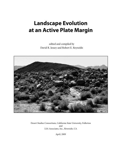
<strong>L<strong>an</strong>dscape</strong> <strong>Evolution</strong><br />
<strong>at</strong> <strong>an</strong> <strong>Active</strong> Pl<strong>at</strong>e <strong>Margin</strong><br />
edited <strong>an</strong>d compiled by<br />
David R. Jessey <strong>an</strong>d Robert E. Reynolds<br />
Desert Studies Consortium, California St<strong>at</strong>e University, Fullerton<br />
<strong>an</strong>d<br />
LSA Associ<strong>at</strong>es, Inc., Riverside, CA<br />
April, 2009
Front cover:<br />
Hot Creek, view toward the Sierra Nevada crest <strong>an</strong>d detail of hot<br />
springs. Reynolds photographs.<br />
Back cover:<br />
Convict Lake. David R. Jessey photograph.<br />
Terminal <strong>an</strong>d l<strong>at</strong>eral moraines in the Sierra Nevada. Reynolds<br />
photograph.<br />
Title page:<br />
1872 Lone Pine earthquake scarp. David R. Jessey photograph.<br />
In Memoriam<br />
This volume is dedic<strong>at</strong>ed to Bobbe Adams who, along<br />
with her l<strong>at</strong>e husb<strong>an</strong>d Bob, helped found the Mojave<br />
Desert Qu<strong>at</strong>ernary Research Conference th<strong>at</strong> has<br />
evolved into the Desert Research Symposium. Bob<br />
<strong>an</strong>d Bobbe’s influence continues through the scholarship<br />
they established for the best student paper<br />
presented <strong>at</strong> each year’s symposium. Bobbe also<br />
don<strong>at</strong>ed her husb<strong>an</strong>d’s geologic field notes, maps, <strong>an</strong>d<br />
photographs to the Mojave River Valley Museum in<br />
Barstow, where they are available for research.
Table of contents<br />
<strong>L<strong>an</strong>dscape</strong> evolution <strong>at</strong> <strong>an</strong> active pl<strong>at</strong>e margin: a field trip to the Owens Valley .................................7<br />
David R. Jessey <strong>an</strong>d Robert E. Reynolds<br />
Stolzite <strong>an</strong>d jixi<strong>an</strong>ite from Darwin, Inyo County, California ................................................................ 60<br />
Paul M. Adams<br />
Geology <strong>an</strong>d mining history of Cerro Gordo ghost town ..................................................................... 63<br />
Suz<strong>an</strong>ne M. Baltzer<br />
Signific<strong>an</strong>ce of the Independence dike swarm in underst<strong>an</strong>ding the tectonic evolution of the Owens<br />
Valley <strong>an</strong>d western Basin <strong>an</strong>d R<strong>an</strong>ge—a summary .............................................................................. 71<br />
Suz<strong>an</strong>ne M. Baltzer<br />
Paleozoic section <strong>at</strong> Mazourka C<strong>an</strong>yon, Inyo County, California: day trip guide ............................... 82<br />
Suz<strong>an</strong>ne M. Baltzer <strong>an</strong>d David R. Berry<br />
Lower Cambri<strong>an</strong>–Precambri<strong>an</strong> str<strong>at</strong>igraphy <strong>an</strong>d fossil fauna of the Westgard Pass area ................. 89<br />
Suz<strong>an</strong>ne M. Baltzer <strong>an</strong>d David R. Berry<br />
The Ol<strong>an</strong>cha Dunes, Owens Valley, California ....................................................................................... 92<br />
Mary B<strong>at</strong>es<br />
Triassic ammonoids from Union Wash, Inyo County, California .......................................................... 95<br />
David Berry<br />
Archaeocy<strong>at</strong>hids from Westgard Pass, Inyo County, California ........................................................... 97<br />
David Berry<br />
Basaltic volc<strong>an</strong>ism in the southern Owens Valley, California .............................................................. 98<br />
Jessica J. Bruns, Cami Jo Anderson, <strong>an</strong>d David R.Jessey<br />
Veget<strong>at</strong>ion of the Owens Valley <strong>an</strong>d the White Mountains ................................................................ 107<br />
Leah Gardner<br />
The rush from the Kern River mines into the Owens Valley ............................................................... 117<br />
Al<strong>an</strong> Hensher<br />
Montgomery City................................................................................................................................... 133<br />
Al<strong>an</strong> Hensher<br />
The Blue Chert Mine: <strong>an</strong> epithermal gold occurrence in the Long Valley Caldera ........................... 135<br />
David R Jessey<br />
Tectonic implic<strong>at</strong>ions of basaltic volc<strong>an</strong>ism within the central Owens Valley, California ............... 140<br />
David R. Jessey, M<strong>at</strong>thew W. Lusk, <strong>an</strong>d Ashley Varnell-Lusk<br />
The Goler Club ....................................................................................................................................... 148<br />
Don Lofgren, R<strong>an</strong>dall Nydam, James Honey, Barry Albright, Carter McGee, <strong>an</strong>d Stephen M<strong>an</strong>ning<br />
2009 Desert Symposium<br />
3
Fish Creek rhythmites <strong>an</strong>d aperiodic temporal sediment<strong>at</strong>ion ......................................................... 159<br />
David K. Lynch <strong>an</strong>d Paul M. Adams<br />
Holocene slip r<strong>at</strong>e <strong>an</strong>d tectonic role of the western Garlock fault .................................................... 165<br />
Sally F. McGill<br />
New Pleistocene faunas from Kern River terrace deposits ................................................................ 172<br />
Robert E. Reynolds<br />
Owens pupfish: a brief overview .......................................................................................................... 176<br />
All<strong>an</strong> Schoenherr<br />
Recent records of fossil fish from eastern Owens Lake ...................................................................... 177<br />
Gerald R. Smith, Robert E. Reynolds, <strong>an</strong>d Richard J. Serr<strong>an</strong>o<br />
Competing mesquite <strong>an</strong>d creosote dune systems near Stovepipe Wells ......................................... 184<br />
Richard A. (Tony) V<strong>an</strong>Curen<br />
The Oak Creek mudflow of July 12, 2008, Independence, Inyo County ............................................ 192<br />
Dave Wagner, Margie DeRose, <strong>an</strong>d Jim Stroh<br />
Proceedings of the 2009 Desert Symposium ..................................................................................... 198<br />
Evidence th<strong>at</strong> the Big Pine fault is not a segment of the Owens Valley fault <strong>an</strong>d its signific<strong>an</strong>ce for northern<br />
Owens Valley active tectonics ....................................................................................................................................198<br />
Kim M. Bishop<br />
Microbial biomass in clays from arid/ hyper-arid regions: testing for habitability in desert Mars <strong>an</strong>alogs .....198<br />
Rosalba Bonaccorsi <strong>an</strong>d Christopher P. McKay<br />
W<strong>at</strong>er level monitoring in the southern Amargosa ................................................................................................199<br />
Bri<strong>an</strong> Brown<br />
Gamma-Ray measurements of fissures along the Owens Valley fault scarp <strong>at</strong> Lone Pine .................................200<br />
George C. Copenhaver, Jr.<br />
Popul<strong>at</strong>ion dynamics of the Joshua tree (Yucca brevifolia) .....................................................................................200<br />
James W. Cornett<br />
A perspective on desert vehicle recre<strong>at</strong>ion <strong>an</strong>d proposed exp<strong>an</strong>sion of the Marine Corps Air Ground Comb<strong>at</strong><br />
Training Center .............................................................................................................................................................200<br />
Richard Crowe<br />
A photographer’s explor<strong>at</strong>ion .....................................................................................................................................202<br />
Walter Feller<br />
Geochronology <strong>an</strong>d paleoenvironment of pluvial Harper Lake, Mojave Desert, California .............................203<br />
Anna L. Garcia, Jeffrey R. Knott, Jordon Bright, <strong>an</strong>d Sh<strong>an</strong>non Mah<strong>an</strong><br />
The Kit Fox Hills, De<strong>at</strong>h Valley, CA: a propag<strong>at</strong>ing pressure ridge adjacent to the Northern De<strong>at</strong>h Valley fault<br />
zone ................................................................................................................................................................................203<br />
Jeffrey Knott, Andrei Sarna-Wojcicki, Joseph C. Liddico<strong>at</strong>, <strong>an</strong>d Al<strong>an</strong> Deino<br />
N<strong>at</strong>ural form<strong>at</strong>ions <strong>an</strong>d cultural behavior III ...........................................................................................................204<br />
Frederick W. L<strong>an</strong>ge<br />
4 2009 Desert Symposium
Evalu<strong>at</strong>ion of minor <strong>an</strong>d trace elements of the Wilson Creek Form<strong>at</strong>ion ............................................................204<br />
D<strong>an</strong>iel Lee, Elmira W<strong>an</strong>, David Wahl, Andrei M. Sarna-Wojcicki, <strong>an</strong>d Jeffrey R. Knott<br />
Reproductive ecology of female Sonora mud turtles (Kinosternon sonoriense) in Montezuma Well, Arizona:<br />
optimal egg size in a suboptimal environment? .......................................................................................................205<br />
Sheila Madrak, Jeff Lovich, Charles Drost, Anthony Mon<strong>at</strong>esti, Dennis Casper, <strong>an</strong>d Mohammed Znari<br />
Chronology of pluvial Lake Coyote, California, <strong>an</strong>d implic<strong>at</strong>ions for Mojave River paleohydrology ..............205<br />
David M. Miller <strong>an</strong>d Steph<strong>an</strong>ie L. Dudash<br />
Assessment of pl<strong>an</strong>t height <strong>an</strong>d cover using LIDAR in the Mojave Desert ..........................................................206<br />
April Newl<strong>an</strong>der, Darren S<strong>an</strong>dquist, John Carroll, David Bedford , <strong>an</strong>d David Miller ..................................206<br />
America’s resources <strong>an</strong>d garbage ...............................................................................................................................206<br />
J<strong>an</strong>e Nielson <strong>an</strong>d Howard Wilshire<br />
Desert writers: the conserv<strong>at</strong>ionists ...........................................................................................................................207<br />
Ruth Nol<strong>an</strong><br />
The Art of N<strong>at</strong>ure: images from the wildl<strong>an</strong>ds of southern Nevada ......................................................................208<br />
Sharon K. Schafer<br />
The Ashford brothers, their lives as miners in De<strong>at</strong>h Valley <strong>an</strong>d as residents of Dublin Gulch ........................208<br />
Sus<strong>an</strong> Sorrells<br />
Medicinal pl<strong>an</strong>ts of the Mojave Desert ......................................................................................................................208<br />
Melody Weaver<br />
War in our back yards ..................................................................................................................................................209<br />
Howard Wilshire <strong>an</strong>d J<strong>an</strong>e Nielson<br />
2009 Desert Symposium<br />
5
6 2009 Desert Symposium
<strong>L<strong>an</strong>dscape</strong> evolution <strong>at</strong> <strong>an</strong> active pl<strong>at</strong>e<br />
margin: a field trip to the Owens Valley<br />
David R. Jessey, Geological <strong>Science</strong>s Department, California Polytechnic University—Pomona, drjessey@<br />
csupomona.edu; <strong>an</strong>d Robert E. Reynolds, LSA Associ<strong>at</strong>es, Inc., Riverside CA 92507, bob.reynolds@lsaassoc.com<br />
Day 1<br />
Theme: Viscous volc<strong>an</strong>ics <strong>an</strong>d associ<strong>at</strong>ed<br />
tectonic structures<br />
with contributions from D. R. Jessey, R. E. Reynolds, Kim Bishop,<br />
J<strong>an</strong>et Westbrook, <strong>an</strong>d Tom Schweich<br />
Start Day 1<br />
Convene <strong>at</strong> Zzyzx. Wear sturdy shoes <strong>an</strong>d dress in<br />
layers; bring w<strong>at</strong>er, h<strong>at</strong>, <strong>an</strong>d sunscreen. On the night<br />
before the trip, fill your vehicle with gas <strong>an</strong>d check<br />
fluids <strong>an</strong>d tire pressure.<br />
Drive north from the Desert Study Center to I-15.<br />
ENTER I-15 WESTBOUND toward Barstow. Proceed<br />
through Barstow. EXIT RIGHT on SR-58<br />
toward Mojave/Bakersfield.<br />
Wh<strong>at</strong> We Will See: Our 300 mile route will cross the<br />
Mojave Desert Province <strong>an</strong>d enter the southwestern<br />
Basin <strong>an</strong>d R<strong>an</strong>ge Province. In the southern Owens<br />
Valley portion of the Basin <strong>an</strong>d R<strong>an</strong>ge Province we<br />
inspect basalt flows th<strong>at</strong> r<strong>an</strong>ge in age from middle<br />
Miocene to mid Holocene time. Their flow on older<br />
surfaces helps describe tectonic activity <strong>an</strong>d local<br />
l<strong>an</strong>dscape topography. The geomorphic fe<strong>at</strong>ures in<br />
Owens Valley are those of <strong>an</strong> active pl<strong>at</strong>e boundary<br />
between the North Americ<strong>an</strong> continental pl<strong>at</strong>e to the<br />
east <strong>an</strong>d the evolving Sierra micropl<strong>at</strong>e to the west.<br />
The Mojave Desert geomorphic province is a wedgeshaped<br />
area between the S<strong>an</strong> Andreas <strong>an</strong>d Garlock<br />
faults, eastward to southern Nevada <strong>an</strong>d northwestern<br />
Arizona. <strong>Biological</strong> boundaries are not as distinct as<br />
those for the fault-bounded geologic province; m<strong>an</strong>y<br />
Mojave species extend northward into the Basin <strong>an</strong>d<br />
R<strong>an</strong>ge province. Joshua trees (Yucca brevifolia) do not<br />
occur n<strong>at</strong>urally outside the Mojave biologic province,<br />
<strong>an</strong>d we will pass them as far north as Ol<strong>an</strong>cha. Creosote<br />
bush (Larrea trident<strong>at</strong>a) is the most common<br />
low-elev<strong>at</strong>ion shrub in the Mojave; the long-lived<br />
pl<strong>an</strong>t is closely associ<strong>at</strong>ed with burro bush (Ambrosia<br />
dumosa). Bunch grasses are recovering from heavy<br />
grazing pressure of the 1850s–1980s. Spring rains c<strong>an</strong><br />
2009 Desert Symposium<br />
turn the western Mojave into a solid sea of colorful<br />
<strong>an</strong>nuals (yellow desert d<strong>an</strong>delion, gold coreopsis,<br />
blue lupine, <strong>an</strong>d red paintbrush). Look for kestrals,<br />
falcons, hawks, <strong>an</strong>d eagles on power line towers (Darlington,<br />
1996; Schoenherr, 1995).<br />
The fl<strong>at</strong> surface of Mojave Desert hides thick, buried<br />
fossil soil horizons called “paleosols” (Ponti, 1985)<br />
th<strong>at</strong> contain the remains of mastodon, camel, horse,<br />
elk, <strong>an</strong>d <strong>an</strong>telope as well as smaller fossils such as<br />
cotton r<strong>at</strong> <strong>an</strong>d <strong>an</strong>cestral wood r<strong>at</strong>. The rodents suggest<br />
the middle to l<strong>at</strong>e Irvingtoni<strong>an</strong> North Americ<strong>an</strong> L<strong>an</strong>d<br />
Mammal Age (NALMA) of the Pleistocene (0.8–1.5<br />
Ma; Reynolds, 1989, 1991) for paleosols of the Mojave<br />
west of Barstow. L<strong>at</strong>e Pleistocene faunas (R<strong>an</strong>cholabre<strong>an</strong><br />
NALMA, < 200 ka) are reported from interfingering<br />
dune–lake sediments around Rogers <strong>an</strong>d<br />
Rosamond lakes (Reynolds <strong>an</strong>d Reynolds, 1991). Bison,<br />
the R<strong>an</strong>cholabre<strong>an</strong> NALMA indic<strong>at</strong>or fossil, has<br />
recently been reported from the Rosamond Lake area<br />
(Buena Vista Museum N<strong>at</strong>ural History collections).<br />
0.0 (0.0) Kramer Junction. Intersection of CA Hwy<br />
58 <strong>an</strong>d US Hwy 395. Fill gas t<strong>an</strong>ks. TURN RIGHT<br />
(north) on Hwy 395.<br />
1.5 (1.5) View left (west) of FPL Energy. The Kramer<br />
Junction Comp<strong>an</strong>y is the m<strong>an</strong>aging general partner<br />
for the five 30-megaw<strong>at</strong>t solar electric gener<strong>at</strong>ing<br />
facilities just north of Kramer Junction. The pl<strong>an</strong>ts<br />
normally oper<strong>at</strong>e on solar power. However, on cloudy<br />
days or early evenings <strong>an</strong> auxiliary n<strong>at</strong>ural gas-fired<br />
he<strong>at</strong>er is available to keep the oil warm to supplement<br />
the solar power. The Kramer Junction project has a 30<br />
year contract to provide energy to Southern California<br />
Edison. The solar gener<strong>at</strong>ors provide the major<br />
portion (over 80%) of their output during periods of<br />
peak dem<strong>an</strong>d, particularly on hot afternoons.<br />
6.2 (4.7) View left (west) of the Boron Federal Prison<br />
Camp, site of the old Boron Air St<strong>at</strong>ion. This prison,<br />
closed in 2000, was a minimum security camp th<strong>at</strong><br />
housed 540 male inm<strong>at</strong>es. The domed structure <strong>at</strong> the<br />
hilltop remains in use by the Air Force <strong>an</strong>d the FAA.<br />
7
6.6 (0.4) The “Ball Dome” east of 395 is a doppler<br />
radar, EYX.<br />
12.0 (5.4) Continue past a right turn.<br />
14.0 (2.0) Continue past a road leading east to the<br />
former siding of Fremont on the R<strong>an</strong>dsburg Railroad,<br />
running parallel to Hwy 395. This railroad was active<br />
from 1887 to 1933 (Myrick, 1991), serving rich mines<br />
in R<strong>an</strong>dsburg <strong>an</strong>d Joh<strong>an</strong>nesburg. Because of the<br />
1,200-foot drop into Fremont Valley, a spur to Goler<br />
was never <strong>at</strong>tempted. Processing of the ores from<br />
mines discovered in the R<strong>an</strong>d Mountains initially<br />
proved difficult due to the lack of w<strong>at</strong>er. For this reason<br />
Garlock, with good wells, was the first site of ore<br />
milling oper<strong>at</strong>ions. By 1896 there were 4 short-lived<br />
mills <strong>at</strong> Garlock, one <strong>at</strong> Mesquite Spring, <strong>an</strong>d Charley<br />
Koehn’s mill <strong>at</strong> K<strong>an</strong>e Spring. After the R<strong>an</strong>dsburg<br />
Railroad was completed to Joh<strong>an</strong>nesburg in 1898,<br />
Yellow Aster ore was processed by a 50-stamp mill<br />
in Barstow. A w<strong>at</strong>er line from Garlock to R<strong>an</strong>dsburg<br />
allowed a 30 stamp mill <strong>at</strong> the Yellow Aster mine to<br />
become oper<strong>at</strong>ional in 1899. In 1901 the Yellow Aster<br />
added 100 stamps to the existing b<strong>at</strong>tery.<br />
17.1 (3.1) The R<strong>an</strong>d Hills are <strong>at</strong> 10:00; the 1990s<br />
dumps of the Yellow Aster mine are <strong>at</strong> 11:00; <strong>an</strong>d Red<br />
Mountain is <strong>at</strong> 2:00.<br />
18.8 (1.7) Cross 20 Mule Team Parkway. This road<br />
also leads from Mojave northeast to Blackw<strong>at</strong>er Well,<br />
Gr<strong>an</strong>ite Well <strong>at</strong> Pilot Knob, through P<strong>an</strong>amint Valley<br />
<strong>an</strong>d down Wing<strong>at</strong>e Wash to the Furnace Creek bor<strong>at</strong>e<br />
deposits in De<strong>at</strong>h Valley (Faye, 1999).<br />
21.6 (2.8) Look ahead to excav<strong>at</strong>ions for scheelite<br />
placer mining for in the Atolia Tungsten District.<br />
Scheelite (calcium tungst<strong>at</strong>e, CaWO 4 ) initially bedeviled<br />
dry placer gold miners. They were troubled<br />
by fragments of tungsten since it was heavy (specific<br />
gravity 6.0) <strong>an</strong>d wound up with the gold concentr<strong>at</strong>e.<br />
Scheelite was recognized as valuable in 1903. Claims<br />
purchased by De Golia <strong>an</strong>d Atkins, with a contraction<br />
of names, became “Atolia.” Ore from lode deposits<br />
was initially h<strong>an</strong>d-sorted but a mill was constructed<br />
in 1907. The peak tungsten production, nearly $10<br />
million, was between 1916 to 1918, when Atolia<br />
boasted a payroll of $60,000 per month. The Atolia<br />
Tung–Sun Mining Comp<strong>an</strong>y beg<strong>an</strong> placer mining in<br />
Baltic Gulch in 1942.<br />
21.8 (0.2) Enter the Atolia Mining District. The headframe<br />
of the Union Tungsten Mine c<strong>an</strong> be seen to the<br />
northwest (Fig. 1-1). The Paradox claims are on both<br />
sides of Hwy 395.<br />
D. R. Jessey <strong>an</strong>d R. E. Reynolds<br />
Figure 1-1. Union Tungsten Mine headframe. [J. Westbrook photo]<br />
The district was a major producer of tungsten during<br />
the early 20 th century. At one point, Atolia had a<br />
popul<strong>at</strong>ion in the thous<strong>an</strong>ds (Clark, 1997). Interest in<br />
tungsten deposits continues to the present but little<br />
mining has occurred for the past 40 years. Scheelite,<br />
the main tungsten ore, occurs with quartz <strong>an</strong>d<br />
carbon<strong>at</strong>es along faults in the Jurassic Atolia Quartz<br />
Monzonite (Peck, 1953). The veins strike northwest<br />
<strong>an</strong>d deep steeply to both the north <strong>an</strong>d south. They<br />
consist of coarse grained scheelite, quartz, <strong>an</strong>d calcite,<br />
deposited as open space filling in the fractures. Wall<br />
rock alter<strong>at</strong>ion has caused pervasive alter<strong>at</strong>ion of<br />
biotite to chlorite <strong>an</strong>d feldspar to white mica, carbon<strong>at</strong>e,<br />
<strong>an</strong>d clays. The district was referred to as the “spud<br />
p<strong>at</strong>ch” because of the round, light brown nuggets of<br />
tungsten.<br />
22.9 (1.1) Enter Atolia.<br />
24.7 (1.8) Continue past a left turn to R<strong>an</strong>dsburg.<br />
View northwest of the 1990 Yellow Aster Mine<br />
dumps.<br />
25.1 (0.4) Sign: “Entering Red Mountain.” The Kelly<br />
silver mine structures are to the west, although the<br />
headframe has been dism<strong>an</strong>tled. Initial samples from<br />
the mine assayed 300 ounces of silver with three<br />
ounces of gold per ton. It became California’s largest<br />
silver deposit with over 20 million ounces produced<br />
between 1919 <strong>an</strong>d 1942. The ore occurs in quartz–<br />
carbon<strong>at</strong>e–chalcedony veins. Silver mineraliz<strong>at</strong>ion<br />
consists mainly of Ag–Cu–Sb sulfosalts (miargyrite<br />
<strong>an</strong>d pyrargyrite) <strong>an</strong>d Ag chlorides with minor n<strong>at</strong>ive<br />
silver. Arsenopyrite is the chief g<strong>an</strong>gue mineral.<br />
Due to the difficulty of milling, n<strong>at</strong>ive silver was often<br />
rejected during processing <strong>an</strong>d large nuggets c<strong>an</strong> still<br />
be found on the dumps.<br />
8 2009 Desert Symposium
25.3 (0.2) Continue past Osdick Rd.<br />
25.5 (0.2) View west of rem<strong>an</strong>ing Kelly Mine control<br />
building.<br />
26.5 (1.0) Continue past Trona Road on the right to<br />
Searles Lake (see Reynolds, 2002). Steam Wells Valley<br />
is to the north. Some of the pumps on the wells th<strong>at</strong><br />
provided Joh<strong>an</strong>nesburg <strong>an</strong>d R<strong>an</strong>dsburg with w<strong>at</strong>er<br />
were oper<strong>at</strong>ed by steam, <strong>an</strong> early use of geothermal<br />
power (Mendenhall, 1909; Reynolds, et al., 1998).<br />
28.2 (1.7) Enter Joh<strong>an</strong>nesburg <strong>an</strong>d Kern County.<br />
R<strong>an</strong>dsburg <strong>an</strong>d Joh<strong>an</strong>nesburg were the twin metropolises<br />
of the R<strong>an</strong>d Mining District. R<strong>an</strong>dsburg was the<br />
comp<strong>an</strong>y town, while Joh<strong>an</strong>nesburg was a pl<strong>an</strong>ned<br />
community for miners with families (Clark, 1997).<br />
They functioned as major tr<strong>an</strong>s-shipping points for<br />
rail <strong>an</strong>d stage lines. Ore from the district was initially<br />
shipped south to Barstow for milling, but with the<br />
construction of a 100-stamp mill in 1901 the district<br />
beg<strong>an</strong> to thrive. Large-scale gold mining continued<br />
until 1918. Gold production from the district was<br />
subst<strong>an</strong>tial into the 1930s <strong>an</strong>d early 1940s, <strong>an</strong>d there<br />
has been intermittent mining since, most recently<br />
from 1989 to 1995 <strong>at</strong> the Yellow Aster. Total estim<strong>at</strong>ed<br />
production from R<strong>an</strong>dsburg mines up to 1940 is<br />
estim<strong>at</strong>ed <strong>at</strong> $40 million. The mine was shut down in<br />
2004 <strong>an</strong>d the dumps <strong>an</strong>d heap leach piles have been<br />
“reclaimed.”<br />
The principal rocks underlying the R<strong>an</strong>d district are<br />
Precambri<strong>an</strong> R<strong>an</strong>d Schist <strong>an</strong>d Jurassic Atolia Quartz<br />
Monzonite. The R<strong>an</strong>d Schist is chiefly biotite schist<br />
with smaller amounts of amphibolite <strong>an</strong>d<br />
quartzite. Most of the lode-gold deposits<br />
are in veins along faults, except <strong>at</strong> the<br />
Yellow Aster mine where the gold occurs<br />
in a series of closely spaced veinlets in<br />
areas of intense shearing. The veins do<br />
not have a well defined strike; high grade<br />
ore zones most commonly occur <strong>at</strong> or<br />
near vein intersections or in sheared <strong>an</strong>d<br />
brecci<strong>at</strong>ed zones. The ore consists of iron<br />
oxide-stained, brecci<strong>at</strong>ed <strong>an</strong>d silicified rock<br />
containing fine-grained gold with varying<br />
amounts of sulfides. The sulfides increase<br />
<strong>at</strong> depth, but the gold values decrease.<br />
Mining stopped <strong>at</strong> a depth of 600 feet<br />
where unoxidized sulfides were found in<br />
the veins.<br />
29.2 (1.0) Prepare for left turn across oncoming<br />
traffic.<br />
2009 Desert Symposium<br />
<strong>L<strong>an</strong>dscape</strong> evolutuion <strong>at</strong> <strong>an</strong> active pl<strong>at</strong>e margin: field trip<br />
29.4 (0.2) TURN LEFT (west) to R<strong>an</strong>dsburg via the<br />
Redrock–R<strong>an</strong>dsburg Road. R<strong>an</strong>dsburg has a museum<br />
<strong>an</strong>d a recently active single stamp mill.<br />
29.9 (0.5) Disposal Site signs. TURN RIGHT (north)<br />
on Goler Road, <strong>an</strong>d proceed north 4.2 miles to Garlock<br />
Road. View right (northeast) of Summit Diggings<br />
district. Placer gold deposits to the northeast<br />
are called Hard Cash Gulch <strong>an</strong>d Summit Diggings<br />
(Reynolds, et al, 1998). Auriferous gravels of Summit<br />
Diggings may have been derived from Goler Gulch,<br />
three miles to the west. Right l<strong>at</strong>eral restor<strong>at</strong>ion of<br />
movement on the left l<strong>at</strong>eral Garlock fault would<br />
place auriferous gravels <strong>at</strong> the mouth of Goler Gulch.<br />
Farther east, the trace of the Garlock fault on the<br />
south shore of Searles Lake <strong>at</strong> the 2,250 foot shorelines<br />
is marked with tufa d<strong>at</strong>ed <strong>at</strong> 50,000 ka. Since the<br />
d<strong>at</strong>ed shorelines are not cut by the Garlock fault, th<strong>at</strong><br />
d<strong>at</strong>e constrains the l<strong>at</strong>est movement on th<strong>at</strong> portion<br />
of the fault to gre<strong>at</strong>er th<strong>an</strong> 50,000 ka (Smith, 1964).<br />
We are entering Fremont Valley.<br />
31.3 (1.4) Pass gravel dumps from hydraulic mining<br />
oper<strong>at</strong>ion.<br />
32.9 (1.6) Pass through low hills of Pleistocene alluvium<br />
elev<strong>at</strong>ed above axial drainage of Fremont Valley<br />
by the south-side up C<strong>an</strong>til Valley Fault.<br />
33.4 (0.5) Cross Fremont Wash <strong>an</strong>d C<strong>an</strong>til Valley<br />
Fault.<br />
33.8 (0.4) Railroad crossing, w<strong>at</strong>ch for trains. Prepare<br />
to turn left (west).<br />
Figure 1-2. Shuttle Radar Topography Mission (SRTM) image looking west<br />
along the Garlock fault. El Paso Mountains are in the foreground <strong>an</strong>d Tehachapi<br />
Mountains in the background; S<strong>an</strong> Gabriel Mountains on the dist<strong>an</strong>t skyline.<br />
9
34.2 (0.3) Stop <strong>at</strong> Garlock Road.<br />
Look for oncoming traffic. TURN<br />
LEFT (west) onto Garlock Road.<br />
The trace of the Garlock fault is to<br />
our right (Fig. 1-2). The first mining<br />
for lode gold, silver, <strong>an</strong>d copper<br />
ore in the El Paso Mountains was<br />
in 1863 on Laurel Mountain, east of<br />
the El Paso Peaks.<br />
John Goller, survivor of the 1849<br />
De<strong>at</strong>h Valley party, found gold nuggets<br />
on his trek across the desert.<br />
Although he regularly searched<br />
for his lost “mine” placer gold was<br />
not rediscovered here until 1893.<br />
Miners named one of the prospects,<br />
Goler Gulch, after Goller. By 1896,<br />
a half-million dollars of gold had<br />
been recovered (Vredenburgh,<br />
2009; Vredenburgh <strong>an</strong>d others,<br />
1981).<br />
35.4 (1.2) Continue past Goler Road on the left.<br />
The Goler Form<strong>at</strong>ion lies to the north, in the northcentral<br />
portion of the El Paso Mountains. The Goler<br />
Form<strong>at</strong>ion consists of a two mile (3 km) thick section<br />
of fluvial sediments capped by fossiliferous marine<br />
sediments (Lofgren <strong>an</strong>d McKenna, 2002; Cox <strong>an</strong>d<br />
Edwards, 1984; Cox <strong>an</strong>d Diggles, 1986; McDougall,<br />
1987). Intense prospecting for fossils by the “Goler<br />
Club” has collected a suite of small mammals th<strong>at</strong><br />
represent four NALMA th<strong>at</strong> sp<strong>an</strong> the Paleocene (Lofgren,<br />
et al., this volume). This is the best section west<br />
of Wyoming <strong>an</strong>d Colorado for studying Paleocene<br />
faunas (60 Ma). No fossils have been recovered from<br />
the lower members (1 & 2) of the Goler Form<strong>at</strong>ion,<br />
but if r<strong>at</strong>es of deposition c<strong>an</strong> be considered const<strong>an</strong>t,<br />
lower str<strong>at</strong>a project as Cretaceous in age (Cox, 1998).<br />
Clasts in the Goler Form<strong>at</strong>ion tell us th<strong>at</strong> the Mojave<br />
Block to the south was elev<strong>at</strong>ed in the early Tertiary<br />
(Cox, 1998). Prepare for a right turn on Charley<br />
Road.<br />
38.0 (2.6) TURN RIGHT on Charley Road. Proceed<br />
north 0.2 mile.<br />
38.2 (0.2) PARK along the road <strong>an</strong>d WALK NORTH<br />
to the fault scarp.<br />
STOP 1-1 (N 35°25’26.2”; W 117°44’15.5”). Cabins<br />
<strong>at</strong> the base of this 25–30 foot high scarp (Fig. 1-3) are<br />
owned by the BLM as part of their Adopt-A-Cabin<br />
program.<br />
D. R. Jessey <strong>an</strong>d R. E. Reynolds<br />
Figure 1-3. Charley Road (Stop 1-1) View east along Garlock Fault, the skyline notch above<br />
road, <strong>an</strong>d playa-filled graben on north side of fault scarp. [J. Westbrook photo]<br />
To the north from this escarpment is the southern<br />
fl<strong>an</strong>k of the El Paso Mountains. The rocks making up<br />
this portion of the El Paso Mountains are generally<br />
undifferenti<strong>at</strong>ed Paleozoic roof pend<strong>an</strong>ts <strong>an</strong>d Mesozoic<br />
gr<strong>an</strong>itoids. The east–west striking El Paso fault<br />
(south side down) lies <strong>at</strong> the base of the slope <strong>an</strong>d<br />
the 160 mile long Garlock fault along the base of this<br />
north-facing scarp (Fig.1-2). Look southeast across<br />
C<strong>an</strong>til Valley to old alluvial ridges th<strong>at</strong> mark the trace<br />
of the C<strong>an</strong>til Valley fault th<strong>at</strong> parallels the Garlock<br />
fault on the south side of Koehn Lake.<br />
The Garlock fault zone marks the geologic province<br />
boundary between the Mojave Desert to the south<br />
<strong>an</strong>d the Sierra Nevada <strong>an</strong>d Basin <strong>an</strong>d R<strong>an</strong>ge to the<br />
north. Movement along the Garlock fault is thought<br />
to have begun <strong>at</strong> about 10 Ma (Burb<strong>an</strong>k <strong>an</strong>d Whistler,<br />
1987). While no surface rupture has occurred on<br />
the Garlock fault in historic times, there have been<br />
a few sizable quakes. The most recent was a magnitude<br />
5.7 near the town of Mojave on July 11, 1992<br />
(SCEDC earthquake d<strong>at</strong>abase). It is thought to have<br />
been triggered by the L<strong>an</strong>ders earthquake, two weeks<br />
earlier (Jones, Mori <strong>an</strong>d Hauksson, 1995). Trenching<br />
suggests other ruptures occurred in 1050 A.D. near<br />
Tehachapi <strong>an</strong>d 1500 A.D. near our present loc<strong>at</strong>ion.<br />
At least one section of the fault has shown movement<br />
by creep in recent years. Numerous studies have been<br />
published citing slip r<strong>at</strong>es along the fault (LaViolette,<br />
et. al., 1980; Clark <strong>an</strong>d Lujoie, 1974; Carter, 1980,<br />
1982; Smith, 1975; McGill <strong>an</strong>d Sieh, 1993; Petersen<br />
10 2009 Desert Symposium
<strong>an</strong>d Wesnousky, 1994). Reported r<strong>at</strong>es of sinistral slip<br />
vary from 2 to 11 mm/yr. The western portion of the<br />
fault, near its junction with the S<strong>an</strong> Andreas fault, appears<br />
to be the most active with slip r<strong>at</strong>es exceeding 7<br />
mm/yr. In contrast, the eastern terminus of the fault,<br />
south of De<strong>at</strong>h Valley, has been characterized by little<br />
or no Holocene slip (Smith, 1998). Despite decades of<br />
study, the Garlock fault remains <strong>an</strong> enigma <strong>an</strong>d puzzling<br />
questions remain:<br />
•<br />
•<br />
•<br />
How is strain partitioned across the Garlock fault<br />
from the Eastern California Shear Zone into the<br />
Mojave?<br />
Why does the eastern segment of the fault appear<br />
to be aseismic, <strong>an</strong>d why does it termin<strong>at</strong>e in a<br />
thrust fault <strong>at</strong> the Avaw<strong>at</strong>z Mountains?<br />
Wh<strong>at</strong> is the rel<strong>at</strong>ionship of the Garlock fault to<br />
the S<strong>an</strong> Andreas fault <strong>an</strong>d the larger tectonic<br />
picture of southern California?<br />
Return to paved Garlock Road.<br />
39.0 (0.2) Stop <strong>at</strong> pavement, w<strong>at</strong>ch for cross-traffic<br />
<strong>an</strong>d TURN RIGHT. As we proceed west, note the depression<br />
on the north side of the road is a left-l<strong>at</strong>erally<br />
offset portion of Goler Gulch, the next drainage west<br />
(Reynolds <strong>an</strong>d others, 1998). The cement found<strong>at</strong>ion<br />
of <strong>an</strong> ore mill remains on the north scarp the depression.<br />
One-half mile west, tamarisk trees mark the site<br />
of Cow Wells, where Garlock found w<strong>at</strong>er <strong>at</strong> 30 feet,<br />
<strong>an</strong>d where the Yellow Aster mill was built in 1898.<br />
The Garlock - Cow Wells area was not reached by the<br />
Trona Railway until 1914, when the line was extended<br />
from Mojave to Searles Lake <strong>an</strong>d Owenyo to meet the<br />
2009 Desert Symposium<br />
<strong>L<strong>an</strong>dscape</strong> evolutuion <strong>at</strong> <strong>an</strong> active pl<strong>at</strong>e margin: field trip<br />
Figure 1-4. The 1898 Yellow Aster mill site <strong>at</strong> Cow Wells, where the w<strong>at</strong>er table was reached<br />
<strong>at</strong> 30 feet.[ J. Westbrook photo]<br />
Carson <strong>an</strong>d Colorado (C & C) Railroad in 1907–1910<br />
(Myrick, 1991). View west shows El Paso fault on<br />
right, Garlock fault left, <strong>an</strong>d terrace between.<br />
42.9 (2.9) The town of Garlock (el. 2175 ft). The town<br />
was a w<strong>at</strong>er source for c<strong>at</strong>tlemen <strong>an</strong>d traders avoiding<br />
a trek through the El Paso Mountains. When gold was<br />
discovered in a nearby c<strong>an</strong>yon in 1887, <strong>an</strong> arrastra<br />
was constructed to process the ore. In 1893 a nugget<br />
valued <strong>at</strong> approxim<strong>at</strong>ely $2000 from Goler C<strong>an</strong>yon<br />
caused a gold rush <strong>an</strong>d in 1895, Eugene Garlock from<br />
Tehachapi constructed <strong>an</strong> eight stamp mill (Hensher,<br />
1998a). Miners would talk of going down to the<br />
“Garlock mill” <strong>an</strong>d finally the town name Garlock<br />
just stuck. By 1898 the popul<strong>at</strong>ion of Garlock reached<br />
over 200 with five saloons, three boardinghouses, two<br />
restaur<strong>an</strong>ts, a post office, <strong>an</strong>d a school. Seven mills<br />
were in oper<strong>at</strong>ion. However, the town suffered a serious<br />
economic blow with the opening of a processing<br />
mill in Barstow <strong>an</strong>d two large mills in R<strong>an</strong>dsburg near<br />
the principle producing mine, the Yellow Aster (Fig.<br />
1-4). By 1904, Garlock was largely ab<strong>an</strong>doned. Although<br />
there was a renewal of activity with construction<br />
of rail lines from Mojave to Summit to Owens<br />
Valley, the town never regained its former st<strong>at</strong>us.<br />
44.0 (1.1) Red Rock–R<strong>an</strong>dsburg Road joins from the<br />
left. Continue west toward SR 14. Scarps of the Garlock<br />
fault are on the right. Green veget<strong>at</strong>ion marks<br />
springs along the fault.<br />
49.9 (5.9) Continue past a left (south) turnoff to<br />
Saltdale (El: 2000 ft.). The Consolid<strong>at</strong>ed Salt Comp<strong>an</strong>y<br />
constructed a crushing <strong>an</strong>d screening pl<strong>an</strong>t <strong>an</strong>d<br />
narrow gauge railroad track onto the playa of Koehn<br />
Lake in 1914 on sixty placer claims<br />
filed by Thomas Thorkildsen <strong>an</strong>d<br />
Thomas H. Rosenberger (Hensher,<br />
Vredenburgh <strong>an</strong>d Wilkerson,<br />
1998). The pl<strong>an</strong>t produced around<br />
20,000 tons of salt <strong>an</strong>nually. The<br />
comp<strong>an</strong>y pumped well w<strong>at</strong>er onto<br />
the lake floor where it was allowed<br />
to partially evapor<strong>at</strong>e. The resulting<br />
brine was drained into several<br />
ponds where a 6-inch layer of salt<br />
would form after a few months.<br />
The salt was saw cut into cakes<br />
th<strong>at</strong> were cle<strong>an</strong>ed by h<strong>an</strong>d <strong>an</strong>d<br />
hauled to the mill where they were<br />
ground, sized, sacked, <strong>an</strong>d shipped<br />
to Los Angeles. By 1918 a second<br />
comp<strong>an</strong>y was producing salt <strong>an</strong>d<br />
11
in 1922 the comp<strong>an</strong>ies were merged. Production continued<br />
until 1972 when a lawsuit pursued by the BLM<br />
found the original claims to be invalid.<br />
45.3 (0.4) Continue past the right (north) turnoff to<br />
Last Ch<strong>an</strong>ce C<strong>an</strong>yon. Once the main access into the<br />
El Paso Mountains, this road now requires 4WD since<br />
flash floods have re-engineered the road.<br />
47.7 (2.4) The site of Gypsite (south), oper<strong>at</strong>ed by<br />
Charles Koehn in 1909, produced gypsite (gypsum<br />
<strong>an</strong>d clay) used for plaster <strong>an</strong>d agricultural soil amendments<br />
(Hensher, 1998).<br />
49.1 (1.4) Cross the ch<strong>an</strong>nel of Red Rock C<strong>an</strong>yon<br />
Wash.<br />
49.6 (0.5) View of Honda test facility (see below).<br />
49.9 (0.3) Continue past C<strong>an</strong>til Road to the left.<br />
50.7 (0.8) Cross a drainage.<br />
53.0 (2.3) Neuralia Road is on the left just before we<br />
turn off on CA 14.<br />
Stop <strong>at</strong> the intersection with CA 14. Look to the<br />
south to see a curving line of veget<strong>at</strong>ion. This marks<br />
the edge of a 3-mile-wide oval (clearly seen in Goggle<br />
Earth imagery) test facility owned by Honda Motor<br />
Corpor<strong>at</strong>ion. The facility is well guarded <strong>an</strong>d<br />
off limits to travelers. At night, car headlights c<strong>an</strong><br />
often be seen as they circle the track. This has fueled<br />
conspiracy theories th<strong>at</strong> the test track is the locus<br />
of “alien” activity from the nearby “vortex” in the El<br />
Paso Mountains. TURN RIGHT (north) toward Red<br />
Rock C<strong>an</strong>yon St<strong>at</strong>e Park.<br />
55.4 (2.4) A trace of the El Paso fault is visible ahead<br />
to the left <strong>an</strong>d right. The t<strong>an</strong> sediments to the west<br />
contain a fossil fauna th<strong>at</strong> is signific<strong>an</strong>tly younger<br />
(l<strong>at</strong>e Hemphilli<strong>an</strong>) th<strong>an</strong> faunas in the Dove Spring<br />
form<strong>at</strong>ion. The sediments are bounded by the El Paso<br />
fault (north), the Sierra front fault (west) <strong>an</strong>d the Garlock<br />
fault (southeast) <strong>an</strong>d higher degree of clockwise<br />
rot<strong>at</strong>ion (35 degrees) th<strong>an</strong> the Dove Spring Form<strong>at</strong>ion<br />
(15 degrees; Whistler, 1991, p. 111). This suggests th<strong>at</strong><br />
the block has a history independent from the Dove<br />
Spring Form<strong>at</strong>ion, <strong>an</strong>d may have been left-l<strong>at</strong>erally<br />
tr<strong>an</strong>sl<strong>at</strong>ed from the Bedrock Spring Form<strong>at</strong>ion in the<br />
Lava Mountains (east of Hwy 395); a dist<strong>an</strong>ce of approxim<strong>at</strong>ely<br />
30 miles in the last 7–5 Ma.<br />
56.1 (0.7) Cross the trace of the El Paso fault, which<br />
here juxtaposes Mesozoic (Jurassic?) rocks <strong>an</strong>d undifferenti<strong>at</strong>ed<br />
Ricardo Miocene Group on its down-<br />
D. R. Jessey <strong>an</strong>d R. E. Reynolds<br />
thrown side (Whistler, 2005). Although motion along<br />
this fault has been characterized as predomin<strong>an</strong>tly<br />
dip-slip, its proximity to the Garlock fault suggests it<br />
may have a left-slip component. Despite paleoseismic<br />
studies on the nearby Garlock fault (McGill, 1992),<br />
little is known about slip r<strong>at</strong>es for the El Paso fault.<br />
The SCEDC website suggests last movement in the<br />
L<strong>at</strong>e Qu<strong>at</strong>ernary, but this presents a structural conundrum.<br />
The Garlock fault near this loc<strong>at</strong>ion has moved<br />
within the past 500 years, suggesting it is quite active.<br />
As such, its close proximity to the south-dipping El<br />
Paso fault should result in the Garlock fault buttressing<br />
dip slip movement along the El Paso fault. Perhaps<br />
Qu<strong>at</strong>ernary movement along the El Paso fault<br />
has been largely left-slip?<br />
56.8 (0.7) Basement rocks (largely gr<strong>an</strong>ite) are unconformably<br />
overlain by the Miocene Ricardo Group.<br />
This is best seen driving south on CA 14; when driving<br />
north, look back <strong>at</strong> the unconformity after passing<br />
a ridge of Mesozoic basement rock.<br />
57.4 (0.6) Move to left l<strong>an</strong>e <strong>an</strong>d prepare for a left turn.<br />
W<strong>at</strong>ch for oncoming traffic.<br />
57.6 (0.2) TURN LEFT (west) on Abbott Road to the<br />
Ricardo Campground <strong>an</strong>d Red Rock Park headquarters.<br />
58.5 (0.9) Note the basalt outcrop on the left side of<br />
the road.<br />
58.8 (0.3) Red Rock C<strong>an</strong>yon visitors center (El: 2175<br />
ft.). PARK on pavement before kiosk.<br />
STOP 1-2 (N 35°22’23.3”; W 117°59’18.3”). This<br />
outcrop (Fig. 1-5) lies within the west-dipping Dove<br />
Spring Form<strong>at</strong>ion of the Miocene Ricardo Group.<br />
Loomis (1984) divided the Dove Spring Form<strong>at</strong>ion<br />
Figure 1-5. Stop 2: outcrop of Miocene Dove Spring basalt exposed<br />
along Abbott Road. [D. R. Jessey photo]<br />
12 2009 Desert Symposium
into six units which r<strong>an</strong>ge in age from 7 to 13 Ma.<br />
The Dove Spring Form<strong>at</strong>ion lies unconformably on<br />
the Cudahy Camp Form<strong>at</strong>ion. The Cudahy Camp<br />
is thought to have been deposited from 15-19 Ma<br />
(Loomis <strong>an</strong>d Burb<strong>an</strong>k, 1988). The base of the Dove<br />
Spring is marked by conglomer<strong>at</strong>e grading upward<br />
into arkose. Overlying layers are comprised of a<br />
variety of differing lithologies including lacustrine<br />
<strong>an</strong>d fluvial s<strong>an</strong>dstones, siltstones <strong>an</strong>d conglomer<strong>at</strong>es,<br />
felsic tuffs <strong>an</strong>d basalt flows. The uppermost unit (Unit<br />
6 of Loomis, 1984) is a nearly fl<strong>at</strong>-lying sedimentary<br />
sequence th<strong>at</strong> lies disconformably on the units 1-5 of<br />
the Dove Spring.<br />
Recent ages published by Fr<strong>an</strong>kel, et al., (2008)<br />
indic<strong>at</strong>e the three lowermost basalts were extruded<br />
between 11.7 <strong>an</strong>d 10.5 Ma. No age is available for the<br />
uppermost basalt flow, but Whistler (1987) quotes <strong>an</strong><br />
age of 8.1 Ma for a rhyolite tuff above the basalt. This<br />
brackets basalt extrusion between about 8-12 Ma.<br />
Loomis <strong>an</strong>d Burb<strong>an</strong>k (1988) examined the evolution<br />
of the El Paso basin <strong>an</strong>d concluded th<strong>at</strong> extrusion of<br />
the basalts was coincident with the onset of left-slip<br />
motion along the Garlock fault <strong>an</strong>d the east-west<br />
extension characteristic of Basin <strong>an</strong>d R<strong>an</strong>ge topography.<br />
The subsequent emergence of the Sierra Nevada<br />
Mountains beg<strong>an</strong> <strong>at</strong> 8 Ma. Fr<strong>an</strong>kel (Fr<strong>an</strong>kel et al.<br />
2008) argues th<strong>at</strong> the Summit Mountains south of<br />
the Garlock fault are correl<strong>at</strong>ive with the Dove Spring<br />
Form<strong>at</strong>ion, but paradoxically they contain no basalt<br />
flows. This suggests a very local source for the basalts.<br />
Unfortun<strong>at</strong>ely, evidence for nearby faults of the<br />
proper age to provide a conduit for the basalt flows is<br />
absent. (Fig. 1-6)<br />
2009 Desert Symposium<br />
<strong>L<strong>an</strong>dscape</strong> evolutuion <strong>at</strong> <strong>an</strong> active pl<strong>at</strong>e margin: field trip<br />
Anderson (2004) sampled four basalt flows within<br />
the Dove Spring Form<strong>at</strong>ion (Tba 1 –Tba 3 of Loomis<br />
(1984) <strong>an</strong>d a fourth undifferenti<strong>at</strong>ed flow within unit<br />
4 of Loomis). Figure 1-6ais a total alkalis vs. silica<br />
diagram for the basalts of the Dove Spring Form<strong>at</strong>ion.<br />
Basalts from the Coso volc<strong>an</strong>ic field (Stop 3) are<br />
shown for comparison. Note th<strong>at</strong> Dove Spring (DS)<br />
basalts average approxim<strong>at</strong>ely 53% total SiO 2 <strong>an</strong>d<br />
3% total alkalis. This is 3-5% more silica th<strong>an</strong> basalts<br />
from other Owens Valley <strong>an</strong>d Mojave basalt fields <strong>an</strong>d<br />
1-3% more alkalis. Figure 1-6b is a basalt tetrahedron,<br />
again comparing the DS <strong>an</strong>d Coso basalts. DS basalts<br />
are generally tholeiites while those from Coso are<br />
predomin<strong>an</strong>tly alkali basalts. The l<strong>at</strong>ter are far more<br />
characteristic of southern California basalt fields.<br />
While some fields; i.e., Big Pine <strong>an</strong>d Darwin, sp<strong>an</strong> the<br />
entire r<strong>an</strong>ge of basalt compositions, most like Coso,<br />
Cima, Pisgah <strong>an</strong>d Amboy are distinctly alkaline. Tholeiitic<br />
basalts are uncommon.<br />
Anderson (2004) also noted the presence of iddingsite<br />
in m<strong>an</strong>y DS basalts. Iddingsite, a cryptocrystalline<br />
mixture of hydr<strong>at</strong>ed iron oxides <strong>an</strong>d Mg-clays rims,<br />
veins <strong>an</strong>d in m<strong>an</strong>y cases totally replaces olivine. In<br />
other cases, olivine has altered to a calcium-rich siderite.<br />
Unaltered olivine is extremely rare, as the CIPW<br />
norm depicted in Figure 1-6b would suggest. Iddingsite<br />
is a controversial mineral/alter<strong>at</strong>ion product<br />
originally thought to form by we<strong>at</strong>hering of olivine.<br />
However, Edwards (1938) suggested th<strong>at</strong> iddingsite<br />
was more likely a deuteric alter<strong>at</strong>ion product formed<br />
during magma mixing. Baker <strong>an</strong>d Haggerty (1967)<br />
concluded the form<strong>at</strong>ion of iddingsite required only<br />
<strong>an</strong> increased oxygen fugacity <strong>an</strong>d could be achieved<br />
simply by allowing a basaltic magma to incorpor<strong>at</strong>e<br />
circul<strong>at</strong>ing meteoric w<strong>at</strong>er. Furgal <strong>an</strong>d McMill<strong>an</strong><br />
(2001) reached a similar conclusion, but cautioned<br />
the alter<strong>at</strong>ion required elev<strong>at</strong>ed temper<strong>at</strong>ures, not<br />
typical of circul<strong>at</strong>ing groundw<strong>at</strong>er.<br />
Figure 1-6. (a) Total alkalis vs. silica (TAS) diagram for the Coso <strong>an</strong>d Ricardo (Dove Spring) volc<strong>an</strong>ic fields; (b) basalt tetrahedron for the<br />
two fields [modified from Anderson, 2004].<br />
13
Kushiro (1968) was the first to offer <strong>an</strong> expl<strong>an</strong><strong>at</strong>ion<br />
for differences in composition of m<strong>an</strong>tle-derived<br />
basaltic magma. He suggested th<strong>at</strong> depth of melting<br />
was <strong>an</strong> import<strong>an</strong>t variable <strong>an</strong>d th<strong>at</strong> magmas from the<br />
shallow m<strong>an</strong>tle would tend to be quartz norm<strong>at</strong>ive<br />
tholeiites while magmas produced in the deep m<strong>an</strong>tle<br />
would be olivine norm<strong>at</strong>ive <strong>an</strong>d alkaline. Anderson<br />
<strong>an</strong>d Jessey (2005) suggested th<strong>at</strong> one possible expl<strong>an</strong><strong>at</strong>ion<br />
for the DS tholeiites, therefore, was th<strong>at</strong> they<br />
represented a shallower partial melt. This could be<br />
rel<strong>at</strong>ed to their age <strong>an</strong>d/or geographic position to the<br />
west of other Mojave/Owens Valley basalt fields <strong>an</strong>d<br />
nearer shallow remn<strong>an</strong>ts of the east-dipping subduction<br />
zone <strong>an</strong>d East Pacific Rise (Y<strong>an</strong>g, 2002). However,<br />
Brown, Bruns <strong>an</strong>d Jessey (2008) pointed out th<strong>at</strong><br />
this does not account for the presence of iddingsite<br />
which requires preexisting phenocrysts of olivine.<br />
Therefore, initially, DS basaltic magmas may have<br />
been as alkaline as those of other Owens Valley fields<br />
<strong>an</strong>d melting depth might not be <strong>an</strong> import<strong>an</strong>t variable<br />
in compositional difference.<br />
The Cudahy Camp <strong>an</strong>d the Dove Spring form<strong>at</strong>ions<br />
are biostr<strong>at</strong>igraphically import<strong>an</strong>t because they contain<br />
North Americ<strong>an</strong> L<strong>an</strong>d Mammal Age (NALMA)<br />
tr<strong>an</strong>sitions of middle <strong>an</strong>d l<strong>at</strong>e Miocene faunas. The<br />
l<strong>at</strong>e early Miocene Cudahy Camp Form<strong>at</strong>ion is nonfossiliferous,<br />
while the Dove Spring faunas show the<br />
tr<strong>an</strong>sition from the Clarendoni<strong>an</strong> through Hemphilli<strong>an</strong><br />
l<strong>an</strong>d mammal age (13.4–7.3 Ma; Burb<strong>an</strong>k <strong>an</strong>d<br />
Whistler, 1987; Loomis <strong>an</strong>d Burb<strong>an</strong>k, 1988; Whistler,<br />
1991). Research in the local str<strong>at</strong>igraphic sequence<br />
presents biostr<strong>at</strong>igraphic, magnetostr<strong>at</strong>igraphic <strong>an</strong>d<br />
tephrochronologic age parameters (Whistler <strong>an</strong>d Burb<strong>an</strong>k,<br />
1992) th<strong>at</strong> c<strong>an</strong> be compared to other sedimentary<br />
sections across the continent (Tedford <strong>an</strong>d others,<br />
2004). This str<strong>at</strong>igraphic section contains lithologic<br />
clasts th<strong>at</strong> rel<strong>at</strong>e it to nearby tectonic events. Previous<br />
work suggested th<strong>at</strong> clasts from the rising Sierra Nevada<br />
Mountains were present in <strong>an</strong> upper portion of<br />
the section th<strong>at</strong> d<strong>at</strong>es between 8.5–8.4 Ma (Whistler<br />
<strong>an</strong>d Burb<strong>an</strong>k, 1992). Current studies (D. P. Whistler,<br />
p. c. to Reynolds, 2008) suggest th<strong>at</strong> “Sierr<strong>an</strong>-looking<br />
gr<strong>an</strong>itic clasts in place” have been found in a portion<br />
of the section above Ash 15 along the Powerline Road<br />
west of the campground th<strong>at</strong> d<strong>at</strong>es to 9.4 m.y. associ<strong>at</strong>ed<br />
with the Dove Spring Local Fauna. This suggests th<strong>at</strong><br />
gr<strong>an</strong>ites of the Sierra Nevada geologic province were<br />
exposed by 9 Ma.<br />
Return to vehicles <strong>an</strong>d RETRACE EAST to CA 14.<br />
D. R. Jessey <strong>an</strong>d R. E. Reynolds<br />
59.8 (1.0) W<strong>at</strong>ch for cross traffic. TURN LEFT<br />
(north) on CA 14. Note the brightly colored outcrops<br />
of west-northwest dipping Ricardo Group lacustrine<br />
<strong>an</strong>d fluvial sedimentary layers as you drive north on<br />
CA 14. The prominent ridge-capping black rocks are<br />
basalt flows within the Ricardo Group.<br />
63.3 (3.5) Continue past a left turn to Dove Spring<br />
offroad vehicle area. Pleistocene terrace deposits crop<br />
out along Dove Spring Wash. These sediments represent<br />
deposition of a bajada between the Sierra Nevada<br />
R<strong>an</strong>ge <strong>an</strong>d the El Paso Mountains, <strong>an</strong>d were dissected<br />
when erosion breached the fault complex along the<br />
south side of the El Paso Mountains. Sediments contain<br />
small <strong>an</strong>d large mammal species including Bison,<br />
the R<strong>an</strong>cholabre<strong>an</strong> indic<strong>at</strong>or mammal, <strong>an</strong>d have<br />
produced C-14 d<strong>at</strong>es between 19–10 ka (Whistler,<br />
1990, 1991).<br />
64.4 (1.1) Continue past a right (southeast) turn to<br />
Burro Schmidt’s Tunnel <strong>an</strong>d northern access to the El<br />
Paso Mountains. Continue northeast on CA 14.<br />
65.5 (1.1) Divide (el. 3300 ft.) separ<strong>at</strong>es Fremont<br />
Valley drainage system from Indi<strong>an</strong> Wells Valley, the<br />
l<strong>at</strong>ter draining east toward Searles Valley. The Scodie<br />
Mountains of the southern Sierra Nevada are to the<br />
west-northwest. Indi<strong>an</strong> Wells Valley lies <strong>at</strong> <strong>an</strong> elev<strong>at</strong>ion<br />
of 2300+ feet, only 300 feet above Fremont Valley.<br />
Presumably the elev<strong>at</strong>ion difference results from<br />
movement along the El Paso fault, but it could also<br />
be rel<strong>at</strong>ed to tr<strong>an</strong>spression caused by a left step in the<br />
Garlock fault (Smith, 1998).<br />
73.4 (7.8) Pass Robbers Roost gr<strong>an</strong>itic spires <strong>at</strong> 10:00<br />
(Reynolds, 2002).<br />
77.3 (3.9) Continue past a left (west) turn on SR 178<br />
to Walker Pass <strong>an</strong>d Bakersfield. Walker Pass, <strong>at</strong> 5250<br />
ft, is the obvious break in the Sierra. Joseph R Walker<br />
“discovered” this pass in 1834 leading the Bonneville<br />
expedition, the first wagon train to CA; it was l<strong>at</strong>er<br />
used by Frémont in 1845. The pass became a major<br />
route from gold fields <strong>at</strong> Keysville <strong>an</strong>d Kernville to<br />
Mojave <strong>an</strong>d north to Reno (Pracchia, 1994).<br />
77.7 (0.4) Continue past Bowm<strong>an</strong> Road on the right<br />
(El: 3700 ft.). Look uphill <strong>at</strong> 9:00 to see creosote rings.<br />
These rings are clones of the original pl<strong>an</strong>t, <strong>an</strong>d the<br />
largest rings is 60 ft. in diameter <strong>an</strong>d the pl<strong>an</strong>t is estim<strong>at</strong>ed<br />
to be <strong>at</strong> least 9000 years old.<br />
80.2 (2.5) Continue past a right (east) turn on SR 178<br />
to Inyokern <strong>an</strong>d Ridgecrest (El: 2310 ft.). Magnolia,<br />
siding 16 (Inyokern) <strong>an</strong>d Brown, siding 18, on the<br />
14 2009 Desert Symposium
Nevada & California railroad were used in building<br />
the aqueduct. The town of Ridgecrest grew around<br />
the China Lake Naval Ordn<strong>an</strong>ce Test St<strong>at</strong>ion.<br />
82.2 (2.0) Continue past a left turn to Indi<strong>an</strong> Wells,<br />
a spring on the Sierra Nevada frontal fault (SNFF)<br />
th<strong>at</strong> provides w<strong>at</strong>er for the Indi<strong>an</strong> Wells Brewery <strong>an</strong>d<br />
Lodge. Historically, rescuers of the Bennett/Arc<strong>an</strong>e<br />
party stopped for w<strong>at</strong>er going to <strong>an</strong>d coming from<br />
De<strong>at</strong>h Valley. The wells serviced trade route travelers<br />
thereafter. Owens Peak (8453 ft.) to the northwest was<br />
named for Richard Owens, a member of Fremont’s 3 rd<br />
expedition.<br />
84.5 (2.3) Junction of CA 14 <strong>an</strong>d Hwy 395. Continue<br />
north on 395.<br />
90.0 (5.5) Continue past Brown Road. View right<br />
(east) of China Lake <strong>an</strong>d <strong>at</strong> 1:30 to the White Hills,<br />
both of which contain l<strong>at</strong>e Pleistocene faunas (Day 3,<br />
MP 138.8).<br />
91.4 (1.4) Pearsonville on the right (east) is billed as<br />
the “hubcap capital of the world” since Lucy Pearson<br />
has a collection of hubcaps rumored to number in the<br />
tens of thous<strong>an</strong>ds. Cross the Inyo/Kern County Line<br />
<strong>at</strong> Pearsonville.<br />
92.6 (1.2) Continue past Sterling Road.<br />
94.5 (1.9) Continue past a left (west) turn to Kennedy<br />
Meadows via Nine Mile C<strong>an</strong>yon Road. The Coso<br />
volc<strong>an</strong>ic field is to the east.<br />
The Owens River has cut a c<strong>an</strong>yon between the Coso<br />
R<strong>an</strong>ge (east) <strong>an</strong>d the Sierra Nevada (west). The oldest<br />
volc<strong>an</strong>ic flows lie to the south. The Upper (prominent<br />
columnar jointing) <strong>an</strong>d Lower Little Lake Basalt are<br />
130,000 <strong>an</strong>d 400,000 years old respectively. The Basalt<br />
of Red Hill, named for the prominent cinder cone just<br />
to the east of Hwy 395 <strong>at</strong> the Fossil Falls turnoff, overlies<br />
the Little Lake Basalts. It has not been d<strong>at</strong>ed, but<br />
is younger th<strong>an</strong> 130,000 years <strong>an</strong>d older th<strong>an</strong> 10,000<br />
years. The flow has followed the drainage of the<br />
Owens River <strong>an</strong>d appears <strong>at</strong> first gl<strong>an</strong>ce to lie below<br />
the older Little Lake Basalt. The most recent volc<strong>an</strong>ic<br />
activity <strong>at</strong> Red Hill is d<strong>at</strong>ed <strong>at</strong> about 10,000 years<br />
although there is evidence for a more recent fl<strong>an</strong>k<br />
eruption from a small vent on the northwest fl<strong>an</strong>k of<br />
the cinder cone.<br />
100.7 (6.2) Move left <strong>an</strong>d prepare for left turn. W<strong>at</strong>ch<br />
for oncoming traffic.<br />
100.9 (0.2) TURN LEFT (cautiously) onto the Little<br />
Lake Road <strong>an</strong>d bear north. The Southern Pacific<br />
2009 Desert Symposium<br />
<strong>L<strong>an</strong>dscape</strong> evolutuion <strong>at</strong> <strong>an</strong> active pl<strong>at</strong>e margin: field trip<br />
Figure 1-7. Columnar-jointed Upper Little Lake Basalt <strong>at</strong> Stop 3.<br />
[D. R. Jessey photo]<br />
Railroad (SP) is on the west. The SP Lone Pine br<strong>an</strong>ch<br />
commenced in 1908 to facilit<strong>at</strong>e building of the LA<br />
Aqueduct. This is the site of the Little Lake Hotel <strong>an</strong>d<br />
gas st<strong>at</strong>ion. The only building left is the green post<br />
office to the west.<br />
101.1 (0.2) PARK <strong>an</strong>d WALK to the outcrop of columnar<br />
basalt.<br />
STOP 1-3 (N 35°56’00.2”; W 117°54’29.9”). The Coso<br />
volc<strong>an</strong>ic field lies to the east of the Sierra Nevada <strong>at</strong><br />
the western edge of the Basin <strong>an</strong>d R<strong>an</strong>ge province. It<br />
consists of Pliocene to Qu<strong>at</strong>ernary rhyolite domes <strong>an</strong>d<br />
basaltic cinder cones covering 150 square miles. The<br />
youngest eruptions are bimodal, with basaltic lava<br />
flows intruded by 38 rhyolite lava flows <strong>an</strong>d domes.<br />
The rocks exposed in this outcrop are columnar-jointed<br />
basalts of the Upper Little Lake Basalt (Fig. 1-7).<br />
In general, the basalt flows <strong>an</strong>d cones on the west side<br />
of the of Coso volc<strong>an</strong>ic field are Pleistocene in age<br />
while those to the east are Pliocene. The volc<strong>an</strong>ism<br />
occurred in two distinct pulses; one from 4.0-2.5 Ma,<br />
th<strong>at</strong> resulted in 31 km 3 of basalt, rhyodacite, dacite,<br />
<strong>an</strong>desite <strong>an</strong>d rhyolite, <strong>an</strong>d a second from 1.1 Ma to<br />
the Holocene with nearly equal amounts of basalt <strong>an</strong>d<br />
rhyolite (Duffield, et. al., 1980). These basalts contain<br />
fresh, unaltered phenocrysts of olivine in a fine-<br />
grained groundmass of plagioclase <strong>an</strong>d both clino-<br />
<strong>an</strong>d othopyroxene. No iddingsite has been observed<br />
or reported by previous researchers (Grove, 1996,<br />
Bacon, et. al., 1981, DePaolo, et. al., 2000). Figure 6a<br />
reveals th<strong>at</strong> Coso basalts are generally alkaline with<br />
K 2 O+Na 2 O averaging 5%. The majority of samples<br />
plot in the alkali basalt tri<strong>an</strong>gle of the basalt tetrahedron<br />
(Fig. 1-6b).<br />
The structural setting of the Coso volc<strong>an</strong>ic field remains<br />
controversial. Monastero, et. al. (2005) conclude<br />
the Coso R<strong>an</strong>ge lies <strong>at</strong> a right step or releasing<br />
15
end in a dextral shear system th<strong>at</strong> extends from the<br />
Indi<strong>an</strong> Wells Valley northward into the Owens Valley.<br />
This results in northwest-directed tr<strong>an</strong>stension, which<br />
is accommod<strong>at</strong>ed by normal <strong>an</strong>d strike-slip faulting.<br />
This necessit<strong>at</strong>es th<strong>at</strong> the Owens Valley fault must<br />
extend southward from Diaz Lake in the Alabama<br />
Hills, bene<strong>at</strong>h the sediments of Owens Lake, to the<br />
eastern side of the Coso R<strong>an</strong>ge where it steps west to<br />
the Little Lake fault. If so, the tectonic setting would<br />
be <strong>an</strong>alogous to southern De<strong>at</strong>h Valley, where basalts<br />
have been emplaced along the Black Mountain<br />
detachment formed by a right step in the Furnace<br />
Creek-Southern De<strong>at</strong>h Valley fault zone.<br />
Return to the vehicles <strong>an</strong>d Hwy 395, bearing left <strong>at</strong><br />
the c<strong>at</strong>tle guard.<br />
101.3 (0.2) Stop <strong>at</strong> pavement, w<strong>at</strong>ch for cross traffic.<br />
TURN LEFT (north) on Hwy 395.<br />
101.5 (0.2) Little Lake on the right is a spring-fed lake<br />
augmented by a low dam.<br />
101.9 (0.4) Continue past the turnoff to Little Lake<br />
R<strong>an</strong>ch (priv<strong>at</strong>e duck hunting club) to the right. Red<br />
Hill (the scoria cone just north of the turnoff) is<br />
straight ahead. Red Hill is one of the youngest volc<strong>an</strong>ic<br />
fe<strong>at</strong>ures in the Coso volc<strong>an</strong>ic field. It is thought to<br />
be no older th<strong>an</strong> 10,000 B.P. <strong>an</strong>d may have last experienced<br />
a fl<strong>an</strong>k eruption within the last 1000 years. The<br />
fl<strong>an</strong>k eruption is marked by a small cr<strong>at</strong>er th<strong>at</strong> lies<br />
on the northwest side of the cinder cone <strong>an</strong>d is best<br />
seen traveling south on Hwy 395. CEMEX currently<br />
oper<strong>at</strong>es the Red Hill Quarry on the south fl<strong>an</strong>k of<br />
the cinder cone. They have a small crusher pl<strong>an</strong>t th<strong>at</strong><br />
produces a fine scoria aggreg<strong>at</strong>e used for road cinders<br />
<strong>an</strong>d in the m<strong>an</strong>ufacture of cinder block, as well as<br />
larger-sized m<strong>at</strong>erial utilized for l<strong>an</strong>dscaping.<br />
104.6 (2.7) Continue past a right (east) turn <strong>at</strong> Cinder<br />
Road to Fossil Falls BLM campground. Continue<br />
north on Hwy 395. The Fossil Falls campground <strong>an</strong>d<br />
interpretive n<strong>at</strong>ure walk lie a short dist<strong>an</strong>ce along this<br />
road. Fossil Falls gets its name from the basalt outcrop<br />
th<strong>at</strong> marked <strong>an</strong> active w<strong>at</strong>erfall or rapids in the<br />
Owens River during times of a wetter clim<strong>at</strong>e. The last<br />
major overflow of w<strong>at</strong>er from the Owens River into<br />
China <strong>an</strong>d Searles Lakes probably occurred about<br />
4,000 years ago (B<strong>at</strong>es, this volume). The potholes in<br />
the basalt <strong>at</strong>test to the w<strong>at</strong>er’s velocity. The basalt here<br />
is typical of the Little Lake Basalt, with prominent<br />
olivine phenocrysts.<br />
109.4 (4.8) Coso Junction Rest Stop. Trees <strong>an</strong>d greenery<br />
to the west <strong>at</strong> 9:00 mark the trace of the SNFF.<br />
D. R. Jessey <strong>an</strong>d R. E. Reynolds<br />
Three lines to the west are: upper, old LADWP aqueduct<br />
(1913); center, Southern Pacific railroad to Lone<br />
Pine; lower, new LADWP aqueduct (1967).<br />
112.3 (2.9) Northeast <strong>at</strong> 1:30 you c<strong>an</strong> see <strong>an</strong> <strong>an</strong>cient<br />
l<strong>an</strong>dslide th<strong>at</strong> blocked the drainage of the Owens<br />
River. The river subsequently cut through the toe of<br />
the slide <strong>an</strong>d resumed its normal ch<strong>an</strong>nel.<br />
112.4 (0.1) Dunmovin.<br />
112.9 (0.5) Continue past a right turn to the Haiwee<br />
Power Pl<strong>an</strong>t.<br />
116.2 (3.3) Continue past a right turn on Haiwee<br />
Road leading to the reservoir. Haiwee Reservoir,<br />
to the east, marks the southernmost “lake” in the<br />
LADWP system for the eastern Sierra. Two intakes,<br />
one constructed in 1913 <strong>an</strong>d the second in 1970, draw<br />
w<strong>at</strong>er from the reservoir. From this point southward<br />
to Los Angeles, the Owens River flows only in aqueducts.<br />
The high peak on the Sierra crest <strong>at</strong> 10:00 is<br />
Ol<strong>an</strong>cha Peak (el. 12,122 ft).<br />
117.1 (0.9) Haiwee C<strong>an</strong>yon Road is on the left.<br />
119.2 (2.1) Continue past Lakeview Road. Veget<strong>at</strong>ion<br />
marks the SNFF scarp (west).<br />
120.9 (1.7) Sage Fl<strong>at</strong> Road junction. Continue on<br />
Hwy 395.<br />
122.1 (1.2) North Haiwee Road crosses spurs of the<br />
S. P. railroad th<strong>at</strong> served during construction of the<br />
LADWP aqueduct.<br />
122.8 (0.7) Cross the LADWP aqueduct.<br />
124.1 (1.3) Continue past a right turn to Cactus Fl<strong>at</strong>.<br />
124.5 (0.4) Continue past a left turn to Walker Creek<br />
Road <strong>an</strong>d a wild burro refuge.<br />
125.5 (1.0) The historical marker commemor<strong>at</strong>es the<br />
Farley Ol<strong>an</strong>cha mill site. Look east to the Plio-Pleistocene<br />
basalt of the Darwin volc<strong>an</strong>ic field th<strong>at</strong> drapes<br />
the south end of the Inyo Mountains. The basalt covers<br />
Paleozoic sedimentary rocks <strong>an</strong>d metamorphosed<br />
Mesozoic volc<strong>an</strong>ics <strong>an</strong>d sediments.<br />
126.0 (0.5) Continue past the junction with CA 190<br />
<strong>an</strong>d continue north on Hwy 395 toward Lone Pine.<br />
CA 190 heads east across the Darwin Pl<strong>at</strong>eau <strong>an</strong>d<br />
P<strong>an</strong>amint Valley before descending into De<strong>at</strong>h Valley.<br />
127.5 (1.5) The Crystal Geyser bottled w<strong>at</strong>er pl<strong>an</strong>t<br />
is on the right. This pl<strong>an</strong>t beg<strong>an</strong> producing bottled<br />
w<strong>at</strong>er in 1990. Since then, two additional pl<strong>an</strong>ts have<br />
16 2009 Desert Symposium
een built to meet the growing dem<strong>an</strong>d. Their website<br />
proclaims “Our w<strong>at</strong>er really is from a spring. CRYS-<br />
TAL GEYSER ® ALPINE SPRING WATER actually<br />
loc<strong>at</strong>es the perfect spring source first, <strong>an</strong>d then builds<br />
our bottling pl<strong>an</strong>t there.” A mystery surrounds the<br />
actual loc<strong>at</strong>ion of this “spring.” Crystal Geyser publicity<br />
suggests the w<strong>at</strong>er is from a “protected source”<br />
below the summit of Ol<strong>an</strong>cha Peak. A visit to the<br />
bottling pl<strong>an</strong>t failed to resolve this issue as employees<br />
would not divulge the loc<strong>at</strong>ion. A report in the High<br />
Country News (Nov. 1996) st<strong>at</strong>es th<strong>at</strong> Crystal Geyser<br />
has been involved in a dispute with Anheuser-Busch<br />
over the groundw<strong>at</strong>er bene<strong>at</strong>h their properties in the<br />
Owens Valley. They believed th<strong>at</strong> increased pumping<br />
of groundw<strong>at</strong>er by Anheuser-Busch immedi<strong>at</strong>ely<br />
north might allow saline w<strong>at</strong>er into local aquifers. The<br />
Crystal Geyser w<strong>at</strong>er comes from a well inside the<br />
blue building - not exactly from the “pure mountain<br />
spring” their advertising suggests. Inyo Co. regul<strong>at</strong>ions<br />
only allow Busch to export w<strong>at</strong>er by truck-load.<br />
Most goes as drinking w<strong>at</strong>er to the Briggs Mine in<br />
P<strong>an</strong>amint Valley.<br />
128.5 (1.0) Point of Historical Interest commemor<strong>at</strong>ing<br />
town of Cartago (see Day 3, MP 31.7), a shipping<br />
point for silver ingots from Cerro Gordo south to Los<br />
Angeles. Springs <strong>at</strong> the base of the Sierras mark the<br />
frontal fault.<br />
130.3 (1.8) View northeast of the Perm<strong>an</strong>ente Soda<br />
Works on Owens Lake (See “soda” Day 3, MP 36.6).<br />
134.8 (4.5) The Los Angeles Aqueduct Cottonwood<br />
Tre<strong>at</strong>ment Pl<strong>an</strong>t is west of the highway. At this loc<strong>at</strong>ion,<br />
ferric chloride is injected into the w<strong>at</strong>er <strong>an</strong>d<br />
precipit<strong>at</strong>es ferric arsenide. The result<strong>an</strong>t heavy<br />
precipit<strong>an</strong>t is deposited in the inlet ch<strong>an</strong>nel to Haiwee<br />
Reservoir. The primary source of arsenic is thought<br />
to be hot springs <strong>at</strong> Hot Creek (Stop 2-5, this volume)<br />
near Mammoth Lakes (Campbell,<br />
2007).<br />
135.3 (0.5) TURN RIGHT (east)<br />
to the 1873 Cottonwood charcoal<br />
kilns.<br />
136.3 (1.0) PARK <strong>at</strong> the Cottonwood<br />
charcoal kilns (Fig. 1-8).<br />
STOP 1-4. Colonel Stevens built<br />
a sawmill in upper Cottonwood<br />
C<strong>an</strong>yon to saw wood for the kilns.<br />
Timber was delivered to the kilns<br />
by a Y-shaped flume <strong>an</strong>d “roasted”<br />
2009 Desert Symposium<br />
<strong>L<strong>an</strong>dscape</strong> evolutuion <strong>at</strong> <strong>an</strong> active pl<strong>at</strong>e margin: field trip<br />
with minimum oxygen to produce charcoal, then carried<br />
by paddle-wheel steamship across Owens Lake to<br />
Sw<strong>an</strong>sea (see Day 3, Stop 3-8 MP 80.1). The Southern<br />
Pacific Mojave to Owens Valley railroad grade 500<br />
feet to the east is marked by a culvert under the railroad<br />
grade. Retrace to CA 395.<br />
137.3 (1.0) Stop <strong>at</strong> 395, w<strong>at</strong>ch for cross traffic, <strong>an</strong>d<br />
TURN RIGHT (north).<br />
139.1 (1.8) Continue past a left turn (west) to the Cottonwood<br />
Power Pl<strong>an</strong>t, built in 1910, which supplied<br />
hydroelectric power to shovels th<strong>at</strong> dug the aqueduct<br />
ch<strong>an</strong>nel from Aberdeen (Big Pine) to Haiwee. Two<br />
original 1906 Pelton w<strong>at</strong>er wheels <strong>at</strong> the pl<strong>an</strong>t are<br />
still working. L<strong>at</strong>er, the pl<strong>an</strong>t supplied electricity to<br />
tungsten mills <strong>at</strong> Red Mountain <strong>an</strong>d Atolia. Cottonwood<br />
Power Pl<strong>an</strong>t produces about 6,000 megaw<strong>at</strong>t<br />
hours of power per year, enough for 5,000 homes. The<br />
average flow is 16 cfs, about 11,000 acre-feet per year.<br />
LADWP has similar pl<strong>an</strong>ts <strong>at</strong> Division Creek <strong>an</strong>d Big<br />
Pine Creek th<strong>at</strong> take Sierra w<strong>at</strong>er to the aqueduct.<br />
Between the DWP <strong>an</strong>d SCE, almost every creek with<br />
fairly const<strong>an</strong>t flow from the mountains is hooked to<br />
a hydroelectric pl<strong>an</strong>t.<br />
139.9 (0.8) View right (northeast) <strong>at</strong> 1:00 of the ab<strong>an</strong>doned<br />
potash works associ<strong>at</strong>ed with the Pittsburgh<br />
Pl<strong>at</strong>e Glass pl<strong>an</strong>t.<br />
141.1 (1.2) Pass the ab<strong>an</strong>doned Pittsburgh Pl<strong>at</strong>e<br />
Glass sodium carbon<strong>at</strong>e pl<strong>an</strong>t. Sodium carbon<strong>at</strong>e<br />
was extracted from “dry” Owens Lake. PPG used the<br />
chemical to prepare specialty glass. The property was<br />
subsequently purchased by a doctor who made his<br />
fortune by inventing a heart value. He died before<br />
realizing his intention of turning the two-story office<br />
building into a museum highlighting his invention.<br />
View northeast of recessional shorelines. Lone Pine<br />
Peak (12,944 ft.) domin<strong>at</strong>es the Sierra skyline.<br />
Figure 1-8. Stop 1-4. The Cottonwood charcoal kilns.[Reynolds photo]<br />
17
144.1 (3.0) View right (northeast) of recessional<br />
shorelines. Historically the lake was 30 to 50 feet<br />
deep, deeper in the Pleistocene.<br />
145.7 (1.6) Continue past a left (west) turn to Lubken<br />
C<strong>an</strong>yon Road.<br />
147.0 (1.3) Left (west) is Diaz Lake, a sag pond cre<strong>at</strong>ed<br />
between the Lone Pine <strong>an</strong>d Owens Valley faults<br />
during the 1872 earthquake. The sag pond was empty<br />
in 1955 <strong>an</strong>d did not hold w<strong>at</strong>er until 1969. The name<br />
Diaz comes from Eleuterio <strong>an</strong>d Rafael Diaz, who were<br />
the unfortun<strong>at</strong>e owners of the r<strong>an</strong>ch th<strong>at</strong> became<br />
the site of the lake following the earthquake (Clark,<br />
1997). The Alabama Hills west of Lake Diaz form<br />
a prominent, 10 mile long, north-trending ridge of<br />
Cretaceous gr<strong>an</strong>ite <strong>an</strong>d Jurassic metavolc<strong>an</strong>ic <strong>an</strong>d<br />
metasedimentary rocks separ<strong>at</strong>ed from the main Sierra<br />
massif by a frontal fault (the Independence fault).<br />
As such, they are only one of two areas of arc-rel<strong>at</strong>ed<br />
rocks within the valley. The other arc-rel<strong>at</strong>ed rocks<br />
are the Poverty Hills, 35 miles to the north.<br />
148.3 (1.3) Continue on Hwy 395 past a junction on<br />
the right with Hwy 136 to De<strong>at</strong>h Valley.<br />
149.6 (1.3) Enter Lone Pine.<br />
149.8 (0.2) A movie museum is on the left (west).<br />
150.1 (0.3) TURN LEFT (west) <strong>at</strong> the traffic light<br />
onto Whitney Portal Road.<br />
150.5 (0.4) Intersection of Tuttle Creek <strong>an</strong>d Fairb<strong>an</strong>ks<br />
Road. Portagee Joe Creek campground is 0.1 mile<br />
south (left).<br />
150.7 (0.2) TURN RIGHT just beyond the LADWP<br />
aqueduct.<br />
150.9 (0.2) Cross two tree-lined creeks, immedi<strong>at</strong>ely<br />
TURN RIGHT, <strong>an</strong>d BEAR LEFT (north) on a dirt<br />
road.<br />
151.1 (0.2) PARK <strong>an</strong>d WALK to the fault scarp (Fig.<br />
1-9).<br />
STOP 1-5 (N 36°36’19.2”; W 118°04’28.9”). White<br />
gr<strong>an</strong>ite debris against dark rock debris. This scarp,<br />
on the Lone Pine fault, preserves evidence of slip<br />
during the Lone Pine earthquake of March 26, 1872.<br />
The Owens Valley fault gener<strong>at</strong>ed a magnitude 7.5<br />
to 7.8 earthquake considered to be the third largest<br />
historic earthquake in the conterminous United<br />
St<strong>at</strong>es (Ellsworth, 1990; Be<strong>an</strong>l<strong>an</strong>d <strong>an</strong>d Clark, 1994).<br />
This rupture had both oblique-normal <strong>an</strong>d right slip<br />
displacements. Dextral displacement averaged 6.0<br />
D. R. Jessey <strong>an</strong>d R. E. Reynolds<br />
Figure 1-9. View looking to the north along the Lone Pine fault. [D.<br />
R. Jessey photo]<br />
± 2.0 m with 1.0 ± 0.5 m of normal slip (Bacon <strong>an</strong>d<br />
Pezzop<strong>an</strong>e, 2007) Surface rupture length has been<br />
measured <strong>at</strong> 110 km (Be<strong>an</strong>l<strong>an</strong>d <strong>an</strong>d Clark, 1994). This<br />
particular scarp has been extensively studied (Oakeshott,<br />
et al., 1972, Be<strong>an</strong>l<strong>an</strong>d <strong>an</strong>d Clark, 1987, Lubetkin<br />
<strong>an</strong>d Clark, 1988). It lies near the southern extent of<br />
the 1872 surface break.<br />
The Owens Valley fault near Lone Pine consists of the<br />
main trace <strong>an</strong>d a secondary br<strong>an</strong>ch. The “main” fault<br />
extends along the western side of the town of Lone<br />
Pine forming the east side of Lake Diaz to the south.<br />
The discontinuous secondary trace lies approxim<strong>at</strong>ely<br />
1.0-1.5 kilometers to the west <strong>at</strong> the base of the<br />
Alabama Hills. This secondary fault was termed the<br />
Lone Pine fault by Lubetkin (1980). While both faults<br />
ruptured during the 1872 earthquake, the Lone Pine<br />
fault experienced right-oblique slip <strong>an</strong>d the Owens<br />
Valley fault only dextral shear.<br />
Following the 1872 earthquake researchers initially<br />
focused on vertical displacement reporting 12–18 feet<br />
of offset (Hobbs, 1910). It wasn’t until the 1960s th<strong>at</strong><br />
the right-slip component was fully documented <strong>an</strong>d<br />
recognized as the domin<strong>an</strong>t component of motion<br />
(B<strong>at</strong>em<strong>an</strong>, 1961). Offset of roughly 18 feet vertically<br />
<strong>an</strong>d 40 feet horizontally was ascribed to the 1872<br />
earthquake.<br />
In the 1980s it was determined th<strong>at</strong> this scarp was, in<br />
fact, the product of three separ<strong>at</strong>e Holocene events.<br />
The dip-slip component from the 1872 earthquake<br />
was estim<strong>at</strong>ed to be 3–6 feet with horizontal slip of<br />
12–18 feet. Lubetkin <strong>an</strong>d Clark (1988) proposed three<br />
18 2009 Desert Symposium
Figure 1-10. Offset drainages of Lone Pine Creek by the Lone Pine<br />
fault. Jm = Jurassic metavolc<strong>an</strong>ics of the Alabama Hills [Google<br />
Earth, 2008].<br />
separ<strong>at</strong>e events; the <strong>an</strong>tepenultim<strong>at</strong>e event between<br />
10,500 <strong>an</strong>d 21,000 cal yr BP, <strong>an</strong>d the penultim<strong>at</strong>e<br />
event <strong>at</strong> 5000 cal yr BP. Subsequently, Bacon <strong>an</strong>d<br />
Pezzop<strong>an</strong>e (2007) reported ages of 14,000–24,000<br />
<strong>an</strong>d 8800–10,200 for the two events. Calcul<strong>at</strong>ed slip<br />
r<strong>at</strong>es vary from 0.4 to 1.33 mmy/yr horizontally <strong>an</strong>d<br />
0.12-0.25 mm/yr vertically, with a recurrence interval<br />
of approxim<strong>at</strong>ely 10,000 years (Lubetkin <strong>an</strong>d Clark,<br />
1988, Bacon <strong>an</strong>d Pezzop<strong>an</strong>e, 2007).<br />
Figure 1-10 is a recent aerial photo available through<br />
Google Earth. It reveals the presence of <strong>an</strong> ab<strong>an</strong>doned<br />
stream ch<strong>an</strong>nel southeast of the main drainage of<br />
Lone Pine Creek th<strong>at</strong> was not previously recognized.<br />
This portion of the ch<strong>an</strong>nel has been offset 70–80<br />
meters to the south along the fault. Assuming a horizontal<br />
displacement of 1 mm/yr this ch<strong>an</strong>nel would<br />
represent ~75,000 years of fault motion. Interestingly,<br />
the ch<strong>an</strong>nel also appears to be offset ~25 meters in the<br />
direction of dip. The reason for this offset is less clear.<br />
If one postul<strong>at</strong>es a 45° dip on the Lone Pine fault, the<br />
r<strong>at</strong>io of horizontal to vertical offset would be similar<br />
to th<strong>at</strong> reported by other researchers. However, Lubetkin<br />
<strong>an</strong>d Clark (1988) st<strong>at</strong>e the Lone Pine fault dips<br />
75–90° <strong>an</strong>d as such the resulting separ<strong>at</strong>ion c<strong>an</strong>not<br />
be accounted for simply by the dip-slip component of<br />
motion. It appears more likely to result from incision<br />
of the ch<strong>an</strong>nel <strong>an</strong>d deposition of debris flows in the<br />
ab<strong>an</strong>doned ch<strong>an</strong>nel. Just when this would have happened<br />
is problem<strong>at</strong>ic as Lubetkin <strong>an</strong>d Clark (1988)<br />
suggest this ch<strong>an</strong>nel has been ab<strong>an</strong>doned for <strong>at</strong> least<br />
10,000 to 20,000 years. See also Bishop (this volume)<br />
2009 Desert Symposium<br />
<strong>L<strong>an</strong>dscape</strong> evolutuion <strong>at</strong> <strong>an</strong> active pl<strong>at</strong>e margin: field trip<br />
<strong>an</strong>d Copenhaver (this volume).<br />
Lone Pine Creek supports classic ripari<strong>an</strong> woodl<strong>an</strong>d<br />
with cottonwood trees, willows, <strong>an</strong>d grasses. Jeffrey<br />
pines come from cones washed down Lone Pine<br />
Creek from the Portal area.<br />
Return to the Whitney Portal Road.<br />
151.4 (0.3) TURN RIGHT (west) on Whitney Portal<br />
Road.<br />
154.2 (0.1) Continue past the right turn to Movie Fl<strong>at</strong><br />
Road, with <strong>an</strong> inform<strong>at</strong>ion plaque about the Alabama<br />
Hills as a film <strong>an</strong>d television loc<strong>at</strong>ion. The Alabama<br />
Hills are a popular loc<strong>at</strong>ion for television <strong>an</strong>d movie<br />
productions; often Westerns. Since the 1920s, over<br />
a dozen television shows have filmed here, including<br />
The Gene Autry Show, The Lone R<strong>an</strong>ger, <strong>an</strong>d even<br />
episodes of I Love Lucy. Over 250 movies including<br />
classics such as Gunga Din, Springfield Rifle, A<br />
Star is Born, <strong>an</strong>d How the West Was Won, as well as<br />
more recent productions such as Star Trek V <strong>an</strong>d<br />
Tremors, were also filmed here. In Gladi<strong>at</strong>or, Russell<br />
Crowe rides a horse in front of the Alabama Hills,<br />
with Mount Whitney in the background, for a scene<br />
presumably set in southern Europe (Internet movie<br />
d<strong>at</strong>abase, 2009; Wikipedia, 2008).<br />
151.5 (0.1) Continue past the Alabama Hills visitor<br />
turnout on the right. Mt. Whitney, ahead, reaches<br />
14,496 ft.<br />
153.5 (2.0) Pass through Movie Fl<strong>at</strong>s.<br />
153.9 (0.4) Continue past a left turn to Horseshoe<br />
Meadows.<br />
156.3 (2.4) Continue past Olivas R<strong>an</strong>ch Road to the<br />
left.<br />
157.2 (0.9) Continue past Lone Pine campground to<br />
the left (southwest).<br />
159.0 (1.8) PULL RIGHT into interpretive overlook<br />
on the north side of Whitney Portal Road. (Caution—<br />
w<strong>at</strong>ch for downhill traffic!)<br />
STOP 1-6 (N 36°35’45.5”; W 118°12’46.7”). As we<br />
look to the east across the Owens Valley we c<strong>an</strong> see<br />
some of the tectonic fe<strong>at</strong>ures shown on Figure 1-11.<br />
We are st<strong>an</strong>ding on or very near the scarp of the Independence<br />
fault. The valley floor lies <strong>at</strong> <strong>an</strong> elev<strong>at</strong>ion<br />
of 4000 feet while the Sierra crest averages 12–14,000<br />
ft. <strong>an</strong>d the Inyo R<strong>an</strong>ge averages 9,000, making the<br />
Owens Valley one of, if not the “Deepest Valley” in<br />
the United St<strong>at</strong>es. The Lone Pine fault (previous stop)<br />
19
D. R. Jessey <strong>an</strong>d R. E. Reynolds<br />
Figure 1-11. Generalized geologic cross section of the central Owens Valley. [D. R. Jessey]<br />
lies along the east edge of the Alabama Hills <strong>an</strong>d the<br />
Owens Valley fault about 0.6 miles to the east of th<strong>at</strong>.<br />
The scarp of the Inyo Mountains is cre<strong>at</strong>ed by the<br />
White–Inyo fault.<br />
The Alabama Hills lie 0.6–1.2 miles west of the town<br />
of Lone Pine, California. They form a prominent<br />
ridge of Cretaceous plutons <strong>an</strong>d Jurassic metavolc<strong>an</strong>ic<br />
<strong>an</strong>d metasedimentary rocks separ<strong>at</strong>ed from the<br />
main Sierra massif by the Independence frontal fault.<br />
Across the valley is the “famous” Union Wash ammonite<br />
locality <strong>an</strong>d the geologically complex Inyo<br />
Mountains. The Owens Valley <strong>an</strong>d Inyo Mountains<br />
lie near the western margin of the North Americ<strong>an</strong><br />
cr<strong>at</strong>on <strong>an</strong>d <strong>at</strong> the center of the central Sierra Nevada<br />
segment of the Cordiller<strong>an</strong> arc (Sorensen et al, 1998).<br />
The emplacement of the Sierra Nevada b<strong>at</strong>holith was<br />
a result of the oblique subduction of the Farallon<br />
oce<strong>an</strong>ic pl<strong>at</strong>e bene<strong>at</strong>h the North Americ<strong>an</strong> pl<strong>at</strong>e from<br />
210-80 Ma.<br />
The l<strong>at</strong>e Cenozoic tectonic history of eastern California<br />
is domin<strong>at</strong>ed by the Eastern California Shear<br />
Zone (ECSZ). The ECSZ is the name applied to the<br />
southern segment of the Walker L<strong>an</strong>e belt, a zone<br />
of dextral shear th<strong>at</strong> accommod<strong>at</strong>es about 20–25%<br />
of the total rel<strong>at</strong>ive motion between the Pacific <strong>an</strong>d<br />
North Americ<strong>an</strong> pl<strong>at</strong>es (G<strong>an</strong>, et al., 2000). North of<br />
the Garlock fault the ECSZ is 60 miles wide <strong>an</strong>d comprised<br />
of four separ<strong>at</strong>e north-northwest striking fault<br />
zones; from east to west the De<strong>at</strong>h Valley-Furnace<br />
Creek, Fish Lake Valley, Hunter Mountain–P<strong>an</strong>amint<br />
Valley, <strong>an</strong>d Owens Valley (Fr<strong>an</strong>kel, 2008). The Owens<br />
Valley fault is the only one of the four th<strong>at</strong> has<br />
recorded a major seismic event in the historic past.<br />
Le, et. al. (2007) published a comprehensive study of<br />
Sierra Nevada Frontal Fault (SNFF) system including<br />
the Independence fault, 5 miles to the west of Lone<br />
old as 10 Ma.<br />
Pine. Their study reported th<strong>at</strong><br />
movement along the Independence<br />
fault was dip-slip, east side<br />
down, <strong>at</strong> a r<strong>at</strong>e of 0.2–0.3 mm/<br />
yr. This r<strong>at</strong>e is about one-half to<br />
one-third th<strong>at</strong> necessary to accommod<strong>at</strong>e<br />
the 5000–7000 feet<br />
of vertical displacement between<br />
the Sierra Nevada crest <strong>an</strong>d the<br />
Owens Valley. They suggested<br />
this discrep<strong>an</strong>cy indic<strong>at</strong>es the Sierra<br />
Nevada Mountains are older<br />
th<strong>an</strong> the generally agreed upon<br />
figure of 3–5 Ma (Wakabayashi<br />
<strong>an</strong>d Sawyer, 2001), perhaps as<br />
The Lone Pine fault lies immedi<strong>at</strong>ely to the east of<br />
the Alabama Hills. The Lone Pine fault appears to be<br />
right, oblique-slip fault. R<strong>at</strong>es of vertical motion are<br />
estim<strong>at</strong>ed <strong>at</strong> 0.12–0.25 mm/yr. Horizontal slip r<strong>at</strong>es<br />
are less well constrained, but Lubetkin <strong>an</strong>d Clark<br />
(1988) suggest r<strong>at</strong>es ~1 mm/yr. The rel<strong>at</strong>ionship between<br />
the Lone Pine fault <strong>an</strong>d the Owens Valley fault<br />
to the east is enigm<strong>at</strong>ic. Since both were displaced<br />
by the 1872 Lone Pine earthquake they are clearly<br />
interrel<strong>at</strong>ed, however, Le et. al (2007) suggest th<strong>at</strong><br />
motion along the Owens Valley fault is almost pure<br />
dextral shear. Estim<strong>at</strong>es of slip r<strong>at</strong>e are variable from<br />
a high of 4.5 mm/yr (Kirby, et. al., 2008) to a low of<br />
0.7 mm/yr (Lubetkin <strong>an</strong>d Clark, 1988). No estim<strong>at</strong>es<br />
are available for the vertical component of movement<br />
along the Owens Valley fault, which m<strong>an</strong>ifests itself<br />
in the scarp cre<strong>at</strong>ed by the 1872 earthquake, but it is<br />
undoubtedly small; < 0.1 mm/yr.<br />
The White–Inyo fault strikes along the east side of the<br />
Owens Valley, 5–7 miles east of Lone Pine. Its history<br />
is complex. Bacon et. al. (2005) suggest th<strong>at</strong> Holocene<br />
motion along this fault is predomin<strong>an</strong>tly right<br />
oblique–slip <strong>at</strong> a r<strong>at</strong>e of 0.1–0.3 mm/yr. However,<br />
Beiller <strong>an</strong>d Zoback, (1995) argue th<strong>at</strong> motion along<br />
the White Mountains/Inyo Mountains fault system<br />
underwent a ch<strong>an</strong>ge from predomin<strong>an</strong>tly dip-slip<br />
(west side down) to oblique slip <strong>at</strong> 288 ka. This seems<br />
reasonable as the vertical component in <strong>an</strong> obliqueslip<br />
fault moving <strong>at</strong> a r<strong>at</strong>e of 0.1–0.3 mm/yr would<br />
be insufficient to account for the relief between the<br />
White/Inyo crest <strong>an</strong>d the valley floor.<br />
Richardson’s (1975) Master’s thesis from the University<br />
of Nevada–Reno was the first public<strong>at</strong>ion on the<br />
str<strong>at</strong>igraphy of Alabama Hills. The Jurassic sedimen-<br />
20 2009 Desert Symposium
tary <strong>an</strong>d metavolc<strong>an</strong>ic units are largely nonmarine arc<br />
rocks. Similar rock units are found in the southern<br />
Inyo Mountains, where they are underlain by unmetamorphosed<br />
to weakly metamorphosed lower<br />
Mesozoic to Paleozoic str<strong>at</strong>a. A more recent paper<br />
by Dunne <strong>an</strong>d Walker (1993) subdivides the Jurassic<br />
Alabama Hills into a lower interval comprised of<br />
ash-flow tuff <strong>an</strong>d volc<strong>an</strong>ogenic sedimentary str<strong>at</strong>a<br />
in nearly equal amounts <strong>an</strong>d <strong>an</strong> upper unit consisting<br />
of rhyolitic, ash-flow tuff. In the southern Inyo<br />
Mountains, the lower interval is described as having<br />
a thick basal conglomer<strong>at</strong>e, overlain by volc<strong>an</strong>ogenic<br />
conglomer<strong>at</strong>e, s<strong>an</strong>dstone <strong>an</strong>d siltstone, capped by a<br />
basaltic lava flow. The middle interval is comprised<br />
of about 65% silicic tuff, 25% <strong>an</strong>desite <strong>an</strong>d rhyolite,<br />
<strong>an</strong>d 10% volc<strong>an</strong>ogenic sedimentary units. The upper<br />
interval is composed of roughly 95% volc<strong>an</strong>ogenic<br />
conglomer<strong>at</strong>e, s<strong>an</strong>dstone, siltstone <strong>an</strong>d about 5%<br />
welded <strong>an</strong>d ash flow tuff. The volc<strong>an</strong>ic <strong>an</strong>d sedimentary<br />
units were subsequently metamorphosed during<br />
emplacement of Mesozoic gr<strong>an</strong>ites (148 <strong>an</strong>d 82 Ma)<br />
(Chen <strong>an</strong>d Moore, 1979).<br />
Despite extensive study some intriguing questions<br />
remain un<strong>an</strong>swered:<br />
•<br />
•<br />
How is strain partitioned across the Owens Valley?<br />
This question deals with the observ<strong>at</strong>ion th<strong>at</strong><br />
both strike-slip <strong>an</strong>d dip-slip faulting have occurred<br />
within the past 5 Ma. Stockli et .al. (2003)<br />
suggest th<strong>at</strong> vertical <strong>an</strong>d horizontal motion are<br />
episodic; the current regime of dextral shear<br />
beg<strong>an</strong> about 3 million years ago. Bellier (1995)<br />
suggests th<strong>at</strong> the Owens Valley fault tr<strong>an</strong>sitioned<br />
from dip-slip to dextral slip motion <strong>at</strong> 0.288 ka<br />
<strong>an</strong>d th<strong>at</strong> this tr<strong>an</strong>sition may not have been the<br />
first. In contrast Monastero et al. (2005) argue<br />
the Coso R<strong>an</strong>ge was cre<strong>at</strong>ed by tr<strong>an</strong>stension due<br />
to a right step in the Owens Valley fault. Such a<br />
tectonic setting could accommod<strong>at</strong>e simult<strong>an</strong>eous<br />
dip-slip <strong>an</strong>d strike-slip motion.<br />
Wh<strong>at</strong> is the age of the Owens Valley fault? Most<br />
believe th<strong>at</strong> ECSZ has been active only since Plio-<br />
Pleistocene time (Lee et. al., 2001). Based upon<br />
measured r<strong>at</strong>es of Holocene slip, displacement on<br />
the order of 6 miles would be indic<strong>at</strong>ed (Moore<br />
<strong>an</strong>d Hopson, 1961). Others, however, believe<br />
th<strong>at</strong> the Owens Valley segment of the ECSZ may<br />
have been active since 83 Ma with displacements<br />
of about 40 miles (Kyl<strong>an</strong>der-Clark, et. al., 2005).<br />
Bartley et al. (2007) even propose th<strong>at</strong> 10–40<br />
miles of additional offset occurred prior to 83 Ma.<br />
2009 Desert Symposium<br />
<strong>L<strong>an</strong>dscape</strong> evolutuion <strong>at</strong> <strong>an</strong> active pl<strong>at</strong>e margin: field trip<br />
•<br />
•<br />
•<br />
How do we reconcile the slip discrep<strong>an</strong>cy between<br />
geodetic measurements <strong>an</strong>d paleoseismicity?<br />
Paleoseismic studies suggest slip r<strong>at</strong>es across<br />
the Owens Valley fault <strong>at</strong> 1–3mm/yr (Be<strong>an</strong>l<strong>an</strong>d<br />
<strong>an</strong>d Clark, 1994; Lee et. al., 2001; Bacon et. <strong>at</strong>.,<br />
2002; Bacon <strong>an</strong>d Pezzop<strong>an</strong>e, 2007). This is <strong>at</strong><br />
odds with geodectic measurements suggesting<br />
motion of 6–8 mm/yr (Peltzer et. al., 2001). The<br />
discrep<strong>an</strong>cy between s<strong>at</strong>ellite measurement <strong>an</strong>d<br />
paleoseismic studies is difficult to reconcile. Suggestions<br />
include <strong>an</strong> elastic upper crust overlying<br />
a viscoelastic lower crust (Dixon et. al., 2003) <strong>an</strong>d<br />
a heretofore undiscovered component of oblique<br />
slip on m<strong>an</strong>y of the dip-slip faults (Bacon <strong>an</strong>d<br />
Pezzop<strong>an</strong>e, 2007).<br />
How is strain partitioned across the Garlock<br />
fault? Much controversy exits as to f<strong>at</strong>e of the<br />
ECSZ south of the Garlock fault. The Mojave is<br />
domin<strong>at</strong>ed by dextral shear, but no convincing<br />
evidence has been presented of ECSZ faults crosscutting<br />
the Garlock. The Blackw<strong>at</strong>er fault <strong>an</strong>d<br />
the Calico fault have been proposed as southern<br />
extensions of the Little Lake (Owens Valley) fault<br />
(Peltzer et. al., 2001), but this is difficult to reconcile<br />
with sinistral shear along the Garlock.<br />
Wh<strong>at</strong> role does Sevier thrusting play in the evolution<br />
of the Owens Valley? Stevens <strong>an</strong>d Olsen<br />
(1972) mapped a fault, termed the Inyo thrust,<br />
near Tinemaha Reservoir <strong>an</strong>d suggested rocks<br />
were carried eastward along this fault a dist<strong>an</strong>ce<br />
of approxim<strong>at</strong>ely 20 miles. A major problem was<br />
timing of the thrust. Stevens originally correl<strong>at</strong>ed<br />
the thrust with the Permo–Triassic Last Ch<strong>an</strong>ce<br />
thrust, a hypothesis th<strong>at</strong> was untenable for the<br />
fault as mapped to the east of Lone Pine. Here,<br />
Middle Jurassic rocks lie in the h<strong>an</strong>ging wall of<br />
the thrust <strong>an</strong>d hence the fault c<strong>an</strong> be no older<br />
th<strong>an</strong> Jurassic. Dunne <strong>an</strong>d Gulliver (1978) even<br />
questioned the existence of the thrust, suggesting<br />
instead th<strong>at</strong> the fault was a normal fault. Stone et<br />
al. (2004) provide some resolution to this controversy<br />
suggesting Stevens’ Inyo thrust lies near<br />
the crest of the Inyo Mountains <strong>at</strong> Cerro Gordo<br />
<strong>an</strong>d th<strong>at</strong> a younger thrust fault exposed along the<br />
base of the Inyo Mountains is, in fact, either l<strong>at</strong>e<br />
Jurassic or early Cretaceous in age. These stacked<br />
thrusts suggest a Sevier style of deform<strong>at</strong>ion.<br />
However, the dearth of outcrops has made definitive<br />
conclusions difficult.<br />
21
We are <strong>at</strong> elev<strong>at</strong>ion 6000 ft. <strong>an</strong>d veget<strong>at</strong>ion has<br />
ch<strong>an</strong>ged (see Gardner, this volume). Ahead <strong>at</strong> Whitney<br />
Portal (8200 ft.) are dense st<strong>an</strong>ds of Jeffrey pine<br />
<strong>an</strong>d mixed coniferous pl<strong>an</strong>ts, along with blue grouse,<br />
deer, black bear, Steller’s jays, <strong>an</strong>d golden-m<strong>an</strong>tled<br />
ground squirrels. Downslope, precipit<strong>at</strong>ion decreases<br />
<strong>an</strong>d temper<strong>at</strong>ures increase, supporting piñon–juniper<br />
woodl<strong>an</strong>d in turn replaced <strong>at</strong> lower elev<strong>at</strong>ions by<br />
Gre<strong>at</strong> Basin pl<strong>an</strong>t communities of mountain brush<br />
associ<strong>at</strong>ions including bitterbrush (Purshia sp.) <strong>an</strong>d<br />
Brigham tea (Ephedra viridi). Black brush (Coleogyne<br />
ramosissima) is found on interfluves of the alluvial<br />
f<strong>an</strong>s. Lower, Gre<strong>at</strong> Basin sagebrush (Artemisia trident<strong>at</strong>a)<br />
is domin<strong>an</strong>t. Along the road is a thick st<strong>an</strong>d<br />
of rabbit brush (Chrysothamnus sp.), a “pioneer” in<br />
disturbed areas th<strong>at</strong> crowds out n<strong>at</strong>ives. California<br />
buckwhe<strong>at</strong> (Eriogonum fascicul<strong>at</strong>um) may be n<strong>at</strong>ive<br />
or introduced. Sc<strong>at</strong>tered needlegrasses (Achn<strong>at</strong>herum<br />
sp.) <strong>an</strong>d n<strong>at</strong>ive bunch grasses are making a comeback<br />
after grazing.<br />
Return to vehicles, turn around <strong>an</strong>d RETRACE to<br />
Lone Pine on Whitney Portal Road.<br />
164.2 (5.2) Slow for curves ahead.<br />
167.1 (2.9) Stop <strong>at</strong> the traffic light <strong>an</strong>d TURN LEFT<br />
(north) on Hwy 395.<br />
167.2 (0.1) Cross Bush Street. The Southern Inyo<br />
Museum is on the left; Str<strong>at</strong>ham Hall senior center is<br />
on the right.<br />
167.4 (0.2) Continue past Russell Spasshouse Park on<br />
the left.<br />
167.9 (0.5) Continue past Narrow Gauge Road on the<br />
right leading to site of Owenyo.<br />
168.1 (0.2) The cemetery on the hill to the left (west)<br />
side of Hwy 395 contains a mass grave site for victims<br />
of the 1872 Lone Pine earthquake. Twenty-seven<br />
Lone Pine residents were killed in the quake, but only<br />
16 were buried in this grave. The peak to the east in<br />
the Inyo R<strong>an</strong>ge is New York Butte (el. 10,668 ft); farther<br />
to the north is Keynot Peak (el. 11,101 ft).<br />
169.9 (1.8) First set of northwest trending powerlines.<br />
171.2 (1.3) Cross the Owens Valley fault scarp after<br />
the second set of powerlines. The LADWP aqueduct<br />
lies behind the low fence <strong>at</strong> the base of the Alabama<br />
Hills. The vast ripari<strong>an</strong> woodl<strong>an</strong>d of willows, tules,<br />
<strong>an</strong>d grasses is supported by springs along the fault<br />
<strong>an</strong>d leaks from the aqueduct.<br />
D. R. Jessey <strong>an</strong>d R. E. Reynolds<br />
172.0 (0.8) The Alabama G<strong>at</strong>es spillway from the<br />
LADWP aqueduct.<br />
173.0 (1.0) Continue past a left turn to Moff<strong>at</strong> R<strong>an</strong>ch<br />
Road, the northern exit from the Alabama Hills.<br />
176.6 (3.6) The M<strong>an</strong>z<strong>an</strong>ar N<strong>at</strong>ional Historic Monument<br />
Interpretive Center is to the west. Mt. Williamson<br />
(el. 14,389 ft) is on the Sierra crest. M<strong>an</strong>z<strong>an</strong>ar<br />
is Sp<strong>an</strong>ish for apple orchard. During the early 20 th<br />
century. this part of the Owens Valley supported<br />
a thriving agricultural community th<strong>at</strong> produced<br />
some of the finest apples <strong>an</strong>d pears in California.<br />
When LADWP acquired the w<strong>at</strong>er rights, the supply<br />
of agricultural w<strong>at</strong>er was reduced <strong>an</strong>d the l<strong>an</strong>d was<br />
ab<strong>an</strong>doned. Following the <strong>at</strong>tack on Pearl Harbor the<br />
Federal government appropri<strong>at</strong>ed the l<strong>an</strong>d for one of<br />
five major Jap<strong>an</strong>ese–Americ<strong>an</strong> Reloc<strong>at</strong>ion Centers. At<br />
its peak M<strong>an</strong>z<strong>an</strong>ar housed nearly 18,000 men, women<br />
<strong>an</strong>d children. WWII ended, the camp was closed,<br />
<strong>an</strong>d Inyo County utilized parts of it for storage <strong>an</strong>d<br />
mainten<strong>an</strong>ce of county equipment. It fell into a st<strong>at</strong>e<br />
of disrepair until the N<strong>at</strong>ional Park Service undertook<br />
<strong>an</strong> extensive renov<strong>at</strong>ion <strong>an</strong>d reopened M<strong>an</strong>z<strong>an</strong>ar as<br />
<strong>an</strong> interpretive center in 2004. The former school<br />
multipurpose building now houses extensive exhibits<br />
documenting the events th<strong>at</strong> lead to the reloc<strong>at</strong>ion,<br />
<strong>an</strong>d detailing the everyday lives of the internees. One<br />
guard tower has been reconstructed, original housing<br />
units have been returned <strong>an</strong>d renov<strong>at</strong>ed, <strong>an</strong>d gardens<br />
refurbished.<br />
177.2 (0.6) Continue past a right turn (east) on<br />
M<strong>an</strong>z<strong>an</strong>ar–Reward Road leading to the Union Mining<br />
District.<br />
182.1 (4.9) Enter Independence. Continue past a right<br />
(east) turn to Kearsarge <strong>an</strong>d Mazourka C<strong>an</strong>yon (see<br />
Day 3).<br />
182.5 (0.4) Market Street. The Inyo County Courthouse<br />
is on the right; the Eastern California Museum<br />
is 0.25 miles to the west. The original courthouse was<br />
destroyed by the 1872 earthquake <strong>an</strong>d a l<strong>at</strong>er one by<br />
fire. This structure d<strong>at</strong>es from 1921 (Clark, 1997).<br />
Note the large block of Bishop Tuff in front of the<br />
courthouse.<br />
182.7 (0.2) Deny Park (Inyo County) is on the left<br />
(west).<br />
183.8 (1.1) The gravel pl<strong>an</strong>t <strong>at</strong> 9:00 produces aggreg<strong>at</strong>e<br />
for the CalTr<strong>an</strong>s Hwy 395 improvement project.<br />
When widening of the highway from Independence<br />
to Bishop is complete, the pl<strong>an</strong>t will move south.<br />
22 2009 Desert Symposium
<strong>L<strong>an</strong>dscape</strong> evolutuion <strong>at</strong> <strong>an</strong> active pl<strong>at</strong>e margin: field trip<br />
Figures 1-12 <strong>an</strong>d 1-13. East of Goodale Road, 1970s diversions allow w<strong>at</strong>er to flow into the Owens River ch<strong>an</strong>nel. [J. Westbrook photos]<br />
184.2 (0.4) Continue past Fort Road South. The devast<strong>at</strong>ing<br />
mud flow of August 2008 will be visited on<br />
Day 3 (Wagner <strong>an</strong>d others, this volume).<br />
184.7 (0.5) Continue past Schabbell L<strong>an</strong>e.<br />
185.1 (0.4) Continue past Miller L<strong>an</strong>e.<br />
190.8 (5.7) Continue past Sawmill/Black Rock Road.<br />
Enter the Big Pine–Taboose volc<strong>an</strong>ic field. This field<br />
consists of more th<strong>an</strong> 30 cinder cones <strong>an</strong>d flows covering<br />
400 square miles. All were emplaced during several<br />
episodes of volc<strong>an</strong>ism sp<strong>an</strong>ning 2 million years.<br />
The north–south alignment of the cones strongly<br />
suggests th<strong>at</strong> existing faults acted as feeders for the<br />
basaltic magmas. (See discussion <strong>at</strong> Stop 1-6).<br />
194.9 (4.1) Continue past Goodale Road (Figs 1-12<br />
<strong>an</strong>d 1-13).<br />
196.4 (1.5) Continue past a left turn to Taboose C<strong>an</strong>yon.<br />
We are approaching the Poverty Hills <strong>at</strong> 11:00.<br />
Rising 100 to 300 m (900 ft) above the valley floor<br />
<strong>an</strong>d covering3 square miles, the hills expose Paleozoic<br />
metasedimentary rock <strong>an</strong>d Mesozoic intrusive<br />
rock along the Owens Valley fault in the axial part of<br />
Owens Valley (Fig. 1-14). The hills earned their name<br />
from the fact th<strong>at</strong> they yielded little gold to prospectors<br />
compared to the nearby Fish Springs Hills 1.2<br />
miles to the northwest.<br />
199.9 (3.5) Continue past a wildlife view east <strong>at</strong> Elna<br />
Road.<br />
200.7 (0.8) Move to the left l<strong>an</strong>e <strong>an</strong>d prepare to turn<br />
left.<br />
201.1 (0.4) TURN LEFT (west) on Fish Springs Road<br />
<strong>at</strong> Tinemaha Reservoir.<br />
2009 Desert Symposium<br />
201.6 (0.5) BEAR LEFT on Tinemaha Road <strong>at</strong> Griffith<br />
Road.<br />
203.1 (1.5) PULL RIGHT into roadside turnout.<br />
STOP 1-7. Poverty Hills. Two models have been<br />
proposed for the origin of the Poverty Hills. The most<br />
recent model during the past couple of decades suggests<br />
the hills are a tectonic uplift cre<strong>at</strong>ed by horizontal<br />
shortening <strong>at</strong> a left step in the right-l<strong>at</strong>eral Owens<br />
Valley fault zone (Taylor <strong>an</strong>d Dilek, 2001; Taylor,<br />
Figure 1-14. Loc<strong>at</strong>ion map showing Poverty Hills <strong>an</strong>d Owens Valley<br />
fault. [K. M. Bishop]<br />
23
Figure 1-15A. Light colored str<strong>at</strong>igraphic layer in Paleozoic Keeler<br />
C<strong>an</strong>yon Form<strong>at</strong>ion exposed along Tinemaha Road on the western<br />
edge of the Poverty Hills. The bed, shown outlined, was distorted by<br />
c<strong>at</strong>aclastic breccia flow. Compare the distorted shape of the layer to<br />
th<strong>at</strong> of a known rock aval<strong>an</strong>che deposit shown in Figure 1-15b. [K.<br />
M. Bishop photo]<br />
2002). A recently advoc<strong>at</strong>ed second model suggests<br />
the hills are a l<strong>an</strong>dslide mass derived from the Inyo<br />
Mountains (Bishop, 1999; Bishop <strong>an</strong>d Clements,<br />
2006), although the l<strong>an</strong>dslide model was first suggested<br />
in the 1960s by Pakiser et al. (1964) based on<br />
a gravity survey of the valley. If the hills are indeed a<br />
l<strong>an</strong>dslide, the long-run out character classifies it as a<br />
rock aval<strong>an</strong>che. Correct interpret<strong>at</strong>ion of the origin<br />
of the hills is import<strong>an</strong>t because it has implic<strong>at</strong>ions<br />
for underst<strong>an</strong>ding the kinem<strong>at</strong>ics of the Owens Valley<br />
fault. The l<strong>an</strong>dslide model will be advoc<strong>at</strong>ed here. The<br />
presence of widespread brecci<strong>at</strong>ion across the hills<br />
suggest a l<strong>an</strong>dslide deposit (Bishop <strong>an</strong>d Clements<br />
2006). At this stop we will hike down Tinemaha Road<br />
to view breccia exposures in road cuts.<br />
Please w<strong>at</strong>ch for cars.<br />
Of particular interest in the road cuts is the exposure<br />
of a brecci<strong>at</strong>ed light-colored str<strong>at</strong>igraphic unit within<br />
dark colored units near where we park. The color<br />
contrast of the units allows one to clearly deline<strong>at</strong>e<br />
the results of c<strong>at</strong>aclastic flow deform<strong>at</strong>ion of the breccia.<br />
The light-colored unit thickens <strong>an</strong>d thins across<br />
the outcrop <strong>an</strong>d has a contorted shape (Fig. 1-15A).<br />
It is proposed th<strong>at</strong> the heterogeneous stress field required<br />
to cre<strong>at</strong>e this p<strong>at</strong>tern is the result of fluctu<strong>at</strong>ing<br />
internal stresses cre<strong>at</strong>ed by vibr<strong>at</strong>ion <strong>an</strong>d/or variable<br />
traction as the l<strong>an</strong>dslide mass moved rapidly across<br />
<strong>an</strong> irregular ground surface. The deformed geometry<br />
of the light-colored unit is reminiscent of the geometry<br />
of deformed str<strong>at</strong>igraphic units present in the<br />
Blackhawk l<strong>an</strong>dslide, a well-known rock aval<strong>an</strong>che<br />
deposit in the southern Mojave Desert (Fig. 1-15B).<br />
D. R. Jessey <strong>an</strong>d R. E. Reynolds<br />
Figure 1-15B. Light colored (outlined) str<strong>at</strong>igraphic layer in the<br />
Paleozoic Furnace Form<strong>at</strong>ion exposed in the Blackhawk rock<br />
aval<strong>an</strong>che in the southern Mojave Desert. [K. M. Bishop photo]<br />
Advoc<strong>at</strong>es of the tr<strong>an</strong>spressional model for the Poverty<br />
Hills suggest the road cuts expose fault breccia<br />
(Tayor, 2002). In this hypothesis, a thrust fault accommod<strong>at</strong>ing<br />
uplift is present just below the road level.<br />
A counterargument to this idea is th<strong>at</strong> the stress field<br />
from tectonic thrust faulting could be expected to<br />
be rel<strong>at</strong>ively homogeneous across the width of the<br />
outcrop. Thus, fault activity would not be expected to<br />
cause the contorted shape of the light-colored unit.<br />
If the hills are a l<strong>an</strong>dslide mass, the l<strong>an</strong>dsliding occurred<br />
<strong>at</strong> least several hundred thous<strong>an</strong>d years ago<br />
based on the degree of erosional dissection <strong>an</strong>d the<br />
age of basalt flows th<strong>at</strong> must post-d<strong>at</strong>e emplacement.<br />
The source area of the l<strong>an</strong>dslide is likely the Inyo<br />
Mountains where bedrock units of the same age <strong>an</strong>d<br />
lithologies are exposed in the S<strong>an</strong>ta Rita Fl<strong>at</strong> pluton<br />
area.<br />
Big Pine Volc<strong>an</strong>ic Field. Basalt flows <strong>an</strong>d scoria cones<br />
of the Big Pine volc<strong>an</strong>ic field c<strong>an</strong> be seen along both<br />
sides of U.S. 395 from the base of the Sierra Nevada<br />
Mountains to the west, to the Inyo Mountains to the<br />
east. The field encompasses <strong>an</strong> area of approxim<strong>at</strong>ely<br />
150 square miles from one mile south of the town of<br />
Big Pine (Stewart L<strong>an</strong>e, mp 217.5) to 8 miles north of<br />
Independence (Sawmill Road, mp 196.9). Volc<strong>an</strong>ism<br />
d<strong>at</strong>es from 1.2 Ma to as recently as 25 ka (M<strong>an</strong>ley,<br />
et al., 2000; Moore <strong>an</strong>d Dodge, 1980). Basaltic rocks<br />
domin<strong>at</strong>e, but a small outcrop area of rhyolite is present<br />
to the west of the Poverty Hills.<br />
Numerous active faults have been mapped within<br />
the Big Pine field. The Independence fault lies to the<br />
west of the basalt field <strong>an</strong>d along the Sierra Nevada<br />
front. Le et al. (2007) reported th<strong>at</strong> movement along<br />
24 2009 Desert Symposium
the Independence fault is dip-slip, east side<br />
down. The Fish Springs fault bisects the<br />
volc<strong>an</strong>ic field offsetting several cones <strong>an</strong>d<br />
flows. The alignment of flows <strong>an</strong>d cones<br />
along the fault suggest it may have acted<br />
as <strong>an</strong> import<strong>an</strong>t conduit for ascending<br />
magmas. Be<strong>an</strong>l<strong>an</strong>d <strong>an</strong>d Clark (1994) propose<br />
th<strong>at</strong> motion along the Fish Springs<br />
fault is purely vertical, east side down. The<br />
right-slip Owens Valley fault lies less th<strong>an</strong><br />
a kilometer to the east of the Fish Springs<br />
fault. The White–Inyo fault lies along the<br />
east side of the Owens Valley. Bacon, et. al.<br />
(2005) suggest th<strong>at</strong> Holocene motion along<br />
this fault is predomin<strong>an</strong>tly right oblique-slip,<br />
however, Bellier <strong>an</strong>d Zoback, (1995) argue<br />
th<strong>at</strong> motion along the White Mountains/<br />
Inyo Mountains fault system underwent a<br />
ch<strong>an</strong>ge from predomin<strong>an</strong>tly dip-slip (west side down)<br />
to oblique slip <strong>at</strong> 288 ka. Alignment of cinder cones<br />
along the While-Inyo fault suggests it has also acted<br />
as <strong>an</strong> import<strong>an</strong>t ch<strong>an</strong>nel for basaltic lavas.<br />
Darrow (1972) published the first study of the Big<br />
Pine basalts, noting they were largely alkaline <strong>an</strong>d<br />
<strong>at</strong>tributing the alkalinity to thickened crust bene<strong>at</strong>h<br />
the central Owens Valley. Waits (1995) sampled only<br />
a limited popul<strong>at</strong>ion of inclusion-bearing flows <strong>an</strong>d<br />
st<strong>at</strong>ed th<strong>at</strong> they were “highly alkaline”. Varnell (2006)<br />
examined the geochemistry <strong>an</strong>d petrology of the<br />
Big Pine field in more detail. Figure 1-16 is a basalt<br />
tetrahedron compiled from chemical <strong>an</strong>alyses of the<br />
Big Pine basalts.<br />
Samples from the Big Pine field sp<strong>an</strong> the compositional<br />
r<strong>an</strong>ge from alkali basalt to tholeiite. They do<br />
not show the restricted r<strong>an</strong>ge of either the Coso or<br />
Ricardo fields or volc<strong>an</strong>ic fields of the Mojave. Big<br />
Pine samples are spread almost equally between<br />
alkali basalt <strong>an</strong>d tholeiite with only a small number<br />
lying in the olivine tholeiite subtri<strong>an</strong>gle. Ringwood<br />
(1976) demonstr<strong>at</strong>ed th<strong>at</strong> a thermal divide separ<strong>at</strong>ed<br />
fraction<strong>at</strong>ing basaltic liquids <strong>an</strong>d <strong>at</strong> low pressure it<br />
was not possible for <strong>an</strong> unders<strong>at</strong>ur<strong>at</strong>ed ne norm<strong>at</strong>ive<br />
magma to evolve into a Q norm<strong>at</strong>ive tholeiite. This<br />
implies th<strong>at</strong> the alkali basalts <strong>an</strong>d tholeiites of the<br />
Big Pine field may have evolved separ<strong>at</strong>ely <strong>an</strong>d are<br />
the products of two differing events. Varnell (2006)<br />
also examined Big Pine basalts in thin section. She<br />
noted th<strong>at</strong> olivine was present in some samples <strong>an</strong>d<br />
absent in others. Nepheline was <strong>an</strong> occasional trace<br />
constituent. Darrow (1972) was the first to report the<br />
presence of iddingsite in Big Pine basalt, but unlike its<br />
2009 Desert Symposium<br />
<strong>L<strong>an</strong>dscape</strong> evolutuion <strong>at</strong> <strong>an</strong> active pl<strong>at</strong>e margin: field trip<br />
Figure 1-16. Basalt tetrahedron for the Big Pine volc<strong>an</strong>ic field. R<strong>an</strong>ge of basalt<br />
compositions for the Coso (dark gray) <strong>an</strong>d Ricardo (light gray) shown for<br />
comparison. Coso d<strong>at</strong>a from Grove (1996) <strong>an</strong>d Ricardo from Anderson (2004).<br />
ubiquitous occurrence in the Dove Spring (Ricardo)<br />
basalts, it is rare in the Big Springs basalts.<br />
Compositional differences between the various<br />
Owens Valley volc<strong>an</strong>ic fields have previously been<br />
<strong>at</strong>tributed to differing melting depth (Anderson <strong>an</strong>d<br />
Jessey, 2004; W<strong>an</strong>g et. al., 2002). However, the presence<br />
of iddingsite, <strong>an</strong> alter<strong>at</strong>ion product of olivine,<br />
lead Lusk <strong>an</strong>d Jessey (2007) to propose th<strong>at</strong> the initial<br />
composition of all Owens Valley magmas was alkaline<br />
<strong>an</strong>d th<strong>at</strong> the observed geochemical <strong>an</strong>d petrographic<br />
differences are a function of differing evolutionary<br />
p<strong>at</strong>hs th<strong>at</strong> involved <strong>an</strong> increase in oxygen fugacity<br />
for iddingsite-rich basalts. Reasons for the fugacity<br />
ch<strong>an</strong>ge are uncertain. Lusk <strong>an</strong>d Jessey (2007) suggest-<br />
Figure 1-17. Epsilon neodymium diagram for xenoliths from the Big<br />
Pine <strong>an</strong>d Coso volc<strong>an</strong>ic fields. D<strong>at</strong>a from the NAVDAT d<strong>at</strong>abase.<br />
25
ed it could be caused by assimil<strong>at</strong>ion of crustal rocks<br />
when the basaltic magma rose to shallow depth <strong>an</strong>d<br />
became gravit<strong>at</strong>ionally stable. He<strong>at</strong> from the ponded<br />
magma would melt the surrounding rocks increasing<br />
oxygen fugacity <strong>an</strong>d ch<strong>an</strong>ging the composition of the<br />
mama through assimil<strong>at</strong>ion, thus accounting for the<br />
signific<strong>an</strong>t compositional vari<strong>at</strong>ion between the various<br />
Owens Valley basalt fields.<br />
Evidence for this hypothesis comes from isotopes.<br />
Figure 1-17 is <strong>an</strong> εNd diagram for the Coso <strong>an</strong>d Big<br />
Pine fields. Coso basalts lie wholly within the m<strong>an</strong>tle<br />
array, suggesting Coso magmas were extracted from<br />
the m<strong>an</strong>tle <strong>an</strong>d extruded quickly after only limited<br />
interaction with the crust. Big Pine basalts, however,<br />
lie largely outside the m<strong>an</strong>tle array <strong>an</strong>d along <strong>an</strong><br />
evolutionary trend (Zindler <strong>an</strong>d Hart, 1986) requiring<br />
crustal contamin<strong>at</strong>ion (Zindler <strong>an</strong>d Hart, 1986).<br />
For Owens Valley basalt fields this contamin<strong>at</strong>ion<br />
occurred when ponded basaltic magma assimil<strong>at</strong>ed<br />
crustal rocks. Proceed southwest to Tinemaha Creek<br />
Campground.<br />
203.7 (0.6) Turn around <strong>at</strong> the intersection of Tinemaha<br />
Road <strong>an</strong>d Fuller Road. RETRACE to Griffith<br />
Road. Red Mountain is the large volc<strong>an</strong>ic cone to the<br />
west-southwest <strong>an</strong>d the cinder cone of Cr<strong>at</strong>er Mountain<br />
is to the north.<br />
205.3 (1.6) TURN LEFT on Griffith Road from Tinemaha<br />
Road. The view northwest <strong>at</strong> 10:00 is of a small<br />
red cinder cone with black basalt flows from Cr<strong>at</strong>er<br />
Mountain (elev. 6055’) to the northwest.<br />
205.7 (0.4) Join Fish Springs Road. Proceed north.<br />
The scarp of the Inyo/Owens/Fish Creek fault <strong>at</strong> the<br />
base of Cr<strong>at</strong>er Mountain is <strong>at</strong> 10:00.<br />
207.0 (1.3) Fish Springs h<strong>at</strong>chery on the left is the<br />
largest in Owens Valley.<br />
207.6 (0.6) PULL TO THE RIGHT <strong>an</strong>d PARK.<br />
STOP 1-8. Fish Springs Fault Scarp. Two scarps<br />
are exposed along the east face of Cr<strong>at</strong>er Mountain.<br />
Looking to the west, the Owens Valley fault (OVF)<br />
scarp is visible as <strong>an</strong> east-facing scarp. This part of the<br />
fault defines a 12 mile long segment of the OVF extending<br />
from the northwest side of the Poverty Hills<br />
to a termin<strong>at</strong>ion north of Big Pine <strong>an</strong>d referred to as<br />
the Big Pine segment. Almost due west of the stop is<br />
a tephra cone th<strong>at</strong> is cut on its west side by the fault.<br />
Following with the eye northward from the cone, the<br />
scarp is first seen to cut alluvial f<strong>an</strong> m<strong>at</strong>erial <strong>an</strong>d then<br />
to cut basalt of Cr<strong>at</strong>er Mountain. The scarp cuts west<br />
D. R. Jessey <strong>an</strong>d R. E. Reynolds<br />
of a hill composed of basalt just north of the alluvial<br />
f<strong>an</strong> m<strong>at</strong>erials. Another scarp is developed on the east<br />
side of the hill. On the north side of the hill, the faults<br />
on either side of the hill merge. The portion of the Big<br />
Pine fault segment between the Poverty Hills <strong>an</strong>d the<br />
point where the two faults merge is referred to as the<br />
Fish Springs fault.<br />
From study of the tephra cone offset, Martel (1989)<br />
demonstr<strong>at</strong>ed th<strong>at</strong> the Fish Springs fault is <strong>an</strong> eastside<br />
down dip slip fault with no strike-slip component.<br />
This poses a problem to the tr<strong>an</strong>spressional<br />
uplift model for the Poverty Hills. Without a rightl<strong>at</strong>eral<br />
component of slip on the Fish Springs fault,<br />
there is no geometric reason for uplift of the western<br />
Poverty Hills.<br />
Be<strong>an</strong>l<strong>an</strong>d <strong>an</strong>d Clark (1994) proposed th<strong>at</strong> the Big<br />
Pine segment contains a large strike-slip component<br />
north of the Fish Springs fault. As evidence, they<br />
listed the possible right-l<strong>at</strong>eral offset of two hills along<br />
the fault <strong>at</strong> Cr<strong>at</strong>er Mountain, offset of a line of tree<br />
stumps near Big Pine, <strong>an</strong>d offset of a stream ch<strong>an</strong>nel<br />
north of Big Pine. Examin<strong>at</strong>ion of each of these fe<strong>at</strong>ures<br />
suggests th<strong>at</strong> the evidence is weak. The possible<br />
offset of the hills is questioned because it is not clear<br />
how the hills formed. They are localized in <strong>an</strong> unusual<br />
area of the fault, where the fault contains a graben<br />
structure. Until the origin of the hills is understood,<br />
it is arguable th<strong>at</strong> the hills have been offset horizontally.<br />
The line of tree stumps is irregular <strong>an</strong>d it is not<br />
clear the trees were not pl<strong>an</strong>ted in a p<strong>at</strong>tern th<strong>at</strong> today<br />
suggests the possibility of right l<strong>at</strong>eral offset. Furthermore,<br />
it is not even clear th<strong>at</strong> the trees pre-d<strong>at</strong>e<br />
the most recent fault rupture. Finally, it is not clear<br />
th<strong>at</strong> the proposed offset stream ch<strong>an</strong>nels were ever<br />
directly adjacent to <strong>an</strong>other.<br />
In order to explain the lack of a strike-slip displacement<br />
on the Fish Springs fault, they suggested th<strong>at</strong><br />
strike-slip motion <strong>an</strong>d dip-slip motion is partitioned<br />
<strong>at</strong> the l<strong>at</strong>itude of the Fish Springs fault with dip-slip<br />
movement occurring on the Fish Springs fault <strong>an</strong>d<br />
strike-slip movement occurring on the eastern fault.<br />
This suggestion is specul<strong>at</strong>ive in th<strong>at</strong> there is no<br />
evidence for strike-slip displacement on the eastern<br />
fault. As <strong>an</strong> altern<strong>at</strong>ive in light of the weak evidence<br />
for strike-slip displacement on the Big Pine segment<br />
it is proposed th<strong>at</strong> the entire Big Pine segment is a<br />
pure dip slip fault. We will consider evidence for this<br />
possibility <strong>at</strong> the next stop. Return to vehicles. Proceed<br />
north.<br />
26 2009 Desert Symposium
Figure 1-18. Upper—view to the north of the Big Pine fault segment<br />
near the town of Big Pine. Lower—view to the north of the Lone<br />
Pine fault east of the town of Lone Pine. The Lone Pine fault<br />
ruptured in 1872 <strong>an</strong>d still has a steep, well-developed free face,<br />
whereas the Big Pine fault scarp is strongly degraded <strong>an</strong>d does not<br />
contain a free face <strong>an</strong>ywhere along its length. The lack of a free-face<br />
in the Big Pine fault is evidence th<strong>at</strong> the fault did not rupture in<br />
1872. [K. M. Bishop photos]<br />
207.9 (0.3) Stop <strong>at</strong> southbound Hwy 395. W<strong>at</strong>ch for<br />
traffic, cross southbound l<strong>an</strong>es, <strong>an</strong>d TURN LEFT on<br />
northbound 395.<br />
210.9 (3.0) Continue past a right turn to Steward<br />
L<strong>an</strong>e. Prepare for left turn onto Big Pine Dump Road.<br />
211.2 (0.3) TURN LEFT on Big Pine Dump Road.<br />
211.5 (0.3) PARK <strong>at</strong> waste tr<strong>an</strong>sfer st<strong>at</strong>ion. WALK up<br />
the g<strong>at</strong>ed dirt road to the Big Pine fault scarp.<br />
STOP 1-9. Big Pine Fault Scarp. The current paradigm<br />
for this segment is th<strong>at</strong> the fault last ruptured<br />
in 1872 <strong>an</strong>d th<strong>at</strong> it contains a predomin<strong>an</strong>t strike-slip<br />
component <strong>an</strong>d a lesser dip slip component. The<br />
purpose of this stop is to examine the surface trace<br />
of the Owens Valley fault <strong>an</strong>d consider evidence for<br />
the following two concepts: 1) the Big Pine segment<br />
did not rupture in 1872, <strong>an</strong>d 2) the Big Pine segment’s<br />
kinem<strong>at</strong>ics is pure dip slip.<br />
2009 Desert Symposium<br />
<strong>L<strong>an</strong>dscape</strong> evolutuion <strong>at</strong> <strong>an</strong> active pl<strong>at</strong>e margin: field trip<br />
Two lines of evidence suggest th<strong>at</strong> the fault did not<br />
rupture in 1872. First, rock varnish is ubiquitously<br />
developed on rocks exposed in the fault scarp, as best<br />
seen in the basalt of Cr<strong>at</strong>er Mountain. Rock varnish<br />
takes approxim<strong>at</strong>ely 2000 years to develop sufficiently<br />
to be visually discernible. If the Big Pine segment<br />
ruptured in 1872, then a zone of unvarnished rock<br />
disrupted by the fault movement should be present,<br />
but it is not. A second line of evidence is the st<strong>at</strong>e of<br />
fault scarp degrad<strong>at</strong>ion where the fault cuts f<strong>an</strong>glomer<strong>at</strong>ic<br />
deposits. Along its entire length, the maximum<br />
scarp gradient is no gre<strong>at</strong>er th<strong>an</strong> approxim<strong>at</strong>ely 30<br />
degrees, the <strong>an</strong>gle of repose for loose, s<strong>an</strong>dy m<strong>at</strong>erial.<br />
Nowhere is a “free face” (steep exposure of in-situ m<strong>at</strong>erial<br />
cut by the fault) present. Wallace (1978) studied<br />
fault scarp degrad<strong>at</strong>ion r<strong>at</strong>es <strong>an</strong>d suggests th<strong>at</strong> in the<br />
Gre<strong>at</strong> Basin, free faces persist in fault scarps on the<br />
order of a couple thous<strong>an</strong>d years following rupture.<br />
The lack of a free face <strong>an</strong>ywhere along the Big Pine<br />
fault segment thus argues against 1872 rupture. This<br />
notion is well-illustr<strong>at</strong>ed by comparing the Lone Pine<br />
fault scarp, where a free face in f<strong>an</strong>glomer<strong>at</strong>e cre<strong>at</strong>ed<br />
by 1872 rupture is still well-formed, <strong>an</strong>d the Big Pine<br />
fault scarp, with its lack of a free face (Fig. 1-18).<br />
Directly west of the Big Pine dump tr<strong>an</strong>sfer st<strong>at</strong>ion,<br />
the Big Pine fault cuts basalt to form a 150 foot wide<br />
graben. The west side of the graben is defined by two<br />
parallel east-facing scarps. The westernmost of the<br />
two faults is crossed by the ch<strong>an</strong>nel of <strong>an</strong> intermittent<br />
stream. Ch<strong>an</strong>nel erosion has developed in both<br />
the upthrown <strong>an</strong>d downthrown fault blocks. There<br />
is no horizontal offset of the ch<strong>an</strong>nel across the fault.<br />
It may be possible th<strong>at</strong> the ch<strong>an</strong>nel has been eroded<br />
since the last fault displacement. If so, the lack of<br />
horizontal offset offers no evidence of a horizontal<br />
component of offset. However, the scarp reaches 12<br />
feet in height, which suggests it was cre<strong>at</strong>ed by multiple<br />
displacements. Given th<strong>at</strong> the ch<strong>an</strong>nel is incised<br />
approxim<strong>at</strong>ely 6 feet into the downthrown fault block,<br />
it seems unlikely th<strong>at</strong> the ch<strong>an</strong>nel has been formed<br />
only since the last fault rupture.<br />
Approxim<strong>at</strong>ely 0.3 mile north of the incised stream<br />
along the main fault scarp is a line of boulders marking<br />
the edge of <strong>an</strong> <strong>an</strong>cient debris flow. This line of<br />
boulders crosses the fault scarp <strong>an</strong>d is displaced<br />
downward across the scarp. There is no horizontal<br />
offset of the debris flow edge. This provides a second<br />
piece of evidence arguing against a horizontal component<br />
of displacement for the Big Pine fault.<br />
27
The lack of evidence for 1872 rupture <strong>an</strong>d for a rightl<strong>at</strong>eral<br />
displacement component of the Big Pine fault<br />
segment suggests th<strong>at</strong> the Big Pine fault segment may<br />
not be strongly linked kinem<strong>at</strong>ically to the Owens<br />
Valley fault south of the Poverty Hills. This, in turn,<br />
allows for the possibility th<strong>at</strong> the Big Pine fault segment<br />
is sufficiently unrel<strong>at</strong>ed to the Owens Valley<br />
fault th<strong>at</strong> it should be considered a separ<strong>at</strong>e fault. In<br />
addition, the Owens Valley fault south of the Poverty<br />
Hills may continue northward past the eastern edge<br />
of the Poverty Hills <strong>an</strong>d into the Owens River floodplain,<br />
where it is buried by recent alluvium. The right<br />
l<strong>at</strong>eral component of displacement along this fault,<br />
documented by Be<strong>an</strong>l<strong>an</strong>d <strong>an</strong>d Clark (1994), r<strong>at</strong>her<br />
th<strong>an</strong> being tr<strong>an</strong>sferred to the Big Pine fault segment<br />
as suggested by them, is proposed to be tr<strong>an</strong>sferred to<br />
the right across the Owens Valley to the White Mountains<br />
fault zone along the east side of Owens Valley.<br />
This scenario is consistent with the presence of the<br />
“Tinemaha releasing bend” east of the Poverty Hills<br />
documented by Slemmons et al. (2008). Turn vehicles<br />
around <strong>an</strong>d retrace to Highway 395.<br />
211.8 (0.3) Stop. TURN LEFT on St<strong>at</strong>e Highway 395.<br />
W<strong>at</strong>ch for traffic from both directions.<br />
212.2 (0.4) Enter Big Pine. Continue past Bartell/<br />
Blake Street. Stay in the left l<strong>an</strong>e<br />
212.6 (0.4) Big Pine School is on the right.<br />
213.1 (0.5) TURN LEFT on Crocker, between two gas<br />
st<strong>at</strong>ions with food marts.<br />
213.6 (0.5) PARK on right. WALK west along the<br />
road 1/10 mile.<br />
STOP 1-10. Big Pine fault scarp discussion. Return<br />
to vehicles, RETRACE to 395.<br />
214.2 (0.6) Stop <strong>at</strong> Highway 395. TURN LEFT<br />
(north).<br />
214.4 (0.2) TURN LEFT (west) toward Inyo County<br />
Parks campsite; Baker Creek campground.<br />
214.7 (0.3) Stop sign.<br />
215.2 (0.5) Cross the elev<strong>at</strong>ed Big Pine fault scarp <strong>an</strong>d<br />
remember th<strong>at</strong> this scarp was developed by the 1872<br />
earthquake of magnitude 7.5+ within a mile of the<br />
communities of Big Pine, Independence, <strong>an</strong>d Lone<br />
Pine! The Owens Valley earthquake is the third largest<br />
historic earthquake in the conterminous United St<strong>at</strong>es<br />
(Ellsworth, 1990; Be<strong>an</strong>l<strong>an</strong>d <strong>an</strong>d Clark, 1994).<br />
D. R. Jessey <strong>an</strong>d R. E. Reynolds<br />
215.4 (0.2) Enter Baker Creek campground. TURN<br />
AROUND <strong>an</strong>d RETRACE to Hwy 395.<br />
216.6 (1.2) Stop <strong>at</strong> Hwy 395. W<strong>at</strong>ch for cross traffic.<br />
TURN LEFT (north).<br />
216.8 (0.2) Continue past the right turn to CA 168<br />
east leading to Westgard Pass, Waucoba C<strong>an</strong>yon,<br />
Goldfield, <strong>an</strong>d Tonopah, Nevada.<br />
218.1 (1.3) Continue past a left turn to Reynolds<br />
Road. View across Klondike Lake to Owens Valley<br />
Radio Observ<strong>at</strong>ory.<br />
218.8 (0.7) Continue past a right turn to Klondike<br />
Lake.<br />
223.8 (5.0) Continue past a left turn to Keough Hot<br />
Spring (a resort with swimming pool, picnic area,<br />
etc.).<br />
225.5 (1.7) Continue past a left turn (west) for Collins<br />
Road. Domestic w<strong>at</strong>er from the SNFF comes hot from<br />
the ground, <strong>an</strong>d homes have to cool the w<strong>at</strong>er before<br />
drinking.<br />
228.5 (3.0) Continue past a right turn (east) to Warm<br />
Springs Road.<br />
230.0 (1.5) Continue past Schober L<strong>an</strong>e to Bishop.<br />
230.5 (0.5) Enter Bishop.<br />
231.0 (0.5) Continue past Line Street (Highway 168<br />
west) <strong>at</strong> traffic signal.<br />
231.6 (0.6) Y<strong>an</strong>ey Street, with visitor center on the<br />
right.<br />
231.9 (0.3) We are <strong>at</strong> the junction of Hwy 395 <strong>an</strong>d<br />
Hwy 6. Hwy 395, here called the North Sierra Highway,<br />
bends due west <strong>an</strong>d continues to Sherwin Grade,<br />
the Long Valley Caldera, <strong>an</strong>d Mammoth. Highway 6<br />
turns northeast, passing the community of Laws <strong>an</strong>d<br />
the Railroad Museum loc<strong>at</strong>ed on Silver C<strong>an</strong>yon Road,<br />
<strong>an</strong>d continues toward Benton <strong>an</strong>d Tonopah.<br />
End of Day 1<br />
28 2009 Desert Symposium<br />
• • •
2009 Desert Symposium<br />
<strong>L<strong>an</strong>dscape</strong> evolutuion <strong>at</strong> <strong>an</strong> active pl<strong>at</strong>e margin: field trip<br />
29
Day 2<br />
Theme: Glaciers <strong>an</strong>d snow where the hot<br />
springs flow<br />
with contributions from: D. R. Jessey, Steve Lipshie, R. E. Reynolds,<br />
J<strong>an</strong>et Westbrook, <strong>an</strong>d Tom Schweich<br />
Start Day 2<br />
Wh<strong>at</strong> We Will See: Our 130 mile route north of Owens<br />
Valley through Round Valley <strong>an</strong>d into the Long<br />
Valley Caldera will reach elev<strong>at</strong>ions of 7,000 feet,<br />
as we travel parallel to the Sierra crest with average<br />
heights of 12,000 feet. The Long Valley Caldera contains<br />
numerous hot springs, evidence of fumaroles,<br />
<strong>an</strong>d signs of hydrothermal alter<strong>at</strong>ion. Timber, minerals,<br />
rock commodities, <strong>an</strong>d w<strong>at</strong>er—hot <strong>an</strong>d cold—<br />
have been exploited over the last 160 years. Our route<br />
crosses eastern Sierra c<strong>an</strong>yons where evidence of the<br />
powerful forces of Ice Age glaciers remains.<br />
0.0 (0.0) Line St. in Bishop.<br />
0.5 (0.5) Visitor center <strong>at</strong> Y<strong>an</strong>ey Street. Move to the<br />
right l<strong>an</strong>e.<br />
0.8 (0.3) CONvENE <strong>at</strong> Gi<strong>an</strong>t Sequoia Tree <strong>an</strong>d the<br />
3 Flags <strong>at</strong> the intersection of highways 395 <strong>an</strong>d 6.<br />
Sequoias were pl<strong>an</strong>ted in 1918. There are seven in Big<br />
Pine, more th<strong>an</strong> 25 in Bishop, three in Independence,<br />
<strong>an</strong>d <strong>at</strong> least one in Lone Pine.<br />
Bishop, CA, founded in 1864, has a popul<strong>at</strong>ion of approxim<strong>at</strong>ely<br />
4000. The town was named after Bishop<br />
Creek; the creek was named after Samuel Addison<br />
Bishop, a c<strong>at</strong>tle r<strong>an</strong>cher in the Owens Valley. The city<br />
of Bishop calls itself the “Mule Capital of the World”<br />
<strong>an</strong>d hosts a festival called Mule Days over the Memorial<br />
Day weekend.<br />
BEAR RIGHT <strong>at</strong> traffic light <strong>an</strong>d PROCEED<br />
NORTH on Highway 6 when it intersects with Highway<br />
395.<br />
1.8 (1.0) Bear right on Hwy 6 <strong>at</strong> Dixon L<strong>an</strong>e.<br />
2.1 (0.3) Continue past Five Bridges Road on Hwy 6.<br />
4.6 (2.4) Cross the Owens River. Pass Silver C<strong>an</strong>yon<br />
Road, which leads to the Laws Railroad Museum, on<br />
the right.<br />
6.1 (1.5) Continue past Je<strong>an</strong> Bl<strong>an</strong>c Road. Highway 6<br />
bears north.<br />
8.5 (2.4) Prepare for left turn.<br />
8.7 (0.2) TURN LEFT on Rudolph Road to the Chalf<strong>an</strong>t<br />
Quarry. If you pass a Mono County sign, you’ve<br />
D. R. Jessey <strong>an</strong>d R. E. Reynolds<br />
gone too far.<br />
9.5 (0.8) BEAR RIGHT as road forks (NW).<br />
9.6 (0.1) BEAR LEFT to the quarry.<br />
9.8 (0.2) STOP 2-1. Chalf<strong>an</strong>t Quarry (N 37°27’36.1”;<br />
W 118°21’58.3”). The Bishop Tuff, d<strong>at</strong>ed <strong>at</strong> 760 ka,<br />
was produced by a 6-day-long eruptive event from<br />
the Long Valley Caldera (Hildreth <strong>an</strong>d Wilson, 2007).<br />
Air-fall ash remn<strong>an</strong>ts have been found from western<br />
California to Nebraska, <strong>an</strong> area of 1 x 10 6 mi 2 .<br />
Pyroclastic flows spread 40 miles to the southeast<br />
down Owens Valley, 20-30 miles east to the White<br />
Mountains <strong>an</strong>d 30–50 miles north into Mono Basin.<br />
The caldera collapsed into <strong>an</strong> 8 mi x 14 mi elliptical<br />
depression. It has been was subsequently enlarged<br />
by slumping <strong>an</strong>d erosion to its current 11 mi x 20 mi<br />
dimension.<br />
The Bishop Tuff consists predomin<strong>an</strong>tly of biotite–<br />
plagioclase–quartz–s<strong>an</strong>idine high-silica rhyolite. Ash<br />
fall deposits are plini<strong>an</strong> pumice lapilli <strong>an</strong>d crystalrich<br />
ash. Ash flows, as thick as 500 ft, r<strong>an</strong>ge from<br />
nonwelded to eutaxitic, <strong>an</strong>d from unconsolid<strong>at</strong>ed, or<br />
welded vitric zones to fully devitrified zones (Hildreth<br />
<strong>an</strong>d Wilson, 2007). Eruptive volume is not well<br />
known but Hildreth <strong>an</strong>d Wilson (2007) estim<strong>at</strong>e th<strong>at</strong><br />
150 mi 3 of magma was erupted to produce the Bishop<br />
Tuff.<br />
Two main major units of the Bishop Tuff deposit<br />
are visible here (Fig. 2-1). The lower 12 feet<br />
of the section consists of the poorly-sorted airfall<br />
tuff th<strong>at</strong> was deposited downwind from the<br />
Figure 2-1. Two units of the Bishop Tuff exposed <strong>at</strong> the Chalf<strong>an</strong>t<br />
Quarry. The lower 12 feet of the section consists of airfall pumice,<br />
<strong>an</strong>d the upper 15-18 ft of the section is comprised of the basal<br />
portion of a thick pyroclastic flow. The dark layers just below<br />
the contact are m<strong>an</strong>g<strong>an</strong>ese oxide stains caused by groundw<strong>at</strong>er<br />
circul<strong>at</strong>ion. [Source: http://lvo.wr.usgs.gov/]<br />
30 2009 Desert Symposium
eruption of the Long Valley caldera. The upper 15-18<br />
feet of the section consists of the basal portion of the<br />
pyroclastic flow th<strong>at</strong> comprises much of the Volc<strong>an</strong>ic<br />
Tablel<strong>an</strong>d to the west. At this loc<strong>at</strong>ion, it is remarkably<br />
well-sorted for a pyroclastic flow. The “dark layers”<br />
just below the contact between the two units are<br />
m<strong>an</strong>g<strong>an</strong>ese oxide stains resulting from groundw<strong>at</strong>er<br />
circul<strong>at</strong>ion. Table 2-1summarizes the average major<br />
element content of 32 samples taken from the two<br />
units exposed in the Chalf<strong>an</strong>t Quarry <strong>an</strong>d the Upper<br />
<strong>an</strong>d Lower Bishop Tuff of the Owens River gorge<br />
(Stop 2-3). St<strong>at</strong>istically, the four sample loc<strong>at</strong>ions/<br />
units are indistinguishable. This supports the theory<br />
th<strong>at</strong> the Bishop Tuff was emplaced in a single event<br />
over a limited sp<strong>an</strong> of time.<br />
View east of r<strong>an</strong>ches <strong>an</strong>d trees along the scarp of the<br />
fault <strong>at</strong> the base of the White Mountains. Two str<strong>an</strong>ds<br />
show right l<strong>at</strong>eral offset. RETRACE to Hwy 6.<br />
10.9 (1.1) Stop <strong>at</strong> Hwy 6. W<strong>at</strong>ch for traffic; TURN<br />
RIGHT (south).<br />
13.6 (2.7) Continue past Chalk Bluff Road.<br />
14.5 (0.9) Bear right (west) <strong>at</strong> Silver C<strong>an</strong>yon Road.<br />
17.3 (2.8) TURN RIGHT (north) on Five Bridges<br />
Road just after a sweeping turn left.<br />
18.9 (1.6) The highway bears left (west) <strong>at</strong> Je<strong>an</strong> Bl<strong>an</strong>c<br />
Road.<br />
19.7 (0.8) TURN RIGHT (north) on Fish Slough<br />
Road.<br />
20.4 (0.7) Pavement ends.<br />
20.7 (0.3) PARK <strong>at</strong> complex intersection.<br />
STOP 2-2 (37° 25’ 10.1” N, 118° 24’ 33.6” W). Fish<br />
Slough. Fault-aligned springs <strong>at</strong> Fish Slough have<br />
cre<strong>at</strong>ed a unique biological oasis containing rare or<br />
thre<strong>at</strong>ened species of pl<strong>an</strong>ts <strong>an</strong>d <strong>an</strong>imals. The East<br />
Side Bluff is five miles long <strong>an</strong>d 300 feet high. The<br />
boulders <strong>an</strong>d cliffs of the fault scarps offer excellent<br />
hunting, perching, <strong>an</strong>d nesting sites for raptors.<br />
During the 1860s r<strong>an</strong>ching <strong>an</strong>d mining home-<br />
2009 Desert Symposium<br />
<strong>L<strong>an</strong>dscape</strong> evolutuion <strong>at</strong> <strong>an</strong> active pl<strong>at</strong>e margin: field trip<br />
Table 2 1. Major Element Analyses of the Bishop Tuff (Cal Poly-Pomona)<br />
SiO 2 TiO 2 Al 2 O 3 Fe 2 O 3 MnO MgO CaO Na 2 O K 2 O P 2 O 5<br />
Chalf<strong>an</strong>t Ash Flow Tuff 77.88 0.08 11.80 0.93 0.05 0.07 0.45 3.52 5.21 0.018<br />
Chalf<strong>an</strong>t Air Fall Tuff 78.07 0.08 11.80 0.99 0.04 0.08 0.56 3.36 5.03 0.016<br />
Owens River Upper BT 78.22 0.07 11.60 0.86 0.03 0.05 0.44 3.65 5.08 0.013<br />
Owens River Lower BT 78.24 0.07 11.83 0.92 0.03 0.05 0.50 3.42 4.95 0.015<br />
steads developed <strong>at</strong> “The Bend” of the Owens River<br />
(Bishop <strong>an</strong>d Laws). Phillip Keough set up a stage stop<br />
in 1890 near the northwest spring of Fish Slough. Fish<br />
Slough Road became a main freight wagon <strong>an</strong>d c<strong>at</strong>tle<br />
route connecting Bishop <strong>an</strong>d Laws to the prosperous<br />
mining camps of Benton Hot Springs, Bodie, Aurora,<br />
<strong>an</strong>d as far north as Reno <strong>an</strong>d Carson City. In the<br />
1930s the City of Los Angeles bought ripari<strong>an</strong> l<strong>an</strong>ds<br />
in Owens Valley, including Fish Slough, to acquire<br />
w<strong>at</strong>er rights <strong>an</strong>d supply a growing city, thus precluding<br />
intensive agricultural uses <strong>an</strong>d priv<strong>at</strong>e l<strong>an</strong>d<br />
development.<br />
The three perennial Fish Slough springs <strong>an</strong>d their<br />
outflows are surrounded by wet marshl<strong>an</strong>ds with<br />
bulrushes, c<strong>at</strong>tails, sedges, willows, <strong>an</strong>d cottonwoods.<br />
These are bordered by seasonally wet alkali meadows,<br />
frosted with a white mineral crust. Beyond the<br />
meadows lies a saltbrush scrub community typical<br />
of the northern Mojave Desert. Outside the marsh,<br />
Gre<strong>at</strong> Basin pl<strong>an</strong>ts survive extreme he<strong>at</strong> <strong>an</strong>d cold <strong>an</strong>d<br />
drought. The saltbush scrub gives way to Gre<strong>at</strong> Basin<br />
desert sagebrush communities <strong>at</strong> higher elev<strong>at</strong>ions<br />
(Forbes, et al., 1991; Odion, et al., 1992; BLM, 2007).<br />
North of Fish<br />
Slough there is<br />
<strong>an</strong> abrupt loss<br />
of Mojave<strong>an</strong><br />
species, <strong>an</strong>d<br />
there is <strong>an</strong><br />
abrupt loss of<br />
Gre<strong>at</strong> Basin<br />
species to the<br />
south.<br />
Haller, et al.<br />
(1992) compared<br />
the phytogeographic<br />
rel<strong>at</strong>ionships<br />
of the wetl<strong>an</strong>d<br />
flora of Fish<br />
Slough to those<br />
of other desert<br />
wetl<strong>an</strong>ds east<br />
of the Sierra<br />
Table 2-2. Pl<strong>an</strong>ts <strong>an</strong>d birds <strong>at</strong> Fish Slough<br />
Pl<strong>an</strong>ts<br />
Birds<br />
common <strong>an</strong>d rare endemic <strong>an</strong>d migr<strong>an</strong>t<br />
bulrushes sage sparrow<br />
c<strong>at</strong>tail rock wren<br />
sedges mourning dove<br />
willow golden eagle<br />
cottonwood prairie falcon<br />
shadscale cinnamon teal<br />
Parry saltbush mallards\d<br />
four-winged saltbush ruddy duck<br />
spiny hopsage northern pintail<br />
bud sage gadwall<br />
Indi<strong>an</strong> ricegrass gre<strong>at</strong> blue heron<br />
desert trumpet Americ<strong>an</strong> bittern<br />
Venus blazing-star<br />
Fish Slough milk vetch<br />
alkali mariposa lily<br />
alkali cordgrass<br />
Gre<strong>at</strong> Basin centaury<br />
hot springs fimbry<br />
hot spring fimbristylis<br />
King’s mousetailivesia<br />
silverleaf milk vetch<br />
northern harrier<br />
31
Nevada. Fish Slough, with 126 wetl<strong>an</strong>d taxa, has the<br />
richest flora of <strong>an</strong>y of the nine areas surveyed. Fish<br />
Slough wetl<strong>an</strong>d flora is most similar to Fish Lake<br />
Valley <strong>an</strong>d Deep Springs Valley to the east, <strong>an</strong>d least<br />
similar to Saline Valley. Fish Slough is outst<strong>an</strong>ding,<br />
since 34 of its species do not occur <strong>at</strong> <strong>an</strong>y of the nine<br />
other wetl<strong>an</strong>d areas surveyed. Species with primarily<br />
Mojave<strong>an</strong> (8 percent) <strong>an</strong>d Gre<strong>at</strong> Basin (10 percent)<br />
distribution are about equally represented in Fish<br />
Slough wetl<strong>an</strong>ds.<br />
Several protected pl<strong>an</strong>ts thrive here: Fish Slough milk<br />
vetch (Astragalus lentiginosus var. piscinensis) is a federally<br />
listed thre<strong>at</strong>ened species. You c<strong>an</strong>not find this<br />
low-growing perennial forb <strong>an</strong>ywhere in the world<br />
except the alkali meadows of Fish Slough. Nearby are<br />
white flowers of the Inyo County star-tulip, the Alkali<br />
mariposa lily (Calochortus excav<strong>at</strong>us; BLM Sensitive<br />
Species). Five other rare pl<strong>an</strong>t species depending on<br />
the Fish Slough are alkali cordgrass (Spartina gracilis),<br />
hot springs fimbry (Fimbristylis), hot spring fimbristylis<br />
(Fimbristlis thermalis), Gre<strong>at</strong> Basin centaury<br />
(Zeltnera exalt<strong>at</strong>a Syn: Centaurium (Centarium<br />
exalt<strong>at</strong>um), King’s mousetailivesia (Ivesia kingii var.<br />
kingii), <strong>an</strong>d silverleaf milk vetch (Astragalus argophyllus<br />
var. argophyllus).<br />
Fish Slough is also critical aqu<strong>at</strong>ic habit<strong>at</strong> for the<br />
Owens pupfish (Cyprinodon radiosus), Owens tui<br />
chub (Gila bicolor snyderi), <strong>an</strong>d the Fish Slough<br />
springsnail (Pyrgulopsis pertub<strong>at</strong>a). Owens pupfish<br />
was found throughout the Owens Valley from 1859<br />
to 1916, but w<strong>at</strong>er diversions <strong>an</strong>d wetl<strong>an</strong>d drainage<br />
by farmers caused the fish to drastically decline until<br />
they were thought to be extinct in 1948. Two of Fish<br />
Slough’s species, the Owens pupfish <strong>an</strong>d the Owens<br />
tui chub, are listed as end<strong>an</strong>gered. In 1982, the Bureau<br />
design<strong>at</strong>ed Fish Slough as <strong>an</strong> Area of Critical Environmental<br />
Concern (ACEC) to preserve the unique<br />
aqu<strong>at</strong>ic ecosystem (BLM, 2002) – but a small popul<strong>at</strong>ion<br />
was rediscovered in Fish Slough. These pupfish<br />
feed on insect larvae <strong>an</strong>d small aqu<strong>at</strong>ic cre<strong>at</strong>ures <strong>an</strong>d<br />
c<strong>an</strong> survive in warm, salty w<strong>at</strong>er with low oxygen<br />
levels (see Schoenherr, this volume). The males turn<br />
blue <strong>an</strong>d silver during breeding season <strong>an</strong>d vigorously<br />
defend small territories. The Owens speckled dace is<br />
a subspecies of speckled dace found in some places in<br />
the Owens River. Fish <strong>an</strong>d Game hopes to reintroduce<br />
the Owens tui chub to the Slough.<br />
RETRACE to Highway 6.<br />
21.1 (0.4) Resume pavement.<br />
D. R. Jessey <strong>an</strong>d R. E. Reynolds<br />
24.2 (3.1) Stop <strong>at</strong> Highway 6. TURN RIGHT (south).<br />
25.4 (1.2) Enter Bishop.<br />
25.7 (0.3) Stop <strong>at</strong> signal <strong>an</strong>d TURN RIGHT (northwest)<br />
on Highway 395.<br />
27.2 (1.5) Traffic light <strong>at</strong> Barlow Road. Proceed on<br />
Highway 395.<br />
31.7 (4.5) Sawmill/Pleas<strong>an</strong>t Valley roads junction.<br />
Outcrops of Bishop Tuff are present on both sides of<br />
US 395. Ahead on the skyline is the escarpment of<br />
Wheeler Crest, composed of Wheeler Crest Gr<strong>an</strong>odiorite.<br />
Proceed on Hwy 395.<br />
34.3 (2.6) Continue past Mill Creek Road.<br />
35.6 (1.3) Continue past Pine Creek Road. If you w<strong>an</strong>t<br />
to visit the ab<strong>an</strong>doned Pine Creek tungsten mine,<br />
turn left <strong>an</strong>d drive 10 miles west along Pine Creek<br />
C<strong>an</strong>yon Road to a locked g<strong>at</strong>e. The mine lies about 0.5<br />
mile beyond the g<strong>at</strong>e. The mine was closed in 1990<br />
<strong>an</strong>d more recently (2001) the existing mill was sold<br />
<strong>an</strong>d dism<strong>an</strong>tled. About 600 people worked <strong>at</strong> Pine<br />
Creek during its World War II heyday. The mine beg<strong>an</strong><br />
production of tungsten in 1918 <strong>an</strong>d was acquired<br />
by Union Carbide in 1936. Union Carbide sold the<br />
mine <strong>an</strong>d mill to Str<strong>at</strong>egic Minerals Corpor<strong>at</strong>ion in<br />
1986. Avocet Ventures bought the mill <strong>an</strong>d 50 percent<br />
of the mine in 1995.<br />
The mine was the largest tungsten supplier in the U.S.<br />
Between 1937 <strong>an</strong>d 1990, 83,600 tons of WO 3 (tungsten<br />
trioxide), 12,700 tons of molybdenum byproducts,<br />
18,300 tons of copper, 1.8 million ounces of silver,<br />
<strong>an</strong>d 3600 ounces of gold were produced (Kurtak,<br />
1997). The ore occurs as a contact metamorphic skarn<br />
formed when Paleozoic roof pend<strong>an</strong>t rocks reacted<br />
with hydrothermal fluids gener<strong>at</strong>ed by intrusion of<br />
the Sierra Nevada b<strong>at</strong>holith. Continue straight on<br />
Hwy 395 around the western edge of Round Valley.<br />
37.2 (1.6) Begin the climb up the Sherwin Grade.<br />
Highway 395 ascends 2500 feet over the next 10<br />
miles. The grade is named for James Sherwin, owner<br />
of a r<strong>an</strong>ch in Round Valley. In 1874, Sherwin built a<br />
toll road up the grade of Rock Creek to the vicinity<br />
of present-day Toms Place. For years, U.S. Highway<br />
395 followed the winding route of Sherwin’s toll road,<br />
until the existing four-l<strong>an</strong>e highway was built in<br />
1956–57 across the volc<strong>an</strong>ic tablel<strong>an</strong>d.<br />
37.5 (0.3) Prepare to turn right; look for “Paradise/<br />
Swale” sign.<br />
32 2009 Desert Symposium
Figure 2-2. Collapsed aqueduct pipe, 1980s. [J. Westbrook photo]<br />
37.7 (0.2) TURN RIGHT <strong>at</strong> Paradise/Swale Meadows.<br />
Proceed east on Owens Gorge Road.<br />
38.4 (0.7) TURN LEFT (north) <strong>at</strong> T intersection. The<br />
large pipeline th<strong>at</strong> parallels the road is a conduit th<strong>at</strong><br />
carries Owens River w<strong>at</strong>er to Control Gorge Powerhouse<br />
No. 3 in the gorge.<br />
39.0 (0.6) Roadcut through a fumarolic mound. The<br />
white, hydrothermally altered tuff consists primarily<br />
of microcrystalline cristobalite, tridymite, <strong>an</strong>d alkali<br />
feldspar. The numerous low, rounded mounds on the<br />
surface of the tablel<strong>an</strong>d are believed to be the sites<br />
of formerly active gas vents. The tuff near fumaroles<br />
has been highly indur<strong>at</strong>ed <strong>an</strong>d is less susceptible to<br />
we<strong>at</strong>hering, leaving the more resist<strong>an</strong>t<br />
rocks <strong>at</strong> sites of former gas vents as low<br />
mounds.<br />
39.8 (0.8) LADWP surge t<strong>an</strong>k straight<br />
ahead. Surge t<strong>an</strong>ks are empty t<strong>an</strong>ks<br />
designed to absorb the energy of the first<br />
surge of w<strong>at</strong>er th<strong>at</strong> comes through the<br />
line when the valves are opened. Energy<br />
is dissip<strong>at</strong>ed by compressing the air in<br />
the t<strong>an</strong>k.<br />
42.4 (2.6) Continue past the right fork<br />
toward LADWP Middle Gorge <strong>an</strong>d drive<br />
to the locked g<strong>at</strong>e.<br />
45.0 (1.6) The road crosses a small gorge<br />
cut into Bishop Tuff.<br />
45.4 (0.4) The paved road forks. Take the<br />
right fork.<br />
2009 Desert Symposium<br />
<strong>L<strong>an</strong>dscape</strong> evolutuion <strong>at</strong> <strong>an</strong> active pl<strong>at</strong>e margin: field trip<br />
45.6 (0.2) STOP 2-3. Owens River Gorge<br />
(N 37°31’30.8”; W 118°34’31.6”) <strong>an</strong>d<br />
LADWP Power Pl<strong>an</strong>t Middle Gorge. For<br />
comparison with Day 1 Cottonwood <strong>an</strong>d<br />
Division Cr. pl<strong>an</strong>ts, the Owens Gorge<br />
Power Pl<strong>an</strong>ts are “triplets,” each gener<strong>at</strong>ing<br />
37.5 megaw<strong>at</strong>ts. The three pl<strong>an</strong>ts oper<strong>at</strong>e<br />
simult<strong>an</strong>eously, <strong>an</strong>d gener<strong>at</strong>e 100 megaw<strong>at</strong>ts.<br />
They also oper<strong>at</strong>e on aqueduct flow<br />
minus the w<strong>at</strong>er used in the Owens Gorge<br />
Fishery. About 120,000 acre feet of w<strong>at</strong>er<br />
goes through the pl<strong>an</strong>ts each year, gener<strong>at</strong>ing<br />
225,000 megaw<strong>at</strong>t-hours, enough for<br />
200,000 homes. The penstock in Owens<br />
Gorge is eight feet in diameter.<br />
Why two colors of pipe? An LADWP<br />
workm<strong>an</strong> made a very big mistake in<br />
the 1980s—he shut down <strong>an</strong> upper valve<br />
but forgot to shut down the lower one first, causing<br />
a huge w<strong>at</strong>er hammer which collapsed the entire<br />
pipe between the valves (Fig. 2-2). The t<strong>an</strong> pipe is<br />
a replacement from Germ<strong>an</strong>y. While awaiting the<br />
replacement pipe, w<strong>at</strong>er flowed down Owens Gorge,<br />
reestablishing the ripari<strong>an</strong> woodl<strong>an</strong>d <strong>an</strong>d the fishery.<br />
The Owens River has eroded downward nearly 500<br />
feet through Bishop Tuff <strong>at</strong> this locality. The tuff<br />
is comprised of two units. The upper unit (Ubt) is<br />
poorly indur<strong>at</strong>ed <strong>an</strong>d has striking radial columnar<br />
jointing (Fig. 2-3 ). Column diameters typically r<strong>an</strong>ge<br />
between 3 <strong>an</strong>d 5 feet (Gilbert, 1938). Most columns<br />
Figure 2-3. Bishop Tuff exposure in the Owens River gorge. Contact between poorly<br />
indur<strong>at</strong>ed Upper Bishop Tuff (Ubt) <strong>an</strong>d welded Lower Bishop Tuff (Lbt) shown by<br />
the black line. [D. R. Jessey photo]<br />
33
Figure 2-4. Computer-gener<strong>at</strong>ed model for thermal cooling around<br />
a fumarolic vent. [D. R. Jessey]<br />
are oriented in a radial p<strong>at</strong>tern. The lower Bishop Tuff<br />
(Lbt) is a strongly welded, massive tuff with irregularly<br />
developed vertical jointing.<br />
The Upper Bishop Tuff consists of pale pink, poorly<br />
welded, vitric pumice ash. It readily darkens to gray<br />
on we<strong>at</strong>hered surfaces. The Ubt contains abund<strong>an</strong>t<br />
pumice shards as well as phenocrysts of s<strong>an</strong>idine,<br />
quartz, <strong>an</strong>d plagioclase. The Lower Bishop Tuff is<br />
more strongly welded with fl<strong>at</strong>tened <strong>an</strong>d elong<strong>at</strong>ed<br />
pumice fragments common. (See if you c<strong>an</strong> loc<strong>at</strong>e the<br />
contact as you walk down the DWP access road; in<br />
2003 it was marked by Chinese writing!) Unwe<strong>at</strong>hered<br />
Lbt is pale red to gray <strong>an</strong>d<br />
noticeably denser th<strong>an</strong> the overlying<br />
Ubt. In all respects, the lower<br />
unit resembles a “textbook” ash<br />
flow welded tuff. Note from the<br />
table presented <strong>at</strong> the last stop th<strong>at</strong><br />
the two units are chemically very<br />
similar.<br />
The origin of the radial joint sets<br />
remains controversial. However,<br />
Mike Sherid<strong>an</strong>, while a gradu<strong>at</strong>e<br />
student <strong>at</strong> St<strong>an</strong>ford, undertook a<br />
computer simul<strong>at</strong>ion of gas flow in<br />
geothermal systems. He suggested<br />
(Sherid<strong>an</strong>, 1970) th<strong>at</strong> each joint<br />
set represents the locus of fumarolic<br />
activity (Fig. 2-4). The radial<br />
jointing is similar to the he<strong>at</strong> flow<br />
p<strong>at</strong>tern developed during cooling<br />
around a gas vent. The joints form<br />
normal to isothermal surfaces. If<br />
D. R. Jessey <strong>an</strong>d R. E. Reynolds<br />
you look to the east, across the gorge you will see<br />
hummocky terrain with numerous surface bumps.<br />
Each “bump” would be the loc<strong>at</strong>ion of <strong>an</strong> inactive<br />
fumarole.<br />
Turn around <strong>an</strong>d RETRACE to Hwy 395.<br />
45.8 (0.2) TURN LEFT (south) on Gorge Road.<br />
51.9 (6.1) TURN RIGHT toward Hwy 395. View <strong>at</strong><br />
10:00 to the west-southwest of l<strong>at</strong>eral moraines <strong>at</strong><br />
Pine Creek.<br />
52.6 (0.7) Stop <strong>at</strong> Hwy 395. TURN RIGHT. Proceed<br />
north on Hwy 395 up Sherm<strong>an</strong> Grade.<br />
53.9 (1.3) Mono County Line. Volc<strong>an</strong>ic tablel<strong>an</strong>d<br />
extends from here back to Middle Gorge.<br />
57.9 (4.0) Vista Point on the right. The town of Bishop<br />
lies 13 miles to the southeast, Round Valley six miles<br />
to the south, <strong>an</strong>d the escarpment of the Wheeler Crest<br />
to the southwest. The summit of Mt. Barcroft is 20<br />
miles to the east in the White Mountains.<br />
60.3 (2.4) Crossroad.<br />
62.2 (1.9) Summit of Sherwin Grade, el. 7000 ft.<br />
63.1 (0.9) Prepare for left turn. W<strong>at</strong>ch for oncoming<br />
traffic.<br />
63.3 (0.2) TURN LEFT <strong>an</strong>d proceed east to the turnout<br />
on the left side of Lower Rock Creek Road.<br />
Figure 2-5. The “Big Pumice Cut” along Highway 395. The bouldery Sherwin Till is overlain<br />
by Bishop Tuff. The basal air-fall tuff is overlain by a much thicker ash-flow. An <strong>an</strong>gular<br />
unconformity separ<strong>at</strong>es the units. Several prominent “clastic dikes” cut the tuff layers.<br />
[Photo by S. Lipshie, 1976]<br />
34 2009 Desert Symposium
63.7 (0.4) PARK <strong>at</strong> turnout.<br />
STOP 2-4. Big Pumice Cut (N 37°33.27.4”; W<br />
118°39’31.9”). Blackwelder (1931) first described the<br />
Sherwin till. This till is one of the oldest Pleistocene<br />
glacial deposits in the Sierra Nevada, exceeded in<br />
age only by the McGee till. Blackwelder believed th<strong>at</strong><br />
the Sherwin till was younger th<strong>an</strong> the Bishop Tuff.<br />
However, Gilbert (1938) st<strong>at</strong>ed th<strong>at</strong> the tuff is younger<br />
th<strong>an</strong> the Sherwin till. Putnam (1960) studied the tilltuff<br />
<strong>at</strong> several localities including the Big Pumice Cut<br />
<strong>an</strong>d concluded, as had Gilbert, th<strong>at</strong> the Bishop tuff<br />
overlies the Sherwin till.<br />
However, Rinehart <strong>an</strong>d Ross (1964) questioned<br />
whether the till th<strong>at</strong> underlies the Bishop Tuff was really<br />
Sherwin till because of its apparent gre<strong>at</strong> age. Ash<br />
collected just above the till–tuff contact from the Big<br />
Pumice Cut was d<strong>at</strong>ed <strong>at</strong> about 710 ka (Dalrymple<br />
<strong>an</strong>d others, 1965). Th<strong>at</strong> age was thought to be too old<br />
for the Sherwin glaci<strong>at</strong>ion, generally regarded as being<br />
equivalent to the K<strong>an</strong>s<strong>an</strong> <strong>an</strong>d/or Illinoi<strong>an</strong> glacial<br />
stages of North America. Sharp (1968) undertook a<br />
comprehensive study of rel<strong>at</strong>ionships between the<br />
till <strong>an</strong>d the tuff in the vicinity of the Sherwin Grade.<br />
He demonstr<strong>at</strong>ed conclusively th<strong>at</strong> the Sherwin till is<br />
older th<strong>an</strong> the Bishop Tuff <strong>an</strong>d th<strong>at</strong> the till exposed<br />
in the Big Pumice Cut is Sherwin till. A more recent<br />
40 Ar/ 39 Ar d<strong>at</strong>e of 760 ka for the Bishop Tuff (V<strong>an</strong> den<br />
Bogaard <strong>an</strong>d Schirnick, 1995) is the currently accepted<br />
age for the unit. Because the till appears to<br />
have undergone about 50,000 years<br />
of we<strong>at</strong>hering prior to burial, it was<br />
thought be around 800 ka in age<br />
by Sharp <strong>an</strong>d Glazner (1997). This<br />
suggests th<strong>at</strong> it correl<strong>at</strong>es with the<br />
K<strong>an</strong>s<strong>an</strong> glacial stage.<br />
When viewing the Big Pumice<br />
Cut (Fig. 2-5), note the contact<br />
between the boulder-laden till<br />
<strong>an</strong>d the overlying, poorly indur<strong>at</strong>ed<br />
tuff. The basal 15 ft of the<br />
tuff is composed of air-fall m<strong>at</strong>erial,<br />
while the overlying layer is <strong>an</strong><br />
ash-flow. Within the tuff, layering<br />
of the air-fall ash is parallel to the<br />
Sherwin till erosional surface,<br />
whereas bedding in the ash-flow is<br />
horizontal. You should be able to<br />
see the <strong>an</strong>gular unconformity between<br />
the two tuff units, although<br />
2009 Desert Symposium<br />
<strong>L<strong>an</strong>dscape</strong> evolutuion <strong>at</strong> <strong>an</strong> active pl<strong>at</strong>e margin: field trip<br />
recent we<strong>at</strong>hering has gre<strong>at</strong>ly obscured th<strong>at</strong> rel<strong>at</strong>ionship.<br />
Also note, the tuff is cut by a series of vertical clastic<br />
dikes, perpendicular to layering, th<strong>at</strong> extend into the<br />
till. The dikes, derived from gravel deposited on the<br />
tuff, consist of unconsolid<strong>at</strong>ed s<strong>an</strong>d <strong>an</strong>d gravel fining<br />
downward. Wahrhaftig (1965) suggested th<strong>at</strong> the<br />
gravel origin<strong>at</strong>ed as glacial outwash th<strong>at</strong> slumped into<br />
fissures formed in the tuff.<br />
RETRACE to Hwy 395.<br />
63.9 (0.2) Stop <strong>at</strong> 395. W<strong>at</strong>ch for oncoming traffic!<br />
TURN LEFT <strong>an</strong>d proceed north on 395.<br />
58.6 (1.0) Pass Tom’s Place/Rock Creek Road. Owens<br />
River Gorge Road is on the right. Toms Place is<br />
named for Tom Yerby, who built a general store <strong>an</strong>d<br />
cabins here in 1917. The town, once considered a<br />
backw<strong>at</strong>er trailhead, has become the “hot” property of<br />
the eastern Sierra. Lots sell in the six figures, <strong>an</strong>d million<br />
dollar vac<strong>at</strong>ion homes are not uncommon.<br />
66.2 (2.3) Cross Crooked Creek Gorge.<br />
66.6 (0.4) Continue past the turn to Hilton Creek <strong>an</strong>d<br />
Crowley Lake on the right. Hilton creek is named<br />
for Richard Hilton, who had a dairy r<strong>an</strong>ch along the<br />
creek in the 1870s.<br />
67.9 (1.3) McGee Creek l<strong>at</strong>eral moraines are to the<br />
Figure 2-6. Scarp of the Hilton Creek fault crossing a Tioga l<strong>at</strong>eral moraine. McGee Creek<br />
flows to the north through the trees <strong>at</strong> the bottom of the photo. McGee Creek Road lies <strong>at</strong><br />
the base of the moraine. [Source: Lipshie, S., 2001, Geologic guidebook to the Long Valley-<br />
Mono Cr<strong>at</strong>ers Region of Eastern California, 2nd Edition: South Coast Geological Society<br />
Field Trip Guidebook]<br />
35
west.<br />
69.4 (1.5) Pass McGee Creek Road on the left. Two<br />
miles up McGee Creek Road, near the McGee Creek<br />
Campground, is a 50-ft scarp within a Tioga moraine<br />
cre<strong>at</strong>ed by the Hilton Creek fault (Fig. 2-6). In June<br />
<strong>an</strong>d July, 1998 two earthquakes of M=5.3 ruptured<br />
the Hilton Creek fault. The June quake had its epicenter<br />
(right l<strong>at</strong>eral strike-slip motion) near the campground;<br />
the July epicenter (normal movement) was<br />
1.2 miles to the west. During one of the two quakes<br />
a large boulder rolled down the hill from where it<br />
had been perched on the scarp of the Hilton Creek<br />
fault into the campground leaving a trail of fl<strong>at</strong>tened<br />
veget<strong>at</strong>ion <strong>an</strong>d sh<strong>at</strong>tered pavement.<br />
Just to the north of this loc<strong>at</strong>ion are the epicenters<br />
of the M=6.0 earthquakes of 1980 th<strong>at</strong> heralded the<br />
renewal of seismic activity along the Hilton Creek<br />
fault. Offset from those quakes has been as much as a<br />
foot in the vertical pl<strong>an</strong>e. The triggering mech<strong>an</strong>ism<br />
for the earthquakes remains controversial, but one<br />
intriguing theory suggests th<strong>at</strong> it is rel<strong>at</strong>ed to magma<br />
injection along fractures. This causes the fault blocks<br />
to be shoved aside. Seismic surveys suggest magma<br />
D. R. Jessey <strong>an</strong>d R. E. Reynolds<br />
may be only 1–3 miles below the surface in this area.<br />
Long Valley Caldera. Enter the southern margin of<br />
the Long Valley caldera (see Jessey, this volume: p.<br />
135, fig. 1), covering 180 square miles (4,000 square<br />
km) <strong>an</strong>d stretching 18 miles east–west, 10 miles<br />
north–south, <strong>an</strong>d forming the basin with Glass<br />
Mountain to the northeast, Bald Mountain to the<br />
north, <strong>an</strong>d Mammoth Mountain on the west. Volc<strong>an</strong>ic<br />
<strong>an</strong>d tectonic activity over the past 4 million years<br />
formed spectacular l<strong>an</strong>dscape around the Long Valley<br />
caldera <strong>an</strong>d the Mono Basin. The Sierra Nevada <strong>an</strong>d<br />
White Mountain faults produced impressive relief of<br />
the eastern Sierr<strong>an</strong> <strong>an</strong>d White Mountain escarpments<br />
bordering northern Owens Valley starting 3 million<br />
years ago. Two distinct <strong>an</strong>d rel<strong>at</strong>ed magm<strong>at</strong>ic systems<br />
domin<strong>at</strong>ed the volc<strong>an</strong>ic evolution of the Long Valley<br />
during this time (Bailey <strong>an</strong>d others, 1976; Bailey,<br />
1989). Compositions of lava started as basaltic <strong>an</strong>d<br />
became progressively silica-rich through time, producing<br />
rhyolitic eruptions.<br />
The older magm<strong>at</strong>ic system produced widespread<br />
eruptions of basalt <strong>an</strong>d <strong>an</strong>desite between 3.8 <strong>an</strong>d 2.8<br />
Ma over much of Long Valley <strong>an</strong>d Mono Basin. The<br />
36 2009 Desert Symposium
Sierra Nevada fault system has offset some of these<br />
early lava flows as much as 1,000 m, leaving the Sierra<br />
crest high <strong>an</strong>d Owens Valley low. Volc<strong>an</strong>ic activity in<br />
the vicinity of the present Long Valley caldera produced<br />
rhyodacite eruptions <strong>at</strong> 3.1 to 2.5 Ma followed<br />
by high-silica rhyolite from 2.1 to 0.8 Ma. Lava from<br />
the l<strong>at</strong>ter eruptions form Glass Mountain on the<br />
northeast rim of the caldera.<br />
The Glass Mountain eruptions culmin<strong>at</strong>ed in the c<strong>at</strong>astrophic<br />
eruption of 600 cubic kilometers of rhyolite<br />
760,000 years ago. This eruption deposited theVishop<br />
Tuff over wide areas of the southwest, <strong>an</strong>d caused the<br />
simult<strong>an</strong>eous 2- to 3-km subsidence of the magma<br />
chamber roof to form the present oval depression of<br />
Long Valley caldera. Subsequent eruptions were confined<br />
within the Long Valley caldera with accumul<strong>at</strong>ions<br />
of crystal-free rhyolite 700,000 to 600,000 years<br />
ago. The caldera floor warped to form a resurgent<br />
dome followed by extrusions of crystal-rich rhyolite<br />
<strong>at</strong> 200,000-year intervals (500,000, 300,000, <strong>an</strong>d<br />
100,000 years ago) in clockwise succession around the<br />
resurgent dome within the caldera (From Ewert <strong>an</strong>d<br />
Harpel, 2000).<br />
71.8 (2.4) W<strong>at</strong>ch for 1950s Caltr<strong>an</strong>s-installed snow<br />
fences to the west. Fences were constructed upwind to<br />
keep wind-driven snow off the highway. Snow drifts<br />
build up along the eastern side of the fences, helping<br />
keep the road open with minimal plowing. The effects<br />
of higher <strong>an</strong>d lower amounts of precipit<strong>at</strong>ion over<br />
time c<strong>an</strong> be evalu<strong>at</strong>ed by looking <strong>at</strong> shrubs on either<br />
side of the snow fences. Near Deadm<strong>an</strong> Creek, Michael<br />
Loik (UC S<strong>an</strong>ta Cruz) <strong>an</strong>d gradu<strong>at</strong>e students are<br />
studying simul<strong>at</strong>ions of increased <strong>an</strong>d decreased snow<br />
depth scenarios as envisioned by some clim<strong>at</strong>e ch<strong>an</strong>ge<br />
models. Fluctu<strong>at</strong>ing snow depth results in variable<br />
soil moisture available for shrub <strong>an</strong>d tree growth in<br />
the subsequent spring <strong>an</strong>d summer, effects reson<strong>at</strong>ing<br />
through processes in the ecosystem such as litterfall,<br />
root growth, soil carbon storage, <strong>an</strong>d soil nitrogen<br />
content. Their work on carbon, w<strong>at</strong>er, <strong>an</strong>d nutrient<br />
fluxes driven by snow depth/melt timing in this system<br />
helps underst<strong>an</strong>d community-level responses to<br />
snow depth ch<strong>an</strong>ges. Such responses include n<strong>at</strong>ural<br />
recruitment of Jeffrey <strong>an</strong>d lodgepole pines (Pinus jeffreyi<br />
<strong>an</strong>d P. contorta), as well as Gre<strong>at</strong> Basin sagebrush<br />
<strong>an</strong>d <strong>an</strong>telope bitterbrush (Artemisia trident<strong>at</strong>a <strong>an</strong>d<br />
Purshia trident<strong>at</strong>a) (McNulty, 2004).<br />
72.3 (0.5) Pass the turnoff to SNARL (Sierra Nevada<br />
Aqu<strong>at</strong>ic Research Labor<strong>at</strong>ory) on the left. SNARL was<br />
established along Convict Creek by the U.S. Bureau of<br />
2009 Desert Symposium<br />
<strong>L<strong>an</strong>dscape</strong> evolutuion <strong>at</strong> <strong>an</strong> active pl<strong>at</strong>e margin: field trip<br />
Fisheries <strong>an</strong>d Wildlife in 1935. When the Feds phased<br />
out its oper<strong>at</strong>ion in 1973, SNARL was acquired by<br />
the University of California. At present, the facility<br />
provides research space <strong>an</strong>d accommod<strong>at</strong>ions for<br />
small field groups <strong>an</strong>d is administered as a part of the<br />
Valentine Eastern Sierra Reserve by UC. The site has a<br />
m<strong>an</strong>made stream system, consisting of nine me<strong>an</strong>dering<br />
ch<strong>an</strong>nels used for research on stream hydrology<br />
<strong>an</strong>d ecology.<br />
72.5 (0.2) Pass a right turn to Benton Crossing Road<br />
leading to Whitmore Hot Springs.<br />
73.4 (0.9) TURN LEFT <strong>at</strong> Convict Lake Road.<br />
73.5 (0.1) PARK along right shoulder of the road to<br />
view the Convict Creek moraines.<br />
STOP 2-5. Convict Creek Moraines (N 37°37’19.5”;<br />
W 118°50’25.0”). Looking south toward Convict<br />
Lake, one c<strong>an</strong> see a 900-foot-high ridge th<strong>at</strong> is a gig<strong>an</strong>tic<br />
l<strong>at</strong>eral moraine separ<strong>at</strong>ing Tobacco Fl<strong>at</strong> to the<br />
south from Long Valley to the north. The moraine is<br />
thought to be of Tahoe age. On the right (west) side<br />
of the road is a massive Tioga moraine made up of a<br />
series of arcu<strong>at</strong>e end moraines.<br />
McGee Mountain is the fl<strong>at</strong>-topped mountain to<br />
the left, beyond the Tahoe l<strong>at</strong>eral moraine. On top<br />
of McGee Mountain is <strong>an</strong> old erosional surface. Age<br />
d<strong>at</strong>ing of <strong>an</strong>desite preserved on the erosional surface<br />
suggests a minimum age of about 2.6 Ma (Dalrymple,<br />
1963). The McGee till overlies the Pliocene <strong>an</strong>desite.<br />
Boulders <strong>an</strong>d cobbles in the till consist mostly of<br />
Round Valley Peak Gr<strong>an</strong>odiorite, with lesser amounts<br />
of metamorphic clasts (Rinehart <strong>an</strong>d Ross, 1964).<br />
From geomorphic evidence, Putnam (1960 <strong>an</strong>d 1962)<br />
postul<strong>at</strong>ed vertical displacement along r<strong>an</strong>ge-front<br />
faults <strong>at</strong> McGee Mountain amounting to 3000 feet<br />
between the Sherwin <strong>an</strong>d Tahoe glaci<strong>at</strong>ions <strong>an</strong>d <strong>an</strong><br />
additional 1000 feet between the McGee <strong>an</strong>d Sherwin<br />
glaci<strong>at</strong>ions (Table 2-3). Thus, the unusual perched<br />
glacial deposit <strong>at</strong>op McGee Mountain provides strong<br />
evidence for subst<strong>an</strong>tial Plio-Pleistocene faulting<br />
<strong>an</strong>d growth of the eastern escarpment of the Sierra<br />
Nevada in the last 2.5 million years.<br />
Further south along the Convict Lake Road, Mount<br />
Morrison is the dram<strong>at</strong>ic pointed peak beyond the<br />
Tioga l<strong>at</strong>eral moraine on the left (south) side of the<br />
Convict Lake cirque basin. Laurel Mountain is the<br />
high peak to the right (north), beyond the Tioga mo-<br />
37
aine deposits. The Convict Lake basin lies between<br />
the two mountain masses. The basin is <strong>an</strong> excellent<br />
example of a U-shaped glacial valley.<br />
As is the case with m<strong>an</strong>y glacial deposits throughout<br />
the Sierras, there has been signific<strong>an</strong>t disagreement<br />
as to the ages of the Convict Creek moraines. Blackwelder<br />
was the first to study <strong>an</strong>d interpret age rel<strong>at</strong>ionships<br />
of these deposits when he visited the area<br />
in the 1920s. Subsequently, others have examined the<br />
Convict Creek moraines with a variety of interpret<strong>at</strong>ions<br />
as to their age rel<strong>at</strong>ionships (see Lipshie, 2001<br />
for a discussion of these interpret<strong>at</strong>ions). RETRACE<br />
to Hwy 395.<br />
73.6 (0.1) TURN LEFT (north) on 395.<br />
75.0 (1.4) TURN RIGHT on Hot Creek/Fish H<strong>at</strong>chery<br />
Road, the paved road to Hot Creek.<br />
75.2 (0.2) Pass a right turn to Mammoth/June Lake<br />
airport (Airport Road).<br />
75.5 (0.3) TURN RIGHT on Hot Creek H<strong>at</strong>chery<br />
Road.<br />
75.9 (0.4) Pass the fish h<strong>at</strong>chery,<br />
where they use he<strong>at</strong>ed w<strong>at</strong>er from<br />
Hot Creek to raise the fish. The Hot<br />
Creek Fish H<strong>at</strong>chery is down the<br />
gravel road to the left. While not<br />
the most geologic of stops, children<br />
really love it! Near the h<strong>at</strong>chery,<br />
geothermal springs mix with the<br />
w<strong>at</strong>er from Hot Creek. The result<br />
is a series of ponds th<strong>at</strong> maintain<br />
year-round temper<strong>at</strong>ure of 55 to<br />
63°F, <strong>an</strong> ideal environment for incub<strong>at</strong>ing<br />
trout eggs <strong>an</strong>d raising fish.<br />
The h<strong>at</strong>chery, run by the California<br />
Department of Fish <strong>an</strong>d Game, has<br />
been in oper<strong>at</strong>ion since the early<br />
1930s. Children love to feed the<br />
fish (costs a quarter), but stick your<br />
h<strong>an</strong>d in the w<strong>at</strong>er <strong>at</strong> your own risk!<br />
76.1 (0.2) We are driving over a l<strong>at</strong>e<br />
D. R. Jessey <strong>an</strong>d R. E. Reynolds<br />
Table 2-3. Glacial Sequences of the Eastern Sierra Nevada<br />
North Americ<strong>an</strong><br />
(modified from Lipshie, 2001)<br />
Blackwelder Sharp <strong>an</strong>d Birm<strong>an</strong> Lipshie (2001) Absolute Age<br />
Sequence<br />
(1931)<br />
(1963)<br />
(years B.P.)<br />
M<strong>at</strong>thes<br />
0-700<br />
Post-Wisconsin<br />
Recess Peak<br />
2000-4000<br />
L<strong>at</strong>e Wisconsin<br />
Early Wisconsin<br />
Illinoi<strong>an</strong><br />
K<strong>an</strong>s<strong>an</strong><br />
Nebrask<strong>an</strong><br />
Tioga<br />
Tahoe<br />
-<br />
Sherwin<br />
McGee<br />
Tioga<br />
Tenaya - Tahoe<br />
Mono Basin<br />
Sherwin<br />
McGee<br />
Hilgard<br />
Tioga<br />
Tenaya- Tahoe<br />
Mono Basin<br />
Sherwin<br />
McGee<br />
9000-10,500<br />
12,000-25,000<br />
45,000-75,000<br />
About 130,000<br />
About 800,000<br />
1,500,000-2,500,000<br />
Qu<strong>at</strong>ernary fault scarp th<strong>at</strong> had minor<br />
additional offset in 1980. This linear,<br />
low scarp cutting l<strong>at</strong>e Pleistocene basalt<br />
is one of several pre-existing faults th<strong>at</strong><br />
ruptured <strong>at</strong> the surface during the 1980<br />
earthquake swarm; this one possibly is a<br />
splay of the Hilton Creek fault. Extension<br />
cracks appeared on Hot Creek<br />
Road trending in a northwest–southeast<br />
direction <strong>at</strong> the base of the southwest-facing fault<br />
scarp. Extension varied from 0.5 to 3 inches, with individual<br />
cracks reaching 15 to 20 feet in length. Vertical<br />
displacement r<strong>an</strong>ged from 6 inches to about one<br />
foot. Field mapping <strong>an</strong>d fault pl<strong>an</strong>e solutions suggest<br />
extension, but the actual displacement mech<strong>an</strong>ism is<br />
complex, possibly involving magma movement.<br />
76.7 (0.6) Road bears left <strong>at</strong> T-intersection <strong>an</strong>d pavement<br />
ends.<br />
78.2 (1.5) TURN LEFT into the Hot Creek Geologic<br />
Site parking area <strong>an</strong>d PARK.<br />
STOP 2-6. Hot Creek (37°39’38”N, 118°49’40”W).<br />
From the interpretive overlook, note the steam rising<br />
from fumaroles <strong>an</strong>d hot springs along the creek (Fig.<br />
2-7). Hot springs also discharge directly into Hot<br />
Creek near the remains of the bridge th<strong>at</strong> formerly<br />
sp<strong>an</strong>ned the creek. The mingling of hot spring w<strong>at</strong>er<br />
with snow-melt fed stream w<strong>at</strong>er produces extreme<br />
temper<strong>at</strong>ure gradients in the creek. The wide r<strong>an</strong>ge of<br />
Figure 2-7. View looking to the west along Hot Creek. Light-colored areas have been<br />
hydrothermally altered by geothermal w<strong>at</strong>ers. [Source: Farrar, Ev<strong>an</strong>s, Venezky, Hurwitz<br />
<strong>an</strong>d Oliver, 2007]<br />
38 2009 Desert Symposium
<strong>L<strong>an</strong>dscape</strong> evolutuion <strong>at</strong> <strong>an</strong> active pl<strong>at</strong>e margin: field trip<br />
Figure 2-8. Cartoon cross section showing hydrologic recharge in the Long Valley Caldera [Source:<br />
Farrar, Ev<strong>an</strong>s, Venezky, Hurwitz <strong>an</strong>d Oliver, 2007].<br />
temper<strong>at</strong>ures has made this area popular for swimming<br />
year-round so the Forest Service constructed<br />
ch<strong>an</strong>ge rooms for visitors. Unfortun<strong>at</strong>ely, in 2006 Hot<br />
Creek experienced <strong>an</strong> increase in geothermal activity,<br />
intermittently spurting hot, sediment-laden w<strong>at</strong>er as<br />
high as 6 feet above the stream surface. At times this<br />
geyser activity is vigorous enough to produce “popping”<br />
sounds audible from hundreds of feet away.<br />
The activity usually lasts a few seconds <strong>an</strong>d occurs<br />
<strong>at</strong> irregular intervals, with several minutes between<br />
eruptions. The unpredictability of this hazardous<br />
activity led the U.S. Forest Service to close parts of the<br />
Hot Creek Geologic Site in June 2006. As of 2008 it<br />
remained closed to public access.<br />
Note the altered rhyolite in the gorge. Hydrothermal<br />
activity has kaolinized <strong>an</strong>d opalized the rock producing<br />
the white, bleached appear<strong>an</strong>ce (we will see<br />
a better example <strong>at</strong> the next stop). The rhyolite has<br />
been d<strong>at</strong>ed 300,000 years. The northeast trend of Hot<br />
Creek is consistent with th<strong>at</strong> of the Hilton Creek fault,<br />
so m<strong>an</strong>y geologists have theorized the main fault or a<br />
br<strong>an</strong>ch are the conduit for hydrothermal w<strong>at</strong>ers. This<br />
hypothesis became more difficult to defend when<br />
recent strong earthquakes on the Hilton Creek fault<br />
(1998) had little impact on the thermal regime of Hot<br />
Creek. As you walk down the p<strong>at</strong>h to the creek also<br />
note the hummocky terrain on the northeast side of<br />
Hot Creek, reminiscent of the Owens River gorge.<br />
The Hot Creek Geologic Site lies within the Long Valley<br />
caldera, cre<strong>at</strong>ed 760,000 years ago during the mas-<br />
2009 Desert Symposium<br />
sive Bishop Tuff eruption.<br />
A subsequent eruption<br />
produced the 300,000<br />
year-old Hot Creek<br />
rhyolite flow, known locally<br />
as Doe Ridge. The<br />
toe of th<strong>at</strong> flow entered<br />
a lake. After the lake receded,<br />
Hot Creek eroded<br />
a steep-sided gorge<br />
through the toe of the<br />
solidified lava. The alter<strong>at</strong>ion<br />
to kaolinite/perlite<br />
<strong>an</strong>d silicific<strong>at</strong>ion visible<br />
along the trail to Hot<br />
Creek may have occurred<br />
when the rhyolite flow<br />
interacted with lake w<strong>at</strong>er<br />
or as a consequence of<br />
subsequent hydrothermal<br />
activity.<br />
The geothermal system in Long Valley Caldera is<br />
recharged primarily by snowmelt around the western<br />
<strong>an</strong>d southern rims of the caldera (Fig. 2-8). The<br />
meltw<strong>at</strong>er infiltr<strong>at</strong>es to depth where it is he<strong>at</strong>ed to <strong>at</strong><br />
least 220°C by magma underlying the Inyo Cr<strong>at</strong>ers<br />
<strong>an</strong>d Domes, 10 miles west of Hot Creek. The he<strong>at</strong>ed<br />
w<strong>at</strong>er rises along steeply inclined fractures to depths<br />
of 0.3–1.25 miles. It then flows eastward to discharge<br />
<strong>at</strong> the surface along Hot Creek <strong>an</strong>d around Crowley<br />
Lake. The w<strong>at</strong>er temper<strong>at</strong>ure decreases eastward<br />
because of conductive he<strong>at</strong> loss <strong>an</strong>d mixing with cold<br />
w<strong>at</strong>er. In the springs near Crowley Lake, temper<strong>at</strong>ures<br />
are <strong>at</strong> only about 50°C (Farrar, et al., 2007).<br />
The springs in Hot Creek all emerge along a stream<br />
section between two faults <strong>an</strong>d discharge a total of<br />
about 8.5 cubic feet per second of hot w<strong>at</strong>er (Farrar,<br />
et al., 2007). This w<strong>at</strong>er flow represents nearly<br />
70 percent of the total he<strong>at</strong> discharged by all thermal<br />
springs in the Long Valley caldera. The thermal<br />
springs farther east all discharge less w<strong>at</strong>er <strong>an</strong>d <strong>at</strong><br />
lower temper<strong>at</strong>ures.<br />
Some of the current hot springs appeared suddenly<br />
in 1973. At least five hot springs formed, with the two<br />
largest starting as geysers th<strong>at</strong> spouted w<strong>at</strong>er 10 feet<br />
into the air. Within weeks geyser activity had ceased,<br />
but the hot springs remained. The origin of these hot<br />
springs remains unclear, but it was noted th<strong>at</strong> they<br />
appeared within hours of a rel<strong>at</strong>ively small (M=3.5)<br />
39
earthquake 25 miles southeast of Hot<br />
Creek. Presumably, seismic activity altered<br />
the subsurface plumbing system, giving<br />
rise to the springs. Prior to the small earthquake,<br />
he<strong>at</strong>ed w<strong>at</strong>er was trapped below <strong>an</strong><br />
impermeable horizon. The seismic event<br />
breached the impermeable str<strong>at</strong>a <strong>an</strong>d<br />
superhe<strong>at</strong>ed w<strong>at</strong>er <strong>an</strong>d steam rose rapidly,<br />
initi<strong>at</strong>ing geysers <strong>at</strong> the surface. After the<br />
initial pulse of superhe<strong>at</strong>ed w<strong>at</strong>er reached<br />
the surface, the he<strong>at</strong> flux decreased <strong>an</strong>d the<br />
geysers became hot springs. The increased<br />
r<strong>at</strong>e of thermal activity continued along<br />
Hot Creek through the period of moder<strong>at</strong>e<br />
seismicity in the 1980s. It beg<strong>an</strong> to w<strong>an</strong>e<br />
in the 90s <strong>an</strong>d continued <strong>at</strong> low ebb until<br />
2006.<br />
Geysering recommenced in May 2006.<br />
However, <strong>at</strong> th<strong>at</strong> time seismic activity <strong>an</strong>d<br />
ground deform<strong>at</strong>ion were <strong>at</strong> the lowest levels seen<br />
in m<strong>an</strong>y years, <strong>an</strong>d the reason for the increase in<br />
thermal activity was unclear. The ch<strong>an</strong>ge seems to be<br />
rel<strong>at</strong>ed to increased temper<strong>at</strong>ure in the shallow thermal<br />
ground w<strong>at</strong>er th<strong>at</strong> supplies the springs (Farrar,<br />
et al., 2007). Wh<strong>at</strong> caused the temper<strong>at</strong>ure increase<br />
in the aquifer is not known, but it may be a delayed<br />
response to <strong>an</strong> earthquake swarm in 1997 th<strong>at</strong> could<br />
have opened new flow p<strong>at</strong>hways for hot w<strong>at</strong>er. An<br />
altern<strong>at</strong>ive expl<strong>an</strong><strong>at</strong>ion suggests th<strong>at</strong> increased pressure<br />
in the aquifer led to <strong>an</strong> increased flow r<strong>at</strong>e <strong>at</strong> the<br />
springs. In 2006, following a winter of heavy snow,<br />
there was abund<strong>an</strong>t snowmelt th<strong>at</strong> would have increased<br />
pressure in the aquifer.<br />
Leave the parking area by the east exit <strong>an</strong>d CONTIN-<br />
UE EAST on Hot Creek Road.<br />
79.4 (1.2) BEAR LEFT <strong>at</strong> the intersection with Whitmore<br />
Tubs Road.<br />
80.0 (0.6) TURN LEFT on Owens River Road.<br />
80.1 (0.1) Cross Hot Creek.<br />
80.6 (0.6) TURN LEFT on Antelope Springs Road<br />
(3S05) toward Little Antelope Valley.<br />
81.3 (0.6) PARK.<br />
STOP 2-7. The low ridge to the right is capped by siliceous<br />
sinter deposits from fossil hot springs activity.<br />
This is a good place to view silicified pl<strong>an</strong>t remains.<br />
The fossilized pl<strong>an</strong>ts are mostly a marshl<strong>an</strong>d flora.<br />
D. R. Jessey <strong>an</strong>d R. E. Reynolds<br />
Figure 2-9. Kaolinite “ore” stockpile <strong>at</strong> the Huntley Mine open pit. [D. R. Jessey<br />
photo]<br />
You should be able to observe some silicified stalks of<br />
marsh pl<strong>an</strong>ts th<strong>at</strong> have we<strong>at</strong>hered out of the sinter.<br />
83.1 (1.8) Continue past a right turn.<br />
83.5 (0.4) The road passes through Pleistocene lake<br />
sediments.<br />
84.0 (0.5) Five-way intersection. TURN 45° RIGHT<br />
(not 90° right). Forest Service route 3S05 goes straight<br />
through the intersection, heading westward. CAU-<br />
TION: road is clayey <strong>an</strong>d vehicles c<strong>an</strong> easily get stuck.<br />
84.1 (0.1) STOP 2-8. Huntley Kaolinite Mine (N<br />
37°41’18.2”; W 118°51’59.9”). The Huntley Kaolinite<br />
Mine is <strong>an</strong> active mine currently owned by St<strong>an</strong>dard<br />
Industrial Minerals of Bishop, CA (Fig. 2-9). The<br />
mine does not oper<strong>at</strong>e on weekends, but mining<br />
equipment is parked <strong>at</strong> the site. Due to v<strong>an</strong>dalism<br />
th<strong>at</strong> occurred in 2005–2006 the mine property is now<br />
posted with prominent No Trespassing signs. However,<br />
the tailing piles c<strong>an</strong> be accessed from Antelope<br />
Springs Road without entering the mine site. The<br />
comp<strong>an</strong>y has been quite accommod<strong>at</strong>ing to geologists<br />
in the past. If you pl<strong>an</strong> to enter the mine property,<br />
contact the comp<strong>an</strong>y <strong>an</strong>d let them know when<br />
you would like to visit <strong>an</strong>d get their permission. If<br />
you visit the pit, respect their equipment <strong>an</strong>d other<br />
property.<br />
The kaolinite has been formed by hydrothermal<br />
alter<strong>at</strong>ion of Pleistocene lakebed sediments <strong>an</strong>d the<br />
underlying rhyolite. The degree of alter<strong>at</strong>ion is a function<br />
of porosity, the more porous tuffaceous lakebeds<br />
being more pervasively altered th<strong>an</strong> the rhyolite<br />
40 2009 Desert Symposium
(Clevel<strong>an</strong>d, 1962). The rhyolite has<br />
been d<strong>at</strong>ed <strong>at</strong> 300,000 years making<br />
it correl<strong>at</strong>ive with th<strong>at</strong> <strong>at</strong> Hot<br />
Creek. The alter<strong>at</strong>ion appears to<br />
be controlled by a north-trending<br />
fault system th<strong>at</strong> cre<strong>at</strong>ed a graben.<br />
Kaoliniz<strong>at</strong>ion is best developed<br />
along the east side of the graben.<br />
Relict bedding from sedimentary<br />
layers <strong>an</strong>d flow b<strong>an</strong>ding of the rhyolite<br />
c<strong>an</strong> be seen in large boulders<br />
from the stockpiles <strong>an</strong>d in outcrop<br />
in the pit. Opal veins are common,<br />
while alunite is rare. The genesis<br />
of the kaolinite <strong>an</strong>d alunite will be<br />
discussed <strong>at</strong> the next stop, but both<br />
are common alter<strong>at</strong>ion products of<br />
acid-sulf<strong>at</strong>e geothermal systems.<br />
The Huntley Mine beg<strong>an</strong> production of kaolinite clay<br />
in 1952, <strong>an</strong>d in its first seven years of oper<strong>at</strong>ion the<br />
mine produced 16,300 tons of clay (Clevel<strong>an</strong>d, 1962).<br />
The mine, formerly owned by Huntley Industrial<br />
Minerals of Bishop, was acquired by St<strong>an</strong>dard Slag of<br />
Warren, Ohio, in 1962. In 1987, the mine was resold<br />
to a local group in Bishop. The kaolinite mine has<br />
enough reserves to last until 2055 <strong>at</strong> the current r<strong>at</strong>e<br />
of production (Richard Harmon, oral communic<strong>at</strong>ion,<br />
2005). Kaolinite is hauled by truck from here<br />
to the comp<strong>an</strong>y mill <strong>at</strong> Laws, near Bishop, where it<br />
is ground into powder <strong>an</strong>d shipped to customers.<br />
Kaolinite is import<strong>an</strong>t in the production of ceramics,<br />
porcelain, <strong>an</strong>d glossy paper.<br />
84.2 (0.1) Leave the Huntley Mine <strong>an</strong>d RETRACE<br />
south to the 5-way intersection. Go straight (south)<br />
<strong>at</strong> intersection. This road is Forest Service route 3S07.<br />
Keep your speed up on this road to avoid getting stuck<br />
in the clay.<br />
85.5 (1.3) TURN LEFT on <strong>an</strong> unimproved dirt road<br />
(look for the rusted w<strong>at</strong>er storage t<strong>an</strong>k).<br />
85.6 (0.1) STOP 2-9. Blue Chert Mine (N 37°<br />
40’19.2”; W 118°51’23.6”). Drive up the road a few<br />
hundred feet <strong>an</strong>d PARK on the small hill near the<br />
outcrop of blue chert.<br />
This small hill appears to be the top of a fossil hot<br />
springs system (Fig. 2-10). Numerous other small<br />
knolls occur throughout this area. Each hill represents<br />
the locus of a hot spring or fumarole. As hot<br />
w<strong>at</strong>er rises in the vent conduit <strong>an</strong>d cools, it deposits<br />
2009 Desert Symposium<br />
<strong>L<strong>an</strong>dscape</strong> evolutuion <strong>at</strong> <strong>an</strong> active pl<strong>at</strong>e margin: field trip<br />
Figure 2-10. Outcrop of blue chert as seen from Forest Service road 3S07. View looking to the<br />
southwest. [D. R. Jessey photo]<br />
microcrystalline silica along the walls of the fissure.<br />
This often seals the vent system, which remains<br />
dorm<strong>an</strong>t for decades until seismic activity reopens<br />
the fissures. When th<strong>at</strong> happens, the trapped geothermal<br />
w<strong>at</strong>ers rise rapidly to the surface <strong>an</strong>d flash to<br />
steam. The explosiveness of the erupting geyser often<br />
overcomes the tensile strength of the rock, sh<strong>at</strong>tering<br />
it <strong>an</strong>d cre<strong>at</strong>ing a breccia pipe. The rapid temper<strong>at</strong>ure<br />
drop deposits a silica sinter bl<strong>an</strong>ket around the vent<br />
opening.<br />
The chert from this locality has been d<strong>at</strong>ed <strong>at</strong> approxim<strong>at</strong>ely<br />
300,000 years B.P. This is consistent with<br />
ages for the rhyolite <strong>at</strong> the Huntley Kaolinite Mine<br />
<strong>an</strong>d th<strong>at</strong> <strong>at</strong> Hot Creek. Presumably, the chert formed<br />
during a major period of hot springs activity th<strong>at</strong> developed<br />
following volc<strong>an</strong>ism associ<strong>at</strong>ed with rhyolite<br />
emplacement. One intriguing question is the source<br />
of the blue color. It appears restricted to this hill, <strong>an</strong>d<br />
has not been explained adequ<strong>at</strong>ely. The source of all<br />
color in cherts, according to m<strong>an</strong>y sources, is impurities<br />
incorpor<strong>at</strong>ed during chemical precipit<strong>at</strong>ion. The<br />
most common impurity is amorphous iron oxide<br />
resulting in the red variety of chert known as jasper.<br />
The n<strong>at</strong>ure of impurities causing other colors of chert<br />
is uncertain <strong>an</strong>d the subject of ongoing research.<br />
Vista Gold Inc. of Littleton, Colorado holds a lease on<br />
the Blue Chert property. Through a purchase agreement<br />
with St<strong>an</strong>dard Industrial Minerals, owner of the<br />
Huntley Kaolinite Mine, they currently control approxim<strong>at</strong>ely<br />
1800 acres. An extensive drilling project<br />
was completed in 1998 which outlined 68,000,000<br />
tons of ore grading 0.018 oz/ton gold. The comp<strong>an</strong>y<br />
green-lighted property development in 1998, but en-<br />
41
vironmental opposition has delayed pl<strong>an</strong>s. During a<br />
visit in 2008 no evidence of recent activity was noted.<br />
Mine Development Associ<strong>at</strong>es (2008) reports th<strong>at</strong> the<br />
gold deposit is underlain by rock units rel<strong>at</strong>ed to caldera<br />
form<strong>at</strong>ion <strong>an</strong>d subsequent resurgence. Lithologies<br />
include volc<strong>an</strong>iclastic siltstones <strong>an</strong>d s<strong>an</strong>dstones<br />
deposited in a lacustrine setting within the caldera,<br />
debris flows with local intercal<strong>at</strong>ed silica sinter, <strong>an</strong>d<br />
rhyolite flows <strong>an</strong>d dikes. All lithologies have been<br />
altered <strong>an</strong>d/or mineralized to various degrees.<br />
The north–south trending Hilton Creek fault defines<br />
the eastern limit of the resurgent dome within the<br />
central part of the Long Valley caldera <strong>an</strong>d extends<br />
beyond the caldera to the south. Vista believes th<strong>at</strong><br />
this fault system controls the distribution of gold<br />
mineraliz<strong>at</strong>ion <strong>at</strong> the Blue Chert deposit.<br />
The epithermal (hot springs) gold <strong>an</strong>d silver mineraliz<strong>at</strong>ion<br />
falls within the low sulfid<strong>at</strong>ion (quartz–<br />
adularia) deposit type. Several favorable explor<strong>at</strong>ion<br />
targets, termed the North, Central, South, Southeast,<br />
<strong>an</strong>d Hilton Creek zones, are mineralized with low<br />
grades of gold <strong>an</strong>d silver along north–south trending<br />
zones up to 8,000 ft in length with widths r<strong>an</strong>ging<br />
from 500 ft to 1500 ft. The tabular bodies are generally<br />
fl<strong>at</strong>-lying or have shallow easterly dips. Mineralized<br />
zones are typically from 50 to 200 ft thick <strong>an</strong>d<br />
exposed <strong>at</strong> (or very near) the surface. These zones<br />
correl<strong>at</strong>e with areas of intense argillic alter<strong>at</strong>ion <strong>an</strong>d/<br />
or silicific<strong>at</strong>ion. The predomin<strong>an</strong>t clay mineral is kaolinite,<br />
while the silicific<strong>at</strong>ion varies from chalcedony<br />
to amethystine quartz or opal. Multiple periods of<br />
brecci<strong>at</strong>ion <strong>an</strong>d silicific<strong>at</strong>ion are evidenced by crosscutting<br />
veinlets <strong>an</strong>d silicified breccia zones.<br />
Mineraliz<strong>at</strong>ion consists of poorly crystalline pyrite,<br />
often with framboidal texture, <strong>an</strong>d lesser euhedral<br />
pyrite. Investig<strong>at</strong>ions have shown submicroscopic<br />
gold occurs within the framboidal pyrite. Where gold<br />
grains have been observed, the grains are small (1 to<br />
6 microns) <strong>an</strong>d have low amounts of contained silver.<br />
A signific<strong>an</strong>t portion of the gold resource is present in<br />
m<strong>at</strong>erial which has been <strong>at</strong> least partly oxidized. The<br />
pyrite is altered to iron oxides (goethite), releasing the<br />
gold. See Jessey (this volume), for discussion of ore<br />
genesis <strong>an</strong>d a model for ore deposition.<br />
This fossil hot spring hill is in the lower reaches of a<br />
Jeffrey pine (Pinus jeffreyi) forest covering much of<br />
the Long Valley resurgent dome. Individual pines c<strong>an</strong><br />
be seen in sagebrush scrub of Long Valley south <strong>an</strong>d<br />
D. R. Jessey <strong>an</strong>d R. E. Reynolds<br />
east to Benton Crossing Road. Jeffrey pine extends<br />
from Baja California to the Siskiyou Mountains in<br />
northern California, where it is found on ultramaficderived<br />
soils. Typically the Jeffrey pine is found on<br />
well drained soils <strong>at</strong> elev<strong>at</strong>ions from 6000 ft. to 8000<br />
feet. At higher elev<strong>at</strong>ions (Mammoth Lakes), Jeffrey<br />
pine is replaced by California red fir (Abies magnifica)<br />
<strong>an</strong>d then Sierra lodgepole pine (Pinus contorta ssp.<br />
murray<strong>an</strong>a). Highest elev<strong>at</strong>ion trees are the whitebark<br />
pine (Pinus albicaulis), which form krummholtz in<br />
windswept areas. Logging tr<strong>an</strong>sported timber by rail<br />
to Bodie, where it became mine timbers, stamp mills,<br />
<strong>an</strong>d siding for bars <strong>an</strong>d brothels.<br />
Gre<strong>at</strong> Basin sagebrush to the east gives way to seasonally<br />
wet alkaline meadows in Long Valley. These<br />
wet “saltgrass meadows” are fed by streams slowly<br />
me<strong>an</strong>dering to the Owens River. Saltgrass (Distichlis<br />
spic<strong>at</strong>a) is domin<strong>an</strong>t, while other import<strong>an</strong>t halophytic<br />
pl<strong>an</strong>ts include clustered field sedge (Carex praegracilis),<br />
arrow grass (Triglochin maritima), <strong>an</strong>d clustered<br />
goldenweed (Pyrrocoma racemosa). The closest<br />
published flora to Long Valley is northeast <strong>at</strong> Glass<br />
Mountain (el. 11,123 ft) towering 4,400 feet above the<br />
Owens River in the floor of Long Valley (Honer, 2001;<br />
Michael Honer of R<strong>an</strong>cho S<strong>an</strong>ta Ana Bot<strong>an</strong>ic Garden)<br />
This study samples saltgrass meadows, sagebrush<br />
series, subalpine forests <strong>an</strong>d meadows, <strong>an</strong>d arid alpine<br />
peaks <strong>an</strong>d ridges.<br />
RETRACE via Antelope Springs Road (3S05) to<br />
Highway 395.<br />
87.0 .(1.4) TURN RIGHT <strong>at</strong> Huntley Mine <strong>an</strong>d 5-way<br />
intersection.<br />
87.9 (0.9) Pass a left turn; continue on graded road.<br />
90.4 (2.5) TURN RIGHT on Owens River Road.<br />
90.9 (0.5) Cross Hot Creek.<br />
91.0 (0.1) TURN RIGHT on Hot Creek H<strong>at</strong>chery<br />
Road toward Whitmore Tubs Road.<br />
91.6 (0.6) BEAR LEFT on 2507 toward Whitmore<br />
Hot Springs. Avoid Hot Creek Road to the right.<br />
92.9 (1.3) STOP 2-10. Regroup <strong>at</strong> View Stop. From<br />
the rise, view 12:00 to 1:00 of moraines <strong>at</strong> Convict<br />
Creek; 11:00 moraines in McGee Creek; 10:00 moraines<br />
in Rock Creek.<br />
93.1 (0.2) Continue past a left turn.<br />
94.4 (1.3) Stop sign <strong>at</strong> junction of paved Benton<br />
Crossing Road (2584). Whitmore Hot Springs are<br />
42 2009 Desert Symposium
ahead on the left.<br />
95.6 (1.2) Stop <strong>at</strong> northbound Hwy 395; w<strong>at</strong>ch for<br />
traffic, cross, <strong>an</strong>d TURN LEFT onto southbound Hwy<br />
395.<br />
96.1 (0.5) Pass Mt. Morrison Road; view left of Crowley<br />
Lake.<br />
96.9 (0.8) Glacial moraines in McGee C<strong>an</strong>yon are<br />
ahead <strong>at</strong> 1:00; moraines <strong>at</strong> Rock Creek are <strong>at</strong> 10:00.<br />
97.9 (1.9) Continue past McGee Creek Road.<br />
98.0 (0.1) Stop <strong>at</strong> Highway 395. TURN RIGHT<br />
(south).<br />
99.8 (1.8) Scenic turnout; Crowley Lake is to the east.<br />
100.4 (0.6) Continue past Crowley Lake exit.<br />
100.8 (0.4) Look for unusual differential we<strong>at</strong>hering<br />
in bedded volc<strong>an</strong>ic tuffs.<br />
104.4 (3.6) Tom’s Place.<br />
107.5 (3.1) View moraines <strong>at</strong> 3:00 in Rock Creek<br />
C<strong>an</strong>yon.<br />
109.8 (2.3) Vista on the right. This trip has traversed<br />
the southern margins of the Long Valley caldera <strong>an</strong>d<br />
we are heading south into Round Valley <strong>an</strong>d Owens<br />
Valley.<br />
111.2 (1.4) View <strong>at</strong> 12:00 of Owens River Gorge <strong>an</strong>d<br />
LADWP pipeline.<br />
111.7 (0.5) View <strong>at</strong> 2:00 of U-shaped Pine Creek<br />
<strong>an</strong>d l<strong>at</strong>eral moraines extending into the valley. Note<br />
brown debris cone <strong>at</strong> the east end of the moraines.<br />
115.1 (3.4) Enter Inyo County.<br />
116.5 (1.4) Pass turnout to lower gorge. Enter Round<br />
Valley.<br />
118.5 (2.0) Continue past Pine Creek Road. The<br />
Tungsten Hills are ahead <strong>at</strong> 12:00.<br />
126.9 (8.4) Traffic light <strong>at</strong> Barlow L<strong>an</strong>e. Bishop city<br />
limits.<br />
128.3 (1.4) Junction with Highway 6. BEAR RIGHT<br />
(south) on Hwy 395. Check your gas t<strong>an</strong>ks.<br />
129.8 (1.5) Line Street in Bishop.<br />
End Day 2<br />
• • •<br />
2009 Desert Symposium<br />
<strong>L<strong>an</strong>dscape</strong> evolutuion <strong>at</strong> <strong>an</strong> active pl<strong>at</strong>e margin: field trip<br />
Day 3<br />
Theme: Records of Life in Owens Valley<br />
with contributions from S. Baltzer, D. R. Berry, G. T. Jefferson, Tom<br />
Schweich, <strong>an</strong>d J<strong>an</strong>et Westbrook<br />
Wh<strong>at</strong> We Will See: Our route runs south along the<br />
eastern margin of Owens Valley through the southwestern<br />
Basin <strong>an</strong>d R<strong>an</strong>ge Province toward the Mojave<br />
Desert Province. We pass outcrops of Proterozoic,<br />
Paleozoic, <strong>an</strong>d Mesozoic rocks th<strong>at</strong> contain a fossil<br />
record of org<strong>an</strong>isms sp<strong>an</strong>ning more th<strong>an</strong> 500 million<br />
years. We will revisit basalt flows (Day 1) th<strong>at</strong><br />
r<strong>an</strong>ge in age from the middle Miocene to the mid<br />
Holocene <strong>an</strong>d help define the timing of past surfaces<br />
<strong>an</strong>d l<strong>an</strong>dscapes. Vertebr<strong>at</strong>e fossils from Pliocene <strong>an</strong>d<br />
Pleistocene lake <strong>an</strong>d fluvial deposits help define the<br />
time when basins first opened <strong>an</strong>d the sp<strong>an</strong> of time<br />
during which sediments filled those basins. The history<br />
of base metal mining <strong>an</strong>d “mining” for w<strong>at</strong>er<br />
resources—cold <strong>an</strong>d hot—is relev<strong>an</strong>t to the history<br />
<strong>an</strong>d development of the eastern Sierra Nevada, Owens<br />
Valley, <strong>an</strong>d southern California, including the thirsty<br />
metropolis of Los Angeles.<br />
(0.0) (0.0) Convene in Bishop <strong>at</strong> the intersection of<br />
Hwy 395 <strong>an</strong>d Hwy 6. The White Mountain Visitor<br />
Center is one-tenth mile south on Hwy 395. To the<br />
northeast, east of Hwy 6 on Silver C<strong>an</strong>yon Road, Laws<br />
is <strong>at</strong> the site of the 1863 town of Owensville (Hensher,<br />
this volume). The Laws Railroad Museum <strong>an</strong>d<br />
Historical Village sits on the Carson <strong>an</strong>d Colorado<br />
(C & C) Railroad (l<strong>at</strong>er Nevada & California (N & C)<br />
Railroad, which was in turn acquired in 1907–10 by<br />
Southern Pacific to connect Mojave with Owenyo).<br />
The N & C also connected to rails in the Tonopah–<br />
Goldfield–Rhyolite–Be<strong>at</strong>ty area of western Nevada<br />
(Myrick, 1992). Proceed south on Hwy 395.<br />
0.8 (0.8) Continue past Line Street in Bishop.<br />
4.7 (3.9) Weigh st<strong>at</strong>ion. View <strong>at</strong> 10:00 to Black <strong>an</strong>d<br />
Marble c<strong>an</strong>yons in the southern White Mountains.<br />
Notice the U-shaped valley with moraines.<br />
8.1 (3.4) Continue past Keough Hot Springs Road.<br />
The Owens Valley Radio Observ<strong>at</strong>ory (OVRO) astronomy<br />
observ<strong>at</strong>ory to the southwest is oper<strong>at</strong>ed by<br />
California Institute of Technology. Its original instrument<strong>at</strong>ion<br />
included <strong>an</strong> array of six radio telescopes, a<br />
40-m telescope <strong>an</strong>d the Solar Array consisting of two<br />
27-m telescopes. Only 3 dishes are here; the rest have<br />
been moved up to Cedar Fl<strong>at</strong> <strong>at</strong> the head of Westgard<br />
Pass to form a Very Long Millimeter-Wavelength Ar-<br />
43
D. R. Jessey <strong>an</strong>d R. E. Reynolds<br />
44 2009 Desert Symposium
ay. The big 40m dish is now used<br />
by gradu<strong>at</strong>e students on projects,<br />
<strong>an</strong>d the two 27m dishes usually<br />
track the sun. (CalTech Astronomy,<br />
n.d.). Look southeast <strong>at</strong> 10:00<br />
past the OVRO <strong>an</strong>tennae to two<br />
fault scarps th<strong>at</strong> cut Qu<strong>at</strong>ernary<br />
gravels.<br />
13.8 (5.7) Continue past Reynolds<br />
Road on the right. Slow entering<br />
Big Pine.<br />
15.0 (1.2) TURN LEFT (east) onto<br />
Highway 168 <strong>an</strong>d proceed across<br />
the Owens River toward Goldfield,<br />
Tonopah, <strong>an</strong>d northern De<strong>at</strong>h Valley.<br />
CA 168 heads east to Westgard<br />
Pass <strong>an</strong>d the <strong>an</strong>cient bristlecone<br />
pine forest.<br />
16.5 (1.5) Cross the Owens River.<br />
16.9 (0.4) Continue past Leighton L<strong>an</strong>e on left.<br />
17.3 (0.4) PULL RIGHT <strong>an</strong>d PARK <strong>at</strong> the junction<br />
of Hwy 168 (to Tonopah) <strong>an</strong>d the Wacouba C<strong>an</strong>yon–<br />
De<strong>at</strong>h Valley Road. Westgard Pass is about nine miles<br />
ahead on Hwy 168 along Deep Spring Valley Road.<br />
STOP 3-1. The biostr<strong>at</strong>igraphic sequence to the<br />
east along Hwy 168 near Westgard Pass (Baltzer <strong>an</strong>d<br />
Berry, this volume; Berry, this volume) contains some<br />
of the oldest rock units in western North America.<br />
These Precambri<strong>an</strong> <strong>an</strong>d Cambri<strong>an</strong> rock units contain<br />
<strong>an</strong> abund<strong>an</strong>t Lower to Middle Cambri<strong>an</strong> fauna,<br />
including Archeocy<strong>at</strong>hids, trilobites, Scolithus (worm<br />
burrows) <strong>an</strong>d Girv<strong>an</strong>ella algal structures. The trilobite<br />
Fallotaspis in the shales of the Campito Form<strong>at</strong>ion<br />
marks the Cambri<strong>an</strong>-Precambri<strong>an</strong> boundary (Seiple,<br />
1984). These trilobites are older th<strong>an</strong> those from the<br />
Carrara Shale <strong>at</strong> Emigr<strong>an</strong>t Pass (Palmer <strong>an</strong>d Halley,<br />
1979) east of Shoshone <strong>an</strong>d those in the L<strong>at</strong>ham Shale<br />
of the southern Marble Mountains (Mount, 1980).<br />
Because of the abund<strong>an</strong>ce of fossil fauna <strong>an</strong>d tectonic<br />
history of the region, the Westgard Pass vicinity is a<br />
favorite loc<strong>at</strong>ion for geology summer field camps.<br />
Look southeast <strong>at</strong> the gray, tuffaceous, well-bedded<br />
siltstone <strong>an</strong>d s<strong>an</strong>dstone th<strong>at</strong> reach elev<strong>at</strong>ion 6,400 ft.<br />
These sediments from Lake Waucobi (Str<strong>an</strong>d, 1967)<br />
have produced fossil horse th<strong>at</strong> suggests a Pleistocene<br />
age (Equus sp.; Schultz, 1938; LACM (CIT) 265; Jefferson,<br />
2008a). L<strong>at</strong>er work suggests th<strong>at</strong> a portion of<br />
the section is l<strong>at</strong>e Pliocene (2.3 Ma; Bachm<strong>an</strong>, 1974,<br />
2009 Desert Symposium<br />
<strong>L<strong>an</strong>dscape</strong> evolutuion <strong>at</strong> <strong>an</strong> active pl<strong>at</strong>e margin: field trip<br />
Figure 3-1. The Owens River. [J. Westbrook photo]<br />
1978; Sharp <strong>an</strong>d Glazner, 1997) <strong>an</strong>d documents the<br />
initial separ<strong>at</strong>ion of the Inyo Mountains from the<br />
Sierra Nevada r<strong>an</strong>ge. We are parked <strong>at</strong> el. 4,000 ft near<br />
the 100-year-old C&C/N&C railroad bed <strong>an</strong>d former<br />
townsite of Zurich. RETRACE to Hwy 395 <strong>an</strong>d Big<br />
Pine.<br />
19.6 (2.3) Stop <strong>at</strong> Hwy 395. W<strong>at</strong>ch for cross traffic.<br />
TURN LEFT (south) on Hwy 395 toward Independence.<br />
Continue past Baker Creek Campground<br />
Road.<br />
20.1 (0.5) Continue past Crocker Road to the Big Pine<br />
Creek recre<strong>at</strong>ion area.<br />
21.7 (1.6) Continue past Stewart L<strong>an</strong>e on the left<br />
(east).<br />
24.7 (3.0) Continue past North Fish Springs Road on<br />
the right (west).<br />
27.3 (2.6) Continue past South Fish Springs Road on<br />
the right (west).<br />
28.5 (1.2) Continue past Elna Road. W<strong>at</strong>ch for tule<br />
elk! Osprey (fishing hawks) are now common <strong>at</strong> the<br />
three CDFG fish h<strong>at</strong>cheries in the Owens Valley. They<br />
formerly dove into aqueduct raceways to fetch dinner.<br />
CDFG erected wires to foil the birds. Osprey now fish<br />
the outflow to c<strong>at</strong>ch escapees.<br />
Tule elk are n<strong>at</strong>ive to the tule marshes in the southern<br />
S<strong>an</strong> Joaquin Valley. Hunting to feed miners reduced<br />
their numbers almost to zero by 1875. A small refuge<br />
was set up near Tipton, west of I-5, <strong>an</strong>d the elk<br />
45
D. R. Jessey <strong>an</strong>d R. E. Reynolds<br />
Figure 3-2. Mobile home damaged by the Oak Creek debris flow. [Reynolds photo]<br />
thrived without hunting. Herds introduced by Fish<br />
<strong>an</strong>d Wildlife into Owens Valley did well, so more<br />
<strong>an</strong>imals were sent. There are four major herds, the<br />
largest in the alfalfa fields west of Tinemaha Reservoir.<br />
When Hwy 395 was widened, the elk stopped<br />
migr<strong>at</strong>ing across the road. They spend summer <strong>an</strong>d<br />
winter in the volc<strong>an</strong>ic fields to the west, but g<strong>at</strong>her<br />
in alfalfa fields in August when males g<strong>at</strong>her harems.<br />
Their bugling c<strong>an</strong> be heard from highway “wildlife<br />
viewing areas.”<br />
32.0 (3.5) Continue past Aberdeen/Taboose Road.<br />
Mt. Whitney (el. 14,494 ft) <strong>an</strong>d Mt. Williamson (el.<br />
14,375 ft) are ahead. The intake to the LADWP aqueduct<br />
is to the east along Goodale<br />
Road. DWP was ordered by courts<br />
to “rew<strong>at</strong>er” the Owens River, so<br />
they modified the aqueduct structure<br />
<strong>an</strong>d the diversion dam <strong>an</strong>d<br />
in December, 2007, allowed 40 cfs<br />
to flow down the n<strong>at</strong>ural Owens<br />
River ch<strong>an</strong>nel. Recovery of the ripari<strong>an</strong><br />
system has been faster th<strong>an</strong><br />
imagined. The river is now navigable<br />
by c<strong>an</strong>oe, has a good fishery,<br />
<strong>an</strong>d supports bald eagles <strong>an</strong>d lively<br />
crawdad ponds (Fig. 3-1).<br />
37.6 (5.6) Continue past Saw Mill<br />
Creek/Black Rock Road.<br />
42.8 (5.2) North Fort Road. We<br />
are approaching the site of Camp<br />
Independence.<br />
Prepare for a left turn: move to the<br />
left l<strong>an</strong>e.<br />
43.4 (0.6) Continue past Miller<br />
Street.<br />
43.6 (0.3) TURN LEFT (east) on<br />
Schabbell L<strong>an</strong>e. Note fresh mud<br />
flow debris from Oak Creek crossing<br />
Schabbel L<strong>an</strong>e. Mt. Whitney<br />
Fish H<strong>at</strong>chery, to the west along<br />
the north Fork of Oak Creek, was<br />
built in Tudor stylle in 1917 as<br />
the most lavish h<strong>at</strong>chery in the<br />
Owens Valley. Over 3,000 tons<br />
of gr<strong>an</strong>ite collected from the site<br />
were intric<strong>at</strong>ely pieced together to<br />
construct the main building. After<br />
whirling disease was found on<br />
the premises in the l<strong>at</strong>e 1980s, the<br />
h<strong>at</strong>chery stopped raising fish <strong>an</strong>d was nearly closed in<br />
1996. Only local outcry kept it open. Until 2008, four<br />
million trout eggs were incub<strong>at</strong>ed <strong>an</strong>nually <strong>an</strong>d then<br />
shipped to other h<strong>at</strong>cheries th<strong>at</strong> raised the fry for release<br />
into the lakes <strong>an</strong>d streams of the Sierra Nevada.<br />
Schabbel L<strong>an</strong>e bears north.<br />
43.8 (0.2) Historical marker for Fort Independence <strong>at</strong><br />
the intersection with Oak Creek Road. Camp Independence<br />
was established on July 4, 1862 by Lt. Col.<br />
George S. Ev<strong>an</strong>s of the 2 nd California Calvary Volunteers.<br />
The post, never <strong>an</strong> official fort, was to provide<br />
protection from Indi<strong>an</strong> marauders for the area’s<br />
miners. It was temporarily ab<strong>an</strong>doned in 1864, reoc-<br />
Figure 3-3. The Mary Austin home in Independence, CA. [Reynolds photo]<br />
46 2009 Desert Symposium
cupied in 1865, <strong>an</strong>d finally ab<strong>an</strong>doned on July 5, 1877<br />
(California St<strong>at</strong>e Military Museum, 2009). The town<br />
of Independence was named after the post. Note the<br />
mud flow-damaged mobile home <strong>at</strong> 10:00 (Fig. 3-2).<br />
44.0 (0.2) TURN LEFT on Miller Street.<br />
44.1 (0.1) Intersection with Dusty L<strong>an</strong>e. Proceed west<br />
on Miller L<strong>an</strong>e.<br />
44.2 (0.1) Junction with Willow Road. Pull over <strong>an</strong>d<br />
PARK before reaching Highway 395.<br />
STOP 3-2. Look west-northwest <strong>at</strong> debris flow which<br />
came down north fork of Oak Creek (Wagner <strong>an</strong>d<br />
others, this volume).<br />
44.3 (0.1) W<strong>at</strong>ch for cross traffic <strong>an</strong>d TURN LEFT<br />
(south) on Highway 395 <strong>an</strong>d continue past Schabbel<br />
L<strong>an</strong>e/Fish H<strong>at</strong>chery Road.<br />
45.3 (1.0) Continue past Fort Road South.<br />
46.7 (1.4) Pass Dehy Park in Independence on the<br />
right (west). The locomotive is from the C & C narrow<br />
gauge railroad.<br />
46.9 (0.2) The Inyo County Courthouse is on the left<br />
(east).<br />
47.0 (0.1) TURN RIGHT (west) on Market Street.<br />
47.1 (0.1) The Mary Austin house is on the corner of<br />
Market <strong>an</strong>d Webster (Fig. 3-3). Mary Hunter Austin<br />
(1868–1934) was the author of “L<strong>an</strong>d of Little Rain,” a<br />
1903 classic in Americ<strong>an</strong> n<strong>at</strong>ure writing th<strong>at</strong> describes<br />
the l<strong>an</strong>ds <strong>an</strong>d inhabit<strong>an</strong>ts of the Mojave Desert <strong>an</strong>d<br />
Owens Valley (Austin, 1903; Crowley, 1937; Hoyer,<br />
2003). 47.2 (0.1) TURN RIGHT on Gr<strong>an</strong>t <strong>an</strong>d LEFT<br />
into the Eastern California Museum parking lot.<br />
STOP 3-3. The Eastern California Museum has a<br />
collection of eastern California minerals <strong>an</strong>d mining<br />
equipment. It also has <strong>an</strong> excellent exhibit of N<strong>at</strong>ive<br />
Americ<strong>an</strong> baskets <strong>an</strong>d artifacts <strong>an</strong>d reproductions of<br />
rock art. The life of Jap<strong>an</strong>ese-Americ<strong>an</strong>s interned <strong>at</strong><br />
M<strong>an</strong>z<strong>an</strong>ar is also exhibited. RETRACE to Hwy 395.<br />
47.3 (0.1) TURN LEFT onto Market Street.<br />
47.5 (0.2) Stop <strong>at</strong> Highway 395 (Edwards Street).<br />
TURN RIGHT (south).<br />
47.9 (0.4) Continue past a left turn to Mazourka<br />
C<strong>an</strong>yon Road <strong>an</strong>d Kearsarge. Mazourka C<strong>an</strong>yon is<br />
a favorite spot for geology field camps because it<br />
provides excellent exposures of the represent<strong>at</strong>ive<br />
str<strong>at</strong>igraphic section <strong>an</strong>d structural rel<strong>at</strong>ionships in<br />
2009 Desert Symposium<br />
<strong>L<strong>an</strong>dscape</strong> evolutuion <strong>at</strong> <strong>an</strong> active pl<strong>at</strong>e margin: field trip<br />
the eastern Sierra Nevada. Cretaceous–Jurassic gr<strong>an</strong>ites<br />
<strong>an</strong>d gr<strong>an</strong>odiorites intrude Paleozoic sedimentary<br />
rocks. Dikes of the Independence dike swarm cut the<br />
sedimentary units <strong>an</strong>d older intrusives.<br />
The Kearsarge, Silver Sprout, <strong>an</strong>d Virginia silver<br />
claims were established in 1864. The mining camp<br />
of Kearsarge <strong>at</strong>tracted investors who formed the<br />
Kearsarge Mining Comp<strong>an</strong>y; the mine was worked<br />
between 1854 <strong>an</strong>d 1883 <strong>an</strong>d again in the 1920s. Kearsarge,<br />
with a popul<strong>at</strong>ion of 1500 people in 1865, competed<br />
unsuccessfully with Independence to become<br />
the Inyo County se<strong>at</strong>. The town was virtually destroyed<br />
by <strong>an</strong> aval<strong>an</strong>che on March 1, 1867, although<br />
the mines continued to be worked. Survivors moved<br />
to Onion Valley to found the second site of Kearsarge<br />
(Speck, 2007). The name Kearsarge refers to the Civil<br />
War Union b<strong>at</strong>tleship th<strong>at</strong> defe<strong>at</strong>ed the Confeder<strong>at</strong>e<br />
priv<strong>at</strong>eer “Alabama” (for which the Alabama Hills<br />
were named) (Sowall, 1985).<br />
The road also leads to the Snow Caps Mine (gold,<br />
silver; Clark, 1970) <strong>an</strong>d the Green Monster (Aubury,<br />
1908) <strong>an</strong>d Copper Queen copper mines. The l<strong>at</strong>ter<br />
contains azurite, bornite, calcite, chrysocolla, malachite,<br />
<strong>an</strong>d pyrite in diopside/<strong>an</strong>dradite host rock.<br />
Figure 3-4. The Reward Mine. [R.E. Reynolds photo]<br />
47
Table 3-1. Mineral assemblages <strong>at</strong> Reward <strong>an</strong>d Brown Monster<br />
Reward Mine Brown Monster Mine<br />
Anglesite Conichalcite Linarite<br />
Arsentsumebite Copper Malachite Calcite<br />
Azurite Corkite Mimetite Galena<br />
Beud<strong>an</strong>tite Cuprite Perite Linarite<br />
Broch<strong>an</strong>tite Duftite Pyrargyrite Mimetite<br />
Calcite Fornacite Pyrite Quartz<br />
Caledonite Galena Pyromorphite<br />
Cerussite Goethite Quartz<br />
‘Chalcedony’ Gold Schmiederite<br />
Chalcopyrite Hedyph<strong>an</strong>e Tsumebite<br />
Chlorargyrite Hemimorphite V<strong>an</strong>adinite<br />
Chrysocolla Leadhillite Wulfenite<br />
(Mind<strong>at</strong>.org, 2009; Pemberton, 1983)<br />
52.6 (2.7) Prepare for a left turn. W<strong>at</strong>ch for oncoming<br />
traffic. The M<strong>an</strong>z<strong>an</strong>ar Reloc<strong>at</strong>ion Center c<strong>an</strong> be seen<br />
to the south.<br />
52.8 (0.2) TURN LEFT (east) onto M<strong>an</strong>z<strong>an</strong>ar/Reward<br />
Road. This road leads to the Union Mining District<br />
near the base of the Inyo Mountains where gold was<br />
discovered in the 1860s (Knopf, 1918). Chief producers<br />
were the Brown Monster <strong>an</strong>d Reward mines (Fig.<br />
3-4) with gold production estim<strong>at</strong>ed between 10,000<br />
<strong>an</strong>d 50,000 ounces. The country rock consists of<br />
Paleozoic shale, limestone, <strong>an</strong>d conglomer<strong>at</strong>e, as well<br />
as Jurassic-Triassic shale, tuff, <strong>an</strong>d volc<strong>an</strong>ic breccia.<br />
These rocks were intruded by Mesozoic gr<strong>an</strong>itoids<br />
gener<strong>at</strong>ing lode vein deposits near the contact with<br />
the intrusions. Near-surface ore is highly oxidized<br />
consisting mainly of quartz <strong>an</strong>d minor amounts of<br />
limonite, smithsonite, broch<strong>an</strong>tite, linarite, chrysocolla,<br />
<strong>an</strong>d wulfenite. Unoxidized ore consists of quartz<br />
with small amounts of pyrite, galena, sphalerite, <strong>an</strong>d<br />
chalcopyrite.<br />
53.1 (0.3) Cross M<strong>an</strong>z<strong>an</strong>ar l<strong>an</strong>ding strip.<br />
D. R. Jessey <strong>an</strong>d R. E. Reynolds<br />
Figure 3-5. Stop 3-4: Deformed sediments of the Union Wash Form<strong>at</strong>ion. [S.<br />
Baltzer photo]<br />
53.5 (0.4) Cross the LADWP aqueduct.<br />
54.9 (1.4) Cross the Owens River.<br />
56.5 (1.6) Continue past a power line road.<br />
56.8 (0.3) TURN RIGHT (south) on the Lone Pine/<br />
Owenyo Road (former 1883 C&C/N&C railroad bed;<br />
Myrick, 1992). The site of Reward is two miles eastnortheast.<br />
Pass the railroad siding of M<strong>an</strong>z<strong>an</strong>ar on<br />
the west.<br />
58.5 (1.7) The Eclipse irrig<strong>at</strong>ion ditch (dry) is on the<br />
west side of the road.<br />
59.3 (0.8) Continue past a reverse turn to a mine.<br />
60.2 (0.9) PULL RIGHT <strong>an</strong>d PARK <strong>at</strong> Union C<strong>an</strong>yon<br />
Road.<br />
STOP 3-4. The thick Jurassic marine section <strong>at</strong> Union<br />
C<strong>an</strong>yon (Fig. 3-5) contains ammonites (Berry, this<br />
volume; <strong>an</strong>d see B<strong>at</strong>lzer, this volume: p. 68, fig. 5). The<br />
Eclipse ditch crosses the rail bed <strong>an</strong>d joins the McIver<br />
C<strong>an</strong>al, <strong>an</strong>d may have provided w<strong>at</strong>er for extensive<br />
agricultural fields east of Owenyo. Both flow south<br />
toward the mill <strong>at</strong> Sw<strong>an</strong>sea. PROCEED SOUTH on<br />
the Lone Pine/Owenyo Road.<br />
61.4 (1.2) Pass the Owenyo townsite on the right<br />
(west); note ab<strong>an</strong>doned fields to east. By 1883, the<br />
narrow gauge C&C/N&C Railroad reached Owenyo<br />
<strong>an</strong>d r<strong>an</strong> south to Keeler. In 1907, the st<strong>an</strong>dard gauge<br />
Southern Pacific railroad extended the rail line from<br />
Mojave north along the west side of Owens Lake<br />
to Owenyo, <strong>an</strong>d exp<strong>an</strong>ded service south of Keeler<br />
to soda pl<strong>an</strong>ts on the southeast side of Owens Lake<br />
(Myrick, 1992).<br />
63.3 (1.9) Caution: bend in road. Continue<br />
past the road leading east to French<br />
Spring.<br />
64.6 (1.3) BEAR RIGHT (west) on Narrow<br />
Gauge Road toward Lone Pine. Long<br />
John C<strong>an</strong>yon <strong>an</strong>d mines are to the east.<br />
66.1 (1.5) Cross the Owens River.<br />
66.5 (0.4) Slow as the road bends <strong>at</strong><br />
r<strong>an</strong>ch.<br />
67.9 (1.4) Stop <strong>at</strong> Hwy 395. W<strong>at</strong>ch for<br />
cross traffic <strong>an</strong>d TURN LEFT (south).<br />
Enter Lone Pine.<br />
68.6 (0.7) Stoplight. Continue past Whitney<br />
Portal Road.<br />
48 2009 Desert Symposium
Figure 3-6. Independence dikes. [S. Baltzer photo]<br />
70.5 (1.9) TURN LEFT (east) on Highway 136 toward<br />
Keeler <strong>an</strong>d De<strong>at</strong>h Valley.<br />
STOP 3-5. PULL RIGHT into the visitors center <strong>an</strong>d<br />
regroup.<br />
70.6 (0.1) ENTER HWY 136 eastbound toward<br />
De<strong>at</strong>h Valley.<br />
72.8 (2.2) Pass through bedded Owens Lake sediments.<br />
73.2 (0.4) Cross the Owens River.<br />
73.6 (0.4) Slow for left turn ahead. W<strong>at</strong>ch for on coming<br />
traffic.<br />
73.8 (0.2) TURN LEFT (east) on Dolomite Loop<br />
Road.<br />
Figure 3-7. The Dolomite quarry. [R. E. Reynolds photo]<br />
2009 Desert Symposium<br />
<strong>L<strong>an</strong>dscape</strong> evolutuion <strong>at</strong> <strong>an</strong> active pl<strong>at</strong>e margin: field trip<br />
Loop Road.<br />
75.9 (2.1) Bear southeast <strong>at</strong> the<br />
junction with Lone Pine/Owenyo<br />
Road (\former 1907 C&C/N&C<br />
railroad bed).<br />
76.1 (0.2) Proceed 100 feet, TURN<br />
LEFT into turnout, <strong>an</strong>d PARK.<br />
STOP 3-6. Discuss the Paleozoic<br />
sedimentary section <strong>an</strong>d Independence<br />
dikes (Fg. 3-6) th<strong>at</strong> cut<br />
the face of the metamorphosed<br />
limestone in the dolomite quarry<br />
(Baltzer, this volume). The narrow<br />
gauge Dolomite Railroad hauled<br />
the white calcium/magnesium<br />
carbon<strong>at</strong>e rock (Fig. 3-7) to the<br />
C&C/N&C (l<strong>at</strong>er S. P.) railroad.<br />
PROCEED SOUTH on Dolomite<br />
77.0 (0.9) Pass active mining <strong>at</strong> site of Dolomite. Proceed<br />
south on Dolomite Loop Road.<br />
78.1 (1.1) Stop <strong>at</strong> HWY 136. W<strong>at</strong>ch for cross traffic.<br />
PROCEED SOUTH on Hwy 136. View southsoutheast<br />
(ahead) of Darwin volc<strong>an</strong>ic field (Jessey,<br />
this volume).<br />
79.0 (0.9) View west of the loading st<strong>at</strong>ion for the<br />
Salt Tramway (Fig. 3-8). The salt ponds twelve miles<br />
north-northeast of Salt Lake (el. 1,060 ft) within the<br />
Saline Valley produced halite th<strong>at</strong> was tr<strong>an</strong>sported by<br />
tramway over the 8,800 foot crest of the Inyo Mountains<br />
to this loading st<strong>at</strong>ion <strong>at</strong> el. 3,610 ft on the east<br />
shore of Owens Lake (Vargo, 2006; M<strong>an</strong>n, 2002).<br />
80.1 (1.1) PULL RIGHT <strong>an</strong>d<br />
PARK <strong>at</strong> Sw<strong>an</strong>sea historical site.<br />
STOP 3-7. From 1870 to 1897,<br />
silver ore from the Cerro Gordo<br />
mines was shipped downhill to<br />
the Sw<strong>an</strong>sea smelter on the east<br />
side of Owens Lake. Timber was<br />
“roasted” with minimum oxygen<br />
<strong>at</strong> the Cottonwood charcoal<br />
kilns (Day 1, Stop 1-4) to produce<br />
charcoal, which was shipped on<br />
the Molly Stevens paddle-wheeled<br />
steam ship to Sw<strong>an</strong>sea for smelting<br />
lead–silver ore from the Cerro<br />
Gordo nines. The Molly Stevens<br />
picked up ingots, dropped them<br />
<strong>at</strong> Cartago, <strong>an</strong>d then went north<br />
49
D. R. Jessey <strong>an</strong>d R. E. Reynolds<br />
Figure 3-8. Salt tram; found<strong>at</strong>ions in foreground; pylon on horizon. [R. E. Reynolds photo]<br />
to the Cottonwood kilns to get more charcoal. When<br />
the Molly Stevens burned, the Bessy Brady steam<br />
paddle-wheeler continued running silver ingots from<br />
Keeler <strong>an</strong>d Sw<strong>an</strong>sea to Cartago (Day 1, MP-127.7).<br />
The smelter produced silver ingots faster th<strong>an</strong> Remi<br />
Nedeau’s nine mule teams could carry them on the<br />
route to Mojave. By 1873, over 30,000 ingots were<br />
stockpiled. Enterprising miners stacked the ingots,<br />
stretched c<strong>an</strong>vas over them, <strong>an</strong>d lived in shelters<br />
made of silver bars (Millspaugh, 1971). PROCEED<br />
SOUTH toward Keeler.<br />
81.6 (1.5) PULL RIGHT <strong>an</strong>d PARK <strong>at</strong> Owens Lake<br />
Desicc<strong>at</strong>ion Monument.<br />
STOP 3-8. Owens Lake to the south has been the<br />
southern terminus for the Owens River for the last<br />
800,000 years (Smith et al., 1993). Owens Lake surface<br />
w<strong>at</strong>er has been claimed <strong>an</strong>d diverted for hum<strong>an</strong><br />
use. Ground w<strong>at</strong>er is now tapped for the w<strong>at</strong>er supply.<br />
Arid-l<strong>an</strong>d surfaces th<strong>at</strong> were previously stabilized by<br />
veget<strong>at</strong>ion are increasingly susceptible to wind erosion,<br />
causing defl<strong>at</strong>ion <strong>an</strong>d dust storms. Since desicc<strong>at</strong>ion,<br />
wind-blown dust <strong>an</strong>d salt have cre<strong>at</strong>ed visibility<br />
problems for residents of Owens Valley <strong>an</strong>d military<br />
research <strong>at</strong> China Lake in Indi<strong>an</strong> Wells Valley (Reheis,<br />
in press).<br />
During the early 1900s the lake fluctu<strong>at</strong>ed<br />
between about 20–45 feet deep <strong>an</strong>d had <strong>an</strong><br />
area of about 174 sq miles (280 km 2) . W<strong>at</strong>er<br />
was first diverted from the Owens River<br />
to the City of Los Angeles in 1913, <strong>an</strong>d by<br />
1926 Owens Lake was dry.<br />
The dry bed of Owens Lake<br />
has produced enormous<br />
amounts of windblown dust<br />
since the desicc<strong>at</strong>ion of the<br />
lake. The lake bed is probably<br />
the largest single source<br />
of dust (aerosol particles<br />
smaller th<strong>an</strong> 10 microns)<br />
in the United St<strong>at</strong>es, by one<br />
estim<strong>at</strong>e, 900,000–8,000,000<br />
metric tons per year (Gill<br />
<strong>an</strong>d Gillette, 1991). Assuming<br />
a lake-bed area of 280<br />
km 2 <strong>an</strong>d a density of 1.5-2.0<br />
g/cm 3 for lake sediment,<br />
erosion of this amount of<br />
dust would lower the lake<br />
bed by 0.2-–1.5 centimeters<br />
per year. Micron-size dust<br />
is regul<strong>at</strong>ed by California<br />
<strong>an</strong>d United St<strong>at</strong>es agencies because dust<br />
particles are so small they c<strong>an</strong> be inhaled<br />
into the hum<strong>an</strong> respir<strong>at</strong>ory system to cre<strong>at</strong>e<br />
health hazards. “One day [in 1995] in<br />
Keeler, particles surged to a n<strong>at</strong>ionwide<br />
record th<strong>at</strong> was 23 times gre<strong>at</strong>er th<strong>an</strong><br />
a federal health st<strong>an</strong>dard allows” (Los<br />
Angeles Times, 12/17/96). Keeler residents<br />
are exposed to unhealthful levels 25 days<br />
a year. Th<strong>at</strong> situ<strong>at</strong>ion occurs in Ridgecrest<br />
10 days a year (Gre<strong>at</strong> Basin air agency).<br />
“When we see the white cloud headed<br />
through the pass, the ER <strong>an</strong>d doctors’ offices<br />
fill up with people. It’s straightforward<br />
cause <strong>an</strong>d effect” (Dr. Bruce Parker, physici<strong>an</strong><br />
<strong>at</strong> Ridgecrest Community Hospital).<br />
An additional health concern is inhal<strong>at</strong>ion<br />
of trace metals in dust from the lake bed<br />
Table 3-2. Fossil faunas, Owens Lake playa.<br />
Common Name Generic Name<br />
Bony fish Osteichthyes<br />
Minnow Siph<strong>at</strong>eles bicolor snyderi (Miller)<br />
Owens sucker C<strong>at</strong>ostomus fumeiventris Miller*<br />
Lesser scaup Athya affinis<br />
Meadowlark Sturnella neglecta<br />
Botta’s gopher Thomomys bottae<br />
Wolf C<strong>an</strong>is lupus**<br />
Lion (medium-size) Felidae<br />
Antelope Antilocapra sp. **<br />
Horse Equus sp.<br />
Large camel Camelops sp.<br />
Bison Bison sp.<br />
Eleph<strong>an</strong>t Proboscidea<br />
(* Gerald R. Smith, p. c. to Reynolds, 3/09;<br />
** R. Serr<strong>an</strong>o, C. Shaw, p. c. to Reynolds, 3/09)<br />
50 2009 Desert Symposium
which has signific<strong>an</strong>t concentr<strong>at</strong>ions of<br />
arsenic (Reid et al., 1994).<br />
In addition to health problems, Owens<br />
Lake dust affects visibility in nearby areas,<br />
including Sequoia, Kings C<strong>an</strong>yon, <strong>an</strong>d<br />
De<strong>at</strong>h Valley n<strong>at</strong>ional parks. Dust plumes<br />
have been tracked to elev<strong>at</strong>ions of over<br />
9,000 feet in the Ancient Bristlecone Pine<br />
Forest in the White Mountains, 62 miles<br />
(100 km) north of Owens Lake; dust-covered<br />
veget<strong>at</strong>ion is common in the White–<br />
Inyo R<strong>an</strong>ge area (Reheis, <strong>an</strong>d Kihl, 1995;<br />
Gill, 1996). Owens dust storms regularly<br />
cause suspension of military oper<strong>at</strong>ions <strong>at</strong><br />
China Lake Naval Weapons Center resulting<br />
in millions of dollars in losses (Reheis,<br />
in press).<br />
82.9 (1.3) Keeler. Continue past Malone Street <strong>an</strong>d<br />
“Cerro Gordo Road” on right. Keeler, a stop on the C<br />
& C Railroad in 1882, was named after J. M. Keeler,<br />
steambo<strong>at</strong> captain on Owens Lake.<br />
Fossils in the collections of the University of California,<br />
Museum of Paleontology (UCMP), Los Angeles<br />
County Museum (Lone Pine Southeast-LACM 4691)<br />
<strong>an</strong>d S<strong>an</strong> Bernardino County Museum (Owens Lake<br />
East-SBCM 6.6.3-6.6.4) from the vicinity of Sw<strong>an</strong>sea<br />
<strong>an</strong>d Keeler in Owens Lake playa are R<strong>an</strong>cholabre<strong>an</strong><br />
<strong>an</strong>d/or early Holocene in age. The fossil fish <strong>an</strong>d<br />
scaup (duck) suggest fresh w<strong>at</strong>er <strong>an</strong>d the meadowlark<br />
<strong>an</strong>d mammals suggest grassl<strong>an</strong>d (Gust, 2003; Jefferson,<br />
1989, 2008a).<br />
83.3 (0.4) PULL LEFT <strong>an</strong>d PARK<br />
<strong>at</strong> Cerro Gordo Road.<br />
STOP 3-9. Cerro Gordo Mines<br />
are to the east of the Point of<br />
Historical Interest. The ore tram<br />
from the Cerro Gordo mines<br />
<strong>an</strong>d townsite <strong>at</strong> el. 8,600 ft r<strong>an</strong><br />
downslope to deposit ore <strong>at</strong> Keeler<br />
(el. 3,600 ft). This mining district<br />
is near the summit of the Inyo<br />
R<strong>an</strong>ge, 8 miles by mountain road<br />
from Keeler. Discovered early in<br />
the 1860s, production started in<br />
1869, <strong>an</strong>d reached between $6.5 to<br />
$20 million of silver <strong>an</strong>d lead (Baltzer,<br />
this volume). Mssissippi<strong>an</strong><br />
<strong>an</strong>d Pennsylv<strong>an</strong>i<strong>an</strong> limestones cut<br />
by intrusive diorite <strong>an</strong>d monzonite<br />
dikes serve as host rocks for<br />
2009 Desert Symposium<br />
<strong>L<strong>an</strong>dscape</strong> evolutuion <strong>at</strong> <strong>an</strong> active pl<strong>at</strong>e margin: field trip<br />
the ore bodies. Initial sulfide ores were argentiferous<br />
galena <strong>an</strong>d sphalerite. Tetrahedrite, chalcopyrite, <strong>an</strong>d<br />
pyrite were prominent accessories in the primary sulfide<br />
vein. Oxidized lead ore in limestone consisted of<br />
lenses of cerussite to 6 feet diameter around a core of<br />
galena. Zinc carbon<strong>at</strong>e ore (smithsonite) was encountered<br />
in 1911. Tenorite <strong>an</strong>d the lead oxides bindheimite,<br />
caledonite, linarite, <strong>an</strong>d leadhillite are also present.<br />
The Ignacio <strong>an</strong>d Ventura mines in the district are<br />
southwest of the main mining camp <strong>at</strong> Cerro Gordo<br />
(Murdoch <strong>an</strong>d Webb, 1966; Mind<strong>at</strong>.org, 2009; Baltzer,<br />
this volume). Return to vehicles, PROCEED SOUTH.<br />
83.5 (0.2) A fault scarp to the left (east) cuts Pleistocene<br />
f<strong>an</strong>glomer<strong>at</strong>es (Jennings, 1958).<br />
84.9 (1.4) Sulf<strong>at</strong>e Road to the right leads to soda evapor<strong>at</strong>ing<br />
ponds th<strong>at</strong> produced sodium salts such as<br />
sodium carbon<strong>at</strong>e (trona), sodium chloride (halite),<br />
<strong>an</strong>d sodium sulf<strong>at</strong>e (thenardite). Brine from wells<br />
near Cartago on the west side of Owens Lake was<br />
piped to the ponds for concentr<strong>at</strong>ion by evapor<strong>at</strong>ion.<br />
The white surface of Owens Lake is a combin<strong>at</strong>ion<br />
of salts: sodium, calcium <strong>an</strong>d potassium chlorides,<br />
carbon<strong>at</strong>es, <strong>an</strong>d sulf<strong>at</strong>es <strong>an</strong>d bor<strong>at</strong>es. Hot summers<br />
allow blue-green algae to precipit<strong>at</strong>e borax salts from<br />
the brine, giving the lake a red color. The lakebed is<br />
white during cool we<strong>at</strong>her. The soda pl<strong>an</strong>t is now the<br />
LADWP headquarters for the dust mitig<strong>at</strong>ion project.<br />
85.3 (0.4) The scarp to the left (10:00) appears to cut<br />
Pleistocene f<strong>an</strong>glomer<strong>at</strong>es (Jennings, 1958). View<br />
southeast of Darwin volc<strong>an</strong>ic field (Jessey, this vol-<br />
Figure 3-9. Coso Form<strong>at</strong>ion <strong>an</strong>d basement rocks. [S. Baltzer photo]<br />
51
ume).<br />
87.9 (2.6) TURN RIGHT (southwest) onto Highway<br />
190 to Ol<strong>an</strong>cha <strong>at</strong> the Hwy 136/190 junction.<br />
Hwy 190 leads southeast through the Darwin Volc<strong>an</strong>ic<br />
field to the Darwin silver–lead–zinc mines, active<br />
since 1875 (Hall <strong>an</strong>d Mackevett, 1958; Dunning <strong>an</strong>d<br />
others, 2002), east across the Darwin Pl<strong>at</strong>eau <strong>an</strong>d<br />
P<strong>an</strong>amint Valley before crossing Towne Pass <strong>an</strong>d descending<br />
into De<strong>at</strong>h Valley <strong>an</strong>d Stovepipe Wells.<br />
92.4 (4.5) Continue past a left turn to the Sierra<br />
Talc Mine. As we travel southwest, look south <strong>at</strong><br />
the prominent fault-trunc<strong>at</strong>ed f<strong>an</strong>glomer<strong>at</strong>es on the<br />
north side of the Coso Mountains (Carver, 1975).<br />
Between here <strong>an</strong>d Dirty Socks Spring, the elev<strong>at</strong>ion of<br />
Highway 190 is between 3,640 <strong>an</strong>d 3,680 feet. Owens<br />
Lake’s maximum highst<strong>an</strong>d (Tahoe glaci<strong>at</strong>ion, 65 ka)<br />
lies <strong>at</strong> approxim<strong>at</strong>ely 3,881 feet elev<strong>at</strong>ion south of<br />
the highway. Those shorelines are especially visible<br />
in the deeply incised pebble beaches <strong>an</strong>d bars deposited<br />
along the fault scarp (Saint Am<strong>an</strong>d et al., 1986).<br />
Tioga glacial shorelines (20–18 ka; Orme, 1995) lie <strong>at</strong><br />
3,753 feet elev<strong>at</strong>ion, also uphill, south of the highway.<br />
Holocene shorelines are north of the current position<br />
of the highway (B<strong>at</strong>es, this volume).<br />
95.5 (3.1) View left (southeast) of Red Ridge, Vermillion<br />
C<strong>an</strong>yon, <strong>an</strong>d the Coso Form<strong>at</strong>ion (Fig. 3-9).<br />
97.5 (2.0) Continue past a right (north) turn to<br />
Dirty Socks Hot Springs, once a maintained Inyo<br />
County campground but ab<strong>an</strong>doned in the 1970s.<br />
M<strong>an</strong>y stories describe the origin of the name, but the<br />
consensus is th<strong>at</strong> their pungent smell was the source<br />
(Sowall, 1985). The Coso Form<strong>at</strong>ion is exposed to<br />
the south from Vermillion C<strong>an</strong>yon <strong>an</strong>d Red Ridge<br />
to farther south along Haiwee Reservoir. The Coso<br />
Form<strong>at</strong>ion contains fossils representing the l<strong>at</strong>e Bl<strong>an</strong>c<strong>an</strong><br />
North Americ<strong>an</strong> L<strong>an</strong>d Mammal Age (NALMA)<br />
from 3.0–2.5 Ma. An absolute d<strong>at</strong>e of 3.0 Ma (K/Ar<br />
on volc<strong>an</strong>ics) brackets the deposit. Fourteen species<br />
are known from sediments th<strong>at</strong> apparently represent<br />
lacustrine, grassl<strong>an</strong>d <strong>an</strong>d sav<strong>an</strong>nah communities<br />
(Schultz, 1937; Savage <strong>an</strong>d Downs, 1954; Kurten <strong>an</strong>d<br />
Anderson, 1980, Lundelius et al., 1987; Jefferson,<br />
2008a).<br />
97.9 (0.4) The Bernard complex mainten<strong>an</strong>ce yard for<br />
LADWP equipment is <strong>at</strong> a former salt mining oper<strong>at</strong>ion<br />
on the north side of the road.<br />
100.3 (2.4) The Ol<strong>an</strong>cha Dunefield, south of Owens<br />
Lake, covers the overflow drainage of >2000 years.<br />
D. R. Jessey <strong>an</strong>d R. E. Reynolds<br />
Studies (B<strong>at</strong>es, this volume) indic<strong>at</strong>e th<strong>at</strong> the dune<br />
s<strong>an</strong>ds were derived from l<strong>at</strong>e Holocene defl<strong>at</strong>ion of<br />
local beach sediment. Shorelines of the final Holocene<br />
lake regression are loc<strong>at</strong>ed <strong>at</strong> the southern end of the<br />
dunefield below el. 3681 ft. The historic lake was 250<br />
feet deep in 1872.<br />
The pl<strong>an</strong>t community here is high desert Gre<strong>at</strong> Basin<br />
scrub, domin<strong>at</strong>ed by sagebrush (Artemisia trident<strong>at</strong>a).<br />
Creosote bush <strong>an</strong>d Joshua trees are absent. Winters<br />
are cold <strong>an</strong>d snowy <strong>an</strong>d summers are mellow compared<br />
to the Mojave Desert.<br />
101.8 (1.5) Slow for a curve <strong>an</strong>d enter Ol<strong>an</strong>cha.<br />
102.1 (0.3) Stop <strong>at</strong> Highway 395. W<strong>at</strong>ch for traffic <strong>an</strong>d<br />
TURN LEFT.<br />
103.7 (1.6) Pass Walker Creek Road (west).<br />
104.1 (0.4) Continue past Cactus Fl<strong>at</strong> Road (east)<br />
<strong>an</strong>d pass through Joshua trees. Cross the Los Angeles<br />
aqueduct one mile ahead where it enters Haiwee<br />
Reservoir.<br />
105.2 (1.1) Cross the Southern Pacific railroad bed<br />
here <strong>an</strong>d again <strong>at</strong> Rose Spring as it climbs from Indi<strong>an</strong><br />
Wells Valley through Rose Valley to the west side of<br />
Owens Lake (Myrick, 1992).<br />
107.4 (2.2) Continue past Sage Fl<strong>at</strong> Road (west).<br />
107.9 (0.5) Continue past Lake Village Road; view<br />
east of the Coso Form<strong>at</strong>ion.<br />
109.1 (1.2) Continue past Lakeview Road (east).<br />
111.2 (2.1) Continue past Haiwee C<strong>an</strong>yon Road to<br />
Haiwee Dam (east). Pleistocene sediments referred<br />
to as the Haiwee Reservoir locality (LACM 3514,<br />
4538) are Irvingtoni<strong>an</strong> or R<strong>an</strong>cholabre<strong>an</strong> NALMA<br />
<strong>an</strong>d contain mammoth (Mammuthus sp.; Gust, 2003).<br />
Table 3-3. Fossils in the Bl<strong>an</strong>c<strong>an</strong> NALMA Coso Form<strong>at</strong>ion<br />
Common Name Generic Name<br />
Bony fish Osteichthyes<br />
Cormor<strong>an</strong>t Phalacrocorax sp<br />
Rabbit Hypolagus sp. nr. H. limnetus<br />
Rabbit Hypolagus sp. (small)<br />
Rabbit Pewelagus dawsoni<br />
Wood r<strong>at</strong> Neotoma (Par<strong>an</strong>eotoma) fossilis<br />
Meadow mouse Mimomys (Cosomys) primus (type)<br />
Bear Agriotherium sp. cf. A. sivalensis<br />
Bone-crushing dog Borophagus direptor (Hyaenogn<strong>at</strong>hus solus) (type)<br />
Mastodon Pliomastodon cosoensis (type)<br />
Horse Equus. (Dolichohippus) simplicidens<br />
Peccary Pl<strong>at</strong>ygonus sp.<br />
Camel (large) Camelidae (large)<br />
Llama Hemiauchenia sp.<br />
52 2009 Desert Symposium
The Pliocene (Bl<strong>an</strong>c<strong>an</strong> NALMA) Coso Fm. is exposed<br />
high on the west-facing slope of the c<strong>an</strong>yon (Duffield,<br />
<strong>an</strong>d Bacon, 1981).<br />
114.3 (3.1) Cross the Southern Pacific railroad bed<br />
west of Rose Spring <strong>an</strong>d the Haiwee powerhouse.<br />
114.7 (0.4) Dunmovin. Pliocene volc<strong>an</strong>ic rocks to<br />
the east have been excav<strong>at</strong>ed for pumice. After 1910,<br />
places like Dunmovin <strong>an</strong>d Gill’s Oasis developed<br />
to serve increased traffic from improved roads <strong>an</strong>d<br />
aqueduct construction.<br />
117.4 (2.7) Prepare for a left turn into Coso Junction.<br />
117.6 (0.2) TURN LEFT (east) into Coso Junction.<br />
Services include gas <strong>an</strong>d market. Continue east on<br />
Gill St<strong>at</strong>ion/Coso Road.<br />
117.9 (0.3) Continue past the Coso Geothermal Pl<strong>an</strong>t<br />
oper<strong>at</strong>ion office on the left (north). Continue east.<br />
119.6 (1.7) PULL RIGHT <strong>an</strong>d STOP <strong>at</strong> Power Line<br />
Road.<br />
STOP 3-10. View left (northeast) of white pumice<br />
mine cuts. The Sugarloaf perlite dome is to the<br />
southeast, along with cinder cones of the Coso<br />
Volc<strong>an</strong>ic Field (Bruns, et al., this volume). The Coso<br />
Geothermal Field hosts a power-gener<strong>at</strong>ing project in<br />
continuous oper<strong>at</strong>ion for two decades. In 2002, four<br />
geothermal power pl<strong>an</strong>ts were loc<strong>at</strong>ed in the main<br />
production area, constructed from 1987 through<br />
1990. Turbine-gener<strong>at</strong>or sets are oper<strong>at</strong>ed by steam;<br />
the geothermal system is he<strong>at</strong>ed by magma th<strong>at</strong> has<br />
been migr<strong>at</strong>ing upward from a depth of 10 km to as<br />
shallow as 5 km. This near-surface system is evidenced<br />
by hot springs, mud pots, mud volc<strong>an</strong>oes,<br />
<strong>an</strong>d fumaroles (Monastero, 2002; Unruh <strong>an</strong>d others,<br />
2002).<br />
Coso Hot Springs is loc<strong>at</strong>ed in <strong>an</strong><br />
area of rhyolitic volc<strong>an</strong>ism with<br />
glassy perlite domes such as Sugarloaf<br />
Mountain, a well-known source<br />
of obsidi<strong>an</strong> for N<strong>at</strong>ive Americ<strong>an</strong><br />
tool m<strong>an</strong>ufacture <strong>an</strong>d trade. Sugarloaf<br />
Mountain has spherulites<br />
<strong>an</strong>d lithophysae th<strong>at</strong> contain high<br />
temper<strong>at</strong>ure silica (christobalite <strong>an</strong>d<br />
tridymite) with opal, associ<strong>at</strong>ed with<br />
orthoclase <strong>an</strong>d iron silic<strong>at</strong>es (fayalite,<br />
clinoferrosilite) <strong>an</strong>d magnetite.<br />
Fumaroles <strong>at</strong> Coso Hot Spring<br />
are actively depositing cinnabar,<br />
2009 Desert Symposium<br />
<strong>L<strong>an</strong>dscape</strong> evolutuion <strong>at</strong> <strong>an</strong> active pl<strong>at</strong>e margin: field trip<br />
metacinnabar, sulphur, <strong>an</strong>d opal, associ<strong>at</strong>ed with the<br />
hydrous iron sulf<strong>at</strong>es halotrichite, rhomboclase, <strong>an</strong>d<br />
voltaite (Pemberton, 1983; Mind<strong>at</strong>.org, 2009).<br />
“Boiling hot springs” first noted by a miner in 1860<br />
developed into the Coso Hot Springs Resort by 1909.<br />
Coso w<strong>at</strong>ers, mud, <strong>an</strong>d steam were claimed to cure<br />
complaints r<strong>an</strong>ging from venereal disease to constip<strong>at</strong>ion.<br />
Bottled w<strong>at</strong>er promised “Volc<strong>an</strong>ic Health <strong>an</strong>d<br />
Beauty from N<strong>at</strong>ure’s Gre<strong>at</strong> Labor<strong>at</strong>ory … a vitalizing<br />
blood builder which aids digestion, destroys invading<br />
bacteria <strong>an</strong>d is especially recommended in cases of<br />
gastritis, stomach <strong>an</strong>d intestinal c<strong>at</strong>arrh …” The resort<br />
oper<strong>at</strong>ed until 1943 when the U.S. Navy beg<strong>an</strong> purchasing<br />
l<strong>an</strong>d for the China Lake Naval Ordn<strong>an</strong>ce Test<br />
St<strong>at</strong>ion. By 1947 Coso Hot Springs was perm<strong>an</strong>ently<br />
closed (Monastero, 2002; Unruh <strong>an</strong>d others, 2002;<br />
Rogers, 2008). Return to Hwy 395.<br />
125.3 (5.7) Stop <strong>at</strong> Hwy 395, w<strong>at</strong>ch for cross traffic.<br />
TURN LEFT (south) toward Little Lake. Red Hill<br />
cinder cone is visible to the south on the east side of<br />
Hwy 395.<br />
130.1 (4.8) Continue past a left turn to Fossil Falls<br />
<strong>an</strong>d campground loc<strong>at</strong>ed in basalt flows th<strong>at</strong> have<br />
been eroded into unusual-shaped form<strong>at</strong>ions by last<br />
flows of the Owens River into Indi<strong>an</strong> Wells Valley<br />
(Duffield <strong>an</strong>d Smith, 1978).<br />
131.8 (1.7) Continue past Little Lake Road to the<br />
right. The Southern Pacific railroad bed on the west<br />
side of Hwy 395 drops from Rose Valley into Indi<strong>an</strong><br />
Wells Valley.<br />
134.6 (2.8) Continue past a right (west) turn to a<br />
power line road th<strong>at</strong> provides access to exposures<br />
along the SNFF. (Reynolds, 2002, Stop 2-6, MP 134).<br />
138.8 (4.2) Continue past a right turn to Nine Mile<br />
Table 3-4. R<strong>an</strong>cholabre<strong>an</strong> fauna <strong>at</strong> China Lake<br />
Lower vertebr<strong>at</strong>es Mammals<br />
Mojave chub Gila bicolor mohavensis Sloth Edent<strong>at</strong>a<br />
Amphibi<strong>an</strong> Anura Meadow mouse Microtus californicus<br />
Turtle/tortoise Testudines Coyote C<strong>an</strong>is sp.<br />
Grebe Aechmophorus sp. Saber C<strong>at</strong> Smilodon sp.<br />
Cormor<strong>an</strong>t Phalacrocorax sp. Lion Felidae (large)<br />
Mallard duck Anas sp. Mammoth Mammuthus sp. cf. M. columbi<br />
Scaup Aythya sp. Horse - small Equus sp. cf. E. conversidens<br />
Goose Br<strong>an</strong>ta sp. Horse - large Equus sp. cf. E. occidentalis<br />
Sw<strong>an</strong> Cygnus sp. Camel Camelops sp. cf. C. hesternus<br />
Ruddy duck Oxyura sp. Llama Hemiauchenia sp.<br />
Golden eagle Aquila sp. cf. A. chrysaetos Deer Odocoileus sp.<br />
Bald eagle Haliaeetus sp. Ancient Bison Bison <strong>an</strong>tiquus<br />
Coot Fulica sp. Bison - large Bison sp. (large)<br />
Cr<strong>an</strong>e Grus sp.<br />
53
C<strong>an</strong>yon Road leading to Kennedy Meadows. China<br />
Lake is to the east. White sediments have produced<br />
the China Lake Local Faunule north of Ridgecrest<br />
(localities: LACM (CIT) 266, LACM 1543, 3569,<br />
7013, 7262)d<strong>at</strong>ing to the middle to l<strong>at</strong>e Wisconsin<strong>an</strong><br />
of the l<strong>at</strong>e Pleistocene R<strong>an</strong>cholabre<strong>an</strong> NALMA (Jefferson,<br />
2008a) based on fauna <strong>an</strong>d radiometric d<strong>at</strong>es<br />
(U/Th 42,350 ± 3,300, 14 C 18,600 + 450, 11,800 + 800<br />
yr BP). Fish, m<strong>an</strong>y birds, <strong>an</strong>d meadow mice suggest<br />
a fresh lacustrine environment. Surrounding slopes<br />
were covered with grassl<strong>an</strong>d <strong>an</strong>d copses of trees<br />
(VonHuene, 1971; Fortsch, 1978; Kurten <strong>an</strong>d Anderson,<br />
1980; McDonald, 1981; Davis <strong>an</strong>d others, 1980,<br />
1981a, 1981b; Davis, 1982; Agenbroad, 1984; Jefferson,<br />
1989; Basgall, 2003; Moore <strong>an</strong>d others, 2003;<br />
Jefferson, 2008a).<br />
141.5 (2.7) Pearsonville. Founded in 1959 as a steakhouse,<br />
the Pearsons were apparently better mech<strong>an</strong>ics<br />
th<strong>an</strong> cooks <strong>an</strong>d the steakhouse became a garage. Last<br />
services <strong>at</strong> the Kern County line.<br />
147.6 (6.1) Leliter Road. Prepare for the junction of<br />
Highway 14 <strong>an</strong>d 395.<br />
148.6 (1.0) Junction of Highway 395 <strong>an</strong>d Highway 14.<br />
Visit the M<strong>at</strong>ur<strong>an</strong>go Museum Ridgecrest by taking<br />
Highway 178 east, then south on China Lake Boulevard<br />
(Hwy 178). The museum (founded in 1962) is<br />
east of Home Depot <strong>an</strong>d north of Ridgecrest Boulevard.<br />
The museum emphasizes the cultural <strong>an</strong>d n<strong>at</strong>ural<br />
history of the Indi<strong>an</strong> Wells Valley <strong>an</strong>d surrounding<br />
northern Mojave Desert. One sequence is a “Time<br />
Line” from the Pleistocene to the Navy install<strong>at</strong>ion;<br />
the other contains a rot<strong>at</strong>ing art/sculpture/photography<br />
exhibits. An extensive gift shop has books,<br />
petroglyph motif items, <strong>an</strong>d jewelry.<br />
Highway 395 leads southeast to Kramer junction on<br />
Hwy 58 (services) <strong>an</strong>d is the best route to reach S<strong>an</strong><br />
Bernardino, Barstow, Las Vegas, <strong>an</strong>d Kingm<strong>an</strong>.<br />
Highway 14 runs southwest to Mojave (services) <strong>an</strong>d<br />
is preferable for reaching Los Angeles <strong>an</strong>d Bakersfield.<br />
End of Day 3<br />
References cited<br />
Adams, P.M., 2009, Stozite <strong>an</strong>d jixi<strong>an</strong>ite from Darwin, Inyo<br />
County, California: this volume.<br />
Agenbroad, L.D. 1984. New world mammoth distribution. In<br />
Qu<strong>at</strong>ernary Extinction, a Prehistoric Revolution, ed. P.S.<br />
Martin <strong>an</strong>d R.G. Klein, 90-108, University of Arizona Press,<br />
D. R. Jessey <strong>an</strong>d R. E. Reynolds<br />
Tucson.<br />
Anderson, C. J., 2005, A geochemical <strong>an</strong>d petrographic <strong>an</strong>alysis of<br />
the basalts of the Ricardo Form<strong>at</strong>ion southern El Paso Mountains,<br />
CA: unpublished Senior Thesis, California Polytechnic<br />
University, Pomona, CA, 37p.<br />
Anderson, C. J. <strong>an</strong>d Jessey, D. R., 2005, Geochemical <strong>an</strong>alysis of<br />
the Ricardo Volc<strong>an</strong>ics, southern El Paso Mountains: Geol. Soc.<br />
of America, Abstracts with Programs, S<strong>an</strong> Jose, CA, vol. 37, p.<br />
47.<br />
Aubury, L. E., 1908, Copper resources of California, Calif. Bur.<br />
Mines, Bull 50; p.30.<br />
Austin, Mary H., 1903. The L<strong>an</strong>d of Little Rain, A Zia Book, University<br />
of New Mexico Press, Albuquerque, NM. p.171.<br />
Bachm<strong>an</strong>, S.B., 1974, Depositional <strong>an</strong>d structural history of the<br />
Waucobi lake bed deposits, Owens Valley, California: Los Angeles,<br />
University of California, unpublished M.S. thesis, 129 p.<br />
Bachm<strong>an</strong>, S.B., 1978, Pliocene–Pleistocene break-up of the Sierra<br />
Nevada–White–Inyo Mountains block <strong>an</strong>d the form<strong>at</strong>ion of<br />
Owens Valley: Geology, Geological Society of America, v. 6, p.<br />
461–463.<br />
Bacon, C. R., 1982, Time-predictable bimodal volc<strong>an</strong>ism in the<br />
Coso R<strong>an</strong>ge, California: United St<strong>at</strong>es Geological Survey<br />
Paper, Geology, v. 10. p. 65-69.<br />
Bacon, C. R. <strong>an</strong>d Pezzop<strong>an</strong>e, S. K., 2007, A 25,000-year record<br />
of earthquakes on the Owens Valley fault near Lone Pine,<br />
California: Implic<strong>at</strong>ions for recurrence intervals, slip r<strong>at</strong>es, <strong>an</strong>d<br />
segment<strong>at</strong>ion models: Geol. Soc. of America Bulletin, vol. 119,<br />
p. 823–847.<br />
Bacon, S. N., Jayko, A. S. <strong>an</strong>d McGeehin, J. P., 2005, Holocene <strong>an</strong>d<br />
l<strong>at</strong>est Pleistocene oblique dextral faulting on the southern Inyo<br />
Mountains fault, Owens Lake basin, California: Bulletin of the<br />
Seismological Soc. of America, vol. 95, p. 2472–2485.<br />
Bailey, R.A., 1989, Geologic map of Long Valley caldera, Mono-<br />
Inyo Cr<strong>at</strong>ers volc<strong>an</strong>ic chain, <strong>an</strong>d vicinity, Mono County, California.<br />
U.S. Geological Survey Miscell<strong>an</strong>eous Investig<strong>at</strong>ions<br />
Map I-1933, scale 1:62,500.<br />
Bailey, R. A. , G. B. Dalrymple, M.A. L<strong>an</strong>phere, 1976, Volc<strong>an</strong>ism,<br />
structure, <strong>an</strong>d geochronology of Long Valley caldera, Mono<br />
County, California. Journal of Geophysical Research, v. 81,<br />
pp. 725-744. (also see additional papers on Long Valley in this<br />
same volume).<br />
Baker, I. <strong>an</strong>d Haggerty, S., 1967, The alter<strong>at</strong>ion of olivine in<br />
basaltic <strong>an</strong>d associ<strong>at</strong>ed lavas: Contributions to Mineralogy <strong>an</strong>d<br />
Petrology, vol. 16, p. 258-273.<br />
Baltzer, S.M., 2009, Geology <strong>an</strong>d mining history of Cerro Gordo<br />
ghost town: this volume.<br />
B<strong>at</strong>lzer, S. M., 2009, Signific<strong>an</strong>ce of the Independence dike swarm<br />
in underst<strong>an</strong>ding the tectonic evolution of Owens Valley <strong>an</strong>d<br />
the western Basin <strong>an</strong>d R<strong>an</strong>ge—a summary: this volume.<br />
Baltzer, S. M. <strong>an</strong>d Berry, D. R., 2009a, Lower Cambri<strong>an</strong>-Precambri<strong>an</strong><br />
str<strong>at</strong>igraphy <strong>an</strong>d fossil fauna of the Westgard Pass area:<br />
this volume.<br />
Baltzer, S. M. <strong>an</strong>d Berry, D. R., 2009b, Paleozoic section <strong>at</strong> Mazourka<br />
C<strong>an</strong>yon, Inyo County, California: day trip guide: this<br />
volume.<br />
Bartley, J. M. Glazner, A. F, Colem<strong>an</strong>, D. S., Kyl<strong>an</strong>der-Clark, A.,<br />
Mapes, R. <strong>an</strong>d Friedrich, A. M., 2008, Large Laramide dextral<br />
offset across Owens Valley, California, <strong>an</strong>d its possible rel<strong>at</strong>ion<br />
to tectonic unroofing of the southern Sierra Nevada: Geol.<br />
Soc. of America Special Paper 434, p. 129-148.<br />
Basgall, M.E. 2003. Revisiting the l<strong>at</strong>e-Pleistocene/early-Holocene<br />
archaeology of Pleistocene Lake China <strong>an</strong>d the CRBR locality,<br />
54 2009 Desert Symposium
Current Research in the Pleistocene 20:3-5.<br />
B<strong>at</strong>em<strong>an</strong>, P. C., 1961, Willard D. Johnson <strong>an</strong>d the strike-slip<br />
component of fault movement in the Owens Valley, California<br />
earthquake of 1872: Seismological Soc. of America Bulletin,<br />
vol. 51, p. 483-493.<br />
B<strong>at</strong>es, M., 2009, The Ol<strong>an</strong>cha Dunes, Owens Valley, California:<br />
this volume.<br />
Be<strong>an</strong>l<strong>an</strong>d, S. <strong>an</strong>d Clark, M. M., 1987, The Owens Valley fault<br />
zone, eastern California, <strong>an</strong>d surface faulting associ<strong>at</strong>ed with<br />
the 1872 earthquake: Seismological Soc. of America, Seismological<br />
Research Letters, vol. 58, p. 32.<br />
Be<strong>an</strong>l<strong>an</strong>d, S. <strong>an</strong>d Clark, M. M., 1994, The Owens Valley fault<br />
zone, eastern California, <strong>an</strong>d surface faulting associ<strong>at</strong>ed with<br />
the 1872 earthquake: U.S. Geological Survey Bulletin 1982, 29<br />
p.<br />
Bellier, O. <strong>an</strong>d Zoback, M. L., 1995, Recent st<strong>at</strong>e of stress ch<strong>an</strong>ge<br />
in the Walker L<strong>an</strong>e zone, western Basin <strong>an</strong>d R<strong>an</strong>ge province,<br />
United St<strong>at</strong>es: Tectonics, vol. 14, p. 564-593.<br />
Berry, D. R., 2009, Triassic ammonoids from Union Wash, Inyo<br />
County, California: this volume.<br />
Berry, D. R., 2009, Archaeocy<strong>at</strong>hids from Westgard Pass, Inyo<br />
County, California: this volume.<br />
Bishop, K. M., 1999, Structural reinterpret<strong>at</strong>ion of the northern<br />
Owens Valley Graben, eastern California based on recognition<br />
of large rock aval<strong>an</strong>che deposits: Geological Soc. of America<br />
Abstracts with Programs, Berkeley, CA, vol. 31, p. 38.<br />
Bishop, K. M. <strong>an</strong>d Clements, S., 2006, The Poverty Hills, Owens<br />
Valley, California; tr<strong>an</strong>spressional uplift or <strong>an</strong>cient l<strong>an</strong>dslide<br />
deposit: Environmental & Engineering Geoscience, vol. 12,<br />
issue 4, p. 301-314.<br />
Bishop, K. M., 2009, Evidence th<strong>at</strong> the Big Pine fault is not a segment<br />
of the Owens Valley fault <strong>an</strong>d its signific<strong>an</strong>ce for northern<br />
Owens Valley active tectonics: abstract, this volume.<br />
Blackwelder, E., 1931, Pleistocene glaci<strong>at</strong>ions in the Sierra Nevada<br />
<strong>an</strong>d Basin <strong>an</strong>d R<strong>an</strong>ge: Geol. Soc. of America Bull., v. 42, p,<br />
865-922.<br />
Brown, J. M., Bruns, J. J. <strong>an</strong>d Jessey, D. R., 2008, Petrochemical<br />
trends of Neogene basaltic volc<strong>an</strong>ism in the southern Owens<br />
Valley, CA: Geol. Soc. of America, Abstracts with Programs,<br />
Las Vegas, NV, vol. 40, p. 37.<br />
Bruns, J. J., Anderson, C. JJ. <strong>an</strong>d Jessey, D. R., 2009, Basaltic volc<strong>an</strong>ism<br />
in the southern Owens Valley, California: this volume.<br />
Burb<strong>an</strong>k, D. W. <strong>an</strong>d Whistler, D. P., 1987, Temporally constrained<br />
tectonic rel<strong>at</strong>ions derived from magneto-str<strong>at</strong>igraphic d<strong>at</strong>a:<br />
Implic<strong>at</strong>ions for the initi<strong>at</strong>ion of the Garlock fault, California:<br />
Geology, vol. 15, p.1172-1175.<br />
Bureau of L<strong>an</strong>d M<strong>an</strong>agement. 2002. 2002 Annual Report. N<strong>at</strong>ional<br />
<strong>Science</strong> <strong>an</strong>d Technology Center. Denver, Colorado.<br />
Bureau of L<strong>an</strong>d M<strong>an</strong>agement. 2007. Desert Veget<strong>at</strong>ion on the<br />
Tablel<strong>an</strong>d. Bishop Field Office. http://www.blm.gov/ca/st/en/<br />
fo/bishop/bouldering/veget<strong>at</strong>ion_b.html<br />
California St<strong>at</strong>e Military Museum, 2009. Historic California Posts:<br />
Camp Independence (Inyo County). http://www.militarymuseum.org/CpIndependence.html<br />
(accessed 2-24-09)<br />
CalTech Astronomy, n.d., Introduction to the Owens Valley Radio<br />
Observ<strong>at</strong>ory: http://www.ovro.caltech.edu/, accessed 3/25/09.<br />
Campbell, K<strong>at</strong>e, 2007, Biochemical mech<strong>an</strong>isms of arsenic<br />
mobiliz<strong>at</strong>ion in Haiwee Reservoir sediments: unpublished Ph.<br />
D. dissert<strong>at</strong>ion, California Institute of Technology, Pasadena,<br />
California.<br />
Carter, B. A., 1980, Qu<strong>at</strong>ernary displacement on the Garlock<br />
fault, in Fife, D.I. <strong>an</strong>d Brown, A.R., eds.: Geology <strong>an</strong>d Mineral<br />
Wealth of the California Desert: South Coast Geological<br />
2009 Desert Symposium<br />
<strong>L<strong>an</strong>dscape</strong> evolutuion <strong>at</strong> <strong>an</strong> active pl<strong>at</strong>e margin: field trip<br />
Society, p. 457-466.<br />
Carter, B. A., 1982, Neogene displacement on the Garlock Fault,<br />
California: Eos Tr<strong>an</strong>sactions, Americ<strong>an</strong> Geophysical Union,<br />
vol. 63, issue 45, p. 1124.<br />
Carver, G. A. (1975) Shoreline Deform<strong>at</strong>ion <strong>at</strong> Owens Lake. In A<br />
field guide to Cenozoic deform<strong>at</strong>ion along the Sierra Nevada<br />
Province <strong>an</strong>d Basin <strong>an</strong>d R<strong>an</strong>ge Province boundary. California<br />
Geology, May.<br />
Chen, J. H., <strong>an</strong>d Moore, J. G., 1979, L<strong>at</strong>e Jurassic Independence<br />
dike swarm in eastern California: Geology, v. 7, p. 129-133.<br />
Clark, G., 1997, Guide to Highway 395—Los Angeles to Reno:<br />
Western Trails Public<strong>at</strong>ions, Lake Havasu City, AZ, 201 p.<br />
Clark, M. M. <strong>an</strong>d Lajoie, K. R., 1974, Holocene behavior of the<br />
Garlock fault: Geol. Soc. of America, Abstracts with Programs,<br />
vol. 6, p.156-157.<br />
Clark, W.B., 1970, Cold districts of California: California Division<br />
of Mines <strong>an</strong>d Geology Bulletin 193, 186 p.<br />
Clevel<strong>an</strong>d, G. B., 1962, Geology of the Little Antelope Valley clay<br />
deposits, Mono County, CA: California Division of Mines <strong>an</strong>d<br />
Geology Special Report 72, 28 p.<br />
Copenhaver, G. C. Jr., 2009, Gamma-ray measurements of fissures<br />
along the Owens Valley fault scarp <strong>at</strong> Lone Pine, Inyo County,<br />
California: abstract, this volume.<br />
Cox, B. F., 1998, L<strong>at</strong>e Cretaceous <strong>an</strong>d Early Paleogene tectonics<br />
<strong>an</strong>d sediment<strong>at</strong>ion near the Garlock fault, California—did<br />
Neogene strike-slip faulting exploit <strong>an</strong> older structural zone?:<br />
Redl<strong>an</strong>ds, S<strong>an</strong> Bernardino County Museum Associ<strong>at</strong>ion Quarterly<br />
45(1/2), p. 45-54.<br />
Cox, Bret F., <strong>an</strong>d Diggles, M.F., 1986, Geologic map of the El Paso<br />
Mountains Wilderness Study Area, Kern County, California:<br />
U. S. Geol. Survey Misc. Field Studies. MF-1827, 13p.<br />
Cox, Bret F., <strong>an</strong>d Edwards, L.F., 1984, Possible marginal marine<br />
deposits in the Goler Form<strong>at</strong>ion (Paleocene), El Paso Mountains,<br />
California: Eos, v. 65 (45), p. 1084.<br />
Crowley, John, 1937. Thoughts on Mary Austin. Sage <strong>an</strong>d<br />
Tumbleweed, Feb. 7.<br />
Dalrymple, G. B., 1963, Potassium-argon d<strong>at</strong>es of some volc<strong>an</strong>ic<br />
rocks of the Sierra Nevada, CA: Geol. Soc. of America Bull., v.<br />
74, p, 379-390.<br />
Dalrymple, G. B., Cox, A. <strong>an</strong>d Doell, R. R., 1965, Potassium-argon<br />
age <strong>an</strong>d paleomagnetism of the Bishop Tuff: Geol. Soc. of<br />
America Bull., v. 75, p, 665-674.<br />
Darlington, David, 1996, The Mojave: portrait of a definitive<br />
Americ<strong>an</strong> desert: New York, Henry Holt <strong>an</strong>d Comp<strong>an</strong>y, p. 337.<br />
Davis, E.L. 1982. The geoarchaeology <strong>an</strong>d history of China Lake,<br />
California. In Peopling of the New World, edited by J.E. Ericson,<br />
R.E. Taylor <strong>an</strong>d R. Berger, Ballena Press Anthropological<br />
Papers 23:203-228.<br />
Davis, E.L., G.T. Jefferson, <strong>an</strong>d C. McKinney, 1980. The new<br />
world’s oldest d<strong>at</strong>e for m<strong>an</strong> <strong>an</strong>d mammoth. In Evalu<strong>at</strong>ion of<br />
Early Hum<strong>an</strong> Activities <strong>an</strong>d Remains in the California Desert,<br />
edited by E. Davis, K. Brown <strong>an</strong>d J. Nichols, Gre<strong>at</strong> Basin Found<strong>at</strong>ion,<br />
S<strong>an</strong> Diego, California p. 66-73.<br />
Davis, E.L., G.T. Jefferson, <strong>an</strong>d C. McKinney. 1981a. M<strong>an</strong>-made<br />
flakes with a d<strong>at</strong>ed mammoth tooth <strong>at</strong> China Lake, California.<br />
Anthropological Journal of C<strong>an</strong>ada 19(2):2-7.<br />
Davis, E.L., G.T. Jefferson, <strong>an</strong>d C. McKinney. 1981b. Notes on<br />
a mid-Wisconsin d<strong>at</strong>e for m<strong>an</strong> <strong>an</strong>d mammoth, China Lake,<br />
California. In El Problamiento de America: Evidencia Arqueologica<br />
de Ocupacion Hum<strong>an</strong>a en America Anterior a 11,5000<br />
Anos a.p., edited by A. Bry<strong>an</strong>, X Congreso, Union Internacional<br />
de Ciencias Prehistoricas , Mexico, D.F., p. 36-39.]<br />
Dixon, T. H., Norabuena, E. <strong>an</strong>d Hotaling, L., 2003, Paleoseismol-<br />
55
ogy <strong>an</strong>d Global Positioning System: Earthquake-cycle effects<br />
<strong>an</strong>d geodetic versus geologic fault slip r<strong>at</strong>es in the eastern<br />
California shear zone: Geology, vol. 31, p. 55-58.<br />
Duffield, W.A., <strong>an</strong>d Bacon, C.R., 1981, Geologic map of the Coso<br />
volc<strong>an</strong>ic field <strong>an</strong>d adjacent areas, Inyo County, California: U.S.<br />
Geological Survey Miscell<strong>an</strong>eous Investig<strong>at</strong>ions Map MF-<br />
1200, scale 1:50,000.<br />
Duffield, W.A., <strong>an</strong>d Smith, G.I., 1978, Pleistocene history of volc<strong>an</strong>ism<br />
<strong>an</strong>d the Owens River near Little Lake, California: U.S.<br />
Geological Survey Journal of Research, v. 6, no. 3, p. 395–408.<br />
Duffield, W. A., Bacon, C. R., <strong>an</strong>d Dalrymple, G. B., 1980, L<strong>at</strong>e<br />
Cenozoic volc<strong>an</strong>ism, geochronology, <strong>an</strong>d structure of the<br />
Coso R<strong>an</strong>ge, Inyo County, California: Journal of Geophysical<br />
Research, v. 85, p. 2381–2404.<br />
Dunne, G. <strong>an</strong>d Gulliver, R. M., 1978, N<strong>at</strong>ure <strong>an</strong>d signific<strong>an</strong>ce of<br />
the Inyo thrust fault, eastern California: Discussion <strong>an</strong>d Reply:<br />
Geol. Soc. of America Bulletin, vol. 89, no. 12, p. 1787-1792.<br />
Dunne, G. <strong>an</strong>d Walker, J. D., 1993, Age of Jurassic volc<strong>an</strong>ism <strong>an</strong>d<br />
tectonism, southern Owens Valley region, east-central California:<br />
Geol. Soc. of America Bulletin, v. 105, p. 1223 1230.<br />
Dunning, G. E., Moëlo, Y., Roberts, A. C. <strong>an</strong>d Co0per, J. E. Jr.,<br />
2002, Ag–Cu–Pb–Bi sulfosalts new to Darwin, Inyo County,<br />
California, IN Reynolds, R.E. (ed), Between the Basins: California<br />
St<strong>at</strong>e University Fullerton, Desert Studies Consortium,<br />
p. 69-75.<br />
Edwards, A. B., 1938, The form<strong>at</strong>ion of iddingsite: Americ<strong>an</strong><br />
Mineralogist, vol. 23, p. 277-281.<br />
Ellsworth, W. L., 1990, Earthquake history, 1769–1989, in Wallace,<br />
R.E., ed., The S<strong>an</strong> Andreas fault System, California: U.S.<br />
Geological Survey Professional Paper 1515, p. 153–187.<br />
Ewert, J.W., <strong>an</strong>d Harpel, C.J., 2000, Bibliography of Liter<strong>at</strong>ure<br />
Pertaining to Long Valley Caldera <strong>an</strong>d Associ<strong>at</strong>ed Volc<strong>an</strong>ic<br />
Fields: U.S. Geological Survey Open-File Report 00-221, 156<br />
p. (online)<br />
Farrar, C. D., Ev<strong>an</strong>s, W. C., Venezky, D. Y., Hurwitz, S. <strong>an</strong>d Oliver,<br />
L. K. 2007, Boiling w<strong>at</strong>er <strong>at</strong> Hot Creek—the d<strong>an</strong>gerous <strong>an</strong>d<br />
dynamic thermal springs in California’s Long Valley Caldera:<br />
U.S. Geological Survey Fact Sheet 2007-3045, 4 p.<br />
Faye, T., 1999. Borax freighting routes in the Mojave Desert: Redl<strong>an</strong>ds,<br />
S<strong>an</strong> Bernardino County Museum Quarterly 46(3):81-<br />
87.<br />
Forbes, Holly C., Wayne R. Ferren, <strong>an</strong>d J. R. Haller, Jr. 1988.<br />
The veget<strong>at</strong>ion <strong>an</strong>d flora of Fish Slough <strong>an</strong>d vicinity, Inyo<br />
<strong>an</strong>d Mono Counties, California. In: Hall CA, Doyle Jones V<br />
ed(s). Pl<strong>an</strong>t biology of eastern California. Los Angeles, Calif.:<br />
University of California, White Mountain Research St<strong>at</strong>ion<br />
pp.99-130 - illus., map.<br />
Fortsch, D.E. 1978. The China Lake Local Faunule. In The<br />
Ancient Californi<strong>an</strong>s, R<strong>an</strong>cholabre<strong>an</strong> Hunters of the Mojave<br />
Lakes Country, edited by E.L. Davis, N<strong>at</strong>ural History Museum<br />
of Los Angeles County, <strong>Science</strong> Series 29:173-184.<br />
Fr<strong>an</strong>kel, Kurt L., Glazner, A. F., Kirby, Eric, Monastero, F. C.,<br />
Str<strong>an</strong>e, M. D., Oskin, M. E., Unruh, J. P., Walker, J. D., An<strong>an</strong>dakrisn<strong>an</strong>,<br />
S., Bartley, J. M., Colem<strong>an</strong>, D. S., Dol<strong>an</strong>, J. F., <strong>an</strong>d<br />
Finkel, R. C., 2008, <strong>Active</strong> tectonics of the eastern California<br />
shear zone: Geol. Soc. of America Field Guide 11, pp. 43-84.<br />
Furgal, S. A. <strong>an</strong>d McMilli<strong>an</strong>, N. J., 2001, Magm<strong>at</strong>ic iddingsite:<br />
Ch<strong>an</strong>ges in H 2 O in magma chambers prior to eruption: Geol.<br />
Soc. of America, Abstracts with Programs, Boston, MA, vol.<br />
33, p.374.<br />
G<strong>an</strong>, W., Svarc, J. L., Savage, J. C., <strong>an</strong>d Prescott, W. H., 2000, Strain<br />
accumul<strong>at</strong>ion across the Eastern California shear zone <strong>at</strong><br />
l<strong>at</strong>itude 36°30′N: Journal of Geophysical Research, v. 105, p.<br />
D. R. Jessey <strong>an</strong>d R. E. Reynolds<br />
16,229–16,236.<br />
Gardner, L., 2009, Veget<strong>at</strong>ion in the Owens Valley <strong>an</strong>d the White<br />
Mountains: this volume.<br />
Gilbert, C. M., 1938, Welded tuff in eastern California: Geol. Soc.<br />
of America Bulletin, v. 49, p. 1829- 1862.<br />
Gill, T. E., 1996, Eoli<strong>an</strong> sediments gener<strong>at</strong>ed by <strong>an</strong>thropogenic<br />
disturb<strong>an</strong>ce of playas: hum<strong>an</strong> impacts on the geomorphic system<br />
<strong>an</strong>d geomorphic impacts on the hum<strong>an</strong> system: Geomorphology,<br />
v. 17, p. 207-228.<br />
Gill, T. E., <strong>an</strong>d D. A. Gillette, 1991, Owens Lake: A n<strong>at</strong>ural<br />
labor<strong>at</strong>ory for aridific<strong>at</strong>ion, playa desicc<strong>at</strong>ion <strong>an</strong>d desert dust:<br />
Geological Society of America Abstracts with Programs, v. 23,<br />
no. 5, p. 462.<br />
Grove, K., 1996, Geochemical <strong>an</strong>d isotope <strong>an</strong>alysis of Pleistocene<br />
basalts from the southern Coso volc<strong>an</strong>ic field, California:<br />
unpublished Master’s Thesis, University of North Carolina,<br />
Chapel Hill, NC, 84 p.<br />
Gust, S. 2003. Paleontological assessment report <strong>an</strong>d mitig<strong>at</strong>ion<br />
pl<strong>an</strong> for the Owens Valley Project, Inyo County, California.<br />
Report Submitted to Sapphos Environmental, Inc. Pasadena,<br />
California, <strong>an</strong>d on File Colorado Desert District Stout Research<br />
Center 23 p.<br />
Hall, W. E, <strong>an</strong>d E. M. Mackevett, 1958. Economic Geology of the<br />
Darwin Quadr<strong>an</strong>gle, Inyo County, California. Calif. Div. of<br />
Mines, Special Report 51, p.73.<br />
Haller, J. Robert, Wayne R. Ferren, Jr., Rag<strong>an</strong> M. Callaway, Dennis<br />
C. Odion, <strong>an</strong>d Fr<strong>an</strong>k W. Davis. 1992. A Phytogeographic<br />
Comparison of the Vascular Flora of the Wetl<strong>an</strong>ds of Fish<br />
Slough with the Floras of Neighboring Desert Basins. pp. 211-<br />
222 in Hall, Jr., Clarence A, Victoria Doyle-Jones, <strong>an</strong>d Barbara<br />
Widawski. White Mountain Research St<strong>at</strong>ion Symposium<br />
Volume 4. The History of w<strong>at</strong>er: Eastern Sierra Nevada, Owens<br />
Valley, White-Inyo mountains. White Mountain Research<br />
St<strong>at</strong>ion: University of California, 1992.<br />
Hensher, A., 1998, The history of early mining in the El Paso<br />
Mountains, in Finding fault in the Mojave, Calzia, J.P. <strong>an</strong>d<br />
Reynolds, R.E., eds.: California Desert Studies Center Research<br />
Symposium Field Trip Guide <strong>an</strong>d Volume, p. 13-17.<br />
Hensher, A., 2009a. The rush from the Kern River mines into the<br />
Owens Valley: this volume.<br />
Hensher, A., 2009b. Montgomery City: this volume.<br />
Hensher, A., Vredenburgh, L. M., <strong>an</strong>d Wilkerson, G., 1998, The<br />
history of Saltdale, in Finding fault in the Mojave, Calzia, J.P.<br />
<strong>an</strong>d Reynolds, R.E., eds.: California Desert Studies Center<br />
Research Symposium Filed Trip Guide <strong>an</strong>d Volume, p. 19-21.<br />
Hildreth, W. <strong>an</strong>d Wilson, C., 2007, Compositional zoning of the<br />
Bishop Tuff: J. Petrology vol. 48, pp. 951-999.<br />
Hobbs, W. H., 1910, The earthquake of 1872 in the Owens Valley,<br />
California: Beiträge zur Geophysik, v. 10, p. 351–385.<br />
Honer, Michael A. 2001. Vascular flora of the Glass Mountain<br />
region, Mono County, California. Aliso. 20(2):75-105<br />
Hoyer, M. T., 2003. The L<strong>an</strong>d of Little Rain. The Literary<br />
Encyclopedia, http://www.litencyc.com/php/swords.<br />
php?rec=true&UIDD-389, accessed 25 February 2009.<br />
Jefferson, G. T., 1989 L<strong>at</strong>e Pleistocene <strong>an</strong>d earliest Holocene<br />
fossil localities <strong>an</strong>d vertebr<strong>at</strong>e taxa from the western Mojave<br />
Desert. In The West-Central Mojave Desert: Qu<strong>at</strong>ernary Studies<br />
Between Kramer <strong>an</strong>d Afton C<strong>an</strong>yon, ed. R. E. Reynolds, S<strong>an</strong><br />
Bernardino County Museum Special Public<strong>at</strong>ion SP89-1.<br />
p.27-40<br />
Jefferson, G. T. May 2008a (Incomplete Draft). A c<strong>at</strong>alogue of l<strong>at</strong>e<br />
Qu<strong>at</strong>ernary vertebr<strong>at</strong>es from California.<br />
Jefferson, G. T. September 2008b (Incomplete Draft). Early<br />
56 2009 Desert Symposium
Qu<strong>at</strong>ernary d<strong>at</strong>a <strong>an</strong>d references: A c<strong>at</strong>alogue of Bl<strong>an</strong>c<strong>an</strong> <strong>an</strong>d<br />
Irvingtoni<strong>an</strong> vertebr<strong>at</strong>es <strong>an</strong>d floras from Arizona, Southern<br />
California, Nevada, Utah, <strong>an</strong>d north western Mexico. (Note:<br />
Bl<strong>an</strong>c<strong>an</strong>/Irvingtoni<strong>an</strong> boundary placed during the Olduvai<br />
event).<br />
Jennings, C. W. 1958. Geologic Map of California, De<strong>at</strong>h Valley<br />
Sheet, Scale 1:250,000.<br />
Jessey, D. R., 2009a, The Blue Chert mine: <strong>an</strong> epithermal gold occurrence<br />
in the Long Valley Caldera, California: this volume.<br />
Jessey, D. R., 2009b, Tectonic implic<strong>at</strong>ions of basaltic volc<strong>an</strong>ism<br />
within the central Owens Valley, California: this volume.<br />
Jones, L., Mori, J. <strong>an</strong>d Hauksson, E., 1995, The L<strong>an</strong>ders earthquake:<br />
Preliminary instrumental results: Earthquakes <strong>an</strong>d<br />
Volc<strong>an</strong>oes, vol. 23, p. 200-208.<br />
Kirby, E., An<strong>an</strong>dakrishn<strong>an</strong>, S., Phillips, F., <strong>an</strong>d Marrero, S., 2008,<br />
L<strong>at</strong>e Pleistocene slip r<strong>at</strong>e along the Owens Valley fault, eastern<br />
California: Geophys. Res. Lett., 35, L0130.<br />
Knopf, A., 1918, A geologic reconnaiss<strong>an</strong>ce of the Inyo R<strong>an</strong>ge <strong>an</strong>d<br />
the eastern slope of the southern Sierra Nevada, California:<br />
U.S. Geological Survey Professional Paper 110, 130 p.<br />
Kurtak, J. M., 1967, Mine In the Sky: Public<strong>at</strong>ion Consult<strong>an</strong>ts,<br />
Anchorage, AK, 220 p.<br />
Kurten, B. <strong>an</strong>d E. Anderson, 1980. Pleistocene mammals of North<br />
America. Columbia University Press, New York 442 pp.<br />
Kushiro, I., 1968, Composition of magmas formed by partial zone<br />
melting of the Earth’s upper m<strong>an</strong>tle: Journal of Geophysical<br />
Research, vol.73, p 619-634.<br />
Kyl<strong>an</strong>der-Clark, A., Colem<strong>an</strong>, D. S., Glazner, A. F. <strong>an</strong>d Bartley,<br />
J. M., 2005, Evidence for 65 km of dextral slip across Owens<br />
Valley, California, since 83 Ma: Geol. Soc. of America Bulletin,<br />
vol. 117, p. 962–968.<br />
LaViolette, J. W., Christenson, G. E. <strong>an</strong>d Stepp, J. C., 1980, Qu<strong>at</strong>ernary<br />
displacement on the western Garlock Fault, in Fife,<br />
D.I. <strong>an</strong>d Brown, A.R., eds.: Geology <strong>an</strong>d Mineral Wealth of the<br />
California Desert: South Coast Geological Society, p. 449-456.<br />
Le, K., Lee, J., Owen, L. A. <strong>an</strong>d Finkel, R., 2007, L<strong>at</strong>e Qu<strong>at</strong>ernary<br />
slip r<strong>at</strong>es along the Sierra Nevada frontal fault zone, California:<br />
Slip partitioning across the western margin of the Eastern<br />
California Shear Zone–Basin <strong>an</strong>d R<strong>an</strong>ge Province: Geol. Soc.<br />
of America Bulletin, vol. 119, p. 240-256.<br />
Lee, J., Spencer, J., <strong>an</strong>d Owen, L., 2001, Holocene slip r<strong>at</strong>es along<br />
the Owens Valley fault, California: Implic<strong>at</strong>ions for the recent<br />
evolution of the eastern California shear zone: Geology, vol.<br />
29, p. 819-822.<br />
Lipshie, S., 2001, Geologic guidebook to the Long Valley–Mono<br />
Cr<strong>at</strong>ers region of eastern California, 2nd Edition: South Coast<br />
Geological Society Field Trip Guidebook, 270 p.<br />
Lofgren, D., Nydam, R., Honey, J., Albright, B., McGee, C. <strong>an</strong>d<br />
Magging, S., 2009, The Goler Club: How one m<strong>an</strong>’s passion<br />
opened a rare window into California’s geologic past: this<br />
volume.<br />
Lofgren, D. <strong>an</strong>d McKenna, M., 2002, The Goler Form<strong>at</strong>ion of<br />
California, in Reynolds, R.E. (editor), Between the Basins:<br />
exploring the western Mojave <strong>an</strong>d southern Basin <strong>an</strong>d R<strong>an</strong>ge<br />
Province: California St<strong>at</strong>e University Fullerton, Desert Studies<br />
Consortium, p. 66-68.<br />
Loomis, D. P., 1984, Miocene str<strong>at</strong>igraphic <strong>an</strong>d tectonic evolution<br />
of the El Paso Basin, CA: unpublished Master’s Thesis, University<br />
of North Carolina, Chapel Hill, NC, 172 p.<br />
Loomis, D. P. <strong>an</strong>d Burb<strong>an</strong>k, D. W., 1988, The str<strong>at</strong>igraphic evolution<br />
of the El Paso Basin, Southern California; implic<strong>at</strong>ions<br />
for the Miocene development of the Garlock Fault <strong>an</strong>d uplift<br />
of the Sierra Nevada: Geol. Soc. of America Bulletin, vol. 100,<br />
2009 Desert Symposium<br />
<strong>L<strong>an</strong>dscape</strong> evolutuion <strong>at</strong> <strong>an</strong> active pl<strong>at</strong>e margin: field trip<br />
p. 12-28.<br />
Los Angeles Times, 12/17/1996<br />
Lubetkin, L. K. C., 1980, L<strong>at</strong>e Qu<strong>at</strong>ernary activity along the Lone<br />
Pine fault, Owens Valley fault zone, California: unpublished<br />
Master’s Thesis, St<strong>an</strong>ford University, St<strong>an</strong>ford, CA, 85 p.<br />
Lubetkin, L. K. C., <strong>an</strong>d Clark, M. M., 1988, L<strong>at</strong>e Qu<strong>at</strong>ernary activity<br />
along the Lone Pine fault, eastern California: Geol. Soc. of<br />
America Bulletin, v. 100, p. 755–766.<br />
Lundelius, E. L., Jr., C. S. Churcher, T. Downs, C.R. Harrington,<br />
E.H. Lindsay, G.E. Schultz, H.A. Semken, S.D. Webb, <strong>an</strong>d R.J.<br />
Zakrzewski 1987. The North Americ<strong>an</strong> Qu<strong>at</strong>ernary sequence.<br />
In Cenozoic mammals of North America, geochronology<br />
<strong>an</strong>d biostr<strong>at</strong>igraphy, edited by M. Woodburne, University of<br />
California Press, Berkeley p. 211-235.<br />
M<strong>an</strong>n, W. J. 2002. Guide to the Remote <strong>an</strong>d Mysterious Saline<br />
Valley: Gem Guides Book, 116 p.<br />
Martel, S. J., 1989, Structure <strong>an</strong>d l<strong>at</strong>e Qu<strong>at</strong>ernary activity of the<br />
northern Owens Valley fault zone, Owens Valley, California:<br />
Engineering Geology, vol. 27, issue 1-4, p. 489-507.<br />
McDonald, J.N. 1981. North Americ<strong>an</strong> bison, their classific<strong>at</strong>ion<br />
<strong>an</strong>d evolution. University of California Press, Berkeley 316 pp.<br />
McDougall, K., 1987, Foraminiferal biostr<strong>at</strong>igraphy <strong>an</strong>d paleoecology<br />
of marine deposits, Goler Form<strong>at</strong>ion, California: p.<br />
43-67, in Cox, B. F., ed., Basin <strong>an</strong>alysis <strong>an</strong>d paleontology of the<br />
Paleocene <strong>an</strong>d Eocene Goler Form<strong>at</strong>ion, El Paso Mountains,<br />
California, SEPM Pacific Section.<br />
McGill, S., 1992, Paleoseismology <strong>an</strong>d neotectonics of the central<br />
<strong>an</strong>d eastern Garlock fault, California: unpublished Ph. D. dissert<strong>at</strong>ion,<br />
California Institute of Technology, Pasadena, CA,<br />
235 p.<br />
McGill, S., 2009, Holocene slip r<strong>at</strong>e <strong>an</strong>d tectonic role of the western<br />
Garlock fault: this volume.<br />
McGill, S, <strong>an</strong>d Sieh, K., 1993, Holocene slip r<strong>at</strong>e of the central<br />
Garlock fault in southeastern Searles Valley, California: Journal<br />
of Geophysical Research, vol. 98, p. 14,217- 14,231.<br />
McNulty, Jennifer. 2004. Clim<strong>at</strong>e ch<strong>an</strong>ge research focuses on<br />
precipit<strong>at</strong>ion levels. U. C. S<strong>an</strong>ta Cruz Currents Online. http://<br />
currents.ucsc.edu/03-04/04-26/precipit<strong>at</strong>ion.html<br />
Mendenhall, W., 1909, Some desert w<strong>at</strong>ering places in southeastern<br />
California <strong>an</strong>d southwestern Nevada: U. S. Geological<br />
Survey w<strong>at</strong>er-supply paper 224, 98 p.<br />
Millspaugh, Al, 1971. The Saga of the Bessie Brady. Desert Magazine,<br />
July.<br />
Mind<strong>at</strong>.org , 2009. http//www.mind<strong>at</strong>.org/, accessed 3/25/09.<br />
Mine Development Associ<strong>at</strong>es, 2008, Technical Report, Long Valley<br />
Project, Mono County, California, USA: Vista Gold Corp.,<br />
Reno, NV, 90 p.<br />
Monastero, R. C. 2002. Model for Success. GRC Bulletin, September/October,<br />
188-194.<br />
Monastero, F. C., K<strong>at</strong>zenstein A. M., Unruh, J. R., Adams M. C.<br />
<strong>an</strong>d Richards-Dinger, K., 2005, The Coso geothermal field: A<br />
nascent metamorphic core complex: Geol. Soc. of America<br />
Bulletin, vol. 117, p. 1534–1553.<br />
Moore, J. G. <strong>an</strong>d Hopson, C. A., 1961, The Independence dike<br />
swarm in eastern California: Americ<strong>an</strong> Journal of <strong>Science</strong>, vol.<br />
259, p. 241-259.<br />
Moore, S., D. Jurich, <strong>an</strong>d M.E. Basgall 2003. Reassing the archaeology<br />
of the Lakebed Locality, Pleistocene Lake China,<br />
California. Current Research in the Pleistocene 20:54-55.<br />
Mount, J. D., 1980. Characteristics of early Cambri<strong>an</strong> faunas from<br />
eastern S<strong>an</strong> Bernardino County, California. Southern California<br />
Paleontological Society Special Public<strong>at</strong>ion 2:19-29.<br />
Murdoch, J. <strong>an</strong>d R. W. Webb, 1966. Minerals of California. Calif.<br />
57
Div. of Mines & Geology Bull. 189, p. 49-50.<br />
Myrick, D. F., 1991, Railroads of Nevada <strong>an</strong>d eastern California,<br />
volume II: the southern roads: Reno, University of Nevada<br />
Press, ;. 455-933.<br />
Oakeshott, G. B., Greensfelder, R.W. <strong>an</strong>d Kahle, J. E., 1972,<br />
1872–1972…one hundred years l<strong>at</strong>er: California Geology, vol.<br />
25, p. 55-61.<br />
Odion, Dennis C., Rag<strong>an</strong> M. Callaway, Wayne R. Ferren Jr., <strong>an</strong>d<br />
Fr<strong>an</strong>k W. Davis. 1992. Veget<strong>at</strong>ion of Fish Slough, <strong>an</strong> Owens<br />
Valley wetl<strong>an</strong>d ecosystem. Pages 173-197 in C.K. Hall, V.<br />
Doyle-Jones <strong>an</strong>d B. Widawski, eds. History of W<strong>at</strong>er: Eastern<br />
Sierra Nevada, Owens Valley, White-Inyo Mountains. University<br />
of California Press.<br />
Orme, A. J. (1995) Pleistocene barrier beaches <strong>at</strong> Sw<strong>an</strong>sea, Owens<br />
Lake, California. unpublished.<br />
Pakiser, L. C., K<strong>an</strong>e, M. F., <strong>an</strong>d Jackson, W. H. 1964, Structural<br />
geology <strong>an</strong>d volc<strong>an</strong>ism of Owens Valley region, California; a<br />
geophysical study: U.S. Geological Survey Professional Paper<br />
438, 68 p.<br />
Palmer, Allison R., <strong>an</strong>d Halley, Robert B., 1979, Physical Str<strong>at</strong>igraphy<br />
<strong>an</strong>d Trilobite Biostr<strong>at</strong>igraphy of the Carrara Form<strong>at</strong>ion<br />
(Lower <strong>an</strong>d Middle Cambri<strong>an</strong>) in the Southern Gre<strong>at</strong> Basin:<br />
United St<strong>at</strong>es Geological Survey Professional Paper 1047, 131<br />
p.<br />
Peck, D. L., 1953, Geology of the Paradox No. 3 Mine area: unpublished<br />
Master’s Thesis, California Institute of Technology,<br />
Pasadena, CA, 49 p.<br />
Peltzer, G., Crampé, F., Hensley, S., <strong>an</strong>d Rosen, P., 2001, Tr<strong>an</strong>sient<br />
strain accumul<strong>at</strong>ion <strong>an</strong>d fault interaction in the Eastern California<br />
shear zone: Geology, v. 29, p. 975–978.<br />
Pemberton, H. Earl. 1983. Minerals of California. V<strong>an</strong> Nostr<strong>an</strong>d<br />
Reinhold Co., New York. p. 591.<br />
Petersen, M. D. <strong>an</strong>d Wesnousky, S. G., 1994, Fault slip r<strong>at</strong>es <strong>an</strong>d<br />
earthquake histories for active faults in Southern California:<br />
Seismological Society of America Bulletin, vol. 84, p. 1608–<br />
1649.<br />
Ponti, D. J., 1985, The Qu<strong>at</strong>ernary alluvial sequence of the Antelope<br />
Valley, California. D. L. Weide, ed. Geol. Soc. America<br />
Special Paper, 203, p. 79-96.<br />
Pracchia, Lou, 1994, Indi<strong>an</strong> Wells Valley stage <strong>an</strong>d freight stops,<br />
1874-1906: Historical Society of the Upper Mojave Desert,<br />
Ridgecrest, 29p.<br />
Putnam, W. C., 1960, Origin of Rock Creek <strong>an</strong>d Owens River<br />
Gorges, Mono County, CA: University of California Public<strong>at</strong>ions<br />
in the Geological <strong>Science</strong>s, v. 34, p. 115-122.<br />
Putnam, W. C., 1962, L<strong>at</strong>e Cenozoic geology of McGee Mountain,<br />
Mono County, CA: University of California Public<strong>at</strong>ions in the<br />
Geological <strong>Science</strong>s, v. 40, p. 181-218.<br />
Reheis, M.C., in press, Dust deposition downwind of Owens<br />
(Dry) Lake, 1991–1994: Preliminary findings: Journal of Geophysical<br />
Research.<br />
Reid, J. S., R. G. Flocchini, T. A. Cahill, R. S. Ruth, <strong>an</strong>d D. P.<br />
Salgado, 1994, Local meteorological, tr<strong>an</strong>sport, <strong>an</strong>d source<br />
aerosol characteristics of l<strong>at</strong>e autumn Owens Lake (dry) dust<br />
storms: Atmospheric Environment, v. 28, p. 1699-1706.<br />
Reynolds, R. E. 1989, Mid-Pleistocene faunas of the west-central<br />
Mojave Desert: Redl<strong>an</strong>ds, S<strong>an</strong> Bernardino County Museum<br />
Associ<strong>at</strong>ion Special Public<strong>at</strong>ion, MDQRC 89-1, p. 44-50.<br />
Reynolds, R. E. 1991, Irvingtoni<strong>an</strong> L<strong>an</strong>d Mammal Age indic<strong>at</strong>ors<br />
in the west-central Mojave Desert: S<strong>an</strong> Bernardino County<br />
Museum Associ<strong>at</strong>ion Quarterly, vol. 38 (3 & 4), p. 106-107.<br />
Reynolds, R. E., 2002, Between the basins: Field guide: Cal. St<strong>at</strong>e<br />
D. R. Jessey <strong>an</strong>d R. E. Reynolds<br />
Univ. Fullerton, Desert Symposium, p. 3-14.<br />
Reynolds, R. E. <strong>an</strong>d Reynolds, R. L., 1991, L<strong>at</strong>e Pleistocene faunas<br />
of Lake Thompson: S<strong>an</strong> Bernardino County Museum Associ<strong>at</strong>ion<br />
Quarterly, vol. 38 (3 & 4) p. 114-115.<br />
Reynolds, R. E., Calzia, J. P., <strong>an</strong>d Cox, B., 1998, Finding faults<br />
in the Mojave: Field trip guide: Redl<strong>an</strong>ds, S<strong>an</strong> Bernardino<br />
County Museum Associ<strong>at</strong>ion Quarterly, vol. 45 (1, 2).<br />
Richardson, L. K., 1975, Geology of the Alabama Hills, California:<br />
unpublished Master’s Thesis University of Nevada, Reno, NV,<br />
146 p.<br />
Rinehart, C. D. <strong>an</strong>d Ross, D. C., 1964, Geology <strong>an</strong>d mineral deposits<br />
of the Mount Morrison quadr<strong>an</strong>gle, Sierra Nevada, CA:<br />
U.S. Geological Survey Professional Paper 385, 106 p.<br />
Rogers, A.K., 2008, A L<strong>an</strong>d Use History of Coso Hot Springs,<br />
Inyo County, California; Department of the Navy report reprinted<br />
by M<strong>at</strong>ur<strong>an</strong>go Press, Ridgecrest, CA; original printing:<br />
Naval Weapons Center Administr<strong>at</strong>ive Public<strong>at</strong>ion, J<strong>an</strong>uary<br />
1979; M<strong>at</strong>ur<strong>an</strong>go Museum Public<strong>at</strong>ion No. 23; ISBN 978-0-<br />
9430-4117-9.<br />
Saint-Am<strong>an</strong>d, P., L. A. M<strong>at</strong>thews, C. Gaines, <strong>an</strong>d R. Reinking<br />
(1986) Dust storms from Owens <strong>an</strong>d Mono Valleys, California.<br />
China Lake: Naval Weapons Center Technical Paper 6731,<br />
79p.<br />
Savage, D. E., <strong>an</strong>d Ted Downs. 1954. Cenozoic L<strong>an</strong>d Life of<br />
Southern California, in R. H. Jahns ed. Geology of Southern<br />
California, Calif. Div. Mines, Bull. 170. Chapter III, Historical<br />
Geology. p. 43-58.<br />
Schoenherr, A. A., 1992, A N<strong>at</strong>ural History of California: Berkeley,<br />
University of California Press, 772 p.<br />
Schoenherr, A. A., 2009, Owens pupfish: a brief overview: this<br />
volume.<br />
Schultz, J.R. 1937. A l<strong>at</strong>e Cenozoic vertebr<strong>at</strong>e fauna from Coso<br />
Mountains, Inyo County, California. Carnegie Institute of<br />
Washington Public<strong>at</strong>ion 487:75-110.<br />
Schultz, J.R. 1938. A l<strong>at</strong>e Qu<strong>at</strong>ernary mammali<strong>an</strong> fauna from<br />
the tar seeps of McKittrick, California. Carnegie Institute of<br />
Washington 487:118-161.<br />
Seiple, Eric., 1984, Fossils <strong>an</strong>d Form<strong>at</strong>ions of the Lower Cambri<strong>an</strong><br />
Type Waucob<strong>an</strong> Section, Inyo County, California: California<br />
Geology, v. 37, no.7, p. 149-153.<br />
Sharp, R. P., 1968, Sherwin till–Bishop Tuff geological rel<strong>at</strong>ionships:<br />
Geol. Soc. of America Bull., v. 79, p, 351-364.<br />
Sharp, R. P. <strong>an</strong>d Birm<strong>an</strong>, J. H., 1963, Additions to classical<br />
sequence of Pleistocene glaci<strong>at</strong>ions, Sierra Nevada, CA: Geol.<br />
Soc. of America Bull., v. 74, p, 1079-1086.<br />
Sharp, R. P. <strong>an</strong>d Glazner, A. F. 1997, Geology underfoot in De<strong>at</strong>h<br />
Valley <strong>an</strong>d Owens Valley: Mountain Press, Missoula, MT, 321<br />
p.<br />
Sherid<strong>an</strong>, M. F., 1970, Fumarolic mounds <strong>an</strong>d ridges of the Bishop<br />
Tuff, California: Geol. Soc. of America Bull., v. 81, p, 851-868.<br />
Slemmons, D. B., Vittori, E., Jayko, A.S., Carver, G.a., <strong>an</strong>d Bacon,<br />
S.N., 2008, Qu<strong>at</strong>ernary fault lineament map of Owens Valley,<br />
Inyo County, eastern California: Geol. Soc. of America Map<br />
<strong>an</strong>d Chart 96, scale 1:100,000, 2 pl<strong>at</strong>es, 25 p.<br />
Smith, G. I., 1964, Geology <strong>an</strong>d volc<strong>an</strong>ic petrology of the Lava<br />
Mountains, S<strong>an</strong> Bernardino County, California. U. S. Geological<br />
Survey Professional Paper, 457.<br />
Smith, G. I., 1975, Holocene movement on the Garlock fault: U.S.<br />
Geological Survey Professional Paper 975, 202 p.<br />
Smith, G. I., 1998, Studies of the Garlock fault, southeastern<br />
California: A brief history with commentary, in Finding faults<br />
in the Mojave, Calzia, J.P. <strong>an</strong>d Reynolds, R.E., eds.: California<br />
Desert Studies Center Research Symposium field trip guide<br />
58 2009 Desert Symposium
<strong>an</strong>d volume, p. 26-35.<br />
Smith, G. I., J. L. Bischoff, <strong>an</strong>d J.P. Bradbury, 1993, Synthesis of the<br />
paleoclim<strong>at</strong>ic record from Owens Lake core OL-92: Geological<br />
Society of America Special Paper 317, p. 143-160.<br />
Smith, G.R. <strong>an</strong>d Reynolds, R.E., 2009, Recent records of fossil<br />
fish from eastern Owens Lake, Inyo County, California: this<br />
volume.<br />
Sorensen, S. S., Dunne, G. C., H<strong>an</strong>son, R. B., Barton, M. D.,<br />
Becker, J., Tobisch, O. T., <strong>an</strong>d Fiske, R. S., 1998, From Jurassic<br />
shores to Cretaceous plutons: Geochemical evidence for<br />
paleoalter<strong>at</strong>ion environments of metavolc<strong>an</strong>ic rocks, eastern<br />
California: Geol. Soc. of America Bulletin, v. 110, p. 326-343.<br />
Sowall, Marguerite, 1985. Naming the Eastern Sierra: Dirty Sock<br />
to Bloody C<strong>an</strong>yon, Community Printing <strong>an</strong>d Publishing,<br />
Bishop, CA. p. 125<br />
Speck, G. B., 2007. Hi Ho Silver: Kearsarge, California. http://<br />
freepages.history.rootsweb.<strong>an</strong>cestry.com/~gtusa/usa/ca/kearsarge<br />
(accessed 2/24/09).<br />
Stevens, C. H. <strong>an</strong>d Olsen, R. C., 1972, N<strong>at</strong>ure <strong>an</strong>d signific<strong>an</strong>ce of<br />
the Inyo thrust fault, eastern California: Geol. Soc. of America<br />
Bulletin, vol. 83, p. 3761-3768.<br />
Stockli, D. F., Dumitru, T. A., McWilliams, M. O., <strong>an</strong>d Farley, K.<br />
A., 2003, Cenozoic tectonic evolution of the White Mountains,<br />
California <strong>an</strong>d Nevada: Geol. Soc. of America Bulletin, v. 115,<br />
p. 788-816.<br />
Stone, P., Dunne, G. C., Conrad, J. E., Sw<strong>an</strong>son, B. J., Stevens, C.<br />
H., <strong>an</strong>d Valin, V. C., 2004, Geologic Map of the Cerro Gordo<br />
Peak 7.5′ Quadr<strong>an</strong>gle, Inyo County, California: U.S. Geological<br />
Survey Geologic <strong>Science</strong> Investig<strong>at</strong>ion Map I-2851, scale<br />
1:24,000.<br />
Str<strong>an</strong>d, R. G. 1967. Geologic Map of California, Mariposa Sheet,<br />
Scale 1:250,000.<br />
Taylor, T. R., 2002, Origin <strong>an</strong>d structure of the Poverty Hills, Owens<br />
Valley fault system, Owens Valley, California: unpublished<br />
Master’s Thesis, Miami University - Oxford, Ohio, 94p.<br />
Taylor, T. R., <strong>an</strong>d Dilek, Y., 2001, Origin of the Poverty Hills,<br />
Owens Valley, California, <strong>an</strong>d implic<strong>at</strong>ions for the tectonic<br />
evolution of the Owens Valley basin: Geol. Soc. of America,<br />
Abstracts with Programs, Boston, MA, vol. 33, p. 395-396.<br />
Tedford, R. H., Albright, L. B. III, Barnosky, A. D., Ferrusquia-<br />
Villafr<strong>an</strong>ca, I., Hunt, R. M. Jr., Storer, J. E., Swisher C. C. III,<br />
Voorhies, M. R., Webb, S. D., <strong>an</strong>dWhistler D. P., 2004, Mammali<strong>an</strong><br />
biochronology of the Arikaree<strong>an</strong> through Hemphilli<strong>an</strong><br />
interval. In L<strong>at</strong>e Cretaceous <strong>an</strong>d Cenozoic Mammals<br />
of North America: Biostr<strong>at</strong>igraphy <strong>an</strong>d Geochronology, ed.<br />
M.O.Woodburne, 169-231. New York: Columbia University<br />
Press.<br />
Unruh, J. R., E. Hauksson, F. C. Monastero, R. J. Twiss <strong>an</strong>d J. C.<br />
Lewis, (2002) Seismotectonics of the Coso R<strong>an</strong>ge-Indi<strong>an</strong> Wells<br />
Valley region, California: Tr<strong>an</strong>stensional deform<strong>at</strong>ion along<br />
the southeastern margin of the Sierra Nevada micropl<strong>at</strong>e, in:<br />
Geologic <strong>Evolution</strong> of the central Mojave Desert <strong>an</strong>d southern<br />
Basin <strong>an</strong>d R<strong>an</strong>ge, eds: Glazner, A. F., J. D. Walker <strong>an</strong>d J. M.<br />
Bartley, GSA Memoir 195, p. 277-294.<br />
V<strong>an</strong> den Bogaard, P. <strong>an</strong>d Schimick, C., 1995, 40 Ar/ 39 Ar laser probe<br />
ages of Bishop Tuff quartz phenocrysts subst<strong>an</strong>ti<strong>at</strong>e long-lived<br />
silicic magma chamber <strong>at</strong> Long Valley, United St<strong>at</strong>es: Geology,<br />
vol. 23, p. 759-762.<br />
Vargo, C. P, 2006, Sketches of the Saline Valley <strong>an</strong>d the Salt Tram:<br />
Explore Historic California, http://www.explorehistoricalif.<br />
com/salt_tram.html, accessed March 25, 2009.<br />
VonHuene, R. 1971. Fossil mammals of the Indi<strong>an</strong> Wells Valley<br />
region <strong>an</strong>d how to collect them. M<strong>at</strong>ur<strong>an</strong>go Museum Publica-<br />
2009 Desert Symposium<br />
<strong>L<strong>an</strong>dscape</strong> evolutuion <strong>at</strong> <strong>an</strong> active pl<strong>at</strong>e margin: field trip<br />
tion 5:1-18.<br />
Vredenburgh, L.M., 2009, A brief sketch of the mining history of<br />
the western Mojave Desert <strong>an</strong>d southern Sierra Nevada: http://<br />
vredenburgh.org/mining_history/pages/west_mojave_desert.<br />
htm#EL_PASO_MOUNTAINS, accessed 3/19/2009.<br />
Vredenburgh, Larry M., Shumway, Gary L., <strong>an</strong>d Hartill Russell D.,<br />
1981, Desert Fever: Living West, C<strong>an</strong>oga Park, CA, 323 p.<br />
Wagner, D., DeRose, M., <strong>an</strong>d Stroh, J., 2009, The Oak Creek mudflow<br />
of July 12, 2008, Independence, Inyo County, California:<br />
preliminary report: this volume.<br />
Wahrhaftig, C., 1965, Roadcut <strong>at</strong> Rock Creek: Intern<strong>at</strong>ional Associ<strong>at</strong>ion<br />
for Qu<strong>at</strong>ernary Research, VII th Congress, Guidebook,<br />
Field Conference I, Northern Gre<strong>at</strong> Basin <strong>an</strong>d California, p.<br />
97.<br />
Wakabayashi, J. <strong>an</strong>d Sawyer, T. I., 2001, Stream incision, tectonics,<br />
uplift <strong>an</strong>d evolution of topography of the Sierra Nevada,<br />
California: Journal of Geology, vol. 109, p. 539-562.<br />
Wallace, R.E., 1977, Profiles <strong>an</strong>d ages of young fault scarps,<br />
north-central Nevada: Geol. Soc. of America Bulletin, v. 88, p.<br />
1267-1281.<br />
W<strong>an</strong>g, K., Pl<strong>an</strong>k, T., Walker, J. D. <strong>an</strong>d Smith, E. I., 2002, A m<strong>an</strong>tle<br />
melting profile across the Basin <strong>an</strong>d R<strong>an</strong>ge, SW USA: Journal<br />
of Geophysical Research, vol. 107(B1), 2017, p. 5-1-5-21.<br />
Whistler, D. P., 1990, A L<strong>at</strong>e Pleistocene (R<strong>an</strong>cholabre<strong>an</strong>) fossil<br />
assemblage from the north-western Mojave Desert, California:<br />
Redl<strong>an</strong>ds, S<strong>an</strong> Bernardino County Museum Associ<strong>at</strong>ion<br />
Quarterly, vol. 37(2), p. 1-17.<br />
Whistler, D. P., 1991, Geologic history of the El Paso Mountains<br />
region: Redl<strong>an</strong>ds, S<strong>an</strong> Bernardino County Museum Associ<strong>at</strong>ion<br />
Quarterly, vol. 38(3/4), p. 108-113.<br />
Whistler, D. P., <strong>an</strong>d Burb<strong>an</strong>k, D. W., 1992, Miocene biostr<strong>at</strong>igraphy<br />
<strong>an</strong>d biochronology of the Dove Spring Form<strong>at</strong>ion, Mojave<br />
Desert, California, <strong>an</strong>d characteriz<strong>at</strong>ion of the Clarendoni<strong>an</strong><br />
mammal age (l<strong>at</strong>e Miocene) in California. geol. Soc. America<br />
Bulletin, v. 104, p. 644-658.<br />
Whistler, D. P., 2005, Field guide to the geology of Red Rock<br />
C<strong>an</strong>yon <strong>an</strong>d the El Paso Mountains, Mojave Desert, California:<br />
Western Associ<strong>at</strong>ion of Vertebr<strong>at</strong>e Paleontologists, Los<br />
Angeles, CA, 13 p.<br />
Zindler, A., <strong>an</strong>d S. Hart, 1986, Chemical geodynamics, Annu. Rev.<br />
Earth Pl<strong>an</strong>et. Sci., 14, 493– 571.<br />
Additional Reading Concerning Owens Lake<br />
Barone, J. B., L. L. Ashbaugh, <strong>an</strong>d T. A. Cahill, 1981, The effect of<br />
Owens Dry Lake on air quality in the Owens Valley with implic<strong>at</strong>ions<br />
for the Mono Lake area, in Radke, P.E., ed., Atmospheric<br />
Aerosols: Source / Air Quality Rel<strong>at</strong>ionships: Americ<strong>an</strong><br />
Chemical Society Symposium Series 167, p. 327-346.<br />
Cahill, T. A., T. E. Gill, D. A. Gillette, E. A. Gearhart, J. S. Reid,<br />
<strong>an</strong>d M.-L. Yau, 1994, Gener<strong>at</strong>ion, characteriz<strong>at</strong>ion, <strong>an</strong>d tr<strong>an</strong>sport<br />
of Owens (Dry) Lake dusts, Final Report: California Air<br />
Resources Board, Sacramento, Contract No. A132-105, 166 p.<br />
Cahill, T. A., T. E. Gill, J. S. Reid, E. A. Gearhart, <strong>an</strong>d D. A. Gillette,<br />
1996, Salt<strong>at</strong>ing particles, playa crusts <strong>an</strong>d dust aerosols<br />
<strong>at</strong> Owens (Dry) Lake, California: Earth Surface Processes <strong>an</strong>d<br />
L<strong>an</strong>dforms, v. 21, p. 621-639.<br />
Farmer, A. M., 1993, The effects of dust on veget<strong>at</strong>ion--A review:<br />
Environmental Pollution, v. 79, p. 63-75.<br />
Gill, T. E., 1996, Eoli<strong>an</strong> sediments gener<strong>at</strong>ed by <strong>an</strong>thropogenic<br />
disturb<strong>an</strong>ce of playas: hum<strong>an</strong> impacts on the geomorphic system<br />
<strong>an</strong>d geomorphic impacts on the hum<strong>an</strong> system: Geomor-<br />
59
phology, v. 17, p. 207-228.<br />
Gill, T. E., <strong>an</strong>d D. A. Gillette, 1991, Owens Lake: A n<strong>at</strong>ural<br />
labor<strong>at</strong>ory for aridific<strong>at</strong>ion, playa desicc<strong>at</strong>ion <strong>an</strong>d desert dust:<br />
Geological Society of America Abstracts with Programs, v. 23,<br />
no. 5, p. 462.<br />
Gillette, D., D. Fryrear, J. B. Xiao, P. Stockton, D. Ono, P. Helm, T.<br />
Gill, T. Ley, in press a, Large-scale variability of wind erosion<br />
mass flux r<strong>at</strong>es <strong>at</strong> Owens Lake. Part I. Vertical profiles of horizontal<br />
fluxes of wind eroded particles (d>50 micrometers):<br />
Journal of Geophysical Research.<br />
Gillette, D., E. Hardebeck, <strong>an</strong>d J. Parker, in press b, Large-scale<br />
variability of wind erosion mass flux r<strong>at</strong>es <strong>at</strong> Owens Lake. Part<br />
II. The role of roughness ch<strong>an</strong>ge, particle limit<strong>at</strong>ion, ch<strong>an</strong>ge<br />
of threshold friction velocity, <strong>an</strong>d the Owen effect: Journal of<br />
Geophysical Research.<br />
March<strong>an</strong>d, D. E., 1970, Soil contamin<strong>at</strong>ion in the White Mountains,<br />
eastern California: Geological Society of America Bulletin,<br />
v. 81, p. 2497-2506.<br />
Reheis, M.C., in press, Dust deposition downwind of Owens<br />
(Dry) Lake, 1991-1994: Preliminary findings: Journal of Geophysical<br />
Research.<br />
Reheis, M. C., <strong>an</strong>d R. Kihl, 1995, Dust deposition in southern Nevada<br />
<strong>an</strong>d California, 1984-1989: Rel<strong>at</strong>ions to clim<strong>at</strong>e, source<br />
area, <strong>an</strong>d source lithology: Journal of Geophysical Research, v.<br />
100, no. D5, p. 8893-8918.<br />
Reheis, M. C., J. C. Goodmacher, J. W. Harden, L. D. McFadden,<br />
T. K. Rockwell, R. R. Shroba, J. M. Sowers, <strong>an</strong>d E. M. Taylor,<br />
1995, Qu<strong>at</strong>ernary soils <strong>an</strong>d dust deposition in southern Nevada<br />
<strong>an</strong>d California, Geological Society of America Bulletin, v.<br />
107, p. 1003-1022.<br />
Reid, J. S., R. G. Flocchini, T. A. Cahill, R. S. Ruth, <strong>an</strong>d D. P.<br />
Salgado, 1994, Local meteorological, tr<strong>an</strong>sport, <strong>an</strong>d source<br />
aerosol characteristics of l<strong>at</strong>e autumn Owens Lake (dry) dust<br />
storms: Atmospheric Environment, v. 28, p. 1699-1706.<br />
Saint Am<strong>an</strong>d, P., L. M<strong>at</strong>hews, C. Gaines, <strong>an</strong>d R. Reinking, 1986,<br />
Dust storms from Owens <strong>an</strong>d Mono Lakes: Naval Weapons<br />
Center Technical Public<strong>at</strong>ions No. 6731.<br />
Smith, G. I., J. L. Bischoff, <strong>an</strong>d J.P. Bradbury, 1993, Synthesis of the<br />
paleoclim<strong>at</strong>ic record from Owens Lake core OL-92: Geological<br />
Society of America Special Paper 317, p. 143-160.<br />
D. R. Jessey <strong>an</strong>d R. E. Reynolds<br />
60 2009 Desert Symposium
Stolzite <strong>an</strong>d jixi<strong>an</strong>ite from Darwin,<br />
Inyo County, California<br />
Paul M. Adams, 126 South Helberta Ave. #2, Redondo Beach, CA 90277, Paul.M.Adams@aero.org<br />
Introduction<br />
Stolzite (PbWO 4 ) is not<br />
listed in Pemberton’s<br />
1983 Minerals of California.<br />
It is listed as occurring<br />
<strong>at</strong> Darwin, Inyo<br />
County in Murdoch<br />
<strong>an</strong>d Webb’s 1966 version<br />
where Tucker <strong>an</strong>d<br />
Sampson (1941) were<br />
referenced. However,<br />
the validity was questioned<br />
based on studies<br />
by Hall <strong>an</strong>d MacKevett<br />
(1963) th<strong>at</strong> only showed<br />
the presence of scheelite (CaWO 4 ) <strong>at</strong> Darwin. Stolzite<br />
<strong>an</strong>d scheelite are isostructural tetragonal minerals.<br />
Tucker <strong>an</strong>d Sampson (1941) described the stolzite as<br />
occurring as bunches of crystals in the Thompson ore<br />
bodies. Hall <strong>an</strong>d MacKevett (1963) also mentioned<br />
the occurrence of stolzite <strong>an</strong>d referenced Tucker <strong>an</strong>d<br />
Sampson (1941) along with personal communic<strong>at</strong>ion<br />
with Dudley L. Davis (1955). Mr. Davis was a<br />
former resident geologist for the Anaconda Comp<strong>an</strong>y,<br />
which controlled <strong>an</strong>d worked the Darwin mines for a<br />
number of years. Murdoch <strong>an</strong>d Webb’s (1966) description<br />
of the stolzite crystals, <strong>at</strong>tributed to Tucker<br />
<strong>an</strong>d Sampson (1941), described it as being co<strong>at</strong>ed<br />
with tungstite, but there is no mention of tungstite in<br />
Tucker <strong>an</strong>d Sampson (1941).<br />
Figure 3. XRD p<strong>at</strong>tern of octahedral face of gray stolzite crystal.<br />
2009 Desert Symposium<br />
Figure 1. Gray stolzite after scheelite crystal (2 cm). Figure 2. Brown jixi<strong>an</strong>ite after scheelite (2<br />
cm).<br />
Analyses<br />
Recently <strong>an</strong> Internet mineral dealer (www.minerslunchbox.com)<br />
offered stolzite crystals <strong>an</strong>d powellite<br />
after scheelite from Darwin. These were light gray<br />
sharp octahedral single crystals <strong>an</strong>d groups of crystals<br />
to 2 cm (Figure 1). Reddish-brown, more crudely<br />
formed crystals described as powellite after scheelite<br />
were also offered (Figure 2). Four gray crystals <strong>an</strong>d<br />
two brown crystals were sent to us for verific<strong>at</strong>ion by<br />
Robert E. Reynolds. These were examined by X-ray<br />
diffraction (XRD) <strong>an</strong>d energy dispersive X-ray spectroscopy<br />
(EDXS) in a sc<strong>an</strong>ning electron microscope<br />
(SEM). An octahedral face of each specimen was<br />
examined directly by XRD using copper kα radi<strong>at</strong>ion.<br />
All p<strong>at</strong>terns of the gray crystals were good m<strong>at</strong>ches to<br />
Figure 4. Comparison of observed XRD p<strong>at</strong>tern of Darwin stolzite<br />
(top) with calcul<strong>at</strong>ed XRD p<strong>at</strong>tern for r<strong>an</strong>dom stolzite (bottom).<br />
61
Figure 5. Back-reflection Laue photograph from octahedral face of a<br />
gray stolzite crystal (5 cm film to sample dist<strong>an</strong>ce).<br />
Paul M. Adams<br />
Figure 7. XRD p<strong>at</strong>tern of brown jixi<strong>an</strong>ite after scheelite crystal (top) compared with<br />
calcul<strong>at</strong>ed XRD p<strong>at</strong>tern of jixi<strong>an</strong>ite reference (bottom, ICDD 33-760) <strong>an</strong>d calcul<strong>at</strong>ed p<strong>at</strong>tern<br />
for bindheimite.<br />
Figure 8. SEM image of jixi<strong>an</strong>ite crystals (to 30 µm) on surface of<br />
brown crystal.<br />
Figure 6. EDX spectrum from gray stolzite crystal.<br />
stolzite, but with extreme (112) preferred orient<strong>at</strong>ion<br />
(Figures 3 <strong>an</strong>d 4). The domin<strong>an</strong>t reflections are (112),<br />
(224) <strong>an</strong>d (336). Other reflections are extremely weak<br />
to absent. This suggested th<strong>at</strong> the stolzite crystals<br />
may be primary crystals, although they had been<br />
described as pseudomorphs after scheelite (Moore,<br />
2006).<br />
In order to determine the<br />
primary or secondary n<strong>at</strong>ure of<br />
the stolzite crystals, the octahedral<br />
faces of two smaller, sharper crystals<br />
were examined by the back-reflection<br />
Laue technique. With this<br />
technique single crystals produce<br />
geometric arrays of intense spots<br />
which display the symmetry associ<strong>at</strong>ed<br />
with a particular face.<br />
In comparison, polycrystalline<br />
m<strong>at</strong>erials produce a series of rings.<br />
The two stolzite faces th<strong>at</strong> were<br />
examined produced <strong>an</strong> array of<br />
discontinuous spotty rings (Figure<br />
5). This indic<strong>at</strong>es they are not primary<br />
crystals but pseudomorphs,<br />
but based on the very high degree<br />
of (112) preferred orient<strong>at</strong>ion in<br />
the powder XRD sc<strong>an</strong> it is suggested<br />
th<strong>at</strong> they are semi-epitactic<br />
replacements of stolzite after scheelite. It is noted th<strong>at</strong><br />
the XRD p<strong>at</strong>tern only origin<strong>at</strong>es from approxim<strong>at</strong>ely<br />
the outer 5 microns of the crystal <strong>an</strong>d does not reflect<br />
the st<strong>at</strong>e of replacement for the interior of the crystal.<br />
The octahedral faces of scheelite are typically (011) or<br />
Figure 9. EDX spectrum of brown jixi<strong>an</strong>ite after scheelite crystal.<br />
62 2009 Desert Symposium
(112) (Palache, et al., 1951). The EDX spectrum (Figure<br />
6) of a gray crystal showed only lead (Pb), tungsten<br />
(W) <strong>an</strong>d oxygen (O), consistent with stolzite.<br />
The crystals fluoresce a light c<strong>an</strong>ary yellow under SW<br />
ultraviolet light with little response from LW UV.<br />
The XRD p<strong>at</strong>terns of the two brown crystals were<br />
reasonable m<strong>at</strong>ches with jixi<strong>an</strong>ite (Figure 7). It is<br />
noted th<strong>at</strong> several jixi<strong>an</strong>ite reflections (in particular<br />
(111)) were very weak <strong>an</strong>d it was assumed th<strong>at</strong> this<br />
was a result of preferred orient<strong>at</strong>ion from <strong>an</strong>alyzing<br />
the crystal face directly, even though it is a better<br />
m<strong>at</strong>ch to bindheimite. The crystal structure of<br />
jixi<strong>an</strong>ite is rel<strong>at</strong>ed to the pyrochlore <strong>an</strong>d stibiconite<br />
groups of oxides. Bindheimite [Pb 2 Sb 2 O 6 (O,OH)]<br />
belongs to the stibiconite group. It is noted th<strong>at</strong> when<br />
a small amount of m<strong>at</strong>erial was removed from one of<br />
the crystals <strong>an</strong>d r<strong>an</strong>domized <strong>an</strong>d <strong>an</strong>alyzed by XRD<br />
in tr<strong>an</strong>smission mode, the p<strong>at</strong>tern was a good m<strong>at</strong>ch<br />
with a mixture of jixi<strong>an</strong>ite <strong>an</strong>d scheelite (A. Kampf,<br />
pers. comm.). In this case the jixi<strong>an</strong>ite reflections<br />
had their normal intensities <strong>an</strong>d the (111) reflection<br />
was prominent. In the SEM the surface of one of the<br />
brown crystals was co<strong>at</strong>ed with small (to 30 µm) distorted<br />
octahedral crystals (Figure 8). The EDX spectra<br />
of these <strong>an</strong>d the other brown crystal contained Pb, W,<br />
Fe, O <strong>an</strong>d minor Ca, consistent with jixi<strong>an</strong>ite (Figure<br />
9). Locally there were small (to 75 µm) dipyramidal<br />
crystals th<strong>at</strong> contained signific<strong>an</strong>t calcium, tungsten<br />
<strong>an</strong>d oxygen. This is consistent with the identific<strong>at</strong>ion<br />
of scheelite in one of the XRD p<strong>at</strong>terns.<br />
Jixi<strong>an</strong>ite, Pb(W,Fe 3+ ) 2 (O,OH) 7 , was first described<br />
as a new mineral in 1979 from Jixi<strong>an</strong>, Hebei Province,<br />
China (Ji<strong>an</strong>ch<strong>an</strong>g, 1979). It occurs as red or brownish<br />
red octahedral crystals to 160 µm but is more commonly<br />
microcrystalline or gr<strong>an</strong>ular (Anthony, et al.,<br />
1997) It occurs in the oxidized zone of tungsten-bearing<br />
quartz veins adjacent to a quartz monzonite stock.<br />
Associ<strong>at</strong>ed tungsten bearing minerals include wolframite,<br />
scheelite, wulfenite, <strong>an</strong>d stolzite (Anthony,<br />
et al., 1997). The only other reported world localities<br />
for jixi<strong>an</strong>ite are the Clara mine, Baden-Wurtemberg,<br />
Germ<strong>an</strong>y, <strong>an</strong>d the Apache mine, Hidalgo County,<br />
New Mexico, where it is also associ<strong>at</strong>ed with scheelite<br />
(DeMark, 2004).<br />
Acknowledgements<br />
The author would like to th<strong>an</strong>k Robert E. Reynolds<br />
for supplying specimens for study <strong>an</strong>d Dr. Robert<br />
Housley for reviewing the article.<br />
2009 Desert Symposium<br />
Stolzite <strong>an</strong>d jixi<strong>an</strong>ite from Darwin, Inyo County, California<br />
References<br />
Anthony, J. W., Bideaux, R. A., Bladh, K. W. <strong>an</strong>d Nicols, M. C.,<br />
H<strong>an</strong>dbook of Mineralogy, Vol. III, Mineral D<strong>at</strong>a Publishing,<br />
Tucson, p. 281, (1997).<br />
DeMark, R. S., News from the Apache mine, New Mexico, Mineral<br />
News, 20:10, 8, (2004).<br />
Hall, W. E. <strong>an</strong>d MacKevett, E. M., Jr., Geology <strong>an</strong>d ore deposits of<br />
the Darwin quadr<strong>an</strong>gle, Inyo County, California, U. S. Geol.<br />
Surv. Prof. Paper 386, p. 59, (1963).<br />
Ji<strong>an</strong>ch<strong>an</strong>g, L., Jixi<strong>an</strong>ite , Pb(W, Fe 3+ ) 2 (O,OH) 7 —a new tungsten<br />
mineral, Acta Geol. Sinica, 53, 45-49, (1979) [in Chinese<br />
with English abstract, abstract also in Am. Mineral., 64, 1330,<br />
(1979)].<br />
Moore, T. P. (http://www.minrec.org/achivedetail.asp?id=59<br />
(2006)<br />
Murdoch, J. <strong>an</strong>d Webb, R. W., Minerals of California: Centennial<br />
Volume (1866-1966), Cal. Div. Mines <strong>an</strong>d Geol. Bulletin 189,<br />
p. 353, (1966).<br />
Palache, C., Berm<strong>an</strong>, H. <strong>an</strong>d Frondel, C., The System of Mineralogy,<br />
Volume II, 7 th Edition, John Wiley, New York, p. 1074<br />
(1951).<br />
Pemberton, H. E., Minerals of California, V<strong>an</strong> Nostr<strong>an</strong>d Reinhold,<br />
New York, (1983).<br />
Tucker, W. B. <strong>an</strong>d Sampson, R. J., Recent developments on the<br />
tungsten resources of California, Cal. Div. Mines Rpt. 37, p.<br />
567, (1941).<br />
63
Geology <strong>an</strong>d mining history of<br />
Cerro Cordo ghost town<br />
Suz<strong>an</strong>ne M. Baltzer, Geological <strong>Science</strong>s Department, California St<strong>at</strong>e Polytechnic University, Pomona,<br />
smbaltzer@csupomooona.edu<br />
Introduction<br />
The ghost town of Cerro Gordo is loc<strong>at</strong>ed <strong>at</strong> <strong>an</strong> elev<strong>at</strong>ion<br />
of 8300 feet in the southern Inyo Mountains 7.5<br />
miles east of the town of Keeler, California (Figure 1).<br />
Cerro Gordo is a Sp<strong>an</strong>ish term me<strong>an</strong>ing “f<strong>at</strong> hill”.<br />
The mining district was so named for the abund<strong>an</strong>t<br />
silver ore discovered there. The road from Keeler is<br />
steep, narrow, <strong>an</strong>d winding, traversing numerous<br />
Paleozoic to Triassic sedimentary units which have<br />
been highly faulted <strong>an</strong>d folded. The road bears the<br />
nickname “Yellow Grade” <strong>an</strong>d climbs 5000 feet in<br />
elev<strong>at</strong>ion over the seven <strong>an</strong>d a half miles. The mines<br />
of Cerro Gordo were the largest producer of silver<br />
ore in California <strong>an</strong>d played <strong>an</strong> import<strong>an</strong>t role in the<br />
development of the City of Los Angeles. Today the<br />
town site (Figure 2) is priv<strong>at</strong>ely owned by Michael<br />
P<strong>at</strong>terson who continues the restor<strong>at</strong>ion work he <strong>an</strong>d<br />
his l<strong>at</strong>e wife Jody beg<strong>an</strong> in 1985. The town is open to<br />
visitors year round (we<strong>at</strong>her permitting). The restored<br />
bunkhouse <strong>an</strong>d Belshaw houses are available for<br />
overnight stays via reserv<strong>at</strong>ion during the months of<br />
June thru October (approxim<strong>at</strong>e d<strong>at</strong>es dependent on<br />
thawing <strong>an</strong>d freezing periods).<br />
The clim<strong>at</strong>e is typical of <strong>an</strong>y desert environment<br />
with <strong>an</strong> average rainfall of less th<strong>an</strong> six inches per<br />
year. Due to the high elev<strong>at</strong>ion, temper<strong>at</strong>ure ch<strong>an</strong>ges<br />
from hot to near freezing c<strong>an</strong> occur in a m<strong>at</strong>ter of<br />
hours. Flash floods are not uncommon in Keeler C<strong>an</strong>yon,<br />
making traveling during storms<br />
potentially hazardous. In the winter,<br />
occasional snow storms bl<strong>an</strong>ket the<br />
town, so come prepared when visiting<br />
Cerro Gordo.<br />
Mining History<br />
Cerro Gordo was discovered in 1865<br />
by a Mexic<strong>an</strong> prospector, Pablo Flores,<br />
<strong>an</strong>d several unnamed comp<strong>an</strong>ions.<br />
The early workings were the S<strong>an</strong><br />
Lucas, S<strong>an</strong> Ignacio, S<strong>an</strong> Fr<strong>an</strong>cisco, <strong>an</strong>d<br />
S<strong>an</strong> Felipe mines. Due to the rugged<br />
terrain, lack of w<strong>at</strong>er, <strong>an</strong>d remoteness<br />
from <strong>an</strong>y signific<strong>an</strong>t popul<strong>at</strong>ion center,<br />
Figure 1: Index Map Showing Loc<strong>at</strong>ion of Cerro Gordo Ghost Town<br />
(Used with verbal permission of Michael P<strong>at</strong>terson)<br />
Cerro Gordo was not <strong>an</strong> overnight success. However,<br />
the high grade of the ore ($300 per ton) <strong>at</strong>tracted<br />
Victor Beaudry, a merch<strong>an</strong>t in Fort Independence,<br />
CA. Prior experience during the California gold rush<br />
(1848–1853) made Beaudry very familiar with min-<br />
Figure 2: Cerro Gordo Ghost Town with snow. Photo by author.<br />
64 2009 Desert Symposium
ing gold <strong>an</strong>d silver deposits. From 1866 to 1868 he<br />
m<strong>an</strong>aged to acquire several of the claims, including<br />
part of the Union Mine, which turned out to be Cerro<br />
Gordo’s largest ore producer.<br />
In 1868 Mortimer Belshaw arrived in Cerro Gordo.<br />
He realized the import<strong>an</strong>ce of the galena deposits<br />
(silver–lead) in the smelting process <strong>an</strong>d th<strong>at</strong> whoever<br />
controlled the galena deposits would control the<br />
mines. He acquired partial ownership of the Union<br />
mine, placing him in partnership with Victor Beaudry.<br />
Belshaw also realized th<strong>at</strong> the tr<strong>an</strong>sport<strong>at</strong>ion<br />
of ore, equipment, <strong>an</strong>d m<strong>at</strong>erials was a major limiting<br />
factor due to the remoteness of the mine. After<br />
obtaining funds from investors in S<strong>an</strong> Fr<strong>an</strong>cisco,<br />
Belshaw developed the first “Yellow Grade” road,<br />
named for the yellow-colored rock form<strong>at</strong>ions th<strong>at</strong><br />
the road passed through. At the entr<strong>an</strong>ce he charged<br />
a toll for <strong>an</strong>ything coming in <strong>an</strong>d out of Cerro Gordo.<br />
The year 1868 was the tr<strong>an</strong>sition year for Cerro<br />
Gordo, turning it from a small mining oper<strong>at</strong>ion high<br />
in the Inyo Mountains to the largest silver producer in<br />
California history.<br />
In 1869 Belshaw bought out several partners, leaving<br />
ownership of the Union mine to himself, Victor<br />
Beaudry, <strong>an</strong>d Egbert Judson (the fin<strong>an</strong>cier from S<strong>an</strong><br />
Fr<strong>an</strong>cisco). These men then formed the Union Mine<br />
Comp<strong>an</strong>y, which held the controlling interests of<br />
several mines on the mountain, including the Union.<br />
The second largest producer, the S<strong>an</strong> Maria mine, was<br />
owned by the Owens Lake Silver Mining <strong>an</strong>d Smelting<br />
Comp<strong>an</strong>y. The third largest producer, the S<strong>an</strong><br />
Felipe mine, was acquired by the owners of the Union<br />
mine for past due debt. Some time l<strong>at</strong>er, the S<strong>an</strong><br />
Felipe Comp<strong>an</strong>y, whose biggest stockholder was the<br />
Owens Lake Silver Mining <strong>an</strong>d Smelting Comp<strong>an</strong>y,<br />
declared ownership of the Union mine, st<strong>at</strong>ing th<strong>at</strong><br />
the S<strong>an</strong> Felipe had been taken over illegally <strong>an</strong>d th<strong>at</strong><br />
the underground workings of the Union mine were<br />
actually a part of the S<strong>an</strong> Felipe. A protracted legal<br />
b<strong>at</strong>tle ensued between the Union owners <strong>an</strong>d the S<strong>an</strong><br />
Felipe Comp<strong>an</strong>y, which was fin<strong>an</strong>cially backed by the<br />
Owens Lake Silver Mining <strong>an</strong>d Smelting Comp<strong>an</strong>y.<br />
Eventually, a judge ruled th<strong>at</strong> the Union title belonged<br />
to the original owners of the S<strong>an</strong> Felipe mine, giving<br />
controlling interests of the Union mine to the Owens<br />
Lake Silver Mining <strong>an</strong>d Smelting Comp<strong>an</strong>y. However,<br />
a “stay of proceedings” was declared, allowing the<br />
Union mine owners to continue oper<strong>at</strong>ing both the<br />
Union <strong>an</strong>d the S<strong>an</strong> Felipe mines (Likes, 1975).<br />
Improvements in the smelting process allowed the<br />
mines to produce ore <strong>at</strong> a faster r<strong>at</strong>e. Belshaw developed<br />
a larger, more efficient blast furnace for the<br />
2009 Desert Symposium<br />
Geology <strong>an</strong>d mining history of Cerro Gordo ghost town<br />
Figure 3: The bar inside the Americ<strong>an</strong> Hotel, built in 1871. Photo<br />
by author.<br />
smelting process <strong>an</strong>d incorpor<strong>at</strong>ed this with a “w<strong>at</strong>er<br />
jacket” which equalized the he<strong>at</strong> in the furnace, allowing<br />
the mines to produce five tons of silver bullion<br />
per day, unheard of <strong>at</strong> the time. However, this posed a<br />
problem in th<strong>at</strong> the mines were producing bullion <strong>at</strong> a<br />
faster r<strong>at</strong>e th<strong>an</strong> it could be shipped to Los Angeles. In<br />
1869 Mortimer Belshaw hired Remi Nadeau, a highly<br />
respected teamster, to run the freighting oper<strong>at</strong>ion<br />
th<strong>at</strong> delivered the ore to Los Angeles. This business<br />
arr<strong>an</strong>gement is considered directly responsible for the<br />
early growth of the city of L.A.<br />
The Owens Lake Silver Mining <strong>an</strong>d Smelting Comp<strong>an</strong>y<br />
owned the smelter on the shores of Owens Lake<br />
<strong>at</strong> Sw<strong>an</strong>sea. An abund<strong>an</strong>t source of w<strong>at</strong>er for oper<strong>at</strong>ing<br />
the smelter was not <strong>an</strong> issue for them; however,<br />
the toll th<strong>at</strong> Belshaw charged for use of his road was.<br />
As a result, the Owens Lake Silver Mining <strong>an</strong>d Smelting<br />
Comp<strong>an</strong>y sued Belshaw, charging th<strong>at</strong> the tolls<br />
for use of the Yellow Grade road were excessive. The<br />
judge ruled th<strong>at</strong> the toll be cut in half. This const<strong>an</strong>t<br />
conflict between the two largest mine oper<strong>at</strong>ors continued<br />
throughout the life of Cerro Gordo.<br />
W<strong>at</strong>er supply to the mines was also a serious problem.<br />
Belshaw resolved this by installing a pipeline<br />
from several springs north of the mining camp. Prior<br />
to this, all of the w<strong>at</strong>er was delivered by burros, a<br />
costly venture. The pipeline lasted three years; however,<br />
const<strong>an</strong>t problems with the w<strong>at</strong>er supply me<strong>an</strong>t<br />
th<strong>at</strong> something else needed to be done. One of the<br />
other Cerro Gordo mine owners, Stephen Boushey,<br />
org<strong>an</strong>ized the Cerro Gordo W<strong>at</strong>er <strong>an</strong>d Mining Comp<strong>an</strong>y.<br />
This new system pumped w<strong>at</strong>er from Miller<br />
Springs, ten miles north of Cerro Gordo <strong>an</strong>d 1,860<br />
feet below the crest of the mountains on the Saline<br />
Valley side (Likes, 1975). As a result of this venture,<br />
65
Cerro Gordo now<br />
had <strong>an</strong> abund<strong>an</strong>t<br />
w<strong>at</strong>er supply.<br />
In 1871 the<br />
Americ<strong>an</strong> Hotel<br />
was completed,<br />
<strong>an</strong>d is currently<br />
the oldest st<strong>an</strong>ding<br />
hotel in California<br />
(Figure 3).<br />
The Owens Valley<br />
earthquake took<br />
place on March<br />
26, 1872 <strong>an</strong>d even<br />
though the towns<br />
in Owens Valley<br />
suffered extensive<br />
damage, the town<br />
of Cerro Gordo<br />
was largely unaffected.<br />
Mine production<br />
peaked in<br />
1874. Afterwards,<br />
it steadily declined<br />
until the final<br />
wagon left Cerro<br />
Gordo in October<br />
1878 when Victor<br />
Beaudry shut his<br />
furnace down for<br />
the last time. Production<br />
records<br />
of silver–lead ore<br />
from Cerro Gordo<br />
during the period<br />
of 1869 to 1876<br />
are sketchy, but<br />
existing records<br />
place the value<br />
of production<br />
somewhere in the<br />
neighborhood<br />
of $7,000,000<br />
(Knopf, 1918),<br />
based on 1918<br />
dollars.<br />
A brief period<br />
of renewed inter-<br />
est in Cerro Gordo occurred in 1906 when it was discovered<br />
th<strong>at</strong> zinc ore was present <strong>at</strong> the Union mine.<br />
This ore was mined by L.D. Gordon between the years<br />
1910 <strong>an</strong>d 1919. As a part of the mining oper<strong>at</strong>ion, <strong>an</strong><br />
S. M. Baltzer<br />
Table 1: Generalized Str<strong>at</strong>igraphic Column of the Cerro Gordo Mining District (Modified after Merriam, 1963<br />
<strong>an</strong>d Stone, 2004)<br />
Age Form<strong>at</strong>ion Thickness<br />
(feet)<br />
Lithology<br />
Triassic Union Wash Form<strong>at</strong>ion ??? Fine grained marine shales,<br />
siltstones, s<strong>an</strong>dstones <strong>an</strong>d<br />
limestones. Ammonite fossils<br />
common in the limestone<br />
units.<br />
Unnamed Units<br />
Unconformity<br />
4000 + Marine shales <strong>an</strong>d limestones.<br />
Permi<strong>an</strong> Owens Valley Group<br />
Local Unconformity<br />
1800+ Silty <strong>an</strong>d s<strong>an</strong>dy limestone,<br />
fusilinid limestone, siliceous<br />
conglomer<strong>at</strong>e, limestone<br />
conglomer<strong>at</strong>e, shale, siltstone,<br />
s<strong>an</strong>dstone <strong>an</strong>d hornfels.<br />
Pennsylv<strong>an</strong>i<strong>an</strong> Keeler C<strong>an</strong>yon Form<strong>at</strong>ion 2200+ S<strong>an</strong>dy <strong>an</strong>d pebbly fusilinid<br />
limestone, shale, siltstone<br />
<strong>an</strong>d marble.<br />
Mississippi<strong>an</strong> Rest Spring Shale (Formerly<br />
mapped as Chainm<strong>an</strong><br />
Shale)<br />
Mexic<strong>an</strong> Spring Form<strong>at</strong>ion<br />
(Formerly mapped as<br />
Perdido Limestone)<br />
1000+ Dark grey silty shale <strong>an</strong>d<br />
phyllite. Limestone interbeds.<br />
0-200+ Limestone, chert, siltstone<br />
<strong>an</strong>d quartzite.<br />
Tin Mountain Limestone 350 Dark grey limestone, chert<br />
nodules<br />
Devoni<strong>an</strong> Lost Burro Form<strong>at</strong>ion 1600+ Light <strong>an</strong>d dark grey marble,<br />
dolomite, quartzite<br />
Early Devoni<strong>an</strong><br />
<strong>an</strong>d Siluri<strong>an</strong><br />
Hidden Valley Dolomite<br />
(Lower boundary difficult<br />
to establish in this area)<br />
1700+ Massive light <strong>an</strong>d dark grey<br />
dolomite, quartzite.<br />
Ordovici<strong>an</strong> Ely Springs Dolomite 240-550+ Light <strong>an</strong>d dark grey cherty<br />
dolomite<br />
Eureka Quartzite 400+ Light grey vitreous quartzite<br />
Badger Fl<strong>at</strong> Limestone<br />
(basal part not exposed<br />
in this area) Formerly<br />
Mapped as Pogonip<br />
Group<br />
1350+ Sacchoroidal dolomite <strong>an</strong>d<br />
limestone<br />
aerial tramway was built from just east of Keeler to<br />
Cerro Gordo. Remn<strong>an</strong>ts of this tramway c<strong>an</strong> still be<br />
seen today. During this period, Cerro Gordo became<br />
one of the major sources for high-grade zinc ore in<br />
66 2009 Desert Symposium
the United St<strong>at</strong>es.<br />
Several small deposits were found <strong>an</strong>d mining<br />
oper<strong>at</strong>ions continued until 1933, but none of the<br />
oper<strong>at</strong>ions ever m<strong>at</strong>ched those of the peak years.<br />
From 1933 to 1985 several comp<strong>an</strong>ies investig<strong>at</strong>ed<br />
the deposits <strong>at</strong> Cerro Gordo, but though potential<br />
economic ore bodies were discovered, political <strong>an</strong>d<br />
environmental difficulties did not make re-opening<br />
the mines feasible. The current owner is currently<br />
disputing a bill th<strong>at</strong> is moving through the U.S. Sen<strong>at</strong>e<br />
which will make all l<strong>an</strong>d surrounding Cerro Gordo<br />
part of a Federal Wilderness area.<br />
In 1973, a share of Cerro Gordo was purchased by<br />
Jody Stewart, a retired game show host. Jody became<br />
sole owner in 1985 <strong>an</strong>d beg<strong>an</strong> to restore some of the<br />
towns’ buildings. She married Mike P<strong>at</strong>terson <strong>an</strong>d<br />
together they worked on restoring Cerro Gordo. Jody<br />
passed away from c<strong>an</strong>cer in 2001. Mike continues the<br />
restor<strong>at</strong>ion project along with the help of volunteers<br />
<strong>an</strong>d the Cerro Gordo Historical Society. Cerro Gordo<br />
is a gre<strong>at</strong> place to get away from it all, <strong>an</strong>d if you are<br />
lucky you may see the ghost in the Belshaw house. The<br />
restored bunkhouse is a gre<strong>at</strong> place to stay for group<br />
field trips. Reserv<strong>at</strong>ions are a must for overnight stays<br />
but day visitors are always welcome. The road is hard<br />
on vehicles <strong>an</strong>d four wheel drive is recommended, but<br />
not necessary. Just remember to drive with caution.<br />
Figure 4: Map of Cerro Gordo Peak 7.5’ Quadr<strong>an</strong>gle showing<br />
selected geographic fe<strong>at</strong>ures <strong>an</strong>d geochronologic sample loc<strong>at</strong>ions of<br />
Stone <strong>an</strong>d others. (From Stone, U.S.G.S. Map 2851)<br />
2009 Desert Symposium<br />
Geology <strong>an</strong>d mining history of Cerro Gordo ghost town<br />
Geology of Cerro Gordo<br />
Regional Geologic Setting<br />
In Paleozoic time the southern Inyo Mountains<br />
were part of the western continental shelf of North<br />
America. The carbon<strong>at</strong>es <strong>an</strong>d quartzites of the southern<br />
Inyo Mountains in the vicinity of Cerro Gordo<br />
contain sedimentary structures <strong>an</strong>d fossils associ<strong>at</strong>ed<br />
with shallow w<strong>at</strong>er deposition. Field work by Stevens<br />
<strong>an</strong>d others (1991, 1997) indic<strong>at</strong>e th<strong>at</strong> these sediments<br />
accumul<strong>at</strong>ed along a northeast-trending continental<br />
margin. At Cerro Gordo these Paleozoic units are<br />
predomin<strong>an</strong>tly dolomites <strong>an</strong>d limestones. Farther<br />
north, the str<strong>at</strong>a exhibit characteristics associ<strong>at</strong>ed<br />
with deep-w<strong>at</strong>er deposition (Stevens 1991).<br />
During early Permi<strong>an</strong> time, the area surrounding<br />
Cerro Gordo underwent contractional deform<strong>at</strong>ion<br />
<strong>an</strong>d uplift. A second contractional event took place<br />
during l<strong>at</strong>e Permi<strong>an</strong> time, causing further tilting <strong>an</strong>d<br />
uplift. This subsequent uplift resulted in form<strong>at</strong>ion<br />
of <strong>an</strong> erosional unconformity between Permi<strong>an</strong> <strong>an</strong>d<br />
Triassic rock units. L<strong>at</strong>er subsidence resulted in marine<br />
tr<strong>an</strong>sgression during the Triassic. It was during<br />
this time period th<strong>at</strong> deposition of the Union Wash<br />
Form<strong>at</strong>ion occurred.<br />
L<strong>at</strong>er withdrawal of marine w<strong>at</strong>ers from the region<br />
was followed by a period of volc<strong>an</strong>ism. Deposition of<br />
volc<strong>an</strong>ogenic str<strong>at</strong>a during the early Jurassic (Stone,<br />
2004) occurred simult<strong>an</strong>eously with early uplift of the<br />
Sierr<strong>an</strong> magm<strong>at</strong>ic arc. Sporadic intrusions in the form<br />
of dikes, sills <strong>an</strong>d plutons occurred into the l<strong>at</strong>e Jurassic<br />
<strong>an</strong>d Cretaceous. Radiometric age d<strong>at</strong>es indic<strong>at</strong>e<br />
th<strong>at</strong> during this time emplacement of the Independence<br />
dike swarm occurred (Glazner <strong>an</strong>d Carl, 2002).<br />
Extensional events during l<strong>at</strong>e Cenozoic time cre<strong>at</strong>ed<br />
the Inyo Mountains <strong>an</strong>d adjacent valleys (Snow <strong>an</strong>d<br />
Wernicke, 2000). This extensional faulting continues<br />
today.<br />
Str<strong>at</strong>igraphy<br />
The str<strong>at</strong>igraphic units of the Cerro Gordo mining<br />
district r<strong>an</strong>ge in age from Ordovici<strong>an</strong> to Triassic<br />
(Table 1). The Paleozoic sections <strong>at</strong> Cerro Gordo have<br />
<strong>an</strong> approxim<strong>at</strong>e total thickness of 11,100 feet (Merriam,<br />
1963).<br />
The Ordovici<strong>an</strong> units are made up of the Badger<br />
Fl<strong>at</strong> Limestone, the Eureka Quartzite <strong>an</strong>d the Ely<br />
Springs Dolomite. The Badger Fl<strong>at</strong> Limestone has<br />
been d<strong>at</strong>ed as middle Ordovici<strong>an</strong> based on fossil assemblages.<br />
In earlier papers (Merriam, 1963) it was<br />
mapped as part of the Pogonip Group. The Badger<br />
67
S. M. Baltzer<br />
Figure 5: Ammonite in Union Wash Limestone (~2.5cm)/ Photo by author.<br />
Fl<strong>at</strong> Limestone is <strong>an</strong> iron-stained, medium to light<br />
grey, sugary dolomite. The main exposure is on the<br />
south side of Bonham C<strong>an</strong>yon (Figure 4), where it<br />
is overlain by the Eureka Quartzite on the east <strong>an</strong>d<br />
is in fault contact with the Hidden Valley Dolomite<br />
to the west. The middle Ordovici<strong>an</strong> Eureka Quartzite<br />
is a light-colored (nearly<br />
white), vitreous, medium- to<br />
fine-grained quartzite. It is<br />
best exposed along S<strong>an</strong> Lucas<br />
C<strong>an</strong>yon, two miles northeast of<br />
Cerro Gordo. The Ely Springs<br />
Dolomite is a dark grey cherty<br />
dolomite. In some places the<br />
dark grey appears almost black.<br />
Streptelasmid horn corals of l<strong>at</strong>e<br />
Ordovici<strong>an</strong> age are common<br />
in this unit between Bonham<br />
C<strong>an</strong>yon <strong>an</strong>d S<strong>an</strong> Lucas C<strong>an</strong>yon.<br />
The Hidden Valley Dolomite is<br />
l<strong>at</strong>e Siluri<strong>an</strong> to early Devoni<strong>an</strong><br />
in age <strong>an</strong>d c<strong>an</strong> be described as<br />
a very light grey massive dolomite.<br />
This particular unit tends<br />
to form irregular ledgy slopes<br />
<strong>an</strong>d differs from the type section<br />
in th<strong>at</strong> it contains a higher<br />
percentage of quartzite <strong>an</strong>d<br />
chert, most likely the product<br />
of hydrothermal alter<strong>at</strong>ion in<br />
the area.<br />
The Devoni<strong>an</strong> Lost Burro Form<strong>at</strong>ion<br />
was the most import<strong>an</strong>t orebearing<br />
unit in the district. Known<br />
to those in the mining profession as<br />
the “Cerro Gordo marble” (Merriam,<br />
1963), all but one of the signific<strong>an</strong>t<br />
silver-lead ore bodies were found in it.<br />
The Lost Burro Form<strong>at</strong>ion is a massive,<br />
craggy, cliff-forming marble <strong>an</strong>d<br />
limestone unit within the district. Its<br />
distinctive white to bluish grey <strong>an</strong>d<br />
dark grey layers form altern<strong>at</strong>ing<br />
b<strong>an</strong>ds of white <strong>an</strong>d grey. This distinct<br />
b<strong>an</strong>ding c<strong>an</strong> be seen looking southeast<br />
from the Cerro Gordo town site. In<br />
the lower part of the form<strong>at</strong>ion, fossils<br />
are abund<strong>an</strong>t <strong>an</strong>d consist of strom<strong>at</strong>oporoids,<br />
spaghetti corals <strong>an</strong>d the l<strong>at</strong>e<br />
middle Devoni<strong>an</strong> brachiopod Stringocephalus.<br />
Fractures within the Lost Burro marbles acted as<br />
favorable ore hosts for sulfide replacement. Str<strong>at</strong>ific<strong>at</strong>ion<br />
in the Lost Burro exerted local influence upon<br />
ore deposition. Bedded ore was mined within the<br />
str<strong>at</strong>ific<strong>at</strong>ions. Underground, the Stringocephalus beds<br />
Figure 6: Portion of Geologic Map Cerro Gordo Peak Quadr<strong>an</strong>gle USGS Map 2851 by Paul Stone<br />
& Others. Dsh—Hidden Valley, Dl—Lost Burro, Mt—Tin Mountain, Mm—Mexic<strong>an</strong> Spring,<br />
Mr—Rest Spring Shale, Mmt—Undifferenti<strong>at</strong>ed Mexic<strong>an</strong> Spring <strong>an</strong>d Tin Mountain, PlPk—<br />
Keeler C<strong>an</strong>yon, Trum—Unnamed shales & limestones, Jmp—monzonite porphyry, J—Jurassic<br />
dikes, q—quartz veins, Qa, Q<strong>at</strong>, Qt—Qu<strong>at</strong>ernary sediments<br />
68 2009 Desert Symposium
<strong>at</strong> the base of the Lost Burro were not evident. However,<br />
“coralline” beds were especially numerous in<br />
the mine workings (Merriam 1963). These “coralline<br />
beds” contained abund<strong>an</strong>t spaghetti corals with some<br />
strom<strong>at</strong>oporoids. These distinct marker beds helped<br />
miners loc<strong>at</strong>e themselves within the section <strong>an</strong>d were<br />
referred to as zone A <strong>an</strong>d zone B.<br />
The Tin Mountain Limestone, Mexic<strong>an</strong> Spring<br />
Form<strong>at</strong>ion (previously mapped as Perdido Form<strong>at</strong>ion<br />
by Merriam, 1963) <strong>an</strong>d the Rest Spring Shale are all<br />
Mississippi<strong>an</strong> in age. At Cerro Gordo, the Tin Mountain<br />
Limestone is the dark grey b<strong>an</strong>d <strong>at</strong> the top of<br />
the cliff directly above the lighter colored Lost Burro<br />
form<strong>at</strong>ion. It is a bluish grey to dark grey, fine-grained<br />
limestone. The limestone has a pl<strong>at</strong>y we<strong>at</strong>hering p<strong>at</strong>tern,<br />
<strong>an</strong>d crinoid <strong>an</strong>d coral debris is common. It is<br />
overlain with sharp contact by the Mexic<strong>an</strong> Spring<br />
Form<strong>at</strong>ion (Merriam 1963, Stone 2004). This form<strong>at</strong>ion<br />
is comprised of various lithologies r<strong>an</strong>ging from<br />
siltstone through shale, s<strong>an</strong>dstone, chert, limestone<br />
<strong>an</strong>d conglomer<strong>at</strong>e. It has very limited exposure within<br />
the district, having a measured thickness of less th<strong>an</strong><br />
50 feet.<br />
The Rest Spring Shale (formerly mapped as Chainm<strong>an</strong><br />
Shale by Merriam, 1963) is described as a dark<br />
grey to black carbonaceous clay shale, silty shale,<br />
s<strong>an</strong>dstone <strong>an</strong>d limestone. In the Cerro Gordo area<br />
the shale has been widely affected by low-grade<br />
metamorphism <strong>an</strong>d alter<strong>at</strong>ion due to hydrothermal<br />
activity from the numerous igneous intrusions. Excellent<br />
exposures of this unit c<strong>an</strong> be seen just northwest<br />
of the ghost town, <strong>an</strong> area popular among geology<br />
classes for fossil collecting.<br />
The Keeler C<strong>an</strong>yon Form<strong>at</strong>ion overlies the Rest<br />
Spring Shale <strong>an</strong>d is Pennsylv<strong>an</strong>i<strong>an</strong> to early Permi<strong>an</strong><br />
age. The Keeler C<strong>an</strong>yon Form<strong>at</strong>ion is a deep-w<strong>at</strong>er<br />
marine turbidite sequence consisting of limestone,<br />
siltstone, <strong>an</strong>d mudstones. The type section for the<br />
Keeler C<strong>an</strong>yon Form<strong>at</strong>ion is upper Keeler C<strong>an</strong>yon<br />
near the Estelle tunnel. Near Mexic<strong>an</strong> Spring, chert<br />
nodules within the limestone beds have given the<br />
Keeler C<strong>an</strong>yon Form<strong>at</strong>ion the nickname of the “golfball<br />
horizon”. This horizon is a key marker bed within<br />
the district.<br />
The Keeler C<strong>an</strong>yon Form<strong>at</strong>ion is unconformably<br />
overlain by the Permi<strong>an</strong> Owens Valley Group, consisting<br />
of the Lone Pine Form<strong>at</strong>ion, several unnamed<br />
sedimentary members, <strong>an</strong>d the Conglomer<strong>at</strong>e Mesa<br />
Form<strong>at</strong>ion. The group consists of both marine <strong>an</strong>d<br />
nonmarine lithologies th<strong>at</strong> include silty to s<strong>an</strong>dy<br />
limestone, biogenic limestone, argillaceous shale,<br />
siltstone, s<strong>an</strong>dstone <strong>an</strong>d conglomer<strong>at</strong>e. Within the<br />
2009 Desert Symposium<br />
Geology <strong>an</strong>d mining history of Cerro Gordo ghost town<br />
district, it outcrops two miles south of Cerro Gordo<br />
road on the west side of the Inyo Mountains (Merriam<br />
1963).<br />
Form<strong>at</strong>ions of Triassic age unconformably overlie<br />
the Owens Valley Group. These as yet unnamed units<br />
consist of a basal s<strong>an</strong>dstone unit <strong>an</strong>d a series of interbedded<br />
limestones, siltstones <strong>an</strong>d s<strong>an</strong>dstones. Directly<br />
above the unnamed units lies the Union Wash<br />
Form<strong>at</strong>ion, which consists of interbedded shales,<br />
siltstone, s<strong>an</strong>dstone <strong>an</strong>d limestone. These lithologies<br />
are further subdivided into four members, all of<br />
which are found within the district. Several of these<br />
units are within imbric<strong>at</strong>e sheets, the result of the<br />
numerous faults in the area. Measured sections of the<br />
Union Wash Form<strong>at</strong>ion along Cerro Gordo Road are<br />
fault-bounded (Stone <strong>an</strong>d others, 1991) <strong>an</strong>d exhibit<br />
severe deform<strong>at</strong>ion. Ammonites within the Triassic<br />
limestone <strong>an</strong>d shale units are not uncommon (Fig. 5).<br />
Igneous intrusives of the Cerro Gordo district consist<br />
of Jurassic-Cretaceous age gr<strong>an</strong>itoids <strong>an</strong>d abund<strong>an</strong>t<br />
<strong>an</strong>desitic <strong>an</strong>d dacitic dikes. The gr<strong>an</strong>itic rocks<br />
were identified by Knopf in 1918 as quartz monzonite<br />
porphyry. As a result of the alter<strong>at</strong>ion <strong>an</strong>d leaching by<br />
ore fluids, determin<strong>at</strong>ion of the original rock type is<br />
difficult (Knopf, 1918). Of particular import<strong>an</strong>ce to<br />
Cerro Gordo was a narrow gr<strong>an</strong>itoid intrusive known<br />
as the Union dike. This dike was intruded along a<br />
north-trending shear zone th<strong>at</strong> played <strong>an</strong> import<strong>an</strong>t<br />
role in subsequent ore deposition. The dike is 45 feet<br />
wide in the Union tunnel <strong>an</strong>d closely followed the<br />
trend of the Cerro Gordo fault. This dike separ<strong>at</strong>es<br />
the Lost Burro from the Rest Spring Shale.<br />
The <strong>an</strong>desite <strong>an</strong>d dacitic dikes are thought to be a<br />
part of a northwest-trending series of dikes collectively<br />
known as the Independence dike swarm, as named<br />
by Moore <strong>an</strong>d Hopson (1961). These dikes are found<br />
throughout the Inyo Mountains, the Sierra Nevada,<br />
<strong>an</strong>d into the southern Mojave Desert. L<strong>at</strong>e Jurassic<br />
dikes of the Independence dike swarm are extensively<br />
exposed in the Cerro Gordo Peak area (Stone <strong>an</strong>d<br />
others, 2004). In the Cerro Gordo mine, these dikes<br />
cut the quartz monzonite Union dike <strong>an</strong>d have frequently<br />
undergone hydrothermal alter<strong>at</strong>ion.<br />
Geologic Structure<br />
In the vicinity of Cerro Gordo the str<strong>at</strong>igraphic units<br />
have been severely deformed <strong>an</strong>d trunc<strong>at</strong>ed by both<br />
thrust <strong>an</strong>d normal faults. Folding, overturned beds,<br />
<strong>an</strong>d imbric<strong>at</strong>e sheets of str<strong>at</strong>a are not uncommon. The<br />
major thrust fault directly responsible for the deform<strong>at</strong>ion<br />
affecting the Cerro Gordo mining district is<br />
69
the Morning Star thrust, as named by Elayer (1974)<br />
for its loc<strong>at</strong>ion adjacent to the Morning Star Mine<br />
(Figure 6). Structural rel<strong>at</strong>ions suggest th<strong>at</strong> the major<br />
zone of movement is localized along the Rest Spring<br />
Shale. The trace of the fault separ<strong>at</strong>es Rest Spring<br />
Shale from the overlying Keeler C<strong>an</strong>yon Form<strong>at</strong>ion.<br />
Key field observ<strong>at</strong>ions within the thrust zone include<br />
vari<strong>at</strong>ion of thickness of the Rest Spring Shale along<br />
strike, shearing along the contact between the Rest<br />
Spring Shale <strong>an</strong>d the Keeler C<strong>an</strong>yon Form<strong>at</strong>ion, <strong>an</strong>d<br />
trunc<strong>at</strong>ion of folds within the Keeler C<strong>an</strong>yon Form<strong>at</strong>ion<br />
<strong>at</strong> the contact with the Rest Spring Shale. Near<br />
the Morning Star Mine, isol<strong>at</strong>ed blocks of Tim Mountain<br />
Limestone, Mexic<strong>an</strong> Spring Form<strong>at</strong>ion <strong>an</strong>d the<br />
Keeler C<strong>an</strong>yon Form<strong>at</strong>ion are enclosed by Rest Spring<br />
Shale along low-<strong>an</strong>gle faults. These faults are believed<br />
to be syntectonic with the Morning Star thrust. The<br />
Morning Star thrust is believed to be part of <strong>an</strong> early<br />
Permi<strong>an</strong> thrust system th<strong>at</strong> includes the Last Ch<strong>an</strong>ce<br />
thrust of Stewart <strong>an</strong>d others (1966). Stevens <strong>an</strong>d others<br />
(1997) proposed th<strong>at</strong> the Morning Star thrust may<br />
actually have developed as a distal younger part of the<br />
Last Ch<strong>an</strong>ce thrust.<br />
The major structure within the area is the Cerro<br />
Gordo <strong>an</strong>ticline (Merriam 1963). This <strong>an</strong>ticline<br />
involves str<strong>at</strong>a from Middle Ordovici<strong>an</strong> to Middle<br />
Triassic <strong>an</strong>d plunges to the south. It has been mapped<br />
over a dist<strong>an</strong>ce of 15 miles. The import<strong>an</strong>t ore deposits<br />
of the Lost Burro Form<strong>at</strong>ion occur in the west limb<br />
of the <strong>an</strong>ticline. Ore bodies <strong>an</strong>d ore shoots within the<br />
Cerro Gordo mine rake southward with the plunge<br />
of the <strong>an</strong>ticline (Merriam, 1963). Mississippi<strong>an</strong> <strong>an</strong>d<br />
Pennsylv<strong>an</strong>i<strong>an</strong> str<strong>at</strong>a within the west limb are more<br />
steeply dipping th<strong>an</strong> the Siluri<strong>an</strong> <strong>an</strong>d Devoni<strong>an</strong> str<strong>at</strong>a<br />
of the east limb. Along the limbs of the <strong>an</strong>ticline are<br />
numerous disharmonic <strong>an</strong>d drag folds. Folding <strong>an</strong>d<br />
deform<strong>at</strong>ion in the region is assumed to be either l<strong>at</strong>e<br />
Jurassic or early Cretaceous.<br />
The northwest-trending Bonham C<strong>an</strong>yon fault<br />
structurally underlies the Morning Star thrust (Elayer,<br />
1974). The Bonham C<strong>an</strong>yon normal fault’s structural<br />
rel<strong>at</strong>ions indic<strong>at</strong>e th<strong>at</strong> this fault pre-d<strong>at</strong>es intrusion<br />
of the quartz monzonite porphyry (Merriam, 1963;<br />
Elayer, 1974). In Bonham C<strong>an</strong>yon, Merriam (1963)<br />
described a mile-wide zone of severe deform<strong>at</strong>ion<br />
<strong>an</strong>d shearing along the Bonham C<strong>an</strong>yon fault.<br />
Exposures in the Estelle tunnel juxtapose eastwarddipping<br />
str<strong>at</strong>a of the Hidden Valley Dolomite against<br />
westward-dipping str<strong>at</strong>a of the Lost Burro Form<strong>at</strong>ion<br />
(Merriam, 1963). This rel<strong>at</strong>ionship indic<strong>at</strong>es th<strong>at</strong> the<br />
Cerro Gordo Anticline is displaced along the Bonham<br />
fault by <strong>at</strong> least 5,000 feet (Elayer, 1974).<br />
S. M. Baltzer<br />
The Cerro Gordo fault is considered the district’s<br />
master fault. This fault has a northerly trend <strong>an</strong>d cre<strong>at</strong>es<br />
a zone of shearing for six miles from Soda C<strong>an</strong>yon<br />
to Bonham C<strong>an</strong>yon. Dip-slip movement along<br />
the Cerro Gordo fault has juxtaposed Rest Spring<br />
Shale <strong>an</strong>d limestones of the Keeler C<strong>an</strong>yon Form<strong>at</strong>ion<br />
<strong>an</strong>d marbles of the Lost Burro Form<strong>at</strong>ion <strong>an</strong>d Tin<br />
Mountain Limestone in the footwall block. Exposures<br />
of fusulinid limestones in Keeler C<strong>an</strong>yon indic<strong>at</strong>e<br />
a displacement magnitude of several hundred feet.<br />
Smaller en-echelon faults of the Cerro Gordo master<br />
fault intersect the Bonham C<strong>an</strong>yon fault in several<br />
places.<br />
Both the Bonham C<strong>an</strong>yon <strong>an</strong>d Cerro Gordo faults<br />
are believed to be part of <strong>an</strong> older fault system, th<strong>at</strong><br />
<strong>an</strong>ted<strong>at</strong>es the thrust <strong>an</strong>d reverse faults of the area. Numerous<br />
high-<strong>an</strong>gle normal faults cut the Cerro Gordo<br />
fault. These younger faults have separ<strong>at</strong>ed the str<strong>at</strong>a<br />
into isol<strong>at</strong>ed sheets. This is particularly evident in the<br />
underground workings (Merriam, 1963). The general<br />
strike of these younger faults is northwesterly.<br />
The southern Inyo Mountains lie within the present<br />
day Western Basin <strong>an</strong>d R<strong>an</strong>ge province. As such,<br />
they are bounded by <strong>an</strong> active Cenozoic fault system<br />
on the east side of the Cerro Gordo Peak quadr<strong>an</strong>gle.<br />
This fault system is believed to have evolved during<br />
the last 3m.y. (Zellmer, 1980, Burchfiel <strong>an</strong>d others,<br />
1987, Snow <strong>an</strong>d Wernicke, 2000). In the northeast<br />
portion of the quadr<strong>an</strong>gle, evidence exists for <strong>an</strong> older<br />
episode of uplift <strong>an</strong>d extensional faulting. No major<br />
zone of active faulting has been mapped along the<br />
western side of the southern Inyo R<strong>an</strong>ge. However, a<br />
northwest-trending gravity <strong>an</strong>omaly along the base<br />
of the r<strong>an</strong>ge has been inferred to deline<strong>at</strong>e a major<br />
normal fault system (Pakiser <strong>an</strong>d others, 1964).<br />
Mine Geology<br />
Three types of igneous rock occur in the mine workings,<br />
these are quartz monzonite porphyry, quartz<br />
diorite porphyry, <strong>an</strong>d diabase. The quartz monzonite<br />
porphyry is the oldest unit, followed by the diabase,<br />
<strong>an</strong>d the quartz diorite porphyry. All of these rocks<br />
have been altered either by shearing or hydrothermal<br />
solutions. The porphyry is characterized by abund<strong>an</strong>t<br />
feldspars <strong>an</strong>d hornblende prisms. Accessory minerals<br />
such as tit<strong>an</strong>ite, ap<strong>at</strong>ite, <strong>an</strong>d magnetite are found in<br />
thin section (Knopf, 1918). The diabase has been so<br />
extensively sheared th<strong>at</strong> initial recognition was difficult,<br />
except for the fact th<strong>at</strong> a less sheared exposure<br />
of it was found on the surface. It contains abund<strong>an</strong>t<br />
70 2009 Desert Symposium
silver-lead ore <strong>an</strong>d is the one exception to ore bodies<br />
th<strong>at</strong> normally lie within the Lost Burro form<strong>at</strong>ion.<br />
The predomin<strong>an</strong>t ore host is the marbles of the<br />
Lost Burro Form<strong>at</strong>ion. The primary ore bearing zone<br />
has a north-northwest trend with <strong>an</strong> average dip of<br />
70 degrees SW (Knopf, 1918). This zone follows the<br />
Cerro Gordo fault. Some of the larger ore bodies are<br />
<strong>at</strong> least 40 feet thick. The lead ore bodies generally<br />
occur as lenticular masses distributed throughout<br />
a zone th<strong>at</strong> is 1500 foot long, by several hundred<br />
foot wide zone within the Lost Burro Form<strong>at</strong>ion.<br />
The primary silver-lead ore is argentiferous galena.<br />
The zinc ore mineral is smithsonite. However, lesser<br />
amounts of sphalerite, tetrahedrite <strong>an</strong>d pyrite are also<br />
present. Common oxid<strong>at</strong>ion products associ<strong>at</strong>ed with<br />
the main ore minerals are cerussite, <strong>an</strong>glesite, <strong>an</strong>d<br />
bindheimite. Linarite (a rare mineral for which Cerro<br />
Gordo is well known), caledonite <strong>an</strong>d chrysocolla are<br />
also present.<br />
Special signific<strong>an</strong>ce is given to the m<strong>an</strong>y fissures<br />
<strong>an</strong>d fractures in the footwall of the Cerro Gordo fault<br />
in terms of structural control. These fissures <strong>an</strong>d fractures<br />
contained the largest ore bodies. The primary<br />
ore bodies follow the steeply inclined pipes which<br />
raked south in the direction of <strong>an</strong>ticlinal plunge.<br />
These ch<strong>an</strong>nels narrowed <strong>an</strong>d widened, sometimes<br />
widening out to as much as 100 feet. It was in some of<br />
these “open spaces” th<strong>at</strong> rich ore bodies were recovered.<br />
There are four different types of ore <strong>at</strong> Cerro<br />
Gordo. These consist of the massive silver-lead ores,<br />
the diabase dike silver-lead ores, the siliceous vein<br />
ores <strong>an</strong>d the carbon<strong>at</strong>e zinc ores. Deposition of the<br />
silver-lead ore followed the intrusions of the quartz<br />
monzonite porphyry <strong>an</strong>d diabase dike. The galena occurs<br />
in circular masses intergrown with sphalerite <strong>an</strong>d<br />
pyrite. The siliceous veins typically have associ<strong>at</strong>ed<br />
oxid<strong>at</strong>ion minerals such as malachite <strong>an</strong>d azurite. The<br />
diorite porphyry is the primary unit associ<strong>at</strong>ed with<br />
deposition of the zinc-bearing ore fluids. The lead ore<br />
typically contained from 50 to 80 ounces of silver per<br />
ton, <strong>an</strong>d the zinc ore about 25 ounces of silver per ton<br />
(Merriam, 1963).<br />
The Story Continues<br />
The story of Cerro Gordo Ghost Town is a rich <strong>an</strong>d<br />
colorful one. In terms of the geologic history, there<br />
are still some missing pieces which need to be filled<br />
in. For geologists, this is wh<strong>at</strong> keeps life interesting.<br />
For geology students it presents a challenging area to<br />
study <strong>an</strong>d learn from. Some of the old buildings still<br />
2009 Desert Symposium<br />
Geology <strong>an</strong>d mining history of Cerro Gordo ghost town<br />
need to be restored <strong>an</strong>d the history of Cerro Gordo<br />
continues to unfold. For some, it is just a place to<br />
visit. For m<strong>an</strong>y, the town holds <strong>an</strong> <strong>at</strong>traction, stepping<br />
back in time <strong>an</strong>d feeling the town’s pulse as the ghosts<br />
of Cerro Gordo r<strong>at</strong>tle around the buildings <strong>an</strong>d the<br />
old mine workings.<br />
Acknowledgements<br />
The author th<strong>an</strong>ks David Jessey, Geological <strong>Science</strong>s,<br />
Cal Poly Pomona <strong>an</strong>d Steve Lipshie, Los Angeles<br />
County Department of Public Works, for their insight<br />
<strong>an</strong>d reviews of the m<strong>an</strong>uscript. Special Th<strong>an</strong>ks goes to<br />
Robert Reynolds, LSA Associ<strong>at</strong>es, for his comments<br />
<strong>an</strong>d p<strong>at</strong>ience in helping me put this together <strong>an</strong>d to<br />
Mike P<strong>at</strong>terson <strong>at</strong> Cerro Gordo for personal discussions<br />
regarding the towns’ history <strong>an</strong>d permission for<br />
use of the images from his website.<br />
References<br />
Burchfiel, B.C., Hodges, K.V., <strong>an</strong>d Royden, L.H., 1987, Geology of<br />
P<strong>an</strong>amint Valley–Saline Valley pull apart system, California-<br />
Palinspastic evidence for low <strong>an</strong>gle geometry of a Neogene<br />
r<strong>an</strong>ge-bounding fault: Journal of Geophysical Research, v. 92,<br />
no. B10, p. 10,422-10,426<br />
DeDecker, Mary, 1993, Mines of the Eastern Sierra, La Siesta Press,<br />
Glendale, CA 72 p<br />
Elayer, Robert W., 1974, Str<strong>at</strong>igraphy <strong>an</strong>d Structure of the Southern<br />
Inyo Mountains, Inyo County, California: S<strong>an</strong> Jose, Calif.,<br />
S<strong>an</strong> Jose St<strong>at</strong>e University, M.S. thesis, 121 p.<br />
Glazner, Allen F., Carl, Bri<strong>an</strong> S., 2002, Extent <strong>an</strong>d signific<strong>an</strong>ce of<br />
the Independence dike swarm, eastern California, in Walker,<br />
Douglas J. <strong>an</strong>d Bartley, John M., eds., Geologic <strong>Evolution</strong> of<br />
the Mojave Desert <strong>an</strong>d Southwestern Basin <strong>an</strong>d R<strong>an</strong>ge, Geological<br />
Society of America Memoir 195 117-130 p.<br />
Knopf, Adolf, 1918, A Geologic Reconnaiss<strong>an</strong>ce of the Inyo R<strong>an</strong>ge<br />
<strong>an</strong>d the Eastern Slope of the Southern Sierra Nevada, California,<br />
U.S. Geological Survey Professional Paper 110, 113 p.<br />
Likes, Robert C. <strong>an</strong>d Day, Glenn R., 1975, From This Mountain-<br />
Cerro Gordo Sierra Media Inc, Bishop, CA 88 p.<br />
Merriam, C.W., 1963, Geology of the Cerro Gordo mining district,<br />
Inyo County, California: U.S. Geological Survey Professional<br />
Paper 408, 83 p.<br />
Mitchell, Roger., 2003, Inyo-Mono SUV Trails, Track & Trail<br />
Public<strong>at</strong>ions, Oakhurst, CA, 295 p.<br />
Moore, J.G., <strong>an</strong>d Hopson, C.A., 1961, The Independence dike<br />
swarm in eastern California: Americ<strong>an</strong> Journal of <strong>Science</strong>, v.<br />
259, p. 241-259.<br />
Nadeau, Remi, 1992, Ghost Towns <strong>an</strong>d Mining Camps of<br />
California, Crest Publishers, S<strong>an</strong>ta Barbara, CA 323 p. (Remi<br />
Nadeau’s gre<strong>at</strong> gre<strong>at</strong> gr<strong>an</strong>dson)<br />
Pakiser, L.C., K<strong>an</strong>e, M.F., <strong>an</strong>d Jackson, W.H., 1964, Structural<br />
Geology <strong>an</strong>d Volc<strong>an</strong>ism of Owens Valley region, California-a<br />
geophysical study: U.S. Geological Survey Professional Paper<br />
438, 68 p.<br />
P<strong>at</strong>terson, Michael, Personal Communic<strong>at</strong>ion<br />
Snow, J.K., 1992, Large-magnitude Permi<strong>an</strong> shortening <strong>an</strong>d continental-margin<br />
tectonics in the southern cordillera: Geological<br />
Society of America Bulletin, v. 104, p. 80-105.<br />
71
Snow, J.K., <strong>an</strong>d Wernicke, B.P., 2000, Cenozoic Tectonism in the<br />
central Basin <strong>an</strong>d R<strong>an</strong>ge—Magnitude, r<strong>at</strong>e, <strong>an</strong>d distribution<br />
of upper crustal strain: Americ<strong>an</strong> Journal of <strong>Science</strong>, v. 300, p.<br />
659-719.<br />
Stevens, Calvin H., Stone, Paul, Dunne, G.C., Greene, D.C.,<br />
Walker, J.D., <strong>an</strong>d Sw<strong>an</strong>son, B.J., 1997, Paleozoic <strong>an</strong>d Mesozoic<br />
<strong>Evolution</strong> of east-central California: Intern<strong>at</strong>ional Geology<br />
Review, v. 39, no. 9, p. 788-829.<br />
Stevens, Calvin., 1991, Paleozoic Shelf to Basin Tr<strong>an</strong>sition in<br />
Owens Valley, California, in Pacific Section of the Society of<br />
Economic Paleontologists <strong>an</strong>d Mineralogists <strong>an</strong>d Coast Geological<br />
Society Fall Field Trip Guidebook #69, 37 p.<br />
Stewart, J.H., Ross, D.C., Nelson, C.A., <strong>an</strong>d Burchfield, B.C., 1966,<br />
Last Ch<strong>an</strong>ce Thrust—a major fault in the eastern part of Inyo<br />
County, California: U.S. Geological Survey Professional Paper<br />
550-D, p. D23-D34.<br />
Stone, Paul, Dunne, George C, Conrad, James E., Sw<strong>an</strong>son, Bri<strong>an</strong><br />
J, Stevens, Calvin H, <strong>an</strong>d Valin, Zenon C., 2004, Geologic Map<br />
of the Cerro Gordo Peak 7.5’ Quadr<strong>an</strong>gle, Inyo County, California.,<br />
U.S. Geological Survey Scientific Investig<strong>at</strong>ions Map<br />
2851 <strong>an</strong>d accomp<strong>an</strong>ying pamphlet 16 p.<br />
Stone, Paul., Stevens, Calvin H., Orchard, Michael J., 1991,<br />
Str<strong>at</strong>igraphy of the Lower <strong>an</strong>d Middle (?) Triassic Union Wash<br />
Form<strong>at</strong>ion, East-Central California., U.S. Geological Survey<br />
Bulletin 1928, 26 p.<br />
Stone, Paul., Stevens, Calvin H., 1987, Str<strong>at</strong>igraphy of the Owens<br />
Valley Group (Permi<strong>an</strong>), Southern Inyo Mountains, California.,<br />
U.S. Geological Survey Bulletin 1692, 19 p.<br />
Zellmer, J.T., 1980, Recent deform<strong>at</strong>ion in the Saline Valley<br />
Region, Inyo County, California: Reno, University of Nevada,<br />
PhD. Dissert<strong>at</strong>ion, 168 p.<br />
Reserv<strong>at</strong>ions for Cerro Gordo: Mike P<strong>at</strong>terson (760) 876-<br />
5030 or www.cerrogordo.us <strong>an</strong>d click on email<br />
S. M. Baltzer<br />
72 2009 Desert Symposium
Signific<strong>an</strong>ce of the Independence<br />
Dike Swarm in underst<strong>an</strong>ding<br />
the tectonic evolution of Owens<br />
Valley <strong>an</strong>d the western Basin <strong>an</strong>d<br />
R<strong>an</strong>ge—a summary<br />
Suz<strong>an</strong>ne M. Baltzer, Geological <strong>Science</strong>s Department, California St<strong>at</strong>e Polytechnic University, Pomona,<br />
smbaltzer@csupomooona.edu<br />
Introduction<br />
The Present is the key to the Past—so st<strong>at</strong>ed Charles<br />
Lyell in his book Principles of Geology in 1830. This<br />
particularly holds true in the case of the Independence<br />
dike swarm discovered during the l<strong>at</strong>e 1950s.<br />
The discovery took place just prior to the emergence<br />
of the theory of pl<strong>at</strong>e tectonics during the 1960s. Over<br />
time, their recognition as <strong>an</strong> import<strong>an</strong>t structural <strong>an</strong>d<br />
chronological marker unit has led to a better underst<strong>an</strong>ding<br />
of the development <strong>an</strong>d timing of tectonic<br />
events within California. The following is a summary<br />
of past <strong>an</strong>d present research on the Independence<br />
dike swarm <strong>an</strong>d the evolution of ideas regarding it.<br />
Geologic History <strong>an</strong>d Tectonic Setting<br />
The tectonic puzzles of the Mojave Desert, southwestern<br />
Basin <strong>an</strong>d R<strong>an</strong>ge, <strong>an</strong>d Sierra Nevada are very<br />
complex. Within the Mojave Desert region, the major<br />
developmental phases of the Cordiller<strong>an</strong> orogen<br />
have been recorded. During the Neoproterozoic, the<br />
western edge of continental North America, which<br />
was part of the supercontinent of Rodinia, underwent<br />
continental rifting (Karlstrom, 1999). Remn<strong>an</strong>t basement<br />
rocks from this rifting c<strong>an</strong> be found throughout<br />
the Mojave Province. These 1.8 Ga-old remn<strong>an</strong>ts<br />
are referred to by several names, including Fenner<br />
Gneiss, Kilbeck Gneiss, <strong>an</strong>d Dog Wash Gneiss. During<br />
the Paleozoic, the continental margin was fairly<br />
quiet, undergoing a long period of sediment<strong>at</strong>ion. A<br />
thick sequence of miogeoclinal sediments (~10,000<br />
m) (Stevens, 1991) to the east of the margin <strong>an</strong>d<br />
eugeoclinal str<strong>at</strong>a to the west of the margin were<br />
deposited during this time. Strike–slip trunc<strong>at</strong>ion of<br />
the continental margin occurred l<strong>at</strong>e in the Paleozoic,<br />
2009 Desert Symposium<br />
causing southward displacement of eugeoclinal rocks.<br />
The boundary cre<strong>at</strong>ed by this trunc<strong>at</strong>ion placed miogeoclinal–cr<strong>at</strong>onal<br />
facies against eugeoclinal rocks<br />
(Walker et al., 2002). Deform<strong>at</strong>ion of the Paleozoic<br />
str<strong>at</strong>a within this accretionary wedge subsequently<br />
took place.<br />
The ch<strong>an</strong>ge in the position of the continental margin<br />
from a passive margin setting to <strong>an</strong> active convergent<br />
pl<strong>at</strong>e margin setting is reflected in the character<br />
of the rock units. Evidence consists of ch<strong>an</strong>ges in<br />
str<strong>at</strong>igraphic sequences, vari<strong>at</strong>ions in str<strong>at</strong>al deform<strong>at</strong>ion,<br />
<strong>an</strong>d in local magm<strong>at</strong>ic activity (Walker et al.,<br />
2002). In the northern Mojave Province, eugeoclinal<br />
rocks <strong>an</strong>d volc<strong>an</strong>iclastic str<strong>at</strong>a within the El Paso<br />
Mountains provide evidence for the timing of this<br />
ch<strong>an</strong>ge. Deform<strong>at</strong>ion within the sedimentary units<br />
<strong>an</strong>d l<strong>at</strong>e Permi<strong>an</strong> volc<strong>an</strong>iclastic units consists of westvergent<br />
folds <strong>an</strong>d west-directed faults. Additional<br />
evidence is provided by a gneissic pluton, radiometrically<br />
d<strong>at</strong>ed <strong>at</strong> 260 Ma (Miller <strong>an</strong>d Glazner, 1995), th<strong>at</strong><br />
intruded these deformed units <strong>an</strong>d is interpreted to<br />
be synkinem<strong>at</strong>ic with ch<strong>an</strong>ges along the margin (Carr<br />
et al., 1984). Subduction along the margin is believed<br />
to have begun during the l<strong>at</strong>e Permi<strong>an</strong> <strong>an</strong>d continued<br />
into the early Triassic. Further evidence supporting<br />
the beginning of subduction is shown by str<strong>at</strong>igraphic<br />
rel<strong>at</strong>ionships, associ<strong>at</strong>ed deform<strong>at</strong>ion, magm<strong>at</strong>ic<br />
activity, <strong>an</strong>d crustal shortening events. However, the<br />
mech<strong>an</strong>ism for l<strong>at</strong>e coeval Paleozoic strike–slip trunc<strong>at</strong>ion<br />
of the margin still remains controversial.<br />
Several orogenic events in central <strong>an</strong>d northwestern<br />
Nevada were synchronous with margin subduction,<br />
beginning during the Permi<strong>an</strong> <strong>an</strong>d continuing<br />
into the Mesozoic. The oldest of these events was the<br />
73
Devoni<strong>an</strong>–Mississippi<strong>an</strong> Antler Orogeny whose timing<br />
coincided with the breakup of Rodinia. Although<br />
Proterozoic remn<strong>an</strong>ts (1.8 Ga basement rocks) of<br />
Rodinia are present, deposits of the Antler orogenic<br />
event are not found (Walker, 1988). The Antler Orogeny<br />
was followed by the Sonoma Orogeny during the<br />
l<strong>at</strong>e Permi<strong>an</strong> into the Middle Triassic. Sedimentary<br />
str<strong>at</strong>a from this event are consistent with those associ<strong>at</strong>ed<br />
with back arc basin deposition.<br />
The Nevada Orogeny beg<strong>an</strong> during the Jurassic,<br />
about 155 to 150 Ma. Emplacement of the Independence<br />
dike swarm (~166–148Ma) occurred l<strong>at</strong>e in the<br />
development of the Jurassic arc. A magm<strong>at</strong>ic lull occurred<br />
in the period shortly after emplacement of the<br />
dikes. Then, during the Early Cretaceous (~120Ma),<br />
a renewal in tectonic activity occurred <strong>an</strong>d lasted<br />
until approxim<strong>at</strong>ely 75Ma. During this time period<br />
(96–88Ma) (Colem<strong>an</strong> et al., 2000), a second episode<br />
of emplacement of the Independence dike swarm intruded<br />
older rock units throughout the Sierra Nevada<br />
<strong>an</strong>d Mojave provinces.<br />
Coincident with orogenic<br />
events, the continental crust<br />
experienced both compression<br />
<strong>an</strong>d extension. During the Sevier<br />
Orogeny of the Cretaceous, thin<br />
skinned thrusting <strong>an</strong>d uplifts of<br />
cr<strong>at</strong>onal rocks took place. About<br />
75 Ma, the Laramide Orogeny<br />
beg<strong>an</strong>. At this time subduction<br />
of the margin became shallower<br />
<strong>an</strong>d “underpl<strong>at</strong>ing” of accretionary<br />
wedge m<strong>at</strong>erial to continental<br />
crust occurred under California.<br />
As a result of this shallow subduction,<br />
arc magm<strong>at</strong>ism migr<strong>at</strong>ed<br />
eastward, causing the Sierr<strong>an</strong><br />
arc to become inactive.<br />
Widespread detachment faulting<br />
took place during the Oligocene<br />
when the East Pacific Rise<br />
intersected the subduction zone<br />
of the Fallaron Pl<strong>at</strong>e marking the<br />
early phase of Basin <strong>an</strong>d R<strong>an</strong>ge<br />
extension. L<strong>at</strong>er, high-<strong>an</strong>gle extensional<br />
block faulting occurred<br />
during the Miocene, about<br />
17 Ma. Shortly after this time<br />
(~16Ma), the tr<strong>an</strong>sition from a<br />
converging pl<strong>at</strong>e boundary to a<br />
strike-slip boundary beg<strong>an</strong>. Rap-<br />
S. M. Baltzer<br />
id ch<strong>an</strong>ges in the direction of pl<strong>at</strong>e motion during this<br />
time as well as pl<strong>at</strong>e interactions may have influenced<br />
rot<strong>at</strong>ion of the dike swarm. Strike–slip motion trends<br />
in a northwesterly direction <strong>an</strong>d continues today. As<br />
a result of this northwest-directed strike–slip motion,<br />
rot<strong>at</strong>ion of the Mojave Block occurred. This rot<strong>at</strong>ion<br />
continues south of the Mojave Block with the rot<strong>at</strong>ion<br />
of Baja California. The import<strong>an</strong>ce of the Independent<br />
dike swarm becomes evident <strong>at</strong> this point. Using<br />
the rot<strong>at</strong>ion d<strong>at</strong>a from the dike swarm, geologists are<br />
<strong>at</strong>tempting to reconstruct the paleogeographical position<br />
of the Mojave <strong>an</strong>d Sierra Nevada blocks, which<br />
leads us to the next part of the story.<br />
The Independence Dike Swarm<br />
The Independence dike swarm, first recognized<br />
during the l<strong>at</strong>e 1950s, was named for the town of<br />
Independence, CA, which is near the type locality<br />
(Moore <strong>an</strong>d Hopson, 1961). Smith (1962), working<br />
south of the Garlock fault, recognized similar dikes<br />
Figure 1: Regional extent of the Independence dike swarm. Star crosses indic<strong>at</strong>e dike localities.<br />
BA, Barstow; BI, Bishop; ETR, Eastern Tr<strong>an</strong>sverse R<strong>an</strong>ges; IN, Independence; LP, Lone Pine;<br />
PMF, Pinto Mountain Fault; RC, Ridgecrest; SBM, S<strong>an</strong> Bernardino Mountains. Modified from<br />
Hopson et al., 2008<br />
74 2009 Desert Symposium
Independence Dike Swarm<br />
Figure 2: Coarse-grained Independence dike off of Dolomite Loop Road, Hwy 190.<br />
These dikes cut Ordivici<strong>an</strong> Ely Springs dolomite <strong>an</strong>d Devoni<strong>an</strong> Hidden Valley Dolomite.<br />
Geochemical <strong>an</strong>alysis indic<strong>at</strong>es th<strong>at</strong> the dike <strong>at</strong> this loc<strong>at</strong>ion is a gabbro. Photo by author.<br />
<strong>an</strong>d proposed th<strong>at</strong> they were part of the same swarm.<br />
Additional field studies in both the Sierra Nevada <strong>an</strong>d<br />
Mojave provinces showed the dikes to be continuous<br />
(Moore <strong>an</strong>d Hopson, 1961; Smith, 1962). L<strong>at</strong>er studies<br />
<strong>an</strong>d geochronology showed th<strong>at</strong> the swarm extended<br />
<strong>at</strong> least 600 km from the central Sierra Nevada<br />
to the southern Mojave Desert. The Independence<br />
dike swarm is <strong>an</strong> import<strong>an</strong>t geologic marker because<br />
of its regional extent <strong>an</strong>d short period of intrusion<br />
(Figure 1). Radiometric d<strong>at</strong>es place emplacement of<br />
the dikes between 166 Ma to 148 Ma <strong>an</strong>d 96 Ma to 88<br />
Ma.<br />
Petrographic composition is highly variable, in<br />
part because the dike swarm has such <strong>an</strong> extensive<br />
r<strong>an</strong>ge <strong>an</strong>d the dikes crosscut multiple rock types. The<br />
dikes are domin<strong>an</strong>tly bimodal, being either silicic or<br />
basaltic (Moore <strong>an</strong>d Hopson, 1961). However, m<strong>an</strong>y<br />
intermedi<strong>at</strong>e types are also present (McM<strong>an</strong>us <strong>an</strong>d<br />
Clemens-Knott, 1997) (Figure 2).<br />
Dike textures are also variable. They c<strong>an</strong> be fine- or<br />
coarse-grained, porphyritic, or glassy. The porphyritic<br />
dikes r<strong>an</strong>ge in composition from diorite porphyry<br />
to gr<strong>an</strong>odiorite porphyry. The fine-grained dikes are<br />
microcrystalline diorite or microcrystalline gr<strong>an</strong>ite.<br />
Most of the dikes have been altered or partially<br />
recrystallized. In the Sierra Nevada, the dikes are pervasively<br />
metamorphosed (Chen <strong>an</strong>d Moore, 1979).<br />
Typically, the northern Independence dike swarms<br />
found north of the Garlock fault, in the Sierra Nevada<br />
<strong>an</strong>d White–Inyo Mountains, are predomin<strong>an</strong>tly mafic<br />
2009 Desert Symposium<br />
(e.g., Moore <strong>an</strong>d Hopson, 1961;<br />
Moore, 1963; Ross, 1965; Nelson,<br />
1966a, 1966b; Ernst, 1997; Carl et<br />
al., 1998). In the southern part of<br />
the swarm south of the Garlock<br />
fault, felsic <strong>an</strong>d intermedi<strong>at</strong>e compositions<br />
are more common (Carl<br />
et al., 1997; Carl, 2000) (Table 1).<br />
The dikes r<strong>an</strong>ge in size from<br />
a few centimeters to more th<strong>an</strong><br />
10m; the average is about one<br />
meter. Most of the Independence<br />
dikes sharply tr<strong>an</strong>sect the country<br />
rock <strong>an</strong>d have chilled margins<br />
(Chen <strong>an</strong>d Moore, 1979). Generally,<br />
most dikes have a dip between<br />
60–90 degrees <strong>an</strong>d in the Sierra<br />
Nevada most strike N30 ° W (Figure<br />
3). However, southeastward of<br />
the Inyo Mountains the strike is<br />
variable r<strong>an</strong>ging from N10 ° W to<br />
N70 ° W (Chen <strong>an</strong>d Moore, 1979).<br />
The consistent northwest strike<br />
Figure 3: Quartz dike cutting coarse-grained Independence Dike,<br />
Little Lake Road West, Southern Sierra Nevada R<strong>an</strong>ge. The dikes <strong>at</strong><br />
this loc<strong>at</strong>ion exhibit characteristics consistent with Cretaceous dikes<br />
(Glazner et al., 2005). Photo by author.<br />
75
has proven invaluable in reconstructing the deform<strong>at</strong>ional<br />
history of the regions which have undergone<br />
vertical axis rot<strong>at</strong>ion <strong>an</strong>d l<strong>at</strong>eral displacement (Smith,<br />
1962; Schermer et al, 1996; Glazner et al., 1989;<br />
Dunne <strong>an</strong>d Walker, 1993; Ron <strong>an</strong>d Nur, 1996; Hopson<br />
et al., 2000; Hopson et al., 2008).<br />
The Independence dikes have a consistent northwest<br />
strike. The Garlock fault separ<strong>at</strong>es the northern<br />
Independence dikes from the southern Independence<br />
dikes. However, dikes north of the Garlock fault,<br />
including those in the Alabama Hills, Coso R<strong>an</strong>ge,<br />
<strong>an</strong>d Sp<strong>an</strong>gler Hills, consistently strike west-northwest<br />
(~315 ° ), counterclockwise to the overall ~330 ° trend<br />
of the swarm (Glazner et. al., 1999). Locally in the<br />
Sierra Nevada, strike of the dike swarm devi<strong>at</strong>es<br />
almost 90 ° from a northwest trend. These devi<strong>at</strong>ions<br />
may be a result of the dikes intruding fractures th<strong>at</strong><br />
were oriented obliquely to the swarm’s overall trend,<br />
or they could be a result of rot<strong>at</strong>ion due to intrusion<br />
of plutons during the Cretaceous (Moore <strong>an</strong>d Sisson,<br />
1987).<br />
South of the Garlock fault, dikes have been variably<br />
rot<strong>at</strong>ed due to Cenozoic faulting <strong>an</strong>d crustal extension<br />
(Smith, 1962; Schermer et al., 1996). Independence<br />
dikes in the Gr<strong>an</strong>ite Mountains have been<br />
S. M. Baltzer<br />
Table 1: Characteristics Summary of Independence Dike Swarm (modified from Carl <strong>an</strong>d Glazner,<br />
2002; Hopson et al., 2008)<br />
Age (Ma) Composition General Loc<strong>at</strong>ion D<strong>at</strong>ing Method Reference<br />
140 Metadiabase White Mountains 40 Ar/ 39 Ar Hourig<strong>an</strong> et. al (2003)<br />
140 Diabase Inyo Mountains U-Pb Dunne & Walker (2004)<br />
140 Felsic Inyo Mountains U-Pb Dunne & Walker (1993)<br />
144 Metadiabase White Mountains 40 Ar/ 39 Ar Hourig<strong>an</strong> et. al (2003)<br />
145 Felsic Old Wom<strong>an</strong> Mountains U-Pb Gerber et. Al (1995)<br />
145 Rhyolite Eagle Mountains U-Pb James (1989)<br />
146 Dacite Colton Hills 40 K/ 10 Ar Fox & Miller (1990)<br />
147 Rhyolite Stoddard Well U-Pb James (1989)<br />
148 Silicic Sp<strong>an</strong>gler Hills U-Pb Chen <strong>an</strong>d Moore (1979)<br />
148 Rhyolite Woods Lake U-Pb Colem<strong>an</strong> et al.(2000) in Carl <strong>an</strong>d Glazner (2002)<br />
148 Diorite Woods Lake U-Pb Colem<strong>an</strong> et al.(2000) in Carl <strong>an</strong>d Glazner (2002)<br />
148 Silicic Alabama Hills U-Pb Chen <strong>an</strong>d Moore (1979)<br />
148 Silicic Argus Mountains U-Pb Chen <strong>an</strong>d Moore (1979)<br />
148 Microdiorite Coso R<strong>an</strong>ge N.D. Whitmarsh 1 in Carl <strong>an</strong>d Glazner (2002)<br />
148 Silicic Coso R<strong>an</strong>ge N.D. Whitmarsh 1 in Carl <strong>an</strong>d Glazner (2002)<br />
148 Silicic Cowhole Mountains N.D. Carl (2000) in Carl <strong>an</strong>d Glazner (2002)<br />
149 Gr<strong>an</strong>ite Sierra Nevada U-Pb Colem<strong>an</strong> et. al. (2000)<br />
151 Diorite Sierra Nevada U-Pb Colem<strong>an</strong> et. al. (2000)<br />
151 Mafic Coso R<strong>an</strong>ge N.D. Whitmarsh1 in Carl <strong>an</strong>d Glazner (2002)<br />
152 Felsic<br />
Cronese Hills<br />
(NE Mojave Desert)<br />
N.D. Walker in Carl <strong>an</strong>d Glazner (2002)<br />
153 Gr<strong>an</strong>ite Sierra Nevada U-Pb Colem<strong>an</strong> et. al. (2000)<br />
157 Diorite Sierra Nevada U-Pb Colem<strong>an</strong> et. al. (2000)<br />
Note: N.D. -No D<strong>at</strong>a.<br />
1R. Whitmarsh (2000, personal commun.)<br />
rot<strong>at</strong>ed about 50 ° clockwise<br />
rel<strong>at</strong>ive to dikes in<br />
the Sierra Nevada (Smith,<br />
1962; Ron <strong>an</strong>d Nur, 1996).<br />
Structural d<strong>at</strong>a reported<br />
by Carl <strong>an</strong>d Glazner<br />
(2002) support clockwise<br />
rot<strong>at</strong>ion in the northeastern<br />
Mojave Desert.<br />
Mafic dikes in the western<br />
Avaw<strong>at</strong>z Mountains, in<br />
the northeastern Mojave,<br />
strike predomin<strong>an</strong>tly<br />
~340 ° . Clockwise rot<strong>at</strong>ion<br />
associ<strong>at</strong>ed with movement<br />
across the Garlock fault<br />
likely caused rot<strong>at</strong>ion of<br />
dikes in the Gr<strong>an</strong>ite <strong>an</strong>d<br />
Avaw<strong>at</strong>z Mountains (e.g.,<br />
Smith, 1962; Luyendyk et.<br />
al., 1985; Schermer et al.,<br />
1996).<br />
A prominent gap within<br />
the swarm occurs within<br />
the region between the<br />
northeastern Mojave Desert<br />
<strong>an</strong>d the area around<br />
Barstow, CA, within the central Mojave Desert. This<br />
gap most likely exists due to structural deform<strong>at</strong>ion<br />
by low-<strong>an</strong>gle detachment faults in the area. Northeast-directed<br />
extension possibly exceeded 40km (e.g.,<br />
Glazner et al., 1989; Walker et al., 1990a., Martin et<br />
al., 1993; Glazner et al.,1994). The swarm continues<br />
south in the Stoddard Ridge area southwest of<br />
Barstow in the west-central Mojave Desert. Dikes in<br />
the Stoddard Ridge area have a me<strong>an</strong> strike of ~312 ° ,<br />
subparallel to unrot<strong>at</strong>ed Independence dikes north of<br />
the Garlock fault (Carl <strong>an</strong>d Glazner, 2002). Paleomagnetic<br />
d<strong>at</strong>a from several mountain r<strong>an</strong>ges within the<br />
central Mojave Desert indic<strong>at</strong>e signific<strong>an</strong>t clockwise<br />
rot<strong>at</strong>ion (Ross et. al. 1989). The difference in rot<strong>at</strong>ion<br />
is probably due to Miocene extension in the central<br />
Mojave Desert.<br />
Investig<strong>at</strong>ions<br />
Early investig<strong>at</strong>ions by Smith (1962) used Independence<br />
dike swarms in the Gr<strong>an</strong>ite Mountains south<br />
of the Garlock fault <strong>an</strong>d dike swarms in the Sp<strong>an</strong>gler<br />
Hills north of the fault to determine the amount of<br />
left-l<strong>at</strong>eral displacement along the Garlock fault.<br />
Smith concluded th<strong>at</strong> the previous interpret<strong>at</strong>ion of<br />
76 2009 Desert Symposium
40 km of displacement was too low. The evidence provided<br />
by the dike swarms in the Sp<strong>an</strong>gler Hills, Argus<br />
R<strong>an</strong>ge, <strong>an</strong>d Gr<strong>an</strong>ite Mountains <strong>at</strong> Fort Irwin showed<br />
th<strong>at</strong> the horizontal displacement was closer to 65 km.<br />
Smith also recognized th<strong>at</strong> dikes found farther south<br />
in the Soda Mountains, Tiefort Mountains, Alvord<br />
Mountains, <strong>an</strong>d Colton Hills had similar characteristics<br />
to those in the Gr<strong>an</strong>ite Mountains. Based on this<br />
evidence, he believed th<strong>at</strong> the dike swarm extended<br />
for a total dist<strong>an</strong>ce of 250 km. Because of this, he also<br />
realized th<strong>at</strong> the dike swarm could be used in future<br />
investig<strong>at</strong>ions to reconstruct the geologic history of<br />
the region. This conclusion was supported by Moore<br />
<strong>an</strong>d Hopson’s 1961 work, which involved <strong>an</strong> investig<strong>at</strong>ion<br />
of a 135 km-long Independence dike swarm<br />
th<strong>at</strong> they believed was Cretaceous in age. L<strong>at</strong>er studies<br />
showed th<strong>at</strong> most of the dikes were Jurassic in age<br />
(Chen <strong>an</strong>d Moore, 1979) but th<strong>at</strong> some of the swarm<br />
was indeed Cretaceous (Glazner et al., 2000). The<br />
true import<strong>an</strong>ce of the Independence dike swarm to<br />
the reconstruction of tectonic settings <strong>an</strong>d timing of<br />
events has become clearer as new pieces of the puzzle<br />
in the tectonic evolution of California have been<br />
identified.<br />
The signific<strong>an</strong>ce <strong>an</strong>d extent of the Independence<br />
dikes was the subject of a paper by James in 1989.<br />
James believed th<strong>at</strong> defining the regional extent of<br />
the dike swarm might help provide critical evidence<br />
for reconstructing Jurassic tectonic events. While<br />
examining Jurassic dikes throughout the western<br />
Mojave Desert <strong>an</strong>d eastern Tr<strong>an</strong>sverse R<strong>an</strong>ges, James<br />
realized th<strong>at</strong> these dikes had similar characteristics<br />
to the already-known Independence dike swarm.<br />
Based on this new evidence, James concluded th<strong>at</strong> the<br />
dike swarm actually extended regionally for a total<br />
dist<strong>an</strong>ce of more th<strong>an</strong> 500 km <strong>an</strong>d may even extend<br />
as far south as Sonora, Mexico, based on evidence<br />
provided by Silver <strong>an</strong>d Anderson (1983). He also concluded<br />
th<strong>at</strong> the Independence dikes, because of their<br />
restricted age r<strong>an</strong>ge, were useful for constraining tectonic<br />
<strong>an</strong>d age rel<strong>at</strong>ionships. Based on the dikes’ cross<br />
cutting rel<strong>at</strong>ionships, they could be used to establish<br />
rel<strong>at</strong>ive ages of Upper Jurassic <strong>an</strong>d Cretaceous rocks.<br />
They could possibly be used to constrain terr<strong>an</strong>e accretion<br />
ages, in th<strong>at</strong> they represented magm<strong>at</strong>ic processes<br />
across a wide r<strong>an</strong>ge of wall-rock settings. The<br />
dike swarm also appeared to record tr<strong>an</strong>sl<strong>at</strong>ions <strong>an</strong>d<br />
rot<strong>at</strong>ions of crustal flakes, <strong>an</strong>d field rel<strong>at</strong>ions involving<br />
the dike swarm indic<strong>at</strong>ed th<strong>at</strong> it was part of the last<br />
episode of extension in a series of altern<strong>at</strong>ing extensional<br />
<strong>an</strong>d compressional events during the Jurassic.<br />
James also concluded th<strong>at</strong> the tectonic regime re-<br />
2009 Desert Symposium<br />
Independence Dike Swarm<br />
sponsible for Independence dike emplacement could<br />
be rel<strong>at</strong>ed to arc-normal extension, ch<strong>an</strong>ges in pl<strong>at</strong>e<br />
motion, or oblique subduction with left-l<strong>at</strong>eral shear.<br />
Reconstruction of the Paleogeographic setting<br />
of the Sierra Nevada <strong>an</strong>d Mojave Province was the<br />
subject of several papers throughout the 1990s. Studies<br />
by Walker et al. (1990) of deform<strong>at</strong>ion within<br />
the Cronese Hills used the continuity of the Independence<br />
dikes within the study area as a me<strong>an</strong>s<br />
to restore Tertiary offsets <strong>an</strong>d confirm evidence for<br />
stacking of miogeoclinal rocks against eugeoclinal<br />
rocks as a result of Middle Triassic <strong>an</strong>d Jurassic age<br />
thrust events. It is this author’s belief th<strong>at</strong> the Cronese<br />
shear zone was a part of the southern continu<strong>at</strong>ion<br />
of the east Sierr<strong>an</strong> thrust system during the Jurassic.<br />
Preserv<strong>at</strong>ion of Jurassic arc-rel<strong>at</strong>ed rocks by Mesozoic<br />
thrust faults may be responsible for the structural<br />
stacking of Paleozoic eugeoclinal <strong>an</strong>d miogeoclinal<br />
str<strong>at</strong>a in the central Mojave desert.<br />
In 1994, Schermer <strong>an</strong>d Busby presented a paper<br />
th<strong>at</strong> examined the ch<strong>an</strong>ging character of volc<strong>an</strong>ism<br />
<strong>an</strong>d the paleogeography of the continental arc during<br />
the Jurassic. Examin<strong>at</strong>ion of the Lower Sidewinder<br />
volc<strong>an</strong>ic series indic<strong>at</strong>ed collapse of a nested caldera<br />
complex followed by north–south extension th<strong>at</strong><br />
coincided with b<strong>at</strong>holith emplacement. The Upper<br />
Sidewinder volc<strong>an</strong>ic series provides evidence for a<br />
larger-scale tr<strong>an</strong>stensional event during intrusion of<br />
the Independence dike swarm. The explosive volc<strong>an</strong>ism<br />
th<strong>at</strong> caused the collapse of the caldera complex<br />
was followed by normal faulting, tilting, <strong>an</strong>d erosion.<br />
Intrusion of Middle Jurassic plutons was contempor<strong>an</strong>eous<br />
with these tectonic events. The 148Ma<br />
Independence dikes intrude the Upper Sidewinder<br />
Volc<strong>an</strong>ics. Regional northeast–southwest extension is<br />
supported by the presence of the northwest-striking<br />
dike swarm. The lack of debris flow deposits <strong>an</strong>d<br />
epiclastic rocks suggests <strong>an</strong> intra-arc region of low<br />
relief. Based on this evidence, the authors suggested a<br />
left-oblique subduction regime for the Jurassic arc of<br />
the southern cordillera (Schermer <strong>an</strong>d Busby, 1994).<br />
Examin<strong>at</strong>ion of rock units within the Chuckwalla<br />
Mountains of the eastern Tr<strong>an</strong>sverse R<strong>an</strong>ges, California,<br />
by Davis et al. in 1994 <strong>at</strong>tempted to distinguish<br />
timing <strong>an</strong>d kinem<strong>at</strong>ics of tectonic events along the<br />
continental margin during the Jurassic. Widespread<br />
occurrences of L<strong>at</strong>e Jurassic deform<strong>at</strong>ion <strong>an</strong>d plutonism<br />
appeared to reflect regional responses to<br />
complex Jurassic pl<strong>at</strong>e interactions. Emplacement <strong>an</strong>d<br />
deform<strong>at</strong>ion of Jurassic dike swarms of the eastern<br />
Tr<strong>an</strong>sverse R<strong>an</strong>ges seemed to indic<strong>at</strong>e a series of<br />
altern<strong>at</strong>ing extensional <strong>an</strong>d compressional events<br />
77
(Wolf <strong>an</strong>d Saleeby, 1992). The presence of Independence<br />
dikes in the Eagle <strong>an</strong>d Chuckwalla mountains<br />
provided direct evidence of a L<strong>at</strong>e Jurassic zone<br />
of extension from the eastern Tr<strong>an</strong>sverse R<strong>an</strong>ges<br />
through the Mojave Desert to the Sierra Nevada.<br />
During this extension, a suite of bimodal, alkalic element<br />
enriched plutons were emplaced throughout the<br />
central <strong>an</strong>d southern Mojave region. Glazner (1991)<br />
suggested th<strong>at</strong> emplacement of these plutons during<br />
tr<strong>an</strong>stension occurred in response to left-oblique<br />
convergence. The question still remains, however,<br />
whether or not the opening of the Gulf of Mexico was<br />
responsible for gener<strong>at</strong>ion of the alkalic magmas in<br />
the Mojave Desert region. After reviewing geochemical<br />
d<strong>at</strong>a, emplacement, <strong>an</strong>d deform<strong>at</strong>ion of the dike<br />
swarm <strong>an</strong>d alkalic plutonism, Davis et al. (1994) concluded<br />
th<strong>at</strong> the nearly contempor<strong>an</strong>eous exp<strong>an</strong>sion<br />
<strong>an</strong>d contraction of continental crust resulted from the<br />
combin<strong>at</strong>ion of oblique convergence <strong>an</strong>d the opening<br />
of the Gulf of Mexico.<br />
Rot<strong>at</strong>ion of the Mojave block around a vertical<br />
axis was the topic of a paper presented by Ron <strong>an</strong>d<br />
Nur in 1996. They used d<strong>at</strong>a from the Independence<br />
dike swarm to determine the best of four rot<strong>at</strong>ion<br />
models previously proposed by several authors. The<br />
first model, proposed by Garfunkel (1974), st<strong>at</strong>ed<br />
th<strong>at</strong> the Garlock fault direction had remained fixed<br />
<strong>an</strong>d postul<strong>at</strong>ed th<strong>at</strong> the northwest-trending faults<br />
had rot<strong>at</strong>ed 40 ° to 50 ° counterclockwise, whereas the<br />
east-west trending faults of the northeastern Mojave<br />
Desert <strong>an</strong>d eastern Tr<strong>an</strong>sverse R<strong>an</strong>ges were unrot<strong>at</strong>ed.<br />
The second model, put forward by Luyendyk<br />
et al. (1985), proposed a 30 ° to 50 ° clockwise rot<strong>at</strong>ion<br />
of the east–west trending faults in the northeastern<br />
Mojave <strong>an</strong>d eastern Tr<strong>an</strong>sverse R<strong>an</strong>ges <strong>an</strong>d no rot<strong>at</strong>ion<br />
of the northwest-trending faults in the central<br />
Mojave. The third model, proposed by Dokka (1983)<br />
<strong>an</strong>d Dokka <strong>an</strong>d Travis (1990), concluded th<strong>at</strong> no<br />
rot<strong>at</strong>ions of blocks or faults around a vertical axis had<br />
taken place. The final model, as proposed by Nur et al.<br />
(1989), st<strong>at</strong>ed th<strong>at</strong> a symmetrical rot<strong>at</strong>ion around the<br />
principal stress direction caused a 25 ° to 30 ° counterclockwise<br />
rot<strong>at</strong>ion of the northwest faults <strong>an</strong>d a 25 ° to<br />
30 ° clockwise rot<strong>at</strong>ion of the east–west faults. Using<br />
the presumed unrot<strong>at</strong>ed Sierra Nevada as a reference<br />
direction, Ron <strong>an</strong>d Nur (1996) determined th<strong>at</strong> the<br />
model proposed by Luyendyk et al. (1985) was the<br />
most accur<strong>at</strong>e model. Dike orient<strong>at</strong>ions indic<strong>at</strong>ed<br />
a 40 ° to 50 ° vertical clockwise rot<strong>at</strong>ion of the eastern<br />
Mojave <strong>an</strong>d Eastern Tr<strong>an</strong>sverse R<strong>an</strong>ges domain<br />
<strong>an</strong>d no rot<strong>at</strong>ion for the central Mojave domain. The<br />
clockwise rot<strong>at</strong>ion direction of the eastern Mojave<br />
S. M. Baltzer<br />
<strong>an</strong>d eastern Tr<strong>an</strong>sverse R<strong>an</strong>ges is consistent with the<br />
domin<strong>an</strong>t right-slip deform<strong>at</strong>ion mech<strong>an</strong>ism of the<br />
Eastern California shear zone <strong>an</strong>d S<strong>an</strong> Andreas fault.<br />
The existence of Cretaceous age Independence<br />
dikes was the subject of a paper presented by Colem<strong>an</strong><br />
et al. (2000). Several dikes were sampled within<br />
the type locality <strong>at</strong> Woods Lake in Onion Valley in<br />
the Sierra Nevada <strong>an</strong>d <strong>at</strong> Pine Creek near Bishop, CA<br />
(Table 2). Dike orient<strong>at</strong>ions <strong>an</strong>d petrographic <strong>an</strong>d<br />
chemical <strong>an</strong>alysis indic<strong>at</strong>ed th<strong>at</strong> the Cretaceous dikes<br />
were remarkably similar to the Jurassic age dikes. The<br />
Cretaceous Independence dikes are believed to be<br />
somehow rel<strong>at</strong>ed to coeval mafic <strong>an</strong>d felsic plutons in<br />
the area. However, Colem<strong>an</strong> et al. also st<strong>at</strong>ed th<strong>at</strong> the<br />
presence of Cretaceous dikes is not a local phenomenon<br />
but th<strong>at</strong> they are found throughout the swarm.<br />
Comparison of petrographic <strong>an</strong>d chemical characteristics<br />
showed no distinguishing criteria between<br />
the Jurassic <strong>an</strong>d Cretaceous age dikes. The paper did<br />
mention th<strong>at</strong> the Jurassic dikes contained a left-shear<br />
fabric th<strong>at</strong> was not present in the Cretaceous dikes.<br />
The authors concluded th<strong>at</strong> the orient<strong>at</strong>ion of the<br />
dikes may have been controlled by preexisting faults<br />
or by the orient<strong>at</strong>ion of the continental margin, r<strong>at</strong>her<br />
th<strong>an</strong> by stresses rel<strong>at</strong>ed to the subducting pl<strong>at</strong>e.<br />
A recent paper by Hopson et al. (2008), addressed<br />
the topic of dike orient<strong>at</strong>ions <strong>an</strong>d tectonic rot<strong>at</strong>ion<br />
in eastern California. Fault block rot<strong>at</strong>ions are <strong>an</strong><br />
import<strong>an</strong>t consequence of movement along the S<strong>an</strong><br />
Andreas fault. These rot<strong>at</strong>ions are believed to have<br />
occurred coincidentally with Miocene extensional<br />
events. Analysis of the strikes of 3841 dikes across<br />
47 domains indic<strong>at</strong>ed a clockwise rot<strong>at</strong>ion from the<br />
Table 2: U-Pb d<strong>at</strong>a for Independence dikes <strong>an</strong>d Cretaceous dikes<br />
(modified from Colem<strong>an</strong> et al., 2000<br />
Loc<strong>at</strong>ion Rock Type Ages (Ma)<br />
206 Pb/ 238 U 207 Pb/ 235 U 207 Pb/ 206 Pb<br />
Woods Lake Diorite 157 158 167<br />
Woods Lake Diorite 151 151 154<br />
Woods Lake Diorite 151 151 154<br />
Woods Lake Diorite 94.6 95.1 108<br />
Woods Lake Diorite 94.2 94.5 101<br />
Woods Lake Diorite 94.3 95.8 132<br />
Woods Lake Diorite 94.4 94.7 102<br />
Onion Valley Gr<strong>an</strong>ite 236 252 398<br />
Onion Valley Gr<strong>an</strong>ite 149 151 178<br />
Onion Valley Gr<strong>an</strong>ite 153 156 205<br />
Pine Creek Diorite 90.0 93.7 189<br />
Pine Creek Diorite 89.3 93.6 203<br />
Pine Creek Diorite 88.8 91.8 170<br />
D<strong>at</strong>a Source: Colem<strong>an</strong> et al. 2000<br />
78 2009 Desert Symposium
domin<strong>an</strong>t northwest strike. Dikes within the Sierra<br />
Nevada showed no rot<strong>at</strong>ion with the exception of<br />
dikes <strong>at</strong> Mount Goddard. Dikes within the r<strong>an</strong>ges<br />
east of the Sierra Nevada—the Benton, White, Inyo,<br />
Argus, Coso, El Paso r<strong>an</strong>ges <strong>an</strong>d Sp<strong>an</strong>gler Hill—also<br />
showed no rot<strong>at</strong>ion. Within the Mojave block, dike<br />
orient<strong>at</strong>ions were variable with <strong>an</strong> overall northwest<br />
strike; however, several localities indic<strong>at</strong>ed a<br />
northeast strike (Table 3). In the eastern Tr<strong>an</strong>sverse<br />
R<strong>an</strong>ges, one domain showed a northwest strike while<br />
two other domains had a consistent northeast strike.<br />
Overall, dike orient<strong>at</strong>ions <strong>an</strong>d paleomagnetic declin<strong>at</strong>ions<br />
support a clockwise tectonic rot<strong>at</strong>ion. Hopson<br />
et al. (2008) concluded th<strong>at</strong> regional devi<strong>at</strong>ions of the<br />
dikes may be import<strong>an</strong>t indic<strong>at</strong>ors of possible tectonic<br />
rot<strong>at</strong>ions or of devi<strong>at</strong>ions in stress orient<strong>at</strong>ions during<br />
emplacement. Early Miocene rot<strong>at</strong>ions may account<br />
2009 Desert Symposium<br />
Independence Dike Swarm<br />
Table 3: Rot<strong>at</strong>ion D<strong>at</strong>a Summary of Independence Dike Swarm (modified from Carl <strong>an</strong>d Glazner, 2002; Hopson et al., 2008).<br />
Domain Domin<strong>an</strong>t Number Me<strong>an</strong><br />
Composition of Dikes azimuth as<br />
measured<br />
today ( 0 St<strong>an</strong>dard<br />
Devi<strong>at</strong>ion<br />
(<br />
)<br />
0 0.05 Me<strong>an</strong> when<br />
restored for<br />
)<br />
paleomagnetic<br />
rot<strong>at</strong>ion ( 0 Paleo- Reference<br />
magnetic<br />
Rot<strong>at</strong>ion<br />
)<br />
Sierra Nevada<br />
Alabama Hills Felsic, Mafic 37 311.1 19.2 6.4 311.1 0<br />
Stone et. al. (2000)<br />
R<strong>an</strong>ges East of the Sierra Nevada in the Basin <strong>an</strong>d R<strong>an</strong>ge Province<br />
Darwin Falls Undivided 49 300.3 9.9 2.8 Stone et. al. (1989)<br />
El Paso Mountains Mafic 24 3.600 10.1 4.0 21.1 17.50CCW Carr et. al (1997)<br />
Inyo Mountains Felsic, Mafic 200 318.2 26.1 3.6 Stone et. al. (2000), Rinehart <strong>an</strong>d Ross (1957), Conrad <strong>an</strong>d<br />
McKee (1985), Elayer (1974), Kelley (1973), Stuart (1976),<br />
White Mountains Mafic 70 349.4 29.6 6.9<br />
P.A. Stone (personal commun. 1998)<br />
Ernst (1997), Nelson (1966b)<br />
N. Inyo Mountains Mafic 41 354.2 34.8 10.7 Nelson (1966a)<br />
S<strong>an</strong>ta Rita Fl<strong>at</strong> Felsic, Mafic 114 336.7 33.8 6.3 Ross (1965)<br />
N. Argus R<strong>an</strong>ge Mafic 23 290.9 14.5 5.9 290.9 0 Prevost (1984)<br />
P<strong>an</strong>amint Butte Undivided 43 305.8 13.0 3.9 305.8 0 Hall (1971)<br />
Southern Argus<br />
R<strong>an</strong>ge/Sp<strong>an</strong>gler Hills<br />
Felsic, Mafic 960 312.4 19.3 1.2 312.4 0 G.I. Smith (personal commun. 1998) (Hopson, 2008)<br />
Northern Mojave Desert<br />
Gr<strong>an</strong>ite Mountains Mafic 70 337.7 9.3 3.1 274.2 63.50CW E.L. Schermer, (personal commun. 1998) Hopson, (2008)<br />
S. Avaw<strong>at</strong>z Mountains Mafic 29 332.9 6.0 2.2 269.4 63.50 Eastern Mojave Desert<br />
CW Aerial Photographs: The N<strong>at</strong>ional Aerial Photography Program<br />
(6830-103, 6870-126, 6871-23, 6871-47)<br />
Cowhole Mountains Felsic, Mafic 86 319.9 40.6 8.7 290.3 29.60CW Wadsworth et. al. (1995)<br />
Colton Hills Felsic, Mafic 34 334.8 6.3 2.5 305.2 29.60CW Goldfarb et. al. (1988)<br />
Providence Mountains Felsic, Mafic 34 345.7 20.5 6.9 316.1 29.60CW Goldfarb et. al. (1988)<br />
Southern Mojave Desert<br />
Morongo Basin Felsic, Mafic 30 320.2 23.6 8.4 Hopson (1996)<br />
Ord Mountains Felsic 30 324.3 10.9 3.9 Diblee (1964a)<br />
W. Ord Mountains Felsic 26 318.2 16.3 6.3 Diblee (1964a)<br />
Stoddard R<strong>an</strong>ge Felsic 93 318.5 12.4 2.5 Diblee (1960)<br />
Eastern Tr<strong>an</strong>sverse R<strong>an</strong>ges<br />
E. Pinto Mountains Felsic, Mafic 217 343.3 23.6 3.1 301.9 41.40CW Howard (2002), Hope (1966)<br />
W. Pinto Mountains Felsic, Mafic 8 316.3 23.8 16.5 274.9 41.40CW Hopson (1996)<br />
Eagle Mountains South Felsic 81 343 8.0 1.7 301.6 41.40CW Powell (1981), Powell et. al. (1984a)<br />
Eagle Mountains North Felsic 19 50.6 16.2 7.8 9.2 41.40CW Powell (1981), Powell et. al. (1984a)<br />
Chuckwalla Mountains Felsic, Mafic 53 30.2 34.6 9.3 349.2 41.4 0 CW Powell et. al. (1984b)<br />
for dispersions in dike orient<strong>at</strong>ions <strong>an</strong>d the clockwise<br />
rot<strong>at</strong>ions are consistent with right shear within the<br />
eastern California shear zone.<br />
In Summary<br />
Research has shown th<strong>at</strong> the Independence dike<br />
swarm is a useful geographic <strong>an</strong>d geologic marker<br />
unit in helping to reconstruct the regional tectonic<br />
history of the Sierra Nevada <strong>an</strong>d Mojave Provinces.<br />
Early studies were not based on pl<strong>at</strong>e tectonic theory,<br />
whereas the l<strong>at</strong>er studies were. Utilizing the dike<br />
swarm to examine pl<strong>at</strong>e convergence <strong>an</strong>d extensional<br />
events during the Jurassic was a common thread in<br />
m<strong>an</strong>y of the referenced papers. There are m<strong>an</strong>y more<br />
relev<strong>an</strong>t research papers; this article only summarized<br />
a few. It is certain th<strong>at</strong> the list of papers focusing on<br />
<strong>an</strong>d referencing the Independence dike swarm will<br />
79
continue to grow. For now, the present-day Independence<br />
dikes will likely continue to be a signific<strong>an</strong>t key<br />
to the past.<br />
Acknowledgments<br />
The author th<strong>an</strong>ks Steve Lipshie, Los Angeles County<br />
Department of Public Works, <strong>an</strong>d John Nourse, Geological<br />
<strong>Science</strong>s, Cal Poly Pomona, for their insight<br />
<strong>an</strong>d reviews of the m<strong>an</strong>uscript. Special th<strong>an</strong>ks goes to<br />
Robert Reynolds for his comments <strong>an</strong>d p<strong>at</strong>ience in<br />
helping me put this together.<br />
References<br />
Carl, B.S., <strong>an</strong>d Glazner, A.F., 2002, Extent <strong>an</strong>d Signific<strong>an</strong>ce of the<br />
Independence dike swarm, eastern California, in Glazner, Allen<br />
F., Walker, Douglas J., <strong>an</strong>d Bartley, John M., eds, Geologic<br />
<strong>Evolution</strong> of the Mojave Desert <strong>an</strong>d Southwestern Basin <strong>an</strong>d<br />
R<strong>an</strong>ge, Geological Society of America Memoir 195, p. 117-130.<br />
Carl, B.S., 2000, Structure, intrusion <strong>an</strong>d tectonic origin of the<br />
Independence dike swarm, eastern California [Ph.D. thesis]:<br />
Chapel Hill, University of North Carolina, 269p.<br />
Carl, B.S., Glazner, A.F., Bartley, J.M., Dinter, D.A., <strong>an</strong>d Colem<strong>an</strong>,<br />
D.S., 1998, Independence dikes <strong>an</strong>d mafic rocks of the<br />
eastern Sierra, in Behl, R., eds., Geological Society of America<br />
Cordiller<strong>an</strong> Section 1998 Field Trip Guidebook: Long Beach,<br />
California St<strong>at</strong>e University <strong>at</strong> Long Beach, p. 4.1-4.26.<br />
Carl, B.S., Glazner, A.F., Bartley, J.M., 1997, Composite Independence<br />
Dikes: Geological Society of America Abstracts with<br />
Programs, v. 29, no. 6, p. 391.<br />
Carr, M.D., Christi<strong>an</strong>sen, R.L., <strong>an</strong>d Poole, F.G., 1984, Pre-Cenozoic<br />
geology of the El Paso Mountains, southwestern Gre<strong>at</strong><br />
Basin, California-A Summary, in Lintz, J, Jr., ed., Western<br />
Geologic Excursions: Reno, Nevada, p. 84-93.<br />
Chen, J.H., <strong>an</strong>d Moore, J.G., 1979, L<strong>at</strong>e Jurassic Independence<br />
dike swarm in eastern California: Geology, v. 7, p. 129-133.<br />
Colem<strong>an</strong>, Drew S., Carl, Bri<strong>an</strong> S., Glazner, Allen F., <strong>an</strong>d Bartley,<br />
John M., 2000, Cretaceous dikes within the Jurassic Independence<br />
dike swarm in eastern California: Geological Society of<br />
America Bulletin, v. 112, no. 3, p. 504-511.<br />
Davis, M.J., Farber, D.L., Wooden, J.L., <strong>an</strong>d Anderson, J. L., 1994,<br />
Conflicting tectonics? Contraction <strong>an</strong>d extension <strong>at</strong> middle<br />
<strong>an</strong>d upper crustal levels along the Cordiller<strong>an</strong> L<strong>at</strong>e Jurassic<br />
arc, southeastern California: Geology, v. 22,<br />
p. 247-250.<br />
Dokka, R.K., <strong>an</strong>d Travis, C.J., 1990, L<strong>at</strong>e Cenozoic strike-slip<br />
faulting in the Mojave Desert, California: Tectonics, v. 9, p.<br />
311-340.<br />
Dokka, R.K., 1983, Displacements on l<strong>at</strong>e Cenozoic strike-slip<br />
faults of the central Mojave Desert, California: Geology, v. 11,<br />
p. 305-308.<br />
Dunne, G.C., <strong>an</strong>d Walker, J.D., 1993, Age of Jurassic volc<strong>an</strong>ism<br />
<strong>an</strong>d Tectonism southern Owens Valley region, east-central<br />
California: Geological Society of America Bulletin, v. 105, p.<br />
1223-1230.<br />
Ernst, W.G., 1997, Metamorphism of mafic dikes from the central<br />
White-Inyo R<strong>an</strong>ge, eastern California: Contributions to Mineralogy<br />
<strong>an</strong>d Petrology, v. 128, p. 30-44.<br />
S. M. Baltzer<br />
Garfunkel, Z., 1974, Model for the L<strong>at</strong>e Cenozoic tectonic history<br />
of the Mojave Desert, California, <strong>an</strong>d its rel<strong>at</strong>ion to adjacent<br />
regions: Geological Society of America Bulletin, v. 5, p. 141-<br />
188<br />
Glazner, A.F., 1991, Plutonism, oblique subduction, <strong>an</strong>d continental<br />
growth: An example from the Mesozoic of California:<br />
Geology, v. 19, p. 755-769<br />
Glazner, A. F., Bartley, J. M., <strong>an</strong>d Carl, B.S., 1999, Oblique opening<br />
<strong>an</strong>d non-coaxial emplacement of the Jurassic Independence<br />
dike swarm: Journal of Structural Geology, v. 21, p. 1275-1283.<br />
Glazner, A. F., Bartley, J. M., <strong>an</strong>d Walker, J.D., 1989, Magnitude<br />
<strong>an</strong>d signific<strong>an</strong>ce of Miocene crustal extension in the central<br />
Mojave Desert, California: Geology, v. 17, p. 50-54.<br />
Glazner, A.F., Lee, Jeffrey., Bartley, John M., Colem<strong>an</strong>, Drew S.,<br />
Kyl<strong>an</strong>der-Clark, Andrew., Greene, David C., <strong>an</strong>d Le, Kimberly,<br />
2005, Large Dextral offset across Owens Valley, California<br />
from 148 Ma to 1872 A.D., in Stevens, Calvin <strong>an</strong>d Cooper<br />
John, eds., Western Gre<strong>at</strong> Basin Geology in Fieldtrip Guidebook<br />
<strong>an</strong>d Volume of the Joint Meeting of the Cordiller<strong>an</strong><br />
Section-GSA <strong>an</strong>d Pacific Section-AAPG., Book 99, April 29-<br />
May 1, p. 1-11 <strong>an</strong>d p. 27-30.<br />
Glazner, A.F., Walker, J.D., Bartley, J.M., Fletcher, J.M., Martin,<br />
M.W., Schermer, E.R., Boettcher, S.S., Miller, J.S., Fillmore,<br />
R.P., <strong>an</strong>d Linn, J.K., 1994, Reconstruction of the Mojave block<br />
(guidebook <strong>an</strong>d roadlog), in McGill, S.F., <strong>an</strong>d Ross, T.M.,<br />
eds, Geologic Investig<strong>at</strong>ions of <strong>an</strong> active margin: Geological<br />
Society of America Cordiller<strong>an</strong> Section Guidebook, Redl<strong>an</strong>ds,<br />
California, S<strong>an</strong> Bernardino County Museum Associ<strong>at</strong>ion, p.<br />
3-30.<br />
Hopson, Forrest R., Hillhouse, J.W., <strong>an</strong>d Howard, K.A., 2008, Dike<br />
orient<strong>at</strong>ions In the L<strong>at</strong>e Jurassic Independence dike swarm<br />
<strong>an</strong>d implic<strong>at</strong>ions for vertical-axis tectonic rot<strong>at</strong>ions in eastern<br />
California, in Wright, J.F., <strong>an</strong>d Shervais, J.W., eds., Ophiolites,<br />
Arcs, <strong>an</strong>d B<strong>at</strong>holiths: Geological Society of America Special<br />
Paper 438, p. 481-498.<br />
Hopson, R.F., Hillhouse, J.W., <strong>an</strong>d Howard, K.A., 2000, Rot<strong>at</strong>ion<br />
of the L<strong>at</strong>e Jurassic Independence dike swarm, southern<br />
California: Geological Society of America Abstracts with<br />
Programs, v. 32, no.7, p. A173.<br />
James, E.D., 1989, Southern extension of the Independence dike<br />
swarm of eastern California: Geology, v. 17, p. 587-590.<br />
Karlstrom, K.E., Harl<strong>an</strong>, S.S., Williams, M.L., McLell<strong>an</strong>d, J.,<br />
Geissm<strong>an</strong>, J.W., Ahall, K., (1999), Refining Rodinia: Geologic<br />
Evidence for the Australia-Western U.S. connection in the<br />
Proterozoic: GSA Today, v. 9, no. 10, p. 1-7.<br />
Luyendyk, B.P., Kamerling, M.J., Terres, R.R., <strong>an</strong>d Hornafius, J.S.,<br />
1985, Simple shear of southern California during Neogene<br />
time suggested by paleomagnetic declin<strong>at</strong>ions: Journal of<br />
Geophysical Research, v. 90, p. 12454-12466.<br />
Martin, M.W., Glazner, A. F., Walker, J.D., <strong>an</strong>d Schermer, E.R.,<br />
1993, Evidence for right-l<strong>at</strong>eral tr<strong>an</strong>sfer faulting accommod<strong>at</strong>ing<br />
en echelon Miocene extension, Mojave Desert, California:<br />
Geology, v. 21, p. 355-358.<br />
McM<strong>an</strong>us, S.G., <strong>an</strong>d Clemens-Knott, D., 1997, Geochemical <strong>an</strong>d<br />
oxygen isotope constraints on the petrogenesis of the Independence<br />
dike swarm, S<strong>an</strong> Bernardino Co., California, in Girty,<br />
G.H., et.al., eds., Geology of the western Cordillera: Perspectives<br />
from undergradu<strong>at</strong>e research: Pacific Section, SEPM<br />
(Society for Sedimentary Geology), v. 82, p. 91-102.<br />
Miller, J.S., <strong>an</strong>d Glazner, A.F., 1995, Jurassic plutonism <strong>an</strong>d crustal<br />
evolution in the central Mojave Desert, California: Contributions<br />
to Mineralogy <strong>an</strong>d Petrology, v. 118, p. 379-395.<br />
80 2009 Desert Symposium
Moore, J.G., 1963, Geology of the Mount Pinchot quadr<strong>an</strong>gle,<br />
southern Sierra Nevada, California, U.S. Geological Survey<br />
Bulletin 1138, 152p.<br />
Moore, J.G., <strong>an</strong>d Hopson, C.A., 1961, The Independence dike<br />
swarm in eastern California: Americ<strong>an</strong> Journal of <strong>Science</strong>, v.<br />
259, p. 241-259.<br />
Moore, J.G. <strong>an</strong>d Sisson, T.W., 1987, Geologic map of the Triple<br />
Divide Peak quadr<strong>an</strong>gle, Tulare County, California: U.S.<br />
Geological Survey Geologic Quadr<strong>an</strong>gle Map GQ-1636, scale<br />
1:62,500.<br />
Nelson, C.A., 1966a, Geologic Map of the Bl<strong>an</strong>co Mountain quadr<strong>an</strong>gle,<br />
Inyo <strong>an</strong>d Mono Counties, California: U.S. Geological<br />
Survey Geologic Quadr<strong>an</strong>gle Map GQ-529, scale 1:62,500.<br />
Nelson, C.A., 1966b, Geologic Map of the Waucoba Mountain<br />
quadr<strong>an</strong>gle, Inyo <strong>an</strong>d Mono Counties, California: U.S.<br />
Geological Survey Geologic Quadr<strong>an</strong>gle Map GQ-528, scale<br />
1:62,500.<br />
Nur, A., Ron, H., <strong>an</strong>d Scotti, O., 1989, Kinem<strong>at</strong>ics <strong>an</strong>d mech<strong>an</strong>ics<br />
of tectonic block rot<strong>at</strong>ions, in Cohen, S.C., <strong>an</strong>d V<strong>an</strong>icek, P.,<br />
eds, Slow deform<strong>at</strong>ion <strong>an</strong>d tr<strong>an</strong>smission stress in the earth:<br />
Americ<strong>an</strong> Geophysical Union Geophysical Monograph 49<br />
(IUGG series 4), p. 31-46.<br />
Ron, H., <strong>an</strong>d Nur, A., 1996, Vertical axis rot<strong>at</strong>ion in the Mojave:<br />
Evidence from the Independence dike swarm: Geology, v. 24,<br />
p. 973-976.<br />
Ross, D.C., 1965, Geology of the Independence quadr<strong>an</strong>gle, Inyo<br />
County, California: U.S. Geological Survey Bulletin 1181-O,<br />
64p.<br />
Ross, D.C., Luyendyk, B.P., <strong>an</strong>d Haston, R.B., 1989, Paleomagnetic<br />
evidence for Neogene clockwise rot<strong>at</strong>ions in the central<br />
Mojave Desert, California: Geology, v. 17, p. 470-473.<br />
Schermer, E.R., <strong>an</strong>d Busby, C., 1994, Jurassic magm<strong>at</strong>ism in the<br />
central Mojave Desert: Implic<strong>at</strong>ions for arc paleogeography<br />
<strong>an</strong>d preserv<strong>at</strong>ion of continental volc<strong>an</strong>ic sequences: Geological<br />
Society of America Bulletin, v. 106 p. 767-790.<br />
Schermer, E.R., Luyendyk, B.P., <strong>an</strong>d Cisowski, S., 1996, L<strong>at</strong>e Cenozoic<br />
structure <strong>an</strong>d tectonics of the northern Mojave desert:<br />
Tectonics, v. 15, p.905-932.<br />
Silver, L.T., <strong>an</strong>d Anderson, T.H., 1983, Further evidence <strong>an</strong>d<br />
<strong>an</strong>alysis of the Mojave-Sonora megashear(s) in Mesozoic<br />
Cordiller<strong>an</strong> tectonics: Geological Society of America Abstracts<br />
with Programs, v. 15, p. 273<br />
Smith, G.I., 1962, Large left-l<strong>at</strong>eral displacement on Garlock fault,<br />
California, as measured from offset dike swarm: Americ<strong>an</strong> Associ<strong>at</strong>ion<br />
of Petroleum Geologists Bulletin, v. 46, p. 85-104.<br />
Stevens, Calvin H., 1991, Summary of Paleozoic Paleogeography<br />
of Western United St<strong>at</strong>es, in Cooper, John D., <strong>an</strong>d Stevens,<br />
Calvin H., eds., Paleozoic Paleogeography of the Western<br />
United St<strong>at</strong>es, Volume One, Book 67., The Pacific Section<br />
Society Economic Paleontologists <strong>an</strong>d Mineralogists, Los<br />
Angeles, California., p. 1-12.<br />
Walker, Douglas J., 1988, Permi<strong>an</strong> <strong>an</strong>d Triassic rocks of the Mojave<br />
Desert <strong>an</strong>d their implic<strong>at</strong>ions for timing <strong>an</strong>d mech<strong>an</strong>isms<br />
of continental trunc<strong>at</strong>ion: Tectonics, v. 7, p. 685-709.<br />
Walker, Douglas J., Bartley, J. M., <strong>an</strong>d Glazner, A. F., 1990a, Large<br />
magnitude extension in the central Mojave Desert: Implic<strong>at</strong>ions<br />
for Paleozoic to Tertiary paleogeography <strong>an</strong>d tectonics:<br />
Journal of Geophysical Research, v. 95, p. 557-569.<br />
Walker, Douglas J., Martin, Mark W., <strong>an</strong>d Glazner, Allen F., 2002,<br />
L<strong>at</strong>e Paleozoic to Mesozoic development of the Mojave Desert<br />
<strong>an</strong>d environs, California, in Glazner, Allen F., Walker, Douglas<br />
J., <strong>an</strong>d Bartley, John M., ed, Geologic <strong>Evolution</strong> of the Mojave<br />
2009 Desert Symposium<br />
Independence Dike Swarm<br />
Desert <strong>an</strong>d Southwestern Basin <strong>an</strong>d R<strong>an</strong>ge, Geological Society<br />
of America Memoir 195, p. 1-18.<br />
Walker, Douglas J., Martin, Mark W., Bartley, John M., <strong>an</strong>d Colem<strong>an</strong>,<br />
Drew S., 1990. Timing <strong>an</strong>d kinem<strong>at</strong>ics of deform<strong>at</strong>ion in<br />
the Cronese Hills, California, <strong>an</strong>d implic<strong>at</strong>ions for Mesozoic<br />
structure of the southwestern Cordillera: Geology, v. 18, p.<br />
554-557.<br />
Wolf, M.B., <strong>an</strong>d Saleeby, J.B., 1992, Jurassic Cordiller<strong>an</strong> dike<br />
swarm-shear zones: Implic<strong>at</strong>ions for the Nevad<strong>an</strong> orogeny <strong>an</strong>d<br />
North Americ<strong>an</strong> pl<strong>at</strong>e motion: Geology, v. 20, p. 745-748.<br />
81
Paleozoic section <strong>at</strong> Mazourka C<strong>an</strong>yon,<br />
Inyo County, California: day trip guide<br />
Suz<strong>an</strong>ne M. Baltzer <strong>an</strong>d David R. Berry, Geological <strong>Science</strong>s Department, California St<strong>at</strong>e Polythechnic University,<br />
Pomona, smbaltzer@csupomooona.edu<br />
Our 42.6 mile route (round trip) will traverse though<br />
Mazourka C<strong>an</strong>yon; a major synform loc<strong>at</strong>ed along<br />
the western side of the Inyo Mountains just outside<br />
Independence, CA. Mazourka C<strong>an</strong>yon, unlike most<br />
c<strong>an</strong>yons, does not run directly into the Inyo Mountain<br />
crest <strong>at</strong> a right <strong>an</strong>gle, but turns 90 ° <strong>an</strong>d runs<br />
parallel to the mountains. In order to truly get a feel<br />
for the depositional history of the Paleozoic rocks in<br />
this region, <strong>an</strong> entire day should be dedic<strong>at</strong>ed to this<br />
trip. Extra time should be allowed if you pl<strong>an</strong> on fossil<br />
collecting. 4WD is not necessary for the main trip,<br />
but it is recommended for m<strong>an</strong>y of the side roads.<br />
There are several spots within the c<strong>an</strong>yon for dry<br />
camping if you choose to make this a weekend outing:<br />
S<strong>an</strong>ta Rita Fl<strong>at</strong>, Barrel Spring, <strong>an</strong>d Badger Fl<strong>at</strong>.<br />
The Paleozoic units of Mazourka C<strong>an</strong>yon show<br />
the tr<strong>an</strong>sition from deep w<strong>at</strong>er deposition <strong>at</strong> Vaughn<br />
Gulch to shallow w<strong>at</strong>er deposition <strong>at</strong> Badger Fl<strong>at</strong>.<br />
M<strong>an</strong>y of the units contain fossils. Fossil preserv<strong>at</strong>ion<br />
is variable due to intrusion of the adjacent<br />
S<strong>an</strong>ta Rita Pluton. An erosional unconformity <strong>at</strong><br />
Vaughn Gulch separ<strong>at</strong>es the deep w<strong>at</strong>er lithologies<br />
from the shallow w<strong>at</strong>er lithologies. However, as one<br />
drives up Mazourka C<strong>an</strong>yon, the tr<strong>an</strong>sition from<br />
deep w<strong>at</strong>er deposition to shallow w<strong>at</strong>er deposition is<br />
evident. A modified str<strong>at</strong>igraphic column (Table 1)<br />
Table 1: Generalized Columnar Section of Paleozoic Rocks in Mazourka C<strong>an</strong>yon <strong>an</strong>d Independence Quadr<strong>an</strong>gle, Inyo<br />
County, California (Modified from Ross, 1966)<br />
Age Form<strong>at</strong>ion Thickness<br />
Lithology<br />
Mississippi<strong>an</strong> Rest Spring Shale<br />
(feet)<br />
2500 Shale <strong>an</strong>d siltstone, dark-grey, commonly we<strong>at</strong>hers reddish brown; contains minor<br />
s<strong>an</strong>dstone. Much of unit is metamorphosed to <strong>an</strong>dalusite hornfels<br />
Siluri<strong>an</strong> <strong>an</strong>d<br />
Devoni<strong>an</strong> (?)<br />
Perdido Form<strong>at</strong>ion 600 Clastic rocks, fine to coarse-grained, lenticular <strong>an</strong>d variable. Chert is abund<strong>an</strong>t<br />
as gr<strong>an</strong>ule-to boulder clasts; quartzite fragments common. Calcareous quartz<br />
s<strong>an</strong>dstone lenses abund<strong>an</strong>t. Dark-reddish-we<strong>at</strong>hering bold outcrops diagnostic<br />
Sunday C<strong>an</strong>yon Form<strong>at</strong>ion 683 Argillaceous siltstone <strong>an</strong>d mudstone, dark-grey, interbedded with black chert,<br />
minor limestone, Argillaceous limestone, dark -grey to blue grey, yellow flaggy<br />
we<strong>at</strong>hered slopes, minor to abund<strong>an</strong>t coral-rich layers, medium grey calcareous<br />
shale, thinly bedded, Monograptus bearing horizon<br />
Vaughn Gulch Limestone 1518 Silty, dark grey thinly bedded limestone containing chert, corals near top, dark<br />
blue grey limestone, lamin<strong>at</strong>ed, Argillaceous limestone, pl<strong>at</strong>y fracture, Bioclastic<br />
limestone rich in coral fragments, some yellow outcrops in the argillaceous<br />
limestones<br />
Upper Ordovici<strong>an</strong> Ely Springs Dolomite 342 Greyish-black to medium grey to dark grey dolomite, well bedded to massive, black<br />
chert nodules, massive black chert north of Badger Fl<strong>at</strong>.<br />
Middle<br />
Ordovici<strong>an</strong><br />
Johnson Spring Form<strong>at</strong>ion 210 Mixed lithology of interbedded quartzites, dolomites <strong>an</strong>d limestones. Quartzite is<br />
white exhibiting some crossbedding, dolomites <strong>an</strong>d limestones are dark grey, some<br />
corals <strong>an</strong>d other fossils present in the middle limestone member. Exposures limited<br />
to Mazourka C<strong>an</strong>yon<br />
Barrel Spring Form<strong>at</strong>ion 157 Upper shale layer we<strong>at</strong>hers a distinct red brown, fossils near base, medium grey<br />
limestone with minor siltstone interbeds, Impure quartzite interbedded with<br />
Badger Fl<strong>at</strong> Limestone (upper form<strong>at</strong>ion<br />
of the Mazourka Group)<br />
82 2009 Desert Symposium<br />
limestone<br />
590 Blue-grey Limestone, irregularly bedded calcarenite, with brown we<strong>at</strong>hering silty<br />
lenses. Some thin quartzite beds, abund<strong>an</strong>t fossils, some black chert<br />
Lower Ordovici<strong>an</strong> Al Rose Form<strong>at</strong>ion (lower form<strong>at</strong>ion<br />
400 Shale, mudstone <strong>an</strong>d lesser limestone, red brown to brown we<strong>at</strong>hering, Graptolites<br />
Upper Cambri<strong>an</strong><br />
of the Mazourka Group)<br />
Tamarack C<strong>an</strong>yon Dolomite 910<br />
near top<br />
Medium grey massive to thinly bedded dolomite, lamin<strong>at</strong>ed, some black chert<br />
Lead Gulch Form<strong>at</strong>ion 300<br />
nodules<br />
Limestone, siltstone, dolomite, chert <strong>an</strong>d shale interbedded in thin layers, Brown<br />
we<strong>at</strong>hering, Trilobites near base<br />
Lower Cambri<strong>an</strong> Bon<strong>an</strong>za King Form<strong>at</strong>ion 2823 Medium to dark grey to yellow grey dolomite, massive, poorly bedded to irregular<br />
thinly bedded, b<strong>an</strong>ding common throughout, abund<strong>an</strong>t to moder<strong>at</strong>e Girv<strong>an</strong>ella as<br />
well as fucoids <strong>an</strong>d other wormlike traillike markings in basal dolomite
summarizes the form<strong>at</strong>ions you will see in Mazourka<br />
C<strong>an</strong>yon. With the exceptions of the Lead Gulch <strong>an</strong>d<br />
Al Rose form<strong>at</strong>ions <strong>an</strong>d the Tamarack C<strong>an</strong>yon Dolomite,<br />
a more detailed description of lithologies will be<br />
found in the road log.<br />
(0.0) Intersection of Hwy 395 <strong>an</strong>d Mazourka C<strong>an</strong>yon<br />
Rd southern edge of Independence: [UTM coordin<strong>at</strong>es:<br />
11393287E / 4073044N]. Turn east onto<br />
Mazourka C<strong>an</strong>yon road.<br />
Paiute Monument (Winnedumah) c<strong>an</strong> be seen in<br />
the dist<strong>an</strong>ce on the crest of the Inyo Mountains. It<br />
is a gig<strong>an</strong>tic spire of gr<strong>an</strong>itic rock th<strong>at</strong> juts upward.<br />
According to Paiute legend, medicine m<strong>an</strong> Winnedumah<br />
was turned into this pillar of stone during a<br />
b<strong>at</strong>tle with invading Indi<strong>an</strong>s.<br />
(2.0) (2.0) The road crosses the 233 mile long Los<br />
Angeles aqueduct. Construction of the aqueduct took<br />
place between 1905–1913. Los Angeles purchased the<br />
w<strong>at</strong>er rights <strong>an</strong>d ultim<strong>at</strong>ely was able to gain complete<br />
control of Owens Valley.<br />
(3.3) (1.3) The road crosses a 15-foot-high fault scarp<br />
from the 1872 Lone Pine earthquake. Seismic d<strong>at</strong>a<br />
indic<strong>at</strong>es th<strong>at</strong> the deepest part of the Owens Valley<br />
lies between this fault scarp <strong>an</strong>d the face of the Inyo<br />
Mountains to the east (Stevens 1991).<br />
(3.8) (0.5) The road dips down where it crosses the<br />
Owens River.<br />
(4.4) (0.6) The paved road ends<br />
but the graded Mazourka C<strong>an</strong>yon<br />
road continues. As one looks<br />
north <strong>an</strong>d south you c<strong>an</strong> see the<br />
old roadbed of the Carson <strong>an</strong>d<br />
Colorado Railroad (l<strong>at</strong>er the<br />
Southern Pacific), which served<br />
Owens Valley between 1883 <strong>an</strong>d<br />
1959. Kearsarge train st<strong>at</strong>ion,<br />
named for the Civil War Union<br />
ship USS Kearsarge, used to st<strong>an</strong>d<br />
here. The rails were removed during<br />
the 1960s <strong>an</strong>d the old train<br />
st<strong>at</strong>ion was dism<strong>an</strong>tled.<br />
(4.9) (0.5) Outcrop on south<br />
side of Mazourka C<strong>an</strong>yon Road.<br />
[UTM Coordin<strong>at</strong>es 11400941E /<br />
4074332N] This outcrop is part of<br />
the undifferenti<strong>at</strong>ed Owens Valley<br />
2009 Desert Symposium<br />
Day trip to Mazourka C<strong>an</strong>yon<br />
Group/Keeler C<strong>an</strong>yon Form<strong>at</strong>ion (Ross, 1966). The<br />
lithology here consists of a reddish brown pebble conglomer<strong>at</strong>e<br />
<strong>an</strong>d light olive-green quartzite. The pebble<br />
clasts within the conglomer<strong>at</strong>e are quartz.<br />
(6.1) (1.2) Turn off the main gravel road onto a dirt<br />
road <strong>an</strong>d continue east.<br />
(6.3) (0.2) Turn off to Vaughn Gulch [UTM Coordin<strong>at</strong>es<br />
11402914E / 4075591N]. Follow the dirt road<br />
northeast toward the face of the c<strong>an</strong>yon. Several roads<br />
crisscross through this area; however, if you stay on<br />
the most well-defined you’ll reach the end of the road<br />
which deadends <strong>at</strong> the main wash. The road is rough<br />
<strong>an</strong>d crosses a side wash th<strong>at</strong> br<strong>an</strong>ches off of the main<br />
wash so drive with caution. High clear<strong>an</strong>ce <strong>an</strong>d 4WD<br />
is recommended. Note: there is only room for two<br />
or three vehicles to turn around <strong>at</strong> the mouth of the<br />
gulch.<br />
(7.0) (0.7) Entr<strong>an</strong>ce to Vaughn Gulch. The following<br />
describes wh<strong>at</strong> will be seen as you walk up c<strong>an</strong>yon.<br />
Walking through the Paleozoic units <strong>at</strong> Vaughn Gulch<br />
will take some time <strong>an</strong>d involves a bit of climbing.<br />
However, it is worth stopping to look <strong>at</strong> the entr<strong>an</strong>ce<br />
to the c<strong>an</strong>yon, since the sediment-gravity-flows here<br />
are spectacular. In addition, the corals <strong>an</strong>d ribbon<br />
chert within the Vaughn Gulch <strong>an</strong>d Squares Tunnel<br />
are worth examining.<br />
The Paleozoic section <strong>at</strong> the opening to Vaughn<br />
Gulch shows the tr<strong>an</strong>sition from shallow w<strong>at</strong>er to<br />
Figure 1: Coral replaced by chert in Vaughn Gulch limestone, northern side of Vaughn<br />
Gulch, Inyo Mountains, CA. Photo by Suz<strong>an</strong>ne Baltzer<br />
83
S. M. Baltzer <strong>an</strong>d D. R. Berry<br />
Figure 2: Debris flow brecci<strong>at</strong>ion within the Squares Tunnel limestone on the south side of<br />
Vaughn Gulch, Inyo Mountains, CA. Photo by Suz<strong>an</strong>ne Baltzer<br />
deep w<strong>at</strong>er. The lithologies <strong>at</strong> Vaughn Gulch consist of<br />
Siluri<strong>an</strong> Vaughn Gulch Limestone, Devoni<strong>an</strong> Squares<br />
Tunnel Form<strong>at</strong>ion, Mississippi<strong>an</strong> Perdido Form<strong>at</strong>ion,<br />
<strong>an</strong>d Mississippi<strong>an</strong> Rest Spring Shale. To the east, this<br />
tr<strong>an</strong>sition occurs in increasingly younger Paleozoic<br />
rocks (Stevens, 1986), reflecting the continued subsidence<br />
of the western North Americ<strong>an</strong> continental<br />
margin. The Vaughn Gulch Limestone consists of calcareous,<br />
hemipelagic rocks <strong>an</strong>d limestone containing<br />
a large array of shallow-w<strong>at</strong>er fossils. In the middle of<br />
Figure 3: Ribbon chert lenses within Squares Tunnel limestone, Vaughn Gulch, Inyo<br />
Mountains, CA. Photo by Suz<strong>an</strong>ne Baltzer<br />
the form<strong>at</strong>ion, sediment-gravityflow<br />
deposits contain tr<strong>an</strong>sported<br />
coral heads up to 30 cm in diameter<br />
(Stevens 1991). Although<br />
m<strong>an</strong>y of the shallow w<strong>at</strong>er corals<br />
have been replaced by chert; the<br />
basic morphology c<strong>an</strong> still be recognized<br />
in m<strong>an</strong>y cases (Figure 1).<br />
These corals are evident throughout<br />
the Vaughn Gulch Limestone.<br />
Some of the tr<strong>an</strong>sported corals<br />
contain the external morphology<br />
of the modern reef-forming coral<br />
Acropora (Stevens 1991). Since<br />
these shallow w<strong>at</strong>er corals are<br />
found in deep w<strong>at</strong>er deposits, the<br />
Vaughn Gulch has been interpreted<br />
to be a base of slope accumul<strong>at</strong>ion<br />
in a forereef setting. The top<br />
of the Vaughn Gulch Limestone<br />
is marked by <strong>an</strong> erosional unconformity<br />
representing submarine<br />
c<strong>an</strong>yon development (Stevens 1991). Multiple gravity<br />
flow deposits within the Vaughn Gulch Limestone<br />
<strong>an</strong>d Squares Tunnel Form<strong>at</strong>ion are evident within<br />
Vaughn Gulch (Figure 2).<br />
The Vaughn Gulch Limestone is overlain by the<br />
Squares Tunnel Form<strong>at</strong>ion. The Squares Tunnel was<br />
named by Stevens et al. (1996) for L<strong>at</strong>e Devoni<strong>an</strong><br />
rocks in the western Inyo Mountains near Independence.<br />
The Squares Tunnel Form<strong>at</strong>ion consists of dark<br />
grey to black argillite intercal<strong>at</strong>ed<br />
with calcareous s<strong>an</strong>dstone. This<br />
unit contains abund<strong>an</strong>t black ribbon<br />
chert (Figure 3), light-grey<br />
phosph<strong>at</strong>ic blebs, <strong>an</strong>d radiolari<strong>an</strong>s<br />
(Stevens 1991). Conodonts <strong>an</strong>d<br />
radiolari<strong>an</strong>s within the form<strong>at</strong>ion<br />
indic<strong>at</strong>e deep w<strong>at</strong>er deposition.<br />
At the Vaughn Gulch locality,<br />
the Squares Tunnel Form<strong>at</strong>ion<br />
rests upon the erosional unconformity<br />
cut into the Vaughn Gulch<br />
Limestone. A series of sedimentgravity-flow<br />
deposits within the<br />
Squares Tunnel Form<strong>at</strong>ion forms<br />
the south side of Vaughn Gulch.<br />
This sequence of debris-flow<br />
deposits <strong>an</strong>d radiolari<strong>an</strong> chert is a<br />
temporal equivalent of the shelfal<br />
Lost Burro Form<strong>at</strong>ion (Stevens<br />
1991).<br />
84 2009 Desert Symposium
The Perdido Form<strong>at</strong>ion conformably rests above<br />
the Squares Tunnel Form<strong>at</strong>ion.<br />
The Mississippi<strong>an</strong> Perdido Form<strong>at</strong>ion consists of<br />
four major units <strong>at</strong> Vaughn Gulch. The basal unit is<br />
a boulder conglomer<strong>at</strong>e. The clasts consist of either<br />
quartzite or carbon<strong>at</strong>e. In the higher reaches of the<br />
c<strong>an</strong>yon, along the north side, a large boulder contains<br />
abund<strong>an</strong>t crinoid columns. This boulder is believed to<br />
have been derived from the Hidden Valley Dolomite<br />
(Stevens 1991). The second unit within the Perdido is<br />
a quartzose siltstone, containing subst<strong>an</strong>tial amount<br />
of detrital pink garnet. The third unit is a limestone<br />
composed of large numbers of turbidite structures.<br />
The upper unit consists of shale grad<strong>at</strong>ional to the<br />
overlying Rest Spring Shale. The upper shale unit is<br />
characterized by well developed ch<strong>an</strong>nelized turbidites<br />
<strong>an</strong>d Nereites facies trace fossils. Maximum<br />
thickness for the Perdido Form<strong>at</strong>ion is 632 feet near<br />
Vaughn Gulch (Ross, 1966). The Perdido Form<strong>at</strong>ion<br />
thins to the south near Cerro Gordo where it is referred<br />
to as Mexic<strong>an</strong> Spring Form<strong>at</strong>ion (Stone, 2004).<br />
A characteristic fe<strong>at</strong>ure of the Perdido is the abund<strong>an</strong>ce<br />
of black chert fragments within the coarser<br />
clastic rocks.<br />
At Vaughn Gulch the Rest Spring Shale conformably<br />
overlies the Perdido Form<strong>at</strong>ion. This form<strong>at</strong>ion is<br />
a sequence of black argillites locally interbedded with<br />
quartzose siltstone. The base of the Rest Spring Shale<br />
lies above the highest placed turbidite in the Perdido<br />
Form<strong>at</strong>ion in this locality.<br />
Return to vehicles <strong>an</strong>d Mazourka C<strong>an</strong>yon Road<br />
(7.7) (1.4) Turn right <strong>at</strong> Mazourka C<strong>an</strong>yon Road.<br />
(8.5) (0.8) Side road to the right goes to the Whiteside<br />
Mine. [UTM Coordin<strong>at</strong>es 11403053E / 4076664N]<br />
Mary DeDecker researched this mine <strong>an</strong>d suggested<br />
th<strong>at</strong> the entire oper<strong>at</strong>ion was a fraud (Mitchell,<br />
2003). The underground workings are inaccessible as<br />
the portal has collapsed <strong>an</strong>d m<strong>an</strong>y of the supporting<br />
timbers have been burned.<br />
(9.8) (1.3) Side road to the right goes to the Alhambra<br />
Mine, Black Eagle Mine, <strong>an</strong>d the Betty Jumbo Mine<br />
<strong>at</strong> the head of Bee Springs C<strong>an</strong>yon. The climb is steep<br />
<strong>an</strong>d 4WD is a must. Gold was found <strong>at</strong> the Alhambra<br />
<strong>an</strong>d Black Eagle Mines. Ore deposition occurred as a<br />
result of intrusion of quartz monzonite into the preexisting<br />
sedimentary rocks of the Tamarack C<strong>an</strong>yon<br />
Dolomite <strong>an</strong>d Barrel Spring Form<strong>at</strong>ion. The geology<br />
is complic<strong>at</strong>ed by numerous faults in the area. The<br />
cabin <strong>at</strong> the Alhambra Mine remains in decent shape<br />
2009 Desert Symposium<br />
Day trip to Mazourka C<strong>an</strong>yon<br />
<strong>an</strong>d could still be used as shelter in a storm. The Betty<br />
Jumbo Mine, several miles farther up the c<strong>an</strong>yon, lies<br />
within contact-metamorphic rocks where gold, silver,<br />
<strong>an</strong>d scheelite (tungsten ore) were found.<br />
(10.4) (0.6) Enter the Inyo N<strong>at</strong>ional Forest. The dark<br />
grey dolomite on the east side of Mazourka C<strong>an</strong>yon<br />
Road between the Whiteside Mine <strong>an</strong>d Squares Tunnel<br />
is the Cambri<strong>an</strong> Bon<strong>an</strong>za King Form<strong>at</strong>ion. The<br />
Bon<strong>an</strong>za King is a distinctive unit found throughout<br />
the southwestern Basin <strong>an</strong>d R<strong>an</strong>ge province. In the<br />
Inyo Mountains, the form<strong>at</strong>ion is almost exclusively<br />
dolomite. The Bon<strong>an</strong>za King is easily recognizable<br />
in the field by its conspicuous color b<strong>an</strong>ding. The<br />
altern<strong>at</strong>ing b<strong>an</strong>ds are variable shades of light <strong>an</strong>d dark<br />
grey. The total measured thickness in the Inyo Mountains<br />
is approxim<strong>at</strong>ely 3,000 feet.<br />
(10.9) (0.5) Squares Tunnel lies to the right of the<br />
road bed. This is the type locality for the Squares<br />
Tunnel Form<strong>at</strong>ion. The Mississippi<strong>an</strong> Rest Spring<br />
Shale lies on the left side of the road. The Rest Spring<br />
Shale is the predomin<strong>an</strong>t rock type seen along almost<br />
the entire length of Mazourka C<strong>an</strong>yon. Normally it is<br />
described as a medium dark grey to black shale, mudstone,<br />
<strong>an</strong>d siltstone with some minor s<strong>an</strong>dstone <strong>an</strong>d<br />
limestone. However, in Mazourka C<strong>an</strong>yon, the Rest<br />
Spring Shale has been metamorphosed to a hornfels<br />
by intrusion of the S<strong>an</strong>ta Rita pluton during the<br />
Jurassic. Andalusite <strong>an</strong>d spotted hornfels are the most<br />
common rock type in Mazourka C<strong>an</strong>yon.<br />
(13.7) (2.3) Barrel Spring is found on the left <strong>at</strong> the<br />
mouth of W<strong>at</strong>er C<strong>an</strong>yon. This is the type locality for<br />
the Barrel Spring Form<strong>at</strong>ion (Phleger 1933). The<br />
Figure 4: “Chilled” <strong>Margin</strong> in Keeler C<strong>an</strong>yon Form<strong>at</strong>ion limestone.<br />
The top of the chill zone is defined by line. The sledge rests upon the<br />
base of the chilled margin. Photo by Suz<strong>an</strong>ne Baltzer<br />
85
Barrel Spring Form<strong>at</strong>ion is a succession of quartzites,<br />
impure limestones <strong>an</strong>d argillaceous shales of Middle<br />
Ordovici<strong>an</strong> age. It crops out as a thin but widespread<br />
unit. In Mazourka C<strong>an</strong>yon, the Barrel Spring Form<strong>at</strong>ion<br />
is offset along strike by numerous cross faults.<br />
The str<strong>at</strong>igraphic thickness of the Barrel Spring is between<br />
70 <strong>an</strong>d 157 feet (Ross, 1966). The Barrel Spring<br />
Form<strong>at</strong>ion forms the red-brown rubbly slopes within<br />
the c<strong>an</strong>yon. Brachiopods, trilobites, bryozo<strong>an</strong>s, <strong>an</strong>d<br />
graptolites are present in the Barrel Spring Form<strong>at</strong>ion,<br />
although they are not common. M<strong>an</strong>y of the fossils<br />
are poorly preserved or have been silicified by intrusion<br />
of the S<strong>an</strong>ta Rita pluton.<br />
(14.2) (0.5) The side road to the right travels up<br />
Mexic<strong>an</strong> Gulch to Johnson Spring. This particular<br />
road is classified a Class III 4WD road, me<strong>an</strong>ing th<strong>at</strong><br />
high clear<strong>an</strong>ce <strong>an</strong>d 4WD with limited slip differential<br />
is required (Mitchell, 2003). The type section for<br />
the Johnson Spring Form<strong>at</strong>ion is found here. The<br />
Johnson Spring Form<strong>at</strong>ion is a mixed sequence of<br />
quartzites, dolomites, <strong>an</strong>d coral-bearing limestones.<br />
A crinoidal dolomite occurs in the lower part of<br />
the Johnson Spring Form<strong>at</strong>ion. This dolomite unit<br />
contains abund<strong>an</strong>t pelm<strong>at</strong>ozo<strong>an</strong> fragments along with<br />
some brachiopod <strong>an</strong>d coral fragments. In addition,<br />
the coral-bearing limestone unit is loc<strong>at</strong>ed just north<br />
of the type section <strong>at</strong> Johnson Spring. However, the<br />
characteristic rock type of this form<strong>at</strong>ion is a white to<br />
grey orthoquartzite. The Johnson Spring Form<strong>at</strong>ion<br />
is considered a l<strong>at</strong>eral equivalent to the widespread<br />
S. M. Baltzer <strong>an</strong>d D. R. Berry<br />
Figure 5: Looking north up Mazourka C<strong>an</strong>yon <strong>at</strong> the Paleozoic str<strong>at</strong>igraphy. Photo by<br />
Suz<strong>an</strong>ne Baltzer<br />
Eureka Quartzite. Exposures of this form<strong>at</strong>ion are<br />
limited to Mazourka C<strong>an</strong>yon.<br />
(14.3) (0.1) Turn left on Forest Road 13S05A. [UTM<br />
Coordin<strong>at</strong>es 11403082E / 4081586N] This road takes<br />
you through a breach of the Pennsylv<strong>an</strong>i<strong>an</strong> Keeler<br />
C<strong>an</strong>yon Form<strong>at</strong>ion. Shortly after you turn onto this<br />
road you will recognize the contact between the Rest<br />
Spring Shale <strong>an</strong>d Keeler C<strong>an</strong>yon Form<strong>at</strong>ion; the Rest<br />
Spring Shale has a redder appear<strong>an</strong>ce. The Keeler<br />
C<strong>an</strong>yon Form<strong>at</strong>ion is a thin-bedded, medium to dark<br />
grey, impure, silty, <strong>an</strong>d arenaceous to pebbly limestone<br />
<strong>an</strong>d limy siltstone, with intercal<strong>at</strong>ions of pink or<br />
maroon fissile shale. Bedding is inclined to be pl<strong>at</strong>y<br />
or flaggy. It rests conformably upon the Mississippi<strong>an</strong><br />
Rest Spring Shale.<br />
(14.9) (0.6) Contact between Jurassic S<strong>an</strong>ta Rita<br />
pluton <strong>an</strong>d Keeler C<strong>an</strong>yon Form<strong>at</strong>ion. [UTM Coordin<strong>at</strong>es<br />
11402696E / 4081981N] The thinly bedded<br />
light grey limestone <strong>an</strong>d dark grey shales in this area<br />
contain excellent examples of chilled margins of the<br />
contact between the sedimentary units <strong>an</strong>d the quartz<br />
monzonite of the adjacent pluton. These chilled<br />
margins form as the pre-existing sedimentary rocks<br />
are “cooked” by the pluton. As the rock cools, the<br />
sedimentary rock is literally fused with the underlying<br />
plutonic rock forming a “chilled” margin <strong>at</strong> the<br />
contact (Figure 4).<br />
(15.3) (0.4) S<strong>an</strong>ta Rita Fl<strong>at</strong> [UTM Coordin<strong>at</strong>es<br />
11402139E /4082117N]. The S<strong>an</strong>ta<br />
Rita pluton is a quartz monzonite<br />
intrusive loc<strong>at</strong>ed along the western<br />
side of the Inyo Mountains. This<br />
pluton was one of m<strong>an</strong>y emplaced<br />
during the Jurassic Nevada<br />
Orogeny. It was also during this<br />
time th<strong>at</strong> the Independence dike<br />
swarm was emplaced (see Baltzer,<br />
this volume). Mazourka C<strong>an</strong>yon<br />
is a large syncline <strong>an</strong>d the units<br />
along the west limb were deeply<br />
metamorphosed as a consequence<br />
of pluton emplacement. The<br />
sedimentary units of the east limb<br />
also experienced metamorphic<br />
alter<strong>at</strong>ion, but to a lesser degree.<br />
The quartz monzonite of the<br />
pluton is coarse grained, contain-<br />
ing large K-spar phenocrysts. As<br />
you drive across S<strong>an</strong>ta Rita Fl<strong>at</strong>,<br />
86 2009 Desert Symposium
note the spheroidal we<strong>at</strong>hering p<strong>at</strong>tern of the plutonic<br />
rocks. This is typical of gr<strong>an</strong>itic rocks as they we<strong>at</strong>her.<br />
Turn vehicle around <strong>an</strong>d return to Mazourka C<strong>an</strong>yon<br />
Road. (Note: one c<strong>an</strong> continue on across the fl<strong>at</strong> <strong>an</strong>d<br />
head back to Mazourka C<strong>an</strong>yon Road via Pop’s Gulch,<br />
but the road is much rougher).<br />
(16.7) (1.4) Turn left back unto Mazourka C<strong>an</strong>yon<br />
Road. On the east side of the c<strong>an</strong>yon, excellent exposures<br />
of a portion of the str<strong>at</strong>igraphic sequence in<br />
Mazourka C<strong>an</strong>yon c<strong>an</strong> be viewed (Figure 5).<br />
(17.6) (0.9) The side c<strong>an</strong>yon on the left is Sunday<br />
C<strong>an</strong>yon. Shortly after passing Sunday C<strong>an</strong>yon there<br />
is a br<strong>an</strong>ch in the main road (~0.6miles). Stay to the<br />
right on the main road.<br />
(18.5) (0.9) The turn off to the left goes through Pop’s<br />
Gulch. This is the back route to S<strong>an</strong>ta Rita Fl<strong>at</strong>. The<br />
road is much rougher th<strong>an</strong> Forest Road 13S05A as it<br />
travels through a narrow steep wash. The route takes<br />
you through Al Rose C<strong>an</strong>yon. The road initially travels<br />
through Rest Spring Shale then passes a thin b<strong>an</strong>d<br />
of Perdido Form<strong>at</strong>ion. Beyond the contact between<br />
the Rest Spring Shale <strong>an</strong>d Perdido, the route crisscrosses<br />
between Perdido Form<strong>at</strong>ion, Sunday C<strong>an</strong>yon<br />
2009 Desert Symposium<br />
Day trip to Mazourka C<strong>an</strong>yon<br />
Form<strong>at</strong>ion, <strong>an</strong>d Ely<br />
Springs Dolomite.<br />
(21.1) (1.8) Fault<br />
block of Sunday<br />
C<strong>an</strong>yon Form<strong>at</strong>ion<br />
(?) against Ely<br />
Springs Dolomite<br />
(?). [UTM Coordin<strong>at</strong>es<br />
11403380E /<br />
4083997N] Note the<br />
extreme fracturing<br />
<strong>an</strong>d shearing of the<br />
light yellow-or<strong>an</strong>gebrown<br />
shales of the<br />
Sunday C<strong>an</strong>yon<br />
Form<strong>at</strong>ion (Figure<br />
6).This shearing occurred<br />
along one of<br />
the m<strong>an</strong>y unnamed<br />
cross faults in Mazourka<br />
C<strong>an</strong>yon. The<br />
Siluri<strong>an</strong> Sunday C<strong>an</strong>yon<br />
Form<strong>at</strong>ion is l<strong>at</strong>erally<br />
correl<strong>at</strong>ive with<br />
the Vaughn Gulch<br />
Limestone. The type<br />
section is <strong>at</strong> Sunday C<strong>an</strong>yon, the small tributary c<strong>an</strong>yon<br />
you passed earlier. The Sunday C<strong>an</strong>yon Form<strong>at</strong>ion<br />
is described as a calcareous siltstone, calcareous<br />
shale <strong>an</strong>d argillaceous shale (Ross, 1963). In outcrop,<br />
the Sunday C<strong>an</strong>yon tends to be thinly bedded <strong>an</strong>d<br />
we<strong>at</strong>hers poorly on exposed slopes which are littered<br />
with thin shaly to flaggy fragments. These fragments<br />
are typically light grey to shades of yellow to or<strong>an</strong>ge.<br />
The Sunday C<strong>an</strong>yon Form<strong>at</strong>ion is highly fossiliferous,<br />
containing Monograptus graptolites which have been<br />
collected from several localities. These graptolites are<br />
considered to be restricted to the Siluri<strong>an</strong>; however,<br />
some Devoni<strong>an</strong> monograptids are also present.<br />
The Ordovici<strong>an</strong> Ely Springs Dolomite forms a thin<br />
discontinuous b<strong>an</strong>d along the length of Mazourka<br />
C<strong>an</strong>yon just north of Squares Tunnel to Badger Fl<strong>at</strong>.<br />
The Ely Springs Dolomite conformably overlies the<br />
Johnson Spring Form<strong>at</strong>ion. The contact is abrupt,<br />
placing quartzite against dolomite. The Ely Springs<br />
Dolomite is predomin<strong>an</strong>tly a dolomite. Distinct dark<br />
<strong>an</strong>d light grey b<strong>an</strong>ding of the dolomite allows it to be<br />
easily recognized in the field. At the north end of the<br />
outcrop belt, northwest of Badger Fl<strong>at</strong>, the Ely Springs<br />
Dolomite grades into massive black chert (Ross,<br />
1966).<br />
Figure 6: Simplified Portion of the Geologic Map of Mazourka C<strong>an</strong>yon Area (Ross, 1966) south of<br />
Badger Fl<strong>at</strong> showing cross faults. Qal, Qu<strong>at</strong>ernary Alluvium; Mrs, Mississippi<strong>an</strong> Rest Spring Shale; Mp,<br />
Mississippi<strong>an</strong> Perdido Form<strong>at</strong>ion; DSsc, Siluri<strong>an</strong>/Devoni<strong>an</strong> Sunday C<strong>an</strong>yon Form<strong>at</strong>ion; Oes, Ordovici<strong>an</strong> Ely<br />
Springs Dolomite; Ojs, Ordovici<strong>an</strong> Johnson Spring Form<strong>at</strong>ion; Obs, Ordovici<strong>an</strong> Barrel Spring Form<strong>at</strong>ion;<br />
Obf, Ordovici<strong>an</strong> Badger Fl<strong>at</strong> Limestone; Os, Ordovici<strong>an</strong> Al Rose Form<strong>at</strong>ion; Ctc, Cambri<strong>an</strong> Tamarack<br />
C<strong>an</strong>yon Dolomite; Clg, Cambri<strong>an</strong> Lead Gulch Form<strong>at</strong>ion; Cbk, Cambri<strong>an</strong> Bon<strong>an</strong>za King Dolomite. (Note:<br />
map not to scale.)<br />
87
S. M. Baltzer <strong>an</strong>d D. R. Berry<br />
Figure 7: Looking northwest from Mazourka Peak. The Sierra Nevada crest <strong>an</strong>d impending<br />
storm clouds on the horizon. Photo by Suz<strong>an</strong>ne Baltzer<br />
(23.5) (2.4) The road climbs out of Al Rose C<strong>an</strong>yon<br />
<strong>an</strong>d crosses Badger Fl<strong>at</strong>. The outcrop of bluish-grey<br />
rock on the left is the Ely Springs Dolomite. Badger<br />
Fl<strong>at</strong> is a high mountain valley <strong>at</strong> <strong>an</strong> elev<strong>at</strong>ion between<br />
8,700 <strong>an</strong>d 9,000 feet. The Badger Fl<strong>at</strong> Limestone of<br />
Ordovici<strong>an</strong> age was named after its type section locality<br />
<strong>at</strong> Badger Fl<strong>at</strong> in the Independence quadr<strong>an</strong>gle<br />
(Ross, 1963). Badger Fl<strong>at</strong> Limestone is a shallow w<strong>at</strong>er<br />
blue-grey limestone with minor interbeds of lightgrey-,<br />
or<strong>an</strong>ge-, <strong>an</strong>d red-brown-we<strong>at</strong>hering siltstone. It<br />
is highly fossiliferous, containing a variety of shallow<br />
w<strong>at</strong>er fossils. These fossils include gastropods as much<br />
as 3 inches across, brachiopods, trilobites, cephalopods,<br />
<strong>an</strong>d corals. Pelm<strong>at</strong>ozo<strong>an</strong> fragments are also<br />
abund<strong>an</strong>t. Fossil assemblages indic<strong>at</strong>e shallow w<strong>at</strong>er<br />
deposition interpreted to be part of a shelf environment<br />
(Stevens, 1991). Measured thickness of Badger<br />
Fl<strong>at</strong> Limestone is between 511–586 feet (Ross, 1966).<br />
The Badger Fl<strong>at</strong> Limestone <strong>at</strong> Badger Fl<strong>at</strong> is the bluegrey<br />
limestone just above the red-brown Barrel Spring<br />
Form<strong>at</strong>ion. Follow the main road to the right to reach<br />
Mazourka Peak.<br />
(25.5) (2.0) Mazourka Peak [UTM Coordin<strong>at</strong>es<br />
11400007E / 4092794N]. The summit of Mazourka<br />
Peak is elev<strong>at</strong>ion 9,400 feet. Even though the peak<br />
itself supports several <strong>an</strong>tenna sites, the views of the<br />
Sierra Nevada crest <strong>an</strong>d Owens Valley are bre<strong>at</strong>htaking<br />
(Figure 7). On a clear day one c<strong>an</strong> see for approxi-<br />
m<strong>at</strong>ely 30 miles in either direction.<br />
For geologists, the geomorphic<br />
fe<strong>at</strong>ures of the valley floor are<br />
quite dram<strong>at</strong>ic from this viewpoint.<br />
Mt. Williamson (elev<strong>at</strong>ion<br />
14,375’) c<strong>an</strong> be seen to the south<br />
<strong>an</strong>d Mt. Tom (elev<strong>at</strong>ion 13,652’)<br />
c<strong>an</strong> be seen to the north. (The<br />
view of Mt. Whitney is blocked by<br />
Mt. Williamson). Total dist<strong>an</strong>ce<br />
to the peak from Independence is<br />
21.3 miles. Return to vehicles <strong>an</strong>d<br />
head back to Independence via the<br />
same route.<br />
References<br />
Merriam, C.W., 1963, Geology of the<br />
Cerro Gordo mining district, Inyo<br />
County, California: U.S. Geological Survey<br />
Professional Paper 408, 83 p.<br />
Mitchell, Roger, 2003, Betty Jumbo Mine:<br />
Inyo-Mono SUV Trails, Track <strong>an</strong>d Trail<br />
Public<strong>at</strong>ions, Oakhurst, California, p.<br />
214-220.<br />
Mitchell, Roger, 2003, Mazourka C<strong>an</strong>yon, Peak, <strong>an</strong>d Pass: Inyo-<br />
Mono SUV Trails, Track <strong>an</strong>d Trail Public<strong>at</strong>ions, Oakhurst,<br />
California, p. 207-213.<br />
Phleger, F.B., 1933, Notes on certain Ordovici<strong>an</strong> faunas of the<br />
Inyo Mountains, California: Southern California Academy of<br />
<strong>Science</strong>s Bulletin, v. 32, pt. 1, p.1-21.<br />
Ross, D.C., 1966, Str<strong>at</strong>igraphy of Some Paleozoic Form<strong>at</strong>ions<br />
in the Independence Quadr<strong>an</strong>gle, Inyo County, California:<br />
United St<strong>at</strong>es Geological Survey Professional Paper 396, 69 p.<br />
Ross, D.C., 1963, New Cambri<strong>an</strong>, Ordovici<strong>an</strong> <strong>an</strong>d Siluri<strong>an</strong> form<strong>at</strong>ions<br />
in the Independence quadr<strong>an</strong>gle, Inyo County, California,<br />
in Short Papers in geology <strong>an</strong>d hydrology: United St<strong>at</strong>es<br />
Geological Survey Professional Paper 475-B, p.<br />
B74-B85.<br />
Stevens, Calvin H., 1991, Paleozoic Shelf to Basin Tr<strong>an</strong>sition in<br />
Owens Valley, California, in Pacific Section of the Society of<br />
Economic Paleontologists <strong>an</strong>d Mineralogists <strong>an</strong>d Coast Geological<br />
Society Fall Field Trip Guidebook #69, 37 p.<br />
Stevens, Calvin H., 1986, <strong>Evolution</strong> of the Ordovici<strong>an</strong> through<br />
Middle Pennsylv<strong>an</strong>i<strong>an</strong> carbon<strong>at</strong>e shelf in east-central California:<br />
Geological Society of America Bulletin, v. 97, p. 11-25.<br />
Stevens, Calvin H., Klingm<strong>an</strong>, D.S., S<strong>an</strong>dberg, C.A., Stone, P., Belasky,<br />
P., Poole, F.G., <strong>an</strong>d Snow, J.K., 1996, Mississippi<strong>an</strong> str<strong>at</strong>igraphic<br />
framework of east-central California <strong>an</strong>d southern<br />
Nevada with revision of Upper Devoni<strong>an</strong> <strong>an</strong>d Mississippi<strong>an</strong><br />
str<strong>at</strong>igraphic units in Inyo County, California: United St<strong>at</strong>es<br />
Geological Survey Bulletin 1988-J, 39 p.<br />
Stone, Paul, Dunne, George C, Conrad, James E., Sw<strong>an</strong>son, Bri<strong>an</strong><br />
J, Stevens, Calvin H, <strong>an</strong>d Valin, Zenon C., 2004, Geologic Map<br />
of the Cerro Gordo Peak 7.5’ Quadr<strong>an</strong>gle, Inyo County, California.,<br />
U.S. Geological Survey Scientific Investig<strong>at</strong>ions Map<br />
2851 <strong>an</strong>d accomp<strong>an</strong>ying pamphlet 16 p.<br />
88 2009 Desert Symposium
Lower Cambri<strong>an</strong>–Precambri<strong>an</strong> str<strong>at</strong>igraphy<br />
<strong>an</strong>d fossil fauna of the Westgard Pass area<br />
Suz<strong>an</strong>ne M. Baltzer <strong>an</strong>d David R. Berry, Geological <strong>Science</strong>s Department, California St<strong>at</strong>e Polytechnic University,<br />
Pomona, smbaltzer@csupomooona.edu<br />
The succession of Lower Cambri<strong>an</strong> str<strong>at</strong>a exposed<br />
in the White <strong>an</strong>d Inyo Mountains <strong>an</strong>d adjacent areas<br />
east <strong>an</strong>d northeast represents one of the thickest accumul<strong>at</strong>ions<br />
of str<strong>at</strong>a of this age in North America<br />
(Nelson <strong>an</strong>d Perry, 1955). The type section <strong>at</strong> Waucoba<br />
Spring was originally described by Walcott (1908)<br />
(Figure 1). The 21,000 feet of Lower Cambri<strong>an</strong> <strong>an</strong>d<br />
Precambri<strong>an</strong> str<strong>at</strong>a are divided into eight form<strong>at</strong>ions,<br />
with the upper 12,000 feet of the succession lying<br />
above a signific<strong>an</strong>t regional unconformity. A generalized<br />
str<strong>at</strong>igraphic column is shown in Table 1.<br />
The oldest rocks <strong>at</strong> Westgard Pass are part of<br />
the Precambri<strong>an</strong> Wym<strong>an</strong> Form<strong>at</strong>ion. The rocks of<br />
the Wym<strong>an</strong> form<strong>at</strong>ion lie 4000 feet below the oldest<br />
trilobite bearing zone of the Cambri<strong>an</strong> Campito<br />
Form<strong>at</strong>ion. The type section locality is Wym<strong>an</strong><br />
C<strong>an</strong>yon in the Bl<strong>an</strong>co Mountain quadr<strong>an</strong>gle (Maxson,<br />
1935). The form<strong>at</strong>ion has a minimum thickness<br />
of 9000 feet with no str<strong>at</strong>igraphic base exposed. The<br />
Wym<strong>an</strong> Form<strong>at</strong>ion is typically thin-bedded brown to<br />
dark grey argillite, quartzitic s<strong>an</strong>dstone, siltstone <strong>an</strong>d<br />
interbedded grey-blue limestone. The limestone beds<br />
are frequently dolomitized. The upper surface of the<br />
Wym<strong>an</strong> succession represents a regionally signific<strong>an</strong>t<br />
unconformity.<br />
The Reed Dolomite was named by Kirk (in Knopf,<br />
1918) for exposures <strong>at</strong> Reed Fl<strong>at</strong> in the Bl<strong>an</strong>co Mountain<br />
quadr<strong>an</strong>gle. The form<strong>at</strong>ion is entirely massive dolomite,<br />
r<strong>an</strong>ging from coarsely crystalline to aph<strong>an</strong>itic.<br />
It is typically white or slightly bluish, except it becomes<br />
very light yellow brown where it is we<strong>at</strong>hered.<br />
Locally, oolitic lenses are present. Measured thickness<br />
of the Reed Dolomite is close to 2000 feet. In<br />
the northern part of the Bishop quadr<strong>an</strong>gle, the Reed<br />
dolomite forms the axis of a large southward plunging<br />
<strong>an</strong>ticline which disappears under the Campito<br />
s<strong>an</strong>dstone. The Reed Dolomite forms a distinct long<br />
white ridge th<strong>at</strong> st<strong>an</strong>ds out sharply against the darker<br />
basal s<strong>an</strong>dstones in the Bl<strong>an</strong>co Mountain quadr<strong>an</strong>gle.<br />
Bl<strong>an</strong>co Mountain is composed entirely of the Reed<br />
Dolomite <strong>an</strong>d c<strong>an</strong> be seen for miles. The only fossils<br />
present were poorly preserved forms th<strong>at</strong> suggested<br />
Girv<strong>an</strong>ella, a calcareous alga.<br />
2009 Desert Symposium<br />
Figure 1: Index Map of Westgard Pass Area <strong>an</strong>d Surrounding<br />
Vicinity (Modified from Nelson, 1962)<br />
The Deep Spring form<strong>at</strong>ion unconformably<br />
overlies the Reed Dolomite <strong>an</strong>d is overlain by the<br />
Campito S<strong>an</strong>dstone. The Deep Spring Form<strong>at</strong>ion is a<br />
series of interbedded s<strong>an</strong>dstones <strong>an</strong>d limestones with<br />
some minor shale horizons. The typically blue-grey to<br />
white s<strong>an</strong>dstones are domin<strong>an</strong>t in the upper part of<br />
the form<strong>at</strong>ion. Llimestones are more domin<strong>an</strong>t in the<br />
lower section, <strong>an</strong>d are massive <strong>an</strong>d pale yellow-white<br />
to dirty white in color. The shales, where found, are<br />
arenaceous with interbedded quartzitic s<strong>an</strong>dstone.<br />
Measured thickness is approxim<strong>at</strong>ely 1,600 feet.<br />
The Campito Form<strong>at</strong>ion is about 3,500 feet thick<br />
<strong>an</strong>d is broken into two members, the Andrews<br />
Mountain member <strong>an</strong>d the Montenegro member. The<br />
lower Andrews Mountain member has a thickness<br />
of 2500–2800 feet <strong>an</strong>d consists of massive, strongly<br />
cross-bedded, dark-grey to black quartzitic s<strong>an</strong>dstone<br />
containing some grey siltstone <strong>an</strong>d shale interbeds.<br />
When we<strong>at</strong>hered, the s<strong>an</strong>dstone becomes reddishbrown<br />
to deep purplish red. The massive s<strong>an</strong>dstone is<br />
highly jointed, causing the s<strong>an</strong>dstone to break down<br />
into <strong>an</strong>gular blocks. A middle horizon in the An-<br />
89
S.M. Baltzer <strong>an</strong>d D. R. Berry<br />
Table 1: Generalized Str<strong>at</strong>igraphic Column for the Westgard Pass Area<br />
Age Form<strong>at</strong>ion<br />
Lower Cambri<strong>an</strong><br />
Precambri<strong>an</strong> to Lower Cambri<strong>an</strong><br />
Thickness<br />
(feet)<br />
Mule Spring 1000<br />
Saline Valley 850<br />
Harkless 2000<br />
Poleta 1300<br />
Campito 3500<br />
Deep Spring 1600<br />
Reed Dolomite 2000<br />
Regional<br />
Unconformity<br />
Wym<strong>an</strong> 9000+<br />
Lithology<br />
Massive to well-bedded dark-blue to grey limestone. Some interbeds of grey shales.<br />
Locally, some dolomitiz<strong>at</strong>ion of the limestone is present. Girv<strong>an</strong>ella common.<br />
Upper member: Light to medium brown quartzitic s<strong>an</strong>dstone, grey limestone, <strong>an</strong>d<br />
grey-green to black silty shales. Upper 10ft contains trilobite genera Paedeumias, Bristolia,<br />
<strong>an</strong>d Olenellus. Lower member: Medium to coarse grained quartzitic<br />
red-brown s<strong>an</strong>dstone. Locally becomes a vitreous quartzite. Thin blue-grey arenaceous<br />
limestone caps the underlying s<strong>an</strong>dstones <strong>an</strong>d quartzites.<br />
Grey-green shales <strong>an</strong>d thin-bedded to pl<strong>at</strong>y fine-grained quartzitic s<strong>an</strong>dstone <strong>an</strong>d<br />
siltstone. Massive vitreous quartzite interbedded with shales. Quartzite contains Scolithus.<br />
Pisolitic limestone present locally. Contains the archeocy<strong>at</strong>hid Coscinocy<strong>at</strong>hus, as well as<br />
some brachiopods <strong>an</strong>d Salterella, a mollusk.<br />
Upper member:(200ft) Non-fossiliferous blue-grey limestone. Middle member:(500ft)<br />
Grey-green shales containing trilobite genera Judomia, Fremontia, Laudonia, Nevadella,<br />
Holmia <strong>an</strong>d Olenellus. Also contains echinoderms. Lower member: (600ft) Massive<br />
blue-grey limestone with minor shale horizons. Contains 21 archeocy<strong>at</strong>hid genera<br />
including Archeocy<strong>at</strong>hus, Protopharetra, Pycnoidocy<strong>at</strong>hus, Cambrocy<strong>at</strong>hus, Ajacicy<strong>at</strong>hus,<br />
Rotundocy<strong>at</strong>his, Annulofungia, <strong>an</strong>d Ethmophyllum.<br />
Montenegro member: (2500ft) Green-grey shales, fine grained quartzitic siltstones <strong>an</strong>d<br />
s<strong>an</strong>dstones. Minor limestone in the upper 200 ft. Contains trilobites genera Daguinaspis,<br />
Fallotaspis, Nevadia, Holmia, Holmiella, <strong>an</strong>d Judomia . Also contains archeocy<strong>at</strong>hids:<br />
Ajacicy<strong>at</strong>hus, Rotundocy<strong>at</strong>his, Ethmophyllum, <strong>an</strong>d Pycnoidocy<strong>at</strong>hus. Andrews Mountain<br />
Member: (1000ft) Massive, strongly cross-bedded dark-grey to black quartzitic s<strong>an</strong>dstone<br />
with some grey siltstone <strong>an</strong>d shale interbeds. Upon we<strong>at</strong>hering the s<strong>an</strong>dstone becomes<br />
a deep reddish-brown to a deep purplish red. Middle section of this member contains<br />
the trilobite Fallotaspis. The trilobite zone marks the boundary between the<br />
Precambri<strong>an</strong> <strong>an</strong>d Cambri<strong>an</strong> Periods.<br />
Upper Part: Blue-grey to white s<strong>an</strong>dstones with minor arenaceous shale <strong>an</strong>d quartzitic<br />
s<strong>an</strong>dstone interbeds. Lower part: Massive pale yellow-white to dirty white limestone.<br />
Massive white to bluish dolomite, coarsely crystalline to aph<strong>an</strong>itic. When we<strong>at</strong>hered, it<br />
becomes a t<strong>an</strong> to yellow-brown. Oolitic lenses locally present. Occasional poorly preserved<br />
Girv<strong>an</strong>ella<br />
Thin-bedded brown to dark-grey argillite, quartzitic s<strong>an</strong>dstone, siltstone <strong>an</strong>d interbedded<br />
grey-blue limestone, frequently dolomitized.<br />
drews Mountain member contains the olenellid trilobite<br />
Fallotaspis, (Seiple, 1984) representing the oldest<br />
trilobite horizon in North America. This horizon is<br />
considered by m<strong>an</strong>y paleontologists to be the base of<br />
the Cambri<strong>an</strong> Period. The Andrews Mountain units<br />
below this horizon are considered Precambri<strong>an</strong> in<br />
age. At the top of the member, thin lenticular archeocy<strong>at</strong>hid<br />
limestone beds are present.<br />
The upper Montenegro member is typically greengrey<br />
shales, fine-grained quartzitic siltstone, <strong>an</strong>d<br />
s<strong>an</strong>dstone with a measured thickness of 1,000 feet.<br />
Minor horizons of limestone occur in the upper 200<br />
feet. This member also contains<br />
a larger assemblage<br />
of trilobite fauna th<strong>an</strong> the<br />
lower Andrews Mountain.<br />
Trilobite genera found in<br />
the Montenegro member<br />
are Daguinaspis, Fallotaspis,<br />
Nevadia, Holmia,<br />
Holmiella, <strong>an</strong>d Judomia<br />
(Nelson, 1976). In the upper<br />
limestone horizons of<br />
this member, the archeocy<strong>at</strong>hid<br />
genera Ajacicy<strong>at</strong>hus,<br />
Rotundocy<strong>at</strong>his, Ethmophyllum,<br />
<strong>an</strong>d Pycnoidocy<strong>at</strong>hus<br />
(McKee <strong>an</strong>d G<strong>an</strong>gloff,<br />
1969) are found. These marine,<br />
benthic <strong>an</strong>imals were<br />
<strong>at</strong> first considered primitive<br />
corals based on their<br />
morphological similarity to<br />
some coelenter<strong>at</strong>es. L<strong>at</strong>er,<br />
they were placed into their<br />
own phylum, Archeocy<strong>at</strong>ha.<br />
These <strong>an</strong>cient <strong>an</strong>imals had<br />
a limited existence in time<br />
<strong>an</strong>d are only found in str<strong>at</strong>a<br />
of the Cambri<strong>an</strong> Period.<br />
The Poleta Form<strong>at</strong>ion<br />
overlies the Campito<br />
Form<strong>at</strong>ion <strong>an</strong>d contains a<br />
thick succession of archeocy<strong>at</strong>hid<br />
bearing limestones,<br />
shales, <strong>an</strong>d quartzites. The<br />
Poleta Form<strong>at</strong>ion is divided<br />
into three members.<br />
The lowest member has a<br />
measured thickness of 600<br />
feet <strong>an</strong>d is described as a<br />
massive grey-blue limestone<br />
with abund<strong>an</strong>t archeocy<strong>at</strong>hids <strong>an</strong>d minor shale<br />
horizons. This member contains 21 genera of archeocy<strong>at</strong>hids,<br />
including Archeocy<strong>at</strong>hus, Protopharetra, Pycnoidocy<strong>at</strong>hus,<br />
Cambrocy<strong>at</strong>hus, Ajacicy<strong>at</strong>hus, Rotundocy<strong>at</strong>his,<br />
Annulofungia, <strong>an</strong>d Ethmophyllum. M<strong>an</strong>y<br />
of the specimens are fairly well preserved <strong>an</strong>d some<br />
form local concentr<strong>at</strong>ions representing small reefs or<br />
bioherms. The lower member of the Poleta Form<strong>at</strong>ion<br />
grades into the middle member containing about<br />
500 feet of grey-green shales. These middle shales<br />
contain several trilobite genera, including Judomia,<br />
Fremontia, Laudonia, Nevadella, Holmia, <strong>an</strong>d Olenel-<br />
90 2009 Desert Symposium
lus. Six to ten species of echinoderms are also present.<br />
Scolithus-bearing quartzites rest upon the fossiliferous<br />
grey-green shales of the middle member. The<br />
upper member is a 200 foot thick non-fossiliferous<br />
blue-grey limestone which grades into the overlying<br />
Harkless Form<strong>at</strong>ion.<br />
The 2,000 foot thick Harkless Form<strong>at</strong>ion consists<br />
of grey-green shales <strong>an</strong>d thin-bedded to pl<strong>at</strong>y<br />
fine-grained quartzitic s<strong>an</strong>dstone <strong>an</strong>d siltstone. The<br />
form<strong>at</strong>ion contains massive vitreous Scolithus-bearing<br />
quartzite interbedded with shales. Locally, the Harkless<br />
Form<strong>at</strong>ion contains pisolitic limestone <strong>an</strong>d<br />
archeocy<strong>at</strong>hid-bearing limestone in the basal position.<br />
This limestone contains abund<strong>an</strong>t large archeocy<strong>at</strong>hids,<br />
genus Coscinocy<strong>at</strong>hus, some of which are 10<br />
inches long <strong>an</strong>d 2 inches wide. Usually the archeocy<strong>at</strong>hid<br />
specimens from the Campito <strong>an</strong>d Poleta Form<strong>at</strong>ions<br />
are one-half to 4 inches long <strong>an</strong>d one-eighth<br />
to one-half inch wide. Brachiopods <strong>an</strong>d Salterella, a<br />
slender mollusc<strong>an</strong> fossil around a quarter inch long,<br />
occur in some of the siltstones. The trilobite genus<br />
Paedeumias rarely occurs in the upper part of the<br />
Harkless Form<strong>at</strong>ion in the Westgard Pass area. Trilobites<br />
are more common in the Harkless Form<strong>at</strong>ion in<br />
Esmeralda County, Nevada.<br />
The Saline Valley Form<strong>at</strong>ion is named from<br />
exposures in the Waucoba Spring quadr<strong>an</strong>gle th<strong>at</strong><br />
overlook Saline Valley to the south (Nelson, 1962).<br />
The basal member is composed of medium to coarsegrained<br />
quartzitic red-brown s<strong>an</strong>dstone which<br />
locally becomes vitreous quartzite. The s<strong>an</strong>dstone<br />
<strong>an</strong>d quartzite units are capped by a blue-grey arenaceous<br />
limestone. The upper member is a succession<br />
of brownish quartzitic s<strong>an</strong>dstone, grey limestone <strong>an</strong>d<br />
grey-green <strong>an</strong>d black silty shales. The Saline Valley<br />
Form<strong>at</strong>ion is 850 feet thick. Most of the fossils are<br />
found in the upper 10 feet of a fissile olive-grey shale.<br />
Abund<strong>an</strong>t trilobites of the genera Paedeumias, Bristolia,<br />
<strong>an</strong>d Olenellus are present in these shales.<br />
The Mule Spring Form<strong>at</strong>ion is a well-bedded dark<br />
blue to grey limestone measuring 1,000 feet. Locally,<br />
some of the limestones have been replaced by dolomite.<br />
There are also minor interbeds of grey shale. It<br />
contrasts sharply with the red <strong>an</strong>d brown quartzites of<br />
the Saline Valley Form<strong>at</strong>ion. The Mule Spring Form<strong>at</strong>ion<br />
contains abund<strong>an</strong>t Girv<strong>an</strong>ella algal structures.<br />
In places, these algal structures make up about 40%<br />
of the rock. The Mule Spring Form<strong>at</strong>ion is the upper<br />
limit of the Lower Cambri<strong>an</strong>. Str<strong>at</strong>a of the Middle<br />
Cambri<strong>an</strong> rests upon the Mule Spring Form<strong>at</strong>ion <strong>an</strong>d<br />
are not discussed in this paper.<br />
2009 Desert Symposium<br />
Westgard Pass area<br />
The fossil rich form<strong>at</strong>ions of Westgard Pass give<br />
import<strong>an</strong>t insight into the paleoenvironment of the<br />
region during the Cambri<strong>an</strong> <strong>an</strong>d Precambri<strong>an</strong> Periods.<br />
The evidence found within the rock units fill in<br />
some of the missing pieces of Earth’s history. It is <strong>an</strong><br />
area popular for geology summer field camps due to<br />
this diversity. Spending time to examine the rocks’<br />
history <strong>at</strong> Westgard Pass is always a learning experience.<br />
References<br />
Knopf, A., 1918, A geologic reconnaiss<strong>an</strong>ce of the Inyo R<strong>an</strong>ge<br />
<strong>an</strong>d eastern slope of the southern Sierra Nevada, California,<br />
with a section on the str<strong>at</strong>igraphy of the Inyo R<strong>an</strong>ge by Edwin<br />
Kirk: United St<strong>at</strong>es Geological Survey Professional Paper 110,<br />
p. 19-31.<br />
Maxson, John H., 1935, Pre-Cambri<strong>an</strong> str<strong>at</strong>igraphy of the Inyo<br />
R<strong>an</strong>ge (Abstract), Geological Society of America Proceedings<br />
for 1934, p. 314.<br />
McGee, E.H., <strong>an</strong>d G<strong>an</strong>gloff, R.A., 1969, Str<strong>at</strong>igraphic distribution<br />
of archeocy<strong>at</strong>hids in the Silver Peak R<strong>an</strong>ge <strong>an</strong>d the White<br />
<strong>an</strong>d Inyo Mountains, western Nevada <strong>an</strong>d eastern California:<br />
Journal of Paleontology, v. 43, no. 3. p. 716-726.<br />
Nelson, C.A., 1976, L<strong>at</strong>e Precambri<strong>an</strong>-Early Cambri<strong>an</strong> str<strong>at</strong>igraphic<br />
<strong>an</strong>d faunal succession of eastern California <strong>an</strong>d the<br />
Precambri<strong>an</strong>-Cambri<strong>an</strong> boundary, depositional environments<br />
of Lower Paleozoic rocks in the White-Inyo Mountains, Inyo<br />
County, California: Pacific Coast Paleogeography Field Guide<br />
1, p. 31-32.<br />
Nelson, C.A., 1962, Lower Cambri<strong>an</strong>-Precambri<strong>an</strong> Succession,<br />
White-Inyo Mountains, California: Geological Society of<br />
America Bulletin, v. 73, p.139-144.<br />
Nelson, C.A., <strong>an</strong>d Perry, L.J., 1955, L<strong>at</strong>e Precambri<strong>an</strong>-Early Cambri<strong>an</strong><br />
str<strong>at</strong>a, White-Inyo Mountains, California: Geological<br />
Society of America Bulletin, v. 66, p. 1657-1658.<br />
Seiple, Eric., 1984, Fossils <strong>an</strong>d Form<strong>at</strong>ions of the Lower Cambri<strong>an</strong><br />
Type Waucob<strong>an</strong> Section, Inyo County, California: California<br />
Geology, v. 37, no.7, p. 149-153.<br />
Walcott, C.D., 1908, Cambri<strong>an</strong> Sections of the Cordiller<strong>an</strong> area,<br />
Smithsoni<strong>an</strong> Miscell<strong>an</strong>eous Collection, v. 53, p. 167-230.<br />
91
The Ol<strong>an</strong>cha Dunes, Owens Valley, California<br />
Mary B<strong>at</strong>es, Department Chair of Geography/Geology, College of the C<strong>an</strong>yons, S<strong>an</strong>ta Clarita, CA, mary.b<strong>at</strong>es@<br />
c<strong>an</strong>yons.edu<br />
The Ol<strong>an</strong>cha dunefield is a small elong<strong>at</strong>e group of<br />
active reversing tr<strong>an</strong>sverse ridges extending over<br />
8 km 2 , loc<strong>at</strong>ed near the community of Ol<strong>an</strong>cha in<br />
southern Owens Valley,<br />
California. It is bordered<br />
on the south by the Coso<br />
Mountains, on the west by<br />
the Sierra Nevada, on the<br />
east by the Inyo Mountains,<br />
<strong>an</strong>d on the north by the<br />
partially dry bed of Owens<br />
Lake. The dunefield is<br />
situ<strong>at</strong>ed on beach m<strong>at</strong>erial<br />
along the passageway of<br />
the last overflow of Owens<br />
Lake th<strong>at</strong> occurred 2,000 to<br />
4,000 years ago. Research<br />
on this field, including<br />
the geomorphology of the<br />
dunefield <strong>an</strong>d surrounding<br />
environs, the heavy-mineral<br />
content of the s<strong>an</strong>d-sized<br />
grains, <strong>an</strong>d current wind<br />
regimes, indic<strong>at</strong>es th<strong>at</strong> the<br />
immedi<strong>at</strong>e source of s<strong>an</strong>d<br />
for the dunes is the beach<br />
m<strong>at</strong>erial upon which the<br />
dunes lie.<br />
The paleoenvironmental<br />
record preserved in a lakebed<br />
core of Lake Owens<br />
reveals a history of <strong>at</strong> least<br />
eight overflow (tr<strong>an</strong>sgression)<br />
episodes of the<br />
Owens River pluvial system<br />
during the past 800,000<br />
years (Smith, 1993). Each<br />
overflow passed beyond the<br />
_____<br />
This paper is derived from<br />
the Geography Masters<br />
thesis for California St<strong>at</strong>e<br />
University Northridge, written<br />
by the author in 1999 under<br />
her former name, Mary<br />
DeLaTorre.<br />
southern end of Owens Valley, through the area<br />
where Haiwee Reservoir is currently loc<strong>at</strong>ed, <strong>an</strong>d<br />
over the Haiwee Gap. Tr<strong>an</strong>sgressions of Lake Owens<br />
Figure 1. Pleistocene shorelines (2). Photos by author. a. Historic 1872 shoreline (Holocene). 2. Dirty<br />
Socks Spring. 3. Tioga shoreline (1144 m). 4. Tahoe shoreline (1183 m). Owens lake <strong>at</strong> the left. View to<br />
the east. b. Tahoe shoreline (1183 m) along a prominent fault scarp along the Coso Mountains. Arrow<br />
denotes historic shoreline. Centenial fl<strong>at</strong> in background. View to the southeast.<br />
92 2009 Desert Symposium
The Ol<strong>an</strong>cha Dunes, Owens Valley, California<br />
Figure 2. Holocene shorelines <strong>at</strong> the Ol<strong>an</strong>cha dunefield. Views to the east. Photos by author. a. Dashed<br />
line traces the obscure shorelines <strong>at</strong> 1102 m. b. Arrow denotes shorelines <strong>at</strong> the southern end of the<br />
dunefield <strong>at</strong> 1122 m.<br />
during cold glacial conditions reworked alluvium<br />
th<strong>at</strong> was deposited <strong>at</strong> low regressive lake levels during<br />
warm interglacial conditions. Addition of m<strong>at</strong>erial<br />
<strong>an</strong>d the reworking of sediment during the eight<br />
paleoclim<strong>at</strong>ic fluctu<strong>at</strong>ions throughout the Pleistocene<br />
(1.8 Ma to 10ka) <strong>an</strong>d the Holocene (10 ka to present),<br />
provided m<strong>at</strong>erial for the 2- to 4-km wide broad,<br />
shallow beaches along the southern shore.<br />
Lake Owens shorelines of m<strong>an</strong>y ages are discernible<br />
around the lake basin. Figure 1 shows the Pleisto-<br />
2009 Desert Symposium<br />
cene shorelines along the<br />
south-southeast side of<br />
the basin. Those <strong>at</strong>tributed<br />
to the lake’s maximum<br />
highst<strong>an</strong>d during the<br />
Tahoe glacial (65 ka) lie <strong>at</strong><br />
approxim<strong>at</strong>ely 1183 m elev<strong>at</strong>ion<br />
(Fig. 1 a-b). Those<br />
Tahoe shorelines are especially<br />
visible in the deeply<br />
incised pebble beaches<br />
<strong>an</strong>d bar m<strong>at</strong>erial deposited<br />
along the prominent<br />
fault scarp along the north<br />
fl<strong>an</strong>k of the Coso Mountains<br />
(Fig. 1b) (Carver,<br />
1975; Saint Am<strong>an</strong>d et<br />
al., 1986). Tioga glacial<br />
shorelines (20-18 ka) lie <strong>at</strong><br />
1144 m elev<strong>at</strong>ion (Fig. 1a).<br />
A 14 C d<strong>at</strong>e of 19,620+260<br />
BP was derived from a<br />
freshw<strong>at</strong>er snail Stagnicola<br />
within those beach deposits<br />
(Orme, 1995).<br />
Shorelines <strong>at</strong>tributed to<br />
the final Holocene regression<br />
of the lake are clearly<br />
visible along the southern<br />
end of the dunefield <strong>at</strong><br />
1122 m <strong>an</strong>d more obscurely<br />
discernible <strong>at</strong> 1102<br />
m (Fig. 2a-b). The historic<br />
shoreline of 1872 is clearly<br />
visible in Figure 1a. The<br />
lake <strong>at</strong> this time (1872)<br />
was 76 meters deep. By<br />
1926, w<strong>at</strong>er diversion by<br />
Los Angeles Department<br />
of W<strong>at</strong>er <strong>an</strong>d Power resulted<br />
in the lake’s desicc<strong>at</strong>ion.<br />
The Ol<strong>an</strong>cha dunes<br />
appear to have developed due to topographically controlled<br />
strong winds th<strong>at</strong> blow both from the north<br />
<strong>an</strong>d the south, hence, the east–west trending ridges of<br />
the dunes reverse seasonally. The Gre<strong>at</strong> Basin Unified<br />
Air Pollution Control District in Bishop g<strong>at</strong>hered<br />
wind d<strong>at</strong>a between 1985–1997 from four sites around<br />
the lakebed. Analysis indic<strong>at</strong>es th<strong>at</strong> the prevailing<br />
wind <strong>at</strong> Ol<strong>an</strong>cha is southerly, with northerly wind<br />
93
only accounting for about 4% of the total. However,<br />
the intensity of the infrequent north flow has been<br />
sufficient to bal<strong>an</strong>ce the overall movement of s<strong>an</strong>d.<br />
Other geomorphic fe<strong>at</strong>ures, such as ventifacts <strong>an</strong>d<br />
older dunes along the north fl<strong>an</strong>ks <strong>an</strong>d crests of the<br />
Coso Mountains, indic<strong>at</strong>e th<strong>at</strong> past wind regimes perhaps<br />
had a stronger northerly component th<strong>an</strong> today.<br />
Recent environmental concerns about Owens Lake<br />
have focused on the harmful dust emissions derived<br />
from the “salt fluff ” th<strong>at</strong> blows off the dry lakebed—<br />
particles so small (PM10 particul<strong>at</strong>e m<strong>at</strong>ter
Triassic ammonoids from Union Wash,<br />
Inyo County, California<br />
David Berry, Ph.D., Cal Poly Pomona, drberry@csupomona.edu<br />
For approxim<strong>at</strong>ely the last century, since the time<br />
of original collections of ammonoid cephalopods in<br />
Inyo County by C.D. Walcott in1896 <strong>an</strong>d the public<strong>at</strong>ion<br />
of these fossils by J. P. Smith (1932), the Triassic<br />
marine str<strong>at</strong>a (aggreg<strong>at</strong>e thickness of approxim<strong>at</strong>ely<br />
2800 feet) exposed on the western slope of the Inyo<br />
Mountains have been of intense interest to both<br />
am<strong>at</strong>eur <strong>an</strong>d professional paleontologists. While early<br />
studies of the Union Wash cephalopod fauna were<br />
necessarily descriptive <strong>an</strong>d domin<strong>an</strong>tly taxonomic in<br />
their focus, recent investig<strong>at</strong>ions of the taphonomy<br />
of the ammonoid remains (Woods <strong>an</strong>d Bottjer, 2000;<br />
M<strong>at</strong>a <strong>an</strong>d Woods, 2008) have been concerned with<br />
paleoce<strong>an</strong>ographic conditions <strong>an</strong>d the rebound of the<br />
early Triassic marine fauna which closely followed<br />
the L<strong>at</strong>e Permi<strong>an</strong> marine c<strong>at</strong>astrophe. Although the<br />
Union Yes - Wash C<strong>an</strong>yon fauna was deposited on a<br />
low-lying coast of western P<strong>an</strong>gea, it is world-wide in<br />
its content, containing elements of the Boreal Oce<strong>an</strong><br />
<strong>an</strong>d Southeast Asi<strong>an</strong> ammonite assemblages. Megafossils<br />
observed in the Union Wash section are almost<br />
exclusively ammonoids with a few broken scraps of<br />
monotid(?) bivalves.<br />
The ammonoid fossils occur in a sequence of carbon<strong>at</strong>e<br />
units with only local stringers of siliciclastic<br />
debris. Fossils tend to occur in widely separ<strong>at</strong>ed layers<br />
within the sequence. The limestones r<strong>an</strong>ge in color<br />
through all shades of gray, possibly reflecting varying<br />
degrees of oxygen content during deposition of the<br />
sediments. Lamin<strong>at</strong>ions are observed sporadically<br />
throughout the darker units, again suggesting hypoxic<br />
conditions. Generally low r<strong>at</strong>es of sediment<strong>at</strong>ion are<br />
indic<strong>at</strong>ed. Moreover, Woods <strong>an</strong>d Bottjer (2000) have<br />
postul<strong>at</strong>ed th<strong>at</strong> the temporary disappear<strong>an</strong>ce of ammonoid<br />
conches high in the Union Wash sequence<br />
(above the Meekoceras Zone) may be rel<strong>at</strong>ed to a shallow<br />
aragonite compens<strong>at</strong>ion depth, while elsewhere<br />
in the section layers of concentr<strong>at</strong>ed ammonite debris<br />
may reflect <strong>an</strong>oxic events.<br />
Ammonites from the Union Wash sequence are<br />
signific<strong>an</strong>t because they comprise the oldest Mesozoic<br />
mollusc<strong>an</strong> assemblage in North America. The<br />
fauna d<strong>at</strong>es from the Smithi<strong>an</strong>–Sp<strong>at</strong>hi<strong>an</strong> Stages of<br />
the Lower Triassic <strong>an</strong>d is <strong>an</strong> exemplary sample of the<br />
2009 Desert Symposium<br />
depauper<strong>at</strong>e recovery (“bounce back”) faunas which<br />
are so common following the L<strong>at</strong>e Paleozoic extinction<br />
event.<br />
The Union Wash section is loc<strong>at</strong>ed on the western<br />
slope of the Inyo Mountains approxim<strong>at</strong>ely ten miles<br />
northeast of the town of Lone Pine, California. St<strong>an</strong>dard<br />
passenger cars c<strong>an</strong> travel to a parking area <strong>at</strong> the<br />
mouth of Union Wash (<strong>an</strong>d the first fossiliferous outcrops)<br />
with minimal discomfort but four wheel drive<br />
vehicles are necessary beyond this point. Note also<br />
th<strong>at</strong> no vehicles are allowed beyond the boundary of<br />
the Southern Inyo Mountains Wilderness Area which<br />
is open only to hikers. Moreover, no disturb<strong>an</strong>ce of<br />
in situ fossil remains is allowed within the wilderness<br />
zone.<br />
To reach the Union C<strong>an</strong>yon Wash, drive northbound<br />
on Highway 395 from Lone Pine. Turn right<br />
onto Narrow Gauge Road just before leaving town.<br />
Pass the former Southern Pacific Lone Pine St<strong>at</strong>ion<br />
<strong>an</strong>d continue northbound on Owenyo Road past the<br />
old railroad stop of Owenyo (now largely demolished).<br />
About 1.2 miles beyond the ruins of Owenyo<br />
(<strong>an</strong>d approxim<strong>at</strong>ely eight miles from the turnoff<br />
from Highway 395) a road crosses the old c<strong>an</strong>al <strong>an</strong>d<br />
ascends the alluvial f<strong>an</strong> for approxim<strong>at</strong>ely two miles.<br />
Return access to Highway 395 may be gained by continuing<br />
north on the lone Pine/Owenyo Road, west<br />
on the M<strong>an</strong>z<strong>an</strong>ar/Reward road to the Highway.<br />
The first fossiliferous outcrops of the Triassic<br />
Union Wash Form<strong>at</strong>ion <strong>an</strong>d the occurrence of the<br />
Parapop<strong>an</strong>oceras haugi Zone. The ammonoid fossils<br />
occur in dark grey, almost black, micrite <strong>an</strong>d consist<br />
of molds <strong>an</strong>d casts. M<strong>an</strong>y of the available specimens<br />
have we<strong>at</strong>hered from the outcrop <strong>an</strong>d are found as<br />
fragments on the talus slope. Limited numbers of<br />
specimens, for noncommercial purposes, may be<br />
picked up from the surface.<br />
At the br<strong>an</strong>ch in the wash, the east fork (topographically<br />
higher but str<strong>at</strong>igraphically lower) leads<br />
in about one half mile to the Meekocerous gracilit<strong>at</strong>us<br />
fauna (Zone), a worldwide indic<strong>at</strong>or of Lower Triassic<br />
age. Again, the fossils are dark grey to black in color<br />
but here occur in a lighter gray, sometimes lamin<strong>at</strong>ed<br />
<strong>an</strong>d somewh<strong>at</strong> silty limestone <strong>an</strong>d are more easily<br />
95
ecognized th<strong>an</strong> the conches from the Parapop<strong>an</strong>oceras<br />
horizon. Although the fossils are easier to find,<br />
they may not be excav<strong>at</strong>ed because they lie within the<br />
Southern Inyo Mountains Wilderness Area.<br />
The rocks of the Meekoceras gracili<strong>at</strong><strong>at</strong>us Zone<br />
contain abund<strong>an</strong>t cephalopods. James Perrin Smith<br />
(1932) reported, among other ammonoids, the occurrence<br />
of Anasiberites, Juvenites, Owenites, <strong>an</strong>d<br />
Xenodiscus in the limestones of Union Wash, again<br />
<strong>at</strong>testing to the diversity of age-diagnostic ammonites<br />
along the shallow marginal sea of western P<strong>an</strong>gea.<br />
References<br />
M<strong>at</strong>a, Scott A. <strong>an</strong>d Adam D. Woods, 2008, Sedimentology <strong>an</strong>d<br />
paleoecology of the Lower Member of the Lower Triassic<br />
(Smithi<strong>an</strong>-Sp<strong>at</strong>hi<strong>an</strong>) Union Wash Form<strong>at</strong>ion, east-central<br />
California: PALAIOUS, vol. 23, no. 8, pp. 514-524.<br />
Smith, James Perrin, 1932, Lower Triassic Ammonoids of North<br />
America: USGS Professional Paper 167.<br />
Woods, Adam D. <strong>an</strong>d David J. Bottjer, 2000, Distribution of Ammonoids<br />
in the Lower Triassic Union Wash Form<strong>at</strong>ion (Eastern<br />
California): Evidence for Paleooce<strong>an</strong>ographic Conditions<br />
During Recovery from the end Permi<strong>an</strong> Mass Extinction:<br />
PALAIOUS, vol. 15. no. 6, pp. 535-545.<br />
David Berry<br />
96 2009 Desert Symposium
Archaeocy<strong>at</strong>hids from Westgard Pass,<br />
Inyo County, California<br />
David Berry, Ph.D., Cal Poly Pomona, drberry@csupomona.edu<br />
A classic locality for the collection of Lower Cambri<strong>an</strong><br />
archaeocy<strong>at</strong>hid fossils may be visited in Westgard<br />
Pass, Inyo County, California. Minimal, noncommercial<br />
collecting is permitted. The loc<strong>at</strong>ion occurs in<br />
a t<strong>an</strong>, or<strong>an</strong>ge-we<strong>at</strong>hering, somewh<strong>at</strong> silty limestone<br />
interbedded with green shale. The Cambri<strong>an</strong> rocks<br />
outcrop along Deep Spring Valley Road about eleven<br />
miles from its junction with U.S. Highway 6 <strong>at</strong> Big<br />
Pine, California. The fossils are difficult to observe in<br />
unwe<strong>at</strong>hered m<strong>at</strong>rix <strong>an</strong>d m<strong>an</strong>y are partially destroyed<br />
due to post-depositional recrystalliz<strong>at</strong>ion (Okulitch,<br />
1954).<br />
The archaeocy<strong>at</strong>hid remains occur in the middle<br />
part of the Middle Member of the Poleta Form<strong>at</strong>ion<br />
of Lower Cambri<strong>an</strong> age. This unit has a larger siliciclastic<br />
component th<strong>an</strong> the otherwise carbon<strong>at</strong>e shelf<br />
environment which comprises the bulk of the Poleta<br />
Form<strong>at</strong>ion (Dornbos <strong>an</strong>d Bottjer, 2001). Associ<strong>at</strong>ed<br />
fossils are trilobite fragments <strong>an</strong>d disarticul<strong>at</strong>ed pl<strong>at</strong>es<br />
of the enigm<strong>at</strong>ic echinoderm, Helioplacus, which first<br />
was described from this area by Durham <strong>an</strong>d Caster<br />
(1963). The archaeocy<strong>at</strong>hid fossils generally are<br />
small, rarely over three centimeters in length. Deeply<br />
we<strong>at</strong>hered specimens show the characteristic double<br />
wall p<strong>at</strong>tern (“cup within a cup”) which is particularly<br />
evident in slabbed <strong>an</strong>d polished sections. The better<br />
specimens are found in talus slope m<strong>at</strong>erial where<br />
we<strong>at</strong>hering has enh<strong>an</strong>ced their skeletal fe<strong>at</strong>ures.<br />
Typically, archaeocy<strong>at</strong>hids are cup shaped—hence<br />
the name “<strong>an</strong>cient cups.” Some may be confused with<br />
small rugose corals because they exhibit short septae<br />
between the inner <strong>an</strong>d outer walls of the cup. This<br />
condition is most apparent in we<strong>at</strong>hered specimens.<br />
The archaeocy<strong>at</strong>hids comprise a problem<strong>at</strong>ic<br />
group which over the years has been placed among<br />
the sponges (pliosponges), rugose coral <strong>an</strong>cestors,<br />
<strong>an</strong>d, more recently, a group (phylum) of their own,<br />
the Archaeocy<strong>at</strong>ha. They are <strong>an</strong> example of a major<br />
taxonomic unit which has origin<strong>at</strong>ed <strong>an</strong>d then<br />
become extinct within the course of a single geologic<br />
time period—the Cambri<strong>an</strong>. Indeed, they are the<br />
hallmark of Lower Cambri<strong>an</strong> time although archaeocy<strong>at</strong>hids<br />
persist into the Middle Cambri<strong>an</strong> in some<br />
areas. There is a disputed report of a single species of<br />
2009 Desert Symposium<br />
archaeocy<strong>at</strong>hid from alleged Upper Cambri<strong>an</strong> rocks<br />
in Antarctica.<br />
Some workers consider the archaeocy<strong>at</strong>hids to be<br />
the world’s oldest “reef-building” <strong>an</strong>imals although<br />
th<strong>at</strong> title is contested by sponges. There is evidence for<br />
sponge–archaeocy<strong>at</strong>hid consortia in the Lower Cambri<strong>an</strong><br />
but the two groups also appear to have built<br />
segreg<strong>at</strong>ed bioherms l<strong>at</strong>er in Cambri<strong>an</strong> time. Both<br />
groups appear to have served as framework org<strong>an</strong>isms.<br />
Archaeocy<strong>at</strong>hids commonly are associ<strong>at</strong>ed with<br />
carbon<strong>at</strong>e sediment<strong>at</strong>ion, but seem to toler<strong>at</strong>e some<br />
siliciclastic component, particularly in the silt-size<br />
particle r<strong>an</strong>ge. This seems to be particularly true of<br />
their environment as exposed in Westgard Pass.<br />
References<br />
Okulitch, Vladimar, 1954, Archaeocy<strong>at</strong>ha from the Lower Cambri<strong>an</strong><br />
of Inyo County, California. Journal of Paleontology, vol.<br />
28, no. 3, pp. 293-296.<br />
Dornbos, Stephen Q. <strong>an</strong>d David J. Bottjer, 2001, Taphonomy <strong>an</strong>d<br />
environmental distribution of helicoplacoid echinoderms.<br />
PALAIOUS, vol. 16, pp. 197-204.<br />
Durham, J. S. <strong>an</strong>d Caster, K. E., 1963, Helioplacoidea: A new class<br />
of echinoderms. <strong>Science</strong>, vol. 140, pp. 839-842.<br />
97
Basaltic volc<strong>an</strong>ism in the southern<br />
Owens Valley, California<br />
Jessica J. Bruns, Cami Jo Anderson, <strong>an</strong>d David R.Jessey, Geological <strong>Science</strong>s Department,<br />
California Polytechnic University—Pomona, jjbruns@csupomona.edu<br />
Abstract: Two Neogene basaltic volc<strong>an</strong>ic fields lie within the southern Owens Valley, California.<br />
Each is characterized by a distinct petrology <strong>an</strong>d geochemistry. The basalts of the Dove Spring<br />
Form<strong>at</strong>ion of the Ricardo volc<strong>an</strong>ic field were emplaced between 8 <strong>an</strong>d 12 Ma, <strong>an</strong>d are comprised<br />
domin<strong>an</strong>tly of quartz-norm<strong>at</strong>ive tholeiitic basalt with interbedded rhyolite tuff. Olivine has undergone<br />
partial to complete alter<strong>at</strong>ion to iddingsite <strong>an</strong>d calcium-siderite. The Coso field (
Basaltic volc<strong>an</strong>ism in the southern Owens Valley, California<br />
Figure 2. Geologic map of the southern El Paso Mountains (after Loomis <strong>an</strong>d<br />
Burb<strong>an</strong>k, 1988).<br />
lies within the El Paso Mountains <strong>an</strong>d is traversed<br />
by CA Highway 14. The Garlock fault is situ<strong>at</strong>ed 1–3<br />
miles to the south. The Ricardo Group of the El Paso<br />
Mountains is comprised of the Cudahy Camp <strong>an</strong>d<br />
Dove Spring form<strong>at</strong>ions. The l<strong>at</strong>ter unit, the focus of<br />
this paper, experienced basaltic volc<strong>an</strong>ism during the<br />
Miocene (11.7–8.1 Ma)( Fr<strong>an</strong>kel, et al., 2008).<br />
The Coso volc<strong>an</strong>ic field, situ<strong>at</strong>ed 25 miles to the<br />
north-northeast, lies along the fl<strong>an</strong>k of the Sierra Nevada<br />
r<strong>an</strong>ge. U.S. Highway 395 runs north–south along<br />
the western edge of the field. The China Lake Naval<br />
Weapons St<strong>at</strong>ion surrounds much of the area of active<br />
volc<strong>an</strong>ism as well as the Coso Geothermal Pl<strong>an</strong>t. The<br />
field is comprised of <strong>an</strong> arcu<strong>at</strong>e array of Pliocene to<br />
Qu<strong>at</strong>ernary rhyolite domes <strong>an</strong>d basaltic cinder cones<br />
<strong>an</strong>d flows covering 150 square miles. The volc<strong>an</strong>ics<br />
were emplaced during two separ<strong>at</strong>e events; <strong>an</strong> early<br />
phase from 4.0 to 2.5 Ma <strong>an</strong>d a more recent phase<br />
from 1.0 Ma to Recent time (Duffield, et al., 1980).<br />
Geologic setting<br />
The oldest rocks in the El Paso Mountains are a series<br />
of l<strong>at</strong>e Paleozoic sedimentary rocks, termed the Garlock<br />
Form<strong>at</strong>ion by Dibblee (1952; see figure 2). The<br />
Garlock Form<strong>at</strong>ion is well exposed in the northeastern<br />
El Paso Mountains. Mesquite Schist, of uncertain<br />
age, lies in unconformable contact with the Garlock<br />
Form<strong>at</strong>ion. Both units have been intruded by Mesozoic<br />
diorite <strong>an</strong>d gr<strong>an</strong>ite of the Sierra Nevada b<strong>at</strong>holith.<br />
The Paleozoic <strong>an</strong>d Mesozoic rocks are unconformably<br />
overlain by the Paleocene Goler Form<strong>at</strong>ion,<br />
a thick sequence of conglomer<strong>at</strong>e <strong>an</strong>d s<strong>an</strong>dstone.<br />
2009 Desert Symposium<br />
Merriam (1913) recognized a series<br />
of fossiliferous, Miocene age continental<br />
sedimentary rocks <strong>an</strong>d volc<strong>an</strong>ics near<br />
Red Rock C<strong>an</strong>yon <strong>an</strong>d termed them<br />
the Ricardo Form<strong>at</strong>ion after the nearby<br />
town. Dibblee (1967) divided the Ricardo<br />
Form<strong>at</strong>ion into eight members with two<br />
distinct lithostr<strong>at</strong>igraphic units: a lower<br />
volc<strong>an</strong>ic unit of <strong>an</strong>desite, tuff, basalt, <strong>an</strong>d<br />
conglomer<strong>at</strong>e th<strong>at</strong> lies unconformably on<br />
the Goler Form<strong>at</strong>ion; <strong>an</strong>d a thicker upper<br />
unit of clastic sediments, chert, basalt, <strong>an</strong>d<br />
tuff. A 1.5 million year disconformity separ<strong>at</strong>es<br />
the upper <strong>an</strong>d lower units. Loomis<br />
<strong>an</strong>d Burb<strong>an</strong>k (1988) subsequently elev<strong>at</strong>ed<br />
Dibblee’s Ricardo Form<strong>at</strong>ion to a Group,<br />
subdividing it into two form<strong>at</strong>ions.<br />
The Cudahy Camp Form<strong>at</strong>ion is comprised<br />
of Dibblee’s Members 1 <strong>an</strong>d 2. It<br />
consists of a 1000 foot thick sequence of<br />
<strong>an</strong>desite, tuff, coarse clastics, <strong>an</strong>d basalt. K–Ar geochronology<br />
of the basalts (Cox, 1982) suggests ages<br />
of 17.1 to 15.1 Ma. The 5400 foot thick Dove Spring<br />
Form<strong>at</strong>ion lies unconformably above the Cudahy<br />
Camp <strong>an</strong>d consists of Dibblee’s Members 3–8. The<br />
Dove Spring is comprised of fluvi<strong>at</strong>ile <strong>an</strong>d lacustrine<br />
conglomer<strong>at</strong>e, s<strong>an</strong>dstone, mudrock, <strong>an</strong>d chert, as well<br />
as basalt <strong>an</strong>d tuff. Dove Spring str<strong>at</strong>a are exposed in a<br />
northeast-striking homocline near Red Rock C<strong>an</strong>yon.<br />
Four basalt flows have been mapped within the Dove<br />
Spring Form<strong>at</strong>ion by Loomis (1984); Tba1–3 <strong>an</strong>d a<br />
fourth undifferenti<strong>at</strong>ed flow within Loomis’s unit 4.<br />
Recent ages published by Fr<strong>an</strong>kel, et al. (2008) suggest<br />
the three lowermost basalts were extruded between<br />
11.7 <strong>an</strong>d 10.5 Ma. No age is available for the uppermost<br />
basalt flow, but Burb<strong>an</strong>k <strong>an</strong>d Whistler (1987)<br />
quote <strong>an</strong> age of 8.1 Ma for a rhyolite tuff immedi<strong>at</strong>ely<br />
above the basalt. This brackets basalt extrusion<br />
between about 12 <strong>an</strong>d 8 Ma. The Dove Spring is<br />
overlain by Pleistocene lacustrine silt <strong>an</strong>d clay, alluvial<br />
f<strong>an</strong>glomer<strong>at</strong>e, <strong>an</strong>d terrace gravel, also assumed to be<br />
Pleistocene in age (Dibblee, 1952).<br />
The structural geology of the El Paso Mountains<br />
is typical of the Basin <strong>an</strong>d R<strong>an</strong>ge region north of<br />
the Garlock fault. The western boundary is formed<br />
by a Sierra Nevada frontal fault th<strong>at</strong> coincides with<br />
the western limit of Basin <strong>an</strong>d R<strong>an</strong>ge extension. The<br />
domin<strong>an</strong>t structural fe<strong>at</strong>ures of the area are the leftl<strong>at</strong>eral<br />
Garlock fault <strong>an</strong>d the nearby EI Paso fault. The<br />
Garlock fault is a major tr<strong>an</strong>sform fault which separ<strong>at</strong>es<br />
the Mojave Block to the south from the Basin<br />
<strong>an</strong>d R<strong>an</strong>ge Province to the north (Davis <strong>an</strong>d Burch-<br />
99
J. J. Bruns, C. J. Anderson, <strong>an</strong>d D. R. Jessey<br />
Figure 3. Simplified geologic map of the Coso R<strong>an</strong>ge (after Duffield, et al., 1980).<br />
fiel, 1973). Subsequent dip-slip (south side down)<br />
motion along the El Paso fault has uplifted the El Paso<br />
Mountains.<br />
Both the Goler Form<strong>at</strong>ion <strong>an</strong>d Ricardo Group were<br />
deposited in <strong>an</strong> elong<strong>at</strong>e trough, termed the El Paso<br />
Basin, th<strong>at</strong> formed north of the Garlock fault (Loomis<br />
<strong>an</strong>d Burb<strong>an</strong>k, 1988). The Goler Form<strong>at</strong>ion was tilted<br />
to the north <strong>an</strong>d eroded prior to Miocene sediment<strong>at</strong>ion.<br />
Two east–west trending, steeply-dipping faults<br />
th<strong>at</strong> juxtapose basement against the Goler Form<strong>at</strong>ion<br />
were active during deposition of the Goler Form<strong>at</strong>ion<br />
(Cox, 1982). The Dove Spring Form<strong>at</strong>ion is cut<br />
by several north–south striking normal faults th<strong>at</strong> dip<br />
30–40° to the east, suggesting th<strong>at</strong> str<strong>at</strong>a as young as 8<br />
Ma have also been affected by extension in <strong>an</strong> east–<br />
west direction. The El Paso fault crops out as a series<br />
of discontinuous, essentially east–west striking segments<br />
th<strong>at</strong> merge with the Garlock fault near the east<br />
edge of the El Paso Mountains. The fault appears to<br />
termin<strong>at</strong>e before reaching the Sierra Nevada r<strong>an</strong>ge to<br />
the west (Dibblee, 1952). Although mapping indic<strong>at</strong>es<br />
th<strong>at</strong> the El Paso fault is a str<strong>an</strong>d of the Garlock fault,<br />
there is no evidence for left-l<strong>at</strong>eral slip (Loomis <strong>an</strong>d<br />
Burb<strong>an</strong>k, 1988). Throughout most of its outcrop the<br />
Ricardo Group is tilted west-northwest toward the Sierra<br />
Nevada fault. Tilting is consistent with horizontal<br />
axis rot<strong>at</strong>ion accomp<strong>an</strong>ying east–west extension <strong>an</strong>d<br />
is confined to l<strong>at</strong>e Miocene to Pleistocene, as evidenced<br />
by overlying untilted Pleistocene sediments.<br />
Deposition of the Cudahy Camp Form<strong>at</strong>ion is<br />
thought to have occurred during a period of east–<br />
west tension associ<strong>at</strong>ed with<br />
the northward migr<strong>at</strong>ion of<br />
the Mendocino triple junction<br />
(Glazner <strong>an</strong>d Loomis, 1984).<br />
The tension produced no accomp<strong>an</strong>ying<br />
extension. The<br />
middle to l<strong>at</strong>e Miocene rocks<br />
of the Dove Spring Form<strong>at</strong>ion<br />
are distinctly different from<br />
the Cudahy Camp Form<strong>at</strong>ion<br />
<strong>an</strong>d contain strong evidence of<br />
east–west Basin <strong>an</strong>d R<strong>an</strong>ge extension.<br />
Th<strong>at</strong> evidence suggests<br />
Basin <strong>an</strong>d R<strong>an</strong>ge extension<br />
beg<strong>an</strong> 1–2 million years after<br />
the passage of the Mendocino<br />
fracture zone. The sedimentary<br />
record of this extension<br />
is marked initially by renewed<br />
basin growth <strong>an</strong>d sediment<strong>at</strong>ion<br />
north of the Garlock fault,<br />
culmin<strong>at</strong>ing with accumul<strong>at</strong>ion of detrital sediment<br />
from the Sierra Nevada beginning about 8 Ma.<br />
Loomis <strong>an</strong>d Burb<strong>an</strong>k (1988) conclude th<strong>at</strong> the<br />
evolution of the El Paso basin <strong>an</strong>d extrusion of the<br />
Dove Spring basalts was coincident with the onset of<br />
sinistral slip along the Garlock fault <strong>an</strong>d the east–west<br />
Basin <strong>an</strong>d R<strong>an</strong>ge extension. The Miocene sequence<br />
records: volc<strong>an</strong>ism <strong>an</strong>d north–south tension without<br />
net extension <strong>at</strong> 17–15 Ma (Cudahy Camp); rel<strong>at</strong>ive<br />
uplift about 15–13.5 Ma (result<strong>an</strong>t disconformity); the<br />
onset of sinistral slip on the Garlock fault <strong>an</strong>d east–<br />
west Basin <strong>an</strong>d R<strong>an</strong>ge extension about 10-9 Ma (Dove<br />
Spring Form<strong>at</strong>ion); <strong>an</strong>d emergence of the Sierra<br />
Nevada as a topographic high by 8 Ma.<br />
In m<strong>an</strong>y respects, the str<strong>at</strong>igraphic rel<strong>at</strong>ionships<br />
within the Coso volc<strong>an</strong>ic field mirror those of the<br />
Ricardo volc<strong>an</strong>ics 25 miles to the south-southwest.<br />
The Coso R<strong>an</strong>ge is underlain by Mesozoic plutons<br />
<strong>an</strong>d Paleozoic metamorphic rocks (Figure 3). Cenozoic<br />
volc<strong>an</strong>ic <strong>an</strong>d sedimentary rocks overlie the<br />
basement complex. The sedimentary rocks r<strong>an</strong>ge in<br />
age from Miocene to Pleistocene <strong>an</strong>d vary in lithology<br />
from coarse to fine fluvi<strong>at</strong>ile <strong>an</strong>d lacustrine clastics.<br />
Holocene gravels <strong>an</strong>d f<strong>an</strong>glomer<strong>at</strong>es have been deposited<br />
along recent normal faults. Pre-Cenozoic rocks<br />
consist of gr<strong>an</strong>itic, dioritic, <strong>an</strong>d gabbroic plutons,<br />
<strong>an</strong>d metamorphic rocks. The Jurassic to Cretaceous<br />
age plutons are possibly rel<strong>at</strong>ed to the Sierra Nevada<br />
b<strong>at</strong>holith to the west. Numerous north-northwesttrending<br />
dikes of the Independence dike swarm<br />
crosscut the plutons.<br />
100 2009 Desert Symposium
Basaltic volc<strong>an</strong>ism in the southern Owens Valley, California<br />
Figure 4. (a) TAS diagram for the Ricardo (Dove Spring) <strong>an</strong>d Coso basalts; <strong>an</strong>d (b) modified basalt tetrahedron for the Dove Spring <strong>an</strong>d<br />
Coso basalts (some d<strong>at</strong>a for the Coso field from Groves, (1996) <strong>an</strong>d DePaolo <strong>an</strong>d Daley, 2000).<br />
Pliocene volc<strong>an</strong>ic rocks crop out in <strong>an</strong> arcu<strong>at</strong>e<br />
chain extending from Haiwee Reservoir to Volc<strong>an</strong>o<br />
Butte <strong>at</strong> the southeast end of the Coso R<strong>an</strong>ge. Widespread,<br />
generally alkaline basalt flows represent<br />
the earliest phase of Pliocene volc<strong>an</strong>ism followed<br />
by the more local extrusion of volc<strong>an</strong>ics of variable<br />
composition from basalt to rhyolite (Duffield, et al.,<br />
1980). K–Ar d<strong>at</strong>es suggest the onset of volc<strong>an</strong>ism <strong>at</strong><br />
4.0 Ma, continuing to 2.4 Ma (Duffield, et al., 1980).<br />
Pleistocene volc<strong>an</strong>ism was characterized by bimodal<br />
eruption of alkali basalt <strong>an</strong>d rhyolite (Babcock, 1977).<br />
Basalt is usually older th<strong>an</strong> rhyolite, but locally the<br />
emplacement sequence is reversed. The locus of<br />
Pleistocene basaltic volc<strong>an</strong>ism lies along the western<br />
margin of the field with rhyolitic vents centered on<br />
the Pleistocene basalt flows (Figure 3). K–Ar ages for<br />
the Pleistocene basalts r<strong>an</strong>ge from 1.1 Ma to 40 ka<br />
(Duffield, et al., 1980).<br />
Sedimentary rocks of the Coso Form<strong>at</strong>ion crop out<br />
along the west <strong>an</strong>d north fl<strong>an</strong>ks of the Coso R<strong>an</strong>ge.<br />
Rock types r<strong>an</strong>ge in composition from conglomer<strong>at</strong>e<br />
to arkose <strong>an</strong>d fine-grained, tuffaceous lake-bed sediment.<br />
Locally, rhyolite tuffs occur within the section,<br />
as <strong>at</strong> Haiwee Reservoir. Schultz (1937) suggested a<br />
Plio–Pleistocene age for the Coso Form<strong>at</strong>ion on the<br />
basis of vertebr<strong>at</strong>e fossils. The youngest sediments<br />
in the Coso R<strong>an</strong>ge include fluvial gravel <strong>an</strong>d aeoli<strong>an</strong><br />
s<strong>an</strong>d, silt, <strong>an</strong>d clay.<br />
Weaver <strong>an</strong>d Hill (1979) suggested th<strong>at</strong> volc<strong>an</strong>ism<br />
<strong>an</strong>d deform<strong>at</strong>ion within the Coso R<strong>an</strong>ge were due to<br />
a tr<strong>an</strong>stensional environment cre<strong>at</strong>ed by a releasing<br />
bend in a dextral strike-slip fault system. Monastero,<br />
et al. (2005) place the principal boundary faults of<br />
the strike-slip system as the Little Lake fault in Indi<strong>an</strong><br />
Wells Valley to the southwest, <strong>an</strong>d in the Wild Horse<br />
Mesa area to the northeast. They believe th<strong>at</strong> a buried<br />
dextral shear fault is present near Wild Horse Mesa<br />
2009 Desert Symposium<br />
<strong>an</strong>d th<strong>at</strong> this fault continues northward bene<strong>at</strong>h<br />
Rose Lake <strong>an</strong>d southern Owens Lake. Presumably, it<br />
would represent a southern extension of the Owens<br />
Valley fault system, exposed to the north near Lone<br />
Pine. The arcu<strong>at</strong>e Airport Lake fault represents a<br />
cross-basin fault, <strong>an</strong>alogous to the Black Mountain<br />
detachment in De<strong>at</strong>h Valley, formed by the step over.<br />
Duffield, et al. (1980) point out th<strong>at</strong> m<strong>an</strong>y of the Coso<br />
Pleistocene basaltic cinder cones lie astride arcu<strong>at</strong>e<br />
dip-slip faults. It is possible these faults represent the<br />
surface expression of the tr<strong>an</strong>stensional accommod<strong>at</strong>ion<br />
zone.<br />
Christi<strong>an</strong>sen <strong>an</strong>d Lipm<strong>an</strong> (1972) describe the Coso<br />
R<strong>an</strong>ge as one of m<strong>an</strong>y Cenozoic volc<strong>an</strong>ic fields in the<br />
Basin <strong>an</strong>d R<strong>an</strong>ge th<strong>at</strong> are “fundamentally basaltic”<br />
<strong>an</strong>d the product of tectonic extension. The Pleistocene<br />
volc<strong>an</strong>ic rocks of the r<strong>an</strong>ge are a classic example<br />
Figure 5. Large olivine phenocryst th<strong>at</strong> has been veined <strong>an</strong>d replaced<br />
by iddingsite. The olivine (ol) renm<strong>an</strong>ts are the the light-colored<br />
grains while the darker amorphous m<strong>at</strong>erial is iddingsite.<br />
101
Figure 6. Ca siderite (sd) replacing <strong>an</strong>d pseudomorphing olivine.<br />
of the bimodal basalt-rhyolite associ<strong>at</strong>ion th<strong>at</strong> characterize<br />
these rock suites. The Pliocene volc<strong>an</strong>ic<br />
rocks, however, are more compositionally diverse <strong>an</strong>d<br />
may or may not represent the “classic” rock suites as<br />
described by Christi<strong>an</strong>sen <strong>an</strong>d Lipm<strong>an</strong>. Nonetheless,<br />
the associ<strong>at</strong>ion of both Pliocene <strong>an</strong>d Pleistocene<br />
volc<strong>an</strong>ism in the Coso R<strong>an</strong>ge with crustal extensional<br />
is indic<strong>at</strong>ed by emplacement of flows <strong>an</strong>d cones along<br />
dip-slip faults.<br />
Basalt geochemistry <strong>an</strong>d petrology<br />
This research sampled four basalt flows (Tba1–Tba3<br />
of Loomis (1984) <strong>an</strong>d a fourth undifferenti<strong>at</strong>ed flow<br />
within unit 4 of Loomis), as well as dacitic to rhyolitic<br />
tuffs of the Dove Spring Form<strong>at</strong>ion emplaced between<br />
about 12 <strong>an</strong>d 8 Ma. While a small number of basalt/<br />
rhyolite samples were collected from the Cudahy<br />
Camp Form<strong>at</strong>ion for the sake of comparison, limited<br />
geochronology as well as uncertainty of tectonic setting<br />
precluded detailed examin<strong>at</strong>ion.<br />
Figure 4a is a TAS (total alkalis vs. silica) diagram<br />
for the basalts of the Dove Spring Form<strong>at</strong>ion <strong>an</strong>d<br />
Coso volc<strong>an</strong>ic field. Dove Spring (DS) basalts average<br />
approxim<strong>at</strong>ely 53% total SiO2 <strong>an</strong>d 3% total alkalis. In<br />
contrast, basalts of the Coso field (CV) average 48%<br />
SiO2 <strong>an</strong>d 5% total alkalis. Figure 4b is a modified basalt<br />
tetrahedron based on norm<strong>at</strong>ive mineralogy. The<br />
use of norm<strong>at</strong>ive mineralogy allows a more sensitive<br />
discrimin<strong>at</strong>ion of basalt types. As c<strong>an</strong> be seen from<br />
the diagram, DS basalts are generally tholeiites while<br />
CV basalts sp<strong>an</strong> a more diverse compositional r<strong>an</strong>ge,<br />
but are mostly alkali basalt. It is worth noting th<strong>at</strong><br />
Groves (1996) concentr<strong>at</strong>ed her sampling within the<br />
Pleistocene basalts. They plot in a restricted compositional<br />
r<strong>an</strong>ge of the alkali basalt subtri<strong>an</strong>gle. Samples<br />
of both Pliocene <strong>an</strong>d Pleistocene basalts by DePaolo<br />
J. J. Bruns, C. J. Anderson, <strong>an</strong>d D. R. Jessey<br />
<strong>an</strong>d Daley (2000) <strong>an</strong>d the authors display a<br />
more diverse compositional r<strong>an</strong>ge encompassing<br />
both alkali basalt <strong>an</strong>d olivine<br />
tholeiite subtri<strong>an</strong>gles.<br />
Plagioclase is the most common phenocrystic<br />
phase in DS basalts, followed by<br />
skeletal clinopyroxene <strong>an</strong>d rare olivine. Olivine<br />
phenocrysts appear common in outcrop,<br />
but thin section <strong>an</strong>alysis reveals th<strong>at</strong><br />
much of the olivine is actually iddingsite,<br />
a cryptocrystalline mixture of hydr<strong>at</strong>ed<br />
iron oxides <strong>an</strong>d magnesium clays. The iddingsite<br />
veins, embays, co<strong>at</strong>s, <strong>an</strong>d in m<strong>an</strong>y<br />
cases completely replaces olivine grains<br />
(Figure 5). The presence of iddingsite has<br />
also been reported in the Big Pine field by<br />
Darrow (1972) <strong>an</strong>d in Darwin basalts by<br />
Lusk (2007). Its signific<strong>an</strong>ce to basalt petrogenesis<br />
will be discussed below.<br />
Anderson (2005) noted th<strong>at</strong> some olivine phenocrysts<br />
appeared to be pseudomorphed by dark<br />
brown to black calcium siderite (Figure 6). The associ<strong>at</strong>ion<br />
of calcium siderite, iddingsite, <strong>an</strong>d olivine has<br />
not been previously documented in the Owens Valley,<br />
but was noted, curiously, in Marti<strong>an</strong> meteorites by Vicenzi,<br />
et al. (2001). Its presence was <strong>at</strong>tributed to the<br />
we<strong>at</strong>hering of the Marti<strong>an</strong> surface by CO2-s<strong>at</strong>ur<strong>at</strong>ed<br />
fluids or vapors. The reason for its presence in DV<br />
basalts is uncertain.<br />
Pliocene Coso basalt is characterized by small phenocrysts<br />
of plagioclase, olivine, <strong>an</strong>d ophitic clinopy-<br />
Figure 7. Iddingsite reaction rim co<strong>at</strong>ing olivine (ol) from the<br />
Darwin, CA volc<strong>an</strong>ic field.<br />
102 2009 Desert Symposium
oxene, whereas Pleistocene basalt<br />
is strongly porphyritic, containing<br />
varying proportions of olivine, plagioclase,<br />
clinopyroxene, <strong>an</strong>d opaque<br />
oxides (Duffield, et al., 1980). M<strong>an</strong>y<br />
flows reportedly contain quartz<br />
grains as large as several millimeters<br />
in diameter. This l<strong>at</strong>ter observ<strong>at</strong>ion<br />
presents a paradox. The crystalliz<strong>at</strong>ion<br />
of quartz requires a silica-overs<strong>at</strong>ur<strong>at</strong>ed<br />
magma; however Duffield,<br />
et al. (1980) characterize both<br />
Pliocene <strong>an</strong>d Pleistocene basalts as<br />
alkali basalts. Form<strong>at</strong>ion of alkali<br />
basalts necessit<strong>at</strong>es <strong>an</strong> unders<strong>at</strong>ur<strong>at</strong>ed<br />
magma th<strong>at</strong> does not yield quartz<br />
as a primary mineral phase. We<br />
suggest two possible expl<strong>an</strong><strong>at</strong>ions<br />
for the presence of quartz. Because<br />
the Coso R<strong>an</strong>ge is <strong>an</strong> active geothermal<br />
field, the quartz may represent<br />
a secondary mineral phase deposited from silicas<strong>at</strong>ur<strong>at</strong>ed<br />
hydrothermal fluids. A second possibility<br />
centers on our geochemical d<strong>at</strong>a. It reveals th<strong>at</strong> m<strong>an</strong>y<br />
Coso samples are nepheline norm<strong>at</strong>ive. Although<br />
the authors have not observed nepheline as a modal<br />
phase, it is possible the quartz of Duffield et al. (1980)<br />
might be nepheline, which c<strong>an</strong> easily be mistaken for<br />
quartz in h<strong>an</strong>d sample.<br />
The occurrence <strong>an</strong>d signific<strong>an</strong>ce of iddingsite<br />
An import<strong>an</strong>t difference between the Coso <strong>an</strong>d<br />
Ricardo volc<strong>an</strong>ic fields is the apparent lack of iddingsite<br />
in Coso basalts, while it is a common phase<br />
in Ricardo basalts. Iddingsite, a mixture of various<br />
hydrous silic<strong>at</strong>es of iron <strong>an</strong>d magnesium, is formed by<br />
alter<strong>at</strong>ion of olivine.<br />
Sun (1957) concluded from x-ray studies of iddingsite<br />
th<strong>at</strong> only a single crystalline phase, goethite, was<br />
present. Other subst<strong>an</strong>ces occurred in amorphous<br />
grains or clots. As such, he regarded it as a complex<br />
alter<strong>at</strong>ion product of olivine r<strong>at</strong>her th<strong>an</strong> a true mineral.<br />
The alter<strong>at</strong>ion of olivine consists of the addition<br />
of Fe2O3 <strong>an</strong>d the removal of MgO (Gay <strong>an</strong>d Le<br />
Maitre 1961). The chemical formula for iddingsite is<br />
approxim<strong>at</strong>ed as MgO•Fe2O3•3SiO2•4(H2O) where<br />
CaO c<strong>an</strong> be substituted by MgO in a r<strong>at</strong>io of 1:4<br />
(Edwards, 1938; Ross <strong>an</strong>d Sh<strong>an</strong>non, 1925). Iddingsite<br />
normally occurs as a reaction rim or corona co<strong>at</strong>ing<br />
olivine (Figure 7), but c<strong>an</strong> also vein or embay <strong>an</strong>d<br />
corrode olivine grains. The color of iddingsite varies<br />
from red-brown to brown or green.<br />
2009 Desert Symposium<br />
Basaltic volc<strong>an</strong>ism in the southern Owens Valley, California<br />
Figure 8. Spider diagram for the Coso <strong>an</strong>d Dove Spring basalts utilizing the MORB<br />
st<strong>an</strong>dard of Pearce (1982). (Some d<strong>at</strong>a from Groves, 1996).<br />
The occurrence of iddingsite is controversial. It<br />
appears to be limited to olivine-bearing hypabyssal<br />
or extrusive rocks <strong>an</strong>d absent from plutonic rocks.<br />
Ross <strong>an</strong>d Sh<strong>an</strong>non (1925) were the first to suggest<br />
th<strong>at</strong> iddingsite is a deuteric mineral formed during<br />
the final cooling of basaltic lava. The oxid<strong>at</strong>ion of iron<br />
from the ferrous to ferric st<strong>at</strong>e plays <strong>an</strong> import<strong>an</strong>t<br />
role in the instability <strong>an</strong>d conversion of olivine to<br />
iddingsite. Edwards (1938) suggested the alter<strong>at</strong>ion<br />
occurred when the fugacity of oxygen in the magma<br />
chamber increased, which he <strong>at</strong>tributed to a circul<strong>at</strong>ing<br />
thermal solutions. He suggested the addition<br />
of w<strong>at</strong>er may have occurred during magma mixing.<br />
Baker <strong>an</strong>d Haggerty (1967) concluded th<strong>at</strong> alter<strong>at</strong>ion<br />
could occur <strong>at</strong> both elev<strong>at</strong>ed temper<strong>at</strong>ures <strong>an</strong>d during<br />
the we<strong>at</strong>hering process. They felt th<strong>at</strong> <strong>an</strong>y process th<strong>at</strong><br />
resulted in oxid<strong>at</strong>ion <strong>an</strong>d the addition of w<strong>at</strong>er would<br />
produce iddingsite. Sun (1957), however, st<strong>at</strong>ed “it<br />
may be concluded generally th<strong>at</strong> the alter<strong>at</strong>ion of<br />
olivine to iddingsite occurs most likely in a highly<br />
oxidizing solution, <strong>at</strong> high temper<strong>at</strong>ure <strong>an</strong>d under<br />
high pressure.” Furgal <strong>an</strong>d McMill<strong>an</strong> (2001) reached<br />
a similar conclusion, <strong>an</strong>d cautioned th<strong>at</strong> alter<strong>at</strong>ion<br />
required elev<strong>at</strong>ed temper<strong>at</strong>ures, not those of typical<br />
circul<strong>at</strong>ing groundw<strong>at</strong>er.<br />
The presence of iddingsite in the basalts of the<br />
Ricardo Group <strong>an</strong>d its absence in the Coso volc<strong>an</strong>ics<br />
is import<strong>an</strong>t to <strong>an</strong> underst<strong>an</strong>ding of Owens Valley<br />
basalt petrogenesis. Apparently, the Ricardo basaltic<br />
lavas experienced <strong>an</strong> increase in oxygen fugacity<br />
while the Coso magmas did not. This increase could<br />
103
have resulted from magma mixing, assimil<strong>at</strong>ion of<br />
hydrous crustal rocks, <strong>an</strong> encounter with circul<strong>at</strong>ing<br />
meteoric w<strong>at</strong>er or simply we<strong>at</strong>hering <strong>at</strong> the earth’s<br />
surface. We will reexamine this topic in the Discussion<br />
section below.<br />
Discussion<br />
Ringwood (1976) suggested th<strong>at</strong> melting depth was<br />
<strong>an</strong> import<strong>an</strong>t constraint on magma composition.<br />
Partial melts from the upper m<strong>an</strong>tle <strong>an</strong>d lower crust<br />
tend to be tholeiitic, whereas magmas gener<strong>at</strong>ed from<br />
deeper in the m<strong>an</strong>tle are alkaline. Anderson <strong>an</strong>d<br />
Jessey (2005) concluded th<strong>at</strong> the DS tholeiites represented<br />
a shallow melt, perhaps subducted East Pacific<br />
Rise, while the olivine-bearing, alkaline Coso basalts<br />
were derived from primitive m<strong>an</strong>tle <strong>at</strong> gre<strong>at</strong>er depth.<br />
Brown, et al. (2008), however, pointed out th<strong>at</strong> iddingsite<br />
is a common mineral phase in DS basalts requiring<br />
th<strong>at</strong> olivine was <strong>at</strong> least initially <strong>an</strong> import<strong>an</strong>t<br />
constituent of the DS magmas. Therefore, DS magmas<br />
may have originally been as alkaline as those of the<br />
Coso volc<strong>an</strong>ic field <strong>an</strong>d thus melting depth might not<br />
be <strong>an</strong> adequ<strong>at</strong>e expl<strong>an</strong><strong>at</strong>ion for the observed compositional<br />
differences.<br />
The presence of iddingsite places additional constraints<br />
on <strong>an</strong>y genetic model. While iddingsite c<strong>an</strong><br />
be the product of we<strong>at</strong>hering; textural <strong>an</strong>d geochemical<br />
rel<strong>at</strong>ionships for the Big Pine <strong>an</strong>d Darwin basalt<br />
fields tend to discount this possibility (Lusk 2007).<br />
It is more likely the iddingsite formed during the<br />
l<strong>at</strong>ter stages of magma crystalliz<strong>at</strong>ion when ch<strong>an</strong>ges<br />
in oxygen fugacity led to instability of olivine. The<br />
most common mech<strong>an</strong>ism for such a ch<strong>an</strong>ge is <strong>an</strong><br />
encounter with shallowly-circul<strong>at</strong>ing meteoric w<strong>at</strong>er.<br />
This does not, however, account for the signific<strong>an</strong>t<br />
compositional vari<strong>at</strong>ion between tholeiitic DS <strong>an</strong>d<br />
alkali CV basalts. While meteoric w<strong>at</strong>er may result in<br />
the oxid<strong>at</strong>ion of ferrous iron <strong>an</strong>d instability of olivine,<br />
it will have limited affect on bulk rock chemistry.<br />
The large difference in chemistry between the two<br />
fields requires either magma mixing or assimil<strong>at</strong>ion.<br />
However, the effective mixing of mafic <strong>an</strong>d felsic<br />
magmas has always presented chemical <strong>an</strong>d physical<br />
problems due to density <strong>an</strong>d viscosity disparities.<br />
The abund<strong>an</strong>ce of basalt <strong>an</strong>d rhyolite, but the near<br />
absence of their mixed product, <strong>an</strong>desite, in the Coso<br />
<strong>an</strong>d Ricardo fields is further evidence for the inherent<br />
problems with the mixing model.<br />
Assimil<strong>at</strong>ion requires a stalling or ponding of the<br />
basaltic magma <strong>at</strong> depth in the crust with he<strong>at</strong> from<br />
the magma melting or assimil<strong>at</strong>ing crustal rocks.<br />
J. J. Bruns, C. J. Anderson, <strong>an</strong>d D. R. Jessey<br />
Obviously, the amount of m<strong>at</strong>erial assimil<strong>at</strong>ed must<br />
be small, as large scale melting would result in sufficient<br />
he<strong>at</strong> loss to cause crystalliz<strong>at</strong>ion of the basaltic<br />
magma. However, melting of only a few percent of<br />
the surrounding crustal rock could account for the<br />
observed compositional differences in the magmas,<br />
<strong>an</strong>d alter oxygen fugacity. The ponding of the magma<br />
would result from gravit<strong>at</strong>ional stability of the mafic<br />
melt. It would rise to shallow levels in the crust <strong>an</strong>d<br />
stall when its density equaled or exceeded th<strong>at</strong> of surrounding<br />
rocks. While ponded, he<strong>at</strong> from the magma<br />
would melt or assimil<strong>at</strong>e country rock until <strong>an</strong> open<br />
conduit presented itself, perhaps by fault movement.<br />
The basaltic magma would then rise to the surface<br />
<strong>an</strong>d be extruded.<br />
If the assimil<strong>at</strong>ion model has merit, it implies th<strong>at</strong><br />
the alkali Coso basalts must have risen quickly to the<br />
surface with limited, or no interaction with the shallow<br />
crust. In contrast, the tholeiitic Dove Spring basalts<br />
were ponded melting crustal rocks th<strong>at</strong> ch<strong>an</strong>ged<br />
magma oxygen fugacity <strong>an</strong>d composition. Evidence<br />
to support assimil<strong>at</strong>ion comes from both isotopic <strong>an</strong>d<br />
trace element d<strong>at</strong>a. Rd/Sr <strong>an</strong>d Nd/Sm isotopic d<strong>at</strong>a,<br />
(see Jessey, et al., this volume) reveals th<strong>at</strong> Coso basaltic<br />
magmas are primitive m<strong>an</strong>tle melts th<strong>at</strong> have not<br />
been contamin<strong>at</strong>ed by a crustal isotopic overprint.<br />
Figure 8 is a spider diagram for trace elements<br />
from the DS <strong>an</strong>d CV basalts. The most incomp<strong>at</strong>ible<br />
elements lie near the left-center of the diagram (K<br />
thru Ta). Note th<strong>at</strong> DS basalts are distinctly enriched<br />
in incomp<strong>at</strong>ibles (Rb, Ba, Th). This could occur if the<br />
DS magmas were ponded assimil<strong>at</strong>ing crustal rocks<br />
th<strong>at</strong> characteristically contain the gre<strong>at</strong>est concentr<strong>at</strong>ion<br />
of incomp<strong>at</strong>ible elements.<br />
Loomis <strong>an</strong>d Burb<strong>an</strong>k (1988) argue th<strong>at</strong> the Dove<br />
Spring Form<strong>at</strong>ion was deposited during the onset of<br />
Basin <strong>an</strong>d R<strong>an</strong>ge extension. R<strong>at</strong>es of vertical crustal<br />
displacement during the l<strong>at</strong>e Miocene are uncertain,<br />
but Le, et al. (2007) found th<strong>at</strong> Holocene extension in<br />
the eastern Sierra Nevada occurs <strong>at</strong> a r<strong>at</strong>e of 0.1-0.2<br />
mm/yr. In contrast, the Coso volc<strong>an</strong>ic field formed in<br />
a tr<strong>an</strong>stensional basin cre<strong>at</strong>ed by dextral shear along<br />
the Owens Valley fault zone. Estim<strong>at</strong>es of r<strong>at</strong>es of motion<br />
across the Owens Valley fault zone vary from 3<br />
to 8 mm/yr, more th<strong>an</strong> <strong>an</strong> order of magnitude gre<strong>at</strong>er<br />
th<strong>an</strong> the r<strong>at</strong>e of vertical displacement.<br />
This may provide a possible expl<strong>an</strong><strong>at</strong>ion for the differences<br />
in basalt composition. As the r<strong>at</strong>e of motion<br />
is much gre<strong>at</strong>er in the Coso field, faults serving as<br />
conduits for magma would remain open. However, in<br />
the Ricardo field, Basin <strong>an</strong>d R<strong>an</strong>ge extension resulted<br />
104 2009 Desert Symposium
in much slower r<strong>at</strong>es of displacement, causing periodic<br />
magma ponding until a suitable conduit was<br />
cre<strong>at</strong>ed by dip-slip fault movement.<br />
We conclude:<br />
• Dove Spring basalts are quartz norm<strong>at</strong>ive tholeiites<br />
while Coso basalts are nepheline/olivine norm<strong>at</strong>ive<br />
alkali basalt.<br />
• Ricardo basalts are characterized by partial to<br />
complete replacement of olivine by siderite <strong>an</strong>d<br />
iddingsite while Coso basalts contain unaltered<br />
phenocrysts of olivine.<br />
• Differences in chemistry <strong>an</strong>d petrology were<br />
caused by the ponding of Dove Spring magmas <strong>at</strong><br />
shallow levels in the crust whereas Coso magmas<br />
were largely unimpeded during their ascent to the<br />
surface.<br />
• Ponding of Ricardo magmas was a consequence of<br />
slower r<strong>at</strong>es of vertical uplift associ<strong>at</strong>ed with Basin<br />
<strong>an</strong>d R<strong>an</strong>ge extension as compared to the more<br />
rapid dextral shear regime th<strong>at</strong> characterizes the<br />
emplacement of Coso basalts.<br />
Acknowledgements<br />
The authors would like to th<strong>an</strong>k Dr. Jon Nourse, Geological<br />
<strong>Science</strong>s Department, Cal Poly–Pomona <strong>an</strong>d<br />
Dr. Todd Ririe, Environmental Technology Coordin<strong>at</strong>or<br />
Western Region, BP, for their m<strong>an</strong>uscript reviews<br />
<strong>an</strong>d comments. CJA would also like to acknowledge<br />
the support of the BLM staff <strong>at</strong> Jawbone C<strong>an</strong>yon <strong>an</strong>d<br />
the California Department of Parks <strong>an</strong>d Recre<strong>at</strong>ion<br />
staff of Red Rock C<strong>an</strong>yon St<strong>at</strong>e Park.<br />
References cited<br />
Anderson, Cami Jo, 2005, A geochemical <strong>an</strong>d petrographic<br />
<strong>an</strong>alysis of the basalts of the Ricardo Form<strong>at</strong>ion southern El<br />
Paso Mountains, CA: unpublished Senior Thesis, California<br />
Polytechnic University, Pomona, CA, 37p.<br />
Anderson, Cami Jo <strong>an</strong>d Jessey, David R., 2005, Geochemical<br />
<strong>an</strong>alysis of the Ricardo Volc<strong>an</strong>ics, southern El Paso Mountains:<br />
Geological Society of America, Abstracts with Programs,<br />
S<strong>an</strong> Jose, CA, vol. 37, p. 47.<br />
Babcock, J. W., 1977, The l<strong>at</strong>e Cenozoic Coso volc<strong>an</strong>ic field, Inyo<br />
County, California: unpublished Ph.D. dissert<strong>at</strong>ion, University<br />
of California, S<strong>an</strong>ta Barbara, CA, 213p.<br />
Baker, I<strong>an</strong> <strong>an</strong>d Haggerty, Stephen, 1967, The alter<strong>at</strong>ion of olivine<br />
in basaltic <strong>an</strong>d associ<strong>at</strong>ed lavas: Contributions to Mineralogy<br />
<strong>an</strong>d Petrology, vol. 16, p. 258-273.<br />
Brown, Julie M., Bruns, Jessica J. <strong>an</strong>d Jessey, David R., 2008,<br />
Petrochemical trends of Neogene basaltic volc<strong>an</strong>ism in the<br />
southern Owens Valley, CA: Geological Society of America,<br />
Abstracts with Programs, Las Vegas, NV, vol. 40. p. 37.<br />
Burb<strong>an</strong>k, D.W. <strong>an</strong>d Whistler, D.P., 1987, Temporally constrained<br />
tectonic rel<strong>at</strong>ions derived from magneto-str<strong>at</strong>igraphic d<strong>at</strong>a:<br />
2009 Desert Symposium<br />
Basaltic volc<strong>an</strong>ism in the southern Owens Valley, California<br />
Implic<strong>at</strong>ions for the initi<strong>at</strong>ion of the Garlock fault, California:<br />
Geology, vol. 15, p. 1172-1175.<br />
Christi<strong>an</strong>sen, R. L., <strong>an</strong>d P. W. Lipm<strong>an</strong>, 1972, Cenozoic volc<strong>an</strong>ism<br />
<strong>an</strong>d pl<strong>at</strong>e-tectonic evolution of the Western United St<strong>at</strong>es II:<br />
L<strong>at</strong>e Cenozoic: Phil. Tr<strong>an</strong>s. Roy. Soc. London, Ser. A, vol. 271,<br />
p. 249-284.<br />
Cox, B.F., 1982, Str<strong>at</strong>igraphy, sedimentology <strong>an</strong>d structure of the<br />
Goler Form<strong>at</strong>ion (Paleocene), El Paso Mountains California:<br />
Implic<strong>at</strong>ions for Paleogene tectonism on the Garlock fault:<br />
unpublished Ph.D. dissert<strong>at</strong>ion, University of California,<br />
Riverside, CA, 248p.<br />
Darrow, Arthur, 1972, Origin of the basalts of the Big Pine volc<strong>an</strong>ic<br />
field, California: unpublished Master’s Thesis, University of<br />
California, S<strong>an</strong>ta Barbara, CA, 61p.<br />
Davis, G.A. <strong>an</strong>d Burchfiel, B.B., 1973, The Garlock fault: An intracontinental<br />
tr<strong>an</strong>sform structure, southern California: Geol.<br />
Soc. of America Bulletin, vol. 84, p. 1407-1422.<br />
DePaolo, D.J. <strong>an</strong>d Daley, E.E., 2000, Neodymium isotopes in<br />
basalts of the southwest Basin <strong>an</strong>d R<strong>an</strong>ge <strong>an</strong>d lithospheric<br />
thinning during extension: Chemical Geology, vol. 169, p.<br />
157-185.<br />
Dibblee, T.W. Jr., 1952, Geology of the Saltdale quadr<strong>an</strong>gle California:<br />
California Division of Mines <strong>an</strong>d Geology Bulletin 160,<br />
66p.<br />
Dibblee, T.W. Jr., 1967, Aerial geology of the western Mojave Desert:<br />
U.S. Geological Survey Professional Paper 522, 153p.<br />
Duffield, W.A., Bacon, C.R., <strong>an</strong>d Dalrymple, G.B., 1980, L<strong>at</strong>e<br />
Cenozoic volc<strong>an</strong>ism, geochronology, <strong>an</strong>d structure of the<br />
Coso R<strong>an</strong>ge, Inyo County, California: Journal of Geophysical<br />
Research, v. 85, p. 2381–2404.<br />
Edwards, A. B., 1938, The form<strong>at</strong>ion of iddingsite: Americ<strong>an</strong><br />
Mineralogist, vol. 23, p. 277-281.<br />
Fr<strong>an</strong>kel, Kurt L., Glazner, A.F., Kirby, Eric, Monastero, F.C.,<br />
Str<strong>an</strong>e, M.D., Oskin, M.E., Unruh, J.P., Walker, J.D., An<strong>an</strong>dakrisn<strong>an</strong>,<br />
S., Bartley, J.M., Colem<strong>an</strong>, D.S., Dol<strong>an</strong>, J.F., <strong>an</strong>d<br />
Finkel, R.C., 2008, <strong>Active</strong> tectonics of the eastern California<br />
shear zone: Geological Society of America Field Guide 11, p.<br />
43-84.<br />
Furgal, S.A. <strong>an</strong>d McMilli<strong>an</strong>, N.J., 2001, Magm<strong>at</strong>ic iddingsite:<br />
Ch<strong>an</strong>ges in H2O in magma chambers prior to eruption: Geological<br />
Society of America, Abstracts with Programs, Boston,<br />
MA vol. 33, p. 374.<br />
Gay, P. <strong>an</strong>d LeMaitre, R.W., 1961, Some observ<strong>at</strong>ions on iddingsite:<br />
Americ<strong>an</strong> Mineralogist, vol. 46, p. 92-111.<br />
Glazner, A,F, <strong>an</strong>d Loomis, D.P., 1984, Effect of subduction of the<br />
Mendocino fracture zone on Tertiary sediment<strong>at</strong>ion in southern<br />
California: in Nilsen, T.H., ed., Sedimentary Geology, vol.<br />
38, p. 287-303,<br />
Groves, Kristelle, 1996, Geochemical <strong>an</strong>d isotope <strong>an</strong>alysis of<br />
Pleistocene basalts from the southern Coso volc<strong>an</strong>ic field,<br />
California: unpublished Master’s Thesis, University of North<br />
Carolina, Chapel Hill, NC, 84 p.<br />
Le, Kimberly, Lee, Jeffery, Owen, L.A. <strong>an</strong>d Finkel, Robert, 2007,<br />
L<strong>at</strong>e Qu<strong>at</strong>ernary slip r<strong>at</strong>es along the Sierra Nevada frontal<br />
fault zone, California: Slip partitioning across the western<br />
margin of the Eastern California Shear Zone–Basin <strong>an</strong>d R<strong>an</strong>ge<br />
Province: Geological Society of America Bulletin, vol. 119, p.<br />
240-256.<br />
Loomis, D.P., 1984, Miocene str<strong>at</strong>igraphic <strong>an</strong>d tectonic evolution<br />
of the El Paso Basin, CA: unpublished Master’s Thesis, University<br />
of North Carolina, Chapel Hill, NC, 172 p.<br />
Loomis, D<strong>an</strong>a P. <strong>an</strong>d Burb<strong>an</strong>k, Douglas W., 1988, The str<strong>at</strong>igraphic<br />
evolution of the El Paso Basin, Southern California; implica-<br />
105
tions for the Miocene development of the Garlock Fault <strong>an</strong>d<br />
uplift of the Sierra Nevada: Geological Society of America<br />
Bulletin, vol. 100, p. 12-28.<br />
Lusk, M.W., 2007, Geochemical <strong>an</strong>d petrographic <strong>an</strong>alyses of the<br />
basalts of the Darwin Pl<strong>at</strong>eau, Inyo County, CA; Evidence for<br />
multidimensional vari<strong>at</strong>ion governing the production of volc<strong>an</strong>ic<br />
fields in the Owens Valley: unpublished Senior Thesis,<br />
California Polytechnic University, Pomona, CA, 42p.<br />
Merriam, J.C., 1913, New protohippine horses from Tertiary beds<br />
on the western border of the Mojave Desert: University of<br />
California Public<strong>at</strong>ions, Bulletin of the Department of Geology,<br />
vol. 7, p. 435-441.<br />
Monastero, F.C., K<strong>at</strong>zenstein A.M., Unruh, J.R., Adams M.C. <strong>an</strong>d<br />
Richards-Dinger, Keith, 2005, The Coso geothermal field: A<br />
nascent metamorphic core complex: Geological Society of<br />
America Bulletin, vol. 117, p. 1534–1553.<br />
Ringwood, A. E., 1976, Composition <strong>an</strong>d petrology of the Earth’s<br />
m<strong>an</strong>tle: McGraw Hill Book Comp<strong>an</strong>y, New York, NY, 618 p.<br />
Ross, C. S. <strong>an</strong>d Sh<strong>an</strong>non, E. V., 1925, The origin, occurrence,<br />
composition <strong>an</strong>d physical properties of the mineral, iddingsite:<br />
Proceedings of the U. S. N<strong>at</strong>. Museum, vol. 67, p. 7-19.<br />
Sun, Ming Sh<strong>an</strong>, 1957, The n<strong>at</strong>ure of iddingsite in some basaltic<br />
rocks of New Mexico: Americ<strong>an</strong> Mineralogist, vol. 42, p. 525-<br />
533.<br />
Schultz, J. R., 1937, A l<strong>at</strong>e Cenozoic vertebr<strong>at</strong>e fauna from the<br />
Coso Mountains, Inyo County, California: Carnegie Inst.<br />
Washington Public<strong>at</strong>ion, vol. 487, p. 75-109.<br />
Vicenzi, E.P., Ries, B.L. <strong>an</strong>d Chun, J., 2001, A reflect<strong>an</strong>ce infrared<br />
microprobe study of low temper<strong>at</strong>ure alter<strong>at</strong>ion products in<br />
the Lafayette meteorite: Lunar <strong>an</strong>d Pl<strong>an</strong>etary <strong>Science</strong> XXXI,<br />
Abstracts Annual Meeting. 2p.<br />
Weaver, C. S., <strong>an</strong>d D. P. Hill, 1979, Earthquake swarms <strong>an</strong>d local<br />
crustal spreading along major strike-slip faults in California:<br />
Pure Appl. Geophys., vol. 177, p. 51-64,<br />
J. J. Bruns, C. J. Anderson, <strong>an</strong>d D. R. Jessey<br />
106 2009 Desert Symposium
Veget<strong>at</strong>ion of the Owens Valley<br />
<strong>an</strong>d the White Mountains<br />
Leah Gardner, Office of Mine Reclam<strong>at</strong>ion, California Dept. of Conserv<strong>at</strong>ion, Sacramento, CA 95814<br />
Introduction<br />
Owens Valley is a trough-shaped<br />
depression 90 miles long, lying<br />
between steep-fronted mountain<br />
blocks rising 7,000 to 10,800 feet<br />
above the valley floor on either<br />
side. The Sierra Nevada rise to<br />
the west <strong>an</strong>d the White Mountain<br />
R<strong>an</strong>ge lies to the east, with only<br />
20 miles separ<strong>at</strong>ing their crests<br />
(Putm<strong>an</strong>, 1995). Other signific<strong>an</strong>t<br />
fe<strong>at</strong>ures include the Owens River<br />
<strong>an</strong>d Owens Lake, with valley floor<br />
elev<strong>at</strong>ions r<strong>an</strong>ging from 3,500 to<br />
4,500 feet.<br />
The White Mountain R<strong>an</strong>ge is<br />
about 110 miles long with a maximum<br />
width of approxim<strong>at</strong>ely 22<br />
miles east of Bishop (Hall, 1991).<br />
White Mountain Peak rises to<br />
14,246 feet, giving it the distinction<br />
of being the third highest peak in California <strong>an</strong>d<br />
making the Whites the highest mountain r<strong>an</strong>ge of the<br />
Gre<strong>at</strong> Basin Province. Though sometimes referred<br />
to as the White–Inyo R<strong>an</strong>ge, the<br />
separ<strong>at</strong>ion of the White Mountains<br />
from the Inyo Mountains<br />
along Westgard Pass Road is of no<br />
real geological or topographical<br />
signific<strong>an</strong>ce; m<strong>an</strong>y authors choose<br />
to call the r<strong>an</strong>ge simply the White<br />
Mountains. The rise from the<br />
Owens Valley floor to elev<strong>at</strong>ions<br />
of over 14,000 feet is abrupt, occurring<br />
within a 12 mile line. The<br />
rapid ch<strong>an</strong>ges in elev<strong>at</strong>ion cre<strong>at</strong>e<br />
corresponding ch<strong>an</strong>ges in habit<strong>at</strong>s<br />
<strong>an</strong>d species composition.<br />
Owens Valley lies <strong>at</strong> the juncture<br />
of three very different bioregions:<br />
the Sierra Nevada, the Gre<strong>at</strong><br />
Basin, <strong>an</strong>d the Mojave Desert—<br />
each with distinct clim<strong>at</strong>e variables<br />
<strong>an</strong>d assemblages of pl<strong>an</strong>ts<br />
2009 Desert Symposium<br />
Figure 1. White Mountain Peak, the third highest peak in California. Photo by Leah Gardner.<br />
(Putm<strong>an</strong>, 1995). With elev<strong>at</strong>ions r<strong>an</strong>ging from 3,500<br />
feet to over 14,000 feet, a variety of pl<strong>an</strong>t communities<br />
c<strong>an</strong> be encountered over short dist<strong>an</strong>ces. Travelling<br />
south through the Owens Valley in Inyo County,<br />
Figure 2. View from the White Mountains down to Bishop in the Owens Valley <strong>an</strong>d across to<br />
the Sierra Nevada crest. Photo by Leah Gardner.<br />
107
Figure 3. The biogeographic units of the Gre<strong>at</strong> Basin, the Sierra<br />
Nevada, <strong>an</strong>d the Mojave Desert intersect in the Owens Valley. from<br />
Putm<strong>an</strong> <strong>an</strong>d Smith.<br />
you will notice a shifting assemblage of pl<strong>an</strong>ts as you<br />
leave behind shrubs characteristic of the Gre<strong>at</strong> Basin,<br />
such as sagebrush (Artemisia trident<strong>at</strong>a), <strong>an</strong>d start to<br />
see more of those found in the Mojave Desert, such as<br />
creosote bush (Larrea trident<strong>at</strong>a). Gre<strong>at</strong> Basin shrubs<br />
also make up much of the veget<strong>at</strong>ion of the lower<br />
foothills along the eastern Sierra front. Travelling east<br />
or west up the steep mountain slopes, a mont<strong>an</strong>e flora<br />
is encountered, arr<strong>an</strong>ged in elev<strong>at</strong>ional b<strong>an</strong>ds up to<br />
the alpine zone.<br />
Pl<strong>an</strong>ts from the different bioregions <strong>an</strong>d elev<strong>at</strong>ion<br />
zones usually blend together r<strong>at</strong>her th<strong>an</strong> stopping <strong>an</strong>d<br />
Leah Gardner<br />
Figure 4. A cross-section of the pl<strong>an</strong>t communities across the Owens Valley. from Putm<strong>an</strong> <strong>an</strong>d Smith.<br />
starting <strong>at</strong> discrete boundaries, resulting in gre<strong>at</strong>er<br />
biodiversity along these ecotones. An exception to<br />
this normal blending p<strong>at</strong>tern occurs in the White<br />
Mountains where different geological substr<strong>at</strong>es come<br />
together <strong>an</strong>d are reflected in abrupt ch<strong>an</strong>ges in veget<strong>at</strong>ion<br />
p<strong>at</strong>terns <strong>an</strong>d species composition. The sagebrush<br />
scrub growing on s<strong>an</strong>dstone abruptly gives way<br />
to open forests of bristlecone pine (Pinus longaeva)<br />
on exposures of white dolomitic limestone, a dram<strong>at</strong>ic<br />
example of the effect of substr<strong>at</strong>e on pl<strong>an</strong>t distribution<br />
(Kruckeburg,2006). Gr<strong>an</strong>itic <strong>an</strong>d metavolc<strong>an</strong>ic<br />
substr<strong>at</strong>es also occur in these mountains.<br />
Due to this meeting <strong>an</strong>d mixing of bioregional<br />
elements, elev<strong>at</strong>ional gradients, <strong>an</strong>d geological substr<strong>at</strong>es,<br />
the Inyo region is considered to be the floristically<br />
richest region in tr<strong>an</strong>smont<strong>an</strong>e California <strong>an</strong>d<br />
<strong>an</strong> import<strong>an</strong>t center of endemism. Over 3,500 n<strong>at</strong>ive<br />
pl<strong>an</strong>t taxa have been described for the Inyo Floristic<br />
Region (Hall, 1991), 454 of which occur only within<br />
this region in California, <strong>an</strong>d 199 are endemic to the<br />
st<strong>at</strong>e (Davis, et al., 1997).<br />
According to the geographic subdivisions described<br />
in the Jepson M<strong>an</strong>ual, this region lies outside<br />
of the California Floristic Province <strong>an</strong>d falls within<br />
the Gre<strong>at</strong> Basin Province. The Owens Valley is part of<br />
the section labeled “SNE” for East of the Sierra Nevada,<br />
extending along the eastern edge of the Sierras<br />
to the southern end of Owens Valley, where it tr<strong>an</strong>sitions<br />
to Mojave Desert scrub. The White <strong>an</strong>d Inyo<br />
Mountains, labeled “W & I”, are considered a separ<strong>at</strong>e<br />
sub-region due to the presence of subalpine bristle-<br />
108 2009 Desert Symposium
cone <strong>an</strong>d limber pine woodl<strong>an</strong>ds<br />
<strong>an</strong>d alpine veget<strong>at</strong>ion (Hickm<strong>an</strong>,<br />
1993).<br />
Clim<strong>at</strong>e<br />
The aridity characterizing the<br />
region’s clim<strong>at</strong>e is due to the rain<br />
shadow effect. The high wall<br />
formed by the Sierra Nevada traps<br />
most of the moisture released<br />
by Pacific storms, allowing very<br />
little to travel further east. Annual<br />
precipit<strong>at</strong>ion typically r<strong>an</strong>ges from<br />
4 to 6 inches in the Owens Valley,<br />
increasing to 20 inches along the<br />
crest of the Whites, more th<strong>an</strong> half<br />
of which falls as snow. By contrast,<br />
the mountains of the Eastern Sierra<br />
receive <strong>an</strong> average of 10 to 20<br />
feet of snow each winter (Putm<strong>an</strong>,<br />
1995). The general regional p<strong>at</strong>-<br />
tern for precipit<strong>at</strong>ion is one of increasing aridity from<br />
north to south <strong>an</strong>d from west to east. Air descending<br />
from the Sierra Nevada warms 4–5 degrees for every<br />
1000 feet of elev<strong>at</strong>ion loss, resulting in nearly const<strong>an</strong>t<br />
strong winds through the valley <strong>an</strong>d across the White<br />
Mountains.<br />
Veget<strong>at</strong>ion Types<br />
Shrub Communities<br />
Upl<strong>an</strong>d xerophytic shrub communities<br />
occur on the broad bajadas<br />
<strong>an</strong>d alluvial f<strong>an</strong>s which spread out<br />
from c<strong>an</strong>yon mouths of the Sierra<br />
Nevada <strong>an</strong>d the White Mountains.<br />
These appear the same from a<br />
dist<strong>an</strong>ce, but they differ in species<br />
composition on closer inspection.<br />
Sagebrush Scrub <strong>an</strong>d Sagebrush<br />
Steppe—Seven species of<br />
sagebrush (Artemisia) occur in<br />
the White–Inyo R<strong>an</strong>ge, forming<br />
a domin<strong>an</strong>t part of the veget<strong>at</strong>ion<br />
from the valley floor up to<br />
the alpine zone (Spira, 1991).<br />
All are characterized by silverygrey,<br />
small, arom<strong>at</strong>ic foliage.<br />
Gre<strong>at</strong> Basin sagebrush (Artemisia<br />
trident<strong>at</strong>a) is the most abund<strong>an</strong>t<br />
2009 Desert Symposium<br />
Veget<strong>at</strong>ion of the Owens Valley <strong>an</strong>d the White Mountains<br />
Figure 5. Sagebrush scrub is common from the valley floor up to the alpine zone. Photo by<br />
Leah Gardner.<br />
species from the valley floor to middle elev<strong>at</strong>ions.<br />
Common associ<strong>at</strong>es include bitterbrush (Purshia<br />
trident<strong>at</strong>a), desert peach (Prunus <strong>an</strong>dersonii), rabbitbrush<br />
(Chrysothamnus naseosus <strong>an</strong>d C. viscidiflorus),<br />
<strong>an</strong>d Mormon tea (Ephedra viridis). In the subalpine<br />
zone <strong>an</strong>d above, alpine or dwarf sagebrush (Artemisia<br />
arbuscula) becomes the domin<strong>an</strong>t species, comprising<br />
<strong>an</strong> extensive shrub-steppe veget<strong>at</strong>ion type on s<strong>an</strong>dstone<br />
(Sawyer <strong>an</strong>d Keeler-Wolf, 2007).<br />
Figure 6. Alkali scrub or alkali meadow occurs in low desert basins high in salts <strong>an</strong>d pH.<br />
Here, salt grass domin<strong>at</strong>es the meadow around Owens Lake. Photo by Leah Gardner.<br />
109
Leah Gardner<br />
Figure 7. A common veget<strong>at</strong>ion type in the valley, shadscale scrub is comprised of several<br />
members of the Atriplex genus. Photo by Leah Gardner.<br />
Desert Scrub Veget<strong>at</strong>ion: Alkali Sink Scrub, Shadscale<br />
Scrub, <strong>an</strong>d Creosote Bush Scrub. 3,500-6,500 feet.<br />
Alkali Sink Scrub, Alkali Marsh <strong>an</strong>d Alkali Meadow—In<br />
the lowest desert basins, w<strong>at</strong>er collects <strong>an</strong>d<br />
evapor<strong>at</strong>es, leaving behind salts <strong>an</strong>d soils with a high<br />
pH. Pl<strong>an</strong>ts th<strong>at</strong> c<strong>an</strong> live along the margins of the dry<br />
barren lake beds (playas) in these alkali sinks are<br />
called “halophytes,” literally me<strong>an</strong>ing salt-loving.<br />
Examples of common halophytes include saltgrass<br />
Figure 8. Desert scrub, often domin<strong>at</strong>ed by creosote bush, covers most of the low elev<strong>at</strong>ions of the<br />
Mojave Desert <strong>an</strong>d the foothills of the White Mountains. Photo by Leah Gardner.<br />
(Distichlis spic<strong>at</strong>a), arrow-scale<br />
(Atriplex phyllostegia), iodine<br />
bush (Allenrolfia occidentalis),<br />
bush seepweed (Suaeda moquinii),<br />
<strong>an</strong>d yerba m<strong>an</strong>sa (Anemopsis californica).<br />
Additionally, m<strong>an</strong>y rare<br />
pl<strong>an</strong>ts occur in the alkali marsh,<br />
playa, <strong>an</strong>d meadow habit<strong>at</strong>s. This<br />
veget<strong>at</strong>ion type is common around<br />
Owens Lake <strong>an</strong>d throughout the<br />
Owens Valley.<br />
Shadscale Scrub—This veget<strong>at</strong>ion<br />
is frequently associ<strong>at</strong>ed with moder<strong>at</strong>ely<br />
alkaline soils <strong>an</strong>d is found<br />
in the northern Mojave, in the<br />
Owens Valley <strong>an</strong>d along the lower<br />
slopes of the White Mountains.<br />
Domin<strong>an</strong>t species are comprised<br />
of several members of the Atriplex<br />
genus, including shadscale (A.<br />
confertifolia), allscale (A. polycarpa),<br />
<strong>an</strong>d saltbush (Atriplex c<strong>an</strong>escens). Common<br />
associ<strong>at</strong>ed species include hop-sage (Grayia spinosa),<br />
winter f<strong>at</strong> (Krascheninnikovia l<strong>an</strong><strong>at</strong>a), budsage (Artemisia<br />
spinescens), <strong>an</strong>d yellow rabbitbrush (Chrysothamnus<br />
viscidiflorus).<br />
Creosote Bush Scrub—Creosote bush is <strong>an</strong> evergreen<br />
shrub, able to withst<strong>an</strong>d a wide r<strong>an</strong>ge of conditions,<br />
but typically occurring in<br />
areas receiving between 2<br />
to 8 inches of rainfall. The<br />
common veget<strong>at</strong>ion type<br />
domin<strong>at</strong>ed by widely-spaced<br />
creosote bush shrubs covers<br />
60–70% of the lower elev<strong>at</strong>ions<br />
of the Mojave Desert.<br />
Common associ<strong>at</strong>es include<br />
burro bush (Ambrosia dumosa),<br />
brittle bush (Encelia<br />
farinosa, E. actoni, E. virginensis),<br />
<strong>an</strong>d cheesebush (Hymenoclea<br />
salsola). Driving<br />
south along Highway 395,<br />
you first notice the appear<strong>an</strong>ce<br />
of creosote bush in the<br />
vicinity of Ash Creek, west<br />
of Owens Lake. It also grows<br />
on the lower foothills of the<br />
White Mountains.<br />
110 2009 Desert Symposium
Veget<strong>at</strong>ion of the Owens Valley <strong>an</strong>d the White Mountains<br />
Figure 9. Joshua trees, unique to the Mojave <strong>at</strong> elev<strong>at</strong>ions from 2,500 to 4,500, are found just<br />
south of Owens Lake surrounding Haiwee Reservoir. Photo by Leah Gardner.<br />
Woodl<strong>an</strong>ds: Joshua Tree Woodl<strong>an</strong>d, Pinyon–<br />
Juniper Woodl<strong>an</strong>d, Subalpine Woodl<strong>an</strong>d<br />
Joshua Tree Woodl<strong>an</strong>d<br />
Joshua trees (Yucca brevifolia) are unique to the<br />
Mojave Desert <strong>an</strong>d are found between 2,500 <strong>an</strong>d<br />
4,500 feet elev<strong>at</strong>ion in areas receiving 6 to 15 inches<br />
of rainfall. You c<strong>an</strong> find them <strong>at</strong> the extreme southern<br />
end of the Owens Valley in the area surrounding Haiwee<br />
Reservoir. Other pl<strong>an</strong>ts found here among these<br />
dram<strong>at</strong>ic Mojave indic<strong>at</strong>ors are cheesebush (Hymenoclea<br />
salsola), sweetbush (Bebbia juncea), boxthorn<br />
(Lycium <strong>an</strong>dersonii), <strong>an</strong>d wire lettuce (Steph<strong>an</strong>omeria<br />
pauciflora).<br />
Figure 10. Pinyon is the only single-needled pine. Pinyon-juniper<br />
woodl<strong>an</strong>ds are domin<strong>an</strong>t in the White Mountains from 6,500 to<br />
9,500 feet. Photo by Leah Gardner.<br />
2009 Desert Symposium<br />
Pinyon–Juniper Woodl<strong>an</strong>d<br />
In the White Mountains, pinyon–<br />
juniper woodl<strong>an</strong>d is the domin<strong>an</strong>t<br />
veget<strong>at</strong>ion type from 6,500 to<br />
9,500 feet. Pinus monophylla is<br />
the Gre<strong>at</strong> Basin singleleaf pinyon<br />
<strong>an</strong>d the only single-needled pine.<br />
Pinyons are very cold-toler<strong>an</strong>t<br />
<strong>an</strong>d drought-resist<strong>an</strong>t, inhabiting<br />
semi-arid areas as far north<br />
as Idaho. They tend to grow as<br />
short-st<strong>at</strong>ured, broad-crowned<br />
trees th<strong>at</strong> form woodl<strong>an</strong>ds of<br />
widely spaced trees in associ<strong>at</strong>ion<br />
with Utah junipers (Juniperus<br />
osteosperma). The large seeds of<br />
the pinyon, called pine nuts, are<br />
e<strong>at</strong>en by m<strong>an</strong>y types of birds <strong>an</strong>d<br />
mammals. During the last glacial<br />
adv<strong>an</strong>ce, pinyon–juniper woodl<strong>an</strong>ds<br />
were widespread throughout<br />
the Mojave Desert. They exp<strong>an</strong>ded<br />
northwards with the warming interglacial clim<strong>at</strong>e,<br />
spreading <strong>at</strong> a rapid r<strong>at</strong>e (L<strong>an</strong>ner <strong>an</strong>d Devender,<br />
1998). Shrubs commonly associ<strong>at</strong>ed with this woodl<strong>an</strong>d<br />
include Gre<strong>at</strong> Basin sagebrush (Artemisia trident<strong>at</strong>a<br />
<strong>an</strong>d A. nova), bitterbrush (Purshia trident<strong>at</strong>a<br />
<strong>an</strong>d P. gl<strong>an</strong>dulosa), green ephedra (Ephedra viridis),<br />
Figure 11. Distribution map of pinyon pines. From Griffin <strong>an</strong>d<br />
Critchfield.<br />
111
Leah Gardner<br />
<strong>an</strong>d rabbitbrush (Chrysothamnus<br />
viscidiflorus) (Spira, 1991).<br />
Subalpine Woodl<strong>an</strong>d: Bristlecone<br />
Pines <strong>an</strong>d Limber Pines<br />
Though the White Mountains are<br />
best known for the presence of<br />
bristlecone pines, limber pines<br />
(Pinus flexilis) are actually more<br />
numerous <strong>an</strong>d widespread. These<br />
two pine species grow together<br />
in open woodl<strong>an</strong>ds on dolomitic<br />
soils. Limber pines are not restricted<br />
to these sites, but bristlecones<br />
are.<br />
Limber pines are found from<br />
8,000 to 11,500 feet across the<br />
high peaks of the Gre<strong>at</strong> Basin.<br />
In California they occur in the<br />
White Mountain R<strong>an</strong>ge, the<br />
Figure 12. Subalpine woodl<strong>an</strong>d composed of limber pines <strong>an</strong>d bristlecone pines. Notice the<br />
sharp deline<strong>at</strong>ion between sagebrush scrub on s<strong>an</strong>dstone soil <strong>an</strong>d subalpine woodl<strong>an</strong>d on southeastern Sierra, <strong>an</strong>d in the<br />
dolomite. Photo by Leah Gardner.<br />
Tr<strong>an</strong>sverse <strong>an</strong>d Peninsular r<strong>an</strong>ges.<br />
Bristlecone pines are found only<br />
in Mono <strong>an</strong>d Inyo counties in<br />
California where they grow in isol<strong>at</strong>ed groves between<br />
10,000 <strong>an</strong>d 11,500 feet. Outside the st<strong>at</strong>e, they<br />
r<strong>an</strong>ge into the high peaks of Nevada <strong>an</strong>d Utah (see<br />
distribution maps).<br />
Several fe<strong>at</strong>ures help <strong>an</strong> observer distinguish between<br />
these two pines. While both have five needles<br />
to a bunch, those of the bristlecone pine are a darker<br />
green <strong>an</strong>d are shorter <strong>an</strong>d more tightly clustered on<br />
the br<strong>an</strong>ches th<strong>an</strong> the limber pine, giving the bristlecone<br />
a denser, “bottlebrush” appear<strong>an</strong>ce. The limbs of<br />
Figure 13. Distribution map of limber pines. From Griffin <strong>an</strong>d<br />
Critchfield.<br />
Figure 14. Distribution map of bristlecone pines. From Griffin <strong>an</strong>d<br />
Critchfield.<br />
Figure 15. Differences between the limber <strong>an</strong>d bristlecone pines<br />
are recognizable in the field. Both have 5 needles but those of the<br />
bristlecone are darker green, shorter, <strong>an</strong>d more densely clustered.<br />
Photo by Leah Gardner.<br />
112 2009 Desert Symposium
Veget<strong>at</strong>ion of the Owens Valley <strong>an</strong>d the White Mountains<br />
Figure 16. The cones of the two pines are distinctive. Note the sharp-tipped barb <strong>at</strong> the tip of<br />
each scale on the bristlecone. Photo by Leah Gardner.<br />
Figure 17. Bristlecone woodl<strong>an</strong>ds are best developed on harsh, exposed sites underlain with<br />
dolomite limestone substr<strong>at</strong>es where trees reach lifesp<strong>an</strong>s exceeding 4,000 years. Photo by<br />
Leah Gardner.<br />
limber pine are more open-br<strong>an</strong>ching <strong>an</strong>d upwardarching.<br />
Finally, the cones are distinctly different.<br />
Bristlecone cones have sharp-tipped barbs <strong>at</strong> the tips<br />
of each scale, hence the name “bristle cone.”<br />
Both species are long-lived. While bristlecones<br />
are well known for their venerable lifesp<strong>an</strong>s, which<br />
exceed 4,000 years, limber pines c<strong>an</strong> reach a maximum<br />
of 2,000 years. The oldest bristlecone pine trees<br />
live on the harshest sites. Due to cold temper<strong>at</strong>ures,<br />
2009 Desert Symposium<br />
dry soils, high winds, <strong>an</strong>d a short<br />
growing season, the trees grow<br />
very slowly. Their wood is dense<br />
<strong>an</strong>d resinous, resist<strong>an</strong>t to invasion<br />
by insect pests or fungi (L<strong>an</strong>ner,<br />
1999).<br />
The brislecone pines grow<br />
almost exclusively on dolomitic<br />
limestone <strong>an</strong>d are considered <strong>an</strong><br />
indic<strong>at</strong>or species for the presence<br />
of dolomite. Soils derived from<br />
dolomite are alkaline <strong>an</strong>d of low<br />
mineral nutrient value, especially<br />
deficient in phosphorus. The lightcolored<br />
dolomite reflects more<br />
sunlight <strong>an</strong>d retains a higher moisture<br />
content th<strong>an</strong> the surrounding<br />
s<strong>an</strong>dstone; thus they have a cooler<br />
root zone (Wright <strong>an</strong>d Mooney,<br />
1965).<br />
Other Dolomite Endemics<br />
In addition to the bristlecone<br />
pines, the dolomitic substr<strong>at</strong>e supports<br />
a number of other endemic<br />
herbaceous pl<strong>an</strong>ts <strong>an</strong>d dolomitetoler<strong>an</strong>t<br />
species. These include<br />
raspberry buckwhe<strong>at</strong> (Eriogonum<br />
gracilipes), White Mountain<br />
horkelia (Horkelia hispidula),<br />
White Mountain ivesia (Ivesia<br />
lycopodioides var. sc<strong>an</strong>dularis), dolomite<br />
milk-vetch (Astragalus kentrophyta<br />
var. implexus), <strong>an</strong>d Mono<br />
clover (Trifolium monoense).<br />
Clokey’s daisy, (Erigeron clockeyii)<br />
is a common herb in the understory<br />
of the bristlecone pines, but c<strong>an</strong><br />
occur infrequently on s<strong>an</strong>dstone<br />
(Kruckeburg, 2006). In addition<br />
to growing in the comp<strong>an</strong>y of the<br />
bristlecone pines in the subalpine<br />
woodl<strong>an</strong>ds, these edaphic endemics<br />
are also found on dolomite<br />
barrens above treeline in the alpine zone.<br />
Ripari<strong>an</strong> Veget<strong>at</strong>ion—The ripari<strong>an</strong> veget<strong>at</strong>ion found<br />
along the Owens River, streams coming down from<br />
the Sierras, washes, <strong>an</strong>d springs contrasts dram<strong>at</strong>ically<br />
with th<strong>at</strong> of the surrounding arid l<strong>an</strong>dscape.<br />
Modern irrig<strong>at</strong>ion c<strong>an</strong>als, stock ponds, <strong>an</strong>d reservoirs<br />
also provide habit<strong>at</strong> for ripari<strong>an</strong> pl<strong>an</strong>ts. Cottonwood<br />
113
Leah Gardner<br />
Figure 18. M<strong>an</strong>y other pl<strong>an</strong>ts are associ<strong>at</strong>ed with the bristlecone pines on dolomite. Shown<br />
here, dolomite endemics include the raspberry buckwhe<strong>at</strong> <strong>an</strong>d Clokey’s daisy. Photo by Leah<br />
Gardner.<br />
(Populus trichocarpa <strong>an</strong>d P. fremontii) <strong>an</strong>d yellow<br />
willow (Salix lutea) are abund<strong>an</strong>t in ripari<strong>an</strong> areas,<br />
as are large perennial herbs such as tules <strong>an</strong>d c<strong>at</strong>tails.<br />
W<strong>at</strong>er birch (Betula occidentalis) forms thick st<strong>an</strong>ds in<br />
ripari<strong>an</strong> areas from 6,500 to 8,500 feet on the east side<br />
of the White Mountains as well as following drainages<br />
descending from the Sierra Nevada. At higher elev<strong>at</strong>ions<br />
in the subalpine zone, quaking aspen (Populus<br />
Figure 19. Ripari<strong>an</strong> veget<strong>at</strong>ion composed of cottonwoods, willows, <strong>an</strong>d other w<strong>at</strong>er-loving<br />
pl<strong>an</strong>ts occurs along the Owens River as well as around springs, streams, <strong>an</strong>d irrig<strong>at</strong>ion c<strong>an</strong>als.<br />
Photo by Leah Gardner.<br />
tremuloides) takes the place of<br />
the cottonwoods along mont<strong>an</strong>e<br />
ripari<strong>an</strong> corridors, around springs,<br />
<strong>an</strong>d on other moist soils. A genetic<br />
dwarf aspen with a shrublike appear<strong>an</strong>ce<br />
occurs in localized sites<br />
in the Whites (Elliott-Fisk, 1991).<br />
Alpine Veget<strong>at</strong>ion<br />
The alpine zone of the White<br />
Mountain R<strong>an</strong>ge is the most extensive<br />
in California, composed of<br />
a broad, undul<strong>at</strong>ing pl<strong>at</strong>eau (Sawyer<br />
<strong>an</strong>d Keeler-Wolf, 2007). Above<br />
the treeline, alpine veget<strong>at</strong>ion is<br />
characterized by low-growing<br />
shrubs, grasses, <strong>an</strong>d herbs. Differences<br />
across the l<strong>an</strong>dscape are<br />
dependent on local conditions of<br />
moisture, soil <strong>an</strong>d rock characteristics,<br />
<strong>an</strong>d slope aspect. The harsh<br />
conditions of extreme temper<strong>at</strong>ure<br />
fluctu<strong>at</strong>ions, nearly const<strong>an</strong>t<br />
winds, high insol<strong>at</strong>ion <strong>an</strong>d ultraviolet radi<strong>at</strong>ion, <strong>an</strong>d<br />
a short growing season have been mitig<strong>at</strong>ed by pl<strong>an</strong>ts<br />
in a variety of ways. Most pl<strong>an</strong>ts are low-growing<br />
perennials forming m<strong>at</strong>s or cushions. Root-to-shoot<br />
r<strong>at</strong>ios are high, with much more biomass bene<strong>at</strong>h the<br />
surface th<strong>an</strong> above. Leaf adapt<strong>at</strong>ions include having a<br />
reduced or divided shape to reduce surface area <strong>an</strong>d<br />
having silvery-grey color<strong>at</strong>ion or<br />
hairs to reflect more UV radi<strong>at</strong>ion.<br />
Flowers are typically large <strong>an</strong>d<br />
showy during their short bloom<br />
season to because pollin<strong>at</strong>ors are<br />
limited in number.<br />
Veget<strong>at</strong>ion types in the alpine<br />
zone of the White Mountains are<br />
characterized as sagebrush steppe,<br />
alpine meadows, <strong>an</strong>d dolomite<br />
barrens.<br />
Sagebrush steppe consists of<br />
a dwarf shrubl<strong>an</strong>d domin<strong>at</strong>ed<br />
by Alpine sagebrush (Artemisia<br />
arbuscula). A mix of other shrubs,<br />
herbs, <strong>an</strong>d even small cacti grow<br />
with the sagebrush on s<strong>an</strong>dstone.<br />
Alpine meadows are composed<br />
of a wide assortment of grasses,<br />
grass-like pl<strong>an</strong>ts, <strong>an</strong>d herbs. The<br />
wildflower season is short but<br />
spectacular here, delighting hikers<br />
114 2009 Desert Symposium
Figure 21. The alpine zone of the White Mountains is the most<br />
extensive in California, composed of a broad, undul<strong>at</strong>ing pl<strong>at</strong>eau<br />
covered with low growing veget<strong>at</strong>ion. Photo by Leah Gardner.<br />
2009 Desert Symposium<br />
Veget<strong>at</strong>ion of the Owens Valley <strong>an</strong>d the White Mountains<br />
Figure 20. At higher elev<strong>at</strong>ions, mont<strong>an</strong>e<br />
ripari<strong>an</strong> veget<strong>at</strong>ion includes additional<br />
species such as quaking aspen. Photo by<br />
Leah Gardner.<br />
Figure 22. Alpine meadows are composed of <strong>an</strong> assortment of<br />
grasses <strong>an</strong>d herbs. M<strong>an</strong>y are cushion- or m<strong>at</strong>-forming perennials<br />
with showy wildflowers. Photo by Leah Gardner.<br />
Figures 23 <strong>an</strong>d 24. Most seasonal wildflowers bloom in spring or summer. An exception is the rabbitbrush, which paints the valley in<br />
yellow-golden hues during the autumn months. Photo by Leah Gardner.<br />
115
when the cushion pl<strong>an</strong>ts are covered with bright blossoms<br />
in July <strong>an</strong>d August.<br />
Dolomite barrens—see “other dolomite endemics”<br />
section above.<br />
Seasonal Wildflowers<br />
Though not a distinctive veget<strong>at</strong>ion type, the presence<br />
of seasonal wildflowers c<strong>an</strong> put on quite a show<br />
in m<strong>an</strong>y different pl<strong>an</strong>t community assemblages.<br />
Herbaceous <strong>an</strong>nuals <strong>an</strong>d perennials as well as flowering<br />
shrubs c<strong>an</strong> add a temporary burst of color to <strong>an</strong><br />
otherwise drab pl<strong>an</strong>t palette. Flowering time varies<br />
with elev<strong>at</strong>ion, starting with spring flowers in the valley<br />
<strong>an</strong>d proceeding up the mountains to the cushion<br />
pl<strong>an</strong>ts of the highest alpine zone in mid- to l<strong>at</strong>e summer.<br />
The valley floor bursts into color again in the fall<br />
when rabbitbrush blooms in golden-yellow profusion.<br />
Two genera deserve special mention: Eriogonum<br />
<strong>an</strong>d Astragalus. Eriogonum, or wild buckwhe<strong>at</strong>, is<br />
the largest dicot genus in California. No less th<strong>an</strong> 32<br />
taxa (species <strong>an</strong>d subspecies in this case) occur in the<br />
White Mountains. The Whites are home to <strong>at</strong> least<br />
12 types of Astragalus, or milk-vetch, which is also a<br />
species-rich genus with 94 taxa in California (Hickm<strong>an</strong>,<br />
1993). M<strong>an</strong>y of the species <strong>an</strong>d sub-species of<br />
Eriogonum <strong>an</strong>d Astragalus found here are rare <strong>an</strong>d are<br />
endemic to the region, occurring nowhere else.<br />
References<br />
Baldwin, Bruce G. et al., 2002. The Jepson Desert M<strong>an</strong>ual—<br />
Vascular Pl<strong>an</strong>ts of Southeastern California. University of<br />
California Press.<br />
Davis, S.D., Heywood, V.H., Herrera-MacBryde, O., Villa-Lobos,<br />
J. <strong>an</strong>d Hamilton, A. (eds.). 1997. Centres of Pl<strong>an</strong>t Diversity:<br />
A Guide <strong>an</strong>d Str<strong>at</strong>egy for Their Conserv<strong>at</strong>ion. Volume 3: The<br />
Americas. IUCN Public<strong>at</strong>ions Unit, Cambridge, Engl<strong>an</strong>d.<br />
http://bot<strong>an</strong>y.si.edu/projects/cpd/.<br />
Elliott-Fisk, Deborah, Geomorphology, Pp. in: Hall, Clarence<br />
A. Jr. (ed.), N<strong>at</strong>ural History of the White-Inyo R<strong>an</strong>ge, 1991.<br />
University of California Press.<br />
Elliott-Fisk, Deborah, Trees, Pp. in: Hall, Clarence A. Jr. (ed.),<br />
N<strong>at</strong>ural History of the White-Inyo R<strong>an</strong>ge, 1991. University of<br />
California Press.<br />
Faber, Phyllis M., 2005. California’s Wild Gardens; A Guide to<br />
Favorite Bot<strong>an</strong>ical Sites, University of California Press.<br />
Griffin, James R. <strong>an</strong>d Critchfield, William B. The Distribution of<br />
Forest Trees in California. USDA Forest Service, Pacific Southwest<br />
Forest <strong>an</strong>d R<strong>an</strong>ge Experiment St<strong>at</strong>ion, 1972.<br />
Hall, Clarence A. Jr. (ed.), N<strong>at</strong>ural History of the White-Inyo<br />
R<strong>an</strong>ge, 1991. University of California Press.<br />
Heckard, Lawrence R. (ed.), 1993. The Jepson M<strong>an</strong>ual – Higher<br />
Pl<strong>an</strong>ts of California. University of California Press.<br />
Kruckeberg, Arthur R., 2002. Geology <strong>an</strong>d Pl<strong>an</strong>t Life: The Effects<br />
of L<strong>an</strong>dforms <strong>an</strong>d Rock Types on Pl<strong>an</strong>ts. University of Washington<br />
Press.<br />
Leah Gardner<br />
Kruckeberg, Arthur R., 2006. Introduction to California Soils <strong>an</strong>d<br />
Pl<strong>an</strong>ts. University of California Press.<br />
L<strong>an</strong>ner, Ronald M., <strong>an</strong>d Thomas R. V<strong>an</strong> Devender, The recent history<br />
of pinyon pines in the Americ<strong>an</strong> Southwest, Pp. 171-190<br />
in: Richardson, David M.(ed.)1998. Ecology <strong>an</strong>d Biogeography<br />
of Pinus, Cambridge University Press.<br />
L<strong>an</strong>ner, Ronald M., 1999. Conifers of California, Cachuma Press.<br />
L<strong>an</strong>ner, Ronald M., 1981. The Pinon Pine: A N<strong>at</strong>ural <strong>an</strong>d Cultural<br />
History, University of Nevada Press.<br />
Morefield, James D., Sp<strong>at</strong>ial <strong>an</strong>d Ecological Segreg<strong>at</strong>ion of Phytogeographic<br />
Elements in the White Mountains of California<br />
<strong>an</strong>d Nevada, Journal of Biogeography (1992) 19, 33-50.<br />
Ornduff, Robert,Todd-Keeler-Wolf, <strong>an</strong>d Phyllis Faber, 2003.<br />
Introduction to California Pl<strong>an</strong>t Life, Revised Edition. University<br />
of California Press.<br />
Pavlik, Bruce M., 2008. The California Desert: An Ecological<br />
Rediscovery. University of California Press.<br />
Putm<strong>an</strong>, Jeff <strong>an</strong>d Genny Smith (eds.), 1995. Deepest Valley; A<br />
Guide to Owens Valley, Second Edition. Genny Smith Books.<br />
Raven, Peter H., <strong>an</strong>d D<strong>an</strong> Axelrod, 1978. Origins <strong>an</strong>d Rel<strong>at</strong>ionships<br />
of the California Flora. University of California Press.<br />
Richardson, David M.(ed.)1998. Ecology <strong>an</strong>d Biogeography of<br />
Pinus, Cambridge University Press.<br />
Sawyer, John, <strong>an</strong>d Todd Keeler-Wolf, 1995. A M<strong>an</strong>ual of California<br />
Veget<strong>at</strong>ion. California N<strong>at</strong>ive Pl<strong>an</strong>t Society.<br />
Sawyer, John O., <strong>an</strong>d Todd Keeler-Wolf, Alpine Veget<strong>at</strong>ion. Pp.<br />
539-573 in: Barbour, Michael G., Todd Keeler-Wolf, <strong>an</strong>d All<strong>an</strong><br />
A. Schoenherr (eds.), 2007. Terrestrial Veget<strong>at</strong>ion of California,<br />
Third Edition. University of California Press.<br />
Spira, Timothy P. Pl<strong>an</strong>t Zones, Pp. 77-107 in: Hall, Clarence A. Jr.<br />
(ed.), N<strong>at</strong>ural History of the White-Inyo R<strong>an</strong>ge, 1991. University<br />
of California Press.<br />
Wright, R D. <strong>an</strong>d H. A. Mooney1965. Substr<strong>at</strong>e-oriented Distribution<br />
of Bristlecone Pine in the White Mountains of California.<br />
Americ<strong>an</strong> Midl<strong>an</strong>d N<strong>at</strong>uralist 73:257-284.<br />
116 2009 Desert Symposium
The rush from the Kern River mines<br />
into the Owens Valley<br />
Al<strong>an</strong> Hensher, 593 Collins Drive #3, Merced, CA 95348<br />
The Place<br />
Allexey W. Von Schmidt, a forty-niner from L<strong>at</strong>via,<br />
should have known better. While surveying the<br />
eastern boundary of California in July of 1855, he<br />
dismissed the Owens Valley as a worthless l<strong>an</strong>d with a<br />
worthless clim<strong>at</strong>e.<br />
Yet of all the places in the Gre<strong>at</strong> Basin, the Owens<br />
Valley was the most hospitable to settlement: it<br />
contained <strong>an</strong> abund<strong>an</strong>ce of w<strong>at</strong>er, timber, <strong>an</strong>d l<strong>an</strong>d.<br />
Fl<strong>an</strong>ked by the Sierra Nevada on the west, <strong>an</strong>d the<br />
Inyo <strong>an</strong>d White Mountains on the east, the valley is<br />
more th<strong>an</strong> 80 miles long <strong>an</strong>d from 4 to 10 miles wide;<br />
its elev<strong>at</strong>ion r<strong>an</strong>ges from 3,700 to 4,100 feet. Volc<strong>an</strong>oes,<br />
glaciers, <strong>an</strong>d erosion have left several thous<strong>an</strong>d<br />
feet of sediment on the bedrock. A strip of l<strong>an</strong>d along<br />
the foot of the Sierra is especially well drained <strong>an</strong>d<br />
fertile. Several major streams, notably Oak <strong>an</strong>d Bishop<br />
creeks, flow into the Owens River, which origin<strong>at</strong>es<br />
in the Mono Lake Basin to the north. Originally<br />
averaging 50 feet wide <strong>an</strong>d 15 feet deep, the river<br />
emptied into wh<strong>at</strong> was then called Big Owens Lake.<br />
Today, the lakebed is dry, dusty, <strong>an</strong>d desol<strong>at</strong>e, but in<br />
1859 it was 19 miles long <strong>an</strong>d from 4 to 8 miles wide.<br />
Its w<strong>at</strong>er, however, was so murky <strong>an</strong>d alkaline th<strong>at</strong> it<br />
could support little more th<strong>an</strong> saltw<strong>at</strong>er algae, brine<br />
shrimp, <strong>an</strong>d the larvae <strong>an</strong>d pupae of the brine fly,<br />
which migr<strong>at</strong>ory w<strong>at</strong>erfowl would feed on.<br />
The People<br />
Hum<strong>an</strong>s might have arrived in the valley as early as<br />
3500 b. c., but the direct <strong>an</strong>cestors of today’s N<strong>at</strong>ive<br />
Americ<strong>an</strong>s settled there much l<strong>at</strong>er, perhaps between<br />
a. d. 600 <strong>an</strong>d 1000. They called themselves nümü,<br />
me<strong>an</strong>ing “person” or “the people” in their l<strong>an</strong>guage,<br />
sometimes called Mono, which is part of the Uto-<br />
Aztec<strong>an</strong> linguistic family. Most nümü lived in seven<br />
districts, or homel<strong>an</strong>ds, in the Owens, Round, <strong>an</strong>d<br />
Benton valleys. The districts, in turn, contained clusters<br />
of hamlets in which the people lived as a community.<br />
To obtain much of their f<strong>at</strong> <strong>an</strong>d protein, the nümü<br />
depended on two insects. The c<strong>at</strong>erpillar, or larva, of<br />
the P<strong>an</strong>dora moth (Coloradia p<strong>an</strong>dora) provided <strong>an</strong><br />
2009 Desert Symposium<br />
import<strong>an</strong>t source of f<strong>at</strong> <strong>an</strong>d protein. The larvae fed<br />
on the needles of Jeffrey (yellow) pines in extensive<br />
forests between Mono Lake <strong>an</strong>d the Owens River<br />
w<strong>at</strong>ershed. In l<strong>at</strong>e June <strong>an</strong>d early July, the c<strong>at</strong>erpillars<br />
would descend the trees to pup<strong>at</strong>e. Every two<br />
years, foraging parties would camp in these forests<br />
<strong>an</strong>d, using smudge fires, would drive them down<br />
into trenches dug around each tree. Fires then would<br />
be started in the trenches, <strong>an</strong>d the larvae would be<br />
baked. A party could quickly prepare a ton or more<br />
of larvae. Afterward, the larvae would be e<strong>at</strong>en or<br />
stored in elev<strong>at</strong>ed bark shelters. The other insect was<br />
the brine fly (Ephydra hi<strong>an</strong>s), which lived in Owens<br />
Lake. In l<strong>at</strong>e summer, the pupae would wash up onto<br />
the shore, where they would pile up in windrows.<br />
The people would g<strong>at</strong>her hundreds of bushels of the<br />
pupae, which they would dry in the sun <strong>an</strong>d shell (by<br />
rubbing) <strong>an</strong>d then store for the winter or trade with<br />
groups far to the north.<br />
Seeds provided the other major source of protein.<br />
One import<strong>an</strong>t seed was the pine nut, borne by the<br />
single-leaf piñon (Pinus monophylla). Piñon grew<br />
along the eastern Sierra Nevada, along the western<br />
slopes of the White Mountains <strong>an</strong>d Inyo Mountains,<br />
<strong>an</strong>d in the Benton R<strong>an</strong>ge, between 6,000 <strong>an</strong>d 9,000<br />
feet. They bore nuts every other fall. Only a few small<br />
st<strong>an</strong>ds of oak grew along the eastern slope, mostly<br />
along Division <strong>an</strong>d Oak creeks. The nümü, therefore,<br />
would trade salt <strong>an</strong>d pine nuts with the Monache,<br />
who lived along the western Sierra, for acorns <strong>an</strong>d<br />
acorn flour. Using bedrock mortars, the women<br />
would grind the acorns into mush <strong>an</strong>d then leach out<br />
the t<strong>an</strong>nic acid with hot w<strong>at</strong>er. The mush would be<br />
e<strong>at</strong>en <strong>at</strong> once or poured into cold w<strong>at</strong>er, where the<br />
mixture would solidify into cakes for l<strong>at</strong>er consumption.<br />
The nümü would finish their harvesting by midsummer,<br />
when the families would return to their base<br />
camps. If the harvests were large, small groups would<br />
spend the winter in the piñon forests, where they<br />
would store their crops in covered, grass-lined pits.<br />
If the pine-nut crop failed, the people would spend<br />
the winter in the valley, where they would e<strong>at</strong> seeds<br />
(especially Indi<strong>an</strong> rice-grass) th<strong>at</strong> had been g<strong>at</strong>hered<br />
during the summer <strong>an</strong>d fall.<br />
117
Another staple was the Owens River pupfish (Cyprinodon<br />
radiosus). Usually no longer th<strong>an</strong> 2½ inches,<br />
the fish lived in the shallow <strong>an</strong>d slow-moving w<strong>at</strong>ers<br />
of the river <strong>an</strong>d its tributary creeks. By damming <strong>an</strong>d<br />
poisoning streams, the nümü would c<strong>at</strong>ch m<strong>an</strong>y of<br />
the fish, which they would dry in the sun <strong>an</strong>d e<strong>at</strong> during<br />
the winter.<br />
The nümü also cultiv<strong>at</strong>ed wild pl<strong>an</strong>ts. Apparently,<br />
the small bulbs of nut-grass (Brodiaea capit<strong>at</strong>a, in<br />
the sedge family), were the main crop, although the<br />
corms (enlarged bases) of wild hyacinth <strong>an</strong>d the seeds<br />
of one species of spike-rush (genus Eliocharis) were<br />
import<strong>an</strong>t, too. The growing season would begin in<br />
the early summer, when the melting snowfields in the<br />
Sierra Nevada flooded the meadows. Using only their<br />
h<strong>an</strong>ds <strong>an</strong>d digging sticks, the people in several districts<br />
would dam the creek <strong>an</strong>d dig irrig<strong>at</strong>ion c<strong>an</strong>als.<br />
Elected irrig<strong>at</strong>ors then would divert the floodw<strong>at</strong>ers<br />
from one plot to <strong>an</strong>other. In the fall, the people would<br />
destroy their dams, harvest the crops, <strong>an</strong>d repl<strong>an</strong>t the<br />
bulbs.<br />
The main areas of cultiv<strong>at</strong>ion were Pine, Freem<strong>an</strong>,<br />
Baker, <strong>an</strong>d Bishop creeks (between Independence <strong>an</strong>d<br />
Bishop). The marshy meadows along lower Bishop<br />
Creek made up the largest district, in which a network<br />
of ditches was used to irrig<strong>at</strong>e the night-grass.<br />
Two fields there covered <strong>at</strong> least 6 square miles. In the<br />
summer of 1859, a military expedition came upon<br />
mile after mile of domestic<strong>at</strong>ed nut-grass th<strong>at</strong> was being<br />
irrig<strong>at</strong>ed with gre<strong>at</strong> care.<br />
The Arrival of the Whites<br />
The discovery of the Comstock Lode in wh<strong>at</strong> was<br />
then western Utah Territory <strong>at</strong>tracted adventurers<br />
searching for <strong>an</strong>other lode, the Lost Gunsight, which,<br />
according to legend, was fabulously rich in silver.<br />
In l<strong>at</strong>e 1860, Dr. Samuel G. George left Visalia with<br />
a small party th<strong>at</strong> included William T. Henderson,<br />
W. B. Lilly, <strong>an</strong>d E. McKinley. The men prospected in<br />
the P<strong>an</strong>amint Mountains. Three miles southeast of<br />
Wildrose Spring, Dr. George <strong>an</strong>d Henderson found<br />
a thick, silvery vein on Christmas day, which they<br />
called the Christmas Gift. A snowstorm caught them,<br />
however, <strong>an</strong>d they barely made it out alive. In Visalia,<br />
the ore yielded mostly <strong>an</strong>timony sulfide (stibnite)<br />
but it contained a t<strong>an</strong>talizing amount of silver. Dr.<br />
George decided to return in the spring. But first,<br />
Horace P. Russ org<strong>an</strong>ized a separ<strong>at</strong>e expedition, the<br />
New World Exploring <strong>an</strong>d Mining <strong>an</strong>d Comp<strong>an</strong>y. The<br />
party left S<strong>an</strong> Fr<strong>an</strong>cisco in early March, 1861. One of<br />
its members was Oscar L. M<strong>at</strong>thews, who became a<br />
Al<strong>an</strong> Hensher<br />
Notice of auction to pay assessments, Bullion (Russ District) Gold<br />
<strong>an</strong>d Silver Mining Comp<strong>an</strong>y. Visalia Delta, August 26, 1863: 1:6.<br />
118 2009 Desert Symposium
The rush from the Kern River mnes into the Owens Valley<br />
Farley’s Map Of The Newly Discovered Silver Mines Of Southern California And New Mexico … (S<strong>an</strong> Fr<strong>an</strong>cisco: W. Holt, 1860). Farley<br />
was Minard Farley, a mining promoter from Oroville, California. This is the first reasonably accur<strong>at</strong>e map of the newly discovered mines of<br />
eastern California <strong>an</strong>d wh<strong>at</strong> is now Nevada, which was then part of Utah <strong>an</strong>d New Mexico territories. The dark areas are mining districts,<br />
which, in the original map, are overprinted in various colors. [B<strong>an</strong>croft Library]<br />
merch<strong>an</strong>t in the Owens Valley. In April, Dr. George<br />
left Visalia with <strong>an</strong>other comp<strong>an</strong>y, which again<br />
included Henderson <strong>an</strong>d Lilly. The two groups met<br />
<strong>at</strong> Walker’s Pass <strong>an</strong>d decided to combine. After the<br />
adventurers reached the eastern slope, they divided<br />
into two groups. Dr. George <strong>an</strong>d his men explored the<br />
P<strong>an</strong>amint Mountains again. Upon their return, they<br />
rejoined Russ <strong>an</strong>d entered the Owens Valley. They<br />
established a base camp just north of the l<strong>at</strong>er townsite<br />
of Independence. Using a field glass, Dr. George<br />
2009 Desert Symposium<br />
observed bold outcroppings in the Inyo Mountains,<br />
where the prospectors loc<strong>at</strong>ed the Union, Eclipse, <strong>an</strong>d<br />
the Ida veins. In l<strong>at</strong>e April, they org<strong>an</strong>ized the Russ<br />
Mining District. Assayed in S<strong>an</strong> Fr<strong>an</strong>cisco in July, the<br />
ore yielded $180 a ton in silver <strong>an</strong>d gold, “liberally<br />
diffused throughout the quartz.”<br />
Me<strong>an</strong>while, the development of the mines <strong>at</strong><br />
Aurora, north of the valley, led to <strong>an</strong>other boom. To<br />
supply the market for me<strong>at</strong>, r<strong>an</strong>chers beg<strong>an</strong> moving<br />
c<strong>at</strong>tle into the valley in 1861. The c<strong>at</strong>tlemen let their<br />
119
herds overrun the irrig<strong>at</strong>ed meadows<br />
used by the nümü <strong>an</strong>d take<br />
over their creeks <strong>an</strong>d ponds; the<br />
settlers <strong>an</strong>d miners also cut down<br />
the piñons, which furnished the<br />
nümü with one of their main foods.<br />
The nümü customarily stored<br />
surplus food to tide them over<br />
during famines, but the destructive<br />
practices of the whites left them<br />
unprepared. Facing a m<strong>an</strong>-made<br />
famine, the nümü beg<strong>an</strong> to fight<br />
back <strong>an</strong>d even take c<strong>at</strong>tle, but the<br />
heavy immigr<strong>at</strong>ion continued. The<br />
fighting became so persistent th<strong>at</strong>,<br />
in July 1862, the army established<br />
a post known as Camp Independence<br />
near Oak Creek. Even so, the<br />
<strong>at</strong>tacks continued. In April 1863,<br />
m<strong>an</strong>y whites suspended work <strong>an</strong>d<br />
moved into several fortified camps.<br />
When Captain Moses McLaughlin<br />
arrived with a detachment of soldiers<br />
in May, he distributed arms to<br />
the whites. The nümü ceased their<br />
<strong>at</strong>tacks (although not their raids on<br />
c<strong>at</strong>tle), <strong>an</strong>d the farmers <strong>an</strong>d miners<br />
returned.<br />
By June 1863, prospecting parties<br />
were roaming the hills. They<br />
found gray silver sulfides (argentite)<br />
“shining with gold,” <strong>an</strong>d even<br />
copper ore, all diffused “by the<br />
h<strong>an</strong>d of luscious n<strong>at</strong>ure.” Several<br />
weeks l<strong>at</strong>er, Dr. George returned to<br />
Visalia with specimens of minerals.<br />
A correspondent in S<strong>an</strong> Carlos,<br />
a new camp, reported in early<br />
September, “Our principal business<br />
has been prospecting. Everybody<br />
goes prospecting here. It is as<br />
fashionable for a m<strong>an</strong> to put a pick<br />
over his shoulder <strong>an</strong>d start for the<br />
hills as it is for a city belle to put on<br />
her silks <strong>an</strong>d sally out for a walk on<br />
Montgomery street [in S<strong>an</strong> Fr<strong>an</strong>cisco]<br />
on a summer afternoon. . . .”<br />
Prospecting soon gave way to<br />
mining <strong>an</strong>d milling. Among others,<br />
Richard M. Wilson, the clerk of<br />
Mono County; E. S. Sayles, the new<br />
superintendent of the S<strong>an</strong> Carlos<br />
Al<strong>an</strong> Hensher<br />
A guide to the settlements shown on Holt’s Map of the Owen’s [Owens] River Country<br />
(following pages). Note: Montgomery City was laid out after the public<strong>at</strong>ion of this map.<br />
120 2009 Desert Symposium
2009 Desert Symposium<br />
The rush from the Kern River mnes into the Owens Valley<br />
121
Al<strong>an</strong> Hensher<br />
Holt’s Map of the Owen’s [Owens] River Mining Country (S<strong>an</strong> Fr<strong>an</strong>cisco: Warren Holt, 1864). The artist, Arthur W. Keddie, had drawn a map of the El Paso Mining District, north of the present<br />
town of Mojave, a year earlier. This is the first accur<strong>at</strong>e map of the Owens Valley. Ol<strong>an</strong>che (probably a way st<strong>at</strong>ion) <strong>an</strong>d the Coso mill appear south of Owens Lake. Southeast of Bend City are the<br />
Union <strong>an</strong>d Ida mills. The Owens River C<strong>an</strong>al runs along the foot of the Inyo Mountains, east of S<strong>an</strong> Carlos <strong>an</strong>d Bend City. The Montgomery Mining District, though not Montgomery City, appears<br />
in the upper portion of the map; nearby Whisky Fl<strong>at</strong> probably was a r<strong>an</strong>ch <strong>an</strong>d way st<strong>at</strong>ion. [B<strong>an</strong>croft Library]<br />
122 2009 Desert Symposium
mining comp<strong>an</strong>y; <strong>an</strong>d A. K. Warner <strong>an</strong>d a wellsupplied<br />
crew of carpenters <strong>an</strong>d machinists arrived<br />
in September <strong>an</strong>d October 1863. In February 1864,<br />
a correspondent in S<strong>an</strong> Carlos gushed: “. . . Drills<br />
<strong>an</strong>d powder are doing their work <strong>at</strong> a gre<strong>at</strong> r<strong>at</strong>e, <strong>an</strong>d<br />
the timid are often awakened from their midnight<br />
slumbers by <strong>an</strong> explosion loud enough to raise the<br />
head, from which they infer th<strong>at</strong> night <strong>an</strong>d darkness<br />
form no barriers to those intrusted [entrusted] with<br />
the development of the resources of this rich district.<br />
. . .” About 10 miles north of S<strong>an</strong> Carlos, for example,<br />
work was going on night <strong>an</strong>d day in the tunnel of the<br />
Inyo mining comp<strong>an</strong>y, which extended about 120<br />
feet.<br />
Mills <strong>an</strong>d Smelters<br />
During the 1860s, the reduction of silver <strong>an</strong>d gold<br />
ores became increasingly sophistic<strong>at</strong>ed. In districts<br />
containing little timber, <strong>an</strong> all-metal crushing assembly<br />
known as the Bry<strong>an</strong> b<strong>at</strong>tery was popular. Although<br />
it was heavy, it was durable <strong>an</strong>d easy to set up.<br />
If the ores were free of metallic sulfides such as galena<br />
(lead sulfide), pyrite (iron sulfide), <strong>an</strong>d arsenopyrite<br />
(arsenic-iron sulfide), gold (<strong>an</strong>d sometimes silver)<br />
could be extracted easily with mercury. The presence<br />
of metallic sulfides, however, interfered with amalgam<strong>at</strong>ion.<br />
In some districts, pyrite or arsenopyrite was<br />
the most common sulfide. For such ores, quartz mills<br />
containing special amalgam<strong>at</strong>ors were used. They<br />
consisted of steam-he<strong>at</strong>ed metal tubs in which closefitting<br />
paddles, called mullers, rot<strong>at</strong>ed <strong>an</strong>d mixed<br />
the ore, w<strong>at</strong>er, <strong>an</strong>d chemicals, including mercury<br />
<strong>an</strong>d salt. The tubs were called p<strong>an</strong>s, separ<strong>at</strong>ors, <strong>an</strong>d<br />
settlers; Varney <strong>an</strong>d Wheeler were popular br<strong>an</strong>ds.<br />
This system of reduction was called the “Washoe p<strong>an</strong><br />
process.” It proved effective <strong>at</strong> extracting gold, but not<br />
silver; a gre<strong>at</strong> deal of mercury was also lost. To extract<br />
silver from galena, which was common in some of the<br />
veins near S<strong>an</strong> Carlos <strong>an</strong>d <strong>at</strong> Montgomery, smelting<br />
was required, using lime as a flux. (Smelting l<strong>at</strong>er was<br />
used to reduce the silver-lead-zinc sulfides <strong>at</strong> nearby<br />
Cerro Gordo, far above the Owens Valley, <strong>an</strong>d elsewhere<br />
in the Gre<strong>at</strong> Basin.)<br />
2009 Desert Symposium<br />
The rush from the Kern River mnes into the Owens Valley<br />
La k e Ci t y (aL L e n d a L e)<br />
In November of 1862, W. B. Lilly <strong>an</strong>d T. F. A. Connelly<br />
laid out a townsite named Lake City near the<br />
southern shore of Owens Lake. A creek r<strong>an</strong> through<br />
the property <strong>an</strong>d timber stood only 8 miles away.<br />
Lake City served as a milling camp for the Coso Silver<br />
Mining Comp<strong>an</strong>y, which owned a mine in the Coso Notice of auction to pay assessments, Union Gold <strong>an</strong>d Silver Mining<br />
Comp<strong>an</strong>y, Visalia Delta, August 27, 1863, 1:6.<br />
123
R<strong>an</strong>ge several miles to the south. The mill probably<br />
was completed in the spring of 1863; its superintendent<br />
was Isaac S. Allen, for whom the place was<br />
sometimes called Allendale. The camp contained a<br />
house, a blacksmith shop, office buildings, a ditch,<br />
<strong>an</strong>d a flume. Erasmus Darwin French also lived there.<br />
The Tulare County board of supervisors established<br />
<strong>an</strong> election precinct there in August, design<strong>at</strong>ing<br />
French’s house as the polling place. Allen, who held<br />
a mortgage on the property, sued the comp<strong>an</strong>y in<br />
August 1864, <strong>an</strong>d gained ownership of the property,<br />
which was auctioned off in March 1865. The next<br />
owner was the Ol<strong>an</strong>che Gold <strong>an</strong>d Silver Mining Comp<strong>an</strong>y,<br />
owned by Dr. Samuel George <strong>an</strong>d Minard Farley.<br />
They mined for a while, but in early 1866 Farley<br />
moved the mill to Claraville in the Piute Mountains,<br />
near the Kern River.<br />
Un i o n<br />
The Union Gold <strong>an</strong>d Silver Mining Comp<strong>an</strong>y owned<br />
wh<strong>at</strong> would prove to be the richest lead, the Eclipse,<br />
<strong>at</strong> the foot of the Inyo Mountains. But the thre<strong>at</strong> of <strong>at</strong>tacks<br />
from the Indi<strong>an</strong>s was so gre<strong>at</strong> th<strong>at</strong> the comp<strong>an</strong>y<br />
left the machinery <strong>at</strong> Walker’s Pass, about June 1862,<br />
awaiting the arrival of soldiers from Los Angeles to<br />
secure the route to the Owens River. In the summer,<br />
the Union shipped out a ton of rich silver <strong>an</strong>d<br />
gold ore to S<strong>an</strong> Fr<strong>an</strong>cisco, apparently for sampling,<br />
<strong>an</strong>d then completed a steam-powered, 8-stamp mill<br />
th<strong>at</strong> stood 17 or 18 miles northwest of Owens Lake.<br />
The superintendent was Robert S. Whigham. In l<strong>at</strong>e<br />
December, Whigham brought $10,000 in amalgam,<br />
the product of 9 tons of ore, to S<strong>an</strong> Fr<strong>an</strong>cisco. Problems<br />
with the mill’s silver-recovery process, however,<br />
soon forced it to shut down, <strong>an</strong>d <strong>at</strong>tacks from the<br />
nümü forced all mining to suspend in April 1863.<br />
The Union <strong>an</strong>d the nearby Ida mill, however, soon<br />
resumed work. (In August 1863, the Tulare County<br />
supervisors cre<strong>at</strong>ed <strong>an</strong> election precinct <strong>at</strong> the mill.)<br />
Although the shafts <strong>an</strong>d tunnels of the Eclipse extended<br />
no farther th<strong>an</strong> 100 feet, the comp<strong>an</strong>y took out 500<br />
tons of very rich ore in the summer <strong>an</strong>d worked it in<br />
the Ida mill. The mill was re-equipped in December;<br />
afterward, work resumed round the clock. In l<strong>at</strong>e February<br />
1864, a 75-ton lot of ore yielded <strong>at</strong> least $9,000<br />
in gold. The mill oper<strong>at</strong>ed <strong>at</strong> least into August.<br />
Ida<br />
The Ida Gold <strong>an</strong>d Silver Mining Comp<strong>an</strong>y owned<br />
the Nevada lead, above the Eclipse, <strong>an</strong>d a millsite 1½<br />
miles south of the Union mill <strong>an</strong>d 7 miles south of<br />
Bend City. One of the comp<strong>an</strong>y’s trustees was Robert<br />
S. Whigham, who was the superintendent of both<br />
Al<strong>an</strong> Hensher<br />
Notice of auction to pay assessments, Ida Gold <strong>an</strong>d Silver Mining<br />
Comp<strong>an</strong>y. Visalia Delta, July 30, 1863, 2:6.<br />
the Union <strong>an</strong>d Ida mills. In April, 1863, Whigham<br />
shipped out a boiler, <strong>an</strong> engine, four Wheeler p<strong>an</strong>s, a<br />
mini<strong>at</strong>ure amalgam<strong>at</strong>ing appar<strong>at</strong>us, <strong>an</strong>d a complete<br />
assaying outfit. After the arrival of Captain Moses<br />
McLaughlin <strong>an</strong>d his troops in May, the comp<strong>an</strong>y<br />
completed the mill <strong>an</strong>d beg<strong>an</strong> shipping out ore. In<br />
early June, Whigham returned with 50 yoke of heavy<br />
c<strong>at</strong>tle, several large wagons, <strong>an</strong>d a large amount of<br />
freight from Visalia. Afterward, the Ida beg<strong>an</strong> working<br />
ore from the Eclipse. During the winter of 1863–<br />
1864, the comp<strong>an</strong>y enlarged its mill to 12 stamps <strong>an</strong>d<br />
drove <strong>an</strong> 80-foot tunnel into the Nevada.<br />
th e ow e n s Ri v e R Ca n a L<br />
As <strong>an</strong> adjunct to the Union, Ida, <strong>an</strong>d S<strong>an</strong> Carlos mills,<br />
in August 1863, Robert Whigham <strong>an</strong>d others incorpor<strong>at</strong>ed<br />
the Owen’s River C<strong>an</strong>al Comp<strong>an</strong>y, which<br />
proposed to build a c<strong>an</strong>al to tr<strong>an</strong>sport ore <strong>an</strong>d to<br />
provide power to the mills. Apparently, the comp<strong>an</strong>y<br />
dug 2,700 feet. After the collapse of silver mining in<br />
1864, Whigham hired a consulting engineer in S<strong>an</strong><br />
Fr<strong>an</strong>cisco to report on the prospects for a longer c<strong>an</strong>al<br />
<strong>an</strong>d went to New York to sell stock in a new corpor<strong>at</strong>ion.<br />
According to a prospectus, the comp<strong>an</strong>y would<br />
dig the first section of the c<strong>an</strong>al from S<strong>an</strong> Carlos to<br />
the Eclipse Mine, about 10 miles away.<br />
sa n Ca R L o s<br />
The S<strong>an</strong> Carlos Mining <strong>an</strong>d Exploring Comp<strong>an</strong>y<br />
beg<strong>an</strong> building a reduction works in the summer of<br />
1863, when it dug a 2,700-foot ditch. A superintendent,<br />
S. E. Sayles, arrived in September. Milling ma-<br />
124 2009 Desert Symposium
chinery <strong>an</strong>d the castings for a smelter arrived during<br />
the winter of 1863–1864. Using lumber cut along Oak<br />
Creek <strong>an</strong>d brick <strong>an</strong>d lime produced <strong>at</strong> the millsite,<br />
crews completed a smelting furnace in May <strong>an</strong>d a<br />
mill by early July. The mill stood along the river, near<br />
Romelia <strong>an</strong>d Silver streets, in S<strong>an</strong> Carlos. The pl<strong>an</strong>t<br />
consisted of a steam-driven Bry<strong>an</strong> b<strong>at</strong>tery containing<br />
five 750-pound stamps; a copper-pl<strong>at</strong>ed “apron”<br />
co<strong>at</strong>ed with mercury; four large settling v<strong>at</strong>s; two<br />
Wheeler p<strong>an</strong>s; <strong>an</strong>d a Wheeler separ<strong>at</strong>or. Spare parts<br />
were stored in <strong>an</strong> adjacent blacksmith shop. Nearby<br />
was a well, which had been sunk 8 feet below the level<br />
of the river; a pump drew the w<strong>at</strong>er into t<strong>an</strong>ks behind<br />
the boiler room. The mill started up on July 4.<br />
Ch R y s o p o L i s<br />
The Chrysopolis was <strong>an</strong>other mill, although inform<strong>at</strong>ion<br />
on it is fragmentary. In J<strong>an</strong>uary of 1863, a<br />
prospecting party led by Robert Whigham struck<br />
several promising veins near the Owens River about<br />
15 miles northeast of Ida Camp. In the spring, others<br />
found several nearby gold-bearing leads about 10<br />
miles above S<strong>an</strong> Carlos; one was named Chrysopolis,<br />
the Greek word for “golden city.” Whigham’s comp<strong>an</strong>y<br />
soon loc<strong>at</strong>ed a millsite about 6 or 8 miles north of S<strong>an</strong><br />
Carlos <strong>at</strong> a narrow point on the Owens River where<br />
a dam could be built. A camp was reported there<br />
in September. Little else is clear: a mill was in fact<br />
built, perhaps by the Hooker <strong>an</strong>d Burnside mining<br />
comp<strong>an</strong>ies or by the Owens River Mining Comp<strong>an</strong>y.<br />
Apparently, the pl<strong>an</strong>t oper<strong>at</strong>ed only sporadically <strong>an</strong>d<br />
shut down, perhaps in early 1864. A revival took place<br />
after the Civil War; a post office was established in<br />
May, 1866, but it soon closed in March 1867.<br />
ow e n s Ri v e R Mi n i n g Co M p a n y (sa n t a Ri t a)<br />
The Owens River Mining Comp<strong>an</strong>y owned the S<strong>an</strong>ta<br />
Rita claim in Mazourka C<strong>an</strong>yon. A half ton of ore<br />
was shipped out in l<strong>at</strong>e May of 1863. Me<strong>an</strong>while, the<br />
comp<strong>an</strong>y beg<strong>an</strong> shipping milling machinery to <strong>an</strong><br />
J. M. Hitchens advertised his services as a notary public in S<strong>an</strong><br />
Carlos; the newspaper spelled his name wrong. Visalia Delta, July 2,<br />
1863, 1:5.<br />
2009 Desert Symposium<br />
The rush from the Kern River mnes into the Owens Valley<br />
unidentified millsite, <strong>an</strong>d timbers for the building<br />
arrived several months l<strong>at</strong>er. Nothing else about the<br />
mill was reported. Discoveries in <strong>an</strong> adjacent lead, the<br />
Owens River, “made it a favorite” among stockbrokers<br />
in S<strong>an</strong> Fr<strong>an</strong>cisco in November; in one week, the price<br />
of the stock rose from $40 to $85 a share. According<br />
to one report, some of the ore was yielding as much as<br />
$1,000 a ton in gold, which was easy to extract. Me<strong>an</strong>while,<br />
the price of shares in the S<strong>an</strong>ta Rita rose from<br />
$10 to $25. The comp<strong>an</strong>y l<strong>at</strong>er s<strong>an</strong>k <strong>an</strong> 80-foot shaft<br />
on the S<strong>an</strong>ta Rita lode, in which silver predomin<strong>at</strong>ed<br />
<strong>at</strong> 70 feet.<br />
Co n s o R t<br />
This might have been a ph<strong>an</strong>tom mill. According<br />
to one report, the Consort Gold <strong>an</strong>d Silver Mining<br />
Comp<strong>an</strong>y shipped out a 10-stamp mill to Owensville<br />
via Aurora in November, 1864. Most likely, the pl<strong>an</strong>t<br />
was never installed there.<br />
Camps <strong>an</strong>d Towns<br />
At first, the only villages were those of the nümü. But<br />
on July 4, 1862, Colonel George Ev<strong>an</strong>s, comm<strong>an</strong>ding<br />
157 men, established a military post near Oak Creek;<br />
he called it Camp Independence. Camps soon grew<br />
up <strong>at</strong> the Union <strong>an</strong>d Ida mills. Several townsites also<br />
were laid out in the spring of 1863, but only three<br />
towns were built. The largest ones were S<strong>an</strong> Carlos<br />
<strong>an</strong>d Bend City, 3 miles apart, st<strong>an</strong>ding east of the<br />
present town of Independence. In the north end of<br />
the valley stood Owensville, 4 miles east of Bishop’s<br />
Creek near the Owens River. The railroad town of<br />
Laws was l<strong>at</strong>er built <strong>at</strong> the site.<br />
sa n Ca R L o s<br />
The founder of S<strong>an</strong> Carlos was the S<strong>an</strong> Carlos Mining<br />
<strong>an</strong>d Exploring Comp<strong>an</strong>y, which was incorpor<strong>at</strong>ed in<br />
early February 1863. Among the stockholders were<br />
James M. Hitchens <strong>an</strong>d Henry H<strong>an</strong>ks, the comp<strong>an</strong>y’s<br />
assayer. Acting upon a motion by H<strong>an</strong>ks, the miners<br />
soon org<strong>an</strong>ized the Inyo Mining District. Me<strong>an</strong>while,<br />
the comp<strong>an</strong>y laid out a townsite near the river about 8<br />
miles north of the Union mill. The main street, aptly<br />
named Galena, r<strong>an</strong> only a few hundred feet from<br />
some of the claims. Attacks by the nümü forced all<br />
mining to suspend during the spring, but after the<br />
arrival of troops, life resumed. The first business in<br />
the camp appeared in May, when Hitchens beg<strong>an</strong> advertising<br />
his services as a notary public. In July, John<br />
Lentell <strong>an</strong>d Oscar L. M<strong>at</strong>thews, a former member of<br />
the Russ expedition, shipped out a load of goods from<br />
Visalia <strong>an</strong>d built a trading post. When the county<br />
supervisors cre<strong>at</strong>ed a precinct <strong>at</strong> S<strong>an</strong> Carlos in Au-<br />
125
gust, they design<strong>at</strong>ed the store as the polling place. By<br />
early September, the business district contained two<br />
stores; two butcher shops; two assay offices owned by<br />
M<strong>at</strong>thews <strong>an</strong>d H<strong>an</strong>ks; Edward Kenson’s express office;<br />
<strong>an</strong>d a saloon. Most of the establishments stood along<br />
a single street. At first, m<strong>an</strong>y residents had to live in<br />
tents, but after lumber beg<strong>an</strong> to come onto the market,<br />
probably from sawmills along Oak <strong>an</strong>d Big Pine<br />
creeks, subst<strong>an</strong>tial stone, adobe, <strong>an</strong>d frame houses<br />
were built. By l<strong>at</strong>e 1863, the town contained <strong>at</strong> least 30<br />
buildings, including four stores, owned by M<strong>at</strong>thews<br />
<strong>an</strong>d Lentell, Hiram Ayers, Loomis Brothers, <strong>an</strong>d H.<br />
P. Garl<strong>an</strong>d; <strong>an</strong>d a physici<strong>an</strong>, Homer L. M<strong>at</strong>thews, the<br />
brother of Oscar. J. L. Hobart <strong>an</strong>d H. T. Reed, who<br />
owned a hotel <strong>an</strong>d trading post <strong>at</strong> Little Lake, opened<br />
a br<strong>an</strong>ch store in March of 1864. Construction<br />
continued as l<strong>at</strong>e as April. A post office, with Henry<br />
H<strong>an</strong>ks as postmaster, was established in June.<br />
Be n d Ci t y<br />
The only serious rival of S<strong>an</strong> Carlos was Bend City.<br />
The settlement was founded about July 1863 in a bend<br />
of the Owens River between the foot of Mazourka<br />
C<strong>an</strong>yon <strong>an</strong>d the l<strong>at</strong>er site of Independence. The<br />
townsite was laid out in a grid composed of 300x220foot<br />
blocks, which were separ<strong>at</strong>ed by streets 100 feet<br />
wide. Most of the buildings were made of adobe.<br />
Bend City developed rapidly during the summer.<br />
Among the businesses by early October were William<br />
S. Morrow’s boardinghouse, <strong>an</strong> express office, a lager<br />
brewery, <strong>an</strong>d, “of course, the usual qu<strong>an</strong>tum of chainlightning<br />
<strong>an</strong>d t<strong>an</strong>gle-foot whiskey dispens<strong>at</strong>ories.”<br />
By December, Bend City contained <strong>at</strong> least 25 ne<strong>at</strong><br />
<strong>an</strong>d comfortable—though widely sc<strong>at</strong>tered—adobe<br />
houses. By early 1864, the business district included<br />
five stores stocked with as much as $15,000 in goods;<br />
two e<strong>at</strong>ing houses; two blacksmith shops; a barber<br />
shop owned by a “contrab<strong>an</strong>d,” or freed slave, the only<br />
Afric<strong>an</strong>-Americ<strong>an</strong> in the valley; Uncle Abe’s butcher<br />
shop; a cobbler’s shop; a saddle- <strong>an</strong>d harness maker; a<br />
tailor’s shop; several bars or saloons; a stock exch<strong>an</strong>ge;<br />
a circul<strong>at</strong>ing library where books could be rented for<br />
25¢; a laundry run by a Chinese couple; a community<br />
coffee mill th<strong>at</strong> served “most of the unfortun<strong>at</strong>e bachelors”;<br />
<strong>an</strong>d a hotel, the Morrow House; me<strong>an</strong>while, a<br />
doctor from Aurora was building a drugstore. John<br />
R. Hughes & Comp<strong>an</strong>y completed a second hotel,<br />
the Husseth Exch<strong>an</strong>ge, in l<strong>at</strong>e J<strong>an</strong>uary 1864. Though<br />
somewh<strong>at</strong> dusty, Bend City continued to bustle. By<br />
March, <strong>at</strong> least 30 buildings stood there.<br />
Al<strong>an</strong> Hensher<br />
gR a h a M a n d owe n s v i L L e<br />
Mineral deposits also were found in the northern<br />
Owens Valley, which was then in Mono County,<br />
where the Keyes Mining District was org<strong>an</strong>ized.<br />
The first camp in the district was Graham, four<br />
miles from Bishop’s Creek, below the mines of the<br />
Keyes district. The place was named after D. S. Graham,<br />
a mining superintendent. In December 1863,<br />
Graham contained several houses, including buildings<br />
used by two mining comp<strong>an</strong>ies. From dawn<br />
till dark, a correspondent wrote, “the sound of the<br />
mason’s trowel <strong>an</strong>d the carpenter’s pl<strong>an</strong>e c<strong>an</strong> be heard,<br />
mingled with the music of the prospector’s pick in the<br />
adjacent hills.” Graham was soon renamed Riverside.<br />
Graham might have served as the nucleus for Owensville,<br />
for the name appeared in l<strong>at</strong>e 1863. Owensville<br />
stood about 40 miles north of S<strong>an</strong> Carlos <strong>at</strong> the<br />
foot of the White Mountains, near the present site of<br />
Laws.<br />
Even though the market for mining stocks collapsed<br />
in early 1864, Owensville remained active for<br />
a while. A correspondent for the Aurora Times noted:<br />
“Owensville not only still lives, but has cast off her<br />
swaddling clothes, has ceased to creep, now walks<br />
alone, <strong>an</strong>d before the fall winds shall strew the plains<br />
<strong>an</strong>d valleys with the yellow leaf, will be full grown <strong>an</strong>d<br />
prosperous. . . .” In April, in fact, nearly 23 pounds of<br />
ore from the Twin Brothers yielded $520 a ton in gold<br />
<strong>an</strong>d silver; by then, from 30 to 40 miners were <strong>at</strong> work<br />
in the district. Me<strong>an</strong>while, corner lots in Owensville<br />
were selling for as much as $1,500, <strong>at</strong> least for a while.<br />
The business district included a saloon, store, <strong>an</strong>d<br />
restaur<strong>an</strong>t; from 15 to 20 other buildings made of<br />
stone, adobe, <strong>an</strong>d lumber were under construction.<br />
Seventy-four voted in the precinct in early November.<br />
Owensville was still considered “a smart little town.”<br />
As l<strong>at</strong>e as August of 1865, the place still contained 10<br />
buildings, including two blacksmith shops, owned by<br />
J. M. Haskell & Comp<strong>an</strong>y <strong>an</strong>d George M Hightower; a<br />
hotel <strong>an</strong>d bar, owned by J. Curry; J. B. White’s saloon;<br />
<strong>an</strong>d, perhaps, a store, owned by D. Disborough.<br />
A post office was even established in March 1866;<br />
Thomas Soper, the superintendent of the Consort<br />
mining comp<strong>an</strong>y, was appointed postmaster.<br />
Li t t L e La k e<br />
Little Lake was the most import<strong>an</strong>t way st<strong>at</strong>ion<br />
between Walker’s Pass <strong>an</strong>d the Owens Valley. In the<br />
summer of 1862, a “sojourner” built a stone hotel <strong>at</strong><br />
Little Owens Lake, which contained fresh w<strong>at</strong>er <strong>an</strong>d<br />
was home to a variety of w<strong>at</strong>erfowl. In l<strong>at</strong>e May of<br />
1863, the Little Lake Mining District was org<strong>an</strong>ized<br />
126 2009 Desert Symposium
Advertisement for the Hobard <strong>an</strong>d Reed store <strong>at</strong> Little Lake. Visalia<br />
Delta, July 2, 1863, 3:2.<br />
there. J. L. Hobart, the chairm<strong>an</strong> of the meeting, <strong>an</strong>d<br />
a partner, H. T. Reed, oper<strong>at</strong>ed a trading post there.<br />
In June, they advertised a complete stock of groceries,<br />
hardware, clothing, boots, shoes, <strong>an</strong>d supplies, including<br />
blasting fuses. The place offered “ample <strong>an</strong>d pleas<strong>an</strong>t<br />
accommod<strong>at</strong>ions,” a traveler reported in December.<br />
Since the st<strong>at</strong>ion comm<strong>an</strong>ded all the trade from<br />
Visalia <strong>an</strong>d Los Angeles, Hobart <strong>an</strong>d Reed sold more<br />
th<strong>an</strong> $10,000 in merch<strong>an</strong>dise in 1863. Le<strong>an</strong>der R<strong>an</strong>som,<br />
the editor of the Delta, considered Little Lake<br />
“the only civilized spot I’ve seen since I left Tulare<br />
Valley. To see the herds of c<strong>at</strong>tle, sheep, go<strong>at</strong>s, flocks<br />
of turkeys, chicken <strong>an</strong>d pigeons; the sleek old c<strong>at</strong><br />
<strong>an</strong>d the playful kittens, the dignified <strong>an</strong>d m<strong>an</strong>ly old<br />
mastiff <strong>an</strong>d the frolicsome younger ones, makes one<br />
f<strong>an</strong>cy himself on a well ordered farm in the best part<br />
of the Eastern St<strong>at</strong>es. . . .” The merch<strong>an</strong>ts also owned a<br />
sailbo<strong>at</strong>; <strong>an</strong>d, “there being a nice breeze,” R<strong>an</strong>som <strong>an</strong>d<br />
Reed “had a delightful time” sailing on the lake.<br />
2009 Desert Symposium<br />
The rush from the Kern River mnes into the Owens Valley<br />
Local Government<br />
At least a dozen mining districts were org<strong>an</strong>ized<br />
east of the Sierra from 1860 through 1864, including<br />
Coso, Russ, Telescope, Inyo, Ol<strong>an</strong>cha, Keyes, Saline<br />
Valley, Argus, Sl<strong>at</strong>e R<strong>an</strong>ge, Lake, Alabama, Kearsarge,<br />
White Mountain, <strong>an</strong>d Montgomery. But their powers<br />
were limited, <strong>an</strong>d most of them failed to last.<br />
Both Tulare <strong>an</strong>d Mono counties maintained<br />
jurisdiction in the Owens Valley, in which Big Pine<br />
Creek served as the county line (l<strong>at</strong>er moved). In<br />
August, 1863, the Tulare County Board of Supervisors<br />
cre<strong>at</strong>ed four election districts east of the Sierra:<br />
Coso, Owens Lake, Owens River (<strong>at</strong> the Union mill),<br />
<strong>an</strong>d S<strong>an</strong> Carlos, <strong>an</strong>d the Mono County supervisors<br />
established a precinct <strong>at</strong> Allen V<strong>an</strong> Fleet’s r<strong>an</strong>ch north<br />
of Big Pine Creek. Mono County l<strong>at</strong>er cre<strong>at</strong>ed precincts<br />
<strong>at</strong> Owensville, Montgomery, <strong>an</strong>d Big Pine. To<br />
maintain some sembl<strong>an</strong>ce of order, the counties also<br />
established townships, which contained two justices<br />
of the peace <strong>an</strong>d two constables. (The judges also were<br />
authorized to hold coroner’s inquests.) In December<br />
1863, to save the residents a 100-mile trip to the<br />
county se<strong>at</strong>, which was then <strong>at</strong> Aurora, the Mono<br />
County supervisors appointed Will Hicks Graham, a<br />
Owens River Stage Line <strong>an</strong>d Express advertisement. The stage r<strong>an</strong><br />
via White River, Linn’s Valley, Greenhorn, Keysville, Coso, Big Lake,<br />
Union Camp, <strong>an</strong>d S<strong>an</strong> Carlos to Camp Independence. Visalia Delta,<br />
July 2, 1863, 2:6.<br />
127
lawyer from S<strong>an</strong> Fr<strong>an</strong>cisco, as deputy county<br />
clerk <strong>an</strong>d recorder for the southern part of the<br />
county. But for those living in Tulare County,<br />
the county se<strong>at</strong> was 250 miles away. In response<br />
to a petition, the st<strong>at</strong>e legisl<strong>at</strong>ure finally<br />
authorized the form<strong>at</strong>ion of a county, named<br />
Coso, out of Tulare County’s portion of the valley.<br />
The legisl<strong>at</strong>ure, however, failed to give the<br />
legally required time before <strong>an</strong> election could<br />
be held, <strong>an</strong>d the measure died. (Two years l<strong>at</strong>er,<br />
however, the legisl<strong>at</strong>ure cre<strong>at</strong>ed Inyo <strong>an</strong>d Kern<br />
counties.)<br />
Travel, Tr<strong>an</strong>sport<strong>at</strong>ion, <strong>an</strong>d<br />
Communic<strong>at</strong>ions<br />
Ro a d s a n d BR i d g e s<br />
Though the floor of the valley was fairly fl<strong>at</strong>,<br />
the Owens River, which had steep b<strong>an</strong>ks, was<br />
<strong>an</strong> obstacle to freighting. In early December<br />
of 1862, the Mono County Board of Supervisors<br />
gr<strong>an</strong>ted a fr<strong>an</strong>chise for the establishment<br />
of a ferry or the construction of a bridge <strong>at</strong><br />
Graham’s Crossing in the northern end of the<br />
valley, where the Owens River was swift <strong>an</strong>d<br />
deep. Apparently, it was never built. But by<br />
April 1863, the S<strong>an</strong> Carlos mining comp<strong>an</strong>y<br />
was running a free ferry—the only one on the<br />
river. By l<strong>at</strong>e December, ferries were oper<strong>at</strong>ing<br />
<strong>at</strong> the Union mill, 8 miles south of S<strong>an</strong> Carlos,<br />
although teamsters considered its toll “a r<strong>at</strong>her<br />
onerous tax,” <strong>an</strong>d <strong>at</strong> Bend City. The ferry there<br />
was so crude—a tule raft <strong>at</strong>tached to a rawhide<br />
line stretched across the river—th<strong>at</strong> the<br />
citizens beg<strong>an</strong> to fear a loss of trade <strong>an</strong>d beg<strong>an</strong><br />
raising money <strong>an</strong>d cutting timber to build a<br />
free bridge. The contractor, Thomas Passmore,<br />
completed the sp<strong>an</strong> in early 1864 <strong>at</strong> a cost of<br />
$2,000.<br />
st a g e se R v i Ce<br />
For several years, travel to the Owens Valley<br />
was difficult. The lack of stage service, Robert<br />
S. Whigham complained in May 1863, forced travelers<br />
to carry their own bl<strong>an</strong>kets “<strong>an</strong>d sleep out in the<br />
open air, or wh<strong>at</strong> is worse, sleep in a corral with the<br />
mules, <strong>an</strong>d fight the fleas . . . .” The coaches from<br />
Visalia, in fact, probably stopped in Linns Valley. In<br />
J<strong>an</strong>uary 1864, Amos O. Thoms, a stage oper<strong>at</strong>or in<br />
Visalia, <strong>an</strong>nounced pl<strong>an</strong>s to run a coach to Bend City;<br />
most likely, the line was never established. In l<strong>at</strong>e July,<br />
however, J. M. Haskell, a blacksmith, beg<strong>an</strong> running a<br />
Al<strong>an</strong> Hensher<br />
Modern overview of early settlements.<br />
stagecoach from Owensville to Aurora. And in early<br />
October, D<strong>an</strong>iel Wellington started a semiweekly<br />
line from Aurora to Montgomery; it was supposed to<br />
reach Montgomery in 13 hours.<br />
ex p R e s s se R v i Ce<br />
To some degree, express lines made up for the lack<br />
of postal service. In June 1862, T. G. Beasley beg<strong>an</strong><br />
running <strong>an</strong> express from Keysville, on the Kern River,<br />
to the Coso Mining District. Between May 1863, <strong>an</strong>d<br />
128 2009 Desert Symposium
November 1864, a series of lines beg<strong>an</strong> running from<br />
Visalia (via the Coso R<strong>an</strong>ge) to the settlements of the<br />
southern <strong>an</strong>d central Owens Valley, including Big<br />
Owens Lake, Camp Independence, Camp Union, S<strong>an</strong><br />
Carlos, <strong>an</strong>d Bend City: James C. White <strong>an</strong>d Charles<br />
(Charley) H. Schleigh; Thomas M. Heston; Thomas<br />
Derby <strong>an</strong>d a partner named Nash (who also served<br />
the Sl<strong>at</strong>e R<strong>an</strong>ge Mining District); Charles Rice, James<br />
White, Charles Schleigh; Henry A. Bostwick (who<br />
made the round trip in 6 days); <strong>an</strong>d Tom Tilly. The<br />
northern Owens Valley was more closely connected<br />
to Aurora. In J<strong>an</strong>uary, 1864, Albert Dekay (also listed<br />
as Dokay) <strong>an</strong>d Thomas K. Hutchison established<br />
<strong>an</strong> express line from Bend City <strong>an</strong>d S<strong>an</strong> Carlos to<br />
Aurora. In February, Edward Kenson moved the<br />
terminus of his line from Visalia to Aurora; the run<br />
took 30 hours. Josiah F. Parker, a mine owner, beg<strong>an</strong><br />
running <strong>an</strong> express from Montgomery to Aurora in<br />
l<strong>at</strong>e September.<br />
Ma i L se R v i Ce<br />
But express service, which cost senders <strong>an</strong>d recipients<br />
from 25¢ to 50¢ apiece, was no substitute for mail<br />
service. In March, 1863, the st<strong>at</strong>e legisl<strong>at</strong>ure urged<br />
its represent<strong>at</strong>ives in Congress to “use all honorable<br />
me<strong>an</strong>s” to establish a weekly route from Keysville to<br />
the Union mill via Walker’s Pass. Finally, a post office<br />
was established <strong>at</strong> S<strong>an</strong> Carlos, with Henry H<strong>an</strong>ks as<br />
postmaster, in early June of 1864.<br />
Domestic Life<br />
Like the nümü, the whites were careful to observe the<br />
rites of life <strong>an</strong>d de<strong>at</strong>h. When Gustavus A. Warner, a<br />
former miner from Tulare County, died of <strong>an</strong> infection<br />
in February 1864, the community gave him a<br />
dignified funeral. The mining comp<strong>an</strong>y <strong>at</strong> S<strong>an</strong> Carlos<br />
lowered its flag to half-staff, <strong>an</strong>d its superintendent<br />
conducted “<strong>an</strong> impressive Episcopal service” <strong>at</strong> which<br />
he delivered some “touching remarks.” The first marriage<br />
in the valley took place th<strong>at</strong> same month. In<br />
July, sons were born to Mr. <strong>an</strong>d Mrs. John W. McMurry<br />
in Owensville, <strong>an</strong>d to the wife of Levi De<strong>an</strong>, 58, <strong>at</strong><br />
the Owens River.<br />
Lavish d<strong>an</strong>ces were popular on Christmas Eve, Washington’s<br />
Birthday, May Day, <strong>an</strong>d Independence Day.<br />
A ball <strong>at</strong> a hotel in Bend City on Christmas night of<br />
1863 “passed off in a style th<strong>at</strong> would have done credit<br />
to older <strong>an</strong>d more noted localities.” In the northern<br />
valley, the first social event was a d<strong>an</strong>ce given on May<br />
Day, 1864, in a small adobe cabin in Owensville.<br />
Independence Day was the most festive holiday. At<br />
Owensville, in 1864, about 150 Unionists <strong>an</strong>d seces-<br />
2009 Desert Symposium<br />
The rush from the Kern River mnes into the Owens Valley<br />
sionists alike crowded into a large stone building<br />
where they heard, first, <strong>an</strong> or<strong>at</strong>ion delivered by Will<br />
Hicks Graham, a lawyer; then the traditional reading<br />
of the Declar<strong>at</strong>ion of Independence; <strong>an</strong> invoc<strong>at</strong>ion<br />
delivered by Thomas H. Soper, the superintendent<br />
of the Consort comp<strong>an</strong>y; <strong>an</strong>d the reading of a poem<br />
written for the occasion. Joined by Northerners <strong>an</strong>d<br />
Southerners alike, seven women s<strong>an</strong>g p<strong>at</strong>riotic songs<br />
while Soper played his portable melodeon. A sumptuous<br />
b<strong>an</strong>quet <strong>at</strong> the Owensville Hotel concluded the<br />
festivities. Equally elabor<strong>at</strong>e was the celebr<strong>at</strong>ion <strong>at</strong><br />
S<strong>an</strong> Carlos th<strong>at</strong> day. At dawn, a militia b<strong>at</strong>tery fired a<br />
salute “to the gre<strong>at</strong> d<strong>an</strong>ger of windows <strong>an</strong>d discomfiture<br />
of l<strong>at</strong>e sleepers.” Gaily dressed residents w<strong>at</strong>ched<br />
a parade of military comp<strong>an</strong>ies, as martial music was<br />
played <strong>an</strong>d gleeful children set off firecrackers. The<br />
procession marched to a grove <strong>an</strong>d presented the or<strong>at</strong>or<br />
with a bouquet, listened to the blasts of the steam<br />
whistles <strong>at</strong> the mills for two hours, d<strong>an</strong>ced away the<br />
evening, stopped for a sumptuous supper <strong>at</strong> midnight,<br />
<strong>an</strong>d then resumed d<strong>an</strong>cing nearly until dawn.<br />
Isol<strong>at</strong>ed as they were, the people liked to read. Circul<strong>at</strong>ing<br />
libraries were started <strong>at</strong> S<strong>an</strong> Carlos <strong>an</strong>d Bend<br />
City, where “cheap liter<strong>at</strong>ure is dispensed <strong>at</strong> reasonable<br />
r<strong>at</strong>es.” Henry H<strong>an</strong>ks owned the largest priv<strong>at</strong>e<br />
library in the valley, comprising a well-selected<br />
collection of professional <strong>an</strong>d other books. Me<strong>an</strong>while,<br />
the express comp<strong>an</strong>ies were bringing in <strong>an</strong><br />
“astonishing” number of newspapers, especially the<br />
Sacramento Union <strong>an</strong>d the weekly edition of the Alta<br />
California (<strong>an</strong>d probably the Visalia Delta). In March<br />
1864, Le<strong>an</strong>der W. R<strong>an</strong>som, the publisher of the Delta,<br />
<strong>an</strong>nounced his intention to establish a newspaper<br />
<strong>at</strong> Bend City. This was the Owens River Valley Herald,<br />
which proposed to report on both mining <strong>an</strong>d<br />
farming, carry domestic <strong>an</strong>d foreign news, <strong>an</strong>d favor<br />
the “Constitution as it is, <strong>an</strong>d the Union as it shall<br />
be when this infernal rebellion is crushed <strong>an</strong>d peace<br />
once more reigns within our borders.” Apparently,<br />
the first issue appeared on June 11. The Herald was<br />
quoted only once again, in l<strong>at</strong>e August.<br />
The Development of Agriculture<br />
Even the earliest prospecting parties could see opportunities<br />
for farming. A 4-mile strip of well-w<strong>at</strong>ered,<br />
fertile soil extended along the foot of the Sierra<br />
Nevada. Though sagebrush, bunch grass, <strong>an</strong>d sc<strong>at</strong>tered<br />
mesquite covered the surface, creeks w<strong>at</strong>ered<br />
the l<strong>an</strong>d, which could produce a wide variety of crops.<br />
At first, the main agricultural areas were Round Valley,<br />
Bishop’s Creek, <strong>an</strong>d Big Pine, where m<strong>an</strong>y of the<br />
nümü lived.<br />
129
Widespread settlement beg<strong>an</strong> in the spring of 1863.<br />
By May, despite the thre<strong>at</strong> of <strong>at</strong>tacks from the nümü,<br />
farmers <strong>an</strong>d r<strong>an</strong>chers were streaming into the valley,<br />
bringing their c<strong>at</strong>tle, wagons, tools, <strong>an</strong>d families.<br />
They were “men of the right stamp,” intending to<br />
live there perm<strong>an</strong>ently, some to farm <strong>an</strong>d others to<br />
mine. By September, settlers had claimed more th<strong>an</strong><br />
15,000 acres. In early December <strong>at</strong> Adobe Meadows,<br />
north of the valley, one correspondent came upon <strong>an</strong><br />
encampment of 56 men, 82 yoke of oxen, 15 wagons,<br />
14 teams of horses, m<strong>an</strong>y saddle <strong>an</strong>imals, <strong>an</strong>d a family<br />
with “four tow headed little urchins.” During the winter,<br />
the settlers recklessly beg<strong>an</strong> burning the dry grass<br />
to prepare for their spring crops, although the fires<br />
also destroyed most of the n<strong>at</strong>ural feed needed by the<br />
livestock <strong>an</strong>d even killed m<strong>an</strong>y of the <strong>an</strong>imals themselves.<br />
As one correspondent approached Camp Independence<br />
in early March of 1854, “little adobe <strong>an</strong>d<br />
sod houses seemed to spring up out of the ground”;<br />
he counted 43 dwellings between the Union mill <strong>an</strong>d<br />
Black Rock, a townsite 15 miles north of the Ida mill.<br />
“. . . All are busy; some ditching, some fencing, a few<br />
ploughing; others pl<strong>an</strong>ting vineyards. The c<strong>an</strong>ons<br />
[cañons] of the Sierras resound with the echo of falling<br />
timber, as they labor to get out m<strong>at</strong>erial for fencing,<br />
or, chop the fallen logs into fire-wood. Some are<br />
burning coal, while others are whip-sawing lumber. . .<br />
. We are beginning to love these mountains, <strong>an</strong>d have<br />
long ceased to be surprised th<strong>at</strong> the Indi<strong>an</strong>s fought for<br />
the valley. . . .” During the summer, r<strong>an</strong>chers from the<br />
drought-stricken western Sierra drove their starving<br />
c<strong>at</strong>tle into the valley, where tall grass was growing in<br />
abund<strong>an</strong>ce.<br />
Usually, supplies were plentiful. In early J<strong>an</strong>uary,<br />
1864, two merc<strong>an</strong>tile comp<strong>an</strong>ies in Aurora shipped<br />
out a total of 38,000 pounds of freight. In the me<strong>an</strong>time,<br />
while the nümü starved, flour, pot<strong>at</strong>oes, <strong>an</strong>d<br />
beef were available <strong>at</strong> Bend City <strong>an</strong>d Camp Independence.<br />
Some travelers, according to one report,<br />
even picked off cows in the large herds. During the<br />
summer, the farmers <strong>at</strong> Bishop’s Creek <strong>an</strong>d in Round<br />
Valley were selling butter, hay, <strong>an</strong>d a gre<strong>at</strong> variety of<br />
vegetables, including peas in the pod, turnips, cucumbers,<br />
radishes, ears of roasting corn, <strong>an</strong>d pot<strong>at</strong>oes.<br />
Lumber, however, was scarce. For a while, all of it<br />
had to be cut by h<strong>an</strong>d, using whipsaws. In September,<br />
1863, several teams were sent to Aurora to bring back<br />
lumber. Four loads from Mono Lake soon arrived <strong>at</strong><br />
S<strong>an</strong> Carlos. Some whites lived in tents, although most<br />
of them built their houses of adobe bricks. At S<strong>an</strong><br />
Carlos, a former mining superintendent <strong>an</strong>d his wife<br />
lived in a house made of tules; it contained two “spa-<br />
Al<strong>an</strong> Hensher<br />
cious <strong>an</strong>d comfortable rooms.” In early 1864, several<br />
businessmen in S<strong>an</strong> Carlos completed a sawmill on<br />
Big Pine Creek, about 30 miles north of Oak Creek,<br />
<strong>an</strong>d in the summer <strong>an</strong>other comp<strong>an</strong>y built a sawmill<br />
on Bishop Creek.<br />
The Decline<br />
Investing in mining then was risky <strong>at</strong> best. Try as<br />
they might, no inventor or engineering genius could<br />
perfect the Washoe p<strong>an</strong> process, especially in the<br />
recovery of silver. (Other methods, such as chlorin<strong>at</strong>ion<br />
<strong>an</strong>d smelting, were effective, but they were slow<br />
<strong>an</strong>d expensive.) M<strong>an</strong>y of the corpor<strong>at</strong>ions engaged in<br />
shady practices. One form of fraud was the “freezeout”<br />
scheme, in which corpor<strong>at</strong>e officials would levy<br />
frequent or heavy assessments, sometimes to develop<br />
their mines but too often to enrich themselves. If a<br />
stockholder fell in arrears, the comp<strong>an</strong>y would auction<br />
off the shares to other suckers. Auctions also<br />
allowed comp<strong>an</strong>y officials to buy the stock <strong>at</strong> bargain<br />
prices <strong>an</strong>d increase their control. The Ida comp<strong>an</strong>y<br />
levied five assessments <strong>an</strong>d then, in J<strong>an</strong>uary of 1864,<br />
auctioned off the delinquent shares. The Chrysopolis<br />
mill was shut down about then. The “rush has been<br />
by no me<strong>an</strong>s as gre<strong>at</strong> as was expected by some,” one<br />
resident conceded in April. The lack of a competent<br />
amalgam<strong>at</strong>or idled one of the valley’s best mills,<br />
possibly the S<strong>an</strong> Carlos, where Henry H<strong>an</strong>ks was<br />
appointed to take the place of E. S. Sayles, in August.<br />
Considering the “universal mining p<strong>an</strong>ic,” a visitor<br />
bluntly declared in September, “the whole country is<br />
‘gone in’—it may be for years . . . .” B<strong>an</strong>ds of Indi<strong>an</strong>s<br />
were still driving miners out of the White Mountains<br />
in the fall. By December, most of the miners were<br />
gone. “. . . No mills in the country, tend, of course, to<br />
no work—<strong>an</strong>d selling feet is played out.”<br />
The mining towns, me<strong>an</strong>while, were turning into<br />
ghost towns. When William Brewer <strong>an</strong>d his geological<br />
party arrived in Bend City in July 1864, he found<br />
“a miserable hole, of perhaps twenty or twenty-five<br />
adobe houses, built on s<strong>an</strong>d in the midst of the sagebrush,<br />
but there is a large city laid out—on paper. .<br />
. .” The camp was dull, the he<strong>at</strong> was intense, <strong>an</strong>d the<br />
residents were fearful of <strong>at</strong>tacks by the nümü. (In fact,<br />
they burned the Union mill in June, 1865.) By J<strong>an</strong>uary<br />
1866, the only people left in S<strong>an</strong> Carlos <strong>an</strong>d Bend City<br />
were soldiers st<strong>at</strong>ioned there to prevent the Indi<strong>an</strong>s<br />
from burning the buildings <strong>an</strong>d the Ida mill. The post<br />
office <strong>at</strong> S<strong>an</strong> Carlos was discontinued in l<strong>at</strong>e February<br />
<strong>an</strong>d was moved to the new town of Independence.<br />
A masonry smokestack stood there for a long time.<br />
130 2009 Desert Symposium
When the geologist W. A. Goodyear visited the valley<br />
in the spring of 1888, the Union mill was gone, <strong>an</strong>d<br />
the Ida <strong>an</strong>d S<strong>an</strong> Carlos mills, their machinery still intact,<br />
were falling into ruin. He counted the ruins of 33<br />
houses <strong>at</strong> Bend City <strong>an</strong>d 26 <strong>at</strong> S<strong>an</strong> Carlos; “but now<br />
they are entirely deserted, <strong>an</strong>d there is not a soul living<br />
there, nor a roof upon a house <strong>at</strong> either place. . . .”<br />
Several camps m<strong>an</strong>aged to h<strong>an</strong>g on for a while<br />
longer. By August, 1864, Owensville had become very<br />
dull. The Consort mining comp<strong>an</strong>y sold its blacksmith<br />
shop, which was moved to Bishop Creek where<br />
it became the first building there. Other buildings<br />
were torn down <strong>an</strong>d the lumber was rafted down the<br />
Owens River for use <strong>at</strong> Independence <strong>an</strong>d Lone Pine.<br />
By August 1865, only10 buildings remained. Perhaps<br />
the camp enjoyed a revival, for a post office was established<br />
in March, 1866; Thomas Soper was the postmaster.<br />
After a brief ch<strong>an</strong>ge of name, the office was<br />
moved to Bishop Creek in February, 1870. Owensville<br />
lost its last resident in 1871. At Lake City, Isaac Allen,<br />
who held a mortgage on the property, sued the Coso<br />
comp<strong>an</strong>y in August 1864, <strong>an</strong>d was awarded a judgment.<br />
The property was auctioned off in March, 1865.<br />
The next oper<strong>at</strong>or was the Ol<strong>an</strong>che Gold <strong>an</strong>d Silver<br />
Mining Comp<strong>an</strong>y, owned by Dr. Samuel George <strong>an</strong>d<br />
Minard Farley. They mined for a while, but in early<br />
1866 Farley moved the mill to Claraville, in the Piute<br />
Mountains near the Kern River. At Chrysopolis, the<br />
mill shut down in early 1864, although the oper<strong>at</strong>ion<br />
enjoyed a brief revival. A post office oper<strong>at</strong>ed there<br />
from May 1866, to March 1867.<br />
Me<strong>an</strong>while, the valley developed a much more<br />
stable <strong>an</strong>d solid economy. Beginning in 1864, fairly<br />
large ore deposits were found in the Kearsarge Mining<br />
District, west of Independence; near Benton Hot<br />
Springs, to the north; <strong>an</strong>d <strong>at</strong> Cerro Gordo, east of<br />
Owens Lake. The first buildings <strong>at</strong> Lone Pine, Bishop’s<br />
Creek, <strong>an</strong>d Big Pine, all centers of agriculture, appeared<br />
in 1864. Independence was laid out in 1865<br />
<strong>an</strong>d became the se<strong>at</strong> of Inyo County in 1866. But by<br />
then, the Kern River rush was over.<br />
Bibliographical Essay<br />
Regional Histories<br />
I have drawn heavily on three regional works: W. A. Chalf<strong>an</strong>t,<br />
The Story of Inyo (rev. ed., Bishop: n. p., 1933); William Harl<strong>an</strong>d<br />
Boyd, A California Middle Border: The Kern River Country, 1772-<br />
1880 (Richardson, Texas: Havilah Press, 1972); <strong>an</strong>d Richard E.<br />
Lingenfelter, De<strong>at</strong>h Valley And The Amargosa: A L<strong>an</strong>d of Illusion<br />
(Berkeley: University of California Press, 1986. Chalf<strong>an</strong>t’s history<br />
contains several erroneous d<strong>at</strong>es, which may be typographical<br />
errors, but he had extensive access to m<strong>an</strong>uscripts, letters, <strong>an</strong>d<br />
2009 Desert Symposium<br />
The rush from the Kern River mnes into the Owens Valley<br />
memories of m<strong>an</strong>y of the early settlers; his history touches on<br />
everything in this article.<br />
The People<br />
Juli<strong>an</strong> H. Steward conducted a detailed study of the nümü culture:<br />
Ethnography of the Owens Valley Paiute, University of California<br />
Public<strong>at</strong>ions in Americ<strong>an</strong> Archaeology <strong>an</strong>d Ethnology, v. 7 (1933),<br />
pp. 233-350. The Smithsoni<strong>an</strong> Institution has produced a comprehensive,<br />
multi-volume study of N<strong>at</strong>ive-Americ<strong>an</strong> cultures, under<br />
the general title, H<strong>an</strong>dbook of North Americ<strong>an</strong> Indi<strong>an</strong>s. Chapters<br />
on the nümü appear in volume 11, entitled Gre<strong>at</strong> Basin, edited<br />
by Warren L. D’Azevedo (Washington: Smithsoni<strong>an</strong> Institution,<br />
1986). Especially inform<strong>at</strong>ive is the chapter by Sven Liljeblad <strong>an</strong>d<br />
C<strong>at</strong>herine S. Fowler: “Owens Valley Paiute,” pp. 412-434. Robert<br />
L. Bettinger describes their houses in “N<strong>at</strong>ive L<strong>an</strong>d Use: Archaeology<br />
<strong>an</strong>d Anthropology,” in Clarence A. Hall, Jr., ed., N<strong>at</strong>ural<br />
History of the White-Inyo R<strong>an</strong>ge, Eastern California (Berkeley:<br />
University of California Press, 1991), pp. 463-486. Philip J. Wiley<br />
<strong>an</strong>d Harry W. Lawton have edited a first-h<strong>an</strong>d account: The Expedition<br />
of Captain J. W. Davidson from Fort Tejon to Owens Valley<br />
in 1859 (Socorro, New Mexico: Ballena Press, 1976.<br />
The best accounts of the warfare between the nümü <strong>an</strong>d whites<br />
appear in Chalf<strong>an</strong>t, The Story of Inyo, <strong>an</strong>d in Roger McGr<strong>at</strong>h,<br />
Gunfights, Highwaymen, <strong>an</strong>d Vigil<strong>an</strong>tes: Violence on the Frontier<br />
(Berkeley: University of California Press, 1987).<br />
Prospecting Expeditions<br />
W. A. Chalf<strong>an</strong>t, in The Story of Inyo (rev. ed., Bishop: n. p., 1933),<br />
<strong>an</strong>d Richard E. Lingenfelter, in De<strong>at</strong>h Valley & The Amargosa: A<br />
L<strong>an</strong>d of Illusion (Berkeley: University of California Press, 1986),<br />
describe the early expeditions; Lingenfelter is more reliable.<br />
Henry H<strong>an</strong>ks, in “An Undeveloped Region,” S<strong>an</strong> Fr<strong>an</strong>cisco Evening<br />
Bulletin, February 10, 1869 described the early years, as did<br />
the Alta California, October 11, 1863.<br />
Mills <strong>an</strong>d Smelters<br />
Washoe p<strong>an</strong> process <strong>an</strong>d smelting: Guido Küstel, <strong>an</strong> Austri<strong>an</strong><br />
mining engineer <strong>at</strong> Dayton, Nevada, described the Washoe p<strong>an</strong><br />
process in a tre<strong>at</strong>ise, Nevada <strong>an</strong>d California Processes Of Silver<br />
<strong>an</strong>d Gold Extraction, For the General Use, <strong>an</strong>d Especially For the<br />
Mining Public Of California <strong>an</strong>d Nevada . . . (S<strong>an</strong> Fr<strong>an</strong>cisco: Fr<strong>an</strong>k<br />
D. Carlton, 1863). Elliott Lord traced the developments during<br />
the next two decades: Comstock Mining <strong>an</strong>d Miners (United St<strong>at</strong>es<br />
Geological Survey, Monographs, IV, Washington: Government<br />
Printing Office, 1883). Howell-North Books, of Berkeley, reprinted<br />
this work in 1959. Eugene J. Michal, a gradu<strong>at</strong>e of the Mackay<br />
School of Mining, <strong>at</strong> the University of Nevada, has evalu<strong>at</strong>ed the<br />
effectiveness of the technology; both appeared in the Nevada Historical<br />
Society Quarterly, summer, 2005 (v. 48): “Win Some, Lose<br />
Some: The <strong>Evolution</strong> of Milling Practices on the Comstock Lode,”<br />
pp. 255-276, <strong>an</strong>d “The Chemistry of the P<strong>at</strong>io Process,” pp. 277-<br />
288. A description <strong>an</strong>d illustr<strong>at</strong>ion of the Bry<strong>an</strong> b<strong>at</strong>tery appears in<br />
the Mining & Scientific Press, June 29, 1863.<br />
Mills:<br />
Union: Alta California, December 7, 1862. Visalia Delta, July<br />
13, 1864.<br />
Ida: Alta California, December 7, 1862.<br />
S<strong>an</strong> Carlos: Alta California, December 30, 1863; April 22,<br />
1864.<br />
Owens River Mining Comp<strong>an</strong>y (S<strong>an</strong>ta Rita): Delta, November<br />
26, 1863 (quoting S<strong>an</strong> Fr<strong>an</strong>cisco Prices Current); February<br />
18, July 7, 1864.<br />
131
Lake City (Allendale): Chalf<strong>an</strong>t, p. 170.<br />
Chrysopolis: Alta California, September 23, 1863; February 1<br />
<strong>an</strong>d March 23, 1864. Chalf<strong>an</strong>t, pp. 209-213.<br />
Consort: Alta California, December 6, 1864. Mining & Scientific<br />
Press, March 11, 1865 (quoting the Esmeralda Union).<br />
C<strong>an</strong>al: Owen’s [Owens] River C<strong>an</strong>al Co., Prospectus . . . Containing<br />
a Short Geographical <strong>an</strong>d Historical Account of the Owen’s<br />
River Country, With Valuable St<strong>at</strong>istical Inform<strong>at</strong>ion (New York:<br />
Chapin, Bromell & Scott, 1864); Delta, September 3 <strong>an</strong>d 10, 1863.<br />
Mining & Scientific Press, May 27 <strong>an</strong>d December 20, 1865.<br />
Towns <strong>an</strong>d Camps<br />
S<strong>an</strong> Carlos: Alta California, April 2, 23, <strong>an</strong>d 30, July 30,<br />
September 13, October 12 <strong>an</strong>d 15, December 12, 18, <strong>an</strong>d 30, 1863;<br />
J<strong>an</strong>uary 8, February 17 <strong>an</strong>d 25, March 23, April 22, <strong>an</strong>d June 17,<br />
1864.<br />
Bend City: Alta California, October 15, December 12 (quoting<br />
Los Angeles Star), 18 <strong>an</strong>d 30, 1863; J<strong>an</strong>uary 8, February<br />
17 <strong>an</strong>d 26, <strong>an</strong>d April 22, 1864. William Brewer, Up <strong>an</strong>d Down<br />
California, in 1860–1864, edited by Fr<strong>an</strong>cis Farquhar (3rd ed.,<br />
Berkeley: University of California Press, 1966), pp. 536-537.<br />
Graham <strong>an</strong>d Owensville: Alta California, March 18, December<br />
6, 16, <strong>an</strong>d 30, 1864; J<strong>an</strong>uary 1, 1865. Mariposa Free Press,<br />
March 26, 1864 (quoting Aurora Times).<br />
Little Lake: Delta, June 18, 1863; June 10, 1864.<br />
Local Government<br />
Mono County, Board of Supervisors, Record [Minutes] of Board<br />
of Supervisors, v. 1 (1861-1868), in Auditor-Controller’s office,<br />
Courthouse Annex II, Bridgeport. Since the minutes of the Tulare<br />
County Board of Supervisors have been misplaced, I turned to a<br />
series of election returns microfilmed by the California Secretary<br />
of St<strong>at</strong>e: Election Returns, roll 5 (1862-1865), MS 2:7 (13). Chalf<strong>an</strong>t,<br />
pp. 215-216.<br />
Tr<strong>an</strong>sport<strong>at</strong>ion, Travel, <strong>an</strong>d Communic<strong>at</strong>ions<br />
Bridges <strong>an</strong>d ferries: Alta California, April 23, October 6<br />
<strong>an</strong>d 15, December 24 <strong>an</strong>d 30, 1863; J<strong>an</strong>uary 8, 24, <strong>an</strong>d 27, February<br />
1, March 13, 1864.<br />
Express service: Delta, June 4, July 2, September 3 <strong>an</strong>d 24,<br />
1863; February 11 <strong>an</strong>d 18, June 30, July 13, November 23, 1864.<br />
Alta California, September 13, December 16, 1863; J<strong>an</strong>uary 8 <strong>an</strong>d<br />
27, February 1, 17, <strong>an</strong>d 23, March 13 <strong>an</strong>d 23, 1864.<br />
Mail service: Entries on the post offices <strong>at</strong> Chrysopolis<br />
appear in Harold Salley, History of California Post Offices, 1849-<br />
1990, edited <strong>an</strong>d revised by Edward L. P<strong>at</strong>era (2nd ed., Lake Grove,<br />
Oregon: The Depot: 1991), pp. 41, 159, <strong>an</strong>d 187. Alta California,<br />
March 13, 1864. Delta, February 4 <strong>an</strong>d 18, 1864.<br />
Domestic Life<br />
Delta, J<strong>an</strong>uary 8 <strong>an</strong>d 14, July 7, 1864. Alta California, December<br />
30, 1863; February 17, 20, <strong>an</strong>d 26, 1864. Chalf<strong>an</strong>t, pp. 210-211.<br />
The Owens River Herald is listed in Richard Lingenfelter <strong>an</strong>d<br />
Karen Rix Gash, The Newspapers of Nevada: A History <strong>an</strong>d Bibliography,<br />
1854—1979 (rev. ed., Reno: University of Nevada Press,<br />
1984). References to the Herald appear in the Alta California,<br />
March 23 <strong>an</strong>d August 20, 1864, <strong>an</strong>d in the Mariposa Free Press,<br />
July 2, 1864.<br />
The Development of Agriculture<br />
Alta California, September 5, 1862 (quoting L. A. News); May 30,<br />
July 1, September 13, October 15, December 12, 16, 18, <strong>an</strong>d 30,<br />
1863; J<strong>an</strong>uary 14 <strong>an</strong>d 27, February 1, 20, <strong>an</strong>d 25, March 13 <strong>an</strong>d 29,<br />
1864. Delta, J<strong>an</strong>uary 14, February 18, 1864. Virginia [City] Daily<br />
Union, May 15, December 12 <strong>an</strong>d 16, 1864.<br />
Provisions: Virginia [City] Union, J<strong>an</strong>uary 8, 1864 (quot-<br />
Al<strong>an</strong> Hensher<br />
ing Esmeralda Star, Aurora). William H. Brewer, Up <strong>an</strong>d Down<br />
California, pp. 536-537.<br />
Lumber supply: Chalf<strong>an</strong>t, p. 212. Alta California, September<br />
13 <strong>an</strong>d October 12, 1863; February 20 <strong>an</strong>d 25, 1864. Delta, July 27,<br />
1864. Virginia [City] Union, March 29, 1864 (quoting Sacramento<br />
Union). Tule house: Alta California, February 23, 1864.<br />
The Decline<br />
While reporting for the S<strong>an</strong> Fr<strong>an</strong>cisco Morning Call, Samuel Clemens<br />
exposed the mism<strong>an</strong>agement <strong>an</strong>d dishonesty in the mining<br />
industry: Edgar M. Br<strong>an</strong>ch, ed., Clemens Of The Call: Mark Twain<br />
in S<strong>an</strong> Fr<strong>an</strong>cisco (Berkeley: University of California Press, 1969).<br />
Alta California, March 23, April 22, May 3, October 3, <strong>an</strong>d December<br />
5, 1864; J<strong>an</strong>uary 5, 1865. Virginia [City] Daily Union, May<br />
15, 1864 (quoting Aurora Times). A “fine” settlement <strong>at</strong> Lone Pine<br />
is mentioned in the Alta California February 26, 1864; Chalf<strong>an</strong>t<br />
describes the establishment of Independence, Bishop Creek, Big<br />
Pine, <strong>an</strong>d Lone Pine.<br />
Ghost towns: Alta California, J<strong>an</strong>uary 7, 1866. Brewer,<br />
Up <strong>an</strong>d Down California, pp. 536-537. W. A. Goodyear, “Inyo<br />
County,” California St<strong>at</strong>e Mineralogist, Report 8 (1888), pp. 262-<br />
265. Chalf<strong>an</strong>t, pp. 209, 212-213, 233.<br />
132 2009 Desert Symposium
Montgomery City<br />
Al<strong>an</strong> Hensher, 593 Collins Drive #3, Merced, CA 95348<br />
For those unable to make their pile elsewhere, they<br />
could look forward to <strong>an</strong>other excitement. In early<br />
1864, perhaps in February, rich “monster ledges” were<br />
discovered in the northwestern foothills of the White<br />
Mountains. Henry H<strong>an</strong>ks, <strong>an</strong> assayer <strong>at</strong> S<strong>an</strong> Carlos,<br />
was one of the earliest claim<strong>an</strong>ts.<br />
The site offered several adv<strong>an</strong>tages. The strikes<br />
were made near the mouth of a c<strong>an</strong>yon, <strong>at</strong> about<br />
6,500 feet. Aurora, the nearest supply center, stood<br />
about 55 or 60 miles to the north; Owensville stood<br />
about 30 miles to the south. The winters were milder<br />
th<strong>an</strong> <strong>at</strong> Aurora, <strong>an</strong>d the summers were cooler th<strong>an</strong> in<br />
the Owens Valley. A creek r<strong>an</strong> down the c<strong>an</strong>yon, <strong>an</strong>d<br />
extensive st<strong>an</strong>ds of piñon grew in the vicinity.<br />
Though specimens full of wire silver, assaying several<br />
thous<strong>an</strong>d dollars a ton, were displayed in Aurora<br />
<strong>an</strong>d S<strong>an</strong> Carlos in April <strong>an</strong>d May, a boom failed to<br />
develop <strong>at</strong> first. But in the summer, the mines <strong>at</strong> Aurora<br />
beg<strong>an</strong> to lay off workers. Although the Esmeralda<br />
Union considered the reports “somewh<strong>at</strong> exagger<strong>at</strong>ed,”<br />
a rush beg<strong>an</strong> in early September, when one of<br />
several lots of samples assayed $13,378 a ton, mostly<br />
in n<strong>at</strong>ive silver. The excitement stripped Aurora of its<br />
wagons <strong>an</strong>d <strong>an</strong>imals, even skeletal “emigr<strong>an</strong>t horses,<br />
scrag-tailed must<strong>an</strong>gs, galled mules <strong>an</strong>d burros,” <strong>at</strong><br />
exorbit<strong>an</strong>t prices. By l<strong>at</strong>e September, despite “the<br />
stringency of the money market,” some claims were<br />
comm<strong>an</strong>ding high prices: a share in the Gorgonia, the<br />
leading claim, was selling for $20. “For the last week<br />
about half of the town has been & still is in a gre<strong>at</strong><br />
st<strong>at</strong>ement of excitement about the Montgomery District,”<br />
Laura S<strong>an</strong>chez, the wife of a b<strong>an</strong>ker in Aurora,<br />
wrote in early October. She hoped th<strong>at</strong> the reports<br />
of “exceedingly rich” ore were true, “for the sake of<br />
a gre<strong>at</strong> m<strong>an</strong>y poor men who have gone there. . . .” A<br />
mining district was org<strong>an</strong>ized several weeks l<strong>at</strong>er. In<br />
the me<strong>an</strong>time, the Mono County Board of Supervisors<br />
org<strong>an</strong>ized <strong>an</strong> election precinct there.<br />
In l<strong>at</strong>e September, a camp named Montgomery<br />
City beg<strong>an</strong> to rise. Richard M. Wilson, a surveyor<br />
from Aurora, laid out a townsite. Thirty-one cabins<br />
were built between mid-October <strong>an</strong>d mid-November.<br />
By l<strong>at</strong>e November, 84 lots in town had been sold.<br />
Although a fierce rain <strong>an</strong>d snowstorm soon knocked<br />
down m<strong>an</strong>y of the camp’s “rude huts <strong>an</strong>d c<strong>an</strong>vas houses,”<br />
the miners were prepared to spend the winter<br />
there <strong>an</strong>d rebuilt better dwellings. Me<strong>an</strong>while, about<br />
2009 Desert Symposium<br />
half a dozen families had arrived, <strong>an</strong>d others were on<br />
the way. “. . . Little children also toddle around our<br />
streets, <strong>an</strong>d men begin to talk of the necessity of a<br />
school house.”<br />
Apparently, the business district was very small.<br />
Among the establishments there by l<strong>at</strong>e November<br />
were two saloons: the Exch<strong>an</strong>ge, owned by Peter<br />
B. Comstock, <strong>an</strong>d the Pioneer, oper<strong>at</strong>ed by P<strong>at</strong>rick<br />
Reddy, who would go on to become a noted lawyer.<br />
The camp already had one lawyer: William Hicks<br />
Graham, the former recorder of the Keyes Mining<br />
District, <strong>at</strong> Owensville.<br />
The best-known business, however, was its newspaper.<br />
After the re-election of Abraham Lincoln as<br />
president, Robert Ferral, the editor of the secessionist<br />
Aurora Times, suspended the newspaper, moved<br />
a small press <strong>an</strong>d some old type to Montgomery<br />
City, <strong>an</strong>d, on November 26, published the first issue<br />
of the The Montgomery Weekly Pioneer. The Pioneer<br />
contained four pages, measuring 6x8 inches. Ferral<br />
was the editor-in-chief, local reporter, compositor,<br />
pressm<strong>an</strong>, devil (assist<strong>an</strong>t), <strong>an</strong>d carrier. “. . . We have<br />
no apologies to offer for the size of the paper. It is<br />
big enough for the winter season in [a] camp not yet<br />
three months old. . . .” Ferral sold his entire run th<strong>at</strong><br />
day <strong>an</strong>d had to print a second edition, of 200 copies.<br />
Among the first advertisers were the Montgomery<br />
Smelting <strong>an</strong>d Refining Works <strong>an</strong>d Will Hicks Graham.<br />
Ferral’s former rival, the Esmeralda Union, in<br />
Aurora, called the Pioneer “a ne<strong>at</strong> little paper.” In S<strong>an</strong><br />
Fr<strong>an</strong>cisco, the Daily Alta California was astonished<br />
to receive a “b<strong>an</strong>tling” newspaper from a “b<strong>an</strong>tling<br />
town,” adding, “But Gods! Wh<strong>at</strong> a sheet!”<br />
Though the camp never had a post office, it did<br />
enjoy other services. In l<strong>at</strong>e September, Josiah F.<br />
Parker, a mine owner, beg<strong>an</strong> running <strong>an</strong> express from<br />
Montgomery to Aurora, <strong>an</strong>d in early October, D<strong>an</strong>iel<br />
Wellington beg<strong>an</strong> sending out a semiweekly coach<br />
from Aurora; it was supposed to reach Montgomery<br />
in 13 hours.<br />
The ore bodies, which contained various amounts<br />
of n<strong>at</strong>ive silver, silver gl<strong>an</strong>ce, copper, <strong>an</strong>d <strong>an</strong>timony,<br />
were too complex to allow a single method of reduction.<br />
The n<strong>at</strong>ive silver, usually called wire silver, could<br />
be extracted in <strong>an</strong> arrastra. Silver gl<strong>an</strong>ce, now called<br />
argentite, was a sulfide, which required the use of the<br />
Washoe p<strong>an</strong> process. Copper- <strong>an</strong>d <strong>an</strong>timony-bearing<br />
133
ore had to be smelted. A miner, Fr<strong>an</strong>k Hutchinson,<br />
built the first smelter, in early October. Next, Dr.<br />
D<strong>an</strong>iel Munckton, who owned drugstores in Carson<br />
City <strong>an</strong>d Aurora, formed a partnership with Charles<br />
Isenbeck, a reputed chemist from a mining college<br />
in Germ<strong>an</strong>y. They built a smelter—possibly the small<br />
furnace erected by the Montgomery Smelting <strong>an</strong>d<br />
Refining Works—<strong>an</strong>d Isenbeck produced two silvery<br />
bars, weighing 55 pounds, in early December. As it<br />
turned out, the bullion contained nothing but the<br />
basest of metals (possibly lead). After nearly being<br />
lynched, Isenbeck headed to Aurora <strong>an</strong>d other<br />
camps, defrauding others along the way. Fortun<strong>at</strong>ely,<br />
the next smelterm<strong>an</strong>, a Sp<strong>an</strong>iard hired by Sol Carter<br />
<strong>an</strong>d others, was honest. He completed a furnace in<br />
early J<strong>an</strong>uary of 1865, but the ore lacked galena (lead<br />
sulfide), which was essential to smelting. Carter put<br />
up <strong>an</strong> improved furnace, which produced two silver<br />
bricks, in February. A cold snap, however, soon forced<br />
it to shut down.<br />
Some mine owners didn’t even bother to work<br />
their ore. In early J<strong>an</strong>uary, a ton of very rich ore was<br />
sent to Liverpool, Engl<strong>an</strong>d, for reduction. Several<br />
weeks l<strong>at</strong>er, two large lots from the vein were shipped<br />
to S<strong>an</strong> Fr<strong>an</strong>cisco, where one sample yielded as much<br />
as $1,800 a ton.<br />
Other miners milled their ore. Charles Plummer<br />
crushed 10 pounds of ore in a h<strong>an</strong>d mortar, amalgam<strong>at</strong>ed<br />
it, <strong>an</strong>d sent the amalgam to Aurora, where it assayed<br />
$43, or $8,560 a ton. A few weeks l<strong>at</strong>er, a miner<br />
identified only as Morton improvised a h<strong>an</strong>d-cr<strong>an</strong>ked<br />
two-stamp mill, using mercury flasks for stamps; a<br />
small belt, connected to the cr<strong>an</strong>k, turned the mullers<br />
in <strong>an</strong> amalgam<strong>at</strong>ing p<strong>an</strong>, which stood <strong>at</strong>op a brick<br />
furnace. Two men in Aurora completed a light twostamp<br />
mill, in early February; each stamp weighed<br />
only 100 pounds. They were waiting until spring,<br />
when freight r<strong>at</strong>es would drop, to ship it. About then,<br />
D<strong>an</strong>iel Munckton <strong>an</strong>d <strong>an</strong>other partner beg<strong>an</strong> oper<strong>at</strong>ing<br />
<strong>an</strong> arrastre <strong>an</strong>d amalgam<strong>at</strong>or; reportedly, their<br />
pl<strong>an</strong>t was “paying h<strong>an</strong>dsomely.”<br />
The pockets of the richest ore were probably very<br />
small, but they were rich enough to support several<br />
small-scale miners <strong>an</strong>d their families through much<br />
of 1865. Despite the winter, enough miners remained<br />
to cast 99 votes for district recorder in mid-February.<br />
(P<strong>at</strong>rick Reddy won the election.) One <strong>at</strong>trastra recovered<br />
$684 from a ton of silver ore as l<strong>at</strong>e as June.<br />
By then, however, the district was fading. In August,<br />
Montgomery City contained only seven houses<br />
<strong>an</strong>d two arrastras. Peter Comstock moved to Benton,<br />
a new mining camp near a noted hot springs. The<br />
Al<strong>an</strong> Hensher<br />
county supervisors abolished the election precinct<br />
after April, 1866.<br />
Sources<br />
Daily Alta California, December 10, 1864. Esmeralda<br />
Union, J<strong>an</strong>uary 4, 7, 11, 14, 21, 25, February 4, 18,<br />
25, March 11, 1865. Mining & Scientific Press, March<br />
11, April 1, May 6, May 13, June 10, 17, September<br />
23, 1865; most of these articles quoted the Esmeralda<br />
Union. Bodie Daily Free Press, April 13, 1881 (quoting<br />
the Montgomery Weekly Pioneer).<br />
J. Ross Browne, “A Trip to Bodie’s Bluff <strong>an</strong>d the<br />
Dead Sea of the West,” Harper’s New Monthly Magazine,<br />
August, 1865 (v. 31), pp. 274-284. Laura S<strong>an</strong>chez,<br />
Aurora, letters of October, 3, 1864, <strong>an</strong>d March<br />
12, 1865; in the Crittenden-S<strong>an</strong>chez collection,<br />
Clements Library, University of Michig<strong>an</strong>, Ann Arbor;<br />
copies courtesy of Robert Stewart, Carson City,<br />
Nevada.<br />
Mono County Board of Supervisors, Records<br />
[Minutes], v. 1 (1861-1868), in vault of auditor,<br />
Courthouse Annex II, Bridgeport, California.<br />
134 2009 Desert Symposium
The Blue Chert Mine: <strong>an</strong> epithermal gold<br />
occurrence in the Long Valley Caldera,<br />
California<br />
David R Jessey, Geological <strong>Science</strong>s Department, California Polytechnic University—Pomona<br />
Introduction<br />
The Vista Gold—Long Valley Property, also known<br />
as the Blue Chert Mine, lies within the Inyo N<strong>at</strong>ional<br />
Forest, 8 miles to the east-northeast of Mammoth<br />
Lakes, CA (Fig.1). The prospect is situ<strong>at</strong>ed near the<br />
center of the Long Valley caldera, 3 miles north of<br />
U.S. 395. Access is via well maintained Forest Service<br />
roads.<br />
St<strong>an</strong>dard Industrial Minerals, owner of the nearby<br />
Huntley kaolinite mine, was the first to report gold<br />
on the property in the early 1980s. St<strong>an</strong>dard optioned<br />
the property to Freeport Minerals in 1983. Freeport<br />
undertook a drilling program outlining three zones of<br />
mineraliz<strong>at</strong>ion. Royal Gold leased the property from<br />
St<strong>an</strong>dard in 1988 <strong>an</strong>d continued the ongoing drilling<br />
program. By 1997, over 600 reverse circul<strong>at</strong>ion drill<br />
holes had been completed. After <strong>an</strong> aborted joint venture<br />
with AMAX the option reverted to St<strong>an</strong>dard Industrial<br />
Minerals in August, 2000. In 2003, Vista Gold<br />
purchased the claims from St<strong>an</strong>dard. Total measured<br />
<strong>an</strong>d inferred gold reserve is 68M tons @ 0.018 oz/ton<br />
Figure 1. Index map showing the loc<strong>at</strong>ion of the Vista Gold—Long Valley (Blue Chert) prospect.<br />
White circle shows the approxim<strong>at</strong>e loc<strong>at</strong>ion of the Blue Chert Mine.<br />
2009 Desert Symposium<br />
(Source: Technical Report, Long Valley Project, Mono<br />
County, California USA, Vista Gold Corp., 2008). As<br />
of the summer of 2008 Vista Gold had undertaken<br />
no further explor<strong>at</strong>ion, nor had they green-lighted<br />
development.<br />
The author wishes to acknowledge Neil Prenn<br />
<strong>an</strong>d Thomas Dyer of Mine Development Associ<strong>at</strong>es<br />
(MDA), the source of much of the technical inform<strong>at</strong>ion<br />
on the property. Their excellent technical report<br />
is available on line <strong>at</strong> http://www.vistagold.com/<br />
technical_reports/Long Valley Preliminary Assessment,<br />
J<strong>an</strong>uary 9, 2008.pdf. I would also like to th<strong>an</strong>k<br />
Dr. Steve Lipshie, L.A. County Department of Public<br />
Works <strong>an</strong>d Bob Reynolds, LSA Associ<strong>at</strong>es for their<br />
editorial comments <strong>an</strong>d suggestions.<br />
Geologic setting<br />
The oldest volc<strong>an</strong>ic rocks associ<strong>at</strong>ed with the Long<br />
Valley caldera are the Glass Mountain rhyolite flows.<br />
They were extruded along a ring fracture system<br />
bordering the northeast margin of the caldera from<br />
2.1 Ma to 1.3 Ma. Draining of<br />
the underlying magma chamber<br />
resulted in the initi<strong>at</strong>ion of subsidence<br />
<strong>at</strong> 1 Ma <strong>an</strong>d culmin<strong>at</strong>ed<br />
with eruption of the Bishop<br />
Tuff, <strong>at</strong> 760,000 B.P. (V<strong>an</strong> den<br />
Bogaard <strong>an</strong>d Schirnick, 1995).<br />
Further c<strong>at</strong>astrophic collapse<br />
ensued, cre<strong>at</strong>ing <strong>an</strong> elliptical<br />
depression measuring 10 miles<br />
north-south by 18 miles eastwest.<br />
Caldera subsidence totaled<br />
2 miles of which 3500 feet is<br />
reflected in the present topographic<br />
relief, the remainder<br />
buried by post-caldera basin fill.<br />
Following caldera subsidence,<br />
the central part of the basin<br />
underwent resurgent doming.<br />
Rhyolite <strong>an</strong>d rhyodacite were<br />
135
emplaced from 12 vents during <strong>an</strong> interval of approxim<strong>at</strong>ely<br />
100,000 years, beginning 680,000 years<br />
ago. Evidence suggests th<strong>at</strong> rhyolite doming had<br />
ceased by about 510 ka. The next phase of volc<strong>an</strong>ism<br />
involved the emplacement of mo<strong>at</strong> rhyolites in the<br />
ring fracture system around the periphery of the<br />
caldera in three separ<strong>at</strong>e events <strong>at</strong> approxim<strong>at</strong>ely;<br />
500,000, 300,000 <strong>an</strong>d 100,000 years B.P. A l<strong>at</strong>er stage<br />
of volc<strong>an</strong>ism produced rhyodacites from <strong>at</strong> least ten<br />
vents in the western part of the caldera. The main<br />
mass of hornblende-biotite rhyodacite<br />
is Mammoth Mountain. The<br />
Mammoth flows r<strong>an</strong>ge in age from<br />
180,000 to 50,000 years. Overlapping<br />
the rhyodacite flows are basalt<br />
<strong>an</strong>d <strong>an</strong>desite extruded along the west<br />
rim of the caldera. The ages for these<br />
rocks r<strong>an</strong>ges from 220,000 to 60,000<br />
years B.P.<br />
The most recent eruptive activity<br />
has been Holocene rhyolite volc<strong>an</strong>ism<br />
th<strong>at</strong> formed the Inyo Cr<strong>at</strong>ers<br />
<strong>an</strong>d domes in the northwest quadr<strong>an</strong>t<br />
of the Long Valley. These volc<strong>an</strong>ic<br />
fe<strong>at</strong>ures appear to be aligned along<br />
D. R. Jessey<br />
Figure 2. Geologic map of the Blue Chert property. Dashed line shows the approxim<strong>at</strong>e outline of the claim block. Geologic map adapted<br />
from Bailey, 1989.<br />
a north-trending fissure extending from the Long<br />
Valley caldera to the Mono Cr<strong>at</strong>ers. Activity within<br />
this zone has occurred sporadically for <strong>at</strong> least the last<br />
40,000 years; the last eruption about 200 years ago.<br />
The Blue Chert property, near the center of the caldera,<br />
is underlain by post-Bishop Tuff volc<strong>an</strong>ics <strong>an</strong>d<br />
sediments rel<strong>at</strong>ed to caldera form<strong>at</strong>ion <strong>an</strong>d subsequent<br />
resurgence (Fig. 2). The oldest volc<strong>an</strong>ics (Qet)<br />
underlie much of the western half of the property.<br />
They are composed of light gray to white, massive,<br />
Figure 3. Fumarolic mound marking the blue chert outcrop. View looking southwest.<br />
136 2009 Desert Symposium
2009 Desert Symposium<br />
The Blue Chert Mine: <strong>an</strong> epithermal golld occurrence in the Long Valley Caldera<br />
Figure 4. Kaolinite boulder veined by quartz, Huntley Kaolinite<br />
Mine.<br />
rhyolitic tuff containing xenoliths of Bishop Tuff <strong>an</strong>d<br />
gr<strong>an</strong>itic <strong>an</strong>d metamorphic basement. Age is uncertain,<br />
but the unit must post-d<strong>at</strong>e Bishop Tuff emplacement.<br />
Depositional environment varies from subaerial<br />
along the fl<strong>an</strong>ks of resurgent domes to subaqueous<br />
throughout much of the caldera. Drilling suggests a<br />
maximum thickness of 1800 feet (Bailey, 1989). The<br />
southeast corner of the property is underlain by the<br />
Rhyolite of Hot Creek (Qmrh). It is a massive, pink,<br />
rhyolite containing only sparse phenocrysts. Locally,<br />
it has been bleached <strong>an</strong>d hydrothermally altered, as<br />
along Hot Creek, <strong>an</strong>d cut by siliceous hydrothermal<br />
vents. M<strong>an</strong>kinen, et. al (1986) have published K-Ar<br />
ages of 330-290 ka.<br />
Much of the eastern half of the property is underlain<br />
by lacustrine detrital rocks th<strong>at</strong> vary in composition<br />
from siltstone to poorly sorted s<strong>an</strong>dstone <strong>an</strong>d<br />
conglomer<strong>at</strong>e (Qsc). Rock fragments are composed<br />
mainly of rhyolite <strong>an</strong>d rhyodacite from the surrounding<br />
volc<strong>an</strong>ic domes. This unit is thought to postd<strong>at</strong>e<br />
resurgence, suggesting <strong>an</strong> age of 500 to 100 ka.<br />
Holocene alluvium, colluvium <strong>an</strong>d lacustrine silts <strong>an</strong>d<br />
clays occur locally along the eastern <strong>an</strong>d southwestern<br />
margins of the property.<br />
Perhaps the most interesting rocks are several<br />
siliceous sinter domes near the center of the property.<br />
These units mark the locus of fossil fumarolic activity<br />
th<strong>at</strong> was most likely responsible for the gold deposition.<br />
They appear as a series of low hills or mounds<br />
(Fig. 3) th<strong>at</strong> st<strong>an</strong>d in relief due to their high silica<br />
content <strong>an</strong>d resist<strong>an</strong>ce to erosion. Silica sinter is porous,<br />
fine-grained to cryptocrystalline rock composed<br />
mainly of opal, jasper, chert <strong>an</strong>d chalcedony.<br />
The north-south trending Hilton Creek Fault Zone<br />
(HCF) defines the eastern margin of the resurgent<br />
dome within the central part of the Long Valley Cal-<br />
Figure 5. Closeup of the blue chert outcrop. Chert (gray) crosscut by<br />
secondary veins of quartz.<br />
dera, continuing southward beyond the caldera rim.<br />
Clark <strong>an</strong>d Gillespie (1993) st<strong>at</strong>e th<strong>at</strong> movement along<br />
the HCF fault averages 1-2 mm/yr <strong>an</strong>d th<strong>at</strong> it c<strong>an</strong> be<br />
characterized as a r<strong>an</strong>ge-front normal fault, east side<br />
down. Historic earthquakes along the fault are numerous,<br />
the most recent a M=5.5 in July, 1998. Splays<br />
of the fault crosscut the property; two in particular<br />
appear to control the loc<strong>at</strong>ion of silica sinter mounds<br />
<strong>an</strong>d have acted as conduits for the gold-bearing fluids.<br />
Ore deposit<br />
Five zones of low grade gold mineraliz<strong>at</strong>ion have been<br />
deline<strong>at</strong>ed on the Long Valley Property, termed the<br />
North, Central, South, Southeast <strong>an</strong>d Hilton Creek.<br />
The l<strong>at</strong>ter three are part of a contiguous arcu<strong>at</strong>e block<br />
with a strike length exceeding two miles. The ore<br />
bodies are fl<strong>at</strong>-lying to gently (10-15°) east dipping<br />
with <strong>an</strong> average width of 1000 feet <strong>an</strong>d thickness of<br />
125 feet in the Hilton Creek zone <strong>an</strong>d 75 feet in the<br />
Southeast zone (MDA, 2008). Mineraliz<strong>at</strong>ion in the<br />
South <strong>an</strong>d Southeast zones is exposed <strong>at</strong> the surface,<br />
while the Hilton Creek zone lies bene<strong>at</strong>h 20 to 50 ft of<br />
alluvium <strong>an</strong>d colluvium.<br />
The ore bodies have been oxidized to <strong>an</strong> approxim<strong>at</strong>e<br />
depth of 200 feet, roughly coincident with the<br />
current w<strong>at</strong>er table. Ore grades do not appear to<br />
be affected by the red/ox boundary. Mineraliz<strong>at</strong>ion<br />
is continuous throughout the ore zones; however,<br />
numerous high grade pockets (0.050 oz Au/t) exist,<br />
particularly along the Hilton Creek zone. The high<br />
grade zones are coincident with fault intersections or<br />
increased fracture density. Host rock lithology does<br />
not appear to be a major controlling factor in the<br />
distribution or grade of gold mineraliz<strong>at</strong>ion.<br />
Mineralized zones correl<strong>at</strong>e with areas of adv<strong>an</strong>ced<br />
argillic alter<strong>at</strong>ion <strong>an</strong>d/or silicific<strong>at</strong>ion. The predomi-<br />
137
D. R. Jessey<br />
Table 1. Some Characteristics of Epithermal Deposits in Volc<strong>an</strong>ic Rocks<br />
n<strong>an</strong>t clay mineral is kaolinite with lesser alunite (Fig.<br />
4), while the silicific<strong>at</strong>ion consists of chalcedony,<br />
chert, quartz, or opal (Fig. 5). Multiple periods of<br />
brecci<strong>at</strong>ion <strong>an</strong>d silific<strong>at</strong>ion have occurred, as evidenced<br />
by cross-cutting veinlets <strong>an</strong>d silicified breccia<br />
fragments.<br />
As st<strong>at</strong>ed previously, ore grade mineraliz<strong>at</strong>ion<br />
appears to be geometrically <strong>an</strong>d sp<strong>at</strong>ially rel<strong>at</strong>ed to<br />
faulting. Splays of the north-south trending Hilton<br />
Creek fault zone c<strong>an</strong> be projected to trend through<br />
the central part of the Hilton Creek <strong>an</strong>d Southeast<br />
zones. These faults acted as conduits for the ascending<br />
hydrothermal fluids, which then flowed l<strong>at</strong>erally into<br />
the more porous <strong>an</strong>d permeable horizons.<br />
The predomin<strong>an</strong>t g<strong>an</strong>gue sulfide in unoxidized ore<br />
is pyrite, with lesser arsenopyrite. Sulfides occur as<br />
dissemin<strong>at</strong>ed grains <strong>an</strong>d clusters. They are commonly<br />
fine-grained (5 to 70 microns) <strong>an</strong>d locked in a m<strong>at</strong>rix<br />
of silic<strong>at</strong>e minerals including quartz, feldspar <strong>an</strong>d kaolinitic<br />
clay (MDA, 2008). Pyrite is poorly crystalline<br />
<strong>an</strong>d generally framboidal, with lesser well crystallized,<br />
euhedral grains. Gold occurs as dissemin<strong>at</strong>ed 1-6 micron<br />
grains, but more commonly is locked within the<br />
framboidal pyrite. Visible gold has not been observed.<br />
A signific<strong>an</strong>t portion of the gold resource is present in<br />
m<strong>at</strong>erial which has been <strong>at</strong> least partly oxidized. The<br />
pyrite is altered to iron oxides (goethite) releasing the<br />
gold as submicroscopic grains.<br />
Figure 6. Idealized model for the Blue Chert Mine. Based upon the model for Round<br />
Mountain, NV of Tingley <strong>an</strong>d Berger (1983).<br />
Discussion<br />
The associ<strong>at</strong>ion of gold with fossil<br />
hot springs systems has been recognized<br />
for over half a century. In the<br />
1980’s the U.S. Geological Survey focused<br />
their resources on epithermal<br />
gold deposits to better characterize<br />
<strong>an</strong>d model the mineraliz<strong>at</strong>ion. Table<br />
1, modified from Hayba et al. (1985),<br />
subdivided epithermal deposits into<br />
two groups; low (quartz-adularia) sulfid<strong>at</strong>ion <strong>an</strong>d<br />
high (acid-sulf<strong>at</strong>e) sulfid<strong>at</strong>ion. This grouping was<br />
based largely on geochemical constraints. Complexes<br />
increase the solubility of gold dram<strong>at</strong>ically; cy<strong>an</strong>ide is<br />
the best known example. Of course, n<strong>at</strong>ural cy<strong>an</strong>ide<br />
solutions are unknown. However, bisulfide (HS - )<br />
c<strong>an</strong> also increase the solubility of gold signific<strong>an</strong>tly<br />
under reducing conditions <strong>an</strong>d chloride-rich brines<br />
c<strong>an</strong> have a similar effect in neutral or near neutral pH<br />
solutions. The import<strong>an</strong>ce of these two complexes<br />
results in the two-fold breakdown of epithermal gold<br />
deposits. High sulfid<strong>at</strong>ion or acid-sulf<strong>at</strong>e gold deposits<br />
are those in which gold has been carried as a bisulfide<br />
complex, while low sulfid<strong>at</strong>ion or quartz-adularia<br />
deposits are those domin<strong>at</strong>ed by chloride complexes.<br />
MDA (2008) st<strong>at</strong>es th<strong>at</strong> “the type of gold <strong>an</strong>d silver<br />
mineraliz<strong>at</strong>ion present <strong>at</strong> the Long Valley property<br />
appears to fall under the general classific<strong>at</strong>ion of <strong>an</strong><br />
epithermal, low sulfid<strong>at</strong>ion type of deposit”. This is<br />
consistent with a structural setting within the Long<br />
Valley caldera, <strong>an</strong> associ<strong>at</strong>ion with geothermal (meteoric)<br />
w<strong>at</strong>er, the low sulfide content <strong>an</strong>d the moder<strong>at</strong>e<br />
size of the deposit (~70 MT). However, the alter<strong>at</strong>ion<br />
sequences (adv<strong>an</strong>ced argillic <strong>an</strong>d alunite) are indic<strong>at</strong>ive<br />
of acid-sulf<strong>at</strong>e mineraliz<strong>at</strong>ion. Unfortun<strong>at</strong>ely,<br />
definitive fluid inclusion d<strong>at</strong>a is unavailable. Brines<br />
from the Casa Diablo geothermal pl<strong>an</strong>t c<strong>an</strong> be quite<br />
corrosive suggesting locally acidic pHs<br />
for the present geothermal system.<br />
The proposed model for the Blue<br />
Chert property envisions a fossil geothermal<br />
system <strong>an</strong>alogous to the present<br />
day system within the Long Valley<br />
caldera (Fig. 6). The silica sinter deposits<br />
represent the remains of fumaroles<br />
or geysers th<strong>at</strong> fed the circul<strong>at</strong>ing meteoric<br />
w<strong>at</strong>ers to the surface. The Hilton<br />
Creek fault provided the main struc-<br />
tural control for the vents. Gold was<br />
complexed as a bisulfide (Au(HS) 2- ).<br />
138 2009 Desert Symposium
2009 Desert Symposium<br />
The Blue Chert Mine: <strong>an</strong> epithermal golld occurrence in the Long Valley Caldera<br />
As the hydrothermal solutions rose along fumarolic<br />
vents they were oxidized <strong>an</strong>d the bisulfide complex<br />
2- broke down becoming sulf<strong>at</strong>e (SO ). The gold could<br />
4<br />
no longer remain in solution once the complex broke<br />
down <strong>an</strong>d it was deposited. The dissolved silica was<br />
also deposited as its solubility dropped exponentially<br />
in the now much cooler solution. The sulf<strong>at</strong>e combined<br />
with free hydrogen gener<strong>at</strong>ing H SO (sulfuric<br />
2 4<br />
acid), a powerful acid. The acidic w<strong>at</strong>er flowed l<strong>at</strong>erally,<br />
<strong>an</strong>d percol<strong>at</strong>ed downward into the subsurface. The<br />
acid leached the rock leaving only the most insoluble<br />
of compounds, kaolinite <strong>an</strong>d alunite (as <strong>at</strong> the Huntley<br />
kaolinite mine). As the w<strong>at</strong>er circul<strong>at</strong>ed downward<br />
it was rehe<strong>at</strong>ed <strong>an</strong>d reduced. This recharged the<br />
aquifer system. The now mineralized <strong>an</strong>d reduced<br />
w<strong>at</strong>er was recycled convectively upward through the<br />
breccia pipe conduit (fumarole). The characteristic<br />
elements of this model are a fossil hot springs system;<br />
i.e., chert/silica sinter, brecci<strong>at</strong>ion, argillic alter<strong>at</strong>ion<br />
(kaolinite), <strong>an</strong>d alunite. The Blue Chert property was<br />
truly a potential “gold mine” waiting to be discovered<br />
by <strong>an</strong>yone utilizing this model.<br />
References cited<br />
Bailey, R.A., 1989, Geologic map of Long Valley caldera, Mono-<br />
Inyo Cr<strong>at</strong>ers volc<strong>an</strong>ic chain <strong>an</strong>d vicinity, Mono County, California:<br />
U.S. Geol. Survey Misc. Inv. Map I-1933.<br />
Clark, M.M. <strong>an</strong>d Gillespie, A.R., 1993, Vari<strong>at</strong>ions in L<strong>at</strong>e Qu<strong>at</strong>ernary<br />
behavior along <strong>an</strong>d among r<strong>an</strong>ge-front faults of the Sierra<br />
Nevada, California: Geological Society of America, Abstracts<br />
with Programs, Cordiller<strong>an</strong> Section Meeting, Reno, NV, vol.<br />
25, #5, p.89.<br />
Hayba, D.O., Bethke, P.M., Heald, P. <strong>an</strong>d Foley, N.K., 1985,<br />
Geologic, mineralogic <strong>an</strong>d geochemical characteristics of<br />
volc<strong>an</strong>ic-hosted epithermal precious-metal deposits: in Geology<br />
<strong>an</strong>d Geochemistry of Epithermal Systems, Berger, B.R.<br />
<strong>an</strong>d Bethke, P.M., eds., Reviews in Economic Geology Volume<br />
2, p. 129-167.<br />
Mine Development Associ<strong>at</strong>es, 2008, Technical Report, Long Valley<br />
Project, Mono County, California USA—Vista Gold Corp.,<br />
Reno, NV, 90 p.<br />
Tingley, J.V. <strong>an</strong>d Berger, B.R., 1983, Lode gold deposits of Round<br />
Mountain, Nevada: Nevada Bureau of Mines <strong>an</strong>d Geology<br />
Bulletin 100, 62 p.<br />
V<strong>an</strong> den Bogaard, Paul <strong>an</strong>d Schirnick, Carsten, 1995, 40 Ar/ 39 Ar<br />
laser probe ages of Bishop Tuff quartz phenocrysts subst<strong>an</strong>ti<strong>at</strong>e<br />
long-lived silicic magma chamber <strong>at</strong> Long Valley, United<br />
St<strong>at</strong>es: Geology, v. 23, no. 8, p. 759-762.<br />
139
Tectonic implic<strong>at</strong>ions of basaltic volc<strong>an</strong>ism<br />
within the central Owens Valley, California<br />
David R. Jessey, Geological <strong>Science</strong>s Department, California Polytechnic University- Pomona; M<strong>at</strong>thew W.<br />
Lusk, Department of Geology <strong>an</strong>d Geophysics, University of Wyoming; <strong>an</strong>d Ashley Varnell-Lusk, Wyoming<br />
St<strong>at</strong>e Geological Survey, Laramie, Wyoming<br />
Abstract: Basaltic volc<strong>an</strong>ism occurs <strong>at</strong> four loc<strong>at</strong>ions in the Owens Valley. We examine the Big<br />
Pine field south of Independence, CA <strong>an</strong>d the Darwin field situ<strong>at</strong>ed 45 miles to the southeast on the<br />
Darwin Pl<strong>at</strong>eau. Big Pine basalts were extruded between 1.2 Ma <strong>an</strong>d 25 ka. They r<strong>an</strong>ge in composition<br />
from ne norm<strong>at</strong>ive alkali basalt to Q norm<strong>at</strong>ive tholeiitic basalt. Basalts of intermedi<strong>at</strong>e composition<br />
(olivine tholeiites) are rare. Alignment of cones <strong>an</strong>d flows suggests th<strong>at</strong> both dip-slip <strong>an</strong>d oblique<br />
slip faults have acted as conduits for the magma. Olivine <strong>an</strong>d its alter<strong>at</strong>ion product, iddingsite, are<br />
common in some flows, but entirely absent in others. Trace element <strong>an</strong>d isotopic <strong>an</strong>alyses argue<br />
for crustal contamin<strong>at</strong>ion of some basaltic magma prior to extrusion. Volc<strong>an</strong>ism on the Darwin<br />
Pl<strong>at</strong>eau occurred from 8 to 4 Ma. Structural control of flows is more obscure. Basalts sp<strong>an</strong> a similar<br />
r<strong>an</strong>ge in composition to the Big Pine field, but are characterized by a broader popul<strong>at</strong>ion of olivine<br />
tholeiites <strong>an</strong>d not a clustering of alkali <strong>an</strong>d tholeiitic basalts. Olivine is a common modal mineral, as is<br />
iddingsite. Evidence for crustal contamin<strong>at</strong>ion is less persuasive.<br />
Tectonic setting appears to have a signific<strong>an</strong>t influence on basalt<br />
composition. Basalts extruded in regions of tr<strong>an</strong>stension or<br />
oblique slip rel<strong>at</strong>ed to dextral shear are domin<strong>an</strong>tly alkali basalts,<br />
while those th<strong>at</strong> are the products of pure extension are tholeiites.<br />
This suggests the Big Pine volc<strong>an</strong>ic field underwent a ch<strong>an</strong>ge in<br />
the p<strong>at</strong>tern of stress from dip-slip (tholeiites) to oblique-slip (alkali<br />
basalts) <strong>an</strong>d supports episodic or cyclic partitioning of stress<br />
across the Owens Valley. The absence of olivine <strong>an</strong>d iddingsite<br />
in m<strong>an</strong>y flows may indic<strong>at</strong>e th<strong>at</strong> some fraction<strong>at</strong>ion of Big Pine<br />
magmas occurred, perhaps in response to a thickened continental<br />
crust. Darwin basalts do not fit the established model.<br />
The preponder<strong>an</strong>ce of olivine tholeiites is difficult to r<strong>at</strong>ionalize<br />
<strong>an</strong>d trends observed in other fields c<strong>an</strong>not be documented due<br />
to paucity of geochronology <strong>an</strong>d detailed str<strong>at</strong>igraphic control.<br />
Darwin basalts were extruded over a time period th<strong>at</strong> encompasses<br />
both Basin <strong>an</strong>d R<strong>an</strong>ge extension <strong>an</strong>d dextral shear. Perhaps,<br />
the compositional vari<strong>at</strong>ion of Darwin basalts reflects the<br />
evolving tectonic setting.<br />
Introduction<br />
The Big Pine volc<strong>an</strong>ic field is one of the most recognizable fe<strong>at</strong>ures<br />
within the central Owens Valley (Fig.1). Basalt flows <strong>an</strong>d scoria<br />
cones c<strong>an</strong> be seen along both sides of US 395 from the base of<br />
the Sierra Nevada Mountains to the west, to the Inyo Mountains<br />
to the east. The field encompasses <strong>an</strong> area of approxim<strong>at</strong>ely 150<br />
square miles, from one mile south of the town of Big Pine to 8<br />
miles north of Independence, CA. Volc<strong>an</strong>ism d<strong>at</strong>es from 1.2 Ma to<br />
as recently as 25 ka (M<strong>an</strong>ley, et al., 2000; Moore <strong>an</strong>d Dodge, 1980).<br />
Basaltic rocks domin<strong>at</strong>e, but a small outcrop area of rhyolite is<br />
present to the west of the Poverty Hills.<br />
Figure 1. Index map showing the loc<strong>at</strong>ion of<br />
basaltic volc<strong>an</strong>ic fields in the Owens Valley.<br />
140 2009 Desert Symposium
Tectonic implic<strong>at</strong>ions of basaltic volc<strong>an</strong>ism within the centralOwens Valley, California<br />
Figure 2. Generalized geologic map of the Big Pine volc<strong>an</strong>ic field<br />
(after Varnell, 2006).<br />
The Darwin volc<strong>an</strong>ic field sits <strong>at</strong>op a horst block<br />
known as the Darwin Pl<strong>at</strong>eau <strong>an</strong>d lies 45 miles to the<br />
southeast of the Big Pine field. It is situ<strong>at</strong>ed 1000 feet<br />
above the Owens Valley to the west <strong>an</strong>d as much as<br />
4000 feet above the P<strong>an</strong>amint Valley to the east. The<br />
field covers <strong>an</strong> area of 300 square miles, much of it<br />
draped over the southern fl<strong>an</strong>k of the Inyo Mountains.<br />
Limited age d<strong>at</strong>ing suggests basaltic volc<strong>an</strong>ism occurred<br />
between 8 <strong>an</strong>d 4 Ma (Larsen, 1979; Schweig,<br />
1989). Volc<strong>an</strong>ics of felsic to intermedi<strong>at</strong>e composition<br />
are absent.<br />
Although the Big Pine <strong>an</strong>d Darwin fields currently<br />
lie more th<strong>an</strong> 40 miles apart, this may not have always<br />
been the case. The younger Big Pine field straddles<br />
the Owens Valley fault, while the Darwin field lies to<br />
the east of this fault system. At the onset of Darwin<br />
volc<strong>an</strong>ism (~8 Ma), the field may have been situ<strong>at</strong>ed<br />
as much as 35 miles to the north; assuming a r<strong>at</strong>e<br />
of motion of 6mm/yr across the Owens Valley fault<br />
system. A more conserv<strong>at</strong>ive r<strong>at</strong>e of 3 mm/yr places<br />
the two fields 20 miles closer together <strong>at</strong> the time of<br />
volc<strong>an</strong>ism.<br />
The two fields share m<strong>an</strong>y geologic, petrologic <strong>an</strong>d<br />
geochemical characteristics. Given the sp<strong>an</strong> of volc<strong>an</strong>ism<br />
from 25 ka to 8 Ma, <strong>an</strong> underst<strong>an</strong>ding of the<br />
2009 Desert Symposium<br />
Big Pine <strong>an</strong>d Darwin basalts may provide clues to the<br />
Neogene tectonic evolution of the Owens Valley <strong>an</strong>d<br />
the Eastern California Shear Zone.<br />
Geologic setting<br />
Cenozoic sedimentary fill in the Owens Valley is quite<br />
thick, locally reaching three kilometers (Varnell, 2006).<br />
Exposures of pre-Cenozoic basement are unusual,<br />
occurring <strong>at</strong> only two localities; the Poverty Hills within<br />
the northern portion of the Big Pine volc<strong>an</strong>ic field <strong>an</strong>d<br />
35 miles to the south in the Alabama Hills. The reasons<br />
for bedrock outcrops in the Big Pine field are unclear.<br />
Pakiser et al. (1964) suggested the Poverty Hills block<br />
had descended along a normal fault to its present loc<strong>at</strong>ion.<br />
This would be <strong>an</strong>alogous to a model proposed for the<br />
Alabama Hills. Bishop (2000) indic<strong>at</strong>ed th<strong>at</strong> Poverty<br />
Hills may represent a “long-runout aval<strong>an</strong>che”. Martel<br />
(1989) hypothesized the Poverty hills were the result of<br />
tr<strong>an</strong>spression caused by a left step in the dextral-shear<br />
Owens Valley fault system. Since basaltic volc<strong>an</strong>ics locally<br />
overlie the exposed basement complex, all of the various<br />
models must assume th<strong>at</strong> much of this fault movement<br />
occurred prior to the onset of volc<strong>an</strong>ism <strong>at</strong> 1.2 Ma.<br />
Figure 2 is a generalized geologic map for the Big Pine<br />
field. Much of the area surrounding the basalt outcrops is<br />
comprised of large alluvial f<strong>an</strong>s th<strong>an</strong> grade basinward into<br />
Qu<strong>at</strong>ernary lucustrine <strong>an</strong>d fluvial sediments. The exposed<br />
basement, like the surrounding mountains, is primarily<br />
Mesozoic gr<strong>an</strong>odiorite <strong>an</strong>d quartz monzonite. An isol<strong>at</strong>ed<br />
roof pend<strong>an</strong>t of Paleozoic metasediments lies just to the<br />
west of Tinemaha Reservoir.<br />
Numerous active faults have been mapped within<br />
the Big Pine field. The Independence fault lies to the<br />
west of the field along the Sierra Nevada front. Le,<br />
et.al. (2007) reported th<strong>at</strong> movement along the Independence<br />
fault is dip-slip, east side down, <strong>at</strong> a r<strong>at</strong>e<br />
of 0.2-0.3 mm/yr. The Fish Springs fault bisects the<br />
volc<strong>an</strong>ic field offsetting several cones <strong>an</strong>d flows. The<br />
alignment of flows <strong>an</strong>d cones along the fault suggest<br />
it may have acted as <strong>an</strong> import<strong>an</strong>t conduit for ascending<br />
magmas. Be<strong>an</strong>l<strong>an</strong>d <strong>an</strong>d Clark (1994) propose th<strong>at</strong><br />
motion along the Fish Springs fault is purely vertical,<br />
east side down. Zehfuss et.al. (2001) measured the<br />
slip r<strong>at</strong>e <strong>at</strong> .24 mm/yr. The right-slip Owens Valley<br />
fault lies less th<strong>an</strong> a kilometer to the east of the Fish<br />
Springs fault. Estim<strong>at</strong>ed r<strong>at</strong>e of slip along the Owens<br />
Valley fault <strong>at</strong> this locality is 1.4 mm/yr (Zehfuss,<br />
et.al. 2001). Interestingly, the Fish Springs fault <strong>an</strong>d<br />
Lone Pine fault, 30 miles to the south, share similar<br />
geographic rel<strong>at</strong>ionships to the Owens Valley fault.<br />
The Lone Pine fault was long thought to be characterized<br />
largely by vertical slip. It wasn’t until the 1960’s<br />
th<strong>at</strong> a signific<strong>an</strong>t strike-slip component was noted,<br />
suggesting the Fish Springs fault may also have a<br />
141
Figure 3. Simplified geologic map of the Darwin volc<strong>an</strong>ic field (after<br />
Lusk, 2007).<br />
strike-slip component not heretofore recognized. The<br />
White-Inyo fault lies along the east side of the Owens<br />
Valley. Bacon, et al. (2005) suggest th<strong>at</strong> Holocene<br />
motion along this fault is predomin<strong>an</strong>tly right<br />
oblique- slip <strong>at</strong> a r<strong>at</strong>e of 0.1-0.3 mm/yr. However,<br />
Bellier <strong>an</strong>d Zoback, (1995) argue th<strong>at</strong> motion along<br />
the White Mountains/Inyo Mountains fault system<br />
underwent a ch<strong>an</strong>ge from predomin<strong>an</strong>tly dip-slip<br />
(west side down) to oblique slip <strong>at</strong> 288 ka. Alignment<br />
D. R. Jessey, M. W. Lusk, <strong>an</strong>d A. Varnell-Lusk<br />
of cinder cones along the<br />
While-Inyo fault suggests<br />
it has acted as <strong>an</strong> import<strong>an</strong>t<br />
ch<strong>an</strong>nel for basaltic<br />
lavas.<br />
The Darwin volc<strong>an</strong>ic<br />
field is situ<strong>at</strong>ed on<br />
the Darwin Pl<strong>at</strong>eau, <strong>an</strong><br />
elev<strong>at</strong>ed block of crust<br />
lying between the Owens<br />
Valley to the west <strong>an</strong>d<br />
P<strong>an</strong>amint Valley to the<br />
east. The northern portion<br />
of the field is draped over<br />
the southern fl<strong>an</strong>k of the<br />
Inyo Mountains, while to<br />
the east volc<strong>an</strong>ics spill into<br />
the P<strong>an</strong>amint Valley where<br />
they become the Nova<br />
or Pinto Peak volc<strong>an</strong>ics<br />
of Colem<strong>an</strong> <strong>an</strong>d Walker<br />
(1990).<br />
Figure 3 is a generalized<br />
geologic map of the Darwin volc<strong>an</strong>ic field. North<br />
of CA 190 thick flows of basaltic lava m<strong>an</strong>tle the<br />
southern Inyo Mountains. Only sc<strong>at</strong>tered outcrops of<br />
L<strong>at</strong>e Paleozoic to Triassic sedimentary <strong>an</strong>d metasedimentary<br />
rocks are present. South of CA 190 pre-<br />
Cenozoic rocks are more common. Folded Paleozoic<br />
units have been intruded by post-kinem<strong>at</strong>ic Mesozoic<br />
gr<strong>an</strong>ites. The Paleozoic/Mesozoic basement rocks are<br />
unconformably overlain by the Miocene-Pliocene<br />
Darwin volc<strong>an</strong>ics (8-4 Ma) <strong>an</strong>d contempor<strong>an</strong>eous<br />
Figure 4 a. Total alkalis vs. silica diagram, <strong>an</strong>d 4b. TiO 2 vs. Zr/P 2 O 5 diagram for the Big Pine <strong>an</strong>d Darwin volc<strong>an</strong>ic fields.<br />
142 2009 Desert Symposium
Tectonic implic<strong>at</strong>ions of basaltic volc<strong>an</strong>ism within the centralOwens Valley, California<br />
Table 1. Average major element concentr<strong>at</strong>ions for the basalts of the<br />
Big Pine, Darwin <strong>an</strong>d Ricardo(Dove Spring) basalts. Ricardo d<strong>at</strong>a<br />
from Anderson (2005).<br />
f<strong>an</strong>glomer<strong>at</strong>es <strong>an</strong>d stream gravels (Schweig, 1989).<br />
Numerous Holocene normal faults cut the flows.<br />
The dextral shear Owens Valley fault system <strong>an</strong>d<br />
Hunter Mountain/P<strong>an</strong>amint Valley fault zone lie respectively<br />
to the west <strong>an</strong>d east of the Darwin Pl<strong>at</strong>eau.<br />
The west edge of the field is marked by the projected<br />
trace of the White Mountain/Inyo fault. The role these<br />
faults have played in basaltic magm<strong>at</strong>ism is uncertain.<br />
Schweig (1989) concludes th<strong>at</strong> magma extrusion<br />
beg<strong>an</strong> shortly after the onset of Basin <strong>an</strong>d R<strong>an</strong>ge<br />
extension (7-8 Ma). It most likely continued after<br />
the initi<strong>at</strong>ion of dextral shear <strong>at</strong> 5 Ma. Thus, it would<br />
appear th<strong>at</strong> volc<strong>an</strong>ism in the Darwin field sp<strong>an</strong>s the<br />
tr<strong>an</strong>sition from east-west directed extension to northsouth<br />
dextral shear.<br />
Basalt geochemistry <strong>an</strong>d petrology<br />
Darrow (1972) published the first comprehensive<br />
study of Big Pine basalts. He noted th<strong>at</strong> some samples<br />
were alkaline <strong>an</strong>d <strong>at</strong>tributed the alkalinity to thickened<br />
crust bene<strong>at</strong>h the central Owens Valley. He also<br />
noted <strong>an</strong>omalous strontium content<br />
<strong>an</strong>d concluded th<strong>at</strong> the high strontium<br />
values were due to crustal contamin<strong>at</strong>ion,<br />
or fraction<strong>at</strong>ion of early formed<br />
magmas. Gillespie (1982) completed<br />
a voluminous study of the northern<br />
Owens Valley. While his research<br />
focused mainly on glacial evolution, he<br />
compiled numerous K-Ar age d<strong>at</strong>es for<br />
Big Pine basalts. Bierm<strong>an</strong> et al. (1991)<br />
added Ar-Ar d<strong>at</strong>es <strong>an</strong>d the observ<strong>at</strong>ion<br />
th<strong>at</strong> the Big Pine field was characterized<br />
by episodic extrusion of both alkaline<br />
<strong>an</strong>d siliceous basalts. Stone et.al. (1993)<br />
published cosmogenic ages of the<br />
basalts. Waits (1995) studied peridotite<br />
inclusions in basalt <strong>an</strong>d concluded th<strong>at</strong><br />
2009 Desert Symposium<br />
crustal contamin<strong>at</strong>ion seems to be limited to nonxenolithic<br />
cones. It should be noted th<strong>at</strong> Waits’ thesis<br />
has been the subject of some confusion. He sampled<br />
only a very limited popul<strong>at</strong>ion of inclusion-bearing<br />
flows st<strong>at</strong>ing they are highly alkaline. L<strong>at</strong>er researchers,<br />
(Taylor, 2002; Dilek <strong>an</strong>d Robinson, 2004) took<br />
this st<strong>at</strong>ement out of context <strong>an</strong>d characterized the<br />
entire Big Pine field as “highly alkaline”.<br />
In contrast, the Darwin Pl<strong>at</strong>eau has received<br />
considerably less <strong>at</strong>tention. Larsen (1979) published<br />
a small number of basalt <strong>an</strong>alyses <strong>an</strong>d two K-Ar<br />
d<strong>at</strong>es. He characterized the basalts as high alumina to<br />
alkaline. Schweig (1989) added three additional age<br />
d<strong>at</strong>es <strong>an</strong>d st<strong>at</strong>ed the basalts were olivine basalt. The<br />
available ages suggest the majority of basalt was extruded<br />
between 7.7 <strong>an</strong>d 4.3 Ma. Colem<strong>an</strong> <strong>an</strong>d Walker<br />
(1990) examined all of the volc<strong>an</strong>ic fields around the<br />
P<strong>an</strong>amint Valley. They published <strong>an</strong>alyses of the Nova<br />
Basin/Pinto Peak basalts specul<strong>at</strong>ing th<strong>at</strong> <strong>at</strong> one time<br />
they were a part of a larger Darwin basalt field th<strong>at</strong><br />
was tectonically dismembered. They also suggested<br />
the Darwin basalts had a calc-alkaline affinity.<br />
Table 1 presents major element averages for the<br />
Big Pine <strong>an</strong>d Darwin basalts. FeO, MnO <strong>an</strong>d MgO<br />
have been combined <strong>an</strong>d reported as mafics; K2O <strong>an</strong>d<br />
Na2O as alkalis. The Ricardo (Dove Spring) volc<strong>an</strong>ics<br />
in the El Paso Mountains are shown for comparison.<br />
Big Pine <strong>an</strong>d Darwin share remarkably similar major<br />
element geochemistry. The Darwin field has a larger<br />
spread for individual <strong>an</strong>alyses, but the overall averages<br />
do not differ signific<strong>an</strong>tly. Trace element averages<br />
(not shown) display somewh<strong>at</strong> gre<strong>at</strong>er vari<strong>at</strong>ion, but<br />
remain quite similar. The chemical similarities of the<br />
older Darwin <strong>an</strong>d the younger Big Pine fields suggest<br />
Figure 5. Basalt tetrahedron for the Big Pine <strong>an</strong>d Darwin volc<strong>an</strong>ic fields. Shaded areas<br />
represent the limits of compositional vari<strong>at</strong>ion for the Coso <strong>an</strong>d Ricardo fields. D<strong>at</strong>a<br />
from Anderson (2005) for the Ricardo field <strong>an</strong>d Groves (1996) for the Coso volc<strong>an</strong>ics.<br />
143
th<strong>at</strong> uplift of the Darwin Pl<strong>at</strong>eau <strong>an</strong>d subsequent erosion<br />
has done little to alter bulk rock chemistry.<br />
Figure 4a is a total alkalis vs. silica (TAS) or LeBas<br />
diagram (Le Bas et al., 1986). The majority of samples<br />
from both fields classify as basalt or trachybasalt<br />
(hawaiite), in agreement with Dilek <strong>an</strong>d Robinson<br />
(2004). The TAS diagram, however, is a generic classific<strong>at</strong>ion<br />
diagram not me<strong>an</strong>t to be utilized for the<br />
discrimin<strong>at</strong>ion of basalt types.<br />
Figure 4b employs minor <strong>an</strong>d trace elements to<br />
differenti<strong>at</strong>e alkali <strong>an</strong>d tholeiitic basalt (Winchester<br />
<strong>an</strong>d Floyd, 1977). The overwhelming majority of<br />
samples from both fields lie within the tholeiitic<br />
basalt field. (Note: the spread of values is signific<strong>an</strong>tly<br />
gre<strong>at</strong>er for the Darwin samples.) Dilek <strong>an</strong>d Robinson<br />
(2004) acknowledge the unusually high zirconium<br />
values of Big Pine basalts, but choose not to consider<br />
the genetic implic<strong>at</strong>ions. A high r<strong>at</strong>io of Zr to P2O5<br />
does not unequivocally prove th<strong>at</strong> basalts are tholeiitic.<br />
Zirconium is a crustal element <strong>an</strong>d <strong>an</strong>y magma<br />
equilibr<strong>at</strong>ing with crustal rocks (magma mixing or<br />
assimil<strong>at</strong>ion) will inherit <strong>an</strong> <strong>an</strong>omalous concentr<strong>at</strong>ion<br />
of Zr. Therefore, the Big Pine <strong>an</strong>d Darwin samples<br />
may not represent true tholeiites, but r<strong>at</strong>her basalt<br />
th<strong>at</strong> have incorpor<strong>at</strong>ed crustal contamin<strong>an</strong>ts.<br />
Figure 5 is a collapsed basalt tetrahedron after<br />
Yoder <strong>an</strong>d Tilly (1962). It has distinct adv<strong>an</strong>tages over<br />
other geochemical diagrams. It relies on norm<strong>at</strong>ive<br />
mineralogy which, although not <strong>an</strong> exact substitute<br />
for modal mineralogy, allows for some degree of comparison<br />
between h<strong>an</strong>d sample petrography <strong>an</strong>d geochemical<br />
<strong>an</strong>alysis. It also incorpor<strong>at</strong>es “intermedi<strong>at</strong>e”<br />
basalt compositions, e.g. olivine basalt, permitting<br />
better recognition of fraction<strong>at</strong>ion trends in crystallizing<br />
basaltic liquids.<br />
Samples from both fields sp<strong>an</strong> the compositional<br />
r<strong>an</strong>ge from alkali basalt to tholeiite. They do not show<br />
the restricted r<strong>an</strong>ge of either the Coso or Ricardo<br />
fields, or volc<strong>an</strong>ic fields of the Mojave. Big Pine samples<br />
are spread almost equally between alkali basalt<br />
<strong>an</strong>d tholeiite with only a small number lying in the olivine<br />
tholeiite subtri<strong>an</strong>gle. Ringwood (1976) demonstr<strong>at</strong>ed<br />
th<strong>at</strong> a thermal divide separ<strong>at</strong>ed fraction<strong>at</strong>ing<br />
basaltic liquids <strong>an</strong>d <strong>at</strong> low pressure it was not possible<br />
for <strong>an</strong> unders<strong>at</strong>ur<strong>at</strong>ed ne norm<strong>at</strong>ive magma to evolve<br />
into a Q norm<strong>at</strong>ive tholeiite. This implies th<strong>at</strong> the<br />
alkali basalts <strong>an</strong>d tholeiites of the Big Pine field must<br />
have evolved separ<strong>at</strong>ely. The Darwin volc<strong>an</strong>ics show a<br />
similar r<strong>an</strong>ge in composition, but the clustering seen<br />
for the Big Pine field is absent. The large popul<strong>at</strong>ion<br />
of olivine tholeiites would be the “olivine basalts” of<br />
Colem<strong>an</strong> <strong>an</strong>d Walker (1990). The reason for the pre-<br />
D. R. Jessey, M. W. Lusk, <strong>an</strong>d A. Varnell-Lusk<br />
ponder<strong>an</strong>ce of olivine tholeiites is uncertain.<br />
Darrow (1972) <strong>an</strong>d Varnell (2006) examined Big<br />
Pine basalts in thin section. Both noted th<strong>at</strong> olivine<br />
was present in some samples <strong>an</strong>d absent in others.<br />
Nepheline was <strong>an</strong> occasional trace constituent. Darrow<br />
was the first to note the presence of iddingsite,<br />
but unlike its ubiquitous occurrence in the Dove<br />
Spring (Ricardo) basalts, it is a rare alter<strong>at</strong>ion product<br />
in Big Pine basalts. Most flows contain neither<br />
olivine, nor iddingsite. Darrow (1972) also noted the<br />
presence of peridotite inclusions, l<strong>at</strong>er sampled <strong>an</strong>d<br />
<strong>an</strong>alyzed by Waits (1995). Lusk (2007) examined the<br />
basalts of the Darwin Pl<strong>at</strong>eau. Olivine was a more<br />
common constituent, as was iddingsite. Nepheline<br />
was absent. Furthermore, samples taken from the<br />
same flow <strong>at</strong> different loc<strong>at</strong>ions showed little vari<strong>at</strong>ion<br />
in either modal mineralogy or norm<strong>at</strong>ive mineralogy.<br />
In contrast, vari<strong>at</strong>ion between flows was signific<strong>an</strong>t.<br />
Limited geochronology <strong>an</strong>d the lack of detailed geologic<br />
maps made it impossible to recognize temporal<br />
trends with <strong>an</strong>y certainty. Lusk (2007), also noted<br />
peridotite inclusions similar to those described for<br />
the Big Pine field.<br />
Discussion<br />
The basalts of the Big Pine <strong>an</strong>d Darwin fields will be<br />
discussed in the larger context of the Owens Valley.<br />
Groves (1996) <strong>an</strong>d Anderson (2005) published<br />
geochemical, <strong>an</strong>d in the l<strong>at</strong>ter case, petrographic studies<br />
of the Coso <strong>an</strong>d Dove Spring (Ricardo) volc<strong>an</strong>ics.<br />
Analyses from both fields plot within restricted<br />
compositional r<strong>an</strong>ges on a basalt tetrahedron (Fig. 5).<br />
Figure 6. Epsilon neodymium diagram for xenoliths from the Big<br />
Pine <strong>an</strong>d Coso volc<strong>an</strong>ic fields. D<strong>at</strong>a from the NAVDAT d<strong>at</strong>abase.<br />
144 2009 Desert Symposium
Tectonic implic<strong>at</strong>ions of basaltic volc<strong>an</strong>ism within the centralOwens Valley, California<br />
Kushiro (1968) studied the effect of partial melting as<br />
a function of depth (pressure). He demonstr<strong>at</strong>ed th<strong>at</strong><br />
shallow partial melts yield tholeiitic magmas, whereas<br />
melts from gre<strong>at</strong>er depth become progressively<br />
more alkaline. Anderson <strong>an</strong>d Jessey (2005) believed,<br />
therefore, th<strong>at</strong> compositional difference between the<br />
two fields could be explained by a gre<strong>at</strong>er melting<br />
depth for the Coso magmas. This agreed with W<strong>an</strong>g<br />
et al. (2002) who <strong>at</strong>tributed the increasing alkalinity<br />
of basalts along a tr<strong>an</strong>sect from the Owens Valley to<br />
the Colorado Pl<strong>at</strong>eau to progressively gre<strong>at</strong>er melting<br />
depth.<br />
Iddingsite replacement of olivine was first reported<br />
from the Big Pine field by Darrow (1972)<br />
(for a discussion of iddingsite see Brun, et .al., this<br />
volume). Anderson (2005) noted th<strong>at</strong> iddingsite was<br />
such a common phase in the Ricardo volc<strong>an</strong>ics th<strong>at</strong><br />
only sc<strong>at</strong>tered remn<strong>an</strong>ts of unreplaced olivine remain.<br />
Darrow did not comment on the origin of iddingsite<br />
<strong>an</strong>d Anderson felt it was <strong>an</strong> artifact of we<strong>at</strong>hering.<br />
Lusk (2007) also reported the presence of iddingsite<br />
in Darwin basalts. He noted textures similar to those<br />
first reported by Edwards (1938) <strong>an</strong>d <strong>at</strong>tributed to<br />
deuteric alter<strong>at</strong>ion of olivine, not we<strong>at</strong>hering. Edwards<br />
concluded th<strong>at</strong> alter<strong>at</strong>ion occurred when oxygen<br />
fugacity increased within the magma chamber,<br />
perhaps during magma mixing. Baker <strong>an</strong>d Haggerty<br />
(1967) favored circul<strong>at</strong>ing, geothermal w<strong>at</strong>er as the<br />
oxidizing agent. This lead Lusk <strong>an</strong>d Jessey (2007)<br />
to propose th<strong>at</strong> the differing basalt types from the<br />
Coso, Ricardo <strong>an</strong>d Darwin fields did not result from<br />
differing depths of melting. The presence of iddingsite<br />
required olivine as a precursor <strong>an</strong>d hence the<br />
Ricardo/Big Pine/Darwin magmas had to have been<br />
as unders<strong>at</strong>ur<strong>at</strong>ed as those of the Coso field. This required<br />
similar melting depths. Subsequently, the oxygen<br />
fugacity of the Ricardo/Big Pine/Darwin magmas<br />
increased, while Coso magmas were unaffected.<br />
The reasons for the fugacity ch<strong>an</strong>ge are uncertain.<br />
Magma mixing is <strong>an</strong> unlikely hypothesis. Iddingsite is<br />
common in the Darwin field, however, felsic volc<strong>an</strong>ics<br />
of equivalent age are unknown. The Coso field has<br />
nearly equal percentages of felsic <strong>an</strong>d mafic volc<strong>an</strong>ics,<br />
but iddingsite has not been reported. So while<br />
there were available reservoirs of felsic magma in the<br />
Coso volc<strong>an</strong>ic field there is no evidence of mixing. In<br />
contrast, the oxidized Darwin basalts could not have<br />
interacted with felsic magmas as felsic volc<strong>an</strong>ics are<br />
absent.<br />
Circul<strong>at</strong>ing groundw<strong>at</strong>er may also account for<br />
differences in basalt composition. This would be a<br />
reflection of large-scale fluctu<strong>at</strong>ion in groundw<strong>at</strong>er<br />
2009 Desert Symposium<br />
levels during glacial <strong>an</strong>d interglacial periods. During<br />
glacial periods the abund<strong>an</strong>t meltw<strong>at</strong>er would elev<strong>at</strong>e<br />
groundw<strong>at</strong>er levels. The circul<strong>at</strong>ing groundw<strong>at</strong>er<br />
would oxidize the basaltic magmas. In contrast, dry<br />
interglacial periods would lower groundw<strong>at</strong>er levels<br />
decreasing the possibility of groundw<strong>at</strong>er/magma<br />
interaction leaving oxygen fugacity unaffected.<br />
Lusk <strong>an</strong>d Jessey (2007) concluded th<strong>at</strong> while<br />
magma oxid<strong>at</strong>ion by circul<strong>at</strong>ing groundw<strong>at</strong>er would<br />
result in instability of olivine <strong>an</strong>d the form<strong>at</strong>ion of<br />
iddingsite it could not account for the gre<strong>at</strong> differences<br />
in bulk rock chemistry, especially between the<br />
Coso <strong>an</strong>d Ricardo volc<strong>an</strong>ics. The large differences<br />
in both chemistry <strong>an</strong>d norm<strong>at</strong>ive mineralogy must<br />
reflect the addition <strong>an</strong>d/or subtraction of major ions.<br />
This could occur during we<strong>at</strong>hering, but if we<strong>at</strong>hering<br />
is <strong>an</strong> import<strong>an</strong>t factor, it would not explain why<br />
the chemistries of the older Darwin basalts are nearly<br />
identical to the much younger Big Pine basalts. Nor<br />
do the chemical differences reflect the rel<strong>at</strong>ive mobility<br />
of ions during we<strong>at</strong>hering. For example, Ricardo<br />
basalts contain 2-3% less Al2O3 th<strong>an</strong> Coso or Big<br />
Pine basalts. Brown et al. (2008) believed a better<br />
expl<strong>an</strong><strong>at</strong>ion for the ch<strong>an</strong>ge in oxygen fugacity <strong>an</strong>d<br />
magma composition would involve magma assimil<strong>at</strong>ion.<br />
Basaltic magma would rise to shallow depth<br />
were it would become gravit<strong>at</strong>ionally stable. Crustal<br />
rocks would be melted <strong>an</strong>d assimil<strong>at</strong>ed into the<br />
ponded magma. This would increase oxygen fugacity,<br />
destabilizing olivine while <strong>at</strong> the same time ch<strong>an</strong>ging<br />
the composition of the magma.<br />
Evidence in support of this hypothesis comes from<br />
isotopes. Figure 6 is <strong>an</strong> εNd diagram for the Coso <strong>an</strong>d<br />
Big Pine fields. It is based upon xenoliths in the basalt<br />
flows. Coso basalts lie wholly within the m<strong>an</strong>tle array<br />
(p<strong>at</strong>terned area), between Bulk Earth (primitive m<strong>an</strong>tle)<br />
<strong>an</strong>d MORBs (depleted m<strong>an</strong>tle). Therefore, Coso<br />
basalts represent partial melts extracted from the<br />
m<strong>an</strong>tle <strong>an</strong>d extruded following limited or no interaction<br />
with crustal rocks. Big Pine basalts, however, lie<br />
largely outside the m<strong>an</strong>tle array <strong>an</strong>d along the EMII<br />
evolutionary trend. Zindler <strong>an</strong>d Hart (1986) propose<br />
the EMII reservoir is well above <strong>an</strong>y reasonable<br />
indigenous m<strong>an</strong>tle source requiring crustal contamin<strong>at</strong>ion<br />
of m<strong>an</strong>tle-derived magma. We propose this<br />
contamin<strong>at</strong>ion occurred as ponded basaltic magma<br />
assimil<strong>at</strong>ed crustal rocks.<br />
Monastero et al. (2005) conclude the Coso volc<strong>an</strong>ic<br />
field lies <strong>at</strong> a right step or releasing bend in a dextral<br />
shear system th<strong>at</strong> extends from the Indi<strong>an</strong> Wells<br />
Valley northward into the Owens Valley. This results<br />
in northwest-directed tr<strong>an</strong>stension, which is accom-<br />
145
mod<strong>at</strong>ed by normal <strong>an</strong>d strike-slip faulting. Nearby,<br />
Ridgecrest, CA bills itself as the “Earthquake Capital<br />
of the U.S.” due to the numerous seismic events. This<br />
implies th<strong>at</strong> faults within the Coso field experience<br />
frequent movement <strong>an</strong>d are most likely open conduits<br />
for magmas. Therefore, m<strong>an</strong>tle derived magmas<br />
would be extruded quickly with little opportunity to<br />
interact with the shallow crust.<br />
The tectonic setting of the Dove Spring basalts is<br />
less clear. Geochronology indic<strong>at</strong>es they pred<strong>at</strong>e the<br />
onset of dextral shear <strong>an</strong>d are most likely a product<br />
of Basin <strong>an</strong>d R<strong>an</strong>ge extension (Loomis <strong>an</strong>d Burb<strong>an</strong>k,<br />
1989). Current r<strong>at</strong>es of movement along the Sierra<br />
Nevada Frontal faults (.1-.2 mm/yr) are generally<br />
<strong>an</strong> order of magnitude less th<strong>an</strong> those for right-slip<br />
faults (2-4 mm/yr). Assuming these r<strong>at</strong>es c<strong>an</strong> be<br />
extrapol<strong>at</strong>ed back to the Miocene, pure dip-slip faults<br />
would be less readily available conduits th<strong>an</strong> those of<br />
the current tr<strong>an</strong>stensional strike-slip regime. Rising<br />
basaltic magmas would pond until presented with<br />
<strong>an</strong> open conduit. During this ponding the magmas<br />
would assimil<strong>at</strong>e country rock ch<strong>an</strong>ging bulk chemistry<br />
<strong>an</strong>d destabilizing olivine. When the dip-slip faults<br />
were breached, perhaps by a seismic event, the newly<br />
equilibr<strong>at</strong>ed magmas would rise to the surface yielding<br />
the tholeiites of the Dove Spring Form<strong>at</strong>ion.<br />
The Big Pine field has a more complex history. Its<br />
tectonic setting is open to question. Martel (1989) believed<br />
the Poverty Hills are the result of tr<strong>an</strong>spression<br />
cre<strong>at</strong>ed by a left-step in the Owens Valley fault. Taylor<br />
(2002) st<strong>at</strong>es th<strong>at</strong> volc<strong>an</strong>ism is coincident with uplift<br />
of the Poverty Hills. This seems unlikely as tr<strong>an</strong>spressive<br />
stress would not provide the open conduit<br />
necessary for basaltic magmas. Wh<strong>at</strong> is clear, is th<strong>at</strong><br />
the Big Pine basalts are the product of two distinct<br />
events, one pulse of tholeiitic basalt <strong>an</strong>d a second of<br />
alkali basalt. Although the exact geochronology is<br />
uncertain, the tholeiites appear to be generally older.<br />
Bellier <strong>an</strong>d Zoback, (1995) argue th<strong>at</strong> motion along<br />
the White Mountains/Inyo Mountains fault system<br />
underwent a ch<strong>an</strong>ge from dip-slip (west side down)<br />
to oblique slip <strong>at</strong> 288 ka <strong>an</strong>d th<strong>at</strong> additional episodic<br />
fluctu<strong>at</strong>ions may have occurred in the past. If normal<br />
faulting gener<strong>at</strong>es tholeiitic basalt <strong>an</strong>d dextral shear<br />
alkali basalt, this would explain the compositional<br />
differences of the Big Pine basalts. It also adds credence<br />
to the hypothesis th<strong>at</strong> extension <strong>an</strong>d dextral<br />
shear within the Owens Valley are accommod<strong>at</strong>ed<br />
largely by periodic ch<strong>an</strong>ges in the regional stress field.<br />
However, this does not explain the rel<strong>at</strong>ive scarcity of<br />
olivine <strong>an</strong>d its alter<strong>at</strong>ion product, iddingsite, in m<strong>an</strong>y<br />
Big Pine basalt flows. Perhaps the thickened crust<br />
D. R. Jessey, M. W. Lusk, <strong>an</strong>d A. Varnell-Lusk<br />
of the central Owens Valley impedes magma ascent<br />
resulting in fraction<strong>at</strong>ion of olivine <strong>at</strong> depth. The fraction<strong>at</strong>ed<br />
magma then rises to shallower depth where<br />
it assimil<strong>at</strong>es crust acquiring both the trace element<br />
<strong>an</strong>d isotopic sign<strong>at</strong>ure of crustal contamin<strong>at</strong>ion.<br />
If the genesis of Big Pine basalts is complex, the<br />
Darwin basalts present <strong>an</strong> enigma. They appear to<br />
represent a continuous evolutionary sequence <strong>an</strong>d not<br />
the separ<strong>at</strong>e, discrete pulses seen <strong>at</strong> Big Pine. In the<br />
absence of detailed geochronology or str<strong>at</strong>igraphic<br />
control the direction of this trend is uncertain, although<br />
we specul<strong>at</strong>e from limited field observ<strong>at</strong>ion<br />
th<strong>at</strong> tholeiitic basalts have evolved to alkali basalts.<br />
Nor is there <strong>an</strong>y obvious mech<strong>an</strong>ism to explain how<br />
basaltic magmas c<strong>an</strong> evolve across a thermal divide,<br />
or why there is such a preponder<strong>an</strong>ce of samples of<br />
intermedi<strong>at</strong>e (olivine tholeiite ) composition. Darwin<br />
basalts were extruded over a time period th<strong>at</strong> encompasses<br />
both Basin <strong>an</strong>d R<strong>an</strong>ge extension <strong>an</strong>d dextral<br />
shear. Perhaps the tholeiites represent Basin <strong>an</strong>d<br />
R<strong>an</strong>ge extension <strong>an</strong>d the alkali basalts tr<strong>an</strong>stension,<br />
but there is little evidence to support this hypothesis.<br />
Finally, <strong>an</strong>y theory must take into account th<strong>at</strong> when<br />
the Darwin basalts were emplaced the field was situ<strong>at</strong>ed<br />
<strong>at</strong> some undetermined dist<strong>an</strong>ce to the north <strong>an</strong>d,<br />
hence, may share a genetic rel<strong>at</strong>ionship with the Big<br />
Pine field.<br />
References cited<br />
Anderson, Cami Jo, 2005, A geochemical <strong>an</strong>d petrographic<br />
<strong>an</strong>alysis of the basalts of the Ricardo Form<strong>at</strong>ion southern El<br />
Paso Mountains, CA: unpublished Senior Thesis, California<br />
Polytechnic University, Pomona, CA, 37p.<br />
Anderson, Cami Jo <strong>an</strong>d Jessey, David R., 2005, Geochemical<br />
<strong>an</strong>alysis of the Ricardo Volc<strong>an</strong>ics, southern El Paso Mountains:<br />
Geological Society of America, Abstracts with Programs,<br />
S<strong>an</strong> Jose, CA, vol. 37, p. 47.<br />
Bacon, S.N., Jayko, A.S. <strong>an</strong>d McGeehin, J.P., 2005, Holocene <strong>an</strong>d<br />
l<strong>at</strong>est Pleistocene oblique dextral faulting on the southern Inyo<br />
Mountains fault, Owens Lake basin, California: Bulletin of the<br />
Seismological Society of America, vol. 95, p. 2472–2485.<br />
Baker, I<strong>an</strong> <strong>an</strong>d Haggerty, Stephen, 1967, The alter<strong>at</strong>ion of olivine<br />
in basaltic <strong>an</strong>d associ<strong>at</strong>ed lavas: Contributions to Mineralogy<br />
<strong>an</strong>d Petrology, vol. 16, p. 258-273.<br />
Be<strong>an</strong>l<strong>an</strong>d, S. <strong>an</strong>d Clark, M.M., 1994, The Owens Valley fault zone,<br />
eastern California, <strong>an</strong>d surface faulting associ<strong>at</strong>ed with the<br />
1872 earthquake: U.S. Geological Survey Bulletin 1982, 29 p.<br />
Bellier, O. <strong>an</strong>d Zobeck, M.L., 1995, Recent st<strong>at</strong>e of stress ch<strong>an</strong>ge<br />
in the Walker L<strong>an</strong>e zone, western Basin <strong>an</strong>d R<strong>an</strong>ge province,<br />
United St<strong>at</strong>es: Tectonics, vol. 14, p. 564-593.<br />
Bierm<strong>an</strong>, Paul R. Clark, Douglas, Gillespie, Al<strong>an</strong>, H<strong>an</strong><strong>an</strong>, Barry<br />
<strong>an</strong>d Whipple, Kelin, 1991, Qu<strong>at</strong>ernary geomorphology <strong>an</strong>d<br />
geochronology of Owens Valley, California: in Walawender,<br />
Michael J., ed., Geological Society of America field trip guide:<br />
Geological excursions in Southern California <strong>an</strong>d Mexico, S<strong>an</strong><br />
Diego, CA, p. 199-223.<br />
146 2009 Desert Symposium
Tectonic implic<strong>at</strong>ions of basaltic volc<strong>an</strong>ism within the centralOwens Valley, California<br />
Bishop, Kim M, 2000, Large-scale mass wasting deposits of the<br />
Owens Valley, southeastern California: Field Trip Guide, Eastern<br />
Sierra Geological Society, 32 p.<br />
Colem<strong>an</strong>, Drew <strong>an</strong>d Walker, J.D., 1990, Geochemistry of Mio-<br />
Pliocene volc<strong>an</strong>ic rocks from around P<strong>an</strong>amint Valley, De<strong>at</strong>h<br />
Valley area, California: in Wernicke, B.P., ed., Basin <strong>an</strong>d R<strong>an</strong>ge<br />
extensional tectonics near the l<strong>at</strong>itude of Las Vegas, Nevada:<br />
Boulder Colorado, Geological Society of America Memoir, p.<br />
391-411.<br />
Darrow, Arthur, 1972, Origin of the basalts of the Big Pine volc<strong>an</strong>ic<br />
field, California: unpublished Master’s Thesis, University of<br />
California, S<strong>an</strong>ta Barbara, CA, 61 p.<br />
Dilek, Y. <strong>an</strong>d Robinson, P.T., 2004, Petrogenesis of Qu<strong>at</strong>ernary<br />
potassic volc<strong>an</strong>ism (Big Pine volc<strong>an</strong>ic field) along the Owens<br />
Valley fault zone in the Eastern California Shear Zone:<br />
AGU Fall Meeting Abstracts. (http://adsabs.harvard.edu/<br />
abs/2004AGUFM.T33C1399D)<br />
Edwards, A. B., 1938, The form<strong>at</strong>ion of iddingsite: Americ<strong>an</strong><br />
Mineralogist, vol. 23, p. 277-281.<br />
Gillespie, A.R., 1982, Qu<strong>at</strong>ernary glaci<strong>at</strong>ion <strong>an</strong>d tectonism in the<br />
southeastern Sierra Nevada, Inyo County, California: unpublished<br />
Ph.D. dissert<strong>at</strong>ion, California Institute of Technology,<br />
Pasadena, CA, 720 p.<br />
Groves, Kristelle, 1996, Geochemical <strong>an</strong>d isotope <strong>an</strong>alysis of<br />
Pleistocene basalts from the southern Coso volc<strong>an</strong>ic field,<br />
California: unpublished Master’s Thesis, University of North<br />
Carolina, Chapel Hill, NC, 84 p.<br />
Kushiro, I., 1968, Composition of magmas formed by partial zone<br />
melting of the Earth’s upper m<strong>an</strong>tle: Journal of Geophysical<br />
Research, vol.73, p 619-634.<br />
Larsen, N.W., 1979, Chronology of l<strong>at</strong>e Cenozoic volc<strong>an</strong>ism along<br />
a segment of the Sierra Nevada <strong>an</strong>d Basin <strong>an</strong>d R<strong>an</strong>ge province<br />
boundary: unpublished Ph. D. dissert<strong>at</strong>ion, Brigham Young<br />
University, Provo, UT, 95 p.<br />
Le, Kimberly, Lee, Jeffery, Owen, L.A. <strong>an</strong>d Finkel, Robert, 2007,<br />
L<strong>at</strong>e Qu<strong>at</strong>ernary slip r<strong>at</strong>es along the Sierra Nevada frontal<br />
fault zone, California: Slip partitioning across the western<br />
margin of the Eastern California Shear Zone–Basin <strong>an</strong>d R<strong>an</strong>ge<br />
Province: Geological Society of America Bulletin, vol. 119, p.<br />
240-256.<br />
LeBas, M.J., LeMaitre, R.W., Streckeisen, A. <strong>an</strong>d Z<strong>an</strong>ettin, B.,<br />
1986, A chemical classific<strong>at</strong>ion of volc<strong>an</strong>ic rocks based on<br />
the total alkali-silica diagram: Journal of Petrology, vol. 27, p<br />
745-750.<br />
Loomis, D<strong>an</strong>a P. <strong>an</strong>d Burb<strong>an</strong>k, Douglas W., 1988, The str<strong>at</strong>igraphic<br />
evolution of the El Paso Basin, Southern California; implic<strong>at</strong>ions<br />
for the Miocene development of the Garlock Fault <strong>an</strong>d<br />
uplift of the Sierra Nevada: Geological Society of America<br />
Bulletin, vol. 100, p. 12-28.<br />
Lusk, M<strong>at</strong>thew W., 2007, Geochemical <strong>an</strong>d petrographic <strong>an</strong>alyses<br />
of the basalts of the Darwin Pl<strong>at</strong>eau, Inyo County, CA: Evidence<br />
for multidimensional vari<strong>at</strong>ion governing the production<br />
of volc<strong>an</strong>ic fields in the Owens Valley: unpublished Senior<br />
Thesis, California Polytechnic University, Pomona, CA, 40 p.<br />
Lusk, M<strong>at</strong>thew W. <strong>an</strong>d Jessey, David R., 2007, Geochemical <strong>an</strong>d<br />
petrographic <strong>an</strong>alyses of the basalts of the Darwin Pl<strong>at</strong>eau,<br />
Inyo County, CA: Geological Society of America, Abstracts<br />
with Programs, St. George, UT, vol. 39, p. 42<br />
M<strong>an</strong>ley, Curtis R., Glazner, Allen F. <strong>an</strong>d Farmer, G., 2000, Timing<br />
of volc<strong>an</strong>ism in the Sierra Nevada of California: evidence for<br />
Pliocene delamin<strong>at</strong>ion of the b<strong>at</strong>holithic root?: Geology, vol.<br />
28, p. 811-814.<br />
2009 Desert Symposium<br />
Martel, Stephen J., 1989, Structure <strong>an</strong>d l<strong>at</strong>e Qu<strong>at</strong>ernary activity of<br />
the northern Owens Valley fault zone, Owens Valley, California:<br />
in Allen, C. A., Burnham, C. W. <strong>an</strong>d Muehlberger, W.,<br />
eds., Richard H. Jahns Memorial Volume, Engineering Geology,<br />
vol. 27, no. 1-4, p. 489-507.<br />
Monastero, F.C., K<strong>at</strong>zenstein A.M., Unruh, J.R., Adams M.C. <strong>an</strong>d<br />
Richards-Dinger, Keith, 2005, The Coso geothermal field: A<br />
nascent metamorphic core complex: Geological Society of<br />
America Bulletin, vol. 117, p. 1534–1553.<br />
Moore, James, <strong>an</strong>d Dodge, Fr<strong>an</strong>klin, 1980, L<strong>at</strong>e Cenozoic volc<strong>an</strong>ic<br />
rocks of the southern Sierra Nevada, California: Geology <strong>an</strong>d<br />
petrology summary: Geological Society of America Bulletin,<br />
vol. 91, p. 515-518.<br />
Pakiser, L.C., K<strong>an</strong>e, M.F. <strong>an</strong>d Jackson, W.H., 1964, Structural<br />
geology <strong>an</strong>d volc<strong>an</strong>ism of Owens Valley region, California - A<br />
geophysical study: United St<strong>at</strong>es Geological Survey, Professional<br />
Paper 438, 68 p.<br />
Ringwood, A. E., 1976, Composition <strong>an</strong>d petrology of the Earth’s<br />
m<strong>an</strong>tle: McGraw Hill Book Comp<strong>an</strong>y, New York, NY, 618 p.<br />
Schweig, Eugene S., 1989, Basin-r<strong>an</strong>ge tectonics in the Darwin<br />
Pl<strong>at</strong>eau, southwestern Gre<strong>at</strong> Basin, California: Geological<br />
Society of America Bulletin, vol. 101, p. 652-662.<br />
Stone, J.O., Friedrichsen, H., Hammerschmidt, K. <strong>an</strong>d Hilton, D.,<br />
1993, Cosmogenic He-3 ages of basalts <strong>at</strong> Big Pine, California,<br />
constraints on uplift across the Owens Valley fault zone: Eos<br />
Tr<strong>an</strong>sactions, Americ<strong>an</strong> Geophysical Union, vol. 74, no.3, p.<br />
609.<br />
Taylor, T.R., 2002, Origin <strong>an</strong>d structure of the Poverty Hills, Owens<br />
Valley fault zone, Owens Valley, California: unpublished<br />
Master’s Thesis, Miami University, Oxford, OH, 93 p.<br />
Varnell, Ashley, 2006, Petrology <strong>an</strong>d geochemistry of the Big Pine<br />
volc<strong>an</strong>ic field, Inyo County, CA: unpublished Senior Thesis,<br />
California St<strong>at</strong>e Polytechnic University, Pomona, CA, 34 p.<br />
Waits, J.R., 1995, Geochemical <strong>an</strong>d isotope study of peridotitebearing<br />
lavas in eastern California: unpublished Master’s<br />
Thesis, University of North Carolina, Chapel Hill, NC, p. 60.<br />
W<strong>an</strong>g, K., Pl<strong>an</strong>k, T., Walker, J.D. <strong>an</strong>d Smith, E.I., 2002, A m<strong>an</strong>tle<br />
melting profile across the Basin <strong>an</strong>d R<strong>an</strong>ge, SW USA: Journal<br />
of Geophysical Research, vol. 107(B1), 2017, p. 5-1-5-21.<br />
Winchester, J. A., <strong>an</strong>d Floyd, P. A., 1977, Geochemical discrimin<strong>at</strong>ion<br />
of different magma series <strong>an</strong>d their differenti<strong>at</strong>ion<br />
products using immobile elements: Chemical Geology, vol. 20,<br />
p. 325-343.<br />
Yoder, H. S. <strong>an</strong>d Tilley, C. E., 1962, Origin of basalt magmas: An<br />
experimental study of n<strong>at</strong>ural <strong>an</strong>d synthetic rock systems:<br />
Journal of Petrology, vol. 3, p. 342-532.<br />
Zehfuss, Paul H., Bierm<strong>an</strong>, Paul R., Gillespie, Al<strong>an</strong> R., Burke,<br />
Raymond M. <strong>an</strong>d Caffee, Marc W., 2001, Slip r<strong>at</strong>es on the Fish<br />
Springs fault, Owens Valley, California, deduced from cosmogenic<br />
10 Be <strong>an</strong>d 26 Al <strong>an</strong>d soil development on f<strong>an</strong> surfaces:<br />
Geological Society of America Bulletin, vol. 113, p. 241-255.<br />
Zindler, A. <strong>an</strong>d Hart, S.R., 1986, Chemical geodynamics: Annual<br />
Review of Earth <strong>an</strong>d Pl<strong>an</strong>etary <strong>Science</strong>s, vol. 14, p. 493-571.<br />
147
The Goler Club:<br />
how one m<strong>an</strong>’s passion opened<br />
a rare window into California’s geologic past<br />
Don Lofgren, Raymond Alf Museum of Paleontology, Claremont, CA 91711; R<strong>an</strong>dall Nydam, Midwestern<br />
University, Glendale, AZ 85308; James Honey, University of Colorado Museum, Boulder, CO 80309; Barry<br />
Albright, University of North Florida, Jacksonville, FL 32224; Carter McGee <strong>an</strong>d Stephen M<strong>an</strong>ning, The<br />
Webb Schools, Claremont, CA 91711, dlofgren@webb.org<br />
Introduction<br />
The Garlock Fault is a right l<strong>at</strong>eral fault zone th<strong>at</strong><br />
trends northeast-east from the S<strong>an</strong> Andreas Fault<br />
Zone in the northern Mojave Desert. Loc<strong>at</strong>ed<br />
just north of the Garlock Fault <strong>an</strong>d southwest of<br />
Ridgecrest are the El Paso Mountains (study area in<br />
Figure 1). The present clim<strong>at</strong>e of the El Paso Mountains<br />
is extreme. Rainfall averages less th<strong>an</strong> four inches<br />
a year, so w<strong>at</strong>er is only available during <strong>an</strong>d shortly<br />
after rain events or from small springs th<strong>at</strong> occur in<br />
a few dry c<strong>an</strong>yons. The El Paso Mountains are about<br />
one hundred miles from the Pacific Oce<strong>an</strong>, with most<br />
of the area between 3,000-4,000 feet in elev<strong>at</strong>ion.<br />
These small mountains experience cold winters <strong>an</strong>d<br />
hot summers as the average high temper<strong>at</strong>ure of the<br />
hottest month (July) is 100 degrees Fahrenheit, while<br />
the average low temper<strong>at</strong>ure of the coldest month<br />
(December) is 30 degrees Fahrenheit. The El Paso<br />
Mountains experience a desert clim<strong>at</strong>e <strong>an</strong>d thus have<br />
a fauna <strong>an</strong>d flora adapted to these extreme vari<strong>at</strong>ions<br />
in environmental conditions.<br />
However, the clim<strong>at</strong>e of the El Paso Mountains<br />
has not always been wh<strong>at</strong> it is today. Paleontological<br />
<strong>an</strong>d geological research over the past few decades<br />
indic<strong>at</strong>es th<strong>at</strong> 60 million years ago in the Paleocene<br />
Epoch, the area was subtropical, <strong>at</strong> low elev<strong>at</strong>ion near<br />
the Pacific Oce<strong>an</strong>. This evidence comes from the<br />
Goler Form<strong>at</strong>ion which crops out within the El Paso<br />
Mountains. The Paleocene Epoch, which directly<br />
follows the last records of dinosaurs, was a time of<br />
gre<strong>at</strong> diversific<strong>at</strong>ion of pl<strong>an</strong>t <strong>an</strong>d <strong>an</strong>imal life, especially<br />
mammals. The record of this diversific<strong>at</strong>ion<br />
for the West Coast of North America comes entirely<br />
from the Goler Form<strong>at</strong>ion as it is the only Paleocene<br />
aged rock unit west of central Utah th<strong>at</strong> has yielded<br />
a diverse fauna of non-marine vertebr<strong>at</strong>es. Petrified<br />
logs two to three feet in diameter now found eroding<br />
from Goler sediments indic<strong>at</strong>e th<strong>at</strong> large trees once<br />
lined the b<strong>an</strong>ks of <strong>an</strong>cient rivers in this area. Evidence<br />
Figure 1. Map showing the loc<strong>at</strong>ion of the El Paso Mountains<br />
(shaded) north of the Garlock Fault. Outcrops of the Goler<br />
Form<strong>at</strong>ion are exposed within these mountains.<br />
of a warm-moist clim<strong>at</strong>e comes from fossils leaves<br />
which have been identified as belonging to subtropical<br />
to warm-temper<strong>at</strong>e pl<strong>an</strong>ts (Axelrod 1949). Mammals,<br />
fish, sharks, crocodili<strong>an</strong>s, lizards, <strong>an</strong>d turtles<br />
once lived in or adjacent to the <strong>an</strong>cient Goler rivers,<br />
as their remains are found in these sediments. Mammal<br />
groups present include prim<strong>at</strong>es <strong>an</strong>d marsupials<br />
which have modern rel<strong>at</strong>ives, as well as extinct groups<br />
such as multitubercul<strong>at</strong>es <strong>an</strong>d condylarths (McKenna<br />
et al 2008; Lofgren et al. 2008, <strong>an</strong>d references<br />
therein). The presence of prim<strong>at</strong>es <strong>an</strong>d crocodili<strong>an</strong>s in<br />
the Goler Form<strong>at</strong>ion indic<strong>at</strong>e a warm-moist clim<strong>at</strong>e<br />
(Lofgren et al. 2008), in agreement with d<strong>at</strong>a from<br />
fossil pl<strong>an</strong>ts.<br />
Signific<strong>an</strong>t Goler Form<strong>at</strong>ion research efforts sp<strong>an</strong><br />
six decades with collecting efforts over the last ten<br />
years having dram<strong>at</strong>ically increased the sample of<br />
148 2009 Desert Symposium
The Goler Club<br />
Figure 2. Outcrop map of Member 3 <strong>an</strong>d 4 of the Goler Form<strong>at</strong>ion (adapted from Cox,<br />
1982; Cox <strong>an</strong>d Diggles, 1986) showing loc<strong>at</strong>ion of sites or collection areas discussed in text;<br />
Member 1 <strong>an</strong>d 2 not shown.<br />
Goler fossils. This recent success has signific<strong>an</strong>tly<br />
ch<strong>an</strong>ged our perception of the Paleocene vertebr<strong>at</strong>e<br />
fauna of California. Malcolm McKenna, Frick Cur<strong>at</strong>or<br />
of Fossil Mammals of the Americ<strong>an</strong> Museum of<br />
N<strong>at</strong>ural History <strong>an</strong>d professor of geology <strong>at</strong> Columbia<br />
University, was the driving force behind this success.<br />
Unlike sedimentary rocks <strong>at</strong> m<strong>an</strong>y Paleocene<br />
sites in the Rocky Mountains, fossils are very rare<br />
in the Goler Form<strong>at</strong>ion. After dozens of trips to the<br />
Goler Form<strong>at</strong>ion to collect fossils, usually returning<br />
empty h<strong>an</strong>ded, McKenna never gave up his goal to<br />
see the Goler Form<strong>at</strong>ion yield a diverse collection of<br />
fossil vertebr<strong>at</strong>es. McKenna had a long <strong>an</strong>d productive<br />
career <strong>an</strong>d became widely recognized as one of<br />
the most respected mammali<strong>an</strong> paleontologists of<br />
the 20 th century. Here was a m<strong>an</strong> with the knowledge<br />
<strong>an</strong>d resources who could work <strong>an</strong>ywhere in the<br />
world, but perhaps his favorite collecting area was<br />
the little known <strong>an</strong>d fossil-poor Goler Form<strong>at</strong>ion.<br />
For m<strong>an</strong>y decades, the age of the Goler Form<strong>at</strong>ion<br />
was unknown <strong>an</strong>d there was nothing McKenna liked<br />
more th<strong>an</strong> trying to solve a geologic mystery. Those<br />
th<strong>at</strong> searched with him in his nearly 60 year quest for<br />
Goler knowledge were referred to as members of the<br />
Goler Club. The r<strong>an</strong>ks of the Goler Club have exp<strong>an</strong>ded<br />
over the last decade <strong>an</strong>d the number verte-<br />
2009 Desert Symposium<br />
br<strong>at</strong>e fossils collected has increased<br />
tenfold since 1990. This paper is<br />
intended to honor the work of<br />
Malcolm McKenna <strong>an</strong>d bring the<br />
results of Goler Form<strong>at</strong>ion research<br />
to a broader audience.<br />
Early work <strong>an</strong>d McKenna’s<br />
introduction to the Goler<br />
The first report of Goler fossils<br />
comes from the l<strong>at</strong>e 19 th century<br />
when H. Fairb<strong>an</strong>ks (1896) mentioned<br />
th<strong>at</strong> fossil leaf impressions<br />
had been recovered from mudstones<br />
just above a coal bed in<br />
the El Paso Mountains. Fairb<strong>an</strong>ks<br />
(1896) cited a personal communic<strong>at</strong>ion<br />
from paleobot<strong>an</strong>ist F.<br />
Knowlton th<strong>at</strong> the pl<strong>an</strong>t fossils were<br />
probably Eocene in age. Early in the<br />
20 th Century, J. Merriam (1919) described<br />
Miocene mammals found in<br />
the Mojave Desert <strong>an</strong>d Gre<strong>at</strong> Basin,<br />
but <strong>at</strong> th<strong>at</strong> time fossil vertebr<strong>at</strong>es<br />
were not known from the El Paso<br />
Mountains. Merriam did send J.<br />
Buwalda to prospect for vertebr<strong>at</strong>es<br />
near the area th<strong>at</strong> yielded the Goler pl<strong>an</strong>t fossils, but<br />
without result. In the 1940s, paleobot<strong>an</strong>ist D. Axelrod<br />
visited the site reported by Fairb<strong>an</strong>ks (1896) <strong>an</strong>d collected<br />
more pl<strong>an</strong>t fossils. Based on these collections,<br />
Axelrod (1949) described fossil leaves th<strong>at</strong> indic<strong>at</strong>ed a<br />
warm-temper<strong>at</strong>e to subtropical clim<strong>at</strong>e <strong>an</strong>d interpreted<br />
the flora also as Eocene in age. Thus, by the end of<br />
the 1940s, the El Paso Mountains were known to have<br />
sedimentary rocks with pl<strong>an</strong>t fossils but the area was<br />
generally considered barren of vertebr<strong>at</strong>e fossils.<br />
Dibblee (1952) mapped the El Paso Mountains<br />
<strong>an</strong>d named the 6,500 foot thick section of continental<br />
str<strong>at</strong>a prospected by Axelrod, Buwalda, <strong>an</strong>d others,<br />
the Goler Form<strong>at</strong>ion, which derived its name from<br />
Goler Gulch. Based on field rel<strong>at</strong>ionship, lithologic<br />
correl<strong>at</strong>ion, <strong>an</strong>d meager fossil evidence, Dibblee<br />
(1952) concluded th<strong>at</strong> the Goler Form<strong>at</strong>ion was most<br />
likely Miocene, but th<strong>at</strong> it probably contained some<br />
upper Eocene str<strong>at</strong>a based on the earlier reports of<br />
Eocene pl<strong>an</strong>t fossils (Fairb<strong>an</strong>ks 1896; Axelrod 1949).<br />
L<strong>at</strong>er, Cox (1982; 1987) studied the geology of the<br />
Goler Form<strong>at</strong>ion <strong>an</strong>d established th<strong>at</strong> the form<strong>at</strong>ion<br />
is enormously thick, over 9,000 feet, <strong>an</strong>d divided<br />
the form<strong>at</strong>ion into four members (Figure 2). Cox<br />
149
D. Lofgren, R. Nydam, J. Honey, B. Albright, C. McGee, <strong>an</strong>d S. M<strong>an</strong>ning<br />
Figure 3. Raymond Alf, Priscilla McKenna, <strong>an</strong>d Malcolm McKenna (l-r) relax <strong>at</strong> a<br />
fossil site in Wyoming around 1954, about the time the first mammal specimen was<br />
found by M. McKenna in the Goler Form<strong>at</strong>ion.<br />
(1982) also determined th<strong>at</strong> the Goler Basin was once<br />
traversed by large streams as evidenced by the m<strong>an</strong>y<br />
thick beds of coarse s<strong>an</strong>dstone <strong>an</strong>d conglomer<strong>at</strong>e in<br />
parts of the form<strong>at</strong>ion. In these stream deposits are<br />
m<strong>an</strong>y logs of fossil wood, indic<strong>at</strong>ing th<strong>at</strong> trees were<br />
once abund<strong>an</strong>t in this area.<br />
Around the time th<strong>at</strong> Dibblee was mapping the El<br />
Paso Mountains, vertebr<strong>at</strong>e paleontologist Chester<br />
Stock from the California Institute of Technology<br />
(CIT) became interested in the Goler Form<strong>at</strong>ion. In<br />
1950, Stock encouraged R. Tedford <strong>an</strong>d R. Schultz<br />
to prospect in the Goler; subsequently they found a<br />
nearly complete turtle shell <strong>an</strong>d a mammal tooth on<br />
the southeastern slope of Black Mountain (in Member<br />
3). These specimens were taken to CIT for study.<br />
But l<strong>at</strong>er in 1950, Stock died <strong>an</strong>d the turtle shell <strong>an</strong>d<br />
mammal tooth in his labor<strong>at</strong>ory were discarded when<br />
his lab was cle<strong>an</strong>ed out in prepar<strong>at</strong>ion for use by<br />
<strong>an</strong>other professor. In 1948, Malcolm McKenna gradu<strong>at</strong>ed<br />
from Webb School of California, a priv<strong>at</strong>e high<br />
school in Claremont, California, th<strong>at</strong> fe<strong>at</strong>ured a paleontology<br />
program run by science teacher Raymond<br />
Alf who inspired McKenna to study paleontology in<br />
college. Thus, he enrolled as <strong>an</strong> undergradu<strong>at</strong>e <strong>at</strong> CIT<br />
to study with Stock. Before Stock died, McKenna had<br />
visited Stock’s lab <strong>an</strong>d briefly viewed the Goler fossils<br />
th<strong>at</strong> were l<strong>at</strong>er discarded. Because of Stock’s de<strong>at</strong>h,<br />
McKenna tr<strong>an</strong>sferred to the University of California<br />
<strong>at</strong> Berkeley to continue his study of paleontology. At<br />
Berkeley, McKenna worked on Eocene sites along<br />
the Wyoming-Colorado border for his dissert<strong>at</strong>ion<br />
research project. However, the lost Goler fossils had<br />
sparked McKenna’s interest <strong>an</strong>d he decided to pros-<br />
pect for fossils in this little known but<br />
incredibly thick rock unit in his spare<br />
time. Little did he know th<strong>at</strong> his quest<br />
for Goler knowledge would continue<br />
unab<strong>at</strong>ed for the next six decades.<br />
Birth of McKenna’s Goler Club<br />
In 1952, R. Tedford <strong>an</strong>d McKenna<br />
prospected in the Goler Form<strong>at</strong>ion <strong>an</strong>d<br />
found a crocodili<strong>an</strong> tooth in Member<br />
4, higher in the form<strong>at</strong>ion from where<br />
Tedford <strong>an</strong>d Schultz had found the now<br />
lost turtle shell <strong>an</strong>d mammal tooth in<br />
1950. McKenna returned to the Member<br />
4 site with his f<strong>at</strong>her Donald in<br />
1954 <strong>an</strong>d they found turtle bone fragments<br />
<strong>an</strong>d a mammal jaw with a single<br />
tooth (McKenna, 1955). The place<br />
where the jaw was found was named<br />
the Laud<strong>at</strong>e Discovery Site (here-after referred to as<br />
Laud<strong>at</strong>e; Figure 2).<br />
“Laud<strong>at</strong>e Deum”<br />
(praise God) was<br />
wh<strong>at</strong> McKenna’s<br />
high school mentor,<br />
Raymond<br />
Alf (who l<strong>at</strong>er<br />
founded the Raymond<br />
Alf Museum<br />
of Paleontology<br />
<strong>at</strong> The Webb<br />
Schools), used to<br />
shout when <strong>an</strong><br />
import<strong>an</strong>t fossil<br />
was found<br />
(Figure 3). The<br />
Laud<strong>at</strong>e mammal<br />
jaw belonged to<br />
a member of the<br />
condylarth family<br />
Periptychidae;<br />
condylarths were<br />
small herbivorous<br />
mammals th<strong>at</strong><br />
were very common<br />
in Paleocene<br />
rocks but are now<br />
extinct. The jaw<br />
represented a<br />
genus previously<br />
unknown, but its<br />
Figure 4. Mammal age subdivision of the<br />
Paleocene Epoch showing approxim<strong>at</strong>e<br />
time sp<strong>an</strong> of the Goler Form<strong>at</strong>ion.<br />
150 2009 Desert Symposium
closest rel<strong>at</strong>ives were early Paleocene in age. Because<br />
Laud<strong>at</strong>e was higher in the sequence of Goler str<strong>at</strong>a<br />
th<strong>an</strong> the Member 3 site with “Eocene” pl<strong>an</strong>t fossils,<br />
the “Eocene” pl<strong>an</strong>ts had to be Paleocene or older.<br />
This is not surprising as paleontologists have found<br />
th<strong>at</strong>, in general, using fossil mammals to d<strong>at</strong>e rocks<br />
is more accur<strong>at</strong>e th<strong>an</strong> using fossil pl<strong>an</strong>ts. Thus, in the<br />
l<strong>at</strong>e 1950s, part of Member 4 of the Goler Form<strong>at</strong>ion<br />
was regarded as Paleocene, but the ages of the top<br />
<strong>an</strong>d bottom of the form<strong>at</strong>ion were unknown. Also in<br />
1954, am<strong>at</strong>eur collector F. Corwin found the partial<br />
jaws of a mammal somewhere in the upper part of the<br />
Goler sequence; the exact loc<strong>at</strong>ion remains unknown.<br />
West (1970; 1976) identified the specimen as Tetraclaenodon<br />
puercensis, a well-known early Paleocene<br />
condylarth.<br />
Subsequently, a series <strong>at</strong>tempts to find additional<br />
fossils in the Goler Form<strong>at</strong>ion were initi<strong>at</strong>ed by<br />
McKenna in the mid-l<strong>at</strong>e 1950s. Paleocene fossils are<br />
usually very small so if one is to find them you must<br />
often crawl on your h<strong>an</strong>ds <strong>an</strong>d knees, sc<strong>an</strong>ning the<br />
outcrop surface with your eyes about a foot above the<br />
ground. With m<strong>an</strong>y square miles of Goler outcrop to<br />
prospect, knowing exactly which outcrop to crawl to<br />
have a good ch<strong>an</strong>ce to find fossils was intimid<strong>at</strong>ing as<br />
it would take months to crawl every outcrop. But this<br />
did not discourage McKenna. However, after concerted<br />
prospecting efforts, success was modest as only<br />
four more identifiable mammal teeth were found, all<br />
from Member 4 (McKenna 1960). These fossils did<br />
corrobor<strong>at</strong>e the Paleocene age for Member 4. Also, a<br />
tibia <strong>an</strong>d a phal<strong>an</strong>x of two types of turtles were collected.<br />
Interestingly, the tail section of a fish, a type<br />
usually found in rocks deposited in oce<strong>an</strong>s was collected<br />
in Member 3, suggesting the Goler Basin was<br />
once loc<strong>at</strong>ed adjacent to the Pacific Oce<strong>an</strong> (McKenna<br />
1960).<br />
From 1960 to 1986, McKenna <strong>an</strong>d colleagues continued<br />
to scour the Goler Form<strong>at</strong>ion, but these efforts<br />
yielded few identifiable fossils, all from Member 4.<br />
Only two mammal teeth <strong>an</strong>d a few turtle shell fragments<br />
were found (McKenna et al. 1987), but these<br />
fossils indic<strong>at</strong>ed th<strong>at</strong> Member 4 was probably deposited<br />
in the Torrejoni<strong>an</strong> age of the Paleocene epoch<br />
(Torrejoni<strong>an</strong> is the second oldest of the four mammal<br />
ages th<strong>at</strong> comprise the Paleocene; Figure 4). A<br />
few l<strong>an</strong>d snails were found <strong>at</strong> a site named Malcolm’s<br />
Mollusk Site (Figure 2) but they were too poorly<br />
preserved to be identified as to wh<strong>at</strong> type of l<strong>an</strong>d snail<br />
they represented. Interestingly enough, in 1981, a<br />
fragment of turtle shell was found th<strong>at</strong> represented a<br />
group usually associ<strong>at</strong>ed with oce<strong>an</strong> deposits, <strong>an</strong> ad-<br />
2009 Desert Symposium<br />
The Goler Club<br />
ditional clue th<strong>at</strong> the Goler Basin was near <strong>an</strong> oce<strong>an</strong>.<br />
Soon thereafter, this was confirmed as marine fossils<br />
were found near the top of the form<strong>at</strong>ion, in Member<br />
4d (Cox <strong>an</strong>d Edwards 1984), high above the sites with<br />
Paleocene mammals. These deposits yielded marine<br />
mollusks (clams <strong>an</strong>d snails), foraminifera (tiny shelled<br />
marine org<strong>an</strong>isms), <strong>an</strong>d other invertebr<strong>at</strong>es d<strong>at</strong>ed<br />
as early Eocene (Cox <strong>an</strong>d Diggles 1986; McDougall<br />
1987) or l<strong>at</strong>e Paleocene (Cox <strong>an</strong>d Edwards 1984; Reid<br />
<strong>an</strong>d Cox 1989) or both (Squires et al. 1988).<br />
By the l<strong>at</strong>e 1980s, discovery of new m<strong>at</strong>erial in<br />
the Goler Form<strong>at</strong>ion had almost stopped <strong>an</strong>d it was<br />
thought the area had been thoroughly prospected.<br />
Also, although recognized as the only form<strong>at</strong>ion on<br />
the West Coast of North America th<strong>at</strong> might yield a<br />
diverse assemblage of Paleocene non-marine vertebr<strong>at</strong>es,<br />
the Goler developed a reput<strong>at</strong>ion of being so<br />
sparsely fossiliferous th<strong>at</strong> undertaking a long-term<br />
research project was unlikely to yield productive<br />
results. With only eight identifiable mammal fossils<br />
in h<strong>an</strong>d by 1989, after thirty five years of searching,<br />
McKenna joked th<strong>at</strong> those who prospected with him<br />
in the Goler Form<strong>at</strong>ion were members of the Goler<br />
Club, “a very small club of us th<strong>at</strong> actually like the<br />
Goler Area!” (from a letter by McKenna to Joe Hartm<strong>an</strong><br />
d<strong>at</strong>ed February 1984). Club meetings were held<br />
in the field <strong>an</strong>d a member was <strong>an</strong>yone who searched<br />
with McKenna for specimens. McKenna (1960)<br />
estim<strong>at</strong>ed th<strong>at</strong> it took one person a week of intensive<br />
prospecting to loc<strong>at</strong>e one identifiable mammal specimen.<br />
Up to this point, all vertebr<strong>at</strong>e fossils found in<br />
the Goler Form<strong>at</strong>ion were deposited in the collections<br />
<strong>at</strong> the University of California Museum of Paleontology.<br />
Alf Museum of Paleontology joins the Goler<br />
Club<br />
In 1991, Don Lofgren joined the staff of the Raymond<br />
Alf Museum of Paleontology where McKenna served<br />
on the Board of Trustees. Lofgren had completed<br />
a project on Paleocene mammals from Mont<strong>an</strong>a<br />
as part of his dissert<strong>at</strong>ion research while a gradu<strong>at</strong>e<br />
student <strong>at</strong> the University of California-Berkeley<br />
<strong>an</strong>d was aware th<strong>at</strong> the Goler Form<strong>at</strong>ion had yielded<br />
Paleocene mammals. In the winter of 1993, Lofgren<br />
decided to take a trip to the Goler Form<strong>at</strong>ion to prospect<br />
for fossils. Knowing th<strong>at</strong> Alf Museum trustee<br />
Malcolm McKenna had published 3 reports describing<br />
Goler vertebr<strong>at</strong>e fossils (i.e. McKenna 1955, 1960,<br />
McKenna et al. 1987), Lofgren called McKenna <strong>an</strong>d<br />
left a message asking for assist<strong>an</strong>ce on where fossils<br />
151
D. Lofgren, R. Nydam, J. Honey, B. Albright, C. McGee, <strong>an</strong>d S. M<strong>an</strong>ning<br />
Figure 5. Malcolm McKenna crawls the Laud<strong>at</strong>e site in 1994 in search of Goler fossils.<br />
Figure 6. Upper molar of Phenacodus (RAM 6722) found by<br />
Priscilla McKenna on the day the Oz site was discovered. Scale bar<br />
in millimeters.<br />
might be found. Lofgren was unaware of the “Goler<br />
Club” <strong>an</strong>d th<strong>at</strong> McKenna was hopelessly obsessed<br />
with the Goler Form<strong>at</strong>ion. McKenna responded immedi<strong>at</strong>ely<br />
<strong>an</strong>d two weeks l<strong>at</strong>er, he took Lofgren on a<br />
tour of the Goler Form<strong>at</strong>ion. They found a tooth of<br />
a periptychid mammal <strong>at</strong> Laud<strong>at</strong>e, the same species<br />
first found there by McKenna in 1954. Further visits<br />
Figure 7. Partial jaw of Parectypodus cf. laytoni (RAM 7209) found<br />
in a concretion by Malcolm McKenna <strong>at</strong> the Oz site in 2002. Scale<br />
bar in millimeters.<br />
152 2009 Desert Symposium
The Goler Club<br />
Figure 8. Goler Club members on a trip in 2006; (l-r) R<strong>an</strong>dy Nydam, Malcolm McKenna,<br />
Jay Greening, Dick Lynas, Don Lofgren, Jim Honey; not pictured, Mike Stokes, Bob Baum,<br />
Richard Clark.<br />
in 1994 <strong>an</strong>d 1995 to Laud<strong>at</strong>e (Figure 5) produced a<br />
tooth of the multitubercul<strong>at</strong>e Ptilodus (multitubercul<strong>at</strong>es<br />
are extinct rodent-like mammals) <strong>an</strong>d a broken<br />
molar of the mesonchyid Dissacus, <strong>an</strong> odd mammal<br />
interpreted to be rel<strong>at</strong>ed to whales. In all, from 1993<br />
to 1995, five identifiable mammal specimens were<br />
found which were deposited in the collections <strong>at</strong><br />
the Raymond Alf Museum of Paleontology. For the<br />
Goler, these were good results, but Lofgren was used<br />
to finding Paleocene mammals in large numbers in<br />
Mont<strong>an</strong>a, so he was not<br />
hopeful th<strong>at</strong> the Goler Form<strong>at</strong>ion<br />
was worth pursuing<br />
as a major research project.<br />
Lofgren became even<br />
more discouraged after two<br />
unproductive prospecting<br />
trips in 1996. But McKenna<br />
was not. He continued to<br />
invite others to partake<br />
in Goler prospecting efforts,<br />
most notably Howard<br />
Hutchison from the<br />
University of California-<br />
Berkeley.<br />
The first of two breakthroughs<br />
came in spring<br />
1997 when McKenna<br />
org<strong>an</strong>ized <strong>an</strong>other Goler<br />
trip with about twelve<br />
particip<strong>an</strong>ts. On th<strong>at</strong> trip,<br />
2009 Desert Symposium<br />
Hutchison found a toothless<br />
mammal jaw on a mudstone<br />
outcrop near where Lofgren had<br />
found some turtle shell fragments<br />
in 1993. This locality in Member<br />
4b, named the Edentulous Jaw<br />
Site (here-after referred to as EJS;<br />
Figure 2), looked very promising<br />
because the mudstone containing<br />
the fossils could be screenwashed.<br />
Screen-washing is the<br />
most effective method used to<br />
separ<strong>at</strong>e tiny fossils from rock, as<br />
most sediment will pass through<br />
the screen mesh, but bones <strong>an</strong>d<br />
teeth will not. McKenna contacted<br />
Steve Walsh from the S<strong>an</strong><br />
Diego N<strong>at</strong>ural History Museum,<br />
a local expert on screen-washing<br />
sediment for fossil mammals.<br />
In April of 1998, small screenwashing<br />
samples were processed<br />
from both Laud<strong>at</strong>e <strong>an</strong>d EJS by Walsh <strong>an</strong>d each sample<br />
yielded a few mammal teeth. Spurred on by this initial<br />
success, the scope of screen-washing efforts was<br />
exp<strong>an</strong>ded. Nine tons of sediment from EJS <strong>an</strong>d three<br />
tons from Laud<strong>at</strong>e were processed between 1998 <strong>an</strong>d<br />
2000. This was very labor-intensive work as sediment<br />
was first screen-washed in the field, using w<strong>at</strong>er from<br />
a small local reservoir, <strong>an</strong>d then dried. The dried<br />
m<strong>at</strong>rix was tr<strong>an</strong>sported to Walsh’s lab in S<strong>an</strong> Diego<br />
Figure 9. Annual totals for Goler mammals found by surface collection <strong>an</strong>d screen-washing between<br />
1993 <strong>an</strong>d 2008.<br />
153
D. Lofgren, R. Nydam, J. Honey, B. Albright, C. McGee, <strong>an</strong>d S. M<strong>an</strong>ning<br />
Figure 10. Annual totals for Goler mammals found by surface collection between 1993 <strong>an</strong>d 2008.<br />
for further processing. The m<strong>at</strong>rix was screen-washed<br />
again, then soaked in limonene <strong>an</strong>d acetic acid to<br />
break up <strong>an</strong>y remaining clumps of sediment, <strong>an</strong>d<br />
then screen-washed a third time. The small percentage<br />
of remaining m<strong>at</strong>rix was flo<strong>at</strong>ed in a high-density<br />
liquid whose density was adjusted to be between th<strong>at</strong><br />
of the fossils <strong>an</strong>d the remaining sediment. The fossils<br />
<strong>an</strong>d heavy minerals s<strong>an</strong>k while the rest of the sediment<br />
flo<strong>at</strong>ed <strong>an</strong>d was discarded. The m<strong>at</strong>rix, now<br />
highly concentr<strong>at</strong>ed with fossils, was delivered to the<br />
Alf Museum where students <strong>at</strong> The Webb Schools<br />
sc<strong>an</strong>ned the m<strong>at</strong>rix through microscopes <strong>an</strong>d removed<br />
<strong>an</strong>y bones or teeth.<br />
Each specimen was then<br />
c<strong>at</strong>alogued <strong>an</strong>d studied.<br />
About two hundred<br />
tiny mammal teeth were<br />
recovered from EJS <strong>an</strong>d<br />
these fossils were exciting<br />
because of the diversity<br />
of mammals represented,<br />
notably California’s oldest<br />
known prim<strong>at</strong>es, carnivores,<br />
ungul<strong>at</strong>es, marsupials,<br />
<strong>an</strong>d multitubercul<strong>at</strong>es,<br />
as well as lizards <strong>an</strong>d crocodili<strong>an</strong>s<br />
(Lofgren et al. 1999;<br />
2002; Nydam <strong>an</strong>d Lofgren<br />
2008). Prim<strong>at</strong>es <strong>an</strong>d marsupials<br />
were known from<br />
Eocene rocks in southern<br />
California, but those from<br />
the Goler were much older<br />
<strong>an</strong>d included the prim<strong>at</strong>es<br />
Plesiadapis <strong>an</strong>d Ignacius <strong>an</strong>d<br />
the marsupial Peradectes. The<br />
results of screen-washing<br />
from Laud<strong>at</strong>e were also good.<br />
The tiny prim<strong>at</strong>e Paromomys<br />
was found, as well as a few<br />
teeth of multitubercul<strong>at</strong>es.<br />
Thus, from screen-washing<br />
the two main sites, Laud<strong>at</strong>e<br />
<strong>an</strong>d EJS, the number of specimens<br />
of identifiable mammals<br />
increased from less th<strong>an</strong><br />
twenty (the yield between<br />
1954 <strong>an</strong>d 1996) to over two<br />
hundred, a rel<strong>at</strong>ively miraculous<br />
development.<br />
The second breakthrough<br />
came in November 1999.<br />
The day after <strong>at</strong>tending a<br />
memorial service for Alf Museum founder Raymond<br />
Alf, Malcolm McKenna <strong>an</strong>d his wife Priscilla, Don<br />
Lofgren, Bob Baum, <strong>an</strong>d Dick Lynas headed to the<br />
El Paso Mountains to prospect. The spirit of Ray Alf<br />
perhaps was with them on this trip, because Lofgren<br />
found <strong>an</strong> upper jaw of a new species of condylarth,<br />
Mimotricentes tedfordi (McKenna <strong>an</strong>d Lofgren 2003)<br />
<strong>at</strong> Laud<strong>at</strong>e. It was the first mammali<strong>an</strong> upper jaw<br />
ever found in the Goler Form<strong>at</strong>ion. The next morning,<br />
Bob Baum found a new site, lower in Member<br />
4a, about two miles southwest of Laud<strong>at</strong>e. While<br />
Figure 11.The present day Goler Club; (l-r) R. Nydam, D. Lofgren, B. Baum, R. Clark, M. Stokes, D.<br />
Lynas, J. Greening; not pictured J. Honey.<br />
154 2009 Desert Symposium
prospecting, Baum w<strong>an</strong>dered over to a fl<strong>at</strong> area<br />
where there were hundreds of concretions (very hard<br />
nodules th<strong>at</strong> form within sedimentary rock after the<br />
rock has been deposited <strong>an</strong>d deeply buried) lying<br />
on the ground th<strong>at</strong> had eroded from the underlying<br />
sedimentary rock. It is well known th<strong>at</strong> concretions <strong>at</strong><br />
some sites in North America are the source of fossils.<br />
Crawling across the litter of concretions, Baum found<br />
a mammal tooth <strong>an</strong>d returned to camp to show the<br />
others. Excitement was high after the discovery <strong>an</strong>d<br />
the whole group returned to the site to prospect further.<br />
After about <strong>an</strong> hour of walking the fl<strong>at</strong> outcrop<br />
<strong>an</strong>d finding nothing, the group g<strong>at</strong>hered together to<br />
discuss wh<strong>at</strong> to do. To everyone’s surprise, Malcolm<br />
McKenna looked down <strong>an</strong>d picked up a mammal jaw<br />
lying next to his feet. Everyone was down on their<br />
knees immedi<strong>at</strong>ely, <strong>an</strong>d soon, a jaw <strong>an</strong>d two isol<strong>at</strong>ed<br />
teeth were discovered, one still partially encased<br />
in a concretion. Also, <strong>an</strong> upper tooth of the mammal<br />
Phenacodus (Figure 6) was found by Priscilla<br />
McKenna, a specimen th<strong>at</strong> would eventually provide<br />
import<strong>an</strong>t inform<strong>at</strong>ion about the age of Member 4a<br />
of the Goler Form<strong>at</strong>ion. This new site was named the<br />
“L<strong>an</strong>d of Oz” (here-after referred to as Oz; Figure 2)<br />
in Baum’s honor (Baum is the gre<strong>at</strong> gr<strong>an</strong>dson of L.<br />
Fr<strong>an</strong>k Baum who wrote The Wizard of Oz). In one<br />
visit the site had produced five mammali<strong>an</strong> specimens,<br />
representing two types of condylarths, including<br />
a Phenacodus upper molar.<br />
Wh<strong>at</strong> th<strong>at</strong> first trip to the Oz site showed the Goler<br />
Club is th<strong>at</strong> concretions were the source of m<strong>an</strong>y<br />
of the Oz specimens. This suggested th<strong>at</strong> the m<strong>an</strong>y<br />
concretions present in other areas of Goler might also<br />
contain fossils. But for now, over the next two years,<br />
Goler prospecting trips were mainly concentr<strong>at</strong>ed on<br />
Oz <strong>an</strong>d m<strong>an</strong>y excellent specimens were found, most<br />
in concretions. To remove fossils from concretions is<br />
very laborious, as the rock is harder th<strong>an</strong> fossil teeth<br />
<strong>an</strong>d bones. An experienced fossil prepar<strong>at</strong>or, Michael<br />
Stokes, was hired to prepare the Goler concretions<br />
<strong>an</strong>d McKenna funded this work. It was well worth the<br />
expense, as for example, Stokes prepared one concretion<br />
th<strong>at</strong> contained the skull with jaws of the multitubercul<strong>at</strong>e<br />
Neoplagiaulax cf. hazeni <strong>an</strong>d <strong>an</strong>other th<strong>at</strong><br />
contained the jaw of Parectypodus cf. laytoni (Figure<br />
7). When McKenna found both of these concretions,<br />
just a little bone was evident. But after a hundred or<br />
more hours of work by Stokes, where he carefully<br />
scraped the rock away, these exceptional multitubercul<strong>at</strong>e<br />
specimens were revealed.<br />
During this time, visits to Laud<strong>at</strong>e in 2000 <strong>an</strong>d<br />
2001 continued to yield import<strong>an</strong>t specimens, as a<br />
2009 Desert Symposium<br />
The Goler Club<br />
Figure 12. Lizard osteoderm (RAM 10021) from EJS. Scale bar<br />
equals one millimeter<br />
tooth of the prim<strong>at</strong>e Plesiadapis was found, as was a<br />
tooth of Phenacodus. (Lofgren et al. 2002; Lofgren et<br />
al. 2008). In 2002 a jaw fragment of a second species<br />
of Plesiadapis was found <strong>at</strong> a new site in Member<br />
4b, three hundred yards north of EJS (Lofgren et al.<br />
2008). Then in 2003, a Phenacodus tooth, three shark<br />
teeth <strong>an</strong>d numerous well preserved oysters <strong>an</strong>d other<br />
mollusks were found in the marine unit of Member<br />
4d near the top of the Goler Form<strong>at</strong>ion (Lofgren et al.<br />
2004a). Positive momentum was building for the Goler<br />
Club. In contrast to early 1990s, now Goler Club<br />
members fully expected to find <strong>at</strong> least two excellent<br />
specimens per trip <strong>an</strong>d often found more.<br />
The new confidence was mostly based on the realiz<strong>at</strong>ion<br />
th<strong>at</strong> concretions are a major source of mammal<br />
fossils. This me<strong>an</strong>t a ch<strong>an</strong>ge in focus to prospecting<br />
outcrops where concretions littered the ground,<br />
knowing fossils must be present in some of them.<br />
Also, the addition of James Honey <strong>an</strong>d R<strong>an</strong>dy Nydam<br />
to the Goler Club (Figure 8) was critical as the two<br />
were very experienced collectors who rarely came<br />
back from a day of Goler prospecting empty-h<strong>an</strong>ded.<br />
On his first trip in 2001, Honey found a concretion<br />
155
with a jaw enclosed th<strong>at</strong> l<strong>at</strong>er became the type specimen<br />
of the new genus <strong>an</strong>d species, Goleroconus alfi<br />
(McKenna et al. 2008). Nydam found m<strong>an</strong>y import<strong>an</strong>t<br />
specimens, <strong>an</strong>d discovered the first mammal<br />
jaw in a new <strong>an</strong>d very productive area called Gr<strong>an</strong>d<br />
C<strong>an</strong>yon (Figure 2).<br />
Between 2004 <strong>an</strong>d 2008, m<strong>an</strong>y sites were found in<br />
Member 4a; a stunning success. Four new sites yielding<br />
mammal teeth <strong>an</strong>d jaws were found south of Malcolm’s<br />
Mollusk Site. Also, the prospecting area called<br />
Gr<strong>an</strong>d C<strong>an</strong>yon (Figure 2) produced five new sites,<br />
including three nearly complete prim<strong>at</strong>e jaws. Most<br />
specimens from these new sites were found encased<br />
in concretions. There are now about four hundred<br />
c<strong>at</strong>aloged mammal specimens from the Goler Form<strong>at</strong>ion<br />
in the collections <strong>at</strong> the Raymond Alf Museum of<br />
Paleontology; note th<strong>at</strong> less th<strong>an</strong> a dozen identifiable<br />
mammal specimens were collected between 1950 <strong>an</strong>d<br />
1990. On reason for this sharp increase in the number<br />
of identifiable mammal specimens was the success of<br />
screen-washing efforts (Figure 9; after a three year hi<strong>at</strong>us,<br />
<strong>an</strong>other EJS screen-wash sample was processed<br />
in 2004). Also, the discovery of the Oz site combined<br />
with a system<strong>at</strong>ic searching of outcrops laden with<br />
concretions increased the yield of surface collections<br />
(Figure 10). All this success brought everyone involved<br />
gre<strong>at</strong> joy, but there was gre<strong>at</strong> sadness as well,<br />
because the leader of the Goler Club, Malcolm McKenna,<br />
passed away in March 2008. Although current<br />
Goler Club members (Figure 11) will enthusiastically<br />
carry forth the research project th<strong>at</strong> McKenna started<br />
so long ago, they will gre<strong>at</strong>ly miss their founder <strong>an</strong>d<br />
inspir<strong>at</strong>ional leader.<br />
Signific<strong>an</strong>ce <strong>an</strong>d age of Goler Form<strong>at</strong>ion<br />
fossils<br />
The signific<strong>an</strong>ce of the Goler Form<strong>at</strong>ion lies in its<br />
uniqueness; it is the only Paleocene-aged rock unit<br />
on the West Coast of North America th<strong>at</strong> has yielded<br />
a diverse collection of fossil mammals <strong>an</strong>d other<br />
vertebr<strong>at</strong>es. Also, specimens of prim<strong>at</strong>es, marsupials,<br />
multitubercul<strong>at</strong>es, condylarths, <strong>an</strong>d other mammali<strong>an</strong><br />
groups from the Goler Form<strong>at</strong>ion constitute the<br />
oldest dental records of Mammalia from California;<br />
the nearest sites of comparable age are loc<strong>at</strong>ed in<br />
Wyoming <strong>an</strong>d Colorado. Thus, the Goler Form<strong>at</strong>ion<br />
provides a very import<strong>an</strong>t window of wh<strong>at</strong> coastal<br />
California was like 60 million years ago. Based on<br />
the presence of petrified logs, fossils of crocodili<strong>an</strong>s,<br />
prim<strong>at</strong>es, sub-tropical pl<strong>an</strong>ts, <strong>an</strong>d marine fossils, it is<br />
known th<strong>at</strong> the El Paso Mountains were once close to,<br />
D. Lofgren, R. Nydam, J. Honey, B. Albright, C. McGee, <strong>an</strong>d S. M<strong>an</strong>ning<br />
<strong>an</strong>d then part of, the Pacific Oce<strong>an</strong> <strong>an</strong>d experienced<br />
a warm, wet clim<strong>at</strong>e. The Goler vertebr<strong>at</strong>e fauna in<br />
m<strong>an</strong>y ways is similar to mid-l<strong>at</strong>e Paleocene faunas<br />
from the Rocky Mountain St<strong>at</strong>es. But even <strong>at</strong> this<br />
early stage of study of the Goler collections, a number<br />
of new species are present (McKenna <strong>an</strong>d Lofgren<br />
2003; Hutchison 2004; Lofgren <strong>at</strong> al. 2008; McKenna<br />
et al. 2008), evidence th<strong>at</strong> the coastal Paleocene fauna<br />
differed from inl<strong>an</strong>d faunas to a signific<strong>an</strong>t degree.<br />
Lizard remains from the Goler Form<strong>at</strong>ion were<br />
only found by screen-washing. Tiny lizard scales<br />
or osteoderms (Figure 12) were the most common<br />
type of vertebr<strong>at</strong>e fossil recovered from screen-wash<br />
samples. Preliminary identific<strong>at</strong>ion of the Goler lizard<br />
fossils indic<strong>at</strong>es th<strong>at</strong> three types were present, <strong>an</strong>guids,<br />
x<strong>an</strong>tusiids, <strong>an</strong>d scincomorph<strong>an</strong>s (Nydam <strong>an</strong>d<br />
Lofgren 2008). Anguids are allig<strong>at</strong>or lizards, scincomorph<strong>an</strong>s<br />
are rel<strong>at</strong>ives of skinks (leaf litter dwellers),<br />
<strong>an</strong>d x<strong>an</strong>tusiids are rel<strong>at</strong>ives of night lizards (rock<br />
<strong>an</strong>d tree bark crevice dwellers). The Goler specimens<br />
represent the western most Paleocene-aged lizard<br />
remains in North America.<br />
The age of the Goler Form<strong>at</strong>ion is now better<br />
known based on recently collected fossils. The mammals<br />
from Member 4a <strong>an</strong>d 4b provide the best method<br />
for d<strong>at</strong>ing th<strong>at</strong> part of the Goler Form<strong>at</strong>ion. In the<br />
20 th century, mammali<strong>an</strong> paleontologists from North<br />
America developed a series of mammal ages th<strong>at</strong> subdivided<br />
the Paleocene Epoch. These units were based<br />
on assemblages of fossil mammals, each interpreted<br />
to denote a short interval of geologic time. Paleocene<br />
mammal ages are, in ascending chronologic order,<br />
Puerc<strong>an</strong>, Torrejoni<strong>an</strong>, Tiff<strong>an</strong>i<strong>an</strong>, <strong>an</strong>d Clarkforki<strong>an</strong><br />
(Figure 4). In 1954, a set of lower jaws were found in<br />
Member 4 (probably 4b) <strong>an</strong>d were described by West<br />
(1970, 1976) as Tetraclaenodon, a taxon th<strong>at</strong> indic<strong>at</strong>ed<br />
a Torrejoni<strong>an</strong> age for th<strong>at</strong> part of the Goler Form<strong>at</strong>ion.<br />
However, in recent years, thirty specimens of the<br />
closely rel<strong>at</strong>ed taxon, Phenacodus, have been recovered<br />
by the Goler Club from Members 4a <strong>an</strong>d 4b.<br />
Lower teeth of Phenacodus <strong>an</strong>d Tetraclaenodon c<strong>an</strong><br />
be extremely difficult to distinguish, but upper teeth<br />
have a clear difference in the development of cusps<br />
used in chewing food; a well-developed mesostyle<br />
cusp on the outer edge of the upper molars is present<br />
in Phenacodus, but not in Tetraclaenodon (Thewissen<br />
1990). Upper teeth of Phenacodus in the Alf Museum’s<br />
collections from Member 4a <strong>an</strong>d 4b have welldeveloped<br />
mesostyle cusps, strongly suggesting th<strong>at</strong><br />
the specimen once identified as Tetraclaenodon (West<br />
1970) is Phenacodus. Phenacodus is common in Tiff<strong>an</strong>i<strong>an</strong><br />
aged rocks but is not known from rocks of Tor-<br />
156 2009 Desert Symposium
ejoni<strong>an</strong> age (Thewissen 1990; Lofgren et al. 2004b).<br />
Also, there are now thirty prim<strong>at</strong>e specimens in the<br />
Alf Museum collections from Member 4a <strong>an</strong>d 4b.<br />
Most of these specimens, including three nearly complete<br />
jaws, represent the genus Plesiadapis. Plesiadapis<br />
is <strong>an</strong>other taxon not found in Torrejoni<strong>an</strong> rocks but is<br />
common in Tiff<strong>an</strong>i<strong>an</strong> ones (Gingerich 1976; Lofgren<br />
et al. 2004b). These specimens <strong>an</strong>d others indic<strong>at</strong>e<br />
th<strong>at</strong> Member 4a <strong>an</strong>d 4b of the Goler Form<strong>at</strong>ion are<br />
Tiff<strong>an</strong>i<strong>an</strong> in age, about three to five million years<br />
younger th<strong>an</strong> interpret<strong>at</strong>ions made m<strong>an</strong>y years ago<br />
based on very few fossils (e.g. McKenna 1955; 1960;<br />
West 1970).<br />
A study th<strong>at</strong> further refines the age of Member 4 of<br />
the Goler Form<strong>at</strong>ion will soon be published (Albright<br />
et al. in press), but there is still much work to do.<br />
About 25 years ago, marine fossils were first reported<br />
from Member 4d (Cox <strong>an</strong>d Edwards 1984; Cox <strong>an</strong>d<br />
Diggles 1986), which were d<strong>at</strong>ed as early Eocene (Mc-<br />
Dougall 1987) or l<strong>at</strong>e Paleocene (Reid <strong>an</strong>d Cox 1989)<br />
or both (Squires et al. 1988). The one Alf Museum<br />
mammal tooth from Member 4d represents a species<br />
of Phenacodus well known from L<strong>at</strong>e Paleocene rocks<br />
from the Rocky Mountain St<strong>at</strong>es (Thewissen 1990).<br />
Member 4d may indeed be l<strong>at</strong>e Paleocene but more<br />
d<strong>at</strong>a is needed to further refine its age. In 1950, Tedford<br />
<strong>an</strong>d Schultz found a mammal tooth in Member<br />
3. If th<strong>at</strong> tooth had not been discarded, it might have<br />
helped constrain the age of Member 3. Unfortun<strong>at</strong>ely,<br />
after decades of prospecting, no other mammali<strong>an</strong><br />
fossils have been found in Member 3 <strong>an</strong>d its age<br />
remains uncertain. Also, Member 1, Member 2, <strong>an</strong>d<br />
Member 4c have not yielded fossils of <strong>an</strong>y type. Thus,<br />
the ages of these parts of the Goler Form<strong>at</strong>ion are also<br />
unclear. Continued explor<strong>at</strong>ion <strong>an</strong>d collecting efforts<br />
by the Goler Club will surely exp<strong>an</strong>d the Goler fauna<br />
list for Member 4 <strong>an</strong>d also hopefully provide new<br />
inform<strong>at</strong>ion th<strong>at</strong> could be used to determine the age<br />
of Members 1, 2, <strong>an</strong>d 3.<br />
In closing, the Goler Form<strong>at</strong>ion is a unique paleontological<br />
resource as it provides <strong>an</strong> import<strong>an</strong>t<br />
window into California’s geologic past. Its fossil<br />
resources should be m<strong>an</strong>aged in consult<strong>at</strong>ion with<br />
paleontologists from museums who have worked in<br />
the area <strong>an</strong>d are the custodi<strong>an</strong>s of Goler specimens<br />
collected thus far (vertebr<strong>at</strong>e fossils from public l<strong>an</strong>ds<br />
collected under permit remain the property of the US<br />
Government but are generally considered to be on<br />
perm<strong>an</strong>ent lo<strong>an</strong> to the institutions th<strong>at</strong> collected the<br />
specimens). Goler research will continue to be a high<br />
priority project for staff <strong>at</strong> the Alf Museum of Paleontology<br />
as well as other members of the Goler Club.<br />
2009 Desert Symposium<br />
The Goler Club<br />
Acknowledgements<br />
This paper is dedic<strong>at</strong>ed in memory of Malcolm McKenna<br />
who funded the Alf Museum’s Goler research<br />
efforts from 1993 to 2008 <strong>an</strong>d whose enthusiasm<br />
<strong>an</strong>d passion for Goler research never wavered over<br />
six decades. Blessed with a lively <strong>an</strong>d dry sense of<br />
humor, Malcolm considered the eventual success of<br />
his Goler project “the world’s foremost example of<br />
deferred gr<strong>at</strong>ific<strong>at</strong>ion!” We th<strong>an</strong>k: Bob Baum, Dick<br />
Lynas, Richard Clark, Jay Greening, Mike Stokes,<br />
Bob Reynolds, Priscilla McKenna, Howard Hutchison,<br />
Mike Woodburne, the l<strong>at</strong>e Steve Walsh, students<br />
of The Webb Schools, <strong>an</strong>d m<strong>an</strong>y others for help in<br />
Goler activities; David Lawler, Donald Storm, Judyth<br />
Reed <strong>an</strong>d Russell Kaldenburg of the Bureau of L<strong>an</strong>d<br />
M<strong>an</strong>agement for their assist<strong>an</strong>ce in the permitting<br />
process; N<strong>at</strong>ional Geographic Society (gr<strong>an</strong>t #6736-<br />
00), the Mary Stuart Rogers Found<strong>at</strong>ion, <strong>an</strong>d the<br />
Goler Research Fund of the Raymond Alf Museum of<br />
Paleontology for fin<strong>an</strong>cial support.<br />
Liter<strong>at</strong>ure cited<br />
Axelrod, D. I. 1949. Eocene <strong>an</strong>d Oligocene form<strong>at</strong>ions in the<br />
western Gre<strong>at</strong> Basin. Bulletin of the Geological Society of<br />
America 60:1935-1936.<br />
Albright, L. B., D. L. Lofgren, <strong>an</strong>d M. C. McKenna. In press. Magnetostr<strong>at</strong>igraphy,<br />
mammali<strong>an</strong> biostr<strong>at</strong>igraphy, <strong>an</strong>d refined age<br />
assessment of the Goler Form<strong>at</strong>ion (Paleocene), California.<br />
Cox, B. F. 1982. Str<strong>at</strong>igraphy, sedimentology, <strong>an</strong>d structure of the<br />
Goler Form<strong>at</strong>ion (Paleocene), El Paso Mountains, California:<br />
Implic<strong>at</strong>ions for Paleogene tectonism on the Garlock Fault<br />
Zone. Ph.D. dissert<strong>at</strong>ion, University of California, Riverside,<br />
248 p.<br />
Cox, B. F. 1987. Str<strong>at</strong>igraphy, depositional environments, <strong>an</strong>d paleotectonics<br />
of the Paleocene <strong>an</strong>d Eocene Goler Form<strong>at</strong>ion, El<br />
Paso Mountains, California – geologic summary <strong>an</strong>d road log;<br />
pp. 1-30 in Cox, B.F. (ed.), Basin Analysis <strong>an</strong>d Paleontology of<br />
the Paleocene <strong>an</strong>d Eocene Goler Form<strong>at</strong>ion, El Paso Mountains,<br />
California. SEPM (Society for Sedimentary Geology)<br />
Pacific Section Public<strong>at</strong>ion 57.<br />
Cox, B. F., <strong>an</strong>d L. F. Edwards. 1984. Possible marginal-marine deposits<br />
in the Goler Form<strong>at</strong>ion (Paleocene), El Paso Mountains,<br />
California. Eos 65:1084.<br />
Cox, B. F., <strong>an</strong>d M. F. Diggles. 1986. Geologic Map of the El Paso<br />
Mountains Wilderness Study Area, Kern County, California.<br />
United St<strong>at</strong>es Geological Survey Miscell<strong>an</strong>eous Field Studies<br />
Map, MF-1827, scale 1:24,000.<br />
Dibblee, T. W. 1952. Geology of the Saltdale Quadr<strong>an</strong>gle, California.<br />
California Division of Mines Bulletin 160:7-43.<br />
Fairb<strong>an</strong>ks, H. W. 1896. Notes on the geology of eastern California:<br />
Americ<strong>an</strong> Geologist, v. 17, p. 63-74.<br />
Gingerich, P. D. 1976. Cr<strong>an</strong>ial <strong>an</strong><strong>at</strong>omy <strong>an</strong>d evolution of early<br />
Tertiary Plesiadapidae (Mammalia, Prim<strong>at</strong>es). University of<br />
Michig<strong>an</strong> Papers on Paleontology 15:1-141.<br />
Hutchison, J.H. 2004. A new Eubaenine, Goleremys mckennai,<br />
Gen. et Sp. N., (Baenidae: Testudines) from the Paleocene of<br />
157
California; pp. 91-96 in Dawson, M. R. <strong>an</strong>d J. A. Lillegraven<br />
(eds.), F<strong>an</strong>fare for <strong>an</strong> Uncommon Paleontologist: Papers in<br />
Honor of Malcolm C. McKenna. Bulletin of the Carnegie<br />
Museum of N<strong>at</strong>ural History 36.<br />
Lofgren, D. L., M. C. McKenna, S. L. Walsh. 1999. New records<br />
of Torrejoni<strong>an</strong>-Tiff<strong>an</strong>i<strong>an</strong><br />
mammals from the Paleocene-Eocene Goler Form<strong>at</strong>ion, California.<br />
Journal of Vertebr<strong>at</strong>e Paleontology 19 (supplement<br />
to 3):60A.<br />
Lofgren, D. L., M. C. McKenna, S. L. Walsh, J. H. Hutchison, R. L.<br />
Nydam, <strong>an</strong>d J. G. Honey.<br />
2002. New records of Paleocene vertebr<strong>at</strong>es from the Goler Form<strong>at</strong>ion<br />
of California. Journal of Vertebr<strong>at</strong>e Paleontology 22<br />
(supplement to 3):80A.<br />
Lofgren, D. L., J. G. Honey, M. C. McKenna, R. L. Zonderv<strong>an</strong>, <strong>an</strong>d<br />
E. E. Smith. 2008.<br />
Paleocene prim<strong>at</strong>es from the Goler Form<strong>at</strong>ion of California; pp.<br />
11-28 in W<strong>an</strong>g, X., <strong>an</strong>d L. G. Barnes (eds.), Geology <strong>an</strong>d Vertebr<strong>at</strong>e<br />
Paleontology in Western <strong>an</strong>d Southern North America,<br />
Contributions in Honor of David P. Whistler. <strong>Science</strong> Series,<br />
N<strong>at</strong>ural History Museum of Los Angeles County.<br />
Lofgren, D., McKenna, M., Nydam, R., <strong>an</strong>d T. Hinkle. 2004a,<br />
A phenacodont from Paleocene-Eocene marine beds of the<br />
uppermost Goler Form<strong>at</strong>ion, California. Journal of Vertebr<strong>at</strong>e<br />
Paleontology 24:84A.<br />
Lofgren, D. L., J. A. Lillegraven, W. A. Clemens, P. D. Gingerich,<br />
<strong>an</strong>d T. E. Williamson. 2004b. Paleocene biochronology: the<br />
Puerc<strong>an</strong> through Clarkforki<strong>an</strong> L<strong>an</strong>d Mammal Ages; pp. 43-<br />
105 in M. O. Woodburne (ed.), L<strong>at</strong>e Cretaceous <strong>an</strong>d Cenozoic<br />
Mammals of North America: Biostr<strong>at</strong>igraphy <strong>an</strong>d Geochronology.<br />
Columbia University Press, New York.<br />
McDougall, K. 1987. Foraminiferal biostr<strong>at</strong>igraphy <strong>an</strong>d paleoecology<br />
of marine deposits, Goler Form<strong>at</strong>ion, California; pp.<br />
43-67 in Cox, B.F. (ed.), Basin Analysis <strong>an</strong>d Paleontology of<br />
the Paleocene <strong>an</strong>d Eocene Goler Form<strong>at</strong>ion, El Paso Mountains,<br />
California. SEPM (Society for Sedimentary Geology)<br />
Pacific Section Public<strong>at</strong>ion 57.<br />
McKenna, M. C. 1955. Paleocene mammal, Goler Form<strong>at</strong>ion,<br />
Mojave Desert, California. Bulletin of the Americ<strong>an</strong> Associ<strong>at</strong>ion<br />
of Petroleum Geologists 39:512-515.<br />
McKenna, M. C. 1960. A continental Paleocene vertebr<strong>at</strong>e fauna<br />
from California. Americ<strong>an</strong> Museum Novit<strong>at</strong>es 2024:1-20.<br />
McKenna, M.C. <strong>an</strong>d D.L. Lofgren. 2003. Mimotricentes tedfordi, a<br />
new Arctocyonid from the L<strong>at</strong>e Paleocene of California: Bulletin<br />
of the Americ<strong>an</strong> Museum of N<strong>at</strong>ural History 279:632-643.<br />
McKenna, M.C., J. G. Honey <strong>an</strong>d D. L. Lofgren. 2008. Goleroconus<br />
alfi, a new small periptychid (Mammalia, Eparctocyona)<br />
from the l<strong>at</strong>e Paleocene of California; pp. 29-42 in W<strong>an</strong>g, X.,<br />
<strong>an</strong>d L. G. Barnes (eds.), Geology <strong>an</strong>d Vertebr<strong>at</strong>e Paleontology<br />
in Western <strong>an</strong>d Southern North America, Contributions in<br />
Honor of David P. Whistler. <strong>Science</strong> Series, N<strong>at</strong>ural History<br />
Museum of Los Angeles County.<br />
McKenna, M.C., J. H. Hutchison, <strong>an</strong>d J. H. Hartm<strong>an</strong>. 1987. Paleocene<br />
vertebr<strong>at</strong>es <strong>an</strong>d nonmarine mollusca from the Goler<br />
Form<strong>at</strong>ion, California; pp. 31-42 in Cox, B.F. (ed.), Basin<br />
Analysis <strong>an</strong>d Paleontology of the Paleocene <strong>an</strong>d Eocene Goler<br />
Form<strong>at</strong>ion, El Paso Mountains, California. SEPM (Society for<br />
Sedimentary Geology) Pacific Section Public<strong>at</strong>ion 57.<br />
Merriam, J. C. 1919. Tertiary mammali<strong>an</strong> faunas of the Mojave<br />
Desert. University of California<br />
Public<strong>at</strong>ions in Geological <strong>Science</strong>s v. 11, p. 437-585.<br />
Nydam, R. L., <strong>an</strong>d D. L. Lofgren. 2008. Preliminary report on<br />
lizards from the Goler Form<strong>at</strong>ion<br />
D. Lofgren, R. Nydam, J. Honey, B. Albright, C. McGee, <strong>an</strong>d S. M<strong>an</strong>ning<br />
(Paleocene) of California. Journal of Vertebr<strong>at</strong>e Paleontology<br />
28:121A.<br />
Reid, S. A., <strong>an</strong>d B. F. Cox. 1989. Early Eocene uplift of the southernmost<br />
S<strong>an</strong> Joaquin basin, California. Americ<strong>an</strong> Associ<strong>at</strong>ion<br />
of Petroleum Geologists Bulletin 73:549-550.<br />
Squires, R. L., B. F. Cox, <strong>an</strong>d C. L. Powell, II. 1988. L<strong>at</strong>e Paleocene<br />
or Early Eocene mollusks from the uppermost part of<br />
the Goler Form<strong>at</strong>ion, California; pp. 183-187 in M. V. Filewicz<br />
<strong>an</strong>d R. L. Squires (eds.), Paleogene Str<strong>at</strong>igraphy, West Cost of<br />
North America, Society of Economic Paleontologists <strong>an</strong>d Mineralogists<br />
Pacific Section 58.<br />
Thewissen, J. G. M. 1990. <strong>Evolution</strong> of Paleocene <strong>an</strong>d Eocene<br />
Phenacodontidae (Mammalia, Condylarthra). University of<br />
Michig<strong>an</strong> Papers on Paleontology 29:1-107.<br />
West, R. M. 1970. Tetraclaenodon puercensis (Mammalia: Phenacodontidae),<br />
Goler Form<strong>at</strong>ion, Paleocene of California, <strong>an</strong>d<br />
distribution of the genus. Journal of Paleontology 44:851-857.<br />
West, R. M. 1976. The North Americ<strong>an</strong> Phenacodontidae (Mammalia,<br />
Condylarthra). Contributions in Biology <strong>an</strong>d Geology.<br />
Milwaukee Public Museum 6:1-78.<br />
158 2009 Desert Symposium
Fish Creek rhythmites<br />
<strong>an</strong>d aperiodic temporal sediment<strong>at</strong>ion<br />
David K. Lynch <strong>an</strong>d Paul M. Adams, Thule Scientific, Inc. dave@caltech.edu<br />
Abstract: We present <strong>an</strong> <strong>an</strong>alysis of rhythmites in the Pliocene Deguynos Form<strong>at</strong>ion of Fish<br />
Creek Wash, Anza Borrego Desert St<strong>at</strong>e Park, CA. These rhythmites occur as repe<strong>at</strong>ing triplets<br />
or quadruplets of silty arkosic s<strong>an</strong>dstone <strong>an</strong>d claystone. Measurements of the rhythmite sp<strong>at</strong>ial<br />
intervals <strong>an</strong>d simul<strong>at</strong>ion based on Gaussi<strong>an</strong> st<strong>at</strong>istics reveals th<strong>at</strong> the Fish Creek rhythmites display a<br />
narrowb<strong>an</strong>d sp<strong>at</strong>ial periodicity with a me<strong>an</strong> interval of about 19 cm <strong>an</strong>d a st<strong>an</strong>dard devi<strong>at</strong>ion of about<br />
0.18 cm. Rhythmites are widely thought to have been produced by temporally-periodic deposition.<br />
It is also possible th<strong>at</strong> aperiodic processes c<strong>an</strong> produce rhythmic sediment<strong>at</strong>ion. We suggest two<br />
conceptual mech<strong>an</strong>isms by which this c<strong>an</strong> happen: aperiodic limited-velocity overflow of normallyclosed<br />
basins, <strong>an</strong>d threshold <strong>an</strong>gle-of-repose sediment<strong>at</strong>ion in gr<strong>an</strong>ular flow.<br />
1. Introduction<br />
Rhythmites (Figure 1) are sp<strong>at</strong>ially periodic, graded,<br />
sediment beds or lithified beds in which two (couplet)<br />
or more visually contrasting layered sequences repe<strong>at</strong><br />
m<strong>an</strong>y times with nearly the same thickness (e.g.<br />
Reading 1996). Most are formed in the oce<strong>an</strong> near<br />
continental shelves or in lakes <strong>an</strong>d rivers. The term<br />
rhythmite implies no limit as to thickness or complexity<br />
of bedding <strong>an</strong>d it carries no time or seasonal<br />
connot<strong>at</strong>ion (Jackson <strong>an</strong>d B<strong>at</strong>es 1997). Most rhythmites<br />
consist of couplets of upward-fining, altern<strong>at</strong>ing<br />
light <strong>an</strong>d dark sediments. The light-colored layers are<br />
flood deposits <strong>an</strong>d are usually thicker th<strong>an</strong> the dark,<br />
intraflood layers. Couplet components c<strong>an</strong> be clastic,<br />
Figure 1. Rhythmites in the Pliocene Deguynos Form<strong>at</strong>ion of Fish Creek Wash, S<strong>an</strong> Diego<br />
County, CA. 32 58 48N 116 08 45W, California, S<strong>an</strong> Bernardino Meridi<strong>an</strong> T14S,R8E, sec4<br />
UTM zone 11 (X,Y) 579826, 3649339).<br />
2009 Desert Symposium<br />
org<strong>an</strong>ic or biogenic <strong>an</strong>d in lacustrine environments<br />
c<strong>an</strong> be medi<strong>at</strong>ed by biologic activity. M<strong>an</strong>y rhythmites<br />
are turbidites, showing predictable ch<strong>an</strong>ges in bedding<br />
from coarse layers <strong>at</strong> the bottom to finer lamin<strong>at</strong>ions<br />
<strong>at</strong> the top, known as Bouma sequences (Bouma<br />
1962). Particle size gradients results when larger or<br />
denser particles settle faster <strong>an</strong>d sooner th<strong>an</strong> smaller<br />
particles.<br />
Rhythmites produced by <strong>an</strong>nual forcing are called<br />
varves. The term is also used to describe semidiurnal,<br />
daily <strong>an</strong>d bi-monthly tidal deposits th<strong>at</strong> are medi<strong>at</strong>ed<br />
by the Moon. In broad geologic usage, a varve is <strong>an</strong>y<br />
regularly b<strong>an</strong>ded sedimentary rock whose depositional<br />
time intervals were truly periodic, usually a<br />
year or less.<br />
Although most rhythmites<br />
are probably deposited in a temporally<br />
periodic m<strong>an</strong>ner, the<br />
depositional driving forces need<br />
not be temporally periodic.<br />
Indeed, there is evidence th<strong>at</strong><br />
some rhythmites form sporadically<br />
(Lambert <strong>an</strong>d Hsu 1979).<br />
To our knowledge, however, no<br />
one has ever clearly set forth a<br />
mech<strong>an</strong>ism for aperiodic rhythmite<br />
production. In this paper<br />
we (1) <strong>an</strong>alyze the composition<br />
<strong>an</strong>d particle size distribution<br />
of the Fish Creek rhythmites,<br />
(2) present a sp<strong>at</strong>ial <strong>an</strong>alysis of<br />
them <strong>an</strong>d (3) suggest a class of<br />
mech<strong>an</strong>isms by which tempo-<br />
159
D. K. Lynch <strong>an</strong>d P. M. Adams<br />
Figure 2. Winker <strong>an</strong>d Kidder’s (1996) generalized str<strong>at</strong>igraphic column of the<br />
Vallecito Creek-Fish Creek str<strong>at</strong>igraphic section, adapted from Dorsey (2006).<br />
from Dorsey (2006).<br />
rally r<strong>an</strong>dom processes c<strong>an</strong> result in sp<strong>at</strong>ially periodic<br />
sediment<strong>at</strong>ion. We do not know the deposition time<br />
intervals of Fish Creek rhythmites nor are we suggesting<br />
th<strong>at</strong> their depositional intervals were aperiodic.<br />
2. Fish Creek Rythmites<br />
Along Fish Creek C<strong>an</strong>yon, Anza Borrego<br />
Desert St<strong>at</strong>e Park, S<strong>an</strong> Diego County, CA, the<br />
rhythmites are exposed in a near-vertical cliff<br />
th<strong>at</strong> extends approxim<strong>at</strong>ely 20 meters above<br />
grade. According to Reynolds, Jefferson <strong>an</strong>d<br />
Lynch (2008), “These primarily yellowish <strong>an</strong>d<br />
medium brown cyclic silty s<strong>an</strong>dstones occur in<br />
the top of the Coyote Mountain Clays or Mud<br />
Hills member <strong>an</strong>d through the lower part of the<br />
Yuha member of the Deguynos Form<strong>at</strong>ion. They<br />
are <strong>an</strong>cestral Colorado River delta front sediments,<br />
about 4.8 to 4.5 Ma, <strong>an</strong>d crop out for 1.5<br />
km along Fish Creek C<strong>an</strong>yon. The physical drivers<br />
for this depositional phenomenon (clim<strong>at</strong>ic,<br />
tidal or other) <strong>an</strong>d the dur<strong>at</strong>ion of a single cycle<br />
are presently undetermined.” Figure 2 shows a<br />
generalized str<strong>at</strong>igraphic column of the Vallecito<br />
Creek-Fish Creek str<strong>at</strong>igraphic section<br />
from Winker <strong>an</strong>d Kidwell (1996), adapted<br />
from Dorsey (2006).<br />
Figure 3 shows a small section of the Fish<br />
Creek rhythmite. In most places it consisted<br />
of a repe<strong>at</strong>ing triplet, though in some places it<br />
appeared as a quadruplet (Figure 4). Within a<br />
few tens of meters in <strong>an</strong>y direction the me<strong>an</strong><br />
sp<strong>at</strong>ial interval varied considerably, <strong>an</strong>d there<br />
was visual evidence th<strong>at</strong> the higher rhythmites<br />
had smaller sp<strong>at</strong>ial periods th<strong>an</strong> the lower<br />
ones. The vertical cliff face showed a scalloped<br />
p<strong>at</strong>tern (Figure 4) where the soft gray layers<br />
were more deeply incised th<strong>an</strong> the harder t<strong>an</strong> <strong>an</strong>d<br />
brown members.<br />
Figure 3. Fish Creek rhythmites consist of repe<strong>at</strong>ing triplets or<br />
quadruplets. A broad, t<strong>an</strong> layer with harder, darker brown laminae<br />
above <strong>an</strong>d below bound the thin, soft gray layer. Figure 4. Description of the exposed Fish Creek rhythmite.<br />
160 2009 Desert Symposium
We <strong>an</strong>alyzed each of the three rhythmite components<br />
using SEM imagery of dispersed samples <strong>an</strong>d<br />
X-Ray diffraction (XRD). Based on SEM imagery, we<br />
found th<strong>at</strong> the gray particles were mostly <strong>an</strong>gular,
Figure 8. One way to make rhythmites with aperiodic deposition<br />
events: a normally-undrained basin (top) occasionally over flows<br />
(middle) cre<strong>at</strong>ing a delta. When the flow stops (bottom) there<br />
is a fixed amount of w<strong>at</strong>er <strong>an</strong>d sediment flowing onto the delta.<br />
Providing th<strong>at</strong> no deposition has taken place before the flow from<br />
the basin stops, the fixed amount of sediment downstream from<br />
the basin will result in a fixed thickness of deposited sediment. Note<br />
also th<strong>at</strong> the amount of w<strong>at</strong>er in the basin (<strong>an</strong>d presumably the<br />
suspended sediment load) remains fixed throughout.<br />
measured from the photographs along four different<br />
vertical tracks <strong>an</strong>d corrected for foreshortening<br />
with <strong>an</strong>gle above horizontal. Four tracks (r<strong>at</strong>her th<strong>an</strong><br />
a single one from cliff base to top) were necessary<br />
because in m<strong>an</strong>y loc<strong>at</strong>ions a loose layer of dried, t<strong>an</strong><br />
mud obscured the rhythmite, making measurements<br />
impossible. We did not know the true dip of the sediments,<br />
so our measured intervals represent upper<br />
limits.<br />
The intervals were not strictly uniform but had<br />
a rel<strong>at</strong>ively narrow r<strong>an</strong>ge of thicknesses (Figure 6).<br />
For each track the me<strong>an</strong> µ <strong>an</strong>d st<strong>an</strong>dard devi<strong>at</strong>ion σ<br />
were computed (Table 1). As we will see in <strong>an</strong>alyzing<br />
rhythmite properties, the value σ/µ is import<strong>an</strong>t in<br />
characterizing the sediment’s sp<strong>at</strong>ial b<strong>an</strong>dwidth in the<br />
context of normal (Gaussi<strong>an</strong>) distributions. For the<br />
Fish Creek rhythmites th<strong>at</strong> we measured, σ/µ = 0.18<br />
± 0.038.<br />
There is a clear trend towards small intervals<br />
higher in the cliff. This is evident in both Figure 6 <strong>an</strong>d<br />
table 1. Indeed, as noted earlier, there is considerable<br />
vari<strong>at</strong>ion in sp<strong>at</strong>ial period over dist<strong>an</strong>ces of tens of<br />
meters. The b<strong>an</strong>dwidth, however, remains rel<strong>at</strong>ively<br />
small throughout the form<strong>at</strong>ion.<br />
A potentially useful sp<strong>at</strong>ial metric for characterizing<br />
rhythmites <strong>an</strong>d varves is the qu<strong>an</strong>tity β = σ/µ,<br />
which we call the sp<strong>at</strong>ial b<strong>an</strong>dwidth. Clearly, a small<br />
value of β - much less th<strong>an</strong> unity - would be considered<br />
“narrowb<strong>an</strong>d” <strong>an</strong>d indic<strong>at</strong>e rel<strong>at</strong>ively regular<br />
spacing. A larger value would be considered “broad-<br />
D. K. Lynch <strong>an</strong>d P. M. Adams<br />
b<strong>an</strong>d” <strong>an</strong>d would indic<strong>at</strong>e signific<strong>an</strong>t spacing vari<strong>at</strong>ion.<br />
The signific<strong>an</strong>ce of β will be developed in the<br />
next section.<br />
4. Modeling Sp<strong>at</strong>ial Periodicity.<br />
We previously mentioned th<strong>at</strong> σ/µ = β could be<br />
viewed as a “b<strong>an</strong>dwidth” <strong>an</strong>d used to characterize<br />
the st<strong>at</strong>istical properties of the rhythmite intervals.<br />
In this section we will put this signific<strong>an</strong>ce of β =<br />
σ/µ on a firmer m<strong>at</strong>hem<strong>at</strong>ical footing by simul<strong>at</strong>ing<br />
couplets based on Gaussi<strong>an</strong> st<strong>at</strong>istics <strong>an</strong>d using the<br />
formal definitions of µ <strong>an</strong>d σ from normal distributions.<br />
Using a pseudor<strong>an</strong>dom number gener<strong>at</strong>or,<br />
we computed a number of rhythmite sequences<br />
derived from Gaussi<strong>an</strong> distributions of intervals with<br />
various values of β. Represent<strong>at</strong>ive results are shown<br />
in Figure 7.<br />
As defined, β has two useful properties: (1) it is<br />
unitless <strong>an</strong>d is therefore independent of the actual<br />
couplet spacing. This allows quick characteriz<strong>at</strong>ion of<br />
the rhythmite without in situ measurements: a photograph<br />
c<strong>an</strong> be <strong>an</strong>alyzed to determine β, <strong>an</strong>d (2) both<br />
terms in the r<strong>at</strong>io σ/µ c<strong>an</strong> be easily measured <strong>an</strong>d<br />
understood: me<strong>an</strong> <strong>an</strong>d st<strong>an</strong>dard devi<strong>at</strong>ion.<br />
5. Temporally aperiodic, sp<strong>at</strong>ially periodic<br />
sediment<strong>at</strong>ion<br />
Here we present some concepts for producing rhythmites<br />
by temporally r<strong>an</strong>dom deposition events. Although<br />
the processes described may not actually work<br />
in a real geological setting, the goal here is to stimu-<br />
Figure 9. Hjulstrøm diagram. If the overflow velocity from the basin<br />
begins in tr<strong>an</strong>sport<strong>at</strong>ion <strong>an</strong>d then diminishes into the deposition<br />
(never reaching the erosion regime), it will deposit a series of<br />
layers with equal thicknesses, regardless of the temporal deposition<br />
interval.<br />
162 2009 Desert Symposium
Figure 10. Threshold rhythmite production: S<strong>an</strong>d flowing episodically from<br />
a point source onto a fl<strong>at</strong> surface. Between flows, the s<strong>an</strong>d surface lies <strong>at</strong> the<br />
<strong>an</strong>gle of repose AR. When new s<strong>an</strong>d flows, it accumul<strong>at</strong>es (A) <strong>at</strong> a steeper<br />
<strong>an</strong>gle until this <strong>an</strong>gle reaches the sliding <strong>an</strong>gle AS where AS > AR. At this<br />
point (S) the s<strong>an</strong>d collapses (C) <strong>an</strong>d returns to the previous <strong>an</strong>gle of repose.<br />
The process then repe<strong>at</strong>s <strong>an</strong>d with each collapse, a fixed amount of new<br />
m<strong>at</strong>erial is deposited in the form a conical rhythmite.<br />
l<strong>at</strong>e thinking <strong>an</strong>d explore notions of how r<strong>an</strong>dom or<br />
chaotic processes c<strong>an</strong> produce regular, periodic structures.<br />
Some of these may involve nonlinear dynamics<br />
<strong>an</strong>d recursive-defined systems.<br />
One model for aperiodic rhythmite production<br />
was suggested by Miller (2008) in the form of a tipping<br />
bucket rain gauge. A vessel collects w<strong>at</strong>er until it<br />
reaches a preset value, <strong>at</strong> which time the bucket tips,<br />
discharges the w<strong>at</strong>er (<strong>an</strong>d suspended sediments), then<br />
resets to begin collecting again. The process repe<strong>at</strong>s.<br />
The amount of w<strong>at</strong>er discharged is the same in every<br />
tipping event, but bears no rel<strong>at</strong>ion to the frequency<br />
of discharge because the flow r<strong>at</strong>e of w<strong>at</strong>er into the<br />
bucket may vary. C<strong>an</strong> <strong>an</strong>alogous processes occur<br />
n<strong>at</strong>urally?<br />
If so, we must search for mech<strong>an</strong>isms th<strong>at</strong> (1)<br />
qu<strong>an</strong>tize sediment, (2) deposit these sediments <strong>at</strong><br />
r<strong>an</strong>dom intervals, <strong>an</strong>d (3) repe<strong>at</strong> in a m<strong>an</strong>ner th<strong>at</strong> is<br />
independent of the previous deposition.<br />
With these conditions in mind, imagine a normally-undrained<br />
depression th<strong>at</strong> receives rain <strong>an</strong>d surface<br />
2009 Desert Symposium<br />
Fish Creek rhythmites <strong>an</strong>d aperiodic temporal sediment<strong>at</strong>ion<br />
runoff (Figure 8). Most of the time the basin does not<br />
overflow, but occasionally - after heavy rains - it does.<br />
When this happens, sediment in the overflow will be<br />
deposited in a deltaic structure. The time intervals<br />
for such overflows c<strong>an</strong> vary widely as the hydrologic<br />
budget ch<strong>an</strong>ges: it could be several times a year after<br />
each heavy rain, or only every few years when seasonal<br />
accumul<strong>at</strong>ion or unusually heavy rains result in<br />
overflow.<br />
To underst<strong>an</strong>d how such events c<strong>an</strong> lead to sp<strong>at</strong>ially<br />
rhythmic sediment<strong>at</strong>ion, consider the following<br />
scenario (Figure 8). When the basin overflows, w<strong>at</strong>er<br />
<strong>an</strong>d suspended sediments pour into <strong>an</strong> overflow delta.<br />
This c<strong>an</strong> continue for a long time (weeks, months)<br />
or a rel<strong>at</strong>ively short period (days, hours). The actual<br />
dur<strong>at</strong>ion of overflow is not relev<strong>an</strong>t. If we assume th<strong>at</strong><br />
the flow velocity is high enough to prevent deposition<br />
but not high enough to cause erosion of the surface<br />
bed, then the w<strong>at</strong>er flows until the basin w<strong>at</strong>er level<br />
drops to the level of the dam. At his time, a qu<strong>an</strong>tized<br />
amount of w<strong>at</strong>er remains on the overflow f<strong>an</strong>, the<br />
same amount each time. With no w<strong>at</strong>er behind it, this<br />
fixed amount of w<strong>at</strong>er <strong>an</strong>d sediment slows down as<br />
the w<strong>at</strong>er depth decreases. Eventually the flow velocity<br />
will decrease until it crosses the threshold between<br />
tr<strong>an</strong>sport<strong>at</strong>ion <strong>an</strong>d deposition (Figure 9). With a fixed<br />
amount of sediment in the now pinched-off flow, the<br />
deposited sediment thickness is also fixed.<br />
This model assumes th<strong>at</strong> the flow is not fast<br />
enough to cause erosion of the previously deposited<br />
bed. This c<strong>an</strong> happen if the flow is just right, but c<strong>an</strong><br />
be further enh<strong>an</strong>ced if the previously deposited bed<br />
is somewh<strong>at</strong> consolid<strong>at</strong>ed or cemented. If the interval<br />
between overflows is m<strong>an</strong>y years, the exposed bed<br />
may very well become consolid<strong>at</strong>ed <strong>an</strong>d perhaps even<br />
cemented by calcific<strong>at</strong>ion from the previous flow. This<br />
will raise the erosion-tr<strong>an</strong>sport<strong>at</strong>ion threshold (doted<br />
curve in Figure 8), perhaps signific<strong>an</strong>tly, thereby allow<br />
a larger r<strong>an</strong>ge of flow velocities without inducing<br />
erosion th<strong>an</strong> might otherwise occur.<br />
Such a model c<strong>an</strong> produce rhythmites from temporally<br />
r<strong>an</strong>dom deposition events. Each layer will have<br />
the same thickness. But without <strong>at</strong> least two visually<br />
contrasting layers to form a couplet, the boundaries<br />
between each deposition event would not be discernable.<br />
Therefore, we need only suppose th<strong>at</strong> the<br />
sediments contained in the run-off were off a binary<br />
n<strong>at</strong>ure, one component being distinct from the other<br />
in both color <strong>an</strong>d settling r<strong>at</strong>e (density or particle<br />
size). Such a situ<strong>at</strong>ion is not difficult to imagine, i.e.<br />
s<strong>an</strong>d <strong>an</strong>d clay, silt <strong>an</strong>d org<strong>an</strong>ic m<strong>at</strong>ter, etc.<br />
163
At the time the overflow ceases (<strong>an</strong>d before), the<br />
amount of w<strong>at</strong>er in the basin is also qu<strong>an</strong>tized, i.e., it<br />
is the same for each flood even. Providing th<strong>at</strong> the basin<br />
dries out between each flood <strong>an</strong>d th<strong>at</strong> little or no<br />
deposition takes place in the basin during the flood,<br />
each deposit will also have the same thickness with<br />
each episode. Slight vari<strong>at</strong>ions from year to year such<br />
as incomplete desicc<strong>at</strong>ion of the basin between floods<br />
c<strong>an</strong> cause slight vari<strong>at</strong>ions in the rhythmite intervals.<br />
Another example of qu<strong>an</strong>tized deposition involves<br />
gr<strong>an</strong>ular flow. We are all familiar with a conical s<strong>an</strong>d<br />
pile produced in gravel quarries where the cone <strong>an</strong>gle<br />
is the <strong>an</strong>gle of repose (Figure 10). As new s<strong>an</strong>d is deposited<br />
<strong>at</strong> the apex, it builds up <strong>an</strong> <strong>an</strong>gle gre<strong>at</strong>er th<strong>an</strong><br />
the <strong>an</strong>gle of repose until the surface inclin<strong>at</strong>ion of<br />
the new m<strong>at</strong>erial reaches the critical slipping <strong>an</strong>gle <strong>at</strong><br />
which time it slides down <strong>an</strong>d deposits on the previous<br />
surface. The slumped m<strong>at</strong>erial then resides <strong>at</strong> the<br />
<strong>an</strong>gle of repose <strong>an</strong>d the sequence repe<strong>at</strong>s. The final<br />
configur<strong>at</strong>ion of the sediments will not depend on the<br />
input r<strong>at</strong>e of the s<strong>an</strong>d <strong>at</strong> the top of the pile. Although<br />
Figure 10 illustr<strong>at</strong>es the process using conical geometry,<br />
the same thing c<strong>an</strong> happen if the sediments<br />
flow over a cliff <strong>an</strong>d build up along a linear front. In<br />
this case, successive layers would not be deposited<br />
horizontally as in most sedimentary bedding. A key<br />
diagnostic would involve vertical cuts through the<br />
sediment <strong>at</strong> different azimuth <strong>an</strong>gles.<br />
6. Summary <strong>an</strong>d Conclusions<br />
We have <strong>an</strong>alyzed the composition, particle size <strong>an</strong>d<br />
sp<strong>at</strong>ial intervals of Fish Creek rhythmites. They are<br />
found as triplets <strong>an</strong>d quadruplets of distinct layers<br />
of silty, arkosic s<strong>an</strong>dstone, claystone <strong>an</strong>d siltstone. A<br />
unitless, easily-measured sp<strong>at</strong>ial b<strong>an</strong>dwidth parameter<br />
is defined th<strong>at</strong> characterizes the distribution of<br />
repe<strong>at</strong>ing rhythmite intervals. We have argued th<strong>at</strong><br />
rhythmites c<strong>an</strong> be produced by temporally r<strong>an</strong>dom<br />
processes <strong>an</strong>d suggested three possible mech<strong>an</strong>isms.<br />
Each involves qu<strong>an</strong>tized sediments, independent<br />
deposition events <strong>an</strong>d threshold triggering of the<br />
process.<br />
7. Acknowledgements<br />
We are gr<strong>at</strong>eful to David M. Miller of the USGS for<br />
bringing the tipping bucket rain gauge to our <strong>at</strong>tention<br />
<strong>an</strong>d for commenting on <strong>an</strong> early draft of this<br />
paper.<br />
D. K. Lynch <strong>an</strong>d P. M. Adams<br />
References<br />
Bouma, Arnold H., 1962, Sedimentology of some Flysch deposits:<br />
A graphic approach to facies interpret<strong>at</strong>ion, Elsevier, 168 pp.<br />
Dorsey, R. J. 2006 “Str<strong>at</strong>igraphy, tectonics, <strong>an</strong>d basin evolution<br />
in the Anza-Borrego Desert region” in Jefferson, G.T. <strong>an</strong>d<br />
Lindsay, L.E. (eds.) Fossil Treasures of Anza-Borrego Desert.<br />
Sunbelt Public<strong>at</strong>ions, S<strong>an</strong> Diego, CA, p. 89-104.<br />
Jackson, J. A. <strong>an</strong>d R. L. B<strong>at</strong>es 1997 Glossary of Geology, 4th Ed.<br />
Americ<strong>an</strong> Geological Institute, Alex<strong>an</strong>dria, VA. 769p.<br />
Lambert, A. <strong>an</strong>d K. J. Hsu, 1979. “Non-<strong>an</strong>nual cycles of varve-like<br />
sediment<strong>at</strong>ion in Walensee Switzerl<strong>an</strong>d,” Sedimentology, 26,<br />
1979, p. 453-461.<br />
Miller, D. M. (2008) Comments made during the 2008 Desert<br />
Symposium field trip.<br />
Reading, H. G. (ed.) Sedimentary Environments: Processes, Facies<br />
<strong>an</strong>d Str<strong>at</strong>igraphy (3rd edition), Blackwell <strong>Science</strong> 688p.<br />
(1996)<br />
Reynolds, R. E., George T. Jefferson <strong>an</strong>d David K. Lynch “Trough<br />
to Trough: The 2008 Desert Symposium field trip” In Trough<br />
to Trough: the Colorado River <strong>an</strong>d the Salton Sea, The 2008<br />
Desert Symposium Field Guide <strong>an</strong>d Proceedings, R. E. Reynolds<br />
(Ed), California St<strong>at</strong>e University, Desert Studies Consortium<br />
<strong>an</strong>d LSA Associ<strong>at</strong>es, April 18-21, 2008, Zzyzx.<br />
Winker, C. D. <strong>an</strong>d Kidwell, S. M. 1996 “Paleocurrent evidence for<br />
l<strong>at</strong>eral displacement of the Colorado River Delta by the S<strong>an</strong><br />
Andreas fault system, south-eastern California” Geology, 14,<br />
788-792.<br />
164 2009 Desert Symposium
Holocene slip r<strong>at</strong>e <strong>an</strong>d tectonic role of the<br />
western Garlock fault<br />
Sally F. McGill, Dept of Geological <strong>Science</strong>s, California St<strong>at</strong>e University, S<strong>an</strong> Bernardino, smgill@csusb.edu<br />
Tectonic models<br />
Three primary models have been proposed for the<br />
tectonic role of the Garlock fault (Figure 1). It has<br />
been interpreted (1) as a conjug<strong>at</strong>e shear to the S<strong>an</strong><br />
Andreas fault (Hill <strong>an</strong>d Dibblee, 1953) th<strong>at</strong> helps to<br />
accommod<strong>at</strong>e convergence <strong>at</strong> the major restraining<br />
bend in the S<strong>an</strong> Andreas fault in southern California<br />
(Stuart, 1991), (2) as a tr<strong>an</strong>sform fault accommod<strong>at</strong>ing<br />
extension in the Basin <strong>an</strong>d R<strong>an</strong>ge (Davis <strong>an</strong>d<br />
Burchfiel, 1973), <strong>an</strong>d (3) as a structure accommod<strong>at</strong>-<br />
2009 Desert Symposium<br />
ing block rot<strong>at</strong>ion in the northeastern Mojave (Humphreys<br />
<strong>an</strong>d Weldon, 1994; Guest <strong>an</strong>d others, 2003).<br />
Contrary to all three geologic models, geodetic d<strong>at</strong>a<br />
suggest th<strong>at</strong> very little left-l<strong>at</strong>eral strain is accumul<strong>at</strong>ing<br />
on the Garlock fault (Savage <strong>an</strong>d others, 1981,<br />
1990, 2001; G<strong>an</strong> <strong>an</strong>d others, 2000; Miller <strong>an</strong>d others,<br />
2001; Peltzer <strong>an</strong>d others, 2001; McClusky <strong>an</strong>d others,<br />
2001). R<strong>at</strong>her, the region surrounding the Garlock<br />
fault has domin<strong>at</strong>ed by northwest-oriented right l<strong>at</strong>eral<br />
shear for the past couple of decades.<br />
Figure 1: Loc<strong>at</strong>ion of the Clark wash site (large white circle) as well as other slip-r<strong>at</strong>e <strong>an</strong>d paleoseismic sites (small white circles) along<br />
the Garlock fault. AM, Avaw<strong>at</strong>z Mountains; EPM, El Paso Mountains; PM, Providence Mountains; SLB, Soda Lake Basin; SM, Soda<br />
Mountains; SR, Sl<strong>at</strong>e R<strong>an</strong>ge; SSH, Salt Spring Hills; SV, Searles Valley.<br />
165
Sally F. McGill<br />
Figure 2: Proposed tectonic models for the Garlock fault. (a) Conjug<strong>at</strong>e faulting (Hill <strong>an</strong>d Dibblee, 1953). Convergence <strong>at</strong> the large<br />
restraining bend in the S<strong>an</strong> Andreas fault is accommod<strong>at</strong>ed by a combin<strong>at</strong>ion of eastward extrusion of the Mojave Desert <strong>an</strong>d westward<br />
extrusion (Walls <strong>an</strong>d others, 1998) <strong>an</strong>d crustal thickening (indic<strong>at</strong>ed by large “+” symbol) (Argus <strong>an</strong>d others, 1999) of the Tr<strong>an</strong>sverse<br />
R<strong>an</strong>ges. LA, Los Angeles; WTR, western Tr<strong>an</strong>sverse R<strong>an</strong>ges province. (b) Tr<strong>an</strong>sform fault model (Davis <strong>an</strong>d Burchfiel, 1973). DV, De<strong>at</strong>h<br />
Valley; PV, P<strong>an</strong>amint Valley; SV, Saline Valley. (c) Model in which the eastern Garlock fault accommod<strong>at</strong>es clockwise block rot<strong>at</strong>ion in the<br />
northeastern Mojave Desert (Guest <strong>an</strong>d others, 2003). KL, Koehn Lake slip r<strong>at</strong>e site (Clark <strong>an</strong>d Lajoie, 1974); RS, R<strong>an</strong>d schist; RS?, schist<br />
between st<strong>an</strong>ds of Garlock fault zone th<strong>at</strong> may correl<strong>at</strong>e with R<strong>an</strong>d schist; SSH, Salt Spring Hills; SR, Sl<strong>at</strong>e R<strong>an</strong>ge. (d) Geodetic velocity<br />
vectors from the Southern California Earthquake Center’s Crustal Motion Model, version 3 (CMM3) (http://epicenter.usc.edu/cmm3/)<br />
rel<strong>at</strong>ive to a reference frame defined by twelve st<strong>at</strong>ions on the North Americ<strong>an</strong> pl<strong>at</strong>e. Vectors shown have been arbitrarily selected from the<br />
compete d<strong>at</strong>a set to reduce clutter.<br />
(1) Conjug<strong>at</strong>e fault model<br />
Hill <strong>an</strong>d Dibblee (1953) viewed the left-l<strong>at</strong>eral Garlock<br />
<strong>an</strong>d Big Pine faults <strong>an</strong>d the right-l<strong>at</strong>eral S<strong>an</strong><br />
Andreas fault as conjug<strong>at</strong>e shears defining a regional<br />
strain p<strong>at</strong>tern of north-south compression <strong>an</strong>d eastwest<br />
extension (Figure 2a). In this view the Garlock<br />
<strong>an</strong>d S<strong>an</strong> Andreas faults both accommod<strong>at</strong>e eastward<br />
motion of the Mojave block as it extrudes from<br />
Tr<strong>an</strong>sverse R<strong>an</strong>ges restraining bend along the S<strong>an</strong><br />
Andreas fault in southern California. Consistent with<br />
this model, left-l<strong>at</strong>eral faulting of Qu<strong>at</strong>ernary age in<br />
California is largely confined to the vicinity of this<br />
regional-scale restraining bend in the S<strong>an</strong> Andreas<br />
fault (Figures 1 <strong>an</strong>d 2a).<br />
(2) Tr<strong>an</strong>sform fault model<br />
Other investig<strong>at</strong>ors proposed a second model in<br />
which the Garlock fault is a tr<strong>an</strong>sform fault (Figure<br />
2b), with left-slip on the Garlock fault accommod<strong>at</strong>ing<br />
differential extension in the Basin <strong>an</strong>d R<strong>an</strong>ge<br />
province (between the Sierra Nevada <strong>an</strong>d De<strong>at</strong>h<br />
Valley) rel<strong>at</strong>ive to the Mojave block (Hamilton <strong>an</strong>d<br />
Myers, 1966; Troxel <strong>an</strong>d others, 1972; Davis <strong>an</strong>d<br />
Burchfiel, 1973). The loc<strong>at</strong>ion of the Garlock fault <strong>at</strong><br />
the southern margin of the western Basin <strong>an</strong>d R<strong>an</strong>ge<br />
province is consistent with the tr<strong>an</strong>sform model, as is<br />
the eastward termin<strong>at</strong>ion of the Garlock fault <strong>at</strong> the<br />
eastern limit of signific<strong>an</strong>t Qu<strong>at</strong>ernary extension in<br />
the western Basin <strong>an</strong>d R<strong>an</strong>ge province (Figures 1 <strong>an</strong>d<br />
2b). However, the present-day extension direction<br />
166 2009 Desert Symposium
Holocene slip r<strong>at</strong>e <strong>an</strong>d tectonic role of the western Garlock fault<br />
in the Basin <strong>an</strong>d R<strong>an</strong>ge province is northwestward<br />
(Dixon <strong>an</strong>d others, 2000; Minster <strong>an</strong>d Jord<strong>an</strong>, 1987),<br />
nearly perpendicular to the northeast- to east-striking<br />
Garlock fault (Figure 2b). This is difficult to reconcile<br />
with a tr<strong>an</strong>sform fault model. Modern deform<strong>at</strong>ion<br />
in the portion of the Basin <strong>an</strong>d R<strong>an</strong>ge province<br />
north of the Garlock fault is largely northwest-oriented<br />
dextral shear (Figure 2d). L<strong>at</strong>e Qu<strong>at</strong>ernary extension<br />
north of the Garlock fault appears to be largely<br />
concentr<strong>at</strong>ed within pull-apart basins (De<strong>at</strong>h Valley,<br />
P<strong>an</strong>amint Valley, Saline Valley) between northweststriking,<br />
right-l<strong>at</strong>eral faults. It is these right-l<strong>at</strong>eral<br />
faults, r<strong>at</strong>her th<strong>an</strong> the Garlock fault, th<strong>at</strong> are parallel<br />
to the present-day extension direction <strong>an</strong>d appear to<br />
be serving as tr<strong>an</strong>sform faults for the L<strong>at</strong>e Qu<strong>at</strong>ernary<br />
extension north of the Garlock fault (Figure 2b).<br />
The Cenozoic extension direction in the Basin <strong>an</strong>d<br />
R<strong>an</strong>ge province is west-northwestward (Wernicke<br />
<strong>an</strong>d others, 1988; Snow <strong>an</strong>d Wernicke, 2000; Stewart,<br />
1983; Burchfiel <strong>an</strong>d others, 1987; Jones, 1987). This<br />
orient<strong>at</strong>ion more closely approaches the strike of<br />
the central <strong>an</strong>d eastern Garlock fault, but is still <strong>at</strong><br />
a 45-degree <strong>an</strong>gle to the western Garlock fault. The<br />
tr<strong>an</strong>sform fault model may thus<br />
be a partially viable model for the<br />
initi<strong>at</strong>ion of left-slip on the central<br />
<strong>an</strong>d eastern Garlock fault (if th<strong>at</strong><br />
portion of the fault has not been<br />
rot<strong>at</strong>ed—see third model below),<br />
but it is unable to explain the orient<strong>at</strong>ion<br />
of the western Garlock fault,<br />
nor does present-day extension<br />
seem capable of driving a signific<strong>an</strong>t<br />
amount of left-slip on <strong>an</strong>y part<br />
of the Garlock fault (Figure 2b,d).<br />
Since the recognition of the<br />
Eastern California shear zone<br />
(Dokka <strong>an</strong>d Travis, 1990), with<br />
through-going northwest-oriented<br />
right-l<strong>at</strong>eral shear both north <strong>an</strong>d<br />
south of the Garlock fault (e.g.,<br />
Savage <strong>an</strong>d others, 1990) (see figure<br />
2d), it is no longer easy to view the<br />
Garlock fault as <strong>an</strong> accommod<strong>at</strong>ion<br />
structure separ<strong>at</strong>ing two provinces<br />
with radically different tectonic<br />
regimes. Instead, the Garlock fault<br />
appears as <strong>an</strong> enigm<strong>at</strong>ic <strong>an</strong>omaly<br />
within a single large province, the<br />
Eastern California Shear Zone<br />
(ECSZ). Both north <strong>an</strong>d south of<br />
the Garlock fault, the ECSZ (Figure<br />
2009 Desert Symposium<br />
1) has accommod<strong>at</strong>ed tens of kilometers of northwest-oriented<br />
right l<strong>at</strong>eral shear in the l<strong>at</strong>e Tertiary<br />
(Dokka <strong>an</strong>d Travis, 1990; Stewart, 1983; Burchfiel <strong>an</strong>d<br />
others, 1987), <strong>at</strong> r<strong>at</strong>es of 5-10 mm/yr across the zone<br />
since the l<strong>at</strong>e Pleistocene (Oskin <strong>an</strong>d others, 2006;<br />
Lee <strong>an</strong>d others, 2001; Oswald <strong>an</strong>d Wesnousky, 2002).<br />
Geodetic d<strong>at</strong>a (Figure 2d) indic<strong>at</strong>e th<strong>at</strong> the Garlock<br />
region is currently domin<strong>at</strong>ed by northwest-trending<br />
right-l<strong>at</strong>eral strain r<strong>at</strong>her th<strong>an</strong> by northeast-trending<br />
left-l<strong>at</strong>eral strain (Savage <strong>an</strong>d others, 1981, 1990,<br />
2001; G<strong>an</strong> <strong>an</strong>d others, 2000; Miller <strong>an</strong>d others, 2001;<br />
Peltzer <strong>an</strong>d others, 2001). Present-day, northwest<br />
oriented right l<strong>at</strong>eral shear has been documented<br />
<strong>at</strong> r<strong>at</strong>es of 9-11 mm/yr north of the Garlock fault<br />
(Meade <strong>an</strong>d Hager, 2005; Dixon <strong>an</strong>d others, 2000)<br />
<strong>an</strong>d ~ 7-15 mm/yr south of the Garlock fault (Sauber<br />
<strong>an</strong>d others, 1986; 1994; Meade <strong>an</strong>d Hager, 2005).<br />
Despite the prominence of the ECSZ, the Garlock<br />
fault arcs northeasterly to easterly through this zone<br />
(Figure 1), with undeniable left-l<strong>at</strong>eral bedrock offsets<br />
of 48-64 km (Smith, 1962; Smith <strong>an</strong>d Ketner, 1970;<br />
Davis <strong>an</strong>d Burchfiel, 1973; Carr <strong>an</strong>d others, 1993;<br />
Monastero <strong>an</strong>d others, 1997; Jachens <strong>an</strong>d Calzia,<br />
Figure 3: Loc<strong>at</strong>ion of offset ch<strong>an</strong>nel of Clark Wash. Base map is the Mojave NE, 15-minute<br />
topographic quadr<strong>an</strong>gle published by the U.S. Geological Survey. The site is loc<strong>at</strong>ed near the<br />
center of Section 26, T. 31 S., R. 36 E. Garlock fault loc<strong>at</strong>ion is from Clark (1973). Heavy<br />
lines mark the youngest fault traces; thinner lines mark older fault traces. Bar <strong>an</strong>d ball on<br />
lower side of fault scarps with predomin<strong>at</strong>ly horizontal movement. Hachures on rel<strong>at</strong>ively<br />
downthrown side of fault scarps with primarily vertical movement. Approxim<strong>at</strong>e loc<strong>at</strong>ion<br />
of r<strong>an</strong>ge-front fault is from Dibblee (1959), dotted where buried. Note th<strong>at</strong> the c<strong>an</strong>yon<br />
labeled “Lone Tree C<strong>an</strong>yon” in this figure <strong>an</strong>d on the Mojave 15-minute quadr<strong>an</strong>gle is<br />
labeled as “Pine Tree C<strong>an</strong>yon” on the Mojave NE 7.5 minute quadr<strong>an</strong>gle.<br />
167
Figure 4: Simplified geologic map of Clark wash. Base is a U.S.<br />
Geological Survey aerial photograph, courtesy of Malcolm Clark.<br />
1998) <strong>an</strong>d a Holocene slip r<strong>at</strong>e between 4 <strong>an</strong>d 9 mm/<br />
yr (McGill <strong>an</strong>d Sieh, 1993; Clark <strong>an</strong>d LaJoie, 1974).<br />
Dextral shear in the ECSZ may have rot<strong>at</strong>ed the<br />
central <strong>an</strong>d eastern sections of the Garlock fault from<br />
<strong>an</strong> original northeastward strike to their current eastnortheast<br />
<strong>an</strong>d eastward strikes (Figure 2c) (Jones,<br />
1987), but the Garlock fault has remained <strong>an</strong> import<strong>an</strong>t,<br />
through-going fault th<strong>at</strong> has produced several<br />
large earthquakes in the past few thous<strong>an</strong>d years<br />
(Dawson <strong>an</strong>d others, 2003; McGill <strong>an</strong>d Sieh, 1991;<br />
McGill, 1992) <strong>an</strong>d is still seismically active (Astiz <strong>an</strong>d<br />
Allen, 1983). Evidence for Holocene left-l<strong>at</strong>eral slip<br />
Sally F. McGill<br />
is abund<strong>an</strong>t <strong>an</strong>d nearly continuous along the entire<br />
~250-km length of the fault (Clark, 1970; Clark, 1973;<br />
McGill <strong>an</strong>d Sieh, 1991), whereas the right-l<strong>at</strong>eral<br />
faults to the north <strong>an</strong>d south die out (e.g., Oskin <strong>an</strong>d<br />
Iriondo, 2004) or exhibit possible left-l<strong>at</strong>eral drag<br />
folding as in the case of the southern De<strong>at</strong>h Valley<br />
<strong>an</strong>d P<strong>an</strong>amint Valley faults, as they approach the Garlock<br />
fault (Figure 1).<br />
(3) Accommod<strong>at</strong>ion structure for block rot<strong>at</strong>ion<br />
In light of recent underst<strong>an</strong>ding of dextral shear <strong>an</strong>d<br />
vertical-axis block rot<strong>at</strong>ion in the ECSZ (Dokka <strong>an</strong>d<br />
Travis, 1990; Luyendyk <strong>an</strong>d others, 1985; Ross <strong>an</strong>d<br />
others, 1989; Carter <strong>an</strong>d others, 1987; Schermer <strong>an</strong>d<br />
others, 1996), Humphreys <strong>an</strong>d Weldon (1994) <strong>an</strong>d<br />
Guest <strong>an</strong>d others (2003) have suggested a third model<br />
for the Garlock fault in which clockwise rot<strong>at</strong>ion of<br />
blocks in the northeastern Mojave Desert contributes<br />
left slip to the eastern part of the Garlock fault<br />
(Figure 2c). Guest <strong>an</strong>d others (2003) have shown th<strong>at</strong><br />
a combin<strong>at</strong>ion of large magnitude (~ 35° or more),<br />
domino-style, clockwise rot<strong>at</strong>ion of blocks (<strong>an</strong>d of<br />
their left-l<strong>at</strong>eral bounding faults) both south <strong>an</strong>d<br />
north of the Garlock fault <strong>an</strong>d a moder<strong>at</strong>e amount<br />
of extension north of the Garlock fault between the<br />
Sl<strong>at</strong>e R<strong>an</strong>ge <strong>an</strong>d the Salt Spring Hills (Figure 2c) c<strong>an</strong><br />
accommod<strong>at</strong>e the full 48-64 km of left-slip on the<br />
Garlock fault without requiring a search for <strong>an</strong> elusive<br />
eastward extension of the Garlock fault (e.g., Plescia<br />
<strong>an</strong>d Henyey, 1982) th<strong>at</strong> was previously thought necessary<br />
(Davis <strong>an</strong>d Burchfiel, 1973).<br />
Predictions of the three tectonic models<br />
These three different models for the tectonic role of<br />
the Garlock fault each result in different predictions<br />
for the slip r<strong>at</strong>e of the fault as a function of position<br />
along strike. The conjug<strong>at</strong>e fault model (Figure 2a)<br />
predicts a slip r<strong>at</strong>e th<strong>at</strong> would gradually decrease<br />
eastward, away from the S<strong>an</strong> Andreas fault. The<br />
tr<strong>an</strong>sform model predicts <strong>an</strong> incrementally westwardincreasing<br />
slip r<strong>at</strong>e, as each normal fault north of the<br />
Garlock fault contributes additional left slip to the<br />
fault (Figure 2b). The rot<strong>at</strong>ing block model (Figure<br />
2c) primarily explains slip on the eastern Garlock<br />
fault <strong>an</strong>d predicts little or no slip on the western Garlock<br />
fault (Humphreys <strong>an</strong>d Weldon, 1994).<br />
Slip r<strong>at</strong>e of the western Garlock fault<br />
Recent results from the Clark Wash site, near Lone<br />
Tree C<strong>an</strong>yon on the western Garlock fault, indic<strong>at</strong>e<br />
th<strong>at</strong> the Holocene slip r<strong>at</strong>e of the western str<strong>an</strong>d<br />
168 2009 Desert Symposium
Holocene slip r<strong>at</strong>e <strong>an</strong>d tectonic role of the western Garlock fault<br />
Figure 5: Comparison of slip r<strong>at</strong>e estim<strong>at</strong>es for the Garlock fault. The three values in italics, associ<strong>at</strong>ed with boxes th<strong>at</strong> outline sections of<br />
the fault, are the slip r<strong>at</strong>es <strong>an</strong>d formal uncertainties from Meade <strong>an</strong>d Hager’s (2005) best-fitting elastic block model of available geodetic<br />
d<strong>at</strong>a. They report, however, th<strong>at</strong> experience with a r<strong>an</strong>ge of models suggests th<strong>at</strong> true uncertainties are ~ 3 mm/yr. White-filled circles<br />
mark the loc<strong>at</strong>ions of Holocene <strong>an</strong>d L<strong>at</strong>e Qu<strong>at</strong>ernary geologic slip r<strong>at</strong>e estim<strong>at</strong>es. The Holocene r<strong>at</strong>es th<strong>at</strong> are constrained by radiocarbon<br />
d<strong>at</strong>es <strong>an</strong>d are thus considered most reliable are shown in bold (CW, Clark Wash, this study; KL, Koehn Lake, Clark <strong>an</strong>d Lajoie, 1974; SL,<br />
Searles Lake, McGill <strong>an</strong>d Sieh, 1993). Other Holocene <strong>an</strong>d L<strong>at</strong>e Qu<strong>at</strong>ernary r<strong>at</strong>es are shown in plain text (CC, Christmas C<strong>an</strong>yon, Smith<br />
[1975], minimum r<strong>at</strong>e based on <strong>an</strong> offset ch<strong>an</strong>nel incised into a d<strong>at</strong>ed shoreline th<strong>at</strong> may be much older th<strong>an</strong> the ch<strong>an</strong>nel; MC, Mesquite<br />
C<strong>an</strong>yon, Carter <strong>an</strong>d others [1994], age control from fossil identific<strong>at</strong>ion; OC, Oak Creek, La Violette <strong>an</strong>d others [1980], age control from<br />
degree of soil development; OLF, Owl Lake fault, McGill, [1998b], age control from radiocarbon d<strong>at</strong>ing of rock varnish).<br />
of the Garlock fault is <strong>at</strong> least as fast as previously<br />
published r<strong>at</strong>es along the central section of the fault<br />
(McGill <strong>an</strong>d others, 2009; see reprint in pocket of<br />
printed guidebook). The Clark wash site (informally<br />
named for Malcolm Clark, who first noted the leftl<strong>at</strong>eral<br />
offset of this drainage [Clark, 1973]) is loc<strong>at</strong>ed<br />
on <strong>an</strong> alluvial f<strong>an</strong> complex th<strong>at</strong> drains southeastward<br />
from the southern Sierra Nevada (Figs. 3 <strong>an</strong>d 4). The<br />
intersection of Clark wash with the Garlock fault is<br />
loc<strong>at</strong>ed near the center of section 26, T. 31 S., R. 36 E.<br />
(N35.205º, W118.087º), about 3.5 km southwest of<br />
Lone Tree C<strong>an</strong>yon (Fig. 3) <strong>an</strong>d about 18 km northeast<br />
of the town of Mojave. The site is loc<strong>at</strong>ed about 3 km<br />
west of the western end of the 3.5-km-wide left step<br />
in the Garlock fault th<strong>at</strong> separ<strong>at</strong>es the western section<br />
of the fault from the central section (Fig. 1). Koehn<br />
Lake occupies the center of a large closed depression<br />
th<strong>at</strong> has formed within this 3.5-km-wide dil<strong>at</strong>ional<br />
step-over in the fault. Within the study area the<br />
domin<strong>an</strong>t str<strong>an</strong>d of the Garlock fault is the segment<br />
2009 Desert Symposium<br />
th<strong>at</strong> enters the Koehn Lake step-over from the west.<br />
However, the central segment of the fault, which<br />
enters the Koehn Lake step-over from the east, may<br />
continue westward into the study area as a buried<br />
fault along the southern r<strong>an</strong>ge front of the Sierra Nevada<br />
(Smith, 1964). This fault str<strong>an</strong>d is here referred<br />
to as the r<strong>an</strong>ge-front fault.<br />
Clark wash has been left-l<strong>at</strong>erally offset <strong>at</strong> least<br />
66 ± 6 m <strong>an</strong>d no more th<strong>an</strong> 100 meters across the<br />
western Garlock fault, indic<strong>at</strong>ing a left-l<strong>at</strong>eral slip<br />
r<strong>at</strong>e of 7.6 mm/yr (95% confidence interval of 5.3-<br />
10.7 mm/yr) using dendrochronologically calibr<strong>at</strong>ed<br />
radiocarbon d<strong>at</strong>es. The timing of aggrad<strong>at</strong>ional<br />
events on the Clark Wash f<strong>an</strong> corresponds closely to<br />
wh<strong>at</strong> has been documented elsewhere in the Mojave<br />
Desert, suggesting th<strong>at</strong> much of this activity has been<br />
clim<strong>at</strong>ically controlled. The r<strong>an</strong>ge-front fault, loc<strong>at</strong>ed<br />
a few hundred meters northwest of the Garlock fault,<br />
has probably acted primarily as a normal fault, with<br />
a Holocene r<strong>at</strong>e of dip-slip of 0.4 to 0.7 mm/yr. The<br />
169
ecord of prehistoric earthquakes on the Garlock fault<br />
<strong>at</strong> this site, though quite possibly incomplete, suggests<br />
a longer interseismic interval (1200-2700 years) for<br />
the western Garlock fault th<strong>an</strong> for the central Garlock<br />
fault.<br />
Discussion<br />
The new Holocene slip r<strong>at</strong>e measurement for the<br />
western Garlock fault <strong>at</strong> Clark Wash is <strong>at</strong> least as fast<br />
as previously published Holocene <strong>an</strong>d L<strong>at</strong>e Qu<strong>at</strong>ernary<br />
r<strong>at</strong>es along the central str<strong>an</strong>d of the fault (Figure<br />
5). The high r<strong>at</strong>e of motion on the western Garlock<br />
fault is most consistent with a model in which the<br />
western Garlock fault acts as a conjug<strong>at</strong>e shear to the<br />
S<strong>an</strong> Andreas fault. Other mech<strong>an</strong>isms, involving extension<br />
north of the Garlock fault <strong>an</strong>d block rot<strong>at</strong>ion<br />
<strong>at</strong> the eastern end of the fault may be relev<strong>an</strong>t to the<br />
central <strong>an</strong>d eastern sections of the fault, but they c<strong>an</strong>not<br />
explain a high r<strong>at</strong>e of slip on the western Garlock<br />
fault.<br />
References<br />
Argus, D. F., Heflin, M. B., Donnell<strong>an</strong>, A., Webb, F. H., Dong, D.,<br />
Hurst, K. J., Jefferson, D. C., Lyzenga, G. A., W<strong>at</strong>kins, M. M.,<br />
Zumberge, J, F., Shortening <strong>an</strong>d thickening of metropolit<strong>an</strong><br />
Los Angeles measured <strong>an</strong>d inferred by using geodesy: Geology,<br />
v. 27, p. 703-706.<br />
Astiz, L. <strong>an</strong>d Allen, C. R., Seismicity of the Garlock fault, California:<br />
Bulletin of the Seismological Society of America, v. 73, p.<br />
1721-1734, 1983.<br />
Burchfiel, B. C., Hodges, K. V., <strong>an</strong>d Royden, L. H., 1987, Geology<br />
of P<strong>an</strong>amint Valley-Saline Valley pull-apart system, California:<br />
palinspastic evidence for low-<strong>an</strong>gle geometry of a Neogene<br />
r<strong>an</strong>ge-bounding fault: Journal of Geophyscial Research, v. 92,<br />
p. 10422-10426.<br />
Carr, M. D., Harris, A. G., Poole, F. G., <strong>an</strong>d Fleck, R. J., 1993,<br />
Str<strong>at</strong>igraphy <strong>an</strong>d structure of Paleozoic outer continental margin<br />
rocks in Pilot Knob Valley, north central Mojave Desert,<br />
California: U.S. Geological Survey Bulletin 2015, 33 p.<br />
Carter, B., 1994, Neogene offsets <strong>an</strong>d displacement r<strong>at</strong>es, central<br />
Garlock fault, California, in McGill, S. F. <strong>an</strong>d Ross, T. M.,<br />
eds.,Geological Investig<strong>at</strong>ions of <strong>an</strong> <strong>Active</strong> <strong>Margin</strong>: Redl<strong>an</strong>ds,<br />
Calif., S<strong>an</strong> Bernardino County Museum Associ<strong>at</strong>ion, p. 348-<br />
356.<br />
Carter, J. N., Luyendyk, B. P. <strong>an</strong>d Terres, R. R., 1987, Neogene<br />
clockwise tectonic rot<strong>at</strong>ion of the eastern Tr<strong>an</strong>sverse R<strong>an</strong>ges,<br />
California, suggested by paleomagnetic vectors: Geological<br />
Society of America Bulletin, v. 98, p. 199-206.<br />
Clark, M. M., 1970, Some characteristics of the most recently active<br />
traces of the Garlock fault, Geological Society of America,<br />
Abstracts with Programs, v. 2, p. 82.<br />
Clark, M. M., 1973, Map showing recently active breaks along<br />
the Garlock <strong>an</strong>d associ<strong>at</strong>ed faults, California: U. S. Geological<br />
Survey Miscell<strong>an</strong>eous Geological Investig<strong>at</strong>ions Map, I-741,<br />
scale 1:24,000, 3 sheets.<br />
Clark, M. M., <strong>an</strong>d Lajoie, K. R., 1974, Holocene behavior of the<br />
Garlock fault: Geological Society of America, Abstracts with<br />
Programs v. 6, p. 156-157.<br />
Sally F. McGill<br />
Davis G. A., <strong>an</strong>d Burchfiel, B. C., 1973, Garlock fault: <strong>an</strong> intracontinental<br />
tr<strong>an</strong>sform structure, southern California: Geological<br />
Society of America Bulletin, v. 84, p. 1407-1422.<br />
Dawson, T. E., McGill S. F., <strong>an</strong>d Rockwell, T. K., 2003, Irregular<br />
recurrence of paleoearthquakes along the central Garlock<br />
fault near El Paso Peaks, California: Journal of Geophysical<br />
Research, v. 108, p. 2356-2385.<br />
Dibblee, T. W., Jr., 1959, Preliminary geologic map of the Mojave<br />
Quadr<strong>an</strong>gle, California: U. S. Geological Survey, Miscell<strong>an</strong>eous<br />
Field Studies Map, MF-0219.<br />
Dixon, T. H., Miller, M., Farina, F., W<strong>an</strong>g, H., <strong>an</strong>d Johnson, D.,<br />
2000, Present-day motion of the Sierra Nevada block <strong>an</strong>d<br />
some tectonic implic<strong>at</strong>ions for the Basin <strong>an</strong>d R<strong>an</strong>ge province,<br />
North Americ<strong>an</strong> Cordillera: Tectonics, v. 19, p. 1-24.<br />
Dokka, R. K., <strong>an</strong>d Travis, C. J., 1990, L<strong>at</strong>e Cenozoic strike-slip<br />
faulting in the Mojave Desert, California: Tectonics, v. 9, p.<br />
311-340.<br />
G<strong>an</strong>, W., Svarc, J. L., Savage, J. C., <strong>an</strong>d Prescott, W. H., 2000,<br />
Strain accumul<strong>at</strong>ion across the Eastern California Shear Zone<br />
<strong>at</strong> l<strong>at</strong>itude 36º20’N: Journal of Geophysical Research, v. 105,<br />
p.16229-16236.<br />
Guest, B., Pavlis, T. L., Golding, H., <strong>an</strong>d Serpa, L., 2003, Chasing<br />
the Garlock: A study of tectonic response to vertical-axis rot<strong>at</strong>ion:<br />
Geology, v. 31, p. 553-556.<br />
Hamilton, W. <strong>an</strong>d Myers, W. B., 1966, Cenozoic tectonics of the<br />
western United St<strong>at</strong>es: Reviews of Geophysics, v. 4, p. 509-549.<br />
Hill, M. L., <strong>an</strong>d Dibblee, T. W., Jr., 1953, S<strong>an</strong> Andreas, Garlock<br />
<strong>an</strong>d Big Pine faults, California-- a study of the character, history,<br />
<strong>an</strong>d tectonic signific<strong>an</strong>ce of their displacements: Geological<br />
Society of America Bulletin, v. 64, p. 443-458.<br />
Humphreys, E. D. <strong>an</strong>d Weldon, R. J., II, 1994, Deform<strong>at</strong>ion across<br />
the western United St<strong>at</strong>es: A local estim<strong>at</strong>e of Pacific-North<br />
America tr<strong>an</strong>sform deform<strong>at</strong>ion: Journal of Geophysical<br />
Research, v. 99, p. 19,975-20,010.<br />
Jachens, R. C., <strong>an</strong>d Calzia, J. P., 1998, A geophysical <strong>an</strong>alysis of the<br />
Garlock fault, in, Calzia, J. P. <strong>an</strong>d Reynolds, R. E., eds., Finding<br />
Faults in the Mojave: S<strong>an</strong> Bernardino County Museum Associ<strong>at</strong>ion<br />
Quarterly, v. 45, p. 36-41.<br />
Jones, C. H., 1987, Is extension in De<strong>at</strong>h Valley accomod<strong>at</strong>ed by<br />
thinning of the m<strong>an</strong>tle lithosphere bene<strong>at</strong>h the Sierra Nevada,<br />
California?: Tectonics, v. 6, p. 449-473.<br />
LaViolette, J. W., Christenson, G. E., <strong>an</strong>d Stepp, J. C., 1980, Qu<strong>at</strong>ernary<br />
displacement on the western Garlock fault, southern<br />
California, in Fife, D. L. <strong>an</strong>d Brown, A. R., eds., Geology <strong>an</strong>d<br />
Mineral Wealth of the California Desert: S<strong>an</strong>ta Ana, California,<br />
South Coast Geological Society, p. 449-456.<br />
Lee, J., Spencer, J., <strong>an</strong>d Owen, L., 2001, Holocene slip r<strong>at</strong>es along<br />
the Owens Valley fault, California; implic<strong>at</strong>ions for the recent<br />
evolution of the Eastern California shear zone: Geology, v. 29,<br />
p. 819-822.<br />
Luyendyk, B. P., Kamerling, M. J., Terres, R. R., <strong>an</strong>d Hornafius, J.<br />
S., 1985, Simple shear of southern California during Neogene<br />
time suggested by paleomagnetic declin<strong>at</strong>ion: Journal of Geophysical<br />
Research, v. 90., p. 12545-12,466.<br />
McClusky, S. C., Bjornstad, S. C., Hager, B. H., King, R. W.,<br />
Meade, B. J., Miller, M.M., Monastero, F. C., <strong>an</strong>d Souter, B. J.,<br />
2001, Present day kinem<strong>at</strong>ics of the Eastern California shear<br />
zone form a geodetically constrained block model: Geophysical<br />
Research Letters, v. 28, p. 3369-3372.<br />
McGill, S. H. F., 1992, Paleoseismology <strong>an</strong>d neotectonics of the<br />
central <strong>an</strong>d eastern Garlock fault, California [Ph.D. dissert<strong>at</strong>ion]:<br />
Pasadena, California Institute of Technology.<br />
170 2009 Desert Symposium
Holocene slip r<strong>at</strong>e <strong>an</strong>d tectonic role of the western Garlock fault<br />
McGill, S. F, 1998b, Preliminary slip-r<strong>at</strong>e estim<strong>at</strong>e for the Owl<br />
Lake fault, California, in Calzia, J. P. <strong>an</strong>d Reynolds, R. E., eds.,<br />
Finding Faults in the Mojave: S<strong>an</strong> Bernardino County Museum<br />
Associ<strong>at</strong>ion Quarterly, v. 45, no. 1,2, p. 84-87.<br />
McGill, S. F., <strong>an</strong>d Sieh, K. E., 1991, Surficial offsets on the central<br />
<strong>an</strong>d eastern Garlock fault associ<strong>at</strong>ed with prehistoric earthquakes:<br />
Journal of Geophysical Research, v. 96, p. 21,597-<br />
21,621.<br />
McGill, S. <strong>an</strong>d Sieh, K., 1993, Holocene slip r<strong>at</strong>e of the central<br />
Garlock fault in southeastern Searles Valley, California: Journal<br />
of Geophysical Research, v. 98, p. 14,217-14,231.<br />
McGill, S. F., S. G. Wells, S. K. Fortner, H. A. Kuzma, <strong>an</strong>d J. D.<br />
McGill, 2009, Slip r<strong>at</strong>e of the Western Garlock fault, <strong>at</strong> Clark<br />
Wash, near Lone Tree C<strong>an</strong>yon, Mojave Desert, California,<br />
Geological Society of America Bulletin, v. 121, p. 536-554.<br />
Meade, B. J., <strong>an</strong>d Hager, B. H., 2005, Block models of crustal<br />
motion in southern California constrained by GPS measurements:<br />
Journal of Geophysical Research, v. 110, B03403, doi:<br />
10.1029/2004JB003209, 19 pp.<br />
Miller M. M., Johnson, D. J., Dixon T. H., <strong>an</strong>d Dokka, R. K.,<br />
2001, Refined kinem<strong>at</strong>ics of the Eastern California shear zone<br />
from GPS observ<strong>at</strong>ions, 1993-1998: Journal of Geophysical<br />
Research, v. 106, p. 2245-2263.<br />
Minster, J. B., <strong>an</strong>d Jord<strong>an</strong>, T. H., 1987, Vector constraints on<br />
western U.S. deform<strong>at</strong>ion from space geodesy, neotectonics,<br />
<strong>an</strong>d pl<strong>at</strong>e motions: Journal of Geophysical Research, v. 92, p.<br />
4798-4804.<br />
Monastero, F. C., Sabin, A. E., <strong>an</strong>d Walker, J. D., 1997, Evidence<br />
for post-early Miocene initi<strong>at</strong>ion of movement on the Garlock<br />
Fault from offset of the Cudahy Camp Form<strong>at</strong>ion, east-central<br />
California: Geology, v. 25, p. 247-250.<br />
Oskin, M., Perg, L., Shelef, E., Str<strong>an</strong>e, M, Gurney, E., Blummentritt,<br />
D., Mukhopadhyay, S., <strong>an</strong>d Iriondo, A., 2006, Geologic<br />
fault slip r<strong>at</strong>es support tr<strong>an</strong>sitory, elev<strong>at</strong>ed geodetic strain accumul<strong>at</strong>ion<br />
across the Mojave Desert, Eastern California shear zone: EOS,<br />
Tr<strong>an</strong>sactions of the Americ<strong>an</strong> Geophysical Union, v. 87, Abstract<br />
number G43B-0992.<br />
Oskin, M. <strong>an</strong>d Iriondo, A., 2004, Large-magnntude tr<strong>an</strong>sient<br />
strain accumul<strong>at</strong>ion of the Blackw<strong>at</strong>er Fault, Eastern California<br />
shear zone: Geology, v. 32, p. 313-316.<br />
Oswald, J. A., <strong>an</strong>d Wesnousky, S. G., 2002, Neotectonics <strong>an</strong>d Qu<strong>at</strong>ernary<br />
geology of the Hunter Mountain fault zone <strong>an</strong>d Saline<br />
Valley region, southeastern California: Geomporphology, v.<br />
42, pp. 255-278.<br />
Peltzer, G., Crampe, F., Hensley, S., <strong>an</strong>d Rosen, P., 2001, Tr<strong>an</strong>sient<br />
strain accumul<strong>at</strong>ion <strong>an</strong>d fault interaction in the Eastern California<br />
shear zone: Geology, v. 29, p. 975-978.<br />
Plescia, J. B., <strong>an</strong>d Henyey, T. L., 1982, Geophysical character of the<br />
proposed eastern extension of the Garlock fault <strong>an</strong>d adjacent<br />
areas, eastern California: Geology, v. 10, p. 209-214.<br />
Ross, T. M., Luyendyk, B. P., <strong>an</strong>d Haston, R. B., 1989, Paleomagnetic<br />
evidence for Neogene clockwise rot<strong>at</strong>ions in the<br />
central Mojave Desert, California: Geology, v. 17, p. 470-473.<br />
Sauber, J., Th<strong>at</strong>cher, W., Solom<strong>an</strong>, S. C., Lisowski, M., 1994, Geodetic<br />
slip r<strong>at</strong>e for the Eastern California shear zone <strong>an</strong>d the<br />
recurrence time of Mojave Desert earthquakes: N<strong>at</strong>ure, v. 367,<br />
p. 264-266.<br />
Sauber, J., Th<strong>at</strong>cher, W., Solom<strong>an</strong>, S. C., 1999, Geodetic measurement<br />
of deform<strong>at</strong>ion in the central Mojave Desert, California:<br />
Journal of Geophysical Research, v. 91, p. 12,683-12,693.<br />
Savage, J. C., G<strong>an</strong>, W., <strong>an</strong>d Svarc, J. L., 2001, Strain accumul<strong>at</strong>ion<br />
<strong>an</strong>d rot<strong>at</strong>ion in the Eastern California Shear Zone: Journal of<br />
Geophysical Research, v. 106, p. 21,995-22,007.<br />
2009 Desert Symposium<br />
Savage, J. C., Prescott, W. H. <strong>an</strong>d Lisowski, M., 1990, An apparent<br />
shear zone trending north-northwest across the Mojave Desert<br />
into Owens Valley, eastern California: Geophysical Research<br />
Letters, v. 17, p. 2113-2116.<br />
Savage, J. C., Prescott, W. H., Lisowski, M. <strong>an</strong>d King, N.E., 1981,<br />
Strain accumul<strong>at</strong>ion in southern California, 1973-1980: Journal<br />
of Geophysical Research, v. 86, p. 6991-7001.<br />
Schermer, E., Luyendyk, B. P., <strong>an</strong>d Cisowski, S., 1996, L<strong>at</strong>e Cenozoic<br />
structure <strong>an</strong>d tectonics of the northern Mojave Desert:<br />
Tectonics, v. 15, p. 905-932.<br />
Smith, A. R., 1964, Geologic Map of California, Bakersfield Sheet:<br />
St<strong>at</strong>e of California, Department of Conserv<strong>at</strong>ion, Division of<br />
Mines <strong>an</strong>d Geology, 1:250,000 scale, 1 sheet.<br />
Smith, G. I., 1962, Large l<strong>at</strong>eral displacement on Garlock fault,<br />
California, as measured from offset dike swarm: Bulletin of<br />
the Americam Associ<strong>at</strong>ion of Petroleum Geologists, v. 46, p.<br />
85-104.<br />
Smith, G. I., 1975, Holocene movement on the Garlock fault: U.S.<br />
Geological Survey Professional Paper 975, p. 202.<br />
Smith, G. I., <strong>an</strong>d Ketner, K. B., 1970, L<strong>at</strong>eral displacement on the<br />
Garlock fault, southeastern California, suggested by offset<br />
sections of similar metasedimentary rocks: U.S. Geological<br />
Survey Professional Paper 700-D, p. D1-D9.<br />
Snow, J. K., <strong>an</strong>d Wernicke, B. P., 2000, Cenozoic tectonism in the<br />
central Basin <strong>an</strong>d R<strong>an</strong>ge: Magnitude, r<strong>at</strong>e <strong>an</strong>d distribution of<br />
upper crustal strain: Americ<strong>an</strong> Journal of <strong>Science</strong>, v. 300, p.<br />
659-719.<br />
Stewart, J. H., 1983, Extensional tectonics in the De<strong>at</strong>h Valley<br />
area, California: Tr<strong>an</strong>sport of the P<strong>an</strong>amint R<strong>an</strong>ge structural<br />
block 80 km northwestward: Geology, v. 11, p. 153-157.<br />
Stuart, W. D., 1991, Cause of the Garlock fault: Geological Society<br />
of America, Abstracts with Programs, v. 23, no. 5, p. 198.<br />
Troxel, B. W., Wright, L. A., <strong>an</strong>d Jahns, R. H., 1972, Evidence for<br />
differential displacement along the Garlock fault zone, California:<br />
Geological Society of America Abstracts with Programs,<br />
v. 4, p. 250.<br />
Walls, C., Rockwell, T., Mueller, K., Bock, Y., Williams, S., Pf<strong>an</strong>ner,<br />
J., Dol<strong>an</strong>, J., <strong>an</strong>d F<strong>an</strong>g, P., 1998, Escape tectonics in the Los<br />
Angeles metropolit<strong>an</strong> region <strong>an</strong>d implic<strong>at</strong>ions for seismic risk:<br />
N<strong>at</strong>ure, v. 394, p. 356-360.<br />
Wernicke, B., Axen, G. J., <strong>an</strong>d Snow, J. K., 1988, Basin <strong>an</strong>d R<strong>an</strong>ge<br />
extensional tectonics <strong>at</strong> the l<strong>at</strong>itude of Las Vegas, Nevada:<br />
Geological Society of America Bulletin, v. 100, p.1738-1757.<br />
171
New Pleistocene faunas from Kern River<br />
terrace deposits, Ming Lake, Kern County,<br />
California<br />
Robert E. Reynolds, LSA Associ<strong>at</strong>es, Inc., 1500 Iowa Ave., Suite 200. Riverside, CA 92507, Bob.Reynolds@<br />
LSA-Assoc.com.<br />
Abstract: Excav<strong>at</strong>ion monitoring east of Bakersfield recovered vertebr<strong>at</strong>e fossils from both middle<br />
<strong>an</strong>d l<strong>at</strong>e Pleistocene sediments. Vertebr<strong>at</strong>e fossils, which have been deposited in the collections of the<br />
Buena Vista Museum of N<strong>at</strong>ural History (BVMNH) <strong>an</strong>d referred to as the Upper Eagle Crest Fauna<br />
<strong>an</strong>d the Lower Eagle Crest Fauna, are described. This report describes vertebr<strong>at</strong>e fossils in the collections<br />
of the Buena Vista Museum of N<strong>at</strong>ural HIstory (BVMNH) referred to as the Upper Eagle Crest<br />
Fauna <strong>an</strong>d the Lower Eagle Crest Fauna. These faunas occur in Pleistocene sediments overlying Miocene<br />
sediments <strong>at</strong> elev<strong>at</strong>ions of 750 feet (229 m) <strong>an</strong>d 580 (177 m) feet, respectively. The Upper Eagle<br />
Crest Fauna produced a camel metapodial <strong>at</strong>tributed to Camelops sp. The Lower Eagle Crest Fauna<br />
was loc<strong>at</strong>ed on a Pleistocene river terrace approxim<strong>at</strong>ely 40 feet (12 m) feet above the current Kern<br />
River ch<strong>an</strong>nel. This terrace deposit produced 23 taxa of invertebr<strong>at</strong>es <strong>an</strong>d vertebr<strong>at</strong>es which include<br />
a small l<strong>at</strong>e Pleistocene horse (Equus sp.) <strong>an</strong>d <strong>an</strong> extinct diminutive <strong>an</strong>telope (Capromeryx sp.). A b<strong>at</strong><br />
<strong>an</strong>d mole represent the first l<strong>at</strong>e Pleistocene records of insectivores in the Kern County portion of the<br />
southern Central Valley. The muskr<strong>at</strong> (Ond<strong>at</strong>ra zibethica) is the first record of this large aqu<strong>at</strong>ic rodent<br />
from the Kern County portion of the southern Central Valley. B<strong>at</strong>, mole, <strong>an</strong>d muskr<strong>at</strong> represent the<br />
first l<strong>at</strong>e Pleistocene records of insectivores <strong>an</strong>d the large aqu<strong>at</strong>ic rodent in the Kern County portion of<br />
the southern Central Valley. The fauna includes fish, frog, pond turtle, <strong>an</strong>d the first Pleistocene record<br />
of the extinct freshw<strong>at</strong>er ridged mussel (Gonidea <strong>an</strong>gul<strong>at</strong>a) from the Kern River.<br />
Loc<strong>at</strong>ion <strong>an</strong>d Geology<br />
The Eagle Crest upper <strong>an</strong>d lower faunas were recovered<br />
south of Ming Lake, on the south side of the<br />
Kern River in eastern Bakersfield. Ridges exposed on<br />
the south side of the Kern River are supported by the<br />
Round Mountain Silt (Bartow, 1981). As the Kern<br />
River incised downward through<br />
the continental l<strong>at</strong>e Miocene Kern<br />
River Form<strong>at</strong>ion, the marine l<strong>at</strong>e<br />
Miocene S<strong>an</strong>ta Margarita Form<strong>at</strong>ion,<br />
<strong>an</strong>d the marine Middle Miocene<br />
Round Mountain silt, its me<strong>an</strong>ders<br />
cre<strong>at</strong>ed terraces along the<br />
river gorge. These terraces contain<br />
deposits of Pleistocene sediments<br />
th<strong>at</strong> are younger <strong>at</strong> lower elev<strong>at</strong>ions.<br />
Geologic mapping refers to<br />
these sediments as the younger<br />
<strong>an</strong>d lower Qoa1 (approxim<strong>at</strong>ely<br />
10ka–100ka) <strong>an</strong>d the older <strong>an</strong>d<br />
higher Qoa2 (approxim<strong>at</strong>ely 1 Ma;<br />
Bartow, 1981). The str<strong>at</strong>igraphic<br />
rel<strong>at</strong>ionship of Qoa2 <strong>an</strong>d Qoa1 on<br />
the Miocene Round Mountain Silt is shown in Figure<br />
1 (from Bartow, 1981).<br />
Middle Pleistocene Qoa2 sediments on midelev<strong>at</strong>ion<br />
ridges occur between elev<strong>at</strong>ions 720–780 ft<br />
(approx. 220–238 m). The Qoa2 sediments are easily<br />
recognized by the large (12+ inch; 30 cm) round<br />
Figure 1. Geologic cross section south of Ming Lake, view north. Mrms—Miocene Round<br />
Mountain Silt; Qoa2—Middle Pleistocene sediments; Qoa1—L<strong>at</strong>e Pleistocene sediments;<br />
AH—Alfred Harrell Highway; KR—Kern River. [Geology from Bartow, 1981].<br />
172 2009 Desert Symposium
Figure 2. Camelops sp. (camel) metacarpal. BVMNH nK127.<br />
Figure 3. Gonidea <strong>an</strong>gul<strong>at</strong>a (ridged mussel) valve pair. BVMNH<br />
nK001.<br />
2009 Desert Symposium<br />
New Pleistocene faunas from Kern River terrace deposits<br />
Figure 4a, b. Scap<strong>an</strong>us sp. (mole) left humerus. a: <strong>an</strong>terior view; b: posterior view. BVMNH nK120.<br />
cobbles th<strong>at</strong> they contain, probably<br />
representing deposits by a<br />
river with capable of signific<strong>an</strong>t<br />
flows. Brown interstitial s<strong>an</strong>ds<br />
fill spaces between the cobbles.<br />
The l<strong>at</strong>e Pleistocene fossils<br />
on the lower terrace (Qoa1)<br />
approxim<strong>at</strong>ely 40 feet (12 m)<br />
above the current Kern River<br />
bed between elev<strong>at</strong>ions 560<br />
<strong>an</strong>d 600 feet (approx. 170–183<br />
m). These terrace sediments<br />
are medium-coarse, well sorted<br />
s<strong>an</strong>ds suggesting deposition by a<br />
broad river me<strong>an</strong>der followed by a covering of alluvial<br />
slope wash <strong>an</strong>d form<strong>at</strong>ion of soils. Fossiliferous s<strong>an</strong>ds<br />
have black stains <strong>an</strong>d encrust<strong>at</strong>ions of pyrolusite, <strong>an</strong>d<br />
contain lenses <strong>an</strong>d stringers of gravel <strong>an</strong>d cobbles.<br />
Large (2 cm) pieces of charcoal in the s<strong>an</strong>ds suggests<br />
forest fires upstream, with deposition in downstream<br />
eddies. Charcoal samples preserved in the collections<br />
of the BVMNH are available for radiometric d<strong>at</strong>ing.<br />
Middle Pleistocene Camelops<br />
The upper <strong>an</strong>d lower faunas are apparently the first<br />
records fossils from the Kern River terraces east of<br />
central Bakersfield. The upper <strong>an</strong>d older deposits of<br />
Qoa2 produced the fossil met<strong>at</strong>arsal of <strong>an</strong> Ice Age<br />
camel (Camelops sp.). If the age inference of 1 Ma<br />
is correct (Bartow, 1981) it would place the fossil in<br />
the Irvingtoni<strong>an</strong> North Americ<strong>an</strong> L<strong>an</strong>d Mammal<br />
Age (NALMA). The proximal <strong>an</strong>d distal articula-<br />
173
Figure 5. Ond<strong>at</strong>ra zibethesis (muskr<strong>at</strong>) distal humerus. BVMNH<br />
nK123.<br />
Figure 7. Equus sp. (horse) right lower second molar. BVMNH<br />
nK130.<br />
tions of the metapodial compare in dimensions to<br />
Camelops (Webb, 1965). The shaft of the metapodial is<br />
broken, preventing accur<strong>at</strong>e measurement of length.<br />
This metapodial represents the first middle Pleistocene<br />
record of a camel from Kern County (Jefferson,<br />
2008a).<br />
L<strong>at</strong>e Pleistocene Fauna<br />
The younger Pleistocene deposits on the lower terrace<br />
(Qoa1) contain a diverse fauna of mollusks,<br />
lower vertebr<strong>at</strong>es, <strong>an</strong>d small <strong>an</strong>d large mammals. L<strong>at</strong>e<br />
Pleistocene vertebr<strong>at</strong>es from the Kern River terraces<br />
include fresh w<strong>at</strong>er fish, frogs or toads, <strong>an</strong>d pond<br />
turtles. Small birds, lizards, <strong>an</strong>d snakes were present<br />
on adjacent river b<strong>an</strong>ks. The assemblage includes insectivores—b<strong>at</strong>s<br />
<strong>an</strong>d moles—th<strong>at</strong> are rare in <strong>an</strong>y fossil<br />
fauna. Additional small mammals include rabbits,<br />
R. E. Reynolds<br />
Figure 6. Capromeryx sp. (small <strong>an</strong>telope) rear ungual phal<strong>an</strong>x.<br />
BVMNH nK126.<br />
rodents, <strong>an</strong>d muskr<strong>at</strong>. Large herbivorous mammals<br />
include a small Ice Age horse, diminutive pronghorn<br />
<strong>an</strong>telope, <strong>an</strong>d deer. The horse <strong>an</strong>d small <strong>an</strong>telope<br />
strongly indic<strong>at</strong>e a l<strong>at</strong>e Pleistocene fauna, which is<br />
consistent with the low position of the terrace above<br />
the current river ch<strong>an</strong>nel.<br />
L<strong>at</strong>e Pleistocene Habit<strong>at</strong>s<br />
Certain fossil invertebr<strong>at</strong>e <strong>an</strong>d vertebr<strong>at</strong>e fossil taxa<br />
help provide proxy habit<strong>at</strong> d<strong>at</strong>a for the area during<br />
l<strong>at</strong>e Pleistocene time. The large mammals suggest a<br />
parkl<strong>an</strong>d or grassl<strong>an</strong>d with discrete clumps of brush<br />
<strong>an</strong>d trees. Gophers <strong>an</strong>d moles would have inhabited<br />
Table A: L<strong>at</strong>e Pleistocene fauna from Kern River Qoa1<br />
Family Scientific Name Common Name<br />
Pelecypoda Gonidea <strong>an</strong>gul<strong>at</strong>a freshw<strong>at</strong>er ridged mussel<br />
Pisces Osteichthyes freshw<strong>at</strong>er bony fish<br />
Amphibia Urodela frog or toad<br />
Testudinoidea Actinemys (formerly Clemmys)? sp. freshw<strong>at</strong>er turtle<br />
Emydidae<br />
Reptilia Lacertilia lizards<br />
Colubridae non-venomous snakes<br />
Aves Fringillidae small birds<br />
Mammalia<br />
Insectivora Chiroptera b<strong>at</strong><br />
Scap<strong>an</strong>us sp. cf. S. l<strong>at</strong>im<strong>an</strong>us mole<br />
Lagomorpha Sylvilagus sp. cottontail<br />
Lepus sp. jack rabbit<br />
Rodentia Eutamias sp. chipmunk<br />
Peromyscus sp. deer mouse<br />
Neotoma sp. wood r<strong>at</strong><br />
Microtus sp. vole – meadow mouse<br />
Perogn<strong>at</strong>hus sp pocket mouse<br />
Dipodomys sp. k<strong>an</strong>garoo r<strong>at</strong><br />
Dipodomys sp. (lg) large k<strong>an</strong>garoo r<strong>at</strong><br />
Thomomys sp. pocket gopher<br />
Ond<strong>at</strong>ra zibethica muskr<strong>at</strong><br />
Artiodactyla Capromeryx sp. small <strong>an</strong>telope<br />
Odocoileus sp. deer<br />
Perissodactyla Equus sp. (sm.) small Ice Age horse<br />
174 2009 Desert Symposium
moist, brush- <strong>an</strong>d grass-covered, friable soil. Small<br />
mammals (rodents <strong>an</strong>d rabbits) <strong>an</strong>d birds, snakes,<br />
<strong>an</strong>d lizards have less specific habit<strong>at</strong> requirements, but<br />
certain species require open terrain while others require<br />
brushy terrain or trees. Mussels, frogs or toads,<br />
turtle, <strong>an</strong>d fish require fresh w<strong>at</strong>er. As a whole, the<br />
Pleistocene fauna may have been equivalent to wh<strong>at</strong><br />
is present today, which is described as lower to upper<br />
Sonor<strong>an</strong> life zone with a dense ripari<strong>an</strong> (streamside)<br />
habit<strong>at</strong> surrounded by grassy parkl<strong>an</strong>ds bordering a<br />
hilltop woodl<strong>an</strong>d (Schoenherr, 1992).<br />
Summary<br />
These fossils include a new geographic r<strong>an</strong>ge extension<br />
for the large middle Pleistocene camel, Camelops<br />
sp. (Jefferson, 2008a) The presence of fresh w<strong>at</strong>er<br />
mussel Gonidea <strong>an</strong>gul<strong>at</strong>a is a new southern geographical<br />
record for the st<strong>at</strong>e of California; the closest living<br />
occurrences of Gonidea <strong>an</strong>gul<strong>at</strong>a are north of Bakersfield<br />
<strong>at</strong> Clear Lake <strong>an</strong>d Los B<strong>an</strong>os (Nedeau <strong>an</strong>d others,<br />
2008). If the mussel previously lived in the Pleistocene<br />
Kern River, it has apparently been extirp<strong>at</strong>ed.<br />
The b<strong>at</strong> <strong>an</strong>d mole represent the first l<strong>at</strong>e Pleistocene<br />
records of insectivores in the Central Valley portion<br />
of Kern County (Jefferson, 1991; Jefferson, 2008b;<br />
UCMP, 2008). The muskr<strong>at</strong> (Ond<strong>at</strong>ra zibethica) is the<br />
first record of this large rodent from the Central Valley<br />
portion of Kern County (Jefferson, 1991; Jefferson,<br />
2008b; UCMP, 2008). The fossiliferous Pleistocene<br />
terrace deposits appear to be new sources of faunas<br />
th<strong>at</strong> may provide additional age constraints regarding<br />
the down cutting of the Kern River, <strong>an</strong>d the maximum<br />
age of the older Kern River Form<strong>at</strong>ion.<br />
Acknowledgements: Special th<strong>an</strong>ks go to the Buena<br />
Vista Museum of N<strong>at</strong>ural History in Bakersfield, <strong>an</strong>d<br />
the director, Ms. Koral H<strong>an</strong>charick, for allowing access<br />
to the collections of Pleistocene fossils from the<br />
Kern River terrace deposits. Also import<strong>an</strong>t are the<br />
volunteers who helped with specimen prepar<strong>at</strong>ion<br />
<strong>an</strong>d c<strong>at</strong>aloging: Richard J. Serr<strong>an</strong>o, Andres Cast<strong>an</strong>eda,<br />
<strong>an</strong>d Paul H<strong>an</strong>ley. Specimens are cur<strong>at</strong>ed under the<br />
c<strong>at</strong>alog numbers nK001–nK138. The author th<strong>an</strong>ks<br />
George T. Jefferson, Dr. Jeffrey Lovich, <strong>an</strong>d Steve<br />
Conkling for thoughtful review <strong>an</strong>d helpful comments<br />
on this paper.<br />
2009 Desert Symposium<br />
New Pleistocene faunas from Kern River terrace deposits<br />
References cited<br />
Bartow, J. A., 1981, Geologic map of the Rio Bravo R<strong>an</strong>ch quadr<strong>an</strong>gle,<br />
California: United St<strong>at</strong>es Geological Survey Open File<br />
Report OF 81-152.<br />
Jefferson, G. T. 1991, A c<strong>at</strong>alog of l<strong>at</strong>e Qu<strong>at</strong>ernary vertebr<strong>at</strong>es<br />
from California, part two, mammals: Technical Reports, Number<br />
7, N<strong>at</strong>ural History Museum of Los Angeles County, p. 129.<br />
Jefferson, G. T. 2008a, draft, A c<strong>at</strong>alog of Bl<strong>an</strong>c<strong>an</strong> <strong>an</strong>d Irvingtoni<strong>an</strong><br />
vertebr<strong>at</strong>es <strong>an</strong>d floras from Arizona, southern California,<br />
Nevada, Utah <strong>an</strong>d northwestern Mexico: unpublished<br />
m<strong>an</strong>uscript.<br />
Jefferson, G. T. 2008b, draft, A c<strong>at</strong>alog of l<strong>at</strong>e Qu<strong>at</strong>ernary vertebr<strong>at</strong>es<br />
from California: unpublished m<strong>an</strong>uscript.<br />
Nedeau, E., Smith, A.K., <strong>an</strong>d Stone, J., nd., Freshw<strong>at</strong>er mussels of<br />
the Pacific Northwest. U.S. Fish <strong>an</strong>d Wildlife Service, p. 27.<br />
Schoenherr, All<strong>an</strong> A., 1992, A n<strong>at</strong>ural history of California:<br />
Berkeley, University of California Press, 772 p.<br />
Webb, S. D., 1965, The osteology of Camelops” Los Angeles<br />
County Museum; <strong>Science</strong> Bulletin No. 1, p. 54.<br />
175
Owens pupfish: a brief overview<br />
All<strong>an</strong> Schoenherr, Fullerton Community College, aschoenherr@fullcoll.edu<br />
The Owens pupfish (Cyprinodon radiosus) in the early<br />
1960s was thought to be extinct due to the dew<strong>at</strong>ering<br />
of Fish Slough, north of Bishop, caused by activities<br />
of the Los Angeles Department of W<strong>at</strong>er <strong>an</strong>d Power.<br />
The fish were rediscovered in 1964 by C.L. Hubbs,<br />
R.R. Miller, <strong>an</strong>d E.P. Pister <strong>an</strong>d pl<strong>an</strong>s were made to<br />
cre<strong>at</strong>e a refuge. In 1970, by the time the refuge was<br />
ready to be stocked, the marshy pools of Fish Slough<br />
were nearly dry. Pister <strong>an</strong>d his crew <strong>at</strong> CDFG rescued<br />
about 800 fish th<strong>at</strong> were temporarily placed in artificial<br />
cages. Unfortun<strong>at</strong>ely, poor w<strong>at</strong>er quality nearly<br />
extirp<strong>at</strong>ed the stock. At one point Phil Pister had the<br />
entire popul<strong>at</strong>ion in two buckets which held the total<br />
remn<strong>an</strong>ts of the once wide-spread species. At first,<br />
the species was protected in seven different refuges.<br />
Today the fish are abund<strong>an</strong>t in two. One is in the Fish<br />
Slough area <strong>an</strong>d the other near Lone Pine is called Well<br />
368. Unfortun<strong>at</strong>ely, without const<strong>an</strong>t monitoring the<br />
refuges become thre<strong>at</strong>ened by encroachment of aqu<strong>at</strong>ic<br />
pl<strong>an</strong>ts such as tules <strong>an</strong>d c<strong>at</strong>tails, or the introduction of<br />
non-n<strong>at</strong>ive fish species. Local fishermen seem intent<br />
on introducing the pred<strong>at</strong>ory largemouth bass to the<br />
refuges.<br />
Pupfish are in the tooth-carp family, Cyprinodontidae.<br />
In California, this includes killifish, which are<br />
mostly estuarine. Counting adjacent Nevada there<br />
are seven species <strong>an</strong>d six subspecies of pupfish <strong>an</strong>d<br />
killifish. Most of them occur in isol<strong>at</strong>ed springs in the<br />
De<strong>at</strong>h Valley system. The Devils Hole pupfish, Cyprinodon<br />
diabolis, inhabits a limestone fissure in the<br />
Nevada portion of De<strong>at</strong>h Valley N<strong>at</strong>ional Park. Its total<br />
habit<strong>at</strong> of 180 square feet (20 m 2 ) of surface is the<br />
smallest known distribution of <strong>an</strong>y vertebr<strong>at</strong>e species.<br />
The pupfish <strong>at</strong> the Desert Studies Center <strong>at</strong> Zzyzx are<br />
the Amargosa pupfish, Cyprinodon nevadensis, whose<br />
n<strong>at</strong>ive r<strong>an</strong>ge is in the Amargosa River.<br />
Pupfish are noted for their gre<strong>at</strong> toler<strong>an</strong>ces for<br />
environmental extremes. For thous<strong>an</strong>ds of years these<br />
species have existed in isol<strong>at</strong>ed habit<strong>at</strong>s subject to<br />
environmental perturb<strong>at</strong>ions, but no other fishes. The<br />
Owens pupfish has been observed under ice in Fish<br />
Slough, <strong>an</strong>d the Desert pupfish, Cyprinodon macularius,<br />
<strong>at</strong> 114EF (44.6EC) holds the record for the highest<br />
recorded body temper<strong>at</strong>ure for a fish. The Cottonball<br />
Marsh pupfish, Cyprinodon salinus milleri, has been<br />
observed in saline w<strong>at</strong>er five times the concentr<strong>at</strong>ion<br />
of sea w<strong>at</strong>er, <strong>an</strong>d all species are able to move from<br />
freshw<strong>at</strong>er to sea w<strong>at</strong>er <strong>an</strong>d back with no apparent<br />
ill effects. Also recorded for the Desert pupfish is the<br />
lowest toler<strong>at</strong>ed minimum for dissolved oxygen <strong>at</strong><br />
0.13 mg/l. In spite of these gre<strong>at</strong> toler<strong>an</strong>ces, most of<br />
these species are classified as thre<strong>at</strong>ened or end<strong>an</strong>gered,<br />
their gre<strong>at</strong>est enemy being habit<strong>at</strong> destruction<br />
or introduction of non-n<strong>at</strong>ive species.<br />
Present distribution of these fishes in isol<strong>at</strong>ed<br />
spring fed habit<strong>at</strong>s is enigm<strong>at</strong>ic. Ancestors of these<br />
little fish may have been associ<strong>at</strong>ed with a Miocene<br />
marine embayment known as the Bouse Embayment.<br />
Retre<strong>at</strong> of this w<strong>at</strong>er may have left the remn<strong>an</strong>t popul<strong>at</strong>ions<br />
str<strong>an</strong>ded in isol<strong>at</strong>ed bodies of w<strong>at</strong>er where<br />
they evolved in associ<strong>at</strong>ion with local conditions,<br />
i.e. carbon<strong>at</strong>e springs, saline springs, hot springs,<br />
<strong>an</strong>d ephemeral streams. For m<strong>an</strong>y years, proposed<br />
connections between Pleistocene lakes in the De<strong>at</strong>h<br />
Valley system <strong>an</strong>d the Colorado River were deemed<br />
responsible for dispersal of these species from Owens<br />
Valley to the mouth of the Colorado River in Mexico.<br />
Today, geologists are not sure the connections existed,<br />
<strong>an</strong>d new evidence indic<strong>at</strong>es the Bouse Embayment<br />
was freshw<strong>at</strong>er. Rel<strong>at</strong>ionships among the species are<br />
further complic<strong>at</strong>ed by DNA <strong>an</strong>alysis indic<strong>at</strong>ing th<strong>at</strong><br />
the southernmost form, present in the Salton Sea <strong>an</strong>d<br />
lower Colorado River, is most closely rel<strong>at</strong>ed to the<br />
Owens pupfish, the northernmost form.
Recent records of fossil fish from eastern<br />
Owens Lake, Inyo County, California<br />
Gerald R. Smith, Univ. Mich. Museum of Paleontology, 1109 Geddes, Ann Arbor MI, 48109, grsmith@umich.<br />
edu; Robert E. Reynolds, LSA Associ<strong>at</strong>es, 1500 Iowa Avenue, Suite 200, Riverside CA, 92507; Richard J.<br />
Serr<strong>an</strong>o, Garcia <strong>an</strong>d Associ<strong>at</strong>es, 1 Saunders Ave. S<strong>an</strong> Anselmo CA, 94960<br />
Introduction<br />
The Owens River drainage separ<strong>at</strong>es the Sierra<br />
Nevada geologic province from the Basin <strong>an</strong>d R<strong>an</strong>ge<br />
province. The river runs from northwestern Long<br />
Valley south to Owens Lake, its current terminus. In<br />
Pleistocene times, the river flowed south to China<br />
Lake <strong>an</strong>d east to Searles Lake <strong>an</strong>d P<strong>an</strong>amint Valley.<br />
Lacustrine sediments of Lake Waucobi to the north,<br />
d<strong>at</strong>ed <strong>at</strong> 3–2.3 Ma (Bachm<strong>an</strong>, 1974, 1978) <strong>an</strong>d the<br />
Coso Form<strong>at</strong>ion (containing fossil bony fish; Schultz,<br />
1937; Jefferson, 2008) south of Owens Lake suggest<br />
th<strong>at</strong> the development of Owens Valley <strong>an</strong>d the internal<br />
drainage has probably been ongoing since the l<strong>at</strong>e<br />
Pliocene.<br />
Owens Lake basin is loc<strong>at</strong>ed east of the Sierra<br />
Nevada r<strong>an</strong>ge, southwest of the Inyo Mountains <strong>an</strong>d<br />
northwest of the Coso R<strong>an</strong>ge. High st<strong>an</strong>d lake shorelines<br />
from the Tahoe glacial (65 ka) <strong>at</strong> elev<strong>at</strong>ion 3,881<br />
ft (B<strong>at</strong>es, 2009) reach frontal faults of all three r<strong>an</strong>ges.<br />
Shoreline elev<strong>at</strong>ions project a lake 250 feet deep.<br />
The Owens Lake Project involves grading to level<br />
the current surface of Owens Lake to allow Owens<br />
River w<strong>at</strong>er to cover the desicc<strong>at</strong>ed surface <strong>an</strong>d to<br />
re-establish salt grass veget<strong>at</strong>ion, thus preventing<br />
wind erosion. Environmental monitors are present<br />
to observe potential impacts to resources, <strong>an</strong>d the<br />
paleontological monitor (R. Serr<strong>an</strong>o), recovered fossil<br />
fish remains in February 2009.<br />
Str<strong>at</strong>igraphy<br />
Partially articul<strong>at</strong>ed <strong>an</strong>d disarticul<strong>at</strong>ed fish skeletal<br />
m<strong>at</strong>erial, teeth, <strong>an</strong>d scales were recovered on berms<br />
south of Keeler <strong>an</strong>d west of the junction of highways<br />
190 <strong>an</strong>d 136. The area producing fossils is referred<br />
to herein as “Keeler South.” Two facies produce fish<br />
remains; the lower (e. 3564 ft) is referred to as “Keeler<br />
South: Owens Lake Clay,” a gray-green silty clay with<br />
abund<strong>an</strong>t mica (L1 Lawrence Clay; Soil <strong>an</strong>d W<strong>at</strong>er<br />
West, 2002). Fish skeletons are partially articul<strong>at</strong>ed<br />
suggesting th<strong>at</strong> oxygen was <strong>at</strong> a minimum <strong>an</strong>d currents<br />
did not move them far after de<strong>at</strong>h. This silty clay<br />
2009 Desert Symposium<br />
has dried, <strong>an</strong>d is cut by vertical desicc<strong>at</strong>ion cracks.<br />
The source of the second facies is 20 feet higher<br />
(el.3580–3590 ft) <strong>an</strong>d is referred to as “Keeler South:<br />
Owens Lake S<strong>an</strong>d,” <strong>an</strong> iron oxide-stained, brown,<br />
loamy s<strong>an</strong>d th<strong>at</strong> covers the silty clay <strong>an</strong>d fills desicc<strong>at</strong>ion<br />
cracks. Fish elements in the s<strong>an</strong>d are disarticul<strong>at</strong>ed,<br />
abraded, <strong>an</strong>d altered to hydroxyl ap<strong>at</strong>ite.<br />
The position of the Owens Lake S<strong>an</strong>d fossils in<br />
eastern Owens Lake suggests th<strong>at</strong> current drainage<br />
p<strong>at</strong>terns could not have carried them onto the lake<br />
from the l<strong>at</strong>e Pliocene Coso Form<strong>at</strong>ion (3.0–2.5 Ma;<br />
Lundelius, et al., 1987; Jefferson, 2008) th<strong>at</strong> crops out<br />
south of the lake in the northern Coso Mountains<br />
(Jennings, 1958; Duffield <strong>an</strong>d Bacon, 1981). The<br />
source of the fossils higher in the Owens Lake section<br />
<strong>an</strong>d their alter<strong>at</strong>ion to hydroxyl ap<strong>at</strong>ite suggest th<strong>at</strong><br />
they are older th<strong>an</strong> fossil fish from Owens Lake Clay,<br />
<strong>an</strong>d are perhaps of middle Pleistocene age.<br />
Owens Lake fossil fish<br />
The Owens River drainage is currently inhabited by<br />
four species of n<strong>at</strong>ive fishes: C<strong>at</strong>ostomus fumeiventris<br />
Miller (Owens sucker), Siph<strong>at</strong>eles bicolor snyderi<br />
(Miller) (Owens tui chub), Rhinichthys osculus<br />
(Girard) (speckled dace), <strong>an</strong>d Cyprinodon radiosus<br />
Miller (Owens pupfish). Robert R. Miller contributed<br />
five papers <strong>an</strong>d three of the four descriptions<br />
of the fishes of the Owens Basin (Hubbs <strong>an</strong>d Miller,<br />
1948; Miller, 1973). Fossils of two of these, C<strong>at</strong>ostomus<br />
fumeivientris <strong>an</strong>d Siph<strong>at</strong>eles b. snyderi, as well as<br />
two additional species, Prosopium williamsoni (Girard)<br />
(mountain whitefish) <strong>an</strong>d Oncorhynchus clarki<br />
(Williamson) (cutthro<strong>at</strong> trout), were recovered in<br />
the Owens Lake core (Firby et al., 1997). Remains of<br />
C<strong>at</strong>ostomus fumeiventris <strong>an</strong>d Siph<strong>at</strong>eles b. snyderi were<br />
also recovered from N<strong>at</strong>ive Americ<strong>an</strong> middens near<br />
the Alabama Hills (Smith et al., 2002). Other faunas<br />
import<strong>an</strong>t to underst<strong>an</strong>ding of Owens River fishes include<br />
the Lahont<strong>an</strong> <strong>an</strong>d Mohave Basin faunas, recent<br />
<strong>an</strong>d fossil, the Pliocene Lake Russell fish fauna east<br />
of Mono Lake, Pliocene Honey Lake, <strong>an</strong>d Pleistocene<br />
177
Mopung Hills, China Lake, Lake M<strong>an</strong>ix, <strong>an</strong>d Fort<br />
Rock Basin Oregon (Fig. 1).<br />
This report is based on fossil fish bones with sufficient<br />
morphological details to provide clues concerning<br />
the rel<strong>at</strong>ionships of the fishes <strong>an</strong>d evidence for<br />
past hydrographic connections of the Owens Basin.<br />
Two common forms are represented in the Owens<br />
Lake clay: C<strong>at</strong>ostomus fumeiventris <strong>an</strong>d Siph<strong>at</strong>eles<br />
bicolor; forms similar to each of these are represented<br />
in the Keeler South clay <strong>an</strong>d s<strong>an</strong>d deposits on the east<br />
side of the lake. The bones are compared to relev<strong>an</strong>t<br />
recent species as well as to Pliocene <strong>an</strong>d Pleistocene<br />
fossil species with which they might have had hydrographic<br />
<strong>an</strong>d genetic connections (Fig. 1).<br />
G. R. Smith, R. E. Reynolds, <strong>an</strong>d R. J. Serr<strong>an</strong>o<br />
Fish Species Accounts<br />
Figure 1. Distribution of Plio-Pleistocene records of Siph<strong>at</strong>eles spp. The genus now extends to<br />
the eastern margin of the Lahont<strong>an</strong> Basin. Pliocene records are near the western edge of the<br />
Basin <strong>an</strong>d R<strong>an</strong>ge Province.<br />
Keeler South: Owens Lake Clay<br />
Family C<strong>at</strong>ostomidae, Suckers, UMMP<br />
50905-50906.—C<strong>at</strong>ostomus tahoensis Gill <strong>an</strong>d Jord<strong>an</strong><br />
(Tahoe sucker) may be a sister species to C<strong>at</strong>ostomus<br />
fumeiventris. The fossils consist of a partial Weberi<strong>an</strong><br />
appar<strong>at</strong>us including a second rib <strong>an</strong>d a complete<br />
pharyngeal arch with teeth. The Weberi<strong>an</strong> second<br />
rib is narrow in posterior aspect, with a porous<br />
medi<strong>an</strong> pl<strong>at</strong>e (Fig. 2j), unlike the recent species. The<br />
pharyngeal arch <strong>an</strong>d teeth (Fig. 2i) are similar to C.<br />
fumeiventris, especially in the somewh<strong>at</strong> molariform<br />
lower teeth.<br />
Family Cyprinidae, Minnows,<br />
UMMP 50907-50908.—Siph<strong>at</strong>eles<br />
bicolor is represented in the clay<br />
by several opercles, hym<strong>an</strong>dibulae,<br />
vertebrae, scales, <strong>an</strong>d miscell<strong>an</strong>eous<br />
non-diagnostic fragments.<br />
Opercles (Fig. 3) are similar, in<br />
general, to recent specimens of<br />
Siph<strong>at</strong>eles bicolor snyderi, but differ<br />
in three fe<strong>at</strong>ures: the dorsal profile<br />
is less concave th<strong>an</strong> in S. b. obesus<br />
of the Lahont<strong>an</strong> Basin, the <strong>an</strong>terior<br />
edge is slightly concave, <strong>an</strong>d<br />
the postero-ventral corner extends<br />
moder<strong>at</strong>ely posteriorly as in S.<br />
bicolor obesus. The hyom<strong>an</strong>dibular<br />
is like th<strong>at</strong> of S. b. snyderi .<br />
Keeler South: Owens Lake<br />
S<strong>an</strong>d<br />
Family Cyprinidae, Minnows,<br />
UMMP 50899-50903.--A form<br />
similar to Siph<strong>at</strong>eles bicolor is<br />
abund<strong>an</strong>tly represented in the sediment<br />
sample by one complete <strong>an</strong>d<br />
two partial pharyngeal bones <strong>an</strong>d<br />
40 isol<strong>at</strong>ed teeth, 25 partial dentaries,<br />
three hyom<strong>an</strong>dibulae, eight<br />
cer<strong>at</strong>ohyals, two partial urohyals,<br />
four partial maxillae, one pal<strong>at</strong>ine,<br />
nine opercle fragments, three<br />
preopercles, four post-temporals,<br />
a basioccipital, five frontals, eight<br />
parietals, additional skull bones,<br />
<strong>an</strong>d Weberi<strong>an</strong> ribs. The pharyn-<br />
178 2009 Desert Symposium
geal arches are similar to<br />
S. b. snyderi (Fig. 4a, b) in<br />
the lengths, robustness, <strong>an</strong>d<br />
curv<strong>at</strong>ure of the <strong>an</strong>terior<br />
<strong>an</strong>d dorsal processes (Fig<br />
4c, d) The teeth are mostly<br />
typical of Siph<strong>at</strong>eles, they<br />
are l<strong>at</strong>erally compressed,<br />
slightly hooked, <strong>an</strong>d with<br />
well-developed grinding<br />
surfaces, but several are<br />
somewh<strong>at</strong> molariform, like<br />
Myopharodon (Figs 4e). The<br />
dentaries (Fig. 3a) are similar<br />
to Siph<strong>at</strong>eles b. snyderi,<br />
S. b. obesus, <strong>an</strong>d S. mohavensis,<br />
but variable, some<br />
resembling Mylopharodon<br />
<strong>an</strong>d Lavinia in the l<strong>at</strong>eral<br />
flare <strong>an</strong>d fl<strong>at</strong> <strong>an</strong>terior of the<br />
biting surface. The maxillae<br />
fragments are similar to<br />
Siph<strong>at</strong>eles. Cer<strong>at</strong>ohyals are<br />
slightly longer <strong>an</strong>d slenderer<br />
th<strong>an</strong> S. b. snyderi, resembling<br />
S. mohavensis <strong>an</strong>d S.<br />
b. pectinifer from Pyramid<br />
Lake. The basioccipital differs<br />
slightly from Siph<strong>at</strong>eles<br />
bicolor, S. b. snyderi, <strong>an</strong>d<br />
S. mohavensis. The posttemporals,<br />
frontals, <strong>an</strong>d parietals<br />
are variable but with<br />
fe<strong>at</strong>ures diagnostic of S.<br />
bicolor, generally, as well as<br />
S. b. snyderi. Two cyprinid<br />
dermethmoids, one complete<br />
(Fig. 3j) are the right<br />
size for Siph<strong>at</strong>eles (Fig. 3i,<br />
k), but wider, especially <strong>an</strong>teriorly,<br />
with <strong>an</strong>terol<strong>at</strong>eral<br />
pits, unlike <strong>an</strong>y North Americ<strong>an</strong> or Eurasi<strong>an</strong> minnow<br />
seen. They are interpreted as divergent Siph<strong>at</strong>eles.<br />
Special <strong>at</strong>tention was directed to searching for<br />
Rhinichthys osculus <strong>an</strong>d Cyprinodon radiosus, but no<br />
bones of these species were seen, despite the abund<strong>an</strong>ce<br />
of small elements of appropri<strong>at</strong>e size. The<br />
numerous cyprinid teeth are robust <strong>an</strong>d l<strong>at</strong>erally<br />
convex, unlike Rhinichthys teeth, which are l<strong>at</strong>erally<br />
compressed with posterior concave profiles.<br />
2009 Desert Symposium<br />
Recent records of fossil fish from eastern Owens Lake<br />
Figure 2. Fossil C<strong>at</strong>ostomus spp from Owens Lake S<strong>an</strong>ds <strong>an</strong>d Owens Lake Clay, Owens Valley;<br />
C<strong>at</strong>ostomus fumeiventris, UMMZ 181667, recent, Owens Valley; <strong>an</strong>d C<strong>at</strong>ostomus tohoensis,<br />
UMMZ 169022, Lahont<strong>an</strong> Basin. Width of bone(s) in each view given in millimeters unless otherwise<br />
indic<strong>at</strong>ed. a C<strong>at</strong>ostomus sp., Owens Lake S<strong>an</strong>ds, posterior part of maxilla, l<strong>at</strong>eral view, 12 mm;<br />
b C<strong>at</strong>ostomus sp., Owens Lake S<strong>an</strong>ds, <strong>an</strong>terior part of maxilla, mesial view, 7 mm; c C<strong>at</strong>ostomus<br />
tahoensis, Washoe Co., NV, l<strong>at</strong>eral view of maxilla, 10 mm; d C<strong>at</strong>ostomus tahoensis, Washoe Co.,<br />
NV, mesial view of maxilla, 10 mm; e C<strong>at</strong>ostomus fumeiventris, Mono Co., CA, dorsal view of<br />
urohyal, 8 mm; f C<strong>at</strong>ostomus sp., Owens Lake S<strong>an</strong>ds, dorsal view of urohyal, 4 mm; g C<strong>at</strong>ostomus<br />
tahoensis, Washoe Co., NV, dorsal view of urohyal, 3 mm; h C<strong>at</strong>ostomus fumeiventris, Mono<br />
Co., CA, maxilla, 21 mm; i C<strong>at</strong>ostomus sp., Owens Lake clay, pharyngeal arch <strong>an</strong>d teeth, 15 mm;<br />
j C<strong>at</strong>ostomus sp., Owens Lake clay ,Weberi<strong>an</strong> appar<strong>at</strong>us (part), 26 mm; k C<strong>at</strong>ostomus sp., Owens<br />
Lake S<strong>an</strong>ds, Weberi<strong>an</strong> rib, length 15 mm.<br />
Family C<strong>at</strong>ostomidae, Suckers, UMMP<br />
50895-50898.—C<strong>at</strong>ostomus fumeiventris <strong>an</strong>d C.<br />
tahoensis bones include one left Weberi<strong>an</strong> rib, two<br />
partial maxillae, a urohyal, a partial pal<strong>at</strong>ine, 44 vertebrae,<br />
about 100 scales, <strong>an</strong>d a tooth. The Weberi<strong>an</strong> rib<br />
resembles C. tahoensis in its elabor<strong>at</strong>e l<strong>at</strong>eral sculpting<br />
(Fig. 2k). The maxilla is dorso-ventrally slender with<br />
a prominent ventral process for the dorsal maxillary<br />
muscle <strong>at</strong>tachment (Fig. 2a), most like C. tahoensis<br />
(Fig. 2c). The <strong>an</strong>tero-dorsal process emerges <strong>at</strong> a<br />
right <strong>an</strong>gle to the axis of the bone, as in C. fumeiventris<br />
(Fig. 2h) r<strong>at</strong>her th<strong>an</strong> C. tahoensis (Fig. 2d). The<br />
179
G. R. Smith, R. E. Reynolds, <strong>an</strong>d R. J. Serr<strong>an</strong>o<br />
Figure 3. Fossil dentaries, opercles, <strong>an</strong>d mesethmoids of Siph<strong>at</strong>eles spp from Owens Lake S<strong>an</strong>ds<br />
<strong>an</strong>d Owens Lake clay, Owens Valley, <strong>an</strong>d rel<strong>at</strong>ed drainages; Siph<strong>at</strong>eles bicolor UMMZ 188955,<br />
Lahont<strong>an</strong> Basin. Width of bone(s) in each view given in millimeters. a Siph<strong>at</strong>eles bicolor, Lahont<strong>an</strong><br />
Basin left dentary (above), 11 mm; <strong>an</strong>d Owens Lake S<strong>an</strong>ds left dentary (below), 9 mm; b Siph<strong>at</strong>eles<br />
altarcus, Fort Rock Basin, dentary, 17 mm; c Siph<strong>at</strong>eles sp., Lake Russell, juvenile dentary, 9.5 mm; d<br />
Siph<strong>at</strong>eles sp., Lake Russell, dentary, 28 mm; e Siph<strong>at</strong>eles sp, Honey Lake, dentary, 11mm; f Siph<strong>at</strong>eles<br />
sp., Owens Lake clay, opercle, 12 mm; g Siph<strong>at</strong>eles sp., Lake Russell, opercle, 16 mm; h Siph<strong>at</strong>eles<br />
mohavensis, M<strong>an</strong>ix Lake, opercle, 23 mm; i Siph<strong>at</strong>eles bicolor, Lahont<strong>an</strong> Basin, mesethmoid, 2.4<br />
mm; j Siph<strong>at</strong>eles sp., Owens Lake S<strong>an</strong>ds, mesethmoid, 6 mm; k Siph<strong>at</strong>eles mohavensis, M<strong>an</strong>ix Lake,<br />
mesethmoid, 3 mm.<br />
urohyal (Fig. 2f) is intermedi<strong>at</strong>e between C<strong>at</strong>ostomus<br />
fumeiventris (Fig. 2e) <strong>an</strong>d C<strong>at</strong>ostomus tahoensis (Fig.<br />
2g. The tooth is moder<strong>at</strong>ely compressed with a slight<br />
terminal, blunt point. Vertebrae are not diagnostic<br />
<strong>at</strong> this level. The scales are robust <strong>an</strong>d large, 4-5<br />
mm in diameter (too large for the Siph<strong>at</strong>eles in the<br />
fauna), with 8-12 posterior radii, no <strong>an</strong>terior or l<strong>at</strong>eral<br />
radii, <strong>an</strong>d the focus <strong>an</strong>terior to the center, unlike C.<br />
fumeiventris or C. tahoensis,<br />
which have <strong>an</strong>terior<br />
radii <strong>an</strong>d central foci.<br />
Discussion<br />
Fish specimens from the<br />
Owens Lake clay show<br />
more differenti<strong>at</strong>ion from<br />
their recent counterparts<br />
th<strong>an</strong> is usually observed<br />
in Pleistocene fish bones.<br />
The well-preserved opercle<br />
is clearly a Siph<strong>at</strong>eles; its<br />
shape is different but with<br />
overlapping similarities to<br />
other forms of Siph<strong>at</strong>eles<br />
in the Lahont<strong>an</strong> Basin <strong>an</strong>d<br />
formerly connected drainages<br />
(Fig. 3 g, h).<br />
The oldest Siph<strong>at</strong>eles are<br />
from the Barstovi<strong>an</strong> (ca 15<br />
Ma) Buffalo C<strong>an</strong>yon beds<br />
of Nevada. Because the<br />
fossil record of Siph<strong>at</strong>eles<br />
is nearly continuous (in<br />
1 Ma intervals) since th<strong>at</strong><br />
time, 15 Ma is a reasonable<br />
estim<strong>at</strong>e for origin of the<br />
genus. Because the genetic<br />
dist<strong>an</strong>ce between Siph<strong>at</strong>eles<br />
<strong>an</strong>d its sister clade, Mylopharodon<br />
plus Lavinia, is<br />
14.7% (Smith et al., 2002;<br />
Estabrook et al. 2007), a<br />
r<strong>at</strong>e of about 1%–1.8% per<br />
million years is plausible.<br />
Modern Siph<strong>at</strong>eles in the<br />
Owens Basin differ from<br />
their counterparts in the<br />
Lahont<strong>an</strong>, Mohave, <strong>an</strong>d<br />
Mono Lake Basins by<br />
about 3.1% of their cytochrome<br />
C mitochondrial<br />
DNA sequence divergence<br />
(Smith et al., 2002; Estabrook, 2007; Spencer et al.,<br />
2008) suggesting th<strong>at</strong> these lineages split approxim<strong>at</strong>ely<br />
1.7–3 Ma.<br />
The fossil Siph<strong>at</strong>eles bones from Owens Lake<br />
s<strong>an</strong>ds have plesiomorphic (primitive) characters<br />
<strong>an</strong>d are mineralized—replaced with hydroxyl ap<strong>at</strong>ite,<br />
abraded, probably reworked, <strong>an</strong>d comparable to<br />
180 2009 Desert Symposium
el<strong>at</strong>ives seen in Pliocene<br />
<strong>an</strong>d early Pleistocene fish<br />
in the western U.S., suggesting<br />
th<strong>at</strong> these fishes<br />
might be Pliocene or early<br />
Pleistocene. The molariform<br />
teeth (Fig. 4 d, e) are<br />
particularly plesiomorphic,<br />
similar to Mono Basin (Fig.<br />
4 f, g, h), Carson Valley,<br />
Honey Lake (Fig. 4l), <strong>an</strong>d<br />
Fort Rock Basin (Fig. 4m),<br />
as well as the sister genus<br />
Mylopharodon of the Pliocene<br />
Snake River Plain <strong>an</strong>d<br />
Sacramento–S<strong>an</strong> Joaquin<br />
Basin, in their blunt shape.<br />
(Pliocene Siph<strong>at</strong>eles from<br />
Lake Russell were confused<br />
with Mylopharodon<br />
<strong>an</strong>d Lavinia by Miller <strong>an</strong>d<br />
Smith, 1981, based on the<br />
molariform teeth. K.W.<br />
Gobalet examined <strong>an</strong>d described<br />
a similar Siph<strong>at</strong>eles<br />
from Pliocene sediments<br />
in Carson Valley <strong>an</strong>d corrected<br />
the error in Smith et<br />
al., 2002.) The molariform<br />
teeth in the Owens Lake<br />
s<strong>an</strong>ds are not as large or<br />
robust as those from the<br />
older lake basins listed<br />
above, but are consistent<br />
with hypothesized gene<br />
flow <strong>at</strong> the time of Lake<br />
Russell spillover into Owens<br />
Valley, sometime after<br />
1.3 Ma (mid-Pleistocene;<br />
Reheis et al. 2002). Pleistocene<br />
Siph<strong>at</strong>eles from China<br />
Lake (Fig. 4 j, k) <strong>an</strong>d Lake<br />
M<strong>an</strong>ix (Fig. 4 n, o) have<br />
slender teeth with grinding<br />
surfaces as in modern<br />
S. bicolor (Fig. 4 a, b) <strong>an</strong>d<br />
S. mohavensis. Some individuals of Siph<strong>at</strong>eles bicolor<br />
pectinifer of Pyramid Lake gain molariform replacement<br />
teeth when they grow up to about 250 mm,<br />
but in the Pliocene forms reported here, blunt teeth<br />
developed <strong>at</strong> smaller growth stages.<br />
2009 Desert Symposium<br />
Recent records of fossil fish from eastern Owens Lake<br />
Figure 4. Fossil pharyngeal teeth <strong>an</strong>d arches of Siph<strong>at</strong>eles spp. from Owens Lake S<strong>an</strong>ds, Owens Valley,<br />
Inyo Co., CA; Lake Russell beds, Mono Basin, Mono Co, CA; China Lake beds, Inyo Co., CA; Honey<br />
Lake beds, Lassen Co, CA; Fossil Lake beds, Fort Rock Basin, Lake Co., OR; <strong>an</strong>d M<strong>an</strong>ix Lake beds,<br />
S<strong>an</strong> Bernardino Co., CA; Siph<strong>at</strong>eles bicolor, UMMZ 188955, Lahont<strong>an</strong> Basin, Churchill Co., NV.<br />
Width of bone or lengths of teeth given in millimeters. a Siph<strong>at</strong>eles bicolor, Lahont<strong>an</strong> Basin, paired<br />
pharyngeal arches with teeth, <strong>an</strong>tero-dorsal view, 13 mm; b Siph<strong>at</strong>eles bicolor, Lahont<strong>an</strong> Basin,<br />
pharyngeal arch shape, mesial view, 10 mm; c Siph<strong>at</strong>eles sp., Owens Lake S<strong>an</strong>ds, eight isol<strong>at</strong>ed<br />
teeth, 1.5-3 mm long; d Siph<strong>at</strong>eles sp., Owens Lake S<strong>an</strong>ds, partial pharyngeal arch <strong>an</strong>d tooth, 9<br />
mm; e Siph<strong>at</strong>eles sp., Owens Lake S<strong>an</strong>ds, three slightly blunt teeth, 4, 2.5, 5 mm long; f Siph<strong>at</strong>eles,<br />
Lake Russell, three isol<strong>at</strong>ed pharyngeal teeth 4, 3.5, 3.5 mm long; g Siph<strong>at</strong>eles, Lake Russell, partial<br />
pharyngeal arch with 1 ½ teeth, 13 mm; h Siph<strong>at</strong>eles, Lake Russell, three isol<strong>at</strong>ed pharyngeal teeth<br />
6, 5, 4 mm long; i Siph<strong>at</strong>eles sp., China Lake, pharyngeal arch <strong>an</strong>d teeth, 10 mm, see j for shapes of<br />
teeth; j Siph<strong>at</strong>eles sp., China Lake, pharyngeal teeth 10 mm, see i for shape of arch of this specimen;<br />
k Siph<strong>at</strong>eles sp., China Lake, pharyngeal arch <strong>an</strong>d teeth, juvenile, 4 mm. l Siph<strong>at</strong>eles sp., Honey<br />
Lake, two teeth, 6 mm, <strong>an</strong>d 4.5 mm long (omitting arch fragments); m Siph<strong>at</strong>eles altarcus, Fort Rock<br />
Basin, pharyngeal arch <strong>an</strong>d three of five teeth, 17 mm. n Siph<strong>at</strong>eles mohavensis, M<strong>an</strong>ix Lake, partial<br />
pharyngeal arch <strong>an</strong>d teeth, 8 mm wide; o Siph<strong>at</strong>eles mohavensis, M<strong>an</strong>ix Lake, partial pharyngeal<br />
arch <strong>an</strong>d teeth Lake, 12 mm wide.<br />
C<strong>at</strong>ostomus fumeiventris, the Owens sucker, <strong>an</strong>d C.<br />
tahoensis of the Lahont<strong>an</strong> Basin are distinct morphologically<br />
(Miller, 1973). The Owens Valley C<strong>at</strong>ostomus<br />
fossils from the Owens Lake s<strong>an</strong>ds share traits<br />
with both species, or are intermedi<strong>at</strong>e. Surprisingly,<br />
C. fumeiventris shares mtDNA (<strong>at</strong> 5.3% sequence<br />
181
divergence, Thomas Dowling, unpublished d<strong>at</strong>a) with<br />
Chasmistes cujus of Pyramid Lake, indic<strong>at</strong>ing hybridiz<strong>at</strong>ion<br />
about 5 Ma between these forms.<br />
It is interesting th<strong>at</strong> no Rhinichthys or Cyprinodon<br />
fossils have been identified from the Owens Valley<br />
samples, despite the presence of m<strong>an</strong>y bones <strong>an</strong>d<br />
teeth in their size r<strong>an</strong>ge. The Rhinichthys osculus in<br />
the Mono <strong>an</strong>d Owens Basins <strong>an</strong>d Cyprinodon radiosus<br />
from the Owens Basin are rel<strong>at</strong>ively old lineages,<br />
according to their mitochondrial DNA. However, new<br />
interpret<strong>at</strong>ions of the effect of body size <strong>an</strong>d temper<strong>at</strong>ure<br />
on mtDNA r<strong>at</strong>es in fishes require re-evalu<strong>at</strong>ion<br />
of the conclusions of Smith et al. (2002) <strong>an</strong>d Echelle<br />
(2002). Mitochondrial DNAs of small fishes <strong>an</strong>d<br />
warm-w<strong>at</strong>er fishes, such as those in the De<strong>at</strong>h Valley–<br />
Amargosa River w<strong>at</strong>ers, evolve much more rapidly—<br />
as fast as 3% per million years (Estabrook et al., 2007;<br />
Smith <strong>an</strong>d Dowling, 2008)—compared to mtDNA in<br />
larger, coldw<strong>at</strong>er fishes. These results, coupled with<br />
the 3-3.5% sequence divergence in the Owens River<br />
popul<strong>at</strong>ions of the small pupfish <strong>an</strong>d dace (Smith et<br />
al., 2002) suggest th<strong>at</strong> they could have colonized as<br />
recently as ca 1 Ma, as argued by Knott et al. (2008).<br />
The four Owens River fish species <strong>an</strong>d their fossils<br />
do not provide evidence for through-flowing river<br />
segments to the lower Colorado River, except for the<br />
Owens pupfish <strong>an</strong>d its connection to De<strong>at</strong>h Valley.<br />
The other five species have connections to the north.<br />
The connections th<strong>at</strong> enabled pupfish to disperse between<br />
the Owens River <strong>an</strong>d De<strong>at</strong>h Valley w<strong>at</strong>ers from<br />
the Lower Colorado River remain enigm<strong>at</strong>ic.<br />
The speckled dace, Rhinichthys osculus, clearly<br />
colonized the Owens Basin from the East Walker<br />
River, which was in turn the source of popul<strong>at</strong>ions in<br />
the Amargosa River (Smith <strong>an</strong>d Dowling, 2008, Chow<br />
et al., in revision) according to mtDNA haplotypes in<br />
the Owens, Mono, Amargosa, <strong>an</strong>d East Walker basins.<br />
Long-term, though sporadic, connections between<br />
the Mono Basin <strong>an</strong>d East Walker River in the l<strong>at</strong>e<br />
Pliocene <strong>an</strong>d early Pleistocene were documented by<br />
Reheis et al. (2002). Genetic dist<strong>an</strong>ces indic<strong>at</strong>e th<strong>at</strong><br />
the split between the Owens River <strong>an</strong>d Amargosa<br />
River popul<strong>at</strong>ions d<strong>at</strong>e from the early Pleistocene (1.7<br />
Ma).<br />
Various basins along the east side of the Sierra<br />
Nevada were occupied by isol<strong>at</strong>ed fish popul<strong>at</strong>ions<br />
in a north–south system (Fig.1) for 104- to 106-year<br />
periods during the L<strong>at</strong>e Pliocene <strong>an</strong>d Pleistocene, as<br />
inferred from divergent fish popul<strong>at</strong>ions, especially<br />
Siph<strong>at</strong>eles altarcus, Chasmistes spp., <strong>an</strong>d C<strong>at</strong>ostomus<br />
spp. (Miller <strong>an</strong>d Smith, 1981; Smith et al., 2002; <strong>an</strong>d<br />
Reheis et al., 2002). Siph<strong>at</strong>eles altarcus <strong>an</strong>d other<br />
G. R. Smith, R. E. Reynolds, <strong>an</strong>d R. J. Serr<strong>an</strong>o<br />
blunt-toothed tui chub popul<strong>at</strong>ions of the Pliocene<br />
Owens, Mono, Honey Lake basins diverged but went<br />
extinct as they gave way to Pleistocene-to-recent<br />
sharp-toothed tui chubs, Siph<strong>at</strong>eles bicolor subspecies<br />
<strong>an</strong>d S. mohavensis, of the Lahont<strong>an</strong>, Mohave, Klam<strong>at</strong>h,<br />
<strong>an</strong>d rel<strong>at</strong>ed basins. Occasional Pleistocene <strong>an</strong>d<br />
Qu<strong>at</strong>ernary gene flow is indic<strong>at</strong>ed by the morphologically<br />
homogenized recent represent<strong>at</strong>ives of the<br />
occasionally connected basins.<br />
Acknowledgments<br />
Bill S<strong>an</strong>ders of the University of Michig<strong>an</strong> Museum<br />
of Paleontology assisted with prepar<strong>at</strong>ion of specimens.<br />
Jon Spencer, Marith Reheis, <strong>an</strong>d Fred Phillips<br />
provided useful inform<strong>at</strong>ion. The authors would like<br />
to acknowledge the project sponsors (Gre<strong>at</strong> Basin<br />
Unified Air Pollution Control District; Los Angeles<br />
Department of W<strong>at</strong>er <strong>an</strong>d Power; KDG Development<br />
& Construction Consulting; Garcia <strong>an</strong>d Associ<strong>at</strong>es,<br />
Environmental Consulting) who provided for excav<strong>at</strong>ion<br />
monitoring th<strong>at</strong> recovered paleontological<br />
resources during the project.<br />
Liter<strong>at</strong>ure Cited<br />
Bachm<strong>an</strong>, S.B., 1974, Depositional <strong>an</strong>d structural history of the<br />
Waucobi lake bed deposits, Owens Valley, California: Los<br />
Angeles, University of California, unpublished Masters. thesis,<br />
129 p.<br />
Bachm<strong>an</strong>, S.B., 1978, Pliocene–Pleistocene break-up of the Sierra<br />
Nevada–White–Inyo Mountains block <strong>an</strong>d the form<strong>at</strong>ion of<br />
Owens Valley: Geology, Geological Society of America, v. 6, p.<br />
461–463.<br />
B<strong>at</strong>es, M., 2009, The Ol<strong>an</strong>cha Dunes, Owens Valley, California<br />
(this volume).<br />
Duffield, W.A., <strong>an</strong>d Bacon, C.R., 1981, Geologic map of the Coso<br />
volc<strong>an</strong>ic field <strong>an</strong>d adjacent areas, Inyo County, California: U.S.<br />
Geological Survey Miscell<strong>an</strong>eous Investig<strong>at</strong>ions Map MF-<br />
1200, scale 1:50,000.<br />
Echelle, A. A., 2008, The western North Americ<strong>an</strong> pupfish clade<br />
(Cyprinodontidae: Cyprinodon): mitochondrial DNA divergence<br />
<strong>an</strong>d drainage history. In L<strong>at</strong>e Cenozoic drainage history<br />
of the southwestern Gre<strong>at</strong> Basin <strong>an</strong>d Lower Colorado River region:<br />
Geologic <strong>an</strong>d Biotic perspectives, edited by M.C. Reheis,<br />
R. Hershler, <strong>an</strong>d D.M. Miller, GSA Special Paper 439:27-38.<br />
Estabrook, G.F., G.R. Smith, <strong>an</strong>d T. E. Dowling, 2007, Body<br />
mass <strong>an</strong>d temper<strong>at</strong>ure influence r<strong>at</strong>es of mitochondrial DNA<br />
evolution in North Americ<strong>an</strong> cyprinid fish. <strong>Evolution</strong> 61(5):<br />
1176-1187.<br />
Firby, J.R., S.E. Sharpe, J.F. Whel<strong>an</strong>, G.R. Smith, <strong>an</strong>d W.G. Spaulding,<br />
1997. Paleobiotic <strong>an</strong>d isotopic <strong>an</strong>alysis of mollusks, fish<br />
<strong>an</strong>d pl<strong>an</strong>ts from Core OL-92: Indic<strong>at</strong>ors of <strong>an</strong> open or closed<br />
lake system. In An 800,000 year paleoclim<strong>at</strong>ic record from<br />
Core OL-92, Owens Lake, southeast California. Edited by<br />
G.I. Smith <strong>an</strong>d J.L. Bischoff, Special Papers of the GSA 317:<br />
121-125.<br />
Jefferson, G.T., May 2008 (incomplete draft). A c<strong>at</strong>alogue of l<strong>at</strong>e<br />
Qu<strong>at</strong>ernary vertebr<strong>at</strong>es from California.<br />
182 2009 Desert Symposium
Jennings, C.W. 1958, Geologic map of California, De<strong>at</strong>h Valley<br />
Sheet, scale 1:250,000.<br />
Hubbs, C.L., <strong>an</strong>d R. R. Miller, 1948, The zoological evidence: Correl<strong>at</strong>ion<br />
between fish distribution <strong>an</strong>d hydrographic history in<br />
the desert basins of western united St<strong>at</strong>es. In The Gre<strong>at</strong> Basin,<br />
with emphasis on glacial <strong>an</strong>d postglacial times. University of<br />
Utah <strong>Biological</strong> Series, vol. 10, no. 7, p 18-166.<br />
Knott, J.R., M.N. Machette, R.E. Klinger, A.M. Sarna-Wojcicki,<br />
J.C. Liddico<strong>at</strong>, J.C. Tinsley III, B.T. David, <strong>an</strong>d V.M. Ebbs,<br />
2008, Reconstructing l<strong>at</strong>e Pliocene to Middle Pleistocene<br />
De<strong>at</strong>h Valley lakes <strong>an</strong>d river systems as a test of pupfish<br />
(Cyprinodontidae) dispersal hypotheses. In L<strong>at</strong>e Cenozoic<br />
drainage history of the southwestern Gre<strong>at</strong> Basin <strong>an</strong>d Lower<br />
Colorado River region: Geologic <strong>an</strong>d Biotic perspectives, edited<br />
by M.C. Reheis, R. Hershler, <strong>an</strong>d D.M. Miller, GSA Special<br />
Paper 439, p 1-26.<br />
Lundelius, E.L., Jr., C.S. Churcher, T. Downs, C.R. Harrington,<br />
E.H. Lindsay, G.E. Schultz, H.A. Semken, S.D. Webb, <strong>an</strong>d R.J.<br />
Zakrzewski, 1987, The North Americ<strong>an</strong> Qu<strong>at</strong>ernary sequence.<br />
In Cenozoic mammals of North America, geochronology<br />
<strong>an</strong>d biostr<strong>at</strong>igraphy, edited by M. Woodburne: University of<br />
California Press, Berkeley, p. 211-235.<br />
Miller, R. R. 1973, Two new fishes, Gila bicolor snyderi <strong>an</strong>d C<strong>at</strong>ostomus<br />
fumeiventris, from the Owens River Basin, California.<br />
University of Michig<strong>an</strong> Museum of Zoology Occasional<br />
Papers, no. 667:1-19.<br />
Miller, R.R. <strong>an</strong>d G.R. Smith, 1981, Distribution <strong>an</strong>d evolution of<br />
Chasmistes (Pisces: C<strong>at</strong>ostomidae) in western North America.<br />
University of Michig<strong>an</strong> Museum of Zoology Occasional<br />
Papers, No 696:1-46.<br />
Reheis, M.C., A.M. Sarna-Wojcicki, R.L. Reynolds, C.A. Repenning,<br />
<strong>an</strong>d M.E. Mifflin 2002, Pliocene to Middle Pleistocene<br />
Lakes in the Western Gre<strong>at</strong> Basin: Ages <strong>an</strong>d Connections, In<br />
Gre<strong>at</strong> Basin Aqu<strong>at</strong>ic Systems History. Edited by R. Hershler,<br />
D.B. Madsen, <strong>an</strong>d D.R. Currey. Smithsoni<strong>an</strong> Contributions to<br />
Earth <strong>Science</strong>s, no. 38, p 53-108.<br />
Schultz, J.R. 1937, A l<strong>at</strong>e Cenozoic vertebr<strong>at</strong>e fauna from Coso<br />
Mountains, Inyo County, California: Carnegie Institute of<br />
Washington Public<strong>at</strong>ion 487, p. 75-110.<br />
Smith, G. R., T. E. Dowling, K. W. Gobalet, T. Lugaski, D.K.<br />
Shiozawa, <strong>an</strong>d R.P. Ev<strong>an</strong>s, 2002, Biogeography <strong>an</strong>d timing of<br />
evolutionary events among Gre<strong>at</strong> Basin fishes. In Gre<strong>at</strong> Basin<br />
Aqu<strong>at</strong>ic Systems History. Edited by R. Hershler, D.B. Madsen,<br />
<strong>an</strong>d D.R. Currey. Smithsoni<strong>an</strong> Contributions to Earth <strong>Science</strong>s,<br />
no. 38, p 175-234.<br />
Smith, G.R., <strong>an</strong>d T.E. Dowling, 2008, Correl<strong>at</strong>ing hydrographic<br />
events <strong>an</strong>d divergence times of speckled dace (Rhinichthys:<br />
Teleostei: Cyprinidae) in the Colorado River drainage. In L<strong>at</strong>e<br />
Cenozoic drainage history of the southwestern Gre<strong>at</strong> Basin<br />
<strong>an</strong>d Lower Colorado River region: Geologic <strong>an</strong>d Biotic perspectives,<br />
edited by M.C. Reheis, R. Hershler, <strong>an</strong>d D.M. Miller,<br />
GSA Special Paper 439, p 301-317.<br />
Soil <strong>an</strong>d W<strong>at</strong>er West Inc., 2002, Soil survey map, Owens Dust<br />
Control Program, Department of W<strong>at</strong>er <strong>an</strong>d Power, City of<br />
Los Angeles: Gre<strong>at</strong> Basin Unified Air Pollution Control District,<br />
Sept. 25, 2001.<br />
Spencer, J.E., G.R. Smith, <strong>an</strong>d T.E. Dowling, 2008, Middle to<br />
L<strong>at</strong>e Cenozoic geology, hydrography, <strong>an</strong>d fish evolution in<br />
the Americ<strong>an</strong> Southwest. . In L<strong>at</strong>e Cenozoic drainage history<br />
of the southwestern Gre<strong>at</strong> Basin <strong>an</strong>d Lower Colorado River<br />
region: Geologic <strong>an</strong>d Biotic perspectives, edited by M.C.<br />
Reheis, R. Hershler, <strong>an</strong>d D.M. Miller, GSA Special Paper 439,<br />
p 279-299.<br />
2009 Desert Symposium<br />
Recent records of fossil fish from eastern Owens Lake<br />
183
Competing mesquite <strong>an</strong>d creosote dune<br />
systems near Stovepipe Wells, De<strong>at</strong>h Valley<br />
N<strong>at</strong>ional Park<br />
Richard A. (Tony) V<strong>an</strong>Curen, Ph.D., Dept of Applied <strong>Science</strong>, University of Calif. Davis, v<strong>an</strong>curen@arb.ca.gov<br />
Abstract: Historical records of turnover of desert veget<strong>at</strong>ion have focused on processes such as<br />
invasive exp<strong>an</strong>sion of shrubs (e.g. mesquite (Prosopis gl<strong>an</strong>dulosa) or creosote (Larrea trident<strong>at</strong>a)) on<br />
s<strong>an</strong>dy desert soils, pointing to hum<strong>an</strong> disturb<strong>an</strong>ce or fire as major drivers (e.g. Bahre <strong>an</strong>d Shelton,<br />
1993). The underlying presumption in previous reports is th<strong>at</strong> the pre-disturb<strong>an</strong>ce pl<strong>an</strong>t distribution<br />
was stable, <strong>an</strong>d the disturb<strong>an</strong>ce (i.e. grazing, ground w<strong>at</strong>er extraction, fire) shifts the bal<strong>an</strong>ce to<br />
favor one species. Observ<strong>at</strong>ions of a collapsing portion of a mesquite nebkha field juxtaposed with<br />
<strong>an</strong> exp<strong>an</strong>ding creosote dune complex suggest <strong>an</strong> altern<strong>at</strong>ive p<strong>at</strong>hway for veget<strong>at</strong>ive turnover based<br />
on slow, possibly oscill<strong>at</strong>ory shifts in edaphic controls. Preliminary field observ<strong>at</strong>ions are presented,<br />
<strong>an</strong>d a working hypothesis of a n<strong>at</strong>ural, possibly periodic process is proposed as a stimulus for further<br />
research.<br />
Introduction<br />
This note describes observ<strong>at</strong>ions of portions of a mesquite<br />
nebkha field being replaced by a creosote dune<br />
system due to degrad<strong>at</strong>ion of nebkhas by surface w<strong>at</strong>er<br />
flow. The r<strong>at</strong>e of this process is unknown, but very<br />
slow, as all individual shrubs in degraded nebkhas<br />
are observed to have remained in place over <strong>at</strong> least<br />
Figure 1. Loc<strong>at</strong>ion Map showing De<strong>at</strong>h Valley <strong>an</strong>d the study area<br />
within the Mojave Desert region (source: GoogleMaps).<br />
a dozen years. Dynamic ch<strong>an</strong>ge is inferred from the<br />
distribution of dune, nebkha, <strong>an</strong>d ch<strong>an</strong>nel fe<strong>at</strong>ures.<br />
This process may be cyclic, assuming s<strong>an</strong>d replenishment<br />
bal<strong>an</strong>ces fluvial removal over long periods,<br />
leading to eventual nebkha stabiliz<strong>at</strong>ion <strong>an</strong>d restora-<br />
Figure 2. Topography <strong>an</strong>d major drainages around Mesquite<br />
Fl<strong>at</strong>. The large drainage areas of Emigr<strong>an</strong>t Wash, Towne Pass,<br />
Cottonwood Mts. <strong>an</strong>d De<strong>at</strong>h Valley Wash capture rainfall from<br />
elev<strong>at</strong>ed areas with much higher precipit<strong>at</strong>ion th<strong>an</strong> the valley floor.<br />
Winds are ch<strong>an</strong>neled by the mountains, with low passes on both<br />
sides of the Valley (source: GoogleMaps).<br />
184 2009 Desert Symposium
Competing mesquite <strong>an</strong>d creosote dune systems near Stovepipe Wells<br />
Figure 4. Eastern portion of Mesquite Fl<strong>at</strong> dunes, viewed from the south looking toward<br />
the largest dunes. Note stable mesquite nebkhas in middle dist<strong>an</strong>ce <strong>an</strong>d creosote in<br />
foreground.<br />
2009 Desert Symposium<br />
Figure 3. Color <strong>an</strong>d contrast enh<strong>an</strong>ced image<br />
of Mesquite Fl<strong>at</strong> Dunes. The terminal playa of<br />
De<strong>at</strong>h Valley Wash is <strong>at</strong> the center; Cottonwood<br />
<strong>an</strong>d Emigr<strong>an</strong>t washes enter from west <strong>an</strong>d<br />
southwest, respectively. Tall dunes are NE of<br />
Stovepipe Wells; study area is NW of Stovepipe<br />
Wells. Scale bar is 5 km (source: GoogleEarth).<br />
tion of the mesquite system, or it may<br />
represent a directional ch<strong>an</strong>ge in the<br />
whole system modul<strong>at</strong>ed by a ch<strong>an</strong>ge<br />
in sediment supply to the upwind<br />
dune area or increased r<strong>at</strong>es of fluvial<br />
erosion along the fl<strong>an</strong>ks of the dunes.<br />
Resolving this will require further<br />
research.<br />
Study Area<br />
The Mesquite Fl<strong>at</strong> s<strong>an</strong>d dunes are<br />
loc<strong>at</strong>ed in the northern portion of<br />
De<strong>at</strong>h Valley proper (Figures 1 <strong>an</strong>d<br />
2), <strong>at</strong> the junction of the north–south<br />
trending De<strong>at</strong>h Valley trough with<br />
the southwest–northeast trending gap<br />
between the P<strong>an</strong>amint <strong>an</strong>d Cottonwood<br />
Mountains. Abund<strong>an</strong>t surface<br />
sediment is available to accumul<strong>at</strong>e<br />
into dune form<strong>at</strong>ions because major<br />
drainages from the north <strong>an</strong>d both<br />
sides of De<strong>at</strong>h Valley converge here,<br />
<strong>an</strong>d winds are topographically focused<br />
to collect this sediment into one of the<br />
most visited <strong>an</strong>d photographed areas<br />
of De<strong>at</strong>h Valley N<strong>at</strong>ional Park.<br />
The Mesquite Fl<strong>at</strong> dunes consist<br />
of two s<strong>an</strong>d masses. The frequently<br />
visited <strong>an</strong>d photographed portion<br />
lying northeast of Stovepipe Wells<br />
(throughout this paper, this name<br />
denotes the present resort development,<br />
not the historical well site) is a<br />
shallow (1–3 m) s<strong>an</strong>d sheet with sc<strong>at</strong>tered<br />
mesquite nebkhas <strong>an</strong>d creosote<br />
shrubs grading into a compact core<br />
deep s<strong>an</strong>d area of bare dunes tens of<br />
Figure 5. Veget<strong>at</strong>ion <strong>an</strong>d surface fe<strong>at</strong>ures of<br />
the study area. Stable nebkhas are visible on<br />
both sides of the image. Flow from Emigr<strong>an</strong>t<br />
wash enters the dune area from the southwest,<br />
crossing Cottonwood Rd. Flow from Cottonwood<br />
C<strong>an</strong>yon enters from the west along the bright<br />
ch<strong>an</strong>nels <strong>at</strong> the edge of the dunes. Scale bar is<br />
1100 m (source: GoogleEarth).<br />
185
R.A. V<strong>an</strong>Curen<br />
Figure 7. Degraded nebkha with dead veget<strong>at</strong>ion <strong>an</strong>d exposed roots. In background<br />
are old flood deposits <strong>an</strong>d a cobble-strewn surface about 2-3 m lower th<strong>at</strong> foreground<br />
surface.<br />
Figure 6. Partially exhumed mesquite nebkha<br />
with new active dune approaching from the<br />
northeast. Note the complete absence of surface<br />
s<strong>an</strong>d to the right of the nebkha. Partial surface<br />
in front of the nebkha is a weakly cemented<br />
mudstone deposited by flooding in <strong>an</strong> interdune<br />
space (note concave shape), with confining<br />
dunes subsequently removed. Shrubs on the<br />
dune <strong>an</strong>d in dist<strong>an</strong>ce are creosote.<br />
meters high (Figure 5). Northwest<br />
of Stovepipe Wells is a lower s<strong>an</strong>d<br />
sheet <strong>an</strong>d deep s<strong>an</strong>d complex consisting<br />
mostly of tr<strong>an</strong>sverse dunes with<br />
sc<strong>at</strong>tered creosote, with the tr<strong>an</strong>sverse<br />
dunes migr<strong>at</strong>ing southwestward from<br />
the terminal playa of De<strong>at</strong>h Valley<br />
Wash. There is a subst<strong>an</strong>tial area of<br />
large, stable mesquite nebkhas on the<br />
western end of this s<strong>an</strong>d body, <strong>an</strong>d<br />
sc<strong>at</strong>tered nebkhas along the southwest<br />
<strong>an</strong>d eastern portions.<br />
The local drainage base level is the<br />
playa, which extends under the s<strong>an</strong>d<br />
nearly to Stovepipe Wells (light areas<br />
north of Stovepipe Wells in Figures 3<br />
<strong>an</strong>d 5). The playa <strong>an</strong>d its c<strong>at</strong>chment<br />
are the presumed sources of shallow<br />
ground w<strong>at</strong>er th<strong>at</strong> support the mesquite<br />
nebkhas.<br />
Observ<strong>at</strong>ions<br />
The veget<strong>at</strong>ion of the study area is<br />
shown in <strong>an</strong> <strong>an</strong>not<strong>at</strong>ed aerial image<br />
in Figure 5. Large, stable nebkhas are<br />
visible on the right <strong>an</strong>d left portions<br />
of the image. Smaller shrubs, almost<br />
entirely creosote, are visible<br />
on the alluvial fl<strong>at</strong>s<br />
<strong>an</strong>d active tr<strong>an</strong>sverse dune<br />
areas.<br />
Nebkha collapse is<br />
occurring where <strong>an</strong>astomozing<br />
ch<strong>an</strong>nels <strong>an</strong>d<br />
sheetflow enter the dunes,<br />
Figure 8. Degraded nebkhas in<br />
the ch<strong>an</strong>nel area on the western<br />
edge of the dunes. Exposed<br />
deadwood is visible on top of<br />
the remn<strong>an</strong>ts. Living shrubs<br />
in image are all creosote. This<br />
nebkha’s demise pred<strong>at</strong>es the<br />
1993 aerial photos.<br />
186 2009 Desert Symposium
Figure 9. Sheetwash area near the western edge<br />
of the dunes. Mudstone deposits <strong>an</strong>d w<strong>at</strong>er-lain<br />
gravel with ripple marks are accumul<strong>at</strong>ing drift<br />
s<strong>an</strong>d in low spots <strong>an</strong>d in the lee of the mud<br />
deposit. Note deadwood cores of completely<br />
eroded mesquite nebkhas in background.<br />
cutting away the sides of the nebkhas<br />
<strong>an</strong>d exposing the roots of the mesquite<br />
pl<strong>an</strong>ts. Figure 6 shows a partially<br />
exhumed nebkha surrounded by<br />
evidence of flood erosion, including<br />
a concave mud deposit such as would<br />
form by flooding between dunes, but<br />
the bordering dunes have been subsequently<br />
removed (see L<strong>an</strong>gford, 1989).<br />
In the background the adv<strong>an</strong>cing<br />
tr<strong>an</strong>sverse dune field is visible.<br />
Figures 6–11 show the evidence of<br />
repe<strong>at</strong>ed flood activity along the interface<br />
between the confluence of Cottonwood<br />
<strong>an</strong>d Emigr<strong>an</strong>t Washes <strong>an</strong>d<br />
the dune area. The l<strong>an</strong>dforms shown<br />
here are similar to those previously<br />
described for dune-flood interface areas<br />
along the Mojave River (L<strong>an</strong>gford,<br />
1989).<br />
Compar<strong>at</strong>ive imagery from 1993<br />
<strong>an</strong>d 2005 (Figure 12) shows the recent<br />
reworking of the Cottonwood Wash<br />
ch<strong>an</strong>nel system, presumably in the<br />
floods of August, 2004, <strong>an</strong>d Figure 13<br />
shows the 1993–2005 ch<strong>an</strong>ges in fresh<br />
surface sediment <strong>at</strong> the low point of<br />
Figure 11. Old flood deposits underlying a partially degraded<br />
nebkha.<br />
2009 Desert Symposium<br />
Competing mesquite <strong>an</strong>d creosote dune systems near Stovepipe Wells<br />
Figure 10. Rel<strong>at</strong>ively recent mud cracks in area between degraded nebkhas.<br />
the system, near the Stovepipe Wells airport.<br />
Figure 14 shows the sub-linear array of tr<strong>an</strong>sverse<br />
dunes th<strong>at</strong>, if it continues to adv<strong>an</strong>ce, will replenish<br />
the flood-eroded area with fresh s<strong>an</strong>d. These dunes<br />
are also visible in the background of Figure 6.<br />
Discussion<br />
Initial field observ<strong>at</strong>ions were made in March, 2005.<br />
They were preceded by <strong>at</strong> least two events of unusually<br />
strong precipit<strong>at</strong>ion. Very strong monsoonal<br />
thundershowers occurred in the De<strong>at</strong>h Valley region<br />
on August 15, 2004. The valley floor was estim<strong>at</strong>ed<br />
to have received about 5 cm of precipit<strong>at</strong>ion (equivalent<br />
to a typical yearly total) in a period of less th<strong>an</strong><br />
one hour (NWS 2004). Precipit<strong>at</strong>ion totals in the<br />
187
R.A. V<strong>an</strong>Curen<br />
Figure 12. Comparison of Cottonwood Wash ch<strong>an</strong>nel p<strong>at</strong>terns between 1993 <strong>an</strong>d 2005. Refreshed <strong>an</strong>d<br />
exp<strong>an</strong>ded ch<strong>an</strong>nels are visible along the lower edge of the dune area.<br />
surrounding mountains are not known. Most of the<br />
news reports of this event focused on flooding along<br />
Furnace Creek <strong>an</strong>d Mud C<strong>an</strong>yon, <strong>an</strong>d the degree<br />
of surface flow into the northwestern fl<strong>an</strong>ks of the<br />
Mesquite Fl<strong>at</strong> dunes is unknown,<br />
even qualit<strong>at</strong>ively. The winter<br />
2004–5 El Nino also contributed<br />
signific<strong>an</strong>t, unusual precipit<strong>at</strong>ion<br />
to the De<strong>at</strong>h Valley region (16.5<br />
cm, or about 3 times average<br />
<strong>an</strong>nual supply) (DVNM, 2007).<br />
Either or both of these events<br />
may be responsible for the<br />
rel<strong>at</strong>ively fresh ch<strong>an</strong>nel reworking<br />
<strong>an</strong>d fresh mud crack surfaces<br />
observed the following March<br />
(Figure 10).<br />
Evidence of previous ch<strong>an</strong>nel<br />
activity is abund<strong>an</strong>t in the area,<br />
undercutting mesquite nebkhas<br />
as large as 3 m high, leaving the<br />
roots of the pl<strong>an</strong>ts exposed, (presumably)<br />
causing the observed<br />
above ground dieback, <strong>an</strong>d<br />
removing s<strong>an</strong>d from the spaces<br />
between them. Obviously<br />
a large volume of s<strong>an</strong>d<br />
has been removed in this<br />
area, but comparison of<br />
aerial photos from 1998 to<br />
2005 show no loss of large<br />
pl<strong>an</strong>ts, thus the collapsed<br />
nebkhas (e.g. Figure 8)<br />
were more th<strong>an</strong> 12 years<br />
old <strong>at</strong> the time of the<br />
photos, <strong>an</strong>d the degraded<br />
ones had thus survived a<br />
considerable period with<br />
exposed roots.<br />
Evidence th<strong>at</strong> this may<br />
be a cyclical process is<br />
drawn from the observ<strong>at</strong>ion<br />
th<strong>at</strong> some of the<br />
nebkhas are perched on<br />
old flood deposits (Figure<br />
11), suggesting th<strong>at</strong><br />
the nebkha field c<strong>an</strong> be<br />
reconstituted after flood<br />
removal. Again, no time<br />
frame is suggested.<br />
The novel aspect of these<br />
observ<strong>at</strong>ions is th<strong>at</strong> the<br />
same system th<strong>at</strong> provides the shallow ground w<strong>at</strong>er<br />
on which the nebkhas depend c<strong>an</strong> destroy them<br />
with high surface flows in extreme events. Based on<br />
Figure 13. <strong>Active</strong> surface sediment accumul<strong>at</strong>ion <strong>at</strong> lower end of Cott onwood/Emigr<strong>an</strong>t<br />
ch<strong>an</strong>nels is evident as a lighter surface color. The growth of the new surface area is evident in<br />
comparing 1993 to 2005.<br />
188 2009 Desert Symposium
Competing mesquite <strong>an</strong>d creosote dune systems near Stovepipe Wells<br />
Figure 14. View looking southeast along the sub-parallel fronts of the tr<strong>an</strong>sverse dunes adv<strong>an</strong>cing<br />
southwestward toward the ch<strong>an</strong>nel area <strong>at</strong> the confluence of Cottonwood <strong>an</strong>d Emigr<strong>an</strong>t washes.<br />
subjective experience of De<strong>at</strong>h Valley residents, such<br />
large flash floods have a recurrence frequency of<br />
about 20 to 40 years (NWS 2004). How m<strong>an</strong>y floods<br />
are needed to remove the dunes, <strong>an</strong>d how long the<br />
cycles of reestablishment may last are subjects for<br />
future research.<br />
A brief liter<strong>at</strong>ure review suggests th<strong>at</strong> this phenomenon<br />
has not been previously reported, but this<br />
search is not definitive, <strong>an</strong>d the author would appreci<strong>at</strong>e<br />
<strong>an</strong>y communic<strong>at</strong>ion on this topic. A very short<br />
review of some relev<strong>an</strong>t liter<strong>at</strong>ure is provided here for<br />
context.<br />
Veget<strong>at</strong>ion<br />
Observ<strong>at</strong>ions of ch<strong>an</strong>ging veget<strong>at</strong>ion in the U.S.<br />
desert southwest have been reported since the early<br />
20 th century. Much of the original interest was driven<br />
by the devast<strong>at</strong>ion of r<strong>an</strong>gel<strong>an</strong>d from Texas to Arizona<br />
th<strong>at</strong> followed the c<strong>at</strong>tle boom of the 1870s <strong>an</strong>d<br />
the decade of drought beginning in 1884 <strong>an</strong>d the<br />
subsequent realiz<strong>at</strong>ion, with l<strong>at</strong>er droughts (not least<br />
the 1930s), th<strong>at</strong> drought is a recurring problem in<br />
this region (Bark, 1978). System<strong>at</strong>ic r<strong>an</strong>ge evalu<strong>at</strong>ions<br />
d<strong>at</strong>e to the middle of the last century, rooted<br />
in l<strong>an</strong>dmark papers discussing the bal<strong>an</strong>ces between<br />
grass <strong>an</strong>d shrub domin<strong>an</strong>ce <strong>an</strong>d invasive spread of<br />
woody species (e.g. Brown, 1950, Bogush, 1952, <strong>an</strong>d<br />
Br<strong>an</strong>scomb, 1958). Over the next 40+ years, a general<br />
2009 Desert Symposium<br />
underst<strong>an</strong>ding evolved<br />
th<strong>at</strong> the rel<strong>at</strong>ive distributions<br />
of grass <strong>an</strong>d shrubs<br />
are strongly influenced by<br />
fire <strong>an</strong>d grazing, <strong>an</strong>d th<strong>at</strong><br />
the rel<strong>at</strong>ive distribution<br />
of woody shrubs such as<br />
mesquite (Prosopis spp.),<br />
<strong>an</strong>d creosote (Larrea) is<br />
driven by soil texture <strong>an</strong>d<br />
soil w<strong>at</strong>er availability, with<br />
some (true xerophytes<br />
such as creosote) succeeding<br />
in drier sites or<br />
on thin, rocky soils, <strong>an</strong>d<br />
others (especially phre<strong>at</strong>ophytes<br />
such as mesquite)<br />
succeeding on s<strong>an</strong>dy deep<br />
soils or where consistent<br />
soil moisture could be<br />
exploited by deeper root<br />
systems (Nilsen et al.,<br />
1983; Bahre <strong>an</strong>d Shelton,<br />
1993).<br />
Across the deserts of northern Mexico <strong>an</strong>d the<br />
southwestern U.S., creosote <strong>an</strong>d mesquite coexist on<br />
desert fl<strong>at</strong>s in the Chihuahu<strong>an</strong> <strong>an</strong>d Sonor<strong>an</strong> Deserts,<br />
where summer rainfall from the North Americ<strong>an</strong><br />
monsoon occurs reliably. On the western edges of<br />
this region, from Baja California northward through<br />
the Mojave Desert, summer rains are unreliable <strong>an</strong>d<br />
creosote domin<strong>at</strong>es the open areas, while mesquite<br />
is restricted to ripari<strong>an</strong> habit<strong>at</strong>s <strong>an</strong>d nebkhas which<br />
c<strong>an</strong> trap <strong>an</strong>d retain the sparse summer moisture.<br />
In m<strong>an</strong>y sites, nebkhas develop over surfaces with<br />
shallow ground w<strong>at</strong>er or over rel<strong>at</strong>ively impermeable<br />
layers like playa surfaces or clayey soils which facilit<strong>at</strong>e<br />
moisture retention in the s<strong>an</strong>d body (L<strong>an</strong>gford,<br />
2000; Khalaf et al., 1995). The remarkable efficiency<br />
of mesquite nebkhas to capture <strong>an</strong>d hold moisture is<br />
discussed by Parsons et al. (2003).<br />
There is limited liter<strong>at</strong>ure on mesquite–creosote<br />
dynamics in the Mojave, owing to the general separ<strong>at</strong>ion<br />
of the popul<strong>at</strong>ions. This separ<strong>at</strong>ion is particularly<br />
well demonstr<strong>at</strong>ed by a study by Laity (2003) th<strong>at</strong><br />
tracked the replacement of mesquite by creosote<br />
along the Mojave River as a result of upstream ground<br />
w<strong>at</strong>er extraction (Laity, 2003).<br />
In marginal grass–desert areas, nebkhas have<br />
been described as developing as a consequence of<br />
overgrazing or tr<strong>an</strong>sient cultiv<strong>at</strong>ion. An example of<br />
this process is evident in the agricultural areas of the<br />
189
Antelope Valley west of L<strong>an</strong>caster (personal observ<strong>at</strong>ion).<br />
The conceptual issues of nebkha development<br />
in New Mexico have been presented by Kocurek <strong>an</strong>d<br />
Nielson (1986), <strong>an</strong>d the difficulty of identifying a<br />
single controlling process is made clear by a paper<br />
describing nebkhas in the deserts of China (W<strong>an</strong>g et<br />
al., 2006).<br />
Dunes<br />
The dynamics of dunes <strong>an</strong>d their fluvial sediment<br />
sources is a well-established field, with extensive<br />
liter<strong>at</strong>ure on sediment movement <strong>an</strong>d dune form<br />
evolution, a comprehensive discussion of which is<br />
beyond the scope of this paper. The general rel<strong>at</strong>ionship<br />
for topographically enclosed areas is th<strong>at</strong> movement<br />
of sediment by w<strong>at</strong>er exposes it in dry streambeds<br />
or along playa shores, whence it is tr<strong>an</strong>sported<br />
by local winds to accumul<strong>at</strong>e in dune fields which are<br />
topographically confined. Precipit<strong>at</strong>ion (clim<strong>at</strong>e) is<br />
frequently cited as a controlling factor, with increasing<br />
or decreasing sediment supply being reflected in<br />
ch<strong>an</strong>ging dune structure. A good example of this is<br />
presented by L<strong>an</strong>caster (1997) in his discussion of the<br />
dynamics of the Devil’s Playground dune field near<br />
Kelso, CA, l<strong>at</strong>er exp<strong>an</strong>ded into a generalized theory of<br />
dune systems (Kocurek <strong>an</strong>d L<strong>an</strong>caster, 1999).<br />
Research on the rel<strong>at</strong>ionship between dunes <strong>an</strong>d<br />
w<strong>at</strong>ercourses is more limited, with the most relev<strong>an</strong>t<br />
work in regard to the interaction between flash<br />
flooding <strong>an</strong>d dunes, such as discussed here, to be<br />
found in L<strong>an</strong>gford’s (1989) examin<strong>at</strong>ion of perifluvial<br />
l<strong>an</strong>dforms <strong>an</strong>d sedimentary facies in the Gre<strong>at</strong> S<strong>an</strong>d<br />
Dunes in Colorado <strong>an</strong>d along the Mojave River. Th<strong>at</strong><br />
paper is, however, reporting on overb<strong>an</strong>k flooding<br />
due to seasonal or short period (about 2 years) pulses<br />
of w<strong>at</strong>er into the surrounding dunes, <strong>an</strong>d thus does<br />
not address the long recurrence period or the high<br />
velocity n<strong>at</strong>ure of the flooding th<strong>at</strong> occurred in 2004<br />
(<strong>an</strong>d presumably repe<strong>at</strong>ed on decade+ time scales) in<br />
De<strong>at</strong>h Valley. In addition, it is silent about veget<strong>at</strong>ion,<br />
focusing instead on developing modern <strong>an</strong>alogs for<br />
fossil dune systems such as the Nebraska S<strong>an</strong>d Hills.<br />
Conclusions<br />
The l<strong>an</strong>dforms <strong>an</strong>d pl<strong>an</strong>t life discussed here show th<strong>at</strong><br />
veget<strong>at</strong>ive p<strong>at</strong>terns in some dune systems are dynamic<br />
on periodic time scales of uncertain length (probably<br />
decades to centuries). The drivers of these ch<strong>an</strong>ges<br />
may be independent of the direction of ch<strong>an</strong>ge (or<br />
stability) imposed by seasonal or inter-<strong>an</strong>nual processes,<br />
or by gradual clim<strong>at</strong>e ch<strong>an</strong>ge. Such dynamics<br />
R.A. V<strong>an</strong>Curen<br />
deserve consider<strong>at</strong>ion in evalu<strong>at</strong>ing historical photographs,<br />
tracking long term veget<strong>at</strong>ion plots, <strong>an</strong>d<br />
in pl<strong>an</strong>ning restor<strong>at</strong>ion of disturbed desert environments.<br />
The evidence presented here is limited, <strong>an</strong>d obtained<br />
more by luck th<strong>an</strong> premedit<strong>at</strong>ed field work. It<br />
is likely th<strong>at</strong> more extensive observ<strong>at</strong>ions covering<br />
more of the dune fields could <strong>an</strong>swer some of the<br />
outst<strong>an</strong>ding questions noted here.<br />
The author encourages investig<strong>at</strong>ors with gre<strong>at</strong>er<br />
resources to follow up on these observ<strong>at</strong>ions, especially<br />
tracking the rebound of the dune field over<br />
ensuing years, or finding <strong>an</strong>alogs in other stages of<br />
this (hypothesized) cycle.<br />
Acknowledgement<br />
The author owes a debt of gr<strong>at</strong>itude to <strong>an</strong> <strong>an</strong>onymous<br />
reviewer, whose questions on the original draft led<br />
to a reexamin<strong>at</strong>ion of the field evidence <strong>an</strong>d a thorough<br />
rethinking of this present<strong>at</strong>ion. This is how peer<br />
review is supposed to work, <strong>an</strong>d it has been a gr<strong>at</strong>ifying<br />
experience to have the benefit of this reviewer’s<br />
efforts.<br />
References cited<br />
Bahre. C.J., <strong>an</strong>d Shelton, M.L. (1993), Historic veget<strong>at</strong>ion ch<strong>an</strong>ge,<br />
mesquite increases, <strong>an</strong>d clim<strong>at</strong>e in southeastern Arizona,<br />
Journal of Biogeography, 20.<br />
Bark, D. L. (1978), History of Americ<strong>an</strong> Droughts, in North<br />
Americ<strong>an</strong> Droughts, N.J. Rosenberg, ed., AAAS Selected Symposium,<br />
1977, Westview Press, Boulder, CO.<br />
Bogusch, E.R., (1952), Shrub invasion of the Rio Gr<strong>an</strong>de plains of<br />
Texas, Tex J. Sci. 4.<br />
Br<strong>an</strong>scomb, B.L. (1958), Shrub invasion of a southern New Mexico<br />
desert grassl<strong>an</strong>d R<strong>an</strong>ge, Journal of R<strong>an</strong>ge M<strong>an</strong>agement, 11.<br />
Brown, A.L., (1950), Shrub invasion of southern Arizona desert<br />
grassl<strong>an</strong>d, Journal of R<strong>an</strong>ge M<strong>an</strong>agement, 3.<br />
De<strong>at</strong>h Valley N<strong>at</strong>ional Park (DVNM) (2007) We<strong>at</strong>her <strong>an</strong>d Clim<strong>at</strong>e<br />
web page, http://www.nps.gov/deva/pl<strong>an</strong>yourvisit/upload/<br />
We<strong>at</strong>her%20<strong>an</strong>d%20Clim<strong>at</strong>e.pdf<br />
Khalaf, F., Misak, R., <strong>an</strong>d Al-Dousari, A. (1995), Sedimentological<br />
<strong>an</strong>d morphological characteristics of some nabkha deposits in<br />
the northern coastal plain of Kuwait, Arabia, Journal of Arid<br />
Environments, 29.<br />
Kocurek, G. <strong>an</strong>d L<strong>an</strong>caster, N. (1999), Aeoli<strong>an</strong> system sediment<br />
st<strong>at</strong>e: theory <strong>an</strong>d Mojave Desert Kelso dune field example,<br />
Sedimentology, 46.<br />
Kocurek, G. <strong>an</strong>d Nielson, J. (1986), Conditions favourable for the<br />
form<strong>at</strong>ion of warm-clim<strong>at</strong>e aeoli<strong>an</strong> s<strong>an</strong>d sheets, Sedimentology<br />
33.<br />
Laity, J. (2003), Aeoli<strong>an</strong> destabiliz<strong>at</strong>ion along the Mojave River,<br />
Mojave Desert, California: Linkages among fluvial, groundw<strong>at</strong>er,<br />
<strong>an</strong>d aeoli<strong>an</strong> systems, Physical Geography, 24.<br />
L<strong>an</strong>caster, N. (1997), Response of eoli<strong>an</strong> geomorphic systems to<br />
minor clim<strong>at</strong>e ch<strong>an</strong>ge: examples from the southern Californi<strong>an</strong><br />
deserts, Geomorphology, 19.<br />
190 2009 Desert Symposium
Competing mesquite <strong>an</strong>d creosote dune systems near Stovepipe Wells<br />
L<strong>an</strong>gford, R. P. (1989), Fluvial-aeoli<strong>an</strong> interactions: Part I, model<br />
systems, Sedimentology 36.<br />
L<strong>an</strong>gford, R. P. (2000), Nabkha (coppice dune) fields of southcentral<br />
New Mexico, U.S.A., Journal of Arid Environments 46.<br />
N<strong>at</strong>ional We<strong>at</strong>her Service (NWS) (2004) .<br />
http://www.wrh.noaa.gov/vef/projects/De<strong>at</strong>hValleyFloodSurvey.<br />
php<br />
Nilsen, E.T., Sharifi, M.R., Rundel, P.W., Jarrell, W.M., Virginia,<br />
R.A. (1983), Diurnal <strong>an</strong>d seasonal w<strong>at</strong>er rel<strong>at</strong>ions of the desert<br />
phre<strong>at</strong>ophyte Prosopis gl<strong>an</strong>dulosa (honey mesquite) in the<br />
Sonor<strong>an</strong> Desert of California, Ecology, 64.<br />
Parsons, A.J., Wainwright, J., Schlesinger, W., <strong>an</strong>d Abrahams, A.<br />
(2003), The role of overl<strong>an</strong>d flow in sediment <strong>an</strong>d nitrogen<br />
budgets of mesquite dunefields, southern New Mexico, Journal<br />
of Arid Environments, 53.<br />
W<strong>an</strong>g, X., W<strong>an</strong>g, T., Dong, Z., Liu, X., Qi<strong>an</strong>, G. (2006), Nebkha<br />
development <strong>an</strong>d its signific<strong>an</strong>ce to wind erosion <strong>an</strong>d l<strong>an</strong>d<br />
degrad<strong>at</strong>ion in semi-arid northern China, Journal of Arid<br />
Environments, 65.<br />
2009 Desert Symposium<br />
191
The Oak Creek mudflow of July 12, 2008,<br />
Independence, Inyo County, California:<br />
preliminary report<br />
Dave Wagner, California Geological Survey; Margie DeRose, Bureau of L<strong>an</strong>d M<strong>an</strong>agement <strong>an</strong>d U.S. Forest<br />
Service; <strong>an</strong>d Jim Stroh, The Evergreen St<strong>at</strong>e College, Emeritus<br />
Introduction<br />
On July 12, 2008, tropical moisture moved eastward<br />
from the Pacific Oce<strong>an</strong> across southern California<br />
causing thunderstorms <strong>an</strong>d local pockets of intense<br />
rain. In the l<strong>at</strong>e afternoon, a cell of intense rain was<br />
centered on the Oak Creek drainage just north of Independence<br />
in Inyo County, California. This area had<br />
been burned in <strong>an</strong> intense, lightning-sparked r<strong>an</strong>ge<br />
fire in July 2007. Around 5 pm, mud <strong>an</strong>d debris flows<br />
beg<strong>an</strong> moving down tributaries in the Oak Creek<br />
drainage area, eventually concentr<strong>at</strong>ing in the north<br />
<strong>an</strong>d south forks of Oak Creek.<br />
At about 5:30 pm a hyperconcentr<strong>at</strong>ed mudflow<br />
destroyed a motor home parked <strong>at</strong> the Oak Creek<br />
campground on the north fork of Oak Creek. Its sole<br />
occup<strong>an</strong>t was swept downstream in the mud but he<br />
m<strong>an</strong>aged to survive. By then, mud <strong>an</strong>d boulders had<br />
severely damaged the Mt. Whitney Fish H<strong>at</strong>chery <strong>an</strong>d<br />
several Fish <strong>an</strong>d Game employee residences. Farther<br />
downstream along Oak Creek, 25 homes were destroyed<br />
<strong>an</strong>d <strong>an</strong>other 25 were damaged to some extent.<br />
Rel<strong>at</strong>ively few people were home <strong>an</strong>d amazingly there<br />
were no serious injuries or f<strong>at</strong>alities among the residents.<br />
At 5:30 pm, the Independence Volunteer Fire<br />
Department received reports of flooding <strong>an</strong>d prop<strong>an</strong>e<br />
leaks <strong>an</strong>d responded along with Cal Fire personnel to<br />
Photo 1. Mud along north fork of Oak Creek. Mt. Whitney Fish<br />
H<strong>at</strong>chery is in the background. Photo by Ken Babione.<br />
find mud flowing across Highway 395. Mud flows <strong>an</strong>d<br />
or debris flows also moved down the south fork of<br />
Oak Creek destroying the Bright R<strong>an</strong>ch. Fortun<strong>at</strong>ely,<br />
no one was there <strong>at</strong> the time. Mud <strong>an</strong>d boulders from<br />
the south fork merged with mud from the north fork<br />
near the fish h<strong>at</strong>chery <strong>an</strong>d filled the ch<strong>an</strong>nel of Oak<br />
Creek, forcing it to incise a new ch<strong>an</strong>nel south of the<br />
old one.<br />
The south fork of Oak Creek ch<strong>an</strong>ged to a more<br />
northerly ch<strong>an</strong>nel west of the fish h<strong>at</strong>chery. Mud<br />
flowed east of Highway 395 through the Ft. Independence<br />
Indi<strong>an</strong> Reserv<strong>at</strong>ion eastward, almost reaching<br />
the Los Angeles Aqueduct. Highway 395 was closed<br />
during the evening <strong>an</strong>d night of July 12 <strong>an</strong>d was subject<br />
to restricted travel for over a week.<br />
Extent of the Mudflow <strong>an</strong>d Debris Flow<br />
Rilling of slopes <strong>an</strong>d scouring of stream ch<strong>an</strong>nels extend<br />
up to 3000 m elev<strong>at</strong>ion on the escarpment of the<br />
Sierra. From the high country, mud moved through<br />
the Oak Creek drainage onto alluvial f<strong>an</strong>s <strong>an</strong>d out<br />
into Owens Valley, a dist<strong>an</strong>ce of over 16 km with<br />
1800 m of relief (Figure 1). Slopes are veneered with<br />
Photo 2. Remains of the main house <strong>at</strong> the Bright R<strong>an</strong>ch on the<br />
south fork of Oak Creek. Photo by Dave Wagner.<br />
192 2009 Desert Symposium
The Oak Crrek mudflow of July 12, 2008<br />
Figure 1. Map of the Oak Creek mudflow of July 12, 2008. Mapping by Margie DeRose, 2008.<br />
Photo 3. Debris flow from north fork of Oak Creek. The Mt.<br />
Whitney Fish H<strong>at</strong>chery is <strong>at</strong> the left side of the photo. Mud from the<br />
south <strong>an</strong>d north forks of Oak Creek merged just upstream from the<br />
h<strong>at</strong>chery. Photo by Ken Babione.<br />
aeoli<strong>an</strong> s<strong>an</strong>d, decomposed gr<strong>an</strong>ite, <strong>an</strong>d ash from last<br />
year’s fire <strong>an</strong>d the ch<strong>an</strong>nels are filled with s<strong>an</strong>dy, bouldery<br />
sediment th<strong>at</strong> is both fluvial <strong>an</strong>d alluvial. Source<br />
areas for the south fork of Oak Creek are underlain<br />
by glacial till so mud flowing down this part of the<br />
drainage contained more <strong>an</strong>d bigger boulders th<strong>an</strong><br />
mud in the north fork.<br />
Mud moved down the narrow c<strong>an</strong>yons for the<br />
most part as a hyperconcentr<strong>at</strong>ed flow. Mud flowing<br />
down the north fork of Oak Creek overflowed below<br />
the Oak Creek campground where the ch<strong>an</strong>nel turns<br />
2009 Desert Symposium<br />
sharply south <strong>an</strong>d spread across the alluvial f<strong>an</strong> as a<br />
debris flow carrying boulders, logs, <strong>an</strong>d trees. At first,<br />
the debris spread across the f<strong>an</strong> but soon followed<br />
existing ch<strong>an</strong>nels, marked by boulder levees. These<br />
ch<strong>an</strong>nels rapidly filled <strong>an</strong>d the debris flow spread<br />
across interfluves. The debris flow is nearly a half kilometer<br />
across <strong>at</strong> its widest point <strong>an</strong>d almost 2 km long,<br />
nearly reaching Highway 395.<br />
Mud continued to flow in the ch<strong>an</strong>nel of the north<br />
fork of Oak Creek which turns east <strong>an</strong>d heads for<br />
the Mt. Whitney Fish H<strong>at</strong>chery. Just upstream from<br />
the h<strong>at</strong>chery mud from the south <strong>an</strong>d north forks<br />
merged <strong>an</strong>d headed east through the h<strong>at</strong>chery <strong>an</strong>d<br />
destroying homes. Mud then crossed Highway 395,<br />
passed through the Ft. Independence Reserv<strong>at</strong>ion <strong>an</strong>d<br />
came to rest in the fl<strong>at</strong> l<strong>an</strong>ds west of the Los Angeles<br />
Aqueduct.<br />
The m<strong>an</strong> who surfed the mudflow<br />
At about 5:30 on July 12, 2008, Don Rockwood was<br />
preparing dinner in his motor home parked <strong>at</strong> the<br />
Oak Creek campground when he noticed the heavy<br />
rain. As he told himself, “we need the rain, but this<br />
is a little scary,” a tree carried by a three-foot wave<br />
of mud crashed through the wall of his motor home.<br />
Moments l<strong>at</strong>er, <strong>an</strong> eight-foot wave of mud tore the<br />
motor home apart <strong>an</strong>d Rockwood was swept away.<br />
193
Photo 4. Don Rockwood, who surfed over a mile in the mudflow.<br />
Photo by Mike Gervais.<br />
An accomplished body surfer, he beg<strong>an</strong> ride the mudflow,<br />
moving <strong>at</strong> wh<strong>at</strong> he thought was about 30 miles<br />
per hour. He surfed for nearly a mile when he saw his<br />
pickup truck, also swept away, bearing down on him<br />
from behind. He was able to steer sideways, avoiding<br />
the truck, <strong>an</strong>d m<strong>an</strong>aged to reach shallower <strong>an</strong>d slower<br />
mud where he was able to st<strong>an</strong>d. A third wave, about<br />
three feet high, swept him away again, submerging<br />
him <strong>an</strong>d smashing him against a rock. Now, suffoc<strong>at</strong>ing,<br />
he thought the end was near but the mud slowed<br />
<strong>an</strong>d he was able to st<strong>an</strong>d again, making his way to the<br />
Fish H<strong>at</strong>chery Road. Most of his clothing had been<br />
torn away <strong>an</strong>d his shoes were gone. He knew there<br />
would be people <strong>at</strong> the fish h<strong>at</strong>chery so he beg<strong>an</strong> to<br />
walk along the road but soon it became impassable<br />
due to flowing mud, probably from the south fork<br />
of Oak Creek. Lightning beg<strong>an</strong> to strike nearby <strong>an</strong>d<br />
he was shivering so he looked for shelter but there<br />
was none. Rockwood decided he must make it to the<br />
h<strong>at</strong>chery so he picked up a br<strong>an</strong>ch to use as a pole <strong>an</strong>d<br />
headed through the mudflow toward the h<strong>at</strong>chery<br />
D. Wagner, M. DeRose, <strong>an</strong>d J. Stroh<br />
Photo 5. Remains of Rockwood’s motor home in a tree below the<br />
Oak Creek campground. Photo by Dave Wagner.<br />
Photo 6. Rockwood’s pickup truck mired in the mud after following<br />
him down the flow. Photo by Dave Wagner.<br />
<strong>an</strong>d the flashing lights of a fire engine. Mud was up<br />
to his chest but he made it through, emerging caked<br />
with mud, astonishing a group of fire fighters. He was<br />
quickly airlifted to the hospital <strong>an</strong>d tre<strong>at</strong>ed for major<br />
lacer<strong>at</strong>ions but otherwise he was ok.<br />
Photo 7. Rilling of slopes in Charlie C<strong>an</strong>yon. Photo by Jerry<br />
DeGraff.<br />
194 2009 Desert Symposium
Photo 8. Deeply incised ch<strong>an</strong>nel of the middle fork of Oak Creek.<br />
Note run up of mud above the new ch<strong>an</strong>nel. Photo by Margie<br />
DeRose.<br />
Observ<strong>at</strong>ions by Don “Rock” Rockwood:<br />
• First “wave” was about 3 feet high; hit his motor<br />
home <strong>at</strong> about 5:30 pm<br />
• Second “wave,” about 8 feet high, hit moments l<strong>at</strong>er,<br />
destroying the motor home <strong>an</strong>d sweeping him<br />
into the mud; he body surfed about a mile until it<br />
slowed enough for him to st<strong>an</strong>d<br />
• Third “wave,” about 3 feet high, knocked him off<br />
his feet; he surfed about <strong>an</strong>other 0.5 mile before<br />
he was able to st<strong>an</strong>d.<br />
After the three “waves” there was a steady flow<br />
of mud. Rain had stopped but there were lightning<br />
strikes nearby.<br />
Photo 10. Home destroyed along Oak Creek. Photo by Dave<br />
Wagner.<br />
2009 Desert Symposium<br />
The Oak Crrek mudflow of July 12, 2008<br />
Photo 9. Mud from both north <strong>an</strong>d south forks of Oak Creek merge<br />
just west of the Mt. Whitney Fish H<strong>at</strong>chery. Photo by Ken Babione.<br />
North fork of Oak Creek<br />
The largest single source area for the mudflow is<br />
Charlie C<strong>an</strong>yon, drained by <strong>an</strong> unnamed tributary to<br />
the north fork of Oak Creek, here informally referred<br />
to as the middle fork of Oak Creek. Extensive rilling<br />
occurred on the slopes in Charlie C<strong>an</strong>yon, <strong>at</strong> elev<strong>at</strong>ions<br />
mostly between 2000 <strong>an</strong>d 2800 m. Debris flow<br />
scars were noted in m<strong>an</strong>y colluvial swales <strong>at</strong> the heads<br />
of tributaries in the drainage. Deep incision <strong>an</strong>d<br />
scouring in the middle fork is apparent above 2200<br />
m elev<strong>at</strong>ion <strong>an</strong>d becomes more pronounced downstream.<br />
Below 2000 m elev<strong>at</strong>ion incision is typically<br />
5 to 15 m; usually bedrock is exposed <strong>at</strong> the thalweg.<br />
Headward <strong>an</strong>d sideward erosion in the form of<br />
slumping is ongoing. Deposits exposed in the walls of<br />
the new ch<strong>an</strong>nel are both fluvial boulder gravel <strong>an</strong>d<br />
alluvial debris flows <strong>at</strong>testing to a history of events<br />
such as this one. Several other smaller tributaries<br />
show similar fe<strong>at</strong>ures but Charlie C<strong>an</strong>yon is by far the<br />
most signific<strong>an</strong>t. The north fork of Oak Creek above<br />
the confluence with the middle fork appears to be a<br />
rel<strong>at</strong>ively minor source area.<br />
Photo 11. Mud flowing across Highway 395 requiring CHP escorts<br />
to guide traffic. Photo by Ken Babione.<br />
195
Photo 12. Remn<strong>an</strong>t of the old Parker R<strong>an</strong>ch buildings along<br />
south Oak Creek. Note deep incision of new ch<strong>an</strong>nel. This partial<br />
structure is all th<strong>at</strong> remains of r<strong>an</strong>ch buildings present prior to the<br />
mud flow. See also Photo 2. Photo by Jim Stroh.<br />
Photo 14. This house took a direct hit by mud <strong>an</strong>d rocks. Note large<br />
boulders <strong>an</strong>d tree visible in interior. Flow went in the west side <strong>an</strong>d<br />
out the east. View south. Creek on north side of house after partial<br />
realignment, but not in original ch<strong>an</strong>nel. Photo by Jim Stroh.<br />
Photo 16. This house was damaged by inund<strong>at</strong>ion <strong>an</strong>d the<br />
found<strong>at</strong>ion undermined after partial realignment of Oak Creek.<br />
Photo by Jim Stroh.<br />
D. Wagner, M. DeRose, <strong>an</strong>d J. Stroh<br />
Photo 13. Double-wide mobile home moved to the right (east) off its<br />
found<strong>at</strong>ion <strong>an</strong>d rammed into trees. Trailer was salvaged. Photo by<br />
Jim Stroh.<br />
Photo 15. This cabin on Oak Creek was damaged by mud, but<br />
cle<strong>an</strong>ed <strong>an</strong>d made habitable. Photo by Jim Stroh.<br />
The ch<strong>an</strong>nel of the middle fork of Oak Creek becomes<br />
deeply incised after its emergence from Charlie<br />
C<strong>an</strong>yon. In some places the incision is up to 20 m.<br />
Mud overflowed the new ch<strong>an</strong>nel <strong>at</strong> most of the turns<br />
suggesting it was flowing very rapidly.<br />
South fork of Oak Creek<br />
The south fork of Oak Creek has a much different<br />
ch<strong>an</strong>nel morphology th<strong>an</strong> the north fork. It is much<br />
wider, as much as 300 to 400 m in places. It had three<br />
major sources areas th<strong>at</strong> collectively rival the size of<br />
Charlie C<strong>an</strong>yon. Extensive rilling occurred on the<br />
slopes below Onion Valley, Sardine C<strong>an</strong>yon, <strong>an</strong>d<br />
above Tub Springs. As in Charlie C<strong>an</strong>yon, most of the<br />
rilling occurred between 2000 <strong>an</strong>d 2800 m elev<strong>at</strong>ion.<br />
This area is underlain by boulder-rich glacial till, so<br />
the mud th<strong>at</strong> moved down the south fork carried<br />
more <strong>an</strong>d bigger boulders th<strong>an</strong> in the north fork. In<br />
general, the south fork drainage is far more bouldery<br />
196 2009 Desert Symposium
th<strong>an</strong> the north fork because of the abund<strong>an</strong>t large<br />
boulders in the glacial till in the source area. Most<br />
of the rilled slopes in the south fork drainage are on<br />
gruss or aeoli<strong>an</strong> s<strong>an</strong>d, but there is abund<strong>an</strong>t till in<br />
the valleys. Mud from the south fork did not spread<br />
across a f<strong>an</strong> like the north fork but stayed in existing<br />
ch<strong>an</strong>nels until it merged with mud from the north<br />
fork just upstream from the fish h<strong>at</strong>chery (Figure 1<br />
<strong>an</strong>d photo to the right).<br />
Damage to homes <strong>an</strong>d Highway 395<br />
Twenty-five homes along Oak Creek just east of the<br />
Mt. Whitney Fish H<strong>at</strong>chery were destroyed. They<br />
were situ<strong>at</strong>ed very close to the creek <strong>an</strong>d were b<strong>at</strong>tered<br />
by mud, boulders, <strong>an</strong>d logs.<br />
Mud <strong>an</strong>d debris filled the Oak Creek ch<strong>an</strong>nel <strong>an</strong>d<br />
a new ch<strong>an</strong>nel was established to the south. The creek<br />
was diverted back to its original ch<strong>an</strong>nel soon after<br />
the event by CALTRANS, allowing residents to reach<br />
their homes. Mud flowed across Highway 395 <strong>an</strong>d<br />
through the Ft. Independence Indi<strong>an</strong> Reserv<strong>at</strong>ion<br />
damaging <strong>an</strong>other 25 homes. Mud <strong>an</strong>d w<strong>at</strong>er flowed<br />
across the highway for days requiring traffic detours<br />
or escorts to pass through the area.<br />
Acknowledgments<br />
We acknowledge the assist<strong>an</strong>ce of those who contributed<br />
to this very preliminary investig<strong>at</strong>ion: Ken Babione,<br />
Don Bright, D<strong>an</strong> Holl<strong>an</strong>d (CALTRANS), Cheryl<br />
Se<strong>at</strong>h (BLM), Lynn Oliver (USFS), Jerry De Graff<br />
(USFS), Todd Ellsworth (USFS), Mike Gervais, (Inyo<br />
County Register), Inyo County Sherriff ’s Department,<br />
Inyo County Volunteer Fire Department, <strong>an</strong>d CAL<br />
FIRE. Wagner would like to th<strong>an</strong>k Don Rockwood<br />
for the interview about his experiences. This paper<br />
benefitted from a careful review by Chris Wills (California<br />
Geological Survey).<br />
2009 Desert Symposium<br />
The Oak Crrek mudflow of July 12, 2008<br />
197
Proceedings of the 2009 Desert Symposium:<br />
abstracts <strong>an</strong>d short papers<br />
Evidence th<strong>at</strong> the Big Pine fault is not a<br />
segment of the Owens Valley fault <strong>an</strong>d its<br />
signific<strong>an</strong>ce for northern Owens Valley<br />
active tectonics<br />
Kim M. Bishop, California St<strong>at</strong>e University, Los<br />
Angeles, 5151 St<strong>at</strong>e University Dr., Los Angeles,<br />
California, 90032, kbishop@calst<strong>at</strong>ela.edu<br />
The Big Pine fault extends 20 kilometers from its southern<br />
terminus <strong>at</strong> the Poverty Hills to its northern terminus a<br />
few kilometers north of the town of Big Pine. Although not<br />
connected to the 100 km long Owens Valley fault to the<br />
south, geologists have long considered the Big Pine fault<br />
to be a segment of the Owens Valley fault. New <strong>an</strong>alysis of<br />
the Big Pine fault, however, suggests th<strong>at</strong> it might better be<br />
considered as a separ<strong>at</strong>e fault. First, morphologic <strong>an</strong>d rock<br />
varnish evidence argues against the notion th<strong>at</strong> Big Pine<br />
fault ruptured during the gre<strong>at</strong> 1872 earthquake th<strong>at</strong> was<br />
cre<strong>at</strong>ed by certain rupture of the Owens Valley fault to the<br />
south. Another reason to consider the Big Pine fault as separ<strong>at</strong>e<br />
from the Owens Valley fault is evidence th<strong>at</strong> the fault<br />
moves as a pure dip-slip structure r<strong>at</strong>her th<strong>an</strong> the rightl<strong>at</strong>eral<br />
oblique slip of the Owens Valley fault. Evidence for<br />
pure dip-slip displacement of the Big Pine fault is present<br />
in the following three places: just north of the Poverty Hills<br />
where the fault cuts a cinder cone without right l<strong>at</strong>eral<br />
displacement; <strong>at</strong> the north end of Cr<strong>at</strong>er Mountain where<br />
<strong>an</strong> incised gully crosses the fault without l<strong>at</strong>eral offset; <strong>an</strong>d<br />
in alluvial f<strong>an</strong> m<strong>at</strong>erials north of Cr<strong>at</strong>er Mountain where<br />
a line of rocks marking the edge of a debris flow deposit<br />
appears to be cut by the fault without horizontal displacement.<br />
If the Big Pine fault is a separ<strong>at</strong>e fault from the<br />
Owens Valley fault th<strong>at</strong> does not carry a right-l<strong>at</strong>eral slip<br />
component, then the active tectonics of northern Owens<br />
Valley needs new interpret<strong>at</strong>ion. It is proposed here th<strong>at</strong><br />
the right-l<strong>at</strong>eral slip of the Owens Valley fault is tr<strong>an</strong>sferred<br />
to the White Mountains fault near the Poverty Hills <strong>an</strong>d<br />
th<strong>at</strong> this tr<strong>an</strong>sfer has cre<strong>at</strong>ed the Tinemaha releasing bend.<br />
Microbial biomass in clays from arid/ hyperarid<br />
regions: testing for habitability in<br />
desert Mars <strong>an</strong>alogs<br />
Rosalba Bonaccorsi1,2 & Christopher P. McKay1 1NASA Ames Research Center, Moffett Field CA,<br />
94035, USA; 2SETI Institute, 515 N. Whism<strong>an</strong><br />
Road, Mountain View, CA 94043, *rbonaccorsi@mail.arc.nasa.gov<br />
Next decade pl<strong>an</strong>etary/astrobiology missions, including the<br />
US 2009 Mars <strong>Science</strong> Labor<strong>at</strong>ory (MSL) <strong>an</strong>d the ESA 2013<br />
Pasteur ExoMars, will seek key inform<strong>at</strong>ion of the geological<br />
<strong>an</strong>d biological history of Mars.<br />
The search for past (org<strong>an</strong>ic biomarkers) <strong>an</strong>d present<br />
life, as we know it, on Mars has been supported by longterm<br />
studies on arid <strong>an</strong>d hyper-arid deserts on Earth.<br />
These environments are considered a key <strong>an</strong>alog model for<br />
life in dry conditions [1-4, 7]. We evalu<strong>at</strong>ed microbial biomass<br />
contents in phyllosilic<strong>at</strong>e-rich m<strong>at</strong>erials to explore the<br />
possible habitability of <strong>an</strong>alog mineral deposits on Mars.<br />
Phyllosilic<strong>at</strong>es, or clay minerals, have been identified on<br />
the surface of Mars by the OMEGA-Mars/Express [5], the<br />
Mars Reconnaiss<strong>an</strong>ce Orbiter (MRO) instruments, HiRISE<br />
<strong>an</strong>d CRISM, as well as inferred from rover observ<strong>at</strong>ions in<br />
the Gusev Cr<strong>at</strong>er [6]. Therefore, these clay minerals will<br />
be the primary target for geochemical <strong>an</strong>d microbiological<br />
in situ investig<strong>at</strong>ions. All of the seven MSL l<strong>an</strong>ding site<br />
c<strong>an</strong>did<strong>at</strong>es (see http://marsoweb.nas.nasa.gov/l<strong>an</strong>dingsites/<br />
index.html) include clays deposits <strong>an</strong>d have been r<strong>an</strong>ked by<br />
relev<strong>an</strong>ce with respect to their geological context, diversity,<br />
habitability (i.e., the capability to support living microorg<strong>an</strong>isms),<br />
<strong>an</strong>d preserv<strong>at</strong>ion potential of org<strong>an</strong>ics. Although<br />
habitability has been the most ambiguous criteria to be<br />
defined, it will be the most discrimin<strong>at</strong>ing issue for the<br />
final selection.<br />
Methods: Total biomass. We measured ATP-based total<br />
biomass in samples with a portable hygiene monitoring<br />
system, or luminometer (LIGHTING MVP, BioControl<br />
Systems, Inc., WA, USA). As the ATP is the energy system<br />
carrier used by all living org<strong>an</strong>isms, this technique is<br />
routinely applied to estim<strong>at</strong>e the rel<strong>at</strong>ive metabolic activity<br />
of cells. The ATP assay-based biomass d<strong>at</strong>a are expressed<br />
as Rel<strong>at</strong>ive Luminosity Units (RLUs) <strong>an</strong>d calibr<strong>at</strong>ed vs.<br />
Phospholipid F<strong>at</strong>ty Acid (PLFA)-based total biomass (cell/g<br />
soil) on sub aliquots of primary soil samples tested for ATP<br />
[7-8].<br />
Gram-neg<strong>at</strong>ive bacterial biomass. In order to estim<strong>at</strong>e<br />
the endotoxin-producing microbial biomass, we used a<br />
portable system (Charles River Labor<strong>at</strong>ories PTS System<br />
Package 550), which is based on the limulus amebocyte<br />
(LAL) assay [9].<br />
Basically, the level of endotoxin (EU/mL) is proportional<br />
to the amount of lipopolysaccaride (LPS) in the external<br />
cellular membr<strong>an</strong>e of Gram-neg<strong>at</strong>ive-like microorg<strong>an</strong>isms,<br />
such as bacteria, cy<strong>an</strong>obacteria (Raetz <strong>an</strong>d Whithfield,<br />
2002), unicellular algae, <strong>an</strong>d vascular pl<strong>an</strong>ts in the rock <strong>an</strong>d<br />
mineral samples. LPS amount c<strong>an</strong> be then tr<strong>an</strong>sl<strong>at</strong>ed into<br />
bacterial biomass i.e., cell/g (1EU/mL is equivalent to about<br />
105 cells/mL, E. coli-like cells).<br />
Atacama Desert (MAP
mass contents of Gram neg<strong>at</strong>ives (samples AT08-25_ANT<br />
<strong>an</strong>d AT06-03_ANT = 0.55-1.0 EU/mL equivalent to 3.3-5.0<br />
x105 cells/g) th<strong>an</strong> phyllosilic<strong>at</strong>e-rich deposits i.e., Sample<br />
AT08-42C:
a non – profit l<strong>an</strong>d trust, is embarking upon a project to<br />
install five small monitoring wells <strong>an</strong>d piesometers in the<br />
Shoshone <strong>an</strong>d Tecopa area.<br />
The goal is to establish a base line of d<strong>at</strong>a about the<br />
w<strong>at</strong>er levels <strong>an</strong>d <strong>an</strong>y ch<strong>an</strong>ges in the level th<strong>at</strong> may be taking<br />
place over time. The area is rich in springs, seeps, <strong>an</strong>d surface<br />
w<strong>at</strong>er, yet there is little qu<strong>an</strong>tit<strong>at</strong>ive inform<strong>at</strong>ion available<br />
about <strong>an</strong>y of these w<strong>at</strong>er sources. It is also unknown<br />
to wh<strong>at</strong> extent these w<strong>at</strong>er sources may be tied into the<br />
regional system. This project, a collabor<strong>at</strong>ive effort between<br />
the conserv<strong>an</strong>cy, priv<strong>at</strong>e l<strong>an</strong>d owners, <strong>an</strong>d the BLM, should<br />
provide a good first step toward providing reliable d<strong>at</strong>a,<br />
<strong>an</strong>d if successful <strong>an</strong>d useful it could be exp<strong>an</strong>ded in the<br />
future.<br />
This present<strong>at</strong>ion will show views of the five sites <strong>an</strong>d<br />
outline the program we are putting in place. Contact<br />
inform<strong>at</strong>ion for <strong>an</strong>yone interested in the project or the d<strong>at</strong>a<br />
collected will also be provided. The presenter will be Bri<strong>an</strong><br />
Brown from the Amargosa Conserv<strong>an</strong>cy.<br />
Gamma-Ray measurements of fissures along<br />
the Owens Valley Fault scarp <strong>at</strong> Lone Pine,<br />
Inyo County, California<br />
George C. Copenhaver, Jr., Consulting Geologist,<br />
P.O. Box 191171, S<strong>an</strong> Diego, CA 92159,<br />
glcopenhaver@cox.net<br />
Measurements of gamma rays using a portable gammaspectrometer<br />
<strong>an</strong>d scintillometer across the Owens Valley<br />
Fault scarp immedi<strong>at</strong>ely northwest of Lone Pine show a<br />
direct correl<strong>at</strong>ion to recent fissures <strong>an</strong>d zones of alluvial<br />
piping into the fissures. The portable spectrometer <strong>an</strong>d/or<br />
scintillometer permits a rapid, nondestructive qualit<strong>at</strong>ive<br />
identific<strong>at</strong>ion <strong>an</strong>d, with calibr<strong>at</strong>ion, qu<strong>an</strong>tit<strong>at</strong>ive measurement<br />
of K, Bi <strong>an</strong>d Tl radionuclides, the major geological<br />
sources of gamma rays. Research concluded th<strong>at</strong> the surface<br />
spectrometer <strong>an</strong>d scintillometer <strong>an</strong>omalies are most<br />
likely caused by the radioactivity of a ur<strong>an</strong>ium daughter,<br />
radon gas, th<strong>at</strong> seeps up through fissures or porous alluvium.<br />
Popul<strong>at</strong>ion dynamics of the Joshua tree<br />
(Yucca brevifolia): twenty-one year <strong>an</strong>alysis,<br />
Upper Covington Fl<strong>at</strong>, Joshua Tree N<strong>at</strong>ional<br />
Park<br />
James W. Cornett, JWC Ecological Consult<strong>an</strong>ts,<br />
P.O. Box 846, Palm Springs, CA 92263, jwcornett@aol.com<br />
One of the most recognizable pl<strong>an</strong>ts of the arid regions of<br />
California is the Joshua tree (Yucca brevifolia). Its large<br />
size, often-contorted shape, <strong>an</strong>d stiff, dagger-shaped leaves<br />
give it a distinctive appear<strong>an</strong>ce resulting in its st<strong>at</strong>us as the<br />
symbol of the California deserts (Cornett, 1999). Yucca<br />
brevifolia is the only n<strong>at</strong>ive tree found on open desert<br />
fl<strong>at</strong>l<strong>an</strong>ds, the domin<strong>an</strong>t pl<strong>an</strong>t in m<strong>an</strong>y areas, <strong>an</strong>d one of<br />
the few species with a n<strong>at</strong>ional park named after it: Joshua<br />
Proceedings of the 2009 Desert Symposium<br />
Tree N<strong>at</strong>ional Park. These were some of the reasons which<br />
led to the establishment, in 1988, of ten one-hectare study<br />
sites in California, Nevada, Utah <strong>an</strong>d Arizona. This paper<br />
describes 21 years of monitoring the popul<strong>at</strong>ion dynamics<br />
on the site loc<strong>at</strong>ed <strong>at</strong> Upper Covington Fl<strong>at</strong> in Joshua Tree<br />
N<strong>at</strong>ional Park.<br />
Upper Covington Fl<strong>at</strong> is <strong>an</strong> alluvial plain surrounded on<br />
all sides by low hills or mountains with drainage occurring<br />
through a single, unnamed c<strong>an</strong>yon to the north. Soil is a<br />
mix of coarse s<strong>an</strong>d <strong>an</strong>d silt. The study site was situ<strong>at</strong>ed <strong>at</strong><br />
<strong>an</strong> elev<strong>at</strong>ion approxim<strong>at</strong>ely 1,475 meters above sea level.<br />
Y. brevifolia was the visually domin<strong>an</strong>t pl<strong>an</strong>t on site <strong>an</strong>d<br />
estim<strong>at</strong>ed to account for the gre<strong>at</strong>est biomass of <strong>an</strong>y pl<strong>an</strong>t<br />
species. Listed in decreasing order of ground cover, the perennial<br />
species found on site were Lycium cooperi, Elymus<br />
elymoides, Yucca brevifolia, Atriplex c<strong>an</strong>escens, Chrysothamnus<br />
nauseosus, Gutierrezia microcephala, Ephedra<br />
viridis, Prunas fascicul<strong>at</strong>a, Purshia trident<strong>at</strong>a, Tetradymia<br />
stenolepis, Juniperus californica, Sphaeralcea ambigua,<br />
Eriogonum fascicul<strong>at</strong>um, <strong>an</strong>d Opuntia echinocarpa.<br />
From 1988 through 2008 Joshua trees on the Upper<br />
Covington Fl<strong>at</strong> study site were monitored each spring<br />
with regard to their dimensions, vigor, <strong>an</strong>d reproductive<br />
st<strong>at</strong>us. Thirty-two trees were growing on the site in 1988<br />
representing both m<strong>at</strong>ure <strong>an</strong>d imm<strong>at</strong>ure individuals. Based<br />
upon dimensions <strong>an</strong>d leaf cluster st<strong>at</strong>us, 22 trees were considered<br />
to be enlarging, 7 were stable, <strong>an</strong>d 3 were declining.<br />
By 2008, Y. brevifolia numbers had dropped to 27, approxim<strong>at</strong>ely<br />
a 16% decrease. Of the remaining trees 15 were<br />
enlarging, 7 were stable <strong>an</strong>d 4 were declining.<br />
This d<strong>at</strong>a indic<strong>at</strong>es th<strong>at</strong> the Joshua tree was in a period<br />
of decline on the study site from 1988 through 2008. Based<br />
upon additional d<strong>at</strong>a from the immedi<strong>at</strong>e area (Cornett,<br />
2006) <strong>an</strong>d twenty years of observ<strong>at</strong>ions elsewhere on Upper<br />
Covington Fl<strong>at</strong>, it appears th<strong>at</strong> this trend is not confined to<br />
the study site. Recurring drought exacerb<strong>at</strong>ed by a possible<br />
increase in average <strong>an</strong>nual temper<strong>at</strong>ure seem the most<br />
likely expl<strong>an</strong><strong>at</strong>ions for this decline.<br />
The research described in this paper was made possible<br />
by fin<strong>an</strong>cial support from the Garden Club of the Desert<br />
<strong>an</strong>d the Joshua Tree N<strong>at</strong>ional Park Associ<strong>at</strong>ion.<br />
Liter<strong>at</strong>ure Cited<br />
Cornett, J. W. 1999. The Joshua Tree. N<strong>at</strong>ure Trails Press, Palm Springs,<br />
California.<br />
Cornett, J. W. 2006. Rapid Demise of Gi<strong>an</strong>t Joshua Trees, California St<strong>at</strong>e<br />
University, Desert Studies Consortium, Abstracts from the 2006<br />
Desert Symposium.<br />
A perspective on desert vehicle recre<strong>at</strong>ion<br />
<strong>an</strong>d the proposed exp<strong>an</strong>sion of the Marine<br />
Corps Air Ground Comb<strong>at</strong> Training Center<br />
Richard Crowe, Beaumont, CA<br />
The motiv<strong>at</strong>ion for this article is not to promote nor denigr<strong>at</strong>e<br />
recre<strong>at</strong>ional off-highway vehicle (OHV) use, military<br />
use, or <strong>an</strong>y other of the m<strong>an</strong>y multiple uses in the California<br />
Desert (Desert), nor suggest <strong>an</strong> alloc<strong>at</strong>ion of l<strong>an</strong>ds<br />
200 2009 Desert Symposium
to different uses. I do not suggest to wh<strong>at</strong> extent—social,<br />
environmental, economic, or for n<strong>at</strong>ional defense—one<br />
or <strong>an</strong>other value is import<strong>an</strong>t (or more import<strong>an</strong>t, including<br />
the merit of the proposed exp<strong>an</strong>sion of the Marine<br />
Corps Air Ground Comb<strong>at</strong> Center into the Bureau of L<strong>an</strong>d<br />
M<strong>an</strong>agement’s (BLM) Johnson Valley Open Area). Resource<br />
m<strong>an</strong>agement alloc<strong>at</strong>ions result from applic<strong>at</strong>ion of<br />
laws, policies, pl<strong>an</strong>ning, science, public involvement, <strong>an</strong>d<br />
other factors. My purpose, r<strong>at</strong>her, is to provide <strong>an</strong> overview<br />
of the very controversial, complic<strong>at</strong>ed, <strong>an</strong>d long-evolving<br />
loss of vehicle access in the Desert to help explain why<br />
OHV enthusiasts are so upset with the proposal. This short<br />
history also has applic<strong>at</strong>ion to other current <strong>an</strong>d controversial<br />
l<strong>an</strong>d use proposals—e.g., energy “farms,” tr<strong>an</strong>smission<br />
lines, <strong>an</strong>d who knows wh<strong>at</strong> other future l<strong>an</strong>d uses as<br />
our social, economic, <strong>an</strong>d n<strong>at</strong>ional defense needs ch<strong>an</strong>ge.<br />
Politics, conflicting l<strong>an</strong>d use agendas <strong>an</strong>d grabs, traditional<br />
<strong>an</strong>d new public needs, the Federal End<strong>an</strong>gered Species Act,<br />
etc.—all these swirled around over the years to complic<strong>at</strong>e<br />
the resource m<strong>an</strong>agement picture <strong>an</strong>d invite the writing of<br />
books. Given the results today, perhaps they also suggest<br />
a subtitle to this article: shoe-horning too m<strong>an</strong>y l<strong>an</strong>d uses<br />
onto too little l<strong>an</strong>d.<br />
For 40 years, beginning in the 1920s, vehicle enthusiasts<br />
(i.e., people who drive on roads to get somewhere,<br />
as well as those who drive cross-country on motorcycles,<br />
ATVs, <strong>an</strong>d dune buggies for family fun <strong>an</strong>d competitive<br />
racing in places like the Johnson Valley Open Area <strong>an</strong>d<br />
the Imperial S<strong>an</strong>d Dunes) enjoyed <strong>an</strong> upswing in trails<br />
<strong>an</strong>d access. By the 1960s, such vehicle use had cre<strong>at</strong>ed <strong>an</strong><br />
access v. environment fight, hitting <strong>at</strong> the heart of public<br />
l<strong>an</strong>d m<strong>an</strong>agement difficulties in the Desert, <strong>an</strong>d is one th<strong>at</strong><br />
still rages today. Given the conflict, the m<strong>an</strong>y fragile Desert<br />
values, new resource protection <strong>an</strong>d m<strong>an</strong>agement laws, <strong>an</strong>d<br />
the realiz<strong>at</strong>ion th<strong>at</strong> l<strong>an</strong>d is finite while popul<strong>at</strong>ion grows, it<br />
was inevitable <strong>an</strong>d necessary to bring m<strong>an</strong>agement to the<br />
Desert <strong>an</strong>d BLM, largely, was the lightning rod agency th<strong>at</strong><br />
had to do it.<br />
Following is a chronology of major milestone events<br />
th<strong>at</strong> came to affect Desert vehicle access <strong>an</strong>d reducing it to<br />
the situ<strong>at</strong>ion of today:<br />
1. Until the 1930s one could drive a vehicle just about<br />
<strong>an</strong>ywhere a vehicle could go<br />
2. 1930s: 2 n<strong>at</strong>ional monuments are design<strong>at</strong>ed: De<strong>at</strong>h<br />
Valley <strong>an</strong>d Joshua Tree<br />
3. 1940s: several military reserv<strong>at</strong>ions are cre<strong>at</strong>ed to<br />
meet the WWII emergency <strong>an</strong>d conduct training <strong>an</strong>d<br />
research-development into the future<br />
By 1945 approxim<strong>at</strong>ely 25% of the Desert is “off limit”<br />
or severely restricted to vehicle use. Environmental effects<br />
of vehicle use to this point <strong>an</strong>d into the 1950s are probably<br />
light.<br />
In the 1960s public concern beg<strong>an</strong> to rise over the growing<br />
use <strong>an</strong>d effects of unm<strong>an</strong>aged vehicle use—particularly<br />
new <strong>an</strong>d affordable motorcycles—to the point th<strong>at</strong> in<br />
1976 Congress felt compelled to design<strong>at</strong>e the 25 million<br />
acre California Desert Conserv<strong>at</strong>ion Area (CDCA) <strong>an</strong>d<br />
2009 Desert Symposium<br />
Abstracts <strong>an</strong>d short papers<br />
m<strong>an</strong>d<strong>at</strong>e th<strong>at</strong>, by 1980, BLM address conserv<strong>at</strong>ion <strong>an</strong>d<br />
use needs for the CDCA—with considerable public <strong>an</strong>d<br />
stakeholders involvement—through a comprehensive l<strong>an</strong>d<br />
use pl<strong>an</strong>. The completed CDCA Pl<strong>an</strong> did close a modest<br />
amount of areas, <strong>an</strong>d it also defined the end of prolifer<strong>at</strong>ion<br />
of vehicle roads <strong>an</strong>d trails. It also suggested the need to reduce<br />
vehicle access, through further pl<strong>an</strong>ning <strong>an</strong>d m<strong>an</strong>agement,<br />
to bring it in line with other Desert resources/uses<br />
sensitivities. An array of conserv<strong>at</strong>ion <strong>an</strong>d use “zones,” area<br />
design<strong>at</strong>ions, <strong>an</strong>d other commitments were set in place<br />
for a host of resources <strong>an</strong>d uses: e.g., vehicle use on roads/<br />
in areas, areas of critical environmental concern, livestock<br />
grazing, wild horses <strong>an</strong>d burros, mining, utility corridors,<br />
species <strong>an</strong>d habit<strong>at</strong>s, cultural resources, <strong>an</strong>d community<br />
exp<strong>an</strong>sion. The CDCA Pl<strong>an</strong> also proposed areas for Congress<br />
to consider <strong>an</strong>d design<strong>at</strong>e as wilderness.<br />
The fight over l<strong>an</strong>d uses did not go away with the completed<br />
CDCA Pl<strong>an</strong>, however: n<strong>at</strong>ive species were increasingly<br />
being listed as thre<strong>at</strong>ened or end<strong>an</strong>gered under the<br />
Federal End<strong>an</strong>gered Species Act (ESA), due to the effects of<br />
disease <strong>an</strong>d hum<strong>an</strong> encroachment; <strong>an</strong>d, not s<strong>at</strong>isfied with<br />
the outcome nor speed of pl<strong>an</strong> implement<strong>at</strong>ion, environmental<br />
groups agit<strong>at</strong>ed for more wilderness th<strong>an</strong> was recommended,<br />
cre<strong>at</strong>ion <strong>an</strong>d exp<strong>an</strong>sion of federal parkl<strong>an</strong>ds,<br />
<strong>an</strong>d more vehicle restrictions. As they w<strong>at</strong>ched, vehicle<br />
users, mining comp<strong>an</strong>ies, <strong>an</strong>d r<strong>an</strong>chers became increasingly<br />
concerned as to where all this agit<strong>at</strong>ion would lead.<br />
At the same time some military install<strong>at</strong>ions saw a need<br />
for more l<strong>an</strong>d to meet new technology <strong>an</strong>d warfare needs.<br />
In short, environmentalists did not trust BLM, its multiple<br />
use m<strong>an</strong>agement m<strong>an</strong>d<strong>at</strong>e, the new pl<strong>an</strong>, <strong>an</strong>d budget to get<br />
the job done; <strong>an</strong>d all interests were concerned about BLM’s<br />
ability to “referee” the situ<strong>at</strong>ion going forward.<br />
4. In 1994 Congress, through the California Desert<br />
Protection Act (CDPA), made a declar<strong>at</strong>ion on the different<br />
wilderness <strong>an</strong>d parkl<strong>an</strong>d proposals from BLM <strong>an</strong>d environmental<br />
groups. Where the CDCA Pl<strong>an</strong> recommended 2.1<br />
million acres for wilderness design<strong>at</strong>ion, Congress design<strong>at</strong>ed<br />
3.8 million acres (BLM) <strong>an</strong>d tr<strong>an</strong>sferred <strong>an</strong> additional<br />
3.5 million acres of BLM-m<strong>an</strong>aged l<strong>an</strong>ds to the N<strong>at</strong>ional<br />
Park Service, most of which also became wilderness—in<br />
all, 3.75 times wh<strong>at</strong> was proposed in 1980.<br />
The CDPA hit vehicle, mining, <strong>an</strong>d other “intensive”<br />
uses hard: the amount of Desert now “off limit” or severely<br />
restricted to vehicle use jumped from 25% to 50%. Affected<br />
were m<strong>an</strong>y roads <strong>an</strong>d favorite camping areas, 50%<br />
of the favorite rock hounding areas, <strong>an</strong>d the availability for<br />
discovery <strong>an</strong>d extraction of 40 out of 49 kinds of minerals<br />
(based upon potential). Ominously, CDCA Pl<strong>an</strong> flexibility<br />
to provide for future needs (e.g., military exp<strong>an</strong>sion <strong>an</strong>d<br />
energy needs) was severely reduced. The impact of these<br />
numbers is even more severe considering th<strong>at</strong>:<br />
a. half of the remaining 50% of the Desert—<strong>an</strong>other 25%<br />
of the Desert “pie” —is priv<strong>at</strong>e l<strong>an</strong>d <strong>an</strong>d unavailable for<br />
public uses, <strong>an</strong>d b. most of the design<strong>at</strong>ed wilderness is<br />
high elev<strong>at</strong>ion <strong>an</strong>d remote—out of critical habit<strong>at</strong> r<strong>an</strong>ge for<br />
most species listed under the ESA—i.e., the CDPA ignored<br />
201
species <strong>an</strong>d habit<strong>at</strong>s issues. Consequently, the remaining<br />
25% of the Desert (i.e., not military, wilderness, parkl<strong>an</strong>d,<br />
or priv<strong>at</strong>e) is still not severely restricted for vehicle use, but<br />
half of it does have the dark cloud of species <strong>an</strong>d habit<strong>at</strong><br />
issues h<strong>an</strong>ging over it <strong>an</strong>d is subject to further controversy<br />
<strong>an</strong>d vehicle restrictions as these issues are addressed<br />
(below).<br />
5. In 1990 the desert tortoise was listed as a thre<strong>at</strong>ened<br />
species under the ESA. This listing, geographically the most<br />
widespread in the Desert, <strong>an</strong>d other listings (e.g., Pierson’s<br />
milkvetch in the Imperial S<strong>an</strong>d Dunes <strong>an</strong>d bighorn sheep<br />
in the mountains southwest of Palm Springs–La Quinta)<br />
required BLM to consult with the U.S. Fish & Wildife<br />
Service (FWS) to address the adequacy of the CDCA Pl<strong>an</strong><br />
to resolve these species issues (other federal agencies with<br />
affected habit<strong>at</strong> also had to consult on their l<strong>an</strong>d use pl<strong>an</strong>s).<br />
BLM <strong>an</strong>d FWS did agree th<strong>at</strong> the CDCA Pl<strong>an</strong> indeed needed<br />
to be amended. For BLM to do this, given its large size,<br />
the CDCA was divided into six geographically separ<strong>at</strong>e<br />
pl<strong>an</strong> amendments in the 1990s. In 2000, the amendments<br />
in progress, three environmental groups sued BLM in<br />
federal district court in S<strong>an</strong> Fr<strong>an</strong>cisco to (in my mind) help<br />
“guide” amendments to more preserv<strong>at</strong>ionist conclusions—<br />
i.e., to force more vehicle use restrictions th<strong>an</strong> might otherwise<br />
have come out of the amendment processes. (Other<br />
uses, particularly livestock grazing, were also targeted.) The<br />
pl<strong>an</strong> amendments now had to s<strong>at</strong>isfy both ESA administr<strong>at</strong>ive<br />
requirements <strong>an</strong>d a federal district court judge.<br />
With the completion of the six pl<strong>an</strong> amendments to the<br />
s<strong>at</strong>isfaction of the agencies involved, primarily the BLM<br />
<strong>an</strong>d FWS, the 2000 lawsuit still rages regarding the desert<br />
tortoise. On the one h<strong>an</strong>d are the three environmental<br />
groups, while on the other are the combined science,<br />
wisdom, <strong>an</strong>d give-<strong>an</strong>d-take of a host of federal, st<strong>at</strong>e, <strong>an</strong>d<br />
local agencies <strong>an</strong>d a considerable array of stakeholders. The<br />
pl<strong>an</strong> amendments combined, all popular vehicle open areas<br />
remain open, while 3,671 miles (20%) of 17, 588 miles of<br />
inventoried roads in the Desert were closed. This does not<br />
include <strong>an</strong> estim<strong>at</strong>ed 4,500 miles of roads closed with the<br />
passage of the CDPA in 1994; so together the total closed<br />
is closer to 36% of miles of roads on BLM-m<strong>an</strong>aged public<br />
l<strong>an</strong>ds th<strong>at</strong> existed in 1994. Also of signific<strong>an</strong>ce, huge areas<br />
of desert tortoise habit<strong>at</strong> were dedic<strong>at</strong>ed to the recovery<br />
of the desert tortoise (i.e., were design<strong>at</strong>ed areas of critical<br />
environmental concern—ACEC), a large fraction of the<br />
remaining 25% of the Desert noted in 4.b., above. The road<br />
closures noted above are primarily in these ACEC areas.<br />
The be<strong>at</strong> goes on. Not one but two military base exp<strong>an</strong>sions<br />
onto public l<strong>an</strong>ds are under consider<strong>at</strong>ion today: Ft<br />
Irwin, north of Barstow, <strong>an</strong>d the Marine Corps Air Ground<br />
Comb<strong>at</strong> Training Center, southeast of Barstow. Additionally,<br />
BLM has about 70 solar-wind farm applic<strong>at</strong>ions on<br />
h<strong>an</strong>d amounting to thous<strong>an</strong>ds of acres. So as to not affect<br />
the desert tortoise <strong>an</strong>d other listed species these <strong>an</strong>d other<br />
future intensive l<strong>an</strong>d use proposals will be directed as<br />
much as possible into non-ACEC areas, further compressing<br />
<strong>an</strong>d stressing conflicts <strong>an</strong>d competition involving OHV<br />
Proceedings of the 2009 Desert Symposium<br />
recre<strong>at</strong>ion. As noted above, there is only a finite amount of<br />
l<strong>an</strong>d. Vehicle users feel they are painted into a corner <strong>an</strong>d<br />
the corner continues to shrink.<br />
Finally, to put the proposed Marine Corps exp<strong>an</strong>sion<br />
into the Johnson Valley Open Area (JVOA) into perspective:<br />
the CDCA Pl<strong>an</strong> placed about 550,000 acres (combined<br />
federal <strong>an</strong>d priv<strong>at</strong>e) into the “Intensive” multiple use m<strong>an</strong>agement<br />
zone. “Intensive” areas are for both large mining<br />
areas <strong>an</strong>d OHV recre<strong>at</strong>ion. About 135,000 acres are mining<br />
rel<strong>at</strong>ed <strong>an</strong>d 415,000 acres are OHV-rel<strong>at</strong>ed. The 415,000<br />
acres amounts to about 1.6% of the 25 million acres<br />
CDCA. At about 190,000 acres the JVOA alone comprises<br />
about 45% of the total acres of OHV open areas. Of the six<br />
Marine Corps altern<strong>at</strong>ives proposed to d<strong>at</strong>e three almost<br />
entirely drape over the JVOA <strong>an</strong>d would effectively delete it<br />
in its entirety as a BLM OHV open area.<br />
The reader should now better underst<strong>an</strong>d the issues.<br />
This is not the only Desert resource m<strong>an</strong>agement story,<br />
but it is one th<strong>at</strong> hits home for vehicle users <strong>an</strong>d others<br />
<strong>an</strong>d should be considered under “cumul<strong>at</strong>ive effects” in <strong>an</strong><br />
environmental impact st<strong>at</strong>ement.<br />
Most of the factual inform<strong>at</strong>ion <strong>an</strong>d figures included in this<br />
article are taken from BLM documents: 1980 CDCA Pl<strong>an</strong>,<br />
2002 Northern & Eastern Colorado Desert Pl<strong>an</strong> <strong>an</strong>d other<br />
amendments to the CDCA Pl<strong>an</strong> completed between 2002<br />
<strong>an</strong>d 2007, <strong>an</strong>d derived from BLM’s Geographic Inform<strong>at</strong>ion<br />
System. Acreage figures rel<strong>at</strong>ed to Johnson Valley Open Area<br />
<strong>an</strong>d other BLM open areas are estim<strong>at</strong>ed, however, so BLM<br />
should be consulted for more precise figures. The 25 million<br />
acres of CDCA does not include the Owens Valley. OHV<br />
open area figures do not include the 40,000 acres Ocotillo<br />
Wells St<strong>at</strong>e Recre<strong>at</strong>ion Vehicle Area or other OHV areas<br />
loc<strong>at</strong>ed in Southern California but outside the CDCA.<br />
Author<br />
Richard Crowe worked for the BLM for 33 years, 29 of<br />
them in the CDCA dealing with a wide r<strong>an</strong>ge of multiple<br />
use m<strong>an</strong>agement issues. His job assignments included Field<br />
M<strong>an</strong>ager for the Needles office, staff m<strong>an</strong>ager for Oper<strong>at</strong>ion<br />
for the entire California Desert, <strong>an</strong>d species <strong>an</strong>d habit<strong>at</strong>s<br />
pl<strong>an</strong>ner (was lead for Northern & Eastern Colorado Desert<br />
Pl<strong>an</strong>, a species <strong>an</strong>d habit<strong>at</strong>s pl<strong>an</strong> amendment completed<br />
in 2002 to the 1980 California Desert Conserv<strong>at</strong>ion Pl<strong>an</strong>).<br />
Richard retired in 2007 <strong>an</strong>d lives in Beaumont, CA.<br />
A photographer’s explor<strong>at</strong>ion<br />
Walter Feller, m@aeve.com<br />
A l<strong>an</strong>dscape photographer’s interpret<strong>at</strong>ion under a variety<br />
of lighting conditions of a diversity of subjects in the region<br />
from the S<strong>an</strong> Gabriel Mountains, north through the Western<br />
Mojave Desert <strong>an</strong>d Owens Valley to Mono Lake.<br />
202 2009 Desert Symposium
Geochronology <strong>an</strong>d paleoenvironment<br />
of pluvial Harper Lake, Mojave Desert,<br />
California<br />
Anna L. Garcia, CSU Fullerton, Department of<br />
Geological <strong>Science</strong>s, Fullerton, CA<br />
Jeffrey R. Knott, CSU Fullerton, Department of<br />
Geological <strong>Science</strong>s, Fullerton, CA<br />
Jordon Bright, Northern Arizona University,<br />
Department of Geology, Flagstaff, AZ<br />
Sh<strong>an</strong>non Mah<strong>an</strong>, US Geological Survey, Earth<br />
Surface Processes Team, Denver, CO<br />
The Mojave River is a well-known recorder of Southern California<br />
paleoclim<strong>at</strong>e with a complex paleohydrology <strong>an</strong>d past<br />
termin<strong>at</strong>ions in pluvial (upstream to downstream) Harper<br />
(Harper basin), M<strong>an</strong>ix (Afton, Coyote, <strong>an</strong>d Troy basins), <strong>an</strong>d<br />
Mojave (Soda <strong>an</strong>d Silver basins) lakes over the last 30,000<br />
years. Previous studies yielded uncalibr<strong>at</strong>ed radiocarbon ages<br />
r<strong>an</strong>ging from 24 to >30 ka yrs BP for highst<strong>an</strong>d lake deposits<br />
near 656 m elev<strong>at</strong>ion. Based on several studies, the present<br />
hypothesis is th<strong>at</strong> the Mojave River: 1) flowed simult<strong>an</strong>eously<br />
into Harper <strong>an</strong>d M<strong>an</strong>ix lakes ~30 ka; 2) the river then flowed<br />
exclusively into M<strong>an</strong>ix Lake 28–25 ka; 3) then, resumed<br />
simult<strong>an</strong>eous flow into Harper <strong>an</strong>d M<strong>an</strong>ix lakes, forming the<br />
Harper Lake highst<strong>an</strong>d ~25 ka; 4) the Mojave River ceased<br />
flowing into Harper basin <strong>an</strong>d the lake receded. Being upstream<br />
<strong>an</strong>d consisting of a single basin without internal sills,<br />
pluvial Harper Lake is rel<strong>at</strong>ively uncomplic<strong>at</strong>ed compared to<br />
the other terminal basins. Here we present geologic mapping<br />
(1:12,000), a measured str<strong>at</strong>igraphic section, <strong>an</strong>d radiocarbon<br />
ages from the Red Hill area. The 2.1-m-thick continuous<br />
str<strong>at</strong>igraphic section is near the highst<strong>an</strong>d elev<strong>at</strong>ion <strong>an</strong>d<br />
comprised of interbedded s<strong>an</strong>d, silt, <strong>an</strong>d silty s<strong>an</strong>d capped by<br />
a 0.6-m-thick sequence of carbon<strong>at</strong>e mud resting nonconformably<br />
on quartz monzonite. Lacustrine sediments contain<br />
four shell horizons (Anodonta californiensis) <strong>an</strong>d ostracodes<br />
(genera Limnocythere, C<strong>an</strong>dona, <strong>an</strong>d Heterocypris). Each shell<br />
horizon was sampled yielding seven calibr<strong>at</strong>ed radiocarbon<br />
ages r<strong>an</strong>ging from 33,645 ± 343 to 40,155 ± 924 cal yrs<br />
B.P. Our radiocarbon ages <strong>an</strong>d the continuity of the section<br />
support a single Harper Lake highst<strong>an</strong>d between 40 <strong>an</strong>d 33<br />
ka with no subsequent hi<strong>at</strong>us or second highst<strong>an</strong>d <strong>at</strong> 25 ka<br />
as previously hypothesized. Preliminary ostracode <strong>an</strong>alysis<br />
yields a tent<strong>at</strong>ive interpret<strong>at</strong>ion th<strong>at</strong> Harper Lake w<strong>at</strong>er may<br />
have been periodically less saline th<strong>an</strong> other Mojave River-fed<br />
pluvial lakes. The radiocarbon d<strong>at</strong>a suggests th<strong>at</strong> Harper Lake<br />
overlaps phases of Lake M<strong>an</strong>ix.<br />
2009 Desert Symposium<br />
Abstracts <strong>an</strong>d short papers<br />
The Kit Fox Hills, De<strong>at</strong>h Valley, CA: a<br />
propag<strong>at</strong>ing pressure ridge adjacent to the<br />
Northern De<strong>at</strong>h Valley fault zone<br />
Jeffrey Knott, CSUF Department of Geological<br />
<strong>Science</strong>s, Fullerton, CA, jknott@exch<strong>an</strong>ge.<br />
fullerton.edu<br />
Andrei Sarna-Wojcicki, US Geological Survey,<br />
Tephrochronology Project, Menlo Park, CA<br />
Joseph C. Liddico<strong>at</strong>, Barnard College, New<br />
York, NY<br />
Al<strong>an</strong> Deino, Berkeley Geochronology Lab,<br />
Berkeley, CA<br />
The Kit Fox Hills (KFH) are 17-km-long, 4-km-wide, low<br />
hills loc<strong>at</strong>ed in northern De<strong>at</strong>h Valley, California. The KFH<br />
are composed of poorly indur<strong>at</strong>ed, laminar, thin-bedded<br />
fine s<strong>an</strong>d to clay beds deposited in distal alluvial f<strong>an</strong> to<br />
playa lake paleoenvironments. The central KFH <strong>at</strong>tain<br />
<strong>an</strong> elev<strong>at</strong>ion of ~250 m amsl <strong>an</strong>d decrease to sea level to<br />
the north <strong>an</strong>d south. The base of the sediments exposed<br />
<strong>at</strong> this central highpoint is l<strong>at</strong>e Pliocene (~3.5 Ma) playa<br />
to perennial lake deposits. The lake sediments ch<strong>an</strong>ge<br />
abruptly to coarse conglomer<strong>at</strong>es (alluvial f<strong>an</strong> environment)<br />
upward just above the 3.28 Ma Nomlaki Tuff Member<br />
of the Tusc<strong>an</strong> <strong>an</strong>d Tehama Form<strong>at</strong>ions. To the north,<br />
the generally conformable section of conglomer<strong>at</strong>es with<br />
sparse tongues of playa lake tr<strong>an</strong>sitions back to playa lake<br />
deposits th<strong>at</strong> contain 0.8-1.2 Ma upper Glass Mountain<br />
ash beds <strong>an</strong>d the 0.77 Ma Bishop ash bed. To the south,<br />
the Pliocene conglomer<strong>at</strong>es are overlain by distal alluvial<br />
f<strong>an</strong>/playa deposits th<strong>at</strong> contain the 0.62 Ma Lava Creek B<br />
ash bed. Structurally, the KFH are northeast of the rightl<strong>at</strong>eral<br />
Northern De<strong>at</strong>h Valley fault zone (NDVFZ) with<br />
<strong>an</strong> unnamed fault bounding the east side. In the central<br />
KFH, (a) this east-side fault offsets (normal) alluvial f<strong>an</strong><br />
deposits th<strong>at</strong> cap the hills, (b) relief is gre<strong>at</strong>er (182 m), (c)<br />
active ch<strong>an</strong>nel profiles are concave up, <strong>an</strong>d (d) the playa<br />
lake sediments are overturned <strong>an</strong>d isoclinal adjacent the<br />
NDVFZ. In contrast, to the north (a) the east-side fault is<br />
a series of subparallel, curvilinear, normal faults th<strong>at</strong> offset<br />
younger alluvial f<strong>an</strong>s, which are found as terraces within<br />
c<strong>an</strong>yons, (b) relief is only 12 m, (c) active ch<strong>an</strong>nel profiles<br />
are convex up, <strong>an</strong>d (d) folds are open. The vari<strong>at</strong>ion in KFH<br />
structure <strong>an</strong>d geomorphology is consistent with a central<br />
asperity th<strong>at</strong> has propag<strong>at</strong>ed both north <strong>an</strong>d south. Based<br />
on proximity to the NDVFZ, the KFH are interpreted as<br />
a flower structure formed by the NDVFZ. The NDVFZ is<br />
a rel<strong>at</strong>ively new element in 8+ Ma years of De<strong>at</strong>h Valley<br />
extension <strong>an</strong>d is similar to basin-cutting faults th<strong>at</strong> develop<br />
in highly extended modeling studies <strong>an</strong>d observed in other<br />
extensional basins.<br />
203
N<strong>at</strong>ural form<strong>at</strong>ions <strong>an</strong>d cultural behavior III<br />
Frederick W. L<strong>an</strong>ge, PhD. RPA, Senior Cultural<br />
Resources M<strong>an</strong>ager, LSA Associ<strong>at</strong>es, Inc. (Riverside<br />
Office), fred. l<strong>an</strong>ge@lsa-assoc.com<br />
IIn the five years th<strong>at</strong> I have been particip<strong>at</strong>ing in <strong>an</strong>d m<strong>an</strong>aging<br />
CRM archaeology in southern California, a trilogy<br />
of cultural traits th<strong>at</strong> are closely correl<strong>at</strong>ed with l<strong>an</strong>dscape<br />
form<strong>at</strong>ion processes have focused some of my <strong>at</strong>tention.<br />
They are: (1) black soils purported to be cultural middens;<br />
(2) “cupules”, or cuplike indent<strong>at</strong>ions on gr<strong>an</strong>itic boulders<br />
th<strong>at</strong> are purported to be of cultural origin (or <strong>at</strong> the very<br />
least to have been culturally enh<strong>an</strong>ced) <strong>an</strong>d to have served<br />
a wide variety of ceremonial <strong>an</strong>d practical functions; <strong>an</strong>d<br />
(3) yonis, th<strong>at</strong> similar to cupules are thought either to be<br />
cultural portrayals of female genitalia, or enh<strong>an</strong>cements<br />
of n<strong>at</strong>ural occurring rock forms th<strong>at</strong> call such <strong>an</strong><strong>at</strong>omical<br />
details to mind. Co-authors <strong>an</strong>d I have dealt with the first<br />
two cultural/form<strong>at</strong>ion processes in previous present<strong>at</strong>ions<br />
<strong>at</strong> the Desert Studies Symposium.<br />
This present<strong>at</strong>ion is <strong>an</strong> overview of the cultural <strong>an</strong>d<br />
form<strong>at</strong>ional aspects of yonis. In particular, I focus on: (1)<br />
the <strong>an</strong>thropologist’s/archaeologist’s role in influencing the<br />
N<strong>at</strong>ive Americ<strong>an</strong> interpret<strong>at</strong>ion of n<strong>at</strong>ural form<strong>at</strong>ional<br />
processes; (2) the problems caused when misidentific<strong>at</strong>ions<br />
by the <strong>an</strong>thropologist/archaeologist become accepted in<br />
cultural interpret<strong>at</strong>ions; (3) the difficulties in distinguishing<br />
between n<strong>at</strong>ural <strong>an</strong>d culturally enh<strong>an</strong>ced rock form<strong>at</strong>ions;<br />
(4) the difficulties of correl<strong>at</strong>ing religious behavior<br />
of regional tribes with the n<strong>at</strong>ural boundaries of more<br />
restricted geological form<strong>at</strong>ions th<strong>at</strong> are millions of years<br />
old, <strong>an</strong>d (5) the realities of the lack of historical continuity<br />
in the identific<strong>at</strong>ion of yonis in the protohistoric <strong>an</strong>d<br />
historic period.<br />
Evalu<strong>at</strong>ion of minor <strong>an</strong>d trace elements of<br />
the Wilson Creek Form<strong>at</strong>ion, Mono County,<br />
California<br />
D<strong>an</strong>iel Lee, CSU Fullerton, Department of Geological<br />
<strong>Science</strong>s, Fullerton, CA<br />
Elmira W<strong>an</strong>, US Geological Survey, Tephrochronology<br />
Project, Menlo Park, CA<br />
David Wahl, US Geological Survey, Tephrochronology<br />
Project, Menlo Park, CA<br />
Andrei M. Sarna-Wojcicki, US Geological Survey,<br />
Tephrochronology Project, Menlo Park, CA<br />
Jeffrey R. Knott, CSU Fullerton, Department of<br />
Geological <strong>Science</strong>s, Fullerton, CA<br />
The Pleistocene Wilson Creek Form<strong>at</strong>ion is composed of<br />
interbedded mudstones <strong>an</strong>d 19 tephra layers <strong>at</strong> the type<br />
locality along Wilson Creek, northwest of Mono Lake,<br />
California. These tephra layers r<strong>an</strong>ge in age from 32 ka to<br />
13 ka years BP (uncalibr<strong>at</strong>ed 14C ages). The distribution of<br />
the Wilson Creek ash layers is difficult to assess because the<br />
glass shard compositions are indistinguishable from each<br />
Proceedings of the 2009 Desert Symposium<br />
other. A possible exception is ash bed #15 th<strong>at</strong> is found as<br />
far east as Utah <strong>an</strong>d is also associ<strong>at</strong>ed with the Mono Lake<br />
paleomagnetic excursion (MLE). Single-shard electron<br />
probe micro<strong>an</strong>alyses (EPMA) <strong>an</strong>d bulk Instrumental<br />
Neutron Activ<strong>at</strong>ion Analyses (INAA) of the glass shards<br />
from m<strong>an</strong>y of the tephra layers exist in the U.S. Geological<br />
Survey Tephrochronology d<strong>at</strong>abase. Portions of these d<strong>at</strong>a<br />
were published in previous studies, however, present<strong>at</strong>ion<br />
<strong>an</strong>d examin<strong>at</strong>ion of the entire d<strong>at</strong>a has not been done. In<br />
this study, we present similarity coefficient calcul<strong>at</strong>ions<br />
comparing EPMA <strong>an</strong>d INAA d<strong>at</strong>a for 18 of these tephra<br />
layers. Focusing on ash bed #15, the EPMA d<strong>at</strong>a show th<strong>at</strong><br />
#15 is geochemically similar to seven other Wilson Creek<br />
ash layers, whereas #15 is distinctive by INAA-measured<br />
minor <strong>an</strong>d trace elements. Ash bed #15 also has a unique<br />
light rare earth element (La N /Sm N ) fraction<strong>at</strong>ion. We hypothesize<br />
th<strong>at</strong> these more accur<strong>at</strong>e TOF-LA-ICP-MS d<strong>at</strong>a<br />
will allow distinction of individual Wilson Creek Form<strong>at</strong>ion<br />
ash beds or groups of beds, thus making these ash<br />
layers more valuable as time–str<strong>at</strong>igraphic marker beds for<br />
the l<strong>at</strong>e Pleistocene in the western United St<strong>at</strong>es.<br />
Sp<strong>at</strong>ial properties of the S<strong>an</strong> Andreas Fault pl<strong>at</strong>e boundary<br />
surface trace between Desert Hot Springs <strong>an</strong>d the Bombay<br />
Beach based on s<strong>at</strong>ellite <strong>an</strong>d B4 imagery.<br />
David K. Lynch <strong>an</strong>d Kenneth W. Hudnut (USGS)<br />
We present preliminary results of a hyper-accur<strong>at</strong>e (±<br />
few m) inventory of S<strong>an</strong> Andreas Fault (SAF) fe<strong>at</strong>ures<br />
between Bombay Beach <strong>an</strong>d Desert Hot Springs based on<br />
overhead imagery. The ultim<strong>at</strong>e goal is to identify fault<br />
fe<strong>at</strong>ures th<strong>at</strong> c<strong>an</strong> be used to determine offset dist<strong>an</strong>ce <strong>an</strong>d<br />
slip r<strong>at</strong>es. M<strong>an</strong>y fault structures have been previously reported<br />
<strong>an</strong>d about two dozen new ones have been found in<br />
this study (veget<strong>at</strong>ion lineaments, offset ch<strong>an</strong>nels, soil color<br />
ch<strong>an</strong>ges, scarps, pressure ridges, etc.). Using approxim<strong>at</strong>ely<br />
one hundred fault components we defined a map view<br />
piecewise continuous trace of fe<strong>at</strong>ures (<strong>an</strong>d interpol<strong>at</strong>ions<br />
when no structure could be discerned) th<strong>at</strong> we are calling<br />
the provisional pl<strong>at</strong>e boundary (PPB). The resulting PPB<br />
trace closely m<strong>at</strong>ches the faults reported by Clark (1984)<br />
<strong>an</strong>d those in the faults d<strong>at</strong>a base. Using a variety of techniques<br />
including radius-of-curv<strong>at</strong>ure retrieval <strong>an</strong>d wavelet<br />
<strong>an</strong>alyses, we <strong>an</strong>alyzed the PPB <strong>an</strong>d present evidence of<br />
sp<strong>at</strong>ial structure on scales of a few hundred meters.<br />
204 2009 Desert Symposium
Reproductive ecology of female Sonora<br />
mud turtles (Kinosternon sonoriense) in<br />
Montezuma Well, Arizona: optimal egg size<br />
in a suboptimal environment?<br />
Sheila Madrak1 , Jeff Lovich1 , Charles Drost1 ,<br />
Anthony Mon<strong>at</strong>esti1, 2 , Dennis Casper3 , <strong>an</strong>d<br />
Mohammed Znari4 1 U. S. Geological Survey, Southwest <strong>Biological</strong><br />
<strong>Science</strong> Center, 2255 North Gemini Drive,<br />
Flagstaff, AZ 86001 USA. jeffrey_lovich@usgs.<br />
gov, smadrak@usgs.gov, charles_drost@usgs.gov,<br />
ajmon<strong>at</strong>esti@yahoo.com<br />
2 N<strong>at</strong>ional Park Service<br />
3 N<strong>at</strong>ional Park Service, Montezuma Castle N<strong>at</strong>ional<br />
Monument, 527 South Main Street, Camp<br />
Verde, AZ 86322<br />
4 Labor<strong>at</strong>ory “Biodiversity & Ecosystem Dynamics”,<br />
Department of Biology, Faculty of <strong>Science</strong><br />
– Semlalia, Cadi Ayyad University, Avenue<br />
Prince Moulay Abdellah, P.O. Box 2390, 40000,<br />
Marrakech, Morocco. znari@ucam.ac.ma<br />
We studied the reproductive ecology of female Sonora mud<br />
turtles (Kinosternon sonoriense) <strong>at</strong> Montezuma Well for<br />
two years, 2007 <strong>an</strong>d 2008. Montezuma Well is in central<br />
Arizona near the northern limit of distribution for the species;<br />
a species believed to be extirp<strong>at</strong>ed in California. This<br />
unusual n<strong>at</strong>ural wetl<strong>an</strong>d is characterized by large springfed<br />
discharges of w<strong>at</strong>er <strong>at</strong> a rel<strong>at</strong>ively steady temper<strong>at</strong>ure<br />
(24°C) <strong>an</strong>d extremely high concentr<strong>at</strong>ions of dissolved<br />
CO2 <strong>an</strong>d arsenic, in the form of arsen<strong>at</strong>e. The hydrologic<br />
characteristics of Montezuma Well cre<strong>at</strong>e a chemically<br />
challenging environment for aqu<strong>at</strong>ic org<strong>an</strong>isms. As a result,<br />
there are no fish <strong>an</strong>d the aqu<strong>at</strong>ic invertebr<strong>at</strong>e community is<br />
depauper<strong>at</strong>e, but includes several endemic species.<br />
Female mud turtles <strong>at</strong> this site m<strong>at</strong>ure between 115.5–<br />
125 mm carapace length <strong>an</strong>d the proportion th<strong>at</strong> produced<br />
eggs r<strong>an</strong>ged from 23.81–45.65%/yr. Eggs were detected in<br />
x-radiographs from 1 May to 28 September 2007 <strong>an</strong>d 23<br />
April to 30 July 2008 <strong>an</strong>d the highest proportion of adult<br />
females with eggs occurred in July (both years). Clutch size<br />
r<strong>an</strong>ged from 1–8 with a me<strong>an</strong> of 4.96 <strong>an</strong>d did not differ<br />
signific<strong>an</strong>tly between years. Clutch size was only weakly<br />
correl<strong>at</strong>ed with body size <strong>an</strong>d only one female produced<br />
more th<strong>an</strong> one clutch per year during the two years of our<br />
study. X-ray egg width (XREW) r<strong>an</strong>ged from 17.8–21.7<br />
mm (me<strong>an</strong> 19.4 mm) <strong>an</strong>d varied more among clutches<br />
th<strong>an</strong> within. Me<strong>an</strong> x-ray egg width (MXREW) of a clutch<br />
did not vary with carapace length of females, although the<br />
slope of x-ray pelvic aperture width (XRPAW) increased<br />
allometrically with the same measure of body size. The<br />
heterogeneity of the two slopes demonstr<strong>at</strong>es a lack of morphological<br />
constraint by the XRPAW on MXREW in this<br />
small species. In addition, gre<strong>at</strong>er vari<strong>at</strong>ion in clutch size,<br />
rel<strong>at</strong>ive to egg width, provides support for the hypothesis<br />
th<strong>at</strong> egg size may be optimized in this hydrologically stable<br />
2009 Desert Symposium<br />
Abstracts <strong>an</strong>d short papers<br />
but chemically challenging habit<strong>at</strong>.<br />
Nesting <strong>an</strong>d h<strong>at</strong>chling emergence are coincident with<br />
the onset of summer rains, the l<strong>at</strong>ter facilit<strong>at</strong>ed by embryonic<br />
diapause <strong>an</strong>d development totaling almost 11 months.<br />
The reproductive str<strong>at</strong>egy of this species <strong>an</strong>d its ability to<br />
survive elsewhere in ephemeral desert streams <strong>an</strong>d t<strong>an</strong>ks<br />
appear to be rel<strong>at</strong>ively recent adapt<strong>at</strong>ions to the desert<br />
clim<strong>at</strong>e in the region. The adaptive value of this str<strong>at</strong>egy in<br />
the hydrologically stable environment of Montezuma Well<br />
is perplexing but may be maintained by genetic exch<strong>an</strong>ge<br />
with nearby popul<strong>at</strong>ions in less stable habit<strong>at</strong>s. We observed<br />
subst<strong>an</strong>tial differences in various traits of reproductive<br />
female mud turtles with previous studies including<br />
a rel<strong>at</strong>ively large size of sexual m<strong>at</strong>urity, small maximum<br />
body size <strong>an</strong>d few multiple clutches—a possible result of<br />
challenging conditions <strong>an</strong>d associ<strong>at</strong>ed slow growth r<strong>at</strong>es <strong>at</strong><br />
Montezuma Well. Our d<strong>at</strong>a contradict earlier predictions<br />
regarding the existence of morphological constraints on<br />
egg size in small turtles. We conclude th<strong>at</strong> the diversity of<br />
architectures exhibited by the turtle pelvis, <strong>an</strong>d the associ<strong>at</strong>ed<br />
lack of correspondence to taxonomic or behavioral<br />
groupings, explains much of the vari<strong>at</strong>ion observed in egg<br />
size of turtles. Concomit<strong>an</strong>tly the architectural diversity<br />
also determines whether egg size is constrained or optimized.<br />
Chronology of pluvial Lake Coyote,<br />
California, <strong>an</strong>d implic<strong>at</strong>ions for Mojave River<br />
paleohydrology<br />
David M. Miller, U.S. Geological Survey, Menlo<br />
Park, CA 94025, dmiller@usgs.gov<br />
Steph<strong>an</strong>ie L. Dudash, Montrose, CO 81401<br />
During the l<strong>at</strong>e Pleistocene, the Mojave River episodically<br />
fed pluvial Lake Coyote, which lay in the central Mojave<br />
Desert, California. The Coyote basin was a sub-basin of<br />
Lake M<strong>an</strong>ix until about 24.5 cal ka (calendar years before<br />
present), when Lake M<strong>an</strong>ix failed <strong>an</strong>d the Mojave River<br />
fed either Lake Coyote or Lake Mojave, which was farther<br />
downstream (e.g., Meek, 2004). Shoreline geomorphology<br />
<strong>an</strong>d d<strong>at</strong>ed lacustrine depositional sequences associ<strong>at</strong>ed<br />
with Lake Coyote c<strong>an</strong> be combined to show four pluvial<br />
lake episodes: 1) a brief lake rise ~23.6 cal ka; 2) a sustained<br />
rise between ~19.7 to ~18.3 cal ka, which included one or<br />
more fluctu<strong>at</strong>ions in lake level; 3) a sustained rise between<br />
~17.2 <strong>an</strong>d ~16.3 cal ka th<strong>at</strong> included one fluctu<strong>at</strong>ion; <strong>an</strong>d<br />
4) a brief ~15.5 to 15.2 cal ka lake th<strong>at</strong> is associ<strong>at</strong>ed with<br />
a shoreline <strong>at</strong> 540 m. Lake episodes 2 <strong>an</strong>d 3 correspond to<br />
shoreline fe<strong>at</strong>ures <strong>at</strong> 542 <strong>an</strong>d 541 m altitude, respectively,<br />
<strong>an</strong>d probably coincide with overflow from the Coyote<br />
basin. This Lake Coyote chronology c<strong>an</strong> be combined with<br />
Lake Mojave chronology (Wells et al., 2003) to infer times<br />
of sustained Mojave River flow, which corresponds to periods<br />
of enh<strong>an</strong>ced winter storm precipit<strong>at</strong>ion in the Tr<strong>an</strong>sverse<br />
R<strong>an</strong>ges. The combined chronology suggests sustained<br />
river flow <strong>an</strong>d deep lakes between 24.5 <strong>an</strong>d ~13.5 cal ka<br />
except for a period of intermittent river flow to these basins<br />
205
etween ~23 <strong>an</strong>d ~22 cal ka. Intermittent flow also characterized<br />
the period from ~13.5 to ~9.9 cal ka, but during<br />
this last period river flow sustained more <strong>an</strong>d deeper lakes<br />
during the Younger Dryas interval th<strong>an</strong> during other times.<br />
Our new chronology is similar to the timing of withdrawal<br />
of pluvial Lake Bonneville in the northern Gre<strong>at</strong> Basin, <strong>an</strong>d<br />
suggests th<strong>at</strong> l<strong>at</strong>itudinal shifts in we<strong>at</strong>her p<strong>at</strong>terns <strong>at</strong> the<br />
termin<strong>at</strong>ion of MIS 2, if they occurred, were rapid.<br />
Assessment of pl<strong>an</strong>t height <strong>an</strong>d cover using<br />
LIDAR in the Mojave Desert<br />
April Newl<strong>an</strong>der1 , Darren S<strong>an</strong>dquist1 , John<br />
Carroll1 , David Bedford2 <strong>an</strong>d David Miller2 1California St<strong>at</strong>e University Fullerton, CA <strong>an</strong>d<br />
2USGS, Menlo Park, CA<br />
The ability to assess desert pl<strong>an</strong>t communities <strong>at</strong> the l<strong>an</strong>dscape<br />
scale is invaluable for underst<strong>an</strong>ding broad ch<strong>an</strong>ges<br />
in community structure <strong>an</strong>d composition, especially where<br />
ch<strong>an</strong>ge occurs slowly over time. Increases in <strong>at</strong>mospheric<br />
CO , ch<strong>an</strong>ges in precipit<strong>at</strong>ion p<strong>at</strong>terns <strong>an</strong>d increasing tem-<br />
2<br />
per<strong>at</strong>ures are among some of the factors predicted to affect<br />
desert pl<strong>an</strong>t communities in the long-term. LIDAR (Light<br />
Detection <strong>an</strong>d R<strong>an</strong>ging) is <strong>an</strong> emerging technology for the<br />
assessment of veget<strong>at</strong>ion structure on a l<strong>an</strong>dscape scale. It<br />
has been successful in estim<strong>at</strong>ing biomass <strong>an</strong>d densities in<br />
forest ecosystems but may be much more limited in deserts<br />
due to uncertainties caused by the typically diffuse c<strong>an</strong>opies.<br />
Airborne LIDAR remote sensing was used to measure<br />
veget<strong>at</strong>ion heights across the Hayden piedmont in the Mojave<br />
Desert, loc<strong>at</strong>ed just east of Kelso Depot in the Mojave<br />
N<strong>at</strong>ional Preserve, California. We qu<strong>an</strong>tified the capability<br />
of LIDAR to assess pl<strong>an</strong>t heights <strong>an</strong>d c<strong>an</strong>opy areas in a<br />
region domin<strong>at</strong>ed by creosote bush (Larrea trident<strong>at</strong>a) <strong>an</strong>d<br />
white bursage (Ambrosia dumosa). Small footprint LIDAR<br />
measurements were interpol<strong>at</strong>ed into a DEM with 1x1 m<br />
grid cells <strong>an</strong>d LIDAR height <strong>an</strong>d cover d<strong>at</strong>a were compared<br />
with ground-based m<strong>an</strong>ual measurements of veget<strong>at</strong>ion.<br />
Measurements were also used to assess vari<strong>at</strong>ion between<br />
the veget<strong>at</strong>ion structure above the Cima Road, which bisects<br />
the Hayden alluvial-f<strong>an</strong> complex, <strong>an</strong>d areas below the<br />
road into which w<strong>at</strong>er from above the road was diverted<br />
(w<strong>at</strong>er-added) or where n<strong>at</strong>ural surface-w<strong>at</strong>er flow was cutoff<br />
(w<strong>at</strong>er-deprived). Veget<strong>at</strong>ive cover based on LIDAR was<br />
gre<strong>at</strong>est in the w<strong>at</strong>er added areas (4.10 cm2 veget<strong>at</strong>ion/m2 ground); nearly seven times gre<strong>at</strong>er th<strong>an</strong> th<strong>at</strong> of the control<br />
areas (0.60) <strong>an</strong>d 100 X gre<strong>at</strong>er th<strong>an</strong> th<strong>at</strong> of the w<strong>at</strong>er deprived<br />
areas (0.04). Measured pl<strong>an</strong>t heights were consistently<br />
larger in w<strong>at</strong>er-added areas below the road (2.46 m<br />
+ 0.45, n = 71) compared to the control (1.78 m + 0.36, n<br />
= 27) <strong>an</strong>d w<strong>at</strong>er-deprived (1.67 m + 0.58, n = 24) areas.<br />
LIDAR heights were positively correl<strong>at</strong>ed with measured<br />
heights (r2 = 0.44; p < 0.001), however LIDAR consistently<br />
underestim<strong>at</strong>ed the actual pl<strong>an</strong>t heights by about 1 m. The<br />
diffuse c<strong>an</strong>opy of the desert shrub Larrea trident<strong>at</strong>a <strong>an</strong>d<br />
LIDAR pulses reflecting off the denser inner-pl<strong>an</strong>t c<strong>an</strong>opy<br />
r<strong>at</strong>her th<strong>an</strong> the maximum height of the pl<strong>an</strong>t is believed<br />
Proceedings of the 2009 Desert Symposium<br />
to be the reason for the underestim<strong>at</strong>ion of pl<strong>an</strong>t height.<br />
Although LIDAR does not accur<strong>at</strong>ely measure pl<strong>an</strong>t height,<br />
the offset between the actual height <strong>an</strong>d LIDAR height may<br />
be consistent enough for this technology to be applied for<br />
evalu<strong>at</strong>ion of pl<strong>an</strong>t biomass <strong>an</strong>d density, <strong>an</strong>d community<br />
structure in desert ecosystems.<br />
America’s resources <strong>an</strong>d garbage<br />
J<strong>an</strong>e Nielson, Sebastopol W<strong>at</strong>er Inform<strong>at</strong>ion<br />
Group (jenielson@comcast.net)<br />
Howard Wilshire, Public Employees for Environmental<br />
Responsibility, 3727 Burnside Road,<br />
Sebastopol, CA 95472 (howardgw@comcast.net)<br />
Since about 1946, Americ<strong>an</strong>s have come to equ<strong>at</strong>e the<br />
Americ<strong>an</strong> Dream with accumul<strong>at</strong>ing stuff. It is not <strong>an</strong><br />
exagger<strong>at</strong>ion to say th<strong>at</strong> our economic model boils down<br />
to: digging up minerals <strong>an</strong>d cutting down trees, using them<br />
to m<strong>an</strong>ufacture a r<strong>an</strong>ge of products, then very quickly<br />
tr<strong>an</strong>sferring the products to dumps, where innocuous<br />
subst<strong>an</strong>ces combine with highly toxic wastes. The speed of<br />
this tr<strong>an</strong>sition is designed to keep consumption high <strong>an</strong>d<br />
the economy growing.<br />
The result is th<strong>at</strong> garbage <strong>an</strong>d other wastes—municipal<br />
garbage; residential <strong>an</strong>d agricultural wastew<strong>at</strong>ers; mining<br />
<strong>an</strong>d industrial solid <strong>an</strong>d liquid wastes; tr<strong>an</strong>sport<strong>at</strong>ion <strong>an</strong>d<br />
industrial emissions, <strong>an</strong>d much more—have become our<br />
n<strong>at</strong>ion’s largest-volume product, much of it toxic. Supposedly<br />
“cle<strong>an</strong>” inform<strong>at</strong>ion technologies cre<strong>at</strong>e some of the<br />
most poisonous wastes.<br />
The actual gr<strong>an</strong>d total of U.S. wastes is 25 billion tons,<br />
about a quarter of a ton per person, every day. The n<strong>at</strong>ion’s<br />
<strong>an</strong>nual solid waste production would fill 90 million<br />
mine-hauling super dump trucks, the kind th<strong>at</strong> tower three<br />
stories tall <strong>an</strong>d have 12-foot-high tires. Placed nose to tail<br />
<strong>at</strong> the equ<strong>at</strong>or, they would ring the earth 7 times. Less th<strong>an</strong><br />
2 percent of all these wastes is now recycled.<br />
We still rely mostly on n<strong>at</strong>ural <strong>at</strong>tenu<strong>at</strong>ion by soil <strong>an</strong>d<br />
dilution by air currents, <strong>an</strong>d soil <strong>an</strong>d w<strong>at</strong>er org<strong>an</strong>isms, to<br />
reduce even toxic wastes to innocuous subst<strong>an</strong>ces. But the<br />
sheer abund<strong>an</strong>ce of hazardous compounds in U.S. l<strong>an</strong>dfills<br />
<strong>an</strong>d urb<strong>an</strong> <strong>an</strong>d industrial areas overwhelm the processing<br />
potential of n<strong>at</strong>ural systems. Even worse, n<strong>at</strong>ural processes<br />
spread unreduced toxins into our soil, our w<strong>at</strong>er, <strong>an</strong>d the<br />
air, <strong>an</strong>d so into our food <strong>an</strong>d drinking w<strong>at</strong>er supplies. No<br />
m<strong>at</strong>ter where we try to “dispose” of our wastes, n<strong>at</strong>ural<br />
processes const<strong>an</strong>tly bring them back to us. Global clim<strong>at</strong>e<br />
warming <strong>an</strong>d w<strong>at</strong>er pollution from all sources are today’s<br />
most prominent examples of the severe thre<strong>at</strong>s from our<br />
level of waste production.<br />
Toxic wastes degrade the health of the l<strong>an</strong>d <strong>an</strong>d w<strong>at</strong>er<br />
th<strong>at</strong> support us. The cumul<strong>at</strong>ive effects of accumul<strong>at</strong>ing<br />
stuff include depleted soils; depleted industrial minerals;<br />
accumul<strong>at</strong>ions of toxic m<strong>at</strong>erials in <strong>an</strong>d on pl<strong>an</strong>ts, including<br />
food crops; depleted <strong>an</strong>d polluted streams <strong>an</strong>d aquifers;<br />
air pollution <strong>an</strong>d de-stabilized clim<strong>at</strong>es; species extinctions;<br />
<strong>an</strong>d toxic hum<strong>an</strong> exposures.<br />
206 2009 Desert Symposium
Garbage production is the other side of resource depletion.<br />
Most of our n<strong>at</strong>ural resources now reside in toxic<br />
waste dumps, <strong>an</strong>d energy costs may preclude cle<strong>an</strong>up.<br />
Underst<strong>an</strong>ding the source <strong>an</strong>d extent of these issues is the<br />
necessary first step toward amelior<strong>at</strong>ing the problems <strong>an</strong>d<br />
finding solutions.<br />
Desert writers: the conserv<strong>at</strong>ionists<br />
Ruth Nol<strong>an</strong>, M.A. Associ<strong>at</strong>e Professor of English,<br />
College of the Desert; Editor, California Desert<br />
liter<strong>at</strong>ure <strong>an</strong>thology (forthcoming from Heyday<br />
Books/Berkeley, fall, 2009)<br />
….so are the gre<strong>at</strong> reaches of our western<br />
deserts, scarred somewh<strong>at</strong> by prospectors<br />
but otherwise open, beautiful,<br />
waiting, close to wh<strong>at</strong>ever God you w<strong>an</strong>t<br />
to see in them.—Wallace Stegner, from The<br />
Geography of Hope (1969).<br />
California desert protection <strong>an</strong>d conserv<strong>at</strong>ion were only<br />
vague ideas in the mid 20th century. At th<strong>at</strong> time, the<br />
deserts of California—the Mojave <strong>an</strong>d Sonor<strong>an</strong>, sp<strong>an</strong>ning<br />
parts of seven counties—were lightly popul<strong>at</strong>ed, seldom<br />
visited, <strong>an</strong>d viewed as mostly impenetrable <strong>an</strong>d vastly<br />
indestructible. The rel<strong>at</strong>ively small numbers of N<strong>at</strong>ive<br />
Americ<strong>an</strong> people who lived in the deserts for centuries<br />
prior to th<strong>at</strong> wisely used its precious resources with sustainable<br />
practices. Today, however, the California desert<br />
competes with other areas in the west for urgent environmental<br />
protection, legisl<strong>at</strong>ion, <strong>an</strong>d practices. In the past<br />
fifty years, the desert’s hum<strong>an</strong> popul<strong>at</strong>ion alone has far<br />
surpassed <strong>an</strong>ything previously imaginable; the numbers<br />
of visitors, off-road-vehicle recre<strong>at</strong>ion-seekers, military<br />
bases, urb<strong>an</strong> refuse sites, power-lines, <strong>an</strong>d highways has<br />
caused <strong>an</strong> enormous strain on the desert’s resources. Desert<br />
conserv<strong>at</strong>ion liter<strong>at</strong>ure beg<strong>an</strong> to emerge as early as the l<strong>at</strong>e<br />
19th century, with the authors Mary Austin <strong>an</strong>d John C. V<strong>an</strong><br />
Dyke helping shift public awareness of this area from its<br />
former depiction as a life-thre<strong>at</strong>ening “desert horribilis,” to<br />
be avoided <strong>at</strong> all costs, into a well-rendered portrayal of the<br />
desert as a l<strong>an</strong>d of beauty <strong>an</strong>d magic, a place indispensable<br />
to the renewal of the hum<strong>an</strong> spirit <strong>an</strong>d body <strong>an</strong>d indeed,<br />
even civiliz<strong>at</strong>ions themselves.<br />
The power <strong>an</strong>d passion of liter<strong>at</strong>ure, as it has throughout<br />
time <strong>an</strong>d history of the hum<strong>an</strong> race, has played a key role<br />
in cre<strong>at</strong>ing <strong>an</strong>d building a body of works th<strong>at</strong> continue to<br />
inform, educ<strong>at</strong>e, <strong>an</strong>d move citizens <strong>an</strong>d governments <strong>at</strong> the<br />
local, st<strong>at</strong>e <strong>an</strong>d federal levels in today’s desert conserv<strong>at</strong>ion<br />
<strong>an</strong>d protection efforts. N<strong>at</strong>uralist <strong>an</strong>d author Edmund<br />
Jaeger made the vital underst<strong>an</strong>ding <strong>an</strong>d interpret<strong>at</strong>ion of<br />
the California deserts, often in laym<strong>an</strong>’s terms, the focus of<br />
his life’s work. The often-inflamm<strong>at</strong>ory writing of Edward<br />
Abbey, starting in the 1960s, helped spark flames of consciousness<br />
of the imminent d<strong>an</strong>ger to the west’s remaining<br />
open desert l<strong>an</strong>ds in prose th<strong>at</strong> stirs the hum<strong>an</strong> heart to<br />
action. The writers Mark Reisner <strong>an</strong>d Joseph E. Stephens<br />
2009 Desert Symposium<br />
Abstracts <strong>an</strong>d short papers<br />
have chronicled the miracle <strong>an</strong>d farce of w<strong>at</strong>er reclam<strong>at</strong>ion<br />
of the west <strong>an</strong>d its limited ability to serve hum<strong>an</strong> dem<strong>an</strong>ds<br />
on fast-increasing desert popul<strong>at</strong>ions.<br />
The passion <strong>an</strong>d power in the prose of desert conserv<strong>at</strong>ion<br />
writers such as Wallace Stegner, Aldo Leopold, Ann<br />
Zwinger, <strong>an</strong>d Barry Lopez helped shape a public consciousness<br />
th<strong>at</strong> led in part to the passage of the California Desert<br />
Protection Act in 1994, <strong>an</strong>d more recent works by writers<br />
such as Rebecca Solnit, Ruth Nol<strong>an</strong>, Lawrence Hogue,<br />
David Darlington, <strong>an</strong>d the team of Howard Wilshire–<br />
J<strong>an</strong>e Nielsen–Richard W. Hazlett continue their pioneering<br />
work: to inspire desert –conserv<strong>at</strong>ion <strong>an</strong>d protection<br />
throughout California’s deserts, not only among the<br />
scientific <strong>an</strong>d environmental elite, but the public <strong>at</strong> large.<br />
The works of the California desert conserv<strong>at</strong>ion writers,<br />
alongside the efforts of those in the m<strong>an</strong>y br<strong>an</strong>ches of<br />
research <strong>an</strong>d n<strong>at</strong>ural sciences, are <strong>an</strong> indispensable part<br />
of this movement, <strong>an</strong>d th<strong>an</strong>ks to their efforts, in so m<strong>an</strong>y<br />
cases, the pen has truly proven to be… “mightier th<strong>an</strong> the<br />
sword.” As the gre<strong>at</strong> British poet Percy Bysshe Shelley said:<br />
“poets (<strong>an</strong>d writers) are the unacknowledged legisl<strong>at</strong>ors of<br />
the world.”<br />
References<br />
Abbey, Edward. Desert Solitaire. New York: Ball<strong>an</strong>tine Books, 1968.<br />
Austin, Mary. The L<strong>an</strong>d of Little Rain by Mary Austin. Boston: Houghton<br />
Mifflin, 1903.<br />
Be<strong>an</strong>, Lowell. The Cahuilla Indi<strong>an</strong>s of Southern California. B<strong>an</strong>ning, CA:<br />
Malki Museum Press, 1969.<br />
Corle, Edwin. Desert Country. New York: Duell, Slo<strong>an</strong> & Pearce, 1941.<br />
Darlington, Dave. Mojave: Desert of Definition. New York: Henry Holt &<br />
Co., 1996.<br />
Hogue, Lawrence. All the Wild <strong>an</strong>d Lonely Places: Journeys In A Desert<br />
<strong>L<strong>an</strong>dscape</strong>. Washington, D.C.: Shearw<strong>at</strong>er Books, Isl<strong>an</strong>d Press, 2000.<br />
Jaeger, Edmund. Desert Wildlife. St<strong>an</strong>ford, CA: St<strong>an</strong>ford University Press,<br />
1961.<br />
Leopold, Aldo; Brower, Kenneth; <strong>an</strong>d Michael Sewell. A S<strong>an</strong>d County<br />
Alm<strong>an</strong>ac (Outdoor Essays & Reflections), 1949.<br />
Lopez, Barry. Crossing Open Ground. Charles Scribner’s Sons, 1988;<br />
Vintage, 1989.<br />
Nol<strong>an</strong>, Ruth. Wild Wash Road (1996) <strong>an</strong>d Dry W<strong>at</strong>erfall (2008). Palm Desert,<br />
Riverside, CA: Petroglyph Books.<br />
Reisner, Marc. Cadillac Desert. New York: Penguin, 1993.<br />
Saubel, K<strong>at</strong>herine Siva <strong>an</strong>d Eric Elliot. I’sill He’qwas Wa’xish: A Dried<br />
Coyote Tail. B<strong>an</strong>ning, CA: Malki Museum Press, 2004.<br />
Solnit, Rebecca. Savage Dreams. Berkeley, CA: University of California<br />
Press, 1994.<br />
Stegner, Wallace. The Geography of Hope, 1969.<br />
Stevens, Joseph E. Hoover Dam: An Americ<strong>an</strong> Adventure. Norm<strong>an</strong>: University<br />
of Oklahoma Press, 1988.<br />
Trafzer, Clifford, Luke Madrigal <strong>an</strong>d Anthony Madrigal. Chemehuevi<br />
People of the Coachella Valley. Chemehuevi Press, 1997.<br />
Whe<strong>at</strong>, Fr<strong>an</strong>k. California Desert Miracle: The Fight for Desert Parks <strong>an</strong>d<br />
Wilderness. S<strong>an</strong> Diego: Sunbelt Public<strong>at</strong>ions; 1st edition, 1999.<br />
Wilshire, Howard G., J<strong>an</strong>e E. Nielson, <strong>an</strong>d Richard W. Hazlett. The<br />
Americ<strong>an</strong> West <strong>at</strong> Risk: <strong>Science</strong>, Myths, <strong>an</strong>d Politics of L<strong>an</strong>d Abuse <strong>an</strong>d<br />
Recovery. Oxford University Press, 2008.<br />
V<strong>an</strong> Dyke, John C. The Desert. New York: Charles Scribner Sons, 1901.<br />
Zwinger, Ann Haymond. The Mysterious L<strong>an</strong>ds: A N<strong>at</strong>uralist Explores the<br />
Four Gre<strong>at</strong> Deserts of the Southwest. Tucson, AZ: University of Arizona<br />
Press, 1989.<br />
Zwinger, Sus<strong>an</strong>. Still Wild, Always Wild: A Journey into the Desert Wilderness<br />
of California. S<strong>an</strong> Fr<strong>an</strong>cisco: Sierra Club Books, 1997.<br />
207
The Art of N<strong>at</strong>ure: images from the<br />
wildl<strong>an</strong>ds of southern Nevada<br />
Sharon K. Schafer, artist /n<strong>at</strong>uralist, skyd<strong>an</strong>cestudio@earthlink.net<br />
This multimedia present<strong>at</strong>ion was produced in collabor<strong>at</strong>ion<br />
with the Nevada St<strong>at</strong>e Museum as a portion of a<br />
Mojave Desert n<strong>at</strong>ural history exhibit. The solo exhibit<br />
involved explor<strong>at</strong>ion of nine wildl<strong>an</strong>d areas in southern<br />
Nevada selected for their unique qualities of l<strong>an</strong>dscapes,<br />
flora, <strong>an</strong>d fauna. The present<strong>at</strong>ion <strong>an</strong>d resulting museum<br />
exhibit include a collection of photos, sketches, <strong>an</strong>d paintings<br />
showcasing the unique n<strong>at</strong>ure of each area in <strong>an</strong><br />
<strong>at</strong>tempt foster the appreci<strong>at</strong>ion <strong>an</strong>d stewardship of these<br />
n<strong>at</strong>ural areas through the use of artistic images.<br />
A glimpse of the hidden beauty <strong>an</strong>d grace of n<strong>at</strong>ure c<strong>an</strong><br />
ch<strong>an</strong>ge a viewer. By looking <strong>at</strong> these images the viewer<br />
comes away with a different perspective—no longer seeing<br />
the public l<strong>an</strong>ds of southern Nevada as a desert wastel<strong>an</strong>d,<br />
but r<strong>at</strong>her as a place of unparalleled n<strong>at</strong>ural beauty <strong>an</strong>d<br />
diversity th<strong>at</strong> is deserving of our care <strong>an</strong>d concern.<br />
The museum exhibit was <strong>at</strong> Nevada St<strong>at</strong>e Museum–Las<br />
Vegas for 8 months <strong>an</strong>d in September of 2007 traveled to<br />
Nevada St<strong>at</strong>e Museum–Carson City where it will be on<br />
display for a year before traveling on.<br />
The Art of N<strong>at</strong>ure multimedia present<strong>at</strong>ion has been<br />
presented <strong>at</strong> the University of Nevada Las Vegas as part of<br />
their Forum Lecture series as well as to over 1400 people in<br />
the Las Vegas area <strong>at</strong> schools, conferences, <strong>an</strong>d meetings. It<br />
has proven to be a unique <strong>an</strong>d effective way of promoting<br />
knowledge <strong>an</strong>d stewardship of the Mojave Desert wildl<strong>an</strong>d<br />
areas of southern Nevada.<br />
The Ashford brothers, their lives as miners<br />
in De<strong>at</strong>h Valley <strong>an</strong>d as residents of Dublin<br />
Gulch<br />
Sus<strong>an</strong> Sorrells, PO Box 67, Shoshone, CA 92384,<br />
sesorrells@earthlink.net<br />
The l<strong>an</strong>dscape around Shoshone is a spectacular jumble<br />
of bright colored mountains framed by low-lying white<br />
hills. These striking white hills were formed by <strong>an</strong>cient<br />
Lake Tecopa <strong>an</strong>d by volc<strong>an</strong>ic ash deposits resulting from<br />
three volc<strong>an</strong>ic eruptions sp<strong>an</strong>ning over two million years.<br />
The sources of these ash deposits were Huckleberrry Ridge<br />
in Yellowstone, which took place over two million years<br />
ago; the Long Valley caldera near Bishop th<strong>at</strong> took place<br />
760,000 years ago; <strong>an</strong>d Lava Creek in Yellowstone, which<br />
erupted 620,000 years ago. The Lavas Creek ash beds are<br />
particularly striking since outcrops near the edge of town<br />
of Shoshone form stark white cliffs th<strong>at</strong> c<strong>at</strong>ch the eyes of<br />
visitors as they pass.<br />
In the mid twenties the white ash cliffs, called Dublin<br />
Gulch, became the home of several prospectors who carved<br />
their dwellings into these cliffs. From the 1920s until the<br />
1950s Dublin Gulch became a well known social center<br />
among the m<strong>an</strong>y prospectors, miners, <strong>an</strong>d mining promot-<br />
Proceedings of the 2009 Desert Symposium<br />
ers who were seeking their fortune in the red hot mining<br />
industry th<strong>at</strong> had become the center of the social life of<br />
the communities of Shoshone <strong>an</strong>d Tecopa. De<strong>at</strong>h Valley<br />
Scotty <strong>an</strong>d Shorty Harris were two of the famous characters<br />
in De<strong>at</strong>h Valley history who often could be found <strong>at</strong> the<br />
Gulch.<br />
Three of the residents who made Dublin Gulch their<br />
home were the Ashford brothers. These brothers, named<br />
Harold, Henry, <strong>an</strong>d Louis Ashford , were Englishmen<br />
who came to the United St<strong>at</strong>es to seek their fortune. Their<br />
first home in the United St<strong>at</strong>es was Bakersfield where<br />
they bought <strong>an</strong>d oper<strong>at</strong>ed <strong>an</strong> alfalfa farm. After hearing<br />
m<strong>an</strong>y stories from the R<strong>an</strong>d mining district in California<br />
of prospectors with a dream <strong>an</strong>d a grubstake acquiring<br />
fabulous wealth, they sold their farm <strong>an</strong>d traveled to the<br />
R<strong>an</strong>d where they became very successful. After several<br />
years in R<strong>an</strong>dsburg <strong>an</strong>d Joh<strong>an</strong>nesburg they were lured to<br />
the rich mining districts of De<strong>at</strong>h Valley where they owned<br />
<strong>an</strong>d oper<strong>at</strong>ed the gold mine they optimistically named<br />
the Golden Treasure. They were mining entrepreneurs in<br />
De<strong>at</strong>h Valley for over forty years, <strong>an</strong>d their efforts, in m<strong>an</strong>y<br />
ways, embody the cycle of “boom <strong>an</strong>d bust” inherent in the<br />
mining industry.<br />
In this paper I chronicle the lives of the Ashford brothers<br />
as individuals, their reasons for coming to De<strong>at</strong>h Valley,<br />
their interaction with the community of Shoshone, <strong>an</strong>d<br />
their place in the mining milieu of the surrounding communities.<br />
Through their lives, <strong>an</strong>d the lives of their neighbors,<br />
I explore how the geologic l<strong>an</strong>dscape of the Amargosa<br />
<strong>an</strong>d De<strong>at</strong>h Valley, as embodied in the mining industry, has<br />
shaped the lives of its residents.<br />
Medicinal pl<strong>an</strong>ts of the Mojave Desert<br />
Melody Weaver, Ph.D., NP, George C. Page Museum,<br />
Los Angeles, CA 90036, mldy_weaver@<br />
yahoo.com<br />
M<strong>an</strong>y people look <strong>at</strong> the desert <strong>an</strong>d see a barren l<strong>an</strong>dscape<br />
devoid of life. Others see beauty <strong>an</strong>d richness in th<strong>at</strong> very<br />
same l<strong>an</strong>dscape. M<strong>an</strong>y peoples have lived in the desert,<br />
surviving quite well, cre<strong>at</strong>ively using the flora <strong>an</strong>d fauna<br />
available in the region.<br />
A number of Desert Indi<strong>an</strong> tribes have popul<strong>at</strong>ed the<br />
Mojave including the Cahuilla, the Serr<strong>an</strong>o, the Paiute, the<br />
Kawaiisu, the Mohave, <strong>an</strong>d the Chemehuevi. Although<br />
there may have been regional differences, these tribes used<br />
the local flora in very similar ways, based on the belief th<strong>at</strong><br />
the Earth would provide them wh<strong>at</strong> they needed to survive.<br />
Prior to the advent of modern medicine, ailments were<br />
tre<strong>at</strong>ed using wh<strong>at</strong>ever resources people could find. People<br />
experimented, in particular, with pl<strong>an</strong>ts <strong>an</strong>d often serendipitously<br />
discovered some form of medicinal property.<br />
This present<strong>at</strong>ion will discuss a number of ext<strong>an</strong>t pl<strong>an</strong>t<br />
species found in the Mojave Desert th<strong>at</strong> have been used<br />
for medicinal purposes. A brief overview of wh<strong>at</strong> <strong>an</strong>d how<br />
these pl<strong>an</strong>ts were used by the indigenous people will serve<br />
as <strong>an</strong> introduction to wh<strong>at</strong> we see today. Medicinal proper-<br />
208 2009 Desert Symposium
ties <strong>an</strong>d prepar<strong>at</strong>ion for use of some of the ext<strong>an</strong>t species<br />
will be discussed as well as the efficacy of the “medicine”<br />
th<strong>at</strong> is produced.<br />
War in our back yards<br />
Howard Wilshire, Public Employees for Environmental<br />
Responsibility, 3727 Burnside Road,<br />
Sebastopol, CA 95472 (howardgw@comcast.net)<br />
J<strong>an</strong>e Nielson, Sebastopol W<strong>at</strong>er Inform<strong>at</strong>ion<br />
Group (jenielson@comcast.net)<br />
Making war abroad has always involved practicing warfare<br />
in America’s back yard—especially the western st<strong>at</strong>es. All<br />
kinds of military training, including severely contamin<strong>at</strong>ing<br />
weapons tests, have degraded United St<strong>at</strong>es soils, w<strong>at</strong>er<br />
supplies, <strong>an</strong>d wildlife habit<strong>at</strong>s. The deadly components of<br />
some U.S. weaponry have rarely or never been used on<br />
foreign soil, but their production <strong>an</strong>d testing have <strong>at</strong>tacked<br />
U.S. citizens in their own homes <strong>an</strong>d communities.<br />
During WWII, the U.S. acceler<strong>at</strong>ed top secret programs<br />
to develop agents <strong>an</strong>d weapons of “unconventional warfare.”<br />
Throughout the Cold War, m<strong>an</strong>y western loc<strong>at</strong>ions<br />
became sites of weapons building <strong>an</strong>d testing for nuclear,<br />
chemical, <strong>an</strong>d biological weapons, <strong>an</strong>d for dumping the<br />
wastes. Widespread chemical contamin<strong>at</strong>ion from weapons<br />
research, m<strong>an</strong>ufacture, <strong>an</strong>d testing may affect as much<br />
as 870,000 acres <strong>at</strong> 59 western military install<strong>at</strong>ions. No<br />
one has yet invented a feasible method for cle<strong>an</strong>ing up or<br />
disposing of m<strong>an</strong>y of those hazardous pollut<strong>an</strong>ts.<br />
Some l<strong>an</strong>ds will remain unsupportive of wildlife breeding<br />
<strong>an</strong>d survival <strong>at</strong> best, <strong>an</strong>d <strong>at</strong> worst will harm people,<br />
their economic interests <strong>an</strong>d recre<strong>at</strong>ional pursuits, far into<br />
the future. Turning over training l<strong>an</strong>ds laden with unexploded<br />
weapons (UXO) for hum<strong>an</strong> uses without appropri<strong>at</strong>e<br />
mitig<strong>at</strong>ions puts members of the public <strong>at</strong> gre<strong>at</strong>er risk of<br />
sickness, injury, or even de<strong>at</strong>h from the weaponry itself or<br />
its constituent contamin<strong>at</strong>ion. An EPA survey of 61 UXO<br />
sites listed five accidental explosions, including three f<strong>at</strong>alities<br />
<strong>an</strong>d two injuries, plus “incidents” <strong>at</strong> 24 other former<br />
DOD facilities.<br />
At m<strong>an</strong>y western sites, nuclear bomb development,<br />
production, testing, <strong>an</strong>d waste disposal exposed ur<strong>an</strong>ium<br />
miners; bomb production workers; bomb-test workers;<br />
bomb- test observers (some, mostly U.S. soldiers, were<br />
forced particip<strong>an</strong>ts); civili<strong>an</strong>s living downwind; <strong>an</strong>d the<br />
<strong>at</strong>omic scientists themselves to radi<strong>at</strong>ion. M<strong>an</strong>y suffered<br />
severe health effects. During WWII, the United St<strong>at</strong>es also<br />
acceler<strong>at</strong>ed top secret programs to develop “unconventional<br />
warfare” agents <strong>an</strong>d weapons, deton<strong>at</strong>ing more th<strong>an</strong><br />
55,000 chemical rockets, artillery shells, bombs, <strong>an</strong>d l<strong>an</strong>d<br />
mines <strong>at</strong> the former Dugway Proving Ground west of Salt<br />
Lake City (now Utah Test <strong>an</strong>d Training Center), releasing<br />
deadly nerve agents into the air, as well as biological agents<br />
th<strong>at</strong> cause f<strong>at</strong>al diseases. The agents sometimes drifted<br />
over nearby r<strong>an</strong>ches <strong>an</strong>d reserv<strong>at</strong>ions—in 1969 a VX nerve<br />
agent release killed sheep on a r<strong>an</strong>ch halfway to densely<br />
popul<strong>at</strong>ed Utah cities.<br />
2009 Desert Symposium<br />
Abstracts <strong>an</strong>d short papers<br />
Since 2001, the U.S. government has prolifer<strong>at</strong>ed new<br />
biochemical research <strong>an</strong>d test programs, <strong>an</strong>d proposed to<br />
revive making nuclear weaponry th<strong>at</strong> supposedly needs no<br />
testing. Since 9/11 <strong>an</strong>d the 2001 <strong>an</strong>thrax exposures, funding<br />
has poured into bioweapons research. The U.S. now has<br />
12 biosafety level-4 labs (h<strong>an</strong>dling the worst p<strong>at</strong>hogens,<br />
lacking <strong>an</strong>tidotes). Six universities are among 8 applic<strong>an</strong>ts<br />
for new level-4 labs. Eighty-four biosafety level-3 labs are<br />
oper<strong>at</strong>ing or under construction. Audits reveal m<strong>an</strong>y security<br />
viol<strong>at</strong>ions in these labs <strong>an</strong>d 13 recent serious problems,<br />
r<strong>an</strong>ging from accidental to careless exposure. As a n<strong>at</strong>ion,<br />
we have to face the fact th<strong>at</strong> we are armed <strong>an</strong>d d<strong>an</strong>gerous to<br />
ourselves, <strong>an</strong>d decide where our real security resides.<br />
209
Proceedings of the 2009 Desert Symposium<br />
—Notes—<br />
210 2009 Desert Symposium