The Ore Bin - Oregon Department of Geology and Mineral Industries
The Ore Bin - Oregon Department of Geology and Mineral Industries
The Ore Bin - Oregon Department of Geology and Mineral Industries

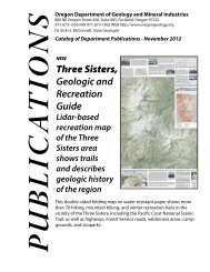
Create successful ePaper yourself
Turn your PDF publications into a flip-book with our unique Google optimized e-Paper software.
high rainfall, rapidly melting snow, <strong>and</strong> impermeable bedrock. Commonly<br />
activities <strong>of</strong> man can aggravate flooding. Examples include channel modifications<br />
<strong>and</strong> improper flood-plain development. In instances where<br />
stream hydraulics (Figure 13) <strong>and</strong> other geologic processes are involved,<br />
the <strong>Ore</strong>gon <strong>Department</strong> <strong>of</strong> <strong>Geology</strong> <strong>and</strong> <strong>Mineral</strong> <strong>Industries</strong> has meaningful<br />
information to <strong>of</strong>fer.<br />
In the Bull Run Watershed in 1972, water cascading down the North<br />
Fork <strong>of</strong> the Bull Run River undercut an ancient l<strong>and</strong>slide to deliver tons <strong>of</strong><br />
colloidal red clay into the supply <strong>of</strong> drinking water for Portl<strong>and</strong>. An investigation<br />
was initiated which included input from this <strong>Department</strong> to<br />
determine the cause <strong>of</strong> the flood <strong>and</strong> the distribution <strong>of</strong> the red clay material<br />
in the watershed. As is <strong>of</strong>ten true with geologic hazards, total isolation<br />
<strong>of</strong> one hazard from others is not possible. <strong>The</strong> flooding was caused<br />
by the sudden release <strong>of</strong> water from an ice dam upstream, <strong>and</strong> the colloidal<br />
red clay entered the water from an ancient l<strong>and</strong>slide area along the channel.<br />
Average losses to flooding in <strong>Ore</strong>gon totaled $16 million in 1965<br />
<strong>and</strong> will total $36 million annually by the year 2000 (<strong>Ore</strong>gon State Water<br />
Resources Board, 1972).<br />
Assistance in developing flood-plain management plans is provided<br />
by the <strong>Ore</strong>gon Water Resources <strong>Department</strong>. <strong>The</strong> U. S. Soi I Conservation<br />
Service administers the Watershed Protection <strong>and</strong> Flood Protection Act <strong>of</strong><br />
1954 <strong>and</strong> provides technical assistance for channel protection <strong>and</strong> other<br />
flood-related projects. <strong>The</strong> Flood Insurance Act <strong>of</strong> 1968 is administered<br />
by the U. S. <strong>Department</strong> <strong>of</strong> Housing <strong>and</strong> Urban Development with the assistance<br />
<strong>of</strong> the <strong>Ore</strong>gon Water Resources <strong>Department</strong> arc! provides flood insurance<br />
to individuals <strong>and</strong> businesses in regulated developments.<br />
<strong>The</strong> function <strong>of</strong> the geologic hazards program at the <strong>Ore</strong>gon <strong>Department</strong><br />
<strong>of</strong> <strong>Geology</strong> <strong>and</strong> <strong>Mineral</strong> <strong>Industries</strong> is to supplement the work conducted<br />
by other agencies by 1) providing uniform mapping, 2) developing<br />
field-oriented flood data where more sophisticated data has not been developed,<br />
3) providing a mechanism for formally recording flood histories<br />
for given areas, <strong>and</strong> 4) providing a broad geologic framework for viewing<br />
all the aspects <strong>of</strong> flooding.<br />
Tectonic Hazards<br />
In recent years, increasing attention has been focused on the potentia<br />
I for volcanic <strong>and</strong> earthquake activity in <strong>Ore</strong>gon. Active volcanism in<br />
the Northwest in historic times is documented by Folsom (1970), <strong>and</strong> renewed<br />
volcanism is indeed a possibility. <strong>The</strong> U.S. Geological Survey is<br />
monitoring several northwestern United States volcanoes on a continuing<br />
basis, using newly developed remote sensing techniques. Rosenfeld <strong>and</strong><br />
Schlicker (1976) describe renewed fumarolic activity on Mount Baker in<br />
Washington <strong>and</strong> remind us that activity on Mount Hood may have occurred<br />
as late as 1820. Cr<strong>and</strong>ell <strong>and</strong> others (1975) predict a possible eruption<br />
80