Civil 3D Extensions 2009 ver5... - CAD PARTNER Gmbh
Civil 3D Extensions 2009 ver5... - CAD PARTNER Gmbh
Civil 3D Extensions 2009 ver5... - CAD PARTNER Gmbh

Create successful ePaper yourself
Turn your PDF publications into a flip-book with our unique Google optimized e-Paper software.
AUTO<strong>CAD</strong><br />
®<br />
CIVIL <strong>3D</strong><br />
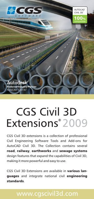
CGS <strong>Civil</strong> <strong>3D</strong> extensions is a collection of professional<br />
<strong>Civil</strong> Engineering Software Tools and Add-ons for<br />
Auto<strong>CAD</strong> <strong>Civil</strong> <strong>3D</strong>. The Collection contains several<br />
road, railway,<br />
earthworks and sewage systems<br />
design features that expand the capabilities of <strong>Civil</strong> <strong>3D</strong>,<br />
making it more powerful and easy to use.<br />
CGS <strong>Civil</strong> <strong>3D</strong> <strong>Extensions</strong> are available in various languages<br />
and integrate national civil engineering<br />
standards.<br />
www.cgscivil3d.com<br />
®<br />
compatible<br />
CGS <strong>Civil</strong> <strong>3D</strong><br />
<strong>Extensions</strong> ®<br />
<strong>2009</strong>
®<br />
CGS <strong>Civil</strong> <strong>3D</strong> <strong>Extensions</strong><br />
Application:<br />
Web page:<br />
First release:<br />
Current release:<br />
Working platform:<br />
Supported languages:<br />
Roadway design<br />
design of roads, railways, earthworks and<br />
sewage sytems;<br />
www.cgscivil3d.com<br />
October 2005<br />
<strong>2009</strong><br />
Dynamic turning curves<br />
The CGS dynamic turning curves have<br />
proved to be one of the best and<br />
most useful tools for driving<br />
simulation through cross-roads,<br />
roundabouts or narrow streets.<br />
By selecting a standard EU or userdefined<br />
vehicle (car, bus, truck with<br />
trailers or special vehicles), you can<br />
simulate the driving and see:<br />
� tyre-paths,<br />
� movements of trailers or<br />
� colour the driving area.<br />
Simulation paths can be defined by<br />
selecting <strong>Civil</strong> <strong>3D</strong> horizontal<br />
alignments, edges (polyline entities)<br />
or by interactive driving (using arrow<br />
keys).<br />
This extension includes a special<br />
function for a driving simulation in<br />
profile, which enables you to examine<br />
the designed heights of garage<br />
entrances or similar.<br />
Supported languages:<br />
Auto<strong>CAD</strong> <strong>Civil</strong> <strong>3D</strong> <strong>2009</strong><br />
German, English, Russian, Hungarian, Polish, Czech,<br />
Slovene, Croatian;
Cross-roads and<br />
roundabouts<br />
The cross-roads (junctions) geometry<br />
extension includes functions for<br />
designing and editing compound<br />
curves, cross-roads islands and<br />
roundabouts.<br />
Complex geometry can be solved in<br />
seconds instead of hours in<br />
accordance with national and<br />
international road design standards.<br />
Functions are also available for<br />
creating roundabouts. These solve the<br />
geometry for perpendicular and nonperpendicular<br />
connections to the<br />
roundabout circle and offer various<br />
parameters for setting the geometry<br />
precisely according to the design<br />
requirements.<br />
The geometry of cross-roads and<br />
roundabouts is created with <strong>Civil</strong> <strong>3D</strong><br />
horizontal alignments, which allows<br />
full integration with <strong>Civil</strong> <strong>3D</strong> projects.<br />
All basic elements of junctions are<br />
dynamic. If the user changes one of the<br />
intersecting alignments or one of the<br />
road edges, all corresponding junction<br />
elements will be updated automatically.<br />
Islands are improved dramatically. New<br />
types of triangular islands have been<br />
added.<br />
With the new user interface, the user<br />
can control all island parameters at any<br />
time during the development process.<br />
In addition, better integration with <strong>Civil</strong><br />
<strong>3D</strong> is achieved. Geometry can be drawn<br />
as alignments or polylines.<br />
Supported languages:<br />
Traffic signs and horizontal<br />
signalization<br />
With this extension you can rapidly<br />
add traffic signs and horizontal<br />
signalization to your design.<br />
Hundreds of different traffic signs are<br />
available, compatible with national<br />
road design standards.<br />
You can define the position of traffic<br />
signs along the road, change their
position and extract traffic sign data<br />
including station (chainage) and<br />
distance from the centreline into<br />
special tables.<br />
Additionally, useful functions for<br />
placing horizontal signs, such as zebra<br />
crossings, triangles, arrows and other<br />
pavement signs are available. You can<br />
define different colours and calculate<br />
the areas for colouring/shading the<br />
paved areas.<br />
A new group of commands to draw,<br />
edit, delete, and refresh longitudinal<br />
road markings has been added to the<br />
<strong>2009</strong> version.<br />
The new version brings new and<br />
improved functionality for inserting<br />
traffic signs and creating reports.<br />
Traffic signs are dynamically<br />
connected to the selected alignment.<br />
If an alignment is changed, attribute<br />
values in traffic signs and extract<br />
tables are updated automatically.<br />
Signs are inserted on separate layers<br />
for each axis, so signs for each axis<br />
can be turned on and off. The user<br />
can also now enter station (chainage)<br />
and perpendicular distance to define<br />
traffic sign location.<br />
Traffic sign reports are now dynamic.<br />
If the user deletes a traffic sign or if<br />
an alignment is changed, the report is<br />
now automatically updated to reflect<br />
the latest state of traffic signs in the<br />
drawing. The report is now generated<br />
with Auto<strong>CAD</strong> table element. Editing<br />
of the report is therefore much<br />
simpler. Users can select their own<br />
report template. New commands to<br />
copy, edit and move traffic signs have<br />
also been added.<br />
This extension includes a new<br />
command that draws ghost islands<br />
within a closed polygon. Users can<br />
choose a ghost island for both one<br />
way and two way traffic. Special<br />
commands are available for editing<br />
existing ghost islands or erasing all<br />
the entities that make up a ghost<br />
island.<br />
Horizontal alignments<br />
The horizontal alignments extension<br />
offers two additional methods for<br />
defining and editing road centreline<br />
geometry and improves some of the<br />
behaviour of <strong>Civil</strong> <strong>3D</strong> horizontal<br />
alignments. The new methods<br />
brought to <strong>Civil</strong> <strong>3D</strong> by this extension<br />
are a polygon method and the so<br />
called “stick” method.<br />
Supported languages:
Both of these methods are compatible<br />
and can be used in combination<br />
during design. You can generate a<br />
polygon element from any <strong>Civil</strong> <strong>3D</strong><br />
alignment and use it for efficient<br />
horizontal alignment editing with<br />
better flexibility than by using<br />
standard <strong>Civil</strong> <strong>3D</strong> editing commands<br />
alone.<br />
Using these two methods you can<br />
avoid undesirable horizontal<br />
Checking Road design<br />
standards<br />
By selecting appropriate road design<br />
standard and road categories, the<br />
program examines the <strong>Civil</strong> <strong>3D</strong><br />
horizontal alignments, vertical<br />
alignments and cross-falls /<br />
superelevations.<br />
It verifies if their parameters conform<br />
to the selected standard or not. The<br />
result is a report list, where all critical<br />
or non-compliant elements are<br />
highlighted.<br />
Supported languages:<br />
Road lanes and widenings<br />
This extension brings a missing “lane<br />
functionality” to <strong>Civil</strong> <strong>3D</strong> and the<br />
possibility of easily and accurately<br />
calculating lane widening along<br />
horizontal alignments. Lanes can<br />
represent road lanes, pedestrian<br />
footpaths, cycle lanes, grass areas etc.<br />
Typical cross-sections are predefined<br />
according to various national road<br />
design standards, enabling automatic,<br />
quick and accurate selection of lanes<br />
and their widths.<br />
Widenings in curves are a common<br />
practice in Europe due to limited<br />
construction space. CGS <strong>Civil</strong> <strong>3D</strong><br />
extensions support various national<br />
road design standards in order to<br />
correctly calculate and define the road<br />
widths. CGS lanes are connected to<br />
<strong>Civil</strong> <strong>3D</strong> horizontal alignments for<br />
automatic updating.<br />
alignment solutions, such as short<br />
tangents, or non-maximum radii. This<br />
extension also provides flexible<br />
definition and editing of compound<br />
spirals.<br />
Supported languages:
Road lanes and widths are displayed<br />
in table form and are saved as <strong>Civil</strong> <strong>3D</strong><br />
assembly objects in order to properly<br />
generate and display cross sections<br />
and a <strong>3D</strong> corridor of the road.<br />
CGS <strong>Extensions</strong> <strong>2009</strong> includes new<br />
commands to create or edit lane<br />
widening. Widening can be used to<br />
open a new lane for slow vehicles and<br />
to create additional lanes crossroads.<br />
Widening can be anchored to a<br />
specific station (chainage) or it can be<br />
anchored to a specific point in a<br />
drawing. The advantage of this<br />
anchoring method is that any<br />
widening will remain in the same<br />
position when axis elements are<br />
edited. Various combinations of<br />
widening elements (arc-arc, parabolaparabola,<br />
arc-line-arc, arc-lineparabola,<br />
…) and parameters (speed,<br />
length, first and second R) are<br />
possible. All widenings are updated<br />
automatically when you edit<br />
alignments or polylines to which<br />
widenings are attached.<br />
Bus stops can be drawn either in<br />
tangents or curves. Even if they are<br />
drawn in curves they are constructed<br />
out of straight lines and arcs. The user<br />
can choose from a set of predefined<br />
bus types or can add a new bus<br />
definition. All values are stored in an<br />
XML file. Bus stops can be anchored<br />
to a specific station (chainage) or can<br />
be anchored to specific points in the<br />
drawing. A bus stop will also move<br />
dynamically with its corresponding<br />
element.<br />
Supported languages:<br />
Cross-falls /<br />
superelevations<br />
As with the calculation of widenings,<br />
cross-falls will also be calculated in<br />
accordance with national design<br />
standards.<br />
This extension not only brings the<br />
ability to calculate cross-falls for<br />
different road categories and for each<br />
lane, but also offers tools to easily<br />
modify cross-falls in specific crosssections.<br />
The calculation of cross-falls may be<br />
very complex. Results are displayed in<br />
table form and saved as<br />
Supported languages:
superelevations directly in to the<br />
corresponding <strong>Civil</strong> <strong>3D</strong> alignment. The<br />
user can use special subassemblies<br />
built in CGS <strong>Extensions</strong> in order to<br />
properly generate and display cross<br />
sections and the <strong>3D</strong> corridor of the<br />
road.<br />
One of the goals in creating this<br />
extension was to offer the user a<br />
friendly and easy to use cross-fall<br />
functionality.<br />
� The Cross-fall command supports<br />
design speed changes at any station<br />
(chainage) along the alignment.<br />
Horizontal visibility<br />
analysis<br />
The horizontal analysis extension<br />
calculates and draws a visibility splay<br />
polyline. By definition, a visibility splay<br />
is the line from a driver's eye in the<br />
middle of the driving lane to the next<br />
point in the middle of the same lane<br />
at the required stopping distance. The<br />
user can also modify the parameters<br />
of existing visibility analysis and the<br />
visibility splay will get updated<br />
according to the new parameters.<br />
Road design Reports<br />
This extension generates text /<br />
numeric outputs of the most<br />
significant road design data:<br />
horizontal alignments, vertical<br />
alignments and cross-sections.<br />
Data is read directly from the <strong>Civil</strong> <strong>3D</strong><br />
objects and saved into txt, xls or html<br />
files. The output format is designed<br />
according to local road design<br />
standards in Europe and may vary<br />
from country to country.<br />
Current version of CGS <strong>Extensions</strong><br />
support the following reports:<br />
� Surface data by sections<br />
� Stakeout of points along the<br />
alignment<br />
� All major geometry data of the<br />
road: horizontal elements, vertical<br />
elements, cross falls, width<br />
Supported languages:<br />
Supported languages:<br />
Supported languages:
Railway design<br />
Cant design /<br />
alignment/ export tool<br />
The Cant Design CGS <strong>Civil</strong><strong>3D</strong><br />
extension is the first native <strong>Civil</strong><strong>3D</strong> Rail<br />
extension that works completely on<br />
<strong>Civil</strong><strong>3D</strong> objects (alignments and<br />
profiles). With this extension Cant<br />
Design for conventional rail track and<br />
high speed rail track is possible within<br />
<strong>Civil</strong><strong>3D</strong>. The Cant design tool supports<br />
linear and non linear spiral types plus<br />
linear and non linear vertical<br />
transitions in order to precisely<br />
compute cant values in spiral sections.<br />
The Cant Design extension<br />
compromises Design Cant, Edit Cant<br />
and Export Cant (Geometry) tools. The<br />
Design Cant tool enables the user to<br />
design correctly applied cant values<br />
based on a specific country cant value<br />
definition (applied cant constant, cant<br />
deficiency value). Cant Settings enable<br />
a variety of cant parameter value<br />
definitions in order to complete the<br />
Cant Design work quickly and<br />
accurately<br />
The Edit Cant tool enables further<br />
editing of applied cant values on<br />
selected alignments, sections of<br />
selected alignment, rotation point<br />
definition on selected alignment<br />
entities, manual applied cant<br />
definition and many others in order to<br />
enable use of design cant in difficult<br />
geometry conditions.<br />
The Export Cant tool supports various<br />
export data formats for applied cant<br />
values. In addition to applied cant<br />
values, a complete rail geometry<br />
export to Plasser&Theurer WinALC<br />
data format is also supported. This<br />
format includes the data of alignment<br />
geometry, its corresponding profile<br />
geometry and applied cant values<br />
calculated by the Cant Design tool.<br />
This export to WinALC format enables<br />
fast and precise data transition for<br />
specialized tamping machinery.<br />
The Cant Design extension enables<br />
accurate cant design work and data<br />
export within <strong>Civil</strong><strong>3D</strong>. It is a cost<br />
effective and time saving tool for<br />
railway design using Autodesk<br />
<strong>Civil</strong><strong>3D</strong>.<br />
Supported languages:
Hydraulics & Hydrology<br />
HH sewer networks design<br />
HH sewer networks design is a CGS<br />
<strong>Civil</strong> <strong>3D</strong> Extension for the HH<br />
(hydraulic and hydrologic) design of<br />
sewer networks.<br />
This program calculates waste and<br />
storm water discharges and the<br />
corresponding diameters of <strong>Civil</strong> <strong>3D</strong><br />
pipes. Functions are provided for<br />
defining, viewing and editing<br />
catchment areas, HH calculation and<br />
viewing of the resulting pipes.<br />
The program uses the rational<br />
method for the calculation of storm<br />
runoff. It supports both constant and<br />
time-dependant rainfall intensity<br />
(user-specified or using the Reinhold<br />
equation). In the latter case, the<br />
corresponding intensity is found<br />
separately for each pipe based on<br />
pipe's concentration time. The<br />
wastewater discharge can also be<br />
added for the computation of the<br />
combined sewer systems.<br />
For the computation of pipe<br />
diameters, the user can select<br />
between three resistance equations.<br />
The pipe diameter is changed<br />
automatically during the design<br />
process and is always taken from the<br />
active <strong>Civil</strong> <strong>3D</strong> pipe catalogue. The<br />
results are shown in tabular form,<br />
where various computation-related<br />
HH reports<br />
HH Reports are a collection of<br />
additional reports and tables for pipe<br />
systems. Currently it contains a<br />
manhole prefabrication list command.<br />
This command creates a table with<br />
the size and connection data<br />
necessary for the prefabrication of the<br />
manholes.<br />
Supported languages:<br />
parameters are displayed. This<br />
content can be copied to other<br />
programs like MS Excel for further<br />
processing.<br />
Supported languages:
Excavations<br />
This tool calculates excavations<br />
between any level line and terrain<br />
line.<br />
The first step is to specify ditch<br />
characteristics (single ditch, double<br />
ditch, ditch with formwork ). Then the<br />
user arranges and specifies attributes<br />
of the table report and area definition<br />
(selected feature profile, surface<br />
layer). The final result of excavation<br />
calculations is a table report for<br />
material quantities.<br />
Supported languages:<br />
General<br />
Raster Manager<br />
The raster manager is a group of 12<br />
commands for raster manipulation<br />
(attach/detach, load/unload,<br />
show/hide). In addition to inserting a<br />
raster image by selecting one or more<br />
files, a command is provided for<br />
inserting all rasters that cover the<br />
current display and are contained in<br />
the selected folder.<br />
Using the toolbar, it is then easy to<br />
turn them on and off or to<br />
attach/detach them based on selected<br />
point(s), crossing line(s), windows or<br />
polygons.<br />
The example on the left shows how to<br />
turn on rasters with the crossing line<br />
method (red line). By using this<br />
method, the function will turn on (or<br />
off, if they've been previously turned<br />
on) the rasters that the line crosses.<br />
Similarly, the rasters can be<br />
manipulated by the point(s), window<br />
or polygon method.<br />
Conclusion: Raster Manager, provides<br />
easier manipulation of raster images<br />
within Auto<strong>CAD</strong> <strong>Civil</strong> <strong>3D</strong>.<br />
Supported languages:
Tools<br />
The tools are a collection of useful<br />
functions that further enhance the<br />
functionality of <strong>Civil</strong> <strong>3D</strong>.<br />
The plotbox utility enables you to<br />
define drawing borders at the proper<br />
size and automates the generation of<br />
layouts for plotting.<br />
The cut and fill hatching utility helps<br />
you to generate appropriate hatch<br />
lines and colour areas between four<br />
points or two selected bordering<br />
alignments / polylines. You can set<br />
various parameters for the hatch<br />
density and colours. Hatch patterns<br />
react dynamically to changes in the<br />
bordering alignments / polylines.<br />
Supported languages:<br />
Best fit / alignment<br />
The Best fit-alignment CGS <strong>Civil</strong> <strong>3D</strong><br />
extension is a very useful tool for<br />
railway and road reconstruction and<br />
maintenance projects. It enables the<br />
user to derive a best-guess centreline<br />
alignment from a given survey data<br />
set. Input data can either be a<br />
polyline or a chain of <strong>Civil</strong> <strong>3D</strong> COGO<br />
points or Auto<strong>CAD</strong> blocks sampled at<br />
the centreline of an existing road.<br />
Additionally, input data can consist of<br />
two sets of points or two polylines<br />
representing the left and right road<br />
edge. The result is a <strong>Civil</strong> <strong>3D</strong><br />
alignment with or without transition<br />
curves. The calculation is done based<br />
on a regression analysis where the<br />
total error is minimized.<br />
Supported languages:
References<br />
CGS plus is a developer of the<br />
Auto<strong>CAD</strong> <strong>Civil</strong> <strong>3D</strong> advanced country<br />
extensions for selected EMEA<br />
countries, offered by Autodesk Inc.<br />
About CGS <strong>Civil</strong> <strong>3D</strong><br />
extensions availability<br />
The CGS <strong>Civil</strong> <strong>3D</strong> extensions software<br />
is currently under rapid development.<br />
This paper briefly describes the<br />
currently available and planned CGS<br />
<strong>Civil</strong> <strong>3D</strong> extensions. The exact<br />
availability of different CGS <strong>Civil</strong> <strong>3D</strong><br />
extensions may vary from country to<br />
country. For more information please<br />
visit our web site www.cgsc3d.com or<br />
contact CGS plus or a CGS plus<br />
representative in your country.<br />
About CGS plus<br />
CGS plus is an Autodesk Preferred<br />
Industry Partner for <strong>Civil</strong> <strong>3D</strong> and an<br />
established software developer in<br />
Central, Eastern Europe and the<br />
Russian Federation.<br />
Since 1992, CGS plus has been<br />
developing and providing a family of<br />
civil engineering applications, now<br />
consisting of CGS <strong>Civil</strong> <strong>3D</strong> extensions,<br />
CGS plus<br />
d.o.o.<br />
Brnčč i eva ulica 13<br />
SI-1000 Ljubljana<br />
Phone: +386 1 530 11 00<br />
Fax: +386 1 530 11 32<br />
e-mail: info@cgsplus.si<br />
Internet: www.cgsplus.com<br />
Plateia (road design), Aquaterra (river<br />
engineering) and Ferrovia (railway<br />
design).<br />
CGS plus software is used every day<br />
by more than 2000 customers in 20<br />
countries. It is translated into several<br />
languages and adapted to national<br />
civil engineering standards.<br />
Visit CGS's<br />
product Internet portals:<br />
CGS <strong>Civil</strong> <strong>3D</strong> <strong>Extensions</strong><br />
www.cgscivil3d.com<br />
Plateia - roadway design solution:<br />
www.plateia-software.com<br />
Aquaterra - canal and river works:<br />
www.aquaterra-software.com<br />
Ferrovia - railway design solution:<br />
www.ferrovia-software.com