Implementing the Reimaanlok Conservation Planning Process
Implementing the Reimaanlok Conservation Planning Process
Implementing the Reimaanlok Conservation Planning Process

Create successful ePaper yourself
Turn your PDF publications into a flip-book with our unique Google optimized e-Paper software.
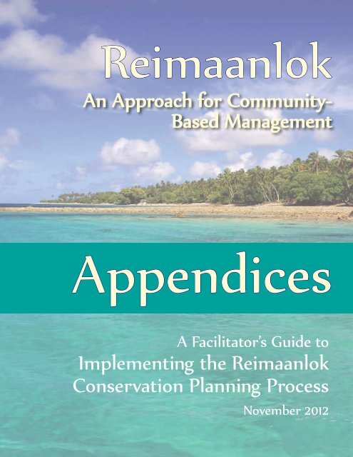
<strong>Reimaanlok</strong><br />
An Approach for Community-<br />
Based Management<br />
Appendices<br />
A Facilitator’s Guide to<br />
<strong>Implementing</strong> <strong>the</strong> <strong>Reimaanlok</strong><br />
<strong>Conservation</strong> <strong>Planning</strong> <strong>Process</strong><br />
November 2012
The appendices provide a tool for facilitators to assist communities in developing <strong>the</strong>ir resource<br />
management plans for community-based conservation areas. There are templates, exercises,<br />
and instructions that will help guide <strong>the</strong> eight step process described in <strong>Reimaanlok</strong> and its<br />
Facilitator's Guide. These are not <strong>the</strong> only tools to available, but are ones that have been used<br />
and found to be useful in <strong>the</strong> <strong>Reimaanlok</strong> process thus far in <strong>the</strong> Marshall Islands. These can be<br />
accessed at http://seagrant.soest.hawaii.edu/publications/.<br />
Appendices<br />
STEP 1 - INITIATION OF THE PROCESS TO ESTABLISH COMMUNITY-BASED MANAGEMENT PLANS ........1<br />
A1 PRE-SURVEY QUESTIONNAIRE .............................................................................................................. 2<br />
STEP 2 – PROJECT SCOPING AND SETUP ..............................................................................................3<br />
A2 TRIP COST CALCULATOR ..................................................................................................................... 4<br />
A3 PROJECT PLAN TEMPLATE – NAMDRIK EXAMPLE .................................................................................... 6<br />
STEP 3 – BUILDING COMMITMENT ................................................................................................... 15<br />
A4 INVOLVING STAKEHOLDERS COMMUNITY AWARENESS CHECKLIST............................................................ 16<br />
A5 TERMS OF REFERENCE TEMPLATE FOR LOCAL RESOURCES COMMITTEE TEMPLATE ..................................... 19<br />
A6 REIMAANLOK SOCIO-ECONOMIC SURVEY ............................................................................................ 20<br />
A7 DRAFT OUTLINE OF CLIMATE CHANGE INDICATORS TO USE IN REIMAANLOK PLANS AND PRIORITY BASELINE<br />
NEEDS 27<br />
STEP 4 – COLLECTING AND MANAGING INFORMATION ..................................................................... 29<br />
A8 GUIDELINES FOR COLLECTION OF LOCAL AND TRADITIONAL KNOWLEDGE AND MO IN THE MARSHALL ISLANDS 30<br />
A9 RAPID ECOLOGICAL ASSESSMENT, PARTICIPATORY AQUATIC RESOURCE TRANSECT ..................................... 37<br />
A10 BASELINE RAPID ASSESSMENT OF THE NATURAL RESOURCES METHODOLOGY ........................................... 39<br />
A11 WOJA RESERVE EXAMPLE ................................................................................................................. 43<br />
A12 SOCIO-ECONOMIC BASELINE ASSESSMENT AND MONITORING PLAN WORKSHEET ...................................... 46<br />
A13 DEVELOPING BENCHMARKS RELATIVE TO SEA-LEVEL ............................................................................. 50<br />
A14 SURVEYING ISLAND HEIGHT PROCEDURES ............................................................................................ 55<br />
A15 EVALUATING FLOODING FROM SEA LEVEL RISE – CASE STUDY OF JABÓT ................................................... 62<br />
STEP 5 – DEVELOPING THE MANAGEMENT PLAN .............................................................................. 72<br />
A16 IDENTIFYING NATURAL RESOURCE TARGETS ......................................................................................... 73<br />
A17 PRIORITIZING THE THREATS ............................................................................................................... 75<br />
A18 SUMMARY MATRIX OF VULNERABILITY ANALYSIS – NAMDRIK EXAMPLE ................................................... 79<br />
A19 CREATING A COMMUNITY VISION AND A CONCEPTUAL MODEL ............................................................... 91<br />
A20 COMPLETING A SWOT ANALYSIS ....................................................................................................... 94<br />
A21 CRAFTING A GOOD GOALS AND SMART OBJECTIVES .............................................................................. 97<br />
A22 DEVELOPING MANAGEMENT ACTIONS TO ACHIEVE THE OBJECTIVES ...................................................... 101<br />
i
A23 DEVELOPING GOOD INDICATORS ...................................................................................................... 103<br />
A24 PRIORITIZING MANAGEMENT ACTIONS ............................................................................................. 105<br />
A25 ACTION PLAN TEMPLATE – NAMDRIK EXAMPLE .................................................................................. 109<br />
A26 MARSHALL ISLANDS CONSERVATION AREA DESIGN PRINCIPLES ............................................................. 113<br />
A27 FISHERIES MANAGEMENT ORDINANCE TEMPLATE ............................................................................... 118<br />
A28 FISHERIES MANAGEMENT ORDINANCE – LIKIEP EXAMPLE .................................................................... 124<br />
A29 IMPLEMENTATION GUIDELINES – LIKIEP EXAMPLE ............................................................................... 125<br />
A30 IMPLEMENTATION BUDGET TEMPLATE .............................................................................................. 126<br />
A31 MANAGEMENT SKILL SET ASSESSMENT AND MANAGEMENT TRAINING NEEDS ANALYSIS ........................... 128<br />
A32 MANAGEMENT PLAN EXAMPLE – AILUK EXAMPLE .............................................................................. 133<br />
STEP 6 – SIGN OFF .......................................................................................................................... 134<br />
A33 SIGN OFF DOCUMENT TEMPLATE ..................................................................................................... 135<br />
STEP 8 – MAINTAINING COMMITMENT .......................................................................................... 136<br />
A34 ANNUAL WORK PLAN ..................................................................................................................... 137<br />
CLIMATE CHANGE LENS ON RESOURCE PLANNING .......................................................................... 138<br />
A35 VULNERABILITY ASSESSMENT AND LOCAL EARLY ACTION PLAN (VA-LEAP) ............................................. 139<br />
ii
STEP 1 - INITIATION OF THE PROCESS TO ESTABLISH COMMUNITY-<br />
BASED MANAGEMENT PLANS<br />
1
A1 Pre-survey Questionnaire<br />
Pre-survey Questionnaire: to assess <strong>the</strong> overall awareness of key issues necessary for <strong>the</strong> success of<br />
<strong>Reimaanlok</strong> in a community<br />
(Need translation into Marshallese)<br />
1. Do you know which governmental agencies and non-governmental agencies are involved in<br />
resource management and conservation in <strong>the</strong> Marshall Islands? (local groups can be included if<br />
mentioned) List Down.<br />
2. Can you tell me of any general resource management and conservation issue or problem that<br />
you are aware of in ______Atoll? All of Marshall Islands? For each issue, why are <strong>the</strong>y<br />
considered problems?<br />
3. Are you aware of any traditional conservation methods that still in play? Please list.<br />
4. How do you get information pertaining to <strong>the</strong> resources and conservation locally?<br />
5. Have you heard of CMAC and <strong>Reimaanlok</strong>?<br />
6. Have you heard of <strong>the</strong> Micronesia Challenge?<br />
NOTE: These questions must be incorporated into <strong>the</strong> pre-survey questionnaire that will be delivered by<br />
<strong>the</strong> National <strong>Planning</strong> Team visited during visit one, after collection of all literature and information<br />
about <strong>the</strong> targeted atoll has been compiled. The questionnaire must include issues/recommendations<br />
from <strong>the</strong> compiled information.<br />
2
STEP 2 – PROJECT SCOPING AND SETUP<br />
3
A2 Trip Cost Calculator<br />
This spreadsheet calculates <strong>the</strong> cost of each trip to an outer island for community work.<br />
Refer to <strong>the</strong> worksheets for per diem rates and air ticket rates for <strong>the</strong> appropriate rate for each atoll.<br />
Ensure air ticket prices are current.<br />
Name of Atoll:<br />
Plane Ticket:<br />
Team No.: x<br />
Round Trip cost:<br />
Departure Tax:<br />
Team No.: x<br />
ports<br />
x Tax rate:<br />
Per Diem<br />
Team No.: x<br />
days<br />
x Per Diem rate:<br />
Miscellaneous fund<br />
****Please refer to RATES sheets for actual cost of per diem and tickets.<br />
4<br />
Total for Visit
Atoll Airport Per Diem Rates Air Fare (daily) (date??) Distance Boat Fare Estimation **<br />
1-way RT Rate O/N fare<br />
Ailinginae 50<br />
Ailinglaplap * Airok 50 107 214 146 7300 add $50/day<br />
Jeh 104 208 141 7050 add $50/day<br />
Woja 117 234 164 8200 add $50/day<br />
Ailuk Ailuk 50 139 278 203 10150 add $50/day<br />
Arno Tinak 25 47 94 39 1950 add $50/day<br />
Aur Tobal 50 61 122 65 3250 add $50/day<br />
Bikar 50<br />
Bikini 266 532 431 21550 add $50/day<br />
Bokak 50<br />
Ebon 50 143 286 211 10550 add $50/day<br />
Enewetak 354 708 588 29400 add $50/day<br />
Erikub 50 ***<br />
Jabot 50 105 210 142 7100 add $50/day<br />
Jaluit * 75 92 184 120 6000 add $50/day<br />
Jemo 50<br />
Kili 50 111 222 154 7700 add $50/day<br />
Kwajalein * 125 155 310 233 11650 add $50/day<br />
Lae 50 204 408 319 15950 add $50/day<br />
Lib 50<br />
Likiep * 75 138 276 202 10100 add $50/day<br />
Majuro ----- 0 0 0 0 0<br />
Maloelap Maloelap 50 80 160 99 4950 add $50/day<br />
Kaben 89 178 114 5700 add $50/day<br />
Mejit *** 50 134 268 194 9700 add $50/day<br />
Mejatto Elenak 192 384 262 13100 add $50/day<br />
Mili Mili 50 61 122 65 3250 add $50/day<br />
Enejet 68 136 75 3750 add $50/day<br />
Nadrikdrik 50<br />
Namdrik * 50 141 282 207 10350 add $50/day<br />
Namu Majkin 50 134 268 195 9750 add $50/day<br />
Rongelap 225 450 358 17900 add $50/day<br />
Rongerik 50<br />
Taka 50<br />
Ujae 50 219 438 346 17300 add $50/day<br />
Ujelang 50<br />
Utrik<br />
Wake (Enenkio)<br />
50 172 344 263 13150 add $50/day<br />
Wotho 50 228 456 363 18150 add $50/day<br />
Wotje * 75 112 224 156 7800 add $50/day<br />
* fishbase<br />
** boat charter rates, based on MMRA rates of $25/mile x2<br />
5
A3 Project Plan Template – Namdrik Example<br />
Purpose of this document:<br />
<strong>Reimaanlok</strong>: <strong>Process</strong> for Community-Based Fisheries and Resource Management <strong>Planning</strong><br />
This Project Plan template is designed to make it easy for Project Teams to develop a clear Workplan. The Workplan is to facilitate resource<br />
management planning for outer-atolls in <strong>the</strong> Marshall Islands. The template is based on <strong>the</strong> <strong>Reimaanlok</strong>: <strong>Process</strong> for Community-Based Fisheries<br />
and Resource Management <strong>Planning</strong> and is part of <strong>the</strong> Toolkit for Community-Based Management <strong>Planning</strong>.<br />
How to use this Project Plan template:<br />
1. As a team, discuss <strong>the</strong> current status of resource management on <strong>the</strong> atoll and fill in <strong>the</strong> section on background.<br />
2. Determine which steps are appropriate for that atoll or community and delete or add tasks as required.<br />
3. Ensure you are familiar with <strong>the</strong> following documents and refer to <strong>the</strong>se documents frequently when planning and carrying out <strong>the</strong><br />
tasks:<br />
� “<strong>Reimaanlok</strong>: <strong>Process</strong> for Community-Based <strong>Planning</strong> and Management” (Part 4 of <strong>Reimaanlok</strong>: National <strong>Conservation</strong> Area Plan for<br />
<strong>the</strong> Marshall Islands)<br />
� <strong>Reimaanlok</strong> Toolkit/Cookbook<br />
� “<strong>Reimaanlok</strong>: Guidelines for Collection of Local and Traditional Knowledge on Biodiversity Resources and Mo” (AIV of <strong>Reimaanlok</strong>:<br />
National <strong>Conservation</strong> Area Plan for <strong>the</strong> Marshall Islands)<br />
4. Use <strong>the</strong> Project Plan template for reporting progress and keeping o<strong>the</strong>r notes by brief comments in <strong>the</strong> far right-hand column. Keep this<br />
up to date after each set of activities. This will make it very easy to report externally on progress and will ensure <strong>the</strong> Project Team<br />
understands where <strong>the</strong> work is up to and what remains to be done.<br />
5. Hold meetings with <strong>the</strong> Project Team every two weeks to report on progress, allocate tasks and plan for atoll visits. This is essential for<br />
maintaining <strong>the</strong> level of activity required to successfully complete <strong>the</strong>se projects. Meetings should be short and efficient.<br />
6. Update <strong>the</strong> plan as required if timing or circumstances change.<br />
6
Atoll/ Community: Namdrik<br />
Lead Agency: MIMRA<br />
<strong>Reimaanlok</strong>: <strong>Process</strong> for Community-Based Fisheries and Resource Management<br />
Project Manager: Albon Ishoda (MIMRA)<br />
Project Plan for Namdrik Atoll 2008-2010<br />
(Output of Step 2: Project Scoping and Setup)<br />
Core Project Team: Candice Guavis (MIMRA), Joy Kawakami (MICS)<br />
Additional Support Team:<br />
Key Community Contacts:<br />
Background: “Namdrik Atoll first approached MIMRA…” include here information about how <strong>the</strong> project was initiated, <strong>the</strong><br />
presence of a fish base or o<strong>the</strong>r economic operations (e.g. clams, oysters, sea-cucumber farms etc.). Describe<br />
previous work done in management planning, MPAs, number of individual communities on <strong>the</strong> atoll, number of<br />
people on <strong>the</strong> atoll, distance from Majuro, transport from Majuro by boat/ plane etc.<br />
7
Action Plan – Tasks and Timelines<br />
<strong>Process</strong> Step Activity Scheduled<br />
Date<br />
Output/s Notes/ Report of Progress and Results<br />
Step 1:<br />
Before visit compile existing Sept 2008 Project team to re-read “<strong>Reimaanlok</strong>:<br />
Initiation of <strong>the</strong> information on atoll<br />
<strong>Process</strong> for Community-Based Fisheries<br />
<strong>Process</strong><br />
and Resource Management <strong>Planning</strong>”<br />
Step 2: Project<br />
Scoping and<br />
Setup<br />
Step 3: Building<br />
Commitment<br />
Atoll Visit 1 Oct 2008<br />
Hold initial community<br />
consultations<br />
Boat tour and walk about<br />
Conduct a preliminary<br />
survey to establish level of<br />
commitment and<br />
awareness<br />
Link community to <strong>the</strong><br />
environmental radio<br />
network<br />
<strong>Planning</strong> meeting between<br />
project team<br />
Sept 5,<br />
2008<br />
Atoll Visit 1 Oct 2008<br />
Bwebwenato with<br />
community<br />
Deliver education and<br />
awareness<br />
Stakeholder analysis<br />
(PIMPAC Session2)<br />
Establish Local Resources<br />
Committee<br />
Complete project plan, timeline,<br />
budget and resource plan (this<br />
document)<br />
Presentations to schools and<br />
community groups. Leave posters,<br />
books, brochures with community.<br />
Completed stakeholder analysis and<br />
begin Climate Change Vulnerability<br />
Assessment Matrix<br />
Terms of reference and<br />
membership list of Local Resources<br />
Committee<br />
8<br />
Cookbook Step 1: A1<br />
Cookbook Step 2: A2, 3 and A31<br />
worksheet 2<br />
Cookbook Step 3<br />
Cookbook Step 3: A4 & A31:3, 5<br />
Cookbook Step 3: A5
<strong>Process</strong> Step Activity Scheduled<br />
Date<br />
Output/s Notes/ Report of Progress and Results<br />
Survey questionnaire to<br />
establish level of<br />
commitment and<br />
awareness<br />
Cookbook Step 3: A6<br />
Initial assessment of climate<br />
impacts<br />
List of key issues and concerns Cookbook Step 3: A7<br />
Step 4:<br />
Prepare for Atoll Visit 2 Nov <strong>Planning</strong> meeting held. Team clear Team needs to revise procedures for<br />
Collecting and<br />
on roles and activities for visit. collecting and mapping local knowledge<br />
Managing<br />
Materials prepared.<br />
and to prepare materials – maps etc – to<br />
Information<br />
take to <strong>the</strong> community.<br />
Atoll Visit 2 Dec 2008<br />
Community mapping of<br />
Activities: Community Mapping, Cookbook Step 4: A8 & A31: worksheets<br />
resources and use.<br />
Historical Timeline, Seasonal<br />
Calendar, Local Climate Story<br />
6,10, 11, 12, 14<br />
Socio-economic survey Cookbook Step 3: 5 A12<br />
Baseline survey of natural<br />
Cookbook Step 3: A7<br />
resources – quick method<br />
Step 4: A9, 10, 11<br />
Problem Solution Tree Begin with community Meetings<br />
and verify with LRC<br />
Ailuk Management Plan<br />
Input data collected into<br />
<strong>Conservation</strong> GIS<br />
Data entered into GIS<br />
Field Survey to determine<br />
island height and<br />
determine flooding risks<br />
Profiles and map Step 4: A13,14, 15<br />
Step 5:<br />
Prepare for Atoll Visit 3 <strong>Planning</strong> meeting held. Team clear Team needs to study <strong>Reimaanlok</strong><br />
Developing <strong>the</strong><br />
on roles and activities for visit. cookbook and o<strong>the</strong>r tools and if<br />
Management<br />
Materials prepared.<br />
necessary, to practice <strong>the</strong>m in a mock<br />
Plan<br />
workshop.<br />
Atoll Visit 3 Feb 2009<br />
Identify and prioritize<br />
Natural Resource Targets<br />
Community meetings. Cookbook Step 5: A16<br />
Community mapping of Documented information as per Cookbook Step 4: A8 & A31: worksheets<br />
9
<strong>Process</strong> Step Activity Scheduled<br />
Date<br />
Output/s Notes/ Report of Progress and Results<br />
resource management<br />
“Guidelines for Collection of Local 6,10, 11, 12, 14<br />
targets<br />
and Traditional Knowledge and mo<br />
in <strong>the</strong> Marshall Islands”<br />
Identify and prioritize<br />
Completed worksheet. Cookbook Step 5: A17 & A31 Worksheets<br />
threats<br />
7, 8, 9<br />
Climate vulnerability Completed worksheet Cookbook Step 5: A18<br />
Community Visioningdetermine<br />
development<br />
aspirations<br />
Completed worksheet. Cookbook Step 5: A19<br />
Identifying SWOT Completed worksheet. Cookbook Step 5: A20<br />
Develop objectives for<br />
management<br />
Completed worksheet. Cookbook Step 5: A21<br />
Identify management<br />
actions to achieve<br />
objectives<br />
Completed worksheet. Cookbook Step 5: A22<br />
Develop indicators Completed worksheet. Cookbook Step 5: A23<br />
Prioritize management<br />
actions<br />
Select and design<br />
conservation areas<br />
Completed worksheet. Cookbook Step 5: A24<br />
Map of proposed conservation<br />
areas/ management zones. Draft<br />
management rules for each zone.<br />
Prepare for Atoll Visit 4 <strong>Planning</strong> meeting held. Team clear<br />
on roles and activities for visit.<br />
Materials prepared.<br />
Atoll Visit 4 May 2009<br />
Determine authority and<br />
responsibility<br />
Develop an Action Plan<br />
with tasks, timelines and<br />
responsibilities<br />
10<br />
Refer to <strong>Reimaanlok</strong> Design Principles.<br />
Cookbook Step 5: A26<br />
Cookbook Step 5: A27 ex. MoU between<br />
CMAC & Local Govt.<br />
Short Action Plan for 1-3 years. Can use examples from this project plan<br />
or o<strong>the</strong>r Action Plans and develop a<br />
simple template. Formulate using
<strong>Process</strong> Step Activity Scheduled<br />
Date<br />
Output/s Notes/ Report of Progress and Results<br />
Cookbook Step 5: A25 or A31 worksheet<br />
19<br />
Develop a budget for<br />
Simple budget completed. Need to develop a simple budget<br />
implementation of <strong>the</strong> plan<br />
template.<br />
and how to finance it<br />
Cookbook Step 5: A28<br />
Determine capacity-<br />
Capacity-building plan completed. Identify <strong>the</strong> training needs and how <strong>the</strong>y<br />
building plan<br />
might be met.<br />
Cookbook Step 5: A29<br />
Establish a sign-off<br />
procedure and dispute<br />
resolution process<br />
Cookbook Step 5: A30<br />
Draft ordinances Draft ordinances completed. Use ordinance template<br />
Cookbook Step 5: A27<br />
Compile <strong>the</strong> worksheets<br />
Draft management plan. All <strong>the</strong> worksheets and documents<br />
and outputs completed<br />
completed above should be compiled to<br />
above into a draft<br />
management plan.<br />
form <strong>the</strong> Management Plan.<br />
Atoll Visit 5 Sept 2009<br />
Present <strong>the</strong> draft<br />
management plan<br />
Present <strong>the</strong> draft<br />
ordinances<br />
Ailuk Management Plan example<br />
Step 5: Sign-off Establish “sign-off” on <strong>the</strong><br />
Sign-off sheet prepared, signed and Sign-off may by <strong>the</strong> Local Resources<br />
management plan and<br />
attached to <strong>the</strong> management plan. Committee, <strong>the</strong> traditional leaders,<br />
ordinances according to<br />
National Agencies, and o<strong>the</strong>rs (that are<br />
<strong>the</strong> wishes of <strong>the</strong><br />
optional depending on involvement)<br />
community and leaders<br />
should be represented by a signature<br />
sheet in <strong>the</strong> management plan.<br />
<strong>Planning</strong> for Prepare a plan for<br />
Plan for ongoing support and<br />
Can use a similar format to this plan.<br />
Steps 7: monitoring and evaluation<br />
monitoring and evaluation.<br />
Monitoring, and for follow-up support<br />
Evaluation and for <strong>the</strong> atoll.<br />
11
<strong>Process</strong> Step<br />
Adaptive<br />
Management<br />
and 8:<br />
Maintaining<br />
Commitment<br />
Activity Scheduled<br />
Date<br />
Output/s Notes/ Report of Progress and Results<br />
12
<strong>Process</strong> Step Activity Scheduled<br />
Date<br />
Step 2: Project<br />
Scoping and Setup<br />
Step 3: Building<br />
Commitment<br />
Step 4: Collecting<br />
and Managing<br />
Information<br />
Step 5: Developing<br />
<strong>the</strong> Management<br />
Plan<br />
<strong>Planning</strong> meeting between project Sept 5,<br />
team<br />
2008<br />
Atoll Visit 1 Oct 2008<br />
Bwebwenato with community<br />
Deliver education and awareness<br />
Stakeholder analysis (PIMPAC<br />
Session2)<br />
Establish local planning committee<br />
Survey questionnaire to establish level<br />
of commitment and awareness<br />
Prepare for Atoll Visit 2 Nov<br />
Atoll Visit 2 Dec 2008<br />
Community mapping of resources and<br />
use.<br />
Socio-economic survey<br />
Baseline survey of natural resources –<br />
quick method<br />
Input data collected into <strong>Conservation</strong><br />
GIS<br />
Prepare for Atoll Visit 3<br />
Atoll Visit 3 Feb 2009<br />
Identify and prioritize Natural<br />
Resource Targets<br />
Community mapping of resource<br />
management targets<br />
Identify and prioritize threats<br />
Community Visioning- determine<br />
development aspirations<br />
Develop objectives for management<br />
Identify management actions to<br />
13<br />
Sep<br />
2008 2009<br />
Oct<br />
Nov<br />
Dec<br />
Jan<br />
Feb<br />
Mar<br />
Apr<br />
May<br />
Jun<br />
July<br />
Aug<br />
Sep
achieve objectives<br />
Develop indicators<br />
Prioritize management actions<br />
Select and design conservation areas<br />
Prepare for Atoll Visit 4<br />
Atoll Visit 4 May 2009<br />
Determine authority and responsibility<br />
Develop an Action Plan with tasks,<br />
timelines and responsibilities<br />
Develop a budget for implementation<br />
of <strong>the</strong> plan and how to finance it<br />
Determine capacity-building plan<br />
Establish a sign-off procedure and<br />
dispute resolution process<br />
Draft ordinances<br />
Compile <strong>the</strong> worksheets and outputs<br />
completed above into a draft<br />
management plan.<br />
Prepare for Atoll Visit 5<br />
Atoll Visit 5 Aug 2009<br />
Present <strong>the</strong> draft management plan<br />
Present <strong>the</strong> draft ordinances<br />
Step 5: Sign-off Establish “sign-off” on <strong>the</strong><br />
management plan and ordinances<br />
according to <strong>the</strong> wishes of <strong>the</strong><br />
Steps 7: Monitoring,<br />
Evaluation and<br />
Adaptive<br />
Management and 8:<br />
Maintaining<br />
Commitment<br />
community and leaders<br />
Prepare a plan for monitoring and<br />
evaluation and for follow-up support<br />
for <strong>the</strong> atoll.<br />
14
STEP 3 – BUILDING COMMITMENT<br />
15
A4 Involving Stakeholders Community Awareness Checklist 1<br />
A. Session Purpose<br />
Stakeholder involvement is an absolutely critical aspect of management plan development. The<br />
approach to stakeholder involvement will vary greatly depending on <strong>the</strong> site, <strong>the</strong> number of<br />
stakeholders, <strong>the</strong>ir involvement or “stake” in <strong>the</strong> area, <strong>the</strong> ownership and management authority of <strong>the</strong><br />
area, <strong>the</strong> complexity of <strong>the</strong> situation, and many o<strong>the</strong>r factors. At some sites, you must engage a broad<br />
range of stakeholders in <strong>the</strong> entire planning process or <strong>the</strong>y may undermine your decisions. At o<strong>the</strong>r<br />
sites, <strong>the</strong> authority of <strong>the</strong> community or <strong>the</strong> agency is so strong that stakeholders need only be informed<br />
about <strong>the</strong> decisions that are being made for <strong>the</strong> area. It is very important to talk with a wide variety of<br />
stakeholders to get a sense of <strong>the</strong>ir concerns and ideas before you start <strong>the</strong> management planning<br />
process. Once you have that stakeholder input, it is generally more effective for <strong>the</strong> management<br />
planning process to be carried out by a team of designated individuals. If stakeholders have been<br />
afforded an opportunity to provide input, <strong>the</strong>y are typically quite happy for a planning team to develop<br />
<strong>the</strong> plan. After <strong>the</strong> draft plan is complete, however, it is very important to loop back in with all <strong>the</strong><br />
stakeholders so <strong>the</strong>y can review <strong>the</strong> plan. A wide range of options for stakeholder engagement exists,<br />
including <strong>the</strong> following:<br />
1. Detailed involvement of all major stakeholder groups in <strong>the</strong> planning process. This approach has been<br />
used in some managed areas. However, it can often degrade into a very unproductive process due to<br />
<strong>the</strong> difficulty of developing a plan with a large group.<br />
2. Input sought from stakeholders through focus groups with a smaller planning team developing <strong>the</strong><br />
Plan. After a draft is complete, <strong>the</strong> stakeholders will have a chance to review it. You may or may not<br />
have stakeholder representatives on <strong>the</strong> planning team.<br />
3. The community or agency has a high degree of authority, so <strong>the</strong>y choose not to consult outside<br />
stakeholder groups. In this case, <strong>the</strong> planning team may chose only to inform various groups about <strong>the</strong><br />
decisions in <strong>the</strong> plan.<br />
Typically <strong>the</strong> second approach is <strong>the</strong> most likely to lead to success. However, <strong>the</strong> devil is in <strong>the</strong> details.<br />
You have to think very carefully about how many focus group meetings you should have, how often you<br />
should inform stakeholders about your progress, and how many opportunities outsiders should have to<br />
provide feedback on <strong>the</strong> plan. In most MMAs, <strong>the</strong> more effort you spend involving and reacting to<br />
stakeholder concerns, <strong>the</strong> better your chance of getting true buy-in and compliance with <strong>the</strong> plan’s<br />
regulations.<br />
B. Facilitation Suggestions<br />
The stakeholder discussion is best held with <strong>the</strong> entire planning team present. The discussion should<br />
happen one of <strong>the</strong> very first steps in <strong>the</strong> planning process.<br />
1 Taken from PIMPAC Information/Worksheet Two. This is also in LEAP, Worksheet #3<br />
16
WORKSHEET: INVOLVING STAKEHOLDERS<br />
(1) Fill out <strong>the</strong> following worksheet to clarify <strong>the</strong> stakeholders for your MMA and how you will involve<br />
<strong>the</strong>m in <strong>the</strong> management planning process.<br />
EXAMPLE:<br />
What are <strong>the</strong><br />
main groups of<br />
people involved<br />
in <strong>the</strong> area?<br />
Local Community<br />
Members<br />
Fishermen from<br />
o<strong>the</strong>r villages on<br />
<strong>the</strong> island<br />
Illegal fishermen<br />
from <strong>the</strong><br />
Philippines<br />
Commercial<br />
SCUBA operators<br />
Enforcement<br />
agency<br />
Describe <strong>the</strong>ir<br />
interest in <strong>the</strong><br />
area<br />
Clan ownership of<br />
many of <strong>the</strong><br />
resources.<br />
Recognized<br />
resource use<br />
rights<br />
Historically <strong>the</strong>y<br />
would fish in <strong>the</strong><br />
area only by<br />
asking permission.<br />
Now <strong>the</strong>y often<br />
fish without asking<br />
permission<br />
Sharking fining,<br />
tuna fishing,<br />
catching turtles,<br />
etc.<br />
Taking tourists<br />
into <strong>the</strong> MMA to<br />
dive<br />
They are<br />
mandated to<br />
enforce <strong>the</strong> rules<br />
of <strong>the</strong> area<br />
Describe <strong>the</strong><br />
validity of <strong>the</strong>ir<br />
interest or<br />
“stake”?<br />
Highly valid. They<br />
have had a role in<br />
<strong>the</strong> area for<br />
generations<br />
Low. Historically<br />
we would not<br />
deny <strong>the</strong>m access<br />
as long as <strong>the</strong><br />
stock was healthy.<br />
Now <strong>the</strong>y come in<br />
without asking.<br />
None. They are<br />
fishing completely<br />
illegally in <strong>the</strong><br />
area.<br />
Some of <strong>the</strong>m<br />
have permits to<br />
operate. O<strong>the</strong>rs<br />
have no legitimate<br />
stake but have<br />
invested funds<br />
High. Once rules<br />
are law, <strong>the</strong>y must<br />
enforce <strong>the</strong>m.<br />
17<br />
How important is<br />
this group to <strong>the</strong><br />
planning process?<br />
How would you<br />
like to involve<br />
<strong>the</strong>m in <strong>the</strong><br />
planning process?<br />
Very important. Community<br />
visioning process,<br />
regular<br />
community<br />
meetings,<br />
feedback<br />
opportunities<br />
during <strong>the</strong><br />
development of<br />
Medium.<br />
They may choose<br />
to not follow <strong>the</strong><br />
rules unless <strong>the</strong>y<br />
are involved. But<br />
<strong>the</strong>y have little<br />
valid stake in <strong>the</strong><br />
area.<br />
<strong>the</strong> plan.<br />
Ask <strong>the</strong>m for <strong>the</strong>ir<br />
input on <strong>the</strong><br />
actions and <strong>the</strong><br />
rules. Inform <strong>the</strong>m<br />
of our decisions,<br />
pointing out how<br />
we have involved<br />
<strong>the</strong>ir concerns<br />
Not important. Inform <strong>the</strong>m of<br />
<strong>the</strong> rules once<br />
established.<br />
Enforce when<br />
Important as <strong>the</strong>y<br />
have a strong<br />
lobby with <strong>the</strong><br />
government.<br />
Very important.<br />
We need to know<br />
what is practical in<br />
terms of<br />
enforcement.<br />
necessary.<br />
Ask for <strong>the</strong>ir input<br />
early on and invite<br />
<strong>the</strong>m to key<br />
meetings.
INVOLVING STAKEHOLDERS<br />
What are <strong>the</strong><br />
main groups of<br />
people involved<br />
in <strong>the</strong> area?<br />
Describe <strong>the</strong>ir<br />
interest in <strong>the</strong><br />
area<br />
Describe <strong>the</strong><br />
validity of <strong>the</strong>ir<br />
interest or<br />
“stake”?<br />
18<br />
How important is<br />
this group to <strong>the</strong><br />
planning process?<br />
How would you<br />
like to involve<br />
<strong>the</strong>m in <strong>the</strong><br />
planning process?
A5 Terms of Reference Template for Local Resources<br />
Committee Template<br />
Terms of Reference for ________ Atoll Local Resources Committee Template<br />
Representatives of <strong>the</strong> Committee<br />
The ________ community has established a Local Resources Committee that comprises of:<br />
� 2 representatives from women<br />
� 1 representatives from men<br />
� 2 representative from Local Government Council<br />
� Mayor or designee<br />
� Fisheries Officer/<strong>Conservation</strong> Officer (ex-officio)<br />
� 1 Youth<br />
� 1 Iroij<br />
� 1 Alab<br />
� *Subject to change considering makeup of community<br />
8.2 Responsibilities of <strong>the</strong> committee<br />
The committee will be responsible for <strong>the</strong> overall administration and operation of ________<br />
Fisheries/Resources Management Plan. Its specific tasks include-<br />
i. Election of a Chairman, Vice Chairman and Secretary of <strong>the</strong> Local Resources Committee. A term will<br />
consist of two years.<br />
ii. Develop an annual work-plan to guide <strong>the</strong> yearly implementation of <strong>the</strong> plan activities and to <strong>the</strong><br />
achievement of its objectives.<br />
iii. Make sure that <strong>the</strong> responsibilities of <strong>the</strong> community under <strong>the</strong> plan are properly carried out and<br />
be completed in a timely manner.<br />
iv. Work closely with MIMRA and follow up MIMRA’s obligations under its responsibilities so that <strong>the</strong>y<br />
are carried out in a timely manner.<br />
v. Report <strong>the</strong> progress on <strong>the</strong> development of <strong>the</strong> Fisheries/Resources Management Plan to <strong>the</strong><br />
community and _______ Government Council from time to time or when required.<br />
vi. Arrange and organize community workshops and ga<strong>the</strong>rings as required under <strong>the</strong> responsibilities<br />
of both <strong>the</strong> community and MIMRA/CMAC.<br />
vii. Represent <strong>the</strong> interest of _______ community in national and regional ga<strong>the</strong>rings in matters<br />
concerning marine environment and fishery resources.<br />
viii. With assistance from MIMRA/CMAC, initiate and establish processes that lead to <strong>the</strong> formulation<br />
and approval of Fisheries Management Ordinances as required under <strong>the</strong> Fisheries Management<br />
Plan and Section 50 of <strong>the</strong> Marine Resource Act 1997.<br />
ix. With Assistance from MIMRA, determine conditions and licensing fees for consideration and<br />
approval of <strong>the</strong> Local Government Council.<br />
19
A6 <strong>Reimaanlok</strong> Socio-Economic Survey<br />
Name of Surveyor: Survey Number ____________<br />
Date: Site:<br />
Location: Start time: End time:<br />
Demographics:<br />
Please choose one: Male Female<br />
1. How many people live in your household?<br />
a. How many fishers? Answer #17 - 18<br />
b. How many farmers? Answer # 25-26<br />
c. How many handicraft makers? Answer # 27-28<br />
d. How many children?<br />
2. What is your religion?<br />
o Assembly of God<br />
o A<strong>the</strong>ist<br />
3. May I ask how old you are?<br />
4. Are you currently employed?<br />
5. What is your occupation?<br />
6. What is your main source of income?<br />
Salary<br />
Fishing/Seafood Collection<br />
Agriculture (crops and livestock)<br />
o Baptist<br />
o BNJ<br />
o Mormon<br />
O<strong>the</strong>rs (handicraft, etc.) _______________<br />
20<br />
o Protestant<br />
o 7 th Day Adventist<br />
o Full Gospel
7. What is your highest level of formal education completed?<br />
Marine:<br />
If <strong>the</strong>re’s fisher...<br />
� Elementary (1-6)<br />
� Junior High (7-8)<br />
� High School (9-12)<br />
� Some college<br />
� College degree (undergrad)<br />
� Graduate school<br />
� No formal education<br />
8. What are your main fishing methods? List down 5<br />
a.<br />
b.<br />
c.<br />
d.<br />
e.<br />
What fishing gears do you use? List down 5<br />
a.<br />
b.<br />
c.<br />
d.<br />
e.<br />
9. What are your targeted species? List top 5 reef fish, and top 3 pelagic fish<br />
Reef fish Pelagic fish<br />
a. a.<br />
b. b.<br />
c. c.<br />
d.<br />
e.<br />
21
10. What type of boat(s) do you own? (Skip if none)<br />
Canoe<br />
RFP Boat w/o engine<br />
RFP Boat with engine<br />
11. How often do you go fishing? ________ per week/month/year<br />
Daytime/Nighttime/both<br />
12. How much fish do you catch per trip? _________ lbs<br />
13. Catch breakdown: _________ % sale and _________% self-consumption<br />
14. From fishing, how much do you earn per week/month/year? $_____________<br />
15. How often do you sell your catch? ___________ per week/month/year<br />
16. Where is your market?<br />
Majuro Within Community<br />
Ebeye O<strong>the</strong>r<br />
17. Where is your main fishing area?<br />
Lagoonside<br />
Oceanside<br />
Channels<br />
*END OF QUESTIONS FOR FISHERS<br />
18. What activities do you participate in ____________?<br />
Fishing<br />
Gleaning<br />
Diving<br />
BBQ/Picnic<br />
Swimming/Snorkeling<br />
Walking/Running<br />
Camping<br />
Farming<br />
Copra<br />
22
Collecting herbal medicines<br />
Beach Cleanup<br />
O<strong>the</strong>r: _________________<br />
19. What are <strong>the</strong> threats to site?<br />
Littering<br />
Illegal dumping<br />
Too much fishing<br />
Harmful fishing practices<br />
A lot of picnic goers<br />
Too many divers<br />
O<strong>the</strong>r: ________________________<br />
20. What do you think of <strong>the</strong> health or current status of <strong>the</strong> following?<br />
Number of Fish<br />
Water Quality<br />
(visibility, clarity)<br />
Number of sea<br />
urchins and sea<br />
cucumbers<br />
Native trees<br />
Very<br />
Healthy<br />
Somewhat<br />
Healthy<br />
Somewhat<br />
Unhealthy<br />
21. Which of <strong>the</strong> following changes would you like to see?<br />
More trash Bins<br />
More garbage collections<br />
More beach-cleanups<br />
O<strong>the</strong>rs:<br />
23<br />
Very<br />
Unhealthy<br />
Yes No Not Sure<br />
Don’t<br />
know<br />
22. In <strong>the</strong> past, have you seen or heard of anyone doing any of <strong>the</strong>se activities? (read off)<br />
SCUBA diving Yes No<br />
SCUBA spear fishing Yes No<br />
Throw net fishing Yes No
Gill net fishing Yes No<br />
Collecting and harvest sea cucumbers Yes No<br />
Collecting and harvest trochus Yes No<br />
Fishing with rod & reel Yes No<br />
Trash Dumping Yes No<br />
Burning Yes No<br />
BBQ’ing Yes No<br />
23. What do you think <strong>the</strong> reasons are for <strong>the</strong> trash (dumping/littering)?<br />
Main dump is too far<br />
It is easy to do- not likely to<br />
get caught<br />
They don’t know how it can<br />
harm <strong>the</strong> environment<br />
There aren’t enough trash<br />
bins<br />
They don’t care<br />
People are lazy<br />
O<strong>the</strong>r:<br />
Terrestrial:<br />
Strong<br />
Reason<br />
24. Do you keep any livestock?<br />
Where are your livestock kept?<br />
� oceanside<br />
� lagoonside<br />
� free-range<br />
*Questions for farmers<br />
Sort of a<br />
reason<br />
25. Kain menin eddok rot ne ekka am kattoke?<br />
a. d.<br />
b e.<br />
c. f.<br />
24<br />
Not a<br />
reason<br />
26. Kwoj lale ejjiban ke kilen am mour? Aet:_____ Jab: ______<br />
Don’t know
*Questions for handicraft makers<br />
27. Ilo am bok men in jeramon ko jen amimono kwoj itta kake?<br />
a.<br />
b.<br />
c.<br />
d.<br />
e.<br />
f.<br />
28. Wojke rot ne ekka am amimono kake? Types of trees used for handicraft<br />
Status:<br />
a.<br />
b.<br />
c.<br />
d.<br />
e.<br />
f.<br />
29. Are you aware of any resource management measures that are in place?<br />
Notes:<br />
MO/MPA<br />
limits on catch<br />
collection season for fish<br />
collection season for<br />
invertebrates<br />
replanting native trees<br />
shoreline replanting<br />
species protection<br />
livelihood programs<br />
zones<br />
Yes No Not Sure<br />
30. Where do you get information about <strong>the</strong> environment?<br />
� Newspaper<br />
� Radio<br />
� TV<br />
25
� Brochure<br />
� Informational Signs<br />
� Community members<br />
� Community meetings<br />
� Work<br />
� O<strong>the</strong>r<br />
31. Have <strong>the</strong> following been experienced?<br />
� Coastal Erosion<br />
� Run-offs<br />
� coral Bleaching<br />
� Sea temperature rising<br />
� Less fish<br />
� More seaweed<br />
� Sea Level rise<br />
� Increased frequency/intensity of extreme wea<strong>the</strong>r<br />
� King tides<br />
� Decreasing rainfall<br />
� Terrestrial Invasive Species<br />
� Marine Invasive Species<br />
32. What kind of access to freshwater do you have? Check all appropriate<br />
� Water catchment tank<br />
� water well<br />
� water bins<br />
33. Kwoj lale elon ke men raan kein rej oktak jen kar mokta ilo site?<br />
(Do you think <strong>the</strong>re are changes now than before?)<br />
34. Ilo manit kein ad, ewor ke bunten ko nan kojerbal im kejbarok menin jeramon ko ilo lojet kab<br />
ion ene?<br />
(To your understanding, do we practice conservation in our culture?)<br />
Aet, bunten ko:<br />
� AET<br />
� IAB<br />
35. Ne ear wor juon am mo, kwon kar likut ia bwe armej ren jab ennod ie im ewi toon?<br />
(If you had MPA, how long would it be for?)<br />
26
A7 Draft Outline of Climate Change Indicators to Use in<br />
<strong>Reimaanlok</strong> Plans and Priority Baseline Needs<br />
Note: Since <strong>Reimaanlok</strong> is a community-based plan, it is important to let <strong>the</strong> community understand <strong>the</strong><br />
value of <strong>the</strong> indicators and decide if <strong>the</strong>y want to collect and use <strong>the</strong> information produced. Sites may<br />
share core indicators but vary with o<strong>the</strong>rs.<br />
Climate Indicator of Tool Used to Indicator of Impacts Tool Used to<br />
Characteristics Climate Collect<br />
Collect*<br />
Sea Level Rise<br />
Precipitation<br />
Temperature<br />
Storm Intensity<br />
National SLR<br />
Gauge<br />
Historical<br />
Landmarks<br />
National Data<br />
Source<br />
Field Survey;<br />
Focus<br />
27<br />
Saltwater intrusion to<br />
wells and crops<br />
Mapping, Timeline,<br />
Visual Survey<br />
National Rain National Data Drinking Water Focus, Mapping,<br />
Gauge<br />
Historical<br />
Source<br />
Quality<br />
Visual Survey<br />
Storms<br />
Drinking Water Focus, Mapping,<br />
Locally<br />
Historical<br />
Focus<br />
Quantity<br />
Visual Survey<br />
drought or National Data Water Storage<br />
typhoon Source<br />
Methods<br />
Drought Tolerant Crop<br />
Focus<br />
Variety Focus<br />
Focus, Mapping,<br />
Fisheries Target Visual Survey,<br />
Species<br />
Timeline<br />
Catch per Unit Effort Focus<br />
NWS Sea National Data Spatial Extent of<br />
Temperature Source<br />
Habitat Mapping<br />
NWS Air National Data<br />
Temperature Source Health of People Focus<br />
NWS<br />
Heat Tolerant Crops Focus, Mapping<br />
Historical National Data<br />
Focus, Visual<br />
Storms<br />
Local Storm<br />
Record (date<br />
Source Erosion<br />
Survey<br />
severity and Focus, Timeline,<br />
impacts) Mapping Flooding Focus, Timeline<br />
Acidification Coral Bleaching Underwater Survey<br />
* Tools used for collecting data include Focus Groups (i.e. resource mapping, historical timelines,<br />
seasonal calendar, problem solution tree); one-on-one interviews (i.e. key informant interviews, catch<br />
per unit effort, socio-economic survey, perceptions) and field study (i.e. underwater visual census, field<br />
surveys, measurements).
A7: PRIORITY INFORMATION BASELINE/INDICATOR NEEDS<br />
<strong>Process</strong> for identifying information and indicators<br />
1. Identify <strong>the</strong> key management questions. For instance, do you need to understand a problem or<br />
effectiveness of action?<br />
2. Identify key indicators that <strong>the</strong> community trusts or information <strong>the</strong>y want to know<br />
3. Develop realistic monitoring methodology (Community-based and Professional judgment)<br />
4. Train locals to collect and analyze data<br />
The lists below provide examples of key information that may be useful for management related to<br />
different <strong>the</strong>mes or areas.<br />
Marine Resources Coastal Resources Terrestrial<br />
Resources<br />
• Seagrass<br />
• High tide<br />
• Freshwater lens<br />
• Coral % Cover & • Low tide<br />
boundary<br />
bleaching<br />
• King high tide • mangroves<br />
• Important<br />
• Erosion areas (rate) • land use<br />
ecosystems or • Accretion areas • crops<br />
fisheries<br />
(rate)<br />
• housing<br />
• Clams<br />
• jetty/ports/harbors • schools<br />
• Target Fishery • type of coast • cultural sites<br />
• Fin fish<br />
• beach<br />
• drinking water<br />
• Invertebrates • mangrove<br />
quality (salinity,<br />
• Catch per unit • vegetated areas parasites) and<br />
effort<br />
• seawalls<br />
quantity<br />
• Seamounts<br />
(horizontal/vertical)<br />
• fishing areas • tide pools<br />
• spawning areas • flood inundation<br />
• recreational<br />
areas/human uses<br />
(where, when)<br />
• any o<strong>the</strong>r marine<br />
uses<br />
• MPAs: Fish inside<br />
vs. out; Habitat<br />
health in vs. out<br />
28<br />
Climate Trends<br />
• Sea level (using a<br />
tide gauge)<br />
• Rain patterns<br />
• Date and intensity<br />
of historic storms<br />
and extreme<br />
wea<strong>the</strong>r events<br />
(storms, droughts,<br />
heavy rainfall)<br />
• Sea temperature<br />
• Air temperature<br />
• Acidity of water<br />
• Drought tolerance<br />
• water usage rates<br />
• El Nino patterns
STEP 4 – COLLECTING AND MANAGING INFORMATION<br />
29
A8 Guidelines for Collection of Local and Traditional<br />
Knowledge and mo in <strong>the</strong> Marshall Islands<br />
Purpose of <strong>the</strong>se guidelines<br />
This document outlines key steps and guidelines for <strong>the</strong> collection of local and traditional knowledge on<br />
natural resources in <strong>the</strong> Marshall Islands. It was developed by local facilitators of natural resource<br />
management planning through a workshop in December 2006, and <strong>the</strong>n was tested and refined through<br />
<strong>the</strong> process of collecting local and traditional knowledge to build <strong>the</strong> Marshall Islands <strong>Conservation</strong> GIS<br />
from January to May 2007. This document forms part of a larger toolkit for community-based<br />
conservation and resource-management planning in <strong>the</strong> Marshall Islands and should be adapted and<br />
added to on an ongoing basis.<br />
30
<strong>Process</strong> Steps<br />
1. Define Purpose of Local and Traditional Knowledge Collection<br />
There are various reasons for <strong>the</strong> collection of local and traditional knowledge on natural resources in<br />
<strong>the</strong> RMI including:<br />
a. Identification of places and species that should be targets for conservation and management;<br />
b. Empowering communities and encouraging <strong>the</strong>ir participation in developing resource<br />
management plans for <strong>the</strong>ir atolls, including conservation plans and fisheries management<br />
plans, by acknowledging <strong>the</strong> existence and value of <strong>the</strong>ir knowledge; and<br />
c. Documenting and guarding against <strong>the</strong> loss of traditional knowledge and resource management<br />
practices as part of Marshall Islands heritage.<br />
Prior to a process for collecting information, it is important to be clear about <strong>the</strong> purpose and uses of<br />
<strong>the</strong> information. This will influence <strong>the</strong> following process. Consider <strong>the</strong> questions:<br />
• What will be done with <strong>the</strong> information? How will it be used?<br />
• Where and how will <strong>the</strong> information be stored?<br />
• Who will have access to <strong>the</strong> information?<br />
2. Preliminary Meetings with Iroij and Mayor<br />
The appropriate way to access <strong>the</strong> community is through traditional and elected leaders. In addition,<br />
<strong>the</strong>se leaders may <strong>the</strong>mselves have good knowledge of <strong>the</strong> resources on <strong>the</strong>ir atolls. In particular, <strong>the</strong><br />
Iroij is a key source for information about mo.<br />
Preliminary meetings with <strong>the</strong> Iroij and Mayors should be held with <strong>the</strong> objectives:<br />
• To fully inform <strong>the</strong>m of <strong>the</strong> purpose of <strong>the</strong> information ga<strong>the</strong>ring,<br />
• To ga<strong>the</strong>r preliminary information on resources and mo, and<br />
• To gain access to knowledgeable people from <strong>the</strong>ir communities.<br />
More than one meeting will probably be required in order to meet all <strong>the</strong>se objectives. Meetings may<br />
also include advisors and representatives of <strong>the</strong> Iroij or Mayor.<br />
3. Setup Workshop/ Meeting<br />
a. Invite informants<br />
Make sure informants know <strong>the</strong> date, time and location. Make reminder phone calls. Direction<br />
from <strong>the</strong> Mayor or Iroij to <strong>the</strong> informant will be helpful to ensure <strong>the</strong> informant has <strong>the</strong><br />
authority to give information.<br />
b. Prepare materials for workshop<br />
Arrange for maps or charts of <strong>the</strong> atoll for <strong>the</strong> workshop.<br />
Small format maps may be generated from <strong>the</strong> Marshall Islands <strong>Conservation</strong> GIS. Large format<br />
maps may be printed by RMIEPA or nautical charts may be used.<br />
Prepare forms for recording of <strong>the</strong> information.<br />
31
Simple data sheets are included in <strong>the</strong> toolkit or more detailed data sheets can be developed on<br />
an as-needs basis.<br />
Suggested materials:<br />
• Map<br />
• Markers/ pencils<br />
• Handouts of purpose of information ga<strong>the</strong>ring in Marshallese language<br />
• Refreshments<br />
c. Review <strong>the</strong> process for <strong>the</strong> meeting<br />
Who is <strong>the</strong> facilitation team? Is it one person? A pair? Determine who will be facilitating <strong>the</strong><br />
discussion and who will be recording.<br />
It is often useful to have two people recording <strong>the</strong> information as different people will hear<br />
different things gives you more complete information at <strong>the</strong> end when you compare. Can <strong>the</strong><br />
facilitator also record <strong>the</strong> information? Should you debrief and review information directly after<br />
<strong>the</strong> meeting and capture anything that was not written during <strong>the</strong> meeting?<br />
Who are your informants? How are <strong>the</strong>y likely to interact? Do you need to separate groups<br />
(men/ women, traditional leaders/ dri-jerbal)?<br />
Make sure you have agreed roles and know <strong>the</strong> process for <strong>the</strong> workshop/ meeting.<br />
4. Hold Meeting<br />
a. Inform participants of purpose<br />
It is very important that informants/ participants understand <strong>the</strong> following:<br />
• The larger context of <strong>the</strong> information ga<strong>the</strong>ring- what is it being used for? What is it a<br />
part of?<br />
• How will <strong>the</strong> information be used? What happens to <strong>the</strong> information?<br />
• Who will have access to <strong>the</strong> information?<br />
This needs to be explained very clearly up front in order for <strong>the</strong> informants to have trust in <strong>the</strong><br />
process, and also for <strong>the</strong>m to decide what information to reveal and what to keep to<br />
<strong>the</strong>mselves.<br />
In this case, <strong>the</strong> context of <strong>the</strong> information is that we are working with communities and<br />
leadership to collect information for use in conservation/ resource-management planning. This<br />
is to assist <strong>the</strong> RMI to manage <strong>the</strong> resources sustainably. It DOES NOT mean that <strong>the</strong> national<br />
government will be declaring any protected areas or restrictions. This will always be done<br />
through <strong>the</strong> local community and local leadership. The information <strong>the</strong> informants give us will<br />
help identify species and places of importance in terms of biodiversity. The information will be<br />
put into a document and a database and will be accessible to government agencies and those<br />
people interested in conservation and resource management in <strong>the</strong> Marshall Islands.<br />
Sensitive Information As <strong>the</strong> information collected is difficult to keep confidential; we do not<br />
wish to know <strong>the</strong> precise locations of special fishing areas or fish aggregation sites, or o<strong>the</strong>r very<br />
32
sensitive information. The informants may be willing to indicate a range or vicinity in which<br />
fishing and fish aggregation sites occur. When information collection is done in more depth at<br />
<strong>the</strong> atoll level, while developing management plans, this sensitive information may be discussed<br />
more openly. The use and dissemination of this information may be restricted only to <strong>the</strong><br />
community of that atoll in line with <strong>the</strong>ir wishes, or it may be added to <strong>the</strong> <strong>Conservation</strong> GIS and<br />
made more widely available.<br />
b. Facilitation<br />
Good facilitation is critical to <strong>the</strong> process of information ga<strong>the</strong>ring to ensure good quality of<br />
information and also to effectively engage <strong>the</strong> community and informants in <strong>the</strong> management<br />
of <strong>the</strong>ir resources. Some key elements of effective facilitation include:<br />
• Appropriate dress<br />
• Create an environment of openness and trust<br />
• Encourage participation and engagement- watch your participants and make sure noone<br />
is “dropping out”<br />
• Body language- open, relaxed<br />
• Questioning<br />
o Open questions to invite detailed responses<br />
o Closed questions to confirm<br />
o Be careful to not ask leading questions<br />
• Paraphrasing- repeat back to <strong>the</strong> person what <strong>the</strong>y said, using different words and <strong>the</strong>n<br />
ask for confirmation “is that what you mean? Is <strong>the</strong>re something you would like to add<br />
to that?”<br />
• Use <strong>the</strong> map as a focus for discussion- and ensure you draw out all <strong>the</strong> relevant<br />
information through discussion.<br />
Opportunities for <strong>the</strong> development of facilitation skills and training should be pursued.<br />
c. Record Information<br />
In general, spatial information will be recorded on a map, and a detailed data table will<br />
accompany <strong>the</strong> spatial location.<br />
d. Cross-check and compile information<br />
After each meeting, cross-check information with your co-facilitator and agree on <strong>the</strong><br />
information collected.<br />
If several meetings are held around <strong>the</strong> same atolls and resources, cross-check <strong>the</strong> information<br />
between meetings and different informants.<br />
e. Transfer Information to <strong>Conservation</strong> GIS<br />
A procedure for entering information into <strong>the</strong> <strong>Conservation</strong> GIS is to be developed.<br />
Information to be targeted for collection:<br />
Marshallese Names<br />
33
Check names of islands, reefs and o<strong>the</strong>r atoll features- spelling etc.<br />
Background Socio-Economic Information<br />
What are your main sources of food? (local harvest, imported, marine, agricultural)<br />
What are your main sources of income? (fishing, copra, handicrafts, medicine, store, remittances,<br />
etc.)<br />
Biodiversity<br />
In general, local knowledge of locations, species, seasons and relative abundance will be extremely<br />
valuable in identifying areas for conservation focus. Information ga<strong>the</strong>ring on biodiversity will<br />
target:<br />
a. Threatened species (of global conservation importance);<br />
b. Species of local economic importance (i.e. commercial and subsistence fisheries, food,<br />
handicrafts, medicine, sport fishing and diving attractions where applicable)<br />
c. Species of cultural significance (i.e. those with stories “bwebwenato” attached, medicinal<br />
plants).<br />
• What species are important? (note: prompt for known species of cultural/ economic<br />
importance)<br />
• What species of fish spawn in <strong>the</strong> atoll?<br />
• Where are <strong>the</strong>y located?<br />
• When is <strong>the</strong> season?<br />
• How many/ abundance? Has abundance of species changed? How?<br />
Include consideration of:<br />
• Turtles- Where are nesting beaches, feeding areas? What species? What time of year do <strong>the</strong>y<br />
nest/ feed? How many?<br />
• Reef fish- Where are spawning aggregation areas (not specific locations)? What species? What<br />
time(s) of year? Abundance?<br />
• Transient fish- Where are spawning aggregation areas? What species? What time(s) of year?<br />
• Coconut crabs- Where are <strong>the</strong> areas of high abundance?<br />
• Giant clams- area of high abundance<br />
• Trochus/ shells- area of high abundance<br />
• Sharks<br />
• Bird- species, location, seasons, abundance<br />
• Napoleon Wrasse<br />
34
Resource Use<br />
Identify all main forms of resource use including:<br />
Fish<br />
Shellfish<br />
Turtle<br />
Birds<br />
Sand, aggregate/ rubble<br />
• What is harvested?<br />
• Where is it harvested?<br />
• Is it for household use/ trade/ sale or for commercial use?<br />
• When is <strong>the</strong> harvest time? What time of year? Every year? Special occasions? How<br />
often?<br />
• How is it caught/ harvested? What fishing gear is used? (e.g. what fishing method?<br />
turtles taken in water or on beach?)<br />
• How are medicinal plants, pandanus coconut harvested?<br />
• Who harvests it? (division of labor between men and women? youth?)<br />
• Traditionally, who is allowed to harvest?<br />
• Why is it harvested? What is <strong>the</strong> purpose of <strong>the</strong> harvest?<br />
• How do you use it?<br />
• Where do you NOT go fishing (because it is too far)?<br />
• Where is <strong>the</strong>re ciguatera?<br />
• Where do you catch <strong>the</strong> most fish? Where are <strong>the</strong> main fishing areas? (Where are <strong>the</strong><br />
best fishing spots?)<br />
• Are <strong>the</strong>re commercial fishing activities?<br />
• Where are <strong>the</strong> recreational sites?<br />
Environmental Issues/ Threats<br />
• What? (e.g. dredging, erosion, waste, illegal/ over fishing, forest/ wood collection)<br />
• Where does it occur?<br />
• Who is carrying out <strong>the</strong> activity?<br />
• Why is <strong>the</strong> activity occurring?<br />
• What species are declining? Describe <strong>the</strong> decline.<br />
Special/ sacred places, mo (taboo)<br />
• Where are <strong>the</strong> special places?<br />
• What elements comprise mo? What rules are <strong>the</strong>re?<br />
• What are <strong>the</strong> stories of <strong>the</strong> special place?<br />
• Who controls <strong>the</strong> place? Who are <strong>the</strong> Iroij and Alap? (How long and why?) Who makes<br />
decisions about mo?<br />
• How do you take care of this special place mo?<br />
• Does mo ever get relocated?<br />
35
• What is <strong>the</strong> status (i.e. do people know <strong>the</strong> rules and respect <strong>the</strong>m?) Do people know<br />
<strong>the</strong> rules of <strong>the</strong> mo? Do people observe <strong>the</strong> rules of <strong>the</strong> mo? Are <strong>the</strong> rules enforced? By<br />
who? (Can you rate/describe <strong>the</strong> extent of your traditional management efforts?)<br />
• When visitors come, do you tell <strong>the</strong>m about special places?<br />
• Where are you not allowed to go?<br />
• What species are abundant at <strong>the</strong> mo? What types of resources are in <strong>the</strong> mo?<br />
• What traditional bwebwenato are <strong>the</strong>re with regards to water and land? Where is <strong>the</strong><br />
bwebwenato?<br />
Current <strong>Conservation</strong> Practices<br />
• Are <strong>the</strong>re any conservation practices in place?<br />
• Are <strong>the</strong>re any local ordinances or community rules relating to fisheries or conservation?<br />
• Are <strong>the</strong>re any traditional conservation/ management practices being used? What,<br />
where, how?<br />
It will take a long time to cover all <strong>the</strong>se questions and discussions with informants and groups within <strong>the</strong><br />
community. Consider breaking this discussion into parts and exploring <strong>the</strong>m on different days during a<br />
community visit. Use this list as a checklist to guide your discussions.<br />
36
A9 Rapid Ecological Assessment, Participatory Aquatic<br />
Resource Transect 2<br />
Objectives:<br />
Provides similar information to <strong>the</strong> resource map. So this is optional. The matrix shown below could also<br />
be used to guide questions while conducting <strong>the</strong> resource map.<br />
a. To characterize <strong>the</strong> habitat types and important (“keystone”) resource species found within <strong>the</strong><br />
coastal waters/island of <strong>the</strong> area being locally-managed; and<br />
b. To identify common marine resource uses, issues and opportunities within <strong>the</strong> local area.<br />
Description<br />
A descriptive assessment of <strong>the</strong> makeup, uses and status of <strong>the</strong> local marine habitat types and<br />
resources, based on <strong>the</strong> visual observation of a group of people walking along a straight line across a<br />
specified cross-section of nearshore environment.<br />
<strong>Process</strong><br />
1. Make a map of <strong>the</strong> area beforehand and prepare a list or matrix of priority topics for <strong>the</strong> transect<br />
(for example, flora & fauna, bottom type, village use, cash use, keystone resources, traditional<br />
management, resource issues, opportunities and solutions – see Table below).<br />
2. Explain to participants <strong>the</strong> purpose and steps of <strong>the</strong> activity. Ask <strong>the</strong>m where <strong>the</strong>y harvest resources<br />
and have <strong>the</strong>m suggest one or more sites to do <strong>the</strong> transect, covering as many ecological zones and<br />
use areas as possible.<br />
3. Once agreed, proceed along <strong>the</strong> transect, taking time within each zone to discuss and answer <strong>the</strong><br />
questions. If you meet o<strong>the</strong>r community members along <strong>the</strong> walk, use open questions to find out<br />
more about <strong>the</strong>ir use of <strong>the</strong> resources in <strong>the</strong> area.<br />
4. At <strong>the</strong> end of walk, work as a team to compile <strong>the</strong> information onto flip charts for presentation at a<br />
larger community meeting.<br />
5. When recording <strong>the</strong> information, it is important to keep a copy of <strong>the</strong> transect data matrix<br />
produced, and main points discussed on <strong>the</strong>se topics.<br />
Pointers<br />
This exercise can take much longer than most o<strong>the</strong>rs – up to a day – and is prone to bad wea<strong>the</strong>r or<br />
o<strong>the</strong>r logistical problems, so plan accordingly.<br />
Samples – See <strong>the</strong> PCRA Handbook for an example.<br />
2 adapted from LMMA, WWF Climate Witness, and Participatory Coastal Resources Assessment (PCRA)<br />
37
Resources:<br />
Local Marine Managed Areas (LMMA). www.lmmanetwork.org/files/lmmaguide.pdf<br />
Participatory Coastal Resources Assessment.<br />
http://oneocean.org/download/db_files/pcra_training_guide.pdf<br />
www.sprep.org/att/IRC/eCOPIES/Pacific_Region/229.pdf<br />
WWF Climate Witness. www.panda.org/climatewitness/<br />
38
A10 Baseline Rapid Assessment of <strong>the</strong> Natural Resources<br />
Methodology 3<br />
Objective:<br />
- To know what’s <strong>the</strong>re and how healthy is it<br />
- To know what’s <strong>the</strong>re and <strong>the</strong>n later be able to compare<br />
- To have a baseline to measure <strong>the</strong> effectiveness of future resource management<br />
- Education and awareness for <strong>the</strong> community ( i.e. special biodiversity areas of national or<br />
international significance)<br />
Method:<br />
- 50 m transects<br />
- Depths (10 -15m and 2-5m)<br />
Recording:<br />
- Benthic cover (every .5m = 100 points per transect) or Line intercept<br />
� Macro algae<br />
� blue<br />
� Sponge<br />
� Soft corals<br />
� Hard corals (live or dead and rubble)<br />
- Fish (5m ei<strong>the</strong>r side)<br />
� Size<br />
� Numbers<br />
� family<br />
- Invert (5m ei<strong>the</strong>r side)<br />
� Lobster<br />
� Triton<br />
� COT<br />
� Cukes (email KIM/Manu on target species between 5-15m)<br />
� Clams (species)<br />
**Regarding species list for fish and invert, ask <strong>the</strong> community what has been declining or what <strong>the</strong>y<br />
usually target (specific study for one atoll) or whatever to establish a spp. list. O<strong>the</strong>rwise, I’ll just grab it<br />
from <strong>the</strong> NRAS list and take out <strong>the</strong> not so useful ones. Of course we’ll be keeping <strong>the</strong> Indicators<br />
(butterfly family, angels family and SHARKS species, size and out of <strong>the</strong> transect). Specific species that<br />
are considered endangered/declining.<br />
3 Adapted from Socio-Economic Fisheries Surveys in Pacific Islands: A Manual for Collection of a Minimum Dataset<br />
Survey Methods. http://www2008.spc.int/DigitalLibrary/Doc/FAME/Manuals/Kronen_07_SocioFishSurveys.pdf<br />
39
A11 Woja Reserve Example<br />
Objective:<br />
- To know what’s <strong>the</strong>re and how healthy is it<br />
- To know what’s <strong>the</strong>re and <strong>the</strong>n later be able to compare<br />
- To have a baseline to measure changes from no-fishing<br />
Method:<br />
- LAGOON: 2x4x50 m transects: 4 snorkeling, 4 scuba-diving transects<br />
� Depths (snorkel: 1 -2m and scuba diving: 2-10m), perpendicular to coast<br />
� 2 scuba-dives per day and 2 snorkel per day<br />
� Keep dive and snorkel <strong>the</strong> fur<strong>the</strong>st possible, for ex.: 1-3, 3-1, 2-4, 4-3<br />
� Record <strong>the</strong> species name, abundance, body length of all fish visible along 50 m transect;<br />
<strong>the</strong> transect consists of a 50 m line, represented on <strong>the</strong> seafloor by an underwater tape.<br />
Two divers are required to conduct a survey, each diver counting fish on a different side<br />
of <strong>the</strong> transect.<br />
� Fish are recognized by <strong>the</strong> local name if not possible in English<br />
� Trained divers from MIMRA will assess <strong>the</strong> substrate at <strong>the</strong> beginning, and <strong>the</strong>n every 6<br />
months (1)<br />
� RULES:<br />
� Choose always full moon and new moon (twice a month)<br />
� Do <strong>the</strong> transect at <strong>the</strong> same tide (highest tide, 2 hours slack period)<br />
� Use as much as possible <strong>the</strong> same divers, 2 per transect<br />
� Records fish as local names<br />
- OCEAN: 4 sampling fishing spots on <strong>the</strong> reef crest (lines) and on <strong>the</strong> reef flat (throw net):<br />
� Use same bait<br />
� Fish always at <strong>the</strong> same moon phase (full moon and new moon) and time of day (half an<br />
hour before <strong>the</strong> sun sets)<br />
� Every spot should be fished for ½ hour exactly, independently to <strong>the</strong> success of catch,<br />
and <strong>the</strong>n <strong>the</strong> fisherman should move to <strong>the</strong> next spot and fish for <strong>the</strong> same length of<br />
time and so on for <strong>the</strong> 4 spots of each fishing method<br />
� Line and net should always be <strong>the</strong> same: same thickness and hooks and baits for line<br />
fishing and same mesh net for throw net<br />
� Fish caught should be<br />
� Numbered by fish name<br />
� Weighed by fish name<br />
� Measured by individual (fork length, FL)<br />
� Sex should be determined<br />
� Stage of maturity of gonads should be taken: this is a very important<br />
observation that gives information on <strong>the</strong> reproductive period of each fish type.<br />
It will help in a second phase of <strong>the</strong> management when fishing is permitted but<br />
forbidden during reproductive seasons for specific fish. The 7 maturity stages<br />
are described in Table 1.<br />
43
1<br />
D<br />
1<br />
S<br />
50 m transect scuba dive<br />
50 m transect snorkel<br />
Net fishing station<br />
Line fishing station<br />
2 3<br />
land<br />
A A<br />
A<br />
a<br />
A<br />
a<br />
Table 1: Classification of different stage of gonad maturity<br />
stage males Females<br />
0 undetermined undetermined<br />
1 Slightly flowing when belly is open Granulated aspect<br />
a<br />
2 Flowing when belly cut Eggs start to detach<br />
2<br />
S<br />
3 Flowing when pressing belly Eggs come out when pressing belly<br />
a<br />
3<br />
S<br />
A<br />
44<br />
4<br />
a<br />
4<br />
S<br />
Slope<br />
Reef crest<br />
Reef flat<br />
Reef flat<br />
Reef crest<br />
Slope<br />
Lagoon side Ocean side
(1) Substrate:<br />
- Benthic cover (every .5m = 100 points per transect = Line intercept is quick and easier for<br />
community work, but better to do % cover on 5x 5 m squares on each side of tap: easy for<br />
trained people but not for community work). Record:<br />
� Macro algae (all green, brown and red algae, coralline and not)<br />
� Blue-green (cyanophyceae)<br />
� Sponge<br />
� Soft corals<br />
� Hard corals (live or dead, bleached if present)<br />
� Sand<br />
� Rock<br />
� rubble<br />
- Fish (5m ei<strong>the</strong>r side; for community, BUT for trained people do distance sampling, <strong>the</strong>refore<br />
record distance of fish as well as number and size)<br />
� Size<br />
� Numbers<br />
� Family (or local names)<br />
- Invert (5m ei<strong>the</strong>r side)<br />
� Lobster<br />
� Triton<br />
� COT<br />
� Cukes (email KIM/Manu on target species between 5-15m)<br />
� Clams (species)<br />
45
A12 Socio-Economic Baseline Assessment and Monitoring<br />
Plan Worksheet 4<br />
Purpose: A socioeconomic assessment generates baseline information on <strong>the</strong> demographic,<br />
socioeconomic conditions of <strong>the</strong> community and <strong>the</strong>ir relationship with <strong>the</strong> natural resources.<br />
This information helps your team better understand different aspects of <strong>the</strong> community and identify<br />
priorities that should be considered for adaptation and management planning. It can also highlight areas<br />
and extent of community vulnerability to climate events and impacts, and <strong>the</strong>ir ability and potential to<br />
adapt. As socioeconomic assessments are repeated over time, <strong>the</strong> baseline becomes crucial for<br />
monitoring changes in <strong>the</strong> community as a result of coastal and natural resource management<br />
intervention or climate change adaptation activities. Understanding <strong>the</strong>se changes allow for evaluating<br />
and improving of existing resource management or climate adaptation strategies and activities. In<br />
climate adaptation, socioeconomic monitoring should become a part of an integrated monitoring<br />
framework, in which data on climate, physical and biological conditions and impacts, are all taken into<br />
consideration.<br />
There are different indicators and variables that can be included in a socioeconomic assessment. To<br />
make sure that you select <strong>the</strong> indicators most useful and relevant to your site, it is important that you<br />
first develop a set of assessment objectives. Ask yourself what information do you need to better<br />
understand your community when you do your management planning or develop climate adaptation<br />
strategies. The assessment objectives help you to stay focused and will serve as your guide for <strong>the</strong> rest<br />
of your assessment.<br />
This section does not provide detail description of socio-economic assessment methodologies as <strong>the</strong>re<br />
are several guidance documents that are tailored to provide this specific information<br />
Participants: <strong>Planning</strong> team and key community members who are interested in supporting monitoring<br />
activities<br />
Materials Needed: Computer or pen/paper, any biological information previously collected, assessment<br />
and monitoring methodology resources,<br />
Time Requirement: 2-3 hours<br />
4 Coral Triangle Initiative (CTI) Climate Change Adaptation Toolkit; Tool 6: Quick Reference Guide on Methods to<br />
Monitor Climate Impacts and Effectiveness of Adaptation Actions<br />
46
SOCIO-ECONOMIC BASELINE ASSESSMENT AND MONITORING PLAN 5<br />
Instructions<br />
An entire plan for conducting <strong>the</strong> socio-economic assessment should be developed and agreed to with<br />
community leaders before <strong>the</strong> assessment is initiated. Detailed guidance on how to develop and<br />
conduct a socio-economic assessment is available through several guides 6 .<br />
Steps involved in socioeconomic assessment generally include:<br />
5<br />
1. Identify target community to be assessed and/or monitored<br />
2. Define assessment objectives. Ensure that <strong>the</strong> data you collect will turn into information that is<br />
useful for your management and adaptation planning<br />
3. Identify indicators related to <strong>the</strong> assessment objectives<br />
4. Prepare for <strong>the</strong> assessment (form an assessment team, develop work plan, budget allocation,<br />
reconnaissance visit, audience analysis for assessment results)<br />
5. Select data collecting methods that are appropriate to collect <strong>the</strong> data on your indicators and<br />
are possible with your team capacity. If you plan to do surveys and need to draw a sample from<br />
<strong>the</strong> population, make sure that you use a proper sampling design to allow for data that will<br />
statistically represent your population.<br />
6. Analyze and interpret collected data. If is recommended that you present <strong>the</strong> data back to <strong>the</strong><br />
community, from who you collected <strong>the</strong> data, to inform <strong>the</strong>m of and validate your findings.<br />
Make sure that you meet <strong>the</strong> objectives of your assessment.<br />
7. Communicate your results. Develop a communication plan, specifying your target audience,<br />
communications purpose, means to reach and communicate with <strong>the</strong>m, schedule, people in<br />
charge, and communication product which may include reports, summary sheets, presentation<br />
slides, posters, etc.<br />
8. Use key socioeconomic information to plan or adapt your management. Whenever possible,<br />
integrate <strong>the</strong> socioeconomic information with data from o<strong>the</strong>r types of assessment/monitoring,<br />
SEM-Pasifika (Socioeconomic Monitoring for Coastal Managers in Pacific Island Countries,<br />
www.socmon.org/download.ashx?docid=A0000003799_1<br />
Indicators to assess community-level social vulnerability to climate change: An Addendum to SocMon<br />
and SEM-Pasifika regional socioeconomic monitoring guidelines<br />
www.socmon.org/download.ashx?docid=64623<br />
Socioeconomic Fisheries Surveys in Pacific Islands: a Manual for <strong>the</strong> Collection of a Minimum Dataset,<br />
www.spc.int/DigitalLibrary/Doc/FAME/Manuals/Kronen_07_SocioFishSurveys.pdf<br />
Socioeconomic Assessment Guidelines for Pacific Adaptation to Climate Change (SEA-PACC)<br />
www.sprep.org/climate_change/PACC/reports_detail_country.asp?id=835<br />
A Framework for Social Adaptation to Climate Change: Sustaining Tropical Coastal Communities and<br />
Industries, http://data.iucn.org/dbtw-wpd/edocs/2010-022.pdf<br />
47
such as biological data, and draw conclusion that integrates learning and lessons from different<br />
types of data sets.<br />
Your assessment objectives are specific statements detailing <strong>the</strong> desired outcomes of your assessment –<br />
what knowledge you hope to gain. These objectives are <strong>the</strong> purpose of doing <strong>the</strong> socioeconomic<br />
assessment and monitoring. They should be:<br />
Relevant to management objectives<br />
Based on interests and needs of <strong>the</strong> stakeholders (managers and users)<br />
Impact oriented, time limited, specific, practical, measurable<br />
Use <strong>the</strong> space below to list your management objectives, and how <strong>the</strong> objectives of your<br />
socioeconomic assessment link to <strong>the</strong>se management objectives.<br />
Management Objectives Assessment Objectives<br />
Management Plan Objectives (socially focused) Socio-Economic Assessment Objectives<br />
48
Key Question Answer<br />
Target<br />
Community/Area<br />
Summary of<br />
Previous<br />
Assessment work<br />
Gaps in<br />
information<br />
Priority Social<br />
Resources<br />
Assessment<br />
Objectives with<br />
Indicators<br />
Assessment Team<br />
member with<br />
expertise<br />
Data collection<br />
methods<br />
Capacity needs<br />
Activity Timeline<br />
(develop on<br />
separate calendar<br />
format)<br />
Equipment and<br />
supplies needed<br />
Budget and<br />
sources of finance<br />
(develop on<br />
separate budget<br />
format)<br />
Data analysis<br />
method<br />
Communication<br />
approach<br />
49
A13 Developing Benchmarks Relative to Sea-Level<br />
Benchmarks<br />
For <strong>the</strong> purposes of assessing <strong>the</strong> risk of flooding to buildings it is important to be able to relate land<br />
levels to <strong>the</strong> level of <strong>the</strong> sea. When you conduct multiple surveys through a village it is necessary to<br />
relate <strong>the</strong> levels between each profile to a common level (datum) so that all <strong>the</strong> levels are comparable.<br />
To do this we use benchmarks. Benchmarks are an identifiable feature whose position does not change<br />
through time. This means we can go back to <strong>the</strong> same point in <strong>the</strong> future and we can be confident it has<br />
not changed. Often, this will be some form of concrete or steel structure fixed firmly into <strong>the</strong> ground<br />
(e.g. fence post or edge of concrete slab).<br />
Be careful with making or selecting benchmarks. A coconut tree might seem like a sturdy safe spot to<br />
use as a benchmark, but will it be <strong>the</strong>re in 3 months? 6 months? 5 years?<br />
It is also important to record where <strong>the</strong>se benchmarks are located for future reference. To mark a<br />
benchmark you can: take a photo, etch a number on <strong>the</strong> concrete or post, take a GPS location, or write a<br />
description and draw a diagram. Ideally you would do all of <strong>the</strong>se things.<br />
Calculating elevation relative to water level<br />
This method of calculating elevation is useful as it allows you to show height of land and buildings<br />
relative to mean sea level (MSL). If we can do this we can <strong>the</strong>n examine how changes in sea level might<br />
affect <strong>the</strong> frequency of flooding of land and buildings. However, this method is best used for atolls<br />
where <strong>the</strong>re are tidal predictions available (most but not all RMI atolls). This method also involves more<br />
preparation and analysis, but <strong>the</strong> effort is worth it, especially if you take <strong>the</strong> extra steps to calculate MSL<br />
and <strong>the</strong> spring high water elevation (see additional notes).<br />
1. Produce a tidal curve based on tidal predictions for <strong>the</strong> atoll. Tidal predictions are found online<br />
at http://tidesandcurrents.noaa.gov/tide_predictions.shtml?gid=352<br />
2. Using Excel produce a graph of <strong>the</strong> tidal predictions for <strong>the</strong> period in which you are undertaking<br />
your assessment. The tidal levels are relative to Mean Lower-Low Water (MLLW). It is best to<br />
work in meters as <strong>the</strong> survey equipment works in <strong>the</strong> metric system (Figure 1).<br />
3. When in <strong>the</strong> field, go to <strong>the</strong> water and mark <strong>the</strong> level and record <strong>the</strong> time (insert a strong stake<br />
or piece of rebar to mark this point). It is best to take a 2-3 minute average of water level, over a<br />
2-3 minute period come up with a best estimate for what <strong>the</strong> still water level is. This is best<br />
done in <strong>the</strong> lagoon, <strong>the</strong> calmer <strong>the</strong> water <strong>the</strong> easier it is to establish <strong>the</strong> still water level.<br />
4. Using <strong>the</strong> dumpy level establish <strong>the</strong> elevation of a position on land relative to water level (Figure<br />
2). You will want to establish a benchmark on <strong>the</strong> land; this is often a stake, a piece of rebar or a<br />
bolt inserted into concrete. It often pays to have 2-3 benchmarks in case <strong>the</strong>y are destroyed or<br />
get moved.<br />
50
Using community water level<br />
If <strong>the</strong>re are no tidal predictions available for <strong>the</strong> area of interest it is possible to establish elevation<br />
relative to <strong>the</strong> last high tide which is usually <strong>the</strong> freshest washed up line of debris. If community<br />
consultations indicate a level of <strong>the</strong> highest tide (i.e. “<strong>the</strong> tide came up to this tree”) <strong>the</strong>n it is possible to<br />
survey relative to this level.<br />
Level (relative to MLLW)<br />
1.2<br />
1<br />
0.8<br />
0.6<br />
0.4<br />
0.2<br />
0<br />
FIGURE 1. Using a tidal curve to establish elevation of land relative to water level. In this example <strong>the</strong><br />
surveyor has made <strong>the</strong>ir measurements at 16:15 at which time water level was 1.0 meters above mean<br />
low-lower water. Figure 2 shows how to <strong>the</strong>n establish island elevation relative to this level.<br />
Island<br />
12:00 13:00 14:00 15:00 16:00 17:00 18:00 19:00 20:00 21:00<br />
Time<br />
Y2<br />
Elevation of <strong>the</strong> island at point (A)<br />
relative to <strong>the</strong> water level at time<br />
(T) is equal to Y1 – Y2. Fur<strong>the</strong>r<br />
calculations are required to make<br />
measurements relative to MLLW<br />
FIGURE 2. Method for calculating <strong>the</strong> elevation of a point on <strong>the</strong> island relative to <strong>the</strong> water level.<br />
Y1<br />
51<br />
Water level (2 minute average)<br />
Reef flat
Calculating elevation relative to reef flat level<br />
If you don’t have any way to reference your elevations to sea level this is <strong>the</strong> next best option. Reef flat<br />
level around <strong>the</strong> island is used as a common datum level. While reef flat level can vary based on several<br />
factors it is more likely to be uniform compared to features like berm crest or top of beach.<br />
1. Set up <strong>the</strong> dumpy level on <strong>the</strong> island with a clear view of reef flat and <strong>the</strong> island.<br />
2. Usually this will have to be done on <strong>the</strong> ocean side at low tide.<br />
3. Measure and record <strong>the</strong> elevation of <strong>the</strong> reef flat in 10 positions.<br />
4. Average <strong>the</strong>se 10 measurements.<br />
5. Insert a stake on <strong>the</strong> island and calculate <strong>the</strong> elevation of <strong>the</strong> ground next to <strong>the</strong> stake. This<br />
elevation will be relative to <strong>the</strong> reef flat level.<br />
6. You can now survey <strong>the</strong> elevation of assets on <strong>the</strong> island, relative to <strong>the</strong> reef flat level. For<br />
example, if your stake is 5 meters above reef flat level and a building is 1.2 meters above <strong>the</strong><br />
level of <strong>the</strong> stake, that building is 6.2 meters above reef flat level.<br />
Island<br />
Y2<br />
Elevation of island at (A) relative to<br />
<strong>the</strong> reef flat is equal to Y1 – Y2.<br />
FIGURE 3. Calculating <strong>the</strong> elevation of land relative to <strong>the</strong> reef flat. Once a benchmark has been installed<br />
on <strong>the</strong> land you can survey <strong>the</strong> elevation of assets relative to <strong>the</strong> benchmark (and <strong>the</strong>refore reef flat).<br />
52<br />
Y1<br />
Y1 is <strong>the</strong> average of 10<br />
reef flat measurements<br />
Reef flat
Example<br />
In this example we have first established a benchmark (red stake). This benchmark is 3.2m in elevation<br />
above our datum (reef flat or a measure of water level MLLW or MSL). Using this benchmark we have<br />
set up <strong>the</strong> dumpy level in a good spot, visible to <strong>the</strong> two assets we are investigating. Once <strong>the</strong> dumpy<br />
level is correctly set up we have a horizontal line of sight which is 0.5m above <strong>the</strong> benchmark elevation.<br />
What is <strong>the</strong> elevation of <strong>the</strong> line of sight?<br />
Benchmark 3.2m<br />
Line of sight 0.5m<br />
Line of sight relative to datum 3.2 + 0.5 = 3.7m<br />
Elevation of road<br />
Line of sight relative to datum 3.7m<br />
Road 1.0m<br />
Road relative to datum 3.7 – 1.0 = 2.7m<br />
Elevation of asset<br />
Line of sight relative to datum 3.7m<br />
Asset 0.8m<br />
Asset relative to datum 3.7 – 0.8 = 2.9m<br />
Asset<br />
0.8m 1.0m<br />
0.5m<br />
Benchmark (3.2m)<br />
Asset (road)<br />
FIGURE 4. Working out <strong>the</strong> elevation of assets using dumpy level having establishing a benchmark with<br />
an elevation above a chosen datum.<br />
53
Example<br />
Community consultations have revealed that during storms <strong>the</strong> water level reaches <strong>the</strong> base of <strong>the</strong><br />
coconut tree in front of <strong>the</strong> school. Residents are concerned about sea-level rise. Using <strong>the</strong> dumpy level<br />
we can establish where <strong>the</strong> annual storm would reach with a projected amount of sea-level rise. In this<br />
example we can see that with 0.4m of sea-level rise <strong>the</strong> school would be inundated during an annual<br />
storm.<br />
0.6m 0.8m 0.4m<br />
Benchmark (3.2m)<br />
FIGURE 5. Using <strong>the</strong> dumpy level to assess <strong>the</strong> impact of sea-level rise on an asset, based on a<br />
combination of information derived from community consultation and dumpy level surveying<br />
54<br />
Community consultation<br />
suggests that during storms <strong>the</strong><br />
waves reach <strong>the</strong> base of <strong>the</strong><br />
Coconut tree. This happens<br />
about once a year
A14 Surveying Island Height Procedures<br />
One of <strong>the</strong> most efficient and effective ways of measuring island height (elevation) is through surveying.<br />
A simple survey approach is to make 2-dimensional profiles that extend from <strong>the</strong> reef to island surface.<br />
A 2-dimensional profile consists of measuring <strong>the</strong> elevation and distance (relative to <strong>the</strong> known point)<br />
which when combined gives us <strong>the</strong> form (topography) of <strong>the</strong> land.<br />
A 2-dimensional profile (or island profile) is simply a cross-section of <strong>the</strong> reef and land collected using<br />
survey equipment. It is usually plotted as a scatter graph with connected lines. The x-axis is distance,<br />
while <strong>the</strong> y-axis is elevation (see Figure 1). If you survey <strong>the</strong> same profile line at least twice you can<br />
establish whe<strong>the</strong>r <strong>the</strong>re has been any change. This change can ei<strong>the</strong>r be through erosion (loss of land) or<br />
accretion (gaining land).<br />
5<br />
4<br />
3<br />
2<br />
1<br />
0<br />
-1<br />
-2<br />
Lagoon Ocean<br />
0 50 100 150 200 250 300 350 400 450 500<br />
Figure 1. Example of an island cross section showing <strong>the</strong> difference in elevation between <strong>the</strong> reef and<br />
island surface.<br />
SURVEYING BASICS<br />
There are various ways to measure a beach and island profile, from highly expensive GPS based systems,<br />
through to more inexpensive methods, more suitable for outer-island environments. The approach<br />
outlined here is simple, accurate and cheap. The equipment we use is called a dumpy level. The<br />
equipment required to undertake this survey involves:<br />
� Tripod<br />
� Staff/ruler (5m long ruler)<br />
� Instrument (often called <strong>the</strong> level, basically a telescope with cross-hairs)<br />
� Recording sheets (paper, pencil, notebook etc.)<br />
THE DUMPY LEVEL<br />
The dumpy level is telescope that is set up LEVEL on top of <strong>the</strong> tripod. There are screws on <strong>the</strong> side to<br />
make sure it is level. There is also a small glass spirit level with a bubble in it. When <strong>the</strong> bubble is in <strong>the</strong><br />
red target circle <strong>the</strong> equipment is level. This takes a bit of practice, best tip is to make sure <strong>the</strong> tripod is<br />
firmly setup with <strong>the</strong> top surface as close to level/horizontal as is possible. Make sure <strong>the</strong> tripod setup is<br />
55
not bumped during <strong>the</strong> survey or this may throw it off level, which will make all your measurements<br />
wrong.<br />
Using <strong>the</strong> dumpy level is very easy…<br />
1. Do a visual inspection of area, ask yourself: will trees get in <strong>the</strong> way? Will I be able to see <strong>the</strong><br />
staff/ruler over <strong>the</strong> survey range? Is <strong>the</strong> site stable for <strong>the</strong> tripod? Am I set up over <strong>the</strong> bench<br />
mark (if a benchmark is installed)?<br />
2. Setup <strong>the</strong> tripod, visually checking to see <strong>the</strong> top of <strong>the</strong> tripod is roughly level.<br />
3. Attach <strong>the</strong> instrument; make sure it is screwed on correctly.<br />
4. Level <strong>the</strong> instrument using <strong>the</strong> 3 adjustable screw knobs; it is level when <strong>the</strong> air bubble is in <strong>the</strong><br />
red circle.<br />
5. Extend <strong>the</strong> staff/ruler from <strong>the</strong> bottom (or else you’ll have incorrect readings).<br />
6. Measure <strong>the</strong> height of <strong>the</strong> instrument from <strong>the</strong> ground. Measure accurately from <strong>the</strong> center of<br />
<strong>the</strong> lens to <strong>the</strong> ground vertically (some instruments have a line to indicate <strong>the</strong> center point).<br />
7. Start taking recordings…<br />
a. Select positions on along <strong>the</strong> profile to make sure you capture <strong>the</strong> terrain correctly (see<br />
Figure 2)<br />
b. Start taking measurements (see figure 3)<br />
56
Figure 2<br />
Terrain<br />
Terrain<br />
57<br />
Profile and terrain very different<br />
Profile closely matches terrain<br />
The dumpy level instrument has three crosshairs that<br />
you can see when you take a reading. IT IS VERY<br />
IMPORTANT to take all THREE readings for each point.<br />
These are called <strong>the</strong> upper, middle and lower readings.<br />
Using <strong>the</strong>se 3 readings we can calculate how far away<br />
<strong>the</strong> staff/ruler is.
Figure 3<br />
Reading 1<br />
Reading 2 Reading 3<br />
Reading 4<br />
58<br />
Line of sight<br />
The staff/ruler has some interesting looking markings on it… Don’t be<br />
worried, it is simply a 5 meter long ruler with 1cm intervals. The ‘E’<br />
blocks make it easier to see from a distance. The numbers (i.e. 17,<br />
18) represent <strong>the</strong> height (i.e. 1.7m, 1.8m). The numbers refer to <strong>the</strong><br />
line under <strong>the</strong>m, or <strong>the</strong> start of <strong>the</strong> red ‘E’.<br />
C<br />
B<br />
A<br />
In this example<br />
A = 1.70m (lower)<br />
B = 1.725m (middle)<br />
C = 1.75m (upper)
Calculating distance using <strong>the</strong> dumpy level<br />
It is possible to calculate <strong>the</strong> distance <strong>the</strong> staff is from <strong>the</strong> dumpy level using some very simple math.<br />
When you record your measurements you must record <strong>the</strong> upper, middle and lower values of <strong>the</strong><br />
crosshairs. To calculate <strong>the</strong> distance <strong>the</strong> staff was at <strong>the</strong> time of measurement you use <strong>the</strong> simple<br />
equation:<br />
Distance = (Upper – Lower) X 100<br />
Recording survey data<br />
The data should be recorded carefully in a notebook. The surveyor should record <strong>the</strong> data in columns<br />
with <strong>the</strong> following headings UPPER, MIDDLE, LOWER (see below). The surveyor should also record <strong>the</strong><br />
instrument height, and note any features such as <strong>the</strong> high tide line, water level (with time), erosional<br />
scarp or o<strong>the</strong>r noteworthy features. Once a profile line is complete <strong>the</strong> surveyor should have a table<br />
consisting of recordings of <strong>the</strong> upper, middle and lower reading of <strong>the</strong> staff at each survey point.<br />
UPPER MIDDLE LOWER NOTES<br />
1 0.087 0.147 0.022<br />
2 0.24 Instrument Height<br />
3 0.55 0.428 0.4 Edge of island<br />
4 0.62 0.595 0.573<br />
5 0.74 0.715 0.695 Water Level (13.20)<br />
6 1.94 1.93 1.925 Start of beach rock<br />
Worksheet 3: Entering and Plotting <strong>the</strong> Profile Data<br />
Once back in <strong>the</strong> office <strong>the</strong> surveyor most process <strong>the</strong> data in order to plot profiles. This is usually done<br />
in Microsoft Excel. Once <strong>the</strong> data is entered into Excel, calculating <strong>the</strong> distance and elevation, relative to<br />
<strong>the</strong> benchmark is straightforward.<br />
1. Enter data into spreadsheet.<br />
Notes Upper Middle Lower<br />
INSTRUMENT 1.59<br />
1.58 1.56 1.54<br />
1.645 1.61 1.575<br />
1.795 1.742 1.69<br />
2.15 2.075 2<br />
Water level 2.785 2.685 2.585<br />
3.46 3.33 3.2<br />
3.77 3.62 3.47<br />
3.962 3.8 3.629<br />
59
2. Add two columns for distance relative to benchmark and elevation relative to benchmark.<br />
Notes Upper Middle Lower<br />
Distance (relative<br />
to BM)<br />
INSTRUMENT 1.59<br />
1.58 1.56 1.54<br />
1.645 1.61 1.575<br />
1.795 1.742 1.69<br />
2.15 2.075 2<br />
Water level 2.785 2.685 2.585<br />
3.46 3.33 3.2<br />
3.77 3.62 3.47<br />
3.962 3.8 3.629<br />
3. The distance relative to <strong>the</strong> benchmark (in meters) is equal to <strong>the</strong> UPPER – LOWER multiplied by<br />
100. If you have recorded in centimeters, <strong>the</strong>n you don’t need to multiply by 100 to get <strong>the</strong><br />
distance in meters, be careful and consistent.<br />
4. To calculate <strong>the</strong> elevation relative to <strong>the</strong> benchmark (in meters), subtract <strong>the</strong> elevation of <strong>the</strong><br />
instrument from <strong>the</strong> middle.<br />
60<br />
Elevation (relative<br />
to BM)<br />
Distance (relative Elevation (relative<br />
Notes Upper Middle Lower to BM)<br />
to BM)<br />
INSTRUMENT 1.59 0<br />
1.58 1.56 1.54 (1.58-1.54)*100<br />
1.645 1.61 1.575 (1.645-1.575)*100<br />
1.795 1.742 1.69<br />
2.15 2.075 2<br />
Water level 2.785 2.685 2.585<br />
3.46 3.33 3.2<br />
3.77 3.62 3.47<br />
3.962 3.8 3.629<br />
Distance (relative Elevation (relative<br />
Notes Upper Middle Lower to BM)<br />
to BM)<br />
INSTRUMENT 1.59 1.59-1.59<br />
1.58 1.56 1.54 4 1.59-1.56<br />
1.645 1.61 1.575 7 1.59-1.61<br />
1.795 1.742 1.69 10.5<br />
2.15 2.075 2 15<br />
Water level 2.785 2.685 2.585 20<br />
3.46 3.33 3.2 26<br />
3.77 3.62 3.47 30<br />
3.962 3.8 3.629 33.3
5. The final product should be a table with both distance and elevation (relative to <strong>the</strong> benchmark<br />
calculated. At this stage elevation cannot be reference to mean sea level. However, if you knew<br />
<strong>the</strong> benchmark elevation (relative to MSL) you can simply add this value to <strong>the</strong> elevation.<br />
6. To plot a graph which allows you to present <strong>the</strong> morphology, simple highlight <strong>the</strong> distance and<br />
elevation columns and insert an X,Y scatter graph.<br />
Elevation (m - relative to BM)<br />
Distance (relative Elevation (relative<br />
Notes Upper Middle Lower to BM)<br />
to BM)<br />
INSTRUMENT 1.59 0 0<br />
1.58 1.56 1.54 4 0.03<br />
1.645 1.61 1.575 7 -0.02<br />
1.795 1.742 1.69 10.5 -0.152<br />
2.15 2.075 2 15 -0.485<br />
Water level 2.785 2.685 2.585 20 -1.095<br />
3.46 3.33 3.2 26 -1.74<br />
3.77 3.62 3.47 30 -2.03<br />
3.962 3.8 3.629 33.3 -2.21<br />
0.5<br />
0<br />
-0.5<br />
-1<br />
-1.5<br />
-2<br />
-2.5<br />
0 5 10 15 20 25 30 35<br />
Distance (m - relative to BM)<br />
61
A15 Evaluating Flooding from Sea Level Rise – Case Study of<br />
Jabót<br />
Project Team:<br />
� Dr. Paul Kench, Dr. Susan Owen, Mr. Brendan Hall, The University of Auckland, New Zealand<br />
� Dr. Murray Ford, University of Hawaii Sea Grant, Marshall Islands<br />
� Mr. Doan Trevor and Mrs. Sophia Fowler, Marshall Islands <strong>Conservation</strong> Society, RMI<br />
� Mr. Juda Langrine, Environmental Protection Authority, RMI<br />
� Mr. Ajiken Lometo, Ailinglaplap Council, RMI<br />
62
ISLAND DESCRIPTION<br />
Physical characteristics<br />
Jabót is an individual reef platform island (857513.707 N, 276941.622 E) located 10 nautical miles north<br />
of Ailinglaplap atoll in <strong>the</strong> Ralik chain situated 160 nautical miles west of Majuro. The island is<br />
approximately 1.2 km in length and varies in width from 300 m in <strong>the</strong> south to 500 m in <strong>the</strong> north. The<br />
island is composed of gravel and sand-size sediments derived from <strong>the</strong> surrounding reef platform.<br />
Located on a small reef platform <strong>the</strong> island has no lagoon and is exposed on all sides to oceanic swell.<br />
Windward and leeward sides are dictated by <strong>the</strong> direction and size of ocean swell and may change<br />
between seasons.<br />
Social characteristics<br />
� The village of Jabót is located along <strong>the</strong> western shoreline. The village is spread over a distance<br />
of 400 meters. Most of <strong>the</strong> houses are located on <strong>the</strong> landward side of <strong>the</strong> beach ridge. The<br />
population is approximately 120 people.<br />
� The houses are mainly constructed of wood or concrete block with iron roofing. Some houses<br />
have thatch roofing. Houses have a separate cookhouse that is located near <strong>the</strong> main house.<br />
Houses are located on elevated coral gravel platforms.<br />
� The water table is more than 3.0 m below <strong>the</strong> ground surface. The majority of houses have<br />
rainwater tanks. Houses also use community wells.<br />
� Banana, coconut, taro, limes and o<strong>the</strong>r food crops are grown on <strong>the</strong> island.<br />
� Copra is <strong>the</strong> main commercial crop for <strong>the</strong> village.<br />
� A runway is located in <strong>the</strong> sou<strong>the</strong>astern section of <strong>the</strong> island. However, this has not been used in<br />
recent years.<br />
63
RESULTS<br />
Community information about flooding and erosion hazards<br />
Coastal Erosion<br />
� Loss of land and beach<br />
� Erosion point on sou<strong>the</strong>rn end of island and concern that sand<br />
being swept off reef<br />
� Erosion scarps visible around island<br />
� Loss of coastal vegetation<br />
� Loss of food crops<br />
� Loss of traditional plants for medicine<br />
Flooding � Loss of food crops and medicinal plants<br />
� Flooding of lower beach ridge – no houses are built here<br />
� Well water getting salt contaminated due to water rushing onto<br />
land<br />
� Trash washed up onto beach<br />
� Carcasses washed up onto beach – disease potential<br />
Water � Lack of water catchment per household in times when water<br />
gets saline<br />
� Water not a problem until water wells are flooded due to rush<br />
over of seawater<br />
� During dry season no water is not a problem for crops<br />
Crop Damage � High tide salt spray<br />
� Nearshore crops getting washed by high tide & drowns plants<br />
� Wind damage in strong storms / typhoons<br />
Land elevation data<br />
Eight survey profiles were undertaken on Jabót Island to document land level with respect to sea level.<br />
Six of <strong>the</strong>se profiles were surveyed through <strong>the</strong> village from <strong>the</strong> western to <strong>the</strong> eastern sides of Jabót.<br />
Five of <strong>the</strong>se profiles (1, 2, 3, 4 and 5) extended across <strong>the</strong> entire width of <strong>the</strong> island and onto <strong>the</strong><br />
eastern reef flat. All profiles were reduced to benchmarks with known elevation relative to Mean Low<br />
Lowest Water level (MLLW). Information on <strong>the</strong> location and elevation of benchmarks is contained in<br />
A1. The location of <strong>the</strong>se profiles is shown in Figure 1.<br />
64
Figure 1. Location map of Jabot Island showing position of survey benchmarks and survey profile lines.<br />
65
Figure 2. Cross Island surveys Jabót Island. All profiles are reduced to MLLW. Location of profiles shown<br />
in Figure 1.<br />
66
Figure 3. Western shoreline surveys through Jabót village. All profiles are reduced to MLLW. Location of profiles<br />
shown in Figure 1.<br />
67
Table 1. Land elevations with respect to sea level Jabót island (MLLW)<br />
Profile Maximum western<br />
shoreline elevation<br />
(m above MLLW)<br />
Maximum eastern<br />
elevation (m above<br />
MLLW)<br />
1 6.114 3.829 3.23<br />
2 6.3 3.39 2.814<br />
2A 5.64 -<br />
3 5.367 3.325 2.913<br />
4 4.944 3.158 -<br />
4A 4.801 3.079<br />
5 2.755 3.62 -<br />
Summary of Land Levels<br />
68<br />
Runway elevation<br />
taken from <strong>the</strong><br />
middle of <strong>the</strong> way (m<br />
above MLLW)<br />
� Western island ridge heights range from 2.755 m in <strong>the</strong> north to 6.3 m relative to MLLW in <strong>the</strong><br />
south (P2). This equates to 1-4.6 meters above high spring tide level (HST = 1.7 m).<br />
� Eastern shoreline ridge levels range from 3.1-3.8 meters above MLLW (1.4-2.1 m above spring<br />
high tide).<br />
� The runway, located on <strong>the</strong> Eastern shoreline has elevations ranging from 2.8 to 3.2 m above<br />
MLLW.<br />
� The data indicate that <strong>the</strong> western shoreline is significantly higher in elevation than <strong>the</strong> ocean<br />
shoreline. Fur<strong>the</strong>rmore, <strong>the</strong> island ridge on <strong>the</strong> western side of <strong>the</strong> island is highest in <strong>the</strong> south<br />
and slopes northward.
Community Infrastructure Data<br />
Table 2. Summary of land levels and house elevations on Jabót Island relative to water level, spring high<br />
tide level and future sea-level rise.<br />
Elevation relative to Mean Low<br />
Lowest Water<br />
House Elevation<br />
lagoonsid<br />
e (m)<br />
Elevatio<br />
n<br />
landwar<br />
d side<br />
(m)<br />
Floor<br />
elevatio<br />
n (m)<br />
Elevation with respect to highest tide<br />
(1.7m)<br />
Elevation<br />
lagoonside<br />
(m)<br />
Elevation<br />
landward<br />
side (m)<br />
69<br />
Floor<br />
elevatio<br />
n (m)<br />
Elevation with respect to highest tide + 0.5 m<br />
sea-level rise (2.2m)<br />
Elevation<br />
lagoonside<br />
(m)<br />
Elevation<br />
landward side<br />
(m)<br />
21 6.088 6.018 6.193 4.388 4.318 4.493 3.888 3.818 3.993<br />
19 5.817 5.817 5.892 4.117 4.117 4.192 3.617 3.617 3.692<br />
20 6.477 5.872 6.456 4.777 4.172 4.756 4.277 3.672 4.256<br />
12 5.577 5.707 3.877 4.007 3.377 3.507<br />
13 5.747 6.067 4.047 4.367 3.547 3.867<br />
14 5.087 4.827 5.082 3.387 3.127 3.382 2.887 2.627 2.882<br />
15 5.852 6.017 4.152 4.317 3.652 3.817<br />
16 5.742 5.727 5.997 4.042 4.027 4.297 3.542 3.527 3.797<br />
16a 5.147 5.287 3.447 3.587 2.947 3.087<br />
17 5.827 5.542 6.002 4.127 3.842 4.302 3.627 3.342 3.802<br />
23 4.892 4.997 5.177 3.192 3.297 3.477 2.692 2.797 2.977<br />
24 4.487 5.172 2.787 3.472 2.287 2.972<br />
26 2.912 3.012 1.212 1.312 0.712 0.812<br />
10 5.172 5.272 5.322 3.472 3.572 3.622 2.972 3.072 3.122<br />
1 4.387 4.362 4.672 2.687 2.662 2.972 2.187 2.162 2.472<br />
Floor<br />
elevation<br />
(m)<br />
2 4.377 4.652 1.652 2.677 2.952 -0.048 2.177 2.452 -0.548<br />
3 4.012 4.172 3.792 2.312 2.472 2.092 1.812 1.972 1.592<br />
4 3.292 2.452 1.592 0.752 1.092 0.252<br />
5 4.582 2.882 2.382<br />
6 4.502 4.642 2.802 2.942 2.302 2.442<br />
7 5.242 5.442 3.542 3.742 3.042 3.242<br />
8 5.082 5.392 3.382 3.692 2.882 3.192<br />
9 5.352 5.422 5.562 3.652 3.722 3.862 3.152 3.222 3.362<br />
27 4.492 4.702 2.792 3.002 2.292 2.502<br />
28 4.812 5.062 3.112 3.362 2.612 2.862<br />
29 4.312 2.612 2.112
DISCUSSION<br />
Current Vulnerability<br />
� The village of Jabót is located on <strong>the</strong> elevated western island ridge. The ridge is 2-3 m above<br />
current spring high tide levels and well above current flood levels. Houses are also set well back<br />
from <strong>the</strong> active beach. Consequently, <strong>the</strong> village is relatively protected from current storm surge<br />
inundation.<br />
Future Vulnerability<br />
� Under a scenario of a 0.5 meter sea level rise (as projected by <strong>the</strong> IPCC to 2100) <strong>the</strong> village of<br />
Jabót is sufficiently elevated that storm surge inundation will not increase significantly.<br />
Inundation of lower lying structures and some gardens may be experienced. Areas of<br />
contemporary erosion may be exacerbated under this scenario and <strong>the</strong>se points may require<br />
ongoing observation. It is important that new structures are not built seaward of existing<br />
structures. It appears that mid-range projections of sea-level rise in Jabót village will not result<br />
in a significant increase in flood impact on existing structures.<br />
70
Appendix 1. Survey Information<br />
Table A1. Jabot Island Benchmark Information<br />
Benchmark Name Northing Easting Elevation wrt MLLW<br />
Jab-1-E 856931.8 276851.9 3.281<br />
Jab-1-W 857019.5 276674.5 5.008<br />
Jab-2-E 857103.4 276947.4 3.641<br />
Jab-2-W - - 5.127<br />
Jab-2A W 857316.1 276673.7 4.897<br />
Jab-3-E 857349.5 277087.5 3.469<br />
Jab-3-W - - 4.512<br />
Jab-4-Pin 857465.8 277175.8 1.892<br />
Jab-4-E 857485.3 277137.1 3.07<br />
Jab-4-W 857507.5 276702.9 4.252<br />
Jab-4a-W 857610.7 276711.7 4.166<br />
Jab-5-Pin 857787.3 277191.6 1.508<br />
JAB-5-E 857783.1 277182.3 3.697<br />
Jab-5-W - - 3.005<br />
71
STEP 5 – DEVELOPING THE MANAGEMENT PLAN<br />
72
A16 Identifying Natural Resource Targets 7<br />
A. Session Purpose<br />
The purpose of this session is to identify <strong>the</strong> natural resources within your managed area that should be<br />
addressed within your management plan. Since <strong>the</strong>se natural resources are <strong>the</strong> main target of our<br />
management initiatives (but not exclusively), we will call <strong>the</strong>m “natural resource targets.”<br />
Natural resource targets can include <strong>the</strong> following:<br />
• A priority ecosystem (a near-shore coral reef ecosystem, an atoll)<br />
• A specific habitat type (seagrass beds, coral reefs)<br />
• A specific population of a species (migratory birds)<br />
• A charismatic and/or endangered species (hawksbill turtle, giant clams)<br />
• A special geological feature (a blue hole)<br />
• A special biological event (grouper spawning aggregation)<br />
• O<strong>the</strong>r assets directly or indirectly affected by climate change (shoreline, infrastructure, fresh<br />
water lens)<br />
B. Facilitation Suggestions<br />
1. You may want to facilitate this session by having participants form small groups of three to six<br />
and asking <strong>the</strong>m to fill out <strong>the</strong> worksheet below.<br />
2. After each small group has filled out <strong>the</strong> worksheet, you can get <strong>the</strong> group back toge<strong>the</strong>r and<br />
ask <strong>the</strong>m each to present <strong>the</strong>ir findings.<br />
3. You can <strong>the</strong>n summarize <strong>the</strong> findings on a flip chart sheet that is in <strong>the</strong> same format as <strong>the</strong><br />
worksheet. Then ask <strong>the</strong> group to re-prioritize <strong>the</strong> natural resource targets toge<strong>the</strong>r.<br />
7 Adapted from PIMPAC Session/Worksheet 4.<br />
73
IDENTIFYING NATURAL RESOURCE TARGETS<br />
(1) Discuss and identify natural resource targets that characterize <strong>the</strong> marine, freshwater, and/or<br />
terrestrial components of your site. List <strong>the</strong>se in <strong>the</strong> table below under <strong>the</strong> “natural resource target”<br />
column.<br />
(2) From your list of targets, discuss and rank each from top to bottom. Number <strong>the</strong>se targets from 1 to<br />
5 using <strong>the</strong> “priority” column in <strong>the</strong> table.<br />
1<br />
2<br />
3<br />
4<br />
5<br />
6<br />
7<br />
8<br />
9<br />
10<br />
11<br />
12<br />
13<br />
14<br />
15<br />
Natural Resource Target Priority<br />
74
A17 Prioritizing <strong>the</strong> Threats 8<br />
A. Session Purpose<br />
In order for your MMA to succeed, <strong>the</strong> strategies you apply in your management plan should address<br />
<strong>the</strong> highest priority threats. In many areas around <strong>the</strong> world, a failure to prioritize has led to a hit-andmiss<br />
management approach. This can be both costly and ineffective. If you carefully prioritize <strong>the</strong><br />
threats that are impacting your managed area, you can more precisely develop and apply <strong>the</strong> strategies<br />
to overcome <strong>the</strong>se threats and thus effectively manage <strong>the</strong> area.<br />
Threat prioritization is a particularly important part of <strong>the</strong> <strong>Conservation</strong> Area <strong>Planning</strong> process used by<br />
The Nature Conservancy to help conservation areas streamline <strong>the</strong>ir management approaches.<br />
Feedback from numerous participants indicated that this process has helped change <strong>the</strong>ir perceptions of<br />
<strong>the</strong> highest priority threats and thus has completely altered <strong>the</strong> management approach.<br />
Take into consideration that climate change is a threat. It comes in <strong>the</strong> form of SLR, changes in<br />
precipitation, changes in storminess, acidification, etc. Is vulnerability is short term or long term? Does<br />
Climate Change exacerbate non-climate stressors? Are some areas more vulnerable<br />
(sensitivity/exposure)?<br />
B. Facilitation Suggestions<br />
Unless your group is simply too large (30 people or more), you may find it most useful to carry out this<br />
exercise as a large group. The facilitator should prepare a flip chart ahead of time following <strong>the</strong><br />
instructions on <strong>the</strong> worksheet below. Ask you group to fill in <strong>the</strong> chart following <strong>the</strong> instructions on <strong>the</strong><br />
worksheet.<br />
8 Adapted from PIMPAC Session/Worksheet 9<br />
75
WORKSHEET: PRIORITIZING THE THREATS<br />
(1) Create a table with six columns and a row for each identified threat. At <strong>the</strong> top of <strong>the</strong> table, name<br />
each column from left to right as follows:<br />
Threats Target Area Intensity Urgency Total Score<br />
(2) Under “threats,” list all of <strong>the</strong> threats you have identified, one per row. Use short hand if necessary.<br />
(3) Use four criteria to find out which of <strong>the</strong>se threats are <strong>the</strong> most important (highest priority) for you<br />
to try and address:<br />
a) “Target” – <strong>the</strong> number of natural resource targets affected by this threat.<br />
b) “Area” – <strong>the</strong> amount of physical space at your site affected by this threat. (Is all of <strong>the</strong><br />
habitat/resource impacted, or just a portion of it?)<br />
c) “Intensity” – <strong>the</strong> degree of <strong>the</strong> threat’s actual impact on <strong>the</strong> target(s) at your site. (Will <strong>the</strong><br />
threat completely destroy <strong>the</strong> habitat/resource or affect it only slightly?)<br />
d) “Urgency” – how immediate <strong>the</strong> need is to address <strong>the</strong> threat at your site. (Is <strong>the</strong> threat active<br />
now or will it occurs tomorrow or perhaps not for a few years?)<br />
(4) As a group, count <strong>the</strong> number of natural resource targets that are affected by each threat identified.<br />
Record <strong>the</strong> total number of targets affected under <strong>the</strong> “target” criteria column for each threat.<br />
(5) Next, for each threat listed, discuss as a group and choose a ranking for <strong>the</strong> o<strong>the</strong>r three criteria. Rank<br />
<strong>the</strong> three criteria using <strong>the</strong> following scales:<br />
“Area” ranking:<br />
1 = only a small amount of area at our site is affected by <strong>the</strong> threat<br />
2 = a moderate amount of area is affected, but not all of <strong>the</strong> area at our site<br />
3 = all of <strong>the</strong> area at our site is affected by <strong>the</strong> threat<br />
“Intensity” ranking:<br />
1 = low intensity; causes only minor impact or damage<br />
2 = medium intensity; somewhat impacts/damages<br />
3 = high intensity; high impact or highly destructive<br />
“Urgency” ranking:<br />
1 = not very urgent; does not require immediate action<br />
2 = somewhat urgent; will require action soon<br />
3 = very urgent; requires immediate action<br />
Write <strong>the</strong> group’s three rankings under <strong>the</strong> appropriate column for each threat. Continue until all<br />
threats have been ranked.<br />
(6) Across each threat listed, determine <strong>the</strong> total score of all four criteria by adding up <strong>the</strong> four numbers<br />
listed in that row in <strong>the</strong> table. Check your math.<br />
76
(7) When all of <strong>the</strong> total scores have been listed and checked, identify <strong>the</strong> threats with <strong>the</strong> highest total<br />
scores in <strong>the</strong> table. There may be more than one threat with <strong>the</strong> same highest score. These highest<br />
scoring threats are your “highest priority” threats. On a flip chart, list <strong>the</strong>se top priority threats (in<br />
order from highest to lowest, or alphabetically in <strong>the</strong> case of a tie) and corresponding scores in a<br />
table with three columns labeled as follows:<br />
(8) For each of <strong>the</strong> top five priority threats now listed, note in <strong>the</strong> second from <strong>the</strong> right-hand column<br />
<strong>the</strong> climate sensitivity (addresses <strong>the</strong> impact of <strong>the</strong> climate variable on a valued asset) of <strong>the</strong> threat<br />
if a Low (“L”), Medium (“M”) or High (“H”) sensitivity.<br />
(9) For each of <strong>the</strong> top five priority threats now listed, note in <strong>the</strong> far right-hand column if <strong>the</strong> threat is a<br />
direct (“D”) or indirect (“I”) threat. To do this, use <strong>the</strong> following definitions:<br />
Direct threats – threats that immediately negatively impact <strong>the</strong> natural resource target(s)<br />
Indirect threats – threats that underlie or lead to direct threats (i.e. root causes).<br />
Example: Threat prioritization results from Namdrik Atoll, Marshall Islands<br />
Threats Target Area Intensity Urgency Total<br />
Score<br />
1. Increase of<br />
solid waste<br />
7 3 1 3 14<br />
2. Erosion 5 2 3 3 13<br />
3. Destruction of<br />
food crops<br />
4. Decrease of<br />
marine<br />
resources<br />
5. Increase in<br />
Invasive Sp.<br />
6. Increase<br />
areas/damage<br />
done by floods<br />
7. Changes in<br />
“harvesting<br />
season”<br />
1.5 1 2 3 7.5<br />
2 3 3 3 11<br />
5 1 3 3 12<br />
4 2 3 3 12<br />
5 3 2 3 13<br />
77
Highest priority Total Score Climate Sensitivity Direct/Indirect<br />
Increase in solid waste present on island 14 H I/D<br />
Erosion/disappearance of land 13 H D<br />
Changes in <strong>the</strong> “harvesting seasons” 13 H D<br />
Increase in Invasive species 12 - I/D<br />
Increase of flood areas/damages done by 12 H D<br />
flood<br />
Decrease in marine resources 11 H D<br />
Destruction of food crops 7.5 H D<br />
78
A18 Summary Matrix of Vulnerability Analysis – Namdrik Example<br />
Problem<br />
/Issue (<strong>the</strong>se<br />
are "threats"<br />
within <strong>the</strong><br />
<strong>Reimaanlok</strong><br />
process)*<br />
Erosion houses;<br />
beaches;<br />
trees;<br />
graves;<br />
tidepools off<br />
lagoon<br />
shoreline;<br />
cultural site<br />
(swamp in<br />
Madmad,<br />
rock<br />
formations<br />
near airport)<br />
Assets Current Conditions and<br />
Threats<br />
In certain areas of<br />
Namdrik, erosion has<br />
been an on-going<br />
occurrence over <strong>the</strong> past<br />
few decades.<br />
The lagoon side of<br />
“downtown” and <strong>the</strong><br />
airport area, have been<br />
severely affected by<br />
erosion. The community<br />
feels that this might be<br />
associated with <strong>the</strong><br />
closing off of <strong>the</strong><br />
Nor<strong>the</strong>astern swamp (fill<br />
in <strong>the</strong> road) in <strong>the</strong> 1980s.<br />
The beaches have also<br />
been mined for sand to<br />
build concrete structures<br />
over <strong>the</strong> past 2 decades.<br />
People take<br />
gravel/aggregate from<br />
beaches to refresh <strong>the</strong><br />
areas outside <strong>the</strong>ir<br />
homes, for funerals and<br />
celebrations. In<br />
downtown, estimated<br />
<strong>the</strong> beach was 20 feet<br />
wider. In <strong>the</strong> north, it is<br />
estimated that 32 ft. (2<br />
Current<br />
Sensitivity &<br />
Response<br />
Measures taken<br />
by <strong>the</strong><br />
community has<br />
been minimal.<br />
Three affected<br />
households built<br />
informal seawalls<br />
(rocks, coconut<br />
hulls, concrete<br />
rubble) to<br />
counter <strong>the</strong><br />
effects of erosion<br />
of <strong>the</strong>ir land<br />
parcel. Recently,<br />
sand mining has<br />
been discouraged<br />
on <strong>the</strong> lagoon<br />
side, and<br />
encouraged on<br />
<strong>the</strong> ocean side.<br />
CC Impact Adaptive Capacity (low,<br />
medium, high). positive<br />
capacities and limitations<br />
Increased<br />
storm<br />
intensity and<br />
SLR may<br />
increase<br />
erosion<br />
79<br />
LOW - MEDIUM:<br />
Positive - <strong>the</strong>y recognize<br />
that erosion is an issue and<br />
are willing to take measures<br />
i.e. already 3 households<br />
have seawalls in place. The<br />
island is wide in many<br />
areas, so <strong>the</strong>re are options<br />
to have a setback from <strong>the</strong><br />
lagoon, where most erosion<br />
is occurring. In terms of<br />
available resources, <strong>the</strong>re is<br />
an offshore natural sand<br />
bar, formed between<br />
downtown and Madmad<br />
that might be suitable for<br />
construction sand. Natural<br />
vegetation on <strong>the</strong> shoreline<br />
provides stability of beach<br />
berm (kidren tree, konnat<br />
shrub, and beach grape<br />
vine/grass). Limitations:<br />
Few people are currently<br />
taking actions, waiting for<br />
guidance. But willing to take<br />
on advice. They feel that<br />
<strong>the</strong>y need resources and<br />
funding to build more<br />
seawalls, which <strong>the</strong>y think<br />
Vulnerability<br />
(low, medium,<br />
high)<br />
MEDIUM: SLR is<br />
slow,<br />
storms are rare<br />
and only parts of<br />
<strong>the</strong> island are<br />
eroding. Some<br />
houses are<br />
situated near<br />
<strong>the</strong> coastline,<br />
but many are<br />
closer to <strong>the</strong><br />
road. Satellite<br />
reveals that<br />
structures are<br />
average 75<br />
meters away<br />
from lagoon side<br />
and over 200<br />
meters inland<br />
from <strong>the</strong> ocean.<br />
Adaptation Options<br />
Seawalls may be<br />
appropriate to protect<br />
key structures/parcels,<br />
however, this may<br />
impact adjacent<br />
properties; site new<br />
development (zoning)<br />
away from <strong>the</strong> shore;<br />
identify o<strong>the</strong>r sand<br />
mining locations and<br />
prohibit beach sand<br />
mining; plant beach<br />
berm with appropriate<br />
plants that will reduce<br />
erosion; restore beaches<br />
with sand and planting.
Problem<br />
/Issue (<strong>the</strong>se<br />
are "threats"<br />
within <strong>the</strong><br />
<strong>Reimaanlok</strong><br />
process)*<br />
Assets Current Conditions and<br />
Threats<br />
lines of coconut trees) of<br />
land have eroded since<br />
<strong>the</strong>n. Graves have<br />
started to fall into <strong>the</strong><br />
lagoon <strong>the</strong> nor<strong>the</strong>rn tip<br />
area of Namdrik (Zulu) as<br />
a result. The lagoon side<br />
of Madmad has been<br />
affected by erosion<br />
estimating 20ft since <strong>the</strong><br />
1980s.<br />
Current<br />
Sensitivity &<br />
Response<br />
CC Impact Adaptive Capacity (low,<br />
medium, high). positive<br />
capacities and limitations<br />
80<br />
could be <strong>the</strong> solution to<br />
<strong>the</strong>ir problem.<br />
Vulnerability<br />
(low, medium,<br />
high)<br />
Adaptation Options
Problem<br />
/Issue (<strong>the</strong>se<br />
are "threats"<br />
within <strong>the</strong><br />
<strong>Reimaanlok</strong><br />
process)*<br />
Shift in<br />
Season (Sea)<br />
Assets Current Conditions and<br />
Threats<br />
Fisheries,<br />
people, faith<br />
and<br />
livelihood<br />
resources<br />
High temperature/low<br />
tide/low to no<br />
circulation. Changes in<br />
seasons have been<br />
observed.<br />
Kaikitkit fishing has been<br />
traditionally done when<br />
<strong>the</strong> channels “dry up”<br />
during <strong>the</strong> June July<br />
months – part of<br />
Namdrik’s “ien Mora”.<br />
This year, it was noticed<br />
that <strong>the</strong> season started<br />
late, beginning in August<br />
instead of <strong>the</strong> relied<br />
June/July. The kaikitkit<br />
fishing is simply picking<br />
up fish stuck between<br />
<strong>the</strong> exposed rocks and<br />
corals at low tide. Fish<br />
have been known to be<br />
found dead and <strong>the</strong> area<br />
reek of decomposing<br />
animals.<br />
Current<br />
Sensitivity &<br />
Response<br />
Fishing when <strong>the</strong><br />
seasons allow<br />
<strong>the</strong>m to, waiting<br />
for <strong>the</strong> right<br />
conditions to<br />
harvest.<br />
CC Impact Adaptive Capacity (low,<br />
medium, high). positive<br />
capacities and limitations<br />
For water<br />
resources,<br />
Increase in<br />
water<br />
temperature<br />
and ocean<br />
acidification<br />
may affect<br />
marine water<br />
resources<br />
81<br />
LOW<br />
Positive: people are aware<br />
this is an issue. There are<br />
alternatives related to<br />
fisheries harvest, since <strong>the</strong>y<br />
can catch o<strong>the</strong>r species.<br />
They also have alternative<br />
food options, including<br />
chicken, pork as well as<br />
fruit, banana, and taro.<br />
Limitations: little/no control<br />
over shifting seasons and<br />
increase water temperature<br />
Vulnerability<br />
(low, medium,<br />
high)<br />
Medium: this<br />
year (El Nino<br />
year) <strong>the</strong> shift in<br />
season was<br />
observed -<br />
potential effects<br />
are still<br />
unknown at this<br />
point, with<br />
regard to <strong>the</strong><br />
change in<br />
seasons, water<br />
temperature,<br />
etc.<br />
Adaptation Options<br />
Monitor <strong>the</strong> seasonal<br />
changes, so that <strong>the</strong>y<br />
can understand when<br />
changes may occur.<br />
Provide tidal<br />
information, especially<br />
when <strong>the</strong>ir will be<br />
extreme high and low<br />
tides. Insure that o<strong>the</strong>r<br />
fisheries are available<br />
for harvest in July/Aug<br />
timeframe when <strong>the</strong><br />
Kaikitkit is delayed
Problem<br />
/Issue (<strong>the</strong>se<br />
are "threats"<br />
within <strong>the</strong><br />
<strong>Reimaanlok</strong><br />
process)*<br />
Water lens<br />
management<br />
Assets Current Conditions and<br />
Threats<br />
Domestic<br />
water use;<br />
agriculture;<br />
taro patches<br />
Namdrik has been<br />
fortunate in regards to<br />
water availability. The<br />
last El Nino had <strong>the</strong> atoll<br />
feeling <strong>the</strong> maximum<br />
effects with no rain. But<br />
many water wells exist<br />
and <strong>the</strong> community did<br />
not suffer <strong>the</strong> drought<br />
like o<strong>the</strong>r atolls during<br />
that time.<br />
Contamination of <strong>the</strong><br />
water lens is <strong>the</strong> clear<br />
threat, with<br />
unstructured waste<br />
management (solid<br />
waste or sewage) in<br />
place, and potential for<br />
salt water intrusion in<br />
<strong>the</strong> future with SLR.<br />
Namdrik has active<br />
cleanup and gardening<br />
activities done by <strong>the</strong><br />
two women’s group on<br />
<strong>the</strong> island but does not<br />
include solid waste<br />
collection. Solid wastes<br />
are piled up haphazardly<br />
in people’s yards.<br />
Current<br />
Sensitivity &<br />
Response<br />
People have<br />
multiple sources<br />
for catchment<br />
(cisterns are<br />
being replaced by<br />
plastic, used for<br />
domestic use);<br />
wells are used for<br />
laundry, if<br />
needed. Families<br />
with multiple<br />
tanks and wells<br />
often share with<br />
neighbors.<br />
Consideration is<br />
being made to<br />
identify certain<br />
wells for<br />
emergency use.<br />
CC Impact Adaptive Capacity (low,<br />
medium, high). positive<br />
capacities and limitations<br />
Precipitation<br />
changes; SLR<br />
82<br />
HIGH: Positive - <strong>the</strong> atoll<br />
gets a lot of rain, and each<br />
household harvests<br />
rainwater in catchment<br />
basins (most have new<br />
plastic tanks, but o<strong>the</strong>rs<br />
have concrete cisterns).<br />
Limitations - No monitoring<br />
of rainfall. There are no<br />
studies on <strong>the</strong> amount of<br />
water in <strong>the</strong> lens, or <strong>the</strong><br />
depth of fresh water. No<br />
waste management.<br />
Vulnerability<br />
(low, medium,<br />
high)<br />
LOW-MEDIUM.<br />
They have a high<br />
precipitation<br />
rate. However,<br />
<strong>the</strong>ir quality of<br />
life and<br />
livelihoods<br />
depend on this<br />
now that <strong>the</strong>y<br />
are used to it.<br />
Adaptation Options<br />
Study groundwater lens<br />
capacity, and<br />
current/future demand<br />
for fresh water. Insure<br />
that each family has<br />
sufficient tank capacity<br />
for rainwater harvesting.<br />
Identify good practices<br />
for managing areas<br />
around wells to prevent<br />
contamination. New<br />
taro crops should<br />
consider potential for<br />
saltwater tolerant<br />
plants.
Problem<br />
/Issue (<strong>the</strong>se<br />
are "threats"<br />
within <strong>the</strong><br />
<strong>Reimaanlok</strong><br />
process)*<br />
Flooding houses,<br />
beaches,<br />
trees,<br />
churches<br />
graves,<br />
agriculture,<br />
cultural site,<br />
road<br />
Assets Current Conditions and<br />
Threats<br />
Active flood areas, only<br />
some have taken<br />
corrective measures in<br />
building houses on stilts,<br />
or even building a<br />
seawall. But this is only a<br />
few in number. Already<br />
active flood areas have<br />
been documented<br />
Current<br />
Sensitivity &<br />
Response<br />
Adaptive<br />
measures that<br />
have been taken<br />
by <strong>the</strong><br />
community have<br />
been minimal.<br />
Three households<br />
have taken <strong>the</strong><br />
initiative to build<br />
seawalls to<br />
counter <strong>the</strong><br />
effects of erosion<br />
and flooding of<br />
those parcels of<br />
land.<br />
CC Impact Adaptive Capacity (low,<br />
medium, high). positive<br />
capacities and limitations<br />
Storm<br />
intensity will<br />
increase<br />
flooding;<br />
SLR will<br />
increase<br />
flooding,<br />
especially<br />
during king<br />
tides and<br />
storms<br />
83<br />
LOW-MEDIUM Positive -<br />
<strong>the</strong>y<br />
recognize that flooding is an<br />
issue and willing to take<br />
measures i.e. already 3 HHs<br />
have seawalls in place.<br />
Some older houses are<br />
elevated, and some of <strong>the</strong><br />
newer foundations are<br />
above ground level on <strong>the</strong><br />
backside of <strong>the</strong> road.<br />
People have "washed"<br />
crops with fresh water and<br />
some of <strong>the</strong> trees have<br />
recovered Limitations: Few<br />
people are currently taking<br />
actions, waiting for<br />
directions. But willing to<br />
take on advice. Will need<br />
resources and funding to<br />
build more seawalls.<br />
Vulnerability<br />
(low, medium,<br />
high)<br />
MEDIUM: SLR is<br />
slow,<br />
storms are rare<br />
and only parts of<br />
<strong>the</strong> island are<br />
eroding.<br />
Flooding is<br />
generally limited<br />
to <strong>the</strong> same area<br />
of land, during<br />
certain months<br />
of <strong>the</strong> year<br />
Many houses<br />
are situated<br />
near <strong>the</strong><br />
coastline.<br />
People feel that<br />
seawalls will<br />
prevent flooding<br />
- this is not <strong>the</strong><br />
case, since <strong>the</strong>y<br />
are not<br />
continuous<br />
along <strong>the</strong> shore<br />
(like a dike).<br />
They will only<br />
'protect' certain<br />
parcels from<br />
fur<strong>the</strong>r erosion.<br />
Adaptation Options<br />
Site new development<br />
inland, on <strong>the</strong> ocean<br />
side of <strong>the</strong> road. Elevate<br />
new structures on stilts.<br />
There are 20 new<br />
houses planned over <strong>the</strong><br />
next 5-years with USDA<br />
assistance. Discuss <strong>the</strong><br />
opportunity with USDA<br />
to provide new design<br />
that would minimize<br />
flooding impacts.<br />
Identify procedure for<br />
getting tidal chart for<br />
Namdrik, and to give<br />
<strong>the</strong>m warning for high<br />
tides and high storm<br />
surge. Flooding/typhoon<br />
warning plan should be<br />
developed, where <strong>the</strong><br />
community could be<br />
prepared to relocate to<br />
<strong>the</strong> school (second<br />
floor), harvest some<br />
crops, and know what to<br />
do.
Problem<br />
/Issue (<strong>the</strong>se<br />
are "threats"<br />
within <strong>the</strong><br />
<strong>Reimaanlok</strong><br />
process)*<br />
Invasive<br />
Species<br />
Assets Current Conditions and<br />
Threats<br />
Cultural<br />
sites;<br />
agricultural<br />
sites;<br />
medicinal<br />
plants;<br />
livelihood<br />
(women)<br />
New mangrove species<br />
has been slowly<br />
dominating <strong>the</strong><br />
landscape of <strong>the</strong><br />
Madmad islet.<br />
Lijabkonira is said to<br />
reside in <strong>the</strong> Madmad<br />
pond. The pond is in<br />
threat of being<br />
overtaken/covered by<br />
<strong>the</strong> eoeak mangrove<br />
species, making not only<br />
access difficult but might<br />
change <strong>the</strong><br />
habitat/ecosystem on<br />
Madmad.<br />
It is believe that it was<br />
early 2000 (Historic<br />
Preservation Office<br />
Report indicated that<br />
this occured in 2001)<br />
that <strong>the</strong> first seedling of<br />
<strong>the</strong> new mangrove<br />
species washed up on<br />
<strong>the</strong> shore of Madmad.<br />
The new dominating<br />
mangrove is seen to<br />
slowly take over areas<br />
that <strong>the</strong> two local<br />
mangrove species on <strong>the</strong><br />
islet, <strong>the</strong> jon and <strong>the</strong><br />
bulabul. Mixed reviews<br />
are in play over <strong>the</strong> new<br />
mangrove species<br />
(locally named eoeak). In<br />
Current<br />
Sensitivity &<br />
Response<br />
The positive<br />
aspects seen with<br />
<strong>the</strong> eoeak is that<br />
now <strong>the</strong> islets<br />
animal life has<br />
dramatically<br />
increased <strong>the</strong><br />
fauna.<br />
The negative<br />
aspect seen is<br />
that Madmad is a<br />
cultural site for a<br />
pond that holds<br />
special meaning<br />
for Namdrik, not<br />
only a source of<br />
traditional<br />
stories, but of<br />
specially adapted<br />
animals<br />
CC Impact Adaptive Capacity (low,<br />
medium, high). positive<br />
capacities and limitations<br />
Unknown.<br />
Secretary of<br />
R&D (Tommy)<br />
may be able<br />
to provide<br />
information,<br />
since he is on<br />
a regional<br />
committee on<br />
invasives.<br />
84<br />
MEDIUM: Positive -<br />
community cleanup done<br />
by <strong>the</strong> women groups;<br />
isolation of patches of<br />
certain invasives.<br />
Limitations - lack of<br />
knowledge of <strong>the</strong> invasive<br />
species; remoteness of<br />
cultural sites affected by<br />
invasives, little to no<br />
quarantine/inspection of<br />
outside equipment and<br />
materials as well as nonnative<br />
flora & fauna<br />
Vulnerability<br />
(low, medium,<br />
high)<br />
Low - Medium<br />
Climate<br />
vulnerability is<br />
not well<br />
understood.<br />
Non climate:<br />
Construction will<br />
continue to<br />
bring in<br />
equipment and<br />
materials.<br />
Import of crops<br />
and restocking<br />
of fish can also<br />
increase<br />
vulnerability<br />
Adaptation Options<br />
Prioritize existing<br />
species. However, with<br />
climate change, <strong>the</strong>re<br />
may be benefit to pilot<br />
o<strong>the</strong>r species that will<br />
be climate tolerant. In<br />
this case, insure that any<br />
new crops or marine<br />
species that are<br />
introduced will not be a<br />
nuisance and will not<br />
displace o<strong>the</strong>rs.
Problem<br />
/Issue (<strong>the</strong>se<br />
are "threats"<br />
within <strong>the</strong><br />
<strong>Reimaanlok</strong><br />
process)*<br />
Assets Current Conditions and<br />
Threats<br />
<strong>the</strong> 9 or so years that <strong>the</strong><br />
eoeak has established<br />
itself on <strong>the</strong> islet and has<br />
covered a decent<br />
amount of area in <strong>the</strong><br />
short time since it was<br />
identified. It is not<br />
known if this is a<br />
common progression of<br />
mangroves, or not. In<br />
terms of terrestrial,<br />
<strong>the</strong>re is a yellow<br />
flower/weed that<br />
appeared in <strong>the</strong> past few<br />
years, believed to<br />
originated when <strong>the</strong> new<br />
school was built, brought<br />
by <strong>the</strong> construction<br />
equipment.<br />
Current<br />
Sensitivity &<br />
Response<br />
CC Impact Adaptive Capacity (low,<br />
medium, high). positive<br />
capacities and limitations<br />
85<br />
Vulnerability<br />
(low, medium,<br />
high)<br />
Adaptation Options
Problem<br />
/Issue (<strong>the</strong>se<br />
are "threats"<br />
within <strong>the</strong><br />
<strong>Reimaanlok</strong><br />
process)*<br />
Decline in<br />
Marine<br />
Resources<br />
(Less catch)<br />
Assets Current Conditions and<br />
Threats<br />
Fish, people,<br />
o<strong>the</strong>r<br />
marine<br />
resource,<br />
livelihood,<br />
culture<br />
Fish is harvested from<br />
lagoon and <strong>the</strong> ocean,<br />
mostly for local use only<br />
(raw or cooked). Some<br />
fish is salted and sold<br />
locally. Crabs are taken<br />
from <strong>the</strong> mangroves. It<br />
has been noted from <strong>the</strong><br />
focus group<br />
consultations that<br />
marine resources have<br />
been declining not only<br />
in numbers but also in<br />
size as well. Community<br />
members feel that <strong>the</strong><br />
decline in stock and<br />
numbers may be due in<br />
part from <strong>the</strong> closing off<br />
of <strong>the</strong> swamp near <strong>the</strong><br />
airport; prior to closing<br />
off <strong>the</strong> lagoon back in<br />
<strong>the</strong> day had been<br />
teeming with juveniles.<br />
Ano<strong>the</strong>r possibility is <strong>the</strong><br />
recent observation of an<br />
unknown species of<br />
seaweed that has been<br />
competing with <strong>the</strong> local<br />
corals for<br />
space/sun/food. Some,<br />
although <strong>the</strong> team has<br />
yet to observe, have<br />
already killed off coral in<br />
<strong>the</strong> lagoon, causing fish<br />
to migrate to o<strong>the</strong>r coral<br />
Current<br />
Sensitivity &<br />
Response<br />
People are<br />
catching smaller<br />
fish,<br />
<strong>the</strong>y are going to<br />
<strong>the</strong> same places<br />
and spending<br />
more time<br />
fishing, using<br />
more effective<br />
gear/fishing<br />
methods, women<br />
say <strong>the</strong>re are<br />
fewer shells than<br />
before, but <strong>the</strong>re<br />
are still lots<br />
CC Impact Adaptive Capacity (low,<br />
medium, high). positive<br />
capacities and limitations<br />
Ocean<br />
acification,<br />
temperature<br />
increase,<br />
SLR, coral<br />
bleaching<br />
86<br />
MEDIUM<br />
Positive: People are using<br />
more efficient gear and are<br />
able to still catch fish, boats<br />
bring in alternative food<br />
although it is expensive;<br />
chicken and pigs are<br />
available. Fish is eaten<br />
locally and fished by locals<br />
with little pressure from<br />
outside to purc<br />
Limitation: Increased<br />
pressure on resource will<br />
not improve conditions,<br />
popular food source. Spear<br />
fishing had been banned a<br />
while back by <strong>the</strong> local<br />
government council,<br />
however, it is currently not<br />
enforced.<br />
Vulnerability<br />
(low, medium,<br />
high)<br />
Medium-high:<br />
this is food<br />
security issue<br />
and affects<br />
people's<br />
livelihoods and<br />
culture.<br />
However, it is<br />
uncertain how<br />
CC will impact<br />
future fish<br />
stocks. Namdrik<br />
has a pearl<br />
oyster pilot<br />
project, which<br />
may be sensitive<br />
to ocean<br />
acidification?<br />
Adaptation Options<br />
Restock with fish,<br />
gear/size limitations,<br />
managed areas, no-take<br />
zone.
Problem<br />
/Issue (<strong>the</strong>se<br />
are "threats"<br />
within <strong>the</strong><br />
<strong>Reimaanlok</strong><br />
process)*<br />
Assets Current Conditions and<br />
Threats<br />
patches. POSSIBLY.<br />
Jimakol or COT has also<br />
been observed in <strong>the</strong><br />
lagoons in large<br />
numbers. Ano<strong>the</strong>r<br />
possible reason for <strong>the</strong><br />
decline in habitat for<br />
food fish, in addition to<br />
loss of habitat. Women<br />
are harvesting shells<br />
indiscriminately,<br />
including ones with eggs<br />
Current<br />
Sensitivity &<br />
Response<br />
CC Impact Adaptive Capacity (low,<br />
medium, high). positive<br />
capacities and limitations<br />
87<br />
Vulnerability<br />
(low, medium,<br />
high)<br />
Adaptation Options
Problem<br />
/Issue (<strong>the</strong>se<br />
are "threats"<br />
within <strong>the</strong><br />
<strong>Reimaanlok</strong><br />
process)*<br />
Agriculture:<br />
Crops dying<br />
off. Seasonal<br />
Changes<br />
Observed<br />
Assets Current Conditions and<br />
Threats<br />
Food,<br />
people,<br />
livelihood,<br />
culture,<br />
banana,<br />
breadfruit,<br />
pandanus<br />
The staple food crops of<br />
Namdrik are easily<br />
grown and readily<br />
available – coconuts,<br />
bananas, breadfruit and<br />
pandanus. Copra is an<br />
important part of <strong>the</strong><br />
local livelihood, but<br />
<strong>the</strong>re is concern that<br />
many of <strong>the</strong> trees are<br />
"senile" and <strong>the</strong> coconut<br />
groves will need to be<br />
replanted.<br />
There are at least 4 sites<br />
on Namdrik that <strong>the</strong><br />
jolikwod banana exists.<br />
On Eribub Weto, where<br />
<strong>the</strong> species is believed to<br />
have originated, <strong>the</strong><br />
plant does not exist.<br />
Replanting is needed to<br />
keep <strong>the</strong> story alive and<br />
not just be a myth.<br />
Biological pests are<br />
starting to attack <strong>the</strong><br />
banana, breadfruit and<br />
pandanus trees. It is very<br />
surprising to learn that<br />
<strong>the</strong> food crops of<br />
Namdrik are not of<br />
native origin. The<br />
coconut trees are from<br />
Singapore, <strong>the</strong> breadfruit<br />
trees are from <strong>the</strong> FSM,<br />
and <strong>the</strong> McKenzie<br />
Current<br />
Sensitivity &<br />
Response<br />
People are trying<br />
to cultivate <strong>the</strong><br />
wild breadfruit<br />
with little success<br />
Cultural activities<br />
are slowly dying<br />
out<br />
CC Impact Adaptive Capacity (low,<br />
medium, high). positive<br />
capacities and limitations<br />
drought,<br />
erosion,<br />
storms,<br />
temperature<br />
increase,<br />
precipitation<br />
changes<br />
88<br />
LOW-MEDIUM<br />
Positive: People are very<br />
knowledgeable of <strong>the</strong> crops<br />
on island, people compost<br />
and tend to <strong>the</strong>ir crops on a<br />
regular schedule, some<br />
species variety<br />
Limitations: people lack<br />
knowledge/resources about<br />
<strong>the</strong> ailments currently<br />
affecting <strong>the</strong>ir crops, highly<br />
isolated location with a<br />
limited crop variety<br />
Vulnerability<br />
(low, medium,<br />
high)<br />
MEDIUM-HIGH<br />
this is food<br />
security issue<br />
and affects<br />
people's<br />
livelihoods and<br />
culture, unsure<br />
what <strong>the</strong> specific<br />
changes in<br />
precipitation<br />
and seasonality<br />
will be, and <strong>the</strong>n<br />
how it will<br />
impact<br />
agriculture<br />
growth and<br />
pests.<br />
Adaptation Options<br />
Monitoring of seasons,<br />
temperature, and<br />
rainfall would be useful.<br />
Biological control of<br />
pests is being promoted,<br />
as is nursery production<br />
of trees. Community has<br />
requested assistance for<br />
Taro seedlings. Technical<br />
assistance and<br />
agricultural programs<br />
should consider<br />
potential impacts of<br />
changing rainfall and<br />
temperature, as well as<br />
groundwater levels,<br />
when determining<br />
strategies for crop<br />
disease and new<br />
alternatives.
Problem<br />
/Issue (<strong>the</strong>se<br />
are "threats"<br />
within <strong>the</strong><br />
<strong>Reimaanlok</strong><br />
process)*<br />
Assets Current Conditions and<br />
Threats<br />
Banana was brought in<br />
from Samoa. With<br />
Namdrik’s fertile<br />
grounds, non-native<br />
mango trees, mountain<br />
apples (Pohnpei), lime<br />
from Kosrae. Sour sap<br />
was wiped out. In<br />
relation to <strong>the</strong> crops,<br />
<strong>the</strong>y noticed that <strong>the</strong><br />
breadfruit, typically<br />
harvested in Oct-Dec,<br />
was later this year (Dec -<br />
Feb). Also <strong>the</strong> rainy<br />
season is dryer (but this<br />
is also an El Nino year).<br />
Current<br />
Sensitivity &<br />
Response<br />
CC Impact Adaptive Capacity (low,<br />
medium, high). positive<br />
capacities and limitations<br />
89<br />
Vulnerability<br />
(low, medium,<br />
high)<br />
Adaptation Options
Problem<br />
/Issue (<strong>the</strong>se<br />
are "threats"<br />
within <strong>the</strong><br />
<strong>Reimaanlok</strong><br />
process)*<br />
Solid Waste: Coral, water<br />
lens,<br />
agriculture<br />
marine<br />
resources,<br />
people,<br />
livelihoods<br />
Assets Current Conditions and<br />
Threats<br />
People currently manage<br />
<strong>the</strong>ir own solid waste<br />
and <strong>the</strong>re are no<br />
regulations. Solid waste<br />
management needs to<br />
be formalized and<br />
structured.<br />
Community partnership<br />
and awareness on this<br />
issue is needed.<br />
Current<br />
Sensitivity &<br />
Response<br />
People currently<br />
managing <strong>the</strong>ir<br />
own solid waste,<br />
however, some<br />
are better at it<br />
than o<strong>the</strong>rs<br />
CC Impact Adaptive Capacity (low,<br />
medium, high). positive<br />
capacities and limitations<br />
Flooding –<br />
People feel<br />
that Climate<br />
Change will<br />
increase <strong>the</strong><br />
importing of<br />
processed<br />
food, since<br />
local<br />
agriculture<br />
will be<br />
impacted.<br />
90<br />
LOW-MEDIUM<br />
Positive: People already<br />
manage <strong>the</strong>ir own solid<br />
waste; two local women's<br />
groups join toge<strong>the</strong>r to<br />
clean each o<strong>the</strong>r’s yards;<br />
fewer sources of nonbiodegradable<br />
trash,<br />
relatively small population<br />
(which is decreasing), some<br />
activities related to battery<br />
collection<br />
Limitations: regulations<br />
(lack), land/place to put<br />
trash, no program for<br />
removing recyclables or<br />
hazardous waste from atoll.<br />
Vulnerability<br />
(low, medium,<br />
high)<br />
LOW-MEDIUM<br />
People lack<br />
knowledge of<br />
best practices<br />
when managing<br />
solid waste.<br />
Concern about<br />
changing climate<br />
impacting local<br />
agriculture, will<br />
result in <strong>the</strong><br />
need to bring in<br />
processed food,<br />
which will<br />
increase <strong>the</strong><br />
garbage.<br />
Adaptation Options<br />
Locate landfill/recycling<br />
storage in place where it<br />
will not be impacted by<br />
flooding, or will not<br />
impact <strong>the</strong> groundwater<br />
lens. Promote<br />
local/fresh product, with<br />
less garbage. Promote<br />
recycle program.<br />
* As a result of <strong>the</strong> threat assessment (PIMPAC worksheet 8), <strong>the</strong> threats were scored and prioritized with regard to targets/area affected,<br />
intensity, and urgency: garbage (14), erosion (13), shift in seasons (13), flooding (12), invasive species (12), decline in marine species (11), crop<br />
damage (7.5). The community felt that all were highly sensitive to climate change, except for invasive species, which was unknown.
A19 Creating a Community Vision and a Conceptual Model 9<br />
A. Session Purpose:<br />
Developing a shared vision is one of <strong>the</strong> most important steps in developing a management plan. A<br />
vision is a statement of <strong>the</strong> preferred future at <strong>the</strong> site you are trying to manage. The following<br />
questions will help you to determine what <strong>the</strong> preferred future looks like for your area:<br />
� What does <strong>the</strong> perfect world look like for you at this site in ten years?<br />
� What is happening biologically at your site in that perfect future?<br />
� What is happening economically at your site in that perfect future?<br />
� What is happening socially and culturally at your site in that perfect future?<br />
� What is being left behind for future generations?<br />
� How will nature/community respond to Climate change in your site in <strong>the</strong> perfect future?<br />
� What adaptations will have happened?<br />
� What is happening before and after a hazard that shows your resilience?<br />
The conceptual modeling process takes this a step fur<strong>the</strong>r and identifies factors affecting your group’s<br />
vision. In this process, you will identify <strong>the</strong> following factors in relation to your site:<br />
1. Vision<br />
2. Threats (direct and indirect) and obstacles to achieving that vision<br />
3. Opportunities that can help to achieve <strong>the</strong> vision<br />
4. Strategies to overcome <strong>the</strong> threats and obstacles in order to achieve <strong>the</strong> vision<br />
In many cases it is possible to draw links between <strong>the</strong> different columns, especially <strong>the</strong> threats/obstacles<br />
and <strong>the</strong> strategies. You may find that some strategies can address more than one threat. This is great,<br />
as you may have more than one way to work to overcome your threats.<br />
9 Adapted from PIMPAC Session/<br />
91
To <strong>the</strong> degree possible, try to identify <strong>the</strong> strategy that you feel will be <strong>the</strong> most effective at addressing<br />
a particular threat. This will be important later when we prioritize threats and management actions to<br />
help improve management in your MMA.<br />
The vision and conceptual modeling process forms <strong>the</strong> foundation for all o<strong>the</strong>r aspects of <strong>the</strong><br />
management plan. For this reason it IS extremely important that <strong>the</strong> group spend adequate time on this<br />
session.<br />
B. Facilitation Suggestions<br />
Depending on <strong>the</strong> number of people present, you may choose to carry out this session in one large<br />
group or in small groups. If <strong>the</strong> total group is small enough (fewer than 20 people), you may simply<br />
choose to facilitate this process as one group. If <strong>the</strong> total group is larger, you may find that small groups<br />
work better. The advantage of small groups is that more people get to speak; however after <strong>the</strong> small<br />
group sessions, <strong>the</strong> results have to be summarized into a master vision.<br />
1. One Large Group<br />
a) Ask <strong>the</strong> participants to answer <strong>the</strong> questions on <strong>the</strong> worksheet below to help <strong>the</strong>m identify <strong>the</strong>ir<br />
vision.<br />
b) Once <strong>the</strong>y have answered <strong>the</strong> questions, <strong>the</strong> facilitator should help <strong>the</strong>m craft <strong>the</strong> answers into<br />
a vision statement.<br />
c) Then facilitator should lead <strong>the</strong> group through a brainstorming session to identify threats and<br />
obstacles to achieving <strong>the</strong> vision and finally to identify strategies to overcome <strong>the</strong> threats and<br />
obstacles.<br />
d) This should all be recorded on flip charts so all <strong>the</strong> participants can see it.<br />
2. Small Group (Each small group will need a facilitator.)<br />
a) Have participants form small groups of four to eight.<br />
b) Ask <strong>the</strong> participants to answer <strong>the</strong> questions on <strong>the</strong> worksheet below to help <strong>the</strong>m identify <strong>the</strong>ir<br />
vision.<br />
c) Once <strong>the</strong>y have answered <strong>the</strong> questions, <strong>the</strong> small group facilitator should help <strong>the</strong>m craft <strong>the</strong><br />
answers into a vision statement.<br />
d) After this is complete, <strong>the</strong> small group facilitator should lead <strong>the</strong> group through a brainstorming<br />
session to identify threats and obstacles to achieving <strong>the</strong> vision and finally to identify strategies<br />
to overcome <strong>the</strong> threats and obstacles.<br />
e) Once each group has completed <strong>the</strong> entire process, bring <strong>the</strong>m back toge<strong>the</strong>r and lead <strong>the</strong><br />
entire group through a process to summarize <strong>the</strong> results and make one master vision table.<br />
92
THE VISION AND CONCEPTUAL MODELING PROCESS<br />
(1) The vision and conceptual modeling process is normally recorded on flip charts as participants<br />
brainstorm in small groups. However, particularly with <strong>the</strong> vision statement, it is helpful if people clarify<br />
<strong>the</strong>ir thoughts first by answering <strong>the</strong> questions below.<br />
To help develop a vision statement, answer <strong>the</strong> following questions:<br />
What does <strong>the</strong> perfect world look like for you at<br />
this site in 10 years?<br />
What is happening biologically at your site in that<br />
perfect future?<br />
What is happening economically at your site in<br />
that perfect future?<br />
What is happening socially and culturally at your<br />
site in that perfect future?<br />
What is being left behind for future generations?<br />
How will nature/community respond to Climate<br />
Change in your site in <strong>the</strong> perfect future?<br />
What adaptations will have happened?<br />
What is happening before and after a hazard that<br />
shows your resilience?<br />
Answer <strong>the</strong>se questions in your small groups. The facilitator can <strong>the</strong>n summarize <strong>the</strong>se answers into a<br />
vision statement that helps to cover everything your group wants to see in <strong>the</strong> future for your site.<br />
Your vision statement should…<br />
� Describe what you all want to see happening at your site in <strong>the</strong> future;<br />
� Not assume that <strong>the</strong> future world will be <strong>the</strong> same as <strong>the</strong> world today;<br />
� Be written in <strong>the</strong> present tense as if you were living in that future right now;<br />
� Be specific to your site and group;<br />
� Be positive and inspiring; and<br />
� Be idealistic — but not so much so that <strong>the</strong> vision is clearly unrealistic to achieve.<br />
(2) Once <strong>the</strong> vision statement is completed, it is easy for <strong>the</strong> group or groups to brainstorm toge<strong>the</strong>r for<br />
<strong>the</strong> threats/obstacles, opportunities, and strategies. The facilitator should simply record <strong>the</strong>se on <strong>the</strong><br />
flip chart as <strong>the</strong> group brainstorms each column one by one.<br />
(3) At <strong>the</strong> end of <strong>the</strong> process, <strong>the</strong> facilitator will summarize <strong>the</strong> results.<br />
93
A20 Completing a SWOT Analysis 10<br />
A. Session Purpose<br />
A SWOT analysis is a subjective assessment of <strong>the</strong> internal (your group’s strengths and weaknesses) and<br />
external (opportunities and threats) forces acting at your site. In discussing <strong>the</strong>se four dimensions, you<br />
will…<br />
� Have a better overall understanding of what you think is happening at your site;<br />
� Think more proactively ra<strong>the</strong>r than relying on habitual or instinctual thinking;<br />
� Be able to make better decisions regarding how best to plan your work;<br />
� Be able to characterize yourselves and your site on your own ra<strong>the</strong>r than having this done by<br />
outsiders;<br />
� Be able to revisit and update your SWOT results as conditions change; and<br />
� Be able to compare today’s SWOT results with those generated in future years, allowing your group<br />
to monitor its own progress through time.<br />
During <strong>the</strong> vision and conceptual modeling process, you discussed opportunities and threats. You should<br />
transfer <strong>the</strong>se from your vision sheets and review whe<strong>the</strong>r <strong>the</strong>re are any opportunities or threats you<br />
have missed.<br />
B. Facilitation Suggestions<br />
1. You may want to facilitate this session by having <strong>the</strong> participants form small groups of four to eight<br />
and asking <strong>the</strong>m to fill out <strong>the</strong> worksheet.<br />
2. You may not need to have each small group present <strong>the</strong>ir findings; instead, get <strong>the</strong> group back<br />
toge<strong>the</strong>r and ask <strong>the</strong>m to each offer one or two findings under each category.<br />
3. You can <strong>the</strong>n facilitate <strong>the</strong> process of creating one master SWOT analysis by combining <strong>the</strong> major<br />
findings of <strong>the</strong> small group during one large group session.<br />
10 Adapted from <strong>the</strong> PIMPAC Session/Worksheet 6.<br />
94
WORKSHEET: COMPLETING A SWOT ANALYSIS<br />
(1) Using four pieces of flip chart paper taped toge<strong>the</strong>r to create a table with two columns and two<br />
rows, labeled as follows:<br />
(2) Think about everyone (and every organization or stakeholder group) who is (or will be) involved in<br />
your collaborative effort to manage <strong>the</strong> MMA (site). Identify and discuss <strong>the</strong> strengths of this group of<br />
people and organizations. Write your responses in a bulleted list under <strong>the</strong> “strengths” dimension of <strong>the</strong><br />
table you created. Here are a few questions to help you get started:<br />
� What are your group’s capabilities?<br />
� Does your group have any advantages over o<strong>the</strong>r groups?<br />
� What is unique and special about your team?<br />
� What kinds of resources are available to <strong>the</strong> group? These could include assets (funding,<br />
equipment), people (staff, volunteers, experts), and/or information (data).<br />
� What experience, skills, and/or knowledge does your group have?<br />
� Do you have financial support?<br />
� Does your group have any cultural or behavioral assets? Good social structures present?<br />
� Organizations that can respond to climate change?<br />
(3) Think about, identify, and list any known management weaknesses within your group. Think<br />
carefully. The more honest you are, <strong>the</strong> more useful your results will be. Here are a few questions to get<br />
you started:<br />
� What gaps are <strong>the</strong>re in <strong>the</strong> group’s abilities?<br />
� Does your group have any known vulnerabilities?<br />
� How much staff capacity exists? Are <strong>the</strong>re any shortcomings?<br />
� Does your group face any disadvantages at your site?<br />
� Does your group’s reputation presence and reach as strong as it need to be?<br />
95
� How strong is your group’s financial support? O<strong>the</strong>r resources (see above)?<br />
� How is <strong>the</strong> team morale, commitment, and leadership?<br />
� Can <strong>the</strong>y make tough decisions?<br />
� Is <strong>the</strong>re leadership/political will to push <strong>the</strong> process?<br />
(4) Fortunately you have already thought through <strong>the</strong> opportunities and threats that exist at your site.<br />
But it is good to review <strong>the</strong>se and make sure you have covered everything. Transfer <strong>the</strong> opportunities<br />
and threats onto <strong>the</strong> flip chart, and <strong>the</strong>n review <strong>the</strong> opportunities with <strong>the</strong> following questions in mind:<br />
� Are <strong>the</strong>re any recent events, developments, or influences that can help your efforts to conserve this<br />
site?<br />
� Are <strong>the</strong>re any scientific or social trends working in favor of conservation?<br />
� Has new technology been put to use at your site that can assist you?<br />
� Is <strong>the</strong>re local and/or national demand for your conservation services on-site?<br />
� Are <strong>the</strong>re any geographic opportunities or benefits to working at your site?<br />
� Is any information or research emerging to help conservation efforts on-site?<br />
� Are <strong>the</strong>re any opportunities for potentially beneficial partnerships on-site?<br />
(5) Review <strong>the</strong> threats with <strong>the</strong> following questions in mind:<br />
� What human activities are destroying or impacting <strong>the</strong> natural resource target(s) at your site?<br />
� What human activities target certain species or communities of species?<br />
� What natural events impact your site?<br />
� Are <strong>the</strong>re any extractive technologies being used at your site that have negative impacts?<br />
� Are <strong>the</strong>re any social, economic, cultural, political, legislative, or behavioral threats impacting your<br />
site?<br />
� How has <strong>the</strong> market or demand changed related to extractive (e.g., fishing) and/or nonextractive<br />
(e.g., tourism) uses of <strong>the</strong> natural resources located at your site?<br />
� How is <strong>the</strong> economic outlook changing locally, nationally, and regionally?<br />
� How aware is <strong>the</strong> public of what is happening on-site?<br />
� How much information exists on <strong>the</strong> impacts of what is taking place?<br />
Using Your SWOT Results (during and after <strong>the</strong> workshop)<br />
The results of <strong>the</strong> SWOT analysis will help understand <strong>the</strong> adaptive capacity of <strong>the</strong> community for both<br />
conservation and adaptation purposes and can now be used to address six specific questions regarding<br />
how best to develop a plan and implement management actions:<br />
96
A21 Crafting a Good Goals and Smart Objectives<br />
A. Session Purpose<br />
In this session you will get into <strong>the</strong> details of your management plan. You will start by converting your<br />
vision statement into a goal. A goal will be very similar to your vision in that it will talk about <strong>the</strong><br />
preferred state of <strong>the</strong> managed area where you are working. However, a goal will be more practical.<br />
Some managed area staff find it useful to have multiple goals. This is particularly helpful if you have a<br />
very complex management area. In this manual we will only develop one goal. However, it is fine if you<br />
find it more useful to have multiple goals.<br />
Objectives are practical translations of <strong>the</strong> strategies that you have developed in <strong>the</strong> vision process.<br />
Each strategy should have at least one objective. Through <strong>the</strong> worksheet below, we will develop at least<br />
one objective for each of <strong>the</strong> strategies from <strong>the</strong> vision process. But first what follows is an example of a<br />
good goal and SMART objectives.<br />
Goal Objective<br />
Broad – your dream or vision Specific – How to achieve<br />
state in practical terms your dream<br />
Opposite of <strong>the</strong> problem Tool to solve <strong>the</strong> problem<br />
Easy for <strong>the</strong> public to<br />
Used by project staff to guide<br />
understand<br />
your activities<br />
A good objective is also SMART:<br />
• S – specific<br />
• M – measurable<br />
• A – achievable<br />
• R – Realistic<br />
• T – time-limited<br />
EXAMPLES:<br />
97
*Check to see if <strong>the</strong>re are <strong>the</strong>re “no-regrets” (taking climate change related decisions or actions that<br />
make sense in development terms, whe<strong>the</strong>r or not a specific climate threat actually materializes in<br />
<strong>the</strong> future) objectives to also address Climate Change?<br />
B. Facilitation Suggestions:<br />
1. If you have enough time, you may find it interesting to divide <strong>the</strong> <strong>Planning</strong> Team into two or three<br />
small groups and ask <strong>the</strong>m to develop both a Goal and Objectives. After <strong>the</strong>y have each done this<br />
you can compare <strong>the</strong>ir results. By dividing into small groups, <strong>the</strong> Team may come up with more<br />
ideas than <strong>the</strong>y would have if <strong>the</strong>y had stayed toge<strong>the</strong>r in a large group. The small groups should<br />
each present <strong>the</strong>ir results and <strong>the</strong> o<strong>the</strong>rs should comment on whe<strong>the</strong>r <strong>the</strong> Objectives are SMART or<br />
not. After everyone has presented, <strong>the</strong> facilitator can lead a process of integrating <strong>the</strong> results into<br />
one overall Goal and a set of Objectives.<br />
2. If your time is limited or your group is small, you may simply want to go through <strong>the</strong> process all<br />
toge<strong>the</strong>r.<br />
98
WORKSHEET: A TABLE FOR WRITING SMART OBJECTIVES<br />
(1) Simply answer <strong>the</strong> questions in <strong>the</strong> table for each strategy from your vision document, and you will<br />
have a SMART objective like <strong>the</strong> example below.<br />
OBJECTIVE #1: Local community members - create - Three LMMAs in three villages where <strong>the</strong>re is<br />
good fish habitat in <strong>the</strong> next two years to help recover fish populations and create spill over to <strong>the</strong><br />
fishing grounds<br />
• Is it Specific? Local communities, three villages, good fish habitat<br />
• Is it Measurable? Three LMMAs, two years<br />
• Is it Achievable? Three LMMAs<br />
• Is it Realistic? Yes, <strong>the</strong> communities are interested<br />
• Is it Time Limited? Two years<br />
• Is it Impact Oriented? Recover fish populations and create spillover to <strong>the</strong> fishing grounds<br />
IT IS A SMART OBJECTIVE!<br />
99
100
A22 Developing Management Actions to Achieve <strong>the</strong><br />
Objectives 11<br />
A. Session Purpose<br />
Now that you have developed <strong>the</strong> objectives for your management plan, it is important to put more<br />
detail about specific actions that need to be carried out in order to achieve each of <strong>the</strong> objectives. In this<br />
session, we will use a simple work-plan format to develop key actions that must be taken to achieve<br />
each objective. It is not enough, however, to simply list all of <strong>the</strong> actions that need to be done under a<br />
specific objective. To be useful from a management planning perspective, for each action listed we also<br />
need to identify <strong>the</strong> following:<br />
� Who specifically will be responsible for getting <strong>the</strong> action done (or making sure that it gets<br />
done);<br />
� When <strong>the</strong> action needs to be completed by (due date);<br />
� What estimated amount of financial resources, if any, will be needed to complete <strong>the</strong> activity;<br />
and<br />
� Who (stakeholders, groups) needs to be involved (if anyone).<br />
On a quarterly basis, you can also use this same work plan to develop tasks that must be undertaken to<br />
complete <strong>the</strong> action.<br />
Some common management actions are included below:<br />
� Capacity building activities such as training for staff and volunteers;<br />
� Enforcing <strong>the</strong> rules and regulations of <strong>the</strong> managed area;<br />
� Public education and outreach activities such as school tours at <strong>the</strong> site;<br />
� Monitoring activities such as implementing community coral reef monitoring;<br />
� Infrastructure such as installing mooring buoys or building a field station; and<br />
� Performing targeted biological and social research for management purposes.<br />
B. Facilitation Suggestions<br />
1. Just as in <strong>the</strong> session on developing Objectives, if you have enough time, you may find it interesting<br />
to divide <strong>the</strong> <strong>Planning</strong> Team into two or three small groups and ask <strong>the</strong>m to develop <strong>the</strong><br />
Management Actions for each Objective. By dividing into small groups, <strong>the</strong> Team may come up with<br />
more ideas than <strong>the</strong>y would have toge<strong>the</strong>r. After <strong>the</strong>y have each done this you can compare <strong>the</strong>ir<br />
results and integrated this into one set of Management Actions.<br />
2. If your time is limited or your group is small, you may simply want to go through <strong>the</strong> process<br />
toge<strong>the</strong>r in one group.<br />
11 Adapted from PIMPAC Session/Worksheet 11<br />
101
WORKSHEET: DEVELOPING MANAGEMENT ACTIONS TO ACHIEVE THE<br />
OBJECTIVES<br />
(1) Write down your objectives and as a group discuss and list all of <strong>the</strong> associated management actions<br />
that need to be taken in order to achieve <strong>the</strong> selected objective. Also include actions that can<br />
help/reduce sensitivity and/or increase adaptive capacity. As you identify each, also fill in <strong>the</strong> o<strong>the</strong>r<br />
information under <strong>the</strong> relevant columns in <strong>the</strong> table. Don't worry about Indicators yet. We will<br />
develop <strong>the</strong>se in <strong>the</strong> next session.<br />
102
A23 Developing Good Indicators 12<br />
A. Session Purpose<br />
Monitoring a good indicator helps you to determine whe<strong>the</strong>r you are making progress toward your<br />
objectives. Indicators can be integrated into your work plan to help your project keep on track.<br />
There are two main types of indicators:<br />
� <strong>Process</strong>: A process indicator tracks how your project is doing in terms of <strong>the</strong> processes you<br />
developed in <strong>the</strong> Management Plan. For example, have you developed <strong>the</strong> community council?<br />
Have undertaken biological monitoring every quarter? Have you held <strong>the</strong> education and awareness<br />
workshop you identified as necessary? In many cases, process indicators are tracked by simply<br />
identifying whe<strong>the</strong>r or not <strong>the</strong> activity has been completed. As you track <strong>the</strong>se indicators, provide<br />
details about <strong>the</strong> status of each activity.<br />
� Impact: Impact indicators convey how your management actions are changing <strong>the</strong> resource or<br />
situation in your area. They measure how your actions are impacting <strong>the</strong> area, with a focus on <strong>the</strong><br />
factors you are trying to change. For example, has poaching has been reduced by 40%? Are<br />
fishermen seeing catches increase by 20%? Is <strong>the</strong> neighboring village requesting assistance<br />
establishing its own MMA? These impacts have resulted from <strong>the</strong> project activities. In many cases,<br />
impact indicators are developed and tracked as part of a biological or socioeconomic monitoring<br />
plan. We will work in <strong>the</strong> development of <strong>the</strong>se monitoring plans in a later session.<br />
B. Facilitation Suggestions<br />
Developing indicators is best accomplished within a small group. One option for facilitation of this<br />
session is to assign a small group or a sub-group to develop <strong>the</strong> project tracking plan and present it back<br />
to <strong>the</strong> larger group. The sub-group could develop <strong>the</strong> indicators outside of <strong>the</strong> workshop sessions to<br />
save time.<br />
12 Taken from PIMPAC Session/Worksheet 12<br />
103
WORKSHEET: DEVELOPING INDICATORS<br />
(1) With <strong>the</strong> table that you used to develop your Management Actions, fill in your <strong>Process</strong> and Impact<br />
indicators both for Objectives and for <strong>the</strong> Management Actions. You may have several indicators for<br />
each Objective and Management Action.<br />
104
A24 Prioritizing Management Actions 13<br />
A. Session Purpose<br />
Given <strong>the</strong> human and financial resources limitations that most managed areas have, it is very valuable to<br />
prioritize management actions. This can not only help to conserve resources but also to help direct<br />
management actions to <strong>the</strong> highest priority threats. It is extremely helpful to go through this exercise at<br />
least annually to help ensure that your project is still addressing <strong>the</strong> highest priority threats by applying<br />
<strong>the</strong> highest priority actions.<br />
B. Facilitation Suggestions<br />
Prioritizing management actions is best done in a large group. In this way, everyone has a chance to<br />
provide <strong>the</strong>ir input. Use <strong>the</strong> worksheet below. It is a key that all <strong>Planning</strong> Team members be present for<br />
this exercise.<br />
13 Taken from PIMPAC Session/Worksheet 14<br />
105
WORKSHEET: PRIORITIZING MANAGEMENT ACTIONS<br />
(1) Create a table with eight columns and a row for each identified management action. At <strong>the</strong> top of<br />
<strong>the</strong> table, label each column from left to right as follows:<br />
(2) Under “actions” list all of <strong>the</strong> management actions you have identified for one of your objectives,<br />
one management action per row. Use short hand if necessary.<br />
(3) Use <strong>the</strong> following six criteria to determine which management actions are <strong>the</strong> most important<br />
(highest priority) for you to try and address in <strong>the</strong> immediate future.<br />
a) “Capacity” – <strong>the</strong> ability of those involved in <strong>the</strong> management of your site to implement <strong>the</strong><br />
action now. (Do we have <strong>the</strong> time, qualified personnel, equipment, and non-monetary resources<br />
that will be needed to do this action?)<br />
b) “Enabling environment” – <strong>the</strong> authority to implement this action and <strong>the</strong> political will to support<br />
it. (Do we have permission to do this activity? Does <strong>the</strong> government or o<strong>the</strong>r necessary<br />
authority approve?)<br />
c) “Funding” – <strong>the</strong> potential for funding this action based on both <strong>the</strong> immediate availability of<br />
funds as well as <strong>the</strong> ability to raise new funds. (Do we have funds to implement this action, or do<br />
we need to raise funds? If we need to raise funds, do we have ideas for how we can quickly<br />
raise funds to support this action?)<br />
d) “Support” – <strong>the</strong> amount of public support that exists for this type of management action and<br />
<strong>the</strong> level of conflict that may result among <strong>the</strong> involved stakeholders. (Will <strong>the</strong> local community<br />
support this activity? Will anyone find this activity controversial or feel that it threatens <strong>the</strong>ir<br />
livelihood and/or values?)<br />
e) “Threats” – <strong>the</strong> number of your top five threats addressed by this objective.<br />
f) “Targets” - <strong>the</strong> number of natural resource targets affected by this objective.<br />
(4) As a group, discuss and choose a ranking for <strong>the</strong> first four criteria. Rank <strong>the</strong> four criteria using <strong>the</strong><br />
following scales:<br />
“Capacity” ranking:<br />
1 = little to no capacity to implement action<br />
2 = some capacity to implement action<br />
106
3 = fully capable of implementing action<br />
“Enabling environment” ranking:<br />
1 = do not currently have authority to do <strong>the</strong> action; not approved by government or o<strong>the</strong>r authority<br />
2 = have authority to do action; somewhat approved by government<br />
3 = have authority; strong approval and support of government<br />
“Funding” ranking:<br />
1 = little to no funding; little potential to raise funds quickly<br />
2 = some funding; existing mechanisms to raise funds quickly<br />
3 = funding readily available<br />
“Support” ranking:<br />
1 = little to no support; likely to cause conflict<br />
2 = some support; not likely to cause conflict<br />
3 = good support; little to no conflict<br />
Write <strong>the</strong> group’s four rankings under <strong>the</strong> appropriate column for each action. Continue until all actions<br />
have been ranked.<br />
(5) As a group, count <strong>the</strong> number of threats from your group’s top-five priority threats (product of<br />
worksheet eight) that are addressed by each management action identified. Record <strong>the</strong> total number of<br />
priority threats affected under <strong>the</strong> “threats” column for each action.<br />
(6) As a group, count <strong>the</strong> number of natural resource targets that will be affected by each action<br />
identified. Record <strong>the</strong> total number of targets affected under <strong>the</strong> “target” criteria column for each<br />
action.<br />
(7) Across each action listed, determine <strong>the</strong> total score of all six criteria by adding up <strong>the</strong> six numbers<br />
listed in that row in <strong>the</strong> table. Check your math.<br />
(8) When all of <strong>the</strong> total scores have been listed and checked, identify <strong>the</strong> actions with <strong>the</strong> highest total<br />
scores in <strong>the</strong> table. Note that more than one action may share <strong>the</strong> highest score.<br />
These highest-scoring actions are <strong>the</strong> highest priority actions you will want to implement in <strong>the</strong><br />
immediate future. On a flip chart, list <strong>the</strong>se top priority actions (in order from highest to lowest or<br />
alphabetically) and corresponding scores in a table with three columns labeled as follows:<br />
107
108
A25 Action Plan Template – Namdrik Example<br />
Kōttōbar eo Action ko Wōn Due Date Cost Status as of 2016<br />
1. Kwopej Awareness Program<br />
Dump site/ storage for<br />
recycles/hazardous<br />
Partners (Milner,<br />
EPA, MICS) LRC, LG<br />
National Gov’t, local<br />
& Partners<br />
** LRC & MICS<br />
1 ½ yio<br />
1 yio<br />
109<br />
Experts<br />
Warehouse plot of land,<br />
drieka<br />
Erreo, ajmour im laplak melele<br />
in kwopej im jorran ko rej<br />
walok jen i<br />
Clean & healthy<br />
environment/Armij remelele<br />
kin jorren ko walok jen kwopej<br />
a. Komman awareness program/campaign ko ikijen kwopej einwot non jikuul ko im aolepen community (nana in an wor kwopej ilo melaaj ko, lojet,<br />
bar ijoko jet re jekar aer bed, ‘R’ kan 4, e lon bar poster, bar dvd, im men ko jet)<br />
Conduct an awareness program/campaign for schools and community (topics to include impacts of trash on land and sea, <strong>the</strong> 4 ‘R’s, and media for<br />
distribution<br />
b. Kojenolok juon jikin im kalek juon mon kakwon kwopej ko rekkar non recycle, im kwopej ko rekawotata bwe ren bojak in transport non Majuro<br />
Identify place and build a storage place for trash (recyclables and hazards) prior to transport to Majuro<br />
2. Ene Jako lak Kalip Jannor/Jelitak<br />
Kallikar joko im rekkar nan<br />
ebbok bok im dreka<br />
Etale wawein ko rejejjet ilo<br />
ekkal seawalls<br />
Community<br />
Partners (MICS, EPA,<br />
CMI) LG, LRC<br />
MICS, EPA, CMI,<br />
LRC/Local Council<br />
**LRC<br />
a. Kallip Jannor/Jelitak ilo ijoko elap aer jeleti, iar im lik.<br />
Shoreline replanting, lagoon and oceanside<br />
b. Kallikar joko im rekkar nan ebbok bok im dreka ak la.<br />
Identify places best to take sand and aggregates<br />
c. Jerbal iben dron im etali aolepen bunten ko rekkar im jejjet non ekkal seawall.<br />
Work toge<strong>the</strong>r to find best practices/designs/etc for seawalls<br />
3. Oktak in season Kōmman katak ko kōn Partners;<br />
season ko.<br />
-MICS, MIMRA,<br />
WUTMI, NGOs, LRC<br />
& Community of<br />
2 yio jen kio<br />
1 yio jen kio<br />
1 yio jen kio<br />
1 year<br />
“Jen ieen eo<br />
approve plan<br />
in”<br />
Gardening<br />
tools/Seedlings<br />
Barge/excavator<br />
Expert/equipment<br />
Ne ejab tobrak bar bukwot jet<br />
wewein ko rekkar. Ne emman,<br />
komane nan aolepen Namdrik.<br />
Kabbok ro retilok bwe en<br />
bukwot mejlan aban<br />
Drik lok an jako barijet<br />
Elap lok melele kin issue in<br />
Grant Writer Elaplok melele im bojak (ńan<br />
menin jorrán ko)
Namdrik Atoll<br />
**LG & LRC leaders<br />
a. Kajitok ibben partner ro non kamman katak ko kon oktak in season ko<br />
Assistance from partners to learn more about <strong>the</strong> changing seasons and impacts affecting Namdrik<br />
4. Invasive species Kokajur lok quarantine nan<br />
namdrik<br />
Request nan R&D nan<br />
control mar/kij ko renana<br />
ion NDK in<br />
Partners (Kenear,<br />
LRC, MIIST,<br />
community)<br />
Local Gov’t<br />
**R&D, LG, LRC<br />
6 months<br />
3 months<br />
a. Kokajur lok quarantine nan Namdrik einwot kin awareness im kalaplok kapeel<br />
Streng<strong>the</strong>n quarantine measures and awareness<br />
b. Kajitok non Ministry an R&D non control mar/kij ko renana ion Namdrik in<br />
Assistance from R&D to control invasives on namdrik<br />
5. Ibwij (wallōń lak in<br />
dren eo ilojet- SLR).<br />
1) Bikot im katak kōn ijoko<br />
rej ibwiji.<br />
2). Training ńan<br />
monitoring.<br />
3) Ippán doon im monitori<br />
ijoko rej ibwiji<br />
4) Kapiļōk jen LRC ikijen<br />
ekkal ko rejimwe im jejjet<br />
ilo ijoko im rej ibwiji.<br />
1) Ro rōtimjelak kōn<br />
apōń in.<br />
2) Experts & LRC +<br />
Community & LG<br />
**LRC & LG<br />
1) 2 iiō jen an<br />
dedelak<br />
Management<br />
Plan (MP).<br />
110<br />
Tools – chainsaw, diesel,<br />
gas, AMI ticket, wood<br />
chipper,<br />
1) Monitoring Equipment<br />
ko. (Kein jerbal ko ńan<br />
monitor)<br />
Lonlok menin edrek im<br />
jeramon jukjuk in bed in, im<br />
laplok mona (local food)<br />
1) Melele im jelá ia ko rōkkar<br />
ńan ekkal im emakūt ńan.<br />
2) Moko renaj utiej lak jen ļal.<br />
Ekkal ion joor.<br />
a. Katak kin ijoko rej ibwij non komman awareness program ko nan jikuul ko im community eo bwe ren melele im jela nan aer bojak im jelmae ne enaj<br />
wor ibwij ko renaj walok nan jikin kein ba kaki<br />
Awareness program on impacts of flood areas to make a contingency response plan<br />
b. Kalap lak kapeel im jela nan etale an wallon lok dren einwot an walok ke ewor jet jikin ko ralikkar aer ettã<br />
Training on <strong>the</strong> impacts of <strong>the</strong> SLR and rising water lens and impacts on low areas<br />
c. Jerbal ippan dron im etali aolepen bunten ko rekkar nan ad maron kadriklok joraan ko renaj walok jen ibwij
Work toge<strong>the</strong>r towards best practices to mitigate impacts on flood areas<br />
d. Kapilok ko jen LRC ikijen ekkal ko rejimwe im jejjet ilo ijoko rej ibwiji<br />
a. Advice from LRC on best ways to address flooding and impacts<br />
6. Eiet lok menin<br />
jeraaman ko jen lojet<br />
Awareness kin size limit<br />
nan menin jeramon ko<br />
lojet<br />
Koman limit nan jonan<br />
ebbook ek im men ko jet<br />
einwot libuke im likjaur<br />
Restocking <strong>the</strong> lagoon with<br />
Namdrik species<br />
Monitoring program of<br />
catch of marine species on<br />
Namdrik<br />
MIMRA im partner<br />
LRC Local Gov’t<br />
LRC, LG, MIMRA,<br />
MIMF, Taiwan-ICDF,<br />
CMI, MICS<br />
LRC, LG, Shear, rienod,<br />
MIMRA<br />
**MIMRA & LRC<br />
3 months<br />
6 months<br />
2 year<br />
2 year<br />
3 years (+)<br />
111<br />
AMI tickets, refreshment,<br />
materials, poster, info<br />
sheets,<br />
Elap lak an naj jeramon im<br />
ejmour lak jukjuk in bed in<br />
a. Katak im melele ikijen enod einwot size limit non menin jeramon ko lojet<br />
Awareness programs on size limit for marine resources<br />
b. Komman limit non control jonan ebbok ek im men ko jet einwot libuke, likajur, mejen wod, wolalo, likabejrat im men ko jet<br />
Establish fisheries management measures such as catch and size limits (esp. for cowries, giant clams, rock clams, trochus and o<strong>the</strong>r<br />
threatened local marine resources)<br />
c. Bar kanne im kejbaroke alele/ Ejaak program im taap menin jeramon in lojet ko an Namdrik emoj aer jino eietlok<br />
Restock <strong>the</strong> lagoon with aquaculture activities involving threatened marine species.<br />
d. Kakajur lok program in etale jonan ek ko rej kojek (catch data program) ilo Namdrik<br />
Streng<strong>the</strong>n <strong>the</strong> catch data program.<br />
7. Ejoraan kein ekkan Komman group non ekkat<br />
ma, banana, ni, etc.<br />
Lolorjake im jibwe tok<br />
program in kalup rej itok<br />
jen R&D<br />
Train I group ko non kalup<br />
Wia locally fertilizer im<br />
seedling mokta jen ro jet<br />
ilo namdrik<br />
Community im LG<br />
im LRC<br />
LG, LRC<br />
R&D & Franko<br />
**R&D, Osi, LRC<br />
1 year<br />
6 months<br />
1 year<br />
Transportation, tools,<br />
refreshment, seedling,<br />
Air Marshall ticket,<br />
fertilizer (copra cake)<br />
Emmanlok an bikot maroro.<br />
Lonlok kein ekkan<br />
Enej lonlak jaan<br />
Ejmour lok armij<br />
Elaplok melele ko kin kilin<br />
ekkat
a. Komman group non ekkat/kalup ma, ni, banana, apple, im ekkan ko jet<br />
b. Lolorjake tok program in kalup ko jen R&D (im Taiwan)<br />
c. Kalaplok kapeel im jela ko ikijen kalup nan group in ekkat/kalup ko ilo jukjuk in bed eo<br />
d. Wia ine ko im men ko jet rebed iben armij ro ilo jukjuk in bed eo mokta.<br />
112
A26 Marshall Islands <strong>Conservation</strong> Area Design Principles 14<br />
Design Principles<br />
Design principles are guidelines for <strong>the</strong> selection, design, establishment and management of<br />
conservation areas. The principles were discussed and developed during a 3-day workshop by <strong>the</strong><br />
National <strong>Planning</strong> Team, based on those used in <strong>the</strong> Great Barrier Reef Marine Park 21, 22 , Palau’s<br />
Protected Area Network 23 , Kimbe Bay 24 in Papua New Guinea and international literature. These<br />
principles can help achieve <strong>the</strong> <strong>Conservation</strong> Goals in an ecologically sound and socially acceptable<br />
manner and will help to ensure <strong>the</strong> system remains resilient to global threats such as climate change.<br />
Design principles are applied here at two key scales:<br />
National-Scale Design Principles<br />
National-scale design principles are used to guide <strong>the</strong> development of <strong>the</strong> overall national conservation area<br />
network for <strong>the</strong> Marshall Islands. They can be used to periodically assess how well conservation areas across <strong>the</strong><br />
nation meet <strong>the</strong> basic requirements of an effective eco-regional conservation area network.<br />
Comprehensiveness: <strong>Conservation</strong> areas should represent <strong>the</strong> full range of biogeographic and sociocultural<br />
diversity.<br />
Balance: The network should be balanced (i.e. not under representing some targets and over<br />
representing o<strong>the</strong>rs).<br />
Adequacy: <strong>Conservation</strong> areas should be large enough, and <strong>the</strong> ecosystems being conserved should<br />
have viability and integrity to allow <strong>the</strong>m to persist.<br />
Representativeness: <strong>Conservation</strong> areas should include sites typical of or a good example of, a habitat<br />
type or feature.<br />
Efficiency: <strong>Conservation</strong> and management should aim to achieve <strong>the</strong> objectives with minimal resource<br />
use, cost, and effort.<br />
Key sites: Include sites that contain rare or unusual features, areas of special cultural significance, areas<br />
of high biodiversity or endemism and areas with significant populations of threatened species.<br />
These principles should be used to review and assess <strong>the</strong> overall conservation area network periodically,<br />
to determine whe<strong>the</strong>r conditions are being met and where additions and adjustments are needed.<br />
Atoll-Scale Design Principles<br />
At <strong>the</strong> atoll-level, <strong>the</strong> design principles provide guidance to <strong>the</strong> facilitator and <strong>the</strong> community on how to<br />
select <strong>the</strong> most appropriate sites within <strong>the</strong> atoll. These design principles include both biophysical and<br />
socio-economic considerations and can help achieve conservation goals (<strong>the</strong> quantity of each target to<br />
be managed) in an ecologically sound and socially acceptable manner.<br />
14 <strong>Reimaanlok</strong>, 2008<br />
113
These principles serve as a guideline only. Facilitators who work with local communities should acquire a<br />
good enough understanding of <strong>the</strong>se principles to be able to modify <strong>the</strong>m in a sensible way to suit <strong>the</strong><br />
community. Each atoll will have different requirements and slightly different management objectives.<br />
The resulting conservation area design will have considered and balanced as many of <strong>the</strong> design<br />
principles as possible.<br />
Comprehensiveness and balance: <strong>Conservation</strong> areas should represent <strong>the</strong> full range of atoll-wide<br />
biogeographic and socio-cultural diversity and its variation.<br />
� Determine which habitats, processes, threats and community uses/ habits are relevant to<br />
achieve <strong>the</strong> management objectives and ensure ALL <strong>the</strong>se are addressed in <strong>the</strong> selection of<br />
conservation areas.<br />
� include both inhabited and uninhabited areas:<br />
- Inhabited: often high threat, low health levels, but HIGH visibility which helps with<br />
education, flagship reserves and easier enforcement.<br />
- Uninhabited: already quite low threat from resident population, but more threat from illegal<br />
unchecked activities.<br />
� Exposure - include both exposed and sheltered areas, and in-between.<br />
Protecting key sites: Include special and unique sites including:<br />
� permanent or transient aggregations of key fisheries species (e.g. groupers, Napoleon wrasses,<br />
invertebrates),<br />
� areas that support high species and habitat diversity (e.g. passes),<br />
� areas that support rare, endemic, or vulnerable species (e.g. birds, sharks, turtles, rare corals,<br />
and those on <strong>the</strong> IUCN red list), and<br />
� distinctiveness: unusual, endemic, rare, or significant features are specifically considered.<br />
Adequacy: Include sites and quantities of <strong>the</strong> target that allow its persistence, so that Effective<br />
<strong>Conservation</strong> is achieved. This means <strong>the</strong> resources continue to exist in a quality and quantity required<br />
to support <strong>the</strong> life of <strong>the</strong> local community that depends on <strong>the</strong>m.<br />
� Threats. Sites have priority if <strong>the</strong>y have low threats. Highly threatened sites are only given<br />
priority if <strong>the</strong>y host critically threatened or unique species.<br />
- Sometimes highly threatened targets must be protected because <strong>the</strong>y are threatened<br />
everywhere.<br />
- Different types of threats must be reviewed separately.<br />
- A low threat site takes less effort to conserve than a high-threat site.<br />
- A low risk site for one threat can be a high risk site for o<strong>the</strong>r threats. The scenarios must<br />
be balanced on a case by case basis.<br />
- High threat sites are often required for visibility and education and sometimes for<br />
threatened species.<br />
- If a fishery or conservation target is threatened, explore why <strong>the</strong> community thinks it is<br />
threatened.<br />
� How big should <strong>the</strong> managed area be? How much of each atoll should be under management,<br />
and how much of each atoll should be under Type I or Type II management?<br />
- Area must be large enough to maintain <strong>the</strong> feature to be protected, e.g. species with<br />
larger home range require larger conservation areas. Bigger is better.<br />
114
- What area do your animals need? E.g. damselfish territory can be ~1 m 2 but Napoleon<br />
wrasse needs much bigger area. Consider <strong>the</strong> target species in an area- what size do<br />
<strong>the</strong>y need?<br />
- When designing sites, size and shape can be determined by natural features, e.g. reef<br />
patch or island.<br />
- Landmarks and seascape features are used to define boundaries so people know where<br />
it starts and ends.<br />
- To discuss size of management areas with communities, consider producing an<br />
information sheet that shows target species and <strong>the</strong>ir ranges as a basis for discussion of<br />
size.<br />
� Adjacency: Include habitats adjacent to each o<strong>the</strong>r in each management site.<br />
- Aim to protect adjacent habitats at <strong>the</strong> same management levels, to ensure <strong>the</strong><br />
continuity of processes that require more than one target to function, e.g. choose reef<br />
flat adjacent to lagoon slope and outer reef targets.<br />
- Keep in mind land-reef interactions and ensure some managed areas on reefs and land<br />
are next to each o<strong>the</strong>r. For example coconut crabs need access to water to breed;<br />
mangroves, pollution and sedimentation cross <strong>the</strong> land-water boundary; and turtles<br />
need access from resting and feeding areas to nest peacefully on beaches.<br />
Existing protection: Maintain and include sites where management already exists. Ask <strong>the</strong> community<br />
for existing or formerly active sites of traditional management (TM) (such as mo).<br />
• Explore how <strong>the</strong> community defines <strong>the</strong> geographic delineation and rules of <strong>the</strong> mo or TM<br />
site.<br />
• Try to understand why <strong>the</strong> TM/ mo were created.<br />
• Incorporate active sites so <strong>the</strong> community can relate. <strong>Conservation</strong> will be more relevant if it is<br />
based on existing knowledge and sites, complemented by additional sites that achieve<br />
objectives not yet achieved by <strong>the</strong> TM.<br />
• Inactive TM sites: Find out why this management stopped, and evaluate if it would be a good<br />
idea to resurrect <strong>the</strong>se sites. What is <strong>the</strong> current use, and biological condition of <strong>the</strong>se sites?<br />
Carry out a rapid survey.<br />
Integrity: Healthier ecosystems or a less modified cultural context are better from a scientific<br />
perspective. If <strong>the</strong>re is a choice of sites, choose <strong>the</strong> better, healthier site (everything else being equal).<br />
Choose a less healthy site that is close to <strong>the</strong> community to foster stewardship, community-monitoring<br />
initiatives, and education.<br />
This is something to think about when balancing between healthy habitat (often healthy because less<br />
accessible) and visibility (and thus stewardship).<br />
Risk spreading: Replicate areas, spread sites. Duplicate or triplicate targets in different areas, so choose<br />
more than one managed area for each atoll. This means if one area is damaged by a catastrophic event,<br />
<strong>the</strong>re are still some good areas remaining to replenish <strong>the</strong> damaged areas.<br />
Replicated areas dispersed over a wide geographic range allow for <strong>the</strong> recovery from a catastrophic<br />
event on one site (such as a typhoon, oil spill, crown of thorns outbreak) from o<strong>the</strong>r unaffected sites<br />
fur<strong>the</strong>r away (don’t put all <strong>the</strong> eggs in one basket, just in case).<br />
Representativeness: Include sites that are typical of <strong>the</strong> target, and some say it should be among <strong>the</strong><br />
better examples of this target. Conserve areas that are typical of a “type” of site<br />
115
Effectiveness: While achieving conservation objectives, find conservation strategies that maximize<br />
outcome while minimizing <strong>the</strong> effort and resources required. Aim to achieve <strong>the</strong> best possible outcome<br />
with your limited resources.<br />
Socio-Economic Design Principles<br />
Community-based issues:<br />
� Determine <strong>the</strong> concerns of <strong>the</strong> community to define management objectives.<br />
� Understand and incorporate local knowledge and traditional fisheries management and<br />
conservation practices.<br />
� Recognize and respect local resource owners and customary marine tenure systems and protect<br />
areas of cultural importance.<br />
� Minimize negative impacts on existing livelihood strategies, and avoid conflicting uses (e.g. sites<br />
for tourism versus coral mining).<br />
� Equity: Distribute costs and benefits fairly within and among communities.<br />
� Consider current and future population trends and changing resource use.<br />
� Identify use patterns that pose an unsustainable use threat.<br />
� Ensure maintenance of cultural heritage and Marshallese lifestyle.<br />
� Facilitators should take care not to over-sell <strong>the</strong> benefits of conservation or management to a<br />
user group. Be careful not to promise spillover in an already healthy system. Be careful with<br />
promising alternative income generation.<br />
� For all design principles, facilitators need to translate concepts effectively to explain to <strong>the</strong><br />
community, and how <strong>the</strong>y relate to <strong>the</strong>ir objectives.<br />
� Ecosystem education is needed in order to enhance understanding of ecological, social and<br />
economic issues affected by management.<br />
� Ensure a transparent decision-making process and a fair process for dispute resolution.<br />
Fisheries:<br />
� Ensure <strong>the</strong> management plan supports sustainable subsistence and artisanal fisheries for local<br />
communities by recognizing diverse livelihood strategies, and different areas and seasons for<br />
fishing.<br />
� Consider <strong>the</strong> costs and benefits to local communities of managing commercial fisheries.<br />
� Promote artisanal fishing over commercial coral reef fisheries, and manage, limit and prohibit<br />
unsustainable methods and fisheries (e.g. destructive fishing methods, live reef food fish trade,<br />
aquarium trade and fisheries for vulnerable species like sharks, rays, and sea cucumbers).<br />
Shipping:<br />
� Accommodate existing shipping infrastructure (i.e. avoid placing highly protected areas in <strong>the</strong><br />
vicinity of <strong>the</strong>se areas).<br />
Pollution:<br />
� Avoid establishing conservation areas next to likely sources of pollution (e.g. don’t place a<br />
conservation area beneath a dump-site).<br />
116
O<strong>the</strong>r economic activities: Consider a variety of economic activities and <strong>the</strong>ir effects on natural<br />
resources.<br />
� Regulate game fisheries.<br />
� Support sustainable aquaculture, but avoid proximity to aquaculture sites when selecting notake<br />
reserves.<br />
� Potential and planned developments, new enterprise: Avoid areas that have been or might soon<br />
be affected by new developments. Communicate conservation and management efforts to<br />
developers and o<strong>the</strong>r internal and external users to foster understanding and to avoid conflict.<br />
� Tourist potential: Tourism creates alternative income and is frequently an incentive to establish<br />
conservation areas. Tourism can also damage <strong>the</strong> environment through inappropriate buildings<br />
or poorly managed tourism activities.<br />
117
A27 Fisheries Management Ordinance Template<br />
(name of atoll) LOCAL GOVERNMENT<br />
FISHERIES MANAGEMENT ORDINANCE<br />
……………..Local Government, in exercise of <strong>the</strong> powers conferred on it by section….. Article IX of <strong>the</strong><br />
Constitution of <strong>the</strong> Republic of <strong>the</strong> Marshall Islands and section 44 and 45 of <strong>the</strong> Marine Resource Act of<br />
1997 as amended; hereby make <strong>the</strong> following Ordinance relating to <strong>the</strong> management, sustainable<br />
development and use of <strong>the</strong> marine resource within its area of jurisdiction.<br />
1. Short Title<br />
This Ordinance may be cited as <strong>the</strong> Fisheries Management Ordinance 2010.<br />
2. Interpretation<br />
In this Ordinance, unless <strong>the</strong> context o<strong>the</strong>rwise requires, <strong>the</strong> terms used in this Ordinance shall have <strong>the</strong><br />
same meaning as appear <strong>the</strong> Marine Resources Act 1997 as amended unless o<strong>the</strong>rwise specified;<br />
"Act" means <strong>the</strong> Marine Resources Act 1997 as amended;<br />
“Area of Jurisdiction or Local Government area” means an area as described in Article IX, Section 1(2)<br />
and (3) of <strong>the</strong> Constitution of <strong>the</strong> Marshall Islands;<br />
“Artisanal fisheries" or "artisanal fishing" means in-shore fishing by citizens using vessels powered by<br />
outboard engines, and which could include commercial fishing;<br />
"closed season" means a period of time during which fishing is prohibited;<br />
“Director” means <strong>the</strong> Director of <strong>the</strong> Marshall Islands Marine Resources Authority.<br />
“Commercial fishing” means any fishing resulting or intending or appearing to result in selling or trading<br />
any fish which may be taken during <strong>the</strong> fishing operation, and does not include subsistence fishing;<br />
"Fish" means any living marine resource;<br />
"Fisheries Management Area" means <strong>the</strong> sea and seabed of <strong>the</strong> internal waters of <strong>the</strong> (name of) Atoll<br />
system of local government jurisdiction and to <strong>the</strong> surrounding sea and seabed to a distance of 5 miles<br />
from <strong>the</strong> baseline from which <strong>the</strong> territorial sea is measured;<br />
"Fisheries Management Ordinance" means an Ordinance for <strong>the</strong> management, development or<br />
sustainable use of a fishery within <strong>the</strong> (name of Atoll) Atoll system of local government;<br />
"Fishery Management Plan" means <strong>the</strong> fishery management plan of <strong>the</strong> (name of) Atoll system of local<br />
government adopted and approved pursuant to <strong>the</strong> Act;<br />
"License" means a license issued in accordance with this Ordinance or <strong>the</strong> Act;<br />
"Local Fishery" means one or more stock of fish or any fishing operation based on such stocks which can<br />
be treated as a unit for purposes of conservation and management, taking into account geographical,<br />
scientific, technical, recreational, economic and o<strong>the</strong>r relevant characteristics;<br />
118
"Marine Protected Area" means that parts declared within <strong>the</strong> local fisheries management area of<br />
(name of Atoll) Atoll and clearly marked where fishing is prohibited,<br />
"Mayor" means <strong>the</strong> Mayor and office of head of <strong>the</strong> (name of) Atoll Local government system;<br />
“Person” means a company, owner, or individual fisherman<br />
"Subsistence Fishing” means fishing by a citizen substantially for personal consumption, and does not<br />
include any fishing resulting or intending or appearing to result, directly or indirectly in selling or trading<br />
for profit any fish which may be taken during <strong>the</strong> fishing operation.<br />
3. Purpose and Scope<br />
The purpose of this Ordinance shall be to promote <strong>the</strong> protection, conservation, management,<br />
development and sustainable use of <strong>the</strong> fishery and marine resources within <strong>the</strong> Fisheries Management<br />
area of <strong>the</strong> (name of Atoll) Atoll Local Government.<br />
4. License Required and Procedure<br />
A license shall be required in <strong>the</strong> Fisheries management area for <strong>the</strong> following:<br />
(a) Commercial fishing<br />
(b) fishing for a species for which a license is required by <strong>the</strong> Local Government by a resolution<br />
(c) sport fishing<br />
(d) diving<br />
(e) fish cultivation<br />
(f) any o<strong>the</strong>r activities that <strong>the</strong> Local Government Council may, by resolution, requires.<br />
5. License approval and issuance<br />
(1) The Local government shall, in consultation with <strong>the</strong> Director, be responsible for approving<br />
guidelines governing <strong>the</strong> issuance of <strong>the</strong> license.<br />
(2) The Mayor or his designee is responsible to issuing of all licenses in accordance with this<br />
Ordinance.<br />
(3) The Mayor or his designee shall review each application submitted in accordance with this<br />
Ordinance and may seek advice from <strong>the</strong> Director and o<strong>the</strong>r relevant bodies.<br />
(4) Applications for licenses shall be in such form as <strong>the</strong> Local Government council may authorized.<br />
A license may be issued after application is made in accordance with this Ordinance, and <strong>the</strong><br />
required fee is paid.<br />
(5) The Mayor or his designee may, with consultation with <strong>the</strong> Director, attach terms and<br />
conditions to <strong>the</strong> license which may include but is not limited to:<br />
(a) license period<br />
(b) license restrictions<br />
(c) gear types<br />
(d) reporting<br />
(6) The Local government council may by resolution, in consultation with <strong>the</strong> Director, prescribe:<br />
(a) Form and procedures for application for license<br />
119
(b) any conditions which may be attached to a license<br />
(c) period of validity of license<br />
(d) criteria for renewal, refusal, suspension or cancellation of a license<br />
(7) All license fees received shall be deposited into <strong>the</strong> Fisheries Management Fund established<br />
under Section 18.<br />
(8) Where a person contravenes terms and condition of a license issued pursuant to this Ordinance<br />
commits an offence and shall be liable to a fine of ………..($ ) and or any things used or obtained<br />
in <strong>the</strong> commission of <strong>the</strong> offence may be seized and forfeited to <strong>the</strong> Local Government.<br />
6. License Denial<br />
(1) If <strong>the</strong> application is denied, <strong>the</strong> Mayor or his designee shall notify <strong>the</strong> applicant in writing within<br />
a reasonable time of reasons for denying <strong>the</strong> application.<br />
(2) The application for license shall be denied where:<br />
(a) <strong>the</strong> application is not in accordance with <strong>the</strong> Act and <strong>the</strong> Ordinance;<br />
(b) <strong>the</strong> Mayor or his designee is satisfied that <strong>the</strong> information required to be given is false,<br />
incomplete or misleading;<br />
(c) <strong>the</strong> applicant is subject of pending court proceeding in relation to fisheries violations;<br />
(d) <strong>the</strong> Mayor, after consultation with <strong>the</strong> Director, determines that <strong>the</strong> issuance of a license<br />
would not in <strong>the</strong> best interest of <strong>the</strong> …………. (name of Atoll) local Government;<br />
(e) <strong>the</strong>re has been failure to satisfy any judgment for violation of <strong>the</strong> Act and <strong>the</strong> Ordinance;<br />
(f) <strong>the</strong> Mayor, in consultation with <strong>the</strong> Director, determines that <strong>the</strong> issuance of <strong>the</strong> license<br />
would be inconsistent with <strong>the</strong> management measures implemented in accordance with <strong>the</strong><br />
Act or this Ordinance; and<br />
(g) <strong>the</strong> required fees have not been paid<br />
7. Suspension and revocation<br />
If a person has committed any act prohibited by <strong>the</strong> Act or this Ordinance or o<strong>the</strong>r applicable laws, or<br />
any license issued in accordance with this Ordinance, or if any fee or penalty imposed under <strong>the</strong> Act of<br />
this Ordinance has not been paid within 30 days of <strong>the</strong> due date, <strong>the</strong> Mayor shall:<br />
(1) revoke such license;<br />
(2) suspend such license for a period of time it may deem appropriate;<br />
(3) impose additional conditions or restrictions on any such license.<br />
8. Marine Protected Area<br />
(1) The Local Government Council may by resolution, after consultation with <strong>the</strong> Director, establish<br />
Marine Protected Area on any part of <strong>the</strong> reef and fisheries management area of (name of Atoll)<br />
Atoll. Such area will be clearly marked and identified as a marine protected area. O<strong>the</strong>r forms of<br />
markings may be in <strong>the</strong> form of including, geographical coordinates, <strong>the</strong> erection of notice and<br />
poles/buoys.<br />
(2) The following activities shall be prohibited within <strong>the</strong> Marine Protected Area except as<br />
o<strong>the</strong>rwise provided in <strong>the</strong> Act and this Ordinance:<br />
(a) Fishing of any nature;<br />
120
(b) Anchorage;<br />
(c) Diving;<br />
(d) removal of sand, rocks and coral;<br />
(e) recreation; and<br />
(f) any o<strong>the</strong>r activities that <strong>the</strong> Council may, by resolution, prohibits.<br />
(3) A person who contravenes subsection (2) commits an offense and upon conviction shall be liable<br />
to a fine of …………., and <strong>the</strong> catch, fishing gear or equipment, and o<strong>the</strong>r things used or obtained<br />
in <strong>the</strong> commission of <strong>the</strong> offense shall be seized and forfeited to <strong>the</strong> Local Government.<br />
(4) The local government council, after consultation with <strong>the</strong> Director may from time to time allow<br />
fishing and o<strong>the</strong>r authorized activities to be conducted in <strong>the</strong> Marine Protected Area<br />
(5) The local government council, in consultation with <strong>the</strong> Director, may provide exemption for <strong>the</strong><br />
protection and promotion of artisanal fisheries within <strong>the</strong> fisheries management area.<br />
9. Illegal Fishing Methods and Fishing with Poison or Explosives<br />
(1) No person shall use or cause to be used any destructive fishing methods of any kind, which<br />
include but not limited to <strong>the</strong> use of poison or chemical and explosives, within <strong>the</strong> l fisheries<br />
management area.<br />
(2) A person who contravenes subsection (1) commits an offense and upon conviction shall be liable<br />
to a fine of …………. ($) and <strong>the</strong> catch, fishing gear or equipment and o<strong>the</strong>r things used or<br />
obtained in <strong>the</strong> commission of <strong>the</strong> offense shall be seized and forfeited to <strong>the</strong> Local Government<br />
10. Fish Size Restrictions<br />
(1) The Local Government council may by resolution, after consultation with <strong>the</strong> Director, prohibits<br />
<strong>the</strong> harvest of certain fish species of certain specified sizes. The Local Government council shall,<br />
before imposing <strong>the</strong> size restriction on <strong>the</strong> harvest of certain fish species, widely publish to <strong>the</strong><br />
public <strong>the</strong> list of fish and specified sizes 60 days before <strong>the</strong> effective date.<br />
(2) A person who harvest fish of a size restricted by <strong>the</strong> Local Government Council commits an<br />
offence and upon conviction shall be liable to a fine of …….and <strong>the</strong> catch, fishing gear or<br />
equipment and o<strong>the</strong>r things used or obtained in <strong>the</strong> commission of <strong>the</strong> offense shall be seized<br />
and forfeited to <strong>the</strong> Local Government.<br />
11. Season Closure<br />
(1) The Local Government Council may by resolution, after consultation with <strong>the</strong> Director, declare a<br />
close or open season within <strong>the</strong> fisheries management area for a period of time or all times for:<br />
(a) any fish, or<br />
(b) specified areas<br />
(2) A declaration by <strong>the</strong> Local Government Council in subsection (1) shall be widely published in<br />
Marshallese and English Language. A specified area declared for closed season shall be clearly marked<br />
by using geographical coordinates and including but not limited to o<strong>the</strong>r forms of marking such as<br />
erection of notice, poles and buoys.<br />
(3) A person commits an offence who harvest a specified fish specified in <strong>the</strong> declaration during<br />
close season for that fish species, or fish within <strong>the</strong> specified area during close season for such area, and<br />
121
upon conviction shall be liable to a fine of …….and <strong>the</strong> catch, fishing gear or equipment and o<strong>the</strong>r things<br />
used or obtained in <strong>the</strong> commission of <strong>the</strong> offense shall be seized and forfeited to <strong>the</strong> Local Government<br />
12. Minimum Mesh Size for Net<br />
(1) The Local Government council may by resolution, after consultation with <strong>the</strong> Director, specify<br />
<strong>the</strong> minimum mesh size for cast net and traps to be used in <strong>the</strong> fisheries management area. The<br />
specified minimum mesh size for cast net and traps shall be prohibited to be used in <strong>the</strong> fisheries<br />
management area. The restriction for mesh size for cast net and traps shall be widely publish 60 days<br />
before it effective date.<br />
(2) A person who use or caused to be used a specified minimum mesh size of a cast net or a trap in<br />
subsection (1) commits an offence and upon conviction shall be liable to a fine of…………….. ($), and <strong>the</strong><br />
catch, fishing gear or equipment and o<strong>the</strong>r things used or obtained in <strong>the</strong> commission of <strong>the</strong> offense<br />
shall be seized and forfeited to <strong>the</strong> Local Government.<br />
13. Existing Fisheries Regulations<br />
All o<strong>the</strong>r fishery or fisheries regulations and schedules adopted and made effective pursuant to <strong>the</strong> Act<br />
shall apply to <strong>the</strong> local fisheries management area of (name of Atoll) Atoll.<br />
14. Additional Prohibited and Restricted Activities and Pollutants<br />
No person shall cause to be dumped or with intend to be dumped and discharged any garbage, pollutant<br />
and any material within <strong>the</strong> fisheries management area, including any o<strong>the</strong>r material of any kind that<br />
will have a negative impact on <strong>the</strong> environment of <strong>the</strong> fisheries management area. All schedules and<br />
regulations adopted and promulgated pursuant to <strong>the</strong> National Environmental Protection Act 1984 and<br />
<strong>the</strong> Act and o<strong>the</strong>r relevant law shall apply to <strong>the</strong> fisheries management area of (name of) Atoll.<br />
15. Registration of Fishing Activities<br />
a. In addition to o<strong>the</strong>r requirements, a company or a fisherman who carry out fishing for<br />
commercial purposes shall be required to be registered with its fishing boats and type of fishing gears<br />
with <strong>the</strong> Local Government Council upon <strong>the</strong> payment of a prescribe fee by <strong>the</strong> Local Government<br />
Council. The Local government council shall maintain a registry.<br />
(1) The Local government council may require to register a company, or a fisherman for <strong>the</strong><br />
purpose of operating aquaculture in <strong>the</strong> fisheries management area.<br />
b. The Local government council may require to register fishing boats with outboard and inboard<br />
engines for <strong>the</strong> purpose of fishing in <strong>the</strong> fisheries management area of (name of atoll).<br />
c. The Local Government Council may impose a registration fees and shall keep and maintain <strong>the</strong><br />
registry.<br />
16. Monitoring, Control and Surveillance<br />
Monitoring, control and surveillance of <strong>the</strong> local fisheries management area of <strong>the</strong> (name of) Atoll shall<br />
be governed by local government ordinances of <strong>the</strong> (name of) Atoll local Government relating to<br />
harvesting of fish and marine resources, and in accordance with <strong>the</strong> Act.<br />
17. Offences and Penalties<br />
122
(1) A person who contravenes any provision of this Ordinance commits an offence, and if <strong>the</strong>re is<br />
no specific penalty provided for contravention of such provision, shall be liable upon conviction<br />
to a fine of …………., and <strong>the</strong> catch, fishing gear or equipment and o<strong>the</strong>r things used or obtained<br />
in <strong>the</strong> commission of <strong>the</strong> offense shall be seized and forfeited to <strong>the</strong> Local Government<br />
(2) Any proceeds received from any fine and penalty under <strong>the</strong> Ordinance shall be deposited into<br />
<strong>the</strong> Fisheries Management Fund established under Section 18<br />
18. Fisheries Management Fund<br />
(1) There is hereby established a Fisheries Management Fund.<br />
(2) The fund shall be a fund o<strong>the</strong>r than <strong>the</strong> general fund of <strong>the</strong> Local Government.<br />
(3) There shall be deposited into <strong>the</strong> Fund:<br />
(a) all monies appropriated by <strong>the</strong> Local Government council;<br />
i. all monies received by <strong>the</strong> Local Government Council for <strong>the</strong> intended purpose of <strong>the</strong><br />
conservation and management of <strong>the</strong> fisheries management area;<br />
ii. all fine or penalties and proceeds of forfeitures or settlements collected by <strong>the</strong> Local<br />
Government pursuant to violations of or offenses committed against this Ordinance;<br />
iii. <strong>the</strong> proceeds of sale of fish seized equipment and gears forfeited pursuant to violations of<br />
this ordinance<br />
(4) Payment may be made out of <strong>the</strong> Fund only to carry out <strong>the</strong> purposes of this Ordinance and<br />
matters associated with <strong>the</strong> proper implementation and management of <strong>the</strong> fisheries<br />
management area.<br />
(5) The Fund shall be administered by <strong>the</strong> Mayor and shall make quarterly financial reports to <strong>the</strong><br />
Local Government Council.<br />
(6) The Mayor shall maintain proper accounts and records of <strong>the</strong> Fund and <strong>the</strong> disposition of<br />
monies paid into or out of <strong>the</strong> Fund.<br />
(7) The accounts and records of <strong>the</strong> Fund shall be audited annually by such auditors as <strong>the</strong> Local<br />
Government shall appoint.<br />
19. Repeals<br />
The following Ordinances are repealed in <strong>the</strong>ir entirety (if <strong>the</strong>re is o<strong>the</strong>r Ordinance to be repealed <strong>the</strong>n<br />
this is relevant):<br />
20. Effective Date<br />
This Ordinance shall become effective upon certification and attestation of <strong>the</strong> Mayor and Clerk of <strong>the</strong><br />
(name of) Atoll Local government Council, and in accordance with rules of procedures of <strong>the</strong> (name of)<br />
Atoll Local Government, and <strong>the</strong> relevant Acts.<br />
123
A28 Fisheries Management Ordinance – Likiep Example<br />
124
A29 Implementation Guidelines – Likiep Example<br />
125
A30 Implementation Budget Template<br />
126
127
A31 Management Skill Set Assessment and Management Training Needs Analysis<br />
Change competencies descriptions to suit your situation. Replace <strong>the</strong> sample scores with those from your own group's management skill set<br />
assessments. Note that <strong>the</strong> totals and averages cells contain formulae for calculating totals so don't over-write <strong>the</strong>se. Lowest scores are<br />
obviously <strong>the</strong> training priorities, although consideration needs to be given to <strong>the</strong> relative importance of <strong>the</strong> skills. If helpful show <strong>the</strong> most<br />
important skills by highlighting <strong>the</strong> rows as in <strong>the</strong> example (but change to suit your own situation). The spreadsheet can be extended right by<br />
copying <strong>the</strong> section to create new sections for o<strong>the</strong>r departments, and <strong>the</strong>n to create organizational totals and averages.<br />
NOTE: The shaded areas are just examples of most important skills - change shading for your<br />
own situation. The lowest scores in <strong>the</strong> most important skills are <strong>the</strong> development priorities.<br />
Most important skills are normally those which deliver best performance improvement, but<br />
importance could also be for legislation or policy reasons.<br />
Skills (add new ones as appropriate)<br />
1 <strong>Planning</strong>, prioritizing and organizing tasks and activities, time management, self and team.<br />
2 Motivation and leadership of team and individual team members.<br />
3 Communication skills, questioning and active listening, building trust, empathy and mutual<br />
understanding.<br />
4 Performance appraisals planning, conducting, and follow-up, for team, and self.<br />
5 One-to-one counseling, handling grievances, discipline, helping and enabling o<strong>the</strong>rs with<br />
<strong>the</strong>ir challenges.<br />
6 Training and developing o<strong>the</strong>rs, coaching and mentoring, assessing training needs.<br />
128<br />
individual name<br />
individual name<br />
individual name<br />
team/group/depart totals<br />
team/group/depart average<br />
team/group/dept totals<br />
team/group/dept averages
7 Delegation, identifying and agreeing tasks, measuring, follow-up, management by<br />
objectives (MBO's).<br />
8 Effective use of IT and equipment, esp. communication, planning and reporting systems.<br />
9 Financial and commercial understanding (e.g. budgets, profit & loss, cash flow, etc.)<br />
10 Managing relationships, inter-department, peers, upwards, obtaining approval for projects,<br />
changes etc.<br />
11 <strong>Planning</strong> and running meetings, effective follow-up.<br />
12 Business writing, e.g. letters, reports, plans, project plans.<br />
13 Recruitment interviewing and selection, and effective induction of new people.<br />
14 Administration, reporting performance and financials, monitoring, maintaining and<br />
developing reporting systems.<br />
15 Creating and giving effective presentations to groups.<br />
16 Innovation, vision, creativity, taking initiative, problem-solving and decision-making.<br />
17 Quality awareness and managing, according to quality standards and procedures.<br />
18 Employment and HR policy awareness and managing, according to policies (equality,<br />
disability, harassment, etc.)<br />
19 Environmental and duty of care awareness and managing according to standards and<br />
procedures.<br />
20 Customer care and customer service management - external and internal.<br />
21 Self-development, self-control, compassion and humanity, seeking responsibility and<br />
personal growth.<br />
22 Appreciation/application of social responsibility, sustainability, humanity and ethical<br />
considerations.<br />
129
23 additional skill 1<br />
24 additional skill 2<br />
25 additional skill 3<br />
totals<br />
averages<br />
This analysis is designed to show collective training needs and priorities and also <strong>the</strong> relative training needs of individuals. For organizational<br />
analysis you can use this tool to consolidate and show departmental totals instead of individual names. Use this analysis with <strong>the</strong> skill<br />
assessments (2nd view scores). Use graphs from this analysis to show <strong>the</strong> results at a glance. More information at www.businessballs.com<br />
© alan chapman 2001-06, from www.businessballs.com, not to be sold or published. Alan Chapman accepts no liability.<br />
130
131
Management Skill Set Assessment Name<br />
Skills (add skills or attributes relevant to your role as applicable)<br />
1 <strong>Planning</strong>, prioritising and organising tasks and activities, time management, self and team.<br />
2 Motivation and leadership of team and individual team members.<br />
3 Communication skills, questioning and active listening, building trust, empathy and mutual understanding.<br />
4 Performance appraisals planning, conducting, and follow-up, for team, and self.<br />
5 One-to-one counselling, handling grievances, discipline, helping and enabling o<strong>the</strong>rs with <strong>the</strong>ir challenges.<br />
6 Training and developing o<strong>the</strong>rs, coaching and mentoring, assessing training needs.<br />
7 Delegation, identifying and agreeing tasks, measuring, follow-up, management by objectives (MBO's).<br />
8 Effective use of IT and equipment, esp. communication, planning and reporting systems.<br />
9 Financial and commercial understanding (eg, budgets, profit & loss, cashflow, etc)<br />
10 Managing relationships, inter-department, peers, upwards, obtaining approval for projects, changes etc.<br />
11 <strong>Planning</strong> and running meetings, effective follow-up.<br />
12 Business writing, eg, letters, reports, plans, project plans.<br />
13 Recruitment interviewing and selection, and effective induction of new people.<br />
14 Administration; financial/performance reporting, monitoring, maintaining and developing reporting systems.<br />
15 Creating and giving effective presentations to groups.<br />
16 Innovation, vision, creativity, taking initiative, problem-solving and decision-making.<br />
17 Quality awareness and managing, according to quality standards and procedures.<br />
18<br />
Employment and HR policy awareness and managing, according to policies (equality, disability, harassment,<br />
etc)<br />
19 Environmental and duty of care awareness and managing according to standards and procedures.<br />
20 Customer care and customer service management - external and internal.<br />
21 Self-development, self-control, compassion and humanity, seeking responsibility and personal growth.<br />
22 Appreciation/application of social responsibility, sustainability, humanity and ethical considerations.<br />
23<br />
24<br />
25<br />
26<br />
27<br />
free personal and organizational resources from www.businessballs.com<br />
132<br />
selfassess<br />
score/10<br />
2nd view importance<br />
(A/B/C)<br />
Use this to assess your competence in your current job, or for your next job. Initially score yourself out of 10 for each skill in <strong>the</strong> self-assess<br />
column for <strong>the</strong> job concerned. Then validate or revise your scores in discussion with your boss or someone who knows you. Put <strong>the</strong>se scores<br />
in <strong>the</strong> '2nd view' column - this is your actual assessment. At <strong>the</strong> same time confirm with <strong>the</strong> o<strong>the</strong>r person <strong>the</strong> importance of each skill (A, B<br />
or C, A = most important) for <strong>the</strong> job concerned. Your development priorities are <strong>the</strong>refore <strong>the</strong> lowest scores in <strong>the</strong> most important skills.<br />
This is an ideal tool for workshops, team meetings and group training needs analysis. For fur<strong>the</strong>r information and guidance visit<br />
www.businessballs.com.<br />
© alan chapman 2001-06, from www.businessballs.com, not to be sold or published. Alan Chapman accepts no liability.
A32 Management Plan Example – Ailuk Example<br />
133
Fisheries Management Plan<br />
for<br />
Ailuk Atoll<br />
Prepared by:<br />
The People of Ailuk Atoll<br />
with<br />
assistance from MIMRA<br />
and<br />
support from CMAC<br />
1
Table of Contents<br />
i. Statement by <strong>the</strong> Irojlaplap Remious Hermious<br />
1. Vision<br />
2. Background<br />
3. Status of <strong>the</strong> fishery resources<br />
4. Preparation of <strong>the</strong> Fisheries Management Plan<br />
5. Objectives<br />
5.1 Development for Fishery<br />
5.2 Fishery resources sustainable use<br />
5.3 <strong>Conservation</strong> of marine environment<br />
5.4 Ensure fishermen and local government's accountability to fisheries<br />
6. Strategy to achieve <strong>the</strong> objectives ( required by law)<br />
6.1 Responsibilities of <strong>the</strong> Ailuk community<br />
6.2 Responsibilities of MIMRA<br />
7. Management area<br />
8. Establishment of Local Fisheries Committee<br />
8.1 Representatives of <strong>the</strong> committee<br />
8.2 Responsibilities of <strong>the</strong> committee<br />
9. Institutional arrangement and relation to MIMRA and CFMC<br />
10. Monitoring and Plan Evaluation<br />
11. Conclusion<br />
2
Statement by Irojlaplap Remios Hermious<br />
Fish and shellfish in lagoons and reefs of Ailuk Atoll provide <strong>the</strong> major source of protein for<br />
<strong>the</strong> island community. It has been <strong>the</strong> livelihood for our people since <strong>the</strong> <strong>the</strong> beginning of<br />
times. We are now realising more that <strong>the</strong>re is a growing negative change from what <strong>the</strong><br />
Communities of Ailuk used to have in <strong>the</strong> past and what we have today. Catches of fish and<br />
shellfish have been drastically decreased due to various causes. Use of unregulated fishing<br />
and harmful fishing practices contribute <strong>the</strong> main problem and causes of fast fish depletion<br />
in <strong>the</strong> island. If we won’t do anything to minimise this problem now, our children and future<br />
generations will only inherit from us <strong>the</strong> sour taste and <strong>the</strong> consequences of our carelessness.<br />
In that regard, it is indeed my great pleasure to present <strong>the</strong> fisheries management plan for <strong>the</strong><br />
Communities of Ailuk.<br />
The Community-Based Fisheries Management Plan (CBFMP) for Ailuk is seen as a positive<br />
step forward to make people of Ailuk realise <strong>the</strong> present situation of our marine environment<br />
and <strong>the</strong> stage of our inshore fisheries resources. The management plan can predict what to<br />
expect if <strong>the</strong> problems identified during community discussions remain unresolved. It<br />
provides our community to take immediate actions to resolve <strong>the</strong> problems encountering <strong>the</strong><br />
conservation and management of our marine environment and its fisheries resources.<br />
Outcomes of various community workshops clearly point out <strong>the</strong> changes that <strong>the</strong><br />
community is feeling from <strong>the</strong>ir fishery resources as a problem in our marine environment,<br />
and how such problem could be resolved. As <strong>the</strong> traditional leader of <strong>the</strong> community, I will<br />
see to it that undertakings by our community under <strong>the</strong> plan are carried out soon enough to<br />
minimise <strong>the</strong> effects of <strong>the</strong> problems to our community. As much as our community is ready<br />
and prepared to work towards <strong>the</strong> management of our marine environment and fish stocks,<br />
we would expect <strong>the</strong> Local Fisheries Committee along with <strong>the</strong> Local Government and<br />
national agencies such as MIMRA support us in any ways, especially <strong>the</strong> provision of<br />
technical advices and services. To this end, every member of our community is being<br />
compelled under our management plan to contribute to <strong>the</strong> fast recovery of our depleted fish<br />
stocks and our polluted marine environment through various community efforts.<br />
I sincerely believe that <strong>the</strong> Community-Based Fisheries Management Plan for Ailuk will set<br />
a good example for o<strong>the</strong>r Island communities in <strong>the</strong> Nor<strong>the</strong>rn Atolls with similar goals and<br />
aspirations to follow.<br />
Komoltata,<br />
Irojlaplap Remios Hermious–<br />
3
1. Vision<br />
Nan jiban ejaak development opportunities ko;<br />
Nan kakmanmanlok level in Mour nan ro ilo jukjuk im bed eo;<br />
Nan Drebij im kojberok ejmour im aiboujoj eo an lojet im menin mour ko ie;<br />
Ilo ad kile etonak kein, Armij in Ailuk renaj:<br />
Bok kunaer ilo manage ak kojerbal im kojeberok menin jeramon ko jen lojet eo;<br />
Jerbal ibben partner ro jen ien nan ien;<br />
ILO MELELE IN KE:<br />
Kojeberok im Kojerbali menin jeramon kein ilo Jimwe im jejjet enaj JIBAN kottobar in.<br />
2. Background<br />
Ailuk Atoll is situated at <strong>the</strong> (position). The atoll is quite different from any o<strong>the</strong>r atolls in<br />
<strong>the</strong> Marshall Islands where <strong>the</strong> traditional values and customs are still entirely connected to<br />
<strong>the</strong> people, resources and its environment. No study has been conducted to support any<br />
decrease of <strong>the</strong> atoll’s fishery resources but <strong>the</strong> local residents have realized <strong>the</strong> impacts of<br />
some developments on its marine environment. Approximately 300 people lived in Ailuk<br />
Atoll with 50 live in Enejlar island that form part of Ailuk community. There are 3 churches<br />
and 2 schools within <strong>the</strong> atoll. People relied heavily on <strong>the</strong>ir daily subsistence and<br />
livelihoods from <strong>the</strong>ir waters and land and surrounding natural environment. The pandanus<br />
tree is one of <strong>the</strong> staple food intakes almost everyday. The pandanus tress can be cooked or<br />
raw while eating and has nutritious values. Breadfruit trees, coconut trees, and o<strong>the</strong>r<br />
agricultural food also supported <strong>the</strong> community. The community uses some imported foods<br />
such as rice, canned meats, sugar, flour, cooking oils, kerosene, and o<strong>the</strong>r related items sold<br />
in <strong>the</strong> private owned small stores.<br />
In terms of transportation excess, canoes (tibnol, korkor) are <strong>the</strong> available source of<br />
transports used in <strong>the</strong> waters when somebody goes for fishing or visiting o<strong>the</strong>r neighbors<br />
islands whe<strong>the</strong>r to look for food consumption or relaxing. The canoes as one visitor<br />
highlighted, in Ailuk Atoll, have never seen a canoe in his entire life but can be potentially<br />
considered environmentally friendly as it does not need fuel. If <strong>the</strong> world runs out fuel one<br />
day, Ailuk community will not have problems in searching for fuel, as canoes do not need<br />
fuel to sail except its traditional sailings equipments.<br />
3. Status of <strong>the</strong> fishery resources<br />
It is not understood if fishery resources have been declining in Ailuk Atoll because of lack<br />
of information and no study being conducted over <strong>the</strong> last past years. Information necessary<br />
5
for fishery management such as status of fishery, catches, landing, consumption and<br />
biological and ecological features of <strong>the</strong> resources’ are unknown at <strong>the</strong> present time.<br />
Colleting information mentioned above is urgently necessary in order to understand <strong>the</strong><br />
resource conditions and also for management of <strong>the</strong> resources and <strong>the</strong> fishery.<br />
In any case, if <strong>the</strong>re is a possibility or danger of decrease of fishery resources in Ailuk atoll,<br />
precautionary measures must be taken for sustainable use of <strong>the</strong> resources. It is in this<br />
regard that all <strong>the</strong> stakeholders such as <strong>the</strong> national government, <strong>the</strong> Ailuk atoll local<br />
government and all <strong>the</strong> community shall ensure to cooperate each with each o<strong>the</strong>r and<br />
establish <strong>the</strong> Fishery Management Plan in order to conserve and manage our precious<br />
fishery resources for <strong>the</strong> maximum sustainable yield resources of Ailuk community so that<br />
younger generations can see <strong>the</strong>se valuable resources.<br />
The Ailuk Atoll Local Government has its mandate to manage and protect its marine<br />
resources within its 5 miles water jurisdiction. (MIMRA Act, 1997). The Iroj, Iroj-drik ro,<br />
Alaps and dri-jerbal have important roles to play and advise <strong>the</strong> Local councils pertaining to<br />
<strong>the</strong> economic and social development issues and <strong>the</strong> well-beings of <strong>the</strong> community residents.<br />
The Mayor of Ailuk, on <strong>the</strong> o<strong>the</strong>r hand, plays such an important role as to improve <strong>the</strong><br />
standard livings of <strong>the</strong> Ailuk community. The Mayor, played and active role in seeing that<br />
<strong>the</strong> project succeeds. Fur<strong>the</strong>rmore, Madame Mayor Alfred has significant responsibilities<br />
and functions in improving <strong>the</strong> development and growth of Ailuk community. She is a very<br />
good leader with many invaluable experiences and skills and an inspirational and a good<br />
role model person.<br />
4. Preparation of <strong>the</strong> Fisheries Management Plan<br />
The fisheries management plan was developed from <strong>the</strong> results of <strong>the</strong> series of 7 community<br />
workshops carried out in Ailuk. Community workshops involved all sectors of <strong>the</strong><br />
community including men, women and youth, local and traditional leaders. Workshops were<br />
conducted separately and independently by each sector provided useful information such as<br />
<strong>the</strong> common problems existed in <strong>the</strong> marine environment and <strong>the</strong> various factors that had<br />
caused such problems. Workshops also provided information on <strong>the</strong> effect of <strong>the</strong> common<br />
problems on <strong>the</strong> Ailuk Atoll community and its marine environment, and <strong>the</strong> possible ways<br />
to minimize <strong>the</strong> causes. It was clear from <strong>the</strong> result of <strong>the</strong> community workshops that lack of<br />
fish in <strong>the</strong> lagoon of Ailuk atoll constitutes <strong>the</strong> key problem to <strong>the</strong> Ailuk community. The<br />
plan was drafted by <strong>the</strong> selected representatives from each sector and was presented before<br />
<strong>the</strong> Local Council for endorsement. The fisheries management plan for Ailuk Atoll is<br />
awaiting final approval by <strong>the</strong> Marshall Island Marine Resources Authority. The plan has<br />
now placed obligations to <strong>the</strong> Ailuk community to implement management actions<br />
(undertakings) to help in <strong>the</strong> management of its marine environment and fisheries resources.<br />
The plan also offers technical services and advices required from MIMRA and iAt <strong>the</strong> same<br />
meeting, <strong>the</strong> Fisheries Department offered to support <strong>the</strong> fisheries plan by providing <strong>the</strong><br />
Ailuk community with technical services and advices.<br />
5. Objectives (required by law-taken from old text)<br />
6
The objectives of <strong>the</strong> plan are as follows:<br />
5.1 Development for Fishery<br />
Develop fishery to stabilize livelihoods of fishery communities, maximize economic<br />
benefits to Ailuk Atoll community and realize stable supply for consumer within and outside<br />
of <strong>the</strong> Ailuk Atoll.<br />
5.2 Fishery resources sustainable use<br />
Realize sustainable use of fisheries resources in <strong>the</strong> Ailuk Atoll.<br />
5.3 <strong>Conservation</strong> of marine environment<br />
Conserve marine environment in <strong>the</strong> Ailuk atoll water area.<br />
5.4 Ensure fishermen and local government's accountability to fisheries<br />
Define obligations and rights of Ailuk community residents and duties and powers of <strong>the</strong><br />
Local Government in order to ensure implementation of fishery management and to achieve<br />
<strong>the</strong> above objectives.<br />
6. Strategy to achieve <strong>the</strong> objectives (required by law)<br />
6.1 Responsibilities of <strong>the</strong> Ailuk community<br />
In order to achieve <strong>the</strong> objectives of its plan, Ailuk community is committed to carry out <strong>the</strong><br />
following responsibilities-<br />
i) Establishment of aquaculture for <strong>the</strong> important fishery resources namely 1) tero<br />
libuke, 2) majenwood, jeno,dimuh and kabor and 3) Iik.<br />
ii) Ban <strong>the</strong> use of <strong>the</strong> destructive fishing practices such as 1) Clorox, 2) chemicals, 3)<br />
scuba diving gear, and 4) o<strong>the</strong>r chemicals that contains poison.<br />
iii) Closed seasons will be introduced for <strong>the</strong> harvest of 1) kiro, 2) dilin and 3) lejebjeb.<br />
iv) Introduce licensing fees to foreigners that wish to fish waters of Ailuk Atoll.<br />
v) Introduce closures on certain breeding sites during spawning seasons of important<br />
fish to allow <strong>the</strong>m to breed. Notifications on banning of fishing and o<strong>the</strong>r activities<br />
shall be made before <strong>the</strong> breeding seasons.<br />
vi) Ban of lobster fishing within one year period<br />
7
vii) <strong>Conservation</strong> Areas designated by <strong>the</strong> Community : 3 main channels including Eneje<br />
Island<br />
iiv) provision of data and information as requested by MIMRA through filling of<br />
questionnaires.<br />
vii) Develop Fisheries Management Ordinances to legally bind <strong>the</strong> ban on destructive<br />
fishing practices, seasonal closures as stated above, licensing conditions and fees.<br />
vii) The Local Fisheries committee will review <strong>the</strong> plan and Fisheries Management<br />
Ordinances every two years or when required by <strong>the</strong> Ailuk community.<br />
6.2 Responsibilities of MIMRA<br />
In order to support <strong>the</strong> Ailuk community in its attempt to management and develop its<br />
marine environment and marine resources through its Fisheries Management Plan, <strong>the</strong><br />
Marshall Island Marine Resources Authority and interested partners have agreed to provide<br />
<strong>the</strong> following supports-<br />
i) provide technical and scientific advices and training on <strong>the</strong> development of<br />
aquaculture for 1) tero libuke, 2) majenwood, jeno,dimuh and kabor and 3) Iik.<br />
ii) provide technical and legal advices on <strong>the</strong> preparation of Fisheries Management<br />
Ordinances on destructive fishing practices and seasonal closures on breeding stites for<br />
important fish of Ailuk.<br />
iii) conduct based-line survey on marine resources in waters of Ailuk, provide report<br />
on <strong>the</strong> survey and run community workshops to explain results and <strong>the</strong> situation of marine<br />
resources in waters of Ailuk Atoll.<br />
iv) conduct socioeconomic survey to ascertain <strong>the</strong> importance of fishery resources for<br />
<strong>the</strong> people of Ailuk, provide report and run community workshop to explain results and <strong>the</strong><br />
situation in Ailuk.<br />
v) conduct routine surveys on Marine Reserve /MPA to determine <strong>the</strong>ir success and<br />
provide information to <strong>the</strong> Local Fisheries Committee and <strong>the</strong> community.<br />
vi) develop marine resource awareness materials to advice Ailuk community on <strong>the</strong><br />
importance of proper management and conservation of its marine resources and<br />
environments through running community workshops, radio local news papers and TV<br />
advertisement and provision of information sheets.<br />
8
7. Management area<br />
The Fisheries Management Plan of Ailuk community will cover <strong>the</strong> whole lagoon of Ailuk<br />
Atoll, its reefs, and extend to 5 miles seaward from <strong>the</strong> baseline from which <strong>the</strong> territorial<br />
sea is measured. All fishing, management and development activities carried out in <strong>the</strong><br />
above prescribed area are subject to conditions and matters directed under <strong>the</strong> plan. The<br />
exploitation of fish, shellfish and any marine resource within management area are also<br />
guided under <strong>the</strong> plan.<br />
8. Establishment of Local Fisheries Committee<br />
The community of Ailuk has established a Local Fisheries Committee to manage and<br />
oversee <strong>the</strong> operation of <strong>the</strong> plan.<br />
8.1 Representatives of <strong>the</strong> committee<br />
The Ailuk community has established a Local Fisheries Committee that comprised –<br />
� 2 representatives from women<br />
� 1 representatives from men<br />
� 2 representative from Ailuk Council<br />
� Mayor or designee<br />
� Fisheries Officer (ex-officio)<br />
� 1 Youth<br />
� 1 Iroj<br />
� 1 Alab<br />
� 1 from Enejelar Community<br />
8.2 Responsibilities of <strong>the</strong> committee<br />
The committee will be responsible for <strong>the</strong> overall administration and operation of Ailuk<br />
Fisheries Management Plan. Its specific tasks include-<br />
i) Develop an annual work-plan to guide <strong>the</strong> yearly implementation of <strong>the</strong> plan<br />
activities and to <strong>the</strong> achievement of its objectives.<br />
ii) Make sure that <strong>the</strong> responsibilities of <strong>the</strong> community under <strong>the</strong> plan are properly<br />
carried out and be completed in a timely manner.<br />
iii). Work closely with MIMRA and follow up MIMRA’s obligations under its<br />
responsibilities so that <strong>the</strong>y are carried out in a timely manner.<br />
9
iv) Report <strong>the</strong> progress on <strong>the</strong> development of <strong>the</strong> Fisheries Management Plan to <strong>the</strong><br />
community and Ailuk Government Council from time to time or when required.<br />
v) Arrange and organize community workshops and ga<strong>the</strong>rings as required under <strong>the</strong><br />
responsibilities of both <strong>the</strong> community and MIMRA.<br />
vi) Represent <strong>the</strong> interest of Ailuk community in national and regional ga<strong>the</strong>rings in<br />
matters concerning marine environment and fishery resources.<br />
vii) With assistance from MIMRA, initiate and establish processes that lead to <strong>the</strong><br />
formulation and approval of Fisheries Management Ordinances as required under <strong>the</strong><br />
Fisheries Management Plan and Section 50 of <strong>the</strong> Marine Resource Act 1997.<br />
viii) With Assistance from MIMRA, determine conditions and licensing fees for<br />
consideration and approval of <strong>the</strong> Local Government Council.<br />
10
9. Institutional arrangement and relation to MIMRA and CFMC<br />
AALGC<br />
AALFC<br />
FMP<br />
FMO<br />
Figure 1- Flow Chart reflecting how <strong>the</strong> FMP and FMO are to implemented<br />
The overall administration and operation is Fisheries Management Plan and Fisheries<br />
Management Ordinances are carried out by <strong>the</strong> Ailuk Atoll Local Fisheries Committee<br />
(AALFC). The committee however reports to <strong>the</strong> Ailuk Atoll Local Government Council<br />
(AALGC) on <strong>the</strong> progress of <strong>the</strong> plan and <strong>the</strong> management ordinances in terms of<br />
achievements of <strong>the</strong> plan objectives and <strong>the</strong> difficulties encountered. The Local Government<br />
Council can directly oversee <strong>the</strong> enforcement of <strong>the</strong> Fisheries Management Ordinances with<br />
assistance of <strong>the</strong> Committee. The committee will make sure that its responsibilities and<br />
11<br />
MIMRA<br />
Office of Director<br />
AA Community<br />
MIMRA<br />
CMAC
those of <strong>the</strong> community are implemented as required under <strong>the</strong> plan. In addition, <strong>the</strong><br />
committee make sure that <strong>the</strong> supporting services and advices by MIMRA under <strong>the</strong> plan are<br />
carried out in a timely manner. Where <strong>the</strong> needs for implementing certain aspects of <strong>the</strong><br />
plan and <strong>the</strong> management ordinance fall outside MIMRA’s expertise, <strong>the</strong> assistance of <strong>the</strong><br />
Coastal Management Advisory Council (CMAC) will be sought. The assistance of <strong>the</strong><br />
CMAC may include <strong>the</strong> identifying of external resources to implement parts of <strong>the</strong> plan.<br />
Having report to <strong>the</strong> Local Government Council <strong>the</strong> achievement of <strong>the</strong> plan, <strong>the</strong> council has<br />
<strong>the</strong> responsibility to consult with <strong>the</strong> Director of MIMRA on various matters including <strong>the</strong><br />
endorsement of <strong>the</strong> Fisheries Management Ordinances and <strong>the</strong> approval of <strong>the</strong> Fisheries<br />
Management Plan if it was to be review. Figure 1 provides a simple flowchart outline of <strong>the</strong><br />
institutional arrangement on how both <strong>the</strong> Fisheries Management Plan and <strong>the</strong> Fisheries<br />
Management Ordinance are implemented and monitoered.<br />
10. Monitoring and Plan Evaluation<br />
The progress in <strong>the</strong> development of <strong>the</strong> plan and <strong>the</strong> degree of success in fulfilling <strong>the</strong> plan<br />
objectives will be carried out jointly by <strong>the</strong> Local Fisheries Committee and MIMRA. This<br />
exercise should be carried out six-monthly or when <strong>the</strong> need arises. The report on <strong>the</strong><br />
evaluation should among o<strong>the</strong>rs consist of-<br />
i) Information on <strong>the</strong> activities implemented and level of achievement<br />
ii) Challenges met during <strong>the</strong> course of <strong>the</strong> plan implementation and suggestions how<br />
<strong>the</strong>se challenges may be overcome.<br />
iii) Information on <strong>the</strong> status of <strong>the</strong> fishery resources as <strong>the</strong> results of assessment<br />
surveys.<br />
iv) Suggestions on new developments for consideration of <strong>the</strong> Ailuk community,<br />
Government and MIMRA to better serve <strong>the</strong> interest of <strong>the</strong> people of Ailuk and,<br />
v) Recommendations on how <strong>the</strong> plan may progress in future<br />
11. Conclusion<br />
The Fisheries Management Plan of Ailuk Attol which is about to be implemented marked a<br />
step forward for <strong>the</strong> island community to realize <strong>the</strong> importance of its marine environment<br />
and fisheries resources for <strong>the</strong> future generations of Ailuk community. Community members<br />
of <strong>the</strong> Ailuk Atoll are resource users of its marine environment and <strong>the</strong>y must take <strong>the</strong> prime<br />
responsibility of looking after its fisheries resources. The plan can only work successfully<br />
when <strong>the</strong> community takes it as its obligation to implement responsibilities listed under <strong>the</strong><br />
management plan. With <strong>the</strong> support from <strong>the</strong> Marshall Island Marine Resources Authority,<br />
<strong>the</strong> plan will work towards <strong>the</strong> betterment of Ailuk community, its people and future<br />
generations.<br />
12
Appendix 1 – List of Fisheries Management Ordinances need to be developed during<br />
<strong>the</strong> implementation of Ailuk Fisheries Management Plan.<br />
1 Conditions on development of Aquaculture<br />
2. Ban on <strong>the</strong> use of destructive fishing practices-1) Clorox, 2) chemicals, 3) o<strong>the</strong>r<br />
chemicals that contains poison<br />
3. Ban on fishing using scuba diving gear.<br />
4. Imposition of closed seasons for <strong>the</strong> harvest of kiro,<br />
5. Imposition of closed seasons for <strong>the</strong> harvest of dilin,<br />
6. Imposition of closed seasons for <strong>the</strong> harvest lejebjeb<br />
7. Imposition of licensing conditions and fee levels or foreigners<br />
8. Imposition of closed seasons on certain breeding sites during spawning of important<br />
fish species<br />
9 Ban of lobster fishing within one year period<br />
10. Ban on minimum size limit of various fish and shell fish<br />
11. Restriction of fishing gear and methos.<br />
12. Registration of fishery, fishermen and fishing boats.<br />
13. Restriction of harvest of target species<br />
14. Provision fro penalties and violations<br />
15. Establishment of community’s exclusive fishing grounds<br />
16. License to sell fishery products from Ailuk Atoll to outside outlets.<br />
17. Special exemption of permits for scientific activities in waters of Ailuk.<br />
13
Appendix 1- :Example of a problem/solution tree that may be constructed community<br />
members<br />
2. EFFECTS Not enough No employment Less income<br />
seafood for youths for families<br />
1. KEY PROBLEM Decreasing Number OF FISH<br />
IN LAGOON<br />
3. CAUSES Too many Few large Use of destructive<br />
people fishing (breeding) fish fishing methods<br />
4. SOLUTIONS Less people fishing More fish Reduce use of<br />
in lagoon breeding in lagoon destructive methods<br />
5. ACTIONS a) Encourage a) Marine a) Ban use of<br />
offshore fishing Protected Area. dynamite, bleach etc<br />
b) Develop b) Set fish b) Reduce number of<br />
fish farms size limits fish traps<br />
WHO IS<br />
RESPONSIBLE<br />
(a) (b) (a) (b) (a) &(b)<br />
Fish.Dept<br />
depart.<br />
Com. & Fish dept<br />
Com.&Fish<br />
.dept<br />
Fish.<br />
depart.<br />
The process begins with step 1 (Key Problem) before proceeding in <strong>the</strong> numerical order shown. All<br />
information must be provided by <strong>the</strong> community, with <strong>the</strong> program staff acting as facilitator and<br />
recorder.<br />
14<br />
Community
Appendix 2: Records of Community workshops<br />
Effects Problem Causes solution Actions Implementers<br />
Reduction in Reef fish lack of fish Overfishing of reef fishes Reduce reef fishing 1) Provide assistance in offshore fishing techniques 1.Fisheries<br />
species diversity and<br />
activities<br />
2) Regulate fishing of reef fishes and shell fishes 2.Community<br />
species abundance<br />
through formulation of village rules/bylaws<br />
3) Awareness programmes<br />
3.Fisheries<br />
Excess to resource, ditto Lack of Legislation and Have appropriate 1.Develop village rules to regulate sustainable harvest of 1.Community<br />
anytime, anywhere,<br />
Enforcement<br />
community rules, bye fisheries resources<br />
Fisheries<br />
anyhow.<br />
laws, legislations<br />
2.Secure funding to review and formulate legislation on<br />
conservation and management of marine resources 2.Fisheries<br />
Over exploitation of ditto Lack of awareness on Encourage and promote 1. Public Awareness<br />
1.Fisheries<br />
reef resources<br />
management and conservation and<br />
conservation principles management principles 2.to support initiatives regarding conservation and<br />
management principles<br />
2.community<br />
-Decline fish stocks ditto Destructive Fishing Restrict using of 1.Develop village rules or by-laws on <strong>the</strong> following 1.Community<br />
-Destroy marine<br />
methods<br />
destructive fishing -Mesh sizes for all net types<br />
Fisheries<br />
ecosystems.<br />
methods<br />
2.Educate fishers on <strong>the</strong> following<br />
-impact of<br />
-placing anchors on live corals<br />
-using nets with a smaller mesh size<br />
-foraging on reef<br />
2.Fisheries<br />
Decline in Fish stock ditto Modern Technologies Regulate <strong>the</strong> use of <strong>the</strong>se Develop village rules and by-laws to ban <strong>the</strong> use of Community /fisheries<br />
Affect fish behaviour<br />
such as <strong>the</strong> use of torch modern techniques torch for fishing at night, and encourage off shore<br />
for fishing at night,<br />
fishing for efficient boat fishing.(with cool storage)<br />
Decline in fish stocks, ditto<br />
cooling storage<br />
Increasing demand for 1.Have o<strong>the</strong>r alternative 1.Encourage land based livestock farming.<br />
1.Community<br />
upset ecosystems<br />
fish as a source of protein sources of protein 2.Encourage fish restocking programs.<br />
2.Fisheries, ,<br />
2.Introduce conservation 3.import of healthy nutritious protein products<br />
3. Fisheries<br />
and management 4.promote <strong>the</strong> setting up of MPA’s and stock with clams 4. Fisheries/community<br />
principles<br />
etc.<br />
Deteriorate ecosystems, ditto Pollution of Marine Minimise pollution of our 1.Legislate <strong>the</strong> pollution of <strong>the</strong> environment with oil 1.Fisheries<br />
algae blooming,<br />
environment by oil spills, marine environment by oil spills, sewage and solid waste<br />
bacteria living in our<br />
runoffs and solid rubbish spills, sewage and solid 2. Raise communities’ awareness on associated 2.Fisheries<br />
waters and marine<br />
wastes<br />
environmental impacts.<br />
contributes to fish<br />
3.Develop village rules to ban drainage of sewage into 3. community<br />
poisoning<br />
sea when cleaning <strong>the</strong> pigstys.<br />
4.Adopt best practice<br />
4. community/fisheries<br />
Excessive caught, ditto Large taking of fish Regulate some of <strong>the</strong> 1.Develop village rules to regulate fishing rules during 1.community<br />
usually wasted and<br />
during important Cultures that have great community fishing competitions. Eg – set time<br />
undersized fish are also<br />
ga<strong>the</strong>rings (traditional impact on fisheries limitation<br />
caught<br />
fishing competitions) - resources<br />
2.Provide technical assistance on <strong>the</strong> impact of large 2.Fisheries<br />
cultural<br />
taking large quantity of fish at any one time<br />
ditto Coastal erosion Minimise erosion of 1.Plant trees along <strong>the</strong> coastal<br />
1.community<br />
Degraded marine ditto Natural Disasters<br />
coastal areas<br />
????????? 15<br />
2.Develop proper seawalls along <strong>the</strong> coastal area<br />
streng<strong>the</strong>n religious belief (faith)amongst <strong>the</strong><br />
2.Fisheries<br />
community<br />
ecosystem<br />
community
STEP 6 – SIGN OFF<br />
134
A33 Sign off Document Template<br />
Resolution for <strong>the</strong> XX Atoll Resource<br />
Management Plan<br />
This document is to certify that <strong>the</strong> XX Atoll Local Council approves and endorses <strong>the</strong> XX Atoll Resource<br />
Management Plan. The implementation of <strong>the</strong> XX Atoll Resource Management Plan shall be under <strong>the</strong><br />
responsibility of <strong>the</strong> XX Atoll Local Government and <strong>the</strong> designated XX Local Resource Committee. It is<br />
fur<strong>the</strong>r recognized that multiple national, regional and international partners are available to assist in<br />
<strong>the</strong> implementation of <strong>the</strong> XX Atoll Resource Management Plan and requests for technical support and<br />
capacity building shall be addressed to <strong>the</strong> national partners through <strong>the</strong> Coastal Management Advisory<br />
Council (CMAC).<br />
Approved this ___ day of <strong>the</strong> month of _____, 2012.<br />
_________________________ _______________________________<br />
Mayor Council Clerk<br />
XX Atoll Local Government XX Atoll Local Government<br />
135
STEP 8 – MAINTAINING COMMITMENT<br />
136
A34 Annual Work Plan<br />
Atoll: Namdrik<br />
Coordinator: Noah Lu<strong>the</strong>r / Emos Bwein<br />
Goals: To gauge <strong>the</strong> community into conservation, protection of biodiversity, food security and<br />
adaptation to climate change.<br />
Objectives: Build network with <strong>the</strong> Local Government, raise <strong>the</strong> level of awareness on <strong>the</strong> in<br />
Activities Expected Outcomes<br />
Community and Council<br />
Consultation<br />
Awareness on SLR<br />
� Beach Erosion<br />
� Coral Damage<br />
Once every month, which will<br />
include schools, church groups and<br />
community groups<br />
Awareness on Solid Waste - - - - - - - - - -<br />
Battery Collection Once a week, every month as<br />
much as can collect.<br />
Beach Clean Up Twice a month<br />
Replanting 20 different varieties of trees<br />
Underwater Clean up Once every month<br />
Water Testing Quarterly HH testing (3months)<br />
Under water survey and<br />
starfish collection<br />
Once every month<br />
Quarterly Reports Every three months<br />
137<br />
Months<br />
Jul Aug Sept Oct Nov Dec
CLIMATE CHANGE LENS ON RESOURCE PLANNING<br />
138
A35 Vulnerability Assessment and Local Early Action Plan (VA-<br />
LEAP)<br />
139
Guide to Vulnerability Assessment and Local Early<br />
Action <strong>Planning</strong> (VA-LEAP)<br />
Version 1: 2012<br />
Recommended Citations: This document is an advance draft. Please reference it as in preparation.<br />
To cite this tool:<br />
Micronesia <strong>Conservation</strong> Trust and US Coral Triangle Initiative Support Program. 2012. Guide to Vulnerability<br />
Assessment and Local Early Action <strong>Planning</strong> (VA-LEAP). Pp 91.
Contents<br />
What is <strong>the</strong> Purpose of <strong>the</strong> Guide to Vulnerability Assessment and Local Early Action <strong>Planning</strong>? . 4<br />
What Does This Guide Provide? .................................................................................................... 4<br />
What this Guide Does Not Provide ........................................................................................................ 5<br />
How was VA‐LEAP Guide Developed? ........................................................................................... 5<br />
How is <strong>the</strong> VA‐LEAP Guide intended to be used? .......................................................................... 6<br />
Who is <strong>the</strong> audience for <strong>the</strong> VA‐LEAP Guide? ............................................................................... 6<br />
An Overview of The Local Early Action <strong>Planning</strong> and Management and Adaptation <strong>Planning</strong><br />
<strong>Process</strong> ......................................................................................................................................... 7<br />
Facilitation Tips .......................................................................................................................... 10<br />
Local Early Action Plan Template Overview ................................................................................ 11<br />
WORKSHEET ONE: WRITING YOUR LOCAL EARLY ACTION PLAN (LEAP) FOR CLIMATE CHANGE<br />
ADAPTATION ...................................................................................................................................... 12<br />
LEAP Template .................................................................................................................................... 13<br />
Local Early Action <strong>Planning</strong> <strong>Process</strong> ‐ Getting Organized ............................................................. 14<br />
Organize <strong>the</strong> Action <strong>Planning</strong> Team ..................................................................................................... 14<br />
WORKSHEET TWO: GET ORGANIZED FOR ACTION PLANNING .............................................................. 15<br />
Identify Stakeholders .......................................................................................................................... 17<br />
WORKSHEET THREE: IDENTIFYING AND INVOLVING STAKEHOLDERS .................................................. 18<br />
Developing a Community Profile ......................................................................................................... 19<br />
WORKSHEET FOUR: DEVELOPING A COMMUNITY PROFILE ................................................................. 20<br />
Local Early Action <strong>Planning</strong> <strong>Process</strong> ‐ Raising Community Awareness ......................................... 23<br />
Community Awareness Checklist ......................................................................................................... 23<br />
WORKSHEET FIVE: COMMUNITY AWARENESS CHECKLIST ................................................................... 24<br />
Local Early Action <strong>Planning</strong> <strong>Process</strong> ‐ Assessing Non‐Climate Threats and Developing Early<br />
Actions ....................................................................................................................................... 26<br />
Map <strong>the</strong> Community ........................................................................................................................... 27<br />
WORKSHEET SIX: MAPPING YOUR SITE ............................................................................................... 28<br />
Threat/Action Model Example ............................................................................................................ 29<br />
Identify and Map Natural Resource and Social Targets ........................................................................ 32<br />
WORKSHEET SEVEN: IDENTIFYING AND MAPPING NATURAL RESOURCE AND SOCIAL TARGETS ......... 33<br />
Identify and Map Threats and Impacts & Identify Immediate and Root Causes.................................... 36<br />
WORKSHEET EIGHT: IDENTIFYING AND MAPPING THREATS, IMPACTS, AND CAUSES .......................... 37<br />
Identify Early Actions to Reduce Threats ............................................................................................. 39
WORKSHEET NINE: IDENTIFYING EARLY ACTIONS TO REDUCE THREATS ............................................. 40<br />
Local Early Action <strong>Planning</strong> <strong>Process</strong> ‐ Developing a Local Climate Story ...................................... 41<br />
The Local Climate Story ....................................................................................................................... 41<br />
Historical timeline ............................................................................................................................... 43<br />
WORKSHEET TEN: HISTORICAL TIMELINE ............................................................................................ 44<br />
Seasonal Calendar ............................................................................................................................... 47<br />
WORKSHEET ELEVEN: SEASONAL CALENDAR ...................................................................................... 48<br />
Community Walk/Mapping ................................................................................................................. 51<br />
WORKSHEET TWELVE: COMMUNITY WALK ........................................................................................ 52<br />
Strength Weakness Analysis ................................................................................................................ 53<br />
WORKSHEET THIRTEEN: COMPLETING A STRENGTH WEAKNESS ANALYSIS ......................................... 54<br />
WORKSHEET FOURTEEN: DEVELOPING YOUR LOCAL CLIMATE STORY ................................................. 58<br />
Local Early Action <strong>Planning</strong> <strong>Process</strong> ‐ Assessing Vulnerability to Climate Change ........................ 60<br />
Qualitative Climate Vulnerability Assessment Example ....................................................................... 60<br />
Assess Vulnerability ............................................................................................................................ 63<br />
WORKSHEET FIFTEEN: ASSESSING VULNERABILITY ............................................................................. 65<br />
Local Early Action <strong>Planning</strong> <strong>Process</strong> ‐ Identifying Early Actions to Address Vulnerability ............ 74<br />
Refine and Identify Additional Early Actions ........................................................................................ 74<br />
WORKSHEET SIXTEEN: REFINE AND IDENTIFY ADDITIONAL ACTIONS .................................................. 76<br />
Prioritizing Early Actions: Balancing Benefit and Feasibility ................................................................ 78<br />
WORKSHEET SEVENTEEN: PRIORITIZING EARLY ACTIONS: BALANCING BENEFIT AND FEASIBILITY ....... 79<br />
Local Early Action <strong>Planning</strong> <strong>Process</strong> ‐ Finalizing your Local Early Action Plan for Climate Change<br />
Adaptation ................................................................................................................................. 82<br />
Developing SMART Objectives............................................................................................................. 83<br />
WORKSHEET EIGHTEEN: DEVELOPING SMART OBJECTIVES ................................................................. 84<br />
Developing a Work Plan ...................................................................................................................... 85<br />
WORKSHEET NINETEEN: DEVELOPING A WORK PLAN .......................................................................... 86<br />
Finalizing <strong>the</strong> Local Early Action Plan ................................................................................................... 87<br />
Integrating Your LEAP into Existing Plans or Programs ......................................................................... 89<br />
Glossary...................................................................................................................................... 90<br />
References.................................................................................................................................. 91
What is <strong>the</strong> Purpose of <strong>the</strong> Guide to Vulnerability Assessment and<br />
Local Early Action <strong>Planning</strong>?<br />
This guide is designed to support a community-based or local level management and adaptation planning<br />
process. It can be used to explore <strong>the</strong> non-climate change and climate change threats within a defined<br />
geographic area or community in which <strong>the</strong>re is a clear governing structure and decision-making process.<br />
The area can be large or small as long as <strong>the</strong> planning team involved in facilitating <strong>the</strong> process has decisionmaking<br />
authority or has <strong>the</strong> support from <strong>the</strong> governing authority of <strong>the</strong> area. For example, <strong>the</strong> area might<br />
be defined as a small coastal community that has land and sea tenure. Or, <strong>the</strong> area might be a small region<br />
of <strong>the</strong> coastline with several communities that is governed by a central agency or group. However, this<br />
tool is not designed for urbanized or densely populated areas with complex social and governance systems.<br />
What Does This Guide Provide?<br />
This document is a step-by-step guide for <strong>the</strong> development of a Vulnerability Assessment (VA) and a Local<br />
Early Action Plan (LEAP) for climate change adaptation.<br />
The VA-LEAP includes <strong>the</strong> following 6 steps:<br />
1) Getting organized<br />
2) Raising community awareness<br />
3) Assessing non-climate threats<br />
4) Developing a local climate story<br />
5) Assessing vulnerability to climate change<br />
6) Finalizing your local early action plan for climate change adaptation<br />
A LEAP is a simple planning document that practitioners can use to guide critical actions that need to be<br />
taken to improve management of important resources while taking climate change impacts into<br />
consideration. Developing a LEAP includes identification of priority social and natural resources,<br />
identification of threats, characterization of <strong>the</strong> vulnerability of priority resources to climate change<br />
impacts, identification of potential solutions to address threats and to reduce vulnerability to climate change<br />
impacts, identification of desired results and measurable objectives, and development of an action plan to<br />
achieve those results. The LEAP document can be used by community members and local government<br />
and/or NGOs to begin to implement immediate actions that are feasible for natural resource management<br />
climate change adaptation at <strong>the</strong> local level.<br />
Developing a LEAP will allow your team to carry out a “qualitative” vulnerability assessment through<br />
community discussion and with local experience and knowledge. A qualitative assessment is based on<br />
descriptive information. Therefore, this guide is focused on collecting local knowledge and information to<br />
understand <strong>the</strong> perceived status of target natural and social resources, and <strong>the</strong> vulnerability of <strong>the</strong>se<br />
resources to climate changes based on existing non-climate threats, past and current experience, and future<br />
predictions. The LEAP was designed this way to allow communities to explore how climate change may<br />
4
impact resources that are important to <strong>the</strong>m and develop “early actions” to address <strong>the</strong>se threats without<br />
<strong>the</strong> need for extensive technical assistance and capacity.<br />
Instructions are provided for each step of <strong>the</strong> LEAP process including <strong>the</strong> following information:<br />
1. Purpose – a description of information to be captured and why it is important<br />
2. Participants – recommendations on who should carry out or be involved in <strong>the</strong> exercise<br />
3. Materials needed – what materials are needed to complete <strong>the</strong> exercise<br />
4. Time requirement – approximately how much time is needed to complete <strong>the</strong> exercise<br />
5. Worksheet – instructions on how to carry out <strong>the</strong> exercise and an example of what information<br />
will be collected in this exercise for <strong>the</strong> LEAP<br />
What this Guide Does Not Provide<br />
This guide does not provide complete guidance on community entry and engagement processes nor does it<br />
provide guidance on how to address major multi-stakeholder conflicts. This guide assumes that <strong>the</strong><br />
individuals involved in <strong>the</strong> planning processes have carried out necessary community and stakeholder<br />
engagement and trust building activities and that <strong>the</strong>y have <strong>the</strong> authority to complete <strong>the</strong> plan. By all means,<br />
a process for gaining community trust and stakeholder input is absolutely essential. We are only able to<br />
cover some very basic ways to do this and suggest that practitioners seek more complete guidance if <strong>the</strong>y<br />
have not yet built trust with <strong>the</strong>ir partner community or if <strong>the</strong>y are in a situation of major stakeholder<br />
conflict.<br />
In addition, individuals who use this guide should have a basic understanding of facilitation. This guide does<br />
not provide facilitation training.<br />
How was VA-LEAP Guide Developed?<br />
This document was based off a process that was primarily focused on understanding and abating man-made<br />
threats to target marine resources. It has been expanded to now include understanding <strong>the</strong> vulnerability of<br />
targets to climate change impacts. Additionally, this process has been modified to explore climate change<br />
threats/impacts to all target terrestrial and marine resources, (for example, coral reefs and upland forests)<br />
and target social resources (e.g., houses and agriculture). However, given <strong>the</strong> foundation of <strong>the</strong> original<br />
document, <strong>the</strong>re is a strong focus on “nature-based adaptation planning”. It is <strong>the</strong>refore important that<br />
various agencies/organizations are included throughout <strong>the</strong> process that can provide more detailed<br />
information and input on aspects important for adaptation planning such as hazard management, health,<br />
food security, and education.<br />
The VA-LEAP Guide is based on products developed by <strong>the</strong> Micronesia <strong>Conservation</strong> Trust and <strong>the</strong> Pacific<br />
Islands Managed and Protected Area Community who allowed CTI-CFF access to <strong>the</strong> source documents<br />
and graciously allowed for <strong>the</strong>ir modification for <strong>the</strong> Coral Triangle Region. The VA-LEAP Guide builds on<br />
lessons learned and input from CT6 partners to make <strong>the</strong> tools relevant to <strong>the</strong> CT region.<br />
5
How is <strong>the</strong> VA-LEAP Guide intended to be used?<br />
While this guide provides a specific series of steps to develop a LEAP, it should be adapted to meet local<br />
needs. Your team should review and decide on which steps and associated exercises are most appropriate<br />
for your community. For example, if your community has already been through participatory and learning<br />
activities (mapping, historical timeline, etc) or a resource management planning process (such as<br />
problem/solution tree), information and products from those activities can be used in this process. You<br />
should collect and review <strong>the</strong> information from earlier planning efforts as a foundation for <strong>the</strong> exercises in<br />
this document. In some cases, you might need to collect additional information while in o<strong>the</strong>r cases you<br />
may find that you already have enough information and can skip an exercise instead of doing it again.<br />
This guide is designed to support a community-based or local level management and adaptation planning<br />
process. It can be used to explore <strong>the</strong> non-climate change and climate change threats within and defined<br />
geographic area or community in which <strong>the</strong>re is a clear governing structure and decision-making process.<br />
Worksheets included in this document include examples.<br />
Who is <strong>the</strong> audience for <strong>the</strong> VA-LEAP Guide?<br />
This guide is designed for practitioners working within and with local governments and communities that<br />
normally facilitate capacity development at <strong>the</strong> community or local level.<br />
This guide can be used by practitioners who generally work with local stakeholders and/or community<br />
groups. No specific technical expertise in climate change adaptation is required to carry out <strong>the</strong> basic<br />
process. However, specific expertise may be required to best understand appropriate adaptation strategies<br />
for specific issues (fisheries, erosion, agriculture, etc). Therefore, your team should consider bringing in<br />
experts before finalizing <strong>the</strong> plan to help determine feasible and positive actions to consider within <strong>the</strong> local<br />
context.<br />
6
An Overview of The Local Early Action <strong>Planning</strong> and Management and Adaptation <strong>Planning</strong><br />
<strong>Process</strong><br />
Getting<br />
Organized<br />
Raising Community<br />
Awareness<br />
Assessing<br />
non‐<br />
climate<br />
threats<br />
Developing a<br />
local climate<br />
story<br />
Assessing<br />
vulnerability of<br />
target resources<br />
7<br />
Identifying early<br />
actions to<br />
address<br />
vulnerability<br />
Finalizing<br />
your LEAP
Table 1: Overview of <strong>the</strong> LEAP process:<br />
Key Steps & Purpose Activities/ Worksheets How?<br />
1. Getting Organized<br />
Purpose: To prepare your team to facilitate a community<br />
based LEAP process<br />
2. Raising Community Awareness<br />
Purpose: To foster an understanding of climate change<br />
impacts, adaptation approaches, and o<strong>the</strong>r key information<br />
needed for your stakeholders to make informed decisions<br />
3. Assessing Non-Climate Threats<br />
Purpose: To identify <strong>the</strong> most important natural and social<br />
resources in your community and explore <strong>the</strong> main threats to<br />
<strong>the</strong>m as well as what you can do to better manage <strong>the</strong> area.<br />
4. Developing a Local Climate Story<br />
Purpose: To understand which climate hazards and related<br />
impacts are most important for <strong>the</strong> community to address<br />
through early actions based on historical and present<br />
knowledge and future predictions.<br />
5. Assessing Vulnerability to Climate Change<br />
Purpose: To assess which targets are most vulnerable to <strong>the</strong><br />
impacts of climate change based on exposure, sensitivity, and<br />
adaptive capacity and refine or develop actions to address<br />
vulnerabilities<br />
• Review <strong>the</strong> LEAP template - Worksheet One<br />
• Organize your team – Worksheet Two<br />
• Identify Stakeholders – Worksheet Three<br />
• Developing your Community Profile – Worksheet Four<br />
• Raising Community Awareness Checklist –Worksheet Five<br />
• Map <strong>the</strong> community – Worksheet Six<br />
• Identify and map natural resource and social targets – Worksheet Seven<br />
• Identify and map threats and impacts & Identify causes of threats – Worksheet<br />
Eight<br />
• Identify potential early actions to address threats and/or better manage<br />
natural resource and social targets – Worksheet Nine<br />
• Conduct a historical timeline exercise – Worksheet Ten<br />
• Conduct a seasonal calendar – Worksheet Eleven<br />
• Walk through <strong>the</strong> community to ground truth <strong>the</strong> map – Worksheet Twelve<br />
• Explore <strong>the</strong> strength and weaknesses of <strong>the</strong> community – Worksheet Thirteen<br />
• Develop your local climate hazard story– Worksheet Fourteen<br />
• Complete <strong>the</strong> Vulnerability Matrix – Worksheet Fifteen<br />
• Refine and identify additional early actions – Worksheet Sixteen<br />
• Prioritize your actions – Worksheet Seventeen<br />
8<br />
<strong>Planning</strong> Team<br />
Meetings &<br />
Meetings with<br />
Key<br />
Informants<br />
Community<br />
Meetings<br />
Community<br />
Meetings<br />
Community<br />
Meetings<br />
Community<br />
Meetings
6. Finalizing Your Local Early Action Plan for<br />
Climate Change Adaptation<br />
Purpose: To finish your LEAP into a simple plan to address<br />
priority climate and non-climate threats to <strong>the</strong> most targets<br />
within your community<br />
• Develop Objectives - Worksheet Eighteen<br />
• Developing a Work-plan - Worksheet Nineteen<br />
• Complete information for <strong>the</strong> LEAP template – Worksheet One<br />
9<br />
<strong>Planning</strong> Team<br />
Meetings
Facilitation Tips<br />
Many of <strong>the</strong> exercises in <strong>the</strong> LEAP process should be carried out through community or stakeholder<br />
meetings to collect local perceptions and knowledge needed to inform various sections of <strong>the</strong> plan as well<br />
as involve <strong>the</strong> stakeholders in <strong>the</strong> process. These exercises have been labeled “community meeting” in <strong>the</strong><br />
participant section. Additionally, many of <strong>the</strong>se exercises benefit from good facilitation skills and a “neutral<br />
facilitator” who will not influence <strong>the</strong> results of <strong>the</strong> discussion but capture <strong>the</strong> views of <strong>the</strong> participants. A<br />
neutral facilitator can be a member of your team and/or community who is well respected for being fair or<br />
it can be someone from outside your community who can be viewed as neutral. This section provides<br />
some tips that your planning team should consider to facilitate <strong>the</strong>se meetings:<br />
• To capture input from <strong>the</strong> whole community, it is critical to include participants that can represent<br />
various groups such as women, men, various ages (including young and old), various income levels<br />
and occupations, various ethnic groups, and any o<strong>the</strong>r “groups” who are part of <strong>the</strong> community.<br />
• You may need to adjust how you facilitate each step depending on how many people are present. If<br />
your meeting has several participants (more than 12 people) you may find it useful to divide into<br />
one or more small groups, which allow more people to talk and share ideas. In general, dividing<br />
into small groups to discuss <strong>the</strong> focal topic (such as <strong>the</strong> threats and <strong>the</strong>ir causes) may be helpful.<br />
Typically more people will speak in small groups. If you choose to discuss each topic in small<br />
groups it’s important to review <strong>the</strong> results as a large group.<br />
• Facilitation requires preparation for success. It is important to come to each meeting with a clear<br />
understanding for what will be accomplished. To do this, you should collect, prepare, and review<br />
materials and exercises needed for <strong>the</strong> meeting ahead of time so that you are clear about how <strong>the</strong><br />
meeting will flow. Additionally, you should let <strong>the</strong> participants know what <strong>the</strong> objectives of <strong>the</strong><br />
meeting are in <strong>the</strong> beginning and how long <strong>the</strong> meeting will be. Therefore, it is important to have a<br />
“time-keeper” to keep track of <strong>the</strong> time and progress that is being made.<br />
• Exercises in this guide document can be modified and adapted to best meet your team’s and<br />
community needs. Your team should decide on how best to facilitate and carry out <strong>the</strong> exercises<br />
to achieve <strong>the</strong> best outcomes for <strong>the</strong> local situation.<br />
10
Local Early Action Plan Template Overview<br />
Purpose: This section provides a template for your LEAP, which you can fill in as you move through <strong>the</strong><br />
planning process. It provides an overview of <strong>the</strong> LEAP and <strong>the</strong> information that will be included in <strong>the</strong><br />
completed document.<br />
Participants: The Action <strong>Planning</strong> Team only (<strong>the</strong> core group of individuals who are involved in <strong>the</strong><br />
management of your area and who will work with <strong>the</strong> community to facilitate <strong>the</strong> LEAP process)<br />
Materials Needed: Computer<br />
Time Requirement: The time it will take to complete <strong>the</strong> LEAP process will depend on how much<br />
activity has already been carried out in your community. For example, if you have already completed<br />
awareness programs, and some participatory planning activities you will not need to repeat <strong>the</strong>m for this<br />
process and your time will be shorter. It also depends on how much time is needed to conduct a series of<br />
community meetings. Therefore depending on <strong>the</strong> previous work in your community, <strong>the</strong> whole LEAP<br />
process could take anywhere from a few weeks to several months.<br />
11
WORKSHEET ONE: WRITING YOUR LOCAL EARLY ACTION PLAN (LEAP)<br />
FOR CLIMATE CHANGE ADAPTATION<br />
Instructions: After completing specific exercises, you will be directed to take <strong>the</strong> information you have<br />
captured and insert it directly into this LEAP template so that at <strong>the</strong> end of <strong>the</strong> process your LEAP will be<br />
complete and ready to use.<br />
12
LEAP Template<br />
Community Name:<br />
Community Profile (Worksheet Four):<br />
Targets (social and natural), <strong>the</strong>ir Existing Condition, Non – Climate Threats and Impacts,<br />
and Root Causes of Threats (found in Worksheets Six - Nine):<br />
Local Climate Story (climate change impacts and hazards of most concern to your<br />
community): (found in Worksheet Fourteen)<br />
Describe which Resources are Highly Vulnerability to Climate Change Impacts and Why:<br />
(found in Worksheet Fifteen)<br />
Existing Resilience/Adaptation Strategies & Community Strengths to Maintain or Build upon<br />
(found in Worksheet Ten & Thirteen)<br />
Early Actions to Address Climate Change Impacts and Non-Climate Threats (found in<br />
Worksheet Nine & Eighteen):<br />
Objectives and Actions to Address Climate Change Impacts and Non-Climate Threats:<br />
Objective One:<br />
This objective will: Reduce Exposure Reduce Sensitivity Increase<br />
Adaptive Capacity<br />
Management<br />
Actions<br />
Action One:<br />
Who Due<br />
Date<br />
Cost Indicator Tasks to<br />
Complete<br />
<strong>the</strong> Action<br />
Action Two: 1.<br />
2.<br />
Objective Two:<br />
1.<br />
2.<br />
Status as<br />
of_(date)______<br />
This objective will: Reduce Exposure Reduce Sensitivity Increase<br />
Adaptive Capacity<br />
Action One:<br />
Action Two: 1.<br />
2.<br />
Estimated Cost:<br />
1.<br />
2.<br />
13
Local Early Action <strong>Planning</strong> <strong>Process</strong> - Getting Organized<br />
Getting<br />
Organized<br />
Raising<br />
Community<br />
Awareness<br />
Assessin<br />
g non‐<br />
climate<br />
threats<br />
Organize <strong>the</strong> Action <strong>Planning</strong> Team<br />
Developi<br />
ng a local<br />
climate<br />
story<br />
Assessing<br />
vulnerabilit<br />
y of target<br />
resources<br />
Identifying<br />
early actions<br />
to address<br />
vulnerability<br />
Finalizing<br />
your LEAP<br />
Purpose: This activity will help prepare your team to efficiently develop a local early adaptation plan<br />
(LEAP). The key question that you want to answer is: Why do we want to develop a local early action plan<br />
at this time and are we ready? If you decide that you are ready to develop a LEAP, <strong>the</strong>re are several<br />
questions found in Worksheet Two that you should answer to get ready to start <strong>the</strong> process.<br />
Participants: The Action <strong>Planning</strong> Team<br />
Materials Needed: None<br />
Time Requirement: The checklist itself will require only an hour. However, after completing <strong>the</strong> list<br />
your team will need to decide if more time is needed to organize <strong>the</strong> team, information, or <strong>the</strong> community<br />
before moving forward.<br />
14
WORKSHEET TWO: GET ORGANIZED FOR ACTION PLANNING<br />
Instructions and Example: Review <strong>the</strong> statements below. Check <strong>the</strong> boxes YES or NO for all<br />
statements and fill in <strong>the</strong> blanks for those that apply to your situation. It is recommended that all of <strong>the</strong><br />
getting organized activities at least be discussed and ideally be completed before moving forward.<br />
1<br />
2<br />
3<br />
4<br />
5<br />
6<br />
7<br />
8<br />
Organization Statement YES/<br />
We have clearly defined <strong>the</strong><br />
results we would like to achieve<br />
from developing a local early<br />
action plan for climate adaptation<br />
at this time.<br />
People in our community really<br />
want to develop a local early<br />
adaptation plan.<br />
We have identified <strong>the</strong><br />
geographic boundaries of <strong>the</strong><br />
area that will be included in <strong>the</strong><br />
planning process.<br />
We have identified a strong team<br />
of local leaders and experts that<br />
have agreed to develop <strong>the</strong> local<br />
early adaptation plan. Who are<br />
<strong>the</strong>y and what skills to <strong>the</strong>y<br />
bring? (For example<br />
representatives from <strong>the</strong><br />
following sectors: traditional or<br />
municipal councils, natural<br />
resources, hazard management,<br />
health, water resources, food<br />
security/ agriculture)<br />
We have identified a neutral<br />
person who will lead <strong>the</strong> local<br />
early adaptation plan process.<br />
We have <strong>the</strong> authority to carry<br />
out a local early adaptation plan<br />
process.<br />
We have a clear plan for who will<br />
use <strong>the</strong> local early adaptation<br />
plan and how it will be used.<br />
We have a target date for<br />
finishing <strong>the</strong> plan.<br />
NO<br />
Example Answer<br />
YES What is your reason?<br />
We are noticing changes that might be related to climate<br />
change and want to understand how our community might<br />
be impacted and what we can do.<br />
YES There have been several meetings with <strong>the</strong> community<br />
leadership and key representatives and <strong>the</strong>y are<br />
supportive of having more discussions to better prepare for<br />
CC and manage resources.<br />
YES The area is:<br />
The entire community area from ridge to reef<br />
YES Team members:<br />
o Traditional leader – lead community in discussions<br />
and decisions<br />
o Representative of Women’s Group – will help<br />
organize meetings and women’s voice<br />
o 2 members of our community based organization –<br />
will provide support in organizing <strong>the</strong> community<br />
meetings, keeping records, and providing outreach<br />
o Representative from government natural resource<br />
agency – will facilitate process<br />
YES Who?<br />
Representative from government natural resource agency<br />
– will facilitate process<br />
YES Yes we have both traditional leaders and government<br />
leaders engaged and supporting this effort<br />
YES When?<br />
This will guide <strong>the</strong> community based organization activities<br />
as well as local government planning agencies that will<br />
support this effort.<br />
YES November 2012<br />
15
9<br />
10<br />
11<br />
12<br />
13<br />
We know how <strong>the</strong> plan will be<br />
approved and who has authority<br />
to approve it.<br />
We know how <strong>the</strong> plan will be<br />
integrated into existing<br />
community plans and projects.<br />
We have collected existing<br />
information about <strong>the</strong> area (e.g.<br />
management plans, maps,<br />
historical photos, social or<br />
biological studies, information on<br />
climate).<br />
We have collected information<br />
about national and regional<br />
climate change and we know how<br />
to use it<br />
Our team has sufficient time and<br />
financial resources to complete<br />
our local early adaptation<br />
planning process.<br />
YES How?<br />
Members of <strong>the</strong> planning team will sign off after<br />
community meetings to endorse <strong>the</strong> proposed activities<br />
YES The existing plan(s) are:<br />
• Management plan for local marine managed area.<br />
• Local government hazard management plans<br />
• Mangrove conservation project<br />
YES This includes:<br />
• Some basic studies were done by <strong>the</strong> community<br />
college on forest species and coral reef species<br />
• Culturally important areas have also been mapped<br />
YES We have <strong>the</strong> “Adapting to a Changing Climate outreach<br />
tool and Regional Climate Information Brief for <strong>the</strong> Coral<br />
Triangle”<br />
YES List financial sources:<br />
There is sufficient time in <strong>the</strong> community if <strong>the</strong> process is<br />
carried out on weekends. We do not have many financial<br />
resources but have support from a local community based<br />
organization.<br />
After reviewing <strong>the</strong> statements in <strong>the</strong> checklist, your team should decide if you are prepared with <strong>the</strong> right<br />
information and if now is <strong>the</strong> right time to initiate <strong>the</strong> development of a local early adaptation plan OR if<br />
you need to carry out more activities to get organized. If most or all of <strong>the</strong> boxes are checked YES and you<br />
decide that you are ready, fill out Worksheet Three to understand how to involve stakeholders in <strong>the</strong><br />
development of your local early adaptation plan.<br />
16
Identify Stakeholders<br />
Purpose: You should involve key stakeholders in <strong>the</strong> development of<br />
your LEAP. This exercise is extremely important because it will help you<br />
identify <strong>the</strong> individuals and organizations that have a stake in your area and<br />
involve <strong>the</strong>m in creating your local early action plan. The way you engage<br />
your stakeholders can ei<strong>the</strong>r help or hinder your work!<br />
Participants: The Action <strong>Planning</strong> Team (including a neutral facilitator)<br />
Materials Needed: Flipchart, markers, and tape<br />
Time Requirement: 1-2 hours<br />
17<br />
Stakeholders are <strong>the</strong> main<br />
groups of people in your area<br />
that have who have an<br />
interest, or “stake”, in your<br />
community and its natural<br />
resources.
WORKSHEET THREE: IDENTIFYING AND INVOLVING STAKEHOLDERS<br />
Instructions and Example:<br />
Tape several pieces of flipchart paper on <strong>the</strong> wall with <strong>the</strong> five following columns written like <strong>the</strong> example<br />
worksheet below. Review <strong>the</strong> questions below. Working with your neutral facilitator and your Action<br />
<strong>Planning</strong> Team, fill in <strong>the</strong> boxes in <strong>the</strong> table.<br />
What are <strong>the</strong><br />
main groups<br />
of people<br />
involved in<br />
<strong>the</strong> area?<br />
Local community<br />
members<br />
(including men,<br />
women, and<br />
youth)<br />
Fishermen from<br />
o<strong>the</strong>r villages on<br />
<strong>the</strong> island<br />
Illegal fishermen<br />
from far outside<br />
<strong>the</strong> area<br />
Enforcement<br />
agency<br />
Describe<br />
<strong>the</strong>ir<br />
interest in<br />
<strong>the</strong> area<br />
Clan ownership<br />
of many of <strong>the</strong><br />
resources.<br />
Recognized<br />
resource use<br />
rights<br />
Historically <strong>the</strong>y<br />
would fish in <strong>the</strong><br />
area only by<br />
asking<br />
permission.<br />
Now <strong>the</strong>y often<br />
fish without<br />
asking<br />
permission<br />
Sharking fining,<br />
tuna fishing,<br />
catching turtles,<br />
etc.<br />
They are<br />
mandated to<br />
enforce <strong>the</strong><br />
rules of <strong>the</strong> area<br />
Describe <strong>the</strong><br />
validity of<br />
<strong>the</strong>ir interest<br />
or “stake”?<br />
Highly valid. They<br />
have had a role in<br />
<strong>the</strong> area for<br />
generations<br />
Low. Historically<br />
we would not<br />
deny <strong>the</strong>m access<br />
as long as <strong>the</strong><br />
stock was healthy.<br />
Now <strong>the</strong>y come in<br />
without asking.<br />
None. They are<br />
fishing completely<br />
illegally in <strong>the</strong> area<br />
High. Once rules<br />
are law, <strong>the</strong>y must<br />
enforce <strong>the</strong>m.<br />
18<br />
How<br />
important is<br />
this group to<br />
<strong>the</strong> planning<br />
process?<br />
How and when would you like<br />
to involve <strong>the</strong>m in <strong>the</strong><br />
planning process?<br />
Very important From <strong>the</strong> very beginning of <strong>the</strong><br />
process. Involve <strong>the</strong>m in community<br />
visioning process, all regular<br />
community meetings, quarterly<br />
feedback opportunities.<br />
Medium. They<br />
may choose not<br />
to follow <strong>the</strong><br />
rules unless <strong>the</strong>y<br />
are involved. But<br />
<strong>the</strong>y have little<br />
valid stake in <strong>the</strong><br />
area.<br />
Inform <strong>the</strong>m that <strong>the</strong> process is going<br />
on and ask for <strong>the</strong>ir input after <strong>the</strong><br />
community has carried out <strong>the</strong><br />
planning process. Ask <strong>the</strong>m for <strong>the</strong>ir<br />
input on <strong>the</strong> activities and <strong>the</strong> rules<br />
and consider revisions if appropriate.<br />
Inform <strong>the</strong>m of our decisions,<br />
pointing out how we have involved<br />
<strong>the</strong>ir concerns.<br />
Not important Inform <strong>the</strong>m of <strong>the</strong> rules once<br />
established. Enforce when<br />
necessary.<br />
Very important.<br />
They can help<br />
determine what<br />
is practical in<br />
terms of<br />
enforcement.<br />
Inform <strong>the</strong>m early on about <strong>the</strong><br />
process. Ask for <strong>the</strong>ir input early on<br />
and invite <strong>the</strong>m to key meetings. Ask<br />
<strong>the</strong>m to have a focus group after <strong>the</strong><br />
community has gone through Steps<br />
One to Three.
Developing a Community Profile<br />
Purpose: This exercise can be used by <strong>the</strong> planning team as an “entry point” into your community to<br />
begin discussions about climate change. The aim is to capture and understand some basic information<br />
about <strong>the</strong> community situation and <strong>the</strong> problems <strong>the</strong>y are facing. This information will form <strong>the</strong> foundation<br />
for outreach discussions and future planning activities. If you already began working with <strong>the</strong> community<br />
used ano<strong>the</strong>r exercise (e.g., problem-solution tree), you can continue to use that method to capture this<br />
information.<br />
Participants: The planning team and key informants in <strong>the</strong> community. It is important to talk to<br />
representatives from various stakeholder groups such as men, women, elders, youth, and major<br />
occupational groups (e.g., fisher, farmers, etc).<br />
Materials: Worksheet and pen and paper to capture notes<br />
Time requirement: 1-2 hrs per stakeholder group<br />
19
WORKSHEET FOUR: DEVELOPING A COMMUNITY PROFILE<br />
Instructions and Example: Information for your community profile can be captured through guided<br />
discussions with representatives from various stakeholder groups. You can carry out this discussion in one<br />
meeting if key informants will be comfortable speaking about <strong>the</strong>ir concerns toge<strong>the</strong>r. If not, you can have<br />
separate discussions with various key informants and <strong>the</strong> planning team can <strong>the</strong>n compile <strong>the</strong> information<br />
toge<strong>the</strong>r to develop <strong>the</strong> community profile.<br />
You can use <strong>the</strong> questions in <strong>the</strong> table below to guide <strong>the</strong> discussion and form your community profile.<br />
After talking with <strong>the</strong> various stakeholder group representatives, your planning team can compile all <strong>the</strong><br />
information into one statement.<br />
Community Profile<br />
Questions<br />
About how many people live in<br />
your community?<br />
What are <strong>the</strong> major occupations<br />
(income generating and<br />
subsistence activities) of<br />
community members?<br />
What local resources does your<br />
community depend on? Explain<br />
why.<br />
How are decisions made in your<br />
community? Who has authority?<br />
What social groups are currently<br />
active and what purpose do <strong>the</strong>y<br />
serve?<br />
What are <strong>the</strong> main strengths of<br />
your community? What aspects<br />
of resource management and<br />
quality of life are working well?<br />
Example Answer<br />
250<br />
Fishing, farming, teaching, government<br />
• Reef fish- food and income<br />
• Coastal land – homes and agriculture<br />
• Rivers – fresh water for drinking, bathing and crops<br />
• Mangroves – food (crabs) and wood for building and cooking<br />
Combination of traditional management (chiefs) and local government.<br />
Traditional management is still respected in <strong>the</strong> community but legally<br />
needs to be backed by local government.<br />
• Council of Chiefs – make major decisions regarding land and marine<br />
resources and o<strong>the</strong>r plans in <strong>the</strong> community<br />
• Women’s Group – ensure women’s input is provided to decision making<br />
process<br />
• Youth Group –ensure youth input is provided to process and function as<br />
community “surveillance” for marine managed area<br />
Our community works well toge<strong>the</strong>r and supports one ano<strong>the</strong>r. When<br />
someone is in need, o<strong>the</strong>rs will help. Our resources are still able to<br />
provide many of us with food and income.<br />
20
Please explain 1-3 major<br />
problems your community is<br />
facing. Provide details.<br />
Please explain 1-3 social problems<br />
your community is facing. Provide<br />
details.<br />
Do <strong>the</strong> problems listed above affect<br />
different groups of community<br />
members equally?<br />
Are <strong>the</strong>re any new community<br />
improvement initiatives planned?<br />
(e.g., development, capacity,<br />
transportation)<br />
We are noticing changes to our resources. Our fish populations are<br />
declining and <strong>the</strong> coastline is eroding. We are experiencing more flooding<br />
during king tides.<br />
• Health/sanitation – water resources are contaminated from piggery waste<br />
and no longer safe to drink – people/children have gotten sick from this.<br />
• Loss of traditional practices – young adults are moving away and traditional<br />
practices are not being passed down to new generation<br />
• Lack of job opportunities – <strong>the</strong>re are not many jobs available for young<br />
adults and <strong>the</strong>y have to move to more urbanized areas<br />
Less fish, and lack of jobs are mostly impacting youth especially those that would<br />
like to be fishermen. People living on <strong>the</strong> coastline experienceg more flooding of<br />
<strong>the</strong>ir homes during king tides. The whole community is facing loss of traditional<br />
knowledge and sanitation problems as <strong>the</strong>se problems spread throughout <strong>the</strong><br />
entire population.<br />
A new health center is being built in <strong>the</strong> next two years to provide more<br />
immediate access to health care in <strong>the</strong> area.<br />
COMMUNITY PROFILE STATEMENT – Write a brief statement that includes <strong>the</strong><br />
information captured through your discussions.<br />
The community of _xxx_ has a population of about 250 people and is located in <strong>the</strong> nor<strong>the</strong>rn area of<br />
<strong>the</strong> island of _xxx_. The decision making structure is made up of traditional management that is<br />
supported with <strong>the</strong> government legal system. The major occupations within <strong>the</strong> community are farming<br />
and fishing. The strengths of <strong>the</strong> community are that <strong>the</strong> community is well organized with strong<br />
leadership. Most people are able to earn income and/or harvest food from local resources. The<br />
resources <strong>the</strong> community members are mostly dependent on and concerned about are<br />
• Reef fish - food and income<br />
• Coastal land – homes and agriculture<br />
• Rivers – fresh water for drinking, bathing and crops<br />
• Mangroves – food (crabs) and wood for building and cooking<br />
The main problems <strong>the</strong>y are facing are:<br />
1) Coastal erosion of low-lying coastal areas where many homes and farms are located<br />
2) Loss of mangroves over time<br />
3) Decline in fish populations and loss of income for fishermen, especially young fishermen<br />
4) Polluted water resources that are no longer healthy for human use<br />
5) Lack of job opportunities for youth<br />
6) Loss of traditional knowledge and practice in <strong>the</strong> new generation<br />
Existing actions <strong>the</strong> community is taking to address <strong>the</strong>se problems:<br />
21
• Many fishermen are starting to do more farming to supplement income<br />
• Moving farms away from coastline where salt water inundation has occurred in <strong>the</strong> past<br />
New community improvement initiatives include:<br />
• A new health center being built to provide access to health care to <strong>the</strong> area<br />
Upon completing <strong>the</strong> information above, add <strong>the</strong> “community profile statement” into <strong>the</strong><br />
LEAP template.<br />
This exercise completes <strong>the</strong> “Getting Organized” Step!<br />
22
Local Early Action <strong>Planning</strong> <strong>Process</strong> - Raising Community Awareness<br />
Getting<br />
Organized<br />
Raising<br />
Community<br />
Awareness<br />
Assessi<br />
ng non‐<br />
climate<br />
threats<br />
Community Awareness Checklist<br />
Developi<br />
ng a local<br />
climate<br />
story<br />
Assessing<br />
vulnerabilit<br />
y of target<br />
resources<br />
Identifying<br />
early actions<br />
to address<br />
vulnerability<br />
Finalizing<br />
your LEAP<br />
Purpose: It is important that your community understand climate change, its potential impacts, and <strong>the</strong><br />
reason for developing a LEAP. Efforts to raise awareness are used to provide key information to<br />
stakeholders so that <strong>the</strong>y can make informed decisions. This activity will help your team review what<br />
information has been provided to <strong>the</strong> community and what outreach may still be needed.<br />
Participants: The Action <strong>Planning</strong> Team<br />
Materials Needed: None<br />
Time Requirement: The checklist itself will require only an hour. However, after completing <strong>the</strong> list<br />
your team will need to decide if more time and materials are needed to carry out awareness raising<br />
activities with your community on specific topics.<br />
If you determine that you need to engage in outreach efforts within your community, you can use Tool 2:<br />
Outreach Toolkit: Adapting to Climate Change in <strong>the</strong> CTI CCA LEAP Toolkit.<br />
23
WORKSHEET FIVE: COMMUNITY AWARENESS CHECKLIST<br />
Instructions: Review <strong>the</strong> statements below. Check <strong>the</strong> boxes and fill in <strong>the</strong> blanks for those that apply to<br />
your situation. While all of <strong>the</strong>se outreach activities are not required to complete a successful LEAP, <strong>the</strong>y<br />
will help ensure that your community has important information to support <strong>the</strong> decision making process.<br />
For boxes that are not checked, <strong>the</strong> team should discuss and decide if additional outreach is needed in <strong>the</strong><br />
community prior to carrying out a LEAP process. If so, <strong>the</strong> group should decide on who and how <strong>the</strong><br />
information will be shared with <strong>the</strong> community.<br />
Review <strong>the</strong> statements below and check <strong>the</strong> boxes for those that apply to your situation.<br />
1<br />
2<br />
3<br />
4<br />
Community Awareness Activity<br />
We have carried out outreach in <strong>the</strong><br />
community about tropical island<br />
ecology to ensure stakeholders are<br />
familiar with key ecosystem processes<br />
and services.<br />
We have carried out outreach in <strong>the</strong><br />
community about <strong>the</strong> benefits of<br />
managing resources<br />
We have carried out outreach in <strong>the</strong><br />
community about climate change,<br />
potential impacts, and possible<br />
adaptation strategies to ensure <strong>the</strong>re<br />
is a basic understanding of <strong>the</strong>se<br />
concepts before developing a local<br />
early action plan. (NOTE: Tool 2:<br />
Outreach Toolkit: Adapting to Climate<br />
Change in <strong>the</strong> CTI CCA LEAP Toolkit<br />
can be used for to provide this<br />
information)<br />
We have carried out outreach in <strong>the</strong><br />
community about <strong>the</strong> purpose and<br />
benefits of developing a local early<br />
adaptation plan<br />
YES/<br />
NO<br />
YES<br />
Example Answers<br />
When?<br />
July 2010 – we began working with this community<br />
in early 2010 and carried out several community<br />
meetings and with local school groups to share<br />
information about ecology<br />
YES When?<br />
July 2010 – part of our meetings at this time was a<br />
discussion about resource management and best<br />
management practices that are options.<br />
5 O<strong>the</strong>r relevant outreach has been What topics and when?<br />
24<br />
NO<br />
NO<br />
When? We have not provided information about<br />
climate change and <strong>the</strong>re have been many questions<br />
about this issue. We now have <strong>the</strong> tools to carry out<br />
this work and will do so in April 2012<br />
When?<br />
Our discussions about CC will include options for<br />
adaptation planning
6<br />
7<br />
carried out in <strong>the</strong> community<br />
Our community still needs to learn<br />
and understand more information<br />
Our Action <strong>Planning</strong> Team still needs<br />
to learn and understand more<br />
information<br />
25<br />
YES Our partners carried out awareness programs on<br />
maintaining safe and healthy water catchments.<br />
There have also been some meetings about<br />
emergency procedures in case of extreme events<br />
such as tsunamis<br />
YES<br />
What topics and when will this occur?<br />
What o<strong>the</strong>r communities are doing to address<br />
climate change<br />
Who will provide <strong>the</strong> information?<br />
We will carry out a learning exchange with ano<strong>the</strong>r<br />
local community leader who has been doing work on<br />
this.<br />
YES What topics and where will this information be<br />
found?<br />
We need to understand more information about<br />
climate predictions and past climate events (when<br />
<strong>the</strong>y occurred) such as El Nino’s and major typhoons.<br />
This exercise completes <strong>the</strong> “Community Awareness” Step!
Local Early Action <strong>Planning</strong> <strong>Process</strong> - Assessing Non-Climate Threats<br />
and Developing Early Actions<br />
Getting<br />
Organized<br />
Raising<br />
Community<br />
Awareness<br />
Assessing<br />
non‐<br />
climate<br />
threats<br />
Developing<br />
a local<br />
climate<br />
story<br />
Assessing<br />
vulnerability<br />
of target<br />
resources<br />
Identifying<br />
early actions to<br />
address<br />
vulnerability<br />
Finalizing your<br />
LEAP<br />
To complete this step of assessing non-climate threats and developing early actions you will carry out two<br />
main exercises:<br />
1. Mapping your community – <strong>the</strong> mapping exercise will provide your group with a foundation<br />
map will <strong>the</strong>n be modified as you move through <strong>the</strong> next exercise.<br />
2. Developing a Threat/Action Model – <strong>the</strong> threat/action model will be developed in a series of<br />
three meetings to build <strong>the</strong> whole model.<br />
26
Map <strong>the</strong> Community<br />
Purpose: This mapping exercise will allow your community stakeholders to identify <strong>the</strong> places <strong>the</strong>y use,<br />
value, and need. If your community has already completed a mapping exercise in <strong>the</strong> past, you can use <strong>the</strong><br />
existing map and just review <strong>the</strong> information captured on that map to see if you need to make any additions. You<br />
can also develop a 3D map as described in Tool 6: Methods to Monitor Climate Impacts and Effectiveness of<br />
Adaptation Actions of <strong>the</strong> CTI CCA LEAP Toolkit. This activity will lay <strong>the</strong> basis for fur<strong>the</strong>r mapping activities.<br />
Your map should cover <strong>the</strong> entire area where <strong>the</strong> community has some role or where <strong>the</strong>y access<br />
resources. The location of <strong>the</strong>se elements can be approximated. You will have future opportunities to draw<br />
more precise maps.<br />
Participants: This activity should be carried out through a community meeting with representatives from<br />
various groups or with community groups individually with an opportunity for <strong>the</strong> whole community to<br />
come toge<strong>the</strong>r at <strong>the</strong> end of <strong>the</strong> meeting to discuss <strong>the</strong> results.<br />
Materials Needed: Large flipchart paper, markers, and tape. The action planning team can have an<br />
outline of <strong>the</strong> community area and coastline already drawn on <strong>the</strong> paper to begin. You may find it helpful to<br />
tape two or more sheets toge<strong>the</strong>r so your map can be large enough to go into detail.<br />
Time Requirement: 2-4 hours<br />
27
WORKSHEET SIX: MAPPING YOUR SITE<br />
Instructions: Prepare your map on large sheets of flip chart paper.<br />
Then, with your community, answer <strong>the</strong> questions below and use <strong>the</strong> answers to draw features on your<br />
map. If you have a very large group you may want split up into two or more groups and each draw maps<br />
and <strong>the</strong>n compare and come up with an agreed to final map. Be sure to create a legend so <strong>the</strong> definitions<br />
of any symbols are clear. Keep <strong>the</strong> map safe for future use. If possible, take digital pictures of your map to<br />
capture <strong>the</strong> details.<br />
What are and where are <strong>the</strong> key habitats and species within your community area?<br />
Include terrestrial, aquatic, and marine habitats and species (e.g. mangroves, coral<br />
reefs, forests, grouper, etc)?<br />
Please identify habitat quality of each key habitat (e.g. good reef areas, damaged reef,<br />
healthy streams, polluted streams, etc).<br />
Where are <strong>the</strong> areas that are important for key species (e.g. turtle nesting beaches,<br />
dugong feeding areas, bird nesting, spawning aggregations)?<br />
Where are important social and cultural features such as fishing shrines, houses,<br />
fishponds, churches, etc?<br />
Where are <strong>the</strong> roads, bridges, buildings, schools, hospitals/clinics, churches,<br />
evacuation routes, water reservoirs or tanks, etc?<br />
Where are key social and economic activities carried out (farming (including type),<br />
fishing (including type), harvesting, boating, diving, snorkeling, etc)?<br />
Include any o<strong>the</strong>r features that are important to your community<br />
28
Threat/Action Model Example<br />
Purpose: Creating a Threat/Action model will help you identify <strong>the</strong> most important information about<br />
what is going on at your site and about what you can do to better manage <strong>the</strong> non-climate threats in <strong>the</strong><br />
area.<br />
The Threat/Action model will be developed through three exercises and associated worksheets:<br />
1. Identifying natural resource and social targets in your community and <strong>the</strong> location where each<br />
target is in on your community map (Worksheet Seven)<br />
2. Identifying threats that are preventing you from managing/conserving your targets. The location<br />
where each threat is taking place, and <strong>the</strong> impact and causes of each threat (Worksheet Eight)<br />
3. Identifying early actions to address issues (Worksheet Nine)<br />
Participants: This activity should be carried out through community meetings with representatives from<br />
various groups or with community groups individually with an opportunity for <strong>the</strong> whole community to<br />
come toge<strong>the</strong>r at <strong>the</strong> end of <strong>the</strong> meeting to discuss <strong>the</strong> results.<br />
Materials Needed: Large flipchart paper, markers, and tape.<br />
Time Requirement: The entire Threat/Action Model Step will require several meetings to complete.<br />
Your planning team should decide how to break up <strong>the</strong> model into different sessions depending on how<br />
much time you have for each community meeting. The model will include:<br />
1. Identifying and Mapping natural resource and social targets (3-4 hours) - Worksheet Seven<br />
2. Identifying and Mapping threats, impact and causes (3-4 hours) - Worksheet Eight<br />
3. Identifying early actions to address issues (2-3 hours) - Worksheet Nine<br />
29
The examples below show you what a completed Threat/Action model looks like for two targets (reef food fish and water resources) and what<br />
type of information is collected in this exercise.<br />
30
Identify and Map Natural Resource and Social Targets<br />
Purpose: To support <strong>the</strong> Threat/Action model, this exercise will help you identify important natural<br />
resource and social targets that your community wants to manage. These targets will be included in your<br />
Threat/Action model and drawn on to your community map.<br />
Examples of important natural resource targets include:<br />
• A specific habitat type (seagrass beds, coral reefs, mangroves, rivers and streams, etc)<br />
• A specific population of a species (migratory birds, grouper, parrot fish, sea cumbers, etc)<br />
Examples of important social targets include:<br />
• Fresh water supply (catchments, aquifers, etc)<br />
• Agricultural fields or gardens<br />
• Infrastructure (homes, school, churches, community buildings, roads, etc)<br />
• Emergency facilities (health centers, evacuation areas, etc)<br />
• Income-generating activities (fishing, farming, alternative job opportunities, etc.)<br />
Participants: This activity should be carried out through a community meeting with representative from<br />
various groups. Various groups are important to include as <strong>the</strong>y may have different perceptions on which<br />
resources are important. You can also work within <strong>the</strong>se individual groups <strong>the</strong>n bring <strong>the</strong>m all toge<strong>the</strong>r to<br />
discuss <strong>the</strong>ir work and combine <strong>the</strong>ir results.<br />
Materials Needed: Large flipchart paper, markers, and tape.<br />
Time Requirement: 3 – 4 hours<br />
32
WORKSHEET SEVEN: IDENTIFYING AND MAPPING NATURAL RESOURCE<br />
AND SOCIAL TARGETS<br />
Instructions and Example:<br />
1. Identifying Important Natural Resource and Social Targets: You may want to facilitate<br />
this session in one larger group or by having participants form small groups of three to six and<br />
asking <strong>the</strong>m to fill out <strong>the</strong> tables below. Small group facilitators can also be used to capture<br />
information on flipcharts.<br />
2. Begin <strong>the</strong> session by reviewing <strong>the</strong> “Community Profile” developed in Worksheet Four.<br />
Specifically, review <strong>the</strong> information that describes <strong>the</strong> resources that <strong>the</strong> community is dependent<br />
upon, and natural resource and social problems facing <strong>the</strong> community. Using this information as a<br />
starting point, each group should begin by listing social and natural targets that are important to<br />
<strong>the</strong>m and <strong>the</strong>n complete each column of <strong>the</strong> table for each resource.<br />
Natural<br />
Resource<br />
Target<br />
Coral Reef<br />
Measuring Resource Status and Trend: Many factors can influence <strong>the</strong> status of your targets.<br />
For example, areas of coral reefs that have not experienced coral bleaching and that have lots of<br />
different types and sizes of fish may be in good condition while reefs that are subject to lots of<br />
sediment flowing off <strong>the</strong> land, dynamite fishing, etc would be in poor condition. In addition, a road<br />
that is in good condition but has started to be submerged during king tides may be fine now, but<br />
declining due to <strong>the</strong> damage done during king tides.<br />
Measuring Management Effectiveness: Many factors can influence <strong>the</strong> management<br />
effectiveness. Factors that indicate effective management include:<br />
• Outreach programs<br />
• A management plan or action plan<br />
• An engaged and supportive community<br />
• Strong leadership and/or political will for management efforts<br />
• Sustainable financing<br />
• Enforcement of rules and regulations<br />
Why is this<br />
target<br />
important?<br />
Habitat for<br />
important fish<br />
Level of<br />
community<br />
dependence on<br />
this resource.<br />
(low,<br />
moderate,<br />
high)<br />
high – <strong>the</strong>re are<br />
several fishermen<br />
and this is <strong>the</strong> only<br />
33<br />
Current<br />
Status<br />
(poor,<br />
fair, good,<br />
very<br />
good)<br />
Trend Over<br />
Time<br />
(improving,<br />
no change,<br />
declining)<br />
Management<br />
Agency/<br />
Group and<br />
Existing<br />
Management<br />
Plans or<br />
Activities<br />
good declining none poor<br />
Level of<br />
Management<br />
Effectiveness<br />
(poor, fair,<br />
good, very<br />
good)
Natural<br />
Resource<br />
Target<br />
Why is this<br />
target<br />
important?<br />
Coastline Only land<br />
available for<br />
homes on atoll<br />
Social<br />
Target<br />
Water Wells<br />
Taro Patches<br />
Airport<br />
Why is this<br />
target<br />
important?<br />
Needed for<br />
Drinking water<br />
Food and<br />
culture<br />
Brings cargo<br />
and tourist<br />
Health Well being of<br />
people<br />
Level of<br />
community<br />
dependence on<br />
this resource.<br />
(low,<br />
moderate,<br />
high)<br />
source of income –<br />
it is also a main<br />
source of food for<br />
many families<br />
High – <strong>the</strong>re is<br />
very limited<br />
available land for<br />
homes<br />
Level of<br />
dependence on<br />
this resource.<br />
(low,<br />
moderate,<br />
high)<br />
High – no o<strong>the</strong>r<br />
sources of drinking<br />
water in <strong>the</strong><br />
community<br />
Medium – have<br />
access to o<strong>the</strong>r<br />
foods but is a loss<br />
of culture and<br />
nutrition from local<br />
foods<br />
High – needed for<br />
emergency events<br />
and local economy<br />
High – need<br />
health to function<br />
34<br />
Current<br />
Status<br />
(poor,<br />
fair, good,<br />
very<br />
good)<br />
Trend Over<br />
Time<br />
(improving,<br />
no change,<br />
declining)<br />
Management Level of<br />
Agency/ Management<br />
Group and Effectiveness<br />
Existing (poor, fair,<br />
Management<br />
Plans or<br />
Activities<br />
fair declining EPA – regulates<br />
development<br />
Current<br />
Status<br />
(poor,<br />
fair, good,<br />
very<br />
good)<br />
Trend Over<br />
Time<br />
(improving,<br />
no change,<br />
declining)<br />
Managemen<br />
t Agency/<br />
Group and<br />
Existing<br />
Managemen<br />
t Plans or<br />
Activities<br />
fair declining No plan poor<br />
poor declining Local<br />
community<br />
member<br />
good Improving –<br />
resources<br />
available to<br />
make<br />
improvements<br />
to protect<br />
runway<br />
good Declining –<br />
lack of local<br />
Local gov’t,<br />
federal gov’t<br />
Local Health<br />
Clinic/<br />
good, very<br />
good)<br />
Poor – lack of<br />
capacity and<br />
regulations<br />
Level of<br />
Management<br />
Effectiveness<br />
(poor, fair,<br />
good, very<br />
good)<br />
fair<br />
good<br />
fair
Social<br />
Target<br />
Income<br />
generating<br />
activities<br />
Why is this<br />
target<br />
important?<br />
Needed to pay<br />
for school<br />
fees, and<br />
o<strong>the</strong>r<br />
necessities<br />
Level of<br />
dependence on<br />
this resource.<br />
(low,<br />
moderate,<br />
high)<br />
35<br />
Current<br />
Status<br />
(poor,<br />
fair, good,<br />
very<br />
good)<br />
Trend Over<br />
Time<br />
(improving,<br />
no change,<br />
declining)<br />
well food and<br />
water<br />
resources -<br />
affecting<br />
health<br />
moderate poor Declining –<br />
declining<br />
fishery<br />
resources has<br />
made it hard<br />
for youth to<br />
enter <strong>the</strong><br />
fishery<br />
Managemen<br />
t Agency/<br />
Group and<br />
Existing<br />
Managemen<br />
t Plans or<br />
Activities<br />
Organization<br />
Local<br />
community and<br />
government<br />
resource<br />
management<br />
agency<br />
Level of<br />
Management<br />
Effectiveness<br />
(poor, fair,<br />
good, very<br />
good)<br />
3. Agreeing As a Large Group: If you divided into small groups, you can get everyone back<br />
toge<strong>the</strong>r and ask <strong>the</strong>m each to present <strong>the</strong>ir findings. You can <strong>the</strong>n summarize <strong>the</strong> findings on a flip<br />
chart sheet that is in <strong>the</strong> same format as <strong>the</strong> worksheet.<br />
If more than ten targets have been identified, look to see where you can lump resources into one<br />
bigger category. As a general rule you can lump resources that will have <strong>the</strong> same basic strategy<br />
used for protection or management. For example, if <strong>the</strong> community lists several types of coral reef<br />
food fish (e.g. rabbit fish, surgeon fish, parrot fish) and <strong>the</strong> main strategies used to help protect<br />
<strong>the</strong>m are to eliminate destructive-fishing practices and create a local managed area (LMA), <strong>the</strong>n all<br />
<strong>the</strong>se fish can be lumped into one resource called “reef food fish”. If a particular species needs a<br />
special management activity to protect it, <strong>the</strong>n it should be split out as a separate important<br />
resource.<br />
4. Mapping Targets: Once you have identified priority natural resource and social targets, <strong>the</strong><br />
location where <strong>the</strong>y exist and <strong>the</strong>ir current status (poor, fair, good, very good) should be drawn<br />
onto <strong>the</strong> community map. Be sure to create a legend so <strong>the</strong> definitions of any symbols are clear.<br />
Keep <strong>the</strong> map safe for future use. If possible, take digital pictures of your map to capture <strong>the</strong><br />
details.<br />
Upon completing <strong>the</strong> information above, add <strong>the</strong>se tables into <strong>the</strong> LEAP template.<br />
fair
Identify and Map Threats and Impacts & Identify Immediate and Root<br />
Causes<br />
Purpose: The next section of <strong>the</strong> Threat/Action Model is to explore threats to your targets. You will<br />
identify threats and impacts to your targets and causes of those threats. It allows your community to<br />
thoroughly explore what threatens <strong>the</strong> conservation or management of <strong>the</strong> resources that are important to<br />
<strong>the</strong>m and why <strong>the</strong>se threats are occurring which will lead to how <strong>the</strong>y must be addressed to be successful.<br />
Finally it will also allow you to show where <strong>the</strong> threats are located on <strong>the</strong> map.<br />
Participants: This activity should also be carried out through a community meeting with representative<br />
from various groups. Various groups are important to include as <strong>the</strong>y may have different perceptions on<br />
what <strong>the</strong> specific threats to <strong>the</strong> various targets exist. You can also work within <strong>the</strong>se individual groups <strong>the</strong>n<br />
bring <strong>the</strong>m all toge<strong>the</strong>r to discuss <strong>the</strong>ir work and combine <strong>the</strong>ir results.<br />
Materials Needed: Large flipchart paper, markers, post-it notes or index cards, and tape. The<br />
community map will also be needed to add threats to it.<br />
Time Requirement: 2-3 hours<br />
36
WORKSHEET EIGHT: IDENTIFYING AND MAPPING THREATS, IMPACTS,<br />
AND CAUSES<br />
Instructions:<br />
1. Advance Preparation: Prepare a very large piece of paper (as much as 8 to 10 feet in width) as <strong>the</strong><br />
“Canvas” on which your Threat/Action model will be developed. You can prepare <strong>the</strong> “Canvas” by<br />
writing <strong>the</strong> following across <strong>the</strong> top of <strong>the</strong> Canvas:<br />
Possible Action<br />
Causes (trace<br />
back to <strong>the</strong> root<br />
cause)<br />
Impact Threats<br />
Target (natural<br />
resource or<br />
social)<br />
2. Advance Preparation: You should fill in <strong>the</strong> target column from <strong>the</strong> previous exercise (Worksheet<br />
Seven).<br />
3. Advance Preparation: On a separate wall, hang up a large map of <strong>the</strong> community with <strong>the</strong> natural and<br />
social resources drawn onto <strong>the</strong> map. Be sure that <strong>the</strong> map is located where <strong>the</strong> majority of<br />
participants can easily see it. You can use <strong>the</strong> map that you created in <strong>the</strong> previous session. At this<br />
stage, <strong>the</strong> map should already include all key ecosystems, infrastructure, social activities, and <strong>the</strong><br />
location of <strong>the</strong> targets.<br />
4. Now identify all threats to your community’s targets with participants. If <strong>the</strong> group is large it is best to<br />
divide into small groups. First, ask <strong>the</strong> participants to brainstorm threats that are preventing <strong>the</strong>m from<br />
managing or protecting <strong>the</strong>ir targets. These can include both climate and non-climate related threats.<br />
For example if <strong>the</strong> target is “streams”, a non-climate threat might be pollution, while a climate threat<br />
might be drought from changing precipitation patterns. Ask <strong>the</strong>m to also include <strong>the</strong> impacts to <strong>the</strong><br />
natural and social resources that each threat causes. Building off <strong>the</strong> previous example of stream, <strong>the</strong><br />
impact from <strong>the</strong>se threats might be un-safe drinking/bathing water, loss of water for crops, and loss of<br />
habitat for important species. They can write each threat and each impact on post-it note or index<br />
cards and tape <strong>the</strong>m on <strong>the</strong> canvas as discussed above. You should <strong>the</strong>n help to organize <strong>the</strong> threats so<br />
<strong>the</strong>y are in line with <strong>the</strong> targets that are threatened by <strong>the</strong>m.<br />
5. If climate change is brought up as a threat, explain that <strong>the</strong>y must identify <strong>the</strong> specific threats of concern<br />
(e.g. sea level rise, increased ocean temperature, etc and not just say “climate”) <strong>the</strong>n write <strong>the</strong> impacts<br />
from that threat to natural and social resources. However, you should let <strong>the</strong>m know that climate<br />
change threats will be explored in much greater detail in <strong>the</strong> vulnerability assessment. Therefore, time<br />
should not be spent thoroughly discussing <strong>the</strong>se threats and <strong>the</strong> main focus should be on <strong>the</strong> nonclimate<br />
threats.<br />
6. At this point, add <strong>the</strong> threats to your map. You can use <strong>the</strong> original map that you created in your first<br />
mapping session. At this stage, <strong>the</strong> map should already include all key ecosystems and <strong>the</strong>ir condition,<br />
infrastructure, social activities, and <strong>the</strong> location and condition of <strong>the</strong> target. We recommend that you<br />
37
add threats to <strong>the</strong> map as one large group. Be sure that <strong>the</strong> map is located where <strong>the</strong> majority of<br />
participants can easily see it.<br />
Indicate <strong>the</strong> area and resources that <strong>the</strong> threat is impacting. Some threats may impact <strong>the</strong> entire area<br />
and some threats may be more concentrated. For example, under normal circumstances sedimentation<br />
may only be a threat close to a river mouth and in <strong>the</strong> very near-shore waters. Illegal fishing may be<br />
concentrated at a particular area where <strong>the</strong> villagers are not able to easily see <strong>the</strong> illegal boat.<br />
7. Conduct a threat analysis: After all <strong>the</strong> threats are mapped it is important to identify <strong>the</strong> causes of<br />
all of <strong>the</strong> non-climate change threats. The climate change threats do not have to be analyzed for causes<br />
since we know that climate change is <strong>the</strong> cause, which is a global problem and is not something that can<br />
be addressed solely by your community. You may choose to do this as one large group with one<br />
person facilitating <strong>the</strong> process and an assistant helping by writing cause on post-it notes or index cards<br />
and handing <strong>the</strong>m to <strong>the</strong> facilitator to be pasted on <strong>the</strong> model. Or if you have a lot of people, it may be<br />
better to split into small groups and assign each group one or more threats for <strong>the</strong>m to analyze.<br />
NOTE: When exploring <strong>the</strong> causes and root causes of a threat, consider:<br />
• How modern practices and/or technology have potentially increased pressures on targets.<br />
• How loss of traditional knowledge/management systems have impacted <strong>the</strong> status of resources.<br />
Whichever way you choose to facilitate this process you should be sure to first identify <strong>the</strong> immediate<br />
cause of each non-climate threat and <strong>the</strong>n identify <strong>the</strong> cause of that cause. With each new cause, keep<br />
asking “why does this cause occur” until you can’t go back any fur<strong>the</strong>r. In some cases you may identify a<br />
very long string of causes. This will help to better understand <strong>the</strong> root causes of <strong>the</strong> threats <strong>the</strong> better be<br />
able to address <strong>the</strong>m. The majority of solutions will be focused on overcoming <strong>the</strong> causes of <strong>the</strong> threats.<br />
This in turn will reduce or eliminate <strong>the</strong> threat.<br />
38
Identify Early Actions to Reduce Threats<br />
Purpose: In this section of <strong>the</strong> Threat/Action Model your community will develop immediate actions that<br />
<strong>the</strong>y would like to implement to help reduce non-climate threats and impacts.<br />
Participants: This activity should also be carried out through a community meeting with representatives<br />
from various groups. You can also work with <strong>the</strong>se groups individually <strong>the</strong>n bring <strong>the</strong>m all toge<strong>the</strong>r to<br />
discuss <strong>the</strong>ir work and combine <strong>the</strong>ir results.<br />
Note: If feasible, having technical expertise available for specific targets (fisheries, agriculture, water<br />
resources, etc) is beneficial. These experts may come from government or non-governmental agencies or<br />
organizations that focus efforts on specific resources and activities. These experts can help provide<br />
community members with information about different actions that can reduce threats and protect targets.<br />
Materials Needed: You should continue to build on <strong>the</strong> Threat/Action model. Large flipchart paper,<br />
markers, post-it notes or index cards, and tape.<br />
Time Requirement: 3 – 5 hours<br />
39
WORKSHEET NINE: IDENTIFYING EARLY ACTIONS TO REDUCE THREATS<br />
Instructions:<br />
1. Have each group develop possible actions that will help to overcome each of <strong>the</strong> causes of <strong>the</strong> threats.<br />
Again you can do this as one large group or divide into small groups and assign one or more threats<br />
(and its causes) to each group. You should always check and make sure that you have a logical set of<br />
actions that have a high probability of overcoming <strong>the</strong> causes of <strong>the</strong> threat.<br />
2. Have each group discuss and write <strong>the</strong> actions <strong>the</strong>y developed in detail on flipchart paper. Details can<br />
include specific information about <strong>the</strong> actions. For example, ra<strong>the</strong>r than just stating “outreach”, discuss<br />
who will provide <strong>the</strong> outreach, who will receive <strong>the</strong> outreach, and what information will be relayed.<br />
Then use index cards to capture <strong>the</strong> action (in a few words) and place it under <strong>the</strong> “actions” column of<br />
<strong>the</strong> threat/action model.<br />
3. If <strong>the</strong> root cause of <strong>the</strong> threat is a very difficult challenge such as poverty, or hunger, <strong>the</strong>n <strong>the</strong> group<br />
can ei<strong>the</strong>r decide to develop solutions to <strong>the</strong> direct threat or impact or to develop actions to help<br />
address <strong>the</strong> root cause. For example, if <strong>the</strong> root cause of destructive fishing is lack of job<br />
opportunities, <strong>the</strong> group could explore <strong>the</strong> option of increasing enforcement and/or looking into<br />
development of alternative livelihoods. Mainly, <strong>the</strong> facilitator should help <strong>the</strong> group discuss <strong>the</strong>se issues<br />
and to work at addressing <strong>the</strong> threats and impacts in a way that is feasible and meaningful. There may<br />
be certain root causes that cannot be addressed by <strong>the</strong> community. In that scenario it may be necessary<br />
to seek assistance from organizations that focus on those issues.<br />
Upon completing <strong>the</strong> threat/action model, add <strong>the</strong> threats, impacts, and actions into <strong>the</strong><br />
LEAP template.<br />
This exercise completes <strong>the</strong> “Assessing Non-Climate Threats” Step!<br />
40
Local Early Action <strong>Planning</strong> <strong>Process</strong> - Developing a Local Climate<br />
Story<br />
Getting<br />
Organized<br />
Raising<br />
Community<br />
Awareness<br />
The Local Climate Story<br />
Assessin<br />
g non‐<br />
climate<br />
threats<br />
Developing<br />
a local<br />
climate<br />
story<br />
Assessing<br />
vulnerabilit<br />
y of target<br />
resources<br />
Identifying<br />
early actions<br />
to address<br />
vulnerability<br />
Finalizing<br />
your LEAP<br />
Purpose: Now that you have explored non-climate threats and impacts, it is time to look more<br />
thoroughly at potential impacts from climate change to your targets. This step is aimed at summarizing<br />
past, present, and future climate scenarios of your community into a short story that describes <strong>the</strong> local<br />
situation. The following exercises can be used to ga<strong>the</strong>r local information:<br />
• A Historical timeline – will collect information on past climate events that occurred, <strong>the</strong>ir<br />
frequency and impacts, and ways <strong>the</strong> community and resources recovered successfully or not.<br />
(Worksheet Ten)<br />
• A Seasonal calendar – will collect information on normal and changing trends in yearly seasons and<br />
associated events such as spawning, fruiting, or harvesting periods. (Worksheet Eleven)<br />
• A Community Walk – will help to ground truth <strong>the</strong> community map and review which areas were<br />
most impacted by which past climate events. (Worksheet Twelve)<br />
• A Strength/Weakness Analysis – will explore <strong>the</strong> ability of <strong>the</strong> community to successfully prepare<br />
for or recover from climate events. Also, it will help identify what challenges <strong>the</strong> community faces<br />
to cope with climate events. (Worksheet Thirteen)<br />
Additionally, <strong>the</strong> “How will climate change impact your region?” from <strong>the</strong> Tool 2: Outreach Toolkit:<br />
Adapting to Climate Change and Tool 3: Regional Climate Information Brief for <strong>the</strong> Coral Triangle can also<br />
be used to review regional climate observations and projections. Based on <strong>the</strong> local information and<br />
known regional climate projections your community can discuss which climate hazards and associated<br />
impacts <strong>the</strong>y are most concerned about adapting to in <strong>the</strong> near future.<br />
41
Participants: The Action <strong>Planning</strong> Team can write The Local Climate Story but <strong>the</strong> information to fill in<br />
<strong>the</strong> template in Worksheet Thirteen should be collected through community meetings.<br />
Materials Needed: A computer. Additional information that should be used to inform this story are <strong>the</strong><br />
“How will climate change impact your region?” section of <strong>the</strong> Tool 2: Outreach Toolkit: Adapting to<br />
Climate Change, Tool 3: Regional Climate Information Brief for <strong>the</strong> Coral Triangle, and results from <strong>the</strong><br />
mapping activity, historical timeline, seasonal calendar, and strength/weakness analysis<br />
Time Requirement: 1-2 hours<br />
The example below shows a completed local climate story:<br />
LOCAL CLIMATE STORY<br />
Coastlines<br />
The coastlines of Majuro have been impacted by and continue to be threatened by storm surges which<br />
cause erosion of <strong>the</strong> beaches and loss of land for living space. Changes in wea<strong>the</strong>r patterns (increased<br />
storm intensity and frequency) could worsen <strong>the</strong> frequency and impacts of <strong>the</strong>se threats.<br />
Water Resources<br />
The water resources on Majuro have been impacted by and continue to be threatened by 1) drought which<br />
causes lack of catchment water and salt water intrusion to <strong>the</strong> fresh water lens, and 2) storm surges which<br />
damage <strong>the</strong> fresh water lens and crops with salt water that leads to loss of water and food sources for<br />
people. The impact of <strong>the</strong>se threats is a loss of available freshwater for people and crops from both<br />
catchments and <strong>the</strong> fresh water lens. These impacts are creating a greater dependence on imported food<br />
and water. Changes in wea<strong>the</strong>r patterns (extended dry periods and increased storm intensity and<br />
frequency) and sea level rise could worsen <strong>the</strong> frequency and impacts of <strong>the</strong>se threats.<br />
Coral Reefs<br />
The coral reefs of Majuro have been impacted by and continue to be threatened by 1) coral bleaching<br />
which causes a reduction habitat for important food fish, and 2) Storm surges, which can break corals and<br />
cause a reduction in habitat for important food fish. Changes in sea-surface temperature and changes in<br />
wea<strong>the</strong>r patterns (increased storm intensity and frequency) could worsen <strong>the</strong> impacts of <strong>the</strong>se threats.<br />
42
Historical timeline<br />
Purpose: To understand how future changes in climate might affect your community, it is first important<br />
to review how past events (typhoons, floods, drought, etc) have impacted your community. This is done<br />
by creating a historical timeline. The historical timeline reviews major social and natural events that have<br />
happened in your community over a long period of time. It will help you to understand trends in<br />
frequency, impacts, and responses to those impacts. This exercise also can help your community think<br />
about climate change projections in <strong>the</strong> region to understand what hazards may occur more frequently and<br />
which climate change threats may be most important to adapt to. When you understand <strong>the</strong> likely threats<br />
and impacts, you will be in a better position to develop adaptation strategies. This information will be used<br />
later in <strong>the</strong> vulnerability assessment (Worksheet Fifteen).<br />
Participants: This activity should be carried out through a community meeting with a mix of community<br />
members including elders, adults and youth (both females and males). It is particularly important that elders<br />
be present, as <strong>the</strong>y will have <strong>the</strong> most historical knowledge of <strong>the</strong> community and past climate events and<br />
impacts.<br />
Materials Needed: Large flipchart paper, markers, and tape. Additionally, before you begin this exercise<br />
with <strong>the</strong> community, your planning team should collate relevant information. This could include historical<br />
documents for <strong>the</strong> community, aerial photos, historical data sets, etc. Your planning team should be<br />
familiar with <strong>the</strong> material prior to holding a community meeting and can utilize this information as part of<br />
<strong>the</strong> discussion if appropriate. It is also very good to bring <strong>the</strong> community map to this project to use in <strong>the</strong><br />
discussion.<br />
Time Requirement: 2 – 3 hours<br />
43
WORKSHEET TEN: HISTORICAL TIMELINE<br />
Instructions & Example: Begin <strong>the</strong> exercise by explaining <strong>the</strong> purpose of doing a historical timeline. It<br />
is good to emphasize that <strong>the</strong> community has been dealing with hazards such as drought and flooding<br />
forever (this is not new) and that <strong>the</strong> aim of this step is to understand <strong>the</strong> events that occurred in <strong>the</strong> past<br />
and how <strong>the</strong> community was impacted and dealt with <strong>the</strong>m. This historical knowledge can inform how to<br />
best prepare for future hazards that are similar and may be more frequent or powerful due to climate<br />
change.<br />
1. Begin by placing pages of flip chart paper on <strong>the</strong> wall and drawing a horizontal line across <strong>the</strong> paper.<br />
Note: People tend to know more about more recent events so <strong>the</strong> timeline may get full toward <strong>the</strong><br />
right hand section. If needed add more paper to allow for room to write events and associated<br />
information.<br />
2. Start <strong>the</strong> discussion by asking people to identify key events in history (typhoons, floods, drought, death<br />
of an important community member, etc). As each event is identified, record it along <strong>the</strong> line in <strong>the</strong><br />
order that each event happened. Add flip chart paper as needed to go back as far as <strong>the</strong> community can<br />
remember. Be sure to write in large letters so that <strong>the</strong> whole group can see and mark down <strong>the</strong> year<br />
(and month if possible) with each event.<br />
3. Use <strong>the</strong> questions below to prompt discussion and memory of specific events. Record <strong>the</strong>se answers<br />
and discussion points on <strong>the</strong> flipchart timeline and separately on a piece of paper.*<br />
What climate change impacts or hazards<br />
(typhoons, flooding, drought, salt-water<br />
intrusion, coastal erosion, etc) has your<br />
community experienced and when?<br />
Questions to consider: Answer Explain any known or<br />
perceived<br />
relationship to<br />
climate change<br />
impacts or hazards<br />
What major impacts to natural resource have<br />
occurred in your community and when (mass<br />
mortality of fish, failing crops, bleaching events,<br />
crown of thorns (COTS) outbreak, etc)?<br />
Has your community experienced any healthrelated<br />
epidemics and if so when?<br />
Were <strong>the</strong>re any specific times when natural<br />
resources were affected by human activities<br />
(introduction of specific fishing methods, removal<br />
of coastal vegetation or upland forest, etc)?<br />
44
Are <strong>the</strong>re traditional management approaches that<br />
have been used to prevent or minimize negative<br />
impacts from climate related events and hazards?<br />
Are <strong>the</strong>se still being practiced?<br />
4. Now, review climate change projections for <strong>the</strong> region with your community and discuss how existing<br />
hazards may be influenced by climate change. This information can be found in Tool 2: Outreach<br />
Toolkit: Adapting to Climate Change (specifically <strong>the</strong> section on “How will climate change impact our<br />
region?”) and Tool 3: Regional Climate Information Brief for <strong>the</strong> Coral Triangle. Make notes of which<br />
hazards and impacts may occur more often or become more intense based on future projections.<br />
Questions to consider to prompt discussion about changes in climate hazards over time and<br />
socioeconomic and biological impacts and are:<br />
How severely were natural resources affected by past climate<br />
hazards?<br />
What were <strong>the</strong> socio-economic impacts from past climate hazards<br />
and how severe were <strong>the</strong>y?<br />
Was everyone in <strong>the</strong> community equally impacted? If not, how<br />
and why were individuals or groups impacted differently?<br />
How did those impacted by past hazards recover from <strong>the</strong>m?<br />
Do you notice <strong>the</strong>se climate hazards becoming more intense and<br />
frequent over time?<br />
Based on climate projections, which climate hazards and<br />
impacts will likely become more frequent or intense?<br />
Based on past experience and future projections, which<br />
climate hazards and impacts are <strong>the</strong> community most<br />
concerned about and why?<br />
5. If appropriate, add information to <strong>the</strong> community map identifying specific areas prone to certain climate<br />
related impacts (areas that flood, areas that are inundated with salt water, areas of erosion, or areas<br />
with bleaching corals, etc)<br />
*If possible take pictures of <strong>the</strong> timeline to capture this information.<br />
45
Example of Historical Timeline<br />
Upon completing <strong>the</strong> historical timeline, add successful existing adaptation/resilience strategies into <strong>the</strong> LEAP template<br />
46
Seasonal Calendar<br />
Purpose: To understand possible climate change impacts, it is important for your community to review<br />
<strong>the</strong> normal seasons during <strong>the</strong> year for major natural and social events and if <strong>the</strong>se are changing. As a<br />
community you will review and discuss changes in annual cycles and wea<strong>the</strong>r patterns (rainy/dry season,<br />
etc) and associated natural seasons (fruiting and spawning periods, etc) and social activities (harvesting<br />
periods, etc). This exercise will include a discussion of potential social and natural impacts from climate<br />
changes as well as brainstorming on how to deal with changes. This information will be used in <strong>the</strong><br />
vulnerability assessment.<br />
Participants: This activity should also be carried out through a community meeting with a mix of<br />
community members including elders, adults and youth (both females and males).<br />
Materials Needed: Large flipchart paper, markers, and tape.<br />
Time Requirement: 2 – 3 hours<br />
47
WORKSHEET ELEVEN: SEASONAL CALENDAR<br />
Instructions and Example:<br />
1. Begin by drawing a large circle on flip chart paper. Divide <strong>the</strong> circle from top to bottom and <strong>the</strong>n<br />
into 12 “pie slices”. Explain that <strong>the</strong> top of <strong>the</strong> circle is <strong>the</strong> beginning of <strong>the</strong> year and <strong>the</strong> bottom<br />
of <strong>the</strong> circle is half way through <strong>the</strong> year with <strong>the</strong> top being <strong>the</strong> end of <strong>the</strong> year. Depending on <strong>the</strong><br />
size of <strong>the</strong> group, you can divide <strong>the</strong> participants into groups and have each group focus on one<br />
section of <strong>the</strong> seasonal calendar.<br />
2. Ask each group to identify <strong>the</strong> normal wea<strong>the</strong>r patterns, natural events (spawning aggregations,<br />
fruiting, etc), and social events (harvesting, fishing, etc) that occur during that time or “slice” of <strong>the</strong><br />
year. NOTE: Although some communities feel <strong>the</strong>re is “no normal seasons” anymore,<br />
<strong>the</strong>y should discuss what used to be “normal or expected”. From <strong>the</strong>re, <strong>the</strong> group can<br />
discuss changes <strong>the</strong>y are witnessing currently. It should also be noted how long ago<br />
changes to normal seasons began.<br />
3. Use <strong>the</strong> questions below to prompt discussion focusing on specific times of <strong>the</strong> year. Record<br />
answers on <strong>the</strong> flipchart “pie slice” and separately on a piece of paper. Your group can also decide<br />
on symbols to represent different seasons or events on <strong>the</strong> calendar. If using symbols, be sure to<br />
draw a key. *<br />
What is <strong>the</strong> wea<strong>the</strong>r like during this time of <strong>the</strong> year?<br />
o Rainy/Dry<br />
o Wind direction<br />
o Storm events<br />
What is happening in <strong>the</strong> ocean (examples below)?<br />
o Spawning<br />
o Migrations<br />
o Turtle nesting<br />
o Bleaching<br />
o Currents<br />
o Tides<br />
o Sea-surface temperature<br />
o Harvesting of specific species<br />
What is happening on land?<br />
o Fruiting seasons<br />
o Birds/migrations<br />
o Agriculture (planting, fruiting, harvesting)<br />
What time of year do things occur that affect our<br />
communities health and why?<br />
48
What time of year do various food items harvest or<br />
spawn?<br />
4. Once each group has completed <strong>the</strong>ir time of <strong>the</strong> year, bring <strong>the</strong> larger group toge<strong>the</strong>r and review<br />
each group’s work. Allow o<strong>the</strong>r community members to add/revise each section.<br />
5. Upon completing <strong>the</strong> small group work and revisions by <strong>the</strong> larger group, consider discussing<br />
changes in seasonal events and activities with questions in <strong>the</strong> example table below. Capture this<br />
information on <strong>the</strong> seasonal calendar.<br />
Example:<br />
Are we noticing any changes to <strong>the</strong> seasons or <strong>the</strong>se<br />
various events (longer or shorter dry season/ earlier or<br />
later fruiting seasons, etc)?<br />
How long have <strong>the</strong>se specific changes in seasons been<br />
happening?<br />
What time of year do climate-related impacts/events<br />
occur? Based on <strong>the</strong> historical timeline, are <strong>the</strong>se<br />
events likely to increase or decrease?<br />
Will <strong>the</strong>se events possibly occur during peak times of<br />
harvesting certain resources?<br />
How will changes in <strong>the</strong> seasons or seasonal event<br />
impact socio-economic factors (food security, income,<br />
health, etc)?<br />
How might <strong>the</strong> projected changes in climate<br />
influence <strong>the</strong>se seasons?<br />
What changes and impacts to normal season are<br />
being noticed that are of most concern to your<br />
community and why?<br />
49<br />
Longer dry season, breadfruit season later and<br />
shorter<br />
10 years<br />
* If possible take pictures of <strong>the</strong> calendar to capture this information.<br />
Mostly during <strong>the</strong> dry season - we also get <strong>the</strong><br />
worst storm surges during this time. This is likely<br />
to increase if it is hotter and possible drier over<br />
time.<br />
Not necessarily but crops are stressed in times of<br />
drought.<br />
If crops fail we are dependent mostly on imported<br />
foods. Increases storm surges put pressure on<br />
<strong>the</strong> public services such as medical services.<br />
If it gets hotter, <strong>the</strong> dry season may be longer and<br />
more intense and storm surges may be more<br />
frequent.<br />
Drought and storm surges – <strong>the</strong>se have had<br />
negative social and natural impacts in <strong>the</strong> past<br />
and seem to be getting worse. With CC<br />
projections, <strong>the</strong>se events are likely to happen more<br />
frequently.
Example of a Seasonal Calendar:<br />
50
Community Walk/Mapping<br />
Purpose: A transect walk is a simple task of physically walking through <strong>the</strong> community from <strong>the</strong> highest<br />
point to <strong>the</strong> lowest point (for high islands) or from lagoon to ocean side (for atolls) to look at <strong>the</strong> land use<br />
zones, key ecological features, and threats in various areas of <strong>the</strong> community. The primary purpose of this<br />
exercise is to ground-truth <strong>the</strong> community map and ensure that key features have been noted. This<br />
exercise explores spatial differences and land use and how climate change and non-climate threats can<br />
impact various parts of <strong>the</strong> community. Physically walking through <strong>the</strong> community can help community<br />
members visualize important sites including danger zones, evacuation areas, land use zones, resources used<br />
during emergencies, areas prone to specific hazards, changes to <strong>the</strong> environment over time (using historical<br />
reference) and land tenure.<br />
Participants: This is typically done with a small group (6-10) of informants who can provide key<br />
information on <strong>the</strong> various areas of <strong>the</strong> community.<br />
Materials Needed: If possible, bring <strong>the</strong> community map with you on this exercise. Also bring a pen and<br />
paper to capture notes from important discussion.<br />
Time Requirement: The time requirement will vary depending on <strong>the</strong> size of <strong>the</strong> community and length<br />
of time taken to discuss each area.<br />
51
WORKSHEET TWELVE: COMMUNITY WALK<br />
Instructions: Begin by using your map to identify areas of <strong>the</strong> community that should be covered. More<br />
than one transect walk can be done if <strong>the</strong>re are different areas with different uses/threats that should be<br />
included. If this is <strong>the</strong> case, it is good to divide <strong>the</strong> community into separate “areas” that will be explored<br />
through different transect walks. It is important to take good notes on each area so that <strong>the</strong>y can be used<br />
to modify <strong>the</strong> existing community map. Take time in each area of <strong>the</strong> community to talk about key features<br />
including: land use and tenure, threats to <strong>the</strong> environment, changes over time, and proneness to being<br />
affected by climate events and impacts.<br />
Through <strong>the</strong> walk <strong>the</strong> community map should be modified based on new information and to be sure that<br />
<strong>the</strong> map is as accurate as possible in terms of locations of various features. If <strong>the</strong> planning team is using a<br />
geo-referenced map, it can be useful to use a GPS for this exercise, however this is not required.<br />
Answer <strong>the</strong> questions below while doing <strong>the</strong> transect walk to inform <strong>the</strong> vulnerability assessment which will<br />
be carried out in future steps. Capture information on <strong>the</strong> community map and on a piece of paper.<br />
Where are our primary habitats, resources, and<br />
infrastructure? Are <strong>the</strong>y already shown correctly on <strong>the</strong><br />
community map? If not please correct <strong>the</strong>m<br />
How have resources changed in specific areas over time?<br />
How has land use changed over time?<br />
How have past climate events and hazards (for example,<br />
storm-related flooding) impacted specific areas?<br />
Have certain areas been more impacted than o<strong>the</strong>rs by past<br />
climate events?<br />
Where are <strong>the</strong> emergency evacuation routes?<br />
52
Strength Weakness Analysis<br />
Purpose: To understand vulnerability to climate change, it is critical to understand what resources<br />
(emergency response, funds, etc) are available to <strong>the</strong> community as well as key gaps or needs. A Strength-<br />
Weakness Analysis is an assessment of <strong>the</strong> community’s strengths and weaknesses that may affect <strong>the</strong><br />
community’s ability to prepare and adapt to climate change impacts. This exercise is particularly helpful to<br />
carry out for climate change adaptation planning to help your community think about long-term threats and<br />
explore strengths and opportunities that may help to address <strong>the</strong>se threats. For example, if a community<br />
finds <strong>the</strong>y are vulnerable to flooding during storm events, which are likely to become worse with sea level<br />
rise, it is important to consider how <strong>the</strong>y have coped with <strong>the</strong>se events in <strong>the</strong> past (e.g. <strong>the</strong> strengths and<br />
challenges faced during those times) so <strong>the</strong>y can build on strengths and work to overcome weaknesses.<br />
Additionally <strong>the</strong>y can explore opportunities that may help <strong>the</strong>m to prepare for future floods. An example<br />
may include partnering with local hazard management agencies to explore options for evacuation planning<br />
and building homes on stilts.<br />
Participants: This can be done with a small group (6-10) of informants who represent a mix of<br />
community members including elders, adults and youth (both females and males).<br />
Materials Needed: Large flipchart paper, markers, and tape.<br />
Time Requirement: 1-2 hours<br />
53
WORKSHEET THIRTEEN: COMPLETING A STRENGTH WEAKNESS<br />
ANALYSIS<br />
Instructions and Example:<br />
1. Before discussing <strong>the</strong> strengths and weaknesses within your community begin by discussing how your<br />
community and specific groups in your community have dealt with past climate change impacts and<br />
hazards and how <strong>the</strong>y would cope with potential future impacts to resources on which <strong>the</strong>y depend.<br />
Use <strong>the</strong> following questions to prompt <strong>the</strong>se discussions and capture <strong>the</strong> answers on a flipchart.<br />
QUESTIONS<br />
EXAMPLE ANSWERS<br />
In times of past natural disasters, health epidemics, or o<strong>the</strong>r events that had negative socio-economic<br />
impacts on your community:<br />
1. Who does your community look<br />
to for assistance in times of need?<br />
Were <strong>the</strong>y effective in providing<br />
help in <strong>the</strong> past?<br />
Consider: health, natural disasters,<br />
changes to natural resource<br />
2. What social groups are important<br />
to help <strong>the</strong> community cope with<br />
<strong>the</strong>se events?<br />
3. How has your community<br />
responded? Did <strong>the</strong> community<br />
make any changes from past<br />
experience to be able to better<br />
cope with similar future events?<br />
Why?<br />
Our community relies on traditional leaders to guide <strong>the</strong> assistance.<br />
We also look to <strong>the</strong> provincial government for immediate assistance.<br />
Our leaders have been very effective in organizing local support.<br />
Provincial government has provided some support but it has usually<br />
been slow to take place and not sufficient for our needs.<br />
The women’s group is very important in spreading important<br />
information and making changes to individual households.<br />
The council of chiefs is very important for making decision on how<br />
our community resources are allocated to help in response to<br />
disasters.<br />
There was a food crop failure in <strong>the</strong> past where most farmers lost<br />
crops due to a severe dry season. Most families struggled to provide<br />
needed income and food. Most families were able to have sufficient<br />
food through fishing. Financial support was provided from families<br />
in o<strong>the</strong>r areas to pay for necessities such as staple foods and school<br />
fees. The government did not provide assistance as <strong>the</strong> whole region<br />
was impacted and <strong>the</strong>re was not sufficient preparation for <strong>the</strong><br />
drought. A few community members have planted several different<br />
crops that might be able to withstand a drought since that time but<br />
<strong>the</strong>re is little information on how to do this and what crops to use.<br />
If <strong>the</strong> future brings more natural disasters, health epidemics, or o<strong>the</strong>r events that have negative socio-<br />
economic impacts on your community:<br />
4. Would those community members<br />
who are dependent on resources<br />
that were severely damaged have<br />
an alternative for income or<br />
subsistence use?<br />
5. Would those community members<br />
who are dependent on resources<br />
that were severely damaged be<br />
able to use resources in ano<strong>the</strong>r<br />
If <strong>the</strong> fisheries were severely damaged by climate, many fishermen<br />
would farm for subsistence. If crops failed, farmers would not have<br />
an alternative income opportunity.<br />
If <strong>the</strong> fishery was severely damaged in our community area it would<br />
be difficult to move to ano<strong>the</strong>r area as we don’t have tenure in o<strong>the</strong>r<br />
areas. If crops were damaged in one area, we may be able to move<br />
54
area?<br />
6. How would community members<br />
cope with severely damaged or<br />
destroyed built infrastructure?<br />
7. How would <strong>the</strong> community be<br />
warned or provided information<br />
about up-coming climate change<br />
impacts and hazards?<br />
if <strong>the</strong> land was available within our community although it would<br />
require working toge<strong>the</strong>r among families who traditionally use<br />
specific areas.<br />
Most people would move in with o<strong>the</strong>r family members temporarily<br />
and rebuild when possible. If <strong>the</strong> area was severely damaged, <strong>the</strong>y<br />
may look to move <strong>the</strong> location of <strong>the</strong>ir houses up-land in response to<br />
coastal flooding and erosion.<br />
Our community is only able to receive information from expert<br />
sources (through government agencies), through cell phone service,<br />
which is not reliable. Some individuals have radios and may use <strong>the</strong>se<br />
when cell phones are not available.<br />
2. Using two pieces of flip chart paper, create two tables with three columns each labeled as follows:<br />
Community Strengths/<br />
Opportunities<br />
Community Weaknesses/<br />
Challenges<br />
How will we build on this strength?<br />
How we will overcome or eliminate this weakness?<br />
3. To complete <strong>the</strong> Strengths column in <strong>the</strong> first table, consider <strong>the</strong> discussion you had in <strong>the</strong> first step<br />
and think about everyone (and every organization or stakeholder group) who is (or could be) involved<br />
in your community effort to implement adaptation strategies at <strong>the</strong> site. Identify and discuss <strong>the</strong><br />
strengths of this group of people and organizations. Write your responses in a bulleted list under <strong>the</strong><br />
“strengths” column of <strong>the</strong> table you created and in <strong>the</strong> box above. Here are a few questions to help<br />
you get started:<br />
� What kinds of resources are available to <strong>the</strong> group? These could include assets (funding,<br />
equipment), people (partners, staff, volunteers, experts), and/or information (data).<br />
� Does your group have any cultural or behavioral assets that can support adaptation (e.g., local<br />
knowledge of dealing with hazards in <strong>the</strong> past, ability to plan, learn and reorganize in response<br />
to disasters, effective individuals/groups in community who can mobilize awareness and<br />
resources to address adaptation)?How has <strong>the</strong> community successfully coped with climate<br />
hazards in <strong>the</strong> past (floods, drought, etc)? Are <strong>the</strong>re traditional management practices that help<br />
minimize negative impacts from climate events?<br />
� Is <strong>the</strong>re local and/or national demand/support for your adaptation actions or conservation<br />
services? How effective are <strong>the</strong>se groups/institutions?<br />
� Are <strong>the</strong>re any existing or new opportunities for beneficial partnerships with local agencies,<br />
groups, or o<strong>the</strong>r communities?<br />
4. Upon completing <strong>the</strong> list of strengths, review each strength and determine what <strong>the</strong> community needs<br />
to do to maintain or pursue that strength?<br />
55
Example:<br />
Community Strengths/<br />
Opportunities<br />
Committed group of community<br />
members<br />
Interested partners willing to<br />
help<br />
Traditional ownership and<br />
management and strong<br />
leadership.<br />
Abundance of natural resources<br />
and healthy coral reef creates<br />
opportunities<br />
How will we build on this strength?<br />
Keep <strong>the</strong>m involved in <strong>the</strong> process<br />
Continue to meet with <strong>the</strong>m to update <strong>the</strong>m on progress and seek<br />
input<br />
Seek community leaders to help facilitate dialogue with community<br />
members and provide decision making about adaptation plans<br />
Carry out awareness about importance of healthy resources for long<br />
term resilience; continue to manage natural resources effectively to<br />
maintain ecosystem health<br />
5. To complete <strong>the</strong> Weaknesses column in <strong>the</strong> second table, think about, identify, and list any known<br />
management weaknesses within your group. Think carefully. The more honest you are, <strong>the</strong> more<br />
useful your results will be. Here are a few questions to get you started:<br />
� How strong is your group’s financial support for adaptation efforts? What about o<strong>the</strong>r<br />
resources (see above)?<br />
� How is team/community morale and commitment to adaptation?<br />
� What were <strong>the</strong> main challenges <strong>the</strong> community faced in recovering from climate change<br />
impacts and hazards in <strong>the</strong> past (floods, drought, etc)?<br />
� Will certain groups of people be more impacted by future climate change hazards than o<strong>the</strong>rs?<br />
Why?<br />
� Are <strong>the</strong>re any external social, economic, cultural, political, legislative, or behavioral threats that<br />
could inhibit adaptation efforts at your site?<br />
� What gaps are <strong>the</strong>re in <strong>the</strong> group’s abilities to adapt to climate change?<br />
6. Upon completing <strong>the</strong> list of weaknesses, review each weakness and determine what actions does <strong>the</strong><br />
community need to take to overcome that weakness?<br />
56
Example:<br />
Community Weaknesses/<br />
Challenges<br />
Lack of equipment, “tools”, skills<br />
and money<br />
Lack of on going data on status<br />
and trends of <strong>the</strong> reef health<br />
Limited number of people on<br />
island and for project<br />
implementation.<br />
Limited ability to receive<br />
information about potential<br />
hazards (warning system)<br />
How we will overcome or eliminate this weakness?<br />
Seek partnerships with government and NGO’s to provide technical<br />
support and to seek grant funds<br />
Anecdotal information is high and enough at this point<br />
Choose immediate activities that are feasible with current capacity<br />
Work with hazard management government agency to establish a<br />
radio network that can provide more reliable communication about<br />
projected hazards<br />
8. The results of <strong>the</strong> Strength/Weaknesses analysis can now be used in <strong>the</strong> vulnerability assessment to<br />
better understand <strong>the</strong> community’s adaptive capacity to cope with climate change impacts.<br />
Additionally, it can inform <strong>the</strong> development of early actions by focusing action on ways to maintain or<br />
pursue strengths OR to eliminate weaknesses.<br />
Upon completing <strong>the</strong> strength/weakness analysis, add priority strengths to build<br />
on into <strong>the</strong> LEAP template<br />
57
WORKSHEET FOURTEEN: DEVELOPING YOUR LOCAL CLIMATE STORY<br />
Instructions and Example:<br />
This worksheet is a template that will help your planning team develop a Local Climate Story. You will use<br />
<strong>the</strong> information collected in <strong>the</strong> previous four exercises to complete your story. Follow <strong>the</strong> steps below<br />
to develop your story that will be inserted into your LEAP template.<br />
1. Fill in <strong>the</strong> known predictions about your region in <strong>the</strong> first section of <strong>the</strong> table below. Then<br />
complete short statements to describe past, present, and future climate scenarios based on what<br />
was learned by in <strong>the</strong> historical timeline, seasonal calendar, community walk, and strength/weakness<br />
analysis.<br />
Example:<br />
Climate Change/ Hazard Known or likely change over time (increase/decrease/stay<br />
<strong>the</strong> same)<br />
Air temperature will<br />
increase<br />
Sea surface temperature will increase<br />
Sea level will<br />
increase<br />
Ocean Acidification will<br />
increase<br />
Wea<strong>the</strong>r Patterns will<br />
Change but it is unclear exactly how.<br />
PAST – Based on historical trends, what hazards are most frequent and which have <strong>the</strong><br />
greatest impacts? (use historical timeline, mapping and SW analysis)<br />
Droughts – lack of drinking water, loss of crops, coral bleaching events, pink eye epidemics<br />
Storm surges – flooding of homes, solid waste problems, erosion of coastline<br />
PRESENT– Based on current changes to <strong>the</strong> normal seasons you are noticing, what are <strong>the</strong><br />
impacts of those changes that are of most concern to your community? (use seasonal calendar,<br />
mapping)<br />
Longer dry seasons – fruiting seasons are later and shorter. We are mostly concerned about longer dry seasons<br />
because of an increased likelihood for droughts and loss of crops. We also have increased storm surges in <strong>the</strong> dry<br />
season, which is eroding <strong>the</strong> coastline and inundating homes.<br />
FUTURE – Based on past experience and future climate change predictions, which changes in<br />
climate are likely have <strong>the</strong> greatest impact to your community?<br />
Increased Air Temperature – can increase frequency and severity of droughts causing increases in a lack of drinking<br />
water, loss of crops and food security, coral bleaching events, pink eye epidemics<br />
Change in Wea<strong>the</strong>r Patterns - Storm surges come with dry seasons and a longer dry season could bring increased<br />
frequency of flooding of homes, solid waste problems, erosion of coastline<br />
Sea Level Rise – impacts from storm surges is already a problem and increased sea level rise could make <strong>the</strong>se<br />
impacts even worse<br />
2. Complete <strong>the</strong> table below by asking <strong>the</strong> following questions for each of your targets:<br />
58
a. What climate hazards have most frequently or severely impacted this target in <strong>the</strong> past or<br />
present?<br />
b. What future climate change predictions will likely impact this target and how?<br />
c. What will <strong>the</strong> impacts of <strong>the</strong>se climate hazards be to this target?<br />
Target Most frequent or severe<br />
climate change hazard (past,<br />
present, or future)<br />
Coastlines • Storm surges<br />
• Sea Level Rise<br />
Water Resources • Increase Air Temperature<br />
• Drought<br />
• Sea level rise<br />
Coral Reefs • Sea surface temperature<br />
• Lack of cloud cover during<br />
droughts<br />
• Storm surges<br />
59<br />
Impacts<br />
• Erosion of beaches, loss of living<br />
space<br />
• Lack of drinking water and water for<br />
crops<br />
• Salt water intrusion – loss of<br />
crops/food and water<br />
• Coral bleaching and loss of habitat for<br />
fish<br />
• Damage to reefs and habitat for fish<br />
3. Using <strong>the</strong> table above develop your local climate story by writing a narrative about <strong>the</strong> which<br />
climate hazards and impacts your community is most concerned about based on past and present<br />
experience and future predictions.<br />
Upon completing <strong>the</strong> information above, add this table into <strong>the</strong> LEAP template.<br />
This exercise completes <strong>the</strong> “Developing a Local Climate Story” Step!
Local Early Action <strong>Planning</strong> <strong>Process</strong> - Assessing Vulnerability to<br />
Climate Change<br />
Getting<br />
Organized<br />
Raising<br />
Community<br />
Awareness<br />
Assessing<br />
non‐<br />
climate<br />
threats<br />
Developing<br />
a local<br />
climate<br />
story<br />
Assessing<br />
vulnerability<br />
of target<br />
resources<br />
Qualitative Climate Vulnerability Assessment Example<br />
So far your community has explored <strong>the</strong> non-climate threats and<br />
impacts to <strong>the</strong>ir targets, and <strong>the</strong> climate hazards that are most likely<br />
to have impacts to <strong>the</strong> community. It is now time to put this<br />
information toge<strong>the</strong>r and explore how climate change might impact<br />
your targets. This next section is aimed at understanding <strong>the</strong><br />
vulnerability of important social and natural resources to changing<br />
climate hazards and impacts<br />
The following table will be used to organize this information.<br />
60<br />
Identifying<br />
early actions to<br />
address<br />
vulnerability<br />
Finalizing your<br />
LEAP<br />
This step will complete your<br />
qualitative vulnerability<br />
assessment.
TARGETS<br />
What<br />
natural<br />
resource<br />
and social<br />
targets are<br />
most<br />
important<br />
to your<br />
community<br />
and why?<br />
Water<br />
resources<br />
that provide<br />
drinking<br />
water<br />
Questions needed to be answered to understand vulnerability:<br />
CURRENT<br />
STATUS<br />
OF<br />
TARGET<br />
What is <strong>the</strong><br />
current<br />
status of<br />
your<br />
targets?<br />
(poor, fair,<br />
good, very<br />
good)<br />
THREATS<br />
(nonclimate)<br />
What are <strong>the</strong><br />
non-climate<br />
threats to<br />
your priority<br />
natural<br />
resource and<br />
social<br />
targets?<br />
poor contamination,<br />
lack of<br />
storage<br />
CLIMATE<br />
HAZARDS EXPOSURE SENSITIVITY POTENTIAL<br />
IMPACTS<br />
Which of <strong>the</strong><br />
projected<br />
climate<br />
change<br />
hazards are of<br />
most concern<br />
for this<br />
target? How<br />
do <strong>the</strong>y<br />
impact this<br />
target?<br />
Drought<br />
sea level rise<br />
61<br />
How much area<br />
of this target will<br />
come in contact<br />
with climate<br />
change hazards?<br />
Specify which<br />
events?<br />
(All/ Most/<br />
Some/ Little/<br />
None)<br />
All - by drought<br />
and most by sea<br />
level rise<br />
How severely<br />
will your targets<br />
be impacted by<br />
increased climate<br />
hazards? And<br />
why?<br />
(Severely/<br />
Moderately/<br />
Hardly)<br />
Severely by<br />
drought because<br />
we don’t have<br />
good storage<br />
What are <strong>the</strong><br />
current and<br />
likely impacts<br />
from <strong>the</strong>se<br />
hazards to your<br />
targets and your<br />
community?<br />
(Extreme/ High/<br />
Medium/ Low)<br />
High –if humans<br />
don’t manage<br />
water resources it<br />
not be around<br />
during drought<br />
due to<br />
evaporation and<br />
salt water<br />
contamination<br />
ADAPTIVE<br />
CAPACITY<br />
(Target and<br />
Community)<br />
How would you<br />
rate <strong>the</strong> ability of<br />
your target to<br />
cope with impacts<br />
climate change<br />
hazards and your<br />
community’s<br />
ability to cope<br />
with impacts to<br />
this target?<br />
(High/ Medium/<br />
Low)<br />
Social - Low – we<br />
have experienced<br />
emergencies in <strong>the</strong><br />
recent past. Gov’t<br />
was needed to<br />
support community<br />
and provide<br />
freshwater<br />
Natural – Low <strong>the</strong><br />
fresh water lens is<br />
not replenishing<br />
and precipitation is<br />
likely to decrease<br />
VULNERABILITY<br />
(Target and<br />
Community)<br />
Rate <strong>the</strong> vulnerability<br />
of <strong>the</strong> target itself<br />
and your community<br />
in relation to this<br />
target<br />
(High/ Medium/ Low)<br />
Target:<br />
High<br />
Community:<br />
High
Coral reefs<br />
that support<br />
income for<br />
several<br />
fishermen<br />
and tourism<br />
Coastline –<br />
support all<br />
infrastructure<br />
and way of<br />
life on atoll<br />
Good away<br />
from shore –<br />
poor close to<br />
shore<br />
Fair – many<br />
coastlines are<br />
eroding<br />
Dynamite<br />
fishing, over<br />
fishing<br />
Dredging, loss<br />
of coral reefs<br />
sea surface<br />
temperature<br />
increase<br />
Sea level rise –<br />
storm surges<br />
62<br />
All reefs<br />
All coastline but<br />
especially bad on<br />
<strong>the</strong> ocean side<br />
High for <strong>the</strong> near<br />
shore reef because<br />
it is threatened by<br />
dynamite fishing<br />
and overfishing so<br />
it is not healthy<br />
now<br />
Severely – with<br />
increases in sea<br />
level and storm<br />
surges and<br />
possibly more<br />
frequent<br />
Loss of income,<br />
loss of food<br />
High – loss of<br />
homes, crops, land<br />
Natural -low –<br />
many reefs are still<br />
no recovered after<br />
last bleaching event<br />
10 yrs ago<br />
Social - Medium –<br />
some fishermen are<br />
able to farm when<br />
fishing is not good<br />
Natural – low <strong>the</strong><br />
coastline cannot<br />
adapt to sea level<br />
rise<br />
Social –medium –<br />
although not<br />
socially desirable<br />
and expensive,<br />
people can move<br />
away from areas<br />
that are regularly<br />
flooded and move<br />
to higher<br />
ground/structures<br />
Target:<br />
High<br />
Community:<br />
Medium<br />
Target:<br />
High<br />
Community:<br />
Medium
Assess Vulnerability<br />
Purpose: At this point, you should take a closer look at how climate change threats will impact your<br />
important natural and social resources. This can be done through a vulnerability assessment process (or<br />
table). The vulnerability assessment table helps <strong>the</strong> community to explore, which resources are most<br />
vulnerable to climate change, why, and which threats <strong>the</strong>y may want to address through <strong>the</strong> LEAP. The<br />
vulnerability assessment table can also help <strong>the</strong> community understand specific characteristics that make<br />
<strong>the</strong>m vulnerable or not including exposure, sensitivity, and adaptive capacity. Knowing <strong>the</strong>se details can<br />
help <strong>the</strong> community identify key actions.<br />
The community should already be aware of climate change concepts from pre-planning meetings and<br />
outreach. However, prior to carrying out <strong>the</strong> vulnerability assessment, you should review <strong>the</strong> concepts<br />
below and how <strong>the</strong>y relate to vulnerability. If possible, use Tool 2: Outreach Toolkit: Adapting to Climate<br />
Change (flip-chart and companion booklets) to explain <strong>the</strong> terms. While <strong>the</strong>se concepts are critical to<br />
understand vulnerability and get accurate information, <strong>the</strong> table was developed as a series of questions that<br />
will get at <strong>the</strong> information about without complex terminology.<br />
Review <strong>the</strong> following terminology:<br />
Vulnerability: is <strong>the</strong> degree to which a human or natural system is susceptible to, or unable to cope with,<br />
adverse effects of climate change. Vulnerability is a function of exposure, sensitivity to climate impacts and<br />
related adaptive capacity.<br />
Exposure: <strong>the</strong> extent to which a system comes into contact with climate hazards or specific climate<br />
impacts.<br />
Sensitivity: <strong>the</strong> degree to which a built, natural, or human system is negatively affected by changes in<br />
climate conditions (e.g. temperature and precipitation) or specific climate change impacts (e.g. sea level rise,<br />
increased water temperature).<br />
Potential Impact: Exposure and Sensitivity combined will tell you how big <strong>the</strong> potential impact might be<br />
or to what degree <strong>the</strong> community could experience negative impacts from climate change. The greater <strong>the</strong><br />
exposure and/or sensitivity <strong>the</strong> great <strong>the</strong> potential impact may me.<br />
Adaptive capacity: potential, capability, or ability of built, natural, and human systems to adapt to impacts<br />
of climate change and variability with minimal potential damage or cost.<br />
Resilience: ecological and social capacity to cope with, adjust to and recover from external stresses and<br />
disturbances. It is <strong>the</strong> flip side of vulnerability. Therefore, if you increase resilience of a community or<br />
resources, you will decrease <strong>the</strong>ir vulnerability.<br />
63
Vulnerability<br />
Potential<br />
Impact<br />
Adaptive<br />
Capacity<br />
64<br />
Sensitivity<br />
Exposure<br />
Figure 1. Vulnerability as a function of Sensitivity, Exposure and Adaptive Capacity (Marshall<br />
et. al., 2009)<br />
Participants: This activity should also be carried out through a community meeting with a mix of<br />
community members including elders, adults and youth (both females and males).<br />
Materials Needed: Flipchart paper, markers, tape. Additionally <strong>the</strong> outreach toolbox can be used to<br />
review concepts, and products from previous exercises should be available. Specifically <strong>the</strong> threat/action<br />
model, and <strong>the</strong> local climate hazard story, will all provide very valuable insights to help carry out <strong>the</strong><br />
vulnerability assessment.<br />
Time Requirement: 4-5 hours
WORKSHEET FIFTEEN: ASSESSING VULNERABILITY<br />
Instructions: Carry out <strong>the</strong> following steps to complete <strong>the</strong> qualitative vulnerability assessment:<br />
1. Transfer <strong>the</strong> vulnerability table (above) on to Flip Chart Paper.<br />
2. First, enter your “targets and reason why <strong>the</strong>y are important”, “current status” and “non-climate<br />
threats” from your Threat/Action model. Choose only <strong>the</strong> top 5-6 targets identified by <strong>the</strong><br />
community that are most important (Consider social (people, health, social networks),<br />
economic (property, infrastructure, income), and ecological (natural resources/ ecological services)<br />
targets.).<br />
3. Next, review this table with <strong>the</strong> larger group and explain that during this exercise small groups will<br />
explore <strong>the</strong> “vulnerability” of each of <strong>the</strong> targets by answering a series of questions.<br />
4. Next, very briefly review <strong>the</strong> outcomes from previous exercises including: threat/action model, <strong>the</strong><br />
local climate story and community map. Tell <strong>the</strong> participants that <strong>the</strong>se products can be used to<br />
help <strong>the</strong>m in small groups and are available for more detailed review.<br />
5. Small groups should be formed around each of <strong>the</strong> targets (this can be done in one large group if<br />
<strong>the</strong>re are less than 10 people). Each group should be given a print out with <strong>the</strong> series of<br />
“vulnerability assessment core questions” provided below. Ideally <strong>the</strong>re will be a small group<br />
facilitator for each small group.<br />
6. Each small group should answer <strong>the</strong> core questions for <strong>the</strong>ir targets, and rate <strong>the</strong> level of exposure,<br />
sensitivity, adaptive capacity, impact, and vulnerability for each resource. Small groups should use<br />
information collected from previous exercises to help determine answers. Ranking tables are also<br />
provided to help groups decide how to rank potential impact and adaptive capacity.<br />
7. Upon completing <strong>the</strong> core questions for each important resource, <strong>the</strong> small groups should get back<br />
toge<strong>the</strong>r into a larger group. Each group should report back on <strong>the</strong>ir answers to <strong>the</strong> core<br />
vulnerability questions with a short description of why it was rated at <strong>the</strong> level it was. Allow o<strong>the</strong>r<br />
groups to provide input or ask questions at this point. As each group reports back <strong>the</strong> facilitator<br />
should capture <strong>the</strong> ranking on <strong>the</strong> large table on <strong>the</strong> wall.<br />
8. After each group reports back and agrees on <strong>the</strong> vulnerability ranking for each resource <strong>the</strong><br />
vulnerability table is complete.<br />
9. At this point, you can review <strong>the</strong> results noting specifically which targets were identified as highly<br />
vulnerable. The group should discuss <strong>the</strong> results to explore and confirm that <strong>the</strong> results are<br />
accurate based on <strong>the</strong> experience of <strong>the</strong> group.<br />
65
10. Finally, you should note that <strong>the</strong> targets that are particularly vulnerable to climate change and <strong>the</strong>ir<br />
associated non-climate threats should be considered as possibly “high priority” resources and/or<br />
threats to address in fur<strong>the</strong>r planning activities.<br />
11. It is also good to discuss here if <strong>the</strong>re were any “surprises” to what was previously considered a<br />
priority to <strong>the</strong> community. Capture notes from this discussion.<br />
66
Vulnerability Assessment Core Questions<br />
EXPOSURE<br />
First answer <strong>the</strong> following questions to help your group understand <strong>the</strong> level of exposure<br />
of <strong>the</strong> community and its resources to climate change threats. Information to support<br />
answering <strong>the</strong>se questions can be found in results from <strong>the</strong> following exercises: mapping, historical<br />
timeline, transect walk, and seasonal calendar.<br />
What climate change impacts/hazards have happened in<br />
your area?<br />
Which of <strong>the</strong>se hazards come into contact with this<br />
target?<br />
How frequent have <strong>the</strong>se events been or how often<br />
does your target come into contact with <strong>the</strong>se events?<br />
Are <strong>the</strong>y increasing or decreasing?<br />
Based on <strong>the</strong> information collected in <strong>the</strong> previous 6 questions, answer <strong>the</strong> following to determine<br />
exposure:<br />
Core Question 1: How much area of this target<br />
will come in contact with climate change<br />
hazards? Specify which hazards? (if multiple<br />
hazards occur, answer exposure for each)<br />
Pick one: all, most, some, little,<br />
none<br />
*fill this answer into <strong>the</strong> VA table<br />
SENSITIVITY<br />
First answer <strong>the</strong> following questions to help your group understand <strong>the</strong> level of sensitivity<br />
of <strong>the</strong> community to climate change threats. Information to support answering <strong>the</strong>se questions<br />
can be found in results from <strong>the</strong> following exercises: mapping, and threat/action model<br />
How severely were your targets impacted by past<br />
climate change impacts and hazards?<br />
What is <strong>the</strong> current condition of your natural resource<br />
or social target?<br />
How has this natural resource or social target changed<br />
over time?<br />
What is your current level of dependence on this target?<br />
What non-climate change threats are impacting your<br />
targets? And how severe are <strong>the</strong>y?<br />
How might <strong>the</strong> existing non-climate change threats<br />
exacerbate or ameliorate climate risks to your target?<br />
Based on <strong>the</strong> information collected about current condition of <strong>the</strong> target and existing non-climate<br />
67
threats to it, answer <strong>the</strong> following to determine sensitivity:<br />
Core Question 2: How severely will your targets<br />
be impacted by increased climate hazards? Pick one: severely moderately<br />
hardly<br />
*fill this answer into <strong>the</strong> VA table<br />
POTENTIAL IMPACT<br />
First answer <strong>the</strong> following questions to help your group understand <strong>the</strong> level of potential<br />
impact of climate hazards on <strong>the</strong> targets. Consider that Exposure + Sensitivity = Impact<br />
How will your target be impacted by climate<br />
change hazards based on <strong>the</strong> level of exposure<br />
and sensitivity?<br />
How will community members be impacted by<br />
changes to this target from climate change/<br />
hazards?<br />
Based on <strong>the</strong> information collected about potential impacts to your target and community members<br />
who are dependent on <strong>the</strong>m, answer <strong>the</strong> following to determine sensitivity:<br />
Core Question 3: How would you rate<br />
<strong>the</strong> level of potential impact to your<br />
target and <strong>the</strong> community members that<br />
are dependent on <strong>the</strong>m?<br />
68<br />
Pick One: Extreme High Medium Low<br />
* use <strong>the</strong> table below to help decide on <strong>the</strong><br />
answer and fill this answer into <strong>the</strong> VA table
ADAPTIVE CAPACITY<br />
First answer <strong>the</strong> following questions to help your group understand <strong>the</strong> level of adaptive<br />
capacity of <strong>the</strong> targets (social and natural resource) to climate change threats. Information<br />
to support answering <strong>the</strong>se questions can be found in results from <strong>the</strong> following exercises: historical<br />
timeline, seasonal calendar, mapping, strength/weakness analysis, threat/action model. It is important<br />
specifically to review <strong>the</strong> information captured in <strong>the</strong> strength/weakness analysis to answer <strong>the</strong>se<br />
questions.<br />
Community: Are <strong>the</strong>re any specific community<br />
members or groups (fishers, farmers, paidemployment)<br />
who would be impacted by negative<br />
changes to this target?<br />
Community: What would you do if <strong>the</strong>se resources<br />
are impacted from increased climate change events?<br />
Community: Are <strong>the</strong>re traditional management<br />
practices or local actions that were carried out to<br />
prevent or minimize negative impacts from climate<br />
change impacts or hazards? Were your actions<br />
successful?<br />
Community: Do community members understand<br />
<strong>the</strong> potential climate change impacts and hazards<br />
and are <strong>the</strong>y prepared to adapt to, or cope with<br />
future changes to this target?<br />
Community: Do your community members have<br />
access to information/knowledge to cope with<br />
climate change impacts/hazards?<br />
Community: What is available to help your<br />
community cope with impacts to this target from<br />
increased climate events and how effective are<br />
<strong>the</strong>se resources/institutions?<br />
Community: What alternatives are <strong>the</strong>re to <strong>the</strong> use<br />
of this target?<br />
Community: Has your community made changes to<br />
successfully prepare for future climate change<br />
impacts and hazards, based on past experience? Do<br />
<strong>the</strong>y have <strong>the</strong> skills and willingness to plan fur<strong>the</strong>r<br />
for expected changes to this target?<br />
Target: Have you observed recovery or resilience<br />
in your target to past climate change events and<br />
impacts? And why?<br />
69
Terget: How effectively managed are your current<br />
targets?<br />
Target: Are any of your targets in good enough<br />
condition that you feel <strong>the</strong>y are in <strong>the</strong> best possible<br />
condition to be able to cope with and<br />
recover from fur<strong>the</strong>r climate change impacts?<br />
Based on <strong>the</strong> information collected in <strong>the</strong> previous 6 questions, answer <strong>the</strong> following to determine<br />
social adaptive capacity:<br />
Core Questions 4 (a & b):<br />
a) Target: How would you rate <strong>the</strong> ability of<br />
your target to cope with impacts from<br />
increased climate change hazards?<br />
b) Community: How would you rate <strong>the</strong><br />
ability of your community members who are<br />
dependent on this target to cope with<br />
impacts from increased climate change<br />
hazards?<br />
A. Pick one: High Medium Low<br />
*fill this answer into <strong>the</strong> VA table<br />
B. Pick one: High Medium Low<br />
*fill this answer into <strong>the</strong> VA table<br />
VULNERABILITY<br />
First explain <strong>the</strong> difference between vulnerability of targets and vulnerability of<br />
community members. Use <strong>the</strong> information about exposure, sensitivity, impact, and adaptive<br />
capacity. Exposure + Sensitivity – Adaptive Capacity = Vulnerability. The level in which <strong>the</strong> target will<br />
be vulnerable is based on <strong>the</strong> potential impacts to that resource and its innate ability to cope with those<br />
impacts. However, <strong>the</strong> vulnerability of <strong>the</strong> community is based on <strong>the</strong> potential impact to your target<br />
and <strong>the</strong> community’s ability to cope with those impacts (or adaptive capacity). Use <strong>the</strong> “Potential<br />
Impact” and “Adaptive Capacity” rankings from <strong>the</strong> previous tables and <strong>the</strong> table below to answer <strong>the</strong><br />
following two questions.<br />
Core Question 5 (a & b):<br />
a) Target: Based on <strong>the</strong> potential impact<br />
of climate change/ hazards on your target<br />
and it’s ability to adapt to <strong>the</strong>se changes,<br />
how vulnerable is <strong>the</strong> resource?<br />
b) Community: Based on <strong>the</strong> potential<br />
climate change/hazard impact on your<br />
target and <strong>the</strong> adaptive capacity of your<br />
70<br />
Pick one: Extreme High Medium Low<br />
*use <strong>the</strong> vulnerability ranking table below to<br />
help fill this answer into <strong>the</strong> VA table<br />
Pick one: Extreme High Medium Low
community to cope with those impacts,<br />
how vulnerable is <strong>the</strong> community?<br />
71<br />
*use <strong>the</strong> vulnerability ranking table below to<br />
help fill this answer into <strong>the</strong> VA table<br />
Vulnerability Ranking Table: Vulnerability = Exposure + Sensitivity – Adaptive Capacity 1<br />
IMPACT<br />
Low<br />
ADAPTIVE CAPACITY<br />
Medium High<br />
Extreme High High Medium<br />
High High Medium Medium<br />
Medium Medium Medium Low<br />
Low Low Low Low<br />
1 Adapted from: Climate Change Risk Management Matrix: A <strong>Process</strong> for Assessing Impacts, Adaptation, Risk and<br />
Vulnerability. (2011) A workbook completed as part of ClimateQ: toward a greener Queensland Initiative. Queensland<br />
Government, Australia.
TARGETS<br />
What natural<br />
resource and<br />
social targets<br />
are most<br />
important to<br />
your<br />
community<br />
and why?<br />
Questions needed to be answered to understand vulnerability:<br />
CURRENT<br />
STATUS<br />
OF<br />
TARGET<br />
What is <strong>the</strong><br />
current<br />
status of<br />
your<br />
targets?<br />
(poor, fair,<br />
good, very<br />
good)<br />
THREATS<br />
(nonclimate)<br />
What are <strong>the</strong><br />
non-climate<br />
threats to<br />
your priority<br />
natural<br />
resource and<br />
social targets?<br />
CLIMATE<br />
HAZARDS EXPOSURE SENSITIVITY POTENTIAL<br />
IMPACTS<br />
Which of <strong>the</strong><br />
projected<br />
climate change<br />
hazards are of<br />
most concern<br />
for this target?<br />
How do <strong>the</strong>y<br />
impact this<br />
target?<br />
How much area<br />
of this target<br />
will come in<br />
contact with<br />
climate change<br />
hazards? Specify<br />
which events?<br />
(All/ Most/<br />
Some/ Little/<br />
None)<br />
How severely will<br />
your targets be<br />
impacted by<br />
increased climate<br />
hazards? And<br />
why?<br />
(Severely/<br />
Moderately/<br />
Hardly)<br />
What are <strong>the</strong><br />
current and<br />
likely impacts<br />
from <strong>the</strong>se<br />
hazards to<br />
your targets<br />
and your<br />
community?<br />
(Extreme/<br />
High/ Medium/<br />
Low)<br />
ADAPTIVE<br />
CAPACITY<br />
(Social and<br />
Natural<br />
Resources)<br />
How would<br />
you rate <strong>the</strong><br />
ability of your<br />
target to cope<br />
with impacts<br />
climate<br />
change<br />
hazards and<br />
your<br />
community’s<br />
ability to cope<br />
with impacts<br />
to this target?<br />
1.<br />
(High/<br />
Medium/<br />
Low)<br />
Target Target<br />
2.<br />
This activity completes a “The Assessing Vulnerability of Targets” Step!<br />
72<br />
VULNERABILITY<br />
(Target and<br />
Community)<br />
Rate <strong>the</strong><br />
vulnerability of <strong>the</strong><br />
target itself and your<br />
community in<br />
relation to this<br />
target<br />
(High/ Medium/<br />
Low)<br />
Community Community<br />
Target Target<br />
Community Community
Upon completing <strong>the</strong> vulnerability assessment, add <strong>the</strong> targets that have been identified as highly vulnerable directly to <strong>the</strong><br />
LEAP Template.<br />
73
Local Early Action <strong>Planning</strong> <strong>Process</strong> - Identifying Early Actions to<br />
Address Vulnerability<br />
Getting<br />
Organized<br />
Raising<br />
Community<br />
Awareness<br />
Assessing<br />
non‐<br />
climate<br />
threats<br />
Developing<br />
a local<br />
climate<br />
story<br />
Refine and Identify Additional Early Actions<br />
Assessing<br />
vulnerability<br />
of target<br />
resources<br />
Identifying<br />
early actions<br />
to address<br />
vulnerability<br />
Finalizing<br />
your LEAP<br />
Purpose: Now <strong>the</strong> community has a good understanding of which targets are most vulnerable to<br />
current climate hazards and future climate change impacts, and which threats might be most important<br />
to address. This step is aimed at identifying or revising actions to reduce vulnerability of key targets.<br />
The Threat/Action model previously developed will be reviewed to revise or develop new actions that<br />
will address climate vulnerability. It is important to review how <strong>the</strong> existing actions developed in <strong>the</strong><br />
Threat /Action model will already reduce some of <strong>the</strong> vulnerability of <strong>the</strong> targets. However, with more<br />
information about “why” <strong>the</strong>se targets are vulnerable from <strong>the</strong> vulnerability assessment matrix, <strong>the</strong><br />
group can now decide if <strong>the</strong>se actions are sufficient or if <strong>the</strong>re are additional actions <strong>the</strong>y would like to<br />
carry out to reduce vulnerability.<br />
It is also important to discuss and consider <strong>the</strong> impacts of carrying out an action to ensure that any<br />
approach taken to does not create new problems or make existing problems worse. For example, if a<br />
community was considering clearing an area of mangroves and building a hard structure or seawall along<br />
one coastal area to address local erosion and inundation, this may address <strong>the</strong>se issues in <strong>the</strong> short<br />
term. However, when considering <strong>the</strong> immediate and long-term impacts to natural and social resources<br />
from this action, <strong>the</strong>y would understand that:<br />
1. Removing mangroves means a loss of habitat for important fish species<br />
74
2. A seawall would require a lot of financial resources over time and need on-going maintenance<br />
3. A seawall may increase erosion to nearby areas<br />
Upon reviewing <strong>the</strong>se o<strong>the</strong>r impacts from <strong>the</strong> original action that <strong>the</strong>y thought was “positive” <strong>the</strong>y may<br />
decide it is actually going to cause more harm than good. For this reason, it is important to discuss <strong>the</strong><br />
associated and long-term impacts of actions before deciding to implement <strong>the</strong>m.<br />
Participants: This activity should also be carried out through a community meeting with<br />
representative from various groups.<br />
Materials Needed: You should continue to build on <strong>the</strong> Threat/Action model. Large flipchart paper,<br />
markers, post-it notes or index cards, and tape. It is important to have <strong>the</strong> original Threat/Action Model<br />
and <strong>the</strong> Vulnerability Assessment Table available at this time. Additionally, best management practices<br />
(BMPs) should be reviewed to help your group brainstorm possible actions you can take to reduce<br />
vulnerability of your key targets. 2 This list should be available for review.<br />
Time Requirement: 2 – 3 hours<br />
2<br />
Tool 2: Outreach Toolkit: Adapting to Climate Change provides a list of Best Management Practices. Additionally Tool 5: Quick<br />
Reference Guide for Adaptation Options provides a list of adaptation options.<br />
75
Highly<br />
Vulnerable<br />
Targets<br />
WORKSHEET SIXTEEN: REFINE AND IDENTIFY ADDITIONAL ACTIONS<br />
Instructions: It is important to have <strong>the</strong> original Threat/Action Model and <strong>the</strong> Vulnerability<br />
Assessment table available at this time. If possible, put both of <strong>the</strong>se on <strong>the</strong> wall for <strong>the</strong> community<br />
members to look at during this process.<br />
1. As a first step, you should briefly review <strong>the</strong> following items:<br />
• Threat/Action Model – review all actions identified and which threats those actions address<br />
and which resources <strong>the</strong>y help to protect<br />
• Vulnerability Assessment Table – review highly vulnerable resources and why <strong>the</strong>y are<br />
highly vulnerable (e.g., high sensitivity due to many non-climate threats, and low adaptive<br />
capacity due to lack awareness)<br />
2. Next, review <strong>the</strong> list of best management practices/actions to identify which ones may help to<br />
reduce vulnerability of your targets.<br />
3. Next, paste a large flipchart on <strong>the</strong> wall with <strong>the</strong> table and headings below written on it. Begin<br />
to fill in <strong>the</strong> first column with <strong>the</strong> targets you determined through <strong>the</strong> vulnerability assessment.<br />
In <strong>the</strong> second column add <strong>the</strong> existing actions from <strong>the</strong> Threat/Action model for this target. As<br />
each action is added to <strong>the</strong> table have <strong>the</strong> group discuss and decide which targets that action will<br />
help protect, and how that action contributes to decreasing vulnerability (that is, reducing<br />
exposure, reducing sensitivity, or increasing adaptive capacity). Check <strong>the</strong> box under each<br />
vulnerability component that each action supports.<br />
Actions from<br />
Threat/Action<br />
Model<br />
Additional<br />
Targets<br />
Addressed<br />
through<br />
this action<br />
Does <strong>the</strong><br />
Action<br />
Reduce<br />
Exposure<br />
– (will this<br />
action<br />
move <strong>the</strong><br />
target<br />
away from<br />
<strong>the</strong><br />
threat?)<br />
76<br />
Does <strong>the</strong><br />
Action<br />
Reduce<br />
Sensitivity<br />
– (will this<br />
action<br />
improve<br />
<strong>the</strong> current<br />
condition<br />
of <strong>the</strong><br />
targets or<br />
reduce <strong>the</strong><br />
# or<br />
severity of<br />
threats to<br />
<strong>the</strong><br />
targets?)<br />
Does <strong>the</strong><br />
Action<br />
Increase<br />
Adaptive<br />
Capacity<br />
– (will this<br />
action<br />
help <strong>the</strong><br />
target<br />
cope with<br />
<strong>the</strong><br />
threats?)<br />
Revisions to<br />
Existing<br />
Actions or<br />
New<br />
Actions to<br />
address<br />
Vulnerability<br />
Existing<br />
Development<br />
Policies,<br />
Plans or<br />
Programs to<br />
Integrate this<br />
Action into –<br />
what existing<br />
development<br />
program or<br />
plan can this<br />
action be<br />
included?
4. It is critical that <strong>the</strong> group really think through each action and consider any potential negative<br />
impacts (immediate or long term) that <strong>the</strong> action might have to social or natural resources.<br />
Some actions can create social problems, and/or threaten o<strong>the</strong>r natural resources or areas. Fill<br />
in <strong>the</strong> table below to consider some important questions before deciding if <strong>the</strong> action provides<br />
benefits and sustainability.<br />
Action If this action<br />
was<br />
implemented,<br />
could <strong>the</strong>re be<br />
any negative<br />
impacts to<br />
natural<br />
resources<br />
(immediate or<br />
long term)?<br />
If this action was<br />
implemented,<br />
could <strong>the</strong>re be<br />
any negative<br />
social impacts<br />
(immediate or<br />
long term)?<br />
77<br />
Does this action<br />
require technical<br />
expertise or<br />
funding to be<br />
implemented<br />
properly? If so<br />
who will provide<br />
this expertise or<br />
funding? What<br />
are <strong>the</strong> potential<br />
impacts if <strong>the</strong><br />
action is done<br />
without proper<br />
expertise or<br />
funding?<br />
Are <strong>the</strong>re any<br />
stakeholder<br />
groups who<br />
would not<br />
support this<br />
action and<br />
threaten its<br />
success?<br />
Upon completing <strong>the</strong> table above for <strong>the</strong> existing actions, <strong>the</strong> group should take a moment to review<br />
<strong>the</strong> entire list of actions and targets that will be addressed. The facilitator should <strong>the</strong>n ask:<br />
• Are <strong>the</strong>re any targets (specifically those identified as highly vulnerable to climate change in <strong>the</strong><br />
matrix) that are not being address by <strong>the</strong>se actions? If so you should identify those targets<br />
develop fur<strong>the</strong>r actions to address <strong>the</strong>m.<br />
• Can any of <strong>the</strong> actions your group previous identified to address non-climate threats be revised<br />
to fur<strong>the</strong>r reduce vulnerability of <strong>the</strong> targets?<br />
• Can any or all of <strong>the</strong>se actions be integrated into existing and relevant development plans,<br />
policies, or programs and do <strong>the</strong>y have <strong>the</strong> support to be implemented in <strong>the</strong>se programs? For<br />
example, environmental management plans, national conservation strategies, disaster<br />
preparedness and/or management plans, sustainable development plans for specific sectors<br />
(e.g., agriculture, forestry, transportation, fisheries)<br />
• Are any of <strong>the</strong>se actions going to create new social or natural resource problems in your<br />
community if <strong>the</strong>y are implemented or not implemented properly<br />
Upon finalizing <strong>the</strong> table above with your community on flipcharts, <strong>the</strong> information<br />
captured should be added directly to <strong>the</strong> LEAP Template
Prioritizing Early Actions: Balancing Benefit and Feasibility<br />
Purpose: Given limitations in human and financial resources, it is very valuable to prioritize actions by<br />
balancing <strong>the</strong>ir benefit and feasibility. This exercise will help your group think of which actions may be<br />
important to pursue first or early on and which ones may be pursued later. This exercise will also help<br />
your community focus your resources by pursuing management actions that address multiple threats<br />
and help to protect highly vulnerable resources.<br />
It is important to review <strong>the</strong> vulnerability assessment at this point. It can help you to identify which<br />
targets are most vulnerable to climate change impacts and identify which actions are most important to<br />
increasing resilience. Additionally it can help <strong>the</strong> group see where multiple threats need to be<br />
addressed to increase resilience of priority targets. In many cases, it may only be feasible to address<br />
non-climate threats as a strategy build long-term resilience of targets.<br />
Participants: This exercise can be carried out through a community or larger group meeting. In this<br />
way, everyone has a chance to provide input.<br />
Materials needed: Flipchart paper, markers, and <strong>the</strong> vulnerability assessment results.<br />
Time requirement: 2-3 hours<br />
78
WORKSHEET SEVENTEEN: PRIORITIZING EARLY ACTIONS:<br />
BALANCING BENEFIT AND FEASIBILITY<br />
Instructions: Carry out <strong>the</strong> following steps to identify which actions are highest priority balancing<br />
benefit and feasibility.<br />
Early<br />
Action<br />
1. Review <strong>the</strong> Vulnerability assessment results paying specific attention to those highly vulnerable<br />
targets and <strong>the</strong>ir threats.<br />
2. Using flipchart paper, create a table with eight columns and a row for each identified<br />
management action. At <strong>the</strong> top of <strong>the</strong> table, label each column from left to right as follows:<br />
Non CC<br />
Threats &<br />
Climate<br />
Change<br />
Impacts<br />
Highly<br />
Vulnerable<br />
Targets<br />
Capacity<br />
Enabling<br />
Environment<br />
Funding Support<br />
3. Under “early actions” list all of <strong>the</strong> management actions you have identified to address nonclimate<br />
and climate change threats, one management action per row. Use short hand if<br />
necessary.<br />
4. Use <strong>the</strong> following six criteria to determine which management actions are <strong>the</strong> most important<br />
and feasible for you to try and address in <strong>the</strong> immediate future. As a group, discuss and choose a<br />
ranking for <strong>the</strong> first four criteria. Rank <strong>the</strong> criteria using <strong>the</strong> following scales:<br />
a) “Threats” – <strong>the</strong> number of your top five threats/ CC impacts addressed by this action.<br />
b) “Targets” - <strong>the</strong> number of highly vulnerable targets that benefit from this action.<br />
c) “Capacity” – <strong>the</strong> ability of those involved in <strong>the</strong> management of your site to implement <strong>the</strong><br />
action now. (Do we have <strong>the</strong> time, qualified personnel, equipment, and non-monetary resources<br />
that will be needed to do this action?)<br />
“Capacity” ranking:<br />
1 = little to no capacity to implement action<br />
2 = some capacity to implement action<br />
79<br />
Total<br />
Score
3 = fully capable of implementing action<br />
d) “Enabling environment” – <strong>the</strong> authority to implement this action and <strong>the</strong> political will to support<br />
it. (Do we have permission to do this action? Does <strong>the</strong> government or o<strong>the</strong>r necessary<br />
authority approve? Can this action be integrated into an existing and relevant development<br />
policy, plan, or program?)<br />
“Enabling environment” ranking:<br />
1 = do not currently have authority to do <strong>the</strong> action; not approved by government or o<strong>the</strong>r<br />
authority or not able to be integrated into existing policy, plan, or program<br />
2 = have authority to do action; somewhat approved by government or somewhat able to be<br />
integrated into existing policy, plan, or program<br />
3 = have authority; strong approval and support of government or able to be integrated into<br />
existing policy, plan, or program<br />
e) “Funding” – <strong>the</strong> potential for funding this action based on both <strong>the</strong> immediate availability of<br />
funds as well as <strong>the</strong> ability to raise new funds. (Do we have funds to implement this action, or<br />
do we need to raise funds? If we need to raise funds, do we have ideas for how we can quickly<br />
raise funds to support this action?)<br />
“Funding” ranking:<br />
1 = little to no funding; little potential to raise funds quickly<br />
2 = some funding; existing mechanisms to raise funds quickly<br />
3 = funding readily available<br />
f) “Support” – <strong>the</strong> amount of public support that exists for this type of management action and <strong>the</strong><br />
level of conflict that may result among <strong>the</strong> involved stakeholders. (Will <strong>the</strong> local community<br />
support this action? Will anyone find this action controversial or feel that it threatens <strong>the</strong>ir<br />
livelihood and/or values?)<br />
“Support” ranking:<br />
1 = little to no support; likely to cause conflict<br />
2 = some support; not likely to cause conflict<br />
3 = good support; little to no conflict<br />
5. Across each action listed, determine <strong>the</strong> total score of all six criteria by adding up <strong>the</strong> six<br />
numbers listed in that row in <strong>the</strong> table. Check your math.<br />
6. When all of <strong>the</strong> total scores have been listed and checked, identify <strong>the</strong> actions with <strong>the</strong> highest<br />
total scores in <strong>the</strong> table. Note that more than one action may share <strong>the</strong> highest score. These<br />
highest-scoring actions are <strong>the</strong> highest priority actions you will want to implement in <strong>the</strong><br />
immediate future. On a flip chart, list <strong>the</strong>se top priority actions (in order from highest to lowest<br />
or alphabetically) and corresponding scores in a table with three columns labeled as follows:<br />
80
Highest Priority Early Actions Total Score<br />
1.<br />
2.<br />
3.<br />
4.<br />
5.<br />
6.<br />
7.<br />
8.<br />
9.<br />
10.<br />
This exercise completes <strong>the</strong> “Identifying Early Actions to Address Vulnerability” Step!<br />
Upon completing this step, add your priority actions into your LEAP Template<br />
81
Local Early Action <strong>Planning</strong> <strong>Process</strong> - Finalizing your Local Early<br />
Action Plan for Climate Change Adaptation<br />
Getting<br />
Organized<br />
Raising<br />
Community<br />
Awareness<br />
Assessing<br />
non‐<br />
climate<br />
threats<br />
Developing<br />
a local<br />
climate<br />
story<br />
Assessing<br />
vulnerability<br />
of target<br />
resources<br />
Identifying<br />
early actions<br />
to address<br />
vulnerability<br />
Finalizing<br />
your LEAP<br />
Now that all of <strong>the</strong> information has been ga<strong>the</strong>red from <strong>the</strong> community, <strong>the</strong> planning team can finalize<br />
<strong>the</strong> LEAP Template. This step includes:<br />
1. Developing SMART Objectives<br />
2. Developing a Work Plan<br />
3. Finalizing <strong>the</strong> LEAP Template<br />
4. Integrating LEAP actions into existing plans and program<br />
82
Developing SMART Objectives<br />
Purpose: This exercise will help you to translate your activities and expected results into measurable<br />
objectives. Objectives are practical translations of <strong>the</strong> medium-term and in some cases short-term<br />
results that you wish to achieve. If you achieve your objectives you will overcome your threats. Each<br />
result can be translated into an objective by using <strong>the</strong> table below.<br />
After you have developed all <strong>the</strong> objectives that you think you need, you should go back and make sure<br />
that if you achieve <strong>the</strong>se objectives you will overcome <strong>the</strong> threats to <strong>the</strong> resources that you are trying<br />
to manage.<br />
NOTE: If your community is undergoing <strong>the</strong> planning process for <strong>the</strong> first time and will only be<br />
using this process to decide on some immediate actions to prepare for climate change, <strong>the</strong>n your<br />
team can skip this step. In this case, your team can move straight into creating a work plan for<br />
<strong>the</strong> actions only developed in <strong>the</strong> previous step. However, if <strong>the</strong> community has undergone a<br />
planning process before and will use this document to implement actions over time and raise<br />
funds for this work, it is best to include SMART objectives in <strong>the</strong> work plan.<br />
Participants: It is typically easier to develop objectives with a small group than with all your<br />
stakeholders. As a result, we recommend developing <strong>the</strong> objectives with your planning <strong>the</strong>m and <strong>the</strong>n<br />
holding a review workshop to get feedback from <strong>the</strong> larger community and key stakeholders.<br />
Materials: Worksheet and pen and paper to capture notes<br />
Time requirement: Approximately 4 to 6 hrs depending on <strong>the</strong> number of desired results you have<br />
identified<br />
83
WORKSHEET EIGHTEEN: DEVELOPING SMART OBJECTIVES<br />
Instructions:<br />
1. Review your actions and lump <strong>the</strong> actions toge<strong>the</strong>r that are aimed at achieving <strong>the</strong> same result.<br />
Develop a list of <strong>the</strong> results you hope to achieve through all of your actions.<br />
2. Answer <strong>the</strong> questions in <strong>the</strong> table for each of <strong>the</strong> results to develop a SMART objective like <strong>the</strong><br />
example below.<br />
Result You are<br />
Trying to Achieve<br />
1. - Increase abundance of<br />
target fish species<br />
2. - Reduction in violations of<br />
marine resource<br />
regulations<br />
Where? When? Target Level<br />
of Change<br />
- In three villages<br />
where <strong>the</strong>re is<br />
good fish habitat<br />
- In <strong>the</strong> waters<br />
surrounding our<br />
community<br />
In <strong>the</strong> next<br />
three years<br />
In <strong>the</strong> next<br />
year<br />
Any Increase<br />
over baseline<br />
level<br />
Threat/Problem<br />
you are<br />
addressing<br />
Overfishing and<br />
decline in fish<br />
populations<br />
50% Illegal fishing and<br />
o<strong>the</strong>r violations<br />
3. Use <strong>the</strong> table above to draft an objective and <strong>the</strong>n test it against <strong>the</strong> SMART criteria below.<br />
Example: OBJECTIVE #1: A 50% reduction in illegal fishing and o<strong>the</strong>r violations of marine resource regulations in<br />
<strong>the</strong> waters surrounding our community.<br />
Is it Specific? Yes In <strong>the</strong> waters surrounding our community<br />
Is it Measurable? Yes 50% Reduction in violations<br />
Is it Achievement or<br />
Outcome Oriented?<br />
Yes Reduction in Violations<br />
Is it Realistic? Yes Yes, we have sufficient funding to carry out enforcement<br />
Is it Time Limited? Yes In <strong>the</strong> next year<br />
IT IS A SMART OBJECTIVE!<br />
84
Developing a Work Plan<br />
Purpose: This exercise will help you to organize management actions from your LEAP to ensure that<br />
achieve your objectives. It will also help you to identify if you need any additional actions to achieve<br />
your objectives.<br />
During <strong>the</strong> development of <strong>the</strong> LEAP, you identified actions that need to be taken to help achieve your<br />
targeted solutions. You also developed results that you want to achieve and finally in <strong>the</strong> first step of<br />
you developed SMART Objectives. Now that you have developed <strong>the</strong> objectives, you should make sure<br />
that you have <strong>the</strong> right actions to achieve each objective or you should develop new actions.<br />
In this session, we will use a simple Work Plan format to organize and add any actions that must be<br />
taken to achieve each objective.<br />
It is not enough, however, to simply list all of <strong>the</strong> activities that need to be done under a specific<br />
objective. To be useful for implementation you also need to identify <strong>the</strong> following:<br />
� Who specifically will be responsible for getting <strong>the</strong> action done (or making sure that it gets<br />
done);<br />
� When <strong>the</strong> action needs to be completed by (due date);<br />
� What estimated amount of financial resources, if any, will be needed to complete <strong>the</strong> action; and<br />
� Who (stakeholders, groups) needs to be involved (if anyone).<br />
� Status of <strong>the</strong> actions can be updated periodically through review of <strong>the</strong> plan.<br />
On a monthly or quarterly basis, you can also use this same work plan to develop tasks that must be<br />
undertaken to complete each activity.<br />
Participants: It is typically easier to develop a detailed work plan with a small group than with all your<br />
stakeholders. As a result, we recommend developing <strong>the</strong> work plan with your planning <strong>the</strong>m and <strong>the</strong>n<br />
holding a review workshop to get feedback from <strong>the</strong> larger community and key stakeholders.<br />
Materials: Worksheet and pen and paper to capture notes<br />
Time requirement: Approximately 4 to 8 hrs depending on <strong>the</strong> number of desired objectives you<br />
have developed<br />
85
WORKSHEET NINETEEN: DEVELOPING A WORK PLAN<br />
Instructions: Write down your objectives and as a group discuss and list all of <strong>the</strong> associated management actions that need to be taken in<br />
order to achieve <strong>the</strong> selected objective. As you identify each, also fill in <strong>the</strong> o<strong>the</strong>r information under <strong>the</strong> relevant columns in <strong>the</strong> table. The<br />
Status column can be filled out periodically as a part of monitoring <strong>the</strong> progress of <strong>the</strong> implementation of <strong>the</strong> LEAP.<br />
Objective Management Action Who Due<br />
Date<br />
Objective One<br />
Objective Two<br />
Action One:<br />
Action Two:<br />
Activity One:<br />
Activity Two:<br />
Cost Tasks to<br />
Complete <strong>the</strong><br />
Action<br />
Upon completing your Work Plan add it into <strong>the</strong> LEAP Template<br />
86<br />
1.<br />
2.<br />
3.<br />
1.<br />
2.<br />
3.<br />
1.<br />
2.<br />
3.<br />
1.<br />
2.<br />
3.<br />
Status as<br />
of________________
Finalizing <strong>the</strong> Local Early Action Plan<br />
It is now time to complete your LEAP! Review <strong>the</strong> template below and ensure that your planning team<br />
has filled in each section.<br />
LEAP Template<br />
Community Name:<br />
Community Profile (Worksheet Four):<br />
Target (social and natural), <strong>the</strong>ir Existing Condition, Non – Climate Threats and Impacts,<br />
and Root Causes of Threats (found in <strong>the</strong> Threat/Action Model):<br />
Local Climate Story (climate change hazards and potential impacts of most concern to<br />
your community): (found in Worksheet Ten)<br />
Describe which Resources that are Highly Vulnerability to Climate Change Impacts and<br />
Why: (found in Worksheet Fifteen)<br />
Existing Resilience/Adaptation Strategies & Community Strengths to Maintain or Build<br />
upon (found in Worksheet Eleven & Fourteen)<br />
Early Actions to Address Climate Change Impacts and Non-Climate Threats (found in<br />
Worksheet Nine & Eighteen):<br />
Objectives and Actions to Address Climate Change Impacts and Non-Climate Threats:<br />
Objective One:<br />
This objective will: Reduce Exposure Reduce Sensitivity Increase Adaptive<br />
Capacity<br />
Management<br />
Actions<br />
Action One:<br />
Who Due<br />
Date<br />
Cost Indicator Tasks to<br />
Complete <strong>the</strong><br />
Action<br />
1.<br />
2.<br />
Action Two:<br />
Objective Two:<br />
1.<br />
2.<br />
Status as of_(date)______<br />
This objective will: Reduce Exposure Reduce Sensitivity Increase Adaptive<br />
Capacity<br />
Action One:<br />
Action Two: 1.<br />
2.<br />
Estimated Cost:<br />
87<br />
1.<br />
2.
Upon completion of <strong>the</strong> LEAP, <strong>the</strong> team can carry out <strong>the</strong> appropriate protocol for approving <strong>the</strong> plan<br />
and/or incorporating <strong>the</strong> plan into existing efforts as identified in <strong>the</strong> “Getting Organized” section. The<br />
plan can be used to guide early actions within <strong>the</strong> community to adapt to climate change and to identify<br />
support for implementation.<br />
Your team should also consider adding additional sections to your LEAP depending on <strong>the</strong> overall<br />
purpose. For example, your team might want to include a zoning scheme, rules and regulations, and an<br />
enforcement plan if your LEAP is specific to a marine managed area. Additionally most teams should<br />
consider including a monitoring plan to collect socioeconomic and biological information that will help<br />
measure <strong>the</strong> progress toward meeting your objectives. There are several monitoring guides available to<br />
support <strong>the</strong> development of a monitoring plan and you can also consult Tool 6: Methods to Monitor<br />
Climate Impacts and Effectiveness of Adaptation Actions.<br />
Finally, <strong>the</strong> action planning team should also decide at this point if <strong>the</strong>re is an interest and/or need to<br />
carry out a more technical, science driven quantitative vulnerability assessment. If so, <strong>the</strong>y team should<br />
begin to explore resources and partners that may be able to support a more thorough assessment.<br />
88
Integrating Your LEAP into Existing Plans or Programs<br />
Congratulations, you have completed your LEAP and are on your way to implementing immediate<br />
actions to help your community build resilience to climate change impacts! Your last task is to review<br />
how best to incorporate <strong>the</strong>se new actions into existing plans or programs to ensure that <strong>the</strong>y are<br />
implemented. For example, environmental management plans, national conservation strategies,<br />
disaster preparedness and/or management plans, sustainable development plans for specific sectors<br />
(e.g., agriculture, forestry, transportation, fisheries). These may include local agency or NGO programs<br />
that have a specific focus on an area included in your LEAP, for example food security or water<br />
resources. Working with <strong>the</strong>se agencies/organizations from <strong>the</strong> beginning of <strong>the</strong> process will help to<br />
ensure that <strong>the</strong> actions developed are “adopted” into <strong>the</strong>ir plans and programs. Ideally <strong>the</strong>se actions<br />
could be integrated at multiple levels of planning including local, provincial, and national scales. Where<br />
possible, your LEAP should be shared with different levels of government agencies to be influence and<br />
be “mainstreamed” into larger efforts.<br />
Getting<br />
Organized<br />
Raising<br />
Community<br />
Awareness<br />
Assessing<br />
non‐<br />
climate<br />
threats<br />
Developing<br />
a local<br />
climate<br />
story<br />
89<br />
Assessing<br />
vulnerability<br />
of target<br />
resources<br />
Identifying<br />
early actions<br />
to address<br />
vulnerability<br />
Finalizing<br />
your LEAP
Glossary<br />
Vulnerability: is <strong>the</strong> degree to which a human or natural system is susceptible to, or unable to cope<br />
with, adverse effects of climate change. Vulnerability is a function of exposure, sensitivity to climate<br />
impacts and related adaptive capacity.<br />
Exposure: <strong>the</strong> extent to which a system comes into contact with climate hazards or specific climate<br />
impacts.<br />
Sensitivity: <strong>the</strong> degree to which a built, natural, or human system is negatively affected by changes in<br />
climate conditions (e.g. temperature and precipitation) or specific climate change impacts (e.g. sea level<br />
rise, increased water temperature).<br />
Potential Impact: Exposure and Sensitivity combined will tell you how big <strong>the</strong> potential impact might<br />
be or to what degree <strong>the</strong> community could experience negative impacts from climate change. The<br />
greater <strong>the</strong> exposure and/or sensitivity <strong>the</strong> great <strong>the</strong> potential impact may me.<br />
Adaptive capacity: potential, capability, or ability of built, natural, and human systems to adapt to<br />
impacts of climate change and variability with minimal potential damage or cost.<br />
Resilience: ecological and social capacity to cope with, adjust to and recover from external stresses<br />
and disturbances. It is <strong>the</strong> flip side of vulnerability. Therefore, if you increase resilience of a community<br />
or resources, you will decrease <strong>the</strong>ir vulnerability.<br />
Stakeholders are <strong>the</strong> main groups of people in your area that have who have an interest, or “stake”, in<br />
your community and its natural resources.<br />
90
References<br />
Atkinson, S., Gombos, M., & Wongbusurakum, S. (2010). PIMPAC Management and Adaptation <strong>Planning</strong><br />
Guide for Natural Resource Managers, A planning guide created for <strong>the</strong> Micronesia <strong>Conservation</strong> Trust and<br />
<strong>the</strong> Pacific Islands Managed and Protected Area Community.<br />
Baas, S. et. al. (2009). <strong>Planning</strong> for Community Based Adaptation to Climate Change. Retrieved May 17,<br />
2010, from http://www.webgeo.de/fao-webgeo-2-intro/<br />
Climate Change Risk Management Matrix: A <strong>Process</strong> for Assessing Impacts, Adaptation, Risk and<br />
Vulnerability. (2011) A workbook completed as part of ClimateQ: toward a greener Queensland Initiative.<br />
Queensland Government, Australia.<br />
Parks, J., D.Wusinich-Mendez, K.Thurlow, E.Carey, and S.Moss. 2006. Materials Used for <strong>the</strong> Bahamas<br />
National Park System Management <strong>Planning</strong> Training. Technical report produced by <strong>the</strong> National Ocean<br />
Service of <strong>the</strong> United States National Oceanic and Atmospheric Administration, The Nature<br />
Conservancy Bahamas, and The Bahamas National Trust. Nassau, Bahamas. 49 pages.<br />
Marshall N.A., Marshall P.A., Tamelander J., Obura D., Malleret-King D. and Cinner J.E. 2009. A<br />
Framework for Social Adaptation to Climate Change: Sustaining Tropical Coastal Communities and<br />
Industries. IUCN, Gland, Switzerland<br />
Siringan, Fernando P. and Yvaine Sta. Maria. 2011. A vulnerability assessment tool for coastal integrity.<br />
In: Vulnerability assessment tools for coastal ecosystems: A guidebook. Quezon City: Marine Environment and<br />
Resources Foundation, Inc and <strong>Conservation</strong>al International – Philippines.<br />
U.S. Agency for International Development, 2009. Adapting to Coastal Climate Change: A Guidebook<br />
for Development Planners. Completed as part of <strong>the</strong> Sustainable Coastal Communities and Ecosystems<br />
Program of <strong>the</strong> URI Coastal Resources Center. USAID, Washington, D.C.<br />
Vermeer, M., Rahmstorf, S. Global sea level linked to global temperature. Proceedings of <strong>the</strong> National<br />
Academy of Sciences, 2009; DOI: 10.1073/pnas.0907765106<br />
World Wildlife Foundation – South Pacific. (2007). Climate Witness Community Toolkit. Retrieved May 10,<br />
2010, from http://wwf.panda.org/about_our_earth/all_publications/?uNewsID=162722<br />
91
Published by <strong>the</strong> University of Hawai‘i Sea Grant College Program