Reservoir Characterization and Petrology of the Bakken Formation ...
Reservoir Characterization and Petrology of the Bakken Formation ...
Reservoir Characterization and Petrology of the Bakken Formation ...
You also want an ePaper? Increase the reach of your titles
YUMPU automatically turns print PDFs into web optimized ePapers that Google loves.
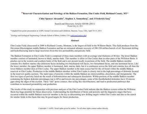
PS <strong>Reservoir</strong> <strong>Characterization</strong> <strong>and</strong> <strong>Petrology</strong> <strong>of</strong> <strong>the</strong> <strong>Bakken</strong> <strong>Formation</strong>, Elm Coulee Field, Richl<strong>and</strong> County, MT*<br />
Chloe Spencer Alex<strong>and</strong>re 1 , Stephen A. Sonnenberg 1 , <strong>and</strong> J Frederick Sarg 1<br />
Search <strong>and</strong> Discovery Article #20108 (2011)<br />
Posted July 18, 2011<br />
*Adapted from poster presentation at AAPG Annual Convention <strong>and</strong> Exhibition, Houston, Texas, USA, April 10-13, 2011<br />
1 Geology <strong>and</strong> Geological Engineering, Colorado School <strong>of</strong> Mines, Golden, CO (csalexan@mines.edu)<br />
Abstract<br />
Elm Coulee Field, discovered in 2000 in Richl<strong>and</strong> County, Montana, is <strong>the</strong> largest oil field in <strong>the</strong> Williston Basin. This field produces from <strong>the</strong><br />
Devonian-Mississippian middle <strong>Bakken</strong> <strong>Formation</strong> <strong>and</strong> has an estimated ultimate recovery <strong>of</strong> 200-250 million barrels <strong>of</strong> oil. Horizontal drilling<br />
<strong>and</strong> hydr<strong>of</strong>racturing lead to large recoveries from this low permeability <strong>and</strong> porosity field.<br />
The <strong>Bakken</strong> <strong>Formation</strong> in Elm Coulee Field is composed <strong>of</strong> three main members with an average total thickness <strong>of</strong> 40 feet. The lower <strong>Bakken</strong><br />
member consists <strong>of</strong> laminated, brown to black, marine shale. This member is siltier in Elm Coulee than in o<strong>the</strong>r parts <strong>of</strong> <strong>the</strong> Williston Basin. It<br />
pinches out in <strong>the</strong> western <strong>and</strong> sou<strong>the</strong>rn limits <strong>of</strong> <strong>the</strong> field <strong>and</strong> is not present locally in portions <strong>of</strong> <strong>the</strong> field. The middle <strong>Bakken</strong> member<br />
contains five shallow marine silty-dolostone facies including two brachiopod-rich facies, two bioturbated facies, <strong>and</strong> one laminated facies. Like<br />
<strong>the</strong> lower member, <strong>the</strong> upper <strong>Bakken</strong> member is laminated, dark, marine shale, but it is continuous across <strong>the</strong> field <strong>and</strong> contains less silt than <strong>the</strong><br />
lower <strong>Bakken</strong> member does at Elm Coulee. The upper <strong>Bakken</strong> member is <strong>the</strong> main source bed for <strong>the</strong> oil found within <strong>the</strong> middle <strong>Bakken</strong><br />
reservoir at Elm Coulee. Production in <strong>the</strong> middle <strong>Bakken</strong> member within Elm Coulee is closely tied to <strong>the</strong> high percentage <strong>of</strong> dolomite located<br />
in <strong>the</strong> reservoir quality sections. The main types <strong>of</strong> porosity within <strong>the</strong> middle <strong>Bakken</strong> are intercrystalline, dissolution, <strong>and</strong> intergranular. The<br />
first two types <strong>of</strong> porosity listed are <strong>the</strong> result <strong>of</strong> dolomitization <strong>and</strong> subsequent dissolution. Within portions <strong>of</strong> <strong>the</strong> middle <strong>Bakken</strong> member<br />
containing <strong>the</strong> highest dolomite percentages (up to 60%) <strong>and</strong> lowest clay percentages, some <strong>of</strong> <strong>the</strong> rhombohedral dolomites have 10 micron<br />
gaps along <strong>the</strong> edges <strong>of</strong> <strong>the</strong> crystals. These “slot” pores connect, thus acting like micr<strong>of</strong>ractures, <strong>and</strong> lead to preferential pathways that<br />
contribute to increased permeability <strong>and</strong> production.<br />
The results <strong>of</strong> this study in conjunction with previous analyses <strong>of</strong> <strong>the</strong> Elm Coulee Field indicate that <strong>the</strong> <strong>Bakken</strong> system within <strong>the</strong> Williston<br />
Basin has huge potential for future discoveries. Underst<strong>and</strong>ing <strong>the</strong> distribution <strong>of</strong> facies <strong>and</strong> porosity <strong>and</strong> <strong>the</strong> diagenetic stages that have<br />
occurred within <strong>the</strong> middle <strong>Bakken</strong> reservoir member is <strong>the</strong> key to determining new drilling targets within Elm Coulee <strong>and</strong> also to <strong>the</strong> search<br />
for similar fields in this basin that may be good targets for future production.<br />
Copyright © AAPG. Serial rights given by author. For all o<strong>the</strong>r rights contact author directly.
References<br />
Blakey, R.C., 2011, North American paleogeographic Maps—Late Devonian (360Ma), Colorado Plateau Geosystems, Web accessed 28 June<br />
2011,<br />
http://cpgeosystems.com/namD360.jpg<br />
Flannery, J., <strong>and</strong> Kraus, J., 2006, Integrated analysis <strong>of</strong> <strong>the</strong> <strong>Bakken</strong> Petroleum System: U.S. Williston Basin: AAPG National Convention,<br />
Houston, Texas. Search <strong>and</strong> Discovery Article #10105. Web accessed 28 June 2011,<br />
http://www.search<strong>and</strong>discovery.com/documents/2006/06035flannery/index.htm?q=%2BtextStrip%3A10105<br />
Meissner, F.F., 1978, Petroleum geology <strong>of</strong> <strong>the</strong> <strong>Bakken</strong> <strong>Formation</strong> Williston Basin, North Dakota <strong>and</strong> Montana, in D. Rehrig, (chair), The<br />
economic geology <strong>of</strong> <strong>the</strong> Williston Basin; Montana, North Dakota, South Dakota, Saskatchewan, Manitoba: Montana Geological Society, p.<br />
207-227.<br />
Nordeng, S.H., 2009, The <strong>Bakken</strong> petroleum system; an example <strong>of</strong> a continuous petroleum accumulation: DMR Newsletter, v. 36/1, p. 19-22.<br />
Pitman, J.K., L.C. Price, <strong>and</strong> J.A. LeFever, 2001, Diagenesis <strong>and</strong> fracture development in <strong>the</strong> <strong>Bakken</strong> <strong>Formation</strong>, Williston Basin: Implications<br />
for reservoir quality in <strong>the</strong> middle member: U.S. Geological Survey Pr<strong>of</strong>essional Paper 1653, p. 19.<br />
Pramudito, A., 2008, Depositional facies, diagenesis, <strong>and</strong> petrophysical analysis <strong>of</strong> <strong>the</strong> <strong>Bakken</strong> <strong>Formation</strong>, Elm Coulee Field, Williston Basin,<br />
Montana: Colorado School <strong>of</strong> Mines, M.S. <strong>the</strong>sis, 195 p.<br />
Smith, M.G., <strong>and</strong> R.M. Bustin, 1996, Lith<strong>of</strong>acies <strong>and</strong> paleoenvironments <strong>of</strong> <strong>the</strong> Upper Devonian <strong>and</strong> Lower Mississippian <strong>Bakken</strong> <strong>Formation</strong>,<br />
Williston Basin: Bulletin <strong>of</strong> Canadian Petroleum Geology, v. 44/3, p. 495-507.<br />
Sonnenberg, S.A., <strong>and</strong> A. Pramudito, 2009, Petroleum geology <strong>of</strong> <strong>the</strong> giant Elm Coulee field, Williston Basin: AAPG Bulletin, v. 93/9, p. 1127-<br />
1153.<br />
Webster, R.L., 1984, Petroleum source rocks <strong>and</strong> stratigraphy <strong>of</strong> <strong>the</strong> <strong>Bakken</strong> <strong>Formation</strong> in North Dakota, in J. Woodward, F.F. Meissner, <strong>and</strong><br />
J.L. Clayton, (eds.), Hydrocarbon Source Rocks <strong>of</strong> <strong>the</strong> Rocky Mountain Region: Rocky Mountain Association <strong>of</strong> Geologists, Denver, Colorado,<br />
p. 57-81.
<strong>Reservoir</strong> <strong>Characterization</strong> <strong>and</strong> <strong>Petrology</strong> <strong>of</strong> <strong>the</strong> <strong>Bakken</strong> <strong>Formation</strong>, Elm Coulee Field, Richl<strong>and</strong> County, MT<br />
Chloe Spencer Alex<strong>and</strong>re, Stephen A. Sonnenberg, J. Fredrick Sarg, Colorado School <strong>of</strong> Mines Department <strong>of</strong> Geology <strong>and</strong> Geological Engineering, Golden, Colorado<br />
Abstract Background Figures The Cores<br />
Elm Coulee Field, discovered in 2000 in Richl<strong>and</strong><br />
County, Montana, is <strong>the</strong> largest oil field in <strong>the</strong> Williston<br />
Basin. This field produces from <strong>the</strong> Devonian-<br />
Mississippian middle <strong>Bakken</strong> <strong>Formation</strong> <strong>and</strong> has an<br />
estimated ultimate recovery <strong>of</strong> 200-250 million barrels <strong>of</strong><br />
oil. Horizontal drilling <strong>and</strong> hydr<strong>of</strong>racturing lead to large<br />
recoveries from this low permeability <strong>and</strong> porosity field.<br />
The <strong>Bakken</strong> <strong>Formation</strong> in Elm Coulee Field is<br />
composed <strong>of</strong> three main members with an average total<br />
thickness <strong>of</strong> 40 feet. The lower <strong>Bakken</strong> member consists<br />
<strong>of</strong> laminated, brown to black, marine shale. This member<br />
is siltier in Elm Coulee than in o<strong>the</strong>r parts <strong>of</strong> <strong>the</strong> Williston<br />
Basin. It pinches out in <strong>the</strong> western <strong>and</strong> sou<strong>the</strong>rn limits<br />
<strong>of</strong> <strong>the</strong> field <strong>and</strong> is not present locally in portions <strong>of</strong> <strong>the</strong><br />
field. The middle <strong>Bakken</strong> member contains five shallow<br />
marine silty-dolostone facies including two brachiopod-<br />
rich facies, two bioturbated facies, <strong>and</strong> one laminated<br />
facies. Like <strong>the</strong> lower member, <strong>the</strong> upper <strong>Bakken</strong><br />
member is laminated, dark, marine shale, but it is<br />
continuous across <strong>the</strong> field <strong>and</strong> contains less silt than <strong>the</strong><br />
lower <strong>Bakken</strong> member does at Elm Coulee. The upper<br />
<strong>Bakken</strong> member is <strong>the</strong> main source bed for <strong>the</strong> oil found<br />
within <strong>the</strong> middle <strong>Bakken</strong> reservoir at Elm Coulee.<br />
Production in <strong>the</strong> middle <strong>Bakken</strong> member within Elm<br />
Coulee is closely tied to <strong>the</strong> high percentage <strong>of</strong> dolomite<br />
located in <strong>the</strong> reservoir quality sections. The main types<br />
<strong>of</strong> porosity within <strong>the</strong> middle <strong>Bakken</strong> are intercrystalline,<br />
dissolution, <strong>and</strong> intergranular. The first two types <strong>of</strong><br />
porosity listed are <strong>the</strong> result <strong>of</strong> dolomitization <strong>and</strong><br />
subsequent dissolution. Within portions <strong>of</strong> <strong>the</strong> middle<br />
<strong>Bakken</strong> member containing <strong>the</strong> highest dolomite<br />
percentages (up to 60%) <strong>and</strong> lowest clay percentages,<br />
some <strong>of</strong> <strong>the</strong> rhombohedral dolomites have 10 micron<br />
gaps along <strong>the</strong> edges <strong>of</strong> <strong>the</strong> crystals. These “slot” pores<br />
connect, thus acting like micr<strong>of</strong>ractures, <strong>and</strong> lead to<br />
preferential pathways that contribute to increased<br />
permeability <strong>and</strong> production.<br />
The results <strong>of</strong> this study in conjunction with previous<br />
analyses <strong>of</strong> <strong>the</strong> Elm Coulee Field indicate that <strong>the</strong> <strong>Bakken</strong><br />
system within <strong>the</strong> Williston Basin has huge potential for<br />
future discoveries. Underst<strong>and</strong>ing <strong>the</strong> distribution <strong>of</strong><br />
facies <strong>and</strong> porosity <strong>and</strong> <strong>the</strong> diagenetic stages that have<br />
occurred within <strong>the</strong> middle <strong>Bakken</strong> reservoir member is<br />
<strong>the</strong> key to determining new drilling targets within Elm<br />
Coulee <strong>and</strong> also to <strong>the</strong> search for similar fields in this<br />
basin that may be good targets for future production.<br />
Paleogeographic map showing <strong>the</strong> location <strong>of</strong> <strong>the</strong><br />
Williston Basin during <strong>the</strong> Late Devonian while <strong>the</strong> first<br />
half <strong>of</strong> <strong>the</strong> <strong>Bakken</strong> was deposited. At this time, <strong>the</strong> basin<br />
was located in <strong>the</strong> tropics near <strong>the</strong> equator (Nordeng,<br />
2009; image modified from Blakey, 2011).<br />
General stratigraphic column <strong>of</strong> <strong>the</strong><br />
Williston Basin. Roughly 16,000 feet <strong>of</strong><br />
sediment was nearly continuously<br />
deposited from Cambrian until Tertiary<br />
times (Pitman et al., 2001; image from<br />
Flannery <strong>and</strong> Kraus, 2006).<br />
Contour map <strong>of</strong> <strong>the</strong> Williston Basin on <strong>the</strong><br />
base <strong>of</strong> <strong>the</strong> Mississippian. The basin covers<br />
portions <strong>of</strong> Montana, South Dakota, North<br />
Dakota, Saskatchewan, <strong>and</strong> Manitoba (from<br />
Sonnenberg <strong>and</strong> Pramudito, 2009, modified<br />
from Webster, 1984).<br />
Cross-section <strong>of</strong> <strong>the</strong> Williston Basin showing <strong>the</strong> location <strong>of</strong> Elm<br />
Coulee in relation to <strong>the</strong> three <strong>Bakken</strong> members. Note how it is<br />
located on <strong>the</strong> depositional edge <strong>of</strong> <strong>the</strong> lower member where<br />
that member onlaps <strong>the</strong> underlying Three Fork <strong>Formation</strong>. Also<br />
note that <strong>the</strong> middle <strong>Bakken</strong> member becomes dolomitic, ra<strong>the</strong>r<br />
than calcitic in this part <strong>of</strong> <strong>the</strong> basin (from Sonnenberg <strong>and</strong><br />
Pramudito, 2009, modified from Meissner, 1978).<br />
More detailed stratigraphic column showing <strong>the</strong><br />
<strong>Bakken</strong> Petroleum System. This system includes <strong>the</strong><br />
lower part <strong>of</strong> <strong>the</strong> Lodgepole <strong>Formation</strong>, <strong>the</strong> upper,<br />
middle, <strong>and</strong> lower members <strong>of</strong> <strong>the</strong> <strong>Bakken</strong><br />
<strong>Formation</strong>, <strong>and</strong> <strong>the</strong> upper part <strong>of</strong> <strong>the</strong> Three Forks<br />
<strong>Formation</strong> (from Sonnenberg <strong>and</strong> Pramudito, 2009,<br />
modified from Webster, 1984).<br />
Close-up <strong>of</strong> Elm<br />
Coulee Field (in<br />
green) in Richl<strong>and</strong><br />
County, MT<br />
(outlined in<br />
orange). The four<br />
wells in this study<br />
are Jackson-Rowdy,<br />
Brutus East-Lewis,<br />
Foghorn-Ervin, <strong>and</strong><br />
RR Lonetree-Edna.<br />
The well log crosssection<br />
line is in<br />
yellow.<br />
Jackson-Rowdy<br />
Elm<br />
Coulee<br />
Field<br />
MT ND<br />
Richl<strong>and</strong> County<br />
RR Lonetree-Edna<br />
Brutus East-Lewis<br />
Foghorn-Ervin<br />
Facies Description Core Thin Section<br />
UBS<br />
lag<br />
F<br />
E<br />
C<br />
B<br />
A<br />
LBS<br />
-The upper <strong>Bakken</strong> shale. A dark shale with silty laminations. Laminations<br />
decrease in frequency <strong>and</strong> color darkens to black toward <strong>the</strong> top <strong>of</strong> <strong>the</strong><br />
facies. This facies contains some open horizontal fractures <strong>and</strong> some filled<br />
ptygmatic sub-vertical fractures, as well as pyrite features <strong>and</strong> fossils.<br />
-Deposited in an open-marine environment with a stratified water column<br />
below wave base -Average thickness: 7.19 feet<br />
-Well cemented, quartz-rich, very fine-grained s<strong>and</strong>stone that contains<br />
abundant pyrite <strong>and</strong> phosphatic fossil fragments <strong>and</strong> conodonts.<br />
-Transgressive lag deposit<br />
-Average thickness: varies<br />
-Mottled silty dolostone with brachiopod fragments <strong>and</strong> occasional<br />
laminations <strong>and</strong> horizontal burrows.<br />
-Deposited between storm <strong>and</strong> fair-wea<strong>the</strong>r wave base in an <strong>of</strong>fshore<br />
marine setting<br />
-Average thickness: 2.06 feet<br />
-Bioturbated silty dolostone with many burrows <strong>and</strong> some wavy <strong>and</strong> planar<br />
laminations.<br />
-Deposited between storm <strong>and</strong> fair-wea<strong>the</strong>r wave base in an <strong>of</strong>fshore<br />
marine setting<br />
-Average thickness: 2.83 feet<br />
-Rhythmic mm-cm laminated silty dolostone with some bioturbation.<br />
Bedding types include planar, subparallel, wavy, <strong>and</strong> small-scale crosslaminations.<br />
-Deposited in lower, middle, to upper shoreface setting with wave <strong>and</strong> tidal<br />
influences<br />
-Average thickness: 7.43 feet<br />
-Burrowed <strong>and</strong> bioturbated silty dolostone. Contains abundant clay-rich<br />
Helminthopsis <strong>and</strong> Scalarituba burrows <strong>and</strong> rare laminations <strong>and</strong> fossils.<br />
Clay content decreases <strong>and</strong> core lightens near <strong>the</strong> top <strong>of</strong> <strong>the</strong> facies.<br />
-Deposited between storm <strong>and</strong> fair-wea<strong>the</strong>r wave base in an <strong>of</strong>fshore<br />
marine setting<br />
-Average thickness: 15.30 feet<br />
-Fossiliferous, clay-rich silty dolostone. Fossil types include brachiopods<br />
<strong>and</strong> crinoids.<br />
-Deposited between storm <strong>and</strong> fair-wea<strong>the</strong>r wave base in an <strong>of</strong>fshore<br />
marine setting<br />
-Average thickness: 5.68 feet<br />
-The lower <strong>Bakken</strong> shale. Dark shale with faint silty laminations.<br />
-Deposited in an open-marine environment with a stratified water column<br />
below wave base<br />
-Average thickness: 1.39 feet<br />
Cross-section<br />
<strong>of</strong> <strong>the</strong> study<br />
wells shown<br />
on <strong>the</strong> map to<br />
<strong>the</strong> left. Note<br />
that <strong>the</strong> lower<br />
<strong>Bakken</strong> shale<br />
pinches out<br />
toward <strong>the</strong><br />
south <strong>of</strong> Elm<br />
Coulee <strong>and</strong><br />
that <strong>the</strong> E <strong>and</strong><br />
F middle<br />
<strong>Bakken</strong> facies<br />
are absent<br />
locally.<br />
ENERPLUS RES USA COR<br />
JACKSON-ROWDY 3-8<br />
Log is 1’ deeper than core depth.<br />
These facies<br />
descriptions are<br />
modified from <strong>the</strong><br />
Colorado School <strong>of</strong><br />
Mines <strong>Bakken</strong> Facies.<br />
Facies D is not listed<br />
here because it is not<br />
present in Elm Coulee<br />
Field. Facies D is <strong>the</strong><br />
coarsest grained<br />
<strong>Bakken</strong> facies; it is an<br />
alternating crossbedded<br />
bioclast <strong>and</strong><br />
very fine-grained<br />
s<strong>and</strong>stone deposited<br />
in a higher energy<br />
channel or shoal<br />
setting.<br />
Core<br />
Descriptions<br />
ENERPLUS RES USA COR<br />
BRUTUS EAST-LEWIS 3-4-H<br />
Jackson-Rowdy<br />
Foghorn-Ervin<br />
ENERPLUS RES USA COR<br />
FOGHORN-ERVIN 20-3-H<br />
185241 ft 49060 ft 44695 ft<br />
Log is 6’ deeper than core depth.<br />
Brutus East-Lewis<br />
RR Lonetree-Edna<br />
ENERPLUS RES USA COR<br />
RR LONETREE-EDNA 1-13<br />
Log is 7’ shallower than core depth.
A Petrographic Look at <strong>the</strong> Facies Present at Elm Coulee<br />
The pictures on this poster have been selected from 123 thin sections to represent <strong>the</strong> facies present in a “type well” at Elm Coulee Field.<br />
When studying <strong>the</strong>se images, pay close attention to <strong>the</strong> relative percentages <strong>of</strong> clay, detrital quartz, <strong>and</strong> dolomite. Higher dolomite <strong>and</strong> lower<br />
clay percentages lead to better porosity in a sample. In general, facies LBS, A, E, F, <strong>and</strong> UBS are not reservoir, <strong>and</strong> portions <strong>of</strong> B or C are <strong>the</strong><br />
reservoir intervals.<br />
There are five main types <strong>of</strong> porosity present in <strong>the</strong>se images: secondary due to dolomite dissolution, “slot” pores (intercrystalline),<br />
intergranular, fractures, <strong>and</strong> intracrystalline. Intracrystalline pores are rare <strong>and</strong> do not really increase overall permeability. Natural fractures at<br />
Elm Coulee are still <strong>of</strong> a debatable importance. Though some fractures in <strong>the</strong> shales seem real, many found in <strong>the</strong> middle <strong>Bakken</strong> appear to be<br />
induced. In thin section, <strong>the</strong>se are <strong>of</strong>ten wide <strong>and</strong> cut across <strong>the</strong> sample or occur along boundaries <strong>of</strong> burrows or fossils, which are oddities<br />
that could affect <strong>the</strong> integrity <strong>of</strong> <strong>the</strong> rock being cut. Intergranular pores are common between <strong>the</strong> quartz grains <strong>and</strong> carbonate crystals. And<br />
finally, “slot” pores <strong>and</strong> secondary pores due to dolomitization <strong>and</strong> subsequent dissolution are very similar to one ano<strong>the</strong>r. “Slot” pores are 10<br />
micron gaps present in some reservoir quality samples. They form ei<strong>the</strong>r from <strong>the</strong> dissolution <strong>of</strong> dolomite rhomb edges or from dolomite<br />
crystals not quite growing toge<strong>the</strong>r—ei<strong>the</strong>r way, a rectangular “slot” exists, <strong>and</strong> if many are present an increased permeability network forms.<br />
Note: These thin sections are injected with a pink epifluorescent epoxy. When subjected to a fluorescent light, exposed epoxy (like in<br />
fractures <strong>and</strong> pores) fluoresces to an orange color. Typically, <strong>the</strong> brighter orange or yellow <strong>the</strong> epoxy glows, <strong>the</strong> clearer <strong>the</strong> pore space.<br />
Lower<br />
<strong>Bakken</strong><br />
Shale<br />
Middle<br />
<strong>Bakken</strong><br />
Facies<br />
A<br />
Porosity Types:<br />
dolomite dissolution “slots” intergranular fractures intracrystalline<br />
conodont<br />
Jackson-Rowdy, 7662.45’, 160x<br />
PPL XPL<br />
FL<br />
Tasmanites<br />
0.05 mm 0.05 mm<br />
0.05 mm<br />
Jackson-Rowdy, 7662.45’, 160x<br />
PPL XPL<br />
FL<br />
PPL<br />
crinoid<br />
brachiopod spine<br />
pyrite<br />
induced fracture?<br />
PPL = plane polarized light<br />
XPL = cross polarized light<br />
FL = fluorescent light<br />
0.05 mm 0.05 mm 0.05 mm<br />
0.05 mm<br />
0.05 mm<br />
XPL<br />
quartz<br />
Foghorn-Ervin, 10531.9’, 160x<br />
quartz<br />
RR Lonetree-Edna, 10412.1’, 160x<br />
PPL XPL<br />
FL<br />
quartz<br />
muscovite<br />
dolomite<br />
0.05 mm<br />
0.05 mm<br />
FL<br />
induced fracture<br />
fractures<br />
0.05 mm<br />
0.05 mm<br />
Chert <strong>and</strong><br />
phosphate fossils in<br />
<strong>the</strong> dark shale. The<br />
only porosity in <strong>the</strong><br />
lower <strong>Bakken</strong> shale<br />
is found along<br />
horizontal or subhorizontal<br />
fractures.<br />
Tasmanites algal<br />
spores are common<br />
in <strong>the</strong> <strong>Bakken</strong><br />
shales, as are thin<br />
short fractures.<br />
This image shows a<br />
calcareous crinoid<br />
stem among<br />
poorly sorted quartz<br />
grains, calcite,<br />
dolomite, <strong>and</strong> clays.<br />
The only porosity is<br />
related to a pyritic<br />
feature.<br />
Calcareous<br />
brachiopod spine<br />
preserved in poorly<br />
sorted quartz<br />
grains, dolomite,<br />
<strong>and</strong> clays. There is a<br />
fracture (likely<br />
induced along <strong>the</strong><br />
brachiopod fossil).<br />
Middle<br />
<strong>Bakken</strong><br />
Facies<br />
B<br />
Middle<br />
<strong>Bakken</strong><br />
Facies<br />
C<br />
Middle<br />
<strong>Bakken</strong><br />
Facies<br />
E<br />
clay-rich horizontal burrow<br />
RR Lonetree-Edna, 10408.2’, 160x<br />
dolomite<br />
PPL 0.05 mm XPL<br />
0.05 mm FL 0.05 mm<br />
50% dolomite =<br />
high porosity & permeability<br />
quartz<br />
RR Lonetree-Edna, 10397.0’, 63x<br />
large dolomite crystals<br />
PPL 0.13 mm XPL<br />
0.13 mm FL 0.13 mm<br />
lamination<br />
clay-rich lamination<br />
secondary porosity from<br />
dolomite dissolution<br />
Foghorn-Ervin, 10510.2’, 160x<br />
well-cemented<br />
dolomitic patches<br />
high porosity<br />
no porosity<br />
lots <strong>of</strong> well-connected pore spaces!<br />
PPL 0.05 mm XPL<br />
0.05 mm FL<br />
0.05 mm<br />
PPL XPL<br />
FL<br />
0.05 mm 0.05 mm 0.05 mm<br />
clay-rich patches<br />
lamination<br />
Foghorn-Ervin, 10511.3’, 63x<br />
PPL 0.13 mm XPL<br />
0.13 mm FL<br />
0.13 mm<br />
Jackson-Rowdy, 7632.55’, 160x<br />
Jackson-Rowdy, 7630.55’, 160x<br />
PPL XPL<br />
FL<br />
muscovite<br />
dolomite<br />
dolomite<br />
quartz<br />
pyrite<br />
low porosity<br />
zoned dolomite<br />
high porosity<br />
high porosity<br />
low porosity<br />
moderate porosity<br />
low porosity<br />
high porosity<br />
high porosity<br />
0.05 mm 0.05 mm<br />
0.05 mm<br />
This shows <strong>the</strong> porosity <strong>and</strong><br />
permeability variations that<br />
arise from burrows <strong>and</strong><br />
bioturbation in <strong>the</strong> B facies.<br />
This clay-rich burrow has no<br />
visible pore space, while <strong>the</strong><br />
coarser dolomitic material<br />
above <strong>and</strong> below <strong>the</strong><br />
burrow has a much higher<br />
porosity.<br />
This is <strong>the</strong> highest permeability<br />
sample from this well. Note <strong>the</strong><br />
high dolomite content <strong>and</strong> low<br />
clay content. These factors<br />
combine to create open, clay-free<br />
pore spaces. Also note <strong>the</strong><br />
appearance <strong>of</strong> <strong>the</strong> fluoresecent<br />
light image: <strong>the</strong> bright orange<br />
pore spaces are <strong>of</strong>ten rectangular<br />
“slots” adjacent to dolomite<br />
rhombs. These slots <strong>of</strong>ten connect<br />
to one ano<strong>the</strong>r increasing<br />
permeability in <strong>the</strong> rock.<br />
The laminations in C, or<br />
“laminites,” are thought to<br />
result from ei<strong>the</strong>r tidal<br />
processes or from algal<br />
mats. Ei<strong>the</strong>r way, <strong>the</strong>se clay<br />
<strong>and</strong> organic-rich<br />
laminations occlude<br />
porosity <strong>and</strong> can be<br />
barriers to flow.<br />
Close-up <strong>of</strong> a lamination<br />
edge. A large muscovite<br />
grain is parallel to <strong>the</strong><br />
bedding. The lamination<br />
contains mostly poorly<br />
sorted quartz <strong>and</strong><br />
dolomite. Thin clay coatings<br />
<strong>and</strong> organic matter on<br />
grains in <strong>the</strong> laminations<br />
occlude <strong>the</strong> pore spaces.<br />
Facies E is similar to B in terms<br />
<strong>of</strong> depositional environment<br />
<strong>and</strong> some visual features. This<br />
sample has a low porosity for<br />
facies E (
Key Observations from <strong>the</strong> Graphs:<br />
Jackson-Rowdy<br />
Foghorn-Ervin<br />
UBS<br />
E<br />
C<br />
B<br />
A<br />
Sample Depth<br />
LBS<br />
Three Forks<br />
Lodgepole<br />
UBS<br />
F<br />
E<br />
C<br />
B<br />
A<br />
Sample Depth<br />
Three Forks<br />
7626.85<br />
7627.85<br />
7630.35<br />
7632.55<br />
7634.20<br />
7636.90<br />
7637.55<br />
7638.65<br />
7639.55<br />
7640.50<br />
7641.40<br />
7642.30<br />
7643.40<br />
7644.45<br />
7645.35<br />
7646.40<br />
7647.60<br />
7648.70<br />
7649.50<br />
7650.30<br />
7652.45<br />
7654.75<br />
7656.50<br />
7658.35<br />
7660.45<br />
7662.45<br />
10501.9<br />
10504.4<br />
10505.4<br />
10507.5<br />
10508.7<br />
10509.3<br />
10510.2<br />
10511.3<br />
10512.4<br />
10513.6<br />
10515.3<br />
10516.8<br />
10518.4<br />
10519.7<br />
10520.6<br />
10521.9<br />
10523.4<br />
10525.0<br />
10526.9<br />
10528.8<br />
10530.6<br />
10531.9<br />
10533.2<br />
Oil & Water Saturation vs. Sample Depth Porosity & Permeability vs. Sample Depth<br />
XRD Mineral Percentage vs. Sample Depth<br />
% Saturation<br />
0 10 20 30 40 50 60 70 80 90 100<br />
Oil Water<br />
% Saturation<br />
0 10 20 30 40 50 60 70 80 90 100<br />
Oil Water<br />
Core Plug <strong>and</strong> X-Ray Di�raction Analysis<br />
• The reservoir interval occurs within <strong>the</strong> B <strong>and</strong> C facies <strong>and</strong> generally corresponds to porosity greater than 7% <strong>and</strong> to high oil saturation percentages.<br />
• <strong>Reservoir</strong> quality increases as illite, chlorite, <strong>and</strong> calcite content decrease <strong>and</strong> as dolomite content increases.<br />
• Based on <strong>the</strong> oil saturations, <strong>the</strong> upper <strong>Bakken</strong> shale appears to be <strong>the</strong> source for <strong>the</strong> oil in <strong>the</strong> middle <strong>Bakken</strong>. Even when <strong>the</strong> lower <strong>Bakken</strong> shale is present,<br />
<strong>the</strong>re are only minor oil shows in <strong>the</strong> adjacent A facies.<br />
• Usually changes in porosity <strong>and</strong> permeability directly correlate to one ano<strong>the</strong>r.<br />
• Clastic quartz <strong>and</strong> feldspar content stays fairly consistent.<br />
O<strong>the</strong>r notes:<br />
• Abnormally high permeabilities, like some values in <strong>the</strong> Brutus East-Lewis <strong>and</strong> RR Lonetree-Edna wells, could be due to partings induced by cutting <strong>the</strong> plugs.<br />
• Black lines mark <strong>the</strong> facies boundaries.<br />
• Yellow shading indicates <strong>the</strong> reservoir interval.<br />
• Red stars correspond to depths <strong>of</strong> samples featured on <strong>the</strong> Petrography Poster<br />
Sample Depth<br />
7626.85<br />
7627.85<br />
7630.35<br />
7632.55<br />
7634.20<br />
7636.90<br />
7637.55<br />
7638.65<br />
7639.55<br />
7640.50<br />
7641.40<br />
7642.30<br />
7643.40<br />
7644.45<br />
7645.35<br />
7646.40<br />
7647.60<br />
7648.70<br />
7649.50<br />
7650.30<br />
7652.45<br />
7654.75<br />
7656.50<br />
7658.35<br />
7660.45<br />
7662.45<br />
Mineral Percentage<br />
0% 10% 20% 30% 40% 50% 60% 70% 80% 90% 100%<br />
Oil & Water Saturation vs. Sample Depth Porosity & Permeability vs. Sample Depth<br />
XRD Mineral Percentage vs. Sample Depth<br />
Sample Depth<br />
10501.9<br />
10504.4<br />
10505.4<br />
10507.5<br />
10508.7<br />
10509.3<br />
10510.2<br />
10511.3<br />
10512.4<br />
10513.6<br />
10515.3<br />
10516.8<br />
10518.4<br />
10519.7<br />
10520.6<br />
10521.9<br />
10523.4<br />
10525.0<br />
10526.9<br />
10528.8<br />
10530.6<br />
10531.9<br />
10533.2<br />
Mineral Percentage<br />
0% 10% 20% 30% 40% 50% 60% 70% 80% 90% 100%<br />
Total<br />
<strong>Reservoir</strong><br />
= 3.5 feet<br />
thick<br />
QUARTZ / SILICA<br />
DOLOMITE<br />
CALCITE<br />
K-FELDSPAR<br />
PLAGIOCLASE FELDSPAR<br />
ILLITE / (MICA)<br />
CHLORITE<br />
PYRITE<br />
APATITE<br />
HALITE<br />
OTHER<br />
<strong>Reservoir</strong><br />
= 4.5 feet<br />
thick<br />
QUARTZ / SILICA<br />
DOLOMITE<br />
CALCITE<br />
K-FELDSPAR<br />
PLAGIOCLASE FELDSPAR<br />
ILLITE / (MICA)<br />
CHLORITE<br />
PYRITE<br />
ANHYDRITE<br />
OTHER<br />
Brutus East-Lewis<br />
RR Lonetree-Edna<br />
Conclusions:<br />
Lodgepole<br />
UBS<br />
lag<br />
C<br />
B<br />
A<br />
Three Forks<br />
Sample Depth<br />
Oil & Water Saturation vs. Sample Depth Porosity & Permeability vs. Sample Depth<br />
XRD Mineral Percentage vs. Sample Depth<br />
10383.6<br />
10386.5<br />
10388.0<br />
10390.4<br />
10391.1<br />
10392.3<br />
10393.7<br />
10394.1<br />
10395.2<br />
10395.3<br />
10396.1<br />
10397.0<br />
10398.2<br />
10399.1<br />
10400.1<br />
10400.4<br />
10401.2<br />
10401.4<br />
10402.6<br />
10403.2<br />
10404.2<br />
10405.2<br />
10406.1<br />
10407.2<br />
10408.2<br />
10409.1<br />
10410.2<br />
10411.2<br />
10412.1<br />
10414.2<br />
% Saturation<br />
0 10 20 30 40 50 60 70 80 90 100<br />
Oil Water<br />
Conclusions <strong>and</strong> Future Work<br />
• There are five middle <strong>Bakken</strong> facies present at Elm Coulee. Facies A, B, <strong>and</strong> C are continuous across <strong>the</strong> field, while E <strong>and</strong> F are locally absent. The lower <strong>Bakken</strong><br />
shale pinches out toward <strong>the</strong> sou<strong>the</strong>rn <strong>and</strong> western limits <strong>of</strong> <strong>the</strong> field, so in part <strong>of</strong> Elm Coulee Field, <strong>the</strong> middle <strong>Bakken</strong> unconformably overlies <strong>the</strong> Three<br />
Forks <strong>Formation</strong>.<br />
• The upper <strong>Bakken</strong> shale has a fairly consistent thickness across <strong>the</strong> field. Based on its widespread occurrence <strong>and</strong> oil saturation data from <strong>the</strong> four wells in this<br />
study, <strong>the</strong> upper <strong>Bakken</strong> shale is <strong>the</strong> main source rock for this field.<br />
• Though describing thin sections from all parts <strong>of</strong> <strong>the</strong> <strong>Bakken</strong> is useful in underst<strong>and</strong>ing <strong>the</strong> formation’s diagenetic history, careful observations <strong>of</strong> <strong>the</strong> porosity<br />
with <strong>the</strong> aid <strong>of</strong> a fluorescent microscope is extremely helpful when describing <strong>the</strong> characteristics that distinguish <strong>the</strong> reservoir intervals from nonreservoir.<br />
• As a typical rule, middle <strong>Bakken</strong> intervals with <strong>the</strong> highest dolomite percentage <strong>and</strong> <strong>the</strong> lowest <strong>the</strong> clay <strong>and</strong> calcite percentages make <strong>the</strong> best reservoir targets<br />
at Elm Coulee.<br />
• The main types <strong>of</strong> pores seen in reservoir intervals are intergranular, intercrystalline, <strong>and</strong> secondary pores due to dolomite dissolution.<br />
• Core plug analysis, including oil <strong>and</strong> water saturation data <strong>and</strong> porosity <strong>and</strong> permeability measurements, along with XRD measurements help support thin<br />
Lodgepole<br />
UBS<br />
F<br />
C<br />
B<br />
A<br />
LBS<br />
section <strong>and</strong> core descriptions <strong>and</strong> well log interpretations.<br />
Sample Depth<br />
Oil & Water Saturation vs. Sample Depth Porosity & Permeability vs. Sample Depth<br />
XRD Mineral Percentage vs. Sample Depth<br />
10377.9<br />
10380.2<br />
10384.1<br />
10385.2<br />
10388.1<br />
10389.1<br />
10390.1<br />
10391.2<br />
10392.3<br />
10393.3<br />
10394.2<br />
10395.3<br />
10396.3<br />
10397.2<br />
10398.3<br />
10399.3<br />
10400.2<br />
10401.3<br />
10402.2<br />
10403.3<br />
10404.3<br />
10405.3<br />
10406.3<br />
10407.3<br />
10408.2<br />
10409.3<br />
10410.3<br />
10411.3<br />
10412.2<br />
10413.2<br />
10414.2<br />
10415.2<br />
10418.3<br />
% Saturation<br />
0 10 20 30 40 50 60 70 80 90 100<br />
Oil Water<br />
Sample Depth<br />
Sample Depth<br />
10377.9<br />
10380.2<br />
10384.1<br />
10385.2<br />
10388.1<br />
10389.1<br />
10390.1<br />
10391.2<br />
10392.3<br />
10393.3<br />
10394.2<br />
10395.3<br />
10396.3<br />
10397.2<br />
10398.3<br />
10399.3<br />
10400.2<br />
10401.3<br />
10402.2<br />
10403.3<br />
10404.3<br />
10405.3<br />
10406.3<br />
10407.3<br />
10408.2<br />
10409.3<br />
10410.3<br />
10411.3<br />
10412.2<br />
10413.2<br />
10414.2<br />
10415.2<br />
10418.3<br />
10383.6<br />
10386.5<br />
10388.0<br />
10390.4<br />
10391.1<br />
10392.3<br />
10393.7<br />
10394.1<br />
10395.2<br />
10395.3<br />
10396.1<br />
10397.0<br />
10398.2<br />
10399.1<br />
10400.1<br />
10400.4<br />
10401.2<br />
10401.4<br />
10402.6<br />
10403.2<br />
10404.2<br />
10405.2<br />
10406.1<br />
10407.2<br />
10408.2<br />
10409.1<br />
10410.2<br />
10411.2<br />
10412.1<br />
10414.2<br />
Mineral Percentage<br />
0% 10% 20% 30% 40% 50% 60% 70% 80% 90% 100%<br />
Mineral Percentage<br />
0% 10% 20% 30% 40% 50% 60% 70% 80% 90% 100%<br />
<strong>Reservoir</strong><br />
= 7 feet<br />
thick<br />
QUARTZ / SILICA<br />
DOLOMITE<br />
CALCITE<br />
K-FELDSPAR<br />
PLAGIOCLASE FELDSPAR<br />
ILLITE / (MICA)<br />
CHLORITE<br />
PYRITE<br />
HALITE<br />
OTHER<br />
<strong>Reservoir</strong><br />
= 13.8 feet<br />
thick<br />
QUARTZ / SILICA<br />
DOLOMITE<br />
CALCITE<br />
K-FELDSPAR<br />
PLAGIOCLASE FELDSPAR<br />
ILLITE / (MICA)<br />
CHLORITE<br />
PYRITE<br />
OTHER<br />
Future work on this project will include:<br />
• The creation <strong>of</strong> a diagenetic chart for Elm Coulee Field based<br />
on thin section observations <strong>and</strong> core data (see <strong>the</strong> figures<br />
below for two diagenetic charts recently published by<br />
authors)<br />
• An analysis <strong>of</strong> dolomitization processes <strong>and</strong> a proposition for<br />
what events might have led to <strong>the</strong> high dolomite contents<br />
found in Elm Coulee<br />
• Continued porosity characterization, including determining<br />
<strong>the</strong> causes <strong>of</strong> pore types <strong>and</strong> <strong>the</strong>ir distributions within each<br />
well. The possible role <strong>of</strong> fracture porosity also needs to be<br />
explored fur<strong>the</strong>r at Elm Coulee, as does <strong>the</strong> concept <strong>of</strong> “slot”<br />
porosity.<br />
• Integration <strong>of</strong> source rock data to core <strong>and</strong> thin section shale<br />
observations<br />
Diagenetic chart for <strong>the</strong> middle <strong>Bakken</strong> in North<br />
Dakota (Pitman et. al, 2001).<br />
Diagenetic chart for <strong>the</strong> middle <strong>Bakken</strong> in Elm<br />
Coulee Field (Pramudito, 2008).<br />
References <strong>and</strong> Works Cited<br />
Blakey, R.C., 2011, North American Paleogeographic Maps—Late Devonian (360Ma), Colorado Plateau Geosystems,<br />
< http://cpgeosystems.com/namD360.jpg>.<br />
Flannery, J., <strong>and</strong> Kraus, J., 2006, Integrated Analysis <strong>of</strong> <strong>the</strong> <strong>Bakken</strong> Petroleum System: U.S. Williston Basin: Poster at<br />
AAPG National Convention, Houston, Texas.<br />
Meissner, F.F., 1978, Petroleum Geology <strong>of</strong> <strong>the</strong> <strong>Bakken</strong> <strong>Formation</strong> Williston Basin, North Dakota <strong>and</strong> Montana, in<br />
Rehrig, D. ed., Williston Basin Symposium, Montana Geological Society, Billings, Montana.<br />
Pitman, J.K., Price, L.C., <strong>and</strong> LeFever, J.A., 2001, Diagenesis <strong>and</strong> Fracture Development in <strong>the</strong> <strong>Bakken</strong> <strong>Formation</strong>,<br />
Williston Basin: Implications for <strong>Reservoir</strong> Quality in <strong>the</strong> Middle Member: U.S. Geological Survey<br />
Pr<strong>of</strong>essional Paper 1653, p. 19.<br />
Pramudito, A., 2008, Depositional Facies, Diagenesis, <strong>and</strong> Petrophysical Analysis <strong>of</strong> <strong>the</strong> <strong>Bakken</strong> <strong>Formation</strong>, Elm<br />
Coulee Field, Williston Basin, Montana [Master <strong>of</strong> Science]: Colorado School <strong>of</strong> Mines.<br />
Smith, M.G., <strong>and</strong> Bustin, R.M., 1996, Lith<strong>of</strong>acies <strong>and</strong> Paleoenvironments <strong>of</strong> <strong>the</strong> Upper Devonian <strong>and</strong> Lower<br />
Mississippian <strong>Bakken</strong> <strong>Formation</strong>, Williston Basin: Bulletin <strong>of</strong> Canadian Petroleum Geology, v. 44, no. 3, p.<br />
495-507.<br />
Sonnenberg, S.A., <strong>and</strong> Pramudito, A., 2009, Petroleum geology <strong>of</strong> <strong>the</strong> giant Elm Coulee field, Williston Basin: AAPG<br />
Bulletin, v. 93, no. 9, p. 1127-1153.<br />
Webster, R.L., 1984, Petroleum Source Rocks <strong>and</strong> Stratigraphy <strong>of</strong> <strong>the</strong> <strong>Bakken</strong> <strong>Formation</strong> in North Dakota, in<br />
Woodward, J., Meissner, F.F., <strong>and</strong> Clayton, J.C. eds., Hydrocarbon Source Rocks <strong>of</strong> <strong>the</strong> Rocky Mountain<br />
Region, Rocky Mountain Association <strong>of</strong> Geologists, Denver, Colorado, p. 57-81.


