

pdf - Ministry of Environment and Forests
pdf - Ministry of Environment and Forests
pdf - Ministry of Environment and Forests
- TAGS
- ministry
- forests
- moef.nic.in

Create successful ePaper yourself
Turn your PDF publications into a flip-book with our unique Google optimized e-Paper software.
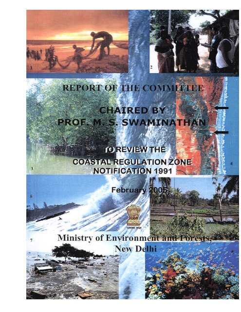
REPORT OF THE EXPERT COMMITTEE ON COASTAL<br />
REGULATION ZONE NOTIFICTION, 1991<br />
CONTENTS<br />
Preface 1<br />
Introduction 3<br />
Order constituting the Expert Committee <strong>and</strong> its<br />
Terms <strong>of</strong> Reference<br />
5<br />
1.0 COASTAL ZONE MANAGEMENT – NATIONAL<br />
AND INTERNATIONAL PRACTICES<br />
7-29<br />
1.1 Indian Initiatives 7<br />
1.1.1 Indian Coast 7<br />
1.1.2 Indian laws <strong>and</strong> regulations 10<br />
1.1.3 Institutional infrastructure 10<br />
1.2 Committees <strong>and</strong> Reports 11<br />
1.2.1 B.B. Vohra Committee 11<br />
1.2.2 Pr<strong>of</strong>. Balakrishnan Nair Committee 12<br />
1.2.3 Father Sa ldanha Committee (I) 12<br />
1.2.4 Father Saldanha Committee (II) 13<br />
1.2.5 D.M. Sukhthankar Committee (I) 13<br />
1.2.6 D.M. Sukhthankar Committee (II) 13<br />
1.2.7 Arcot Ramach<strong>and</strong>ran Committee 14<br />
1.2.8 Pr<strong>of</strong>. M.S. Swaminathan Committee 15<br />
1.2.9 Summary <strong>of</strong> the recommendations <strong>of</strong> the Committees 15<br />
1.3 Coastal Zone Management - International Best<br />
Practices<br />
19<br />
1.3.1 Developed countries 19<br />
1.3.2 Developing countries 21<br />
1.3.3 International agencies 22<br />
1.4 Scientific Principles in Coastal Zone Management 25<br />
1.4.1 Specific Management Methodology to implement<br />
Coastal Zone Management<br />
25<br />
1.4.1.1 Zoning 25<br />
1.4.1.2 Vulnerability Mapping 25<br />
1.4.1.3 Setback zones 26<br />
1.4.1.4 Special Area Management Plans 27<br />
1.4.1.5 Integrated Coastal Zone Management 28<br />
2.0 COASTAL AND MARINE RESOURCES –<br />
THREATS AND SAFEGUARDS<br />
30-72<br />
2.1.0 Non-living Resources in Coastal <strong>and</strong> Marine Areas 30<br />
2.1.1 Hydrocarbons 30<br />
2.1.2 Placers <strong>and</strong> other Minerals 30<br />
2.1.3 Salt <strong>and</strong> Chemicals 31<br />
2.1.4 Freshwater 31<br />
2.1.5 Renewable energy resources 33<br />
2.2.0 Areas <strong>of</strong> incomparable value 33<br />
2.2.1 Areas <strong>of</strong> Scenic/Aesthetic Value <strong>and</strong> Heritage 34<br />
2
2.3.0 Living Resources in Coastal <strong>and</strong> Marine Areas 25<br />
2.3.1 Marine Biodiversity 35<br />
2.3.2 Fisheries 36<br />
2.4.0 Coastal Ecosystems 38<br />
2.4.1 Mangroves 39<br />
2.4.2 Corals 40<br />
2.4.3 Seagrass beds 42<br />
2.4.4 Seaweeds 43<br />
2.4.5 Horseshoe Crab Habitats 44<br />
2.4.6 Turtle Nesting Grounds 44<br />
2.4.7 Coastal <strong>Forests</strong> <strong>and</strong> Wildlife Areas 45<br />
2.4.8 Protected areas - Marine Parks <strong>and</strong> Sanctuaries 45<br />
2.5.0 Coastal Geomorphic Systems 46<br />
2.5.1 Coastal dynamics 46<br />
2.5.1.1 Mudbanks 47<br />
2.5.1.2 Beaches 47<br />
2.5.1.3 S<strong>and</strong> dunes 48<br />
2.5.1.4 Earth cliffs 50<br />
2.5.1.5 Rocky cliffs 50<br />
2.5.1.6 Rocky foreshore areas 51<br />
2.5.1.7 S<strong>and</strong> bars 51<br />
2.5.1.8 Estuaries 51<br />
2.5.1.9 Lagoons 53<br />
2.5.1.10 Mudflats 54<br />
2.5.1.11 Deltaic areas 55<br />
2.5.1.12 Tidal inlets 56<br />
2.5.1.13 Barrier isl<strong>and</strong>s 56<br />
2.5.1.14 Lakes 57<br />
2.5.1.15 Salt marshes 57<br />
2.5.1.16 Isl<strong>and</strong>s 58<br />
2.6.0 Coastal Communities 58<br />
2.6.1 Livelihood <strong>and</strong> Social Dimension 59<br />
2.7.0 Infrastructure 60<br />
2.7.1 Zonation <strong>and</strong> planning for locating infrastructure 60<br />
facilities<br />
2.7.2 Coastal Agriculture <strong>and</strong> Mariculture 60<br />
2.7.3 Ports <strong>and</strong> harbours 63<br />
2.7.4 Coastal protection structures 64<br />
2.7.5 Settlements (including cities) 65<br />
2.7.6 Tourism 65<br />
2.7.7 Infrastructure for National Security 66<br />
2.8.0 Natural Hazards 66<br />
2.8.1 Coastal erosion 66<br />
2.8.2 Cyclones <strong>and</strong> storm surges 68<br />
2.8.3 Flooding 68<br />
2.8.4 Sea level rise due to Greenhouse effect 69<br />
2.8.5 Saltwater intrusion 69<br />
2.8.6 Tsunami 69<br />
2.9 Coastal <strong>and</strong> Marine Pollution 71<br />
3.0 CRZ NOTIFICATION, 1991 – REVISITED 73-89<br />
3
3.1.0 Background 73<br />
3.1.1 Prohibited <strong>and</strong> Permissible Activities 74<br />
3.1.2 Amendments to Coastal Regulation Zone Notification,<br />
1991<br />
74<br />
3.2.0 Working <strong>of</strong> the Notification 75<br />
3.2.1 Efforts by <strong>Ministry</strong> <strong>of</strong> <strong>Environment</strong> & <strong>Forests</strong>/Courts 75<br />
3.2.2 Enforcement <strong>and</strong> Monitoring <strong>of</strong> CRZ Notification,<br />
1991<br />
76<br />
3.2.3 Positive Aspects <strong>of</strong> CRZ Notification, 1991 76<br />
3.2.4 Violations 76<br />
3.2.5 Constraints/Problems 76<br />
3.3.0 Issues raised by Governments with regard to<br />
Coastal Regulation Zone Notification<br />
77<br />
3.3.1 General Issues 77<br />
3.3.2 Mechanism <strong>and</strong> Funding 77<br />
3.4.0 Issues Pertaining to Economic Development 77<br />
3.4.1 General 77<br />
3.4.2 Dwelling Units <strong>of</strong> Local Communities 80<br />
3.4.3 Ports <strong>and</strong> Harbours <strong>and</strong> other Foreshore Activities 81<br />
3.4.4 Setting up <strong>and</strong> Expansion <strong>of</strong> Industrial Activities 81<br />
3.4.5 Mining Activities 81<br />
3.4.6 Non-conventional Energy 81<br />
3.4.7 Fishery, Aquaculture <strong>and</strong> allied Activities 82<br />
3.4.8 Structures to prevent Erosion <strong>and</strong> Salinity Ingression 82<br />
3.4.9 Extraction <strong>of</strong> Oil <strong>and</strong> Natural Gas 82<br />
3.4.10 Extraction <strong>of</strong> Ground Water 82<br />
3.4.11 L<strong>and</strong> Reclamation 83<br />
3.4.12 Storage <strong>of</strong> Chemicals <strong>and</strong> Petroleum Products 83<br />
3.4.13 Discharge <strong>of</strong> Effluents 83<br />
3.4.14 Transportation Systems 83<br />
3.4.15 Agr icultural Activities 83<br />
3.4.16 Defence Projects 84<br />
3.4.17 Transmission Projects for Power, Communication, etc 84<br />
3.4.18 Public Amenities 84<br />
3.4.19 Salt Pans 84<br />
3.4.20 Recreation <strong>and</strong> Tourism 84<br />
3.4.21 Housing <strong>and</strong> Settlements 84<br />
3.4.22 Atomic Power Projects 85<br />
3.4.23 Categorization <strong>of</strong> Coastal Regulation Zone Areas 85<br />
3.4.24 Demarcation <strong>of</strong> CRZ Area <strong>and</strong> High Tide Line 85<br />
3.4.25 Preparation <strong>of</strong> Coastal Zone Management Plans 86<br />
3.4.26 Clearance Procedure for developmental projects under<br />
Coastal Regulation Zone<br />
86<br />
3.5.0 Enforcement <strong>and</strong> monitoring <strong>of</strong> Coastal Regulation<br />
Zone Notification, 1991<br />
87<br />
3.6.0 NGO’s Perceptions 87<br />
3.6.1 Suggestions by NGOs 87<br />
3.6.2 R&D sector 88<br />
3.7.0 Summary <strong>of</strong> current CZM 88<br />
3.7.1 Weak implementation by the State Governments 88<br />
4
3.7.2 Initiatives by Central Government 88<br />
3.7.3 Awareness Programme 89<br />
3.7.4 Conflict Resolution 89<br />
4.0 SUGGESTIONS OF THE COMMITTEE FOR<br />
INTEGRATED COASTAL ZONE<br />
MANAGEMENT<br />
90-104<br />
4.1 Recommendations with regard to Terms <strong>of</strong> Reference 93-104<br />
4.1.1 Recommendation with regard to ToR -(I) 93<br />
4.1.2 Recommendation with regard to ToR -(II) 96<br />
4.1.3 Recommendation with regard to ToR -(III) 99<br />
4.2 Implementation <strong>of</strong> National Coastal Zone Management<br />
Plan<br />
104<br />
5.0 CONCLUSION OF THE COMMITTEE 106<br />
6.0 A N ATIONAL COASTAL ZONE MANAGEMENT<br />
ACTION PLAN<br />
107 -109<br />
6.1.1 Objective 107<br />
6.1.2 Definition 107<br />
6.1.3 Classification 107<br />
6.1.4 Management Methodology 107<br />
6.2.0 Funding 108<br />
6.3.0 Legislative mechanism 108<br />
6.4.0 Policy <strong>and</strong> Implementation Oversight 108<br />
6.5.0 Organagogram indicating Institutional Structure 109<br />
LIST OF ANNEXURE<br />
Annexure-I Vulnerability Mapping<br />
Annexure-II CMZ-I: Ecological Sensitive Areas (ESAs)<br />
Annexure-III CMZ-II: Areas <strong>of</strong> Particular Concern<br />
Annexure-IV Guidelines for prepar ation <strong>of</strong> IMP for CMZ-II<br />
areas<br />
Annexure-V CMZ-III Permissible Developmental<br />
Activities<br />
Annexure-VI Abbreviations used in the report<br />
5
PREFACE<br />
1. Experts on the origin <strong>of</strong> life, with the DNA molecule as the chemical substance <strong>of</strong><br />
heredity, all accept that life began in the ocean. Oceans <strong>and</strong> coastal regions have since long<br />
attracted the awe, admiration, respect <strong>and</strong> reverence <strong>of</strong> human communities all over the<br />
world. Before the arrival <strong>of</strong> the aviation industry, oceans provided the channel <strong>of</strong><br />
communication among different continents. Unfortunately, in the post-industrial era, oceans<br />
started becoming dumping grounds for unwanted material including toxic wastes <strong>and</strong> began<br />
losing their devotional aura. Their scenic beauty however became the bedrock <strong>of</strong> thriving<br />
tourism industries.<br />
2. The renewable living aquatic resources <strong>of</strong> the sea represent a unique gift <strong>of</strong> nature to<br />
humankind. Coral reefs are the aquatic counterparts <strong>of</strong> tropical rainforests in terms <strong>of</strong><br />
richness <strong>of</strong> biological diversity. Because <strong>of</strong> the multiple benefits provided by the coastal<br />
environment for human health, wealth <strong>and</strong> well-being, demographic pressures on coastal<br />
resources started increasing during the last century. Extreme cases <strong>of</strong> intensive pressure <strong>of</strong><br />
human population on coastal ecosystems are seen in Kerala, as well as in mega-cities like<br />
Mumbai. Over 25% <strong>of</strong> India’s population will live in coastal areas during this century.<br />
Many large cities <strong>and</strong> urban habitations are also near the seacoast. Therefore, an integrated<br />
<strong>and</strong> ecologically <strong>and</strong> socially sustainable coastal zone management system should be put in<br />
place jointly by government agencies <strong>and</strong> coastal communities.<br />
3. The recent Tsunami tragedy underlines the urgent need for revisiting our disaster<br />
management <strong>and</strong> coastal infrastructure development strategies. We should establish soon a<br />
Network <strong>of</strong> Rural Knowledge Centres based on the integrated use <strong>of</strong> the internet, ham radio,<br />
cable TV, vernacular press <strong>and</strong> loud speakers. With the enhancement <strong>of</strong> our capacity for<br />
issuing early warning on impending coastal storms <strong>and</strong> tidal waves as well as our existing<br />
capacity to predict wave heights <strong>and</strong> location <strong>of</strong> fish shoals through the Indian National<br />
Coastal Information System (INCOIS), we need a mechanism to reach the un-reached with<br />
the right information at the right time. This is where our strength in Information<br />
Communication Technology (ICT) will be extremely valuable. We should develop a Digital<br />
Gateway for Sustainable Coastal Zone Management as part <strong>of</strong> our Disaster Management <strong>and</strong><br />
coastal area conservation programmes.<br />
4. Characteristic <strong>of</strong> her foresight <strong>and</strong> vision, the then Prime Minister <strong>of</strong> India, Smt. Indira<br />
G<strong>and</strong>hi had proposed in 1981 that no permanent constructions should be undertaken within<br />
500 metres <strong>of</strong> the high-tide line. This suggestion was given legal content by the <strong>Ministry</strong> <strong>of</strong><br />
<strong>Environment</strong> <strong>and</strong> <strong>Forests</strong> through the Coastal Regulation Zone Notification dated 19 th<br />
February, 1991 under the <strong>Environment</strong> (Protection) Act, 1986. Since then, numerous<br />
representations have been made for exemptions from the provisions <strong>of</strong> 1991 Notification. The<br />
<strong>Ministry</strong> <strong>of</strong> <strong>Environment</strong> <strong>and</strong> <strong>Forests</strong> therefore set up in July, 2004 a Committee to review the<br />
Coastal Regulation Zone Notification (CRZ) <strong>of</strong> 1991. This report contains the<br />
recommendations <strong>of</strong> the Committee.<br />
5. In my view, if our recommendations are implemented sincerely <strong>and</strong> speedily, the<br />
concept <strong>of</strong> sustainable coastal management will not remain a piece <strong>of</strong> rhetoric but can<br />
become a reality. However, for achieving this goal, we must harness the power <strong>of</strong> partnership<br />
among all stakeholders. The livelihood security <strong>of</strong> the economically <strong>and</strong> socially<br />
underprivileged sections <strong>of</strong> the coastal communities <strong>and</strong> the ecological, scenic <strong>and</strong> cultural<br />
security <strong>of</strong> coastal areas should become mutually reinforcing. We have recommended the
setting up <strong>of</strong> a National Board for Sustainable Coastal Zone Management under the<br />
Chairmanship <strong>of</strong> the Union Minister for <strong>Environment</strong> <strong>and</strong> <strong>Forests</strong> with the Union Minister for<br />
Ocean Development as Co-chair, for providing a structured platform for policy oversight <strong>and</strong><br />
for promoting symbiotic partnerships <strong>and</strong> a shared commitment to conservation among all the<br />
stakeholders. To be effective, such a National Board should be supported by a pr<strong>of</strong>essionallyled<br />
Coastal Zone Management Authority as well as a National Institute for Sustainable<br />
Coastal Management, designed to serve as the repository <strong>of</strong> national, regional <strong>and</strong> global<br />
information <strong>and</strong> data on policy <strong>and</strong> legal affairs. To attend to the special needs <strong>of</strong> Andaman<br />
<strong>and</strong> Nicobar <strong>and</strong> Lakshadweep group <strong>of</strong> isl<strong>and</strong>s, it will be useful to establish a National<br />
Centre for Coastal Zone Management in isl<strong>and</strong> ecosystems. Since the variations in terrain,<br />
topography, climate <strong>and</strong> economic geography are so widespread along our long coastlines,<br />
these institutions should undertake specific micro-surveys to enable the listing <strong>of</strong> coastal<br />
assets in great detail. Until the micro-surveys are completed, we should strictly adhere to the<br />
current rules <strong>of</strong> CRZ notification 1991. Also, such public policy facilitation institutions<br />
should develop the capacity for fostering pr<strong>of</strong>essional conflict resolution mechanisms. They<br />
should also develop expertise in ecological economics as applied to the coastal zone. Above<br />
all, they should spearhead an ecological literacy movement through ICT based Rural<br />
Knowledge Centres.<br />
6. The Tsunami tragedy, to quote Prime Minister Dr. Manmohan Singh, provides an<br />
opportunity for strengthening socially <strong>and</strong> scientifically, our capacity for safeguarding human<br />
<strong>and</strong> ecological security in coastal areas. It also provides an opportunity for enhancing the<br />
economic well-being <strong>of</strong> the fisher <strong>and</strong> farm families along the shoreline through an integrated<br />
bio-shield-cum- bio-village programme.<br />
7. It has been a privilege for me to have had the opportunity <strong>of</strong> working with dedicated<br />
<strong>and</strong> distinguished colleagues on this Committee. A wide range <strong>of</strong> government, academic,<br />
pr<strong>of</strong>essional <strong>and</strong> civil society organizations guided us in our work. My gratitude goes to all <strong>of</strong><br />
them. In particular, we are indebted to Hon’ble Shri A. Raja, Union Minister for <strong>Environment</strong><br />
<strong>and</strong> <strong>Forests</strong> for his interest <strong>and</strong> to Dr. Prodipto Ghosh, Secretary, <strong>Ministry</strong> <strong>of</strong> <strong>Environment</strong><br />
<strong>and</strong> <strong>Forests</strong> for his active participation in all our meetings. Above all, my sincere thanks go<br />
to Mr. A. Senthil Vel <strong>and</strong> Dr. E.V. Muley for their untiring efforts to enable the Committee to<br />
complete its work within the stipulated period.<br />
Chennai<br />
9 th February, 2005<br />
2<br />
(M.S. Swaminathan)<br />
Chairman
Introduction<br />
Coastal environment plays a vital role in nation’s economy by virtue <strong>of</strong> the resources,<br />
productive habitats <strong>and</strong> rich biodiversity. India has a coastline <strong>of</strong> about 7,500 kms <strong>of</strong> which<br />
the mainl<strong>and</strong> accounts for 5,400 kms, Lakshadweep coasts extend to 132 kms <strong>and</strong> Andaman<br />
& Nicobar isl<strong>and</strong>s have a coastline <strong>of</strong> about 1,900 kms. Nearly 250 million people live within<br />
a distance <strong>of</strong> 50 kms from the coast. The coastal zone is also endowed with a very wide range<br />
<strong>of</strong> coastal ecosystems like mangroves, coral reefs, sea grasses, salt marshes, s<strong>and</strong> dunes,<br />
estuaries, lagoons, etc., which are characterized by distinct biotic <strong>and</strong> abiotic processes. The<br />
coastal areas are assuming greater importance in recent years, owing to increasing human<br />
population, urbanization <strong>and</strong> accelerated developmental activities. These anthropogenic<br />
activities have put tremendous pressure on the fragile coastal environment.<br />
The coastal areas are also the place where natural disasters are also experienced. The<br />
entire East coast <strong>of</strong> India, the Gujarat coast along the West coast <strong>and</strong> the isl<strong>and</strong>s <strong>of</strong><br />
Lakshadeep <strong>and</strong> Andaman <strong>and</strong> Nicobar face frequent cyclonic conditions which some times<br />
cause large scale destruction <strong>of</strong> life <strong>and</strong> property. The Super Cyclone had caused massive<br />
destruction along the coast <strong>of</strong> Orissa in 1999 <strong>and</strong> its impact was felt several kilometres<br />
inl<strong>and</strong>. The tsunami, which occurred on 26 th December, 2004 was one <strong>of</strong> the most serious<br />
<strong>and</strong> unexpected natural catastrophes to occur along the Indian coast. The major destruction<br />
caused by this tsunami was to the life <strong>and</strong> property located along the coast <strong>of</strong> Andaman <strong>and</strong><br />
Nicobar, Tamil Nadu, Pondicherry <strong>and</strong> Kerala. It would take several years to restore the<br />
damages caused by this natural catastrophe. While it is agreed that no human interference is<br />
possible to control such an event but precautionary measures such as coastal area planning for<br />
locating coastal communities in safer areas, protecting <strong>and</strong> propagating the natural protecting<br />
systems such as mangroves, coral reefs, shelter belt plantations, along with installation <strong>of</strong><br />
early warning systems, timely evacuation <strong>and</strong> relief measures can minimize loss <strong>of</strong> life <strong>and</strong><br />
property to a large extent.<br />
For the purpose <strong>of</strong> protecting <strong>and</strong> conserving the coastal environment the <strong>Ministry</strong> <strong>of</strong><br />
<strong>Environment</strong> & <strong>Forests</strong> issued the Coastal Regulation Zone Notification dated 19.2.1991<br />
under <strong>Environment</strong> (Protection) Act, 1986. This notification regulates all developmental<br />
activities in the Coastal Regulation Zone area.<br />
The <strong>Ministry</strong> after gaining experience from implementation <strong>of</strong> the Coastal Regulation<br />
Zone Notification over a decade, suggestions received from stakeholders <strong>and</strong> NGO’s <strong>and</strong><br />
taking into the lessons learnt for the Coastal Zone Management programme <strong>of</strong> other<br />
countries, the <strong>Ministry</strong> is <strong>of</strong> the opinion that there is a need to ensure that the regulations are<br />
firmly founded on scientific principles to ensure effective protection to valuable coastal<br />
environmental resources <strong>and</strong> without unnecessarily impeading livelihood or legitimate<br />
coastal economic activity or settlements or infrastructure development. For this purpose, the<br />
<strong>Ministry</strong> is <strong>of</strong> the opinion that the CRZ Notification should be reviewed to make the approach<br />
to coastal environmental regulation more holistic <strong>and</strong> ensure protection to coastal ecological<br />
systems, coastal waters <strong>and</strong> vulnerability <strong>of</strong> some coastal areas due to potential sea level rise<br />
<strong>and</strong> other natural hazards. The Coastal Zone Management Plans (CZMPs) need to be<br />
reviewed at predetermined intervals to take into account the changes in geomorphological<br />
features that take place due to the ocean dynamics <strong>and</strong> settlement patterns. There has been<br />
significant degradation <strong>of</strong> coastal resources in recent years due to poorly planned<br />
developmental activities <strong>and</strong> overexploitation <strong>of</strong> natural resources.<br />
3
Keeping in view the above issues, the Central Government is <strong>of</strong> the view that there is<br />
a need for a comprehensive review <strong>of</strong> the CRZ Notification, 1991. This review is to be<br />
carried out in the light <strong>of</strong> the findings <strong>and</strong> recommendations <strong>of</strong> the previous Committees<br />
constituted by the <strong>Ministry</strong> to address specific issues relating to CRZ, judicial<br />
pronouncements relating to the Notification <strong>and</strong> the concerns raised by various stakeholders<br />
including NGOs.<br />
4<br />
***
No.15(8)/2004-IA.III<br />
Government <strong>of</strong> India<br />
<strong>Ministry</strong> <strong>of</strong> <strong>Environment</strong> & <strong>Forests</strong><br />
IA-III Division<br />
ORDER<br />
5<br />
Paryavaran Bhavan,<br />
CGO Complex, Lodi Road,<br />
New Delhi-110 003<br />
Dated, the 19 th July, 2004<br />
Sub: Constitution <strong>of</strong> an Expert Committee to review <strong>and</strong> make recommendations with<br />
regard to implementation <strong>of</strong> Coastal Regulation Zone Notification, 1991 – regarding.<br />
****<br />
The President is pleased to constitute an Expert Committee to carry out a<br />
quick but comprehensive review <strong>of</strong> the Coastal Regulation Zone Notification, 1991, in the<br />
light <strong>of</strong> findings <strong>and</strong> recommendations <strong>of</strong> all previous Committees, judicial pronouncements,<br />
representations <strong>of</strong> various stakeholders <strong>and</strong> suggest suitable amendments, if necessary, to<br />
make the regarding regulatory framework consistent with well established scientific<br />
principles <strong>of</strong> coastal zone management. The composition <strong>of</strong> the Committee will be as<br />
follows:-<br />
1. Dr M.S. Swaminathan , Chairman, MSSRF, 3rd Cross Street,<br />
Institutional Area, Taramani, Chennai - 600113, India.<br />
2. Pr<strong>of</strong>. Bharat H. Desai, Associate Pr<strong>of</strong>essor, International Legal<br />
Studies Division, School <strong>of</strong> International Studies, JNU New Delhi-<br />
110 067 (Legal Expert on CRZ).<br />
3. Pr<strong>of</strong>. S. Ramach<strong>and</strong>ran, Director Institute for Ocean Management,<br />
Koodal Building, Anna University, Chennai - 600 025 (Marine<br />
Biologist/Biodiversity Issues).<br />
4. Dr. M. Baba, Centre for Earth Science Studies (CESS), Post Box<br />
No.7250, Akkulam, Thiruvananthapuram - 695 031 (Marine<br />
Geologist).<br />
5. Pr<strong>of</strong>. U. Sankar, Madras School <strong>of</strong> Economics, Anna University,<br />
Chennai-600 025 (<strong>Environment</strong>al Economics)<br />
6. Dr. Ms Janki B. Andharia, Pr<strong>of</strong>essor, Tata Institute <strong>of</strong> Social<br />
Sciences, Tata Institute <strong>of</strong> Social Sciences, Postbox 8313, Deonar,<br />
V.N. Purvav Marg, Sion-Trombay Road, Mumbai-400 088 (Socio-<br />
economic aspects).<br />
7. Dr. Shailesh B. Nayak , Space Application Centre (SAC), Ambavadi<br />
Vistar P.O., Ahmedabad – 380 015 – Telephone: 079-6761188,<br />
6740256, Fax: 079-6748809, 6767708 (Remote Sensing <strong>and</strong> GIS).<br />
8. Shri V. Sunder, Department <strong>of</strong> Coastal Engineering, IIT, Chennai.<br />
(Shore line change).<br />
9. Pr<strong>of</strong>. A.K. Maitra, Ex-Director, SPA & HOD, Deptt. Of<br />
<strong>Environment</strong>al Planning, New Delhi N-3D, Saket, New Delhi-110 017<br />
Chairman<br />
Member<br />
Member<br />
Member<br />
Member<br />
Member<br />
Member<br />
Member<br />
Member
10.<br />
(Mob. 9810413591) (Regional Planning).<br />
Dr. Mohan Joseph, Director, Central Marine Fisheries Research<br />
Institute (CMFRI), Indian Council <strong>of</strong> Agricultural Research, Post Box<br />
No. 1603, Tatapuram PO, Ernakulam, Kochi - 682014.<br />
Member<br />
11. Secretary, Department <strong>of</strong> Ocean Development, Block No.12, CGO Special<br />
Complex, New Delhi-110 003.<br />
Invitee.<br />
12. Secretary, <strong>Environment</strong> & <strong>Forests</strong>, Paryavaran Bhavan, CGO Special<br />
Complex, New Delhi.<br />
Invitee<br />
13. Additional/Joint Director, MoEF. Member<br />
Secretary.<br />
2. The Terms <strong>of</strong> Reference <strong>of</strong> the Committee will be as under:-<br />
(a) To review the reports <strong>of</strong> various Committees appointed by the <strong>Ministry</strong> <strong>of</strong><br />
<strong>Environment</strong> <strong>and</strong> <strong>Forests</strong> on coastal zone management, international practices<br />
<strong>and</strong> suggest the scientific principles for an integrated coastal zone<br />
management best suited for the country;<br />
(b) To define <strong>and</strong> enlist various coastal <strong>and</strong> marine resources <strong>and</strong> recommend the<br />
methodology for their identification <strong>and</strong> the extent <strong>of</strong> safeguards required for<br />
conservation <strong>and</strong> protection;<br />
(c) To revisit the CRZ, Notification, 1991 in the light <strong>of</strong> above <strong>and</strong> recommend<br />
necessary amendments to make the regulatory framework consistent with<br />
recommendations on (a) <strong>and</strong> (b) above <strong>and</strong> the <strong>Environment</strong> (Protection) Act,<br />
1986;<br />
3. The Chairman may associate any other expert in the relevant field in the deliberations<br />
<strong>of</strong> specific issues concerning coastal zone management.<br />
4. The Committee will submit its report within two months.<br />
5. The Committee may hold the meeting in Delhi or any other place as desired by the<br />
Chairman <strong>and</strong> also undertake site visits if required.<br />
6. TA/DA as well as sitting fees <strong>of</strong> Non-<strong>of</strong>ficial Members <strong>of</strong> the Committee shall be<br />
borne by the <strong>Ministry</strong> as per Rules.<br />
The following experts were Co -opted by the Committee:<br />
1. Dr. J.R.B Alfred, Director, Zoological Survey <strong>of</strong> India, Kolkata.<br />
2. Dr. N. Sanjappa, Director, Botanical Survey <strong>of</strong> India, Kolkata.<br />
3. Dr. Y.S. Yadava, Member Secretary, Aquaculture Authority, Chennai.<br />
4. Cmdt. M.M. Sharma, Indian Coast Guards, New Delhi.<br />
5. Shri Ronesh Ray, Heritage <strong>and</strong> Architecture, New Delhi.<br />
6. Dr. S. Ayyappan, Director General, Fisheries, New Delhi.<br />
7. Director, National Institute <strong>of</strong> Oceanography, Goa.<br />
*****<br />
6<br />
Sd/-<br />
(A. Senthil Vel)<br />
Joint Director
CHAPTER 1<br />
1.0 COASTAL ZONE MANAGEMENT – NATIONAL AND INTERNATIONAL<br />
PRACTICES<br />
1.1 Indian Initiatives<br />
The then Prime Minister (PM) Smt. Indira G<strong>and</strong>hi in 1981, after taking a note <strong>of</strong><br />
unplanned development in the coastal areas wrote letters to all the coastal States to take<br />
adequate measures for protecting the coastal environment. As the follow-up <strong>of</strong> the PM’s<br />
directive, the then Department <strong>of</strong> <strong>Environment</strong> & <strong>Forests</strong> initiated preparation <strong>of</strong> a guideline<br />
for protecting the beaches <strong>of</strong> the country. These guidelines were prepared by experts <strong>and</strong><br />
were provided to the coastal State Governments/Union Territory Administrations for<br />
implementation in 1997. However, none <strong>of</strong> the State/UT Governments took the guidelines<br />
seriously since, it had no statutory backing.<br />
Taking into note the failure <strong>of</strong> such guidelines without statutory backing, the <strong>Ministry</strong><br />
<strong>of</strong> <strong>Environment</strong> & <strong>Forests</strong> carried out an in-house consultation <strong>and</strong> issued a draft Coastal<br />
Regulation Zone (CRZ) Notification, 1989 under <strong>Environment</strong> (Protection) Act, 1986<br />
inviting suggestions <strong>and</strong> objections from public. Based on the comments received from the<br />
public, the <strong>Ministry</strong> finalized the CRZ Notification on 19.2.1991. This Notification regulates<br />
all developmental activities in the CRZ area.<br />
Marine resources management programmers were initiated as early as 1897, when the<br />
Indian Fisheries Act was passed. Several issues related to coastal management were<br />
addressed by various Ministries <strong>and</strong> Departments <strong>of</strong> State <strong>and</strong> Central Governments.<br />
However, all these management initiatives were concentrated on specific issues such as<br />
coastal erosion, coastal pollution, ports <strong>and</strong> harbours , etc. The Coastal Regulation Zone<br />
Notification issued in 1991 was the first major legislation that was aimed at regulating<br />
various coastal activities <strong>and</strong> protecting the coastal environment. Several institutions have<br />
taken up projects <strong>and</strong> pilot studies in the area <strong>of</strong> coastal zone management. Important being<br />
the Integrated Coastal <strong>and</strong> Marine Area Management (ICMAM) studies by Department <strong>of</strong><br />
Ocean Development, Integrated Coastal Zone Management (ICZM) studies funded by<br />
<strong>Ministry</strong> <strong>of</strong> <strong>Environment</strong> & <strong>Forests</strong> <strong>and</strong> executed by agencies like Institute <strong>of</strong> Ocean<br />
Management <strong>of</strong> Anna University, Centre for Earth Science Studies, Thiruvananthapuram,<br />
Institute for Wetl<strong>and</strong> Management <strong>and</strong> Ecological Designs, Kolkata, participatory<br />
management approaches <strong>and</strong> coastal system research by M.S. Swaminathan Research<br />
Foundation, Chennai, coastal mapping by Space Application Centre, Ahmedabad, Fisheries<br />
Management by Central Marine Fisheries Research Institute, Kochi <strong>and</strong> oceanography by<br />
institutes like National Instit ute <strong>of</strong> Oceanography, Panjim <strong>and</strong> National Institute <strong>of</strong> Ocean<br />
Technology, Chennai.<br />
1.1.1 Indian coast<br />
India’s coastline has been undergoing physical changes throughout the geological<br />
past, although the last tectonic phase in the Indian peninsula has been one <strong>of</strong> the general<br />
emergence, the present coastal geomorphology <strong>of</strong> India has evolved largely in the<br />
background <strong>of</strong> the post-glacial transgression over the pre-existing topography <strong>of</strong> the shore,<br />
7
coast <strong>and</strong> <strong>of</strong>fshore zones. The Holocene sea fluctuated in the course <strong>of</strong> the last 6,000 years<br />
<strong>and</strong> the marked regression is indicated between 3,000 to 5,000 years B.C.<br />
There are more than 100 rivers, which bring large quantities <strong>of</strong> sediments to the coast.<br />
The mightier ones are the Ganges, Brahmaputra, Krishna, Godavari <strong>and</strong> Cauvery on the east<br />
coast <strong>and</strong> Narmada <strong>and</strong> Tapi on the north-west coast.<br />
The continental shelf is narrow along the east coast. On the west coast, the wide shelf<br />
<strong>of</strong> about 340 kms <strong>of</strong> the north tapers to less than 60 kms in the south. With a monsoon<br />
climate, the southwesterly winds during the period from June to September bring high waves<br />
closer to the southwest coast. The east coast generally becomes active during the cyclones <strong>of</strong><br />
the northeast monsoon period (October-November). The tidal range also varies significantly<br />
from south to north. While the southern coast, have a tidal range <strong>of</strong> less than 1 metre, the<br />
northwest peaks at 11 metres <strong>and</strong> the northeast reaches 4 metres.<br />
Gujarat coast can be classified into five regions viz., the Rann <strong>of</strong> Kachchh, the Gulf <strong>of</strong><br />
Kachchh, the Saurashtra Coast, the Gulf <strong>of</strong> Khambat <strong>and</strong> the South Gujarat Coast. The<br />
coastal area <strong>of</strong> Gujarat including the Rann <strong>of</strong> Kachchh is the largest in the country <strong>and</strong> covers<br />
an area <strong>of</strong> about 28,500 sq km. The Ranns <strong>of</strong> Kachchh comprise <strong>of</strong> the Great Rann <strong>and</strong> the<br />
Little Rann, which remain saline desert for the greater part <strong>of</strong> the year. The area <strong>of</strong> the lower<br />
Indus deltaic plain situated on the west <strong>of</strong> the Great Rann <strong>of</strong> Kachchh is characterised by the<br />
tidal creeks (e.g. Kori creek) <strong>and</strong> mangroves. High tidal flats with or without salt<br />
encrustations are seen. In the Gulf <strong>of</strong> Kachchh shoreline has extensive mudflats <strong>and</strong> is highly<br />
intended with a number <strong>of</strong> cliffed rocky isl<strong>and</strong>s. It is fringed by coral reefs at many places.<br />
Mangroves, algae, salt marsh, dunes <strong>and</strong> salt pans are common. The Saurashtra coast is less<br />
intended, but has numerous cliffs, isl<strong>and</strong>s, tidal flats, estuaries <strong>and</strong> embayments. Dunes (near<br />
Mahuva), s<strong>and</strong>y beaches, spits, bars, bays, marshes <strong>and</strong> estuaries predominate. Raised<br />
beaches area present around Veraval <strong>and</strong> Porb<strong>and</strong>ar. The presence <strong>of</strong> 2-3 str<strong>and</strong>lines (old<br />
shorelines) for most part <strong>of</strong> the Saurashtra coast <strong>and</strong> the cliffs with undercutting reveal the<br />
dynamic nature <strong>of</strong> mudflats, dunes <strong>and</strong> sporadic beaches. The different levels <strong>of</strong> mudflats<br />
<strong>and</strong> other features are indicative <strong>of</strong> high tidal range (upto 11 m). The paleomudflats are<br />
related to the phenomenon <strong>of</strong> regression <strong>of</strong> the Fl<strong>and</strong>rian sea. The south Gujarat coast is<br />
comparatively uniform <strong>and</strong> is broken by few indentations. Series <strong>of</strong> estuaries, creeks,<br />
mudflats <strong>and</strong> marsh vegetation are present. The river mouths <strong>of</strong> Purna, Ambica <strong>and</strong><br />
Damanganga are eroding. Deposition is observed near Umargam. Similar geomorphology<br />
continues upto Mumbai in Maharashtra. This region has extensive creek systems which are<br />
flanked by mudflats, mangroves <strong>and</strong> saltpans. Numerous isl<strong>and</strong>s both barrier <strong>and</strong> <strong>of</strong>fshore<br />
are observed. Isolated cliffs <strong>and</strong> s<strong>and</strong>y beaches are seen.<br />
The southern Maharashtra <strong>and</strong> Goa coasts are characterized by pocket beaches<br />
flanked by raised platform, rocky cliffs <strong>and</strong> promontories (all <strong>of</strong> Deccan basalt), estuaries,<br />
bays <strong>and</strong> mangroves. Mudflats are found mainly along estuaries, bays <strong>and</strong> creeks. Ratnagiri<br />
has rich mangrove forests. Iron ore mines are located at Redi. The Ma rmagao bay flanked<br />
by M<strong>and</strong>ovi <strong>and</strong> Zuari estuaries is the largest estuarine system on this part <strong>of</strong> the coast.<br />
Beaches in Goa are long, linear <strong>and</strong> wide <strong>and</strong> are flanked by headl<strong>and</strong>s (promontories).<br />
These beaches are extensively used for recreation.<br />
The coastal zone <strong>of</strong> Karnataka is narrow except around estuaries. Headl<strong>and</strong>s <strong>and</strong><br />
pocket beaches characaterize the northern coast (Ankola -Karwar) <strong>and</strong> long linear beaches are<br />
seen on the southern coast. Spits, estuaries, mudflats, shallow lagoons, isl<strong>and</strong>s <strong>and</strong> few<br />
8
patches <strong>of</strong> mangroves are also observed. Erosion is seen near Mangalore <strong>and</strong> deposition in<br />
Kalinadi creek near Karwar. Mangalore is found to be emerging as evidenced from<br />
geological <strong>and</strong> tide records. Consequent to this, change in the course <strong>of</strong> rivers near the coast<br />
is quite common here.<br />
On contrast to the Mangalore coast, Kerala coast is described as a sub-mergent coast.<br />
Lateritic cliffs, rocky promontories, <strong>of</strong>fshore stalks, long beaches, estuaries, lagoons, spits<br />
<strong>and</strong> bars are characteristics <strong>of</strong> Kerala coast. The s<strong>and</strong> ridges, extensive lagoons <strong>and</strong> barrier<br />
isl<strong>and</strong>s are indicative <strong>of</strong> a dynamic coast with transgression <strong>and</strong> regression in the recent<br />
geological past. The central Kerala coast around Kochi is <strong>of</strong> recent origin. There are about<br />
700 l<strong>and</strong>-locked isl<strong>and</strong>s (including barrier isl<strong>and</strong>s) in Kerala. The mudbanks <strong>of</strong> Kerala are<br />
unique transient nearshore features appearing during monsoon. Though there are 41 rivers<br />
bringing enormous quantity <strong>of</strong> sediments, deltas are not formed due to the high energy<br />
condition <strong>of</strong> the coast. Cochin-Vembanad is one <strong>of</strong> the largest estuarine systems in the<br />
country. Ashtamudi is another major estuary in Kerala. It is estimated that 30 kms <strong>of</strong> the<br />
coast is undergoing high erosion <strong>and</strong> 21 kms is accreting. About 360 kms <strong>of</strong> the 570 kms<br />
coastline is protected by seawalls. There are rich heavy mineral deposits in Chavara. Though<br />
the Kerala coast is described as a mangrove forest in the resourced history, it is left with just<br />
16 sq. kms <strong>of</strong> mangroves restricted mainly at Valapatanam <strong>and</strong> Puthuvaipu (Kochi).<br />
The Tamil Nadu (including Pondicherry) coast is straight <strong>and</strong> narrow without much<br />
indentations except at Vedaranyam. Fringing <strong>and</strong> patch reefs are present near Rameswaram<br />
<strong>and</strong> Gulf <strong>of</strong> Mannar. Ichavaram, Vedaranyam <strong>and</strong> Point Calimere have well developed<br />
mangrove systems. In Tamil Nadu about 46 rivers drain into Bay <strong>of</strong> Bengal forming several<br />
estuaries adjoining coastal lagoons. The Cauvery River <strong>and</strong> its tributaries form a large delta<br />
supporting extensive agriculture. The other l<strong>and</strong>forms <strong>of</strong> the Tamil Nadu coast are rock<br />
outcrops <strong>of</strong> Kanyakumari, mudflats, beaches, spits, coastal dunes <strong>and</strong> str<strong>and</strong> features.<br />
Deposition is observed at Point Calimere, Nagapattinam, South Madras, etc., while erosion is<br />
reported at Ovari Paravarnattam, Ma habalipuram <strong>and</strong> North Madras near Ennore. Rich<br />
deposits <strong>of</strong> heavy minerals are available in Muttam-Manavalakuruchi coast. The southern tip<br />
is also known for the Tera s<strong>and</strong>s.<br />
The Coastline <strong>of</strong> Andhra Pradesh is long with indentations only in the extreme south<br />
(in the saltwater lagoon <strong>of</strong> Pulicat lake) <strong>and</strong> between the Godavari <strong>and</strong> Krishna deltas (which<br />
are growing outwards). North <strong>of</strong> Godavari delta is rocky, south <strong>of</strong> Krishna delta is a s<strong>and</strong>y<br />
<strong>and</strong> in between the interdelta is vegetated with mangroves. The res idual hills <strong>and</strong> ridges <strong>of</strong><br />
the north are common here. The deltaic coast comprises <strong>of</strong> bays, creeks, extensive tidal<br />
mudflats, spits, bars, mangrove swamps, marshes, ridge <strong>and</strong> swale areas <strong>and</strong> coastal alluvial<br />
plains. The Kolleru lake is situated in the inte rdelta. This was formed due to the coalescence<br />
<strong>of</strong> the deltaic deposits <strong>of</strong> the rivers <strong>and</strong> later it was cut <strong>of</strong>f from the sea. The Pulicat lake has<br />
extensive tidal flat <strong>and</strong> 12 km long spit, where Sriharikotta is situated. The lake is shrinking<br />
especially from the northen side. The deltaic <strong>and</strong> southern coast are rich in agriculture <strong>and</strong><br />
aquaculture production. These coasts are frequented by cyclones.<br />
The Orissa coast is mainly depositional in nature formed by the Mahanadi <strong>and</strong> the<br />
Brahmani-Baitarani deltas. It is exposed to severe cyclones (latest in October, 1999). The<br />
Chilka lagoon is the largest natural water body <strong>of</strong> the Indian coast. The width <strong>of</strong> the beaches<br />
<strong>of</strong> the Orissa coast vary. The Bhitarkanika <strong>and</strong> Hatmundia reserve mangroves are extensive<br />
(190 sq. km). Gopalpur is rich in heavy minerals. Mudflats, spits, bars, beach ridges, creeks,<br />
9
estuaries, lagoons, flood plains, paleomudflats, coastal dunes, salt pans <strong>and</strong> paleochannels are<br />
observed along the Orissa coast.<br />
The West Bengal coast represents a typical deltaic strip with almost a flat terrain. The<br />
Hoogly <strong>and</strong> its distributaries form the most conspicuous drainage system <strong>and</strong> form an<br />
estuarine system. The Sundarbans with coverage <strong>of</strong> about 1,430 sq. kms, is one <strong>of</strong> the largest<br />
single block <strong>of</strong> the halophytic mangrove systems <strong>of</strong> the world. The major geomorphic<br />
features are mudflats, bars, shoals, beach ridges, estuaries, extensive network <strong>of</strong> creeks,<br />
paleomudflats, coastal dunes, large number <strong>of</strong> isl<strong>and</strong>s (e.g Sagar) <strong>and</strong> salt pans.<br />
In Lakshadweep Is l<strong>and</strong>s, situated in the Arabian Sea, there are about 36 isl<strong>and</strong>s (11<br />
inhabited), a number <strong>of</strong> sunken banks, open reefs <strong>and</strong> s<strong>and</strong> banks. These coral isl<strong>and</strong>s are 3-9<br />
metres above Mean Sea Level (MSL), have an area <strong>of</strong> 32 sq. kms <strong>and</strong> all <strong>of</strong> them have well<br />
developed coral reefs. Lagoons are integral part <strong>of</strong> all Lakshadweep isl<strong>and</strong>s.<br />
The Andaman <strong>and</strong> Nicobar group <strong>of</strong> isl<strong>and</strong>s <strong>of</strong> Bay <strong>of</strong> Bengal are about 350 in<br />
number. These isl<strong>and</strong>s are volcanic in origin <strong>and</strong> emerged part <strong>of</strong> a mountain chain. The<br />
coastline has coral reefs, s<strong>and</strong>y beaches, lagoons, mangroves, creeks, bays, cliffs, saline areas<br />
<strong>and</strong> forestl<strong>and</strong>. The southern most isl<strong>and</strong> (Indira Point) is the country’s southern most point,<br />
latitudinally. An active volcanic isl<strong>and</strong> is observed in Nicobar group <strong>of</strong> isl<strong>and</strong>s.<br />
1.1.2 Indian Laws <strong>and</strong> Regulations<br />
Apart from the Coastal Regulation Zone Notification, 1991 there are many<br />
legislations /Acts <strong>and</strong> rules related to coastal activities. The following are the important ones:<br />
Indian Fisheries Act, 1897; Indian Ports Act, 1902; Merchant Shipping Act, 1974, Wildlife<br />
(Protection) Act 1972; Water (Prevention <strong>and</strong> Control <strong>of</strong> Pollution) Act, 1974, Air<br />
(Prevention <strong>and</strong> Control <strong>of</strong> Pollution) Act, 1981; Indian Coast Guards Act, 1974; <strong>and</strong><br />
Maritime Zones <strong>of</strong> India (Regulation <strong>of</strong> Fishing by Foreign Vessels) Act, 1981 <strong>and</strong><br />
<strong>Environment</strong> (Protection) Act 1986; The Petroleum Act, 1934; National <strong>Environment</strong><br />
Tribunal Act, 1995; Hazardous Wastes (Management <strong>and</strong> H<strong>and</strong>ling) Rules, 1989.<br />
In addition to this, India has signed <strong>and</strong> ratified several international conventions<br />
relating to oceans <strong>and</strong> related activities. Some <strong>of</strong> these are related to marine environment <strong>and</strong><br />
applicable to coastal area also. The important ones are the following: MARPOL 1973/1978;<br />
London Dumping Convention, 1972; Convention on Civil Liability for Oil Pollution<br />
Damages (CLC 1969) <strong>and</strong> its Protocol, 1976; Fund, 1971 <strong>and</strong> its Protocol, 1979; CITES,<br />
Convention on Biodiversity, 1992 includes coastal bio-diversity also.<br />
1.1.3 Institutional Infrastructure<br />
The <strong>Ministry</strong> <strong>of</strong> <strong>Environment</strong> <strong>and</strong> <strong>Forests</strong> <strong>and</strong> the Department <strong>of</strong> Ocean Development<br />
are the two nodal Departments that deal primarily on the coastal <strong>and</strong> ocean areas. In addition<br />
to this, there are several Ministries, Departments, State Government Bodies looking after<br />
several issues relevant to coastal management in this country <strong>and</strong> are listed below:<br />
Departments/Agencies Responsibilities<br />
<strong>Ministry</strong> <strong>of</strong> Agriculture Fisheries Management, Coastal<br />
Aquaculture<br />
<strong>Ministry</strong> <strong>of</strong> Defence (Coast Guard) Oil Pollution, Poaching, etc<br />
10
Pollution Control Board Coastal Pollution<br />
<strong>Ministry</strong> <strong>of</strong> Commerce Marine Products Development,<br />
Special Economic Zones<br />
<strong>Ministry</strong> <strong>of</strong> Surface Transport Ports <strong>and</strong> Harbours<br />
<strong>Ministry</strong> <strong>of</strong> Tourism Tourism Development<br />
<strong>Ministry</strong> <strong>of</strong> Urban Development Town <strong>and</strong> Country Planning<br />
<strong>Ministry</strong> <strong>of</strong> Industries Coastal Industries<br />
<strong>Ministry</strong> <strong>of</strong> Mines Coastal <strong>and</strong> Offshore Mining<br />
<strong>Ministry</strong> <strong>of</strong> Home Disaster Management<br />
<strong>Ministry</strong> <strong>of</strong> Petroleum <strong>and</strong> Natural Gas Exploration <strong>and</strong> Exploitation<br />
<strong>of</strong> Oil <strong>and</strong> Natural Gas.<br />
<strong>Ministry</strong> <strong>of</strong> Chemicals <strong>and</strong> Fertilizers Storage <strong>and</strong> H<strong>and</strong>ling <strong>of</strong><br />
Chemicals <strong>and</strong> Fertilizer in the<br />
State/Union Territory <strong>Environment</strong><br />
Department<br />
11<br />
port areas.<br />
Coast <strong>and</strong> Marine Management<br />
under Water Act, Air Act.<br />
However, Coastal Regulation Zone Notification 1991 implemented by the <strong>Ministry</strong> <strong>of</strong><br />
<strong>Environment</strong> <strong>and</strong> <strong>Forests</strong> (MoEF), is the single regulation that takes care <strong>of</strong> most <strong>of</strong> the<br />
activities in the coast.<br />
1.2 Committees <strong>and</strong> Reports<br />
During the last 14 years <strong>of</strong> implementation <strong>of</strong> the CRZ Notification, the MoEF has<br />
been receiving several representations/suggestions from various stakeholders including<br />
NGO’s requesting MoEF to amend the notification for permitting certain activities. Taking<br />
into consideration these requests/representations, the <strong>Ministry</strong> has been constituting<br />
Committees consisting <strong>of</strong> experts to look into specific issues raised by the Central<br />
Governments, State Governments, local communities, Association <strong>and</strong> NGOs. Most <strong>of</strong> the<br />
Committees were constituted to address specific issues from time to time. The details <strong>of</strong> the<br />
Committees constituted so far, their recommendations alongwith the action taken by MoEF is<br />
briefly discussed below -<br />
1.2.1 Shri B.B. Vohra Committee – on issues relating to tourism<br />
Shri B.B. Vohra Committee was constituted on 1 st January, 1992 mainly to examine<br />
CRZ vis-a-vis coastal tourism. The Committee submitted its report on December 31, 1992.<br />
One <strong>of</strong> the recommendations <strong>of</strong> the Committee was reduction <strong>of</strong> distance <strong>of</strong> the NDZ in<br />
selected coastal stretches for promoting tourism. The <strong>Ministry</strong> amended the CRZ<br />
Notification, 1991 on 18 th August, 1994, reducing No Development Zone (NDZ) area all<br />
along the Tidal water bodies from 100 to 50 mts. The amendment also permitted<br />
construction in NDZ. This amendment was challenged in the Supreme Court <strong>of</strong> India in W.P.<br />
No.664 <strong>of</strong> 1993, <strong>and</strong> the above amendment was quashed <strong>and</strong> status quo maintained.<br />
The B. B. Vohra Committee report also noted that the HTL demarcation was not<br />
clearly defined. Based on the recommendations, the <strong>Ministry</strong> defined the HTL <strong>and</strong><br />
demarcation agencies in the amendment dated 8 th August, 1994.<br />
The B. B. Vohra Committee Report also recommended no drawal <strong>of</strong> Groundwater in<br />
the NDZ including CRZ area, except by manual extraction. The Report recommended
l<strong>and</strong>scaping in the NDZ by dressing <strong>of</strong> s<strong>and</strong> dunes, live fencing along the resorts <strong>and</strong><br />
permitted playfields but not swimming pools in the NDZ.<br />
Vide the same amendment dated 8 th August, 1994, the <strong>Ministry</strong> prohibited flattening<br />
<strong>of</strong> s<strong>and</strong> dunes in the CRZ area, while maintaining status quo as in CRZ Notification with<br />
regard to height <strong>and</strong> Floor Space Index (FSI), subject to ground+one only. For the<br />
construction <strong>of</strong> basement, NOC was to be obtained from the Ground Water Board. Public<br />
access between two resorts was suggested as 6 mts by the Committee, however the <strong>Ministry</strong><br />
maintained 20 metre distance between two resorts.<br />
1.2.2 Pr<strong>of</strong>. N. Balakrishnan Nair Committee - on issues relating to Kerala on Coastal<br />
Regulation Zone<br />
The Balakrishnan Nair Committee which was constituted on 30 th December, 1996<br />
recommended inclusion <strong>of</strong> census towns <strong>and</strong> panchayats, which are substantially built up to<br />
be declared as urban areas (CRZ-II). The extent <strong>of</strong> CRZ area in case <strong>of</strong> inl<strong>and</strong> tidal water<br />
bodies to be relaxed, to permit all ports <strong>and</strong> harbour constructions <strong>and</strong> port related industries.<br />
However, the <strong>Ministry</strong> took no action with regard to these suggestions. The report also<br />
recommended storage <strong>of</strong> petroleum products in CRZ which was considered by the <strong>Ministry</strong><br />
<strong>and</strong> an amendment was issued on 9 th July, 1997 after obtaining the views <strong>of</strong> <strong>Ministry</strong> <strong>of</strong><br />
Petroleum & Natural Gas. The Committee also recommended reclamation to be made<br />
permissible for the approved projects, which the <strong>Ministry</strong> did not consider. It also<br />
recommended locating non-polluting industries, relaxation for tourism potential areas <strong>and</strong><br />
construction <strong>of</strong> fishermen houses in 200-500 mts. These recommendations were not<br />
considered by the <strong>Ministry</strong>. The Committee also recommended drawl <strong>of</strong> ground water<br />
between 0-200 metres by manual method, which was considered in the amendment dated 9 th<br />
July, 1997. The report recommended setting up fish processing units. But the <strong>Ministry</strong> in its<br />
amendment dated 9 th July, 1997 amended the Notification permitting modernizing <strong>of</strong> the fish<br />
processing units <strong>and</strong> setting up <strong>of</strong> effluent treatment plants for such existing plants. The<br />
report also suggested reduction <strong>of</strong> CRZ to 50 mts along tidal water bodies keeping in view<br />
the unique conditions <strong>of</strong> Kerala. However, the <strong>Ministry</strong> took no action in this regard. The<br />
amendment <strong>of</strong> 9 th July, 1997 has been challenged in the High Court <strong>of</strong> Delhi since<br />
suggestions/objections from the public had been waived <strong>of</strong>f while issuing the said<br />
amendment. The matter is subjudice as on today.<br />
1.2.3 Fr. Saldanha Committee (I) - to advice on withdrawal <strong>of</strong> groundwater <strong>and</strong> extraction<br />
<strong>of</strong> s<strong>and</strong> in Andaman & Nicobar Isl<strong>and</strong>s<br />
The Committee which was constituted on 5 th December, 1996 <strong>and</strong> submitted its report<br />
in January, 1997. The report recommended extraction <strong>of</strong> groundwater extraction by manual<br />
method in 50-200 metres from the HTL for local communities <strong>of</strong> Andaman & Nicobar<br />
Isl<strong>and</strong>s.<br />
With regard to mining <strong>of</strong> s<strong>and</strong> the Committee recommended mining <strong>of</strong> s<strong>and</strong> in the<br />
CRZ area for a short period for 1-2 years only, since the s<strong>and</strong> was <strong>of</strong> coral origin, which takes<br />
several years for formation. The rate <strong>of</strong> replenishme nt <strong>of</strong> this biological s<strong>and</strong> is very slow.<br />
Based on the recommendations <strong>of</strong> the Saldanha Committee, the <strong>Ministry</strong> amended the<br />
Notification by permitting mining <strong>of</strong> s<strong>and</strong> in the CRZ area, <strong>and</strong> thereafter MoEF has been<br />
periodically extending on yearly basis. The recent ICZM studies carried out by the Institute<br />
for Ocean Management, Chennai has indicated severe adverse impact due to s<strong>and</strong> mining.<br />
12
The Committee has also examined the Supreme Court’s Order in one <strong>of</strong> the matters<br />
pertaining to Forest Division, wherein the Supreme Court has permitted mining <strong>of</strong> s<strong>and</strong> on a<br />
reducing balance. The <strong>Ministry</strong> has now amended the CRZ Notification, 1991 permitting<br />
mining <strong>of</strong> s<strong>and</strong> in the CRZ area for a quantity <strong>of</strong> 28,266 CBM for a period upto 31 st<br />
December, 2005 with a condition that no further permission would be granted. This<br />
Committee agrees with the condition.<br />
1.2.4 Fr. Saldanha Committee (II) - to examine specific issues relating to CRZ<br />
The Committee was constituted on 26 th June, 1997 <strong>and</strong> the report was submitted in<br />
September, 1998. The report recommended construction <strong>of</strong> dwelling units within 200 metres<br />
in CRZ-III. For permitting such dwelling units in CRZ-III the report laid down criteria which<br />
included construction <strong>of</strong> dwelling units only for bonafide traditional settlers subject to the<br />
condition that the area is adequately protected with sea-wall, the proposed construction is on<br />
the l<strong>and</strong>ward side <strong>of</strong> the existing buildings <strong>and</strong> the construction shall not be more than 100 sq<br />
m with 4.5 m height.<br />
Based on the Fr. Saldanha Committee report the <strong>Ministry</strong> had issued a Draft<br />
Notification inviting suggestions <strong>and</strong> objections for amending the CRZ Notification, 1991.<br />
Based on the suggestions <strong>and</strong> objections received, the <strong>Ministry</strong> did not amend the CRZ<br />
notification.<br />
1.2.5 Shri D.M. Sukthankar Committee (I) – to examine the issues relating to Mumbai <strong>and</strong><br />
Navi Mumbai<br />
This Committee was constituted on 29 th May, 2000. The report recommended<br />
increase in Floor Space Index (FSI) for undertaking slum redevelopment schemes <strong>and</strong><br />
rehabilitation <strong>of</strong> dilapidated structures. The report also recommended Transfer <strong>and</strong><br />
Developmental Rights (TDR) in Coastal Regulation Zone area wherever the FSI has not been<br />
consumed fully. With regard to Navi Mumbai the Committee recommended to amend the<br />
notification so as to provide for expansion <strong>of</strong> mega cities in Coastal Regulation Zone areas.<br />
In case <strong>of</strong> the violations in the 161 Versova the Committee recommended development <strong>of</strong><br />
plots which have been allotted in the inter tidal area <strong>and</strong> also construction <strong>of</strong> missing links in<br />
Coastal Regulation Zone area. The <strong>Ministry</strong> took no action on the report since the report had<br />
3 dissent notes from its members. Further the recommendations were not in line with the<br />
CRZ notification. With regard to amendment pertaining to increase in FSI, the <strong>Ministry</strong> had<br />
to comply with the directions <strong>of</strong> High Court <strong>of</strong> Bombay in the W.P. No.1019 <strong>of</strong> 1999, which<br />
prevented increase in FSI in CRZ area.<br />
This committee observes that the Sukthankar committee did not take into<br />
consideration the environmental issues while framing the recommendations.<br />
1.2.6 Shri D.M. Sukthankar Committee (II) - to prepare a National Coastal Zone Policy <strong>of</strong><br />
India (NCZP)<br />
The above Committee was constituted in March, 2000 <strong>and</strong> the report <strong>of</strong> the<br />
Committee was submitted to the <strong>Ministry</strong> in September, 2000. For the first time <strong>Ministry</strong> had<br />
constituted an Expert Committee to examine the issues <strong>of</strong> coastal zone management in a<br />
holistic manner.<br />
13
The report was submitted in September, 2000. The report suggested a legislative<br />
framework for framing Coa stal Zone Management Policy. The recommendations <strong>of</strong> the<br />
report were based on the study report prepared by CESS.<br />
The report recommended that the coastal zone should be demarcated based on risk<br />
from erosion <strong>and</strong> flooding. The report listed out areas/features that have to be protected <strong>and</strong><br />
the high-risk zone <strong>and</strong> low risk zone in the coastal area. List <strong>of</strong> various developmental<br />
activities were also annexed in the report, which can be taken up in low risk <strong>and</strong> high risk<br />
areas. The report also suggested the environmental clearance procedure to be adopted for<br />
such developmental activities. No action was taken on the report.<br />
This Committee feels that the <strong>Ministry</strong> should have initiated actions with regard to<br />
demarcation <strong>of</strong> sediment cell <strong>and</strong> preparation <strong>of</strong> shoreline management plan maps as<br />
suggested by the Committee. The recommendations <strong>of</strong> the Committee for siting developing<br />
activities based on the vulnerability to the coast due to natural hazards such as erosion <strong>and</strong><br />
flooding is a right approach.<br />
1.2.7 Dr. Arcot Ramach<strong>and</strong>ran Committee – on Ocean Regulation Zone<br />
The Department <strong>of</strong> Ocean Development constituted an expert committee under the<br />
Chairmanship <strong>of</strong> Dr. Arcot Ramach<strong>and</strong>ran, former Secretary, DST to recommend the<br />
activities that need to be included in the seaward side <strong>of</strong> the coast. The Committee submitted<br />
its report in the year 1996. The Committee suggested inclusion <strong>of</strong> several activities for<br />
prohibition/regulation in the ocean part <strong>of</strong> the coastal zone. These activities include<br />
construction <strong>of</strong> Ports <strong>and</strong> Harbours, waste disposal, sea bed mining, OTEC plant, oil <strong>and</strong><br />
natural gas exploration, ship breaking, etc., which are not covered under CRZ. The ocean<br />
area from Low Tide Line upto territorial waters was proposed as Ocean Regulation Zone<br />
(ORZ) <strong>and</strong> this zone was categorised into Ecologically sensitive area (ORZ-I), Sea <strong>of</strong>f<br />
developed areas (ORZ-II) <strong>and</strong> Sea <strong>of</strong>f undeveloped <strong>and</strong> underdeveloped areas (ORZ-III).<br />
The activities that are to be prohibited in ORZ-I include construction <strong>of</strong> civil <strong>and</strong> other<br />
manmade structures like breakwaters, disposal <strong>of</strong> untreated waste etc. Exceptions to these<br />
activities were to be given based on the no impact distance from the outer limits <strong>of</strong> the<br />
ecologically sensitive areas. The reclamation <strong>of</strong> seabed for human settlement, construction <strong>of</strong><br />
artificial isl<strong>and</strong>s, etc., dumping <strong>of</strong> plastics are also to be prohibited in all the three zones.<br />
Regarding permissible activities in ORZ II <strong>and</strong> ORZ III, some <strong>of</strong> them include disposal <strong>of</strong><br />
treated wastes, the volume <strong>and</strong> characteristics <strong>of</strong> which will be limited within the waste<br />
assimilative capacity <strong>of</strong> receiving seawater body. EIA was made m<strong>and</strong>atory for all the<br />
activities irrespective <strong>of</strong> the zones. The report was received by the <strong>Ministry</strong> <strong>of</strong> <strong>Environment</strong><br />
& <strong>Forests</strong> from Department <strong>of</strong> Ocean Development <strong>and</strong> no action was taken on the report by<br />
<strong>Ministry</strong> <strong>of</strong> <strong>Environment</strong> & <strong>Forests</strong>.<br />
This Committee is <strong>of</strong> the opinion that the ocean waters upto the territorial limits<br />
should be an integral part <strong>of</strong> the coastal zone management. There are several activities in the<br />
coastal areas such as dredging, seawall constructions, breakwater construction, jetties, etc.<br />
which have direct impacts on the inter-tidal area. Therefore, it is necessary that such<br />
activities taken up in the waters are examined from the point <strong>of</strong> coastal zone management.<br />
14
1.2.8. Pr<strong>of</strong>. M. S. Swaminathan Committee – to review the CRZ Notification, 1991<br />
The present Committee was constituted by the <strong>Ministry</strong> to carry out quick but<br />
comprehensive review <strong>of</strong> the CRZ Notification, 1991 in the light <strong>of</strong> the findings <strong>and</strong><br />
recommendations <strong>of</strong> all the previous Committees, judicial pronouncements, representations<br />
<strong>of</strong> various stakeholders <strong>and</strong> suggest suitable amendments to make the regulatory framework<br />
consistent with well-established scientific principles <strong>of</strong> coastal zone manageme nt. The Terms<br />
<strong>of</strong> Reference <strong>of</strong> the Committee are given in the Order constituting the Committee.<br />
1.2.9. Summary <strong>of</strong> the Recommendations <strong>of</strong> the Committees on which the <strong>Ministry</strong> had<br />
taken action<br />
(i) Shri B. B . Vohra Committee – on issues relating to tourism.<br />
Sl. Issues Recommendations Action <strong>Ministry</strong> <strong>of</strong><br />
No.<br />
<strong>Environment</strong> & <strong>Forests</strong><br />
1. Depth <strong>of</strong> the No FHI – To reduce the No Amended on 18<br />
Development Zone Development Zone<br />
(Hotel industry will (NDZ) in identified areas.<br />
require 20-30 km <strong>of</strong> NGO – Concerns <strong>of</strong> SLR,<br />
coastline).<br />
ecology.<br />
Reduction <strong>of</strong> No<br />
Development Zone based<br />
on Region specific<br />
features with<br />
<strong>Environment</strong>al Impact<br />
Assessment.<br />
th August,<br />
1994.<br />
• Reduced NDZ along<br />
the tidal water bodies<br />
to 50 mts uniformly.<br />
•<br />
•<br />
Permitted<br />
construction in NDZ.<br />
Quashed by Supreme<br />
Court in 1996.<br />
2. High Tide Line Not defined clearly. Amended on 8<br />
demarcation MoEF to define <strong>and</strong><br />
decide the agency for<br />
demarcation.<br />
th August,<br />
1994 <strong>and</strong> 2000.<br />
• 7 agencies authorized<br />
– NHO, Centre for<br />
Earth Science<br />
Studies, IRS Anna<br />
University, Space<br />
Application Centre,<br />
National Institute <strong>of</strong><br />
Oceanography,<br />
IWED, NIOT.<br />
• Guidelines issued.<br />
3. Depth <strong>of</strong> NDZ along <strong>Ministry</strong> <strong>of</strong> <strong>Environment</strong> Amended on 8<br />
tidal water bodies & <strong>Forests</strong> to decide<br />
th August,<br />
1994 <strong>and</strong> 21 st May, 2002<br />
• Upto the point <strong>of</strong><br />
tidal influence i.e., 5<br />
PPT during summer.<br />
4. Groundwater drawl in No change to be<br />
-<br />
NDZ (Hotel asso, to made only manual<br />
draw by mechanical extraction in 200 –<br />
pumps in NDZ)<br />
500 mts<br />
5. L<strong>and</strong>use in NDZ L<strong>and</strong>scaping can be done Amended on 8<br />
in NDZ by dressing <strong>of</strong><br />
s<strong>and</strong> dunes.<br />
Live fencing.<br />
Playfields but no<br />
th August,<br />
1994<br />
• No flattening <strong>of</strong> s<strong>and</strong><br />
dunes.<br />
15
6. Height <strong>and</strong> FSI<br />
swimming pool in NDZ.<br />
No change.<br />
Basement based on No<br />
Objection Certificate<br />
7. Corridors between<br />
from Groundwater Board.<br />
Ground + one.<br />
Gap <strong>of</strong> 6 mts instead <strong>of</strong><br />
hotels<br />
20 mts.<br />
8. To improve enforcement.<br />
High Unhygienic<br />
conditions prevailing.<br />
16<br />
No change<br />
No change<br />
No action<br />
(ii) Fr. Saldanha Committee - to advise on withdrawal <strong>of</strong> groundwater <strong>and</strong> extraction <strong>of</strong> s<strong>and</strong> in<br />
A&N Isl<strong>and</strong>s.<br />
Sl. Issues Recommendations Action <strong>Ministry</strong> <strong>of</strong><br />
No.<br />
<strong>Environment</strong> & <strong>Forests</strong><br />
1. Availability <strong>of</strong> water • Water supply is Amended on 31.1.97<br />
less acute. • Permitting manual<br />
• Large scale drawl <strong>of</strong> groundwater<br />
groundwater<br />
permitted.<br />
not in 50-200 metres.<br />
• Alternative sources<br />
to be studies.<br />
2. S<strong>and</strong> from Coastal<br />
Regulation Zone area<br />
• S<strong>and</strong> in Coastal<br />
Regulation Zone<br />
can be mined for a<br />
Amended on 31.1.1997<br />
Permitting mining <strong>of</strong> s<strong>and</strong><br />
in CRZ area on yearly<br />
short period for 1<br />
or 2 years only.<br />
basis.<br />
• Alternate sources<br />
to studied.<br />
(iii) Father Saldhana Committee – (II) – to examine specific issues relating CRZ<br />
Sl. Issues Recommendations Action <strong>Ministry</strong> <strong>of</strong><br />
No.<br />
<strong>Environment</strong> & <strong>Forests</strong><br />
1. Criteria to reduce CRZ Can be reduced if –<br />
along tidal water bodies • Areas falls in CRZ-<br />
II,<br />
• Population density is<br />
more then 400<br />
person/km,<br />
• 1/3 rd Draft amendment 11<br />
area <strong>of</strong><br />
•<br />
panchayat is built up,<br />
Area <strong>of</strong> the barrier<br />
isl<strong>and</strong> is less than<br />
1000 metres,<br />
• Area elevated more<br />
than 100 mtres.<br />
th<br />
January, 2002 but not<br />
finalized in view <strong>of</strong> large<br />
number <strong>of</strong> objections from<br />
NGOs from Bombay.<br />
2. Criteria for construction Dwelling <strong>of</strong> fisherman<br />
-do -<br />
<strong>of</strong> dwelling within 200 <strong>and</strong> bonafide traditional<br />
mts in CRZ-III settlers, subject to –<br />
• Where the area is
protected.<br />
• L<strong>and</strong>ward side <strong>of</strong><br />
existing building.<br />
• Constructions<br />
permitted upto 4.5<br />
mt with 100 sq. mts<br />
plinth.<br />
(iv) Pr<strong>of</strong>. Balakrishnan Nair - on issues relating to Kerala<br />
Sl. Issues Recommendations Action <strong>Ministry</strong> <strong>of</strong><br />
No.<br />
<strong>Environment</strong> & <strong>Forests</strong><br />
1. Setback <strong>of</strong> 500 mts – A multidisciplinary No action.<br />
Notification does not Committee to be<br />
taken into account the<br />
unique features <strong>of</strong> the<br />
constituted.<br />
coastal areas <strong>and</strong> is<br />
detrimental to<br />
development on long run.<br />
Untenable<br />
unjustified.<br />
<strong>and</strong><br />
2. Delineation <strong>of</strong> CRZ-II No action proposed No action.<br />
• To include census<br />
towns<br />
panchayat<br />
<strong>and</strong><br />
substantially<br />
up.<br />
built<br />
3. Extent <strong>of</strong> CRZ inl<strong>and</strong> No action proposed<br />
incase <strong>of</strong> tidal water<br />
bodies<br />
No action<br />
4. Operation <strong>of</strong> Ports <strong>and</strong> No action proposed<br />
Harbours<br />
No action<br />
5. Port related industries No actions proposed in No action<br />
recognized the need to absence <strong>of</strong> concrete<br />
permit port related suggestions<br />
6.<br />
industries.<br />
H<strong>and</strong>ling, storage <strong>and</strong> To permit h<strong>and</strong>ling <strong>of</strong> Amended on 9.7.1997<br />
distribution at ports. substances as mentioned Permitting 13 POL<br />
in 2(ii)<br />
products. The list was<br />
7. Powers to be delegated Not agreed<br />
for reclamation<br />
provided by <strong>Ministry</strong> <strong>of</strong><br />
Petroleum & Gas<br />
No action<br />
8. Already approved No comments Amended on 9.7.1997<br />
projects l<strong>and</strong><br />
Reclamation for construction<br />
reclamation to be<br />
modernization <strong>and</strong> expansion<br />
permitted<br />
<strong>of</strong> ports.<br />
9. Non polluting industries Multidisciplinary<br />
No action<br />
to be included Committee to be assigned<br />
to permit industries with<br />
additional environmental<br />
safeguards <strong>and</strong> pollution<br />
control measures.<br />
10. Bunding for No comments. No action<br />
17
Aquaculture<br />
11. Relaxation for tourism<br />
area<br />
12. Construction <strong>of</strong><br />
fishermen houses in<br />
200-500 mts<br />
To be studies by<br />
Multidisciplinary<br />
Committee.<br />
13. Drawl <strong>of</strong> Groundwater Manual drawing <strong>of</strong><br />
groundwater in 0-200 mts<br />
14. Fish processing units to<br />
be permitted<br />
15. Setback as 50 mts along<br />
tidal water bodies.<br />
18<br />
No action<br />
To permit construction Fr. Saldhana Committee<br />
constituted to frame criteria<br />
To permit for modernizing<br />
<strong>and</strong> to equip effluent<br />
treatment plants.<br />
To reduce to 50 mts due<br />
the unique conditions <strong>of</strong><br />
Kerala.<br />
(v) Shri D. M. Sukthankar (I) - on Mumbai<br />
for such constructions.<br />
Amended on 9.7.1997<br />
Permitting manual drawl <strong>of</strong><br />
groundwater in 50-200 mts<br />
for the entire country.<br />
Amended on 9.7.1997<br />
No action.<br />
Sl. Issues Recommendations Action <strong>Ministry</strong> <strong>of</strong><br />
No.<br />
<strong>Environment</strong> & <strong>Forests</strong>.<br />
1. To increase FSI for the To permit increase in No action in view <strong>of</strong> the<br />
SRD.<br />
FSI for such SRD judgment <strong>of</strong> the High Court<br />
schemes<br />
<strong>of</strong> Mumbai.<br />
2. To increase FSI for the To permit increase in No action in view <strong>of</strong> the<br />
dilapidated str. MoEF FSI for such schemes judgment <strong>of</strong> the High Court<br />
has issued a clarification<br />
the FSI shall be as on<br />
19.2.1991.<br />
<strong>of</strong> Mumbai.<br />
3. To permit TDR in CRZ To permit TDR No Action<br />
area<br />
generated in CRZ within<br />
CRZ<br />
4. Violation <strong>of</strong> CRZ by To permit Navi Mumbai No action.<br />
construction <strong>of</strong> Navi as there is need <strong>of</strong><br />
Mumbai by destruction counter magnet<br />
<strong>of</strong> mangroves.<br />
townships.<br />
5. To permit dumping <strong>of</strong> Not recommended. Supreme Court directed<br />
solid waste<br />
Government <strong>of</strong><br />
Maharashtra to relocate<br />
l<strong>and</strong>fill sites.<br />
6. Constructions within To permit where already No action since CRZ to be<br />
inter-tidal areas construction carried out amended.<br />
7. To permit Government Recommended Amended on 21<br />
housing schemes<br />
already initiated prior to<br />
19.2.1991.<br />
st May,<br />
2002.<br />
8. Missing link roads in Recommended. No action.<br />
CRZ-I areas to be<br />
permitted.
1.3 Coastal Zone Management - International Best Practices<br />
1.3.1 Developed countries<br />
(i) United States <strong>of</strong> America<br />
It is estimated that about 60% <strong>of</strong> the population are living along the coastal areas <strong>of</strong><br />
USA. The maritime jurisdiction is 12 nautical miles from the shore. The major coastal <strong>and</strong><br />
marine issues are discharge <strong>of</strong> effluents , decline in fishery stocks, development <strong>of</strong> <strong>of</strong>f-shore<br />
oil platforms , coastal erosion <strong>and</strong> natural coastal hazards including storm surges. For the<br />
purpose <strong>of</strong> protecting the coastal environment, USA has issued marine <strong>and</strong> coastal sectoral<br />
laws in 1972, which is called Coastal Zone Management Act in 1972. The Act lays-down a<br />
framework for voluntary cooperation between Federal Government <strong>and</strong> coastal States. The<br />
approach for coastal zone management is top down <strong>and</strong> bottom up <strong>and</strong> is focused on<br />
regulatory mechanism including coastal planning.<br />
The Coastal Zone Management is supervised by National Oceanic <strong>and</strong> Atmospheric<br />
Administration (NOAA) <strong>of</strong> Department <strong>of</strong> Commerce. The Coastal Zone includes coastal<br />
waters upto 3 miles <strong>of</strong> shore with l<strong>and</strong> boundary being flexible in order to protect the sea<br />
from the effects <strong>of</strong> l<strong>and</strong> based activities or to deal with sea level rise. The Act identifies 10<br />
National Policy objectives such as Protection <strong>of</strong> natural resources, coastal development,<br />
public access, etc. Each coastal State brings out its own Act such as California Coastal Act<br />
<strong>of</strong> 1976, Connecticut Coastal Management Act, Massachusetts Coastal Zone Management<br />
Programme. Federal grants are provided to the coastal States to develop, administer <strong>and</strong><br />
manage the programmes. The main activities at all levels <strong>of</strong> government are directly linked.<br />
Under the Coastal Zone Management Authority all three levels <strong>of</strong> government, federal, state<br />
<strong>and</strong> local, are given important roles to play <strong>and</strong> considerable flexibility in defining those<br />
roles.<br />
At the national level the OCRM is the administering <strong>of</strong>fice. It interprets the statute<br />
through rules <strong>and</strong> regulations, interacts with oversight <strong>and</strong> reauthorize committees in the<br />
Congress, <strong>and</strong> approves (or rejects) state management programmes <strong>and</strong> programme<br />
amendment submitted to it for approval. Additionally, it awards grants to states for planning<br />
<strong>and</strong> administration <strong>of</strong> coastal programs, evaluates the progress <strong>of</strong> the states in implementation<br />
<strong>and</strong> oversees implementation <strong>of</strong> federal consistency provisions <strong>of</strong> the Coastal Zone<br />
Management Authority.<br />
The states are the action arm <strong>of</strong> the coastal management systems. The states follow<br />
the frame <strong>and</strong> guidelines laid out in the federal act. States, for example, determine the<br />
boundaries <strong>of</strong> the coastal zone, the key coastal problems, the policies <strong>and</strong> laws that address<br />
them, <strong>and</strong> the state <strong>and</strong> local organization required to be involved in implementation. Within<br />
each state, a designated lead agency is the author <strong>and</strong> lead implementor <strong>of</strong> the coastal<br />
management programme <strong>and</strong> the recipient <strong>of</strong> federal grants <strong>and</strong> matching funds for planning<br />
or administration. Frequently, the states provide technical assistance to other entities, build<br />
constituencies, research coastal management issues <strong>and</strong> trends, <strong>and</strong> promote new policies.<br />
Local Government, includes cities, counties <strong>and</strong> substate regional entities, are <strong>of</strong>ten<br />
primary implementors <strong>of</strong> state coastal polices <strong>and</strong> programs. They use traditional l<strong>and</strong> use<br />
power <strong>and</strong> infrastructure improvement to achieve coastal policies objectives. Another<br />
19
important means <strong>of</strong> implementation is through state agencies with resource management<br />
m<strong>and</strong>ate, such as state agencies with submerged l<strong>and</strong>s, fish <strong>and</strong> wildlife, or environmental<br />
responsibilities. These units work closely with the lead state agency, <strong>and</strong> as a result can<br />
receive federal funds <strong>and</strong> benefit from the federal consistency under the Coastal Zone<br />
Management Authority.<br />
(ii) The United Kingdom<br />
The major coastal <strong>and</strong> marine issues are pollution from industrial <strong>and</strong> townships,<br />
damage to productive ecosystems, resource depletion, erosion <strong>of</strong> coastal areas. In United<br />
Kingdom, there are various laws for protecting the marine sectoral laws <strong>and</strong> for the coastal<br />
environment. There is no single law for protecting the coastal environment. There are laws<br />
for fishery conservation, special ecological zones <strong>and</strong> other flora <strong>and</strong> fauna. About 30<br />
legislations apply to coastal developmental activities. Most <strong>of</strong> them are sectoral <strong>and</strong> applies<br />
either to the l<strong>and</strong> or to the sea. The urban areas are planned as per Town & Country Planning<br />
Act, 1990. Due to lack <strong>of</strong> an integrated policy for protection <strong>of</strong> coastal environment, the<br />
coastal zone management is not implemented properly. Erosion <strong>and</strong> flooding are the major<br />
issues. Shoreline management plans based on sediment cell concept have been prepared on<br />
priority <strong>and</strong> are being implemented.<br />
(iii) Canada<br />
About 25% <strong>of</strong> the population <strong>of</strong> Canada is supposed to be living along the coastal<br />
areas. Some <strong>of</strong> the major issues <strong>of</strong> Canada coast is loss <strong>of</strong> wetl<strong>and</strong>, decline in fishery stocks<br />
resource conflict, pollution from non-point <strong>and</strong> point sources including <strong>of</strong>f-shore oil<br />
development. There are various laws <strong>and</strong> Acts, which include Fraser River Estuary<br />
Management Programme <strong>of</strong> 1985, Great Lakes Water Quality Programme, 1987, Atlantic<br />
Coastal Action Plan, 1986 <strong>and</strong> Canada Ocean Act, 1996. The Ocean Act has the framework<br />
for integrated management <strong>of</strong> sea <strong>and</strong> protection <strong>of</strong> the marine environment from l<strong>and</strong> based<br />
activities that have an impact on estuaries, coastal waters. The Act has 3 parts, Part-I defines<br />
Maritime Zones (12 mile territorial sea, 24 mile contiguous zone & 200 mile EEZ) in<br />
accordance with UNCLOS. The Part-II <strong>of</strong> the Act has management <strong>of</strong> ecosystems while the<br />
Part III has respons ibilities <strong>and</strong> jurisdiction <strong>of</strong> agencies. The approach adopted for the coastal<br />
zone management programme under Canada Ocean Act is top down. There is also<br />
involvement <strong>of</strong> consensus building. It has been observed that community based programmes<br />
are highly effective.<br />
(iv) The Netherl<strong>and</strong>s<br />
About 60% <strong>of</strong> the total population is known to be residing along the coastal areas <strong>of</strong><br />
Netherl<strong>and</strong>s. The major coastal problems <strong>of</strong> the Netherl<strong>and</strong>s include impacts due to<br />
construction <strong>of</strong> coastal defence, water pollution from industries <strong>and</strong> agricultural areas, loss <strong>of</strong><br />
wetl<strong>and</strong>, sea level rise, adverse environmental effects due to s<strong>and</strong> mining, <strong>of</strong>f-shore oil <strong>and</strong><br />
gas platforms. The coastal management is mainly at the national level. For the purpose <strong>of</strong><br />
protecting the coastal environment, the Netherl<strong>and</strong>s has North Sea Harmonisation Policy,<br />
1984, Dynamic Preservation Strategy, 1991 <strong>and</strong> Coastal Defence Act, 1995.<br />
20
(v) Australia<br />
About 75% <strong>of</strong> the population is known to be living along the coast. The marine zone<br />
includes 12 nautical miles <strong>of</strong> territorial sea <strong>and</strong> 200 nautical miles <strong>of</strong> EEZ. The main<br />
problems faced by the Australian coast are habitat destruction, resource depletion,<br />
stakeholder conflict, <strong>and</strong> Government fragmentation due to sectoral approach, <strong>of</strong>fshore<br />
development programmes, <strong>and</strong> excessive coastal fisheries. The primary level <strong>of</strong> coastal<br />
management is mainly the responsibility <strong>of</strong> the State <strong>and</strong> the national <strong>and</strong> local levels.<br />
Various laws have been enacted which include State level <strong>and</strong> Federal level<br />
legislations/policies suc h as Western Australia State Coastal Review <strong>of</strong> 1994 <strong>and</strong> 1995,<br />
Queensl<strong>and</strong> Coastal Management Bill, 1995, Victoria Coastal <strong>and</strong> Bay Management Act,<br />
1995, New South Wales, Revised Coastal Policy, 1996, Tasmanian Draft State Coastal<br />
Policy. The Commonwealth Coastal Policy, 1997 <strong>and</strong> the National Ocean Policy <strong>of</strong> 1996.<br />
The Australian Government is moving towards Integrated Coastal Policy.<br />
(vi) Spain<br />
About 35% <strong>of</strong> the population are living along the coastal areas <strong>of</strong> Spain. Coastal<br />
erosion, tourism development, general urbanisation, sedimentation, loss <strong>of</strong> productive<br />
ecosystems, inter-governmental duplication, marine pollution, competition for fishery<br />
resources. The coastal management programmes are mainly initiated at the national level but<br />
the regional <strong>and</strong> local levels government play a role. Some <strong>of</strong> the legislations include Shore<br />
Act, 1988, Regional Guidelines for Coastal Zone, 1992 have been put in place. The Coastal<br />
Management Programmes are mainly regulatory in nature having top down <strong>and</strong> bottom up<br />
approach. There has been very little move towards integrated coastal policy.<br />
1.3.2 Developing Countries<br />
(i) Brazil<br />
About 38% <strong>of</strong> the population is living along the coastal areas <strong>of</strong> the country. The<br />
major coastal <strong>and</strong> ocean issues include destruction <strong>of</strong> mangroves, coastal erosion, large scale<br />
tourism, urbanisation, shipyard development, non-point source <strong>of</strong> pollution, multiple use<br />
competitions, excessive <strong>of</strong>fshore fisheries. The primary level <strong>of</strong> implementing coastal zone<br />
management programmes are at national level. Various legislations have been enacted by the<br />
Brazilian Government, which included Ocean Planning <strong>of</strong> 1974, <strong>Environment</strong>al Laws <strong>of</strong><br />
1980, Coastal Programme, 1983. The approach for coastal zone management is top up<br />
especially for protecting coastal ecosystem. Very little effort has been taken for integrating<br />
coastal zone management issues.<br />
(ii) Thail<strong>and</strong><br />
About 70% <strong>of</strong> the population is residing in the coastal stretches <strong>of</strong> the country. The<br />
main issues <strong>of</strong> coastal <strong>and</strong> marine areas are destruction <strong>of</strong> coral reefs, mangrove<br />
deforestation, decline in fishery stocks <strong>and</strong> pollution from agricultural areas. The primary<br />
enforcement <strong>of</strong> coastal management programmes is from the national level. Various national<br />
initiatives have been taken up which includes National Coral Reef Management Strategy,<br />
1991, Integrated Coastal Management Plan in Ban Don Bay <strong>and</strong> Phangaga Bay. The coastal<br />
zone management has been moderately effective <strong>and</strong> some initiatives have been taken up for<br />
integrated management <strong>of</strong> the coastal area.<br />
21
(iii) Malaysia<br />
About 70% <strong>of</strong> the population is living along the coastal areas <strong>of</strong> Malaysia. The main<br />
coastal <strong>and</strong> marine issues are erosion, mangrove destruction, coral reef destruction, <strong>and</strong><br />
pollution from tourism <strong>and</strong> industries. The initiatives taken for coastal zone management are<br />
mostly at national level, which includes National Coastal Erosion Study, 1984, National <strong>and</strong><br />
Coastal Resource Management Policy, 1992, South Johore Coastal Plan, 1992. The approach<br />
is mostly regulatory for preventing erosion <strong>and</strong> conservation <strong>of</strong> mangrove forest. Few<br />
initiatives have been taken for integrated coastal zone policy.<br />
(iv) China<br />
About 40% <strong>of</strong> the population is living along the coastal areas <strong>of</strong> China. The major<br />
environmental issues include large scale economic development, pollution, reclamation,<br />
mangrove loss, coral, s<strong>and</strong> mining <strong>and</strong> fishery depletion. The initiative taken for coastal<br />
management is generally by the Provincial Governments. There is no comprehensive<br />
regulatory framework for managing the coastal activities. Pilot studies <strong>of</strong> integrated coastal<br />
zone management programmes have been initiated in Xiamin Province. Very little initiatives<br />
have been taken for the protection <strong>of</strong> the coastal environment.<br />
(v) Sri Lanka<br />
About 34% <strong>of</strong> the population lives in coastal areas in the country. The coastal<br />
stretches are thickly populated. The provincial level has autonomy to implement coastal<br />
programmes. The initiatives taken for coastal protection is mainly national. The various<br />
coastal <strong>and</strong> management programmes <strong>and</strong> legislations inc lude Coast Conservation Division,<br />
1978, Coast Conservation Act, 1983, Coast Permit System, 1988, Coastal Zone Management<br />
Plan, 1980, Marine Pollution Prevention Authority, 1990 <strong>and</strong> Special Area Management<br />
Plan, 1996. The setback line on the l<strong>and</strong>ward side is 300 mts based on coastal erosion rate,<br />
exposure to cyclones, geomorphological characteristics, vulnerability to coastal habitats,<br />
cultural sites, etc. The seaward reference line is mean sea level. Developmental activities are<br />
regulated in the zone. The coastal zone management plans are prepared for each <strong>of</strong> the<br />
identified sites <strong>and</strong> enforced by the local bodies. Sri Lanka has taken initiatives for<br />
integration <strong>of</strong> coastal zone management programmes <strong>and</strong> has been relatively effective.<br />
1.3.3. International agencies<br />
The coastal zone management approach suggested by various multilateral <strong>and</strong><br />
bilateral agencies such as:<br />
(i) United Nations Conference on <strong>Environment</strong> <strong>and</strong> Development (UNCED)<br />
(AGENDA 21)<br />
Chapter 17 deals with Protection <strong>of</strong> the Oceans, all kinds <strong>of</strong> Seas, including Enclosed<br />
<strong>and</strong> Semi-enclosed Seas, <strong>and</strong> Coastal Areas <strong>and</strong> the protection, Rational use <strong>and</strong><br />
Development <strong>of</strong> their living resources. This chapter recommends Integrated Management <strong>and</strong><br />
Sustainable Development including EEZ, with emphasis on marine environment protection,<br />
sustainable use & conservation <strong>of</strong> living resources <strong>and</strong> climate change. It also recommends<br />
integrated policy <strong>and</strong> decision making process for all sectors, identification <strong>of</strong> existing <strong>and</strong><br />
22
projected use <strong>of</strong> coastal areas <strong>and</strong> their interactions, concentration on well-defined issues<br />
concerning coastal management, application <strong>of</strong> preventive <strong>and</strong> precautionary principles in<br />
planning <strong>and</strong> implementation <strong>of</strong> major projects, address issues <strong>of</strong> pollution, erosion, loss <strong>of</strong><br />
resources <strong>and</strong> habitat destruc tion to be addressed with participation <strong>of</strong> people in planning <strong>and</strong><br />
decision making.<br />
(ii) United Nation <strong>Environment</strong> Programme (UNEP) Guidelines<br />
The guidelines state “integrated management <strong>of</strong> coastal areas is required to lay the<br />
foundation for sustainable development.” ICZM guidelines are given in three main stages:<br />
initiation, planning (preparation <strong>of</strong> ICZM master plan), <strong>and</strong> plan implementation. Many <strong>of</strong><br />
the challenges to sustainable development (population pressure, industry growth, coastal<br />
tourism) are illustrated in the context <strong>of</strong> the Mediterranean region. UNEP suggests multidisciplinary<br />
approach, problem solving, not problem transfer, priority on prevention rather<br />
than cure <strong>and</strong> precautionary approach. With regard to the management area UNEP does not<br />
recommend specific boundaries. However, the first step <strong>of</strong> the planning stage is to prescribe<br />
definition <strong>of</strong> coastal area boundaries. The goals are to provide guidelines for legal <strong>and</strong><br />
institutional strategy in area management <strong>and</strong> planning, form ad hoc committees for dispute<br />
resolution <strong>and</strong> combine l<strong>and</strong> use control <strong>and</strong> economic tools for pollution control <strong>and</strong><br />
conservation. The guidelines endorse use <strong>of</strong> the National Coastal Management Act or other<br />
legal means <strong>of</strong> ensuring enforcement <strong>of</strong> various sectoral laws. Guidelines utilise a “topdown”<br />
approach.<br />
UNEP suggests an administrative structure which includes national <strong>and</strong> regional<br />
government budgets, for infrastructure <strong>and</strong> pollution control by means <strong>of</strong> fees, taxes,<br />
economic incentives <strong>and</strong> for conservation <strong>and</strong> also allocate funds from interested<br />
environmental groups, park entry fees, etc.<br />
(iii) Organisation <strong>of</strong> Economic Cooperation <strong>and</strong> Development (OECD) Guidelines<br />
These guidelines are the result <strong>of</strong> investigations using country information papers<br />
prepared by respondents in several countries <strong>and</strong> a survey carried out. The main stress is on<br />
ecologically sustainable development <strong>of</strong> the coastal zone. Recommendations are given for<br />
structure <strong>and</strong> processes for Integrated Coastal Management (ICM), including creation <strong>of</strong> the<br />
institutional body, generation <strong>of</strong> information, assessment <strong>of</strong> current policies, preparation <strong>of</strong><br />
alternative plans, selection <strong>of</strong> a final plan, <strong>and</strong> monitoring <strong>and</strong> evaluation. OECD<br />
recommends multidisciplinary approach, problem solving, not problem transfer, priority on<br />
prevention rather than cure <strong>and</strong> precautionary approach. Guidelines do not recommend<br />
specific boundaries. However, the first step <strong>of</strong> the planning stage is precise definition <strong>of</strong><br />
coastal area boundaries. The Functions/Goals are to achieve <strong>and</strong> maintain critical stocks <strong>of</strong><br />
resources, maintain or enhance critical environmental quality, preserve certain natural<br />
resources (usually public goods) <strong>and</strong> maintain the amenity value <strong>of</strong> the coastal zone.<br />
The guidelines suggest that legislation is needed to create institutional bodies or the<br />
management council (legal agency) <strong>and</strong> to allow for coordination. Of importance is “a<br />
consistent government policy at national or regional level that provides clear direction <strong>and</strong><br />
support for integration.”<br />
Guidelines state that a major factor <strong>of</strong> successful ICM is how well the government<br />
implementing the programme can raise its own funds, either independently or with assistance<br />
23
from the national government. This flow <strong>of</strong> financial resources must be dependable <strong>and</strong><br />
ongoing. It is emphasised that scientific analysis, natural resource monitoring, <strong>and</strong> impact<br />
assessment play a crucial role in successful ICM.<br />
(iv) International Union for Conservation <strong>of</strong> Nature (IUCN) Guidelines<br />
Guidelines are provided for the development <strong>of</strong> a coasta l area plan that can be applied<br />
at a national level, through a review <strong>of</strong> coastal problems <strong>and</strong> the need for Integrated Cross-<br />
Sectoral Management (ICSM). The process by which ICSM can be achieved by seven steps<br />
which include problem definition, assessment <strong>and</strong> analysis, issues <strong>and</strong> options, formulation,<br />
adoption, implementation <strong>and</strong> monitoring <strong>and</strong> evaluation. Guidelines state that the starting<br />
point <strong>of</strong> ICSM is sustainable development. Therefore, the guidelines endorse a long-term <strong>and</strong><br />
intra <strong>and</strong> inter-generational focus. To be effective, the effort should be holistic, that is,<br />
interdisciplinary, combining social <strong>and</strong> natural sciences.<br />
However, the guidelines provide no specific recommendations or suggestions for<br />
setting up those legal <strong>and</strong> institutional arrangements; they only emphasise the need for<br />
integration among the legal, administrative, socio-economic, <strong>and</strong> biogeophysical components<br />
among the public, scientists, managers, <strong>and</strong> users, including some form <strong>of</strong> dispute resolution.<br />
(v) World Bank<br />
Guidelines are designed to “ensure that development <strong>and</strong> management plans for coastal<br />
zones are integrated with environmental (including social) goals <strong>and</strong> are made with the<br />
participation <strong>of</strong> those affected.” Included are sections on institutional roles <strong>and</strong><br />
responsibilities <strong>and</strong> on triggering <strong>of</strong> the need for ICZM. A three-stage process <strong>of</strong> plan<br />
formulation, programme implementation, <strong>and</strong> monitoring, enforcement, <strong>and</strong> evaluation is<br />
recommended. The principles are based on precautionary principle, “polluter pays” principle,<br />
use <strong>of</strong> proper resource accounting, Transboudnary responsibility, <strong>and</strong> Inter-generational<br />
equity. The management zone includes all <strong>of</strong> the coastal resources <strong>of</strong> interest <strong>and</strong> all<br />
activities that are capable <strong>of</strong> affecting the resources <strong>and</strong> waters <strong>of</strong> the coastal zone (implies<br />
from the watershed to the 200 nautical mile limit).Functions suggested are to strengthen <strong>and</strong><br />
harmonize sectoral management, to preserve <strong>and</strong> protect the productivity <strong>and</strong> biological<br />
diversity <strong>of</strong> coastal ecosystems <strong>and</strong> to promote rational developme nt <strong>and</strong> sustainable<br />
utilization <strong>of</strong> coastal resources. The goals set are Agreed-on goals <strong>and</strong> objectives by line<br />
agencies <strong>and</strong> sub-national governments. Legislation for boundary setting <strong>and</strong> zoning <strong>of</strong> the<br />
coastal area but not necessarily a comprehensive coastal zone act. Funding to put ICZM<br />
programme in place can come from budgets <strong>of</strong> existing government agencies. New funding<br />
for research needs <strong>and</strong> new institutional arrangements should come from the national<br />
government, with assistance from international agenc ies. The guidelines also suggest to give<br />
the value <strong>of</strong> natural coastal resources <strong>and</strong> the fact that the coastal zone is a “dynamic area<br />
with frequently changing biological, chemical <strong>and</strong> geological attributes.”<br />
(vi) World Coast Conference Report<br />
Guidelines stress the urgent need for coastal states to strengthen their capabilities for<br />
ICZM; <strong>and</strong> the need to develop strategies <strong>and</strong> programmes by the year 2000. ICZM is<br />
described as the most appropriate process for anticipating <strong>and</strong> responding to long-term<br />
concerns <strong>and</strong> needs while addressing the present day challenges. It is to be achieved through<br />
a planning process involving data collection <strong>and</strong> analysis, monitoring <strong>and</strong> evaluation, <strong>and</strong> an<br />
24
implementation process. The Principles follow the principles set out in the Rio Declaration –<br />
in particular, sustainable development <strong>and</strong> its long-term focus <strong>and</strong> the precautionary<br />
principles. Case studies illustrate a wide diversity <strong>of</strong> strategies, from only the l<strong>and</strong> side <strong>of</strong> the<br />
coastal zone to somewhat integrated coastal <strong>and</strong> ocean management. The ICM<br />
functions/goals are to anticipate <strong>and</strong> respond to long-term concerns while addressing presentday<br />
challenges <strong>and</strong> opportunities, stimulate sustainable development <strong>of</strong> coastal areas <strong>and</strong><br />
promote increased economic development <strong>and</strong> benefits. The guideline suggests strong tie<br />
between the IPCC <strong>and</strong> the World Coast Conference, natural science aspects are stressed, with<br />
emphasis on the role <strong>of</strong> vulnerability assessments in ICZM <strong>and</strong> the effects <strong>of</strong> sea level rise.<br />
1.4 Scientific Principles in Coastal Zone Management<br />
Conflicts in coastal management are primarily because coast requires space for<br />
functioning whereas coastal space is required for various uses. In addition to this there are<br />
competitions for resources among various stakeholders.<br />
Current approaches in Coastal Zone Management are based on environment<br />
protection <strong>and</strong> conservation <strong>of</strong> resources rather than sustainable development <strong>and</strong> this is not<br />
adequate.<br />
Coastal Zone Management based on <strong>Environment</strong>al Protection approach is defensive<br />
or remedia l in practice (National Parks <strong>and</strong> Sanctuaries), relies primarily upon regulations<br />
<strong>and</strong> zoning to set limits on environmental damage <strong>and</strong> works well where Governments have<br />
the resources <strong>and</strong> will to impose regulations <strong>and</strong> it also aims towards long term preservation<br />
<strong>of</strong> ecosystem.<br />
1.4.1 Specific Management Methodologies to implement Coastal Zone Management<br />
1.4.1.1 Zoning<br />
A popular management action employed as part <strong>of</strong> Integrated Planning <strong>and</strong> management<br />
is zonation. A zonation scheme aggregates activities that are appropriate to one another <strong>and</strong><br />
segregates those that are contrary. Likewise, it ensures that areas that are able to sustain<br />
multipurpose development are identified <strong>and</strong> those for protection are covered by legislation.<br />
Therefore, areas <strong>of</strong> coastal erosion <strong>and</strong> flood control, vulnerable areas to natural hazards,<br />
water catchments, habitat protection, <strong>and</strong> marine resources management, including fisheries,<br />
can be identified <strong>and</strong> mapped. Suitable areas for aquaculture, recreation, tourism, industrial<br />
use <strong>and</strong> s<strong>and</strong> mining can also be identified. Zonation is a useful tool in development <strong>and</strong><br />
planning. Using a zonation strategy <strong>and</strong> resource specific management plans, action plans<br />
could be developed for specific sites that are currently experiencing critical resource use<br />
conf licts or have proposed resource development that may result in such conflicts.<br />
1.4.1.2 Vulnerability Mapping<br />
Most <strong>of</strong> the developed countries such as USA, UK, New Zeal<strong>and</strong> have prepared the<br />
vulnerability maps <strong>of</strong> the coastal areas. The New Zeal<strong>and</strong> vulnerability ma p is based on rate<br />
<strong>of</strong> erosion <strong>and</strong> flooding <strong>of</strong> coastal areas. The western coast <strong>of</strong> USA, has been mapped based<br />
on the vulnerability to natural disasters. For the purpose <strong>of</strong> demarcating vulnerability map<br />
along the western coast <strong>of</strong> USA, seven parameters have been taken into consideration, which<br />
include evaluation, geology, geomorphology, sea level trends, horizontal shoreline<br />
25
displacement, tidal ranges <strong>and</strong> wave heights. The document pertaining to “Coastal Hazard<br />
Database for the U.S. West Coast” (available from National Technical Service, US,<br />
Departemnt <strong>of</strong> Commerce, 5285, Port Royal Road, Springfield, VA 22161) shows in detail<br />
the procedure adopted for mapping the vulnerability line based on the above seven<br />
parameters. All developmental activities are located based on the vulnerability map. In case<br />
<strong>of</strong> U.K., the vulnerability maps are prepared on the basis <strong>of</strong> erosion <strong>and</strong> flooding.<br />
1.4.1.3 Setback zones<br />
According to shoreline setbacks or exclusion zones, certain uses are restricted within<br />
a specified distance. The benefits <strong>of</strong> setback zones are:<br />
(a) Avoidance <strong>of</strong> risks arising due to cyclone, flooding, erosion <strong>and</strong> other<br />
geomorphologic/geological events such as tsunamis.<br />
(b) Sufficient spaces for the functioning <strong>of</strong> the coast.<br />
(c) Protection <strong>of</strong> sensitive ecosystems.<br />
(d) Public access <strong>and</strong> preservation <strong>of</strong> the natural beauty <strong>of</strong> the shoreline.<br />
Different set back zones for different activities on their impacts:<br />
e.g. Housing 20 m-200 mts<br />
Tourism 50 m-200 mts<br />
Non-polluting Industries 300 m-500 mts<br />
Polluting Industries more than 1000 m<br />
Different Setback Zones in different areas based on their importance:<br />
e.g. Critical Habitats 1000 m<br />
Infrastructure developed areas 200 m<br />
Under developed areas 500 m<br />
Different Setback Zones in different areas based on their risk<br />
Based on geomorphic events such as erosion <strong>and</strong> natural hazards such as earthquakes,<br />
cyclones, etc., the coast could be classified into the following zones <strong>and</strong> setback distances are<br />
determined accordingly.<br />
e.g. High Risk Zone<br />
Low Risk Zone<br />
No Risk Zone<br />
Different Setback Zones in different areas based on geomorphology/geology<br />
Based on geomorphology <strong>of</strong> the coast such as rocky cliff, muddy coast or s<strong>and</strong>y coast,<br />
the setback zones could be decided.<br />
Different Governments have adopted, different setback zone based on developed<br />
activities, geomorphology, ecosystems etc. The setback zones adopted by different<br />
countries/States are as given below:<br />
26
COUNTRIES SETBACK ZONE<br />
Brazil 33 m<br />
Colombia 50 m<br />
Costa Rica ( Public Zone ) 50 m<br />
Costa Rica ( Restricted Zone) 50-200 m<br />
Chile 80 m<br />
Denmark 1000 – 3000 m<br />
Ecuador 8 m<br />
France 100 m<br />
Greece 500 m<br />
Hawaii 13 m<br />
India 500 m<br />
Indonesia 50/400 m*<br />
Mexico 20 m<br />
New Zeal<strong>and</strong> 22 m<br />
Norway 100 m<br />
Oregon Permanent vegetation line<br />
(variable)<br />
Philippines (Mangrove Gree n<br />
20 m<br />
Belt)<br />
Sweden 100 m<br />
Spain 100-200 m<br />
Uruguay 250 m<br />
USSR-Coast <strong>of</strong> the Black Sea 3000 m<br />
Venezuela 50 m<br />
1.4.1.4 Special Area Management Plans<br />
Advantages <strong>of</strong> Area Specific Management Plans:<br />
• Considers the physical settings <strong>of</strong> the coast, its resource <strong>and</strong> its developmental<br />
potentials.<br />
• Considers the area specific issues <strong>and</strong> problems.<br />
• Enables the participation <strong>of</strong> local uses <strong>and</strong> communities.<br />
• ICZM approach is much easier because <strong>of</strong> limited areas.<br />
• Easy to implement <strong>and</strong> easy to correct.<br />
• Designed for sustain able development.<br />
The Coastal Zone Management has two Approaches:<br />
(i) Top Down – In this approach, there is no participation <strong>of</strong> people. Decisions<br />
are made by Governments. The decisions <strong>of</strong> the public are not given due<br />
weightage.<br />
(ii) Bottom Up – In this approach there is participation <strong>of</strong> public in planning <strong>and</strong><br />
development. There is also provision for collaborative management through<br />
multi-stakeholder process/voluntary participation <strong>of</strong> all the parties concerned.<br />
27
1.4.1.5 Integrated Coastal Zone Management (ICZM)<br />
ICZM is a continuous <strong>and</strong> dynamic process that unites government <strong>and</strong> the<br />
community, science <strong>and</strong> management, sectoral <strong>and</strong> public interests in preparing <strong>and</strong><br />
implementing an integrated plan for the protection <strong>and</strong> development <strong>of</strong> coastal systems <strong>and</strong><br />
resources. ICZM is a unitary programme <strong>and</strong> it has to manage development <strong>and</strong> conserve<br />
natural resources <strong>and</strong>, while doing so, it has to integrate the concerns <strong>of</strong> all relevant sectors <strong>of</strong><br />
society <strong>and</strong> <strong>of</strong> the economy. Also, it is important that coastal economic development be<br />
generated for the people <strong>of</strong> a country, not just for those who are already rich <strong>and</strong> powerful.<br />
The goal <strong>of</strong> the ICZM is to improve the quality <strong>of</strong> life <strong>of</strong> human communities who depend<br />
upon coastal resources while maintaining the biological diversity <strong>and</strong> productivity <strong>of</strong> coastal<br />
ecosystems.<br />
Major functions <strong>of</strong> Integrated Coastal Zone Management:<br />
� Area Planning - plan for present <strong>and</strong> future uses <strong>of</strong> coastal <strong>and</strong> marine areas; provide a<br />
long term vision.<br />
� Promotion <strong>of</strong> Economic Development - promote appropriate uses <strong>of</strong> coastal <strong>and</strong> marine<br />
areas (e.g. marine aquaculture, ecotourism).<br />
� Stewardship <strong>of</strong> Resources – protect the ecological base <strong>of</strong> coastal <strong>and</strong> marine areas;<br />
Preserve biological diversity; ensure sustainability <strong>of</strong> uses.<br />
� Conflict Resolution - harmonize <strong>and</strong> balance existing <strong>and</strong> potential uses; address conflicts<br />
among coastal <strong>and</strong> marine uses.<br />
� Protect <strong>of</strong> Public Safety - protect public safety in coastal <strong>and</strong> marine areas typically prone<br />
to significant natural, as well as human-made hazards.<br />
� Proprietorship <strong>of</strong> Public Submerged L<strong>and</strong>s <strong>and</strong> Waters - as Government’s are <strong>of</strong>ten<br />
outright owners <strong>of</strong> specific coastal <strong>and</strong> marine areas, manage government -held areas <strong>and</strong><br />
resources wisely <strong>and</strong> with good economic returns to the public.<br />
The status <strong>of</strong> ICZM programmes in different countries<br />
Country<br />
Research<br />
<strong>and</strong><br />
inventory<br />
CZM authority<br />
linkages<br />
between<br />
departments Sectoral<br />
plan<br />
28<br />
ICZM<br />
planning<br />
Implemen<br />
tation in<br />
progress<br />
Evaluatio<br />
n <strong>and</strong><br />
feedback<br />
Bangladesh � Χ � X X X<br />
Barbado � � X � X X<br />
Belize � � � � X X<br />
China � � � � X X<br />
Ecuador � � � � � �<br />
Egypt � � X X X X<br />
Israel � X � � � �<br />
Netherl<strong>and</strong>s � � � � � �<br />
New Zeal<strong>and</strong> � � � � � �<br />
Sri Lanka � � � � � �<br />
Syria � � � � � �
USA � � � � � �<br />
Croatia � � � � � �<br />
Turkey � X � � X �<br />
Germany � X X X X X<br />
Greece � X X � � X<br />
Indonesia � � � X X X<br />
Malaysia � � � � X X<br />
Mexico � X � � X X<br />
Philippines � � � � � �<br />
Tanzania � � X � X X<br />
Thail<strong>and</strong> � � � X � X<br />
-----<br />
29
CHAPTER -2<br />
2.0 COASTAL AND MARINE RESOURCES – THREAT & SAFEGUARDS<br />
2.1.0 Non-Living Resources in coastal <strong>and</strong> marine areas<br />
The non-living resources include the s<strong>and</strong>, rocks, heritage <strong>and</strong> archeological sites etc.<br />
The coastal <strong>and</strong> marine areas have a wealth <strong>of</strong> minerals resources. Some <strong>of</strong> these minerals<br />
have high economic potential such as oil <strong>and</strong> gas, monozite, rutile etc. Apart from these<br />
minerals the s<strong>and</strong>, rocks, cliffs etc. not only play a major role in maintaining the functional<br />
integrity <strong>of</strong> the coastal but also provides a substrata for the several organism. S<strong>and</strong>y beaches<br />
are required for turtle nesting sites. There are several valuable man made <strong>and</strong> natural sites<br />
that have archeological <strong>and</strong> heritage importance. These may be <strong>of</strong> prehistoric <strong>and</strong>/or historic<br />
significance. The importance <strong>of</strong> some <strong>of</strong> the non-living resources is described below-<br />
2.1.1 Hydrocarbons<br />
Hydrocarbon sector in India has been the key driver <strong>of</strong> energy security in the country<br />
in recent times, as nearly 45% <strong>of</strong> the total energy needs <strong>of</strong> the economy are accounted by oil<br />
<strong>and</strong> gas. In order to boost exploration activities in a time bound manner, Government have<br />
initiated programmes <strong>of</strong> reforms in the hydrocarbon sector.<br />
Most <strong>of</strong> the oil <strong>and</strong> gas reserves are found in inl<strong>and</strong> <strong>and</strong> shallow <strong>of</strong>fshore areas. Some<br />
oil <strong>and</strong> gas fields are also located in the deep water areas. Since most <strong>of</strong> the available areas<br />
are totally virgin, significant efforts are required to build the geological knowledge base<br />
through aggressive data acquisition programs. Major petroleum reserves have been identified<br />
in the onshore <strong>and</strong> <strong>of</strong>fshore region like Bombay High, Gulf <strong>of</strong> Kachch, Godavari basin,<br />
<strong>of</strong>fshore regions <strong>of</strong> Andhra Pradesh. Keeping in view the importance <strong>of</strong> oil <strong>and</strong> gas for the<br />
nation’s economy <strong>and</strong> security this sector should be encouraged to develop after taking into<br />
consideration all the environmental issues.<br />
2.1.2 Placers <strong>and</strong> other Minerals<br />
Placer deposits are found as a result <strong>of</strong> selective concentration <strong>of</strong> valuable minerals<br />
lineated by mechanical disintegration from preexisting rock. A placer deposit is conceived as<br />
segregated group <strong>of</strong> sediments that correspond to a common tectonic <strong>and</strong> geomorphological<br />
processes <strong>and</strong> climatic setting. The coast <strong>of</strong> India has large deposits <strong>of</strong> the placer minerals,<br />
which are distributed in pockets along the east <strong>and</strong> west coast <strong>of</strong> the country. Some <strong>of</strong> the<br />
minerals are found at the seabed at varying depths. It is reported that the Maharashtra <strong>and</strong><br />
Goa coast have deposits <strong>of</strong> ilmenite, magnetite deposits in pockets <strong>and</strong> also along the sea bed<br />
with depth ranging from 1m to 17 m. While the Kerala <strong>and</strong> Karnataka coast have the large<br />
deposits <strong>of</strong> ilmenite, monoxide, zircon, rutile, <strong>and</strong> garnet. These deposits are found from the<br />
shore to a depth <strong>of</strong> 15 m. The Chavara <strong>and</strong> Varkala sector in Kerala have deposits ranging<br />
upto 25 sq kms. Along the east coast Tamil Nadu, Andhra Pradesh <strong>and</strong> Orissa sector has<br />
some <strong>of</strong> the riches deposits ilmenite, magnetite, garnet, sillimanite, zircon, rutile <strong>and</strong> other<br />
heavy minerals. Along Tamil Nadu these deposits are found upto the depth <strong>of</strong> 1m from the<br />
shore while in Andhra Pradesh <strong>and</strong> Orissa the deposits are found from the shoreline to a<br />
depth <strong>of</strong> 15 m. It is estimated that <strong>of</strong> the coast line <strong>of</strong> 7,500 kms placer mineral deposits are<br />
found in 2,643 kms stretch with a resource availability <strong>of</strong> 340 metric tonnes. At present,<br />
mining <strong>of</strong> these minerals are being undertaken by Indian Rare Earth Minerals, Kerala Rare<br />
30
Earth Minerals <strong>and</strong> few private sector units. The mining <strong>of</strong> placer minerals <strong>and</strong> other<br />
minerals, which are not found elsewhere should be permitted to be mined, subject to<br />
incorporating appropriate environmental safeguard measures in their mining plan.<br />
2.1.3 Salt <strong>and</strong> Chemicals<br />
The high temperatures <strong>and</strong> windy conditions prevailing along the coastline are<br />
congenial for several salt pan activities. These saltpan activities are mainly concentrated<br />
along the coast <strong>of</strong> Gujarat, Tamil Nadu <strong>and</strong> Andhra Pradesh. The methods adopted for this<br />
activity are a simple technique where a tidal water is embanked <strong>and</strong> taken into the pans<br />
located in the along the inter tidal areas <strong>of</strong> the coastal stretch. Salt is formed in these pans by<br />
natural evaporation <strong>of</strong> the seawater. In case <strong>of</strong> the coastal areas <strong>of</strong> Tamil Nadu especially in<br />
Tuticorin the brine is pumped from the groundwater, which are taken into the pans for solar<br />
evaporation.<br />
The coastal stretches <strong>of</strong> Gujarat have also several industries, which are based on salt<br />
as raw material. The saltpan activities not only provide livelihood for large number <strong>of</strong><br />
unskilled workers but also provides raw material for several such chemical industries. The<br />
adverse impact <strong>of</strong> the saltpan activities includes salinity ingress into groundwater, destruction<br />
<strong>of</strong> mangroves <strong>and</strong> mudflats. There is also occupational health hazards associated with this<br />
activity, since the workers in the salt pans are in constant contact with the high concentration<br />
<strong>of</strong> brine solution. This activity needs to be regulated.<br />
2.1.4 Fresh Water<br />
The freshwater for the coastal areas <strong>of</strong> the country mainly comes from surface water<br />
(pumped from inl<strong>and</strong> sources) <strong>and</strong> ground water. Rainwater harvesting <strong>and</strong> desalination are<br />
beginning to be practiced in areas facing scarcity. Since the dem<strong>and</strong> for the surface water<br />
sources are ever-increasing in the hinterl<strong>and</strong>, the sustainable source for freshwater<br />
requirement <strong>of</strong> the coastal areas is groundwater.<br />
The principal aquifers in the coastal area belong to unconsolidated sediments <strong>of</strong><br />
Quaternary <strong>and</strong> Upper Tertiary age, deposited under various sedimentary environments like<br />
fluviatile, back swamp, deltaic, sub-marine <strong>and</strong> marine environments. These aquifers occur<br />
both in unconfined <strong>and</strong> confined condition. Two major problems are likely to be cropped up<br />
consequent to extensive ground water development in coastal areas are saltwater intrusion<br />
<strong>and</strong> l<strong>and</strong> subsidence.<br />
The Cenozoic sedimentary formations constitute the regionally extensive coastal<br />
aquifers in Malabar <strong>and</strong> Corom<strong>and</strong>al coasts (artesian aquifers encountered down to a depth <strong>of</strong><br />
400 m) <strong>and</strong> coastal fringes in Kutch <strong>and</strong> Saurashtra. Alluvial <strong>and</strong> Deccan Trap formations<br />
also form part <strong>of</strong> west coast aquifers. In eastern coasts, the coastal belts constitute a narrow<br />
elongated crescent shaped area, formed in the outfall regions <strong>of</strong> the major rivers like<br />
Mahanadi, Godavari, etc., where the groundwater is saline down to a depth <strong>of</strong> 100-135<br />
metres.<br />
The coastal area <strong>of</strong> West Bengal comprised <strong>of</strong> Bengal Delta formed by Hoogly-<br />
Bhagirathi river systems <strong>and</strong> underlain by unconsolidated fluvial sediments. Groundwater is<br />
saline down to a depth <strong>of</strong> 110-150 m within 20-30 km inl<strong>and</strong> from the coast. The quality <strong>of</strong><br />
groundwater in coastal areas by <strong>and</strong> large is fresh, except in certain areas where it is found to<br />
31
e saline/brackish, either due to salinity ingress or inherent salinity in the geological<br />
formations constituting the aquifer systems.<br />
Table: Groundwater resource potential in coastal states.<br />
State/Union<br />
Resources<br />
Development<br />
Territory (Million ha. metre/yr)<br />
(%)<br />
Andhra Pradesh 3.52909 26.10<br />
Goa 0.02182 8.30<br />
Gujarat 2.03767 49.29<br />
Karnataka 1.61750 33.06<br />
Kerala 0.79003 18.99<br />
Maharashtra 3.78677 34.70<br />
Orissa 2.01287 15.22<br />
Tamil Nadu 2.64069 62.55<br />
West Bengal 2.30914 32.19<br />
UT <strong>of</strong> Dadra & NH 0.00422 12.81<br />
UT <strong>of</strong> Daman 0.00071 80.00<br />
UT <strong>of</strong> Diu 0.00037 94.84<br />
UT <strong>of</strong> Lakshadweep 0.003042 39.12<br />
UT <strong>of</strong> Pondicherry 0.01746 77.63<br />
Total 18.79875 Average<br />
35.38<br />
The major problems in the groundwater sector <strong>of</strong> coastal areas are over development<br />
leading to the ever-increasing fresh water dem<strong>and</strong>s, declining water table leading to reduction<br />
in sustainability <strong>of</strong> tubewells <strong>and</strong> salinity ingress in coastal aquifers. A regulated<br />
development regime is crucial particularly, in the coastal areas due to the high vulnerability<br />
for salinity intrusions causing <strong>and</strong> permanent damage <strong>of</strong> the aquifers. Similarly, groundwater<br />
recharge schemes need to be taken in the coastal areas on a priority.<br />
If the fresh water withdrawal results into a critical situation for salt water intrusion,<br />
groundwater development may be regulated. Once the aquifer is already threatened with the<br />
danger <strong>of</strong> salt water intrusion, the following remedial measures like limited water usage,<br />
artificial recharge, creation <strong>of</strong> pumping trough, construction <strong>of</strong> cut -<strong>of</strong>f walls <strong>and</strong> direct salt<br />
water removal are adopted. To increase the amount <strong>of</strong> stored water in otherwise depleted<br />
aquifer consequent to extensive developmental activities, artificial recharge by injecting fresh<br />
water can be done. To break the contact between fresh <strong>and</strong> salt water an artificial impervious<br />
barrier, may be constructed which will close the aquifer near the sea to store the fresh water<br />
<strong>and</strong> prevent it from being wasted as well as isolating it from the sea water. Drilling a battery<br />
<strong>of</strong> deep wells, close to the sea-front <strong>and</strong> along a line parallel to that front in order to pump salt<br />
water only would deepen the fresh water zone <strong>and</strong> would compel the salt water mound to<br />
retreat towards sea. Subsidence <strong>of</strong> the ground surface due to heavy pumping <strong>of</strong> confined<br />
aquifers have occurred in the coastal areas.<br />
The ro<strong>of</strong> water <strong>and</strong> other rainwater harvesting techniques prac ticed in Lakshadweep<br />
<strong>and</strong> in a few villages <strong>of</strong> Kerala, Tamil Nadu, etc., need to spread to the entire coastal belt for<br />
the sustainability <strong>of</strong> the groundwater, which should be used only in emergencies. For larger<br />
requirements, if surface water sources are inadequate, instead <strong>of</strong> depending on the traditional<br />
32
systems desalination schemes needs to be adopted as it is declared for Chennai. It is worth<br />
mentioning at this point that desalination has been successfully practiced by the industrial<br />
units <strong>and</strong> some localities (e.g. Narippayur, Ramnad in Tamil Nadu).<br />
2.1.5 Renewable Energy Resources (OTEC, Wave Energy, Tidal Energy, Wind Energy<br />
etc.)<br />
The ocean energy is due to wave action, tidal action, thermal differences between the<br />
bottom <strong>and</strong> the surface layer called Ocean Thermal Energy Conversion (OTEC), salinity<br />
gradient <strong>and</strong> ocean currents. Usage <strong>of</strong> ocean energy sources for generation <strong>of</strong> electricity is in<br />
experimental stage all over the world including in India.<br />
The wave energy potential in India varies from location to location <strong>and</strong> an<br />
experimental 150KW wave energy plant <strong>of</strong> DOD is operational at present at Vizhinjam,<br />
Kerala. The plant has structures like caisson on which the wind turbine is mounted. Wave<br />
action generates wind force in the caisson <strong>and</strong> the movement <strong>of</strong> wind due to wave action<br />
rotates the turbine, which is used to generate electricity. Since the power developed from the<br />
wave energy plant is low, variable <strong>and</strong> cost prohibitive, a st<strong>and</strong> alone wave energy power<br />
plant is not economical for the coast <strong>of</strong> the mainl<strong>and</strong>. However in isolated remote locations<br />
like isl<strong>and</strong>s they might be economically viable.<br />
OTEC is based on the principle <strong>of</strong> evaporating liquid ammonia by circulating the<br />
warm ocean surface water in a chamber <strong>and</strong> the vapour generated is used to derive turbine to<br />
generate electricity. The vapour ammonia is cooled to become liquid using ocean bottom<br />
water that has a temperature <strong>of</strong> 8 to 10 Deg. Celsius. Location <strong>of</strong> deep water with a<br />
temperature <strong>of</strong> 8 deg. In tropical waters holds key for the economic viability <strong>of</strong> the OTEC<br />
system. Such locations are available close to isl<strong>and</strong>s <strong>of</strong> Lakshadweep <strong>and</strong> Andaman <strong>and</strong><br />
Nicobar. The National Institute <strong>of</strong> Ocean Technology (NIOT) has already fabricated a<br />
floating OTEC plant, which is under testing in the sea <strong>of</strong>f Tuticorin. OTEC has good<br />
potential for application in India. The major impact from the OTEC plants is sudden change<br />
in temperature <strong>of</strong> the surrounding seawater due to discharge <strong>of</strong> cold water from the plant <strong>and</strong><br />
as it may affect the biota around the discharge area.<br />
Extraction <strong>of</strong> electricity using tidal energy almost resembles the energy generation<br />
methods adopted in hydro-electric power systems. In areas, where the tidal amplitude is<br />
more like Gulf <strong>of</strong> Khambhat, Gulf <strong>of</strong> Kachchhh <strong>and</strong> Hooghly estuary, the high tide water is<br />
encircled in a dam like structure <strong>and</strong> during low tide, the sluice gates are opened to derive the<br />
turbine located at the gate. The rotation <strong>of</strong> turbine generates electricity. The Committee feels<br />
that such non-conventional energy methods should be promoted especially in the coastal<br />
villages <strong>and</strong> in the isl<strong>and</strong>s <strong>of</strong> A&N <strong>and</strong> Lakshadweep.<br />
2.2.0 Areas <strong>of</strong> Incomparable Value<br />
Significant or irreversible risk <strong>and</strong> harm to human health <strong>and</strong> life as well as critical to<br />
ecological systems <strong>and</strong> resources including unique species <strong>and</strong> other natural <strong>and</strong> manmade<br />
entities such as Monsoon cycles, Royal Bengal Tiger, Valley <strong>of</strong> Flowers, resulting in serious<br />
<strong>and</strong> large scale detrimental impact, would be considered incomparable. As such the society<br />
will not accept a nd measure these risks <strong>and</strong> harm in terms <strong>of</strong> monetary or conventional goods<br />
33
<strong>and</strong> services. Being irreplaceable <strong>and</strong> invaluable, they shall be given special <strong>and</strong> overriding<br />
priority for allocation <strong>of</strong> resources for protection <strong>and</strong> conservation.<br />
2.2.1 Areas <strong>of</strong> Scenic Aesthetic Value, Heritage <strong>and</strong> Archaeological Sites <strong>and</strong> Areas <strong>of</strong><br />
Outst<strong>and</strong>ing Natural Beauty<br />
Sea <strong>and</strong> its coast is an aesthetic gift <strong>of</strong> God, only comparable with the majestic<br />
mountains. The sound <strong>and</strong> serenity provided by the sea is one <strong>of</strong> the most sought after<br />
endowments <strong>of</strong> nature. Therefore, aesthetic considerations should play a significant role in<br />
development <strong>of</strong> the coastal areas.<br />
The view <strong>of</strong> the vast expanse <strong>of</strong> the sea is in itself <strong>of</strong> great aesthetic value. Therefore<br />
any development that obstructs the view <strong>of</strong> the sea is undesirable. Unfortunately, it is not<br />
physically possible to provide unobstructed views from everywhere in built up settlements.<br />
Very careful analysis <strong>of</strong> topography, physical features <strong>and</strong> built form is called for to ensure<br />
that certain vantage points are protected to provide unobstructed views <strong>and</strong> the beach areas<br />
should be free from any obtrusive structure. The identification <strong>of</strong> locations, <strong>and</strong> control over<br />
development can only be ensured through the Development Plan prepared by the local civic<br />
authority. Close interaction between MOEF <strong>and</strong> local civic bodies is called for to ensure<br />
environmentally sustainable development.<br />
Apart from the view <strong>of</strong> the sea, the l<strong>and</strong>form, vegetation, etc around the coastal area<br />
are <strong>of</strong> aesthetic value, which deserves conservation. The same process <strong>of</strong> careful analysis is<br />
called for by the civic authorities while preparing Development Plans so that these areas <strong>of</strong><br />
scenic beauty are conserved <strong>and</strong> kept out <strong>of</strong> obtrusive development. Some <strong>of</strong> these areas <strong>of</strong><br />
scenic beauties may be classified as areas <strong>of</strong> outst<strong>and</strong>ing natural beauty, <strong>and</strong> these may be<br />
graded for their significance <strong>and</strong> ecological importance.<br />
There are several man made structures in <strong>and</strong> around the coastal stretches, which are<br />
<strong>of</strong> heritage value. Only a small number <strong>of</strong> them have been listed by the ASI as monuments <strong>of</strong><br />
national importance or by the State Archaeological Survey <strong>of</strong> India (ASI) as monuments.<br />
Majority <strong>of</strong> the ancient structures are unprotected by any legislation although they are <strong>of</strong><br />
significant historic <strong>and</strong>/or architectural value, at least to the local people.<br />
In order to protect these monuments <strong>and</strong> conserve them, the British practice <strong>of</strong><br />
recording is based on fairly systematic <strong>and</strong> transparent criteria; which are as follows: (i)<br />
world heritage monuments, (ii) monuments <strong>of</strong> national importance, (iii) monuments <strong>of</strong> local<br />
importance which are graded into three classes <strong>of</strong> A, B, <strong>and</strong> C according to their; (a)<br />
architectural merit, (b) historic value, (c) part <strong>of</strong> an ensemble <strong>of</strong> buildings, where a collection<br />
<strong>of</strong> buildings form a homogenous architectural presence, e.g.; Regents Park Crescent, Bath<br />
Crescent etc. (d) modern buildings by great modern architects; e.g. the National Centre for<br />
Performing Arts in Mumbai at Nariman Point . The local civic authority then determines the<br />
degree <strong>of</strong> protection they would accord in accordance with the grading. The process <strong>of</strong> listing<br />
is transparent <strong>and</strong> accessible in the public domain. These monuments become part <strong>of</strong> the<br />
development control ensured through the Development Plan.<br />
34
2.3.0 Living Resources in coastal <strong>and</strong> marine areas<br />
Several coastal ecosystems like coral reefs, mangroves etc., have high species<br />
diversity. At the same time beaches are poor in biodiversity. With all the threats to marine<br />
ecosystems, there is little evidence for an imminent major loss <strong>of</strong> marine biodiversity at the<br />
species level. A distinction <strong>of</strong> the sea is its limited endemism: marine species <strong>and</strong> subspecies<br />
are only rarely confined to limited areas. There is great mixing <strong>of</strong> the oceans <strong>and</strong> its species<br />
<strong>and</strong> few sharply defined bio -geographic provinces with unique species composition. Since<br />
very few species are confined to narrowly bounded habitats, the chance that any species<br />
would be extinguished by human activities is very low.<br />
Many human interventions/activities diminish biodiversity. Pollution through<br />
discharge <strong>of</strong> effluents or otherwise cause mortality, which may lead to extinction.<br />
Restrictions <strong>of</strong> freshwater flow into estuaries <strong>and</strong> reclamation have also affect biodiversity.<br />
Over fishing <strong>and</strong> selective fishing is against sustaining biodiversity. Introduction <strong>of</strong> exotic<br />
species <strong>and</strong> diseases are other detrimental factors. There are two levels <strong>of</strong> production. First<br />
the primary level comprising autotrophs (primary producers), who rely on photosynthesis <strong>and</strong><br />
use inorganic compounds to accomplish growth. The main primary producers are green plant<br />
<strong>and</strong> are dependent on light availability. In coastal environments, the rapid attenuation <strong>of</strong> light<br />
in water places a restriction in primary productivity to only a few metres from the surface.<br />
Secondly heterotrophs or secondary producers, grow by the devouring <strong>and</strong> digesting <strong>of</strong><br />
organic matter. These are chiefly animals.<br />
A productive ecosystem is characterized by a high degree <strong>of</strong> biological diversity. It<br />
contains a large assemblage <strong>of</strong> plant <strong>and</strong> animal organisms in which each species has a welldefined<br />
role to play. A high level <strong>of</strong> species diversity in an ecosystem, therefore guarantee<br />
stability because many species provide numerous path ways for the energy flow. Thus each<br />
species plays its role in the food cycle, <strong>and</strong> if, because <strong>of</strong> human activities, there is<br />
destruction <strong>of</strong> one group <strong>of</strong> organisms, it would lead to the predominance <strong>of</strong> the other which<br />
had earlier formed its food components, thus leading to an inevitable ecological disturbance.<br />
2.3.1 Marine Biodiversity<br />
The coastal areas <strong>of</strong> the country experiencing tropical climate <strong>and</strong> having a diverse<br />
geological geomorphologic set up favours a multitude <strong>of</strong> coastal <strong>and</strong> <strong>of</strong>fshore marine<br />
ecosystems. A total <strong>of</strong> 208 species <strong>of</strong> protozoan, foraminifera, tintinnid, din<strong>of</strong>lagellate,<br />
sponges, cnidarian, Hydrozoa, siphanophores, polychaetes Crustacea, Copepoda have been<br />
reported in India, which includes 15 families <strong>and</strong> 60 genera. Among the four major reef areas<br />
<strong>of</strong> India, Andaman <strong>and</strong> Nicobar Isl<strong>and</strong>s are found to be very rich <strong>and</strong> Gulf <strong>of</strong> Kachchh is poor<br />
in species diversity. Lakshadweep Isl<strong>and</strong>s have more number <strong>of</strong> species than the Gulf <strong>of</strong><br />
Mannar. Among the deepwater (ahermatypic) corals, so far 686 species belonging to 110<br />
genera <strong>and</strong> 12 families have been repor ted from the world, <strong>of</strong> which 227 species belonging to<br />
71 genera <strong>and</strong> 12 families have been reported from the Indian Ocean region. However, in<br />
India so far only 44 species have been reported <strong>and</strong> very little attention was paid to deep<br />
water corals.<br />
The diversity <strong>of</strong> the fish population in the Indian waters is explained by 2,546 species<br />
<strong>of</strong> fish belonging to 969 genera, 254 families <strong>and</strong> 40 orders. Fifty seven percent <strong>of</strong> the Indian<br />
marine fish genera are common to the Indian Ocean <strong>and</strong> to the Atlantic <strong>and</strong> Mediterranean.<br />
35
The reptilian population that the coastal <strong>and</strong> marine habitat harbours consist <strong>of</strong> the 26<br />
species <strong>of</strong> sea snakes, 5 species <strong>of</strong> sea turtles. Nesting sites <strong>of</strong> an amphibious snake is<br />
reported from the shores <strong>of</strong> North Andaman Isl<strong>and</strong>s. Leatherback sea turtle, Dermochelys<br />
coriacea is the sole representative <strong>of</strong> the family Dermochelyidae <strong>and</strong> is a rare species. The<br />
remaining four species namely the Green turtle (Chelonia mydas), the Olive Ridley<br />
(Lepidochelys olivacea), the Hawksbill (Eretmochelys imbricata), <strong>and</strong> the Loggerhead<br />
(Caretta caretta) are contained in a single family, Cheloniidae. Various mammals that are<br />
present in the Indian waters are in endangered list. All the five species nest on Indian coast.<br />
Marine mammals belong to three orders Cetacea, Carnivora <strong>and</strong> Sirenia. 120 species occur<br />
worldwide <strong>and</strong> <strong>of</strong> these 40 are reported from Indian Ocean. 25 species <strong>of</strong> marine mammals<br />
belonging to the order Cetacea <strong>and</strong> Sirenia are reported from Indian waters. Sea cow, Dugong<br />
dugon occurs in near shore waters <strong>of</strong> Gulf <strong>of</strong> Mannar, Gulf <strong>of</strong> Kachchh <strong>and</strong> Andaman <strong>and</strong><br />
Nicobar Isl<strong>and</strong>s. Dolphins <strong>and</strong> some whales live or breed in tropical waters, such as<br />
humpbacks, are occasionally seen near shore areas.<br />
The coastal habitat <strong>and</strong> marine environment <strong>of</strong>fers areas for reproduction, recruitment,<br />
feeding <strong>and</strong> shelter <strong>and</strong> should be proteced .The euphotic zone <strong>of</strong> the sea (<strong>of</strong> nearly 200 m<br />
depth) is teaming with life having phyto-zooplankton, copepods, eggs, larvae <strong>of</strong> fishes, jelly<br />
fishes, molluscs, pelagic fishes, turtles <strong>and</strong> mammals. The sediments <strong>and</strong> chemicals, the<br />
run<strong>of</strong>f water carries to the sea, have pr<strong>of</strong>ound effect on fertilization <strong>of</strong> eggs <strong>of</strong> marine species.<br />
Many areas in Andaman <strong>and</strong> Nicobar Isl<strong>and</strong>s, Gulf <strong>of</strong> Kachchh <strong>and</strong> Gulf <strong>of</strong> Mannar have<br />
large quantities <strong>of</strong> sediment laden freshwater run<strong>of</strong>f impinging on coastal reefs, causing high<br />
levels <strong>of</strong> coral mortality. The conservation <strong>of</strong> these faunal resources will help in the<br />
sustainability <strong>of</strong> coastal fishery <strong>and</strong> thereby ensure livelihood <strong>of</strong> the coastal communities.<br />
2.3.2 Fisheries<br />
The fisheries in India as such can be put under 4 phases namely underdeveloped,<br />
developing, mature <strong>and</strong> senescent. Some <strong>of</strong> the fishes <strong>and</strong> shellfishes are over exploited <strong>and</strong><br />
some are underexploited <strong>and</strong> 51 resource groups contribute more than 75% <strong>of</strong> the total<br />
marine fish l<strong>and</strong>ings <strong>of</strong> India. About 40% <strong>of</strong> the resource groups are in mature or senescent<br />
phase, 60% in developing phase <strong>and</strong> tending towards the next phase. Most <strong>of</strong> the stock<br />
exploited at near optimal/beyond optimal level. The fishery sector provides employment to 1<br />
million active fishermen <strong>of</strong> which 0.2 million are in the mechanized sector, 0.63 million are<br />
artisanal <strong>and</strong> the post -harvest employs 1.2 million (25% women). The annual production is<br />
2.7 million tonnes. There is a need for concern in the fishe ries sector since there is dwindling<br />
catches over the last 4 years. Low quality catch have led to unemployment <strong>and</strong> there is no<br />
alternative employment or means <strong>of</strong> income generation for the fishing communities.<br />
There are 33 minor <strong>and</strong> 6 major fishing harbours serving as base for over 20,800<br />
traditional non-mechanised crafts, 55,000 small scale beach l<strong>and</strong>ing motorised crafts, 51,500<br />
mechanised crafts <strong>and</strong> 180 deep sea fishing vessels.<br />
Variety <strong>of</strong> gears <strong>and</strong> methods are adopted in the fisheries sector. The small mesh (8-<br />
10 mm) targeting for juvenile prawns leads not only in depleting the stock as also traps non<br />
targeted groups leading to significant discards. A species <strong>of</strong> catfishes is extinct, as the<br />
brooders have been indiscriminately caught <strong>and</strong> the trawlers have been destroying the entire<br />
sea bottom <strong>of</strong> coastal waters where several <strong>of</strong> the demersal species inhabit. Experts opined<br />
that gill nets <strong>and</strong> hooks <strong>and</strong> lines are the best gear to exploit the resource. According to them<br />
36
a Mechanised bottom trawling within 30 m depths has to be regulated <strong>and</strong> purse seines<br />
should avoid catching brooders. To ease pressure on the fisheries sector such as usage <strong>of</strong><br />
Multi-gear, targeting multi-species, Open Access Fisheries etc., can be adopted. There is no<br />
National Marine Fisheries Policy <strong>and</strong> there is a need for popularization <strong>of</strong> code <strong>of</strong> conduct for<br />
responsible fisheries.<br />
India has 3,638 fishing villages <strong>and</strong> 2,251 fish l<strong>and</strong>ing centres. The total marine fish<br />
production is about 2.695 million tonnes. Out <strong>of</strong> which, nearly 50% comes from nearshore<br />
waters <strong>and</strong> contributed by traditional fishermen. The major problems in coastal fisheries are<br />
overfishing, habitat destruction <strong>and</strong> degradation, pollution, post-harvest damages due to lack<br />
<strong>of</strong> infrastructure, fishing during monsoon, conflicts, among mechanised <strong>and</strong> traditional<br />
sectors, inter-state problems, etc. In addition to these, fishing communities also face<br />
compensation from other resource users. For example, coastal tourism interferes with<br />
traditional fishermen in their activities by replacing them <strong>and</strong> denying access to their<br />
traditional fishing grounds <strong>and</strong> beaches. Thus, the livelihood <strong>of</strong> the fishermen is threatened.<br />
Fisheries experts are unanimous in the need for preserving the coastal areas,<br />
particularly on the guidelines to prese rve the beaches, mangroves, lagoons, estuaries,<br />
intertidal habitats, rocky outcrops, swamps, mudflats, coral reefs, oceanic isl<strong>and</strong>s, small<br />
highly populated isl<strong>and</strong>s (“Thuruthu”) <strong>of</strong> west coast backwater system etc. Fisherman require<br />
freedom for construction <strong>of</strong> sheds for dry docking boats <strong>and</strong> storage <strong>of</strong> fishing gear, engines<br />
etc., for construction <strong>of</strong> fish drying platforms, construction <strong>of</strong> fish curing tanks, storage sheds,<br />
construction <strong>of</strong> ice plants, cold rooms, ice storages, erection <strong>of</strong> repair yards for small crafts,<br />
diesel <strong>and</strong> kerosene supply installations, boat building <strong>and</strong> repair, construction <strong>of</strong> sheds for<br />
net mending, storage, auction <strong>of</strong> fish, construction <strong>of</strong> dwelling houses, public facilities,<br />
community halls, places <strong>of</strong> worship, construction <strong>of</strong> permanent hatcheries, seawater intake<br />
systems, effluent treatment tanks, nursery ponds, grow out ponds, pump houses, Seawater<br />
reservoirs, traditional curing <strong>of</strong> fish in pits <strong>and</strong> tanks, drying <strong>of</strong> fish (cement platforms),<br />
racks, peeling <strong>of</strong> shrimp in sheds, h<strong>and</strong>ling <strong>and</strong> packaging <strong>of</strong> processed <strong>and</strong> semi-processed<br />
fish/shellfish in sheds, ice storage, cold room storage <strong>of</strong> fish <strong>and</strong> ice vending, storage <strong>of</strong><br />
dried fish before weekly sale to wholesalers, traditional fish processing in “Chappas” by<br />
small scale fish processors, cr ab <strong>and</strong> lobster fattening in tanks with seawater pumping,<br />
beach ponds for recreational fish keeping, educational ponds for marine biodiversity,<br />
dolphinaria, oceanaria, marine aquaria, turtle conservatories, constructions related to open sea<br />
mariculture, laboratories working on live marine fish <strong>and</strong> shellfish breeding, wet labs where<br />
flowing seawater is needed, pollution control labs, coastal fish survey <strong>and</strong> monitoring<br />
stations, fisheries patrols, etc.<br />
2.4.0 Coastal Ecosystems<br />
The Indian coast has diverse coastal flora <strong>and</strong> fauna. Some <strong>of</strong> them are endemic to<br />
certain areas. The Isl<strong>and</strong>s <strong>of</strong> Andaman & Nicobar <strong>and</strong> Lakshadweep <strong>and</strong> the Sunderbans are<br />
some <strong>of</strong> the hot spots where such endemic flora <strong>and</strong> fauna are found. These costal ecosystems<br />
are not only protect the coast from the natural phenomena but also provide livelihood security<br />
to nearly one quarter <strong>of</strong> the Indian population. Some <strong>of</strong> the major ecosystems are listed below<br />
alongwith their importance <strong>and</strong> threats -<br />
37
2.4.1 Mangroves<br />
Mangrove vegetation is found in the tropical <strong>and</strong> subtropical coasts. Mangroves<br />
consist <strong>of</strong> a number <strong>of</strong> spices <strong>of</strong> trees <strong>and</strong> shrubs that are adapted to survival in the inter -tidal<br />
zone. They are basically l<strong>and</strong> plants growing on sheltered shores, typically on tidal flats,<br />
deltas, estuaries, bays, creeks <strong>and</strong> the barrier isl<strong>and</strong>s. The best locations are where abundant<br />
silt is brought down by rivers or on the backshore <strong>of</strong> accreting s<strong>and</strong>y beaches. Their<br />
physiological adaptation to salinity stress <strong>and</strong> to water logged anaerobic mud is high. They<br />
require high solar radiation <strong>and</strong> have the ability to absorb fresh water from saline/brackish<br />
water. Mangroves occur in variety <strong>of</strong> configurations. Some species (e.g. Rhizophora) send<br />
arching prop roots down into the water. While other (e.g. Avicennia) send vertical<br />
"Pneumatophores" or air roots up from the mud. In size, mangroves range from bushy st<strong>and</strong>s<br />
<strong>of</strong> dwarf mangroves found in Gulf <strong>of</strong> Kuchchh, to 30 m or taller st<strong>and</strong>s found in the<br />
Sunderbans. Mangroves propagate by producing water borne "propaguls", which are not<br />
seeds but rather embryonic plants.<br />
The mangrove swamp harbours a complicated community <strong>of</strong> animals, which are not<br />
evident. The roots provide a rich substratum for variety <strong>of</strong> attached animals, especially<br />
barnacles, bivalves, worms <strong>and</strong> truncates. Fish, molluscs <strong>and</strong> crustaceans find shelter in<br />
between roots. In the mud there are large numbers <strong>of</strong> burrowing crabs, molluscs <strong>and</strong> fishes.<br />
The branches <strong>of</strong> the trees are evidently habitats <strong>of</strong> insects, lizards, snakes <strong>and</strong> birds, including<br />
the migratory ones. All the animals depend on the leaves <strong>and</strong> detritus which when carried by<br />
the estuary contribute to the production <strong>of</strong> organic matter, which is the basic food available to<br />
other animals <strong>and</strong> plants. Plankton <strong>and</strong> other micro organisms, which proliferate in the<br />
mangrove <strong>and</strong> its surroundings, are eaten by fishes, prawns, crabs <strong>and</strong> mollusc larvae. Many<br />
<strong>of</strong> them are commercially important, such as king <strong>and</strong> banana prawns, mud crabs,<br />
barramunds, mackrel, mullet, threadfin salmon, bream, whiting, huderik <strong>and</strong> flatheas.<br />
Mangroves provide the nutrients <strong>and</strong> rich feeding grounds for many marine species from<br />
various tropic levels. The fertility generated by the mangroves extend also to the marine<br />
areas. Hence many productive fishing grounds <strong>of</strong> the world are found adjacent to mangrove<br />
areas. The mangrove forest is also a special nurturing ground for the juveniles <strong>of</strong> many<br />
important species <strong>of</strong> finfish <strong>and</strong> crustaceans.<br />
Almost the entire Indian Coast was rich in mangrove vegetation till the resent past.<br />
Significant mangroves are still available in Sunderbans (West Bengal), the deltaic regions <strong>of</strong><br />
Mahanadi <strong>of</strong> the Bhitarkanika area (Orissa), the Krishna <strong>and</strong> Godavai delta in the Andra<br />
Pradesh, fringing the coast in Andaman <strong>and</strong> Nicobar isl<strong>and</strong>s, on the coral reefs <strong>and</strong> fringing<br />
the mainl<strong>and</strong> in the Gult <strong>of</strong> Kachchh, the deltaic regions <strong>of</strong> Kori creek in Gujarat coast <strong>and</strong><br />
Pichavarm-Vedaranyam <strong>of</strong> the Tamil Nadu coast. Compared to the estimate <strong>of</strong> mangrove<br />
spread <strong>of</strong> the late eighties <strong>of</strong> 6740 Sq km, the present estimate <strong>of</strong> 4120 sq. km show that the<br />
mangroves are fast degrading in the country. They are destroyed due to their use as fuel,<br />
fodder <strong>and</strong> conversion <strong>of</strong> these area for agricultural, aquacultural <strong>and</strong> industrial purposes.<br />
The mangroves <strong>of</strong> Sundarbans are the largest single block <strong>of</strong> tidal holophytic<br />
mangroves <strong>of</strong> the world. The major species <strong>of</strong> this dense mangrove forest include Herritiera<br />
fames, Rhizophora spp., Bruguiera spp., Ceriops dec<strong>and</strong>ra, Sonneratia spp. <strong>and</strong> Avicennia<br />
spp., Nypa fruticans are found along the creeks. This mangrove forest is famous for the<br />
Royal Bengal Tiger <strong>and</strong> crocodiles. Mangrove areas are being cleared for agricultural use.<br />
The mangroves <strong>of</strong> Bhitarkanika (Orissa), which is the second largest in the Indian sub-<br />
38
continent, harbour high concentration <strong>of</strong> typical mangrove species <strong>and</strong> high genetic diversity.<br />
Mangrove swamps occur in pr<strong>of</strong>usion in the intertidal mudflats on both side <strong>of</strong> the creeks in<br />
the Godavari-Krishna deltaic regions <strong>of</strong> Andhra Pradesh. These <strong>and</strong> the well-developed<br />
mangroves <strong>of</strong> Pichavaram <strong>and</strong> Vedaranyam are degraded mainly due to construction <strong>of</strong><br />
aquaculture ponds <strong>and</strong> salt pans.<br />
On the west coast <strong>of</strong> India, mangroves, mostly scrubby <strong>and</strong> degraded occur along the<br />
intertidal region <strong>of</strong> estuaries <strong>and</strong> creeks in Maharashtra, Goa <strong>and</strong> Kamataka. The mangrove<br />
vegetation in the coastal zone <strong>of</strong> Kerala is very sparse <strong>and</strong> thin. In Gujarat (north-west coast)<br />
mangroves Avicennia marine, Avicennia <strong>of</strong>ficinalis <strong>and</strong> Rhizophora mucronata are found<br />
mainly in Gulf <strong>of</strong> Kachchh <strong>and</strong> the Kori creek. Mangroves are <strong>of</strong> scrubby type with stunted<br />
growth, forming narrow, discontinuous patches on s<strong>of</strong>t clayey mud. The condition <strong>of</strong> the<br />
mangroves is improving especially in the Kori creek region, which is a paleodelta <strong>of</strong> the<br />
Indus river. On the Andaman & Nicobar Isl<strong>and</strong>s, the small tidal estuaries, neritic inlets <strong>and</strong><br />
the lagoons support a dense <strong>and</strong> diverse undisturbed mangrove flora.<br />
In addition to the diversity <strong>of</strong> the habitat, the mangroves play an important role in a<br />
sediment repository, steabilises shoreline, a buffer against storm surges (that would otherwise<br />
have a more damaging effect on the coast. Its positive impact was noticed in the Bangladesh<br />
cyclone <strong>of</strong> 1991. In the recent Gujarat <strong>and</strong> Orissa cyclones the devastation was reported to<br />
have been lesser where sufficient mangrove buffers were prese nt. The major ecosystems<br />
provide a safe <strong>and</strong> favourable environment for breeding, spawning, rearing <strong>of</strong> several fish <strong>and</strong><br />
shell fish, reptiles <strong>and</strong> mammals. Some <strong>of</strong> the shellfish <strong>and</strong> fishes are highly economically<br />
important.<br />
Threats to mangrove ecosystems:<br />
While mangrove forests have specific ecological role in the coastal ecosystem <strong>and</strong><br />
they provide a life support system <strong>and</strong> income for millions <strong>of</strong> people, thus destruction is wide<br />
spread for shorter economic benefits. This happens because mangroves are too <strong>of</strong>ten<br />
considered wastel<strong>and</strong>s <strong>of</strong> little or no value unless they are "developed". In the recent times<br />
there has been increased ingress to convert them into agricultural areas. The irony <strong>of</strong> the<br />
situation is that the conversion <strong>of</strong> mangroves for aquaculture is detr imental to the very same<br />
activity as the shrimp fry (baby shrimp) availability decreases, as the mangroves are the<br />
natural wild fry collection habitats. The overdose <strong>of</strong> chemical fertilizers <strong>and</strong> pesticides not<br />
only destroy the aquaculture farms but also bec ome detrimental to the remaining mangrove<br />
ecosystems in the vicinity. Even in the case <strong>of</strong> capture fisheries low recruitment will<br />
consequently affect production. With the fishing grounds already overexploited, mangrove<br />
destruction can only further reduce stock recruitment <strong>and</strong> production.<br />
In general the mangroves are resistant to many kind <strong>of</strong> environmental perturbations<br />
<strong>and</strong> stresses. However, mangrove species are sensitive to excessive siltation or sedimentation,<br />
stagnation, surface water impoundment <strong>and</strong> major oil spills. Salinities high enough to kill<br />
mangroves result from reductions in the freshwater inflow <strong>and</strong> alterations in flushing patterns<br />
from dams, dredging <strong>and</strong> bulk heading. Seawalls, bunds <strong>and</strong> other coastal structures <strong>of</strong>ten<br />
restrict tidal flow, resulting in the killing <strong>of</strong> mangroves.<br />
39
It is important to recognize that many <strong>of</strong> the forces, which detrimentally alter<br />
mangroves, have their origin outside the mangrove ecosystem. Traditional settlers <strong>of</strong> the<br />
mangrove area normally do not cause destruction to the system.<br />
Management approach:<br />
The value <strong>of</strong> the mangrove resource in terms <strong>of</strong> its marketed products can be<br />
expressed in economic terms. The "free" services provided by the mangroves are difficult to<br />
measure <strong>and</strong> consequently are <strong>of</strong>ten ignored. These "free services would cost considerable<br />
energy, technology or money if provided from other than natural resources. Since these<br />
values are seldom taken into account in the governmental decision process, the total value <strong>of</strong><br />
the mangrove resource is most <strong>of</strong>ten quite significantly understated.<br />
With the purpose <strong>of</strong> conserving the remaining mangroves the CRZ declared total<br />
prohibition on development in the mangrove areas. This has created awareness on its<br />
importance. Afforestation programmes are initiated at least in a few locations. Substantial<br />
reduction in the conversion <strong>of</strong> mangrove forest into aquaculture farms was noticed<br />
particularly after the Hon’ble Supreme Court’s intervention in 1994/95. Mapping <strong>and</strong><br />
research on mangroves improved. The management issues inclu de developers consider the<br />
ban on mangroves as a threat <strong>and</strong> destroy them directly <strong>and</strong> indirectly reducing its coverage,<br />
the Sundarban mangrove biosphere area which has about 3 lakh resident population has to be<br />
given special provisions for certain developmental activities. The local governments, at<br />
several occasions, neither endorsed central government's view nor evolved efficient<br />
mechanisms to protect, resulting in their turning blind eyes to the wanton destruction.<br />
Distinction between mangroves <strong>and</strong> their associates are required.<br />
The committee recognizes the importance <strong>of</strong> the mangroves in protecting the coastal<br />
areas <strong>and</strong> the coastal communities from storm, cyclones, flooding etc. Government should<br />
take up aggressive programmes to conserve the existing mangroves <strong>and</strong> initiate intensive<br />
mangrove plantation programmes at identified mangrove potential sites so as to develop<br />
bioshields.<br />
2.4.2 Coral Reefs<br />
Coral reefs are one <strong>of</strong> the most productive <strong>and</strong> complex coastal ecosystems with high<br />
biological diversity. They occur in shallow tropical areas where the sea water is clean, clear<br />
<strong>and</strong> warm. The high productivity is owing to the combination <strong>of</strong> its own primary production<br />
<strong>and</strong> support from its surrounding habitat. Reef building corals are a symbolic association <strong>of</strong><br />
coral animals <strong>and</strong> xooxanthellae, the microscopic algae from 160 to 800 tonnes <strong>of</strong> calcium<br />
carbonate per acre are deposited each year on coral reefs. The corals are generally slow<br />
growing colonies <strong>of</strong> animals with growth rate ranging between one <strong>and</strong> ten ce ntimeters in<br />
height annually. Even though corals live in nutrient poor waters, their capability to recycle<br />
the scarce nutrients (by the whole nutrient community) is enormous. This nutritional<br />
advantage, the exotic marine life <strong>of</strong> different hues <strong>and</strong> shapes combined with their ability to<br />
build physical habitat -the limestone structures built by the corals with the aid <strong>of</strong> their<br />
xooxanthellae - makes the coral community a truly remarkable habitat.<br />
The coral reefs are classified depending on their locations into fringing, patch, barrier<br />
<strong>and</strong> atoll. The fringing reefs are contiguous with the shore <strong>and</strong> they are' the most common -<br />
by occurring reef form, found in Andamans. Patch reefs are isolated <strong>and</strong> discontinuous<br />
40
patches, lying shoreward <strong>of</strong> <strong>of</strong>fshore reef structures as seen in the Gulfs <strong>of</strong> Mannar <strong>and</strong><br />
Katchchh. Barrier reefs are linear <strong>of</strong>fshore reef structures that run parallel to coastlines <strong>and</strong><br />
arise from submerged shelf platforms. The water body between the reef <strong>and</strong> the shore is<br />
termed as lagoon. Barrier reefs are seen in Nicobar <strong>and</strong> Lakshadweep. Atolls are circular or<br />
semi circular reefs that arise from subsiding sea floor platforms as coral reef building keeps<br />
ahead <strong>of</strong> subsidence. The examples are the atolls <strong>of</strong> Lakshadweep <strong>and</strong> Nicobar. When the<br />
reef building do not keep pace with subsidence reefs become submerged banks as seen again<br />
in Lakshadweep.<br />
Indian coral reefs are mainly in the Andaman <strong>and</strong> Nicobar <strong>and</strong> Lakshadweep isl<strong>and</strong>s.<br />
On the main l<strong>and</strong> coral reef formations are found in the Palk Bay, Gulf <strong>of</strong> Mannar, Gulf <strong>of</strong><br />
Kutchchh <strong>and</strong> Malwan coast. When sea grasses grow on Kavaratti atoll, mangroves are<br />
prevalent on Andaman <strong>and</strong> Nicobar coral reefs. Primary productivity <strong>of</strong> Indian coral reefs is<br />
comparable with that <strong>of</strong> the reefs <strong>of</strong> the rest <strong>of</strong> the world.<br />
Functions <strong>of</strong> Cor al Reefs<br />
� Coral reefs are natural protective barriers against erosion <strong>and</strong> storm surge The coral<br />
animals are highly adapted for capturing plankton from the water, thereby capturing<br />
nutrients<br />
� Largest biogenic calcium carbonate producer<br />
� They provide substrate for mangroves<br />
� Coral reefs provide habitat for a large variety <strong>of</strong> animals <strong>and</strong> plants including avifauna.<br />
Threats to Coral Reefs<br />
Coral reefs are constantly degraded. The degradation is both due to natural <strong>and</strong><br />
anthropologenic reasons. The natural causes ma y be due to the outbreak <strong>of</strong> reef destroying<br />
animals, storms, "bleaching" <strong>and</strong> depletion <strong>of</strong> essential symbiotants. According to a study, the<br />
most destructive cause <strong>of</strong> coral reefs is man. The destruction may be due to chemical<br />
pollution, mechanical damage, nutrient loading or sediment loading. The pesticides or<br />
fertilizers reaching coral reefs from agricultural areas, destructive fishing practices, heavy<br />
metals from industrial sources, petroleum hydrocarbons. etc chemically damage the corals.<br />
Dredging, shipping, tourism, mining or collection is detrimental to the coral reefs. Nutrient<br />
loading due to aquaculture practices sewage discharge both from l<strong>and</strong> <strong>and</strong> ships cause<br />
pollution leading to eutrophication <strong>and</strong> oxygen depletion. Similarly sediment loading<br />
resulting from construction activity, run <strong>of</strong>f <strong>of</strong> sediments, dredging <strong>and</strong> turbidity can choke<br />
the coral growth.<br />
The corals <strong>of</strong> Indian mainl<strong>and</strong> consisting <strong>of</strong> fringing reefs <strong>and</strong> coral patches are<br />
severely threatened by siltation, pollution from industry, sewerage from settlement, shipping,<br />
thermal plants, tourism, mining <strong>and</strong> collection, fishing etc. Symptoms <strong>of</strong> degradation are<br />
visible in the isl<strong>and</strong>s also mainly due to mining <strong>and</strong> fishing.<br />
Management Approach<br />
All the development activities in the coral areas are at present prohibited.<br />
Considerable awareness <strong>and</strong> research also was initiated after adoption <strong>of</strong> CRZ. Future<br />
management action shall include. Effective enforcement / punishment mechanisms against<br />
illegal mining is still lacking. The industries <strong>and</strong> activities existing before the initiation <strong>of</strong><br />
41
CRZ have damaged the coral reefs. Necessary actions are required to check further damage.<br />
Schemes for enhancing the present coverage by suitable intervention including financial<br />
support are necessary. The implementing agencies though are convinced about the need for<br />
regulation needs further vitalisation.<br />
The committee suggests that the government should take up measures in protecting<br />
<strong>and</strong> conserving the coral areas on war footing.<br />
2.4.3 Seagrass Beds<br />
Sea grasses are specialised angiosperms that resemble grass in appearance <strong>and</strong> form<br />
dense underwater meadows. They are the only group <strong>of</strong> higher plants adapted to life in the<br />
salt water. They occur in shallow nearshore coastal waters that are sheltered from high wave<br />
energy <strong>and</strong> in estuaries <strong>and</strong> lagoons.<br />
Major Sea grass meadows in India occur along the south east coast <strong>of</strong> Tamil Nadu <strong>and</strong><br />
in the lagoons <strong>of</strong> a few Lakshadweep Isl<strong>and</strong>s. There are some grass beds around Andaman<br />
<strong>and</strong> Nicobar isl<strong>and</strong>s also, but they are poorly documented. Flora comprises 14 species <strong>of</strong> sea<br />
grass dominated by Thalassia hemprichii <strong>and</strong> Cymodocea species. The total st<strong>and</strong>ing crop is<br />
species <strong>of</strong> marine algae have been observed in the beds <strong>of</strong> sea grass. Few economically<br />
important species <strong>of</strong> algae such as Gracilaria edulia could be cultivated in the sea grass beds<br />
on a large scale.<br />
Functions <strong>of</strong> Seagrasses<br />
Seagrasses function as stabilizers <strong>and</strong> sediment accumulators <strong>of</strong> inter tidal <strong>and</strong> sub<br />
tidal areas <strong>of</strong> the coast. There are only 58 described species <strong>of</strong> sea grass wor ldwide, within 12<br />
genera, 4 families <strong>and</strong> 2 orders. IUCN has accorded high priority for the conservation <strong>of</strong> sea<br />
grass. Fourteen species <strong>of</strong> seagrasses have been recorded from Indian coast. They are<br />
commonly distributed from inter-tidal to sub-tidal region down to 8 m depth. Associated<br />
faunal population, especially juveniles are abundant in the seagrass <strong>and</strong> algal bed areas. In the<br />
lagoons wherever seagrass beds are widespread, in such areas, the population <strong>of</strong> fish <strong>and</strong><br />
migratory birds is also higher. It is due to the availability <strong>of</strong> food <strong>and</strong> shelter in such habitat.<br />
It is reported that the net primary production <strong>of</strong> Cymodocea serrulata was 6.4 g/cm 2 /d <strong>and</strong><br />
this was 6 times more than that by the phytoplankton. They trap the nutrients <strong>and</strong> supply<br />
them to the ecosystems. Halophila ovalis biomass in Ashtamudi estuary varies from 3.6-48<br />
g/m 2 (dry weight). Common seagrasses found in Lakshadweep coral isl<strong>and</strong> are Thalassia<br />
Lakshadweep coral isl<strong>and</strong>s are Thalassia hemprichii,Cymodocea rotundata, Halophila ovata,<br />
Syringod ium isoetifolium <strong>and</strong> Halophila univervis. The seagrass Portesia coarctata is an<br />
important socio-economic component distributed in <strong>and</strong> around certain isl<strong>and</strong> <strong>of</strong> Sunderbans.<br />
In Tamil Nadu, seagrass species diversity is high in Gulf <strong>of</strong> Mannar <strong>and</strong> Palk Bay<br />
while it is low in the Bay <strong>of</strong> Bengal. The rich growth <strong>of</strong> seagrasses along the Tamil Nadu<br />
coast <strong>and</strong> Lakshadweep isl<strong>and</strong>s is mainly due to high salinity, clarity <strong>of</strong> the water <strong>and</strong> s<strong>and</strong>y<br />
substratum. Since the seagrass require comparatively calm areas for distribution, about 30%<br />
<strong>of</strong> the total lagoon area was covered by seagrass meadows. The green tigerprawn Penaeus<br />
semisulcatus contributes over 50% <strong>of</strong> total prawn catch <strong>of</strong> Palk Bay, <strong>and</strong> it is mostly captured<br />
from the seagrass meadows.<br />
42
Sea grass ecosystems provid e a sheltered, nutrient rich habitat for diverse flora <strong>and</strong><br />
fauna. Sea grass beds physically help to reduce wave <strong>and</strong> current energy, help to filter<br />
suspended sediments from the water <strong>and</strong> stabilise bottom sediments to control erosion. The<br />
habitat complexity within sea grass beds enhances the diversity <strong>and</strong> abundance <strong>of</strong> animals.<br />
Sea grasses on reef flats <strong>and</strong> near estuaries are also nutrient sinks, buffering or filtering<br />
nutrient <strong>and</strong> chemical inputs to the marine environment. They provide a direct source <strong>of</strong> food<br />
for herbivorous animals such as some urchins <strong>and</strong> fish, green turtles <strong>and</strong> dugongs. They form<br />
a nursery <strong>and</strong> <strong>of</strong>ten feeding areas for fish, crustaceans, molluscs <strong>and</strong> other invertibrates many<br />
<strong>of</strong> which are economically important (e.g Penacid shrimp, pearl oyste rs). They are a major<br />
input to food chains, which provide an indirect source <strong>of</strong> food for many marine organisms<br />
(e.g Sea urchins, turtles). The high primary production rates <strong>of</strong> sea grass are closely linked to<br />
the high production rates <strong>of</strong> associated fisheries. The associated economic values <strong>of</strong> sea grass<br />
beds are also very large, although not always easy to quantify.<br />
Threats to sea grass beds<br />
Large scale exploitation <strong>of</strong> marine algae is depleting these resources. A sea grass<br />
called Enhalus acaroids is now a threatened species. Dugong, a mammal dependent on sea<br />
grass for food, is also on the verge <strong>of</strong> extinction. Several causes have been suggested for<br />
deterioration <strong>of</strong> sea grass beds. Eutrophication, siltation, trawling, coastal engineering<br />
constructions <strong>and</strong> removal for commercial purposes are the major threats for sea grass beds.<br />
Sea grass occurs in shallow water bodies <strong>and</strong> since water bodies are not brought under<br />
regulations, the CRZ notification is ineffective to protect sea grass beds as the seagrass beds<br />
are below the Low Tide Line. The major seagrass beds should be mapped <strong>and</strong> identifying<br />
areas for preservation. Dredging should be carried out far away from seagrass beds as<br />
siltation /turbidity destroys seagrass beds.<br />
2.4.4 Sea Weeds<br />
Seaweeds, the larger <strong>and</strong> visible marine plants, are one <strong>of</strong> the important living<br />
resources <strong>of</strong> the oceans. These are found attached to rocks, corals <strong>and</strong> other submerged strata<br />
in the intertidal <strong>and</strong> shallow subtidal zones <strong>of</strong> the sea. To be very specific, seaweeds are<br />
thalloid plants called algae, which means they have no differentiation <strong>of</strong> true tissues found in<br />
l<strong>and</strong> plants such as roots, stems <strong>and</strong> leaves. They only have leaf-like appendages. Based on<br />
the colour <strong>of</strong> their pigmentation, sea weeds are broadly classified into different classes <strong>and</strong><br />
families such as Cyanophyceae (blue- green), Chlorophyceae (green), Phaeophyceae (brown),<br />
Rhodophyceae (red) etc.<br />
In Indian coast about 770 species <strong>of</strong> seaweed species are distributed, <strong>of</strong> this 184<br />
species are green (Chlorphyta) 166 species are brown (Phaeophyta) <strong>and</strong> 420 species are red<br />
algae (Rhodophyta). Seaweeds are growing in shallow coastal waters wherever sizable<br />
substata is available. It is estimated that the total st<strong>and</strong>ing crop <strong>of</strong> seaweeds available in India<br />
is 91,339 tonnes (wet weight) consisting <strong>of</strong> 6,000 tonnes <strong>of</strong> agar yielding seaweeds, 16,000<br />
tonnes <strong>of</strong> algin yielding seaweeds. The st<strong>and</strong>ing crop <strong>of</strong> algae yielding seaweeds, Saragassum<br />
<strong>and</strong> Turbinaria is abundant in Indian waters. In Kerala, the biomass <strong>of</strong> seaweed is around 0.5<br />
km/m 2 <strong>and</strong> mostly they are present upto 0.l5 m depth level. By the biodegradation <strong>of</strong><br />
seaweeds methane like economically important gases can be produced in large quantities.<br />
Extracts <strong>of</strong> selected seaweed species show antibacterial activity. Iodine yielding seaweed<br />
(Asparagopsis taxiformis) resources are available in the sub-tidal reefs <strong>of</strong> Saurashtra coast.<br />
43
Seaweeds are also used as the potential indicators <strong>of</strong> pollution in coastal ecosystem,<br />
particularly heavy metal pollution due to their ability to bind <strong>and</strong> accumulate metals strongly.<br />
The total world seaweed production is estimated to be about 1821 x 10 4 tonnes (wet<br />
weight) annually. Of this, about 4.83% is being harvested from the eastern <strong>and</strong> western<br />
Indian Ocean. The potential harvest from the Indian Ocean is 870,000 tonnes <strong>of</strong> wet weight.<br />
From this, only 22,000 tonnes, largely red <strong>and</strong> brown sea weeds are actually harvested from<br />
both western <strong>and</strong> eastern Indian Ocean. About 20,000 marine algal species are reported to be<br />
distributed throughout the world whereas it has been estimated that the yield <strong>of</strong> seaweeds<br />
along the Indian coast is only about 70,000 tonnes on fresh weight basis. About 624 marine<br />
algal species <strong>of</strong> various groups are recorded from Indian waters, with a maximum number <strong>of</strong><br />
302 species in Tamil Nadu, followed by 202 species in Gujarat, 152 species in Maharashtra,<br />
89 species in the Lakshadweep group <strong>of</strong> isl<strong>and</strong> <strong>and</strong> 75 in Goa.<br />
Uses <strong>of</strong> sea weeds<br />
Seaweeds are important as food for humans, feed for animals, fertilizer for plants.<br />
Seaweeds are used as a drug for goiter treatment, intestinal <strong>and</strong> stomach disorders. Products<br />
like agar-agar <strong>and</strong> alginates, which are <strong>of</strong> commercial value, are extracted from seaweeds.<br />
Functions <strong>of</strong> seaweeds<br />
Food for marine organism, habitat for breeding grounds, source <strong>of</strong> sediment.<br />
Threats to seaweeds<br />
Over exploitation for commercial uses <strong>and</strong> CRZ regulations do not apply to as the<br />
water part hence sea weeds are not covered.<br />
2.4.5 Horseshoe (HS) Crab Habitats<br />
Horseshoe crab is an important component <strong>of</strong> the food chain. Beach geomorphology<br />
is the most important factor in determining beach stability for the nesting behaviour <strong>of</strong> marine<br />
animals. Nesting behaviour <strong>of</strong> the Indian horseshoe crab, Tachpleus gigas (Muller) in India.<br />
The H.S Crab breeds practically through out the year. Migration <strong>and</strong> concentration in large<br />
numbers <strong>of</strong> mating pairs, in the intertidal zone, is a characteristic feature <strong>of</strong> the life history <strong>of</strong><br />
horse shoe crab. Along the coast <strong>of</strong> India, T.gigas is common in selected beaches in the north<br />
east coast. Balramgari in O rissa is one <strong>of</strong> the favourite breeding spots. Urgent measures need<br />
to be taken up for the protection <strong>and</strong> conservation <strong>of</strong> horseshoe crabs as these habitats are<br />
being destroyed by various developmental activities.<br />
2.4.6 Turtle Nesting Grounds<br />
Most <strong>of</strong> the turtle locate their nesting grounds when they mature. Of the seven or eight<br />
species <strong>of</strong> sea turtles, two species are unique in displaying one <strong>of</strong> the most spectacular<br />
reproductive phenomena, the mass nesting. In India there are three major mass-nesting sites<br />
<strong>of</strong> the olive ridley (Lepidochelys Olivacea), all on the east coast, in Orissa. The nesting at<br />
Gahirmata (a part <strong>of</strong> Bhitarkanika sanctuary) at the mouth <strong>of</strong> the river Maipura near Dhamra,<br />
is the largest sea turtle rockery in the world with 100,000 to 500,000 turtles nesting there each<br />
year. There are smaller rookeries at the mouth <strong>of</strong> the Devi River (north <strong>of</strong> Puri) <strong>and</strong><br />
44
Rushikulya in Ganjam district in Southern Orissa. Recently a small nesting site has been<br />
located in Payyoli beach, north Kerala.<br />
2.4.7 Coastal <strong>Forests</strong> <strong>and</strong> Wildlife<br />
The coastal forest includes the natural forest <strong>and</strong> the shelter bed plantations<br />
undertaken by the Forest Department. These coastal forests are not only habitats for several<br />
flora <strong>and</strong> fauna including wildlife but also protect the shoreline from erosion, cyclones <strong>and</strong><br />
flooding. Most <strong>of</strong> the coastal forests are found in along the western ghats including western<br />
coastal part <strong>of</strong> Maharashtra, Goa, Karnataka <strong>and</strong> Kerala. Coastal forests are found along the<br />
Tamil Nadu <strong>and</strong> Andhra Pradesh coasts. Several <strong>of</strong> the local communities depend upon the<br />
resources from these forest areas.<br />
2.4.8 Protected areas - Marine Parks <strong>and</strong> Sanctuaries<br />
The following definition <strong>of</strong> marine protected areas was developed at the 4 th world<br />
Wilderness Congress <strong>and</strong> adopted by IUCN at its 17 th General Assembly in 1988:<br />
Any area <strong>of</strong> intertidal or subtidal terrain, together with its overlying water <strong>and</strong><br />
associated flora, fauna, historical <strong>and</strong> cultural features, which has been reserved by law or<br />
other effective means to protect pa rt or all <strong>of</strong> the enclosed environment.<br />
Sites, which fit in this definition, have been given a variety <strong>of</strong> names. In common with<br />
protected areas on l<strong>and</strong> they may be called ‘reserves’, ‘sanctuaries’, ‘parks’, or have some<br />
other title. To clarify the situation <strong>and</strong> guide protected area managers, the IUCN, through its<br />
Commission on National Parks <strong>and</strong> Protected Areas, has developed <strong>and</strong> refined a list <strong>of</strong> the<br />
categories <strong>of</strong> protected area. Ten categories were identified in 1978 <strong>and</strong>, following the most<br />
recent review, the list has been reduced to six. These are areas managed mainly for:-<br />
I. Strict protection (i.e., Strict Nature Reserve/wilderness Areas)<br />
II. Ecosystem conservation ad recreation (i.e., National Park)<br />
III. Conservation <strong>of</strong> natural features (i.e., Natural Monument)<br />
IV. Conservation through active management (i.e., Habitat/Species Management Area)<br />
V. L<strong>and</strong>scape/seascape conservation <strong>and</strong> recreation (i.e., Protected<br />
L<strong>and</strong>scape/Seascape)<br />
VI. Sustainable use <strong>of</strong> natural ecosystems (i.e., Managed Resource Protected Area).<br />
The current focus on biodiversity conservation is an important influence on MPA<br />
programmes. This has implications for site selection but it remains unclear whether much will<br />
change. The types <strong>of</strong> area listed by IUCN as especially important for marine biodiversity, for<br />
example, are the sorts <strong>of</strong> site which have been selected traditionally as MPAs:<br />
� Areas <strong>of</strong> high diversity<br />
� Areas <strong>of</strong> high endemism<br />
� Areas <strong>of</strong> high productivity<br />
� Spawning areas that serve as a source <strong>of</strong> recruits<br />
� Nursery grounds<br />
� Migration stopover points <strong>and</strong> bottlenecks.<br />
45
The need for community involvement in Marine Protected Areas (MPAs) cannot be<br />
stressed strongly enough, Members <strong>of</strong> the community can be involved in roles as varied as<br />
identifying sites, putting forward proposals, being involved in consultations <strong>and</strong> being<br />
responsible for the management <strong>of</strong> MPAs. In addition to the existing marine sanctuaries <strong>and</strong><br />
protected areas, the government may identify similar areas, where there is occurrence <strong>of</strong> high<br />
marine biodiversity including migratory sites <strong>of</strong> fauna, nursery grounds <strong>of</strong> fishes <strong>and</strong> reptiles<br />
<strong>and</strong> declare such sites as protected areas.<br />
2.5.0 Coastal Geomorphic Systems<br />
2.5.1 Coastal Dynamics<br />
Coastal environments are among the most changeable on the earth’s surface, although<br />
this statement must be qualified as there are se veral facets to “change.” At the outset, it must<br />
be emphasized that many coastal changes are circulatory in space or periodic in time. The<br />
idea <strong>of</strong> change is not a new one in coastal studies. Descriptions <strong>of</strong> coastal changes date from<br />
the Middle Ages, especially in the context <strong>of</strong> harbour silting <strong>and</strong> seafood harvests. What is<br />
new is a realization that these changes may be linked, perhaps via tortuous pathways.<br />
Testing-out these links from a data mass is a considerable challenge. For coastal scientists,<br />
many <strong>of</strong> the best clues come from geologists, meteorologists <strong>and</strong> biologists. In recent years,<br />
all these disciplines have undergone a revolution in approach, with greater emphasis being<br />
placed on dynamic processes rather than static description. Allied to this has been a general<br />
stiffening <strong>of</strong> methodology <strong>and</strong> increasing sophistication in techniques. The widespread<br />
introduction <strong>of</strong> information technology <strong>and</strong> attendant data acquisition <strong>and</strong> h<strong>and</strong>ling methods<br />
is beginning to have a pr<strong>of</strong>ound effect on the field sciences, coastal studies included.<br />
While careful assessment <strong>of</strong> coastal changes must form the cornerstone <strong>of</strong> effective<br />
coastal management, it is <strong>of</strong>ten insufficient to monitor sequential variations without paying<br />
due regard to the causes <strong>of</strong> change. There are several good reasons for this:<br />
(i) By exploring the root cause it is possible to provide a better basis for<br />
underst<strong>and</strong>ing, thus allowing more confident prediction.<br />
(ii) The results <strong>of</strong> such an examination are likely to be more universally applicable.<br />
(iii) Reliance only upon indicators <strong>of</strong> response may understate the overall problem.<br />
(iv) <strong>Environment</strong>al reaction may be tempered or buffered by external influences.<br />
(v) Reaction may be incremental, or related to thresholds. An obvious case arises<br />
with cliff erosion. Simply measuring the retreat <strong>of</strong> the cliff top says very little<br />
about the causative factors, which may in time accelerate or declerate the<br />
process.<br />
Knowledge <strong>of</strong> these causes would obviously assist attempts at stabilization. The<br />
human influence on coastlines looms large. Man is a major factor in coastal change, at<br />
various scales. The impact may take many forms: it can be gradual or sudden, premediated<br />
or inadvertent. The ability <strong>of</strong> coastal environments to buffer such impacts is crucial. Hence<br />
it is important to underst<strong>and</strong> the interaction between the solid <strong>and</strong> fluid media, which<br />
characterises the coastal environment.<br />
Coastal geomorphological features like beach, s<strong>and</strong> dune, mudflat, estuaries, cliffs,<br />
etc. are characterised by unique ecosystems like mangroves, coral reefs, seagrass beds, etc.<br />
46
These ecosystems are important for the sustainability <strong>of</strong> the biodiversity <strong>and</strong> productivity <strong>of</strong><br />
the coastal zone.<br />
Some <strong>of</strong> the features/formations due to these interactions are described below:<br />
2.5.1.1 Mudbanks<br />
Mudbanks, defined as transie nt accumulations <strong>of</strong> dense fine-sediment suspensions,<br />
which form sub-circular/elliptical depositional areas having dimensions from 2-5 km<br />
alongshore <strong>and</strong> 1.5 to 4 km <strong>of</strong>fshore, occur yearly along some stretches <strong>of</strong> the west coast <strong>of</strong><br />
southern India. Mud banks nearly always occur shortly after the arrival <strong>of</strong> the southwest<br />
monsoon in late May/June. However, instances <strong>of</strong> earlier formation (<strong>and</strong> sometimes <strong>of</strong> no<br />
formation) have been noticed. They usually form in the same place each year <strong>and</strong> <strong>of</strong>ten show<br />
a down coast migration during their brief existence (generally 1.5 months). When active they<br />
are noted for their wave damping effects that a 1.8 m high wave outside the mud bank is<br />
reduced to 0.5 m within the mud bank, within a distance <strong>of</strong> 1.1 km. This reduction can be<br />
100% in a fully developed mud bank. The mud bank also provides protection to the coastal<br />
zone, by way <strong>of</strong> allowing accretion. However due to the presence <strong>of</strong> mud banks the<br />
downcoast, areas are found to be eroding during the monsoon. The mud bank provides an<br />
attractive environment to the local fishermen in which they can continue fishing while the 2-3<br />
m high monsoon waves make fishing outside the mud bank impossible. The mud bank<br />
appears to be a biologically fertile, perhaps due to the abundance <strong>of</strong> organic matter (=5%)<br />
attached to the sediment particles or perhaps due to the reduced turbulence <strong>and</strong> the enhanced<br />
turbidity, which seem to attract the juvenile fishes <strong>and</strong> the larger fishes, which feed upon<br />
them. Mudbank accretes the coast behind, boosts fishing <strong>and</strong> it is a economic harbinger to<br />
the fisher folk. However, it erodes the down coast <strong>and</strong> it is unpredictable. The challenges are<br />
to predict mud bank formation, artificial generation, take precautions against down coast<br />
erosion, integrated management <strong>of</strong> mud bank areas taking into account the phenomena,<br />
coastal protection, socio-economics <strong>and</strong> infrastructure development.<br />
2.5.1.2 Beaches<br />
Beaches consist <strong>of</strong> accumulated, unconsolidated sediments transported to shore <strong>and</strong><br />
moulded into characteristic forms by wave gene rated water motion. Beaches are located<br />
between the lowest low tide level <strong>and</strong> a l<strong>and</strong>ward limit, which is usually defined by a coastal<br />
cliff, a foredune ridge, <strong>and</strong> permanent vegetation or, by some physical man-made structure.<br />
Quantitative limit can be broadly termed as the highest high tide line. The unconsolidated<br />
sediments range in size from rock fragments to fine-grained s<strong>and</strong>s <strong>and</strong> mud. The general<br />
composition <strong>of</strong> beach materials tends to vary with locations, but the processes that create <strong>and</strong><br />
maintain beaches throughout the world are similar.<br />
Beaches are not stable entities, but rather are dynamic l<strong>and</strong>forms that are constantly<br />
subjected to erosion <strong>and</strong>/or accretion. The changes on a beach are responses to processes<br />
acting from outside the beach. These include waves <strong>and</strong> currents as well as inl<strong>and</strong> dune<br />
systems, which induce the erosional <strong>and</strong> depositional cycles. Difference in beach form (or<br />
type) <strong>and</strong> position reflect the local balance or imbalance between deposition <strong>and</strong> erosion.<br />
Functions<br />
• Beaches act as a buffer against coastal erosion<br />
47
• Habitats for many plants <strong>and</strong> animals<br />
• Spawning ground for turtles<br />
• Provide the energy base to support the beach's diverse population <strong>of</strong> deposit <strong>and</strong> filterfeeding<br />
organisms<br />
• At highest level <strong>of</strong> food web, beaches serve as energy sources for many species <strong>of</strong><br />
coastal birds <strong>and</strong> fish<br />
• Aesthetics<br />
Major uses<br />
� Supports fishing <strong>and</strong> related activities<br />
� Acts as the activity area for coastal population including settlements<br />
� Beach s<strong>and</strong> serves as a major source <strong>of</strong> construction aggregate though declared illegal<br />
� Mining <strong>of</strong> placer deposits & minerals<br />
� Recreation <strong>and</strong> Tourist attraction<br />
� Construction <strong>of</strong> ports, wharfs or piers over the beaches<br />
� Agriculture<br />
Threats<br />
� Industrial <strong>and</strong> settlement siting <strong>and</strong> related constructions<br />
� Overexploitation by s<strong>and</strong> mining (for construction <strong>and</strong> minerals)<br />
� Constructions on the beach decrease the aesthetic value <strong>of</strong> beaches<br />
� Activities which accelerate the erosional processes (such as river dams, barrages, <strong>and</strong><br />
diversions that either trap sedimentary materials, thus preventing their entry into the<br />
coastal zone, or reduce the river water's transport power)<br />
� Poorly designed coastal engineering works (that alter longshore currents or wave<br />
forces <strong>and</strong> lead to undesirable erosion <strong>and</strong> deposition patterns)<br />
� Coastal dredging/mining projects (that remove beach-building materials from the<br />
longshore transport process)<br />
Management approach<br />
� Site specific studies may be required at each locality to ensure wise planning<br />
decisions<br />
� Develop a setback line for construction activities<br />
� Where a major obstruction to longshore s<strong>and</strong> transport is built, plan adequate s<strong>and</strong> by<br />
e-passing system or replenishment<br />
� Use s<strong>of</strong>t solution rather than hard solution to solve beach erosion problems i.e. naturesynchronous<br />
techniques<br />
� Maintain a prominent fore dune ridge<br />
� Restrict mining <strong>of</strong> s<strong>and</strong> from dune, beach or nearshore if it induces erosion<br />
� If storm alters the beach, let the normal beach cycle return the s<strong>and</strong><br />
� Identify sustainable multiple use like: Tourism/human settlement/ agriculture;<br />
Spawning ground/source <strong>of</strong> food for humans; Tourism/spawning ground/food.<br />
2.5.1.3 S<strong>and</strong> Dunes<br />
Coastal S<strong>and</strong> dunes develop where the sediment transport by the wind is impaired<br />
through the interaction <strong>of</strong> air stream with surface vegetation in the coastal region. The<br />
48
sediment for dunes is derived fr om marine s<strong>and</strong> delivered to the beach by waves. Dunes<br />
range from well vegetated, coast parallel ridges to non-vegetated irregular topography. Fore<br />
dunes are in a pioneer stage <strong>of</strong> dune formation <strong>and</strong> are susceptible to removal by storms or<br />
high tides. They will be still receiving a significant wind-blown s<strong>and</strong>-input. Rear dunes are in<br />
an intermediate or mature stage <strong>and</strong> are stable. The embryo dune, which occurs within 200<br />
mts from the shore should not be altered/disturbed.<br />
Man’s impact on coastal dunes has caused extensive ecological <strong>and</strong> geomorphological<br />
changes. Increasing pressures place the dune communities under immense physiological<br />
stress, both from direct damage (trampling, grazing) <strong>and</strong> indirect damage through alterations<br />
in climate, soil <strong>and</strong> moisture regimes. Many dune systems around the world are in advanced<br />
stages <strong>of</strong> despoliation as a result <strong>of</strong> man's activities. In some cases the dunes have been<br />
completely removed.<br />
Functions<br />
� Acts as s<strong>and</strong> reserve for coastal protection <strong>and</strong> stability<br />
� Provide protection <strong>and</strong> shelter for supply <strong>and</strong> recharge <strong>of</strong> fresh water aquifer in coastal<br />
areas.<br />
� Habitat for several plants <strong>and</strong> animals<br />
� Constitute important agricultural, industrial <strong>and</strong> recreational resource<br />
� Protects the coast <strong>and</strong> the coastal communities living behind the dunes from tidal surges,<br />
large waves such as the tsunami waves.<br />
Major uses<br />
Dune-based activities include agriculture, mineral extraction, active <strong>and</strong> passive<br />
recreation. Over the last century the impact <strong>of</strong> recreation has been considerable, many dune<br />
systems having suffered badly from an uncontrolled influx <strong>of</strong> visitors. In some countries the<br />
coastal dunes are an essential part <strong>of</strong> integrated shore protection measures (as in Netherl<strong>and</strong>s,<br />
UK, USA).<br />
Threats<br />
� S<strong>and</strong> mining for minerals <strong>and</strong> construction<br />
� Dressing <strong>of</strong> s<strong>and</strong> dunes<br />
� Leveling for construction <strong>of</strong> beach resorts<br />
� Leveling for industries.<br />
� Road, rail <strong>and</strong> other infrastructure development included unplanned tourism facilities.<br />
Management approach<br />
� Conservation <strong>of</strong> fore dunes<br />
� Preservation <strong>of</strong> rear dunes in the intermediate stage<br />
� Restriction <strong>of</strong> s<strong>and</strong> mining<br />
� Promote usage <strong>of</strong> alternative materials for construction activities<br />
� Develop setback lines for beach resorts<br />
� Develop setback lines for siting industries<br />
� Develop artificial dunes <strong>and</strong> stimulate dune growth<br />
49
� Identify multiple uses like coastal protection, water recharge, recreation, agriculture <strong>and</strong><br />
urban/industrial use <strong>and</strong> zonate for different uses.<br />
2.5.1.4 Earth Cliffs<br />
The most important characteristic <strong>of</strong> ‘earth cliffs’ is their tendency to instability <strong>and</strong><br />
rapid change, unlike ‘rock’ cliffs where change is infrequent <strong>and</strong> particularly localized.<br />
The form <strong>of</strong> earth cliffs <strong>and</strong> the process by which they are changed depend primarily<br />
upon rock cohesion, groundwater conditions, the effectiveness <strong>of</strong> marine erosion <strong>of</strong> the<br />
foreshore, the cliff foot, <strong>and</strong> the debris derived from the cliff, the amount <strong>and</strong> effectiveness <strong>of</strong><br />
cliff-foot protection, both natural <strong>and</strong> man-made, <strong>of</strong>fshore relief, sea level change;<br />
Marine cliffs are usually considered to be special case <strong>of</strong> slope development in which<br />
the removal <strong>of</strong> weathered material from the base is especially efficient. The type <strong>and</strong><br />
structure <strong>of</strong> the rock in which the cliffs are cut affect to a considerable extent not only the<br />
cliff form but also the dominant processes modifying it.<br />
Usage<br />
Cliffs <strong>and</strong> the immediate cliff-top are used mainly for the establishment <strong>of</strong> resorts, all<br />
forms <strong>of</strong> agriculture <strong>and</strong> recreation. Earth cliffs in coastal areas act as barriers against strong<br />
winds, cyclonic storms thereby protecting the life <strong>and</strong> property at the area. The urban use <strong>of</strong><br />
cliff-top l<strong>and</strong> poses most problems for the management <strong>of</strong> cliffs.<br />
2.5.1.5 Rocky Cliffs<br />
The principal value <strong>of</strong> rocky cliffs does not lie in agriculture, forestry, or any other<br />
commercial development, but in their exhilarating scenery <strong>and</strong> wildlife. Rocky cliffs are<br />
usually composed <strong>of</strong> hard materials such as s<strong>and</strong>stone, limestone, slate, basalt, serpentine, or<br />
granite. They are rarely smooth: the action <strong>of</strong> wind <strong>and</strong> s<strong>and</strong>, waves <strong>and</strong> spray, picks out the<br />
s<strong>of</strong>ter materials to form a complex pattern <strong>of</strong> ledges, flats, cracks, <strong>and</strong> gullies. This provides<br />
some flatter surfaces on which vegetation can establish with lichens nearest the sea, salttolerant<br />
flowering plants higher up <strong>and</strong> more normal, inl<strong>and</strong> vegetation towards the cliff-tops.<br />
Rocky cliffs are distinctive in terms <strong>of</strong> their habitat <strong>and</strong> vegetation. The rocky cliffs are<br />
natural barriers to strong winds especially during the cyclonic conditions. Hence, the rocky<br />
cliffs should be protected.<br />
Uses & threats<br />
The economic uses <strong>of</strong> rocky cliffs are extremely limited. The rock itself is sometimes<br />
used for the extraction <strong>of</strong> valuable minerals, e.g. chromium from serpentine, or as a road<br />
stone as with granite <strong>and</strong> basalt, limestone for cement factories. These activities usually<br />
produce serious scars but are localized. A few industrial plants may be located on cliff -tops<br />
<strong>and</strong> whilst these are generally considered visual intrusions in the l<strong>and</strong>scape, their effects are<br />
again fairly local.<br />
50
2.5.1.6 Rocky Foreshores<br />
Rocky foreshores occur most extensively where the coastal region is mountainous or<br />
atleast rugged. Topographically they are more variable than other coastal habitats. Depending<br />
on the geological character <strong>of</strong> the coast they range from steep, inaccessible cliffs to wide,<br />
gently-sloping platforms. The majority <strong>of</strong> rocky shores, on open coasts, experience the<br />
relatively stable conditions <strong>of</strong> fully marine situations. The CRZ notification prohibits mining<br />
<strong>of</strong> rock in the CRZ area.<br />
Functions<br />
� Provide anchorage for many types <strong>of</strong> algae <strong>and</strong> mussels<br />
� Habitat for different crabs <strong>and</strong> molluscs<br />
� Provide aesthetically important site<br />
� Coastal protection<br />
Uses<br />
• Tourism<br />
• Commercial exploitation <strong>of</strong> algae<br />
Threats<br />
• Unplanned tourism structures<br />
• Pollution<br />
• Mining <strong>of</strong> rocks for construction purposes.<br />
2.5.1.7 S<strong>and</strong> Bars<br />
S<strong>and</strong> bars in the nearshore <strong>and</strong> longshore area <strong>and</strong> swales on the beaches are s<strong>and</strong><br />
reserves. These s<strong>and</strong> bars play a very important role in coastal processes. These are formed<br />
by wave beach interaction.<br />
2.5.1.8 Estuaries<br />
An estuary is a semi-enc1osed coastal body <strong>of</strong> water, which has a free connection<br />
with the open sea <strong>and</strong> within which sea water is measurably diluted with fresh water derived<br />
from ‘l<strong>and</strong> drainage’. Estuaries depend upon fresh-water flow from upl<strong>and</strong> rivers in order to<br />
maintain their characteristic processes. The two-way flow <strong>of</strong> estuaries, the currents set up by<br />
the mixing <strong>of</strong> fresh <strong>and</strong> saline water <strong>and</strong> the continuous variations, which take place in both<br />
velocity <strong>and</strong> discharge through the tidal cycle all provide a marked contrast with fluvial<br />
processes.<br />
The most important control <strong>of</strong> estuarine processes is the tidal range. This determines<br />
the tidal current <strong>and</strong> residual current velocities, which in turn has impact on sediment<br />
movements.<br />
When tidal range is less than 2 m (microtidal) the estuarine process es are dominated<br />
by fresh-water discharge from upstream <strong>of</strong> the estuary mouth <strong>and</strong> by wind-driven waves<br />
51
outside the mouth. The dominant fresh-water flow produces a salt-wedge estuary with a delta<br />
at its mouth. However, on the seawards <strong>of</strong> this delta, wind waves produce spits <strong>and</strong> barrier<br />
isl<strong>and</strong>s, which enclose a bar-built estuary. It is <strong>of</strong>ten difficult to distinguish between different<br />
types <strong>of</strong> estuaries.<br />
Estuaries which experience tidal ranges between 2 m <strong>and</strong> 4 m (the meso-tidal range)<br />
are no longer dominated by salt-wedge circulation, instead tidal currents begin to assume<br />
importance.<br />
The outst<strong>and</strong>ing feature <strong>of</strong> estuaries, from the aspect <strong>of</strong> applied ecology, is the high<br />
productivity, which results from the constant supply <strong>of</strong> nutrients to a sheltered but dynamic<br />
habitat. Estuaries <strong>and</strong> tidal marshes are regarded as amongst the most fertile natural areas in<br />
the world. The greatest immediate commercial value <strong>of</strong> this high productivity, however, lies<br />
in fisheries within the estuary, mostly for bivalve molluscs.<br />
The CRZ notification regulates all developmental activities along the CRZ area <strong>of</strong> the<br />
estuaries upto the extent <strong>of</strong> 5 Parts Per Thous<strong>and</strong> (PPT) <strong>of</strong> salinity felt upstream <strong>of</strong> the<br />
estuary. The measure <strong>of</strong> 5 PPT salinity during the driest period is one <strong>of</strong> the iss ues for<br />
implementing the CRZ Notification, 1991. Some <strong>of</strong> the estuaries become dry during peak<br />
summer seasons as there is no flow <strong>of</strong> fresh water. In some situations based on the<br />
geomorphological characteristics <strong>and</strong> hydro dynamics <strong>of</strong> the estuary, a salt wedge is formed<br />
at the bottom <strong>of</strong> the estuary while the upper surface has freshwater. Further, due to<br />
constructions <strong>of</strong> barrages, dams, upstream <strong>of</strong> the river, the salt water flow from the sea is also<br />
affected in the estuaries. Hence the Committee feels that biological indicators such as the<br />
extent <strong>of</strong> mangroves found upstream <strong>and</strong> presence <strong>of</strong> salt marshes may also be taken into<br />
consideration along with the salinity level <strong>of</strong> 5 PPT measured at the bottom <strong>of</strong> the estuary for<br />
determining the extent <strong>of</strong> tidal influenc e in the estuary.<br />
Major Functions<br />
� Spawning, nursery <strong>and</strong> feeding ground<br />
� Beds for clams <strong>and</strong> mussels <strong>and</strong> sea grass beds<br />
� Sites <strong>of</strong> mangrove, marsh stability<br />
� Shifts sediments, creates mudflats<br />
� Controls coastal stability<br />
� Controls salinity<br />
� Transports nutrients<br />
� Cleanses the system <strong>of</strong> pollutants by flushing away the waste products<br />
� Absorbs wave energy<br />
� Absorbs floods<br />
Major uses<br />
� Human settlement <strong>and</strong> urbanisation on the banks<br />
� Industrial sites<br />
� Sheltered sites for locating ports <strong>and</strong> harbours<br />
� Fishing grounds<br />
� Sources for clams <strong>and</strong> mussels<br />
� Aquaculture <strong>and</strong> mussel culture<br />
� Transportation routes<br />
52
� Filtration ponds<br />
� Salt production<br />
� Tourism<br />
� Disposal grounds for urban <strong>and</strong> industrial waste<br />
Threats<br />
� Reclamation<br />
� Pollution from urban <strong>and</strong> industrial waste disposal<br />
� Reduction in fresh w ater discharge due to dams<br />
� Prevention <strong>of</strong> fresh water flow.<br />
� Dredging for water-ways<br />
Management approach<br />
� Restrict reclamation for essential activities<br />
� Prohibit disposal <strong>of</strong> untreated waste<br />
� Ensure sufficient fresh water discharge to maintain estuarine characteristics<br />
� Ensure sufficient tidal exchange<br />
� Determine the waste treatment level based on the assimilative capacity <strong>of</strong> the particular<br />
estuarine system <strong>and</strong> away from critical habitats<br />
� Zonate areas for aquaculture, salt manufacture, ports & industries <strong>and</strong> tour ism to avoid<br />
critical habitats <strong>and</strong> conflicts in use<br />
� Avoid locating chemical plants with toxic discharge near estuaries<br />
2.5.1.9 Lagoons<br />
Lagoon is shallow body <strong>of</strong> brackish or seawater partially separated from an adjacent<br />
coastal sea by barriers <strong>of</strong> s<strong>and</strong> or shingle, which may leave narrow openings through which<br />
seawater can flow. Coastal lagoons are usually found on low -lying coasts <strong>and</strong> are normally<br />
aligned with their largest diameter parallel to the seashore. In general, lagoons are associated<br />
with coastlines, which have experienced or are experiencing change in the relative l<strong>and</strong>-sea<br />
level. Lagoons associated with coral reefs <strong>of</strong> atolls have different characteristics <strong>and</strong><br />
functions. These are treated separately with corals.<br />
Human activities <strong>of</strong>ten affect the structure <strong>of</strong> lagoons, primarily by hydraulic works<br />
(e.g. dikes, dams, <strong>and</strong> artificial bars), also by l<strong>and</strong>-reclamation activities <strong>and</strong> through changes<br />
in the inl<strong>and</strong> watershed. Lagoons are highly productive ecosystems. Large oscillations in the<br />
populations <strong>of</strong> individual species occur. Many species migrate into lagoons to feed, thereby<br />
taking advantage <strong>of</strong> the considerable production <strong>of</strong> organic matter <strong>and</strong> the lack <strong>of</strong> competing<br />
species: although phytoplankton <strong>and</strong> benthic plants are the primary producers upon which the<br />
ecosystem ultimately depends, much <strong>of</strong> their production is consumed only after its decay <strong>and</strong><br />
decomposition by microbial organisms, i.e. the detritus food-chains are quantitatively<br />
important in lagoons. The CRZ notification lists lagoons as tidal influenc ed water bodies.<br />
However, the water part <strong>of</strong> the lagoon is not covered in the notification.<br />
Functions<br />
� Nursery, breeding <strong>and</strong> feeding grounds for marine fauna<br />
� Habitat for mussels <strong>and</strong> clams<br />
53
� Seagrass beds<br />
� Absorbs flood waters<br />
� Absorbs wave energy<br />
� Influences shoreline stability<br />
� Act as sediment buffers<br />
Uses<br />
� Natural sites for harbours<br />
� Potential aquaculture sites<br />
� Recreational uses<br />
� Sites for industrial purpose<br />
� Culture <strong>and</strong> removal <strong>of</strong> mussels, shrimps, crabs, fish, etc. for human consumption <strong>and</strong><br />
forms a valuable source <strong>of</strong> protein for the populations<br />
Threats<br />
� Reclamation<br />
� Pollution due to urban <strong>and</strong> industrial waste disposal<br />
� Modifications for aquaculture<br />
� Discharge from aquafarms<br />
� Constructions like dike, artificial bars, jetties affect the structure <strong>of</strong> lagoons.<br />
� Construction <strong>of</strong> dams affect the freshwater discharge<br />
Management approach<br />
� Reclamation be permitted only for essential activities based on EIA<br />
� Discharge <strong>of</strong> untreated effluents be prohibited<br />
� The number <strong>of</strong> boats for recreation be restricted based on carrying capacity estimates<br />
� Discharge points be decided based on studies on circulation systems <strong>of</strong> lagoon<br />
� Discharge points be away from critical habitats, like sea grass beds <strong>and</strong> mussel <strong>and</strong> clam<br />
beds<br />
� Zonate areas for multiple uses like recreation, aquaculture etc.<br />
2.5. 1.10 Mudflats<br />
Mudflat is formed by the deposition <strong>of</strong> fine inorganic material <strong>and</strong> organic debris in<br />
particulate form, which has been held in suspension in the sea or in estuaries. Because <strong>of</strong> the<br />
fine texture <strong>of</strong> this material, deposition tends to occur whe re the turbulence <strong>of</strong> the sea is most<br />
abated <strong>and</strong> the gradient <strong>of</strong> the underlying l<strong>and</strong> is low. Mud-flats are thus formed in the<br />
sheltered parts <strong>of</strong> embayments, inlets, <strong>and</strong> estuaries or behind the protection <strong>of</strong> shingle spits<br />
or dune systems. Mudflats are also referred as tidal flats.<br />
This environment is rich in invertebrate life. Moreover, mudflats possess special<br />
ecological significance because they are the main feeding grounds for many migratory birds<br />
<strong>and</strong> wild fowls, which congregate on the coast in great num bers during migration periods <strong>and</strong><br />
in the winter months.<br />
54
The CRZ notification is silent about the protection/conservation <strong>of</strong> mudflats.<br />
However, the Coastal Zone Management Plans have listed the mudflats as eco–sensitive<br />
areas.<br />
Functions<br />
� Mudflats that harbour large populations <strong>of</strong> several species <strong>of</strong> birds <strong>and</strong> other fauna.<br />
� Act as flood plains controlling floods<br />
� Controls flow regions <strong>and</strong> act as sediment source for the shore<br />
� Coastal stabilisation<br />
Major uses<br />
� Fishing grounds<br />
� Nursery grounds<br />
� Potential area for agriculture<br />
� Potential new l<strong>and</strong> for development<br />
Threats<br />
� Reclamation<br />
� Urban <strong>and</strong> industrial waste disposal<br />
� Waste disposal/effluent discharge<br />
Management approach<br />
� Restrict reclamation<br />
� Prohibit discharge <strong>of</strong> untreated waste<br />
� Restrict dumping <strong>of</strong> dredge spoil<br />
� Identify multiple uses <strong>and</strong> zonate for different uses<br />
� Ensure enough amount <strong>of</strong> sediment laden water to sustain fertility <strong>of</strong> mud flats.<br />
2.5.1.11 Deltaic Areas<br />
Deltas form where riverine <strong>and</strong> marine systems meet. The piling up <strong>of</strong> carried<br />
sediments at the mouth <strong>of</strong> the river creates deltas <strong>of</strong> various sizes <strong>and</strong> shapes. Deltas are<br />
highly productive <strong>and</strong> have fertile soils, which attract large agricultural settlements. The CRZ<br />
notification is silent about the delta formation.<br />
Functions<br />
� Barriers to tide, wind <strong>and</strong> wave actions<br />
� Sites <strong>of</strong> mangrove, marsh <strong>and</strong> seagrass beds<br />
Uses<br />
� Human settlements<br />
� Industrial sites, ports <strong>and</strong> harbours<br />
� Agriculture<br />
� Salt production<br />
55
Threats<br />
� Reclamation<br />
� Flooding<br />
Management approach<br />
� Identify multiple uses <strong>and</strong> zonate different uses<br />
� Take into account threats due to floods/cyclones<br />
� Ensure sufficient drainage <strong>and</strong> tidal flow<br />
2.5.1.12 Tidal Inlets<br />
Tidal inlets form at the confluence <strong>of</strong> terrestrial fluvial systems with the sea. Inlets<br />
play an important role in coastal ecosystems facilitating mixing <strong>of</strong> water, sediments, nutrients<br />
<strong>and</strong> organisms between terrestrial <strong>and</strong> marine environments. These are also the water routes<br />
across the coast for ships between inl<strong>and</strong> harbours <strong>and</strong> the open sea. Efforts to keep the inlets<br />
permanently open <strong>and</strong> in the same position necessitate dredging <strong>and</strong> stabilisation structures.<br />
The tidal inlets are grouped under the tidal influenced water bodies with CRZ notification.<br />
The water part <strong>of</strong> the tidal inlets is not covered under the notification.<br />
Major uses & Functions<br />
� Helps to sustain the brackish water systems<br />
� Provides water routes between inl<strong>and</strong> waters <strong>and</strong> open sea<br />
� Provides the route for marine organism to estuarine habitat for breeding/spawning<br />
Threats<br />
� Dredging for maintaining the channel increases turbidity<br />
� Channel stabilisation disrupts the natural by e-passing <strong>of</strong> sediment.<br />
Management approach<br />
� Channel dredging <strong>and</strong> stabilisation should consider its impacts on shoreline stability<br />
� Tidal inlet stabilisation interventions be avoided at identified critical habitats<br />
2.5.1.13 Barrier Isl<strong>and</strong>s<br />
Barrier isl<strong>and</strong>s occur along the lowl<strong>and</strong> coasts. They run parallel to the mainl<strong>and</strong> coast<br />
but are separated from the mainl<strong>and</strong> by lagoons <strong>and</strong> bays. Barriers are best developed where<br />
the tidal range is relatively low <strong>and</strong> the wave energy is low. Barrier isl<strong>and</strong>s are formed by the<br />
long-shore extension <strong>of</strong> spits, which subsequently are broken through by storms - forming<br />
series <strong>of</strong> disconnected isl<strong>and</strong>s. They also form due to the post -glacial sea level transgressions,<br />
which swept sediments to the present day coastline. The best examples <strong>of</strong> barrier isl<strong>and</strong><br />
formation in India are the stretch <strong>of</strong> barrier beaches extending along the Kerala coast. The<br />
CRZ notification does not put any separate regulation for such isl<strong>and</strong>s.<br />
56
Threats<br />
S<strong>and</strong> mining, pollution from tourism activities <strong>and</strong> erosion.<br />
Management approach<br />
Discourage settlements <strong>and</strong> agriculture, regulate tourism activities, restrict permanent<br />
constructions.<br />
2.5.1.14 Lakes<br />
Many <strong>of</strong> the processes found along the shores <strong>of</strong> lakes are similar to those found on<br />
seacoast. There are several distinctive aspects about the lakes shores particularly with relating<br />
to geomorphology, hydrodynamics <strong>and</strong> the ecosystems. The Pulikat lake is comparatively<br />
different from that <strong>of</strong> Chilika lake. These semi enclosed water bodies act as breeding <strong>and</strong><br />
spawning grounds for several fishes <strong>and</strong> shellfishes. The local communities depend upon<br />
these resources. The lakes are categorised as tidal influenced water bodies under a CRZ<br />
notification however the water part is not cove red in the notification.<br />
2.5.1.15 Salt-marshes<br />
Salt-marsh can be defined as natural or semi-natural halophytic grassl<strong>and</strong> <strong>and</strong> dwarf<br />
brushwood on the alluvial sediments bordering saline water bodies whose water level<br />
fluctuates either tidally or non-tida lly.<br />
Salt marshes are a source <strong>of</strong> minerals (clay, salts, s<strong>and</strong>) trapped from the floods,<br />
which will be resupplied after removal. They are also a source <strong>of</strong> plant materials, which can<br />
be utilized for agricultural purposes. A part <strong>of</strong> these materials may be transported, as detritus,<br />
towards the near –shore waters, contributing to their fertility. The salt marshes are one <strong>of</strong> the<br />
most productive habitats .The marshes act as buffer areas during flooding <strong>and</strong> storm surges.<br />
Direct protection <strong>of</strong> tidal marshes against pollution from the sea seems to be practically<br />
impossible, as an open relationship with the tides is a prerequisite for the survival <strong>of</strong> the<br />
marsh ecosystem. The CRZ notification does not included such salt marshes.<br />
Functions<br />
Habitat for various flora <strong>and</strong> fauna helps recharging <strong>of</strong> groundwater by trapping<br />
rainfall <strong>and</strong> provide protection to the coast.<br />
Threats<br />
Reclamation, cutting <strong>and</strong> removal <strong>of</strong> marsh vegetation for agriculture <strong>and</strong><br />
construction <strong>of</strong> embankments.<br />
Management approach<br />
Regulate recla mation, development activities to be permitted based on EIA <strong>and</strong> only<br />
treated effluent be allowed.<br />
57
2.5.1.16 Isl<strong>and</strong>s<br />
Isl<strong>and</strong>s are created by geologic processes like changes in the sea level or the eruption<br />
<strong>of</strong> volcanoes or through coral building process. F or many small isl<strong>and</strong>s, such as Lakshadweep<br />
<strong>and</strong> Andaman- Nicobar, the entire area <strong>of</strong> the isl<strong>and</strong> can be considered to be the coastal zone.<br />
It is well known that isl<strong>and</strong>s are particularly vulnerable to natural phenomena such as<br />
cyclones, subsidence, etc. <strong>and</strong> coastal management <strong>and</strong> planning efforts should take into<br />
consideration the likelihood <strong>of</strong> such occurrences.<br />
The Andaman <strong>and</strong> Nicobar group <strong>of</strong> Isl<strong>and</strong>s <strong>and</strong> Lakshadweep Isl<strong>and</strong>s are the major<br />
marine isl<strong>and</strong>s in the country. The former has 325 isl<strong>and</strong>s out <strong>of</strong> which 38 are inhabited while<br />
the latter is an archipelago <strong>of</strong> 36 tiny isl<strong>and</strong>s <strong>of</strong> which 10 are inhabited. The Andaman-<br />
Nicobar isl<strong>and</strong>s have forests <strong>and</strong> hilly terrains in many isl<strong>and</strong>s. Though narrow, the isl<strong>and</strong>s<br />
are marked by bays, lagoons, creeks <strong>and</strong> reefs. Lakshadweep isl<strong>and</strong>s are basically coral atoll<br />
formation. The CRZ notification categorises Andaman & Nicobar, Lakshadweep Isl<strong>and</strong>s as<br />
CRZ-IV <strong>and</strong> has stipulated separate conditions for developmental activities in the CRZ area.<br />
It was brought to the notice <strong>of</strong> the Committee that in most cases the width <strong>of</strong> the isl<strong>and</strong> is<br />
much less than 500 metres. These groups <strong>of</strong> Isl<strong>and</strong>s harbour some <strong>of</strong> the richest <strong>and</strong> unique<br />
biodiversity in the world. Due to their scenic beauty, the isl<strong>and</strong>s are considered to be tourism<br />
potential zones. Keeping in view the need for economic development <strong>of</strong> the isl<strong>and</strong><br />
communities, the activities such as high yielding agriculture, fisheries <strong>and</strong> tourism may be<br />
promoted. The Committee is <strong>of</strong> the opinion that a holistic approach may be adopted rather<br />
than sectoral approach. An ICZM approach is one <strong>of</strong> the most appropriate management tools<br />
for managing the fragile isl<strong>and</strong> environment.<br />
2.6 Coastal Communities<br />
About 20% <strong>of</strong> the Indian population resides in the coastal area <strong>and</strong> they desire their<br />
resources from the coast. The coastal population is dependent on fisheries, agriculture,<br />
aquaculture, horticulture, tourism, boat building, traditional manufacturing units <strong>and</strong> allied<br />
activities.<br />
From both on economic <strong>and</strong> livelihood perspective, fisheries are one <strong>of</strong> the most<br />
important <strong>of</strong> the resources available in coastal areas. It is estimated that the fishermen<br />
population living along the coastal areas <strong>of</strong> the country is around 67,30,300 (as per livestock<br />
census 1992) <strong>of</strong> which 26.86,000 are males, 19,80,000 are females <strong>and</strong> 23,64, 000 are<br />
children. This fishing population are involved in full time or part time fishing. The population<br />
involved in full time fisheries is around 7,38,000 while part time fishing is 7,13,000. The<br />
population, which is involved in marketing <strong>and</strong> other allied activity pertaining to fishing are<br />
about 6,89,000.<br />
Living aquatic resources make a crucial contribution to food security, particularly in<br />
the coastal zone, as a source <strong>of</strong> high-value protein, providing the sustenance that supports<br />
livelihoods, social structures <strong>and</strong> economic development. For example, in South Asia, fish<br />
contributes more than half <strong>of</strong> the animal protein intake in the diets <strong>of</strong> coastal communities. In<br />
the Maldives <strong>and</strong> Bangladesh, for instance, fish contributes as much as 80 percent <strong>of</strong> the<br />
animal protein intake. This has direct nutritional implications for the fishery-dependent <strong>and</strong><br />
poor marginalised coastal communities.<br />
58
2.6.1 Livelihood <strong>and</strong> Social Dimension<br />
A focus on the social dimension, although intertwined with the environmental,<br />
physical economic <strong>and</strong> the political remind us that development is about peo0ple <strong>and</strong> not<br />
merely about economic growth captured in macro statistics. In this context, the concerns <strong>of</strong><br />
the poor <strong>and</strong> marginalised sections <strong>of</strong> the coastal communities must be reflected in the state<br />
policy. The fact that development is conflict ridden must be recognised <strong>and</strong> the role <strong>of</strong> the<br />
state in resolving such conflicts has not been unproblematic.<br />
India’s natural capital – l<strong>and</strong>, water, forest <strong>and</strong> air – is being depleted at an alarming<br />
rate <strong>and</strong> those communities who depend on it for their livelihood are being displaced <strong>and</strong><br />
marginalised.<br />
The CRZ policy, the goals <strong>of</strong> biodiversity conservation <strong>and</strong> local people’s livelihood<br />
security need to be placed at the centre stage <strong>of</strong> all decision making pertaining to<br />
infrastructure development or economic considerations <strong>of</strong> revenue generation. If objectives<br />
<strong>and</strong> principles <strong>of</strong> National <strong>Environment</strong> Policy, 2004 are to be upheld, governance structures<br />
become significant.<br />
We must recognise the ecological, human <strong>and</strong> economic significance <strong>of</strong> coastal areas,<br />
<strong>and</strong> <strong>of</strong> the resources within them. These dimensions have not been sufficiently incorporated<br />
in the implementation <strong>of</strong> environmental laws <strong>and</strong> regulations <strong>and</strong> in the macroeconomic<br />
policies. Often n it is the alert interventions by public interest groups the positive attitude <strong>of</strong><br />
the judiciary which has played a crucial role in protecting <strong>and</strong> enhancing environmental<br />
resource conservation in India.<br />
In a country like India, where a large number <strong>of</strong> people are dependent on natural<br />
resources for their survival, social dimensions <strong>of</strong> livelihood <strong>and</strong> ecological security have to be<br />
incorporated. In Coastal Regulation Zone policy, the goals <strong>of</strong> biodiversity conservation <strong>and</strong><br />
local people’s livelihood security need to be placed at the centre stage <strong>of</strong> all decision making<br />
pertaining to infrastructure development or economic considerations <strong>of</strong> revenue generation.<br />
If objectives <strong>and</strong> principles <strong>of</strong> National <strong>Environment</strong> Policy, 2004 are to be upheld,<br />
governance struc tures become significant. In harnessing scientific <strong>and</strong> technological knowhows<br />
the key ideas to be included in the new Coastal Regulation Zone policy framework are:<br />
(i) Recognise the vital contribution that coastal ecosystems make a sustaining<br />
livelihoods, pa rticularly <strong>of</strong> fishing communities.<br />
(ii) Distinguish clearly between needs <strong>of</strong> locals for drinking water <strong>and</strong> other natural<br />
resources <strong>and</strong> those <strong>of</strong> commercial interests. Under the garb <strong>of</strong> permissible “human<br />
activity”, commercial interests have plundered the environment.<br />
(iii) Institute inadequate institutional mechanisms to implement <strong>and</strong> enforce the new<br />
Coastal Regulation Zone legislation.<br />
(iv) Facilitate the preparation <strong>of</strong> well-coordinated l<strong>and</strong>-use project plans, site plans, using<br />
GI <strong>and</strong> other planning methods through multid isciplinary teams.<br />
There is a general obligation to protect threatened or endangered species <strong>and</strong> natural<br />
systems, <strong>of</strong> special importance to sustaining life, providing livelihood, or general well-being.<br />
If for exceptional reasons <strong>of</strong> overriding public interest such a protection can not be ensured,<br />
there shall be due process for the purpose <strong>and</strong> <strong>of</strong>fsetting measures that must be taken, by the<br />
proponents <strong>of</strong> such activity, for the purpose will include restoration or replacement as far as<br />
59
possible <strong>of</strong> the lost environmental value to the same public as well as the critical ecological<br />
systems. This, however, may be permissible only in the rarest <strong>of</strong> the rare cases <strong>and</strong> not<br />
allowed as a pretext for laxity in complying with statutory obligations, to provide fait<br />
accompli for relaxation <strong>of</strong> established norms or obligations emanating from public trust.<br />
2.7.0 Infrastructure<br />
Development infrastructure such as electricity, water, gas, roads, bridges etc., are<br />
designed to serve multiple uses <strong>and</strong> is usually planned <strong>and</strong> provided by Government.<br />
Developing infrastructure systems in coastal zones can have wide arrange <strong>of</strong> environmental<br />
impacts. The details <strong>of</strong> some <strong>of</strong> the infrastructure <strong>and</strong> its impact on the costal environment is<br />
described below -<br />
2.7.1 Zonation <strong>and</strong> Planning for Locating Infrastructure Facilities<br />
Several major urban centres have come up along the coast line. The average coastal<br />
population density is 432 persons per sq. km as against 256 persons for the entire country.<br />
Apart from protecting the community <strong>and</strong> resources, there is a need for providing necessary<br />
infrastrcutural facilities for the communities to maintain a better st<strong>and</strong>ard <strong>of</strong> living <strong>and</strong> their<br />
economic development. While the coastal areas have a tremendous developmental potential,<br />
there needs to be proper planning process so as to integrate developmental process with the<br />
Regional Plans. Coastal Regional Plans are required to work out broad Regional Policy for<br />
development under the concerned State Town <strong>and</strong> Country Planning Act. The Regional<br />
Plans should indicate broad settlement system depending upon the potential <strong>of</strong> development<br />
<strong>and</strong> the Coastal Zone Management Plans should be an integral part <strong>of</strong> the regional plan. This<br />
plan should give broad framework for development code <strong>and</strong> the regulations for controlling<br />
cons tructions <strong>and</strong> building activities. It must be ensured that the development <strong>and</strong><br />
management should be incorporated within this plan. For the purpose <strong>of</strong> protection from<br />
natural hazards, the development plan also should indicate protection measures against the<br />
natural hazards.<br />
2.7.2 Coastal Aquaculture <strong>and</strong> Mariculture<br />
The potential area available in the coastal regions <strong>of</strong> the country for aquaculture is<br />
estimated between 1.2 to 1.4 million hectares. Presently, about 157 000 ha area is under shrimp<br />
farming with an average production <strong>of</strong> about 100 000 tonnes <strong>of</strong> shrimp per year. Andhra<br />
Pradesh is the most important State for tiger shrimp (Penaeus monodon) farming. In 2002 -<br />
2003, it accounted for 47.1 percent <strong>of</strong> the total production <strong>of</strong> farmed shrimp, followed by Wes t<br />
Bengal (26.3 percent), Orissa (11.0 percent), Kerala (5.73 percent), Tamil Nadu (5.3 percent)<br />
<strong>and</strong> Karnataka (1.6 percent). The practices adopted by the shrimp farmers range from traditional<br />
to improved traditional within the Coastal Regulation Zone (CRZ) <strong>and</strong> extensive shrimp farming<br />
outside the CRZ, with an average productivity <strong>of</strong> 660 kg per hectare per year. About 91 per cent<br />
<strong>of</strong> the shrimp growers in the country have farm holdings in between 0 to 2 ha, 6 per cent<br />
between 2 to 5 ha <strong>and</strong> the remaining 3 per cent have an area <strong>of</strong> 5 ha <strong>and</strong> above. Farmed shrimps<br />
contribute about 50 per cent <strong>of</strong> the total shrimp exports. The State-wise details on potential<br />
brackishwater area, area under culture <strong>and</strong> production as on 31.3.2004 are given in Tables 1 <strong>and</strong><br />
Presently, about 280 shrimp hatcheries have been set-up in the coastal States with an<br />
installed capacity <strong>of</strong> 12 475 million seed (Post larvae) per annum. Out <strong>of</strong> this, as many as 148<br />
are set up in Andhra Pradesh, followed by 73 in Tamil Nadu. As P. monodon is the most<br />
60
popular farmed species in India, most hatcheries raise tiger shrimp. However, some hatcheries<br />
also breed P. indicus <strong>and</strong> freshwater prawn – also known as scampi (Macrobrachium<br />
rosenbergii). The state–wise details <strong>of</strong> shrimp/ scampi hatcheries is given in Table 3.<br />
It is estimated that there are about 33 feed mills producing shrimp feed in the country<br />
with an installed production capacity <strong>of</strong> 1 50 000 metric tonnes. Besides, there are a large<br />
number <strong>of</strong> small-scale feed manufacturers, mostly located in Andhra Pradesh. The current feed<br />
requirement <strong>of</strong> the sector is about 1 35 000 metric tonnes. Shrimp farming provides direct<br />
employment to about 0.3 million people <strong>and</strong> ancillary units provides employment to about 0.6 –<br />
0.7 million people.<br />
The Supreme Court’s delivered its judgment on shrimp aquaculture in December 1996.<br />
The judgment said that that aquaculture is an industry <strong>and</strong> hence covered by the prohibition in<br />
the CRZ Notification, 1991. The Court permitted traditional <strong>and</strong> improved traditional practices<br />
within the CRZ. It further directed that farming practices outside CRZ were to be regulated to<br />
ensure that there was no impact on the environment. As setting up <strong>of</strong> shrimp hatcheries is a<br />
permitted activity in the CRZ Notification, 1991, the Court maintained a status quo on the<br />
setting up <strong>of</strong> shrimp hatcheries in its above-referred judgment.<br />
The Aquaculture Authority has been set up under Section 3 (3) <strong>of</strong> the <strong>Environment</strong><br />
(Protection) Act, 1986 to perform the functions indicated in the Supreme Court judgment<br />
delivered on 11 December 1996. Constituted vide <strong>Ministry</strong> <strong>of</strong> <strong>Environment</strong> <strong>and</strong> <strong>Forests</strong>’<br />
Notification No SO 88 (E) dated 6 February, 1997, the Authority is functioning under the<br />
administrative control <strong>of</strong> the Government <strong>of</strong> India in the <strong>Ministry</strong> <strong>of</strong> Agriculture, with its<br />
headquarters at Chennai. Justice G. Ramanujam, a retired Judge <strong>of</strong> Madras High Court, heads<br />
the Authority, which has seven-member composition.<br />
The Aquaculture Authority is m<strong>and</strong>ated to exercise powers under section 5 <strong>of</strong> the<br />
<strong>Environment</strong> (Protection) Act, 1986 for issuing directions <strong>and</strong> for taking measures with respect<br />
to matters referred to in clauses (v), (vi), (vii), (viii), (ix) <strong>and</strong> (xiii) <strong>of</strong> subsection (2) <strong>of</strong> Section<br />
3 <strong>of</strong> the said Act. The Authority is further responsible to ensure that agric ultural l<strong>and</strong>s, salt pan<br />
l<strong>and</strong>s, mangroves, wet l<strong>and</strong>s, forest l<strong>and</strong>s, l<strong>and</strong> for village common purposes <strong>and</strong> the l<strong>and</strong><br />
meant for public purposes should not be used (or) converted for construction <strong>of</strong> shrimp farms<br />
<strong>and</strong> it shall also implement the “Precautionary Principle” <strong>and</strong> the “Polluter Pays Principle” in<br />
sustainable development <strong>of</strong> coastal shrimp farming activities.<br />
There are few economic activities, which have globally witnessed high growth rates as<br />
shrimp farming in a large number <strong>of</strong> countries, situated both in the eastern <strong>and</strong> western<br />
hemispheres during the last two decades. In India, commercial-scale shrimp culture started<br />
gaining roots during the mid-eighties. It was a relatively late start in India; by this time, shrimp<br />
farming had reached peak in most <strong>of</strong> the neighbouring Asian countries, especially China <strong>and</strong><br />
Taiwan. The boom period <strong>of</strong> commercial-scale shrimp culture in India started in 1990 <strong>and</strong> the<br />
bust came in 1995-96, with the large -scale outbreak <strong>of</strong> white spot disease (w.s.d). The fact that<br />
some States in India were new to commercial-scale shrimp farming, the general ignorance <strong>of</strong><br />
good farming practices, <strong>and</strong> the lack <strong>of</strong> suitable extension services, led to a host <strong>of</strong> problems.<br />
Presently, the repeated occurrence <strong>of</strong> w.s.d <strong>and</strong> the lack <strong>of</strong> good quality shrimp broodstock are<br />
the major constraints faced by the shrimp aquaculture sector.<br />
Sustainable shrimp farming entails issues ranging from farm level management to<br />
integration <strong>of</strong> shrimp farming into coastal area management, shrimp health management <strong>and</strong><br />
61
policy, socio-economic <strong>and</strong> legal issues. However, it must be admitted that the days <strong>of</strong><br />
production-oriented shrimp farming are gone. Present day production has to take note <strong>of</strong> not<br />
only the markets but a host <strong>of</strong> technical issues as well as the concerns <strong>of</strong> the environment.<br />
In many areas, shrimp farms have developed in close proximity (in clusters) along the<br />
creeks <strong>and</strong> estuarine watercourses. The K<strong>and</strong>aleru creek in Andhra Pradesh is an excellent<br />
example <strong>of</strong> farms set up in large-scale clusters. As sustained development <strong>of</strong> shrimp culture<br />
relies on good-quality source water, over-development <strong>of</strong> shrimp farms – either through<br />
management intensification or increased farm area – along a creek can impact estuarine water<br />
quality to levels unacceptable for shrimp farming. This brings to focus the need for<br />
investigations on carrying capacity, which will address not only the physical areas <strong>of</strong> shrimp<br />
farms, but also their density <strong>and</strong> geographical distribution along a watercourse.<br />
Of the many good management practices that are currently in vogue <strong>and</strong> adopted by the<br />
farmers, low stocking densities in grow out ponds have proved to be successful in attaining<br />
sustainability. The Aquaculture Authority permits up to 6-nos/ m 2 for farms within the CRZ<br />
<strong>and</strong> up to 10-nos/ m 2 outside the CRZ. Adoption <strong>of</strong> low stocking densities is one <strong>of</strong> the key<br />
elements <strong>of</strong> sustainability <strong>of</strong> shrimp farming in the country.<br />
While production from capture fisheries around the world has stagnated, aquaculture is<br />
viewed as a strong option to increase fish production, <strong>and</strong> play a vital role in providing food<br />
<strong>and</strong> nutritional security. Returns from shrimp farming continue to be rewarding, benefiting<br />
small-scale farmers <strong>and</strong> communities, as well as entrepreneurs engaged in seed production,<br />
farming operations or ancillary activities. Sustainable utilisation <strong>of</strong> available areas <strong>and</strong><br />
infrastructure can lead to the development <strong>of</strong> unexploited resources with the potential <strong>of</strong><br />
generating a large number <strong>of</strong> jobs <strong>and</strong> enormous social <strong>and</strong> economic benefits to the coastal<br />
regions <strong>of</strong> the country. The Committee feels that:<br />
• In many areas, shrimp farms have developed in close proximity (in clusters) along the<br />
creeks <strong>and</strong> estuarine watercourses. Setting up <strong>of</strong> farms in such areas should be considered<br />
after an assessment <strong>of</strong> the carrying capacity <strong>of</strong> the open water (or <strong>Environment</strong> Impact<br />
Assessment) <strong>and</strong> incorporation <strong>of</strong> remedial measures like common wastewater treatment<br />
plants to reduce organic loading in the open waters.<br />
• Potential areas for shrimp aquaculture in the country should be re-assessed through remote<br />
sensing. The identified areas should also find a place in the Integrated Coastal Zone<br />
Management Plan <strong>of</strong> the coastal States/ Union Territories to ensure optimal utilisation <strong>of</strong><br />
the scarce coastal resources <strong>and</strong> planned <strong>and</strong> sustained deve lopment <strong>of</strong> the coastal region in<br />
future. This would also avoid inter-sectoral conflicts with the other legitimate users <strong>of</strong> the<br />
coastal resources.<br />
• No drawal <strong>of</strong> groundwater should be permitted for carrying out shrimp farming within or<br />
outside the CRZ. The other restrictions imposed by the Supreme Court (example: ban on<br />
conversion <strong>of</strong> agriculture l<strong>and</strong>, use <strong>of</strong> mangrove forests, etc.) should continue to ensure that<br />
shrimp farming is only done in inherently saline <strong>and</strong> degraded l<strong>and</strong>, which otherwise is<br />
unsuitable for any other productive purposes. The latter category should also include such<br />
agricultural l<strong>and</strong>s, which are classified as agricultural l<strong>and</strong> in the revenue records but have<br />
been rendered unproductive due to long disuse.<br />
62
• Shrimp hatcheries (<strong>and</strong> also hatcheries for freshwater prawn <strong>and</strong> fin fishes requiring sea<br />
water) should continue to be a permitted activity within the CRZ <strong>and</strong> there should be no<br />
restrictions on their location/ proximity to the waterfront.<br />
• Several illegal aquaculture ponds have come up after reclamation <strong>of</strong> mangrove l<strong>and</strong>s.<br />
Such aquaculture activities should be stopped <strong>and</strong> action should be initiated with regard<br />
to restoration <strong>of</strong> mangroves.<br />
Mariculture involves rearing <strong>of</strong> marine forms in the marine environment itself.<br />
Generally the habitat chosen for mariculture is the coastal waters, in-shore base, coves, inlets<br />
<strong>and</strong> can be in circumscribed floating cages in the open sea as well. In the recent years, many<br />
maritime countries have taken up mariculture in a big way. In India maricuture is still in its<br />
infant stages. CMFRI has been carrying out several activities <strong>and</strong> undertaken research<br />
projects for the purpose <strong>of</strong> pearl oysters, edible oysters, mussels, clams <strong>and</strong> cockles. Several<br />
economically important shell fishers such as lobsters, prawns, crabs, sea cucumber have also<br />
been tried <strong>and</strong> some <strong>of</strong> them have been successful. Fishes like the pearl spot, mullets, milk<br />
fish, eels have been experimented. The Committee feels that mariculture should be promoted<br />
so that the local communities are benefitted.<br />
2.7.3 Ports <strong>and</strong> Harbours<br />
There are twelve major ports <strong>and</strong> 185 minor ports situated all along the entire<br />
coastline <strong>of</strong> India. The major ports are the autonomous bodies under the Administrative<br />
control <strong>of</strong> the <strong>Ministry</strong> <strong>of</strong> Shipping. The Ennore Port, which is under Companies Act. The<br />
management <strong>of</strong> the minor ports vested with the concerned Maritime State Government/Union<br />
Territories.<br />
Around 95% <strong>of</strong> India’s foreign trade by volume <strong>and</strong> 70% by value is being carried out<br />
through sea transportation, where ports is being carried out through sea transportation. Such<br />
a transfer <strong>of</strong> cargoes require necessary infrastructure facilities such as Jetties, Berths, SBM,<br />
Cruise terminal, etc. Similarly, for the efficient port operation, the cargoes are to be<br />
transferred to the l<strong>and</strong>, for which on l<strong>and</strong> transport system such as railways, roads, pipelines<br />
<strong>and</strong> adequate transit storage facilities are to be necessarily created within the ports <strong>of</strong><br />
shipping industry require facilities like dry docking, slipways, bunkering, ship building, etc.<br />
which are also to be necessarily created in the port area.<br />
The Chennai, Ennore, Tuticorin, Paradip ports are situated along the coast on artificial<br />
harbours, whereas ports like Cochin is situated in the backwaters with reclaimed l<strong>and</strong>.<br />
K<strong>and</strong>la is in creek/estuary, Kolkata/Haldia are Riverine ports <strong>and</strong> Jawaharlal Nehru Port has<br />
been developed as an <strong>of</strong>fshore port. With the natural site conditions, implementation <strong>of</strong> the<br />
Coastal Regulation Zone Regulation <strong>and</strong> the conditions being stipulated by the <strong>Ministry</strong> <strong>of</strong><br />
<strong>Environment</strong> & <strong>Forests</strong> for various projects at the time <strong>of</strong> its clearance widely vary from port<br />
to port. Ports are not only an one time fixed infrastructure for transfer <strong>of</strong> the cargo from the<br />
shop to shore or from shore to ship, but it also require the backup area on the l<strong>and</strong> side (which<br />
incidentally falls within the Coastal Regulation Zone) which is very crucial considering the<br />
required development for the port related activities, like port based industries, processing<br />
units, container freight stations , container yards, storage sheds, POL storage facilities, SEZs,<br />
petrol pumps, service centres, recreational facilities, etc. Ports are to serve for a long period<br />
<strong>and</strong> have to consider all the development in the subsequent years.<br />
63
The minor ports h<strong>and</strong>led about 115 Million MT during 2003-2004. As per the Tenth<br />
Plan document for port sector, projection <strong>of</strong> 415 Million Tonnes have been made for all the<br />
major ports by the terminal year 2006-07. A number <strong>of</strong> development projects have been<br />
identified during Tenth Plan period with a total investments <strong>of</strong> around Rs.16,000 crores <strong>and</strong><br />
the targeted capacity to be created will be around 470 Million Tonnes. In addition, the Minor<br />
Ports are poised to h<strong>and</strong>le around 150 million MT by the end <strong>of</strong> Tenth Five Year Plan.<br />
In addition there are engineering structures to protect the ports, harbours, intake<br />
structures, inlets <strong>and</strong> entrance channels (breakwaters).<br />
2.7.4 Coastal Protection Structures<br />
The Indian coastline is marked with a variety <strong>of</strong> geomorphological features, namely<br />
tidal flats <strong>of</strong>f the Gujarat coast, flat beaches <strong>of</strong>f Goa <strong>and</strong> a few regions <strong>of</strong>f Maharashtra <strong>and</strong><br />
Karnataka, mud banks <strong>of</strong>f the Kerala coast, presence <strong>of</strong> the large number <strong>of</strong> outcrops<br />
particularly, <strong>of</strong>f the Tamil Nadu coast on the western coast, the Southern tip <strong>of</strong> the Indian<br />
peninsula, the culmination <strong>of</strong> India, Arabian Sea <strong>and</strong> Bay <strong>of</strong> Bengal, although the wave<br />
activity is severe, the sediment movement in this stretch is not significant. The west coast is<br />
exposed to the wave activity being seasonal, net “Littoral drift” or the sediment transport is<br />
quite varied. There are pockets <strong>of</strong> net drift towards North, pockets <strong>of</strong> nil net littoral drift as<br />
well as pockets <strong>of</strong> net drift towards the South.<br />
In the east coast, the seabed is generally steep, frequently exposed to cyclones, so the<br />
wave activity is seasonal. The net drift is to an extent <strong>of</strong> about 1 X 10⁶ m3/annum. This<br />
quantity <strong>of</strong> sediment transport focused towards one direction is probably the larges in the<br />
world, which indeed is a challenging task to Coastal Engineers, planners <strong>and</strong> managers.<br />
The general problems along the Indian coast are:<br />
� Silting up <strong>of</strong> entrance channels<br />
� Closing <strong>of</strong> river mouths<br />
� Problems concerning aquaculture<br />
� Silting up <strong>of</strong> intake structure<br />
� Inundation into l<strong>and</strong><br />
� S<strong>and</strong> bar formation near mouths <strong>of</strong> inlets, rivers <strong>and</strong> estuaries<br />
� Erosion <strong>of</strong> the coast.<br />
Of all these problems, coastal erosion is a major concern, while other problems being<br />
equally important to be addressed. Coastal protection need to be given top priority as this is<br />
extremely important even for the fixing <strong>of</strong> the High Tide Line. Any structure (hard measure)<br />
should be considered only if s<strong>of</strong>t measure is not possible. The agency considering the hard<br />
measure, particularly groins or breakwaters should be made responsible for protecting the<br />
shoreline at least 500 m on either side <strong>of</strong> the shoreline from erosion. In case <strong>of</strong> breakwaters<br />
for harbours, the stretch <strong>of</strong> the shoreline to be considered for protection should be atleast 1<br />
km on either side <strong>of</strong> the structure. The agency responsible for the construction <strong>of</strong> the said<br />
structures should be made responsible for the monitoring <strong>of</strong> the shoreline for a minimum<br />
period <strong>of</strong> one year so as to cover the seasonal variation in the wave climate, which dictates its<br />
dynamics.<br />
Similarly, within the said distance, if rivers, inlets or any water course is blocked by<br />
s<strong>and</strong> bar formation on its up drift side due to the construction <strong>of</strong> barriers jetting into the sea,<br />
64
suitable control measures are to be incorporated in the planning state <strong>of</strong> the project. Here<br />
again, the agency responsible for the construction <strong>of</strong> the said structures should be made<br />
responsible for the monitoring f the shoreline for a minimum period <strong>of</strong> one year.<br />
At locations, where shoreline advances towards the ocean, construction <strong>of</strong> huts,<br />
houses to be banned (strict enforcement absolutely essential).<br />
The construction sequence as per the season is extremely important. This should be<br />
spelt out clearly prior to obtaining the necessary clearance/sanction from the appropriate<br />
authority/body.<br />
The sizes <strong>of</strong> the stones usua lly adopted for the construction <strong>of</strong> seawalls, groins or<br />
breakwaters are arrived at using empirical formulae. If the weight <strong>of</strong> the individual stones<br />
adopted for construction is underestimated, this would result in the scattering <strong>of</strong> such stones<br />
all over the seafloor resulting in several other problems (typical examples are the seawalls<br />
along Royapuram in Tamil Nadu, North <strong>of</strong> Paradip port, a long stretch <strong>of</strong> the coast <strong>of</strong><br />
Karnataka <strong>and</strong> few other locations). Verification <strong>of</strong> the stability <strong>of</strong> the cover layer <strong>of</strong> the se<br />
structures in Laboratories (CWPRS, IIT Madras, NIT Karnataka, IHH Poondi are some <strong>of</strong> the<br />
Institutes that carry out such studies) should be made m<strong>and</strong>atory prior to the commencement<br />
<strong>of</strong> such projects.<br />
2.7.5 Settlements (including cities)<br />
It is estimated nearly one quarter <strong>of</strong> the Indian population is living along the coastal<br />
area. This population is likely to grow in coming years. The settlement along the coast<br />
includes large metropolitan cities towns, census towns etc. The majority <strong>of</strong> the coastline has a<br />
settlement, which are <strong>of</strong> rural nature inhabitant by fisherman, agricultural, cottage industries<br />
etc. The shoreline real estate is in strong dem<strong>and</strong> for human settlement agriculture trade<br />
industry amenity <strong>and</strong> marine support activities for shipping, fishing <strong>and</strong> recreation. While the<br />
waterfront expansion may be necessary or the coastal cities it may jeopardize costal<br />
resources. The sewage let out from these major cities <strong>and</strong> towns are the major source <strong>of</strong><br />
pollution <strong>of</strong> coastal waters. Expansion <strong>of</strong> townships <strong>and</strong> cities has put certain ecosystems<br />
such as mangroves, salt marshes, <strong>and</strong> mudflats under pressure. The settlements <strong>of</strong> local<br />
communities have to be protected against natural calamities. The coastal areas <strong>of</strong> some <strong>of</strong> the<br />
major coastal cities are also place where severa l unplanned constructions have cropped up<br />
such as the slums. These slums are located mostly in the seafront. The unhygienic conditions<br />
<strong>of</strong> such slums <strong>and</strong> the adverse environmental impact caused by these slums are a matter <strong>of</strong><br />
concern which the <strong>Ministry</strong> has to address <strong>and</strong> take action in a time bound manner in order to<br />
provide decent housing <strong>and</strong> living conditions for all communities living along the coast.<br />
2.7.6 Tourism<br />
It is universally accepted that the tourism industry is an infrastructure industry, an<br />
economic driver <strong>and</strong> is an intrinsic part <strong>of</strong> the development <strong>of</strong> a region. It is the country’s<br />
largest employment generator <strong>and</strong> foreign exchange earner. The <strong>Ministry</strong> <strong>of</strong> Tourism aims to<br />
increase foreign tourist arrivals from the present level <strong>of</strong> 2.8 million to 5.0 million. Coastal<br />
states are unable to tap this great economic potential to their advantage. Due to the high<br />
aesthetic value <strong>of</strong> the coast there is an enormous potential for tourism development. High<br />
capital investments in various sectors like beach resor ts, location <strong>of</strong> industrial complexes,<br />
human settlements are being planned in the coastal zone for the economic development <strong>of</strong> the<br />
65
country. The Tourism in the coastal areas <strong>of</strong> India has been on a high growth curve during the<br />
last few years <strong>and</strong> particularly during the last two years i.e., 2003-2004 <strong>and</strong> 2004-2005 .The<br />
foreign tourist arrivals to places like Kerala <strong>and</strong> Goa have been booming to unprecedented<br />
levels, showing a growth <strong>of</strong> 25 to 30% every year. These coastal states are the most sought<br />
after by foreign tourists. At the same time there is a very high dem<strong>and</strong> for such beach tourism<br />
among the domestic tourists also. Particularly in Goa a large number <strong>of</strong> charter flights are<br />
l<strong>and</strong>ing every week bringing foreign tourists to the state.<br />
Kerala is also developing new beach resorts in Bekal area <strong>and</strong> Maharashtra is<br />
developing the coastal area <strong>of</strong> Sindhu Durg for tourism. Similar developments are also taking<br />
place in coastal areas <strong>of</strong> other states, like Tamil Nadu, Andhara Pradesh <strong>and</strong> Orissa.<br />
It is expected that there will be 20% plus growth in tourism in all the developed<br />
coastal areas <strong>and</strong> beach resorts during the next five years. There is already a shortage <strong>of</strong> hotel<br />
rooms in many such areas, particularly in Kerala <strong>and</strong> Goa. It is expected that there will be<br />
high dem<strong>and</strong> for new construction <strong>of</strong> hotels in the coastal areas during the next five years,<br />
particularly during the next three years. State governments will also be taking action in<br />
extending the areas <strong>of</strong> existing developments <strong>and</strong> looking for new sights<br />
2.7.7 Infrastructure for National Security<br />
Extensive security interests exist in the coastal zone <strong>and</strong> the coastal seas because they<br />
are the frontiers where invasion <strong>and</strong> other anti-national activities like smuggling might occur.<br />
Naval ports <strong>and</strong> harbours, coastal airfie lds, <strong>and</strong> special bases <strong>of</strong> all kinds are sited in the<br />
coastal zone, usually with high priority <strong>and</strong> intense security.<br />
2.8.0 Natural Hazards<br />
Storms, cyclones, tidal surges, flooding, erosion etc. bring about large scale<br />
destruction <strong>of</strong> life, property <strong>and</strong> natural resources in the coastal regions <strong>of</strong> the country every<br />
year. In Bay <strong>of</strong> Bengal, storm surges attain heights <strong>of</strong> several meters, causing severe<br />
devastation. The 1999 “Super Cyclone” which devastated the Orissa coast was one <strong>of</strong> the<br />
severest to hit Indian coasts. In addition, heavy monsoonal rainfall <strong>and</strong> the swelling up <strong>of</strong><br />
river discharge augment the coastal floods. The result is that water piles up along the low<br />
lying coast as a surge flooding vast areas <strong>and</strong> causing loss <strong>of</strong> life <strong>and</strong> damage to property. The<br />
country has been experiencing loss <strong>of</strong> resources <strong>and</strong> degradation <strong>of</strong> coastal ecosystems as a<br />
result <strong>of</strong> changes in the shoreline due to erosion<br />
However, the intensity <strong>of</strong> natural hazards such as storms, cyclones, tides, waves etc<br />
are not felt to the same extent along the inl<strong>and</strong> tidal water bodies as they do along the coast<br />
facing the sea. Tides, tidal currents <strong>and</strong> river discharge are the main physical processes in the<br />
inl<strong>and</strong> tidal water bodies.<br />
2.8.1 Coastal Erosion<br />
Coastal erosion is a common problem in many parts <strong>of</strong> the country. The causes <strong>of</strong><br />
beach erosion are either natural or man-made. Sometimes, it is a combination <strong>of</strong> both. While<br />
the former is a relentless process which is <strong>of</strong>ten impossible to resist, the latter is <strong>of</strong>ten due to<br />
man’s ill-planned activities <strong>and</strong> can certainly be contained, or even reversed. Coastal erosion<br />
in one area may lead to accretion in another area, which is a transient phenomenon. The cause<br />
66
<strong>of</strong> erosion <strong>and</strong> accretion can be due to natural <strong>and</strong>/or anthropogenic activities (See Table<br />
below).<br />
No. Nature Man Made<br />
1. Rise in sea level Dams, dykes <strong>and</strong> other coastal structures<br />
2. Protruding head l<strong>and</strong>s, Reefs, Rocks<br />
causing erosion on the down drift side<br />
3. Tidal entrances & river mouths<br />
4.<br />
causing interruption <strong>of</strong> littoral drift<br />
Shoreline geometry causing rapid<br />
increase <strong>of</strong> drift quantity<br />
5. Removal <strong>of</strong> beach material by wind<br />
drift<br />
6. Removal <strong>of</strong> beach material by sudden<br />
outbursts <strong>of</strong> flood water.<br />
67<br />
causing rise <strong>and</strong> concentration <strong>of</strong> tides.<br />
Groins, Breakwaters or jetties causing<br />
erosion on the down drift side.<br />
Manmade entrances causing interruption <strong>of</strong><br />
littoral drift<br />
Fills protruding in the ocea n to an extent<br />
that they change local shoreline geometry<br />
radically. Such fills are <strong>of</strong>ten bulk headed.<br />
Removal <strong>of</strong> material from Beaches for<br />
construction <strong>and</strong> other purposes.<br />
Digging or dredging <strong>of</strong> new inlets, channels<br />
<strong>and</strong> entrances. Offshore dumping <strong>of</strong><br />
materials.<br />
Erosion due to natural phenomena: The combined action <strong>of</strong> different processes on the<br />
coastline like waves <strong>and</strong> tides maintain the stability <strong>of</strong> the shoreline. If, for any reason, the<br />
sediment supply to a section <strong>of</strong> beach is reduced due to littoral drift/sea level rise or constant<br />
impact <strong>of</strong> waves, it can cause severe erosion. Even cliffs can get undermined at their base <strong>and</strong><br />
slumped.<br />
River deltas are especially prone to dramatic changes. Shift in the course <strong>of</strong> rivers<br />
leads to changes in the sediment supply. Tributaries are ab<strong>and</strong>oned as the river shifts its<br />
course. The ab<strong>and</strong>oned delta lobes, having lost their sediment supply, erode as a result <strong>of</strong><br />
wave action <strong>and</strong> tidal flow. New deltas are created <strong>and</strong> protrude into the sea when there is<br />
sufficient sediment supply.<br />
Catastrophic events like severe storms, tidal surges <strong>and</strong> cyclones cause the sea level to<br />
rise to abnormal heights <strong>and</strong> cause seve re erosion.<br />
Man-induced erosion<br />
Coastal activities can also directly or indirectly result in beach erosion. The following<br />
are some examples:<br />
(i) Dams on rivers reduce or arrest the river-borne sediment supply to the sea, upset the<br />
sediment budget <strong>and</strong> can, in some cases, deprive the beach <strong>of</strong> its normal source <strong>of</strong><br />
s<strong>and</strong>.<br />
(ii) Harbours <strong>of</strong>ten have shore-perpendicular/inclined solid quays <strong>and</strong> breakwaters, which<br />
obstruct the longshore transport <strong>of</strong> s<strong>and</strong> <strong>and</strong> cause accretion on the updrift side, <strong>and</strong><br />
erosion downdrift.<br />
(iii) S<strong>and</strong> removal above replinishable quantities from the coast upsets the longshore s<strong>and</strong><br />
transport budget <strong>and</strong> can result in erosion downdrift.
(iv) Groins <strong>and</strong> jetties <strong>and</strong> other structures on the coast/shoreline interfere with longshore<br />
s<strong>and</strong> transport <strong>and</strong> can result in erosion when these are ill-designed.<br />
(v) Artificial inlets, when they are very narrow can <strong>of</strong>ten have high current velocities<br />
which prevent long shore s<strong>and</strong> transfer from one side to the other, resulting in erosion.<br />
(vi) Seawalls, bulkheads <strong>and</strong> breakwaters, whic h are shore protective structures, have side<br />
effects in terms <strong>of</strong> erosion <strong>of</strong> adjacent areas.<br />
Precautions against erosion: The three nature friendly options are ‘do nothing’,<br />
‘retreat’ <strong>and</strong> ‘supply sediment’ to the affected area. Removing the causes for coastal erosion<br />
is another method. There are other technological options available to control/prevent erosion.<br />
One <strong>of</strong> the most practised methods is to construct seawalls on the eroding coast. Over a<br />
period, it has been concluded that there is more harm done to the coast by these seawalls,<br />
since they disturb natural sediment budget, which leads to erosion in adjacent coastal area.<br />
S<strong>of</strong>t engineering measures such as coastal vegetation, beach nourishment, etc. are preferred<br />
for coastal protection. Setback limits are fixed in coastal areas so as to prevent major<br />
developments coming up in the eroding zone <strong>and</strong> reduce the impact <strong>of</strong> erosion. The location<br />
<strong>of</strong> these lines is based on scientific criterion taking into account the extent <strong>and</strong> nature <strong>of</strong><br />
beach erosion.<br />
The purpose <strong>of</strong> the establishment <strong>of</strong> setback lines is two-fold. In the first place, they<br />
are intended to ensure that beach erosion is not triggered or worsened as a result <strong>of</strong> coastal<br />
construction activity, which interferes with beach processes. However, this may not always<br />
be possible or successful. For example, the location <strong>of</strong> a harbour or an artificial inlet is <strong>of</strong>ten<br />
determined by economic or physical needs, rather than by the consideration <strong>of</strong> erosion. The<br />
consequences have to be managed if it is decided to carry out construction activity beyond<br />
the limits. In the second place, perhaps the primary objective is to protect buildings <strong>and</strong><br />
investments, e.g. housing, roads or plantations, by locating them away from the zone <strong>of</strong><br />
probable worst-case erosion.<br />
2.8.2 Cyclones <strong>and</strong> Storm Surges<br />
Concerned State Government/UT has to identify the coastal areas, which are prone to<br />
cyclone <strong>and</strong> storm surges. Though it may not be possible to relocate the people <strong>and</strong> property<br />
from such areas, the Governments ought to take up measures to minimise the risk by<br />
installation <strong>of</strong> early warning systems/alarms, communication systems, cyclone shelters, early<br />
evacuation measures <strong>and</strong> movement <strong>of</strong> relief measures to the affected.<br />
2.8.3 Flooding<br />
Flooding due to cyclones, storm surges etc: Coastal storms can be devastating<br />
because <strong>of</strong> their sheer speed <strong>and</strong> effects on coastal water level. Onshore winds <strong>and</strong><br />
atmospheric pressure fluctuations combined with wave effects create storm surges. The<br />
magnitude <strong>of</strong> a storm surge at a given point depends on wind vectors, shoaling depth<br />
gradients <strong>and</strong> coastal configuration. In semi-enclosed seas like the Bay <strong>of</strong> Bengal, storm<br />
surges may attain heights <strong>of</strong> several metres. Surges plus high waves penetrate considerable<br />
distance inl<strong>and</strong>, especially on low -lying coasts like mudflats <strong>and</strong> deltas. Heavy loss <strong>of</strong> lives<br />
<strong>and</strong> damage to properties usually accompany storm surges. Salt intrusion <strong>and</strong> ground water<br />
68
contamination are also part <strong>of</strong> storm surge damage. With the present technology <strong>and</strong><br />
information, the occurrence <strong>of</strong> cyclones can be predicted but it would be still difficult to<br />
pinpoint the exact nature <strong>and</strong> magnitude <strong>of</strong> the hazard that would occur in the coastal area.<br />
Sometimes the magnitude <strong>of</strong> the cyclone is so large that it brings about devastation not only<br />
in the coastal districts but also well interior into the hinterl<strong>and</strong>s. Even the most developed<br />
countries with sophisticated early warning systems suffer huge loss <strong>of</strong> property <strong>and</strong> lives in<br />
the coastal areas due to flooding caused by hurricanes, typhoons, tidal waves, tsunamis <strong>and</strong><br />
storm surges.<br />
Flooding due to river discharge in inl<strong>and</strong> tidal water bodies (still water flooding):<br />
Banks <strong>of</strong> water bodies get flooded due to rise <strong>of</strong> water level as a result <strong>of</strong> precipitation <strong>and</strong><br />
river discharge. This rise in the water level without the influence <strong>of</strong> wind leads to water<br />
logging in the adjacent areas. Data is available in historical records with the Central Water<br />
Commission/ irrigation departments <strong>and</strong> these flood lines are also depicted in the topo sheets<br />
for certain areas. This flood line if demarcated shall also include the unforeseen rise <strong>of</strong> water<br />
due to man’s intervention.<br />
2.8.4 Sea level rise due to Greenhouse effect<br />
Sea level rise is one <strong>of</strong> the major factors influencing coastal erosion. As the sea level<br />
rises low lying areas will be inundated, the reach <strong>of</strong> active marine forces like the waves will<br />
be raised relative to the l<strong>and</strong> surface, which will lead to coastal erosion <strong>and</strong> drowning <strong>of</strong><br />
estuaries. Recent estimates <strong>of</strong> global sea level rise vary from a high scenario <strong>of</strong> one metre to a<br />
low scenario <strong>of</strong> 15 cm during the next century.<br />
2.8.5 Salt Water Intrusion<br />
Many coastal communities rely on potable ground water for requirements <strong>of</strong> water.<br />
Often it is the only reliable source, seawater not being potable without expensive<br />
desalination. Both fresh <strong>and</strong> salt water seep into the coastal terrain; the fresh water, being<br />
less dense, overrides the salt water <strong>of</strong>ten forming a shallow lens between the recharge <strong>and</strong> the<br />
discharge zones. In these shallow, unconfined aquifers, permeability is <strong>of</strong>ten very high, due<br />
to porous or even cavernous sediments, <strong>and</strong> consequently the through flow (transmissibility)<br />
is rapid. Thus natural fluctuations in the in the freshwater head, <strong>of</strong>ten due to seasonal<br />
factors., can have a marked effect on the position <strong>of</strong> the saltwater -freshw ater interface.<br />
Several processes disturb this relationship. Perhaps the most common is the abstraction <strong>of</strong><br />
ground water by pumping. Lowering <strong>of</strong> the freshwater head encourages the incursion <strong>of</strong> salt<br />
water, which can rapidly render the supply undrinkable. Removal or lowering <strong>of</strong> coastal<br />
dunes has similar effect. Dunes act both as recharge zones <strong>and</strong> as support for an elevated<br />
water table. Draining <strong>of</strong> coastal wetl<strong>and</strong>s, <strong>and</strong> cutting or dredging <strong>of</strong> coastal navigation<br />
channels may breach the brackish interfacia l zone <strong>of</strong>ten leading to increase in salinity. The<br />
projected rises <strong>of</strong> world sea level in the next century may also lead to severe salt intrusion<br />
problems. The shallow coastal aquifer is liable to pollution. Coastal ground water extraction<br />
may lead to subsidence. Siting wells <strong>and</strong> boreholes further inl<strong>and</strong> is not a long-term solution<br />
<strong>and</strong> alternative supplies may have to be provided.<br />
2.8.6 Tsunami<br />
The devastating earthquake <strong>of</strong> magnitude 9 occurred <strong>of</strong>f the west coast <strong>of</strong> northern<br />
Sumatra which lies in the Andaman-Nicobar Isl<strong>and</strong> arc on December 26, 2004 at 06:28:50<br />
69
IST. This earthquake has generated tsunami which travelled crossing the boundaries <strong>of</strong><br />
Sumatra <strong>and</strong> reached the entire Bay <strong>of</strong> Bengal rim, Indian Ocean isl<strong>and</strong>s, west coast <strong>of</strong> India<br />
<strong>and</strong> African coast.<br />
The Andaman - Nicobar Arc in the Bay <strong>of</strong> Bengal is a zone <strong>of</strong> frequent earthquakes.<br />
The earthquake is generated by the subduction <strong>of</strong> the Indo-Australian plate under the Asian<br />
(Burma) plate below the Andaman archipelago. It is known to the scientific community that<br />
all under-sea earthquakes do not generate tsunamis. Only those earthquakes with a maximum<br />
intensity <strong>and</strong> right characteristics generate tsunami. The tsunami waves generated at the<br />
earthquake site <strong>of</strong>f Sumatra travelled in all directions.<br />
As per the known scientific information, the tsunami waves travel at a speed <strong>of</strong> more<br />
than 700 km in deep sea. The tsunami waves have a very long wave length <strong>of</strong> more than 750<br />
km <strong>and</strong> a very short crest <strong>of</strong> height <strong>of</strong>ten less than 1m. Hence in the deep sea areas, the ships<br />
<strong>and</strong> other ocean vessels do not even notice them. These waves slow down when they enter<br />
continental shelf areas due to which the wave length decreases <strong>and</strong> the crest starts peaking up.<br />
Very near to the shore line, the crest takes the shape <strong>of</strong> a wall <strong>and</strong> enters the coast. It is<br />
reported that during the present tsunami the height <strong>of</strong> the crest near the shore reached around<br />
10 meters in the east coast <strong>and</strong> 5 meters in the Kerala coast. There was a general belief that<br />
the waves will not reach the shadow zone. But in the present instance the waves reached the<br />
shadow zone (e.g. Kerala), which is believed to be due to processes such as wave diffraction<br />
<strong>and</strong> reflection.<br />
It has been observed that the tsunami waves reached the coast unawares. In the<br />
directly exposed coasts, they approached as waves, which broke at different points in the<br />
shelf <strong>and</strong> finally entered the l<strong>and</strong>. But in the shadow zones, enclosed bay areas, deep sea<br />
isl<strong>and</strong>s without a shelf (eg. Maldives & Lakshadweep), they were felt as sudden increase in<br />
the water level at the coast. Once the waves entered the l<strong>and</strong>, they generated a flood flow.<br />
The affected areas were submerged <strong>and</strong> the high speed <strong>and</strong> turbulence <strong>of</strong> the flow uprooted<br />
houses <strong>and</strong> trees in addition to throwing away <strong>of</strong> the floating objects. In those coasts where<br />
the l<strong>and</strong> was sloping towards the sea, the entire water returned to the sea with tremendous<br />
force, carrying whatever was uprooted.<br />
The Andaman- Sumatra section <strong>of</strong> subduction zone had produced many large <strong>and</strong><br />
destructive earthquakes in the past some <strong>of</strong> which also generated destructive tsunamis. The<br />
M8.7 earthquake <strong>of</strong> 1833 is reported to have ruptured about 550 Km segment <strong>of</strong> this arc<br />
southeast <strong>of</strong> the current source; it also generated a tsunami. Another great earthquake <strong>of</strong> 1861<br />
(M8.5) broke a segment north <strong>of</strong> the Equator, also triggering tsunami. 1833 <strong>and</strong> 1861<br />
earthquakes <strong>and</strong> the attendant tsunamis occurred before the introduction <strong>of</strong> harbour tide<br />
gauges data for these events. However, there are better documents <strong>of</strong> tsunamis due to<br />
earthquake s <strong>of</strong> 31 December 1881 <strong>and</strong> 26 June 1941, both <strong>of</strong> which caused a run-up in the<br />
eastern coast <strong>of</strong> India. The 1941 earthquake occurred during the Japanese occupation <strong>of</strong> the<br />
Andaman isl<strong>and</strong>s. It appears to have ruptured the region near the Andaman Isl<strong>and</strong>s. There are<br />
anecdotal accounts <strong>of</strong> 3,000 deaths from the eastern coast, resulting from a tsunami<br />
associated with this earthquake.<br />
Historically an earlier earthquake appears to have occurred in the Andaman <strong>of</strong>fshore<br />
on 28 January 1679, with its felt area similar to the 1941 north Andaman event. This<br />
earthquake may have also generated tsunami, which was probably not properly documented.<br />
70
In the context <strong>of</strong> CRZ provisions, during the present episode <strong>of</strong> tsunami in the Indian<br />
coast, the following preliminary observations are made:<br />
a) The maximum damage has occurred in low lying areas near the coast.<br />
b) High causalities are found in most thickly populated areas.<br />
c) The mangroves, forests, s<strong>and</strong> dunes <strong>and</strong> coastal cliffs provided the best natural<br />
barriers against the tsunami.<br />
d) Heavy damage is reported in areas where s<strong>and</strong> dunes were heavily mined (eg.<br />
Nagapatinam & Kolachal) <strong>and</strong> where coastal vegetation was less.<br />
The buffer provided in the Coastal Zone <strong>and</strong> our approaches for conservation <strong>of</strong><br />
mangroves/s<strong>and</strong> dunes/coral reefs/coastal forests were all put to test during this event <strong>and</strong><br />
were found to be reasonably effective even in calamities <strong>of</strong> this magnitude. This leads us to<br />
the necessity for effective mechanism to correct our approaches <strong>and</strong> to incorporate<br />
vulnerability indices in the management practices <strong>of</strong> the coastal zone.<br />
2.9.0 Coastal Pollution<br />
The major activities that are responsible for coastal pollution in India are discharge<br />
<strong>and</strong> disposal <strong>of</strong> untreated domestic <strong>and</strong> industrial wastes, discharges <strong>of</strong> coolant waters,<br />
harbour activities such as dredging, cargo h<strong>and</strong>ling, dumping <strong>of</strong> ship wastes, spilling <strong>of</strong><br />
cargo’s chemicals <strong>and</strong> metal ores, oil transport, fishing activities, etc. The mechanised fishing<br />
activities such as draining <strong>of</strong> waste oil, painting <strong>of</strong> fishing vessels, scrapping <strong>of</strong> metal linings<br />
<strong>of</strong> fishing boats, dumping <strong>of</strong> waste <strong>and</strong> trash fishes, etc. The oil transport, oil exploration <strong>and</strong><br />
oil refining activities, ship breaking, recreation <strong>and</strong> tourism activities, salt production, etc.<br />
also create concern in the coastal pollution sec tor.<br />
Domestic wastes are discharged mostly in untreated conditions due to lack <strong>of</strong><br />
treatment facilities in most <strong>of</strong> the cities <strong>and</strong> towns. It has been estimated that approximately,<br />
5,060 km mld reach the coastal waters <strong>of</strong> the country (Table below).<br />
Table: State & Union Territory-wise Wastewater Generation, Treatment <strong>and</strong><br />
Disposal in Cities <strong>and</strong> Towns along the Coast (source: CPCB).<br />
State No. <strong>of</strong><br />
Cities/<br />
Towns<br />
Wastewater<br />
Generated<br />
(MLD)<br />
71<br />
Treatment<br />
Facility<br />
Available<br />
(MLD)<br />
Untreated<br />
Wastewater<br />
Disposed (MLD).<br />
Andhra Pradesh 8 203.90 0.00 203.90<br />
Goa 3 17.00 38.50 0.00<br />
Gujarat 13 329.06 76.00 253.06<br />
Karnataka 3 72.00 27.50 44.50<br />
Kerala 19 326.45 27.50 298.95<br />
Maharashtra 6 2,508.6 126.00 2,382.64<br />
Orissa 4 114.90 0.00 114.90<br />
Tamil Nadu 12 488.02 226.01 262.02<br />
West Bengal 6 1,466.0 0.00 1,466.08<br />
Andaman & Nicobar Isl<strong>and</strong>s 1 6.00 0.00 6.00<br />
Pondicherry 2 28.94 0.00 28.94<br />
Total 77 5,560.90 521.51 5,060.68
India is one <strong>of</strong> the largest industrialized nations in the world. Major industrial cities<br />
<strong>and</strong> towns <strong>of</strong> the country such as Surat, Bombay, Cochin, Madras, Vishakapatnam <strong>and</strong><br />
Calcutta are situated on or near the coastline. The estimated total quantity <strong>of</strong> waste<br />
discharged by about 308 large <strong>and</strong> medium industries is estimated to be approximately 1.35<br />
million cu. metres per day as per the Central Pollution Control Board.<br />
There have been cases <strong>of</strong> accidental spillages <strong>and</strong> leaks from the <strong>of</strong>fshore <strong>and</strong> on<br />
shore oil installations leading to pollution <strong>of</strong> coastal areas <strong>and</strong> waters <strong>of</strong> the country. The<br />
responsibility for the prevention <strong>of</strong> pollution is shared by the Coastal States <strong>and</strong> the Central<br />
Government. The pollution control boards <strong>of</strong> the maritime States/Union Territories work in<br />
close coordination with the Central Government’s <strong>Ministry</strong> <strong>of</strong> Surface Transport (MoST)<br />
through the Indian Merchant Shipping Act(1958) (for control <strong>of</strong> pollution from <strong>and</strong> <strong>of</strong>fshore<br />
platforms in the EEZ), <strong>and</strong> the Indian Ports Act (1963); the <strong>Ministry</strong> <strong>of</strong> Petroleum <strong>and</strong><br />
Natural Gas (MPNG) (concerning pollution oil platforms <strong>and</strong> structures); <strong>and</strong> the Min istry <strong>of</strong><br />
<strong>Environment</strong> <strong>and</strong> <strong>Forests</strong>’(MEF) Water (Prevention <strong>and</strong> Control Pollution) Act (1974)<br />
,<strong>Environment</strong>al (Protection) Act 1986, <strong>and</strong> Coastal Regulation Zone Notification 1991,(for<br />
the control <strong>of</strong> pollution arising from l<strong>and</strong>-based sources in the sea).<br />
In 1996, the Coast Guard formulated National Oil Spill Disaster Contingency Plan<br />
(NOS-DCP). This lays down a series <strong>of</strong> actions to be taken in the event <strong>of</strong> a major disaster. It<br />
also contains st<strong>and</strong>ard formats for reporting spills as well as forwarding data on equipment<br />
holding in the country. It maintains oil pollution response equipment <strong>and</strong> chemicals.<br />
But there is a need to strengthen the infrastructure <strong>of</strong> Pollution Control Boards <strong>and</strong><br />
Coast Guards in the area <strong>of</strong> surveillance, monitoring <strong>and</strong> immediate response action for<br />
mitigating spills <strong>and</strong> accidental discharges into the water.<br />
The quantity <strong>of</strong> waste water discharged by aquaculture farms is 10-12 MLD.<br />
Pesticides <strong>and</strong> fertilizers used in agriculture also find its way into the coastal waters.<br />
Government <strong>of</strong> India formulated comprehensive policy statement for abatement <strong>of</strong> pollution.<br />
The policy aims at prevention <strong>of</strong> pollution at source, apply the best available technology,<br />
implementation <strong>of</strong> the principle <strong>of</strong> ‘polluter pays’ policy, emphasis on protection <strong>of</strong> heavily<br />
polluted areas <strong>and</strong> river stretches, involvement <strong>of</strong> the public in decision making.<br />
Control measures taken in the country at the present are providing treatment facilities<br />
for municipal sewage, providing effective treatment facilities for industries, development <strong>and</strong><br />
implementation <strong>of</strong> industry specific effluent st<strong>and</strong>ards <strong>and</strong> primary criteria for coastal water<br />
quality, identification <strong>of</strong> 17 categories <strong>of</strong> highly polluting industries <strong>and</strong> CREP programme<br />
adopted for effective implementation, National River Action Plans, industrial zoning,<br />
implementation <strong>of</strong> effluent treatment system for aquaculture, implementation <strong>of</strong> National Oil<br />
Spill Disaster Contingency Plan, enactment <strong>of</strong> environmental laws <strong>and</strong> Acts <strong>and</strong> its<br />
implementation.<br />
***<br />
72
CHAPTER -3<br />
3.0 COASTAL REGULATION ZONE NOTIFICATION - REVISITED<br />
3.1 Background<br />
As per Allocation <strong>of</strong> Business Rules framed by the work allotted to the <strong>Ministry</strong> <strong>of</strong><br />
<strong>Environment</strong> <strong>and</strong> <strong>Forests</strong> includes "<strong>Environment</strong> <strong>and</strong> Ecology, including <strong>Environment</strong> in<br />
Coastal Waters, in mangroves <strong>and</strong> coral reefs but excluding marine environment on the high<br />
seas". The <strong>Ministry</strong> <strong>of</strong> <strong>Environment</strong> <strong>and</strong> <strong>Forests</strong> is responsible for framing legislations <strong>and</strong><br />
implementing measures for protecting <strong>and</strong> conserving the environment <strong>of</strong> the country<br />
including the marine environment upto EEZ. For the purpose <strong>of</strong> protecting <strong>and</strong> conserving<br />
the environment the <strong>Environment</strong> (Protection) Act 1986, (EPA) umbrella legislation has been<br />
enacted.<br />
Under EPA, <strong>Ministry</strong> <strong>of</strong> <strong>Environment</strong> & <strong>Forests</strong> has issued various Notifications for<br />
control <strong>of</strong> pollution <strong>and</strong> conservation <strong>of</strong> environmentally sensitive areas. Keeping in view, the<br />
fact that multifarious activities in coastal zone has resulted in over exploitation <strong>of</strong> marine <strong>and</strong><br />
coastal resources <strong>and</strong> marked degradation <strong>of</strong> the quality <strong>of</strong> coastal habitats <strong>and</strong> environments,<br />
the Coastal Regulation Zone Notification has been issued on 19 th February, 1991 under the<br />
provisions <strong>of</strong> the <strong>Environment</strong> (Protection) Act, 1986.<br />
Origin <strong>of</strong> Coastal Regulation Zone Notification<br />
In 1981, the then Prime Minister wrote to the Chief Ministers <strong>of</strong> all the coastal States<br />
directing them to keep clear <strong>of</strong> all activities upto 500 metres from the water at the maximum<br />
high tide along the coast. In the wake <strong>of</strong> this direction, the then Department <strong>of</strong> <strong>Environment</strong><br />
set up a Working Group on “<strong>Environment</strong>al Guidelines for Development <strong>of</strong> Beaches.” This<br />
Working Group was to address issues relating to l<strong>and</strong>/marine interact eco-system <strong>and</strong> to<br />
prepare guidelines for environmental management <strong>of</strong> beaches. It comprised experts in<br />
Pollution Control, Town <strong>and</strong> Country Planning, Tourism, Oceanography, Ecology <strong>and</strong><br />
Human Settlement. The report <strong>of</strong> the Working Group submitted in June, 1983 was prepared<br />
after a scientific study taking into account the coastal <strong>and</strong> marine environment, natural<br />
hazards, socio -economic problems <strong>and</strong> developmental activities.<br />
These guidelines were prepared in consultation with the coastal States <strong>and</strong> Union<br />
Territories. These guidelines also suggested that construction along the coast, irrespective <strong>of</strong><br />
their location, i.e., even beyond 500 metres <strong>of</strong> the high tide mark, should be subjected to<br />
environmental impact assessment studies. These guidelines were circulated to all coastal<br />
States <strong>and</strong> Union Territories in March, 1984. However, at that time, none <strong>of</strong> the States or<br />
Union Territories prepared <strong>Environment</strong>al Management Plans for coastal areas as suggested<br />
by the Department <strong>of</strong> <strong>Environment</strong>.<br />
As neither the Prime Minister's directive nor the guidelines issued by the then<br />
Department <strong>of</strong> <strong>Environment</strong> were followed by the State Governments, the <strong>Ministry</strong> <strong>of</strong><br />
<strong>Environment</strong> <strong>and</strong> <strong>Forests</strong> issued a notification under the <strong>Environment</strong> (Protection) Act, 1986<br />
regulating developmental activities in the coastal area.<br />
73
Issue <strong>of</strong> Coastal Regulation Zone (CRZ) Notification, 1991<br />
Keeping in view the degradation <strong>of</strong> the coastal environment <strong>and</strong> rampant construction<br />
activities along the coastal areas, MoEF issued a draft CRZ Notification twice inviting<br />
suggestions <strong>and</strong> objections from the public on June 27, 1990 <strong>and</strong> 18 th December, 1990.<br />
Based on the suggestions <strong>and</strong> objections received, the <strong>Ministry</strong> issued the CRZ Notification<br />
declaring coastal stretches as Coastal Regulation Zone (CRZ) <strong>and</strong> regulating activities in the<br />
CRZ. As per this, the CRZ area is defined as coastal stretches <strong>of</strong> seas, bays, estuaries, creeks,<br />
rivers <strong>and</strong> backwaters which are influenced by tidal action (in the l<strong>and</strong>ward side). As per the<br />
notification 500 metres on the l<strong>and</strong>ward side from the High Tide Line (HTL) <strong>and</strong> the l<strong>and</strong><br />
area between the Low Tide Line (LTL) <strong>and</strong> HTL including 500 metres along the tidal<br />
influenced water bodies subject to a minimum <strong>of</strong> 100 m on the width <strong>of</strong> the water body,<br />
whichever is less is declared as CRZ area. Based on the ecological sensitivity,<br />
geomorphological feature <strong>and</strong> demographic distribution, the CRZ area is classified into four<br />
categories namely, CRZ-I (sensitive <strong>and</strong> inter tidal), CRZ- II (urban or developed), CRZ-III<br />
(rural or undeveloped), CRZ-IV (Andaman & Nicobar <strong>and</strong> Lakshadweep Isl<strong>and</strong>s).<br />
3.1.1 Prohibited <strong>and</strong> Permissible Activity<br />
The Notification regulates developmental activities in the CRZ area by prohibiting<br />
certain activities <strong>and</strong> permitting the essential activities. The prohibited activities include<br />
setting up <strong>of</strong> new industries <strong>and</strong> expansion <strong>of</strong> existing industries, manufacture or h<strong>and</strong>ling or<br />
storage <strong>and</strong> h<strong>and</strong>ling <strong>of</strong> hazardous substances (except specified petroleum products in port<br />
areas), fish processing units, disposal <strong>of</strong> wastes <strong>and</strong> effluents, mining <strong>of</strong> s<strong>and</strong>s, rocks <strong>and</strong><br />
other rare minerals <strong>and</strong> mechanized drawal <strong>of</strong> ground water. The permissible activities<br />
include those activities that require water front <strong>and</strong> foreshore facilities such as construction<br />
activities related to defence requirements for which foreshore facilities are essential (e.g.<br />
slipways, jetties, etc.), operational constructions for ports <strong>and</strong> harbours <strong>and</strong> construction <strong>of</strong><br />
hotels <strong>and</strong> resorts in specified areas.<br />
3.1.2 Amendments to the CRZ Notification<br />
The <strong>Ministry</strong> <strong>of</strong> <strong>Environment</strong> <strong>and</strong> <strong>Forests</strong> has been receiving proposals from the<br />
coastal States/Central Ministries, industry associations, local communities <strong>and</strong> NGOs<br />
requesting for amendment to CRZ notification on certain specific issues. The <strong>Ministry</strong> after<br />
examining the proposals had constituted Committees to examine the specific issues. Based on<br />
the recommendations <strong>of</strong> the Committee/request made by the various agencies the <strong>Ministry</strong><br />
had amended the CRZ Notification, 1991 as per the provisions laid down in the <strong>Environment</strong><br />
(Protection) Act, 1986. Some <strong>of</strong> the amendments constituted to look into specific issues are:<br />
� S.O.595(E), dated 18th August, 1994 – Relaxed Coastal Regulation Zone area to<br />
50 mts along the tidal influenced water bodies. This was based on B. B. Vohra<br />
Committees report. However, the Supreme Court in the Writ Petition 664 <strong>of</strong> 1993<br />
quashed the above amendment.<br />
� S.O.73(E), dated 31st January, 1997 – Permitted mining <strong>of</strong> s<strong>and</strong> <strong>and</strong> drawal <strong>of</strong><br />
groundwater in the Coastal Regulation Zone area in Andaman <strong>and</strong> Nicobar.<br />
� S.O.494(E), dated 9th July, 1997 – Permitted reclamation within port limits,<br />
constructions for operation expansion <strong>and</strong> modernization <strong>of</strong> ports. Development <strong>of</strong><br />
public utilities within Sunderbans areas <strong>and</strong> storage <strong>of</strong> 13 POL products within<br />
port limits.<br />
74
� S.O.730(E), dated 4th August, 2000 – Permitted storage <strong>of</strong> LNG in the inter -tidal<br />
area <strong>and</strong> exploration <strong>and</strong> extraction <strong>of</strong> oil <strong>and</strong> gas in Coastal Regulation Zone<br />
areas<br />
� S.O.329(E), dated 12th April, 2001 – Permitting setting up <strong>of</strong> projects <strong>and</strong><br />
Department <strong>of</strong> Atomic Energy, Pipelines <strong>and</strong> conveying systems in Coastal<br />
Regulation Zone areas.<br />
� S.O.550 (E), dated 21st May, 2002 – Permitted non polluting industries in the<br />
field <strong>of</strong> IT <strong>and</strong> other service industries in the Coastal Regulation Zone area <strong>of</strong><br />
special economic zones. Housing schemes <strong>of</strong> State Urban development<br />
Authorities initiated prior to 19.2.1991was also permitted.<br />
� S.O.110(E), dated 19th October, 2002 – Permitted non conventional energy<br />
facilities, desalination plans, air strips in Coastal Regulation Zone <strong>of</strong> A&N <strong>and</strong> a<br />
Lakshadweep. Storage <strong>of</strong> non-hazardous cargo such as edible oil, fertilizer <strong>and</strong><br />
food grain was also permitted.<br />
� S.O.460(E), dated 22nd April, 2003 – Project costing more than 5 crores requires<br />
clearance from <strong>Ministry</strong> <strong>of</strong> <strong>Environment</strong> <strong>and</strong> <strong>Forests</strong>.<br />
� S.O.636(E), dated 30th May, 2003 – Permitted construction <strong>of</strong> embarkation<br />
facilities for Lakshadweep in Coastal Regulation Zone –I areas.<br />
� S.O.725(E), dated 24th June, 2003 – Permitted construction <strong>of</strong> trans -harbour sea<br />
links passing through Coastal Regulation Zone –I areas.<br />
� S.O.838(E), dated 24th July, 2003 – Relaxed No Development Zone to 50 mts<br />
from 200 mts from HTL in A&N <strong>and</strong> Lakshadweep for promoting tourism based<br />
on Integrated Coastal Zone Management study.<br />
Based on the reports <strong>of</strong> the above committees <strong>and</strong> the requests made by Central<br />
Ministries, State Governments <strong>and</strong> NGOs, the <strong>Ministry</strong> had from time to time carried out<br />
amendments to the CRZ Notification.<br />
3.2.0 Working <strong>of</strong> the CRZ Notification<br />
3.2.1 Efforts by the <strong>Ministry</strong> <strong>and</strong> the Courts<br />
Neither the <strong>Ministry</strong> nor the State Governments had taken serious note <strong>of</strong> the CRZ<br />
Notification. A Writ Petition was filed in the Supreme Court in 1993 by Envir o Legal Action<br />
Group Vs. Union <strong>of</strong> India regarding non-implementation <strong>of</strong> CRZ Notification, 1991. The<br />
Supreme Court in its order in April, 1996 directed the State Governments <strong>of</strong> coastal States<br />
<strong>and</strong> UT Administration to prepare the Coastal Zone Management Plans (CZMPs) <strong>and</strong> get<br />
them approved from the <strong>Ministry</strong> within 3 months. The CZMPs submitted by the State<br />
Governments/UTs were accorded approval by the <strong>Ministry</strong> <strong>of</strong> <strong>Environment</strong> <strong>and</strong> <strong>Forests</strong> on<br />
27 th September, 1996, subject to the incorporation <strong>of</strong> some general conditions <strong>and</strong> other<br />
conditions specific to each coastal State/Union Territory. Each <strong>of</strong> the coastal States/UTs were<br />
required to prepare the revised CZMPs incorporating the suggestions <strong>and</strong> modifications<br />
which are still pending.<br />
For preparing the CZMPs, demarcation <strong>of</strong> the HTL/LTL is required to be carried out<br />
in the Coastal Regulation Zone area. For this purpose, the <strong>Ministry</strong> has authorized seven<br />
institutes for demarcating. Guidelines have also been issued for demarcating HTL <strong>and</strong> LTL.<br />
75
Those projects, which are permissible as per the provisions <strong>of</strong> the CRZ Notification are<br />
examined <strong>and</strong> environmental clearance procedure similar to that under EIA Notification is<br />
followed for approval <strong>of</strong> such projects.<br />
3.2.2 Enforcement <strong>and</strong> monitoring <strong>of</strong> Coastal Regulation Zone N otification<br />
The Coastal Zone Management Authorities (CZMAs) are responsible for enforcement<br />
<strong>and</strong> monitoring <strong>of</strong> the CRZ notification <strong>and</strong> the CZMPs. For taking punitive action against<br />
the violations Section 5 <strong>of</strong> <strong>Environment</strong> (Protection) Act, 1986, powers have also been<br />
delegated to the Authorities.<br />
3.2.3 Positive aspects <strong>of</strong> the CRZ Notification, 1991<br />
The CRZ Notification has created awareness among the decision makers <strong>and</strong> the<br />
people regarding the importance <strong>of</strong> the coastal environment. The Notification has been<br />
responsible in maintaining status quo by not permitting major developmental activities along<br />
the coast. It has established the traditional rights <strong>of</strong> fishing community. It emphasized the<br />
need for planned development <strong>of</strong> the coast. By disallowing polluting industries <strong>and</strong><br />
controlling effluent/sewage disposal, the stage has been set for the control <strong>of</strong> pollution <strong>of</strong> the<br />
coastal areas. Protection <strong>of</strong> life <strong>and</strong> property from natural hazards such as erosion, flooding,<br />
sea level rise etc., has been largely ensured. All these measures will have positive impact on<br />
fisheries, which will ensure the economic development, fisherman community in particular<br />
<strong>and</strong> the coastal areas in general. The protected coastal environment has envisaged in the CRZ<br />
is expected to enhance the tourism potential <strong>of</strong> the coast.<br />
3.2.4 Violations <strong>of</strong> the Notification<br />
The violations <strong>of</strong> the CRZ area include destruction <strong>of</strong> CRZ-I areas such as mangroves,<br />
coral reefs, breeding sites <strong>of</strong> endangered species, etc., Illegal constructions coming up in No<br />
Development Zones <strong>of</strong> CRZ-III, construction in CRZ-II areas without adhering to the norms<br />
laid down in the Notification <strong>and</strong> constructions within CRZ-I areas are some <strong>of</strong> the major<br />
violations <strong>of</strong> the Notification. The State Governments have insufficient infrastructures<br />
facilities to take action against such violations. Further there is lack <strong>of</strong> will <strong>of</strong> the concerned<br />
<strong>and</strong> inadequate enforcement machinery. This is one <strong>of</strong> the reasons for the high number <strong>of</strong><br />
Cases pending in various Courts in the States <strong>and</strong> Supreme Court.<br />
3.2.5 Constraints/Problems<br />
The precautionary principle approach <strong>of</strong> the Notification, which lays down uniform<br />
regulations for the diverse coastal environment, is one <strong>of</strong> the major constraint areas for<br />
implementation <strong>of</strong> the notification. This is the reason why the <strong>Ministry</strong> has been, time <strong>and</strong><br />
again constituting expert committees with eminent scientist to address some <strong>of</strong> the problem<br />
areas <strong>and</strong> carrying out amendments based on the recommendations <strong>of</strong> the reports. Some <strong>of</strong><br />
the constraints faced by the implementing agencies include ambiguities <strong>and</strong> lack <strong>of</strong> clarity <strong>of</strong><br />
terminologies existing in the Notification. Further, the Notification is badly structured. A<br />
common man cannot easily underst<strong>and</strong> the Notification hence he is put into great difficulties<br />
even for undertaking a small dwelling unit.<br />
There had been lack <strong>of</strong> agreement on satisfactory definition <strong>of</strong> the coastal zone. It has<br />
been criticized that the CRZ lacks a scientific approach. The State Governments <strong>and</strong><br />
76
development agencies complaint that the notification is too restrictive in nature <strong>and</strong> lacks<br />
statements on the objectives expected to be achieved. Though, there is enormous private<br />
investment in coastal area the notification treats it as a common property resource. The<br />
Notification does not provide information sufficient for take decisions <strong>and</strong> there is no<br />
motivation for conservation <strong>of</strong> the ecosystems. Lack <strong>of</strong> awareness, lack <strong>of</strong> enforcement, lack<br />
<strong>of</strong> funding <strong>and</strong> attitudinal problems are enlisted as some <strong>of</strong> the reasons for the difficulties in<br />
implementing the CRZ notification.<br />
3.3.0 Issues raised by Governments with regard to Coastal Regulation Zone<br />
Notification<br />
3.3.1 General issues<br />
Due to various constraints faced by the implementing agencies, which include the<br />
State Governments <strong>and</strong> the State Coastal Zone Management Authorities, the <strong>Ministry</strong> has<br />
been providing clarifications <strong>and</strong> amendments to the Notification from time to time.<br />
However, there are several areas, which have not been addressed adequately by the Central<br />
Government even after a decade <strong>of</strong> issuing the CRZ Notification, 1991. The critical issues<br />
include the demarcation <strong>of</strong> High Tide Line, permission for constructions <strong>of</strong> dwelling units for<br />
local communities, etc. Most <strong>of</strong> the States have expressed their inability to implement the<br />
Notification, since they lack adequate infrastructure including funding mechanism. Lack <strong>of</strong><br />
maps indicating CRZ-I, II, III <strong>and</strong> IV areas in the implementing scales, which is 1:4,000 is<br />
also attributed for not implementing the Notification. Some <strong>of</strong> the States where there is<br />
tremendous pressure due to increasing urbanization faces rampant violations <strong>of</strong> the<br />
Notification.<br />
3.3.2 Mechanism <strong>and</strong> Funding<br />
As per the Supreme Court’s Order in W.P. No.664 <strong>of</strong> 1993, the <strong>Ministry</strong> has<br />
constituted the NCZMA <strong>and</strong> State CZMA for enforcement <strong>and</strong> monitoring <strong>of</strong> the CRZ<br />
Notification. These Authorities have been delegated powers under Section 5 <strong>of</strong> the<br />
<strong>Environment</strong> (Protection) Act, 1986 for taking punitive action against the violations. Further,<br />
the State <strong>Environment</strong> Departments, which also are responsible for enforcing the<br />
Notification.<br />
No funding mechanism is available under the Notification for undertaking pro-active<br />
role by the State Governments in preservation <strong>and</strong> conservation <strong>of</strong> the coastal area. In most<br />
<strong>of</strong> the cases, the State Governments have to depend upon the internal finance available, which<br />
is highly inadequate. It is seen that in some States scrutiny fee is being levied while assessing<br />
the development project. However, there is no information available with regard to utilization<br />
<strong>of</strong> such funds.<br />
3.4.0 Issues pertaining to Economic Development<br />
3.4.1 General<br />
The developing country like India is experiencing increased economic activity due to<br />
changing economic policies. The economic activities, which include infrastructure<br />
development such as port <strong>and</strong> harbours, road networks, special economic zones etc., are<br />
77
located along the coastal stretches since the port <strong>and</strong> harbours are corridors for economic<br />
activity.<br />
Many <strong>of</strong> the economic activities are site specific such as mining <strong>of</strong> rare earth<br />
minerals, setting up <strong>of</strong> coastal tourism facilities, ports <strong>and</strong> harbours, fishing activities, etc.<br />
Most <strong>of</strong> the developmental activities in the mainl<strong>and</strong> directly or indirectly depend upon the<br />
infrastructure available along the coastal areas. Due to the stringent provisions <strong>of</strong> the CRZ<br />
notification several economic activities are affected. Under the CRZ Notification about 67<br />
activities are listed. These developmental activities can be carried out based on the norms<br />
provided in the CRZ notification <strong>and</strong> the Coastal Zone Management Plans <strong>of</strong> the concerned<br />
States/UTs. The table below summarizes the various activities that can be taken up in the<br />
Coastal Regulation Zone area <strong>and</strong> the locations where they can be set up based on the<br />
category <strong>of</strong> the Coastal Regulation Zone is given below.<br />
Sl. No. Activities<br />
CRZ-I (i)<br />
78<br />
CRZ-I (ii)<br />
CRZ-II<br />
CRZ-III<br />
(HTL-200)<br />
CRZ-III<br />
(200-500)<br />
1. Agriculture X � � � � �<br />
2. Airstrips X X X X X �<br />
(Lak)<br />
3. Ash from TPS X X X X X X<br />
4. Blasting Underwater X X X X X X<br />
5. Bridges X � � � � �<br />
6. Complex commercial X X � X X X<br />
7. Control erosion X � � � � �<br />
8. Conveying systems � � � � � �<br />
9. Demolition/reconstruction<br />
<strong>of</strong> archaeological,<br />
heritage, public structures<br />
X X � X X X<br />
10. Dispensaries �<br />
(SB)<br />
X � � X X<br />
11. Drainage X X � � � �<br />
12. Drains storm water X X � � � �<br />
13. Drawal groundwater X X � X � �<br />
14. Drying fish X X � � � �<br />
15. Edible oils storage <strong>of</strong> X � � � � �<br />
16. Effluents treated X X � � � �<br />
17. Energy non-conventional X X X � � �<br />
18. Energy projects atomic � � � � � �<br />
19. Facility embarkation X X X X X X<br />
(Lak)<br />
20. Fertlizers storage <strong>of</strong> X � � � � �<br />
21. Fields play X X � � � �<br />
22. Fisheries (aquaculture) X X X X � �<br />
23. Food grains storage <strong>of</strong> X � � � � �<br />
24. Forestry X X � � � �<br />
25. Hatchery X X � � X X<br />
CRZ-IV
26. Horticulture X � � � � �<br />
27. Industries expansion X X X X X X<br />
28. Industries new X X X X X X<br />
29. Information technology X X X � � X<br />
79<br />
(SEZ)<br />
(SEZ)<br />
30. Jetty X � � � � �<br />
31. L<strong>and</strong>fill X X X X X X<br />
32. Lines transmission � � � � � �<br />
33. LNG � � � � � �<br />
34. Minerals rare X X � � � �<br />
35. Mining coral X X X X X X<br />
36. Oil <strong>and</strong> gas exploration � � � � � �<br />
37. Parks X X � � � �<br />
38. Pipelines � � � � � �<br />
39. Plants desalination X X � � � �<br />
40. Plants thermal power X X X X X X<br />
41. Ports/harbours expansion<br />
<strong>of</strong><br />
X � � � � �<br />
42. Prevention <strong>of</strong> salinity<br />
ingression<br />
X � � � � �<br />
43. Processing fish X X X X X X<br />
44. Products POL X X X � �<br />
45. Projects defense X � � � � �<br />
46. Projects SEZ X X X � � X<br />
(SEZ) (SEZ)<br />
47. Quays X � � � � �<br />
48. Radars weather � � � � � �<br />
49. Rain shelters public �<br />
(SB)<br />
X � � X X<br />
50. Reclamation <strong>of</strong> l<strong>and</strong> X � � � � �<br />
(P&H) (P&H) (P&H) (P&H) (P&H)<br />
51. Regulators tidal X � � � � �<br />
52. Resorts beach X X � X � �<br />
53. Roads X X � � � X<br />
54. Saltpan X � � � � �<br />
55. S<strong>and</strong> dunes altering X X X X X X<br />
56. S<strong>and</strong>/rock mining X X X X X X<br />
57. Schemes housing X X � X X X<br />
58. Schools �<br />
(SB)<br />
X � � X X<br />
59. Sea-links � � � � � �<br />
60. Sewerage X X � � � �<br />
61. Shipways X � � � � �<br />
62. Structures reconstruction<br />
<strong>of</strong><br />
X X � � � �<br />
63. Supply water X � � � � �<br />
64. Toilets community �<br />
(SB)<br />
X � � X X<br />
65. Units dwelling X X � X � �
66. Waste municipal X X X X X X<br />
67. Wharves X � � � � �<br />
Legend<br />
CRZ-I (i) – Ecologically sensitive areas<br />
CRZ-I (ii) – Inter-tidal areas<br />
CRZ-II – Built up areas<br />
CRZ-III – Rural areas<br />
CRZ-III (HTL to 200 metres) – No Development Zone within rural areas<br />
CRZ-IV – Andaman & Nicobar Isl<strong>and</strong>s <strong>and</strong> Lakshwadweep Isl<strong>and</strong>s<br />
Lak - Lakshadweep<br />
P&H – Port & Harbours<br />
SB - Sunderbans<br />
SEZ – Special Economic Zone<br />
3.4.2 Dwelling Units <strong>of</strong> Local Communities<br />
Most <strong>of</strong> the fishermen associations are satisfied with the present CRZ regime as it<br />
safeguards the coastal <strong>and</strong> marine ecosystems with the areas pr otected <strong>and</strong> no large<br />
developmental activities being permitted in the CRZ area. The No Development Zone <strong>of</strong> 200<br />
mts in the rural areas, i.e., in the CRZ III areas have helped the fishermen to berth their boats,<br />
drying fish, mend nets, etc., thereby protecting their fishing rights. The CRZ notification<br />
permits construction <strong>of</strong> such dwelling units in the CRZ area other than the CRZ-I <strong>and</strong> the<br />
NDZ area <strong>of</strong> CRZ-III. These restrictions affect the construction <strong>of</strong> dwelling units <strong>of</strong> local<br />
communities especially living along the backwaters <strong>of</strong> Kerala. The situation in Kerala have<br />
to be considered separately as the State has the highest population <strong>of</strong> 2176 persons per Sq Km<br />
living along the coastal <strong>and</strong> backwater areas <strong>of</strong> Kerala. The restrictions <strong>of</strong> the CRZ<br />
Notification have affected the constructions <strong>of</strong> public amenities <strong>and</strong> housing in the CRZ area.<br />
As can be seen from a table most <strong>of</strong> the developmental activities are not permitted in<br />
the CRZ-I(i) <strong>and</strong> (ii) areas except foreshore requiring facilities such as port <strong>and</strong> harbours,<br />
jetties etc., in the inter tidal area. The large inter tidal mangrove area in case <strong>of</strong> Sunderbans is<br />
also a place where more than 3 lakh population are living. The <strong>Ministry</strong> has amended the<br />
notification for providing certain basic amenities such as schools, dispensaries etc for the<br />
local population. However, for the welfare <strong>and</strong> upliftment <strong>of</strong> communities living in ecosensitive<br />
areas such as Sunderbans, Chilka, Pulikat, etc., special provision in the notification<br />
have to be provided <strong>and</strong> which have to be integrated within the integrated area management<br />
plan.<br />
Keeping in view the impact <strong>of</strong> Tsunami it is necessary to protect mangroves <strong>and</strong> take<br />
up shelterbed plantations along the habitatations, prevent reclamations <strong>of</strong> s<strong>and</strong> dunes,<br />
mudflats, lagoons, etc. to locate dwelling units behind appropriate set back zone. This set<br />
back zone should be demarcated on the basis <strong>of</strong> the vulnerability <strong>of</strong> the coast to natural<br />
hazards. The Government may consider ICZM approach for locating the dwelling units <strong>of</strong><br />
the communities.<br />
80
3.4.3 Ports <strong>and</strong> Harbours <strong>and</strong> other Foreshore Activities<br />
Ports <strong>and</strong> harbours are one <strong>of</strong> the major gateways for economic development <strong>of</strong> the<br />
country. At present there are 14 major ports <strong>and</strong> several minor ports. These ports are<br />
experiencing increasing economic activities. Further, there are proposals from the Central<br />
Governments <strong>and</strong> State Governments for setting up <strong>of</strong> new ports <strong>and</strong> harbours including<br />
upgradation <strong>and</strong> expansion <strong>of</strong> the ports <strong>and</strong> linkages between the ports. The CRZ notification<br />
provides for setting up <strong>of</strong> expansion <strong>of</strong> ports <strong>and</strong> harbours except in areas classified as ecosensitive<br />
areas. Capital dredging <strong>and</strong> maintenance dredging are some <strong>of</strong> the serious<br />
environmental concerns. These aspects <strong>of</strong> port development are not covered under the<br />
notification, since the jurisdiction <strong>of</strong> the CRZ ends at Low Tide Line <strong>and</strong> does not include the<br />
water part. Hence, the Committee is <strong>of</strong> the opinion that the marine part should be included<br />
within the jurisdiction <strong>of</strong> the new coastal regulation regime whereby dredging, maintenance<br />
dredging, deepening, dumping <strong>of</strong> the dredged material can be adequately regulated.<br />
3.4.4 Setting up <strong>and</strong> Expansion <strong>of</strong> Industrial Units<br />
As per para 2(i) <strong>of</strong> Coastal Regulation Zone Notification setting up <strong>of</strong> new industries<br />
<strong>and</strong> expansion <strong>of</strong> existing industries except for project <strong>of</strong> atomic energy, non-polluting<br />
industries such as Information Technology etc., to be located in SEZ areas are prohibited<br />
activity. This prohibition has affected setting up <strong>of</strong> certain important non-polluting industries<br />
activities such as cement, fertilizer, pharmaceutical, chemical, gas h<strong>and</strong>ling,<br />
packaging./bottling units even within the port area. The Committee is <strong>of</strong> the opinion that<br />
while prohibiting the polluting industries care may be taken that some <strong>of</strong> the non-polluting<br />
industries may be permitted along the identified stretch <strong>of</strong> the coastline after taking adequate<br />
environmental safeguard as per EIA.<br />
3.4.5 Mining Activities<br />
Para 2(ix) <strong>of</strong> the Coastal Regulation Zone Notification permits mining <strong>of</strong> rare<br />
minerals, oil <strong>and</strong> gas in the Coastal Regulation Zone area <strong>and</strong> prohibits mining <strong>of</strong> all other<br />
materials. The word ‘ rare- mineral’ has not been explained which has led to confusion<br />
among the State Governments <strong>and</strong> the mine operators. The word ‘rare minerals’ can be<br />
replaced with ‘placer minerals’ <strong>and</strong> shall be permitted to be mined in the coastal areas since<br />
these minerals are not found elsewhere.<br />
With regard to other minerals found in the coastal <strong>and</strong> <strong>of</strong>f-shore areas, mining can be<br />
permitted subject to <strong>Environment</strong>al Impact Assessment (EIA) studies. However, mining <strong>of</strong><br />
s<strong>and</strong>, clay, rocks, pebbles, shells <strong>and</strong> corals shall not be permitted to be mined.<br />
3.4.6 Non Conventional Energy<br />
The Coastal Regulation Zone Notification permits setting up <strong>of</strong> non-conventional<br />
energy equipments such as solar panels etc. however, the notification silent about wind mills,<br />
OTECs, wave energy etc. In view <strong>of</strong> increasing energy sources the Committee is <strong>of</strong> the<br />
opinion that such non-conventional energy resources should be promoted in a big way all<br />
along the coastal areas <strong>of</strong> the country since, as these energy will benefit the local<br />
communities. But it may be ensured that EIA is carried out before implementation <strong>of</strong> such<br />
programmes.<br />
81
3.4.7 Fishery <strong>and</strong> Allied Activities<br />
The notification permits construction <strong>of</strong> fishing jetties <strong>and</strong> harbours in the Coastal<br />
Regulation Zone area other than the eco-sensitive areas. However, the allied facilities for a<br />
fishing harbours such as storage halls, ic e factories, ice crushing units, fish processing units,<br />
workshops, storage units, fish ware housing are not permissible. The fish <strong>and</strong> shell fish being<br />
highly perishable commodity the port harvest technology are very important for improving<br />
the shelf life <strong>of</strong> fish for purpose <strong>of</strong> marketing <strong>and</strong> processing. Therefore, the Committee is <strong>of</strong><br />
the opinion that an integrated fishing unit should be setup after adequate environmental safety<br />
measures are incorporated in the project.<br />
3.4.8 Structures to prevent Erosion <strong>and</strong> Salinity Ingression<br />
The notification [para 2(viii)] provides for taking measures against erosion <strong>and</strong><br />
salinity ingress. However, the notification is silent about the type <strong>of</strong> erosion measures to be<br />
taken in the various stretches <strong>of</strong> the coastal areas. Some <strong>of</strong> the erosion measures such as<br />
seawalls <strong>and</strong> their hard structures can be detrimental to a mangrove or coral ecosystem.<br />
Hence, adequate care needs to be taken with regard to the type <strong>of</strong> erosion measures <strong>and</strong> its<br />
location. World wide there has been change in the erosion control measures. Some <strong>of</strong> the<br />
developed countries are using s<strong>of</strong>t measures such as beach nourishment, shelter bed<br />
plantation, geo-textile measures etc. these methods have to be carefully studied before<br />
implementation.<br />
3.4.9 Extraction <strong>of</strong> Oil <strong>and</strong> Gas<br />
The notification [para 2(ix)] provides for exploration <strong>and</strong> extraction <strong>of</strong> oil <strong>and</strong> natural<br />
gas. However, the exploration in the ocean part i.e. below the Low Tide Line is not covered<br />
under the notification. Keeping in view, the importance <strong>of</strong> this sector the Committee is <strong>of</strong> the<br />
opinion that exploration <strong>and</strong> exploitation <strong>of</strong> oil <strong>and</strong> gas should be permissible in the coastal<br />
<strong>and</strong> marine areas after incorporating adequate environmental safety measures. Proper<br />
monitoring mechanism should be inbuilt <strong>and</strong> should be assigned to the Coast Guards for<br />
monitoring <strong>and</strong> enforcing the regulations since the Coast Guards are equipped with necessary<br />
infrastructure including oil spill combating. The <strong>Ministry</strong> has to draw up guidelines to speed<br />
up the clearance procedure for this sector since delay would cause huge economic loss to the<br />
public.<br />
3.4.10 Extraction <strong>of</strong> Groundwater<br />
The notification provides for drawal <strong>of</strong> groundwater by only manual method in the<br />
Coastal Regulation Zone area beyond 200 mts on the l<strong>and</strong>ward side. Keeping in view, the<br />
facts <strong>and</strong> figures provided by Central Ground Water Boards, the groundwater situation along<br />
the country is highly distressing. The <strong>Ministry</strong> should come out with a comprehensive plan to<br />
map areas <strong>of</strong> ground water depletion, the drawal <strong>of</strong> groundwater <strong>and</strong> take up recharging <strong>of</strong><br />
the aquifers. Desalination, water recycling, rainwater harvesting should be some <strong>of</strong> the<br />
methods which should be encouraged in coastal areas.<br />
82
3.4.11 L<strong>and</strong> Reclamation<br />
The Notification [para 2(viii)] prohibits l<strong>and</strong> reclamation in the coastal area except for<br />
expansion <strong>of</strong> port <strong>and</strong> harbours. The Committee is <strong>of</strong> the opinion that this prohibition is<br />
necessary since reclamation causes ecological <strong>and</strong> geomorphological changes, which can<br />
have adverse impact on other areas. Reclamation can be permitted only in places such as<br />
within special economic zones, port <strong>and</strong> harbours, defence units, for construction <strong>of</strong> bridges,<br />
sea links after detailed EIA studies.<br />
3.4.12 Storage <strong>of</strong> Chemicals <strong>and</strong> Petroleum Products<br />
The notification [para 2(ii)] permits storage <strong>of</strong> 14 petrole um products <strong>and</strong> food grains,<br />
edible oil etc. The notification is silent about several other materials <strong>and</strong> chemicals, which are<br />
h<strong>and</strong>led all over the world such as iron ore, coal, sulphur including variety <strong>of</strong> chemicals <strong>and</strong><br />
products. The Committee is <strong>of</strong> the opinion that within a port <strong>and</strong> harbours all h<strong>and</strong>ling <strong>and</strong><br />
storage facilities should be governed by the Ports Act. The <strong>Ministry</strong> may draw up specific<br />
guidelines for h<strong>and</strong>ling <strong>and</strong> storing <strong>of</strong> the chemicals <strong>and</strong> other commodities within such port<br />
<strong>and</strong> harbours area including EIA procedures.<br />
3.4.13 Discharge <strong>of</strong> Effluents<br />
The notification [para 2(v) <strong>and</strong> (vi) <strong>and</strong> (viii)] prohibits discharge <strong>of</strong> untreated<br />
effluents from industries <strong>and</strong> cities, dumping <strong>of</strong> solid waste including fly ash. As per the<br />
information provided by Central Pollution Control Board (CPCB) it is observed that most <strong>of</strong><br />
the cities/settlements are letting out their sewage without any treatment into the coastal<br />
waters. The upstream rivers are also bringing along large quantities <strong>of</strong> effluents from the<br />
settlements <strong>and</strong> industrial units into the estuary <strong>and</strong> then to the coastal waters. The <strong>Ministry</strong><br />
had done very little to overcome this problem. In view <strong>of</strong> this, the <strong>Ministry</strong> should take<br />
adequate measures to regulate such pollution in a time bound manner.<br />
3.4.14 Transportation Systems<br />
The notification prohibits construction <strong>of</strong> roads those not approved in the Coastal<br />
Zone Management Plans, airstrips, railway lines etc., in the Coastal Regulation Zone area.<br />
Airstrips have been permitted only in Lakshadweep <strong>and</strong> Andamans. This provision needs to<br />
be reconsidered in view <strong>of</strong> the growing economic activity <strong>of</strong> the ports, which need<br />
connectivity to the major cities. The Committee is <strong>of</strong> the opinion that the roads <strong>and</strong> airstrips<br />
may not be laid in eco-sensitive areas. Roads along the coasta l stretches for the purpose <strong>of</strong><br />
decongestion <strong>of</strong> cities, industrial towns etc. may be approved after proper EIA studies are<br />
carried out.<br />
3.4.15 Agriculture Activities<br />
Agriculture, horticulture activities etc., are permissible under the notification except<br />
in eco-sensitive areas. The Committee agrees with this provision. The Committee is also <strong>of</strong><br />
the opinion that the <strong>Ministry</strong> should map such agriculture <strong>and</strong> horticulture areas <strong>and</strong> prevent<br />
change <strong>of</strong> l<strong>and</strong> use <strong>of</strong> such areas for the purpose <strong>of</strong> safeguarding the livelihood security <strong>of</strong> the<br />
local communities.<br />
83
3.4.16 Defence Projects<br />
The notification provides for locating defence units along the coastal areas, but are<br />
subject to scrutiny by a separate Committee constituted in the <strong>Ministry</strong>. Since, there are no<br />
major criticism about the procedure the Committee has no view on the subject.<br />
3.4.17 Transmission Projects<br />
The notification provides for laying <strong>of</strong> transmission <strong>and</strong> conveying systems including<br />
eco-sensitive areas. The Committee has no comments on this item.<br />
3.4.18 Public Amenities<br />
As per the notification public amenities such as dispensaries, schools, rain shelter,<br />
community toilet, bridges, roads, water supply, drainage, sewerage are permissible in the<br />
rural areas including in Sunderbans. However, as per the notification toilets, drinking water<br />
facility, rain shelter, medical care centers, telecom booths cannot be set up on the beaches for<br />
the tourist where tourism facilities are located. This not only causes inconvenience to the<br />
tourist but also spoils the beaches. Therefore, the Committee is <strong>of</strong> the opinion that certain<br />
public amenities which are <strong>of</strong> essential nature should not be prohibited in the coastal areas.<br />
3.4.19 Salt Pans<br />
The saltpan activities are permissible in the inter tidal areas other than eco-sensitive<br />
areas. The Committee agrees with this provision.<br />
3.4.20 Recreational <strong>and</strong> tourism<br />
The notification provides for setting up <strong>of</strong> hotels <strong>and</strong> tourism projects beyond 200 mts<br />
on the l<strong>and</strong>ward side form the High Tide Line. The tourism associations have indicated that<br />
this provision is too stringent <strong>and</strong> has been detrimental to the tourism projects. While the<br />
NGOs are <strong>of</strong> the opinion that this provision should not be relaxed, the Committee keeping in<br />
view the potential for the beach tourism development in the country, is <strong>of</strong> the opinion that the<br />
concerned <strong>Ministry</strong> may identify tourism potential areas along the country <strong>and</strong> draw up<br />
integrated tourism management plans for promoting this industry. All developments in the<br />
identified tourism areas shall be taken up based on the ICZMP.<br />
3.4.21 Housing <strong>and</strong> Settlements<br />
The notification provides for construction <strong>of</strong> houses behind authorized structure on<br />
the l<strong>and</strong>ward side in municipal areas in CRZ II areas. It also permits construction <strong>of</strong> dwelling<br />
units for local communities beyond 200mts from the High Tide Line on the l<strong>and</strong>ward side in<br />
rural areas i.e CRZ III. For the purpose <strong>of</strong> undertaking constructions, Floor Space Index <strong>and</strong><br />
Floor Area Ratio have been frozen as on 19.2.1991. On account <strong>of</strong> this provision, several<br />
housing schemes such as slum redevelopment <strong>and</strong> rehabilitation schemes, rehabilitation <strong>of</strong><br />
old structures have been affected. The Committee is <strong>of</strong> the view that developments within<br />
municipal limits <strong>and</strong> other populated areas may be taken up based on ICZMP taking into<br />
consideration the vulnerability <strong>of</strong> the area, to coastal hazards.<br />
84
3.4.22 Projects <strong>of</strong> Department <strong>of</strong> Atomic power<br />
As per para 6(2) (a) sub-heading CRZ-I <strong>of</strong> Coastal Regulation Zone Notification,<br />
1991 projects relating to Department <strong>of</strong> Atomic Energy has been included vide the<br />
amendment dated May, 2002. Keeping in view the impact <strong>of</strong> tsunami on the Kalpakam<br />
Atomic Power Plant, it would be advisable if such nuclear power plants are located a little<br />
away from the coast rather than very near the coast.<br />
3.4.23 Categorization <strong>of</strong> the CRZ Areas<br />
The CRZ Notification, 1991 [para 6(i) <strong>and</strong> 6(ii)] categorizes the CRZ areas into CRZ-<br />
I, II, III <strong>and</strong> IV. The para 6(ii) lists specific activities that can be taken in each <strong>of</strong> these<br />
categories. The categorization <strong>of</strong> the CRZ area is based on the eco-sensitivity <strong>of</strong> the coastal<br />
zone <strong>and</strong> the extent <strong>of</strong> development. But it is seen from the list under CRZ-I it includes<br />
several <strong>of</strong> the eco-sensitive areas <strong>and</strong> areas, which are very subjective <strong>and</strong> cannot be defined<br />
for example, areas <strong>of</strong> outst<strong>and</strong>ing natural beauty, areas rich in genetic diversity. Such<br />
subjective <strong>and</strong> broad base terminologies have led to problems in demarcating CRZ-I areas by<br />
the State Governments in their CZMP maps. The Committee is <strong>of</strong> the opinion that there needs<br />
to be a clearly defined terminology alongwith a boundary for the purpose <strong>of</strong> Administration<br />
<strong>of</strong> such identified areas. Similarly, under CRZ-II <strong>and</strong> III the terminologies used are highly<br />
vague <strong>and</strong> subjective such as ‘developed area, substantially built up, relatively undisturbed<br />
areas, legally designated urban areas etc’. For the purpose <strong>of</strong> implementation <strong>and</strong> enforcing<br />
the CRZ policy the Committee is <strong>of</strong> the view that there needs to be a clearly defined<br />
terminologies along with the administrative boundaries. In the absence <strong>of</strong> such clarity, there<br />
will be confusion within the enforcing machinery, which will lead to hardship for the local<br />
communities <strong>and</strong> also for taking up developmental activities.<br />
3.4.24 Demarcation <strong>of</strong> High Tide Line, Low Tide Line <strong>and</strong> CRZ Boundaries<br />
As per para 1(i), <strong>of</strong> the notification High Tide Line needs to be demarcated uniformly<br />
by an authorized demarcating agency. For this purpose the <strong>Ministry</strong> has issued guidelines <strong>and</strong><br />
also identified 7 Central <strong>and</strong> State Government agencies for demarcating the HTL <strong>and</strong> LTL.<br />
The Committee has noted that the definition given for High Tide Line demarcation has led to<br />
confusion among various authorized agencies. The guidelines issued are also being<br />
interpreted differently by the different agencies. Since, each <strong>of</strong> the authorized agency employ<br />
different methodologies for demarcation the re is significant variation between the High Tide<br />
Lines drawn by one agency to that <strong>of</strong> the other for the same area. Further, there is also no<br />
clarity with regard to the scale at which the demarcations have to be carried out. Most <strong>of</strong> the<br />
High Tide Line maps are classified hence cannot be accessible by common man. This has put<br />
the local communities into great difficulties even to construct small dwelling units, schools,<br />
village roads etc. Further the expense towards High Tide Line demarcation cannot be<br />
afforded by small entrepreneurs.<br />
In view <strong>of</strong> the above difficulties <strong>and</strong> the complications involved in the entire process,<br />
the Committee is <strong>of</strong> the opinion that this procedure <strong>of</strong> High Tide Line demarcation should be<br />
simplified or done away with. The <strong>Ministry</strong> may think <strong>of</strong> the other methods such as<br />
considering permanent structures (safe for the period <strong>of</strong> last 20 years along the sea front as a<br />
line <strong>of</strong> setback) in the metropolitan cities <strong>and</strong> towns. In case <strong>of</strong> eco-sensitive areas the<br />
administrative boundary or the biological boundaries drawn by some <strong>of</strong> the scientific<br />
85
institutions or available in the State plans/revenue map shall be taken into consideration. In<br />
case <strong>of</strong> the rural areas the demarcation <strong>of</strong> such High Tide Line may not be necessary. The<br />
development in rural areas can be taken up as per the revenue maps after leaving adequate<br />
buffer from the shoreline indicated in the revenue maps.<br />
3.4.25 Preparation <strong>of</strong> Coastal Zone Management Plans<br />
In compliance with the Supreme Court Orders vide Writ Petition No.664 <strong>of</strong> 1993 the<br />
State Governments had prepared the Coastal Zone Management Plan maps within period <strong>of</strong> 3<br />
years. Such a hurried exercise undertaken by the State Government for the fulfilling the Court<br />
direction contains lots <strong>of</strong> mistakes <strong>and</strong> factual errors. The <strong>Ministry</strong> also, in order to comply<br />
with the Court directions, approved these Coastal Zone Management Plans on 27 th<br />
September, 1996 with certain conditions <strong>and</strong> modification <strong>and</strong> directed the State<br />
Governments to submit the revised management plans within a period <strong>of</strong> 3 months. However,<br />
till date no State Government has submitted the revised CZMPs for the entire states as per the<br />
procedure laid down in the CRZ notification. In the absence <strong>of</strong> such approved revised<br />
CZMPs is very difficult for a developer to undertake developmental activities in the coastal<br />
area. Further, lack <strong>of</strong> clarification in the notification with regard to the categorization, High<br />
Tide Line demarcation, scale <strong>of</strong> the maps have led to further confusion.<br />
The Committee is <strong>of</strong> the opinion that <strong>Ministry</strong> should revise the procedure <strong>and</strong> bring<br />
out a simplified Coastal Zone Management preparation guideline, which will be easy for a<br />
common man to underst<strong>and</strong>.<br />
3.4.26 Clearance Procedure for Developmental Projects under CRZ Notification<br />
Para 3(i) <strong>and</strong> 3(ii) <strong>of</strong> the notification lays down clearance procedures for permissible<br />
projects in CRZ area. It is not clear which <strong>of</strong> these activities require clearance from the<br />
Central or State level agencies. The method <strong>and</strong> documents required for obtaining clearance<br />
under the notification is also not laid down. The entire procedure is very vague. It is left to<br />
the <strong>Ministry</strong> <strong>and</strong> the State Governments to request for information/details from the<br />
entrepreneurs. Such discretionary powers are hurdle to developmental project. It is also<br />
observed that even a small project less than Rs.1 lakh worth tourist resort project needs to<br />
come to the <strong>Ministry</strong> for clearance for which the project proponent has to come to Delhi for<br />
making a presentation before the Expert Committee for Infrastructure Development <strong>and</strong><br />
Miscellaneous Projects.<br />
Further, as per the same notification a major project such as a maintenance dredging<br />
or ship breaking unit can get away from the notification since, they are located below the<br />
Low Tide Line. It is also observed that the monitoring <strong>and</strong> enforcement <strong>of</strong> such cleared<br />
projects are lacking.<br />
The Committee is <strong>of</strong> the opinion that the <strong>Ministry</strong> should lay down a clear procedure,<br />
documents required, list out activities that require central clearance, state clearance or<br />
clearance from local bodies in the guidelines. The <strong>Ministry</strong> should also maintain database<br />
with regard to the baseline information for the purpose <strong>of</strong> preparing EIA for the marine sector<br />
since it is difficult <strong>and</strong> expensive to obtain information with regard to flora <strong>and</strong> fauna in the<br />
marine areas. The monitoring programmes for the cleared project should be undertaken at<br />
regular periods.<br />
86
3.5.0 Enforcement <strong>and</strong> monitoring <strong>of</strong> Coastal Regulation Zone Notification, 1991<br />
In compliance to the same orders <strong>of</strong> the Supreme Court in Writ Petition No.664 <strong>of</strong><br />
1993 the <strong>Ministry</strong> has constituted National Coastal Zone Management at the Central level<br />
<strong>and</strong> 13 State <strong>and</strong> Union Territory level Coastal Zone Management Authorities under the<br />
<strong>Environment</strong> (Protection) Act, 1986. These Authorities have about 8 members , <strong>of</strong> which 4 <strong>of</strong><br />
them are bureaucrats from concerned Departments <strong>of</strong> the State Government <strong>and</strong> 4 experts in<br />
the field <strong>of</strong> coastal management. The scope <strong>of</strong> work <strong>of</strong> the Authority include enforcement <strong>and</strong><br />
monitoring. For this purpose necessary provision <strong>of</strong> <strong>Environment</strong> (Protection) Act, 1986 has<br />
been delegated. The State <strong>and</strong> UT Authorities have also a technical role to play such as<br />
preparation <strong>of</strong> Integrated Coastal Zone Management Plans, awareness creation etc. But till<br />
date no major technical activities have been taken up by the Authorities.<br />
During the meetings <strong>of</strong> the Committee <strong>and</strong> the interactions with the NGOs it was<br />
brought to the notice that these Authorities have not taken up proactive role in the Coastal<br />
Zone Management programmes initiated by the <strong>Ministry</strong>. None <strong>of</strong> the Authorities have<br />
prepared the Coastal Zone Management Plans for the entire State. Very few violations have<br />
been booked by the State Coastal Zone Management Authorities. The reasons for such weak<br />
enforcement by the Authorities are mainly due to lack <strong>of</strong> infrastructure, funds <strong>and</strong> training to<br />
the <strong>of</strong>ficials. The <strong>Ministry</strong> should help these Authorities to strengthen their capacities <strong>and</strong><br />
provide adequate infrastructure to thee State <strong>and</strong> Union Territory Authorities. Appropriate<br />
representation <strong>of</strong> NGOs involved in coastal management should be made.<br />
3.6.0 NGOs perceptions<br />
Due to lack <strong>of</strong> sufficient motivation from the concerned State Governments, lack <strong>of</strong><br />
adequate financial mechanisms, weak enforcements, the NGOs have been playing a critical<br />
role in identifying the violations <strong>and</strong> bringing them to the notice <strong>of</strong> the concerned<br />
governments. In several cases, the NGOs have taken up the matter to the Courts. The NGOs<br />
have been playing a very proactive role in protecting the coastal environment. However it is<br />
seen that most <strong>of</strong> the activities <strong>of</strong> the NGOs are confined to areas such as Mumbai, Goa <strong>and</strong><br />
Kerala.<br />
3.6.1 Suggestions made by the NGOs<br />
Most <strong>of</strong> the NGOs are <strong>of</strong> the opinion that the CRZ Notification has been relaxed time<br />
<strong>and</strong> again. The NGOs have raised the issue with the <strong>Ministry</strong> stating that the CRZ<br />
Notification has been amended about 17 times <strong>and</strong> in each amendment relaxations have been<br />
made for taking up developmental activities which are contrary to the principle <strong>of</strong><br />
<strong>Environment</strong> (Protection) Act, 1986 <strong>and</strong> the objective <strong>of</strong> the CRZ Notification. The NGOs<br />
have indicated that stringent enforcement mechanism should be put in place for implementing<br />
the notification. The CZMPs should be prepared <strong>and</strong> put on the website <strong>and</strong> other public<br />
domain for transparency in implementing the notification. They also suggested that the<br />
livelihood security <strong>of</strong> the communities should be adequately addressed <strong>and</strong> the notification<br />
should be further strengthened by protecting the rights <strong>of</strong> the fishermen communities <strong>and</strong><br />
other communities, who are dependent upon the coastal resources. For this purpose, the<br />
NGOs have indicated that the ocean part should be brought under the CRZ notification. They<br />
are also <strong>of</strong> the opinion that the Coastal Zone Management Authorities have been highly<br />
ineffective in enforcing the Notification hence; the NGOs should be included in the<br />
Authority.<br />
87
3.6.2 R&D Sector<br />
The CRZ Notification <strong>and</strong> the efforts to implement had created an awakening among<br />
the research community on the challenges in the management <strong>of</strong> coastal resources. The<br />
scientific community also came forward with both appreciation <strong>and</strong> criticism on the various<br />
provisions <strong>of</strong> the regulatory regime. It has also created opportunities for the application <strong>of</strong> the<br />
latest tools such as IT, GIS, GPS <strong>and</strong> remote sensing, <strong>of</strong> which the latter was extensively used<br />
<strong>and</strong> became particularly h<strong>and</strong>y both in high speed mapping <strong>and</strong> monitoring. The high rate <strong>of</strong><br />
degradation <strong>of</strong> the coastal ecosystems/violation <strong>of</strong> the CRZ came to the limelight in this<br />
process. There had been substantial contribution from rational, state <strong>and</strong> private institutions<br />
<strong>and</strong> played an important role in exposing the criticality <strong>of</strong> the ecosystems.<br />
Inspite <strong>of</strong> the increased vigour in scientific research, the community had not been able<br />
to address several vital issues related to CRZ <strong>and</strong> come out with well-studied suggestions.<br />
Some <strong>of</strong> these include the impact <strong>of</strong> sea level rise, the impact <strong>of</strong> settlements on the coastal<br />
waters, the delicacy <strong>of</strong> groundwater aquifer, the limit upto which activities to be regulated in<br />
the inl<strong>and</strong> tidal water bodies, etc. However, there had been positive inputs on the type, extend<br />
<strong>of</strong> regulation for the coastal geomorphic units, management <strong>of</strong> mangroves, ICZM, etc. Even<br />
then studies are yet to reach their logical conclusions.<br />
Considering the increased importance on one side <strong>and</strong> the greater vulnerability due to<br />
developmental dem<strong>and</strong>s on the other in the coastal areas the strengthening <strong>of</strong> R & D sector<br />
has become more important. There is R&D agencies that have been working in the areas <strong>of</strong><br />
coastal environment include the Central, State <strong>and</strong> private. Coastal Systems Research (CSR)<br />
which takes into account both sea <strong>and</strong> l<strong>and</strong> surfaces in an integrated manner needs to be<br />
fostered. CSR will help to promote the sustainable <strong>and</strong> equitable use <strong>of</strong> coastal bioresources.<br />
3.7.0 Summary <strong>of</strong> current CZM<br />
3.7.1 Weak Implementation by State Governments<br />
The Committee has observed that there have been very few initiatives taken by the<br />
concerned State Governments <strong>and</strong> Union Territories for preparing the Coastal Zone<br />
Management Plans. The <strong>Ministry</strong> had directed the State Governments to prepare the revised<br />
CZMPs in September, 1996 within a period <strong>of</strong> one year. However, till date no State<br />
Government has come up with a detailed CZMP for the entire State. This has led to nondevelopment<br />
in some areas <strong>and</strong> delay in project implementation. The State Governments<br />
have not earmarked sufficient funds <strong>and</strong> created infrastructure for the implementation <strong>of</strong> the<br />
Notification. As on today only the state like Kerala <strong>and</strong> Tamil Nadu have scientific<br />
institutions to advise the State Governments with regard to the implementation <strong>of</strong> the<br />
notification. In the absence <strong>of</strong> such scientific institutions the implementation programme was<br />
grossly inadequate. The weak implementatioin by the State Governments are one <strong>of</strong> the<br />
reasons for increasing number <strong>of</strong> court cases which are pending in the Supreme Court <strong>and</strong><br />
various High Courts.<br />
3.7.2 Initiatives by the Centre<br />
The <strong>Ministry</strong> time <strong>and</strong> again has been amending the Notification based on the<br />
recommendations <strong>of</strong> the various Expert Committee <strong>and</strong> in-house exercise. However, there<br />
88
has been no concrete effort in addressing some <strong>of</strong> the major issues such as degradation <strong>of</strong> the<br />
eco-systems due to anthropogenic activities, pollution <strong>of</strong> coastal areas <strong>and</strong> coastal waters due<br />
to effluents, sewage <strong>and</strong> solid waste. There has also been no effort by the <strong>Ministry</strong> for<br />
strengthening the enforcement mechanism by the State Governments. The Committee takes a<br />
serious note <strong>of</strong> the lack <strong>of</strong> manpower <strong>and</strong> infrastructure existing within the <strong>Ministry</strong> itself,<br />
which is entrusted with protecting <strong>and</strong> conserving the vast coastal <strong>and</strong> marine resources.<br />
There has been a vast change in the management approach <strong>of</strong> the coastal <strong>and</strong> marine area<br />
worldwide. The <strong>Ministry</strong> has done very little work to initiate the programmes in a integrated<br />
way. There has been no initiative in strengthening or setting up <strong>of</strong> scientific institutions<br />
dealing with coastal management. Training programmes to the <strong>of</strong>ficials have been carried out<br />
very few times <strong>and</strong> there is no continuity in the programmes. All these factors have accounted<br />
for failure <strong>of</strong> the notification to a large extent. The Committee also observed that the <strong>Ministry</strong><br />
has no special norms for the EIA procedure to be undertaken in coastal <strong>and</strong> marine areas. The<br />
EIA procedure followed for a breakwater project is sim ilar to the EIA procedure for a road<br />
project. Lack <strong>of</strong> database is another area <strong>of</strong> major concern. The <strong>Ministry</strong> should take<br />
initiatives in identifying specialized institutions such as ZSI, BSI, Universities <strong>and</strong> other<br />
R&D institutions to address this issue <strong>and</strong> provide authorisation for preparing a database <strong>of</strong><br />
various resources <strong>of</strong> coastal <strong>and</strong> marine areas <strong>and</strong> for conducting specialized studies for the<br />
coastal resources managements <strong>and</strong> ICZM.<br />
3.7.3 Awareness Programmes<br />
The <strong>Ministry</strong> inspite <strong>of</strong> having a separate division called as environmental education<br />
<strong>and</strong> information division has done very little in creating awareness. Till date no brochures,<br />
information material, guidelines etc., have been published by the <strong>Ministry</strong>. The developers,<br />
industry associations, central Ministries, NGOs <strong>and</strong> other stakeholders have no information<br />
with regard to various norms <strong>and</strong> procedures prevailing under the notification for obtaining<br />
environmental clearance. Several <strong>of</strong> the procedures have not been brought into the public<br />
domain. This has lead to delay in project implementation, though, it may be permissible<br />
under the notification.<br />
3.7.4 Conflict Resolution<br />
The <strong>Ministry</strong> has not been active on addressing the conflict issues between the<br />
stakeholders except in resolving certain specific cases. This is evident from the increase in<br />
number <strong>of</strong> court cases. The conflict resolution is one <strong>of</strong> the major areas, which the <strong>Ministry</strong><br />
has to address while according clearance to the projects. It is observed that there is no public<br />
hearing m<strong>and</strong>atory for the projects falling in CRZ. In the absence <strong>of</strong> involvement <strong>of</strong> the<br />
public in decision making there is bound to be conflicts occurring during the implementation<br />
<strong>and</strong> operation <strong>of</strong> the project.<br />
***<br />
89
CHAPTER-4<br />
4.0 SUGGESTIONS OF THE COMMITTEE FOR INTEGRATED COASTAL<br />
ZONE MANAGEMENT<br />
Since 1991, various Expert Committees have gone into specific issues relating to<br />
Coastal Regulation Zone Notification, 1991. There have also been several judicial<br />
pronouncements., Large -scale violations <strong>of</strong> the regulatory framework in c oastal areas are also<br />
being reported from time to time. Anthropogenic pressures on several fragile ecosystems<br />
have been growing, particularly with reference to housing, tourism <strong>and</strong> hotel industry, s<strong>and</strong><br />
mining <strong>and</strong> industrial projects. Coastal pollution has also become a major issue <strong>of</strong> concern. It<br />
is in this background that the present Committee was set up to review the current situation<br />
with reference to Coastal Regulation Zone <strong>and</strong> suggest ways <strong>of</strong> ensuring that the principles <strong>of</strong><br />
ecology, intra-<strong>and</strong> inter-generational equity <strong>and</strong> the livelihood security <strong>of</strong> the fisher <strong>and</strong> farm<br />
families living near the coast, become fundamental to the management <strong>of</strong> our coastal zone.<br />
Due to pressures <strong>of</strong> development, recreational <strong>and</strong> housing activities, the Coastal<br />
Regulation Zone Notification has been frequently amended. Aquaculture enterprises have<br />
<strong>of</strong>ten led to the denudation <strong>of</strong> precious mangrove forests. Large-scale s<strong>and</strong> mining,<br />
extraction <strong>of</strong> coral reefs <strong>and</strong> dumping <strong>of</strong> sewage <strong>and</strong> toxic wastes into the sea are still in<br />
progress. While the Committee started its work in this background, it ended its deliberations<br />
in the context <strong>of</strong> the extensive damage caused by the titanic tsunami to lives, livelihood <strong>and</strong><br />
property on 26 th December, 2004. Tsunami served as a wake -up call. Any further neglect <strong>of</strong><br />
sustainable Coastal Zone Management practices will spell doom to the future <strong>of</strong> coastal<br />
communities. Good ecology alone can ensure sustainable human security to coastal<br />
habitations. Compounding the serious problems arising from demographic <strong>and</strong> commercial<br />
pressures as well as the greed <strong>of</strong> the rich <strong>and</strong> the genuine needs <strong>of</strong> the poor, which confront<br />
us today, we have also to be prepared to face the prospect <strong>of</strong> sea level rise within the next few<br />
decades as a result <strong>of</strong> global warming <strong>and</strong> the consequent melting <strong>of</strong> glaciers <strong>and</strong> the artic <strong>and</strong><br />
antarctic ice deposits.<br />
Based on in-depth discussions <strong>and</strong> widespread consultations with the principal<br />
stakeholders, the Committee developed the following 12 basic guiding principles, which<br />
should govern future decis ions on coastal zone management:<br />
(1) Ecological <strong>and</strong> cultural security, livelihood security <strong>and</strong> national security should<br />
be the cornerstones <strong>of</strong> an integrated coastal zone management policy.<br />
(2) The coastal zone will include an area from territorial limits (12 nautical miles),<br />
including its sea-bed to the administrative boundaries or the biological boundaries<br />
demarcated on the l<strong>and</strong>ward side <strong>of</strong> the sea coast. The coastal zone management<br />
will also include the inl<strong>and</strong> tidal water bodies influenced by tidal action <strong>and</strong> the<br />
l<strong>and</strong> area along such water bodies. This area should be taken up for an integrated,<br />
cohesive, multi-disciplinary <strong>and</strong> multi-sectoral coastal area management <strong>and</strong><br />
regulatory system.<br />
(3) Regulation, education <strong>and</strong> social mobilization should be the three major<br />
components <strong>of</strong> a participatory <strong>and</strong> sustainable Coastal Zone Management strategy.<br />
90
Panchayati Raj institutions in coastal areas should be fully involved in the<br />
educational <strong>and</strong> social mobilization programmes.<br />
(4) The protection <strong>and</strong> sustainable development <strong>of</strong> the marine <strong>and</strong> coastal<br />
environment <strong>and</strong> its resources should be in conformity with international law, as<br />
laid down in 1982 UNCLOS, as well as with the suggestions contained in Chapter<br />
17 <strong>of</strong> Agenda 21. The Draft National <strong>Environment</strong> Policy <strong>of</strong> India also contains<br />
useful guidelines. Every effort should be made towards ensuring an Integrated<br />
Marine <strong>and</strong> Coastal Area Management (IMCAM) as prescribed in the 1995<br />
Jakarta M<strong>and</strong>ate under the 1992 Convention on Biological Diversity.<br />
(5) Coastal regulation needs to be based on sound, scientific <strong>and</strong> ecological principles<br />
<strong>and</strong> should safeguard both natural <strong>and</strong> cultural heritage. Heritage sites need<br />
particular care <strong>and</strong> should be conserved in their pristine purity. These include<br />
buildings, artifacts, precincts <strong>of</strong> spiritual, historical, aesthetic, architectural or<br />
areas <strong>of</strong> environmental significance such as richness <strong>of</strong> biodiversity <strong>and</strong> scenic<br />
beauty. Bird sanctuaries <strong>and</strong> parks <strong>and</strong> breeding grounds <strong>of</strong> migratory birds should<br />
be protected.<br />
(6) The precautionary approach should be used where there are potential threats <strong>of</strong><br />
serious or irreversible damage to ecologically fragile critical coastal systems <strong>and</strong><br />
to living aquatic resources. Scientific uncertainty should not be used as an excuse<br />
for the unsustainable exploitation <strong>of</strong> coastal resources – both living <strong>and</strong> non-living<br />
as well as to prevent environmental degradation, injustice <strong>and</strong> harm.<br />
(7) Significant or irreversible risks <strong>and</strong> harm to human health <strong>and</strong> life, critical coastal<br />
systems <strong>and</strong> resources including cultural <strong>and</strong> architectural heritage would be<br />
considered unacceptable. Ecological economics should underpin economic<br />
activities, so that present day interests <strong>and</strong> future prospects are not antagonistic.<br />
Significant biological, cultural <strong>and</strong> natural assets should be considered<br />
incomparable, invaluable <strong>and</strong> irreplaceable <strong>and</strong> should receive overriding priority<br />
in the allocation <strong>of</strong> resources for coastal area protection <strong>and</strong> conservation.<br />
(8) Coastal policy <strong>and</strong> regulations should be guided by the principles <strong>of</strong> gender <strong>and</strong><br />
social equity as well as intra-generational <strong>and</strong> inter-generational equity, (i.e., the<br />
interests <strong>of</strong> future generations). They should be based on Mahatma G<strong>and</strong>hi’s<br />
dictum, “Nature provides for everyone’s needs, but not for everyone’s greed.” All<br />
stakeholders should be involved in decision-making. Precious biological wealth,<br />
coming under Marine Biosphere Reserves, should be managed in a Trusteeship<br />
mode, with all the stakeholders protecting the unique natural wealth <strong>of</strong> biosphere<br />
reserves as Trustees <strong>and</strong> not as owners. A case study should be made on how the<br />
Gulf <strong>of</strong> Mannar Biosphere Trust is functioning, so that the Trusteeship pattern <strong>of</strong><br />
sustainable management by the principal stakeholders can be replicated.<br />
(9) Coastal protection <strong>and</strong> bio-resources conservation policies should be guided by<br />
techno economic efficiency, the precautionary approach, ‘polluter-pays’<br />
principle(s) <strong>and</strong> ‘public trust’ doctrine. There should be strict liability on the part<br />
<strong>of</strong> those engaged in hazardous or inherently dangerous coastal activities, including<br />
the liability to compensate the victims <strong>of</strong> all human made hazards such as marine<br />
pollution <strong>and</strong> fish contamination. They should also bear the cost <strong>of</strong> restoring the<br />
91
coastal environmental degradation. The onus <strong>of</strong> pro<strong>of</strong> in such cases should be on<br />
the developer/industrialist for demonstrating that their “development” activities<br />
are environmentally benign.<br />
(10) The principles contained in the Biodiversity Act (2002), should be applied to<br />
coastal bio-resources management. This will involve concurrent attention to<br />
conservation, sustainable use <strong>and</strong> equitable sharing <strong>of</strong> benefits. To address the<br />
issue <strong>of</strong> pressures on marine <strong>and</strong> coastal ecosystems, as defined in the<br />
Johannesburg Plan <strong>of</strong> Implementation (Part IV) adopted at the 2002 World<br />
Summit on Sustainable Development, every effort should be made to promote<br />
sustainable fisheries, prevent loss <strong>of</strong> biological diversity, prevent all forms <strong>of</strong><br />
marine pollution <strong>and</strong> ensure that coastal area development <strong>and</strong> urbanization are<br />
eco-friendly.<br />
(11) The regeneration <strong>of</strong> mangrove wetl<strong>and</strong>s, coral reefs <strong>and</strong> sea grass beds as well<br />
as the promotion <strong>of</strong> coastal forestry <strong>and</strong> agro-forestry will confer both short <strong>and</strong><br />
long term ecological <strong>and</strong> livelihood benefits. Carbon sequestration through coastal<br />
bio-shields will make an important contribution to promoting a balance between<br />
carbon emission <strong>and</strong> absorption, in addition to <strong>of</strong>fering protection during coastal<br />
storms <strong>and</strong> calamities like Tsunami. An important lesson taught by the tsunami<br />
disaster is that the rehabilitation <strong>of</strong> degraded mangrove forests <strong>and</strong> the raising <strong>of</strong><br />
coastal plantations <strong>of</strong> salicornia , casuarina <strong>and</strong> appropriate species <strong>of</strong> halophytes<br />
will represent a “win-win” situation both for nature <strong>and</strong> coastal human habitations.<br />
No further time should be lost in initiating a national coastal bio-shield movement<br />
along the coasts <strong>of</strong> the mainl<strong>and</strong> <strong>of</strong> India as well as isl<strong>and</strong>s. This can be a priority<br />
task under the National Rural Employment Guarantee <strong>and</strong> Food for Work<br />
Programmes.<br />
(12) The severe loss <strong>of</strong> life <strong>and</strong> livelihoods as well as property caused by Tsunami<br />
in Andaman & Nicobar Isl<strong>and</strong>s <strong>and</strong> in the coastal regions <strong>of</strong> Tamil Nadu, Kerala,<br />
Andhra Pradesh <strong>and</strong> Pondicherry teaches us that short term commercial interests<br />
should not be allowed to undermine the ecological security <strong>of</strong> our coastal areas.<br />
Human memory tends to be short <strong>and</strong> neglecting the lessons <strong>of</strong> Tsunami will be<br />
equivalent to writing <strong>of</strong>f the future <strong>of</strong> coastal communities.<br />
Thus, Coastal Zone Management requires cohesive, multi-disciplinary approaches as<br />
well as multi-dimensional vision. Sustainable human security in all its dimensions -<br />
ecological, economic, ethical, cultural <strong>and</strong> human well-being, in terms <strong>of</strong> the health <strong>and</strong><br />
happiness both man <strong>and</strong> nature, should be the goals <strong>of</strong> an enlightened Coastal Zone<br />
Management policy. The implementation <strong>of</strong> such a policy will require appropriate regulations<br />
supported by effective monitoring systems as well as education, public <strong>and</strong> political<br />
underst<strong>and</strong>ing <strong>of</strong> risks <strong>and</strong> benefits <strong>of</strong> development activities <strong>and</strong> above all, social<br />
mobilization through Panchayati Raj institutions.<br />
It is on the basis <strong>of</strong> the above 12 guiding principles that we have formulated our<br />
recommendations. We appeal that our recommendations may be considered in toto <strong>and</strong> not<br />
in a fragmented manner <strong>and</strong> that both the letter <strong>and</strong> the spirit <strong>of</strong> the recommendations be<br />
respected.<br />
92
4.1 Recommendations with regard to Terms <strong>of</strong> Reference<br />
4.1.1 ToR-(I) To review the reports <strong>of</strong> various Committees appointed by the <strong>Ministry</strong><br />
<strong>of</strong> <strong>Environment</strong> & <strong>Forests</strong> on coastal zone management, international practices<br />
ad suggest the scientific principles for an integrated coastal zone management<br />
best suited for the country;<br />
(i) The Coastal Regulation Zone Notification, 1991 has been framed with an<br />
objective to protect the coastal environment. In the process, the notification has<br />
laid rigid regulatory measures for undertaking developmental activities including<br />
those activities, which are essential for coastal fishing communities such as<br />
dwelling units. The <strong>Ministry</strong> <strong>of</strong> <strong>Environment</strong> <strong>and</strong> <strong>Forests</strong> has been receiving<br />
several representations <strong>and</strong> requests from various stakeholders in the coastal areas,<br />
which include central Ministries, coastal State Governments <strong>and</strong> Union<br />
Territories, developmental associations <strong>and</strong> civil society organisations. Keeping in<br />
view these representations the <strong>Ministry</strong> has been appointing Expert Committees<br />
from time to time to examine the issues raised by the stakeholders <strong>and</strong> suggest<br />
measures for addressing these issues. The reports submitted by these Committees<br />
were examined in detail by this Committee. After examination <strong>of</strong> the<br />
recommendations <strong>of</strong> the various Committees <strong>and</strong> the action taken by the <strong>Ministry</strong><br />
with regard to each <strong>of</strong> the recommendations, this Committee is <strong>of</strong> the opinion that<br />
the recommendations <strong>of</strong> the earlier Committees contained in their reports are quite<br />
comprehensive <strong>and</strong> address the specific issues in detail. However, the <strong>Ministry</strong><br />
has selectively chosen specific recommendations <strong>and</strong> have amended the Coastal<br />
Regulation Zone notification. Such a selective approach has being described by<br />
the NGOs <strong>and</strong> conservationists as dilution <strong>of</strong> the notification. Had the <strong>Ministry</strong><br />
taken note <strong>of</strong> all the recommendations <strong>of</strong> each <strong>of</strong> the Committees constituted so<br />
far, the Coastal Regulation Zone notification would not only have been<br />
strengthened but also brought clarity for implementation.<br />
(ii) The Committee is <strong>of</strong> the vie w that for addressing the coastal problems in a holistic<br />
manner, the water part i.e., the ocean, tidal water bodies should be included.<br />
(iii) The Committee examined various international practices <strong>of</strong> Coastal Zone<br />
Management adopted by both developed countries <strong>and</strong> developing countries. The<br />
Committee found that the practices followed by these countries are not confined to<br />
regulatory systems. The practices provide greater emphasis on the management<br />
approach rather than merely on regulation. Further it also reveals that the<br />
developed countries have adopted a more pragmatic approach in their coastal zone<br />
management programme, while giving due attention to protection <strong>and</strong><br />
conservation <strong>of</strong> ecological systems, geomorphic features, water bodies <strong>and</strong> the<br />
vulnerability <strong>of</strong> the coastal areas to natural hazards.<br />
(iv) An integrated, multidisciplinary <strong>and</strong> multi-sectoral coastal l<strong>and</strong> <strong>and</strong> sea area<br />
management system is an urgent need. The regulatory framework should aim at<br />
integrated <strong>and</strong> sustainable coastal zone management.<br />
(v) It is necessary to encourage collective <strong>and</strong> democratic initiatives at the level <strong>of</strong> the<br />
local communities for preparation <strong>and</strong> implementation <strong>of</strong> Integrated Coastal Zone<br />
Management. This will encourage using, caring for <strong>and</strong> managing the coastal<br />
93
environment <strong>and</strong> resources on the principle <strong>of</strong> common property resources, <strong>and</strong><br />
not private ownership.<br />
(vi) It is necessary to ensure that area <strong>and</strong> region-specific plans are prepared <strong>and</strong> a<br />
regulatory framework is put into place. The Coastal Regulation Zone framework<br />
has been used to protect principles <strong>of</strong> maintenance <strong>of</strong> ecological diversity <strong>and</strong><br />
social justice. The principles <strong>of</strong> the notification can be strengthened by wellthought<br />
out, sensitive <strong>and</strong> firm policy mechanism to prevent any further<br />
degradation <strong>of</strong> coastal zones from irreversible consequences.<br />
(vii) An Integrated Coastal Area Management (ICAM) approach will address problems<br />
in coastal areas in an integrated <strong>and</strong> inter-sectoral manner so as to achieve<br />
environmentally <strong>and</strong> socially sustainable development. It seeks to identify the<br />
links between environmental problems in coastal areas with activities that take<br />
place outside it, in inl<strong>and</strong> areas or in the deep seas. It seeks to bring together users<br />
<strong>of</strong> coastal resources, together with government agencies active in the coastal zone,<br />
to evolve a plan for eco-development <strong>of</strong> coastal resources. A major objective<br />
should be to coordinate, manage <strong>and</strong> reduce conflicts between the activities <strong>of</strong><br />
various sectors in coastal areas for a long-term sustainability <strong>of</strong> coastal resources.<br />
It is suggested that va rious resource users be brought together in the planning<br />
process. Coordinating the activities <strong>of</strong> various government departments with<br />
jurisdiction in the coastal zone is crucial.<br />
(viii) Stakeholders participation <strong>and</strong> decentralization <strong>of</strong> decision-making processes <strong>and</strong><br />
management are desirable objectives in their own right. For example, if the<br />
classified categories are retained, suggestions must be invited from the public <strong>and</strong><br />
stakeholders regarding the new classification <strong>of</strong> areas being proposed as<br />
‘ecologically sensitive areas’, ‘areas <strong>of</strong> particular concern’ <strong>and</strong> ‘other open areas’,<br />
“isl<strong>and</strong>s <strong>of</strong> Andaman & Nicobar <strong>and</strong> Lakshadweep”. It is also difficult for the<br />
government to watch every part <strong>of</strong> the coastal zone. Powers must be devolved to<br />
the local self-governing bodies in accordance with the letter <strong>and</strong> spirit <strong>of</strong> the 73 rd<br />
<strong>and</strong> 74 th Constitutional Amendments. Grassroot democratic institutions need to be<br />
harnessed by the new Coastal Regulation Zone Management system. The MoEF<br />
should consider any projects proposed within the coastal zone for clearance only<br />
after fair, transparent <strong>and</strong> due public hearing. Institutions <strong>of</strong> the local selfgovernment<br />
must be given adequate authority <strong>and</strong> resources <strong>and</strong> a clear role in<br />
community development as well as in conserving <strong>and</strong> enhancing biodiversity.<br />
Local-level institutions need to be supported by, <strong>and</strong> should work in co-operation<br />
with, appropriate decision-making bodies at the state/provincial <strong>and</strong> national<br />
levels. Management needs to be oriented towards actually controlling <strong>and</strong> guiding<br />
the development process in a manner which benefits coastal communities in an<br />
environmentally sustainable manner. There is a need to recognize the advantages<br />
<strong>of</strong> allocating appropriate responsibilities at different levels. In projects where<br />
public hearings are m<strong>and</strong>atory, a public awareness programme should precede so<br />
that the local citizens can be well informed about the purpose <strong>and</strong> rationale. The<br />
right to information must be respected.<br />
(ix) It is also necessary that Central <strong>and</strong> State Governments ensure that different<br />
Departments are unambiguous on the allocation <strong>of</strong> responsibility <strong>and</strong><br />
accountability. While many characteristics <strong>and</strong> needs <strong>of</strong> local communities<br />
94
dependent on coastal resources such as fisheries are unique, there are several<br />
aspects which need to be integrated into a broader approach to coastal area<br />
management. In particular, there is a need to harmonize policy objectives between<br />
different natural resource users, <strong>and</strong> to establish mechanisms for conflict<br />
resolution. All aquaculture projects should be strictly reviewed so as to ensure that<br />
these projects do not destroy the natural bio-shields such as mangroves, corals <strong>and</strong><br />
are not detrimental to the coastal ecological security.<br />
(x) <strong>Environment</strong>al as well as social impact assessments should be a compulsory part<br />
<strong>of</strong> the procedures in the approval process for potential developmental activity.<br />
Provisions for a public review process should be made m<strong>and</strong>atory. In the present<br />
<strong>Environment</strong> Protection Act (1986), compulsory public hearing is applicable only<br />
to projects subjected to EIA. ‘Social Assessment’ refers to analyzing, monitoring<br />
<strong>and</strong> managing social dimensions or consequences <strong>of</strong> a development process or <strong>of</strong><br />
planned interventions such as policies, programmes, plans <strong>and</strong> projects. These<br />
consequences may be intended or unint ended. The primary orientation <strong>of</strong> social<br />
assessment is to bring about a more sustainable <strong>and</strong> equitable biophysical <strong>and</strong><br />
human environment. The direction for ICZM will come from a detailed mapping<br />
<strong>of</strong> ecological <strong>and</strong> social/community dimensions which must constitute the baseline<br />
information <strong>of</strong> all decision making for proposed development projects.<br />
Further, environmental impact assessments (EIAs) <strong>of</strong> new developmental projects<br />
must be prepared in the context <strong>of</strong> existing activity in the area <strong>and</strong> their burden on<br />
the ecosystem. EIAs need to take traditional as well as ‘modern’ scientific<br />
knowledge into consideration. Wherever the information base is poor, or the likely<br />
adverse impact can not be predicted with adequate certainty, the ‘precautionary<br />
approach’ must be applied, <strong>and</strong> developmental activities should not be undertaken.<br />
All EIAs should account for the social <strong>and</strong> economic costs which environmental<br />
degradation causes to local communities. There must also be ways <strong>and</strong> means for<br />
accounting for the costs to be bor ne by future generations whose rights may be<br />
jeopardized by current developments. We recommend that MoEF may help to<br />
strengthen national capacity in the area <strong>of</strong> assessing the economics <strong>of</strong> intergenerational<br />
equity. Our capacity in this area is very meager at present. Once<br />
such costs are internalized, a purely economic rationale to pursue many<br />
‘development’ policies or projects must cease to exist. There are clearly many<br />
areas where harmonious development is possible, <strong>and</strong> these areas need to be<br />
identified <strong>and</strong> prioritized.<br />
(xi) Defense related projects though necessary for national security, should also be<br />
subjected to assessment process in order to avoid possible negative social <strong>and</strong><br />
ecological outcomes. Such environmental <strong>and</strong> social assessment processes can<br />
help to reduce the resistance <strong>of</strong> local populations to the defense projects by<br />
helping to address the concerns <strong>and</strong> also to mitigate possible hazardous<br />
environmental impacts. All projects including defense projects should go through<br />
a well-defined process <strong>of</strong> identifying impacts so that efforts can be made in<br />
mitigating them while clearing important projects.<br />
(xii) It is essential that balance must be maintained between development <strong>and</strong><br />
conservation, i.e. while it is essential to promote socio -economic development, it<br />
is equally essential to maintain the unique scientific <strong>and</strong> cultural values <strong>of</strong> the<br />
sites. Coastal Zone Managers, well versed in the principles <strong>of</strong> ecology, economics<br />
95
<strong>and</strong> social <strong>and</strong> gender equity, will have to be trained in suitable institutions.<br />
Capacity building in the science <strong>and</strong> art <strong>of</strong> environmentally <strong>and</strong> ethically<br />
sustainable development is an urgent need.<br />
4.1.2 ToR-(II) To define <strong>and</strong> enlist various coastal <strong>and</strong> marine resources <strong>and</strong><br />
recommend the methodology for their identification <strong>and</strong> the extent <strong>of</strong> safeguards<br />
required for conservation <strong>and</strong> protection;<br />
(i) The coastal resources <strong>and</strong> issues have to be viewed in an integrated <strong>and</strong> inter sectoral<br />
manner. It is necessary to identify the links between environmental problems in coastal<br />
areas with activities that take place outside in inl<strong>and</strong> areas <strong>and</strong> in the deep seas.<br />
Therefore, it is necessary to bring together impacts <strong>of</strong> all developments on the coastal<br />
zone <strong>and</strong> all the concerned agencies, to evolve a plan for the sustainable utilization <strong>of</strong><br />
coastal resources. The Committee examined the different living or non-living resources<br />
<strong>of</strong> the coastal zones <strong>and</strong> the threats <strong>and</strong> safeguards involved in their utilization<br />
particularly, in the context <strong>of</strong> their finite nature. It is necessary to prepare a biodiversity<br />
index for the coastal <strong>and</strong> marine areas, which is to be integrated into ICZMP. There is a<br />
need to distinguish clearly between the genuine needs <strong>of</strong> local communities <strong>and</strong> those <strong>of</strong><br />
commercial interests.<br />
(ii) The Committee, after discussing in detail various coastal <strong>and</strong> marine resources, came<br />
to a conclusion that it may not be possible to conserve <strong>and</strong> protect each <strong>of</strong> the entities.<br />
Already much has been lost, as for example in the Krusodi isl<strong>and</strong> in the Gulf <strong>of</strong> Mannar<br />
which was formerly described in Zoological literature as a “paradise for crustaceans.”<br />
The resources which need priority attention are mangroves, coral reefs, s<strong>and</strong> dunes,<br />
inl<strong>and</strong> tidal water bodies such as estuaries, lagoons, lakes, creeks, straits, mudflats,<br />
marine parks <strong>and</strong> sanctuaries, coastal forest <strong>and</strong> wildlife, coastal freshwater lakes, salt<br />
marshes, turtle nesting sites, horse shoe crab habitats, sea grass beds, sea weeds <strong>and</strong><br />
breeding grounds for migratory birds. These ecosystems/features should be demarcated as<br />
ecological sensitive areas <strong>and</strong> an Integrated Coastal Zone Management plan should be<br />
prepared for the protection <strong>and</strong> conservation <strong>of</strong> these resources.<br />
(iii) The well recognized protection role <strong>of</strong> s<strong>and</strong> dunes, beaches, s<strong>and</strong> bars, coastal cliffs<br />
<strong>and</strong> such other geomorphologic features on one side <strong>and</strong> the ecosystems such as<br />
mangroves, coastal forests, corals, bio-shields, etc., on other side against coastal <strong>and</strong><br />
marine natural hazards shall be respected <strong>and</strong> integrated into the coastal area management<br />
schemes.<br />
(iv) There is need for initiating a coastal ‘bio-shield’ movement by raising mangroves,<br />
plantations <strong>of</strong> casuarinas, saliconnia, leucaena, atriplex, palms, bamboo <strong>and</strong> other tree<br />
species <strong>and</strong> hatophytes that can grow near the sea. These will serve as speed breakers in<br />
the event <strong>of</strong> coastal hazards like cyclones, storm surges, tsuna mi, <strong>and</strong> monsoonal <strong>and</strong> high<br />
wave activity. Community nurseries can be raised for this purpose. There is a need for<br />
people’s participation in the conservation <strong>and</strong> enhancement <strong>of</strong> mangroves, other wetl<strong>and</strong>s,<br />
reefs, coastal/marine biodiversity <strong>and</strong> coastal geomor phology. It is necessary to prepare a<br />
comprehensive biodiversity index for the coastal <strong>and</strong> marine areas, which can be<br />
integrated into ICZMP. The National Institute <strong>of</strong> Disaster Management has prepared a<br />
state wise vulnerability atlas for the entire country. This needs to be integrated in the<br />
ICZMP. In the ecologically sensitive areas while adopting restoration mechanisms,<br />
necessary precautions have to be taken to avoid entry <strong>of</strong> exotic <strong>and</strong> invasive alien species<br />
96
<strong>and</strong> it is necessary to ensure propagation <strong>of</strong> indigenous species. The conservation,<br />
preservation <strong>and</strong> development <strong>of</strong> the areas <strong>of</strong> ecological sensitive nature <strong>and</strong> particular<br />
concern shall be on the basis <strong>of</strong> the Integrated Coastal Zone Management Plan prepared<br />
based on the guidelines issued by the Central Government.<br />
(v) The Committee is <strong>of</strong> the view that there are several issues <strong>and</strong> resources such as<br />
heritage sites <strong>of</strong> unmeasurable value, ecological security, livelihood security, traditional<br />
rights, national security, cultural heritage, bio -diversity <strong>and</strong> food security which are non<br />
negotiable. Site specific taxes in public domain, lease rights <strong>and</strong> ecological cess<br />
especially for mining, chemical industries <strong>and</strong> other hazardous industries need to be<br />
introduced to account for socio -economic <strong>and</strong> environment cost. Ecological mining<br />
principles should be fully enforced.<br />
(vi) Closely interrelated with natural resources are cultural resources, <strong>and</strong> along the Indian<br />
coastline are regions <strong>and</strong> sites <strong>of</strong> great cultural <strong>and</strong> spiritual significance encompassing a<br />
precious <strong>and</strong> vulnerable range <strong>of</strong> heritage both tangible <strong>and</strong> intangible. The total number<br />
protected by the Centre <strong>and</strong> States constitute a very small percentage <strong>of</strong> the total wealth<br />
distributed over the country, <strong>and</strong> apart from these, few are, indeed, even listed. Thus only<br />
a fraction <strong>of</strong> the total wealth <strong>of</strong> India’s built heritage is actually known. The<br />
Archaeological Survey <strong>of</strong> India, jointly with the State Departments <strong>of</strong> Archaeology <strong>and</strong><br />
the <strong>Ministry</strong> <strong>of</strong> <strong>Environment</strong> <strong>and</strong> <strong>Forests</strong>, would need to identify such heritage sites<br />
within <strong>and</strong> relevant to the coast, prepare a comprehensive inventory pertaining to their<br />
components <strong>and</strong> demarcate their respective regulatory zones. Structures for their<br />
management <strong>and</strong> conservation would need to be in evidence in order to integrating the<br />
sites into the overall framework <strong>of</strong> the CRZ. Special attention must be given to declare<br />
World Heritage Sites <strong>and</strong> potential World Heritage Sites. In the coastal zone management<br />
plans prepared by the concerned States, a majority <strong>of</strong> heritage sites have not been<br />
delineated, <strong>and</strong> where they have been, the States <strong>and</strong> Union Territories are yet to<br />
formulate their approach <strong>and</strong> plans for conservation management <strong>and</strong> future development.<br />
It must be noted that there are various kinds <strong>of</strong> built heritage <strong>and</strong> heritage sites related to<br />
the Indian coast (living heritage areas such as historic/Adivasi settlements, monuments <strong>of</strong><br />
worship, imperial centers, ports, colonial heritage, traditional settlements, forts, urban<br />
l<strong>and</strong>scapes, cultural l<strong>and</strong>scapes; walls, pillars, towers, water-structures <strong>and</strong> systems;<br />
archaeological parks, underwater/underground heritage, <strong>and</strong> natural l<strong>and</strong>scapes,<br />
sanctuaries <strong>and</strong> particular physical <strong>and</strong> biological formations). These may exist singly as<br />
apparently isolated forms, natural formations, structures or remains; in groups or clusters;<br />
within/a part <strong>of</strong>/around living settlements; or a site may cover several square kilometers.<br />
There is an urgent need to identify, define, <strong>and</strong> protect a large number <strong>of</strong> these sites that<br />
are currently neglected.<br />
(vii) The Committee recommends that the burden <strong>of</strong> pro<strong>of</strong> should be on the developers<br />
(including government agencies) to show that their activities will not cause harm to the<br />
coastal environment or the coastal communities. In cases <strong>of</strong> coastal areas <strong>of</strong><br />
‘incomparable value’, the developers shall have strict <strong>and</strong> absolute liability. Moreover,<br />
consultation <strong>and</strong> involvement <strong>of</strong> the local communities or representatives <strong>of</strong> the affected<br />
communities, including women <strong>and</strong> members <strong>of</strong> disadvantaged groups, in all phases <strong>of</strong><br />
planning <strong>and</strong> implementation must be ma de obligatory.<br />
(viii) Ground water in coastal areas must be declared as a social resource. Limit for<br />
exploitation need to be placed while prioritizing drinking water needs. Indiscriminate<br />
97
extraction, especially near the coast can prove disastrous. Along the coast <strong>of</strong> Gujarat,<br />
limestone mining has extended towards the coast. Exploitation <strong>of</strong> ground water, if not<br />
regulated, results in salinity ingress into fresh water aquifers near the coast. Monitoring<br />
<strong>and</strong> enforcement structures remain weak. A clear regulatory framework on ICZM must<br />
include the dimension <strong>of</strong> the sustainable management <strong>of</strong> the aquifer.<br />
(ix) Significant or irreversible risk <strong>and</strong> harm to human health <strong>and</strong> life as well as critical<br />
coastal systems <strong>and</strong> resources including cultural <strong>and</strong> heritage sites, result ing in serious<br />
<strong>and</strong> large-scale detrimental impact, would be considered ‘incomparable’ <strong>and</strong><br />
unacceptable. As such, they will not be measured in terms <strong>of</strong> monetary or conventional<br />
goods <strong>and</strong> services. Being irreplaceable <strong>and</strong> invaluable, they shall be given special <strong>and</strong><br />
overriding priority for allocation <strong>of</strong> resources for coastal protection <strong>and</strong> conservation.<br />
Coastal policy <strong>and</strong> regulations shall be guided by the principle <strong>of</strong> ‘equity’, both in<br />
entitlements to <strong>and</strong> participation <strong>of</strong> the relevant public in processes <strong>of</strong> fair, just <strong>and</strong><br />
transparent environmental decision-making especially as regards critical coastal systems<br />
<strong>and</strong> resources including those <strong>of</strong> cultural <strong>and</strong> heritage value.<br />
(x) A comprehensive policy with respect to heritage sites specific to coastal zones needs<br />
to be arrived at, detailed <strong>and</strong> integrated with the CRZ regulations. Based on this, a<br />
workable control <strong>and</strong> monitoring mechanism should be determined <strong>and</strong> made operational.<br />
The <strong>Ministry</strong> <strong>of</strong> Culture should accomplish this process as soon as possible.<br />
(xi) Addressing the issue <strong>of</strong> pressures on marine <strong>and</strong> coastal ecosystems, as defined in the<br />
Johannesburg Plan <strong>of</strong> Implementation (Part IV) adopted at the 2002 World Summit on<br />
Sustainable Development (WSSD), every effort shall be made to promote sustainable<br />
fisheries, prevent biological diversity loss <strong>and</strong> pollution from various sources including<br />
l<strong>and</strong>-based sources <strong>of</strong> marine pollution, ship-generated marine pollution, oil spills,<br />
hazardous waste dumping, contaminated ships brought for breaking purposes, etc., <strong>and</strong><br />
minimize/nullify impacts <strong>of</strong> coastal development <strong>and</strong> urbanization.<br />
(xii) Every effort shall be made towards ensuring ‘integrated marine <strong>and</strong> coastal area<br />
management (IMCAM), as prescribed in the Jakarta M<strong>and</strong>ate (1995) <strong>and</strong> its Programme<br />
<strong>of</strong> Action (1998) under the 1992 Conventio n on Biological Diversity, as the best tool for<br />
the conservation <strong>and</strong> sustainable use <strong>of</strong> marine <strong>and</strong> coastal biodiversity.<br />
(xiii) As required under the 1992 UN Framework Convention on Climate Change, climate -<br />
related impacts would require response options that could also address issues such as<br />
sustainable coastal development <strong>and</strong> the protection <strong>of</strong> mangroves <strong>and</strong> other ecosystems.<br />
Coastal bio-shields will help to enhance carbon sequestration.<br />
(xiv) Coastal village communities <strong>and</strong> school children should be encouraged <strong>and</strong> enabled to<br />
prepare local level biodiversity <strong>and</strong> cultural heritage registers, as is now being done with<br />
reference to community bio-diversity registers. This will also be helpful in implementing<br />
the provisions relating to prior informed consent <strong>and</strong> benefit sharing enshrined in the<br />
Biodiversity Act (2002).<br />
(xv) Coastal bioresources conservation needs the underst<strong>and</strong>ing <strong>and</strong> support <strong>of</strong> all those<br />
who are currently using both the living <strong>and</strong> non-living aquatic resources in the ocean. For<br />
example, modern fishing trawle rs have destroyed sea grass beds <strong>and</strong> this in turn has led to<br />
the destruction <strong>of</strong> the habitat <strong>of</strong> dugongs. Unfortunately, there is no mechanism for a<br />
98
proactive action-reaction analysis before this so called “modernization” <strong>of</strong> coastal<br />
commercial activities in cluding fishing is undertaken. There is need to build the capacity<br />
<strong>of</strong> local Panchayats, educational institutions <strong>and</strong> civil society organizations, as well as <strong>of</strong><br />
relevant government departments in conducting environmental <strong>and</strong> biodiversity audits.<br />
This will enable greater public underst<strong>and</strong>ing <strong>and</strong> participation in the conservation <strong>and</strong><br />
enhancement <strong>of</strong> coastal bio-resources, both on the l<strong>and</strong>ward <strong>and</strong> seaward sides <strong>of</strong> the<br />
coast. Many precious halophytes occur on the coast <strong>and</strong> these are now endangered with<br />
the threat <strong>of</strong> extinction. The Botanical <strong>and</strong> Zoological Surveys <strong>of</strong> India should undertake<br />
a massive programme <strong>of</strong> coastal boioresources inventorisation <strong>and</strong> conservation together<br />
with the National Bioresources Board, the National Medicinal Plants Board <strong>and</strong> the<br />
National Bureau <strong>of</strong> Plant, Animal <strong>and</strong> Fish Genetic Resources.<br />
4.1.3 ToR-(III) To revisit the CRZ, Notification, 1991 in the light <strong>of</strong> above <strong>and</strong><br />
recommend necessary amendments to make the regulatory framework consistent<br />
with recommendations on (a) <strong>and</strong> (b) above <strong>and</strong> the <strong>Environment</strong> (Protection)<br />
Act, 1986.<br />
(i) On the basis <strong>of</strong> various presentations made before the Committee, representations<br />
made by different stakeholders, deliberations among the members <strong>of</strong> the<br />
Committee, as well as based upon the 12 basic principles, the different issues<br />
relating to Coastal Regulation Zone Notification were addressed. The Committee<br />
is <strong>of</strong> the opinion that there needs to be a comprehensive, holistic <strong>and</strong> transparent<br />
approach towards management <strong>of</strong> the coastal zone, which is lacking in the present<br />
Coastal Regulation Zone Notification, 1991.<br />
(ii) The range <strong>of</strong> amendments presents a trend that has allowed commercial <strong>and</strong><br />
industrial expansion in coastal areas. Many <strong>of</strong> these activities have proved to be<br />
extremely harmful to the ecological <strong>and</strong> livelihood security <strong>of</strong> the coastal areas.<br />
The Committee is <strong>of</strong> the view that CRZ notification needs to be strengthened <strong>and</strong><br />
made more scientific in its overall approach, keeping in mind both the needs <strong>of</strong><br />
the coastal communities (including fishing, agricultural) <strong>and</strong> the conservation <strong>of</strong><br />
the coast.<br />
(iii) The several amendments brought into the original notification have to some extent<br />
distracted from the original objectives <strong>and</strong> the spirit <strong>of</strong> the Coastal Regulation<br />
Zone Notification, 1991.<br />
(iv) As already stressed, coastal policy <strong>and</strong> regulation for protection <strong>and</strong> conservation<br />
<strong>of</strong> the coastline will be governed by principles <strong>of</strong> ecological economics <strong>and</strong><br />
polluter pays. As such there shall be absolute liability for those who engage in<br />
hazardous or inherently dangerous coastal activity including the liability to<br />
compensate the victims <strong>of</strong> all man made hazards, including pollution as well as<br />
the cost <strong>of</strong> restoring the coastal environmental degradation. The ‘onus <strong>of</strong> pro<strong>of</strong>’ in<br />
such cases shall be on the actor/developer to show that his/her action is<br />
environmentally benign.<br />
(v) Coastal policy <strong>and</strong> regulations overall approach shall be to protect fragile coastal<br />
zones <strong>of</strong> India, in view <strong>of</strong> the growing demographic <strong>and</strong> economic pressures,<br />
especially to protect <strong>and</strong> regenerate the mangroves <strong>and</strong> the coral reefs as well as<br />
other ecologically sensitive areas. In the wake <strong>of</strong> the serious loss <strong>of</strong> life, property<br />
99
<strong>and</strong> the destruction <strong>of</strong> precious habitats caused by unprecedented Tsunami that<br />
ravaged Andaman <strong>and</strong> Nicobar Isl<strong>and</strong>s <strong>and</strong> coastal states such as Tamil Nadu,<br />
Kerala, Andhra Pradesh <strong>and</strong> Pondicherry on 26 th December, 2004, it should be<br />
ensured that short-term commercial interests do not undermine the ecological<br />
security <strong>of</strong> Indian coastal areas. The strategies for disaster preparedness shall<br />
comprise emphatic prohibition on construction <strong>of</strong> any permanent structures within<br />
the vulnerable areas, except for those required to protect the community such as<br />
disaster shelters, infrastructure for rescue <strong>and</strong> relief, sea walls, where essential, to<br />
prevent erosion <strong>and</strong> ingress <strong>of</strong> sea water, look-out posts, etc.<br />
(vi) That Coastal Zone Management requires multi-disciplinary approaches as no<br />
single field or sector adequately addresses all the complex issues <strong>of</strong> conservation,<br />
preservation, restoration <strong>and</strong> development <strong>of</strong> coastal resources <strong>and</strong> ecosystems<br />
including livelihood security <strong>and</strong> food security <strong>and</strong> the security <strong>of</strong> cultural <strong>and</strong><br />
heritage sites.<br />
(vii) There are complex issues which were not addressed in the Coastal Regulation<br />
Zone notification adequately such as different property right regimes <strong>and</strong> the<br />
benefits generated by the coastal resources, living <strong>and</strong> non-living resources in<br />
term <strong>of</strong> marketable values, non-market benefits, immeasurable <strong>and</strong> intangible<br />
benefits. Many <strong>of</strong> the conflicts arise because <strong>of</strong> difficulty in resolving intragenerational<br />
<strong>and</strong> inter-generational equity <strong>and</strong> a mechanism should be put in place<br />
to resolve such conflicts in the policy <strong>and</strong> regulatory framework concerning the<br />
coastal areas. There shall be code <strong>of</strong> conduct for coastal management <strong>and</strong><br />
ecological security including a package <strong>of</strong> rewards for initiatives in the areas <strong>of</strong><br />
l<strong>and</strong>ward <strong>and</strong> seaward oriented buildings, energy efficient construction, use <strong>of</strong><br />
non-conventional energy sources, rainwater harvesting, effluent treatment <strong>and</strong> use<br />
<strong>of</strong> biodegradable material. The coastal ecological security literacy programme<br />
should bring to the attention <strong>of</strong> builders the opportunities now available for<br />
mainstreaming ecology in building design <strong>and</strong> construction.<br />
(viii) Although there are several R&D institutions engaged in coastal zone conservation<br />
<strong>and</strong> management in the country, there is no well-planned <strong>and</strong> coordinated effort.<br />
We suggest that MoEF in cooperation with Department <strong>of</strong> Ocean Development<br />
sponsor an all India Coordinated Research Project for Sustainable <strong>and</strong> Integrated<br />
Coastal Zone Management. Such an All India Coordinated Project should bring<br />
together various institutions now functioning under Indian Council <strong>of</strong> Agriculture<br />
Research (ICAR), Council for Scientific <strong>and</strong> Industrial Research (CSIR), DoD,<br />
Department <strong>of</strong> Science & Technology (DST), Indian Space Research Organisation<br />
(ISRO), Department <strong>of</strong> Atomic Energy (DAE), Defence Research & Development<br />
Organisation (DRDO), Indian Institute <strong>of</strong> Technologies (IITs) <strong>and</strong> Universities,<br />
into a working partnership based on a sharply focused <strong>and</strong> prioritized agenda.<br />
This will also help to fill gaps in ongoing work, particularly in the areas <strong>of</strong><br />
ecological economics <strong>and</strong> the economics <strong>of</strong> inter -generational equity.<br />
Coordinated efforts will help to maximize the benefits <strong>of</strong> the vast R&D<br />
infrastructure available in the country <strong>and</strong> will minimize avoidable duplication<br />
<strong>and</strong> transaction costs.<br />
(ix) There is need to identify <strong>and</strong> notify areas such as sensitive areas, hotspots,<br />
potential l<strong>and</strong> based <strong>and</strong> sea based mariculture sites, etc. The m<strong>and</strong>ated<br />
100
institutions under the various Ministries may be approached to prepare the GIS<br />
based sitemaps, which should be notified <strong>and</strong> legalized by the MOEF for future<br />
developmental <strong>and</strong> conservational activities. The issue <strong>of</strong> demarcating the High<br />
Tide Marks perhaps could be done away with <strong>and</strong> a more distinct natural<br />
boundary may be adopted. Coastal people particularly fishermen <strong>and</strong> women are<br />
severely affected by some <strong>of</strong> the existing provisions <strong>of</strong> the CRZ regulations <strong>and</strong><br />
are targeted by local authorities by denial <strong>of</strong> traditional <strong>and</strong> essential activities on<br />
the coasts.<br />
(x) Sustainable livelihood strategy should be based on the principles <strong>of</strong> social<br />
inclusion <strong>and</strong> gender equity. It must cover fisher <strong>and</strong> l<strong>and</strong>-based farming<br />
communities as well as l<strong>and</strong>less labour families. Male fishers who are<br />
unemployed for about half <strong>of</strong> the year <strong>and</strong> the women who are under employed<br />
shall be brought under the sustainable livelihood strategy by introducing agrarian<br />
reforms, integrated capture <strong>and</strong> culture fisheries, seawater farming, coastal<br />
biovillages, a coastal grid <strong>of</strong> farm schools <strong>and</strong> demonstration centers, etc. A<br />
Network <strong>of</strong> Rural Knowledge Centres should be established all along the coast, as<br />
soon as possible, with good connectivity, a digital gateway <strong>and</strong> capacity building<br />
for care <strong>and</strong> management.<br />
(xi) Enforcement is the weakest dimension <strong>of</strong> most <strong>of</strong> the environmental legislation.<br />
Unless strict penal measures are instituted, policies will remain on paper. Fixing<br />
<strong>of</strong> responsibility on the bureaucrat /state <strong>of</strong>ficial as well as elected representatives,<br />
as per the ‘public trust doctrine’, will be necessary to create a higher level <strong>of</strong><br />
political will <strong>and</strong> commitment. The implementation <strong>of</strong> the provisions <strong>of</strong><br />
notification should be rigorously enforced. Placing within the public domain full<br />
details <strong>of</strong> projects proposed within the Zone can generate the necessary public <strong>and</strong><br />
media attention <strong>and</strong> involvement.<br />
(xii) At present, the extent <strong>of</strong> the coastal zone is defined in various ways <strong>and</strong> is<br />
managed by a multiple set <strong>of</strong> agencies. Various Government departments such as<br />
the Public Works Department, Port Department, Department <strong>of</strong> Mines <strong>and</strong><br />
Geology, Forest Department, Fisheries Department, Department <strong>of</strong> Ocean<br />
Development, Coast Guard etc. control various features <strong>and</strong> activities on the coast.<br />
In the presentations made by the various Departments <strong>of</strong> the Government before<br />
this Committee, it was clear that there an urgent need for greater interdepartmental<br />
interaction <strong>and</strong> cooperation when it comes to the conservation <strong>of</strong> the<br />
coastline. Data sharing as well as sharing <strong>of</strong> plans <strong>and</strong> procedures are important.<br />
Furthermore, it is critical that there is an awareness related to national security,<br />
biodiversity conservation, livelihood <strong>and</strong> related issues simultaneously in all these<br />
Departments.<br />
(xiii) All activities that are permissible within the coastal zone need to be allowed only<br />
after a comprehensive EIA <strong>and</strong> safety/disaster planning analysis that takes into<br />
account climate change implications <strong>and</strong> extreme events. All aquaculture projects<br />
should be reviewed so as to ensure that these projects are not destroying<br />
mangroves, corals, etc. or polluting the ground water. No new roads should be<br />
permitted within the CRZ unless EIAs are conducted <strong>and</strong> ICZM Plans are put in<br />
place, except for providing fisher communities access to the sea.<br />
101
(xiv) The construction <strong>of</strong> sea walls has been proposed by some States as one <strong>of</strong> the<br />
solutions for preventing damage by tidal waves. However, the construction <strong>of</strong> sea<br />
walls alters long-shore currents <strong>and</strong> modifies coastal geomorphology. In many<br />
places it also causes loss <strong>and</strong> fragmentation <strong>of</strong> coastal habitats. As a result it also<br />
prevents the access to the beach <strong>and</strong> estuaries which marine organisms need for<br />
breeding <strong>and</strong> rearing their young. Estuaries, which serve as habitats <strong>of</strong> mangrove<br />
species will be affected. Structures for preventing coastal erosion should be<br />
located beyond the High Tide Line. Instead <strong>of</strong> building concrete seawalls, it will<br />
be advisable to initiate a programme <strong>of</strong> raising bio-shields <strong>and</strong> coastal green belts.<br />
Construction <strong>of</strong> concrete sea walls can be restricted to areas, which are very<br />
vulnerable to sea erosion.<br />
(xv) S<strong>and</strong> mining is the foremost factor leading to erosion <strong>of</strong> beaches. There are studies<br />
to indicate that at least 21 beaches have been lost in the Nicobar to s<strong>and</strong> mining in<br />
a period <strong>of</strong> ten years. It is critical that alternate <strong>and</strong> environment friendly<br />
technologies for controlling erosion are employed. These include replanting s<strong>and</strong><br />
dune vegetation <strong>and</strong> mangroves where they existed earlier. All natural barriers –<br />
such as coral reefs, mangroves <strong>and</strong> s<strong>and</strong> dunes must be protected at al costs. No<br />
activities that affect these natural assets should be permitted. Earthen bunds can<br />
also be encouraged wherever possible. These activities can be built into coastal<br />
zone management plans <strong>and</strong> can be monitored by the CZMAs. Any structure (hard<br />
measure) should be considered only if s<strong>of</strong>t measures are not possible. The agency<br />
considering the hard measure particularly groins or breakwaters should be<br />
responsible for protecting the shoreline at least 500 mts on either side <strong>of</strong> the<br />
shoreline from erosion. In case <strong>of</strong> breakwaters for harbours, the stretch <strong>of</strong> the<br />
shoreline to be considered for protection should be at least 1.5 km on either side <strong>of</strong><br />
the structure. The agency undertaking the construction <strong>of</strong> the said structures<br />
should be responsible for the monitoring <strong>of</strong> the shoreline for a minimum period <strong>of</strong><br />
one year so as to cover the seasonal variation in the wave climate, which dictates<br />
its dynamics. Here again, the agency responsible for the construction <strong>of</strong> the said<br />
structures should be responsible for the monitoring <strong>of</strong> the shoreline for a minimum<br />
period <strong>of</strong> one year.<br />
(xvi) At locations, where, shoreline advances towards the ocean, due to shore defense<br />
measures undertaken by the Government, construction <strong>of</strong> huts <strong>and</strong> houses should<br />
be totally banned. The local Panchayat could monitor <strong>and</strong> report to the District<br />
Collector or enforcing department. The construction sequence as per the season is<br />
extremely important. This should be spelt out clearly in consultation with an<br />
expert in the field <strong>of</strong> specialization prior to obtaining the necessary<br />
clearance/sanction from the appropriate authority/body. The sizes <strong>of</strong> the stones<br />
usually adopted for the construction <strong>of</strong> seawalls, groins or breakwaters are arrived<br />
at using empirical formulae. If the weight <strong>of</strong> the individual stones used for<br />
construction is underestimated, this would result in the scattering <strong>of</strong> such stones<br />
all over the seafloor resulting in several other problems. (Typical examples are the<br />
seawalls along Royapuram in Tamilnadu, North <strong>of</strong> Paradeep port, a long stretch <strong>of</strong><br />
the coast <strong>of</strong> Karnataka <strong>and</strong> a few other locations). Verification <strong>of</strong> the stability <strong>of</strong><br />
the cover layer <strong>of</strong> these structures through physical modeling in Laboratories is<br />
absolutely essential prior to the commencement <strong>of</strong> such projects.<br />
102
(xvii) Vacant plots within municipal limits should be left open. They can be used for<br />
parks, gardens, playgrounds etc. All efforts should be made to discourage <strong>and</strong><br />
reduce population densities <strong>and</strong> new activities in these areas. There is need to<br />
sensitise Panchayat Members on the population supporting capacity <strong>of</strong> fragile<br />
ecosystems. No construction activities, pipelines, cables, jetties, reclamation,<br />
should be permitted in ecologically sensitive areas. Only repairs <strong>of</strong> existing<br />
authorized structures should be permitted within open spaces. Reclam ation for<br />
ports <strong>and</strong> harbours should be kept to the barest minimum.<br />
(xviii) Coastal tourism <strong>and</strong> recreational facilities may be promoted in identified tourism<br />
potential areas after taking into consideration the social issues <strong>of</strong> the area,<br />
vulnerability <strong>and</strong> resources. Ecological literacy programmes should be initiated<br />
for tourists, so that they do not dump non-biodegradable plastics <strong>and</strong> other wastes<br />
in the coastal areas. There should be pride in preserving areas <strong>of</strong> great scenic<br />
beauty.<br />
(xix) The notification permits construction <strong>of</strong> fishing jetties <strong>and</strong> harbours in the coastal<br />
zones other than the ecologically sensitive areas. However, the allied facilities for<br />
fishing harbours such as storage stalls, ice factories, ice-pressing units, processing<br />
units, workshops, storage units, fish warehousing are not permissible. The fish <strong>and</strong><br />
shell fish being highly perishable commodities, the post -harvest technologies are<br />
very important for improving the self-life <strong>of</strong> fish for the purpose <strong>of</strong> marketing <strong>and</strong><br />
processing. Therefore, the Committee is <strong>of</strong> the opinion that integrated fish<br />
processing units should be allowed after adequate environmental safety measures<br />
are incorporated in the decision making process. L<strong>and</strong> for such purposes should be<br />
made available on a priority basis by the district administration. Eventually, the<br />
maps <strong>of</strong> the town <strong>and</strong> country planning departments could be amended to make<br />
these allocations possible. Improved post-harvest technology is essential for<br />
ensuring the quality <strong>and</strong> nutritional safety <strong>of</strong> fish <strong>and</strong> to prevent Salmonella<br />
infection.<br />
(xx) The role <strong>of</strong> the Coastal Zone Management Authorities needs to be exp<strong>and</strong>ed from<br />
a mere a policing the coast for conservation purposes to one <strong>of</strong> sustainable <strong>and</strong><br />
integrated management. National <strong>and</strong> State Coastal Zone Management<br />
Authorities have been constituted by the Central Government. However, in most<br />
cases their composition is imbalanced, having none or very few local community<br />
representation. These CZMAs if they are to be effective, both at national <strong>and</strong> state<br />
level need to be reconstituted such that they have representatives <strong>of</strong> local<br />
communities; community based organizations <strong>and</strong> non-governmental<br />
organizations. The CZMAs need to be constituted at district levels as well,<br />
perhaps in the form <strong>of</strong> district level authorities. At present, the state level CZMAs<br />
have too large an area to monitor efficiently. There needs to be an active<br />
participation <strong>of</strong> local communities in the planning <strong>and</strong> monitoring <strong>of</strong> activities on<br />
the coast. This also dovetails with the point that local community representatives<br />
need to be on CZMAs. At present this is missing at both national as well as state<br />
levels. It should be incorporated at any other level also where such monitoring is<br />
taking place. Unfortunately, because this aspect has not been explicitly stated in<br />
the notification, it is ignored in practice.<br />
103
4.2 For implementing the National Coastal Management Programme, the Central<br />
Government should strengthen the technical <strong>and</strong> human resource capacity. It may be useful<br />
to establish the following institutional structures for this purpose:<br />
1. A separate Division in the <strong>Ministry</strong> <strong>of</strong> <strong>Environment</strong> <strong>and</strong> <strong>Forests</strong> to h<strong>and</strong>le Coastal<br />
Zone Management in the country headed by an eminent technical expert. This<br />
Division may service the proposed All India Coordinated Research Project on<br />
Integrated <strong>and</strong> Sustainable Coastal Zone Management.<br />
2. A National Board for Sustainable Coastal Zone Management may be set up on<br />
similar lines to that <strong>of</strong> the Wildlife Board <strong>of</strong> India. This Board may consist <strong>of</strong> about<br />
21 members including representatives <strong>of</strong> all major stakeholders:<br />
i. Union Minister for <strong>Environment</strong> <strong>and</strong> <strong>Forests</strong> - Chairman,<br />
ii. Union Minister for Ocean Development – Co-Chair.<br />
iii. Technical experts from reputed national <strong>and</strong> State Government Institutes<br />
in the area <strong>of</strong> coastal <strong>and</strong> marine management/research.<br />
iv. Representative <strong>of</strong> the National Commission for Women.<br />
v. Representatives <strong>of</strong> electronics <strong>and</strong> print media.<br />
vi. Representatives from fisheries, aquaculture, tourism, hotel, industries,<br />
mining, shipping, sectors.<br />
vii. Legal experts (national <strong>and</strong> international law).<br />
viii. Representatives from selected coastal Panchayats.<br />
ix. Representatives from Andaman & Nicobar <strong>and</strong> Lakshadweep isl<strong>and</strong>s.<br />
x. Representatives from Non-Governmental Organisations involved in<br />
activities related to coastal zone management, fishermen welfare <strong>and</strong><br />
conservation <strong>of</strong> boioresources <strong>and</strong> cultural heritage.<br />
xi. Early warning <strong>and</strong> Disaster Management experts.<br />
• The Board may meet as <strong>of</strong>ten necessary.<br />
3. National <strong>and</strong> State/UT level Coastal Zone Management Authorities:<br />
(i) A National Coastal Zone Management Authority may be set up to monitor the<br />
state <strong>of</strong> environment in the coastal zone <strong>and</strong> to suggest implementation procedures<br />
for the decisions made by the National Board for Sustainable Coastal Zone<br />
Management. The Authority should be headed by an eminent expert in the area <strong>of</strong><br />
Sustainable Coastal Zone Management.<br />
4. National Institute for Sustainable Coastal Zone Management:<br />
The proposed National Institute should be autonomous but may be located in an<br />
appropriate existing Institution/University.<br />
(i) Functions:<br />
a. This Institute shall be set up to address policy <strong>and</strong> legal issues <strong>of</strong> coastal<br />
zone management <strong>and</strong> to undertake conflict resolution studies.<br />
b. Awareness <strong>and</strong> education programmes in the areas <strong>of</strong> coastal zone<br />
management <strong>and</strong> ecological literacy.<br />
104
c. Litigations, violations <strong>and</strong> other issues referred to by the National <strong>and</strong><br />
State/Union Territory Coastal Zone Management Authorities.<br />
(ii) Under the National Institute, two regional centers may be set up to address the<br />
issues <strong>of</strong>:<br />
(a) Andaman & Nicobar Isl<strong>and</strong>s.<br />
(b) Lakshadweep Isl<strong>and</strong>.<br />
(iii) A digital gateway for sustainable coastal zone management may be set up<br />
within the National Institute for Sustainable Coastal Zone Management. The<br />
gateway shall be responsible for providing uptodate information on integrated<br />
sustainable coastal zone management.<br />
Thus, we are proposing a 3 tier structure to strengthen our national capacity in the<br />
area <strong>of</strong> environmentally <strong>and</strong> socially sustainable integrated coastal zone management:<br />
1) A National Board for Sustainable Coastal Zone Management for policy guidance.<br />
2) A pr<strong>of</strong>essionally led Sustainable Coastal Zone Authority for task implementation.<br />
3) A National Institute supported by 2 isl<strong>and</strong> centers for serving as repositories <strong>of</strong><br />
policy <strong>and</strong> legal decisions <strong>and</strong> guidelines, undertaking conflict resolution studies<br />
<strong>and</strong> for promoting ecological literacy as related to sustainable coastal zone<br />
management.<br />
In addition, we have proposed the initiation <strong>of</strong> an Inter-organisational <strong>and</strong> interdisciplinary<br />
All India Coordinated Research Project on Integrated <strong>and</strong> Sustainable Coastal<br />
Zone Management, in order to achieve convergence <strong>and</strong> synergy among numerous on-going<br />
R&D efforts <strong>and</strong> to fill gaps in critical areas such as social <strong>and</strong> gender audit, economics <strong>of</strong><br />
inter-generational equity <strong>and</strong> technological empowerment <strong>of</strong> Panchayati Raj institutions.<br />
An organogram indicating the Institutional Structure for Sustainable Coastal Zone<br />
Management is placed at item 6.5 at page 108.<br />
-----<br />
105
5.0 Conclusion <strong>of</strong> the Committee<br />
CHAPTER-5<br />
We should build on the strengths <strong>of</strong> existing regulations <strong>and</strong> institutional structures,<br />
eliminate weaknesses in regulatory procedures <strong>and</strong> fill gaps in core areas, such as ecological<br />
economics <strong>and</strong> social <strong>and</strong> gender audit, where our national competence is inadequate.<br />
Our goal should not be just conservation but also enhancement <strong>of</strong> the living <strong>and</strong> nonliving<br />
resources <strong>of</strong> the coastal zone. This is our duty to the generations yet to be born. For<br />
example, we should rehabilitate all damaged mangrove wetl<strong>and</strong>s <strong>and</strong> involve local youth in<br />
preserving coral reefs <strong>and</strong> promoting the creation <strong>of</strong> artificial coral reefs. The coastal<br />
ecological literacy movement should place emphasis on both conservation <strong>and</strong> natural<br />
resources enhancement.<br />
Above all, we should create structures for generating coordinated <strong>and</strong> cooperative<br />
action among the different Central <strong>and</strong> State Government agencies. The absence <strong>of</strong> interdepartmental<br />
<strong>and</strong> Centre-State coordination is the biggest obstacle to fostering a Sustainable<br />
Coastal Zone Management Strategy. We hope that the proposed National Board will help to<br />
fill this void.<br />
106<br />
-----
CHAPTER-6<br />
6.0 A NATIONAL COASTAL ZONE MANAGEMENT ACTION PLAN<br />
6.1.1 Objective<br />
The objective <strong>of</strong> the coastal zone management is to protect with peoples participation<br />
the livelihood security <strong>of</strong> the coastal fisher <strong>and</strong> other communities <strong>and</strong>, the ecosystems which<br />
sustain productivity <strong>of</strong> the coastal; areas while promoting sustainable development that<br />
contribute to nation’s economy <strong>and</strong> prosperity.<br />
6.1.2 Definition<br />
Coastal zone is defined as an area from the territorial waters limit (12 naut ical miles)<br />
including its sea bed upto the l<strong>and</strong>ward boundary <strong>of</strong> the local self government abutting the<br />
sea coast.<br />
Coastal zone also includes inl<strong>and</strong> water bodies influenced by tidal action including its<br />
bed <strong>and</strong> the adjacent l<strong>and</strong> area upto the l<strong>and</strong>ward boundary <strong>of</strong> the local self -government<br />
abutting such water bodies.<br />
In case <strong>of</strong> ecologically sensitive areas, the entire notified area/biological boundary <strong>of</strong><br />
the area will be included.<br />
6.1.3 Classification<br />
For the purpose <strong>of</strong> management, the coastal zone is divided into four:<br />
(i) Coastal Management Zone -I (CMZ-I) – consists <strong>of</strong> areas designated as<br />
ecologically sensitive (ESA), which are listed in Annexure-II.<br />
(ii) Coastal Management Zone -II (CMZ-II) – consists <strong>of</strong> areas identified as areas<br />
<strong>of</strong> particular concern (APC) such as economically important areas, high<br />
population areas <strong>and</strong> culturally/strategically important areas. The administrative<br />
boundaries <strong>of</strong> these areas would be boundaries <strong>of</strong> CZM-II. The list <strong>of</strong> such areas<br />
is given at Annexure-III.<br />
(iii) Coastal Management Zo ne-III (CMZ-III) – consists <strong>of</strong> all other open areas<br />
including the coastal seas but excluding those areas classified as CMZ-I, CMZ-<br />
II <strong>and</strong> CMZ –IV.<br />
(iv) Coastal Management Zone-IV (CMZ- IV) - consists <strong>of</strong> Isl<strong>and</strong>s <strong>of</strong> The<br />
Andaman <strong>and</strong> Nicobar <strong>and</strong> Lakshadeep.<br />
6.1. 4 Management Methodology<br />
As part <strong>of</strong> the management <strong>of</strong> the coastal zone, the following preservation,<br />
conservation <strong>and</strong> development criteria are to be followed in the zones identified above:<br />
(i) Coastal Management Zone -I – MoEF shall identify <strong>and</strong> declare the<br />
ecologically sensitive areas falling under this zone. An indicative list <strong>of</strong> these<br />
areas is enclosed in Annexure -II. Integrated Management Plans for these<br />
sensitive areas shall be prepared by the <strong>Ministry</strong> <strong>of</strong> <strong>Environment</strong> & <strong>Forests</strong><br />
107
through scientific institutions which will be implemented by the concerned<br />
States/Union Territory <strong>and</strong> monitored by the Coastal Zone Management<br />
Authority <strong>of</strong> State/Union Territory. Necessary funding will be earmarked <strong>and</strong><br />
provided by MoEF.<br />
(ii) Coastal Management Zone -II –Integrated Management Plans (IMP) prepared<br />
by the local bodies /concerned agencies following the guidelines which will<br />
include vulnerability status (demarcated as per the guidelines in Annexure-I).<br />
Necessary funding for the preparation <strong>of</strong> Integrated Management Plans (IMPs)<br />
will be provided by the <strong>Ministry</strong> <strong>of</strong> <strong>Environment</strong>. The guidelines for the<br />
preparation <strong>of</strong> IMPs are given in Annexure IV.<br />
(iii) Coastal Management Zone -III - The activities to be permitted or prohibited on<br />
the seaward side <strong>of</strong> the vulnerability line <strong>and</strong> the agencies responsible are<br />
enlisted in the Annexure-V.<br />
(iv) Coastal Management Zone -IV - The management <strong>of</strong> the Andaman <strong>and</strong><br />
Nicobar <strong>and</strong> Lakshadeep isl<strong>and</strong>s will be based on the Integrated Coastal Zone<br />
Management plan prepared by the MOEF.<br />
6.2 Funding<br />
The MoEF shall have funding mechanism for preparation <strong>of</strong> ICZMP for ESAs, IMP<br />
for APCs monitoring <strong>and</strong> enforcement, capacity building, awareness programme, bio-shields<br />
afforestation, women empowerment, participatory planning <strong>and</strong> development, warning<br />
systems <strong>and</strong> shelters against natural hazards <strong>and</strong> all other programmes necessary for the<br />
integrated coastal area management in the country etc.<br />
6.3 Legislative mechanism<br />
For the successful implementation <strong>of</strong> Integrated Coastal Zone Management a coastal<br />
policy <strong>and</strong> rules on the lines recommended by this Committee shall be issued notification<br />
under <strong>Environment</strong> (Protection) Act, 1986.<br />
6.4 Policy <strong>and</strong> Implementation Oversight<br />
The proposed National Board for Sustainable Coastal Zone Management may review<br />
periodically the implementation <strong>of</strong> the National Coastal Zone Management Action Plan, to<br />
initiate timely mid-corrections, where needed.<br />
-----<br />
108
6.5 ORGANOGRAM INDICATING THE INSTITUTIONAL STRUCTURE<br />
SUGGESTED FOR SUSTAINABLE COASTAL ZONE MANAGEMENT<br />
109
Annexure I<br />
VULNERABILITY MAPPING<br />
The setback lines in the zones categorized as CMZ –II <strong>and</strong> III will be based on vulnerability<br />
<strong>of</strong> the coast to natural <strong>and</strong> manmade hazards. This procedure is followed in many countries including<br />
USA where the coast has been mapped for vulnerability to coastal hazards.<br />
For the purpose <strong>of</strong> mapping the vulnerability <strong>of</strong> the coast seven parameters are taken into<br />
account: elevation, geology, geomorphology, sea level trends, horizontal shoreline displacement<br />
(erosion/accretion), tidal ranges <strong>and</strong> wave heights. A brief on each <strong>of</strong> the parameter which can be<br />
considered for drawing up the vulnerability line are given below:<br />
(i) Elevation: - The elevation data shall be obtained from the available coastal toposheets<br />
satellite data surveys.<br />
(ii) Geology: - The geology identifies the rock types for all coastal segments.<br />
(iii) Geomorphology:- the l<strong>and</strong> forms will be identified on the maps based on the available<br />
toposheet <strong>and</strong> remote sensing data. Bathymetry to be derived from naval Hydrographic Charts<br />
on location specific surveys<br />
(iv) Sea level trends: - The sea level trend data shall be obtained from the data available in the<br />
<strong>Ministry</strong> prepared based on primary data published by Survey <strong>of</strong> India.<br />
(v) Horizontal shoreline displacement: - The erosion/accretion data used for horizontal<br />
shoreline displacement shall be obtained from long term information derived from Survey <strong>of</strong><br />
India Topographic maps (1967) <strong>and</strong> the latest satellite data.<br />
(vi) Tidal ranges: - Tide table published by the Survey <strong>of</strong> India.<br />
(vii) Wave heights: - Wave heights obtained from ship observations published by National<br />
Institute <strong>of</strong> Oceanography or other locally available measured data.<br />
Based on the above data a relative risk factor chart will be drawn up indicating vulnerability<br />
<strong>of</strong> the coast.<br />
The vulnerability lines will be demarcated based on the above parameters using the guidelines<br />
for the entire country on cadastral scale (1:4000) by the NISCM proposed by <strong>Ministry</strong> <strong>of</strong> <strong>Environment</strong><br />
& <strong>Forests</strong>.<br />
Early warning systems are available for few <strong>of</strong> the hazards like cyclones, storm surges <strong>and</strong><br />
Tsunamis (being put in place). Earthquakes however cannot be predicted. For protecting the<br />
population from these hazards appropriate resistant buildings units, disaster shelters <strong>and</strong> other<br />
necessary infrastructure facilities need to be provided.<br />
110<br />
-----
Annexure -II<br />
CMZ-I: INDICATIVE LIST OF ECOLOGICALLY SENSITIVE AREAS (ESA)<br />
(i) Mangroves<br />
(ii) Coral reefs<br />
(iii) S<strong>and</strong> Dunes<br />
(iv) Inl<strong>and</strong> tide/ water bodies such as estuaries, lakes, lagoons, creeks & straits<br />
(v) Mudflats<br />
(vi) Marine parks <strong>and</strong> sanctuaries<br />
(vii) Coastal forests & wildlife<br />
(viii) Coastal fresh water lakes<br />
(ix) Salt Marshes<br />
(x) Turtle nesting grounds<br />
(xi) Horse shoe crabs habitats<br />
(xii) Seagrass beds<br />
(xiii) Sea weed beds<br />
(xiv) Nesting grounds <strong>of</strong> migratory birds.<br />
Guidelines for preparation <strong>of</strong> ICZMP <strong>of</strong> CMZ-I<br />
� The above ecologically sensitive areas will be mapped <strong>and</strong> notified by the <strong>Ministry</strong> <strong>of</strong><br />
<strong>Environment</strong> & <strong>Forests</strong>.<br />
� The NISCM under <strong>Ministry</strong> <strong>of</strong> <strong>Environment</strong> & <strong>Forests</strong> will prepare the ICZMP to<br />
protect the notified areas.<br />
Activities, which are essential shall be permitted in the area based on the ICZMP <strong>and</strong><br />
after public hearing.<br />
111<br />
-----
Annexure -III<br />
CMZ- II : AREAS OF PARTICULAR CONCERN (CMZ II)<br />
(i) Coastal Municipalities/Corporations<br />
(ii) Coastal Panchayats with population density more than 400/sqkm.<br />
(iii) Ports & harbours<br />
(iv) Declared Tourism Areas<br />
(v) Mining sites<br />
(vi) Approved Industrial Estates<br />
(vii) SEZ<br />
(viii) Heritage areas.<br />
(ix) Archaeological sites<br />
(x) Defence areas/installations<br />
(xi) Atomic/thermal/other power plants<br />
The guidelines for the preparation <strong>of</strong> the integrated management plans for these<br />
notified area are given in Annexure IV.<br />
-----<br />
112
113<br />
Annexure-IV<br />
GUIDELINES FOR PREPARATION OF INTEGRATED MANAGEMENT PLAN<br />
FOR CMZ II AREAS<br />
• The entire notified Corporation, Municipality, Panchayat, revenue area, shall be the outer<br />
boundary <strong>of</strong> the APC.<br />
• IMPs will be prepared for these areas indicating all present <strong>and</strong> future developments,<br />
conservation <strong>and</strong> preservation schemes.<br />
• Integrated Management will address vulnerability to human life <strong>and</strong> property based on<br />
vulnarability lines prepared by <strong>Ministry</strong> <strong>of</strong> <strong>Environment</strong> & <strong>Forests</strong>.<br />
• No constructions shall be permitted on the seaward side <strong>of</strong> any existing (as on 2004)<br />
approved building or a tarred or surfaced road in the area.<br />
• All the existing roads including the internal roads shall be strengthened, as these roads<br />
will serve for the purpose <strong>of</strong> livelihood, communication, relief <strong>and</strong> evacuation measures.<br />
• Adequate cyclone shelters shall be constructed taking into account the population <strong>of</strong> the<br />
area.<br />
• The new schools, market areas <strong>and</strong> other public facilities where large number <strong>of</strong> public<br />
congregate shall be located beyond the vulnerable area.<br />
• Along the seaward side sufficient bio shield with local vegetation, trees including<br />
mangroves shall be planted<br />
• The beaches shall be left free <strong>of</strong> any development.<br />
• Appropriate coastal protection structures be constructed where ever required on a<br />
scientific basis<br />
• New houses <strong>and</strong> settlements be planned l<strong>and</strong>ward <strong>of</strong> the vulnerability line.<br />
• S<strong>and</strong> dunes being natural speed breakers in the event <strong>of</strong> hazards shall be maintained or<br />
regenerated by planting shr ubs or through appropriate measures.<br />
• All the areas notified by the <strong>Ministry</strong> <strong>of</strong> <strong>Environment</strong> & <strong>Forests</strong> as CMZ I be clearly<br />
demarcated in the plan <strong>and</strong> for their conservation by the <strong>Ministry</strong> <strong>of</strong> <strong>Environment</strong> &<br />
<strong>Forests</strong>.<br />
• The IMPs will be approved by the proposed NISCM <strong>of</strong> the <strong>Ministry</strong>.<br />
• The enforcement <strong>and</strong> monitoring will be the responsibility <strong>of</strong> the concerned state/Union<br />
Territory Coastal Zone Management Authorities.<br />
-----
114<br />
Annexure -V<br />
CMZ III: PERMISSIBLE DEVELOPMENTAL ACTIVITIES ON THE LANDWARD<br />
SIDE OF THE VULNERABILITY LINE<br />
(i) Activities, which are permitted by the local/concerned authorities without CMZ<br />
clearance<br />
♦ Boating, shipping <strong>and</strong> navigation.<br />
♦ Fisheries including traditional fish processing units <strong>and</strong> ice crushing facilities.<br />
♦ Mariculture including hatcheries <strong>and</strong> traditional aquaculture.<br />
♦ Agriculture <strong>and</strong> horticulture.<br />
♦ Public toilets <strong>and</strong> rain /cyclone shelters.<br />
♦ Repair <strong>of</strong> existing buildings including reconstructions.<br />
(ii) Activities to be permitted with the approval <strong>of</strong> State/UT Authority<br />
• Temporary construction for tourism facilities.<br />
• Construction <strong>of</strong> boat jetties <strong>and</strong> fishing harbours to be approved with EIA.<br />
• Coastal Protection-the approach shall be to avoid hard engineering; s<strong>of</strong>t engineering<br />
options shall be preferred.<br />
• Bunding for the purpose <strong>of</strong> preventing coastal erosion, salinity ingress, maintenance <strong>of</strong><br />
waterways.<br />
• Saltpans -making salt by solar evaporation <strong>of</strong> seawater.<br />
• Water sports <strong>and</strong> recreation facilities.<br />
• Discharge <strong>of</strong> treated effluents shall be permitted as per the State/UT pollution Control<br />
Boards norms.<br />
• Forest related activities.<br />
• Boat building <strong>and</strong> repair.<br />
• Boat re-fuelling facilities<br />
(iii) Activities that can be permitted with EIA <strong>and</strong> EMP to be approved by MoEF.<br />
♦ Integrated port, harbour, jetties <strong>and</strong> moored facilities.<br />
♦ Dredging <strong>and</strong> disposal <strong>of</strong> dredged materials.<br />
♦ Reclamation within port limits <strong>and</strong> for coastal protection.<br />
♦ Bridges <strong>and</strong> sea links <strong>and</strong> approaches <strong>and</strong> reclamation therefor.<br />
♦ Hydrocarbon exploration <strong>and</strong> extraction.<br />
♦ Mining <strong>of</strong> placer minerals <strong>and</strong> <strong>of</strong>fshore mining.<br />
♦ Constructions <strong>of</strong> communication, power supply, lighthouses <strong>and</strong> water supply.<br />
♦ Pipelines for transfer <strong>of</strong> petroleum /chemicals, storage facilities for storage <strong>of</strong><br />
petroleum/chemical products <strong>and</strong> regasification facilities.<br />
♦ Defence related projects.<br />
♦ Shipbuilding yards.<br />
♦ Ship-breaking in existing locations.<br />
♦ Non conventional energy<br />
♦ Any other activity which requires foreshore facilities.<br />
(ii) Mangrove, corals <strong>and</strong> other bio shields afforestation activities in CMZ-III will be<br />
supported by <strong>Ministry</strong> <strong>of</strong> <strong>Environment</strong> & <strong>Forests</strong><br />
(v) All other activities are prohibited.
APC - Areas <strong>of</strong> Particular Concern<br />
CRZ - Coastal Regulation Zone<br />
CWC - Centre Water Commission<br />
CZM - Coastal Zone Management<br />
ESA - Ecologically Sensitive Areas<br />
EIA - <strong>Environment</strong>al Impact Assessment<br />
EMP - <strong>Environment</strong>al Management Plan<br />
HHTL - Highest High Tide Line<br />
IRS - Indian Remote Sensing Satellite<br />
ABBRIVIATIONS USED IN THE REPORT<br />
MoEF - <strong>Ministry</strong> <strong>of</strong> <strong>Environment</strong> <strong>and</strong> <strong>Forests</strong><br />
NCZMA - National Coastal Zone Management Authority<br />
SBL - Setback Line<br />
SCZMA - State Coastal Zone Management Authority<br />
SOI - Survey <strong>of</strong> India<br />
PWD - Public Works Department<br />
UT - Union Territory<br />
UTCZMA - Union Territory Coastal Zone Management Authority<br />
NISCM - National Institute for Sustainable Coastal Management<br />
IMP - Integrated Management Plan<br />
ICZMP - Integrated Coastal Zone Management Plan<br />
ICT – Information Communication Technology<br />
-----<br />
115<br />
Annexure - VII
Legend to the photographs on the cover page from top left to right<br />
1. Traditional fishers.<br />
2. Women participation in the Integrated Coastal Zone Management process.<br />
3. Mangroves.<br />
4. Remote Sensing image showing flooding <strong>of</strong> villages in Nagapattinam by tsunami<br />
waves in the area where the plantations have been removed.<br />
5. Huge tsunami wave striking the coast <strong>of</strong> Kanyakumari.<br />
6. Agriculture along Kerala coast.<br />
7. The tsunami waves submerging the Marina beach at Chennai.<br />
8. Coral biodiversity in Lakshadweep waters.<br />
116
117


