3er. Informe de Actividades - Instituto de GeografÃa - Universidad ...
3er. Informe de Actividades - Instituto de GeografÃa - Universidad ...
3er. Informe de Actividades - Instituto de GeografÃa - Universidad ...

Create successful ePaper yourself
Turn your PDF publications into a flip-book with our unique Google optimized e-Paper software.
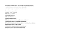
PERSONAL ACADÉMICO DEL INSTITUTO DE GEOGRAFÍA . 74<br />
Mapas<br />
Aguilar, A. G. e I. Escamilla Herrera (2006), “Urbanización en la Cuenca<br />
<strong>de</strong>l Lerma, <strong>de</strong>ntro <strong>de</strong>l Atlas Cuenca <strong>de</strong>l Lerma, sección Urbanización, coordinado<br />
por Helena Cotler, <strong>Instituto</strong> Nacional <strong>de</strong> Ecología-SEMARNAT.<br />
Aguirre Gómez, R. y O. Salmerón, Mapas temáticos <strong>de</strong> la temperatura superficial<br />
<strong>de</strong>l mar, distribución <strong>de</strong> clorofila a y mapa sinóptico <strong>de</strong> regiones<br />
oceanográficas <strong>de</strong> México, Nuevo Atlas Nacional <strong>de</strong> México, <strong>Instituto</strong> <strong>de</strong><br />
Geografía, UNAM.<br />
Coll-Hurtado, A. y L. Godínez, Activida<strong>de</strong>s terciarias, Nuevo Atlas Nacional<br />
<strong>de</strong> México: 23 mapas; 6 gráficos, <strong>Instituto</strong> <strong>de</strong> Geografía, UNAM.<br />
Coll-Hurtado, A. y L. Godínez, Gana<strong>de</strong>ría, Nuevo Atlas Nacional <strong>de</strong> México:<br />
24 mapas; 19 gráficos, <strong>Instituto</strong> <strong>de</strong> Geografía, UNAM.<br />
INFORME DE<br />
ACTIVIDADES<br />
2006<br />
Garza, G., mapa político <strong>de</strong> Mesoamérica hacia 1520 y mapa político <strong>de</strong><br />
Mespamérica hacia 1400, Nuevo Atlas Nacional <strong>de</strong> México, <strong>Instituto</strong> <strong>de</strong> Geografía,<br />
UNAM.<br />
Gómez Escobar, M. <strong>de</strong>l C., (2006), Elaboración <strong>de</strong>l mapa: “Crecimiento<br />
medio anual <strong>de</strong> la población, 1995-2000, escala 1: 4 000 000, Proyecto: Caracterización<br />
y Diagnóstico funcional <strong>de</strong>l Territorio Nacional, <strong>Instituto</strong> <strong>de</strong><br />
Geografía, UNAM y SEDESOL.<br />
Gutiérrez <strong>de</strong> MacGregor, M. T., J. González Sánchez, M. I. Ortiz Álvarez<br />
y M. <strong>de</strong>l C. Gómez Escobar, Distribución <strong>de</strong> la población en el año 2000,<br />
escala 1:4 000 000, Nuevo Atlas Nacional <strong>de</strong> México, <strong>Instituto</strong> <strong>de</strong> Geografía,<br />
UNAM.<br />
Gutiérrez <strong>de</strong> MacGregor, M. T. y J. González Sánchez, Patrones espaciales<br />
<strong>de</strong> crecimiento <strong>de</strong> la población, escala 1:8 000 000, Nuevo Atlas Nacional <strong>de</strong><br />
México, <strong>Instituto</strong> <strong>de</strong> Geografía, UNAM.<br />
Gutiérrez <strong>de</strong> MacGregor, M. T. y J. González Sánchez, Población urbana y<br />
rural, 1970, 1990 y 2000, escala 1:8 000 000, Nuevo Atlas Nacional <strong>de</strong> México,<br />
<strong>Instituto</strong> <strong>de</strong> Geografía, UNAM.