Memoria - Ayuntamiento de Tres Cantos
Memoria - Ayuntamiento de Tres Cantos
Memoria - Ayuntamiento de Tres Cantos

Create successful ePaper yourself
Turn your PDF publications into a flip-book with our unique Google optimized e-Paper software.
MEMORIA<br />
INDICE<br />
1.- ANTECEDENTES............................................................................................... 2<br />
1.1.- DATOS DEL ENCARGO............................................................................................ 2<br />
1.1.1.- Autor <strong>de</strong>l Encargo. ......................................................................................... 2<br />
1.1.2.- Autores <strong>de</strong>l Proyecto. ..................................................................................... 2<br />
1.1.3.- Objeto <strong>de</strong>l encargo......................................................................................... 2<br />
1.2.- NORMATIVA APLICABLE ......................................................................................... 2<br />
1.2.1.- Legislación..................................................................................................... 2<br />
1.2.2.- Planeamiento y Convenios .............................................................................. 2<br />
1.3.- JUSTIFICACION DEL PROYECTO DE REPARCELACION.............................................. 3<br />
1.4.- EL ÁMBITO REPARCELABLE .................................................................................... 3<br />
1.4.1.- Descripción y <strong>de</strong>limitación............................................................................... 3<br />
1.4.2.- Características <strong>de</strong> la or<strong>de</strong>nación urbanística ..................................................... 3<br />
2.- FINCAS INICIALES .......................................................................................... 5<br />
2.1.- DESCRIPCIÓN DE LAS FINCAS INICIALES INCLUIDAS EN EL SECTOR “AR<br />
NUEVO TRES CANTOS”........................................................................................... 5<br />
2.1.1.- FINCAS REGISTRALES EXPROPIADAS POR FCC CONSTRUCCIÓN,SA. ................ 5<br />
2.1.2.- FINCAS NO INMATRICULADAS EXPROPIADAS POR FCC<br />
CONSTRUCCIÓN,SA. ...................................................................................... 5<br />
2.1.3.- FINCAS DE DOMINIO PUBLICO....................................................................... 5<br />
2.2.- RELACIÓN DE FINCAS INCLUIDAS EN EL SECTOR.................................................... 6<br />
2.3.- RELACIÓN DE DERECHOS EDIFICATORIOS CORRESPONDIENTES A LAS<br />
FINCAS INCLUIDAS EN EL SECTOR ......................................................................... 7<br />
2.4.- ACTAS DE OCUPACIÓN........................................................................................... 8<br />
2.5.- DESCRIPCION DE LA FINCA RESULTANTE DEL SECTOR “AR NUEVO TRES<br />
CANTOS” ............................................................................................................... 9<br />
3.- PARCELAS RESULTANTES ............................................................................. 11<br />
3.1.- PARCELAS RESULTANTES EN EL SECTOR “AR NUEVO TRES CANTOS”......................11<br />
3.2.- PARCELAS CORRESPONDIENTES A CESIÓN DE REDES PÚBLICAS Y USOS<br />
LUCRATIVOS EN FAVOR DE LA ADMINISTRACIÓN ..................................................12<br />
3.2.1.- Parcelas correspondientes a Cesiones <strong>de</strong> Re<strong>de</strong>s ..............................................12<br />
3.2.2.- Parcelas correspondientes a cesiones <strong>de</strong> usos lucrativos .................................18<br />
3.3.- PARCELAS CORRESPONDIENTES A USOS LUCRATIVOS .......................................... 22<br />
3.3.1.- Fichas <strong>de</strong> parcelas resultantes correspondientes a uso lucrativo....................... 22<br />
3.4.- PARCELAS CORRESPONDIENTES A CESIONES A FAVOR DE COMPAÑÍAS<br />
INSTALADORAS .................................................................................................... 22<br />
3.5.- SERVIDUMBRES EXISTENTES EN PARCELAS .......................................................... 22<br />
4.- PLANOS..........................................................................................................23<br />
4.1.- PLANO DE SITUACIÓN Y EMPLAZAMIENTO ............................................................ 23<br />
4.2.- PLANOS DE PARCELAS RESULTANTES EN EL SECTOR............................................ 23<br />
4.3.- PLANOS DE PARCELAS RESULTANTES DE CESIONES EN FAVOR DE LA<br />
ADMINISTRACIÓN ................................................................................................ 23<br />
4.4.- PLANOS DE PARCELAS RESULTANTES DE CESIÓN CORRESPONDIENTES A<br />
LAS COMPAÑÍAS INSTALADORAS .......................................................................... 23<br />
4.5.- PLANO DE SERVIDUMBRES EXISTENTES EN PARCELAS .......................................... 23<br />
5.- CUADROS.......................................................................................................24<br />
5.1.- CUADRO DE PARCELAS RESULTANTES EN EL SECTOR............................................ 24<br />
5.2.- CUADRO DE APROVECHAMIENTOS CORRESPONDIENTES A CADA PARCELA<br />
RESULTANTE POR USOS. ...................................................................................... 24<br />
5.3.- CUADRO DE PARCELAS DE CESIÓN PARA COMPAÑIAS INSTALADORAS................... 24<br />
5.4.- CUADRO DE APROVECHAMIENTOS CORRESPONDIENTES A CADA<br />
PROPIETARIO....................................................................................................... 24<br />
ANEXO I – DESCRIPCION DE PARCELAS RESULTANTES...........................................25<br />
ANEXO II – FICHAS DE PARCELAS RESULTANTES ....................................................26<br />
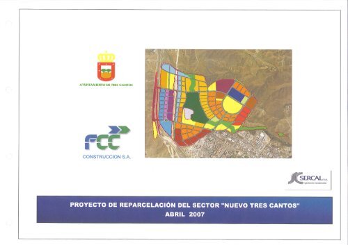
Proyecto <strong>de</strong> Reparcelación <strong>de</strong>l sector AR “Nuevo <strong>Tres</strong> <strong>Cantos</strong>” -TRES CANTOS (MADRID) Promotor: <strong>Ayuntamiento</strong> <strong>de</strong> <strong>Tres</strong> <strong>Cantos</strong> - Concesionario: FCC Construcción,S.A. MEMORIA 1
1.- ANTECEDENTES<br />
1.1.- DATOS DEL ENCARGO.<br />
1.1.1.- Autor <strong>de</strong>l Encargo.<br />
El presente proyecto <strong>de</strong> reparcelación ha sido encargado por el <strong>Ayuntamiento</strong> <strong>de</strong> <strong>Tres</strong> <strong>Cantos</strong>.<br />
1.1.2.- Autores <strong>de</strong>l Proyecto.<br />
El presente proyecto <strong>de</strong> reparcelación ha sido redactado por FCC Construcción S.A. , en calidad<br />
<strong>de</strong> Concesionario <strong>de</strong> la gestión y ejecución urbanística <strong>de</strong>l Sector “AR Nuevo <strong>Tres</strong> <strong>Cantos</strong>”, en<br />
colaboración con la consultora <strong>de</strong> ingeniería SERCAL S.A.<br />
1.1.3.- Objeto <strong>de</strong>l encargo.<br />
El objeto <strong>de</strong> este encargo es la realización <strong>de</strong>l Proyecto <strong>de</strong> Reparcelación <strong>de</strong>l sector <strong>de</strong>nominado<br />
“AR Nuevo <strong>Tres</strong> <strong>Cantos</strong>”, como parte <strong>de</strong>l Convenio Urbanístico suscrito entre el <strong>Ayuntamiento</strong><br />
<strong>de</strong> <strong>Tres</strong> <strong>Cantos</strong> y FCC Construcción S.A., en calidad <strong>de</strong> Concesionario. Dicho convenio fue<br />
suscrito el 18 <strong>de</strong> febrero <strong>de</strong> 2005, aprobándose <strong>de</strong>finitivamente por el <strong>Ayuntamiento</strong> pleno <strong>de</strong><br />
<strong>Tres</strong> <strong>Cantos</strong> con fecha 15 <strong>de</strong> abril <strong>de</strong> 2005.<br />
1.2.- NORMATIVA APLICABLE<br />
Para la redacción <strong>de</strong> este Documento <strong>de</strong> Reparcelación se han tenido en cuenta las siguientes<br />
normativas <strong>de</strong> aplicación:<br />
1.2.1.- Legislación.<br />
- Ley estatal <strong>de</strong> régimen <strong>de</strong> suelo y valoraciones suelo (Ley 6/1998 <strong>de</strong> 13 <strong>de</strong> abril).<br />
- Ley <strong>de</strong>l suelo <strong>de</strong> la Comunidad <strong>de</strong> Madrid (Ley 9/2001 <strong>de</strong> 17 <strong>de</strong> Julio).<br />
- Atendiendo y respondiendo <strong>de</strong> las disposiciones <strong>de</strong> los artículos 86 a 88 y en especial este<br />
proyecto <strong>de</strong> reparcelación <strong>de</strong>berá ajustarse a los criterios enunciados por el artículo 87 <strong>de</strong> la<br />
mencionada Ley.<br />
- Reglamento <strong>de</strong> gestión urbanística (Real Decreto 3288/1978, <strong>de</strong> 25 <strong>de</strong> agosto), en los<br />
artículos. 87 a 97 <strong>de</strong> su Titulo III, no <strong>de</strong>rogados por el Real Decreto 304/1993, <strong>de</strong> 26 <strong>de</strong><br />
febrero.<br />
- Reglamento <strong>de</strong> planeamiento (Real Decreto 2159/1978, <strong>de</strong> 23 <strong>de</strong> junio), en los artículos no<br />
<strong>de</strong>rogados por el Real Decreto 304/1993, <strong>de</strong> 26 <strong>de</strong> febrero.<br />
1.2.2.- Planeamiento y Convenios<br />
- Plan General <strong>de</strong> Or<strong>de</strong>nación Urbana <strong>de</strong> <strong>Tres</strong> <strong>Cantos</strong>.<br />
El vigente Plan General <strong>de</strong> Or<strong>de</strong>nación Urbana <strong>de</strong> <strong>Tres</strong> <strong>Cantos</strong>, aprobado por la Comisión <strong>de</strong><br />
Urbanismo <strong>de</strong> Madrid en su sesión <strong>de</strong> 7 <strong>de</strong> mayo <strong>de</strong> 2003, Acuerdo nº 153/03 (publicado por<br />
Resolución <strong>de</strong> 26 <strong>de</strong> mayo <strong>de</strong> 2003, <strong>de</strong> la Secretaría General Técnica <strong>de</strong> la Consejería <strong>de</strong> Obras<br />
Públicas, Urbanismo y Transporte, B.O.C.M. num. 156, <strong>de</strong> 3 <strong>de</strong> julio <strong>de</strong> 2003), <strong>de</strong>limita un único<br />
Sector y Área <strong>de</strong> reparto <strong>de</strong> Suelo Urbanizable Sectorizado, <strong>de</strong>nominado AR “Nuevo <strong>Tres</strong><br />
<strong>Cantos</strong>” (Área <strong>de</strong> Reparto núm. 1 <strong>de</strong>l Suelo Urbanizable), con una superficie total <strong>de</strong> 3.292.813<br />
m 2 , permitiendo como usos tanto el resi<strong>de</strong>ncial colectivo y unifamiliar, como el terciario,<br />
industrial y comercial.<br />
- Convenio <strong>de</strong> concesión <strong>de</strong> la gestión y ejecución <strong>de</strong>l sector 'AR Nuevo <strong>Tres</strong> <strong>Cantos</strong>' entre el<br />
Ayto. <strong>de</strong> <strong>Tres</strong> <strong>Cantos</strong> y FCC Construcción.<br />
El <strong>Ayuntamiento</strong> <strong>de</strong> <strong>Tres</strong> <strong>Cantos</strong>, por acuerdo <strong>de</strong>l Pleno adoptado en sesión celebrada el día 15<br />
<strong>de</strong> julio <strong>de</strong> 2004 convocó (B.O.C.M. núm. 180, <strong>de</strong> 27 <strong>de</strong> julio), en los términos <strong>de</strong>l artículo 119<br />
<strong>de</strong> la Ley <strong>de</strong>l Suelo <strong>de</strong> Madrid, y <strong>de</strong> conformidad con los Pliegos <strong>de</strong> Cláusulas Administrativas y<br />
Prescripciones Técnicas <strong>de</strong>bidamente aprobados, concurso abierto para la concesión<br />
administrativa <strong>de</strong> la gestión urbanística y su ejecución, por el sistema <strong>de</strong> expropiación, <strong>de</strong> los<br />
terrenos comprendidos en el único sector y área <strong>de</strong> reparto <strong>de</strong> suelo urbanizable sectorizado,<br />
<strong>de</strong>nominado “AR NUEVO TRES CANTOS” (Área <strong>de</strong> reparto num. 1 <strong>de</strong> suelo urbanizable), a<br />
través <strong>de</strong>l Plan Parcial, conforme a lo establecido en el Título II <strong>de</strong>l Volumen III: Normas<br />
urbanísticas pormenorizadas <strong>de</strong>l suelo urbanizable <strong>de</strong>l Plan General (<strong>de</strong> or<strong>de</strong>nación urbana) <strong>de</strong>l<br />
municipio <strong>de</strong> <strong>Tres</strong> <strong>Cantos</strong>. Todo ello <strong>de</strong> conformidad al contenido <strong>de</strong> los Pliegos reguladores <strong>de</strong>l<br />
concurso, Plan General <strong>de</strong> <strong>Tres</strong> <strong>Cantos</strong>, Ley 9/2001 <strong>de</strong>l 17 <strong>de</strong> julio, <strong>de</strong>l Suelo <strong>de</strong> la Comunidad<br />
<strong>de</strong> Madrid. Analizada la propuesta económica presentada, en sesión celebrada el día 13 <strong>de</strong><br />
enero <strong>de</strong> 2005, resolvió <strong>de</strong>jar <strong>de</strong>sierto el concurso, a tenor <strong>de</strong> lo dispuesto en el artículo 88.2 <strong>de</strong><br />
la Subsección 3ª <strong>de</strong> la Sección 2ª <strong>de</strong>l Capítulo VIII <strong>de</strong>l Título III, <strong>de</strong>l LIBRO I <strong>de</strong>l Real Decreto<br />
Legislativo 2/2000 <strong>de</strong>l 16 <strong>de</strong> junio, por el que se aprueba el Texto Refundido <strong>de</strong> la Ley <strong>de</strong><br />
Contratos <strong>de</strong> las Administraciones Públicas, y artículo 140.1a), 141.a), 159.e), y sección 4ª y<br />
concordantes <strong>de</strong>l Capítulo, Título y Libro <strong>de</strong>l texto legal citado; acordando, también en la misma<br />
sesión celebrada el día 13 <strong>de</strong> enero <strong>de</strong> 2005 la celebración <strong>de</strong> procedimiento negociado sin<br />
publicidad para la adjudicación <strong>de</strong>l objeto antes señalado <strong>de</strong>l concurso <strong>de</strong>clarado <strong>de</strong>sierto. Y en<br />
sesión ordinaria celebrada el día 27 <strong>de</strong> enero <strong>de</strong> 2005, una vez subsanadas <strong>de</strong>ficiencias y<br />
ratificado acuerdo adoptado en sesión celebrada el 20 <strong>de</strong> enero <strong>de</strong> 2005, se adjudicó a la<br />
mercantil “FCC CONSTRUCCION S.A.” el objeto <strong>de</strong>l contrato, señalado en la Cláusula 1 <strong>de</strong>l<br />
Pliego <strong>de</strong> Causas Económico-Administrativas (PCE-A).<br />
Con fecha 18 <strong>de</strong> febrero <strong>de</strong> 2005, se procedió por parte <strong>de</strong>l <strong>Ayuntamiento</strong> <strong>de</strong> <strong>Tres</strong> <strong>Cantos</strong> y FCC<br />
CONSTRUCCION S.A., en su calidad <strong>de</strong> concesionaria administrativa <strong>de</strong> la gestión y ejecución<br />
urbanística mediante el sistema <strong>de</strong> expropiación <strong>de</strong>l sector y Area <strong>de</strong> Reparto <strong>de</strong> Suelo<br />
Urbanizable Sectorizado “AR NUEVO TRES CANTOS” a la formalización <strong>de</strong> dicha adjudicación<br />
mediante la firma <strong>de</strong>l correspondiente convenio urbanístico. Dicho convenio fue aprobado<br />
<strong>de</strong>finitivamente por el <strong>Ayuntamiento</strong> Pleno <strong>de</strong> <strong>Tres</strong> <strong>Cantos</strong> en sesión extraordinaria y urgente en<br />
fecha 15 <strong>de</strong> abril <strong>de</strong> 2005.<br />
- Plan Parcial Sector “AR NUEVO TRES CANTOS” Aprobado <strong>de</strong>finitivamente por el<br />
<strong>Ayuntamiento</strong> Pleno <strong>de</strong> <strong>Tres</strong> <strong>Cantos</strong> el 16 <strong>de</strong> Febrero <strong>de</strong> 2006.<br />
Proyecto <strong>de</strong> Reparcelación <strong>de</strong>l sector AR “Nuevo <strong>Tres</strong> <strong>Cantos</strong>” -TRES CANTOS (MADRID) Promotor: <strong>Ayuntamiento</strong> <strong>de</strong> <strong>Tres</strong> <strong>Cantos</strong> - Concesionario: FCC Construcción,S.A. MEMORIA 2
Con fecha 16 <strong>de</strong> febrero <strong>de</strong> 2006, se procedió por parte <strong>de</strong>l <strong>Ayuntamiento</strong> <strong>de</strong> <strong>Tres</strong> <strong>Cantos</strong>,<br />
reunido en sesión plenaria, a aprobar con carácter <strong>de</strong>finitivo el Plan Parcial <strong>de</strong>l Sector AR<br />
NUEVO TRES CANTOS, tras su pertinente aprobación inicial, el período <strong>de</strong> exposición pública y<br />
presentación <strong>de</strong> alegaciones y la recepción <strong>de</strong> todos los informes favorables preceptivos.<br />
- Ad<strong>de</strong>nda al Convenio <strong>de</strong> concesión <strong>de</strong> la gestión y ejecución <strong>de</strong>l sector 'AR Nuevo <strong>Tres</strong><br />
<strong>Cantos</strong>' entre el Ayto. <strong>de</strong> <strong>Tres</strong> <strong>Cantos</strong> y FCC Construcción.<br />
Finalmente, el <strong>Ayuntamiento</strong> Pleno <strong>de</strong> <strong>Tres</strong> <strong>Cantos</strong>, en sesión extraordinaria celebrada con<br />
fecha 22 <strong>de</strong> noviembre <strong>de</strong> 2006, procedió a la aprobación <strong>de</strong> la ad<strong>de</strong>nda al convenio urbanístico<br />
firmado entre este <strong>Ayuntamiento</strong> y la mercantil FCC Construcción,S.A. <strong>de</strong> fecha 18 <strong>de</strong> febrero<br />
<strong>de</strong> 2005, por el que se formalizó la concesión administrativa <strong>de</strong> la gestión y ejecución<br />
urbanística, mediante el sistema <strong>de</strong> expropiación, <strong>de</strong>l sector y área <strong>de</strong> reparto <strong>de</strong> suelo<br />
urbanizable sectorizado “AR Nuevo <strong>Tres</strong> <strong>Cantos</strong>” (“<strong>Tres</strong> <strong>Cantos</strong> Norte” área <strong>de</strong> reparto Nº 1 <strong>de</strong>l<br />
suelo urbanizable). De acuerdo con lo pactado en el Convenio Urbanístico <strong>de</strong> fecha 18 <strong>de</strong><br />
febrero <strong>de</strong> 2005, se proce<strong>de</strong> mediante la citada ad<strong>de</strong>nda a perfeccionar el modo <strong>de</strong>l pago <strong>de</strong>l<br />
precio por parte <strong>de</strong> EL CONCESIONARIO al <strong>Ayuntamiento</strong> <strong>de</strong> <strong>Tres</strong> <strong>Cantos</strong>, estableciendo el<br />
programa <strong>de</strong> cesiones <strong>de</strong>l Sector.<br />
1.3.- JUSTIFICACION DEL PROYECTO DE REPARCELACION.<br />
Este proyecto <strong>de</strong> reparcelación se redacta para formalizar '... la transformación con finalidad<br />
equidistributiva, <strong>de</strong> las fincas afectadas por una actuación urbanística y <strong>de</strong> los <strong>de</strong>rechos sobre<br />
ellas, para adaptar unas y otros a las <strong>de</strong>terminaciones <strong>de</strong>l planeamiento urbanístico, aplicando<br />
el criterio <strong>de</strong> proporción directa <strong>de</strong> los valores aportados a la operación reparcelatoria'. (Ley<br />
9/2001; art. 87).<br />
Su finalidad, en cumplimiento <strong>de</strong> los art. 86 y 87 <strong>de</strong> la Ley 9/2001 <strong>de</strong>l suelo, <strong>de</strong> la Comunidad<br />
Autónoma <strong>de</strong> Madrid, es:<br />
- La localización <strong>de</strong> la edificabilidad en suelo apto para la edificación conforme al planeamiento.<br />
- La adjudicación a la Administración urbanística <strong>de</strong> los terrenos <strong>de</strong> cesión a título gratuito y, en<br />
su caso, <strong>de</strong> fincas resultantes constitutivas <strong>de</strong> parcelas o solares.<br />
1.4.- EL ÁMBITO REPARCELABLE<br />
Este Proyecto <strong>de</strong> Reparcelación abarca todo el ámbito <strong>de</strong>l Plan Parcial “AR Nuevo <strong>Tres</strong> <strong>Cantos</strong>”<br />
y se realiza <strong>de</strong> manera conjunta y unitaria.<br />
1.4.1.- Descripción y <strong>de</strong>limitación<br />
Las parcelas objeto <strong>de</strong>l proyecto <strong>de</strong> reparcelación son todas aquellas que, parcial o totalmente,<br />
están incluidas <strong>de</strong>ntro <strong>de</strong> la Unidad <strong>de</strong> Ejecución <strong>de</strong>l AR-1 TRES CANTOS NORTE tal y como se<br />
especifican en el Proyecto <strong>de</strong> Delimitación aprobado.<br />
Todas ellas se encuentran ubicadas <strong>de</strong>ntro <strong>de</strong> los polígonos catastrales nº 16,17 y 43 <strong>de</strong>l<br />
Término Municipal <strong>de</strong> <strong>Tres</strong> <strong>Cantos</strong>.<br />
Los límites geográficos son los <strong>de</strong>finidos en el Proyecto <strong>de</strong> Delimitación.<br />
La <strong>de</strong>scripción <strong>de</strong> las fincas afectadas, números registrales y superficies se adjuntan en el<br />
apartado 2.2. <strong>de</strong> esta memoria.<br />
Toda esta superficie recintada por los anteriores lin<strong>de</strong>s supone una superficie <strong>de</strong> 3.292.813<br />
m² .<br />
1.4.2.- Características <strong>de</strong> la or<strong>de</strong>nación urbanística<br />
La característica <strong>de</strong> la or<strong>de</strong>nación urbanística <strong>de</strong>l Plan Parcial está en consonancia con la<br />
or<strong>de</strong>nación estructurante que fija el Plan General <strong>de</strong> Or<strong>de</strong>nación <strong>de</strong> <strong>Tres</strong> <strong>Cantos</strong> y fué aprobada<br />
<strong>de</strong>finitivamente el 16 <strong>de</strong> Febrero <strong>de</strong> 2006.<br />
Los parámetros urbanísticos básicos fijados por el Plan General para dicho ámbito son los<br />
siguientes. El aprovechamiento unitario asignado por el Plan General al Sector es <strong>de</strong> 0,4372 m 2<br />
equivalente al aprovechamiento unitario <strong>de</strong> reparto. Los coeficientes <strong>de</strong> pon<strong>de</strong>ración<br />
establecidos son:<br />
Resi<strong>de</strong>ncial Colectivo (COL) 1,00.<br />
Activida<strong>de</strong>s Productivas Terciario (TER) 1,55.<br />
Activida<strong>de</strong>s Productivas Industrial (IND) 0,80.<br />
Activida<strong>de</strong>s Comerciales (COM) 0,86.<br />
Activida<strong>de</strong>s Comerciales Planta Baja en uso COL 1,31.<br />
Los coeficientes <strong>de</strong> pon<strong>de</strong>ración <strong>de</strong> las diferentes tipologías <strong>de</strong> vivienda en la relación con el uso<br />
y tipología global Resi<strong>de</strong>ncial Colectiva, en suelo urbanizable sectorizado son:<br />
Resi<strong>de</strong>ncial Colectivo Vivienda Libre (VL Col) 1,66.<br />
Resi<strong>de</strong>ncial Colectivo Vivienda Precio Tasado (VPT) 0,45.<br />
Resi<strong>de</strong>ncial Colectivo Vivienda Protección Oficial (VPO) 0,22.<br />
Resi<strong>de</strong>ncial Unifamiliar (UNI) 1,84.<br />
La or<strong>de</strong>nación pormenorizada <strong>de</strong>l Sector queda remitida a un Plan Parcial, <strong>de</strong> conformidad con<br />
el apartado 1.2.3. y 1.4 <strong>de</strong>l Capítulo I, <strong>de</strong>l Título II <strong>de</strong> las Normas Urbanísticas Pormenorizadas<br />
<strong>de</strong>l Plan General <strong>de</strong> Or<strong>de</strong>nación Urbana. Dicho Plan Parcial <strong>de</strong>berá <strong>de</strong>sarrollar la or<strong>de</strong>nación<br />
pormenorizada <strong>de</strong>l Sector localizando razonadamente las dotaciones locales, estableciendo, en<br />
su caso, los ámbitos <strong>de</strong> or<strong>de</strong>nación convenientes para su <strong>de</strong>sarrollo.<br />
Con fecha 16 <strong>de</strong> febrero <strong>de</strong> 2006, se procedió por parte <strong>de</strong>l <strong>Ayuntamiento</strong> <strong>de</strong> <strong>Tres</strong> <strong>Cantos</strong>,<br />
reunido en sesión plenaria, a aprobar con carácter <strong>de</strong>finitivo el Plan Parcial <strong>de</strong>l Sector AR<br />
NUEVO TRES CANTOS, tras su pertinente aprobación inicial, el período <strong>de</strong> exposición pública y<br />
presentación <strong>de</strong> alegaciones y la recepción <strong>de</strong> todos los informes favorables preceptivos. Dentro<br />
<strong>de</strong> dicho Plan Parcial, y <strong>de</strong> acuerdo con la justificación existente en el mismo, valorando el<br />
Proyecto <strong>de</strong> Reparcelación <strong>de</strong>l sector AR “Nuevo <strong>Tres</strong> <strong>Cantos</strong>” -TRES CANTOS (MADRID) Promotor: <strong>Ayuntamiento</strong> <strong>de</strong> <strong>Tres</strong> <strong>Cantos</strong> - Concesionario: FCC Construcción,S.A. MEMORIA 3
comportamiento <strong>de</strong>l mercado inmobiliario en la zona norte <strong>de</strong>l ámbito metropolitano <strong>de</strong> Madrid,<br />
el <strong>Ayuntamiento</strong> <strong>de</strong>cidió adaptar los coeficientes <strong>de</strong> homogeneización (pon<strong>de</strong>ración en la<br />
terminología <strong>de</strong>l Plan ) que figuraban en el Plan General, quedando <strong>de</strong> la siguiente manera:<br />
Resi<strong>de</strong>ncial Colectivo Genérico 1,00.<br />
Resi<strong>de</strong>ncial Colectivo Vivienda Libre 1,55.<br />
Resi<strong>de</strong>ncial Colectivo Vivienda VPPL 0,45.<br />
Resi<strong>de</strong>ncial Colectivo Vivienda VPBB 0,29.<br />
Resi<strong>de</strong>ncial Unifamiliar 1,75.<br />
Comercial Exento 1,07.<br />
Comercial Planta Baja 1,31.<br />
Terciario 1,45<br />
Industrial 0,80<br />
Sobre la base <strong>de</strong> estos nuevos coeficientes <strong>de</strong> homogeneización se procedió a redistribuir los<br />
aprovechamientos diseñados por el Plan General en el Sector “AR Nuevo <strong>Tres</strong> <strong>Cantos</strong>”.<br />
Proyecto <strong>de</strong> Reparcelación <strong>de</strong>l sector AR “Nuevo <strong>Tres</strong> <strong>Cantos</strong>” -TRES CANTOS (MADRID) Promotor: <strong>Ayuntamiento</strong> <strong>de</strong> <strong>Tres</strong> <strong>Cantos</strong> - Concesionario: FCC Construcción,S.A. MEMORIA 4
2.- FINCAS INICIALES<br />
2.1.- DESCRIPCIÓN DE LAS FINCAS INICIALES INCLUIDAS EN EL SECTOR “AR<br />
NUEVO TRES CANTOS”<br />
Las parcelas objeto <strong>de</strong>l Proyecto <strong>de</strong> Reparcelación son todas aquellas incluidas <strong>de</strong>ntro <strong>de</strong> la<br />
Unidad <strong>de</strong> Ejecución <strong>de</strong>l Sector y Área <strong>de</strong> Reparto <strong>de</strong> Suelo Urbanizable Sectorizado “AR NUEVO<br />
TRES CANTOS” ,tal y como se especifican en el Expediente <strong>de</strong> Expropiación AC-315/06,<br />
aprobado por la Comisión <strong>de</strong> Urbanismo <strong>de</strong> la Comunidad <strong>de</strong> Madrid con fecha 26 <strong>de</strong><br />
septiembre <strong>de</strong> 2006.<br />
Las fincas que integran el Sector pue<strong>de</strong>n agruparse en los siguientes conceptos:<br />
2.1.1.- FINCAS REGISTRALES EXPROPIADAS POR FCC CONSTRUCCIÓN,SA.<br />
Se incluyen en este apartado todas aquellas fincas inmatriculadas en el Registro <strong>de</strong> la Propiedad<br />
Nº 1 <strong>de</strong> Colmenar Viejo que han sido objeto <strong>de</strong> expropiación por el <strong>Ayuntamiento</strong> <strong>de</strong> <strong>Tres</strong><br />
<strong>Cantos</strong>, resultando beneficiaria <strong>de</strong> las mismas FCC CONSTRUCCION,SA en virtud <strong>de</strong>l referido<br />
expediente. Todas ellas figuran ya inscritas a nombre <strong>de</strong> esta sociedad , libres <strong>de</strong> cargas y<br />
gravámenes, según certificación expedida por el mencionado Registro.<br />
2.1.2.- FINCAS NO INMATRICULADAS EXPROPIADAS POR FCC CONSTRUCCIÓN,SA.<br />
Se incluyen en este apartado las fincas expropiadas por FCC CONSTRUCCION,SA no<br />
inmatriculadas con anterioridad, que serán inscritas en el Registro <strong>de</strong> la Propiedad en virtud <strong>de</strong>l<br />
presente Proyecto <strong>de</strong> Reparcelación, según la <strong>de</strong>scripción que figura en las actas <strong>de</strong> ocupación<br />
y pago suscritas <strong>de</strong> mutuo acuerdo o, en su caso, en las actas <strong>de</strong> consignación en la Caja<br />
General <strong>de</strong> Depósitos <strong>de</strong>l justiprecio establecido en el expediente, por incomparecencia <strong>de</strong> los<br />
titulares <strong>de</strong> las mismas.<br />
2.1.3.- FINCAS DE DOMINIO PUBLICO<br />
Se incluyen en este apartado las fincas reflejadas en el expediente <strong>de</strong> expropiación como parte<br />
integrante <strong>de</strong>l Sector correspondientes a dominios públicos, la gran mayoría <strong>de</strong> ellas no<br />
inmatriculadas con anterioridad, salvo algunas que han sido objeto <strong>de</strong> expropiación previa por<br />
el ADIF. Estas fincas serán inscritas en el Registro <strong>de</strong> la Propiedad en virtud <strong>de</strong>l presente<br />
Proyecto <strong>de</strong> Reparcelación, en el que figuran los <strong>de</strong>rechos <strong>de</strong> aprovechamiento urbanístico<br />
correspondientes al justiprecio asignado a las mismas en el Expediente <strong>de</strong> Expropiación <strong>de</strong>l<br />
ámbito.<br />
• AYUNTAMIENTO DE TRES CANTOS<br />
• COMUNIDAD DE MADRID<br />
• ADMINISTRADOR DE INFRAESTRUCTURAS FERROVIARIAS (ADIF)<br />
• CONFEDERACION HIDROGRAFICA DEL TAJO<br />
Proyecto <strong>de</strong> Reparcelación <strong>de</strong>l sector AR “Nuevo <strong>Tres</strong> <strong>Cantos</strong>” -TRES CANTOS (MADRID) Promotor: <strong>Ayuntamiento</strong> <strong>de</strong> <strong>Tres</strong> <strong>Cantos</strong> - Concesionario: FCC Construcción,S.A. MEMORIA 5
2.2.- RELACIÓN DE FINCAS INCLUIDAS EN EL SECTOR<br />
Proyecto <strong>de</strong> Reparcelación <strong>de</strong>l sector AR “Nuevo <strong>Tres</strong> <strong>Cantos</strong>” -TRES CANTOS (MADRID) Promotor: <strong>Ayuntamiento</strong> <strong>de</strong> <strong>Tres</strong> <strong>Cantos</strong> - Concesionario: FCC Construcción,S.A. MEMORIA 6
SECTOR "AR NUEVO TRES CANTOS"<br />
RELACION DE FINCAS INCLUIDAS EN EL SECTOR<br />
Parcela Letra Pol Finca Codigo registral Prop individual m2<br />
1 43 124 No inmatriculada 3.398,00<br />
2 43 118 19746 - 19748 5.027,00<br />
3 17 9014 Dominio publico 33.582,00<br />
4 17 9013 Dominio publico 3.485,00<br />
5 17 343 12946 7.580,00<br />
6 17 344 12946 26.096,00<br />
7 A 17 318 15818 64.608,00<br />
B 17 318 Dominio publico 7.338,00<br />
8 17 353 19857 16.755,00<br />
9 17 317 19857 58.287,00<br />
10 A 17 40 19724 29.523,00<br />
B 17 40 Dominio publico 399,00<br />
11 A 17 9029 Dominio publico 3.165,00<br />
B 17 9029 Dominio publico 794,00<br />
12 A 17 5 19726 41.391,00<br />
B 17 5 Dominio publico 811,00<br />
13 17 6 19728 17.509,00<br />
14 17 697 18246 15.599,00<br />
15 17 37 19698 23.236,00<br />
16 A 17 38 Segr. <strong>de</strong> 8073 29.550,00<br />
B 17 38 Dominio publico 2.483,00<br />
17 A 17 39 19951 43.025,00<br />
B 17 39 Dominio publico 6,00<br />
18 A 17 9015 Dominio publico 40.884,00<br />
B 17 9015 Dominio publico 95,00<br />
19 A 17 46 1918 64.665,00<br />
B 17 46 1918 813,00<br />
20 17 44 16877 43.990,00<br />
21 17 9030 Dominio publico 14.174,00<br />
22 17 43 19840 245,00<br />
23 17 9034 Dominio publico 1.233,00<br />
24 17 33 19840 7.290,00<br />
25 16 35 19871 1.025,00<br />
26 16 33 19871 438,00<br />
27 16 36 5787 26.140,00<br />
28 17 42 16877 27.199,00<br />
29 17 49 17364 35.253,00<br />
30 17 48 17364 1.353,00<br />
31 17 47 17364 3.178,00<br />
32 17 52 17364 13.191,00<br />
33 17 51 17364 5.064,00<br />
34 17 53 18017 42.196,00<br />
35 17 50 6237 25.308,00<br />
36 16 284 19710 9.121,00<br />
37 16 275 19893 18.015,00<br />
SECTOR "AR NUEVO TRES CANTOS"<br />
RELACION DE FINCAS INCLUIDAS EN EL SECTOR<br />
Parcela Letra Pol Finca Codigo registral Prop individual m2<br />
38 16 276 12656 23.253,00<br />
39 16 277 19895 12.164,00<br />
40 16 323 17380 6.538,00<br />
41 16 278 17880 - 18015 42.181,00<br />
42 17 55 16086 63.314,00<br />
43 17 9016 Dominio publico 355,00<br />
44 16 9014 Dominio publico 11.919,00<br />
45 16 279 16272 7.115,00<br />
46 16 280 17353 7.458,00<br />
47 16 281 1354 11.394,00<br />
48 16 258 18013 17.252,00<br />
49 16 259 19736 13.495,00<br />
50 16 260 17822 13.563,00<br />
51 16 282 12658 8.190,00<br />
52 16 322 12660 37.290,00<br />
53 16 321 15844 19.751,00<br />
54 16 320 No inmatriculada 1.789,00<br />
55 16 319 No inmatriculada 1.205,00<br />
56 16 318 No inmatriculada 1.564,00<br />
57 16 261 16232 76.905,00<br />
58 16 262 19797 4.366,00<br />
59 16 263 19692 142.676,00<br />
60 16 373 19820 7.366,00<br />
61 16 274 16090 - 16092 10.982,00<br />
62 16 272 18832 2.954,00<br />
63 16 271 18832 2.728,00<br />
64 16 254 19447 4.016,00<br />
65 17 365 19832 4.354,00<br />
66 17 354 18039 37.401,00<br />
67 17 356 19445 3.486,00<br />
68 17 357 19441 15.821,00<br />
69 17 473 19799 2.391,00<br />
70 17 471 19859 5.033,00<br />
71 17 470 4980 2.813,00<br />
72 17 156 19849 5.039,00<br />
73 17 155 19819 1.153,00<br />
74 17 152 19816 5.383,00<br />
75 17 149 19851 835,00<br />
76 17 148 No inmatriculada 730,00<br />
77 17 146 19829 2.745,00
SECTOR "AR NUEVO TRES CANTOS"<br />
RELACION DE FINCAS INCLUIDAS EN EL SECTOR<br />
Parcela Letra Pol Finca Codigo registral Prop individual m2<br />
78 17 145 19814 652,00<br />
79 17 143 19939 710,00<br />
80 17 144 19812 909,00<br />
81 17 142 5602 4.311,00<br />
82 17 133 10516 40.262,00<br />
83 17 113 16000 12.530,00<br />
84 17 9009 Dominio publico 3.045,00<br />
85 17 111 No inmatriculada 704,00<br />
86 17 112 No inmatriculada 875,00<br />
87 17 110 16008 7.163,00<br />
88 17 108 16030 7.553,00<br />
89 17 109 16030 2.593,00<br />
90 17 105 16935 3.845,00<br />
91 17 107 17209 1.184,00<br />
92 17 104 16935 680,00<br />
93 17 106 17209 5.055,00<br />
94 17 116 15612 4.140,00<br />
95 17 114 16002 7.225,00<br />
96 17 115 15193 7.224,00<br />
97 17 132 19811 6.328,00<br />
98 17 131 19453 7.301,00<br />
99 17 117 16010 6.554,00<br />
100 17 119 16004 7.023,00<br />
101 17 120 19717 13.213,00<br />
102 17 122 18234 4.113,00<br />
103 17 64 17970 5.574,00<br />
104 17 65 17322 2.950,00<br />
105 17 66 17330 11.460,00<br />
106 17 118 15986 - 15988 6.854,00<br />
107 17 68 17318 13.354,00<br />
108 17 180 19721 5.700,00<br />
109 17 69 15990 - 15992 5.030,00<br />
110 17 179 16020 8.925,00<br />
111 17 183 16020 3.068,00<br />
112 17 124 18707 8.728,00<br />
113 17 125 18043 4.490,00<br />
114 17 128 16012 6.208,00<br />
115 17 706 No inmatriculada 1.749,00<br />
116 17 130 No inmatriculada 4.337,00<br />
117 17 134 6127 6.829,00<br />
118 17 9503 6127 141,00<br />
SECTOR "AR NUEVO TRES CANTOS"<br />
RELACION DE FINCAS INCLUIDAS EN EL SECTOR<br />
Parcela Letra Pol Finca Codigo registral Prop individual m2<br />
119 17 129 No inmatriculada 2.787,00<br />
120 17 176 8901 18.055,00<br />
121 17 9017 Dominio publico 695,00<br />
122 17 186 8901 2.433,00<br />
123 17 177 19704 2.351,00<br />
124 17 178 19704 1.428,00<br />
125 17 127 16014 2.267,00<br />
126 17 126 18043 1.316,00<br />
127 17 123 18707 4.076,00<br />
128 17 182 16020 864,00<br />
129 17 181 No inmatriculada 300,00<br />
130 17 70 15992 87,00<br />
131 17 185 17874 19.531,00<br />
132 17 301 19785 52.203,00<br />
133 17 300 16711 801,00<br />
134 17 298 16711 5.523,00<br />
135 17 721 12880 1.407,00<br />
136 17 184 17874 489,00<br />
137 17 72 15395 13.535,00<br />
138 17 352 19702 10.237,00<br />
139 17 350 19735 8.133,00<br />
140 17 349 18035 4.125,00<br />
141 17 348 18037 4.253,00<br />
142 17 347 10017 12.445,00<br />
143 17 73 17320 2.649,00<br />
144 17 74 19709 6.421,00<br />
145 17 61 18091 29.643,00<br />
146 17 60 17870-17872 13.408,00<br />
147 17 59 17028 3.764,00<br />
148 17 703 16943 3.765,00<br />
149 17 56 19707 10.983,00<br />
150 17 57 17328 14.818,00<br />
151 17 58 14365 8.910,00<br />
152 17 62 5216 20.561,00<br />
153 17 75 18019 3.292,00<br />
154 17 76 19711 3.310,00<br />
155 17 77 18041 5.446,00<br />
156 17 78 15830 27.572,00<br />
157 17 79 15994 7.870,00<br />
158 17 81 12880 9.500,00
SECTOR "AR NUEVO TRES CANTOS"<br />
RELACION DE FINCAS INCLUIDAS EN EL SECTOR<br />
Parcela Letra Pol Finca Codigo registral Prop individual m2<br />
159 17 82 16869 4.860,00<br />
160 17 83 19713 7.359,00<br />
161 17 85 19715 599,00<br />
162 17 84 19715 7.075,00<br />
163 17 9026 Dominio publico 4.742,00<br />
164 17 92 17876 9.987,00<br />
165 17 97 15998 4.802,00<br />
166 17 98 16849 5.967,00<br />
167 17 54 16086 10.125,00<br />
168 17 100 15512 5.961,00<br />
169 17 102 17842 2.417,00<br />
170 17 101 1721 3.607,00<br />
171 17 99 15243 6.970,00<br />
172 17 95 4910 2.100,00<br />
173 17 96 16234 12.988,00<br />
174 17 94 11992 23.689,00<br />
175 17 93 18021 8.580,00<br />
176 17 87 18726 - 18728 - 18730 31.522,00<br />
177 17 86 18726 - 18728 - 18730 6.028,00<br />
178 17 325 9620 762,00<br />
179 17 710 19320 3.376,00<br />
180 17 9504 5258 203,00<br />
181 17 302 5258 15.273,00<br />
182 17 291 6967 5.788,00<br />
183 17 324 19867 3.252,00<br />
184 17 290 14327 7.189,00<br />
185 17 285 19723 52.328,00<br />
186 17 288 17565 1.991,00<br />
187 17 287 18711 3.796,00<br />
188 17 303 14323 22.874,00<br />
189 17 304 17379 19.171,00<br />
190 17 305 19725 6.075,00<br />
191 17 306 17892 6.180,00<br />
192 17 262 9869 31.828,00<br />
193 17 266 19738 3.929,00<br />
194 17 267 19740 15.546,00<br />
195 17 307 16102 37.287,00<br />
196 17 9018 Dominio publico 5.931,00<br />
197 17 308 16890 35.112,00<br />
198 17 705 15956 23.686,00<br />
199 17 314 8452 1.054,00<br />
SECTOR "AR NUEVO TRES CANTOS"<br />
RELACION DE FINCAS INCLUIDAS EN EL SECTOR<br />
Parcela Letra Pol Finca Codigo registral Prop individual m2<br />
200 17 313 8452 1.318,00<br />
201 17 277 16150 38.463,00<br />
202 17 278 16152 118,00<br />
203 17 280 4327 2.129,00<br />
204 A 17 279 4327 22.520,00<br />
B 17 279 Dominio publico 651,00<br />
205 17 281 8625 8.002,00<br />
206 17 282 9261 8.392,00<br />
207 17 283 14325 9.064,00<br />
208 17 284 8627 10.390,00<br />
209 17 326 19867 15.121,00<br />
210 A 17 9020 Dominio publico 6.775,00<br />
B 17 9020 Dominio publico 131,00<br />
211 A 17 323 19867 71.562,00<br />
B 17 323 Dominio publico 2.773,00<br />
212 A 17 711 19833 95.455,00<br />
B 17 711 Dominio publico 6.665,00<br />
213 17 9025 Dominio publico 932,00<br />
214 17 103 15846 57.752,00<br />
215 17 714 16954 39.005,00<br />
216 17 717 17447 450,00<br />
217 17 715 17447 34.454,00<br />
218 17 716 17449 33.908,00<br />
219 17 9024 19837 2.294,00<br />
220 17 729 17449 4.781,00<br />
221 17 340 19903 399,00<br />
222 17 341 19903 481,00<br />
223 17 335 19833 897,00<br />
224 17 9021 Dominio publico 289,00<br />
225 A 17 713 19903 33.759,00<br />
B 17 713 Dominio publico 1.563,00<br />
226 17 712 19833 270,00<br />
227 17 334 19833 2.280,00<br />
228 17 333 19861 930,00<br />
229 17 331 17430 2.501,00<br />
230 17 9023 19837 7.799,00<br />
231 17 329 17430 22.238,00<br />
232 17 332 19861 28.135,00<br />
233 A 17 327 19861 78.028,00<br />
B 17 327 Dominio publico 2.871,00<br />
234 17 275 Dominio publico 336,00<br />
235 17 328 19733 989,00<br />
236 43 132 19340 6.395,00
SECTOR "AR NUEVO TRES CANTOS"<br />
RELACION DE FINCAS INCLUIDAS EN EL SECTOR<br />
Parcela Letra Pol Finca Codigo registral Prop individual m2<br />
237 43 131 19907 8.458,00<br />
238 43 130 19907 8.190,00<br />
239 43 129 19749 2.586,00<br />
240 43 126 3229 8.887,00<br />
241 17 382 19911 4.561,00<br />
242 17 385 19933 2.117,00<br />
243 17 387 19941 5.163,00<br />
244 17 388 19911 1.366,00<br />
245 17 718 19913 11.945,00<br />
246 17 723 19915 8.841,00<br />
247 17 418 19917 6.480,00<br />
248 17 9001 Dominio publico 2.048,00<br />
249 17 724 19915 721,00<br />
250 17 727 19913 129,00<br />
251 16 317 No inmatriculada 60,00<br />
252 17 9010 Dominio publico 476,00<br />
253 17 s/n Dominio publico 2.422,00<br />
254 43 126 19693 9.987,00<br />
255 17 330 19839 3.087,00<br />
256 43 126 3227 14.264,00<br />
257 17 710p 9620 12.698,00<br />
258 17 710p 17352 1.760,00<br />
259 17 710p 17213-17350 5.967,00<br />
Total general 3.292.813,00
2.3.- RELACIÓN DE DERECHOS EDIFICATORIOS CORRESPONDIENTES A LAS<br />
FINCAS INCLUIDAS EN EL SECTOR<br />
Sobre los <strong>de</strong>rechos edificatorios que constan inscritos en el Registro <strong>de</strong> la Propiedad Nº 1 <strong>de</strong><br />
Colmenar Viejo, en virtud <strong>de</strong> la certificación expedida por el mismo, y <strong>de</strong> la documentación<br />
aportada durante la exposición pública <strong>de</strong>l documento aprobado inicialmente, se hacen constar<br />
las siguientes circunstancias:<br />
• YARA SERVICIOS INMOBILIARIOS,SL ha adquirido a Dña. Remedios Colmenarejo<br />
Corral los <strong>de</strong>rechos edificatorios equivalentes a 30.000 m2 <strong>de</strong> suelo bruto en el Sector,<br />
en virtud <strong>de</strong> escritura otorgada con fecha 19-12-2006 ante el Notario <strong>de</strong> Colmenar Viejo<br />
D. Vicente Ma<strong>de</strong>ro Jarabo, con el número 5.279 <strong>de</strong> su protocolo, <strong>de</strong> la cual adjunta<br />
copia. Estos <strong>de</strong>rechos son los siguientes:<br />
2.392,99 m2. <strong>de</strong> edificabilidad con uso Resi<strong>de</strong>ncial Colectivo Libre.<br />
613,83 m2. <strong>de</strong> edificabilidad con uso Resi<strong>de</strong>ncial Unifamiliar.<br />
240,67 m2. <strong>de</strong> edificabilidad con uso Comercial en planta baja.<br />
788,77 m2. <strong>de</strong> edificabilidad con uso Terciario.<br />
394,98 m2. <strong>de</strong> edificabilidad con uso Industrial.<br />
Según consta en la nota simple , esta sociedad es titular <strong>de</strong> los mencionados <strong>de</strong>rechos<br />
(30,83 % <strong>de</strong> esta finca) según la inscripción 2ª <strong>de</strong> la finca registral 19.835 <strong>de</strong>l Registro<br />
<strong>de</strong> la Propiedad Nº 1 <strong>de</strong> Colmenar Viejo, al tomo 1322, libro 495.<br />
En virtud <strong>de</strong> todo ello, este Proyecto <strong>de</strong> Reparcelación atribuye a esta sociedad los<br />
mencionados aprovechamientos urbanísticos.<br />
• AREA NORTE SOCIEDAD COOPERATIVA MADRILEÑA ha obtenido la concesión <strong>de</strong><br />
sendos <strong>de</strong>rechos <strong>de</strong> opción <strong>de</strong> compra <strong>de</strong> los <strong>de</strong>rechos edificatorios inscritos, en virtud<br />
<strong>de</strong> las escrituras otorgadas por YARA SERVICIOS INMOBILIARIOS, SL y por<br />
PROMOTORA SIGLO FUTURO, SL con fecha 8-3-2007 ante el Notario <strong>de</strong> Madrid D. José<br />
María Regidor Cano, con los números 829 y 828 <strong>de</strong> su protocolo, respectivamente .<br />
En el cuadro siguiente se incluyen los <strong>de</strong>rechos <strong>de</strong> aprovechamiento urbanístico<br />
correspondientes a todos los propietarios <strong>de</strong> suelo, en virtud <strong>de</strong>l procedimiento expropiatorio<br />
<strong>de</strong>l ámbito.<br />
Proyecto <strong>de</strong> Reparcelación <strong>de</strong>l sector AR “Nuevo <strong>Tres</strong> <strong>Cantos</strong>” -TRES CANTOS (MADRID) Promotor: <strong>Ayuntamiento</strong> <strong>de</strong> <strong>Tres</strong> <strong>Cantos</strong> - Concesionario: FCC Construcción,S.A. MEMORIA 7
SECTOR "AR NUEVO TRES CANTOS<br />
RELACION DE DERECHOS EDIFICATORIOS CORRESPONDIENTES A LAS FINCAS INCLUIDAS EN EL SECTOR<br />
Opción<br />
Expropiacion convenida<br />
Titular <strong>de</strong> <strong>de</strong>rechos Colectiva libre Unifamiliar<br />
Comercial<br />
P.Baja<br />
Terciario Industrial<br />
ADMINISTRADOR DE INFRAESTRUCTURAS FERROVIARIAS 2.503,72 642,23 251,81 825,27 413,25<br />
AM-70 SA 6.399,57 1.641,56 643,62 2.109,40 1.056,28<br />
ANDRIA INVERSIONES INMOBILIARIAS SA 7.442,89 1.909,18 748,55 2.453,30 1.228,49<br />
APAVISA DE VIVIENDAS SA 2.896,31 742,94 291,29 954,67 478,05<br />
ARAGON CHIVATO, MARIA CRISTINA 9,72 2,49 0,98 3,21 1,61<br />
ARAGON CHIVATO, MARIA PATRICIA 9,72 2,49 0,98 3,21 1,61<br />
ARAGON ORDOÑEZ, JOSE CARLOS 19,45 4,99 1,96 6,41 3,21<br />
ARAGON ORDOÑEZ, MIGUEL ANGEL 19,45 4,99 1,96 6,41 3,21<br />
AREA NORTE SOCIEDAD COOPERATIVA MADRILEÑA 11.961,30 3.068,21 1.202,98 3.942,65 1.974,27<br />
AYUNTAMIENTO DE TRES CANTOS 2.340,13 600,27 235,35 771,35 386,25<br />
BARTOLOME NOGALES, CESAR-VICENTE 808,09 207,28 81,27 266,36 133,38<br />
BARTOLOME NOGALES, JOSE-MANUEL 808,09 207,28 81,27 266,36 133,38<br />
BARTOLOME NOGALES, JUAN-CARMELO 808,09 207,28 81,27 266,36 133,38<br />
BARTOLOME NOGALES, Mª ELENA 808,09 207,28 81,27 266,36 133,38<br />
BARTOLOME NOGALES, Mª JESUS 808,09 207,28 81,27 266,36 133,38<br />
BARTOLOME NOGALES, MIGUEL-ANGEL 808,09 207,28 81,27 266,36 133,38<br />
CAN TAMARINDO SA 2.133,19 547,19 214,54 703,13 352,09<br />
CANAL DE ISABEL II 1.051,26 269,66 105,73 346,51 173,52<br />
CHAMARTIN PI SA 7.565,24 1.940,57 760,86 2.493,63 1.248,68<br />
COARSA 7.184,50 1.842,91 722,56 2.368,13 1.185,84<br />
COLMENAREJO CORRAL, REMEDIOS 5.368,91 1.377,18 539,97 1.769,68 886,16<br />
COMUNIDAD DE MADRID 2.678,56 687,08 269,39 882,90 442,11<br />
CONFEDERACION HIDROGRAFICA DEL TAJO 5.563,07 1.426,99 559,49 1.833,68 918,21<br />
CONSTRUCCIONES LANDA SA 7.184,50 1.842,91 722,56 2.368,13 1.185,84<br />
CONSTRUCCIONES SOTO VIÑUELAS SL 224,37 57,55 22,57 73,96 37,03<br />
DECOVAMA 21 SL 11.860,12 3.042,25 1.192,80 3.909,29 1.957,57<br />
DEL VALLE COLMENAREJO, Mª CARMEN 3.713,39 952,53 373,46 1.224,00 612,91<br />
DESARROLLOS URBANISTICOS NOZAR MARTINSA SL 2.561,82 657,14 257,65 844,42 422,84<br />
DIURSA 7.345,11 1.884,10 738,72 2.421,07 1.212,35<br />
DOS HORTENSIAS SL 2.186,86 560,95 219,94 720,82 360,95<br />
DUNOMA SL 153,51 39,38 15,44 50,60 25,34<br />
E Y C PATRIMONIAL SL 3.469,96 890,08 348,98 1.143,76 572,73<br />
EDIFICACIONES Y OBRAS PUBLICAS SA 7.226,98 1.853,80 726,84 2.382,13 1.192,85<br />
ESPACIOS DEL NORTE 3.783,66 970,55 380,53 1.247,16 624,51<br />
FINALANA SL 991,85 254,42 99,75 326,93 163,71<br />
FRANCISCO ARRANZ, JOSE-MANUEL 124,22 31,86 12,49 40,94 20,50<br />
GARCIA DIAZ, EMETERIO 4,79 1,23 0,48 1,58 0,79<br />
GONZALEZ FRANCISCO, VALENTIN<br />
GALLEGO CARMONA, PURIFICACION<br />
2.904,05 744,92 292,07 957,22 479,33<br />
GRUPO INMOBILIARIO DELTA SA 2.538,66 651,19 255,32 836,78 419,02<br />
HIJOS DE NUEVO TRES CANTOS 1.327,87 340,61 133,55 437,69 219,17<br />
INMOBILIARIA LUALCA, S.A. 2.199,19 564,12 221,18 724,89 362,99<br />
LA CAMBRIJA SA 8.196,20 2.102,42 824,31 2.701,60 1.352,82<br />
LA FAMA INDUSTRIAL, S.A. 5.246,97 1.345,91 527,70 1.729,49 866,04<br />
LANDSCAPE AUGUSTA SL UNIPERSONAL 15.602,12 4.002,12 1.569,14 5.142,72 2.575,21<br />
LLORENTE LLORENTE, CARMEN 45,98 11,80 4,62 15,16 7,59<br />
LOPEZ LLORENTE, CRISTINA 22,99 5,90 2,31 7,58 3,79<br />
LOPEZ LLORENTE, FERNANDO 22,99 5,90 2,31 7,58 3,79<br />
MOLINO HERMANOS JUSDADO SL 3.660,35 938,92 368,13 1.206,51 604,16<br />
MOSQUILILLA S.L. 24.595,66 6.309,06 2.473,65 8.107,14 4.059,64<br />
MOTOR TRES CANTOS SA 812,23 208,35 81,69 267,72 134,06<br />
NOGALES MORENA, JOSE-CARLOS 690,10 177,02 69,40 227,47 113,90<br />
NOGALES MORENA, JUAN-ANTONIO 690,10 177,02 69,40 227,47 113,90<br />
NOGALES MORENA, Mª ROSARIO 690,10 177,02 69,40 227,47 113,90<br />
NOGALES MORENA, MANUEL-VICENTE 690,10 177,02 69,40 227,47 113,90<br />
OBRAS Y ESTRUCTURAS SA 7.226,98 1.853,80 726,84 2.382,13 1.192,85<br />
PRADOSIERRA SOCIEDAD COOPERATIVA MADRILEÑA DE VIVIENDAS 3.153,22 808,84 317,13 1.039,35 520,46<br />
PROCEPARSA 8.597,25 2.205,29 864,65 2.833,80 1.419,02<br />
PROMOCIONES NIETO GARCES SL 991,85 254,42 99,75 326,93 163,71<br />
PROMOCIONES PICO SAN PEDRO SL 218,95 56,16 22,02 72,17 36,14<br />
PROMOCIONES PRAU SA 8.221,21 2.108,83 826,83 2.709,85 1.356,95<br />
PROMOTORA SIGLO FUTURO 429,36 110,14 43,18 141,52 70,87<br />
RIVAS COLMENAREJO, AQUILINO 7,29 1,87 0,73 2,40 1,20<br />
RIVAS COLMENAREJO, LUCIA TOMASA 7,29 1,87 0,73 2,40 1,20<br />
RIVAS COLMENAREJO, LUCIO 7,29 1,87 0,73 2,40 1,20<br />
RIVAS COLMENAREJO, RUFINA ADRIANA 7,29 1,87 0,73 2,40 1,20<br />
ROISAJU LOPEZ SL 4.163,80 1.068,06 418,76 1.372,46 687,26<br />
SANCHO MARTIN, JOSE LUIS 14,59 3,74 1,47 4,81 2,41<br />
SANCHO MARTIN, MARIA REMEDIOS 14,59 3,74 1,47 4,81 2,41<br />
SERRANO BARTOLOME, MARIA CARMEN 5,28 1,35 0,53 1,74 0,87<br />
SOCIEDAD COOPERATIVA DE VIVIENDAS VALDELAOSA 1.234,39 316,64 124,15 406,88 203,74<br />
SOCIEDAD COOPERATIVA MADRILEÑA DE VIVIENDA DE TRABAJADORES<br />
EDUCATIVOS Y AFINES<br />
2.011,19 515,89 202,27 662,92 331,96<br />
SOCIEDAD COOPERATIVA MADRILEÑA TRES CANTOS 20 828,72 212,58 83,35 273,16 136,79<br />
SOCIEDAD COOPERATIVA MADRILEÑA TRES CANTOS SIGLO XXI 638,25 163,72 64,19 210,38 105,35<br />
SOTONORTE NAVE SL 661,84 169,77 66,56 218,15 109,24<br />
TORRES PAREDES, COVADONGA 271,03 69,52 27,26 89,34 44,73<br />
UNION PARA EL DESARROLLO INMOBILIARIO SA 11.506,99 2.951,67 1.157,29 3.792,90 1.899,29<br />
VALLEHERMOSO DIVISION PROMOCION S.A. 14.274,25 3.661,50 1.435,60 4.705,03 2.356,04<br />
YARA SERVICIOS INMOBILIARIOS SL 2.392,99 613,83 240,67 788,77 394,98<br />
Total Expropiacion convenida 257.648,27 66.089,65 25.912,33 84.925,17 42.526,12<br />
SECTOR "AR NUEVO TRES CANTOS<br />
RELACION DE DERECHOS EDIFICATORIOS CORRESPONDIENTES A LAS FINCAS INCLUIDAS EN EL SECTOR<br />
Opción<br />
Expropiacion forzosa<br />
Titular <strong>de</strong> <strong>de</strong>rechos Colectiva libre Unifamiliar<br />
Comercial<br />
P.Baja<br />
Terciario Industrial<br />
ABAD RODRIGUEZ, FRANCISCO-JOSE 58,92 15,11 5,93 19,42 9,73<br />
ADMINISTRACION DE FINCAS SALONICA SL 608,16 156,00 61,16 200,46 100,38<br />
ART DECO SERVICIOS INMOBILIARIOS SL 147,31 37,79 14,82 48,56 24,31<br />
BIPRO GESTION SL 58,92 15,11 5,93 19,42 9,73<br />
COLMENAREJO CORRAL, MIGUEL-ANTONIO 17,95 4,60 1,80 5,92 2,96<br />
COLMENAREJO IZQUIERDO, VICTORIANO 94,60 24,27 9,51 31,18 15,61<br />
GRUPO COORPAMARD IBERICA SL 117,85 30,23 11,85 38,84 19,45<br />
INMOBILIARIA UDRA, S.A. 555,94 142,60 55,91 183,25 91,76<br />
IZQUIERDO LOPEZ, ELENA 94,60 24,27 9,51 31,18 15,61<br />
JUSDADO DIAZ, NATIVIDAD 96,11 24,65 9,67 31,68 15,86<br />
JUSDADO SERRANO, JOSE 124,75 32,00 12,55 41,12 20,59<br />
GARCIA FRANCO, LUCIANO 23,93 6,14 2,41 7,89 3,95<br />
PADORNELO DEVELOPS SL 441,93 113,36 44,45 145,67 72,94<br />
PICAZO-OLALLA SL 799,29 205,03 80,39 263,46 131,93<br />
PINTO BARTOLOME, RICARDO 56,15 14,40 5,65 18,51 9,27<br />
PULIDO RIO, RAFAELA 294,62 75,57 29,63 97,11 48,63<br />
SANZ COLMENAREJO, RAFAEL 142,69 36,60 14,35 47,03 23,55<br />
SANZ CRIADO, NICANOR 139,50 35,78 14,03 45,98 23,03<br />
SANZ SENAC, Mª MERCEDES 58,92 15,11 5,93 19,42 9,73<br />
SANZ TEJERO, JUAN 69,79 17,90 7,02 23,00 11,52<br />
SARBA DE LUESIA SL 799,29 205,03 80,39 263,46 131,93<br />
VIVEROS TRES CANTOS SL 191,14 49,03 19,22 63,00 31,55<br />
Total expropiacion forzosa 4.992,37 1.280,60 502,10 1.645,57 824,02<br />
Total Derechos edificatorios 262.640,64 67.370,25 26.414,43 86.570,74 43.350,14
2.4.- ACTAS DE OCUPACIÓN<br />
Una vez notificado por el <strong>Ayuntamiento</strong> <strong>de</strong> <strong>Tres</strong> <strong>Cantos</strong>, en tiempo y forma, el acuerdo AC-<br />
315/06 <strong>de</strong> aprobación <strong>de</strong>l expediente expropiatorio <strong>de</strong>l Sector por la Comisión <strong>de</strong> Urbanismo <strong>de</strong><br />
la Comunidad <strong>de</strong> Madrid, se procedió a la realización <strong>de</strong> las actas <strong>de</strong> ocupación y pago a todos<br />
los titulares <strong>de</strong> bienes y <strong>de</strong>rechos afectados por la expropiación.<br />
Los <strong>de</strong>rechos edificatorios correspondientes a aquellos titulares que han optado expresamente<br />
por la expropiación forzosa o no han comparecido a la firma <strong>de</strong>l acta <strong>de</strong> ocupación y pago se<br />
asignan en este documento a FCC Construcción,S.A., en calidad <strong>de</strong> Beneficiario <strong>de</strong> la<br />
Expropiación. FCC Construcción,S.A. ha realizado previamente el abono a los titulares afectados<br />
<strong>de</strong>l importe establecido como justiprecio en el expediente expropiatorio aprobado, o ha<br />
procedido a la consignación <strong>de</strong>l mismo en la Caja General <strong>de</strong> Depósitos, según prevé el Art.<br />
50.1 <strong>de</strong> la Ley <strong>de</strong> Expropiación Forzosa.<br />
Proyecto <strong>de</strong> Reparcelación <strong>de</strong>l sector AR “Nuevo <strong>Tres</strong> <strong>Cantos</strong>” -TRES CANTOS (MADRID) Promotor: <strong>Ayuntamiento</strong> <strong>de</strong> <strong>Tres</strong> <strong>Cantos</strong> - Concesionario: FCC Construcción,S.A. MEMORIA 8
2.5.- DESCRIPCION DE LA FINCA RESULTANTE DEL SECTOR “AR NUEVO TRES<br />
CANTOS”<br />
Como resultado <strong>de</strong> la agrupación instrumental <strong>de</strong> todas las fincas que integran el Sector y Área<br />
<strong>de</strong> Reparto <strong>de</strong> Suelo Urbanizable Sectorizado “AR NUEVO TRES CANTOS” se origina una finca<br />
total coinci<strong>de</strong>nte con la Unidad <strong>de</strong> Ejecución <strong>de</strong>l AR-1 TRES CANTOS NORTE, tal y como se<br />
<strong>de</strong>fine en el Proyecto <strong>de</strong> Delimitación ya aprobado, en el que constaba la <strong>de</strong>limitación gráfica y<br />
geométrica <strong>de</strong> todos los lin<strong>de</strong>ros.<br />
La <strong>de</strong>scripción <strong>de</strong> esta <strong>de</strong>limitación, <strong>de</strong> cara a su tramitación registral, es la siguiente:<br />
Urbana.- En término <strong>de</strong> <strong>Tres</strong> <strong>Cantos</strong> (Madrid), Sector y Área <strong>de</strong> Reparto <strong>de</strong> Suelo Urbanizable<br />
Sectorizado <strong>de</strong>nominado “AR NUEVO TRES CANTOS”, con una superficie <strong>de</strong> suelo <strong>de</strong> tres<br />
millones doscientos noventa y dos mil ochocientos trece metros cuadrados (3.292.813 m2)<br />
que consta <strong>de</strong> cinco zonas, cuyos lin<strong>de</strong>ros son los siguientes:<br />
ZONA SITUADA AL OESTE DEL AMBITO SEPARADO POR LA CARRETERA M-607<br />
MADRID - COLMENAR VIEJO Y EL FERROCARRIL MADRID - BURGOS, QUE TIENE<br />
LOS SIGUIENTES LINDES:<br />
LINDA AL NORTE LA CARRETERA C-607 MADRID COLMENAR VIEJO<br />
LINDA AL SUR CON EL POLIGONO 43 PARCELA 136<br />
LINDA AL ESTE CON LA LINEA FERROVIARIA DE MADRID A BURGOS , LA CARRETERA M-607<br />
MADRID A COLMENAR VIEJO Y EL POLIGONO 43 PARCELA 136<br />
LINDA AL OESTE CON:<br />
POLIGONO 43 PARCELA 118,<br />
POLIGONO 43 PARCELA 125,<br />
POLIGONO 43 PARCELA 126 (REGISTRAL 3229),<br />
POLIGONO 43 PARCELA 129, (REGISTRAL 19749)<br />
POLIGONO 43 PARCELA 130 (REGISTRAL 19242)<br />
POLIGONO 43 PARCELA 131 (REGISTRAL 19242)<br />
POLIGONO 43 PARCELA 132 (REGISTRAL 19340)<br />
ZONA SITUADA ENTRE LA CARRETERA M-607 MADRID - COLMENAR VIEJO , EL<br />
FERROCARRIL MADRID - BURGOS Y EL TAV MADRID-VALLADOLID, QUE TIENE LOS<br />
SIGUIENTES LINDES:<br />
LINDA AL NORTE CON LAS FINCAS:<br />
POLIGONO 17 PARCELA 5 (REGISTRAL 19726)<br />
POLIGONO 17 PARCELA 6 (REGISTRAL 19728)<br />
POLIGONO 17 PARCELA 697 (REGISTRAL 18246)<br />
POLIGONO 17 PARCELA 37 (REGISTRAL 19698)<br />
LINDA AL SUR CON LA LINEA FERREA MADRID A BURGOS<br />
LINDA AL ESTE CON LA LINE TAV MADRID - VALLADOLID<br />
LINDA AL OESTE CON LA LINEA FERROVIARIA DE MADRID A BURGOS Y LA CARRETERA M-<br />
607 MADRID A COLMENAR VIEJO.<br />
ZONA SITUADA AL ESTE DEL TAV MADRID-VALLADOLID, QUE TIENE LOS<br />
SIGUIENTES LINDES:<br />
LINDA AL NORTE CON LAS FINCAS:<br />
POLIGONO 17 PARCELA 37 (REGISTRAL 19698)<br />
POLIGONO 17 PARCELA 38 (REGISTRAL 8073)<br />
POLIGONO 17 PARCELA 9030<br />
POLIGONO 17 PARCELA 33 (REGISTRAL 15788)<br />
POLIGONO 16 PARCELA 35;<br />
POLIGONO 16 PARCELA 33<br />
POLIGONO 16 PARCELA 36 (REGISTRAL 5787)<br />
POLIGONO 16 PARCELA 284 (REGISTRAL 12060)<br />
POLIGONO 16 PARCELA 275 (REGISTRAL 16088)<br />
POLIGONO 16 PARCELA 277 (REGISTRAL 16452)<br />
POLIGONO 16 PARCELA 323 (REGISTRAL 17680)<br />
POLIGONO 16 PARCELA 321 (REGISTRAL 15844)<br />
POLIGONO 16 PARCELA 320<br />
POLIGONO 16 PARCELA 318<br />
POLIGONO 16 PARCELA 262<br />
POLIGONO 16 PARCELA 263 (REGISTRAL 19692)<br />
POLIGONO 16 PARCELA 373 (REGISTRAL 19157)<br />
POLIGONO 17 PARCELA 142 (REGISTRAL 5602)<br />
Proyecto <strong>de</strong> Reparcelación <strong>de</strong>l sector AR “Nuevo <strong>Tres</strong> <strong>Cantos</strong>” -TRES CANTOS (MADRID) Promotor: <strong>Ayuntamiento</strong> <strong>de</strong> <strong>Tres</strong> <strong>Cantos</strong> - Concesionario: FCC Construcción,S.A. MEMORIA 9
POLIGONO 17 PARCELA 144 (REGISTRAL 19812)<br />
POLIGONO 17 PARCELA 145 (REGISTRAL 5602)<br />
POLIGONO 17 PARCELA 146 (REGISTRAL 1814)<br />
POLIGONO 17 PARCELA 148<br />
POLIGONO 17 PARCELA 149 (REGISTRAL 15996)<br />
POLIGONO 17 PARCELA 152 (REGISTRAL 13014)<br />
POLIGONO 17 PARCELA 155 (REGISTRAL 23883)<br />
POLIGONO 17 PARCELA 156 (REGISTRAL 16026)<br />
POLIGONO 17 PARCELA 471 (REGISTRAL 19737)<br />
POLIGONO 17 PARCELA 473 (REGISTRAL 19799)<br />
LINDA AL SUR CON EL ARROYO POLIGONO 17 PARCELA 21, CASCO UIRBANO (VIA PÚBLICA<br />
AVDA DE LA INDUSTRIA) Y LA LINEA FERREA MADRID A BURGOS<br />
LINDA AL ESTE CON LAS FINCAS:<br />
POLIGONO 16 PARCELA 25 (REGISTRAL 18836)<br />
POLIGONO 17 PARCELA 365 (REGISTRALES 17217 Y 16098)<br />
POLIGONO 17 PARCELA 357 (REGISTRAL 19441)<br />
POLIGONO 17 PARCELA 473 (REGISTRAL 19799)<br />
POLIGONO 17 PARCELA 143 (REGISTRAL 1896)<br />
POLIGONO 17 PARCELA 142 (REGISTRAL 5602)<br />
POLIGONO 17 PARCELA 133 (REGISTRAL 10516)<br />
LINDA AL OESTE CON LA LINEA FERREA DE TAV MADRID A VALLADOLID<br />
ZONA AISLADA SITUADA AL SURESTE DEL AMBITO QUE TIENE LOS SIGUIENTES<br />
LINDES:<br />
LINDA AL NORTE CON:<br />
POLIGONO 17 PARCELA 382 (REGISTRAL 15776)<br />
LINDA AL SUR CON:<br />
CASCO URBANO (EL PARQUE DENOMINADO “PARQUE ESTE”)<br />
LINDA AL ESTE CON:<br />
CASCO URBANO (EL PARQUE DENOMINADO “PARQUE ESTE”)<br />
LINDA AL OESTE CON:<br />
POLIGONO 17 PARCELA 385 (REGISTRAL 30438)<br />
POLIGONO 17 PARCELA 387 (REGISTRAL 4527)<br />
POLIGONO 17 PARCELA 388 (REGISTRAL 15776)<br />
CASCO URBANO (EL PARQUE DENOMINADO “PARQUE ESTE”)<br />
ZONA AISLADA SITUADA AL SURESTE DEL AMBITO QUE TIENE LOS SIGUIENTES<br />
LINDES:<br />
LINDA AL NORTE CON:<br />
POLIGONO 17 PARCELA 718 (REGISTRAL 15774)<br />
POLIGONO 17 PARCELA 723 (REGISTRAL 15772)<br />
POLIGONO 17 PARCELA 418 (REGISTRAL 18240)<br />
LINDA AL SUR CON:<br />
POLIGONO 17 PARCELA 727 (REGISTRAL 15774)<br />
POLIGONO 17 PARCELA 724 (REGISTRAL 15772)<br />
POLIGONO 17 PARCELA 418 (REGISTRAL 18240)<br />
LINDA AL ESTE CON:<br />
POLIGONO 17 PARCELA 418 (REGISTRAL 18240)<br />
LINDA AL OESTE CON:<br />
POLIGONO 17 PARCELA 718 (REGISTRAL 15774)<br />
Proyecto <strong>de</strong> Reparcelación <strong>de</strong>l sector AR “Nuevo <strong>Tres</strong> <strong>Cantos</strong>” -TRES CANTOS (MADRID) Promotor: <strong>Ayuntamiento</strong> <strong>de</strong> <strong>Tres</strong> <strong>Cantos</strong> - Concesionario: FCC Construcción,S.A. MEMORIA 10
3.- PARCELAS RESULTANTES<br />
3.1.- PARCELAS RESULTANTES EN EL SECTOR “AR NUEVO TRES CANTOS”<br />
El presente Proyecto <strong>de</strong> Reparcelación <strong>de</strong>fine en <strong>de</strong>talle la geometría , cotas y coor<strong>de</strong>nadas <strong>de</strong><br />
las manzanas establecidas en el Plan Parcial <strong>de</strong> Sector, manteniendo en todos los casos los usos<br />
previstos y las edificabilida<strong>de</strong>s materializables en cada una <strong>de</strong> ellas, pero adaptando la<br />
superficie <strong>de</strong> suelo a las características <strong>de</strong> los viales circundantes fijadas en el Proyecto <strong>de</strong><br />
Urbanización <strong>de</strong>l ámbito.<br />
Según se <strong>de</strong>talla en la <strong>Memoria</strong> General <strong>de</strong>l Plan Parcial <strong>de</strong> Sector “AR Nuevo <strong>Tres</strong> <strong>Cantos</strong>”, el<br />
coeficiente <strong>de</strong> edificabilidad establecido para las parcelas tiene carácter informativo, resultando<br />
vinculante la edificabilidad total materializable en cada una <strong>de</strong> ellas. Una vez concretada por el<br />
Proyecto <strong>de</strong> Urbanización <strong>de</strong>l ámbito la superficie <strong>de</strong> suelo <strong>de</strong>finitiva <strong>de</strong> cada una <strong>de</strong> las<br />
parcelas, según se indica en este Proyecto <strong>de</strong> Reparcelación, permanece como superficie<br />
edificable la ya indicada en el planeamiento vigente <strong>de</strong>l Sector.<br />
Este documento incluye en el ANEXO I una relación <strong>de</strong>tallada <strong>de</strong> todas las fincas <strong>de</strong> resultado<br />
integrantes <strong>de</strong>l nuevo sector. En todas ellas, <strong>de</strong> cara a su futura inscripción por el Registro <strong>de</strong> la<br />
Propiedad, se realiza una <strong>de</strong>scripción <strong>de</strong> los usos previstos con superficies y lin<strong>de</strong>ros, según la<br />
siguiente estructura tipo:<br />
“PARCELA RESULTANTE……………..:<br />
Urbana.- En término <strong>de</strong> <strong>Tres</strong> <strong>Cantos</strong> (Madrid), Finca ……………… <strong>de</strong>l Sector y Área <strong>de</strong> Reparto<br />
<strong>de</strong> Suelo Urbanizable Sectorizado <strong>de</strong>nominado “AR NUEVO TRES CANTOS”, con una superficie<br />
<strong>de</strong> suelo <strong>de</strong> ……………… m2 y una edificabilidad <strong>de</strong> ……………… m2/e en uso ………………<br />
Linda:<br />
Al Norte, con ………………;<br />
Al Sur, con ………………;<br />
Al Este, con ………………;<br />
Y al Oeste, con ………………”.<br />
La asignación a estas fincas <strong>de</strong> los <strong>de</strong>rechos edificatorios inscritos a favor <strong>de</strong> los expropiados en<br />
virtud <strong>de</strong> las actas <strong>de</strong> ocupación y pago suscritas, se incluye en el apartado 5.2. Los<br />
aprovechamientos urbanísticos que han sido objeto <strong>de</strong> transmisión a otros por parte <strong>de</strong> sus<br />
titulares iniciales, con anterioridad a la presentación <strong>de</strong> este documento, figuran a nombre <strong>de</strong><br />
sus actuales titulares registrales, en coherencia con la certificación expedida por el Registro <strong>de</strong><br />
la Propiedad.<br />
Proyecto <strong>de</strong> Reparcelación <strong>de</strong>l sector AR “Nuevo <strong>Tres</strong> <strong>Cantos</strong>” -TRES CANTOS (MADRID) Promotor: <strong>Ayuntamiento</strong> <strong>de</strong> <strong>Tres</strong> <strong>Cantos</strong> - Concesionario: FCC Construcción,S.A. MEMORIA 11
3.2.- PARCELAS CORRESPONDIENTES A CESIÓN DE REDES PÚBLICAS Y USOS<br />
LUCRATIVOS EN FAVOR DE LA ADMINISTRACIÓN<br />
3.2.1.- Parcelas correspondientes a Cesiones <strong>de</strong> Re<strong>de</strong>s<br />
LAS RESERVAS DE REDES PÚBLICAS PREVISTAS EN LA LEY 9/2.001<br />
El Plan Parcial <strong>de</strong>l Sector <strong>de</strong>sarrolla <strong>de</strong> forma pormenorizada, en virtud <strong>de</strong> las <strong>de</strong>terminaciones<br />
<strong>de</strong> la Ley 9/2001 <strong>de</strong>l Suelo <strong>de</strong> la Comunidad <strong>de</strong> Madrid, la Or<strong>de</strong>nación <strong>de</strong>l suelo clasificado por<br />
el Plan General <strong>de</strong> <strong>Tres</strong> <strong>Cantos</strong> como suelo urbanizable sectorizado. En virtud <strong>de</strong> los artículos 36<br />
y 91 <strong>de</strong> la Ley 9/2001 <strong>de</strong>l Suelo <strong>de</strong> la Comunidad <strong>de</strong> Madrid, (modificados en los apartados<br />
correspondientes por la Ley 14/2001, <strong>de</strong> 26 <strong>de</strong> diciembre, <strong>de</strong> Medidas Fiscales y Administrativas<br />
<strong>de</strong> la Comunidad <strong>de</strong> Madrid), en el <strong>de</strong>sarrollo <strong>de</strong>l Plan Parcial AR Nuevo <strong>Tres</strong> <strong>Cantos</strong> se han<br />
previsto las cesiones obligatorias, correspondientes a los estándares mínimos dotacionales <strong>de</strong><br />
los Sistemas <strong>de</strong> Re<strong>de</strong>s Públicas, tanto Supramunicipales como Generales y Locales.<br />
Conforme con lo dispuesto en el artículo 36 <strong>de</strong> la Ley 9/2001 <strong>de</strong>l Suelo <strong>de</strong> la Comunidad <strong>de</strong><br />
Madrid, con las modificaciones mencionadas, constituyen las re<strong>de</strong>s públicas el conjunto <strong>de</strong> los<br />
elementos <strong>de</strong> las re<strong>de</strong>s <strong>de</strong> infraestructuras, equipamientos y servicios públicos que se<br />
relacionan entre sí con la finalidad <strong>de</strong> dar un servicio integral. Los elementos <strong>de</strong> cada red, aun<br />
estando integrados <strong>de</strong> forma unitaria en la misma, se distinguen jerárquicamente en tres<br />
niveles:<br />
a) Los que conforman la red supramunicipal, que son aquellos cuya función, uso, servicio y/o<br />
gestión se pue<strong>de</strong> consi<strong>de</strong>rar predominantemente <strong>de</strong> carácter supramunicipal y, por tanto,<br />
propia <strong>de</strong> las políticas <strong>de</strong> la Administración <strong>de</strong>l Estado o <strong>de</strong> la Comunidad <strong>de</strong> Madrid.<br />
b) Los que conforman la red general, que son aquellos cuya función se limita al uso y servicio<br />
<strong>de</strong> los resi<strong>de</strong>ntes en el municipio y gestión <strong>de</strong> su propio espacio, pero sin ser claramente<br />
adscribibles a ningún área homogénea, ámbito <strong>de</strong> actuación, o sector previsto en el<br />
planeamiento general , ni tampoco al nivel supramunicipal.<br />
c) Los que conforman la red local, que son aquellos cuya función se pue<strong>de</strong> limitar al uso,<br />
servicio y gestión predominante <strong>de</strong> los resi<strong>de</strong>ntes en un área homogénea, ámbito <strong>de</strong> actuación,<br />
sector previsto en el Plan General.<br />
En la documentación obrante en el Plan Parcial <strong>de</strong>l Sector “AR Nuevo <strong>Tres</strong> <strong>Cantos</strong>”, redactado<br />
como documento <strong>de</strong> Or<strong>de</strong>nación pormenorizada con respecto al Plan General <strong>de</strong> <strong>Tres</strong> <strong>Cantos</strong>,<br />
se garantiza que en el suelo urbanizable sectorizado <strong>de</strong>l Plan General <strong>de</strong> <strong>Tres</strong> <strong>Cantos</strong> se han<br />
previsto las oportunas reservas <strong>de</strong> suelo para re<strong>de</strong>s públicas (supramunicipales, generales y<br />
locales), excediendo incluso <strong>de</strong> las superficies mínimas establecidas al efecto por la ley 9/2001,<br />
<strong>de</strong> 17 <strong>de</strong> julio, <strong>de</strong>l Suelo <strong>de</strong> la Comunidad <strong>de</strong> Madrid, en los artículos 36 y 91 .<br />
CUMPLIMIENTO DE LAS SUPERFICIES MÍNIMAS DE CESIÓN<br />
Estándares legales para re<strong>de</strong>s públicas generales y supramunicipales previstos en el<br />
Plan General<br />
El resultado <strong>de</strong> aplicar los estándares mínimos marcados por LSCM para Re<strong>de</strong>s Generales y<br />
Supramunicipales <strong>de</strong>pen<strong>de</strong> <strong>de</strong> la edificabilidad total <strong>de</strong>finida <strong>de</strong>s<strong>de</strong> el Plan sobre los nuevos<br />
<strong>de</strong>sarrollos. Agregando todas las cesiones establecidas por LSCM en concepto <strong>de</strong> Re<strong>de</strong>s<br />
Generales y Supramunicipales, se obtiene como valor <strong>de</strong> referencia un total <strong>de</strong> 90 m2s bruto<br />
por cada 100 m2c <strong>de</strong> cualquier uso lucrativo. La edificabilidad lucrativa total (<strong>de</strong>scontado las<br />
edificabilida<strong>de</strong>s vinculadas a usos dotacionales no lucrativos) <strong>de</strong>ntro <strong>de</strong>l Área <strong>de</strong> Reparto,<br />
agregando todos los usos, es <strong>de</strong> 1.211.934 m²c .<br />
La comprobación <strong>de</strong> estos estándares obligatorios en relación con las superficies reservadas<br />
<strong>de</strong>s<strong>de</strong> el Plan General <strong>de</strong> <strong>Tres</strong> <strong>Cantos</strong>, permite afirmar que se cumplen las <strong>de</strong>terminaciones<br />
contempladas en el Art 36. <strong>de</strong> la Ley 9/2001 <strong>de</strong>l Suelo <strong>de</strong> la Comunidad <strong>de</strong> Madrid, tal y como<br />
se refleja en la Tabla siguiente.<br />
Comparación cesiones <strong>de</strong> Re<strong>de</strong>s Generales y Re<strong>de</strong>s Supramunicipales reservadas en el PG <strong>de</strong><br />
<strong>Tres</strong> <strong>Cantos</strong>, con los valores mínimos que <strong>de</strong>termina la Ley 9/2001 <strong>de</strong>l Suelo <strong>de</strong> la Comunidad<br />
<strong>de</strong> Madrid.<br />
Proyecto <strong>de</strong> Reparcelación <strong>de</strong>l sector AR “Nuevo <strong>Tres</strong> <strong>Cantos</strong>” -TRES CANTOS (MADRID) Promotor: <strong>Ayuntamiento</strong> <strong>de</strong> <strong>Tres</strong> <strong>Cantos</strong> - Concesionario: FCC Construcción,S.A. MEMORIA 12
En el presente Proyecto <strong>de</strong> Reparcelación, que <strong>de</strong>sarrolla en <strong>de</strong>talle la parcelación establecida<br />
por el Plan Parcial <strong>de</strong>l sector “AR Nuevo <strong>Tres</strong> <strong>Cantos</strong>”, se incluyen las siguientes superficies <strong>de</strong><br />
cesión, según se <strong>de</strong>tallará en el apartado siguiente:<br />
• SUP RG : 376.621,20 m2.<br />
• SUP RG ZV: 250.026,07 m2.<br />
• SUP RG EQUIP: 385.852,04 m2.<br />
• SUP RS: 272.682,51 m2.<br />
SUP TOTAL (RG+RS): 1.285.181,82 m2.<br />
Todas ellas superan las superficies marcadas por el Plan General <strong>de</strong> Or<strong>de</strong>nación Urbana<br />
vigente, arriba indicadas. La superficie <strong>de</strong> cesión por estos conceptos contemplada en el Plan<br />
Parcial <strong>de</strong>l Sector es <strong>de</strong> 1.285.101,87 m2. <strong>de</strong> suelo.<br />
Cumplimiento <strong>de</strong> los estándares legales para re<strong>de</strong>s públicas en el Sector AR “Nuevo<br />
<strong>Tres</strong> <strong>Cantos</strong>”<br />
Como se ha expuesto anteriormente, las superficies <strong>de</strong> cesión vienen <strong>de</strong>terminadas en función<br />
<strong>de</strong> la edificabilidad <strong>de</strong> los usos lucrativos fijados en el sector <strong>de</strong> referencia.<br />
Por consiguiente, las condiciones <strong>de</strong> carácter general <strong>de</strong>l Sector AR Nuevo <strong>Tres</strong> <strong>Cantos</strong> en<br />
cuanto a edificabilidad y aprovechamiento son las que siguen:<br />
De don<strong>de</strong> se <strong>de</strong>spren<strong>de</strong> que la superficie mínima total establecida en virtud <strong>de</strong> la LSCM, será <strong>de</strong><br />
120 m² suelo por cada 100 m² construidos <strong>de</strong> cualquier uso, o lo que es lo mismo:<br />
1.211.934 m²c / 100 m²c x 120 m² suelo = 1.454.321 m² <strong>de</strong> suelo<br />
Esta superficie mínima <strong>de</strong> suelo <strong>de</strong>berá ser dispuesta en función <strong>de</strong>l reparto establecido a tal<br />
efecto en la Ley. La ubicación <strong>de</strong> los diferentes usos y re<strong>de</strong>s queda <strong>de</strong>finida en el<br />
correspondiente plano <strong>de</strong> Or<strong>de</strong>nación Pormenorizada <strong>de</strong>l Plan Parcial ya aprobado.<br />
En este sentido, se proce<strong>de</strong> a una valoración específica <strong>de</strong> cada una <strong>de</strong> las re<strong>de</strong>s públicas<br />
previstas en el Sector. La superficie <strong>de</strong> suelo indicada para cada una <strong>de</strong> las parcelas se<br />
correspon<strong>de</strong> con la reflejada en el proyecto <strong>de</strong> Urbanización <strong>de</strong>l Sector, una vez <strong>de</strong>finido en<br />
<strong>de</strong>talle el trazado <strong>de</strong> los viales circundantes, circunstancia ya prevista en el Plan Parcial <strong>de</strong>l<br />
ámbito. Se ha consi<strong>de</strong>rado igualmente la <strong>de</strong>limitación aprobada <strong>de</strong>finitivamente para la unidad<br />
<strong>de</strong> ejecución <strong>de</strong>l ámbito que, sin variar la superficie total <strong>de</strong>l sector <strong>de</strong> 3.292.813 m2., realizó<br />
ajustes puntuales en tres zonas <strong>de</strong>l ámbito:<br />
• La franja <strong>de</strong> suelo prevista en el bor<strong>de</strong> suroeste para la conexión <strong>de</strong> la Ronda Sur con la<br />
M-607, se adapta a la tipología <strong>de</strong> nudo solicitada por la Dirección General <strong>de</strong><br />
Carreteras <strong>de</strong> la Comunidad <strong>de</strong> Madrid, según informe favorable al Proyecto <strong>de</strong><br />
Urbanización. Esta solución hace innecesario el vial curvo <strong>de</strong> entrada al Sector, siendo<br />
sustituido por un carril anexo a la Ronda sur. Este hecho supone la variación <strong>de</strong> la<br />
superficie <strong>de</strong> las parcelas TPT 9 y 10 , así como el ajuste <strong>de</strong> la R.G. <strong>de</strong> viario general.<br />
• El límite oeste <strong>de</strong> <strong>de</strong> la franja <strong>de</strong> suelo correspondiente a la línea <strong>de</strong>l Tren <strong>de</strong> Alta<br />
Velocidad, excluida <strong>de</strong>l ámbito, se <strong>de</strong>splaza ligeramente hacia el este para ajustarse a<br />
las coor<strong>de</strong>nadas facilitadas por el ADIF <strong>de</strong> la franja expropiada por este organismo. Esta<br />
circunstancia supone una variación <strong>de</strong> las superficies consignadas en el Plan Parcial para<br />
las parcelas <strong>de</strong>stinadas a complejo industrial IC 1,2,3, y 4, así como <strong>de</strong> las parcelas<br />
R.G. INF. COM y RGE. 10 A.<br />
• El ajuste en el límite sureste <strong>de</strong>l Sector al límite <strong>de</strong>l casco urbano constituido por la<br />
Ronda <strong>de</strong> los Montes, que provoca el ajuste <strong>de</strong> las parcelas R.G.E. 6a, 6b y 7, así como<br />
el <strong>de</strong> las zonas ver<strong>de</strong>s anexas ZV 6 y 7.<br />
Las circunstancias indicadas suponen una variación relativa <strong>de</strong> las parcelas referenciadas,<br />
sin reducir la superficie consignada en el Plan Parcial para cada una <strong>de</strong> las re<strong>de</strong>s que <strong>de</strong>ben<br />
ser objeto <strong>de</strong> cesión.<br />
1. REDES SUPRAMUNICIPALES<br />
Conforman dicha red aquellos elementos cuya función, uso, servicio y/o gestión se pue<strong>de</strong><br />
consi<strong>de</strong>rar <strong>de</strong> carácter puramente supramunicipal y, por tanto propia <strong>de</strong> las políticas <strong>de</strong> la<br />
administración <strong>de</strong>l Estado o <strong>de</strong> la Comunidad <strong>de</strong> Madrid. Los elementos <strong>de</strong> las re<strong>de</strong>s que se<br />
proponen están contemplados en el Plan General <strong>de</strong> <strong>Tres</strong> <strong>Cantos</strong>, y con ellos se preten<strong>de</strong><br />
integrar las infraestructuras <strong>de</strong> carácter supramunicipal en el nuevo <strong>de</strong>sarrollo. Se han<br />
calificado como re<strong>de</strong>s <strong>de</strong> carácter supramunicipal las siguientes, aplicándose como mínimas<br />
las superficies establecidas a tal efecto por la citada ley:<br />
1.1 RED SUPRAMUNICIPAL DE INFRAESTRUCTURAS (13,333 m² suelo / 100 m²<br />
construidos)<br />
Espacio <strong>de</strong>stinado a reserva <strong>de</strong> infraestructuras, equipamientos y servicios urbanos:<br />
La superficie mínima establecida por la LSCM, se fija en 161.591 m² <strong>de</strong> suelo.<br />
A tal efecto, se han previsto en el planeamiento las siguientes superficies <strong>de</strong> suelo:<br />
- Red <strong>de</strong> infraestructuras <strong>de</strong> comunicaciones: CONEX. VIARIAS M-607: 74.362,12 m²<br />
- Red <strong>de</strong> infraestructuras energéticas: CAMPUS UNIVERSITARIO: 115.425,70 m²<br />
La suma <strong>de</strong> estas superficies <strong>de</strong>termina un área total <strong>de</strong> or<strong>de</strong>nación <strong>de</strong>stinada a re<strong>de</strong>s<br />
supramunicipales <strong>de</strong> infraestructuras <strong>de</strong> 189.787,82 m² <strong>de</strong> suelo. La superficie <strong>de</strong> cesión<br />
por este concepto contemplada en el Plan Parcial <strong>de</strong>l Sector es <strong>de</strong> 189.689,14 m2. <strong>de</strong> suelo.<br />
Proyecto <strong>de</strong> Reparcelación <strong>de</strong>l sector AR “Nuevo <strong>Tres</strong> <strong>Cantos</strong>” -TRES CANTOS (MADRID) Promotor: <strong>Ayuntamiento</strong> <strong>de</strong> <strong>Tres</strong> <strong>Cantos</strong> - Concesionario: FCC Construcción,S.A. MEMORIA 13
1.2 RED SUPRAMUNICIPAL DE VIVIENDA PÚBLICA (6,666 m² suelo / 100 m²<br />
construidos)<br />
La reserva legal mínima se establece según la Ley en un tercio <strong>de</strong> la superficie <strong>de</strong>stinada a<br />
re<strong>de</strong>s supramunicipales, lo que supone una superficie <strong>de</strong> suelo mínima <strong>de</strong> 80.796 m² <strong>de</strong><br />
suelo.<br />
Se ha previsto en el planeamiento, una superficie <strong>de</strong> suelo:<br />
RED DE VIVIENDA DE INTEGRACIÓN SOCIAL: 82.894,69 m²<br />
El conjunto global <strong>de</strong> las superficies <strong>de</strong>stinadas a re<strong>de</strong>s <strong>de</strong> carácter supramunicipal ascien<strong>de</strong><br />
a 272.682,51 m² <strong>de</strong> suelo, lo que supone una superficie muy superior a la mínima<br />
establecida por la legislación vigente, garantizando el cumplimiento <strong>de</strong> las superficies<br />
marcadas por el PGOU y el Plan Parcial <strong>de</strong>l ámbito. La superficie <strong>de</strong> cesión por este<br />
concepto contemplada en el Plan Parcial <strong>de</strong>l Sector es <strong>de</strong> 272.623,31 m2. <strong>de</strong> suelo.<br />
2. REDES GENERALES<br />
Los elementos que conforman la red general son aquellos elementos cuya función se limita<br />
al uso y servicio <strong>de</strong> los resi<strong>de</strong>ntes en el municipio y gestión <strong>de</strong> su propio espacio, pero sin<br />
ser claramente adscribibles a ningún área homogénea, ámbito <strong>de</strong> actuación, sector o barrio<br />
urbano o rural concreto, ni tampoco a nivel supramunicipal alguno.<br />
La Ley establece una división específica entre lo que son elementos asumibles a<br />
infraestructuras, equipamientos <strong>de</strong> zonas ver<strong>de</strong>s, y servicios urbanos. En este sentido, es<br />
necesario distinguir entre los tres grupos <strong>de</strong> re<strong>de</strong>s generales establecidos a tal fin:<br />
2.1 RED GENERAL DE INFRAESTRUCTURAS (20,00 m² suelo / 100 m² construidos)<br />
La superficie mínima establecida por la LSCM, se fija en 242.387 m² <strong>de</strong> suelo.<br />
A tal efecto, se han previsto en el planeamiento, las siguientes superficies <strong>de</strong> suelo:<br />
RED DE INFRAESTRUCTURAS: VIARIO GENERAL : 280.582,55 m²<br />
RED DE INF. COMUNICACIONES: ESTACIÓN CERCANÍAS: 65.874,63 m²<br />
RED DE INF. SOCIALES: AMPLIACIÓN EDAR BODONAL: 30.164,02 m²<br />
La suma <strong>de</strong> estas superficies <strong>de</strong>termina un área total <strong>de</strong> or<strong>de</strong>nación <strong>de</strong>stinada a estas re<strong>de</strong>s<br />
generales <strong>de</strong> infraestructuras <strong>de</strong> 376.621,20 m² <strong>de</strong> suelo, lo que conlleva un incremento<br />
importante con respecto al mínimo establecido. La superficie <strong>de</strong> cesión por este concepto<br />
contemplada en el Plan Parcial <strong>de</strong>l Sector es <strong>de</strong> 376.606,85 m2. <strong>de</strong> suelo.<br />
2.2 RED GENERAL DE ESPACIOS LIBRES Y ZONAS VERDES (20,00 m² suelo / 100 m²<br />
const.)<br />
La superficie mínima establecida por la LSCM, se fija en 242.387 m² <strong>de</strong> suelo.<br />
A tal efecto, se han previsto en el planeamiento, las siguientes superficies <strong>de</strong> suelo:<br />
RED DE ZONAS VERDES GENERALES: PARQUE NORTE: 250.026,07 m²<br />
La superficie <strong>de</strong> cesión por este concepto contemplada en el Plan Parcial <strong>de</strong>l Sector es <strong>de</strong><br />
250.000,00 m2. <strong>de</strong> suelo.<br />
2.3 RED GENERAL DE SERVICIOS URBANOS Y EQUIPAMIENTOS (30,00 m² suelo /<br />
100 m² c)<br />
La superficie mínima establecida a tal fin por la LSCM, se fija en 363.580 m² <strong>de</strong> suelo,<br />
correspondiente a los 30,00 m² <strong>de</strong> suelo por cada 100 m² edificables <strong>de</strong> los 1.211.934 m²<br />
que se han previsto como edificabilidad total <strong>de</strong>l sector correspondiente.<br />
En este sentido, se ha procedido a un reparto proporcional <strong>de</strong> equipamientos don<strong>de</strong> se<br />
valora <strong>de</strong> forma importante la implantación <strong>de</strong> un importante equipamiento <strong>de</strong>portivo <strong>de</strong><br />
carácter público, inmerso en el <strong>de</strong>sarrollo <strong>de</strong>l gran parque urbano. Es por ello que se han<br />
previsto las siguientes superficies <strong>de</strong> suelo:<br />
EQUIPAMIENTO DOTACIONAL: 385.852,04 m²<br />
La superficie <strong>de</strong> cesión por este concepto contemplada en el Plan Parcial <strong>de</strong>l Sector es <strong>de</strong><br />
385.871,71 m2. <strong>de</strong> suelo.<br />
El conjunto global <strong>de</strong> las superficies <strong>de</strong>stinadas a re<strong>de</strong>s generales en el presente documento<br />
ascien<strong>de</strong> a 1.012.499,31 m² <strong>de</strong> suelo, que garantizan el cumplimiento <strong>de</strong> las<br />
<strong>de</strong>terminaciones <strong>de</strong> la Ley y <strong>de</strong> las superficies marcadas por el PGOU y el Plan Parcial <strong>de</strong>l<br />
ámbito. La superficie <strong>de</strong> cesión por este concepto contemplada en el Plan Parcial <strong>de</strong>l Sector<br />
es <strong>de</strong> 1.012.478,56 m2. <strong>de</strong> suelo.<br />
3. REDES LOCALES<br />
Los elementos que conforman la red local son aquellos elementos cuya función se limita<br />
principalmente al uso y servicio <strong>de</strong> los resi<strong>de</strong>ntes en el municipio y gestión <strong>de</strong> su propio<br />
espacio, siendo claramente adscribibles al área homogénea, ámbito <strong>de</strong> actuación, sector o<br />
barrio urbano o rural. Su gestión es <strong>de</strong> carácter Municipal o privado por las diferentes<br />
compañías suministradoras.<br />
La reserva legal mínima establecida en la Ley se fija en 363.580 m², correspondiente a los<br />
30,00 m² <strong>de</strong> suelo por cada 100 m² edificables. De esta superficie, se obliga al<br />
cumplimiento <strong>de</strong> una reserva mínima <strong>de</strong> espacios libres y zonas ver<strong>de</strong>s <strong>de</strong>l 50 % <strong>de</strong> la<br />
superficie mínima total fijada para tales re<strong>de</strong>s.<br />
La justificación <strong>de</strong>l sometimiento y cumplimiento estricto <strong>de</strong> la Ley, se explica por en la<br />
propia letra <strong>de</strong> la Ley: “La superficie total <strong>de</strong>l ámbito o sector y/o unidad <strong>de</strong> ejecución <strong>de</strong><br />
elementos <strong>de</strong> las re<strong>de</strong>s locales <strong>de</strong> equipamientos y servicios públicos será <strong>de</strong> 30 metros<br />
cuadrados por cada 100 metros cuadrados construidos. Del total <strong>de</strong> la reserva <strong>de</strong> cumplir el<br />
apartado anterior, al menos el 50 por 100 <strong>de</strong>berá <strong>de</strong>stinarse a espacios libres públicos<br />
arbolados”.<br />
Proyecto <strong>de</strong> Reparcelación <strong>de</strong>l sector AR “Nuevo <strong>Tres</strong> <strong>Cantos</strong>” -TRES CANTOS (MADRID) Promotor: <strong>Ayuntamiento</strong> <strong>de</strong> <strong>Tres</strong> <strong>Cantos</strong> - Concesionario: FCC Construcción,S.A. MEMORIA 14
En este sentido, la Ley no distribuye ni obliga a distribuir esos estándares <strong>de</strong> una forma<br />
concreta, únicamente, obliga a que una parte sustancial <strong>de</strong>l mismo (el 50 % sobre el suelo<br />
dotacional o lo que es lo mismo, el 15 % sobre la superficie edificada total) se <strong>de</strong>stine a<br />
zonas ve<strong>de</strong>s que, no se olvi<strong>de</strong>, son parte, según la <strong>de</strong>finición <strong>de</strong> la propia Ley, <strong>de</strong> la Red <strong>de</strong><br />
Equipamientos. Por tanto, la Ley 9/2001 remite al planeamiento urbanístico la <strong>de</strong>cisión <strong>de</strong><br />
distribuir el suelo resultante <strong>de</strong> la aplicación <strong>de</strong>l estándar, una vez apartado el suelo exigido<br />
para espacios libres públicos, bien entre Equipamientos comunitarios exclusivamente, bien<br />
entre Equipamientos comunitarios y Servicios Públicos, o bien, exclusivamente entre<br />
Servicios Públicos, <strong>de</strong> los que el viario local forma parte sustancial.<br />
En cualquier caso, Plan Parcial <strong>de</strong>l sector ha establecido unas cifras <strong>de</strong> cesión que superan<br />
ampliamente los estándares regulados normativamente. Con todo ello tenemos:<br />
3.1 RED LOCAL DE ESPACIOS LIBRES Y ZONAS VERDES (15,00 m² suelo / 100 m² c)<br />
Por lo tanto, la superficie mínima establecida que fija la Ley ascien<strong>de</strong> a 181.790 m² <strong>de</strong><br />
suelo, don<strong>de</strong> se han previsto:<br />
ESPACIOS LIBRES Y ZONAS VERDES LOCALES: 183.593,59 m²<br />
La superficie <strong>de</strong> cesión por este concepto contemplada en el Plan Parcial <strong>de</strong>l Sector es <strong>de</strong><br />
183.567,10 m2. <strong>de</strong> suelo.<br />
3.2 RED LOCAL DE EQUIPAMIENTOS Y SERVICIOS PÚBLICOS (15,00 m² suelo / 100<br />
m² c)<br />
Con respecto a la superficie mínima establecida por Ley que ascien<strong>de</strong> a 181.790 m² <strong>de</strong><br />
suelo, se han previsto, según los criterios incluidos en el Plan Parcial ya aprobado las<br />
siguientes superficies:<br />
DOTACIÓN EDUCATIVA ENSEÑANZA SECUNDARIA R.L.E.1 : 18.621,45 m²<br />
DOTACIÓN GENÉRICA R.L.E.2: 16.349,20 m²<br />
RED LOCAL DE VIARIO: 187.256,90 m²<br />
RED SERVICIOS PÚBLICOS:<br />
(espacios <strong>de</strong> acompañamiento al viario y aparcamientos) 196.908,99 m²<br />
ESPACIO LIBRE ASOCIADO A RED DE VIARIO LOCAL: 63.800,55 m²<br />
RECINTOS SUBTERRANEOS REDES DE DISTRIBUCION: 3.265,85 m2<br />
(superficie <strong>de</strong> cesión a Compañías distribuidoras)<br />
La suma <strong>de</strong> todas estas superficies totaliza 669.796,53 m² <strong>de</strong> suelo <strong>de</strong>stinado a la Red<br />
Local, cifra que supera ampliamente la establecida en la Ley 9/2.001 al respecto. La<br />
superficie <strong>de</strong> cesión por este concepto contemplada en el Plan Parcial <strong>de</strong>l Sector es <strong>de</strong><br />
486.248,19 m2. <strong>de</strong> suelo.<br />
Según se indica en el apartado 3.10.2 <strong>de</strong> la <strong>Memoria</strong> General <strong>de</strong>l Plan Parcial <strong>de</strong>l ámbito,<br />
recogiendo las directrices <strong>de</strong>l Art. 56 <strong>de</strong> la Ley 9/2001 <strong>de</strong>l Suelo <strong>de</strong> la Comunidad <strong>de</strong><br />
Madrid: “ se remite al planeamiento urbanístico la <strong>de</strong>cisión <strong>de</strong> distribuir el suelo resultante<br />
<strong>de</strong> la aplicación <strong>de</strong>l estándar, una vez apartado el suelo exigido para espacios libre públicos,<br />
bien entre equipamientos comunitarios exclusivamente, bien entre equipamientos<br />
comunitarios y servicios públicos, o bien, exclusivamente entre servicios públicos, <strong>de</strong> los que<br />
el viario local forma parte sustancial”. En este sentido, proce<strong>de</strong> incluir en las cesiones <strong>de</strong><br />
re<strong>de</strong>s locales aquellos recintos subterráneos bajo el viario público necesarios para las<br />
diferentes re<strong>de</strong>s <strong>de</strong> distribución y abastecimiento energético al Sector, según se <strong>de</strong>fine en el<br />
Proyecto <strong>de</strong> Urbanización <strong>de</strong>l ámbito, contando con la pertinente aprobación <strong>de</strong> las<br />
Compañías distribuidoras. La superficie <strong>de</strong> suelo ocupada por estos recintos <strong>de</strong>berá ser<br />
objeto <strong>de</strong> cesión por el <strong>Ayuntamiento</strong> <strong>de</strong> <strong>Tres</strong> <strong>Cantos</strong> a las correspondientes Compañías,<br />
para su uso y mantenimiento , una vez finalicen las obras <strong>de</strong> urbanización <strong>de</strong>l Sector.<br />
Lo anteriormente expuesto garantiza el correcto cumplimiento <strong>de</strong> las superficies mínimas<br />
establecidas en la Ley <strong>de</strong>l Suelo <strong>de</strong> la Comunidad <strong>de</strong> Madrid, así como por el PGOU <strong>de</strong> <strong>Tres</strong><br />
<strong>Cantos</strong> y el Plan Parcial <strong>de</strong>l ámbito, y queda reflejado <strong>de</strong> forma pormenorizada en el<br />
siguiente cuadro <strong>de</strong> Cumplimiento <strong>de</strong> las mismas:<br />
RED SUPRAMUNICIPAL Or<strong>de</strong>nanza Superficie suelo (m2)<br />
R.SUP.EQ.1 115.425,70<br />
R.S.INFRAEST 74.362,12<br />
Total Infraestructuras 189.787,82<br />
R.SUP.VIS.CAM.1 52.165,24<br />
R.SUP.VIS.CAM.2 30.729,45<br />
Total Vivienda publica 82.894,69<br />
Total Re<strong>de</strong>s Supramunicipales 272.682,51<br />
RED GENERAL Or<strong>de</strong>nanza Superficie suelo (m2)<br />
R.G.INF.COM VIA PUBLICA 280.582,55<br />
R.G.INF.COM S.T. 65.874,63<br />
R.G.INFRAEST S.P. 30.164,02<br />
Total Infraestructuras 376.621,20<br />
Proyecto <strong>de</strong> Reparcelación <strong>de</strong>l sector AR “Nuevo <strong>Tres</strong> <strong>Cantos</strong>” -TRES CANTOS (MADRID) Promotor: <strong>Ayuntamiento</strong> <strong>de</strong> <strong>Tres</strong> <strong>Cantos</strong> - Concesionario: FCC Construcción,S.A. MEMORIA 15
Z.VERDE GENERAL RG. Grado 2 250.026,07<br />
Total Espacios libres y zonas ver<strong>de</strong>s 250.026,07<br />
R.G.E.1a D.C.ep 12.644,41<br />
R.G.E.1b D.C.es 19.046,69<br />
R.G.E.2 D.C. 7.653,21<br />
R.G.E.3 D.C.c 136.117,66<br />
R.G.E.4a D.C.r 19.681,42<br />
R.G.E.4b D.C.d 30.159,87<br />
R.G.E.5a D.C.es 12.702,96<br />
R.G.E.5b D.C.ep 11.973,16<br />
R.G.E.6a D.C.c 15.607,90<br />
R.G.E.6b D.C.ep 13.684,11<br />
R.G.E.7 D.C.d 5.034,66<br />
R.G.E.8 D.C.d 13.003,34<br />
R.G.E.9 D.C. + D.C.f 30.578,66<br />
R.G.E.10a D.C. 41.897,46<br />
R.G.E.10b D.C. 16.066,53<br />
Total Equipamientos 385.852,04<br />
Total Re<strong>de</strong>s Generales 1.012.499,31<br />
RED LOCAL Or<strong>de</strong>nanza Superficie suelo (m2)<br />
Z.V.1 R.L. 16.243,85<br />
Z.V.2 R.L. 33.971,55<br />
Z.V.3 R.L. 22.504,32<br />
Z.V.4 R.L. 23.818,79<br />
Z.V.5 R.L. 4.393,10<br />
Z.V.6 R.L. 21.048,72<br />
Z.V.7 R.L. 47.929,79<br />
Z.V.8 R.L. 13.683,47<br />
Total Zonas ver<strong>de</strong>s 183.593,59<br />
R.L.E.1 D.C.es 18.621,45<br />
R.L.E.2 D.C. 16.349,20<br />
R.L. VIARIO LOCAL 187.256,90<br />
R.L. RED DE SERVICIOS PUBLICOS 196.908,99<br />
R.L. ESP.LIBRES ASOCIADOS A VIARIO LOCAL 63.800,55<br />
Total Equipamientos y Servicios públicos 482.937,09<br />
RECINTOS SUBTERRANEOS REDES DE DISTRIBUCION 3.265,85<br />
Total Re<strong>de</strong>s Locales 669.796,53<br />
Proyecto <strong>de</strong> Reparcelación <strong>de</strong>l sector AR “Nuevo <strong>Tres</strong> <strong>Cantos</strong>” -TRES CANTOS (MADRID) Promotor: <strong>Ayuntamiento</strong> <strong>de</strong> <strong>Tres</strong> <strong>Cantos</strong> - Concesionario: FCC Construcción,S.A. MEMORIA 16
CUMPLIMIENTO REAL DECRETO 2159/1978 REGLAMENTO DE PLANEAMIENTO<br />
Por último, si bien no correspon<strong>de</strong> a las Cesiones ni superficies mínimas establecidas en la Ley<br />
<strong>de</strong>l Suelo <strong>de</strong> la Comunidad <strong>de</strong> Madrid, se ha previsto en el Plan parcial <strong>de</strong>l Sector el<br />
cumplimiento <strong>de</strong> <strong>de</strong>terminados aspectos no regulados en tal caso y objeto <strong>de</strong>l contenido exigido<br />
a un Plan Parcial según el Real Decreto 2159/1978, <strong>de</strong> 23 <strong>de</strong> Junio, por el que se aprueba el<br />
Reglamento <strong>de</strong> Planeamiento para el Desarrollo y Aplicación <strong>de</strong> la Ley sobre Régimen <strong>de</strong>l Suelo<br />
y Or<strong>de</strong>nación Urbana.<br />
APARCAMIENTOS<br />
La dotación mínima <strong>de</strong> plazas <strong>de</strong> aparcamiento privadas regulada por la Ley 9/2.001 en su<br />
Art.36.6.c(“por cada 100 metros cuadrados edificables o fracción <strong>de</strong> cualquier uso <strong>de</strong>berá<br />
preverse, como mínimo, una plaza y media <strong>de</strong> aparcamiento, siempre en el interior <strong>de</strong> la<br />
parcela privada”) está garantizada, si bien, el Reglamento <strong>de</strong> Planeamiento establece un ratio<br />
<strong>de</strong> plazas en su Art.45.f…, con señalamiento <strong>de</strong> alineaciones y rasantes <strong>de</strong> aparcamientos en la<br />
proporción mínima <strong>de</strong> una plaza por cada 100 metros cuadrados <strong>de</strong> edificación”.<br />
Esta <strong>de</strong>terminación exige un volumen total <strong>de</strong> plazas que ascien<strong>de</strong> a 12.119 según la<br />
edificabilidad máxima prevista. Los cálculos efectuados sobre el viario propuesto <strong>de</strong>terminan un<br />
volumen <strong>de</strong> 12.834 plazas <strong>de</strong> aparcamiento al aire libre sobre el viario público, lo que garantiza<br />
ampliamente tal cifra, si bien, se ha previsto la construcción <strong>de</strong> un aparcamiento <strong>de</strong> carácter<br />
público junto a la Estación <strong>de</strong> Cercanías que ofrecerá ratios aún más favorables.<br />
CENTROS DOCENTES<br />
En cumplimiento <strong>de</strong>l Art.50, 1 y 2 <strong>de</strong>l citado Reglamento, se ha previsto una importante<br />
superficie <strong>de</strong>stinada a Centros <strong>de</strong> carácter docente. En concreto seis centros con superficies<br />
superiores a la mínima necesaria para la formación <strong>de</strong> unida<strong>de</strong>s escolares completas. Así, se ha<br />
previsto una superficie total <strong>de</strong> 70.820,94 m² <strong>de</strong> suelo <strong>de</strong>stinado a Dotaciones Educativas (<strong>de</strong><br />
Enseñanza Primaria y Secundaria <strong>de</strong> la Red General <strong>de</strong> Equipamientos, así como otra parcela <strong>de</strong><br />
18.613,77 m² perteneciente a la Red Local <strong>de</strong> Equipamientos. Estas cifras establecen unos<br />
ratios <strong>de</strong> superficie escolar muy favorables con respecto a la totalidad <strong>de</strong>l sector.<br />
RESERVA DE TERRENOS PARA PARQUES Y JARDINES PÚBLICOS, ZONAS<br />
DEPORTIVAS PÚBLICAS Y DE RECREO Y EXPANSIÓN<br />
El Art.45.1c exige un “Mínimo 18 m2/vivienda, o por cada 100 m2 <strong>de</strong> edificación resi<strong>de</strong>ncial, si<br />
no se hubiera fijado expresamente el número <strong>de</strong> viviendas. Esta reserva no podrá ser inferior al<br />
10 % <strong>de</strong> la total superficie or<strong>de</strong>nada” .En la documentación <strong>de</strong>l Plan Parcial se justifican<br />
sobradamente tales exigencias mínimas. En este sentido, la superficie total <strong>de</strong>stinada a Zonas<br />
Ver<strong>de</strong>s ascien<strong>de</strong> a 433.567,10 m² <strong>de</strong> suelo, lo que <strong>de</strong>termina un ratio <strong>de</strong> 47 m² por cada 100<br />
metros <strong>de</strong> edificación resi<strong>de</strong>ncial, o bien un ratio <strong>de</strong> 62,8 m² por vivienda. En esta cifra no se<br />
han incluido las superficies <strong>de</strong>stinadas a Dotaciones Deportivas y <strong>de</strong>más, que supondrían ratios<br />
aún superiores.<br />
DEFINICIÓN DEL VIARIO PÚBLICO<br />
A los efectos <strong>de</strong>l cumplimiento <strong>de</strong>l Art. 35.4 <strong>de</strong> la Ley 9/2.001 <strong>de</strong>l Suelo <strong>de</strong> la CAM, así como los<br />
artículos Art.45 f Art.52 y Art.60 <strong>de</strong>l Real Decreto 2159/1978, <strong>de</strong> 23 <strong>de</strong> Junio, por el que se<br />
aprueba el Reglamento <strong>de</strong> Planeamiento para el Desarrollo y Aplicación <strong>de</strong> la Ley sobre<br />
Régimen <strong>de</strong>l Suelo y Or<strong>de</strong>nación Urbana, el Proyecto <strong>de</strong> Urbanización <strong>de</strong>l Sector incluye los<br />
planos oportunos para la correcta <strong>de</strong>finición geométrica <strong>de</strong>l sistema viario así como planos <strong>de</strong><br />
alineaciones y rasantes, con la incorporación <strong>de</strong> los perfiles longitudinales correspondientes a<br />
las vías públicas. De igual modo, se han <strong>de</strong>sarrollado los planos necesarios para la <strong>de</strong>finición <strong>de</strong><br />
cada uno <strong>de</strong> los tipos <strong>de</strong> viales, con las secciones correspondientes especificando los anchos <strong>de</strong><br />
cada uno <strong>de</strong> sus elementos, <strong>de</strong>bidamente especificados tanto en planos <strong>de</strong> Secciones <strong>de</strong> Viario<br />
como en Planos <strong>de</strong> Perfiles Longitudinales, Alineaciones y Rasantes, incorporados a la<br />
información gráfica obrante en el mencionado documento.<br />
Proyecto <strong>de</strong> Reparcelación <strong>de</strong>l sector AR “Nuevo <strong>Tres</strong> <strong>Cantos</strong>” -TRES CANTOS (MADRID) Promotor: <strong>Ayuntamiento</strong> <strong>de</strong> <strong>Tres</strong> <strong>Cantos</strong> - Concesionario: FCC Construcción,S.A. MEMORIA 17
3.2.2.- Parcelas correspondientes a cesiones <strong>de</strong> usos lucrativos<br />
DISTRIBUCION DE LAS CESIONES DEL APROVECHAMIENTO NETO TOTAL DEL<br />
SECTOR AR “NUEVO TRES CANTOS” A FAVOR DEL AYUNTAMIENTO DE TRES CANTOS<br />
EN LOS USOS TERCIARIO, INDUSTRIAL Y COMERCIAL EXENTO<br />
En el texto <strong>de</strong> la ad<strong>de</strong>nda al convenio aprobada por el <strong>Ayuntamiento</strong> <strong>de</strong> <strong>Tres</strong> <strong>Cantos</strong> con fecha<br />
22 <strong>de</strong> noviembre <strong>de</strong> 2006,se indica lo siguiente:<br />
“Que con el objeto <strong>de</strong> satisfacer la <strong>de</strong>manda creciente <strong>de</strong> vivienda protegida en sus distintos<br />
regímenes, <strong>de</strong>ntro <strong>de</strong>l Municipio <strong>de</strong> <strong>Tres</strong> <strong>Cantos</strong>, tal y como se reflejó en la <strong>Memoria</strong> <strong>de</strong>l Plan<br />
General, EL CONCESIONARIO se obligó y ofertó al <strong>Ayuntamiento</strong> <strong>de</strong> <strong>Tres</strong> <strong>Cantos</strong>, el <strong>de</strong>recho <strong>de</strong><br />
adjudicación preferente <strong>de</strong> 600 Viviendas VPPB, para que el <strong>Ayuntamiento</strong> pudiera <strong>de</strong>signar a<br />
otros tantos beneficiarios que, cumpliendo con los requisitos legales establecidos, pudieran<br />
acce<strong>de</strong>r a las mismas.<br />
Que siendo el <strong>de</strong>seo <strong>de</strong>l <strong>Ayuntamiento</strong>, poner a disposición <strong>de</strong> los ciudadanos <strong>de</strong> <strong>Tres</strong> <strong>Cantos</strong> el<br />
mayor número posible <strong>de</strong> viviendas protegidas, se llevó a cabo el Convenio establecido entre el<br />
<strong>Ayuntamiento</strong> <strong>de</strong> <strong>Tres</strong> <strong>Cantos</strong> y la Comunidad <strong>de</strong> Madrid, en fecha 19 <strong>de</strong> junio <strong>de</strong> 2006, por el<br />
que se acordaba <strong>de</strong>stinar 1.000 VIVIENDAS CON PROTECCION PUBLICA EN ARRENDAMIENTO<br />
CON OPCION A COMPRA DESTINADAS A JOVENES DE HASTA 35 AÑOS, al amparo <strong>de</strong> los<br />
<strong>de</strong>cretos 11/2005 y 12/2005 <strong>de</strong> 27 <strong>de</strong> enero. El <strong>Ayuntamiento</strong> <strong>de</strong> <strong>Tres</strong> <strong>Cantos</strong>, <strong>de</strong>ntro <strong>de</strong> este<br />
marco, ha convenido con la entidad concesionaria <strong>de</strong> la gestión <strong>de</strong>l ámbito, que dichas<br />
viviendas se construyan sobre las parcelas que a ésta correspondan, para que sean asignadas a<br />
aquellas personas, que tras el pertinente concurso resulten beneficiarias <strong>de</strong> la adjudicación, y<br />
que cumplan los requisitos legales y económicos.<br />
Que <strong>de</strong> esta forma el número <strong>de</strong> viviendas a las que tendrán acceso los ciudadanos <strong>de</strong>signados<br />
por el <strong>Ayuntamiento</strong> <strong>de</strong> <strong>Tres</strong> <strong>Cantos</strong>, se eleva a 1.600 Viviendas en los distintos regímenes <strong>de</strong><br />
protección ya señalados. Se consigue así el mayor número <strong>de</strong> viviendas <strong>de</strong> protección posibles,<br />
cumpliendo los objetivos sociales propuestos por el Municipio, todo ello, sin ningún tipo <strong>de</strong><br />
aportación económica por parte <strong>de</strong>l <strong>Ayuntamiento</strong>.<br />
El <strong>Ayuntamiento</strong> <strong>de</strong> <strong>Tres</strong> <strong>Cantos</strong> <strong>de</strong>signará entre los ciudadanos que cumplan los requisitos<br />
legales y económicos a 1.600 beneficiarios para viviendas <strong>de</strong> protección pública, que EL<br />
CONCESIONARIO construirá y transmitirá o arrendará según los casos, a los beneficiarios<br />
<strong>de</strong>signados por el <strong>Ayuntamiento</strong> en la forma y cuantía que se señala a continuación:<br />
a) Mil (1.000) VIVIENDAS CON PROTECCION PUBLICA EN ARRENDAMIENTO CON OPCION A<br />
COMPRA DESTINADAS A JOVENES DE HASTA 35 AÑOS, <strong>de</strong> acuerdo con lo señalado en el<br />
Convenio firmado entre la Comunidad <strong>de</strong> Madrid y el <strong>Ayuntamiento</strong> <strong>de</strong> <strong>Tres</strong> <strong>Cantos</strong> <strong>de</strong> fecha 19<br />
<strong>de</strong> junio <strong>de</strong> 2006, para los beneficiarios que <strong>de</strong>signe el <strong>Ayuntamiento</strong> <strong>de</strong> <strong>Tres</strong> <strong>Cantos</strong> y que<br />
cumplan con los requisitos legales y económicos pertinentes. Dichas viviendas serán ejecutadas<br />
por EL CONCESIONARIO sobre las parcelas i<strong>de</strong>ntificadas en el Plan Parcial con los códigos<br />
RC.VPPB 1.1 y RC.VPPB 1.2 , correspondientes a la 1ª Fase <strong>de</strong> las obras <strong>de</strong> urbanización <strong>de</strong>l<br />
Sector.<br />
b) Seiscientas viviendas (600) <strong>de</strong> adjudicación preferente por el <strong>Ayuntamiento</strong> <strong>de</strong> <strong>Tres</strong> <strong>Cantos</strong> en<br />
régimen <strong>de</strong> VPPB, para seiscientos beneficiarios <strong>de</strong>signados por el mismo, en la forma y con las<br />
condiciones legales que señale la normativa vigente para el acceso a las mismas. Dichas<br />
viviendas serán ejecutadas por EL CONCESIONARIO sobre las parcelas i<strong>de</strong>ntificadas en el Plan<br />
Parcial con los códigos RC.VPPB 1.3 y RC.VPPB 1.4, correspondientes a la 1ª Fase <strong>de</strong> las obras<br />
<strong>de</strong> urbanización <strong>de</strong>l Sector.<br />
El Plan Parcial <strong>de</strong>l Sector establece <strong>de</strong> forma vinculante un número máximo <strong>de</strong> viviendas en el<br />
ámbito para cada uso, así como un número máximo <strong>de</strong> viviendas correspondiente a cada<br />
parcela. En este Proyecto <strong>de</strong> Reparcelación se mantiene el número máximo <strong>de</strong> viviendas <strong>de</strong><br />
todos los usos fijado por el planeamiento, así como la asignación correspondiente a cada<br />
parcela. Para la consecución <strong>de</strong> los acuerdos alcanzados por el <strong>Ayuntamiento</strong> <strong>de</strong> <strong>Tres</strong> <strong>Cantos</strong><br />
con la Comunidad <strong>de</strong> Madrid y el Concesionario en materia <strong>de</strong> vivienda protegida, referidos a la<br />
construcción <strong>de</strong> 1.600 viviendas para ciudadanos tricantinos, resulta necesaria la tramitación,<br />
con posterioridad a la aprobación <strong>de</strong> este documento, <strong>de</strong> un Plan Especial que redistribuya el<br />
número máximo <strong>de</strong> viviendas tipo VPPB previstas en el Plan Parcial entre todas las manzanas<br />
<strong>de</strong>stinadas a este uso.<br />
Una vez que el <strong>Ayuntamiento</strong> <strong>de</strong> <strong>Tres</strong> <strong>Cantos</strong>, ha conseguido su objetivo <strong>de</strong> permitir el acceso<br />
<strong>de</strong> 1.600 familias Tricantinas a viviendas <strong>de</strong> Protección Pública, es <strong>de</strong> interés <strong>de</strong>l <strong>Ayuntamiento</strong>,<br />
según ha señalado en el Exponendo 10, que el 10% <strong>de</strong>l aprovechamiento neto total <strong>de</strong>l Sector,<br />
como cesión obligatoria, se realice en los usos Terciario y Comercial Exento. De la misma<br />
manera, ha <strong>de</strong>cidido que el canon valorado en el 1% <strong>de</strong>l aprovechamiento neto total <strong>de</strong>l Sector<br />
se materialice en uso Terciario.<br />
El aprovechamiento neto total <strong>de</strong>l sector es <strong>de</strong> 1.439.603,00 Unida<strong>de</strong>s <strong>de</strong><br />
Aprovechamiento, tal y como quedan reflejado en el Plan Parcial aprobado <strong>de</strong>finitivamente<br />
para el sector “AR NUEVO TRES CANTOS”, según el siguiente cuadro:<br />
TOTAL SECTOR "AR NUEVO TRES CANTOS"<br />
(Plan Parcial) APROVECHAMIENTO (UAS)<br />
VIVIENDA COLECTIVA LIBRE 583.290,73<br />
VIVIENDA UNIFAMILIAR 296.678,40<br />
VPPL 38.829,10<br />
VPPB 59.559,34<br />
COMERCIAL EN PLANTA BAJA 62.340,07<br />
TERCIARIO 272.362,58<br />
INDUSTRIAL 66.500,11<br />
COMERCIAL EXENTO 60.042,67<br />
TOTAL 1.439.603,00<br />
Proyecto <strong>de</strong> Reparcelación <strong>de</strong>l sector AR “Nuevo <strong>Tres</strong> <strong>Cantos</strong>” -TRES CANTOS (MADRID) Promotor: <strong>Ayuntamiento</strong> <strong>de</strong> <strong>Tres</strong> <strong>Cantos</strong> - Concesionario: FCC Construcción,S.A. MEMORIA 18
El total <strong>de</strong> las cesiones que ha recibir el <strong>Ayuntamiento</strong> es <strong>de</strong>l 16% <strong>de</strong>l aprovechamiento neto<br />
<strong>de</strong>l Sector (10% <strong>de</strong> cesiones obligatorias, 1% <strong>de</strong> canon y 5% en concepto <strong>de</strong> cesiones<br />
voluntarias). De ello se concluye que el total <strong>de</strong> Unida<strong>de</strong>s <strong>de</strong> Aprovechamiento a favor <strong>de</strong>l<br />
<strong>Ayuntamiento</strong> <strong>de</strong> <strong>Tres</strong> <strong>Cantos</strong> es <strong>de</strong>:<br />
0´16 x 1.439.603 Uds. De aprovechamiento = 230.337,68 Unida<strong>de</strong>s <strong>de</strong><br />
Aprovechamiento.<br />
Las cesiones voluntarias ofertadas por el Concesionario y recogidas en el Convenio <strong>de</strong> fecha 18<br />
<strong>de</strong> febrero <strong>de</strong> 2005, aprobado en sesión plenaria <strong>de</strong> 15 <strong>de</strong> abril <strong>de</strong> 2005, son el 5% <strong>de</strong>l<br />
aprovechamiento neto que correspon<strong>de</strong> al ámbito <strong>de</strong> actuación. Este 5% se materializaba con<br />
los coeficientes vigentes con el Plan General en las siguientes edificabilida<strong>de</strong>s:<br />
Uso Superficie edificable m²<br />
Terciario 5.241<br />
Industrial 9.775<br />
Comercial Exento 19.230<br />
Aplicando los anteriores coeficientes <strong>de</strong>l Plan General, las unida<strong>de</strong>s <strong>de</strong> aprovechamiento que<br />
correspon<strong>de</strong>n a estos usos eran las siguientes:<br />
EDIFICABILIDAD (M2) CF. HOM. APROVECHAMIENTO (UAS)<br />
TERCIARIO 15.241,00 1,55 23.623,55<br />
INDUSTRIAL 39.775,00 0,80 31.820,00<br />
COMERCIAL EXENTO 19.230,00 0,86 16.537,80<br />
TOTAL 74.246,00 71.981,35<br />
Por tanto, las cesiones voluntarias <strong>de</strong>l 5% <strong>de</strong>l aprovechamiento neto son:<br />
Uso Uds. De Aprovechamiento<br />
Terciario 23.623,55<br />
Comercial exento 31.820,00<br />
Industrial 16.537,80<br />
Total 71.981,35<br />
Es voluntad <strong>de</strong>l <strong>Ayuntamiento</strong> <strong>de</strong> <strong>Tres</strong> <strong>Cantos</strong>, obtener el total <strong>de</strong> aprovechamiento <strong>de</strong>l uso<br />
comercial exento existente en el Plan Parcial (60.042,67 Unida<strong>de</strong>s <strong>de</strong> Aprovechamiento), así<br />
como el suelo <strong>de</strong>dicado a uso industrial que no ha sido objeto <strong>de</strong> ofrecimiento <strong>de</strong>ntro <strong>de</strong> la<br />
expropiación convenida a los propietarios, según obra en el Expediente <strong>de</strong> Expropiación<br />
aprobado por la Comisión Provincial <strong>de</strong> Urbanismo <strong>de</strong> Madrid en fecha 26 <strong>de</strong> septiembre <strong>de</strong><br />
2006, y que ascien<strong>de</strong> a 31.820,00 Unida<strong>de</strong>s <strong>de</strong> Aprovechamiento.<br />
Industrial Total Plan Parcial: 66.500,11 Unida<strong>de</strong>s <strong>de</strong> aprovechamiento<br />
A Deducir Industrial Propietarios : 34.680,11 Unida<strong>de</strong>s <strong>de</strong> aprovechamiento<br />
Total Industrial <strong>Ayuntamiento</strong>: 31.820,00 Unida<strong>de</strong>s <strong>de</strong> aprovechamiento<br />
Es por ello que para completar los 230.337,68 Unida<strong>de</strong>s <strong>de</strong> aprovechamiento que suma el 16%<br />
total <strong>de</strong> las cesiones y canon que correspon<strong>de</strong> al <strong>Ayuntamiento</strong>, se necesitan 138.475,01<br />
Unida<strong>de</strong>s <strong>de</strong> Aprovechamiento <strong>de</strong> uso terciario, según se indica en el siguiente cuadro:<br />
TOTAL CESIONES AYTO ( 16%) APROVECHAMIENTO (UAS)<br />
Total 230.337,68<br />
Uds. Aprovechamiento Comercial exento - 60.042,67<br />
Uds. Aprovechamiento Industrial - 31.820,00<br />
DIFERENCIA 138.475,01<br />
El total <strong>de</strong>l 16% <strong>de</strong> aprovechamiento <strong>de</strong>rivado <strong>de</strong> las cesiones y <strong>de</strong>l canon, para el<br />
<strong>Ayuntamiento</strong>, queda <strong>de</strong> la forma que se refleja a continuación:<br />
TOTAL CESIONES AYTO (16%) APROVECHAMIENTO (UAS)<br />
TERCIARIO 138.475,01<br />
INDUSTRIAL 31.820,00<br />
COMERCIAL EXENTO 60.042,67<br />
TOTAL 230.337,68<br />
Proyecto <strong>de</strong> Reparcelación <strong>de</strong>l sector AR “Nuevo <strong>Tres</strong> <strong>Cantos</strong>” -TRES CANTOS (MADRID) Promotor: <strong>Ayuntamiento</strong> <strong>de</strong> <strong>Tres</strong> <strong>Cantos</strong> - Concesionario: FCC Construcción,S.A. MEMORIA 19
Las cesiones voluntarias <strong>de</strong>l 5%, tal como se ha explicado anteriormente, son:<br />
CESIONES VOLUNTARIAS ( 5%) APROVECHAMIENTO (UAS)<br />
TERCIARIO 23.623,55<br />
INDUSTRIAL 31.820,00<br />
COMERCIAL EXENTO 16.537,80<br />
TOTAL 71.981,35<br />
Por otra parte, es <strong>de</strong>cisión <strong>de</strong>l <strong>Ayuntamiento</strong> que el canon se materialice en uso Terciario, por lo<br />
que quedaría como sigue:<br />
CANON ( 1%) APROVECHAMIENTO (UAS)<br />
TERCIARIO 14.396,03<br />
TOTAL 14.396,03<br />
Por lo que el resto <strong>de</strong> Unida<strong>de</strong>s <strong>de</strong> Aprovechamiento son las cesiones obligatorias <strong>de</strong>l 10% que<br />
se obtienen <strong>de</strong> la diferencia <strong>de</strong>l total <strong>de</strong> cesiones, menos las voluntarias y el canon:<br />
CESIONES OBLIGATORIAS (10%) APROVECHAMIENTO (UAS)<br />
TERCIARIO 100.455,43<br />
COMERCIAL EXENTO 43.504,87<br />
TOTAL 143.960,30<br />
Todo ello queda expuesto en el siguiente cuadro resumen:<br />
TOTAL CESIONES AYUNTAMIENTO (16%)<br />
CESIONES CESIONES CESIONES CESIONES<br />
OBLIGATORIAS 10% CANON 1% VOLUNTARIAS 5% TOTAL 16%<br />
TERCIARIO 100.455,43 14.396,03 23.623,55 138.475,01<br />
INDUSTRIAL 0,00 0,00 31.820,00 31.820,00<br />
COMERCIAL EXENTO 43.504,87 0,00 16.537,80 60.042,67<br />
TOTAL UDS.<br />
APROVECHAMIENTO 143.960,30 14.396,03 71.981,35 230.337,68<br />
Estas unida<strong>de</strong>s <strong>de</strong> aprovechamiento se materializan en los metros cuadrados <strong>de</strong> edificabilidad<br />
<strong>de</strong> los usos Terciario, Industrial y Comercial Exento que resultan <strong>de</strong> aplicar los coeficientes <strong>de</strong><br />
homogeneización respectivos, fijados en el Plan Parcial para cada uno <strong>de</strong> los tres usos,<br />
resultando unas edificabilida<strong>de</strong>s <strong>de</strong>:<br />
TOTAL CESIONES AYTO (16%)<br />
APROVECHAMIENTO<br />
CESIONES COEFICIENTE DE<br />
EDIFICABILIDAD<br />
CESIONES (M2)<br />
TOTAL 16% HOMOGENEIZACIÓN TOTAL 16%<br />
TERCIARIO 138.475,01 1,4500000 95.500,00<br />
INDUSTRIAL 31.820,00 0,8000000 39.775,00<br />
COMERCIAL EXENTO 60.042,67 1,0746138 55.873,72<br />
Esta edificabilidad se concreta en las siguientes parcelas:<br />
CESIONES CANON (1%)<br />
Parcela Or<strong>de</strong>nanza Sup. Suelo Edificabilidad Edificabilidad asignada %<br />
T.P.T.1 Z.T.P. 9.194,32 5.537,24 5.537,24 100,00%<br />
T.P.T.2 Z.T.P. 10.708,79 6.425,27 4.391,06 68,34%<br />
Total Terciario 9.928,30<br />
CESIONES VOLUNTARIAS (5%)<br />
Parcela Or<strong>de</strong>nanza Sup. Suelo Edificabilidad Edificabilidad asignada %<br />
T.P.T.2 Z.T.P. 10.708,79 6.425,27 2.034,21 31,66%<br />
T.P.T.3 Z.T.P. 10.640,89 6.405,26 2.620,82 40,92%<br />
T.G.1 Z.T.G 18.789,57 15.192,71 2.695,58 17,74%<br />
T.G.4 Z.T.G 7.133,19 5.706,53 5.706,53 100,00%<br />
T.G.5 Z.T.G 6.671,05 5.336,54 3.234,96 60,62%<br />
Total Terciario 16.292,10<br />
Proyecto <strong>de</strong> Reparcelación <strong>de</strong>l sector AR “Nuevo <strong>Tres</strong> <strong>Cantos</strong>” -TRES CANTOS (MADRID) Promotor: <strong>Ayuntamiento</strong> <strong>de</strong> <strong>Tres</strong> <strong>Cantos</strong> - Concesionario: FCC Construcción,S.A. MEMORIA 20
Parcela Or<strong>de</strong>nanza Sup. Suelo Edificabilidad Edificabilidad asignada %<br />
I.C.2 Z.I.C. 22.093,67 13.090,21 13.090,21 100,00%<br />
I.C.3 Z.I.C. 22.470,02 13.314,07 13.314,07 100,00%<br />
I.C.4 Z.I.C. 20.774,12 12.213,11 12.213,11 100,00%<br />
I.N.8 Z.I.N 2.555,88 2.428,32 1.157,61 47,67%<br />
Total Industrial 41.045,71 39.775,00<br />
Parcela Or<strong>de</strong>nanza Sup. Suelo Edificabilidad Edificabilidad asignada %<br />
T.C.1 Z.T.C 74.498,40 55.873,72 15.389,53 27,54%<br />
Total Comercial<br />
Exento<br />
CESIONES LEGALES (10%)<br />
55.873,72 15.389,53<br />
Parcela Or<strong>de</strong>nanza Sup. Suelo Edificabilidad Edificabilidad asignada %<br />
T.P.T.10 Z.T.P. 65.774,94 41.719,56 41.719,56 100,00%<br />
T.G.1 Z.T.G 18.789,57 15.192,71 12.497,13 82,26%<br />
T.G.3 Z.T.G 18.889,62 15.062,90 15.062,90 100,00%<br />
Total Terciario 71.975,18 69.279,60<br />
Parcela Or<strong>de</strong>nanza Sup. Suelo Edificabilidad Edificabilidad asignada %<br />
T.C.1 Z.T.C 74.498,40 55.873,72 40.484,19 72,46%<br />
Total Comercial<br />
Exento<br />
55.873,72 40.484,19<br />
La superficie <strong>de</strong> suelo indicada para cada una <strong>de</strong> las parcelas se correspon<strong>de</strong> con la reflejada en<br />
el proyecto <strong>de</strong> Urbanización <strong>de</strong>l Sector, una vez <strong>de</strong>finido en <strong>de</strong>talle el trazado <strong>de</strong> los viales<br />
circundantes, circunstancia ya prevista en el Plan Parcial <strong>de</strong>l ámbito.<br />
La cesión y puesta a disposición <strong>de</strong>l <strong>Ayuntamiento</strong> <strong>de</strong> <strong>Tres</strong> <strong>Cantos</strong> y <strong>de</strong> la Comunidad <strong>de</strong><br />
Madrid, libres <strong>de</strong> cargas, gravámenes y ocupantes, <strong>de</strong> los terrenos <strong>de</strong> cesión obligatoria y<br />
gratuita, tanto los susceptibles <strong>de</strong> aprovechamiento lucrativo, como los <strong>de</strong>stinados a viales,<br />
zonas ver<strong>de</strong>s y equipamientos, conforme al Planeamiento Urbanístico en vigor y al Convenio<br />
suscrito con el Concesionario, será instrumentada en escritura pública e inscrita en el<br />
correspondiente Registro <strong>de</strong> la Propiedad, resultando los gastos ocasionados a costa <strong>de</strong>l<br />
Concesionario.<br />
Estas cesiones se realizarán por el Concesionario en el plazo <strong>de</strong> sesenta (60) días naturales tras<br />
la recepción por el <strong>Ayuntamiento</strong> <strong>de</strong> <strong>Tres</strong> <strong>Cantos</strong> <strong>de</strong> las obras <strong>de</strong> urbanización correspondientes<br />
a cada una <strong>de</strong> las fases previstas en el Plan Parcial y el Proyecto <strong>de</strong> Urbanización <strong>de</strong>l ámbito.<br />
Estas fases <strong>de</strong> ejecución se correspon<strong>de</strong>n con las priorida<strong>de</strong>s establecidas por el <strong>Ayuntamiento</strong><br />
<strong>de</strong> <strong>Tres</strong> <strong>Cantos</strong> para el <strong>de</strong>sarrollo <strong>de</strong>l ámbito. Primeramente se ha propuesto el <strong>de</strong>sarrollo <strong>de</strong> las<br />
manzanas don<strong>de</strong> se ubica la vivienda protegida, seguido <strong>de</strong> los dotacionales asociados a la<br />
urbanización. Posteriormente la prioridad será la construcción <strong>de</strong> las viviendas libres y las zonas<br />
ver<strong>de</strong>s correspondientes a re<strong>de</strong>s públicas.Por último habrán <strong>de</strong> construirse las zonas <strong>de</strong><br />
<strong>de</strong>sarrollo industrial y terciario. Sin prejuicio <strong>de</strong> las priorida<strong>de</strong>s anteriormente expuestas, es<br />
primordial que en todas las fases se garanticen los accesos a las zonas que se vayan poniendo<br />
en servicio y la funcionalidad <strong>de</strong> los servicios que les abastecen.<br />
Proyecto <strong>de</strong> Reparcelación <strong>de</strong>l sector AR “Nuevo <strong>Tres</strong> <strong>Cantos</strong>” -TRES CANTOS (MADRID) Promotor: <strong>Ayuntamiento</strong> <strong>de</strong> <strong>Tres</strong> <strong>Cantos</strong> - Concesionario: FCC Construcción,S.A. MEMORIA 21
3.3.- PARCELAS CORRESPONDIENTES A USOS LUCRATIVOS<br />
3.3.1.- Fichas <strong>de</strong> parcelas resultantes correspondientes a uso lucrativo.<br />
Las fichas <strong>de</strong> parcelas resultantes correspondientes a los diferentes usos lucrativos se<br />
encuentran en el Anexo II <strong>de</strong> este proyecto y sus <strong>de</strong>scripciones en el ANEXO I .<br />
3.4.- PARCELAS CORRESPONDIENTES A CESIONES A FAVOR DE COMPAÑÍAS<br />
INSTALADORAS<br />
Las fichas <strong>de</strong> parcelas correspondientes a cesiones a favor <strong>de</strong> compañías instaladoras se<br />
encuentran en el Anexo II <strong>de</strong> este Proyecto y sus <strong>de</strong>scripciones en el ANEXO I.<br />
3.5.- SERVIDUMBRES EXISTENTES EN PARCELAS<br />
AFECCIONES DE FERROCARRIL<br />
Existen dos líneas <strong>de</strong> ferrocarril que afectan al ámbito. Una es la antigua línea <strong>de</strong> FF.CC.<br />
MADRID – BURGOS <strong>de</strong> ancho <strong>de</strong> VIA RENFE y la otra es la nueva línea <strong>de</strong>l AVE – MADRID –<br />
VALLADOLID <strong>de</strong> ancho Europeo.<br />
Las afecciones vienen <strong>de</strong>finidas en la Ley 16/1987 <strong>de</strong> Or<strong>de</strong>nación <strong>de</strong> los Transportes Terrestres<br />
(BOE 31/07/87) Art. 168 y R.D. 1211/1990 Reglamento <strong>de</strong> la Ley 16/1987 (BOE 08/10/90) Art.<br />
280-291.<br />
La línea <strong>de</strong> servidumbre se situa a 20 mts. <strong>de</strong>l bor<strong>de</strong> <strong>de</strong> talud. En dicha zona solo podrán<br />
realizarse nuevas edificaciones previa autorización <strong>de</strong> la empresa titular <strong>de</strong> la línea.<br />
AFECCIONES HIDROLOGICAS<br />
Existe un cauce, el arroyo VALDECARRIZO – ALBODONAL que atraviesa el ámbito y que es el<br />
eje <strong>de</strong> la gran zona ver<strong>de</strong> prevista.<br />
La afección viene <strong>de</strong>finida en el R.D.L. 1/2001. Texto refundido <strong>de</strong> la Ley <strong>de</strong> Aguas (BOE<br />
24/07/01) Art. 6.<br />
Los límites son <strong>de</strong> 5 mts. <strong>de</strong>s<strong>de</strong> el nivel máximo <strong>de</strong> avenida, zona en la que está prohibido<br />
edificar y una zona <strong>de</strong> policía que llega a 100 mts. <strong>de</strong>l margen <strong>de</strong>l río y queda sometida a lo<br />
dispuesto en Reglamento las siguientes activida<strong>de</strong>s y usos <strong>de</strong>l suelo:<br />
a) Las alteraciones sustanciales <strong>de</strong>l relieve natural <strong>de</strong>l terreno.<br />
b) Las extracciones <strong>de</strong> áridos.<br />
c) Las construcciones <strong>de</strong> todo tipo, tenga carácter <strong>de</strong>finitivo o provisional.<br />
d) Cualquier otro uso o actividad que suponga un obstáculo para la corriente en<br />
régimen <strong>de</strong> avenidas o que pueda ser causa <strong>de</strong> <strong>de</strong>gradación o <strong>de</strong>terioro <strong>de</strong>l dominio<br />
público hidráulico.<br />
AFECCIÓN DE CONDUCCIONES DE ABASTECIMIENTO<br />
Se afecta una conducción <strong>de</strong>l Canal <strong>de</strong> Isabel II.<br />
La servidumbre <strong>de</strong> acueducto subterráneo es <strong>de</strong> una anchura <strong>de</strong> 12 mts. (<strong>de</strong>scripción<br />
geométrica <strong>de</strong> la propia servidumbre). Sobre esta franja <strong>de</strong> servidumbre se condicionará<br />
cualquier tipo <strong>de</strong> actuación según los siguientes apartados:<br />
a) No establecer estructuras, salvo las muy ligeras que puedan levantarse con facilidad, en<br />
cuyo caso se requerirá la conformidad previa <strong>de</strong>l Canal <strong>de</strong> Isabel II.<br />
b) No colocar instalaciones eléctricas que puedan provocar la aparición <strong>de</strong> corrientes<br />
parásitas.<br />
c) Se prohíbe la instalación <strong>de</strong> colectores.<br />
d) Cualquier actuación <strong>de</strong> plantación o ajardinamiento, instalación <strong>de</strong> viales, así como su<br />
cruce por cualquier otra infraestructura, requerirá la conformidad expresa <strong>de</strong>l Canal <strong>de</strong><br />
Isabel II.<br />
e) Cuando exista un condicionante <strong>de</strong> interés general que impida el cumplimiento <strong>de</strong> lo<br />
establecido en los puntos anteriores, el Canal <strong>de</strong> Isabel II estudiará y propondrá una<br />
solución especial <strong>de</strong> protección que <strong>de</strong>berá ser aceptada por el solicitante para su<br />
ejecución.<br />
En tres <strong>Cantos</strong>, 27 <strong>de</strong> abril <strong>de</strong> 2.007<br />
Fdo: Juan Nuñez Berruguete<br />
FCC CONSTRUCCION,SA<br />
Proyecto <strong>de</strong> Reparcelación <strong>de</strong>l sector AR “Nuevo <strong>Tres</strong> <strong>Cantos</strong>” -TRES CANTOS (MADRID) Promotor: <strong>Ayuntamiento</strong> <strong>de</strong> <strong>Tres</strong> <strong>Cantos</strong> - Concesionario: FCC Construcción,S.A. MEMORIA 22
4.- PLANOS<br />
4.1.- PLANO DE SITUACIÓN Y EMPLAZAMIENTO<br />
4.2.- PLANOS DE PARCELAS RESULTANTES EN EL SECTOR<br />
4.3.- PLANOS DE PARCELAS RESULTANTES DE CESIONES EN FAVOR DE LA<br />
ADMINISTRACIÓN<br />
4.4.- PLANOS DE PARCELAS RESULTANTES DE CESIÓN CORRESPONDIENTES A LAS<br />
COMPAÑÍAS INSTALADORAS<br />
4.5.- PLANO DE SERVIDUMBRES EXISTENTES EN PARCELAS<br />
Proyecto <strong>de</strong> Reparcelación <strong>de</strong>l sector AR “Nuevo <strong>Tres</strong> <strong>Cantos</strong>” -TRES CANTOS (MADRID) Promotor: <strong>Ayuntamiento</strong> <strong>de</strong> <strong>Tres</strong> <strong>Cantos</strong> - Concesionario: FCC Construcción,S.A. MEMORIA 23