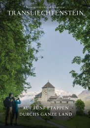
Princely Hikes in Liechtenstein
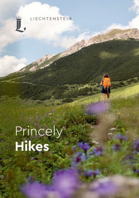
Which country in Europe has the densest network of hiking trails? It’s not the alpine classics of Switzerland or Austria, but in fact the small Principality of Liechtenstein nestling between those two countries. More than 400 kilometres of well-maintained and clearly signposted trails and majestic mountains up to 2600 metres above sea level attract walkers and hikers to Liechtenstein.
Which country in Europe has the densest network of hiking trails? It’s not the alpine classics of Switzerland or Austria, but in fact the small Principality of Liechtenstein nestling between those two countries. More than 400 kilometres of well-maintained and clearly signposted trails and majestic mountains up to 2600 metres above sea level attract walkers and hikers to Liechtenstein.

You also want an ePaper? Increase the reach of your titles
YUMPU automatically turns print PDFs into web optimized ePapers that Google loves.
<strong>Pr<strong>in</strong>cely</strong><br />
<strong>Hikes</strong>
Arlberg P ass<br />
ludenz<br />
Scheienkopf<br />
2159 m<br />
Ochsenkopf<br />
2286 m<br />
Gamsgrat<br />
220 1 m<br />
Nenz<strong>in</strong>ger Himme l<br />
F ü r s t i n - G i n a - W e g<br />
Augstenberg<br />
2359 m<br />
kopf<br />
8 m<br />
Guschgfiel<br />
Mattajoch<br />
1867 m<br />
Matta<br />
Sassfürkle<br />
177 1 m<br />
Sareiserjoch<br />
2000 m<br />
T urna<br />
Malbun<br />
16 02 m<br />
T ä l i<br />
Gritsch<br />
Ne<br />
P<br />
Sass<br />
Hochegg<br />
Schönberg<br />
21 04 m<br />
Guschg<br />
Stachlerkopf<br />
2071 m<br />
Pradamé<br />
B e r g l e<br />
V alorsch<br />
V alüna<br />
a m i n a<br />
Helwangspitz<br />
2000 m<br />
t a l<br />
Gross-Steg<br />
Steg Kle<strong>in</strong>-Steg<br />
1303 m<br />
V a l ü n e r b a c h<br />
Heubühl<br />
1936 m<br />
Wang<br />
K olm e<br />
1993 m<br />
Goldlochspitz<br />
2110 m<br />
Gapfahl<br />
Rap<br />
F ü r s t e n s tei g<br />
Alpspitz<br />
1942 m<br />
Barg ella<br />
Silum<br />
Sücka<br />
Kulm<br />
1433 m<br />
Platta<br />
K<br />
Gaflei<br />
Masescha<br />
Gnalp<br />
T riesenberg<br />
884 m<br />
Ste<strong>in</strong>ort<br />
Profatscheng<br />
Rotenboden<br />
Wildschloss<br />
840 m<br />
T riesen<br />
512 m<br />
Schloss V aduz<br />
F ü r s t e n w e g<br />
V aduz<br />
455 m<br />
Rhe<strong>in</strong><br />
Mühleholz<br />
A13<br />
W eite<br />
Schaan<br />
Buch s/S G<br />
Sevelen<br />
Gretsch<strong>in</strong>s<br />
W artau<br />
Oberschan<br />
Malans<br />
Fontnas<br />
Alvier<br />
2343 m<br />
Gauschla<br />
2 310 m
→ tourismus.li/hik<strong>in</strong>g 3<br />
Hik<strong>in</strong>g paradise<br />
fit for a pr<strong>in</strong>ce<br />
Which country <strong>in</strong> Europe has the densest network of hik<strong>in</strong>g<br />
trails? It’s not the alp<strong>in</strong>e classics of Switzerland or Austria,<br />
but <strong>in</strong> fact the small Pr<strong>in</strong>cipality of Liechtenste<strong>in</strong> nestl<strong>in</strong>g<br />
between those two countries.<br />
More than 400 kilometres of well-ma<strong>in</strong>ta<strong>in</strong>ed and clearly<br />
signposted trails and majestic mounta<strong>in</strong>s up to 2600 metres<br />
above sea level attract walkers and hikers to Liechtenste<strong>in</strong>.<br />
With a little luck you will even see golden eagles, marmots,<br />
chamois or ibex. There are leisurely walks and hikes down<br />
<strong>in</strong> the valley and low mounta<strong>in</strong>s as well as challeng<strong>in</strong>g summit<br />
ascents for the more experienced. Families will discover an<br />
idyllic oasis, especially <strong>in</strong> the mounta<strong>in</strong> village of Malbun. One<br />
of the most spectacular circular hikes leads along the Pr<strong>in</strong> cess<br />
G<strong>in</strong>a Trail through high-alp<strong>in</strong>e terra<strong>in</strong> protected as an area<br />
of outstand<strong>in</strong>g natural beauty and biodiversity. The classic route<br />
along the famous Fürstensteig lead<strong>in</strong>g along a scenic ridgetop<br />
path up over the Drei Schwestern mounta<strong>in</strong>s requires<br />
surefootedness and experience of hik<strong>in</strong>g <strong>in</strong> the mounta<strong>in</strong>s.<br />
The best way to get to know the Pr<strong>in</strong>cipality of Liechtenste<strong>in</strong><br />
is on the 75-kilometre Liechtenste<strong>in</strong> Trail. The route leads<br />
through all the municipalities <strong>in</strong> the country, tak<strong>in</strong>g <strong>in</strong> v<strong>in</strong>eyards,<br />
nature reserves, forests, sites of <strong>in</strong>terest, f<strong>in</strong>e views and<br />
cul<strong>in</strong>ary highlights. The Liechtenste<strong>in</strong> Trail is a unique journey<br />
through the country’s culture and history that is ideally<br />
completed <strong>in</strong> 4 to 5 stages.<br />
→ tourismus.li/hik<strong>in</strong>g
Bergrestaurant<br />
Sareis<br />
2000 metres<br />
Hik<strong>in</strong>g <strong>in</strong> Liechtenste<strong>in</strong><br />
→ Over 400 km of well-signposted trails<br />
→ Easy walks to very challeng<strong>in</strong>g hikes<br />
→ Highest mounta<strong>in</strong>: Grauspitz, 2599 metres<br />
→ Untouched nature<br />
→ Cross-border trails (Liechtenste<strong>in</strong>, Switzerland, Austria)<br />
→ Traditional mounta<strong>in</strong> huts and hotels<br />
→ Themed learn<strong>in</strong>g trails ideal for families<br />
→ Excellent public transport connections<br />
Level of difficulty<br />
Fitness level<br />
easy low fitness Level 1<br />
<strong>in</strong>termediate average fitness Level 3<br />
difficult excellent fitness Level 5
Schesaplana<br />
2965 metres<br />
Pr<strong>in</strong>cess G<strong>in</strong>a Trail<br />
Alp Turna<br />
Walk<strong>in</strong>g trail<br />
to Malbun<br />
Onl<strong>in</strong>e guide to hik<strong>in</strong>g <strong>in</strong> Liechtenste<strong>in</strong><br />
The onl<strong>in</strong>e guide to hik<strong>in</strong>g <strong>in</strong> Liechtenste<strong>in</strong><br />
offers comprehensive, GPS-supported<br />
<strong>in</strong>formation on hik<strong>in</strong>g trails, themed trails,<br />
w<strong>in</strong>ter hik<strong>in</strong>g paths and guided hikes.<br />
→ tourismus.li/hik<strong>in</strong>g<br />
Flora and fauna<br />
Home to 1600 different plant species, Liechtenste<strong>in</strong><br />
has a rich and diverse flora. The<br />
Liechtenste<strong>in</strong> Alps and the country’s nature<br />
reserves are protected by law to preserve<br />
this biodiversity. Many animals are particularly<br />
sensitive to disturbances, so hikers should<br />
behave considerately and not leave the<br />
marked trails.
6 → tourismus.li/hik<strong>in</strong>g<br />
Lawena Valley<br />
Plasteikopf<br />
2356 metres<br />
High-alp<strong>in</strong>e<br />
flora<br />
Pr<strong>in</strong>cipality of Liechtenste<strong>in</strong> hik<strong>in</strong>g map<br />
The official topographical hik<strong>in</strong>g map of<br />
the Pr<strong>in</strong>cipality of Liechtenste<strong>in</strong> 1:25 000 is<br />
available <strong>in</strong> local bookstores and from<br />
Liechtenste<strong>in</strong> Market<strong>in</strong>g. Call +423 239 63 63<br />
or send an e-mail to <strong>in</strong>fo@liechtenste<strong>in</strong>.li.<br />
Public transport<br />
Almost all start<strong>in</strong>g and f<strong>in</strong>ish<strong>in</strong>g po<strong>in</strong>ts<br />
of hikes <strong>in</strong> Liechtenste<strong>in</strong> can be easily<br />
reached with the public buses operated<br />
by LIEmobil. Timetables are available<br />
<strong>in</strong>side the buses and at every post office.<br />
→ liemobil.li<br />
Liechtenste<strong>in</strong> public buses → liemobil.li<br />
Swiss Federal Railways → sbb.ch/en<br />
Austrian Federal Railways → oebb.at/en/<br />
Bus stops on altitude profile map
Alpste<strong>in</strong><br />
Hay huts <strong>in</strong> Tuass<br />
1400 metres<br />
Alpspitz<br />
Triesenberg<br />
1997 metres<br />
Rh<strong>in</strong>e Valley<br />
Liechtenste<strong>in</strong> Alp<strong>in</strong>e Association<br />
The Liechtenste<strong>in</strong> Alp<strong>in</strong>e Association is<br />
one of Liechtenste<strong>in</strong>’s oldest clubs. It was<br />
founded <strong>in</strong> 1909 as the Liechtenste<strong>in</strong><br />
section of the German and Austrian Alp<strong>in</strong>e<br />
Club and became <strong>in</strong>dependent <strong>in</strong> 1946.<br />
Today it is one of the largest clubs <strong>in</strong> the<br />
country with around 3000 members.<br />
→ alpenvere<strong>in</strong>.li
8 → tourismus.li/hik<strong>in</strong>g<br />
Emergency numbers<br />
Emergency 112<br />
Air rescue (REGA) 1414<br />
Ambulance 144<br />
Police 117<br />
Signpost<strong>in</strong>g of trails<br />
Walk<strong>in</strong>g and hik<strong>in</strong>g trails <strong>in</strong> Liechtenste<strong>in</strong> are marked with coloured<br />
signposts, which usually <strong>in</strong>clude location <strong>in</strong>formation, the route dest<strong>in</strong>ation<br />
and stop-off po<strong>in</strong>ts along the way. Some have details of walk<strong>in</strong>g times;<br />
these are based on an average walk<strong>in</strong>g speed of 4.2 kilometres per hour on<br />
flat, easy paths. Additional time required as a result of climbs or difficult<br />
terra<strong>in</strong> is taken <strong>in</strong>to account <strong>in</strong> the walk<strong>in</strong>g times.<br />
WALKING TRAIL<br />
Walk<strong>in</strong>g trail<br />
Walk<strong>in</strong>g trails have no specific difficulties, avoid tarmac and concrete<br />
surfaces wherever possible, and stay away from public roads. Steep climbs<br />
are overcome us<strong>in</strong>g levels, while any exposed sections are secured with<br />
steel ropes, handholds, etc. Flow<strong>in</strong>g water is crossed us<strong>in</strong>g footbridges.<br />
HIKING TRAIL<br />
Hik<strong>in</strong>g trail<br />
Hik<strong>in</strong>g trails are paths that <strong>in</strong>clude sections of rough terra<strong>in</strong>. They are<br />
predom<strong>in</strong>antly steep and narrow and are exposed <strong>in</strong> places. Particularly<br />
difficult sections are secured us<strong>in</strong>g ropes, cha<strong>in</strong>s, footholds, handrails,<br />
etc. – safety equipment typical of via ferrata climb<strong>in</strong>g routes. Flow<strong>in</strong>g water<br />
may have to be crossed on stepp<strong>in</strong>g stones or waded through.<br />
ALPINE TRAIL<br />
Alp<strong>in</strong>e trail<br />
Alp<strong>in</strong>e trails are challeng<strong>in</strong>g mounta<strong>in</strong> paths. They lead <strong>in</strong> part through<br />
unmarked terra<strong>in</strong> or rocky terra<strong>in</strong> with short climb<strong>in</strong>g sections. Walkers and<br />
hikers embark<strong>in</strong>g on alp<strong>in</strong>e trails must be sure-footed, have a good head<br />
for heights and be <strong>in</strong> very good physical condition. Rope and pickaxe skills<br />
are essential.
Naafkopf<br />
2570 metres Schwarzhorn<br />
2574 metres<br />
Valüna valley<br />
Gängle lake
10 → tourismus.li/hik<strong>in</strong>g<br />
Huts and mounta<strong>in</strong> <strong>in</strong>ns<br />
Gafadura hut (1428 metres)<br />
The Gafadura hut is located high above Planken below the Drei Schwestern<br />
mounta<strong>in</strong>s. There are 14 sleep<strong>in</strong>g berths <strong>in</strong> one dormitory, a restaurant with<br />
places <strong>in</strong>side as well as a terrace with a great view. The Gafadura hut is open<br />
from around Mid-April until mid-October. T +423 787 14 28,<br />
gafadurahuette@alpenvere<strong>in</strong>.li<br />
→ alpenvere<strong>in</strong>.li<br />
Pfälzer hut (2108 metres)<br />
The Pfälzer hut is a modern mounta<strong>in</strong> hut on the Bettlerjoch ridge run by the<br />
Liechtenste<strong>in</strong> Alp<strong>in</strong>e Association. It has 10 beds and a dormitory <strong>in</strong> the ma<strong>in</strong><br />
build<strong>in</strong>g plus an emergency dormitory with space for an additional 17 people.<br />
The Pfälzer hut is open from mid-June until mid-October. T +423 263 36 79,<br />
pfaelzerhuette@alpenvere<strong>in</strong>.li<br />
→ alpenvere<strong>in</strong>.li<br />
Berggasthaus Sücka mounta<strong>in</strong> <strong>in</strong>n (1402 metres)<br />
The Berggasthaus Sücka is a rustic mounta<strong>in</strong> <strong>in</strong>n situated above Steg. Housed <strong>in</strong><br />
a former sanitorium, it offers magnificent views of lush meadows and pastures<br />
around Steg. The open<strong>in</strong>g hours are irregular. T +423 794 12 51, <strong>in</strong>fo@suecka.li<br />
→ tourismus.li/en/suecka<br />
Bergrestaurant Sareis (2000 metres)<br />
The Bergrestaurant Sareis is located on the Sareiserjoch ridge and has a<br />
cozy, rustic d<strong>in</strong><strong>in</strong>g room plus majestic views from one of the most beautiful<br />
terraces <strong>in</strong> Liechtenste<strong>in</strong>. The mounta<strong>in</strong> restaurant can be reached either<br />
by chairlift or via a hik<strong>in</strong>g trail from Malbun (walk<strong>in</strong>g time: 1 hour).<br />
T +423 263 46 86, sareis@bergbahnen.li<br />
→ sareis-malbun.li
→ tourismus.li/hik<strong>in</strong>g 11
12 → tourismus.li/hik<strong>in</strong>g<br />
Selected hotels<br />
<strong>in</strong> the mounta<strong>in</strong> area<br />
Gorfion –<br />
Familotel Malbun ****<br />
Stubistrasse 8, 9497 Malbun<br />
T +423 265 90 00<br />
<strong>in</strong>fo@gorfion.li<br />
→ gorfion.li<br />
JUFA Hotel Malbun -<br />
Alp<strong>in</strong>-Resort *** Superior<br />
Malbunstrasse 60, 9497 Malbun<br />
T +423 399 20 00<br />
malbun@jufa.eu<br />
→ jufa.eu/malbun<br />
Hotel Turna *** Superior<br />
Im Malbun, 9497 Malbun<br />
T +423 265 50 40<br />
<strong>in</strong>fo@turna.li<br />
→ turna.li<br />
Hotel Kulm ***<br />
Schlossstrasse 3<br />
9497 Triesenberg<br />
T +423 237 79 79<br />
<strong>in</strong>fo@hotelkulm.li<br />
→ hotelkulm.li<br />
Alpenhotel Malbun ** Superior<br />
Im Malbun 11, 9497 Malbun<br />
T +423 263 11 81<br />
<strong>in</strong>fo@alpenhotel.li<br />
→ alpenhotel.li<br />
Hotel Falknerei Gal<strong>in</strong>a *** Superior<br />
Im Malbun 20, 9497 Malbun<br />
T +423 265 34 24<br />
<strong>in</strong>fo@gal<strong>in</strong>a.li<br />
→ gal<strong>in</strong>a.li<br />
Hotel Oberland ***<br />
Bergstrasse 25<br />
9497 Triesenberg<br />
T +423 265 01 01<br />
book<strong>in</strong>g@hotel-oberland.li<br />
→ hotel-oberland.li<br />
Hotels and accommodations<br />
<strong>in</strong> Liechtenste<strong>in</strong><br />
→ tourismus.li/<br />
uebernachtung
→ tourismus.li/hik<strong>in</strong>g 13<br />
List of hikes<br />
Easy hikes<br />
Easy walk for families – along the Sass Trail to the Sass lake 14<br />
Vaduz Castle up close – circular hike along the Grüscha Trail 15<br />
High above the Rh<strong>in</strong>e Valley – circular hike on the Philosophers’ Trail 16<br />
Around the Ruggeller Riet – hik<strong>in</strong>g <strong>in</strong> the heart of a natural paradise 17<br />
Experience history on the Historical Eschnerberg Trail 18<br />
Visit the Giant of Gufl<strong>in</strong>a on the Wals Fable Trail 19<br />
Fly through the mounta<strong>in</strong>s - Malbun Sw<strong>in</strong>g Trail 20<br />
Intermediate hikes<br />
The Liechtenste<strong>in</strong> Trail 22<br />
From Malbun to Schönberg mounta<strong>in</strong> 27<br />
Classic high-altitude hike along the Fürstensteig and over the Drei Schwestern 28<br />
Hike along the Pr<strong>in</strong>cess G<strong>in</strong>a Trail 29<br />
Circular hike through the Valüna Valley 30<br />
Sunrise on the Naafkopf mounta<strong>in</strong> 31<br />
Circular hike on the Rappenste<strong>in</strong> mounta<strong>in</strong> 32<br />
Alpspitz – Liechtenste<strong>in</strong>’s first summit cross 33<br />
Through the wild Sam<strong>in</strong>a Valley to Austria 34<br />
Rough, wild, mystical – hike to Tuass 35<br />
Difficult hikes<br />
Multi-day hike along the Liechtenste<strong>in</strong> Panorama Trail (Route 66) 36<br />
From Malbun over the Gal<strong>in</strong>akopf mounta<strong>in</strong> through the Valorsch Valley 38<br />
Through the Lawena gorge <strong>in</strong>to the Rh<strong>in</strong>e Valley 39<br />
Via Alp<strong>in</strong>a – hike Liechtenste<strong>in</strong>’s ma<strong>in</strong> ridge (red trail) 40<br />
Alp<strong>in</strong>e hike onto the Falknis mounta<strong>in</strong> 41
14 → tourismus.li/hik<strong>in</strong>g<br />
WALKING TRAIL<br />
Easy walk for families – along the<br />
Sass Trail to the Sass lake<br />
Malbun - Sass lake - Malbun<br />
The Sass Trail near the mounta<strong>in</strong> village of Malbun is a well-signposted circular<br />
hik<strong>in</strong>g Trail which can be hiked throughout the year. The section to the<br />
Sass lake leads along the Malbun Explorer Path, a fun and educational Trail for<br />
children made up of ten learn<strong>in</strong>g stations.<br />
Level of difficulty<br />
Fitness Level 1<br />
Walk<strong>in</strong>g time<br />
Distance<br />
Ascent/descent<br />
2 h<br />
4.4 km<br />
189/189 m<br />
Highest po<strong>in</strong>t Weierböda (1725 m)<br />
Requirements<br />
Start/f<strong>in</strong>ish<br />
No special requirements<br />
Malbun (1600 m), park<strong>in</strong>g spaces<br />
at the lower entrance to the village.<br />
More <strong>in</strong>formation about the Malbun<br />
Explorer Path at<br />
→ forscherweg.li<br />
Public transport Malbun bus stop on the Vaduz –<br />
Triesenberg – Malbun route<br />
Food & dr<strong>in</strong>k<br />
Accommodation<br />
Restaurants <strong>in</strong> Malbun; no places<br />
serv<strong>in</strong>g food and dr<strong>in</strong>k along<br />
the way; rest area with BBQ spot<br />
at Sass lake<br />
Hotels <strong>in</strong> Malbun<br />
From the car park on the outskirts of Malbun,<br />
the route leads up to the Friedenskapelle,<br />
the highest church <strong>in</strong> Liechtenste<strong>in</strong>, perched<br />
at the foot of the Ochsenkopf massif and<br />
visible from afar. Architect Johannes Hugentobler<br />
designed this light-coloured stone<br />
build<strong>in</strong>g to blend <strong>in</strong> with the mounta<strong>in</strong> scenery<br />
beh<strong>in</strong>d it. From the Friedenskapelle,<br />
the Sass Trail – which takes its name from the<br />
Lat<strong>in</strong> word “saxum” (rock) – leads gently<br />
up through forests and across meadows<br />
with water sources like the “Weierböda”.<br />
At the Sass lake you will f<strong>in</strong>d a large rest area<br />
with a BBQ spot. Leav<strong>in</strong>g the Sass lake,<br />
the Sass Trail leads down across the meadows<br />
of Alp Sass to the “Schneeflucht” and on<br />
to the holiday village and w<strong>in</strong>ter sports resort<br />
of Malbun. The Sass Trail is also suitable for<br />
large-wheeled children’s buggies.<br />
hm<br />
1800<br />
Malbun<br />
Sass lake<br />
1700<br />
Friedenskapelle<br />
Malbun<br />
1600<br />
1500<br />
km 1 2 3 4
WALKING TRAIL → tourismus.li/hik<strong>in</strong>g 15<br />
Vaduz Castle up close – circular<br />
hike along the Grüscha Trail<br />
Vaduz - Grüscha Trail - Triesenberg – Frommenhaus – Vaduz<br />
From Vaduz, the capital of the Pr<strong>in</strong>cipality of Liechtenste<strong>in</strong>, the Grüscha Trail<br />
leads past Vaduz Castle, through the pr<strong>in</strong>cely forest to the Walser village<br />
of Triesenberg with its beautiful views and back to Vaduz via the hamlet of<br />
Rotaboda.<br />
Level of difficulty<br />
Fitness Level 2<br />
Walk<strong>in</strong>g time<br />
Distance<br />
Ascent/descent<br />
3.5 h<br />
10.5 km<br />
430/430 m<br />
Highest po<strong>in</strong>t Rotaboda (884 m)<br />
Requirements<br />
Start/f<strong>in</strong>ish<br />
Public transport<br />
Food & dr<strong>in</strong>k<br />
Accommodation<br />
No special requirements<br />
Vaduz (460 m), several park<strong>in</strong>g<br />
garages; alternative park<strong>in</strong>g<br />
available above Vaduz Castle<br />
Vaduz Post bus stop, bus connections<br />
to Triesenberg on the Vaduz -<br />
Triesenberg - Malbun route<br />
Restaurants <strong>in</strong> Vaduz and Triesenberg<br />
Hotels <strong>in</strong> Vaduz and Triesenberg<br />
From the bus stop <strong>in</strong> the centre of Vaduz,<br />
the Postgass road leads uphill through the<br />
pedestrianised zone past the Museum of<br />
F<strong>in</strong>e Arts and the Treasure Chamber. At the<br />
Brasserie Burg, the path branches off steeply<br />
to the right <strong>in</strong>to the Beckagässli and from<br />
there <strong>in</strong>to the Haldenweg. The Haldenweg<br />
changes to a steep wooded slope, and from<br />
there the Schlossweg leads to the Fürst-<br />
Franz-Josef-Strasse. The path then leads directly<br />
past Vaduz Castle, the residence of the<br />
<strong>Pr<strong>in</strong>cely</strong> Family, and offers good photo opportunities.<br />
Afterwards, the Trail follows the<br />
mounta<strong>in</strong> road uphill to a car park, until the<br />
Grüscha Trail works its way up through a<br />
beech forest to the village of Triesenberg<br />
(884 metres), traditionally home to the Walser<br />
people. In Triesenberg you can have lunch<br />
<strong>in</strong> a restaurant or visit the Walser Museum.<br />
From the village centre, the trail follows the<br />
Tobelweg up to the hamlet of Rotaboda,<br />
where the descent leads down via the Frommenhaus<br />
back to Vaduz.<br />
hm<br />
1000<br />
Vaduz, Post<br />
Triesenberg<br />
800<br />
600<br />
Vaduz Castle<br />
Vaduz, Post<br />
400<br />
km<br />
2 4 6 8 10
16 → tourismus.li/hik<strong>in</strong>g<br />
WALKING TRAIL<br />
High above the Rh<strong>in</strong>e Valley –<br />
circular hike on the Philosophers’ Trail<br />
Rizl<strong>in</strong>a - Gnalp - Masescha - Vorder-Profatscheng -<br />
H<strong>in</strong>ter-Profatscheng – Gaflei – Silum – Gnalp – Rizl<strong>in</strong>a<br />
This hike on the Philosophers’ Trail leads along natural paths through the rich<br />
landscape traditionally home to the Walser people and their culture. Stop<br />
off at the Berggasthaus Masescha mounta<strong>in</strong> <strong>in</strong>n to enjoy the magnificent view<br />
from the terrace and taste the famous apple pie.<br />
hm<br />
1600<br />
1400<br />
1200<br />
Level of difficulty<br />
Fitness Level 3<br />
Walk<strong>in</strong>g time<br />
Distance<br />
Ascent/descent<br />
Highest po<strong>in</strong>t<br />
Requirements<br />
Start/f<strong>in</strong>ish<br />
Alternative route<br />
Public transport<br />
Food & dr<strong>in</strong>k<br />
Accommodation<br />
Rizl<strong>in</strong>a<br />
Mitätsch<br />
Masescha<br />
4.5 h<br />
Vorder-<br />
Profatscheng<br />
12.2 km<br />
666/666 m<br />
1597 m<br />
No special requirements<br />
Rizl<strong>in</strong>a (1170 m) above Triesenberg,<br />
on the right-hand side of the road at<br />
the Rizl<strong>in</strong>a bus stop there are several<br />
park<strong>in</strong>g spaces available<br />
From Masescha via the quiet road<br />
to Silum. (walk<strong>in</strong>g time -1.5 h)<br />
Triesenberg Rizl<strong>in</strong>a bus stop on the<br />
Vaduz – Triesenberg – Malbun route<br />
Berggasthaus Masescha, Gaflei-Stuba,<br />
restaurants <strong>in</strong> Triesenberg<br />
Hotels <strong>in</strong> Triesenberg and Malbun<br />
H<strong>in</strong>ter-<br />
Profatscheng<br />
Gaflei<br />
Silum<br />
Rizl<strong>in</strong>a<br />
The hike starts at Rizl<strong>in</strong>a, high above the<br />
Walser village of Triesenberg. The path first<br />
leads past Gnalp <strong>in</strong> a northerly direction<br />
along the Philosophers’ Trail to the small<br />
Walser settlement of Masescha (1234 metres).<br />
It is worth stopp<strong>in</strong>g at the Berggasthaus<br />
Masescha mounta<strong>in</strong> <strong>in</strong>n and enjoy<strong>in</strong>g the<br />
apple pie on the sunny terrace. After this rest,<br />
the route cont<strong>in</strong>ues to the settlement of<br />
Vorder-Profatscheng with its many houses<br />
and farmsteads dotted across the mounta<strong>in</strong><br />
before head<strong>in</strong>g gently downhill to H<strong>in</strong>ter-<br />
Profatscheng. The view of the Rh<strong>in</strong>e Valley<br />
and the beautiful dark brown Walser houses<br />
make this trail a special experience. From<br />
H<strong>in</strong>ter-Profatscheng, the trail is well signposted<br />
and leads 350 vertical metres uphill<br />
through sparse mounta<strong>in</strong> woodland to<br />
Gaflei (1483 metres). The ascent is well worthwhile,<br />
because the view from Gaflei <strong>in</strong>to<br />
the Rh<strong>in</strong>e Valley is spectacular. After the steep<br />
ascent to Gaflei, the route becomes easier<br />
and heads via Silum back to the start<strong>in</strong>g po<strong>in</strong>t<br />
<strong>in</strong> Rizl<strong>in</strong>a.<br />
1000<br />
km 3 6 9 12
WALKING TRAIL<br />
→ tourismus.li/hik<strong>in</strong>g 17<br />
Around the Ruggeller Riet - hik<strong>in</strong>g<br />
<strong>in</strong> the heart of a natural paradise<br />
Ruggell – Bangserfeld – customs cross<strong>in</strong>g – Nofels – Bangserfeld – Ruggell<br />
The Ruggeller Riet forms – together with the Bangser Riet <strong>in</strong> neighbour<strong>in</strong>g<br />
Vorarlberg – a magnificent wetland landscape. In May/June the area is<br />
covered <strong>in</strong> a carpet of shimmer<strong>in</strong>g blue as the Siberian iris comes <strong>in</strong>to bloom.<br />
Rare birds nest <strong>in</strong> the reeds and woods. With a little bit of luck you may<br />
also see a beaver or k<strong>in</strong>gfisher.<br />
Level of difficulty<br />
Fitness Level 2<br />
Walk<strong>in</strong>g time<br />
Distance<br />
Ascent/descent<br />
3 h<br />
10.9 km<br />
20/20 m<br />
Highest po<strong>in</strong>t Ruggell (441 m)<br />
Requirements<br />
Start/f<strong>in</strong>ish<br />
Public transport<br />
Food & dr<strong>in</strong>k<br />
Accommodation<br />
No special requirements<br />
Post office <strong>in</strong> Ruggell,<br />
park<strong>in</strong>g available<br />
Ruggell Kirche bus stop<br />
on the Bendern – Ruggell –<br />
H<strong>in</strong>terschellenberg route<br />
Restaurants <strong>in</strong> Ruggell<br />
Hotels <strong>in</strong> Ruggell<br />
From the church <strong>in</strong> Ruggell, the route follows<br />
the Rh<strong>in</strong>e road to the bridge over the <strong>in</strong>land<br />
canal. You will f<strong>in</strong>d an <strong>in</strong>formation board here<br />
show<strong>in</strong>g the hik<strong>in</strong>g, jogg<strong>in</strong>g, walk<strong>in</strong>g and<br />
cycl<strong>in</strong>g routes along the Rh<strong>in</strong>e and the canal<br />
as well as through the Ruggeller Riet. Follow<br />
the canal down the valley. On the right there<br />
is the Widau leisure park with its skatepark,<br />
beach volleyball court, hockey field and play<br />
area. At the renaturalised mouth of the canal<br />
<strong>in</strong>to the Rh<strong>in</strong>e, <strong>in</strong> Bangserfeld, the circular<br />
Trail sw<strong>in</strong>gs <strong>in</strong>land to the BBQ spot at Weienau,<br />
where you can take a break. Just before<br />
the Bangshof, a dairy farm produc<strong>in</strong>g cheese<br />
from Liechtenste<strong>in</strong>, the path turns left. After<br />
the customs cross<strong>in</strong>g at Nofels, the trail<br />
reaches the edge of the forest at the foot of<br />
the Eschnerberg, which now provides the<br />
scenic route up the valley until the signs po<strong>in</strong>t<br />
back to Ruggell.<br />
hm<br />
500<br />
Church<br />
Nofels<br />
Heiligkrüz<br />
400<br />
km 3 6 9
18 → tourismus.li/hik<strong>in</strong>g<br />
WALKING TRAIL<br />
Experience history on the<br />
Historical Eschnerberg Trail<br />
Bendern – Gampr<strong>in</strong> – Mittlerer Schellenberg – Gantenste<strong>in</strong> –<br />
H<strong>in</strong>terer Schellenberg – Ru<strong>in</strong>e Alt Schellenberg – Malanserwald – Bendern<br />
Constructed between 1972 and 1975, the Historical Eschnerberg Trail runs on<br />
both sides of the ridge of Eschnerberg and past sites of archaeological<br />
and historical <strong>in</strong>terest. Hikers can choose between the full distance and four<br />
shorter, well-signposted circular routes.<br />
Level of difficulty<br />
Fitness Level 2<br />
Total distance<br />
Alternative routes<br />
17.2 km/ascent/descent 620 m/3.45 h<br />
Hike 1: 6 km/ascent/descent 140 m/2 h<br />
Hike 2: 3.1 km/ascent/descent 65 m/1 h<br />
Hike 3: 5.9 km/ascent/descent 145 m/2 h<br />
Hike 4: 8.2 km/ascent/descent 205 m/3 h<br />
→ hoehenweg.li<br />
Highest po<strong>in</strong>t H<strong>in</strong>terer Schellenberg (694 m)<br />
Requirements<br />
Start/f<strong>in</strong>ish<br />
Public transport<br />
Food & dr<strong>in</strong>k<br />
Accommodation<br />
No special requirements<br />
Bendern post office (468 m),<br />
park<strong>in</strong>g available<br />
Bendern Post bus stop on the<br />
Vaduz – Schaan – Bendern or<br />
Eschen – Bendern – Ruggell route<br />
Restaurants <strong>in</strong> Schellenberg<br />
and Bendern, BBQ spot at the<br />
Neu-Schellenberg ru<strong>in</strong>s<br />
Hotels <strong>in</strong> Schellenberg and Bendern<br />
The Historical Eschnerberg Trail can be<br />
completed <strong>in</strong> either one hike of 17 kilometres<br />
or four sections of around 3 to 8 kilometres<br />
each. The route leads through a quiet forest,<br />
past prehistoric settlement sites, and offers<br />
magnificent views of the Rh<strong>in</strong>e Valley, the<br />
Rätikon mounta<strong>in</strong>s, the Alvier mounta<strong>in</strong>s and<br />
the Alpste<strong>in</strong> mounta<strong>in</strong>s. The Historical Eschnerberg<br />
Trail has its own special charm whatever<br />
the season. Information boards along<br />
the way <strong>in</strong>form hikers about archaeological<br />
sites, the history of the five municipalities<br />
<strong>in</strong> Liechtenste<strong>in</strong>’s Unterland (the north of the<br />
country), how many places got their names,<br />
local legends as well as natural history events.<br />
Each <strong>in</strong>formation board is provided with a<br />
QR code and a map, which hikers can use to<br />
f<strong>in</strong>d out more about their exact location.<br />
hm<br />
800<br />
Bendern<br />
Mittlerer<br />
Schellenberg<br />
H<strong>in</strong>terer<br />
Schellenberg<br />
Ru<strong>in</strong>e<br />
Alt Schellenberg<br />
600<br />
Gampr<strong>in</strong><br />
Malanserwald<br />
Krest<br />
Bendern<br />
400<br />
km 3 6 9 12 15
WALKING TRAIL<br />
→ tourismus.li/hik<strong>in</strong>g 19<br />
Visit the Giant of Gufl<strong>in</strong>a<br />
on the Wals Fable Trail<br />
Triesenberg – Rotaboda – H<strong>in</strong>ter Profatscheng – Masescha –<br />
Philosophers’ Trail – Gnalp – Rizl<strong>in</strong>a – Teufi – Triesenberg<br />
Myths and legends accompany hikers on their way through a fasc<strong>in</strong>at<strong>in</strong>g cultural<br />
landscape with magnificent views of the Rh<strong>in</strong>e Valley and the surround<strong>in</strong>g<br />
mounta<strong>in</strong>s. The varied Walser Fable Trail has <strong>in</strong>formation stations dotted along<br />
the way tell<strong>in</strong>g the story of the Walser people native to Triesenberg.<br />
hm<br />
1400<br />
Level of difficulty<br />
Fitness Level 3<br />
Total distance<br />
Alternative routes<br />
Highest po<strong>in</strong>t Mitätsch (1262 m)<br />
Requirements<br />
Start/f<strong>in</strong>ish<br />
Public transport<br />
Food & dr<strong>in</strong>k<br />
Accommodation<br />
Triesenberg<br />
12.1 km/ascent/descent 520 m/5 h<br />
Route 1: Walser Museum – Masescha<br />
(5.5 km/2.5 h)<br />
Route 2: Masescha – Rizl<strong>in</strong>a (2.3 km/1 h)<br />
Route 3: Rizl<strong>in</strong>a – village centre<br />
(4 km/1.5 h)<br />
The section from Triesenberg to<br />
Masescha is steep, requires sturdy<br />
footwear and is not suitable for<br />
prams and buggies<br />
Village square <strong>in</strong> Triesenberg (884 m),<br />
park<strong>in</strong>g available <strong>in</strong> the centre<br />
Triesenberg Post bus stop on the<br />
Vaduz – Triesenberg – Malbun route<br />
Berggasthaus Masescha, Gaflei-Stuba,<br />
restaurants <strong>in</strong> Triesenberg<br />
H<strong>in</strong>ter-<br />
Profatscheng<br />
Hotels <strong>in</strong> Triesenberg<br />
Vorder-<br />
Profatscheng<br />
Masescha<br />
Gufl<strong>in</strong>a<br />
Gnalp<br />
Parmezg<br />
As they make their way along the Wals<br />
Fable Trail, hikers will encounter bizarre characters<br />
such as the Erbi Ghost, the Wild<br />
Männli and the Fiery Red Billy Goat. Information<br />
boards tell some of the many local<br />
legends as provid<strong>in</strong>g <strong>in</strong>formation about the<br />
Walser people and their culture. The start -<br />
<strong>in</strong>g po<strong>in</strong>t is on the village square <strong>in</strong> Triesenberg,<br />
where the Walser Museum is located.<br />
The first 5.5 km section leads to Masescha and<br />
is not suitable for prams and buggies. Sturdy<br />
footwear is needed for this challeng<strong>in</strong>g hike<br />
last<strong>in</strong>g approximately 2.5 hours. The second<br />
part of the Wals Fable Trail from Masescha<br />
to Rizl<strong>in</strong>a is suitable for prams and buggies.<br />
It takes around one hour to complete the easy<br />
2.3 km walk. The last part of the trail leads<br />
from Rizl<strong>in</strong>a, past the Studa play area the<br />
Rossboda rest area, back to the start<strong>in</strong>g po<strong>in</strong>t<br />
<strong>in</strong> the centre of Triesenberg. This third part<br />
of the Wals Fable Trail is four kilometres long<br />
and takes about 1.5 hours to complete.<br />
1200<br />
Rotaboda<br />
Mattla<br />
Teufi<br />
1000<br />
Triesenberg<br />
800<br />
km 3 6 9 12
20 → tourismus.li/hik<strong>in</strong>g<br />
WALKING TRAIL<br />
Fly through the mounta<strong>in</strong>s -<br />
Malbun Sw<strong>in</strong>g Trail<br />
Sareis - Alpe Turna - Heita – Pradamee – Malbun<br />
In Malbun, young and old can enjoy spectacular open-air sw<strong>in</strong>gs with fantastic<br />
views along the sw<strong>in</strong>g trail. The easy hik<strong>in</strong>g route, along which you can catapult<br />
yourself <strong>in</strong>to the air on a total of ten sw<strong>in</strong>gs, extends over 5.5 km. The trail<br />
is also easy to for children from the age of five to master.<br />
hm<br />
2000<br />
1900<br />
1800<br />
1700<br />
Level of difficulty<br />
Fitness Level 2<br />
Walk<strong>in</strong>g Time<br />
Distance<br />
Ascent/descent<br />
1,5 h<br />
5,5 km<br />
58/439 m<br />
Highest po<strong>in</strong>t Sareis (2000 m)<br />
Requirements<br />
Start/f<strong>in</strong>ish<br />
No special requirements<br />
Malbun (1600 m), park<strong>in</strong>g spaces at<br />
the lower entrance of the village.<br />
Public transport Malbun bus stop on the Vaduz –<br />
Triesenberg – Malbun route<br />
Food & dr<strong>in</strong>k<br />
Accomodation<br />
Sw<strong>in</strong>g 1<br />
Sw<strong>in</strong>g 2<br />
Bergrestaurant Sareis and Restaurants<br />
<strong>in</strong> Malbun<br />
Hotels <strong>in</strong> Malbun<br />
Sw<strong>in</strong>g 3<br />
Sw<strong>in</strong>g 4<br />
Sw<strong>in</strong>g 5<br />
Sw<strong>in</strong>g 6<br />
Sw<strong>in</strong>g 7 Sw<strong>in</strong>g 8<br />
Sw<strong>in</strong>g 9<br />
Sw<strong>in</strong>g 10<br />
The Sareis chairlift takes you to the start<strong>in</strong>g<br />
po<strong>in</strong>t at the Sareis mounta<strong>in</strong> station. The<br />
sw<strong>in</strong>g trail beg<strong>in</strong>s just above the station,<br />
where the first of the larger sw<strong>in</strong>gs is located.<br />
From the Sareis mounta<strong>in</strong> restaurant, the trail<br />
leads to the next sw<strong>in</strong>g along the unpaved<br />
track to Alpe Turna. Amidst the Malbun landscape,<br />
with its stunn<strong>in</strong>gly lush and green alp<strong>in</strong>e<br />
meadows with dreamy mounta<strong>in</strong> flora and<br />
the mounta<strong>in</strong> range of the Malbun valley, we<br />
first descend to Turna. Even before the Alpe is<br />
reached, the next sw<strong>in</strong>g is wait<strong>in</strong>g for you.<br />
The trail cont<strong>in</strong>ues leisurely down the valley<br />
through meadows, past graz<strong>in</strong>g cows, then<br />
cont<strong>in</strong>ues over the little bridge of the Malbunbach<br />
and climbs aga<strong>in</strong> up the other side of<br />
the valley. The leisurely and steadily ascend<strong>in</strong>g<br />
w<strong>in</strong>d<strong>in</strong>g trail ascends to Alp Pradamee.<br />
Before reach<strong>in</strong>g Pradamee, a large sw<strong>in</strong>g<br />
awaits, on which three people can sw<strong>in</strong>g together<br />
and which is guaranteed to provide<br />
fun and more than a little laughter. From here,<br />
the trail descends once aga<strong>in</strong> and br<strong>in</strong>gs daytrippers<br />
back to Malbun, where they can relax<br />
and recuperate <strong>in</strong> one of several restaurants.<br />
1600<br />
km 1 2 3 4 5
Augstenberg<br />
2359 metres<br />
Pr<strong>in</strong>cess G<strong>in</strong>a Trail<br />
Malbun<br />
1600 metres
22 → tourismus.li/hik<strong>in</strong>g<br />
WALKING TRAIL<br />
The Liechtenste<strong>in</strong> Trail<br />
Balzers – Triesen – Triesenberg – Vaduz – Schaan – Planken – Nendeln –<br />
Eschen – Bendern – Gampr<strong>in</strong> – Ruggell – Schellenberg – Mauren – Schaanwald<br />
The Liechtenste<strong>in</strong> Trail gives hikers a detailed <strong>in</strong>sight <strong>in</strong>to the landscape and<br />
culture of the country. It comprises 75 kilometres of excit<strong>in</strong>g stories, places<br />
of <strong>in</strong>terest, magnificent views, idyllic rest<strong>in</strong>g places and much more. The best<br />
way to hike the Liechtenste<strong>in</strong> Trail, which passes through all the country’s<br />
municipalities, is <strong>in</strong> several day stages.<br />
Level of difficulty<br />
Fitness Level 3<br />
Stages<br />
Balzers-Triesenberg<br />
(14 km/572 m/4 h)<br />
Triesenberg-Vaduz<br />
(10 km/264 m/3 h)<br />
Vaduz-Nendeln<br />
(17 km/571 m/5 h)<br />
Nendeln-Ruggell<br />
(15 km/269 m/4 h)<br />
Ruggell-Schaanwald<br />
(19 km/507 m/5.5 h)<br />
Highest po<strong>in</strong>t Profatscheng (1109 m)<br />
Requirements<br />
Sturdy footwear, sure foot<strong>in</strong>g<br />
required <strong>in</strong> places<br />
Start Balzers (472 m)<br />
F<strong>in</strong>ish Schaanwald (450 m)<br />
Public transport<br />
Food & dr<strong>in</strong>k<br />
Accommodation<br />
Tip<br />
Trail can be started <strong>in</strong> any municipality<br />
Restaurants <strong>in</strong> the municipalities<br />
Hotels <strong>in</strong> Balzers, Triesen, Triesenberg,<br />
Vaduz, Nendeln, Bendern, Ruggell,<br />
Schellenberg<br />
The LIstory app has been specially<br />
developed to accompany walkers and<br />
hikers on the Liechtenste<strong>in</strong> Trail.<br />
It provides detailed <strong>in</strong>formation on the<br />
history and culture of the country.<br />
The app can be downloaded free of<br />
charge from the App Store and via<br />
Google Play.
→ tourismus.li/hik<strong>in</strong>g 23<br />
Stage 1<br />
Balzers – Triesenberg<br />
The start<strong>in</strong>g po<strong>in</strong>t of the Liechtenste<strong>in</strong> Trail<br />
is at the Liechtenste<strong>in</strong>/Switzerland border<br />
cross<strong>in</strong>g at St. Kathr<strong>in</strong>abrunna <strong>in</strong> Balzers.<br />
Gutenberg Castle, which towers over Balzers,<br />
is visible from afar. After pass<strong>in</strong>g the medi eval<br />
castle, the route leads through Balzers and<br />
on to Triesen. Hikers pass through the old<br />
part of the village and reach an area of land<br />
formerly home to the Jenny, Spoerry & Cie<br />
cotton-weav<strong>in</strong>g mill and today occupied by<br />
the Kulturzentrum Gasometer. From here,<br />
the path leads steadily uphill to the Kapelle<br />
St. Mamerten. This is followed by the steep<br />
ascent to the Walser village of Triesenberg.<br />
The village centre lies at an around 900 metres<br />
above sea level. Triesenberg emerged from<br />
a Walser settlement <strong>in</strong> the 13th/14th century<br />
and has preserved its history and traditions<br />
over the years.<br />
Stage 2<br />
Triesenberg – Vaduz<br />
From the centre of Triesenberg, the route<br />
first leads hikers to an eye-catch<strong>in</strong>g rock deposited<br />
here as the glaciers slowly retreated<br />
millions of years ago. The journey then cont<strong>in</strong>ues<br />
to the listed farmstead settlement<br />
of Profatscheng. From here hikers can enjoy<br />
fantastic views of the Rh<strong>in</strong>e Valley. The trail<br />
leads steeply downhill through the forest<br />
past the ru<strong>in</strong>s of Schalun Castle to Vaduz Castle,<br />
the most recognisable landmark <strong>in</strong> Liechtenste<strong>in</strong>.<br />
After pass<strong>in</strong>g Vaduz Castle, there<br />
is a short descent <strong>in</strong>to the centre of Vaduz.<br />
In the town centre, the walk cont<strong>in</strong>ues<br />
through the pedestrianised zone. Here it is<br />
well worth hav<strong>in</strong>g a look at some of the many<br />
museums. After cross<strong>in</strong>g the government<br />
district, the path leads past St. Flor<strong>in</strong>’s Cathedral<br />
to the old bridge over the Rh<strong>in</strong>e. Hikers<br />
then pass the football stadium and return to<br />
the centre of Vaduz.<br />
hm<br />
900<br />
800<br />
700<br />
600<br />
500<br />
400<br />
Balzers<br />
Triesen<br />
Triesenberg<br />
10 12<br />
km 2 4 6 8 14<br />
hm<br />
1100<br />
1000<br />
900<br />
800<br />
700<br />
600<br />
500<br />
400<br />
Triesenberg<br />
Rotenboden<br />
Wangerberg<br />
H<strong>in</strong>ter-<br />
Profatscheng<br />
Wildschloss<br />
Vaduz<br />
Castle<br />
4<br />
6 8<br />
km 2 10<br />
Vaduz
24 → tourismus.li/hik<strong>in</strong>g<br />
Stage 3<br />
Vaduz – Nendeln<br />
The route climbs steadily through Alt-Vaduz<br />
to the Red House. From there you have a<br />
wonderful view of Vaduz Castle. After pass<strong>in</strong>g<br />
the University of Liechtenste<strong>in</strong>, the path<br />
becomes flatter and leads to a debris flow<br />
(known <strong>in</strong> Liechtenste<strong>in</strong> as Rüfe) and then<br />
to the centre of Schaan. From there the route<br />
leads up to the St. Elisabeth Nunnery before<br />
a short, flat section to the Gamanderhaus.<br />
From the Gamanderhaus there are now about<br />
300 vertical metres of climb<strong>in</strong>g to be completed<br />
to Planken, Liechtenste<strong>in</strong>’s smallest<br />
municipality. From here you can enjoy magnificent<br />
views of the Rh<strong>in</strong>e Valley. The stage<br />
ends with a very steep descent on a mounta<strong>in</strong><br />
trail down to Nendeln.<br />
Stage 4<br />
Nendeln – Ruggell<br />
From Nendeln railway station, the trail cont<strong>in</strong>ues<br />
to the Sportpark Eschen/Mauren and<br />
from there to Eschen. A slight <strong>in</strong>cl<strong>in</strong>e leads to<br />
Aspen and then down <strong>in</strong>to the village centre.<br />
The path then heads up aga<strong>in</strong> and passes<br />
the Rofenberg Chapel. At Krest hikers can<br />
enjoy the beautiful views and then follow a<br />
section of the Historical Eschnerberg Trail.<br />
This is followed by the short descent past the<br />
church hill to the post office <strong>in</strong> Bendern.<br />
The route then leads from Bendern along the<br />
Rh<strong>in</strong>e to the Grossabünt leisure complex<br />
<strong>in</strong> Gampr<strong>in</strong>. The bath<strong>in</strong>g lake here is a good<br />
place to stop for a rest and someth<strong>in</strong>g<br />
to eat. The route cont<strong>in</strong>ues on <strong>in</strong>to the village<br />
centre of Gampr<strong>in</strong>. F<strong>in</strong>ally, the trail leads<br />
along a dirt road through the Kratzerawald<br />
forest to Ruggell.<br />
hm<br />
800<br />
700<br />
Vaduz<br />
Planken<br />
hm<br />
540<br />
520<br />
500<br />
Nendeln<br />
Eschen<br />
Bendern<br />
600<br />
500<br />
Schaan<br />
Nendeln<br />
480<br />
460<br />
440<br />
Gampr<strong>in</strong><br />
Ruggell<br />
6<br />
9 12<br />
km 3 15<br />
4 6<br />
km 2 8 10 12 14
→ tourismus.li/hik<strong>in</strong>g 25<br />
Stage 5<br />
Ruggell – Schaanwald<br />
From the centre of Ruggell, the path leads<br />
<strong>in</strong>to wetlands of the Ruggeller Riet. Fauna and<br />
flora offer nature lovers a wonderful experience<br />
here. After pass<strong>in</strong>g the wetlands, the<br />
short but steep climb to Schellenberg follows.<br />
The path leads to the village centre and from<br />
there on to H<strong>in</strong>ter-Schellenberg. On f<strong>in</strong>e days,<br />
the panoramic views here extend as far as<br />
Lake Constance. A hik<strong>in</strong>g trail leads along the<br />
Gantenste<strong>in</strong> to the upper ru<strong>in</strong>s of Schellen -<br />
berg Castle. Hikers then go down to Mauren<br />
via a former smuggl<strong>in</strong>g path. From the centre<br />
of the village, the route first climbs slightly<br />
to Fallsgass and then follows the Silk Tree Path<br />
via Rietstrasse to the Birka bird centre. F<strong>in</strong>ally,<br />
the trail heads through the Maurer wetlands,<br />
then up past the spot <strong>in</strong> Schaanwald where<br />
bonfires are traditionally lit as part of the<br />
carnival celebrations before f<strong>in</strong>ish<strong>in</strong>g at the<br />
Liechtenste<strong>in</strong>/Austrian border.<br />
Circular walk<br />
around Malbun<br />
This is an optional extension of the<br />
Liechtenste<strong>in</strong> Trail head<strong>in</strong>g <strong>in</strong>to the mounta<strong>in</strong>s.<br />
It first takes the Sareis chairlift<br />
up onto the Sareiserjoch ridge. From Sareis<br />
(2000 metres) hikers can reach Alp<br />
Turna, which is located about 400 metres<br />
below Sareis. An evenly ascend<strong>in</strong>g<br />
trail heads up towards Malbun. F<strong>in</strong>ally,<br />
just before Alp Pradamee, there is a short<br />
descent to the centre of Malbun, where<br />
there are a number of restaurants.<br />
Schellenberg<br />
hm<br />
2000<br />
Sareiserjoch<br />
hm<br />
600<br />
Ruggell<br />
Mauren<br />
Schaanwald<br />
1900<br />
1800<br />
500<br />
1700<br />
Malbun<br />
1600<br />
km 3 6 9 12 15 18<br />
km 2 4 6
Hoher Kasten<br />
1794 metres<br />
Lake Constance<br />
Drei Schwestern<br />
Rh<strong>in</strong>e Valley
BERGWANDERWEG<br />
HIKING TRAIL → tourismus.li/hik<strong>in</strong>g 27<br />
From Malbun to<br />
Schönberg mounta<strong>in</strong><br />
Malbun - Sass - Sassförkle - Schönberg - Bärgi - Steg<br />
Covered with lush meadows and offer<strong>in</strong>g spectacular views, Schönberg<br />
mounta<strong>in</strong> (2104 metres) is located <strong>in</strong> the heart of the Liechtenste<strong>in</strong> Alps and<br />
offers sweep<strong>in</strong>g vistas tak<strong>in</strong>g <strong>in</strong> the peaks and valleys of both Liechtenste<strong>in</strong><br />
itself and the neighbour<strong>in</strong>g countries of Switzerland and Austria.<br />
hm<br />
2200<br />
2000<br />
1800<br />
1600<br />
1400<br />
Level of difficulty<br />
Fitness Level 2<br />
Walk<strong>in</strong>g time<br />
Distance<br />
Ascent/descent<br />
4 h<br />
12.5 km<br />
670/670 m<br />
Highest po<strong>in</strong>t Schönberg mounta<strong>in</strong> (2104 m)<br />
Requirements<br />
Start/f<strong>in</strong>ish<br />
Alternative routes<br />
Sturdy footwear and surefootedness<br />
required; exposed areas are secured<br />
with steel ropes<br />
Malbun (1600 m), park<strong>in</strong>g spaces<br />
at the edge of the village<br />
From Bärgi to Malbun (distance:<br />
+2.1 km/+175 vertical metres)<br />
Public transport Malbun bus stop on the Vaduz –<br />
Triesenberg – Malbun route<br />
Food & dr<strong>in</strong>k<br />
Accommodation<br />
Malbun<br />
Restaurants <strong>in</strong> Malbun and Steg;<br />
no places serv<strong>in</strong>g food and dr<strong>in</strong>k<br />
along the way<br />
Hotels <strong>in</strong> Malbun,<br />
Berggasthaus Sücka <strong>in</strong> Steg<br />
Stachlerkopf<br />
Drei Kapuz<strong>in</strong>er<br />
Schönberg<br />
Steg<br />
From the car park at the edge of the village<br />
of Malbun, the adventure beg<strong>in</strong>s with a climb<br />
up to the Friedenskapelle chapel. Here, the<br />
easy Sass Trail branches off to the left and<br />
leads first to the Jägerhaus and then on to<br />
the meadows of Alp Sass. At the meadows, the<br />
path branches off to the right to Sassförkle,<br />
the watershed between Alp Sass and Alp<br />
Guschg. From Sassförkle a more challeng<strong>in</strong>g<br />
path leads uphill through an area of pastureland,<br />
then over the slope of the Stachler -<br />
kopf. Keep your eyes out for the “Three Capuch<strong>in</strong>s”,<br />
head-shaped rocks that look like<br />
three monks when viewed from Alp Guschg.<br />
A mounta<strong>in</strong> trail with steel ropes and handholds<br />
<strong>in</strong> places leads on to the flower-filled<br />
southwestern ridge of Schönberg mounta<strong>in</strong>.<br />
The summit offers a fantastic view of the<br />
Liechtenste<strong>in</strong> Alps, the Rätikon mounta<strong>in</strong>s to<br />
the southeast as well as the Rh<strong>in</strong>e Valley<br />
1600 metres below and to the Alvier mounta<strong>in</strong>s,<br />
the peaks of the Churfirsten and the<br />
mighty Säntis summit <strong>in</strong> the Alpste<strong>in</strong> massif.<br />
Head<strong>in</strong>g back, hikers can take either the<br />
marked trail via Bärgi to Malbun or head to<br />
Steg.<br />
1200<br />
km 2 4 6 8
28 → tourismus.li/hik<strong>in</strong>g<br />
HIKING TRAIL<br />
Classic high-altitude hike along the<br />
Fürstensteig and over the Drei Schwestern<br />
Gaflei – Fürstensteig – Kuhgrat – Drei Schwestern –<br />
Sarojasattel – Gafadura hut – Planken<br />
The Fürstensteig and the path over the Drei Schwestern mounta<strong>in</strong> are two<br />
famous hik<strong>in</strong>g routes <strong>in</strong> Liechtenste<strong>in</strong>’s high mounta<strong>in</strong>s connected by an exposed<br />
ridgetop track offer<strong>in</strong>g majestic views of the surround<strong>in</strong>gs. An unforgettable<br />
adventure suitable only for sure-footed walkers with a good head for heights.<br />
hm<br />
2000<br />
1800<br />
1600<br />
1400<br />
1200<br />
1000<br />
800<br />
Level of difficulty<br />
Fitness Level 4<br />
Walk<strong>in</strong>g time<br />
Distance<br />
Ascent/descent<br />
5 h<br />
11.9 km<br />
819/1540 m<br />
Highest po<strong>in</strong>t Kuhgrat (2123 m)<br />
Requirements<br />
Start<br />
Surefootedness and a good<br />
head for heights<br />
F<strong>in</strong>ish Planken (786 m)<br />
Alternative route<br />
Public transport<br />
Food & dr<strong>in</strong>k<br />
Accommodation<br />
Gaflei<br />
Fürstensteig<br />
Gafleisattel<br />
Gaflei (1483 m), park<strong>in</strong>g available<br />
Bypass the Fürstensteig via Bargellasattel<br />
ridge, bypass the Drei Schwestern<br />
via Garsella Alpe/Garsella Eck<br />
Outward journey: Gaflei bus stop on<br />
the Vaduz – Triesenberg – Gaflei route<br />
Return journey: Saroja bus stop on the<br />
Vaduz –Schaan – Planken Saroja route<br />
Gafadura hut<br />
Gafadura hut<br />
Gafleispitz<br />
Kuhgrat<br />
Garsellikopf<br />
Drei Schwestern<br />
Sarojasattel<br />
Gafadura<br />
Planken<br />
km 3 6<br />
9 12<br />
The hike beg<strong>in</strong>s at the Gaflei car park above<br />
Triesenberg. The beg<strong>in</strong>n<strong>in</strong>g of the Fürstensteig<br />
is marked by a sign which warns aga<strong>in</strong>st<br />
fall<strong>in</strong>g rocks. The stony path leads through<br />
craggy rock landscapes with several exposed<br />
sections secured with steel ropes and handholds.<br />
After about an hour, the Fürstensteig is<br />
completed and hikers stand atop the Gafleisattel<br />
ridge look<strong>in</strong>g towards the Drei Schwestern<br />
mounta<strong>in</strong> <strong>in</strong> the distance. The route<br />
cont<strong>in</strong>ues to the Kuhgrat, at 2123 metres the<br />
highest po<strong>in</strong>t of the hike. After pass<strong>in</strong>g the<br />
Garsellikopf mounta<strong>in</strong>, it is then time to<br />
take on the legendary Drei Schwestern mounta<strong>in</strong>.<br />
Accord<strong>in</strong>g to legend, three sisters<br />
(Drei Schwestern) were frozen <strong>in</strong> rock forever<br />
as punishment for pick<strong>in</strong>g berries <strong>in</strong>stead<br />
of go<strong>in</strong>g to church on the feast day of the<br />
Assumption of Mary. Surefootedness and<br />
a head for heights are essential for hikers explor<strong>in</strong>g<br />
the Drei Schwestern mounta<strong>in</strong> and<br />
the Fürstensteig. The f<strong>in</strong>al section descends<br />
via the Sarojasattel ridge to the Gafadura<br />
hut and from there to the f<strong>in</strong>ish<strong>in</strong>g po<strong>in</strong>t <strong>in</strong><br />
Planken.
HIKING TRAIL → tourismus.li/hik<strong>in</strong>g 29<br />
Hike along the<br />
Pr<strong>in</strong>cess G<strong>in</strong>a Trail<br />
Malbun – Sareis – Augstenberg – Pfälzer hut – Tälihöhi – Malbun<br />
With breathtak<strong>in</strong>g views, the Pr<strong>in</strong>cess G<strong>in</strong>a Trail follows the ridge between<br />
the Malbun Valley and the Nenz<strong>in</strong>ger Himmel to the summit cross atop the<br />
Augstenberg mounta<strong>in</strong> and the Pfälzer hut on the Bettlerjoch ridge.<br />
hm<br />
2400<br />
2200<br />
2000<br />
1800<br />
Level of difficulty<br />
Fitness Level 3<br />
Walk<strong>in</strong>g time<br />
Distance<br />
Ascent/descent<br />
5 h<br />
11.9 km<br />
892/892 m<br />
Highest po<strong>in</strong>t Augstenberg (2359 m)<br />
Requirements<br />
Start/f<strong>in</strong>ish<br />
Alternative route<br />
Surefootedness and a good<br />
head for heights<br />
Malbun (1600 m), park<strong>in</strong>g spaces<br />
at the edge of the village<br />
Take the chairlift to Sareis and<br />
cont<strong>in</strong>ue to the Sareiserjoch ridge<br />
(vertical metres: -376 m/walk<strong>in</strong>g<br />
time: -45 m<strong>in</strong>utes)<br />
Public transport Malbun stop on the Vaduz –<br />
Triesenberg – Malbun route<br />
Food & dr<strong>in</strong>k<br />
Accommodation<br />
Malbun<br />
Sareiserjoch<br />
Bergrestaurant Sareiserjoch,<br />
Pfälzer hut, restaurants <strong>in</strong> Malbun<br />
Pfälzer hut, hotels <strong>in</strong> Malbun<br />
Augstenberg<br />
Pfälzer<br />
hut<br />
Alp<br />
Gritsch<br />
Tälihöhi<br />
Malbun<br />
Leav<strong>in</strong>g from Malbun, hikers can head up<br />
onto the Sareiserjoch ridge either us<strong>in</strong>g the<br />
chairlift or on foot. From there, the Pr<strong>in</strong>cess<br />
G<strong>in</strong>a Trail follows a ridgetop path dotted<br />
on either side with f<strong>in</strong>e alp<strong>in</strong>e flowers before<br />
reach<strong>in</strong>g the Augstenberg mounta<strong>in</strong>. The<br />
trail is named after Pr<strong>in</strong>cess G<strong>in</strong>a von und zu<br />
Liechtenste<strong>in</strong> († 1989). From the mighty<br />
cross atop the summit, hikers enjoy magnificent<br />
panoramic views of the Falkniskette,<br />
Schesaplanastock, Malbun, Gamperdona and<br />
Valüna – a f<strong>in</strong>e reward for all that hard work.<br />
The follow<strong>in</strong>g ridgetop path to the Pfälzer hut<br />
is demand<strong>in</strong>g, steep <strong>in</strong> places and secured<br />
with steel ropes on exposed sections. Those<br />
who opt to stay the night at the Pfälzer hut<br />
can climb the Naafkopf peak early the next<br />
morn<strong>in</strong>g and enjoy an unforgettable sunrise<br />
from the top of the mounta<strong>in</strong>. From the<br />
Pfälzer hut there is a road lead<strong>in</strong>g down to<br />
Alp Gritsch, where the trail to Tälihöhi beg<strong>in</strong>s.<br />
This is followed by a descent through flower-filled<br />
meadows with beautiful views<br />
of Malbun.<br />
1600<br />
1400<br />
km 3 6<br />
9
30 → tourismus.li/hik<strong>in</strong>g<br />
HIKING TRAIL<br />
Circular hike through<br />
the Valüna Valley<br />
Steg – Sücka – Alpelti – Waldboden – Valüna – Steg<br />
Long circular hike <strong>in</strong> the Valüna Valley tak<strong>in</strong>g <strong>in</strong> lush flower-filled alp<strong>in</strong>e<br />
meadows. The mounta<strong>in</strong>s surround<strong>in</strong>g the valley and the pastureland around<br />
Steg are particularly beautiful for nature lovers.<br />
Level of difficulty<br />
Fitness Level 3<br />
Walk<strong>in</strong>g time<br />
Distance<br />
Ascent/descent<br />
4.5 h<br />
12.7 km<br />
487/487 m<br />
Highest po<strong>in</strong>t Schwarztobel (1732 m)<br />
Requirements<br />
Start/f<strong>in</strong>ish<br />
No special requirements<br />
Steg (1301 m), park<strong>in</strong>g spaces at<br />
the Gängle lake reservoir<br />
Alternative route Rappenste<strong>in</strong> mounta<strong>in</strong> (2222 m)<br />
can be reached on well-signposted<br />
paths (+400 m/+1 h)<br />
Public transport<br />
Food & dr<strong>in</strong>k<br />
Accommodation<br />
Hotel or Tunnel bus stops <strong>in</strong> Steg<br />
on the Vaduz – Steg – Malbun route<br />
Berggasthaus Sücka, Alp Valüna<br />
and the Bergstüble and Seeblick<br />
restaurants <strong>in</strong> Steg<br />
Berggasthaus Sücka <strong>in</strong> Steg<br />
From the southern end of Gängle lake reservoir,<br />
a dirt road leads gently uphill to the<br />
Berggasthaus Sücka mounta<strong>in</strong> <strong>in</strong>n. The path<br />
then leads along the right-hand side of<br />
the Valüna Valley, about half way up between<br />
the valley floor and the mounta<strong>in</strong> peaks. As<br />
you progress along the valley, the views constantly<br />
change. The “Fula Felsa” provides a<br />
good example of how the slate has been<br />
eroded here. Hikers will also enjoy the rich<br />
alp<strong>in</strong>e flora with its many eye-catch<strong>in</strong>g<br />
colours. Past beautiful pasture hollows and<br />
a sparse p<strong>in</strong>e forest, hikers head downhill<br />
towards the Alp Valüna hut serv<strong>in</strong>g food and<br />
dr<strong>in</strong>k then on to Steg. Tip for families: Take<br />
some food with you, enjoy a BBQ next to the<br />
Sam<strong>in</strong>a stream and cool off with a dip <strong>in</strong><br />
the Gängle lake reservoir or the Sam<strong>in</strong>a river.<br />
hm<br />
1800<br />
Steg<br />
Schwemmiwald<br />
Schwarztobel<br />
Alpeti<br />
1600<br />
Sücka<br />
Valüna<br />
Chleisteg<br />
1400<br />
1200<br />
km 3 6 9 12
HIKING TRAIL → tourismus.li/hik<strong>in</strong>g 31<br />
Sunrise on the<br />
Naafkopf mounta<strong>in</strong><br />
Steg – Valüna – Pfälzer hut – Naafkopf – Pfälzer hut – Valüna – Steg<br />
From Valüna river to the Alp Valüna hut and on to the Pfälzer hut, the<br />
highest hut <strong>in</strong> Liechtenste<strong>in</strong>. The impressive highlight of the hike is watch<strong>in</strong>g<br />
the sunrise from the top of the Naafkopf mounta<strong>in</strong>.<br />
hm<br />
2600<br />
2200<br />
Level of difficulty<br />
Fitness Level 4<br />
Walk<strong>in</strong>g time<br />
Distance<br />
Ascent/descent<br />
8 h<br />
19 km<br />
1258/1258 m<br />
Highest po<strong>in</strong>t Naafkopf (2561 m)<br />
Requirements<br />
Start/f<strong>in</strong>ish<br />
Public transport<br />
Food & dr<strong>in</strong>k<br />
Accommodation<br />
Steg<br />
Obersäss<br />
Surefootedness and a good<br />
head for heights<br />
Steg (1301 m), park<strong>in</strong>g spaces<br />
at the Gängle lake reservoir<br />
Hotel or Tunnel stop <strong>in</strong> Steg<br />
on the Vaduz – Steg – Malbun route<br />
Alp Valüna, Pfälzer hut and<br />
the restaurants Bergstüble and<br />
Seeblick <strong>in</strong> Steg<br />
Pfälzer hut<br />
Pfälzer<br />
hut<br />
Naafkopf<br />
Pfälzer<br />
hut<br />
Alp Gritsch<br />
The hike beg<strong>in</strong>s at the Gängle lake reservoir<br />
<strong>in</strong> Steg and leads first <strong>in</strong>to the romantic Valüna<br />
Valley. At the Alp Valüna hut hikers can take<br />
a break before the path becomes steeper.<br />
A quarter of an hour from the po<strong>in</strong>t <strong>in</strong> Obersäss<br />
where several trails <strong>in</strong>tersect, our route jo<strong>in</strong>s<br />
the Liechtenste<strong>in</strong> Panorama Trail. The path<br />
runs parallel to the Via Alp<strong>in</strong>a trail through the<br />
Naaf Valley, which is rich <strong>in</strong> plants and surrounded<br />
by scree slopes, and then reaches<br />
the Pfälzer hut. Hikers who opt to stay the<br />
night there should take on the approximately<br />
one-hour climb to the top of the Naaf kopf<br />
mounta<strong>in</strong> the follow<strong>in</strong>g morn<strong>in</strong>g and enjoy an<br />
unforgettable sunrise. The borders of Austria,<br />
Switzerland and Liechtenste<strong>in</strong> meet on this<br />
mounta<strong>in</strong>. With a bit of luck you will also see<br />
ibex. Return to the Pfälzer hut and then head<br />
down to Alp Gritsch. From there, the hik<strong>in</strong>g<br />
trail w<strong>in</strong>ds its way down <strong>in</strong> a series of switchback<br />
corners through the steep slopes of<br />
Retta to Alp Valüna and the Gängle lake.<br />
1800<br />
Alp<br />
Valüna<br />
Gängle lake<br />
Steg<br />
Alp<br />
Valüna<br />
1400<br />
km 4 8 12 16 19
32 → tourismus.li/hik<strong>in</strong>g<br />
HIKING TRAIL<br />
Circular hike on the<br />
Rappenste<strong>in</strong> mounta<strong>in</strong><br />
Steg – Sücka – Chrüppel – Rappenste<strong>in</strong> – Rappenste<strong>in</strong>sattel –<br />
Rappenste<strong>in</strong> – Gapfahl – Valüna – Steg<br />
This hike leads along a ridgetop path through impressive scenery to the Rappenste<strong>in</strong><br />
(2222 metres), a high mounta<strong>in</strong> crowned by a mighty cross on its<br />
summit. From here you can see many mounta<strong>in</strong>s of the Liechtenste<strong>in</strong> Alps and<br />
the Alpste<strong>in</strong> massif as well as, on clear days, as far as Lake Constance.<br />
hm<br />
2400<br />
2200<br />
2000<br />
1800<br />
1600<br />
1400<br />
Level of difficulty<br />
Fitness Level 4<br />
Walk<strong>in</strong>g time<br />
Distance<br />
Ascent/descent<br />
6 h<br />
18 km<br />
1071/1071 m<br />
Highest po<strong>in</strong>t Rappenste<strong>in</strong> (2222 m)<br />
Requirements<br />
Start/f<strong>in</strong>ish<br />
Public transport<br />
Food & dr<strong>in</strong>k<br />
Accommodation<br />
Steg<br />
Sücka<br />
Chrüppel<br />
Mounta<strong>in</strong> trail for sure-footed<br />
hikers with a good head for heights<br />
Steg (1301 m), park<strong>in</strong>g spaces available<br />
at the Gängle lake reservoir <strong>in</strong> Steg<br />
Hotel or Tunnel bus stop <strong>in</strong> Steg<br />
on the Vaduz – Steg – Malbun route<br />
Berggasthaus Sücka, Alp Valüna<br />
and the restaurants Bergstüble and<br />
Seeblick <strong>in</strong> Steg<br />
Berggasthaus Sücka <strong>in</strong> Steg<br />
Goldspitz<br />
Rappenste<strong>in</strong>sattel<br />
Rappenste<strong>in</strong><br />
Rappenste<strong>in</strong>sattel<br />
Gapfahl<br />
Alpeti<br />
Valüna<br />
Steg<br />
From Steg, the first climb leads to the Berggasthaus<br />
Sücka mounta<strong>in</strong> <strong>in</strong>n. At Kulm, the<br />
hik<strong>in</strong>g trail then branches off sharply left onto<br />
the ridgetop path along the ma<strong>in</strong> ridge of<br />
the Liechtenste<strong>in</strong> Alps. Partly <strong>in</strong> the forest,<br />
partly with brilliant panoramic views, this<br />
up-and-down path follows the ridge over<br />
Chrüppel and Heubüal before lead<strong>in</strong>g to the<br />
Goldloch spitz and descend<strong>in</strong>g onto a saddle,<br />
where the f<strong>in</strong>al ascent to the summit of the<br />
Rappenste<strong>in</strong> mounta<strong>in</strong> beg<strong>in</strong>s. To the south<br />
the huge rock faces of the Falkniskette massif<br />
dom<strong>in</strong>ate. The Rappenste<strong>in</strong> mounta<strong>in</strong> offers<br />
hikers a magnificent panorama. On the other<br />
side of the Rh<strong>in</strong>e Valley, the summits of the<br />
Glarus Alps as well as the Churfirsten and<br />
Säntis peaks <strong>in</strong> the Appenzell Alps can be<br />
seen. In good weather you can even see Lake<br />
Constance <strong>in</strong> the distance. The route back<br />
leads to the Rappenste<strong>in</strong>sattel ridge, then right<br />
down to Alp Gapfahl and from there down<br />
<strong>in</strong>to the Valüna Valley. F<strong>in</strong>ally, a wide dirt<br />
road leads along the Valüna stream past Alp<br />
Valüna to Steg.<br />
1200<br />
km 4 8 12 16
HIKING TRAIL → tourismus.li/hik<strong>in</strong>g 33<br />
Alpspitz – Liechtenste<strong>in</strong>’s<br />
first summit cross<br />
Gaflei – Bargälla-Sattel – Alpspitz – (Fürstensteig) – Gaflei<br />
The panoramic Alpspitz mounta<strong>in</strong> rises above Bargälla. The Fürstensteig,<br />
probably the most famous mounta<strong>in</strong> hik<strong>in</strong>g trail <strong>in</strong> the Rh<strong>in</strong>e Valley, leads up<br />
over the western flank and offers lots of surprises and contrasts along the way.<br />
Level of difficulty<br />
Fitness Level 3<br />
Walk<strong>in</strong>g time<br />
Distance<br />
Ascent/descent<br />
3 h<br />
6.3 km<br />
529/529 m<br />
Highest po<strong>in</strong>t Alpspitz (1942 m)<br />
Requirements<br />
Start/f<strong>in</strong>ish<br />
Sturdy footwear and surefootedness;<br />
the Fürstensteig also requires a good<br />
head for heights<br />
Gaflei (1483 m), park<strong>in</strong>g available<br />
Public transport Gaflei bus stop on the Vaduz –<br />
Triesenberg – Gaflei route<br />
Food & dr<strong>in</strong>k<br />
Accommodation<br />
Gaflei-Stuba, Berggasthaus Masescha;<br />
no places along the way<br />
Hotels <strong>in</strong> Triesenberg<br />
From Gaflei, an alp<strong>in</strong>e trail w<strong>in</strong>ds its way up<br />
to Alp Bargälla and on to the Bargälla-Sattel<br />
ridge, where the view encompasses the<br />
Liechtenste<strong>in</strong> Alps with their valleys and peaks.<br />
The summit of the Alpspitz appears close<br />
enough to touch. Between Legföhren, the<br />
path leads past Liechtenste<strong>in</strong>’s geographical<br />
centre and up to the mounta<strong>in</strong> cross at the<br />
top of the mounta<strong>in</strong> – a good place to take a<br />
break with a magnificent panoramic view.<br />
From the Alpspitz the trail cont<strong>in</strong>ues through<br />
a dense p<strong>in</strong>e forest to the “Chemi”. There,<br />
hikers must decide whether they wish to head<br />
via the Gafleisattel ridge and Fürstensteig<br />
or take the route via the Bargälla-Sattel back<br />
to the start<strong>in</strong>g po<strong>in</strong>t <strong>in</strong> Gaflei.<br />
hm<br />
2000<br />
Gaflei<br />
Bargällasattel<br />
Alpspitz<br />
Chemi<br />
1800<br />
Alp<br />
Bargälla<br />
1600<br />
Gaflei<br />
1400<br />
km 2 4
34 → tourismus.li/hik<strong>in</strong>g<br />
HIKING TRAIL<br />
Through the wild<br />
Sam<strong>in</strong>a Valley to Austria<br />
Steg – Bödastall – Falleck – Amerlügen<br />
The first snow on the mounta<strong>in</strong>s, golden leaves <strong>in</strong> the valley, the cascad<strong>in</strong>g<br />
water of the Sam<strong>in</strong>a river shimmer<strong>in</strong>g <strong>in</strong> the sunlight. Autumn is the<br />
perfect time of year to embark on this hike through the valley at the foot<br />
of the Drei Schwestern mounta<strong>in</strong>.<br />
hm<br />
1400<br />
1200<br />
1000<br />
800<br />
Level of difficulty<br />
Fitness Level 3<br />
Walk<strong>in</strong>g time<br />
Distance<br />
Ascent/descent<br />
4.5 h<br />
13.6 km<br />
218/769 m<br />
Highest po<strong>in</strong>t Steg (1301 m)<br />
Requirements<br />
Start/f<strong>in</strong>ish<br />
Public transport<br />
Accommodation<br />
Steg<br />
No special requirements<br />
Steg (1301 m), park<strong>in</strong>g spaces at the<br />
Steger Tunnel – Amerlügen (760 m),<br />
hamlet <strong>in</strong> the municipality of Frastanz,<br />
Vorarlberg<br />
Outward journey: Steg Tunnel bus stop<br />
on the Vaduz - Steg - Malbun route.<br />
Return journey: Bus l<strong>in</strong>e Amerlügen -<br />
Frastanz, change to Feldkirch railway<br />
station, cont<strong>in</strong>ue via Vaduz back to the<br />
start<strong>in</strong>g po<strong>in</strong>t <strong>in</strong> Steg. On weekends the<br />
bus from Amerlügen to Frastanz runs<br />
only on demand; please book by 8pm<br />
the day before: T +43 (0)664 162 11 44<br />
Berggasthaus Sücka <strong>in</strong> Steg<br />
Zigerbergbrücke<br />
Amerlügen<br />
The Sam<strong>in</strong>a is the soul of Liechtenste<strong>in</strong>’s<br />
alp<strong>in</strong>e lakes and rivers. In the hamlet of Steg,<br />
where long ago the first bridge across the<br />
Sam<strong>in</strong>a was built, the river is dammed.<br />
From the Tunnel bus stop <strong>in</strong> Steg, mark<strong>in</strong>gs<br />
on the road lead over the bridge, past the<br />
entrance to the tunnel and right onto the<br />
“Bödastrasse”, a mounta<strong>in</strong> track that ends at<br />
the “Bödastall”. It is here that the actual<br />
trail beg<strong>in</strong>s, lead<strong>in</strong>g west of the river all the<br />
way to the Austrian border. Hikers make<br />
their way across Sulzboden down to Chaufboda,<br />
then along the left-hand side of the<br />
river to the spot where it meets the Valorschbach,<br />
a stream com<strong>in</strong>g down on the other<br />
side of the valley. At “Falleck”, at the foot of<br />
the Drei Schwestern massif, the trail crosses<br />
<strong>in</strong>to the Austrian prov<strong>in</strong>ce of Vorarlberg and<br />
becomes an easyforest track (yellow-andwhite<br />
mark<strong>in</strong>gs) <strong>in</strong> the idyllic gorge. After<br />
pass<strong>in</strong>g several bridges and cross<strong>in</strong>g over the<br />
river a number of times, the trail leaves the<br />
Sam<strong>in</strong>a and leads to the village of Amerlügen<br />
with a beautiful vantage po<strong>in</strong>t overlook<strong>in</strong>g<br />
an area of meadowland known as the<br />
Vorderälpele.<br />
600<br />
km 3 6 9 12
HIKING TRAIL → tourismus.li/hik<strong>in</strong>g 35<br />
Rough, wild, mystical –<br />
hike to Tuass<br />
Triesen (Neugrütt) – Magrüel - Blüemlertobel – Tuass – Triesen<br />
This challeng<strong>in</strong>g hike up to the hay huts of Tuass is worth the effort thanks<br />
to the fabulous untouched nature, steep mounta<strong>in</strong> meadows and magnificent<br />
views of the Rh<strong>in</strong>e Valley. Tuass comprises around 30 wooden huts used <strong>in</strong><br />
the past to store hay. Interest<strong>in</strong>gly, these huts cannot be bought but <strong>in</strong>stead<br />
pass down from one generation to the next.<br />
hm<br />
1600<br />
1400<br />
1200<br />
1000<br />
800<br />
Level of difficulty<br />
Fitness Level 3<br />
Walk<strong>in</strong>g time<br />
Distance<br />
Ascent/descent<br />
4 h<br />
11 km<br />
941/941 m<br />
Highest po<strong>in</strong>t Tuass (1434 m)<br />
Requirements<br />
Start/f<strong>in</strong>ish<br />
Public transport<br />
Food & dr<strong>in</strong>k<br />
Accommodation<br />
Triesen<br />
Säga<br />
Magrüel<br />
Sturdy footwear and good fitness<br />
Säga Triesen (470 m),<br />
park<strong>in</strong>g spaces at Säga Triesen<br />
Säga bus stop (Triesen) on<br />
the Vaduz – Sargans route<br />
Alte Eiche at Säga (Triesen);<br />
no places along the way<br />
Hotels <strong>in</strong> Triesen,<br />
Mittagsspitze campsite (Triesen)<br />
Blüemlertobel<br />
Tuass<br />
Magrüel<br />
The hike up to Tuass starts at Neugrütt at the<br />
Mittagsspitze campsite <strong>in</strong> Triesen. After<br />
about 20 m<strong>in</strong>utes, the trail branches off to<br />
the right and leads through the forest.<br />
The track then w<strong>in</strong>ds its way up via a series<br />
of switchbacks through the Magrüel pastures<br />
until it merges with a dirt road. A number<br />
of old wooden huts here serve as a rem<strong>in</strong>der<br />
of how difficult haymak<strong>in</strong>g was <strong>in</strong> days gone<br />
by. A few steps later hikers must choose<br />
between two paths. The more direct route<br />
leads via Blüemlertobel to Tuass. There is,<br />
however, an alternative route follow<strong>in</strong>g<br />
the longer, steep mounta<strong>in</strong> path up via many<br />
switchbacks through the beech forest towards<br />
Kemmi. The route cont<strong>in</strong>ues past Gorn<br />
and Platta. After Platta the mostly flat hik<strong>in</strong>g<br />
trail cont<strong>in</strong>ues as far as Tuass. The route back<br />
<strong>in</strong>itially leads along a trail towards Lawena.<br />
Once you reach the wide path, the route turns<br />
right and leads through the Lawena tobel to<br />
the pastures of Magrüel. From there, descend<br />
back to the Mittagsspitze campsite.<br />
600<br />
Triesen<br />
Säga<br />
400<br />
200<br />
km 2 4 6 8 10
36 → tourismus.li/hik<strong>in</strong>g<br />
BERGWANDERWEG<br />
HIKING TRAIL<br />
Multi-day hike along the Liechtenste<strong>in</strong><br />
Panorama Trail (Route 66)<br />
Malbun – Augstenberg – Sücka – Fürstensteig – Gafadura – Planken –<br />
Nendeln – Schaanwald – Mauren – Schellenberg – Ruggell<br />
The Liechtenste<strong>in</strong> Panorama Trail, signposted as trail number 66, is the country’s<br />
classic high-altitude hike. Tak<strong>in</strong>g three to four days to complete, this majestic<br />
route rich <strong>in</strong> alp<strong>in</strong>e flora features ridges, summits and mounta<strong>in</strong> huts as well as<br />
panoramic views stretch<strong>in</strong>g from peaks of the Rätikon massif to Lake Constance.<br />
Level of difficulty<br />
Fitness Level 5<br />
Distance<br />
Stages<br />
49.6 km<br />
Malbun – Steg<br />
(13.0 km/502 m/6.5 h)<br />
Steg – Gafadura<br />
(11.8 km/965 m/6.5 h)<br />
Gafadura – Ruggell<br />
(19.2 km/405 m/6.5 h)<br />
Highest po<strong>in</strong>t Augstenberg (2359 m)<br />
Requirements<br />
Surefootedness, good head<br />
for heights, mounta<strong>in</strong> experience &<br />
equipment<br />
Start/f<strong>in</strong>ish Malbun (1600 m) – Ruggell (441 m)<br />
Public transport<br />
Food & dr<strong>in</strong>k<br />
Accommodation<br />
Outward journey: Malbun bus stop<br />
on the Vaduz – Triesenberg –<br />
Malbun route<br />
Return journey: Ruggell – Bendern –<br />
Vaduz – Malbun route<br />
Bergrestaurant Sareiserjoch, Pfälzer<br />
hut, Gafadura hut, Berggasthaus<br />
Sücka (Steg) as well as locations <strong>in</strong><br />
all villages along the way<br />
Pfälzer hut, Berggasthaus Sücka<br />
(Steg), Gafadura hut, hotels <strong>in</strong><br />
Malbun, Nendeln, Schellenberg<br />
and Ruggell<br />
The Pr<strong>in</strong>cess G<strong>in</strong>a Trail <strong>in</strong> Malbun is the start<strong>in</strong>g<br />
po<strong>in</strong>t for the multi-day hike. From the<br />
Sareiserjoch, the Pr<strong>in</strong>cess G<strong>in</strong>a Trail follows<br />
the rocky ridge with its magnificent views<br />
to the summit cross on top of the Augstenberg<br />
mounta<strong>in</strong>, the highest po<strong>in</strong>t on the Liechtenste<strong>in</strong><br />
Panorama Trail. From there, the trail<br />
descends through steep and rocky terra<strong>in</strong> to<br />
the Pfälzer hut (2108 metres), where hikers<br />
spend the first night.<br />
Provid<strong>in</strong>g weather and snowfields permit,<br />
sure-footed hikers with a good head for<br />
heights can make a detour to the Naafkopf<br />
mounta<strong>in</strong>. From the Pfälzer hut the route<br />
cont<strong>in</strong>ues across the northern flank of the<br />
hm<br />
2400<br />
2200<br />
2000<br />
1800<br />
Malbun<br />
Sareis<br />
Sareiserjoch<br />
Augstenberg<br />
Pfälzer hut<br />
Alpelti<br />
1600<br />
Sücka<br />
1400<br />
1200<br />
km 3 6 9 12
→ tourismus.li/hik<strong>in</strong>g 37<br />
Naafkopf mounta<strong>in</strong>. At the end of the Valüna<br />
Valley, the path leads past Schwarztobel<br />
and over Alpelti to the Berggasthaus Sücka<br />
mounta<strong>in</strong> <strong>in</strong>n, where hikers can spend the<br />
night. This rustic mounta<strong>in</strong> <strong>in</strong>n is perched at<br />
1402 metres above the hamlet of Steg and<br />
offers great views of the meadows.<br />
The next day an easy path leads past the<br />
pastures of Alp Silum with their beautiful views<br />
before an important decision must be made<br />
at the fork <strong>in</strong> the trail above Bärg and Gaflei.<br />
Those who want to avoid the demand<strong>in</strong>g<br />
and exposed Fürstensteig with some sections<br />
<strong>in</strong>clud<strong>in</strong>g steel ropes for safety should<br />
choose the less dangerous but nevertheless<br />
beautiful route via Bargällasattel and Kam<strong>in</strong>.<br />
The Fürstensteig, which has been carved<br />
<strong>in</strong>to the rock, w<strong>in</strong>ds its way between craggy<br />
rock formations up to Gafleisattel, where<br />
easy and difficult options merge aga<strong>in</strong>. From<br />
there the Panorama Trail climbs up to the<br />
Kuhgrat, which offers magnificent views. After<br />
pass<strong>in</strong>g the Garsellikopf, there is another<br />
important decision to make. The Panorama<br />
Trail leads around the Drei Schwestern mounta<strong>in</strong><br />
via Alp Garsella to the Sarojasattel.<br />
Alternatively, hikers can go up over the Drei<br />
Schwestern mounta<strong>in</strong> along a route that<br />
demands surefootedness and a good head<br />
for heights. The path then descends to<br />
the Gafadura hut (1428 metres), where a<br />
well-earned rest awaits.<br />
The f<strong>in</strong>al stage beg<strong>in</strong>s at sunrise. The first<br />
section leads uphill via a series of switchbacks<br />
alternat<strong>in</strong>g between forest and scenic<br />
alp<strong>in</strong>e paths. The Panorama Trail then<br />
leads down to Planken, a mounta<strong>in</strong> village<br />
traditionally home to the Walser people.<br />
In the forest, the path w<strong>in</strong>ds steeply downhill<br />
and reaches Nendeln, then leaves the forest<br />
<strong>in</strong> Schaanwald and heads towards Eschnerberg<br />
via Mauren. The f<strong>in</strong>al downhill section of<br />
the Liechtenste<strong>in</strong> Panorama Trail leads<br />
from H<strong>in</strong>ter-Schellenberg down to Ruggell.<br />
We recommend tak<strong>in</strong>g this opportunity<br />
to visit the Ruggeller Riet nature reserve<br />
cover<strong>in</strong>g approximately 90 hectares.<br />
hm<br />
2200<br />
Sücka<br />
Kuhgrat<br />
Garsellikopf<br />
hm<br />
Gafadura<br />
1400<br />
Fürstensteig<br />
Drei Schwestern<br />
2000<br />
Gafleisattel<br />
1200<br />
1800<br />
1600<br />
Silum<br />
Sarojasattel<br />
Gafadura<br />
hut<br />
1000<br />
800<br />
600<br />
Planken<br />
Nendeln<br />
Schaanwald<br />
Mauren<br />
Schellenberg<br />
Ruggell<br />
400<br />
1400<br />
km 3 6 9<br />
km 4 8 12<br />
16
38 → tourismus.li/hik<strong>in</strong>g<br />
HIKING TRAIL<br />
From Malbun over the Gal<strong>in</strong>akopf<br />
mounta<strong>in</strong> through the Valorsch Valley<br />
Malbun – Sassförkle – Mattaförkle – Gal<strong>in</strong>akopf –<br />
Mattaförkle – Bim Stall – Steg<br />
The Gal<strong>in</strong>akopf is the most remote of Liechtenste<strong>in</strong>’s panoramic<br />
mounta<strong>in</strong>s – a mighty throne full of globeflowers and gentians tower<strong>in</strong>g<br />
high above the wild and idyllic Valorsch Valley.<br />
hm<br />
2200<br />
2000<br />
1800<br />
Level of difficulty<br />
Fitness Level 5<br />
Walk<strong>in</strong>g time<br />
Distance<br />
Ascent/descent<br />
7 h<br />
19.4 km<br />
875/1176 m<br />
Highest po<strong>in</strong>t Gal<strong>in</strong>akopf (2198 m)<br />
Requirements<br />
Start<br />
F<strong>in</strong>ish Steg (1301 m)<br />
The f<strong>in</strong>al ascent requires surefootedness<br />
and a head for heights<br />
Malbun (1600 m), park<strong>in</strong>g available<br />
at the edge of the village<br />
Public transport Malbun bus stop on the Vaduz –<br />
Triesenberg – Malbun route<br />
Food & dr<strong>in</strong>k<br />
Accommodation<br />
Malbun<br />
Fluatola<br />
Sassförkle<br />
Alp Guschg (officially no food & dr<strong>in</strong>k<br />
served), restaurants <strong>in</strong> Malbun and<br />
Steg, no places along the way<br />
Hotels <strong>in</strong> Malbun,<br />
Berggasthaus Sücka (Steg)<br />
Mattaförkle<br />
Guschgfieljoch<br />
Gal<strong>in</strong>akopf<br />
Guschgfiel<br />
Riethötta<br />
Bim Stall<br />
Under Hötta<br />
From Malbun to Sassförkle the ascent is<br />
identical to the hike to Schönberg mounta<strong>in</strong><br />
(page 25). At Sassförkle, the alp<strong>in</strong>e path<br />
descends and reaches a fork near the source<br />
of the Valorsch stream. Here there is the<br />
option of tak<strong>in</strong>g the shorter route <strong>in</strong>to the<br />
valley. The standard trail heads <strong>in</strong>to the<br />
herb-rich Matta pasture meadows and then<br />
leads up via the Guschgfieljoch to the<br />
summit of the Gal<strong>in</strong>akopf mounta<strong>in</strong>. Atop<br />
the Gal<strong>in</strong>akopf, hikers can look forward<br />
to breathtak<strong>in</strong>g views. The way back <strong>in</strong>itially<br />
leads along the same route to Mattaförkle.<br />
Then the path leads with a wealth of views to<br />
Alp Guschg and to the Alphütte Riethötta<br />
before w<strong>in</strong>d<strong>in</strong>g its way <strong>in</strong> steep switchbacks<br />
<strong>in</strong>to the wild and idyllic Valorsch Valley.<br />
Switch<strong>in</strong>g to the the opposite slope, the<br />
path leads along the slopes of Schönberg<br />
mounta<strong>in</strong> via an easy path alternat<strong>in</strong>g between<br />
shady forests and open meadows to “Bim<br />
Stall”. F<strong>in</strong>ally, the path descends <strong>in</strong>to the<br />
hamlet of Steg at the mouth of the Malbuner<br />
stream.<br />
1600<br />
1400<br />
Valorschhötta<br />
Steg<br />
1200<br />
km 4 8 12 16
HIKING TRAIL → tourismus.li/hik<strong>in</strong>g 39<br />
Through the Lawena gorge<br />
<strong>in</strong>to the Rh<strong>in</strong>e Valley<br />
Steg – Sücka – Rappenste<strong>in</strong>sattel – (Rappenste<strong>in</strong>) –<br />
Lawena – Magrüel – Säga (Triesen)<br />
This panoramic ridgetop hike between Sam<strong>in</strong>a and Lawena is followed by<br />
a scenic descent through the legendary Lawenatobel <strong>in</strong>to the Rh<strong>in</strong>e Valley.<br />
hm<br />
2400<br />
Level of difficulty<br />
Fitness Level 5<br />
Walk<strong>in</strong>g time<br />
Distance<br />
Ascent/descent<br />
7.5 h<br />
18.4 km<br />
922/1750 m<br />
Highest po<strong>in</strong>t Goldlochspitz (2110 m)<br />
Requirements<br />
Start<br />
F<strong>in</strong>ish<br />
Public transport<br />
Food & dr<strong>in</strong>k<br />
Accommodation<br />
Steg<br />
Chrüppel<br />
Heubüal<br />
Kolme<br />
Surefootedness and a good<br />
head for heights<br />
Steg (1301 m), park<strong>in</strong>g available <strong>in</strong> Steg<br />
Säga (470 m), settlement <strong>in</strong> Triesen<br />
Outward journey: Hotel or<br />
Tunnel bus stop <strong>in</strong> Steg on the<br />
Vaduz – Malbun route<br />
Return journey: Triesen Säga bus stop<br />
on the Sargans – Vaduz route<br />
Bergstübli, Seeblick, Berggasthaus<br />
Sücka (Steg), Alte Eiche (Triesen),<br />
Mittagsspitze campsite (Triesen),<br />
restaurants <strong>in</strong> Triesen<br />
Berggasthaus Sücka (Steg),<br />
Mittagspitze campsite (Triesen),<br />
hotels <strong>in</strong> Triesen<br />
Goldlochspitz<br />
Rappenste<strong>in</strong>sattel<br />
From Steg, hikers take the road up to the<br />
Berggasthaus Sücka mounta<strong>in</strong> <strong>in</strong>n and from<br />
there straight on for a few m<strong>in</strong>utes until<br />
the ridgetop path branches off sharply to the<br />
left at Kulm. It leads to the Rappenste<strong>in</strong><br />
mounta<strong>in</strong> – surefooted hikers with a head for<br />
heights hav<strong>in</strong>g the option of climb<strong>in</strong>g to<br />
the top and admir<strong>in</strong>g the fabulous views. Our<br />
route, however, leads from the Rappenste<strong>in</strong>sattel<br />
across a steep slope with f<strong>in</strong>e views<br />
down <strong>in</strong>to the Lawena Valley at the foot<br />
of the mighty Falkniskette massif. At the first<br />
fork <strong>in</strong> the trail, after pass<strong>in</strong>g Obersäss,<br />
the path heads off right onto the slope and<br />
then w<strong>in</strong>ds its way down <strong>in</strong> switchbacks<br />
to Alp Lawena. Dur<strong>in</strong>g high summer (July/<br />
August), this hut is open at certa<strong>in</strong> times and<br />
offers food and dr<strong>in</strong>k as well as accommodation.<br />
Follow<strong>in</strong>g a wide dirt road, the trail<br />
crosses the scenic pastureland of Magrüel<br />
and heads past the Mittagsspitze campsite to<br />
the Triesen Säga bus stop <strong>in</strong> the Rh<strong>in</strong>e Valley.<br />
2000<br />
Sücka<br />
Obersäss<br />
Lawena<br />
1600<br />
Badtobel<br />
1200<br />
800<br />
Triesen<br />
Säga<br />
400<br />
km 4 8 12 16
40 → tourismus.li/hik<strong>in</strong>g<br />
HIKING TRAIL<br />
Via Alp<strong>in</strong>a – hike Liechtenste<strong>in</strong>’s<br />
ma<strong>in</strong> ridge (red trail)<br />
Feldkirch – Gafadura hut – Fürstensteig – Sücka – Pfälzer hut<br />
The ma<strong>in</strong> route of the Via Alp<strong>in</strong>a leads over Liechtenste<strong>in</strong>’s alp<strong>in</strong>e ridge<br />
with excellent views of the Rätikon massif, the peaks of Switzerland and<br />
Vorarlberg as well as the villages <strong>in</strong> the Rh<strong>in</strong>e Valley.<br />
hm<br />
2200<br />
1800<br />
1400<br />
1000<br />
600<br />
Level of difficulty<br />
Fitness Level 5<br />
Stages<br />
Feldkirch – Amerlügen – Gafadura hut<br />
(15.5 km/1350 m/5.5 h)<br />
Gafadura hut – Fürstensteig –<br />
Berggasthaus Sücka (13 km/1100 m/6 h)<br />
Berggasthaus Sücka – Alpelti –<br />
Pfälzer hut (9 km/700 m/3 h)<br />
Highest po<strong>in</strong>t Kuhgrat (2123 m)<br />
Requirements<br />
The f<strong>in</strong>al ascent requires surefootedness<br />
and a head for heights<br />
Start Feldkirch railway station (491 m)<br />
F<strong>in</strong>ish Pfälzer hut (2108 m)<br />
Public transport<br />
Food & dr<strong>in</strong>k<br />
Accommodation<br />
Feldkirch<br />
Amerlügen<br />
Feldkircher<br />
hut<br />
Outward journey: Feldkirch railway<br />
station L<strong>in</strong>dau – Buchs SG, then by<br />
bus on the Schaan – Feldkirch route<br />
Return journey: Bus stop Malbun<br />
central on the Malbun – Vaduz route<br />
Gafadura hut, Berggasthaus Sücka<br />
(Steg), Pfälzer hut, restaurants<br />
<strong>in</strong> Malbun<br />
Gafadura hut, Berggasthaus Sücka<br />
(Steg), Pfälzer hut, hotels <strong>in</strong> Malbun<br />
Sarojasattel<br />
Gafadura<br />
hut<br />
Kuhgrat<br />
Fürstensteig<br />
Sücka<br />
Alpeti<br />
km 6 12 18 24 30<br />
Pfälzer<br />
hut<br />
The section of the Via Alp<strong>in</strong>a which crosses<br />
Liechtenste<strong>in</strong> beg<strong>in</strong>s <strong>in</strong> the Austrian town<br />
of Feldkirch. After pass<strong>in</strong>g Amerlügen, the path<br />
w<strong>in</strong>ds its way up <strong>in</strong> a series of switchbacks<br />
through the forest to the Naturfreundehaus<br />
Feldkircher hut. Here, <strong>in</strong> the pastureland<br />
of the Amerlügalpe (Vorderälpele) a comfortable<br />
high-altitude trail leads to the Sarojaalpe<br />
(H<strong>in</strong>terälpele) and crosses the border to<br />
Liechtenste<strong>in</strong> shortly before reach<strong>in</strong>g the<br />
Sarojasattel ridge. This is followed by a halfhour<br />
descent to the Gafadura hut, where<br />
hikers spend the first night. From there the<br />
route heads back up onto the Sarojasattel,<br />
where the hike leads to the Garsella Alp<br />
and the Fürstensteig. The latter can also be<br />
bypassed. The Via Alp<strong>in</strong>a runs parallel to<br />
the Liechtenste<strong>in</strong> Panorama Trail as far as Alp<br />
Silum and the Berggasthaus Sücka mounta<strong>in</strong><br />
<strong>in</strong>n, offer<strong>in</strong>g comfortable accommodation<br />
and panoramic views. Berggasthaus Sücka<br />
mounta<strong>in</strong> <strong>in</strong>n is located above the hamlet Steg<br />
and offers both food and dr<strong>in</strong>k as well as<br />
accommodation. The f<strong>in</strong>al stage to the Pfälzer<br />
hut offers great views and follows the paths<br />
of the Liechtenste<strong>in</strong> Panorama Trail.<br />
Note: Vaduz (Gaflei) is the start<strong>in</strong>g po<strong>in</strong>t for the green route<br />
of the Via Alp<strong>in</strong>a, which runs through Switzerland to Montreux.
HIKING TRAIL ALPINE TRAIL → tourismus.li/hik<strong>in</strong>g 41<br />
Alp<strong>in</strong>e hike onto<br />
the Falknis mounta<strong>in</strong><br />
Steg – Sücka – Rappenste<strong>in</strong>sattel – Falknis – Alpelti – Sücka – Steg<br />
The Falknis is the westernmost peak <strong>in</strong> the Rätikon massif, located at<br />
2560 metres above sea level on the border between Liechtenste<strong>in</strong><br />
and Switzerland. From the Liechtenste<strong>in</strong> side, the Falknis can be reached<br />
from Steg via a demand<strong>in</strong>g alp<strong>in</strong>e trail.<br />
hm<br />
2800<br />
Level of difficulty<br />
Fitness Level 5<br />
Walk<strong>in</strong>g time<br />
Distance<br />
Ascent/descent<br />
10 h<br />
30 km<br />
2128/2128 m<br />
Highest po<strong>in</strong>t Falknis (2560 m)<br />
Requirements<br />
Start/f<strong>in</strong>ish<br />
Public transport<br />
Food & dr<strong>in</strong>k<br />
Accommodation<br />
Steg<br />
Goldlochspitz<br />
Trail onto Rappenste<strong>in</strong> mounta<strong>in</strong><br />
requires surefootedness and a good<br />
head for heights. The ascent to the<br />
Falknis mounta<strong>in</strong> is an alp<strong>in</strong>e hik<strong>in</strong>g<br />
trail.<br />
Steg (1301 m), park<strong>in</strong>g available<br />
at the Gängle lake reservoir<br />
Hotel or Tunnel bus stop <strong>in</strong> Steg on<br />
the Vaduz – Steg – Malbun route<br />
Bergstübli, Seeblick, Berggasthaus<br />
Sücka (Steg), Alp Valüna, Alp Lawena<br />
(officially no food & dr<strong>in</strong>k served)<br />
Berggasthaus Sücka (Steg)<br />
Falknis<br />
To reach the Falknis mounta<strong>in</strong>, first descend<br />
from the Rappenste<strong>in</strong>sattel (see Rappenste<strong>in</strong><br />
hike, page 30) towards Mazorahöhe. After<br />
reach<strong>in</strong>g Mazorahöhe at around 2000 metres<br />
above sea level, a very steep and demand<strong>in</strong>g<br />
mounta<strong>in</strong> path climbs over the Guschasattel<br />
and the Falknishorn to the summit of the<br />
Falknis. There, magnificent views await. On<br />
the other side of the Rh<strong>in</strong>e Valley, the peaks<br />
of the Glarus Alps as well as the Churfirsten<br />
and Säntis peaks <strong>in</strong> the Alpste<strong>in</strong> massif. To the<br />
north, the view even extends beyond Lake<br />
Constance. The way back is aga<strong>in</strong> via the<br />
Rappenste<strong>in</strong>sattel, from where a narrow path<br />
leads to Alp Gapfahl. The path then turns<br />
<strong>in</strong>to a wide dirt road that w<strong>in</strong>ds its way down.<br />
At the first turn-off, the trail heads left <strong>in</strong>to<br />
a hik<strong>in</strong>g trail and follows the Liechtenste<strong>in</strong><br />
Panorama Trail (trail number 66) to the<br />
Berggasthaus Sücka mounta<strong>in</strong> <strong>in</strong>n and from<br />
there down to the start<strong>in</strong>g po<strong>in</strong>t <strong>in</strong> Steg.<br />
2200<br />
Rappenste<strong>in</strong>sattel<br />
Rappenste<strong>in</strong>sattel<br />
1800<br />
1400<br />
Sücka<br />
Alpelti<br />
Sücka<br />
Steg<br />
1000<br />
km 5 10 15 20 25 30
42 → tourismus.li/hik<strong>in</strong>g<br />
The Pr<strong>in</strong>cipality of<br />
Liechtenste<strong>in</strong> at a glance<br />
Surface area 160 km 2<br />
Population 39 444<br />
Form of<br />
government<br />
Municipalities<br />
Topography<br />
Currency<br />
Information<br />
Constitutional hereditary monarchy<br />
on a democratic and parliamentary basis<br />
11; capital Vaduz<br />
Lowest po<strong>in</strong>t: Ruggeller Riet, 430 metres<br />
Highest mounta<strong>in</strong>: Grauspitz, 2599 metres<br />
Swiss francs,<br />
euros are accepted <strong>in</strong> most places<br />
→ tourismus.li/en<br />
→ tourismus.li/hik<strong>in</strong>g<br />
Impr<strong>in</strong>t<br />
Publisher Liechtenste<strong>in</strong> Market<strong>in</strong>g, Äulestrasse 30, 9490 Vaduz<br />
Editor Liechtenste<strong>in</strong> Market<strong>in</strong>g Design Büro für Gebrauchsgraphik AG, Vaduz<br />
Pr<strong>in</strong>t<strong>in</strong>g BVD Druck+Verlag AG, Schaan Circulation 10 000 Publication 2023<br />
Photos Liechtenste<strong>in</strong> Market<strong>in</strong>g
→ tourismus.li/wandern 43<br />
E<strong>in</strong>fach fürstlich 1<br />
Frankreich France<br />
Germany<br />
Deutschland<br />
Stuttgart<br />
Stuttgart<br />
Munich<br />
München<br />
Basel<br />
Basel<br />
Zurich<br />
Zürich<br />
110 km<br />
110 km<br />
Lake Constance<br />
Bodensee<br />
Altenrhe<strong>in</strong><br />
Altenrhe<strong>in</strong><br />
240km<br />
240km<br />
170km<br />
170km<br />
Austria<br />
Österreich<br />
Innsbruck<br />
Innsbruck<br />
Bern<br />
Bern<br />
Switzerland<br />
Schweiz<br />
270 km<br />
Milan<br />
Mailand<br />
Italy<br />
Italien<br />
Kontakt<br />
Contact<br />
Liechtenste<strong>in</strong> Market<strong>in</strong>g<br />
Äulestrasse 30<br />
Liechtenste<strong>in</strong> Market<strong>in</strong>g<br />
9490 Vaduz<br />
Äulestrasse 30<br />
9490 Vaduz<br />
T +423 239 63 63<br />
<strong>in</strong>fo@liechtenste<strong>in</strong>.li<br />
T +423 239 63 63<br />
<strong>in</strong>fo@liechtenste<strong>in</strong>.li<br />
→ tourismus.li<br />
→ tourismus.li/en
04/2023<br />
→ tourismus.li/hik<strong>in</strong>g