Princely Hikes in Liechtenstein
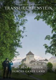
Which country in Europe has the densest network of hiking trails? It’s not the alpine classics of Switzerland or Austria, but in fact the small Principality of Liechtenstein nestling between those two countries. More than 400 kilometres of well-maintained and clearly signposted trails and majestic mountains up to 2600 metres above sea level attract walkers and hikers to Liechtenstein.
Which country in Europe has the densest network of hiking trails? It’s not the alpine classics of Switzerland or Austria, but in fact the small Principality of Liechtenstein nestling between those two countries. More than 400 kilometres of well-maintained and clearly signposted trails and majestic mountains up to 2600 metres above sea level attract walkers and hikers to Liechtenstein.

You also want an ePaper? Increase the reach of your titles
YUMPU automatically turns print PDFs into web optimized ePapers that Google loves.
30 → tourismus.li/hik<strong>in</strong>g<br />
HIKING TRAIL<br />
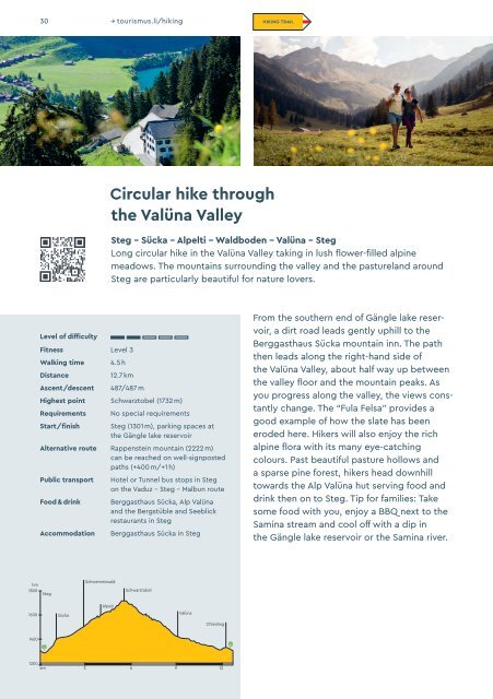
Circular hike through<br />
the Valüna Valley<br />
Steg – Sücka – Alpelti – Waldboden – Valüna – Steg<br />
Long circular hike <strong>in</strong> the Valüna Valley tak<strong>in</strong>g <strong>in</strong> lush flower-filled alp<strong>in</strong>e<br />
meadows. The mounta<strong>in</strong>s surround<strong>in</strong>g the valley and the pastureland around<br />
Steg are particularly beautiful for nature lovers.<br />
Level of difficulty<br />
Fitness Level 3<br />
Walk<strong>in</strong>g time<br />
Distance<br />
Ascent/descent<br />
4.5 h<br />
12.7 km<br />
487/487 m<br />
Highest po<strong>in</strong>t Schwarztobel (1732 m)<br />
Requirements<br />
Start/f<strong>in</strong>ish<br />
No special requirements<br />
Steg (1301 m), park<strong>in</strong>g spaces at<br />
the Gängle lake reservoir<br />
Alternative route Rappenste<strong>in</strong> mounta<strong>in</strong> (2222 m)<br />
can be reached on well-signposted<br />
paths (+400 m/+1 h)<br />
Public transport<br />
Food & dr<strong>in</strong>k<br />
Accommodation<br />
Hotel or Tunnel bus stops <strong>in</strong> Steg<br />
on the Vaduz – Steg – Malbun route<br />
Berggasthaus Sücka, Alp Valüna<br />
and the Bergstüble and Seeblick<br />
restaurants <strong>in</strong> Steg<br />
Berggasthaus Sücka <strong>in</strong> Steg<br />
From the southern end of Gängle lake reservoir,<br />
a dirt road leads gently uphill to the<br />
Berggasthaus Sücka mounta<strong>in</strong> <strong>in</strong>n. The path<br />
then leads along the right-hand side of<br />
the Valüna Valley, about half way up between<br />
the valley floor and the mounta<strong>in</strong> peaks. As<br />
you progress along the valley, the views constantly<br />
change. The “Fula Felsa” provides a<br />
good example of how the slate has been<br />
eroded here. Hikers will also enjoy the rich<br />
alp<strong>in</strong>e flora with its many eye-catch<strong>in</strong>g<br />
colours. Past beautiful pasture hollows and<br />
a sparse p<strong>in</strong>e forest, hikers head downhill<br />
towards the Alp Valüna hut serv<strong>in</strong>g food and<br />
dr<strong>in</strong>k then on to Steg. Tip for families: Take<br />
some food with you, enjoy a BBQ next to the<br />
Sam<strong>in</strong>a stream and cool off with a dip <strong>in</strong><br />
the Gängle lake reservoir or the Sam<strong>in</strong>a river.<br />
hm<br />
1800<br />
Steg<br />
Schwemmiwald<br />
Schwarztobel<br />
Alpeti<br />
1600<br />
Sücka<br />
Valüna<br />
Chleisteg<br />
1400<br />
1200<br />
km 3 6 9 12