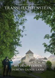
Princely Hikes in Liechtenstein
Which country in Europe has the densest network of hiking trails? It’s not the alpine classics of Switzerland or Austria, but in fact the small Principality of Liechtenstein nestling between those two countries. More than 400 kilometres of well-maintained and clearly signposted trails and majestic mountains up to 2600 metres above sea level attract walkers and hikers to Liechtenstein.
Which country in Europe has the densest network of hiking trails? It’s not the alpine classics of Switzerland or Austria, but in fact the small Principality of Liechtenstein nestling between those two countries. More than 400 kilometres of well-maintained and clearly signposted trails and majestic mountains up to 2600 metres above sea level attract walkers and hikers to Liechtenstein.

Create successful ePaper yourself
Turn your PDF publications into a flip-book with our unique Google optimized e-Paper software.
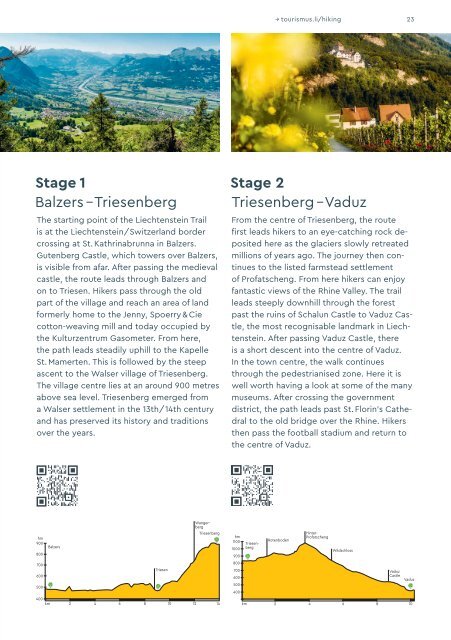
→ tourismus.li/hik<strong>in</strong>g 23<br />
Stage 1<br />
Balzers – Triesenberg<br />
The start<strong>in</strong>g po<strong>in</strong>t of the Liechtenste<strong>in</strong> Trail<br />
is at the Liechtenste<strong>in</strong>/Switzerland border<br />
cross<strong>in</strong>g at St. Kathr<strong>in</strong>abrunna <strong>in</strong> Balzers.<br />
Gutenberg Castle, which towers over Balzers,<br />
is visible from afar. After pass<strong>in</strong>g the medi eval<br />
castle, the route leads through Balzers and<br />
on to Triesen. Hikers pass through the old<br />
part of the village and reach an area of land<br />
formerly home to the Jenny, Spoerry & Cie<br />
cotton-weav<strong>in</strong>g mill and today occupied by<br />
the Kulturzentrum Gasometer. From here,<br />
the path leads steadily uphill to the Kapelle<br />
St. Mamerten. This is followed by the steep<br />
ascent to the Walser village of Triesenberg.<br />
The village centre lies at an around 900 metres<br />
above sea level. Triesenberg emerged from<br />
a Walser settlement <strong>in</strong> the 13th/14th century<br />
and has preserved its history and traditions<br />
over the years.<br />
Stage 2<br />
Triesenberg – Vaduz<br />
From the centre of Triesenberg, the route<br />
first leads hikers to an eye-catch<strong>in</strong>g rock deposited<br />
here as the glaciers slowly retreated<br />
millions of years ago. The journey then cont<strong>in</strong>ues<br />
to the listed farmstead settlement<br />
of Profatscheng. From here hikers can enjoy<br />
fantastic views of the Rh<strong>in</strong>e Valley. The trail<br />
leads steeply downhill through the forest<br />
past the ru<strong>in</strong>s of Schalun Castle to Vaduz Castle,<br />
the most recognisable landmark <strong>in</strong> Liechtenste<strong>in</strong>.<br />
After pass<strong>in</strong>g Vaduz Castle, there<br />
is a short descent <strong>in</strong>to the centre of Vaduz.<br />
In the town centre, the walk cont<strong>in</strong>ues<br />
through the pedestrianised zone. Here it is<br />
well worth hav<strong>in</strong>g a look at some of the many<br />
museums. After cross<strong>in</strong>g the government<br />
district, the path leads past St. Flor<strong>in</strong>’s Cathedral<br />
to the old bridge over the Rh<strong>in</strong>e. Hikers<br />
then pass the football stadium and return to<br />
the centre of Vaduz.<br />
hm<br />
900<br />
800<br />
700<br />
600<br />
500<br />
400<br />
Balzers<br />
Triesen<br />
Triesenberg<br />
10 12<br />
km 2 4 6 8 14<br />
hm<br />
1100<br />
1000<br />
900<br />
800<br />
700<br />
600<br />
500<br />
400<br />
Triesenberg<br />
Rotenboden<br />
Wangerberg<br />
H<strong>in</strong>ter-<br />
Profatscheng<br />
Wildschloss<br />
Vaduz<br />
Castle<br />
4<br />
6 8<br />
km 2 10<br />
Vaduz