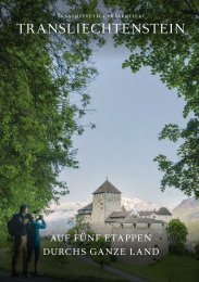
Princely Hikes in Liechtenstein
Which country in Europe has the densest network of hiking trails? It’s not the alpine classics of Switzerland or Austria, but in fact the small Principality of Liechtenstein nestling between those two countries. More than 400 kilometres of well-maintained and clearly signposted trails and majestic mountains up to 2600 metres above sea level attract walkers and hikers to Liechtenstein.
Which country in Europe has the densest network of hiking trails? It’s not the alpine classics of Switzerland or Austria, but in fact the small Principality of Liechtenstein nestling between those two countries. More than 400 kilometres of well-maintained and clearly signposted trails and majestic mountains up to 2600 metres above sea level attract walkers and hikers to Liechtenstein.

Create successful ePaper yourself
Turn your PDF publications into a flip-book with our unique Google optimized e-Paper software.
→ tourismus.li/hik<strong>in</strong>g 25<br />
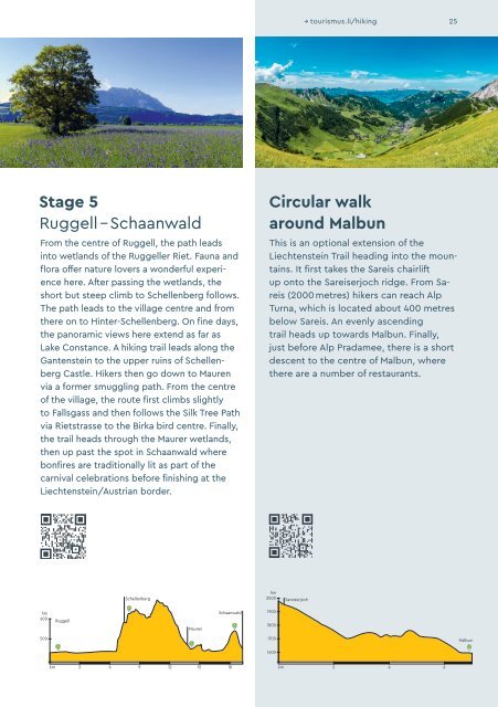
Stage 5<br />
Ruggell – Schaanwald<br />
From the centre of Ruggell, the path leads<br />
<strong>in</strong>to wetlands of the Ruggeller Riet. Fauna and<br />
flora offer nature lovers a wonderful experience<br />
here. After pass<strong>in</strong>g the wetlands, the<br />
short but steep climb to Schellenberg follows.<br />
The path leads to the village centre and from<br />
there on to H<strong>in</strong>ter-Schellenberg. On f<strong>in</strong>e days,<br />
the panoramic views here extend as far as<br />
Lake Constance. A hik<strong>in</strong>g trail leads along the<br />
Gantenste<strong>in</strong> to the upper ru<strong>in</strong>s of Schellen -<br />
berg Castle. Hikers then go down to Mauren<br />
via a former smuggl<strong>in</strong>g path. From the centre<br />
of the village, the route first climbs slightly<br />
to Fallsgass and then follows the Silk Tree Path<br />
via Rietstrasse to the Birka bird centre. F<strong>in</strong>ally,<br />
the trail heads through the Maurer wetlands,<br />
then up past the spot <strong>in</strong> Schaanwald where<br />
bonfires are traditionally lit as part of the<br />
carnival celebrations before f<strong>in</strong>ish<strong>in</strong>g at the<br />
Liechtenste<strong>in</strong>/Austrian border.<br />
Circular walk<br />
around Malbun<br />
This is an optional extension of the<br />
Liechtenste<strong>in</strong> Trail head<strong>in</strong>g <strong>in</strong>to the mounta<strong>in</strong>s.<br />
It first takes the Sareis chairlift<br />
up onto the Sareiserjoch ridge. From Sareis<br />
(2000 metres) hikers can reach Alp<br />
Turna, which is located about 400 metres<br />
below Sareis. An evenly ascend<strong>in</strong>g<br />
trail heads up towards Malbun. F<strong>in</strong>ally,<br />
just before Alp Pradamee, there is a short<br />
descent to the centre of Malbun, where<br />
there are a number of restaurants.<br />
Schellenberg<br />
hm<br />
2000<br />
Sareiserjoch<br />
hm<br />
600<br />
Ruggell<br />
Mauren<br />
Schaanwald<br />
1900<br />
1800<br />
500<br />
1700<br />
Malbun<br />
1600<br />
km 3 6 9 12 15 18<br />
km 2 4 6