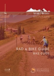
Rad & Bike Guide
Sie wollen auch ein ePaper? Erhöhen Sie die Reichweite Ihrer Titel.
YUMPU macht aus Druck-PDFs automatisch weboptimierte ePaper, die Google liebt.
RAD & BIKE GUIDE<br />
BIKE GUIDE
FÜR BIKE ENTHUSIASTEN<br />
Dieser <strong>Bike</strong> <strong>Guide</strong> mit eingeklebter<br />
<strong>Bike</strong> Karte wird dich erfreuen.<br />
Jedes einzelne Tourblatt ist perforiert,<br />
trenne deine ausgewählte Tour einfach<br />
heraus. Mit einem Gewicht von weniger<br />
als 5 Gramm wird es deine Performance<br />
nicht belasten.<br />
FOR BIKE ENTHUSIASTS<br />
This <strong>Bike</strong> <strong>Guide</strong> with a glued in <strong>Bike</strong><br />
Map will delight you.<br />
Each individual tour sheet is perforated,<br />
simply separate your selected tour.<br />
With a weight of less than 5 grams, it<br />
will not affect your performance.<br />
INHALTSVERZEICHNIS<br />
I TABLE OF CONTENS<br />
Allgemeine Information I General Information I 04-07<br />
Mountainbike Touren I Mountain <strong>Bike</strong> Tours I 09-40<br />
Trekking & E-<strong>Bike</strong> Touren I Trekking & E-<strong>Bike</strong> Tours I 41-52<br />
Freeride Trails I Freeride Trails<br />
I 53-60<br />
Rennrad Touren I Road <strong>Bike</strong> Tours<br />
I 61-70<br />
Weitere Touren I Further Tours<br />
I 71-77<br />
<strong>Rad</strong>verleih I <strong>Bike</strong> Rental<br />
I 78<br />
E-<strong>Bike</strong> Ladestationen I E-<strong>Bike</strong> Charging Stations I 79<br />
E-<strong>Bike</strong> Servicestationen I E-<strong>Bike</strong> Service Stations I 79<br />
Hütten & Jausenstationen I Mountain Huts<br />
I 80-81<br />
<strong>Bike</strong> Karte I <strong>Bike</strong> Map<br />
I 83
MTB-LEITSYSTEM I MTB-SIGNAGE SYSTEM<br />
In Österreich ist das Befahren des Waldes (z.B. auf Forstwegen,<br />
aber auch auf Almwegen) nach dem Forstgesetz verboten.<br />
Nur auf besonders ausgewiesenen Wegen, auf welchen die<br />
Wegerhalter das <strong>Rad</strong>fahren freigegeben haben, ist dies<br />
möglich.<br />
In Piesendorf Niedernsill sind die MTB-Routen mit dem<br />
„Salzburger MTB-Leitsystem“ gekennzeichnet.<br />
In Austria, driving in the forest (e.g. on forest roads, but also on<br />
alpine pastures) is prohibited under the forest act. This is only<br />
possible on specially marked paths on which the trail owners<br />
have given permission for cycling.<br />
In Piesendorf Niedernsill the MTB routes are marked with the<br />
„Salzburg MTB Guidance System“.<br />
TOUREN APP Piesendorf Niedernsill erleben<br />
Dein TOP-Begleiter in Piesendorf Niedernsill.<br />
In Sekundenschnelle kannst du Touren<br />
und Informationen abrufen!<br />
Your TOP companion in Piesendorf Niedernsill.<br />
In seconds you can get tours and information!<br />
Jetzt kostenlos erhältlich im Apple & Google Play Store!<br />
Download now for free on the Apple & Google Play Store.<br />
Mehr als 100 Touren<br />
More than 100 tours<br />
<strong>Bike</strong> Karte<br />
<strong>Bike</strong> map<br />
Offline Speicherung<br />
Offline storaging<br />
Hüttenführer<br />
Huts guide<br />
GPS-Ortung<br />
GPS tracking
SCHWIERIGKEITSGRADE I LEVELS OF DIFFICULTY<br />
Leicht<br />
Familienfreundlich<br />
Gute Fahrbahndecke<br />
Eher kurz<br />
Nicht steil (0 - 5 % Gefälle)<br />
Keine besonderen Gefahrenbereiche<br />
Easy<br />
family friendly<br />
good road surface<br />
relatively short<br />
not steep (0 - 5 % gradient)<br />
no praticular dangers<br />
Mittel<br />
Erfordert sportliches<br />
<strong>Rad</strong>fahrkönnen<br />
Fahrbahnbeschaffenheit<br />
erfordert Mountainbike<br />
Ausrüstung<br />
Mittellange Strecken<br />
Teilweise steiler (5 - 12 %<br />
Gefälle)<br />
Unübersichtliche, kurvenreiche<br />
Streckenabschnitte<br />
möglich<br />
Medium<br />
demand sporty biking skills<br />
road surface demands mountain<br />
bike equipment<br />
medium distance<br />
steeper in some places (5 - 12 %<br />
gradient)<br />
blind corners, winding passages<br />
possible<br />
5<br />
Schwer<br />
Schwierige und anspruchsvolle<br />
Strecken<br />
Steil bzw. mit steilen<br />
Abschnitten<br />
Mountainbike Ausrüstung<br />
ist obligatorisch<br />
Situationsangepasstes<br />
und vorausschauendes<br />
Fahren<br />
Difficult<br />
difficult and demanding<br />
mountain bike routes<br />
steep or steeper passages<br />
mountain bike equipment<br />
is obligatory<br />
adapt speed etc. to situation<br />
and anticipate dangerous<br />
situations
VERHALTENSREGELN<br />
Verhaltensregeln für ein problemloses Miteinander<br />
Das <strong>Bike</strong>n ist nur auf markierten und freigegebenen Routen vom 1. Mai bis 15. November<br />
in der Zeit von 2 Std. nach Sonnenaufgang und 1 Std. vor Sonnenuntergang auf<br />
eigene Gefahr gestattet.<br />
Fahre stets mit kontrollierter Geschwindigkeit und auf halbe Sicht, besonders bei<br />
Kurven, da jederzeit mit Hindernissen zu rechnen ist.<br />
Vermeide Lärm und unnötige Bremsspuren.<br />
Nimm Rücksicht auf Wanderer und Fußgänger und überhole nur im Schritttempo!<br />
Nimm Rücksicht auf den Schwierigkeitsgrad der Strecke und schätze deine Erfahrungen<br />
und dein Können als <strong>Bike</strong>r genau ein!<br />
Schütze deinen Kopf mit einem Helm und kontrolliere die Ausrüstung vor Antritt<br />
der <strong>Bike</strong>tour (Bremsen, Licht, …)!<br />
Halte dich an Absperrungen und akzeptiere, dass dieser Weg primär der land- und<br />
forstwirtschaftlichen Nutzung dient!<br />
Schließe Weidegatter und Schranken!<br />
Hinterlasse keine Abfälle!<br />
Respektiere deine Grenzen!<br />
Die Naturlandschaft Salzburgs bietet Platz für Wildtiere, Pflanzen und Menschen.<br />
Voraussetzung ist jedoch, dass du dich als Naturnutzer oder Naturnutzerin an gewisse<br />
Regeln hältst:<br />
Beachte Ruhezonen: Sie sind Rückzugsgebiete für Wildtiere und seltene Pflanzen.<br />
Bleibe im Wald auf den markierten Routen und Wegen: So können die Wildtiere<br />
sich an Wanderer und Freizeitsportler gewöhnen.<br />
Meide Waldränder und schneefreie Flächen: Sie sind die Lieblingsplätze der<br />
Wildtiere.<br />
Führe Hunde an der Leine: Wildtiere flüchten vor freilaufenden Hunden.
RULES<br />
Rules for a good cooperation<br />
Mountain biking is only allowed on marked and open routes from 1st May<br />
to 15th November and from 2 hours after sunrise and 1 hour before sunset at<br />
your own risk.<br />
Cycle always with a controlled speed and with half visibility, especially when cornering,<br />
as obstacles are always to be expected.<br />
Avoid noise and unnecessary skid marks.<br />
Be considerate of hikers and only overtake at walking pace!<br />
Be considerate of the level of difficulty of the route and assess your experience and<br />
skills as a biker exactly!<br />
Protect your head with a helmet and check your equipment before you start the bike<br />
tour (brakes, lights, …)!<br />
Stick to barriers and accept that this path is primarily for agricultural and forestry use!<br />
Close gates and barriers!<br />
Don’t leave any waste!<br />
7<br />
Respect your limits!<br />
The natural landscape of Salzburg provides space form wild animals,<br />
plants and people.<br />
It is essential for this that you stick to certain rules:<br />
Respect the quit areas: the areas are a retreat for wild animals and rare plants.<br />
Stick to the marked routes and paths in the forest. This allow wild animals to<br />
get used to hikers and sportspeople.<br />
Avoid the edges of forests and snow-free spots: they are wild animals’ favorite<br />
places.<br />
Keep dogs on a lead: wild animals flee from dogs roaming off leads.
MOUNTAINBIKE TOUREN<br />
MOUNTAIN BIKE TOURS
MOUNTAINBIKE TOUREN<br />
MOUNTAIN BIKE TOURS<br />
10 D I Hochsonnbergrunde | mittel I medium I 11<br />
9C I Schaunbergalm Mühlbachtal | mittel I medium I 13<br />
9D I Klingler Törl - Hacklbergalm | schwer I difficult I 15<br />
9A,10A I Hochprackrunde | mittel I medium I 17<br />
8C, 8G I Sonnberg Rundtour | mittel I medium I 19<br />
9B, 10E I Schattbergrunde | mittel I medium I 21<br />
8H I Uttendorfer Hochsonnbergalm | mittel I medium I 23<br />
17A I Hundstein | schwer I difficult I 25<br />
17 C I Enzianhütte | mittel I medium I 27<br />
17 K I Erlhofplatte | mittel I medium I 29<br />
11D I Maiskogel | mittel I medium I 31<br />
11G I Glocknerblick - Unterbergalm | mittel I medium I 33<br />
11J I Kitzsteinhorn | schwer I difficult I 35<br />
12 E I Erlhofalm | schwer I difficult I 37<br />
12 F I Bruckerberg Seeblickrunde | mittel I medium I 39
10D I Hochsonnbergrunde<br />
11<br />
S<br />
N<br />
Fahrtrichtung<br />
Driving direction<br />
Start<br />
Berggasthof, Alm<br />
Mountain restaurant, Hut
10D I Hochsonnbergrunde<br />
Vom Dorfplatz dem <strong>Rad</strong>weg entlang der Bundesstraße bis<br />
zur Walcher Kirche folgen. Nach der Kirche rechts abbiegen<br />
und bergauf über Skiliftstraße und Rohrerberg in Richtung<br />
Jausenstation Naglbauer. Bei der letzten Kehre vor der Jausenstation<br />
rechts halten und weiter bis zum Mittereckbauer. Ab<br />
hier beginnt der Forstweg, der Kehre um Kehre zur Hochsonnbergalm<br />
(10B) führt. Kurz vor der Alm rechts abzweigen<br />
und über den Höhenweg gehts bis zur Pinzgauer Hütte. Über<br />
Forstweg (10C) und Wengerberg retour zum Ausgangspunkt.<br />
Variante: Hochsonnbergalm (1.841 m) 10B -> siehe Seite 73<br />
Variante: Pinzgauer Hütte (1.700 m) 10C -> siehe Seite 73<br />
From the village square follow the cycle path along the main<br />
road to the church of Walchen. After the church turn right and<br />
ride uphill along the Skiliftstraße and Rohrerberg in direction of<br />
Jausenstation Naglbauer. Keep right at the last bend before the<br />
Jausenstation and continue to the farm Mittereck. From here the<br />
forest road begins, which leads bend by bend to the Hochsonnbergalm<br />
(10B). Shortly before the Hochsonnbergalm turn right<br />
and follow the high trail to the Pinzgauer Hütte. Return via the<br />
forest path (10C) and Wengerberg back to the starting point.<br />
Variant: Hochsonnbergalm (1,841 m) 10B -> see page 73<br />
Variant: Pinzgauer Hütte (1,700 m) 10C -> see page 73<br />
Start: Piesendorf<br />
Ziel: Piesendorf<br />
Destination: Piesendorf
S<br />
Fahrtrichtung<br />
Driving direction<br />
Start<br />
Berggasthof, Alm<br />
Mountain restaurant, Hut<br />
N<br />
9C I Schaunbergalm Mühlbachtal<br />
13
9C I Schaunbergalm Mühlbachtal<br />
Vom Ausgangspunkt bergwärts über Dorfstraße, Schattbergstraße<br />
und Winklmannweg bis zum Schranken. Weiter<br />
entlang der Forststraße bis zur Schaunbergalm auf 1.519 m.<br />
Der Rückweg erfolgt über dieselbe Strecke.<br />
From the starting point cycle upwards the Dorfstraße,<br />
Schattbergstraße and Winklmannweg to the gate. From there<br />
follow the forest road to the Schaunbergalm at 1,519 m.<br />
The way back is via the same route.<br />
Start: Niedernsill<br />
Ziel: Schaunbergalm (1.519 m)<br />
Destination: Schaunbergalm
S<br />
Fahrtrichtung<br />
Driving direction<br />
Start<br />
Berggasthof, Alm<br />
Mountain restaurant, Hut<br />
N<br />
9D I Klingler Törl - Hacklbergalm<br />
15
9D I Klingler Törl - Hacklbergalm<br />
Vom Ausgangspunkt über die Salzachbrücke in Richtung<br />
Bundesstraße und durch die Unterführung in die Steindorfer<br />
Straße. Weiter über Gaisbichl bis Hochprack. Am Schranken<br />
vorbei, bei der ersten Weggabelung links abbiegen und der<br />
Forststraße bis kurz vor die Hochsonnberg Hütte folgen.<br />
Rechts halten und dem Klingler Törl Trail, übers Klingler Törl,<br />
vorbei an den Hacklberger Seen bis zur Hacklbergalm folgen.<br />
Für den Rückweg stehen 2 Varianten zur Auswahl:<br />
Var. 1: über dieselbe Route zurück<br />
Var. 2: als Rundtour - über Saalbach Hinterglemm, Maishofen<br />
und Zell am See retour nach Niedernsill -> siehe Seite 73<br />
From the starting point, cross the Salzach bridge in the direction<br />
of the main road and through the underpass into<br />
Steindorfer Straße. Continue via Gaisbichl to Hochprack.<br />
Pass the gate, turn left at the first fork and follow the forest<br />
road until shortly before the Hochsonnberg Hütte. Keep<br />
right and follow the Klingler Törl Trail, over the Klingler<br />
Törl and past the Hacklberg lakes to the Hacklbergalm.<br />
There are 2 options available for the way back:<br />
1 st option: via the same route back<br />
2 nd option: as a round tour - via Saalbach Hinterglemm, Maishofen<br />
and Zell am See back to Niedernsill -> see page 73<br />
Start: Niedernsill<br />
Ziel: Hacklbergalm (1.746 m)<br />
Destination: Hacklbergalm
9A, 10A I Hochprackrunde<br />
17<br />
S<br />
N<br />
Fahrtrichtung<br />
Driving direction<br />
Start<br />
Berggasthof, Alm<br />
Mountain restaurant, Hut
9A, 10A I Hochprackrunde<br />
Vom Ausgangspunkt über die Salzachbrücke in Richtung<br />
Bundesstraße und durch die Unterführung in die Steindorfer<br />
Straße. Weiter über Gaisbichl bis Hochprack. Am Schranken<br />
vorbei, bei der Weggabelung geradeaus und der Forststraße<br />
bis Röderlehen folgen. Von hier talwärts über Rohrerberg,<br />
vorbei an der Jausenstation Naglbauer, nach Walchen und<br />
übern Tauernradweg gehts wieder retour zum Startpunkt.<br />
Die Rundtour kann auch in umgekehrter Richtung befahren<br />
werden.<br />
Verkürzte Variante: über Gaisbichl - Gitschen - Naglbauer -<br />
Walchen (siehe <strong>Bike</strong> Karte)<br />
From the starting point, cross the Salzach bridge in the<br />
direction of the main road and through the underpass into<br />
Steindorfer Straße. Continue via Gaisbichl to Hochprack. Pass<br />
the gate, straight ahead at the junction and follow the forest<br />
path until Röderlehen. Form here downhill via Rohrerberg,<br />
past the Jausenstation Naglbauer, to Walchen. Along the<br />
Tauern Cycle Path return to the starting point in Niedernsill.<br />
The round tour can also be cycled in the opposite direction.<br />
Short Variant: via Gaisbichl - Gitschen - Naglbauer - Walchen<br />
(see bike map)<br />
Start: Niedernsill<br />
Ziel: Niedernsill<br />
Destination: Niedernsill
8C, 8G I Sonnberg Rundtour<br />
19<br />
S<br />
N<br />
Fahrtrichtung<br />
Driving direction<br />
Start<br />
Berggasthof, Alm<br />
Mountain restaurant, Hut
8C, 8G I Sonnberg Rundtour<br />
Vom Ausgangspunkt dem gut beschilderten Tauernradweg<br />
bis ins Dorfzentrum Uttendorf folgen. Vor der Dorfbrücke<br />
(Scharler‘s Boutique Hotel) rechts abbiegen und bergwärts bis<br />
zur zweiten Weggabelung. Hier wieder rechts und über die<br />
Sonnbergstraße in Richtung Pölsen. Nach der dritten Brücke<br />
rechts abbiegen und bergab bis kurz nach einem Bauernhof.<br />
Hier von der asphaltierten Straße auf den Feldweg (rechts)<br />
wechseln. Über diesen bis zum Bauernhof „Hacklberg“ und<br />
weiter talwärts auf der asphaltierten Straße bis Lengdorf.<br />
Die Rundtour kann auch in umgekehrter Richtung befahren<br />
werden.<br />
From the starting point, follow the well-marked Tauern Cycle<br />
Path to the centre of the village of Uttendorf. Turn right<br />
before the village bridge (at Scharler‘s Boutique Hotel) and<br />
continue uphill to the second fork in the road. Turn right<br />
again and follow the Sonnbergstraße in the direction of Pölsen.<br />
After the third bridge turn right and downhill until<br />
shortly after the farm. Here change from the asphalt road<br />
to the meadow path (right). Follow the path to „Hacklberg“<br />
farm and continue downhill on the asphalt road to Lengdorf.<br />
The round tour can also be cycled in the opposite direction.<br />
Start: Lengdorf<br />
Ziel: Lengdorf<br />
Destination: Lengdorf
9B, 10 E I Schattbergrunde<br />
21<br />
S<br />
N<br />
Fahrtrichtung<br />
Driving direction<br />
Start<br />
Berggasthof, Alm<br />
Mountain restaurant, Hut
9B, 10 E I Schattbergrunde<br />
Vom Startpunkt bergwärts der Hummersdorfer Straße,<br />
vorbei am Bauernhof „Bam“ bis zum Bauernhof „Unterholz“<br />
folgen. Über den beschilderten Mountainbike Weg bis zur<br />
Jausenstation Burgeck in Niedernsill. Weiter talwärts auf der<br />
Schattbergstraße und Dorfstraße bis zum Tourismusverband.<br />
Der Tauernradweg führt wieder retour zum Dietlgut.<br />
Die Rundtour kann auch in umgekehrter Richtung befahren<br />
werden.<br />
From the starting point uphill on the Hummersdorfer Straße,<br />
past the farm „Bam“ to the farm „Unterholz“. Follow<br />
the well-marked mountain bike path to the Jausenstation<br />
Burgeck in Niedernsill. Further downhill on the Schattbergstraße<br />
and Dorfstraße to the tourist office. Continue via<br />
the Tauern Cycle Path back to the Jausenstation Dietlgut.<br />
The round tour can also be cycled in the opposite direction.<br />
Start: Dietlgut (Hummersdorf)<br />
Ziel: Dietlgut (Hummersdorf)<br />
Destination: Dietlgut (Hummersdorf)
S<br />
Fahrtrichtung<br />
Driving direction<br />
Start<br />
Berggasthof, Alm<br />
Mountain restaurant, Hut<br />
N<br />
8H I Uttendorfer Hochsonnbergalm<br />
23
8H I Uttendorfer Hochsonnbergalm<br />
Vom Scharler‘s Boutique Hotel im Ortszentrum bergwärts der<br />
Dorfbachstraße bis zur zweiten Weggabelung folgen. Rechts<br />
abbiegen und über die Sonnbergstraße bis zur Brücke. Vor<br />
der Brücke links abbiegen, vorbei am Keltendorf Stoanabichl<br />
und weiter bis zum Alpengasthof Liebenberg. Am Schranken<br />
vorbei und der Forststraße bis zur Hochsonnbergalm folgen.<br />
Der Rückweg erfolgt über dieselbe Route.<br />
From Scharler‘s Boutique Hotel in the centre of the village<br />
follow the Dorfbachstraße upwards to the second junction.<br />
Turn right and ride along the Sonnbergstraße to the bridge.<br />
Before the bridge turn left, pass the Celtic Museum Stoanabichl<br />
and continue to Alpengasthof Liebenberg. Pass the barrier and<br />
follow the forest road to the Hochsonnbergalm at 1,925 m.<br />
The way back is via the same route.<br />
Start: Uttendorf<br />
Ziel: Hochsonnbergalm (1.925 m)<br />
Destination: Hochsonnbergalm
17A I Hundstein<br />
25<br />
S<br />
N<br />
Fahrtrichtung<br />
Driving direction<br />
Start<br />
Berggasthof, Alm<br />
Mountain restaurant, Hut
17A I Hundstein<br />
Vom Startpunkt über Erlbergweg in Richtung Enzianhütte<br />
radeln. Nach ca. 4 km weiter auf dem Schotterweg,<br />
vorbei an der Enzianhütte bis zur Erlhofplatte. Hier links<br />
halten und der Beschilderung steil bergauf in Richtung<br />
Hundstein bis nach einem Brunnen, wo der Forstweg merklich<br />
abflacht, folgen. Nach der Kurve, von der man den<br />
Gipfel sieht, beginnt die Single Trail-Passage. Vorsicht:<br />
technisch sehr anspruchsvoll! Auf diesem umrundet man<br />
den Berg und kommt zum Forstweg, der von Maria Alm<br />
hochführt. Diesem bergwärts bis zum Statzerhaus folgen.<br />
Der Rückweg erfolgt über dieselbe Route. Eine Abfahrt nach<br />
Maria Alm oder Bruck ist ebenfalls möglich.<br />
From the starting point cycle along Erlbergweg towards<br />
Enzianhütte. After about 4 km continue on the gravel path,<br />
past the Enzianhütte to the Erlhofplatte. Keep left and follow<br />
the signs steeply upwards in the direction of Hundstein until<br />
after a waterwell, where the forest road flattens out. After the<br />
bend, from which you can see the summit, the single trail passage<br />
begins. Caution: technically very demanding! On this trail you<br />
circle the mountain and come to the forest road which leads<br />
up from Maria Alm. Follow the road uphill to the Statzerhaus.<br />
The way back is via the same route. A descent to Maria Alm or<br />
Bruck is also possible.<br />
Start: Thumersbach<br />
Ziel: Statzerhaus - Hundstein (2.117 m)<br />
Destination: Statzerhaus - Hundstein
17C I Enzianhütte<br />
27<br />
S<br />
N<br />
Fahrtrichtung<br />
Driving direction<br />
Start<br />
Berggasthof, Alm<br />
Mountain restaurant, Hut
17C I Enzianhütte<br />
Von Thumersbach bergwärts der Talstraße bis zum Gasthof<br />
Waldheim folgen. Kurz danach rechts abbiegen und bergauf<br />
bis zur fünften Kehre (Abzweigung Enzianhütte) radeln. Ab<br />
hier über den markierten Weg bis zur Enzianhütte (1.300 m).<br />
Talwärts über Erlbergweg und retour zum Ausgangspunkt.<br />
Die Rundtour kann auch in umgekehrter Richtung befahren<br />
werden.<br />
From Thumersbach follow the Talstraße upwards to the<br />
Gasthof Waldheim. Shortly afterwards turn right and ride<br />
uphill to the fifth bend (junction Enzianhütte). From here take<br />
the marked path to the Enzianhütte (1,300 m). Now follow<br />
the Erlbergweg downhill and cycle back to the starting point.<br />
The round tour can also be cycled in the opposite direction.<br />
Start: Thumersbach<br />
Ziel: Thumersbach<br />
Destination: Thumersbach
17K I Erlhofplatte<br />
Fahrtrichtung<br />
Driving direction<br />
Start<br />
Berggasthof, Alm<br />
Mountain restaurant, Hut<br />
S<br />
N<br />
29
17K I Erlhofplatte<br />
Vom Ausgangspunkt in Richtung Gasthof Lukashansl und<br />
gleich nach der Brücke rechts abbiegen. Kurz danach links<br />
weiter, die Tour steigt in Richtung Taxhof und Erlhofplatte<br />
an. Der Beschilderung 12A bis zur Abzweigung Hundstein<br />
folgen. Vom höchsten Punkt der Tour talwärts, vorbei am<br />
Bauernhof „Ronachbauer“ bis zur Enzianhütte und weiter<br />
talwärts nach Thumersbach. Entlang vom Zeller See in<br />
südliche Richtung wieder retour zum Startpunkt in Bruck.<br />
Die Rundtour kann auch in umgekehrte Richtung befahren<br />
werden.<br />
From the starting point ride in the direction of Gasthof<br />
Lukashansl, immediately after the bridge turn right. Shortly<br />
after, turn left and continue upwards towards Taxhof<br />
and Erlhofplatte. Follow the signs 12A to the Hundstein<br />
junction. Downhill from the highest point of the tour,<br />
pass the farm „Ronachbauer“ to the Enzianhütte and<br />
further down to Thumersbach. Along the lake Zell in<br />
southern direction cycle back to the starting point in Bruck.<br />
The round tour can also be cycled in the opposite direction.<br />
Start: Bruck<br />
Ziel: Bruck<br />
Destination: Bruck
11D I Maiskogel<br />
31<br />
S<br />
N<br />
Fahrtrichtung<br />
Driving direction<br />
Start<br />
Berggasthof, Alm<br />
Mountain restaurant, Hut
11D I Maiskogel<br />
Von der MK Maiskogelbahn dem <strong>Rad</strong>weg durch den Tunnel<br />
bis zur Abzweigung Schaufelbergstraße folgen. Rechts<br />
abbiegen und bergwärts, vorbei an der Jausenstation Unteraigen<br />
in Richtung Stangerbauer. Kurz davor wieder rechts<br />
abbiegen und über den Maiskogelweg, vorbei an der Mittelstation<br />
der Gondelbahn weiter bis zur Maiskogel Alm Ranch.<br />
Der Rückweg erfolgt über dieselbe Route.<br />
From the MK Maiskogel cable car, follow the cycle path<br />
through the tunnel to the junction of the Schaufelbergstraße.<br />
Turn right and cycle upwards past the Jausenstation<br />
Unteraigen in the direction of Stangerbauer. Shortly<br />
before, turn right again and cycle along Maiskogelweg, past<br />
the mid-station of the cable car to the Maiskogel Alm Ranch.<br />
The way back is via the same route.<br />
Start: MK Maiskogelbahn<br />
Ziel: Maiskogel Alm Ranch (1.544 m)<br />
Destination: Maiskogel Alm Ranch
11G I Glocknerblick - Unterbergalm<br />
33<br />
S<br />
N<br />
Fahrtrichtung<br />
Driving direction<br />
Start<br />
Berggasthof, Alm<br />
Mountain restaurant, Hut
11G I Glocknerblick - Unterbergalm<br />
Von der MK Maiskogelbahn dem <strong>Rad</strong>weg durch den Tunnel<br />
bis zur Abzweigung Schaufelbergstraße folgen. Rechts abbiegen<br />
und bergwärts, vorbei an der Jausenstation Unteraigen in<br />
Richtung Stangerbauer. Bei der letzten Kehre an der rechten<br />
Seite den Schranken passieren und dem gut markierten Weg<br />
bis zur Saulochalm folgen. Ca. 50 m nach der Alm entweder<br />
rechts weiter zur Unterbergalm (1.562 m - ca. 1,5 km) oder links<br />
weiter zum Alpengasthaus Glocknerblick (1.659 m - ca. 1 km).<br />
Der Rückweg erfolgt über dieselbe Route oder über Weg Nr.<br />
11D, vorbei an der Maiskogel Alm Ranch.<br />
From the MK Maiskogel cable car, follow the cycle path<br />
through the tunnel to the junction of the Schaufelbergstraße.<br />
Turn right and cycle upwards past the Jausenstation<br />
Unteraigen in the direction of Stangerbauer. At the last bend<br />
on the right side pass the barrier and follow the well-marked<br />
path to the Saulochalm. About 50 m after the hut turn<br />
right to the Unterbergalm (1,562 m - approx. 1.5 km) or turn<br />
left to Alpengasthaus Glocknerblick (1,659 m - approx. 1 km).<br />
The way back is via the same route or via the path no. 11D, past<br />
the Maiskogel Alm Ranch.<br />
Start: MK Maiskogelbahn<br />
Ziel: Glocknerblick, Unterbergalm<br />
Destination: Glocknerblick, Unterbergalm
S<br />
Fahrtrichtung<br />
Driving direction<br />
Start<br />
Berggasthof, Alm<br />
Mountain restaurant, Hut<br />
N<br />
11J I Kitzsteinhorn<br />
35
11J I Kitzsteinhorn<br />
Von der MK Maiskogelbahn dem <strong>Rad</strong>weg durch den<br />
Tunnel bis zur Abzweigung Schaufelbergstraße folgen.<br />
Rechts abbiegen und bergwärts, vorbei an der Jausenstation<br />
Unteraigen in Richtung Stangerbauer. Bei der letzten<br />
Kehre an der rechten Seite den Schranken passieren und<br />
dem gut markierten Weg bis zur Bergstation der Gondelbahn<br />
folgen. Weiter zur Maiskogel Alm Ranch, von hier kurz<br />
bergab zur urigen Ederalm auf 1.420 m. Danach steigt der<br />
Weg, dieser führt vorbei an der Salzburger Hütte und über<br />
Langwiedboden bergauf bis zum Alpincenter auf 2.450 m.<br />
Der Rückweg erfolgt über dieselbe Strecke. Talfahrt mit der<br />
Gondelbahn ebenso möglich!<br />
From the MK Maiskogel cable car, follow the cycle path through<br />
the tunnel to the junction of the Schaufelbergstraße. Turn right<br />
and cycle upwards past the Jausenstation Unteraigen in the<br />
direction of Stangerbauer. At the last bend on the right pass<br />
the barrier and follow the well-marked path to the mountain<br />
station of the cable car. Continue to the Maiskogel Alm Ranch,<br />
from here begins a short downhill to the Ederalm at 1,420 m.<br />
Then the path leads upwards, pass the Salzburger Hütte and over<br />
Langwiedboden to the Alpincenter at 2,450 m above sea level.<br />
The way back is via the same route. A descent with the cable car<br />
is also possible.<br />
Start: MK Maiskogelbahn<br />
Ziel: Alpincenter Kitzsteinhorn (2.450 m)<br />
Destination: Alpincenter Kitzsteinhorn
S<br />
Fahrtrichtung<br />
Driving direction<br />
Start<br />
Berggasthof, Alm<br />
Mountain restaurant, Hut<br />
N<br />
12E I Erlhofalm<br />
37
12E I Erlhofalm<br />
Von Bruck dem gut beschilderten Tauernradweg in<br />
Richtung Taxenbach folgen. Nach ca. 3 km bei Niederhof<br />
rechts abbiegen. Ab hier Kehre um Kehre und entlang<br />
der Beschilderung stets bergauf bis zur Erlhofalm.<br />
Der Rückweg erfolgt über dieselbe Route.<br />
From Bruck follow the well-marked Tauern Cycle Path<br />
in the direction of Taxenbach. After about 3 kilometres<br />
turn right at Niederhof. From here, the path continues uphill,<br />
bend after bend and along the signs to the Erlhofalm.<br />
The way back is via the same route.<br />
Start: Bruck<br />
Ziel: Erlhofalm (1.653 m)<br />
Destination: Erlhofalm<br />
Nicht bewirtschaftet I not managed
S<br />
Fahrtrichtung<br />
Driving direction<br />
Start<br />
Berggasthof, Alm<br />
Mountain restaurant, Hut<br />
N<br />
12 F I Bruckerberg Seeblickrunde<br />
39
12 F I Bruckerberg Seeblickrunde<br />
Vom Startpunkt für ca. 1 km der Glocknerstraße Richtung<br />
Fusch folgen. Bei Straßenkilometer 1,3 (zwischen den<br />
Häusern) rechts abbiegen und bergwärts entlang der Beschilderung<br />
Richtung Bruckerberg. Nach wenigen Metern<br />
beginnt die Schotterstraße, über diese bei gleichmäßiger<br />
Steigung bis zum höchsten Punkt der Tour. Von der Abzweigung<br />
Reiteralm kurz bergab, den Wachtbergbach überqueren<br />
und nochmals gut 100 hm bergauf. Über den kurzen<br />
technisch nicht ganz einfachen Single Trail weiter talwärts<br />
zur Ponyhofalm und über den Güterweg nach Judendorf.<br />
Dem <strong>Rad</strong>weg talauswärts zum Ausgangspunkt folgen.<br />
From the starting point follow the Glocknerstraße for about<br />
1 km in the direction of Fusch. At road kilometre 1.3 (between the<br />
houses) turn right and cycle upwards along the mountain bike<br />
signs towards Bruckerberg. After a few metres the gravel road<br />
begins, over this road you cycle on a steady ascent to the<br />
highest point of the tour. From the Reiteralm turn-off, it‘s a<br />
short descent and over the Wachtbergbach (stream), then you<br />
cycle another 100 m uphill. From here downhill over the short,<br />
technically not very easy single trail to the Ponyhofalm and on<br />
to Judendorf. Along the cycle path back to the starting point.<br />
Start: Bruck<br />
Ziel: Bruck<br />
Destination: Bruck
12 F I Bruckerberg Seeblickrunde<br />
5<br />
TREKKING & E-BIKE TOUREN<br />
TREKKING & E-BIKE TOURS
TREKKING & E-BIKE TOUREN<br />
TREKKING & E-BIKE TOURS<br />
E3<br />
E4<br />
8D<br />
11C<br />
E 1<br />
I Tauernradweg Salzachtal | leicht I easy I 43<br />
I Tauernradweg Saalachtal | leicht I easy I 45<br />
I Panoramastraße Stubachtal | mittel I medium I 47<br />
I Kesselfall | leicht I easy I 49<br />
I Zeller Seerunde | leicht I easy I 51
E3 I Tauernradweg Salzachtal<br />
43<br />
S<br />
N<br />
Fahrtrichtung<br />
Driving direction<br />
Start<br />
Berggasthof, Alm<br />
Mountain restaurant, Hut
E3 I Tauernradweg Salzachtal<br />
Ausgangspunkt der Tour sind die Krimmler Wasserfälle,<br />
denn das ist eine einfachere Variante, da die Tour bergab<br />
verläuft. Von hier dem gut beschilderten Tauernradweg<br />
entlang der Salzach, durch die vielen Ortschaften des<br />
Oberpinzgaues wie z.B. Bramberg, Mittersill, Niedernsill,<br />
Piesendorf bis Bruck an der Glocknerstraße folgen. Die Tour<br />
führt weiter über Taxenbach, Werfen, Golling bis nach Salzburg.<br />
Auf dem <strong>Rad</strong>weg kommt man an vielen beeindruckenden<br />
Sehenswürdigkeiten vorbei, die zum Bestaunen einladen.<br />
Den Tauernradweg kann man in Etappen und von jedem Ort<br />
aus fahren. Eine Weiterfahrt nach Passau ist möglich!<br />
Starting point of the tour are the Krimml Waterfalls, because<br />
this is an easier variant, as the tour runs downhill. From<br />
here follow the well-marked Tauern Cycle Path along the<br />
Salzach, through the many villages of the Oberpinzgau such<br />
as Bramberg, Mittersill, Niedernsill, Piesendorf to Bruck<br />
an der Glocknerstraße. The tour continues via Taxenbach,<br />
Werfen, Golling to Salzburg. On the cycle path you will pass<br />
many impressive sights which invites you to marvel at them.<br />
The Tauern Cycle Path can be cycled in stages and from any<br />
village. It is also possible to continue on to Passau.<br />
Start: Krimml<br />
Ziel: Salzburg<br />
Destination: Salzburg
5<br />
45<br />
Fahrtrichtung<br />
Driving direction<br />
Start<br />
S<br />
Berggasthof, Alm<br />
Mountain restaurant, Hut<br />
N<br />
E4 I Tauernradweg Saalachtal
E4 I Tauernradweg Saalachtal<br />
Die Tour startet in Niedernsill und führt entlang am gut<br />
markierten Tauernradweg über Kaprun bis Bruck an der<br />
Glocknerstraße und von hier Richtung Schüttdorf, durch die<br />
Porsche Allee und an der Seepromenade bis zum Yachthafen<br />
am Zeller See. Links abbiegen und dem Straßenverlauf,<br />
vorbei am Schloß Prielau, durch Maishofen und über Gerling<br />
bis Saalfelden folgen. Ab hier verläuft der Tauernradweg entlang<br />
der Saalach durch die Orte Weißbach, St. Martin, Lofer,<br />
über das „Kleine Deutsche Eck“ und Großgmain bis Salzburg.<br />
Den Tauernradweg kann man in Etappen und von jedem Ort<br />
aus fahren. Eine Weiterfahrt nach Passau ist möglich!<br />
The tour starts in Niedernsill and leads along the<br />
well-marked Tauern Cycle Path via Kaprun to Bruck an der<br />
Glocknerstraße and from here towards Schüttdorf, through<br />
the Porsche Allee and along the lakeside promenade to the<br />
marina at lake Zell. Turn left and follow the road, past<br />
the Prielau Castle, through Maishofen and via Gerling to<br />
Saalfelden. From here the cycle path runs along the Saalach<br />
river through the villages of Weißbach, St. Martin, Lofer,<br />
via the „Kleines Deutsche Eck“ and Großgmain to Salzburg.<br />
The Tauern Cycle Path can be cycled in stages and from any<br />
village. It is also possible to continue on to Passau.<br />
Start: Niedernsill<br />
Ziel: Salzburg<br />
Destination: Salzburg
5<br />
47<br />
Fahrtrichtung<br />
Driving direction<br />
Start<br />
S<br />
Berggasthof, Alm<br />
Mountain restaurant, Hut<br />
N<br />
8D I Panoramastraße Stubachtal
8D I Panoramastraße Stubachtal<br />
Vom Ausgangspunkt entlang der Stubachstraße ins<br />
Stubachtal bis zur Schneiderau folgen. Ab hier beginnt<br />
der anspruchsvollere Teil der Tour. Kehre um Kehre<br />
gehts über die Panoramastraße bis zum Enzingerboden.<br />
Der Rückweg erfolgt über dieselbe Route.<br />
Hinweis! Die Panoramastraße Stubachtal ist auch eine sehr<br />
beliebte Tour für Rennradfahrer.<br />
From the starting point follow the Stubachstraße into the<br />
Stubachtal until you reach the Schneiderau. From here<br />
the more demanding part of the tour begins. Bend after<br />
bend you follow the panorama road to the Enzingerboden.<br />
The way back is via the same route.<br />
Notice! The panorama road Stubachtal is also a very popular<br />
tour for racing cyclist.<br />
Start: Uttendorf<br />
Ziel: Enzingerboden (1.468 m)<br />
Destination: Enzingerboden
5<br />
49<br />
Fahrtrichtung<br />
Driving direction<br />
Start<br />
S<br />
Berggasthof, Alm<br />
Mountain restaurant, Hut<br />
N<br />
11C I Kesselfall
11C I Kesselfall<br />
Von der Talstation der MK Maiskogelbahn dem <strong>Rad</strong>weg<br />
durch den Tunnel, entlang vom Wiesenweg bis zur Pichelbrücke<br />
und weiter zur Nindlbrücke folgen. Links in die<br />
Nikolaus Gassner Straße einbiegen, vorbei am Gasthof zur<br />
Mühle und am Hotel Falkenstein. An der Kreuzung über die<br />
Kesselfallstraße bis zur Villa Burg und in den Klammweg<br />
abbiegen. Nun gehts bergauf, über die Belinsky-Brücke und<br />
vorbei an der Sigmund-Thun-Klamm bis zum Klammsee.<br />
Über den Uferweg bis zur Aubrücke. Diese überqueren<br />
und rechts dem taleinwärts führenden <strong>Rad</strong>weg, an der<br />
Gletscherbahn vorbei, bis zum Alpenhaus Kesselfall folgen.<br />
Der Rückweg erfolgt über dieselbe Route.<br />
From the valley station of the MK Maiskogel cable car follow<br />
the cycle path through the tunnel, along the Wiesenweg<br />
to the Pichel bridge and further to the Nindl bridge. Turn left<br />
into Nikolaus Gassner Straße, past Gasthof zur Mühle and<br />
Hotel Falkenstein. At the crossroads along the Kesselfallstraße<br />
to Villa Burg and turn into Klammweg. Now cycle uphill,<br />
over the Belinsky bridge and past the Sigmund-Thun gorge to<br />
the Klammsee. Follow the Uferstraße to the Au bridge. Cross<br />
the bridge and turn right onto the cycle path into the valley,<br />
past the glacier cable car and onto Alpenhaus Kesselfall.<br />
The way back is via the same route.<br />
Start: MK Maiskogelbahn<br />
Ziel: Alpengasthaus Kesselfall (1.034 m)<br />
Destination: Alpengasthaus Kesselfall
5<br />
51<br />
Fahrtrichtung<br />
Driving direction<br />
Start<br />
S<br />
Berggasthof, Alm<br />
Mountain restaurant, Hut<br />
N<br />
E1 I Zeller Seerunde
E1 I Zeller Seerunde<br />
Vom Startpunkt dem gut beschilderten Tauernradweg bis<br />
Bruck und links weiter bis zum Zeller See. Auf der Seepromenade<br />
und der Uferstraße ist es möglich, den Zeller See<br />
komplett zu umrunden. Der Westteil der Promenade verläuft<br />
fast ausschließlich direkt neben dem Seeufer. Der östliche<br />
Teil der Promenade führt entlang der Seeuferstraße.<br />
Der Rückweg erfolgt wieder über den Tauernradweg.<br />
Tipp! Ein Abstecher zum Pfefferbauer über <strong>Rad</strong>weg Nr. 17D<br />
ist sehr lohnenswert, um das einzigartige Berg- und Seeblick<br />
Panorama auf den Zeller See und die Bergwelt zu genießen.<br />
From the starting point, follow the well-marked Tauern Cycle<br />
Path to Bruck and turn left to the Lake Zell. Along the<br />
lake shore and the Uferstraße, it is possible to around the<br />
Lake Zell. The western part of the promenade goes straight<br />
along the lake, the eastern part leads along the Seeuferstrasse.<br />
The way back is along the Tauern Cycle Path.<br />
Tip! A detour to the Pfefferbauer via cycle path no. 17D is very<br />
worthwhile to enjoy the unique mountain and lake panorama<br />
of the Lake Zell and the surrounding mountain world.<br />
Start: Niedernsill<br />
Ziel: Niedernsill<br />
Destination: Niedernsill
FREERIDE TRAILS
FREERIDE TRAILS<br />
F1<br />
F2<br />
F3<br />
I Bachler Trail | mittel I medium I 55<br />
I Wüstlau Trail | schwer I difficult I 57<br />
I Geißstein Trail | mittel I medium I 59
F1 I Bachler Trail<br />
Fahrtrichtung<br />
Driving direction<br />
S<br />
Start<br />
Berggasthof, Alm<br />
Mountain restaurant, Hut<br />
N<br />
55
F1 I Bachler Trail<br />
Der Startpunkt vom naturbelassenen Trail mit flowigem<br />
Gelände und weiten Kurven wird nach einer kurzen<br />
Abfahrt vom Maiskogel oder über einen kurzen Anstieg<br />
vom Langwiedboden erreicht. Ab hier gehts über<br />
Schneckenreith hinunter zum malerischen Klammsee.<br />
Für diesen Trail wird ein Uphill-taugliches <strong>Bike</strong> empfohlen.<br />
The starting point of this natural trail with flowing terrain and<br />
wide curves is reached after a short descent from Maiskogel or<br />
a short ascent from Langwiedboden. The trail continues via<br />
Schneckenreith down to the picturesque Klammsee Reservoir.<br />
A bike suitable for uphilling is recommended for this trail.<br />
Start: Astenweg (Kehre 4)<br />
Ziel: Klammsee<br />
Destination: Klammsee
5<br />
57<br />
Fahrtrichtung<br />
Driving direction<br />
Start<br />
S<br />
Berggasthof, Alm<br />
Mountain restaurant, Hut<br />
N<br />
F2 I Wüstlau Trail
F2 I Wüstlau Trail<br />
Vom Langwiedboden bis ins Tal hinunter führt der Wüstlau<br />
Trail mit sagenhaften 7,7 Kilometern Länge und über 1.000<br />
Höhenmetern. Hier sind Ausdauer und Können gefragt,<br />
denn der extralange Trail führt über Almböden mit topgeshapten<br />
Anliegern, durch wurzelige und steinige Waldpassagen<br />
und auch die eine oder andere Spitzkehre ist im<br />
Steilstück zu bewältigen. Schnelle Passagen wechseln mit<br />
technisch anspruchsvollen Sequenzen. Im unteren Bereich<br />
verläuft er über den natürlichen Verlauf des Wanderweges.<br />
The Wüstlau Trail leads on 7.7 kilometres and an amazing<br />
more than 1,000 altitude metres from the Langwiedboden<br />
downhill into the valley. Stamina and skills are required here.<br />
Freeriders must master alpine pasture ground, root-covered<br />
and rocky forest passages and one or the other hairpin<br />
bend in the steep section on this extra-long trail. Fast passages<br />
alternate with technical demanding sequences. In the<br />
lower area it follows the natural course of the hiking trail.<br />
Start: Langwiedboden<br />
Ziel: Wüstlau<br />
Destination: Wüstlau
F3 I Geißstein Trail<br />
5<br />
59<br />
S<br />
N<br />
Fahrtrichtung<br />
Driving direction<br />
Start<br />
Berggasthof, Alm<br />
Mountain restaurant, Hut
F3 I Geißstein Trail<br />
Den Einstieg in den Trail erreicht man bequem mit der<br />
Gondelbahn. 467 Höhenmeter überwindet man auf diesem<br />
über 3 Kilometer langen hochalpinen Trail mit Startpunkt<br />
beim Alpincenter auf 2.450 m Seehöhe. Mit Geschwindigkeit<br />
geht es durch die Anlieger und der Trail ist mit<br />
kleineren Sprüngen gespickt. Am Langwiedboden endet der<br />
Geißstein Trail - mündet aber direkt in den Wüstlau Trail ein.<br />
The start of this trail you reach comfortably by the cable car.<br />
467 altitude metres must be conquered on this 3-kilometre-long<br />
high alpine trail with starting point at the Alpincenter 2,450 m<br />
above sea level. The banked curves are taken at a racy pace and<br />
smaller jumps cover the trail. The Geißstein Trail ends at the<br />
Langwiedboden - but merges directly with the Wüstlau Trail.<br />
Start: Alpincenter Kitzsteinhorn<br />
Ziel: Langwiedboden<br />
Destination: Langwiedboden
RENNRAD TOUREN<br />
ROAD BIKE TOURS
RENNRAD TOUREN<br />
ROAD BIKE TOURS<br />
R1<br />
R2<br />
R3<br />
R4<br />
I Großglockner Tour | schwer I difficult I 63<br />
I Kitzbüheler Runde | schwer I difficult I 65<br />
I Filzensattel Runde | mittel I medium I 67<br />
I Pillersee Runde | schwer I difficult I 69
R1 I Großglockner Tour<br />
Fahrtrichtung<br />
Driving direction<br />
Start<br />
S<br />
Berggasthof, Alm<br />
Mountain restaurant, Hut<br />
N<br />
63
R1 I Großglockner Tour<br />
Vom Ausgangspunkt dem Tauernradweg bis Bruck<br />
folgen. Von hier weiter ins Fuschertal. In Fusch beginnt<br />
der Hauptanstieg, vorbei am Wild- & Erlebnispark<br />
Ferleiten bis zur Mautstelle. Nun gehts entlang der<br />
aussichtsreichen Panoramastraße hinauf bis zum höchsten<br />
Punkt der Gebirgsstraße, die Edelweißspitze (2.571 m).<br />
Der Rückweg erfolgt über dieselbe Route.<br />
Für Konditionsstarke: Weiterfahrt übers Fuschertörl und<br />
dem Hochtor bis zur Kaiser-Franz-Josefs-Höhe (2.369 m)<br />
und/oder nach Heiligenblut (Kärnten) möglich!<br />
From the starting point follow the well-marked Tauern Cycle<br />
Path to Bruck. From here continue into the Fuschertal.<br />
The main ascent begins in Fusch, past the wildlife & adventure<br />
park Ferleiten to the toll station. Now you follow upwards<br />
the panoramic road with its beautiful views to the<br />
highest point of the high alpine road, the Edelweißspitze (2,571 m).<br />
The way back is via the same route.<br />
For very fit racing bikers: It is possible to continue via Fuschertörl<br />
and Hochtor to the Kaiser-Franz-Josefs-Höhe (2,369 m)<br />
and/or to Heiligenblut (Kärnten).<br />
Start: Niedernsill<br />
Ziel: Niedernsill<br />
Destination: Niedernsill
R2 I Kitzbüheler Runde<br />
65<br />
S<br />
N<br />
Fahrtrichtung<br />
Driving direction<br />
Start<br />
Berggasthof, Alm<br />
Mountain restaurant, Hut
R2 I Kitzbüheler Runde<br />
Vom Startpunkt dem Tauernradweg über Kaprun bis zum<br />
Brückenwirt folgen. Auf der Kaprunerstraße bis nach Schüttdorf.<br />
Durch Schüttdorf durch und entlang der Seepromenade<br />
nach Maishofen und weiter nach Saalfelden. Von Saalfelden<br />
über Leogang, Grießenpass, Hochfilzen, Fieberbrunn nach<br />
St. Johann in Tirol. Über Oberndorf, Kitzbühel, Aurach, und<br />
Jochberg auf den Pass Thurn (1.285 m). Jetzt gehts bergab für<br />
ca. 10 km nach Mittersill und retour zum Ausgangspunkt.<br />
Die Runde kann auch in umgekehrter Richtung befahren<br />
werden.<br />
From the starting point follow the Tauern Cycle Path via<br />
Kaprun to Brückenwirt. Further along the Kaprunerstraße<br />
to Schüttdorf. Through Schüttdorf and along the lake shore<br />
to Maishofen and on to Saalfelden. From Saalfelden via<br />
Leogang, Grießenpass, Hochfilzen, Fieberbrunn to St. Johann<br />
in Tyrol. Over Oberndorf, Kitzbühel, Aurach and<br />
Jochberg ascend the Pass Thurn (1,285 m). Now it runs downhill<br />
for about 10 km to Mittersill and back to the starting point.<br />
The round tour can also be cycled in the opposite direction.<br />
Start: Niedernsill<br />
Ziel: Niedernsill<br />
Destination: Niedernsill
R3 I Filzensattel Runde<br />
67<br />
S<br />
N<br />
Fahrtrichtung<br />
Driving direction<br />
Start<br />
Berggasthof, Alm<br />
Mountain restaurant, Hut
R3 I Filzensattel Runde<br />
Vom Startpunkt entlang dem Tauernradweg oder der Bundesstraße<br />
(B168) bis Bruck folgen. Weiter in östliche Richtung<br />
(B311) über Taxenbach bis Lend. Hier beginnt der Anstieg<br />
zum Filzensattel, wobei man dem Lauf des Dientener Baches<br />
in nördliche Richtung folgt. Im Angesicht des Hochkönigs<br />
erklimmt man die Passhöhe auf 1.290 m. Über den Sattel<br />
führt die gut ausgebaute Hochkönigsstraße (B164) mit nur<br />
wenigen Engstellen. Von der Passhöhe gehts hinunter nach<br />
Hinterthal - Maria Alm und weiter nach Saalfelden. Kurz<br />
nach Schinking links abbiegen und über Gerling, Maishofen,<br />
Zell am See und Kaprun retour zum Ausgangspunkt.<br />
Die Runde kann man auch in umgekehrter Richtung fahren.<br />
From the starting point follow the Tauern Cycle Path or the<br />
major road (B168) until Bruck. Continue in eastern direction<br />
(B311) via Taxenbach to Lend. Here the ascent to Filzensattel<br />
begins, how you take the course of the Dientener stream in<br />
northern direction. In the view of the Hochkönig, you climb the<br />
pass at 1,290 m. The well-developed Hochkönigsstraße (B164)<br />
leads over the pass with only a few narrow passages. From<br />
here you downhill to Hinterthal - Maria Alm and on to Saalfelden.<br />
Shortly after Schinking turn left and via Gerling, Maishofen,<br />
Zell am See and Kaprun return to your starting point.<br />
The round tour can also be cycled in the opposite direction.<br />
Start: Niedernsill<br />
Ziel: Niedernsill<br />
Destination: Niedernsill
69<br />
5<br />
Fahrtrichtung<br />
Driving direction<br />
Start<br />
S<br />
Berggasthof, Alm<br />
Mountain restaurant, Hut<br />
N<br />
R4 I Pillersee Runde
R4 I Pillersee Runde<br />
Vom Startpunkt nach Zell am See und über Maishofen nach<br />
Saalfelden. Von hier weiter nach Leogang, über Hochfilzen,<br />
St. Ulrich, Waidring bis nach Lofer. (<strong>Rad</strong>weg in Leogang recht<br />
verwinkelt - alternativ über die Bundesstraße. Von Hochfilzen<br />
bis Lofer geht es meist auf ruhigen Nebenstraßen zügig<br />
voran - <strong>Rad</strong>weg zum Teil nicht rennradtauglich!) Ab Lofer<br />
entlang dem gut asphaltierten Tauernradweg bis Saalfelden,<br />
über Maishofen und Zell am See retour zum Ausgangspunkt.<br />
Die Runde kann auch in umgekehrte Richtung befahren<br />
werden.<br />
From the starting point you cycle to Zell am See and via Maishofen<br />
to Saalfelden. From here on to Leogang, via Hochfilzen,<br />
St. Ulrich am Pillersee, Waidring to Lofer. (Cycle path in Leogang<br />
is quite windy - alternative you cycle via the main road.<br />
From Hochfilzen to Lofer, the route is mostly on quiet side roads<br />
- cycle path partly not suitable for racing bikes!) From Lofer<br />
cycle along the well asphalted Tauern Cycle Path to Saalfelden<br />
and via Maishofen and Zell am See back to the starting point.<br />
The round tour can also be cycled in the opposite direction.<br />
Start: Niedernsill<br />
Ziel: Niedernsill<br />
Destination: Niedernsill
WEITERE TOUREN<br />
FURTHER TOURS
WEITERE TOUREN<br />
FURTHER TOURS<br />
10 B I Hochsonnberg Alm | mittel I medium I 73<br />
10 C | Pinzgauer Hütte | mittel I medium I 73<br />
| Rundtour: Niedernsill Saalbach | schwer I difficult I 73<br />
17 I I Mitterberg | mittel I medium I 74<br />
11 I | Maiskogel - Bachler Trail | mittel I medium I 74<br />
11M | Lechnerberg | mittel I medium I 74<br />
11B | Schneckenberg | schwer I difficult I 75<br />
K1, K2 I Weltcuprunde | schwer I difficult I 75<br />
13 B I Sulzbachtal | mittel I medium I 76<br />
13C | Bad Fusch - Embach Hochalm | mittel I medium I 76<br />
13 D | Trauneralm | mittel I medium I 76<br />
12 B | Kohlschnait | mittel I medium I 77<br />
12 D | Moosalm | mittel I medium I 77
PIESENDORF NIEDERNSILL<br />
10B I Hochsonnberg Alm<br />
Start: Walchen<br />
mittel<br />
I medium<br />
Nach der Kirche rechts abbiegen, über<br />
Skiliftstraße und Rohrerberg in Richtung<br />
Jausenstation Naglbauer. Bei der letzten<br />
Kehre vor Naglbauer rechts abbiegen,<br />
weiter bis zum Mittereckbauer. Bergwärts<br />
der Forststraße bis zum Zielpunkt folgen.<br />
Ziel | destination: Hochsonnberg Alm<br />
After the church turn right, via Skiliftstraße<br />
and Rohrerberg towards to the Jausenstation<br />
Naglbauer. At the last bend before<br />
Naglbauer turn right, further on to the<br />
Mittereck farm. Follow upwards the forest<br />
path to the destination - Hochsonnberg Alm.<br />
73<br />
10C I Pinzgauer Hütte<br />
mittel<br />
I medium<br />
An der Kirche vorbei, rechts abbiegen.<br />
Über Wengerberg bis zum Schranken,<br />
entlang der Forststraße bis zum Ziel.<br />
Start: Piesendorf<br />
Ziel | destination: Pinzgauer Hütte<br />
Pass the church, turn right. Via Wengerberg<br />
to the barrier. From here follow the forest<br />
road to your destination - Pinzgauer Hütte.<br />
Rundtour: Niedernsill Saalbach<br />
schwer I difficult<br />
Von Niedernsill via Gaisbichl, Hochprack<br />
bis zur Hochsonnberg Hütte und<br />
über Klingler Törl Trail bis Hacklbergalm.<br />
3 Varianten zur Abfahrt nach Hinterglemm:<br />
Forstweg (76-mittel), Huber<br />
Hochalm (76-schwer) oder Bergstadl (04-<br />
leicht). Von Hinterglemm über Glemmtal<br />
<strong>Rad</strong>weg nach Maishofen und entlang am<br />
Tauernradweg retour nach Niedernsill.<br />
Start: Niedernsill<br />
Ziel | destination: Niedernsill<br />
From Niedernsill via Gaisbichl, Hochprack<br />
to the Hochsonnberg Hütte and on via<br />
Klingler Törl Trail to Hacklbergalm.<br />
3 options for the descent to Hinterglemm:<br />
Forest path (76-medium), Huber<br />
Hochalm (76-difficult) or Bergstadl (04-<br />
easy). From Hinterglemm via Glemmtal<br />
Cycle Path to Maishofen and along the<br />
Tauern Cycle Path back to Niedernsill.
ZELL AM SEE-KAPRUN<br />
17 I I Mitterberg<br />
mittel<br />
I medium<br />
Abfahrt Ortsteil Thumersbach, bei der<br />
Kapelle bergwärts abbiegen, bis zur Abzweigung<br />
Mitterberg. Links abbiegen und<br />
der kurvigen Strecke bis zum Ziel folgen.<br />
Start: Thumersbach<br />
Ziel | destination: Gasthof Mitterberg<br />
Depart centre of Thumersbach, turn up<br />
the mountain at the chapel and ride to the<br />
Mitterberg turn off. Turn left and follow<br />
upwards the curves to the destination.<br />
11 I I Maiskogel - Bachler Trail<br />
mittel<br />
I medium<br />
Vom Start durch den Tunnel bis Abzweigung<br />
Schaufelbergstraße. Dem Weg Richtung<br />
Stangerbauer folgen, weiter bis zur<br />
Maiskogel Alm Ranch. Über Astenweg,<br />
Bachler Trail, Schneckenbauer bis zur<br />
Aubrücke und via Tauernradweg retour.<br />
Start: MK Maiskogelbahn<br />
Ziel | destination: MK Maiskogelbahn<br />
From the valley station through the tunnel to<br />
the Schaufelbergstraße junction. Follow the<br />
road towards Stangerbauer and continue to<br />
the Maiskogel Alm Ranch. Via Astenweg,<br />
Bachler Trail, Schneckenbauer to the Aubrücke<br />
and back via the Tauern cycle path.<br />
11M I Lechnerberg<br />
mittel<br />
I medium<br />
Start: MK Maiskogelbahn<br />
Vom Start bis zum Kaufhaus Neumaier, hier<br />
links über die Brücke. Weiter bis Abzweigung<br />
Peter Buchner Straße. Am Ende der<br />
P. B. Straße rechts in den Lechnerbergweg.<br />
Bergauf bis zur <strong>Rad</strong>fahrverbotstafel. Links<br />
weiter, vorbei an Bergstation Lechnerberglift<br />
und über Holzzieherweg bis zum<br />
Lechnerberg Weg. Retour zum Startpunkt.<br />
Ziel | destination: MK Maiskogelbahn<br />
From the start to Kaufhaus Neumaier, turn<br />
left and cross the bridge. Continue to the<br />
junction Peter Buchner street. At the end of<br />
P. B. street turn right into Lechnerbergweg.<br />
Cycle uphill until you reach the „no cycling<br />
sign“. Continue left, past the Lechnerberglift<br />
top station and via Holzzieherweg to<br />
the Lechnerberg road. Return to the start.
ZELL AM SEE-KAPRUN<br />
11B I Schneckenberg<br />
schwer I difficult<br />
Start: MK Maiskogelbahn<br />
Vom Start rechts in Sigmund Thun Straße<br />
abbiegen und geradeaus bis zur Brücke.<br />
Die Brücke überqueren, entlang der Nikolaus<br />
Gassner Straße bis zur Kreuzung<br />
Winklhofweg. Links und über Holzbrücke<br />
bis zum 1. Überstieg. Nach 50 m rechts<br />
und geradeaus bis zur Kesselfallstraße.<br />
Weiter bis zur Aubrücke am Klammsee.<br />
Rechts über die Brücke und bergauf bis<br />
zur Jausenstation Schneckenreith. Vor<br />
dem Haus stark bergauf Richtung Schneckenberg.<br />
Mehrere Serpentinen bergwärts<br />
bis zum Ende der Tour (Viehunterstand).<br />
Ziel | destination: Schneckenberg<br />
Turn at the MK Maiskogel cable car right<br />
in the Sigmund Thun street, straight ahead<br />
to the bridge. Cross the bridge, via Nikolaus<br />
Gassner street to the Winklhofweg<br />
junction. Turn left and over the wooden<br />
bridge to the 1 st climb. Turn right after<br />
50 m, follow straight ahead to Kesselfallstraße.<br />
Further to Aubrücke at Klammsee. Right<br />
over the bridge and upwards to the Jausenstation<br />
Schneckenreith. Before the house<br />
cycle upwards in the direction Schneckenberg.<br />
Several steep serpentine bends lead<br />
to the end of the tour (last animal shelter).<br />
75<br />
11K1/K2 I Weltcuprunde<br />
schwer I difficult<br />
Von Kaprun bergwärts dem gut beschilderten<br />
Güterweg bzw. der Forststraße<br />
übern Maiskogel bis zur Maiskogel<br />
Alm Ranch folgen. Von hier talwärts am<br />
Astenweg und Bachler Trail (technisch<br />
anspruchsvoller Single Trail) bis zur<br />
Jausenstation Schneckenreith. Weiter entlang<br />
auf dem Cross Country Kurs über<br />
kurze aber giftige Anstiege bis kurz bevor<br />
Burg Kaprun. Hier ins Kapruner Landschaftsschutzgebiet<br />
abbiegen und entlang<br />
der Salzach retour zum Startpunkt.<br />
Start: Tourismusinformation Kaprun<br />
Ziel | destination: Information Kaprun<br />
From Kaprun ride upwards the well-marked<br />
road and forest road via Maiskogel<br />
to the Maiskogel Alm Ranch. From here<br />
downhill on the Astenweg and Bachler<br />
Trail (technically demanding single trail)<br />
to the Jausenstation Schneckenreith. Continue<br />
along the Cross Country Course<br />
over short but very steep climbs before you<br />
reach Kaprun Castle. Turn off into the<br />
Kaprun landscape conservation area<br />
and ride gently along the banks of the<br />
Salzach river back to the starting point.
BRUCK FUSCH<br />
13B I Sulzbachtal<br />
mittel<br />
I medium<br />
Von der Abzweigung Tauernradweg<br />
Fusch/Sulzbachtal über die Fuscher<br />
Ache bis zum Sulzbachbauern. Von hier<br />
bergwärts, nach ein paar hundert Meter<br />
rechts halten in Richtung Sulzbachtal.<br />
Nach ca. 8 km erreicht man die Kammerer<br />
Grundalm (nicht bewirtschaftet).<br />
Start: Tauernradweg Fusch<br />
Ziel | destination: Kammerer Grundalm<br />
From the Fusch/Sulzbachtal Tauern<br />
Cycle Path junction, cross the Fuscher<br />
Ache stream and continue to Sulzbachbauern<br />
farm. From here uphill, after a few<br />
hundred metres keep right towards Sulzbachtal.<br />
After about 8 km you reach the<br />
Kammerer Grundalm (not managed).<br />
13C I Bad Fusch - Embach Hochalm<br />
mittel<br />
I medium<br />
Start: Fusch<br />
In die Bad Fuscher Straße einbiegen und<br />
bergwärts bis Bad Fusch. Dem Forstweg<br />
durch ein Gatter folgen, nach der Linkskurve<br />
nach ca. 500 m rechts abzweigen.<br />
Weiter bis zur Embach Hochalm.<br />
Ziel | destination: Embach Hochalm<br />
Turn into Bad Fuscher street and<br />
cycle up to Bad Fusch. Follow the forest<br />
road through the gate, after the left bend<br />
turn right after about 500 m. Countinue<br />
upwards to the Embach Hochalm.<br />
13D I Trauneralm<br />
mittel<br />
I medium<br />
Von der Mautstelle Ferleiten am Tauernhaus<br />
vorbei und dem leicht ansteigenden<br />
Forstweg ins Käfertal folgen.<br />
Nach ca. 4 km links abzweigen, über<br />
die Brücke und am steiler ansteigenden<br />
Weg bergwärts bis zur Trauneralm.<br />
Start: Mautstelle Ferleiten<br />
Ziel | destination: Trauneralm<br />
From the Ferleiten toll station, pass the<br />
Tauernhaus and follow the slightly ascending<br />
forest road into the Käfertal. After<br />
about 4 km, turn left, cross the bridge and<br />
follow the steeper road upwards to the<br />
Trauneralm at 1,530 m above sea level.
BRUCK FUSCH<br />
12B I Kohlschnait<br />
mittel<br />
I medium<br />
Start: Bruck<br />
Von der Ortsmitte dem Tauernradweg<br />
Richtung Taxenbach bis Niederhof folgen.<br />
Rechts abbiegen und bergwärts bis<br />
zum Berggasthof Kohlschnait (890 m).<br />
Von dort ca. 500 m weiter hinauf und<br />
bei der Weggabelung rechts abbiegen. Ab<br />
hier talwärts und retour zum Startpunkt.<br />
Ziel | destination: Bruck<br />
From the village centre follow the Tauern<br />
Cycle Path in the direction of Taxenbach to<br />
Niederhof. Turn right and continue uphill to<br />
the Berggasthof Kohlschnait (890 m). From<br />
there, further uphill for about 500 m and<br />
turn right at the junction. From here cycle<br />
downhill and back to the starting point.<br />
77<br />
12D I Moosalm<br />
mittel<br />
I medium<br />
Von Bruck entlang am Tauernradweg bis<br />
Gries. Salzach, Eisenbahn und Bundesstraße<br />
überqueren. Bei der Bäckerei Hohenwarter<br />
vorbei, in den Grieser Graben<br />
und der Beschilderung bis zur bewirtschafteten<br />
Moosalm auf 1.533 m folgen.<br />
Von dort optional weiter zum Hundstein<br />
(17A) oder zur Abfahrt nach Bruck (12A).<br />
Start: Bruck<br />
Ziel | destination: Moosalm<br />
From Bruck along the Tauern Cycle Path to<br />
Gries. Cross the Salzach river, railway and<br />
main road. Pass the Hohenwarter bakery,<br />
continue into the Grieser Graben valley and<br />
follow the mountain bike signs upwards to<br />
the managed Moosalm at 1,533 m. Optional:<br />
further to the Hundstein summit (17A)<br />
as well as to the way down to Bruck (12A).
BIKEVERLEIH I BIKE RENTAL<br />
Kaprun<br />
Bründl Sports<br />
Rent Center Maiskogel<br />
Kitzsteinhornplatz 1b<br />
5710 Kaprun<br />
Tel. +43 6547 8388 870<br />
maiskogeltal@bruendl.at<br />
bruendl.at<br />
Zell am See<br />
Adventure Service Outdoorsports<br />
Salzachtal Bundesstraße 22<br />
5700 Zell am See<br />
Tel. +43 6542 73525<br />
adventure@salzburg.co.at<br />
adventureservice.at<br />
Zell am See<br />
Sport 2000 - Carve In<br />
Postplatz 4<br />
5700 Zell am See<br />
Tel. +43 6542 5507 32<br />
info@ski-mobil.at<br />
ski-mobil.at<br />
Zell am See<br />
Sport Achleitner<br />
Postplatz 2<br />
5700 Zell am See<br />
Tel. +43 6542 73581<br />
office@sport-achleitner.at<br />
sport-achleitner.at<br />
Zell am See<br />
Fahrrad-Center<br />
Kitzsteinhornstraße 1<br />
5700 Zell am See<br />
Tel. +43 6542 53151<br />
fahrrad-center@aon.at<br />
fahrrad-center.at<br />
Zell am See<br />
Intersport Scholz<br />
Bahnhofstraße 13<br />
5700 Zell am See<br />
Tel. +43 6542 72606<br />
office@intersport-scholz.at<br />
intersport-scholz.at<br />
Mittersill<br />
Intersport Breitfuss<br />
Grubing 50<br />
5731 Hollersbach<br />
Tel. +43 6562 70081<br />
talstation@sport-breitfuss.com<br />
sport-breitfuss.com
E-BIKE LADESTATIONEN I E-BIKE CHARGING STATIONS<br />
Piesendorf-Niedernsill<br />
Jausenstaion Dietlgut I Hummersdorferstraße 18, Tel. +43 664 1751 758<br />
Pinzgauer Hütte I Schmittenhöhe, Tel. +43 6549 7861<br />
Zell am See-Kaprun<br />
Zell am See I Schlossplatz<br />
Zell am See I Seegasse, Tel. +43 6245 74150<br />
Zell am See I Strandbad Thumersbach I Pocherweg 28, Tel. +43 6542 7850<br />
Zell am See I Strandbad Seespitz I Seespitzstraße 3, Tel. +43 6542 55152<br />
Zell am See I Flugplatzstraße 24<br />
Kaprun I Alpincenter Kitzsteinhorn, Tel. +43 6547 8621<br />
Saalbach-Hinterglemm<br />
Hacklbergalm I Schwarzachergraben 53, Tel. +43 676 8442 4660<br />
Bründl Sports I Oberdorf 189, Tel. +43 6541 20220<br />
79<br />
BIKE SERVICESTATIONEN I BIKE SERVICE STATIONS<br />
Piesendorf<br />
Michi‘s <strong>Rad</strong>lschrauberei<br />
Gewerbegebiet 539<br />
5721 Piesendorf<br />
Tel. +43 6549 20427<br />
michi@radlschrauberei.at<br />
radlschrauberei.at<br />
Uttendorf<br />
Sport Günther<br />
Stubachstraße 16a<br />
5723 Uttendorf<br />
Tel. +43 6563 8045<br />
p.guenther@sport2000.at<br />
sport2000-guenther.at<br />
Zell am See<br />
Intersport Scholz<br />
Bahnhofstraße 13<br />
5700 Zell am See<br />
Tel. +43 6542 72606<br />
office@intersport-scholz.at<br />
intersport-scholz.at<br />
Zell am See<br />
Fahrrad-Center<br />
Kitzsteinhornstraße 1<br />
5700 Zell am See<br />
Tel. +43 6542 53151<br />
fahrrad-center@aon.at<br />
fahrrad-center.at<br />
Kaprun<br />
Bründl Sports Waidmannsheil<br />
Nikolaus-Gassner-Straße 1<br />
5710 Kaprun<br />
Tel. +43 6547 8388 60<br />
waidmannsheil@bruendl.at<br />
bruendl.at
HÜTTEN & JAUSENSTATIONEN<br />
Hochsonnbergalm<br />
1.841 m<br />
5721 Piesendorf<br />
Tel. +43 664 2819 053<br />
Tel. +43 664 5455 568<br />
Pinzgauer Hütte<br />
1.704 m<br />
Nr. 145, 5721 Piesendorf<br />
Tel. +43 6549 7861<br />
info@pinzgauer-huette.at<br />
pinzgauer-huette.at<br />
Schaunbergalm<br />
1.519 m<br />
Mühlbachtal<br />
5722 Niedernsill<br />
Tel. +43 6549 7362<br />
Tel. +43 6547 7604 (Alm)<br />
Unterbergalm<br />
1.570 m<br />
5721 Piesendorf<br />
Tel. +43 664 4427 666<br />
m.unterbergalm@aon.at<br />
Jausenstation Burgeck<br />
919 m<br />
Schattbergstraße 26<br />
5722 Niedernsill<br />
Tel. +43 6548 8340<br />
info@burgeck.at<br />
burgeck.at<br />
Einödhof<br />
769 m<br />
Hummersdorf 26<br />
5721 Piesendorf<br />
Tel. +43 6549 7750<br />
einoedhof@aon.at<br />
einoedhof-piesendorf.at<br />
Jausenstation Dietlgut<br />
769 m<br />
Hummersdorferstraße 18<br />
5721 Piesendorf<br />
Tel. +43 664 1751 758<br />
b.kapeller@gmx.at<br />
Naglbauer<br />
1.046 m<br />
5721 Piesendorf, Rohrerberg 36<br />
Tel. +43 6549 7557<br />
urlaub@naglbauer.at<br />
naglbauer.at<br />
Salzburger Hütte<br />
1.879 m<br />
5710 Kaprun, Kitzsteinhorn<br />
Tel. +43 6549 7349<br />
info@klawunn.at<br />
salzburger-huette.at<br />
Maiskogel Alm Ranch<br />
1.545 m<br />
Maiskogelweg 25<br />
5710 Kaprun<br />
Tel. +43 676 5275 740<br />
info@maiskogelalm.at<br />
maiskogelalm.at<br />
Glocknerblick<br />
1.659 m<br />
Maiskogelweg 35<br />
5710 Kaprun<br />
Tel. +43 664 8206 000<br />
glocknerblick@sbg.at<br />
glocknerblick-kaprun.at<br />
Saulochalm<br />
1.570 m<br />
Maiskogelweg 30<br />
5710 Kaprun<br />
Tel. +43 699 1721 9108
MOUNTAIN HUTS<br />
Gletschermühle<br />
2.450 m<br />
5710 Kaprun, Kitzsteinhorn<br />
Tel. +43 6547 8621 371<br />
office@kitzsteinhorn.at<br />
Krefelderhütte<br />
2.300 m<br />
5710 Kaprun<br />
Tel. +43 664 5444 726<br />
info@krefelderhuette.com<br />
krefelderhuette.com<br />
Schober Alm<br />
1.029 m<br />
Bruckbergstraße 56<br />
5700 Zell am See<br />
Tel. +43 6542 55777<br />
schoberalm@ok.de<br />
schober-alm.at<br />
81<br />
Hochsonnbergalm<br />
1.920 m<br />
5723 Uttendorf<br />
Tel. +43 664 7352 7078<br />
Eder Grundalm<br />
1.420 m<br />
5710 Kaprun<br />
Tel. +43 664 3918 577<br />
Tel. +43 664 3918 727<br />
Berggasthof Enzianhütte<br />
1.300 m<br />
Erlbergweg 85<br />
A-5700 Zell am See<br />
Tel. +43 664 735 558 53<br />
info@berggasthof-zellamsee.at<br />
berggasthof-zellamsee.at<br />
Hacklbergalm<br />
1.519 m<br />
Schwarzachergraben 53<br />
5754 Saalbach<br />
Tel. +43 676 8442 4660 0<br />
hacklbergalm@sbg.at<br />
Statzerhaus<br />
2.117 m<br />
Hochkönigstraße 83<br />
5761 Hinterthal<br />
Tel. +43 6542 74438<br />
Kesselfall Alpenhaus<br />
1.068 m<br />
Kesselfallstraße 98<br />
5710 Kaprun<br />
Tel. +43 660 3522 242<br />
info@kesselfall.at<br />
www.kesselfall.at<br />
Klammseestüberl<br />
850 m<br />
Klammseeweg 4<br />
5710 Kaprun<br />
Tel. +43 5 0313 23201<br />
tourismus@verbund.com<br />
Ponyhofalm<br />
1.372 m<br />
Zeller Fusch 151<br />
5672 Fusch<br />
Tel. +43 6546 6810<br />
info@feriendorf-ponyhof.com<br />
Moosalm<br />
1.533 m<br />
5671 Bruck<br />
Tel. +43 650 3424 349<br />
roley@gmx.net
BIKE KARTE I BIKE MAP<br />
FOTOS I Harry Liebmann, Bettina Lerch, Karin Ortner, Wilfried Sonnleithner, Kitzsteinhorn, Zell am<br />
See-Kaprun Tourismus GmbH, Kitzsteinhorn-Markus Greber, Salzburgerland Tourismus-Wolfgang Watzke,<br />
Salzburgerland-David Schultheiss, Zell am See-Kaprun Tourismus-Faistauer Photography, Zell am See-<br />
Kaprun Tourismus-Sebastian Dörk, Franz Reifmüller, Erwin Haider, TVB Bruck Fusch, TVB Uttendorf,<br />
Hochkönig Tourismus GmbH , verbund.at, grossglockner.at, tauernradweg.at
Hiking experience in<br />
Dimensions.<br />
Tourismusverband Piesendorf<br />
Dorfstraße 263<br />
5721 Piesendorf<br />
Tel. +43 6549 7239<br />
info@piesendorf.at<br />
piesendorf.at<br />
Tourismusverband Niedernsill<br />
Jesdorferstraße 1<br />
5722 Niedernsill<br />
Tel. +43 6548 8232<br />
info@niedernsill.at<br />
niedernsill.at<br />
Deine Sehnsuchtsorte.<br />
Deine Wanderdörfer.<br />
Your paradise. Your hiking villages.


