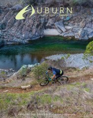
Auburn Magazine
A premium lifestyle publication that focuses on Eat+Play+Drink in the greater Auburn area. Readership will exceed 75,000 for our first edition. A locally owned multi-media company.
A premium lifestyle publication that focuses on Eat+Play+Drink in the greater Auburn area. Readership will exceed 75,000 for our first edition. A locally owned multi-media company.

Create successful ePaper yourself
Turn your PDF publications into a flip-book with our unique Google optimized e-Paper software.
OP3 Places to view<br />
HIDDEN FALLS RECREATION AREA<br />
30 miles of multi-use trails.<br />
DESCRIPTION<br />
Hidden Falls offers approximately 30 miles of<br />
multiple-use trails for hiking, running, biking and<br />
equestrian riding, two observation decks for viewing<br />
the 30 +/- foot waterfalls, riparian habitat along<br />
several creeks, unimproved picnic areas, swimming<br />
areas and fishing access. Engaging interpretive panels<br />
are mounted at various spots along the trails, and<br />
provide valuable information on the local flora and<br />
fauna within the Park. There are sweeping views<br />
of the Sacramento Valley to the Sutter Buttes and<br />
beyond, as well as plenty of open space for enjoying<br />
quiet time in a pristine outdoor environment.<br />
LAKE CLEMENTINE TRAIL<br />
Distance: 1.9 miles; 1 hour each way (hiking)<br />
Difficulty: Easy<br />
DESCRIPTION<br />
This easy trail is ideal for a panoramic hike along<br />
the North Fork American River, much of it in the<br />
shade of conifers and oaks and in close proximity to<br />
riparian flora and chaparral. Several side trails lead<br />
down to the river, the last one descending to a deep<br />
pool beneath the North Fork Dam where spectacular<br />
views of water cascading over the dam can be seen.<br />
STEVENS TRAIL<br />
Distance: 3.2 miles to river; 1½ hours down, 3 hours<br />
up (hiking)<br />
Difficulty: Easy down, moderate up<br />
DESCRIPTION<br />
This very well maintained trail is one of the most<br />
popular hiking and biking routes to the North Fork<br />
American River, in part because of its easy access<br />
from Colfax. However, this is a remote trail, and<br />
hikers are advised to carry a whistle or hike with a<br />
friend. The trail passes through oak, laurel, douglas<br />
fir, and huge stands of manzanita. The wildflower<br />
displays here are rarely matched elsewhere in ASRA,<br />
particularly during April and May. Take plenty<br />
of water and use caution, as the trail is hot during<br />
summer months and steep at times with narrow<br />
passages. Poison Oak can be found along much of<br />
the trail.<br />
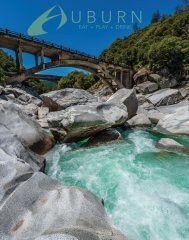
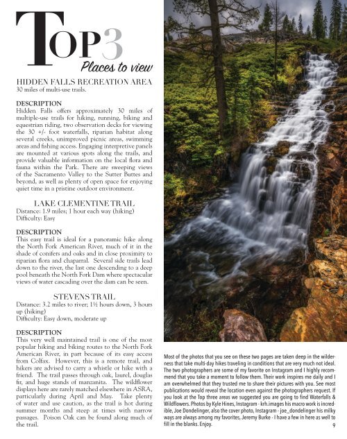
Most of the photos that you see on these two pages are taken deep in the wilderness<br />
that take multi-day hikes traveling in conditions that are very much not ideal.<br />
The two photographers are some of my favorite on Instagram and I highly recommend<br />
that you take a moment to follow them. Their work inspires me daily and I<br />
am overwhelmed that they trusted me to share their pictures with you. See most<br />
publications would reveal the location even against the photographers request. If<br />
you look at the Top three areas we suggested you are going to find Waterfalls &<br />
Wildflowers. Photos by Kyle Hines, Instagram - krh.images his macro work is incredible,<br />
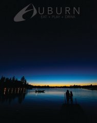
Joe Dondelinger, also the cover photo, Instagram - joe_dondelinger his milky<br />
ways are always among my favorites, Jeremy Burke - I have a few in here as well to<br />
fill in the blanks. Enjoy. 9