Unlocking Potential - Fortescue Metals Group Ltd
Unlocking Potential - Fortescue Metals Group Ltd
Unlocking Potential - Fortescue Metals Group Ltd

You also want an ePaper? Increase the reach of your titles
YUMPU automatically turns print PDFs into web optimized ePapers that Google loves.
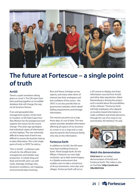
The future at <strong>Fortescue</strong> – a single point<br />
of truth<br />
ArcGIS<br />
There’s a quiet revolution taking<br />
place on Level 3. The GIS team have<br />
been putting together an incredible<br />
database that will change the way<br />
we do business forever.<br />
If we said geospatial data<br />
management system, it’d be hard<br />
to visualise, so GIS Data Supervisor<br />
Alex Weston has the background and<br />
explains the reason for the recent<br />
change. “Five years ago geologists<br />
had individual copies of information<br />
on their laptops. This was extremely<br />
difficult to keep track of and it was<br />
difficult to ensure the business had up<br />
to date information. This is the single<br />
point of truth, or SPOT,” he told us.<br />
‘This’ is ArcGIS - a software suite<br />
of tools for the efficient data<br />
management and reliable map<br />
production. A simple ‘drag and<br />
drop’ and ArcGIS users can add<br />
roads, drainage, heritage sites,<br />
tenement conditions, soil mapping,<br />
environmental data involving<br />
flora and fauna, heritage survey<br />
reports, and many other items of<br />
interest into their workspace and<br />
feel confident of the source - the<br />
SPOT. It can also provide links to<br />
government websites which detail<br />
drilling requirements and heritage<br />
information.<br />
The minute you print out a map<br />
these days, it’s out of date. The new<br />
system provides detailed information<br />
affecting all aspects of our business<br />
on screen or on a map and is a real<br />
step forward for the <strong>Fortescue</strong> family<br />
who rely on this information.<br />
<strong>Fortescue</strong> Earth<br />
In addition to ArcGIS, the GIS team<br />
have been building <strong>Fortescue</strong><br />
Earth. Think Google Earth, for the<br />
Pilbara. It features our own high<br />
resolution, up to date aerial imagery<br />
in a flyable environment that<br />
enables users to take a virtual tour<br />
of all our tenements, mine sites and<br />
villages. <strong>Fortescue</strong> Earth will act as<br />
a 3D canvas to display and share<br />
information sourced from ArcGIS<br />
and other data repositories. Adam<br />
Roestenburg is driving the project<br />
and is excited about the possibilities<br />
of the software. “<strong>Fortescue</strong> Earth<br />
will help employees who depend<br />
on location based information to<br />
make confident and timely decisions,<br />
through the use of an easy to use<br />
and intuitive 3D interface,” he said.<br />
Watch the demonstration<br />
Click here for an online<br />
demonstration of ArcGIS and<br />
<strong>Fortescue</strong> Earth. This video is also<br />
on YouTube: http://youtu.be/<br />
XBzr884COzk<br />
25