Tourism Scoping Report Kunene Peoples Park - The African Safari ...
Tourism Scoping Report Kunene Peoples Park - The African Safari ...
Tourism Scoping Report Kunene Peoples Park - The African Safari ...

Create successful ePaper yourself
Turn your PDF publications into a flip-book with our unique Google optimized e-Paper software.
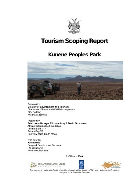
<strong>Tourism</strong> <strong>Scoping</strong> <strong>Report</strong><br />
<strong>Kunene</strong> <strong>Peoples</strong> <strong>Park</strong><br />
Prepared for:<br />
Ministry of Environment and <strong>Tourism</strong><br />
Directorate of <strong>Park</strong>s and Wildlife Management<br />
PZN Building<br />
Windhoek, Namibia<br />
Prepared by:<br />
Peter John Massyn, Ed Humphrey & David Grossman<br />
<strong>African</strong> <strong>Safari</strong> Lodge Foundation<br />
Postnet Suite 117<br />
Private Bag X7<br />
<strong>Park</strong>view 2122, South Africa<br />
With input by:<br />
Jon Barnes<br />
Design & Development Services<br />
PO Box 25942<br />
Windhoek, Namibia<br />
23 d March 2009<br />
This study was an initiative of the Republic of Namibia co-financed by UNDP through the SPAN project, and by the Ford Foundation<br />
through the <strong>African</strong> <strong>Safari</strong> Lodge Foundation
LIABILITY DISCLAIMER<br />
<strong>The</strong> views and opinions of authors expressed herein do not necessarily state or reflect those of<br />
the Namibian Government, UNDP / GEF, SPAN, <strong>Kunene</strong> People’s <strong>Park</strong> Technical Committee,<br />
Ford Foundation or the <strong>African</strong> <strong>Safari</strong> Lodge Foundation, and shall not be used for advertising or<br />
product endorsement purposes. We make no claims, promises or guarantees about the<br />
accuracy, completeness, or adequacy of the contents of this document and expressly disclaim<br />
liability for errors and omissions in its contents.<br />
PAGE II
TOURISM SCOPING REPORT - KUNENE PEOPLE’S PARK<br />
ACKNOWLEDGEMENTS<br />
Thanks are due to Steve Braine (Hobatere Lodge), Dennis Liebenberg (Etendeka Mountain<br />
Camp) and Chris Bakkes (Desert Rhino Camp) for their logistical support, hospitality and advice<br />
during the field work component of this study. Both Palmwag Lodge and Campsite and<br />
Hobatere Lodge provided venues for workshops and meetings during the study period, and their<br />
support in this regard was appreciated. Thanks are also due to all the lodge and tour operators<br />
that generously supplied business information to the research team. Staff from MET, IRDNC,<br />
SRT and Round River are thanked for providing background information and advice to the<br />
planning team. Brian Jones is thanked for providing historical data, comprehensive comments<br />
on the discussion draft, and assisting with the illustrative map of <strong>Kunene</strong> People’s <strong>Park</strong>. Andy<br />
Thompson’s advice and active participation throughout the study, his peer review of the final<br />
draft, and use of his photographs in this document were highly appreciated.<br />
This study was made possible by generous financial support from UNDP / GEF through the<br />
SPAN project. Co-funding by the Ford Foundation was made available through the <strong>African</strong><br />
<strong>Safari</strong> Lodge Foundation.<br />
PAGE III
TOURISM SCOPING REPORT - KUNENE PEOPLE’S PARK<br />
TABLE OF CONTENTS<br />
1. INTRODUCTION ........................................................................................................................ 7<br />
1.1 OBJECTIVES ........................................................................................................................7<br />
1.2 STUDY METHOD ...................................................................................................................7<br />
1.3 METHOD FOR ESTABLISHING FINANCIAL & ECONOMIC INDICATORS.............................................. 8<br />
1.4 STRUCTURE.........................................................................................................................9<br />
2. THE REGIONAL CONTEXT .....................................................................................................10<br />
2.1 FOCAL AREA ......................................................................................................................10<br />
2.2 KUNENE PEOPLE’S PARK .................................................................................................... 11<br />
2.3 ACCESS AND TRANSPORT INFRASTRUCTURE.......................................................................... 14<br />
2.4 ATTRACTIONS, PRODUCTS, MARKETS, FLOWS AND TRENDS ..................................................... 14<br />
2.5 ENVIRONMENTAL CONTEXT.................................................................................................. 20<br />
2.6 ZONING.............................................................................................................................23<br />
3. CONCESSIONING APPROACH .............................................................................................. 27<br />
3.1 INTRODUCTION...................................................................................................................27<br />
3.2 TYPES AND PROCEDURES.................................................................................................... 28<br />
4. HOBATERE TOURISM DEVELOPMENT AREA...................................................................... 30<br />
4.1 OVERVIEW.........................................................................................................................30<br />
4.2 HOBATERE ROADSIDE CONCESSION..................................................................................... 35<br />
4.3 HOBATERE NORTH CONCESSION (EXISTING) ......................................................................... 38<br />
4.4 HOBATERE SOUTH CONCESSION ......................................................................................... 41<br />
5. ETENDEKA TOURISM DEVELOPMENT AREA ...................................................................... 44<br />
5.1 OVERVIEW.........................................................................................................................44<br />
5.2 ETENDEKA CONCESSION..................................................................................................... 49<br />
6. PALMWAG TOURISM DEVELOPMENT AREA ....................................................................... 52<br />
6.1 OVERVIEW.........................................................................................................................52<br />
6.2 PALMWAG ROADSIDE CONCESSION...................................................................................... 58<br />
6.3 PALMWAG SOUTH CONCESSION .......................................................................................... 62<br />
6.4 PALMWAG CENTRAL CONCESSION ....................................................................................... 65<br />
6.5 WÊRELDSEND SPECIAL CONCESSION................................................................................... 68<br />
7. HOANIB TOURISM DEVELOPMENT AREA............................................................................ 70<br />
7.1 OVERVIEW.........................................................................................................................70<br />
7.2 LOWER HOANIB CONCESSION.............................................................................................. 75<br />
7.3 UPPER HOANIB CONCESSION .............................................................................................. 79<br />
8. ETOSHA TO SKELETON COAST TOUR ROUTE ................................................................... 82<br />
9. AGGREGATED FINANCIAL AND ECONOMIC IMPLICATIONS.............................................. 85<br />
10. ENVIRONMENTAL SUMMARY................................................................................................ 90<br />
11. INVESTOR INTEREST............................................................................................................. 91<br />
12. RECOMMENDED PRIORITIES................................................................................................ 92<br />
13. RECOMMENDED IMPLEMENTATION STRATEGY ................................................................ 93<br />
14. CONCLUSION.......................................................................................................................... 94<br />
ANNEX A: QUESTIONNAIRES USED DURING MARKET SURVEY ................................................ 95<br />
ANNEX B: ENVIRONMENTAL GUIDELINES – HOBATERE TDA .................................................... 99<br />
ANNEX C: ENVIRONMENTAL GUIDELINES – ETENDEKA TDA................................................... 104<br />
ANNEX D: ENVIRONMENTAL GUIDELINES – PALMWAG & HOANIB TDAS ............................... 109<br />
ANNEX E: ENVIRONMENTAL MANAGEMENT PLAN TEMPLATE ................................................ 114<br />
PAGE IV
TOURISM SCOPING REPORT - KUNENE PEOPLE’S PARK<br />
LIST OF TABLES<br />
TABLE 1: CONSERVATION AREAS BORDERING THE CURRENT CONCESSION AREAS......................................... 11<br />
TABLE 2: MAIN VISITOR ROUTES THROUGH EACH AREA, IN ORDER OF MOST COMMONLY USED........................ 17<br />
TABLE 3: CATEGORIES FOR TOURISM ZONES ............................................................................................ 26<br />
TABLE 4: ACCESS OPTIONS FOR HOBATERE ............................................................................................. 31<br />
TABLE 5: EXISTING ACCOMMODATION PRODUCTS IN HOBATERE ................................................................. 33<br />
TABLE 6: PROPOSED CONCESSIONS IN HOBATERE.................................................................................... 33<br />
TABLE 7: ACCESS TO ETENDEKA.............................................................................................................45<br />
TABLE 8: EXISTING PRODUCTS IN ETENDEKA............................................................................................ 46<br />
TABLE 9: ACCESS TO THE PALMWAG TDA ............................................................................................... 53<br />
TABLE 10: EXISTING PRODUCTS IN THE PALMWAG TDA ............................................................................ 55<br />
TABLE 11: RECOMMENDED CONCESSIONS IN THE PALMWAG TDA.............................................................. 56<br />
TABLE 12: ACTIVITIES PERMITTED IN PALMWAG ROADSIDE CONCESSION .................................................... 60<br />
TABLE 13: ACCESS TO HOANIB TDA .......................................................................................................70<br />
TABLE 14: EXISTING PRODUCTS IN THE HOANIB TDA................................................................................ 72<br />
TABLE 15: RECOMMENDED PRODUCTS IN THE HOANIB TDA ...................................................................... 73<br />
TABLE 16: PROPOSED ACTIVITIES IN THE UPPER HOANIB CONCESSION ....................................................... 80<br />
TABLE 17: PHYSICAL CHARACTERISTICS ASSOCIATED WITH, AND FINANCIAL AND ECONOMIC VALUES ESTIMATED<br />
FOR, THE PROPOSED TOURISM CONCESSIONS (2008) ...................................................................... 85<br />
TABLE 18: FINANCIAL VALUES ASSOCIATED WITH THE PROPOSED TOURISM DEVELOPMENT AREAS (N$,2008) . 87<br />
TABLE 19: CURRENT AND PLANNED FINANCIAL VALUES FOR THE WHOLE PARK (N$, 2008) ............................ 88<br />
TABLE 20: ECONOMIC VALUES ASSOCIATED WITH THE PROPOSED TOURISM DEVELOPMENTS (N$, 2008) ........ 88<br />
TABLE 21: CURRENT AND PLANNED ECONOMIC VALUES FOR THE WHOLE PARK (N$, 2008) ........................... 89<br />
TABLE 22: RECOMMENDED DEVELOPMENT PRIORITIES FOR CONCESSIONS .................................................. 92<br />
LIST OF MAPS<br />
MAP 1: LOCATION OF THE HOBATERE, ETENDEKA AND PALMWAG CONCESSION AREAS................................. 10<br />
MAP 2: PROPOSED KUNENE PEOPLES PARK BOUNDARY, EXISTING CONCESSIONS AND NEIGHBOURING<br />
CONSERVANCIES..........................................................................................................................12<br />
MAP 3: PROPOSED ENVIRONMENTAL ZONING FOR THE KUNENE PEOPLE'S PARK.......................................... 24<br />
MAP 4: PROPOSED TOURISM DEVELOPMENT AREAS (TDAS)..................................................................... 27<br />
MAP 5: THE HOBATERE TDA AND PROPOSED CONCESSION AREAS............................................................. 30<br />
MAP 6: THE HOBATERE TDA, PROPOSED CONCESSION AREAS AND TOURISM ZONING................................... 34<br />
MAP 7: THE ETENDEKA TDA AND PROPOSED CONCESSION AREA............................................................... 44<br />
MAP 8: THE ETENDEKA TDA AND PROPOSED TOURISM ZONING.................................................................. 48<br />
MAP 9: THE PALMWAG TDA AND PROPOSED CONCESSIONS ...................................................................... 52<br />
MAP 10: THE PALMWAG TDA, PROPOSED CONCESSION AREAS AND TOURISM ZONING.................................. 57<br />
MAP 11: THE PROPOSED WESTERN TOUR ROUTE WITHIN PALMWAG TDA AND HOANIB TDA ....................... 58<br />
MAP 12: THE HOANIB TDA AND PROPOSED CONCESSION AREAS ............................................................... 70<br />
MAP 13: THE HOANIB TDA, PROPOSED CONCESSION AREAS AND TOURISM ZONING ..................................... 74<br />
MAP 14: THE PROPOSED ETOSHA NATIONAL PARK TO SKELETON COAST PARK TOUR ROUTE ....................... 82<br />
LIST OF FIGURES<br />
FIGURE 1: ESTIMATED COMMUNITY INCOME FROM CONCESSION FEES IN THE KPP AFTER FIVE, TEN, AND FIFTEEN<br />
YEARS OF PARK DEVELOPMENT GIVEN FOUR DIFFERENT RATES OF GROWTH FOR CONCESSION<br />
DEVELOPMENT, BETWEEN 4% AND 16% PER ANNUM ....................................................................... 87<br />
PAGE V
TOURISM SCOPING REPORT - KUNENE PEOPLE’S PARK<br />
LIST OF ACRONYMS<br />
BOT Build, operate and transfer concession<br />
CPPP Community, public, private partnership (in the context of the <strong>Kunene</strong> People’s <strong>Park</strong> –<br />
a partnership involving MET, one or more neighbouring conservancies and a private<br />
tourism firm<br />
FIT Fully Independent Traveller<br />
KPP <strong>Kunene</strong> People’s <strong>Park</strong><br />
MET Ministry of Environment and <strong>Tourism</strong><br />
MOT Maintain, operate and transfer concession<br />
NGO Non-governmental Organisation<br />
ROT Rehabilitate, operate and transfer concession<br />
SPAN Strengthening the Protected Area Network project<br />
TA Traditional Authority<br />
TDA <strong>Tourism</strong> Development Area<br />
TOR Terms of Reference<br />
UNDP United Nations Development Program<br />
PAGE VI
1. Introduction<br />
1.1 Objectives<br />
TOURISM SCOPING REPORT - KUNENE PEOPLE’S PARK<br />
This document presents a draft scoping report on the tourism potential, economic benefits and<br />
environmental issues flowing from the formation of the proposed <strong>Kunene</strong> People’s <strong>Park</strong>. It is the<br />
result of a study conducted under a terms of reference prepared by MET in partnership with the<br />
UNDP’s SPAN project. According to the TOR, the objectives of the study were to:<br />
Identify the optimal (low impact, high yield) tourism products that communities and/or private operators<br />
could invest in once the <strong>Kunene</strong> People’s <strong>Park</strong> is created, including financial and economic projections<br />
over the short, medium and long term, resulting from the enhanced marketability of the area;<br />
Quantify the potential direct financial and indirect economic benefits (jobs, income, investment returns<br />
and multiplier effects) that stem from the creation of the <strong>Park</strong>, including the areas adjacent to the <strong>Park</strong>,<br />
the western side of Etosha and the adjoining area of the Skeleton Coast;<br />
Ensure that these opportunities lie within the carrying capacity of the <strong>Park</strong>, its wildlife and surrounds.<br />
<strong>The</strong> study focuses on the proposed new <strong>Kunene</strong> People’s <strong>Park</strong>, which is comprised of three<br />
existing tourism concessions known as Palmwag, Etendeka and Hobatere.<br />
<strong>The</strong> report is designed to provide a framework for tourism planning and the development of new<br />
concessions in the <strong>Kunene</strong> People’s <strong>Park</strong>. It is being prepared before the adoption of a park<br />
management plan and can therefore not draw on an established management framework. As<br />
such, it adopts a precautionary and indicative approach whose outcomes should be revisited<br />
when once the park management plan is completed.<br />
Furthermore, final boundaries of the <strong>Kunene</strong> People’s <strong>Park</strong> have not yet been confirmed with all<br />
stakeholders. <strong>The</strong>refore, for the purpose of this report, boundaries agreed to at the Technical<br />
Committee level have been used.<br />
1.2 Study method<br />
<strong>The</strong> study involved a multi-disciplinary team consisting of tourism experts, an environmentalist,<br />
and an economist. <strong>The</strong> process included:<br />
Preparatory meetings with the client to clarify the terms of reference and method of work;<br />
A review of relevant literature and earlier plans for the area, including the North West <strong>Tourism</strong> Master<br />
Plan, conservancy level tourism development plans and policies, such as the Policy on <strong>Tourism</strong> and<br />
Wildlife Concessions on State Land (2007);<br />
Two field visits to the proposed <strong>Park</strong>, during which tourism operators, conservancies, traditional leaders<br />
and other local stakeholders were consulted, baseline information gathered, environmental aspects fully<br />
considered and potential tourism products identified;<br />
Recommendations for concessions were based on market research, suggestions from existing tourism<br />
operators based within the focal area as well as those that use or know the area well, and through<br />
interaction between the multi-disciplinary team and other stakeholders;<br />
Six follow-up meetings with key operators, tourism industry representatives, ecologists and MET staff in<br />
Windhoek; and<br />
PAGE 7
TOURISM SCOPING REPORT - KUNENE PEOPLE’S PARK<br />
A survey of 13 accommodation providers and 16 tour operators utilising the current concession areas, as<br />
well as 6 potential investors / developers.<br />
Based on the outcome of this process, the current report was prepared for presentation at a<br />
meeting of the <strong>Kunene</strong> People’s <strong>Park</strong> Technical Committee.<br />
1.3 Method for establishing financial & economic indicators<br />
<strong>The</strong> existing and proposed concessions in the study area have been modelled to provide<br />
financial and economic indicators. Standardised financial and economic enterprise appraisal<br />
models as developed in the economics unit of MET were developed for each enterprise. <strong>The</strong>se<br />
include annualised budgets and ten year enterprise development streams valued in Namibia<br />
dollars (N$) at constant 2008 prices. It is worth bearing in mind that more recent (2009) rises in<br />
construction prices have been exceptional.<br />
Physical parameters for the enterprises were determined from the operators and from data<br />
assembled by the team. <strong>The</strong>se were then valued to estimate financial values for initial and<br />
ongoing capital requirements, recurrent variable and fixed operating expenses, and recurrent<br />
enterprise gross income.<br />
Among other measures, several specific financial measures were determined, including the<br />
annual pre-tax net income (profit) accruing to the investor, the total amount spent annually on<br />
salaries and wages, the annual salaries and wages accruing to community households, the<br />
annual benefits accruing to communities in the form of concession fees, the annual revenue<br />
accruing to government, in the form of fees and taxes (including VAT, income and company tax),<br />
and annual revenue accruing to the KPP management body in the form of park use (park entry)<br />
fees.<br />
<strong>The</strong> allocation of concession fees between government and communities was assumed to<br />
involve one third to the state and two thirds to the communities. Community income was thus<br />
made up of one third of concession fees generated. Government income was therefore assumed<br />
to include one third of concession fees and taxes in the form of VAT, income tax and company<br />
tax. It was assumed that park use (park entry) fees would accrue directly to the KPP for use in the<br />
management of the park. <strong>The</strong> overall financial return on investment was measured as the five<br />
and ten year internal rate of return, and the ten year net present value.<br />
Shadow pricing was applied to the financial model, to deal with fiscal and market distortions, and<br />
arrive at economic parameters for the enterprises. Here criteria developed in the MET were used,<br />
and adjustments were made for price of labour, price of tradable goods, and taxes and subsidies.<br />
<strong>The</strong> basic measure of value was the gross national product (GNP), and the model measured the<br />
extent that the enterprise changed this. Thus the annual direct incremental contribution to GNP,<br />
the annual direct incremental contribution to net national product (GNP less depreciation), and<br />
the annual statistical measure of GNP contribution were derived.<br />
Further, the impact of the enterprise on the broader economy was determined. This impact<br />
included the direct incremental contribution to GNP as well as that generated through direct<br />
linkages and indirect and induced linkages. Thus the overall impact on the economy, included<br />
GNP attributable to all expenditures of tourists using concessions, and GNP attributable to<br />
enterprises in other sectors that produce as a result of these tourist expenditures. Namibia’s<br />
PAGE 8
TOURISM SCOPING REPORT - KUNENE PEOPLE’S PARK<br />
social accounting matrix, an input-output model of the whole economy, was used to determine<br />
these linkages. <strong>The</strong> models also provide estimates of employment generation within<br />
concessions.<br />
1.4 Structure<br />
<strong>The</strong> report includes:<br />
An overview of the proposed <strong>Kunene</strong> People’s <strong>Park</strong> and its regional context, including salient ecological<br />
and environmental considerations.<br />
A brief section clarifying the recommended concessioning approach in the <strong>Kunene</strong> People’s <strong>Park</strong>.<br />
A description of the four <strong>Tourism</strong> Development Areas (Hobatere, Etendeka, Palmwag and Hoanib) and<br />
the proposed new tourism products in each, which include a variety of accommodation and activity<br />
concessions.<br />
A concluding section that summarises probable economic impacts of the proposed new products; a brief<br />
overview of the environmental issues affecting tourism in the <strong>Park</strong>; a table presenting the priority ratings<br />
of the proposed concessions and a final paragraph sketching some of the next steps that are required to<br />
take the tourism development process forward.<br />
PAGE 9
2. <strong>The</strong> Regional Context<br />
2.1 Focal area<br />
TOURISM SCOPING REPORT - KUNENE PEOPLE’S PARK<br />
<strong>The</strong> planning domain for this study falls within areas referred to as the Hobatere, Etendeka and<br />
Palmwag concessions, situated in the <strong>Kunene</strong> region of north western Namibia.<br />
Map 1: Location of the Hobatere, Etendeka and Palmwag concession areas<br />
<strong>The</strong> <strong>Kunene</strong> region is one of the most arid in Namibia. With an area of 115,293km² and a<br />
population of 68,735, it has the second lowest population density in Namibia of 0.6 /km² per<br />
person (National Planning Commission, 2001) 1 .<br />
<strong>The</strong> Hobatere concession area (27,013 hectares) is situated in the Western Highlands, bordering<br />
Etosha National <strong>Park</strong>. A veterinary cordon comprised of a double fence forms the northern and<br />
western boundary of this area. Hobatere is typified by granite outcrops, ephemeral rivers and<br />
mopane woodland, and receives between 250 and 300mm of rain per annum. <strong>The</strong> area is<br />
bordered on three sides by communities that are predominately settled and graze small and large<br />
livestock. Few other livelihood opportunities exist in this area.<br />
<strong>The</strong> Etendeka (39,535 hectares) and Palmwag (582,622 hectares) concession areas sit on and<br />
west of the North Western Escarpment and Inselbergs, and are extremely arid receiving between<br />
50 and 150mm of rain per year. <strong>The</strong>se desert areas are marginal for agricultural purposes and<br />
1 National Planning Commission (2001). 2001 National Population and Housing Census. NPC, Windhoek, Namibia<br />
PAGE 10
TOURISM SCOPING REPORT - KUNENE PEOPLE’S PARK<br />
the small local population living on the concession area boundary must remain mobile in order to<br />
sustain a livelihood, which is predominately comprised of livestock farming (mainly small stock,<br />
but also cattle, donkey and horses).<br />
<strong>The</strong>se concession areas contain irreplaceable and vulnerable wildlife habitat for species of the<br />
highest conservation importance, including black rhinoceros, elephant, black faced impala and<br />
Hartmann’s mountain zebra. Importantly it hosts the only other viable lion population in Namibia<br />
outside of Etosha National <strong>Park</strong>.<br />
Visitors value the area for its landscapes, unique desert dwelling large mammals, traditional<br />
cultures, quality of its remoteness, sense of isolation and perception of uncrowded ‘exclusivity’. It<br />
is believed that the area has considerable tourism potential, which is demonstrated by fast<br />
growing tourism hubs in the Palmwag and Sesfontein areas.<br />
Given the impressive natural assets within these concession areas and the relative aridity of the<br />
region, tourism offers a viable livelihood option to the subsistence agriculture being undertaken<br />
on the periphery of these areas. For the concession areas to be conserved in the long term it is<br />
vital that they must also serve as economic drivers that directly benefit local communities,<br />
providing jobs, income and investment opportunities that empower rural communities and enrich<br />
their lives.<br />
As illustrated in Map 2 and outlined in the table below, the Hobatere, Etendeka and Palmwag<br />
concession areas are almost entirely surrounded by existing conservation areas, including<br />
communal conservancies and State protected areas.<br />
Table 1: Conservation areas bordering the current concession areas<br />
Concession area Conservancy State protected area<br />
Hobatere<br />
• Ehirovipuka<br />
• #Khoadi //Hôas<br />
• Etosha National <strong>Park</strong><br />
Etendeka<br />
Palmwag<br />
2.2 <strong>Kunene</strong> People’s <strong>Park</strong><br />
• Omatendeka<br />
• Anabeb<br />
• Torra<br />
• #Khoadi //Hôas<br />
• Sesfontein<br />
• Anabeb<br />
• Torra<br />
• Skeleton Coast <strong>Park</strong><br />
Local and regional conservation stakeholders are presently embarking on an ambitious project to<br />
proclaim the three <strong>Kunene</strong> concession areas as a contractual park. It is hoped that this will<br />
eventually lead to a linkage between Etosha National <strong>Park</strong> and Skeleton Coast <strong>Park</strong> via a mosaic<br />
of community conservation areas and a contractual protected area.<br />
PAGE 11
TOURISM SCOPING REPORT - KUNENE PEOPLE’S PARK<br />
Map 2: Proposed <strong>Kunene</strong> <strong>Peoples</strong> <strong>Park</strong> boundary, existing concessions and neighbouring conservancies<br />
For the purpose of this report, the <strong>Kunene</strong> People’s <strong>Park</strong> only refers to the three existing<br />
concession areas. However, later it is hoped that this title will be used to define the broader<br />
outcome of achieving formal conservation partnerships linking Etosha National <strong>Park</strong> and<br />
Skeleton Coast <strong>Park</strong>.<br />
This concept of co-management is in line with METs new approach to proclaiming protected<br />
areas, which seeks to achieve a win-win situation for all stakeholders. Jones (2008) 2 believes it<br />
is METs intention to ensure local and regional interests are protected, and that the park<br />
proclamation is done in full consultation with other stakeholders, and with the economic interests<br />
of local people taken into account.<br />
According to Jones (2008), the Namibian Cabinet decided in 2004 that these areas should be<br />
proclaimed as a national park. Cabinet thereafter called on MET to initiate an intensive<br />
consultative management and development planning process for the park. This process began<br />
with a meeting at Hobatere between the MET and local stakeholders (neighbouring communities,<br />
tourism operators and NGOs) on 29 June, 2006.<br />
<strong>The</strong> aim of this <strong>Park</strong> is:<br />
To secure important habitats by providing formal conservation status over the Hobatere, Etendeka and<br />
Palmwag concession areas that currently have no status other than being State land;<br />
2 Jones B (2008). <strong>The</strong> proposed <strong>Kunene</strong> People’s <strong>Park</strong>: Key issues, principles and negotiated points of agreement. <strong>Report</strong> for the<br />
<strong>Kunene</strong> People’s <strong>Park</strong> Technical Committee. Revised April 2008. Windhoek, Namibia.<br />
PAGE 12
TOURISM SCOPING REPORT - KUNENE PEOPLE’S PARK<br />
To foster partnerships between State protected areas, communal conservancies and other stakeholders,<br />
and thereby improve conservation efforts and re-open old wildlife migration routes;<br />
To increase tourism within the concession areas so that greater economic returns can be achieved by<br />
local communities (both adjacent and others further a field) and the nation as a whole; and<br />
To improve and regulate access to the concession areas so that a greater cross-section of local, national,<br />
regional, and international visitors can appreciate the wonder of these extraordinary places.<br />
<strong>The</strong> Technical Committee agreed to a number of conditions before proclamation of the <strong>Park</strong> will<br />
be possible (Jones, 2008). <strong>The</strong>se include:<br />
<strong>The</strong> boundary of the concession areas must be amended where they currently negatively affect<br />
communities;<br />
Neighbouring communities should be the main beneficiaries of existing and new tourism concessions in<br />
these areas;<br />
No new fences must be erected;<br />
Arrangements must be made to offset losses experienced by local people from predators and elephants;<br />
Nobody should be resettled or removed;<br />
Emergency grazing in times of drought must be allowed;<br />
Benefit sharing to these communities must be maximised through joint management of the park with<br />
communities;<br />
<strong>The</strong> Technical Committee must be expanded to represent all six neighbouring conservancies;<br />
Existing rights and authority over the land currently held by traditional leaders should not be affected by<br />
the proposed park;<br />
<strong>The</strong> community should be involved in park management and should have a majority of the vote in<br />
decision-making;<br />
<strong>The</strong> community should receive a major share of park income;<br />
<strong>The</strong> park should employ people from the neighbouring community; and<br />
<strong>Park</strong> legislation should be amended to provide a solid legal framework for a new type of park.<br />
<strong>The</strong> first two points listed above have significant implications for tourism planning within the <strong>Park</strong><br />
boundaries. Of particular importance is that specific <strong>Park</strong> boundary changes were proposed by<br />
the neighbouring communities and agreed to by the Technical Committee.<br />
In the absence of accurate maps for the proposed <strong>Park</strong>, this study has attempted to indicate<br />
these boundaries on Map 2. This was done using minutes and records of various Technical<br />
Committee meetings and field trips, reviewing hand drawn drafts, and involving a technical<br />
advisor (Brian Jones) who was present at meetings where boundary changes were agreed to. It<br />
is important to note that the boundaries illustrated on Map 2 are only indicative and are not<br />
suggested or recommended from this report.<br />
PAGE 13
2.3 Access and transport infrastructure<br />
TOURISM SCOPING REPORT - KUNENE PEOPLE’S PARK<br />
Access by visitors into the Hobatere, Etendeka and Palmwag concession areas is currently<br />
possible by vehicle or chartered aircraft. No scheduled commercial flights are available into these<br />
areas.<br />
As illustrated in Map 1, there are four major proclaimed roads that are critical to enabling the flow<br />
of visitors through the focal area. <strong>The</strong>se include:<br />
C35 linking Opuwo / Ruacana / Kamanjab<br />
C39 linking Torra Bay / Bergsig / Khorixas<br />
C43 linking Bergsig / Palmwag / Sesfontein / Opuwo<br />
C40 linking Palmwag / Kamanjab<br />
Of these, only the C35 is tarred. <strong>The</strong> others are unsealed gravel roads that are subject to<br />
flooding during the wet season due to the absence of culverts and bridges. A network of<br />
unproclaimed 4x4 tracks also covers the areas, many of which are illustrated later in the report.<br />
According to the industry survey conducted during this study, the unpredictability of road access<br />
during the west season (from January / February to April) is a serious constraint that exacerbates<br />
the problem of seasonality for those operating in the Palmwag and Etendeka areas.<br />
Access challenges are the main reason why the area remains relatively un-impacted by high<br />
volumes of tourists, although seasonal exceptions occur in places such as the Hoanib River (west<br />
of Sesfontein) and the area immediately around Palmwag. This also means that the area has<br />
become more attractive for source markets operating in small to medium sized groups and<br />
fully independent travellers (FITs) demanding an authentic experience, as outlined in the<br />
following section.<br />
2.4 Attractions, products, markets, flows and trends<br />
Attractions<br />
<strong>The</strong> primary product being sold in the Palmwag and Etendeka areas is the desert landscape and<br />
“wilderness” experience. This is comprised of the following attractions:<br />
Vast landscapes with spectacular mountain scenery and wide valleys extending for miles<br />
A sense of space and freedom<br />
Absence of other visitors – opportunity for solitude<br />
<strong>The</strong> challenge of travelling in such a remote and “harsh” environment<br />
An unmodified natural environment that is not over commercialised nor developed<br />
Opportunities for close interaction with unique and attractive wildlife species that are enigmatic in the<br />
desert environment (particularly elephant and rhino, but also giraffe and plains game such as springbok<br />
and oryx)<br />
PAGE 14
Presence of traditional pastoral cultures.<br />
<strong>The</strong> bright, clear night skies<br />
TOURISM SCOPING REPORT - KUNENE PEOPLE’S PARK<br />
Many of the above listed attractions also apply to Hobatere however this area is situated along a<br />
major tar road with a high level of modification to the landscape that in turn diminishes the<br />
wilderness appeal. Hobatere is closely associated with Etosha National <strong>Park</strong>, and is seen<br />
primarily as a stop over before or after traversing Etosha via the western gate. <strong>The</strong> main product<br />
on offer here is wildlife. Hobatere has become well known for its lion population and large<br />
number of elephant, particularly in the dry season (May to November). One of the most popular<br />
activities in Hobatere is the night drive, because of the abundance of nocturnal fauna, including<br />
predators.<br />
<strong>The</strong>se attractions are aligned with the national branding strategy of the Namibia <strong>Tourism</strong> Board,<br />
which creates harmony within the industry on how Namibia should be branded to the world as a<br />
destination.<br />
Existing products<br />
<strong>The</strong>re are five lodges / tented camps currently operating within the three concession areas,<br />
providing a total 55 rooms and 110 beds. 62% (34) of the rooms offer a mid-market product,<br />
while 38% (21) of the rooms are up market. Average bed occupancy for these lodges over the<br />
past 12 months was 42% and approximately 16,936 bednights were sold. Given the average<br />
length of stay in these lodges was 2 nights, the approximate number of visitors accommodated in<br />
lodges within the concession areas over the last 12 months was 8,468.<br />
In addition to the lodges, there are 13 campsites within the concession areas, of which 10 are<br />
unserviced single group campsites situated along the Western Tour Route. Over the past 12<br />
months approximately 12,165 camp nights were sold in the three concession areas. <strong>The</strong><br />
average length of stay at these was 1.7 nights and the approximate number of visitors staying in<br />
them was 6,865. It is further estimated that approximately 2,400 visitors bush camped in the<br />
Hoanib River area.<br />
Given the above figures, approximately 17,733 visitors stayed overnight in the concession areas<br />
during the last 12 months. Of these it is estimated that 9% (1,648) were Namibians, 16% (2,753)<br />
were from other SADC countries, and 75% (13,332) from overseas.<br />
On the directly adjoining land there are a further three lodges / tented camps (31 rooms and 67<br />
beds) and eight campsites. Average occupancy in the lodges was 36%, meaning that a total of<br />
8,826 bednights were sold to approximately 4,488 visitors. On the other hand 9,650 camping<br />
nights were sold to approximately 6,317 visitors. This aggregates to approximately 10,805<br />
visitors staying in directly adjacent areas. It is assumed that the majority of these people also<br />
utilise the concessions for activities and may stay in the concession area during their journey.<br />
In terms of market level, 20% of existing accommodation facilities within or adjacent to the<br />
concessions areas trade at the upper market, while 20% trade at in the mid-market and 60%<br />
trade at the budget and camping market. Regarding rooms at different market levels, 24% of all<br />
rooms available trade at the upper market while 76% trade at the mid-market, and no budget<br />
rooms currently exist in the area. <strong>The</strong>se accommodation products are affected negatively by the<br />
wet season from January to April, when flash flooding can occur resulting in roads being wash<br />
PAGE 15
TOURISM SCOPING REPORT - KUNENE PEOPLE’S PARK<br />
away or blocked for several hours due to the absence of bridges and culverts particularly around<br />
the Etendeka / Palmwag areas.<br />
Existing activities in the concession areas include the following:<br />
Nature drives<br />
Game viewing<br />
Night drives (Hobatere)<br />
Walks<br />
Multi-day 4x4 touring and camping (Palmwag)<br />
Rhino tracking (Palmwag, Etendeka)<br />
Excursions to traditional homesteads<br />
<strong>The</strong> existing concessions within the study area have been valued in financial and economic<br />
terms, as described in more detail below. Capital investments of some N$24.9 million have been<br />
made, generating a direct annual incremental contribution to the gross national product (GNP) of<br />
some N$3.6 million. <strong>The</strong> overall impact of these activities on the broader economy is some<br />
N$12.2 million. Approximately 130 persons are employed at the existing accommodation<br />
establishments in the study area.<br />
Existing markets<br />
<strong>The</strong> market research indicated that the following tourism markets make use of the concession<br />
areas:<br />
FITs using their own vehicles: <strong>The</strong>se visitors are predominantly Namibian and South <strong>African</strong><br />
residents that own their own 4x4 vehicle, and want to explore the area. <strong>The</strong>y travel with more time, and<br />
are normally fully independent. <strong>The</strong> preferred accommodation for this market is camping and budget /<br />
mid level lodges that provide for self catering. <strong>The</strong>se types of visitors are very common in the focus<br />
area.<br />
FITs using hired vehicles: <strong>The</strong>se visitors are exclusively international and hire vehicles to explore<br />
Namibia. <strong>The</strong>y are more adventurous than those travelling in groups on formal tours, but often lack the<br />
confidence to travel too far off established routes. <strong>The</strong>y normally have more time and like to stay in a<br />
variety of accommodation during their safari, from camping through to tented camps and luxury lodges.<br />
<strong>The</strong>y travel with more time, and are normally fully independent. <strong>The</strong>se types of visitors are very<br />
common in the focus area.<br />
Small sized (2 to 8) vehicle-based tour operators: <strong>The</strong>se operators specialise in personalised safaris<br />
and make use of mid and up market accommodation. <strong>The</strong>ir visitors are exclusively international. <strong>The</strong><br />
vehicles are often 4x4 and can therefore access the more remote areas, enabling the operator to explore<br />
and conduct some of their own activities. <strong>The</strong>se tour operators are very common in the focus area.<br />
Medium sized (9 to 24) vehicle-based tour operators: This market makes use of medium sized buses,<br />
and visitors are exclusively international. Operators use budget and mid level accommodation,<br />
including camping, and offer a more personalised experience. <strong>The</strong>ir vehicles can access the main entry<br />
points to each of the current concession areas, and therefore these types of operators are common in<br />
the focus area.<br />
PAGE 16
TOURISM SCOPING REPORT - KUNENE PEOPLE’S PARK<br />
Luxury fly in safari operators: <strong>The</strong>se operators specialise in highly personalised safaris and make use<br />
of luxury up market accommodation such as tented camps and lodges. Visitors are exclusively<br />
international and are often on a regional flying safari, including other attractions in Namibia and<br />
neighbouring countries. <strong>The</strong>se tour operators are common in the focus area.<br />
Large sized (25 to 44) vehicle-based tour operators: This market makes use of large buses or<br />
overland trucks, and visitors are exclusively international. <strong>The</strong>se operators use budget and mid level<br />
accommodation (including camping), and run short safaris including key attractions. <strong>The</strong>se operators are<br />
not common in the focus area as most bypass due to bed limits at lodges and difficult access<br />
conditions. However, overland trucks sometimes pass through, staying at Palmwag and Hobatere<br />
Campsites enroute to or from Etosha / Twyfelfontein / Swakopmund.<br />
<strong>Tourism</strong> routes and flows<br />
This section outlines the main routes taken by visitors through each of the current concession<br />
areas. <strong>The</strong>se were determined from discussions with tour operators and accommodation<br />
providers during this study. <strong>The</strong> lists below are in order of most commonly used routes.<br />
Table 2: Main visitor routes through each area, in order of most commonly used<br />
Hobatere Concession Area<br />
Route Description Main markets using route<br />
Etosha / Kamanjab<br />
Western Etosha<br />
Palmwag / Kamanjab<br />
Twyfelfontein / Kamanjab<br />
• From Etosha via<br />
Kamanjab<br />
• From Okaukuejo via<br />
Western Etosha<br />
• From Palmwag via<br />
Kamanjab<br />
• From Twyfelfontein via<br />
Kamanjab<br />
Epupa / Opuwo • From Epupa via Opuwo<br />
Sesfontein / Opuwo<br />
Sesfontein / Hoanib River<br />
Etendeka / Escarpment<br />
• From Sesfontein via<br />
Opuwo<br />
• From Sesfontein via<br />
Khowareb Schlutt<br />
• From Etendeka via<br />
Ombonde and<br />
escarpment track<br />
• Small sized tour operators<br />
• Medium sized tour operators<br />
• FITs using their own vehicles<br />
• FITs using hired vehicles<br />
• Small sized tour operators<br />
• Medium sized tour operators<br />
• Small sized tour operators<br />
• Medium sized tour operators<br />
• FITs using hired vehicles<br />
• FITs using their own vehicles<br />
• Small sized tour operators<br />
• Medium sized tour operators<br />
• FITs using their own vehicles<br />
• FITs using hired vehicles<br />
• Small sized tour operators<br />
• Medium sized tour operators<br />
• FITs using their own vehicles<br />
• FITs using hired vehicles<br />
• Small sized tour operators<br />
• Medium sized tour operators<br />
• FITs using their own vehicles<br />
• FITs using hired vehicles<br />
• Small sized tour operators<br />
• FITs using their own vehicles<br />
• FITs using their own vehicles<br />
PAGE 17
Etendeka Concession Area<br />
TOURISM SCOPING REPORT - KUNENE PEOPLE’S PARK<br />
Route Description Main markets using route<br />
Twyfelfontein / Torra<br />
Torra Bay / Torra<br />
Etosha / Kamanjab<br />
West Etosha / Kamanjab<br />
Hobatere / Kamanjab<br />
Opuwo / Sesfontein<br />
Puros / Sesfontein<br />
Hobatere / Escarpment<br />
Palmwag Concession Area<br />
• From Twyfelfontein via<br />
Torra Conservancy<br />
• From Torra Bay via<br />
Torra Conservancy<br />
• From Etosha via<br />
Kamanjab<br />
• From West Etosha via<br />
Kamanjab<br />
• From Hobatere via<br />
Kamanjab<br />
• From Opuwo via<br />
Sesfontein<br />
• From Puros via<br />
Sesfontein<br />
• From Hobatere or<br />
Ombonde River via<br />
escarpment track<br />
• Small sized tour operators<br />
• FITs using their own vehicles<br />
• FITs using hired vehicles<br />
• Small sized tour operators<br />
• FITs using their own vehicles<br />
• FITs using hired vehicles<br />
• Small sized tour operators<br />
• FITs using their own vehicles<br />
• FITs using hired vehicles<br />
• Small sized tour operators<br />
• Small sized tour operators<br />
• FITs using their own vehicles<br />
• FITs using hired vehicles<br />
• Small sized tour operators<br />
• FITs using their own vehicles<br />
• FITs using hired vehicles<br />
• Small sized tour operators<br />
• FITs using their own vehicles<br />
• FITs using hired vehicles<br />
• FITs using their own vehicles<br />
Route Description Main markets using route<br />
Twyfelfontein / Torra<br />
Torra Bay / Torra<br />
Etosha / Kamanjab<br />
West Etosha / Kamanjab<br />
Hobatere / Kamanjab<br />
Opuwo / Sesfontein<br />
Puros / Sesfontein<br />
Puros / Hoanib River<br />
• From Twyfelfontein via<br />
Torra Conservancy<br />
• From Torra Bay via<br />
Torra Conservancy<br />
• From Etosha via<br />
Kamanjab<br />
• From West Etosha via<br />
Kamanjab<br />
• From Hobatere via<br />
Kamanjab<br />
• From Opuwo via<br />
Sesfontein<br />
• From Puros via<br />
Sesfontein<br />
• From Puros via four<br />
4x4 tracks into Hoanib<br />
• Small sized tour operators<br />
• Medium sized tour operators<br />
• FITs using their own vehicles<br />
• FITs using hired vehicles<br />
• Small sized tour operators<br />
• Medium sized tour operators<br />
• FITs using their own vehicles<br />
• FITs using hired vehicles<br />
• Small sized tour operators<br />
• Medium sized tour operators<br />
• FITs using their own vehicles<br />
• FITs using hired vehicles<br />
• Small sized tour operators<br />
• Medium sized tour operators<br />
• Small sized tour operators<br />
• Medium sized tour operators<br />
• FITs using their own vehicles<br />
• FITs using hired vehicles<br />
• Small sized tour operators<br />
• Medium sized tour operators<br />
• FITs using their own vehicles<br />
• FITs using hired vehicles<br />
• Small sized tour operators<br />
• FITs using their own vehicles<br />
• FITs using hired vehicles<br />
• Small sized tour operators<br />
PAGE 18
TOURISM SCOPING REPORT - KUNENE PEOPLE’S PARK<br />
Route Description Main markets using route<br />
Hobatere / Hoanib River<br />
• From Hobatere via<br />
Hoanib and Ombonde<br />
Rivers<br />
• FITs using their own vehicles<br />
• Small sized tour operators<br />
• FITs using their own vehicles<br />
In addition to the above, a number of popular routes exist for visitors travelling by air charter into<br />
the area. It is estimated that fly-in visitors amount to some 1,500 per annum or about 8% of all<br />
visitors. <strong>The</strong>se routes are multiple in numbers and sequence; however the most common ones<br />
are between the key attractions such as Sossusvlei, Swakopmund, Etosha, <strong>Kunene</strong> River and<br />
the Skeleton Coast <strong>Park</strong>.<br />
Trends and issues<br />
Some of the key tourism trends and issues identified from the research include:<br />
Visitors are becoming more adventurous and demanding more authentic activities and experiences;<br />
All accommodation providers and tour operators are experiencing unprecedented growth in demand;<br />
Rhino, elephant and lion tracking is a major attraction for the area, but should be exploited carefully to<br />
avoid unwanted impacts;<br />
<strong>The</strong>re is concern that the rhino tracking product in this area is being monopolised by a single operator,<br />
and is priced too high for the vast majority of visitors;<br />
Strong seasonality experienced from Independence to the early 2000s has changed, and occupancies<br />
are remaining high for longer periods of the year;<br />
A shortage of lodges and beds mean many tour operators can not offer scheduled tours in this area;<br />
Most existing lodges don’t allow block booking, and this hampers tour operators in arranging scheduled<br />
tours;<br />
Existing lodges are too small to accommodate medium and large groups in conjunction with the FITs;<br />
and<br />
<strong>The</strong>re is a strong shift from scheduled tours to custom-tailored tours and packaged self drive itineraries<br />
for the international market.<br />
Recommended products<br />
Tour operators and agents interviewed recommended the following new products:<br />
Accommodation:<br />
up market tented camps that also offer authentic wildlife and cultural experiences;<br />
roadside accommodation catering for the mid-market, and especially for medium and larger sized<br />
groups;<br />
higher quality, more accessible and better serviced campsites and self catering accommodation suitable<br />
for the FIT market (both international, local and regional);<br />
PAGE 19
TOURISM SCOPING REPORT - KUNENE PEOPLE’S PARK<br />
better regulated and planned unserviced bush camping sites in remote areas suitable for the local /<br />
regional FIT market, as well as small niche market tour operators.<br />
Activities:<br />
opportunities for guided self drive (especially for the international FIT market) into more remote areas;<br />
wildlife tracking (including elephant, lion and rhino);<br />
walking (overnight, day and short walks);<br />
specialist excursions focusing on local culture, archaeology, geology and birding;<br />
mountain biking;<br />
quad biking.<br />
Other suggested developments:<br />
improved access regulation / control, especially to sensitive areas and those that experience congestion<br />
at peak times, such as the Hoanib River and the area around Palmwag Lodge;<br />
improved road maintenance (better quality and more regular blading);<br />
more culverts / causeways at main river crossings to allow larger vehicles and improve access in the wet<br />
season; and<br />
access to Western Etosha for the purpose of conducting game viewing activities, not simply traversing.<br />
2.5 Environmental context<br />
In this section, we provide a summary of the salient ecological and environmental attractions and<br />
constraints within the proposed concession areas. Site-specific considerations are also provided<br />
for each of the <strong>Tourism</strong> Development Areas (TDAs) in sections 4 to 7.<br />
This does NOT replace the mandatory EIA process required by the Environmental Management<br />
Act (2007), but is intended to provide guidelines to the various stakeholders involved in<br />
management and development of concessions within the area, as well as to highlight points<br />
requiring further elaboration during the formal EIA process required under current legislation.<br />
Environmental attractions<br />
<strong>The</strong> attraction of this arid area is based on an array of natural features, which collectively<br />
contribute to the visitor experience, in contrast to a single ‘destination’-type tourism product. It is<br />
essential to maintain the quality of these natural features and characteristics across the regional<br />
landscape, in order to maintain a positive visitor experience. <strong>The</strong> attractions include:<br />
the geology, including ancient granites, folded schists, dolomitic formations, the remains of spectacular<br />
lava outpourings, linked to those currently located in South America after the break-up of Gondwanaland,<br />
and relatively recent windblown deposits;<br />
rugged and varied terrain, including coastal desert and gravel plains; rocky and sandy plains; spectacular<br />
mountains, rivers and floodplains;<br />
PAGE 20
TOURISM SCOPING REPORT - KUNENE PEOPLE’S PARK<br />
the courses of the ephemeral rivers and their many tributaries, providing linear ‘green arteries’ of<br />
vegetation along an increasingly arid east-west gradient and crucial to animal life in the region;<br />
flood plains, springs and ephemeral pools providing water to highly mobile animal population;<br />
interesting and varied plant life forms, ranging from large thorn trees to an array of specialised<br />
succulents, endemics and the ancient welwitschia;<br />
varied birdlife, reptiles and amphibian;<br />
the desert dwelling large mammals including elephant, lion, mountain zebra, black rhinoceros, oryx and<br />
springbok, many with unique behavioural adaptations to living in this arid area;<br />
the cultural dimension of the people, including long established human-wildlife interactions and the more<br />
recent development of very successful CBNRM initiatives, including formal conservancies, which have<br />
contributed to the widespread increase in wildlife numbers throughout the region.<br />
Ecological fragility<br />
<strong>The</strong> North West <strong>Tourism</strong> Master Plan (Phases 1 & 2), as well as many other documents,<br />
repeatedly refers to ‘fragile and sensitive ecosystems’ within the region under discussion.<br />
Although not always clearly defined, this fragility is typified by the following:<br />
Aridity – rainfall is generally low, varying, on average, from around 350 mm per annum in the extreme<br />
east of the area (around Hobatere), through 100-150 mm in the central parts around Etendeka, to below<br />
50 mm in the extreme west;<br />
Variability of rainfall- there is a high co-efficient of variability in the amount and timing of rainfall, with<br />
several years of below average rainfall to be expected, as well as years with more than double annual<br />
average rainfall;<br />
High intensity rainfall events:- storms leading to increased risks of accelerated soil erosion, particularly<br />
where impacts of roads, tracks and construction are not avoided or properly mitigated;<br />
Possible loss of large trees during infrequent but extreme flood events, which would necessitate changes<br />
in animal foraging and dispersal patterns;<br />
Rugged landscapes with mountains, steep slopes, a proliferation of drainage lines (washes) and major<br />
ephemeral rivers with numerous tributaries;<br />
Unstable, highly erodible soils in parts, including sodic soils in lower lying areas, (particularly prevalent in<br />
parts of Hobatere); fine-grained silty soils with no structure (approach to Hoanib near Sesfontein);<br />
A herbaceous layer currently dominated by annual plants over much of the area, coupled with at least<br />
temporary loss of many perennial herbaceous species;<br />
A high level of endemism, certain plant populations (e.g. some of the Commiphoras) have very restricted<br />
distributions and are vulnerable to extinction;<br />
A linear spatial distribution of important woody browse species along water courses, which extend the<br />
range of such species into increasingly arid areas, thereby increasing their vulnerability to heavy<br />
browsing induced by any breakdown in natural seasonal movement of wildlife;<br />
PAGE 21
TOURISM SCOPING REPORT - KUNENE PEOPLE’S PARK<br />
Increasing restrictions on the mobility of the desert dwelling larger mammals including elephant, rhino,<br />
lion, oryx, springbok, mountain zebra, giraffe, all of which rely on seasonal dispersal during wet periods,<br />
with dry-season concentration along ephemeral rivers and near water holes 3 ;<br />
Uncertain but likely future effects of climate change.<br />
Given these attributes, the need for any tourism and other developments to identify, avoid,<br />
minimise and mitigate negative environmental impacts is both self-evident and required under<br />
policy and legislative frameworks.<br />
General tourism development guidelines<br />
Guidance in terms of “Responsible <strong>Tourism</strong> Development” is provided in Annex 3 of the MET<br />
Policy on <strong>Tourism</strong> and Wildlife Concessions on State Land (MET, 2007) 4 ; namely:<br />
Protect key attractions;<br />
Concentrate rather than disperse impacts;<br />
Avoid waste and over-consumption;<br />
Use local resources sustainably;<br />
Maintain and encourage natural, economic, social and cultural diversity;<br />
Be sensitive to the host culture;<br />
Involve the local community in planning and decision-making;<br />
Assess environmental, social and economic impacts as a prerequisite to developing tourism;<br />
Ensure communities are involved in and benefit from tourism;<br />
Market tourism that is responsible, respecting local, natural and cultural environments;<br />
Monitoring impacts of tourism and ensure open disclosure of information;<br />
Safety and security of employees and clients.<br />
In addition, there are certain general overarching principles, based on the area’s ecological and<br />
environmental characteristics, which apply to all proposed developments.<br />
<strong>The</strong>se include:<br />
No fixed accommodation structures in close proximity (within 1 km in Palmwag concession; 500 m in<br />
Hoanib, 100 m in Hobatere) to permanent springs, particularly where these are the only sources of water<br />
within a particular area;<br />
Ensure that an adequate supply of water of acceptable quality is available before commencing detailed<br />
site planning;<br />
No constructions within designated wetland areas or within 1 in 100 year flood lines;<br />
3 By this we mean the increase in road infrastructure, fencing, human and livestock densities in the area in general,<br />
relative to the historical situation when these animals could move with few restrictions.<br />
4 Short title – Policy on <strong>Tourism</strong> and Wildlife Concessions<br />
PAGE 22
TOURISM SCOPING REPORT - KUNENE PEOPLE’S PARK<br />
No sewerage disposal within 50m of any water body or water source such as a borehole;<br />
Minimise construction of new access and tourism roads, by making use of existing networks,<br />
encouraging walking experiences;<br />
It is essential to identify responsibility for road and track maintenance and to budget sufficient funds for<br />
ongoing maintenance of the road/track network;<br />
As far as is practicable, avoid siting of roads/tracks in areas with erodible sodic soils; fine particle<br />
dispersed soils; steep slopes;<br />
Adequate drainage to be provided to all roads/tracks to minimise erosion and maintenance costs;<br />
<strong>The</strong> use of graders, which tend to “gouge” roads below the level of the surrounding surface, to be<br />
minimised or avoided;<br />
Minimise visual impact (day and night), by not breaking skylines, selecting landscapes with high “visual<br />
absorption capacities”, using subdued and downward deflected lighting;<br />
No collecting of firewood within the area; firewood and or alternative fuel sources to be procured from<br />
suppliers who can demonstrate sustainable harvesting practices<br />
Waste to be minimised at source, and waste to be separated and removed to approved recycling and/or<br />
landfill sites;<br />
Combustible waste to be burned in incinerator with acceptable (e.g. SABS) standards;<br />
No burying of anything other than organic waste, in animal-proof ‘cells’;<br />
No burying of any materials in river beds;<br />
As far as is practicable, make use of renewable energy sources (especially solar and wind);<br />
Use existing protocols developed by SRT for rhino tracking;<br />
<strong>The</strong> Environmental Management Plan (EMP) developed as part of the formal EIA process is to include<br />
provision for an annual compliance audit to be carried out by an independent qualified person (a general<br />
template for an EMP is provided in Annex E).<br />
In the sections that follow, further area- and site-specific guidelines are provided, which are to be<br />
used in conjunction with these general guidelines. Additionally, Annexes B to D outline areas<br />
specific guidelines in the format provided by the Policy on <strong>Tourism</strong> and Wildlife Concessions.<br />
2.6 Zoning<br />
Zoning is important to help achieve the goals of: 1) protecting important habitats, biodiversity and<br />
heritage; 2) enabling economic development; 3) managing access to natural areas for the public.<br />
Zoning enables scare or sensitive areas to be protected, while at the same time allowing an<br />
acceptable level of use in order to achieve economic development. It is also important to prevent<br />
conflicts between different user groups and to enhance visitor experience.<br />
Two types of zoning are recommended for this strategic level plan - environmental and tourism.<br />
PAGE 23
Environmental zoning<br />
TOURISM SCOPING REPORT - KUNENE PEOPLE’S PARK<br />
<strong>The</strong> North West <strong>Tourism</strong> Master Plan (NWTMP Phase 1), proposed three development zones,<br />
each with certain guidelines that are based on the level of fragility or sensitivity of the specific<br />
area. After the field work in these areas was completed, the project team confirmed the<br />
appropriateness of the NWTMP zones and applied them to the concession areas. A map<br />
illustrating the environmental zoning is provided in Map 3:<br />
Map 3: Proposed environmental zoning for the <strong>Kunene</strong> People's <strong>Park</strong><br />
While three levels of environmental sensitivity are proposed here, tourism development in all<br />
areas still needs to be sensitive to the environment and environmental impact assessments will<br />
be necessary, in accordance with the Environmental Management Act (2007).<br />
Zone 1: High Sensitivity<br />
Zone 1 contains the very sensitive gravel plains, important tourist destinations (such as the lower<br />
Hoanib River and area around Palmwag), and areas of high endemic species. It is at present the<br />
least developed zone and it is felt that above all the wilderness appeal of this zone must be<br />
maintained over the long term. It is the view of this study that a limited amount of development<br />
should be promoted in the Zone 1, and that access should be limited in places.<br />
In Zone 1 the following should be promoted:<br />
PAGE 24
TOURISM SCOPING REPORT - KUNENE PEOPLE’S PARK<br />
Low impact, small sized, upmarket tented camps and lodges (±16-28 beds) should be the preferred<br />
accommodation in the western side of Zone 1 (i.e. low volume, high yield, small footprint, easily<br />
reversible, using renewable energy etc);<br />
Medium sized lodges (±40-60 beds) should only be considered on the eastern periphery of Zone 1,<br />
preferably alongside major access roads, where there are already impacts<br />
Over Landers and motorbikes should be limited to proclaimed roads only<br />
No off-track driving should be permitted<br />
Formal serviced campsites are not promoted since they require relatively high volumes of traffic to<br />
sustain them; however dry camps with no facilities could be erected where necessary for the use of<br />
overnight campers. <strong>The</strong>se may provide tents and basic equipment<br />
Self-drive tours should be allowed on designated routes only and guided tours should be promoted<br />
Walking and pack animal trails should be promoted but attention must be given to the impact of backup<br />
vehicles supporting these activities<br />
Fixed-wing aircraft should be limited to direct flights to and from camps and micro lights and choppers<br />
should be avoided to prevent negative impacts on visitor experience<br />
<strong>The</strong> Palmwag TDA and Hoanib TDA fall within this zone.<br />
Zone 2: Medium Sensitivity<br />
Zone two is less sensitive than Zone 1 and contains the main infrastructure of the two regions. It<br />
also includes the main settlement areas and more livestock. This zone is considered to be<br />
suitable for further development and to provide the bulk of services required for Zone 1.<br />
<strong>The</strong> following is recommended:<br />
In addition to the small and medium sized lodges mentioned in Zone 1, campsites should also be<br />
promoted here<br />
Over Landers and motorbikes should be allowed on designated routes only<br />
Fewer restrictions are placed on self-drive tourists and yet guided tours should still be promoted<br />
Fewer restrictions are placed on aircraft and walking and pack-animal trails are to be promoted.<br />
<strong>The</strong> Etendeka TDA and the mid reaches of the Hoanib River lie within this zone.<br />
Zone 3: Low Sensitivity<br />
Zone 3 is the least environmentally sensitive area and tourism should be promoted with as few<br />
restrictions as possible. Considerations regarding sustainability must however still be examined<br />
prior to development. <strong>The</strong>re may be several areas occurring in Zone 3, which are of high tourism<br />
value and are more sensitive. <strong>The</strong>se exceptions should be identified and zoned as specifically<br />
sensitive areas. <strong>The</strong> NWTMP attempts this, however this may need to be updated an<br />
management plans for the various areas are developed.<br />
<strong>The</strong> Hobatere TDA lies within this zone.<br />
PAGE 25
<strong>Tourism</strong> zoning<br />
TOURISM SCOPING REPORT - KUNENE PEOPLE’S PARK<br />
Developing a tourism zoning scheme considers the following factors:<br />
<strong>The</strong> level of planning being undertaken (i.e. strategic planning verses detailed operational planning);<br />
Environmental constraints (refer to environmental zoning);<br />
<strong>Tourism</strong> potential of specific areas based on their attractiveness, physical accessibility, and market<br />
demand;<br />
Experiential considerations for specific markets and products.<br />
For the purpose of providing a simple tourism zoning scheme to guide strategic planning, this<br />
study recommends that the following zone types be used: degree of access and level of use.<br />
<strong>The</strong> following categories are thereafter assigned within these zones 5 .<br />
Table 3: Categories for tourism zones<br />
Degree of access:<br />
Category Description<br />
Multiple access<br />
<strong>The</strong>se areas may be used by several permitted user groups at any one time, they<br />
could include day visitors, campers, residents of lodges, day drive concessions.<br />
Limited access<br />
<strong>The</strong>se areas would be limited to specific concession holders that have certain use<br />
rights as defined in written agreements<br />
Level of use:<br />
Category Description<br />
Low use<br />
Medium use<br />
High use<br />
Use of these areas will be limited to offer the feeling of exclusivity and<br />
“wilderness”. <strong>The</strong> density of users should be expressed per square kilometre or<br />
kilometre of road, or any other appropriate unit, and will be less than 15% of that in<br />
the High Use areas.<br />
Tourist densities will be higher than the Low Use areas, but significantly lower than<br />
the High Use areas. <strong>The</strong> density parameters would be less than 35% of High Use<br />
areas.<br />
<strong>The</strong>se are areas where the upper limits of use will be set to avoid over-crowding.<br />
<strong>The</strong>se may have absolute ceilings from time to time that will be set by<br />
management after considering the type of tourism experience being offered, the<br />
capacity of the facilities and resources to support this, and the ability of<br />
management to control it.<br />
Proposed application of these zones to individual TDAs, together with maps of each TDA, is<br />
outlined in sections 4 to 7. More detailed zoning for specific tourism use (e.g. specific tourism<br />
activities within a multiple access area) must be conducted during park level management<br />
planning to ensure sensitive and scarce habitats are protected against unwanted impacts, as well<br />
as to optimise visitor experience and economic impact of tourism in the region. For the purpose<br />
of this document, only strategic level zoning is proposed.<br />
5 Adapted from the Draft Strategic Management Plan for the BMM Complex (2007).<br />
PAGE 26
3. Concessioning Approach<br />
3.1 Introduction<br />
TOURISM SCOPING REPORT - KUNENE PEOPLE’S PARK<br />
Given the size of the focal area and its diverse environmental conditions, accessibility, and<br />
product types, for the purposes of tourism planning it is proposed that the park be divided into<br />
four <strong>Tourism</strong> Development Areas:<br />
<strong>The</strong> Hobatere TDA (27,013 hectares), which has the same boundaries as the existing Hobatere<br />
concession;<br />
<strong>The</strong> Etendeka TDA, which is about 22% smaller (39,535 hectares) than the existing Etendeka<br />
concession (50,807 hectares);<br />
<strong>The</strong> Palmwag TDA (394,304 hectares), which includes the bulk of the current of the Palmwag<br />
concession;<br />
<strong>The</strong> Hoanib TDA (351,567 hectares), which stretches along the Hoanib valley from the coast to the<br />
Ganamub River in the east and also includes a strip of land to the south.<br />
Map 4: Proposed <strong>Tourism</strong> Development Areas (TDAs)<br />
All four TDAs currently have considerable potential for further tourism products and therefore<br />
benefits to local communities, private sector and to the government. Consequently, there is wide<br />
scope to diversify and modernize the TDAs product offerings by repackaging the areas into<br />
smaller units. It is worth noting that failure to realise this potential and the ensuing benefits, and to<br />
distribute them fairly, could risk the future conservation of this important area.<br />
PAGE 27
TOURISM SCOPING REPORT - KUNENE PEOPLE’S PARK<br />
It is the intention of MET and its partners to award tourism rights in the <strong>Park</strong> in the form of<br />
concessions, which will proceed within the framework of Namibia’s Policy on <strong>Tourism</strong> and<br />
Wildlife Concessions on State Land of 2007. According to this policy, a concession is defined as<br />
“the rights, whether full or restricted or shared or exclusive, to conduct tourism activities and / or to<br />
commercially use State-owned plant and / or animal resources (collectively referred to as wildlife<br />
resources) on business principles in proclaimed protected areas and any other State Land for a<br />
specified period of time.”<br />
<strong>The</strong> policy makes provision for the direct award of concessions to resident or neighbouring<br />
communities provided certain conditions are met. It is proposed that each TDA be subdivided<br />
into a number of concessions that are awarded directly to the neighbouring conservancies who<br />
will, in certain instances, have the option of entering into sub-concessions with appropriately<br />
qualified private partners under conditions approved by MET. Important details of the concession<br />
agreements between MET and the conservancies will be clarified through the park planning<br />
process or agreed on a case-by-case basis. Vital questions that are common across all four<br />
TDAs and that will have to be settled by negotiation between the affected parties include:<br />
how to assign specific concessions to individual conservancies or groups of conservancies;<br />
what area / concession management obligations to assign to whom, and how;<br />
how to apportion income generated from concessions between MET, the park authority, the TAs and the<br />
conservancies.<br />
3.2 Types and procedures<br />
Where concessions involve the development, rehabilitation or management of permanent<br />
infrastructure, they may take the form of:<br />
Build, operate and transfer concessions (BOT – a concessionaire is granted the right to build and<br />
operate infrastructure for a defined period before transferring it to the land authority);<br />
Rehabilitate, operate and transfer concessions (ROT – a concessionaire is granted the right to<br />
rehabilitate existing infrastructure, operate it for a defined period before transferring it to the land<br />
authority);<br />
Maintain, operate and transfer concessions (MOT – a concessionaire is granted the right to manage<br />
existing infrastructure for a defined period before transferring it to the land authority.<br />
BOT and ROT concessions are generally for periods that give concessionaires the opportunity to<br />
make a fair return on the capital and expertise they invested in the enterprise. In the case of the<br />
<strong>Kunene</strong> People’s <strong>Park</strong>, it appears MET intends offering BOT and ROT concessions on 20-year<br />
terms.<br />
Concessions conferring rights to conduct commercial activities without the development of<br />
permanent infrastructure may take the form of activity concessions, which may generally be for<br />
shorter periods than BOTs and ROTs.<br />
MET may also grant special concessions to conduct specialized activities such as filming,<br />
research and education.<br />
PAGE 28
TOURISM SCOPING REPORT - KUNENE PEOPLE’S PARK<br />
<strong>The</strong>re are currently established tourism enterprises in certain parts of the proposed <strong>Park</strong> and the<br />
operators of these products often have long-standing relationships with their neighbouring<br />
communities. Where there is both an established enterprise and a developed site it is<br />
recommended that community concessionaires be given the option of making a direct award of<br />
sub-concession rights to incumbent operators provided the parties reach satisfactory agreements<br />
(which MET also approves). It is recommended that sub-concession rights to all new concessions<br />
be offered via competitive tender using the procedure prescribed in the Policy on <strong>Tourism</strong> and<br />
Wildlife Concessions and overseen by MET 6 . <strong>The</strong> presence of a campsite or similar low level of<br />
infrastructure does not automatically mean that incumbency should be recognised.<br />
Should MET and its partners decide to proceed with the proposed new products identified in this<br />
report, new concessions should be implemented using the ‘Guidelines for the management of the<br />
concessioning process’ set out in Annex 2 of the Policy on <strong>Tourism</strong> and Wildlife Concessions.<br />
<strong>The</strong>se guidelines require the detailed description of each concession followed by a rapid<br />
feasibility assessment and the preparation of tender documents including a Request for Proposal<br />
(RFP) and template agreement(s). This process is necessary to clarify the details of each<br />
concession including, amongst other things, the degree to which management responsibility for<br />
infrastructure (gates, tracks, signage, water points) and other matters (such as collection of park<br />
fees) will be delegated to a concessionaire.<br />
6 During a feedback meeting with communities regarding the tourism scoping report, the consultant team was<br />
informed that the communities neighbouring Palmwag and Hoanib TDA wish to allow the incumbent operator to<br />
submit a proposal for all tourism development opportunities in these areas rather than awarding new concessions<br />
via competitive tender.<br />
PAGE 29
TOURISM SCOPING REPORT - KUNENE PEOPLE’S PARK<br />
4. Hobatere <strong>Tourism</strong> Development Area<br />
4.1 Overview<br />
Location<br />
Hobatere TDA is a 27,013 hectares area situated on the south western boundary of Etosha<br />
National <strong>Park</strong>, as illustrated in Map 5. <strong>The</strong> area is bordered by the ≠Khoadi //Hôas conservancy<br />
to the south and Ehirovipuka conservancy to the north.<br />
Map 5: <strong>The</strong> Hobatere TDA and proposed concession areas<br />
PAGE 30
Access<br />
TOURISM SCOPING REPORT - KUNENE PEOPLE’S PARK<br />
Currently, access to Hobatere is possible by the following means:<br />
Table 4: Access options for Hobatere<br />
4x4 vehicles 2x4 vehicles Access by aircraft<br />
• From south west via<br />
Kamdesha Veterinary<br />
Gate<br />
• From east off the C35<br />
road, which has recently<br />
been upgraded to tar<br />
• Registered air strip at<br />
Hobatere Lodge<br />
It is reported that an additional 4x4 access track could be developed on the south eastern corner<br />
of the TDA.<br />
Historical and social context<br />
According to Owen Smith (2002) 7 , the Hobatere TDA was for many years set aside as a cattlefree<br />
area by the then Damara Representative Authority. In 1987, this Authority leased it out for<br />
trophy hunting. After independence, the area became a photographic tourism concession<br />
managed by MET.<br />
Unlike Palmwag and Etendeka, this relatively small concession area is completely fenced. <strong>The</strong><br />
western, northern and eastern boundaries form part of the veterinary cordon (or ‘Red Line’ as it is<br />
commonly referred to) and the southern border has a single, game-proof fence. In spite of this,<br />
elephant and other big game (including lions) regularly pass through it - between Etosha National<br />
<strong>Park</strong> and the neighboring ≠Khoadi //Hôas and Ehirovipuka conservancies (Owen Smith, 2002).<br />
Both the ≠Khoadi //Hôas and Ehirovipuka conservancies have made claims to benefits from this<br />
concession area. ≠Khoadi //Hôas conservancy is felt to have legitimate claims because of<br />
Hobatere’s location south of the veterinary cordon, but also due to historical use of the area by<br />
the predominantly Damara community currently resident in the conservancy. However, given the<br />
movement of wildlife (including predators) from Etosha National <strong>Park</strong>, through Hobatere and into<br />
Ehirovipuka conservancy, it is equally important for the residents of this conservancy to benefit<br />
from the area.<br />
After expiry of the current concession rights in 2007, MET transferred tourism rights over the<br />
current lodge operation to the ≠Khoadi //Hôas conservancy, which in turn agreed to retain the<br />
incumbent operator on a sub-concession. In 2008 MET also agreed to grant concession rights to<br />
Ehirovipuka conservancy; however further planning is needed before these can be<br />
operationalised.<br />
Environmental context<br />
Highly erodible sodic soils occur over much of the area placing demands on regular maintenance<br />
of the existing track network, and limiting future track development.<br />
This is a fenced area (although breakages occur continuously) and therefore severely restricts<br />
important seasonal dispersal patterns of several species (including elephant, springbok, and<br />
7 Owen-Smith G (2002), notes provided to MET during the preparation of a draft concessions policy.<br />
PAGE 31
TOURISM SCOPING REPORT - KUNENE PEOPLE’S PARK<br />
eland). Population numbers of some herbivores will need management (for example by removal<br />
of ‘surplus’ grazers to minimise over- utilisation of the herbaceous layer over the long term).<br />
Key issues that need further elaboration during the formal EIA process include:<br />
Availability of ground water;<br />
In the absence of a formal management plan for this fenced area, all proposed developments should be<br />
logically defensible in terms of location and scale/size;<br />
Possibility of additional wildlife water points (although a management plan should be in place before new<br />
artificial water is provided);<br />
Highly erodible sodic soils occur, emphasizing the strong need for strategic location of access and<br />
traversing roads, and a high level of maintenance;<br />
Any new access roads to be located away from sodic soils as far as is practicable; adequate drainage<br />
structures to be provided on all such roads (including humps, mitre drains, pipes supported by gabions<br />
etc<br />
Developments within granite boulder areas to be especially sensitive in terms of design, location within<br />
boulders, shape, colour and texture of materials used;<br />
A first-phase archaeological scoping by a qualified archaeologist must precede any construction<br />
activities; should any artefacts be found during construction, archaeologist to be consulted for further<br />
advice<br />
During the construction phase, care should be taken to ensure minimum soil disturbance in the vicinity of<br />
any natural springs/seepages<br />
All accommodation and related structures to be located at least 100 m away from any natural springs<br />
within the landscape (excluding hides).<br />
Refer to Annexes B and E for detailed environmental guidelines and a checklist.<br />
<strong>Tourism</strong> resources<br />
<strong>The</strong> area contains most of the wildlife species occurring in neighbouring Etosha, including<br />
elephant, lion, eland, giraffe and mountain zebra. It is understood that black rhino may be<br />
introduced in the future. Other features include the Otjavazandu River, and spectacular<br />
landscapes with prominent granitic outcrops containing an array of interesting plant life.<br />
<strong>The</strong> northern tip of Hobatere is difficult to access, and is situated alongside the main tarred road,<br />
veterinary cordon, and the Werda settlement. It is therefore heavily impacted, and thus not<br />
suitable for tourism development.<br />
Existing products and markets<br />
<strong>The</strong>re are three existing products in the Hobatere TDA, all of which are operated by the same<br />
concessionaire. <strong>The</strong> three products are summarised below:<br />
PAGE 32
TOURISM SCOPING REPORT - KUNENE PEOPLE’S PARK<br />
Table 5: Existing accommodation products in Hobatere<br />
Hobatere Lodge :<br />
Location Type, size, performance Markets<br />
• North western Hobatere<br />
• Accessible from the C35<br />
and via Kamdesha<br />
veterinary gate<br />
• Mid market lodge<br />
• 12 rooms, 24 beds<br />
• Currently being expanded<br />
to 15 rooms, 30 beds<br />
• Achieved 51% occupancy<br />
in 2007 (4468 beds sold)<br />
Hobatere Tree House:<br />
Location Type, size, performance Markets<br />
• Western Hobatere<br />
• Accessible from the C35<br />
and via Kamdesha<br />
veterinary gate<br />
• Exclusive satellite camp<br />
• 1 rooms, 2-4 beds<br />
• Upgrade being planned<br />
Hobatere Campsite:<br />
Location Type, size, performance Markets<br />
• Eastern Hobatere,<br />
alongside the C35<br />
Proposed new concessions<br />
• Roadside campsite<br />
• 7 campsites, including 1<br />
group site<br />
• Achieved 31% occupancy<br />
in 2007 (4692 nights sold)<br />
• 60% tour operator drive-in<br />
• 33% FIT self-drive (hired<br />
vehicle)<br />
• 5% FIT self drive (own<br />
vehicle)<br />
• 5% tour operator fly-in<br />
• 60% tour operator drive-in<br />
• 33% FIT self-drive (hired<br />
vehicle)<br />
• 5% FIT self drive (own<br />
vehicle)<br />
• 5% tour operator fly-in<br />
• 50% tour operator drive-in<br />
• 30% FIT self-drive (hired<br />
vehicle)<br />
• 20% FIT self drive (own<br />
vehicle)<br />
<strong>The</strong> proposed that the existing concession be restructured and that two new concessions be<br />
developed. <strong>The</strong>se are outlined in the table below, and illustrated in Map 5. Detailed descriptions<br />
of each of these opportunities are provided on the subsequent pages.<br />
Table 6: Proposed concessions in Hobatere<br />
Hobatere Roadside: Hobatere North (existing): Hobatere South:<br />
• Mid-market roadside concession<br />
with access to western Etosha<br />
NP<br />
• 60 bed lodge, 10 campsites<br />
• High density; multiple access<br />
• 20-year BOT<br />
• Very high priority<br />
• Redevelopment of lodge<br />
• Cancellation of existing<br />
campsite (within Hobatere<br />
Roadside)<br />
• 30 beds in a main lodge, with a<br />
10 bed satellite camp (tree<br />
house area)<br />
• Medium density; multiple<br />
access<br />
• 20-year ROT<br />
• Very high priority<br />
• High value photographic<br />
concession<br />
• Approximately 20 beds in an<br />
up market lodge, with a further<br />
possible 20 beds in a satellite<br />
camp<br />
• Low density; limited access<br />
• 20-year BOT<br />
• Low priority<br />
It is unlikely that these new concessions will directly impact on planned developments in<br />
Ehirovipuka and ≠Khoadi //Hôas conservancies (as per NWTMP). In fact the development of<br />
tourism in Hobatere may help increase demand for new products in surrounding areas.<br />
PAGE 33
Zoning<br />
TOURISM SCOPING REPORT - KUNENE PEOPLE’S PARK<br />
<strong>The</strong> Hobatere TDA falls within environmental Zone 3, and therefore limited restrictions apply to<br />
new development. <strong>Tourism</strong> zoning for each concession within the TDA is proposed in following<br />
sections, as well as Map 6.<br />
Map 6: <strong>The</strong> Hobatere TDA, proposed concession areas and tourism zoning<br />
PAGE 34
4.2 Hobatere Roadside Concession<br />
Location<br />
TOURISM SCOPING REPORT - KUNENE PEOPLE’S PARK<br />
<strong>The</strong> proposed new Hobatere Roadside Concession is approximately 4,979 hectares in extent.<br />
It is located in the north east of the Hobatere <strong>Tourism</strong> Development Area opposite western<br />
Etosha National <strong>Park</strong>.<br />
Rationale<br />
<strong>The</strong> rationale for this concession lies in its prime location on the C35 tour route, its easy linkages<br />
to western Etosha and the indicated need for roadside accommodation catering to the midmarket,<br />
and especially for larger groups. Accordingly, the concession is located along the C35<br />
opposite the Otjovasondu gate.<br />
Attractions<br />
<strong>The</strong> concession’s principal attractions include:<br />
Linkages with western Etosha via the gate at Otjovasondu<br />
Wildlife (including iconic species such as lion and elephant), both in the designated area within Hobatere<br />
and along approved routes in Western Etosha;<br />
Scenic landscapes (including attractive granite hills around the existing campsite);<br />
Proximity to the C35 tour route linking Etosha, Twyfelfontein and northern <strong>Kunene</strong>;<br />
Preferred markets<br />
Given the roadside location on a major tour route, the preferred market segments include:<br />
Small, medium and large tour groups en route between Twyfelfontein, Palmwag, Etosha and northern<br />
<strong>Kunene</strong>; and<br />
FITs using their own and hired vehicles.<br />
Zoning<br />
This concession is zoned for a high level of use and for access by multiple groups.<br />
Indicated developments<br />
Given the preferred market segments and the proximity to the C35 tour route, the following<br />
developments are recommended:<br />
A mid-market lodge of sufficient scale to accommodate coach tours (approximately 60 beds);<br />
An associated camping area with approximately 10 campsites;<br />
Support infrastructure including access roads, 4x4 tracks for game viewing and an entrance facility.<br />
PAGE 35
Activities<br />
TOURISM SCOPING REPORT - KUNENE PEOPLE’S PARK<br />
Activities in the concession will be operator-conducted and include:<br />
Day and night drives in the concession area and western Etosha;<br />
Walks in the concession area (and, possibly, western Etosha);<br />
Cultural excursions to nearby communities;<br />
It is recommended that neighbouring concessionaires be granted conditional access to this concession<br />
area in order to conduct guided activities and to traverse along the main access route.<br />
Main environmental considerations<br />
<strong>The</strong> main environmental considerations for tourism development in this proposed concession<br />
area include:<br />
<strong>The</strong> area is reported to have little underground water. Access to water will be a major factor in deciding<br />
on specific development sites.<br />
As far as possible, granitic outcrops should be regarded as special aesthetic and natural interest feature<br />
points, rather than potential sites for lodge construction.<br />
<strong>The</strong> access route should avoid sodic soils; where this is not feasible, the access road should be gravelled<br />
and provided with adequate drainage.<br />
Sewerage facility design and construction to cater for peak periods with maximum occupancy plus on site<br />
staff (approximately 60 plus).<br />
Recommended concession structure<br />
This is a new concession with no incumbent operator (the existing campsite is not considered of<br />
sufficient scale for the operator to be recognized as an incumbent).<br />
It is recommended that the concession be offered on a 20-year BOT-basis (although, given the<br />
level of capital expenditure required, a 30-year concession may need to be considered).<br />
MET should award the 20-year head concession directly to a neighbouring conservancy (or<br />
group of conservancies) who may, in turn, award a sub-concession to an appropriately qualified<br />
operator via a competitive bidding procedure (overseen by MET and using standardized<br />
contracts approved by MET).<br />
In addition to the concession rights for the area proposed in Map 6, an activity concession will be<br />
required to allow access to Etosha National <strong>Park</strong> for game viewing on a non-exclusive basis.<br />
Financial indicators<br />
It is estimated that the proposed concession will involve an initial investment of N$18.4 million.<br />
Annual costs should amount to some N$15.4 million and this should result in pre-tax net income<br />
of N$2.5 million. Some 60 jobs will be created, and the total wage bill will amount to N$1.21<br />
million. From the concession, communities could receive some N$0.54 million per annum in<br />
salaries and wages, from some 49 jobs, and they could derive benefits from concession fees<br />
PAGE 36
TOURISM SCOPING REPORT - KUNENE PEOPLE’S PARK<br />
amounting to some N$0.84 million per annum. Government could derive some N$2.8 million<br />
annually from concession fees and taxes, including VAT, income and company tax. KPP itself will<br />
derive an estimated N$1 million from park use fees. <strong>The</strong> likely private internal rate of return over<br />
five and ten years is estimated at between 13% and 16%, well above the expected 10% cut-off.<br />
<strong>The</strong> concession thus promises to be financially attractive.<br />
Financial viability is rated as moderate.<br />
Economic indicators<br />
<strong>The</strong> concession is expected to contribute some N$5.9 million annually to the gross national<br />
product (GNP), and N$4.9 million annually to the net national product. <strong>The</strong> overall impact of the<br />
concession on the gross national product should be in the region of N$19.7 million annually,<br />
including direct, indirect and induced effects. Over ten years the investment should result in a<br />
very favourable economic internal rate of return. That estimated for the base case model was<br />
34%, much higher than the 10% cut-off rate. <strong>The</strong> economic net present value of the investment<br />
over ten years at a 10% discount rate was estimated at N$14.2 million. An estimated 60<br />
employment opportunities will be generated.<br />
<strong>The</strong> concession investment is thus deemed to be economically very desirable.<br />
Priority<br />
Given its prime roadside location, attractiveness to the market and very desirable economic<br />
rating, this concession is given a very high priority rating.<br />
Required interventions<br />
Granting of approval from MET for conducting activities such as game drives in Etosha, on a nonexclusive<br />
basis. Coupled with this is a need for basic tourism support infrastructure in western Etosha,<br />
such as public toilets and a realignment of tracks, especially around waterholes;<br />
Agreement with ≠Khoadi //Hôas and Ehirovipuka conservancies regarding the concession structure and<br />
benefit sharing;<br />
Confirmation of water availability for a development of the scale proposed here;<br />
Feasibility assessment and preparation of detailed concession documents as required by the Policy on<br />
<strong>Tourism</strong> and Wildlife Concessions on State Land;<br />
Implementation of a concessioning process including a competitive tender as sketched above;<br />
Integration of the concession into the management plan for the KPP.<br />
PAGE 37
TOURISM SCOPING REPORT - KUNENE PEOPLE’S PARK<br />
4.3 Hobatere North Concession (existing)<br />
Location<br />
<strong>The</strong> proposed Hobatere North Concession is approximately 8,808 hectares in extent. It is<br />
located in the north west of the Hobatere <strong>Tourism</strong> Development Area and incorporates the<br />
existing Hobatere Lodge and Tree House.<br />
Rationale<br />
<strong>The</strong> rationale for this concession includes the known need for affordable mid-market<br />
accommodation as well the established relationship between the incumbent operator and the<br />
≠Khoadi //Hôas Conservancy, who have reached agreement regarding the redevelopment and<br />
operation of Hobatere Lodge and Tree House. <strong>The</strong> redeveloped operation does not require<br />
traversing rights over the entire Hobatere TDA and the proposed Hobatere North Concession has<br />
accordingly been reduced to provide an area that is sufficient to the needs of the operation.<br />
Unlike Hobatere Roadside Concession, traversing rights in western Etosha are not essential for<br />
the viability of this concession.<br />
Attractions<br />
<strong>The</strong> concession’s main attractions include:<br />
Wildlife (including iconic species such as lion and elephant);<br />
Scenic landscapes (including attractive river frontage).<br />
Preferred markets<br />
<strong>The</strong> preferred market segments for this concession are:<br />
Smaller tour operator-conducted groups;<br />
Self drive FITs;<br />
Small fly-in groups on multi-destination circuits.<br />
Zoning<br />
<strong>The</strong> concession is zoned for a medium level of use and for limited access.<br />
It is recommended that neighbouring concessionaires be granted a right of use to the airstrip<br />
on this concession and that the main track traversing the concession from the north-east to the<br />
south-west be designated as a multiple use route (to permit traversing by other concessionaires<br />
and groups on the Etosha to Skeleton Coast Tour Route).<br />
Indicated developments<br />
Given the preferred market segments and the attractions, the following developments are<br />
recommended:<br />
A mid-market lodge of approximately 30 beds;<br />
PAGE 38
TOURISM SCOPING REPORT - KUNENE PEOPLE’S PARK<br />
A satellite camp of approximately 10 beds at the site of the existing tree house;<br />
Support infrastructure including an airstrip, access roads, game viewing tracks and entrance facilities.<br />
Activities<br />
Activities in the concession area will be operator-conducted and include:<br />
Day and night drives in the concession area;<br />
Walks in the concession area;<br />
Cultural excursions to nearby communities.<br />
Main environmental considerations<br />
<strong>The</strong> main environmental considerations for tourism development in this proposed concession<br />
area include:<br />
<strong>The</strong> area is reported to have little underground water. Access to water will be a major factor in deciding<br />
on any new development sites, such as an expansion of facilities at the Tree House.<br />
<strong>The</strong> access route should be upgraded by gravelling in areas with visible erosion, and installation of<br />
adequate drainage. Ongoing maintenance is essential and responsibility for such must be clarified before<br />
any concessions are finalised; and<br />
Any new traversing routes to avoid sodic areas.<br />
Recommended concession structure<br />
This is an existing concession with an incumbent operator who has already reached agreement<br />
with MET and the ≠Khoadi //Hôas Conservancy regarding the redevelopment and operation of<br />
the concession. Accordingly, it is recommended that the head concession be awarded directly<br />
on a 20-year ROT-basis to the ≠Khoadi //Hôas Conservancy who may simultaneously award a<br />
sub-concession to the existing operator on terms agreed between the parties and using a<br />
standardized contract approved by MET.<br />
Financial indicators<br />
It is estimated that the proposed concession will involve an initial investment of N$7.6 million.<br />
Annual costs of some N$11 million should result in pre-tax net income of N$0.6 million. Some 40<br />
jobs will be created, and the total wage bill will amount to N$0.98 million. From the concession,<br />
communities could receive some N$0.4 million per annum in salaries and wages, from some 31<br />
jobs, and they could derive benefits from concession fees amounting to some N$0.89 million per<br />
annum. Government could derive some N$1.59 million annually from concession fees and taxes,<br />
including VAT, income and company tax. KPP itself will derive an estimated N$0.67 million from<br />
park use fees. <strong>The</strong> likely private internal rate of return over five and ten years is estimated at<br />
between 19% and 23%, well above the expected 10% cut-off. <strong>The</strong> concession thus promises to<br />
be financially attractive.<br />
Financial viability is rated as moderate.<br />
PAGE 39
Economic indicators<br />
TOURISM SCOPING REPORT - KUNENE PEOPLE’S PARK<br />
<strong>The</strong> concession is expected to contribute some N$3.8 million annually to the gross national<br />
product (GNP), and N$3.4 million annually to the net national product. <strong>The</strong> overall impact of the<br />
concession on the gross national product should be in the region of N$12.5 million annually,<br />
including direct, indirect and induced effects. Over ten years the investment should result in a<br />
very favourable economic internal rate of return. That estimated for the base case model was<br />
47%, much higher than the 10% cut-off rate. <strong>The</strong> economic net present value of the investment<br />
over ten years at a 10% discount rate was estimated at N$18 million. An estimated 40<br />
employment opportunities will be generated.<br />
<strong>The</strong> concession investment is thus deemed to be economically very desirable.<br />
Priority<br />
Given that agreement has already been reached between MET, ≠Khoadi //Hôas Conservancy<br />
and the incumbent operator, this concession has a very high priority rating.<br />
Required interventions<br />
Closure of long term agreements between MET, ≠Khoadi //Hôas and the incumbent operator as<br />
sketched above;<br />
Integration of the concession into the management plan for the KPP;<br />
While not essential for the viability of this concession, it would add much value to the operation if approval<br />
can be granted for conducting activities in Etosha, on a non-exclusive basis.<br />
PAGE 40
4.4 Hobatere South Concession<br />
Location<br />
TOURISM SCOPING REPORT - KUNENE PEOPLE’S PARK<br />
<strong>The</strong> proposed new Hobatere South Concession is approximately 13,231 hectares in extent. It<br />
is located in the southern half of the Hobatere TDA and incorporates an area of attractive granite<br />
boulders and small riverine systems.<br />
Rationale<br />
<strong>The</strong> rationale for this concession rests on the high quality of its resource base, including some<br />
very attractive granite hills, its easy linkages to western Etosha and the known demand for<br />
upmarket concessions offering a high degree of quality and exclusivity. Accordingly, the<br />
concession provides a relatively large area with a mix of quality attractions and a high degree of<br />
exclusivity.<br />
Attractions<br />
<strong>The</strong> concession’s main attractions include:<br />
Wildlife (including iconic species such as lion and elephant);<br />
Scenic landscapes (including attractive granite hills and small river systems);<br />
Proximity to western Etosha and the C35 tour route.<br />
Preferred markets<br />
Given the size, exclusivity and quality of the concession area, the preferred market segments are:<br />
Small fly-in groups on multi-destination circuits;<br />
Small tour operator-conducted groups;<br />
Self drive FITs.<br />
Zoning<br />
<strong>The</strong> concession is zoned for a low level of use and for limited access (to be limited to the<br />
concessionaire).<br />
It is recommended that the concessionaire also be granted a right of use to the airstrip located on the<br />
Hobatere North Concession.<br />
Indicated developments<br />
Given the preferred market segments and the quality of the attractions on the concession, the following<br />
developments are recommended:<br />
An upmarket lodge of approximately 20 beds and<br />
A satellite camp of approximately 20 beds<br />
Located at sites to be identified during the concession preparation and EIA phases.<br />
PAGE 41
TOURISM SCOPING REPORT - KUNENE PEOPLE’S PARK<br />
Support infrastructure including an airstrip, access roads, game viewing tracks and entrance facilities.<br />
Activities<br />
Activities in the concession area will be operator-conducted and include:<br />
Day and night drives in the concession area;<br />
Walks in the concession area, even overnight walks to a satellite camp;<br />
Cultural excursions to nearby communities.<br />
Main environmental considerations<br />
<strong>The</strong> main environmental considerations for tourism development in this proposed concession<br />
area include:<br />
<strong>The</strong> area is reported to have little underground water. Access to water will be a major factor in deciding<br />
on specific development sites;<br />
<strong>The</strong> access route should avoid sodic soils; where this is not feasible, the access road should be gravelled<br />
and provided with adequate drainage;<br />
<strong>The</strong> sewerage facility design and construction to cater for peak periods with maximum occupancy plus<br />
on site staff (approximately 30 plus); and<br />
<strong>The</strong> final lodge site and footprint of accommodation and main units to be signed off by MET, ensuring<br />
that any natural water sources, endemic or protected plans and other taxa are not negatively impacted<br />
(including recovery plan for individual endemic or endangered or protected plants).<br />
Recommended concession structure<br />
This is a new, high value concession with no incumbent operator.<br />
It is recommended that MET offer the head concession on a 20-year BOT-basis to a<br />
neighbouring conservancy (or group of conservancies) who may, in turn, award a subconcession<br />
to an appropriately qualified operator via a competitive bidding procedure (overseen<br />
by MET and using standardized contracts approved by MET).<br />
Financial indicators<br />
It is estimated that the proposed concession will involve an initial investment of N$21 million.<br />
Annual costs of some N$23 million could result in pre-tax net income of N$5.9 million. Some 50<br />
jobs will be created, and the total wage bill will amount to N$1.5 million. From the concession,<br />
communities could receive some N$0.46 million per annum in salaries and wages, from some 38<br />
jobs, and they could derive benefits from concession fees amounting to some N$1.04 million per<br />
annum. Government could derive some N$4.85 million annually from concession fees and taxes,<br />
including VAT, income and company tax. KPP itself will derive an estimated N$0.64 million from<br />
park use fees. <strong>The</strong> likely private internal rate of return over five and ten years is estimated at<br />
between 27% and 30%, well above the expected 10% cut-off. <strong>The</strong> concession thus promises to<br />
be financially attractive.<br />
Financial viability is rated as moderately high.<br />
PAGE 42
Economic indicators<br />
TOURISM SCOPING REPORT - KUNENE PEOPLE’S PARK<br />
<strong>The</strong> concession is expected to contribute some N$7.9 million, annually, to the gross national<br />
product (GNP), and some N$7.1 million, annually, to the net national product. <strong>The</strong> overall impact<br />
of the concession on the gross national product should be in the region of N$26.3 million<br />
annually, including direct indirect and induced effects. Over ten years the investment should<br />
result in a very favourable economic internal rate of return. That estimated for the base case<br />
model was 43%, much higher than the 10% cut-off rate. <strong>The</strong> economic net present value of the<br />
investment, over ten years at a 10% discount rate, was estimated at N$34.2 million. An estimated<br />
50 employment opportunities will be generated.<br />
<strong>The</strong> concession investment is thus deemed to be economically very desirable.<br />
Priority<br />
Given the priority accorded to the other two concessions in the Hobatere TDA and the amount of<br />
work still required to conclude them, this concession has a low priority rating.<br />
Furthermore, following a meeting between the two neighbouring conservancies, it was agreed not<br />
to develop this area for the time being, but rather use it as an activity and core wildlife area, where<br />
emergency livestock grazing may also be allowed in future on a seasonal basis.<br />
Required interventions<br />
Agreement with ≠Khoadi //Hôas and Ehirovipuka conservancies regarding the concession structure and<br />
benefit sharing;<br />
Feasibility assessment and preparation of detailed concession documents as required by the Policy on<br />
<strong>Tourism</strong> and Wildlife Concessions on State Land;<br />
While not essential for the viability of this concession, it would add much value to the operation if approval<br />
can be granted for conducting activities in Etosha, on a non-exclusive basis;<br />
An investigation is required into water availability into this area;<br />
Implementation of a concessioning process including a competitive tender as sketched above;<br />
Integration of the concession into the management plan for the KPP.<br />
PAGE 43
TOURISM SCOPING REPORT - KUNENE PEOPLE’S PARK<br />
5. Etendeka <strong>Tourism</strong> Development Area<br />
5.1 Overview<br />
Location<br />
<strong>The</strong> Etendeka TDA is located on the western escarpment, in a mountainous area called the<br />
Grootberg, as illustrated in Map 7. It is bordered by Palmwag TDA to the west, Omatendeka<br />
conservancy to the east, Anabeb conservancy to the north, and Torra and ≠Khoadi //Hôas<br />
Conservancies to the south. <strong>The</strong> proposed Etendeka TDA is 39,535 hectares, which is about<br />
22% smaller than the existing Etendeka concession area (50,807 hectares).<br />
Map 7: <strong>The</strong> Etendeka TDA and proposed concession area<br />
PAGE 44
Access<br />
TOURISM SCOPING REPORT - KUNENE PEOPLE’S PARK<br />
Currently, access to Etendeka TDA is possible by the following means:<br />
Table 7: Access to Etendeka<br />
4x4 vehicles 2x4 vehicles Access by aircraft<br />
• From west off the C43<br />
gravel road via two<br />
separate entrances -<br />
Awaxas and Palmwag<br />
• From east via escarpment<br />
track 8<br />
Historical and social context<br />
• Access only possible by<br />
4x4<br />
• Two registered air strips -<br />
Etendeka Mountain Camp<br />
and Palmwag Lodge<br />
In 1990, when this concession was originally granted to Dennis Liebenberg, the area covered<br />
nearly 300 000ha - bordered in the south and east by the veterinary cordon fence, in the north by<br />
the Ombonde River, and in the west by C43 road between Palmwag and Sesfontein.<br />
In 1995, the concessionaire voluntarily reduced its size to 50,000 hectares, by excluding the area<br />
between the Ombonde River and the northern foothills of the Grootberg Range (Owen-Smith,<br />
2002). During recent negotiations regarding the establishment of the <strong>Kunene</strong> People’s <strong>Park</strong><br />
agreement was reached between the various stakeholders to further reduce the concession area<br />
by 22%, making it now approximately 40,000 hectares. This was done so that neighbouring<br />
communities could secure important grazing and settlement areas.<br />
According to Owen-Smith (2002), the concessionaire has been a strong supporter of CBNRM<br />
(including paying out a small bed-night levy to his nearby communities) and has maintained good<br />
relations with the Herero stock-herders to the north and east.<br />
Despite there being four conservancies bordering the Etendeka TDA, it has been agreed that<br />
only two receive direct benefits from concessions issued in this area. This agreement was made<br />
by all four neighbouring conservancies during negotiations regarding the establishment of the<br />
<strong>Kunene</strong> People’s <strong>Park</strong>. <strong>The</strong> recommendation was largely due to the area’s location north of the<br />
veterinary cordon fence, but also due to historical use of the area and the relationship built<br />
between the concessionaire and northern community neighbours.<br />
After expiry of the concession rights in 2007, MET transferred head concession rights jointly to<br />
the Omatendeka and Anabeb conservancies, which in turn have agreed to retain the incumbent<br />
operator on a sub-concession.<br />
Environmental context<br />
<strong>The</strong> Etendeka TDA saddles the rugged escarpment of the Grootberg Range. As it receives a<br />
higher rainfall than the Palmwag concession, the northern Grootberg Range is a crucial habitat<br />
for mountain zebra, as well as gemsbok, giraffe and elephant during dry years (Owen-Smith,<br />
2002).<br />
8 During recent heavy rains this track was severely damaged, possibly beyond repair.<br />
PAGE 45
TOURISM SCOPING REPORT - KUNENE PEOPLE’S PARK<br />
Major features of this region include the spectacular, ancient landscapes, characterised by<br />
rugged mountainous terrain and highly dissected, rock strewn slopes and plains, resulting from<br />
massive laval outpourings prior to the break-up of Gondwanaland.<br />
As a result of the rugged landscapes there is limited motorised accessibility, and a need for<br />
careful siting and ongoing, regular maintenance of all roads and tracks to minimise accelerated<br />
erosion.<br />
Key Issues which need further elaboration during the formal EIA process include:<br />
<strong>The</strong> landscapes are rugged with steep slopes, emphasizing the strong need for strategic location of<br />
access and traversing roads and tracks, and a high level of maintenance;<br />
Any new access and traversing roads and tracks to be subjected to EIA process, and adequate drainage<br />
structures to be provided on all such roads (including humps, mitre drains, pipes supported by gabions;<br />
<strong>The</strong> use of graders, which tend to “gouge” roads below the level of the surrounding surface, is to be<br />
avoided;<br />
Many catchments are large, and have low visual absorption capacities, so any development will have<br />
relatively high visual impacts; developments must therefore be especially sensitive in terms of design,<br />
location, shape, colour and texture of materials used and, in particular, use of subdued lighting is<br />
essential;<br />
A first-phase archaeological scoping by a qualified archaeologist must precede any construction<br />
activities; should any artefacts be found during construction, archaeologist to be consulted for further<br />
advice;<br />
During the construction phase, care should be taken to ensure minimum soil disturbance in the vicinity of<br />
any natural springs/seepages; and<br />
All accommodation and related structures to be located at least 500 m away from any natural springs<br />
within the landscape.<br />
Refer to Annex C and E for detailed environmental guidelines and a checklist.<br />
<strong>Tourism</strong> resources<br />
<strong>The</strong> attractions of the Etendeka TDA include its scenic landscapes, sense of space, isolation and<br />
wilderness and the spectacular geological features described above. In addition, the area is<br />
relatively accessible (given its proximity to the C43 tour route) and offers a wide array of desert<br />
fauna and flora including the black rhinoceros.<br />
Existing products and markets<br />
<strong>The</strong>re are two existing products in the Etendeka TDA, both of which are operated by the same<br />
concessionaire. <strong>The</strong> two products are summarised below:<br />
Table 8: Existing products in Etendeka<br />
Etendeka Mountain Camp:<br />
Location Type, size, performance Markets<br />
• Central Etendeka<br />
• Accessible from west off<br />
• Up market tented camp<br />
• Very high environmental<br />
• 83% FIT self-drive (hired<br />
vehicle)<br />
PAGE 46
the C43 gravel road via<br />
two separate entrances -<br />
Awaxas and Palmwag<br />
TOURISM SCOPING REPORT - KUNENE PEOPLE’S PARK<br />
standard<br />
• 8 tents, 16 beds<br />
• Achieved 28% occupancy<br />
in 2007 (1635 beds sold)<br />
Etendeka <strong>Safari</strong> Campsite:<br />
Location Type, size, performance Markets<br />
• Western Etendeka<br />
• Accessible from west off<br />
the C43 gravel road via<br />
Palmwag entrance<br />
Proposed new concessions<br />
• Serviced group campsite<br />
• 1 campsite<br />
• Achieved 12% occupancy<br />
in 2007 (225 camp nights<br />
sold)<br />
• 10% tour operator fly-in<br />
• 5% tour operator drive-in<br />
• 2% FIT self drive (own<br />
vehicle)<br />
• 100% tour operator drivein<br />
<strong>The</strong> existing Etendeka concession is due to be reduced from 50,807 hectares to 39,535<br />
hectares when it is incorporated into the <strong>Kunene</strong> People’s <strong>Park</strong>. Areas to be removed are utilised<br />
by local pastoralists and are not critical for existing or planned concessions in this area. In fact<br />
the presence of local people here poses an interesting cultural attraction to visitors.<br />
<strong>The</strong> research team initially investigated the area with a view to recommending the establishment<br />
of several separate opportunities. However due to: a) the area’s reduced size; b) access<br />
difficulties; c) high visibility of facilities in the landscape; and d) the existing product being offered;<br />
this area could not be further divided. This led to the conclusion that a significant expansion of<br />
the existing operation was the only viable option without degrading the area or visitor experience.<br />
It is proposed that this concession be restructured and that the following products be offered by a<br />
single concessionaire:<br />
Up-market lodge of approximately 20 beds<br />
Satellite camp of approximately 20 beds<br />
One private group campsite<br />
<strong>The</strong> proposed Etendeka Concession is illustrated in Map 7.<br />
Zoning<br />
<strong>The</strong> Etendeka TDA falls within environmental Zone 2, and therefore more restrictions apply to<br />
new development in this area than in the Hobatere TDA. <strong>Tourism</strong> zoning for the proposed new<br />
concession is provided in the following section, as well as in Map 8.<br />
PAGE 47
TOURISM SCOPING REPORT - KUNENE PEOPLE’S PARK<br />
Map 8: <strong>The</strong> Etendeka TDA and proposed tourism zoning<br />
PAGE 48
5.2 Etendeka Concession<br />
Location<br />
TOURISM SCOPING REPORT - KUNENE PEOPLE’S PARK<br />
<strong>The</strong> new Etendeka Concession will comprise 39,535 hectares.<br />
Rationale<br />
<strong>The</strong> rationale for this concession includes the established relationship between the incumbent<br />
operator and the neighbouring conservancies, who have reached agreement regarding the<br />
redevelopment of the existing operation, as well as the known demand by upmarket operators for<br />
large, high value concessions in the KPP area. Due to a lack of motorised access to the<br />
escarpment, only the area west of the escarpment is suitable for tourism development. This area<br />
is characterised by three wide-open valleys, all of which are essential for activities of the<br />
incumbent operator. As a result it is recommended that the existing concession be upgraded<br />
and expanded and no new concessions be planned.<br />
Attractions<br />
<strong>The</strong> concession’s main attractions include its:<br />
Scenic landscapes;<br />
Sense of space and solitude<br />
Geological features;<br />
Desert fauna and flora;<br />
Proximity to the C43 tour route; and<br />
<strong>The</strong> local culture of its neighbouring communities.<br />
Preferred markets<br />
Given the size, exclusivity and quality of the concession area, the preferred market segments are:<br />
Small fly-in groups on multi-destination circuits;<br />
Small tour operator-conducted groups;<br />
Self drive FITs;<br />
Zoning<br />
<strong>The</strong> concession is zoned for a low level of use and for limited access (to be limited to the<br />
concessionaire).<br />
Indicated developments<br />
Given the preferred market segments and the quality of the attractions in the concession area,<br />
the following developments are recommended:<br />
PAGE 49
TOURISM SCOPING REPORT - KUNENE PEOPLE’S PARK<br />
A new upmarket lodge of approximately 20 beds;<br />
Upgrade of the existing tented camp as a satellite facility of approximately 20 beds; and<br />
A private tour operator campsite (existing)<br />
Development sites are to be identified during the concession preparation phase (and which may, or may<br />
not, involve a redevelopment of the existing Etendeka camp).<br />
Support infrastructure including an airstrip, access roads, game viewing tracks and entrance facilities.<br />
Activities<br />
Activities in the concession area will be operator-conducted and include:<br />
Day and night drives in the concession area;<br />
Star gazing;<br />
Wildlife tracking (including rhino, lion and elephant);<br />
Walks in the concession area, including overnight hikes to a satellite camp;<br />
Cultural excursions to nearby communities.<br />
Main environmental considerations<br />
<strong>The</strong> main environmental considerations for tourism development in this proposed concession<br />
area include:<br />
As the area often receives visiting black rhinoceros from neighbouring areas, any rhino tracking<br />
undertaken should abide by approved conservations protocols;<br />
Any new access and traversing roads and tracks to be subjected to EIA process, and adequate drainage<br />
structures to be provided on all such roads (including humps, mitre drains, pipes supported by gabions);<br />
and<br />
Many catchments are large, and have low visual absorption capacities, so any development will have<br />
relatively high visual impacts; developments must therefore be especially sensitive in terms of design,<br />
location, shape, colour and texture of materials used and, in particular, use of subdued lighting is<br />
essential;<br />
Recommended concession structure<br />
This is an existing concession with an incumbent operator who has already reached<br />
agreement with MET and the Anabeb and Omatendeka conservancies regarding the<br />
redevelopment and operation of the concession. Accordingly, it is recommended that the head<br />
concession be awarded directly on a 20-year BOT/ROT-basis to the Anabeb and Omatendeka<br />
conservancies who may simultaneously award a sub-concession to the existing operator on<br />
terms agreed between the parties and using a standardized contract approved by MET.<br />
<strong>The</strong> conservancies are currently investigating the possibility of capitalising the fixed infrastructure<br />
for this concession, using a combination of a 50% grant and 50% loan. <strong>The</strong> figures outlined in<br />
the following sections illustrate the likely outcomes if this eventuates.<br />
PAGE 50
Financial indicators<br />
TOURISM SCOPING REPORT - KUNENE PEOPLE’S PARK<br />
It is estimated that the proposed concession will involve an initial investment of N$22.1 million.<br />
Annual costs of some N$22.7 million should result in pre-tax net income of N$2.5 million. Some<br />
52 jobs will be created, and the total wage bill will amount to N$1.35 million. From the concession,<br />
communities could receive some N$0.48 million per annum in salaries and wages, from some 40<br />
jobs, and they could derive benefits from concession fees amounting to some N$3.28 million per<br />
annum. Government could derive some N$3.27 million annually from concession fees and taxes,<br />
including VAT, income and company tax. KPP itself will derive an estimated N$0.61 million from<br />
park use fees. <strong>The</strong> likely private internal rate of return over five and ten years is estimated at<br />
between 14% and 19%, well above the expected 10% cut-off. <strong>The</strong> concession thus promises to<br />
be financially attractive.<br />
Financial viability is rated as moderate.<br />
Economic indicators<br />
<strong>The</strong> concession is expected to contribute some N$6.5 million annually to the gross national<br />
product (GNP), and N$5.3 million annually to the net national product. <strong>The</strong> overall impact of the<br />
concession on the gross national product should be in the region of N$21.7 million annually,<br />
including direct indirect and induced effects. Over ten years the investment should result in a very<br />
favourable economic internal rate of return. Those estimated for the two base case models (lodge<br />
and satellite) in the concession were between 32% and 46%, much higher than the 10% cut-off<br />
rate. <strong>The</strong> economic net present value of the investment, over ten years at a 10% discount rate,<br />
was estimated at N$24.3. An estimated 52 employment opportunities will be generated.<br />
<strong>The</strong> concession investment is thus deemed to be economically very desirable.<br />
Priority<br />
Given that agreement has already been reached between MET, the neighbouring conservancies,<br />
and the incumbent operator, this concession has a very high priority rating.<br />
Required interventions<br />
Preparation and closure of agreements between MET, the neighbouring conservancies and the<br />
incumbent operator as sketched above;<br />
Integration of the concession into the management plan for the KPP;<br />
Sourcing of capital for communities to build required infrastructure.<br />
PAGE 51
TOURISM SCOPING REPORT - KUNENE PEOPLE’S PARK<br />
6. Palmwag <strong>Tourism</strong> Development Area<br />
6.1 Overview<br />
Location<br />
<strong>The</strong> Palmwag TDA (394,304 hectares) is located to the west of Etendeka TDA and is curbed by<br />
the Skeleton Coast <strong>Park</strong> to the west, the C43 road to the east, the veterinary cordon fence to the<br />
south, and the Hoanib TDA to the north, as illustrated in Map 9.<br />
<strong>The</strong> area, which includes the bulk of the current Palmwag concession, is bordered on two sides<br />
by conservancies - Anabeb conservancy to the east and Torra and conservancy to the south.<br />
Map 9: <strong>The</strong> Palmwag TDA and proposed concessions<br />
PAGE 52
Access<br />
TOURISM SCOPING REPORT - KUNENE PEOPLE’S PARK<br />
Currently, access to Palmwag TDA is possible by the means outlined in the following table.<br />
Table 9: Access to the Palmwag TDA<br />
4x4 vehicles 2x4 vehicles Access by aircraft<br />
• From the east off the C43<br />
gravel road via two<br />
separate entrances –<br />
Uniab and Aub<br />
• From the north via the<br />
Mudorib River<br />
• From the north east via<br />
Duncan’s Road<br />
Historical and social context<br />
• From the east off the C43,<br />
only as far as the existing<br />
Palmwag Lodge and<br />
Campsite<br />
• Access beyond Palmwag<br />
Lodge and Campsite is<br />
only possible by 4x4<br />
• Four registered airstrips –<br />
Palmwag, Desert Rhino<br />
Camp, Wêreldsend and<br />
Sesfontein<br />
<strong>The</strong> Palmwag concession area (582,622 hectares) was leased in 1986 to Karl-Heinz Grutemeyer<br />
by the Damara Representative Authority, and is one of the most exceptional wildlife habitats in<br />
Southern Africa. As explained in section 2.5, the area is home to a range of desert dwelling<br />
species including among others rhino, elephant, lion and giraffe.<br />
According to Owen-Smith (2002), prior to Namibia's independence, the credit for the survival of<br />
the Palmwag concession’s remarkable wildlife should go jointly to the local Directorate of Nature<br />
Conservation officers, the Damara Representative Authority, Herero and Damara traditional<br />
leaders and the NGOs working in the area. <strong>The</strong> continued success of conservation here after<br />
independence can be attributed to:<br />
MET for its communal area conservancy legislation;<br />
local people who now see wildlife as an important part of their social and economic future;<br />
NGOs for monitoring key species, facilitating wildlife-based development activities and providing financial<br />
and technical support to emerging conservancies in the region.<br />
Other than maintaining a presence in the area, the original Palmwag concessionaire is said to<br />
have made little direct contribution to the conservation or management of the area’s natural<br />
resources.<br />
However, with the buy out of Palmwag Lodge Pty Ltd by Wilderness <strong>Safari</strong>s in 2004, this has<br />
changed. Wilderness <strong>Safari</strong>s plays an active role in managing tourist movement and supports<br />
conservancies and SRT financially and logistically. <strong>The</strong> three lodges currently operated by<br />
Wilderness <strong>Safari</strong>s in the Palmwag concession area employ 98 people, most of whom are from<br />
the neighbouring communties, making it one of the largest local employers in the area.<br />
<strong>The</strong> three conservancies bordering Palmwag concession area (Sesfontein, Anabeb and Torra –<br />
‘<strong>The</strong> BIG Three’) have jointly approached Wilderness <strong>Safari</strong>s to discuss the formalization of<br />
benefits from the tourism operations. <strong>The</strong> concessionaire is embarking on these negotiations in<br />
good faith to support the local conservation efforts of conservancies, and to secure its tenure over<br />
the area beyond the current agreement with MET, which expires in 2010.<br />
PAGE 53
TOURISM SCOPING REPORT - KUNENE PEOPLE’S PARK<br />
During recent negotiations regarding the establishment of the <strong>Kunene</strong> People’s <strong>Park</strong> agreement<br />
was reached between the various stakeholders to reduce the size of the concession area. As<br />
was the case with Etendeka, the motive was to secure important grazing and settlement areas for<br />
the neighbouring communities. <strong>The</strong> proposed new boundary removes two small portions of the<br />
north eastern corner of the current concession area, as illustrated in Map 9.<br />
Environmental context<br />
This is the most arid, western portion of the focal area and identified as the most sensitive (see<br />
environmental zoning). Major features of this region include the lower reaches of the ephemeral<br />
rivers and their numerous tributaries, mountains and gravel plains, lichen fields and a variety of<br />
arid environment plants, including the ancient welwitschia.<br />
<strong>The</strong> basalt mountains and rocky desert plains here have highly mineralized soils, are traversed<br />
by permanently vegetated watercourses, and have many high quality springs, enabling big game<br />
species to thrive where the average annual rainfall is less than 100mm.<br />
<strong>The</strong> Palmwag Concession is also the refuge of over 60% of <strong>Kunene</strong> region's black rhino<br />
population and most of its remaining lions. For these reasons, it is undoubtedly the highest priority<br />
conservation area in Namibia's northwest.<br />
According to Owen-Smith (2002), apart from the Hoanib River (especially during Namibian and<br />
SA school holidays) and in the vicinity of Palmwag Lodge, this vast concession area is still<br />
relatively lightly used by mobile safari operators, foreign tourists in hired 4x4s and Namibian or<br />
regional visitors in their own vehicles.<br />
Since Namibia's independence, the number of tourists visiting the <strong>Kunene</strong> region has steadily<br />
increased, which is now causing some environmental problems in localized areas. <strong>The</strong> most<br />
obvious of these are the broadening of roads due to their becoming corrugated, off-road driving<br />
on sensitive substrates, burying instead of carrying out litter, firewood abuse, harassing of<br />
elephants for photographs and camping near water points. <strong>The</strong> Palmwag Concession<br />
experiences all of these problems and the MET, NGOs and local leaders now recognize the need<br />
to introduce some regulatory measures.<br />
Key issues which need further elaboration during the formal EIA process include:<br />
Motorised accessibility should be limited. Any new access and traversing roads and tracks to be<br />
subjected to EIA process, and adequate drainage structures to be provided on all such roads (including<br />
humps, mitre drains, where appropriate pipes supported by gabions etc);<br />
<strong>The</strong> landscapes are rugged with steep slopes, emphasizing the strong need for strategic location of<br />
access, traversing roads, tracks and a high level of maintenance;<br />
Lichen fields and plains with sensitive, compactable soils should be avoided (once compacted by a<br />
vehicle, tracks remain for years due to the nature of the soils);<br />
<strong>The</strong> use of graders is to be avoided because they “gouge” roads below the level of the surrounding<br />
surface;<br />
Many catchments are large, and have low visual absorption capacities, so any development will have<br />
relatively high visual impacts; developments must therefore be especially sensitive in terms of design,<br />
location, shape, colour and texture of materials used and, in particular, use of subdued lighting is<br />
essential;<br />
PAGE 54
TOURISM SCOPING REPORT - KUNENE PEOPLE’S PARK<br />
Natural quiet should be achieved wherever possible (especially away from main routes such as the C43),<br />
thus avoiding use of generators at lodges;<br />
A first-phase archaeological scoping by a qualified archaeologist must precede any construction<br />
activities; should any artefacts be found during construction, archaeologist to be consulted for further<br />
advice;<br />
During the construction phase, care should be taken to ensure minimum soil disturbance in the vicinity of<br />
any natural springs/seepages;<br />
All accommodation and related structures are to be located at least 1 km away from any natural springs<br />
within the landscape;<br />
Adherence to rhino viewing protocols (once completed);<br />
Refer to Annex D & E for detailed environmental guidelines and a checklist.<br />
<strong>Tourism</strong> resources<br />
<strong>The</strong> Palmwag TDA includes a diverse variety of tourism resources such as:<br />
Scenic landscapes including dramatic basalt and schist formations as well as gravel plains;<br />
Various ephemeral river courses and their tributaries;<br />
Desert-dwelling wildlife (including black rhino, elephant and Namibia’s largest lion population outside<br />
Etosha);<br />
Other desert fauna & flora;<br />
‘Iconic sites’ such as Aub Canyon, Van Zyls Gat and the so-called ‘Rhino Rubbing Stone’ that are<br />
already well known in the market and that function as tourism attractions in their own right;<br />
Heritage sites; and<br />
Desert springs.<br />
Existing products and markets<br />
<strong>The</strong>re are four existing tourism products and one research, conservation and education facility in<br />
the Palmwag TDA, all of which are operated by the same concessionaire. Furthermore, there is<br />
one environmental / awareness centre that also serves as a base for conservation agencies<br />
working in the area. <strong>The</strong> products are summarised in the table below.<br />
Table 10: Existing products in the Palmwag TDA<br />
Palmwag Lodge:<br />
Location Type, size, performance Markets<br />
• South eastern<br />
Palmwag<br />
• Accessible from the<br />
C43<br />
• Roadside mid market lodge<br />
• 22 rooms, 44 beds<br />
• Achieved 47% occupancy in<br />
2007 (7548 beds sold)<br />
• 50% tour operator drive-in<br />
• 30% FIT self-drive (hired<br />
vehicle)<br />
• 15% FIT self drive (own<br />
vehicle)<br />
• 5% tour operator fly-in<br />
PAGE 55
TOURISM SCOPING REPORT - KUNENE PEOPLE’S PARK<br />
Palmwag Campsite:<br />
Location Type, size, performance Markets<br />
• South eastern<br />
Palmwag<br />
• Accessible from the<br />
C43<br />
• Roadside campsite<br />
• 10 campsites<br />
• Achieved 48% occupancy in<br />
2007 (7008 nights sold)<br />
Desert Rhino Camp:<br />
Location Type, size, performance Markets<br />
• Southern Palmwag<br />
• Accessed mainly by<br />
air, but serviced from<br />
Palmwag via the C43<br />
• Luxury tented camp<br />
• 8 tents, 16 beds<br />
• Achieved 50% occupancy in<br />
2007 (2920 beds sold)<br />
Western Tour Route Campsites:<br />
Location Type, size, performance Markets<br />
• Western Palmwag<br />
• Accessible from the<br />
C43 or via the Hoanib<br />
River<br />
• Unserviced individual bush<br />
campsites<br />
• 10 campsites<br />
• Achieved 2% occupancy in<br />
2007 (240 nights sold)<br />
• 50% tour operator drive-in<br />
• 30% FIT self-drive (hired<br />
vehicle)<br />
• 20% FIT self drive (own<br />
vehicle)<br />
• 45% tour operator fly-in<br />
• 30% tour operator drive-in<br />
• 23% FIT self-drive (hired<br />
vehicle)<br />
• 2% FIT self drive (own vehicle)<br />
• 60% FIT self drive (own<br />
vehicle)<br />
• 20% FIT self-drive (hired<br />
vehicle)<br />
• 20% tour operator drive-in<br />
Wêreldsend Environmental Centre:<br />
Location Type, size, performance Markets<br />
• Southern Palmwag • Education / awareness centre • Members of local communities<br />
• Accessed via a private and field base for conservation • Field based conservation<br />
gate from the C39 agencies<br />
agencies, including MET, SRT,<br />
Round River and IRDNC<br />
Proposed new concessions<br />
<strong>The</strong> proposed new concessions for the Palmwag TDA are outlined in the table below, and<br />
illustrated in Map 9.<br />
Table 11: Recommended concessions in the Palmwag TDA<br />
Palmwag Roadside<br />
(existing):<br />
• Mid-market roadside<br />
concession<br />
• Renovation and expansion of<br />
existing mid-market lodge<br />
• Up to 60 beds, 10 campsites<br />
• Includes operation of western<br />
tour route with unserviced<br />
group campsites<br />
• Medium density; multiple<br />
access<br />
• 20-year BOT<br />
• High priority<br />
Palmwag South<br />
(existing):<br />
• Specialist concession<br />
• Renovation and expansion<br />
of existing up-market tented<br />
camp<br />
• Up to 24 beds<br />
• Wildlife tracking under<br />
conservation protocols<br />
• Low density; limited access<br />
• 20-year ROT<br />
• High priority<br />
Palmwag Central:<br />
• Specialist concession<br />
• New 24 bed up-market tented<br />
camp<br />
• Wildlife tracking under<br />
conservation protocols<br />
• Low density; high value;<br />
limited access<br />
• 20-year BOT<br />
• Medium priority<br />
PAGE 56
TOURISM SCOPING REPORT - KUNENE PEOPLE’S PARK<br />
In addition, a fourth special concession 9 for educational, conservation and research<br />
agencies is recommended at Wêreldsend in the south of the TDA.<br />
Zoning<br />
<strong>The</strong> Palmwag TDA falls within environmental Zone 1, and therefore the highest level of regulation<br />
and / or restrictions should apply to tourism development in this area. <strong>Tourism</strong> zoning for the<br />
proposed new concessions is provided in the following section, as well as in Map 10.<br />
Map 10: <strong>The</strong> Palmwag TDA, proposed concession areas and tourism zoning<br />
9 This is technically not a concession in terms of the concessions policy, as it does not refer to commercial use of<br />
State land or wildlife recourses. It is being described as a concession here purely for illustrative purposes during<br />
the planning process.<br />
PAGE 57
6.2 Palmwag Roadside Concession<br />
Location<br />
TOURISM SCOPING REPORT - KUNENE PEOPLE’S PARK<br />
<strong>The</strong> proposed Palmwag Roadside and Tour Route Concession is approximately 51,292<br />
hectares in extent. It lies adjacent to the C43 in the west of the Palmwag TDA. <strong>The</strong> concession<br />
incorporates the existing Palmwag Lodge and Campsite, as well as the associated multiple use<br />
area and the so-called Western Tour Route, which skirts the western fringe of the Palmwag TDA<br />
north towards the Hoanib River (see map 11).<br />
Map 11: <strong>The</strong> proposed Western Tour Route within Palmwag TDA and Hoanib TDA<br />
PAGE 58
Rationale<br />
TOURISM SCOPING REPORT - KUNENE PEOPLE’S PARK<br />
<strong>The</strong> rationale for this concession includes its prime location on the C43 tour route (near the<br />
junction with the C40), the established market profile of the existing Palmwag operation and the<br />
indicated need for roadside accommodation catering to the mid-market, and especially for larger<br />
groups. Accordingly, the proposed concession builds on the existing Palmwag operation and<br />
multiple use area alongside the C43 road. It includes a relatively large area that caters to a wide<br />
variety of users and – crucially – offers many of the iconic attractions that the market has come to<br />
associate with the Palmwag experience (such as Aub Canyon, Van Zyls Gat, Twee Palm, Rhino<br />
Rubbing Stone etc).<br />
Attractions<br />
<strong>The</strong> concession includes a diverse array of attractions including:<br />
Scenic landscapes;<br />
Sections of the Uniab, Aub, Barab, Kawaxab Rivers and their tributaries;<br />
Desert-dwelling wildlife (especially rhinos and elephants);<br />
Other desert fauna & flora;<br />
‘Iconic sites’ such as Aub Canyon, Van Zyls Gat and the so-called ‘Rhino Rubbing Stone’;<br />
Heritage sites; and<br />
Desert springs.<br />
Preferred markets<br />
Given the size and diversity of the area as well as the proximity of good transport infrastructure<br />
(the C43 and Palmwag airstrip), the preferred market segments for this concession include:<br />
Larger coach-based tour groups;<br />
Smaller tour operator-conducted groups;<br />
Self drive FITs;<br />
Fly-in groups on multi-destination circuits.<br />
Zoning<br />
This concession is zoned for a medium level of use and for access by multiple groups.<br />
It is recommended that neighbouring concessionaires be granted certain rights of way to<br />
traverse this concession along the main access routes.<br />
PAGE 59
Indicated developments<br />
TOURISM SCOPING REPORT - KUNENE PEOPLE’S PARK<br />
Given the preferred market segments and the proximity to transport infrastructure, a<br />
redevelopment of the existing commercial and support infrastructure is recommended<br />
including:<br />
A mid-market lodge of sufficient scale to accommodate coach tours (approximately 60 beds);<br />
An associated camping area with approximately 10 campsites;<br />
A multi-day booked tour route with overnight camping areas based on the existing Western Tour Route;<br />
Support infrastructure including petrol station, retail facilities, access roads, game viewing tracks, and<br />
entrance gates.<br />
Activities<br />
It is recommended that three user groups be permitted to conduct activities in the concession<br />
area. <strong>The</strong>se are summarised in the table below.<br />
Table 12: Activities permitted in Palmwag Roadside Concession<br />
Concessionaire-conducted:<br />
• Wildlife tracking<br />
• Scenic drives<br />
• Short walks<br />
• Overnight trails<br />
Tour operator-conducted<br />
(under permit):<br />
• Scenic drives<br />
• Multi-day touring<br />
• Camping<br />
• Short walks<br />
FITs<br />
(under permit):<br />
• Scenic drives<br />
• Multi-day touring<br />
• Camping<br />
• Short walks<br />
It is recommended that, in addition to the Palmwag Roadside concessionaire, neighbouring<br />
concessionaires be granted permitted access to the area in order to conduct guided activities and<br />
to traverse along the major access routes.<br />
Main environmental considerations<br />
<strong>The</strong> main environmental considerations for tourism development in this proposed concession<br />
area include:<br />
As far as possible no new roads or tracks within this concession area;<br />
Wherever possible, new developments to be sited on already impacted areas;<br />
Adherence to rhino viewing protocols (once accepted); and<br />
An integrated waste management plan, together with neighbouring concessions is required.<br />
Recommended concession structure<br />
This is an existing concession with an incumbent operator. Provided the operator reaches a<br />
satisfactory agreement with MET and the neighbouring conservancies regarding the<br />
redevelopment and future operation of the concession, it is recommended that the area be<br />
awarded directly on a 20-year ROT-basis to a neighbouring conservancy (or group of<br />
PAGE 60
TOURISM SCOPING REPORT - KUNENE PEOPLE’S PARK<br />
conservancies) who may simultaneously award a sub-concession to the existing operator on<br />
terms agreed between the parties using a standardized contract approved by MET.<br />
Financial indicators<br />
It is estimated that the proposed concession will involve an initial investment of N$10.8 million.<br />
Annual costs of some N$15.7 million should result in pre-tax net income of N$2.7 million. Some<br />
60 jobs will be created, and the total wage bill will amount to N$1.21 million. From the concession,<br />
communities could receive some N$0.54 million per annum in salaries and wages, from some 49<br />
jobs, and they could derive benefits from concession fees amounting to some N$0.62 million per<br />
annum. Government could derive some N$2.8 million annually from concession fees and taxes,<br />
including VAT, income and company tax. KPP itself will derive an estimated N$1 million from park<br />
use fees. <strong>The</strong> likely private internal rate of return over five and ten years is estimated at between<br />
29% and 31%, well above the expected 10% cut-off. <strong>The</strong> concession thus promises to be<br />
financially attractive.<br />
Financial viability is rated as moderately high.<br />
Economic indicators<br />
<strong>The</strong> concession is expected to contribute some N$3.2 million annually to the gross national<br />
product (GNP), and N$2.6 million annually to the net national product. <strong>The</strong> overall impact of the<br />
concession on the gross national product should be in the region of N$10.6 million annually,<br />
including direct indirect and induced effects. Over ten years the investment should result in a very<br />
favourable economic internal rate of return. That estimated for the base case model was 66%,<br />
much higher than the 10% cut-off rate. <strong>The</strong> economic net present value of the investment over<br />
ten years at a 10% discount rate was estimated at N$16.9 million. An estimated 60 employment<br />
opportunities will be generated.<br />
<strong>The</strong> concession investment is thus deemed to be economically very desirable.<br />
Priority<br />
<strong>The</strong> current agreement with the operator expires in 2010. This concession therefore has a high<br />
priority rating.<br />
Required interventions<br />
Preparation and closure of agreements between MET, the neighbouring conservancies and the<br />
incumbent operator as noted above;<br />
Integration of the concession into the management plan for the KPP.<br />
PAGE 61
6.3 Palmwag South Concession<br />
Location<br />
TOURISM SCOPING REPORT - KUNENE PEOPLE’S PARK<br />
<strong>The</strong> proposed Palmwag South Concession is approximately 75,912 hectares in extent. It<br />
incorporates the existing Desert Rhino Camp and includes a block of land south of Uniab River,<br />
west of the veterinary cordon fence, east of the Skeleton Coast <strong>Park</strong> and north of the<br />
Koigab/Uniab watershed.<br />
Rationale<br />
<strong>The</strong> rationale for this concession includes the proven market viability and environmental<br />
sustainability of the existing operation, which uses a strict conservation protocol to offer a wildlife<br />
tracking experience to an upmarket clientele. This type of operation requires an extensive<br />
traversing area to offer its rhino-tracking product. Accordingly, it is proposed that the area<br />
currently used by Desert Rhino Camp be retained with the proviso that the stretch south of the<br />
Koigab watershed be reserved for the proposed Wêreldsend concession.<br />
Attractions<br />
<strong>The</strong> concession includes a wide diversity of attractions including:<br />
Desert-dwelling wildlife (especially rhinos but also lions and elephants);<br />
Wildlife research and monitoring;<br />
Scenic landscapes;<br />
Sections of the Uniab and Koigab Rivers;<br />
Other desert fauna & flora;<br />
Heritage sites; and<br />
Desert springs.<br />
Preferred markets<br />
<strong>The</strong> preferred market segments for this concession are:<br />
Smaller tour operator-conducted groups;<br />
Self drive FITs – picked up from a designed point close to the main road;<br />
Small fly-in groups on multi-destination circuits.<br />
Zoning<br />
<strong>The</strong> concession is zoned for a low level of use and for limited access (concessionaire only).<br />
PAGE 62
Indicated developments<br />
TOURISM SCOPING REPORT - KUNENE PEOPLE’S PARK<br />
Given the preferred market segments and the specific focus on rhino research and monitoring,<br />
the following development is recommended:<br />
A low impact, reversible safari camp (or camps) (±24 beds), possibly including the renovation and / or<br />
expansion of the existing Desert Rhino Camp;<br />
Very light support infrastructure including an airstrip, access roads and game viewing tracks.<br />
Activities<br />
Activities in the concession area will be operator-conducted, highly specialized and conducted<br />
under strict conservation protocols designed to minimize impacts on the rhino population. <strong>The</strong><br />
concessionaire should cooperate with agencies operating in the Wêreldsend concession to share<br />
access to activity areas across both concessions. Propose activities include:<br />
Wildlife tracking under strict conservation protocols;<br />
Game drives;<br />
Nature walks;<br />
Overnight trails.<br />
Main environmental considerations<br />
<strong>The</strong> main environmental considerations for tourism development in this proposed concession<br />
area include:<br />
Wherever possible, new developments to be sited on already impacted areas;<br />
Impact of light and noise should be minimised by using renewable energy and very limited lighting;<br />
Minimise construction of new tracks, any such tracks to be subject to EIA, and designed to provide<br />
adequate drainage;<br />
An integrated waste management plan, together with neighbouring concessions is required;<br />
Waste to be removed to acceptable disposal site; and<br />
Adherence to accepted rhino viewing protocols.<br />
Recommended concession structure<br />
This is an existing concession with an incumbent operator. Provided the operator reaches a<br />
satisfactory agreement with MET and the neighbouring conservancies regarding the<br />
redevelopment and future operation of the concession, it is recommended that the area be<br />
awarded directly on a 20-year ROT-basis to a neighbouring conservancy (or group of<br />
conservancies) who may simultaneously award a sub-concession to the existing operator on<br />
terms agreed between the parties and using a standardized contract approved by MET.<br />
PAGE 63
Financial indicators<br />
TOURISM SCOPING REPORT - KUNENE PEOPLE’S PARK<br />
It is estimated that the proposed concession will involve an initial investment of N$5.8 million.<br />
Annual costs of some N$12.6 million should result in pre-tax net income of N$1.9 million. Some<br />
35 jobs will be created, and the total wage bill will amount to N$0.7 million. From the concession,<br />
communities could receive some N$0.35 million per annum in salaries and wages, from some 29<br />
jobs, and they could derive benefits from concession fees amounting to some N$0.52 million per<br />
annum. Government could derive some N$1.45 million annually from concession fees and taxes,<br />
including VAT, income and company tax. KPP itself will derive an estimated N$0.4 million from<br />
park use fees. <strong>The</strong> likely private internal rate of return over five and ten years is estimated at<br />
between 25% and 27%, well above the expected 10% cut-off. <strong>The</strong> concession thus promises to<br />
be financially attractive.<br />
Financial viability is rated as moderately high.<br />
Economic indicators<br />
<strong>The</strong> concession is expected to contribute some N$2 million annually to the gross national product<br />
(GNP), and N$1.5 million annually to the net national product. <strong>The</strong> overall impact of the<br />
concession on the gross national product should be in the region of N$6.6 million annually,<br />
including direct indirect and induced effects. Over ten years the investment should result in a very<br />
favourable economic internal rate of return. That estimated for the base case model was 74%,<br />
very much higher than the 10% cut-off rate. <strong>The</strong> economic net present value of the investment<br />
over ten years at a 10% discount rate was estimated at N$10.6 million. An estimated 35<br />
employment opportunities will be generated.<br />
<strong>The</strong> concession investment is thus deemed to be economically very desirable.<br />
Priority<br />
<strong>The</strong> current agreement with the operator expires in 2010. This concession therefore has a high<br />
priority rating.<br />
Required interventions<br />
Preparation and closure of agreements between MET, the neighbouring conservancies and the<br />
incumbent operator as sketched above;<br />
Completion and adoption of rhino tracking protocols;<br />
Integration of the concession into the management plan for the KPP.<br />
PAGE 64
6.4 Palmwag Central Concession<br />
Location<br />
TOURISM SCOPING REPORT - KUNENE PEOPLE’S PARK<br />
<strong>The</strong> proposed new Palmwag Central Concession is approximately 76,140 hectares in extent. It<br />
is located north of the Palmwag Roadside Concession and east of the C43, and includes sections<br />
of the upper Barab and Aub rivers. <strong>The</strong> concession area stretches across the edge of the basalts<br />
onto the eastern fringes of the gravel plains and as far south as Gai-Ais spring.<br />
Given the sensitivity of this area, it is recommended that any development here is reversible,<br />
small footprint, low impact and if possible also peripheral.<br />
Rationale<br />
<strong>The</strong> rationale for this concession is predicated on the success of Desert Rhino Camp to the<br />
south, the presence of similar rhino habitat in the proposed concession area and the known<br />
demand for rhino-tracking products from other upmarket operators. As is the case with Palmwag<br />
South, this concession should offer an extensive traversing area including areas with high rhino<br />
densities. Accordingly, the proposed concession area is relatively large and includes the upper<br />
Barab and Aub rivers which are known as excellent rhino habitat.<br />
Attractions<br />
Like the Palmwag South Concession, this area includes an impressive array of attractions<br />
including:<br />
Desert-dwelling wildlife (especially rhinos but also lions and elephants);<br />
Wildlife research and monitoring;<br />
Scenic desert landscapes;<br />
Sections of the Barab and Aub Rivers;<br />
Other desert fauna & flora;<br />
Heritage sites; and<br />
Desert springs.<br />
Preferred markets<br />
<strong>The</strong> preferred market segments for this concession are:<br />
Smaller tour operator-conducted groups;<br />
Self drive FITs – picked up from a designated point close to the main road;<br />
Small fly-in groups on multi-destination circuits.<br />
Zoning<br />
<strong>The</strong> concession is zoned for a low level of use and for limited access (concessionaire only).<br />
PAGE 65
Indicated developments<br />
TOURISM SCOPING REPORT - KUNENE PEOPLE’S PARK<br />
Like Palmwag South, this concession will be centred on rhino research and monitoring. Given this<br />
focus, the following development is recommended:<br />
A low impact, reversible safari camp (or camps) (±24 beds).<br />
Very light support infrastructure including an airstrip (only if existing strips can not be used), access roads<br />
and game viewing tracks.<br />
Activities<br />
Activities in the concession area will be operator-conducted, highly specialized and conducted<br />
under strict conservation protocols designed to minimize impacts on the rhino population:<br />
Wildlife tracking under strict protocols;<br />
Game drives;<br />
Nature walks;<br />
Overnight trails.<br />
Main environmental considerations<br />
<strong>The</strong> main environmental considerations for tourism development in this proposed concession<br />
area include:<br />
Wherever possible, new developments to be sited on already impacted areas;<br />
Minimise construction of new tracks, any such tracks to be subject to EIA and thereafter provided with<br />
adequate drainage;<br />
If an airstrip is to be developed, ensure it is peripheral to the Aub / Barab valleys;<br />
Use renewable energy, limit noise and light pollution as much as possible;<br />
An integrated waste management plan, together with neighbouring concessions is required;<br />
Waste to be removed to acceptable disposal site;<br />
Adherence to accepted rhino viewing protocols; and<br />
Development sites to be a minimum of 100 m from springs, water points.<br />
Recommended concession structure<br />
This is a new, specialist concession with no incumbent operator.<br />
It is recommended that MET offer the concession on a 20-year BOT-basis to a neighbouring<br />
conservancy (or group of conservancies) who may, in turn, award a sub-concession to an<br />
appropriately qualified operator via a competitive bidding procedure (overseen by MET and using<br />
standardized contracts approved by MET).<br />
PAGE 66
Financial indicators<br />
TOURISM SCOPING REPORT - KUNENE PEOPLE’S PARK<br />
It is estimated that the proposed concession will involve an initial investment of N$10.8 million.<br />
Annual costs of some N$11.6 million should result in pre-tax net income of N$1.9 million. Some<br />
35 jobs will be created, and the total wage bill will amount to N$0.7 million. From the concession,<br />
communities could receive some N$0.35 million per annum in salaries and wages, from some 29<br />
jobs, and they could derive benefits from concession fees amounting to some N$0.61 million per<br />
annum. Government could derive some N$2.02 million annually from concession fees and taxes,<br />
including VAT, income and company tax. KPP itself will derive an estimated N$1 million from park<br />
use fees. <strong>The</strong> likely private internal rate of return over five and ten years is estimated at between<br />
23% and 25%, well above the expected 10% cut-off. <strong>The</strong> concession is thus likely to be<br />
financially attractive.<br />
Financial viability is rated as moderately high.<br />
Economic indicators<br />
<strong>The</strong> concession is expected to contribute some N$2 million annually to the gross national product<br />
(GNP), and N$1.5 million annually to the net national product. <strong>The</strong> overall impact of the<br />
concession on the gross national product should be in the region of N$6.5 million annually,<br />
including direct indirect and induced effects. Over ten years the investment should result in a very<br />
favourable economic internal rate of return. That estimated for the base case model was 38%,<br />
much higher than the 10% cut-off rate. <strong>The</strong> economic net present value of the investment over<br />
ten years at a 10% discount rate was estimated at N$9.9 million. An estimated 35 employment<br />
opportunities will be generated.<br />
<strong>The</strong> concession investment is thus deemed to be economically very desirable.<br />
Priority<br />
Given the undeveloped nature of the area and the fact that the current Palmwag concession<br />
expires in 2010, this concession has a medium priority rating. However, it is worth noting that<br />
Palmwag Central has the potential to attract another specialist eco-operator to the KPP and, as<br />
such, could help diversify the number of private sector partners in the area. Should MET and its<br />
community partners take the view that such diversification is of short-term importance, the priority<br />
rating of this concession should be escalated to high.<br />
Required interventions<br />
Agreement with the neighbouring conservancies regarding the concession structure and benefit sharing;<br />
Feasibility assessment and preparation of detailed concession documents as required by the Policy on<br />
<strong>Tourism</strong> and Wildlife Concessions on State Land;<br />
Implementation of a concessioning process including a competitive tender as sketched above;<br />
Completion and approval of rhino tracking protocols;<br />
Integration of the concession into the management plan for the KPP.<br />
PAGE 67
6.5 Wêreldsend Special Concession<br />
Location<br />
TOURISM SCOPING REPORT - KUNENE PEOPLE’S PARK<br />
<strong>The</strong> Wêreldsend Special Concession 10 is approximately 40,707 hectares in extent. It is<br />
located south of the Uniab/Koigab watershed; north and west of the veterinary cordon fence; and<br />
east of the Skeleton Coast <strong>Park</strong> boundary.<br />
Rationale<br />
<strong>The</strong> rationale for this concession is the existence of the current Wêreldsend Environmental<br />
Centre, which has played an important role in conservation training, environmental education and<br />
research for many years.<br />
Given the ongoing need for such a centre in the region, it is recommended that a special<br />
concession be granted to an area south of the Koigab River including the existing Wêreldsend<br />
complex. Agencies operating within the Wêreldsend concession should cooperate with the<br />
Palmwag South concessionaire to share access to activity areas across both concessions.<br />
Zoning<br />
This concession is zoned for a medium level of use and for access by multiple users.<br />
Main environmental considerations<br />
<strong>The</strong> main environmental considerations for tourism development in this proposed concession<br />
area include:<br />
Development of a waste management plan which integrates with (or informs) waste management in the<br />
area<br />
Recommended concession structure and type<br />
This is a new, special concession (or concessions) to be offered by MET (or the new <strong>Kunene</strong><br />
People’s <strong>Park</strong> Authority) to recognized research, conservation and education agencies to<br />
conduct not-for-profit activities in the Wêreldsend area.<br />
It is recommended that MET (or the <strong>Kunene</strong> People’s <strong>Park</strong> Authority) offer special short-term (5-<br />
10 years, renewable) concession for the use, maintenance and management of the Wêreldsend<br />
Concession to bona fide research, conservation and education agencies (using standardized<br />
contracts approved by MET). <strong>The</strong>se could be on a direct award system, based on a formal<br />
application.<br />
Priority<br />
This concession is primarily designed to secure formal recognition of the current situation at<br />
Wêreldsend under the new park dispensation. As such, it has a low priority rating.<br />
10 This is technically not a concession in terms of the concessions policy, as it does not refer to commercial use of<br />
State land or wildlife recourses. It is being described as a concession here purely for illustrative purposes during<br />
the planning process.<br />
PAGE 68
Required interventions<br />
TOURISM SCOPING REPORT - KUNENE PEOPLE’S PARK<br />
Preparation and closure of agreements between MET and the existing users of Wêreldsend as sketched<br />
above;<br />
Integration of the concession into the management plan for the KPP.<br />
Note<br />
If the veterinary cordon is removed, this area could be integrated with neighbouring land in Torra<br />
Conservancy to form a viable tourism concession in the future.<br />
PAGE 69
TOURISM SCOPING REPORT - KUNENE PEOPLE’S PARK<br />
7. Hoanib <strong>Tourism</strong> Development Area<br />
7.1 Overview<br />
Location<br />
<strong>The</strong> Hoanib TDA (351,567 hectares) is located to the north of Palmwag TDA and is curbed by<br />
the Atlantic Coastline to the west, the Hunkab River to the south, the Hoanib and Ganius Rivers<br />
to the north, and a new boundary to the east, as illustrated in Map 12. <strong>The</strong> area, which includes<br />
part of the Palmwag concession area and the Skeleton Coast <strong>Park</strong>, is bordered on the northern<br />
and eastern sides by the Sesfontein conservancy.<br />
Map 12: <strong>The</strong> Hoanib TDA and proposed concession areas<br />
Access<br />
Currently, tourism access to Hoanib TDA is only possible for the area included in the Palmwag<br />
concession area. Nonetheless, access to the area is possible by the following means:<br />
Table 13: Access to Hoanib TDA<br />
4x4 vehicles 2x4 vehicles Access by aircraft<br />
• From north via 5 tracks<br />
crossing the Hoanib river<br />
• Access only possible via<br />
4x4 vehicle<br />
• One registered airstrip –<br />
Sesfontein<br />
PAGE 70
from Sesfontein<br />
conservancy<br />
• From south via the<br />
Mudorib River<br />
• From the north east via<br />
Duncan’s Road<br />
• From west via Hoanib<br />
river and dune field<br />
Historical and social context<br />
TOURISM SCOPING REPORT - KUNENE PEOPLE’S PARK<br />
Given most of the Hoanib TDA falls within the existing Palmwag concession area, the historical<br />
and social context outlined in section 6 also applies here.<br />
Environmental context<br />
<strong>The</strong> Hoanib TDA includes the lower Hoanib River, in which numerous Faidherbia (Acacia) albida<br />
trees drop their protein-rich pods in the late dry season, providing crucial, high-protein forage for<br />
desert-dwelling elephants.<br />
<strong>The</strong> Hoanib River and other rivers provide an attractive route from Etosha and Hobatere to the<br />
coast, along an east-west gradient of increasing aridity. Trees extend their range in to the driest<br />
areas by virtue of available soil moisture along the river bed and immediate surrounds.<br />
Driving along the sandy river beds is permitted, as every time the river flows it removes tracks<br />
and no permanent scars are left. Banks are however generally sensitive, hence the need to<br />
control and limit entry and exit points.<br />
<strong>The</strong> landscapes along the river are dynamic, changing with every storm flow. Banks are eroded,<br />
sand and silt deposited, reed beds periodically “scrubbed”, trees uprooted and deposited<br />
downstream where they act as silt and sand traps, creating new seedbeds and new channels<br />
form. <strong>The</strong> riverine environment provides scarce food resources, water and shelter to a variety of<br />
animal species as aridity increases and plant productivity declines in the surrounding areas.<br />
<strong>Tourism</strong> activities within the riverine environment must consider this dynamism, and tourism<br />
activities should not contribute to accelerated or ‘unnatural’ changes. <strong>The</strong> integrity of wetland<br />
systems and the coastal dune field should not be threatened by any tourism related activities,<br />
especially vehicle impacts. This also applies to areas adjacent to the riverine environment.<br />
Key Issues which need further elaboration during the formal EIA process include:<br />
Rivers to be entered and exited ONLY at existing points. No off-road driving once river is exited and no<br />
driving in any seasonally inundated areas when flooded or moist;<br />
No self-driving in dune fields in lower Hoanib area. This area should only be traversed by experienced<br />
dune drivers in properly equipped vehicles and along designated routes;<br />
No waste of any sort to be buried in river beds; toilet paper to be carefully burnt after use;<br />
Avoid camping in close proximity to springs and temporary pools during dry periods- in any event, never<br />
closer than 500 m to such water sources. All accommodation and related structures to be located at<br />
least 500 away from any natural springs within the landscape;<br />
PAGE 71
Elephants have ‘right of way’;<br />
TOURISM SCOPING REPORT - KUNENE PEOPLE’S PARK<br />
<strong>The</strong> likelihood of flash floods is very high during the rainy season:- storms in upper catchment areas may<br />
not be observed from the mid-lower reaches of the river, so use of rivers should be avoided during rainy<br />
period;<br />
Any new access roads and tracks to be subjected to EIA process;<br />
No permanent accommodation structures in the river or within the riparian zone - only ‘pack-up and go’<br />
structures should be permitted;<br />
EMP’s for any developments to emphasize requirements for the decommissioning phase<br />
Additional environmental guidelines of relevance to this TDA are contained in the Environmental<br />
Management Plan framework, and environmental tables in Annex D and E.<br />
<strong>Tourism</strong> resources<br />
<strong>The</strong> Hoanib TDA includes the spectacular gorge of the lower Hoanib River, which includes<br />
outstanding geological features, large stands of albida trees, perennial springs and high<br />
concentrations of wildlife including lion and the famous desert-dwelling elephants of the<br />
Kaokoveld. <strong>The</strong>se combine to offer a very rich tourism resource base that already attracts a<br />
significant number of tourists in the form of FITs and small tour groups. <strong>The</strong> Hoanib River and<br />
associated tributaries provide an attractive route from Etosha and Hobatere in the west to the<br />
coast, along an east-west gradient of increasing aridity.<br />
Existing products and markets<br />
<strong>The</strong>re is only one existing tourism product in the Hoanib TDA, and this is operated by the<br />
Palmwag concessionaire. However, it should be noted that the Hoanib River is also one of the<br />
most popular bush camping areas for local and regional FITs, as well as small tour operators. It<br />
is estimated that 2,400 visitors traversed the Hoanib River in 2007, at least half of whom would<br />
have bush camped in the river. <strong>The</strong> existing product is summarised below.<br />
Table 14: Existing products in the Hoanib TDA<br />
Hoanib Camp:<br />
Location Type, size, performance Markets<br />
• North western corner of the<br />
existing Palmwag concession<br />
area<br />
• Accessible from north and east<br />
via Sesfontein or overland from<br />
Palmwag via the Mudorib River,<br />
or Möwe Bay via Hoanib River<br />
and dune fields<br />
• Luxury tented camp<br />
• 5 tents, 10 beds<br />
• Achieved 10% occupancy<br />
in 2007 (365 beds sold)<br />
Elephant Song Campsite:<br />
Location Type, size, performance Markets<br />
• Dubis spring, at entrance to<br />
Hoanib River from Sesfontein<br />
• Accessible from east via<br />
Sesfontein or from west via<br />
Hoanib River<br />
• Campsite<br />
• Derelict<br />
• Not operational<br />
• 100% tour operator drive-in<br />
• N / A<br />
PAGE 72
TOURISM SCOPING REPORT - KUNENE PEOPLE’S PARK<br />
<strong>The</strong> Elephant Song Campsite was derelict and not operational at the time this study was<br />
performed. <strong>The</strong> site occupied by these derelict structures is located next to the permanent Dubis<br />
spring in the Hoanib River, within an area being recommended for annexing from the <strong>Park</strong> by the<br />
KPP Technical Committee. As such this site falls outside of the scope of this study.<br />
Nonetheless, the project team feels uncomfortable with any major permanent development at this<br />
site given its close proximity to one the few permanent water sources in this section of the Hoanib<br />
River. Furthermore, this site is located on a plateau approximately 10m above the river, and is<br />
therefore very visible when approaching from any direction.<br />
However, the site is at a strategic location in terms of managing access to the Hoanib River and<br />
therefore a development here may present management benefits that outweigh some of the<br />
environmental costs. It is recommended that before any development is undertaken here, a<br />
detailed environmental scoping be done based on a development plan for the proposed<br />
operation.<br />
Key issues to be investigated during the scoping will be the visibility of any structures, the<br />
presence of alternative water sources for elephants, whether any development could discourage<br />
elephants from drinking, and minimum distance of structures from the spring.<br />
Proposed new concessions<br />
<strong>The</strong> proposed new concessions for Hoanib TDA are outlined in the table below and Map 12.<br />
Table 15: Recommended products in the Hoanib TDA<br />
Lower Hoanib: Upper Hoanib:<br />
• Incorporates portion of Skeleton Coast <strong>Park</strong><br />
• High value photographic concession<br />
• Approximately 20 beds in an up market<br />
lodge, with a further 20 beds in a satellite<br />
camp<br />
• Low density; limited access<br />
• 20-year BOT<br />
• High priority<br />
Zoning<br />
• Self-drive & tour operator activity area<br />
• 3 campsites and park entrances<br />
• Medium density; multiple access<br />
• 10-year; BOT; CPPs<br />
• High priority<br />
<strong>The</strong> Hoanib TDA falls within environmental Zone 1, and therefore the highest level of regulation<br />
and / or restrictions should apply to tourism development in this area. <strong>Tourism</strong> zoning for the<br />
proposed new concessions is provided in the following section, as well as in Map 13.<br />
PAGE 73
TOURISM SCOPING REPORT - KUNENE PEOPLE’S PARK<br />
Map 13: <strong>The</strong> Hoanib TDA, proposed concession areas and tourism zoning<br />
PAGE 74
7.2 Lower Hoanib Concession<br />
Location<br />
TOURISM SCOPING REPORT - KUNENE PEOPLE’S PARK<br />
<strong>The</strong> new Lower Hoanib Concession comprises approximately 269,568 hectares. It incorporates<br />
the northwestern corner of the existing Palmwag concession and a large portion of the Skeleton<br />
Coast <strong>Park</strong> (SCP) (see Map 12).<br />
Rationale<br />
<strong>The</strong> rationale for this concession rests on:<br />
<strong>The</strong> very high quality of the tourism resource base in the lower Hoanib valley;<br />
<strong>The</strong> iconic value of the Skeleton Coast in the tourism market and the possibility of creating a new<br />
concession area that straddles the existing Skeleton Coast <strong>Park</strong> boundary to link a portion of the Hoanib<br />
valley with the Skeleton Coast around Möwe Bay;<br />
<strong>The</strong> proven market viability and high value of the existing Skeleton Coast concession further north; and<br />
<strong>The</strong> known demand for iconic concessions offering a high degree of quality and exclusivity from<br />
established operators.<br />
Accordingly, the proposed concession provides a large area centred on the lower Hoanib and<br />
extending across the boundary of the Skeleton Coast <strong>Park</strong> to the coast around Möwe Bay.<br />
Attractions<br />
<strong>The</strong> concession offers a superlative set of attractions that compare well with the existing Skeleton<br />
Coast concession to the north. <strong>The</strong>y include:<br />
Scenic landscapes;<br />
Hoanib River and tributaries;<br />
Skeleton Coast;<br />
Dune fields;<br />
Desert-dwelling wildlife (especially elephants);<br />
Other desert fauna & flora;<br />
Seal colony;<br />
Heritage sites;<br />
Desert springs.<br />
Preferred markets<br />
Given the size, exclusivity and very high quality of the concession area, the preferred market<br />
segments are:<br />
PAGE 75
TOURISM SCOPING REPORT - KUNENE PEOPLE’S PARK<br />
Small fly-in groups on single or multi-destination circuits; and<br />
small tour operator-conducted groups.<br />
Zoning<br />
<strong>The</strong> concession is zoned for a low level of use and for limited access (concessionaire only).<br />
Special note: this concession requires a high level of exclusivity if maximum financial and<br />
economic returns are desired. It is suggested that general public access in the Hoanib River west<br />
of the Mudorib entrance, be restricted. It is further recommended that the general public travelling<br />
north along the Tsuxab track be redirected from the Sawurogab, thus limiting their impact on the<br />
exclusivity of this concession. <strong>The</strong> viability of such a track should be investigated during the<br />
detailed planning and packaging stage.<br />
Indicated developments<br />
Given the preferred market segments, the quality of the attractions and the sensitivity of the area,<br />
the following developments are recommended:<br />
An upmarket lodge of approximately 20 beds; and<br />
a satellite camp of approximately 20 beds.<br />
located at sites to be identified during the concession preparation phase (and which may, or may not,<br />
involve a redevelopment of the existing Hoanib camp).<br />
Very light support infrastructure including an airstrip and game viewing tracks.<br />
Activities<br />
Activities in the concession area will be operator-conducted and include:<br />
Day and night drives in the concession area;<br />
Walks in the concession area;<br />
Visits to the seal colony and museum at Möwe Bay;<br />
Fishing by permit.<br />
Main environmental considerations<br />
<strong>The</strong> main environmental considerations for tourism development in this proposed concession<br />
area include:<br />
Elephant viewing to be conducted according to approved conservation protocols;<br />
Wherever possible, new tourism developments to be sited on areas that are already impacted;<br />
No driving in dune field other than on established tracks;<br />
No construction within 500 m of water body (river, wetland, spring);<br />
No driving in seasonally inundated areas when flooded or moist; and<br />
PAGE 76
TOURISM SCOPING REPORT - KUNENE PEOPLE’S PARK<br />
Removal of all waste to acceptable disposal site.<br />
Recommended concession structure<br />
This is a new concession with no incumbent operator (the existing Hoanib Camp is not<br />
considered of sufficient scale for the operator to be recognized as an incumbent).<br />
Given that most of the land falls within the SKP, it is recommended that the concession be<br />
awarded by MET to an appropriately qualified private operator via competitive bidding (as per<br />
MET’s concession policy). It is further recommended that MET enter into a benefit-sharing<br />
agreement with the neighbouring conservancy (or group of conservancies) regarding the Lower<br />
Hoanib Concession before the ward is made to a private firm.<br />
Financial indicators<br />
Because the concession will be spread over both the KPP and the SCP, and this report is<br />
concerned with the KPP, only two thirds of the values attributable to the concession have been<br />
included here. Thus, for the KPP, it is estimated that the proposed concession will involve an<br />
initial investment of N$17.2 million. Annual costs of some N$17.1 million could result in pre-tax<br />
net income of N$2.7 million. Some 60 jobs will be created, and the total wage bill will amount to<br />
N$1.44 million. From the concession, communities could receive some N$0.56 million per annum<br />
in salaries and wages, from some 48 jobs, and they could derive benefits from concession fees<br />
amounting to some N$1.03 million per annum. Government could derive some N$3.8 million<br />
annually from concession fees and taxes, including VAT, income and company tax. KPP itself will<br />
derive an estimated N$0.67 million from park use fees. <strong>The</strong> likely private internal rate of return<br />
over five and ten years is estimated at between 21% and 24%, well above the expected 10% cutoff.<br />
<strong>The</strong> concession thus promises to be financially attractive.<br />
Financial viability is rated as moderately high.<br />
Economic indicators<br />
For the KPP the concession is expected to contribute some N$2.6 million annually to the gross<br />
national product (GNP), and N$1.7 million annually to the net national product. <strong>The</strong> overall impact<br />
of the concession on the gross national product should be in the region of N$8.5 million annually,<br />
including direct indirect and induced effects. Over ten years the investment should result in a very<br />
favourable economic internal rate of return. For the development the base case rate estimated<br />
was 32%, much higher than the 10% cut-off rate. <strong>The</strong> economic net present value for the<br />
investment involved, taken over ten years at a 10% discount rate, was estimated at N$12.8<br />
million. An estimated 47 employment opportunities will be generated for the KPP.<br />
<strong>The</strong> concession investment is thus deemed to be economically very desirable.<br />
Priority<br />
Given the very high potential value of this concession and its ability to attract a top quality<br />
operator, it has a high priority rating.<br />
PAGE 77
Required interventions<br />
TOURISM SCOPING REPORT - KUNENE PEOPLE’S PARK<br />
Agreement within MET regarding the proposed concession (including the inclusion of a portion of the<br />
Skeleton Coast <strong>Park</strong>);<br />
Agreement with the neighbouring conservancies regarding the concession structure and benefit sharing;<br />
Feasibility assessment and preparation of detailed concession documents as required by the Policy on<br />
<strong>Tourism</strong> and Wildlife Concessions on State Land, including an viability assessment of the re-routing track<br />
between the Tsuxab and Sawurogab rivers;<br />
Implementation of a concessioning process including a competitive tender as sketched above;<br />
Integration of the concession into the management plan for the KPP.<br />
PAGE 78
7.3 Upper Hoanib Concession<br />
Location<br />
TOURISM SCOPING REPORT - KUNENE PEOPLE’S PARK<br />
<strong>The</strong> new Upper Hoanib Concession comprises approximately 81,999 hectares. It includes a<br />
section of the Hoanib valley from the Sawurogab to the Ganamub rivers as well a portion south of<br />
to the Hunkab river (see Map 12).<br />
Rationale<br />
<strong>The</strong> rationale for this concession draws on the high demand for a self-drive, recreational area in<br />
the Hoanib valley and adjacent areas that is also accessible to small tour operators. Accordingly,<br />
the concession includes a portion of the Hoanib valley and a stretch of land to the south that<br />
allows for circular routes and with links to the Western and the Etosha to Skeleton Coast Tour<br />
Routes.<br />
Not only is this concession designed to provide a revenue stream for adjacent communities, but<br />
also to help regulate visitor movement and camping in the Hoanib River, which experiences<br />
severe congestions at certain times of the year.<br />
It is important to note that the tourism potential and management of this concession may be<br />
negatively affected by the annexing being proposed by the <strong>Kunene</strong> People’s <strong>Park</strong> Technical<br />
Committee. Of particular concern is a section of Hoanib River between the Dubis and Ganamub<br />
river entrances / exits, which stands to be removed from the <strong>Park</strong>. If this section of river must be<br />
annexed from the KPP, it is recommended that the area be incorporated into the Sesfontein<br />
conservancy, zoned primarily for tourism use, and that permanent settlement not be permitted<br />
here.<br />
Attractions<br />
<strong>The</strong> concession’s attractions include:<br />
Hoanib River and tributaries;<br />
Scenic landscapes;<br />
Desert-dwelling wildlife (especially elephants);<br />
Other desert fauna & flora;<br />
Desert springs.<br />
Preferred markets<br />
Given the established practice of public access in the area, the preferred market segments are:<br />
Self-drive FITs accommodated at campsites in the area; and<br />
small tour operator-conducted groups.<br />
PAGE 79
Zoning<br />
TOURISM SCOPING REPORT - KUNENE PEOPLE’S PARK<br />
<strong>The</strong> concession is zoned for a medium level of use and access by multiple users.<br />
Indicated developments<br />
Given the preferred market segments, the following developments are recommended:<br />
Three designated camping areas (± 3 campsites per area: Sawurogab; Obias; Ganamub)<br />
Three designated park entrances (Sawurogab; Obias; Ganamub).<br />
Activities<br />
Two user groups will be permitted to conduct activities in the concession area, as outlined in the<br />
table below.<br />
Table 16: Proposed activities in the Upper Hoanib concession<br />
Tour operator-conducted<br />
(under permit):<br />
• Scenic drives<br />
• Multi-day touring<br />
• Camping<br />
• Short walks<br />
FITs<br />
(under permit):<br />
• Scenic drives<br />
• Multi-day touring<br />
• Camping<br />
• Short walks<br />
In addition, the Etosha to Skeleton Coast Tour Route will traverse the area.<br />
Main environmental considerations<br />
<strong>The</strong> main environmental considerations for tourism development in this proposed concession<br />
area include:<br />
Elephant viewing to be conducted according to approved conservation protocols;<br />
Rivers to be entered at existing entry/exit points;<br />
Camping sites and any support infrastructure to be located outside of the river;<br />
Waste removal from accommodation sites to acceptable disposal site; and<br />
Sewerage tanks and / or pit toilets (if any) to be located at least 50 m from river.<br />
Recommended concession structure<br />
This is a new concession with no incumbent operator.<br />
It is recommended that MET offer the concession on a 20-year BOT-basis to a neighbouring<br />
conservancy (or group of conservancies) for own operation or sub-concessioning to an<br />
appropriately qualified operator via a competitive bidding procedure (overseen by MET and using<br />
standardized contracts approved by MET).<br />
PAGE 80
TOURISM SCOPING REPORT - KUNENE PEOPLE’S PARK<br />
Financial and economic indicators<br />
<strong>The</strong> financial and economic values associated with the upper Hoanib concession were shared<br />
with those for the neighbouring conservancies, and the Etosha to Skeleton Coast Tour route<br />
model, below. It was assumed that 50% of the values associated with the concession are<br />
attributable to neighbouring conservancies and the tour route. Some 10 jobs will be created, and<br />
the total wage bill will amount to N$220,000. From the concession, communities could receive<br />
some N$100,000 per annum in salaries and wages, from some 8 jobs, and they could derive<br />
benefits from concession fees amounting to some N$60,000 per annum. Government could<br />
derive some N$180,000 annually from concession fees and taxes, including VAT, income and<br />
company tax. KPP itself will derive an estimated N$560,000 from park use fees.<br />
<strong>The</strong> financial viability of the concession is rated at moderate.<br />
<strong>The</strong> estimated direct contribution to the economy would be some N$400,000, and the overall<br />
impact on the economy would be some N$1.3 million. Some five jobs would be provided. <strong>The</strong><br />
investment is considered economically desirable.<br />
Priority<br />
Given the importance of this concession as a public access area and the opportunity that it offers<br />
for community-owned and operated products, it is awarded high priority rating.<br />
Required interventions<br />
Agreement with the neighbouring conservancies regarding the concession structure and benefit sharing;<br />
Depending on decision of conservancies regarding own operation or sub-concessioning, either<br />
development and operation of concession by conservancies; or<br />
feasibility assessment and preparation of detailed concession documents as required by the Policy on<br />
<strong>Tourism</strong> and Wildlife Concessions on State Land; followed by<br />
Implementation of a concessioning process including a competitive tender as sketched above;<br />
Integration of the concession into the management plan for the KPP.<br />
PAGE 81
TOURISM SCOPING REPORT - KUNENE PEOPLE’S PARK<br />
8. Etosha to Skeleton Coast Tour Route<br />
Location<br />
A guided self-drive tour route stretching from Okakuejo via western Etosha; Hobatere; Ombonde;<br />
Kowarib Schlucht; Hoanib; Mudorib; Obob; Uniab; Skeleton Coast dune fields; to Terrance Bay<br />
(see Map 14).<br />
Map 14: <strong>The</strong> proposed Etosha National <strong>Park</strong> to Skeleton Coast <strong>Park</strong> tour route<br />
Rationale<br />
<strong>The</strong> rationale for this concession is rooted in:<br />
<strong>The</strong> known demand for guided self drive opportunities (especially for the regional and international FIT<br />
market) into more remote areas;<br />
<strong>The</strong> iconic appeal of the Etosha and Skeleton Coast brands and the opportunity to link the two areas via<br />
guided tour route modelled on successful examples elsewhere in the region.<br />
Attractions<br />
This concession offers a tour route with the following attractions:<br />
Access to western Etosha, Hobatere, Palmwag & Skeleton Coast <strong>Park</strong>;<br />
Scenic landscapes;<br />
PAGE 82
TOURISM SCOPING REPORT - KUNENE PEOPLE’S PARK<br />
Ombonde, Hoanib, Mudorib, Obob and Uniab Rivers;<br />
Skeleton Coast;<br />
Dune fields;<br />
Desert-dwelling wildlife (elephants)<br />
Other desert fauna & flora;<br />
Heritage sites;<br />
Desert springs.<br />
Preferred markets<br />
This product is aimed at the self-drive 4x4 enthusiast market.<br />
Zoning<br />
<strong>The</strong> concession is zoned for a low level of use and limited access.<br />
Type<br />
This concession is for a 6-day, guided, 4x4 self-drive tour. <strong>The</strong>re will be a maximum of 4 tourist<br />
vehicles per group.<br />
Activities<br />
<strong>The</strong> following activities will for at part of this concession:<br />
Multi-day 4x4 touring;<br />
Camping at designated areas en route.<br />
Main environmental considerations<br />
<strong>The</strong> main environmental considerations for tourism development in this proposed concession<br />
area include:<br />
Viability due to current “Red Line” veterinary cordon;<br />
Rivers to be entered at existing entry/exit points;<br />
Elephant viewing to be conducted according to approved conservation protocols;<br />
Waste removal from accommodation sites to acceptable disposal site;<br />
No driving in dune field other than on established tracks; and<br />
No driving in seasonally inundated areas when flooded or moist .<br />
Recommended concession structure<br />
This is a new concession with no incumbent operator.<br />
PAGE 83
TOURISM SCOPING REPORT - KUNENE PEOPLE’S PARK<br />
It is recommended that MET offer a 5-year special concession to a suitably qualified<br />
concessionaire to operate the tour. <strong>The</strong> route traverses various conservancies and it is<br />
recommended that MET enter into an appropriate benefit-sharing agreement with these<br />
conservancies.<br />
Financial indicators<br />
It is estimated that the proposed concession will involve an initial investment of N$1.21 million.<br />
Annual costs of some N$1.14 million should result in a small pre-tax net income of less than<br />
N$20,000. Some 8 jobs will be created, and the total wage bill will amount to N$270,000. From<br />
the concession, communities could receive some N$60,000 per annum in salaries and wages,<br />
from some 6 jobs, and they could derive benefits from concession fees amounting to some<br />
N$60,000 per annum. Government could derive some N$210,000 annually from concession fees<br />
and taxes, including VAT, income and company tax. KPP itself will derive an estimated<br />
N$350,000 from park use fees. <strong>The</strong> likely private internal rate of return over five and ten years is<br />
estimated at between 10% and 15%, just above the expected 10% cut-off. <strong>The</strong> concession thus<br />
promises to be financially attractive.<br />
Financial viability is rated as moderate.<br />
Economic indicators<br />
For the KPP the concession is expected to contribute some N$500,000 annually to the gross<br />
national product (GNP), and N$200,000 annually to the net national product. <strong>The</strong> overall impact<br />
of the concession on the gross national product should be in the region of N$1.5 million annually,<br />
including direct indirect and induced effects. Over ten years the investment should result in a<br />
favourable economic internal rate of return. That estimated for the base case model was 38%,<br />
much higher than the 10% cut-off rate. <strong>The</strong> economic net present value of the investment over<br />
ten years at a 10% discount rate was estimated at N$1.7 million. An estimated 4 employment<br />
opportunities will be generated.<br />
<strong>The</strong> concession investment is thus deemed to be economically very desirable.<br />
Priority<br />
This concession has low priority rating.<br />
Required interventions<br />
Agreement within MET regarding the proposed concession (including the inclusion of portions of Etosha<br />
National <strong>Park</strong> and Skeleton Coast <strong>Park</strong>);<br />
Agreement with the other affected conservancies regarding the concession structure and benefit sharing;<br />
Feasibility assessment and preparation of detailed concession documents as required by the Policy on<br />
<strong>Tourism</strong> and Wildlife Concessions on State Land;<br />
Implementation of a concessioning process including a competitive tender as sketched above.<br />
PAGE 84
TOURISM SCOPING REPORT - KUNENE PEOPLE’S PARK<br />
9. Aggregated financial and economic implications<br />
<strong>The</strong> proposed new developments will generate significant new financial values and will have a<br />
very significant economic impact at the local, regional and national scales. <strong>The</strong> tables below<br />
summarise the results described above for the different tourism development areas and the KPP<br />
study area as a whole.<br />
Table 17 summarises some of the basic characteristics associated with each of the individual<br />
concession models used to estimate financial and economic implications for the planned<br />
developments. It also summarises the financial and economic values estimated for each<br />
individual planned concession development as described above.<br />
Table 17: Physical characteristics associated with, and financial and economic values estimated for, the<br />
proposed tourism concessions (2008)<br />
Basic characteristics:<br />
Hobatere<br />
Roadside<br />
Hobatere<br />
North<br />
Hobatere<br />
South<br />
Etendeka 11<br />
Palmwag<br />
Roadside<br />
Palmwag<br />
South<br />
Palmwag<br />
Central<br />
Lower<br />
Hoanib<br />
Upper<br />
Hoanib<br />
Etosha S.Ct<br />
Tour Route<br />
Number of beds after full (re)development 60 40 40 30 60 24 24 40 96 16<br />
Annual bed occupancy at optimal<br />
performance12 58% 58% 55% 70% 58% 58% 58% 58% 20% 75%<br />
Income per bed night (N$’000/day) 13 1.3 1.3 1.3 3.12 1.18 2.6 2.6 3.0 0.1 1.15<br />
Break even occupancy 36% 49% 23% 44% 32% 40% 33% 34% 15% 72%<br />
Total staff number 60 40 50 52 60 35 35 60 10 8<br />
Community staff number 49 31 38 40 49 29 29 48 8 6<br />
Financial data (N$ million)<br />
Initial capital 18.39 7.62 21.03 22.06 10.83 5.83 10.81 17.20 0.17 1.21<br />
At stability 14<br />
Financial costs 15.38 11.00 23.03 22.74 15.68 12.58 11.56 17.06 0.61 1.14<br />
Total staff salaries and wages 1.21 0.98 1.50 1.35 1.21 0.70 0.70 1.44 0.22 0.27<br />
Community salaries and wages 0.54 0.40 0.46 0.48 0.54 0.35 0.35 0.56 0.10 0.06<br />
Government income (fees and taxes) 2.84 1.59 4.85 3.27 2.78 1.45 2.02 3.81 0.18 0.21<br />
KPP income (park entry fees) 1.01 0.67 0.64 0.61 1.01 0.40 0.40 0.67 0.56 0.35<br />
Community income (concession fees) 0.84 0.89 1.04 3.28 0.62 0.52 0.61 1.03 0.06 0.06<br />
Economic data (N$ million)<br />
Initial capital 16.52 6.84 18.82 19.86 9.75 5.31 9.69 15.44 0.15 1.12<br />
At stability 14<br />
Gross output 16.86 10.93 27.27 23.78 17.40 12.80 12.78 18.78 0.60 1.07<br />
Economic costs 10.94 7.15 19.35 17.24 14.19 10.82 10.82 16.21 0.21 0.61<br />
11<br />
Figures for Etendeka are based on a development proposal submitted to the Omatendeka and Anabeb<br />
conservancies by Etendeka Mountain Camp / CC Africa<br />
12<br />
For the purpose of this model it is envisaged that optimal bed occupancy is achieved in year 6, and assuming<br />
favourable growth in visitor numbers to the KPP<br />
13<br />
All income per bed night including activity, bar, curio, restaurant sales, and inclusive of VAT<br />
14<br />
Figures illustrated here are annual averages at optimal performance from year 6<br />
PAGE 85
TOURISM SCOPING REPORT - KUNENE PEOPLE’S PARK<br />
Hobatere<br />
Roadside<br />
Hobatere<br />
North<br />
Hobatere<br />
South<br />
Etendeka 11<br />
Palmwag<br />
Roadside<br />
Palmwag<br />
South<br />
Palmwag<br />
Central<br />
Lower<br />
Hoanib<br />
Upper<br />
Hoanib<br />
Etosha S.Ct<br />
Tour Route<br />
Incremental contribution to GNP 5.92 3.78 7.92 6.54 3.21 1.98 1.96 2.56 0.38 0.46<br />
Incremental contribution to NNP 4.94 3.37 7.08 5.31 2.59 1.47 1.47 1.68 0.37 0.23<br />
Statistical contribution to GNP 9.10 6.20 13.73 10.75 7.69 3.98 5.29 7.54 0.56 0.88<br />
Overall return<br />
Economic IRR (10 years) 34% 47% 43% 39% 66% 74% 38% 32% 212% 38%<br />
Economic NPV (10years @ 10%) 14.20 18.26 34.22 24.33 16.94 10.63 9.91 12.84 1.64 1.74<br />
Economic impact<br />
Overall impact on economy (GNP) 19.67 12.55 26.30 21.71 10.65 6.57 6.49 8.52 1.28 1.52<br />
Number of jobs 60 40 50 52 60 35 35 60 10 8<br />
Table 18 summarises the financial characteristics aggregated for each of the planned tourism<br />
development areas concession developments. <strong>The</strong> estimated capital to be invested in the<br />
concessions, as planned, amounts to N$115 million. This represents significant growth from the<br />
estimated current investment in the study area concessions, which is some N$25 million (Table 19<br />
below). <strong>The</strong> total wage bill for the tourism concessions will amount to an estimated N$9.6 million,<br />
of which it is estimated that local communities will derive some N$3.8 million.<br />
Benefits to communities in the form of concession fees will amount to an estimated N$9 million.<br />
Government will receive an estimated N$23 million in revenues from fees and taxes, including<br />
VAT, income tax and company tax. <strong>The</strong> park use fee (entry fee) revenues, accruing to the KPP<br />
management body, should ultimately amount to some N$6.3 million, significantly more that the<br />
estimated recurrent costs for park management to run the park (likely to be some N$2.0 million).<br />
Given current levels of tourist use of the area and the likely growth rate of development it should<br />
not take more than four years for park fee levels to exceed park running costs.<br />
<strong>The</strong> data also indicate that the financial viability of the proposed investments in concession<br />
development is moderate to high with financial rates of return between 10% and 31%, exceeding<br />
the real opportunity cost of capital of some 8%.<br />
Figure 1 shows concession fees that might accrue to communities after five, ten and 15 years of<br />
park development. Growth in concession development should follow the future growth in overall<br />
demand for tourism in the park and growth in community concession fees will vary depending on<br />
this. Figure 1 indicates the expected growth in community concession fee income under 4%, 8%<br />
12% and 16% annual tourism demand growth rates. Past evidence suggests that growth rates for<br />
tourism in the park might be around 8% per annum.<br />
PAGE 86
TOURISM SCOPING REPORT - KUNENE PEOPLE’S PARK<br />
Table 18: Financial values associated with the proposed tourism development areas (N$,2008)<br />
Financial values<br />
Investment<br />
<strong>Tourism</strong> development area<br />
Hobatere Etendeka Palmwag Hoanib Tour route<br />
<strong>Tourism</strong><br />
Total<br />
Initial capital 47,031,200 22,056,200 27,463,200 17,373,400 1,207,500 115,131,500<br />
At stability 15<br />
Gross turnover 58,370,800 25,206,300 45,375,100 20,442,000 1,131,800 150,526,000<br />
Financial costs 49,407,500 22,738,100 39,827,100 17,678,300 1,136,600 130,787,500<br />
Total salaries and wages 3,684,860 1,350,800 2,613,720 1,662,760 273,440 9,585,580<br />
Financial net income 8,963,300 2,468,200 5,548,000 2,763,800 -4,700 19,738,500<br />
Community salaries and wages 1,399,950 477,360 1,234,710 656,370 64,260 3,832,650<br />
Government income (taxes) 9,282,446 3,273,756 6,248,319 3,986,543 207,515 22,998,579<br />
KPP income (park entry fees) 2,321,400 613,200 1,813,320 1,232,240 350,400 6,330,560<br />
Community concession fees 2,771,802 3,275,418 1,757,545 1,090,218 63,056 8,958,038<br />
Overall return<br />
Financial IRR (5 years) 13-27% 16% 23-29% 11-22% 10% 10-29%<br />
Financial IRR (10 years) 16-30% 16-19% 25-31% 13-24% 15% 13-31%<br />
Financial NPV (10 years @ 10%) 34,589,300 8,188,300 23,938,800 11,228,000 276,300 78,220,600<br />
Figure 1: Estimated community income from concession fees in the KPP after five, ten, and fifteen years of<br />
park development given four different rates of growth for concession development, between 4% and 16% per<br />
annum<br />
Table 19 shows some estimated aggregate financial values for the park as a whole, showing the<br />
values currently being generated and those for the planned developments, including the<br />
estimated amounts required for park management. It can be seen that by far the bulk of the<br />
15<br />
Meaning from year 6 onwards, considering full development of concessions as proposed, at optimal<br />
occupancies, and under a favourable visitor growth environment<br />
PAGE 87
TOURISM SCOPING REPORT - KUNENE PEOPLE’S PARK<br />
investments and expenditures will be borne by the concession holders, leaving government’s<br />
required investment relatively small. <strong>The</strong> capital invested in the park is expected to increase five-<br />
fold.<br />
Table 19: Current and planned financial values for the whole park (N$, 2008)<br />
Financial values for Current values Planned values<br />
whole park KPP total <strong>Tourism</strong> <strong>Park</strong> KPP Total<br />
Initial capital 24,911,200 115,131,500 16,231,200 131,362,700<br />
Financial costs 25,777,000 130,787,500 2,033,000 132,820,500<br />
of which Wage bill 2,984,500 9,585,580 998,000 10,583,580<br />
of which <strong>Park</strong> fees 0 6,330,560 0 6,330,560<br />
Table 20 summarises the estimated economic characteristics and economic contribution of the<br />
proposed park concession developments. Gross output of some N$142 million will be generated,<br />
which will result in a direct contribution to the gross national product (GNP) of some N$35 million<br />
value added, and an overall impact on the economy of some N$115 million. This indicates very<br />
significant economic growth over the current direct contribution of tourism in the area which is<br />
estimated to be some N$3.7 million, and the current overall impact on the economy of some<br />
N$12.2 million. Further, the developed concessions are expected to generate some 410 jobs, up<br />
from the estimate of some 130 current jobs in the area.<br />
Of importance is the finding that the economic rates of return for the individual concession<br />
investments, as enterprises, are very high. <strong>The</strong> economic contribution of concession<br />
developments in the park will be highly significant, and it is anticipated that the investments will be<br />
economically very efficient.<br />
<strong>The</strong> expansion of concession development and the tourism establishment in the park will need to<br />
be within the overall growth rate of demand for the products. It is considered that growth in<br />
current demand might take place at between 4% and 16% per annum, depending on a number<br />
of factors. To fit with this, development in the park, from the current base to that expected in Table<br />
19, should be spaced over a period of between 10 and 30 years, depending on the growth of<br />
demand.<br />
Table 20: Economic values associated with the proposed tourism developments (N$, 2008)<br />
Economic values<br />
Investment<br />
<strong>Tourism</strong> development area<br />
Hobatere Etendeka Palmwag Hoanib<br />
Tour<br />
route<br />
<strong>Tourism</strong><br />
Total<br />
Initial capital 42,178,600 19,860,000 24,743,700 15,600,800 1,124,100 103,507,300<br />
At stability<br />
Gross output 55,067,000 23,779,700 42,976,500 19,365,900 1,067,800 142,256,800<br />
Economic costs 37,443,000 17,239,100 35,833,400 16,415,900 608,900 107,540,300<br />
Incremental contribution to GNP 17,624,000 6,540,500 7,143,100 2,949,900 458,900 34,716,500<br />
Incremental contribution to NNP 15,386,200 5,310,300 5,528,000 2,053,900 233,100 28,511,400<br />
PAGE 88
Economic values<br />
TOURISM SCOPING REPORT - KUNENE PEOPLE’S PARK<br />
<strong>Tourism</strong> development area<br />
Hobatere Etendeka Palmwag Hoanib<br />
Tour<br />
route<br />
<strong>Tourism</strong><br />
Total<br />
Statistical contribution to GNP 29,030,100 10,745,800 16,954,900 8,108,200 877,000 65,716,000<br />
Overall impact on economy (GNP) 58,511,700 21,714,600 23,715,100 9,793,800 1,523,600 115,258,700<br />
Overall return<br />
Economic IRR (10 years) 34-47% 32-46% 38-74% 31-212% 38% 31-212%<br />
Economic NPV (10years @ 10%) 66,678,200 24,331,500 37,475,000 14,481,600 1,743,700 144,710,000<br />
Number of jobs 150 52 130 70 8 410<br />
Table 21 shows estimated aggregate economic values for the whole park, including those being<br />
generated currently, and those associated with the planned concession developments and the<br />
park management. <strong>Tourism</strong> development will dominate significantly, and the fully developed park<br />
should directly contribute 37 million to GNP, and should have a total overall impact on the<br />
economy of some N$119 million. Some 410 jobs should be involved. <strong>The</strong> number of jobs is<br />
expected to increase some three-fold, while the economic impact of the park is expected to<br />
increase ten-fold.<br />
Table 21: Current and planned economic values for the whole park (N$, 2008)<br />
Economic values for whole Current values Planned values<br />
park KPP Total <strong>Tourism</strong> <strong>Park</strong> KPP Total<br />
Initial capital 22,571,900 103,507,300 14,592,400 118,099,700<br />
Incremental contribution to GNP 3,676,900 34,716,500 2,033,000 36,749,500<br />
Statistical contribution to GNP 7,444,200 65,716,000 2,033,000 67,749,000<br />
Overall impact on economy (GNP) 12,207,300 115,258,700 3,964,300 119,223,000<br />
Number of jobs 130 410 22 432<br />
PAGE 89
10. Environmental summary<br />
TOURISM SCOPING REPORT - KUNENE PEOPLE’S PARK<br />
This report contains a series of guidelines for responsible tourism development, and highlights<br />
what have been initially identified as key environmental and ecological considerations, requiring<br />
further elaboration during the formal EIA processes. <strong>The</strong>se considerations have informed and<br />
guided the formulation of proposed tourism concessions and activities within each of the<br />
sensitivity zones. Given the socio-economic imperatives driving low impact tourism as a preferred<br />
activity, it is considered that tourism developments as proposed should not present any<br />
unmanageable environmental impacts. Ongoing monitoring and evaluation of tourism impacts will<br />
provide further safeguards.<br />
PAGE 90
11. Investor interest<br />
TOURISM SCOPING REPORT - KUNENE PEOPLE’S PARK<br />
In addition to the tour operators and existing lodge operators utilising the concession areas, six<br />
other tourism developers were consulted regarding their interest in the area as an investment<br />
choice. <strong>The</strong> concession concepts presented herein were outlined in brief and their responses<br />
gauged.<br />
<strong>The</strong> following general points were made by the people consulted:<br />
All those consulted were positive about tourism growth in Namibia and were expanding their businesses;<br />
All nine felt that the concession concepts presented herein were appropriate and viable in the market;<br />
Seven of the nine indicated that they would be interested in submitting proposals for one or more of these<br />
concessions provided the conditions were right;<br />
<strong>The</strong> remaining two were interested but already committed to other projects for a period of about two<br />
years;<br />
All nine indicated that a concession period of 20 years would probably be sufficient, however longer<br />
periods are needed to attract larger investments, especially if major supporting infrastructure such as<br />
roads and mains power need to be provided; and<br />
<strong>The</strong> value of concessions in Hobatere would be enhanced if access to Etosha National <strong>Park</strong> for activities<br />
was possible.<br />
PAGE 91
12. Recommended priorities<br />
TOURISM SCOPING REPORT - KUNENE PEOPLE’S PARK<br />
<strong>The</strong> following table summarizes the recommended development priority for the proposed<br />
concessions.<br />
Table 22: Recommended development priorities for concessions<br />
Concession Development Priority<br />
Very High High Medium Low<br />
• Hobatere North<br />
• Hobatere Roadside<br />
• Etendeka<br />
• Palmwag Roadside<br />
• Palmwag South<br />
• Lower Hoanib<br />
• Upper Hoanib<br />
• Palmwag Central • Hobatere South<br />
• Wêreldsend<br />
• Etosha to Skeleton<br />
Coast Tour Route<br />
PAGE 92
TOURISM SCOPING REPORT - KUNENE PEOPLE’S PARK<br />
13. Recommended implementation strategy<br />
<strong>The</strong> report represents a first phase in the tourism planning process. <strong>The</strong> next steps include:<br />
Presentation of the draft report to <strong>Kunene</strong> People’s <strong>Park</strong> Technical Committee for review, comment and<br />
amendment;<br />
Circulation of amended report for further comment from MET, close tourism partners and local level<br />
stakeholders;<br />
Finalisation and adoption of the report by the Technical Committee and its principals;<br />
Integration of the report into the KPP management plan; and<br />
Implementation of a concessioning programme based on the recommendations contained in the report.<br />
PAGE 93
14. Conclusion<br />
TOURISM SCOPING REPORT - KUNENE PEOPLE’S PARK<br />
This draft report presented a high-level plan designed to provide initial guidance for tourism<br />
development in the proposed <strong>Kunene</strong> People’s <strong>Park</strong>. It provided an overview of the current<br />
status of the component parts of the <strong>Park</strong>; proposed the division of the <strong>Park</strong> into four TDAs each<br />
housing a number of low impact, high yield tourism products; and made certain<br />
recommendations regarding the concessioning approach to be used in offering these products to<br />
neighbouring communities and the private sector.<br />
It has been concluded that the current level of tourism use and development is well below the<br />
area’s potential. By improving and expanding the existing four operations (i.e. Hobatere North,<br />
Etendeka, Palmwag Roadside and Palmwag South) and creating six new ones (i.e. Hobatere<br />
Roadside, Hobatere South, Palmwag Central, Lower Hoanib, Upper Hoanib and Etosha-Skeleton<br />
Coast <strong>Park</strong> Tour Route) significant economic benefits can be achieved by local communities,<br />
private sector and the State.<br />
PAGE 94
TOURISM SCOPING REPORT - KUNENE PEOPLE’S PARK<br />
Annex A: Questionnaires used during market survey<br />
DATA FORM - ACCOMMODATION<br />
Date: ___________________ Name of facility: __________________________________________<br />
Names of owner & manager: __________________________________________________________<br />
CHARACTERISTICS DETAILS<br />
Type of accommodation: Fixed lodge / tented camp / campsite / mixed<br />
Type of catering: Catered / self-catered / mixed<br />
Market level: Camping / Budget / Mid / Up-market<br />
Primary attractions in area:<br />
Number of: • Rooms / tents:<br />
• Beds:<br />
• Campsites (plus capacity):<br />
Average occupancy in last 12 months: • Bed occupancy:<br />
Rack rates for all facilities (incl. VAT):<br />
Average % discounts / commissions paid<br />
to agents / operators:<br />
Activities on offer (plus price, incl. VAT):<br />
Average spend pp / pd (nonaccommodation,<br />
incl. VAT):<br />
• Room occupancy:<br />
• Double occupancy:<br />
• Campsite occupancy:<br />
Market mix: • % Local:<br />
• % Regional:<br />
• % Overseas (specify main overseas market):<br />
PAGE 95
Mode of travel:<br />
Niche markets:<br />
Average length of stay for:<br />
Average group size for:<br />
Peak seasons:<br />
Names of main tour operators using the<br />
facility:<br />
Average Net Turnover per month in the<br />
last 12 months (excl. VAT and discounts /<br />
commissions):<br />
TOURISM SCOPING REPORT - KUNENE PEOPLE’S PARK<br />
• % Fly in:<br />
• % Tour groups:<br />
• % Self drive – own car:<br />
• % Self drive – hired car:<br />
• % Overlander:<br />
• % business:<br />
• % leisure:<br />
• % other (special groups, families):<br />
• Business:<br />
• Leisure:<br />
• Other:<br />
• Business:<br />
• Leisure:<br />
• Other:<br />
Jan ___________ Feb ___________ Mar __________ Apr ___________<br />
May __________ Jun ___________ Jul ___________ Aug ___________<br />
Sep __________ Oct ____________ Nov __________ Dec ___________<br />
ANNUAL TOTAL: _________________<br />
Number of employees in: • Senior management:<br />
• Middle management:<br />
• Junior ranks:<br />
PAGE 96
TOURISM SCOPING REPORT - KUNENE PEOPLE’S PARK<br />
DATA FORM - TOUR OPERATORS<br />
Date: _______________ Time of interview: _____________ Base: __________________<br />
Name of company: ____________________ Name of owner / manager: _____________________<br />
QUESTIONS DETAILS<br />
Do you conduct tours through Hobatere,<br />
Etendeka, Palmwag areas?<br />
Do you organise self drive itineraries<br />
through the area?<br />
What new tourism developments do you<br />
think are needed in the area?<br />
Yes / No<br />
How many per year?<br />
Group size?<br />
Accommodation type used?<br />
Accommodation level used?<br />
Stay where?<br />
Nights in area?<br />
Yes / No<br />
How many per year?<br />
Group size?<br />
Accommodation type used?<br />
Accommodation level used?<br />
Stay where?<br />
Nights in area?<br />
Accommodation:<br />
Activities:<br />
Attractions:<br />
What would you be willing to pay for: Activities?<br />
Accommodation?<br />
Attractions?<br />
Entrance fees?<br />
PAGE 97
TOURISM SCOPING REPORT - KUNENE PEOPLE’S PARK<br />
DATA FORM – INVESTOR<br />
Date: ______________ Time of interview: ________________ Base: ___________________<br />
Name of company: ______________________ Name of owner / manager: ___________________<br />
QUESTIONS DETAILS<br />
What are your perceptions of the<br />
Hobatere / Etendeka / Palmwag areas for<br />
tourism development?<br />
Is your company interested in investing<br />
in Hobatere / Etendeka / Palmwag areas?<br />
If so, which specific areas?<br />
If so, what type of product is needed<br />
there?<br />
Accommodation:<br />
Activities:<br />
Scale of product: Rooms:<br />
If not, why not?<br />
Beds:<br />
Activities:<br />
Level of investment needed? Amount:<br />
Minimum concession period needed?<br />
What other investment conditions would<br />
you need?<br />
Hobatere / Etendeka / Palmwag<br />
PAGE 98
TOURISM SCOPING REPORT - KUNENE PEOPLE’S PARK<br />
Annex B: Environmental guidelines – Hobatere TDA<br />
Design and<br />
construction<br />
parameters<br />
Visual impact<br />
Construction<br />
Activities<br />
Buildings and<br />
structures<br />
General Guidelines<br />
• Requirements for particular architectural style, building materials<br />
etc. to reduce visual impact should be included in the initial<br />
documentation. This should take into account potential future users<br />
of the area.<br />
• Visual impact of support services should also be considered.<br />
Site definition<br />
• <strong>The</strong> site for development must be clearly defined so the<br />
assessment can be made within this area.<br />
• During construction the site must be well marked, possibly by<br />
pegging, so that the limits are clearly understood by all.<br />
Environmental management plan<br />
• In the case of new developments an environmental scoping should<br />
be carried out prior to the concession being granted. Following the<br />
initial acceptance of a proposal, an environmental screening should<br />
be conducted, and thereafter if necessary a full environmental<br />
impact assessment should be carried out, and this should lead to<br />
an environmental management plan (EMP), which will incorporate<br />
the issues in this checklist.<br />
• An Environmental Control Officer (ECO) should be appointed to<br />
oversee developments and ensure compliance with the EIA and<br />
EMP.<br />
Issues during construction<br />
• <strong>The</strong> EMP should clearly detail what level of disturbance to<br />
surrounding areas is permitted and what may be removed or<br />
altered (e.g. large trees etc).<br />
• Penalties should be determined for violations of the EMP, including<br />
off-site impacts and trees or features that may be defaced or<br />
destroyed. Irreplaceable and/or critical features must be clearly<br />
marked.<br />
• <strong>The</strong> EMP should specify how construction workers are to be<br />
accommodated, and what ablution facilities and other waste<br />
management are to be allowed.<br />
• Give guidelines on use of resources, especially local building<br />
supplies. If this is permitted it should be spelt out how such use<br />
should be carried out and regulated and whether there should be<br />
any fee for it.<br />
• <strong>The</strong>re may need to be restrictions on the maximum size of vehicle<br />
used for construction, and access to the park may need to be<br />
restricted to certain times, for control purposes and to reduce<br />
impact on other users.<br />
• It is possible that there may be chance cultural, historical and/or<br />
archaeological finds. A procedure for dealing with these should be<br />
detailed in advance.<br />
• In the case of concessions where there are existing buildings it<br />
must be specified what changes to them would be permitted and<br />
whether a deposit or guarantee is required before structures are<br />
damaged, altered or removed.<br />
• <strong>The</strong>re may be existing ‘immovable’ assets (pumps, borehole<br />
equipment, etc) that fall within the concession area. It should be<br />
specified what will happen to these, what use may be permitted, who<br />
will maintain them and in what condition they must be in at the end<br />
of the concession agreement if the concessionaire uses them.<br />
• If new structures are to be erected, there may be some restrictions<br />
on the types of buildings allowed, including their location within the<br />
concession areas.<br />
• It should be made clear whether fixed structures will be permitted<br />
or only temporary structures, and if so how this is defined.<br />
Depending on the circumstances and sensitivity of the area it may<br />
Specific Guidelines – Hobatere<br />
TDA<br />
• In vicinity of granitic outcrops,<br />
shape, nature, colour and texture<br />
of materials used for construction<br />
to meld with granite.<br />
• Subdued lighting to be used<br />
• No constructions to break skyline<br />
• Prior to construction, exact<br />
positions of all intended structures<br />
to be pegged and passed by<br />
ECO/MET<br />
• Example of EMP appended for<br />
use during EIA process<br />
• Archaeological phase 1 Screening<br />
to precede any construction<br />
• Adequate accommodation and<br />
ablution facilities t be provided for<br />
workers<br />
• Spring area to be fenced off, no<br />
activity / encroachment onto this<br />
area<br />
• In the event of chance finding of<br />
any archaeological artefacts<br />
during construction, construction<br />
activities must be suspended, the<br />
area to be fenced and a<br />
competent archaeologist<br />
contacted immediately<br />
• Penalties for non-compliance to<br />
be included in contracts<br />
• Permanent structures of<br />
appropriate design and using<br />
appropriate construction materials<br />
(including local materials sourced<br />
from permitted sites-ECO to<br />
specify)<br />
PAGE 99
Design and<br />
construction<br />
parameters<br />
TOURISM SCOPING REPORT - KUNENE PEOPLE’S PARK<br />
General Guidelines<br />
be necessary to be specific on guidelines such as area, style,<br />
height, building material, colour, number of guests and staff,<br />
services etc. <strong>The</strong>se are often highly subjective issues, but they<br />
must be limited firstly by environmental and cultural factors (water,<br />
sewerage, habitat etc) but also on the visitor carrying capacity for<br />
the park and the market niche to be catered for. <strong>The</strong>se issues must<br />
be broadly defined in the management plan.<br />
Roads and Tracks • A concession, particularly one covering a substantial area, is likely<br />
to require roads and tracks. <strong>The</strong> road network must reflect the type<br />
of product offered and the expected visitor usage. Some of these<br />
will be pre-existing, while others may need to be developed. It must<br />
be clear who is responsible for maintaining these roads, and if new<br />
roads may be constructed, how these will be approved and what<br />
type is permitted (single track or built up road). <strong>The</strong>se should all<br />
require an EIA that must address the location and the sourcing of<br />
any building material from quarries.<br />
• <strong>The</strong> cost implications to the MET must be considered if the MET is<br />
to maintain the road network since this cost may escalate with<br />
increasing usage.<br />
• It should be specified whether ‘off-road driving’ may be permitted<br />
and if so under what circumstances.<br />
Support<br />
infrastructure<br />
Electricity/energy<br />
Water<br />
• Depending on the site, it may be necessary to impose limitations on<br />
the type of energy source which may be used and on reticulation to<br />
and on the site (for instance whether this can be overhead or<br />
should be underground). This will be dependent on noise, air and<br />
fuel pollution from diesel or other power generation systems, the<br />
visual impact of the power supply and the costs of these systems. It<br />
must be clear who will pay for the power supply.<br />
• Water is often a major limiting factor in any development and<br />
although the risks for finding and supplying this must rest with the<br />
concessionaire, the MET should conduct an initial feasibility study<br />
to ensure that water is present and is likely to meet the<br />
specifications expected for the site. MET must define what may be<br />
used by the concessionaire, both in terms of the quantity and<br />
source. If information is available on water quality and quantity, this<br />
should be supplied, but the concessionaire should conduct tests to<br />
verify this before investing.<br />
• It should be defined who carries the risk if water dries up or quality<br />
deteriorates.<br />
• Meters may need to be fitted, and if so it should be specified at<br />
whose cost this will be done, who will read them and what penalties<br />
will be applied for overuse.<br />
• If water resources are to be shared with other users, this will need<br />
to be specified, and agreement sought with the other users.<br />
Communications • Type of communications systems allowed and standards required<br />
for safety.<br />
• Use of overhead lines, masts and towers.<br />
Waste Management •<br />
Liquid waste and by<br />
products<br />
• Standards may need to be applied for disposal of sewage and<br />
wastewater. <strong>The</strong>se will be dependent on the sensitivity of the area,<br />
availability of water, and possibility of ground water contamination.<br />
• Specific conditions may be applied to storage of liquid<br />
fuels/solvents/cleaning materials, and there may be limits on type<br />
or quantity or storage and containment structures.<br />
• Conditions should be established for the use of toxic products,<br />
including a list of any banned and how will they be handled and<br />
managed on the site and transported.<br />
• Indicate whether there is a policy regarding the use of environment<br />
friendly products.<br />
Specific Guidelines – Hobatere<br />
TDA<br />
• Responsibilities for road<br />
maintenance to be clearly<br />
specified in all concession<br />
agreements<br />
• No new roads to be constructed<br />
before formal management plan in<br />
place<br />
• No off road driving under any<br />
circumstances<br />
• River to be entered at exited using<br />
only existing approaches and<br />
entrance/exit points<br />
• Where entrance exit points show<br />
signs of erosion, measures must<br />
be taken to stabilise these<br />
• Developers are encouraged to<br />
use solar and other innovative<br />
sources of energy wherever<br />
feasible<br />
• Any electricity cable to sites to be<br />
underground<br />
• Tests needed to ensure sufficient<br />
water of acceptable quality is<br />
available (start with existing<br />
borehole)<br />
• Meter to be installed to measure<br />
water use (targets for water use to<br />
be set and used as benchmark)<br />
• Any masts and towers to be as<br />
unobtrusive as possible<br />
• Any overhead lines to be located<br />
unobtrusively and consider<br />
possible elephant damage<br />
• Grease traps to be installed in<br />
kitchens, “grey water to be used<br />
for any landscaped areas (using<br />
only regionally indigenous<br />
species)<br />
• Oil pans to be placed in vehicle<br />
parking areas; under and around<br />
fuel storage areas; if gas is used,<br />
canisters to be housed in Bureau<br />
of Standards approved structures;<br />
fire extinguishers to be<br />
strategically located throughout<br />
developed area; used oil to be<br />
PAGE 100
Design and<br />
construction<br />
parameters<br />
Solid Waste<br />
TOURISM SCOPING REPORT - KUNENE PEOPLE’S PARK<br />
General Guidelines<br />
• System for disposal of solid waste.<br />
• Policy over reduction at source, recycling and sorting.<br />
• Storage prior to removal, including specifications and how long it<br />
may be stored before it is disposed of in an appropriate site.<br />
• Transport of waste. Permitted types of containers and preferred<br />
route.<br />
Specific Guidelines – Hobatere<br />
TDA<br />
despatched to appropriate waste<br />
facility<br />
• All non-organic solid waste to be<br />
sorted for possible recycling, and<br />
removed to registered landfill site<br />
• Storage in animal-proof cages<br />
prior to removal<br />
• Organic waste may be buried in<br />
suitably designed “animal –proof”<br />
deep pits-the EIA will need to<br />
provide designs for such<br />
Air emissions<br />
Environmental<br />
Parameters<br />
• Permission for use of incinerators and standards to be applied. • Only incinerators built according<br />
to Bureau of Standards<br />
specifications may be used.<br />
Carrying capacity<br />
Fauna and flora<br />
Footpaths and trails<br />
Landscaping and<br />
gardening<br />
Permitted Activities<br />
• Number of guests and staff permitted to use the area.<br />
Determination of carrying capacity is often highly subjective, if it is<br />
not clearly defined by environmental constraints.<br />
• Other users. If they increase as a result of the added marketing and<br />
awareness, can the park infrastructure and management<br />
accommodate this additional use?<br />
• If there are any rare, endangered or endemic species or habitats<br />
that require special attention, conditions to safeguard these<br />
organisms or habitats may be required.<br />
• Policy with regard to introductions of additional species, and/or<br />
removal of existing exotics.<br />
• Water holes and feeding of animals/birds. Is this permitted in any<br />
form and if so what are the special conditions which may apply?<br />
<strong>The</strong> general policy regarding water for game in the park should be<br />
addressed in the management plan.<br />
• Responsibility for dealing with problem animals, especially those<br />
presenting a risk to visitors, should be specified.<br />
• If capture, culling or hunting of wildlife may be carried out in the<br />
area it is important to bring this to the attention of the<br />
concessionaire and include it in the contract.<br />
• Who will provide these and to what standard? Who will provide and<br />
maintain these and to what standard?<br />
• Who will be responsible for erosion control?<br />
• Species not permitted and any restrictions in this regard.<br />
• Specific issues relating to landscaping (water features etc).<br />
• Use of pesticides, herbicides and fertilizers.<br />
• Provide a list of permitted activities with definite restrictions if<br />
necessary, for example, no off-road driving on gravel plains,<br />
protocol for driving in sand sea, rivers and on coast.<br />
• Detail what may be done, such as hunting, fishing, walking, aircraft<br />
safaris etc.<br />
Disabled access • Requirements to make some or all facilities available for disabled<br />
access.<br />
Archaeological/cultur • Known sites which require special treatment.<br />
al and historical • Policy if chance find is encountered.<br />
• Any relevant legislation to be brought to the attention of the<br />
concessionaire.<br />
• Broad adherence to zonation<br />
guidelines and current tourism<br />
planning report<br />
• Special attention to habitats with<br />
sodic soils (erosion risk<br />
minimisation); river entrance and<br />
exit points; all spring seepage<br />
areas; through proper initial<br />
location of tourism infrastructure<br />
and ongoing monitoring;<br />
• No introductions or additional<br />
water points until Management<br />
Plan in place<br />
• MET to deal with any problem<br />
animal cases<br />
• Capture and relocation of animals<br />
deemed excess to carrying<br />
capacity may occur periodically<br />
• All trails to be included in EIA<br />
• Only local indigenous flora to be<br />
used (other than any small areas<br />
of lawn that may be required e.g.<br />
around pool)<br />
• Use of fertilisers to be kept to a<br />
minimum; only pyrethroid or<br />
similar organic-based pesticides<br />
to be used if absolutely essential<br />
• No off road driving<br />
• River to be used using current<br />
track network and current entry<br />
and exit points (which will require<br />
ongoing monitoring, particularly<br />
after each period of flow<br />
• Other activities to be defined in<br />
lease per agreement between<br />
concessionaire and MET<br />
• As above<br />
PAGE 101
Design and<br />
construction<br />
parameters<br />
Management issues<br />
TOURISM SCOPING REPORT - KUNENE PEOPLE’S PARK<br />
General Guidelines<br />
Access and<br />
• Regulation and control over access to the park and the site.<br />
exclusivity<br />
• Will the concessionaire be the only user of the area or will others<br />
also have access and use, possibly during concession period?<br />
• Will the general public be allowed access to the area or will all<br />
other visitors be excluded? Specify how the regulatory aspects will<br />
be dealt with regarding access by the public / visitors / tourists to<br />
the areas.<br />
Gates • Responsibility for control of gates.<br />
• Responsibility of concessionaire for dealing with trespassers in<br />
area.<br />
Signage • How will the concessionaire provide directions to the site?<br />
• Restrictions on type, colour, logos of signage.<br />
Domestic Stock<br />
Fire<br />
Aircraft and airstrips<br />
Resource use<br />
Guest activities, staff<br />
safety and<br />
accommodation<br />
• Domestic stock, such as horses, elephants or camels for visitor<br />
use.<br />
• If so any restrictions on enclosures, feeding, importing feed into the<br />
<strong>Park</strong> and removal of waste should be specified.<br />
• Is fire management likely to impact on the concessionaire?<br />
• Precautions to be taken by the concessionaire.<br />
• Policy on combating wildfires in the <strong>Park</strong>.<br />
• Measure for protecting property and life, including firebreaks, and<br />
responsibility for maintenance.<br />
• <strong>The</strong> need for insurance of buildings.<br />
• Will the concessionaire be provided with alternative areas if their<br />
entire concession area is burnt in a single season?<br />
• Are these permitted? If so under what conditions?<br />
• Construction of strip, approach and take-off, other tourist<br />
interference, aerial safaris.<br />
• Special species in flight paths.<br />
• May local materials be used for any purpose? If so under what<br />
conditions and restrictions, and is any payment required?<br />
• Is hunting or fishing allowed? Does it take place in the park<br />
currently? Are other users permitted to undertake these activities?<br />
Will they impact on the concessionaire?<br />
• Emergency procedures, including any special conditions people<br />
must be made aware of (heat, dehydration, dangerous game etc).<br />
• Staff accommodation, location and standards. Special protection<br />
measures such as fencing.<br />
• Requirement for concessionaire to enforce park rules on guests<br />
and staff.<br />
• Any guiding standards or qualifications required, minimum<br />
requirements for vehicles or buildings to meet special requirements<br />
etc.<br />
Specific Guidelines – Hobatere<br />
TDA<br />
• Concessionaire responsible for<br />
controlling access to and within<br />
site<br />
• Regulation of access to be<br />
specified in lease agreement<br />
• Responsibilities to be defined in<br />
lease agreement<br />
• Signage according to current<br />
Road and Transport regulations<br />
as regards size, colour, location<br />
• Horses permitted; strict control of<br />
fodder to minimise risk of<br />
introduction of invasive alien<br />
plants;<br />
• Horses to be treated<br />
preventatively as per veterinary<br />
directives<br />
• Manure may be used for garden<br />
composting<br />
• Horses to be stabled at night and<br />
kept within game fenced<br />
stockades<br />
• Adequate firebreaks to be made<br />
and maintained around all<br />
constructions<br />
• Wildfires to be left alone by<br />
concession staff unless life or<br />
property is under direct threat<br />
• No new airstrips without EIA<br />
• Local materials (rock, grass, ) may<br />
be used for construction under<br />
supervision of ECO and within<br />
limits defined during site-specific<br />
EIA’s<br />
• No firewood collection within<br />
Hobatere; firewood to be bought<br />
in from reputable source<br />
• Lease agreement to define any<br />
hunting or fishing details<br />
• Rules to be specified in<br />
agreements<br />
• Fire extinguishers to be located<br />
within all structures and serviced<br />
regularly<br />
Marketing • Can logos and reserve names be used in marketing?<br />
• Joint marketing of reserve and product.<br />
• To be specified in agreements<br />
Supervision and • Who will do this, and who is responsible for what? • MET to monitor and enforce all<br />
PAGE 102
TOURISM SCOPING REPORT - KUNENE PEOPLE’S PARK<br />
Design and<br />
construction<br />
General Guidelines<br />
parameters<br />
monitoring • Are regular meetings required?<br />
General compliance<br />
with responsible<br />
tourism development<br />
• How will concessionaire be managed?<br />
• If there are other concessionaires it may be useful to create a<br />
forum to agree jointly on operations?<br />
• Code of conduct and site development manual.<br />
Has the proposal taken sufficient account of the following elements:<br />
• Avoid waste and over-consumption;<br />
• Use local resources sustainably;<br />
• Maintain and encourage natural, economic, social and cultural<br />
diversity;<br />
• Be sensitive to the host culture;<br />
• Involve the local community in planning and decision-making;<br />
• Assess environmental, social and economic impacts as a<br />
prerequisite to developing tourism;<br />
• Ensure communities are involved in and benefit from tourism;<br />
• Market tourism that is responsible, respecting local, natural and<br />
cultural environments;<br />
• Monitoring impacts of tourism and ensure open disclosure of<br />
information;<br />
• Safety and security of employees and clients.<br />
Specific Guidelines – Hobatere<br />
TDA<br />
rules and concession guidelines<br />
• ECO to carry out monitoring as<br />
per the EMP emanating from the<br />
site-specific EIA process<br />
• Independent expert to conduct<br />
annual compliance audit<br />
PAGE 103
TOURISM SCOPING REPORT - KUNENE PEOPLE’S PARK<br />
Annex C: Environmental guidelines – Etendeka TDA<br />
Design and construction<br />
parameters<br />
Visual impact<br />
Construction Activities<br />
Buildings and structures<br />
General Guidelines<br />
• Requirements for particular architectural style, building<br />
materials etc. to reduce visual impact should be included in the<br />
initial documentation. This should take into account potential<br />
future users of the area.<br />
• Visual impact of support services should also be considered.<br />
Site definition<br />
• <strong>The</strong> site for development must be clearly defined so the<br />
assessment can be made within this area.<br />
• During construction the site must be well marked, possibly by<br />
pegging, so that the limits are clearly understood by all.<br />
Environmental management plan<br />
• In the case of new developments an environmental scoping<br />
should be carried out prior to the concession being granted.<br />
Following the initial acceptance of a proposal, an environmental<br />
screening should be conducted, and thereafter if necessary a<br />
full environmental impact assessment should be carried out,<br />
and this should lead to an environmental management plan<br />
(EMP), which will incorporate the issues in this checklist.<br />
• An Environmental Control Officer (ECO) should be appointed to<br />
oversee developments and ensure compliance with the EIA and<br />
EMP.<br />
Issues during construction<br />
• <strong>The</strong> EMP should clearly detail what level of disturbance to<br />
surrounding areas is permitted and what may be removed or<br />
altered (e.g. large trees etc).<br />
• Penalties should be determined for violations of the EMP,<br />
including off-site impacts and trees or features that may be<br />
defaced or destroyed. Irreplaceable and/or critical features must<br />
be clearly marked.<br />
• <strong>The</strong> EMP should specify how construction workers are to be<br />
accommodated, and what ablution facilities and other waste<br />
management are to be allowed.<br />
• Give guidelines on use of resources, especially local building<br />
supplies. If this is permitted it should be spelt out how such use<br />
should be carried out and regulated and whether there should<br />
be any fee for it.<br />
• <strong>The</strong>re may need to be restrictions on the maximum size of<br />
vehicle used for construction, and access to the park may need<br />
to be restricted to certain times, for control purposes and to<br />
reduce impact on other users.<br />
• It is possible that there may be chance cultural, historical and/or<br />
archaeological finds. A procedure for dealing with these should<br />
be detailed in advance.<br />
• In the case of concessions where there are existing buildings it<br />
must be specified what changes to them would be permitted<br />
and whether a deposit or guarantee is required before<br />
structures are damaged, altered or removed.<br />
• <strong>The</strong>re may be existing ‘immovable’ assets (pumps, borehole<br />
equipment, etc) that fall within the concession area. It should be<br />
specified what will happen to these, what use may be permitted,<br />
who will maintain them and in what condition they must be in at<br />
the end of the concession agreement if the concessionaire uses<br />
them.<br />
• If new structures are to be erected, there may be some<br />
restrictions on the types of buildings allowed, including their<br />
location within the concession areas.<br />
• It should be made clear whether fixed structures will be<br />
permitted or only temporary structures, and if so how this is<br />
defined. Depending on the circumstances and sensitivity of the<br />
area it may be necessary to be specific on guidelines such as<br />
Specific Guidelines – Etendeka<br />
TDA<br />
• Shape, nature, colour and texture<br />
of materials used for construction<br />
to meld with basalt.<br />
• Subdued lighting to be used<br />
• No constructions to break skyline<br />
• Prior to construction, exact<br />
positions of all intended structures<br />
to be pegged and passed by<br />
ECO/MET<br />
• Archaeological phase 1 Screening<br />
to precede any construction<br />
• Adequate accommodation and<br />
ablution facilities t be provided for<br />
workers<br />
• Any spring or seepage areas to be<br />
fenced off, no<br />
activity/encroachment onto this<br />
area<br />
• In the event of chance finding of<br />
any archaeological artefacts<br />
during construction, construction<br />
activities must be suspended, the<br />
area to be fenced and a<br />
competent archaeologist<br />
contacted immediately<br />
• Penalties for non-compliance to<br />
be included in contracts<br />
• Permanent structures of<br />
appropriate design and using<br />
appropriate construction materials<br />
(including local materials sourced<br />
from permitted sites-ECO to<br />
specify)<br />
PAGE 104
TOURISM SCOPING REPORT - KUNENE PEOPLE’S PARK<br />
Design and construction<br />
General Guidelines<br />
parameters<br />
area, style, height, building material, colour, number of guests<br />
and staff, services etc. <strong>The</strong>se are often highly subjective issues,<br />
but they must be limited firstly by environmental and cultural<br />
factors (water, sewerage, habitat etc) but also on the visitor<br />
carrying capacity for the park and the market niche to be<br />
catered for. <strong>The</strong>se issues must be broadly defined in the<br />
management plan.<br />
Roads and Tracks • A concession, particularly one covering a substantial area, is<br />
likely to require roads and tracks. <strong>The</strong> road network must reflect<br />
the type of product offered and the expected visitor usage.<br />
Some of these will be pre-existing, while others may need to be<br />
developed. It must be clear who is responsible for maintaining<br />
these roads, and if new roads may be constructed, how these<br />
will be approved and what type is permitted (single track or built<br />
up road). <strong>The</strong>se should all require an EIA that must address the<br />
location and the sourcing of any building material from quarries.<br />
• <strong>The</strong> cost implications to the MET must be considered if the MET<br />
is to maintain the road network since this cost may escalate with<br />
increasing usage.<br />
• It should be specified whether ‘off-road driving’ may be<br />
permitted and if so under what circumstances.<br />
Support infrastructure<br />
Electricity/energy<br />
• Depending on the site, it may be necessary to impose<br />
limitations on the type of energy source which may be used and<br />
on reticulation to and on the site (for instance whether this can<br />
be overhead or should be underground). This will be dependent<br />
on noise, air and fuel pollution from diesel or other power<br />
generation systems, the visual impact of the power supply and<br />
the costs of these systems. It must be clear who will pay for the<br />
power supply.<br />
Water<br />
• Water is often a major limiting factor in any development and<br />
although the risks for finding and supplying this must rest with<br />
the concessionaire, the MET should conduct an initial feasibility<br />
study to ensure that water is present and is likely to meet the<br />
specifications expected for the site. MET must define what may<br />
be used by the concessionaire, both in terms of the quantity and<br />
source. If information is available on water quality and quantity,<br />
this should be supplied, but the concessionaire should conduct<br />
tests to verify this before investing.<br />
• It should be defined who carries the risk if water dries up or<br />
quality deteriorates.<br />
• Meters may need to be fitted, and if so it should be specified at<br />
whose cost this will be done, who will read them and what<br />
penalties will be applied for overuse.<br />
• If water resources are to be shared with other users, this will<br />
need to be specified, and agreement sought with the other<br />
users.<br />
Communications • Type of communications systems allowed and standards<br />
required for safety.<br />
• Use of overhead lines, masts and towers.<br />
•<br />
Waste Management<br />
Liquid waste and by<br />
products<br />
• Standards may need to be applied for disposal of sewage and<br />
wastewater. <strong>The</strong>se will be dependent on the sensitivity of the<br />
area, availability of water, and possibility of ground water<br />
contamination.<br />
• Specific conditions may be applied to storage of liquid<br />
fuels/solvents/cleaning materials, and there may be limits on<br />
type or quantity or storage and containment structures.<br />
• Conditions should be established for the use of toxic products,<br />
including a list of any banned and how will they be handled and<br />
managed on the site and transported.<br />
Specific Guidelines – Etendeka<br />
TDA<br />
• Responsibilities for road<br />
maintenance to be clearly<br />
specified in all concession<br />
agreements<br />
• No new roads to be constructed<br />
before formal management plan in<br />
place<br />
• No off road driving under any<br />
circumstances<br />
• Rivers to be entered and exited<br />
using only existing approaches<br />
and entrance/exit points<br />
• Where entrance exit points show<br />
signs of erosion, measures must<br />
be taken to stabilise these<br />
• Developers are encouraged to<br />
use solar and other innovative<br />
sources of energy wherever<br />
feasible<br />
• Any electricity cable to sites to be<br />
underground<br />
• Tests needed to ensure sufficient<br />
water of acceptable quality is<br />
available (start with existing<br />
borehole)<br />
• Meter to be installed to measure<br />
water use (targets for water use to<br />
be set and used as benchmark)<br />
• Any masts and towers to be as<br />
unobtrusive as possible<br />
• Any overhead lines to be located<br />
unobtrusively and consider<br />
possible elephant damage<br />
• Grease traps to be installed in<br />
kitchens, “grey water to be used<br />
for any landscaped areas (using<br />
only regionally indigenous<br />
species)<br />
• Oil pans to be placed in vehicle<br />
parking areas; under and around<br />
fuel storage areas; if gas is used,<br />
canisters to be housed in Bureau<br />
of Standards approved structures;<br />
PAGE 105
Design and construction<br />
parameters<br />
Solid Waste<br />
TOURISM SCOPING REPORT - KUNENE PEOPLE’S PARK<br />
General Guidelines<br />
• Indicate whether there is a policy regarding the use of<br />
environment friendly products.<br />
• System for disposal of solid waste.<br />
• Policy over reduction at source, recycling and sorting.<br />
• Storage prior to removal, including specifications and how long<br />
it may be stored before it is disposed of in an appropriate site.<br />
• Transport of waste. Permitted types of containers and preferred<br />
route.<br />
Air emissions • Permission for use of incinerators and standards to be applied.<br />
Environmental<br />
Parameters<br />
Carrying capacity<br />
Fauna and flora<br />
Footpaths and trails<br />
Landscaping and<br />
gardening<br />
Permitted Activities<br />
• Number of guests and staff permitted to use the area.<br />
Determination of carrying capacity is often highly subjective, if it<br />
is not clearly defined by environmental constraints.<br />
• Other users. If they increase as a result of the added marketing<br />
and awareness, can the park infrastructure and management<br />
accommodate this additional use?<br />
• If there are any rare, endangered or endemic species or<br />
habitats that require special attention, conditions to safeguard<br />
these organisms or habitats may be required.<br />
• Policy with regard to introductions of additional species, and/or<br />
removal of existing exotics.<br />
• Water holes and feeding of animals/birds. Is this permitted in<br />
any form and if so what are the special conditions which may<br />
apply? <strong>The</strong> general policy regarding water for game in the park<br />
should be addressed in the management plan.<br />
• Responsibility for dealing with problem animals, especially<br />
those presenting a risk to visitors, should be specified.<br />
• If capture, culling or hunting of wildlife may be carried out in the<br />
area it is important to bring this to the attention of the<br />
concessionaire and include it in the contract.<br />
• Who will provide these and to what standard? Who will provide<br />
and maintain these and to what standard?<br />
• Who will be responsible for erosion control?<br />
• Species not permitted and any restrictions in this regard.<br />
• Specific issues relating to landscaping (water features etc).<br />
• Use of pesticides, herbicides and fertilizers.<br />
• Provide a list of permitted activities with definite restrictions if<br />
necessary, for example, no off-road driving on gravel plains,<br />
protocol for driving in sand sea, rivers and on coast.<br />
• Detail what may be done, such as hunting, fishing, walking,<br />
aircraft safaris etc.<br />
Disabled access • Requirements to make some or all facilities available for<br />
disabled access.<br />
Archaeological/cultural • Known sites which require special treatment.<br />
and historical<br />
• Policy if chance find is encountered.<br />
Specific Guidelines – Etendeka<br />
TDA<br />
fire extinguishers to be<br />
strategically located throughout<br />
developed area; used oil to be<br />
despatched to appropriate waste<br />
facility<br />
• All non-organic solid waste to be<br />
sorted for possible recycling, and<br />
removed to registered landfill site<br />
• Storage in animal-proof cages<br />
prior to removal<br />
• Organic waste may be buried in<br />
suitably designed “animal –proof”<br />
deep pits-the EIA will need to<br />
provide designs for such<br />
• Only incinerators built according<br />
to Bureau of Standards<br />
specifications may be used.<br />
• Broad adherence to zonation<br />
guidelines and current tourism<br />
planning report<br />
• Special attention to habitats with<br />
sodic soils (erosion risk<br />
minimisation); river entrance and<br />
exit points; all spring seepage<br />
areas; through proper initial<br />
location of tourism infrastructure<br />
and ongoing monitoring;<br />
• No introductions or additional<br />
water points until Management<br />
Plan in place<br />
• MET to deal with any problem<br />
animal cases<br />
• Capture and relocation of animals<br />
deemed excess to carrying<br />
capacity may occur periodically<br />
• All trails to be included in EIA<br />
• Only local indigenous flora to be<br />
used (other than any small areas<br />
of lawn that may be required e.g.<br />
around pool)<br />
• Use of fertilisers to be kept to a<br />
minimum; only pyrethroid or<br />
similar organic-based pesticides<br />
to be used if absolutely essential<br />
• No off road driving<br />
• River to be used using current<br />
track network and current entry<br />
and exit points (which will require<br />
ongoing monitoring, particularly<br />
after each period of flow<br />
• Other activities to be defined in<br />
lease per agreement between<br />
concessionaire and MET<br />
• As above<br />
PAGE 106
Design and construction<br />
parameters<br />
Management issues<br />
TOURISM SCOPING REPORT - KUNENE PEOPLE’S PARK<br />
General Guidelines<br />
• Any relevant legislation to be brought to the attention of the<br />
concessionaire.<br />
Access and exclusivity • Regulation and control over access to the park and the site.<br />
• Will the concessionaire be the only user of the area or will<br />
others also have access and use, possibly during concession<br />
period?<br />
• Will the general public be allowed access to the area or will all<br />
other visitors be excluded? Specify how the regulatory aspects<br />
will be dealt with regarding access by the public / visitors /<br />
tourists to the areas.<br />
Gates • Responsibility for control of gates.<br />
• Responsibility of concessionaire for dealing with trespassers in<br />
area.<br />
Signage • How will the concessionaire provide directions to the site?<br />
• Restrictions on type, colour, logos of signage.<br />
Domestic Stock<br />
Fire<br />
Aircraft and airstrips<br />
Resource use<br />
Guest activities, staff<br />
safety and<br />
accommodation<br />
• Domestic stock, such as horses, elephants or camels for visitor<br />
use.<br />
• If so any restrictions on enclosures, feeding, importing feed into<br />
the <strong>Park</strong> and removal of waste should be specified.<br />
• Is fire management likely to impact on the concessionaire?<br />
• Precautions to be taken by the concessionaire.<br />
• Policy on combating wildfires in the <strong>Park</strong>.<br />
• Measure for protecting property and life, including firebreaks,<br />
and responsibility for maintenance.<br />
• <strong>The</strong> need for insurance of buildings.<br />
• Will the concessionaire be provided with alternative areas if<br />
their entire concession area is burnt in a single season?<br />
• Are these permitted? If so under what conditions?<br />
• Construction of strip, approach and take-off, other tourist<br />
interference, aerial safaris.<br />
• Special species in flight paths.<br />
• May local materials be used for any purpose? If so under what<br />
conditions and restrictions, and is any payment required?<br />
• Is hunting or fishing allowed? Does it take place in the park<br />
currently? Are other users permitted to undertake these<br />
activities? Will they impact on the concessionaire?<br />
• Emergency procedures, including any special conditions people<br />
must be made aware of (heat, dehydration, dangerous game<br />
etc).<br />
• Staff accommodation, location and standards. Special<br />
protection measures such as fencing.<br />
• Requirement for concessionaire to enforce park rules on guests<br />
and staff.<br />
• Any guiding standards or qualifications required, minimum<br />
requirements for vehicles or buildings to meet special<br />
requirements etc.<br />
Specific Guidelines – Etendeka<br />
TDA<br />
• Concessionaire responsible for<br />
controlling access to and within<br />
site<br />
• Regulation of access to be<br />
specified in lease agreement<br />
• Responsibilities to be defined in<br />
lease agreement<br />
• Signage according to current<br />
Road and Transport regulations<br />
as regards size, colour, location<br />
• Horses permitted; strict control of<br />
fodder to minimise risk of<br />
introduction of invasive alien<br />
plants;<br />
• Horses to be treated<br />
preventatively as per veterinary<br />
directives<br />
• Manure may be used for garden<br />
composting<br />
• Horses to be stabled at night and<br />
kept within game fenced<br />
stockades<br />
• Adequate firebreaks to be made<br />
and maintained around all<br />
constructions<br />
• Wildfires to be left alone by<br />
concession staff unless life or<br />
property is under direct threat<br />
• No new airstrips without EIA<br />
• Local materials (rock, grass, ) may<br />
be used for construction under<br />
supervision of ECO and within<br />
limits defined during site-specific<br />
EIA’s<br />
• No firewood collection; firewood to<br />
be bought in from reputable<br />
source<br />
• Lease agreement to define any<br />
hunting or fishing details<br />
• Rules to be specified in<br />
agreements<br />
• Fire extinguishers to be located<br />
within all structures and serviced<br />
regularly<br />
PAGE 107
TOURISM SCOPING REPORT - KUNENE PEOPLE’S PARK<br />
Design and construction<br />
parameters<br />
General Guidelines<br />
Marketing • Can logos and reserve names be used in marketing?<br />
Supervision and<br />
monitoring<br />
General compliance with<br />
responsible tourism<br />
development<br />
• Joint marketing of reserve and product.<br />
• Who will do this, and who is responsible for what?<br />
• Are regular meetings required?<br />
• How will concessionaire be managed?<br />
• If there are other concessionaires it may be useful to create a<br />
forum to agree jointly on operations?<br />
• Code of conduct and site development manual.<br />
• Has the proposal taken sufficient account of the following<br />
elements:<br />
• Avoid waste and over-consumption;<br />
• Use local resources sustainably;<br />
• Maintain and encourage natural, economic, social and cultural<br />
diversity;<br />
• Be sensitive to the host culture;<br />
• Involve the local community in planning and decision-making ;<br />
• Assess environmental, social and economic impacts as a<br />
prerequisite to developing tourism;<br />
• Ensure communities are involved in and benefit from tourism;<br />
• Market tourism that is responsible, respecting local, natural and<br />
cultural environments;<br />
• Monitoring impacts of tourism and ensure open disclosure of<br />
information;<br />
• Safety and security of employees and clients.<br />
Specific Guidelines – Etendeka<br />
TDA<br />
• To be specified in agreements<br />
• MET to monitor and enforce all<br />
rules and concession guidelines<br />
• ECO to carry out monitoring as<br />
per the EMP emanating from the<br />
site-specific EIA process<br />
• Independent expert to conduct<br />
annual compliance audit<br />
PAGE 108
TOURISM SCOPING REPORT - KUNENE PEOPLE’S PARK<br />
Annex D: Environmental guidelines – Palmwag & Hoanib TDAs<br />
Design and construction<br />
parameters<br />
Visual impact<br />
Construction Activities<br />
Buildings and structures<br />
General Guidelines<br />
• Requirements for particular architectural style, building<br />
materials etc. to reduce visual impact should be included in the<br />
initial documentation. This should take into account potential<br />
future users of the area.<br />
• Visual impact of support services should also be considered.<br />
Site definition<br />
• <strong>The</strong> site for development must be clearly defined so the<br />
assessment can be made within this area.<br />
• During construction the site must be well marked, possibly by<br />
pegging, so that the limits are clearly understood by all.<br />
Environmental management plan<br />
• In the case of new developments an environmental scoping<br />
should be carried out prior to the concession being granted.<br />
Following the initial acceptance of a proposal, an environmental<br />
screening should be conducted, and thereafter if necessary a<br />
full environmental impact assessment should be carried out,<br />
and this should lead to an environmental management plan<br />
(EMP), which will incorporate the issues in this checklist.<br />
• An Environmental Control Officer (ECO) should be appointed to<br />
oversee developments and ensure compliance with the EIA and<br />
EMP.<br />
Issues during construction<br />
• <strong>The</strong> EMP should clearly detail what level of disturbance to<br />
surrounding areas is permitted and what may be removed or<br />
altered (e.g. large trees etc).<br />
• Penalties should be determined for violations of the EMP,<br />
including off-site impacts and trees or features that may be<br />
defaced or destroyed. Irreplaceable and/or critical features must<br />
be clearly marked.<br />
• <strong>The</strong> EMP should specify how construction workers are to be<br />
accommodated, and what ablution facilities and other waste<br />
management are to be allowed.<br />
• Give guidelines on use of resources, especially local building<br />
supplies. If this is permitted it should be spelt out how such use<br />
should be carried out and regulated and whether there should<br />
be any fee for it.<br />
• <strong>The</strong>re may need to be restrictions on the maximum size of<br />
vehicle used for construction, and access to the park may need<br />
to be restricted to certain times, for control purposes and to<br />
reduce impact on other users.<br />
• It is possible that there may be chance cultural, historical and/or<br />
archaeological finds. A procedure for dealing with these should<br />
be detailed in advance.<br />
• In the case of concessions where there are existing buildings it<br />
must be specified what changes to them would be permitted<br />
and whether a deposit or guarantee is required before<br />
structures are damaged, altered or removed.<br />
• <strong>The</strong>re may be existing ‘immovable’ assets (pumps, borehole<br />
equipment, etc) that fall within the concession area. It should be<br />
specified what will happen to these, what use may be permitted,<br />
who will maintain them and in what condition they must be in at<br />
the end of the concession agreement if the concessionaire uses<br />
them.<br />
• If new structures are to be erected, there may be some<br />
restrictions on the types of buildings allowed, including their<br />
location within the concession areas.<br />
• It should be made clear whether fixed structures will be<br />
permitted or only temporary structures, and if so how this is<br />
defined. Depending on the circumstances and sensitivity of the<br />
area it may be necessary to be specific on guidelines such as<br />
Specific Guidelines – Palmwag &<br />
Hoanib TDAs<br />
• Shape, nature, colour and texture<br />
of materials used for construction<br />
to meld with basalt.<br />
• Subdued lighting to be used<br />
• No constructions to break skyline<br />
• Prior to construction, exact<br />
positions of all intended structures<br />
to be pegged and passed by<br />
ECO/MET<br />
• Archaeological phase 1 Screening<br />
to precede any construction<br />
• Adequate accommodation and<br />
ablution facilities t be provided for<br />
workers<br />
• Any spring or seepage areas to be<br />
fenced off, no<br />
activity/encroachment onto this<br />
area<br />
• In the event of chance finding of<br />
any archaeological artefacts<br />
during construction, construction<br />
activities must be suspended, the<br />
area to be fenced and a<br />
competent archaeologist<br />
contacted immediately<br />
• Penalties for non-compliance to<br />
be included in contracts<br />
• Permanent structures of<br />
appropriate design and using<br />
appropriate construction materials<br />
(including local materials sourced<br />
from permitted sites-ECO to<br />
specify)<br />
PAGE 109
TOURISM SCOPING REPORT - KUNENE PEOPLE’S PARK<br />
Design and construction<br />
General Guidelines<br />
parameters<br />
area, style, height, building material, colour, number of guests<br />
and staff, services etc. <strong>The</strong>se are often highly subjective issues,<br />
but they must be limited firstly by environmental and cultural<br />
factors (water, sewerage, habitat etc) but also on the visitor<br />
carrying capacity for the park and the market niche to be<br />
catered for. <strong>The</strong>se issues must be broadly defined in the<br />
management plan.<br />
Roads and Tracks • A concession, particularly one covering a substantial area, is<br />
likely to require roads and tracks. <strong>The</strong> road network must reflect<br />
the type of product offered and the expected visitor usage.<br />
Some of these will be pre-existing, while others may need to be<br />
developed. It must be clear who is responsible for maintaining<br />
these roads, and if new roads may be constructed, how these<br />
will be approved and what type is permitted (single track or built<br />
up road). <strong>The</strong>se should all require an EIA that must address the<br />
location and the sourcing of any building material from quarries.<br />
• <strong>The</strong> cost implications to the MET must be considered if the MET<br />
is to maintain the road network since this cost may escalate with<br />
increasing usage.<br />
• It should be specified whether ‘off-road driving’ may be<br />
permitted and if so under what circumstances.<br />
•<br />
Support infrastructure<br />
Electricity/energy<br />
• Depending on the site, it may be necessary to impose<br />
limitations on the type of energy source which may be used and<br />
on reticulation to and on the site (for instance whether this can<br />
be overhead or should be underground). This will be dependent<br />
on noise, air and fuel pollution from diesel or other power<br />
generation systems, the visual impact of the power supply and<br />
the costs of these systems. It must be clear who will pay for the<br />
power supply.<br />
Water<br />
• Water is often a major limiting factor in any development and<br />
although the risks for finding and supplying this must rest with<br />
the concessionaire, the MET should conduct an initial feasibility<br />
study to ensure that water is present and is likely to meet the<br />
specifications expected for the site. MET must define what may<br />
be used by the concessionaire, both in terms of the quantity and<br />
source. If information is available on water quality and quantity,<br />
this should be supplied, but the concessionaire should conduct<br />
tests to verify this before investing.<br />
• It should be defined who carries the risk if water dries up or<br />
quality deteriorates.<br />
• Meters may need to be fitted, and if so it should be specified at<br />
whose cost this will be done, who will read them and what<br />
penalties will be applied for overuse.<br />
• If water resources are to be shared with other users, this will<br />
need to be specified, and agreement sought with the other<br />
users.<br />
Communications • Type of communications systems allowed and standards<br />
required for safety.<br />
• Use of overhead lines, masts and towers.<br />
•<br />
Waste Management<br />
Liquid waste and by<br />
products<br />
• Standards may need to be applied for disposal of sewage and<br />
wastewater. <strong>The</strong>se will be dependent on the sensitivity of the<br />
area, availability of water, and possibility of ground water<br />
contamination.<br />
• Specific conditions may be applied to storage of liquid<br />
fuels/solvents/cleaning materials, and there may be limits on<br />
type or quantity or storage and containment structures.<br />
• Conditions should be established for the use of toxic products,<br />
including a list of any banned and how will they be handled and<br />
managed on the site and transported.<br />
Specific Guidelines – Palmwag &<br />
Hoanib TDAs<br />
• Responsibilities for road<br />
maintenance to be clearly<br />
specified in all concession<br />
agreements<br />
• No new roads to be constructed<br />
before formal management plan in<br />
place<br />
• No off road driving under any<br />
circumstances<br />
• Rivers to be entered and exited<br />
using only existing approaches<br />
and entrance/exit points<br />
• Where entrance exit points show<br />
signs of erosion, measures must<br />
be taken to stabilise these<br />
• Developers are encouraged to<br />
use solar and other innovative<br />
sources of energy wherever<br />
feasible<br />
• Any electricity cable to sites to be<br />
underground<br />
• Tests needed to ensure sufficient<br />
water of acceptable quality is<br />
available (start with existing<br />
borehole)<br />
• Meter to be installed to measure<br />
water use (targets for water use to<br />
be set and used as benchmark)<br />
• Any masts and towers to be as<br />
unobtrusive as possible<br />
• Any overhead lines to be located<br />
unobtrusively and consider<br />
possible elephant damage<br />
• Grease traps to be installed in<br />
kitchens, “grey water to be used<br />
for any landscaped areas (using<br />
only regionally indigenous<br />
species)<br />
• Oil pans to be placed in vehicle<br />
parking areas; under and around<br />
fuel storage areas; if gas is used,<br />
canisters to be housed in Bureau<br />
of Standards approved structures;<br />
PAGE 110
Design and construction<br />
parameters<br />
Solid Waste<br />
TOURISM SCOPING REPORT - KUNENE PEOPLE’S PARK<br />
General Guidelines<br />
• Indicate whether there is a policy regarding the use of<br />
environment friendly products.<br />
• System for disposal of solid waste.<br />
• Policy over reduction at source, recycling and sorting.<br />
• Storage prior to removal, including specifications and how long<br />
it may be stored before it is disposed of in an appropriate site.<br />
• Transport of waste. Permitted types of containers and preferred<br />
route.<br />
Air emissions • Permission for use of incinerators and standards to be applied.<br />
•<br />
Environmental<br />
Parameters<br />
Carrying capacity<br />
Fauna and flora<br />
Footpaths and trails<br />
Landscaping and<br />
gardening<br />
Permitted Activities<br />
• Number of guests and staff permitted to use the area.<br />
Determination of carrying capacity is often highly subjective, if it<br />
is not clearly defined by environmental constraints.<br />
• Other users. If they increase as a result of the added marketing<br />
and awareness, can the park infrastructure and management<br />
accommodate this additional use?<br />
• If there are any rare, endangered or endemic species or<br />
habitats that require special attention, conditions to safeguard<br />
these organisms or habitats may be required.<br />
• Policy with regard to introductions of additional species, and/or<br />
removal of existing exotics.<br />
• Water holes and feeding of animals/birds. Is this permitted in<br />
any form and if so what are the special conditions which may<br />
apply? <strong>The</strong> general policy regarding water for game in the park<br />
should be addressed in the management plan.<br />
• Responsibility for dealing with problem animals, especially<br />
those presenting a risk to visitors, should be specified.<br />
• If capture, culling or hunting of wildlife may be carried out in the<br />
area it is important to bring this to the attention of the<br />
concessionaire and include it in the contract.<br />
• Who will provide these and to what standard? Who will provide<br />
and maintain these and to what standard?<br />
• Who will be responsible for erosion control?<br />
• Species not permitted and any restrictions in this regard.<br />
• Specific issues relating to landscaping (water features etc).<br />
• Use of pesticides, herbicides and fertilizers.<br />
• Provide a list of permitted activities with definite restrictions if<br />
necessary, for example, no off-road driving on gravel plains,<br />
protocol for driving in sand sea, rivers and on coast.<br />
• Detail what may be done, such as hunting, fishing, walking,<br />
aircraft safaris etc.<br />
Disabled access • Requirements to make some or all facilities available for<br />
disabled access.<br />
Specific Guidelines – Palmwag &<br />
Hoanib TDAs<br />
fire extinguishers to be<br />
strategically located throughout<br />
developed area; used oil to be<br />
despatched to appropriate waste<br />
facility<br />
• All non-organic solid waste to be<br />
sorted for possible recycling, and<br />
removed to registered landfill site<br />
• Storage in animal-proof cages<br />
prior to removal<br />
• Organic waste may be buried in<br />
suitably designed “animal –proof”<br />
deep pits-the EIA will need to<br />
provide designs for such<br />
• Only incinerators built according<br />
to Bureau of Standards<br />
specifications may be used.<br />
• Broad adherence to zonation<br />
guidelines and current tourism<br />
planning report<br />
• Special attention to habitats with<br />
sodic soils (erosion risk<br />
minimisation); river entrance and<br />
exit points; all spring seepage<br />
areas; through proper initial<br />
location of tourism infrastructure<br />
and ongoing monitoring;<br />
• No introductions or additional<br />
water points until Management<br />
Plan in place<br />
• MET to deal with any problem<br />
animal cases<br />
• Capture and relocation of animals<br />
deemed excess to carrying<br />
capacity may occur periodically<br />
• Adherence to rhino viewing<br />
protocols (when completed)<br />
• All trails to be included in EIA<br />
• Only local indigenous flora to be<br />
used (other than any small areas<br />
of lawn that may be required e.g.<br />
around pool)<br />
• Use of fertilisers to be kept to a<br />
minimum; only pyrethroid or<br />
similar organic-based pesticides<br />
to be used if absolutely essential<br />
• No off road driving<br />
• River to be used using current<br />
track network and current entry<br />
and exit points (which will require<br />
ongoing monitoring, particularly<br />
after each period of flow<br />
• Other activities to be defined in<br />
lease per agreement between<br />
concessionaire and MET<br />
PAGE 111
Design and construction<br />
parameters<br />
Archaeological/cultural<br />
and historical<br />
Management issues<br />
TOURISM SCOPING REPORT - KUNENE PEOPLE’S PARK<br />
General Guidelines<br />
• Known sites which require special treatment.<br />
• Policy if chance find is encountered.<br />
• Any relevant legislation to be brought to the attention of the<br />
concessionaire.<br />
Access and exclusivity • Regulation and control over access to the park and the site.<br />
• Will the concessionaire be the only user of the area or will<br />
others also have access and use, possibly during concession<br />
period?<br />
• Will the general public be allowed access to the area or will all<br />
other visitors be excluded? Specify how the regulatory aspects<br />
will be dealt with regarding access by the public / visitors /<br />
tourists to the areas.<br />
Gates • Responsibility for control of gates.<br />
• Responsibility of concessionaire for dealing with trespassers in<br />
area.<br />
Signage • How will the concessionaire provide directions to the site?<br />
• Restrictions on type, colour, logos of signage.<br />
Domestic Stock<br />
Fire<br />
Aircraft and airstrips<br />
Resource use<br />
Guest activities, staff<br />
safety and<br />
accommodation<br />
• Domestic stock, such as horses, elephants or camels for visitor<br />
use.<br />
• If so any restrictions on enclosures, feeding, importing feed into<br />
the <strong>Park</strong> and removal of waste should be specified.<br />
• Is fire management likely to impact on the concessionaire?<br />
• Precautions to be taken by the concessionaire.<br />
• Policy on combating wildfires in the <strong>Park</strong>.<br />
• Measure for protecting property and life, including firebreaks,<br />
and responsibility for maintenance.<br />
• <strong>The</strong> need for insurance of buildings.<br />
• Will the concessionaire be provided with alternative areas if<br />
their entire concession area is burnt in a single season?<br />
• Are these permitted? If so under what conditions?<br />
• Construction of strip, approach and take-off, other tourist<br />
interference, aerial safaris.<br />
• Special species in flight paths.<br />
• May local materials be used for any purpose? If so under what<br />
conditions and restrictions, and is any payment required?<br />
• Is hunting or fishing allowed? Does it take place in the park<br />
currently? Are other users permitted to undertake these<br />
activities? Will they impact on the concessionaire?<br />
• Emergency procedures, including any special conditions people<br />
must be made aware of (heat, dehydration, dangerous game<br />
etc).<br />
• Staff accommodation, location and standards. Special<br />
protection measures such as fencing.<br />
• Requirement for concessionaire to enforce park rules on guests<br />
and staff.<br />
• Any guiding standards or qualifications required, minimum<br />
Specific Guidelines – Palmwag &<br />
Hoanib TDAs<br />
• As above<br />
• Concessionaire responsible for<br />
controlling access to and within<br />
site<br />
• Regulation of access to be<br />
specified in lease agreement<br />
• Responsibilities to be defined in<br />
lease agreement<br />
• Signage according to current<br />
Road and Transport regulations<br />
as regards size, colour, location<br />
• Horses permitted; strict control of<br />
fodder to minimise risk of<br />
introduction of invasive alien<br />
plants;<br />
• Horses to be treated<br />
preventatively as per veterinary<br />
directives<br />
• Manure may be used for garden<br />
composting<br />
• Horses to be stabled at night and<br />
kept within game fenced<br />
stockades<br />
• Adequate firebreaks to be made<br />
and maintained around all<br />
constructions<br />
• Wildfires to be left alone by<br />
concession staff unless life or<br />
property is under direct threat<br />
• No new airstrips without EIA<br />
• Local materials (rock, grass, ) may<br />
be used for construction under<br />
supervision of ECO and within<br />
limits defined during site-specific<br />
EIA’s<br />
• No firewood collection; firewood to<br />
be bought in from reputable<br />
source<br />
• Lease agreement to define any<br />
hunting or fishing details<br />
• Rules to be specified in<br />
agreements<br />
• Fire extinguishers to be located<br />
within all structures and serviced<br />
regularly<br />
PAGE 112
Design and construction<br />
parameters<br />
TOURISM SCOPING REPORT - KUNENE PEOPLE’S PARK<br />
General Guidelines<br />
requirements for vehicles or buildings to meet special<br />
requirements etc.<br />
Marketing • Can logos and reserve names be used in marketing?<br />
Supervision and<br />
monitoring<br />
General compliance with<br />
responsible tourism<br />
development<br />
• Joint marketing of reserve and product.<br />
• Who will do this, and who is responsible for what?<br />
• Are regular meetings required?<br />
• How will concessionaire be managed?<br />
• If there are other concessionaires it may be useful to create a<br />
forum to agree jointly on operations?<br />
• Code of conduct and site development manual.<br />
• Has the proposal taken sufficient account of the following<br />
elements:<br />
• Avoid waste and over-consumption;<br />
• Use local resources sustainably;<br />
• Maintain and encourage natural, economic, social and cultural<br />
diversity;<br />
• Be sensitive to the host culture;<br />
• Involve the local community in planning and decision-making ;<br />
• Assess environmental, social and economic impacts as a<br />
prerequisite to developing tourism;<br />
• Ensure communities are involved in and benefit from tourism;<br />
• Market tourism that is responsible, respecting local, natural and<br />
cultural environments;<br />
• Monitoring impacts of tourism and ensure open disclosure of<br />
information;<br />
• Safety and security of employees and clients.<br />
Specific Guidelines – Palmwag &<br />
Hoanib TDAs<br />
• To be specified in agreements<br />
• MET to monitor and enforce all<br />
rules and concession guidelines<br />
• ECO to carry out monitoring as<br />
per the EMP emanating from the<br />
site-specific EIA process<br />
• Independent expert to conduct<br />
annual compliance audit<br />
PAGE 113
TOURISM SCOPING REPORT - KUNENE PEOPLE’S PARK<br />
Annex E: Environmental Management Plan Template<br />
• Flooding<br />
ISSUE ACTION RESPONSIBILITY AUDIT<br />
CONTROL<br />
• Disruption of local<br />
hydrology<br />
• Soil erosion<br />
• Soil compaction<br />
• Damage to<br />
vegetation<br />
• Protected species<br />
•<br />
PRE-CONSTRUCTION PHASE<br />
Hydrology<br />
• <strong>The</strong>se are ‘killers’ and pre site inspection must assess any<br />
risks; no construction within any defined wetlands or within<br />
1:100 year floodline<br />
Soil<br />
• .No construction or activities within areas containing highly<br />
erodible dispersed, fine-particle, sodic etc soils<br />
Flora and fauna<br />
• Presence of protected, rare or endangered plant species<br />
requires approved conservation/recovery plan, or such sites<br />
preferably to be avoided<br />
• Avoid any sites with nests, burrows, dens etc of protected<br />
species.<br />
Aesthetic and Visual<br />
• Visual Impact • Large catchments with low visual absorption capacities<br />
require sensitive location and construction of facilities, or<br />
avoidance<br />
CONSTRUCTION PHASE<br />
Soil<br />
• Soil erosion • All necessary measures should be taken to limit soil erosion<br />
and construction guidelines should be adhered to at all times.<br />
• It is important that adequate measures are taken to prevent<br />
water runoff from concentrating in any one area and to<br />
prevent the compaction of soil through excessive heavy<br />
vehicle movements or destruction of protective vegetation.<br />
• Protection of<br />
vegetation<br />
Vegetation<br />
• Adhere to construction guidelines and ensure that only<br />
permitted access roads and paths are used by construction<br />
workers and vehicles at all times.<br />
• Special attention to any protected, endemic, rare or<br />
endangered species,<br />
• Alien invasives • Landscaping will be negligible and no exotics or plants that do<br />
not occur locally will be planted.<br />
• Ecological impact<br />
• Odours<br />
Sewage and Waste Water<br />
• NB All facilities must be located a minimum of 50m from any<br />
water body or source.<br />
• Fat/grease traps to be installed at kitchen outlets<br />
• Adequate temporary ablutions to be provided for workers<br />
Energy<br />
• Energy efficiency • Maximum use of solar energy, gas<br />
•<br />
PAGE 114
• Generator • Energy saving measures (lights, etc)<br />
• Soil and other<br />
contamination<br />
• Soil erosion<br />
• Surface runoff<br />
• Human and<br />
animal safety<br />
• Ecological<br />
• Mitigation of<br />
construction<br />
impacts<br />
• Mitigation of<br />
construction<br />
impacts<br />
TOURISM SCOPING REPORT - KUNENE PEOPLE’S PARK<br />
• Efficient, modern, silenced generator only<br />
Building Materials<br />
• <strong>The</strong> mixing and use of concrete and cement must be carefully<br />
managed so as not to contaminate the sites in any way. .<br />
• Any gravel or stone that may be required for building purposes<br />
(including roads) will be obtained from environmentally<br />
acceptable and permitted sources and quarries may not be<br />
dug without formal registration/permission.<br />
Fire<br />
• All normal safety precautions will be taken during the<br />
construction phase.<br />
Construction Plan<br />
• <strong>The</strong> sequencing of construction events is an important part of<br />
managing any potentially negative impacts arising from the<br />
construction phase:<br />
• <strong>The</strong> site boundaries should be demarcated and movement of<br />
construction crew must be within these at all times.<br />
• A suitably positioned stock piling and mixing area should be<br />
chosen and demarcated. This should ideally be located in an<br />
area that is already transformed or disturbed.<br />
• Access routes from the stockpiling areas to the building sites<br />
should be demarcated and used. Existing roads should be<br />
used for these purposes.<br />
• Once all construction work has been completed then the site<br />
should be suitably rehabilitated.<br />
Construction Guidelines<br />
• <strong>The</strong> contractor and his employees shall adhere to any rules<br />
and regulations that the MET may prescribe at all times.<br />
• <strong>The</strong> contractor must ensure the proper supervision of<br />
employees at all times and their abidance to any rules and<br />
regulations.<br />
• Access to the site must be restricted to contractors employees<br />
only.<br />
• All employees must be educated to the need to refrain from<br />
the destruction of plants and animals, as well as from<br />
indiscriminate defecation, waste disposal and or pollution of<br />
soil and water resources.<br />
• All mixing of cement and other materials should be done in<br />
such a way that it is properly contained and that contaminated<br />
water may not run off into the area.<br />
• <strong>The</strong> building envelope shall be demarcated to ensure that<br />
building activities are contained within its perimeter and that<br />
no undue environmental damage or disturbance occurs<br />
outside of this perimeter.<br />
• <strong>The</strong> contractor is to take all precautions to prevent the<br />
outbreak and spreading of fires and is to ensure all his<br />
employees are aware of the necessary precautions.<br />
• All earthworks, berms, channels, spoil and borrow areas are<br />
to be worked in such a way as to minimise the possibility of<br />
erosion.<br />
• Any water pipes shall be routed so as to minimise the<br />
disturbance to vegetation and minimise the chance of erosion.<br />
PAGE 115
• Mitigation of<br />
construction<br />
impacts<br />
• Alien invasives<br />
• Use of plants,<br />
firewood<br />
• Interaction with<br />
wildlife<br />
• Water<br />
conservation<br />
• Water pollution<br />
and toxic effects<br />
• Soil and water<br />
pollution<br />
• Health<br />
• Animal safety<br />
• Soil and water<br />
pollution<br />
• Health and Safety<br />
TOURISM SCOPING REPORT - KUNENE PEOPLE’S PARK<br />
• <strong>The</strong> contractor will provide a suitable, animal proof receptacle<br />
to contain all, daily refuse. Refuse will be disposed of<br />
regularly at a suitable designated location and in an<br />
environmentally appropriate manner.<br />
• <strong>The</strong> contractor will ensure that all equipment is in good<br />
working order and will not contaminate soil or water resources<br />
with diesel, petrol, oil or any other foreign substances.<br />
• All building materials will be stockpiled in designated areas<br />
within the building envelope.<br />
• All building rubble is to be removed from the area and<br />
disposed of in a suitable and legal location in an<br />
environmentally acceptable manner.<br />
• <strong>The</strong> contractor shall ensure that all vehicles stick to<br />
designated roads at all times.<br />
• <strong>The</strong> greater area around building sites should be searched for<br />
snares during and after the construction phase is complete.<br />
OPERATIONAL PHASE<br />
Vegetation<br />
• <strong>The</strong> area will be kept free of any alien vegetation that may<br />
inadvertently be introduced.<br />
• No picking of plants, collection of firewood or any other<br />
damage permitted<br />
• Fauna<br />
• Guests should still be sensitised to the need to be aware of<br />
wildlife and of the appropriate way to interact with wildlife.<br />
• Trained guides to escort guests at all times, no self-drive or<br />
walking other than in accepted designated areas<br />
• Adherence to any special requirements including adherence<br />
to accepted rhino-viewing protocols<br />
Water<br />
• Water conservation must be actively promoted, including<br />
installation of meters, low-flow showerheads etc.<br />
• <strong>The</strong> use of biodegradable and eco-friendly soaps and<br />
detergents should be encouraged.<br />
Waste<br />
• All waste bins will be covered and secured. If a central waste<br />
collection depot is needed, this area should be fenced and<br />
secured and it should have a concrete floor to ensure that it<br />
can be suitably maintained and no ground seepage will occur.<br />
• If possible and appropriate, glass will be stored on site in<br />
suitable containers until there is sufficient to be transported for<br />
recycling.<br />
• If possible and appropriate, tins, cans and foil will be stored on<br />
site in suitable containers until there is sufficient to be<br />
transported for recycling.<br />
• If possible and appropriate, plastics will be stored on site in<br />
suitable containers until there is sufficient to be transported for<br />
recycling.<br />
• If possible and appropriate, paper and cardboard may be<br />
stored on site in suitable containers until there is sufficient to<br />
be transported for recycling.<br />
• All waste that cannot be recycled or sold must be disposed of<br />
at a permitted waste site; organic waste may be deep-buried;<br />
limited amounts of packaging may be incinerated in an<br />
approved (Bureau of Standards) incinerator.<br />
Sewage<br />
• Septic tanks and soakaways MUST be adequate for peak<br />
periods, properly installed and maintained.<br />
• Regular monitoring of water for E coli contamination is<br />
required<br />
PAGE 116
• Energy efficiency<br />
and metering<br />
• Danger to human<br />
and animal life<br />
• Human and<br />
animal safety<br />
• Soil and water<br />
pollution<br />
• Visual and<br />
aesthetic impacts<br />
• Soil erosion<br />
• Alien plant<br />
invasion<br />
Energy<br />
TOURISM SCOPING REPORT - KUNENE PEOPLE’S PARK<br />
• Energy use to be metered, benchmarked and efficiency<br />
striven for<br />
Fire<br />
• Fire extinguishers to be installed and maintained, all normal<br />
safety precautions will be taken during the operational phase.<br />
DECOMMISSIONING PHASE<br />
Buildings and Equipment<br />
• All structures will be completely removed to the satisfaction of<br />
MET.<br />
• Construction guidelines will apply during this phase to ensure<br />
that this phase of operations is properly managed and limited<br />
environmental impact results.<br />
• In the case of sewage systems, septic tanks will need to be<br />
drained and removed and the area (including the soakaway)<br />
will need to be filled, preferably with rubble or with fill from an<br />
environmentally acceptable source.<br />
Vegetation<br />
• <strong>The</strong> site will be suitably revegetated or if this is not appropriate<br />
then it will be covered with scrub to ensure that soil erosion<br />
does not result and to provide protection for reseeding<br />
vegetation.<br />
• Follow ups will be done to ensure that alien or invasive plants<br />
and weeds have not flourished.<br />
PAGE 117