Tourism Development Plan Khomani San Community - The African ...
Tourism Development Plan Khomani San Community - The African ...
Tourism Development Plan Khomani San Community - The African ...

Create successful ePaper yourself
Turn your PDF publications into a flip-book with our unique Google optimized e-Paper software.
<strong>Tourism</strong> <strong>Development</strong> <strong>Plan</strong><br />
‡<strong>Khomani</strong> <strong>San</strong> <strong>Community</strong><br />
Commissioned by:<br />
‡<strong>Khomani</strong> <strong>San</strong> Boesmanraad<br />
(Park & Traditional Ward Committees)<br />
Kopano Camp No 2, Witdraai<br />
PO Box 62, Askham, 8814<br />
Northern Cape Province<br />
South Africa<br />
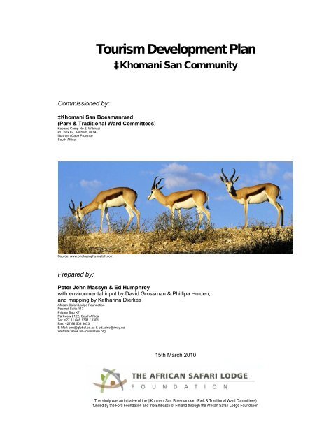
Source: www.photography-match.com<br />
Prepared by:<br />
Peter John Massyn & Ed Humphrey<br />
with environmental input by David Grossman & Phillipa Holden,<br />
and mapping by Katharina Dierkes<br />
<strong>African</strong> Safari Lodge Foundation<br />
Postnet Suite 117<br />
Private Bag X7<br />
Parkview 2122, South Africa<br />
Tel: +27 11 646 1391 / 1301<br />
Fax: +27 86 508 8673<br />
E-Mail: pjm@global.co.za & ed_aino@iway.na<br />
Website: www.asl-foundation.org<br />
15th March 2010<br />
This study was an initiative of the ‡<strong>Khomani</strong> <strong>San</strong> Boesmanraad (Park & Traditional Ward Committees)<br />
funded by the Ford Foundation and the Embassy of Finland through the <strong>African</strong> Safari Lodge Foundation
TOURISM DEVELOPMENT PLAN - ‡KHOMANI SAN COMMUNITY<br />
LIABILITY DISCLAIMER<br />
<strong>The</strong> views and opinions of authors expressed herein do not necessarily state or reflect those of the<br />
‡<strong>Khomani</strong> <strong>San</strong> <strong>Community</strong>, South Africa National Parks and Ford Foundation, and shall not be used<br />
for advertising or product endorsement purposes. <strong>The</strong> authors make no claims, promises or<br />
guarantees about the accuracy, completeness, or adequacy of the contents of this document and<br />
expressly disclaim liability for errors and omissions in its contents.<br />
PAGE 2
TOURISM DEVELOPMENT PLAN - ‡KHOMANI SAN COMMUNITY<br />
ACKNOWLEDGEMENTS<br />
We’d like to thank the ‡<strong>Khomani</strong> <strong>San</strong> community, and particularly Oom Dawid Kruiper, for hosting the<br />
study team during this assignment, and for sharing their intimate knowledge of their land and its<br />
treasures. South <strong>African</strong> National Parks, and especially Dupel Erasmus, generously supplied tourism<br />
statistics and planning documents for the KTP, while Shatho Lopang from the Botswanan Department<br />
of Wildlife & National Parks kindly provided detailed information on their component of the Park. We<br />
also thank the lodge owners adjacent to the KTP on both the Namibian and South <strong>African</strong> sides for<br />
sharing information about their operations as well as providing advice on new products needed in the<br />
area. David Grossman and Phillipa Holden provided valuable inputs on environmental matters and<br />
generous assistance during the fieldwork, while the mapping services of Katharina Dierkes are also<br />
highly appreciated.<br />
This study was made possible by generous financial cooperation from the Ford Foundation and the<br />
Embassy of Finland through the <strong>African</strong> Safari Lodge Foundation.<br />
PAGE 3
TOURISM DEVELOPMENT PLAN - ‡KHOMANI SAN COMMUNITY<br />
TABLE OF CONTENTS<br />
EXECUTIVE SUMMARY ................................................................................................................. 7<br />
1. INTRODUCTION..................................................................................................................... 9<br />
1.1 OBJECTIVE ..................................................................................................................................... 9<br />
1.2 METHOD......................................................................................................................................... 9<br />
1.3 STRUCTURE.................................................................................................................................. 10<br />
2. THE REGIONAL CONTEXT ................................................................................................. 11<br />
2.1 PLANNING DOMAIN......................................................................................................................... 11<br />
2.2 HISTORICAL & SOCIAL CONTEXT ...................................................................................................... 11<br />
2.3 ACCESS & SUPPORT INFRASTRUCTURE............................................................................................ 15<br />
2.4 ENVIRONMENTAL CONTEXT............................................................................................................. 18<br />
2.5 ATTRACTIONS, PRODUCTS, MARKETS, FLOWS AND TRENDS ................................................................ 18<br />
2.6 CONCESSIONING APPROACH........................................................................................................... 26<br />
2.7 ZONING ........................................................................................................................................ 26<br />
3. KGALAGADI TRANSFRONTIER PARK............................................................................... 28<br />
3.1 OVERVIEW.................................................................................................................................... 28<br />
3.2 TOURISM DEVELOPMENTS & ACTIVITIES ........................................................................................... 38<br />
3.3 !XAUS LODGE CONCESSION ........................................................................................................... 39<br />
3.4 SOUTHERN AUOB CONCESSION ...................................................................................................... 45<br />
3.5 ‡KHOMANI SAN 4X4 ROUTE & BUSH CAMP CONCESSION.................................................................. 50<br />
3.6 CULTURAL ACTIVITIES AT RESORTS & CAMPS .................................................................................. 55<br />
3.7 WILDERNESS LEADERSHIP TRAILS CONCESSION .............................................................................. 57<br />
3.8 HERITAGE CENTRE........................................................................................................................ 61<br />
4. ‡KHOMANI SAN FARMS ..................................................................................................... 63<br />
4.1 OVERVIEW.................................................................................................................................... 63<br />
4.2 TOURISM DEVELOPMENTS & ACTIVITIES ........................................................................................... 67<br />
4.3 ERIN HUNTING & TOURISM CONCESSION......................................................................................... 69<br />
4.4 TCA BUSH CAMP & CULTURAL ACTIVITIES ...................................................................................... 73<br />
4.5 WITDRAAI BUSH CAMP & CULTURAL ACTIVITIES ............................................................................... 77<br />
4.6 MIERSHOOPPAN HUNTING CONCESSION .......................................................................................... 82<br />
4.7 SCOTTY’S FORT LODGE CONCESSION ............................................................................................. 86<br />
5. REGIONAL INTERVENTIONS ............................................................................................. 90<br />
5.1 WORLD HERITAGE LISTING............................................................................................................. 90<br />
5.2 REGIONAL GATEWAYS.................................................................................................................... 90<br />
5.3 REGIONAL TOURISM ROUTES & PROMOTION...................................................................................... 90<br />
5.4 PARK DEVELOPMENT...................................................................................................................... 91<br />
5.5 CRAFT PRODUCTION & SALE ........................................................................................................... 91<br />
5.6 GUIDE TRAINING............................................................................................................................ 92<br />
5.7 OTHER TRAINING ........................................................................................................................... 92<br />
6. RECOMMENDED PRIORITIES............................................................................................ 93<br />
7. RECOMMENDED IMPLEMENTATION STRATEGY ........................................................... 94<br />
8. CONCLUSION ...................................................................................................................... 95<br />
9. REFERENCES...................................................................................................................... 96<br />
9.1 REFERENCE LIST ........................................................................................................................... 96<br />
9.2 PEOPLE CONSULTED...................................................................................................................... 97<br />
ANNEX A: QUESTIONNAIRES USED DURING MARKET SURVEY .......................................... 99<br />
ANNEX B: GUIDELINES & PROCEDURES FOR PLANNING & DESIGN OF FACILITIES IN KTP<br />
............................................................................................................................................ 104<br />
ANNEX C: ENVIRONMENTAL GUIDELINES FOR OPERATION WITHIN SOUTH AFRICA<br />
NATIONAL PARKS...................................................................................................................... 107<br />
ANNEX D: EXAMPLE OF AN ENVIRONMENTAL MANAGEMENT PLAN ................................ 124<br />
PAGE 4
TOURISM DEVELOPMENT PLAN - ‡KHOMANI SAN COMMUNITY<br />
LIST OF TABLES<br />
TABLE 1: LOCATION OF AIR STRIPS NEAR TO THE PLANNING DOMAIN....................................................................... 16<br />
TABLE 2: MAIN ACCESS ROADS INTO THE PLANNING DOMAIN.................................................................................. 16<br />
TABLE 3: BORDER POSTS IN AND ADJACENT TO THE PLANNING DOMAIN................................................................... 16<br />
TABLE 4: SUMMARY OF ACCOMMODATION PRODUCTS INSIDE THE KTP (SOUTH AFRICAN COMPONENT, 2008). .......... 19<br />
TABLE 5: SUMMARY OF CAMPSITES INSIDE THE KTP (BOTSWANAN COMPONENT). ................................................... 19<br />
TABLE 6: SUMMARY OF ACCOMMODATION PRODUCTS NEAR TO THE KTP INSIDE SOUTH AFRICA. .............................. 20<br />
TABLE 7: SUMMARY OF ACCOMMODATION PRODUCTS NEAR TO THE KTP INSIDE NAMIBIA......................................... 20<br />
TABLE 8: TOURISM ACTIVITIES TAKING PLACE ON LAND ADJACENT TO THE FOCAL AREA............................................. 20<br />
TABLE 9: PARK ENTRY GATES FOR KTP.............................................................................................................. 28<br />
TABLE 10: ACCESS IN THE KTP. ........................................................................................................................ 28<br />
TABLE 11: PARK ENTRY DATA FOR THE KTP (CALENDAR YEAR OF 2008, SOUTH AFRICAN COMPONENT). .................. 30<br />
TABLE 12: DAY VERSUS OVERNIGHT VISITORS TO KTP (CALENDAR YEAR OF 2008, SOUTH AFRICAN COMPONENT). ... 30<br />
TABLE 13: PARK ENTRY DATA FOR THE KTP (CALENDAR YEAR OF 2008, BOTSWANAN COMPONENT)......................... 30<br />
TABLE 14: DAY VERSUS OVERNIGHT VISITORS TO KTP (CALENDAR YEAR OF 2008, BOTSWANAN COMPONENT).......... 30<br />
TABLE 15: EXISTING ACCOMMODATION AND THEIR RESPECTIVE MARKETS IN THE KTP (SOUTH AFRICAN COMPONENT) 32<br />
TABLE 16: VISITOR INFORMATION FROM ENTRY GATES TO THE KTP (BOTSWANAN COMPONENT). ............................. 33<br />
TABLE 17: EXISTING 4X4 ROUTES IN THE KTP (SOUTH AFRICAN COMPONENT)....................................................... 34<br />
TABLE 18: EXISTING 4X4 ROUTES IN THE KTP (BOTSWANAN COMPONENT) ............................................................ 36<br />
TABLE 19: PROPOSED TOURISM DEVELOPMENTS AND ACTIVITIES FOR THE ‡KHOMANI SAN IN THE KTP..................... 38<br />
TABLE 20: ZONING SUMMARY - !XAUS LODGE CONCESSION.................................................................................. 42<br />
TABLE 21: ZONING SUMMARY – SOUTHERN AUOB CONCESSION............................................................................ 47<br />
TABLE 22: ZONING SUMMARY – ‡KHOMANI SAN 4X4 ROUTE & BUSH CAMP CONCESSION. ...................................... 52<br />
TABLE 23: ZONING SUMMARY – WILDERNESS LEADERSHIP TRAILS CONCESSION.................................................... 59<br />
TABLE 24: ACCESS TO THE ‡KHOMANI SAN FARMS.............................................................................................. 63<br />
TABLE 25: EXISTING ACCOMMODATION AND MARKETS ON THE FARMLAND............................................................... 66<br />
TABLE 26: PROPOSED TOURISM DEVELOPMENTS & ACTIVITIES ON THE ‡KHOMANI SAN LAND. .................................. 68<br />
TABLE 27: RECOMMENDED DEVELOPMENT PRIORITIES. ........................................................................................ 93<br />
LIST OF MAPS<br />
MAP 1: LOCATION OF THE STUDY AREA. .............................................................................................................. 12<br />
MAP 2: ACCESS ROADS, AIRPORTS / STRIPS AND BORDER POSTS IN THE PLANNING DOMAIN...................................... 17<br />
MAP 3: TOURISM ROUTES AND GATEWAYS TO THE STUDY AREA............................................................................. 24<br />
MAP 4: THE KGALAGADI TRANSFRONTIER PARK .................................................................................................. 29<br />
MAP 5: LOCATION OF THE EXISTING 4X4 TRAILS IN THE KTP (SOUTH AFRICAN COMPONENT).................................... 35<br />
MAP 6: LOCATION OF THE EXISTING 4X4 TRAILS IN THE KTP (BOTSWANAN COMPONENT)......................................... 37<br />
MAP 7: LOCATION OF THE !XAUS LODGE CONCESSION......................................................................................... 41<br />
MAP 8: POSSIBLE LOCATION OF THE SOUTHERN AUOB CONCESSION. .................................................................... 46<br />
MAP 9: LOCATION OF THE 4X4 ROUTE & BUSH CAMP CONCESSION. ..................................................................... 51<br />
MAP 10: LOCATION OF TRACKS AND CAMPSITES SITES USED BY THE WILDERNESS LEADERSHIP SCHOOL TRAILS<br />
CONCESSION.......................................................................................................................................... 58<br />
MAP 11: LOCATION OF THE ‡KHOMANI SAN FARMS. ............................................................................................ 64<br />
MAP 12: LOCATION OF THE ERIN FARM. .............................................................................................................. 70<br />
MAP 13: LOCATION OF THE TCA........................................................................................................................ 74<br />
MAP 14: LOCATION OF THE WITDRAAI FARM........................................................................................................ 78<br />
MAP 15: LOCATION OF MIERSHOOPPAN FARM. .................................................................................................... 83<br />
MAP 16: LOCATION OF THE SCOTTY’S FORT FARM. .............................................................................................. 87<br />
PAGE 5
TOURISM DEVELOPMENT PLAN - ‡KHOMANI SAN COMMUNITY<br />
ACRONYMS<br />
ASLF<br />
BOT<br />
CPA<br />
CPPP<br />
EIA<br />
EMP<br />
FIT<br />
JMB<br />
KTP<br />
MET<br />
MOT<br />
NGO<br />
ROT<br />
SADC<br />
SANParks<br />
SASI<br />
TA<br />
TCA<br />
TDF<br />
TOR<br />
TPD<br />
WLS<br />
<strong>African</strong> Safari Lodge Foundation<br />
Build, operate and transfer concession<br />
Common Property Association<br />
<strong>Community</strong>, public, private partnership<br />
Environmental Impact Assessment<br />
Environmental Management <strong>Plan</strong><br />
Fully Independent Traveller<br />
Joint Management Board<br />
Kgalagadi Transfrontier Park<br />
Ministry of Environment & <strong>Tourism</strong><br />
Maintain, operate and transfer concession<br />
Non-governmental Organisation<br />
Rehabilitate, operate and transfer concession<br />
Southern Africa <strong>Development</strong> <strong>Community</strong><br />
South <strong>African</strong> National Parks<br />
South <strong>African</strong> <strong>San</strong> Institute<br />
Traditional Authority<br />
Traditional conservation area<br />
<strong>Tourism</strong> <strong>Development</strong> Framework<br />
Terms of Reference<br />
Transfrontier Park Destinations<br />
Wilderness Leadership School<br />
PAGE 6
TOURISM DEVELOPMENT PLAN - ‡KHOMANI SAN COMMUNITY<br />
Executive summary<br />
This plan proposes a variety of tourism development and activity proposals for the ‡<strong>Khomani</strong> <strong>San</strong> land inside the Kgalagadi Transfrontier Park (KTP) as well<br />
as their farm land. <strong>The</strong>se proposals are grounded in market information gathered from SANParks and private lodge operators in the planning domain. <strong>The</strong><br />
table below summarises the recommendations for tourism development and activities in the KTP:<br />
!Xaus Lodge Concession<br />
(existing)<br />
Southern Auob<br />
Concession (new)<br />
‡<strong>Khomani</strong> <strong>San</strong> 4x4 Route &<br />
Bush Camp Concession<br />
(new)<br />
Cultural Activities from<br />
Resorts & Camps (new)<br />
Wilderness Leadership<br />
Trails (existing)<br />
Heritage Centre (new)<br />
• Option 1: Expand to a<br />
maximum of 24 rooms<br />
(48 beds)<br />
• Option 2: Only address<br />
current short-comings in<br />
existing lodge (guide<br />
rooms, water supply,<br />
electricity supply)<br />
• Develop a 4x4 eco-trail<br />
& unserviced bush<br />
camp<br />
• High priority<br />
• Light footprint, upmarket<br />
lodge of 24 to 48 beds<br />
• Developed via a build<br />
operate transfer<br />
concession with a<br />
private partner<br />
• Very high priority<br />
• 4x4 eco-trail between<br />
Twee Rivieren & Mata<br />
Mata<br />
• At least 2 primitive bush<br />
camps<br />
• Developed & operated<br />
in partnership with an<br />
existing operator<br />
• Low priority<br />
• Guided interpretive<br />
walks & other activities<br />
at resorts & camps in<br />
KTP<br />
• Developed & operated<br />
in partnership between<br />
‡<strong>Khomani</strong> <strong>San</strong>,<br />
SANParks & private<br />
concessionaires<br />
• Preceded by guide<br />
training &<br />
entrepreneurial<br />
development<br />
• Medium priority<br />
• Formalisation of existing<br />
trails conducted by<br />
Wilderness Leadership<br />
School into a<br />
concession contract<br />
• High priority<br />
• New heritage centre at<br />
Twee Rivieren to show<br />
case heritage of the<br />
area<br />
• To be linked with World<br />
Heritage listing of area<br />
• Very high priority<br />
<strong>The</strong> table below summarises the recommendations for tourism development and activities on the ‡<strong>Khomani</strong> <strong>San</strong> farm land:<br />
Erin Hunting & <strong>Tourism</strong><br />
Concession (new)<br />
• High value hunting & tourism<br />
concession<br />
• Developed & operated with a<br />
private sector partner<br />
• Specialising in traditional <strong>San</strong><br />
hunting methods, including<br />
bow hunting<br />
• Very high priority<br />
TCA Bush Camp & Cultural<br />
Activities (new)<br />
• Rustic bush camp &<br />
associated cultural activities<br />
• Developed & operated by the<br />
local community living in the<br />
TCA, BUT under guidance &<br />
support of an established tour<br />
operator experienced in<br />
cultural tourism<br />
• Medium priority<br />
Witdraai Bush Camp & Cultural<br />
Activities (existing)<br />
• Upgrade & possible relocation<br />
of existing operation<br />
• Developed & operated by the<br />
local community living at<br />
Witdraai, BUT under guidance<br />
& support of an established<br />
tour operator experienced in<br />
cultural tourism<br />
• Low priority<br />
Miershooppan hunting<br />
concession (new)<br />
• Biltong hunting concession<br />
• Developed & operated with a<br />
private sector partner<br />
• High priority<br />
Scotty’s Fort Lodge Concession<br />
(new)<br />
• In short-term, existing farm<br />
house used as guest house<br />
• In long-term, Roadside Lodge<br />
Concession of approximately<br />
60 to 80 beds & campsite<br />
• Developed via a build operate<br />
transfer concession with a<br />
private partner<br />
• Low priority<br />
PAGE 7
TOURISM DEVELOPMENT PLAN - ‡KHOMANI SAN COMMUNITY<br />
In addition to the above, this plan outlines several important regional interventions that could<br />
increase visitor flow through the area, improve the experience of visitors, and diversify current<br />
tourism markets. <strong>The</strong>se regional interventions include: support to the World Heritage listing<br />
process that is currently underway; development of regional gateways to improve the sense of<br />
arrival into the Kalahari and provide tourism support services; development of regional tourism<br />
routes and promotion of tourism attractions in the broader area; Park development, particularly<br />
the re-branding of the KTP as a heritage and wildlife destination; support to the production and<br />
sale of craft from this region; implementation of guide training with improved linkages to the<br />
private sector in terms of in-service training and gradate employment; and other community<br />
training, particularly in literacy and English language to assist more local people to enter the<br />
tourism industry.<br />
PAGE 8
TOURISM DEVELOPMENT PLAN - ‡KHOMANI SAN COMMUNITY<br />
1. Introduction<br />
This report is the product of a tourism planning exercise commissioned by the ‡<strong>Khomani</strong> <strong>San</strong><br />
<strong>Community</strong> and facilitated by the <strong>African</strong> Safari Lodge Foundation (ASLF). Its purpose is to<br />
provide a first, high-level planning and implementation framework for the development of tourism<br />
on ‡<strong>Khomani</strong> <strong>San</strong> land inside and in close proximity to the Kgalagadi Transfrontier Park (KTP).<br />
1.1 Objective<br />
This plan aims to identify viable tourism development opportunities on the ‡<strong>Khomani</strong> <strong>San</strong> land<br />
inside and near to the KTP with a view to creating employment, generating income for the<br />
community, and building recognition of the area’s significance as home to one of southern<br />
Africa’s first peoples. In achieving this, the report builds on the planning already completed by<br />
South <strong>African</strong> National Parks (SANParks) and other stakeholders, and draws on<br />
recommendations and commitments already made in these documents.<br />
1.2 Method<br />
<strong>The</strong> study involved a multi-disciplinary team consisting of tourism planners (Peter John Massyn<br />
and Ed Humphrey), with environmental inputs from ecologists (David Grossman and Phillipa<br />
Holden) and mapping services by a GIS expert (Katharina Dierkes). <strong>The</strong> planning procedure<br />
included the following activities:<br />
• Inception meetings with the study team to clarify the methods to be used and products required;<br />
• Review of background documents, including management and business plans, maps, tourism plans and<br />
other relevant literature;<br />
• Field visit to the planning domain between 26 th July and 1 st August 2009, which involved exploring the<br />
‡<strong>Khomani</strong> <strong>San</strong> areas with tourism potential inside the KTP and on nearby farm land as well as<br />
discussions with representatives of the ‡<strong>Khomani</strong> <strong>San</strong>;<br />
• Visits to existing tourism operations in the area, as well as on nearby land;<br />
• Review of tourism statistics, park entry statistics, and market research conducted by the North West<br />
University, SANParks and the Department of Wildlife and National Parks in Botswana;<br />
• Telephone and face-to-face interviews of people with knowledge of the area and its potential for tourism<br />
and trophy hunting, including members of the ‡<strong>Khomani</strong> <strong>San</strong> community, as well as tour and safari<br />
operators, trophy hunters, lodge operators, relevant government departments and NGOs;<br />
• Follow up meetings with various stakeholders to verify findings from the field work;<br />
• Preparation of the draft report, including accompanying maps;<br />
• Presentation of findings and the draft report to ‡<strong>Khomani</strong> <strong>San</strong> Boesmanraad on 20 th January 2010 and<br />
the Joint Management Board (JMB) for the !Ae!Hai Kalahari Heritage Park on 21 st January 2010;<br />
• Meeting between the planning team and the ‡<strong>Khomani</strong> <strong>San</strong> Boesmanraad on 24 th and 25 th February<br />
2010 to agree on priorities and plan next steps; and<br />
• Incorporation of relevant comments from stakeholders into this final report.<br />
PAGE 9
TOURISM DEVELOPMENT PLAN - ‡KHOMANI SAN COMMUNITY<br />
1.3 Structure<br />
<strong>The</strong> report includes:<br />
• A broad description of the study area including a review of regional issues, access and transport<br />
infrastructure, environmental issues, tourism attractions, existing products and markets, visitor gateways<br />
and routes through the area, and major tourism trends;<br />
• An introduction to each land unit within the planning domain, including the social and historical context,<br />
environmental issues, tourism resources, existing markets and products;<br />
• Specific tourism proposals for each land unit, including new developments and activities,<br />
recommendations on improving existing products, suggested zoning, required support infrastructure,<br />
visitor management requirements, and branding or marketing needs; and<br />
• Sufficient detail for proposed interventions, developments and activities to allow opportunities to be<br />
packaged for implementation.<br />
To conclude, the report provides a summary of suggested regional interventions, possible<br />
financial and economic impacts, recommended priorities for implementation, and a proposed<br />
implementation strategy.<br />
Annexed to this document is a list of references and people consulted, copies of market survey<br />
forms used, environmental/development guidelines for tourism and a template environmental<br />
management plan (EMP).<br />
PAGE 10
TOURISM DEVELOPMENT PLAN - ‡KHOMANI SAN COMMUNITY<br />
2. <strong>The</strong> Regional Context<br />
2.1 <strong>Plan</strong>ning domain<br />
<strong>The</strong> planning domain comprises several parcels of land situated inside and near the KTP in the<br />
Northern Cape Province of South Africa (refer to Map 1):<br />
• 80,000ha of prime game viewing land along and south of the Auob River inside the KTP, on which the<br />
community have preferential commercial rights (referred to as the Commercial Preference Zone, or V-<br />
Zone);<br />
• 473,830ha of land between the Auob and Nossob Rivers inside of the KTP, which is assigned for<br />
symbolic and cultural use (referred to as the Symbolic and Cultural Zone, or S-Zone);<br />
• 27,769ha of <strong>San</strong> Heritage Land inside of the KTP, which together with heritage land of the Mier<br />
community (a further 30,134ha) is co-managed with SANParks as a contractual national park called the<br />
!Ae!Hai Kalahari Heritage Park; and<br />
• 40,748ha of Kalahari farm land situated adjacent to the KTP and further south, which is made up of<br />
eight individual properties being Sonderwater, Rolletjies, Erin, Witdraai, Uitkoms, Andriesvale,<br />
Miershoopan and Scotty’s Fort.<br />
2.2 Historical & social context<br />
Most paleoanthropologists and geneticists subscribe to the “Out of Africa” theory that the<br />
ancestors of modern humans arose some 200,000 years ago in Africa, with the earliest modern<br />
human fossils being found at Omo Kibish, Ethiopia (Shreeve, 2006). <strong>The</strong>y also agree that ‘all the<br />
variously shaped and shaded people of Earth trace their ancestry to <strong>African</strong> hunter-gatherers’.<br />
Ancestral DNA markers turn up most often among the <strong>San</strong> people of Southern Africa and the<br />
Biaka Pygmies of central Africa, as well as in some East <strong>African</strong> peoples (Shreeve, 2006). From<br />
this we can reasonably conclude that the <strong>San</strong> form part of our ancestry, as well as being the first<br />
people of southern Africa, as is evidenced by a vast rock art record that is to be found on the subcontinent.<br />
<strong>The</strong> <strong>San</strong> were pushed into remoter and drier regions by two major relatively recent migrations of<br />
other peoples. Approximately 2,000 years ago the sheep and cattle herding Khoekhoe peoples<br />
migrated down from Namibia and Botswana, pushing <strong>San</strong> people away from the coast and river<br />
areas, and around 800 years ago a major migration of Bantu-speaking peoples entered eastern<br />
South Africa (Huffman, 2006). It would seem that early relations between hunter-gatherers and<br />
the agro-pastoralist peoples were often positive and involved a degree of intermarriage with the<br />
retention of the independence of <strong>San</strong> languages and culture.<br />
PAGE 11
TOURISM DEVELOPMENT PLAN - ‡KHOMANI SAN COMMUNITY<br />
Map 1: Location of the study area.<br />
PAGE 12
TOURISM DEVELOPMENT PLAN - ‡KHOMANI SAN COMMUNITY<br />
This changed with the arrival of European explorers and settlers in the 16th and 17th centuries,<br />
where after land was gradually carved up into freehold farms, displacing the indigenous people<br />
onto smaller tracts of communal land, particularly so in Namibia, South Africa and Zimbabwe.<br />
<strong>The</strong> expansion of European colonisation caused a great strain on land resources. <strong>San</strong> huntergatherers<br />
were victimised by the European settlers as well as by Khoe and Bantu-language<br />
groups, who were all competing for resources in the face of European territorial expansion. Over<br />
this period, disease and other genocidal conditions decimated most <strong>San</strong> clans in South Africa<br />
(and Namibia), with the last permit to hunt a Bushman being issued by the pre-apartheid state in<br />
1927 (Gall, 2001).<br />
At the same time, growing commercial trade, together with protection of crops and livestock<br />
necessitated certain controls over wildlife. <strong>The</strong> accumulation of wealth led to divisions among<br />
social classes, and ‘desirable’ wildlife species came to be controlled by an elite who alone could<br />
hunt, trade and enjoy the spoils of certain species (Carruthers, 1995). Wildlife numbers on<br />
freehold ranches decreased over time, particularly in South Africa, due to a combination of<br />
uncontrolled hunting, slaughter for skins, trophies and biltong (Grossman and Holden, 2005). <strong>The</strong><br />
dominant settler religion, Christianity, excluded pantheistic beliefs in the intrinsic power and value<br />
of nature such as those held, for example, by the hunter-gathering communities (Carruthers,<br />
1995). Rather, this religion encouraged its adherents to tame and civilize nature in the service of<br />
mankind and material progress (Carruthers, 1995).<br />
<strong>The</strong> net result of the situation described above and exacerbated by the rinderpest epidemic of the<br />
late nineteenth century is that by the early twentieth century, in South Africa in particular, wildlife<br />
numbers had declined substantially and other natural resources were under increasing pressure<br />
(Grossman & Holden, 2005). During that time, the emergence of a ‘new’ conservation ethic in<br />
western countries filtered through to southern <strong>African</strong> colonial administrations. <strong>The</strong> extinct quagga<br />
and Cape bluebuck were held as examples of the result of an uncontrolled free for all approach.<br />
Species such as the bontebok, black and white rhino became flagships for conservation as their<br />
numbers had dwindled to near-extinction levels. Game reserves were proclaimed by the state,<br />
conservation legislation controlling hunting was enacted, and several private nature reserves<br />
were proclaimed by conservation conscious land owners.<br />
Whilst indigenous hunter-gathering communities are likely to have had only minor impacts on<br />
natural systems, the enforced apartheid policy of South Africa (also applicable to Namibia, then a<br />
mandated territory under South <strong>African</strong> administration) and the prevailing land policies in then<br />
Rhodesia (now Zimbabwe), further removed any control or use of wildlife from indigenous<br />
populations. <strong>The</strong> net result of protectionist legislation was to centralize control over wildlife and to<br />
effectively ban subsistence use. Customary and traditional natural resource management<br />
institutions were eroded and gradually replaced with centralised, state systems that effectively<br />
removed control of natural resources and biodiversity from local communities, destabilising<br />
functional management systems and replacing them with increasingly non-functional, alien ones.<br />
‘Superstitious beliefs’ that had previously safeguarded biodiversity to some extent were also<br />
undermined by the church with detrimental impacts on local, de facto conservation practices.<br />
When the Kalahari Gemsbok National Park (959,100ha) was proclaimed in 1931, the livelihoods<br />
and freedom of movement of some of South Africa’s last remaining first peoples – Bushman as<br />
they call themselves – were curtailed. Some people were settled at the park headquarters at<br />
Twee Rivieren, and some gained employment in SANParks. Many others, having been<br />
dispossessed of their land, dispersed into Namibia, onto nearby farms and further afield.<br />
PAGE 13
TOURISM DEVELOPMENT PLAN - ‡KHOMANI SAN COMMUNITY<br />
<strong>The</strong> Mier people also inhabited the area that now constitutes part of the Park, and they too have a<br />
history of dispossession. Like the <strong>San</strong>, the Mier were also allowed to continue living in certain<br />
areas within the Park, but lost their rights to hunt and manage stock on the land and were<br />
eventually forcibly removed to state land reserved for them under the settlement schemes of the<br />
1930s.<br />
<strong>The</strong> proclamation of the Park was followed by gazetting of Botswana’s Gemsbok National Park<br />
(2,840,000ha) in 1938. <strong>The</strong> two parks were amalgamated as the Kgalagadi Transfrontier Park<br />
(KTP) in 1999 following the signing of a bilateral agreement between the South <strong>African</strong> and<br />
Botswanan governments.<br />
In 1995 the ‡<strong>Khomani</strong> <strong>San</strong> community lodged a claim for the restitution of 400,000ha of land in<br />
the Kalahari Gemsbok Park. In December 1998, the Mier community, represented by the Mier<br />
Transitional Local Council, lodged its own land claim for land both inside and outside the Park.<br />
After many years of negotiation and verification, the claims were finally settled on 21 st March<br />
1999, with the official transfer of title to six Kalahari farms (approximately 34,728ha) to the<br />
‡<strong>Khomani</strong> <strong>San</strong> Common Property Association (CPA), a form of collective trust allowed by the<br />
Communal Property Associations Act (No. 28 of 1996) for use by communities that have<br />
benefited from land restitution under the Restitution of Land Rights Act (No. 22 of 1994).<br />
Supplemental to this, in 2007 it was agreed that a further two farms (Sonderwater and Rolletjies -<br />
approximately 6,020ha) be transferred to the ‡<strong>Khomani</strong> <strong>San</strong> CPA; however up to now the<br />
allocation of title has not yet been completed (Chennells, pers. comm., 2010).<br />
In addition, after further negotiations, on 29 th May 2002 the conditional allocation of some<br />
57,903ha of land within the Park – to be managed as a Contractual National Park (!Ae!Hai<br />
Kalahari Heritage Park) – was committed to the ownership of the ‡<strong>Khomani</strong> <strong>San</strong> and Mier<br />
communities through what is known as the !Ae!Hai Kalahari Heritage Park Agreement<br />
(Chennells, pers. comm., 2010). In this Agreement the ‡<strong>Khomani</strong> <strong>San</strong> community were also<br />
granted preferential tourism rights over 80,000ha south of the Auob River inside the Park, and<br />
473,830ha of land between the Auob and Nossob Rivers as a symbolic and cultural zone.<br />
In the years after the land claim was settled, little development occurred on this land, with growing<br />
social decay and disintegration, lack of post-restitution support from the South <strong>African</strong> authorities,<br />
divisions within the now disparate community, and no significant improvement in the welfare of<br />
most community members being the order of the day. Until recently, most elders from the<br />
community had yet to set foot on their land in the Park, let alone enjoy the rights conferred upon<br />
them.<br />
<strong>The</strong>re are many factors that contribute to and exacerbate the situation within the ‡<strong>Khomani</strong> <strong>San</strong><br />
<strong>Community</strong> and these include (but are not limited to):<br />
• After nearly a century of being spread out in the diaspora, families and clans had developed in totally<br />
different directions. Some had retained most of the old ways, others had totally immersed themselves in<br />
modern life, or had eked out lives as an underclass in dismal squatter environments. Many had survived<br />
lives of unspeakable hardship and misery. <strong>The</strong> land claim brought these disparate <strong>San</strong>, linked by ancient<br />
blood ties, into one reconstituted community, overnight. <strong>The</strong> tensions and differences arising from<br />
countless perceptions, mistrust, lack of knowledge of each other in the community, were underestimated,<br />
and need to be addressed in order to further build up the community.<br />
• Racial discrimination remains rife in this area and this perpetuates the status quo and the sense of<br />
disempowerment that the <strong>San</strong> community experience.<br />
PAGE 14
TOURISM DEVELOPMENT PLAN - ‡KHOMANI SAN COMMUNITY<br />
• Substance abuse is wide-spread in the community and this leads to further social decay resulting in<br />
domestic violence, child abuse, and increased risk of HIV transmission, malnutrition, depression and<br />
social dysfunction.<br />
• A lack of education and life skills means that the people are poorly equipped to cope with the situation<br />
that they find themselves in.<br />
• <strong>The</strong> provision of services to this relatively remote area is slow and the community has been severely<br />
neglected by all arms of government. <strong>The</strong>re is extremely limited access to health care, limited access to<br />
the justice system, limited access to shops and a food supply, no water on the farms, housing remains<br />
inadequate, a lack of income generating opportunities, and a lack of infrastructure including that for<br />
communication results in the physical and virtual isolation of this community with little access to<br />
information and the outside world.<br />
• Inadequate post settlement support, despite statutory obligations and contractual commitments. This is<br />
mainly due to the over-commitment of government departments and officials in the face of numerous<br />
time and resource-consuming land claims.<br />
Over the years, three successive CPA committees were elected in terms of the !<strong>Khomani</strong> CPA<br />
constitution, and failed largely as a result of the lack of post-restitution support referred to above.<br />
A number of Non-Government Organisations (NGOs) have attempted to assist, and the South<br />
<strong>African</strong> <strong>San</strong> Institute (SASI) has supported the community since the inception of the land claim.<br />
<strong>The</strong> CPA is currently not formally operational, pending an initiative to revive it in a sustainable<br />
manner, and currently developments in the community are coordinated by means of monthly<br />
meetings attended by all constituencies and role players. During this revival period, the Park and<br />
Traditional Ward Committees are formally mandated by the Department of Rural <strong>Development</strong><br />
and Land Reform as the institutions responsible for development and conservation activities in<br />
the Park and on the farmland.<br />
In recent times, through the involvement of various stakeholders including the ASLF and SASI,<br />
this situation is slowly being rectified. In 2007 and then again in 2009, grants were received from<br />
the Ford Foundation to fund a project supporting the ‡<strong>Khomani</strong> <strong>San</strong> community. <strong>The</strong> grants,<br />
which are being administered through the ASLF, are helping to re-build the community’s cultural<br />
identity by re-establishing the people’s connection with their ancestral land, facilitating the<br />
transmission of indigenous knowledge between generations, and helping the community to<br />
effectively plan, manage and benefit from their land. <strong>The</strong> Finnish Embassy has also recently<br />
contributed funds to the development of tourism opportunities for the ‡<strong>Khomani</strong> <strong>San</strong> on their land.<br />
Through formation of the “Boesmanraad” (Park & Traditional Ward Committees), the community<br />
is now co-managing their land in the Park (together with SANParks) as well as their farmland.<br />
<strong>The</strong> community now seeks to develop commercial ecotourism on their land, and have requested<br />
this plan be prepared as a guide.<br />
2.3 Access & support infrastructure<br />
Despite the focal area’s remoteness, it remains relatively accessible for tourists travelling by road<br />
or aircraft. Air access is possible via Upington and Twee Rivieren (refer to Table 1 and Map 2). A<br />
recently upgraded, major regional airport is available at Upington, situated approximately 200km<br />
to the south east. Upington receives scheduled flights from Johannesburg and Cape Town.<br />
According to the Airports Company of South Africa (website accessed 3 rd September 2009),<br />
Upington received approximately 19,961 arrivals and 3,694 air traffic movements in 2007;<br />
however it has the capacity to cater for around 40,000 arrivals in future. Twee Rivieren has a<br />
PAGE 15
TOURISM DEVELOPMENT PLAN - ‡KHOMANI SAN COMMUNITY<br />
high-quality, surfaced airstrip, and is available for access by chartered aircraft. No other air<br />
access is possible inside the KTP or on the directly adjacent land.<br />
Table 1: Location of air strips near to the planning domain.<br />
Place Location Condition<br />
Upington 200km south of planning domain Excellent, tarred, regional air hub for<br />
Northern Cape Province<br />
Twee Rivieren<br />
Just north of the Twee Rivieren resort<br />
and park station<br />
Excellent, tarred<br />
Road access into the planning domain is possible via a number of high quality, tar and gravelsurfaced<br />
roads as listed in Table 2 and Map 2. Other minor access roads and internal tracks exist<br />
within the area. Proclaimed minor roads are mostly gravel-surfaced, whereas other internal<br />
tracks are sandy and require 4x4 vehicles for year-round access.<br />
Table 2: Main access roads into the planning domain.<br />
From Description Condition<br />
South<br />
Africa<br />
− From Upington or Rietfontein via the<br />
tarred R360<br />
− Excellent, tarred<br />
Namibia − From Riefontein border post via<br />
Keetmanshoop / Koës / Aroab along the<br />
C11 & C16<br />
− From Mata Mata Border post via Gochas<br />
along the C15<br />
Botswana − From Mabuasehube via Tshabong,<br />
McCarthy’s Rest border post & C380<br />
− From Kaa via Trans-Kalahari Highway<br />
(Kang and Logkwabe)<br />
−<br />
−<br />
−<br />
−<br />
Good, well maintained<br />
gravel roads<br />
Good, well maintained<br />
gravel road<br />
Gravel, variable quality<br />
Gravel, variable quality<br />
<strong>The</strong> border posts in this area are essential infrastructure to enable the flow of tourists through the<br />
planning domain. <strong>The</strong> relevant border posts are listed in Table 3 and illustrated in Map 2.<br />
Table 3: Border posts in and adjacent to the planning domain.<br />
Name<br />
Rietfontein<br />
Mata Mata<br />
Twee Rivieren<br />
McCarthy’s Rest<br />
Gemsbok<br />
Between<br />
South Africa & Namibia<br />
South Africa & Namibia<br />
South Africa & Botswana<br />
South Africa & Botswana<br />
South Africa & Botswana<br />
According to Erasmus (pers comm., 2009), on average over 1,000 park visitors use the Mata<br />
Mata border facility between Namibia and South Africa during the five peak tourism months<br />
between May and September (i.e. including exits and entries). Between February and August<br />
2009 a total of 5,353 park visitors used the Mata Mata gate, representing approximately 20% of<br />
park visitors in the South <strong>African</strong> component (Erasmum, pers comm., 2009). Interestingly,<br />
according to /Goagoseb (pers comm., 2009) the Namibian immigrations officials at Mata Mata<br />
processed a total of 931 arrivals and 8,171 departures during the 2008 calendar year.<br />
PAGE 16
TOURISM DEVELOPMENT PLAN - ‡KHOMANI SAN COMMUNITY<br />
Map 2: Access roads, airports / strips and border posts in the planning domain.<br />
PAGE 17
TOURISM DEVELOPMENT PLAN - ‡KHOMANI SAN COMMUNITY<br />
2.4 Environmental context<br />
In this section, a summary of the salient ecological and environmental constraints within the study<br />
area is provided. Where relevant, site-specific considerations are also provided for each area in<br />
the sections that follow.<br />
This does NOT replace the mandatory environmental impact assess (EIA) process required for<br />
developments in the Park or in instances where EIAs are called for outside of protected areas,<br />
but is intended to provide guidelines to the various stakeholders involved in the management and<br />
development of each site.<br />
<strong>The</strong> arid nature of the Kalahari environment and scarcity of potable groundwater places obvious<br />
constraints on development, necessitating prior professional assessment of the presence or<br />
absence of a sustainable water supply. Electricity is confined to the Andriesvale-Twee Rivieren<br />
line. Further constraints include:<br />
• variability of rainfall - there is a high co-efficient of variability in the amount and timing of rainfall, with<br />
several years of below average rainfall to be expected, as well as years with more than double annual<br />
average rainfall and risk of flash floods;<br />
• high intensity rainfall events leading to increased risks of accelerated soil erosion, particularly where<br />
impacts of roads, tracks and construction are not avoided or properly mitigated;<br />
• likely future effects of climate change;<br />
• risk of uncontrollable wildfires after good rainfall and grass production; and<br />
• extremes in temperature fluctuation, from below zero in winter to above 45 degrees in summer.<br />
2.5 Attractions, products, markets, flows and trends<br />
Attractions<br />
<strong>The</strong> attraction of this semi-arid area is based on an array of natural and cultural attributes, which<br />
collectively contribute to the visitor experience. <strong>The</strong> attractions include:<br />
• the undulating dune system, varying in colour from pale to red, comprising a parallel series of northwest/south-east<br />
running aeolian (wind deposited) sandy dunes, inter-dune ”streets”, pans, some of which<br />
are exposed remnants of ancient water-courses; and the dry river beds with calcrete banks, many of<br />
which contain caves once inhabited by early people;<br />
• big skies and spectacular star gazing;<br />
• groves and scattered individual large camelthorn trees, many with the huge nests of gregarious sociable<br />
weavers;<br />
• a variety of magico-medicinal plants used by the bushmen, including the hoodia and devils claws, the<br />
important tsamma melons and other cucurbits, important to people and wildlife;<br />
• varied birdlife, and reptiles including the omnipresent and iconic barking gecko;<br />
• the large mammals including lion, and dry western species such as oryx and springbok, with unique<br />
behavioural and physiological adaptations to living in this semi-arid area. Wildlife is mainly concentrated<br />
PAGE 18
TOURISM DEVELOPMENT PLAN - ‡KHOMANI SAN COMMUNITY<br />
along two linear routes, being the Nossob and Auob Rivers. Viewing of predator kills (especially lion and<br />
cheetah) is reported to be common and spectacular;<br />
• the smaller mammals including cape fox, bat-eared fox, ground squirrels, meerkats and a variety of<br />
rodents;<br />
• a “wilderness” appeal characterised by the area’s sense of open space, remoteness and isolation,<br />
coupled with limited man-made alternations;<br />
• the opportunity for “wilderness” experiences, especially along 4x4 routes away from the main access<br />
roads and tracks;<br />
• hunting opportunities on private farmland. “Biltong hunting” is particularly common in the surrounding<br />
areas and is very popular with the South <strong>African</strong> market. But there is also a thriving trophy hunting<br />
industry, which mainly caters to overseas clients;<br />
• interesting local history; and<br />
• the cultural dimension of the world’s first people.<br />
Existing tourism products<br />
This section summarises the existing tourism products in the planning domain, including<br />
accommodation establishments, activities, national parks, and trophy hunting operations.<br />
Accommodation:<br />
<strong>The</strong> existing accommodation within and directly adjacent to the area is summarised in Table 4 to<br />
Table 7 below. SANParks supplied the information contained in Table 4 (Erasmus, pers comm.,<br />
2009), while the Department of Wildlife and National Parks supplied the data used in Table 5<br />
(Lopang, pers comm.. 2010).<br />
Table 4: Summary of accommodation products inside the KTP (South <strong>African</strong> component, 2008).<br />
Establishments: 10 Occupancy: 58.6% Length of stay: 2.3 nights per camp,<br />
4.7 nights in Park<br />
Rooms: 107 Bed nights sold: 62,064 Guest numbers: 24,234<br />
Campsites: 70 Camping nights<br />
sold:<br />
52,109 Market level (%<br />
establishments):<br />
10% up-market; 90%<br />
mid-market<br />
Beds: 290 Purpose of visit: Primarily leisure Market segmentation: 72% South <strong>African</strong>;<br />
24% overseas; 4%<br />
SADC<br />
Table 5: Summary of campsites inside the KTP (Botswanan component).<br />
Establishments: 18 Occupancy: 20% Length of stay: 2.9 in Park<br />
Campsites: 38 Camping nights 16,544 Guest numbers: 5,635<br />
sold:<br />
Purpose of<br />
visit:<br />
Primarily<br />
leisure<br />
Market level (%<br />
establishments):<br />
100% budget Market segmentation: 77% South <strong>African</strong>;<br />
14.4% Overseas;<br />
8.6% SADC<br />
PAGE 19
TOURISM DEVELOPMENT PLAN - ‡KHOMANI SAN COMMUNITY<br />
Table 6: Summary of accommodation products near to the KTP inside South Africa.<br />
Establishments: 3 Occupancy: 49.7% Length of stay: 1.6<br />
Rooms: 65 Bed nights sold: 25,043 Guest numbers: 20,394 (including<br />
4,814 campers)<br />
Campsites: 22 Camping nights<br />
sold:<br />
7,934 Market level (%<br />
establishments):<br />
100% budget<br />
Beds: 135 Purpose of visit: Primarily leisure Market segmentation: 72% South <strong>African</strong>;<br />
27% overseas; 1%<br />
SADC<br />
Table 7: Summary of accommodation products near to the KTP inside Namibia.<br />
Establishments: 7 Occupancy: 21% Length of stay: 1.1<br />
Rooms: 55 Bed nights sold: 6,931 Guest numbers: 8,435<br />
Campsites: 42 Camping nights<br />
sold:<br />
2,142 Market level (%<br />
establishments):<br />
43% mid-market;<br />
57% budget<br />
Beds: 112 Purpose of visit: Primarily leisure Market segmentation: 12% South<br />
<strong>African</strong>; 84%<br />
overseas; 4%<br />
SADC<br />
<strong>The</strong>re are also upgrades and new developments planned or being undertaken at the moment.<br />
<strong>The</strong>se are summarised below:<br />
• It was reported by Lopang (pers comm., 2010) that the Botswanan Department of Wildlife and National<br />
Parks recently awarded concessions for five new high value / low volume (up-market) accommodation<br />
facilities at Rooiputs, Marie se Draai, Polentswa, Union’s End and Mabuasehube. <strong>The</strong>se concessions,<br />
which could result in about 120 additional beds in the Park, were awarded to two companies, and<br />
construction of the lodges is expected to start during 2010;<br />
• In the draft tourism development plan for the KTP, V&L Landscape Architects (2006) suggest the<br />
following accommodation developments be considered by the relevant park authorities:<br />
• the award of five new lodge concessions in the Botswanan component, as described above;<br />
• room and campsite numbers at Mata Mata Rest Camp be increased in light of the border opening with<br />
Namibia (additional 14 beds; campsites not specified in the report);<br />
• room and campsite numbers at Nossob Rest Camp be increased following creation of a new circulation<br />
route and increasing volumes from the Mabuasehube area (additional 14 beds and space for 40 campers);<br />
• development of a new 8 bed Wilderness Camp at Eland; and<br />
Activities:<br />
• development of a new 8 bed Wilderness Camp at Kameelsleep.<br />
A variety of activities are available in the planning domain. <strong>The</strong>se are listed in Table 8 below:<br />
Table 8: <strong>Tourism</strong> activities taking place on land adjacent to the focal area.<br />
Product Location Main markets<br />
Vehicle-based game viewing Inside KTP South <strong>African</strong>, SADC and overseas<br />
fully independent travellers (FITs)<br />
Guided self-drive 4x4 trails Inside KTP and on directly adjacent Mainly South <strong>African</strong> FITs<br />
PAGE 20
TOURISM DEVELOPMENT PLAN - ‡KHOMANI SAN COMMUNITY<br />
Product Location Main markets<br />
farmland<br />
Self-drive 4x4 trails<br />
Guided day visit to KTP from<br />
neighbouring lodges<br />
Biltong hunting<br />
Trophy hunting<br />
Inside KTP and on directly adjacent<br />
farmland<br />
Inside KTP<br />
On private farmland adjacent to the<br />
planning domain<br />
On private farmland adjacent to the<br />
planning domain<br />
Mainly South <strong>African</strong> FITs<br />
Cultural performances Witdraai Farm near Andriesvale Overseas FITs<br />
Guided bushwalks Witdraai Farm near Andriesvale Overseas FITs<br />
Overnight guided walking trails<br />
(Wilderness Leadership School)<br />
Environmental education<br />
Inside the KTP on the <strong>San</strong> heritage<br />
land<br />
Inside the KTP at the Gemsbokplein<br />
EE Centre<br />
Neighbouring lodge operators using<br />
properly licenced game viewing<br />
vehicles<br />
South <strong>African</strong> and SADC biltong<br />
hunters<br />
Sport and trophy hunting outfitters<br />
South <strong>African</strong> leaders, learners and<br />
community members<br />
South <strong>African</strong> school learners<br />
<strong>Tourism</strong> markets<br />
Research conducted for this study found that the following tourism markets (in order of volume)<br />
currently visit the planning domain:<br />
• Fully independent travellers (FITs) using their own vehicles: <strong>The</strong>se visitors are predominantly South<br />
<strong>African</strong> and other SADC residents who have their own vehicles (often 4x4s), and want to explore the<br />
KTP and surrounding area. <strong>The</strong>y travel with more time, and are normally fully self-contained. <strong>The</strong>ir<br />
preferred accommodation is camping and budget or mid-level lodges that allow self-catering. <strong>The</strong>se<br />
types of tourists are very common, representing more than 76% of all visitors to the KTP.<br />
• FITs using hired vehicles: <strong>The</strong>se visitors are exclusively international and hire vehicles to explore South<br />
Africa and adjacent countries. <strong>The</strong>y are more adventurous than those travelling in groups on formal tours<br />
and demand a more authentic experience, but often lack the confidence to travel too far off established<br />
routes. <strong>The</strong>y normally have more time and like to stay in a variety of accommodation during their travels,<br />
from camping to tented camps and luxury lodges. While these types of tourists are very common in other<br />
parts of South Africa and Namibia, they are less common in the planning domain, largely due to its<br />
remoteness from established routes. Nonetheless, these numbers are increasing, especially since the<br />
Mata Mata border post recently opened allowing circuits and linkages with Namibia. In 2008, it was<br />
reported that 23.7% of all KTP visitors were foreigners, and that the vast majority of these were FITs.<br />
• Biltong hunters: <strong>The</strong>se visitors are predominantly South <strong>African</strong> and other SADC residents that visit the<br />
region to hunt plains game for household biltong manufacturing. <strong>The</strong>y normally travel in family units and<br />
are guided by farms owner. <strong>The</strong>se visitors often prefer bush camping, away from formal accommodation<br />
facilities, however most hunting is conducted on private farms where there are also lodgings and serviced<br />
campsites available.<br />
• Sport and trophy hunting outfitters: <strong>The</strong>se operators specialise in highly personalised hunting safaris.<br />
Visitors are predominantly international and visit the area primarily for hunting. While on safari they will<br />
often take time off for other activities, such as visits to the KTP. South <strong>African</strong>-registered professional<br />
hunting guides, and around four support staff, accompany them. <strong>The</strong>y travel in very small groups of two<br />
to four guests. <strong>The</strong>se visitors often prefer bush camping away from accommodation facilities, however<br />
most hunting is conducted on private farms where there are also lodgings and serviced campsites<br />
available.<br />
• Small, medium and large vehicle-based tour operators: This market makes use of different-sized<br />
vehicles ranging from small long-wheel-base safari vehicles through to buses and overland trucks, and<br />
visitors are exclusively international. <strong>The</strong>se operators use a variety of accommodation ranging from<br />
PAGE 21
TOURISM DEVELOPMENT PLAN - ‡KHOMANI SAN COMMUNITY<br />
camping and budget through to luxury accommodation. According to SANParks (Erasmus, 2009), this<br />
market makes up less than 1% of total visitors to the KTP.<br />
<strong>Tourism</strong> gateways & routes<br />
<strong>The</strong>re are currently five main gateways that visitors use to enter the planning domain. <strong>The</strong>se are<br />
listed below and illustrated in Map 3:<br />
• Twee Rivieren is the KTP headquarters, border post with Botswana and main entrance for most visitors,<br />
including the South <strong>African</strong> FIT market as explained above. Twee Rivieren has a range of visitor<br />
services, including a new and impressive information centre (combined with the entrance gate and park<br />
reception), fuel station and basic grocery store.<br />
• Andriesvale serves the region both as a supply centre for tourists as well as a gateway to the area,<br />
obviously linking with Twee Rivieren. For these reasons – as well as its location at the confluence of<br />
several tourism routes (see below) – the settlement of Andriesvale is considered a tourism hub for the<br />
planning domain.<br />
• Mata Mata is a border post and the KTP gate between South Africa and Namibia. This gateway is<br />
particularly popular with the overseas and South <strong>African</strong> FIT market on regional circuits. Since its official<br />
opening in October 2007, visitor volume through this gate has been relatively low. This is largely due to<br />
the compulsory two-night stopover in the Park that has been imposed to prevent transit traffic congesting<br />
the linear route along the Auob River. A further constraint that exacerbates the low volume is the very<br />
high demand for, and limited supply of, accommodation in the Park.<br />
• Mabuasehube is a Botswanan entrance to the KTP, and provides access via the Trans-Kalahari<br />
Highway. Due to its remoteness and current difficult access, visitor volume through this gate is very low.<br />
According to V&L Landscape Architects (2006), this gateway and tourism route (see below) should be<br />
developed and promoted to enable easier access for the Gauteng FIT market.<br />
• Kaa is a Botswanan entrance gate to the KTP, and provides access via the Kang area of the Trans-<br />
Kalahari Highway. Due to its remoteness and current difficult access, visitor volume through this gateway<br />
is very low.<br />
<strong>The</strong>re are currently six main tourism routes that visitors use to travel through the area. <strong>The</strong>se<br />
are listed below and illustrated in Map 3:<br />
• Gauteng – Upington/Van Zyl’s Rus – Twee Rivieren route linking the largest source market, Gauteng,<br />
with the planning domain via the N14 motorway;<br />
• Cape Town - Augrabies - Upington – Twee Rivieren route linking the second largest source market,<br />
Cape Town, and Springbok with Augrabies Falls and the planning domain via the N14 and N7<br />
motorways;<br />
• Gauteng – McCarthy’s Rest - Mabuasehube route linking Gauteng with the Botswanan component of<br />
the KTP via McCarthy’s Rest border post;<br />
• Namibia - Mata Mata - Twee Rivieren route linking the planning domain with Namibian attractions such<br />
as the Fish River Canyon and Windhoek;<br />
• Namibia - Rietfontein – Twee Rivieren route linking the planning domain with attractions in southern<br />
Namibia such as the Fish River Canyon and Warmbad; and<br />
• Trans-Kalahari – Kaa / Mabuasehube route linking the Trans-Kalahari Highway with either the Kaa or<br />
Mabuasehube area.<br />
PAGE 22
TOURISM DEVELOPMENT PLAN - ‡KHOMANI SAN COMMUNITY<br />
According to V&L Landscape Architects (2006), there is potential to reduce the distance to the<br />
Kgalagadi from Gauteng by improving regional and internal linkages. For example, V&L<br />
Landscape Architects (2006) suggest creation of new a link road from the Trans-Kalahari<br />
Highway via Mabuasehube to the Nossob River, which would shorten the distance from Gauteng<br />
to the Park by over 300km. It was reported that such a link would also provide an increased flow<br />
of visitors through the Botswana component of the KTP.<br />
<strong>Tourism</strong> trends & issues<br />
According to Saayman et al (2008), some important trends and issues affecting tourism at the<br />
regional level are listed below:<br />
• Medium-impact / medium-value tourism predominates<br />
<strong>The</strong> KTP is the principal attraction and SANParks the major supplier of tourism services in the region. As<br />
a consequence, regional supply and demand trends have been heavily influenced by SANParks’<br />
“medium-impact / medium-value” tourism model (V&L Landscape Architects, 2006). Inside and outside<br />
the Park, most accommodation and services are aimed at self-drive FITs, mainly South <strong>African</strong>s from<br />
Gauteng and the Western Cape but also foreign nationals from Namibia and various European countries.<br />
Visitors mostly use SANParks accommodation but a significant number overnight in private facilities on<br />
the approach routes to the Park. A very small percentage travels in organized groups operated by<br />
tourism professionals.<br />
• High-value lodge tourism largely absent<br />
<strong>The</strong> development of high-value lodge tourism in and around the KTP is hampered by several factors. <strong>The</strong><br />
Park has an entrenched profile as a self-drive middle-market destination and SANParks is committed to a<br />
continuation of the current approach; there is no cluster of private high-value lodges on the fringes of the<br />
KTP (unlike the situation around other major parks such as Kruger and Addo); and the Kgalagadi is<br />
remote from southern Africa’s high-value tourism nodes and flows. <strong>The</strong>se factors make it difficult to<br />
integrate the area into existing portfolios and circuits, discouraging entry by the top-end ecotourism firms<br />
and entrenching the status quo. <strong>The</strong> one exception in the greater area is the Oppenheimer-owned<br />
Tswalu property north of Kuruman, which draws on the wealth and prestige of its owners, and is aimed at<br />
the top tier of the ecotourism market.<br />
<strong>The</strong> draft <strong>Tourism</strong> <strong>Development</strong> Framework (TDF) for the KTP (V&L Landscape Architects, 2006)<br />
recognizes this reality and recommends a continuation of the medium impact/medium value approach in<br />
the South <strong>African</strong> component of the KTP. It does acknowledge the potential for low-impact / high-value<br />
tourism but recommends it be developed mainly on the Botswana side of the Nossob. <strong>The</strong> TDF makes<br />
two exceptions to the general division: the existing !Xaus Lodge west of the Auob and a proposed new<br />
low density “<strong>San</strong> community concession” in the area immediately north of the Nossob/Auob confluence.<br />
PAGE 23
TOURISM DEVELOPMENT PLAN - ‡KHOMANI SAN COMMUNITY<br />
Map 3: <strong>Tourism</strong> routes and gateways to the study area.<br />
PAGE 24
TOURISM DEVELOPMENT PLAN - ‡KHOMANI SAN COMMUNITY<br />
• International market shifting towards more adventurous itineraries and authentic experiences<br />
Elsewhere in the southern <strong>African</strong> region, there is a well-documented shift from scheduled tours to<br />
custom-tailored tours and packaged self-drive itineraries for the international market. <strong>The</strong>se visitors are<br />
also becoming more adventurous, demanding better quality and more authentic experiences including<br />
traditional culture.<br />
• International demand for trophy hunting in the Kalahari<br />
It appears there is demand from international hunters to visit the Kalahari because of the quality of<br />
“wilderness” experience on offer. <strong>The</strong> possibility of hunting with ‡<strong>Khomani</strong> <strong>San</strong> trackers is an added<br />
attraction in this market.<br />
<strong>Tourism</strong> opportunities<br />
Given the history, access, attractions, flows and trends described above, the following high-level<br />
tourism opportunities may be identified:<br />
• Consolidate the existing domestic market<br />
<strong>The</strong> draft TDF (V&L Landscape Architects, 2006) and the market study conducted by the Institute for<br />
<strong>Tourism</strong> and Leisure Studies of the North-West University (Saayman et al, 2008) recommend building on<br />
the KTP’s existing brand value and market base. However, the South <strong>African</strong> side of the Park is already<br />
well developed and there is limited scope to expand existing accommodation and related products.<br />
• Expand the international FIT market<br />
<strong>The</strong> growth in the international FIT market in the SADC region, notably in Namibia and Botswana,<br />
provides a unique opportunity for improving integration with neighbouring countries and increasing visitor<br />
flows through the planning domain. To achieve this, new products tailored for the international market<br />
need to be developed. <strong>The</strong>se are discussed below.<br />
• Introduce low-density / high-value tourism along the Auob corridor<br />
In line with the KTP TDF and expected growth in the international market, it is recommended that at least<br />
one low-density / high-value accommodation product be developed along the Auob River (refer to section<br />
3.4).<br />
• Increase opportunities for prestige trophy hunting<br />
During market research conducted during this study it was revealed that the trophy and biltong hunting<br />
market is very well supplied in the region. However there appears to be an opportunity to attract more<br />
discerning international hunters interesting in hunting with <strong>San</strong> trackers and guides, as well as bow<br />
hunting. This is discussed further in section 4.3.<br />
• Introduce high quality, authentic cultural activities<br />
Experience in the SADC region has demonstrated the attractiveness of high-quality, authentic cultural<br />
activities to the international market. Such activities are largely underdeveloped in the planning domain.<br />
Existing activities are poorly located and generally of low quality and authenticity.<br />
• Introduce more guided activities<br />
Guided self-drive 4x4 trails, guided trails, interpretative walks and other activities in the KTP and SADC<br />
region have proven to be very popular with visitors. This is an indication of the growing demand for<br />
authentic adventure and educational activities. It is recommended that more of these activities are<br />
developed in the planning domain.<br />
PAGE 25
TOURISM DEVELOPMENT PLAN - ‡KHOMANI SAN COMMUNITY<br />
2.6 Concessioning approach<br />
Introduction<br />
Where tourism developments and activities are established by third parties, the relationship<br />
between the land / resource owner and the developer / operator normally takes the form of a<br />
concession. A tourism concession is the right to use another party’s land or resources for<br />
commercial purposes, which could be to conduct a tourism activity, such as a 4x4 eco-trail, or to<br />
develop and operate an accommodation facility such as a safari lodge.<br />
Types & fees<br />
Where tourism operations involve the development, rehabilitation or management of permanent<br />
infrastructure, they may take the form of:<br />
• build, operate and transfer concessions (BOT – a concessionaire is granted the right to build and<br />
operate infrastructure for a defined period before transferring it to the land authority);<br />
• rehabilitate, operate and transfer concessions (ROT – a concessionaire is granted the right to<br />
rehabilitate existing infrastructure, operate it for a defined period before transferring it to the land<br />
authority); and<br />
• maintain, operate and transfer concessions (MOT – a concessionaire is granted the right to manage<br />
existing infrastructure for a defined period before transferring it to the land authority).<br />
BOT and ROT concessions are generally for periods that give concessionaires the opportunity to<br />
make a fair return on the capital and expertise they invested in the enterprise, as well as<br />
compensate for the risks they have taken during the course of operation. In southern Africa it is<br />
common to find BOT and ROT concessions being offered on 20-year terms. This is sometimes<br />
extended up to 45-year terms where very large capital investments are involved or where<br />
business risks are exceptionally high.<br />
Concessions conferring rights to conduct commercial activities without the development of<br />
permanent infrastructure normally take the form of activity concessions, which are generally for<br />
shorter periods than BOTs and ROTs - typically around five years.<br />
For all types of operations, it is best practice for concession fees to be calculated as a percentage<br />
of gross revenue (but excluding VAT, commissions retained by third parties, insurance proceeds<br />
etc), but with a guaranteed minimum fee. Such arrangements allow concessionaires to pay lower<br />
fees while their businesses are becoming established, however they also allow concessioning<br />
authorities to benefit from business success once the operations have matured. Concession fees<br />
typically range from 5% to 12% of gross income, with the later normally only achieved in prime<br />
and mature tourism destinations.<br />
2.7 Zoning<br />
Zoning is critical to help achieve the goals of: 1) protecting important habitats, biodiversity and<br />
heritage; 2) enabling economic development and sustaining the livelihoods of local residents; and<br />
3) providing access to natural areas and resources for the public. Zoning therefore enables<br />
scarce or sensitive areas to be protected, while at the same time allowing an acceptable level of<br />
use in order to achieve economic development and the maintenance of livelihoods. It is also<br />
PAGE 26
TOURISM DEVELOPMENT PLAN - ‡KHOMANI SAN COMMUNITY<br />
important to prevent conflicts between different user groups and to enhance the experience of<br />
visitors.<br />
<strong>The</strong> zoning for KTC and the ‡<strong>Khomani</strong> <strong>San</strong> farmland has already been drafted and is included in<br />
management plans. <strong>The</strong>se zoning schemes, and how they affect tourism, will be discussed in<br />
the following sections of this report, with proposed amendments where required.<br />
PAGE 27
TOURISM DEVELOPMENT PLAN - ‡KHOMANI SAN COMMUNITY<br />
3. Kgalagadi Transfrontier Park<br />
3.1 Overview<br />
Location<br />
<strong>The</strong> Kgalagadi Transfrontier Park (KTP) is a trans-boundary protected area spanning<br />
3,800,000ha across northern South Africa and south-western Botswana, and is bordered to the<br />
west by Namibia (refer to Map 4).<br />
Access<br />
Visitor entry to the KTP is currently possible via four public gates and one community gate, as<br />
listed in Table 9 below and illustrated in Map 4.<br />
Table 9: Park entry gates for KTP.<br />
Name Location Entry from Type of gate<br />
Twee Rivieren Southern most point of Park South Africa & Botswana Public<br />
Mata Mata South Western corner Namibia Public<br />
Kaa Northern most point of Park Botswana Public<br />
Mabuasehube Eastern most point of Park Botswana Public<br />
<strong>Community</strong><br />
gate<br />
West of Twee Rivieren South Africa Private gate for the<br />
‡<strong>Khomani</strong> <strong>San</strong><br />
Access into the KTP is either by road or air. <strong>The</strong> access possibilities are summarised in Table 10<br />
below.<br />
Table 10: Access in the KTP.<br />
Access by 4x4 vehicles Access by 2x4 vehicles Access by aircraft<br />
• From the east via<br />
McCarthy’s Rest and<br />
Mabuasehube<br />
• From the north via<br />
Kang and Kaa<br />
• From the south via the<br />
R360 tarred road<br />
• From Namibia via the<br />
surfaced C15 gravel<br />
road<br />
• Via registered airstrip<br />
at Twee Rivieren<br />
Internal roads within the KTP comprise two main routes along the Nossob and Auob Rivers that<br />
are gravel-surfaced and accessible to all vehicle types (including sedans). <strong>The</strong>re are also two<br />
linkage tracks between the main routes, one in the south, and another mid-way between Twee<br />
Rivieren and Mata Mata / Unions End. Other roads and tracks inside the Park, away from the<br />
main arterial routes, are sandy tracks and thus require 4x4 vehicles for year-round access.<br />
As explained earlier, the KTP is the main attraction for tourists visiting the planning domain. Table<br />
11 and Table 12 indicate that the vast majority of visitors to the Park are South <strong>African</strong> nationals.<br />
Furthermore, according to research by the North-West University (Saayman et al, 2008), the<br />
majority of visitors are middle-aged people from Gauteng or Western Cape Provinces who speak<br />
Afrikaans as a home language, and are self-drive tourists using their own vehicles.<br />
PAGE 28
TOURISM DEVELOPMENT PLAN - ‡KHOMANI SAN COMMUNITY<br />
Map 4: <strong>The</strong> Kgalagadi Transfrontier Park<br />
PAGE 29
TOURISM DEVELOPMENT PLAN - ‡KHOMANI SAN COMMUNITY<br />
Table 11: Park entry data for the KTP (calendar year of 2008, South <strong>African</strong> component).<br />
Market segmentation<br />
Tourist<br />
numbers<br />
Percentage<br />
South <strong>African</strong> 19,192 72.6%<br />
SADC 975 3.7%<br />
Overseas 6,276 23.7%<br />
TOTAL 26,443 100%<br />
Table 12: Day versus overnight visitors to KTP (calendar year of 2008, South <strong>African</strong> component).<br />
Market segmentation<br />
Tourist<br />
numbers<br />
Percentage<br />
Day visitors 2,209 8.4%<br />
Overnight visitors 24,234 91.6%<br />
TOTAL 26,443 100%<br />
As outlined in Table 4, the number of bed-nights and camp-nights sold in the South <strong>African</strong><br />
component of the KTP was 115,910 in 2008 meaning that the 24,234 overnight visitors stayed on<br />
average for 4.8 nights inside the Park. It is furthermore assumed that visitors migrate through the<br />
Park during their visit and on average stay at two different camps during their stay.<br />
<strong>The</strong> profile of visitor to the Botswanan component of KTP is very similar to that of the South<br />
<strong>African</strong> component. South <strong>African</strong>s make up the majority of visitors, however there is a lower<br />
proportion of overseas visitors, which is likely because of the more difficult access conditions and<br />
remoteness of this component. On the other hand this component has a larger proportion of<br />
<strong>African</strong> visitors.<br />
In 2008 16,544 camping nights were sold to 5,635 guests in the Botswanan component, and<br />
therefore the average length of stay for overnight visitors to the Park during this period was 2.9<br />
nights per guest. While this appears lower than the South <strong>African</strong> component, it is likely that<br />
many of the visitors to the Botswanan component also visited the South <strong>African</strong> side of the Park<br />
during their stay.<br />
Table 13: Park entry data for the KTP (calendar year of 2008, Botswanan component).<br />
Market segmentation<br />
Tourist<br />
numbers<br />
Percentage<br />
South <strong>African</strong> 4,749 77%<br />
SADC 531 8.6%<br />
Overseas 885 14.4%<br />
TOTAL 6,165 100%<br />
Table 14: Day versus overnight visitors to KTP (calendar year of 2008, Botswanan component).<br />
Market segmentation<br />
Tourist<br />
numbers<br />
Percentage<br />
Day visitors 530 8.6%<br />
Overnight visitors 5,635 91.4%<br />
TOTAL 6,165 100%<br />
PAGE 30
TOURISM DEVELOPMENT PLAN - ‡KHOMANI SAN COMMUNITY<br />
Historical & social context<br />
On the 7 th April 1999 Botswana and South Africa signed a bilateral agreement to formalise<br />
collaboration in the management of two adjacent national parks - Gemsbok National Park in<br />
Botswana, and Kalahari Gemsbok National Park in South Africa. <strong>The</strong> KTP emerged from this<br />
agreement. Collectively these parks comprise an area of around 3,800,000ha, making it one of<br />
the largest conservation areas in Africa.<br />
<strong>The</strong> boundary between the two parks also forms the international border between South Africa<br />
and Botswana. <strong>The</strong>re is however no physical barrier, allowing free migration of wildlife. KTP’s<br />
western boundary is fenced and forms the international border between Namibia, South Africa<br />
and Botswana.<br />
A new border post between Namibia and South Africa was opened at Mata Mata on 13 th October<br />
2007, allowing the flow of tourists between these countries as well as Botswana. This innovative<br />
development has enabled the Park to become one destination for tourists on regional circuits,<br />
rather than simply a one-stop destination. It is expected that this will result in larger visitor flow<br />
across all market segments, including the overseas self-drive market, which has increased<br />
significantly in Namibia over recent years.<br />
KTP is administered at a strategic level by a joint management board (JMB) comprising<br />
delegates from Botswana’s and South Africa’s park authorities. However operational<br />
management within the larger strategic framework remains the responsibility of each respective<br />
country. Furthermore, 57,903ha of the South <strong>African</strong> section of KTP is a contractual national park<br />
as explained in section 2.2, and is thus administered under another JMB comprising<br />
representatives of SANParks and the Mier and ‡<strong>Khomani</strong> <strong>San</strong> communities.<br />
Environmental context<br />
Important environmental issues to be considered prior to any tourism development in the KTP<br />
include:<br />
• EIA’s are required for tourism developments in national parks and SANParks environmental guidelines<br />
need to be followed (see also Annexes B & C).<br />
• <strong>The</strong> availability, on a sustainable basis, of sufficient water of acceptable quality for any developments. All<br />
proposed developments will require professional assessment of water availability.<br />
• Electricity is available at Twee Rivieren, but not beyond this node. It is unlikely that electricity provision will<br />
be possible other than in the immediate environs of Twee Rivieren, so any developments beyond this<br />
area will require alternative sources of energy, which will have to be detailed in the EIA reports.<br />
• Waste management poses challenges, and will require appropriate plans which also require elaboration<br />
in the EIA report.<br />
• Although the area is relatively low in endemics and Red Data species, species of concern include the<br />
grapple plant (Harpagophytum recumbens) as well as species such as the pangolin. Presence of these<br />
and any other species of concern flagged by SANParks or the ‡<strong>Khomani</strong> <strong>San</strong> should be assessed during<br />
the EIA process, and, if encountered, mitigatory actions proposed.<br />
• No off-road driving is permitted, and any proposed new game viewing, 4x4 routes or access tracks will<br />
require assessment during the EIA process.<br />
PAGE 31
TOURISM DEVELOPMENT PLAN - ‡KHOMANI SAN COMMUNITY<br />
• All concession agreements must specify that an annual environmental audit is to be conducted and<br />
submitted to the Joint Management Board (JMB) for the KTP. <strong>The</strong> JMB is responsible and accountable<br />
for ensuring compliance with the requirements of the record of decision and environmental management<br />
plan (EMP) emanating from the EIA process.<br />
<strong>Tourism</strong> resources<br />
<strong>The</strong> KTP is characterised by its unique Kalahari Desert landscapes consisting of rolling red dune<br />
fields, wide ephemeral river beds, pan systems, open grasslands, and acacia woodlands. It is<br />
well known for its desert-dwelling wildlife, including among others springbok, wildebeest, eland,<br />
lion, cheetah, leopard, giraffe, oryx, and red hartebeest. <strong>The</strong> Park has a particularly good<br />
reputation for viewing lion and cheetah kills, and is popular with visitors seeking a “wilderness<br />
experience”. While the KTP has rich indigenous cultural heritage, up to now this has been underpromoted.<br />
Existing products & markets<br />
Accommodation<br />
<strong>The</strong> current accommodation products in the KTP and their respective markets are outlined in<br />
Table 15 and Table 16 below.<br />
Table 15: Existing accommodation and their respective markets in the KTP (South <strong>African</strong> component)<br />
Product Location, operation Type, size, performance Markets<br />
Bitterpan • South central KTP between • Mid-market camp<br />
Wilderness<br />
the Auob and Nossob Rivers<br />
Camp<br />
• 4 rooms, 8 beds<br />
Gharaghab<br />
Wilderness<br />
Camp<br />
Grootkolk<br />
Wilderness<br />
Camp<br />
Kalahari Tent<br />
Camp<br />
Kieliekrankie<br />
Wilderness<br />
Camp<br />
Mata Mata Rest<br />
Camp<br />
• Developed and operated by<br />
SANParks<br />
• North western KTP, south of<br />
the Nossob River near<br />
Union’s End<br />
• Developed and operated by<br />
SANParks<br />
• North western KTP, on the<br />
Nossob River near Union’s<br />
End<br />
• Developed and operated by<br />
SANParks<br />
• South western KTP, south of<br />
the Auob River near Mata<br />
Mata<br />
• Developed and operated by<br />
SANParks<br />
• Southern KTP, between the<br />
Auob and Nossob Rivers<br />
north of Twee Rivieren<br />
• Developed and operated by<br />
SANParks<br />
• South western KTP, at the<br />
Mata Mata border post / park<br />
entrance<br />
• Developed and operated by<br />
SANParks<br />
• To be expanded in future<br />
• Achieved 75.7% bed<br />
occupancy in 2008, with<br />
2,211 bed-nights sold<br />
• Mid-market camp<br />
• 4 rooms, 8 beds<br />
• Achieved 66.9% bed<br />
occupancy in 2008, with<br />
1,915 bed-nights sold<br />
• Mid-market camp<br />
• 4 rooms, 8 beds<br />
• Achieved 87% bed<br />
occupancy in 2008, with<br />
2,499 bed-nights sold<br />
• Mid-market camp<br />
• 15 rooms, 33 beds<br />
• Achieved 68.3% bed<br />
occupancy in 2008, with<br />
9,328 bed-nights sold<br />
• Mid-market camp<br />
• 4 rooms, 8 beds<br />
• Achieved 89.1% bed<br />
occupancy in 2008, with<br />
2,596 bed-nights sold<br />
• Mid-market lodge and<br />
campsite<br />
• 5 rooms, 18 beds, 20<br />
campsites<br />
• Achieved 61.4% bed<br />
occupancy and 66.9%<br />
• 72% South <strong>African</strong>; 4%<br />
SADC; 24% Overseas<br />
• 76% FIT (own vehicle); 23%<br />
FIT (hired vehicle); 1% Tour<br />
operator<br />
• 72% South <strong>African</strong>; 4%<br />
SADC; 24% Overseas<br />
• 76% FIT (own vehicle); 23%<br />
FIT (hired vehicle); 1% Tour<br />
operator<br />
• 72% South <strong>African</strong>; 4%<br />
SADC; 24% Overseas<br />
• 76% FIT (own vehicle); 23%<br />
FIT (hired vehicle); 1% Tour<br />
operator<br />
• 72% South <strong>African</strong>; 4%<br />
SADC; 24% Overseas<br />
• 76% FIT (own vehicle); 23%<br />
FIT (hired vehicle); 1% Tour<br />
operator<br />
• 72% South <strong>African</strong>; 4%<br />
SADC; 24% Overseas<br />
• 76% FIT (own vehicle); 23%<br />
FIT (hired vehicle); 1% Tour<br />
operator<br />
• 72% South <strong>African</strong>; 4%<br />
SADC; 24% Overseas<br />
• 76% FIT (own vehicle); 23%<br />
FIT (hired vehicle); 1% Tour<br />
operator<br />
PAGE 32
TOURISM DEVELOPMENT PLAN - ‡KHOMANI SAN COMMUNITY<br />
Product Location, operation Type, size, performance Markets<br />
campsite occupancy in 2008,<br />
with 5,239 bed-nights and<br />
15,405 camping nights sold<br />
Nossob Rest<br />
Camp<br />
Twee Rivieren<br />
Rest Camp<br />
Urikaruus<br />
Wilderness<br />
Camp<br />
!Xaus Lodge<br />
• Central KTP, on the Nossob<br />
River<br />
• Developed and operated by<br />
SANParks<br />
• To be expanded in future<br />
• South most point of KTP, at<br />
the park HQ and southern<br />
entrance<br />
• Developed and operated by<br />
SANParks<br />
• Southern KTP, on the Auob<br />
River<br />
• Developed and operated by<br />
SANParks<br />
• Southern KTP, in the dune<br />
field 30km south of the Auob<br />
River in the !Ae!Hai Kalahari<br />
Heritage Park<br />
• Developed by SANParks for<br />
the <strong>San</strong> and Mier<br />
communities<br />
• Operated under a<br />
management contract with<br />
Transfrontier Parks<br />
Destinations (TPD)<br />
• Mid-market lodge and<br />
campsite<br />
• 18 rooms, 59 beds, 20<br />
campsites<br />
• Achieved 70.9% bed<br />
occupancy and 67.9%<br />
campsite occupancy in 2008,<br />
with 13,184 bed-nights and<br />
19,830 camping nights sold<br />
• Mid-market lodge and<br />
campsite<br />
• 37 rooms, 116 beds, 30<br />
campsites<br />
• Achieved 55.8% bed<br />
occupancy and 52.8%<br />
campsite occupancy in 2008,<br />
with 22,376 bed-nights and<br />
16,874 camping nights sold<br />
• Mid-market camp<br />
• 4 rooms, 8 beds<br />
• Achieved 93.4% bed<br />
occupancy in 2008, with<br />
2,716 bed-nights sold<br />
• Up-market lodge<br />
• 12 rooms, 24 beds<br />
• Achieved 19.76% bed<br />
occupancy in 2008, with<br />
1,737 bed-nights sold<br />
• 72% South <strong>African</strong>; 4%<br />
SADC; 24% Overseas<br />
• 76% FIT (own vehicle); 23%<br />
FIT (hired vehicle); 1% Tour<br />
operator<br />
• 72% South <strong>African</strong>; 4%<br />
SADC; 24% Overseas<br />
• 76% FIT (own vehicle); 23%<br />
FIT (hired vehicle); 1% Tour<br />
operator<br />
• 72% South <strong>African</strong>; 4%<br />
SADC; 24% Overseas<br />
• 76% FIT (own vehicle); 23%<br />
FIT (hired vehicle); 1% Tour<br />
operator<br />
• 42% South <strong>African</strong>; 58%<br />
Overseas<br />
• 42% FIT (own vehicle); 57%<br />
FIT (hired vehicle); 1% Tour<br />
operator<br />
According to Lopang (pers comm., 2009), the Botswanan Department of Wildlife and National<br />
Parks do not collect occupancy and visitor statistics for individual campsites in the KTP. <strong>The</strong>y do<br />
however collect data from each entry station. Available data includes the number of day and<br />
overnight visitors, number of nights sold in the park, as well as country of origin. This information<br />
is summarised in Table 16 below.<br />
Table 16: Visitor information from entry gates to the KTP (Botswanan component).<br />
Entry gate Location Visitor profile Markets<br />
Two Rivers • Southern KTP<br />
• 10.8% (291) day; 89.2% • 76.8% South <strong>African</strong>; 7.5%<br />
• Opposite Twee Rivieren<br />
(2,413) overnight<br />
SADC; 15.7% Overseas<br />
• 7,397 nights sold from<br />
gate<br />
• Average of 3 nights in<br />
park<br />
Mabuasehube • Eastern KTP • 5.7% (167) day; 94.3%<br />
(2,760) overnight<br />
• 7,983 nights sold from<br />
gate<br />
• Average of 2.9 nights in<br />
park<br />
• 80% South <strong>African</strong>; 9.4%<br />
SADC; 10.6% Overseas<br />
PAGE 33
TOURISM DEVELOPMENT PLAN - ‡KHOMANI SAN COMMUNITY<br />
Entry gate Location Visitor profile Markets<br />
Kaa • Northern KTP<br />
• Opposite Twee Rivieren<br />
• 13.5% (72) day; 86.5%<br />
(462) overnight<br />
• 1,164 nights sold from<br />
gate<br />
• Average of 2.5 nights in<br />
park<br />
• 62% South <strong>African</strong>; 9.9%<br />
SADC; 28.1% Overseas<br />
Activities<br />
<strong>The</strong> main tourism activities currently taking place in the KTP are 4x4 trails and vehicle-based<br />
game viewing. <strong>The</strong> 4x4 trails are listed in Table 17 and Table 18 below and illustrated in Map 5 and<br />
Map 6.<br />
Table 17: Existing 4x4 routes in the KTP (South <strong>African</strong> component)<br />
4x4 Trail Location, operation Type, Length<br />
Leeuwdril 4x4 Trail • East-west route linking • One way<br />
Leeuwdril with<br />
• Self drive<br />
Houmoed<br />
• Day activity trail<br />
• 13km<br />
!Xaus 4x4 Trail • North-south route • Two way<br />
linking Rooibrak with<br />
• Self drive<br />
!Xaus lodge<br />
• Access track for<br />
exclusive use by !Xaus<br />
Lodge guests<br />
• 29km (one way)<br />
Nossob 4x4 Eco-trail • North-south route east • Two way<br />
of the Nossob River<br />
• Guided self drive<br />
between Kij Kij and<br />
Polentswa<br />
• 3 night activity trail<br />
• 214km<br />
Bitterpan 4x4 Trail • North-south route<br />
linking Bitterpan with<br />
Nossob<br />
Gharagab 4x4 Trail • West-east route<br />
between Unions End<br />
and Lijersdraai<br />
• One way<br />
• Self drive<br />
• Access track for<br />
exclusive use by<br />
Bitterpan guests<br />
• 120km<br />
• One way<br />
• Self drive<br />
• Access track for<br />
exclusive use by<br />
Gharagab guests<br />
• 61km<br />
PAGE 34
TOURISM DEVELOPMENT PLAN - ‡KHOMANI SAN COMMUNITY<br />
Map 5: Location of the existing 4x4 trails in the KTP (South <strong>African</strong> component).<br />
PAGE 35
TOURISM DEVELOPMENT PLAN - ‡KHOMANI SAN COMMUNITY<br />
Table 18: Existing 4x4 routes in the KTP (Botswanan component)<br />
4x4 Trail Location, operation Type, Length<br />
Nossob-Bosobogolo 4x4 • East-West route linking • Two way<br />
Access Track<br />
the Nossob River with<br />
• Self drive<br />
Mabuasehube area<br />
• Access route<br />
• 170 km each way<br />
Kannaguass-Kaa 4x4 • North-South route • Two way<br />
Access Trail<br />
linking Kannahuass<br />
• Self drive<br />
with the Kaa entrance<br />
gate<br />
• Access route<br />
• 84 km<br />
Mabuasehube<br />
• East-West route linking • One way<br />
Wilderness 4x4 Trail<br />
the Nossob River with<br />
• Self drive<br />
Mabuasehube area<br />
• 1 night activity trail<br />
• 155km<br />
Polentswa Wilderness • Circular route starting • One way<br />
4x4 Trail<br />
at Polentswa, then<br />
• Self drive<br />
proceeding to Kaa,<br />
and finishing at • 3 night activity trail<br />
Lijersdraai.<br />
• 257km<br />
Kaa Game Viewing 4x4 • Circular route to the • Two way<br />
Trail<br />
west starting and<br />
• Self drive<br />
finishing at Kaa<br />
• Game viewing activity<br />
trail<br />
• 191km<br />
Furthermore, it was reported that the Wilderness Leadership School (WLS) conducts guided<br />
walking trails in the Ae!Hai Kalahari Heritage Park under a verbal agreement with the ‡<strong>Khomani</strong><br />
<strong>San</strong> community. According to the WLS, 14 trails were conducted in the last year, with a total of<br />
62 participants. <strong>The</strong> walking trails vary in length, ranging from half a day to 5 nights.<br />
PAGE 36
TOURISM DEVELOPMENT PLAN - ‡KHOMANI SAN COMMUNITY<br />
Map 6: Location of the existing 4x4 trails in the KTP (Botswanan component)<br />
PAGE 37
TOURISM DEVELOPMENT PLAN - ‡KHOMANI SAN COMMUNITY<br />
3.2 <strong>Tourism</strong> developments & activities<br />
<strong>The</strong> proposed developments and activities for the ‡<strong>Khomani</strong> <strong>San</strong> inside KTP are summarised in<br />
Table 19 below, and illustrated in maps throughout the following sections.<br />
Table 19: Proposed tourism developments and activities for the ‡<strong>Khomani</strong> <strong>San</strong> in the KTP.<br />
!Xaus Lodge Concession (existing) Southern Auob Concession (new) ‡<strong>Khomani</strong> <strong>San</strong> 4x4 Route & Bush<br />
Camp Concession (new)<br />
• Option 1: Expand current operation to<br />
a maximum of 24 rooms (48 beds)<br />
• Option 2: Only address current shortcomings<br />
in existing lodge (guide<br />
rooms, water supply, electricity supply)<br />
• Develop a 4x4 eco-trail and<br />
unserviced bush camp<br />
• High priority<br />
• Light footprint, upmarket lodge of 24<br />
to 48 beds<br />
• Developed via a build operate<br />
transfer concession with a private<br />
partner<br />
• Very high priority<br />
• 4x4 eco-trail between Twee<br />
Rivieren and Mata Mata<br />
• At least 2 primitive bush camps<br />
• Developed and operated in<br />
partnership with an existing<br />
operator<br />
• Low priority<br />
Cultural Activities from Resorts &<br />
Camps (new)<br />
• Guided interpretative walks & other<br />
activities at resorts & camps in KTP<br />
• Developed and operated in<br />
partnership between ‡<strong>Khomani</strong> <strong>San</strong>,<br />
SANParks & private concessionaires<br />
• Preceded by guide training &<br />
entrepreneurial development<br />
• Medium priority<br />
Wilderness Leadership Trails<br />
(existing)<br />
• Formalisation of existing trails<br />
conducted by Wilderness<br />
Leadership School into a<br />
concession contract<br />
• High priority<br />
Heritage Centre (new)<br />
• New heritage centre at Twee<br />
Rivieren to show case heritage of<br />
the area<br />
• To be linked with World Heritage<br />
listing of area<br />
• Very high priority<br />
PAGE 38
TOURISM DEVELOPMENT PLAN - ‡KHOMANI SAN COMMUNITY<br />
3.3 !Xaus Lodge Concession<br />
Location & description<br />
!Xaus Lodge is an existing concession situated near the boundary between the ‡<strong>Khomani</strong> <strong>San</strong><br />
and Mier land within the Ae!Hai Kalahari Heritage Park, some 29km south of the Auob River<br />
(refer to Map 7) 1 . This operation is located within a 4,000ha concession area (referred to as the<br />
Management Area in the concession agreement).<br />
<strong>The</strong> lodge is a 12-room / 24-bed facility that was constructed and equipped by SANParks for the<br />
‡<strong>Khomani</strong> <strong>San</strong> and Mier communities (through the public works department using poverty relief<br />
funding). !Xaus Lodge is operated under a management agreement with a private tourism<br />
company (Transfrontier Park Destinations – TPD), and management fees are paid by TPD to<br />
SANParks, the ‡<strong>Khomani</strong> <strong>San</strong> and Mier community in equal proportions.<br />
Rationale<br />
TPD started operations at !Xaus Lodge in 2007 and has achieved reasonable growth in bed<br />
occupancy during its first three years. Bed occupancy of 14% was achieved in 2007-8, 19% in<br />
2008-9, and 30% so far in 2009-10, representing growth of 26% and 37% in years two and three.<br />
During the same period the market mix has changed significantly from being predominantly<br />
South <strong>African</strong> (54% in 2008) to being mainly foreign (69% in 2010) (Gray, pers. comm., 2010).<br />
This is in strong contrast to the SANParks products operated in the Park, which might<br />
demonstrate the attractiveness of this type of product in the area to the overseas market.<br />
<strong>The</strong> lodge is in a start-up phase (which typically lasts between three and five years) and has to<br />
date achieved limited yields in the way of concession revenue and other project benefits to the<br />
communities and SANParks. This may, to a large degree, be a result of the fact that the lodge is<br />
in its start-up phase but it has also revealed certain short-comings in the operating environment,<br />
the lodge, and the project itself, including:<br />
• not having guide rooms and thus having to accommodate guides in guest rooms;<br />
• poor ground water quality, which is also limited in quantity;<br />
• inefficient and environmental unfriendly electricity generation;<br />
• lack of scale, which is an obstacle to accommodating groups as well as accommodating over-flow in<br />
peak season;<br />
• limited activities on offer in the immediate vicinity;<br />
• distance of the lodge from the main game viewing areas in the Auob and Nossob Rivers;<br />
• distance of lodge from main access routes and the air strip at Twee Rivieren (which accounts for the<br />
limited number of fly-in guests);<br />
1<br />
In preparing Map 7 the !Xaus Lodge Management Area boundary stipulated in the concession agreement was used.<br />
Additionally, the original Ae!Hai Kalahari Heritage Park boundaries were used, as per the contract park agreement between<br />
the ‡<strong>Khomani</strong> <strong>San</strong> and Mier communities, and SANParks. During the course of this study it was reported that boundary<br />
changes had been made to ensure the Management Area is equally divided between the ‡<strong>Khomani</strong> <strong>San</strong> and Mier land in<br />
the park.<br />
PAGE 39
TOURISM DEVELOPMENT PLAN - ‡KHOMANI SAN COMMUNITY<br />
• lack of similar lodges in the region, which means the product is difficult to integrate into larger regional<br />
circuits or itineraries; and<br />
• the project model itself is based on fully donor-funded infrastructure and equipment, which calls into<br />
question the sustainability of future improvements, maintenance and refurbishment of the concession<br />
assets.<br />
It is recommended to address these issues through a variety of mechanisms, including adding<br />
value to the current product by improving the support infrastructure (such as water and electricity<br />
supply), incorporating a new 4x4 eco-trail and bush camp (which has potential to diversify current<br />
markets and activities on offer), the construction of guide rooms at the current lodge and<br />
(possibly) a satellite camp, which could add value in peak seasons.<br />
Attractions<br />
<strong>The</strong> concession’s main attractions are:<br />
• wildlife, including the signature species of the southern Kalahari;<br />
• scenic desert landscapes including the striking red Kalahari dune veld and the pan system of the Klein<br />
Skrij area;<br />
• the cultural heritage of the ‡<strong>Khomani</strong> <strong>San</strong>; and<br />
• the opportunity to drive through an area of the Kalahari dune fields not otherwise open to the public.<br />
Preferred markets<br />
This concession is aimed at the upper end of the ecotourism industry and primarily is expected to<br />
attract the following markets:<br />
• high-income regional and international FIT groups on regional itineraries; and<br />
• small tour operator-conducted international groups on regional itineraries.<br />
PAGE 40
TOURISM DEVELOPMENT PLAN - ‡KHOMANI SAN COMMUNITY<br />
Map 7: Location of the !Xaus Lodge Concession.<br />
PAGE 41
TOURISM DEVELOPMENT PLAN - ‡KHOMANI SAN COMMUNITY<br />
Zoning<br />
This existing concession falls within the Kalahari dune field south of the Auob River, which has<br />
been demarcated as a “low sensitivity zone” in the Draft Joint Zoning <strong>Plan</strong> (Beyond Horizons<br />
Consulting & PPF, 2006).<br />
In terms of the tourism zoning, the Draft Joint Zoning <strong>Plan</strong> designates this area for “medium<br />
density motorised access”. Furthermore the <strong>Tourism</strong> <strong>Development</strong> Framework (TDF) (V&L<br />
Landscape Architects, 2006) zones the area as part of the “Primary <strong>Tourism</strong> Experience Zone.”<br />
According to the !Ae!Hai Heritage Park Management <strong>Plan</strong> (Odendaal, 2009), the 4,000ha<br />
concession area has been designated as a “lodge zone”. This zone has been created<br />
specifically to provide for the development and activity requirements of !Xaus Lodge. According<br />
to the management plan guidelines, any new developments at the site only require the written<br />
permission of the JMB.<br />
<strong>The</strong> current KTP and !Ae!Hai Heritage Park zoning plans are therefore compatible with this<br />
proposed concession and no amendments are required for this concession to be further<br />
developed. A zoning summary for this concession is outlined in Table 20.<br />
Table 20: Zoning summary - !Xaus Lodge Concession.<br />
Environmental<br />
sensitivity zoning:<br />
Low sensitivity<br />
KTP Joint Zoning <strong>Plan</strong>: SANParks equivalent: !Ae!Hai Heritage Park<br />
Management <strong>Plan</strong>:<br />
Medium density motorised<br />
(Zone 3a)<br />
Low intensity leisure<br />
Lodge zone<br />
Indicated developments<br />
It is recommended that the following options be considered to improve the profitability of this<br />
concession and thus increase benefits to the four parties involved:<br />
Option 1:<br />
• expand the current operation to a maximum of 24 rooms, possibly divided between the current lodge and a<br />
second satellite lodge at another site appropriately located within the existing or an expanded concession<br />
area. This should be considered with a review of current pricing and target markets with the overall aim of<br />
growing occupancy and total turnover;<br />
• address short-comings in the existing lodge, including provision of guide rooms, improving water supply,<br />
addressing inefficient electricity supply; and<br />
Option 2:<br />
• demarcate a new 4x4 eco-trail, including at least one unserviced bush camp.<br />
• address short-comings in the existing lodge, including provision of guide rooms, improving water supply,<br />
addressing inefficient electricity supply; and<br />
• demarcate a new 4x4 eco-trail, including at least one unserviced bush camp.<br />
Initial feedback by the operator and SANParks indicated a reluctance to implement option one<br />
due to physical constraints such as the availability of water, as well as concerns about the viability<br />
PAGE 42
TOURISM DEVELOPMENT PLAN - ‡KHOMANI SAN COMMUNITY<br />
of providing additional rooms for the current target market at this location, especially in light of the<br />
proposed Southern Auob Lodge outlined in section 3.4. Given this reluctance, it is recommended<br />
that option two be the priority intervention.<br />
Access<br />
Access to this concession will continue to be via a 4x4 track leading from the main Auob River<br />
road. However, with demarcation of the proposed new 4x4 route, an alternative access may be<br />
considered.<br />
Activities<br />
Activities in the concession area will continue to be concessionaire-conducted and include:<br />
• day and night drives in the concession area using SANParks-compliant game-viewing vehicles;<br />
• day drives on public roads outside the concession area using SANParks-compliant game-viewing<br />
vehicles;<br />
• guided walks in the concession area, and possibly in the commercial preference zone and / or the<br />
‡<strong>Khomani</strong> <strong>San</strong> portion of the !Ae!hai Kalahari Heritage Park, subject to prior agreement with the<br />
community and SANParks;<br />
• cultural performances and interactions involving the ‡<strong>Khomani</strong> <strong>San</strong>; and<br />
• guided self-drive 4x4 eco-trail along a designated route.<br />
Environmental considerations<br />
<strong>The</strong> concession agreement contains a requirement for an annual environmental audit. This must<br />
be rigorously implemented and monitored by the JMB. Issues for consideration at this site include<br />
shifting dunes affecting building location and method, and a lack of potable water (desalinisation<br />
plant currently used to address this issue). Also, sewage treatment and disposal facilities will<br />
need to be expanded.<br />
Implementation method<br />
It is recommended that implementation be via the following method:<br />
• all new developments and activities to be financed and implemented by the operator (i.e. TPD) via a<br />
build, operate, transfer concession approach; and<br />
• the existing management agreement with TPD should be amended to allow the indicated developments<br />
and activities to take place.<br />
Financial indicators<br />
<strong>The</strong> capital cost and financial returns of the suggested expansion, improvements, and 4x4 ecotrail<br />
will depend on the style and markets defined by the !Xaus operator – and have therefore not<br />
been modelled. It is however clear that the suggested improvements will boost the viability of the<br />
!Xaus business by expanding its revenue earning potential and improving its economy of scale.<br />
This will also improve the concession fees payable by the operator and increase number of jobs<br />
available to members of the community.<br />
PAGE 43
TOURISM DEVELOPMENT PLAN - ‡KHOMANI SAN COMMUNITY<br />
<strong>The</strong> amendment of this concession is therefore rated as financially viable and economically<br />
desirable.<br />
Priority<br />
Given this is an existing concession that requires limited intervention to boost performance and<br />
project benefits, a high priority rating has been given.<br />
Required interventions<br />
<strong>The</strong> following actions are required before this concession can be amended:<br />
• Reach agreement with the existing operator, SANParks, ‡<strong>Khomani</strong> <strong>San</strong> and Mier communities regarding<br />
the indicated developments and implementation method.<br />
• Conduct a detailed feasibility assessment, including an environmental scoping. During this process<br />
identify the location of a satellite camp, and the exact route for the 4x4 eco-trail and bush camp, and also<br />
consider possible amendments to the existing concession area.<br />
• Based on the feasibility study a project proposal should be prepared outlining the exact developments,<br />
financial implications, potential benefits to all parties, and timeline for implementation.<br />
• Preparation and signature of the required contract amendment.<br />
PAGE 44
TOURISM DEVELOPMENT PLAN - ‡KHOMANI SAN COMMUNITY<br />
3.4 Southern Auob Concession<br />
Location & description<br />
<strong>The</strong> proposed Southern Auob Concession lies in the ‡<strong>Khomani</strong> <strong>San</strong> Commercial Preference<br />
Zone (V-Zone) along the western fringe of the Auob (including the river valley), roughly between<br />
Houmoed and Bobbejaanskop in the north and Samevloeiing in the south. North of Samevloeiing<br />
a section of the main road has been diverted out of the river valley. If feasible, this diversion may<br />
be extended further north (and possibly west) to establish a viable concession area along the<br />
vacated stretch of river. <strong>The</strong> Auob River forms the concession’s eastern boundary; its western,<br />
southern and northern boundaries should be defined during the scoping exercise referred to<br />
below.<br />
An alternative location for the concession is the wedge of land between the Auob and Nossob<br />
Rivers north of Samevloeiing and south of the Houmoed to Leeuwdril link road. This option falls<br />
outside the V-Zone but it has been earmarked for development in various planning documents in<br />
the past (including the draft KTP TDF), and could be developed as a ‡<strong>Khomani</strong> <strong>San</strong> concession<br />
under an agreement with SANParks.<br />
In summary and subject to further site level assessments and agreement with SANParks, the<br />
areas that could be used by this concession include:<br />
• Option1: <strong>The</strong> area between the west bank of the Auob River and the existing road diversion north of<br />
Samevloeiing; or<br />
• Option 2: <strong>The</strong> area between the west bank of the Auob River and the park road, but with an extended<br />
diversion to a point between Houmoed and Bobbejaanskop in the north; or<br />
• Option 3: <strong>The</strong> area between the Auob and Nossob Rivers north of Samevloeiing and south of the<br />
Houmoed to Leeuwdril link road.<br />
Refer to Map 8 for an illustration of the above options.<br />
Rationale<br />
<strong>The</strong> rationale for this concession rests on:<br />
• the draft TDF for the KTP proposes a new low density “<strong>San</strong> community concession” north of<br />
Samevloeiing.<br />
• the high quality of the proposed area’s resource base, including a mix of river valley and dune veld;<br />
• the possibility of offering exclusive use-rights to a section of the Auob valley (due to the diversion of the<br />
main road away from the river course);<br />
• proximity to the southern gateway and infrastructure hub at Twee Rivieren, where there is, amongst<br />
other things, fuel, visitor services (including an information centre), grid electricity and an airstrip;<br />
• synergies with the proposed ‡<strong>Khomani</strong> <strong>San</strong> Heritage Centre at the southern gateway to the KTP; and<br />
• the known interest of an established regional operator in a high-value concession that draws on the<br />
brand value of the KTP and expands the operator’s regional product offering.<br />
PAGE 45
TOURISM DEVELOPMENT PLAN - ‡KHOMANI SAN COMMUNITY<br />
Map 8: Possible location of the Southern Auob Concession.<br />
PAGE 46
TOURISM DEVELOPMENT PLAN - ‡KHOMANI SAN COMMUNITY<br />
Attractions<br />
<strong>The</strong> concession’s main attractions are:<br />
• wildlife, including the signature species of the southern Kalahari;<br />
• scenic landscapes including the Auob valley and the dune veld to the west; and<br />
• the cultural heritage of the ‡<strong>Khomani</strong> <strong>San</strong>.<br />
Preferred markets<br />
<strong>The</strong> concession is aimed at the top end of the ecotourism market in the form of:<br />
• small fly-in groups on single or multi-destination circuits;<br />
• small tour operator-conducted groups on regional itineraries; and<br />
• occasional high-income FIT groups on regional itineraries.<br />
Zoning<br />
This proposed concession falls on the southern side of the Auob corridor, which has been<br />
demarcated as a “low sensitivity zone” in the Draft Joint Zoning <strong>Plan</strong> (Beyond Horizons<br />
Consulting & PPF, 2006).<br />
In terms of the tourism zoning, the Draft Joint Zoning <strong>Plan</strong> designates this area for “mediumdensity<br />
motorised access”. Furthermore the TDF (V&L Landscape Architects, 2006) zones the<br />
area as part of the “Primary <strong>Tourism</strong> Experience Zone.” No amendment to the draft zoning is<br />
required for this concession to be further developed. A zoning summary for this concession is<br />
outlined in Table 21.<br />
Table 21: Zoning summary – Southern Auob Concession.<br />
Environmental sensitivity zoning: KTP Joint Zoning <strong>Plan</strong>: SANParks equivalent:<br />
Low sensitivity Medium density motorised (Zone 3a) Low intensity leisure<br />
Indicated developments<br />
Given the preferred market segments, the quality of the offering and the sensitivity of the area,<br />
the following developments are recommended:<br />
• a light-footprint, upmarket lodge of between 20 and 50 beds; and<br />
• light support infrastructure including service facilities, staff housing and a limited network of game viewing<br />
tracks.<br />
Access<br />
<strong>The</strong> proposed concession will have high quality road access via the southern gateway to the KTP<br />
and air access via the paved airstrip south of Twee Rivieren.<br />
PAGE 47
TOURISM DEVELOPMENT PLAN - ‡KHOMANI SAN COMMUNITY<br />
Activities<br />
<strong>The</strong> concessionaire will be permitted to offer the following activities:<br />
• day and night drives in the concession area using SANParks-compliant game-viewing vehicles;<br />
• day drives on public roads outside the concession area using SANParks-compliant game-viewing<br />
vehicles;<br />
• guided walks in the concession area, elsewhere in the V-Zone and, possibly, in the ‡<strong>Khomani</strong> <strong>San</strong><br />
portion of the !Ae!hai Kalahari Heritage Park; and<br />
• cultural performances and interactions involving the ‡<strong>Khomani</strong> <strong>San</strong>.<br />
Environmental considerations<br />
<strong>The</strong> following important environmental issues should be taken note of during the EIA procedure:<br />
• In general, the lodge should be designed to have as light a footprint as possible in all respects, taking<br />
cognisance of all salient environmental features as well as making use of recent technological and design<br />
alternatives.<br />
• Availability of water in sufficient quantity and acceptable quality to be determined by professional geohydrologist.<br />
• Ideally, renewable energy sources such as solar power should be utilised and the use of generators, gas<br />
and paraffin should be limited. Energy saving devices should be incorporated in the design phase of the<br />
development.<br />
• Solid waste must be responsibly and legally disposed of at a registered land fill site. A waste<br />
minimisation policy should be adopted and recycling is a requirement. Waste water should be separated<br />
into grey and black streams so that water can be recovered and reused. Sewage must be appropriately<br />
treated and disposed of. Water conservation must be practised at all times and water saving devices<br />
should be incorporated in the design phase, including dual flush toilets, low flow taps and shower heads,<br />
etc. Water consumption must be monitored, recorded and evaluated regularly.<br />
Implementation method<br />
<strong>The</strong> implementation method will depend on the outcome of the feasibility assessment referred to<br />
below and agreement between the ‡<strong>Khomani</strong> <strong>San</strong> and SANParks. However, it is recommended<br />
that the following principles be applied:<br />
• <strong>The</strong> concession should be developed using a build, operate, transfer approach.<br />
• <strong>The</strong> concession should be awarded to an appropriately qualified private partner via a competitive bidding<br />
process.<br />
• [TENDER RULES TO BE ADVISED PENDING LEGAL ADVICE AND CLARIFICATION OF<br />
SANPARKS POLICY/APPLICABILITY OF PPP RULES] 2<br />
2<br />
According to Hathorn (pers. comm., 2010), the ‡<strong>Khomani</strong> <strong>San</strong> CPA is not a government institution as defined in regulation<br />
16 of the Public Finance Management Act (No. 1 of 1999) thus any project of the ‡<strong>Khomani</strong> <strong>San</strong> in the V- Zone would not<br />
qualify as a public-private partnership. Conversely, any project of SANParks in the V- Zone would, if private parties were to<br />
be involved. More recently, SANParks have expressed a contrary opinion, arguing that PPP regulations did indeed apply<br />
but that implementation could proceed rapidly due to the good working relationship between Treasury and SANParks.<br />
PAGE 48
TOURISM DEVELOPMENT PLAN - ‡KHOMANI SAN COMMUNITY<br />
Financial and economic indicators<br />
A base scenario financial model suggests:<br />
• an initial investment of approximately R35-million;<br />
• annual turnover at maturity of R25-million;<br />
• pre-tax net income of R4,7-million;<br />
• a pre-tax, ungeared IRR of around 18%;<br />
• 72 full-time jobs with an annual wage bill of approximately R3,7-million; and<br />
• an annual concession fee of approximately R2-million (at 8% of turnover).<br />
<strong>The</strong> concession is rated as financially viable and economically desirable provided a high<br />
quality ecotourism firm with established credentials and international marketing reach<br />
operates it. In the absence of such an operator, the project is not considered viable.<br />
Priority<br />
Given its high financial and economic potential, the proposed concession has a very high<br />
priority rating.<br />
Required interventions<br />
<strong>The</strong> following actions are required before the concession can be implemented:<br />
• a rapid feasibility assessment (including an environmental scoping to confirm the suitability of different<br />
site options) to confirm investor/operator interest and define details such as concession size, boundaries,<br />
duration, visitor limits and infrastructure requirements (including the possibility of further rerouting of the<br />
main tourist road);<br />
• agreement between the ‡<strong>Khomani</strong> <strong>San</strong> and SANParks regarding the details of the proposed concession<br />
and investor procurement process;<br />
• integration of the proposed concession into the management frameworks of the KTP;<br />
• the preparation and formal approval of detailed concession documents (including RFPs and draft<br />
contracts); and<br />
• implementation of the agreed procurement process to identify and contract an appropriate private<br />
investor and operator.<br />
PAGE 49
TOURISM DEVELOPMENT PLAN - ‡KHOMANI SAN COMMUNITY<br />
3.5 ‡<strong>Khomani</strong> <strong>San</strong> 4x4 Route & Bush Camp Concession<br />
Location & description<br />
This is a proposed new guided activity concession situated in the ‡<strong>Khomani</strong> <strong>San</strong> portion of the<br />
Ae!Hai Kalahari Heritage Park and the ‡<strong>Khomani</strong> <strong>San</strong> Commercial Preference Zone (V-Zone).<br />
<strong>The</strong> precise location of this route still needs to be determined, but it is suggested that it starts at<br />
Twee Rivieren or Mata Mata Rest Camp and links points of interest in the dune fields and Auob<br />
River between these two camps (see Map 9). At least two bush camps should be demarcated<br />
along the route (at sites still to be identified) with limited or no fixed infrastructure initially. <strong>The</strong><br />
concession should include the option to develop ultra-light footprint wilderness camps in future,<br />
subject to agreement with SANParks. <strong>The</strong> involvement of trained ‡<strong>Khomani</strong> <strong>San</strong> tour guides<br />
would add value to this concession by creating opportunities for cultural activities along the route<br />
or at camps.<br />
Rationale<br />
<strong>The</strong> rationale for this concession rests on:<br />
• the known demand amongst 4x4 enthusiasts for guided self-drive opportunities into remote areas,<br />
especially areas in national parks not open to the general public;<br />
• the known interest of regional lodge operators in such a product; and<br />
• the opportunity to connect with other 4x4 trails in the KTP, possibly via a link with the Nossob 4x4 Ecotrail<br />
or the Gemsbok Wilderness Trail.<br />
Attractions<br />
<strong>The</strong> concession’s main attractions are:<br />
• access to an area of the KTP not otherwise open to the public;<br />
• the opportunity for a “wilderness” experience;<br />
• scenic landscapes including the dune veld and pans to the west of the Auob;<br />
• the cultural heritage of the ‡<strong>Khomani</strong> <strong>San</strong>; and<br />
• desert-adapted wildlife.<br />
Preferred markets<br />
This product targets mainly South <strong>African</strong> (and other SADC) 4x4 enthusiasts.<br />
PAGE 50
TOURISM DEVELOPMENT PLAN - ‡KHOMANI SAN COMMUNITY<br />
Map 9: Location of the 4x4 Route & Bush Camp Concession.<br />
PAGE 51
TOURISM DEVELOPMENT PLAN - ‡KHOMANI SAN COMMUNITY<br />
Zoning<br />
This proposed concession falls on the southern side of the Auob corridor, which has been<br />
demarcated as a “low sensitivity zone” in the Draft Joint Zoning <strong>Plan</strong> (Beyond Horizons<br />
Consulting & PPF, 2006).<br />
In terms of the tourism zoning, the Draft Joint Zoning <strong>Plan</strong> designates this area for “no visitor<br />
access”; however the TDF (V&L Landscape Architects, 2006) zones the area as part of the<br />
“Primary <strong>Tourism</strong> Experience Zone” and also demarcates it for “medium-impact / medium-value”.<br />
It is therefore recommended that a minor amendment to the Joint Zoning <strong>Plan</strong> be made to allow<br />
this concession to be developed.<br />
<strong>The</strong> proposed concession is also likely to make use of the “low-impact zone”, as designated<br />
within the !Ae!Hai Heritage Park Management <strong>Plan</strong> (Odendaal, 2009). According to the plan,<br />
activities with a low impact on the natural environment are encouraged in this zone, as well as<br />
developments of a soft and reversible nature. New track development is possible with permission<br />
from the JMB, however off-road driving is not permitted.<br />
A zoning summary for this concession is outlined in Table 22.<br />
Table 22: Zoning summary – ‡<strong>Khomani</strong> <strong>San</strong> 4x4 Route & Bush Camp Concession.<br />
Environmental sensitivity<br />
zoning:<br />
Low sensitivity<br />
KTP Joint Zoning <strong>Plan</strong>: SANParks equivalent: !Ae!Hai Heritage Park<br />
Management <strong>Plan</strong><br />
Very low density motorised<br />
(Zone 2a)<br />
Primitive<br />
Low-impact zone<br />
Indicated developments<br />
This concession requires that the following developments be allowed:<br />
• Demarcation of a new 4x4 eco-trail, including sites for at least two unserviced bush camps.<br />
Activities<br />
• Guided multi-day 4x4 touring;<br />
• Primitive bush camping; and<br />
• Short interpretive walks and other cultural activities led by a trained local guide.<br />
Environmental considerations<br />
<strong>The</strong> following important environmental issues should be taken note of during the EIA procedure:<br />
• as far as possible, existing 2-spoor tracks should be used because it is policy is to minimise new tracks in<br />
the ‡<strong>Khomani</strong> <strong>San</strong> portion of the KTP;<br />
• all water to be carried by participants;<br />
• all waste to be removed and disposed of at formal disposal sites;<br />
PAGE 52
TOURISM DEVELOPMENT PLAN - ‡KHOMANI SAN COMMUNITY<br />
• no off-track driving permitted;<br />
• overnight stops only at designated sites; and<br />
• portable toilets to be used.<br />
Implementation method<br />
<strong>The</strong> implementation method will depend on the outcome of the feasibility assessment referred to<br />
below and agreement between the ‡<strong>Khomani</strong> <strong>San</strong> and SANParks. However, it is recommended<br />
that the following principles be applied:<br />
• <strong>The</strong> concession should be awarded to an appropriately qualified private partner via a competitive bidding<br />
process.<br />
• [TENDER RULES TO BE ADVISED PENDING LEGAL ADVICE AND CLARIFICATION OF<br />
SANPARKS POLICY] 3<br />
Financial indicators<br />
A base scenario financial model suggests:<br />
• an initial investment of approximately R600,000;<br />
• annual turnover at maturity of R2m;<br />
• breakeven at maturity with little prospect sustained profitability;<br />
• 5 full-time jobs with an annual wage bill of approximately R180,000;<br />
• an annual concession fee of approximately R140,000 (at 6% of turnover).<br />
<strong>The</strong> concession is therefore rated as financially marginal and economically unattractive.<br />
However, if it were linked to an existing operation (such as a lodge inside or outside the KTP), it<br />
would benefit from an economy of scale that might improve its attractiveness as a commercial<br />
opportunity.<br />
Priority<br />
Given its low financial and economic potential, the proposed concession has a low priority<br />
rating.<br />
Required interventions<br />
<strong>The</strong> following actions are required before the concession can be implemented:<br />
• a rapid feasibility assessment (including an environmental scoping) to confirm investor/operator interest<br />
and define details such as the exact route and location of bush camps;<br />
• agreement between the ‡<strong>Khomani</strong> <strong>San</strong> and SANParks regarding the details of the proposed concession<br />
and investor procurement process;<br />
3<br />
Refer to comments by Hathorn (pers. comm., 2010) outlined in footnote 2.<br />
PAGE 53
TOURISM DEVELOPMENT PLAN - ‡KHOMANI SAN COMMUNITY<br />
• integration of the proposed concession into the management frameworks of the KTP;<br />
• the preparation and formal approval of detailed concession documents (including RFPs and draft<br />
contracts); and<br />
• implementation of the agreed procurement process to identify and contract an appropriate private<br />
investor and operator.<br />
PAGE 54
TOURISM DEVELOPMENT PLAN - ‡KHOMANI SAN COMMUNITY<br />
3.6 Cultural Activities at Resorts & Camps<br />
Location & description<br />
This proposal is for a series of cultural activities to be designed and made available at designated<br />
resorts and camps in the KTP. Given the scale of operation required to make such activities<br />
feasible, it is recommended that they (at least initially) be conducted at the larger rest camps such<br />
as Twee Rivieren, Nossob and Mata Mata.<br />
Rationale<br />
<strong>The</strong> rationale for these activities rests on:<br />
• demand for high quality, authentic cultural activities, particularly by the growing international market; and<br />
• the need to integrate the area’s cultural heritage into the KTP, which according to research undertaken<br />
(Saayman et al, 2008) is viewed primarily as a wildlife and wilderness destination.<br />
Attractions<br />
<strong>The</strong> main attractions that these activities will focus on include:<br />
• the cultural heritage of the ‡<strong>Khomani</strong> <strong>San</strong>; and<br />
• unique desert ecology of the southern Kalahari.<br />
Preferred markets<br />
Such products will mainly target the following markets:<br />
• international FIT groups on regional itineraries;<br />
• small tour operator-conducted international groups on regional itineraries; and<br />
• discerning local and regional FIT groups.<br />
Activities<br />
<strong>The</strong> types of activities that would attract the aforementioned markets include:<br />
• wildlife tracking;<br />
• desert interpretation;<br />
• traditional dance, story-telling and performance;<br />
• hunting demonstrations and general bush craft; and<br />
• craft production and sale.<br />
PAGE 55
TOURISM DEVELOPMENT PLAN - ‡KHOMANI SAN COMMUNITY<br />
Implementation method<br />
<strong>The</strong> implementation method will depend on the outcome of the feasibility assessment referred to<br />
below and agreement between the ‡<strong>Khomani</strong> <strong>San</strong> and SANParks or private concessionaires.<br />
However, it is recommended that the following principles be applied:<br />
• <strong>The</strong> right to conduct these activities inside the KTP should be awarded on a service contract basis to<br />
suitably qualified individuals or groups from the ‡<strong>Khomani</strong> <strong>San</strong> community.<br />
• [TENDER RULES TO BE ADVISED PENDING LEGAL ADVICE AND CLARIFICATION OF<br />
SANPARKS POLICY] 4<br />
Priority<br />
Although this proposal will need considerable support to build the level of capacity required in the<br />
‡<strong>Khomani</strong> <strong>San</strong> community, it has great potential to empower local people, attract new markets to<br />
the KTP, and retain visitors for longer. Furthermore, such activities are important to transform the<br />
image of KTP from being primarily a wilderness and wildlife destination to one that also<br />
encompasses the area’s heritage attractions. <strong>The</strong>refore, this proposal has a medium priority<br />
rating.<br />
Required interventions<br />
<strong>The</strong> follow actions are required before this proposal can be implemented:<br />
• a rapid feasibility assessment to confirm interest in the community as well as likely visitor uptake of<br />
activities. <strong>The</strong> assessment also needs to investigate most suitable locations, training needs in the<br />
community, marketing requirements, suitable business models and contracting arrangements between<br />
the community and SANParks;<br />
• implementation of a training and entrepreneurial development programme within the ‡<strong>Khomani</strong> <strong>San</strong><br />
community; and<br />
• implementation of contracting between individuals or groups from the ‡<strong>Khomani</strong> <strong>San</strong> community and<br />
SANParks.<br />
4<br />
Refer to comments by Hathorn (pers. comm., 2010) outlined in footnote 2.<br />
PAGE 56
TOURISM DEVELOPMENT PLAN - ‡KHOMANI SAN COMMUNITY<br />
3.7 Wilderness Leadership Trails Concession<br />
Location & description<br />
This is an existing operation run by the Wilderness Leadership School (WLS) inside the Ae!Hai<br />
Kalahari Heritage Park. <strong>The</strong> concession is currently operated under a verbal agreement with the<br />
‡<strong>Khomani</strong> <strong>San</strong> community, and offers guided wilderness trails and overnight camping inside the<br />
Park, mainly to South <strong>African</strong> leaders and communities (70% local and 30% overseas) (Gordon,<br />
pers comm., 2009). WLS has not developed its own accommodation facilities in the park, but<br />
rather makes use of the community’s cultural camps at Imbewu and Sebobugas, and on some<br />
occasions the !Xaus Lodge (refer to Map 10). Contract Park entry fees are paid to the ‡<strong>Khomani</strong><br />
<strong>San</strong> community when they enter the ‡<strong>Khomani</strong> <strong>San</strong> community gate, as are overnight camping<br />
fees. Where access is via Twee Rivieren, park entry fees are paid directly to SANParks (a legal<br />
requirement of entering KTP via Twee Rivieren) 5 .<br />
Rationale<br />
<strong>The</strong> rationale for this concession includes:<br />
• this is an existing product that makes use of a part of the KTP that is currently under-utilised by visitors;<br />
• the guided trails offer a very low impact activity that still has potential to generate employment and<br />
revenue for the community;<br />
• the concession provides a unique training platform for local guides to gain experience in the tourism<br />
industry;<br />
• the concession contributes towards the broader goals of the community and SANParks in terms of<br />
environmental education; and<br />
• it diversifies the current KTP visitor markets.<br />
Attractions<br />
<strong>The</strong> attractions in this concession include:<br />
• the opportunity for a “wilderness” experience;<br />
• scenic landscapes including the dune veldt to the south of the Auob River;<br />
• the cultural heritage of the ‡<strong>Khomani</strong> <strong>San</strong>, including the opportunity to be guided by them on their<br />
traditional land; and<br />
• unique desert ecology of the southern Kalahari.<br />
5<br />
A new 4x4 track was recently developed between Imbewu and Sebobugas. This enables the linkage of the community’s<br />
private gate with Imbewu, Sebobugas and also !Xaus Lodge. This improvement means that access to Sebobugas and<br />
beyond is no longer required via Twee Rivieren.<br />
PAGE 57
TOURISM DEVELOPMENT PLAN - ‡KHOMANI SAN COMMUNITY<br />
Map 10: Location of tracks and campsites sites used by the Wilderness Leadership School Trails Concession.<br />
PAGE 58
TOURISM DEVELOPMENT PLAN - ‡KHOMANI SAN COMMUNITY<br />
Preferred markets<br />
<strong>The</strong> market segments preferred by WLS include:<br />
• leaders from South <strong>African</strong> business corporations;<br />
• members of traditional communities in South Africa;<br />
• south <strong>African</strong> and international school learners; and<br />
• south <strong>African</strong> and international trekking enthusiasts.<br />
Zoning<br />
This concession falls on the southern side of the Auob corridor, which has been demarcated as a<br />
“low sensitivity zone” in the Draft Joint Zoning <strong>Plan</strong> (Beyond Horizons Consulting & PPF, 2006).<br />
In terms of the tourism zoning, the Draft Joint Zoning <strong>Plan</strong> designates this area for “no visitor<br />
access”, however this document also illustrates a “special management overlay” that provides<br />
community use. Such community use may include resource harvesting, access to sacred sites,<br />
and commercial tourism activities by the community (or in partnership with an operator).<br />
According the !Ae!Hai Heritage Park Management <strong>Plan</strong> (Odendaal, 2009), the area designated<br />
for this concession lies within a “low-impact zone”. <strong>The</strong> plan states that activities with a low<br />
impact on the natural environment are encouraged in this zone, as well as developments of a soft<br />
and reversible nature.<br />
<strong>The</strong> current KTP and !Ae!Hai Heritage Park zoning plans are therefore compatible with this<br />
proposed concession and no amendments are required for this concession to be implemented.<br />
A zoning summary for this concession is outlined in Table 23.<br />
Table 23: Zoning summary – Wilderness Leadership Trails Concession.<br />
Environmental<br />
sensitivity zoning:<br />
Low sensitivity<br />
KTP Joint Zoning <strong>Plan</strong>: SANParks equivalent: !Ae!Hai Heritage Park<br />
Management <strong>Plan</strong><br />
Very low density<br />
pedestrian (Zone 1b)<br />
Remote<br />
Low-impact zone<br />
Indicated developments<br />
Given this is a wilderness trails activity concession, very limited development is required and the<br />
concessionaire can continue to make use of existing facilities in the heritage park. This activity<br />
requires a degree of exclusivity during the trails; however this can be catered for using temporal<br />
zoning and encouraging guides to avoid vehicle tracks where traffic might be encountered.<br />
WLS (Gordon, pers comm., 2009) has indicated the need for an alternative vehicle access route<br />
to enable entry to the trekking area around Sebobugas via the community gate and Imbewu<br />
rather than via Twee Rivieren. During the drafting of this report, the authors were informed that<br />
such as track was recently developed, however it has yet to be utilised by WLS.<br />
PAGE 59
TOURISM DEVELOPMENT PLAN - ‡KHOMANI SAN COMMUNITY<br />
Activities<br />
Activities in the concession area will be conducted by the WLS and include:<br />
• overnight and day walks with community trackers and guides;<br />
• wildlife tracking with desert interpretation; and<br />
• hunting demonstrations and general bush craft.<br />
Environmental considerations<br />
Environmental management plans for trails activities are to be compiled and submitted to the<br />
‡<strong>Khomani</strong> <strong>San</strong> Park Committee and JMB (see Annex D for an example of an EMP).<br />
Implementation method<br />
Given this is an existing concession being operated on a verbal agreement it is recommended<br />
that this agreement be confirmed in a contemporary activity concession contract between the<br />
WLS and the ‡<strong>Khomani</strong> <strong>San</strong> community.<br />
Financial indicators<br />
<strong>The</strong> WLS is a not-for-profit organisation and its wilderness trails in the KTP are not being<br />
conducted on a commercial basis. Nonetheless, for this activity to be sustained it requires a level<br />
of exclusivity, which in turn poses an opportunity cost on the community in terms of alternative<br />
use of their land. It is therefore recommended that WLS pay a concession fee to the ‡<strong>Khomani</strong><br />
<strong>San</strong> community for their activities.<br />
With very little capital investment, it is estimated that the WLS generate a turnover of around<br />
R220,000 from their activities in the Park. Approximately three permanent local jobs have been<br />
created and around R10,000 per annum is paid annually in camping and access fees to the<br />
‡<strong>Khomani</strong> <strong>San</strong> community. It is estimated that a viable concession fee for the current operation<br />
may be about R26,400 per annum (based on around 12% of turnover).<br />
Priority<br />
Given this is a current activity taking place in the KTP without a written agreement it is<br />
recommended that the formalisation of this concession be given a high priority.<br />
Required interventions<br />
<strong>The</strong> following interventions are required to formalise this existing concession:<br />
• WLS should submit a project proposal to the ‡<strong>Khomani</strong> <strong>San</strong> community. This proposal should outline its<br />
needs from the community in terms of access and trekking areas, a financial offer, and commitments in<br />
terms of empowerment of the local community;<br />
• access regulations and other operational issues to be discussed and agreed with SANParks; and<br />
• once the proposal has been negotiated and accepted by the community, a contemporary activity<br />
concession contract should be concluded between WLS and the ‡<strong>Khomani</strong> <strong>San</strong> community.<br />
PAGE 60
TOURISM DEVELOPMENT PLAN - ‡KHOMANI SAN COMMUNITY<br />
3.8 Heritage Centre<br />
Location & description<br />
This proposal is for a world-class heritage centre to be developed in close proximity to Twee<br />
Rivieren with the aim of raising awareness of the area’s significant cultural heritage, particularly<br />
that of the ‡<strong>Khomani</strong> <strong>San</strong>.<br />
Rationale<br />
<strong>The</strong> rationale for this development rests on:<br />
• the area currently lacks a sense of identity in terms of its cultural heritage and in particular the rich history<br />
of South Africa’s first people - the <strong>San</strong> community;<br />
• many of the area’s cultural artefacts are being held off-site in people’s homes and in various towns and<br />
cities, including Kimberly and Cape Town, where their preservation and security might be threatened;<br />
• a process is already underway to list the broader region as a World Heritage Site (see section 5.1) on<br />
cultural grounds – one of the obligations of such status is to present the site to the public; and<br />
• increasing demand among visitors for high quality, authentic cultural activities and accompanying<br />
information displays.<br />
Attractions<br />
<strong>The</strong> main attractions of the heritage centre will have include:<br />
• high quality displays on the areas’ cultural and natural heritage, including that of the ‡<strong>Khomani</strong> <strong>San</strong> and<br />
other local groups such as the Mier community;<br />
• a central point where cultural activities may be offered (refer to section 3.6); and<br />
• other visitor services and facilities, such as a craft market, gift shop and restaurant (subject to feasibility<br />
assessments).<br />
Preferred markets<br />
A heritage centre of this type can target a range of markets, including:<br />
• international FIT groups on regional itineraries;<br />
• tour operator-conducted international groups on regional itineraries;<br />
• discerning local and regional FIT groups; and<br />
• local and regional school learners.<br />
Implementation method<br />
<strong>The</strong> implementation method will depend on the outcome of the feasibility assessment referred to<br />
below. However, it is recommended that the following principles be applied:<br />
PAGE 61
TOURISM DEVELOPMENT PLAN - ‡KHOMANI SAN COMMUNITY<br />
• <strong>The</strong> centre and its information displays should be of world-class standard worthy of the area’s future<br />
status as a World Heritage Site.<br />
• Capital development costs will require substantial input from the donor community and / or Government.<br />
• <strong>The</strong> centre should be professionally operated and maintained, possibly in partnership with institutions<br />
such as the McGregor Museum in Kimberly and the Wits Origins Centre. Specialised storage and<br />
archiving facilities will be required for preserving some of the materials that are to be returned to the<br />
community. It is also possible that other collections of artwork and artefacts that are owned by certain<br />
members of the community may best be archived and displayed here.<br />
Priority<br />
Given the need to transform the image of KTP from being primarily a wilderness and wildlife<br />
destination to one that also encompasses its rich cultural heritage, and coupled with the fact that<br />
the area is being proposed for World Heritage listing, it is recommended that this intervention be<br />
given a very high priority rating.<br />
Required interventions<br />
<strong>The</strong> follow actions are required before this proposal can be implemented:<br />
• Formation of a task force comprising key local, provincial and national role-players to discuss the<br />
proposed project and prepare an implementation plan.<br />
• Formation of a heritage committee within the ‡<strong>Khomani</strong> <strong>San</strong> community to participate in the World<br />
Heritage listing process, as well as the planning of the heritage centre.<br />
• Implementation of a rapid feasibility study to assess the viability of developing a heritage centre for the<br />
region in the vicinity of Twee Rivieren. This study should also make recommendations regarding potential<br />
sites, general content, conceptual design and sustainable funding, development options and operating<br />
models.<br />
• Identification of a project champion – both an institution and an individual.<br />
PAGE 62
TOURISM DEVELOPMENT PLAN - ‡KHOMANI SAN COMMUNITY<br />
4. ‡<strong>Khomani</strong> <strong>San</strong> Farms<br />
4.1 Overview<br />
Location<br />
Under the 1999 land claim settlement approximately 34,728ha of Kalahari farmland was initially<br />
given back to the ‡<strong>Khomani</strong> <strong>San</strong> community. Following further negotiations in 2007 another<br />
6,020ha was earmarked for transfer to the ‡<strong>Khomani</strong> <strong>San</strong> CPA; however the allocation of title to<br />
this additional land has not yet been completed. Once all the farmland is finally transferred the<br />
community will have title to a total of eight properties totalling 40,748ha, being Sonderwater,<br />
Rolletjies, Erin, Witdraai, Uitkoms, Andriesvale, Miershoop Pan and Scotty’s Fort (refer to Map 11).<br />
Two of these farms (i.e. Sonderwater, Rolletjies) are situated directly adjacent to the southern<br />
boundary of KTP, while the other six are located approximately 50km south of KTP in the<br />
Andriesvale area. A park entry gate has been developed opposite Sonderwater to provide<br />
access for the ‡<strong>Khomani</strong> <strong>San</strong> community to their land in the KTP.<br />
Through the settlement agreements and management planning processes, the ‡<strong>Khomani</strong> <strong>San</strong><br />
community has designated specific purposes to the different land units. <strong>The</strong>se are listed below:<br />
• Sonderwater (3,037ha) & Rolletjies (2,983ha) – have been zoned as a traditional conservation area to<br />
be developed and managed for cultural, traditional and ecotourism purposes;<br />
• Erin (6,392ha) – is zoned for development as a model Kalahari game farm to be used primarily for<br />
commercial trophy and biltong hunting, but possibly also for ecotourism;<br />
• Witdraai (3,345ha) – is zoned as a model Kalahari farm to be developed and managed for the benefit of<br />
community members wishing to retain historic traditions and culture or pursue a traditional lifestyle, as<br />
well as benefit from ecotourism initiatives on the farm, with access to basic services and education;<br />
• Uitkoms (5,270ha), Scotty’s Fort (4,637ha) and Andriesvale (5,203ha) – are zoned as livestock<br />
farms where members of the ‡<strong>Khomani</strong> <strong>San</strong> community can practice subsistence and small-scale<br />
commercial livestock farming on a sustainable basis; and<br />
• Miershooppan (9,881ha) – is zoned as a mixed livestock and game farm where members of the<br />
‡<strong>Khomani</strong> <strong>San</strong> community can practice subsistence and small scale commercial livestock and game<br />
farming on a sustainable basis, with biltong hunting as a further land use option.<br />
This plan focuses primarily on the farmland that the community has zoned for different tourism<br />
uses including hunting, thus being Sonderwater, Rolletjies, Erin, Witdraai and Miershooppan.<br />
Access<br />
<strong>The</strong> access possibilities for the farms are summarised in Table 24 below.<br />
Table 24: Access to the ‡<strong>Khomani</strong> <strong>San</strong> Farms.<br />
Access by vehicles<br />
• Vehicle access to the farms is possible from both<br />
the R360 and R31 roads<br />
• All internal roads and tracks require 4x4 vehicles<br />
to enable year round access<br />
Access by aircraft<br />
• No access other than via the airstrip at Twee<br />
Rivieren<br />
PAGE 63
TOURISM DEVELOPMENT PLAN - ‡KHOMANI SAN COMMUNITY<br />
Map 11: Location of the ‡<strong>Khomani</strong> <strong>San</strong> Farms.<br />
PAGE 64
TOURISM DEVELOPMENT PLAN - ‡KHOMANI SAN COMMUNITY<br />
Historical & social context<br />
As mentioned in section 2.2, 1995 saw the ‡<strong>Khomani</strong> <strong>San</strong> community lodge a claim for the<br />
restitution of land inside what was then called the Kalahari Gemsbok Park. After years of<br />
negotiation and verification the claim was finally settled on 21 st March 1999, with the official<br />
transfer of title to six Kalahari farms to the ‡<strong>Khomani</strong> <strong>San</strong> CPA. After further negotiations, on 29 th<br />
May 2002 the conditional allocation of land within the Park was also committed to the ownership<br />
and use of the ‡<strong>Khomani</strong> <strong>San</strong> and Mier communities through what is known as the !Ae!Hai<br />
Kalahari Heritage Park Agreement (Chennells, pers. comm., 2010).<br />
As already explained in section 2.2, the ‡<strong>Khomani</strong> <strong>San</strong> CPA that was established to receive title<br />
and manage the farm land and the community’s rights inside the Park collapsed as an institution,<br />
largely because of lacking post-restitution support. In the absence of this support, some of the<br />
farms were plundered of their resources (including wildlife and support infrastructure such as<br />
houses, fences etc). Three successive CPA committees were elected and subsequently<br />
dismissed due to mismanagement. Furthermore, robust institutional and land management<br />
systems were never put in place. As a result the community remained destitute, experiencing<br />
high levels of poverty, unemployment, and substance abuse.<br />
<strong>The</strong> CPA is currently not formally operational, pending an initiative to revive it in a sustainable<br />
manner, and currently developments in the community are coordinated by means of monthly<br />
meetings attended by all constituencies and role players. During this revival period the Park and<br />
Traditional Ward Committees are formally mandated by the Department of Rural <strong>Development</strong><br />
and Land Reform as the institutions responsible for development and conservation activities in<br />
the Park and on the farm land.<br />
A number of Non-Government Organisations (NGOs) and individuals have attempted to assist<br />
the ‡<strong>Khomani</strong> <strong>San</strong> CPA, and the South <strong>African</strong> <strong>San</strong> Institute (SASI) has supported the<br />
community since the inception of the land claim. More recently the ASLF has become involved<br />
and facilitated the acquisition of grants from the Ford Foundation, Finnish Embassy, CIDA and<br />
the National Lottery, which are being used to provide support in the fields of advocacy,<br />
institutional development, land use planning and management, tourism planning and community<br />
development. Activities are also being carried out to help re-build the community’s cultural<br />
identity by re-establishing its connection with ancestral land and facilitating the transmission of<br />
indigenous knowledge between generations.<br />
Through formation of the “Boesmanraad” (Park & Traditional Ward Committees), the community<br />
is now co-managing their land in the Park (together with SANParks) as well as their farmland.<br />
Furthermore, through these representative bodies the community wants to develop commercial<br />
ecotourism on their land with a view to create employment and generate cash to sustain land<br />
management and community development.<br />
Environmental context<br />
Given the farms are not inside any protected area a much less rigorous environmental<br />
assessment procedure is required prior to any tourism development. As such, the need for an<br />
EIA would be determined by the type and scale of development contemplated. This requirement<br />
would be triggered by the intended transformation or removal of indigenous vegetation of three<br />
hectares or more or of any size where the transformation or removal would occur within a<br />
critically endangered or an endangered ecosystem listed in terms of section 52 of the National<br />
PAGE 65
TOURISM DEVELOPMENT PLAN - ‡KHOMANI SAN COMMUNITY<br />
Environmental Management: Biodiversity Act, 2004 (Act No.10 of 2004), or the transformation of<br />
undeveloped, vacant or derelict land to (a) establish infill development covering an area of five<br />
hectares or more, but less than 20 hectares; or (b) residential, mixed, retail, commercial, industrial<br />
or institutional use where such development does not constitute infill and where the total area to<br />
be transformed is bigger than one hectare.<br />
In any event, the ‡<strong>Khomani</strong> <strong>San</strong> Ward Committee for Erin and Witdraai require an environmental<br />
management plan for the planning, construction, operational and decommissioning phases, as<br />
well as an annual compliance audit to be conducted by the concessionaire together with the<br />
Ward Committee. An example of an EMP is presented in Annex D. In all instances, a<br />
professional report on water use sustainability is required during the conceptual planning phase.<br />
<strong>Tourism</strong> resources<br />
<strong>The</strong> ‡<strong>Khomani</strong> <strong>San</strong> community farms are characterised by the Kalahari Desert landscapes<br />
consisting of rolling red dune fields, ephemeral river beds, pan systems, open grasslands, and<br />
acacia woodlands. Historically these properties were used primarily for small stock farming,<br />
although some large stock and wildlife farming also took place. As such, the infrastructure<br />
customarily needed for supporting tourism is not present on the farms. Furthermore, misuse of<br />
the farms during an unruly initial period under the custodianship of various ‡<strong>Khomani</strong> <strong>San</strong> CPA<br />
management committees saw many of the farms plundered of their wildlife and other potential<br />
tourism resources such as old farm houses.<br />
Existing markets & products<br />
Accommodation<br />
<strong>The</strong>re is currently only one functioning accommodation facility on the ‡<strong>Khomani</strong> <strong>San</strong> community<br />
farm land. This is summarised in Table 25 below.<br />
Table 25: Existing accommodation and markets on the farmland.<br />
Product Location Type, size, performance Markets<br />
Witdraai Bush<br />
Camp<br />
• Eastern Witdraai, with<br />
guided walks offered from<br />
the reception close to the<br />
entrance of Molopo Lodge<br />
• Operated by the South<br />
<strong>African</strong> <strong>San</strong> Institute<br />
(SASI)<br />
• Traditional<br />
accommodation with<br />
campsite<br />
• 4 traditional huts with 10<br />
beds, and 4 campsites<br />
• Achieved about 4%<br />
occupancy in 2008 (150<br />
bednights and 50 camping<br />
nights sold)<br />
• 15% South <strong>African</strong>; 5%<br />
SADC; 80% Overseas<br />
• 20% FIT (own vehicle);<br />
70% FIT (hired vehicle);<br />
10% Tour operator<br />
Activities<br />
A range of cultural activities are on offer at the SASI-run Witdraai Bush Camp and SASI’s office<br />
opposite the Molopo Lodge entrance. Furthermore, Molopo Lodge conducts day and half day<br />
activities on the farm land, in agreement with the ‡<strong>Khomani</strong> <strong>San</strong> community. Unfortunately limited<br />
information is available on the performance of these or the SASI activities, although verbal<br />
reports indicate very weak interest from visitors, which is further exacerbated by a lack of<br />
marketing and signage.<br />
PAGE 66
TOURISM DEVELOPMENT PLAN - ‡KHOMANI SAN COMMUNITY<br />
Craft development & sale<br />
With support from SASI, the ‡<strong>Khomani</strong> <strong>San</strong> are involved with two craft initiatives: Sisen Craft,<br />
which is a traditional handicraft project; and Home&Textile, a project that designs and produces<br />
embroidered clothing and household accessories. According to SASI, products developed by<br />
these projects are being retailed to the public through an outlet in Andriesvale, as well as<br />
wholesaled to retailers based in Cape Town, Namibia and Europe.<br />
<strong>The</strong> craft programme is run by a committee established in the community by SASI. 40% of<br />
proceeds from the sale of craft are retained by the craft committee to pay overheads, including<br />
the cost of materials, while 60% is paid to the individual craft makers. SASI provides advice to<br />
the committee and craft makers in the fields of institutional / business structuring, product design /<br />
development, sourcing materials, quality control, and accessing local and external markets.<br />
SASI also assists the community to source grant money for supporting the craft projects, however<br />
it was reported that one grant from Norwegian Church Aid was recently reduced by 80%. Other<br />
support was provided by the Department of Sport, Arts and Culture, however this stopped in<br />
2009 because the projects were not yet properly registered. According to Mierke (pers comm.,<br />
2010), the lack of financial assistance has negatively affected the training provided by SASI,<br />
particularly in instructional structuring / registration and product design / development. It has also<br />
limited the supply of materials needed for the production of craft by the community.<br />
During the field work conducted for this study from 26 th July and 1 st August 2009 it was observed<br />
that the community’s retail outlet made use of the pre-fabricated structures of an old road<br />
construction camp, which was not aesthetically appealing or appropriate. Furthermore, the craft<br />
on sale was of varying quality and the product ranges were fairly standard and lacking diversity<br />
and innovation compared with contemporary craft outlets elsewhere in the region (e.g. <strong>The</strong><br />
Namibia Craft Centre, Nyae Nyae Conservancy crafts). During a more recent field trip to the area<br />
between 22 nd and 25 th February 2010 it was observed that the craft outlet had moved to a space<br />
next to the bottle store at Molopo Lodge. While this has solved one problem in terms of location<br />
(closer to where tourists stop), activity at the bottle store often discourages potential buyers. Also,<br />
no improvement has been made in the variety, quality and presentation of crafts on sale.<br />
Unfortunately, at the time of writing this report, insufficient information was available regarding the<br />
sale of craft in the area. Furthermore, the study team was not able to obtain financial statements<br />
from the projects to assess whether they were sustainable or profitable. It also remains unclear<br />
how many people were involved and benefited from these initiatives. Nonetheless, from<br />
observation and the limited information provided it is apparent that this programme is subsidised<br />
and produces relatively small returns to local craft makers, especially if the total cost of inputs<br />
were assessed. This raises concerns about the financial viability and sustainability of the current<br />
operation. It is therefore recommended that a thorough assessment of the programme be carried<br />
out by a craft business expert, as proposed in section 5.4.<br />
4.2 <strong>Tourism</strong> developments & activities<br />
<strong>The</strong> proposed new tourism developments and activities for ‡<strong>Khomani</strong> <strong>San</strong> community farms are<br />
summarised in Table 26 to below, and clearly illustrated in various maps throughout the following<br />
sections.<br />
PAGE 67
TOURISM DEVELOPMENT PLAN - ‡KHOMANI SAN COMMUNITY<br />
Table 26: Proposed tourism developments & activities on the ‡<strong>Khomani</strong> <strong>San</strong> land.<br />
Erin Hunting & <strong>Tourism</strong> Concession<br />
(new)<br />
• High value hunting & tourism<br />
concession<br />
• Developed and operated with a<br />
private sector partner<br />
• Specialising in traditional <strong>San</strong><br />
hunting methods, including bow<br />
hunting<br />
• Very high priority<br />
TCA Bush Camp & Cultural<br />
Activities (new)<br />
• Rustic bush camp and associated<br />
cultural activities<br />
• Developed and operated by the<br />
local community living in the TCA,<br />
BUT under guidance and support<br />
of an established tour operator<br />
experienced in cultural tourism<br />
• Medium priority<br />
Witdraai Bush Camp & Cultural<br />
Activities (existing)<br />
• Upgrade and possible relocation<br />
of existing operation<br />
• Developed and operated by the<br />
local community living at Witdraai,<br />
BUT under guidance and support<br />
of an established tour operator<br />
experienced in cultural tourism<br />
• Low priority<br />
Miershooppan hunting concession<br />
(new)<br />
• Biltong hunting concession<br />
• Developed and operated with a<br />
private sector partner<br />
• High priority<br />
Scotty’s Fort Lodge Concession<br />
(new)<br />
• In the short-term, the existing farm<br />
house may be renovated and<br />
used as guest house, possibly<br />
linked with one of the hunting<br />
concessions<br />
• In the long-term, a Roadside<br />
Lodge Concession of<br />
approximately 60 to 80 beds,<br />
including a campsite<br />
• Developed via a build operate<br />
transfer concession with a private<br />
partner<br />
• Low priority<br />
PAGE 68
TOURISM DEVELOPMENT PLAN - ‡KHOMANI SAN COMMUNITY<br />
4.3 Erin Hunting & <strong>Tourism</strong> Concession<br />
Location & description<br />
This is a proposed new concession located on the Erin farm, situated south east of Andriesvale<br />
and 60km south of the KTP, as illustrated in Map 12 below. It is recommended that the entire Erin<br />
farm (6,392ha) be demarcated for this concession and that a private partner be identified to help<br />
develop, operate and maintain the farm as a hunting concession. While it is suggested that the<br />
area be used primarily for hunting, a lodge or tented camp may be developed for accommodating<br />
hunters and possibly photographic tourists outside of the hunting season.<br />
Rationale<br />
<strong>The</strong> rationale for this concession lies in the opportunity to hunt in the Kalahari Desert with<br />
‡<strong>Khomani</strong> <strong>San</strong> trackers and guides, which may include modern bow hunting or, possibly,<br />
traditional weapons. It is understood from market research that this activity would have<br />
particularly high demand from the international trophy hunting market. <strong>The</strong> business plan<br />
prepared for the farm (Davies, 2009a) indicates this could be a viable venture with various spinoffs<br />
for the local economy and livelihoods. It was reported that several potential investors and<br />
developers have expressed interest in this concession, and a source for game donations has<br />
been identified.<br />
Attractions<br />
<strong>The</strong> main attractions of this concession include:<br />
• the opportunity to hunt traditionally with ‡<strong>Khomani</strong> <strong>San</strong> trackers and guides;<br />
• the opportunity for hunting desert-dwelling wildlife in a “wilderness” setting;<br />
• scenic landscapes of the southern Kalahari Desert; and<br />
• the cultural heritage of the ‡<strong>Khomani</strong> <strong>San</strong>.<br />
Preferred markets<br />
<strong>The</strong> preferred market segment for this concession is:<br />
• trophy hunting outfitters catering for the international market, and with access to clients with special<br />
interest in bow and traditional hunting; and<br />
• occasional biltong hunters, outside of the international trophy hunting season.<br />
Zoning<br />
Erin farm has been zoned by the community for development as a model Kalahari game farm<br />
and to be used primarily for commercial trophy and biltong hunting, but possibly also for<br />
ecotourism. <strong>The</strong> proposed concession is compatible with this vision, as well as the objectives<br />
and zoning outlined in the management plan for Erin farm (Witdraai & Erin Wyk Committee,<br />
Grossman & Holden, 2009).<br />
PAGE 69
TOURISM DEVELOPMENT PLAN - ‡KHOMANI SAN COMMUNITY<br />
Map 12: Location of the Erin farm.<br />
PAGE 70
TOURISM DEVELOPMENT PLAN - ‡KHOMANI SAN COMMUNITY<br />
Indicated developments<br />
<strong>The</strong> required developments for this trophy hunting operation include:<br />
• repair and / or upgrade current property fence to game proof standards;<br />
• stocking of the farm with iconic Kalahari Desert species that are currently absent or occur low in<br />
numbers;<br />
• development of one or more temporary, reversible hunting camps at sites still to be decided on;<br />
• development of a game farm management headquarters (which could also be on Witdraai as the two<br />
farms need to be managed together); and<br />
• possible development of a hunting lodge or tented camp for accommodating guests (while<br />
acknowledging that the international, niche market proposed here probably only demands authentic<br />
rustic accommodation such as fly camps). Any such accommodation could also be used by<br />
photographic tourists outside of the designated hunting season.<br />
Activities<br />
All activities should be conducted by a professional hunting outfitter and should include:<br />
• trophy hunting using both modern and traditional methods;<br />
• guided veldt walks with ‡<strong>Khomani</strong> <strong>San</strong> trackers, which could include desert interpretation and wildlife<br />
tracking; and<br />
• other cultural activities such as traditional dance, story-telling or performance, demonstrations of general<br />
bush craft, and visits to neighbouring settlements (e.g. at Witdraai).<br />
Environmental considerations<br />
<strong>The</strong> following important environmental considerations should be taken note of during the EIA<br />
procedure:<br />
• need for a water use sustainability report; and<br />
• EIA and/or environmental management plan for planning, construction and operational phases required,<br />
concessionaire responsible (see Annex D).<br />
Implementation method<br />
<strong>The</strong> implementation method will depend on the outcome of the feasibility assessment referred to<br />
below. However, due to the cost and expertise required for establishing a hunting operation of<br />
this nature, it is recommended that the following principles be applied:<br />
• the concession be implemented using a build, operate, transfer approach; and<br />
• the concession should be awarded to an appropriately qualified private partner via a competitive bidding<br />
process.<br />
PAGE 71
TOURISM DEVELOPMENT PLAN - ‡KHOMANI SAN COMMUNITY<br />
Financial indicators<br />
Accurate financial modelling requires more detailed assessment of the Erin property, but early<br />
indicative figures suggest:<br />
• a substantial capital investment to upgrade the fence, develop management and tourism infrastructure<br />
and stock with wildlife;<br />
• annual turnover at maturity of about R2,5 million;<br />
• income before capital charges, depreciation and tax of approximately R500,000;<br />
• 20 full-time jobs with an annual wage bill of approximately R750,000; and<br />
• annual concession income of approximately R350,000.<br />
<strong>The</strong> financial viability and economic desirability should be reassessed during the feasibility study<br />
referred to below. It is however clear that the concession requires an initial capital subsidy and a<br />
high quality trophy-hunting firm with established credentials and international marketing reach to<br />
operates it. Provided a capital subsidy and appropriate operator are secured, the<br />
concession is likely to be financially viable and economically desirable.<br />
Priority<br />
Given the level of interest expressed in this area by potential development and operating<br />
partners, as well as the potential for sourcing game donations from a well-established farm in the<br />
vicinity, this concession should be considered a very high priority.<br />
Required interventions<br />
<strong>The</strong> follow actions are required before the concession can be implemented:<br />
• a rapid feasibility assessment to confirm investor/operator interest and define details such as<br />
infrastructure requirements and wildlife re-introduction volumes etc. (this should build on the earlier work<br />
of Davies (2009a);<br />
• agreement by the ‡<strong>Khomani</strong> <strong>San</strong> regarding the details of the proposed concession and investor<br />
procurement process;<br />
• integration of the proposed concession into the management and development plan for Erin farm;<br />
• the preparation and formal approval of detailed concession documents (including RFP and draft<br />
contract); and<br />
• implementation of the agreed procurement process to identify and contract an appropriate private<br />
investor and operator.<br />
PAGE 72
TOURISM DEVELOPMENT PLAN - ‡KHOMANI SAN COMMUNITY<br />
4.4 TCA Bush Camp & Cultural Activities<br />
Location & description<br />
This is a proposal for the development of a bush camp and cultural activities in the traditional<br />
conservation area (TCA). <strong>The</strong> TCA currently comprises the Sonderwater and Rolletjies farms<br />
(total of 6,020ha) 6 , located west of the R360 and directly adjacent the !Ae!Hai Kalahari Heritage<br />
Park, as illustrated in Map 13. <strong>The</strong> community have access to the KTP via a private gate, which is<br />
located directly opposite Sonderwater. <strong>The</strong> operation could therefore be associated or linked with<br />
the proposed 4x4 Route & Bush Camp Concession inside the KTP (see section 3.5).<br />
Rationale<br />
<strong>The</strong> rationale for this operation lies in the demand for authentic and accessible cultural activities<br />
by growing numbers of overseas visitors, as well as the discerning South <strong>African</strong> market.<br />
Attractions<br />
<strong>The</strong> attractions that this operation could offer once it is fully developed include:<br />
• authentic, high quality cultural activities conducted by the ‡<strong>Khomani</strong> <strong>San</strong> community living in the TCA;<br />
• a convenient location close to the main entrance of KTP;<br />
• rustic and simple camping in a natural Kalahari desert setting, as well as the possibility of “home-stays” 7 ;<br />
• possibility of integration with 4x4 routes or wilderness trails in the KTP; and<br />
• availability of locally produced, high quality and authentic craft that provides visitors with a reminder of<br />
their visit to the community.<br />
Preferred markets<br />
<strong>The</strong> preferred market segments for this operation include:<br />
• international FITs on regional itineraries;<br />
• tour operators with international visitors on regional itineraries; and<br />
• discerning local and regional FITs.<br />
Zoning<br />
<strong>The</strong> TCA farms have been zoned as a traditional conservation area to be developed and<br />
managed for cultural, traditional and ecotourism purposes. <strong>The</strong> proposed operation is therefore<br />
compatible with this vision, the preliminary business plan for the TCA (Davies, 2009b), and the<br />
management plan for the !Ae!Hai Kalahari Heritage Park (Odendaal, 2009).<br />
6<br />
<strong>The</strong> community also hopes to acquire the Blinkwater farm that lies between these two properties.<br />
7<br />
A homestay is a form of tourism accommodation that allows visitors to rent rooms inside the homes of local<br />
families with the aim of learning about their lifestyles and cultural practices, as well as to experience living in their<br />
environment.<br />
PAGE 73
TOURISM DEVELOPMENT PLAN - ‡KHOMANI SAN COMMUNITY<br />
Map 13: Location of the TCA.<br />
PAGE 74
TOURISM DEVELOPMENT PLAN - ‡KHOMANI SAN COMMUNITY<br />
Indicated developments<br />
An operation of this nature requires little in the way of infrastructure development. Nonetheless,<br />
the following is recommended:<br />
• a simple, rustic reception / welcoming point to the TCA;<br />
• a simple camping site in a private setting for accommodating overnight visitors (no running water is<br />
necessary, provided there are basic facilities such as a properly built dry toilet and bathing area). <strong>The</strong><br />
location of this site should be within easy walking distance of the nearest settlement;<br />
• a site close to the camping area where traditional structures can be built for cultural performances and<br />
displays;<br />
• an area where locally made handy crafts can be displayed and sold to visitors;<br />
• an access road of reasonable condition; and<br />
• although this is not entirely necessary for this proposed tourism product, the community requires<br />
headquarters for the management of these northern farms as well the contractual park. <strong>The</strong>se should be<br />
planned and implemented in accordance with the respective management plans, however it is<br />
recommended that reasonable distance is maintained between the tourism operations and the park /<br />
TCA management headquarters.<br />
Activities<br />
This operation’s activities need to be the main focus of the visitor’s stay, and should be of<br />
exceptional quality and authenticity. As a minimum, the activities should include:<br />
• demonstrations of bush craft, wildlife tracking and hunting;<br />
• traditional dances, story-telling and other performances;<br />
• guided bush walks, including overnight and day walks;<br />
• traditional craft production and sale; and<br />
• bush camping and possibly “home stays”.<br />
Environmental considerations<br />
<strong>The</strong> following important environmental issues should be taken note of during the development of<br />
this operation:<br />
• sustainability of water supply 8 ; and<br />
• waste management.<br />
Implementation method<br />
For a product of this nature to be successful, special emphasis must be placed on creating the<br />
highest quality cultural experience for visitors. This will require a great deal of support in the form<br />
8<br />
<strong>The</strong>se farms are known to have very poor or no water. <strong>The</strong>re is a possibility of using a borehole on the corner of the road to the<br />
KTP, however a pipeline will be needed and maintenance requirements will be significant.<br />
PAGE 75
TOURISM DEVELOPMENT PLAN - ‡KHOMANI SAN COMMUNITY<br />
of training and marketing, with help from the tourism private sector. It is therefore recommended<br />
that:<br />
• <strong>The</strong> operation should be structured on a similar basis to the very successful Ju/’hoansi living museum<br />
operating in Namibia at Grashoek (Humphrey & Wassenaar, 2009). This operation is run by the<br />
Grashoek community, but with long-term support from the Living Culture Foundation of Namibia<br />
(LCFN) 9 , a not-for-profit organisation comprised of experienced tour operators that direct their own and<br />
other tour groups, as well as overseas FITs to the village.<br />
• Other implementation steps are to be determined following the detailed feasibility assessment and<br />
business plan outlined below.<br />
Financial indicators<br />
Establishing a basic reception area and campsite will involve a capital investment of<br />
approximately R150,000. Annual turnover of some R300,000 at maturity will likely result in a net<br />
cash flow of R50,000 after tax and depreciation. <strong>The</strong> community could derive about R15,000<br />
annually in concession fees. <strong>The</strong> business is expected to create 4 permanent on-site jobs with an<br />
annual payroll at maturity of approximately R100,000. Given its low margins, this business is<br />
rated as financially marginal but moderately attractive as a community-based product<br />
Priority<br />
This activity has the potential to raise the profile of ‡<strong>Khomani</strong> <strong>San</strong> culture, diversify activities in the<br />
area, and to generate income for residents in the TCA. While it is reported that an investor /<br />
funder has shown interest in supporting a tourism project in this area, the proposed initiative will<br />
require a significant level of assistance over a long period to for it to become sustainable and<br />
successful . As such, this project is given a medium priority.<br />
Required interventions<br />
<strong>The</strong> following actions are required before this operation can be implemented:<br />
• a rapid feasibility assessment to confirm tour operator interest and define details such as infrastructure<br />
requirements, the potential for activities, and training needs;<br />
• identification of a potential private sector mentor or partner that can provide training, support and<br />
marketing;<br />
• agreement by the ‡<strong>Khomani</strong> <strong>San</strong> regarding the details of how the project will be implemented;<br />
• development of a detailed business plan to guide the operation 10 ;<br />
• integration of the proposed operation into the management and development plan for the TCA; and<br />
• implementation of the project and contracting of the private sector mentor.<br />
9<br />
Refer to http://www.lcfn.info/<br />
10<br />
It was reported at the time of writing that a preliminary business plan for this operation has been prepared.<br />
PAGE 76
TOURISM DEVELOPMENT PLAN - ‡KHOMANI SAN COMMUNITY<br />
4.5 Witdraai Bush Camp & Cultural Activities<br />
Location & description<br />
Witdraai farm (3,345ha) is located north of the R31 and east of the R360, some 60km south of<br />
the KTP, as illustrated in Map 14. An existing bush camp has been developed and is operated by<br />
SASI on the south eastern corner of Witdraai. SASI also operates an information and activity<br />
centre opposite the Molopo Lodge turn-off where tourism information, guided walks, health<br />
products and other activities are promoted.<br />
<strong>The</strong> location of the SASI bush camp is far from local settlements, making cultural activities<br />
logistically difficult to arrange, and thus unreliable. Furthermore, the bush camp has been<br />
developed in a scenically unattractive area (next to a boundary fence), and comprises a jumbled<br />
collection of modern brick and semi-traditional structures. It was reported that SASI plans to hand<br />
over these operations to the ‡<strong>Khomani</strong> <strong>San</strong> community once their capacity has been built to the<br />
required level; however the operations currently run at extremely low occupancies and appear to<br />
be financially unviable. It was also explained to the study team that no business plan for this<br />
operation had been prepared.<br />
This plan proposes a re-structuring and possible relocation of the current operation run by SASI,<br />
and the development of an authentic, rustic bush camp with associated cultural activities on the<br />
Witdraai farm. However, it is unlikely that a development of this nature will be as<br />
successful here as in the TCA, which is better located in relation to the main regional<br />
attraction − KTP. Furthermore, it is doubtful that market demand for such products will<br />
make a second product feasible in the short to medium term.<br />
Rationale<br />
<strong>The</strong> rationale for this operation lies in the demand for authentic and accessible cultural activities<br />
by growing numbers of overseas visitors, as well as the discerning South <strong>African</strong> market.<br />
Attractions<br />
<strong>The</strong> attractions that this operation could offer once it is upgraded and / or relocated include:<br />
• authentic, high quality cultural activities conducted by the ‡<strong>Khomani</strong> <strong>San</strong> community living on the<br />
Witdraai farm;<br />
• a convenient location close to one of the main accommodation establishments in the area – Molopo<br />
Lodge;<br />
• rustic and simple camping in a natural Kalahari desert setting; and<br />
• availability of locally produced, high quality and authentic craft that provides visitors with a reminder of<br />
their visit to the community.<br />
PAGE 77
TOURISM DEVELOPMENT PLAN - ‡KHOMANI SAN COMMUNITY<br />
Map 14: Location of the Witdraai farm.<br />
PAGE 78
TOURISM DEVELOPMENT PLAN - ‡KHOMANI SAN COMMUNITY<br />
Preferred markets<br />
<strong>The</strong> preferred market segments for this operation include:<br />
• international FITs on regional itineraries;<br />
• tour operators with international visitors on regional itineraries; and<br />
• discerning local and regional FITs.<br />
Zoning<br />
Witdraai farm has been zoned by the community as a model Kalahari farm to be developed and<br />
managed for the benefit of community members wishing to retain historic traditions and culture or<br />
pursue a traditional lifestyle, as well as benefit from ecotourism initiatives on the farm, with access<br />
to basic services and education. <strong>The</strong> proposed operation is compatible with this vision, as well as<br />
the objectives and zoning contained within the management plan for the Witdraai farm (Witdraai<br />
& Erin Wyk Committee, Grossman & Holden, 2009).<br />
Indicated developments<br />
An operation of this nature requires little in the way of infrastructure development. Nonetheless,<br />
the following is recommended:<br />
• a simple, rustic reception / welcoming point to Witdraai;<br />
• a simple camping site in a private setting for accommodating overnight visitors (no running water is<br />
necessary, provided there are basic facilities such as a properly built dry toilet and bathing area). <strong>The</strong><br />
location of this site should be within easy walking distance of the nearest settlement;<br />
• renovation of current bush camp to cater specifically for groups that require a serviced campsite;<br />
• a site close to the new camping area where basic traditional structures can be built for cultural<br />
performances and displays;<br />
• an area close to the camping site where locally made handy crafts can be displayed and sold to visitors;<br />
and<br />
• an access road of reasonable condition.<br />
Activities<br />
This operation’s activities need to be the main focus of the visitor’s stay, and should be of<br />
exceptional quality and authenticity. As a minimum, the activities should include:<br />
• demonstrations of bush craft, wildlife tracking and hunting;<br />
• traditional dances, story-telling and other performances;<br />
• guided bush walks;<br />
• traditional craft production and sale; and<br />
• bush camping and possibly “home stays”.<br />
PAGE 79
TOURISM DEVELOPMENT PLAN - ‡KHOMANI SAN COMMUNITY<br />
Environmental considerations<br />
<strong>The</strong> following important environmental issues should be taken note of for this initiative:<br />
• sustainability of water supply; and<br />
• waste management.<br />
Implementation method<br />
For a product of this nature to be successful special emphasis must be placed on creating the<br />
highest quality cultural experience for visitors. This will require a great deal of support in the form<br />
of training and marketing, with help from the tourism private sector. It is therefore recommended<br />
that:<br />
• <strong>The</strong> operation be structured on a similar basis to the very successful Ju/’hoansi living museum operating<br />
in Namibia at Grashoek (Humphrey & Wassenaar, 2009). This operation is run by the Grashoek<br />
community, but with long-term support from the Living Culture Foundation of Namibia (LCFN), a not-forprofit<br />
organisation comprised of experienced tour operators, which also directs their own and other tour<br />
groups, as well as overseas FITs to the village.<br />
• Other implementation steps should be determined following the details feasibility assessment and<br />
business plan outlined below.<br />
Financial indicators<br />
Establishing a basic reception area, upgrading the rustic accommodation and developing a<br />
campsite will involve a capital investment of approximately R250,000. Annual turnover of some<br />
R250,000 at maturity will likely result in a net cash flow of R40,000 before tax and depreciation.<br />
<strong>The</strong> community could derive about R15,000 annually in concession fees. <strong>The</strong> business is<br />
expected to create 4 permanent on-site jobs with an annual payroll at maturity of approximately<br />
R100,000. Given its low margins, this business is rated as financially marginal but moderately<br />
attractive as a community-based product. However, it is unlikely to be viable if the proposed<br />
bush camp and cultural activities are developed at the preferred location in the TCA (see<br />
section 4.4).<br />
Priority<br />
Given its poor location in terms of the recommended markets and existing attractions, and the<br />
significant external inputs needed, this operation is not likely to be financially viable in the short to<br />
medium term. This project is therefore given a low priority rating.<br />
Required interventions<br />
<strong>The</strong> follow actions are required before the concession can be implemented:<br />
• a rapid feasibility assessment to confirm tour operator interest and define details such as infrastructure<br />
requirements, the potential for activities and training needs;<br />
• identification of a potential private sector mentor or partner that can provide training, support and<br />
marketing;<br />
• agreement by the ‡<strong>Khomani</strong> <strong>San</strong> regarding the details of how the project will be implemented;<br />
PAGE 80
TOURISM DEVELOPMENT PLAN - ‡KHOMANI SAN COMMUNITY<br />
• development of a detailed business plan to guide the operation;<br />
• integration of the proposed concession into the management and development plan for Witdraai farm;<br />
and<br />
• implementation of the project and contracting of the private sector mentor.<br />
PAGE 81
TOURISM DEVELOPMENT PLAN - ‡KHOMANI SAN COMMUNITY<br />
4.6 Miershooppan Hunting Concession<br />
Location & description<br />
This is a proposed new concession located on the Miershooppan farm (9,881ha), situated north<br />
west of Andriesvale and around 40km south of the KTP, as illustrated in Map 15 below. This plan<br />
proposes that part of this farm be zoned for wildlife re-introduction so that a viable hunting<br />
operation can be sustained, with the assistance of a private sector partner.<br />
Rationale<br />
<strong>The</strong> rationale for this concession lies in the opportunity to “biltong” hunt in the Kalahari Desert,<br />
and the attractiveness of this to the domestic South <strong>African</strong> market. A hunting outfitter based in<br />
the local area has expressed an interest in using the farm as part of their regional hunting<br />
operation.<br />
Attractions<br />
<strong>The</strong> main attraction of this concession is the opportunity to hunt in a natural setting within the<br />
iconic Kalahari Desert.<br />
Preferred markets<br />
<strong>The</strong> preferred market segment for this concession is:<br />
• domestic trophy hunting outfitters catering for the domestic “biltong” and trophy hunting market; and<br />
• independent domestic biltong hunters.<br />
Zoning<br />
Miershooppan has been zoned by the community for mixed livestock and game farming where<br />
members of the ‡<strong>Khomani</strong> <strong>San</strong> community can practice subsistence and small scale commercial<br />
livestock and game farming on a sustainable basis <strong>The</strong> proposed concession is thus compatible<br />
with the community’s zoning for this farm.<br />
Indicated developments<br />
<strong>The</strong> required developments for this trophy hunting operation include:<br />
• repair and / or upgrade the necessary internal and / or external fences to game proof standards;<br />
• re-stock the farm with wildlife species required by the proposed market;<br />
• renovation / completion of the existing hunter’s accommodation that was initiated under the community’s<br />
former management;<br />
• develop one or more temporary, reversible hunting camps at sites still to be decided on; and<br />
• develop a game farm management headquarters, if deemed necessary by the feasibility study explained<br />
below.<br />
PAGE 82
TOURISM DEVELOPMENT PLAN - ‡KHOMANI SAN COMMUNITY<br />
Map 15: Location of Miershooppan farm.<br />
PAGE 83
TOURISM DEVELOPMENT PLAN - ‡KHOMANI SAN COMMUNITY<br />
Activities<br />
All activities should be conducted by a professional hunting outfitter (either the private sector<br />
partner, or external professional hunters visiting the farm with their guests) and should include<br />
both trophy and “biltong” hunting.<br />
Environmental considerations<br />
<strong>The</strong> following important environmental issues should be taken note of during the planning and<br />
implementation of this concession:<br />
• sustainability of water supply; and<br />
• waste management.<br />
Implementation method<br />
<strong>The</strong> implementation method will depend on the outcome of the feasibility assessment referred to<br />
below. However, due to the cost and expertise required to establish a game farm and hunting<br />
operation, it is recommended that the following principles be applied:<br />
• the concession be implemented using a build (or renovate), operate, transfer approach; and<br />
• the concession should be awarded to an appropriately qualified private partner via a competitive bidding<br />
process.<br />
Financial indicators<br />
Accurate financial modelling requires more detailed assessment of the Miershooppan property,<br />
but early indicative figures suggest:<br />
• a relatively modest capital investment to upgrade the fence, develop management and tourism<br />
infrastructure and stock with wildlife;<br />
• annual turnover at maturity of about R750,000;<br />
• income before capital charges, depreciation and tax of approximately 250,000;<br />
• 5 full-time jobs with an annual wage bill of approximately R100,000; and<br />
• annual concession income of approximately R125,000.<br />
<strong>The</strong> financial viability and economic desirability should be reassessed during the feasibility study<br />
referred to below. It is however clear that the concession requires an initial capital subsidy and a<br />
trophy-hunting firm with established credentials in the domestic market. If a capital subsidy and<br />
appropriate operator are secured, the concession is likely to be financially viable and<br />
economically desirable.<br />
Priority<br />
Given the interest expressed by a potential development and operating partner, this concession<br />
should be considered a high priority.<br />
PAGE 84
TOURISM DEVELOPMENT PLAN - ‡KHOMANI SAN COMMUNITY<br />
Required interventions<br />
<strong>The</strong> following actions are required before the concession can be implemented:<br />
• a rapid feasibility assessment to confirm investor/operator interest and define details such as<br />
infrastructure requirements and wildlife re-introduction volumes;<br />
• agreement by the ‡<strong>Khomani</strong> <strong>San</strong> regarding the details of the proposed concession and investor<br />
procurement process;<br />
• preparation of a management and development plan for Miershooppan farm and integration of the<br />
proposed concession into this document;<br />
• the preparation and formal approval of detailed concession documents (including RFP and draft<br />
contract); and<br />
• implementation of the agreed procurement process to identify and contract an appropriate private<br />
investor / operator.<br />
PAGE 85
TOURISM DEVELOPMENT PLAN - ‡KHOMANI SAN COMMUNITY<br />
4.7 Scotty’s Fort Lodge Concession<br />
Location & description<br />
<strong>The</strong> Scotty’s Fort farm (4,637ha) located approximately 60km south of the KTP as illustrated in<br />
Map 16. In the long-term, the proposed concession is for a mid-market roadside lodge and<br />
campsite to be developed on a 50-100ha footprint alongside the R360 gravel road, and situated<br />
at or near the current farmhouse. In the short-term this concession could involve the renovation<br />
of the farmhouse into a guest house / bed & breakfast facility for use by hunters visiting Erin or<br />
other farms in the surrounding area.<br />
Rationale<br />
<strong>The</strong> rationale for this concession lies in the potential for additional roadside accommodation south<br />
of the KTP, particularly for the long-term as volumes of visitors through the area increase.<br />
Attractions<br />
<strong>The</strong> attractions that this concession has to offer include:<br />
• easy accessibility from the R360;<br />
• location as a stop over en-route to and from the KTP;<br />
• a nice alternative to Molopo Lodge that is away from the noise of the tar road and Andriesvale;<br />
• access to hunting opportunities on the community’s or other properties in the area; and<br />
• access to cultural activities at Witdraai.<br />
Preferred markets<br />
<strong>The</strong> preferred market segments for this concession include:<br />
• domestic and regional FITs;<br />
• international FITs on regional circuits;<br />
• small, medium and large tour groups with international visitors on regional circuits; and<br />
• trophy / biltong hunting outfitters and domestic individual trophy / biltong hunters seeking a regional base<br />
or stop over.<br />
Zoning<br />
Scotty’s Fort has been zoned by the community as a livestock farm where members of the<br />
‡<strong>Khomani</strong> <strong>San</strong> community can practice commercial livestock farming on a sustainable basis.<br />
This concession requires a minor alteration of the zoning in order to accommodate the lodge on a<br />
50-100ha footprint at or near the current farm house. <strong>The</strong> remainder of the farm zoning would<br />
remain unchanged.<br />
PAGE 86
TOURISM DEVELOPMENT PLAN - ‡KHOMANI SAN COMMUNITY<br />
Map 16: Location of the Scotty’s Fort farm.<br />
PAGE 87
TOURISM DEVELOPMENT PLAN - ‡KHOMANI SAN COMMUNITY<br />
Indicated developments<br />
<strong>The</strong> following developments are recommended for this concession:<br />
• development of a roadside lodge of sufficient scale to accommodate large groups (approximately 60-80<br />
beds)<br />
• an associated camping area with approximately 10 individual campsites; and<br />
• the necessary support / back of house infrastructure such as staff housing etc.<br />
Activities<br />
Activities from this concession will be self-guided and operator-conducted, and will likely include:<br />
• game drives and overnight stays in the KTP;<br />
• participation in cultural activities at Witdraai and / or the TCA; and<br />
• trophy and biltong hunting on neighbouring farms.<br />
Environmental considerations<br />
<strong>The</strong> following important environmental issues should be taken note of during the planning and<br />
implementation of this concession:<br />
• sustainability of water supply; and<br />
• waste management.<br />
Implementation method<br />
<strong>The</strong> implementation method will depend on the outcome of the feasibility assessment referred to<br />
below and in section 4.3. Nonetheless, it is suggested that this project be implemented in two<br />
phases:<br />
• Phase 1 could include a renovation of the current farm house to serve as accommodation for hunters<br />
visiting the Erin or other neighbouring farms (see section 4.3). This will best be achieved via a renovate,<br />
operate transfer concession contract with the private sector partner contracted for the Erin Hunting &<br />
<strong>Tourism</strong> Concession.<br />
• Phase 2 would likely involve a demolition of the phase 1 infrastructure and development of the new lodge<br />
and campsite. This should be implemented using a build, operate, transfer approach, and the concession<br />
awarded to an appropriately qualified private partner via a competitive bidding process.<br />
Priority<br />
Given the relatively low bed occupancies and achieved rates at lodges outside of the KTP, it is<br />
not envisaged that the full development of this concession (i.e. under phase 2) will be viable in the<br />
short to medium term. This concession is therefore awarded a low priority rating, unless the<br />
development and operating partner for Erin Hunting & <strong>Tourism</strong> Concession is able to make use<br />
of the farm house for guest or management accommodation.<br />
PAGE 88
TOURISM DEVELOPMENT PLAN - ‡KHOMANI SAN COMMUNITY<br />
Required interventions<br />
<strong>The</strong> following actions are required before the concession can be implemented:<br />
• a feasibility assessment to confirm investor/operator interest and define details such as size, boundaries,<br />
contract duration and infrastructure requirements etc.;<br />
• agreement by the ‡<strong>Khomani</strong> <strong>San</strong> regarding the details of the proposed concession and investor<br />
procurement process;<br />
• preparation of a management and development plan for Scotty’s Fort farm and integration of the<br />
proposed concession into this document;<br />
• the preparation and approval of detailed concession documents (including RFP and draft contract); and<br />
• implementation of the agreed procurement process to identify and contract an appropriate private<br />
investor / operator.<br />
PAGE 89
TOURISM DEVELOPMENT PLAN - ‡KHOMANI SAN COMMUNITY<br />
5. Regional Interventions<br />
This section summarises some regional interventions that are required to increase the flow of<br />
tourists through the planning domain, to improve on the current products, and enhance the visitor<br />
experience.<br />
5.1 World Heritage Listing<br />
<strong>The</strong> planning domain forms part of an area being considered for inclusion to South Africa’s World<br />
Heritage List. <strong>The</strong> area, referred to as the |Xam & ‡<strong>Khomani</strong> Cultural Landscape, extends from<br />
the area south of Upington, north into the KTP. <strong>The</strong> rationale behind the listing includes the fact<br />
that the “‡<strong>Khomani</strong> are the last surviving indigenous <strong>San</strong> community in South Africa and their<br />
living cultural landscape is an important aspect of national culture” (UNESCO, website accessed<br />
8 th December 2009). From a tourism perspective, such a listing will heighten international and<br />
local interest in the planning domain, and has potential to support branding and marketing for the<br />
area. It is therefore recommended that this initiative be strongly supported by the community,<br />
private sector and the appropriate authorities.<br />
5.2 Regional gateways<br />
One of the issues identified during this study has been the absence of any sense of arrival into<br />
the planning domain. <strong>The</strong> <strong>San</strong> and Mier communities and the KTP jointly comprise one of the<br />
richest heritage areas in Southern Africa. It is recommended that the above message be<br />
provided to visitors entering the area through the design and construction of regional gateway<br />
points.<br />
Recommended locations for gateways include each of the main park entrances (Twee Rivieren,<br />
Mata Mata, Mabuasehube and Kaa), as well as other major entry points such as Andriesvale,<br />
Rietfontein and Upington. Proposed infrastructure at each gateway might include a large,<br />
prominently located and high quality signboard and rest-stop or lay-by facilities. Signage should<br />
include a comprehensive tourism map of the area, indicating available accommodation, activities,<br />
and visitor services, as well as information about the area’s significant heritage.<br />
It is recommended that a feasibility study be conducted for designing, constructing and<br />
maintaining gateway facilities and that this be considered in conjunction with the proposed World<br />
Heritage Listing (refer to section 5.1) and heritage centre (refer to section 3.8). It is recommended<br />
that the study should focus, as a first priority, on the so-called “four corners” at<br />
Andriesvale/Witdraai where it should test the feasibility of an integrated “rest stop” (including a<br />
filling station, shops, craft outlet, communication centre, restaurant and information centre.<br />
5.3 Regional tourism routes & promotion<br />
To increase visitor flows through the planning domain, and particularly on the Botswanan side of<br />
the KTP, V&L Landscape Architects (2006) have proposed the development of a new road<br />
linking the Trans-Kalahari Highway with the Mabuasehube area. It is expected that this initiative,<br />
once implemented, will increase visitor volumes and diversify markets in the planning domain. As<br />
such it is recommended that this project be supported by all relevant authorities.<br />
Visitor flow into the planning domain via Namibia and the KTP are somewhat constrained by the<br />
limited availability of accommodation in the Park and the compulsory two-night-stop rule imposed<br />
PAGE 90
TOURISM DEVELOPMENT PLAN - ‡KHOMANI SAN COMMUNITY<br />
by park authorities to address environmental constraints and visitor congestion. Nonetheless, it is<br />
expected that visitor numbers via all main routes will increase gradually over the next five to ten<br />
years, and this will be accelerated by the planned accommodation expansion by SANParks,<br />
Department of Wildlife and National Parks in Botswana, as well as the developments proposed in<br />
this document.<br />
<strong>Development</strong> of the |Xam & ‡<strong>Khomani</strong> Cultural Landscape as a World Heritage Site (see section<br />
5.1) will involve linking numerous points of interest from south of Upington to the Kalahari. This in<br />
turn has potential to form a tourism route for the area. It is therefore recommended that this listing<br />
process involves an assessment of the tourism potential within the World Heritage Site, and that<br />
resources are allocated to develop tourism opportunities in the future.<br />
<strong>The</strong> Northern Cape Province is fortunate to have a number of tourism attractions in addition to the<br />
KTP, including the Riemvasmaak Hot Springs, Augrabies Falls, Richtersveld Cultural & Botanical<br />
Landscape (also forming part of a transfrontier park), the Namaqualand floral kingdom and a<br />
rugged but fertile coastline. Many of these attractions are not easily accessible along a single<br />
route and therefore need to be integrated with main population centres in South Africa as well as<br />
attractions in neighbouring countries to optimise tourism in the region. It is therefore<br />
recommended that new route development in the planning domain involve a consultation process<br />
between the appropriate stakeholders in South Africa, Botswana and Namibia to encourage<br />
greater cross border linkages.<br />
5.4 Park development<br />
In conjunction with other recommendations in this report, it is suggested that the KTP undertakes<br />
a re-branding exercise to help develop its image as a heritage and wildlife destination. Some<br />
suggestions for including in this exercise are:<br />
• assess the current Park information and brochures and incorporate more heritage information;<br />
• change Park sign boards to include more <strong>San</strong> names;<br />
• consider a new logo and slogan for the Park that is more sensitive of local cultural history; and<br />
• initiate heritage walks or trails, or integrate such themes into the current wilderness trails.<br />
It is recommended that a feasibility study be carried out by appropriated skilled branding<br />
specialists, and based on this, a set of proposals be prepared and thereafter implemented.<br />
5.5 Craft production & sale<br />
<strong>The</strong> production and sale of craft in the area has potential to generate important livelihood benefits<br />
and cultural pride for members of the community. While the current craft programme has<br />
achieved some success, it appears to be subsidised by NGO and donor inputs and generates<br />
fairly small returns to members of the community.<br />
It is recommended that a detailed assessment of the current programme be carried out. Such an<br />
assessment should include a full cost-benefit analysis, and a review of all inputs and value /<br />
supply chains from individual craft makers, through wholesalers and up to retailers. It is also<br />
suggested to re-assess the location of the current retail outlet, and to plan the development of a<br />
PAGE 91
TOURISM DEVELOPMENT PLAN - ‡KHOMANI SAN COMMUNITY<br />
more suitable facility, possibly integrating with the heritage centre proposed in section 3.8 or<br />
gateway facilities suggested in section 5.2.<br />
Based on the findings of this assessment, it is suggested that a business plan be prepared to<br />
make further recommendations regarding the development and structure of the craft programme<br />
within a market context, and with economic impact, financial viability, sustainability and greater<br />
market reach as goals.<br />
5.6 Guide training<br />
Throughout the region tour guiding has proven to be an important entry point to the tourism<br />
industry for local people. Interventions by the ASLF in the Madikwe Game Reserve and adjacent<br />
communities has demonstrated the value to be gained by providing guide training to local people<br />
to support their entrance into this industry. Under a programme facilitated by the !Uruke project of<br />
SASI, at least 30 guides were trained and graded formally and many more have been trained and<br />
accredited as tour guides (Chennells, pers. comm., 2010).<br />
Nonetheless, it was also reported that a lot more work is required to develop local guides to a<br />
professional standard where they can sustain careers in the tourism industry, and as such very<br />
few currently work in this sector. One of the short-comings of the training conducted so far is that<br />
it did not integrate adequately with the local tourism industry to ensure trainees and graduates<br />
were employed during and after their courses.<br />
It is therefore recommended that further investigations be carried out to assess the need for<br />
training and employment of local guides, and in particular, the likely support that a guide training<br />
programme will receive from the local private sector.<br />
5.7 Other training<br />
A major hindrance for members of the ‡<strong>Khomani</strong> <strong>San</strong> community to enter the tourism industry is<br />
the low level of literacy and English language skills. It is recommended that further research be<br />
carried out into the feasibility of initiating literacy and English language courses in the area.<br />
PAGE 92
TOURISM DEVELOPMENT PLAN - ‡KHOMANI SAN COMMUNITY<br />
6. Recommended priorities<br />
Table 27 summarizes the recommended priorities for the proposed developments and activities<br />
outlined in this report. <strong>The</strong>se priorities were identified based on several criteria including: market<br />
demand; likely product viability; potential uptake by investors or operators; possible financial and<br />
economic impact on the community; and the need to raise public awareness of the ‡<strong>Khomani</strong><br />
<strong>San</strong> community. Given the limited resources available to support implementation, it is<br />
recommended that short-term implementation be focused on the development priorities rated<br />
“very high".<br />
Table 27: Recommended development priorities.<br />
Very High High Medium Low<br />
• Southern Auob<br />
Concession (new)<br />
• Heritage Centre (new)<br />
• Erin Hunting &<br />
<strong>Tourism</strong> Concession<br />
(new)<br />
• !Xaus Lodge<br />
Concession (existing)<br />
• Wilderness<br />
Leadership Trails<br />
(existing)<br />
• Miershooppan<br />
hunting concession<br />
(new)<br />
• Cultural Activities from<br />
Resorts & Camps<br />
(new)<br />
• TCA Bush Camp &<br />
Cultural Activities<br />
(new)<br />
• ‡<strong>Khomani</strong> <strong>San</strong> 4x4<br />
Route & Bush Camp<br />
Concession (new)<br />
• Witdraai Bush Camp<br />
& Cultural Activities<br />
(existing)<br />
• Scotty’s Fort Lodge<br />
Concession (new)<br />
PAGE 93
TOURISM DEVELOPMENT PLAN - ‡KHOMANI SAN COMMUNITY<br />
7. Recommended implementation strategy<br />
This report represents a first phase in the detailed tourism planning process. <strong>The</strong> next steps to<br />
move this plan towards implementation include:<br />
• meeting of the ‡<strong>Khomani</strong> <strong>San</strong> community to confirm the priorities and issue mandates to support<br />
agencies to start helping with implementation;<br />
• presentation of the plan to SANParks KTP management, and agreement regarding the proposed<br />
developments / activities, as well as priorities;<br />
• presentation of final report to other local, provincial and national stakeholders such as local private sector,<br />
Department of Rural <strong>Development</strong>, Department of Arts, Culture and Sport, and relevant regional and<br />
national tourism bodies;<br />
• finalisation of the ‡<strong>Khomani</strong> <strong>San</strong> CPA institutional / legal structuring process that is currently underway<br />
with the help of legal experts. This process is critical to guide how the various projects, businesses,<br />
wards and the whole CPA are structured and inter-relate, also taking into account financial, tax and other<br />
implications;<br />
• start implementing the very high priorities in accordance with the required interventions outlined in this<br />
report, including the sourcing of technical assistance to support the processes.<br />
PAGE 94
TOURISM DEVELOPMENT PLAN - ‡KHOMANI SAN COMMUNITY<br />
8. Conclusion<br />
This tourism development plan provides an overview of the KTP and ‡<strong>Khomani</strong> <strong>San</strong> farmland,<br />
including their regional context. It also proposes a number of recommendations for developing<br />
tourism in these areas for the benefit of the community. <strong>The</strong>se recommendations include the<br />
restructuring of existing businesses and concessions, as well as new tourism opportunities. A<br />
variety of development options and approaches are presented that will support the growth and<br />
diversification of tourism in the region. <strong>The</strong> report makes recommendations regarding the<br />
implementation method to be used in restructuring existing products and developing new ones.<br />
Environmental guidelines for each development are included, as well as summaries of the<br />
possible financial impacts from these recommendations.<br />
It concludes that the current level of tourism use and development on the ‡<strong>Khomani</strong> <strong>San</strong> land is<br />
well below its potential. This is partly due to the area’s remoteness from main routes, difficult<br />
access, and thus relatively low visitor flow, but also because of the lack of institutional stability,<br />
planning and land management to date. Nonetheless, it is expected that visitor volumes will<br />
increase over time, especially in light of regional interventions and expansion of accommodation<br />
stock in the area. <strong>The</strong> report demonstrates that by improving and expanding the existing<br />
operations and creating new products (capitalising on the heritage attractions of the area),<br />
significant financial and economic benefits can be achieved by the local community, the private<br />
sector and the state.<br />
PAGE 95
TOURISM DEVELOPMENT PLAN - ‡KHOMANI SAN COMMUNITY<br />
9. References<br />
9.1 Reference list<br />
/Goagoseb S H (2009) Personal communication. Permanent Secretary, Ministry of Home Affairs,<br />
Namibia. 23 rd September 2009.<br />
Airports Company of South Africa, website http://www.airports.co.za/home.asppid=237<br />
accessed 3rd September 2009.<br />
Beyond Horizons Consulting & Peace Parks Foundation (2006) Kgalagadi Transfontier Park:<br />
Joint Zoning <strong>Plan</strong>. Document commissioned by South Africa National Parks, Pretoria,<br />
South Africa.<br />
Carruthers J (1995) <strong>The</strong> Kruger National Park: A Social and Political History. Pietermaritzburg:<br />
University of Natal Press, South Africa.<br />
Chennells R (2010) Personal communication. Legal Advisor, SASI. 8 th February 2010.<br />
Davies R (2009a) Business <strong>Plan</strong> for the Witdraai & Erin Farms. Prepared for the Witdraai & Erin<br />
Wykskomitee, South Africa.<br />
Davies R (2009b) Preliminary Business <strong>Plan</strong> for the TCA. Prepared for the Witdraai & Erin<br />
Wykskomitee, South Africa.<br />
Erasmus D (2009) Personal communication. South Africa National Parks Kgalagadi Transfrontier<br />
Park <strong>Tourism</strong> Officer, South Africa. 29th July 2009, 7th September 2009.<br />
Gall S (2001) <strong>The</strong> Bushmen of Southern Africa: Slaughter of the Innocent. Chatto & Windus,<br />
London, England.<br />
Gray B (2010) Personal communication. Transfrontier Park Destinations, South Africa. 19 th<br />
February 2010.<br />
Gordon R (2009) Personal communication. Wilderness Leadership School, South Africa, 30th<br />
October 2009.<br />
Grossman D & Holden P L (2005) A History of Game Ranching in Southern Africa.<br />
Johannesburg, South Africa.<br />
Hathorn M (2010) Personal communication. Pro-Bono Partner, Webber Wentzel, Johannesburg,<br />
South Africa, 4th March 2010.<br />
Huffman T H (2006) Bantu Migrations in Southern Africa. In Soodyall H. (ed): <strong>The</strong> Prehistory of<br />
Africa. Jonathan Ball Johannesburg, South Africa.<br />
Humphrey E & Wassenaar T (2009) <strong>Tourism</strong> <strong>Development</strong> <strong>Plan</strong> for the N#a-Jaqna and Nyae<br />
Nyae Conservancies. Commissioned by Nyae Nyae <strong>Development</strong> Foundation of Namibia<br />
and Working Group for Indigenous Minorities, Windhoek, Namibia.<br />
PAGE 96
TOURISM DEVELOPMENT PLAN - ‡KHOMANI SAN COMMUNITY<br />
Lopang S (2010) Personal communication, Wildlife Officer, Parks Division, Department of Wildlife<br />
and National Parks, Botswana. 4 th January 2010 and 13 th January 2010.<br />
Odendaal F (2009) Draft Management <strong>Plan</strong> for the !Ae!Hai Heritage Park. EcoAfrica, Cape<br />
Town, South Africa.<br />
Saayman M, van der Merwe P & Kruger M (2008) A Market Analysis of Overnight Visitors to the<br />
Kgalagadi Transfrontier Park. Institute for <strong>Tourism</strong> & Leisure Studies, North-West<br />
University, Potchefstroom, South Africa.<br />
Shreeve J (2006) <strong>The</strong> Greatest Journey. Official Journal of the National Geographic, 209(3): 60-<br />
73.<br />
UNESCO, website http://whc.unesco.org/en/tentativelists/1910/ accessed 8th December 2009.<br />
V&L Landscape Architects (2006) Draft <strong>Tourism</strong> <strong>Development</strong> Framework for the Kgalagadi<br />
Transfrontier Park. Prepared for Peace Parks Foundation, South Africa.<br />
Witdraai & Erin Ward Committee, Grossman D & Holden P (2009a) Management &<br />
<strong>Development</strong> <strong>Plan</strong> for Erin Farm. Prepared for the ‡<strong>Khomani</strong> <strong>San</strong> CPA, South Africa.<br />
Witdraai & Erin Ward Committee, Grossman D & Holden P (2009b) Management &<br />
<strong>Development</strong> <strong>Plan</strong> for Witdraai Farm. Prepared for the ‡<strong>Khomani</strong> <strong>San</strong> CPA, South Africa.<br />
9.2 People consulted<br />
Person<br />
Ana Rasa<br />
Andrew Hall<br />
Barry Gray<br />
David Grossman<br />
Dawid Kruiper<br />
Dupel Erasmus<br />
Gerrie<br />
Glynn O'Leary<br />
Gus van Dyk<br />
Hanli Möller<br />
Janine<br />
Jeán Lambrechts<br />
Johan Kriek<br />
Keila Mierke<br />
Lara Kotze<br />
Marieke<br />
Position / affiliation<br />
Owner, Kalahari Trails<br />
Senior Manager, Heritage Northern Cape<br />
Transfrontier Parks Destinations<br />
Consulting ecologist<br />
Traditional leader, ‡<strong>Khomani</strong> <strong>San</strong> community<br />
<strong>Tourism</strong> Officer, KTP, SANParks<br />
Owner, Donkerhoek Camp<br />
Transfrontier Parks Destinations<br />
General Manager, Tswalu Game Reserve<br />
Owner, Terra Rouge Lodge<br />
Manager, Torgos Safari Lodge<br />
Owner, Molopo Kalahari Lodge<br />
Transfrontier Parks Destinations<br />
Craft Specialist, South <strong>African</strong> <strong>San</strong> Institute<br />
Owner, Sitzas Lodge<br />
Manager, Kalahari Game Lodge<br />
PAGE 97
TOURISM DEVELOPMENT PLAN - ‡KHOMANI SAN COMMUNITY<br />
Person<br />
Maureen<br />
Meryl-Joy Wildschut<br />
Nico van der Walt<br />
Phillipa Holden<br />
Pieter Liebenberg<br />
Roger Chennells<br />
Robert Gordon<br />
Samuel /Goagoseb<br />
Shatho Lopang<br />
Willem de Wet<br />
Position / affiliation<br />
Manager, Auob Country Lodge<br />
South <strong>African</strong> <strong>San</strong> Institute<br />
Park Manager, KTP, SANParks<br />
Consulting ecologist<br />
Owner, Red Dune Camp<br />
Legal Advisor, South <strong>African</strong> <strong>San</strong> Institute<br />
Wilderness Leadership School<br />
Permanent Secretary, Ministry of Home Affairs<br />
Wildlife Officer, Department of Wildlife & National Parks<br />
Managing Director, Namibia Country Lodges<br />
PAGE 98
TOURISM DEVELOPMENT PLAN - ‡KHOMANI SAN COMMUNITY<br />
Annex A: Questionnaires used during market survey<br />
DATA FORM - ACCOMMODATION<br />
Date: ___________________<br />
Name of facility: __________________________________________<br />
Names of owner & manager: _________________ GPS position: __________________________<br />
CHARACTERISTICS<br />
Type of accommodation:<br />
Type of catering:<br />
Market level:<br />
DETAILS<br />
Fixed lodge / tented camp / campsite / mixed<br />
Catered / self-catered / mixed<br />
Budget / Mid / Up-market<br />
Primary attractions in area:<br />
Number of: • Rooms / tents:<br />
• Beds:<br />
• Campsites (indicate capacity):<br />
Average occupancy in last 12 months<br />
(use either % occupancy or number of<br />
guests):<br />
• % Bed occupancy:<br />
• Number accommodated in rooms:<br />
• % Campsite occupancy:<br />
• Number accommodated in campsites:<br />
• TOTAL:<br />
Rack rates for all facilities (incl. VAT):<br />
Average % discounts / commissions paid<br />
to agents / operators:<br />
Activities on offer (plus price, incl. VAT):<br />
Average spend pp / pd (nonaccommodation,<br />
incl. VAT):<br />
PAGE 99
TOURISM DEVELOPMENT PLAN - ‡KHOMANI SAN COMMUNITY<br />
Market mix: • % Namibian:<br />
• % SADC:<br />
• % Overseas (specify main overseas market):<br />
• % Fly-in groups:<br />
Mode of travel:<br />
• % Other tour groups:<br />
• % Self drive – own car:<br />
• % Self drive – hired car:<br />
• % business:<br />
Niche markets:<br />
• % leisure:<br />
• % other (families, fishing groups, birding):<br />
Average length of stay for:<br />
• Normal guests:<br />
• Niche markets:<br />
• Tour groups:<br />
Average group size for:<br />
• Self drive:<br />
• Niche markets:<br />
Peak seasons:<br />
Names of main tour operators using the<br />
facility:<br />
Gross Turnover in the last 12 months<br />
(excl. VAT and discounts / commissions):<br />
ANNUAL TOTAL: _________________<br />
Number of employees in: • Senior management:<br />
• Middle management:<br />
• Junior ranks:<br />
• Temporary<br />
• Part time<br />
Annual wage bill last year<br />
ANNUAL TOTAL: _________________<br />
PAGE 100
TOURISM DEVELOPMENT PLAN - ‡KHOMANI SAN COMMUNITY<br />
Proposals for improving tourism in the<br />
parks, park management & infrastructure<br />
<strong>Tourism</strong> in parks<br />
Park management<br />
Park infrastructure & equipment<br />
CAPEX<br />
TOTAL CAPEX: _________________________<br />
PAGE 101
TOURISM DEVELOPMENT PLAN - ‡KHOMANI SAN COMMUNITY<br />
DATA FORM - TOUR OPERATORS<br />
Date: _______________ Time of interview: _____________ Base: __________________<br />
Name of company: ____________________<br />
Name of owner / manager: _____________________<br />
QUESTIONS<br />
DETAILS<br />
Do you conduct tours through the area<br />
Yes / No<br />
How many per year<br />
Group size<br />
Use camping / lodges / other<br />
Use budget / middle / upper market<br />
Stay where<br />
Nights in area<br />
Do you organise self drive itineraries<br />
through the area (FITs)<br />
Yes / No<br />
How many per year<br />
Group size<br />
Use camping / lodges / other<br />
Use budget / middle / upper market<br />
Stay where<br />
Nights in area<br />
Accommodation:<br />
What new tourism developments do you<br />
think are needed in the area<br />
Activities:<br />
Attractions:<br />
Do you have proposals for improving<br />
tourism in the parks, park management &<br />
park infrastructure / equipment<br />
<strong>Tourism</strong> in parks<br />
Park management<br />
Park infrastructure & equipment<br />
PAGE 102
TOURISM DEVELOPMENT PLAN - ‡KHOMANI SAN COMMUNITY<br />
DATA FORM – INVESTOR<br />
Date: ______________ Time of interview: ________________ Base: ___________________<br />
Name of company: ______________________<br />
Name of owner / manager: ___________________<br />
QUESTIONS<br />
DETAILS<br />
What are your general perceptions of the<br />
area for tourism development<br />
Is your company interested in investing<br />
in the area<br />
If so, which specific areas<br />
If so, what type of product is needed<br />
there<br />
Accommodation:<br />
Activities:<br />
Scale of product:<br />
Rooms:<br />
Beds:<br />
Activities:<br />
If not, why not<br />
Level of investment needed<br />
Concession period needed<br />
What other investment conditions would<br />
you need<br />
PAGE 103
TOURISM DEVELOPMENT PLAN - ‡KHOMANI SAN COMMUNITY<br />
Annex B: Guidelines & procedures for planning & design of facilities in KTP<br />
(Source: Beyond Horizons Consulting & PPF, 2006)<br />
1a TOUCHING THE EARTH LIGHTLY: PRINCIPLES<br />
“Touching the earth lightly” is a maxim that expresses the relationship between man and the<br />
earth, an association based on custodianship, sensitivity and respect, that results in<br />
developments that have the least possible impact (both visually and physically) on the natural &<br />
cultural landscape, and that reflects both internally and externally, the “sense of place” evoked<br />
by the intrinsic qualities of the landscape.<br />
• <strong>Plan</strong>ning and design must follow an iterative process that is strongly underpinned by a thorough analysis<br />
and understanding of all biophysical, socio-economic, cultural/historical and legal assets and constraints<br />
of the site.<br />
• <strong>Development</strong>s should wherever possible have a sense of non-permanence and should if necessary, be<br />
easily removed from the landscape with minimum impact or permanent damage to the site.<br />
• <strong>Development</strong>s should strive to reflect and not detract from the essential natural attributes of the<br />
landscape.<br />
• Structures should be designed to be site specific and respond to the natural, cultural and biophysical<br />
attributes of the site<br />
• <strong>The</strong> natural landscapes should in effect “flow” through and over structures were ever possible.<br />
• Passive design principles should allow for maximum use of natural light and ventilation to reduce energy<br />
requirements<br />
• Natural materials, textures & colours should be utilized wherever possible to facilitate structures blending<br />
into the natural landscape.<br />
• Maximum use should be made of materials that enhance the “lightness” “naturalness” and “nonpermanence“<br />
of structures, without compromising on the need to ensure comfort and cost effectiveness.<br />
• Outdoor living areas should be as permeable as possible (decked rather than filled, concreted or paved).<br />
• Structures should not compete with or detract from the cultural values of the site. This would not preclude<br />
cultural elements from being incorporated into designs, but without paternalism or affected stylistic<br />
embellishments.<br />
• Visitor facilities (externally and internally) should enhance the visitor experience, reflecting the natural<br />
qualities and “sense of place” inherent in the natural & cultural landscape.<br />
• Pedestrian access to facilities should wherever possible be suspended off the ground or constructed in a<br />
manner that has the least possible surface impact.<br />
• Roads and services must have the least possible impact on the site, with all services (telephones,<br />
sewage, power etc.) being incorporated into suspended boardwalks or ducted into roadways.<br />
• Vehicular access to sites must be minimized as far as possible, with centralized parking and minimum<br />
width roads. Roads should have the least possible constructed footprint – i.e. strip roads of “grass” blocks<br />
with planted verges and centers are preferable to tarred or concrete paved surfaces.<br />
• Design of all infrastructure should wherever possible follow the principles of sustainability through:<br />
PAGE 104
TOURISM DEVELOPMENT PLAN - ‡KHOMANI SAN COMMUNITY<br />
• Lowering life cycle costs to maximize usage through adaptive, flexible use of renewable materials and energy<br />
sources.<br />
• Meeting the needs of current generations without compromising the needs of future generations<br />
• Applying touching the earth lightly to all aspects of the facility and in particular planning and design of access<br />
routes and the provision of services.<br />
• <strong>The</strong> development should be designed so that the impacts of all associated infrastructure are minimized.<br />
1b PLANNING GUIDELINES<br />
During the zoning and planning process only a broad analysis of environmental criteria was<br />
conducted. Thus before site specific investigations are carried, a broad strategic assessment of<br />
the proposed facility should be conducted by following Strategic Environmental Assessment<br />
principle. This should include an assessment of alternate sites (a suitable method is contained in<br />
the SANParks CDF manual). Once the most suitable site has been identified and before any<br />
development plans are compiled, it is compulsory for a full detailed site survey and analysis to be<br />
carried out. <strong>The</strong> function of this exercise is to:<br />
• Determine if there are any constraints that may make the site unsuitable for development (In SANParks<br />
an EIA is compulsory)<br />
• Determine the most appropriate specific location of the facility and<br />
• Ensure that the principles of sustainable design are applied.<br />
If the principles of sustainable design are to be applied, then it is essential that three important<br />
steps are followed:<br />
• All the bio physical informants of the site are surveyed for constraints such as the presence of rare and<br />
endangered species<br />
• A detailed contour survey of the site showing all physical features at a scale of at least 1: 2 500 must be<br />
compiled.<br />
• A full site analysis is conducted to understand how site factors will influence the design, orientation and<br />
location of facilities.<br />
All of the above must apply not only to the facility, but to all associated facilities and the provision<br />
of access and services to the site.<br />
Full details of how to conduct a site analysis can be obtained in the US National Parks Service<br />
manual “Guiding Principles of Sustainable Design”. This is obtainable of their website:<br />
www.nps.gov<br />
1c BUILDING SPECIFICATIONS<br />
If the principles of “Touching <strong>The</strong> Earth Lightly” are to be applied then the following basic<br />
minimum standards should be applied.<br />
• Minimizing above-ground masonry, (i.e. masonry or concrete may be used for septic tanks and<br />
soakaways, but not for floors or walls).<br />
PAGE 105
TOURISM DEVELOPMENT PLAN - ‡KHOMANI SAN COMMUNITY<br />
• <strong>The</strong> floors of toilets and showers may be constructed from removable pre-cast concrete slabs.<br />
• Walls and roofs may be constructed from timber, poles, grass, reeds, canvas or any other temporary<br />
material.<br />
• Floors may be constructed from natural materials (i.e. packed earth, termite mound material, etc.) or of<br />
wooden decking.<br />
• Water heating facilities should be solar powered<br />
• Cooking should be powered by bottled gas.<br />
• Firewood must be transported to site and be obtained from a source outside of the park or from alien<br />
species control.<br />
• Mechanical equipment (generators, pumps, etc.) must be effectively silenced; lighting must be<br />
inconspicuous and glare-free.<br />
• Litter management: Where provided bins must be scavenger-proof. In more remote camps visitors must<br />
be encouraged to carry out all litter. All litter must be kept within a scavenger-proof cage until transported<br />
to an approved landfill or litter disposal site outside the protected area.<br />
• If, for any reason (e.g. termination of lease of the site), the operator or authority ceases to operate the<br />
facility it must be possible to remove all facilities to Park Managements’ satisfaction within two weeks of<br />
ceasing operations.<br />
PAGE 106
TOURISM DEVELOPMENT PLAN - ‡KHOMANI SAN COMMUNITY<br />
Annex C: Environmental guidelines for operation within South Africa<br />
National Parks<br />
1. INTRODUCTION<br />
South <strong>African</strong> National Parks (SANParks) is embarking on a new venture to commercialise a<br />
portion of its operations. One aspect of this effort is the concessioning out of several tracts of<br />
land within the National Parks for the exclusive use of private operators. As the custodian for the<br />
Parks, however, SANParks will retain broad oversight responsibility for these lands. In this<br />
context, SANParks has established Guidelines for both the Construction and Operational Phases<br />
of the development process.<br />
1.1 Legislative Basis for these Guidelines<br />
SANParks is bound by a number of statutes with relevance to environmental and conservation<br />
management of Parks, including the National Environmental Management Act of 1998 (NEMA),<br />
Environment Conservation Act of 1989, National Parks Act of 1976 and National Water Act of<br />
1998. Key requirements resulting from these various statutes are discussed below.<br />
<strong>The</strong> South <strong>African</strong> Department of Environmental Affairs and <strong>Tourism</strong> (DEAT) has adopted an<br />
Integrated Environmental Management (IEM) Procedure to guide the planning and<br />
implementation of development proposals. According to DEAT, the purpose of the IEM<br />
procedure is “to ensure that the possible environmental consequences of development proposals<br />
are investigated and understood before decisions are taken, enabling informed decision-making<br />
and accountability for decisions taken.” <strong>The</strong> IEM procedure applies to a prescribed set of<br />
activities, as well as to any development that might affect a “designated area or feature,” one of<br />
which is “national, provincial and municipal nature reserves.”<br />
A key component of the IEM procedure is the preparation of an Environmental Impact<br />
Assessment (EIA) of the proposed development. Under the IEM framework, EIA’s must be<br />
prepared for prescribed activities and/or activities that might affect a designated area such as a<br />
national park. In March 1994 DEAT published draft legislation for compulsory EIA’s. In April<br />
1998, under the authority of the Environment Conservation Act, DEAT promulgated a Guideline<br />
Document for implementing the EIA regulations. <strong>The</strong> Guideline Document further specifies<br />
activities for which an EIA is required to include “public and private resorts and associated<br />
infrastructure,” where a resort is defined as “a place frequented by people for holiday, recreation,<br />
health or similar purpose.” Under the EIA Guidelines, EIA’s must be prepared by an independent<br />
consultant.<br />
<strong>The</strong> EIA for each Management Area must rely on detailed information provided by the Operator<br />
in the <strong>Development</strong> and Environment Proposal, supplemented by specialists' reports and input<br />
from interested and affected parties (IAPs) during the EIA process. <strong>The</strong> <strong>Development</strong> and<br />
Environment Proposal must be sufficiently detailed regarding key aspects of the development to<br />
enable evaluation at the time the Bids are reviewed. <strong>Development</strong> and Environment Proposals<br />
lacking sufficient detail may be disqualified.<br />
<strong>The</strong> EIA’s for all Management Area developments will be reviewed by DEAT, the "relevant<br />
environmental authority" as defined in the EIA Guideline documents. SANParks also will have a<br />
role in the review of the EIA’s, both as an IAP and as the regulatory authority with jurisdiction over<br />
PAGE 107
TOURISM DEVELOPMENT PLAN - ‡KHOMANI SAN COMMUNITY<br />
the National Parks. All EIA findings and recommendations, including the detailed Environmental<br />
Management <strong>Plan</strong> (EMP) that addresses both the Construction and Operational Phases of the<br />
development, will be incorporated by reference and in full to the Management Agreement.<br />
1.2 Guidelines Based on SANParks Internal Requirements<br />
SANParks anticipates that national EIA regulations will adequately cover many of the issues that<br />
will arise during the assessment of Management Area developments within the National Parks.<br />
In addition, SANParks has undertaken a review of its internal policies that may impact on<br />
Management Area developments. A large component of this effort focused on policies associated<br />
with the Kruger National Park (KNP) where, because of its size and importance within the<br />
National Parks, planning efforts are more advanced than at many other National Parks.<br />
As a result, some of the Guidelines contained herein flow from internal SANParks management<br />
documents, such as the Kruger National Park Management <strong>Plan</strong> or Memorandum of<br />
Understanding between the Governments of the Republic of South Africa and Botswana<br />
regarding management of the Kgalagadi Transfrontier Park. In some instances, however, these<br />
documents were neither sufficiently comprehensive nor sufficiently detailed to provide clear<br />
guidance as to the allowable parameters for development by commercial operators. Where this<br />
occurred, SANParks undertook an internal effort to develop the necessary Guidelines.<br />
A series of workshops was held with conservation staff from within SANParks, and specifically<br />
from KNP, who assisted in establishing standards to be applied to commercial tourism<br />
developments within the National Parks. Draft standards were reviewed by a wide range of<br />
professionals within SANParks, including the Manager, Environmental Management, and Park<br />
rangers and staff from Scientific Services, Conservation <strong>Development</strong>, Park <strong>Plan</strong>ning and<br />
Technical Services. <strong>The</strong> Guidelines contained herein are the result of these efforts.<br />
<strong>The</strong> Environmental Guidelines set out and referred to in this document must be regarded as a<br />
first step in SANParks’ efforts to compile a comprehensive Environmental Management System<br />
(EMS) for the entire National Parks. Once in place, the EMS likely will be modified and refined<br />
over time, as and when needed to take into account new information, standards and conditions.<br />
Operators must be aware, therefore, that the terms and conditions set forth in these Guidelines<br />
are subject to amendment. Operators will be expected to comply at all times with the provisions<br />
of the Environmental Guidelines as they may change from time to time.<br />
<strong>The</strong> remainder of this document presents the specific standards or parameters that the Operator<br />
will be expected to apply to activities in its Management Area.<br />
1.3 Precautionary Principle<br />
Ecological and natural resource processes are not always clearly understood, nor are the<br />
interactions among such processes. SANParks recognises that issues may arise suddenly, or<br />
circumstances change, due to limitations in current knowledge. SANParks has endeavoured to<br />
identify these limitations wherever possible, and to design the concessioning process in a way<br />
that minimises the environmental risk to the national assets under its control.<br />
PAGE 108
TOURISM DEVELOPMENT PLAN - ‡KHOMANI SAN COMMUNITY<br />
2. ENVIRONMENTAL GUIDELINES<br />
Environmental impacts will occur during both the Construction and Operational Phases of the<br />
development. <strong>The</strong>se impacts and the Guidelines that apply to each, are described below.<br />
2.1 Preparation of an Environmental Management <strong>Plan</strong><br />
<strong>The</strong> Republic of South Africa's IEM Guidelines require that the EIA report for each Management<br />
Area include a detailed Environmental Management <strong>Plan</strong> (EMP). <strong>The</strong> EMP typically becomes<br />
part of the Record of Decision (ROD) prepared by the relevant environmental authority that<br />
reviews the EIA report (in this instance, DEAT). <strong>The</strong> ROD is a legally binding agreement<br />
between the project developer and the environmental authority, and becomes the basis for<br />
monitoring compliance with the recommendations of the EIA both during both the Construction<br />
and Operational Phases. <strong>The</strong> EMP will form the basis of the environmental performance<br />
conditions in the Management Agreement between the Operator and SANParks. <strong>The</strong> EMP must<br />
address both the Construction and Operational Phases.<br />
2.2 Appointment of an Environmental Control Officer<br />
Sponsors of many large scale developments undertaken in the Republic of South Africa in recent<br />
years have appointed an Environmental Control Officer (ECO) to ensure that mitigation measures<br />
and other requirements set forth in the EMP are adhered to. SANParks endorses this measure<br />
and will require all Operators to appoint an ECO during both the Construction and Operational<br />
Phases. <strong>The</strong> cost of the ECO shall be borne by the Operator. <strong>The</strong> individual appointed must be<br />
an independent consultant, as defined by the EIA Guidelines (see fn. 3 above), and be<br />
acceptable to SANParks. During the Construction Phase the ECO shall submit monthly reports,<br />
and during the Operational Phase the ECO shall submit twice-yearly reports. In both cases,<br />
reports must be submitted to both SANParks and the Operator.<br />
2.3 Cultural and Natural Resources<br />
SANParks is not presently aware of any cultural or archaeological sites within the Management<br />
Areas that will preclude development. A more detailed survey will be required during the EIA<br />
process, however, and must include a specialist report on the cultural and archaeological<br />
resources that occur in the Management Area. Prior to commencement of the Construction<br />
Phase, the Operator shall be responsible for arranging a pre-construction ‘walk through’ of the<br />
<strong>Development</strong> Site by a qualified archaeologist to identify undocumented cultural or archaeological<br />
resources.<br />
<strong>The</strong> Operator’s construction supervisors and crews must be trained to recognise cultural<br />
resources, in the event of ‘chance finds’ during construction. All such finds must be brought to<br />
the immediate attention of the Section Ranger or other relevant SANParks staff member.<br />
If the Operator discovers undocumented cultural sites or artefacts of any type at any time during<br />
the Contract Period, these must not be disturbed, damaged or removed. All such finds shall be<br />
brought to the immediate attention of the Section Ranger or other relevant SANParks staff<br />
member.<br />
Appropriate specialists must undertake a survey of the natural resources occurring in the<br />
Management Area during the EIA. <strong>The</strong> purpose of such a survey is to ensure that no rare,<br />
PAGE 109
TOURISM DEVELOPMENT PLAN - ‡KHOMANI SAN COMMUNITY<br />
threatened or endangered species or habitats will be affected by construction-related<br />
disturbances to the natural environment.<br />
2.4 Biosphere Manipulation<br />
<strong>Development</strong>s and activities must adhere to all relevant SANParks rules regarding biosphere<br />
modification and habitat manipulation. In the context of commercial tourism developments,<br />
several requirements must be emphasised. No bush clearing is allowed, either to enhance game<br />
viewing, obtain firewood, or for any other purpose. Limited bush clearing will be allowed within the<br />
<strong>Development</strong> Site for the purposes of clearing and levelling prior to the Construction Phase,<br />
subject to any restrictions identified by the EIA and included in the EMP. Introduction of alien<br />
vegetation is not permitted under any circumstances. Baiting of wildlife to enhance viewing is not<br />
permitted.<br />
2.5 Carrying Capacity<br />
<strong>The</strong> Operator must adhere to the bed limit that SANParks has established for the particular<br />
Management Area. It must be noted that the bed limit includes all staff beds used in SANParks<br />
rest camps, and relates to the maximum number of persons on the management area at any<br />
point in time. <strong>The</strong> Management and Environment Proposal must include the number of guest and<br />
staff beds the Operator intends to have within the Management Area.<br />
SANParks acknowledges that tourism operations of the type to be operated in these<br />
Management Areas generally have approximately 25% of their resident staff on leave at any<br />
given time. SANParks will take this 25% leave factor into account in determining the actual<br />
number of beds at the Management Area. In other words, if a site has a carrying capacity of 100,<br />
of which 70 beds are allocated to guests and 30 to staff, then a design that proposes 40 staff<br />
beds (to accommodate the 25% leave factor) will be acceptable. SANParks will expect that the<br />
limit of 100 persons is respected, however, and failure to respect it will constitute a breach of the<br />
contract.<br />
2.6 Visual Impacts<br />
Any development within the National Parks must take due cognisance of the visual impacts it<br />
may have on surrounding areas and other Park users. SANParks has based its guidelines for<br />
visual impacts on interpretations of existing management documents, specifically the zonation<br />
plan of the park. This plan zoned the Kgalagadi Transfrontier Park according to ‘Recreational<br />
Opportunities’ representing different degrees of 'wilderness qualities' ranging from 'pristine<br />
wilderness areas' to 'high density development areas.' Most of the Management Areas in<br />
SANParks are located in ‘limited access, motorised general visitor areas’ which are defined as<br />
areas "with gravelled roads and one small camp…” Pristine wilderness is defined as an area<br />
“…in which small groups can hike on foot and overnight anywhere in self-carried tents with a ‘no<br />
trace left’ camping ethic.” Primitive wilderness area is defined as “…similar to the above (pristine<br />
wilderness) but do have some signs of human impact visible on occasion.”<br />
<strong>The</strong>se definitions suggest that no developments should be visible from pristine wilderness areas,<br />
but that it would be acceptable if such developments were visible from primitive wilderness areas.<br />
It is assumed that ‘visible’ means to the naked eye. <strong>The</strong> structures also must not be visible from<br />
existing public Park roads. For those National Parks where zonation or management plans are<br />
not yet available, these principles will apply within the context of the particular Park, and the<br />
PAGE 110
TOURISM DEVELOPMENT PLAN - ‡KHOMANI SAN COMMUNITY<br />
location and design of the development. That is, the developments may not be visible from other<br />
tourism developments or facilities, or in the Park generally.<br />
Irrespective of the zonation designation of the area, SANParks believes that visual impacts must<br />
be reduced further by utilising aesthetically pleasing structures that blend into the environment.<br />
For example, structures that break the skyline will be more visible than will those that lie below<br />
the tree line. Careful design both reduces visibility over large distances and affords the Operator<br />
an attractive product that satisfies guests’ desire to enjoy a ‘wilderness’ experience.<br />
<strong>Development</strong>s that are well hidden within broken topography, hills, or mountains result in less<br />
visual impact than those situated on hilltops or plains. <strong>The</strong> EIA must specifically assess the visual<br />
impacts of all structures, signage and other significant aspects of the development, and the<br />
Operator must implement the mitigation measures set forth in the EIA in regard to visual impacts.<br />
<strong>The</strong> building style -- structure, materials and design -- must be in harmony with the environment<br />
including relief, local culture and physiognomy. <strong>The</strong> height of buildings is important. Structures<br />
more than two stories in height are not permissible, with the exception of the Kgalagadi<br />
Transfrontier Park, where only single story structures are permitted.<br />
<strong>The</strong>re are many ‘unnatural’ features visible from within many Management Areas, and the<br />
Operator must consider these features in siting the development, so as to reduce their visual<br />
impact on guests.<br />
2.6.1 Building Materials<br />
<strong>The</strong> use of local building materials will not be permitted as a general rule. In exceptional<br />
circumstances, it may be appropriate to use certain local materials. In such instances, the use of<br />
such materials must be subject to the findings of the EIA, and the Operator must obtain written<br />
approval from SANParks.<br />
2.6.2 Lighting<br />
<strong>Development</strong>s that blend into the landscape during daylight hours may nonetheless be visible<br />
over long distances at night as a result of artificial lighting. <strong>The</strong> Operator shall therefore take the<br />
impacts of lighting into consideration in siting and designing the development. Such impacts can<br />
be minimised, for example, by utilising reflected light off low reflective surfaces. Lights<br />
illuminating pathways and other areas must be low to the ground and directed downwards.<br />
Similarly, lights at artificial water features, including those associated with Web cameras, if these<br />
are permitted, must be positioned so as to minimise visual impacts. <strong>The</strong> design must consider<br />
the need to obscure fires and other light sources away from areas of the Park where they may be<br />
visible.<br />
2.6.3 Lightning Arrestors and Radio Masts<br />
Such structures likely will be required at most developments to comply with insurance provisions<br />
and ensure adequate communications. <strong>The</strong> visual impacts of any and all such structures must<br />
be assessed fully in the EIA.<br />
SANParks is well aware that standards and "best practices" with regard to telecommunications<br />
technology are currently changing at a rapid pace. SANParks is currently in the process of<br />
determining which sorts of communications are most appropriate within a National Park. <strong>The</strong><br />
PAGE 111
TOURISM DEVELOPMENT PLAN - ‡KHOMANI SAN COMMUNITY<br />
Operator acknowledges, therefore, that SANParks’ determination as to what is acceptable may<br />
change over time, and that it will be expected to comply at all times with recommended “best<br />
practices.”<br />
2.7 Bulk Infrastructure<br />
2.7.1 Electricity<br />
Provision of electricity from the national grid to a Management Area can have a significant<br />
environmental impact. <strong>The</strong> Operator shall ensure, therefore, that if electricity is brought into the<br />
Management Area, the environmental impacts of doing so are considered fully.<br />
If the Management Area is one for which electricity from the national grid must be reticulated over<br />
long distances, and/or through sensitive areas or restricted zones, the Operator is unlikely to use<br />
this energy source, as the cost likely will be prohibitive. Electricity brought to the <strong>Development</strong><br />
Site must be transmitted along the route with the lowest cumulative impacts, as determined by<br />
the EIA.<br />
SANParks envisages that, for some Management Areas, alternative energy sources will be the<br />
only viable option. Solar power or generators generally will be the most practical of these. Some<br />
Management Areas already have solar power that may prove adequate for the proposed<br />
development. If new solar panels are installed, their visual impacts must be considered, along<br />
with the disposal of batteries and their by-products, in the context of the EIA. <strong>The</strong> size of the<br />
development must take into account the limitations of these alternative sources, with the likely<br />
result that smaller developments will be most appropriate for certain Management Areas.<br />
Generators will be permitted, although the potential environmental impacts (noise, potential<br />
contamination from oil and fuel spills) must be considered in the EIA and effective mitigation<br />
measures implemented to address these impacts.<br />
2.7.2 Water<br />
Reliable water of good quality and sufficient quantity is essential for any tourism development.<br />
Identification of an adequate source of water must be a key factor in determining where a<br />
development should be sited. Water is a limiting factor throughout the Republic of South Africa,<br />
and the Management Area's ‘carrying capacity’ in respect to available water resources must be a<br />
major issue for consideration in the EIA.<br />
Given constraints on water supplies in many areas where National Parks are located, SANParks<br />
encourages systems that enable reuse of treated water. Indeed, no matter how abundant the<br />
water supply, SANParks encourages Operators to implement water conservation measures in<br />
the design of their developments. Strong consideration must be given to recycling, especially if<br />
water holes, garden irrigation and other water-intensive amenities are to be provided. As a<br />
general rule, total water extraction from any and all sources within the Park must be limited to not<br />
more than 350 litres (l) per bed per day. This number must be viewed as a maximum, and<br />
Bidders are encouraged to take steps to keep actual water use below this amount. Gardens,<br />
lawns and water features must be designed to meet this limit.<br />
Artificial water features to attract game may be supplied from an additional quota, subject to the<br />
capacity of the water source(s) as determined by the EIA. Under the provisions of the National<br />
Water Act, South <strong>African</strong> law requires that a permit be obtained from the Department of Water<br />
PAGE 112
TOURISM DEVELOPMENT PLAN - ‡KHOMANI SAN COMMUNITY<br />
Affairs and Forestry (DWAF) for use of water from both surface and underground sources. <strong>The</strong><br />
DWAF permit requirement applies to both new Management Areas and existing developments,<br />
and to sources within and outside of the Park. SANParks will monitor all water extraction points.<br />
<strong>The</strong> Operator must therefore ensure that requisite meters are installed at all extraction points and<br />
that these are functional at all times. If the extraction limit proves insufficient, the Operator must<br />
reduce water use - for example, by outsourcing high use activities such as laundry. In extreme<br />
cases the number of tourists accommodated at a particular Management Area may have to be<br />
reduced, either permanently or temporarily during severe dry periods. In cases where certain<br />
activities of the Operator are being undertaken away from the Management Area (e.g., laundry)<br />
but on other SANParks property, the overall quota of 350l per bed will apply collectively to all<br />
water sources used by the Operator.<br />
If water is supplied to the Management Area from a distant source, the EIA must consider the<br />
impacts of the supply pipeline.<br />
2.7.3 Water Sources for Attracting Wildlife<br />
Most parks have an Artificial Water Provision Policy and any opening or closing of water holes<br />
must be done in consultation with SANParks staff and with due cognisance of this Policy.<br />
SANParks reserves the right to close any water features as necessary to carry out its Park<br />
management activities. Every effort will be made not to close water features in the Management<br />
Areas over the life of the Contract Period. <strong>The</strong> EIA must include an assessment of all artificial<br />
water features. <strong>The</strong> exact design, size and location of new water features must be determined in<br />
consultation with SANParks.<br />
In cases where an artificial water feature is destroyed by natural causes, SANParks will allow the<br />
Operator to develop an alternative source for the remainder of the Contract Period. <strong>The</strong> location<br />
of this alternative feature must be determined in consultation with SANParks, and the cost of<br />
developing it will be for the Operator's account, as will routine maintenance of all such features.<br />
2.8 Communications Infrastructure<br />
2.8.1 Telephones<br />
Given the increasingly widespread availability of microwave and other wireless telephone<br />
systems, Operators must make use of these types of systems for their telephonic communication<br />
needs. <strong>The</strong> Operator must arrange for service with the appropriate telephone company.<br />
2.8.2 Radios<br />
Most Operators will require radios for communicating with their staff in the field, and for<br />
maintaining contact with relevant SANParks staff in the event of emergencies. It must be noted<br />
that, in addition to normal South <strong>African</strong> licensing laws, the Operator will require permission from<br />
SANParks to operate any radio frequency within a National Park.<br />
Operators may not utilise SANParks radio networks. SANParks will, however, add the Operator’s<br />
channel to the relevant Park’s radio network, to enable the Operator to contact the Section<br />
Ranger in the event of an emergency. <strong>The</strong> cost of adding a channel to SANParks’ network will<br />
be for the Operator’s account. Installation of radio masts is a prescribed activity under the<br />
Republic of South Africa's EIA Guidelines.<br />
PAGE 113
TOURISM DEVELOPMENT PLAN - ‡KHOMANI SAN COMMUNITY<br />
2.9 Waste Management<br />
2.9.1 Liquid Wastes<br />
<strong>The</strong> Operator must provide a wastewater management system capable of ensuring that liquid<br />
wastes are treated to a level that meets or exceeds South <strong>African</strong> water quality regulations prior<br />
to discharge or reuse. Sufficient detail regarding the proposed sewerage system must be<br />
provided at the time the EIA is undertaken to enable the EIA consultant to evaluate the<br />
soundness of the proposed approach. SANParks prohibits the use of either French drains or<br />
French drains used in conjunction with septic tanks at any Management Area, unless otherwise<br />
agreed to in parks where environments do allow for these systems. Given constraints on water<br />
supplies in many areas where National Parks are located, SANParks encourages the use of<br />
systems that enable reuse of treated water. <strong>The</strong> Operator must make provision for monitoring<br />
the quality of wastewater discharge, on at least a monthly basis, by a qualified, independent body<br />
acceptable to SANParks. Monthly monitoring reports must be made available to SANParks,<br />
which will oversee compliance with relevant standards.<br />
Fuels, solvents and other liquid wastes (e.g., used oils from vehicles) must be stored on site in<br />
vessels equipped with secondary containment structures to prevent contamination of soil,<br />
groundwater and surface waters due to accidental spills or releases. <strong>The</strong>se must be removed<br />
from the Management Area and disposed of in accordance with all applicable national, local or<br />
SANParks requirements.<br />
<strong>The</strong> <strong>Development</strong> and Environment Proposal must include an estimate of the approximate<br />
volume of wastewater that the development will produce daily, as well as a description of the<br />
method of treatment and recycling that the Operator intends to install.<br />
<strong>The</strong> EMP must include a liquid waste management plan for both the Construction and<br />
Operational Phases, which will be monitored by the ECO.<br />
2.9.2 Solid Wastes<br />
SANParks encourages Operators to implement a policy of sorting and recycling solid wastes.<br />
Wastes that cannot be recycled must be removed from both the Management Area and the Park<br />
and disposed of appropriately. Landfills are not permitted in any Management Areas.<br />
Biodegradable wastes must be disposed of in incinerators or in approved waste sites outside the<br />
Park, or in the case of Kgalagadi Transfrontier Park, an agreement must be reached on the use<br />
of the registered landfill site in the park. SANParks will process Operators’ biodegradable wastes<br />
in its incinerators, where these are available and providing the units have sufficient capacity.<br />
SANParks will charge the Operator a fee for this service on a cost recovery basis. <strong>The</strong> Operator<br />
will be required to transport wastes to these units in a responsible manner.<br />
<strong>The</strong> Operator must include in the <strong>Development</strong> and Environment Proposal estimates of the<br />
volumes of solid waste, for different waste categories, that the development is expected to<br />
generate. If the Operator anticipates it will need to construct an incinerator on site, this<br />
requirement also must be included in the <strong>Development</strong> and Environment Proposal. Ash from<br />
incinerators must be removed from the Management Area and Park and properly disposed of.<br />
<strong>The</strong> EIA must consider the design and capacity of the unit to be installed, as well as the suitability<br />
of the <strong>Development</strong> Site to this type of facility.<br />
PAGE 114
TOURISM DEVELOPMENT PLAN - ‡KHOMANI SAN COMMUNITY<br />
Solid wastes may need to be stored before being processed or removed from the Management<br />
Area. In these instances, the storage facilities must be secured from wildlife and ensure pollution<br />
does not arise. SANParks has developed appropriate design standards and specifications for<br />
such storage facilities. <strong>The</strong> EIA must address the siting and design of all storage facilities.<br />
Solid waste management during both the Construction and Operational Phases, including site<br />
rehabilitation after construction is completed, must be addressed in the EIA and included as items<br />
in the EMP.<br />
2.10 Roads and Tracks<br />
SANParks recognises that the type of tourism product likely to be offered at the Management<br />
Area will necessitate a certain network of road and tracks, both for access to and from the<br />
Management Area for guests and supplies, as well as for guided game viewing for guests. <strong>The</strong><br />
Operator may utilise existing roads and tracks in its Management Area but must take<br />
responsibility for maintaining same to SANParks’ satisfaction. If the Operator identifies certain<br />
Park roads or tracks that it does not wish to utilise during the Contract Period, this must be<br />
indicated to both SANParks and the EIA consultant at the time the EIA is undertaken.<br />
2.10.1 Siting and Design of new Roads and Tracks<br />
Roads and tracks can have a major impact on ecosystems, particularly in terms of erosion and<br />
sedimentation of local watercourses. To minimise these impacts, the siting of new roads and<br />
tracks must take into account the type(s) of soils, presence of water, and other factors related to<br />
the degree of impact they will have. New roads and tracks for game viewing purposes shall be<br />
limited to the amount that SANParks has established for each Management Area. All new roads<br />
and tracks must be subjected to a detailed assessment as part of the EIA process. Roads shall<br />
be sited on soils conducive to road development (such as those that are not highly erodable or<br />
with lower clay contents) and which will enable access throughout the year. Such roads will<br />
generally entail the lowest cost both in terms of construction and maintenance, and likely will<br />
result in fewer negative environmental impacts.<br />
2.10.2 Standards for Roads and Tracks<br />
<strong>The</strong> types of roads and tracks built must be consistent with the use for which they are intended,<br />
and must comply with relevant Park standards. <strong>The</strong> Operator must indicate in its <strong>Development</strong><br />
and Environment Proposal the type and quantity of traffic that is expected on these roads. <strong>The</strong><br />
design, layout, construction and maintenance of roads will vary among Management Areas. <strong>The</strong><br />
Operator will bear the cost of these activities.<br />
All tracks for game viewing purposes must be kept to the narrowest width possible to<br />
accommodate one vehicle at a time. Wide roads are costly, not in keeping with the type of<br />
product being offered, and typically have greater environmental impacts and higher costs. All<br />
roads and tracks must be designed with minimal disturbance to the environment as a priority.<br />
SANParks expects that construction of two-spoor tracks for game viewing purposes will need to<br />
be done largely manually, to prevent unnecessary disturbance to the environment <strong>The</strong> use of<br />
heavy machinery to construct tracks is permitted only where it is absolutely essential, in<br />
consultation and with the approval of SANParks.<br />
PAGE 115
TOURISM DEVELOPMENT PLAN - ‡KHOMANI SAN COMMUNITY<br />
Where possible, roads must be built with in situ material rather than by importing gravel into the<br />
area, because of the potential environmental impacts, possible introduction of alien species, and<br />
cost of transporting such materials. In some Management Areas, however, it may be necessary<br />
to import gravel for hardening and capping certain roads to ensure year-round access. <strong>The</strong><br />
location of ‘borrow pits’ or quarries for this purpose must be done in consultation with Park staff<br />
and subject to an EIA, which will also addresses maintenance, management and final<br />
reclamation of all roads and tracks. If gravel must be imported from outside the Park, the<br />
Operator must notify SANParks, and SANParks will ensure that the gravel comes from an<br />
acceptable source.<br />
Detailed siting, alignment and ‘ground truthing’ of the road and track network for each<br />
Management Area will be done at the time the EIA is conducted, in conjunction with the relevant<br />
Section Ranger and SANParks soil scientist.<br />
2.11 Fire Management<br />
Fire management is an important concern at all National Parks. SANParks recognises the need<br />
to balance the intent of its fire management policies with the understandable desire of the<br />
Operator to protect its investment in the event of a major fire. <strong>The</strong> Operator must implement fire<br />
prevention and life safety measures that comply fully with South <strong>African</strong> standards (SABS 0400).<br />
Within a Management Area, natural fires may not be controlled, except in the immediate<br />
surrounds of the <strong>Development</strong> Site, and/or to save human life or property. Control of natural fires<br />
that occur elsewhere in the Management Area is the responsibility of SANParks. Under no<br />
circumstances may an Operator attempt to control natural fires without SANParks consent and<br />
direction. SANParks encourages Operators to train their staffs in fire protection and response<br />
techniques, and to make staff available to assist SANParks in fire response activities.<br />
Should a significant portion of a Management Area burn in one season, SANParks will permit<br />
traversing in other nearby areas, in consultation with Park staff, until the burned areas have<br />
recovered sufficiently. If this is in a 'general public area,' normal rules and conditions applicable to<br />
the public will prevail. <strong>The</strong> Operator must familiarise itself with the relevant fire policies and<br />
procedures of the Park in which its Management Area is located.<br />
<strong>The</strong> EIA must address issues relating to fire safety and management as they apply to the<br />
Management Area. At the time the EIA is undertaken, the Operator must subject its designs and<br />
safety specifications to a ‘fire safety audit’ carried out by a qualified fire safety expert. Should this<br />
expert make any modifications or recommendations, these must be incorporated into the EMP.<br />
2.12 Staff Issues<br />
2.12.1 Construction Workers<br />
SANParks will make arrangements for gate access to the Management Area for all permanent<br />
and casual workers involved in the Construction Phase. <strong>The</strong> total number of people to be<br />
employed on site during Construction must be provided and addressed in the EIA. <strong>The</strong> EIA will<br />
assess all of the key Construction issues, including access to site, temporary accommodation,<br />
source of water, provisions for solid and liquid waste removal, etc. <strong>The</strong> Operator must abide by<br />
all of the recommendations presented in the EMP. SANParks will the Operator to maintain close<br />
communication and co-ordination with National Parks staff throughout the Construction Phase.<br />
PAGE 116
TOURISM DEVELOPMENT PLAN - ‡KHOMANI SAN COMMUNITY<br />
2.12.2 Staff Accommodation<br />
<strong>The</strong> Operator must accommodate as many staff as practical off-site, as doing so commonly<br />
reduces the environmental and social impacts of the development. However, in Management<br />
Areas located further from entrance gates, a higher proportion of total staff may require on-site<br />
accommodation. All staff accommodation must comply with national building regulations and<br />
standards. SANParks will allow only single accommodation units; no dormitory structures will be<br />
permitted. This restriction applies to all Management Areas, including those utilising tented<br />
structures. On-site staff accommodation requirements, including design and location of all units<br />
and associated facilities, must be included in the <strong>Development</strong> and Environment Proposal. <strong>The</strong><br />
<strong>Development</strong> and Environment Proposal also must indicate the number of people to be<br />
accommodated on site, including family members.<br />
2.12.3 Collection of Natural Resources by Staff<br />
No natural resources may be collected and used within any Park without written approval from<br />
SANParks. Specifically, the collection of firewood for cooking and other uses is not permitted,<br />
during either the Construction or Operational Phase. If firewood is brought in from outside the<br />
Park, it must be done in accordance with relevant Park policies. Some National Parks may only<br />
permit the use of firewood from approved alien vegetation clearing operations.<br />
2.12.4 Staff Health and Safety<br />
<strong>The</strong> Operator must implement a staff medical plan that complies with the Health and Safety Act.<br />
<strong>The</strong> Operator also must have an emergency medical evacuation policy that covers both guests<br />
and staff in the event of a serious injury or acute medical emergency. Relevant staff must be<br />
trained in and aware of this policy. All buildings, vehicles, machinery and other structures<br />
(including their operation) must comply with relevant South <strong>African</strong> legislation and standards.<br />
<strong>The</strong> design, construction and layout of facilities must take cognisance of dangerous animals that<br />
occur at all the Management Areas.<br />
2.13 Access<br />
2.13.1 Park Entrance Gates<br />
All guests, deliveries and other vehicles entering National Parks will have to do so through<br />
SANParks designated or otherwise agreed entrance gates. In general, standard opening and<br />
closing times will apply. <strong>The</strong> Operator may negotiate special provisions with SANParks to<br />
accommodate late guest arrivals or to allow staff to leave the Park outside of normal hours. Such<br />
provisions must be agreed in writing by the relevant Park Manager. All Management Area guests<br />
must pay relevant Park entry fees, although SANParks will allow Operators to pay these fees on<br />
a monthly basis rather than at the time of entry. Such entry fees are separate from and in<br />
addition to the Management Fee. Operator staff commuting to and from the Management Area<br />
to carry out the terms of their employment does not pay Park entry fees.<br />
Control of gates will in most cases lie with SANParks; although actual gate management<br />
functions may be out-sourced. Should any additional costs be incurred by SANParks as the<br />
result of changes required by the Operator to the current status quo, these will be charged to the<br />
Operator.<br />
PAGE 117
TOURISM DEVELOPMENT PLAN - ‡KHOMANI SAN COMMUNITY<br />
For some Management Areas, access by guests and staff may be required beyond normal gate<br />
opening times. SANParks will allow extended access times under the following conditions:<br />
• If a valid need is identified by the Operator and the Park Manager and Operator can come to an<br />
agreement on this.<br />
• Any additional costs that SANParks may incur as a result will be for the Operator's account.<br />
• An extended permit to enter or leave outside of normal gate times must be obtained from the<br />
relevant Park Manager. This permit may impose additional limitations to those defined herein,<br />
such as speed limits, type of vehicles permitted, and other operational provisions.<br />
• <strong>The</strong> Operator must ensure that only designated staff are permitted to transfer guests and staff,<br />
either in Operator vehicles or in a convoy between the Management Area and a specified<br />
exit/entry point to the Park. All designated staff must be identified on the SANParks permit. Such<br />
staff must observe all normal speed limits and other traffic regulations. In addition, staff must be<br />
made aware of the environmental and conservation issues relating to night driving, especially with<br />
regard to other Park users (i.e., on night drives), and animals and birds that may be temporarily<br />
blinded by vehicle headlights. Deviating from the designated route will not be permitted.<br />
2.13.2 Access by Private Aircraft<br />
Air traffic over and into all National Parks is limited by law. No private aircraft may land except at<br />
designated landing areas. As a general rule, private airstrips or helipads will not be permitted<br />
within the Management Areas.<br />
SANParks is very conscious of the potential impact of aviation operations on the environment and<br />
visitor experience in Kgalagadi Transfrontier Park and therefore the use of the existing landing<br />
strip for commercial purposes must be agreed to by Park Management, with an investigation into<br />
the conditions that will apply.<br />
2.13.3 Access to Management Areas by SANParks staff<br />
SANParks staff or their agents will have access to all Management Areas at all times for the<br />
purpose of carrying out normal management activities.<br />
2.14 Operator Vehicles<br />
2.14.1 Vehicle Standards<br />
All game drive vehicles and game drive activities must conform to minimum standards, as<br />
detailed below.<br />
• All drivers must be in possession of a license for the category of vehicle they are operating, and<br />
of SANParks permits for both the vehicle and the driver;<br />
• All vehicles must be licensed with the relevant authorities, and operators must ensure they are<br />
roadworthy;<br />
• All vehicles must be fully insured against all perils and third party liabilities;<br />
PAGE 118
TOURISM DEVELOPMENT PLAN - ‡KHOMANI SAN COMMUNITY<br />
• Prior to commencing operations, the Operator must provide SANParks and the relevant Section<br />
Ranger with a list of all of its game drive vehicles, including the vehicle specifications and<br />
registration numbers of each;<br />
• Vehicles may not exceed the size of a typical LWB Toyota Land Cruiser with a 1-ton net<br />
capacity. <strong>The</strong> exception to this restriction is a delivery vehicle travelling on the main designated<br />
arterial access road;<br />
• 4X4 capability is essential;<br />
• Basic tools for typical repairs and first aid kits must be carried on all vehicles;<br />
• All vehicles must be fitted with a two-way radio that is in communication with the Operator’s base<br />
facility at all times;<br />
• A rack for carrying a firearm must be fitted in an appropriate place;<br />
• Seating must be a fixed to the vehicle. Loose seats are not permitted;<br />
• Vehicles must have an appearance that suits the character of the experience being offered;<br />
• Guests may not stand up in the vehicle while at a sighting of a dangerous animal;<br />
• Vehicles must be designed and built to ensure visitor safety at all times, especially from wild<br />
animals;<br />
• An overhead cover for rain, sun, dust, wind and cold is advised; and<br />
• Protection of guests must be provided on the sides of the vehicle where appropriate.<br />
• When travelling in the park (outside the concession area), the game drive vehicle must comply<br />
with standards of “open vehicles” allowed in parks, i.e. it must be equipped with canvas sides,<br />
roof and the front window upright, i.e. similar to night drive vehicles used in parks.<br />
SANParks will provide the Operator with a detailed "Operations Manual" prior to the<br />
commencement of the Operational Phase, which will contain all relevant standards and codes of<br />
conduct in force at that time. SANParks may update this Operations Manual as needed, and will<br />
provide the Operator with updated copies of the Manual in due course.<br />
2.14.2 Other vehicles<br />
Only designated Operator game drive vehicles and SANParks management vehicles are<br />
permitted on game viewing tracks. All other Operator vehicles must remain on the main<br />
designated arterial access route(s) or official public roads within the National Parks.<br />
2.15 Operator Activities<br />
<strong>The</strong> primary guest activities for all Management Areas will be accompanied game drives (both<br />
during the day and at night) and guided walks. <strong>The</strong> Operator shall indemnify SANParks against<br />
any liability in the event of an accident or other incident involving a guest to the Management<br />
Area.<br />
PAGE 119
TOURISM DEVELOPMENT PLAN - ‡KHOMANI SAN COMMUNITY<br />
2.15.1 Game Drives<br />
Game drives are only permitted on designated tracks within the Management Area (see section<br />
2.10 above). <strong>The</strong> general public road network is available for use by the Operator, but normal<br />
SANParks rules and regulations will apply to drives on these roads. Within Management Areas,<br />
the following rules shall apply:<br />
• Driving after dark is permitted in agreed areas up to 22:00. Driving later than this time requires<br />
SANParks approval;<br />
• Guests may not alight from the vehicle. Should they wish to do so, this must be done with the<br />
concurrence of the Guide, and the Guidelines for Walks (see section 2.15.4) will then apply to this<br />
activity. Guides must ensure the group is not visible to other Park users;<br />
• Guests may not stand up while driving or at game sightings;<br />
• Only Operator staff are permitted to sit or track on the ‘tracker seat’ located on the bonnet, and<br />
they must move inside the vehicle when approaching dangerous game;<br />
• Noise levels on a drive must to be kept to a minimum and controlled by the Guide;<br />
• Calling of any nature, baiting or any other activity the purpose of which is to attract animals’<br />
attention is not permitted;<br />
• Guides must have attained Field Guides Association of South Africa (FGASA) Level 1 standard<br />
(or an equivalent qualification, as agreed by SANParks).<br />
2.15.2 Sighting Procedures<br />
<strong>The</strong> following procedures must be observed at sightings in a Management Area:<br />
• Only one vehicle may move into, around, or away from a sighting at any one time;<br />
• <strong>The</strong> Guide who first arrives at a sighting will take charge and control of the sighting, and will<br />
hand over to another Guide upon leaving the sighting;<br />
• A maximum of three vehicles is permitted at a sighting at any one time;<br />
• Escape routes from the sighting must be assessed before entering;<br />
• All animals must be regarded as potentially dangerous and caution must be observed at all<br />
times;<br />
• Sighting must be approached in the appropriate gear;<br />
• Guests may not remove or damage vegetation or artefacts; and<br />
• Areas where guided walks may be being conducted must be avoided.<br />
PAGE 120
TOURISM DEVELOPMENT PLAN - ‡KHOMANI SAN COMMUNITY<br />
2.15.3 Off-road driving<br />
Off-road driving is prohibited in Management Areas where information currently available<br />
indicates that impacts will be unacceptably high, such as the Kgalagadi Transfrontier Park.<br />
2.15.4 Walks<br />
Walking excursions with guests must comply with the following standards:<br />
• <strong>The</strong>se are permitted anywhere within the Management Area, although specific provisions may<br />
vary depending on the Park in question;<br />
• Guides must have attained FGASA level 3 SKS ('dangerous game') qualifications, or an<br />
equivalent qualification, as agreed by SANParks;<br />
• <strong>The</strong> Guide must carry a rifle of a minimum caliber of .375, which must be loaded with suitable<br />
ammunition. <strong>The</strong> Guide also must carry a minimum of 10 rounds of additional ammunition;<br />
• <strong>The</strong> maximum number of guests on a trail may not exceed eight guests plus two Guides, or a<br />
total of 10 (ten) people. If an Operator wants to utilise additional staff on any given walk, the<br />
number of guests must be decreased commensurately. One of the Guides must have attained<br />
FGASA level 3 (or an equivalent qualification as agreed by SANParks); the other must have<br />
extensive local knowledge of the area, be competent to handle the firearm carried by the main<br />
Guide, be able to utilise the radio, and be trained in basic medical first aid;<br />
• All trailists must sign an indemnity form before proceeding on a trail and dangers and safety<br />
procedures must be explained to all trailists;<br />
• Walking is only permitted between sunrise and sunset; and<br />
• Dangerous game may not be tracked.<br />
Please note: <strong>The</strong> carrying of a firearm in a national park is subject to approval from the Chief<br />
Executive Officer: SANParks, and a permit issued.<br />
2.15.5 Campfires<br />
No natural resources may be collected and used within any National Parks without written<br />
approval from SANParks. Specifically in this regard, the collection of firewood for campfires,<br />
cooking or any other use is not permitted. If firewood is brought in from outside it should comply<br />
with policies that may be in place for different National Parks. Some National Parks only permit<br />
the use of cleared alien vegetation from approved clearing operations to be used for fires.<br />
Campfires and/or gas cookers will be allowed only in designated areas and at specified times, as<br />
agreed to by SANParks in writing.<br />
2.15.6 Monitoring of Compliance with Codes of Conduct<br />
Operators must take reasonable steps to ensure that guests are aware of all provisions and<br />
standards of performance (especially those discussed in sections 2.14 and 2.15). This shall be<br />
done by posting these standards in guest rooms and in other areas where they will be visible to<br />
guests. SANParks will provide a letter to guests welcoming them to the Park and advising them<br />
PAGE 121
TOURISM DEVELOPMENT PLAN - ‡KHOMANI SAN COMMUNITY<br />
of relevant Park rules and regulations. Provision must be made for guests to report to the<br />
Operator and SANParks on their experiences while visiting the Park and Management Area.<br />
This may be accomplished by providing an evaluation form and requesting all guests to complete<br />
this form before they depart. Both SANParks and the Operator will review comments received in<br />
this manner.<br />
2.15.7 General guest safety<br />
<strong>The</strong> Operator must have an emergency medical evacuation policy that covers both guests and<br />
staff in the event of a serious injury or acute medical emergency. Relevant staff must be trained<br />
in and aware of this policy.<br />
All buildings, vehicles, machinery and other structures including their operation must comply with<br />
the relevant legislation and standards in the Republic of South Africa.<br />
<strong>The</strong> Management Areas are located in areas where dangerous animals occur and design,<br />
construction and layout of the facilities must bear this in mind.<br />
2.15.8 Other activities<br />
Operators wishing to fund and/or undertake research projects within the Management Area must<br />
first obtain approval for the project and all of its details from Park management and the SANParks<br />
Scientific Services Department. Any commercial wildlife filming that takes place in the<br />
Management Area is governed by SANParks’ filming policy, and must be undertaken after<br />
discussions with and approval of SANParks. SANParks will consider the use of Web cams within<br />
Management Areas within the framework of SANParks’ agreement with Africam or any other<br />
similar or substitute service provider.<br />
SANParks will permit Operators to undertake any necessary security precautions in the<br />
<strong>Development</strong> Site and its immediate surroundings. Security in the rest of the Management Area,<br />
e.g., against poachers, is the responsibility of Park personnel. Operators will be expected to<br />
report any poaching activity or other incursions into the Management Area to the appropriate<br />
Section Ranger.<br />
2.16 Monitoring<br />
All of the issues discussed and described in this document will require monitoring. SANParks<br />
reserves the right to monitor all these issues according to the standards set out in these<br />
Guidelines, the findings of the EIA, and/or in a manner agreed between the parties as the<br />
process develops.<br />
SANParks reserves the right to undertake all conservation management activities -- including<br />
monitoring, culling, capture, and research -- in all of the Management Areas. Where such<br />
activities have been adversely impacted by an Operator's activities, any additional costs to<br />
SANParks resulting from these impacts shall be borne by the Operator. Should the adverse<br />
impacts be of a level unacceptable to SANParks, the Operator will be considered in material<br />
breach of the contract and SANParks will have the right to terminate the contract with immediate<br />
effect.<br />
PAGE 122
TOURISM DEVELOPMENT PLAN - ‡KHOMANI SAN COMMUNITY<br />
If certain Management Area standards are difficult to determine at present, SANParks will, in<br />
conjunction with the Operator, facilitate the establishment of an Operators’ forum. This forum will<br />
establish a process whereby standards of performance, within thresholds of acceptable change<br />
can be discussed and agreed to (issues might include, for example, gate opening and closing<br />
times; modifications to SANParks game drive vehicle standards; routine infrastructure issues<br />
associated with waste disposal, etc.). <strong>The</strong> Operator must comply with any standards thereby<br />
agreed established.<br />
PAGE 123
TOURISM DEVELOPMENT PLAN - ‡KHOMANI SAN COMMUNITY<br />
Annex D: Example of an Environmental Management <strong>Plan</strong><br />
ISSUE<br />
• Storm water and run-off<br />
control<br />
• Water use<br />
• Red data species<br />
• Large trees<br />
• Red data species<br />
• Protection of animals<br />
• Soil suitability<br />
• Erosion<br />
• Deforestation<br />
• Contamination<br />
Water and drainage<br />
ACTION<br />
PLANNING AND PRE-CONSTRUCTION PHASE<br />
• Ensure adequate provision is made in the planning phase for storm water management.<br />
• Ensure construction workers are educated as to the need for practising water conservation.<br />
Vegetation<br />
• <strong>The</strong> final pegging of the site must be assessed by the ECO to reconfirm that there are no red data species (Euphorbia) in<br />
the way of the actual footprint. <strong>The</strong> Euphorbias must be fenced off. Tree roots should also be taken into account when<br />
pegging out the footprint.<br />
• As far as is reasonably possible, no large (>1.5m) trees are to be removed for construction purposes, branches should<br />
rather be trimmed and decks built around trees. No Boscia albitrunca to be touched.<br />
• <strong>The</strong> routing of the access road is to avoid any large trees and minimise damage to vegetation generally, whilst taking<br />
contours and drainage lines into account as required.<br />
Fauna<br />
• Ensure during pegging and prior to construction that there are no small animal burrows or nests in evidence that will be<br />
destroyed by the development or have their breeding disrupted.<br />
Soil<br />
• Areas that are prone to erosion due to soil type or gradient should be noted and, if necessary, demarcated during the<br />
planning and design phase.<br />
Building Materials<br />
• Only timber from certified sources may be used for construction purposes. This should be CCA treated if needed and<br />
creosote should not be used.<br />
• All building materials that are to be used must be environmentally friendly and non-toxic.<br />
Visual and Aesthetic<br />
• Visual impact • <strong>The</strong> skyline must not be broken by buildings at any point, and these are to be situated so as to be as visually unobtrusive<br />
as possible.<br />
Access<br />
• Access • <strong>The</strong> access track to the site needs to be routed so as to skirt drainage lines and depressions, take contours into account,<br />
avoid large trees and keep to the old military track and elephant path wherever possible. Drainage and the control of<br />
runoff to prevent erosion must be considered.<br />
• Road and foot access to and on the site for planning and construction purposes will be strictly via agreed tracks/paths<br />
RESPONSIBILITY<br />
ECO to take responsibility for<br />
monitoring implementation<br />
• Contractor<br />
• Architect<br />
• Contractor<br />
• Architect<br />
• Contractor<br />
• Architect<br />
• Architect<br />
• Contractor<br />
• Architect<br />
• Contractor<br />
• Contractor<br />
• Architect<br />
• Contractor<br />
• Architect<br />
PAGE 124
TOURISM DEVELOPMENT PLAN - ‡KHOMANI SAN COMMUNITY<br />
• Implementation of EMP<br />
and construction<br />
guidelines<br />
• Conservation of cultural<br />
resources<br />
• Compliance<br />
• Conservation<br />
only. A turn-around area for large vehicles needs to be demarcated and prepared so that undue damage does not result.<br />
Nothing larger than a 5-ton truck may be used to access the site.<br />
Site <strong>Plan</strong>ning and Management<br />
• Prior to commencement of construction, the site must be assessed and the footprint of the development, including<br />
pathways, must be carefully pegged. All parties must be clear on the content and implications of the EMP and<br />
construction guidelines (including construction workers). <strong>The</strong> ECO should play a role in this and ensure that parties are<br />
furnished with any additional information they may require in order to assist them in this regard.<br />
• Soil suitability tests are to be conducted by an engineer. This will indicate ‘no go’ areas in respect of construction or may<br />
indicate that special stabilisation measures need to be taken in certain areas or that facilities need to be repositioned in the<br />
landscape.<br />
CONSTRUCTION PHASE<br />
Heritage<br />
• Should any new archaeological artefacts or evidence be discovered at any stage during construction or operation then the<br />
relevant authority and experts must be alerted immediately and all necessary measures must be taken not to damage<br />
these, including halting construction.<br />
Water Use<br />
• Water conservation measures must be taken wherever possible.<br />
• Special care must be taken to ensure that surface and ground water are not contaminated during construction, either<br />
through run-off from mixing areas, roads or cleared areas, or through other means of contamination.<br />
Vegetation<br />
• Protection of vegetation • Should the presence of any red data or endemic species become apparent within the building envelope at any point<br />
during the construction phase, these plants should be translocated by a suitably qualified person or left in situ but fenced to<br />
protect them during construction.<br />
• Care should be taken during construction to limit damage to the roots of any plants.<br />
Alien and Invasive <strong>Plan</strong>ts<br />
• Alien infestations and<br />
contamination<br />
• Care should be taken to avoid the inadvertent introduction of alien and/or invasive species during the construction period.<br />
Any such plants should be removed immediately.<br />
Aesthetic and Visual<br />
• Visual impact • All lighting will be appropriately placed, shielded and diffused to limit to the greatest possible extent any light pollution<br />
emanating from the development.<br />
• Human safety<br />
• Enviro protection<br />
• Prevention of erosion<br />
and compaction<br />
Fire<br />
• <strong>The</strong> development is not considered to constitute an undue fire hazard. All normal safety precautions will be taken and<br />
insurance provisions will be adhered to.<br />
Soil conservation<br />
• It is important that adequate measures are taken to prevent water runoff from concentrating in any one area, to prevent the<br />
compaction of soil through excessive heavy vehicle passage over it, and to prevent the destruction of protective<br />
vegetation.<br />
• Where water flows around an obstruction, steps must be taken to break the flow of water and spread it out into the<br />
• Contractor<br />
• Architect<br />
•<br />
•<br />
• Architect<br />
• Contractor<br />
• Architect<br />
• Contractor<br />
• Architect<br />
• Contractor<br />
• Contractor<br />
• Architect<br />
• Contractor<br />
• Architect<br />
• Contractor<br />
• Contractor<br />
• Architect<br />
PAGE 125
TOURISM DEVELOPMENT PLAN - ‡KHOMANI SAN COMMUNITY<br />
• Mitigation of<br />
construction impacts<br />
• Management of<br />
construction activities<br />
receiving area so that erosion channels do not form.<br />
• Where runoff from an elevated portion of the building is concentrated, then measures must be taken to break the fall of this<br />
water onto the ground so that splash erosion does not occur.<br />
• Movement between different parts of the development will be on boardwalks, these will be constructed with the control of<br />
runoff in mind.<br />
• Implementation of anti-erosion measures such as the construction of berms to reduce water velocity may be necessary in<br />
steep areas.<br />
• Only clear areas immediately prior to construction and rehabilitate as soon as possible.<br />
• Storm water runoff must be taken account of during planning and its flow controlled on the construction site.<br />
• It is recommended that all soil excavated during trenching be stockpiled in layers and protected by berms. It is also<br />
imperative that the topsoil layer be retained and re-used.<br />
• Trench areas must be raised to accommodate the bulking factor and subsidence.<br />
• Construction during the rainy season (November to March) should be carefully controlled or avoided if possible.<br />
• Any gravel or stone that may be required for building purposes (including roads) must be obtained from environmentally<br />
acceptable and legally permitted sources.<br />
Construction <strong>Plan</strong><br />
• <strong>The</strong> sequencing of construction events is an important part of managing any potentially negative impacts arising from the<br />
construction phase:<br />
• <strong>The</strong> site should be demarcated and proposed structures and routes pegged for approval by ECO and any other relevant<br />
parties if required.<br />
• Suitably positioned stock piling and mixing areas should be chosen and demarcated and these should be secured to<br />
prevent run-off from them contaminating the ground and water resources.<br />
• Clear access routes from the stockpiling areas to the relevant portions of the building sites should be demarcated and only<br />
these should be used. Either the boardwalks should be constructed first and used, or planks should be laid for ease of<br />
movement and added protection.<br />
Construction Guidelines<br />
• <strong>The</strong> contractor must ensure the proper supervision of employees at all times and their abidance by the conditions of this<br />
plan.<br />
• All employees must be educated to the need to refrain from the destruction of plants and animals (including snakes),<br />
setting of snares, as well as from indiscriminate defecation, waste disposal and or pollution of soil and water resources.<br />
• <strong>The</strong>re will be no vehicle access to the actual building site. Other vehicles (nothing larger than 5-ton truck) must receive<br />
clear instructions to remain within demarcated access route and operational areas. Penalties should be enforced if this<br />
arrangement is not adhered to.<br />
• All mixing of cement and other building materials should be done in such a way that it is properly contained in a bermed<br />
area and that contaminated water may not run off and allowed to contaminate the area.<br />
• Any petrol, diesel and chemicals must be stored in an enclosed and secure place where leakage can be contained and<br />
environmental contamination will not result. Should such contamination occur, it must be treated through on-site<br />
bioremediation.<br />
• <strong>The</strong> building envelope shall be demarcated to ensure that building activities are contained within its perimeter and that no<br />
• Contractor<br />
• Architect<br />
• Contractor<br />
• Architect<br />
PAGE 126
TOURISM DEVELOPMENT PLAN - ‡KHOMANI SAN COMMUNITY<br />
• Management of<br />
construction activities<br />
undue environmental damage or disturbance occurs outside of this perimeter.<br />
• <strong>The</strong> Contractor is to take all precautions to prevent the outbreak and spreading of fires and is to ensure all his employees<br />
are aware of the necessary precautions to be taken.<br />
• All earthworks, berms and channels, spoil and borrow areas are to be worked in such a way as to minimise the possibility<br />
of erosion. All excavations by hand only.<br />
• On-site chemical toilets will be used by the Contractor and waste collected in these will be disposed of regularly at a<br />
permitted location and in an environmentally appropriate manner.<br />
• <strong>The</strong> Contractor will provide a suitable, animal proof receptacle to contain all daily refuse. Refuse and will be disposed of<br />
regularly at a suitable permitted location and in an environmentally appropriate manner. Any illegal dumping will be<br />
penalised.<br />
• <strong>The</strong> Contractor (and that of suppliers) will ensure that all equipment is in good working order and will not contaminate air,<br />
soil or water resources with diesel, petrol or any other foreign substances.<br />
• All building materials will be stockpiled in the designated area(s) within the building envelope.<br />
• All building rubble is to be removed from the site and disposed of at a permitted site. Any illegal dumping will be penalised.<br />
• <strong>The</strong> contractor must ensure that arrangements are made for construction workers to be transported to and from site on a<br />
daily basis as construction workers will not be permitted to stay on or near the site overnight. It is likely that construction<br />
workers will be accommodated at the existing staff accommodation facilities at the main lodge and/or that the new<br />
accommodation block will be built first and used.<br />
• Ensure that all necessary dust suppression measures are taken and that soil is not left exposed for any length of time.<br />
Building materials such as sand must be covered during transport.<br />
• Ensure Contractors are in possession of a suitably stocked First Aid kit for the treatment of any on-site injury.<br />
OPERATIONAL PHASE<br />
Water management<br />
• Water conservation • Water recycling and storm water management will have been incorporated during the design phase. <strong>The</strong> efficacy of these<br />
should be assessed, and where necessary, improvements should made.<br />
• <strong>The</strong> borehole pumps to be used for water abstraction should be enclosed by low bund walls. <strong>The</strong>se bund walls are<br />
required to intercept fuel and oil leakage and prevent spillage and contamination of soil and surface and ground waters.<br />
• Water tanks must be appropriately located and screened to reduce visual impact.<br />
• High quality, robust plumbing systems should be installed in all areas, including staff areas.<br />
• Water savings devices can reduce shower and tap water-use by between 20 and 60%. Suitable fittings should therefore<br />
be included in the design of infrastructure. Low flush or dual flush cisterns and low-flow showerheads are therefore<br />
recommended. Fittings should also be selected based on the hardness of the water as if calcification or scaling is a<br />
problem, showerhead fittings with small holes will quickly become blocked. (<strong>The</strong> ideal value for hardness of water should<br />
be between 50 - 100 mg/l CaCO3).<br />
Waste Management<br />
• Contractor<br />
• Architect<br />
• Contractor<br />
• Operator<br />
PAGE 127
TOURISM DEVELOPMENT PLAN - ‡KHOMANI SAN COMMUNITY<br />
• Soil and water pollution<br />
• Health<br />
• Animal safety<br />
• All waste is to be separated at source.<br />
• All waste containers will be housed in the service areas and will be fenced, covered and secured. <strong>The</strong> service area will<br />
have a concrete floor to ensure that is can be suitably maintained and no ground seepage will occur.<br />
• Glass will be stored on site in suitable containers until there is sufficient to be transported for recycling.<br />
• Tins, cans and foil will be stored on site in suitable containers until there is sufficient to be transported for recycling.<br />
• Plastics will be stored on site in suitable containers until there is sufficient to be transported for recycling.<br />
• Paper and cardboard may be stored on site in suitable containers until there is sufficient to be transported for recycling.<br />
• Waste food will be separated and stored in suitable containers for collection by a local pig farmer on a regular basis.<br />
Alternately, it may be disposed of at the permitted waste site.<br />
• Any waste that cannot be recycled or sold must be disposed of at a permitted waste site.<br />
Visual and Aesthetic<br />
• Sense of place • All buildings must be maintained in good repair.<br />
• Danger to human and<br />
animal life<br />
• Compliance<br />
• Contamination<br />
• Health<br />
• Conservation of<br />
biodiversity<br />
• <strong>The</strong>y should remain ‘finished’ in unobtrusive colours and surfaces that blend into the environment.<br />
Fire<br />
• <strong>The</strong> development is not considered to constitute an undue fire hazard. All normal safety precautions will be taken during<br />
the operational phase and all SABS regulations will be followed. Fire fighting equipment will be available and easily<br />
accessible as required and will be satisfactorily maintained.<br />
Storage of goods and hazardous materials<br />
• <strong>The</strong> bulk of provisions will be stored at the main lodge.<br />
• Hazardous substances (fuel, including fuel stored in drums, oils, paints, pesticides, herbicides, batteries) should be stored<br />
on a concrete base and shall be covered by a roof to prevent exposure to heat and/or direct sunlight and rain. A register<br />
should be kept of them.<br />
• <strong>The</strong> concrete base used to store hazardous substances should be surrounded by a bund wall that can contain 110% of<br />
the contents of the substances stored on that base.<br />
• Areas designated for storage of hazardous chemicals shall be isolated from other activities and should be clearly marked<br />
with appropriate symbolic safety signs.<br />
• <strong>The</strong> hazardous substances facility shall be fenced to prevent access by the public, non-designated staff and wildlife.<br />
Fauna<br />
• Small animals and birds that may be disturbed during construction will return to the site once construction is complete.<br />
Staff and visitors must be educated (if needed) as to the need to refrain from harming or bothering any animals on site.<br />
Maintenance and cleaning materials<br />
• Contamination • Only environmentally friendly wood oil to be used for treating timber.<br />
• Non-toxic environmentally friendly products to be used for maintenance work around the lodge.<br />
• As far as possible, organic biodegradable products are to be used for cleaning purposes and for supplying guests with<br />
(shampoo, soap, etc).<br />
Sewage<br />
• Contractor<br />
• Operator<br />
• Contractor<br />
• Operator<br />
• Operator<br />
• Operator<br />
• Operator<br />
• Operator<br />
• Soil and water pollution • <strong>The</strong> sewage system must be properly maintained at all times with regular checks for blockages or leaks of any sort and to • Operator<br />
PAGE 128
TOURISM DEVELOPMENT PLAN - ‡KHOMANI SAN COMMUNITY<br />
• Health and Safety ensure that outflow meets DWAF discharge standards at all times.<br />
Buildings and Equipment<br />
DECOMMISSIONING PHASE<br />
• Human and animal<br />
safety<br />
• Soil and water pollution<br />
• Visual and aesthetic<br />
impacts<br />
• Soil erosion<br />
• Alien plant invasion<br />
• All structures will be completely removed to the satisfaction of the Section Ranger.<br />
• Contractor’s regulations will apply during this phase to ensure that this phase of operations is properly managed and<br />
limited environmental impact results.<br />
Vegetation<br />
• <strong>The</strong> site will be suitably revegetated or if this is not appropriate then it will be covered with scrub to ensure that soil erosion<br />
does not result and to provide protection for reseeding vegetation.<br />
• Follow ups will be done to ensure that alien or invasive plants and weeds have not flourished.<br />
• Contractor<br />
• Landscaper<br />
• Contractor<br />
PAGE 129