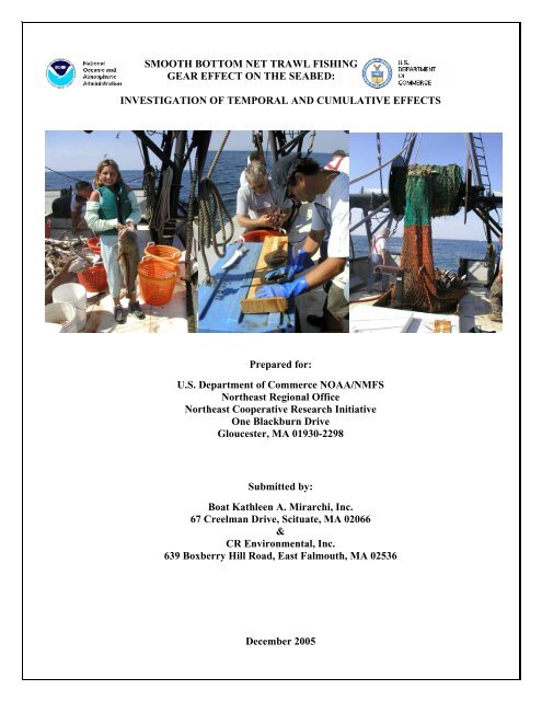
Smooth Bottom Net Trawl Fishing Gear Effect on - New England ...
Smooth Bottom Net Trawl Fishing Gear Effect on - New England ...
Smooth Bottom Net Trawl Fishing Gear Effect on - New England ...

You also want an ePaper? Increase the reach of your titles
YUMPU automatically turns print PDFs into web optimized ePapers that Google loves.
SMOOTH BOTTOM NET TRAWL FISHING<br />
GEAR EFFECT ON THE SEABED:<br />
INVESTIGATION OF TEMPORAL AND CUMULATIVE EFFECTS<br />
Prepared for:<br />
U.S. Department of Commerce NOAA/NMFS<br />
Northeast Regi<strong>on</strong>al Office<br />
Northeast Cooperative Research Initiative<br />
One Blackburn Drive<br />
Gloucester, MA 01930-2298<br />
Submitted by:<br />
Boat Kathleen A. Mirarchi, Inc.<br />
67 Creelman Drive, Scituate, MA 02066<br />
&<br />
CR Envir<strong>on</strong>mental, Inc.<br />
639 Boxberry Hill Road, East Falmouth, MA 02536<br />
December 2005
NOAA/NMFS Unallied Science Project, Cooperative Agreement NA16FL2264 December 2005<br />
<str<strong>on</strong>g>Smooth</str<strong>on</strong>g> <str<strong>on</strong>g>Bottom</str<strong>on</strong>g> <str<strong>on</strong>g>Net</str<strong>on</strong>g> <str<strong>on</strong>g>Trawl</str<strong>on</strong>g> <str<strong>on</strong>g>Fishing</str<strong>on</strong>g> <str<strong>on</strong>g>Gear</str<strong>on</strong>g> <str<strong>on</strong>g>Effect</str<strong>on</strong>g> <strong>on</strong> the Seabed:<br />
Investigati<strong>on</strong> of Temporal and Cumulative <str<strong>on</strong>g>Effect</str<strong>on</strong>g>s BKAM/CR<br />
TABLE OF CONTENTS<br />
Page<br />
1.0 INTRODUCTION………………………………………………………………………….1<br />
1.1 Statutory and Regulatory Basis for <str<strong>on</strong>g>Fishing</str<strong>on</strong>g> <str<strong>on</strong>g>Gear</str<strong>on</strong>g> – Essential<br />
Fish Habitat Research and Compatibility of this Study with<br />
EFH Research Priorities 1<br />
1.2 Project Goals and Objectives 3<br />
1.3 Project Team 4<br />
1.4 Survey <str<strong>on</strong>g>Gear</str<strong>on</strong>g> Selecti<strong>on</strong> 5<br />
1.5 Experimental Design 5<br />
2.0 CUMULATIVE TRAWL IMPACT STUDY FIELD OPERATIONS<br />
AND METHODS…………………………………………………………………………..8<br />
2.1 Navigati<strong>on</strong> Methods 8<br />
2.2 Experimental <str<strong>on</strong>g>Trawl</str<strong>on</strong>g> Methods 8<br />
2.2.1 Impact trawling 8<br />
2.3 Water Column Sampling Methods 10<br />
2.4 Bathymetric Survey Methods 10<br />
2.5 Side-scan S<strong>on</strong>ar Methods 11<br />
2.6 Benthic Sampling Methods 12<br />
2.7 Sediment Profile Camera Methods 13<br />
2.8 Video Sled Methods 13<br />
2.9 Cruise Summary 14<br />
3.0 CHRONIC TRAWL IMPACT STUDY RESULTS…......................................................15<br />
3.1 Water Column Characteristics 15<br />
3.2 Geophysical Results 19<br />
3.2.1 Bathymetric Results 19<br />
i
NOAA/NMFS Unallied Science Project, Cooperative Agreement NA16FL2264 December 2005<br />
<str<strong>on</strong>g>Smooth</str<strong>on</strong>g> <str<strong>on</strong>g>Bottom</str<strong>on</strong>g> <str<strong>on</strong>g>Net</str<strong>on</strong>g> <str<strong>on</strong>g>Trawl</str<strong>on</strong>g> <str<strong>on</strong>g>Fishing</str<strong>on</strong>g> <str<strong>on</strong>g>Gear</str<strong>on</strong>g> <str<strong>on</strong>g>Effect</str<strong>on</strong>g> <strong>on</strong> the Seabed:<br />
Investigati<strong>on</strong> of Temporal and Cumulative <str<strong>on</strong>g>Effect</str<strong>on</strong>g>s BKAM/CR<br />
3.2.2 Side-Scan S<strong>on</strong>ar Results 19<br />
3.2.2.1 Baseline (Pre-chr<strong>on</strong>ic <str<strong>on</strong>g>Trawl</str<strong>on</strong>g>) Side-Scan Survey<br />
Results – July 2002 21<br />
3.2.2.2 Post-trawl Side-Scan S<strong>on</strong>ar Survey Results –<br />
September 30, 2002 24<br />
3.2.2.3 Post-trawl Side-Scan S<strong>on</strong>ar Survey Results –<br />
November 20, 2002 26<br />
3.2.2.4 Time Series Side-Scan S<strong>on</strong>ar Observati<strong>on</strong>s at<br />
Benthic Grab Stati<strong>on</strong>s 27<br />
3.2.3 Physical Properties of the Study Area Sediments 36<br />
3.2.3.1 Baseline Sediment C<strong>on</strong>diti<strong>on</strong>s - July 2, 2002 36<br />
3.2.3.2 Post-trawl Sediment C<strong>on</strong>diti<strong>on</strong>s - October 9 and<br />
November 19, 2002 37<br />
3.2.3.3 Comparis<strong>on</strong>s of July 2001 and July 2002 Grain Size<br />
Data 38<br />
3.2.3.4 Sediment Properties Discussi<strong>on</strong> 38<br />
3.3 Video Sled Results 39<br />
3.3.1 General Faunal Patterns in the Study Area 39<br />
3.3.2 Comparis<strong>on</strong> with 2001 <str<strong>on</strong>g>Trawl</str<strong>on</strong>g> Study Results 41<br />
3.4 Benthic Results and Discussi<strong>on</strong> 43<br />
3.4.1 Mud Hole Baseline (Pre-chr<strong>on</strong>ic <str<strong>on</strong>g>Trawl</str<strong>on</strong>g>) Results 43<br />
3.4.2 Mud Hole Post-<str<strong>on</strong>g>Trawl</str<strong>on</strong>g> Results 44<br />
3.4.3 Little Tow Baseline Results 44<br />
3.4.4 Little Tow Post-<str<strong>on</strong>g>Trawl</str<strong>on</strong>g> Results 45<br />
3.4.5 Community Analysis 45<br />
3.4.6 Faunal Changes in the Study Sites 2001-2002 47<br />
3.4.7 Benthic Discussi<strong>on</strong> 48<br />
3.5 REMOTS Survey Results and Discussi<strong>on</strong> (SAIC) 51<br />
3.5.1 Baseline Characterizati<strong>on</strong> of the Little Tow Area 51<br />
ii
NOAA/NMFS Unallied Science Project, Cooperative Agreement NA16FL2264 December 2005<br />
<str<strong>on</strong>g>Smooth</str<strong>on</strong>g> <str<strong>on</strong>g>Bottom</str<strong>on</strong>g> <str<strong>on</strong>g>Net</str<strong>on</strong>g> <str<strong>on</strong>g>Trawl</str<strong>on</strong>g> <str<strong>on</strong>g>Fishing</str<strong>on</strong>g> <str<strong>on</strong>g>Gear</str<strong>on</strong>g> <str<strong>on</strong>g>Effect</str<strong>on</strong>g> <strong>on</strong> the Seabed:<br />
Investigati<strong>on</strong> of Temporal and Cumulative <str<strong>on</strong>g>Effect</str<strong>on</strong>g>s BKAM/CR<br />
3.5.2 Baseline Characterizati<strong>on</strong> of the Mud Hole Area 52<br />
3.5.3 Evaluati<strong>on</strong> of <str<strong>on</strong>g>Trawl</str<strong>on</strong>g>ing <str<strong>on</strong>g>Effect</str<strong>on</strong>g>s in the Little Tow and<br />
Mud Hole Areas 53<br />
3.5.4 Sediment Profile Imaging Discussi<strong>on</strong> (D.C. Rhoads) 54<br />
3.5.4.1 Physical Evidence of <str<strong>on</strong>g>Trawl</str<strong>on</strong>g>ing Impacts 54<br />
3.5.4.2 Biological Evidence of Chr<strong>on</strong>ic <str<strong>on</strong>g>Bottom</str<strong>on</strong>g> Disturbance 54<br />
3.5.4.3 Results of European <str<strong>on</strong>g>Trawl</str<strong>on</strong>g> Impact Studies Using<br />
SPI Technology 55<br />
3.6 Fisheries Survey Results 57<br />
3.6.1 <str<strong>on</strong>g>Trawl</str<strong>on</strong>g> Catch Results 57<br />
3.6.2 Flatfish Metrics and Stomach C<strong>on</strong>tent Results 59<br />
4.0 CONCLUSIONS AND RECOMMENDATIONS FOR FUTURE STUDY……………62<br />
4.1 Disturbance and Ecological Structure 62<br />
4.2 Disturbance and Ecological Dynamics 62<br />
4.3 The Relati<strong>on</strong>ship Between Disturbance and Productivity 63<br />
4.4 A Modeling / Simulati<strong>on</strong> Approach 64<br />
5.0 REFERENCES<br />
TABLES<br />
Secti<strong>on</strong> 1.0 Introducti<strong>on</strong> Tables<br />
Table 1.5-1 Sampling Design<br />
Secti<strong>on</strong> 3.0 Results Tables<br />
Subsecti<strong>on</strong> 3.2 Geophysical Survey Results Tables<br />
Table 3.2.3-1 Results 0f 2002 Sediment Particle Size Analysis<br />
Table 3.2.3-2 Summary of 2002 Sediment Particle Size Analyses<br />
iii
NOAA/NMFS Unallied Science Project, Cooperative Agreement NA16FL2264 December 2005<br />
<str<strong>on</strong>g>Smooth</str<strong>on</strong>g> <str<strong>on</strong>g>Bottom</str<strong>on</strong>g> <str<strong>on</strong>g>Net</str<strong>on</strong>g> <str<strong>on</strong>g>Trawl</str<strong>on</strong>g> <str<strong>on</strong>g>Fishing</str<strong>on</strong>g> <str<strong>on</strong>g>Gear</str<strong>on</strong>g> <str<strong>on</strong>g>Effect</str<strong>on</strong>g> <strong>on</strong> the Seabed:<br />
Investigati<strong>on</strong> of Temporal and Cumulative <str<strong>on</strong>g>Effect</str<strong>on</strong>g>s BKAM/CR<br />
Subsecti<strong>on</strong> 3.3 Video Sled Results Tables<br />
Table 3.3-1 Cumulative Raw Counts from Video-Sled Footage<br />
Table 3.3-2 Organisms observed per minute in the video-sled footage<br />
Table 3.3-3 Organisms observed per minute in the video-sled survey of Mud Hole<br />
Table 3.3-4 Organisms observed per minute in the video-sled survey of Little Tow<br />
Subsecti<strong>on</strong> 3.4 Benthic Results Tables<br />
Table 3.4-1 Numerically Dominant Species Mud Hole<br />
Table 3.4-2 Numerically Dominant Species Little Tow<br />
Subsecti<strong>on</strong> 3.5 REMOTS Tables<br />
Table 3.5-1. Summary of REMOTS Sediment-Profile Imaging Results for the<br />
Little Tow <str<strong>on</strong>g>Trawl</str<strong>on</strong>g> Stati<strong>on</strong>s (top) and C<strong>on</strong>trol Stati<strong>on</strong>s (bottom), August 2002 Survey<br />
Table 3.5-2. Summary of REMOTS Sediment-Profile Imaging Results for the<br />
Mud Hole <str<strong>on</strong>g>Trawl</str<strong>on</strong>g> Stati<strong>on</strong>s (top) and C<strong>on</strong>trol Stati<strong>on</strong>s (bottom), August 2002 Survey<br />
Table 3.5-3. Summary of REMOTS Sediment-Profile Imaging Results for the<br />
Little Tow <str<strong>on</strong>g>Trawl</str<strong>on</strong>g> Stati<strong>on</strong>s (top) and C<strong>on</strong>trol Stati<strong>on</strong>s (bottom), October 2002 Survey<br />
Table 3.5-4. Summary of REMOTS Sediment-Profile Imaging Results for the<br />
Mud Hole <str<strong>on</strong>g>Trawl</str<strong>on</strong>g> Stati<strong>on</strong>s (top) and C<strong>on</strong>trol Stati<strong>on</strong>s (bottom), October 2002 Survey<br />
Table 3.5-5. Summary of REMOTS Sediment-Profile Imaging Results for the<br />
Little Tow <str<strong>on</strong>g>Trawl</str<strong>on</strong>g> Stati<strong>on</strong>s (top) and C<strong>on</strong>trol Stati<strong>on</strong>s (bottom), November 2002 Survey<br />
Table 3.5-6. Summary of REMOTS Sediment-Profile Imaging Results for the<br />
Mud Hole <str<strong>on</strong>g>Trawl</str<strong>on</strong>g> Stati<strong>on</strong>s (top) and C<strong>on</strong>trol Stati<strong>on</strong>s (bottom), November 2002 Survey<br />
Subsecti<strong>on</strong> 3.6 Fisheries Tables<br />
Table 3.6-1 Finfish, sharks, and Comm<strong>on</strong> Macro-Invertebrates in Little Tow and Mud Hole <str<strong>on</strong>g>Trawl</str<strong>on</strong>g><br />
Catched 2002<br />
Table 3.6-2 2002 <str<strong>on</strong>g>Trawl</str<strong>on</strong>g> Study- Catch by species in Lbs and kgs per tow<br />
Table 3.6-3 Summary of Blackback Stomach Data for Mud Hole<br />
Table 3.6-4 Summary of Yellowtail Stomach Data for Mud Hole<br />
iv
NOAA/NMFS Unallied Science Project, Cooperative Agreement NA16FL2264 December 2005<br />
<str<strong>on</strong>g>Smooth</str<strong>on</strong>g> <str<strong>on</strong>g>Bottom</str<strong>on</strong>g> <str<strong>on</strong>g>Net</str<strong>on</strong>g> <str<strong>on</strong>g>Trawl</str<strong>on</strong>g> <str<strong>on</strong>g>Fishing</str<strong>on</strong>g> <str<strong>on</strong>g>Gear</str<strong>on</strong>g> <str<strong>on</strong>g>Effect</str<strong>on</strong>g> <strong>on</strong> the Seabed:<br />
Investigati<strong>on</strong> of Temporal and Cumulative <str<strong>on</strong>g>Effect</str<strong>on</strong>g>s BKAM/CR<br />
Table 3.6.5 Summary of Blackback (Winter Flounder) Stomach Data for Little Tow<br />
Table 3.6-6 Summary of Yellowtail Stomach Data for Little Tow<br />
Table 3.6-7 Dominant Species in Sedimnt and Flatfish Stomachs at Mud Hole<br />
Table 3.6-8 Dominant Species in Sediment and Flatfish Stomachs at Little Tow<br />
Table 3.6-9 Statistical Analyses of Flatfish Stomach C<strong>on</strong>tents<br />
FIGURES<br />
Secti<strong>on</strong> 1.0 Introducti<strong>on</strong> Figures<br />
Figure 1.0-1 Locus Map of the Mud Hole Little Tow Study Site off Scituate, MA<br />
Figure 1.0-2 <str<strong>on</strong>g>Smooth</str<strong>on</strong>g> bottom trawl net<br />
Figure 1.0-3 Side-scan s<strong>on</strong>ar base map of the more heavily trawled Mud Hole showing c<strong>on</strong>trol and<br />
trawl lanes and sample stati<strong>on</strong>s<br />
Figure 1.0-4 Side-scan s<strong>on</strong>ar base map of the lightly fished Little Tow showing c<strong>on</strong>trol and trawl lanes<br />
and sample stati<strong>on</strong>s<br />
Secti<strong>on</strong> 3.0 Results Figures<br />
Subsecti<strong>on</strong> 3.2 Geophysical Results Figures<br />
Figure 3.2.1-1 Bathymetric surface map of the Mud Hole study site<br />
Figure 3.2.1-2 Bathymetric surface map of the Little Tow study site<br />
Figure 3.3.2-1 Example of s<strong>on</strong>ar shadowing behind the peaks of sand waves<br />
Figures 3.2.2.1-1 <str<strong>on</strong>g>Bottom</str<strong>on</strong>g> disturbances and fish observed al<strong>on</strong>g Mud Hole, Lane 3 in July, 2002<br />
Figure 3.2.2.1-2 <str<strong>on</strong>g>Bottom</str<strong>on</strong>g> disturbances observed <strong>on</strong> Little Tow, Lane 1 in July 2002<br />
Figure 3.2.2.1-3 School of fish observed <strong>on</strong> Mud Hole, Lane 3 in July 2002<br />
Figure 3.3.2.1-4 Sand waves <strong>on</strong> Little Tow, Lane 3 in July 2002<br />
Figure 3.2.2.2-1 Background and project-related door scours observed at Mud Hole,<br />
Lane 1 in September 2002<br />
v
NOAA/NMFS Unallied Science Project, Cooperative Agreement NA16FL2264 December 2005<br />
<str<strong>on</strong>g>Smooth</str<strong>on</strong>g> <str<strong>on</strong>g>Bottom</str<strong>on</strong>g> <str<strong>on</strong>g>Net</str<strong>on</strong>g> <str<strong>on</strong>g>Trawl</str<strong>on</strong>g> <str<strong>on</strong>g>Fishing</str<strong>on</strong>g> <str<strong>on</strong>g>Gear</str<strong>on</strong>g> <str<strong>on</strong>g>Effect</str<strong>on</strong>g> <strong>on</strong> the Seabed:<br />
Investigati<strong>on</strong> of Temporal and Cumulative <str<strong>on</strong>g>Effect</str<strong>on</strong>g>s BKAM/CR<br />
Figure 3.2.2.2-2 Mud Hole, Lane 1 September 2002 scours in hummocky sand<br />
Figure 3.2.2.2-3 Door scours observed at Little Tow, Lane 1 in September 2002<br />
Figure 3.2.2.2-4 Little Tow experimentally trawled, Lane 3 September scours<br />
Figure 3.2.2.3-1 Wave heights recorded in the vicinity of the study sites during 2002<br />
Figure 3.2.2.3-2 Little Tow, Lane 2 November 2002 Sand Waves and Scour<br />
Figure 3.2.2.4-1a October 2002 grab locati<strong>on</strong>s in the vicinity of MH-1B<br />
Figure 3.2.2.4-1b November 2202 grab locati<strong>on</strong>s al<strong>on</strong>g Mud Hole, Lane 1 at Stati<strong>on</strong> B<br />
Figure 3.2.2.4-2a October 2002 grab locati<strong>on</strong>s al<strong>on</strong>g Mud Hole, C<strong>on</strong>trol Lane 2 near stati<strong>on</strong> B<br />
Figure 3.2.2.4-2b November 2002 grab sample locati<strong>on</strong>s al<strong>on</strong>g Mud Hole, Lane 2 near Stati<strong>on</strong> B<br />
Figure 3.2.2.4-3a October 2002 grab sample locati<strong>on</strong>s al<strong>on</strong>g Mud Hole, experimentally trawled<br />
Lane 3 at Stati<strong>on</strong> B<br />
Figure 3.2.2.4-3b November 2002 grab sample locati<strong>on</strong>s al<strong>on</strong>g Mud Hole, experimentally<br />
trawled Lane 3 at Stati<strong>on</strong> B<br />
Figure 3.2.2.4-4a October 2002 grab sample locati<strong>on</strong>s at Little Tow, Lane 1, Stati<strong>on</strong> B<br />
Figure 3.2.2.4-4b November 2002 grab sample locati<strong>on</strong>s at Little Tow, Lane 1, Stati<strong>on</strong> B<br />
Figure 3.2.2.4-5 July 2002 pre-trawl background gear impacts at Little Tow, C<strong>on</strong>trol Lane 4<br />
near Stati<strong>on</strong> A<br />
Figure 3.2.3-1 2202 Mud Hole Seas<strong>on</strong>al Sediment Grain Size for C<strong>on</strong>trol and <str<strong>on</strong>g>Trawl</str<strong>on</strong>g>ed Lanes<br />
Figure 3.2.3-2 2002 Little Tow Seas<strong>on</strong>al Sediment Grain Size for C<strong>on</strong>trol and <str<strong>on</strong>g>Trawl</str<strong>on</strong>g>ed Lanes<br />
Figure 3.2.3-3 Mud Hole Seas<strong>on</strong>al Median Grain Size for 2002 at <str<strong>on</strong>g>Trawl</str<strong>on</strong>g>ed and C<strong>on</strong>trol Lanes<br />
Figure 3.2.3-4 Little Tow Median Seas<strong>on</strong>al Grain Size for 2002 at <str<strong>on</strong>g>Trawl</str<strong>on</strong>g>ed and C<strong>on</strong>trol Lanes<br />
Subsecti<strong>on</strong> 3.3 Video Sled Results Figures<br />
Figure 3.3-1 Standardized number of fish observed per minute of video footage<br />
Figure 3.3-2 Standardized number of invertebrates per minute of video footage<br />
vi
NOAA/NMFS Unallied Science Project, Cooperative Agreement NA16FL2264 December 2005<br />
<str<strong>on</strong>g>Smooth</str<strong>on</strong>g> <str<strong>on</strong>g>Bottom</str<strong>on</strong>g> <str<strong>on</strong>g>Net</str<strong>on</strong>g> <str<strong>on</strong>g>Trawl</str<strong>on</strong>g> <str<strong>on</strong>g>Fishing</str<strong>on</strong>g> <str<strong>on</strong>g>Gear</str<strong>on</strong>g> <str<strong>on</strong>g>Effect</str<strong>on</strong>g> <strong>on</strong> the Seabed:<br />
Investigati<strong>on</strong> of Temporal and Cumulative <str<strong>on</strong>g>Effect</str<strong>on</strong>g>s BKAM/CR<br />
Figures 3.3-3a and 3.3-3b Standardized number of fish observed in Mud Hole and Little Tow per<br />
minute of video footage<br />
Figure 3.3-4 Standardized number of fish species observed per minute of video footage<br />
Figures 3.3-5a and 3.3-5b Standardized number of invertebrates observed per minute of video footage<br />
Figure 3.3-6 Standardized invertebrates observed per minute of video footage by stati<strong>on</strong> and sampling<br />
event<br />
Figure 3.3-7a and 3.3-7b Fish species in trawled and c<strong>on</strong>trol lanes observed <strong>on</strong> video footage prior to<br />
chr<strong>on</strong>ic trawling and post chr<strong>on</strong>ic trawling<br />
Figure 3.3-8 Standardized number of fish by species observed per minute of video footage by stati<strong>on</strong><br />
and sampling event<br />
Figure 3.3-9a and 3.3-9b Invertebrate species in trawled and c<strong>on</strong>trol lanes observed <strong>on</strong> video footage<br />
prior to chr<strong>on</strong>ic trawling and post chr<strong>on</strong>ic trawling<br />
Subsecti<strong>on</strong> 3.4 Benthic Results Figures<br />
Figure 3.4-1 For key species, the average number of individuals per grab at the northern Mud Hole<br />
c<strong>on</strong>trol (MH2B) and trawled (MH1B) stati<strong>on</strong>s<br />
Figure 3.4-2 For key species, the average number of individuals per grab at the southern Mud Hole<br />
c<strong>on</strong>trol (MH4B) stati<strong>on</strong>s<br />
Figure 3.4-3 For key species, the average number of individuals per grab at the northern Little Tow<br />
c<strong>on</strong>trol (LT2B) and trawled (LT1B) stati<strong>on</strong>s<br />
Figure 3.4-4 For key species, the average number of individuals per grab at the southern Little Tow<br />
c<strong>on</strong>trol (LT4A) and trawled (LT3A) stati<strong>on</strong>s<br />
Figure 3.4-5 Cluster analysis of Mud Hole and Little Tow 2002 samples using combined replicates<br />
Figure 3.4-6 Cluster analysis of Mud Hole and Little Tow 2001 and 2002 samples using averaged<br />
replicates<br />
Figure 3.4-7 Mud Hole 2002 Cluster Analysis; All Replicates<br />
Figure 3.4-8 Mud Hole 2002 Principal Comp<strong>on</strong>ents Analysis; Combined Replicates<br />
Figure 3.4-9 Little Tow 2002 Cluster Analysis; All Replicates<br />
Figure 3.4-10 Little Tow 2002 Principal Comp<strong>on</strong>ents Analysis; Combined Replicates<br />
vii
NOAA/NMFS Unallied Science Project, Cooperative Agreement NA16FL2264 December 2005<br />
<str<strong>on</strong>g>Smooth</str<strong>on</strong>g> <str<strong>on</strong>g>Bottom</str<strong>on</strong>g> <str<strong>on</strong>g>Net</str<strong>on</strong>g> <str<strong>on</strong>g>Trawl</str<strong>on</strong>g> <str<strong>on</strong>g>Fishing</str<strong>on</strong>g> <str<strong>on</strong>g>Gear</str<strong>on</strong>g> <str<strong>on</strong>g>Effect</str<strong>on</strong>g> <strong>on</strong> the Seabed:<br />
Investigati<strong>on</strong> of Temporal and Cumulative <str<strong>on</strong>g>Effect</str<strong>on</strong>g>s BKAM/CR<br />
Figure 3.4-11a. Mud Hole 2001 and 2002 Cluster Analysis; Averaged Replicates<br />
Figure 3.4-11b. Mud Hole 2001 and 2002 Cluster Analysis; All Replicates<br />
Figure 3.4-12a. Little Tow 2001 and 2002 Cluster Analysis; Averaged Replicates<br />
Figure 3.4-12b. Little Tow 2001 and 2002 Cluster Analysis; All Replicates<br />
Figure 3.4-13 Mud Hole 2001 and 2002 Principal Comp<strong>on</strong>ents Analysis; Averaged Replicates<br />
Figure 3.4-14 Little Tow 2001 and 2002 Principal Comp<strong>on</strong>ents Analysis; Averaged Replicates<br />
Subsecti<strong>on</strong> 3.5 REMOTS Results Figures<br />
Figure 3.5-1. Representative REMOTS images illustrating baseline seafloor c<strong>on</strong>diti<strong>on</strong>s in the Little<br />
Tow area<br />
Figure 3.5-2. Representative REMOTS images illustrating baseline seafloor c<strong>on</strong>diti<strong>on</strong>s in the Mud<br />
Hole area<br />
Figure 3.5-3. Time series of representative REMOTS images obtained at Little Tow trawl stati<strong>on</strong> 3A<br />
Figure 3.5-4. Time series of representative REMOTS images from Little Tow trawl stati<strong>on</strong> 1A showing<br />
an absence of any significant changes in sediment physical or biological characteristics<br />
attributable to trawling disturbance (similar to Figure 3-3)<br />
Figure 3.5-5. Time series of representative REMOTS images from Mud Hole trawl stati<strong>on</strong> 3A<br />
illustrating the c<strong>on</strong>tinued persistence through time of Stage I polychaete tubes at the<br />
sediment surface and a well-developed RPD, despite intensive trawling following the<br />
August survey<br />
Figure 3.5-6. Time series of representative REMOTS images from Mud Hole trawl stati<strong>on</strong> 1C<br />
illustrating the c<strong>on</strong>tinued persistence through time of Stage I polychaete tubes at the<br />
sediment surface and a well-developed RPD, despite intensive trawling following the<br />
August survey<br />
Figure 3.5-7. Two representative images from the October survey in the Little Tow area, showing a<br />
lack of difference in sediment physical or biological features between c<strong>on</strong>trol stati<strong>on</strong> 2C<br />
and trawl stati<strong>on</strong> 3A<br />
Figure 3.5-8. Two representative images from the November survey in the Mud Hole area, showing a<br />
lack of difference in sediment physical or biological features between c<strong>on</strong>trol stati<strong>on</strong> 2A<br />
and trawl stati<strong>on</strong> 3A<br />
viii
NOAA/NMFS Unallied Science Project, Cooperative Agreement NA16FL2264 December 2005<br />
<str<strong>on</strong>g>Smooth</str<strong>on</strong>g> <str<strong>on</strong>g>Bottom</str<strong>on</strong>g> <str<strong>on</strong>g>Net</str<strong>on</strong>g> <str<strong>on</strong>g>Trawl</str<strong>on</strong>g> <str<strong>on</strong>g>Fishing</str<strong>on</strong>g> <str<strong>on</strong>g>Gear</str<strong>on</strong>g> <str<strong>on</strong>g>Effect</str<strong>on</strong>g> <strong>on</strong> the Seabed:<br />
Investigati<strong>on</strong> of Temporal and Cumulative <str<strong>on</strong>g>Effect</str<strong>on</strong>g>s BKAM/CR<br />
Subsecti<strong>on</strong> 3.6 Fisheries Results Figures<br />
Figure 3.6-1 <str<strong>on</strong>g>Trawl</str<strong>on</strong>g> catch for major species in kilograms for Mud Hole and Little Tow combined<br />
Figure 3.6-2 Catch by species in kilograms per tow for Mud Hole and Little Tow combined<br />
Figure 3.6-3 Catch in kilograms by site and trawl lane over the study period<br />
Figure 3.6-4 Density in kilograms/1000m 2 for major trawl caught species at Mud Hole, Lanes 1 and 3<br />
Figure 3.6-5 Density in kilograms/1000m 2 for major trawl caught species at Little Tow, Lanes 1 and 3<br />
Figure 3.6-6 Density in kilograms/1000m 2 for Spiny Dogfish al<strong>on</strong>g trawled lanes at Mud Hole and<br />
Little Tow<br />
Figures 3.6-7 Density (number per 1000m 2 ) of major commercial flatfish al<strong>on</strong>g trawled lanes in Mud<br />
Hole and Little Tow<br />
Figure 3.6-8 Length frequency distributi<strong>on</strong> for Winter Flounder at Mud Hole in 2002<br />
Figure 3.6-9 Length frequency distributi<strong>on</strong> for Yellowtail Flounder at Mud Hole in 2002<br />
Figure 3.6-10 Length frequency distributi<strong>on</strong> for Winter Flounder at Little Tow in 2002<br />
Figure 3.6-11 Length frequency distributi<strong>on</strong> for Yellowtail Flounder at Little Tow in 2002<br />
PHOTOGRAPHS<br />
Photograph 1.3-1 F/V Christopher Andrew<br />
Photograph 1.3-2 F/V Yankee Rose<br />
Photograph 2.2-1 Fisherman John Shea and Christopher Dunbar of CR Envir<strong>on</strong>mental dumping a<br />
catch of flounder and dogfish from a 10-minute experimental tow at <strong>on</strong>e of the<br />
trawled Little Tow lanes<br />
Photograph 2.2-2 Christopher Dunbar of CR Envir<strong>on</strong>mental and fisherman Frank Mirarchi<br />
measuring flatfish from an experimental trawl<br />
Photograph 2.5-1a-c. Side-scan s<strong>on</strong>ar operati<strong>on</strong>s<br />
Photograph 2.6-1 a-c. Sediment sampling operati<strong>on</strong>s<br />
Photograph 2.6-2 Chip Ryther and Chris Dunbar of CR Envir<strong>on</strong>mental recovering the video grab<br />
system <strong>on</strong> the F/V Christopher Andrew<br />
ix
NOAA/NMFS Unallied Science Project, Cooperative Agreement NA16FL2264 December 2005<br />
<str<strong>on</strong>g>Smooth</str<strong>on</strong>g> <str<strong>on</strong>g>Bottom</str<strong>on</strong>g> <str<strong>on</strong>g>Net</str<strong>on</strong>g> <str<strong>on</strong>g>Trawl</str<strong>on</strong>g> <str<strong>on</strong>g>Fishing</str<strong>on</strong>g> <str<strong>on</strong>g>Gear</str<strong>on</strong>g> <str<strong>on</strong>g>Effect</str<strong>on</strong>g> <strong>on</strong> the Seabed:<br />
Investigati<strong>on</strong> of Temporal and Cumulative <str<strong>on</strong>g>Effect</str<strong>on</strong>g>s BKAM/CR<br />
Photograph 2.7-1 CR Envir<strong>on</strong>mental employee, Christopher Dunbar, and Michael Cole of SAIC<br />
deploying REMOTS Camera off the F/V Christopher Andrew<br />
Photograph 2.8-1 a-c. Fishermen c<strong>on</strong>ducting video sled operati<strong>on</strong>s<br />
Photograph 2.8-2 a-c. Viewing, narrati<strong>on</strong> and recovery during video sled operati<strong>on</strong>s<br />
PLATES<br />
Plate 3.3-1 Seas<strong>on</strong>al screen captures of substrate and biota at trawled stati<strong>on</strong>, MH-1B<br />
Plate 3.3-2 Seas<strong>on</strong>al screen captures of substrate and biota at reference stati<strong>on</strong>, MH-2B<br />
Plate 3.3-3 Seas<strong>on</strong>al screen captures of substrate and biota at trawled stati<strong>on</strong>, MH-3A<br />
Plate 3.3-4 Seas<strong>on</strong>al screen captures of substrate and biota at trawled stati<strong>on</strong>, MH-3B<br />
Plate 3.3-5 Seas<strong>on</strong>al screen captures of substrate and biota at reference stati<strong>on</strong>, MH-4A<br />
Plate 3.3-6 Seas<strong>on</strong>al screen captures of substrate and biota at reference stati<strong>on</strong>, MH-5B<br />
Plate 3.3-7 Seas<strong>on</strong>al screen captures of substrate and biota at trawled stati<strong>on</strong>, LT-1B<br />
Plate 3.3-8 Seas<strong>on</strong>al screen captures of substrate and biota at reference stati<strong>on</strong>, LT-2B<br />
Plate 3.3-9 Seas<strong>on</strong>al screen captures of substrate and biota at trawled stati<strong>on</strong>, LT-3A<br />
Plate 3.3-10 Seas<strong>on</strong>al screen capture of substrate and biota at trawled stati<strong>on</strong>, MH-1B<br />
Plate 3.3-11 Seas<strong>on</strong>al screen captures of substrate and biota at reference stati<strong>on</strong>, LT-4A<br />
Plate 3.3-12 Seas<strong>on</strong>al screen captures of substrate and biota at reference stati<strong>on</strong>, LT-4B<br />
Plate 3.3-13 Selected screen captures of the various bottom substrate at the Mud Hole and<br />
Little Tow<br />
Plate 3.3-14 Screen captures of selected invertebrates and fish at the Mud Hole and Little Tow<br />
Plate 3.3-15 Comparis<strong>on</strong> photo plate showing similar biota in the 2001 and 2002 video surveys<br />
at Mud Hole<br />
Plate 3.3-16 Comparis<strong>on</strong> photo plate showing similar bottom types and biota in 2001 and 2002 video<br />
surveys at Little Tow<br />
x
NOAA/NMFS Unallied Science Project, Cooperative Agreement NA16FL2264 December 2005<br />
<str<strong>on</strong>g>Smooth</str<strong>on</strong>g> <str<strong>on</strong>g>Bottom</str<strong>on</strong>g> <str<strong>on</strong>g>Net</str<strong>on</strong>g> <str<strong>on</strong>g>Trawl</str<strong>on</strong>g> <str<strong>on</strong>g>Fishing</str<strong>on</strong>g> <str<strong>on</strong>g>Gear</str<strong>on</strong>g> <str<strong>on</strong>g>Effect</str<strong>on</strong>g> <strong>on</strong> the Seabed:<br />
Investigati<strong>on</strong> of Temporal and Cumulative <str<strong>on</strong>g>Effect</str<strong>on</strong>g>s BKAM/CR<br />
APPENDICES<br />
Secti<strong>on</strong> 2.0<br />
Appendix 2.7-A Standard Methods for the Collecti<strong>on</strong> and Analysis of REMOTS Sediment-<br />
Profile Images (SAIC)<br />
Secti<strong>on</strong> 3.0<br />
Appendix 3.1-A CTD Cast Log of Time and Positi<strong>on</strong><br />
CTD Profile Plots for Mud Hole and Little Tow Sampling Stati<strong>on</strong>s<br />
Appendix 3.2-A Time Series Side-scan S<strong>on</strong>ar Data at Benthic Grab Stati<strong>on</strong>s<br />
Appendix 3.2-B Plotted Grab Sampling Locati<strong>on</strong>s for Grain Size and Benthic Invertebrates<br />
at the Mud Hole and Little Tow Study Areas<br />
Appendix 3.4-A Benthic Grab Coordinates and Data<br />
Appendix 3.6-A Mud Hole/ Little Tow, Blackback (Winter Flounder) /Yellowtail Raw<br />
Stomach Data<br />
xi
NOAA/NMFS Unallied Science Project, Cooperative Agreement NA16FL2264 May 2005<br />
<str<strong>on</strong>g>Smooth</str<strong>on</strong>g> <str<strong>on</strong>g>Bottom</str<strong>on</strong>g> <str<strong>on</strong>g>Net</str<strong>on</strong>g> <str<strong>on</strong>g>Trawl</str<strong>on</strong>g> <str<strong>on</strong>g>Fishing</str<strong>on</strong>g> <str<strong>on</strong>g>Gear</str<strong>on</strong>g> <str<strong>on</strong>g>Effect</str<strong>on</strong>g> <strong>on</strong> the Seabed:<br />
Investigati<strong>on</strong> of Temporal and Cumulative <str<strong>on</strong>g>Effect</str<strong>on</strong>g>s BKAM/CR<br />
1.0 INTRODUCTION<br />
To date much of the research <strong>on</strong> fishing gear-induced habitat impacts focuses <strong>on</strong> l<strong>on</strong>g-term<br />
cumulative changes to gravel bottom or rocky substrate communities in areas open to or closed<br />
to fishing activity. Because little is known of the historical distributi<strong>on</strong> and density of fishing<br />
activity in the open areas, it is difficult to quantify the impact of fishing per unit of effort. In<br />
2000, NOAA/NMFS funded Boat Kathleen A. Mirarchi, Inc. and CR Envir<strong>on</strong>mental, Inc.’s<br />
proposal to c<strong>on</strong>duct “Near Term Observati<strong>on</strong>s of the <str<strong>on</strong>g>Effect</str<strong>on</strong>g>s of <str<strong>on</strong>g>Smooth</str<strong>on</strong>g> <str<strong>on</strong>g>Bottom</str<strong>on</strong>g> <str<strong>on</strong>g>Net</str<strong>on</strong>g> <str<strong>on</strong>g>Trawl</str<strong>on</strong>g> <str<strong>on</strong>g>Fishing</str<strong>on</strong>g><br />
<str<strong>on</strong>g>Gear</str<strong>on</strong>g> <strong>on</strong> the Seabed.” Using local fishermen’s knowledge, the project team of fishermen and<br />
researchers characterized the generally soft substrate sea floor in an area of Essential Fish<br />
Habitat at approximately 130 ft of water in a heavily fished area (Mud Hole) and a lightly fished<br />
area (Little Tow) off Scituate, MA, in the Massachusetts Bay regi<strong>on</strong> of the Gulf of Maine (Figure<br />
1.0-1). The sea floor was surveyed before and after six repetitive passes with smooth bottom net<br />
trawl gear (Figure 1.0-2). Parameters examined were the sea floor substrate, water column<br />
characteristics, fish and bycatch, the stomach c<strong>on</strong>tents of select commercial bottom fish and<br />
benthic infaunal and epifaunal communities. Tools successfully used to characterize the sites and<br />
elucidate trawling effects included a: side-scan s<strong>on</strong>ar, Hypack navigati<strong>on</strong> software, precisi<strong>on</strong><br />
echosounder, remotely operated vehicle (ROV), video sled, benthic dredge; c<strong>on</strong>ductivity, depth,<br />
oxygen, turbidity sensor (Seabird SeaCat CTD), benthic grab, and net liner during trawling.<br />
Similar to other recent studies, the research indicated that the immediate impacts of the net<br />
sweep and other ground gear (excluding the heavy doors) <strong>on</strong> the benthic ecosystem were not<br />
great (NE Regi<strong>on</strong> Essential Fish Habitat Steering Committee, October 2001; Johns<strong>on</strong> 2002).<br />
For this 2002 study, the experimental design was expanded to explore temporal change in the<br />
soft bottom habitats at Mud Hole and Little Tow, and the cumulative impact of repeated trawling<br />
disturbance in this area of Essential Fish Habitat. The established replicate experimental<br />
(trawled) corridors (Figures 1.0-3 and 1.0-4) were trawled <strong>on</strong> average every 1.3 times a week<br />
from late July through mid-November 2002 when fixed gear was not in place and the study areas<br />
were not closed to groundfishing (i.e. fisheries closures in 2002 were January to April). The<br />
replicate experimental (trawled) and reference (n<strong>on</strong>-trawled) corridors were then sampled within<br />
each study area (Little Tow and Mud Hole) in July, September and November 2002. All survey<br />
gear used in the 2001 study was used in the 2002 study excluding the ROV. A sediment profile<br />
imaging camera was added to better document subtle changes in the fabric of the sediment and<br />
habitat alterati<strong>on</strong> that could impact larval recruitment and settlement.<br />
1.1 Statutory and Regulatory Basis for <str<strong>on</strong>g>Fishing</str<strong>on</strong>g> <str<strong>on</strong>g>Gear</str<strong>on</strong>g> – Essential Fish Habitat Research<br />
and Compatibility of this Study with EFH Research Priorities<br />
The 1996 amendments to the Magnus<strong>on</strong>-Stevens Fishery C<strong>on</strong>servati<strong>on</strong> and Management Act<br />
(M-SFCMA), known as the Sustainable Fisheries Act, obligated the Regi<strong>on</strong>al Fishery<br />
Management Councils to undertake the following acti<strong>on</strong>s:<br />
(1) Identify and characterize the essential fish habitat (EFH) for all species under a Fishery<br />
Management Plan FMP);<br />
1
NOAA/NMFS Unallied Science Project, Cooperative Agreement NA16FL2264 May 2005<br />
<str<strong>on</strong>g>Smooth</str<strong>on</strong>g> <str<strong>on</strong>g>Bottom</str<strong>on</strong>g> <str<strong>on</strong>g>Net</str<strong>on</strong>g> <str<strong>on</strong>g>Trawl</str<strong>on</strong>g> <str<strong>on</strong>g>Fishing</str<strong>on</strong>g> <str<strong>on</strong>g>Gear</str<strong>on</strong>g> <str<strong>on</strong>g>Effect</str<strong>on</strong>g> <strong>on</strong> the Seabed:<br />
Investigati<strong>on</strong> of Temporal and Cumulative <str<strong>on</strong>g>Effect</str<strong>on</strong>g>s BKAM/CR<br />
(2) To the maximum extent practicable, minimize the adverse effects of fishing gear and<br />
practices <strong>on</strong> EFH; and<br />
(3) Identify other acti<strong>on</strong>s to encourage the c<strong>on</strong>servati<strong>on</strong> and enhancement of EFH.<br />
For the purposes of these requirements, EFH was defined to include “those waters and substrate<br />
necessary to fish for spawning, breeding, feeding or growth to maturity.”<br />
Following publicati<strong>on</strong> of clarifying guidelines by NMFS the <strong>New</strong> <strong>England</strong> Regi<strong>on</strong>al Fishery<br />
Management Council (NEFMC) began development of a comprehensive EFH amendment to all<br />
relevant FMP’s. Presently these include Northeast Multispecies (groundfish), Sea Scallops, Sea<br />
Herring, M<strong>on</strong>kfish, and Atlantic Salm<strong>on</strong>. The intent of the comprehensive or “omnibus”<br />
amendment is to identify and characterize EFH for all managed species, to identify both fishing<br />
and n<strong>on</strong>-fishing derived threats to those habitats and to identify mechanisms to c<strong>on</strong>serve and<br />
enhance those areas.<br />
Recognizing the data to fully support an omnibus habitat amendment were not sufficiently<br />
comprehensive or detailed, the NEFMC adopted a progressive approach beginning with broad<br />
characterizati<strong>on</strong>s and backfilling the nuances and details as informati<strong>on</strong> became available. For<br />
example, EFH is initially characterized solely by the presence of relevant species. Subsequently,<br />
details of populati<strong>on</strong> density, reproducti<strong>on</strong>, growth, survival, and producti<strong>on</strong> rates are added as<br />
informati<strong>on</strong> is obtained and compiled.<br />
Similarly, initial characterizati<strong>on</strong> of fishing derived impacts was primarily descriptive and<br />
limited to identificati<strong>on</strong> of the types of fishing gear in use and the geographic range and target<br />
species for each.<br />
Recognizing that a scarcity of informati<strong>on</strong> could compromise its ability to satisfactorily<br />
discharge its multiple resp<strong>on</strong>sibilities, the Council began compilati<strong>on</strong> of a research priorities<br />
document. In 1999, the U.S. C<strong>on</strong>gress, seeking to facilitate the progress of fisheries research,<br />
provide an alternative in resp<strong>on</strong>se to complaints of NMFS’s near m<strong>on</strong>opoly in the field and to<br />
provide a revenue source to the ground fishery which had been declared an ec<strong>on</strong>omic disaster,<br />
funded a co-operative research program for <strong>New</strong> <strong>England</strong>. The principal centers for<br />
disbursement of co-operative research funds were the Northeast C<strong>on</strong>sortium and the Cooperative<br />
Research Partners Initiative (CRPI), an office within the NMFS Northeast Regi<strong>on</strong>al<br />
Administrati<strong>on</strong>. To provide guidance and co-ordinati<strong>on</strong> the NEFMC organized a Research<br />
Steering Committee (RSC) in 2000.<br />
The project described in this report was vetted through the RSC and funded with a grant from<br />
NOAA administered by CRPI. The c<strong>on</strong>tents of this report comport with several research<br />
priorities identified by the Council/RSC and are intended to provide informati<strong>on</strong> of value to the<br />
advancement of understanding the impacts of specific types of mobile fishing gear <strong>on</strong> certain<br />
categories of EFH.<br />
2
NOAA/NMFS Unallied Science Project, Cooperative Agreement NA16FL2264 May 2005<br />
<str<strong>on</strong>g>Smooth</str<strong>on</strong>g> <str<strong>on</strong>g>Bottom</str<strong>on</strong>g> <str<strong>on</strong>g>Net</str<strong>on</strong>g> <str<strong>on</strong>g>Trawl</str<strong>on</strong>g> <str<strong>on</strong>g>Fishing</str<strong>on</strong>g> <str<strong>on</strong>g>Gear</str<strong>on</strong>g> <str<strong>on</strong>g>Effect</str<strong>on</strong>g> <strong>on</strong> the Seabed:<br />
Investigati<strong>on</strong> of Temporal and Cumulative <str<strong>on</strong>g>Effect</str<strong>on</strong>g>s BKAM/CR<br />
1.2 Project Goals and Objectives<br />
The objective of our 2002 study was to provide targeted weekly trawling pressure (chr<strong>on</strong>ic<br />
impact) over a number of m<strong>on</strong>ths <strong>on</strong> established experimental trawl corridors at two sites (Little<br />
Tow and Mud Hole) historically subjected to different trawling pressure in the Gulf of Maine off<br />
Scituate, MA. Replicate reference and experimental corridors at the two sites were sampled prior<br />
to trawling, and at two latter times during the chr<strong>on</strong>ic trawling to investigate any discernable<br />
cumulative impacts <strong>on</strong> the generally soft bottom habitat at the study areas.<br />
A number of comp<strong>on</strong>ents of the 2002 study fell within the fisheries management informati<strong>on</strong><br />
need. In particular,<br />
(1) C<strong>on</strong>ducting fishing industry-supported high-resoluti<strong>on</strong> sediment mapping in areas of the<br />
western Gulf of Maine (i.e. Little Tow and Mud Hole);<br />
(2) Identifying biological communities (pelagic, epifaunal, infaunal) associated with the<br />
mapped areas and determining relati<strong>on</strong>ships between the soft bottom sediment type and<br />
these communities; and<br />
(3) Examining and comparing commercially important fish species and benthic biological<br />
communities in soft bottom habitat in both heavily and lightly fished reference areas and<br />
how they resp<strong>on</strong>d to the cumulative impact of trawling with a smooth bottom trawl net.<br />
More specific areas of investigati<strong>on</strong> addressed by this report include:<br />
• Ground truthing existing bathymetric and sediment maps of an area of EFH using<br />
side-scan s<strong>on</strong>ar, video, precisi<strong>on</strong> bathymetric mapping, sediment profile imaging, and<br />
benthic sampling technologies;<br />
• Observing acute and cumulative impacts of traditi<strong>on</strong>al soft bottom trawl gear, and<br />
m<strong>on</strong>itoring these impacts over several m<strong>on</strong>ths;<br />
• Using statistical methods to correlate the degree of impact <strong>on</strong> benthic and demersal<br />
organisms between trawled and nearby untrawled ‘reference’ areas;<br />
• Observati<strong>on</strong> of fish and invertebrate species, particularly juvenile finfish, and their<br />
dependence <strong>on</strong> seabed structure for shelter; and<br />
• Observati<strong>on</strong> of the relative severity of impact attributable to the various comp<strong>on</strong>ents<br />
of the trawl gear system.<br />
One of the primary goals of the 2002 repetitive trawling experiment was to provide meaningful<br />
data for l<strong>on</strong>g-term management of soft sediment ecosystems. The experimental treatment is<br />
designed to more closely resemble current trawling disturbance activity in intensity, as well as,<br />
spatial and temporal scope. In additi<strong>on</strong>, this project should improve EFH designati<strong>on</strong> in soft<br />
3
NOAA/NMFS Unallied Science Project, Cooperative Agreement NA16FL2264 May 2005<br />
<str<strong>on</strong>g>Smooth</str<strong>on</strong>g> <str<strong>on</strong>g>Bottom</str<strong>on</strong>g> <str<strong>on</strong>g>Net</str<strong>on</strong>g> <str<strong>on</strong>g>Trawl</str<strong>on</strong>g> <str<strong>on</strong>g>Fishing</str<strong>on</strong>g> <str<strong>on</strong>g>Gear</str<strong>on</strong>g> <str<strong>on</strong>g>Effect</str<strong>on</strong>g> <strong>on</strong> the Seabed:<br />
Investigati<strong>on</strong> of Temporal and Cumulative <str<strong>on</strong>g>Effect</str<strong>on</strong>g>s BKAM/CR<br />
bottom habitat because it will help define soft sediment-prey field associati<strong>on</strong>s for managed<br />
groundfish species. Current EFH designati<strong>on</strong>s are based <strong>on</strong> presence/absence and relative<br />
abundance of each species from historical trawl survey data. Identifying substrate and prey<br />
species and their relati<strong>on</strong>ship to fish populati<strong>on</strong>s is <strong>on</strong>e of the next logical steps in improving<br />
EFH designati<strong>on</strong>s.<br />
1.3 Project Team<br />
The project team included the same key pers<strong>on</strong>nel that participated in the 2001 trawl study “Near<br />
Term Observati<strong>on</strong>s of the <str<strong>on</strong>g>Effect</str<strong>on</strong>g>s of <str<strong>on</strong>g>Smooth</str<strong>on</strong>g> <str<strong>on</strong>g>Bottom</str<strong>on</strong>g> <str<strong>on</strong>g>Net</str<strong>on</strong>g> <str<strong>on</strong>g>Trawl</str<strong>on</strong>g> <str<strong>on</strong>g>Fishing</str<strong>on</strong>g> <str<strong>on</strong>g>Gear</str<strong>on</strong>g> <strong>on</strong> the Seabed.”<br />
(NOAA/NMFS 50-EANF-0-00061, October 2003) which included members of the south shore,<br />
Scituate, MA, fishing community and local c<strong>on</strong>sulting scientists with extensive experience<br />
working in the Massachusetts Bay regi<strong>on</strong> of the Gulf of Maine.<br />
Mr. Francis Mirarchi, president of Boat Kathleen A. Mirarchi, Inc. and owner of the 62 ft inshore<br />
dragger F/V Christopher Andrew, was the prime c<strong>on</strong>tractor for the project and managed the<br />
fishing vessel activities. Other key fishermen involved in the project included Andrew Mirarchi,<br />
John Welch and John Shea owner of the 57 ft F/V Yankee Rose (Photograph 1.3-1 and 1.3-2).<br />
CR Envir<strong>on</strong>mental, Inc. of Falmouth, MA, was the lead subc<strong>on</strong>tractor managing field operati<strong>on</strong>s,<br />
data processing, and report preparati<strong>on</strong>. CR Envir<strong>on</strong>mental, Inc. has worked closely with the<br />
<strong>New</strong> <strong>England</strong> fishing community for over 10 years. In 1995, CR was awarded a <str<strong>on</strong>g>Fishing</str<strong>on</strong>g> Industry<br />
Grant (FIG) to train fishermen in the c<strong>on</strong>versi<strong>on</strong> of their vessels for oceanographic research.<br />
One of this grant’s training seminars was held in Scituate, MA and Mr. Mirarchi played a key<br />
role in recruiting fishermen for the project and provided the F/V Christopher Andrew for<br />
equipment dem<strong>on</strong>strati<strong>on</strong>s and training. Since that time the F/V Christopher Andrew and the F/V<br />
Yankee Rose and other <strong>New</strong> <strong>England</strong> fishing vessels chartered by CR Envir<strong>on</strong>mental have<br />
performed numerous research cruises from Maine to <strong>New</strong> York.<br />
CR pers<strong>on</strong>nel supporting this NOAA Cooperative Research project included: John H. Ryther, Jr.,<br />
oceanographic operati<strong>on</strong>s; Christopher Wright, biologist/hydrographer; Christopher Dunbar and<br />
F. Ray Shield, fisheries; and Charlotte Cogswell, ecologist.<br />
Other key technical project pers<strong>on</strong>nel included David Stevens<strong>on</strong> Ph.D. now with NOAA/NMFS;<br />
Barbara Hecker Ph. D. of Falmouth, MA, an expert in the analysis of marine community<br />
structure and quantitative ecology; and Allan Michael Ph.D. of Magnolia, MA, a benthic infauna<br />
expert. For the 2002 study, two new team members played an integral part in the program.<br />
Science Applicati<strong>on</strong> Internati<strong>on</strong>al Corporati<strong>on</strong> (SAIC) based in <strong>New</strong>port R.I. was subc<strong>on</strong>tracted<br />
to perform Sediment Profile Camera (SPI) operati<strong>on</strong>s and analyze the SPI images. Raym<strong>on</strong>d<br />
Valente was SAIC’s chief scientist <strong>on</strong> the project. D<strong>on</strong>ald Rhoads Ph.D. of Falmouth, MA, the<br />
inventor and leading expert in the SPI technology was brought in to review the SAIC data and<br />
other relevant trawl impact studies, and make recommendati<strong>on</strong>s for future studies.<br />
4
NOAA/NMFS Unallied Science Project, Cooperative Agreement NA16FL2264 May 2005<br />
<str<strong>on</strong>g>Smooth</str<strong>on</strong>g> <str<strong>on</strong>g>Bottom</str<strong>on</strong>g> <str<strong>on</strong>g>Net</str<strong>on</strong>g> <str<strong>on</strong>g>Trawl</str<strong>on</strong>g> <str<strong>on</strong>g>Fishing</str<strong>on</strong>g> <str<strong>on</strong>g>Gear</str<strong>on</strong>g> <str<strong>on</strong>g>Effect</str<strong>on</strong>g> <strong>on</strong> the Seabed:<br />
Investigati<strong>on</strong> of Temporal and Cumulative <str<strong>on</strong>g>Effect</str<strong>on</strong>g>s BKAM/CR<br />
1.4 Survey <str<strong>on</strong>g>Gear</str<strong>on</strong>g> Selecti<strong>on</strong><br />
The majority of survey and sampling equipment selected for the study is owned by CR<br />
Envir<strong>on</strong>mental and included:<br />
• Dual frequency EdgeTech Model 272 TD side-scan s<strong>on</strong>ar system c<strong>on</strong>sisting of an<br />
analog towfish with an ACI board, topside computer with digital interface, power<br />
supply, and Chesapeake Technology S<strong>on</strong>arWiz software and S<strong>on</strong>arWeb<br />
acquisiti<strong>on</strong> and processing software;<br />
• SyQwest Bathy500 precisi<strong>on</strong> echosounder with a 3 degree narrow beam transducer<br />
• Lightweight custom aluminum towed video sled with miniature Deep Sea Power &<br />
Light color video camera, video lights and navigati<strong>on</strong> interface;<br />
• Ted Young benthic grab sampler with a stainless steel frame, camera and light brackets,<br />
and stability fin;<br />
• Seabird Seacat CTD system with a Seapoint OBS sensor ;<br />
• Trimble AG132 DGPS systems with HYPACK survey software;<br />
SAIC provided the Benthos Model 3731 Sediment-Profile Camera System to obtain the sediment<br />
profile images.<br />
Additi<strong>on</strong>al oceanographic support equipment provided by BKAM and CR Envir<strong>on</strong>mental was<br />
fabricated by former Scituate, MA, fishermen, Bob Stevermen, and included an oceanographic<br />
winch, hydraulic A-frame, and side-mounted transducer boom.<br />
1.5 Experimental Design<br />
The cumulative impact of trawling with smooth bottom net trawl gear <strong>on</strong> soft bottom sea-floor<br />
characteristics and benthic communities was examined in two areas, “Mud Hole” and “Little<br />
Tow”, historically subjected to differing fishing pressure (Figure 1.0-1). Mud Hole is more<br />
intensively fished with mobile gear, and Little Tow has less mobile gear pressure due to its shape<br />
and size, and a high density of fixed gear (lobster traps and gill nets). For a more complete<br />
descripti<strong>on</strong> of these study areas see our 2001 study at www.crenvir<strong>on</strong>mental.NOAAtrawl.html.<br />
Four n<strong>on</strong>-overlapping, lanes or belt transects (1000 m x 100 m) were selected during our 2001<br />
trawl study within each site: 2 experimentally trawled lanes and 2 temporal c<strong>on</strong>trol (reference)<br />
lanes that were not experimentally trawled (Mud Hole - Figure 1.0-3, Little Tow - Figure 1.0-4).<br />
Survey and sampling operati<strong>on</strong>s were c<strong>on</strong>ducted at stati<strong>on</strong>s <strong>on</strong> each of the experimental and<br />
c<strong>on</strong>trol lanes prior to the 2002 chr<strong>on</strong>ic experimental trawling to establish a baseline, and then<br />
<strong>on</strong>ce midway through the trawling (late September) and <strong>on</strong>ce at the end of the chr<strong>on</strong>ic trawling<br />
(November).<br />
5
NOAA/NMFS Unallied Science Project, Cooperative Agreement NA16FL2264 May 2005<br />
<str<strong>on</strong>g>Smooth</str<strong>on</strong>g> <str<strong>on</strong>g>Bottom</str<strong>on</strong>g> <str<strong>on</strong>g>Net</str<strong>on</strong>g> <str<strong>on</strong>g>Trawl</str<strong>on</strong>g> <str<strong>on</strong>g>Fishing</str<strong>on</strong>g> <str<strong>on</strong>g>Gear</str<strong>on</strong>g> <str<strong>on</strong>g>Effect</str<strong>on</strong>g> <strong>on</strong> the Seabed:<br />
Investigati<strong>on</strong> of Temporal and Cumulative <str<strong>on</strong>g>Effect</str<strong>on</strong>g>s BKAM/CR<br />
Baseline sampling at the study sites (Mud Hole and Little Tow) was c<strong>on</strong>ducted for all lanes prior<br />
to chr<strong>on</strong>ic trawling in July 2002 and during the two post-chr<strong>on</strong>ic trawling cruises in<br />
September/October and November 2002. Data collected included:<br />
• 500 kHz side-scan s<strong>on</strong>ar al<strong>on</strong>g the experimental trawl and c<strong>on</strong>trol lanes;<br />
• Video footage al<strong>on</strong>g transects approximately <strong>on</strong>e hundred meter l<strong>on</strong>g and run<br />
perpendicular to the experimental and c<strong>on</strong>trol lanes at 12 stati<strong>on</strong>s to obtain detailed video<br />
coverage for viewing biota and physical trawl impacts;<br />
• Three replicate benthic grab samples at 8 selected stati<strong>on</strong>s per cruise for infaunal<br />
characterizati<strong>on</strong> for a total of 72 samples over the study; and <strong>on</strong>e grab for sediment grain<br />
size analysis at the same 8 stati<strong>on</strong>s per cruise for a total of 24 samples over the course of<br />
the study;<br />
• CTD casts at each of the 12 sampling stati<strong>on</strong>s per cruise;<br />
• Three replicate SPI camera drops at 12 stati<strong>on</strong>s for a total of 108 images;<br />
• Experimental fishing trawls and the collecti<strong>on</strong> of flatfish stomachs was performed al<strong>on</strong>g<br />
the trawled lanes <strong>on</strong> each of the three cruises.<br />
Table 1.5-1 Sampling Design<br />
SITE MUD HOLE LITTLE TOW<br />
Transects Experimental C<strong>on</strong>trol Experimental C<strong>on</strong>trol<br />
PRE CHRONIC<br />
TRAWLING July 2002<br />
Lane 1 Lane 3 Lane 2 Lane 4 Lane 1 Lane 3 Lane 2 Lane 4<br />
500 kHz side-scan 1 1 1 1 1 1 1 1<br />
Video sled crosstie 1 2 1 2 1 2 1 2<br />
Benthic infaunal<br />
samples (3 replicates)<br />
1 1 1 1 1 1 1 1<br />
Grain size samples 1 1 1 1 1 1 1 1<br />
CTD 3 3 3 3 3 3 3 3<br />
SPI 3 3 3 3 3 3 3 3<br />
Experimental <str<strong>on</strong>g>Trawl</str<strong>on</strong>g>s<br />
and Flatfish stomachs<br />
1 1 1 1<br />
POST CHRONIC<br />
TRAWLING<br />
Sept/Oct 2002<br />
Lane 1 Lane 3 Lane 2 Lane 4 Lane 1 Lane 3 Lane 2 Lane 4<br />
Prior <str<strong>on</strong>g>Trawl</str<strong>on</strong>g>s 13 13 13 13<br />
500 kHz side-scan 1 1 1 1 1 1 1 1<br />
Precisi<strong>on</strong> Bathymetry 1 1 1 1 1 1 1 1<br />
Video sled - CT 1 2 1 2 1 2 1 2<br />
Benthic infaunal<br />
1 1 1 1 1 1 1 1<br />
samples (3 replicates)<br />
Grain size samples 1 1 1 1 1 1 1 1<br />
CTD 3 3 3 3 3 3 3 3<br />
SPI 3 3 3 3 3 3 3 3<br />
Experimental <str<strong>on</strong>g>Trawl</str<strong>on</strong>g>s<br />
and Flatfish Stomachs<br />
1 1 1 1<br />
6
NOAA/NMFS Unallied Science Project, Cooperative Agreement NA16FL2264<br />
<str<strong>on</strong>g>Smooth</str<strong>on</strong>g> <str<strong>on</strong>g>Bottom</str<strong>on</strong>g> <str<strong>on</strong>g>Net</str<strong>on</strong>g> <str<strong>on</strong>g>Trawl</str<strong>on</strong>g> <str<strong>on</strong>g>Fishing</str<strong>on</strong>g> <str<strong>on</strong>g>Gear</str<strong>on</strong>g> <str<strong>on</strong>g>Effect</str<strong>on</strong>g> <strong>on</strong> the Seabed:<br />
May 2005<br />
Investigati<strong>on</strong> of Temporal and Cumulative <str<strong>on</strong>g>Effect</str<strong>on</strong>g>s BKAM/CR<br />
POST CHRONIC Lane 1 Lane 3 Lane 2 Lane 4 Lane 1 Lane 3 Lane 2 Lane 4<br />
TRAWLING Nov 2002<br />
Prior <str<strong>on</strong>g>Trawl</str<strong>on</strong>g>s 20 20 20 20<br />
500 kHz side-scan 1 1 1 1 1 1 1 1<br />
Video Sled- CT 1 2 1 2 1 2 1 2<br />
Benthic infaunal<br />
1 1 1 1 1 1 1 1<br />
samples (3 reps)<br />
Grain size samples 1 1 1 1 1 1 1 1<br />
CTD 3 3 3 3 3 3 3 3<br />
SPI 3 3 3 3 3 3 3 3<br />
Flatfish Stomachs 1 1 1 *<br />
Experimental <str<strong>on</strong>g>Trawl</str<strong>on</strong>g>ing 1 1 1 *<br />
* No experimental trawl sample due to excessive fixed gear in the lane.<br />
7
NOAA/NMFS Unallied Science Project, Cooperative Agreement NA16FL2264 May 2005<br />
<str<strong>on</strong>g>Smooth</str<strong>on</strong>g> <str<strong>on</strong>g>Bottom</str<strong>on</strong>g> <str<strong>on</strong>g>Net</str<strong>on</strong>g> <str<strong>on</strong>g>Trawl</str<strong>on</strong>g> <str<strong>on</strong>g>Fishing</str<strong>on</strong>g> <str<strong>on</strong>g>Gear</str<strong>on</strong>g> <str<strong>on</strong>g>Effect</str<strong>on</strong>g> <strong>on</strong> the Seabed:<br />
Investigati<strong>on</strong> of Temporal and Cumulative <str<strong>on</strong>g>Effect</str<strong>on</strong>g>s BKAM/CR<br />
2.0 CUMLATIVE TRAWL IMPACT STUDY FIELD OPERATIONS AND<br />
METHODS<br />
2.1 Navigati<strong>on</strong> Methods<br />
Navigati<strong>on</strong> for the survey operati<strong>on</strong>s were performed using each ship’s Differential Global<br />
Positi<strong>on</strong>ing System (DGPS) or outfitting the vessels with a Trimble AG132 DGPS accurate to<br />
within 1 meter. These systems were interfaced to a laptop computer loaded with Hypack survey<br />
software. Identifying coordinates for the start and end points and random sampling stati<strong>on</strong>s al<strong>on</strong>g<br />
the study lanes were logged.<br />
2.2 <str<strong>on</strong>g>Trawl</str<strong>on</strong>g> Methods<br />
<str<strong>on</strong>g>Trawl</str<strong>on</strong>g>ing was c<strong>on</strong>ducted <strong>on</strong>ly <strong>on</strong> the experimental Lanes 1 and 3 at the Mud Hole and Little Tow<br />
sites. <str<strong>on</strong>g>Trawl</str<strong>on</strong>g> passes were made approximately weekly for a total of 18 impact events and during<br />
three experimental survey operati<strong>on</strong>s: <strong>on</strong>e pre-chr<strong>on</strong>ic impact survey event <strong>on</strong> August 2, 2002<br />
and two surveys during the chr<strong>on</strong>ic trawling in October and November 2002).<br />
2.2.1 Impact trawling<br />
On August 2, and October 7, 2002, experimental trawling operati<strong>on</strong>s were performed from the<br />
65 ft F/V Christopher Andrew at Mud Hole and Little Tow. Twelve chr<strong>on</strong>ic trawl impact<br />
episodes were c<strong>on</strong>ducted aboard the 58 ft F/V Yankee Rose between August 2 and September 30,<br />
2002. Following the survey operati<strong>on</strong>s and experimental trawling of September 30 through Oct<br />
10, 2002, six more chr<strong>on</strong>ic trawl impact episodes were performed. On November 9, 2002,<br />
similar experimental trawling operati<strong>on</strong>s were performed from the F/V Yankee Rose. Due to the<br />
presence of lobster gear at Little Tow Lane 3 it was not trawled <strong>on</strong> November 9, 2002. Overall,<br />
the gear used by the two boats was similar, and it is assumed that they were equally efficient.<br />
Each trawl episode c<strong>on</strong>sisted of a single pass <strong>on</strong> the experimental lanes 1 and 3 at Mud Hole and<br />
Little Tow. Completing the four tows and managing the catch al<strong>on</strong>g a lane during the<br />
experimental trawls took <strong>on</strong> average about a day (Photograph 2.2-1). The cod end of the smooth<br />
bottom trawl net was outfitted with a 3-inch mesh liner to retain juvenile fish, and the vessels<br />
were operated under an experimental fisheries permit. Towing speed was approximately 3 knots.<br />
David Stevens<strong>on</strong>, Ph.D. and Chris Dunbar made up the scientific crew, and were supported by<br />
the vessel owner, Frank Mirarchi, and a two-man ship’s crew.<br />
The otter trawl of the two boats c<strong>on</strong>sisted of the following comp<strong>on</strong>ents:<br />
F/V Yankee Rose<br />
• Doors- Bis<strong>on</strong> Type Steel, Polyvalent, L 68” X 44”, Est. weight 300 kg<br />
• Ground Cables-2.5 “ O.D. Rubber Discs (“Cookies”) Strung <strong>on</strong> 5/8” Steel Cable.<br />
LOA=240 ft (est. weight of wire 1 lb/ft)<br />
8
NOAA/NMFS Unallied Science Project, Cooperative Agreement NA16FL2264 May 2005<br />
<str<strong>on</strong>g>Smooth</str<strong>on</strong>g> <str<strong>on</strong>g>Bottom</str<strong>on</strong>g> <str<strong>on</strong>g>Net</str<strong>on</strong>g> <str<strong>on</strong>g>Trawl</str<strong>on</strong>g> <str<strong>on</strong>g>Fishing</str<strong>on</strong>g> <str<strong>on</strong>g>Gear</str<strong>on</strong>g> <str<strong>on</strong>g>Effect</str<strong>on</strong>g> <strong>on</strong> the Seabed:<br />
Investigati<strong>on</strong> of Temporal and Cumulative <str<strong>on</strong>g>Effect</str<strong>on</strong>g>s BKAM/CR<br />
• Legs- Lower- 3/8” <str<strong>on</strong>g>Trawl</str<strong>on</strong>g>ex chain (est. wt 2lbs/ft)<br />
Upper- ½” steel cable<br />
LOA of legs = 30ft<br />
• Sweep- 5” rubber discs strung <strong>on</strong> ½” <str<strong>on</strong>g>Trawl</str<strong>on</strong>g>ex chain (est. wt. 3lbs/ft)<br />
LOA of sweep = 90’<br />
• <str<strong>on</strong>g>Net</str<strong>on</strong>g> Headrope- 66’ of 5/8” combinati<strong>on</strong> wire (steel + poly fiber). 11-8” diameter<br />
Aluminum or plastic floats (5-6 lbs buoyancy/float)<br />
• Footrope – 90’ ¾” Poly rope<br />
• <str<strong>on</strong>g>Net</str<strong>on</strong>g>ting- 6” (160mm) X 3mm Polyethylene fishing circle 270 meshes<br />
• Cod End-6 ½ “ (180mm) Double 4mm Polyethylene 50 bars circ. X 50 bars depth<br />
• <str<strong>on</strong>g>Net</str<strong>on</strong>g> and Liner Mesh - The mesh of the net was 6 inches, and a 3 inch smaller mesh panel<br />
lined the cod end to retain juvenile fish.<br />
F/V Christopher Andrew<br />
• Doors- Thyboro<strong>on</strong> Type Steel, Polyvalent, L 66” X 48”, Est. weight 325 kg<br />
• Ground Cables-3 “ O.D. Rubber Discs (“Cookies”) Strung <strong>on</strong> 3/8” Steel Chain.<br />
LOA=240 ft<br />
• Legs- Lower- 3/8” <str<strong>on</strong>g>Trawl</str<strong>on</strong>g>ex chain (est. wt 2lbs/ft)<br />
Upper- ½” steel cable<br />
LOA of legs = 30ft<br />
• Sweep- 5” rubber discs strung <strong>on</strong> ½” <str<strong>on</strong>g>Trawl</str<strong>on</strong>g>ex chain (est. wt. 3lbs/ft)<br />
LOA of sweep = 88’<br />
• <str<strong>on</strong>g>Net</str<strong>on</strong>g> Headrope- 66’ of 5/8” combinati<strong>on</strong> wire (steel + poly fiber). 21-8” diameter<br />
Aluminum or plastic floats (5-6 lbs buoyancy/float)<br />
• Footrope – 90’ Rubber “snowman” <strong>on</strong> 3/8” wire<br />
• <str<strong>on</strong>g>Net</str<strong>on</strong>g>ting- 6” (160mm) X 4mm Polyethylene fishing circle 270 meshes<br />
• Cod End-6 ½ “ (180mm) Double 4mm Polyethylene 50 bars circ. X 50 bars depth<br />
• <str<strong>on</strong>g>Net</str<strong>on</strong>g> and Liner Mesh - The mesh of the net was 6 inches, and a 3 inch smaller mesh panel<br />
lined the cod end to retain juvenile fish.<br />
9
NOAA/NMFS Unallied Science Project, Cooperative Agreement NA16FL2264 May 2005<br />
<str<strong>on</strong>g>Smooth</str<strong>on</strong>g> <str<strong>on</strong>g>Bottom</str<strong>on</strong>g> <str<strong>on</strong>g>Net</str<strong>on</strong>g> <str<strong>on</strong>g>Trawl</str<strong>on</strong>g> <str<strong>on</strong>g>Fishing</str<strong>on</strong>g> <str<strong>on</strong>g>Gear</str<strong>on</strong>g> <str<strong>on</strong>g>Effect</str<strong>on</strong>g> <strong>on</strong> the Seabed:<br />
Investigati<strong>on</strong> of Temporal and Cumulative <str<strong>on</strong>g>Effect</str<strong>on</strong>g>s BKAM/CR<br />
Each trawl catch was sorted and weighed by species. Stomachs were removed from up to 10<br />
individuals of 3 bottom-feeding target species (winter flounder, yellowtail flounder and cod)<br />
from each tow and preserved individually in 10% formalin. Following transfer from formalin to<br />
alcohol the collecti<strong>on</strong>s of individual flatfish stomachs for each sample (i.e. fish species by tow<br />
date, study site, and trawl lane) were presorted by trained fishermen into vials for annelids,<br />
crustaceans, molluscs, miscellaneous taxa and unidentifiable (partly digested) material at BKAM<br />
in Scituate, MA. Sorted stomach c<strong>on</strong>tents were identified to the nearest taxa by Allan Michael &<br />
Associates Lab of Magnolia, MA. Total lengths in centimeters were recorded for all winter<br />
flounder, yellowtail flounder and Atlantic cod (Photograph 2.2-2). Weight per tow for the most<br />
comm<strong>on</strong> species were c<strong>on</strong>verted to densities (kilograms per 1000 square meters) by estimating<br />
the area swept during each tow and assuming that all organisms in the path of the trawl were, in<br />
fact, caught. Commercially targeted flatfish numbers were also c<strong>on</strong>verted to densities (number<br />
per 1000 square meters) in a similar fashi<strong>on</strong>. Densities were <strong>on</strong>ly estimated for bottom-dwelling<br />
finfish since mid-water species like spiny dogfish and herring are less vulnerable to capture in<br />
bottom trawls.<br />
Neither mean weight estimates nor complete catch in numbers data were available for benthic<br />
macro-invertebrates (crabs, lobsters, and scallops), so they were not included either.<br />
Area swept was calculated as:<br />
Area = [(1/2 (HL + FL))/2] x TL<br />
Where HL = headrope length, FL = footrope length (length of the sweep between the wings of<br />
the net, excluding the legs and ground cables that extend to the doors), and TL = tow length. For<br />
the bottom trawl used <strong>on</strong> the fishing vessels, the width of the net was 76ft or approximately 11.6<br />
m. Although the trawl lanes were intended to be 1000 m l<strong>on</strong>g, actual tow lengths varied from<br />
940m to 1292m and averaged 1141 m.<br />
2.3 Water Column Sampling Methods<br />
Water column characteristics were documented at the study sites, Mud Hole and Little Tow,<br />
during the experimental surveys <strong>on</strong> August 1, October 10, and November 12, 2002. CTD casts<br />
were made at the three sampling stati<strong>on</strong>s <strong>on</strong> Lanes 1 through 4 with a Seabird SBE-19 Seacat<br />
CTD Profiler equipped with oxygen and turbidity sensors. Recorded parameters included<br />
turbidity, temperature, dissolved oxygen, and salinity.<br />
2.4 Bathymetric Surveys<br />
During the June 2001 rec<strong>on</strong>naissance survey of the study sites, a wide area coverage bathymetric<br />
survey was c<strong>on</strong>ducted using the ship’s DGPS and echosounder. The survey c<strong>on</strong>firmed that the<br />
study sites, Mud Hole and Little Tow were in waters ranging from 120 to 140 ft in depth.<br />
During the 2002 trawl study, a more detailed precisi<strong>on</strong> bathymetric survey was c<strong>on</strong>ducted aboard<br />
the F/V Christopher Andrew <strong>on</strong> September 30, 2002. The bathymetric survey was c<strong>on</strong>ducted by<br />
10
NOAA/NMFS Unallied Science Project, Cooperative Agreement NA16FL2264 May 2005<br />
<str<strong>on</strong>g>Smooth</str<strong>on</strong>g> <str<strong>on</strong>g>Bottom</str<strong>on</strong>g> <str<strong>on</strong>g>Net</str<strong>on</strong>g> <str<strong>on</strong>g>Trawl</str<strong>on</strong>g> <str<strong>on</strong>g>Fishing</str<strong>on</strong>g> <str<strong>on</strong>g>Gear</str<strong>on</strong>g> <str<strong>on</strong>g>Effect</str<strong>on</strong>g> <strong>on</strong> the Seabed:<br />
Investigati<strong>on</strong> of Temporal and Cumulative <str<strong>on</strong>g>Effect</str<strong>on</strong>g>s BKAM/CR<br />
navigating al<strong>on</strong>g 20 planned survey transit lines, spaced 50-meters apart and oriented parallel to<br />
the lanes at Mud Hole and Little Tow. A Differential Global Positi<strong>on</strong>ing System (DGPS) and<br />
echosounder were interfaced to a shipboard computer running Coastal Oceanographic’s<br />
HYPACK hydrographic surveying software. During the survey, HYPACK calculated meter scale<br />
XY positi<strong>on</strong>s, recorded the depth and navigati<strong>on</strong> data, and provided a steering display for the<br />
vessel helmsman.<br />
Real-time horiz<strong>on</strong>tal positi<strong>on</strong> accuracy of less than 1-meter was achieved using a Trimble DGPS<br />
Navigati<strong>on</strong> AG132. United States Coast Guard differential correcti<strong>on</strong> beac<strong>on</strong>s were used to<br />
provide real-time correcti<strong>on</strong>s to satellite data. DGPS signal quality and satellite geometry were<br />
c<strong>on</strong>tinuously m<strong>on</strong>itored during the survey.<br />
Water depth measurements were collected using an ODEC 500-MF precisi<strong>on</strong> echosounder. The<br />
echosounder was equipped with a 3-degree 200-kHz transducer with an accuracy of 0.5% of the<br />
indicated depth. The echosounder output depth measurements at a rate of between 2 to 10<br />
soundings per sec<strong>on</strong>d, depending <strong>on</strong> water depth. Profiles of temperature and salinity at the<br />
survey sites were generated using a Seacat SBE-19 CTD. These data were used to adjust<br />
soundings for subtle variati<strong>on</strong>s of sound velocity with depth.<br />
Raw (unaltered) bathymetric data for each transect line were evaluated using Hypack’s editing<br />
routine. Outlying data points (spikes) caused by biological interference (e.g., pelagic fish) were<br />
deleted. Correcti<strong>on</strong>s for tide and sound velocity were applied. Bathymetric data were corrected<br />
for in-situ sound velocity using profile data obtained from CTD casts. Tide correcti<strong>on</strong>s were<br />
applied to the data using the NOAA 6-minute tide series for Bost<strong>on</strong> Light (MLLW). Data were<br />
exported from Hypack as a comma-delimited ASCII file. All data were c<strong>on</strong>verted to the metric<br />
Massachusetts Mainland State Plane grid, referenced to the North American datum of 1983.<br />
Grids of seabed elevati<strong>on</strong>s were produced by importing bathymetric data to Surfer for Windows<br />
(V. 8.0, Golden Software, Inc.). Kriging interpolati<strong>on</strong> methods were used to calculate a dense<br />
grid network (i.e. 3-dimensi<strong>on</strong>al surface) representing the survey data sets. Maps depicting the<br />
bottom elevati<strong>on</strong> at 1.0-foot intervals were produced using the resulting grids. The maps were<br />
exported as Drawing Exchange Format (DXF) files suitable for use with GIS and CADD<br />
software. The DXF file was imported to ArcView V. 3.2a GIS software.<br />
2.5 Side-scan S<strong>on</strong>ar Methods<br />
High resoluti<strong>on</strong> side-scan s<strong>on</strong>ar operati<strong>on</strong>s were performed <strong>on</strong> July 29, 2002 before trawling and<br />
<strong>on</strong> September 30 and November 20, 2002 after chr<strong>on</strong>ic trawling at Mud Hole and Little Tow. At<br />
each site, the side-scan fish was run al<strong>on</strong>g the two experimentally trawled lanes and the two<br />
c<strong>on</strong>trol lanes. The purpose of the side-scan surveys was to gather informati<strong>on</strong> <strong>on</strong> the character of<br />
the bottom substrate and to look for evidence of project related trawl impacts <strong>on</strong> the<br />
experimental lanes; and document physical changes to the seabed over the course of the fourm<strong>on</strong>th<br />
study. Surveys were performed with an Edgetech 272 TD towfish and the Chesapeake<br />
Technology S<strong>on</strong>ar Wiz data collecti<strong>on</strong> software (Photograph 2.5-1 a-c). The side-scan system<br />
was operated at the 50-m range scale and the 500-kHz frequency, and the side-scan towfish was<br />
towed 5 to 10 meters off the bottom. Operati<strong>on</strong>s were c<strong>on</strong>ducted from the 62-ft F/V Christopher<br />
11
NOAA/NMFS Unallied Science Project, Cooperative Agreement NA16FL2264 May 2005<br />
<str<strong>on</strong>g>Smooth</str<strong>on</strong>g> <str<strong>on</strong>g>Bottom</str<strong>on</strong>g> <str<strong>on</strong>g>Net</str<strong>on</strong>g> <str<strong>on</strong>g>Trawl</str<strong>on</strong>g> <str<strong>on</strong>g>Fishing</str<strong>on</strong>g> <str<strong>on</strong>g>Gear</str<strong>on</strong>g> <str<strong>on</strong>g>Effect</str<strong>on</strong>g> <strong>on</strong> the Seabed:<br />
Investigati<strong>on</strong> of Temporal and Cumulative <str<strong>on</strong>g>Effect</str<strong>on</strong>g>s BKAM/CR<br />
Andrew captained by owner Frank Mirarchi and a <strong>on</strong>e-man crew. The Christopher Andrew was<br />
outfitted with a hydraulic winch with a 200 m length of multi c<strong>on</strong>ductor coax cable and a slip<br />
ring assembly that could support both the side-scan and underwater video sled operati<strong>on</strong>s. The<br />
scientific crew resp<strong>on</strong>sible for side-scan operati<strong>on</strong>s included John Ryther, Jr. and Christopher<br />
Wright.<br />
High frequency side-scan images for the baseline survey and post chr<strong>on</strong>ic trawl surveys of the<br />
eight study lanes (4 c<strong>on</strong>trol and 4 trawled) were processed using Chesapeake Technology, Inc.’s<br />
S<strong>on</strong>arWeb software. Accurate layback from the DGPS antenna to the towfish was calculated<br />
and beam-angle correcti<strong>on</strong>s were made to each s<strong>on</strong>ar file.<br />
Both geo-referenced and n<strong>on</strong>-projected s<strong>on</strong>ar data were inspected. N<strong>on</strong>-projected high resoluti<strong>on</strong><br />
“waterfall” side-scan imagery often provides valuable clearer bottom imagery. Geo-referenced<br />
side-scan s<strong>on</strong>ar imagery was imported to ArcView GIS for detailed inspecti<strong>on</strong>. Data layers<br />
representing video drifts, grab samples and SPI observati<strong>on</strong> points were added to the GIS project<br />
to aid interpretati<strong>on</strong>.<br />
2.6 Benthic Sampling Methods<br />
Benthic infauna and sediment grain size samples were collected to determine the potential<br />
effects of trawling <strong>on</strong> the benthic invertebrate community that serves as prey for bottom feeding<br />
fish in the study area.<br />
On July 31, 2002, pre-trawl benthic sampling was performed from the 62 ft F/V Christopher<br />
Andrew. Positi<strong>on</strong>ing during the benthic sampling operati<strong>on</strong>s was performed with a Trimble AG<br />
132 DGPS and the HYPACK survey software. The scientific crew c<strong>on</strong>sisted of Allan Michael,<br />
Ph.D., Christopher Wright, and Chris Dunbar assisted by Frank Mirarchi, the vessel owner, and<br />
the fishermen Andrew Mirarchi and John Welch.<br />
A 300-ft length of 3/8-inch wire was wound <strong>on</strong> the vessel’s trawl winch and the grab sampler<br />
was deployed and recovered using the 20 ft high stern mounted A-frame. <str<strong>on</strong>g>Bottom</str<strong>on</strong>g> grabs were<br />
obtained with a 0.04 m 2 Ted Young modified van Veen grab sampler. Sampling was c<strong>on</strong>ducted<br />
at eight of the 24 stati<strong>on</strong>s al<strong>on</strong>g the c<strong>on</strong>trol and trawled lanes established during the 2001 study.<br />
One stati<strong>on</strong> <strong>on</strong> each of the lanes was sampled (MH-1B, MH-2B, MH-3B, MH-4B and LT-1B,<br />
LT-2B, LT-3A, LT-4A). This subset of stati<strong>on</strong>s was chosen due to the similarity in their grain<br />
size. At each stati<strong>on</strong>, three replicate grabs were collected for the benthic community and <strong>on</strong>e for<br />
grain size. Benthic samples were sieved using a 500 micr<strong>on</strong> mesh sieve and stored in formalin.<br />
(Photograph 2.6-1 a-c).<br />
Two post-chr<strong>on</strong>ic trawling benthic sampling efforts were performed <strong>on</strong> October 9 and November<br />
19, 2002, from the F/V Christopher Andrew. During the October and November sampling<br />
efforts, a miniature underwater video camera, lights, and a stability fin were added to the Ted<br />
Young grab sampler to provide bottom video coverage prior to taking a sample. This video grab<br />
system was based <strong>on</strong> a design used by U.S.G.S. Video ensured that the benthic samples were<br />
collected in similar substrate and allowed for observati<strong>on</strong> of any obvious trawl disturbance. The<br />
video grab system is pictured in Photograph 2.6-2. During the three sampling efforts, a total of<br />
72 infauna samples and 24 grain size samples were obtained during the three benthic cruises.<br />
12
NOAA/NMFS Unallied Science Project, Cooperative Agreement NA16FL2264 May 2005<br />
<str<strong>on</strong>g>Smooth</str<strong>on</strong>g> <str<strong>on</strong>g>Bottom</str<strong>on</strong>g> <str<strong>on</strong>g>Net</str<strong>on</strong>g> <str<strong>on</strong>g>Trawl</str<strong>on</strong>g> <str<strong>on</strong>g>Fishing</str<strong>on</strong>g> <str<strong>on</strong>g>Gear</str<strong>on</strong>g> <str<strong>on</strong>g>Effect</str<strong>on</strong>g> <strong>on</strong> the Seabed:<br />
Investigati<strong>on</strong> of Temporal and Cumulative <str<strong>on</strong>g>Effect</str<strong>on</strong>g>s BKAM/CR<br />
The sieved and preserved benthic infauna samples were transferred from formalin to alcohol and<br />
dyed with rose bengal (a protein dye) for presorting by the fishermen. During the 2001 NOAA<br />
trawl study, fishermen Frank Mirarchi and John Shea, and CR pers<strong>on</strong>nel Chris Wright and Chris<br />
Dunbar received training in benthic presorting by Allan Michael, Ph.D. Infauna were sorted into<br />
vials for crustacea, annelids, mollusks and miscellaneous organisms. Sediment residue was saved<br />
and checked by tax<strong>on</strong>omists at Allan Michael & Associates, Magnolia, MA. Infaunal samples<br />
were identified to the lowest practical tax<strong>on</strong>omic unit and the results for each sample entered into<br />
an Excel database as quantitative units. Grain size samples were also processed at Allan Michael<br />
& Associates lab. Percent gravel, sand, silt and clay, and the median grain size were determined<br />
for each sample <strong>on</strong> a dry weight basis.<br />
2.7 Sediment Profile Camera Methods<br />
SAIC and CR pers<strong>on</strong>nel performed sediment profile camera operati<strong>on</strong>s <strong>on</strong> August 1, October 10<br />
and November 12, 2002 aboard the F/V Christopher Andrew. The Benthos, Inc. Model 3731<br />
SPI system was used for the study. The system c<strong>on</strong>sists of a large stainless steel frame with lead<br />
weights, a prism and faceplate, a passive hydraulic pist<strong>on</strong>, and an electr<strong>on</strong>ics housing for a 35<br />
mm camera. The Benthos SPI camera system weighs approximately 1000 pounds and was<br />
deployed and recovered using the stern A-frame and trawl winch <strong>on</strong> the Christopher Andrew<br />
(Photograph 2.7-1).<br />
On each SPI cruise, the Ektachrome 35m film was developed <strong>on</strong>board the vessel using the E-6<br />
developing process to ensure that good photographs were obtained at all the sampling stati<strong>on</strong>s.<br />
At the Mud Hole and Little Tow sites, triplicate camera drops were performed at all 24 sampling<br />
stati<strong>on</strong>s al<strong>on</strong>g the c<strong>on</strong>trol (12 stati<strong>on</strong>s) and experimental trawl lanes (12 stati<strong>on</strong>s) for a total of 72<br />
images per survey effort. SPI images were analyzed by SAIC scientists, Ray Valente and<br />
Natasha Pinckard, and the results reviewed by D<strong>on</strong> Rhoads, Ph.D. Standard methods for the<br />
collecti<strong>on</strong> and analysis of the Remots sediment profile images are provided in Appendix 2.7-A.<br />
2.8 Video Sled Methods<br />
The video sled system c<strong>on</strong>sists of a lightweight aluminum frame that is equipped with a portable<br />
high resoluti<strong>on</strong> Deep Sea Power and Light color video camera, two Deep Sea Power and Light<br />
250 watt lights and a navigati<strong>on</strong> interface system. During the 2002 study, the sled was lowered to<br />
the bottom using an oceanographic winch equipped with a slip ring assembly and an armored<br />
communicati<strong>on</strong> cable (Photograph 2.8-1 a-c). Video images were m<strong>on</strong>itored throughout each<br />
transect and the amount of wire out was c<strong>on</strong>tinually adjusted to maintain optimum viewing<br />
distances. The video sled is a simple system that is fast and easy to mobilize and operate. This<br />
was particularly critical because the study design c<strong>on</strong>sisted of three cruises with a limited amount<br />
of ship time. The 2001 study utilized a combinati<strong>on</strong> of a Benthos Mini-Rover remote operated<br />
vehicle (ROV), and a video-sled run in both towed (1 to 2 knot speed) and drift (0.5 to 1 knot<br />
speed) modes. Of these methods, the ROV footage provided the best images of the impact of<br />
trawling <strong>on</strong> the seafloor, and the cross transect drifts were found to provide better quality video<br />
for discerning the physical impacts of the trawl gear. The video-sled drifts for this 2002 study<br />
were performed in an attempt to mimic the speed and height off the bottom of the ROV in the<br />
2001 study. With three separate cruises and <strong>on</strong>e day budgeted per cruise for video operati<strong>on</strong>s, the<br />
cost of using the ROV for the 2002 trawl study was not viable. Instead, CR’s underwater video<br />
sled was used to provide comparable underwater video coverage during the 2002 study.<br />
13
NOAA/NMFS Unallied Science Project, Cooperative Agreement NA16FL2264 May 2005<br />
<str<strong>on</strong>g>Smooth</str<strong>on</strong>g> <str<strong>on</strong>g>Bottom</str<strong>on</strong>g> <str<strong>on</strong>g>Net</str<strong>on</strong>g> <str<strong>on</strong>g>Trawl</str<strong>on</strong>g> <str<strong>on</strong>g>Fishing</str<strong>on</strong>g> <str<strong>on</strong>g>Gear</str<strong>on</strong>g> <str<strong>on</strong>g>Effect</str<strong>on</strong>g> <strong>on</strong> the Seabed:<br />
Investigati<strong>on</strong> of Temporal and Cumulative <str<strong>on</strong>g>Effect</str<strong>on</strong>g>s BKAM/CR<br />
Video-sled transects of approximately 100-meter length were run perpendicular to the c<strong>on</strong>trol<br />
and trawl corridors at 12 stati<strong>on</strong>s, 6 in Mud Hole and 6 in Little Tow. The transects were run at<br />
each of the following sites: MH-1B, MH-3A, MH-3B <strong>on</strong> trawled lanes, MH-2B, MH-4A, MH-<br />
4B <strong>on</strong> c<strong>on</strong>trol lanes, LT-1B, LT-3A, LT-3B <strong>on</strong> trawled lanes, and LT-2B, LT4A, LT-4B <strong>on</strong><br />
c<strong>on</strong>trol lanes. This resulted in 3 experimental and 3 c<strong>on</strong>trol areas surveyed at each locati<strong>on</strong>.<br />
These sites were a subset of the original 24 benthic and ROV stati<strong>on</strong>s occupied during the 2001<br />
study.<br />
The pre-chr<strong>on</strong>ic trawling video sled survey was performed <strong>on</strong> July 30, 2002 and the two postchr<strong>on</strong>ic<br />
trawling surveys were performed <strong>on</strong> October 2, and November 20, 2002. The video-sled<br />
operati<strong>on</strong>s were performed off the F/V Christopher Andrew operated by Frank and Andrew<br />
Mirarchi. The scientific crew for video operati<strong>on</strong>s included Christopher Wright, John H. Ryther,<br />
Jr. and Barbara Hecker, Ph.D. (Photograph 2.8-2 a-c). The video transects were c<strong>on</strong>ducted by<br />
towing the sled slowly (0.5 to 1 knot) al<strong>on</strong>g the bottom with the ship at clutch speed or drifting.<br />
Vessel speed was slowed to acceptable levels by using a drogue buoy. <str<strong>on</strong>g>Trawl</str<strong>on</strong>g> marks from the<br />
doors and sweep of the net were readily detected during the 2001 ROV transects and the crosssecti<strong>on</strong>al<br />
video sled drifts. However in 2002, bottom water visibility was extremely poor during<br />
all three cruises, with high amounts of suspended material throughout the water column.<br />
Although numerous door marks were detected at the trawl lanes with the side-scan s<strong>on</strong>ar, no<br />
trawl marks were observed with the video sled. Due to the poor visibility, sea floor imaging<br />
required angling the video sled downward and maintaining the camera 0.5 to 1 ft off the bottom.<br />
With the camera this close to the bottom, it was impossible to maintain proper light intensity,<br />
which also compromised the quality of the video footage. Due to the poor visibility encountered<br />
in 2002, utilizing the ROV in 2002 would not have substantially improved the quality of the<br />
images. Video images and audio narrati<strong>on</strong> were recorded during each of the cross transect drifts<br />
<strong>on</strong> videotapes and DVDs, and brought back to the laboratory for analysis.<br />
The video sled footage was viewed <strong>on</strong> a large projecti<strong>on</strong> screen by a team of two people. All<br />
organisms were counted and identified to the lowest possible tax<strong>on</strong>omic designati<strong>on</strong>. Based <strong>on</strong><br />
“voucher” specimens collected in 2001, the white seastar c<strong>on</strong>sisted of two species, Asterias<br />
vulgaris and Leptasterias tenera. Juvenile A. vulgaris could not be reliably discerned from L.<br />
tenera <strong>on</strong> the video footage, so the two species were lumped into the general sea star category.<br />
Representative video screen captures of the underwater footage were created using<br />
POWERDVD software.<br />
2.9 Cruise Summary<br />
A summary of the cruise activities for the 2002 NOAA <str<strong>on</strong>g>Trawl</str<strong>on</strong>g> Study is presented below:<br />
July 2002 Pre-chr<strong>on</strong>ic <str<strong>on</strong>g>Trawl</str<strong>on</strong>g>ing Cruise (July 29 to August 2)<br />
In July 2002, a five-day pre-trawl cruise was performed <strong>on</strong> the F/V Christopher Andrew from<br />
July 29 to August 2 and the following activities were performed.<br />
14
NOAA/NMFS Unallied Science Project, Cooperative Agreement NA16FL2264 May 2005<br />
<str<strong>on</strong>g>Smooth</str<strong>on</strong>g> <str<strong>on</strong>g>Bottom</str<strong>on</strong>g> <str<strong>on</strong>g>Net</str<strong>on</strong>g> <str<strong>on</strong>g>Trawl</str<strong>on</strong>g> <str<strong>on</strong>g>Fishing</str<strong>on</strong>g> <str<strong>on</strong>g>Gear</str<strong>on</strong>g> <str<strong>on</strong>g>Effect</str<strong>on</strong>g> <strong>on</strong> the Seabed:<br />
Investigati<strong>on</strong> of Temporal and Cumulative <str<strong>on</strong>g>Effect</str<strong>on</strong>g>s BKAM/CR<br />
1. (7/29/02) 500 kHz side-scan at c<strong>on</strong>trol and experimental trawl lanes at Mud Hole and<br />
Little Tow.<br />
2. (7/30/02) 15 minute video tows - 6 stati<strong>on</strong>s MH, 6 stati<strong>on</strong>s LT for a total of 12 drifts.<br />
3. (7/31/02) Triplicate benthic grabs - 4 stati<strong>on</strong>s at MH and 4 stati<strong>on</strong>s at LT for a total<br />
of 8 stati<strong>on</strong>s x 3 reps for a total of 24 samples.<br />
4. (8/1/02) SPI (sediment profile imaging) 3 replicates taken at 12 benthic stati<strong>on</strong>s in<br />
MH and LT (sampled in 2000) for a total of 24 stati<strong>on</strong>s sampled<br />
5. (8/2/02) Fisheries survey trawling performed at MH-Lane1, MH-Lane 3, LT-Lane 1,<br />
and LT-Lane 3<br />
August/September First Round Impact <str<strong>on</strong>g>Trawl</str<strong>on</strong>g>ing<br />
During the m<strong>on</strong>ths of August and September - 12 days of impact trawling was c<strong>on</strong>ducted<br />
al<strong>on</strong>g the experimental trawl lanes 1 and 3 at Mud Hole and Little Tow with the F/V<br />
Yankee Rose<br />
September/October First Post-Chr<strong>on</strong>ic <str<strong>on</strong>g>Trawl</str<strong>on</strong>g>ing Cruise (September 30 - October 10)<br />
1. (9/30/02) 500 kHz side-scan at c<strong>on</strong>trol and experimental trawl lanes at Mud Hole<br />
and Little Tow<br />
2. (9/30/02) Precisi<strong>on</strong> bathymetric survey at MH and LT<br />
3. (10/2/03) 15 minute video tows at 6 stati<strong>on</strong>s in MH, 6 stati<strong>on</strong>s in LT for a total of<br />
12 video drifts<br />
4. (10/7/02) <str<strong>on</strong>g>Trawl</str<strong>on</strong>g>ing performed at MH-Lane 1, MH-Lane 3, LT-Lane 1, LT-Lane 3<br />
5. (10/9/02) Triplicate benthic grabs at 4 stati<strong>on</strong>s in MH and 4 stati<strong>on</strong>s in LT for a<br />
total of 8 stati<strong>on</strong>s and 24 samples<br />
6. (10/10/02) SPI 3 reps at 12 benthic stati<strong>on</strong>s in MH and LT for a total of 24<br />
stati<strong>on</strong>s<br />
October/ November Sec<strong>on</strong>d Round Impact <str<strong>on</strong>g>Trawl</str<strong>on</strong>g>ing<br />
Six additi<strong>on</strong>al days of impact trawling with the F/V Yankee Rose for a cumulative total of<br />
20 days of trawl impact <strong>on</strong> the experimental lanes (1 – baseline experimental July, 12<br />
impact trawls Aug/Sept, 1-Oct post-trawl experimental, 6 impact trawls Oct/Nov)<br />
15
NOAA/NMFS Unallied Science Project, Cooperative Agreement NA16FL2264 May 2005<br />
<str<strong>on</strong>g>Smooth</str<strong>on</strong>g> <str<strong>on</strong>g>Bottom</str<strong>on</strong>g> <str<strong>on</strong>g>Net</str<strong>on</strong>g> <str<strong>on</strong>g>Trawl</str<strong>on</strong>g> <str<strong>on</strong>g>Fishing</str<strong>on</strong>g> <str<strong>on</strong>g>Gear</str<strong>on</strong>g> <str<strong>on</strong>g>Effect</str<strong>on</strong>g> <strong>on</strong> the Seabed:<br />
Investigati<strong>on</strong> of Temporal and Cumulative <str<strong>on</strong>g>Effect</str<strong>on</strong>g>s BKAM/CR<br />
November Post-Chr<strong>on</strong>ic <str<strong>on</strong>g>Trawl</str<strong>on</strong>g>ing Cruise - 4 days (November 9 through 20th)<br />
1. (11/9/02) Experimental <str<strong>on</strong>g>Trawl</str<strong>on</strong>g>ing F/V Yankee Rose at MH-Lane1, MH-Lane 3, and<br />
LT- Lane 1 (LT-Lane 3 could not be trawled due to the presence of a large amount of<br />
fixed gear)<br />
2. (11/12/02) SPI camera 3 reps at 12 stati<strong>on</strong>s MH and LT for a total of 24 stati<strong>on</strong>s<br />
3. (11/19/02) Triplicate benthic grabs at 4 stati<strong>on</strong>s at MH and 4 stati<strong>on</strong>s at LT for a total<br />
of 8 stati<strong>on</strong>s x 3 reps or 24 samples.<br />
4. (11/ 20/02) 500 kHz side-scan at experimental and c<strong>on</strong>trol lanes 4 transects; twelve 15<br />
minute cross transect video drifts, 6 at MH and 6 at LT for a total of 12 video drifts<br />
16
NOAA/NMFS Unallied Science Project, Cooperative Agreement NA16FL2264 May 2005<br />
<str<strong>on</strong>g>Smooth</str<strong>on</strong>g> <str<strong>on</strong>g>Bottom</str<strong>on</strong>g> <str<strong>on</strong>g>Net</str<strong>on</strong>g> <str<strong>on</strong>g>Trawl</str<strong>on</strong>g> <str<strong>on</strong>g>Fishing</str<strong>on</strong>g> <str<strong>on</strong>g>Gear</str<strong>on</strong>g> <str<strong>on</strong>g>Effect</str<strong>on</strong>g> <strong>on</strong> the Seabed:<br />
Investigati<strong>on</strong> of Temporal and Cumulative <str<strong>on</strong>g>Effect</str<strong>on</strong>g>s BKAM/CR<br />
3.2 Geophysical Results<br />
The study sites Mud Hole and Little Tow as described in our 2003 NOAA report, “Near Term<br />
Observati<strong>on</strong>s of the <str<strong>on</strong>g>Effect</str<strong>on</strong>g>s of <str<strong>on</strong>g>Smooth</str<strong>on</strong>g> <str<strong>on</strong>g>Bottom</str<strong>on</strong>g> <str<strong>on</strong>g>Net</str<strong>on</strong>g> <str<strong>on</strong>g>Trawl</str<strong>on</strong>g> <str<strong>on</strong>g>Fishing</str<strong>on</strong>g> <str<strong>on</strong>g>Gear</str<strong>on</strong>g>,” are approximately 10<br />
km offshore of Scituate, MA, south of Bost<strong>on</strong>. Mud Hole, the slightly deeper and larger outer<br />
basin, has more soft sediment. The slightly shallower and narrower Little Tow basin appears a<br />
higher energy envir<strong>on</strong>ment with coarser, sorted material. During major winter storm events,<br />
energy from large swells penetrate deeply enough to disturb the substrate of both basins. The<br />
secti<strong>on</strong>s that follow describe in detail the results from a more detailed bathymetric survey<br />
c<strong>on</strong>ducted in September 2002 and substrate characteristics detected by side-scan s<strong>on</strong>ar and grain<br />
size analysis before (July 2002) and after chr<strong>on</strong>ic trawling (October and November 2002) in the<br />
study sites Mud Hole and Little Tow.<br />
3.2.1 Bathymetric Results<br />
Figures 3.2.1-1 and 3.2.1–2 are bathymetric surface maps of Mud Hole and Little Tow,<br />
respectively. Depths at Mud Hole ranged from 119.5 to 142.7 ft below Mean Lower Low Water<br />
(MLLW). The mean depth was 136.2 ft below MLLW. Mud Hole slopes from north to south and<br />
the majority of the site c<strong>on</strong>tains very little relief. The northern porti<strong>on</strong>s of Lanes 1 and 2 are<br />
located <strong>on</strong> a gradual slope (approximately 7 ft change in elevati<strong>on</strong> over 1,000 ft) that originates<br />
at a rock outcrop to the north. Sample stati<strong>on</strong> MH-1A is located <strong>on</strong> the lower porti<strong>on</strong> of this<br />
slope, and Stati<strong>on</strong>s MH-1B, MH-2A and MH-2B are near the toe of this slope. The remaining<br />
sample stati<strong>on</strong>s were <strong>on</strong> relatively flat porti<strong>on</strong>s of the seafloor.<br />
Depths at Little Tow ranged from 113.7 to 126.8 ft below MLLW. The mean depth was 121.2 ft,<br />
fifteen feet shallower than the mean depth of Mud Hole. The terrain of Little Tow was more<br />
irregular than that of Mud Hole. A shallow depressi<strong>on</strong> is located al<strong>on</strong>g the northern porti<strong>on</strong>s of<br />
Little Tow Lanes 1 and 2. Sample stati<strong>on</strong> LT-2A was located within this depressi<strong>on</strong>. Another<br />
larger depressi<strong>on</strong> was observed at the northern end and immediately east of Lane LT-4. Sample<br />
stati<strong>on</strong> LT-4A was located within this depressi<strong>on</strong>.<br />
3.2.2 Side-Scan S<strong>on</strong>ar Results<br />
The late July pre-chr<strong>on</strong>ic trawling, and September and November 2002 post-chr<strong>on</strong>ic trawling<br />
side-scan s<strong>on</strong>ar surveys were c<strong>on</strong>ducted in order to:<br />
(1) Map the presence of project-related gear disturbances <strong>on</strong> trawled lanes;<br />
(2) C<strong>on</strong>firm the absence of project-related gear disturbances <strong>on</strong> c<strong>on</strong>trol lanes;<br />
(3) Document n<strong>on</strong>-project related background disturbances associated with commercial fishing;<br />
and<br />
(4) Document physical changes to the seabed over the course of the four-m<strong>on</strong>th study.<br />
19
NOAA/NMFS Unallied Science Project, Cooperative Agreement NA16FL2264 May 2005<br />
<str<strong>on</strong>g>Smooth</str<strong>on</strong>g> <str<strong>on</strong>g>Bottom</str<strong>on</strong>g> <str<strong>on</strong>g>Net</str<strong>on</strong>g> <str<strong>on</strong>g>Trawl</str<strong>on</strong>g> <str<strong>on</strong>g>Fishing</str<strong>on</strong>g> <str<strong>on</strong>g>Gear</str<strong>on</strong>g> <str<strong>on</strong>g>Effect</str<strong>on</strong>g> <strong>on</strong> the Seabed:<br />
Investigati<strong>on</strong> of Temporal and Cumulative <str<strong>on</strong>g>Effect</str<strong>on</strong>g>s BKAM/CR<br />
Both n<strong>on</strong>-projected ‘raw’ s<strong>on</strong>ar data and geographically referenced data were inspected to meet<br />
these goals. Geo-referenced side-scan s<strong>on</strong>ar imagery was imported to ArcView GIS for detailed<br />
inspecti<strong>on</strong>. Data layers representing video drifts (Secti<strong>on</strong> 3.3), benthic grab samples (Secti<strong>on</strong><br />
3.4) and SPI observati<strong>on</strong> points (Secti<strong>on</strong> 3.5) were added to the GIS project to aid interpretati<strong>on</strong>.<br />
The high-resoluti<strong>on</strong> n<strong>on</strong>-projected “waterfall” side-scan imagery often provides clearer bottom<br />
imagery, and was closely inspected.<br />
Side-scan s<strong>on</strong>ar data is typically depicted as a range of grey shades that corresp<strong>on</strong>d to the<br />
strength of the returning acoustic signal. The eye can perceive a wider range of color shades than<br />
grey shades (Fish & Carr, 2001). Recogniti<strong>on</strong> of targets and fine bottom features in s<strong>on</strong>ar data<br />
may be facilitated by inverted colorized data displays. A key to the shading and color ranges<br />
employed for this trawl surveys are provided below.<br />
Index to S<strong>on</strong>ar Image Color Scales<br />
S<strong>on</strong>ar shadow------------ Weak Signal Return----------------------------Str<strong>on</strong>g Signal Return<br />
In general, weak signal returns corresp<strong>on</strong>d to:<br />
• smooth seabed substrates (e.g., fine sediments with little microtopography),<br />
• to soft materials that absorb the signal, or<br />
• to a seabed sloping away from the signal source (towfish).<br />
Str<strong>on</strong>g signal returns corresp<strong>on</strong>d to:<br />
• rough seabed substrates (e.g., gravel, cobble),<br />
• highly reflective materials, or<br />
• to a seabed sloping towards the signal source.<br />
Features that rise above the seabed (e.g., boulders) reflect more of the s<strong>on</strong>ar energy than the<br />
surrounding substrate resulting in str<strong>on</strong>g signal returns due to decreased angle of incidence.<br />
These features often prevent ins<strong>on</strong>ificati<strong>on</strong> of the area opposite the signal source, resulting in a<br />
s<strong>on</strong>ar “shadow”. See Figure 3.2.2-1 <strong>on</strong> the following page for an example of shadowing behind<br />
the peaks of sand waves. The length of these shadows can often be used to calculate the<br />
approximate height of the elevated features.<br />
20
NOAA/NMFS Unallied Science Project, Cooperative Agreement NA16FL2264 May 2005<br />
<str<strong>on</strong>g>Smooth</str<strong>on</strong>g> <str<strong>on</strong>g>Bottom</str<strong>on</strong>g> <str<strong>on</strong>g>Net</str<strong>on</strong>g> <str<strong>on</strong>g>Trawl</str<strong>on</strong>g> <str<strong>on</strong>g>Fishing</str<strong>on</strong>g> <str<strong>on</strong>g>Gear</str<strong>on</strong>g> <str<strong>on</strong>g>Effect</str<strong>on</strong>g> <strong>on</strong> the Seabed:<br />
Investigati<strong>on</strong> of Temporal and Cumulative <str<strong>on</strong>g>Effect</str<strong>on</strong>g>s BKAM/CR<br />
Signal source<br />
Towfish <br />
Figure 3.3.2-1 – Example of s<strong>on</strong>ar shadowing behind the peaks of sand waves<br />
The following secti<strong>on</strong>s detail s<strong>on</strong>ar seabed observati<strong>on</strong>s for each of the study lanes (2 c<strong>on</strong>trol and<br />
2 trawl lanes at Mud Hole and Little Tow, respectively). To facilitate documentati<strong>on</strong> of projectrelated<br />
changes, time-series figures were prepared for each of the eight 2002 benthic grab<br />
locati<strong>on</strong>s (see Time Series Figures in Appendix 3.2-A). These side-scan images from July,<br />
October, and November 2002 are centered <strong>on</strong> the grab sampling stati<strong>on</strong>, and depict georeferenced<br />
s<strong>on</strong>ar imagery for each of the three surveys at approximately the same locati<strong>on</strong><br />
(image projecti<strong>on</strong>s are slightly different due to inaccuracy associated with layback calculati<strong>on</strong>s).<br />
Additi<strong>on</strong>al figures of s<strong>on</strong>ar imagery (both waterfall and geo-referenced) were prepared to<br />
document seabed c<strong>on</strong>diti<strong>on</strong>s al<strong>on</strong>g other porti<strong>on</strong>s of the survey lanes.<br />
3.2.2.1 Pre-chr<strong>on</strong>ic trawling side-scan survey results<br />
Evidence of bottom fishing activity was observed <strong>on</strong> the July 29, 2002 side-scan s<strong>on</strong>ar records<br />
for each of the eight survey lanes (MH-1, -2, -3, and -4 and LT-1, -2, -3 and -4). Note that Mud<br />
Hole and Little Tow lanes 1 and 3 were experimentally trawled in our 2001 acute impact study.<br />
In July 2002, c<strong>on</strong>trol lanes (i.e. reference lanes) also showed signs of bottom fishing impacts.<br />
The dimensi<strong>on</strong>s of these fishing artifacts <strong>on</strong> the s<strong>on</strong>ar records suggest that study lanes were<br />
impacted by otter trawl and scallop dredge gear (see Figure 3.2.2.1-1 <strong>on</strong> the following page).<br />
21
NOAA/NMFS Unallied Science Project, Cooperative Agreement NA16FL2264 May 2005<br />
<str<strong>on</strong>g>Smooth</str<strong>on</strong>g> <str<strong>on</strong>g>Bottom</str<strong>on</strong>g> <str<strong>on</strong>g>Net</str<strong>on</strong>g> <str<strong>on</strong>g>Trawl</str<strong>on</strong>g> <str<strong>on</strong>g>Fishing</str<strong>on</strong>g> <str<strong>on</strong>g>Gear</str<strong>on</strong>g> <str<strong>on</strong>g>Effect</str<strong>on</strong>g> <strong>on</strong> the Seabed:<br />
Investigati<strong>on</strong> of Temporal and Cumulative <str<strong>on</strong>g>Effect</str<strong>on</strong>g>s BKAM/CR<br />
Figure 3.2.2.1-1 <str<strong>on</strong>g>Bottom</str<strong>on</strong>g> disturbances and fish observed al<strong>on</strong>g Mud Hole lane 3 in late July<br />
2002 prior to chr<strong>on</strong>ic trawling<br />
Figure 3.2.2.1-2 <str<strong>on</strong>g>Bottom</str<strong>on</strong>g> disturbances observed <strong>on</strong> Little Tow lane 1 in late July 2002 prior to<br />
chr<strong>on</strong>ic trawling<br />
22
NOAA/NMFS Unallied Science Project, Cooperative Agreement NA16FL2264 May 2005<br />
<str<strong>on</strong>g>Smooth</str<strong>on</strong>g> <str<strong>on</strong>g>Bottom</str<strong>on</strong>g> <str<strong>on</strong>g>Net</str<strong>on</strong>g> <str<strong>on</strong>g>Trawl</str<strong>on</strong>g> <str<strong>on</strong>g>Fishing</str<strong>on</strong>g> <str<strong>on</strong>g>Gear</str<strong>on</strong>g> <str<strong>on</strong>g>Effect</str<strong>on</strong>g> <strong>on</strong> the Seabed:<br />
Investigati<strong>on</strong> of Temporal and Cumulative <str<strong>on</strong>g>Effect</str<strong>on</strong>g>s BKAM/CR<br />
Figure 3.2.2.1-3 School of fish observed <strong>on</strong> Mud Hole lane 3 prior to chr<strong>on</strong>ic trawling<br />
Figure 3.3.2.1-4 Sand waves <strong>on</strong> Little Tow lane 3 in July 2002 prior to chr<strong>on</strong>ic trawling<br />
23
NOAA/NMFS Unallied Science Project, Cooperative Agreement NA16FL2264 May 2005<br />
<str<strong>on</strong>g>Smooth</str<strong>on</strong>g> <str<strong>on</strong>g>Bottom</str<strong>on</strong>g> <str<strong>on</strong>g>Net</str<strong>on</strong>g> <str<strong>on</strong>g>Trawl</str<strong>on</strong>g> <str<strong>on</strong>g>Fishing</str<strong>on</strong>g> <str<strong>on</strong>g>Gear</str<strong>on</strong>g> <str<strong>on</strong>g>Effect</str<strong>on</strong>g> <strong>on</strong> the Seabed:<br />
Investigati<strong>on</strong> of Temporal and Cumulative <str<strong>on</strong>g>Effect</str<strong>on</strong>g>s BKAM/CR<br />
3.2.2.2 September 30, 2002 side-scan s<strong>on</strong>ar survey results<br />
In September 2002, following 13 tows over the experimental trawl lanes, bottom features<br />
associated with the experimental trawling were widespread <strong>on</strong> lanes 1 and 3 of Mud Hole and<br />
Little Tow (Figures 3.2.2.2-1 through 3.2.2.2-4). Based <strong>on</strong> the orientati<strong>on</strong> of bottom scours it<br />
was often possible to differentiate between impacts due to the experimental trawling and impacts<br />
associated with commercial fishing. Project-related trawls were parallel to the experimental<br />
lanes and background trawls were not. <str<strong>on</strong>g>Gear</str<strong>on</strong>g> impacts were observed <strong>on</strong> s<strong>on</strong>ar data collected al<strong>on</strong>g<br />
c<strong>on</strong>trol lanes 2 and 4 at each area, but were limited to the western porti<strong>on</strong> of the records. S<strong>on</strong>ar<br />
data suggests that experimental trawling operati<strong>on</strong>s did not directly impact the study sites’<br />
c<strong>on</strong>trol lanes.<br />
Figure 3.2.2.2-1 Background and project-related door scours observed at Mud Hole lane 1 in<br />
September 2002 following 13 trawls<br />
24
NOAA/NMFS Unallied Science Project, Cooperative Agreement NA16FL2264 May 2005<br />
<str<strong>on</strong>g>Smooth</str<strong>on</strong>g> <str<strong>on</strong>g>Bottom</str<strong>on</strong>g> <str<strong>on</strong>g>Net</str<strong>on</strong>g> <str<strong>on</strong>g>Trawl</str<strong>on</strong>g> <str<strong>on</strong>g>Fishing</str<strong>on</strong>g> <str<strong>on</strong>g>Gear</str<strong>on</strong>g> <str<strong>on</strong>g>Effect</str<strong>on</strong>g> <strong>on</strong> the Seabed:<br />
Investigati<strong>on</strong> of Temporal and Cumulative <str<strong>on</strong>g>Effect</str<strong>on</strong>g>s BKAM/CR<br />
Figure 3.2.2.2-2 Mud Hole lane 1 September 2002 scours in hummocky sand<br />
25
NOAA/NMFS Unallied Science Project, Cooperative Agreement NA16FL2264 May 2005<br />
<str<strong>on</strong>g>Smooth</str<strong>on</strong>g> <str<strong>on</strong>g>Bottom</str<strong>on</strong>g> <str<strong>on</strong>g>Net</str<strong>on</strong>g> <str<strong>on</strong>g>Trawl</str<strong>on</strong>g> <str<strong>on</strong>g>Fishing</str<strong>on</strong>g> <str<strong>on</strong>g>Gear</str<strong>on</strong>g> <str<strong>on</strong>g>Effect</str<strong>on</strong>g> <strong>on</strong> the Seabed:<br />
Investigati<strong>on</strong> of Temporal and Cumulative <str<strong>on</strong>g>Effect</str<strong>on</strong>g>s BKAM/CR<br />
Figure 3.2.2.2-3 Door scours observed at Little Tow lane 1 in September 2002 following<br />
chr<strong>on</strong>ic trawling<br />
Figure 3.2.2.2-4 Little Tow experimentally trawled lane 3 September scours from chr<strong>on</strong>ic<br />
trawling and sand waves<br />
3.2.2.3 November 20, 2002 side-scan s<strong>on</strong>ar survey results<br />
S<strong>on</strong>ar data for the final post-trawl survey in November of 2002 is particularly interesting and<br />
valuable because the survey was c<strong>on</strong>ducted shortly after a severe storm. The storm began <strong>on</strong><br />
November 16 data<br />
significant wave height<br />
corded from January 1 to November 20, 2002 (Figure 3.2.2.3-1). Significant wave heights<br />
th and subsided by November 19 th based <strong>on</strong> meteorological and oceanographic<br />
recorded by the NOAA Bost<strong>on</strong> Buoy 44013. The maximum significant wave height was 5.6<br />
meters, recorded at 4 p.m. <strong>on</strong> November 17 th . This was the highest<br />
st<br />
re<br />
greater than 3.0 meters were recorded for 37 c<strong>on</strong>secutive hours.<br />
The effect of this storm <strong>on</strong> the seabed was substantial and obvious <strong>on</strong> the s<strong>on</strong>ar records. In areas<br />
characterized by fine muddy sand substrates i.e. Little Tow lanes 1 and 2, and all of Mud Hole,<br />
the storm appears to have eroded widespread shallow depressi<strong>on</strong>s (Figure 3.2.2.3-2; Appendix<br />
3.2-A Figure TS-10)). The formati<strong>on</strong> of these depressi<strong>on</strong>s was particularly noticeable al<strong>on</strong>g the<br />
courses of trawl scours. This suggests that these door scours, which September 2001 s<strong>on</strong>ar and<br />
video observati<strong>on</strong>s indicate had clearly defined edges, were softened and expanded by the<br />
November 2002 storm-related<br />
currents. Some of these new features may represent areas where<br />
finer<br />
material had accumulated in depressi<strong>on</strong>s and subsequently been swept away by stormrelated<br />
currents.<br />
26
NOAA/NMFS Unallied Science Project, Cooperative Agreement NA16FL2264 May 2005<br />
<str<strong>on</strong>g>Smooth</str<strong>on</strong>g> <str<strong>on</strong>g>Bottom</str<strong>on</strong>g> <str<strong>on</strong>g>Net</str<strong>on</strong>g> <str<strong>on</strong>g>Trawl</str<strong>on</strong>g> <str<strong>on</strong>g>Fishing</str<strong>on</strong>g> <str<strong>on</strong>g>Gear</str<strong>on</strong>g> <str<strong>on</strong>g>Effect</str<strong>on</strong>g> <strong>on</strong> the Seabed:<br />
Investigati<strong>on</strong> of Temporal and Cumulative <str<strong>on</strong>g>Effect</str<strong>on</strong>g>s BKAM/CR<br />
Figure 3.2.2.3-2 Little Tow lane 2 November 2002 sand waves and scour<br />
In areas with coarser sand substrates, such as Little Tow lanes 3 and 4, the effect of the storm<br />
was more dramatic. Al<strong>on</strong>g Little Tow lanes 3 and 4, a 765-meter l<strong>on</strong>g field of sand waves<br />
replaced the relatively flat sandy bottom documented in July and September (see Appendix 3.2-<br />
A Figure TS-9). The wavelength of these sand waves was fairly uniform at approximately 70centimeters.<br />
The ridge orientati<strong>on</strong> of the waves was northwest/southeast, roughly parallel to the<br />
dominant wind directi<strong>on</strong> during the November 2002 storm (~40 degrees), and highlights the<br />
extensive impact of wind and wave acti<strong>on</strong> during storm events <strong>on</strong> the benthos in the shallower<br />
fishing<br />
ground of Little Tow.<br />
3.2.2.4 Time-series s<strong>on</strong>ar observati<strong>on</strong>s at benthic grab stati<strong>on</strong>s<br />
The following is a review of the side-scan s<strong>on</strong>ar images for the paired c<strong>on</strong>trol and experimentally<br />
trawled lanes at Mud Hole and Little Tow in the vicinity of the benthic grab stati<strong>on</strong>s for late<br />
July<br />
2002 (pre-chr<strong>on</strong>ic trawling), and September<br />
and November 2002 (post-chr<strong>on</strong>ic trawling).<br />
Mud Hole Observati<strong>on</strong>s:<br />
Mud Hole Experimentally <str<strong>on</strong>g>Trawl</str<strong>on</strong>g>ed Lane 1 in the Vicinity of Stati<strong>on</strong> B<br />
27
NOAA/NMFS Unallied Science Project, Cooperative Agreement NA16FL2264 May 2005<br />
<str<strong>on</strong>g>Smooth</str<strong>on</strong>g> <str<strong>on</strong>g>Bottom</str<strong>on</strong>g> <str<strong>on</strong>g>Net</str<strong>on</strong>g> <str<strong>on</strong>g>Trawl</str<strong>on</strong>g> <str<strong>on</strong>g>Fishing</str<strong>on</strong>g> <str<strong>on</strong>g>Gear</str<strong>on</strong>g> <str<strong>on</strong>g>Effect</str<strong>on</strong>g> <strong>on</strong> the Seabed:<br />
Investigati<strong>on</strong> of Temporal and Cumulative <str<strong>on</strong>g>Effect</str<strong>on</strong>g>s BKAM/CR<br />
Mud Hole stati<strong>on</strong> MH-1B is located near the toe of a slope that rises gradually to the north<br />
(Figure 3.2.1-1). The substrate at this locati<strong>on</strong> appears to be relatively flat sandy mud. Pre-trawl<br />
s<strong>on</strong>ar<br />
data for Mud Hole lane 1 shows widespread faint background gear impacts c<strong>on</strong>sistent with<br />
door<br />
marks. Background door marks were not observed in the vicinity of sampling stati<strong>on</strong> MH-<br />
1B.<br />
Project-related trawl gear impacts were clearly visible <strong>on</strong> the September 30<br />
-<br />
pacted by trawl doors. November<br />
amples from MH-1B were clustered around the planned lane centerline where trawl gear<br />
pacts likely c<strong>on</strong>sisted of chain and cookies of the sweep.<br />
th and November 20<br />
s<strong>on</strong>ar imagery near stati<strong>on</strong> MH-1B. Background door marks observed during the pre-trawl<br />
survey remain visible <strong>on</strong> September 30 th and November 20 th images. These scours appear<br />
broader and less distinct in November compared to previous records likely due to sediment<br />
transport by bottom currents associated with the November storm. As shown <strong>on</strong> Figure 3.2.2.4<br />
1a and b (below) samples collected from stati<strong>on</strong> MH-1B in October 2002 extended into the<br />
western porti<strong>on</strong> of the trawl lane which had been directly im<br />
s<br />
im<br />
Figure 3.2.2.4-1a October 2002 grab sample locati<strong>on</strong>s in the vicinity of MH-1B<br />
th<br />
28
NOAA/NMFS Unallied Science Project, Cooperative Agreement NA16FL2264 May 2005<br />
<str<strong>on</strong>g>Smooth</str<strong>on</strong>g> <str<strong>on</strong>g>Bottom</str<strong>on</strong>g> <str<strong>on</strong>g>Net</str<strong>on</strong>g> <str<strong>on</strong>g>Trawl</str<strong>on</strong>g> <str<strong>on</strong>g>Fishing</str<strong>on</strong>g> <str<strong>on</strong>g>Gear</str<strong>on</strong>g> <str<strong>on</strong>g>Effect</str<strong>on</strong>g> <strong>on</strong> the Seabed:<br />
Investigati<strong>on</strong> of Temporal and Cumulative <str<strong>on</strong>g>Effect</str<strong>on</strong>g>s BKAM/CR<br />
Figure 3.2.2.4 –1b November 2002 grab sample locati<strong>on</strong>s al<strong>on</strong>g Mud Hole Lane 1 at stati<strong>on</strong> B.<br />
Mud Hole C<strong>on</strong>trol Lane 2 in the Vicinity of Stati<strong>on</strong> B<br />
Bathymetric data shows that stati<strong>on</strong> MH-2B is located at the toe of a slope that rises to the<br />
northwest (Figure 3.2.1-1) in an area that appears to be characterized by flat sandy mud (see<br />
Appendix 3.2A Figure TS-6). Pre-trawl s<strong>on</strong>ar data for stati<strong>on</strong> MH-2B shows faint background<br />
trawl gear impacts.<br />
Lane 2 in Mud Hole was designated a c<strong>on</strong>trol lane, however, some project-related gear impacts<br />
were observed in the western porti<strong>on</strong>s of the September 30 th and November 20 th s<strong>on</strong>ar imagery in<br />
the vicinity of MH-2B. These gear impacts appear to have come within approximately 25meters<br />
of the centerline of lane 2, i.e. just within the western edge of this c<strong>on</strong>trol lane. As shown<br />
<strong>on</strong> Figure 3.2.2.4-2a (below) two of the grab samples collected in October may have been<br />
compromised by these trawl impacts (i.e. the MH2B grain size sample and the MH-2B benthic<br />
grab replicate 1). All November grab samples were collected from n<strong>on</strong>-impacted areas closer to<br />
the center of this c<strong>on</strong>trol lane (Figure 3.2.2.4-2b). Background door marks were still visible <strong>on</strong><br />
the September and November side-scan imagery. Again trawl scours in November appeared<br />
broader and less distinct than in previous records and likely due to sediment transport from<br />
bottom currents associated with the November storm.<br />
29
NOAA/NMFS Unallied Science Project, Cooperative Agreement NA16FL2264 May 2005<br />
<str<strong>on</strong>g>Smooth</str<strong>on</strong>g> <str<strong>on</strong>g>Bottom</str<strong>on</strong>g> <str<strong>on</strong>g>Net</str<strong>on</strong>g> <str<strong>on</strong>g>Trawl</str<strong>on</strong>g> <str<strong>on</strong>g>Fishing</str<strong>on</strong>g> <str<strong>on</strong>g>Gear</str<strong>on</strong>g> <str<strong>on</strong>g>Effect</str<strong>on</strong>g> <strong>on</strong> the Seabed:<br />
Investigati<strong>on</strong> of Temporal and Cumulative <str<strong>on</strong>g>Effect</str<strong>on</strong>g>s BKAM/CR<br />
Figure 3.2.2.4-2a October 2002 grab sample locati<strong>on</strong>s al<strong>on</strong>g Mud Hole c<strong>on</strong>trol lane 2 near<br />
stati<strong>on</strong> B<br />
Figure 3.2.2.4-2b November 2002 grab sample locati<strong>on</strong>s al<strong>on</strong>g Mud Hole lane 2 near stati<strong>on</strong> B<br />
30
NOAA/NMFS Unallied Science Project, Cooperative Agreement NA16FL2264 May 2005<br />
<str<strong>on</strong>g>Smooth</str<strong>on</strong>g> <str<strong>on</strong>g>Bottom</str<strong>on</strong>g> <str<strong>on</strong>g>Net</str<strong>on</strong>g> <str<strong>on</strong>g>Trawl</str<strong>on</strong>g> <str<strong>on</strong>g>Fishing</str<strong>on</strong>g> <str<strong>on</strong>g>Gear</str<strong>on</strong>g> <str<strong>on</strong>g>Effect</str<strong>on</strong>g> <strong>on</strong> the Seabed:<br />
Investigati<strong>on</strong> of Temporal and Cumulative <str<strong>on</strong>g>Effect</str<strong>on</strong>g>s BKAM/CR<br />
Mud Hole Experimentally <str<strong>on</strong>g>Trawl</str<strong>on</strong>g>ed Lane 3 in the Vicinity of Stati<strong>on</strong> B<br />
Mud Hole stati<strong>on</strong> MH-3B is located in a relatively flat porti<strong>on</strong> of the survey area (see Figure<br />
3.2.1-1). The substrate at this locati<strong>on</strong> appears to be sandy mud. Pre-trawl s<strong>on</strong>ar data for MH-<br />
3B shows faint background gear impacts c<strong>on</strong>sistent with door marks (see Appendix 3.2-A Figure<br />
TS-7).<br />
Project-related gear impacts <strong>on</strong> this experimentally trawled lane were clearly visible <strong>on</strong> the<br />
September 30 th and November 20, 2002 s<strong>on</strong>ar imagery near MH-3B. Background door marks<br />
observed during the pre-trawl survey remain visible <strong>on</strong> the September and November images.<br />
As noted for other stati<strong>on</strong>s, the November scours appear broader and less distinct than in<br />
previous records, likely due to bottom currents associated with the November storm. As shown<br />
<strong>on</strong> Figure 3.2.2.4 -3a and 3b (below), samples collected from MH-3B in October extended into<br />
the western porti<strong>on</strong> of the trawl lane in an area directly impacted by trawl doors. November<br />
samples from MH-1B were clustered around the planned lane centerline where gear c<strong>on</strong>tact<br />
likely c<strong>on</strong>sisted of trawl chain and cookies.<br />
Figure 3.2.2.4-3a October 2002 grab sample locati<strong>on</strong>s al<strong>on</strong>g Mud Hole experimentally trawled<br />
lane 3 at stati<strong>on</strong> B<br />
31
NOAA/NMFS Unallied Science Project, Cooperative Agreement NA16FL2264 May 2005<br />
<str<strong>on</strong>g>Smooth</str<strong>on</strong>g> <str<strong>on</strong>g>Bottom</str<strong>on</strong>g> <str<strong>on</strong>g>Net</str<strong>on</strong>g> <str<strong>on</strong>g>Trawl</str<strong>on</strong>g> <str<strong>on</strong>g>Fishing</str<strong>on</strong>g> <str<strong>on</strong>g>Gear</str<strong>on</strong>g> <str<strong>on</strong>g>Effect</str<strong>on</strong>g> <strong>on</strong> the Seabed:<br />
Investigati<strong>on</strong> of Temporal and Cumulative <str<strong>on</strong>g>Effect</str<strong>on</strong>g>s BKAM/CR<br />
Figure 3.2.2.4-3b November 2002 grab sample locati<strong>on</strong>s al<strong>on</strong>g Mud Hole experimentally<br />
trawled lane 3 at stati<strong>on</strong> B<br />
Mud Hole C<strong>on</strong>trol Lane 4 in the Vicinity of Stati<strong>on</strong> B<br />
Grab sampling stati<strong>on</strong> MH-4B is located in a relatively flat porti<strong>on</strong> of the study area (see Figure<br />
3.2.1-1) and was the deepest stati<strong>on</strong> sampled in 2002. The substrate appears to be fine sandy<br />
mud (see Appendix 3.2-A Figure TS-8). Pre-trawl s<strong>on</strong>ar data for Mud Hole c<strong>on</strong>trol lane 4 near<br />
stati<strong>on</strong> B shows faint background trawl gear impacts oriented both parallel and roughly<br />
perpendicular to the lane. These background door marks were still visible <strong>on</strong> the September 30 th<br />
and November 20, 2002 imagery. The scours observed in November appear broader and less<br />
distinct than in previous records, likely due to bottom currents associated with the November<br />
2002 storm.<br />
C<strong>on</strong>trol lane 4 in the vicinity of sampling stati<strong>on</strong> MH-4B was free of any project-related gear<br />
impacts following review of the September 30 th and November 20, 2002 s<strong>on</strong>ar imagery.<br />
Little Tow Observati<strong>on</strong>s:<br />
Little Tow Experimentally <str<strong>on</strong>g>Trawl</str<strong>on</strong>g>ed Lane 1 in the Vicinity of Stati<strong>on</strong> B<br />
Pre-trawl s<strong>on</strong>ar data for Little Tow lane 1 shows background otter trawl and scallop gear impacts<br />
al<strong>on</strong>g the entire length of the lane (see Appendix 3.2-A Figure TS-1, and Figure 3.2.2.1-2).<br />
32
NOAA/NMFS Unallied Science Project, Cooperative Agreement NA16FL2264 May 2005<br />
<str<strong>on</strong>g>Smooth</str<strong>on</strong>g> <str<strong>on</strong>g>Bottom</str<strong>on</strong>g> <str<strong>on</strong>g>Net</str<strong>on</strong>g> <str<strong>on</strong>g>Trawl</str<strong>on</strong>g> <str<strong>on</strong>g>Fishing</str<strong>on</strong>g> <str<strong>on</strong>g>Gear</str<strong>on</strong>g> <str<strong>on</strong>g>Effect</str<strong>on</strong>g> <strong>on</strong> the Seabed:<br />
Investigati<strong>on</strong> of Temporal and Cumulative <str<strong>on</strong>g>Effect</str<strong>on</strong>g>s BKAM/CR<br />
Stati<strong>on</strong> Little Tow lane 1 stati<strong>on</strong> B appears to be located in hummocky muddy sand with nearby<br />
sand waves. Project-related gear impacts were clearly visible <strong>on</strong> the September 30 th and<br />
November 20, 2002 s<strong>on</strong>ar imagery. Door scours observed in November appeared slightly wider<br />
and deeper than those observed in September, possibly due to the influence of the November<br />
storm. Door marks were observed within approximately 12-meters of the centerline of lane 1<br />
near stati<strong>on</strong> B. <str<strong>on</strong>g>Gear</str<strong>on</strong>g> impact al<strong>on</strong>g the majority of the lane at this locati<strong>on</strong> was likely caused by<br />
the sweep of the net, chain and cookies.<br />
Figure 3.2.2.4 –4a October 2002 grab sample locati<strong>on</strong>s at Little Tow lane 1 stati<strong>on</strong> B<br />
As shown <strong>on</strong> Figure 3.2.2.4 –4a (above) and Figure 3.2.2.4-4b (below) the majority of grab<br />
samples collected in September and November 2002 were located slightly to the western side of<br />
trawl lane 1 in an area shown to have been heavily impacted by project-related door impacts.<br />
33
NOAA/NMFS Unallied Science Project, Cooperative Agreement NA16FL2264 May 2005<br />
<str<strong>on</strong>g>Smooth</str<strong>on</strong>g> <str<strong>on</strong>g>Bottom</str<strong>on</strong>g> <str<strong>on</strong>g>Net</str<strong>on</strong>g> <str<strong>on</strong>g>Trawl</str<strong>on</strong>g> <str<strong>on</strong>g>Fishing</str<strong>on</strong>g> <str<strong>on</strong>g>Gear</str<strong>on</strong>g> <str<strong>on</strong>g>Effect</str<strong>on</strong>g> <strong>on</strong> the Seabed:<br />
Investigati<strong>on</strong> of Temporal and Cumulative <str<strong>on</strong>g>Effect</str<strong>on</strong>g>s BKAM/CR<br />
Figure 3.2.2.4 –4b November 2002 grab sample locati<strong>on</strong>s at Little Tow lane 1 stati<strong>on</strong> B<br />
Little Tow C<strong>on</strong>trol Lane 2 in the Vicinity of Stati<strong>on</strong> B<br />
Pre-trawl s<strong>on</strong>ar data for the paired Little Tow reference lane 2 shows background otter trawl and<br />
scallop gear impacts al<strong>on</strong>g the entire length of the lane (see Appendix 3.2-A Figure TS-2). Little<br />
Tow lane 2 stati<strong>on</strong> B appears to be located in hummocky muddy sand within meters of a small<br />
patch of sand waves.<br />
GIS analysis of grab sample locati<strong>on</strong>s and s<strong>on</strong>ar data suggests that n<strong>on</strong>e of the samples collected<br />
from Little Tow c<strong>on</strong>trol lane 2 near stati<strong>on</strong> B were impacted by any project-related fishing gear.<br />
Project-related gear impacts including door scours were visible to the southwest of Little Tow<br />
c<strong>on</strong>trol lane 2 near stati<strong>on</strong> B <strong>on</strong> September 30 th and November 20, 2002 s<strong>on</strong>ar imagery, however,<br />
they were over 20 meters from the grab sampling stati<strong>on</strong>s.<br />
Little Tow Experimentally <str<strong>on</strong>g>Trawl</str<strong>on</strong>g>ed Lane 3 in the Vicinity of Stati<strong>on</strong> A<br />
Little Tow lane 3 stati<strong>on</strong> A is located in an area characterized by flat muddy sands widely<br />
interspersed with small to large cobbles and faint sand ripples (see Appendix 3.2-A, Figure TS-<br />
3). Bathymetric data shows that this area slopes gently down to the east (Figure 2.3.1-2). Pretrawl<br />
s<strong>on</strong>ar data for Little Tow lane 3 shows background scallop gear impacts al<strong>on</strong>g the entire<br />
34
NOAA/NMFS Unallied Science Project, Cooperative Agreement NA16FL2264 May 2005<br />
<str<strong>on</strong>g>Smooth</str<strong>on</strong>g> <str<strong>on</strong>g>Bottom</str<strong>on</strong>g> <str<strong>on</strong>g>Net</str<strong>on</strong>g> <str<strong>on</strong>g>Trawl</str<strong>on</strong>g> <str<strong>on</strong>g>Fishing</str<strong>on</strong>g> <str<strong>on</strong>g>Gear</str<strong>on</strong>g> <str<strong>on</strong>g>Effect</str<strong>on</strong>g> <strong>on</strong> the Seabed:<br />
Investigati<strong>on</strong> of Temporal and Cumulative <str<strong>on</strong>g>Effect</str<strong>on</strong>g>s BKAM/CR<br />
length of the lane, but the density of gear impacts was slightly lower than that observed al<strong>on</strong>g the<br />
more northerly Little Tow lanes 1and 2. Note that fixed fishing gear prevented complete s<strong>on</strong>ar<br />
coverage of lane 3 near stati<strong>on</strong> A in September (see Appendix 3.2-A Figure TS-3).<br />
Project-related gear impacts were visible <strong>on</strong> this experimentally trawled lane <strong>on</strong> September 30 th<br />
and November 20, 2002 s<strong>on</strong>ar imagery. Door scours were most clearly visible <strong>on</strong> the<br />
northeastern porti<strong>on</strong> of the lane. A few door scours appeared to cross directly over the planned<br />
survey centerline of lane 3 in the vicinity of stati<strong>on</strong> A. The majority of grab samples collected in<br />
September and November 2002 were clustered around the lane 3 centerline in an area heavily<br />
impacted by experimental trawl door impacts.<br />
Little Tow C<strong>on</strong>trol Lane 4 in the Vicinity of Stati<strong>on</strong> A<br />
Little Tow c<strong>on</strong>trol lane 4 stati<strong>on</strong> A is located in an area characterized by flat muddy sands and<br />
faint sand ripples (see Appendix 3.2-A Figure TS-4). Bathymetric data shows that this area<br />
slopes gently down to the southeast (Figure 3.2.1-2). Pre-trawl s<strong>on</strong>ar data for Little Tow lane 4<br />
shows background scallop gear impacts al<strong>on</strong>g the entire length of the lane (see Figure 3.2.2.4-5).<br />
Figure 3.2.2.4-5 July 2002 pre-trawl background gear impacts at Little Tow c<strong>on</strong>trol lane 4 near<br />
stati<strong>on</strong> A<br />
Projected-related gear impacts were not observed <strong>on</strong> the September 30 th and November 20, 2002<br />
s<strong>on</strong>ar imagery in the vicinity of c<strong>on</strong>trol lane 4 near stati<strong>on</strong> A at Little Tow, and background<br />
impacts did not increase over the study period. However, the scallop gear marks observed in late<br />
July 2002 persisted through November 2002 (see Appendix 3.2-A Figure TS-4).<br />
35
NOAA/NMFS Unallied Science Project, Cooperative Agreement NA16FL2264 May 2005<br />
<str<strong>on</strong>g>Smooth</str<strong>on</strong>g> <str<strong>on</strong>g>Bottom</str<strong>on</strong>g> <str<strong>on</strong>g>Net</str<strong>on</strong>g> <str<strong>on</strong>g>Trawl</str<strong>on</strong>g> <str<strong>on</strong>g>Fishing</str<strong>on</strong>g> <str<strong>on</strong>g>Gear</str<strong>on</strong>g> <str<strong>on</strong>g>Effect</str<strong>on</strong>g> <strong>on</strong> the Seabed:<br />
Investigati<strong>on</strong> of Temporal and Cumulative <str<strong>on</strong>g>Effect</str<strong>on</strong>g>s BKAM/CR<br />
3.2.3 Physical Properties of Study Area Sediments<br />
In our earlier ‘acute’ trawl impact study, July 12 through 14, 2001, the post-trawl sediments were<br />
of a lower median grain size at many of the sample stati<strong>on</strong>s, especially those with softer<br />
sediment compared to pre-trawl values. This trend occurred at both the Mud Hole and Little Tow<br />
sites, and in lanes that were experimentally trawled or not. The shift in modal grain size was<br />
from medium to fine sand. This suggested that the disturbance caused by the study’s trawl gear,<br />
coupled with unquantified bottom currents, resulted in the resuspensi<strong>on</strong> and redistributi<strong>on</strong> of<br />
surficial sediment and sediment transport bey<strong>on</strong>d the trawled lanes since no major storm events<br />
occurred between the pre- and post-trawl sediment collecti<strong>on</strong> dates of July 12 and 14, 2001.<br />
The 2002 sediment grain size results are detailed in the subsecti<strong>on</strong>s that follow. Unlike the July<br />
2001 study where sediment was sampled before and immediately after bottom trawling, the 2002<br />
samples were collected over a number of m<strong>on</strong>ths (late July, early October, and mid-November)<br />
and trawl impacts were chr<strong>on</strong>ic and not coupled with sampling events. The purpose of the<br />
sampling design was to identify potential changes in grain size of the surficial bottom sediment<br />
due to our experimental trawling or seas<strong>on</strong>al effects with the hope to further discern the<br />
mechanistic cause of the modal shifts observed during the 2001 acute trawl impact study.<br />
The results of the 2002 sediment grain size analyses are in Tables 3.2.3-1 and 3.2.3-2, and<br />
Figures 3.2.3-1 through 3.2.3-4 are graphical representati<strong>on</strong>s of the data for Mud Hole and Little<br />
Tow, respectively. Figures in Appendix 3.2-B show the locati<strong>on</strong>s of sediment grab samples for<br />
grain size and benthic organisms (Secti<strong>on</strong> 3.4), and the corresp<strong>on</strong>ding side-scan s<strong>on</strong>ar imagery.<br />
Coordinates for the sampling stati<strong>on</strong>s are in Appendix 3.4-A.<br />
As menti<strong>on</strong>ed earlier, a significant storm event occurred prior to the November 19, 2002 grab<br />
sampling. The storm began <strong>on</strong> November 16 th and subsided by November 19 th based <strong>on</strong><br />
meteorological and oceanographic data recorded by the NOAA Bost<strong>on</strong> Buoy 44013 and resulted<br />
in maximum wave heights of 5.5 meters (Figure 3.2.2.3-1).<br />
3.2.3.1 Baseline c<strong>on</strong>diti<strong>on</strong>s – July 31, 2002<br />
Mud Hole<br />
The dominant size fracti<strong>on</strong> at Mud Hole in July was medium sand (median phi of 1.70 – 1.98)<br />
(Figure 3.2.3-1). Coarser fracti<strong>on</strong>s made up less than 3 percent of the samples. The fine sand<br />
fracti<strong>on</strong> ranged from 8.9 to 22.9 percent and was highest at Stati<strong>on</strong> MH3B. The silt/clay fracti<strong>on</strong><br />
ranged from 7.3 to nearly 18 percent and was highest at the two southern Stati<strong>on</strong>s, MH3B and<br />
MH4B. The quartile deviati<strong>on</strong> results provide an estimate of sediment homogeneity or the<br />
degree of sorting. Results ranged from 0.18 phi to 0.65 phi, suggesting sediments at Mud Hole<br />
are very well to moderately well sorted. Both quartile deviati<strong>on</strong> and median phi values in July<br />
were highest at the two southern Stati<strong>on</strong>s, suggesting that this porti<strong>on</strong> of the Mud Hole had a<br />
finer and more homogeneous substrate than the northern porti<strong>on</strong> of the Site. There was no<br />
detectable difference between the grain size distributi<strong>on</strong> of the c<strong>on</strong>trol versus the trawled lanes<br />
samples.<br />
36
NOAA/NMFS Unallied Science Project, Cooperative Agreement NA16FL2264 May 2005<br />
<str<strong>on</strong>g>Smooth</str<strong>on</strong>g> <str<strong>on</strong>g>Bottom</str<strong>on</strong>g> <str<strong>on</strong>g>Net</str<strong>on</strong>g> <str<strong>on</strong>g>Trawl</str<strong>on</strong>g> <str<strong>on</strong>g>Fishing</str<strong>on</strong>g> <str<strong>on</strong>g>Gear</str<strong>on</strong>g> <str<strong>on</strong>g>Effect</str<strong>on</strong>g> <strong>on</strong> the Seabed:<br />
Investigati<strong>on</strong> of Temporal and Cumulative <str<strong>on</strong>g>Effect</str<strong>on</strong>g>s BKAM/CR<br />
Little Tow<br />
Like Mud Hole the dominant size fracti<strong>on</strong> at Little Tow in July was medium sand (median phi of<br />
1.80 – 1.93) (Figure 3.2.3-2). The medium sand fracti<strong>on</strong> was greatest at the two northern<br />
Stati<strong>on</strong>s, LT1B and LT2B. Coarser fracti<strong>on</strong>s made up less than 3 percent of the samples. The<br />
fine sand fracti<strong>on</strong> was also similar to that at Mud Hole, and ranged from 9.0 to 19 percent. The<br />
fine sand fracti<strong>on</strong> was substantially higher at southern Stati<strong>on</strong>s LT3B and LT4B. The silt/clay<br />
fracti<strong>on</strong> in July was slightly greater and less variable than at Mud Hole, and ranged from 18.3 to<br />
24.8 percent. There was no detectable difference between the grain size distributi<strong>on</strong> of the<br />
c<strong>on</strong>trol versus the trawled lanes samples.<br />
Little Tow quartile deviati<strong>on</strong> results ranged from 0.42 phi to 0.68 phi, suggesting sediments at<br />
Little Tow are well to moderately well sorted. Both quartile deviati<strong>on</strong> and median phi values<br />
were lowest at the two northern Stati<strong>on</strong>s, suggesting that this porti<strong>on</strong> of the Little Tow possesses<br />
a finer and more homogeneous substrate than the southern porti<strong>on</strong> of the Site. This observati<strong>on</strong><br />
is supported by side-scan s<strong>on</strong>ar imagery, which shows that the northern porti<strong>on</strong> of Little Tow is<br />
less acoustically reflective than the southern porti<strong>on</strong>, and by site bathymetry, which shows that<br />
the northern porti<strong>on</strong> of the seabed at Little Tow is flatter and possesses fewer bathymetric<br />
irregularities than the southern porti<strong>on</strong>.<br />
3.2.3.2 Post-<str<strong>on</strong>g>Trawl</str<strong>on</strong>g> Site C<strong>on</strong>diti<strong>on</strong>s – October 9 and November 19, 2002<br />
At Mud Hole and Little Tow there were no discernible differences between the grain size<br />
distributi<strong>on</strong> for c<strong>on</strong>trol versus trawled lane samples following chr<strong>on</strong>ic trawling efforts from the<br />
end of July to the middle of November.<br />
Sediment particle size at Mud Hole was essentially unchanged from July 2002 to October 2002.<br />
One minor difference noted was slightly higher percentages of silt/clay at MH1B and MH2B in<br />
October than in July. Mud Hole sediment samples collected in November were similar to those<br />
collected in October. The dominant modal size was medium sand throughout the year. The<br />
silt/clay c<strong>on</strong>tent ranged from 13.6 to 21.9 percent. Additi<strong>on</strong>ally, the fine sand fracti<strong>on</strong> at Mud<br />
Hole stati<strong>on</strong>s decreased from July to October and from October to November.<br />
Temporal changes were more pr<strong>on</strong>ounced at Little Tow where there was a shift in modal size<br />
from medium sand to fine sand between July and October (see Figure 3.2.3-2). The fine and<br />
very fine sand fracti<strong>on</strong>s significantly increased at Little Tow from July to October, and<br />
significantly decreased from October to November. The November modal grain size reverted to<br />
medium sand except at LT1B. Coarse sands at Little Tow significantly increased from July to<br />
October and from October to November. The silt/clay c<strong>on</strong>tent of Little Tow sediments<br />
decreased from July 2002 to November 2002 in a roughly linear fashi<strong>on</strong>, with July, October and<br />
November means of 19.9, 17.3, and 10.3 percent, respectively. A possible explanati<strong>on</strong> for the<br />
pr<strong>on</strong>ounced changes at the more shallow stati<strong>on</strong>s of Little Tow is increased sediment mixing<br />
associated with seas<strong>on</strong>al or episodic differences in wave-induced bottom disturbances (see<br />
Figure 3.2.2.3-1 for a Time-Series record of wave heights in Mass Bay for 2002). As described<br />
previously, the November sampling event immediately followed a major northeasterly storm<br />
event. The average wave heights recorded for Mass. Bay during the 48 hours prior to the<br />
sampling events were 0.5 m (July), 0.8 m (October) and 1.9 m (November). Extensive seas<strong>on</strong>al<br />
37
NOAA/NMFS Unallied Science Project, Cooperative Agreement NA16FL2264 May 2005<br />
<str<strong>on</strong>g>Smooth</str<strong>on</strong>g> <str<strong>on</strong>g>Bottom</str<strong>on</strong>g> <str<strong>on</strong>g>Net</str<strong>on</strong>g> <str<strong>on</strong>g>Trawl</str<strong>on</strong>g> <str<strong>on</strong>g>Fishing</str<strong>on</strong>g> <str<strong>on</strong>g>Gear</str<strong>on</strong>g> <str<strong>on</strong>g>Effect</str<strong>on</strong>g> <strong>on</strong> the Seabed:<br />
Investigati<strong>on</strong> of Temporal and Cumulative <str<strong>on</strong>g>Effect</str<strong>on</strong>g>s BKAM/CR<br />
changes in seabed morphology were documented by side-scan s<strong>on</strong>ar data, and are described in<br />
Secti<strong>on</strong> 3.2.2.3.<br />
3.2.3.3 Comparis<strong>on</strong>s of July 2001 and July 2002 Grain Size Data<br />
Sediments at both Mud Hole and Little Tow stati<strong>on</strong>s selected for sampling in 2002 were similar<br />
in grain size to those reported at the same sites in July 2001. The modal grain size was medium<br />
sand.<br />
The median grain sizes at Mud Hole in July 2001 and July 2002 were 0.26 mm and 0.29 mm,<br />
respectively. The median grain sizes at Little Tow in 2001 and 2002 were 0.26 mm and 0.27<br />
mm, respectively. The medium sand c<strong>on</strong>tent tended to be higher and the percent coarse sand<br />
lower in July 2002 than in July 2001. There was very little material in the size of coarse sand or<br />
greater at Mud Hole or Little Tow (
NOAA/NMFS Unallied Science Project, Cooperative Agreement NA16FL2264 May 2005<br />
<str<strong>on</strong>g>Smooth</str<strong>on</strong>g> <str<strong>on</strong>g>Bottom</str<strong>on</strong>g> <str<strong>on</strong>g>Net</str<strong>on</strong>g> <str<strong>on</strong>g>Trawl</str<strong>on</strong>g> <str<strong>on</strong>g>Fishing</str<strong>on</strong>g> <str<strong>on</strong>g>Gear</str<strong>on</strong>g> <str<strong>on</strong>g>Effect</str<strong>on</strong>g> <strong>on</strong> the Seabed:<br />
Investigati<strong>on</strong> of Temporal and Cumulative <str<strong>on</strong>g>Effect</str<strong>on</strong>g>s BKAM/CR<br />
3.0 CHRONIC TRAWL STUDY RESULTS<br />
3.1 Water Column Characteristics<br />
Representative plots of water quality profiles and CTD cast logs for each of the three cruises in<br />
August, October and November 2002 are provided in Appendix 3.1-A.<br />
CTD casts at Mud Hole were taken from 9:38 to 11:22 <strong>on</strong> August 1, 2002, with the excepti<strong>on</strong> of<br />
the cast at MH-3A (17:19). Casts at Little Tow were taken between 14:26 and 18:38 <strong>on</strong> August<br />
1, 2002. Surface water temperatures at Mud Hole and Little Tow were around 20 degrees C. A<br />
steep thermocline was present between about 10 and 60 ft, with bottom temperatures of<br />
approximately 7 degrees C. Salinity profiles were fairly uniform at both sites, with surface (0 to<br />
30 ft) salinities of approximately 31 to 31.5 ppt (parts per thousand) and slightly higher salinities<br />
in deeper water of about 32 ppt. Turbidity was n<strong>on</strong>-detectable (
NOAA/NMFS Unallied Science Project, Cooperative Agreement NA16FL2264 May 2005<br />
<str<strong>on</strong>g>Smooth</str<strong>on</strong>g> <str<strong>on</strong>g>Bottom</str<strong>on</strong>g> <str<strong>on</strong>g>Net</str<strong>on</strong>g> <str<strong>on</strong>g>Trawl</str<strong>on</strong>g> <str<strong>on</strong>g>Fishing</str<strong>on</strong>g> <str<strong>on</strong>g>Gear</str<strong>on</strong>g> <str<strong>on</strong>g>Effect</str<strong>on</strong>g> <strong>on</strong> the Seabed:<br />
Investigati<strong>on</strong> of Temporal and Cumulative <str<strong>on</strong>g>Effect</str<strong>on</strong>g>s BKAM/CR<br />
• Water column salinities ranging from 31 to 33 ppt over the study period, and slightly<br />
lower salinities near the surface during the summer.<br />
• Dissolved oxygen levels generally slightly higher in the surface waters compared to the<br />
bottom water and highest in the summer.<br />
• Low turbidity throughout the water column during the study period with some slightly<br />
higher readings within 10 ft of the bottom and mid-thermocline.<br />
18
NOAA/NMFS Unallied Science Project, Cooperative Agreement NA16FL2264 December 2005<br />
<str<strong>on</strong>g>Smooth</str<strong>on</strong>g> <str<strong>on</strong>g>Bottom</str<strong>on</strong>g> <str<strong>on</strong>g>Net</str<strong>on</strong>g> <str<strong>on</strong>g>Trawl</str<strong>on</strong>g> <str<strong>on</strong>g>Fishing</str<strong>on</strong>g> <str<strong>on</strong>g>Gear</str<strong>on</strong>g> <str<strong>on</strong>g>Effect</str<strong>on</strong>g> <strong>on</strong> the Seabed:<br />
Investigati<strong>on</strong> of Temporal and Cumulative <str<strong>on</strong>g>Effect</str<strong>on</strong>g>s BKAM/CR<br />
3.3 Video Sled Results<br />
Visual observati<strong>on</strong>s and side-scan data (Secti<strong>on</strong> 3.2.2) indicate that the seafloors at Mud Hole<br />
and Little Tow represent quite different habitats. These observati<strong>on</strong>s were originally made in<br />
2001 and were again c<strong>on</strong>firmed during the 2002 study. The seafloor at Mud Hole c<strong>on</strong>sists of<br />
fine-grained sediments that form hard, flat mud in the northern regi<strong>on</strong> (Plates 3.3-1 and 3.3-2)<br />
and gradually grade into hummocky flocculent mud in the southern regi<strong>on</strong> (Plates 3.3-3, 3.3-4,<br />
3.3-5, and 3.3-6). Much of the surface of the seafloor in Mud Hole appears to be structured by<br />
biological forces, as evidence are numerous microtopographic features such as tubes, feeding<br />
depressi<strong>on</strong>s, mounds, and tracks and trails. In c<strong>on</strong>trast, much of the seafloor at Little Tow<br />
appears to be structured by physical forces. At Little Tow the seafloor is muddy <strong>on</strong>ly in the<br />
northern regi<strong>on</strong> (Plates 3.3-7 and 3.3-8) and grades into rippled sand and well-defined sand<br />
waves in the southern regi<strong>on</strong> (Plates 3.3-9, 3.3-10, 3.3-11 and 3.3-12). The sandier regi<strong>on</strong>s<br />
evidence much less infaunally produced microtopography, such as tubes, feeding depressi<strong>on</strong>s<br />
and mounds. Additi<strong>on</strong>ally, shell material tends to be more abundant in Little Tow. Within-regi<strong>on</strong><br />
habitat variability (patchiness) also appears to be much more pr<strong>on</strong>ounced in Little Tow.<br />
Several interesting phenomena were observed in the video. Side-scan data had indicated largescale<br />
changes in the sea floor of Little Tow following a str<strong>on</strong>g northeastern storm in middle<br />
November. Basically, the sea floor in the entire southern regi<strong>on</strong> of Little Tow was changed into<br />
large expanses of very uniform sand ripples. These ripples were very visible <strong>on</strong> the video (Plate<br />
3.3-13). Additi<strong>on</strong>ally, while trawl marks were very evident <strong>on</strong> the video footage collected in<br />
2001, this was not the case in 2002. Very few instances of seafloor disturbance by fishing gear<br />
was noted in 2002. This may well have been an artifact of the excepti<strong>on</strong>ally poor visibility that<br />
was encountered in 2002. In 2001, trawl marks were the most evident in the ROV footage which<br />
approached the lanes perpendicular to the directi<strong>on</strong> of tow. While the 2002 video-sled drifts also<br />
approached the lanes perpendicular to the directi<strong>on</strong> of tow, the camera needed to be kept right <strong>on</strong><br />
the bottom, which substantially hampered the depth of field and shadowing necessary to discern<br />
seafloor structure.<br />
3.3.1 General Faunal Patterns<br />
Seven identifiable species categories of fish were observed <strong>on</strong> the video-sled footage. Some<br />
representative species are shown <strong>on</strong> Plate 3.3-14. A total of 432 fish were seen, 278 in Mud Hole<br />
and 154 in Little Tow (Table 3.3-1- raw video sled counts). The most abundant of these were red<br />
hake (185 individuals), flounder (121 individuals), silver hake (33 individuals), sculpin (32<br />
individuals), and ocean pout (24 individuals). Additi<strong>on</strong>ally, two skates, <strong>on</strong>e sea robin, and 34<br />
unidentified fish were also seen. Some differences in the compositi<strong>on</strong> of the fish fauna were<br />
noted between the two study areas. Red hake totally dominated the fish in Mud Hole, accounting<br />
for 50% of the fish seen, but <strong>on</strong>ly accounted for 29.8% of the fish seen in Little Tow. Flounder<br />
were present in roughly equal proporti<strong>on</strong>s, accounting for 27.7% and 28.5% of the fish seen at<br />
Mud Hole and Little Tow, respectively. Sculpin and silver hake accounted for a greater porti<strong>on</strong><br />
of the fish seen in Little Tow (14.9% and 10.4%, respectively) than in Mud Hole (3.3% and<br />
6.1%, respectively).<br />
39
NOAA/NMFS Unallied Science Project, Cooperative Agreement NA16FL2264 December 2005<br />
<str<strong>on</strong>g>Smooth</str<strong>on</strong>g> <str<strong>on</strong>g>Bottom</str<strong>on</strong>g> <str<strong>on</strong>g>Net</str<strong>on</strong>g> <str<strong>on</strong>g>Trawl</str<strong>on</strong>g> <str<strong>on</strong>g>Fishing</str<strong>on</strong>g> <str<strong>on</strong>g>Gear</str<strong>on</strong>g> <str<strong>on</strong>g>Effect</str<strong>on</strong>g> <strong>on</strong> the Seabed:<br />
Investigati<strong>on</strong> of Temporal and Cumulative <str<strong>on</strong>g>Effect</str<strong>on</strong>g>s BKAM/CR<br />
Twenty identifiable invertebrate species were seen <strong>on</strong> the video-sled footage (Table 3.3-1- raw<br />
video sled counts). A total of 5,941 invertebrates were seen, 2,827 in Mud Hole and 3,114 in<br />
Little Tow. White sea stars (c<strong>on</strong>sisting of Asterias vulgaris and Leptasterrias tenera) were by far<br />
the most abundant invertebrates seen. They accounted for 75.8% and 58.5% of the invertebrates<br />
seen in Mud Hole and Little Tow, respectively. Shrimp were the sec<strong>on</strong>d most abundant<br />
invertebrates encountered, accounting for 33.3% of the invertebrates seen in Little Tow and<br />
23.8% of the invertebrates seen in Mud Hole. Other less numerous invertebrates seen included<br />
rock crabs (173 individuals) and scallops (52 individuals) in both areas, and sand dollars (61<br />
individuals) and sp<strong>on</strong>ges (47 individuals) <strong>on</strong>ly in Little Tow.<br />
Standardized numbers of fish and invertebrates per minute are shown in Table 3.3-2 and Figures<br />
3.3-1 and 3.3-2. The abundance of fish varied both spatially and seas<strong>on</strong>ally. Fish were generally<br />
most abundant in November, and tended to be more abundant in Mud Hole than in Little Tow.<br />
The seas<strong>on</strong>al differences in fish abundance were most pr<strong>on</strong>ounced in Mud Hole, where fish<br />
averaged from 0.47 to 1.03 individuals per minute in July and October and increased to 2.75 to<br />
3.01 individuals per minute in November (Figure 3.3-1). This seas<strong>on</strong>al increase in number of fish<br />
was c<strong>on</strong>sistent throughout all six areas of Mud Hole (Figure 3.3-3a). Seas<strong>on</strong>al differences in fish<br />
abundance were substantially less pr<strong>on</strong>ounced in Little Tow, where fish averaged from 0.10 to<br />
0.74 individuals per minute in July and October and increased to 1.16 to 1.51 individuals per<br />
minute in November (Figure 3.3-1). In additi<strong>on</strong>, the seas<strong>on</strong>al increase in number of fish was<br />
spatially inc<strong>on</strong>sistent in Little Tow, where it was observed in <strong>on</strong>ly three of the six sites (Figure<br />
3.3-3b). Fish were also much more patchily distributed in Little Tow than in Mud Hole.<br />
In both areas, most of the increase in the number of fish seen in November was attributable to the<br />
red hake Urophycis chuss (Figure 3.3-4). This species was <strong>on</strong>ly seen in appreciable numbers in<br />
November. However, it is possible that some of the unidentified juvenile fish seen in July and<br />
October may have been juvenile red hake that were not readily identifiable <strong>on</strong> the video. The<br />
sec<strong>on</strong>d most abundant fish were flounder and they were present in roughly equal numbers during<br />
all three surveys. Flounder were also slightly more abundant in Mud Hole than in Little Tow.<br />
Silver hake were an important comp<strong>on</strong>ent of the fish fauna in both areas, were seen <strong>on</strong>ly<br />
sporadically in October, and rarely in November. The other fish c<strong>on</strong>sisted mainly of sculpin in<br />
July, and unidentified juvenile fish in October and November.<br />
Invertebrates exhibited different seas<strong>on</strong>al and spatial distributi<strong>on</strong> patterns. Invertebrates were<br />
most abundant in Mud Hole in July and most abundant in Little Tow in October (Table 3.3-2 and<br />
Figure 3.3-2). However, this overall seas<strong>on</strong>al pattern was not found throughout the study areas.<br />
The northern regi<strong>on</strong> of Mud Hole generally supported far fewer invertebrates than the southern<br />
regi<strong>on</strong> (Figure 3.3-5a). Additi<strong>on</strong>ally, the number of invertebrates did not vary seas<strong>on</strong>ally in the<br />
northern regi<strong>on</strong>, whereas they were substantially more abundant in the southern regi<strong>on</strong> in July.<br />
No c<strong>on</strong>sistent spatial or seas<strong>on</strong>al patterns in invertebrate density were observed in Little Tow.<br />
However, invertebrates were more abundant in October at four of the six areas surveyed (Figure<br />
3.3-5b).<br />
Two species categories, white sea star and shrimp, accounted for most of the invertebrates seen<br />
(Figure 3.3-6). Of the two, sea stars were the most ubiquitous. They were seen at all locati<strong>on</strong>s<br />
40
NOAA/NMFS Unallied Science Project, Cooperative Agreement NA16FL2264 December 2005<br />
<str<strong>on</strong>g>Smooth</str<strong>on</strong>g> <str<strong>on</strong>g>Bottom</str<strong>on</strong>g> <str<strong>on</strong>g>Net</str<strong>on</strong>g> <str<strong>on</strong>g>Trawl</str<strong>on</strong>g> <str<strong>on</strong>g>Fishing</str<strong>on</strong>g> <str<strong>on</strong>g>Gear</str<strong>on</strong>g> <str<strong>on</strong>g>Effect</str<strong>on</strong>g> <strong>on</strong> the Seabed:<br />
Investigati<strong>on</strong> of Temporal and Cumulative <str<strong>on</strong>g>Effect</str<strong>on</strong>g>s BKAM/CR<br />
and appeared in relatively equal numbers during all three sampling dates. The lower number of<br />
invertebrates in the northern regi<strong>on</strong> of Mud Hole appears to be a direct reflecti<strong>on</strong> of fewer sea<br />
stars in this hard, flat mud regi<strong>on</strong>. Varying numbers of shrimp appear to be resp<strong>on</strong>sible for the<br />
observed seas<strong>on</strong>al shifts in the abundance of invertebrates. In Mud Hole, shrimp were a<br />
dominant comp<strong>on</strong>ent of the invertebrate fauna <strong>on</strong>ly in July and <strong>on</strong>ly in the southern regi<strong>on</strong>. In<br />
Little Tow, shrimp were abundant in both July and October, with the highest abundances<br />
observed in October. Rock crabs (Cancer spp.) were present in all areas during all seas<strong>on</strong>s, but<br />
were never found in very high numbers. Sand dollars were <strong>on</strong>ly observed in the sand wave<br />
regi<strong>on</strong> in the southern porti<strong>on</strong> of Little Tow at 4B in October and at 3B and 4B in November. An<br />
unidentified encrusting sp<strong>on</strong>ge was a dominant inhabitant of patches of cobbles and boulders<br />
found at 3A in Little Tow in October and November.<br />
<str<strong>on</strong>g>Trawl</str<strong>on</strong>g>ed verses C<strong>on</strong>trol Areas<br />
Overall, the abundance of megafauna did not appear to be affected by the chr<strong>on</strong>ic experimental<br />
trawling (Tables 3.3-3 and 3.3-4). No c<strong>on</strong>sistent differences were found between the trawled and<br />
c<strong>on</strong>trol areas. It was also interesting to notice that trawling did not appear to alter the overall<br />
faunal compositi<strong>on</strong>. Additi<strong>on</strong>ally, similar seas<strong>on</strong>al distributi<strong>on</strong> trends and shifts in faunal<br />
dominants were observed in both trawled and c<strong>on</strong>trol areas.<br />
In Mud Hole, the fish fauna was dominated by flounder and silver hake in July and October and<br />
by red hake and flounder in November (Figure 3.3-7a). Several small differences between<br />
trawled and c<strong>on</strong>trol areas were noted in Mud Hole. Flounder were slightly less abundant in the<br />
experimental areas in July and October, but not in November. In c<strong>on</strong>trast, in October and<br />
November silver hake were <strong>on</strong>ly seen in the trawled areas. However, when looked at in greater<br />
detail these differences were not c<strong>on</strong>sistently found in all areas and may be a reflecti<strong>on</strong> of faunal<br />
patchiness (Figure 3.3-8). In Little Tow, the fish fauna was dominated by flounder and silver<br />
hake in July and flounder and red hake in November, and was very depauperate in October<br />
(Figure 3.3-7b). No c<strong>on</strong>sistent differences between trawled and c<strong>on</strong>trol areas were noted in Little<br />
Tow. Flounder were more abundant in the trawled areas in July and November, and red hake<br />
were more abundant in the c<strong>on</strong>trol areas in November. Again, these differences appear to reflect<br />
a high degree of faunal patchiness (Figure 3.3-8). The invertebrate fauna also does not reflect<br />
any c<strong>on</strong>sistent differences between the trawled and c<strong>on</strong>trol areas (Figure 3.3-9a and Figure 3.3-<br />
9b). The <strong>on</strong>ly major difference that was noted was a higher number of shrimp in the c<strong>on</strong>trol areas<br />
in Little Tow in October, than in the trawl areas. This increase was noted in all three of the<br />
c<strong>on</strong>trol areas and thus does not appear to reflect faunal patchiness (Figure 3.3-6).<br />
3.3.2 Comparis<strong>on</strong> with 2001 results<br />
Very few valid comparis<strong>on</strong>s can be made between the 2001 and 2002 video data. The<br />
experimental design and the survey techniques differed substantially between the studies. The<br />
2001 study c<strong>on</strong>ducted intense experimental trawling at <strong>on</strong>e point in time and was oriented toward<br />
assess the immediate effect of trawling. In c<strong>on</strong>trast, the 2002 study was c<strong>on</strong>ducted over a period<br />
of time to assess the effects of chr<strong>on</strong>ic, lower intensity trawling. The 2001 study mainly used<br />
data collected from footage obtained from a video-sled operated in a towed mode and from a<br />
remotely operated vehicle (ROV). The data for the 2002 study c<strong>on</strong>sisted entirely of data<br />
41
NOAA/NMFS Unallied Science Project, Cooperative Agreement NA16FL2264 December 2005<br />
<str<strong>on</strong>g>Smooth</str<strong>on</strong>g> <str<strong>on</strong>g>Bottom</str<strong>on</strong>g> <str<strong>on</strong>g>Net</str<strong>on</strong>g> <str<strong>on</strong>g>Trawl</str<strong>on</strong>g> <str<strong>on</strong>g>Fishing</str<strong>on</strong>g> <str<strong>on</strong>g>Gear</str<strong>on</strong>g> <str<strong>on</strong>g>Effect</str<strong>on</strong>g> <strong>on</strong> the Seabed:<br />
Investigati<strong>on</strong> of Temporal and Cumulative <str<strong>on</strong>g>Effect</str<strong>on</strong>g>s BKAM/CR<br />
collected footage obtained from the video-sled operated in a drift mode. The 2002 data is most<br />
comparable to the ROV data from 2001. Both techniques utilized a cross lane survey design at<br />
specific points al<strong>on</strong>g the experimental and c<strong>on</strong>trol lanes. In c<strong>on</strong>trast the towed video-sled was<br />
run al<strong>on</strong>g the entire length of the lanes. Additi<strong>on</strong>ally, the towed video-sled moved relatively fast<br />
(1 to 2 knots) al<strong>on</strong>g the sea floor and hence would “image” a greater proporti<strong>on</strong> of fish that show<br />
avoidance behavior such as silver hake and flounder. In c<strong>on</strong>trast, the ROV and drift video-sled<br />
move al<strong>on</strong>g the bottom much more slowly and would tend to “image” more sedentary fish, such<br />
as ocean pout and red hake.<br />
The most direct comparis<strong>on</strong> that can be made between the 2001 and 2002 data is between the<br />
2001 pre-trawl ROV data and the July 2002 data (Table 3.3-5). In 2001, twice as many fish were<br />
seen in Mud Hole (0.35±0.30 and 0.46±0.12 individuals per minute) than in Little Tow<br />
(0.25±0.13 and 0.27±0.21 individuals per minute). In c<strong>on</strong>trast, fish were present in almost equal<br />
densities in the two areas in July 2002, with fish ranging from 0.47±0.45 to 0.68±0.26<br />
individuals per minute in Mud Hole and from 0.74±0.36 to 0.72±0.19 individuals per minute in<br />
Little Tow. Additi<strong>on</strong>ally, the faunal compositi<strong>on</strong> of fish was slightly different am<strong>on</strong>g the years.<br />
In 2001, red hake were an important part of the fauna in Mud Hole, whereas they were not<br />
present in July 2002. In c<strong>on</strong>trast, flounder were a relatively small proporti<strong>on</strong> of the fish seen in<br />
Mud Hole in 2001, and a major proporti<strong>on</strong> of the fish seen in July 2002. At Little Tow, sculpin<br />
and ocean pout were both major comp<strong>on</strong>ents of the fish seen in 2001, while <strong>on</strong>ly sculpin were an<br />
appreciable proporti<strong>on</strong> of the fish seen in Little Tow in July 2002. Part of these differences may<br />
be partially related to differences between the survey techniques. The ROV probably moved<br />
across the sea floor more slowly than the drift video-sled and may also have created more of a<br />
disturbance. This would tend to scare fish with str<strong>on</strong>g avoidance behavior, and thus under<br />
represent them. However, visibility was also much lower in 2002 than in 2001 and the video-sled<br />
would have needed to be very close to a fish to successfully “image” it.<br />
Overall invertebrate densities were comparable between the two years (Table 3.3-5). Sea stars<br />
were the dominant invertebrates seen during both years. However, the high abundance of shrimp<br />
noted in 2002 was not evident in 2001. Again, this discrepancy may be related to differences<br />
between the survey techniques. Due to the very poor visibility encountered in 2002, the videosled<br />
was run very close to the sea floor making it possible to “image” organisms that might not<br />
have been seen if the camera was slightly further away (as may have been the case in 2001).<br />
Several similarities between the two years were noted. In both years, sea stars were less abundant<br />
in the northern part of Mud Hole (Stati<strong>on</strong>s 1B and 2B) than in the southern part. Additi<strong>on</strong>ally,<br />
sand dollars were also important, yet patchily distributed inhabitants of the sand waves found in<br />
the southern regi<strong>on</strong> of Little Tow during both years (see Plates 3.3-14, 3.3-15 and 3.3-16).<br />
42
NOAA/NMFS Unallied Science Project, Cooperative Agreement NA16FL2264 December 2005<br />
<str<strong>on</strong>g>Smooth</str<strong>on</strong>g> <str<strong>on</strong>g>Bottom</str<strong>on</strong>g> <str<strong>on</strong>g>Net</str<strong>on</strong>g> <str<strong>on</strong>g>Trawl</str<strong>on</strong>g> <str<strong>on</strong>g>Fishing</str<strong>on</strong>g> <str<strong>on</strong>g>Gear</str<strong>on</strong>g> <str<strong>on</strong>g>Effect</str<strong>on</strong>g> <strong>on</strong> the Seabed:<br />
Investigati<strong>on</strong> of Temporal and Cumulative <str<strong>on</strong>g>Effect</str<strong>on</strong>g>s BKAM/CR<br />
3.4 Benthic Results and Discussi<strong>on</strong><br />
Benthic infaunal grab samples from Mud Hole and Little Tow produced 58,600 individuals of<br />
238 species. Raw data for stati<strong>on</strong> replicates and sampling coordinates are provided in Appendix<br />
3.4-A. The fauna was diverse and abundant, typical of that seen in other areas in Massachusetts<br />
Bay. The sediments influenced species compositi<strong>on</strong> and distributi<strong>on</strong>. Some species were more<br />
abundant in the fine sands with high levels of silt/clay while others were more comm<strong>on</strong> in the<br />
medium sand sediments with lower levels of silt/clay. Unlike samples from our 2001 trawl<br />
study, where the dominant species in 49 of the 67 grab samples analyzed was the small spi<strong>on</strong>id<br />
polychaete, Pri<strong>on</strong>ospio steenstrupi, there were several other species that were more abundant in<br />
the 2002 grabs particularly at Little Tow. Species dominance, based <strong>on</strong> total counts for a species<br />
from three replicate samples at each stati<strong>on</strong> (Tables 3.4-1 and 3.4-2), was shared am<strong>on</strong>g five<br />
species (Pri<strong>on</strong>ospio stennstrupi, Spio limicola, Nucula delphinod<strong>on</strong>ta, Phor<strong>on</strong>is architecta, and<br />
Dipolydora socialis). Figures 3.4-1 through 3.4-4 are graphs of average individuals per grab of<br />
key species in the paired c<strong>on</strong>trol and trawled lanes for Mud Hole and Little Tow over the study<br />
period. There was an apparent shift in dominance at many sites from Pri<strong>on</strong>ospio steenstrupi in<br />
2001, to Spio limicola in 2002. Pri<strong>on</strong>ospio remained an important comp<strong>on</strong>ent of the fauna<br />
where Spio dominated, and was typically the sec<strong>on</strong>d most abundant species except at some sites<br />
in Little Tow.<br />
3.4.1 Mud Hole Baseline Results (July 2002 pre-chr<strong>on</strong>ic trawling)<br />
Benthic grab samples taken in July from the trawled lanes at Mud Hole averaged 836 individuals<br />
of 60 species. These parameters were not significantly different from the c<strong>on</strong>trol lanes (63<br />
species, 1043 individuals).<br />
At both trawled stati<strong>on</strong>s (MH1B, MH3B) Spio limicola was the dominant species. Pri<strong>on</strong>ospio<br />
and Nucula delphinod<strong>on</strong>ta were the next most abundant species at MH1B. Dipolydora socialis<br />
and Pri<strong>on</strong>ospio were the sec<strong>on</strong>d and third most numerous species at MH3B. The small bivalve,<br />
Nucula was present in good numbers at MH1B (179), but did not feature <strong>on</strong> the dominant species<br />
list at MH3B (38 individuals).<br />
Spio limicola was also the dominant organism (30.2 – 34%) at the c<strong>on</strong>trol lane stati<strong>on</strong>s prior to<br />
chr<strong>on</strong>ic trawling, with Pri<strong>on</strong>opsio being the next most abundant organism (13.9 – 18.9%),<br />
followed by Dipolydora socialis (6.7 – 5.8). The bivalve Thyasira was comm<strong>on</strong> at both c<strong>on</strong>trol<br />
lane stati<strong>on</strong>s. Again, Nucula delphinod<strong>on</strong>ta was present in good numbers, 207 found in the north<br />
(MH2B), but not at the southern site (MH4B). Most of the remaining dominants were<br />
polychaetes, comm<strong>on</strong> to both c<strong>on</strong>trol lane stati<strong>on</strong>s.<br />
There was c<strong>on</strong>siderable overlap in the remaining species listed as dominants in both the trawl<br />
lanes and c<strong>on</strong>trol lanes. Both northern lanes (MH1B-trawled and MH2B-c<strong>on</strong>trol) where Nucula<br />
was abundant had 10 to 20% more medium sand and less fine sand than the southern Mud Hole<br />
stati<strong>on</strong>s.<br />
43
NOAA/NMFS Unallied Science Project, Cooperative Agreement NA16FL2264 December 2005<br />
<str<strong>on</strong>g>Smooth</str<strong>on</strong>g> <str<strong>on</strong>g>Bottom</str<strong>on</strong>g> <str<strong>on</strong>g>Net</str<strong>on</strong>g> <str<strong>on</strong>g>Trawl</str<strong>on</strong>g> <str<strong>on</strong>g>Fishing</str<strong>on</strong>g> <str<strong>on</strong>g>Gear</str<strong>on</strong>g> <str<strong>on</strong>g>Effect</str<strong>on</strong>g> <strong>on</strong> the Seabed:<br />
Investigati<strong>on</strong> of Temporal and Cumulative <str<strong>on</strong>g>Effect</str<strong>on</strong>g>s BKAM/CR<br />
3.4.2 Mud Hole Post-<str<strong>on</strong>g>Trawl</str<strong>on</strong>g> Results (October 9 and November 19, 2002)<br />
The first set of post-trawl samples taken from the Mud Hole trawled lanes in early October 2002,<br />
had an average of 61 species and 910 individuals. Spio limicola was the dominant species at<br />
both stati<strong>on</strong>s (MH1B and MH3B) with Pri<strong>on</strong>ospio the next most abundant organism. The<br />
remaining dominant species were predominantly polychaetes such as Dipolydora socialis,<br />
Mediomastus californiensis, Maldane sarsi, Tharyx acutus and Anobothrus gracilis. The small<br />
bivalve Nucula delphinod<strong>on</strong>ta was am<strong>on</strong>g the dominants at the northern stati<strong>on</strong> (MH1B) both<br />
before and after trawling. At the southern stati<strong>on</strong> (MH3B) this species was present but not<br />
abundant for each of the sampling events. All of the other species listed as dominants in the pretrawl<br />
survey were comm<strong>on</strong> or abundant in the post-trawl data. The sec<strong>on</strong>d set of post-trawl<br />
samples taken in November 2002 from the experimentally trawled lanes, averaged 67 species<br />
and 890 individuals. They were not significantly different in number of species and individuals<br />
from either the July pre-trawl or October post-trawl sampling results.<br />
In the c<strong>on</strong>trol lanes, the first post-trawl samples (October) averaged 61 species and 874<br />
individuals. Similar to the trawled lanes, Spio limicola was dominant in all cases except at<br />
MH4B where densities of Spio and Pri<strong>on</strong>ospio were almost the same (685 and 654 individuals,<br />
respectively). Other than the small molluscs, Nucula delphinod<strong>on</strong>ta, Thyasira gouldii, and<br />
Phor<strong>on</strong>is architecta, the remaining species listed am<strong>on</strong>g the most numerous were all<br />
polychaetes. These included Mediomastus californiensis, Tharyx acutus, Aricidea catherinae,<br />
Dipolydora socialis and Anobothrus gracilis. The compositi<strong>on</strong> of the remaining dominant<br />
species was not significantly different from that found at the trawled stati<strong>on</strong>s. The November<br />
post-trawl samples had 64 species and 884 individuals. There were no major changes in faunal<br />
compositi<strong>on</strong>.<br />
3.4.3 Little Tow Baseline Results (July 2002 pre-chr<strong>on</strong>ic trawling)<br />
Species richness and densities at the benthic stati<strong>on</strong>s in Little Tow were similar to those found at<br />
Mud Hole.<br />
Pre-trawl samples at the trawled lanes (LT1B and LT3A) averaged 797 individuals of 63 species.<br />
Pri<strong>on</strong>ospio was the dominant species at LT1B, but Spio was more abundant at LT3A. Other<br />
comp<strong>on</strong>ents of the fauna were similar. Additi<strong>on</strong>al polychaetes included Tharyx acutus,<br />
Anobothrus gracilis and Mediomastus californiensis. N<strong>on</strong>- polychaete species that were<br />
comm<strong>on</strong> were the bivalves, Thyasira gouldii and Nucula delphinod<strong>on</strong>ta. The isopod,<br />
Ptilanthura tenuis was am<strong>on</strong>g the dominants at LT1B, but was present in much reduced numbers<br />
at LT3A. Many of the dominant species were the same as those found at Mud Hole.<br />
The pre-trawl samples at the c<strong>on</strong>trol lane stati<strong>on</strong>s (LT2B and LT4A) had mean densities of 644<br />
organisms per grab and 56 species. Dipolydora socialis was the most abundant species at LT2B<br />
and Pri<strong>on</strong>ospio was the most comm<strong>on</strong> species at LT4A. Six other dominant species were<br />
comm<strong>on</strong> to both c<strong>on</strong>trol lane stati<strong>on</strong>s. There were significant numbers of the tube dwelling<br />
amphipod Unciola inermis in two samples at LT2B but this species was barely represented at<br />
Stati<strong>on</strong> LT4A (4 individuals).<br />
44
NOAA/NMFS Unallied Science Project, Cooperative Agreement NA16FL2264 December 2005<br />
<str<strong>on</strong>g>Smooth</str<strong>on</strong>g> <str<strong>on</strong>g>Bottom</str<strong>on</strong>g> <str<strong>on</strong>g>Net</str<strong>on</strong>g> <str<strong>on</strong>g>Trawl</str<strong>on</strong>g> <str<strong>on</strong>g>Fishing</str<strong>on</strong>g> <str<strong>on</strong>g>Gear</str<strong>on</strong>g> <str<strong>on</strong>g>Effect</str<strong>on</strong>g> <strong>on</strong> the Seabed:<br />
Investigati<strong>on</strong> of Temporal and Cumulative <str<strong>on</strong>g>Effect</str<strong>on</strong>g>s BKAM/CR<br />
3.4.4 Little Tow Post-<str<strong>on</strong>g>Trawl</str<strong>on</strong>g> Results (October 9 and November 19, 2002)<br />
Average densities in the first post-trawl samples taken in early October at trawled lane stati<strong>on</strong>s<br />
(LT1B and LT3A) were 875 individuals, and species richness was 62 organisms per grab. This<br />
was not significantly different from the pre-trawl results. Pri<strong>on</strong>ospio was dominant in both<br />
trawled lanes in the first post-trawl sampling. In the sec<strong>on</strong>d post-trawl sampling, in November,<br />
Pri<strong>on</strong>ospio remained dominant at LT1B, but at LT3A both Spio limicola and Anobothrus gracilis<br />
were more abundant than Pri<strong>on</strong>ospio. The remaining comp<strong>on</strong>ents of the fauna were quite<br />
similar before and after trawling.<br />
The c<strong>on</strong>trol lane stati<strong>on</strong>s (LT2B and LT4A) at Little Tow averaged 602 individuals of 54 species<br />
in October. Dipolydorus was no l<strong>on</strong>ger the most abundant species. The most comm<strong>on</strong> species<br />
was Nucula delphinod<strong>on</strong>ta followed by Anobothrus gracilis. There were <strong>on</strong>ly 19 individuals of<br />
Pri<strong>on</strong>ospio, which had been the dominant organism in the pre-trawl samples. There were<br />
significant numbers of a Foraminiferan (Sarcodina A) in both post-trawl sampling events. The<br />
most numerous species at LT2B in the November survey was Phor<strong>on</strong>is architecta. The<br />
amphipod Unciola inermis, comm<strong>on</strong> in pre-trawl samples (56 individuals), was represented by<br />
<strong>on</strong>ly two individuals in the post-trawl surveys. This was probably due to a slight change in grain<br />
size since Unciola prefers sandier sediments. At LT4A, Nucula delphinod<strong>on</strong>ta was numerically<br />
dominant in both post-trawl samplings. Pri<strong>on</strong>ospio was ranked am<strong>on</strong>g the middle of the other<br />
dominants, which included Spio limicola, Tharyx acutus, Owenia fusiformis, and Phor<strong>on</strong>is<br />
architecta, all of which were am<strong>on</strong>g the dominant species in pre-trawl samples.<br />
3.4.5 Community Analyses<br />
Faunal data was subjected to cluster analysis and ordinati<strong>on</strong> methods including principal<br />
comp<strong>on</strong>ents analysis using the software package BioDiversity Professi<strong>on</strong>al, Versi<strong>on</strong> 2. The data<br />
was subjected to a square root transformati<strong>on</strong> to reduce the influence of abundant species. No<br />
species were present in extremely high abundances (1,000’s per grab) and hence the more severe<br />
log transformati<strong>on</strong> was not deemed necessary. Comparis<strong>on</strong>s between square root and log<br />
transformati<strong>on</strong>s in test runs showed no significant differences in the way samples clustered. The<br />
Bray-Curtis similarity coefficient was calculated between sample pairs and the resultant data was<br />
subjected to group average clustering. Analyses were performed <strong>on</strong> combined replicate data<br />
(results from 3 replicates summed) and <strong>on</strong> individual replicates. A single replicate sample<br />
(LT2B-P1-3) was dropped from analyses because the sample was not preserved correctly and<br />
animals had disintegrated. For comparis<strong>on</strong>s between years 2001 and 2002, replicate data from<br />
the same sites in each year was averaged since there were varying numbers of replicates (1 to 3)<br />
collected in 2001. Dendograms illustrating differences based <strong>on</strong> sites, seas<strong>on</strong>s, and years (2001<br />
verses 2002) are shown in Figures 3.4-5 and 3.4-6. Clusters of individual replicates and the<br />
results of principal comp<strong>on</strong>ents analysis are shown in (Figures 3.4-7 through 3.4-14).<br />
Figure 3.4-5 shows the results of clustering the combined replicates from all of the 2002<br />
samples. The samples clearly separated by area, with the samples from Mud Hole grouping into<br />
the first two clusters and the samples from Little Tow grouping into the remaining clusters.<br />
Additi<strong>on</strong>ally, samples within each of the areas further separated. In Mud Hole further separati<strong>on</strong>s<br />
45
NOAA/NMFS Unallied Science Project, Cooperative Agreement NA16FL2264 December 2005<br />
<str<strong>on</strong>g>Smooth</str<strong>on</strong>g> <str<strong>on</strong>g>Bottom</str<strong>on</strong>g> <str<strong>on</strong>g>Net</str<strong>on</strong>g> <str<strong>on</strong>g>Trawl</str<strong>on</strong>g> <str<strong>on</strong>g>Fishing</str<strong>on</strong>g> <str<strong>on</strong>g>Gear</str<strong>on</strong>g> <str<strong>on</strong>g>Effect</str<strong>on</strong>g> <strong>on</strong> the Seabed:<br />
Investigati<strong>on</strong> of Temporal and Cumulative <str<strong>on</strong>g>Effect</str<strong>on</strong>g>s BKAM/CR<br />
were based <strong>on</strong> locati<strong>on</strong> (north verses south) and sampling date. In c<strong>on</strong>trast, samples from Little<br />
Tow separated by <strong>on</strong>e site (2B) being different from the three remaining sites and then mainly by<br />
seas<strong>on</strong>. In both Mud Hole and Little Tow, samples from c<strong>on</strong>trol and trawled lanes clustered<br />
together indicating that trawling did not have a measurable impact <strong>on</strong> benthic community<br />
structure.<br />
Similarity was relatively high (>75%) am<strong>on</strong>g the samples from Mud Hole. The greatest<br />
separati<strong>on</strong> was between the northern (1B and 2B) and southern lanes (3B and 4B). Within each<br />
locati<strong>on</strong>, samples further clustered by sampling date, with the July and November samples being<br />
more cohesive than the October samples. This pattern of str<strong>on</strong>g geographic differences between<br />
the northern and southern lanes was also reflected in the analysis of the individual replicates<br />
(Figure 3.4-7). Slight separati<strong>on</strong>s based <strong>on</strong> sampling date were also noted. Samples from trawled<br />
lanes did not separate from c<strong>on</strong>trol lanes in any of the analyses. Ordinati<strong>on</strong> analysis using<br />
principal comp<strong>on</strong>ents c<strong>on</strong>firmed the results of the cluster analysis (Figure 3.4-8). Samples<br />
clearly separated based <strong>on</strong> north/south locati<strong>on</strong> and sampling date, but not <strong>on</strong> trawled verses<br />
c<strong>on</strong>trol designati<strong>on</strong>s.<br />
Similarities am<strong>on</strong>g samples from Little Tow were more variable than at Mud Hole. The samples<br />
from Little Tow stati<strong>on</strong> 2B were the most unique, forming outliers to the main clusters (Figure<br />
3.4-5). The other three sites at Little Tow tended to cluster together, with the pre-trawl (July)<br />
samples from LT1B, LT3A and LT4A clustered together and separate from post-trawl samples.<br />
In the post-trawl groups, stati<strong>on</strong> identity was a str<strong>on</strong>ger factor than experimental impact. Samples<br />
from each stati<strong>on</strong> were grouped together based <strong>on</strong> locati<strong>on</strong> rather than trawl impact. The<br />
distincti<strong>on</strong> of samples from Little Tow 2B, a c<strong>on</strong>trol lane, was due to the fact that Dipolydora<br />
was the dominant species in pre-trawl samples and Nucula and Phor<strong>on</strong>is were the most<br />
numerous species in October and November, respectively. In c<strong>on</strong>trast, top dominants at the<br />
other stati<strong>on</strong>s were usually Pri<strong>on</strong>ospio and Spio. The trends of the uniqueness of stati<strong>on</strong> 2B and<br />
the seas<strong>on</strong>al influence were also observed in the clustering of the individual replicates (Figure<br />
3.4-9). Ordinati<strong>on</strong> analysis (Figure 3.4-10) supports the cluster analyses by showing Stati<strong>on</strong> 2B<br />
as the most distinctive site, and the fall samples separating from the July samples. Again, as was<br />
found in Mud Hole, no evidence of trawl impact was observed, with samples separating by<br />
seas<strong>on</strong> rather than trawled verses c<strong>on</strong>trol.<br />
Analyses for samples from both sites for years 2001 and 2002 (Figure 3.4-6) showed a very clear<br />
separati<strong>on</strong> between the years. Samples clustered similarly within each year. Patterns observed in<br />
2001 were again observed in 2002. Mud Hole samples divided into north and south groups in<br />
2001 as well as in 2002. Additi<strong>on</strong>ally, stati<strong>on</strong> 2B at Little Tow also separated from the remaining<br />
stati<strong>on</strong>s in 2001. Again, no c<strong>on</strong>sistent differences in benthic community structure were discerned<br />
between samples collected from trawled verses c<strong>on</strong>trol lanes. Analyses of individual replicates<br />
further support the trends seen in the analyses of combined replicates, showing the separati<strong>on</strong> by<br />
year in both Mud Hole and Little Tow (Figures 3.4-11a.and b., Figure 3.4-12a. and b.).<br />
Ordinati<strong>on</strong> analysis further substantiates the trends seen in the clustering analyses (Figure 3.4-13<br />
and Figure 3.4-14).<br />
The community analyses established that the greatest dissimilarity in the benthic infaunal data<br />
occurred between years. Sec<strong>on</strong>d, at lower levels of dissimilarity, Mud Hole samples separated<br />
46
NOAA/NMFS Unallied Science Project, Cooperative Agreement NA16FL2264 December 2005<br />
<str<strong>on</strong>g>Smooth</str<strong>on</strong>g> <str<strong>on</strong>g>Bottom</str<strong>on</strong>g> <str<strong>on</strong>g>Net</str<strong>on</strong>g> <str<strong>on</strong>g>Trawl</str<strong>on</strong>g> <str<strong>on</strong>g>Fishing</str<strong>on</strong>g> <str<strong>on</strong>g>Gear</str<strong>on</strong>g> <str<strong>on</strong>g>Effect</str<strong>on</strong>g> <strong>on</strong> the Seabed:<br />
Investigati<strong>on</strong> of Temporal and Cumulative <str<strong>on</strong>g>Effect</str<strong>on</strong>g>s BKAM/CR<br />
from Little Tow samples. Additi<strong>on</strong>ally, lower levels of dissimilarity reflected differences based <strong>on</strong><br />
geographic locati<strong>on</strong>s and seas<strong>on</strong>ality. Differences between c<strong>on</strong>trol and experimental (trawled)<br />
sites were not discernable, and hence c<strong>on</strong>tributed the least variance to the data set.<br />
3.4.6 Faunal Changes in the Study Sites 2001 – 2002<br />
Faunal densities and species richness were significantly lower at both Mud Hole and Little Tow<br />
in July 2002, compared to July 2001. In 2001, benthic grabs from the stati<strong>on</strong>s that were sampled<br />
in 2002, averaged 1433 individuals of 78 species. The 2002 samples had an average 836<br />
organisms of 60 species. At Little Tow, densities were reduced from 1161 per sample in 2001,<br />
to 796 in 2002. Species richness declined from 75 species in 2001 to 63 in 2002. Density<br />
changes of this magnitude from year to year are not uncomm<strong>on</strong> and have been seen in other<br />
l<strong>on</strong>ger-term studies in Massachusetts Bay (Michael and Ferraro, 2003, Maciolek et al. 2004).<br />
Inspecti<strong>on</strong> of the raw data (Appendix 3.4-A) indicates that the lower species richness in 2002<br />
was due to the absence of a variety of rare species. Most of the dominants and mid–dominants<br />
were represented in both years. The caprellid amphipod, Aeginina l<strong>on</strong>gicornis, comm<strong>on</strong> at many<br />
stati<strong>on</strong>s (trawled and c<strong>on</strong>trol) in 2001, was absent or present in much lower numbers in 2002. At<br />
c<strong>on</strong>trol stati<strong>on</strong> (MH2B), 84, 52 and 49 specimens of Aeginina were collected in three different<br />
sampling events in July and August 2001. The same site yielded <strong>on</strong>ly 7, 3 and 3 individuals of<br />
this species in the July pre-trawl, and October and November post-trawl sampling events in<br />
2002. Caprellid amphipods are epibenthic species found attached to algae or tubes and are<br />
vulnerable to physical disturbances. Changes in density could also be part of a natural cycle.<br />
The overall reducti<strong>on</strong> in both species richness and faunal densities between the years 2001 and<br />
2002 is difficult to explain. Studies at other sites in Massachusetts Bay showed either no change<br />
in species richness and abundance for those years (Michael and Ferraro, 2003), or an increase<br />
(Maciolek et al. 2004). The loss of rare infaunal species and epibenthic species like caprellids,<br />
and a general reducti<strong>on</strong> in overall abundance suggest possible disturbance. The study area was<br />
closed to groundfishing for the m<strong>on</strong>ths of January – May 2002. It was not, however, closed to<br />
“exempt fisheries” such as shrimp trawling and scalloping and there is clear evidence of scallop<br />
dredge activity in the side-scan maps. After an area has been closed for a period of several<br />
m<strong>on</strong>ths, fishermen often go into that area and fish intensively. This might have occurred in the<br />
study area during June. Since there is no documentati<strong>on</strong> of the extent of trawling activity in the<br />
m<strong>on</strong>ths before sampling for this study began in July 2002, the issue of an alternate disturbance<br />
factor cannot be addressed. Our 2002 study was originally to begin in April 2002 prior to the<br />
area opening, but issuance of the fisheries permit was delayed.<br />
L<strong>on</strong>g-term data sets for benthic infauna in similar sediments types found elsewhere in<br />
Massachusetts Bay are available from the MWRA outfall m<strong>on</strong>itoring study (1992 – 2001) and<br />
the Gloucester 301(h) m<strong>on</strong>itoring program (1990 – 2002). Benthic samples have been collected<br />
at several sites outside Gloucester Harbor twice a year since September 1990. The envir<strong>on</strong>ment<br />
is similar to that of this study area. Sediments range from 8 to 30% silt/clay with a<br />
predominance of very fine sands. The depth is slightly shallower and ranges from 27 to 35<br />
meters. Sampling methods in both studies are based <strong>on</strong> the use of a 0.04m 2 Ted Young grab with<br />
0.5 mm sieving. Faunal compositi<strong>on</strong> in this study was very similar to that seen at stati<strong>on</strong>s in the<br />
Gloucester program over the last twelve years. The dominant species at all the sites near<br />
47
NOAA/NMFS Unallied Science Project, Cooperative Agreement NA16FL2264 December 2005<br />
<str<strong>on</strong>g>Smooth</str<strong>on</strong>g> <str<strong>on</strong>g>Bottom</str<strong>on</strong>g> <str<strong>on</strong>g>Net</str<strong>on</strong>g> <str<strong>on</strong>g>Trawl</str<strong>on</strong>g> <str<strong>on</strong>g>Fishing</str<strong>on</strong>g> <str<strong>on</strong>g>Gear</str<strong>on</strong>g> <str<strong>on</strong>g>Effect</str<strong>on</strong>g> <strong>on</strong> the Seabed:<br />
Investigati<strong>on</strong> of Temporal and Cumulative <str<strong>on</strong>g>Effect</str<strong>on</strong>g>s BKAM/CR<br />
Gloucester was Pri<strong>on</strong>ospio steenstrupi. A variety of other spi<strong>on</strong>ids were also comm<strong>on</strong> as was<br />
the bivalve Nucula delphinod<strong>on</strong>ta.<br />
The key factor in the Gloucester study is that there has never been any trawling through the sites.<br />
The stati<strong>on</strong>s are too close to shore. The similarity in faunal compositi<strong>on</strong> between the regi<strong>on</strong>s<br />
(2001 report) suggests that trawling activity over the years at Mud Hole and Little Tow, or the<br />
additi<strong>on</strong>al trawling in this study, has not had a significant impact <strong>on</strong> the benthic infauna<br />
collected by these methods. Minor differences in fauna between Mud Hole, Little Tow and<br />
Gloucester sites are due to sediment compositi<strong>on</strong>. Although they have similar silt/clay<br />
percentages, the modal grain size for Gloucester sediments is in the range of fine sands whereas<br />
Mud Hole and Little Tow are mostly medium sands. The study area is also more variable than<br />
Gloucester. The presence of larger particle sizes (medium sand and greater), serve as attachment<br />
sites for epibenthos which might c<strong>on</strong>tribute to the higher species richness seen at Mud Hole and<br />
Little Tow in 2001 (75 – 78 species per grab). Species richness in 2002 at Mud Hole and Little<br />
Tow were not statistically different from that reported for the Gloucester study over many years<br />
(54 – 67 species per grab).<br />
Change in dominance from Pri<strong>on</strong>ospio to Spio from <strong>on</strong>e year to the next and l<strong>on</strong>g-term changes<br />
in species richness and densities over the period 1992 –2002 have been documented in the<br />
MWRA Outfall M<strong>on</strong>itoring Program (Maciolek et al, 2004). In both the MWRA and the<br />
Gloucester outfall studies, the effects of disturbances due to major storms in the early 1990s is<br />
reflected in the benthic data as lowered species richness and densities. Other possible sources of<br />
differences are, variati<strong>on</strong>s in recruitment, l<strong>on</strong>g-term increases in the supply of organic matter to<br />
the benthos, and climatic change related to the North Atlantic Oscillati<strong>on</strong>. The NAO index,<br />
exhibits a multiyear cycle with an average period of 8 – 10 years. Benthic infaunal communities<br />
off the west coast of Sweden have shown a cyclical pattern in abundance and biomass of 7 – 8<br />
years (Tunberg and Nels<strong>on</strong>, 1998). This cycle appears to be related to climatic variability, which<br />
can affect primary productivity. Tunberg and Nels<strong>on</strong> suggest this may be a more important<br />
factor in benthic community structure than anthropogenic factors such as eutrophicati<strong>on</strong>. The<br />
same process could be a factor in Massachusetts and Cape Cod Bays.<br />
3.4.7 Benthic Discussi<strong>on</strong><br />
A large number of studies of the effects of trawling <strong>on</strong> the sea floor have been c<strong>on</strong>ducted, most<br />
of which have dealt with scallop dredges and beam trawls, which are heavier and have a greater<br />
impact <strong>on</strong> the sea floor. C<strong>on</strong>clusi<strong>on</strong>s have varied greatly from significant l<strong>on</strong>g-term impacts to<br />
very minor changes. Major factors c<strong>on</strong>tributing to the degree of impact are:<br />
1) The energy of the envir<strong>on</strong>ment<br />
High-energy envir<strong>on</strong>ments that are subject to frequent physical disturbance are inhabited by<br />
organisms adapted to such stress and the communities are therefore resistant to change and can<br />
recover very quickly (Brylinski et al. 200). Studies in low energy areas have documented faunal<br />
changes that have persisted for varying periods of time (e.g. Kaiser and Spencer, 1996, Sparks-<br />
McC<strong>on</strong>key and Watling 2001)<br />
48
NOAA/NMFS Unallied Science Project, Cooperative Agreement NA16FL2264 December 2005<br />
<str<strong>on</strong>g>Smooth</str<strong>on</strong>g> <str<strong>on</strong>g>Bottom</str<strong>on</strong>g> <str<strong>on</strong>g>Net</str<strong>on</strong>g> <str<strong>on</strong>g>Trawl</str<strong>on</strong>g> <str<strong>on</strong>g>Fishing</str<strong>on</strong>g> <str<strong>on</strong>g>Gear</str<strong>on</strong>g> <str<strong>on</strong>g>Effect</str<strong>on</strong>g> <strong>on</strong> the Seabed:<br />
Investigati<strong>on</strong> of Temporal and Cumulative <str<strong>on</strong>g>Effect</str<strong>on</strong>g>s BKAM/CR<br />
2) The type of gear used<br />
Scallop dredges and older-style beam trawls are much heavier than modern otter trawls such as<br />
the <strong>on</strong>e used in this study. The scallop and older-style beam trawls dig into the sea floor to a<br />
much greater depth creating a higher level of disturbance. Although some modern, lighter beam<br />
trawls have been designed, many still in use are heavier than otter trawls.<br />
3) The intensity of trawling<br />
Some studies have examined the effects of a limited number of trawls through an area and<br />
compared it with a c<strong>on</strong>trol site, as in our 2001 study (BKAM and CR Envir<strong>on</strong>mental, 2003 for<br />
NOAA/NMFS). Others have taken a larger ecosystem approach and compared community<br />
structure in areas heavily trawled with those where the intensity of trawling is much lower or<br />
absent. Greater effects have been dem<strong>on</strong>strated in areas where trawling is heaviest.<br />
In M<strong>on</strong>terey Bay, the epifauna and infauna of two areas subjected to different intensities of otter<br />
trawling were compared over a period of 3 years (Engeland and Kvitek (1998). The area with<br />
the highest trawl activity had lower densities of epifauna and most polychaetes, but higher<br />
densities of the poychaete, Chloeia pinnata, ophiuroids and opportunistic nematodes and<br />
oligochaetes. Their c<strong>on</strong>clusi<strong>on</strong> was that while high levels of trawling decreased bottom habitat<br />
complexity important for juvenile fish prey and their survival; the productivity of opportunistic<br />
species and other prey for adult fish was increased.<br />
Tuck et al (1998) studied the effects of an otter trawl in a previously unfished, sheltered Scottish<br />
sea loch. This was a fine muddy habitat that had been closed for 25 years. The trawl was a<br />
modified rockhopper groundgear without a net, so there was no impact <strong>on</strong> epibenthic scavenger<br />
populati<strong>on</strong>s. Ten trawls were made <strong>on</strong> <strong>on</strong>e day each m<strong>on</strong>th for 16 m<strong>on</strong>ths. Significant<br />
differences in the number of species became apparent after 10 m<strong>on</strong>ths and <strong>on</strong>ly returned to<br />
normal after 18 m<strong>on</strong>ths of recovery. The trawled site had higher densities of infauna. An<br />
increase in the number of opportunistic species was mainly resp<strong>on</strong>sible for the differences in the<br />
communities. The bivalve Nucula nitidosa and polychaetes such as Scoloplos armiger and<br />
Nephtys cirrosa declined while other species seemed immune to the disturbance.<br />
Jennings et al (2001) compared the effects of beam trawling <strong>on</strong> trophic structure in two regi<strong>on</strong>s<br />
of the central North Sea. Chr<strong>on</strong>ic trawling has led to dramatic reducti<strong>on</strong>s in the biomass of<br />
infauna and epifauna but there was no change in the mean trophic level of the community (as<br />
determined by nitrogen isotopes), or the relati<strong>on</strong>ship between the trophic levels of different size<br />
epifauna. There appeared to be two types of trophic structure. One where larger polychaetes<br />
feed <strong>on</strong> smaller species in a traditi<strong>on</strong>al food chain (e.g. Beukema 1987) and a sec<strong>on</strong>d, where<br />
large bivalves and spatangoids (deposit and filter feeders) feed at lower trophic levels. Despite an<br />
order of magnitude decrease in the biomass of the infauna and a change from a community<br />
dominated by bivalves and spatangoids to <strong>on</strong>e dominated by polychaetes, the mean difference<br />
was less than <strong>on</strong>e trophic level.<br />
The trophic structure of intensively trawled benthic invertebrate communities is maintained by<br />
those species with high intrinsic rates of populati<strong>on</strong> increase, which counteracts the mortality<br />
49
NOAA/NMFS Unallied Science Project, Cooperative Agreement NA16FL2264 December 2005<br />
<str<strong>on</strong>g>Smooth</str<strong>on</strong>g> <str<strong>on</strong>g>Bottom</str<strong>on</strong>g> <str<strong>on</strong>g>Net</str<strong>on</strong>g> <str<strong>on</strong>g>Trawl</str<strong>on</strong>g> <str<strong>on</strong>g>Fishing</str<strong>on</strong>g> <str<strong>on</strong>g>Gear</str<strong>on</strong>g> <str<strong>on</strong>g>Effect</str<strong>on</strong>g> <strong>on</strong> the Seabed:<br />
Investigati<strong>on</strong> of Temporal and Cumulative <str<strong>on</strong>g>Effect</str<strong>on</strong>g>s BKAM/CR<br />
imposed by trawling. If the community is at the same trophic level, but biomass is lower,<br />
producti<strong>on</strong> must increase relative to biomass if the community is to use primary producti<strong>on</strong> at the<br />
same rate (Jennings et al. 2001)<br />
<str<strong>on</strong>g>Trawl</str<strong>on</strong>g>ing c<strong>on</strong>ducted in this study at Mud Hole and Little Tow in 2001 and 2002 failed to produce<br />
any significant changes in density, species richness, or species compositi<strong>on</strong> of the benthic<br />
infaunal community. Significant differences were attributable to years (2001 versus 2002), sites<br />
(Mud Hole versus Little Tow), seas<strong>on</strong>, and geography. The lack of impact was probably due to a<br />
combinati<strong>on</strong> of the type of gear used, intensity of trawling, and the energy of the envir<strong>on</strong>ment.<br />
There may have been impacts <strong>on</strong> other comp<strong>on</strong>ents of the ecosystem that simply could not be<br />
assessed by the methods used here or the scale of the project. The questi<strong>on</strong> posed is what<br />
intensity of trawling would be necessary to produce measurable impacts <strong>on</strong> the benthic infauna<br />
in this envir<strong>on</strong>ment.<br />
Clearly defined effects of trawling <strong>on</strong> large sessile epifauna, particularly from harder substrates,<br />
has been dem<strong>on</strong>strated in a variety of studies. The significance of the loss of larger epifaunal<br />
species, as dem<strong>on</strong>strated in some studies, with a corresp<strong>on</strong>ding increase in productivity by<br />
smaller opportunistic species needs further investigati<strong>on</strong>. Two approaches might be taken to<br />
further our understanding. One is a detailed investigati<strong>on</strong> of the changes in productivity<br />
resulting from trawl disturbance. <str<strong>on</strong>g>Trawl</str<strong>on</strong>g>ing effects have not been examined across quantifiable<br />
gradients of disturbance (Collie et al. 1997, Kaiser et al. 2000). Another is a more ecosystem<br />
oriented approach, which would evaluate the significance of changes in epifaunal abundance to<br />
overall habitat structure and productivity, and the importance of microhabitat changes for fish<br />
populati<strong>on</strong>s.<br />
50
NOAA/NMFS Unallied Science Project, Cooperative Agreement NA16FL2264 December 2005<br />
<str<strong>on</strong>g>Smooth</str<strong>on</strong>g> <str<strong>on</strong>g>Bottom</str<strong>on</strong>g> <str<strong>on</strong>g>Net</str<strong>on</strong>g> <str<strong>on</strong>g>Trawl</str<strong>on</strong>g> <str<strong>on</strong>g>Fishing</str<strong>on</strong>g> <str<strong>on</strong>g>Gear</str<strong>on</strong>g> <str<strong>on</strong>g>Effect</str<strong>on</strong>g> <strong>on</strong> the Seabed:<br />
Investigati<strong>on</strong> of Temporal and Cumulative <str<strong>on</strong>g>Effect</str<strong>on</strong>g>s BKAM/CR<br />
3.5 REMOTS Survey Results and Discussi<strong>on</strong><br />
The secti<strong>on</strong>s which follow (3.5.1 through 3.5.3) are excerpted unmodified from SAIC<br />
Report Number 634 by R. Valente and N. Pinckard. Appendix 2.7-A provides methods,<br />
and a CD-ROM of the original report has been provided to NOAA/NMFS. Note that the<br />
SPI work was c<strong>on</strong>ducted prior to the major November storm. D<strong>on</strong>ald C. Rhoades, Ph. D.,<br />
has provided discussi<strong>on</strong> and comment <strong>on</strong> this report (Secti<strong>on</strong> 3.5.4).<br />
3.5.1 Baseline Characterizati<strong>on</strong> of the Little Tow Area<br />
The results of the August survey to characterize “baseline” c<strong>on</strong>diti<strong>on</strong>s at the trawl lane<br />
and c<strong>on</strong>trol lane stati<strong>on</strong>s in the Little Tow area are summarized in Table 3.5-1.<br />
Representative images illustrating these baseline c<strong>on</strong>diti<strong>on</strong>s are provided in Figure 3.5-1.<br />
Overall, there was little difference between the trawl and c<strong>on</strong>trol lane stati<strong>on</strong>s in the basic<br />
physical and biological characteristics of the surface sediments. The surface sediments at<br />
all of the Little Tow stati<strong>on</strong>s c<strong>on</strong>sisted predominantly of muddy very fine sand, having a<br />
grain size major mode of either 4 to 3 phi (very fine sand) or 3 to 2 phi (fine sand; Table<br />
3.5-1 and Figure 3.5-1).<br />
The amount of mud (i.e., silt-clay) mixed with the fine sand appeared to be somewhat<br />
variable am<strong>on</strong>g the stati<strong>on</strong>s. Stati<strong>on</strong>s with higher apparent amounts of silt-clay appeared<br />
to have a finer texture in the sediment-profile images and were assigned a grain size<br />
major mode of 4 to 3 (very fine sand), while stati<strong>on</strong>s with lower apparent proporti<strong>on</strong>s of<br />
silt-clay had an obvious coarser texture and were assigned a grain size major mode of<br />
either 3 to 2 phi (fine sand) or 2 to 1 phi (medium sand). Reflecting these grain size<br />
differences, the benthic habitat classificati<strong>on</strong> at the Little Tow stati<strong>on</strong>s was primarily<br />
either UN.SS (unc<strong>on</strong>solidated sediment c<strong>on</strong>sisting of very fine sand mixed with silt-clay)<br />
or SA.F (uniform fine sand; see Appendix 2.7-A) for a more detailed descripti<strong>on</strong> of these<br />
benthic habitat types).<br />
The REMOTS camera penetrati<strong>on</strong> values provide an indicati<strong>on</strong> of the relative<br />
compactness of the sediment; these values have a possible range of 0 to 21 cm (i.e., no<br />
penetrati<strong>on</strong> to full penetrati<strong>on</strong> of the sediment-profile camera prism into the sediment).<br />
The average values of around 5 cm at the Little Tow trawl and c<strong>on</strong>trol stati<strong>on</strong>s (Table<br />
3.5-1) are at the lower end of the range and reflect the relatively compact nature of the<br />
fine sand sediment.<br />
Boundary roughness is measured in the sediment-profile images as the vertical difference<br />
in centimeters between the high point and low point of the sediment surface in c<strong>on</strong>tact<br />
with the camera’s faceplate. This measurement provides an indicati<strong>on</strong> of the amount of<br />
small-scale relief (i.e., roughness) that exists at the sediment surface across the 13-cm<br />
width of the faceplate. The average boundary roughness value at both the Little Tow<br />
trawl and c<strong>on</strong>trol stati<strong>on</strong>s was <strong>on</strong>ly 1.1 cm, with a range from 0.8 to 1.7, indicating that<br />
the sediment surface had relatively little small-scale relief or “microtopography”.<br />
The apparent Redox Potential Disc<strong>on</strong>tinuity (RPD) is determined in REMOTS images<br />
based <strong>on</strong> the c<strong>on</strong>trast between lighter-colored, aerobic surface sediments and darker,<br />
51
NOAA/NMFS Unallied Science Project, Cooperative Agreement NA16FL2264 December 2005<br />
<str<strong>on</strong>g>Smooth</str<strong>on</strong>g> <str<strong>on</strong>g>Bottom</str<strong>on</strong>g> <str<strong>on</strong>g>Net</str<strong>on</strong>g> <str<strong>on</strong>g>Trawl</str<strong>on</strong>g> <str<strong>on</strong>g>Fishing</str<strong>on</strong>g> <str<strong>on</strong>g>Gear</str<strong>on</strong>g> <str<strong>on</strong>g>Effect</str<strong>on</strong>g> <strong>on</strong> the Seabed:<br />
Investigati<strong>on</strong> of Temporal and Cumulative <str<strong>on</strong>g>Effect</str<strong>on</strong>g>s BKAM/CR<br />
reduced/anoxic underlying sediments. The depth of the RPD provides a measure of the<br />
degree of biologically-mediated oxygen penetrati<strong>on</strong> (i.e., aerati<strong>on</strong>) of the sediment<br />
surface. The average RPD depths of 2.3 and 2.6 cm at the trawl and c<strong>on</strong>trol stati<strong>on</strong>s,<br />
respectively, generally indicate good sediment aerati<strong>on</strong> and a moderate-to-high degree of<br />
biogenic sediment mixing (Table 3.5-1).<br />
The sandy surface sediments at the Little Tow stati<strong>on</strong>s appeared to be inhabited by a<br />
benthic community dominated by surface-dwelling, tube-building polychaetes (Stage I).<br />
The images at many of the Little Tow stati<strong>on</strong>s had numerous tubes of these organisms<br />
visible at the sediment surface (e.g., Figure 3.5-1). A small percentage of the images also<br />
showed evidence of larger-bodied, deeper-dwelling benthic organisms (Stage III)<br />
underlying the Stage I surface tubes (e.g., Figure 3.5-1, image A). This resulted in the<br />
assignment of a “Stage I <strong>on</strong> III” successi<strong>on</strong>al status to these images (Table 3.5-1). The<br />
average OSI values were +5.2 and +5.6 for the trawl and c<strong>on</strong>trol lane stati<strong>on</strong>s,<br />
respectively. These are intermediate values that reflect the dominance of the lower-order<br />
successi<strong>on</strong>al stage (i.e., Stage I) that is comm<strong>on</strong>ly found in a sandy benthic envir<strong>on</strong>ment.<br />
3.5.2 Baseline Characterizati<strong>on</strong> of the Mud Hole Area<br />
The results of the August baseline survey at the trawl and c<strong>on</strong>trol stati<strong>on</strong>s in the Mud<br />
Hole area are summarized in Table 3-2. In general, the surface sediments in the Mud<br />
Hole area were similar in appearance (i.e., color and texture) to those in the Little Tow<br />
area. These sediments c<strong>on</strong>sisted predominantly of muddy very fine sand, having a grain<br />
size major mode of either 4 to 3 phi (very fine sand) or 3 to 2 phi (fine sand; Table 3.5-2<br />
and Figure 3.5-2). Reflecting these grain size characteristics, the benthic habitat<br />
classificati<strong>on</strong> at the Mud Hole stati<strong>on</strong>s was primarily either UN.SS (unc<strong>on</strong>solidated<br />
sediment c<strong>on</strong>sisting of very fine sand mixed with silt-clay) or SA.F (uniform fine sand;<br />
Table 3.5-2).<br />
The average camera penetrati<strong>on</strong> values at the Mud Hole stati<strong>on</strong>s (6.3 and 6.9 cm) were<br />
slightly deeper than those at the Little Tow stati<strong>on</strong>s, suggesting a slightly softer texture<br />
attributed to higher apparent amounts of silt-clay at a greater percentage of the Mud Hole<br />
stati<strong>on</strong>s. The average boundary roughness values at the Mud Hole trawl and c<strong>on</strong>trol<br />
stati<strong>on</strong>s were less than 1.4 cm and similar to those at the Little Tow stati<strong>on</strong>s, again<br />
indicating that the sediment surface had relatively little microtopography. Likewise, the<br />
average RPD depths at the Mud Hole stati<strong>on</strong>s were comparable to those at the Little Tow<br />
stati<strong>on</strong>s, indicating good sediment aerati<strong>on</strong> and a moderate-to-high degree of biogenic<br />
sediment mixing.<br />
Similar to the Little Tow area, the sandy surface sediments at the Mud Hole stati<strong>on</strong>s<br />
appeared to be inhabited by a benthic community dominated by surface-dwelling, tubebuilding<br />
polychaetes (Stage I; Figure 3.5-2). A small percentage of the Mud Hole images<br />
also showed evidence of larger-bodied, deeper-dwelling benthic organisms (Stage III)<br />
underlying the Stage I surface tubes, resulting in the assignment of a “Stage I <strong>on</strong> III”<br />
successi<strong>on</strong>al status to these images (Table 3.5-2; Figure 3.5-2 image A). The average<br />
OSI values at the Mud Hole stati<strong>on</strong>s were likewise similar to those at the Little Tow area.<br />
52
NOAA/NMFS Unallied Science Project, Cooperative Agreement NA16FL2264 December 2005<br />
<str<strong>on</strong>g>Smooth</str<strong>on</strong>g> <str<strong>on</strong>g>Bottom</str<strong>on</strong>g> <str<strong>on</strong>g>Net</str<strong>on</strong>g> <str<strong>on</strong>g>Trawl</str<strong>on</strong>g> <str<strong>on</strong>g>Fishing</str<strong>on</strong>g> <str<strong>on</strong>g>Gear</str<strong>on</strong>g> <str<strong>on</strong>g>Effect</str<strong>on</strong>g> <strong>on</strong> the Seabed:<br />
Investigati<strong>on</strong> of Temporal and Cumulative <str<strong>on</strong>g>Effect</str<strong>on</strong>g>s BKAM/CR<br />
3.5.3 Evaluati<strong>on</strong> of <str<strong>on</strong>g>Trawl</str<strong>on</strong>g>ing <str<strong>on</strong>g>Effect</str<strong>on</strong>g>s in the Little Tow and Mud Hole Areas<br />
The results of the October REMOTS survey are summarized in Table 3.5-3 for the Little<br />
Tow stati<strong>on</strong>s and Table 3.5-4 for the Mud Hole stati<strong>on</strong>s. Likewise, the results for the<br />
November survey are summarized in Table 3.5-5 for the Little Tow stati<strong>on</strong>s and Table<br />
3.5-6 for the Mud Hole stati<strong>on</strong>s.<br />
Am<strong>on</strong>g the changes that might be expected to occur if trawling was physically disturbing<br />
the sediment surface are the following: 1) breaking up of the otherwise cohesive sediment<br />
particles that would be manifested in the sediment-profile images as a noticeable change<br />
in the sediment texture or fabric, 2) increase (or decrease) in the amount small-scale<br />
surface roughness, 3) a decrease in the RPD depth resulting from removal of the oxidized<br />
surface layer of sediment, 4) significant breakage or removal of delicate biological<br />
surface structures (e.g., polychaete tubes), and 5) c<strong>on</strong>sistent with 3 and 4, apparent<br />
changes in infaunal successi<strong>on</strong>al stage or OSI values.<br />
Overall, the images obtained in the both October and November post-trawl REMOTS<br />
surveys showed an absence of any significant trawling-induced changes in either physical<br />
or biological c<strong>on</strong>diti<strong>on</strong>s at the sediment-water interface. A statistical test for unplanned<br />
comparis<strong>on</strong>s am<strong>on</strong>g pairs of means (Games and Howell method at the 0.05 significance<br />
level, from Sokal and Rohlf (1981)) indicated no significant differences am<strong>on</strong>g surveys<br />
or stati<strong>on</strong> groups in the average boundary roughness, RPD, or OSI values shown in<br />
Tables 3.5-1 through 3.5-6. In other words, in any particular survey, there was no<br />
significant difference in each of these three parameters between the c<strong>on</strong>trol lane versus<br />
trawl lane stati<strong>on</strong>s. Likewise, there was no statistically significant change through time<br />
in each of these parameters at either the trawl or c<strong>on</strong>trol stati<strong>on</strong>s.<br />
Figures 3.5-3 through 3.5-7 present representative REMOTS images illustrating the<br />
absence of any detectable changes in sediment fine-scale characteristics, either through<br />
time or in terms of the “trawl versus c<strong>on</strong>trol” comparis<strong>on</strong>. In all cases, there were no<br />
obvious, c<strong>on</strong>sistent changes in the basic color, texture or fabric of the sediment surface<br />
that would otherwise indicate physical disturbance by trawling.<br />
The density of tube-building, Stage I polychaetes is a somewhat less reliable indicator of<br />
trawling disturbance than sediment texture or RPD depth, because populati<strong>on</strong>s of these<br />
opportunists are known to have c<strong>on</strong>siderable natural variati<strong>on</strong> in both space and time.<br />
Even if trawling was resulting in wholesale removal of these tubes across wide areas,<br />
these organisms are capable of re-establishing populati<strong>on</strong>s within days. In a few of the<br />
images, there were Stage I tubes that appeared to be lying flat (i.e., recumbent) <strong>on</strong> the<br />
sediment surface rather than in the more typical upright positi<strong>on</strong>, but there was no<br />
c<strong>on</strong>sistent pattern in the occurrence of these recumbent tubes between trawl versus<br />
c<strong>on</strong>trol stati<strong>on</strong>s to signal clearly a trawling effect. Although Stage I tubes are able to<br />
become quickly re-established following a physical seafloor disturbance, the persistence<br />
of these tubes through time together with the absence of any other indicators (e.g.,<br />
removal of the oxidized surface layer, changes in surface texture or microtopography)<br />
53
NOAA/NMFS Unallied Science Project, Cooperative Agreement NA16FL2264 December 2005<br />
<str<strong>on</strong>g>Smooth</str<strong>on</strong>g> <str<strong>on</strong>g>Bottom</str<strong>on</strong>g> <str<strong>on</strong>g>Net</str<strong>on</strong>g> <str<strong>on</strong>g>Trawl</str<strong>on</strong>g> <str<strong>on</strong>g>Fishing</str<strong>on</strong>g> <str<strong>on</strong>g>Gear</str<strong>on</strong>g> <str<strong>on</strong>g>Effect</str<strong>on</strong>g> <strong>on</strong> the Seabed:<br />
Investigati<strong>on</strong> of Temporal and Cumulative <str<strong>on</strong>g>Effect</str<strong>on</strong>g>s BKAM/CR<br />
supports the c<strong>on</strong>clusi<strong>on</strong> that trawling did not result in any appreciable changes in<br />
sediment physical or biological characteristics, to the extent such changes could be<br />
determined through repeated sediment-profile imaging surveys.<br />
3.5.4 Sediment Profile Imaging Discussi<strong>on</strong> (D<strong>on</strong>ald C. Rhoads)<br />
3.5.4.1 Physical evidence of trawling impacts<br />
The REMOTS® survey of 2002 did not detect any clear difference between the two<br />
trawled sites and their respective c<strong>on</strong>trol areas (Little Tow and Mud Hole). The<br />
sediment-profile images show that, within the small field-of-view provided by the<br />
camera, (ca. 13 cm wide and ca. 20 cm high), the sediment-water interface is dominated<br />
by biogenic roughness (feeding mounds, pits, etc) rather than physically induced<br />
roughness such as door furrows, net sweep, erosi<strong>on</strong>, or physical mounding. Ecologically<br />
significant gear impacts would be expected to result in significant surface erosi<strong>on</strong><br />
removing all, or part, of the surface oxidized z<strong>on</strong>e as well as exhumati<strong>on</strong> and/or burial of<br />
near surface –dwelling infauna. Such erosi<strong>on</strong> produces anomalously thin apparent RPD<br />
z<strong>on</strong>es relative to the ambient bottom and exposes reduced sediment to the sediment-water<br />
interface.<br />
Larger scale panoramic imaging survey systems used in this study (i.e. side-scan s<strong>on</strong>ar<br />
and ROV videos) clearly show the presence of plowed furrows related to the passage of<br />
trawl doors al<strong>on</strong>g the bottom. It is highly likely that random deployment of the<br />
REMOTS® optical system at <strong>on</strong>ly 6 stati<strong>on</strong>s (with 3 replicates per stati<strong>on</strong>) in the trawled<br />
areas did not sample the trawl door furrows and associated lateral mounds. It is likely<br />
however, that these REMOTS® stati<strong>on</strong>s either were located in “c<strong>on</strong>trol-like” areas of the<br />
bottom not affected by recent trawling or were located in areas that were passed over by<br />
the ground cables and trailing net (i.e. “cookies” and net sweep). If the latter case is true,<br />
the passage of the ground cables/net did not leave a disturbance signature that could be<br />
detected by high resoluti<strong>on</strong> REMOTS® imagery.<br />
3.5.4.2 Biological evidence of chr<strong>on</strong>ic bottom disturbance<br />
The Organism Sediment Index (OSI), calculated from the comp<strong>on</strong>ent REMOTS®<br />
parameters, has empirically proven to be a sensitive indicator of existing or past bottom<br />
disturbance based <strong>on</strong> REMOTS® surveys c<strong>on</strong>ducted in a variety of marine habitats<br />
around the world over the past two decades. The overall populati<strong>on</strong> means for OSIs at<br />
Little Tow and Mud Hole trawled sites range from 5.3 t0 5.7 and the OSI values for the<br />
c<strong>on</strong>trol sites range from 5.4 to 6.2 (Valente and Pinckard (2003). Experience has shown<br />
that OSI values of +6 or greater tend to be associated with low level or infrequent<br />
physical/chemical impacts while values less than +6 tend to be associated with impacted<br />
areas. Severely impacted areas yield OSIs that are negative. No negative OSIs were<br />
measured in this study, Mean values for both trawled and c<strong>on</strong>trol areas are comparable in<br />
value being just below the +6 threshold criteri<strong>on</strong>. This suggests that the ambient system<br />
is experiencing a low level of ambient disturbance. Results of the side-scan and ROV<br />
surveys show that parts of the bottom are rippled indicating that bottom currents are<br />
54
NOAA/NMFS Unallied Science Project, Cooperative Agreement NA16FL2264 December 2005<br />
<str<strong>on</strong>g>Smooth</str<strong>on</strong>g> <str<strong>on</strong>g>Bottom</str<strong>on</strong>g> <str<strong>on</strong>g>Net</str<strong>on</strong>g> <str<strong>on</strong>g>Trawl</str<strong>on</strong>g> <str<strong>on</strong>g>Fishing</str<strong>on</strong>g> <str<strong>on</strong>g>Gear</str<strong>on</strong>g> <str<strong>on</strong>g>Effect</str<strong>on</strong>g> <strong>on</strong> the Seabed:<br />
Investigati<strong>on</strong> of Temporal and Cumulative <str<strong>on</strong>g>Effect</str<strong>on</strong>g>s BKAM/CR<br />
sufficiently str<strong>on</strong>g to produced bed-load transport of medium to fine sand. In additi<strong>on</strong>,<br />
the ROV video shows high levels of suspended fine-grained sediment. The source of this<br />
likely to be resuspended organic-mineral aggregates producing a near-bottom turbidity<br />
z<strong>on</strong>e. Such benthic turbidity z<strong>on</strong>es (BTZs) are known to be driven by tidal turbulence<br />
and are characterized by high ambient resuspensi<strong>on</strong> rates (Rhoads, et al., 1984). It is<br />
likely therefore that the impact <strong>on</strong> the bottom by the trawl’s ground cables /net sweep is<br />
comparable to natural seabed disturbance induced by sediment bed load transport of sand<br />
and tidal resuspensi<strong>on</strong> of fine fracti<strong>on</strong>s.<br />
Because we believe that n<strong>on</strong>e of the REMOTS® images were located within the trawl<br />
door tracks as observed in side scan and ROV images, the questi<strong>on</strong> remains as to the<br />
impact of this more extreme disturbance <strong>on</strong> the benthic fauna. Although door furrows<br />
associated with a single trawl pass are <strong>on</strong>ly approximately 1-2% of the total trawl<br />
footprint, this does not necessarily mean that the overall cumulative impact is<br />
ecologically trivial. For example, furrows and depressi<strong>on</strong>s are known to focus foraging<br />
search patterns by certain benthic or demersal c<strong>on</strong>sumers al<strong>on</strong>g these topographic<br />
features (Burrows, et al. 2003).<br />
3.5.4.3 Results of European trawl impact studies using SPI technology<br />
Insight into the effects of trawl door furrows <strong>on</strong> the benthic envir<strong>on</strong>ment, while not<br />
addressed in our Massachusetts Bay REMOTS® survey, can be provided by European<br />
studies <strong>on</strong> bottom trawl effects using the same profile imaging technology (REMOTS®<br />
sediment profile imaging used in this study is a registered trademark owned by SAIC.<br />
This same technique used by other entities is generically called sediment-profile imaging<br />
or SPI).<br />
Three SPI surveys of experimentally trawled bottom areas in Europe provide a basis of<br />
comparis<strong>on</strong> with the results of our Massachusetts Bay study: The Gullmarfjiord in<br />
Western Sweden, The Gulf of Li<strong>on</strong>s off the Rhône River mouth, and the Gulf of Irakli<strong>on</strong><br />
in the Aegean Sea <strong>on</strong> the north coast of Crete.<br />
The Gullmarfjiord study is particularly interesting as it was d<strong>on</strong>e after the study area was<br />
protected from shrimp trawling for 6 years. This hiatus provided an excellent baseline<br />
for comparis<strong>on</strong> with experimental trawling impacts (Nilss<strong>on</strong> and Rosenberg, 2003). The<br />
experimental area was randomly subdivided into three c<strong>on</strong>trol and 3 trawling transects;<br />
each ca. 1.5 km l<strong>on</strong>g. The bottom mud was located in water depths of 75 to 100 m. All<br />
transects were sampled three times in 1996 prior to trawling and three times in 1997 after<br />
trawling. Ten (10) replicated SPI images were randomly taken at each sampling event.<br />
<str<strong>on</strong>g>Trawl</str<strong>on</strong>g>ing was d<strong>on</strong>e using 80 x 140 cm (125 kg) trawl doors with a 14 meter-l<strong>on</strong>g (20 kg)<br />
ground rope. A distance of 30 meters separated the trawl doors.<br />
In this study, forty-three percent (43%) of the SPI images showed recognizable<br />
mechanical disturbance including trawl door furrows, which were about 10 cm deep and<br />
30 to 60 cm wide. These same images showed a decrease in a Benthic Habitat Quality<br />
(BHQ) index relative to c<strong>on</strong>trol transects. The BHQ index, as developed by Nilss<strong>on</strong> and<br />
55
NOAA/NMFS Unallied Science Project, Cooperative Agreement NA16FL2264 December 2005<br />
<str<strong>on</strong>g>Smooth</str<strong>on</strong>g> <str<strong>on</strong>g>Bottom</str<strong>on</strong>g> <str<strong>on</strong>g>Net</str<strong>on</strong>g> <str<strong>on</strong>g>Trawl</str<strong>on</strong>g> <str<strong>on</strong>g>Fishing</str<strong>on</strong>g> <str<strong>on</strong>g>Gear</str<strong>on</strong>g> <str<strong>on</strong>g>Effect</str<strong>on</strong>g> <strong>on</strong> the Seabed:<br />
Investigati<strong>on</strong> of Temporal and Cumulative <str<strong>on</strong>g>Effect</str<strong>on</strong>g>s BKAM/CR<br />
Rosenberg, 1997, ranges from 0 (severely impacted) to 15 (undisturbed). Although the<br />
BHQ index is scaled differently than the Organism-Sediment Index (OSI) used in our<br />
Massachusetts Bay study, both indices include some comm<strong>on</strong> organism-sediment<br />
relati<strong>on</strong>ships. Before trawling, the BHQ populati<strong>on</strong> mean for the Swedish study ranged<br />
from 10 to 12. After trawling, the BHQ index declined by 25% at impacted transects and<br />
4% at c<strong>on</strong>trol transects.<br />
The same trawling gear used in the Gullmarfjiod study was also used in an experimental<br />
trawling experiment in the Gulf of Li<strong>on</strong>s off the Rhône Delta (Rosenberg, et al., 2003).<br />
However, no informati<strong>on</strong> about trawling history was available and so the status of a<br />
c<strong>on</strong>trol area is in questi<strong>on</strong>. However, 30% of the images showed evidence of otter door<br />
furrows and associated mud clasts (“rip-ups”) resting <strong>on</strong> the sediment-water interface.<br />
Physical disturbance of the bottom was c<strong>on</strong>sidered to be comparable to that observed in<br />
the Swedish study (Nilss<strong>on</strong> and Rosenberg, 2003).<br />
The Aegean Sea trawling study near the Isle of Crete c<strong>on</strong>sisted of c<strong>on</strong>trol areas, which<br />
were spatially separated from trawled areas. Two types of bottoms were trawled; a 200<br />
meter-deep mud bottom and an 80 meter-deep carb<strong>on</strong>ate-rich bottom that was more<br />
compact (hard) than the deep-water mud (Smith et al., 2003). Two hundred and eighty<br />
two (282) SPI images were taken in this study. Because this part of the Aegean Sea is<br />
oligotrophic, benthic biomass and abundance is low, hence, SPI images did not show<br />
much direct visual evidence of eipfauna or infauna. This fact precluded calculating a<br />
BHQ or OSI index for each image. Instead, the study recognized up to 32 sedimentary<br />
attributes (both physical and biogenic) that were used in a multivariate analysis of<br />
trawled versus c<strong>on</strong>trol stati<strong>on</strong>s. In additi<strong>on</strong>, univariate analysis was applied to data <strong>on</strong><br />
camera prism penetrati<strong>on</strong> depth (a surrogate measure of bottom hardness) and boundary<br />
roughness.<br />
The Aegean study c<strong>on</strong>cluded that there was a clear difference between trawled and<br />
c<strong>on</strong>trol sites. A first-order impact of trawling was producti<strong>on</strong> of high spatial variance in<br />
the measured sedimentary attributes and, because of this variability; high stati<strong>on</strong> (image)<br />
replicati<strong>on</strong> was required to adequately sample this variability (the authors suggest that up<br />
to 30 images per stati<strong>on</strong> per sampling event would be necessary for characterizing this<br />
patchiness).<br />
In summary, all of the European experimental trawling studies showed clear evidence of<br />
physical impact <strong>on</strong> the bottom and that most of this disturbance was related to door<br />
furrows and associated gouging, rip-ups, and erosi<strong>on</strong>. The relative absence of evidence<br />
of severe benthic impacts in our Massachusetts study may be related to the low number<br />
of stati<strong>on</strong>s and replicates used to sample the system.<br />
56
NOAA/NMFS Unallied Science Project, Cooperative Agreement NA16FL2264 December 2005<br />
<str<strong>on</strong>g>Smooth</str<strong>on</strong>g> <str<strong>on</strong>g>Bottom</str<strong>on</strong>g> <str<strong>on</strong>g>Net</str<strong>on</strong>g> <str<strong>on</strong>g>Trawl</str<strong>on</strong>g> <str<strong>on</strong>g>Fishing</str<strong>on</strong>g> <str<strong>on</strong>g>Gear</str<strong>on</strong>g> <str<strong>on</strong>g>Effect</str<strong>on</strong>g> <strong>on</strong> the Seabed:<br />
Investigati<strong>on</strong> of Temporal and Cumulative <str<strong>on</strong>g>Effect</str<strong>on</strong>g>s BKAM/CR<br />
3.6 Fisheries Survey Results<br />
3.6.1 <str<strong>on</strong>g>Trawl</str<strong>on</strong>g> Catch Results<br />
A total of fifteen fish species and six invertebrate species were identified from the trawl<br />
catches during the three experimental trawl surveys in early August (pre-chr<strong>on</strong>ic<br />
trawling), and October and November (post-chr<strong>on</strong>ic trawling) at the Mud Hole and Little<br />
Tow sites. Refer to Table 3.6-1 for a list of the fish and invertebrate species caught during<br />
the 2002 trawl study.<br />
To help interpret the catch results from the experimental trawling surveys at Mud Hole<br />
and Little Tow, the data were viewed in several different formats:<br />
• Tables of Catch by Species in kg per Tow (Table 3.6-2);<br />
• Graphs of Overall Catch (Figure 3.6-1), and Average Catch per Tow (Figure 3.6-<br />
2), and Catch Compositi<strong>on</strong> for Mud Hole and Little Tow trawled lanes (Figure<br />
3.6-3);<br />
• Graphs of Densities (weight in kilograms per 1000 square meters) based <strong>on</strong><br />
weight of major demersal species caught and the area swept during each tow<br />
(Figures 3.6-4, 3.6-5, 3.6-6);<br />
• Graphs of Species Density (numbers per 1000 square meters) based <strong>on</strong> numbers<br />
of major species of commercially targeted flounder caught, and the area swept<br />
during each tow (Figure 3.6-7);<br />
• Length frequency distributi<strong>on</strong>s of target species, winter flounder and yellowtail<br />
flounder, at Mud Hole (Figures 3.6-8 and 3.6-9) and Little Tow (Figures 3.6-10<br />
and 3.6-11);<br />
Seas<strong>on</strong>al trends over the study period are clearly seen in the catches sampled during each<br />
of the experimental trawl surveys (Figures 3.6-1 and 3.6-2). In general, flounder and<br />
skate abundance increases in the fall, as the rock crab abundance declines. Spiny dogfish<br />
are found sporadically throughout the study period. Many species are present, such as<br />
Atlantic cod, windowpane flounder, American lobster, and squid, but due to their low<br />
densities, little can be said about their abundance or movements. Focus was placed <strong>on</strong><br />
bottom feeding commercially important demersal finfish, targeted by otter trawling.<br />
Yellowtail flounder and winter flounder were the most closely studied, being predators<br />
<strong>on</strong> benthic infauna and having sufficient numbers to provide an adequate data set.<br />
The entire catch of these flatfish were sorted, weighed and measured. A subset thereof<br />
had their stomachs removed and preserved individually for identificati<strong>on</strong> of their c<strong>on</strong>tents<br />
(see Secti<strong>on</strong> 3.6-2 below).<br />
57
NOAA/NMFS Unallied Science Project, Cooperative Agreement NA16FL2264 December 2005<br />
<str<strong>on</strong>g>Smooth</str<strong>on</strong>g> <str<strong>on</strong>g>Bottom</str<strong>on</strong>g> <str<strong>on</strong>g>Net</str<strong>on</strong>g> <str<strong>on</strong>g>Trawl</str<strong>on</strong>g> <str<strong>on</strong>g>Fishing</str<strong>on</strong>g> <str<strong>on</strong>g>Gear</str<strong>on</strong>g> <str<strong>on</strong>g>Effect</str<strong>on</strong>g> <strong>on</strong> the Seabed:<br />
Investigati<strong>on</strong> of Temporal and Cumulative <str<strong>on</strong>g>Effect</str<strong>on</strong>g>s BKAM/CR<br />
Mud Hole<br />
During the experimental trawl surveys, the dominant finfish species at Mud Hole were<br />
spiny dogfish, yellowtail flounder, and winter flounder. Skate, crab and m<strong>on</strong>kfish were<br />
also an important comp<strong>on</strong>ent of the catch (Figure 3.6-3).<br />
Mud Hole, Lane 1 and Mud Hole, Lane 3 show similar trends over the study period.<br />
Yellowtail flounder catch increased over the study period at both Mud Hole trawl lanes.<br />
Mud Hole, Lane 1 showed a greater rate of increase during the August to October period<br />
while Mud Hole, Lane 3 had a greater rate of increase between October and November.<br />
Winter flounder catch increased from August to November, but shows less of an increase<br />
at Mud Hole, Lane 1 (Figure 3.6-4).<br />
Skate were more abundant at Mud Hole, Lane 1 over the study period and were most<br />
abundant in November for both trawled lanes. The rock crab populati<strong>on</strong> declined over the<br />
study period but peaked in October at Mud Hole, Lane 3; whereas, a steady decline was<br />
observed at Mud Hole, Lane 1. M<strong>on</strong>kfish abundance remained relatively low throughout<br />
the study period dropping to zero at both trawled lanes in October.<br />
Spiny Dogfish, although not targeted for commercial fishing due to regulati<strong>on</strong>s, was a<br />
dominant comp<strong>on</strong>ent of the total catch <strong>on</strong> both trawl lanes. In August, Mud Hole, Lanes 1<br />
and 3 had comparatively low densities of spiny dogfish. However, the October<br />
experimental tow at Mud Hole, Lane 3 resulted in a density of 291 kg/1000m 2 , 4.5 times<br />
the next highest density of 64.5 kg/1000m 2 at Mud Hole, Lane 1 <strong>on</strong> the same date (Figure<br />
3.6-6). This <strong>on</strong>e tow had a density greater than all other tows over the study period<br />
combined (Photograph 2.2-1).<br />
Little Tow<br />
Similar to Mud Hole, the catch at Little Tow was predominantly yellowtail flounder,<br />
winter flounder, crab, skate, m<strong>on</strong>kfish and spiny dogfish. Finding trends at the Little Tow<br />
study area is somewhat c<strong>on</strong>founded by the fact that no data is available for Little Tow,<br />
Lane 3 <strong>on</strong> November 9, 2002, due to a gear c<strong>on</strong>flict. Lobster gear set al<strong>on</strong>g the lane<br />
made trawling impossible in November.<br />
Yellowtail flounder and skate catch increased over the study period with yellowtail<br />
density reaching its peak of 3.9 kg per 1000m 2 in November (Figure 3.6-5). Winter<br />
flounder densities remained low at both Little Tow lanes, reaching a peak of <strong>on</strong>ly 0.76<br />
kg/1000m 2 in October at Little Tow, Lane 1.<br />
Water temperature is a factor influencing the movement of yellowtail flounder. During<br />
the spring, yellowtail flounder in Massachusetts’ inshore bottom trawl surveys are most<br />
frequently found in waters of 5 to 9 degrees C. Similar fall trawl surveys find yellowtail<br />
most abundant in waters of 9 to 11 degrees C (NOAA-NMFS Essential Fish Habitat<br />
Source Document). This seems c<strong>on</strong>gruent with our finding that the highest densities for<br />
yellowtail flounder were in November when bottom water temperatures were about 10.5<br />
degrees C. It is interesting to note that as the surface water temperature decreased,<br />
bottom water temperatures actually increased over the study period due to mixing of the<br />
58
NOAA/NMFS Unallied Science Project, Cooperative Agreement NA16FL2264 December 2005<br />
<str<strong>on</strong>g>Smooth</str<strong>on</strong>g> <str<strong>on</strong>g>Bottom</str<strong>on</strong>g> <str<strong>on</strong>g>Net</str<strong>on</strong>g> <str<strong>on</strong>g>Trawl</str<strong>on</strong>g> <str<strong>on</strong>g>Fishing</str<strong>on</strong>g> <str<strong>on</strong>g>Gear</str<strong>on</strong>g> <str<strong>on</strong>g>Effect</str<strong>on</strong>g> <strong>on</strong> the Seabed:<br />
Investigati<strong>on</strong> of Temporal and Cumulative <str<strong>on</strong>g>Effect</str<strong>on</strong>g>s BKAM/CR<br />
water column. The beginning of this fall mixing can be seen in the October CTD data.<br />
Mixing is then complete in November, most likely due to the storm.<br />
Rock crab catch and densities at Little Tow were very similar to those for Mud Hole<br />
rising slightly from August to October then falling off in November. M<strong>on</strong>kfish were <strong>on</strong>ly<br />
present at a significant density in August at Little Tow, Lane 1 (2.57 kg/1000m 2 ) then<br />
decline sharply to 0.23kg/1000m 2 in October, and were not present in November.<br />
In August 2002, Little Tow stati<strong>on</strong> densities for spiny dogfish were slightly higher than<br />
those seen at Mud Hole but dropped to almost zero in October and stayed low through<br />
November.<br />
3.6.2 Flatfish Metrics and Stomach C<strong>on</strong>tent Results<br />
Refer to Figures 3.6-8 to 3.6-11 for length frequency distributi<strong>on</strong>s for yellowtail flounder<br />
and winter flounder at Mud Hole and Little Tow. The yellowtail and winter flounder<br />
catch ranged from 16 to 41 cm in length. The length frequency distributi<strong>on</strong> of yellowtail<br />
flounder indicate that the catch was dominated by an age class of two-year-old fish with a<br />
mean size of about 33 cm in August, increasing to 34 cm in November. This increase<br />
shows growth over the study period. A few <strong>on</strong>e- and three-year-old fish are present as<br />
well (NOAA-NMFS EFH source documents). Winter flounder showed a similar shift<br />
from about 9 cm to almost 33 cm, again showing dominance of a sec<strong>on</strong>d year age class.<br />
The purpose of assessing the stomach c<strong>on</strong>tents of the targeted bottom feeding fish, winter<br />
flounder and yellowtail flounder, was to:<br />
Document the diets of these flatfish within the study sites c<strong>on</strong>sidered Essential<br />
Fish Habitat (EFH);<br />
Determine how the flatfish prey selecti<strong>on</strong> may relate to the benthic fauna; and<br />
Explore the potential effects of repeated towing <strong>on</strong> c<strong>on</strong>sumpti<strong>on</strong> or diet.<br />
Feeding by yellowtail flounder is generally restricted to benthic macrofauna. Annelids<br />
and arthropods found <strong>on</strong> the sediment surface c<strong>on</strong>stitute large comp<strong>on</strong>ents of the<br />
yellowtail flounder diet. For yellowtail flounder above 5 cm in length, other invertebrates<br />
and fish (e.g., capelin and sand lance) make up most of the remainder. Am<strong>on</strong>g<br />
crustaceans, amphipods are the largest diet comp<strong>on</strong>ent.<br />
Winter flounder are generalists that feed <strong>on</strong> any prey of suitable size encountered while<br />
foraging. Adults have little variati<strong>on</strong> in diet with size. Mouth size is even more restrictive<br />
than in yellowtail. Polychaetes, crustaceans (amphipods and decapods) and mollusks<br />
(bivalves) are identified as important prey by percent incidence and weight for studies in<br />
the Gulf of Maine. Polychaetes were frequently the most important food item <strong>on</strong> a<br />
percent weight basis and in terms of numbers (Langt<strong>on</strong> and Bowman 1981). Cnidaria<br />
have also been found to be an important comp<strong>on</strong>ent of the adult winter flounder diet<br />
59
NOAA/NMFS Unallied Science Project, Cooperative Agreement NA16FL2264 December 2005<br />
<str<strong>on</strong>g>Smooth</str<strong>on</strong>g> <str<strong>on</strong>g>Bottom</str<strong>on</strong>g> <str<strong>on</strong>g>Net</str<strong>on</strong>g> <str<strong>on</strong>g>Trawl</str<strong>on</strong>g> <str<strong>on</strong>g>Fishing</str<strong>on</strong>g> <str<strong>on</strong>g>Gear</str<strong>on</strong>g> <str<strong>on</strong>g>Effect</str<strong>on</strong>g> <strong>on</strong> the Seabed:<br />
Investigati<strong>on</strong> of Temporal and Cumulative <str<strong>on</strong>g>Effect</str<strong>on</strong>g>s BKAM/CR<br />
(Langt<strong>on</strong> and Bowman 1981). Other food items include fish eggs, small fish and<br />
vegetati<strong>on</strong> (nearshore).<br />
The size ranges of the targeted flatfish from which stomachs were collected in this trawl<br />
study were similar between species and study sites, about 20 to 40 cm. Stomachs of<br />
yellowtail and winter flounder adults from pre-trawl surveys in August, and post-chr<strong>on</strong>ic<br />
trawl surveys in October and November were first sorted into broad tax<strong>on</strong>omic<br />
categories: annelida, crustacea, molluscs, other invertebrates and unidentifiable stomach<br />
matter.<br />
Some 68 different taxa were identified from fish stomachs. The average density of taxa<br />
collected in yellowtail and blackback flounder stomachs at Mud Hole are listed in Tables<br />
3.6-3 and 3.6-4 and those for the same species at Little Tow in Tables 3.6-5 and 3.6-6.<br />
Raw counts are tabulated in Appendix 3.6-A.<br />
Tables 3.6-7 and 3.6-8 list the 10 most dominant species collected in benthic grab<br />
samples from the experimental lanes and compares these with the most abundant taxa<br />
found in the stomach of fish collected during the same survey period. The August<br />
stomach c<strong>on</strong>tents are compared with July benthic infaunal samples. In early August,<br />
there was very little material in the fish stomachs. This might have been related to time<br />
of day or the tide. Handling procedures were the same for all surveys and it appears that<br />
the fish had not been actively feeding just before the trawls were taken. There was an<br />
average of 14.4 to 16.8 individuals of 3.5 to 6.8 species. At Mud Hole, spi<strong>on</strong>ids,<br />
probably the species Pri<strong>on</strong>ospio steenstrupi and Spio limicola, were the most abundant<br />
organisms in stomachs of yellowtail. All the remaining species groups listed were<br />
polychaetes. For blackbacks, maldanids were the most comm<strong>on</strong> prey followed by<br />
spi<strong>on</strong>ids. The remaining most comm<strong>on</strong> species in the stomachs were all polychaetes with<br />
the excepti<strong>on</strong> of cerianthids. Since these anem<strong>on</strong>es were not comm<strong>on</strong> in the benthic<br />
faunal samples there must have been some specific selecti<strong>on</strong> for this tax<strong>on</strong>.<br />
At Little Tow, spi<strong>on</strong>ids were the most comm<strong>on</strong> prey followed by cirratulids and<br />
caprellids. Caprellid amphipods were not comm<strong>on</strong> in the benthic samples in 2002. In<br />
2001, the caprellid, Aeginina l<strong>on</strong>gicornis, was present in much greater numbers and was<br />
an important comp<strong>on</strong>ent in stomach c<strong>on</strong>tents. Spi<strong>on</strong>ids were the most numerous group<br />
eaten by blackback flounder followed by aorids, another amphipod tax<strong>on</strong>, which was<br />
found in fewer numbers in 2002, partly because sites selected for study were those with<br />
finer sediments. Aorids are more abundant <strong>on</strong> coarse sediments. The bivalve Nucula<br />
delphinod<strong>on</strong>ta, was not listed am<strong>on</strong>g the dominants in stomach c<strong>on</strong>tent analyses although<br />
it was always am<strong>on</strong>g the most numerous species at all sites in each sampling period.<br />
Although it is a small bivalve, it is large relative to spi<strong>on</strong>oid polychates and was reported<br />
in the stomachs of both yellowtail and blackback flounder in low numbers.<br />
In October, average numbers of individuals in fish stomachs ranged from 57.7 to 225.6<br />
and the average number of species was 12.5 to 20.5. Spi<strong>on</strong>ids were the most numerous<br />
tax<strong>on</strong> c<strong>on</strong>sumed at both Mud Hole and Little Tow. Most of the remaining prey items<br />
were polychaetes with cirratulids, maldanids, ampharetids and phyllodocids very<br />
60
NOAA/NMFS Unallied Science Project, Cooperative Agreement NA16FL2264 December 2005<br />
<str<strong>on</strong>g>Smooth</str<strong>on</strong>g> <str<strong>on</strong>g>Bottom</str<strong>on</strong>g> <str<strong>on</strong>g>Net</str<strong>on</strong>g> <str<strong>on</strong>g>Trawl</str<strong>on</strong>g> <str<strong>on</strong>g>Fishing</str<strong>on</strong>g> <str<strong>on</strong>g>Gear</str<strong>on</strong>g> <str<strong>on</strong>g>Effect</str<strong>on</strong>g> <strong>on</strong> the Seabed:<br />
Investigati<strong>on</strong> of Temporal and Cumulative <str<strong>on</strong>g>Effect</str<strong>on</strong>g>s BKAM/CR<br />
comm<strong>on</strong>. The hemichordate, Phor<strong>on</strong>is, was am<strong>on</strong>g the dominant prey for yellowtail.<br />
Three groups of amphipods (caprellids, phoxocephalids and ampeliscids) were important<br />
food items at Mud Hole for blackbacks. At Little Tow aroids were again am<strong>on</strong>g the<br />
dominant prey.<br />
November stomach c<strong>on</strong>tents were dominated by spi<strong>on</strong>ids except for blackback flounder<br />
from Little Tow. The average number of organisms found was 47.4 to 443.6. Numbers<br />
of species present ranged from 9.0 to 25.7. Cerianthid anem<strong>on</strong>es were the most comm<strong>on</strong><br />
prey for blackbacks at this site and in many cases stomachs were filled with a few large<br />
individuals of Cerianthus, leaving little room for anything else. Additi<strong>on</strong>al comm<strong>on</strong> prey<br />
items were ampharetids, cirratulids and phor<strong>on</strong>ids. Cerianthids, which can grow to a<br />
large size were almost absent in the diet for yellowtail, which have smaller mouths.<br />
There was fairly good comparis<strong>on</strong> between the species listed as dominants in the benthic<br />
grab samples and those found in the stomachs of flounders. Spi<strong>on</strong>ids were abundant in<br />
both cases. Phor<strong>on</strong>ids were more abundant in October and November benthic sampling<br />
events and they became more comm<strong>on</strong> am<strong>on</strong>g the prey items. There are other taxa for<br />
which there seem to have been some selectivity because they were found am<strong>on</strong>g the<br />
dominant comp<strong>on</strong>ents of the stomachs but not in the grab samples. Some of these species<br />
might have been present in good numbers in grab samples but their relative numerical<br />
dominance was greater in fish stomachs. Such taxa include flabelligerids and<br />
lumbrinerieds (polychaetes). Others, with low densities in infaunal samples, were am<strong>on</strong>g<br />
the dominants in stomach analyses; e.g. caprellids, aorids, ampeliscids and<br />
phoxocephalids am<strong>on</strong>g the amphipods, and the anem<strong>on</strong>e Cerianthus.<br />
The total number of individuals (abundance) and numbers of species (richness) found in<br />
yellowtail and blackback stomachs were compared (Table 3.6-9) and tested for<br />
significant differences. With the excepti<strong>on</strong> of the August survey when very little material<br />
was found in any of the stomachs, the number of organisms found in yellowtail stomachs<br />
was significantly higher than found in blackbacks. Species richness was also<br />
significantly higher in yellowtail stomachs than in blackbacks except in August.<br />
Yellowtail with their small mouths, apparently select smaller, more abundant organisms<br />
as their food supply, and a wider variety of species. Blackback flounder are able to select<br />
larger, less abundant species as a significant comp<strong>on</strong>ent of their diet. They do however<br />
also c<strong>on</strong>sume many of the small polychaetes that are the staple of the yellowtail diet.<br />
61
4.0 CONCLUSIONS AND RECOMMENDATIONS FOR FUTURE STUDIES<br />
4.1 Disturbance and Ecological Structure<br />
The Massachusetts Bay trawling impact study has addressed the impacts of trawling <strong>on</strong> physical<br />
attributes of the seabed and <strong>on</strong> diversity, abundance, and successi<strong>on</strong>al status of the benthos.<br />
Results of our studies in 2001 and 2002 indicate that impacts of net sweep and the ground cables<br />
are not great relative to untrawled reference areas. Local impact of trawl door furrows remains<br />
moot as the REMOTS® survey apparently did not sample these features. Faunal data also<br />
indicate that there were no great differences between trawled and “c<strong>on</strong>trol” (reference) areas in<br />
terms of physical or ecological structure of the seabed. The ambient benthic infauna is adapted<br />
to natural disturbance in the form of bed-load transport of sand and the resuspensi<strong>on</strong> of fines by<br />
tidal turbulence. It is likely that the impacts of trawling <strong>on</strong> the infaunal benthic communities at<br />
Mud Hole and Little Tow are comparable in magnitude to these natural disturbances. This<br />
asserti<strong>on</strong> may not hold true for trawl door furrows as these features, although a small proporti<strong>on</strong><br />
of the impacted bottom, were not adequately sampled.<br />
4.2 Disturbance and Ecological Dynamics<br />
The 2001 and 2002 trawling studies have focused <strong>on</strong> seafloor bathymetry, sedimentary<br />
structures, benthic invertebrate and fish inventories, and fish stomach c<strong>on</strong>tents. Rate dependent<br />
processes were not addressed. Any deeper understanding of the effects of trawling will require<br />
informati<strong>on</strong> about these rate sensitive processes. For example:<br />
1.) What are the rates of infaunal recovery (rate of arrival of col<strong>on</strong>izing individuals and species<br />
per unit time) in disturbed bottom areas affected by both natural and trawling disturbances?<br />
2.) How do these disturbances impact sec<strong>on</strong>dary productivity of the bottom (change in prey<br />
biomass per unit area per unit time)?<br />
If these two questi<strong>on</strong>s can be answered, <strong>on</strong>e may be able to determine (in advance) the upper rate<br />
of trawling that a site can sustain without compromising bottom sec<strong>on</strong>dary productivity.<br />
The ecological impact of trawling <strong>on</strong> the benthic infauna, as described in our Massachusetts Bay<br />
study and those cited from Swedish waters (Nilss<strong>on</strong> and Rosenberg, 2003) and the<br />
Mediterranean (Rosenberg, et al., 2003 and Smith, et al., 2003), indicate that disturbance by<br />
trawling does not cause total mortality of the impacted areas. Rather, near surface-dwelling<br />
organisms tend to be more severely impacted than deeper-living species. By definiti<strong>on</strong>, faunal<br />
recovery therefore takes place as a sec<strong>on</strong>dary successi<strong>on</strong> (primary successi<strong>on</strong> involves<br />
repopulati<strong>on</strong> of a substratum representing competiti<strong>on</strong>-free space).<br />
The rate and mode of recol<strong>on</strong>izati<strong>on</strong> and successi<strong>on</strong> is scale-dependent and also is affected by<br />
the kinetic energy of the ambient bottom (McCall, 1977 and Whitlach, Lohrer, and Thrush,<br />
2003). Small-scale disturbances such as anchor scars, trawl door furrows, predator foraging pits,<br />
etc., can be very rapidly recol<strong>on</strong>ized <strong>on</strong> a scale of hours to days by immigrati<strong>on</strong> of juvenile/adult<br />
organisms from the adjacent ambient bottom (i.e. n<strong>on</strong>-larval recruitment). This is especially<br />
62
effective if the process of immigrati<strong>on</strong> is assisted by advective processes such as tidal or wind<br />
wave turbulence and bed-load transport of sediment and associated organisms (Whitlach, Lohrer,<br />
and Thrush, 2003). The n<strong>on</strong>-larval mechanism for recol<strong>on</strong>izati<strong>on</strong> involves the redistributi<strong>on</strong> of<br />
pre-existing biomass from the ambient bottom to the impacted area and <strong>on</strong>ly impacts sec<strong>on</strong>dary<br />
productivity in terms of a slight overall diluti<strong>on</strong> of biomass per unit area.<br />
Larval recol<strong>on</strong>izati<strong>on</strong>, <strong>on</strong> the other hand, results in the arrival of new individuals and can locally<br />
significant increase sec<strong>on</strong>dary productivity over ambient (i.e. undisturbed) bottom areas. Larval<br />
settlement can be highly focused <strong>on</strong> disturbance patches especially if there is a positive feedback<br />
from sediment chemistry to these larvae (e.g. the “suphide cue” as described by Cuomo (1985)<br />
for settlement of Capitella larvae as well as other cueing factors involving sediment<br />
geochemistry as enumerated in Nilss<strong>on</strong> and Rosenberg, 2003.<br />
4.3 The Relati<strong>on</strong>ship Between Disturbance and Productivity<br />
It is well documented in terrestrial systems that natural disturbances such as forest or prairie<br />
fires, windfalls, and periodic flooding result in an increase in overall productivity over predisturbance<br />
c<strong>on</strong>diti<strong>on</strong>s. Man-made disturbances such as plowing, forest cutting, slash and<br />
burning, and flooding also result in enhanced productivity. Odum (1969) points out that<br />
pi<strong>on</strong>eering seres that c<strong>on</strong>sist of rapidly col<strong>on</strong>izing and growing species are more productive than<br />
mature seres c<strong>on</strong>sisting of temporally stable and slow growing mature species. Odum (1969)<br />
further states that systems that experience “pulsed” disturbance are, over the l<strong>on</strong>g term, the most<br />
productive because ecological successi<strong>on</strong> is arrested, i.e. kept in a c<strong>on</strong>stant state of exp<strong>on</strong>ential<br />
recruitment and growth. The optimal frequency for pulsed disturbances in terms of our<br />
sustaining and enhancing producti<strong>on</strong> is unique for each subsystem of interest. If pulsing is too<br />
rapid, successful recol<strong>on</strong>izati<strong>on</strong> may be compromised. If pulsing is too infrequent, the system<br />
may become dominated by later col<strong>on</strong>izing and slow growing species. Envir<strong>on</strong>mental<br />
management of natural and cultivated systems revolves around understanding the optimal pulse<br />
rate for specific systems.<br />
The applicati<strong>on</strong> of Odum’s pulse-stability c<strong>on</strong>cept to aquatic systems has lagged behind that of<br />
terrestrial ecology, especially as applied to sec<strong>on</strong>dary productivity. One of the first estuarine<br />
studies to address this issue was described in Rhoads, McCall and Yingst (1978) regarding<br />
disturbance and (sec<strong>on</strong>dary) producti<strong>on</strong> in L<strong>on</strong>g Island Sound. That study was based <strong>on</strong> both<br />
experimental and observati<strong>on</strong>al studies of recol<strong>on</strong>izati<strong>on</strong> of dredged material deposits by both<br />
larval and n<strong>on</strong>-larval col<strong>on</strong>izati<strong>on</strong>. The authors noted that disturbed habitats, involving primary<br />
successi<strong>on</strong>, were between 2 and 6 times more productive than the ambient sea bottom. In<br />
retrospect, these productivity estimates were probably low as the studies involved sampling the<br />
macrofauna with a <strong>on</strong>e-millimeter mesh sieve. Early arriving pi<strong>on</strong>eers, because of their small<br />
size, tend to pass through such a coarse mesh sieve and therefore were not included in the data.<br />
What is the Optimum Frequency of <str<strong>on</strong>g>Trawl</str<strong>on</strong>g>ing to Sustain or Enhance Benthic Sec<strong>on</strong>dary<br />
Productivity?<br />
We have noted from our Massachusetts Bay trawling study that there is no difference between<br />
the species compositi<strong>on</strong> in trawled and “c<strong>on</strong>trol” (reference) lanes of Little Tow and Mud Hole.<br />
This suggests that both the trawled and reference lanes are in approximately the same<br />
63
successi<strong>on</strong>al stage reflecting the l<strong>on</strong>g term ambient disturbance frequency. An inspecti<strong>on</strong> of the<br />
benthic species list reveals that two of the faunal dominants (Pri<strong>on</strong>ospio steenstrupi and Unciola<br />
inermis) are important food items for bottom fish and that overall faunal density is slightly<br />
higher in the trawled lanes than in the c<strong>on</strong>trols. What if the trawling frequency was doubled or<br />
tripled? Would this frequency of “pulsing” be accompanied by enhanced productivity of both<br />
the invertebrate prey species and increased net catch?<br />
4.4 A Modeling/Simulati<strong>on</strong> Approach<br />
Field experiments involving manipulated pulsed disturbances and associated ground-truth<br />
sampling can be very expensive. For this reas<strong>on</strong>, we recommend that before such a field effort is<br />
made, modeling/simulati<strong>on</strong> studies be c<strong>on</strong>ducted to provide insight into the pulse frequency to<br />
maintain or optimize sec<strong>on</strong>dary benthic productivity. Examples of such modeling exercises are<br />
given in McCall (1975, 1977), Rhoads, McCall, and Yingst (1978), Whitlach, Lohrer, and<br />
Thrush (2003), and Zajac (2001). This type of modeling is based <strong>on</strong> knowledge of the dominant<br />
col<strong>on</strong>izing species life history attributes, literature values for known recol<strong>on</strong>izati<strong>on</strong> rates, and<br />
seas<strong>on</strong>al affects <strong>on</strong> somatic/populati<strong>on</strong> growth rates and recruitment.<br />
We suggest that the STELLA graphical program used by Whitlach, Lohrer, and Thrush (2003) to<br />
simulate the recovery time for benthic systems col<strong>on</strong>ized by larval and n<strong>on</strong>-larval recruitment<br />
may serve as a platform for the modeling and simulati<strong>on</strong> proposed here. Some additi<strong>on</strong>s and<br />
rec<strong>on</strong>figurati<strong>on</strong>s would be required in their STELLA program to address the critical trawling<br />
frequency problem. The model (or family of models) would need to address a wide range of<br />
management scenarios. For example, the simulati<strong>on</strong> should be sensitive to the targeted fish<br />
populati<strong>on</strong> (s) and hence the preferred benthic prey species eaten by the fish populati<strong>on</strong>s interest.<br />
The input variables to the simulati<strong>on</strong>s would include how frequently the system is impacted by<br />
natural disturbances known to be important in restructuring the benthos such as storm reworking,<br />
seas<strong>on</strong>al hypoxia, or major fluctuati<strong>on</strong>s in salinity. The resp<strong>on</strong>se of benthic prey to such<br />
disturbances will also depend <strong>on</strong> the candidate species pool that can populate the site. This<br />
includes the method and frequency of each species’ mode of reproducti<strong>on</strong>, dispersal, and<br />
fecundity. Finally, the model must c<strong>on</strong>sider the effect of seas<strong>on</strong>al water temperatures and<br />
primary producti<strong>on</strong> cycles that drive recruitment and growth.<br />
For this initial modeling effort, we suggest that the simulati<strong>on</strong> be run for two sites representing<br />
end members in terms of ambient disturbance. The first would be Little Tow/Mud Hole<br />
representing a naturally disturbed bottom (seas<strong>on</strong>al storm induced bed load transport). This<br />
simulati<strong>on</strong> will rely <strong>on</strong> data already in hand in our 2001 and 2002 trawling impact studies. A<br />
sec<strong>on</strong>d simulati<strong>on</strong> would be run representing a low kinetic energy site in Massachusetts Bay (off<br />
Gloucester per Alan Michael’s suggesti<strong>on</strong> or a high successi<strong>on</strong>al stage mud site in central Mass<br />
Bay where several years data from the MWRA study is available). The two simulati<strong>on</strong>s would<br />
provide insight into the critical pulse disturbance in areas naturally affected by storm reworking<br />
(Little Tow and Mud Hole) versus a low kinetic energy bottom which is maintained in a high<br />
order successi<strong>on</strong>al stage. Seas<strong>on</strong>ality factors would be able to be held c<strong>on</strong>stant given the<br />
proximity of the two sites.<br />
The product of such a modeling exercise would be bivariate graphs of disturbance frequency<br />
versus sec<strong>on</strong>dary productivity over an annual cycle for both sites. Based <strong>on</strong> this simulati<strong>on</strong><br />
64
effort, the critical pulse disturbance would be identified for the two fishing sites. This would<br />
include estimating the theoretical upper limit of trawling frequency that would compromise<br />
sec<strong>on</strong>dary productivity and the optimal trawling frequency for maintaining the bottom in a state<br />
of exp<strong>on</strong>ential recruitment.<br />
A Phase II study would include a field verificati<strong>on</strong> program to test the validity of the model<br />
predicti<strong>on</strong>s. This approach could provide important management insight into optimizing<br />
demersal fishing frequency in the <strong>New</strong> <strong>England</strong> coastal z<strong>on</strong>e at two end-member sites and<br />
provide a protocol for extending the approach to other areas of EFH management interests. It is<br />
likely that the theoretical model outputs proposed here would be directly useful for<br />
Massachusetts Bay but that alternative simulati<strong>on</strong> runs using different input variables would be<br />
required to extend the predicti<strong>on</strong>s to other zoogeographic provinces and marine climates (e.g.<br />
south of Cape Cod).<br />
The Phase II work could also include a special effort to locate REMOTS® images within trawl<br />
door furrows in order to fill in data gaps identified in the 2002 trawling study. This can be d<strong>on</strong>e<br />
by mounting a downward-looking video camera <strong>on</strong> the REMOTS® frame. A shipboard video<br />
m<strong>on</strong>itor can be used to guide the operator to deploy the camera when the vessel has drifted over<br />
a trawl door mark. In additi<strong>on</strong>, by using digital cameras with high memory capacity, the SPI<br />
systems are now capable of taking hundreds of high resoluti<strong>on</strong> images, further ensuring that<br />
images would be collected within the door furrows. Because the trawl door furrows represent<br />
the most intense disturbance of the bottom, <strong>on</strong>e may expect the greatest impact of smooth bottom<br />
otter trawl gear to be focused in these features. These same features are known to attract<br />
demersal fish and macrocrustaceans in their foraging activities (Burrows, et al., 2003).<br />
65
SECTION 5.0 REFERENCES<br />
Bergman, M.J. and J.W.V. Santbrink. 2000. Mortality in the megafaunal benthic populati<strong>on</strong>s<br />
caused by trawl fisheries <strong>on</strong> the Dutch c<strong>on</strong>tinental shelf in the North Sea in 1994. ICES<br />
Jour. Mar. Sci. 57: pp: 1321-1331.<br />
Beukema J.J. 1978. Influence of the predatory polychaete, Nephtys hombergii, <strong>on</strong> the abundance<br />
of other polychaetes. Mar. Ecol. Prog. Ser. 40: pp: 95-101.<br />
Boat Kathleen A. Mirarchi and CR Envir<strong>on</strong>mental, Inc. October 2003. Near Term Observati<strong>on</strong>s<br />
of the <str<strong>on</strong>g>Effect</str<strong>on</strong>g>s of <str<strong>on</strong>g>Smooth</str<strong>on</strong>g> <str<strong>on</strong>g>Bottom</str<strong>on</strong>g> <str<strong>on</strong>g>Net</str<strong>on</strong>g> <str<strong>on</strong>g>Trawl</str<strong>on</strong>g> <str<strong>on</strong>g>Fishing</str<strong>on</strong>g> <str<strong>on</strong>g>Gear</str<strong>on</strong>g> <strong>on</strong> the Seabed. Prepared for<br />
NOAA/NMFS Northeast Regi<strong>on</strong>al Office, Gloucester, MA. NMFS Cooperative Research<br />
Partners Program NE Regi<strong>on</strong>.<br />
Burrows, M.T., L. Robb, L.A. Nickell, and D.J. Hughs, 2003. Topography as a determinant of<br />
search paths of fishes and mobile macrocrustacea <strong>on</strong> the sediment surface: Jour. of Exp.<br />
Marine Biology and Ecology, Special series 285-286, pp: 235-249.<br />
Collie, J. S., G.A. Escanero and P.C. Valentine. 1997. <str<strong>on</strong>g>Effect</str<strong>on</strong>g>s of bottom fishing <strong>on</strong> the benthic<br />
megafauna of Georges Bank. Mar. Ecol. Prog. Ser. 155: pp: 159-172.<br />
Cuomo, M.C, 1985. Sulphide as a larval settlement cue for Capitella sp. 1: Biogeochemistry, v.<br />
1, pp: 169-181.<br />
Engel, J. and R. Kvitek. 1998. <str<strong>on</strong>g>Effect</str<strong>on</strong>g>s of Otter <str<strong>on</strong>g>Trawl</str<strong>on</strong>g>ing <strong>on</strong> a Benthic Community in M<strong>on</strong>terey<br />
Bay Nati<strong>on</strong>al Sanctuary. C<strong>on</strong>servati<strong>on</strong> Biology v. 12, No. 6: pp: 1204-1214.<br />
Fish, J.P. and H.A. Carr. 2001. Sound Reflecti<strong>on</strong>s: Advanced Applicati<strong>on</strong>s of Side Scan<br />
S<strong>on</strong>ar. Lower Cape Publishing, Inc., Orleans, Massachusetts.<br />
Jennings, S., J.K. Pennegar, N.S.C. Polunin and K.J. Warr. 2001. Impacts of trawling disturbance<br />
<strong>on</strong> the trophic structure of benthic invertebrate communities. Mar. Ecol. Prog. Ser. 213:<br />
pp: 127-142.<br />
Johns<strong>on</strong>, K.A. August 2002. A Review of Nati<strong>on</strong>al and Internati<strong>on</strong>al Literature <strong>on</strong> the <str<strong>on</strong>g>Effect</str<strong>on</strong>g>s of<br />
<str<strong>on</strong>g>Fishing</str<strong>on</strong>g> <strong>on</strong> Benthic Habitats. U.S. Department of Commerce, NOAA, NMFS-F/SPO-57.<br />
72 pp.<br />
Kaiser, M.J. and B.E. Spencer. 1996. The effects of beam-trawl disturbance <strong>on</strong> infaunal<br />
communities in different habitats. J. Anim. Ecol. 65: pp: 348-358.<br />
Kaiser M.J., K. Ramsey, C.A. Richards<strong>on</strong>, F.E. Spence and A.R. Brand. 2000. Chr<strong>on</strong>ic fishing<br />
disturbance has changed shelf sea benthic community structure. J. Anim. Ecol. 69: pp:<br />
494-503.
Maciolek, N.J., R.J. Diaz, D. Dahlen, B. Hecker, E.G. Gallagher, J.A. Blake, I.P. Williams, S.<br />
Emsbo-Mattingly, C. Hunt, and K.E. Keay. 2004. 2002 Outfall Benthic M<strong>on</strong>itoring<br />
Report. Report to Massachusetts Water Resources Authority.<br />
McCall, P.L., 1975. Disturbance and adaptive strategies of L<strong>on</strong>g Island Sound infauna: PhD.<br />
dissertati<strong>on</strong>, Yale University.<br />
McCall, P.L., 1977. Community patterns and adaptive strategies of the infaunal benthos of L<strong>on</strong>g<br />
Island Sound: Jour. Mar. Res., v. 35, pp: 221-266.<br />
Nilss<strong>on</strong>, H.C., and R. Rosenberg, 1997. Benthic habitat quality assessment of an oxygen<br />
stressed fiord by surface and sediment profile images: Jour. Mar. Syst., v. 11, pp: 249-<br />
264.<br />
Nilss<strong>on</strong>, H. C. and R. Rosenberg, 2003. <str<strong>on</strong>g>Effect</str<strong>on</strong>g>s <strong>on</strong> marine sedimentary habitats of experimental<br />
trawling analysed by sediment profile imagery: Jour. of Exp. Marine Biology and<br />
Ecology, Special issues 285-286, pp: 453-463.<br />
Northeast Regi<strong>on</strong> Essential Fish Habitat Steering Committee. October 2001 draft. Workshop <strong>on</strong><br />
the <str<strong>on</strong>g>Effect</str<strong>on</strong>g>s of <str<strong>on</strong>g>Fishing</str<strong>on</strong>g> <str<strong>on</strong>g>Gear</str<strong>on</strong>g> <strong>on</strong> Marine Habitats of the Northeastern United States.<br />
Odum, E.P., 1969. The strategy of ecosystem development: Science, v. 16, pp: 262-270.<br />
Rhoads, D.C., P.L. McCall, 1978. Disturbance and producti<strong>on</strong> <strong>on</strong> the estuarine seafloor:<br />
American Scientist, v. 66, pp: 577-586.<br />
Rhoads, D. C. and Germano, J. D. (1982). Characterizati<strong>on</strong> of organism-sediment<br />
relati<strong>on</strong>s using sediment profile imaging: An efficient method of Remote Ecological<br />
M<strong>on</strong>itoring of the Seafloor (REMOTS System). Mar. Ecol. Prog. Ser. 8: 115-128.<br />
Rhoads, D.C., L.F. Boyer, B. Welsh, and G. Hamps<strong>on</strong>, 1984. Seas<strong>on</strong>al dynamics of detritus in<br />
the benthic turbidity z<strong>on</strong>e (BTZ); implicati<strong>on</strong>s for bottom-rack molluscan mariculture:<br />
Bull. Mar. Sci., v. 35, pp: 536-549.<br />
Rhoads, D.C. and Germano. J. D. (1986). Interpreting l<strong>on</strong>g-term changes in benthic<br />
community structure: a new protocol. Hydrobiologia 142: 291-308.<br />
Rosenberg, R., H.C. Nilss<strong>on</strong>, A. Gremare, and J.M. Amouroux, 2003. <str<strong>on</strong>g>Effect</str<strong>on</strong>g>s of demersal<br />
trawling <strong>on</strong> marine sedimentary habitats analyzed by sediment profile imagery: Jour. of<br />
Exp. Marine Biology and Ecology, Special issues v. 285-286, pp: 465-477.<br />
Smith, C.J., H. Rumohr, I. Karakasis, and K.N. Papadopoulou, 2003. Analyzing the impact of<br />
bottom trawls <strong>on</strong> sedimentary seabeds with sediment profile imagery: Jour. of Exp.<br />
Marine Biology and Ecology, Special issues v. 285-286, pp: 479-496.
Smolowitz, R. 1998. <str<strong>on</strong>g>Bottom</str<strong>on</strong>g> tending gear used in <strong>New</strong> <strong>England</strong>. Pgs. 46-52 in E. M. Dorsey and<br />
J. Peders<strong>on</strong>, editors. <str<strong>on</strong>g>Effect</str<strong>on</strong>g>s of fishing gear <strong>on</strong> the seafloor of <strong>New</strong> <strong>England</strong>.<br />
C<strong>on</strong>servati<strong>on</strong> Law Foundati<strong>on</strong>, Bost<strong>on</strong>, MA.<br />
Sokal, R. R. and F. J. Rolf. 1981. Biometry: the Principles and Practice of Statistics in<br />
Biological Research (sec<strong>on</strong>d editi<strong>on</strong>). W.H. Freeman and Co., San Francisco<br />
Sparkes-McC<strong>on</strong>key, P.J. and L. Watling. 2001. <str<strong>on</strong>g>Effect</str<strong>on</strong>g>s <strong>on</strong> the ecological integrity of a soft<br />
bottom habitat from a trawling disturbance. Hydrobiologia v. 456, No. 1-3: pp: 73-85<br />
(13).<br />
Tuck, D., S.J. Hall, M.R. Roberts<strong>on</strong>, E. Armstr<strong>on</strong>g, and D.J. Basford. 1998. <str<strong>on</strong>g>Effect</str<strong>on</strong>g>s of physical<br />
trawling disturbance in a previously unfished sheltered Scottish sea loch. Mar. Ecol.<br />
Prog. Ser. V. 162: pp: 227-242.<br />
Tunberg, B.G. and W.G. Nels<strong>on</strong>. 1998. Do climatic oscillati<strong>on</strong>s influence cyclical patterns of<br />
soft bottom macrobenthic communities <strong>on</strong> the Swedish west coast? Mar. Ecol. Prog. Ser.<br />
170: pp: 85-94.<br />
Valente, R., and N. Pinckard, 2003. Results of 2002 REMOTS® surveys to evaluate the effects<br />
of trawling <strong>on</strong> soft-bottom habitat in Massachusetts Bay: SAIC Report 634 prepared for<br />
CR Envir<strong>on</strong>mental, pp. 5 + tables, figures and appendix.<br />
Whitlach, R.B., A.M. Lohrer, and S.F. Thrush, 2001. Scale-dependent recovery of the benthos:<br />
<str<strong>on</strong>g>Effect</str<strong>on</strong>g>s of larval and post-larval life stages: In, Organism-Sediment Interacti<strong>on</strong>s (J.Y.<br />
Aller, S.A. Woodin, and R.C. Aller, eds.), pp. 181-197, The Belle Baruch Library in<br />
Marine Science # 21, Univ. of South Carolina Press, Columbia, S.C., 403 pgs.<br />
Zajac, R. N., 2001. Organism-sediment relati<strong>on</strong>s at multiple spatial scales: implicati<strong>on</strong>s for<br />
community structure and successi<strong>on</strong>al dynamics: In, Organism-Sediment Relati<strong>on</strong>s (J.Y.<br />
Aller, S.A. Woodin, and R.C. Aller, eds.), pp. 119-139, The Belle Baruch Library in<br />
Marine Science #21, Univ. of South Carolina Press, Columbia, S.C., 403 pgs.
Table 3.3-2. Organisms observed per minute in the video-sled footage.<br />
Fish Invertebrates<br />
July October November July October November<br />
Mud Hole<br />
<str<strong>on</strong>g>Trawl</str<strong>on</strong>g>ed Lanes<br />
1B 0.294 0.500 2.833 4.650 5.167 5.750<br />
3A 0.138 0.857 2.711 29.379 16.857 11.617<br />
3B 0.991 0.714 2.700 23.213 13.857 11.900<br />
Mean±Sd 0.47±0.45 0.69±0.18 2.75±0.07 19.08±12.82 11.96±6.07 9.76±3.47<br />
C<strong>on</strong>trol Lanes<br />
2B 0.382 1.241 2.207 7.801 8.066 8.826<br />
4A 0.870 0.769 4.171 21.304 9.385 15.972<br />
4B 0.792 1.080 2.658 32.190 13.325 12.377<br />
Mean±Sd 0.68±0.26 1.03±0.24 3.01±1.03 20.43±12.22 10.26±2.74 12.39±3.57<br />
Little Tow<br />
<str<strong>on</strong>g>Trawl</str<strong>on</strong>g>ed Lanes<br />
1B 1.071 0.167 0.800 13.571 21.667 15.300<br />
3A 0.362 0.143 2.077 20.217 20.429 13.769<br />
3B 0.788 0.000 0.609 10.355 23.338 7.739<br />
Mean±Sd 0.74±0.36 0.10±0.09 1.16±0.80 14.71±5.03 21.81±1.46 12.27±4.00<br />
C<strong>on</strong>trol Lanes<br />
2B 0.905 0.535 0.509 17.778 33.422 15.972<br />
4A 0.733 0.692 2.360 26.161 21.569 19.666<br />
4B 0.522 0.571 1.667 7.391 29.571 12.000<br />
Mean±Sd 0.72±0.19 0.60±0.08 1.51±0.94 17.11±9.40 28.19±6.05 15.88±3.83
Table 3.3-3. Organisms observed per minute in the video-sled survey of Mud Hole.<br />
July<br />
Experimental<br />
Mud Hole<br />
C<strong>on</strong>trol<br />
October November July October November<br />
Fish<br />
Juvenile Macrozoarces americanus (ocean pout) 0.024±0.041 0.048±0.082 - - 0.120±0.208 -<br />
Macrozoarces americanus (ocean pout) 0.039±0.035 - 0.143±0.171 0.029±0.050 0.040±0.069 -<br />
Juvenile Flounder 0.024±0.041 - - - - -<br />
Flounder<br />
0.204±0.252 0.206±0.180 0.569±0.222 0.390±0.134 0.434±0.208 0.553±0.097<br />
Juvenile Urophycis chuss (red hake)<br />
- - 0.028±0.048 - - 0.025±0.044<br />
Urophycis chuss (red hake) - 0.048±0.082 1.687±0.294 - 0.069±0.119 2.399±0.923<br />
Juvenile Myoxocephalus spp. (sculpin) - - 0.028±0.048 - - -<br />
Myoxocephalus spp. (sculpin) 0.024±0.041 - 0.066±0.057 0.116±0.201 0.034±0.060 -<br />
Merluccius bilinearis (silver hake) 0.160±0.145 0.103±0.090 0.060±0.052 0.146±0.134 - -<br />
Hemitripterus americanus (sea raven)<br />
- - - - - -<br />
unidentified juvenile fish - 0.286±0.247 0.167±0.289 - 0.333±0.339 -<br />
unidentified fish<br />
-<br />
- - - - -<br />
Lophius americanus (m<strong>on</strong>kfish)<br />
- - - - - -<br />
Dogfish -<br />
- - - - -<br />
Sea Robin<br />
- - - - - -<br />
Skate<br />
- - - - - 0.034±0.059<br />
Invertebrates<br />
Sea star 10.285±6.440 8.944±4.427 9.254±3.396 13.039±10.105 7.831±1.531 11.763±3.629<br />
Cancer spp. (rock crab) 0.322±0.116 0.603±0.153 0.318±0.131 0.903±0.438 0.589±0.266 0.287±0.103<br />
Placopecten magellanicus (sea scallop) 0.062±0.070 0.151±0.144 0.056±0.096 0.058±0.100 0.069±0.119 0.093±0.089<br />
Myxicola infundibulum (slime worm) 0.024±0.041 - - - 0.040±0.069 -<br />
Solaster endeca (purple sunstar)<br />
0.016±0.028 - - - - -<br />
Hermit crab<br />
0.024±0.041 - - - - -<br />
Cerianthus borealis - - 0.033±0.058 - - 0.029±0.051<br />
Corymorpha pendula (solitary hydroid)<br />
- - - 0.029±0.051 - -<br />
Echinarachnius parma (sand dollar)<br />
- - - - - -<br />
Gastropod -<br />
- - - - -<br />
Urctinia felina (northern red anem<strong>on</strong>e) - - - - - -<br />
Homarus americanus (american lobster) - - - - - 0.034±0.059<br />
Crossaster papposus (spiny sunstar)<br />
- - - - - -<br />
Shrimp 8.348±8.628 2.071±2.079 - 6.403±5.042 1.587±1.426 -<br />
Sp<strong>on</strong>ge<br />
- - - - - -<br />
Henrica sanguinolenta (blood sea star) - - 0.028±0.048 - - -<br />
Asterius vulgaris (northern sea star) - 0.095±0.082 0.033±0.058 - 0.091±0.081 0.059±0.102<br />
Hermit Crab - 0.048±0.082 - - 0.051±0.089 -<br />
Squid -<br />
- 0.033±0.058 - - 0.127±0.219<br />
Hydroids<br />
- - - - - -<br />
Stalked Hydroid - 0.048±0.082 - - - -<br />
Brachiopod<br />
- - - - - -
Table 3.3-4. Organisms observed per minute in the video-sled survey of Little Tow.<br />
July<br />
Experimental<br />
Little Tow<br />
C<strong>on</strong>trol<br />
October November July October November<br />
Fish<br />
Juvenile Macrozoarces americanus (ocean pout) - - 0.026±0.044 0.027±0.048 - -<br />
Macrozoarces americanus (ocean pout) 0.038±0.065 - 0.084±0.087 0.070±0.063 - 0.034±0.059<br />
Juvenile Flounder 0.056±0.097 - - - - -<br />
Flounder 0.263±0.288 0.056±0.096 0.441±0.171 0.154±0.028 0.121±0.116 0.221±0.153<br />
Juvenile Urophycis chuss (red hake)<br />
- - - - - 0.056±0.096<br />
Urophycis chuss (red hake) 0.104±0.056 - 0.333±0.577 0.056±0.049 0.048±0.082 0.946±0.857<br />
Juvenile Myoxocephalus spp. (sculpin) 0.043±0.038 - - 0.027±0.048 0.038±0.067 0.067±0.058<br />
Myoxocephalus spp. (sculpin) 0.080±0.085 - 0.144±0.125 0.192±0.261 - 0.099±0.098<br />
Merluccius bilinearis (silver hake)<br />
0.157±0.183 - 0.029±0.050 0.194±0.264 0.038±0.067 -<br />
Hemitripterus americanus (sea raven)<br />
- - - - - -<br />
unidentified juvenile fish - 0.048±0.082 0.077±0.133 - 0.306±0.087 0.034±0.059<br />
unidentified fish<br />
-<br />
- - - 0.048±0.082 -<br />
Lophius americanus (m<strong>on</strong>kfish)<br />
- - - - - -<br />
Dogfish -<br />
- - - - -<br />
Sea Robin - - 0.029±0.050 - - -<br />
Skate<br />
- - - - - 0.056±0.096<br />
Invertebrates<br />
Sea star 7.642±2.130 12.989±2.686 9.833±4.224 9.575±4.910 8.237±1.782 14.748±4.017<br />
Cancer spp. (rock crab) 0.502±0.266 0.678±0.033 0.596±0.413 0.389±0.087 0.131±0.014 0.231±0.315<br />
Placopecten magellanicus (sea scallop) 0.097±0.167 0.539±0.300 0.209±0.079 0.056±0.049 0.128±0.134 0.301±0.267<br />
Myxicola infundibulum (slime worm)<br />
- - - - - -<br />
Solaster endeca (purple sunstar)<br />
- - - - - -<br />
Hermit crab - 0.087±0.151 0.026±0.044 - 0.286±0.495 0.056±0.096<br />
Cerianthus borealis -<br />
- 0.026±0.044 - - -<br />
Corymorpha pendula (solitary hydroid)<br />
- - - - - -<br />
Echinarachnius parma (sand dollar)<br />
0.038±0.065 - 0.638±1.104 0.081±0.141 1.286±2.227 0.444±0.770<br />
Gastropod -<br />
- - - - -<br />
Urctinia felina (northern red anem<strong>on</strong>e) - - - - - -<br />
Homarus americanus (american lobster) - - - - - -<br />
Crossaster papposus (spiny sunstar) - - 0.026±0.044 - - -<br />
Shrimp 6.412±4.271 6.098±4.388 0.080±0.077 7.009±4.543 18.082±4.622 -<br />
Sp<strong>on</strong>ge<br />
0.024±0.042 1.143±1.979 0.564±0.977 - - -<br />
Henrica sanguinolenta (blood sea star) - - 0.026±0.044 - - -<br />
Asterius vulgaris (northern sea star) - 0.190±0.330 0.085±0.078 - 0.038±0.067 0.099±0.098<br />
Hermit Crab - 0.087±0.151 - - - -<br />
Squid<br />
- - 0.033±0.058 - - -<br />
Hydroids<br />
- - 0.103±0.178 - - -<br />
Stalked Hydroid<br />
- - - - - -<br />
Brachiopod<br />
- - 0.026±0.044 - - -
Table 3.3-1. Cumulative Raw Counts from Video-Sled Footage<br />
Mud Hole Little Tow Total<br />
Minutes of video 201.42 150.15 351.57<br />
Number Percent Number Percent Number Percent<br />
Fish<br />
Juvenile Macrozoarces americanus (ocean pout) 5 1.8 2 1.3 7 1.6<br />
Macrozoarces americanus (ocean pout) 9 3.2 8 5.2 17 3.9<br />
Juvenile Flounder 1 0.4 3 1.9 4 0.9<br />
Flounder 76 27.3 41 26.6 117 27.1<br />
Juvenile Urophycis chuss (red hake) 2 0.7 1 0.6 3 0.7<br />
Urophycis chuss (red hake) 137 49.3 45 29.2 182 42.1<br />
Juvenile Myoxocephalus spp. (sculpin) 1 0.4 6 3.9 7 1.6<br />
Myoxocephalus spp. (sculpin) 8 2.9 17 11.0 25 5.8<br />
Merluccius bilinearis (silver hake) 17 6.1 16 10.4 33 7.6<br />
unidentified juvenile fish 21 7.6 12 7.8 33 7.6<br />
unidentified fish - - 1 0.6 1 0.2<br />
Sea Robin - - 1 0.6 1 0.2<br />
Skate 1 0.4 1 0.6 2 0.5<br />
Total Fish 278 154 432<br />
Invertebrates<br />
Sea star 2018 71.4 1823 58.5 3841 64.7<br />
Cancer spp. (rock crab) 95 3.4 78 2.5 173 2.9<br />
Placopecten magellanicus (sea scallop) 15 0.5 36 1.2 51 0.9<br />
Myxicola infundibulum (slime worm) 2 0.1 - - 2 0.0<br />
Solaster endeca (purple sunstar) 1 0.0 - - 1 0.0<br />
Hermit crab 1 0.0 10 0.3 11 0.2<br />
Cerianthus borealis 2 0.1 1 0.0 3 0.1<br />
Corymorpha pendula (solitary hydroid) 1 - - - 1 0.0<br />
Echinarachnius parma (sand dollar) - - 61 2.0 61 1.0<br />
Homarus americanus (american lobster) 1 0.0 - - 1 0.0<br />
Crossaster papposus (spiny sunstar) - - 1 0.0 1 0.0<br />
Shrimp 674 23.8 1037 33.3 1711 28.8<br />
sp<strong>on</strong>ge - - 47 1.5 47 0.8<br />
Henrica Sanguinolenta (Blood Star) 1 0.0 1 0.0 2 0.0<br />
Asterius vulgaris (Northern Starfish) 7 0.2 11 0.4 18 0.3<br />
Hermit Crab 2 0.1 2 0.1 4 0.1<br />
Squid 6 0.2 1 0.0 7 0.1<br />
Hydroids - - 4 0.1 4 0.1<br />
Stalked Hydroid 1 0.0 - - 1 0.0<br />
Brachiopod - - 1 0.0 1 0.0<br />
Total Invertebrates 2827 3114 5941
Table 3.3-5. Comparis<strong>on</strong> of 2001 ROV data with 2002 video sled data –<br />
average number of individuals per minute<br />
Fish Invertebrates<br />
July 2001-ROV July 2002-<br />
Video sled<br />
July 2001-ROV July 2002-<br />
Video sled<br />
Mud Hole<br />
<str<strong>on</strong>g>Trawl</str<strong>on</strong>g>ed 0.35±0.30 0.47±0.45 17.60±6.68 19.08±12.82<br />
C<strong>on</strong>trol 0.46±0.12 0.68±0.26 18.69±3.92 20.43±12.22<br />
Little Tow<br />
<str<strong>on</strong>g>Trawl</str<strong>on</strong>g>ed 0.25±0.13 0.74±0.36 15.97±4.79 14.71±5.03<br />
C<strong>on</strong>trol 0.27±0.21 0.72±0.19 15.83±5.25 17.11±9.40
Table 3.4-2. Numerically Dominant Species Little Tow<br />
Massachusetts Bay <str<strong>on</strong>g>Trawl</str<strong>on</strong>g> Study 2002<br />
Legend: LT= Little Tow<br />
No code at the end= Pre-chr<strong>on</strong>ic trawling July 2002 02= year sampled 2002<br />
P1= Post chr<strong>on</strong>ic trawling October 2002 1B= Lane 1, Stati<strong>on</strong> B<br />
P2= Post chr<strong>on</strong>ic trawling November 2002 [following major northeasterly storm]<br />
Stati<strong>on</strong> LT02-1B <str<strong>on</strong>g>Trawl</str<strong>on</strong>g> Lane July<br />
No. of species 93 Avg. Sp. Per grab 62<br />
No. of individuals 2432 Avg Indiv. Per grab 811<br />
Rank Species Name Count % of Total Cummulative %<br />
1 Pri<strong>on</strong>ospio steenstrupi 425 17.48 17.48<br />
2 Spio limicola 303 12.46 29.93<br />
3 Dipolydora socialis 245 10.07 40.01<br />
4 Tharyx acutus 201 8.26 48.27<br />
5 Nucula delphinod<strong>on</strong>ta 172 7.07 55.35<br />
6 Mediomastus californiensis 115 4.73 60.07<br />
7 Thyasira gouldii 86 3.54 63.61<br />
8 Anobothrus gracilis 75 3.08 66.69<br />
9 Ptilanthrus tenius 74 3.04 69.74<br />
10 Phor<strong>on</strong>is architecta 53 2.18 71.92<br />
Stati<strong>on</strong> LT02-1B - P1 <str<strong>on</strong>g>Trawl</str<strong>on</strong>g> Lane October<br />
No. of species 100 Avg. Sp. Per grab 64<br />
No. of individuals 2428 Avg Indiv. Per grab 809<br />
Rank Species Name Count % of Total Cummulative %<br />
1 Pri<strong>on</strong>ospio steenstrupi 387 15.94 15.94<br />
2 Spio limicola 282 11.61 27.55<br />
3 Tharyx acutus 225 9.27 36.82<br />
4 Nucula delphinod<strong>on</strong>ta 217 8.94 45.76<br />
5 Phor<strong>on</strong>is architecta 176 7.25 53.01<br />
6 Anobothrus gracilis 132 5.44 58.44<br />
7 Mediomastus californiensis 106 4.37 62.81<br />
8 Thyasira gouldii 82 3.38 66.19<br />
9 Ptilanthrus tenius 59 2.43 68.62<br />
10 Apistobranchus typicus 51 2.10 70.72
Stati<strong>on</strong> LT02-1B - P2 <str<strong>on</strong>g>Trawl</str<strong>on</strong>g> Lane November<br />
No. of species 92 Avg. Sp. Per grab 61<br />
No. of individuals 2912 Avg Indiv. Per grab 971<br />
Rank Species Name Count % of Total Cummulative %<br />
1 Pri<strong>on</strong>ospio steenstrupi 488 16.76 16.76<br />
2 Spio limicola 386 13.26 30.01<br />
3 Anobothrus gracilis 309 10.61 40.63<br />
4 Nucula delphinod<strong>on</strong>ta 265 9.10 49.73<br />
5 Phor<strong>on</strong>is architecta 261 8.96 58.69<br />
6 Tharyx acutus 235 8.07 66.76<br />
7 Mediomastus californiensis 125 4.29 71.05<br />
8 Dipolydora socialis 89 3.06 74.11<br />
9 Ptilanthrus tenius 62 2.13 76.24<br />
10 Aricidea catherinae 49 1.68 77.92<br />
Stati<strong>on</strong> LT02-2B C<strong>on</strong>trol Lane July<br />
No. of species 93 Avg. Sp. Per grab 57<br />
No. of individuals 1817 Avg Indiv. Per grab 606<br />
Rank Species Name Count % of Total Cummulative %<br />
1 Dipolydora socialis 409 22.51 22.51<br />
2 Pri<strong>on</strong>ospio steenstrupi 155 8.53 31.04<br />
3 Aricidea catherinae 144 7.93 38.97<br />
4 Tharyx acutus 119 6.55 45.51<br />
5 Spio limicola 84 4.62 50.14<br />
6 Nucula delphinod<strong>on</strong>ta 70 3.85 53.99<br />
7 Nephtyidae 65 3.58 57.57<br />
8 Unciola inermis 56 3.08 60.65<br />
9 Mediomastus californiensis 49 2.70 63.35<br />
10 Exog<strong>on</strong>e hebes 46 2.53 65.88
Stati<strong>on</strong> LT02-2B - P1 C<strong>on</strong>trol Lane October<br />
No. of species 67 Avg. Sp. Per grab 50<br />
No. of individuals 1006 Avg Indiv. Per grab 503<br />
Rank Species Name Count % of Total Cummulative %<br />
1 Nucula delphinod<strong>on</strong>ta 165 16.40 16.40<br />
2 Anobothrus gracilis 141 14.02 30.42<br />
3 Sarcodina A 96 9.54 39.96<br />
4 Euclymene sp. A 69 6.86 46.82<br />
5 Phor<strong>on</strong>is architecta 65 6.46 53.28<br />
6 Tharyx acutus 63 6.26 59.54<br />
7 Aglaophamus circinata 40 3.98 63.52<br />
8 Exog<strong>on</strong>e verugera 39 3.88 67.40<br />
9 Owenia fusiformis 24 2.39 69.78<br />
10 Aricidea catherinae 22 2.19 71.97<br />
Stati<strong>on</strong> LT02-2B - P2 C<strong>on</strong>trol Lane November<br />
No. of species 85 Avg. Sp. Per grab 55<br />
No. of individuals 1375 Avg Indiv. Per grab 458<br />
Rank Species Name Count % of Total Cummulative %<br />
1 Phor<strong>on</strong>is architecta 244 17.75 17.75<br />
2 Sarcodina A 135 9.82 27.56<br />
3 Anobothrus gracilis 108 7.85 35.42<br />
4 Tharyx acutus 85 6.18 41.60<br />
5 Pri<strong>on</strong>ospio steenstrupi 81 5.89 47.49<br />
6 Nucula delphinod<strong>on</strong>ta 66 4.80 52.29<br />
7 Dipolydora socialis 62 4.51 56.80<br />
8 Spiophanes bombyx 58 4.22 61.02<br />
9 Ptilanthrus tenius 36 2.62 63.64<br />
10 Aricidea catherinae 36 2.62 66.25
Stati<strong>on</strong> LT02-3A <str<strong>on</strong>g>Trawl</str<strong>on</strong>g> Lane July<br />
No. of species 94 Avg. Sp. Per grab 63<br />
No. of individuals 2349 Avg Indiv. Per grab 783<br />
Rank Species Name Count % of Total Cummulative %<br />
1 Spio limicola 504 21.46 21.46<br />
2 Pri<strong>on</strong>ospio steenstrupi 291 12.39 33.84<br />
3 Dipolydora socialis 253 10.77 44.61<br />
4 Tharyx acutus 217 9.24 53.85<br />
5 Mediomastus californiensis 104 4.43 58.28<br />
6 Thyasira gouldii 77 3.28 61.56<br />
7 Anobothrus gracilis 76 3.24 64.79<br />
8 Nucula delphinod<strong>on</strong>ta 74 3.15 67.94<br />
9 Aphelochaeta mari<strong>on</strong>i 55 2.34 70.29<br />
10 Levinsenia gracillis 52 2.21 72.50<br />
Stati<strong>on</strong> LT02-3A - P1 <str<strong>on</strong>g>Trawl</str<strong>on</strong>g> Lane October<br />
No. of species 85 Avg. Sp. Per grab 60<br />
No. of individuals 2825 Avg Indiv. Per grab 942<br />
Rank Species Name Count % of Total Cummulative %<br />
1 Pri<strong>on</strong>ospio steenstrupi 488 17.27 17.27<br />
2 Spio limicola 391 13.84 31.12<br />
3 Phor<strong>on</strong>is architecta 358 12.67 43.79<br />
4 Tharyx acutus 211 7.47 51.26<br />
5 Anobothrus gracilis 176 6.23 57.49<br />
6 Mediomastus californiensis 164 5.81 63.29<br />
7 Levinsenia gracillis 138 4.88 68.18<br />
8 Thyasira gouldii 94 3.33 71.50<br />
9 Aricidea catherinae 85 3.01 74.51<br />
10 Nucula delphinod<strong>on</strong>ta 68 2.41 76.92
Stati<strong>on</strong> LT02-3A - P2 <str<strong>on</strong>g>Trawl</str<strong>on</strong>g> Lane November<br />
No. of species 79 Avg. Sp. Per grab 53<br />
No. of individuals 2453 Avg Indiv. Per grab 818<br />
Rank Species Name Count % of Total Cummulative %<br />
1 Spio limicola 435 17.73 17.73<br />
2 Anobothrus gracilis 338 13.78 31.51<br />
3 Pri<strong>on</strong>ospio steenstrupi 321 13.09 44.60<br />
4 Phor<strong>on</strong>is architecta 250 10.19 54.79<br />
5 Tharyx acutus 171 6.97 61.76<br />
6 Nucula delphinod<strong>on</strong>ta 115 4.69 66.45<br />
7 Dipolydora socialis 89 3.63 70.08<br />
8 Thyasira gouldii 82 3.34 73.42<br />
9 Mediomastus californiensis 50 2.04 75.46<br />
10 Levinsenia gracillis 48 1.96 77.42<br />
Stati<strong>on</strong> LT02-4A C<strong>on</strong>trol Lane July<br />
No. of species 88 Avg. Sp. Per grab 55<br />
No. of individuals 2050 Avg Indiv. Per grab 683<br />
Rank Species Name Count % of Total Cummulative %<br />
1 Pri<strong>on</strong>ospio steenstrupi 341 16.63 16.63<br />
2 Tharyx acutus 230 11.22 27.85<br />
3 Spio limicola 226 11.02 38.88<br />
4 Dipolydora socialis 189 9.22 48.10<br />
5 Mediomastus californiensis 139 6.78 54.88<br />
6 Nucula delphinod<strong>on</strong>ta 129 6.29 61.17<br />
7 Owenia fusiformis 107 5.22 66.39<br />
8 Aricidea catherinae 57 2.78 69.17<br />
9 Phor<strong>on</strong>is architecta 54 2.63 71.80<br />
10 Euch<strong>on</strong>e incolor 46 2.24 74.05
Stati<strong>on</strong> LT02-4A - P1 C<strong>on</strong>trol Lane October<br />
No. of species 91 Avg. Sp. Per grab 57<br />
No. of individuals 2003 Avg Indiv. Per grab 668<br />
Rank Species Name Count % of Total Cummulative %<br />
1 Nucula delphinod<strong>on</strong>ta 375 18.72 18.72<br />
2 Phor<strong>on</strong>is architecta 241 12.03 30.75<br />
3 Tharyx acutus 157 7.84 38.59<br />
4 Anobothrus gracilis 156 7.79 46.38<br />
5 Pri<strong>on</strong>ospio steenstrupi 150 7.49 53.87<br />
6 Spio limicola 130 6.49 60.36<br />
7 Owenia fusiformis 91 4.54 64.90<br />
8 Mediomastus californiensis 71 3.54 68.45<br />
9 Dipolydora socialis 49 2.45 70.89<br />
10 Aphelochaeta mari<strong>on</strong>i 45 2.25 73.14<br />
Stati<strong>on</strong> LT02-4A - P2 C<strong>on</strong>trol Lane November<br />
No. of species 95 Avg. Sp. Per grab 62<br />
No. of individuals 2290 Avg Indiv. Per grab 763<br />
Rank Species Name Count % of Total Cummulative %<br />
1 Nucula delphinod<strong>on</strong>ta 339 14.80 14.80<br />
2 Phor<strong>on</strong>is architecta 291 12.71 27.51<br />
3 Spio limicola 274 11.97 39.48<br />
4 Pri<strong>on</strong>ospio steenstrupi 249 10.87 50.35<br />
5 Tharyx acutus 175 7.64 57.99<br />
6 Anobothrus gracilis 174 7.60 65.59<br />
7 Mediomastus californiensis 84 3.67 69.26<br />
8 Owenia fusiformis 56 2.45 71.70<br />
9 Ptilanthrus tenius 56 2.45 74.15<br />
10 Spiophanes bombyx 51 2.23 76.38
<str<strong>on</strong>g>Trawl</str<strong>on</strong>g><br />
Stati<strong>on</strong><br />
Results of 2002 REMOTS Surveys to Evaluate the <str<strong>on</strong>g>Effect</str<strong>on</strong>g>s<br />
of <str<strong>on</strong>g>Trawl</str<strong>on</strong>g>ing <strong>on</strong> Soft-<str<strong>on</strong>g>Bottom</str<strong>on</strong>g> Habitat in Massachusetts Bay<br />
Table 3.5-1.<br />
Summary of REMOTS Sediment-Profile Imaging Results for the<br />
Little Tow <str<strong>on</strong>g>Trawl</str<strong>on</strong>g> Stati<strong>on</strong>s (top) and C<strong>on</strong>trol Stati<strong>on</strong>s (bottom), August 2002 Survey<br />
(Unless otherwise indicated, values in this table are means for n=3 replicate images at each stati<strong>on</strong>)<br />
1A 4 to 3 phi (3) 5.2 1.0 UN.SS (3) ST I (3) 2.3 4.7<br />
1B 4 to 3 phi (3) 5.2 1.4 UN.SS (3) ST I (2), ST I <strong>on</strong> III (1) 2.3 5.7<br />
1C 4 to 3 phi (3) 6.4 1.0 UN.SS (3) ST I (3) 2.4 4.7<br />
3A 4 to 3 phi (3) 8.7 1.7 UN.SS (3) ST I (1), ST I <strong>on</strong> III (2) 2.8 8.0<br />
3B 2 to 1 phi (1), 3 to 2 phi (2) 4.2 0.9 SA.M (3) ST I (3) 2.0 4.3<br />
3C 3 to 2 phi (2), 4 to 3 phi (1) 3.4 0.8 SA.F (3) ST I (3) 1.9 3.7<br />
AVG 5.5 1.1 2.3 5.2<br />
MAX 8.7 1.7 2.8 8.0<br />
MIN 3.4 0.8 1.9 3.7<br />
C<strong>on</strong>trol<br />
Stati<strong>on</strong><br />
Grain Size Major<br />
Mode (# replicates)<br />
Camera<br />
Penetrati<strong>on</strong> Mean (cm)<br />
Boundary Roughness<br />
Mean (cm)<br />
Benthic Habitat<br />
(# replicates)<br />
Successi<strong>on</strong>al Stages<br />
Present (# replicates)<br />
RPD Mean<br />
(cm)<br />
2A 4 to 3 phi (3) 8.9 1.2 UN.SS (3) ST I (1), ST I <strong>on</strong> III (2) 3.4 8.7<br />
2B 3 to 2 phi (1), 4 to 3 phi (2) 3.5 0.8 SA.F (1), UN.SS (2) INDET (1), ST I (2) 1.9 4.0<br />
2C 3 to 2 phi (1), 4 to 3 phi (2) 5.8 0.9 SA.F (3) ST I (2), ST I to II (1) 2.2 4.7<br />
4A 4 to 3 phi (3) 5.0 1.5 SA.F (1), UN.SS (2) ST I (3) 2.3 4.7<br />
4B 3 to 2 phi (3) 3.6 1.0 SA.F (2), UN.SS (1) INDET (1), ST I (2) 3.4 6.0<br />
4C 2 to 1 phi (1), 3 to 2 phi (2) 3.4 1.0 SA.F (1), SA.M (2) INDET (1), ST I (2) 2.6 5.5<br />
AVG 5.0 1.1 2.6 5.6<br />
MAX 8.9 1.5 3.4 8.7<br />
MIN 3.4 0.8 1.9 4.0<br />
SAIC<br />
Grain Size Major<br />
Mode (# replicates)<br />
Camera<br />
Penetrati<strong>on</strong> Mean (cm)<br />
Boundary Roughness<br />
Mean (cm)<br />
Benthic Habitat<br />
(# replicates)<br />
Successi<strong>on</strong>al Stages<br />
Present (# replicates)<br />
RPD Mean<br />
(cm)<br />
OSI Mean<br />
OSI Mean
<str<strong>on</strong>g>Trawl</str<strong>on</strong>g><br />
Stati<strong>on</strong><br />
Results of 2002 REMOTS Surveys to Evaluate the <str<strong>on</strong>g>Effect</str<strong>on</strong>g>s<br />
of <str<strong>on</strong>g>Trawl</str<strong>on</strong>g>ing <strong>on</strong> Soft-<str<strong>on</strong>g>Bottom</str<strong>on</strong>g> Habitat in Massachusetts Bay<br />
Table 3.5-2.<br />
Summary of REMOTS Sediment-Profile Imaging Results for the<br />
Mud Hole <str<strong>on</strong>g>Trawl</str<strong>on</strong>g> Stati<strong>on</strong>s (top) and C<strong>on</strong>trol Stati<strong>on</strong>s (bottom), August 2002 Survey<br />
(Unless otherwise indicated, values in this table are means for n=3 replicate images at each stati<strong>on</strong>)<br />
1A 3 to 2 phi (1), 4 to 3 phi (2) 4.5 0.8 SA.F (1), UN.SS (2) ST I (3) 2.2 4.3<br />
1B 4 to 3 phi (3) 6.8 0.8 UN.SS (3) ST I (2), ST I to II (1) 2.7 5.7<br />
1C 4 to 3 phi (3) 7.2 1.1 UN.SI (1), UN.SS (2) ST I (2), ST I <strong>on</strong> III (1) 3.6 7.7<br />
3A 4 to 3 phi (3) 9.4 0.9 UN.SI (1), UN.SS (2) ST I (3) 2.9 5.0<br />
3B 4 to 3 phi (3) 6.7 2.6 SA.F (1), UN.SS (2) ST I (2), ST I <strong>on</strong> III (1) 3.3 7.3<br />
3C 3 to 2 phi (1), 4 to 3 phi (2) 6.7 1.3 SA.F (2), UN.SS (1) ST I (3) 1.8 4.0<br />
AVG 6.9 1.2 2.7 5.7<br />
MAX 9.4 2.6 3.6 7.7<br />
MIN 4.5 0.8 1.8 4.0<br />
C<strong>on</strong>trol<br />
Stati<strong>on</strong><br />
Grain Size Major<br />
Mode (# replicates)<br />
Camera<br />
Penetrati<strong>on</strong> Mean (cm)<br />
Boundary Roughness<br />
Mean (cm)<br />
Benthic Habitat<br />
(# replicates)<br />
Successi<strong>on</strong>al Stages<br />
Present (# replicates)<br />
RPD Mean<br />
(cm)<br />
3 to 2 phi (1), 4 to 3 phi (2) 3.8 0.8 SA.F (1), UN.SI (1), UN.SS (1) ST I (3) 2.3 4.7<br />
2B 3 to 2 phi (1), 4 to 3 phi (2) 4.6 1.6 SA.F (1), UN.SS (2) ST I (3) 2.7 5.0<br />
2C 4 to 3 phi (3) 6.6 1.0 SA.F (1), UN.SS (2) ST I <strong>on</strong> III (3) 2.5 8.7<br />
3A 4 to 3 phi (3) 9.4 0.9 UN.SI (1), UN.SS (2) ST I (3) 2.9 5.0<br />
3B 4 to 3 phi (3) 6.7 2.6 SA.F (1), UN.SS (2) ST I (2), ST I <strong>on</strong> III (1) 3.3 7.3<br />
3C 3 to 2 phi (1), 4 to 3 phi (2) 6.7 1.3 SA.F (2), UN.SS (1) ST I (3) 1.8 4.0<br />
AVG 6.3 1.4 2.6 5.8<br />
MAX 9.4 2.6 3.3 8.7<br />
MIN 3.8 0.8 1.8 4.0<br />
SAIC<br />
Grain Size Major<br />
Mode (# replicates)<br />
Camera<br />
Penetrati<strong>on</strong> Mean (cm)<br />
Boundary Roughness<br />
Mean (cm)<br />
Benthic Habitat<br />
(# replicates)<br />
Successi<strong>on</strong>al Stages<br />
Present (# replicates)<br />
RPD Mean<br />
(cm)<br />
OSI Mean<br />
OSI Mean
<str<strong>on</strong>g>Trawl</str<strong>on</strong>g><br />
Stati<strong>on</strong><br />
Results of 2002 REMOTS Surveys to Evaluate the <str<strong>on</strong>g>Effect</str<strong>on</strong>g>s<br />
of <str<strong>on</strong>g>Trawl</str<strong>on</strong>g>ing <strong>on</strong> Soft-<str<strong>on</strong>g>Bottom</str<strong>on</strong>g> Habitat in Massachusetts Bay<br />
Table 3.5-3.<br />
Summary of REMOTS Sediment-Profile Imaging Results for the<br />
Little Tow <str<strong>on</strong>g>Trawl</str<strong>on</strong>g> Stati<strong>on</strong>s (top) and C<strong>on</strong>trol Stati<strong>on</strong>s (bottom), October 2002 Survey<br />
(Unless otherwise indicated, values in this table are means for n=3 replicate images at each stati<strong>on</strong>)<br />
1A 3 to 2 phi (1), 4 to 3 phi (2) 4.2 1.9 SA.F (1), UN.SS (2) ST I (3) 2.1 4.3<br />
1B 3 to 2 phi (1), 4 to 3 phi (2) 5.7 1.1 UN.SI (1), UN.SS (2) ST I (1), ST I <strong>on</strong> III (2) 2.1 7.0<br />
1C 3 to 2 phi (1), 4 to 3 phi (2) 2.9 1.4 SA.F (2), UN.SS (1) INDET (1), ST I (2) 1.0 2.5<br />
3A 4 to 3 phi (3) 7.8 1.4 UN.SI (1), UN.SS (2) ST I (2), ST I <strong>on</strong> III (1) 2.8 6.3<br />
3B 2 to 1 phi (3) 4.0 0.8 SA.M (3) ST I (2), ST I to II (1) 2.1 4.7<br />
3C 3 to 2 phi (3) 4.2 0.9 SA.F (3) ST I (3) 1.4 3.3<br />
AVG 4.8 1.2 1.9 4.7<br />
MAX 7.9 1.9 2.8 7.0<br />
MIN 3.0 0.8 1.0 2.5<br />
C<strong>on</strong>trol<br />
Stati<strong>on</strong><br />
Grain Size Major<br />
Mode (# replicates)<br />
Camera<br />
Penetrati<strong>on</strong> Mean (cm)<br />
Boundary Roughness<br />
Mean (cm)<br />
Benthic Habitat<br />
(# replicates)<br />
Successi<strong>on</strong>al Stages<br />
Present (# replicates)<br />
RPD Mean<br />
(cm)<br />
2A 4 to 3 phi (3) 8.0 1.5 UN.SS (3) ST I (3) 2.9 5.3<br />
2B 3 to 2 phi (3) 3.4 0.7 SA.F (2), UN.SS (1) INDET (1), ST I to II (2) 2.4 5.5<br />
2C 4 to 3 phi (3) 5.9 2.7 UN.SS (3) ST I <strong>on</strong> III (2), ST I to II (1) 2.1 7.3<br />
4A 3 to 2 phi (2), 4 to 3 phi (1) 5.3 1.4 SA.F (2), UN.SS (1) ST I (3) 1.9 4.5<br />
4B 2 to 1 phi (1), 3 to 2 phi (2) 2.8 0.9 SA.F (2), SA.M (1) INDET (2), ST I (1) 2.2 4.0<br />
4C 2 to 1 phi (2), 3 to 2 phi (1) 3.6 1.1 SA.F (1), SA.M (2) ST I (3) 2.4 4.7<br />
AVG 4.8 1.4 2.3 5.2<br />
MAX 8.0 2.7 2.9 7.3<br />
MIN 2.8 0.7 2.0 4.0<br />
SAIC<br />
Grain Size Major<br />
Mode (# replicates)<br />
Camera<br />
Penetrati<strong>on</strong> Mean (cm)<br />
Boundary Roughness<br />
Mean (cm)<br />
Benthic Habitat<br />
(# replicates)<br />
Successi<strong>on</strong>al Stages<br />
Present (# replicates)<br />
RPD Mean<br />
(cm)<br />
OSI Mean<br />
OSI Mean
<str<strong>on</strong>g>Trawl</str<strong>on</strong>g><br />
Stati<strong>on</strong><br />
Results of 2002 REMOTS Surveys to Evaluate the <str<strong>on</strong>g>Effect</str<strong>on</strong>g>s<br />
of <str<strong>on</strong>g>Trawl</str<strong>on</strong>g>ing <strong>on</strong> Soft-<str<strong>on</strong>g>Bottom</str<strong>on</strong>g> Habitat in Massachusetts Bay<br />
Table 3.5-4.<br />
Summary of REMOTS Sediment-Profile Imaging Results for the<br />
Mud Hole <str<strong>on</strong>g>Trawl</str<strong>on</strong>g> Stati<strong>on</strong>s (top) and C<strong>on</strong>trol Stati<strong>on</strong>s (bottom), October 2002 Survey<br />
(Unless otherwise indicated, values in this table are means for n=3 replicate images at each stati<strong>on</strong>)<br />
Benthic Habitat<br />
(# replicates)<br />
Successi<strong>on</strong>al Stages<br />
Present (# replicates)<br />
RPD Mean<br />
(cm)<br />
1A 3 to 2 phi (3) 4.6 0.7 SA.F (3) ST I (3) 2.5 4.7<br />
1B 4 to 3 phi (3) 7.5 0.6 UN.SS (3) ST I (3) 2.4 5.0<br />
1C 4 to 3 phi (3) 9.3 0.8 UN.SI (1), UN.SS (2) ST I (2), ST I <strong>on</strong> III (1) 3.1 7.0<br />
3A 4 to 3 phi (3) 6.6 0.6 UN.SI (1), UN.SS (2) ST I (3) 2.6 4.7<br />
3B 4 to 3 phi (3) 7.5 0.7 UN.SI (1), UN.SS (2) ST I (3) 2.9 5.3<br />
3C 3 to 2 phi (2), 4 to 3 phi (1) 7.1 0.9 UN.SS (3) ST I (2), ST I <strong>on</strong> III (1) 2.7 6.3<br />
AVG 7.1 0.7 2.7 5.5<br />
MAX 9.3 0.9 3.1 7.0<br />
MIN 4.6 0.6 2.4 4.7<br />
C<strong>on</strong>trol<br />
Stati<strong>on</strong><br />
Grain Size Major<br />
Mode (# replicates)<br />
Camera<br />
Penetrati<strong>on</strong> Mean (cm)<br />
Boundary Roughness<br />
Mean (cm)<br />
2A 3 to 2 phi (2), 4 to 3 phi (1) 7.5 1.4 UN.SS (3) ST I (2), ST I <strong>on</strong> III (1) 2.6 6.3<br />
2B 3 to 2 phi (1), 4 to 3 phi (2) 7.4 1.2 UN.SS (3) ST I (1), ST I <strong>on</strong> III (2) 2.8 8.0<br />
2C 4 to 3 phi (3) 8.4 1.7 UN.SS (3) ST I (2), ST I <strong>on</strong> III (1) 3.3 7.3<br />
4A 4 to 3 phi (3) 7.3 1.1 UN.SS (3) ST I (2), ST I <strong>on</strong> III (1) 2.2 5.7<br />
4B 4 to 3 phi (3) 8.3 2.2 UN.SI (1), UN.SS (2) ST I (2), ST I to II (1) 2.5 5.0<br />
4C 3 to 2 phi (1), 4 to 3 phi (2) 5.8 1.6 SA.F (1), UN.SS (2) ST I (3) 2.5 4.7<br />
AVG 7.4 1.5 2.6 6.2<br />
MAX 8.4 2.2 3.3 8.0<br />
MIN 5.8 1.1 2.2 4.7<br />
SAIC<br />
Grain Size Major<br />
Mode (# replicates)<br />
Camera<br />
Penetrati<strong>on</strong> Mean (cm)<br />
Boundary Roughness<br />
Mean (cm)<br />
Benthic Habitat<br />
(# replicates)<br />
Successi<strong>on</strong>al Stages<br />
Present (# replicates)<br />
RPD Mean<br />
(cm)<br />
OSI Mean<br />
OSI Mean
<str<strong>on</strong>g>Trawl</str<strong>on</strong>g><br />
Stati<strong>on</strong><br />
Results of 2002 REMOTS Surveys to Evaluate the <str<strong>on</strong>g>Effect</str<strong>on</strong>g>s<br />
of <str<strong>on</strong>g>Trawl</str<strong>on</strong>g>ing <strong>on</strong> Soft-<str<strong>on</strong>g>Bottom</str<strong>on</strong>g> Habitat in Massachusetts Bay<br />
Table 3.5-5.<br />
Summary of REMOTS Sediment-Profile Imaging Results for the<br />
Little Tow <str<strong>on</strong>g>Trawl</str<strong>on</strong>g> Stati<strong>on</strong>s (top) and C<strong>on</strong>trol Stati<strong>on</strong>s (bottom), November 2002 Survey<br />
(Unless otherwise indicated, values in this table are means for n=3 replicate images at each stati<strong>on</strong>)<br />
Benthic Habitat<br />
(# replicates)<br />
Successi<strong>on</strong>al Stages<br />
Present (# replicates)<br />
RPD Mean<br />
(cm)<br />
1A 4 to 3 phi (3) 5.8 0.8 UN.SS (3) ST I (3) 2.0 4.3<br />
1B 3 to 2 phi (1), 4 to 3 phi (2) 4.5 0.7 UN.SS (3) ST I (3) 2.5 5.0<br />
1C 3 to 2 phi (2), 4 to 3 phi (1) 3.2 0.8 SA.F (1), UN.SS (2) ST I (3) 1.8 4.0<br />
3A 4 to 3 phi (3) 8.9 1.4 UN.SI (1), UN.SS (2) ST I <strong>on</strong> III (1), ST I to II (2) 2.8 7.3<br />
3B 2 to 1 phi (2), 3 to 2 phi (1) 2.7 3.3 SA.F (1), SA.M (2) INDET (2), ST I (1) 3.0 6.0<br />
3C 3 to 2 phi (3) 2.1 0.6 SA.F (3) INDET (3) INDET INDET<br />
AVG 4.5 1.3 2.4 5.3<br />
MAX 8.9 3.3 3.1 7.3<br />
MIN 2.1 0.6 1.8 4.0<br />
C<strong>on</strong>trol<br />
Stati<strong>on</strong><br />
Grain Size Major<br />
Mode (# replicates)<br />
Camera<br />
Penetrati<strong>on</strong> Mean (cm)<br />
Boundary Roughness<br />
Mean (cm)<br />
2A 3 to 2 phi (1), 4 to 3 phi (2) 7.6 1.1 UN.SI (1), UN.SS (2) ST I (2), ST I <strong>on</strong> III (1) 2.7 6.3<br />
2B 3 to 2 phi (3) 3.6 1.0 SA.F (3) ST I (3) 2.0 4.0<br />
2C 3 to 2 phi (1), 4 to 3 phi (2) 5.5 1.2 SA.F (1), UN.SS (2) ST I (2), ST I <strong>on</strong> III (1) 2.8 6.3<br />
4A 3 to 2 phi (3) 4.1 1.9 SA.F (2), UN.SS (1) ST I (3) 2.1 4.0<br />
4B 2 to 1 phi (3) 3.3 5.3 SA.M (3) ST I (3) 3.4 6.0<br />
4C 2 to 1 phi (1), 3 to 2 phi (2) 3.2 2.5 SA.F (3) ST I (3) 3.1 5.7<br />
AVG 4.5 2.2 2.7 5.4<br />
MAX 7.6 5.3 3.4 6.3<br />
MIN 3.2 1.0 2.0 4.0<br />
SAIC<br />
Grain Size Major<br />
Mode (# replicates)<br />
Camera<br />
Penetrati<strong>on</strong> Mean (cm)<br />
Boundary Roughness<br />
Mean (cm)<br />
Benthic Habitat<br />
(# replicates)<br />
Successi<strong>on</strong>al Stages<br />
Present (# replicates)<br />
RPD Mean<br />
(cm)<br />
OSI Mean<br />
OSI Mean
<str<strong>on</strong>g>Trawl</str<strong>on</strong>g><br />
Stati<strong>on</strong><br />
Results of 2002 REMOTS Surveys to Evaluate the <str<strong>on</strong>g>Effect</str<strong>on</strong>g>s<br />
of <str<strong>on</strong>g>Trawl</str<strong>on</strong>g>ing <strong>on</strong> Soft-<str<strong>on</strong>g>Bottom</str<strong>on</strong>g> Habitat in Massachusetts Bay<br />
Table 3.5-6.<br />
Summary of REMOTS Sediment-Profile Imaging Results for the<br />
Mud Hole <str<strong>on</strong>g>Trawl</str<strong>on</strong>g> Stati<strong>on</strong>s (top) and C<strong>on</strong>trol Stati<strong>on</strong>s (bottom), November 2002 Survey<br />
(Unless otherwise indicated, values in this table are means for n=3 replicate images at each stati<strong>on</strong>)<br />
Benthic Habitat<br />
(# replicates)<br />
Successi<strong>on</strong>al Stages<br />
Present (# replicates)<br />
RPD Mean<br />
(cm)<br />
1A 3 to 2 phi (3) 2.9 1.1 SA.F (3) ST I (3) 2.1 4.3<br />
1B 4 to 3 phi (3) 5.8 1.0 UN.SS (3) ST I (3) 2.4 4.3<br />
1C 4 to 3 phi (3) 7.7 0.9 UN.SI (1), UN.SS (2) ST I (1), ST I <strong>on</strong> III (2) 2.7 8.0<br />
3A 4 to 3 phi (3) 7.1 0.5 UN.SS (3) ST I (3) 2.9 5.7<br />
3B 4 to 3 phi (3) 6.8 0.6 UN.SI (1), UN.SS (2) ST I (2), ST I to II (1) 2.9 5.7<br />
3C 4 to 3 phi (3) 6.4 0.9 UN.SS (3) ST I (2), ST I <strong>on</strong> III (1) 2.3 6.0<br />
AVG 6.1 0.8 2.5 5.7<br />
MAX 7.7 1.1 2.9 8.0<br />
MIN 2.9 0.5 2.1 4.3<br />
C<strong>on</strong>trol<br />
Stati<strong>on</strong><br />
Grain Size Major<br />
Mode (# replicates)<br />
Camera<br />
Penetrati<strong>on</strong> Mean (cm)<br />
Boundary Roughness<br />
Mean (cm)<br />
2A 3 to 2 phi (1), 4 to 3 phi (2) 5.7 0.7 SA.F (1), UN.SS (2) ST I (3) 2.9 5.3<br />
2B 3 to 2 phi (1), 4 to 3 phi (2) 4.5 1.0 SA.F (1), UN.SS (2) ST I (3) 2.2 4.7<br />
2C 4 to 3 phi (3) 6.5 0.8 UN.SS (3) ST I (3) 2.3 4.7<br />
4A 4 to 3 phi (3) 8.3 1.0 UN.SS (3) ST I (2), ST I <strong>on</strong> III (1) 2.9 7.0<br />
4B 4 to 3 phi (3) 7.0 1.2 UN.SS (3) ST I (2), ST I <strong>on</strong> III (1) 2.6 6.0<br />
4C 4 to 3 phi (3) 7.9 0.8 UN.SS (3) ST I (2), ST I <strong>on</strong> III (1) 3.6 7.3<br />
AVG 6.6 0.9 2.7 5.8<br />
MAX 8.3 1.2 3.6 7.3<br />
MIN 4.5 0.7 2.2 4.7<br />
SAIC<br />
Grain Size Major<br />
Mode (# replicates)<br />
Camera<br />
Penetrati<strong>on</strong> Mean (cm)<br />
Boundary Roughness<br />
Mean (cm)<br />
Benthic Habitat<br />
(# replicates)<br />
Successi<strong>on</strong>al Stages<br />
Present (# replicates)<br />
RPD Mean<br />
(cm)<br />
OSI Mean<br />
OSI Mean
Table 3.6-1. Finfish, Sharks, and Comm<strong>on</strong> Macro-Invertebrates in<br />
Little Tow and Mud Hole <str<strong>on</strong>g>Trawl</str<strong>on</strong>g> Catches 2002<br />
Comm<strong>on</strong> Name Scientific Name<br />
Yellowtail flounder Limanda ferruginea<br />
Winter flounder (blackback) Pseudopleur<strong>on</strong>ectes americanus<br />
Fourspot flounder Paralichthys obl<strong>on</strong>gus<br />
American plaice (dab) Hippoglossoides platessoides<br />
Grey sole (witch flounder) Glyptocephalus cynoglossus<br />
Windowpane Scophthalmus aquosus<br />
Atlantic cod Gadus morhua<br />
Silver hake (whiting) Merluccius bilinearis<br />
Red Hake Urophycis chuss<br />
Sea robin Pri<strong>on</strong>otus evolans<br />
Spiny dogfish Squalus acanthias<br />
Sculpin Myoxocephalus spp.<br />
Sea raven Hemitripterus americanus<br />
M<strong>on</strong>kfish (goosefish) Lophius americanus<br />
Winter skate Raja ocellata<br />
Rock crab Cancer irroratus and borealis<br />
J<strong>on</strong>ah Crab Cancer borealis<br />
Sea scallop Placopecten magellanicus<br />
American lobster Homarus americanus<br />
Northern Starfish Asterias vulgaris<br />
Purple sunstar Solaster endeca
Table 3.6-2 2002 <str<strong>on</strong>g>Trawl</str<strong>on</strong>g> Study - Catch by species in lbs and kg per tow<br />
2-Aug Area Total Area Total<br />
MH-1 MH-3 lbs kg LT-1 LT-3 lbs kg<br />
Spiny Dogfish 679.0 487.5 1166.5 529.1 929.5 1442.0 2371.5 1075.7<br />
Yellow Tail 10.5 8.0 18.5 8.4 26.0 64.0 90.0 40.8<br />
Winter Flounder 5.0 13.5 18.5 8.4 10.5 0.0 10.5 4.8<br />
Crab 54.0 48.0 102.0 46.3 43.5 24.0 67.5 30.6<br />
Skate 38.0 13.0 51.0 23.1 26.5 22.0 48.5 22.0<br />
M<strong>on</strong>kfish 5.5 10.5 16.0 7.3 61.0 0.0 61.0 27.7<br />
7-Oct Area Total Area Total<br />
MH-1 MH-3 lbs kg LT-1 LT-3 lbs kg<br />
Spiny Dogfish 1820.0 8500.0 10320.0 4681.2 99.0 51.0 150.0 68.0<br />
Yellow Tail 53.0 19.0 72.0 32.7 43.0 60.0 103.0 46.7<br />
Winter Flounder 17.0 28.0 45.0 20.4 21.0 4.0 25.0 11.3<br />
Crab 37.0 65.0 102.0 46.3 70.0 33.0 103.0 46.7<br />
Skate 33.0 26.0 59.0 26.8 43.0 54.0 97.0 44.0<br />
M<strong>on</strong>kfish 1.0 1.0 2.0 0.9 7.0 0.0 7.0 3.2<br />
9-Nov Area Total<br />
MH-1 MH-3 lbs kg LT-1 LT-3<br />
Spiny Dogfish 152.0 423.0 575.0 260.8 310.0 Did not trawl - lobster pots<br />
Yellow Tail 76.0 44.0 120.0 54.4 117.0<br />
Winter Flounder 23.0 40.0 63.0 28.6 11.0<br />
Crab 7.0 8.0 15.0 6.8 5.0<br />
Skate 187.0 77.0 264.0 119.8 62.0<br />
M<strong>on</strong>kfish 12.0 7.0 19.0 8.6 0.0<br />
Total Catch (kg) Total Catch (kg)<br />
MUD HOLE 2-Aug 7-Oct 9-Nov LITTLE TOW 2-Aug 7-Oct 9-Nov<br />
Yellow Tail 8.4 32.66 54.43 Yellow Tail 40.8 46.7<br />
Winter Flounder 8.4 20.41 28.58 Winter Flounder 4.8 11.3<br />
Crab 46.3 46.27 6.8 Crab 30.6 46.7<br />
Skate 23.1 26.76 119.8 Skate 22 44<br />
M<strong>on</strong>kfish 7.3 0.907 8.618 M<strong>on</strong>kfish 27.7 3.2<br />
Spiny Dogfish 529.1 4681 260.8 Spiny Dogfish 1076 68.04
Table 3.6-3<br />
Summary of Blackback Stomach Data for Mud Hole [average density per stomach]<br />
TRAWL LANE MH-1 MH-3<br />
DATE AUGUST OCTOBER NOVEMBER AUGUST OCTOBER NOVEMBER<br />
TAXA<br />
ANNELIDA<br />
Ampharetidae UID 0.8 3.0 8.0 0.6 3.0 6.6<br />
Amphinomidae UID 0.0 0.0 0.0 0.0 0.1 0.0<br />
Apistobranchidae UID 0.3 0.4 0.3 0.0 0.1 0.0<br />
Capitellidae UID 0.0 0.1 0.5 0.0 0.1 0.0<br />
Cirratulidae UID 0.0 5.6 5.9 0.4 8.5 5.6<br />
Cossuridae UID 0.0 0.1 0.0 0.0 0.0 0.0<br />
Dorvilleidae UID 0.0 0.1 0.0 0.0 0.0 0.0<br />
Flabelligeridae UID 0.5 0.6 0.5 0.3 0.2 0.2<br />
Glyceridae UID 0.0 0.0 0.0 0.0 0.0 0.0<br />
G<strong>on</strong>iadidae UID 0.0 0.0 0.0 0.1 0.0 0.1<br />
Lumbrineridae UID 0.3 1.5 1.1 0.7 1.9 0.9<br />
Maldanidae UID 2.3 11.7 8.3 1.7 7.0 3.4<br />
Nereidae UID 0.0 0.7 0.4 0.0 0.1 0.2<br />
Nephtyidae UID 1.0 0.9 0.2 0.6 0.6 0.3<br />
Orbiniidae UID 0.0 0.5 1.8 0.1 1.0 1.6<br />
Opheliidae UID 0.3 0.4 0.3 0.0 0.3 0.4<br />
Oweniidae UID 0.0 0.8 0.5 0.2 0.4 0.6<br />
Para<strong>on</strong>idae UID 0.0 1.9 0.2 0.1 0.2 1.1<br />
Pectinariidae UID 0.0 0.0 0.0 0.0 0.0 0.0<br />
Phyllodocidae UID 0.3 4.3 3.4 0.1 2.8 1.8<br />
Polygordiidae UID 0.0 0.1 0.0 0.0 0.0 0.0<br />
Polynoidae UID 0.0 0.2 0.1 0.1 0.1 0.2<br />
Sabellidae UID 0.3 0.7 0.1 0.0 0.0 0.1<br />
Scalibregmidae UID 0.0 0.0 0.0 0.0 0.0 0.2<br />
Sigali<strong>on</strong>idae UID 0.0 0.1 0.5 0.0 0.3 0.7<br />
Spi<strong>on</strong>idae UID 5.0 39.1 45.2 1.4 17.9 40.0<br />
Sphaerordoridae UID 0.0 0.3 0.1 0.0 0.0 0.0<br />
Sternaspidae UID 0.0 0.2 0.1 0.0 0.0 0.0<br />
Syllidae UID 0.3 0.3 0.5 0.0 0.1 0.1<br />
Terebellidae UID 0.0 0.1 0.3 0.0 0.0 0.1<br />
Trochchaetidae UID 0.0 1.6 0.3 0.2 0.3 0.6<br />
Cestoda UID 0.0 0.0 0.0 0.1 0.0 0.0<br />
MOLLUSCA<br />
Bivalva UID 0.3 0.5 1.5 0.0 0.5 0.6<br />
Solenidae UID 0.0 0.0 0.0 0.0 0.0 0.0<br />
Arctica sp. 0.0 0.0 0.0 0.0 0.0 0.0<br />
Astarte sp. 0.0 0.0 0.1 0.1 0.0 0.0<br />
Cerastoderma sp. 0.0 0.0 0.0 0.0 0.0 0.0<br />
Crenella sp. 0.0 0.0 0.0 0.0 0.0 0.0<br />
Mytilus sp. 0.0 0.0 0.0 0.0 0.0 0.0<br />
Nucula sp. 0.0 1.2 1.2 0.0 0.2 0.1<br />
Thyasira sp. 0.0 0.8 0.0 0.0 0.2 0.0<br />
Yoldia sp. 0.0 0.0 0.1 0.1 0.1 0.0
Table 3.6-3 (c<strong>on</strong>tinued)<br />
CRUSTACEA<br />
Amphipoda UID 0.0 0.7 0.1 0.0 0.4 0.1<br />
Ampeliscidae UID 0.0 0.0 0.0 0.0 0.1 0.0<br />
Ampeliscidae (Ampelisca sp.) 0.0 0.0 0.2 0.0 0.0 0.1<br />
Ampeliscidae (Haploops sp.) 0.0 0.9 1.4 0.0 0.8 0.7<br />
Aoridae UID 0.0 0.0 0.0 0.0 0.1 0.1<br />
Aoridae (Leptocheirus sp.) 0.0 0.0 0.1 0.0 0.0 0.0<br />
Aoridae (Unciola sp.) 0.0 0.0 0.1 0.0 0.0 0.0<br />
Argissidae (Argissa sp.) 0.0 0.0 0.1 0.0 0.1 0.0<br />
Caprellidae UID 0.0 2.4 1.6 0.2 1.5 0.2<br />
Corophiidae UID 0.0 0.0 0.0 0.0 0.0 0.0<br />
Corophiidae (Erichth<strong>on</strong>ius sp) 0.0 0.1 0.1 0.0 0.0 0.0<br />
Gammaridae (Gammarus sp.) 0.0 0.2 0.0 0.0 0.2 0.0<br />
Isaeidae UID 0.0 0.0 0.1 0.0 0.0 0.0<br />
Ischyroceridae UID 0.0 0.0 0.0 0.0 0.0 0.1<br />
Lysianassidae UID 0.0 0.1 0.1 0.0 0.0 0.0<br />
Lysianassidae (An<strong>on</strong>yx sp.) 0.0 0.2 0.2 0.0 0.1 0.0<br />
Lysianassidae (Orchomene sp.) 0.0 0.3 0.0 0.1 0.2 0.1<br />
Lysianassidae (Hippomed<strong>on</strong> ) 0.0 0.4 0.3 0.1 0.3 0.0<br />
Melitidae (Casco bigelowi ) 0.3 0.1 0.0 0.1 0.0 0.0<br />
Oedicerotidae UID 0.0 0.1 0.0 0.0 0.1 0.0<br />
Photidae (Photis) 0.0 0.0 0.1 0.0 0.0 0.0<br />
Phoxocephalidae UID 0.0 0.0 0.0 0.0 0.0 0.0<br />
Phoxocephalidae (Harpinia sp.) 0.0 2.6 0.6 0.0 1.0 0.4<br />
Pleustidae (Stenopluestes sp.) 0.0 0.2 0.0 0.0 0.1 0.0<br />
Stenothoidae (Metapella sp.) 0.0 0.1 0.0 0.0 0.0 0.0<br />
Synopiidae (Syrrhoe sp.) 0.0 0.0 0.0 0.0 0.0 0.0<br />
Isopoda (Chirodotea ) 0.0 0.0 0.0 0.0 0.0 0.0<br />
Isopoda (Cirolanidae) 0.0 0.0 0.1 0.0 0.0 0.0<br />
Isopoda (Ptilanthura sp.) 0.0 0.3 0.7 0.0 0.5 0.2<br />
Isopoda (Edotea sp.) 0.0 0.6 0.7 0.0 0.2 0.3<br />
Cumacea UID 0.0 0.1 0.0 0.0 0.1 0.0<br />
Cumacea (Campylaspis sp.) 0.0 0.1 0.0 0.0 0.1 0.0<br />
Cumacea (Diastylus sp.) 0.0 0.0 0.1 0.0 0.0 0.0<br />
Cumacea (Eudorella sp.) 0.0 0.1 0.0 0.1 0.0 0.0<br />
Cumacea (Lamprops sp.) 0.0 0.0 0.0 0.0 0.0 0.0<br />
Cumacea (Leptostylus sp.) 0.0 0.0 0.0 0.0 0.0 0.0<br />
Cumacea (Petalosarsia sp.) 0.0 0.0 0.0 0.0 0.0 0.0<br />
Mysidacea UID 0.0 0.0 0.0 0.0 0.0 0.0<br />
Decopoda UID 0.3 0.1 0.0 0.0 0.0 0.1<br />
Decopoda, (Axius sp.) 0.0 0.0 0.0 0.0 0.0 0.0<br />
Decopoda (Crang<strong>on</strong> septemspinosa ) 0.0 0.0 0.0 0.0 0.0 0.0<br />
Decopoda (Thalassinoidea ) UID 0.3 0.0 0.0 0.0 0.0 0.0<br />
Decopoda (Pandoloidea) UID 0.0 0.0 0.0 0.0 0.0 0.0<br />
Decopoda (Cancer sp.) 0.0 0.0 0.0 0.0 0.0 0.0<br />
OTHERS<br />
Sarcodina UID 0.0 0.0 0.1 0.0 0.0 0.0<br />
Platyhelminthes UID 0.0 0.0 0.0 0.0 0.1 0.0<br />
Cnidaria UID 0.0 0.1 0.0 0.0 0.0 0.0<br />
Ceriantharia UID 0.0 0.0 2.8 0.4 0.0 4.5<br />
Nematoda UID 0.0 0.0 0.0 0.0 0.0 0.0<br />
Nemertea UID 0.0 0.1 0.2 0.2 0.1 0.4<br />
Phor<strong>on</strong>ida UID 0.0 5.9 2.8 0.0 0.4 2.7<br />
Sipuncula UID 0.0 0.5 0.6 0.0 0.0 0.0<br />
Echinarachnius sp. 0.0 0.0 0.1 0.0 0.0 0.0<br />
Holothuroidea UID 0.0 0.0 0.0 0.0 0.0 0.0<br />
Asteroidea UID 0.0 0.0 0.1 0.1 0.2 0.1<br />
Ophiuroidea UID 0.0 0.0 1.1 0.1 0.0 0.1<br />
Worm A UID 0.3 0.0 0.0 0.0 0.0 0.0<br />
Asc idacea UID 0.0 0.2 0.4 0.0 0.0 0.1<br />
Invertebrate UID (very large) 0.0 0.0 0.1 0.0 0.0 0.0
Table 3.6-4<br />
Summary of Yellowtail Stomach Data for Mud Hole Average Density per Stomach<br />
TRAWL LANE<br />
MH-1 MH-3<br />
DATE AUGUST OCTOBER NOVEMBER AUGUST OCTOBER NOVEMBER<br />
TAXA<br />
ANNELIDA<br />
Ampharetidae UID 0.6 13.8 12.9 0.2 13.2 32.9<br />
Amphinomidae UID 0.0 0.0 0.0 0.0 0.0 0.0<br />
Apistobranchidae UID 0.0 0.4 0.7 0.0 0.3 0.1<br />
Capitellidae UID 0.2 1.1 4.3 0.0 3.9 2.6<br />
Cirratulidae UID 3.1 15.3 21.8 0.8 10.0 17.0<br />
Cossuridae UID 0.0 0.0 0.0 0.0 0.1 0.0<br />
Dorvilleidae UID 0.0 0.2 0.3 0.0 0.2 0.3<br />
Flabelligeridae UID 0.1 0.3 0.1 0.0 0.0 0.6<br />
Glyceridae UID 0.0 0.0 0.0 0.0 0.0 0.0<br />
G<strong>on</strong>iadidae UID 0.0 0.1 0.1 0.2 0.1 0.0<br />
Lumbrineridae UID 1.0 1.6 2.0 0.5 0.8 3.3<br />
Maldanidae UID 0.1 2.4 2.0 1.0 1.6 3.5<br />
Nereidae UID 0.0 0.3 0.9 0.0 0.0 0.1<br />
Nephtyidae UID 0.6 1.4 4.7 0.3 0.1 1.4<br />
Orbiniidae UID 0.0 3.0 4.3 0.0 2.2 4.5<br />
Opheliidae UID 0.0 1.1 0.7 0.0 0.8 0.6<br />
Oweniidae UID 1.5 1.9 3.6 0.0 1.4 1.5<br />
Para<strong>on</strong>idae UID 0.5 5.4 8.1 0.0 5.3 6.3<br />
Pectinariidae UID 0.0 0.0 0.0 0.0 0.0 0.0<br />
Phyllodocidae UID 0.6 4.6 6.5 0.3 2.9 3.4<br />
Polygordiidae UID 0.0 0.7 0.6 0.0 0.0 0.0<br />
Polynoidae UID 0.0 0.0 0.0 0.0 0.1 0.0<br />
Sabellidae UID 0.0 4.6 2.1 0.0 0.6 0.8<br />
Scalibregmidae UID 0.0 0.0 0.1 0.0 0.0 0.0<br />
Sigali<strong>on</strong>idae UID 0.0 0.6 0.8 0.0 0.4 1.5<br />
Spi<strong>on</strong>idae UID 5.0 207.0 197.5 0.7 115.8 185.1<br />
Sphaerordoridae UID 0.0 0.3 0.2 0.0 0.1 0.3<br />
Sternaspidae UID 0.0 0.2 0.3 0.0 0.0 0.0<br />
Syllidae UID 0.1 0.2 1.4 0.0 0.7 1.0<br />
Terebellidae UID 0.0 0.2 0.3 0.0 0.8 0.1<br />
Trochchaetidae UID 0.0 2.7 2.4 0.0 1.3 2.4<br />
Cestoda UID 0.1 0.1 0.1 0.2 0.0 0.0<br />
MOLLUSCA<br />
Bivalva UID 0.1 0.3 1.4 0.0 0.1 0.5<br />
Solenidae UID 0.0 0.0 0.1 0.0 0.0 0.0<br />
Arctica sp. 0.0 0.0 0.0 0.0 0.0 0.0<br />
Astarte sp. 0.0 0.0 0.1 0.2 0.0 0.0<br />
Cerastoderma sp. 0.0 0.0 0.0 0.0 0.0 0.0<br />
Crenella sp. 0.0 0.0 0.1 0.0 0.0 0.0<br />
Mytilus sp. 0.0 0.0 0.0 0.0 0.0 0.0<br />
Nucula sp. 0.2 1.2 1.9 0.0 0.1 0.1<br />
Thyasira sp. 0.0 0.0 0.0 0.0 0.0 0.0<br />
Yoldia sp. 0.0 0.0 0.3 0.0 0.0 0.1
Table 3.6-4 (c<strong>on</strong>tinued)<br />
CRUSTACEA<br />
Amphipoda UID 0.3 0.8 0.4 0.0 0.0 0.4<br />
Ampeliscidae UID 0.0 0.0 0.3 0.2 0.0 0.0<br />
Ampeliscidae (Ampelisca sp.) 0.3 0.3 0.3 0.0 0.2 0.4<br />
Ampeliscidae (Haploops sp.) 0.0 0.4 0.1 0.2 0.2 0.0<br />
Aoridae UID 0.0 0.0 0.0 0.0 0.0 0.0<br />
Aoridae (Leptocheirus sp.) 0.0 0.0 0.1 0.0 0.0 0.0<br />
Aoridae (Unciola sp.) 0.0 0.0 0.0 0.0 0.0 0.0<br />
Argissidae (Argissa sp.) 0.0 0.1 0.2 0.0 0.0 0.1<br />
Caprellidae UID 1.6 0.4 0.4 0.7 0.1 0.1<br />
Corophiidae UID 0.0 0.0 0.0 0.0 0.0 0.0<br />
Corophiidae (Erichth<strong>on</strong>ius sp) 0.0 0.0 0.2 0.0 0.0 0.1<br />
Gammaridae (Gammarus sp.) 0.0 0.0 0.0 0.0 0.3 0.1<br />
Isaeidae UID 0.0 0.0 0.1 0.0 0.0 0.0<br />
Ischyroceridae UID 0.0 0.1 0.1 0.0 0.1 0.1<br />
Lysianassidae UID 0.1 0.0 0.0 0.2 0.1 0.0<br />
Lysianassidae (An<strong>on</strong>yx sp.) 0.1 0.1 0.0 0.0 0.2 0.1<br />
Lysianassidae (Orchomene sp.) 0.0 0.1 0.0 0.0 0.1 0.0<br />
Lysianassidae (Hippomed<strong>on</strong> ) 0.1 0.0 0.2 0.0 0.2 0.1<br />
Melitidae (Casco bigelowi ) 0.1 0.0 0.0 0.0 0.0 0.0<br />
Oedicerotidae UID 0.2 0.0 0.1 0.0 0.0 0.0<br />
Photidae (Photis) 0.0 0.0 0.1 0.0 0.0 0.1<br />
Phoxocephalidae UID 0.0 0.0 0.0 0.0 0.0 0.0<br />
Phoxocephalidae (Harpinia sp.) 0.0 1.1 0.3 0.2 1.0 1.1<br />
Pleustidae (Stenopluestes sp.) 0.0 0.1 0.2 0.0 0.0 0.0<br />
Stenothoidae (Metapella sp.) 0.0 0.0 0.7 0.0 0.2 0.1<br />
Synopiidae (Syrrhoe sp.) 0.0 0.0 0.1 0.0 0.0 0.0<br />
Isopoda (Chirodotea ) 0.1 0.0 0.0 0.0 0.0 0.0<br />
Isopoda (Cirolanidae) 0.0 0.0 0.0 0.0 0.0 0.0<br />
Isopoda (Ptilanthura sp.) 0.3 0.6 0.8 0.2 0.2 0.3<br />
Isopoda (Edotea sp.) 0.1 0.8 1.9 0.2 0.3 0.4<br />
Cumacea UID 0.0 0.1 0.1 0.0 0.0 0.1<br />
Cumacea (Campylaspis sp.) 0.0 0.1 0.1 0.0 0.0 0.6<br />
Cumacea (Diastylus sp.) 0.0 0.1 0.3 0.0 0.2 0.5<br />
Cumacea (Eudorella sp.) 0.2 0.1 0.9 0.0 0.6 0.0<br />
Cumacea (Lamprops sp.) 0.0 0.0 0.0 0.0 0.0 0.0<br />
Cumacea (Leptostylus sp.) 0.0 0.0 0.0 0.0 0.2 0.0<br />
Cumacea (Petalosarsia sp.) 0.0 0.0 0.1 0.0 0.0 0.0<br />
Mysidacea UID 0.0 0.0 0.0 0.0 0.1 0.0<br />
Decopoda UID 0.2 0.0 0.0 0.0 0.0 0.0<br />
Decopoda, (Axius sp.) 0.0 0.0 0.0 0.0 0.1 0.0<br />
Decopoda (Crang<strong>on</strong> septemspinos 0.0 0.0 0.0 0.0 0.0 0.0<br />
Decopoda (Thalassinoidea ) UID 0.0 0.0 0.0 0.0 0.0 0.0<br />
Decopoda (Pandoloidea) UID 0.0 0.0 0.0 0.0 0.0 0.0<br />
Decopoda (Cancer sp.) 0.0 0.0 0.0 0.0 0.0 0.0
Table 3.6-4 (c<strong>on</strong>tinued)<br />
OTHERS<br />
Sarcodina UID 0.0 0.0 0.1 0.0 0.0 0.0<br />
Platyhelminthes UID 0.8 0.2 0.0 0.2 0.3 1.8<br />
Cnidaria UID 0.0 0.0 0.0 0.0 0.0 0.0<br />
Ceriantharia UID 0.1 0.0 0.1 0.0 0.0 0.3<br />
Nematoda UID 0.0 0.1 0.0 0.0 0.0 0.0<br />
Nemertea UID 0.0 0.4 1.0 0.0 0.4 0.6<br />
Phor<strong>on</strong>ida UID 0.0 3.1 10.6 0.0 1.4 9.1<br />
Sipuncula UID 0.0 0.0 0.2 0.0 0.0 0.3<br />
Echinarachnius sp. 0.1 0.0 0.3 0.0 0.0 0.0<br />
Holothuroidea UID 0.0 0.0 0.0 0.0 0.0 0.0<br />
Asteroidea UID 0.0 0.0 0.1 0.0 0.0 0.0<br />
Ophiuroidea UID 0.0 0.0 0.4 0.0 0.7 0.1<br />
Worm A UID 0.3 0.0 0.0 0.0 0.0 0.0<br />
Asc idacea UID 0.5 0.0 0.1 0.0 0.0 0.0
Table 3.6-5<br />
Summary of Blackback (Winter) Flounder Stomach Data for Little Tow [average density per stomach]<br />
TRAWL LANE LT-1 LT-3<br />
DATE AUGUST OCTOBER NOVEMBER AUGUST OCTOBER NOVEMBER*<br />
TAXA<br />
ANNELIDA<br />
Ampharetidae UID 0.7 5.9 3.9 0.3 0.0 NA<br />
Amphinomidae UID 0.0 0.0 0.0 0.0 0.0 NA<br />
Apistobranchidae UID 0.0 0.1 0.0 0.0 0.0 NA<br />
Capitellidae UID 0.0 0.1 0.1 0.0 0.0 NA<br />
Cirratulidae UID 0.6 6.9 1.9 1.3 0.0 NA<br />
Cossuridae UID 0.0 0.0 0.0 0.0 0.0 NA<br />
Dorvilleidae UID 0.1 0.0 0.0 0.0 0.0 NA<br />
Flabelligeridae UID 0.3 0.5 1.8 0.0 0.0 NA<br />
Glyceridae UID 0.2 0.0 0.0 0.0 0.0 NA<br />
G<strong>on</strong>iadidae UID 0.3 0.1 0.0 0.0 0.0 NA<br />
Lumbrineridae UID 0.4 1.9 1.0 0.0 0.5 NA<br />
Maldanidae UID 1.4 3.1 1.5 0.0 0.0 NA<br />
Nereidae UID 0.1 0.1 0.0 0.0 0.0 NA<br />
Nephtyidae UID 0.4 0.3 0.3 0.3 0.5 NA<br />
Orbiniidae UID 0.1 1.1 0.3 0.0 0.0 NA<br />
Opheliidae UID 0.0 0.8 0.0 0.0 0.0 NA<br />
Oweniidae UID 0.1 1.0 0.1 0.1 0.0 NA<br />
Para<strong>on</strong>idae UID 0.1 0.3 0.1 1.1 0.0 NA<br />
Pectinariidae UID 0.0 0.0 0.0 0.0 0.0 NA<br />
Phyllodocidae UID 0.4 6.1 1.5 0.6 0.0 NA<br />
Polygordiidae UID 0.0 0.0 0.0 0.1 0.0 NA<br />
Polynoidae UID 0.0 0.1 0.0 0.0 0.0 NA<br />
Sabellidae UID 0.2 0.3 0.1 0.0 0.0 NA<br />
Scalibregmidae UID 0.0 0.0 0.0 0.0 0.0 NA<br />
Sigali<strong>on</strong>idae UID 0.1 0.5 0.2 0.0 0.0 NA<br />
Spi<strong>on</strong>idae UID 4.9 29.0 10.9 0.6 0.5 NA<br />
Sphaerordoridae UID 0.0 0.3 0.2 0.0 0.0 NA<br />
Sternaspidae UID 0.0 0.0 0.0 0.0 0.0 NA<br />
Syllidae UID 0.0 0.1 0.6 0.0 0.0 NA<br />
Terebellidae UID 0.0 0.0 0.0 0.0 0.0 NA<br />
Trochchaetidae UID 0.0 0.6 0.1 0.0 0.0 NA<br />
Cestoda UID 0.0 0.0 0.0 0.1 0.0 NA<br />
MOLLUSCA<br />
Bivalva UID 0.0 0.4 0.1 0.1 0.0 NA<br />
Solenidae UID 0.0 0.0 0.0 0.0 0.0 NA<br />
Arctica sp. 0.0 0.3 0.0 0.0 0.0 NA<br />
Astarte sp. 0.0 0.0 0.1 0.0 0.0 NA<br />
Cerastoderma sp. 0.0 0.0 0.0 0.0 0.5 NA<br />
Crenellasp. 0.0 0.0 0.0 0.0 0.0 NA<br />
Mytilus sp. 0.0 0.0 0.1 0.0 0.0 NA<br />
Nucula sp. 0.0 0.4 0.6 0.0 0.0 NA<br />
Thyasira sp. 0.0 0.8 0.0 0.0 0.0 NA<br />
Yoldia sp. 0.1 0.0 0.0 0.0 0.5 NA
Table 3.6-5 (c<strong>on</strong>tinued)<br />
CRUSTACEA<br />
Amphipoda UID 0.3 0.5 0.0 0.0 0.0 NA<br />
Ampeliscidae UID 0.0 0.0 0.1 0.0 0.0 NA<br />
Ampeliscidae (Ampelisca sp.) 0.0 0.4 0.0 0.1 0.0 NA<br />
Ampeliscidae (Haploops sp.) 0.2 0.0 0.0 0.0 0.0 NA<br />
Aoridae UID 0.0 0.0 0.0 0.0 0.0 NA<br />
Aoridae (Leptocheirus sp.) 0.5 0.3 0.0 0.1 0.0 NA<br />
Aoridae (Unciolasp.) 1.5 0.6 0.0 0.4 2.5 NA<br />
Argissidae (Argissa sp.) 0.0 0.1 0.0 0.0 0.0 NA<br />
Caprellidae UID 0.3 0.3 0.0 0.0 0.0 NA<br />
Corophiidae UID 0.5 0.0 0.0 0.0 0.0 NA<br />
Corophiidae (Erichth<strong>on</strong>ius sp) 0.5 0.0 0.1 0.0 0.0 NA<br />
Gammaridae (Gammarus sp.) 0.0 0.0 0.0 0.0 0.0 NA<br />
Isaeidae UID 0.2 0.0 0.0 0.0 0.0 NA<br />
Ischyroceridae UID 0.0 0.0 0.0 0.0 0.0 NA<br />
Lysianassidae UID 0.0 0.0 0.0 0.0 0.0 NA<br />
Lysianassidae (An<strong>on</strong>yx sp.) 0.6 0.3 0.0 0.0 0.0 NA<br />
Lysianassidae (Orchomene sp.) 0.1 0.1 0.1 0.0 0.0 NA<br />
Lysianassidae (Hippomed<strong>on</strong>) 0.5 0.0 0.1 0.0 0.0 NA<br />
Melitidae (Casco bigelowi) 0.0 0.1 0.2 0.0 0.5 NA<br />
Oedicerotidae UID 0.0 0.0 0.0 0.1 0.0 NA<br />
Photidae (Photis) 0.0 0.0 0.0 0.0 0.0 NA<br />
Phoxocephalidae UID 0.0 0.0 0.0 0.0 0.0 NA<br />
Phoxocephalidae (Harpinia sp.) 0.3 0.4 0.4 0.0 0.0 NA<br />
Pleustidae (Stenopluestessp.) 0.0 0.1 0.0 0.0 0.0 NA<br />
Stenothoidae (Metapella sp.) 0.0 0.0 0.0 0.0 0.0 NA<br />
Synopiidae (Syrrhoe sp.) 0.0 0.0 0.0 0.0 0.0 NA<br />
Isopoda (Chirodotea) 0.0 0.0 0.0 0.0 0.0 NA<br />
Isopoda (Cirolanidae) 0.0 0.0 0.0 0.0 0.0 NA<br />
Isopoda (Ptilanthura sp.) 0.0 0.4 0.1 0.0 0.0 NA<br />
Isopoda (Edoteasp.) 0.1 0.1 0.3 0.0 0.0 NA<br />
Cumacea UID 0.0 0.0 0.0 0.0 0.0 NA<br />
Cumacea (Campylaspis sp.) 0.0 0.0 0.0 0.0 0.0 NA<br />
Cumacea (Diastylus sp.) 0.2 0.0 0.0 0.0 0.0 NA<br />
Cumacea (Eudorella sp.) 0.0 0.1 0.0 0.0 0.0 NA<br />
Cumacea (Lamprops sp.) 0.0 0.0 0.0 0.0 0.0 NA<br />
Cumacea (Leptostylus sp.) 0.0 0.0 0.0 0.0 0.0 NA<br />
Cumacea (Petalosarsiasp.) 0.0 0.0 0.0 0.0 0.0 NA<br />
Mysidacea UID 0.0 0.0 0.0 0.0 0.0 NA<br />
Decopoda UID 0.0 0.0 0.0 0.0 0.0 NA<br />
Decopoda, (Axiussp.) 0.0 0.0 0.0 0.0 1.0 NA<br />
Decopoda (Crang<strong>on</strong> septemspinosa) 0.0 0.0 0.0 0.0 0.0 NA<br />
Decopoda (Thalassinoidea ) UID 0.0 0.0 0.0 0.0 0.0 NA<br />
Decopoda (Pandoloidea) UID 0.1 0.0 0.0 0.0 0.0 NA<br />
Decopoda (Cancer sp.) 0.1 0.0 0.0 0.0 0.0 NA
Table 3.6-5 (c<strong>on</strong>tinued)<br />
OTHERS<br />
Sarcodina UID 0.0 0.0 0.0 0.0 0.0 NA<br />
Platyhelminthes UID 0.0 0.1 0.0 0.6 0.0 NA<br />
Cnidaria UID 0.0 0.0 0.0 0.0 0.0 NA<br />
Ceriantharia UID 0.1 0.1 19.8 0.0 0.0 NA<br />
Nematoda UID 0.0 0.0 0.0 0.0 0.0 NA<br />
Nemertea UID 0.1 0.3 0.2 0.0 0.0 NA<br />
Phor<strong>on</strong>ida UID 0.0 4.6 0.3 0.1 0.0 NA<br />
Sipuncula UID 0.2 0.0 0.0 0.0 0.0 NA<br />
Echinarachnius sp. 0.0 0.0 0.0 0.0 0.0 NA<br />
Holothuroidea UID 0.0 0.0 0.0 0.0 0.0 NA<br />
Asteroidea UID 0.0 0.6 0.0 0.0 0.5 NA<br />
Ophiuroidea UID 0.0 0.0 0.2 0.0 0.0 NA<br />
Worm A UID 0.0 0.0 0.0 0.1 0.0 NA<br />
Asc idacea UID 0.0 0.0 0.0 0.0 0.0 NA<br />
Invertebrate UID (very large) 0.0 0.0 0.0 0.0 0.0 NA<br />
NA = Not available<br />
* No Blackback (Winter) Flounder were caught in November 2002 al<strong>on</strong>g Little Tow Lane 3 due to lobster gear
Table 3.6-6<br />
Summary of Yellowtail Stomach Data for Little Tow [average density per stomach]<br />
TRAWL LANE LT-1 LT-3<br />
DATE AUGUST OCTOBER NOVEMBER AUGUST OCTOBER NOVEMBER*<br />
TAXA<br />
ANNELIDA<br />
Ampharetidae UID 0.6 13.9 56.4 0.3 6.9 NA<br />
Amphinomidae UID 0.0 0.0 0.0 0.0 0.0 NA<br />
Apistobranchidae UID 0.0 0.3 0.6 0.0 0.0 NA<br />
Capitellidae UID 0.0 1.3 4.6 0.0 1.3 NA<br />
Cirratulidae UID 2.7 19.2 29.5 1.3 24.2 NA<br />
Cossuridae UID 0.0 0.0 0.0 0.0 0.0 NA<br />
Dorvilleidae UID 0.0 0.3 1.2 0.0 0.0 NA<br />
Flabelligeridae UID 0.0 0.2 0.3 0.0 0.1 NA<br />
Glyceridae UID 0.0 0.0 0.0 0.0 0.0 NA<br />
G<strong>on</strong>iadidae UID 0.0 0.0 0.1 0.0 0.1 NA<br />
Lumbrineridae UID 0.2 1.4 4.6 0.0 0.3 NA<br />
Maldanidae UID 0.1 0.6 0.7 0.0 0.4 NA<br />
Nereidae UID 0.0 0.2 0.4 0.0 0.4 NA<br />
Nephtyidae UID 0.0 0.5 1.5 0.3 1.6 NA<br />
Orbiniidae UID 0.0 1.7 3.9 0.0 0.9 NA<br />
Opheliidae UID 0.0 1.2 0.8 0.0 0.0 NA<br />
Oweniidae UID 3.2 3.4 1.7 0.1 2.1 NA<br />
Para<strong>on</strong>idae UID 0.2 3.1 5.8 1.1 5.0 NA<br />
Pectinariidae UID 0.0 0.2 0.1 0.0 0.1 NA<br />
Phyllodocidae UID 0.2 5.3 5.1 0.6 1.6 NA<br />
Polygordiidae UID 0.0 0.0 0.1 0.1 0.9 NA<br />
Polynoidae UID 0.0 0.2 0.0 0.0 0.3 NA<br />
Sabellidae UID 0.0 2.6 5.0 0.0 0.3 NA<br />
Scalibregmidae UID 0.0 0.0 0.0 0.0 0.0 NA<br />
Sigali<strong>on</strong>idae UID 0.0 0.5 1.5 0.0 0.0 NA<br />
Spi<strong>on</strong>idae UID 3.0 92.7 259.2 0.6 37.6 NA<br />
Sphaerordoridae UID 0.0 0.5 0.7 0.0 0.1 NA<br />
Sternaspidae UID 0.0 0.0 0.0 0.0 0.0 NA<br />
Syllidae UID 0.0 0.6 2.2 0.0 0.9 NA<br />
Terebellidae UID 0.1 0.2 1.4 0.0 0.2 NA<br />
Trochchaetidae UID 0.0 1.4 2.9 0.0 0.1 NA<br />
Cestoda UID 0.1 0.1 0.1 0.1 0.1 NA<br />
MOLLUSCA NA<br />
Bivalva UID 0.0 1.2 0.7 0.1 0.1 NA<br />
Solenidae UID 0.0 0.0 0.0 0.0 0.0 NA<br />
Arctica sp. 0.0 0.0 0.1 0.0 0.0 NA<br />
Astarte sp. 0.0 0.0 0.2 0.0 0.0 NA<br />
Cerastoderma sp. 0.0 0.0 0.0 0.0 0.0 NA<br />
Crenellasp. 0.0 0.0 0.0 0.0 0.1 NA<br />
Mytilus sp. 0.0 0.0 0.0 0.0 0.0 NA<br />
Nucula sp. 0.2 1.9 3.6 0.0 0.1 NA<br />
Thyasira sp. 0.0 0.0 0.0 0.0 0.0 NA<br />
Yoldia sp. 0.1 0.0 0.1 0.0 0.0 NA
Table 3.6-6 (c<strong>on</strong>tinued)<br />
CRUSTACEA<br />
Amphipoda UID 0.1 0.4 0.1 0.0 0.2 NA<br />
Ampeliscidae UID 0.1 0.5 0.0 0.0 0.1 NA<br />
Ampeliscidae (Ampelisca sp.) 0.1 0.2 0.3 0.1 0.2 NA<br />
Ampeliscidae (Haploops sp.) 0.0 0.2 0.0 0.0 0.0 NA<br />
Aoridae UID 0.0 0.3 0.0 0.0 0.2 NA<br />
Aoridae (Leptocheirus sp.) 0.0 0.1 0.0 0.1 0.2 NA<br />
Aoridae (Unciolasp.) 0.0 0.0 0.0 0.4 0.8 NA<br />
Argissidae (Argissa sp.) 0.0 0.4 0.4 0.0 0.6 NA<br />
Caprellidae UID 0.2 0.1 0.1 0.0 0.0 NA<br />
Corophiidae UID 0.0 0.0 0.0 0.0 0.0 NA<br />
Corophiidae (Erichth<strong>on</strong>ius sp) 0.1 0.0 0.0 0.0 0.0 NA<br />
Gammaridae (Gammarus sp.) 0.0 0.1 0.0 0.0 0.0 NA<br />
Isaeidae UID 0.0 0.0 0.1 0.0 0.0 NA<br />
Ischyroceridae UID 0.0 0.0 0.0 0.0 0.3 NA<br />
Lysianassidae UID 0.0 0.0 0.0 0.0 0.0 NA<br />
Lysianassidae (An<strong>on</strong>yx sp.) 0.0 0.0 0.2 0.0 0.2 NA<br />
Lysianassidae (Orchomene sp.) 0.0 0.2 0.2 0.0 0.0 NA<br />
Lysianassidae (Hippomed<strong>on</strong>) 0.0 0.3 0.6 0.0 0.8 NA<br />
Melitidae (Casco bigelowi) 0.0 0.2 0.0 0.0 0.6 NA<br />
Oedicerotidae UID 0.1 0.0 0.1 0.1 0.0 NA<br />
Photidae (Photis) 0.0 0.1 0.0 0.0 0.0 NA<br />
Phoxocephalidae UID 0.0 0.0 0.0 0.0 0.0 NA<br />
Phoxocephalidae (Harpinia sp.) 0.1 1.6 1.6 0.0 0.3 NA<br />
Pleustidae (Stenopluestessp.) 0.0 0.0 0.1 0.0 0.0 NA<br />
Stenothoidae (Metapella sp.) 0.1 0.2 0.9 0.0 0.1 NA<br />
Synopiidae (Syrrhoe sp.) 0.0 0.0 0.0 0.0 0.1 NA<br />
Isopoda (Chirodotea) 0.0 0.0 0.0 0.0 0.0 NA<br />
Isopoda (Cirolanidae) 0.0 0.0 0.0 0.0 0.0 NA<br />
Isopoda (Ptilanthura sp.) 0.7 0.4 2.6 0.0 0.2 NA<br />
Isopoda (Edoteasp.) 0.2 0.6 0.7 0.0 1.0 NA<br />
Cumacea UID 0.0 0.2 0.1 0.0 0.0 NA<br />
Cumacea (Campylaspis sp.) 0.0 0.0 0.3 0.0 0.0 NA<br />
Cumacea (Diastylus sp.) 0.0 0.0 0.0 0.0 0.3 NA<br />
Cumacea (Eudorella sp.) 0.0 0.0 0.2 0.0 0.0 NA<br />
Cumacea (Lamprops sp.) 0.0 0.0 0.0 0.0 0.2 NA<br />
Cumacea (Leptostylus sp.) 0.0 0.1 0.0 0.0 0.0 NA<br />
Cumacea (Petalosarsiasp.) 0.0 0.0 0.1 0.0 0.0 NA<br />
Mysidacea UID 0.0 0.0 0.0 0.0 0.0 NA<br />
Decopoda UID 0.0 0.1 0.0 0.0 0.0 NA<br />
Decopoda, (Axiussp.) 0.0 0.0 0.0 0.0 0.0 0.0<br />
Decopoda (Crang<strong>on</strong> septemspinosa) 0.1 0.0 0.0 0.0 0.0 0.0<br />
Decopoda (Thalassinoidea ) UID 0.0 0.0 0.0 0.0 0.0 0.0<br />
Decopoda (Pandoloidea) UID 0.0 0.0 0.0 0.0 0.0 0.0<br />
Decopoda (Cancer sp.) 0.0 0.0 0.0 0.0 0.0 0.0
Table 3.6-6 (c<strong>on</strong>tinued)<br />
OTHERS<br />
Sarcodina UID 0.0 0.0 0.0 0.0 0.0 0.0<br />
Platyhelminthes UID 0.0 0.1 0.2 0.6 0.2 NA<br />
Cnidaria UID 0.0 0.0 0.0 0.0 0.0 NA<br />
Ceriantharia UID 0.0 0.1 0.0 0.0 0.0 NA<br />
Nematoda UID 0.0 0.0 0.0 0.0 0.0 NA<br />
Nemertea UID 0.0 0.3 1.2 0.0 0.3 NA<br />
Phor<strong>on</strong>ida UID 0.1 10.0 27.8 0.1 3.6 NA<br />
Sipuncula UID 0.0 0.2 0.4 0.0 0.0 NA<br />
Echinarachnius sp. 0.0 0.0 0.0 0.0 0.1 NA<br />
Holothuroidea UID 0.0 0.0 0.0 0.0 0.0 NA<br />
Asteroidea UID 0.0 0.0 0.0 0.0 0.0 NA<br />
Ophiuroidea UID 0.0 0.2 0.1 0.0 0.0 NA<br />
Worm A UID 0.0 0.0 0.0 0.1 0.0 NA<br />
Asc idacea UID 0.0 0.1 0.1 0.0 0.0 NA<br />
NA = Not available<br />
* No Yellowtail Flounder caught in November 2002 al<strong>on</strong>g LT-3 due to lobster gear
Table 3.6-7 Dominant Species in Sediment and Flatfish Stomachs at Mud Hole Massachusetts Bay 2002<br />
Stati<strong>on</strong> MH02-1B & 3B JULY<br />
Rank BENTHIC ORGANISMS YELLOWTAIL STOMACHS BLACKBACK STOMACHS<br />
1 Spi<strong>on</strong>idae (Spio limicola) Spi<strong>on</strong>idae UID Maldanidae UID<br />
2 Spi<strong>on</strong>idae (Pri<strong>on</strong>ospio steenstrupi) Cirratulidae UID Spi<strong>on</strong>idae UID<br />
3 Spi<strong>on</strong>idae (Dipolydora socialis) Caprellidae UID Lumbrineridae UID<br />
4 Bivalvia (Nucula delphinod<strong>on</strong>ta) Lumbrineridae UID Ampharetidae UID<br />
5 Cirratulidae (Tharyx acutus) Oweniidae UID Nephtyidae UID<br />
6 Maldanidae (Maldane sarsi) Maldanidae UID Cirratulidae UID<br />
7 Capitellidae (Mediomastus californiensis) Platyhelminthes UID Ceriantharia UID<br />
8 Ampharetidae (Anobothrus gracilis) Nephtyidae UID Flabelligeridae UID<br />
9 Cirratulidae (Aphelochaeta mari<strong>on</strong>i) Phyllodocidae UID Oweniidae UID<br />
10 Para<strong>on</strong>idae (Aricidea catherinae) Ampharetidae UID Trochchaetidae UID<br />
Stati<strong>on</strong> MH02-1B & 3B OCTOBER<br />
Rank BENTHIC ORGANISMS YELLOWTAIL STOMACHS BLACKBACK STOMACHS<br />
1 Spi<strong>on</strong>idae (Spio limicola) Spi<strong>on</strong>idae UID Spi<strong>on</strong>idae UID<br />
2 Spi<strong>on</strong>idae (Pri<strong>on</strong>ospio steenstrupi) Ampharetidae UID Cirratulidae UID<br />
3 Cirratulidae (Tharyx acutus) Cirratulidae UID Maldanidae UID<br />
4 Bivalvia (Nucula delphinod<strong>on</strong>ta) Para<strong>on</strong>idae UID Ampharetidae UID<br />
5 Capitellidae (Mediomastus californiensis) Phyllodocidae UID Phyllodocidae UID<br />
6 Spi<strong>on</strong>idae (Dipolydora socialis) Orbiniidae UID Lumbrineridae UID<br />
7 Ampharetidae (Anobothrus gracilis) Sabellidae UID Caprellidae UID<br />
8 Maldanidae (Maldane sarsi) Capitellidae UID Orbiniidae UID<br />
9 Para<strong>on</strong>idae (Aricidea catherinae) Phor<strong>on</strong>ida UID Phoxocephalidae (Harpinia sp.)<br />
10 Phor<strong>on</strong>ida (Phor<strong>on</strong>is architecta) Maldanidae UID Ampeliscidae (Haploops sp.)<br />
Stati<strong>on</strong> MH02-1B & 3B NOVEMBER<br />
Rank BENTHIC ORGANISMS YELLOWTAIL STOMACHS BLACKBACK STOMACHS<br />
1 Spi<strong>on</strong>idae (Spio limicola) Spi<strong>on</strong>idae UID Spi<strong>on</strong>idae UID<br />
2 Spi<strong>on</strong>idae (Pri<strong>on</strong>ospio steenstrupi) Ampharetidae UID Ampharetidae UID<br />
3 Cirratulidae (Tharyx acutus) Cirratulidae UID Cirratulidae UID<br />
4 Bivalvia (Nucula delphinod<strong>on</strong>ta) Phor<strong>on</strong>ida UID Ceriantharia UID<br />
5 Ampharetidae (Anobothrus gracilis) Para<strong>on</strong>idae UID Maldanidae UID<br />
6 Phor<strong>on</strong>ida (Phor<strong>on</strong>is architecta) Phyllodocidae UID Phor<strong>on</strong>ida UID<br />
7 Capitellidae (Mediomastus californiensis) Orbiniidae UID Phyllodocidae UID<br />
8 Maldanidae (Praxillura ornata) Capitellidae UID Orbiniidae UID<br />
9 Spi<strong>on</strong>idae (Dipolydora socialis) Nephtyidae UID Para<strong>on</strong>idae UID<br />
10 Bivalvia (Thyasira gouldii) Maldanidae UID Lumbrineridae UID
Table 3.6-8 Dominant Species in Sediment and Flatfish Stomachs at Little Tow Massachusetts Bay 2002<br />
Stati<strong>on</strong> LT02-1B & 3A JULY<br />
Rank BENTHIC ORGANISMS YELLOWTAIL STOMACHS BLACKBACK STOMACHS<br />
1 Spi<strong>on</strong>idae (Spio limicola) Cirratulidae UID Spi<strong>on</strong>idae UID<br />
2 Spi<strong>on</strong>idae (Pri<strong>on</strong>ospio steenstrupi) Spi<strong>on</strong>idae UID Aoridae (Unciolasp.)<br />
3 Spi<strong>on</strong>idae (Dipolydora socialis) Oweniidae UID Cirratulidae UID<br />
4 Cirratulidae (Tharyx acutus) Para<strong>on</strong>idae UID Maldanidae UID<br />
5 Bivalvia (Nucula delphinod<strong>on</strong>ta) Ampharetidae UID Para<strong>on</strong>idae UID<br />
6 Capitellidae (Mediomastus californiensis) Phyllodocidae UID Ampharetidae UID<br />
7 Bivalvia (Thyasira gouldii) Isopoda (Ptilanthura sp.) Phyllodocidae UID<br />
8 Ampharetidae (Anobothrus gracilis) Platyhelminthes UID Nephtyidae UID<br />
9 Isopoda (Ptilanthrus tenius) Aoridae (Unciolasp.) Aoridae (Leptocheirus sp.)<br />
10 Cirratulidae (Aphelochaeta mari<strong>on</strong>i) Nephtyidae UID Platyhelminthes UID<br />
Stati<strong>on</strong> LT02-1B & 3A OCTOBER<br />
Rank BENTHIC ORGANISMS YELLOWTAIL STOMACHS BLACKBACK STOMACHS<br />
1 Spi<strong>on</strong>idae (Pri<strong>on</strong>ospio steenstrupi) Spi<strong>on</strong>idae UID Spi<strong>on</strong>idae UID<br />
2 Spi<strong>on</strong>idae (Spio limicola) Cirratulidae UID Cirratulidae UID<br />
3 Phor<strong>on</strong>ida (Phor<strong>on</strong>is architecta) Ampharetidae UID Phyllodocidae UID<br />
4 Cirratulidae (Tharyx acutus) Phor<strong>on</strong>ida UID Ampharetidae UID<br />
5 Bivalvia (Nucula delphinod<strong>on</strong>ta) Para<strong>on</strong>idae UID Phor<strong>on</strong>ida UID<br />
6 Ampharetidae (Anobothrus gracilis) Phyllodocidae UID Maldanidae UID<br />
7 Capitellidae (Mediomastus californiensis) Oweniidae UID Aoridae (Unciolasp.)<br />
8 Para<strong>on</strong>idae (Levinsenia gracillis) Sabellidae UID Lumbrineridae UID<br />
9 Bivalvia (Thyasira gouldii) Orbiniidae UID Orbiniidae UID<br />
10 Para<strong>on</strong>idae (Aricidea catherinae) Capitellidae UID Asteroidea UID<br />
Stati<strong>on</strong> LT02-1B & 3A NOVEMBER<br />
Rank BENTHIC ORGANISMS YELLOWTAIL STOMACHS BLACKBACK STOMACHS<br />
1 Spi<strong>on</strong>idae (Spio limicola) Spi<strong>on</strong>idae UID Ceriantharia UID<br />
2 Spi<strong>on</strong>idae (Pri<strong>on</strong>ospio steenstrupi) Ampharetidae UID Spi<strong>on</strong>idae UID<br />
3 Ampharetidae (Anobothrus gracilis) Cirratulidae UID Ampharetidae UID<br />
4 Phor<strong>on</strong>ida (Phor<strong>on</strong>is architecta) Phor<strong>on</strong>ida UID Cirratulidae UID<br />
5 Bivalvia (Nucula delphinod<strong>on</strong>ta) Para<strong>on</strong>idae UID Flabelligeridae UID<br />
6 Cirratulidae (Tharyx acutus) Phyllodocidae UID Maldanidae UID<br />
7 Capitellidae (Mediomastus californiensis) Sabellidae UID Phyllodocidae UID<br />
8 Spi<strong>on</strong>idae (Dipolydora socialis) Capitellidae UID Lumbrineridae UID<br />
9 Bivalvia (Thyasira gouldii) Lumbrineridae UID Syllidae UID<br />
10 Isopoda (Ptilanthrus tenius) Orbiniidae UID Nucula sp.<br />
** No Blackbacks or Yellow Tail flounder were caught in November al<strong>on</strong>g LT-3 due to lobster gear
FIGURES
Figure 1.0-1 Locus Map of the Mud Hole and Little Tow Study Sites and study lanes<br />
off Scituate, MA, in Massachusetts Bay.
Figure 1.0-2. <str<strong>on</strong>g>Smooth</str<strong>on</strong>g> bottom net trawl image from Smolowitz (1998)
Figure 1.0-3. Side-scan s<strong>on</strong>ar base map of heavily fished Mud Hole showing c<strong>on</strong>trol<br />
and trawl lanes and sampling stati<strong>on</strong>s
Figure 1.0-4 Side-scan s<strong>on</strong>ar base map of the lightly fished Little Tow showing c<strong>on</strong>trol<br />
and trawl lanes and sampling stati<strong>on</strong>s
Figure 3.2.1-1 Bathymetric surface map of the Mud Hole study site
Figure 3.2.1-2 Bathymetric surface map of the Little Tow study site
Figure 3.2.2.3-1 Wave heights recorded in the vicinity of the study sites during 2002. Note November 2002 storm event with waves<br />
up to 5.5 meters
Number/minute<br />
4<br />
3<br />
2<br />
1<br />
0<br />
July<br />
October<br />
Fish<br />
November<br />
MH <str<strong>on</strong>g>Trawl</str<strong>on</strong>g>ed Lanes<br />
LT C<strong>on</strong>trol Lanes<br />
LT Traw led Lanes<br />
MH C<strong>on</strong>trol Lanes<br />
Figure 3.3-1. Standardized number of fish observed per minute of video footage during the July 2002 baseline survey and the<br />
cumulative post-trawl surveys of early October and November of 2002.
Number/minute<br />
30<br />
20<br />
10<br />
0<br />
July<br />
October<br />
I nvertebrates<br />
November<br />
LT Traw led Lanes<br />
MH C<strong>on</strong>trol Lanes<br />
MH <str<strong>on</strong>g>Trawl</str<strong>on</strong>g>ed Lanes<br />
LT C<strong>on</strong>trol Lanes<br />
Figure 3.3-2 Standardized number of invertebrates observed per minute of video sled footage during the July 2002 baseline<br />
survey and the cumulative post-trawl surveys of early October and November 2002.
Number/minute<br />
Number/minute<br />
4<br />
3<br />
4<br />
2<br />
1<br />
0<br />
November<br />
3<br />
2<br />
1<br />
0<br />
November<br />
October<br />
October<br />
Fish - Mud Hole<br />
July<br />
Fish - Little Tow<br />
July<br />
MH-4B C<strong>on</strong>trol Lane<br />
MH-3B <str<strong>on</strong>g>Trawl</str<strong>on</strong>g>ed Lane<br />
MH-4A C<strong>on</strong>trol Lane<br />
MH-3A <str<strong>on</strong>g>Trawl</str<strong>on</strong>g>ed Lane<br />
MH-2B C<strong>on</strong>trol Lane<br />
MH-1B <str<strong>on</strong>g>Trawl</str<strong>on</strong>g>ed Lane<br />
LT-4A C<strong>on</strong>trol Lane<br />
LT-3A Traw led Lane<br />
LT-2B C<strong>on</strong>trol Lane<br />
LT-1B Traw led Lane<br />
LT-4B C<strong>on</strong>trol Lane<br />
LT-3B Traw led Lane<br />
Figures 3.3-3a. and 3.3-3b. Standardized number of fish observed in Mud Hole (top) and Little<br />
Tow (bottom) per minute of video footage for each of the paired lanes during the baseline survey<br />
July 2002 and subsequent post-trawl surveys in early October and November 2002.
Number/minute<br />
Number/minute<br />
3.5<br />
3<br />
2.5<br />
2<br />
1.5<br />
1<br />
0.5<br />
3.5<br />
3<br />
2.5<br />
2<br />
1.5<br />
1<br />
0.5<br />
0<br />
0<br />
July - <str<strong>on</strong>g>Trawl</str<strong>on</strong>g>ed July - C<strong>on</strong>trol October -<br />
<str<strong>on</strong>g>Trawl</str<strong>on</strong>g>ed<br />
July - <str<strong>on</strong>g>Trawl</str<strong>on</strong>g>ed July - C<strong>on</strong>trol October -<br />
<str<strong>on</strong>g>Trawl</str<strong>on</strong>g>ed<br />
Mud Hole<br />
October -<br />
C<strong>on</strong>tol<br />
Little Tow<br />
October -<br />
C<strong>on</strong>tol<br />
November -<br />
<str<strong>on</strong>g>Trawl</str<strong>on</strong>g>ed<br />
Novem ber -<br />
<str<strong>on</strong>g>Trawl</str<strong>on</strong>g>ed<br />
November -<br />
C<strong>on</strong>trol<br />
November -<br />
C<strong>on</strong>trol<br />
Other fish<br />
Silver Hake<br />
Red Hake<br />
Flounder<br />
Other fish<br />
Silver Hake<br />
Red Hake<br />
Flounder<br />
Figure 3.3-4. Standardized number of fish species observed per minute of video footage in<br />
c<strong>on</strong>trol and experimentally trawled lanes in Mud Hole and Little Tow during July, early October<br />
and November 2002
Number/minute<br />
Number/minute<br />
30<br />
20<br />
10<br />
30<br />
0<br />
20<br />
10<br />
0<br />
July<br />
July<br />
Invertebrates - Mud Hole<br />
October<br />
October<br />
November<br />
Invertebrates - Little Tow<br />
November<br />
MH-4A C<strong>on</strong>trol Lane<br />
MH-3A <str<strong>on</strong>g>Trawl</str<strong>on</strong>g>ed Lane<br />
MH-2B C<strong>on</strong>trol Lane<br />
MH-1B <str<strong>on</strong>g>Trawl</str<strong>on</strong>g>ed Lane<br />
LT-1B <str<strong>on</strong>g>Trawl</str<strong>on</strong>g>ed Lane<br />
MH-4B C<strong>on</strong>trol Lane<br />
MH-3B <str<strong>on</strong>g>Trawl</str<strong>on</strong>g>ed Lane<br />
LT-4B C<strong>on</strong>trol Lane<br />
LT-3B <str<strong>on</strong>g>Trawl</str<strong>on</strong>g>ed Lane<br />
LT-4A C<strong>on</strong>trol Lane<br />
LT-3A <str<strong>on</strong>g>Trawl</str<strong>on</strong>g>ed Lane<br />
LT-2B C<strong>on</strong>trol Lane<br />
Figures 3.3-5a. and 3.3-5b. Standardized number of invertebrates observed in Mud Hole (top)<br />
and Little Tow (bottom) per minute of video footage for each of the paired lanes during the<br />
baseline survey July 2002 and subsequent post-trawl surveys in early October and November<br />
2002.
Number/minute<br />
Number/minute<br />
35<br />
30<br />
25<br />
20<br />
15<br />
10<br />
5<br />
0<br />
35<br />
30<br />
25<br />
20<br />
15<br />
10<br />
5<br />
0<br />
MH - 2B<br />
MH - 1B<br />
July October November July<br />
MH - 4A<br />
MH - 3A<br />
MH - 3B<br />
MH - 4B<br />
Mud Hole-<str<strong>on</strong>g>Trawl</str<strong>on</strong>g>ed<br />
MH - 1B<br />
MH - 3A<br />
MH - 3B<br />
Mud Hole-C<strong>on</strong>trol<br />
MH - 2B<br />
MH - 4A<br />
MH - 4B<br />
MH - 1B<br />
MH - 2B<br />
Figure 3.3-6 Standardized invertebrates observed per minute of video footage by stati<strong>on</strong> and sampling event<br />
MH - 3A<br />
MH - 4A<br />
MH - 3B<br />
MH - 4B<br />
Number/minute<br />
Number/minute<br />
35<br />
30<br />
25<br />
20<br />
15<br />
10<br />
5<br />
0<br />
35<br />
30<br />
25<br />
20<br />
15<br />
10<br />
5<br />
0<br />
LT - 1B<br />
LT - 2B<br />
LT - 3A<br />
LT - 4A<br />
LT - 3B<br />
LT - 4B<br />
LT - 1B<br />
LT - 2B<br />
October November<br />
Little Tow-<str<strong>on</strong>g>Trawl</str<strong>on</strong>g>ed<br />
LT - 3A<br />
LT - 3B<br />
Little Tow-C<strong>on</strong>trol<br />
LT - 4A<br />
LT - 4B<br />
LT - 1B<br />
LT - 2B<br />
Other invertebrates<br />
Rock crab<br />
Shrimp<br />
Sea star<br />
LT - 3A<br />
LT - 4A<br />
LT - 3B<br />
LT - 4B
Number/minute<br />
Number/minute<br />
2.5<br />
2<br />
1.5<br />
0.5<br />
July - <str<strong>on</strong>g>Trawl</str<strong>on</strong>g>ed<br />
2.5<br />
2<br />
1<br />
1.5<br />
1<br />
0<br />
0.5<br />
0<br />
July - <str<strong>on</strong>g>Trawl</str<strong>on</strong>g>ed<br />
July - C<strong>on</strong>trol<br />
October - <str<strong>on</strong>g>Trawl</str<strong>on</strong>g>ed<br />
July - C<strong>on</strong>trol<br />
October - <str<strong>on</strong>g>Trawl</str<strong>on</strong>g>ed<br />
Mud Hole - Fish<br />
October - C<strong>on</strong>tol<br />
November - <str<strong>on</strong>g>Trawl</str<strong>on</strong>g>ed<br />
Little Tow - Fish<br />
October - C<strong>on</strong>tol<br />
November - <str<strong>on</strong>g>Trawl</str<strong>on</strong>g>ed<br />
November - C<strong>on</strong>trol<br />
November - C<strong>on</strong>trol<br />
Other fish<br />
Silver Hake<br />
Red Hake<br />
Flounder<br />
Other fish<br />
Silver Hake<br />
Red Hake<br />
Flounder<br />
Figure 3.3-7a. and 3.3-7b. Fish species in trawled and c<strong>on</strong>trol lanes observed <strong>on</strong> video<br />
footage prior to chr<strong>on</strong>ic trawling in late July, then post-chr<strong>on</strong>ic trawling in early October and<br />
November 2002.
Number/minute<br />
Number/minute<br />
5<br />
4<br />
3<br />
2<br />
1<br />
0<br />
5<br />
4<br />
3<br />
2<br />
1<br />
0<br />
MH - 2B<br />
MH - 1B<br />
July October November July<br />
October<br />
November<br />
MH - 4A<br />
MH - 3A<br />
MH - 4B<br />
MH - 3B<br />
Mud Hole-<str<strong>on</strong>g>Trawl</str<strong>on</strong>g>ed<br />
MH - 2B<br />
MH - 1B<br />
MH - 3A<br />
MH - 3B<br />
Mud Hole-C<strong>on</strong>trol<br />
MH - 4A<br />
MH - 4B<br />
MH - 1B<br />
MH - 2B<br />
MH - 3A<br />
MH - 4A<br />
Figure 3.3-8 Standardized number of fish by species observed per minute of video footage by stati<strong>on</strong> and sampling event<br />
MH - 3B<br />
MH - 4B<br />
Number/minute<br />
Number/minute<br />
5<br />
4<br />
3<br />
2<br />
1<br />
0<br />
5<br />
4<br />
3<br />
2<br />
1<br />
0<br />
LT - 1B<br />
LT - 2B<br />
LT - 3A<br />
LT - 4A<br />
LT - 3B<br />
LT - 4B<br />
LT - 1B<br />
LT - 2B<br />
Little Tow-<str<strong>on</strong>g>Trawl</str<strong>on</strong>g>ed<br />
LT - 3A<br />
Little Tow-C<strong>on</strong>trol<br />
LT - 4A<br />
LT - 3B<br />
LT - 4B<br />
LT - 1B<br />
LT - 2B<br />
LT - 3A<br />
LT - 4A<br />
Other fish<br />
Silver Hake<br />
Red Hake<br />
Flounder<br />
LT - 3B<br />
LT - 4B
Number/minute<br />
Number/minute<br />
July - <str<strong>on</strong>g>Trawl</str<strong>on</strong>g>ed<br />
20<br />
15<br />
10<br />
20<br />
15<br />
10<br />
5<br />
0<br />
5<br />
0<br />
July - <str<strong>on</strong>g>Trawl</str<strong>on</strong>g>ed<br />
July - C<strong>on</strong>trol<br />
July - C<strong>on</strong>trol<br />
October - <str<strong>on</strong>g>Trawl</str<strong>on</strong>g>ed<br />
October - <str<strong>on</strong>g>Trawl</str<strong>on</strong>g>ed<br />
Mud Hole- Invertebrates<br />
October - C<strong>on</strong>tol<br />
October - C<strong>on</strong>tol<br />
November - <str<strong>on</strong>g>Trawl</str<strong>on</strong>g>ed<br />
November - <str<strong>on</strong>g>Trawl</str<strong>on</strong>g>ed<br />
November - C<strong>on</strong>trol<br />
Little Tow- Invertebrates<br />
November - C<strong>on</strong>trol<br />
Sea star<br />
Shrimp<br />
Rock crab<br />
Other invertebrates<br />
Sea star<br />
Shrimp<br />
Rock crab<br />
Other invertebrates<br />
Figure 3.3-9a. and 3.3-9b. Invertebrate species in trawled and c<strong>on</strong>trol lanes observed <strong>on</strong> video<br />
footage prior to chr<strong>on</strong>ic trawling in late July, then post-chr<strong>on</strong>ic trawling in early October and<br />
November 2002.
Figure 3.4-1 For key species, the average number of individuals per grab at the northern Mud Hole<br />
c<strong>on</strong>trol (MH2B) and trawled (MH1B) stati<strong>on</strong>s
Figure 3.4-2 For key species, the average number of individuals per grab at the southern Mud Hole<br />
c<strong>on</strong>trol (MH4B) and trawled (MH3B) stati<strong>on</strong>s
Figure 3.4-3 For key species, the average number of individuals per grab at the northern Little Tow<br />
c<strong>on</strong>trol (LT2B) and trawled (LT1B) stati<strong>on</strong>s
Figure 3.4-4 For key species, the average number of individuals per grab at the southern Little Tow<br />
c<strong>on</strong>trol (LT4A) and trawled (LT3A) stati<strong>on</strong>s
Figure 3.4-5: Cluster analysis of Mud Hole and Little Tow 2002 samples using combined<br />
replicates.
Figure 3.4-6: Cluster analysis of Mud Hole and Little Tow 2001 and 2002 samples using<br />
averaged replicates.
Figure 3.4-7 Mud Hole 2002 Cluster Analysis; All Replicates<br />
Figure 3.4-8 Mud Hole 2002 Principal Comp<strong>on</strong>ents Analysis; Combined Replicates<br />
Note: [MH02 = Mud Hole 2002 sampling; 1B= <str<strong>on</strong>g>Trawl</str<strong>on</strong>g>ed Lane 1 Stati<strong>on</strong> B, 2B=C<strong>on</strong>trol Lane 2<br />
Stati<strong>on</strong> B, 3B= <str<strong>on</strong>g>Trawl</str<strong>on</strong>g>ed Lane 3 Stati<strong>on</strong> B, 4B= C<strong>on</strong>trol Lane 4 Stati<strong>on</strong> B; P1= October post<br />
trawl, P2 = November post trawl, no P= July pre-chr<strong>on</strong>ic trawling]
Figure 3.4-9 Little Tow 2002 Cluster Analysis; All Replicates<br />
Figure 3.4-10 Little Tow 2002 Principal Comp<strong>on</strong>ents Analysis; Combined Replicates<br />
Note: [LT02 = Little Tow 2002 sampling; 1B= <str<strong>on</strong>g>Trawl</str<strong>on</strong>g>ed Lane 1 Stati<strong>on</strong> B, 2B=C<strong>on</strong>trol Lane 2<br />
Stati<strong>on</strong> B, 3A= <str<strong>on</strong>g>Trawl</str<strong>on</strong>g>ed Lane 3 Stati<strong>on</strong> A, 4A= C<strong>on</strong>trol Lane 4 Stati<strong>on</strong> A; P1= October post<br />
trawl, P2 = November post trawl, no P= July pre-chr<strong>on</strong>ic trawling]
Figure 3.4-11a. Mud Hole 2001 and 2002 Cluster Analysis; Averaged Replicates<br />
Figure 3.4-11b. Mud Hole 2001 and 2002 Cluster Analysis; all Replicates<br />
Note: [MH02 = Mud Hole 2002 sampling; 1B= <str<strong>on</strong>g>Trawl</str<strong>on</strong>g>ed Lane 1 Stati<strong>on</strong> B, 2B=C<strong>on</strong>trol Lane 2<br />
Stati<strong>on</strong> B, 3B= <str<strong>on</strong>g>Trawl</str<strong>on</strong>g>ed Lane 3 Stati<strong>on</strong> B, 4B= C<strong>on</strong>trol Lane 4 Stati<strong>on</strong> B; P1= October post<br />
trawl, P2 = November post trawl, no P= July pre-chr<strong>on</strong>ic trawling; 1, 2 or 3 = replicate number]
Figure 3.4-12a. Little Tow 2001 and 2002 Cluster Analysis; Averaged Replicates<br />
Figure 3.4-12b. Little Tow 2001 and 2002 Cluster Analysis; All Replicates
Note: [LT02 = Little Tow 2002 sampling; 1B= <str<strong>on</strong>g>Trawl</str<strong>on</strong>g>ed Lane 1 Stati<strong>on</strong> B, 2B=C<strong>on</strong>trol Lane 2<br />
Stati<strong>on</strong> B, 3A= <str<strong>on</strong>g>Trawl</str<strong>on</strong>g>ed Lane 3 Stati<strong>on</strong> A, 4A= C<strong>on</strong>trol Lane 4 Stati<strong>on</strong> A; P1= October post<br />
trawl, P2 = November post trawl, no P= July pre-chr<strong>on</strong>ic trawling; 1, 2 or 3 = replicate number]<br />
Figure 3.4-13. Mud Hole 2001 and 2002 Principal Comp<strong>on</strong>ents Analysis; Averaged Replicates<br />
Note: [MH02 = Mud Hole 2002 sampling; 1B= <str<strong>on</strong>g>Trawl</str<strong>on</strong>g>ed Lane 1 Stati<strong>on</strong> B, 2B=C<strong>on</strong>trol Lane 2<br />
Stati<strong>on</strong> B, 3B= <str<strong>on</strong>g>Trawl</str<strong>on</strong>g>ed Lane 3 Stati<strong>on</strong> B, 4B= C<strong>on</strong>trol Lane 4 Stati<strong>on</strong> B; P1= October post<br />
trawl, P2 = November post trawl, no P= July pre-chr<strong>on</strong>ic trawling]<br />
Figure 3.4-14. Little Tow 2001 and 2002 Principal Comp<strong>on</strong>ents Analysis; Averaged Replicates
Note: [LT02 = Little Tow 2002 sampling; 1B= <str<strong>on</strong>g>Trawl</str<strong>on</strong>g>ed Lane 1 Stati<strong>on</strong> B, 2B=C<strong>on</strong>trol Lane 2<br />
Stati<strong>on</strong> B, 3A= <str<strong>on</strong>g>Trawl</str<strong>on</strong>g>ed Lane 3 Stati<strong>on</strong> A, 4A= C<strong>on</strong>trol Lane 4 Stati<strong>on</strong> A; P1= October post<br />
trawl, P2 = November post trawl, no P= July pre-chr<strong>on</strong>ic trawling]
Results of 2002 REMOTS Surveys to Evaluate the <str<strong>on</strong>g>Effect</str<strong>on</strong>g>s<br />
of <str<strong>on</strong>g>Trawl</str<strong>on</strong>g>ing <strong>on</strong> Soft-<str<strong>on</strong>g>Bottom</str<strong>on</strong>g> Habitat in Massachusetts Bay<br />
Figure 3.5-1. Representative REMOTS images illustrating baseline seafloor c<strong>on</strong>diti<strong>on</strong>s in the Little Tow area. Most of the Little Tow<br />
stati<strong>on</strong>s where characterized by either muddy very fine sand (images A and B) or fine/medium sand (image C). Small,<br />
Stage I polychaete tubes are visible at the sediment surface in all three images, and all three show a fairly welldeveloped<br />
surface oxidized layer (RPD).<br />
SAIC
Results of 2002 REMOTS Surveys to Evaluate the <str<strong>on</strong>g>Effect</str<strong>on</strong>g>s<br />
of <str<strong>on</strong>g>Trawl</str<strong>on</strong>g>ing <strong>on</strong> Soft-<str<strong>on</strong>g>Bottom</str<strong>on</strong>g> Habitat in Massachusetts Bay<br />
Figure 3.5-2. Representative REMOTS images illustrating baseline seafloor c<strong>on</strong>diti<strong>on</strong>s in the Mud Hole area. Both images show<br />
muddy very fine sand, with numerous small, Stage I polychaete tubes either upright or recumbent <strong>on</strong> the sediment<br />
surface. Image A also has a well-developed RPD of 3.3 cm and evidence of subsurface benthic activity (i.e., Stage I<br />
<strong>on</strong> III). The RPD depth in image B is unusually shallow (0.4 cm) and there is no evidence of subsurface biological<br />
activity.<br />
SAIC
Results of 2002 REMOTS Surveys to Evaluate the <str<strong>on</strong>g>Effect</str<strong>on</strong>g>s<br />
of <str<strong>on</strong>g>Trawl</str<strong>on</strong>g>ing <strong>on</strong> Soft-<str<strong>on</strong>g>Bottom</str<strong>on</strong>g> Habitat in Massachusetts Bay<br />
Figure 3.5-3. Time series of representative REMOTS images obtained at Little Tow trawl stati<strong>on</strong> 3A. All three images show an<br />
intact and relatively well-developed RPD, small Stage I polychaete tubes at the sediment surface, and evidence of<br />
sub-surface activity by larger-bodied, Stage III infauna (e.g., feeding voids and burrows). The lack of any significant<br />
change in sediment texture, RPD depths, or biological features indicates an absence of any physical disturbance of<br />
the sediment surface due to trawling.<br />
SAIC
Results of 2002 REMOTS Surveys to Evaluate the <str<strong>on</strong>g>Effect</str<strong>on</strong>g>s<br />
of <str<strong>on</strong>g>Trawl</str<strong>on</strong>g>ing <strong>on</strong> Soft-<str<strong>on</strong>g>Bottom</str<strong>on</strong>g> Habitat in Massachusetts Bay<br />
Figure 3.5-4. Time series of representative REMOTS images from Little Tow trawl stati<strong>on</strong> 1A showing an absence of any significant<br />
changes in sediment physical or biological characteristics attributable to trawling disturbance (similar to Figure 3-3).<br />
The slightly shallower RPD depth and higher apparent density of Stage I tubes in image C from November is attributed<br />
to natural small-scale variability, particularly in the distributi<strong>on</strong> of the small, opportunistic Stage I polychaetes.<br />
SAIC
Results of 2002 REMOTS Surveys to Evaluate the <str<strong>on</strong>g>Effect</str<strong>on</strong>g>s<br />
of <str<strong>on</strong>g>Trawl</str<strong>on</strong>g>ing <strong>on</strong> Soft-<str<strong>on</strong>g>Bottom</str<strong>on</strong>g> Habitat in Massachusetts Bay<br />
Figure 3.5-5. Time series of representative REMOTS images from Mud Hole trawl stati<strong>on</strong> 3A illustrating the c<strong>on</strong>tinued persistence<br />
through time of Stage I polychaete tubes at the sediment surface and a well-developed RPD, despite intensive<br />
trawling following the August survey.<br />
SAIC
Results of 2002 REMOTS Surveys to Evaluate the <str<strong>on</strong>g>Effect</str<strong>on</strong>g>s<br />
of <str<strong>on</strong>g>Trawl</str<strong>on</strong>g>ing <strong>on</strong> Soft-<str<strong>on</strong>g>Bottom</str<strong>on</strong>g> Habitat in Massachusetts Bay<br />
Figure 3.5-6. Time series of representative REMOTS images from Mud Hole trawl stati<strong>on</strong> 1C illustrating the c<strong>on</strong>tinued persistence<br />
through time of Stage I polychaete tubes at the sediment surface and a well-developed RPD, despite intensive<br />
trawling following the August survey.<br />
SAIC
Results of 2002 REMOTS Surveys to Evaluate the <str<strong>on</strong>g>Effect</str<strong>on</strong>g>s<br />
of <str<strong>on</strong>g>Trawl</str<strong>on</strong>g>ing <strong>on</strong> Soft-<str<strong>on</strong>g>Bottom</str<strong>on</strong>g> Habitat in Massachusetts Bay<br />
Figure 3.5-7. Two representative images from the October survey in the Little Tow area, showing a lack of difference in sediment<br />
physical or biological features between c<strong>on</strong>trol stati<strong>on</strong> 2C and trawl stati<strong>on</strong> 3A. Both images show a similar sediment<br />
fabric c<strong>on</strong>sisting of muddy, very fine sand, with Stage I surface tubes and an intact RPD.<br />
SAIC
Results of 2002 REMOTS Surveys to Evaluate the <str<strong>on</strong>g>Effect</str<strong>on</strong>g>s<br />
of <str<strong>on</strong>g>Trawl</str<strong>on</strong>g>ing <strong>on</strong> Soft-<str<strong>on</strong>g>Bottom</str<strong>on</strong>g> Habitat in Massachusetts Bay<br />
Figure 3.5-8. Two representative images from the November survey in the Mud Hole area, showing a lack of difference in sediment<br />
physical or biological features between c<strong>on</strong>trol stati<strong>on</strong> 2A and trawl stati<strong>on</strong> 3A. Both images show a similar sediment<br />
fabric c<strong>on</strong>sisting of muddy, very fine sand, with Stage I surface tubes and an intact RPD.<br />
SAIC
KG<br />
800<br />
700<br />
600<br />
500<br />
400<br />
300<br />
200<br />
100<br />
0<br />
Catch of Major Species<br />
Over the Study Period<br />
Aug-02 Sep-02 Oct-02 Nov-02<br />
Yellow Tail Winter Flounder Crab<br />
Skate M<strong>on</strong>kfish Spiny Dogfish x 0.1<br />
Figure 3.6-1 <str<strong>on</strong>g>Trawl</str<strong>on</strong>g> catch for major species in kilograms for Mud Hole and Little Tow combined. Note that no trawling could occur<br />
al<strong>on</strong>g Little Tow - Lane 3 in November 2002 due to the presence of lobster gear; and that spiny dogfish catch was 10x’s greater than<br />
graphed values.
Kg/Tow<br />
200<br />
180<br />
160<br />
140<br />
120<br />
100<br />
80<br />
60<br />
40<br />
20<br />
0<br />
Average Catch Per Tow<br />
Aug-02 Sep-02 Oct-02 Nov-02<br />
Yellowtail Winter Flounder Rock Crab Skate M<strong>on</strong>kfish Spiny Dogfish (x0.1)<br />
Figure 3.6-2 Catch by species in kilograms per tow for Mud Hole and Little Tow combined. Note that no trawling could occur al<strong>on</strong>g Little Tow-<br />
Lane 3 in November 2002 due to the presence of lobster gear; and that spiny dogfish catch was 10x’s greater than graphed values.
Kilograms<br />
Kilograms<br />
Kilograms<br />
60<br />
50<br />
60<br />
40<br />
30<br />
50<br />
20<br />
40<br />
10<br />
30<br />
20<br />
10<br />
0<br />
0<br />
60<br />
50<br />
40<br />
30<br />
20<br />
10<br />
MH-1<br />
MH-1<br />
0<br />
MH-1<br />
Catch Compositi<strong>on</strong><br />
MH-3<br />
MH-3<br />
83<br />
MH-3<br />
LT-1<br />
LT-1<br />
386<br />
LT-1<br />
LT-3<br />
LT-3<br />
65<br />
August 2, 2002<br />
Yellow Tail<br />
Winter Flounder<br />
Crab<br />
Skate<br />
M<strong>on</strong>kfish<br />
October 7, 2002<br />
Atlantic Cod<br />
Spiny Dogfish (X 0.1)<br />
November 9, 2002<br />
Figure 3.6-3 Catch in kilograms by site and trawl lane over the study period. Note no<br />
trawling occurred al<strong>on</strong>g Little Tow, Lane 3 in November due to the presence of lobster<br />
gear.
Kg/1000m2<br />
Kg/1000m2<br />
7<br />
6<br />
5<br />
4<br />
3<br />
2<br />
1<br />
0<br />
7<br />
6<br />
5<br />
4<br />
3<br />
2<br />
1<br />
0<br />
Densities for Major <str<strong>on</strong>g>Trawl</str<strong>on</strong>g> Caught Species at<br />
Mud Hole - Lane 1<br />
2-Aug 7-Oct 9-Nov<br />
Yellow Tail<br />
Winter Flounder<br />
Crab<br />
Skate<br />
Densities for Major <str<strong>on</strong>g>Trawl</str<strong>on</strong>g> Caught Species at<br />
Mud Hole - Lane 3<br />
2-Aug 7-Oct 9-Nov<br />
M<strong>on</strong>kfish<br />
Yellow Tail<br />
Winter Flounder<br />
Crab<br />
Skate<br />
M<strong>on</strong>kfish<br />
Figure 3.6-4 Density in kilograms/1000m 2 for major trawl caught species at Mud Hole<br />
Lanes 1 and 3
Kg/1000m2<br />
Kg/1000m2<br />
7<br />
6<br />
5<br />
4<br />
3<br />
2<br />
1<br />
0<br />
7<br />
6<br />
5<br />
4<br />
3<br />
2<br />
1<br />
0<br />
Densities for Major <str<strong>on</strong>g>Trawl</str<strong>on</strong>g> Species at<br />
Little Tow - Lane 1<br />
2-Aug 7-Oct 9-Nov<br />
Yellow Tail<br />
Winter Flounder<br />
Crab<br />
Skate<br />
M<strong>on</strong>kfish<br />
Densities for Major <str<strong>on</strong>g>Trawl</str<strong>on</strong>g> Caught Species at<br />
Little Tow - Lane 3<br />
2-Aug 7-Oct 9-Nov<br />
Yellow Tail<br />
Winter Flounder<br />
Crab<br />
Skate<br />
M<strong>on</strong>kfish<br />
Figure 3.6-5 Density in kilograms/1000m 2 for major trawl caught species at Little Tow<br />
Lanes 1 and 3
Kg per 1000m2<br />
350<br />
300<br />
250<br />
200<br />
150<br />
100<br />
50<br />
0<br />
Density of Spiny Dogfish<br />
Over Study Period<br />
Aug Oct Nov<br />
Figure 3.6-6 Density in kilograms/1000m 2 for Spiny Dogfish al<strong>on</strong>g trawled lanes at Mud Hole and Little Tow. Note Little Tow,<br />
Lane 3 could not be trawled in November due to the presence of lobster gear.<br />
MH-1<br />
MH-3<br />
LT-1<br />
LT-3
Number per<br />
1000m2<br />
Number per<br />
1000m2<br />
Number per<br />
1000m2<br />
12.0<br />
10.0<br />
8.0<br />
6.0<br />
4.0<br />
2.0<br />
0.0<br />
12.0<br />
10.0<br />
8.0<br />
6.0<br />
4.0<br />
2.0<br />
0.0<br />
12.0<br />
10.0<br />
8.0<br />
6.0<br />
4.0<br />
2.0<br />
0.0<br />
Density of Flatfish<br />
August 2, 2002<br />
MH-1 MH-3 LT-1 LT-3<br />
October 7, 2002<br />
MH-1 MH-3 LT-1 LT-3<br />
November 9, 2002<br />
MH-1 MH-3 LT-1 LT-3<br />
Yellowtail Flounder<br />
Winter Flounder<br />
Yellowtail Flounder<br />
Winter Flounder<br />
Yellowtail Flounder<br />
Winter Flounder<br />
Figure 3.6-7 Density (number per 1000m 2 ) of major commercial flatfish al<strong>on</strong>g trawled<br />
lanes in Mud Hole and Little Tow. Note Little Tow, Lane 3 was not trawled in November<br />
due to the presence of lobster gear.
Numbe of individuals<br />
Number of Individuals<br />
Number of individuals<br />
10<br />
8<br />
6<br />
4<br />
2<br />
0<br />
10<br />
8<br />
6<br />
4<br />
2<br />
0<br />
10<br />
8<br />
6<br />
4<br />
2<br />
0<br />
Length Frequency Distributi<strong>on</strong> for<br />
Winter Flounder at Mud Hole<br />
August 2, 2002<br />
Average Length=29.37<br />
n=19<br />
1 3 5 7 9 11 13 15 17 19 21 23 25 27 29 31 33 35 37 39 41 43<br />
Length in cm<br />
Oct 7, 2002<br />
Average Length=30.30cm<br />
n=54<br />
1 3 5 7 9 1113151719212325272931333537394143<br />
Length in cm<br />
November 9, 2002<br />
Average Length=32.93<br />
n=55<br />
1 3 5 7 9 11 13 15 17 19 21 23 25 27 29 31 33 35 37 39 41 43<br />
Length in cm<br />
Figure 3.6-8 Length frequency distributi<strong>on</strong> for Winter Flounder at Mud Hole in early<br />
August, October and November 2002.
Number of individuals<br />
Number of individuals<br />
Number of individuals<br />
30<br />
25<br />
20<br />
15<br />
10<br />
5<br />
0<br />
30<br />
25<br />
20<br />
15<br />
10<br />
5<br />
0<br />
30<br />
25<br />
20<br />
15<br />
10<br />
5<br />
0<br />
Length Frequency Distributi<strong>on</strong> for<br />
Yellowtail Flounder at Mud Hole<br />
August 2, 2003<br />
Average Length= 32.6 cm<br />
n=23<br />
1 3 5 7 9 11 13 15 17 19 21 23 25 27 29 31 33 35 37 39 41 43<br />
Length in cm<br />
October 7, 2002<br />
Average Length=31.62<br />
n=109<br />
1 3 5 7 9 11 13 15 17 19 21 23 25 27 29 31 33 35 37 39 41 43<br />
Length in cm<br />
November 9, 2002<br />
Average Length=33.21<br />
n=73<br />
1 4 7 10 13 16 19 22 25 28 31 34 37 40 43<br />
Length in cm<br />
Figure 3.6-9 Length frequency distributi<strong>on</strong> for Yellowtail Flounder at Mud Hole in<br />
early August, October and November 2002
Number of individuals<br />
Number of individuals<br />
Number of ndividuals<br />
10<br />
8<br />
6<br />
4<br />
2<br />
0<br />
10<br />
8<br />
6<br />
4<br />
2<br />
0<br />
10<br />
8<br />
6<br />
4<br />
2<br />
0<br />
Length Frequency Distributi<strong>on</strong> for<br />
Winter Flounder at Little Tow<br />
August 2, 2002<br />
Average Length=29.08<br />
n=12<br />
1 3 5 7 9 11 13 15 17 19 21 23 25 27 29 31 33 35 37 39 41 43<br />
Length in cm<br />
October 7, 2003<br />
Average Length=32.65<br />
n=23<br />
1 3 5 7 9 11 13 15 17 19 21 23 25 27 29 31 33 35 37 39 41 43<br />
Length in cm<br />
November 9, 2002<br />
Average Length=32.21<br />
n=14<br />
1 3 5 7 9 11 13 15 17 19 21 23 25 27 29 31 33 35 37 39 41 43<br />
Length in cm<br />
Figure 3.6-10 Length frequency distributi<strong>on</strong> for Winter Flounder at Little Tow in early<br />
August, October and November 2002
Number of individuals<br />
Number of individuals<br />
Number of individuals-<br />
30<br />
25<br />
20<br />
15<br />
10<br />
5<br />
0<br />
30<br />
25<br />
20<br />
15<br />
10<br />
5<br />
0<br />
30<br />
25<br />
20<br />
15<br />
10<br />
5<br />
0<br />
Length Frequency Distributi<strong>on</strong> for<br />
Yellowtail Flounder at Little Tow<br />
August 2, 2002<br />
Average Length=33.04cm<br />
n=126<br />
1 3 5 7 9 11 13 15 17 19 21 23 25 27 29 31 33 35 37 39 41 43<br />
Length in cm<br />
October 7, 2002<br />
Average Length=34.32<br />
n=127<br />
1 3 5 7 9 11 13 15 17 19 21 23 25 27 29 31 33 35 37 39 41 43<br />
Lenght in cm<br />
November 9, 2002<br />
Average Length=34.14<br />
n=105<br />
1 4 7 10 13 16 19 22 25 28 31 34 37 40 43<br />
Length in cm<br />
Figure 3.6-11 Length frequency distributi<strong>on</strong> for Yellowtail Flounder at Little Tow<br />
in early August, October and November
PHOTOGRAPHS
Photograph 2.2-1. Fisherman John Shea and Christopher Dunbar of CR<br />
Envir<strong>on</strong>mental dumping a catch of flounder and dogfish from a 10 minute<br />
experimental tow at <strong>on</strong>e of the trawled Little Tow lanes.
Photograph 2.2-2 Christopher Dunbar of CR Envir<strong>on</strong>mental and fisherman Frank<br />
Mirarchi measuring flatfish from an experimental trawl.
a. Chip Ryther of CR Envir<strong>on</strong>mental deploying the Edgetech side-scan s<strong>on</strong>ar<br />
towfish<br />
b. Oceanographic winch outfitted with electromechanical cable and slip ring<br />
c. Side-scan s<strong>on</strong>ar m<strong>on</strong>itor showing a field of sand waves<br />
Photograph 2.5-1 a-c. Side-scan s<strong>on</strong>ar operati<strong>on</strong>s
a. Chris Dunbar sieving benthic samples during the November post trawl survey<br />
b. Sieved sample showing worm and amphipod tubes and small bivalves<br />
c. Sampling sediment from the Ted Young Grab Sampler for grain size analysis<br />
Photograph 2.6-1 a-c. Sediment sampling operati<strong>on</strong>s
Photograph 2.6-2 Chip Ryther and Chris Dunbar of CR Envir<strong>on</strong>mental recovering<br />
the video grab system <strong>on</strong> the F/V Christopher Andrew
Photograph 2.7-1 CR Envir<strong>on</strong>mental employee, Christopher Dunbar, and Michael Cole of SAIC deploying REMOTS<br />
Camera off the F/V Christopher Andrew
a. Captain Frank Mirarchi in the wheelhouse of the F/V Christopher Andrew<br />
b. Frank Mirarchi running survey lines during video sled operati<strong>on</strong>s<br />
c. Andrew Mirarchi operating oceanographic winch built by former<br />
Scituate fishermen Bob Steverman<br />
Photograph 2.8-1 a-c. Fishermen c<strong>on</strong>ducting video sled operati<strong>on</strong>s
a. Fisherman Andrew Mirarchi viewing bottom video from winch based<br />
m<strong>on</strong>itor<br />
b. Barbara Hecker , Ph.D. narrating underwater video and signaling<br />
the winch operator<br />
c. Captain Frank Mirarchi and Chris Dunbar recovering video sled<br />
Photograph 2.8-2 a-c. Viewing, narrati<strong>on</strong> and recovery during video sled operati<strong>on</strong>s
MH-1B July 2002 Pre-<str<strong>on</strong>g>Trawl</str<strong>on</strong>g><br />
MH-1BOct 2002 Post Chr<strong>on</strong>ic <str<strong>on</strong>g>Trawl</str<strong>on</strong>g>ing<br />
MH-1B Nov 2002 Post Chr<strong>on</strong>ic <str<strong>on</strong>g>Trawl</str<strong>on</strong>g>ing<br />
Plate 3.3-1. Seas<strong>on</strong>al screen captures of substrate and biota at trawled stati<strong>on</strong>, MH-1B
2001 2002<br />
Cobble <str<strong>on</strong>g>Bottom</str<strong>on</strong>g><br />
Rock Crab<br />
Scallop<br />
Plate 3.3-16. Comparis<strong>on</strong> photo plate showing similar bottom types and biota in<br />
2001 and 2002 video surveys at Little Tow illustrating the poor visibility and<br />
reduced video quality of the 2002 video data
MH-2B July 2002- Pre-<str<strong>on</strong>g>Trawl</str<strong>on</strong>g><br />
MH-2B Oct 2002 Post Chr<strong>on</strong>ic <str<strong>on</strong>g>Trawl</str<strong>on</strong>g>ing<br />
MH-2B Nov 2002 Post Chr<strong>on</strong>ic <str<strong>on</strong>g>Trawl</str<strong>on</strong>g>ing<br />
Plate 3.3-2. Seas<strong>on</strong>al screen captures of substrate and biota at reference stati<strong>on</strong>, MH-2B
MH-3A July 2002 Pre-<str<strong>on</strong>g>Trawl</str<strong>on</strong>g><br />
MH-3A Oct 2002 Post Chr<strong>on</strong>ic <str<strong>on</strong>g>Trawl</str<strong>on</strong>g>ing<br />
MH-3A Nov 2002 Post Chr<strong>on</strong>ic <str<strong>on</strong>g>Trawl</str<strong>on</strong>g>ing<br />
Plate 3.3-3 Seas<strong>on</strong>al screen captures of substrate and biota at trawled stati<strong>on</strong>, MH-3A
MH-3B July 2002 Pre- <str<strong>on</strong>g>Trawl</str<strong>on</strong>g><br />
MH-3B Oct 2002 Post Chr<strong>on</strong>ic <str<strong>on</strong>g>Trawl</str<strong>on</strong>g>ing<br />
MH-3B Nov 2002 Post Chr<strong>on</strong>ic <str<strong>on</strong>g>Trawl</str<strong>on</strong>g>ing<br />
Plate 3.3-4. Seas<strong>on</strong>al screen captures of substrate and biota at trawled stati<strong>on</strong>, MH-3B
MH-4A July 2002- Pre-<str<strong>on</strong>g>Trawl</str<strong>on</strong>g><br />
MH-4A Oct 2002 Post Chr<strong>on</strong>ic <str<strong>on</strong>g>Trawl</str<strong>on</strong>g>ing<br />
MH-4A Nov 2002 Post Chr<strong>on</strong>ic <str<strong>on</strong>g>Trawl</str<strong>on</strong>g>ing<br />
Plate 3.3-5. Seas<strong>on</strong>al screen captures of substrate and biota at reference stati<strong>on</strong>, MH-4A
MH-4B July 2002 Pre-<str<strong>on</strong>g>Trawl</str<strong>on</strong>g><br />
MH-4B Oct 2002 Post Chr<strong>on</strong>ic <str<strong>on</strong>g>Trawl</str<strong>on</strong>g>ing<br />
MH-4B Nov 2002 Post Chr<strong>on</strong>ic <str<strong>on</strong>g>Trawl</str<strong>on</strong>g>ing<br />
Plate 3.3-6. Seas<strong>on</strong>al screen captures of substrate and biota at reference stati<strong>on</strong>, MH-4B
LT-1B July 2002- Pre-<str<strong>on</strong>g>Trawl</str<strong>on</strong>g><br />
LT-1B Oct 2002 Post chr<strong>on</strong>ic <str<strong>on</strong>g>Trawl</str<strong>on</strong>g>ing<br />
LT-1B Nov 2002 Post Chr<strong>on</strong>ic <str<strong>on</strong>g>Trawl</str<strong>on</strong>g>ing<br />
Plate 3.3-7. Seas<strong>on</strong>al screen captures of substrate and biota at trawled stati<strong>on</strong>, LT-1B
LT-2B July 2002- Pre-<str<strong>on</strong>g>Trawl</str<strong>on</strong>g><br />
LT-2B Oct 2002 Post Chr<strong>on</strong>ic <str<strong>on</strong>g>Trawl</str<strong>on</strong>g>ing<br />
LT-2B Nov 2002 Post Chr<strong>on</strong>ic <str<strong>on</strong>g>Trawl</str<strong>on</strong>g>ing<br />
Plate 3.3-8. Seas<strong>on</strong>al screen captures of substrate and biota at reference stati<strong>on</strong>, LT-2B
LT-3A July 2002- Pre-<str<strong>on</strong>g>Trawl</str<strong>on</strong>g><br />
LT-3A Oct 2002 Post Chr<strong>on</strong>ic <str<strong>on</strong>g>Trawl</str<strong>on</strong>g>ing<br />
LT-3A Nov 2002 Post chr<strong>on</strong>ic <str<strong>on</strong>g>Trawl</str<strong>on</strong>g>ing<br />
Plate 3.3-9. Seas<strong>on</strong>al screen captures of substrate and biota at trawled stati<strong>on</strong>, LT-3A
LT-3B July 2002- Pre <str<strong>on</strong>g>Trawl</str<strong>on</strong>g><br />
LT-3B Oct 2002 Post chr<strong>on</strong>ic <str<strong>on</strong>g>Trawl</str<strong>on</strong>g>ing<br />
LT-3B Nov 2002 Post Chr<strong>on</strong>ic <str<strong>on</strong>g>Trawl</str<strong>on</strong>g>ing<br />
Plate 3.3-10 Seas<strong>on</strong>al screen capture of substrate and biota at trawled stati<strong>on</strong>, MH-1B
LT-4A July 2002- Pre-<str<strong>on</strong>g>Trawl</str<strong>on</strong>g><br />
LT-4A Oct 2002 Post Chr<strong>on</strong>ic <str<strong>on</strong>g>Trawl</str<strong>on</strong>g>ing<br />
LT-4A Nov 2002 Post Chr<strong>on</strong>ic <str<strong>on</strong>g>Trawl</str<strong>on</strong>g>ing<br />
Plate 3.3-11. Seas<strong>on</strong>al screen captures of substrate and biota at reference stati<strong>on</strong>, LT-4A
LT-4B July 2002- Pre-<str<strong>on</strong>g>Trawl</str<strong>on</strong>g><br />
LT-4B Oct 2002 Post Chr<strong>on</strong>ic <str<strong>on</strong>g>Trawl</str<strong>on</strong>g>ing<br />
LT-4B Nov 2002 Post Chr<strong>on</strong>ic <str<strong>on</strong>g>Trawl</str<strong>on</strong>g>ing<br />
Plate 3.3-12. Seas<strong>on</strong>al screen captures of substrate and biota at reference stati<strong>on</strong>, LT-4B
Cobble bottom at Little Tow Small rocks with hydroids at Little Tow<br />
Flat muddy sand with occasi<strong>on</strong>al shell at the Mud Hole<br />
Sand waves with shell deposits in the troughs at Little Tow<br />
Fine grained sand waves created by November storm at Little Tow<br />
Plate 3.3-13. Selected screen captures of the various bottom substrate at the Mud<br />
Hole and Little Tow
Red Hake Urophycis chuss Rock crab Cancer irroratus<br />
Sea Scallop Placopecten magellaniicus Slender seastars Leptasteris tenera<br />
Burrowing Anem<strong>on</strong>e Cerianthus borealis Bamboo worm (Maldanidae) tubes<br />
Sculpin Myoxocephalus spp. Winter Flounder Pleur<strong>on</strong>ectes americanus<br />
Plate 3.3-14 Screen captures of selected invertebrates and fish at the Mud Hole and<br />
Little Tow
2001 2002<br />
Flounder<br />
Rock Crabs<br />
Sea Star<br />
Plate 3.3-15. Comparis<strong>on</strong> photo plate showing similar biota in the 2001 and<br />
2002 video surveys at Mud Hole illustrating the poor visibility and reduced video<br />
quality of the 2002 video data