Ontario's Natural Heritage Areas - Ministry of Natural Resources
Ontario's Natural Heritage Areas - Ministry of Natural Resources
Ontario's Natural Heritage Areas - Ministry of Natural Resources

Create successful ePaper yourself
Turn your PDF publications into a flip-book with our unique Google optimized e-Paper software.
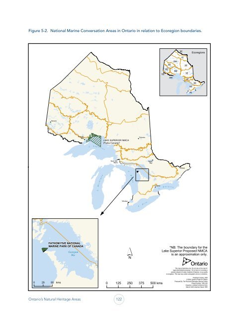
Figure 5-2. National Marine Conversation <strong>Areas</strong> in Ontario in relation to Ecoregion boundaries.<br />
0 25 50<br />
Kenora<br />
Thunder<br />
Bay<br />
FATHOM FIVE NATIONAL<br />
MARINE PARK OF CANADA<br />
kms<br />
Georgian<br />
Bay<br />
L . S u p e r i o r<br />
L . M i c h i g a n<br />
LAKE SUPERIOR NMCA<br />
(Parks Canada)*<br />
Sault Ste.<br />
Marie<br />
Ontario’s <strong>Natural</strong> <strong>Heritage</strong> <strong>Areas</strong> 122<br />
Windsor<br />
L . H u r o n<br />
Timmins<br />
L . E r i e<br />
North<br />
Bay<br />
Toronto<br />
0 125 250 375 500 kms<br />
5S<br />
4S<br />
3S<br />
4W<br />
L . O n t a r i o<br />
2W<br />
3W<br />
0E<br />
1E<br />
Ottawa<br />
2E<br />
3E<br />
4E<br />
6E<br />
7E<br />
Ecoregions<br />
5E<br />
*NB: The boundary for the<br />
Lake Superior Proposed NMCA<br />
is an approximation only.<br />
This map is illustrative only. Do not rely on this map for<br />
legal administrative purposes. Do not rely on it as being a<br />
precise indicator <strong>of</strong> routes, locations <strong>of</strong> features, or as a guide<br />
to navigation. This map may contain cartographic errors or omissions.<br />
Published October, 2008<br />
© 2008, Queen's Printer for Ontario<br />
Produced By: The Provincial Geomatics Service Centre<br />
Project Number: 7400_023<br />
Projection: Lambert Conformal Conic<br />
Datum: North American Datum 1983