Provisional Geologic Map of the Tintic Mountain - Utah Geological ...
Provisional Geologic Map of the Tintic Mountain - Utah Geological ...
Provisional Geologic Map of the Tintic Mountain - Utah Geological ...
Create successful ePaper yourself
Turn your PDF publications into a flip-book with our unique Google optimized e-Paper software.
INTRODUCTION<br />
Location, Methods, and Prior Work<br />
The <strong>Tintic</strong> <strong>Mountain</strong> quadrangle is located in central <strong>Utah</strong> about 6 miles (10 km) south <strong>of</strong><br />
Eureka near <strong>the</strong> central part <strong>of</strong> <strong>the</strong> East <strong>Tintic</strong> <strong>Mountain</strong>s. The quadrangle is on <strong>the</strong> east margin<br />
<strong>of</strong> <strong>the</strong> Basin and Range Physiographic Province.<br />
Because <strong>the</strong> quadrangle is partly within <strong>the</strong> East <strong>Tintic</strong> mining district, numerous<br />
geologic studies have been done on <strong>the</strong> area. Morris and Lovering (1979) prepared <strong>the</strong> most<br />
comprehensive report on <strong>the</strong> district; o<strong>the</strong>r examples are listed in <strong>the</strong> references in this open-file<br />
report. U.S. <strong>Geologic</strong>al Survey geologist H.T. Morris (1975) previously mapped <strong>the</strong> geology <strong>of</strong><br />
<strong>the</strong> <strong>Tintic</strong> <strong>Mountain</strong> quadrangle. Subsequent mapping occurred in <strong>the</strong> west (Hannah and<br />
MacBeth, 1990) and nor<strong>the</strong>ast (Keith and o<strong>the</strong>rs, 1989, 1991) parts <strong>of</strong> <strong>the</strong> quadrangle. This map<br />
focuses on <strong>the</strong> Tertiary volcanic rocks, and relies on geochemical, geochronologic, and<br />
stratigraphic data from Moore’s M.S. <strong>the</strong>sis (1993) supervised by J.D. Keith. The stratigraphy <strong>of</strong><br />
<strong>the</strong> <strong>Tintic</strong> <strong>Mountain</strong> Volcanic Group has been revised from that <strong>of</strong> Morris and Lovering (1979)<br />
with a mix <strong>of</strong> formal and informal rock unit names. The quadrangle was remapped in an effort<br />
to update and build upon <strong>the</strong> prior mapping and geologic studies <strong>of</strong> H.T. Morris.<br />
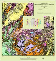
This open-file report is based primarily on mapping completed in 1991-1993; parts <strong>of</strong> <strong>the</strong><br />
quadrangle were mapped by coauthors Hannah, Cannan and MacBeth (1991-1992), Keith and<br />
Moore (1991-1992), Moore (1991-1992), and Tingey (1993), as depicted on <strong>the</strong> index to areas <strong>of</strong><br />
responsibility for geologic mapping (figure 1). Age determinations were conducted by S.T.<br />
Nelson. The map was compiled by T. Pulsifer under <strong>the</strong> direction <strong>of</strong> J.D. Keith and D.G.<br />
Tingey. Moore and o<strong>the</strong>rs (2007) subsequently discussed petrogenesis <strong>of</strong> <strong>the</strong> East <strong>Tintic</strong><br />
volcanic field based on Moore (1993).<br />
This geologic map focuses on <strong>the</strong> Tertiary igneous rocks in part <strong>of</strong> <strong>the</strong> East <strong>Tintic</strong><br />
<strong>Mountain</strong>s, and supercedes <strong>the</strong> reports <strong>of</strong> Morris (1975), and Hannah and MacBeth (1990). The<br />
revised stratigraphy <strong>of</strong> <strong>the</strong> <strong>Tintic</strong> <strong>Mountain</strong> Volcanic Group in this open-file report was partly<br />
shown in Keith and o<strong>the</strong>rs (1989, 1991) and Hintze (1988, chart 32, p. 149). The surface<br />
geology <strong>of</strong> <strong>the</strong> <strong>Tintic</strong> <strong>Mountain</strong> area is extremely complex and we recognize that some<br />
inconsistencies have not been resolved. Notably, <strong>the</strong> correlation chart is not fully compatible<br />
with <strong>the</strong> mapping and isotopic ages. Some isotopic age data do not match <strong>the</strong> physical<br />
stratigraphy and sample locations and units sampled are uncertain. Also, thicknesses shown on<br />
cross sections do not match those on nearby maps. A structural or stratigraphic explanation is<br />
needed to explain why map unit Trp is exposed on both sides <strong>of</strong> <strong>the</strong> range. Age ranges for Trp<br />
and some o<strong>the</strong>r map units may be longer than shown in <strong>the</strong> correlation chart. Not all units are<br />
named on <strong>the</strong> basis <strong>of</strong> <strong>the</strong>ir geochemistry. Geochemical and geochronologic research are<br />
ongoing.<br />
Inferred Calderas and <strong>Geologic</strong> History<br />
The <strong>Tintic</strong> <strong>Mountain</strong> quadrangle is characterized by exposures <strong>of</strong> Eocene and Oligocene volcanic,<br />
sedimentary, and intrusive rocks that lie unconformably upon faulted lower Paleozoic sedimentary rocks<br />
1


