Bathymetry of Cannikin Lake, Amchitka Island, Alaska, with
Bathymetry of Cannikin Lake, Amchitka Island, Alaska, with
Bathymetry of Cannikin Lake, Amchitka Island, Alaska, with
You also want an ePaper? Increase the reach of your titles
YUMPU automatically turns print PDFs into web optimized ePapers that Google loves.
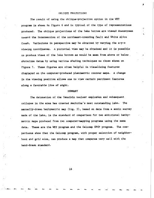
OBLIQUE PROJECTIONS<br />
The result <strong>of</strong> using the oblique-projection option in the WET<br />
program is shown in figure 6 and is typical <strong>of</strong> the type <strong>of</strong> representations<br />
produced. The oblique projections <strong>of</strong> the lake bottom are viewed downstream<br />
toward the intersection <strong>of</strong> the northeast-trending fault and White Alice<br />
Creek. Variations in perspective may be obtained by varying the x-y-z<br />
vfewing coordinates. A pictorial view may be obtained and St is possible<br />
co produce views <strong>of</strong> the lake bottom as would be seen from above or below<br />
shoreline datum by using various shading techniques as those shown on<br />
figure 7. These figures are <strong>of</strong>ten helpful in visualizing features<br />
displayed on the computer-produced plarrimetric contour maps. A change<br />
in the viewing position allowe one to view certain pertinent feature6<br />
along a favorable line <strong>of</strong> sight.<br />
SIMMARY<br />
The detonation <strong>of</strong> the <strong>Cannikin</strong> nuclear explosion and subaequent<br />
collapee in the area has created <strong>Amchitka</strong>'s most outstanding lake. The<br />
manually-drawn bathymetric map (fig. 3), based on data from a monic survey<br />
made <strong>of</strong> the lake, is the standard <strong>of</strong> comparison for two additional bathy-<br />
metric maps produced from two computer-mapping programs using the same<br />
data. These are the WET program and the Calcomp GPCP program. The com-<br />
parisons show tht the Calcomp program, <strong>with</strong> proper selection <strong>of</strong> neighbor-<br />
hood and grid uize, can produce a map that compares very well <strong>with</strong> the<br />
hand-drawn standard.<br />
-<br />
\


