Enhancing Biodiversity Hotspots Along Western Queensland Stock ...
Enhancing Biodiversity Hotspots Along Western Queensland Stock ...
Enhancing Biodiversity Hotspots Along Western Queensland Stock ...

Create successful ePaper yourself
Turn your PDF publications into a flip-book with our unique Google optimized e-Paper software.
ENHANCING BIODIVERSITY HOTSPOTS<br />
ALONG WESTERN QUEENSLAND<br />
STOCK ROUTES<br />
Report Prepared By Bryan Walsh / South West NRM, May 2009
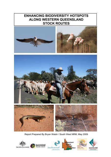
Cover photos<br />
Top left: A black-shouldered kite (Elanus axillaris)<br />
Top right: Major Mitchell’s cockatoos (Lophochroa leadbeateri)<br />
Centre: A drover moving cattle<br />
Bottom left: A yakka skink (Egernia rugosa)<br />
Bottom right: A Euro, or common wallaroo (Macropus robustus)<br />
(All photos were taken by B. Walsh)<br />
2
Executive summary<br />
The <strong>Stock</strong> Route Network (SRN) of western <strong>Queensland</strong> has significant economic<br />
value for pastoralists, and has significant habitat for biodiversity. The network covers<br />
a range of habitats that stretch from the border with New South Wales to the Gulf of<br />
Carpentaria, which in turn support a variety of biodiversity that include many<br />
conservation priorities for <strong>Queensland</strong>. However, a number of threats to the SRN,<br />
compounded by a lack of knowledge about the conservation priorities, are<br />
compromising the management of this resource.<br />
In order to improve the management of the natural values of the SRN, this project<br />
sought to identify some of the biodiversity hotspots on the stock routes of western<br />
<strong>Queensland</strong>, and provide recommendations for their management in order to achieve<br />
the greatest conservation benefits.<br />
To achieve these objectives, the project partners (Southern Gulf Catchments Ltd.,<br />
Desert Channels <strong>Queensland</strong> Inc., South West NRM Ltd., <strong>Queensland</strong> Murray<br />
Darling Committee Inc., and the Department of Environment and Resource<br />
Management) were supported by funds from the Australian Government to map and<br />
identify potential sites, carry out field visits to verify values and threats, and to make<br />
management recommendation for identified biodiversity hotspots.<br />
This project identified 47 biodiversity hotspots as well as other sites of high nature<br />
conservation or geological value, and sites that require further research. For each<br />
biodiversity hotspot the biological values were identified (including the presence of<br />
priority species), as well as the threats, current management, and recommended<br />
management actions.<br />
The condition of the biodiversity hotspots and stock routes were comparable to the<br />
management of the station or protected area they adjoin or traverse, and many were<br />
in good condition. However, common threats were habitat degradation from weeds,<br />
competition/predation by introduced animals, inappropriate fire regime, damage to<br />
springs by feral pigs, and overgrazing by stock in some areas.<br />
Mitigating the threats to these biodiversity hotspots will require: an increased<br />
awareness of the values and management needs of these sites amongst the local<br />
stakeholders; a focus of management on the recommended actions; and increased<br />
coordination amongst stakeholders to make the greatest conservation gains with<br />
limited resources.<br />
The recommendations in this report can be used to help focus the work programmes<br />
of relevant stakeholders, as well as leverage for the funding required to conserve<br />
these biodiversity hotspots.<br />
3
Contents<br />
Executive Summary 3<br />
List of maps 5<br />
List of tables 5<br />
List of plates 5<br />
Introduction 7<br />
Project objectives 8<br />
Project area 8<br />
Project methodology 9<br />
The format of this report 11<br />
The Southern Gulf NRM region 12<br />
Introduction 12<br />
<strong>Biodiversity</strong> hotspots 14<br />
Sites recommended for further research 24<br />
Additional findings 24<br />
The Desert Channels NRM Region 26<br />
Introduction 26<br />
<strong>Biodiversity</strong> hotspots 28<br />
Sites of high nature conservation value 50<br />
Sites recommended for further research 50<br />
Additional findings 52<br />
The South West NRM Region 55<br />
Introduction 55<br />
<strong>Biodiversity</strong> hotspots 58<br />
Sites of high nature conservation and geological values 96<br />
Additional findings 101<br />
The Border Rivers Maranoa-Balonne NRM Region 102<br />
Introduction 102<br />
<strong>Biodiversity</strong> hotspots 104<br />
Additional findings 118<br />
Conclusions 121<br />
Acknowledgements 122<br />
References 122<br />
Acronyms 123<br />
Appendix 1: Priority species 124<br />
Appendix 2: Data sheet for site visits 126<br />
4
List of maps<br />
Map 1. The <strong>Stock</strong> Route Network of western <strong>Queensland</strong>. 8<br />
Map 2. <strong>Biodiversity</strong> hotspots of the Southern Gulf NRM Region. 13<br />
Map 3. <strong>Biodiversity</strong> hotspots of the Desert Channels NRM Region. 27<br />
Map 4. <strong>Biodiversity</strong> hotspots of the South West NRM Region. 57<br />
Map 5. <strong>Biodiversity</strong> hotspots of the Border Rivers Maranoa-Balonne NRM<br />
Region. 103<br />
List of tables<br />
Table 1. <strong>Biodiversity</strong> hotspots and sites recommended for further research in the<br />
Southern Gulf NRM Region. 12<br />
Table 2. <strong>Biodiversity</strong> hotspots and sites of high nature conservation value in the<br />
Desert Channels NRM Region. 26<br />
Table 3. <strong>Biodiversity</strong> hotspots and sites of high nature conservation and<br />
geological values in the South West NRM Region. 56<br />
Table 4. <strong>Biodiversity</strong> hotspots in the Border Rivers Maranoa-Balonne NRM<br />
Region. 102<br />
List of plates<br />
Plate 1. Charles Curry by the predator-proof fence at the Julia Creek Airport. 15<br />
Plate 2. Hell’s Gate sandstone outcrop. 16<br />
Plate 3. Aboriginal art gallery at Hell’s Gate. 17<br />
Plate 4. Gregory River at the Lawn Hill crossing. 18<br />
Plate 5. Cattle grazing damage to Pandanus aquaticus. 19<br />
Plate 6. Purple-crowned fairy-wren in Pandanus aquaticus. 20<br />
Plate 7. Rapids on the O’Shannassy River. 22<br />
Plate 8. The buff-sided race of the white-browed robin. 25<br />
Plate 9. Bilby burrow with fresh scats and tail-marks. 28<br />
Plate 10. Bilby diggings. 29<br />
Plate 11. Captive bilby. 30<br />
Plate 12. Waddy tree (Acacia peuce) damage where a branch has been<br />
removed. 31<br />
Plate 13. Hell Hole Gorge. 33<br />
Plate 14. Yellow-footed rock-wallaby. 34<br />
Plate 15. Elizabeth Springs. 35<br />
Plate 16. “Big Red” sand dune. 37<br />
Plate 17. Lake Galilee. 39<br />
Plate 18. Lake Dunn. 41<br />
Plate 19. The recreational beach on Lake Dunn. 42<br />
Plate 20. Myross Springs. 44<br />
Plate 21. Old Cork Waterhole. 45<br />
Plate 22. McIlwraith Homestead. 46<br />
Plate 23. Chainsaw damage from fire wood collection. 46<br />
Plate 24. Coopers Creek Waterhole. 48<br />
Plate 25. Black-faced woodswallow. 51<br />
Plate 26. Spinifex pigeon. 52<br />
5
List of plates continued<br />
Plate 27. Northern quoll. 53<br />
Plate 28. Squatter pigeon. 53<br />
Plate 29. Steve Wilson holds up a Collett’s snake road fatality. 54<br />
Plate 30. Lake Dartmouth. 58<br />
Plate 31. Native liquorice flower. 59<br />
Plate 32. Langlo Crossing on the Langlo River. 60<br />
Plate 33. Ooline Park. 62<br />
Plate 34. Harrisia cactus. 63<br />
Plate 35. Ooline trees. 65<br />
Plate 36. Overnight cattle stock camp after rain. 67<br />
Plate 37. Womal. 69<br />
Plate 38. Bundoona Springs. 70<br />
Plate 39. The mistletoe Amyema quandang. 72<br />
Plate 40. Lake Bindegolly with an approaching storm in the distance. 74<br />
Plate 41. A juvenile Murray cod. 76<br />
Plate 42. The CFRC releasing Murray cod fingerlings. 77<br />
Plate 43. Erosion at Bakers Bend. 78<br />
Plate 44. Tagging a mature Murray cod for release. 79<br />
Plate 45. Koala at Boatman Station. 80<br />
Plate 46. Water lettuce at Cunnamulla Weir. 81<br />
Plate 47. Yakka skink. 82<br />
Plate 48. Active rabbit warren with yakka skinks. 84<br />
Plate 49. Yakka skink scats. 86<br />
Plate 50. Yakka skink. 88<br />
Plate 51. Major Mitchell’s cockatoo with crest extension. 92<br />
Plate 52. Major Mitchell’s cockatoo road fatality. 52<br />
Plate 53. Major Mitchell’s cockatoo feeding on a desert paddy melon on the<br />
road verge. 53<br />
Plate 54. Oak Swamp. 96<br />
Plate 55. Adavale Escarpment. 97<br />
Plate 56. The pig-proof fencing around Tego Springs. 98<br />
Plate 57. Barakula State Forest. 104<br />
Plate 58. Womal trees. 106<br />
Plate 59. Yakka skink. 108<br />
Plate 60. Little red flying-fox colony on the Balonne River. 110<br />
Plate 61. Beranga Reserve – “The Lilies”. 114<br />
Plate 62. The daisy Rutidosis lanata. 116<br />
Plate 63. Cobb & Co corduroy coach track. 118<br />
Plate 64. Aboriginal well. 119<br />
Plate 65. Parthenium weed. 120<br />
6
Introduction<br />
<strong>Queensland</strong>’s <strong>Stock</strong> Route Network (SRN) is a web of stock routes, roads and<br />
reserves for travelling stock that covers most of the State. This network is a rich<br />
inherited legacy that has far greater benefits than just the movement of livestock,<br />
which was and still is their primary role.<br />
The stock routes were formally recognised between the 1860s and 1890s, although<br />
human usage of these routes goes back much earlier. Aboriginal trade routes had<br />
traditionally followed the best hunting trails and permanent watering sites, so it is little<br />
wonder that indigenous knowledge was sought to survey for pastoral settlement and<br />
movement of livestock when the stock routes were established. This pragmatic<br />
approach resulted in the retention of some of our best biodiversity sites throughout<br />
the SRN of western <strong>Queensland</strong>, including dry season water holes which are the<br />
refugia for aquatic life in a land of pulsing seasons.<br />
As this network stretches from the <strong>Queensland</strong> border with New South Wales to the<br />
Gulf of Carpentaria, it supports a diverse range of threatened species and habitats<br />
from springs of the Great Artesian Basin, to Brigalow woodlands, to the tropical rivers<br />
of the Gulf country. Further evidence of the biodiversity value of the stock routes,<br />
their connectivity, and remnant vegetation, is illustrated by the number of National<br />
Parks and Conservation Reserves that either have stock routes connecting with the<br />
park, or dissecting them completely (such as Diamantina National Park and Hell Hole<br />
Gorge). In total, this amounts to 28 National Parks and two Bush Heritage<br />
Conservation Reserves in the four Natural Resource Management (NRM) regions of<br />
<strong>Western</strong> <strong>Queensland</strong>. There are also 55 declared State Forests which are in some<br />
way connected to stock routes.<br />
Under the Land Protection (Pest and <strong>Stock</strong> Route Management) Act 2002, the<br />
administration of the SRN is shared between local Government and the Department<br />
of Environment and Resource Management (DERM) (formerly the Department of<br />
Natural Resources and Water and the Environmental Protection Agency). Local<br />
government is responsible for day-to-day management, while DERM is responsible<br />
for providing the framework of legislation and policy for stock route management and<br />
support for local governments. As not all of the SRN is currently used to move stock,<br />
stock routes are classified into either active (primary, secondary and minor) and inactive.<br />
The values of the SRN of western <strong>Queensland</strong> are under threat from multiple<br />
pressures that include inappropriate grazing regimes, feral animals and weeds. Due<br />
to the vast scale of the area, and high costs of management, current management of<br />
the stock routes is highly fragmented. Additionally, a low appreciation of the multiple<br />
assets of the SRN has limited the willingness of managers to protect their values.<br />
It is not possible to manage this entire network equally due to its scale, nor would<br />
that be necessary because of the habitat fragmentation across the landscape from a<br />
history of human impacts. However, by identifying biodiversity hotspots, and<br />
recommendations for their management, it would be possible to direct management<br />
of the SRN to conserving the most significant biodiversity values while maintaining<br />
the primary purpose of the network, which is the movement of stock<br />
In order to achieve this, this project was initiated by a consortium consisting of<br />
DERM, the four Natural Resource Management bodies of <strong>Western</strong> <strong>Queensland</strong> –<br />
Southern Gulf Catchments (SGC), Desert Channels <strong>Queensland</strong> (DCQ), South West<br />
7
NRM (SWNRM), and <strong>Queensland</strong> Murray Darling Committee (QMDC) – and funded<br />
by the Australian Government.<br />
Project objectives<br />
The primary objectives of this project were to identify biodiversity hotspots on the<br />
SRN of western <strong>Queensland</strong>, and suggest recommended actions to address any<br />
threats to these sites.<br />
Project area<br />
The SRN of western <strong>Queensland</strong> covers approximately 1,844,000 hectares (i.e. 57%<br />
of <strong>Queensland</strong> or 83% of the State’s stock route network), and includes about 75,000<br />
kilometres of stock routes (Map 1). In comparison, all of Britain and Ireland would fit<br />
into this project area three times. This area is made up of four NRM regions:<br />
The Southern Gulf region (managed by Southern Gulf catchments Ltd.),<br />
The Desert Channels region (managed by Desert Channels <strong>Queensland</strong> Inc.),<br />
The South West region (managed by South West NRM Ltd.), and<br />
The Border Rivers Maranoa-Balonne region (managed by the <strong>Queensland</strong><br />
Murray Darling Committee Inc.).<br />
Map 1. The <strong>Stock</strong> Route Network of western <strong>Queensland</strong>.<br />
8
Project methodology<br />
In order to achieve the objectives of identifying biodiversity hotspots and<br />
recommended management actions over a vast geographic area, and within the<br />
timeframe of April 2008 – May 2009, the project followed three major steps.<br />
1. Prioritisation of sites, using the ‘Back on Track species prioritisation framework’<br />
and using maps that overlayed multiple values,<br />
2. Field visits, to confirm the values and threats to each site, and<br />
3. Selection of biodiversity hotspots, using specific criteria.<br />
1. Prioritisation of sites<br />
The ‘Back on Track species prioritisation framework’<br />
The project used DERM’s ‘Back on Track species prioritisation framework’ as the<br />
basis for identifying potential biodiversity hotspots, because this framework identifies<br />
where invested resources can make the greatest gains in conserving <strong>Queensland</strong>’s<br />
threatened species.<br />
The 'Back on Track species prioritisation framework' prioritises <strong>Queensland</strong>'s native<br />
species (marine, terrestrial and aquatic species of flora and fauna) to guide<br />
conservation, management and recovery. Species are prioritised using multiple<br />
criteria to allow the identification of those that are in trouble or decline, but which<br />
have the greatest chance of recovery. As ‘Back on Track’ assess all species<br />
regardless of their current conservation listing, species identified as priorities within<br />
the project area include those listed under the Environment Protection and<br />
<strong>Biodiversity</strong> Conservation Act 1999, <strong>Queensland</strong>’s Nature Conservation Act 1992,<br />
and species not listed under either Act (Appendix 1).<br />
Both ‘Back on Track’ and this project are encouraging a multi-species approach to<br />
make the most of management resources. ‘Back on Track’ encourages focussing on<br />
the common threats of multiple priority species, and this project aimed to identify<br />
biodiversity hotspots (i.e. sites of multiple species). By using known records of where<br />
priority species are found on the SRN of western <strong>Queensland</strong>, this project has<br />
identified biodiversity hotspots where management actions will achieve the greatest<br />
conservation benefits.<br />
Map production<br />
To identify potential biodiversity hotspots, maps were produced that overlayed<br />
multiple values.<br />
Firstly, a combined map was produced using ArcGIS for the entire area with the<br />
various regional boundaries delineated. This was overlayed with an updated stock<br />
routes shape file, and buffered to one kilometre each side for the purposes of<br />
connectivity and linkages in the landscape. The timeframe to complete this extended<br />
from May to August 2008 due to delays in obtaining updated shape files and security<br />
clearances.<br />
The records of ‘Back on Track’ priority species (Appendix 1), from the DERM WildNet<br />
database, was then overlayed on top of the map layer of the stock routes.<br />
9
Additional data such as the location of national parks, state forests, conservation<br />
reserves, Non-Government Organisations (NGO) conservation holdings (such as<br />
Bush Heritage), wetlands, regional ecosystems, and bio-regions were also added to<br />
the map overlays. A concerted effort was made to engage key people personally<br />
rather than by correspondence, to explain the project and defuse any misconceptions<br />
as to its purpose.<br />
Engaging with knowledgeable people from the different regions was an invaluable<br />
source of information. This resulted in historical recollection, identification of<br />
additional biodiversity sites, and on-ground knowledge of the greatest threats such as<br />
feral animals and weeds, with the potential to impact on the biodiversity.<br />
Finally, all this information was collated, and due to the scale of the project, compiled<br />
into topographical map books at a scale 1:250,000 for each region. This created a<br />
soundly based foundation from which to launch on-ground site inspections and<br />
determine potential biodiversity hotspots.<br />
2. Field visits<br />
From August 2008 – March 2009 the potential biodiversity hotspots identified on the<br />
maps were checked in the field. These field trips involved driving approximately<br />
80,000 kilometres of stock route.<br />
There were two purposes of the field visits: Firstly, to collect data on potential sites;<br />
and secondly, to meet and communicate with stock route officers and adjacent<br />
landholders in order to gather local knowledge and engage them in the project.<br />
At each site, data was gathered to confirm the priority species, other biological<br />
values, and threats present, and any current management (Appendix 2). Where<br />
possible, attempts were made to camp at sites in order to maximise the time spent at<br />
potential biodiversity hotspots and the data collected on each site.<br />
Threats to biodiversity were documented at all sites. However, site inspections took<br />
into account other activities in the area of concern, e.g. soil erosion. Some threats<br />
are still not well known such as fire regime for different species, and the<br />
advancement of cane toads.<br />
Drought was still dominant throughout most of the western area at the time of<br />
commencement, and conditions and access were hot and dusty, particularly in the<br />
Gulf. This was dramatically reversed by the onset of an exceptional monsoonal wet<br />
season which saw most of the Gulf and further south inundated with flood waters<br />
during the term of this project.<br />
10
3. Selection of biodiversity hotspots<br />
In order to select biodiversity hotspots, the project’s advisory group (made up of<br />
representatives of the project’s partners) developed a list of criteria against which the<br />
sites visited could be assessed. These criteria were:<br />
1. The presence of (multiple) priority species, and their abundance.<br />
2. The physical constraints: adjoining land use, knowledge of the threats, and<br />
the ability to manage the threats (on-ground).<br />
3. The social constraints (level of engagement): cooperation of land manager in<br />
the area, and the opportunity for cooperative management.<br />
4. Active vs. inactive stock routes (despite receiving little use by travelling stock,<br />
inactive stock routes may be more heavily grazed than active routes, either<br />
under permit, because they are not fenced or because they are being grazed<br />
unlawfully).<br />
5. Connectivity to adjoining habitat (such as links to national parks, nature<br />
refuges and voluntary conservation agreements).<br />
6. The shape and size of regional ecosystems (REs), and the percentage of the<br />
stock route site that is mapped as REs.<br />
The format of this report<br />
This report presents the biodiversity hotspots identified by this project, and<br />
recommendations for their management. As this information has been gathered to<br />
improve the management of biodiversity on the SRN of western <strong>Queensland</strong>, the<br />
target audience for this report are the stock route managers, be they local<br />
government, State government, or adjoining landholders. However, this report will<br />
also be of use to all involved and/or interested in the conservation of biodiversity on<br />
stock routes.<br />
To facilitate the presentation of this information, this report is divided into the four<br />
NRM regions that comprise western <strong>Queensland</strong> (i.e. Southern Gulf, Desert<br />
Channels, South West, and Border Rivers Maranoa-Balonne). Each regional chapter<br />
begins with a table listing the biodiversity hotspots and the local government area in<br />
which they are located. The rest of each regional chapter expands on each<br />
biodiversity hotspot describing their biodiversity values, threats, current management<br />
and recommended actions. Where the conservation status of other species are<br />
mentioned (such as Rare and Vulnerable), these are as listed under the Nature<br />
Conservation Act 1992.<br />
The report ends with two appendices. Appendix one is a list of the priority species<br />
used by this project (as identified through the ‘Back on Track species prioritisation<br />
framework’). Appendix two is a copy of the data sheet used for field visits, for when<br />
information needs to be gathered on additional potential biodiversity hotspots.<br />
11
The Southern Gulf NRM Region<br />
Introduction<br />
The Southern Gulf NRM region covers an area of 195,000 square kilometres, and<br />
encompasses the catchments of Flinders, Cloncurry, Leichhardt, Gregory and<br />
Nicholson Rivers, Settlement Creek and Morning Inlet, all of which drain into the Gulf<br />
of Carpentaria. The region has five bio-regions: Mount Isa Inlier, Mitchell Grass<br />
Downs, Gulf Plains, Desert Uplands and Einsleigh Uplands, and comprises all or part<br />
of 9 shires including the Doomadgee and Mornington Shires. In the northern part of<br />
the region are the Southern Gulf Aggregation wetlands, which are wetlands of high<br />
significance.<br />
When the project commenced in May 2008, it was decided to make the first visits to<br />
this region in order to avoid the wet season across northern Australia that can make<br />
mobility almost impossible. As it turned out the 2008 – 2009 wet season was one of<br />
the wettest on record with extensive inundation over an exceptionally long period of<br />
time.<br />
A total of 23 site inspections were made throughout the region, of which five were<br />
considered to be biodiversity hotspots using the selection criteria (Table 1 and Map<br />
2).<br />
Site Recommendation Local Government Area<br />
1. Julia Creek Airport <strong>Biodiversity</strong> Hotspot McKinlay Shire<br />
2. Hell’s Gate <strong>Biodiversity</strong> Hotspot Burke Shire<br />
3. Gregory River Crossing<br />
(1)<br />
<strong>Biodiversity</strong> Hotspot Mount Isa City<br />
4. Gregory River Crossing<br />
(2)<br />
<strong>Biodiversity</strong> Hotspot Burke Shire<br />
5. O’Shannassy River <strong>Biodiversity</strong> Hotspot Mount Isa City<br />
6. Gregory/O’Shannassy Further Research Burke Shire<br />
Rivers<br />
Table 1. <strong>Biodiversity</strong> hotspots and sites recommended for further research in the<br />
Southern Gulf NRM Region.<br />
12
Map 2. <strong>Biodiversity</strong> hotspots of the Southern Gulf NRM Region.<br />
13
<strong>Biodiversity</strong> hotspots<br />
Site 1. Julia Creek Airport<br />
STOCK ROUTE NUMBER: P012<br />
PRIORITY SPECIES: Animals:<br />
Julia Creek dunnart (Sminthopsis douglasi).<br />
RATING: BIODIVERSITY HOTSPOT<br />
SHIRE COUNCIL: McKINLAY SHIRE<br />
The Julia Creek Airport is already a focus for management actions for the Julia Creek<br />
dunnart (Sminthopsis douglasi). This is because there is strong community support<br />
for the species and its promotion as a tourist icon, and because a population was<br />
discovered around the airport. In conjunction with the Julia Creek community,<br />
McKinlay Shire Council, DERM, and Southern Gulf Catchments Ltd. (SGC), a<br />
predator-proof fence has been constructed around the airport and part of the stock<br />
route (which is an active Reserve), to protect an existing population of the dunnart<br />
from predation by feral cats and foxes. (The Shire has the authority to fence off part<br />
of the SRN reserve for this purpose).<br />
THREATS: The major threat to the Julia Creek dunnart is predation by cats, foxes<br />
and dogs. Overgrazing and weed invasion, in particular parkinsonia (Parkinsonia<br />
aculeata), would degrade the quality of habitat. The advancement of cane toads into<br />
the area is an unknown, but is expected to have a further negative impact.<br />
CURRENT MANAGEMENT: In conjunction with McKinlay Shire Council, DERM is<br />
actively ensuring all predator species are eliminated from within the predator-proof<br />
fenced site (Plate 1). Ongoing monitoring and management is planned for the future<br />
with the cooperation of all involved.<br />
RECOMMENDATIONS: It is recommended that the current maintenance of the<br />
predator-proof fence and predator control be maintained, and planned on-going<br />
monitoring be implemented.<br />
A draft National Recovery Plan for the Julia Creek dunnart has been prepared by<br />
DERM in conjunction with the Australian Government. This document is a blue print<br />
for best practice management, and recommends the implementation of baiting and<br />
shooting for cats and foxes, which has been successful in national parks. This<br />
practice should be incorporated along with the current Shire Pest and Weed<br />
Management Plan, if it is not already being implemented.<br />
14
Plate 1. Charles Curry (SGC) by the predator-proof fence at the Julia Creek<br />
Airport (Photo: B. Walsh).<br />
15
Site 2. Hell’s Gate (Burketown – Borroloola Road)<br />
STOCK ROUTE NUMBER: U124<br />
PRIORITY SPECIES: Animals:<br />
Carpentaria grasswren (Amytornis dorothea); and,<br />
red goshawk (Erythrotriorchis radiatus).<br />
RATING: BIODIVERSITY HOTSPOT<br />
SHIRE COUNCIL: BURKE SHIRE<br />
Situated on the main Burketown to Borroloola Road, Hell’s Gate is a large sandstone<br />
outcrop (Plate 2) that is a well known bird watching site, specifically for the<br />
Carpentaria grasswren (Amytornis dorothea). The site is believed to be a favourite<br />
destination for the Gulf Savannah Guides, as it has other sandstone species and<br />
excellent connectivity to an escarpment that runs through to the Northern Territory<br />
border and beyond. Hell’s Gate also has cultural significance with Aboriginal art<br />
galleries (Plate 3) and a rock shelter, where ochre grinding cups in the solid rock give<br />
testimony to its historic usage.<br />
Plate 2. Hell’s Gate sandstone outcrop – habitat of the Carpentaria grasswren<br />
(Photo: B. Walsh).<br />
16
Plate 3. Aboriginal art gallery at Hell’s Gate (Photo: B. Walsh).<br />
THREATS: While Carpentaria grasswrens are able to tolerate low intensity, mosaic<br />
burns, they are susceptible to high intensity wildfires because they are relatively poor<br />
flyers and dispersers (Dr. Leasie Feldorhof, pers. comm.). Apart from high intensity<br />
fires, predation from feral cats and dogs, and excessive camping are the greatest<br />
threats in this area. Vegetation clearing and overgrazing are not threatening issues in<br />
this rocky spinifex terrain as it is lowly rated for grazing purposes, and additionally the<br />
stock route at this site is inactive.<br />
CURRENT MANAGEMENT: Burke Shire Council has undertaken some minor<br />
access road works to the site. However, this has not stopped tourists creating<br />
additional tracks throughout the site for access and camping.<br />
RECOMMENDATIONS: In order to minimize the impact of tourists to the site, and<br />
their disturbance to Carpentaria grasswren, a priority action needs to be restricting<br />
the number of camping sites and vehicle access tracks. Additionally, the installation<br />
of bollards to direct traffic to camping sites and avoid the current proliferation of new<br />
sites is strongly recommended, as is the erection of good interpretive signage to<br />
raise awareness. In order to protect the Aboriginal art galleries, strategic fencing or<br />
barriers needs to be installed (Sullivan, 1984).<br />
The control of predators in this isolated site would be futile without a broader<br />
coordination in the surrounding area. Therefore, the area will need coordinated<br />
baiting between the Department of Employment, Economic Development and<br />
Innovation (DEEDI) (formerly the Department of Primary Industries), Burke Shire<br />
Council, and DERM.<br />
Finally, it is recommended that low-intensity, mosaic burns are used for any fire<br />
management in the area in order to protect the Carpentaria grasswrens.<br />
17
Site 3. Gregory River Crossing (1) (Riversleigh Station)<br />
STOCK ROUTE NUMBER: U 079<br />
PRIORITY SPECIES: Plants:<br />
Pandanaus aquaticus.<br />
Animals:<br />
purple-crowned fairy-wren (Malurus coronatus),<br />
red goshawk (Erythrotriorchis radiatus), and<br />
ghost bat (Macroderma gigas).<br />
RATING: BIODIVERSITY HOTSPOT<br />
SHIRE COUNCIL: MOUNT ISA CITY<br />
The Gregory River (Plate 4) is one of the most renowned perennial systems in the<br />
Top End of Australia. It is spring-fed, combines with the O’Shannassy River, and has<br />
recently been classified as a ‘Wild River’ under the <strong>Queensland</strong> Wild Rivers and<br />
Other Legislation Amendment Act 2005. This rich, tropical river system supports<br />
multiple priority species living along and adjacent to the riparian edges, and winds<br />
through rugged low escarpments where undoubtedly ghost bat (Macroderma gigas)<br />
roosts along with other species.<br />
Plate 4. Gregory River at the Lawn Hill crossing (Photo: B. Walsh).<br />
THREATS: Although feral predators such as cats undoubtedly have some predation<br />
impact on the faunal species, the greatest threats to Gregory River area come from<br />
overgrazing, inappropriate fire regime, feral pigs and weeds. The riparian edges of<br />
this system come under a lot of grazing pressure during the dry season, especially in<br />
the case of Pandanus aquaticus that cattle graze out over the waters edge (Plate 5).<br />
Cane toads have already invaded this area, with minimal ‘before and after’ surveys to<br />
quantify impact.<br />
18
Plate 5. Cattle grazing damage to Pandanus aquaticus (Photo: B. Walsh).<br />
CURRENT MANAGEMENT: The need for fencing to protect the riparian area of this<br />
site has already been recognised, and work has been undertaken with the<br />
cooperation of SGC, DERM and the adjacent property manager resulting in the<br />
fencing of both sides of the Gregory River through to Riversleigh Station.<br />
RECOMMENDATIONS: It is recommended that the current fence be maintained (a<br />
particular concern in this flood-prone area), and that the fencing be extended to<br />
protect the riparian area upstream from the crossing in order to improve the<br />
protection of the site.<br />
Improved coordination of pest and weed management between DEEDI, Mount Isa<br />
City Council, SGC and landholders would also improve the effectiveness and<br />
conservation benefits of these actions.<br />
It is not recommended to implement any control of cane toads, because until a<br />
pathogen is found to biologically control cane toads, manual or mechanical control in<br />
isolated localities provides very limited benefits.<br />
19
Site 4. Gregory River Crossing (2) (Burketown - Borroloola Road)<br />
STOCK ROUTE NUMBER: U124<br />
PRIORITY SPECIES: Plants:<br />
Pandanaus aquaticus.<br />
Animals:<br />
purple-crowned fairy-wren (Malurus coronatus).<br />
RATING: BIODIVERSITY HOTSPOT<br />
SHIRE COUNCIL: BURKE SHIRE<br />
As with the Gregory River Crossing at Riversleigh Station, this site has multiple<br />
priority species including Pandanaus aquaticus and purple-crowned fairy-wren<br />
(Malurus coronatus) (Plate 6). In addition there is an abundance of other species<br />
such as white-bellied sea-eagle (Haliaeetus leucogaster), white-browed robin<br />
(Poecilodryas superciliosa), Australian freshwater crocodile (Crocodylus johnsoni),<br />
and northern saratoga (Scleropages leichardti).<br />
Plate 6. Purple-crowned fairy-wren in Pandanus aquaticus (Photo: B. Walsh).<br />
THREATS: The greatest threat to this site is overgrazing of the riparian area. Other<br />
major threats are habitat degradation by feral pigs and weeds, predation by feral<br />
cats, and cane toads that are fatal to native fauna which ingest the toads (especially<br />
crocodiles and goannas). Because this site is on a busy road during the dry season,<br />
garbage is also an issue.<br />
CURRENT MANAGEMENT: The Burke Shire Council has a management regime in<br />
place, including the provision of garbage bins.<br />
20
RECOMMENDATIONS: The highest priority for this site is the installation of strategic<br />
fencing to protect the riparian area from grazing, which needs to involve the Burke<br />
Shire Council and adjacent landholder. These northern, tropical rivers are subject to<br />
annual flooding; therefore the maintenance of any installed fencing is of paramount<br />
importance.<br />
As for the Gregory River Crossing at Riversleigh Station, this site would also benefit<br />
from improved coordination of pest and weed management between DEEDI, Burke<br />
Shire Council, SGC and landholders.<br />
21
Site 5. O’Shannassy River (Lawn Hill Road)<br />
STOCK ROUTE NUMBER: U079<br />
PRIORITY SPECIES: Plants:<br />
Pandanaus aquaticus.<br />
Animals:<br />
purple-crowned fairy-wren (Malurus coronatus), and<br />
red goshawk (Erythrotriorchis radiatus).<br />
RATING: BIODIVERSITY HOTSPOT<br />
SHIRE COUNCIL: MOUNT ISA CITY<br />
The O’Shannassy River is a spring-fed perennial system that joins the Gregory River<br />
on Riversleigh Station, with some evidence of limestone tufa formations along its<br />
rapids. As it shares the same aquatic system as the Gregory River, it also has the<br />
same priority species present.<br />
Although the stock route at this site is inactive, the riparian edges are still overgrazed<br />
by local stock. Negotiations between SGC, Riversleigh Station and DERM have<br />
resulted in fencing off the Gregory River Crossing, with fencing extensions to other<br />
flowing streams on Riversleigh Station.<br />
Plate 7. Rapids on the O’Shannassy River (Photo: B. Walsh).<br />
THREATS: The major threats to the O’Shannassy River at Lawn Hill Road are<br />
overgrazing of the riparian area, habitat degradation by feral pigs and weeds, and<br />
cane toads that are fatal to native fauna which ingest the toads. There is also<br />
advanced erosion on the stock route adjacent to the river, and evidence of wildfire<br />
through the riparian Melaleuca forest.<br />
22
CURRENT MANAGEMENT: As with the Gregory River, negotiations have<br />
commenced with between SGC, Riversleigh Station and DERM to fence-off the<br />
riparian area.<br />
RECOMMENDATIONS: As overgrazing is a major threat, it is recommended that the<br />
negotiations between SGC, Riversleigh Station and DERM be continued and the<br />
strategic fencing be installed to protect the riparian area.<br />
An erosion control strategy plan is needed to address the damage that exists<br />
between the two rivers in order to avoid further impact on water quality and arrest<br />
degradation of the landscape.<br />
As for the two hotspots on the Gregory River (Sites 3 and 4), coordination of pest<br />
and weed management would improve the effectiveness and conservation benefits<br />
of these actions.<br />
23
Sites recommended for further research<br />
The Gregory and O’Shannassy Rivers<br />
As the Gregory River system is so rich in multiple species, anywhere stock routes<br />
cross its banks would rate as a biodiversity hotspot. Despite dry season overgrazing,<br />
the system is still considered relatively intact. This is supported by: the river receiving<br />
Wild River status; that 15% is in national park; and, that there are no towns (apart<br />
from the Gregory River township) or dams along its watercourse.<br />
There is a great need to identify what are the key sites along both the Gregory and<br />
O’Shannassy Rivers, as the entire system would probably rate as a biodiversity<br />
hotspot using this project’s criteria.<br />
RECOMMENDATION: It is recommended that further surveys and research to<br />
assess the presence and abundance of priority species, and to identify key sites and<br />
areas of connectivity and landscape linkage across the whole system.<br />
Additional findings<br />
An additional 17 sites were visited with data recorded for DERM’s WildNet database.<br />
These included such species that are not ‘priority species’ under ‘Back on Track, but<br />
are still uncommon and of conservation interest. These species include the blackbreasted<br />
buzzard (Hamirostra melanosternon), small-leaved ebony (Diospyorus<br />
humilis), and a deceased specimen of the greater glider (Petauroides volans) that<br />
was picked up off a barbed wire fence north of Hughenden. The <strong>Queensland</strong><br />
Museum now holds the specimen which is believed to be the western- most<br />
recording of the species.<br />
Sarus crane (Grus antigone) were in numerous small flocks south of Burketown on<br />
the stock route reserve, with evidence of both mature and juvenile birds.<br />
The buff-sided race of the white-browed robin (Poecilodryas superciliosa race<br />
cerviniventris) was active and plentiful at the Borroloola crossing of the Gregory River<br />
(Plate 8). This site would be approximately the eastern extent of the distribution of<br />
this race.<br />
Little data exists on WildNet for the area north of Hughenden and Julia Creek in the<br />
Southern Gulf NRM region. Because of the mixed landscapes, soils, remnant forests<br />
and escarpments of the area, surveys would reveal more priority species on stock<br />
routes in this area.<br />
24
Plate 8. The buff-sided race of the white-browed robin<br />
(Poecilodryas superciliosa cerviniventris) (Photo: B. Walsh).<br />
In conjunction with DEEDI, SGC undertook a survey of the rivers in the Southern Gulf<br />
NRM region (Hogan and Vallance, 2005). In the results of this report the Flinders<br />
River was highlighted, as it has several endemic species (including priority sawfish<br />
and stingray species) and has dry season water holes that are proven refugia for fish<br />
species in the region. It is strongly suggested that any future surveys visit sites where<br />
stock routes cross this river.<br />
25
The Desert Channels NRM Region<br />
Introduction<br />
The Desert Channels NRM region covers an area of 510,642 square kilometres,<br />
which is approximately 33% of <strong>Queensland</strong>. The two main catchments of this NRM<br />
region, the Georgina / Diamantina system in the west, plus the combination of the<br />
Barcoo and Thompson Rivers, join to become Cooper Creek and make up the<br />
largest part of the Lake Eyre Basin catchment. The region has seven bioregions,<br />
which are the: Simpson Strzelecki Dune fields, North-West Highlands, Mulga Lands,<br />
Channel Country, Desert Uplands, Mitchell grass Downs, and the Brigalow Belt<br />
South (Sattler and Williams, 1999). The Desert Channels NRM region comprises 12<br />
Shires, and approximately 14,000 people who are mostly involved in the pastoral<br />
industry, tourism, and some mining.<br />
The Desert Channels NRM region has by far the greatest area of all the NRM regions<br />
in <strong>Queensland</strong>, and it was difficult to cover the area adequately in the timeframe of<br />
this project. However, a total of 35 site inspections were made, of which 10 were<br />
considered to be biodiversity hotspots using the selection criteria (Table 2 and Map<br />
3).<br />
Site Recommendation Local Government Area<br />
1. Bedourie – Birdsville<br />
Road<br />
<strong>Biodiversity</strong> Hotspot Diamantina Shire<br />
2. Birdsville/Bedourie <strong>Biodiversity</strong> Hotspot Diamantina Shire<br />
3. Hell Hole Gorge<br />
National Park<br />
<strong>Biodiversity</strong> Hotspot Quilpie Shire<br />
4. Elizabeth Springs <strong>Biodiversity</strong> Hotspot Diamantina Shire<br />
5. “Big Red” Sand Dune <strong>Biodiversity</strong> Hotspot Diamantina Shire<br />
6. Lake Galilee <strong>Biodiversity</strong> Hotspot Barcaldine Shire<br />
7. Lake Dunn <strong>Biodiversity</strong> Hotspot Barcaldine Shire<br />
8. The Big Spring <strong>Biodiversity</strong> Hotspot Barcaldine Shire<br />
9. Old Cork Waterhole <strong>Biodiversity</strong> Hotspot Winton Shire<br />
10. Cooper Creek <strong>Biodiversity</strong> Hotspot Barcoo Shire<br />
11. Jericho Reserve High Nature Conservation<br />
Value<br />
Barcaldine Shire<br />
12. Isisford – Stonehenge<br />
Road<br />
Further Research Blackall Shire<br />
Table 2. <strong>Biodiversity</strong> hotspots, sites of high nature conservation value, and sites<br />
recommended for further research in the Desert Channels NRM Region.<br />
26
Map 3. <strong>Biodiversity</strong> hotspots of the Desert Channels NRM Region.<br />
27
<strong>Biodiversity</strong> hotspots<br />
Site 1. Bedourie – Birdsville Road (Linkage with Adria Downs Station)<br />
STOCK ROUTE NUMBER: U465<br />
PRIORITY SPECIES: Animals:<br />
greater bilby (Macrotis lagotis).<br />
RATING: BIODIVERSITY HOTSPOT<br />
SHIRE COUNCIL: DIAMANTINA SHIRE<br />
There are many historic records of greater bilby (Macrotis lagotis) in the Birdsville<br />
region. Regrettably, many of these records are just that, historic, and indicate a<br />
former distribution of where the bilby once occurred. However, a site inspection and<br />
quick ground survey undertaken at one of these old sites along the stock route north<br />
of Birdsville discovered evidence of a large bilby population in the area.<br />
A total of 63 active bilby burrows were located along and adjoining the stock route.<br />
Using the technique of brushing away all tracks at burrow entrances at dusk and rechecking<br />
the entrances in the morning, it was possible to determine that these<br />
burrows were being actively used as there was the presence of fresh scats and tailmarks<br />
(Plate 9). Additional evidence included signs of bilby diggings (from foraging)<br />
(Plate 10), and the remains of a bilby foot was found under a tree that was possibly<br />
dropped by a raptor. Scats were also collected and positively identified by a<br />
researcher at DERM, with the quantity of scats around the burrows suggesting a<br />
reasonably sized population.<br />
Plate 9. Bilby burrow with fresh scats and tail-marks (Photo: B. Walsh).<br />
28
Plate 10. Bilby diggings (Photo: B. Walsh).<br />
THREATS: The major threat to this bilby population are food competition from<br />
rabbits, and artificial watering points that could be points of predation. There is also<br />
the threat of predation from feral cats, foxes and dogs, which are present but not in<br />
high numbers. It is unlikely that the current light stocking rates could be increased at<br />
this site and be a threat to the bilbies, as the type of country could not support a high<br />
density of cattle. The stock route is currently unused and unfenced, resulting in minor<br />
grazing in the area where the bilby burrows were found.<br />
CURRENT MANAGEMENT: None. Although: positive discussions have taken place<br />
between Desert Channels <strong>Queensland</strong> Inc. (DCQ) and the adjoining landholder, as<br />
connectivity of this site to adjoining habitat is of paramount importance for the<br />
protection of the population; and, DCQ have also installed road signage in the area to<br />
encourage motorists to reduce their speed in order to avoid bilby road fatalities.<br />
RECOMMENDATIONS: Further surveys are needed to determine the extent and<br />
distribution of the bilby population at this site, and to more accurately prioritise the<br />
threats to the population. Staff from DCQ will undertake a survey of the site, and the<br />
results will be used by DCQ, the landholder, DERM and Diamantina Shire Council to<br />
determine the recommended management.<br />
It is strongly recommended that a cooperative effort is made by DERM and DCQ to<br />
further survey and attempt to locate other bilby populations on stock routes, as they<br />
are believed to still exist at other sites on stock routes SRN U465, U501, U461, and<br />
P001 (Peter McCrae, pers. comm.).<br />
29
Plate 11. Captive bilby at the DERM office Charleville (Photo: B. Walsh).<br />
30
Site 2. Birdsville/Bedourie<br />
STOCK ROUTE NUMBER: U465<br />
PRIORITY SPECIES: Animals:<br />
At this site the following priority species are known to<br />
occur: common death adder (Acanthophis<br />
antarcticus), woma (Aspidites ramsayi), and kowari<br />
(Dasyuroides byrnei) (Steve Wilson, pers. comm.).<br />
RATING: BIODIVERSITY HOTSPOT<br />
SHIRE COUNCIL: DIAMANTINA SHIRE<br />
This site is a biodiversity hotspot for common death adder (Acanthophis antarcticus),<br />
woma (Aspidites ramsayi), and kowari (Dasyuroides byrnei). Apart from these priority<br />
species this site is also known for western taipan (Oxyuranus microlepidotus), and<br />
has a large stand of waddy tree (Acacia peuce) of which there are only three known<br />
stands in Australia. As the trees are scattered over an area approximately 10<br />
kilometres by 3 kilometres that is traversed by the stock route, and has extensive<br />
habitat linkages with the adjoining landholder, this habitat is undoubtedly an<br />
important site for bird breeding and feeding. The waddy tree is an important part of<br />
local Aboriginal mythology and a dream time story is told at this site. The local<br />
community is supportive of the site, and have erected a shade area and interpretive<br />
information bay for tourists.<br />
Plate 12. Waddy tree (Acacia peuce) damage where a branch has been removed<br />
(Photo: B. Walsh).<br />
THREATS: The major threats to the kowari and juvenile womas are feral cats and<br />
foxes, and the major threat to the habitat are collectors of waddy tree (for both<br />
firewood, wood-turning and fence-posts), grazing of the regenerating trees, and a<br />
lack of knowledge about the reproductive ecology of the trees.<br />
31
CURRENT MANAGEMENT: None, although there is a tourist information site<br />
maintained by the Diamantine Shire Council.<br />
RECOMMENDATIONS: It is recommended to implement control actions for feral<br />
cats and foxes at this site, which would benefit the priority species. Any pest control<br />
should be in coordination with Diamantina Shire Council and adjacent landholders.<br />
In an environment where trees are sparse, the waddy tree is an important breeding<br />
and feeding habitat for bird species, as well as a rare species itself. It is<br />
recommended that there are discussions between the adjoining landholder,<br />
Diamantina Shire Council and DCQ with a view to manage this unique habitat. It<br />
would also be beneficial if the existing interpretive information for tourists be<br />
expanded to make it more comprehensive and inclusive of biodiversity.<br />
32
Site 3. Hell Hole Gorge National Park<br />
STOCK ROUTE NUMBER: U510<br />
PRIORITY SPECIES: Animals:<br />
Emmott’s short-neck turtle (Emydura macquarii<br />
emmotti), and<br />
yellow-footed rock-wallaby (Petrogale xanthopus<br />
celeris).<br />
RATING: BIODIVERSITY HOTSPOT<br />
SHIRE COUNCIL: QUILPIE SHIRE<br />
Hell Hole Gorge is a restricted access national park with the stock route running<br />
straight through the park along Powell Creek. A small gorge of approximately 20<br />
metres in depth has been cut through the composite rock by Powell Creek (Plate 13).<br />
A fallen rock formation in the Gorge is home to a population of yellow-footed rockwallaby<br />
(Petrogale xanthopus celeris) (Plate 14). Emmott’s short-neck turtle<br />
(Emydura macquarii emmotti) exist in permanent pools.<br />
Plate 13. Hell Hole Gorge (Photo: B. Walsh).<br />
33
Plate 14. Yellow-footed rock-wallaby (Photo: B. Walsh).<br />
THREATS: There is no threat from overgrazing by cattle as this stock route is<br />
inactive. Major threats are predation from feral cats, foxes and dogs, and potential<br />
displacement and overgrazing by goats. Illegal fishing and netting may also be a<br />
threat. Throughout the area feral pigs are predators on turtle nests, and if confirmed<br />
at this site would also be a major threat.<br />
CURRENT MANAGEMENT: Periodic feral control in Hell Hole Gorge National Park<br />
is implemented by DERM, and goat numbers appear to be under control. There is<br />
very little surface soil around the Gorge, and weeds are not prominent around the<br />
Rock Wallaby colony.<br />
RECOMMENDATIONS: Any management actions should be in coordination with<br />
DERM, nearby Milo Station, and the Quilpie Shire Council, especially in order to<br />
maximise the benefits of feral animal control on a landscape scale and not just in the<br />
national park.<br />
An intensive survey is recommended to look at any potential habitat corridors for<br />
yellow-footed rock-wallaby that would improve the connectivity between this<br />
population and possible others on local properties. Adjoining landholders are<br />
supportive of such an initiative.<br />
The turtle and fish population at this site is sometimes subjected to the pressure of<br />
overfishing. Regulatory signage at the gorge itself, combined with opportunistic<br />
inspections from Charleville and Longreach rangers, would improve the protection of<br />
these species.<br />
34
Site 4. Elizabeth Springs<br />
STOCK ROUTE NUMBER: P001<br />
PRIORITY SPECIES: Plants:<br />
Eriocaulon carsonii, and<br />
Myriophyllum artesium.<br />
Animals:<br />
Elizabeth Springs goby (Chlamydogobius<br />
micropterus).<br />
RATING: BIODIVERSITY HOTSPOT<br />
SHIRE COUNCIL: DIAMANTINA SHIRE<br />
Elizabeth Springs consists of multiple springs spread over 20 – 30 hectares (Plate<br />
15). They are the classic mound spring formation, standing at 1 – 2 metres above the<br />
surrounding land. The water in the springs is shallow, but runs down the mounds to<br />
lower pools.<br />
The Elizabeth Springs goby (Chlamydogobius micropterus) is a small and timid fish<br />
that is sighted when it darts between submerged weeds and detritus. The species is<br />
both present and abundant, and is possibly benefiting from fencing installed by<br />
DERM to exclude cattle, which would graze the springs if they were unfenced.<br />
Plate 15. Elizabeth Springs (feral pig rooting damage in the foreground)<br />
(Photo: B. Walsh).<br />
THREATS: The major threats to this site are habitat degradation from groundwater<br />
drawdown, habitat degradation from pig rooting and wallowing, and invasive weeds<br />
(especially parkinsonia). There are also potential impacts from: the illegal collection<br />
of native fish; competition/displacement from accidental introduction of mosquitofish<br />
35
(Gambusia sp.) that can be transported under the feathers of waterfowl; and<br />
overgrazing if stock break through into the fenced area.<br />
CURRENT MANAGEMENT: The fencing installed by DERM has partially limited<br />
overgrazing and trampling by cattle. However, pigs still frequent the area and impacts<br />
from their rooting and wallowing continue to occur.<br />
RECOMMENDATIONS: To improve the mitigation of pest and weed threats to this<br />
site, combined management by the Diamantina Shire Council, DERM and DCQ is<br />
recommended.<br />
The exclusion of cattle from Elizabeth Springs does seem to be beneficial. A similar<br />
experiment is strongly recommended with pig-proof fencing around some of the<br />
mounds within the enclosed area. Exclusion of feral pigs, followed by careful<br />
monitoring, would help identify, quantify and isolate pig damage as well as verifying<br />
the benefits of fencing.<br />
Other experiences such as the successful fencing of Tego Springs on the stock route<br />
through Culgoa Floodplain National Park resulted in the regrowth of 37 plant species<br />
that were not there prior to fencing, including the rare Sporobolus partimpatens<br />
(Craig Eddy, pers. comm.)<br />
A recovery plan is being jointly developed by the Commonwealth and <strong>Queensland</strong><br />
Government Agencies. However, inadequate information on individual spring<br />
management has meant that an effective management programme for Elizabeth<br />
Springs has not yet been developed. Gathering adequate information to inform<br />
management should be a high priority for the conservation of this Endangered<br />
regional ecosystem.<br />
As the mound springs are so unique with so many endemic species, consideration<br />
should be given to the establishment of a monitoring programme to determine if new<br />
weed or invasive species such as mosquitofish (Gambusia sp.) are introduced,<br />
especially in the Desert Channels <strong>Queensland</strong> NRM region where so many of these<br />
springs are located.<br />
36
Site 5. “Big Red” Sand Dune<br />
STOCK ROUTE NUMBER: U465<br />
PRIORITY SPECIES: Animals:<br />
striated grasswren (Amytornis striatus).<br />
RATING: BIODIVERSITY HOTSPOT<br />
SHIRE COUNCIL: DIAMANTINA SHIRE<br />
The “Big Red” sand dune is a tourist destination, rising some 100 metres above the<br />
surrounding swales, which is found on the stock route due west from Birdsville.<br />
Despite the popularity of this section of track for motor vehicles, a brief survey<br />
revealed an abundance of life including a family of striated grasswrens (Amytornis<br />
striatus). During the field visit the grasswrens were unafraid, and a positive<br />
identification was made by sight and photographs.<br />
Plate 16. “Big Red” sand dune (Photo: B. Walsh).<br />
THREATS: The major threats at this site are predation from feral cats, foxes and<br />
dogs, minor impacts from inappropriate fire regime, and possibly some impact from<br />
rabbits removing vegetation and as a result reducing the abundance of insects.<br />
Another threat is uncontrolled four-wheel driving, which damages the entire dune<br />
ecology. Unlike rabbits, the impact from cattle grazing is limited as it is restricted by<br />
the proximity to water.<br />
CURRENT MANAGEMENT: There is no current management for striated<br />
grasswrens at this site.<br />
RECOMMENDATIONS: Feral animal control is the management priority for this site<br />
area, with a particular focus on the control of feral cats, foxes and dogs. To<br />
realistically control feral animals at this site would require addressing these threats<br />
37
across the adjoining landscape, which in turn would require coordination of feral<br />
control between stakeholders. Of great benefit would be collaboration with the<br />
scientific research undertaken by the Invasive Animals CRC.<br />
In terms of visitor management to the site, there needs to be restriction of four-wheel<br />
drive activities to the main track. Interpretive signage on local species such as the<br />
striated grass wren and dune ecology would also be valuable to raise visitor<br />
awareness and appreciation of the striated grasswren and the dune ecology.<br />
A follow up survey is recommended for the area, as other uncommon species such<br />
as cinnamon quail-thrush (Cinclosoma cinnamomeum) and gibberbird (Ashbyia<br />
lovensis) were also noted in the vicinity.<br />
38
Site 6. Lake Galilee (Hazelmere Station)<br />
STOCK ROUTE NUMBER: U311<br />
PRIORITY SPECIES: Animals:<br />
Australian painted snipe (Rostratula australis).<br />
RATING: BIODIVERSITY HOTSPOT<br />
SHIRE COUNCIL: BARCALDINE SHIRE<br />
Lake Galilee is an exceptional saline lake of approximately 40 kilometres by 30<br />
kilometres in dimension (Plate 17), and has an Endangered regional ecosystem<br />
(10.3.17) in the south-west corner of the lake on the stock route reserve. The lake is<br />
a migratory stop over for birds and is considered to be of importance to many<br />
species. Many of the bird species that breed at the lake are ground breeders. The<br />
sodic clay soils produce plants that are not regarded as highly palatable to stock, but<br />
they are still grazed.<br />
Plate 17. Lake Galilee (Photo: B. Walsh).<br />
THREATS: The major threats to this site are predation from feral cats, foxes and<br />
dogs, habitat degradation by rabbits, and habitat degradation from weeds such as<br />
parkinsonia (Parkinsonia aculeata). It is unknown what the advancement of cane<br />
toads will do to this lake, but because the waters are mostly saline this may minimise<br />
impact. On the stock route reserve there is some impact from previous tree clearing,<br />
but this does not appear to be a current threat.<br />
CURRENT MANAGEMENT: None.<br />
39
RECOMMENDATIONS: Over the years, many of these large unfenced stock route<br />
reserves have, understandably, become regarded as part of station management<br />
with no objection from Government agencies. Therefore, dialogue needs to be<br />
established with these properties to re-emphasise the status of the stock route<br />
network and their regulations.<br />
The current moratorium on tree clearing under the Vegetation Management Act 1999<br />
should prevent future clearing on stock route reserves, but there is a need for a<br />
sustainable grazing agreement to be negotiated with the station management<br />
adjoining Lake Galilee.<br />
It would be beneficial to the ground nesting birds if pest control activities could<br />
coincide with breeding patterns, so as to minimize the levels of predation when eggs<br />
and fledglings are present.<br />
Finally, there is the need to assess the breeding and roosting sites around Lake<br />
Galilee to determine if some sites warrant fencing-off from feral predators.<br />
40
Site 7. Lake Dunn (The Lake Station)<br />
STOCK ROUTE NUMBER: M033<br />
PRIORITY SPECIES: Animals:<br />
Australian painted snipe (Rostratula australis).<br />
RATING: BIODIVERSITY HOTSPOT<br />
SHIRE COUNCIL: BARCALDINE SHIRE<br />
Lake Dunn is a freshwater lake that is the inland recreational beach for the people<br />
from the Aramac area, and on its western side there is a large stock route reserve. It<br />
is already designated as a wildlife sanctuary, and is an important stop over for<br />
migratory species. The lake also supports native shrimp, crayfish and yellow belly<br />
(Macquaria ambigua) making it an important food source for birds as well as other<br />
wildlife.<br />
Plate 18. Lake Dunn (Photo: B. Walsh).<br />
41
Plate 19. The recreational beach on Lake Dunn (Photo: B. Walsh).<br />
THREATS: The major threats to Lake Dunn are overgrazing of the lake edge, habitat<br />
degradation by rabbits and weeds, and predation of native wildlife by feral cats and<br />
foxes. (According to the local stock routes officer, feral foxes and cats are on the<br />
increase in this region). The introduction of red claw yabbies (Cherax<br />
quadricarinatus) to the system for fishing purposes, and the advancement of cane<br />
toads, have the potential to become the greatest threats because the lake is fresh<br />
water and would provide suitable habitat to both.<br />
CURRENT MANAGEMENT: Barcaldine Shire Council manages the access road and<br />
public facilities through their Aramac office.<br />
RECOMMENDATIONS: Given there are complexities with the management of Lake<br />
Galilee (as it is a Wildlife Sanctuary, a recreational destination, and a major stock<br />
route reserve utilised by adjoining property owners), a priority is to engage the<br />
Barcaldine Shire Council in discussions on the long term management of the lake. It<br />
is strongly recommend that a Lake Dunn Management Plan be developed to address<br />
the current and potential threats to this significant aquatic system.<br />
42
Site 8. The Big Spring (Myross Station)<br />
STOCK ROUTE NUMBER: M033<br />
PRIORITY SPECIES: Plants:<br />
Peplidium sp. (Edgbaston R.J.Fensham 3341).<br />
Animals:<br />
Edgbaston goby (Chlamydogobius squamigenus), and<br />
Edgbaston hardyhead (Craterocephalus sp).<br />
RATING: BIODIVERSITY HOTSPOT<br />
SHIRE COUNCIL: BARCALDINE SHIRE<br />
Although Big Spring is situated off stock route (on Myross Station), it has a<br />
considerable overflow into the adjoining Pelican Creek, which is on the stock route<br />
and where the priority species are also present. The spring itself is of exceptional<br />
standards, the dimensions of an Olympic swimming pool dimensions (albeit shallow)<br />
and with an active permanent discharge of potable water (Plate 20).<br />
The stock route is active, but minor, and droving is usually confined to the more<br />
easily traversed road verges, as a large expanse of soft spinifex (Triodia pungens)<br />
surrounds the springs. Cattle show a preference to drink out of Pelican creek rather<br />
than the springs.<br />
One of the biological questions posed by this site is that although the entire area is<br />
periodically inundated when Lake Mueller floods, the aquatic species can still be<br />
found at the springs after the floods (D. Hay, pers. comm.).<br />
The interaction between Big Spring, Pelican Creek, Lake Mueller, and the movement<br />
of the priority fish species through this aquatic system, makes this site a biodiversity<br />
hotspot as it supports priority species and maintains important linkages.<br />
THREATS: The major threats to this site are illegal collection of native fish species,<br />
overgrazing by stock, and habitat degradation from pig rooting and wallowing.<br />
Potential threats include the potential draw-down of the water for stock, accidental<br />
introduction of mosquitofish (Gambusia sp.), the arrival of cane toads, and the spread<br />
of parkinsonia weed.<br />
CURRENT MANAGEMENT: The running water from the springs is channelled off for<br />
stock purposes under the station management.<br />
RECOMMENDATIONS: It would be of benefit if this site is included in the Barcaldine<br />
Shire Council pest and weed management programme, with a particular focus on pig<br />
control.<br />
It is also important to keep open dialogue with the management of Myross Station<br />
regarding the management of the spring and stock route.<br />
The site should also be monitored for the potential future arrival of invasive species<br />
such as mosquitofish (Gambusia sp.), cane toads, and parkinsonia weed.<br />
43
Plate 20. Myross Springs (Photo: B. Walsh).<br />
44
Site 9. Old Cork Waterhole (Winton – Birdsville Road)<br />
STOCK ROUTE NUMBER: P014<br />
PRIORITY SPECIES: Animals:<br />
Australian painted snipe (Rostratula australis).<br />
At this site the following species are also known to<br />
occur: the kultarr (Antechinomys laniger) that is<br />
found on the adjoining dunes and listed as Rare<br />
under the NCA, the red-tailed black-cockatoo<br />
(Calyptorhynchus banksii), and an undescribed<br />
species of turtle (Steve Wilson, pers. comm.)<br />
RATING: BIODIVERSITY HOTSPOT<br />
SHIRE COUNCIL: WINTON SHIRE<br />
The Old Cork Waterhole is a site of both natural and historic significance on the<br />
Diamantina River (Plate 21). Overlooking the area is the historic homestead of<br />
<strong>Queensland</strong>’s past Premier McIlwraith (Plate 22), and the waterhole itself is one of<br />
the exceptional refugia for aquatic species in the Desert Channels NRM region. Such<br />
refugia are becoming more recognised as exceptionally significant sites for fish<br />
assemblages of the flood plain river systems, as well as other wildlife, and need<br />
special management consideration. Little work has been done on these sites, and an<br />
undescribed turtle is known to exist in the Old Cork Waterhole. The site is situated on<br />
an active stock route.<br />
Plate 21. Old Cork Waterhole (Photo: B. Walsh).<br />
45
Plate 22. McIlwraith Homestead (Photo: B. Walsh).<br />
THREATS: The major threat to this site are overgrazing by cattle, overfishing and the<br />
illegal netting of fish, predation by feral cats and foxes, habitat degradation by weeds,<br />
cane toads, and excessive tourist impacts from vehicle traffic, camping and wood<br />
collection along the riparian edges using chainsaws (Plate 23).<br />
Plate 23. Chainsaw damage from firewood collection (Photo: B. Walsh).<br />
46
CURRENT MANAGEMENT: Desert Channels <strong>Queensland</strong> has undertaken the<br />
preservation of the old McIlwraith homestead and the protection of some red-tailed<br />
black-cockatoo (Calyptorhynchus banksii) breeding hollows.<br />
RECOMMENDATIONS: It is strongly recommend that a visitor and landscape<br />
management plan be developed in conjunction with management of the adjoining<br />
station. Of importance is addressing the damage caused by tourists collecting<br />
firewood at this site (and other sites in western <strong>Queensland</strong>). It would be beneficial to<br />
engage with Winton Shire Council to put up signs on the approach to the Old Cork<br />
Waterhole, in order to encourage tourists to gather wood along the roadside before<br />
they reach this site. This site should also be a high priority list for pest and animal<br />
control delivered by Winton Shire Council.<br />
As tourist numbers are on the increase, consideration should be given by the Shires<br />
of <strong>Western</strong> <strong>Queensland</strong> for a combined public education programme that would<br />
address sustainable camping and fishing, to foster a continued enjoyment of the<br />
outback.<br />
47
Site 10. Cooper Creek Waterhole (Windorah)<br />
STOCK ROUTE NUMBER: U480<br />
PRIORITY SPECIES: Animals:<br />
Australian painted snipe (Rostratula australis).<br />
At this site the following species are also known to<br />
occur: the kultarr (Antechinomys laniger) that is found<br />
on the adjoining dunes and listed as Rare under the<br />
NCA, the red-tailed black-cockatoo (Calyptorhynchus<br />
banksii), and an undescribed species of turtle (Steve<br />
Wilson, pers. comm.).<br />
RATING: BIODIVERSITY HOTSPOT.<br />
SHIRE COUNCIL: BARCOO SHIRE<br />
The Cooper Creek Waterhole (Plate 24) is 37 metres deep and an important refugia<br />
for fish and turtle assemblages. It eventually discharges into Lake Eyre, providing<br />
brood stock for the many bird and aquatic species that explode in numbers after a big<br />
‘wet season’ (as witnessed during the course of this project). The connectivity of this<br />
site and others with the Windorah floodplains and their high fish production is well<br />
documented (Balcombe and Arthington, 2009). Additionally, Major Mitchell’s<br />
cockatoos (Lophochroa leadbeateri) and red-tailed black-cockatoos<br />
(Calyptorhynchus banksii) are known to use the riparian old growth trees for<br />
breeding.<br />
Plate 24. Coopers Creek Waterhole (Photo: B. Walsh).<br />
THREATS: The major threats to this site are overgrazing by cattle, overfishing,<br />
predation by feral cats and foxes, habitat degradation by weeds, and visitor impacts<br />
from excessive camping and firewood collection. Cane toads have been recorded at<br />
48
Windorah but their presence at this site is unknown at the time of report writing<br />
(Stephen Peck, pers. comm.).<br />
CURRENT MANAGEMENT: The Barcoo Shire Council has established an<br />
interpretative drive, and maintains garbage bins.<br />
RECOMMENDATIONS: As with the Old Cork Waterhole, this popular destination has<br />
reached a point where the next protective management step needs to be taken by<br />
developing a management plan. Firewood gathering sites should be designated, and<br />
chainsaw usage should be banned. There also needs to be a public awareness<br />
campaign to highlight the values of the site, and what visitors need to do to help<br />
conserve those values.<br />
It is recommended that further survey work be undertaken at this site (and other<br />
similar waterholes) to determine the presence and abundance of priority species.<br />
Most existing data records are biased, as they have been collected during the dry<br />
season when mobility is easy, rather than during the wet season when there is<br />
abundant wildlife but also when floods restrict access.<br />
49
Sites of high nature conservation value<br />
Site 11. Jericho Reserve<br />
STOCK ROUTE NUMBER: M313<br />
PRIORITY SPECIES: Unknown<br />
RATING: HIGH NATURE CONSERVATION VALUE<br />
SHIRE COUNCIL: BARCALDINE SHIRE<br />
Although the vegetation between Lake Dunn and Jericho is in a poor state from the<br />
recent drought, there is a strong demarcation when entering the stock route reserve<br />
north of Jericho. This extensive stock route reserve consists of intact remnant<br />
vegetation and is in very good condition.<br />
THREATS: Major threats to the Jericho Reserve are habitat degradation from weeds,<br />
predation from feral animals, and a lack of knowledge of what species of flora and<br />
fauna exist at the site.<br />
RECOMMENDATION: The first priority for this site is a survey to determine<br />
presence/abundance of priority species, the quality of habitat, and assess the<br />
importance of the threats.<br />
Sites recommended for further research<br />
Site 12. Isisford – Stonehenge Road<br />
STOCK ROUTE NUMBER: U221<br />
PRIORITY SPECIES: Unknown<br />
RATING: Further Research<br />
SHIRE COUNCIL: BLACKALL SHIRE<br />
This site may be a possible hotspot as common death adder (Acanthophis<br />
antarcticus) are known from the area (Angus Emmott, pers. comm.), and a number of<br />
birds (such as black-faced woodswallow (Artamus cinereus), Plate 25) were seen in<br />
the scattered, remnant brigalow trees.<br />
50
THREATS: Unknown.<br />
Plate 25. Black-faced woodswallow (Photo: S. Wilson).<br />
CURRENT MANAGEMENT: None.<br />
RECOMMENDATIONS: The site requires a more intensive survey to confirm the<br />
presence of any priority species and identify their threats.<br />
51
Additional findings<br />
Spinifex pigeons (Geophaps plumifera) (Plate 26) were recorded as far south as<br />
Adavale adjacent to the Blackwater River, which would be about the extent of their<br />
southern distribution.<br />
Plate 26. Spinifex pigeon (Photo: B. Walsh).<br />
It is of significant interest that two northern quoll specimens (Dasuyrus hallucatus)<br />
(Plate 27), have been handed into DERM from the township of Tambo during the<br />
time of this project. As the town is surrounded by stock route with remnant<br />
vegetation, it is most probable that these specimens inhabited this habitat. These<br />
specimens would be the western most records in <strong>Queensland</strong> of this priority species.<br />
52
Plate 27. Northern quoll (Photo: T. Hughes).<br />
Squatter pigeon (Geophaps scripta) (Plate 28) were also recorded at Lake Galilee,<br />
which would be close to the western extent of their range.<br />
Plate 28. Squatter pigeon (Photo: B. Walsh).<br />
53
Two specimens of the Rare Collett’s snake (Pseudechis colletti), which is endemic to<br />
the Mitchell Grass Downs, were found on stock routes. Both specimens were road<br />
fatalities (Plate 29), and one was the largest specimen ever recorded (and was given<br />
to the <strong>Queensland</strong> Museum by DCQ).<br />
Plate 29. Steve Wilson (DCQ) holds up a Collett’s snake road fatality<br />
(Photo: B. Walsh).<br />
Major Mitchell’s cockatoos (Lophochroa leadbeateri) are a priority species and in the<br />
Desert Channels NRM region they were observed in flocks of up to 25 during field<br />
visits. However, these observations were always of cockatoos feeding<br />
opportunistically on melons growing on the roadside, and these sites did not warrant<br />
‘biodiversity hotspot’ status.<br />
In the Desert Channels NRM region cane toads appear to be encroaching from the<br />
east as well as from the north, and are now in the upper catchments of the Warrego<br />
and Maranoa Rivers.<br />
Lastly, a confirmed sighting of a western taipan (Oxyuranus microlepidotus) was<br />
made by DCQ staff along the Bedourie – Birdsville stock route during April 2009.<br />
54
The South West NRM Region<br />
Introduction<br />
The South West NRM region covers an area of 186,200 square kilometres and four<br />
catchments: the Bulloo, Paroo, Warrego, and Nebine Rivers. The Paroo, Warrego<br />
and Nebine Rivers all eventually connect with the Darling River, which has both local<br />
and national significance. In the NRM region there is representation of four<br />
bioregions: the Mitchell Grass Downs, Channel Country, Brigalow belt, and the<br />
majority of the area being Mulga Lands. Most of the residents in this region are in the<br />
pastoral industry, tourism, some mining, and Charleville is a centre for kangaroo and<br />
goat harvesting and processing.<br />
A total of 51 sites were visited, 21 of which were biodiversity hotspots, three were of<br />
high nature conservation value, and one site was of high geological value (Table 3<br />
and Map 4).<br />
55
Site Recommendation Local Government Area<br />
1. Lake Dartmouth <strong>Biodiversity</strong> Hotspot Quilpie Shire<br />
2. Langlo Crossing <strong>Biodiversity</strong> Hotspot Murweh Shire<br />
3. Ooline Park <strong>Biodiversity</strong> Hotspot Murweh Shire<br />
4. Morven/Tregole Road <strong>Biodiversity</strong> Hotspot Murweh Shire<br />
5. Mungallala/Mitchell<br />
Road (1)<br />
<strong>Biodiversity</strong> Hotspot Murweh Shire<br />
6. Mungallala/Mitchell<br />
Road (2)<br />
<strong>Biodiversity</strong> Hotspot Murweh Shire<br />
7. Morven/Tregonning<br />
Road<br />
<strong>Biodiversity</strong> Hotspot Murweh Shire<br />
8. Bundoona Springs <strong>Biodiversity</strong> Hotspot Paroo Shire<br />
9. Currawinya National<br />
Park<br />
<strong>Biodiversity</strong> Hotspot Bulloo Shire<br />
10. Lake Bindegolly <strong>Biodiversity</strong> Hotspot Bulloo Shire<br />
National Park<br />
11. Ward River <strong>Biodiversity</strong> Hotspot Murweh Shire<br />
12. Bakers Bend <strong>Biodiversity</strong> Hotspot Murweh Shire<br />
13. Dillalah Waterhole <strong>Biodiversity</strong> Hotspot Murweh Shire<br />
14. Boatman Road (1) <strong>Biodiversity</strong> Hotspot Murweh Shire<br />
15. Boatman Road (2) <strong>Biodiversity</strong> Hotspot Murweh Shire<br />
16. Boatman Road (3) <strong>Biodiversity</strong> Hotspot Murweh Shire<br />
17. Boatman Road (4) <strong>Biodiversity</strong> Hotspot Murweh Shire<br />
18. Boatman Road (5) <strong>Biodiversity</strong> Hotspot Murweh Shire<br />
19. Riversleigh Road <strong>Biodiversity</strong> Hotspot Murweh Shire<br />
20. Angelalla <strong>Biodiversity</strong> Hotspot Murweh Shire<br />
21.Charleville/Augathella<br />
Road<br />
<strong>Biodiversity</strong> Hotspot Murweh Shire<br />
22. Oak Swamp High Nature Conservation<br />
Value<br />
Murweh Shire<br />
23. Adavale Escarpment High Nature Conservation<br />
Value<br />
Quilpie Shire<br />
24. Tego Springs High Nature Conservation<br />
Value<br />
Paroo Shire<br />
25. Yowah Creek Area of High Geological Paroo Shire<br />
Value<br />
26. Murra Murra Further Research Paroo Shire<br />
Table 3. <strong>Biodiversity</strong> hotspots and sites of high nature conservation and geological<br />
values in the South West NRM Region.<br />
56
Map 4. <strong>Biodiversity</strong> hotspots of the South West NRM Region.<br />
57
<strong>Biodiversity</strong> hotspots<br />
Site 1. Lake Dartmouth (Charleville – Adavale Road)<br />
STOCK ROUTE NUMBER: M503<br />
PRIORITY SPECIES: Plants:<br />
native liquorice (Glycyrrhiza acanthocarpa).<br />
RATING: BIODIVERSITY HOTSPOT<br />
SHIRE COUNCIL: QUILPIE SHIRE<br />
Lake Dartmouth (Plate 30) covers approximately 10,000 hectares and was made a<br />
nature refuge during the time of this project. It is also listed under the Environment<br />
Protection and <strong>Biodiversity</strong> Conservation Act 1999 as a wetland of national<br />
importance, and gives rise to Ambathalla Creek which is part of the Warrego River<br />
catchment.<br />
The lake only floods periodically (the last flood is believed to be in 1989, Neil Marks,<br />
pers. comm.), but when it floods it transforms into a dynamic semi-arid wetland<br />
teeming with birdlife, which retains water for many years. The yellowbelly fish<br />
(Macquaria ambigua) found in Lake Dartmouth are extremely slow growing and some<br />
work has been undertaken to determine if they are a unique sub-species. Bi-valve<br />
mussels are also prolific in the system, and there is evidence of Aboriginal<br />
occupation in the form of broken grind stones.<br />
At the time of the project, the lake dried back to holes along Ambathalla creek.<br />
However, this freshly exposed ground is suitable to the growth of native liquorice<br />
(Glycyrrhiza acanthocarpa) (Plate 31), which was both present and abundant in<br />
January – February 2009.<br />
Plate 30. Lake Dartmouth (with native liquorice in the foreground) (Photo: B. Walsh).<br />
58
Plate 31. Native liquorice flower (Photo: B. Walsh).<br />
THREATS: The major threats to Lake Dartmouth are overgrazing from cattle and<br />
goats, and habitat degradation by weeds. Predation from feral cats, foxes and dogs<br />
is a threat to other fauna that are attracted to the area during and after floods.<br />
CURRENT MANAGEMENT: The site is being managed by the adjoining<br />
landholders, and is now a nature refuge.<br />
RECOMMENDATIONS: The stock route that crosses this site is classified as active,<br />
and traverses the northern end of the lake. It is recommended that droving permits<br />
emphasise expedient crossing of this section of the lake system, and prohibit the<br />
overnight camping of stock along this section in order to maintain water quality and<br />
prevent overgrazing of bluebush (Chenopodium auricomum). It would be of benefit if<br />
the section of stock route that traverses the lake could also be included in the<br />
management of the nature refuge management, especially in respect to the control of<br />
pests and weeds.<br />
The threat of predators to ground-nesting birds from feral cats, foxes and dogs can<br />
be addressed by co-operative pest and weed management between the adjacent<br />
landholders, Quilpie Shire Council and DERM. Although feral goats and rabbits also<br />
have the potential to impact on vegetation, the current practice of goat harvesting<br />
appears to be keeping goats under control.<br />
59
Site 2. Langlo Crossing (Charleville – Adavale Road)<br />
STOCK ROUTE NUMBER: M503<br />
PRIORITY SPECIES: Animals:<br />
Murray cod (Maccullochella peelii peelii)<br />
RATING: BIODIVERSITY HOTSPOT<br />
SHIRE COUNCIL: MURWEH SHIRE<br />
Langlo Crossing (Plate 32) was once a thriving community of which there is no<br />
evidence today. The red gums and coolabahs along the extensive riparian edges are<br />
some of the largest to be seen in the region, and in excellent condition. Koalas<br />
(Phascolarctos cinereus) are known to live in this location, and other common<br />
species of wildlife are abundant.<br />
In the past, Murray cod (Maccullochella peelii peelii) were caught here frequently,<br />
and recently there has been another sighting. The Charleville Fishing and Restocking<br />
Club (CFRC), in conjunction with DEEDI, are proposing to restock these historic<br />
aquatic sites with cod. The CFRC is also participating in ‘catch and release’ recording<br />
of Murray cod with DEEDI, which is an invaluable monitoring tool. Water quality and<br />
retention of snags is of paramount importance to this species and all other aquatic<br />
native species.<br />
Plate 32. Langlo Crossing on the Langlo River (Photo: B. Walsh).<br />
THREATS: The major threats to this site are overgrazing by cattle of the riparian<br />
area that reduces water quality, habitat degradation by weeds, and overfishing.<br />
Additionally, carp (Cyprinus carpio) are found throughout this aquatic system and<br />
compete and displace Murray cod.<br />
60
CURRENT MANAGEMENT: In conjunction with the DEEDI, the CFRC monitors<br />
Murray cod at known locations on a recreational basis.<br />
RECOMMENDATIONS: The most practical and effective management option for<br />
Murray cod at this site is to support the ongoing work of the CFRC and DEEDI.<br />
Static grazing permits of this site, or any reserves adjacent to aquatic refugia, should<br />
be restricted or carefully monitored to avoid overgrazing and siltation of these critical<br />
habitats.<br />
61
Site 3. Ooline Park (Mungalalla – Mitchell)<br />
STOCK ROUTE NUMBER: P002<br />
PRIORITY SPECIES: Plants:<br />
ooline (Cadellia pentasylis).<br />
RATING: BIODIVERSITY HOTSPOT<br />
SHIRE COUNCIL: MURWEH SHIRE<br />
Ooline Park (Plate 33) is already recognised by the <strong>Queensland</strong> Department of<br />
Transport and Main Roads (DTMR) with a location sign for tourists and basic<br />
amenities. There is a healthy stand of ooline trees (Cadellia pentasylis) on both sides<br />
of the road, with the majority on the southern side (which is about 200 m wide and<br />
not as eroded).<br />
This site is on a primary active stock route, and many herds of up to 2,500 cattle<br />
were driven along this route to the Roma market during 2008-2009. Fortunately stock<br />
are usually driven on the northern side of the road (the side with the fewest ooline<br />
trees), as there is a watering dam on this side of the reserve.<br />
Plate 33. Ooline Park (Photo: B. Walsh).<br />
62
THREATS: The major threats to Ooline Park are overgrazing by cattle, habitat<br />
degradation by rabbits (which leads to erosion), collectors of wood for both firewood<br />
and wood-turning, inappropriate fire regime, and habitat degradation from weeds<br />
such as harrisia cactus (Eriocereus sp.) (Plate 34).<br />
Although gravel extraction for road maintenance and construction is not currently<br />
occurring at this site, it has happened in the past and is a potential future threat.<br />
Because ooline grows on gravely ridges, which are rare in this black soil country and<br />
so are often sites favoured by road crews as sites to extract gravel. Therefore it is<br />
important all regional council and DTMR road crews are made aware of the<br />
identification of ooline and encouraged to mitigate the impacts of any potential gravel<br />
extraction.<br />
Plate 34. Harrisia cactus (Photo: B. Walsh).<br />
CURRENT MANAGEMENT: Murweh Shire Council is well aware of the priority<br />
species and issues along this section, and has devoted additional resources to<br />
controlling harrisia cactus.<br />
RECOMMENDATIONS: This stock route comes under more pressure than most, as<br />
it is the site where stock routes converge before cattle are driven to the Roma<br />
market. Consequently, the high density of cattle compounds the conservation threats<br />
to the site and Murweh Shire Council will need additional support for the<br />
management of these threats.<br />
As the erosion on the upper side of the watering dam (situated on the northern side<br />
of the road) is quite pronounced, it will need remedial action with some diversion<br />
earthworks and restoration. Consideration should be given to the removal of the dam,<br />
as its present location is a traffic hazard because cattle gather around this watering<br />
point and some animal spill on to the road (stock fatalities have previously occurred<br />
63
here), and if a new watering point was established further towards Mitchell this<br />
difference in distance would not disadvantage drovers.<br />
It is also recommended that there should be no camping of stock overnight in the<br />
vicinity and stock should be expedited through the park. This would not<br />
inconvenience drovers either as there is minimal stock feed at this site. Designated<br />
overnight camping zones would prevent overgrazing of priority species, or trampling<br />
of the habitat of another priority species – the collared delma (Delma torquata).<br />
Consideration should be given to develop a comprehensive zoned management plan<br />
along the Morven to Mitchell section of stock route P002, as there are five priority<br />
species (ooline, womal (Acacia maranoensis), painted honeyeater (Grantiella picta),<br />
collared delma (Delma torquata), and diamond firetail (Stagonopleura guttata)) and<br />
three identified biodiversity hotspots along this route that are currently being<br />
considered in isolation. Management of specific sites may need to include some<br />
fencing of ooline and womal (Acacia maranoensis) in the more vulnerable locations.<br />
64
Site 4. Morven – Tregole Road (opposite Tregole Park)<br />
STOCK ROUTE NUMBER: U527<br />
PRIORITY SPECIES: Plants:<br />
ooline (Cadellia pentasylis).<br />
RATING: BIODIVERSITY HOTSPOT<br />
SHIRE COUNCIL: MURWEH SHIRE<br />
This site is a triangular reserve on an inactive stock route opposite Tregole National<br />
Park. It is one of the best stands of ooline (Cadellia pentasylis) (Plate 35) visited<br />
during the field visits for this project, as the trees were abundant and intermixed with<br />
bottle trees (Brachychiton rupestris). This reserve is approximately 300 metres by<br />
100 metres, and as it is opposite Tregole National Park it has good connectivity. The<br />
site also has a road on all sides that provides good protection from wildfires.<br />
Plate 35. Ooline trees (Photo: B. Walsh).<br />
THREATS: The major threats to this reserve are overgrazing by cattle, habitat<br />
degradation by rabbits, inappropriate fire regime, collectors (for both firewood and<br />
wood turning), and habitat degradation by weeds.<br />
CURRENT MANEGEMENT: None.<br />
RECOMMENDATIONS: It is recommended that there needs to be negotiations<br />
between Murweh Shire Council and DTMR to recognise this site as an area of ‘no<br />
disturbance’, which would avoid accidental clearance or gravel extraction. Inclusion<br />
of the site in the shire pest and weed management programme is also<br />
recommended.<br />
65
Site 5. Mungalala – Mitchell Road (1) (Warrego Highway)<br />
STOCK ROUTE NUMBER: P002<br />
PRIORITY SPECIES: Plants:<br />
ooline (Cadellia pentasylis).<br />
RATING: BIODIVERSITY HOTSPOT<br />
SHIRE COUNCIL: MURWEH SHIRE<br />
Although the ooline trees (Cadellia pentasylis) at this site are scattered along either<br />
side of the highway, they do however consist of both mature and regenerating trees,<br />
and so the site is valuable as a biodiversity hotspot.<br />
THREATS: The major threats to this site are overgrazing by cattle, habitat<br />
degradation by rabbits, wood collectors, inappropriate fire regime, gravel extraction,<br />
road widening, and habitat degradation by weeds.<br />
CURRENT MANAGEMENT: None. Although along the nearby section of the<br />
Warrego Highway there is work being undertaken by Murweh Shire Council to<br />
address weeds, especially harrisia cactus (Eriocereus sp.), which is part of the weed<br />
control for Ooline Park (site 3, pp. 62-64).<br />
RECOMMENDATIONS: As for Ooline Park, it is recommended that there needs to<br />
be negotiations between Murweh Shire Council and DTMR to recognise this site as<br />
an area of ‘no disturbance’, which would avoid accidental clearance or gravel<br />
extraction. Inclusion of the site in the shire pest and weed management programme<br />
is also recommended.<br />
66
Site 6. Mungalala – Mitchell Road (2) (Warrego Highway)<br />
STOCK ROUTE NUMBER: P002<br />
PRIORITY SPECIES: Plants:<br />
womal (Acacia maranoensis).<br />
Animals:<br />
painted honeyeater (Grantiella picta).<br />
RATING: BIODIVERSITY HOTSPOT<br />
SHIRE COUNCIL: MURWEH SHIRE<br />
At this site womal (Acacia maranoensis) is spread along the sides of the Warrego<br />
Highway, where it is more abundant than ooline and widely spread about the district<br />
as well. Growing off the womal trees is grey mistletoe (Amyema quandang), which is<br />
a favourite of the painted honeyeater (Grantiella picta) – another priority species<br />
which has been sighted in this location. There is actually an overlap with ooline along<br />
the Warrego Highway, resulting in five priority species in one extended stretch of<br />
highway (womal, ooline, painted honeyeater, collared delma (Delma torquata), and<br />
diamond firetail (Stagonopleura guttata)).<br />
THREATS: The major threats to this site are overgrazing and disturbance (Plate 36)<br />
by cattle, habitat degradation by rabbits, inappropriate fire regime, and habitat<br />
degradation by weeds.<br />
Plate 36. Overnight cattle stock camp after rain (Photo: B. Walsh).<br />
CURRENT MANAGEMENT: Murweh Shire Council concentrates on this length of<br />
stock route for weed management.<br />
67
RECOMMENDATIONS: It is recommended that Murweh Shire Council maintain their<br />
weed management along this length of stock route, and that this be included in a<br />
management plan for all the biodiversity hotspots along this stock route (as<br />
mentioned under site 3, Ooline Park). Permits given for the movement of stock along<br />
this route need to emphasise that overnight camping of stock should avoid these<br />
sites where possible, as womal is quite palatable to stock and the regenerating plants<br />
at this site could easily be consumed by cattle.<br />
68
Site 7. Morven – Tregonning Road<br />
STOCK ROUTE NUMBER: M570<br />
PRIORITY SPECIES: Plants:<br />
womal (Acacia maranoensis).<br />
RATING: BIODIVERSITY HOTSPOT<br />
SHIRE COUNCIL: MURWEH SHIRE<br />
This site is on a back road that is rated as an active stock route, but as with many of<br />
these sites it is virtually inactive. The womal trees (Acacia maranoensis) at this site<br />
are scattered over a wide area (Plate 37), but consist of both mature and<br />
regenerating trees. Additionally, there was good connectivity with habitat on adjoining<br />
private land.<br />
Plate 37. Womal (Photo: B. Walsh).<br />
THREATS: The major threats to this site are overgrazing by cattle, habitat<br />
degradation by rabbits, inappropriate fire regime, gravel extraction, and habitat<br />
degradation by weeds. There is also a borrow pit in the middle of a mature stand of<br />
trees.<br />
CURRENT MANAGEMENT: None.<br />
RECOMMENDATIONS: It is recommended that the borrow pit be phased out as<br />
further expansion of the pit will cause more trees to be removed.<br />
Some priority species, such as womal in this area, are often locally common, and it is<br />
recommended that awareness programmes for field-based council staff would be<br />
useful to raise awareness of the value of these species as well as their management<br />
needs.<br />
69
Site 8. Bundoona Springs (Eulo – Toompine Road)<br />
STOCK ROUTE NUMBER: U512<br />
PRIORITY SPECIES: Plants:<br />
Hydrocotyle dipleura, and<br />
Myriophyllum artesium.<br />
RATING: BIODIVERSITY HOTSPOT<br />
SHIRE COUNCIL: PAROO SHIRE<br />
This spring is located in open mulga country adjacent to a drainage line on the stock<br />
route (Plate 38), and is one of the group that makes up Bundoona Springs. It is a<br />
large, shallow and vegetated spring, which is well known as it has long been studied<br />
for its endemic species.<br />
Plate 38. Bundoona Springs (Photo: B. Walsh).<br />
THREATS: The major threats to this spring are reduced flow and habitat degradation<br />
from water draw-down, overgrazing and trampling by cattle, rooting and wallowing<br />
damage by feral pigs, competition between introduced Gambusia fish and native<br />
aquatic fauna, and habitat degradation by weeds.<br />
CURRENT MANAGEMENT: None.<br />
RECOMMENDATIONS: It is acknowledged that all springs are not the same, and<br />
best practice management may vary from spring to spring. It must also be<br />
acknowledged that these springs existed with their endemic species before the<br />
arrival of Europeans, livestock and invasive species such as feral animals and<br />
weeds.<br />
Inadequate information exists to make recommendations on best practice<br />
management for this spring. However, it is recommended that an enclosure be<br />
70
established on part of the spring to study the effects of excluding cattle and feral pigs.<br />
The results from this enclosure would give a benchmark from which to monitor the<br />
impacts of cattle and pigs that might occur at this spring. This recommendation is<br />
based on the success of excluding cattle and pigs at Tego spring in Culgoa<br />
Floodplains National Park (page 98) that resulted in the return of plant species<br />
including the Rare Sporobolus partimpatens (Craig Eddy, pers. comm.). Similarly the<br />
condition of Elizabeth Springs in the Desert Channels NRM region has improved<br />
markedly with the use of fencing to exclude cattle (Steve Wilson, pers. comm.).<br />
At the time of this project, negotiations were being undertaken with the adjoining<br />
owners to make the springs a nature refuge. If this proceeds, it is recommended that<br />
this spring be included in that nature refuge.<br />
71
Site 9. Currawinya National Park (<strong>Stock</strong> Route)<br />
STOCK ROUTE NUMBER: U510<br />
PRIORITY SPECIES: Animals:<br />
painted honeyeater (Grantiella picta).<br />
RATING: BIODIVERSITY HOTSPOT<br />
SHIRE COUNCIL: BULLOO SHIRE<br />
The stock route that runs through Currawinya National Park is narrow, unused, and<br />
the connectivity is continuous. Painted honeyeaters (Grantiella picta) are regularly<br />
sighted along the route and feed on the mistletoe Amyema quandang (Plate 39),<br />
which grows prolifically on the mulga trees.<br />
Plate 39. The mistletoe Amyema quandang (Photo: B. Walsh).<br />
THREATS: The major threats to this site are browsing by goats (that can prevent<br />
regeneration of mulga on which the mistletoe Amyema quandang grows), and<br />
predation of native fauna by feral cats. Inappropriate fire regime is a potential threat.<br />
It is possible that apiary activities outside the park may be competing with the painted<br />
honeyeaters for nectar as a food source.<br />
CURRENT MANAGEMENT: This stock route comes under the management of<br />
Currawinya National Park.<br />
72
RECOMMENDATIONS: It is recommended that DERM’s current management<br />
activities be maintained, and that the site would benefit from a more coordinated<br />
approach to pest management between Bulloo Shire Council and DERM.<br />
At the time of the project, surveys were being undertaken by Birds Australia Birdata<br />
in the southern part of the South West NRM region. An opportunity may exist from<br />
the results of this survey to identify additional sites for the painted honeyeater.<br />
73
Site 10. Lake Bindegolly (Eulo – Thargomindah Road)<br />
STOCK ROUTE NUMBER: U508<br />
PRIORITY SPECIES: Animals:<br />
Australasian bittern (Botaurus poiciloptilus),<br />
Australian painted snipe (Rostratula australis), and<br />
painted honeyeater (Grantiella picta).<br />
RATING: BIODIVERSITY HOTSPOT<br />
SHIRE COUNCIL: BULLOO SHIRE<br />
Lake Bindegolly (Plate 40) is a string of salt and freshwater wetlands in Lake<br />
Bindegolly National Park that dries out approximately every decade. The lakes are a<br />
major haven for waterbirds including the priority species Australasian bittern<br />
(Botaurus poiciloptilus), Australian painted snipe (Rostratula australis) and painted<br />
honeyeater (Grantiella picta), and other species of interest such as the Rare freckled<br />
duck (Stictonetta naevosa) and the Vulnerable plant Acacia ammophila.<br />
The stock route cuts the system in half, but the stock route is inactive. A tourist<br />
information bay has been established as the area is popular with tourists, and use of<br />
the stock routes for tourism is well supported by the Bulloo Shire Council.<br />
Plate 40. Lake Bindegolly with an approaching storm in the distance<br />
(Photo: B. Walsh).<br />
THREATS: The major threats to Lake Bindegolly are predation by feral cats, foxes<br />
and dogs, habitat degradation by rabbits, weeds, feral pigs and feral goats, and<br />
overgrazing by livestock (both sheep and cattle).<br />
CURRENT MANAGEMENT: Lake Bindegolly comes under the management of Lake<br />
Bindegolly National Park.<br />
74
RECOMMENDATIONS: It is recommended that DERM’s current management<br />
activities be maintained, and that wherever possible pest and weed control be<br />
coordinated with those of the Bulloo Shire Council. It is also suggested that<br />
consideration be given to the installation of cattle grids along the main road to<br />
prevent the continuous drifting of livestock into the national park.<br />
75
Site 11. Ward River (Charleville – Quilpie Road)<br />
STOCK ROUTE NUMBER: M507<br />
PRIORITY SPECIES: Animals:<br />
Murray cod (Maccullochella peelii peelii).<br />
RATING: BIODIVERSITY HOTSPOT<br />
SHIRE COUNCIL: MURWEH SHIRE<br />
The Ward River waterhole and adjacent reserve is a favourite recreational site for the<br />
people of Charleville. The Charleville Fishing and Restocking Club (CFRC) in<br />
conjunction with the DEEDI, are also active at this site with a catch and release<br />
programme for Murray cod (Maccullochella peelii peelii) (Plates 41 and 42), and<br />
undertake restocking of the cod at well known waterholes.<br />
Due to the ephemeral nature of all rivers and creeks in western <strong>Queensland</strong>, fish<br />
stocks tend to retreat to these known refugia in the dry times to await the next wet<br />
season and flooding event. The river at this site on Ward River is about seven metres<br />
deep at the bridge, and averages about four metres in depth across the waterhole.<br />
Such waterholes of this depth and dimension are not common and are extremely<br />
important to all species they support, especially Murray cod.<br />
Plate 41. A juvenile Murray cod (Photo: G. Walsh).<br />
76
THREATS: The major threats to this site on the Ward River are overgrazing of the<br />
riparian edge by cattle, overfishing, introduced carp (Cyprinus carpio) that can<br />
compete with and displace Murray cod, habitat degradation from water extraction,<br />
and erosion where visitors drive off the access road. The removal of snags, which<br />
removes an important feature of the habitat for Murray cod, is a potential threat.<br />
CURRENT MANAGEMENT: Murweh Shire Council maintains road access off the<br />
main highway to the river bank. The CFRC maintain an informal recreational<br />
monitoring, restocking and catch and release programme for Murray cod.<br />
RECOMMENDATIONS: It is important to support and maintain the current actions to<br />
conserve Murray cod that are undertaken by the CFRC and DEEDI.<br />
It would be highly beneficial to control carp in this waterhole, as has been planned by<br />
South West NRM who are attempting to initiate carp management projects in the<br />
Warrego River and its tributaries such as the Ward River.<br />
Droving permits should stipulate no overnight camping of stock on the Ward River in<br />
order to avoid siltation and deterioration of water quality. Static grazing of this stock<br />
route reserve should be declined or limited in the interests of public usage and the<br />
avoidance of siltation.<br />
Similarly to other locations in western <strong>Queensland</strong>, this site is reaching the point<br />
where the local council will need to consider a management plan to address visitor<br />
impacts from camping, pollution, rubbish, and firewood collection.<br />
Plate 42. The CFRC releasing Murray cod fingerlings (Photo: D. Clark).<br />
77
Site 12. Bakers Bend (Warrego River)<br />
STOCK ROUTE NUMBER: P052<br />
PRIORITY SPECIES: Animals:<br />
Murray cod (Maccullochella peelii peelii).<br />
RATING: BIODIVERSITY HOTSPOT<br />
SHIRE COUNCIL: MURWEH SHIRE<br />
Bakers Bend is one of the largest waterholes on the Warrego River, and a popular<br />
local and tourist destination. This is major refugia for aquatic species, such as Murray<br />
cod (Maccullochella peelii peelii), and averages about six metres deep. The stock<br />
route runs on both sides of the river, and is classified as active but has not been used<br />
for some years. The riparian vegetation is mostly healthy, old growth trees, with the<br />
exception of some eroded sites, and is a known habitat for koala (Phascolarctos<br />
cinereus) and sugar glider (Petaurus breviceps).<br />
THREATS: The major threats to Bakers Bend are overfishing, habitat degradation<br />
from water extraction, introduced carp (Cyprinus carpio) that can compete with and<br />
displace Murray cod, and siltation from erosion that is exacerbated by feral goats<br />
(Plate 43).<br />
Plate 43. Erosion at Bakers Bend (Photo: B. Walsh).<br />
CURRENT MANAGEMENT: The CFRC, under guidance from DEEDI, conduct<br />
recreational monitoring, restocking and catch and release for Murray cod (Plate 44).<br />
78
Plate 44. Tagging a mature Murray cod for release (Photo: D. Clark).<br />
RECOMMENDATIONS: The removal of goats from the badly eroded areas,<br />
combined with some earthworks/fencing, would greatly contribute to restore some of<br />
the damage to this site and reduce siltation of the river.<br />
As for the Ward River biodiversity hotspot (site 11, pp. 76-77), it would be highly<br />
beneficial to control carp at this waterhole, as has been planned by South West NRM<br />
who are attempting to initiate carp management projects in the Warrego River and its<br />
tributaries.<br />
It is important to support and maintain the current actions to conserve Murray cod<br />
that are undertaken by the CFRC (with guidance from DEEDI).<br />
Recent fish surveys by DEEDI indicated that Bakers Bend has very little structure on<br />
the bottom of the river, which denies hatchling cod and other native species<br />
protective habitat. It is strongly recommended that consideration be given to the<br />
reintroduction of snags to improve the habitat of this aquatic refuge.<br />
Concern has been expressed by the CFRC and others that there is a decline in<br />
freshwater catfish (Tandanus tandanus) throughout the Warrego and Paroo River<br />
systems. It would be prudent to monitor the populations of this species and identify<br />
any causes of any decline, as it may have implications for other native species as<br />
well.<br />
79
Site 13. Dillalah Waterhole (Warrego River)<br />
STOCK ROUTE NUMBER: P052<br />
PRIORITY SPECIES: Animals:<br />
Murray cod (Maccullochella peelii peelii).<br />
RATING: BIODIVERSITY HOTSPOT<br />
SHIRE COUNCIL: MURWEH SHIRE<br />
The bridge at Dillalah crossing traverses another well known waterhole on the<br />
Warrego River for Murray cod (Maccullochella peelii peelii). This waterhole averages<br />
approximately five metres deep and has plenty of fallen trees and overhangs of tree<br />
roots that create good cod habitat. An active stock route runs down either side of the<br />
river, but the majority of stock traditionally travels down the eastern side. The riparian<br />
vegetation is in very good condition and is known to be a habitat for koala<br />
(Phascolarctos cinereus) (Plate 45).<br />
Plate 45. Koala at Boatman Station (Photo: N. Davies).<br />
THREATS: The major threats to this site are overgrazing by cattle that can affect the<br />
water quality, habitat degradation from pig rooting and wallowing, siltation from<br />
erosion, overfishing, and introduced carp (Cyprinus carpio) that can compete with<br />
and displace Murray cod. Water lettuce (Pistia stratiotes) (Plate 46) is an emerging<br />
threat that exists downstream at Cunnamulla, which has the potential to be<br />
transported upstream by wildlife.<br />
80
Plate 46. Water lettuce at Cunnamulla Weir (Photo: B. Walsh).<br />
CURRENT MANAGEMENT: Access to the site is maintained by Murweh Shire<br />
Council, and the monitoring of Murray cod is undertaken by CFRC and DEEDI.<br />
RECOMMENDATIONS: As for the Ward River biodiversity hotspot (site 11), it would<br />
be highly beneficial to control carp at this waterhole, as has been planned by South<br />
West NRM who are attempting to initiate carp management projects in the Warrego<br />
River and its tributaries.<br />
It is important to support and maintain the current actions to conserve Murray cod<br />
that are undertaken by the CFRC (with guidance from DEEDI).<br />
Water lettuce occurs at the Cunnamulla Weir in Paroo Shire, where the Paroo Shire<br />
Council is taking action to eradicate this weed. However, biological control has not<br />
yet been introduced and should be considered and integrated with the current<br />
mechanical work being undertaken.<br />
The Cunnamulla Weir is an acknowledged fish barrier and careful consideration<br />
should be given to the installation of a suitable fish ladder, which is supported by the<br />
Paroo Shire Council. However, if implemented, care needs to be taken that it does<br />
not become a harvest site by default. South West NRM has previously proposed<br />
such a ladder for the Warrego and the Paroo Rivers (which has a similar barrier at<br />
Eulo).<br />
81
Site 14. Boatman Road (1) (Charleville – Bollon Road)<br />
STOCK ROUTE NUMBER: M528<br />
PRIORITY SPECIES: Animals:<br />
yakka skink (Egernia rugosa).<br />
RATING: BIODIVERSITY HOTSPOT<br />
SHIRE COUNCIL: MURWEH SHIRE<br />
There have been several sites along the Boatman Road which are biodiversity<br />
hotspots for yakka skink (Egernia rugosa) (Plate 47). The sites look very<br />
inhospitable, and it is difficult to imagine there is enough insect life to sustain such a<br />
large skink.<br />
Confirmation of the sites was made with DERM expertise. Determination of presence<br />
and abundance was made from live trapping by DERM, which has given confidence<br />
in identification of the sites along the Boatman Road as suitable habitat.<br />
The yakka skink is mostly diurnal and very opportunistic. They make use of rabbit<br />
holes/warrens where they co-exist, as well as pushed-up roadside debris for habitat<br />
for sheltering and breeding. It usually constructs additional holes at the extremities of<br />
the warren for its usage.<br />
Plate 47. Yakka skink (Photo: B. Walsh).<br />
THREATS: The major threats to the yakka skink at this site are predation from feral<br />
cats, foxes and dogs, inappropriate fire regime, the destruction of the habitat by road<br />
works, and the destruction of the habitat if the rabbit warren are ripped up (if rabbit<br />
numbers rise and control is implemented).<br />
CURRENT MANAGEMENT: None.<br />
82
RECOMMENDATIONS: Yakka skinks are distributed over a vast area of<br />
<strong>Queensland</strong>, and to mitigate their threats will require the control of feral predators,<br />
appropriate fire regimes, and the protection of their habitat from road maintenance.<br />
As with other biodiversity hotspots along Boatman Road (sites 14 – 18, pp. 82-90),<br />
the priority actions at this site would be to include this location in the pest control<br />
activities for feral predators implemented by Murweh Shire Council, and to protect<br />
this habitat from any destructive impacts caused by any road works and rabbit<br />
control.<br />
For any future controlled fires at this site, it is recommended that they be of low<br />
intensity, and that any mounds of timber/plant material are unburnt as they are used<br />
as habitat by yakka skink.<br />
It is also strongly recommend that a population survey of yakka skinks be undertaken<br />
to map current populations, as isolated healthy populations may need more intensive<br />
protection.<br />
83
Site 15. Boatman Road (2) (Charleville – Bollon Road)<br />
STOCK ROUTE NUMBER: M528<br />
PRIORITY SPECIES: Animals:<br />
yakka skink (Egernia rugosa).<br />
RATING: BIODIVERSITY HOTSPOT<br />
SHIRE COUNCIL: MURWEH SHIRE<br />
As with other biodiversity hotspots along Boatman Road (sites 14 – 18, pp. 82-90),<br />
this site included a rabbit warren occupied by yakka skinks (Egernia rugosa) in a<br />
monospecific stand of mulga with no understorey (Plate 48). Yakka skink scats, both<br />
fresh and stale, indicated the presence and abundance of this species. Additionally,<br />
this site had good connectivity with habitat on the surrounding land.<br />
Plate 48. Active rabbit warren with yakka skinks (Photo: B. Walsh).<br />
THREATS: The major threats to the yakka skink at this site are predation from feral<br />
cats, foxes and dogs, inappropriate fire regime, the destruction of the habitat by road<br />
works, and the destruction of the habitat if the rabbit warren are ripped up (if rabbit<br />
numbers rise and control is implemented).<br />
CURRENT MANAGEMENT: None.<br />
RECOMMENDATIONS: As with other biodiversity hotspots along Boatman Road<br />
(sites 14 – 18, pp. 82-90), the priority actions at this site would be to include this<br />
location in the pest control activities for feral predators implemented by Murweh Shire<br />
Council, and to protect this habitat from any destructive impacts caused by any road<br />
works and rabbit control.<br />
84
For any future controlled fires at this site, it is recommended that they be of low<br />
intensity, and that any mounds of timber/plant material are unburnt as they are used<br />
as habitat by yakka skink.<br />
85
Site 16. Boatman Road (3) (Charleville – Bollon Road)<br />
STOCK ROUTE NUMBER: M528<br />
PRIORITY SPECIES: Animals:<br />
yakka skink (Egernia rugosa).<br />
RATING: BIODIVERSITY HOTSPOT<br />
SHIRE COUNCIL: MURWEH SHIRE<br />
As with other biodiversity hotspots along Boatman Road (sites 14 – 18, pp. 82-90),<br />
this site included a rabbit warren occupied by yakka skinks (Egernia rugosa) in a<br />
monospecific stand of mulga with no understorey. Yakka skink scats (Plate 49), both<br />
fresh and stale, indicated the presence and abundance of this species. Additionally,<br />
there were good landscape linkages at this site with mulga trees in all directions.<br />
Plate 49. Yakka skink scats (Photo: B. Walsh).<br />
THREATS: The major threats to the yakka skink at this site are predation from feral<br />
cats, foxes and dogs, inappropriate fire regime, the destruction of the habitat by road<br />
works, and the destruction of the habitat if the rabbit warren are ripped up (if rabbit<br />
numbers rise and control is implemented).<br />
CURRENT MANAGEMENT: None.<br />
RECOMMENDATIONS: As with other biodiversity hotspots along Boatman Road<br />
(sites 14 – 18, pp. 82-90), the priority actions at this site would be to include this<br />
location in the pest control activities for feral predators implemented by Murweh Shire<br />
Council, and to protect this habitat from any destructive impacts caused by any road<br />
works and rabbit control.<br />
86
For any future controlled fires at this site, it is recommended that they be of low<br />
intensity, and that any mounds of timber/plant material are unburnt as they are used<br />
as habitat by yakka skink.<br />
87
Site 17. Boatman Road (4) (Charleville – Bollon Road)<br />
STOCK ROUTE NUMBER: M528<br />
PRIORITY SPECIES: Animals:<br />
yakka skink (Egernia rugosa).<br />
RATING: BIODIVERSITY HOTSPOT<br />
SHIRE COUNCIL: MURWEH SHIRE<br />
As with other biodiversity hotspots along Boatman Road (sites 14 – 18, pp. 82-90),<br />
this site included a rabbit warren occupied by yakka skinks (Egernia rugosa) (Plate<br />
50) in a monospecific stand of mulga with no understorey. A search of the<br />
surrounding area found stale scats that indicated yakka skink activity.<br />
Plate 50. Yakka skink (Photo: B. Walsh).<br />
THREATS: The major threats to the yakka skink at this site are predation from feral<br />
cats, foxes and dogs, inappropriate fire regime, the destruction of the habitat by road<br />
works, and the destruction of the habitat if the rabbit warren are ripped up (if rabbit<br />
numbers rise and control is implemented).<br />
CURRENT MANAGEMENT: None.<br />
RECOMMENDATIONS: As with other biodiversity hotspots along Boatman Road<br />
(sites 14 – 18, pp. 82-90), the priority actions at this site would be to include this<br />
location in the pest control activities for feral predators implemented by Murweh Shire<br />
Council, and to protect this habitat from any destructive impacts caused by any road<br />
works and rabbit control.<br />
88
For any future controlled fires at this site, it is recommended that they be of low<br />
intensity, and that any mounds of timber/plant material are unburnt as they are used<br />
as habitat by yakka skink.<br />
89
Site 18. Boatman Road (5) (Charleville – Bollon Road)<br />
STOCK ROUTE NUMBER: M528<br />
PRIORITY SPECIES: Animals:<br />
yakka skink (Egernia rugosa).<br />
RATING: BIODIVERSITY HOTSPOT<br />
SHIRE COUNCIL: MURWEH SHIRE<br />
As with other biodiversity hotspots along Boatman Road (sites 14 – 18, pp. 82-90),<br />
this site included a rabbit warren occupied by yakka skinks (Egernia rugosa) in a<br />
monospecific stand of mulga with no understorey.<br />
THREATS: The major threats to the yakka skink at this site are predation from feral<br />
cats, foxes and dogs, inappropriate fire regime, the destruction of the habitat by road<br />
works, and the destruction of the habitat if the rabbit warren are ripped up (if rabbit<br />
numbers rise and control is implemented).<br />
CURRENT MANAGEMENT: None.<br />
RECOMMENDATIONS: As with other biodiversity hotspots along Boatman Road<br />
(sites 14 – 18, pp. 82-90), the priority actions at this site would be to include this<br />
location in the pest control activities for feral predators implemented by Murweh Shire<br />
Council, and to protect this habitat from any destructive impacts caused by any road<br />
works and rabbit control.<br />
For any future controlled fires at this site, it is recommended that they be of low<br />
intensity, and that any mounds of timber/plant material are unburnt as they are used<br />
as habitat by yakka skink.<br />
90
Site 19. Riversleigh Road (Boatman – Cunnamulla Road)<br />
STOCK ROUTE NUMBER: U485<br />
PRIORITY SPECIES: Animals:<br />
yakka skink (Egernia rugosa).<br />
RATING: BIODIVERSITY HOTSPOT<br />
SHIRE COUNCIL: MURWEH SHIRE<br />
As with the biodiversity hotspots along Boatman Road (sites 14 – 18), this site<br />
included a rabbit warren occupied by yakka skinks (Egernia rugosa). During the field<br />
visit, a further search of the immediate area revealed an additional active site, also in<br />
a rabbit burrow, that suggests a small colony of yakka skink in the area.<br />
THREATS: The major threats to the yakka skink at this site are predation from feral<br />
cats, foxes and dogs, inappropriate fire regime, the destruction of the habitat by road<br />
works, and the destruction of the habitat if the rabbit warren are ripped up (if rabbit<br />
numbers rise and control is implemented).<br />
CURRENT MANAGEMENT: None.<br />
RECOMMENDATIONS: As with the biodiversity hotspots along Boatman Road (sites<br />
14 – 18), the priority actions at this site would be to include this location in the pest<br />
control activities for feral predators implemented by Murweh Shire Council, and to<br />
protect this habitat from any destructive impacts caused by any road works and<br />
rabbit control.<br />
For any future controlled fires at this site, it is recommended that they be of low<br />
intensity, and that any mounds of timber/plant material are unburnt as they are used<br />
as habitat by yakka skink.<br />
91
Site 20. Angelalla (Bollon – Riversleigh junction)<br />
STOCK ROUTE NUMBER: M528<br />
PRIORITY SPECIES: Animals:<br />
Major Mitchell’s cockatoo (Lophochroa leadbeateri)<br />
RATING: BIODIVERSITY HOTSPOT<br />
SHIRE COUNCIL: MURWEH SHIRE<br />
It was difficult to identify biodiversity hotspots for Major Mitchell’s cockatoo<br />
(Lophochroa leadbeateri) (Plate 51). This bird was observed at a number of sites<br />
during field visits, including along the stock route on Boatman Road, but, given that<br />
this species is highly mobile in their search for food, at most sites sightings were not<br />
enough evidence to identify the location as a biodiversity hotspot for this bird.<br />
Repeated sightings of flocks of up to 20 Major Mitchell’s cockatoo, and observations<br />
of them feeding fledgling young, around the Angelalla site was evidence that this<br />
section of stock route is at least a linked part of a larger biodiversity hotspot for this<br />
bird. Additionally, where Angelalla Creek and stock route intersect there is a large<br />
permanent waterhole with ideal nesting hollows along the riparian edges, and Major<br />
Mitchell’s cockatoo are known to have a strong fidelity to nesting sites.<br />
Plate 51 Major Mitchell’s cockatoo with crest extension (Photo: B. Walsh).<br />
THREATS: The major threats to Major Mitchell’s cockatoo at this site are the removal<br />
of nesting hollows from the clearing / pulling of mulga trees, high intensity fires that<br />
can removing nesting trees, predation from feral cats, and road fatalities (Plate 52) as<br />
the birds are reluctant to take flight when feeding on paddy melons found on the road<br />
verge (Plate 53).<br />
92
Plate 52. Major Mitchell’s cockatoo road fatality (Photo: B. Walsh).<br />
Plate 53. Major Mitchell’s cockatoo feeding on a desert paddy melon on the road<br />
verge (Photo: B. Walsh).<br />
CURRENT MANAGEMENT: None.<br />
93
RECOMMENDATIONS: The South West NRM region has a number of sites where<br />
Major Mitchell’s cockatoo are regularly sighted. However, further research needs to<br />
be done to identify the biodiversity hotspots for this species, in both the South West<br />
and Desert Channels NRM regions and to determine how the stock routes relate in<br />
respect to the connectivity and linkage of these sites. As this species have a strong<br />
fidelity for nesting hollows, a first step would be to survey and map the known nesting<br />
sites.<br />
Recommended management actions for the Angelalla site are protecting nesting<br />
trees from being pulled, encouraging a low intensity fires, and coordinated control of<br />
feral cats.<br />
At the Angelalla site priority should be given to protecting the area from any clearing<br />
of vegetation.<br />
94
Site 21. Charleville – Augathella Road<br />
STOCK ROUTE NUMBER: P051<br />
PRIORITY SPECIES: Animals:<br />
yakka skink (Egernia rugosa).<br />
Woma (Aspidites ramsayi) are also known to occur in<br />
area.<br />
RATING: BIODIVERSITY HOTSPOT<br />
SHIRE COUNCIL: MURWEH SHIRE<br />
As with the biodiversity hotspots along Boatman Road (sites 14 – 18, pp. 82-90), this<br />
site north of Charleville included a rabbit warren occupied by yakka skinks (Egernia<br />
rugosa), and mulga trees growing in red sandy soil with little or no understorey.<br />
THREATS: The major threats to the yakka skink at this site are predation from feral<br />
cats, foxes and dogs, inappropriate fire regime, the destruction of the habitat by road<br />
works, and the destruction of the habitat if the rabbit warren are ripped up (if rabbit<br />
numbers rise and control is implemented).<br />
CURRENT MANAGEMENT: None.<br />
RECOMMENDATIONS: As with the biodiversity hotspots along Boatman Road (sites<br />
14 – 18, pp. 82-90), the priority actions at this site would be to include this location in<br />
the pest control activities for feral predators implemented by Murweh Shire Council,<br />
and to protect this habitat from any destructive impacts caused by any road works<br />
and rabbit control.<br />
For any future controlled fires at this site, it is recommended that they be of low<br />
intensity, and that any mounds of timber/plant material are unburnt as they are used<br />
as habitat by yakka skink.<br />
95
Sites of high nature conservation and geological<br />
values<br />
Site 22. Oak Swamp (Charleville Adavale Road)<br />
STOCK ROUTE NUMBER: M503<br />
PRIORITY SPECIES: Unknown<br />
RATING: HIGH NATURE CONSERVATION VALUE<br />
SHIRE COUNCIL: MURWEH SHIRE<br />
Oak Swamp (Plate 54) is periodically inundated when Lake Dartmouth overflows (last<br />
believed to have occurred in 1989), and appears to be in-excess of a square<br />
kilometre in size. The active stock route here traverses a dense, attractive swamp of<br />
belah trees (Casuarina cristata), which is believed to be at the extremity of this<br />
species’ western distribution. The site is worth further investigation, as it may support<br />
priority species, and belah is a favourite food source of red-tailed black-cockatoos<br />
(Calyptorhynchus banksii).<br />
Plate 54. Oak Swamp (Photo: B. Walsh).<br />
THREATS: The major threats to this site are inappropriate fire regime. Road<br />
widening is a minor threat<br />
CURRENT MANAGEMENT: There is no current management of this site, but it is<br />
recognised by DTMR as a significant site.<br />
RECOMMENDATIONS: It is recommended that Oak Swamp be recognised as being<br />
of high nature conservation value and left undisturbed, and that a closer survey be<br />
made to determine the flora and fauna values.<br />
96
Site 23. Adavale Escarpment (Adavale – Blackall Road)<br />
STOCK ROUTE NUMBER: M302<br />
PRIORITY SPECIES: Animals:<br />
yellow-footed rock-wallaby (Petrogale xanthopus<br />
celeris).<br />
RATING: HIGH NATURE CONSERVATION VALUE<br />
SHIRE COUNCIL: QUILPIE SHIRE<br />
The Adavale Escarpment (Plate 55) is classified as an active stock route although no<br />
cattle have been over this route for many years. The stock route and road converge<br />
to descend down an attractive conglomerate escarpment with a drop of some 30<br />
metres. The area has records of yellow-footed rock-wallaby (Petrogale xanthopus<br />
celeris), although none were seen during the field visit. During the field visit a<br />
peregrine falcon (Falco peregrinus) was sighted launching from the escarpment, and<br />
undoubtedly falcon eyries exist around its perimeter.<br />
Plate 55. Adavale Escarpment / Blackall Road (Photo: B. Walsh).<br />
THREATS: Feral goats have taken over the top of the escarpment, are dramatically<br />
impacting on the vegetation, and have possibly displaced most macropods.<br />
CURRENT MANAGEMENT: None.<br />
RECOMMENDATIONS: There is the urgent need to remove the goats from the<br />
Adavale Escarpment. A closer survey is also needed to determine if yellow-footed<br />
rock-wallaby still exist at the site, and if so, to determine strategies for their<br />
protection.<br />
97
24. Tego Springs (Culgoa Floodplain)<br />
STOCK ROUTE NUMBER: M523<br />
PRIORITY SPECIES: Unknown<br />
RATING: HIGH NATURE CONSERVATION VALUE<br />
SHIRE COUNCIL: PAROO SHIRE<br />
Tego Springs in Culgoa Floodplains National Park is of special interest as it has<br />
records of plant life before and after a pig-proof fence was constructed (Plate 56).<br />
Prior to the construction of the pig-proof fence, the spring was overgrazed and<br />
trampled by cattle and feral animals with only three plants recorded for the site.<br />
Eighteen months after the fence was constructed an additional 37 plants were<br />
recorded including the Rare Sporobolus partimpatens.<br />
Plate 56. The pig-proof fencing around Tego Springs (Photo: B. Walsh).<br />
THREATS: The major threats to this site are habitat degradation from water drawdown,<br />
and the table drain off the nearby road that directs water into the springs which<br />
is altering the water quality and the species composition.<br />
CURRENT MANAGEMENT: This site comes under the management of Culgoa<br />
Floodplains National Park.<br />
RECOMMENDATIONS: It is recommended that DERM’s current management<br />
activities be maintained, that options to reduce road water-off are investigated, and<br />
that this site be used as a positive example of the conservation benefits of fencing<br />
around a spring<br />
98
25. Yowah Creek (Eulo – Thargomindah Road)<br />
STOCK ROUTE NUMBER: M508<br />
PRIORITY SPECIES: Unknown<br />
RATING: AREA OF HIGH GEOLOGICAL VALUE<br />
SHIRE COUNCIL: PAROO SHIRE<br />
The Yowah Creek site is where a fault line runs in a westerly direction along the<br />
stock route from Eulo and crosses Yowah Creek. Records show that this site<br />
contains mound springs, but the majority are mud springs with a dried surface which<br />
is easily penetrated revealing viscous, grey mud. The mounds stand between two to<br />
three metres in height, and have a circular base with a diameter of approximately 10<br />
– 20 metres. Little or no water seeps from the majority of the mounds, but they are of<br />
geological interest and a tourist attraction.<br />
THREATS: The threats to this site, such as water draw-down, are unknown.<br />
CURRENT MANAGEMENT: There is no current management at this site. Some of<br />
the other springs close to Eulo are fenced-off, but the majority are not.<br />
RECOMMENDATIONS: It is recommended that the spring on the eastern side of<br />
Yowah Creek be re-fenced (it had been fenced off many years ago and has since<br />
fallen into disrepair), as it appears to be a spring with different characteristics and<br />
has held water. It would also be advisable to make sure that visitor management to<br />
the springs in the area limits any potential negative impacts.<br />
Sites recommended for further research<br />
26. Murra Murra<br />
STOCK ROUTE NUMBER: U527<br />
PRIORITY SPECIES: Unknown<br />
RATING: FURTHER RESEARCH<br />
SHIRE COUNCIL: PAROO SHIRE<br />
This site is a potential biodiversity hotspot that warrants further research, as it has a<br />
number of natural values but no confirmed sightings of priority species.<br />
The site adjoins the properties of Murra Murra and Bendee Downs, which are owned<br />
by the Kooma Traditional Owners and have part of their area dedicated as a nature<br />
refuge and an indigenous protected area. There is also a rich cultural heritage<br />
throughout the area.<br />
Priority species that could occur at this stock route site are yakka skink (Egernia<br />
rugosa), diamond firetail (Stagonopleura guttata), and painted honeyeaters<br />
(Grantiella picta). Major Mitchell’s cockatoos (Lophochroa leadbeateri) are frequently<br />
sighted along this stock route, but as stated for the Angelalla biodiversity hotspot (site<br />
20, pp. 92-94), given the mobility of this species it is difficult to identify their hotspots<br />
unless nesting sites can also be identified.<br />
99
THREATS: The threats to this site would include inappropriate fire regime, clearing<br />
of vegetation that would remove potential nesting hollows, predation by feral cats,<br />
and road fatalities.<br />
CURRENT MANAGEMENT: None.<br />
RECOMMENDATIONS: As there is no information on the nesting sites of Major<br />
Mitchell’s cockatoos, or other priority species, at this site, further surveys are required<br />
to identify any presence and confirm their threats.<br />
If the presence of priority species were confirmed and the site met the criteria as a<br />
biodiversity hotspot, then the protection of this habitat would be important because of<br />
the probable value of the site itself as well as the linkages it has with adjoining<br />
habitat.<br />
100
Additional findings<br />
The majority of Major Mitchell’s cockatoo (Lophochroa leadbeateri) sightings during<br />
the field visit for this project were in the South West NRM region. They showed a<br />
distinct preference that this species has for country commonly known as ‘soft mulga’<br />
with its distinctive red sandy soils (i.e. red Kandosols and red Chromosols soils).<br />
These soils have nutrient limitations which may benefit the wildlife as it limits the<br />
introduction of invasive grasses, such as buffel grass (Pennisetum ciliare), enabling a<br />
favourite food source of these cockatoos, the desert paddy melon (Zehneria<br />
micrantha), to thrive on disturbed ground.<br />
There seems to be reluctance throughout most of the regions of western <strong>Queensland</strong><br />
to use fire as a management tool for the maintenance of biodiversity. The lack of<br />
appropriate fire regimes is inhibiting flora species, as certain fire regimes are required<br />
to maintain biodiversity. This is a topic that needs greater consideration as a<br />
management option, especially for the stock routes that retain remnant vegetation in<br />
otherwise cleared country, as many species are threatened by a lack of appropriate<br />
fire regimes (Dyer et al., 2001).<br />
101
The Border Rivers Maranoa-Balonne NRM<br />
Region<br />
Introduction<br />
The Border Rivers Maranoa-Balonne NRM region is approximately 100,300 square<br />
kilometres in size, and includes the catchments of the Maranoa, Balonne, Moonie,<br />
Macintyre, and Weir Rivers. In this region the Brigalow Belt is proportionally the<br />
largest bioregion, with other bioregions including Mulga lands and New England<br />
tablelands. There are six local government areas within this region with a population<br />
of approximately 54,600 people, and the main employment areas are in pastoral,<br />
cropping, some tourism, and the extractive industries including gas and mining.<br />
Twelve biodiversity hotspots were identified during field visits across the Border<br />
Rivers Maranoa-Balonne NRM region (Table 4 and Map 5).<br />
Site Recommendation Local Government Area<br />
1. Barakula <strong>Biodiversity</strong> Hotspot Dalby Regional Council<br />
2. Mitchell/Dunkeld Road <strong>Biodiversity</strong> Hotspot Roma Regional Council<br />
3. Mitchell/Bollon Road <strong>Biodiversity</strong> Hotspot Roma Regional Council<br />
4. Mitchell/Forestvale <strong>Biodiversity</strong> Hotspot Roma Regional Council<br />
Road<br />
5. Womalilla Creek <strong>Biodiversity</strong> Hotspot Roma Regional Council<br />
6. Surat/Balonne River <strong>Biodiversity</strong> Hotspot Roma Regional Council<br />
7. Green Trees Reserve <strong>Biodiversity</strong> Hotspot Roma Regional Council<br />
8. Wylara Waterhole <strong>Biodiversity</strong> Hotspot Roma Regional Council<br />
9. Beranga Reserve <strong>Biodiversity</strong> Hotspot Roma Regional Council<br />
10. Surat/Glenmorgan<br />
Road<br />
<strong>Biodiversity</strong> Hotspot Roma Regional Council<br />
11. Jackson/Wandoan<br />
Road<br />
<strong>Biodiversity</strong> Hotspot Roma Regional Council<br />
Table 4. <strong>Biodiversity</strong> hotspots in the Border Rivers Maranoa-Balonne NRM Region.<br />
102
Map 5. <strong>Biodiversity</strong> hotspots of the Border Rivers Maranoa-Balonne NRM Region.<br />
103
<strong>Biodiversity</strong> hotspots<br />
Site 1. Barakula (Chinchilla – Auburn Road)<br />
STOCK ROUTE NUMBER: U713<br />
PRIORITY SPECIES: Animals:<br />
golden-tailed gecko (Strophurus taenicauda),<br />
diamond firetail (Stagonopleura guttata), and<br />
yellow-bellied glider (southern subspecies) (Petaurus<br />
australis australis).<br />
RATING: BIODIVERSITY HOTSPOT<br />
SHIRE COUNCIL: DALBY REGIONAL SHIRE<br />
This site is where an unused stock route follows the road through the Barakula State<br />
Forest (Plate 57). The forest is in good condition, with records of the priority species<br />
golden-tailed gecko (Strophurus taenicauda), diamond firetail (Stagonopleura<br />
guttata), and yellow-bellied glider (southern subspecies) (Petaurus australis<br />
australis). There were also other species sighted during the field visit including plumheaded<br />
finch (Neochmia modesta), olive-backed oriole (Oriolus sagittatus), leaden<br />
flycatcher (Myiagra rubecula) and rufous whistler (Pachycephala rufiventris). Both the<br />
confirmed species, and local knowledge that confirmed the richness of the forest and<br />
its biodiversity, was strong evidence to select this site as a biodiversity hotspot.<br />
Plate 57. Barakula State Forest (Photo: B. Walsh).<br />
THREATS: The major threats to this site are predation of native fauna by feral cats<br />
and foxes. As the presence of the priority species indicates that the current fire<br />
regime is working well, a potential threat is changing the current fire regime.<br />
104
CURRENT MANAGEMENT: This stock route comes under the management of<br />
Barakula State Forest<br />
RECOMMENDATIONS: It is recommended that DERM’s current management<br />
activities be maintained, and that the site would benefit from a more coordinated<br />
approach to pest management between Dalby Regional Shire Council and DERM.<br />
Given the number of species at this site, a future survey would probably confirm the<br />
presence of additional priority species.<br />
105
Site 2. Mitchell – Dunkeld Road<br />
STOCK ROUTE NUMBER: S716<br />
PRIORITY SPECIES: Plants:<br />
womal (Acacia maranoensis).<br />
RATING: BIODIVERSITY HOTSPOT<br />
SHIRE COUNCIL: ROMA REGIONAL COUNCIL<br />
This site on the Mitchell – Dunkeld Road is scattered a considerable distance over an<br />
active stock route, with stands of womal (Acacia maranoensis) (Plate 58) that<br />
includes both mature and regenerating trees. This site also has good habitat<br />
connectivity with the surrounding landscape.<br />
Plate 58. Womal trees (Photo: B. Walsh).<br />
THREATS: The major threats to this site are inappropriate fire regime, and habitat<br />
degradation by weeds.<br />
CURRENT MANAGEMENT: None.<br />
RECOMMENDATIONS: The key recommendation or this site is to include it in the<br />
Roma Regional Council pest and weed management programme as a site for control<br />
actions. Care needs to be taken with any stock route / road management that burns<br />
the verge, in order to protect the regeneration of the womal trees. As livestock have<br />
not travelled this route for many years, there is minimal threat from overgrazing.<br />
106
Site 3. Mitchell – Bollon Road<br />
STOCK ROUTE NUMBER: U571<br />
PRIORITY SPECIES: Plants:<br />
womal (Acacia maranoensis)<br />
RATING: BIODIVERSITY HOTSPOT<br />
SHIRE COUNCIL: ROMA REGIONAL COUNCIL.<br />
At this site along the Mitchell – Bollon Road, a stand of womal (Acacia maranoensis)<br />
thinly stretches over several kilometres of the stock route, is interspersed with other<br />
trees such as brigalow (Acacia harpophylla) and myall (Acacia pendula). There is<br />
good habitat connectivity extending with the adjoining land. Interestingly, further<br />
along the Mitchell – Bollon Road the womal overlaps with ooline (Cadellia<br />
pentasylis).<br />
THREATS: The major threats to this site are inappropriate fire regime, and habitat<br />
degradation by weeds. There is a minimal threat of overgrazing by cattle as the stock<br />
route is currently inactive.<br />
CURRENT MANAGEMENT: None.<br />
RECOMMENDATIONS: The priority recommendation for this site is to include it in<br />
the Roma Regional Council pest and weed management programme, with emphasis<br />
on weed control. Care needs to be taken with any stock route / road management<br />
that burns the verge, in order to protect the regeneration of the womal trees.<br />
107
4. Mitchell – Forestvale Road<br />
STOCK ROUTE NUMBER: M701<br />
PRIORITY SPECIES: Animals:<br />
yakka skink (Egernia rugosa).<br />
RATING: BIODIVERSITY HOTSPOT<br />
SHIRE COUNCIL: ROMA REGIONAL COUNCIL<br />
<strong>Along</strong> the Mitchell – Forestvale Road there are some large stock route reserves that<br />
have a dense cover of grass, including buffel grass (Pennisetum ciliare). Amongst<br />
those reserves is this site, north of the dingo fence, which is heavily forested in<br />
cypress pine (Callitris sp.) with minimal understorey in many sections. In this cypress<br />
forest is an area of pushed up road material interspersed with dead branches that is<br />
a habitat for yakka skink (Egernia rugosa) (Plate 59), whose healthy abundance<br />
could be determined by the number of scats observed during the field visit.<br />
Plate 59. Yakka skink (Photo: B. Walsh).<br />
THREATS: The major threats to this site are predation by feral cats, foxes and dogs,<br />
and inappropriate fire regime.<br />
CURRENT MANAGEMENT: None.<br />
RECOMMENDATIONS: The priority recommendation for this site is to include it in<br />
the Roma Regional Council pest and weed management programme, with emphasis<br />
on the control of feral predators.<br />
For any future controlled fires at this site, it is recommended that they be of low<br />
intensity, and that any mounds of timber/plant material are unburnt as they are used<br />
as habitat by yakka skink.<br />
108
Site 5. Womalilla Creek (Off the Warrego Highway)<br />
STOCK ROUTE NUMBER: P002<br />
PRIORITY SPECIES: Plants:<br />
womal (Acacia maranoensis).<br />
RATING: BIODIVERSITY HOTSPOT<br />
SHIRE COUNCIL: ROMA REGIONAL COUNCIL<br />
This site is at a dead-end section of stock route that leads to a watering point on<br />
Womalilla Creek. There is a healthy riparian flat and womal (Acacia maranoensis)<br />
scattered over a wide area mixed with diverse number of plants including river red<br />
gum (Eucalyptus camaldulensis). During the field visit there was also a number of<br />
bird species observed, including the largest flock of plum-headed finches (Neochmia<br />
modesta) sighted during the project (approximately 100 birds).<br />
THREATS: The major threats to this site are overgrazing by cattle, habitat<br />
degradation by weeds, and inappropriate fire regime.<br />
CURRENT MANAGEMENT: None.<br />
RECOMMENDATIONS: It is recommended that droving permits should emphasise<br />
no camping stock at this site over night. (This does not appear to be occurring at<br />
present).<br />
As previously mentioned for the Ooline Park biodiversity hotspot (page 61), the P002<br />
stock route is a special case because of the convergence of all stock along this<br />
section en-route to Roma market. The Roma Regional Council is already giving this<br />
stock route additional attention, and as for Ooline Park, a comprehensive zoned<br />
management plan is recommended (see page 63). Care needs to be taken with any<br />
stock route / road management that burns the verge, in order to protect the<br />
regeneration of the womal trees.<br />
109
Site 6. Surat – Balonne River<br />
STOCK ROUTE NUMBER: P005<br />
PRIORITY SPECIES: Animals:<br />
Murray cod (Maccullochella peelii peelii).<br />
RATING: BIODIVERSITY HOTSPOT<br />
SHIRE COUNCIL: ROMA REGIONAL COUNCIL<br />
This site contains a large waterhole on the Balonne River that is on the approach to<br />
the town of Surat. It has traditionally been a popular site for Murray cod<br />
(Maccullochella peelii peelii), and similarly to the Charleville area, the cod is an icon<br />
species amongst the locals. Many stock routes converge on Surat and along the<br />
Balonne River, but the riparian vegetation of this site is healthy and, until recently,<br />
had supported a colony of little red flying-fox (Pteropus scapulatus) (Plate 60).<br />
Plate 60. Little red flying-fox colony on the Balonne River (Photo: B. Walsh).<br />
THREATS: The major threat to this site are overgrazing by cattle that could reduce<br />
the water quality, overfishing, and introduced carp (Cyprinus carpio) that can<br />
compete with and displace Murray cod.<br />
CURRENT MANAGEMENT: At this site there is monitoring and restocking of Murray<br />
cod undertaken by the Surat Fishing Restocking Club in conjunction with DEEDI. As<br />
with the community in Charleville, this strong local support for Murray cod is<br />
beneficial for the species through monitoring and maintenance of the population.<br />
RECOMMENDATIONS: As for the biodiversity hotspots for Murray cod on the<br />
Balonne River (sites 6-8, pp. 110-113), it is important to support and maintain the<br />
current actions to conserve Murray cod that are undertaken by the Surat Fishing<br />
Restocking Club and DEEDI.<br />
110
Reports of past snag removal south of Surat is of concern, and a matter that should<br />
be investigated.<br />
In the Border Rivers Maranoa-Balonne NRM region, the <strong>Queensland</strong> Murray Darling<br />
Committee is most active in conducting ‘carp busting’ fishing competitions to remove<br />
as many carp as possible from aquatic habitats. These events are usually<br />
incorporated in catchment management programs that seek to improve water quality,<br />
which is of additional benefit to Murray cod and other aquatic species. It would be of<br />
benefit to expand these activities to this site and other known localities for Murray<br />
cod in other regions.<br />
The Invasive Animals CRC is researching control techniques on carp and other feral<br />
species. As these threats overlap all the NRM regions covered by this project, it<br />
would be valuable for all the NRM bodies of western <strong>Queensland</strong> to communicate<br />
closely with this CRC in order to remain informed about current research and to try<br />
and address these issues on a landscape scale.<br />
111
Site 7. Green Trees Reserve (Surat – St. George Road)<br />
STOCK ROUTE NUMBER: P005<br />
PRIORITY SPECIES: Animals:<br />
Murray cod (Maccullochella peelii peelii).<br />
RATING: BIODIVERSITY HOTSPOT<br />
SHIRE COUNCIL: ROMA REGIONAL COUNCIL<br />
The Green Trees Reserve is a well-known recreational destination for locals from<br />
Surat, and is an attractive riparian floodplain with a large lagoon adjacent to the<br />
Balonne River. The waterhole located on this river is also a habitat for Murray cod<br />
(Maccullochella peelii peelii).<br />
THREATS: The major threat to this site are overgrazing by cattle that could reduce<br />
the water quality, overfishing, and introduced carp (Cyprinus carpio) that can<br />
compete with and displace Murray cod. Additionally, snag removal has (that removes<br />
an important feature of the habitat for Murray cod) been reported south of Surat.<br />
CURRENT MANAGEMENT: At this site there is monitoring and restocking of Murray<br />
cod undertaken by the Surat Fishing Restocking Club in conjunction with DEEDI.<br />
RECOMMENDATIONS: As for the biodiversity hotspots for Murray cod on the<br />
Balonne River (sites 6-8, pp. 110-113), it is important to support and maintain the<br />
current actions to conserve Murray cod that are undertaken by the Surat Fishing<br />
Restocking Club and DEEDI.<br />
112
Site 8. Wylara Hole (Surat – St. George Road)<br />
STOCK ROUTE NUMBER: P005<br />
PRIORITY SPECIES: Animals:<br />
Murray cod (Maccullochella peelii peelii).<br />
RATING: BIODIVERSITY HOTSPOT<br />
SHIRE COUNCIL: ROMA REGIONAL COUNCIL<br />
The Wylara Hole is one of the most popular local recreational sites, as it is close to<br />
Surat and is known to have good population of Murray cod (Maccullochella peelii<br />
peelii). The riparian vegetation at this site is in good condition, and snags (that<br />
provide an important habitat for Murray cod) are more plentiful along this stretch of<br />
the Balonne River.<br />
THREATS: The major threat to this site are overgrazing by cattle that could reduce<br />
the water quality, overfishing, and introduced carp (Cyprinus carpio) that can<br />
compete with and displace Murray cod. Additionally, snag removal has (that removes<br />
an important feature of the habitat for Murray cod) been reported south of Surat.<br />
CURRENT MANAGEMENT: At this site there is monitoring and restocking of Murray<br />
cod undertaken by the Surat Fishing Restocking Club in conjunction with DEEDI.<br />
RECOMMENDATIONS: As for the biodiversity hotspots for Murray cod on the<br />
Balonne River (sites 6-8, pp. 110-113), it is important to support and maintain the<br />
current actions to conserve Murray cod that are undertaken by the Surat Fishing<br />
Restocking Club and DEEDI.<br />
113
Site 9. Beranga Reserve (Surat – Yuleba Road)<br />
STOCK ROUTE NUMBER: M705<br />
PRIORITY SPECIES: Animals:<br />
yakka skink (Egernia rugosa).<br />
RATING: BIODIVERSITY HOTSPOT<br />
SHIRE COUNCIL: ROMA REGIONAL COUNCIL<br />
The Beranga Reserve is known locally as “The Lilies” because of the lily coverage<br />
over its lagoons (Plate 61). The reserve is rich in biodiversity, supported by old<br />
growth riparian vegetation that is still intact and many good breeding hollows. Apart<br />
from yakka skink (Egernia rugosa) there should be many other species that could be<br />
identified at this site, because of the quality of the undisturbed habitat, and the site<br />
warrants a closer survey to confirm them.<br />
Plate 61. Beranga Reserve – “The Lilies” (Photo: B. Walsh).<br />
THREATS: The major threats to this site are predation of native fauna by feral cats,<br />
foxes and dogs, and habitat degradation by weeds.<br />
RECOMMENDATIONS: The priority recommendation for this site is to include it in<br />
the Roma Regional Council pest and weed management programme.<br />
114
Site 10. Surat – Glenmorgan Road<br />
STOCK ROUTE NUMBER: P008<br />
PRIORITY SPECIES: Animals:<br />
yakka skink (Egernia rugosa).<br />
RATING: BIODIVERSITY HOTSPOT<br />
SHIRE COUNCIL: ROMA REGIONAL COUNCIL<br />
This site on the stock route along the Surat – Glenmorgan Road has relatively intact<br />
remnant vegetation on a harsh shale rise. It is a biodiversity hotspot for yakka skink<br />
(Egernia rugosa) who utilise the habitat formed by mounds of scrubby cypress pine<br />
(Callitris sp.), wattle (Acacia sp.), ironbark (Eucalyptus sp.), and road material that<br />
has been pushed up by road works.<br />
THREATS: The main threats to this site are clearing of vegetation, habitat<br />
destruction by the removal of the mounds that yakka skinks inhabit, inappropriate fire<br />
regime, and predation by feral cats, foxes and dogs.<br />
CURRENT MANAGEMENT: None.<br />
RECOMMENDATIONS: The site would greatly benefit from being included in the<br />
Roma Regional Council pest and weed management programme, with emphasis on<br />
feral control (fresh dog and fox tracks were noted in the vicinity during the field visit).<br />
Although road-works can create mound habitats for yakka skink, it is important that<br />
any future road-works at this site should take care not to destroy the existing mounds<br />
that are habitat for yakka skinks.<br />
For any future controlled fires at this site, it is recommended that they be of low<br />
intensity, and that any mounds of timber/plant material are unburnt as they are used<br />
as habitat by yakka skink.<br />
115
Site 11. Jackson – Wandoan Road<br />
STOCK ROUTE NUMBER: U 708<br />
PRIORITY SPECIES: Plants:<br />
Rutidosis lanata.<br />
RATING: BIODIVERSITY HOTSPOT<br />
SHIRE COUNCIL: ROMA REGIONAL COUNCIL<br />
This site on the Jackson – Wandoan Road is on gravel country with mixed tree<br />
species along a narrow section of unused stock route. The site is well known to<br />
botanical enthusiasts who want to view the daisy Rutidosis lanata (Plate 62). This<br />
priority species appears to have disappeared form the Yuleba State Forest where it<br />
has previously been collected and other locations where grazing has occurred (Ailsa<br />
Holland, pers. comm.), therefore this site is of high importance for the species.<br />
Plate 62. The daisy Rutidosis lanata (Photo: B. Walsh).<br />
THREATS: The major threats to Rutidosis lanata at this site are habitat degradation<br />
by weeds, competition and smothering by buffel grass (Pennisetum ciliare), habitat<br />
degradation by low-levels of grazing, habitat destruction by road widening, and illegal<br />
collectors.<br />
RECOMMENDATIONS: This tenacious population of Rutidosis lanata has been<br />
known to exist for at least ten years. It is situated on the road verge in a shallow<br />
gravel drain, and would almost certainly have been subjected to some disturbance<br />
during road grading or maintenance (Ailsa Holland, pers. comm.).<br />
The existence of this population of Rutidosis lanata should be brought to the attention<br />
of Roma Regional Council to protect it from any potential road widening. Additionally,<br />
should the stock route become reactivated, permits should stipulate that stock would<br />
need to be driven along the western side of the road to avoid grazing this species.<br />
116
It is also recommended that consideration be given to the control of buffel grass<br />
(Pennisetum ciliare) and other pasture species along the road verge, which appear to<br />
be encroaching on the population of Rutidosis lanata.<br />
117
Additional findings<br />
An interesting historical find on some stock routes were the evidence of Cobb & Co<br />
“corduroy” coach tracks (Plate 63). This type of track is constructed from cypress<br />
pine that had been lain over boggy grown to allow access for Cobb & Co coaches,<br />
which had been very active throughout the Border Rivers Maranoa-Balonne NRM<br />
region. A section of corduroy coach tracks near Surat has been dedicated as an<br />
historic site (stock route number P005). However, the most impressive site is a 100<br />
metre stretch of corduroy coach tracks on the Surat – Yuleba Road, which requires<br />
control of erosion and drainage that is destroying the site.<br />
Plate 63. Cobb & Co corduroy coach track (Photo: B. Walsh).<br />
Aboriginal stone wells (Plate 64) can also be found near a site of corduroy coach<br />
tracks (stock route number M705). These wells have been maintained in the past, but<br />
since neglected, and it would not be a major task to restore the area.<br />
118
Plate 64. Aboriginal well (Photo: B. Walsh).<br />
Pegleg Reserve on the stock route north of Mitchell is located in what is broadly<br />
known as woma (Aspidites ramsayi) habitat. This reserve warrants a closer survey to<br />
determine the presence of this priority species and possibly others.<br />
Parthenium weed (Parthenium hysterophorus) (Plate 65) is now well established<br />
along the Maranoa River and its tributaries north of Mitchell. As it has vigorous<br />
growth, it can quickly colonise grasslands and woodlands and out compete native<br />
species, changing the structure of the habitat. Its ability to reproduce in 28 days,<br />
proliferation of seed (15,000 per plant), and spread by flowing water, animals and<br />
machinery, makes it one of the biggest threats to the current and future management<br />
of the stock routes and their surround (Chamberlain and Gittens, 2004).<br />
119
Plate 65. Parthenium weed, Maranoa River, Mitchell (Photo: B. Walsh).<br />
120
Conclusions<br />
The <strong>Stock</strong> Route Network (SRN) of western <strong>Queensland</strong> is a wonderful legacy that<br />
provides a substantial public benefit by protecting biodiversity on public land,<br />
protecting and enhancing public resources used by a range of private and public<br />
members, and fostering the sustainable use of this network.<br />
This network also has an important future with a potential increase in stock<br />
movement, more usage from tourism and recreation, and growing interest from<br />
community groups. Therefore in order to conserve the natural values as well as<br />
maintain its other benefits for the community, and given the vast geographic scale of<br />
the network and compounding threats, management needs to be focussed on<br />
biodiversity hotspots.<br />
This project has highlighted the lack of knowledge there is about many of the<br />
biological values across the SRN of western <strong>Queensland</strong>, but it has also highlighted<br />
47 biodiversity hotspots where management actions will achieve the greatest<br />
conservation benefits.<br />
The process to identify these biodiversity hotspots met several challenges. Given the<br />
time constraints, the project was forced to rely on data that had been collected on the<br />
more frequented routes, and also prevented the inspection of all the isolated routes<br />
that hold the exciting promise of more priority species yet to be discovered. Seasonal<br />
conditions limited access to sites, and also greatly impacted on the presence and<br />
abundance of species, especially birds. It would no doubt be possible to revisit sites<br />
in the wet season and record priority species missed during the dry season in this<br />
project.<br />
The project found that the majority of stock routes in western <strong>Queensland</strong> can be<br />
described under the three ‘Us’: ‘Unused for droving stock, Unfenced, and<br />
Unrecognisable’. The condition of unfenced stock routes is as good as the<br />
management of the station they adjoin. It is fair to say that in most cases the stock<br />
routes were in good condition, especially considering other factors such as the recent<br />
drought.<br />
In the number of biodiversity hotspots identified, there was a distinct bias towards the<br />
South West NRM region. This in no way reflects the abundance of biodiversity, but<br />
simply the fact that the project coordinator (Bryan Walsh) was based in that region for<br />
the duration of the project and spent weekends in the field visiting local sites.<br />
However, it does add credence to the suggestion of follow-up projects being<br />
conducted at the regional level. This approach would be far more thorough and<br />
comprehensive, as local information flows more readily at the intra-regional level.<br />
For all of the 47 biodiversity hotspots identified, this report has recommended<br />
management actions to conserve the biodiversity values at each site. Of course none<br />
of this can occur without a unified effort with the relevant local governments and staff.<br />
This would include combined efforts to seek funding, thus enabling the<br />
implementation of the recommendations on ground.<br />
As the adjacent landholders are the de-facto managers of the stock routes, it is<br />
important that they are not excluded from the ongoing management of these<br />
biodiversity hotspots. The success of a combined approach to the management of<br />
these hotspots will require their awareness of the values and management needs,<br />
and their continued involvement.<br />
121
Acknowledgements<br />
I would like to thank all the staff from the four NRM regions that have assisted with<br />
mapping and GIS support, and in particular Martin Wingett from South West NRM<br />
Ltd.<br />
The Department of Environment and Resource Management staff have been most<br />
helpful, especially those based at Charleville, Longreach, and Roma, and the<br />
WildNet team.<br />
To the <strong>Stock</strong> Route Officers, and the myriad of others who provided local knowledge<br />
and pointed me in the right direction, thank you.<br />
Other assistance was received from: the <strong>Queensland</strong> Museum, the <strong>Queensland</strong><br />
Herbarium, Bush Heritage, the Department of Transport and Main Roads, the<br />
Department of Employment, Economic Development and Innovation, and the Shire<br />
Councils of <strong>Western</strong> <strong>Queensland</strong>.<br />
References<br />
Balcombe, S.R. and Arthington, A.H. 2009. Temporal changes in fish abundance in<br />
response to hydrological variability in a dryland floodplain river. Marine and<br />
Freshwater Research, 2009, 60, 146-159.<br />
Chamberlain, J. and Gittens, A. 2004. Parthenium weed management. Department of<br />
Natural Resources, Mines and Energy.<br />
Dyer, R., Jacklyn, P., Partridge, I., Russell-Smith, J., and Williams, D. (eds). 2001.<br />
Savanna burning: Understanding and using fire in northern Australia. Tropical<br />
Savannas CRC.<br />
Hogan, A. and Vallance, T. 2005. Rapid assessment of fish biodiversity in southern<br />
Gulf of Carpentaria catchments. Project report number QI04074, <strong>Queensland</strong><br />
Department of Primary Industries and Fisheries, Walkamin.<br />
Sattler, P.S. and Williams, R.D. (eds). 1999. The Conservation Status of<br />
<strong>Queensland</strong>’s Bioregional Ecosystems. Published by Environmental<br />
Protection Agency, Brisbane.<br />
Sullivan, H. (ed). 1984. Visitors to Aboriginal sites: access, control and management:<br />
proceedings of the 1983 Kakadu Workshop. Australian National Parks and<br />
Wildlife Service, Canberra.<br />
122
Acronyms<br />
BRMB Border Rivers Maranoa-Balonne (NRM region)<br />
CFRC Charleville Fishing and Restocking Club<br />
CRC Cooperative Research Centre<br />
DC Desert Channels (NRM region)<br />
DCQ Desert Channels <strong>Queensland</strong> Inc.<br />
DTMR <strong>Queensland</strong> Department of Transport and Main Roads<br />
DEEDI <strong>Queensland</strong> Department of Employment, Economic Development and<br />
Innovation<br />
DERM <strong>Queensland</strong> Department of Environment and Resource Management<br />
EPBC Environment Protection and <strong>Biodiversity</strong> Conservation Act 1999<br />
NCA Nature Conservation Act 1992<br />
NRM Natural Resource Management<br />
QMDC <strong>Queensland</strong> Murray Darling Committee Inc.<br />
RE Regional Ecosystem<br />
SG Southern Gulf (NRM region)<br />
SGC Southern Gulf Catchments Inc.<br />
SRN <strong>Stock</strong> Route Network<br />
SW South West (NRM region)<br />
SWNRM South West NRM Ltd.<br />
123
Appendix 1: Priority species<br />
The presence of priority species for conservation (identified through the ‘Back on Track<br />
species prioritisation framework’ in the Southern Gulf (SG), Desert Channels (DC), South<br />
West (SW), and Border Rivers Maranoa-Balonne (BRMB) NRM regions. (A “1” indicating the<br />
species is present in the region). The legislative status of each species is shown under the<br />
<strong>Queensland</strong> Nature Conservation Act 1992, and the Commonwealth Environment Protection<br />
and <strong>Biodiversity</strong> Conservation Act 1999: E = Endangered, V = Vulnerable, R = Rare, and LC<br />
= Least Concern.<br />
Appendix 1a: Priority plant species<br />
Presence in NRM region<br />
Species name Common name NCA EPBC SG DC SW BRMB<br />
Acacia maranoensis womal LC 1 1<br />
Aponogeton queenslandicus R 1 1 1<br />
Boronia repanda E E 1<br />
Cadellia pentastylis ooline V V 1 1 1<br />
Caladenia atroclavia E E 1<br />
Callitris baileyi Bailey's cypress R 1<br />
Commersonia inglewoodensis 1<br />
Cycas couttsiana R 1<br />
Cymbonotus maidenii 1 1<br />
Cyperus clarus V 1 1<br />
Eleocharis blakeana R 1 1<br />
Eriocaulon carsonii E E 1 1 1<br />
Eryngium fontanum E E 1<br />
Eucalyptus argophloia V V 1<br />
Eucalyptus pachycalyx subsp.<br />
waajensis<br />
E 1<br />
Glycyrrhiza acanthocarpa 1 1 1<br />
Grevillea scortechinii subsp.<br />
scortechinii<br />
V 1<br />
Gunniopsis sp. (Edgbaston<br />
R.J.Fensham 5094)<br />
1<br />
Hemigenia sp. (Homestead<br />
E.J.Thompson+ CHA203)<br />
1<br />
Homoranthus sp. (Wyaga<br />
D.Jermyn+ HM25)<br />
1<br />
Hydrocotyle dipleura 1 1<br />
Leucopogon sp. (Coolmunda<br />
D.Halford Q1635)<br />
E E 1<br />
Macrozamia conferta V V 1<br />
Macrozamia cranei E E 1<br />
Macrozamia machinii V V 1<br />
Macrozamia occidua V V 1<br />
Macrozamia viridis E 1<br />
Melaleuca groveana R 1<br />
Myriophyllum artesium E 1 1<br />
Pandanus aquaticus 1<br />
Pararistolochia praevenosa R 1<br />
Peplidium sp. (Edgbaston<br />
R.J.Fensham 3341)<br />
LC 1<br />
Philotheca sporadica V V 1<br />
Prostanthera sp. (Mount<br />
Stewart)<br />
1<br />
Ptilotus brachyanthus R 1 1<br />
Rhaponticum australe V V 1 1<br />
Rumex dumosus LC 1<br />
Rutidosis lanata E 1<br />
Senecio daltonii 1<br />
Solanum argopetalum LC 1 1<br />
Solanum coracinum 1<br />
Solanum innoxium 1<br />
Solanum papaverifolium E 1<br />
Solanum stenopterum V 1<br />
124
Appendix 1b: Priority animal species<br />
Presence in NRM region<br />
Species name<br />
Spiders<br />
Common name NCA EPBC SG DC SW BRMB<br />
Selenocosmia crassipes<br />
Butterflies<br />
LC 1<br />
Hypochrysops piceata bulloak jewel E 1<br />
Jalmenus evagoras<br />
Freshwater fish<br />
imperial hairstreak (northern<br />
subspecies)<br />
V 1<br />
Chlamydogobius micropterus Elizabeth Springs Goby E E 1<br />
Chlamydogobius squamigenus Edgbaston goby E V 1<br />
Craterocephalus sp. Edgbaston hardyhead 1<br />
Maccullochella peeli peeli Murray cod E 1 1 1<br />
Scaturiginichthys vermeilipinnis red-finned blue-eye E E 1<br />
Reptiles<br />
Acanthophis antarcticus common death adder R 1 1 1 1<br />
Aspidites ramsayi woma R 1 1 1<br />
Egernia rugosa yakka skink V V 1 1 1<br />
Wollumbinia belli Bell's turtle LC V 1<br />
Elseya lavarackorum Gulf snapping turtle V E 1<br />
Emydura macquarii emmotti Emmott's short-neck turtle LC 1<br />
Hoplocephalus bitorquatus pale-headed snake LC 1 1 1<br />
Hoplocephalus stephensii Stephens' banded snake R 1<br />
Nephrurus sphyrurus border thick-tailed gecko R V 1<br />
Paradelma orientalis brigalow scaly-foot V V 1 1<br />
Strophurus taenicauda golden-tailed gecko R 1 1<br />
Birds<br />
Amytornis ballarae Kalkadoon grasswren LC 1 1<br />
Amytornis barbatus barbatus grey grasswren (Bulloo) R V 1 1<br />
Amytornis barbatus diamantina grey grasswren (Lake Eyre basin) 1<br />
Amytornis dorotheae Carpentarian grasswren 1 1<br />
Amytornis striatus rowleyi (S&M) striated grasswren R 1<br />
Artamus cinereus normani black-faced woodswallow (Cape<br />
York Peninsula)<br />
LC 1<br />
Botaurus poiciloptilus Australasian bittern LC 1 1<br />
Lophochroa leadbeateri Major Mitchell's cockatoo V 1 1 1 1<br />
Calyptorhynchus lathami lathami glossy black-cockatoo (eastern) V 1 1<br />
Elanus scriptus letter-winged kite LC 1 1 1 1<br />
Erythrotriorchis radiatus red goshawk E V 1 1 1 1<br />
Grantiella picta painted honeyeater R 1 1 1 1<br />
Lathamus discolor swift parrot E E 1<br />
Malurus coronatus purple-crowned fairy-wren V 1<br />
Melanodryas cucullata cucullata hooded robin (south-eastern) LC 1<br />
Neochmia ruficauda clarescens star finch (northern subspecies) LC 1 1<br />
Rostratula australis Australian painted snipe V V 1 1 1 1<br />
Stagonopleura guttata diamond firetail LC 1 1 1<br />
Anthochaera phrygia<br />
Mammals<br />
regent honeyeater E E 1 1<br />
Dasycercus cristicauda mulgara V V 1<br />
Dasycercus hillieri ampurta LC E 1<br />
Dasyuroides byrnei kowari V V 1<br />
Dasyurus hallucatus northern quoll LC E 1 1<br />
Macroderma gigas ghost bat V 1 1 1 1<br />
Macrotis lagotis greater bilby E V 1 1<br />
Nyctophilus timoriensis eastern long-eared bat V V 1 1<br />
Petaurus australis australis yellow-bellied glider (southern<br />
subspecies)<br />
LC 1 1<br />
Petrogale penicillata brush-tailed rock-wallaby V V 1<br />
Petrogale xanthopus celeris yellow-footed rock-wallaby LC 1 1<br />
Pseudomys oralis Hastings River mouse V E 1<br />
Pteropus poliocephalus grey-headed flying-fox LC V 1<br />
Sminthopsis douglasi Julia Creek dunnart E E 1 1<br />
125
Appendix 2: Data sheet for site visits<br />
Site number:<br />
Coordinates:<br />
Site name:<br />
Road/stock route:<br />
Local Government authority:<br />
NRM region:<br />
Flora:<br />
Fauna:<br />
Other:<br />
<strong>Biodiversity</strong> Hotspot Criteria<br />
Priority species:<br />
Presence/abundance:<br />
Threats/constraints:<br />
Current management:<br />
Social constraints:<br />
Active/inactive stock route:<br />
Connectivity/linkage:<br />
Regional ecosystems:<br />
Local knowledge input:<br />
Photographs:<br />
Comments:<br />
Recommendation:<br />
Date:<br />
Officer:<br />
126