Appraisal no 4 Ealing Green Conservation area ... - Ealing Council
Appraisal no 4 Ealing Green Conservation area ... - Ealing Council
Appraisal no 4 Ealing Green Conservation area ... - Ealing Council

You also want an ePaper? Increase the reach of your titles
YUMPU automatically turns print PDFs into web optimized ePapers that Google loves.
<strong>Appraisal</strong> <strong>no</strong> 4<br />
<strong>Ealing</strong> <strong>Green</strong><br />
<strong>Conservation</strong> <strong>area</strong><br />
Location<br />
The conservation <strong>area</strong> stretches from the south end of St Mary’s Road <strong>no</strong>rth to the<br />
junction of <strong>Ealing</strong> <strong>Green</strong> with Bond Street and High Street, then west along Mattock<br />
Lane as far as its junction with Churchfield and Somerset Roads, including<br />
Culmington Road and the open space of Walpole Park.<br />
Designation details<br />
The conservation <strong>area</strong> was designated in 1969, and extended in 1982 and 1992. A<br />
Policy and Design Guide for Shopfronts and Advertisements in the conservation <strong>area</strong><br />
was published in 1984.<br />
History<br />
<strong>Ealing</strong> was already a large village by the late eighteenth century, stretching from the<br />
old centre around the parish church <strong>no</strong>rthward towards the hamlet of Haven <strong>Green</strong><br />
close to the main Uxbridge Road. To the south west was a smaller settlement k<strong>no</strong>wn<br />
as Little <strong>Ealing</strong>, and to the west a<strong>no</strong>ther small settlement k<strong>no</strong>wn as <strong>Ealing</strong> Dean with<br />
its centre at the west end of Mattock Lane.<br />
During the seventeenth and eighteenth centuries <strong>Ealing</strong> became a popular rural retreat<br />
for the aristocratic and wealthy. However, apart from Sir John Soane’s Pitshanger<br />
Ma<strong>no</strong>r, few of the once numerous country seats survive. The development that<br />
followed the arrival of the railways (the GWR in 1838 and the Metropolitan District<br />
Line in 1879) saw <strong>Ealing</strong> transformed from village to suburb, becoming a UDC in<br />
1894 and a borough in 1901. The local surveyor and architect, Charles Jones, was a<br />
major figure in the development of <strong>Ealing</strong>, being responsible <strong>no</strong>t only for the layout<br />
of the streets and their services but also for all the major civic buildings.<br />
Special interest<br />
The conservation <strong>area</strong> can be broken down into three main sub-<strong>area</strong>s.<br />
The first sub-<strong>area</strong> takes in the whole length of St Mary’s Road and <strong>Ealing</strong> <strong>Green</strong>,<br />
running <strong>no</strong>rth-south from Bond Street and Pitshanger Ma<strong>no</strong>r to St Mary’s Church.<br />
The second sub-<strong>area</strong> includes Mattock Lane and the roads at its western end. The<br />
third sub-<strong>area</strong> is the important open space of Walpole Park.<br />
St Mary’s Road is a gently curving street of considerable townscape value, combining<br />
changing views and the open space of the <strong>Green</strong> with its large trees, with a mix of<br />
buildings of architectural and historic interest throughout its varied length. At the<br />
<strong>no</strong>rth end, Bond Street is a good example of Edwardian commercial streetscape (red<br />
brick with stone dressings), the view <strong>no</strong>rth being closed by the fine Edwardian<br />
elevation of New Broadway. Soane’s Pitshanger Ma<strong>no</strong>r faces onto the widest part of<br />
the <strong>Green</strong>, which is closed on its east side by a fine terrace of shops containing an
original chemist’s shop front and interior. Soane’s <strong>no</strong>rth-east gateway to Pitshanger<br />
Ma<strong>no</strong>r consists of a rubbed red brick arch with pilasters of knapped flint. To the<br />
south, facing the <strong>Green</strong>, are the main gates to the house and the War Memorial. The<br />
<strong>Green</strong> gradually narrows towards the south, and both sides of St Mary’s Road are<br />
lined with good examples of buildings from the eighteenth century onward, with the<br />
celebrated <strong>Ealing</strong> Studios on the west side. The road continues past good examples of<br />
Victorian villas, but the continuity of the middle section is interrupted by the larger<br />
scaled new buildings of the Thames Valley University campus, and the modern brickbuilt<br />
YMCA hostel.<br />
The road curves gently to the west as it approaches the junction with South <strong>Ealing</strong><br />
Road and Church Lane, and the tower of Teulon’s St Mary’s Church is the major<br />
landmark. A scattering of attractive small houses remains near the church, and<br />
buildings of interest include the houses and cottages in Church Lane (<strong>no</strong>s 1, 15-17), St<br />
Mary’s Road (<strong>no</strong>s 72-74) and the Georgian terraces in St Mary’s Square. Westfield<br />
House (94 St Mary’s Road) is a grander late-Georgian house, whilst 1 Church Lane is<br />
a well preserved house dating from 1720. St Mary’s Place, approached through an<br />
archway, used to house the stables for the adjoining New Inn (originally a coaching<br />
inn).<br />
Mattock Lane links <strong>Ealing</strong> <strong>Green</strong> at its east end with the <strong>area</strong> around St John’s Church<br />
at its western end, and the <strong>no</strong>rth side is lined with large villas dating from 1860<br />
onwards, in stock brick with stucco trim, some having shallow gables with decorative<br />
brackets. The later versions have red brick and tile trim. At the west end of Mattock<br />
Lane a small group of earlier houses with stucco trim survives. Mattock Lane,<br />
Churchfield Road and Somerset Road all converge on the battlemented tower of St<br />
John’s Church, the <strong>area</strong>’s major landmark.<br />
Walpole Park was opened to the public in 1901, and the cedars on the west lawn date<br />
back to the eighteenth century as does the walled kitchen garden. The ornamental<br />
gardens were landscaped in 1800 by John Haverfield of Kew. The earlier serpentine<br />
lake was replaced as a sunken garden in the 1920s. At its <strong>no</strong>rth end is a picturesque<br />
bridge of flint and cyclopean masonry, designed by Soane in 1802, together with a<br />
number of sculptured stone fragments. The park is listed grade II by English Heritage<br />
on the Register of Historic Parks and Gardens.<br />
Listed buildings<br />
Pitshanger Ma<strong>no</strong>r (1770-1802) G Dance the Younger and Sir John Soane (grade I)<br />
Entrance archway and gates at Pitshanger Ma<strong>no</strong>r (1802) Sir John Soane (grade I)<br />
Bridge at <strong>no</strong>rthern end of Walpole Park (early c19) Sir John Soane (grade II*)<br />
Bench at <strong>no</strong>rthern end of Walpole Park (early c19) Sir John Soane (grade II)<br />
Lodge at Pitshanger Ma<strong>no</strong>r (early c19) (grade II)<br />
North boundary wall to Walpole Park fronting Mattock Lane (late c18) (grade II)<br />
Church of St Mary (1866-73) S S Teulon (grade II*)<br />
19-23 and 94 St Mary’s Road (grade II)<br />
1 and 15 Church Lane (grade II)<br />
Morgan House, Wrexham Lodge and Willow House, <strong>Ealing</strong> <strong>Green</strong> (grade II)<br />
St Mary’s House, <strong>Ealing</strong> <strong>Green</strong> (grade II)<br />
Gates and railings to St Mary’s House (grade II)
Pine Cottage and Thorpe Lodge, <strong>Ealing</strong> <strong>Green</strong> (grade II)<br />
Chemist’s shop, 22-22a The <strong>Green</strong> (grade II)<br />
Church of St John (1875) E H Horne (grade II)<br />
86 Mattock Lane (grade II)
EALING GREEN<br />
CONSERVATION AREA<br />
Character <strong>Appraisal</strong><br />
DRAFT FOR CONSULTATION<br />
DECEMBER 2007
EALING GREEN CONSERVATION AREA<br />
CHARACTER APPRAISAL<br />
<strong>Ealing</strong> <strong>Green</strong> <strong>Conservation</strong> Area<br />
Character <strong>Appraisal</strong><br />
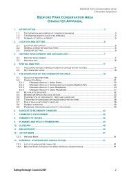
1. INTRODUCTION...............................................................................................................3<br />
1.1. THE DEFINITION AND PURPOSE OF CONSERVATION AREAS ..................................................................3<br />
1.2. THE PURPOSE AND STATUS OF THIS APPRAISAL.................................................................................3<br />
1.3. SUMMARY OF SPECIAL INTEREST .....................................................................................................5<br />
2. LOCATION AND SETTING...............................................................................................7<br />
2.1. LOCATION AND CONTEXT ................................................................................................................7<br />
2.2. GENERAL CHARACTER AND PLAN FORM............................................................................................7<br />
2.3. LANDSCAPE SETTING .....................................................................................................................8<br />
3. HISTORIC DEVELOPMENT AND ARCHAEOLOGY.........................................................8<br />
3.1. HISTORIC DEVELOPMENT................................................................................................................8<br />
3.2. ARCHAEOLOGY ...........................................................................................................................13<br />
4. SPATIAL ANALYSIS ...................................................................................................... 14<br />
4.1. THE CHARACTER AND INTER-RELATIONSHIP OF SPACES WITHIN THE AREA ..........................................14<br />
4.2. KEY VIEWS AND VISTAS ................................................................................................................16<br />
5. THE CHARACTER OF THE CONSERVATION AREA .................................................... 17<br />
5.1. CHARACTER AREAS AND THE QUALITY OF ARCHITECTURE ................................................................17<br />
5.1.1. Sub Area <strong>no</strong> 1: The <strong>Ealing</strong> <strong>Green</strong> and St Mary’s Road ......................................................18<br />
5.1.2. Sub Area <strong>no</strong> 2 Mattock Lane.............................................................................................23<br />
5.1.3. Sub Area <strong>no</strong> 3 Walpole Park ............................................................................................26<br />
5.2. KEY UNLISTED BUILDINGS .............................................................................................................27<br />
5.3. BUILDING MATERIALS AND LOCAL DETAILS ......................................................................................28<br />
5.4. CONTRIBUTION OF OPEN SPACES, TREES AND LANDSCAPE ...............................................................30<br />
5.5. THE EXTENT OF INTRUSION OR DAMAGE (NEGATIVE FACTORS) ........................................................31<br />
5.6. PUBLIC REALM AND STREET FURNITURE .........................................................................................33<br />
5.7. GENERAL CONDITION ...................................................................................................................33<br />
5.8. PROBLEMS, PRESSURES AND CAPACITY FOR CHANGE ......................................................................34<br />
6. SUGGESTED BOUNDARY CHANGES .......................................................................... 34<br />
7. COMMUNITY INVOLVEMENT ........................................................................................ 34<br />
8. SUMMARY OF ISSUES .................................................................................................. 34<br />
9. PLANNING AND POLICY FRAMEWORK....................................................................... 35<br />
10. GLOSSARY .................................................................................................................... 38<br />
11. BIBLIOGRAPHY............................................................................................................. 41<br />
12. APPENDIX - STAKEHOLDER CONSULTATION............................................................ 42<br />
12.1. LIST OF STAKEHOLDERS CONSULTED .............................................................................................42<br />
12.2. EALING GREEN CONSERVATION AREA APPRAISAL QUESTIONNAIRE SENT TO STAKEHOLDERS ..............42<br />
<strong>Ealing</strong> Borough <strong>Council</strong> 2007 2
1. Introduction<br />
1.1. The definition and purpose of<br />
conservation <strong>area</strong>s<br />
According to Section 69 of the Town and Country<br />
Planning (Listed Buildings and <strong>Conservation</strong> Areas) Act<br />
1990, a <strong>Conservation</strong> Area (CA) is an “<strong>area</strong> of special<br />
architectural or historic interest the character and the<br />
appearance of which is desirable to preserve or<br />
enhance”. It is the duty of Local Authorities to designate<br />
such <strong>area</strong>s and to use their legal powers to safeguard<br />
and enhance the special qualities of these <strong>area</strong>s within<br />
the framework of controlled and positive management of<br />
change.<br />
1.2. The purpose and status of this<br />
appraisal<br />
<strong>Ealing</strong> <strong>Green</strong> CA was designated in 1969, and extended<br />
in 1982, in 1992 and 2004. A Policy Design Guide for<br />
Shopfronts and Advertisements in the CA was published<br />
in 1984.<br />
The scope of this appraisal is summarised in the<br />
following points:<br />
1. Assessment of the special interest of the<br />
architectural heritage of <strong>Ealing</strong> <strong>Green</strong> CA<br />
highlighting elements of special merit, which<br />
contribute to the character<br />
2. Assessment of the actions needed to protect<br />
and enhance the special qualities of the CA<br />
3. Assessment of the need to revise the<br />
boundaries of the CA<br />
This document replaces the existing appraisal published<br />
in 1999. However, it is <strong>no</strong>t intended to be comprehensive<br />
in its scope and content. Omission of any specific<br />
building, space or feature or aspect of its appearance or<br />
character should <strong>no</strong>t be taken to imply that they have <strong>no</strong><br />
significance.<br />
The methodology of the CA Character <strong>Appraisal</strong> for<br />
<strong>Ealing</strong> <strong>Green</strong> follows the guidance provided by the<br />
Planning Policy guidelines 15: Planning and the Historic<br />
Environment (1994); the Guidance on <strong>Conservation</strong> Area<br />
<strong>Appraisal</strong>s by English Heritage (2005); and the Guidance<br />
on Management of <strong>Conservation</strong> Areas by English<br />
Heritage (2005).<br />
The analysis has been conducted on the basis of visits to<br />
the <strong>area</strong>, the involvement of local associations, and with<br />
consultation of primary and secondary sources on the<br />
local history and architecture.
<strong>Ealing</strong> Borough <strong>Council</strong> 2007<br />
<strong>Ealing</strong> <strong>Green</strong> <strong>Conservation</strong> Area<br />
Character <strong>Appraisal</strong><br />
4<br />
Listed Buildings<br />
Locally Listed Buildings
<strong>Ealing</strong> Borough <strong>Council</strong> 2007<br />
<strong>Ealing</strong> <strong>Green</strong> <strong>Conservation</strong> Area<br />
Character <strong>Appraisal</strong><br />
1.3. Summary of special interest<br />
• <strong>Ealing</strong> <strong>Green</strong> CA is situated in the former historic<br />
County of Middlesex, in the central part of today’s<br />
London Borough of <strong>Ealing</strong>’s Borough. <strong>Ealing</strong> <strong>Green</strong><br />
is part of <strong>Ealing</strong> Broadway and Walpole Wards.<br />
• The plan-form in the <strong>no</strong>rthern part of the CA is<br />
determined by the presence of the open spaces of<br />
Walpole Park and the <strong>Ealing</strong> <strong>Green</strong> and the roads in<br />
their immediate surrounding: Mattock Lane which<br />
flanks the <strong>no</strong>rthern side of Walpole Park and <strong>Ealing</strong><br />
<strong>Green</strong> / Bond Street on the eastern side. The planform<br />
of the southern section of the CA is mainly<br />
determined by the main thoroughfare of St Mary’s<br />
Road and buildings aligned on either side.<br />
• The earliest settlement developed around the old<br />
Church of St Mary’s from the 12th century, south of<br />
the CA.<br />
• Three “Areas of Character” can be distinguished<br />
within the <strong>Ealing</strong> <strong>Green</strong> CA:<br />
1) The <strong>Ealing</strong> <strong>Green</strong> and St Mary’s Road,<br />
2) Mattock Lane<br />
3) Walpole Park.<br />
• The CA has a varied architectural heritage with<br />
buildings from the 18 th century onwards. With most<br />
buildings going back to the time when <strong>Ealing</strong> started<br />
to expand and flourish as one of London’s more<br />
desirable suburbs. Building types are residential,<br />
educational, parades of shops, religious buildings<br />
and public houses.<br />
• The three <strong>area</strong>s of character display different spatial<br />
relationships between buildings: Sub Area <strong>no</strong> 1 has<br />
developed gradually with buildings arranged in an<br />
informal layout following the line of streets or other<br />
properties boundaries, In Sub Area 2 buildings are<br />
more formally arranged as are the results of planned<br />
exercises.<br />
5
<strong>Ealing</strong> Borough <strong>Council</strong> 2007<br />
<strong>Ealing</strong> <strong>Green</strong> <strong>Conservation</strong> Area<br />
Character <strong>Appraisal</strong><br />
• Both in Sub Area 1 & 2 surviving remains of the<br />
Victorian and Edwardian architectural heritage have<br />
been spoiled in parts by later, poor quality<br />
developments or general neglect and poor<br />
maintenance.<br />
• <strong>Green</strong> spaces and trees along the streetline as well<br />
as trees and green fences around properties are an<br />
important part of the suburban and leafy character of<br />
the CA.<br />
• Mix of construction materials:<br />
o Stock and red brick laid in Flemish<br />
bond, stone dressing, Kentish ragstone<br />
and cast-iron details, low-pitch or<br />
hipped roofs covered with slates or flat<br />
tiles, stucco trimming and white painted<br />
timber sash windows are prevalent<br />
details.<br />
6
<strong>Ealing</strong> Borough <strong>Council</strong> 2007<br />
<strong>Ealing</strong> <strong>Green</strong> <strong>Conservation</strong> Area<br />
Character <strong>Appraisal</strong><br />
2. Location and setting<br />
2.1. Location and context<br />
<strong>Ealing</strong> <strong>Green</strong> CA is situated in the former historic County<br />
of Middlesex. The CA is divided between the Ward of<br />
<strong>Ealing</strong> Broadway and the Ward of Walpole in the London<br />
Borough of <strong>Ealing</strong>.<br />
<strong>Ealing</strong> <strong>Green</strong> CA is 4.64 Km 2 in <strong>area</strong>, and it is in the<br />
central part of the modern borough. The CA stretches<br />
from the south end of At Mary’s Road to the <strong>no</strong>rth of<br />
<strong>Ealing</strong> <strong>Green</strong> with Bond Street and High Street, then it<br />
extends westward along Mattock Lane as far as its<br />
junction with Churchfield and Somerset Roads, including<br />
Culmington Road and the open space of Walpole Park.<br />
<strong>Ealing</strong> <strong>Green</strong> CA bounds with <strong>Ealing</strong> Town Centre CA on<br />
its <strong>no</strong>rthern and western side. <strong>Ealing</strong> Town Centre CA<br />
has influenced the historical development of <strong>Ealing</strong><br />
<strong>Green</strong> CA and it still provides its immediate setting.<br />
<strong>Ealing</strong> Broadway ward and Walpole ward of which <strong>Ealing</strong><br />
<strong>Green</strong> CA is a part, have a population of 10,047 and<br />
12,688 respectively.<br />
2.2. General character and plan form<br />
The plan-form in the <strong>no</strong>rthern part of the CA is<br />
determined by the presence of the open spaces of<br />
Walpole Park and the <strong>Ealing</strong> <strong>Green</strong> and the roads in their<br />
immediate surrounding: Mattock Lane which flanks the<br />
<strong>no</strong>rthern side of Walpole Park and <strong>Ealing</strong> <strong>Green</strong> / Bond<br />
Street on the eastern side. The plan-form of the southern<br />
section of the CA is mainly determined by the main<br />
thoroughfare of St Mary’s Road and buildings aligned on<br />
either side. On the western most end of Mattock Lane,<br />
Somerset Road, Churchfield Road and Culmington Road<br />
form a small residential enclave.<br />
The CA contains three clearly distinguished <strong>area</strong>s of<br />
character in terms of architectural language and uses.<br />
The first Sub Area takes in the whole length of St Mary’s<br />
Road and the <strong>Ealing</strong> <strong>Green</strong>, running <strong>no</strong>rth-south from<br />
Bond Street and Pitzhanger Ma<strong>no</strong>r to St Mary’s Church.<br />
The second Sub Area includes Mattock Lane and the<br />
Roads at its western end. The third Sub Area is the<br />
important open space of Walpole Park. With its high<br />
concentration of buildings of national and local<br />
importance, which include residential, religious and public<br />
buildings, as well designated shopfronts and open<br />
spaces, the CA offers a highly varied architectural<br />
heritage and sections of strong townscape value.<br />
7
2.3. Landscape setting<br />
<strong>Ealing</strong> Borough <strong>Council</strong> 2007<br />
<strong>Ealing</strong> <strong>Green</strong> <strong>Conservation</strong> Area<br />
Character <strong>Appraisal</strong><br />
Much of the land in the <strong>Ealing</strong> Parish is flat, rising gently<br />
from the Thames to reach 30m near the Uxbridge Road<br />
where <strong>Ealing</strong> Town Centre CA is located. The ridge of<br />
higher ground being at Castlebar Hill <strong>no</strong>rth-west of the<br />
CA and reaches Hanger Hill in the <strong>no</strong>rth-east of the CA.<br />
The southern part of the CA along St Mary’s Road<br />
slightly ascends the hill towards <strong>Ealing</strong> <strong>Green</strong>. In the<br />
<strong>no</strong>rthern section of the CA the land tends to be flat.<br />
Brickearth lies along Uxbridge Road just <strong>no</strong>rth of <strong>Ealing</strong><br />
<strong>Green</strong> CA. Taplow gravel extends across the parish <strong>no</strong>rth<br />
of Gunnersbury park from Acton to the Brent except at<br />
Little <strong>Ealing</strong>, where a tongue of brickearth runs from<br />
Uxbridge Road. Farther south is more brickearth, with<br />
flood-plain gravel at Old Brentford and a strip of alluvium<br />
along the Thames and at the mouth of the Brent.<br />
3. Historic development and<br />
archaeology<br />
3.1. Historic development<br />
<strong>Ealing</strong> began as a straggling village around the Parish<br />
Church of St Mary’s since medieval times, from the 12 th<br />
century the original hamlet of <strong>Ealing</strong> was in fact made of<br />
a group of buildings clustered around St Mary’s Church.<br />
<strong>Ealing</strong> was already a large village by the late eighteenth<br />
century, stretching from the old centre around the parish<br />
church <strong>no</strong>rthward towards the hamlet of Haven <strong>Green</strong><br />
close to the main Uxbridge Road. To the south west was<br />
a smaller settlement k<strong>no</strong>wn as Little <strong>Ealing</strong>, and to the<br />
west a<strong>no</strong>ther small settlement k<strong>no</strong>wn as <strong>Ealing</strong> Dean<br />
with its centre at the west end of Mattock Lane.<br />
During the seventeenth and eighteenth centuries <strong>Ealing</strong><br />
became a popular rural retreat for the aristocratic and<br />
wealthy. However, apart from Sir John Soane’s<br />
Pitshanger Ma<strong>no</strong>r, few of the once numerous country<br />
seats survive. The development that followed the arrival<br />
of the railways (the GWR in 1838 and the Metropolitan<br />
District Line in 1879) saw <strong>Ealing</strong> transformed from village<br />
to suburb, becoming a UDC in 1894 and a borough in<br />
1901. The local surveyor and architect, Charles Jones,<br />
was a major figure in the development of <strong>Ealing</strong>, being<br />
responsible <strong>no</strong>t only for the layout of the streets and their<br />
services but also for all the major civic buildings.<br />
1865 OS Map<br />
At the southern end of St Mary’s Road, the first OS Map<br />
already shows the small terraces facing onto St Mary’s<br />
Square and the semidetached cottages along the eastern<br />
side of South <strong>Ealing</strong> Road. The Church of St Mary<br />
appears in the same location. Westfield House is<br />
8<br />
St Mary’s Church, 1900c.<br />
St John’s Church, 1900c.<br />
Bond Street form <strong>Ealing</strong> <strong>Green</strong>, 1900c.
<strong>Ealing</strong> Borough <strong>Council</strong> 2007<br />
<strong>Ealing</strong> <strong>Green</strong> <strong>Conservation</strong> Area<br />
Character <strong>Appraisal</strong><br />
portrayed in more appropriate setting than today with<br />
garden on the western side. Semidetached along<br />
Ranelagh Road were already built. A row of terraces<br />
seemed to be in the place of the 1930s parade of shops<br />
opposite the Church (probably behind the 1930s<br />
appearance hide earlier structures). The New Inn is<br />
marked in its present location, although its current<br />
appearance is probably later. St Mary’s Place with its<br />
archway leading to the terraces is shown in its present<br />
form. The short row of terrace at No 95-96 is shown.<br />
The central part of the building that is <strong>no</strong>w occupied by<br />
<strong>Ealing</strong> Mansion Court is shown.<br />
A substantial detached house is shown on the site<br />
today’s occupied by Marilea Court. The Castle Inn Public<br />
House is recorded in its present location. St Mary’s<br />
Vicarage (demolished in 1969) appears on the site that<br />
today is occupied by the Thames and Valley University.<br />
Nos 19-23 were already built, whilst the opposite site of<br />
St Mary’s Road in this stretch appears still free from<br />
buildings. At No 13, there is the sign of a Public House –<br />
this is today’s Red Lion Pub. St Mary’s Road 1-7 is<br />
shown on the eastern side of the road. On the western<br />
side is a substantial building – today The Lawns Flats.<br />
The former <strong>Ealing</strong> Studios’ offices – The White House –<br />
is shown. Immediately <strong>no</strong>rth to the White Hose the<br />
terrace of Morgan House, Wrexam Lodge and Willow<br />
House, is shown and also St Aidan and Thorpe and Pine<br />
Cottages. The Kingdome Hall is marked as “The National<br />
School of Girls”. Buildings on the eastern side of the<br />
<strong>Green</strong> already appear in their present location. The front<br />
part of the Telephone Exchange building is shown.<br />
Pitzhanger Ma<strong>no</strong>r is of course shown without its later<br />
extensions and it is recorded as “Ma<strong>no</strong>r House”.<br />
The eastern side of the <strong>Green</strong> seems already occupied<br />
by buildings arranged tightly on the eastern side – some<br />
of them would be replaced at the turn of the century.<br />
The Ashton House still occupies the <strong>no</strong>rthern part of the<br />
<strong>Green</strong> at the point were Bond Street would be opened in<br />
1905. Along Mattock Lane only <strong>no</strong> 1 west of Barney<br />
Pickles had already been built. Most of <strong>no</strong>rthern side of<br />
the road appears still free from buildings. Buildings start<br />
again westward only from 12 to 19. Raphael Cottage and<br />
Chapel are shown on the south side.<br />
Further south, St John’s Church had <strong>no</strong>t yet been built<br />
(built in 1875). Semidetached cottages at <strong>no</strong>s 65-70 and<br />
semidetached villas at <strong>no</strong>s 53-69 Mattock Lane are<br />
shown. The West <strong>Ealing</strong> Baptist Church is shown.<br />
Somerset Road, Churchfield Road and Culmington Road<br />
were still to be created. The grounds south of Mattock<br />
Lane where still occupied by meadows.<br />
1890 OS Map<br />
No much changes can be recorded at the southern most<br />
end of St Mary’s Road in the 1890 OS Map, with the<br />
9<br />
Walpole Park, 1900c.<br />
Parade of shops at <strong>Ealing</strong> <strong>Green</strong>, 1900c.<br />
Pitzhanger Ma<strong>no</strong>r, 1900c.
<strong>Ealing</strong> Borough <strong>Council</strong> 2007<br />
<strong>Ealing</strong> <strong>Green</strong> <strong>Conservation</strong> Area<br />
Character <strong>Appraisal</strong><br />
exception of the opening of Beaconsfield Road on the<br />
west side and the erection of the terraces between <strong>no</strong> 47<br />
–63. On the grounds of St Mary’s Vicarage appears also<br />
St Mary’s Church House. Both buildings have <strong>no</strong>w been<br />
demolished.<br />
Sunnyside Road had been opened on the west side of St<br />
Mary’s Road.<br />
The Park Road seems completely built up by 1890. The<br />
Lawn and annex Coach House are clearly marked. North<br />
of them is a building marked as “The Lodge” that later will<br />
be housing <strong>Ealing</strong> Studios’ Offices. Glastonbury House<br />
appears on the eastern side, later demolished and then<br />
replaced by “Glaston Court”. No substantial changes<br />
either side of the section of the <strong>Green</strong> around <strong>Ealing</strong><br />
Church. No changes are recorded to Pitzhanger Ma<strong>no</strong>r.<br />
In the <strong>no</strong>rthern section of the CA Bond Street had <strong>no</strong>t<br />
been opened yet and the <strong>area</strong> was still occupied by The<br />
Ashton House. The church of St John’s at the western<br />
end of Mattock Lane appears for the first time in the<br />
1890’s OS Map. Somerset Road, Churchfield Road and<br />
Culmington Road have been laid and appear mostly<br />
edified.<br />
1910 OS Map<br />
No substantial differences are recorded on the 1910 OS<br />
Map, apart from the general growth in density and the<br />
opening of Bond Street on the <strong>no</strong>rthern side of the<br />
<strong>Green</strong>. The Dane Lodge at the south western end of<br />
Mattock Lane was replaced by the King Edward<br />
Memorial Hospital.<br />
1930 OS Map<br />
On the 1930’s OS Map, one striking element is the<br />
intensification of building activity at the rear of the<br />
frontline of buildings along St Mary’s Road. Especially at<br />
the rear of the Telephone Exchange and <strong>Ealing</strong> Studios<br />
site.<br />
Although difficult to distinguish on the OS Maps<br />
sequence, Soane’s Pitzanger Ma<strong>no</strong>r and grounds had<br />
seen some changes during the time span covered by the<br />
4 OS Maps considered. In 1901, in fact, the building was<br />
sold to <strong>Ealing</strong> District <strong>Council</strong> and extended to become<br />
<strong>Ealing</strong>'s Public Library. In 1938-40 the lending library<br />
block was replaced by a new building which was slightly<br />
larger.<br />
The library moved out in 1984 and in 1985 the restoration<br />
work began. The building opened to the public again in<br />
January 1987 as the London Borough of <strong>Ealing</strong>'s main<br />
museum and the 'PM Gallery & House', showing<br />
contemporary art 1<br />
1 At the time of writing Pitzhanger Ma<strong>no</strong>r complex is being<br />
considered for a substantial regeneration scheme. For further<br />
10
<strong>Ealing</strong> Borough <strong>Council</strong> 2007<br />
<strong>Ealing</strong> <strong>Green</strong> <strong>Conservation</strong> Area<br />
Character <strong>Appraisal</strong><br />
details please see, Donald Insall Associates, Pitzhanger Ma<strong>no</strong>r<br />
<strong>Conservation</strong> Plan, July 2006<br />
11
<strong>Ealing</strong> Borough <strong>Council</strong> 2007<br />
<strong>Ealing</strong> <strong>Green</strong> <strong>Conservation</strong> Area<br />
Character <strong>Appraisal</strong><br />
12
<strong>Ealing</strong> Borough <strong>Council</strong> 2007<br />
<strong>Ealing</strong> <strong>Green</strong> <strong>Conservation</strong> Area<br />
Character <strong>Appraisal</strong><br />
3.2. Archaeology<br />
<strong>Ealing</strong> <strong>Green</strong> CA has a very strong archaeological<br />
significance. The <strong>Ealing</strong> Plan for the Environment<br />
identifies the <strong>area</strong> south of the Uxbridge Road in<br />
particular as “Area of Archaeological Interest (A11)”.<br />
Especially the <strong>area</strong> around St Mary’s Road was a moated<br />
site of <strong>Ealing</strong> Ma<strong>no</strong>r and a medieval settlement. St<br />
Mary’s Church was first recorded in 1130. The old<br />
Rectory House (1529) stood in the <strong>no</strong>rth. Widely spaced<br />
prehistoric find spots and one Roman occur in the <strong>area</strong> –<br />
which extends west to Culmington Road, east of<br />
Gunnersbury Avenue, <strong>no</strong>rth the Broadway and Ranelagh<br />
Road.<br />
13
4. Spatial analysis<br />
<strong>Ealing</strong> Borough <strong>Council</strong> 2007<br />
<strong>Ealing</strong> <strong>Green</strong> <strong>Conservation</strong> Area<br />
Character <strong>Appraisal</strong><br />
4.1. The character and interrelationship<br />
of spaces within the<br />
<strong>area</strong><br />
The spatial character of the CA is strongly defined by the<br />
important open spaces of Walpole Park and of the <strong>Ealing</strong><br />
<strong>Green</strong> in the heart of the CA, and by the main<br />
thoroughfare surrounding them.<br />
Within the CA, three main <strong>area</strong>s of character can be<br />
distinguished: The <strong>Green</strong> and St Mary’s Road, the<br />
residential <strong>area</strong> along Mattock Lane up to St John’s<br />
Church to the west, and Walpole Park.<br />
There are three main key points within the CA layout:<br />
The end of Mattock Lane around St John’s Church, the<br />
southern end of St Mary’s Road around St Mary’s Church<br />
and <strong>Ealing</strong> <strong>Green</strong> at the crossing of Mattock Lane, Bond<br />
Street and the <strong>Green</strong>.<br />
The <strong>Ealing</strong> <strong>Green</strong> is the geographical core of the CA and<br />
the visual link between the three sections of the CA that<br />
are branching out.<br />
Sub Area 1 is very varied in character. The plan-form of<br />
this section evolves around the <strong>Ealing</strong> <strong>Green</strong>, and streets<br />
branching out <strong>no</strong>rth and south. Bond Street on the<br />
<strong>no</strong>rthern side offers a very tight grain with a row of<br />
Edwardian buildings placed right along the edge of the<br />
street with very narrow forecourts. The main activity is<br />
retail arranged in terraces along either side of the road.<br />
Further south along the eastern side of the <strong>Green</strong>,<br />
commercial buildings and their shopfronts still provide a<br />
very tight and continues edge to the urban space. Here<br />
the height and roof-form of buildings offers a more varied<br />
parade as buildings have different styles and have been<br />
developed at different times. The setting of the shopping<br />
parade in this section is much more open as it is provided<br />
by the <strong>Green</strong> and the buildings aligned along the western<br />
side which offer a much more loose urban grain. On the<br />
western side in fact, is the open setting of Pitzhanger<br />
Ma<strong>no</strong>r. The western side of the <strong>Green</strong> in this section<br />
offers a rather loose grain: buildings are of substantial<br />
footprint and sit in generous plots.<br />
Further south the <strong>Green</strong> narrows and the grain of<br />
properties – especially on the eastern side becomes<br />
tighter again with early Victorian buildings of minute<br />
proportions (2/3 storey, 2/3 bay) yet, the substantial width<br />
of the street still provides a rather open feel. Buildings<br />
follow a rather informal alignment and layout as they<br />
have been built independently.<br />
14<br />
Walpole Park<br />
Walpole Park looking towards<br />
Mattock Lane, with the buildings<br />
along Uxbridge Road in the<br />
background.<br />
Mattock Lane<br />
Varied roofscape of<br />
buildings around the <strong>Green</strong>
<strong>Ealing</strong> Borough <strong>Council</strong> 2007<br />
<strong>Ealing</strong> <strong>Green</strong> <strong>Conservation</strong> Area<br />
Character <strong>Appraisal</strong><br />
The curvaceous aspect of the southern end of St Mary’s<br />
Road with the Church of St Mary’s closing the view south<br />
creates a townscape of valuable impact.<br />
Sub Area 2 -The plan-form of this section of the CA is<br />
mainly defined by Mattock Lane. Mattock Lane branches<br />
out of <strong>Ealing</strong> <strong>Green</strong> westward and reaches St John’s<br />
Church at its western-most end where it joints with a<br />
small residential enclave to the south, comprising<br />
Somerset Road, Churchfield Road and Culmington Road.<br />
The south side of Mattock Lane borders with Walpole<br />
Park that provides the setting for the properties along the<br />
<strong>no</strong>rthern side of the road. Properties in this section of the<br />
CA are from mid-late Victorian time. They offer a much<br />
more formal arrangement and display a coherent<br />
architectural language as they are the result of a planned<br />
residential exercise. Houses are detached or<br />
semidetached, 3/4 storey in height. Houses are well<br />
recessed from the streetline with wide front yards. Plots<br />
are substantial in size and have very regular form.<br />
The Church of St John’s and the properties around it<br />
have a slightly more informal arrangement. The Church is<br />
the main landmark of this section of the CA.<br />
Along Culmington Road there are a few later<br />
developments that have much larger footprints, this<br />
results in a less coherent and cohesive townscape.<br />
Sub Area 3 - Walpole Park<br />
Walpole Park and Pitzhanger Grounds occupy a<br />
substantial <strong>area</strong> to the west of the CA. Walpole Park<br />
creates a tranquil and restful episode within the bustling<br />
and traffic-led environment of the shopping streets<br />
around <strong>Ealing</strong> <strong>Green</strong> and <strong>Ealing</strong> Broadway. In addition it<br />
provides an open setting for the residential properties<br />
along Mattock Lane that can enjoy u<strong>no</strong>bstructed views of<br />
the large expanse of the park. Together with <strong>Ealing</strong><br />
<strong>Green</strong> and Lammas Park, Walpole Park is part of a wellused<br />
network of open spaces.<br />
15<br />
Curvaceous aspect of St Mary’s<br />
Road<br />
Roofscape along Mattock Lane<br />
Walpole Park
<strong>Ealing</strong> Borough <strong>Council</strong> 2007<br />
<strong>Ealing</strong> <strong>Green</strong> <strong>Conservation</strong> Area<br />
Character <strong>Appraisal</strong><br />
4.2. Key views and vistas<br />
The flat topography of the CA does <strong>no</strong>t allow for any<br />
natural vantage point from which to obtain a<br />
comprehensive vista of the CA.<br />
Views of <strong>Ealing</strong> <strong>Green</strong><br />
From the southern end of the Bond Street and well into<br />
<strong>Ealing</strong> <strong>Green</strong>, the view of the ample stretch of the <strong>Green</strong><br />
with the complex of Pitzhanger Ma<strong>no</strong>r in the background<br />
constitute the unique setting for this part of the CA. The<br />
<strong>Green</strong> provides a filter and a means of transition between<br />
the dense commercial core of the Broadway’s more<br />
urban character, and the domestic and calm character of<br />
the residential section of the CA along Mattock Lane.<br />
Views of Walpole Park<br />
Along Mattock Lane looking south as well as within the<br />
Walpole Park, views of the large expanse of the green<br />
surrounded by mature trees create a contrast with the<br />
bustling commercial character of the <strong>Ealing</strong> <strong>Green</strong> and<br />
Bond Street.<br />
Views along St Mary’s<br />
The shallow curve formed by St Mary’s Road southward<br />
and the slightly hilly topography creates a townscape<br />
punctuated by several landmark buildings, the Church of<br />
St Mary’s being the major one. The imposing architecture<br />
and the location at the southern most end of the Road at<br />
its junction with South <strong>Ealing</strong> Road makes the view of St<br />
Mary’s a focal point of this section of the CA.<br />
The narrow view of St Mary’s Place cottages through an<br />
archway opening on the west side of St Mary’s Road<br />
offers a very attractive piece of townscape.<br />
The well proportionate and finely detailed elevation of<br />
Westfield House viewed from South <strong>Ealing</strong> Road looking<br />
<strong>no</strong>rth is a pleasant closing element of the streetscape at<br />
the junction between South <strong>Ealing</strong> Road and St Mary’s<br />
Road.<br />
The view along Mattock Lane of the modular rhythm of<br />
the elevations and roofs of the properties that flank the<br />
<strong>no</strong>rthern side of the road is an intrinsic element of the<br />
character of the residential section of the CA.<br />
The views of St Johns Church at the western-most end of<br />
the Road is a focal point both for views along Mattock<br />
Lane looking west as well as for views from Somerset<br />
and Churchfield Road.<br />
16<br />
View of Pizhanger Ma<strong>no</strong>r from the<br />
<strong>Green</strong><br />
View of the\Church of<br />
St Mary from St Mary’s Road<br />
Modular rhythm of the<br />
elevations along Mattock Lane<br />
View of St John’s Church<br />
from Mattock Lane
5. The character of the<br />
conservation <strong>area</strong><br />
<strong>Ealing</strong> Borough <strong>Council</strong> 2007<br />
<strong>Ealing</strong> <strong>Green</strong> <strong>Conservation</strong> Area<br />
Character <strong>Appraisal</strong><br />
5.1. Character Areas and the quality<br />
of architecture<br />
This section has been subdivided to reflect the fact that<br />
the character of the CA changes within its boundary.<br />
The CA breaks down into two main <strong>area</strong>s of character.<br />
- Sub Area 1: The <strong>Ealing</strong> <strong>Green</strong> and St Mary’s Road<br />
- Sub Area 2: Mattock Lane<br />
- Sub Area 3: Walpole Park<br />
Sub Area 2<br />
Sub Area 3<br />
17<br />
Sub Area 1<br />
Listed Buildings<br />
Locally Listed Buildings
<strong>Ealing</strong> Borough <strong>Council</strong> 2007<br />
<strong>Ealing</strong> <strong>Green</strong> <strong>Conservation</strong> Area<br />
Character <strong>Appraisal</strong><br />
5.1.1. Sub Area <strong>no</strong> 1: The <strong>Ealing</strong> <strong>Green</strong><br />
and St Mary’s Road<br />
Sub Area 1, evolving around <strong>Ealing</strong> <strong>Green</strong>, Bond Street<br />
and St Mary’s Road, offers a strongly varied architectural<br />
character. Small residential units, blocks of flats,<br />
religious, public and retail buildings contribute to a multiuse<br />
<strong>area</strong>, which functional diversity is reflected in the<br />
style and size of buildings and in the diverse contribution<br />
they make to the quality of the townscape.<br />
Bond Street opened in 1905/6 and is at the <strong>no</strong>rthern end<br />
of the <strong>Ealing</strong> <strong>Green</strong>. The street is a good example of<br />
Edwardian commercial streetscape - red bricks and stone<br />
dressing and prominent, pitched front gables defining the<br />
streetscape. The view to the <strong>no</strong>rth is closed by the fine<br />
Edwardian elevation of New Broadway.<br />
The <strong>Green</strong> is flanked by an attractive parade of shops on<br />
the east side and by Pitzhanger Ma<strong>no</strong>r on the west side.<br />
The shopfronts retain much of the original character with<br />
original corbels and pillars as well as in-keeping display<br />
windows.<br />
Most of the shopfronts are Locally Listed, only No 22 is<br />
Statutorily Listed (Grade II). No 22 The <strong>Green</strong> is in fact<br />
the most interesting example of shopfront in the parade<br />
along the road. It is a Chemist's shop with<br />
accommodation above (<strong>no</strong>w separate). Dated 1902, the<br />
shop was re-ordered in 1924c. The three-storey, one-bay<br />
building is in brownish brick with ashlar dressings and<br />
tiled roof with crested ridge tiles and chimney on the<br />
right. The 1924 shop front is set within original surround,<br />
it has a recessed central door with overlight and<br />
tessellated pavement in front and is flanked by bowcorned<br />
windows which have black marble plinths, slender<br />
columns with bulbous bases and capitals, and transoms.<br />
The door and overlights have glazing bars forming<br />
lozenges. The surround has red marble pilasters on<br />
plinths supporting short paired columns with plain<br />
capitals; console brackets flank fascia and support<br />
cornice. The above two storeys have canted bay window<br />
with transuded 4-light windows. A date panel and coat of<br />
arms is placed between windows breaking the parapet<br />
above. The interior has much of the original decorations<br />
and fittings. The building is of special interest because of<br />
the quality and completeness of the shop fittings and<br />
shopfront.<br />
Soane’s Pitzhanger Ma<strong>no</strong>r complex (Listed, Grade I)<br />
faces onto the widest part of the <strong>Green</strong> which is closed<br />
on its east side by a fine terrace of shops containing an<br />
original front and interior.<br />
Soane’s <strong>no</strong>rth east gateway to Pitzhanger Ma<strong>no</strong>r<br />
consists of a rubbed red bricks arch with pilasters of<br />
knapped flints (Listed, Grade II*). To the south, facing<br />
18<br />
Edwardian buildings<br />
along Bond Street<br />
The <strong>Green</strong> with the parade<br />
of shops on the eastern side<br />
Shopfront at No 22 The <strong>Green</strong><br />
Pitzhanger Ma<strong>no</strong>r
<strong>Ealing</strong> Borough <strong>Council</strong> 2007<br />
<strong>Ealing</strong> <strong>Green</strong> <strong>Conservation</strong> Area<br />
Character <strong>Appraisal</strong><br />
The <strong>Green</strong>, are the main gates to the house and the War<br />
Memorial (Listed, Grade II).<br />
The Lodge at Pitzhanger Ma<strong>no</strong>r at the <strong>no</strong>rth-east end of<br />
the park is an early 19th century single-storey building<br />
included for group value<br />
Further south, the broad tree-lined stretches of <strong>Ealing</strong><br />
<strong>Green</strong> and St Mary’s Road still have a leisurely<br />
atmosphere and a few buildings to recall the period up to<br />
the mid 19 th century when <strong>Ealing</strong> was simply a village<br />
with some comfortable small country houses.<br />
The <strong>Green</strong> gradually narrows towards the south and<br />
becomes St Mary’s Road where both sides are lined with<br />
good examples of buildings from the 18th century<br />
onwards.<br />
St Mary’s Road is a gently curving street of considerable<br />
townscape value, combining changing views with a mix<br />
of buildings of architectural and historic value through its<br />
varied length.<br />
From <strong>Ealing</strong> <strong>Green</strong> to St Mary’s- West Side – (from<br />
<strong>no</strong>rth to south)<br />
Immediately south of Pitzhanger Ma<strong>no</strong>r is the imposing<br />
footprint of <strong>Ealing</strong> & West London College (Locally<br />
Listed). Proceeding southwards is St Mary’s Building -<br />
<strong>no</strong>w Telephone Exchange - (Listed, Grade II), a good<br />
mid 18 th century house. The three-storey, with basement,<br />
five-bay (1:3:1) building is in brown brick with red<br />
dressings and rubbed flat arches. The entrance door is<br />
up 8 steps, it boasts architrave, carved moulded brackets<br />
and moulded hood. The top part of the elevation is<br />
defined by brick bands, parapet and central dentilled<br />
pediment. The building has two-storey wings right and<br />
left under hipped slate roofs. Railing and gates (Listed,<br />
Grade II) are in good wrought iron and are contemporary<br />
to the main building. Unfortunately the setting of this<br />
valuable architectural ensemble has been rather spoiled<br />
by other Telecom structures.<br />
Further south is Kingdome Hall and cottages at the<br />
rear (Locally Listed). The charming building was the<br />
former Girl’s School from 1861. It is a small, gabled, Ushaped<br />
group in polychrome brick with patterned tiled<br />
roof. With its articulate roofscape punctuated by<br />
numerous tall chimneystack, and its exuberant gothic<br />
style, it has a distinctive presence in the townscape and<br />
contributes to the somehow rustic feel of this stretch of<br />
the CA.<br />
The Welsh Cottage and Presbyterian Church (Locally<br />
Listed) of 1908 are hidden down an alley with pretty iron<br />
overthrow.<br />
Thorpe Lodge and Pine Cottage (Listed, Grade II) are<br />
semidetached houses dating from 1820c. The property is<br />
east-facing with Pine Cottage at the southern side. The<br />
3-storey (with one bay on each side) house is built in<br />
19<br />
St Mary’s Road<br />
St Mary’s Building<br />
Kingdome Hall<br />
Thorpe & Pine Cottage
<strong>Ealing</strong> Borough <strong>Council</strong> 2007<br />
<strong>Ealing</strong> <strong>Green</strong> <strong>Conservation</strong> Area<br />
Character <strong>Appraisal</strong><br />
purple brick with a central rendered pilaster strip and is<br />
covered by a slated hipped roof with central<br />
chimneystack. The Pine Cottage has an original roundarched<br />
doorway with fanlight and panelled door. Multipaned<br />
sash windows of the main elevation are finished<br />
with flat arches in Gauged yellow brick. The interior of the<br />
Pine Cottage is particularly significant as it retains most<br />
of its original feature (e.g. original pine panelling to<br />
partition walls) and original plan-form with the only<br />
exception of the extensions to the rear of the properties<br />
carried out at different times.<br />
Further south is St Aidan (Locally Listed), today a small<br />
stock brick house with red brick details at parapet level.<br />
Immediately after is an interesting and well preserved<br />
terrace consisting of Morgan House, Wrexham Lodge,<br />
Willow House (Listed, Grade II). The three late 18 th or<br />
early 19 th century houses are built in brown brick and are<br />
2-storey, with 7/2 double hung sashes in reveals, mainly<br />
without glazing bars. Ground floor windows have<br />
segmental sunk panels above, whilst first floor windows<br />
have segmental arches. Two porches of Roman Doric<br />
square piers on plinths define the entranceway. The<br />
terrace has a central brick modillion pediment on the<br />
main elevation and is covered by a slate roof. End<br />
houses project and have brick modillion cornices.<br />
The tight grain of small early cottages is interrupted by<br />
the celebrated <strong>Ealing</strong> Studios Offices – the White<br />
House (Listed, Grade II) – well set back from the<br />
streetline - and actual studios with the large foot print at<br />
the rear. <strong>Ealing</strong> Film Studios were first established in<br />
1902 and are the oldest surviving film studios in the<br />
country. The <strong>Ealing</strong> Studios partly incorporate e preexisting<br />
house (The West Lodge) on the site. The present<br />
sound stages were built in 1929-30 to the design of R.<br />
Atkinson. <strong>Ealing</strong>’s Golden Age under Sir Michael Balcon<br />
from 1938 to 1955 when the Georgian White House was<br />
used as the studios offices. Although a number of the<br />
original buildings have more recently been replaced by<br />
modern structures the sound stages and the White<br />
House remain with English Heritage Blue Plaque to Sir<br />
Balcon.<br />
The Lawn (flats) (Locally Listed) is clearly Victorian<br />
stock brick, 1-3-1 bays, with arched ground-floor<br />
windows, a parapet with Jacobean raised centre and<br />
coach house to match.<br />
No 36 St Mary’s Road – the Castle Inn Public House<br />
(Locally Listed) from 1832 was the meeting place for<br />
<strong>Ealing</strong>’s Court of Tenants. The 2-storey, 3 bays pub has<br />
very well detailed ground floor with good timber and<br />
leaded glass details.<br />
At the point where St Mary’s Road starts curving<br />
westward is the imposing presence of <strong>Ealing</strong> Court<br />
Mansions (Locally Listed). Built in 1867 in stock brick it<br />
was an industrial school.<br />
20<br />
Morgan House-Wrexham<br />
Lodge-Willow House<br />
<strong>Ealing</strong> Studios<br />
The Lawn<br />
The Castle Inn Public House
<strong>Ealing</strong> Borough <strong>Council</strong> 2007<br />
<strong>Ealing</strong> <strong>Green</strong> <strong>Conservation</strong> Area<br />
Character <strong>Appraisal</strong><br />
The architecture displays a conservative Georgian style,<br />
with 5-bays, 3-storey, flanked by two projecting much<br />
altered side wings.<br />
At this point of the road, right in the middle of The <strong>Green</strong>,<br />
opposite to No 60 St Mary’s Road is a stone Cattle<br />
Trough (Locally Listed).<br />
On the western side of St Mary’s Road branches St<br />
Mary’s Place, accessible through an archway. St Mary’s<br />
Place used to house the stables for the adjoining New<br />
Inn. The road is flanked by early Victorian properties<br />
(Locally Listed). The secluded setting and the sense of<br />
enclosure deriving from the layout of this space, makes<br />
this small ensemble a pleasant remain of the early<br />
townscape. The New Inn (Locally Listed), at <strong>no</strong> 62 St<br />
Mary’s Road was originally a coaching inn and it probably<br />
occupies the site of an 18 th century inn.<br />
From <strong>Ealing</strong> <strong>Green</strong> to St Mary’s- East Side – (from<br />
<strong>no</strong>rth to south)<br />
After the Finnegan’s Public House follow the Victoria<br />
Terraces from No 1-3 St Mary’s Road (Locally Listed),<br />
<strong>Ealing</strong> Church and Congregational Manse (Locally<br />
Listed) were designed by Charles Jones in 1859 in his<br />
typical Gothic style with rag-stone dressing. Their<br />
architectural form and material contribute to the diversity<br />
of the townscape in this section of the CA.<br />
At <strong>no</strong> 1 Grange Road (Locally Listed) is a fine Victorian<br />
House in stock brick with stucco trimming and ground<br />
floor canted bays. The house provides a pleasant setting<br />
for <strong>Ealing</strong>’s Drama School founded in 1966.<br />
No 13 St Mary’s Road (Locally Listed) is the Red Lion<br />
Pub – a mid 19 th century coaching inn that was popular<br />
with <strong>Ealing</strong> Studios’ workers.<br />
At Nos 19-21 St Mary’s Road – Ness house (Listed,<br />
Grade II) is an early Victorian semi-detached house, well<br />
set back from the streetline and still retaining its original<br />
boundary wall.<br />
At No 23 St Mary’s Road (Listed, Grade II) is a 1830s<br />
detached house with c1870 alterations. It is a yellow<br />
stock brick building with plain rendered bands and slated<br />
hipped roof with brick stacks. The house is 2 storeys and<br />
basement with slightly recessed extension to the left.<br />
Good Doric porch, with panelled door and overlight, in<br />
slightly recessed central bay. Flanking bays have ground<br />
floor canted bay windows with projecting cornices, added<br />
1870c; continuous band at impost level. 1st floor 6-pane<br />
sashes with continuous sill band.<br />
On the east side of St Mary’s Road branches The Park.<br />
The side street was laid out by Sydney Smirke from<br />
1847c., with five pairs of stuccoed, Italianate<br />
semidetached villas (Listed, Grade II), somewhat<br />
reminiscent of grander development in Kensington.<br />
21<br />
St Mary’s Place<br />
<strong>Ealing</strong> Court Mansions<br />
<strong>Ealing</strong> Church and Manse<br />
St Mary’s Road Nos 19-21
<strong>Ealing</strong> Borough <strong>Council</strong> 2007<br />
<strong>Ealing</strong> <strong>Green</strong> <strong>Conservation</strong> Area<br />
Character <strong>Appraisal</strong><br />
Past the Victorian Villas, the continuity of the middle<br />
section is interrupted by the larger scaled new buildings<br />
of the Thames Valley University campus and modern<br />
YMCA hostel. Thames Valley University’s main building<br />
is Locally Listed due to its connection with Lady Byron<br />
(1792-1860) who founded the co-operative school on the<br />
same site.<br />
Nos 33-35 St Mary’s Road (Locally Listed) offer good<br />
yet neglected examples of early shopfronts with<br />
decorative corbels.<br />
On the east side of St Mary’s Road branches Ranelagh<br />
Road, flanked by a row of early Victorian terraces<br />
(Locally Listed).<br />
On the southern end, St Mary’s Road curves gently to the<br />
west as it approaches the junction with south <strong>Ealing</strong> and<br />
Church Lane, and the Tower of Toulon’s St Mary’s<br />
Church is the Major landmark (Listed, Grade II).<br />
Designed in 1866-73 by SS Teulon, it is a robust<br />
composition in Romanesque style dominating the wide<br />
road junction. Brick and stone with tiled roofs are the<br />
construction materials. Thorne says that the church is<br />
actually a recasting of the church of 1739. The church<br />
has an austere interior with galleries on 3 sides and an<br />
open timber roof supported on iron columns.<br />
A scattering of attractive small houses remains near the<br />
church and buildings of interest include the houses and<br />
cottages in and around Church Lane<br />
No 2 Coningsby Road, is Locally Listed, whilst <strong>no</strong>s 1<br />
Church Lane is Listed, Grade II. The latter is a well<br />
preserved house dating from 1720. The cottage is in<br />
brown brick with red brick quoins to angles and to<br />
windows. The building is two storeys with attic, the<br />
fenestration consists of 3 double-hung sashes with flat<br />
arches in flush architraves. The entrance door has<br />
architrave and hood.<br />
No 15 Church Lane (Listed, Grade II)<br />
Probably from the 17 th century with two storeys, one bay<br />
with flanking entrance door right. Made from brick, with<br />
concrete tile roof and cemented chimney. The building<br />
features casement windows above a modern bow.<br />
Similarly <strong>no</strong>s 17 and 19 Church Lane (Locally Listed)<br />
also reflect this small early grain.<br />
St Mary’s Road <strong>no</strong>s 72-74 (Locally Listed) are<br />
detached, set back houses, with steep gables to the<br />
road, once they were part of an old workhouse built in<br />
1700c.<br />
On two sides of the little St Mary’s Square are modest<br />
Georgian terraces with the Fire Station from 1888.<br />
22<br />
Victorian Terrace along Ranelagh<br />
Road<br />
St Mary’s Square<br />
Westfield House
<strong>Ealing</strong> Borough <strong>Council</strong> 2007<br />
<strong>Ealing</strong> <strong>Green</strong> <strong>Conservation</strong> Area<br />
Character <strong>Appraisal</strong><br />
Their L–shaped setting around the little square offer a<br />
restful episode along the main road that in this section<br />
becomes particularly busy.<br />
Opposite to St Mary’s Square at <strong>no</strong> 94 St Mary’s Road at<br />
the bend of the Road is Westfield House a grander late<br />
Georgian house (Listed, Grade II): A 3-bay, 3-storey,<br />
brown brick house with iconic entrance porch, which is<br />
enclosed and surmounted by a pediment. Ground floor<br />
windows are set in semicircular arched recesses and first<br />
floor central windows are set in semicircular recesses as<br />
well.<br />
5.1.2. Sub Area <strong>no</strong> 2 Mattock Lane<br />
Mattock Lane was first built up during the 1860s on part<br />
of the Ashton House estate, and many of the grand old<br />
houses are still standing - although most have been<br />
converted into flats and bed-sits.<br />
Mattock Lane links <strong>Ealing</strong> <strong>Green</strong> at its east end with the<br />
<strong>area</strong> around St John’s Church at its western end. The<br />
<strong>no</strong>rth side is lined with large villas dating from 1860<br />
onwards. They are in stock brick with stucco trim, some<br />
having shallow gables with decorative brackets. The later<br />
versions have red brick and tile trim. At the west end of<br />
Mattock Lane a small group of earlier houses with stucco<br />
trim survives. Mattock Lane, Churchfiled Road and<br />
Somerset all converge on the battlement tower of St<br />
John’s Church, the <strong>area</strong>’s major landmark.<br />
Mattock Lane <strong>no</strong>rth side (east to west)<br />
At <strong>no</strong>s 2-3 is a semi-detached (Locally Listed) house.<br />
The 2-storey plus attic and half-basement is – like most<br />
houses in the road – built in yellow stock, with bold<br />
stucco trimming, canted basement and ground floor bay<br />
window. The 5-bay house has a projecting off-set bay on<br />
one side finished with a low pitch gable facing the road.<br />
Roof is in slates with projecting eves supported by<br />
brackets. Timber sashes are predominant joinery. On the<br />
eastern elevation of the house that faces the car-park the<br />
tiles facades of the Walpole Cinema had been attached.<br />
The cinema uses to be in Bond,Street but then it was<br />
closed and demolished in 1971.<br />
The following houses on the west from Nos 4 to 11 (all<br />
Locally Listed) are variation of this same type. The only<br />
difference between them being the way in which they are<br />
arranged as detached, semidetached or terraced (max<br />
3).<br />
At No 12 Questors Theatre (Locally Listed) breaks the<br />
consistent architectural language of the residential<br />
properties. The Questors Theatre with its simple yet crisp<br />
glazed elevation, is a welcome <strong>no</strong>velty in the streetscape.<br />
The theatre was one of the finest amateurs’ theatres in<br />
the country. The building has expanded from a redundant<br />
chapel into the playhouse we see today.<br />
23<br />
Nos 2-3 Mattock Lane<br />
No 9 Mattock Lane<br />
The Questors Theatre<br />
Later Victorian semi-detached<br />
on Mattock Lane – No 22
<strong>Ealing</strong> Borough <strong>Council</strong> 2007<br />
<strong>Ealing</strong> <strong>Green</strong> <strong>Conservation</strong> Area<br />
Character <strong>Appraisal</strong><br />
Immediately west of the Questors Theatre, the character<br />
and architectural language go back to the Victorian,<br />
residential properties that characterise the rest of the<br />
street. At No 13 The Clinic (Locally Listed) is a stock<br />
brick detached house boasting a very symmetrical<br />
composition with central steps leading to the entrance<br />
door and two ground floor canted bay-windows either<br />
side. The façade is finished with stuccoed brick quoins.<br />
Again up to <strong>no</strong> 20 are semidetached house that are a<br />
variation of the previous type.<br />
From <strong>no</strong> 22 to 27 properties (Locally Listed) are later<br />
and have more of an Edwardian character with red bricks<br />
details and red bricks boundary walls (when surviving)<br />
and piers with stone coping.<br />
No 29 detached (Locally Listed)<br />
Up to No 36 all houses are detached, standard 2-storey,<br />
3-bay, with off-set front gable and projecting bay window.<br />
No 37 and 39 terrace cottages (Locally Listed) have<br />
more of a unique and picturesque character. They are<br />
early Victorian cottages, <strong>no</strong> 37 with an unusual columned<br />
porch with rusticated brick columns and <strong>no</strong> 39 has a very<br />
well preserved and compact appearance framed by a<br />
substantial front garden with hedges.<br />
Mattock Lane south side (from east to west)<br />
Walpole Park flanks he southern side of Mattock Lane.<br />
No 86 St Raphael Cottage (Listed, Grade II) has two<br />
storeys built from yellow stock brick with slate roofs. The<br />
main block has 3 bays with the left one recessed. There<br />
is a stucco Doric porch in the left bay with columns and<br />
plain entablature and a narrow stucco band at first floor<br />
cill level along with a coped parapet. To the left is a 3 bay<br />
yellow stock brick wing with parapet. The left flank is<br />
rendered with simple Gothic style fenestration including<br />
quatrefoil windows to the first floor and two small attic<br />
windows with pointed arch set in the gable. There is a<br />
modern 2 bay wing on the right.<br />
Around St John’s Church<br />
St John’s Church (Listed, Grade II) is the major<br />
landmark of the <strong>area</strong> at the western end of Mattock Lane.<br />
It was built in 1875 by Edwin Henry Horne in yellow stock<br />
brick with gault brick and stone dressings in Early English<br />
style.<br />
Mattock Place Health Centre has been built on the site of<br />
the Dane Lodge, of which boundary brick wall and piers<br />
with cast iron railings still remain.<br />
Mattock Lane <strong>no</strong>s 65-70 (Locally Listed) are three<br />
pairs of semidetached Victorian cottages in stock brick<br />
with bold stucco trimming and hipped slate roof. Early<br />
timber sash with very fine glazing bars are still retained<br />
and add to the character of the architecture.<br />
24<br />
No 39 Mattock Lane<br />
St. Raphael Cottage, No 86 mattock<br />
Lane<br />
Mattock Lane Nos 65-70<br />
St John’s Church
<strong>Ealing</strong> Borough <strong>Council</strong> 2007<br />
<strong>Ealing</strong> <strong>Green</strong> <strong>Conservation</strong> Area<br />
Character <strong>Appraisal</strong><br />
Nos 53-60 Mattock Lane are semidetached (Locally<br />
Listed) Victorian villas. The three pairs of 2-storey plus<br />
basement, 4-bay houses have entrance doors on either<br />
side. The houses follow the curve of the road toward<br />
West <strong>Ealing</strong> effectively closing the view westward from<br />
the end of Mattock Lane.<br />
West <strong>Ealing</strong> Baptist Church (Locally Listed) on<br />
Chapel Road does <strong>no</strong>t occupy a very prominent position<br />
within the streetscape and its setting seems very much<br />
altered.<br />
25<br />
<strong>Ealing</strong> Baptist Church
<strong>Ealing</strong> Borough <strong>Council</strong> 2007<br />
<strong>Ealing</strong> <strong>Green</strong> <strong>Conservation</strong> Area<br />
Character <strong>Appraisal</strong><br />
Somerset Road<br />
Has a stretch of well preserved Victorian villas still with<br />
their boundary treatments and front yards. No 7 to <strong>no</strong> 12<br />
detached (Locally Listed). The detached houses are in<br />
stock-bricks with stucco trimming, 2-storey, 3-bay, with<br />
central columned portico, and canted bay-windows on<br />
either side. Hipped roofs have eaves with brackets and<br />
are covered with slates. Original Victorian timber sashes<br />
are still retained and contribute to the character of the<br />
houses.<br />
No 1 is particularly interesting as it sits on a substantial<br />
triangular plot at the junction between Churchfield Road<br />
and Somerset Road. (Locally Listed).<br />
5.1.3. Sub Area <strong>no</strong> 3 Walpole Park<br />
The landscape at Pitzhanger has associations with<br />
important personalities. There are records of designed<br />
Park Land at this site since 1685. The existing structure<br />
and layout of the site, despite mi<strong>no</strong>r alterations, remains<br />
mostly unaltered since these early days. Around<br />
Pitzhanger the design of John Soane and John<br />
Havertfield are still very much perceivable and provide a<br />
good record of the Regency garden design. Major<br />
structural elements such as the garden walls, entrance<br />
archway and ornamental bridge are still in existence. The<br />
earlier serpentine lake was replaced with a sunken<br />
garden in 1920s. At its <strong>no</strong>rth end is a picturesque bridge<br />
of flint and cyclopean stone fragments. The bridge is<br />
Listed Grade II*. It is early 19 th century, built by Sir John<br />
Soane as an embellishment to his garden during his<br />
ownership of Pitzhanger Ma<strong>no</strong>r 1801-1811. The 3-arches<br />
bridge (the centre one being larger) is built of rubble, flint<br />
and dressed stone, in rustic classical style. The<br />
decorative features are on the parapet on one side only.<br />
Also at the <strong>no</strong>rthern end of the Park is an early 19 th<br />
century Portland stone bench with central grotesque<br />
mask. (Grade II, Listed)<br />
Along the <strong>no</strong>rth boundary of Walpole Park is a late 18 th<br />
century boundary wall fronting Mattock Lane from the<br />
entrance archway at Pitzhanger Ma<strong>no</strong>r to the public<br />
conveniences (Grade II, Listed). The wall is in stock<br />
brick with stone coping and it is about 10 ft high.<br />
Walpole Park is Listed Grade II by English Heritage on<br />
the Register of Parks and Gardens.<br />
26<br />
Cheltenam Villa<br />
Walpole Park –<br />
Mattock Lane entrance<br />
19 th century bridge at Walpole Park<br />
19 th century Portland Stone bench at<br />
Walpole Park
<strong>Ealing</strong> Borough <strong>Council</strong> 2007<br />
<strong>Ealing</strong> <strong>Green</strong> <strong>Conservation</strong> Area<br />
Character <strong>Appraisal</strong><br />
5.2. Key unlisted buildings<br />
A number of unlisted buildings in <strong>Ealing</strong> <strong>Green</strong> CA<br />
contribute positively to the character of the <strong>area</strong> despite<br />
<strong>no</strong>t meeting the criteria for statutory or possibly local<br />
listing. They reflect the age, style and material of a<br />
substantial number of buildings in the CA and are a<br />
reminder of the gradual development of the settlement.<br />
The following buildings already mentioned in the previous<br />
sections are considered to be of positive contribution to<br />
the character of the CA.<br />
- Nos 1-7 St Mary’s Road<br />
- Elms Villas<br />
- Nos 76-88 St Mary’s Road,1930s parade of shops at<br />
junction of South <strong>Ealing</strong> Road with St Mary’s Road<br />
- Shopfront at No 56-58 St Mary’s Road<br />
- New Inn at No 62 St Mary’s Road<br />
- Houses along Culmington Road (from Nos 24 to 10<br />
and from 19 to 13<br />
- Houses along Churchfield Road on either side<br />
- The Clinic, No 87 Mattock Lane<br />
- Terraces and Fire Station in St Mary’s Square<br />
- Brick wall, railings of Mattock Lane Health Centre<br />
St Marys Road Nos 56-58<br />
27<br />
St Mary’s Road Nos 1-7<br />
Elms Villas<br />
1930s Parade of Shops at<br />
junction of St Mary’s Road<br />
with South <strong>Ealing</strong> Road<br />
Brick wall and railings<br />
of the Mattock Lane Health Centre
<strong>Ealing</strong> Borough <strong>Council</strong> 2007<br />
<strong>Ealing</strong> <strong>Green</strong> <strong>Conservation</strong> Area<br />
Character <strong>Appraisal</strong><br />
5.3. Building materials and local<br />
details<br />
Sub Area 1 –<br />
Red bricks and brown bricks, stone dressing, slates or<br />
flat tiles are predominant materials in the<br />
Victorian/Edwardian architectural heritage of the Sub<br />
Area 1 in the CA.<br />
In general, stock bricks or brown bricks are used for<br />
earlier properties – Pitzhanger Ma<strong>no</strong>r and Victorian Villas<br />
and earlier cottages along St Mary’s Road. Stock bricks<br />
are also used for secondary elevations of late Victorian<br />
Edwardian buildings.<br />
Kentish ragstone is the characteristic material used for<br />
churches and public buildings of the Victorian era.<br />
Early residential properties along The <strong>Green</strong> and St<br />
Mary’s Road are mainly in brown bricks, with some<br />
stucco trimming, and hipped slate roofs.<br />
White painted, timber sash, 2/2 or 1/1 are predominant.<br />
Wrought or cast iron railings or balustrades are present in<br />
some of the early-mid Victorian properties.<br />
Red bricks laid in Flemish bond, very prominent and<br />
highly decorative pointed gables (some with mock Tudor<br />
embellishments), very elaborate mouldings and/or stone<br />
string courses define façade patterns of many late<br />
Victorian/Edwardian properties along Bond Street, The<br />
<strong>Green</strong>.<br />
Some original mosaic or interlocking tiles paving along<br />
shop forecourts survive<br />
Some of the shopfronts retain decorative corbels and<br />
pillars and original windows’ configuration.<br />
Sub Area 2<br />
Prevalent building materials in the residential <strong>area</strong> of<br />
Mattock Lane, Somerset Road and Churchfield Road are<br />
yellow stock bricks laid in Flemish bond. Windows and<br />
doors in the mid/late Victorian properties have italianate<br />
stucco surrounds, some with classical decorative<br />
patterns. The original front yard treatments were a brick<br />
wall with stone coping and brick piers and simple castiron<br />
gates or privet hedges, unfortunately very few are<br />
left. (On the west side of Somerset Road boundary<br />
treatments are the best preserved.)<br />
Timber sash, 2/2 or 1/1 are predominant. Ground floor<br />
canted bay windows characterise a good number of<br />
residential late Victorian properties in the residential <strong>area</strong>.<br />
Some properties have projecting porches with columns.<br />
28<br />
Red bricks in Flemish Bond<br />
and stone dressing of<br />
Edwardian buildings in SA 2<br />
Brown bricks in Flemish bond<br />
and stuccoed porch in a late<br />
Georgian building of SA 1<br />
Bounduary treatment in Somerset<br />
Road. Low brick wall and piers and<br />
privet hedges
<strong>Ealing</strong> Borough <strong>Council</strong> 2007<br />
<strong>Ealing</strong> <strong>Green</strong> <strong>Conservation</strong> Area<br />
Character <strong>Appraisal</strong><br />
The traditional roof form is hipped or low pitch roofs,<br />
covered with flat tiles or slates – although <strong>no</strong>t many<br />
properties still retain their original roofing materials.<br />
On the western end of Mattock Lane are some late<br />
Victorian/Edwardian properties – some in yellow stock,<br />
some in red bricks – they have pitched roof with off-set<br />
projecting bay and front gable.<br />
In the residential enclave south of Mattock Lane,<br />
Culmington Road has a more Edwardian character.<br />
On the west side of the road high pitched roofs, red<br />
bricks, prominent gables with decorative bargeboard,<br />
decorative porches and terracotta tile embellishments<br />
seem to be the predominant architectural materials and<br />
details. On the east side of the road, houses are<br />
characterised by a projecting central bay finished with a<br />
decorative parapet. Detached houses are covered by<br />
hipped roofs with tiles.<br />
Italianate stucco surrounds and<br />
original timber sahes painted black<br />
Projecting gabled bay with<br />
decorative bargeboards and<br />
terracota decorations<br />
29<br />
Bold italianate stucco surrounds<br />
Red brick dressing and canted bay<br />
window of late Victorian properties<br />
along Mattock Lane.<br />
Pitched slates roofs with terracotta<br />
copingbargeboards and finials
<strong>Ealing</strong> Borough <strong>Council</strong> 2007<br />
<strong>Ealing</strong> <strong>Green</strong> <strong>Conservation</strong> Area<br />
Character <strong>Appraisal</strong><br />
5.4. Contribution of open spaces,<br />
trees and landscape<br />
The grounds at Pitzhanger Ma<strong>no</strong>r are a significant open<br />
space and are designated as Public Open Space; within<br />
<strong>Ealing</strong>’s UDP. This status recognises their value also for<br />
cultural and social activities. Together with <strong>Ealing</strong> <strong>Green</strong><br />
and Lammas Park they form part of a larger network of<br />
green spaces that provide essential respire from the<br />
pressure of urban living, whether it be for recreation, an<br />
alternative pedestrian route or for al fresco lunches for<br />
office workers. The park is well used by the local<br />
community, and it acts as the focus of active recreation<br />
containing a playground and a bandstand. It very often<br />
hosts large community events such as the Summer<br />
Festival. The gardens of the Ma<strong>no</strong>r by contrast provide<br />
space for quiet contemplation.<br />
Walpole Park is also designated within <strong>Ealing</strong>’s UDP as<br />
Heritage Land, and this local designation is reflected in<br />
the Statutorily Designation of the park within English<br />
Heritage register of Historic Parks and Gardens. This<br />
designation implies that development that would have an<br />
adverse effect on the site, setting or enjoyment of any<br />
parts of its grounds will <strong>no</strong>t <strong>no</strong>rmally be permitted 2 .<br />
The <strong>Ealing</strong> <strong>Green</strong> at the core of the CA provides the CA<br />
the visual setting for the central part of the CA and for the<br />
most significant building within the CA, Pitzhanger<br />
Ma<strong>no</strong>r. <strong>Ealing</strong> <strong>Green</strong> is listed as <strong>Ealing</strong> Borough’s Public<br />
Open Space; this status recognises the value of the open<br />
space also for cultural and social activities. 3<br />
The presence of healthy and mature broadleaved trees<br />
along the streets – both in Sub Area 1, 2 and 3 – is<br />
critical for the character of the CA and is intrinsic to the<br />
very historical image of <strong>Ealing</strong> as a green suburb. Trees<br />
along the New Broadway and the North side of the Mall<br />
are particularly significant. A particularly fine tree is<br />
placed in the pavement west of the Town Hall and some<br />
along Longfield Avenue on the edge of the CA which<br />
provide a screen between the CA and Perceval House.<br />
Also in the residential enclave, mature trees and green<br />
hedges complement the architecture and frame views<br />
within the CA.<br />
2 For more detailed information on Walpole Park and<br />
Pitzhanger Ma<strong>no</strong>r, see, Donald Insall Associates, Pitzhanger<br />
Ma<strong>no</strong>r <strong>Conservation</strong> Plan, July 2006<br />
3 UDP, Vol 1, p. 45, policy 3.4, Vol 2, p. 12<br />
30<br />
Walpole Park is the main green<br />
space within the CA<br />
Mature broadleaved trees along<br />
Mattock Lane
<strong>Ealing</strong> Borough <strong>Council</strong> 2007<br />
<strong>Ealing</strong> <strong>Green</strong> <strong>Conservation</strong> Area<br />
Character <strong>Appraisal</strong><br />
5.5. The extent of intrusion or damage<br />
(negative factors)<br />
Recent developments or later replacements of earlier<br />
buildings have had a detrimental impact on the CA. Poor<br />
architectural quality of recent building works that have<br />
come to replace high quality Victorian and Edwardian<br />
buildings ig<strong>no</strong>re the character and quality of the earlier<br />
grain, thus creating fractures and visual gaps in the<br />
continuity of the streetscape. This results in a fragmented<br />
townscape in sections where fine Victorian and<br />
Edwardian remains have lost their original context and<br />
are flanked by later developments that are completely<br />
alien to their quality, architectural expression, scale,<br />
massing, façade rhythm and proportions.<br />
Amongst inappropriate developments within the CA, the<br />
following have been identified:<br />
- Ray Court at the <strong>no</strong>rthern end of Somerset Road.<br />
- Trend Court at No 17 Somerset Road<br />
- Kemseley Court, a 1930s much altered block of flats<br />
located on Rathgar Avenue just outside the CA - it<br />
closes the view southward from Somerset Road.<br />
- Lenan Court on Churchfield Road<br />
- Park View Lodge, Shenstone, Walpole Lodge all<br />
along Culmingtone Road (they also compromise<br />
views from Walpole Park westwards)<br />
- Marilea Court, St Mary’s Road<br />
- Glaston Court, St Mary’s Road<br />
The presence of gap sites used as over ground car<br />
parking space or single storey garages facing the<br />
highways destroys the continuity of the streetscape and<br />
creates undesirable fracture in the urban grain. Some<br />
examples are the garages west of Westfield House, the<br />
parking space adjacent to the West <strong>Ealing</strong> Baptist<br />
Church and between No 1 and No 5 South <strong>Ealing</strong> Road,<br />
single storey garages fronting the highway along<br />
Somerset Road.<br />
Later development at the rear of St Mary’s Building, at<br />
the rear of the <strong>Ealing</strong> & West London College and at the<br />
<strong>Ealing</strong> Studio site detract from the setting of Listed<br />
Buildings and the character of the streetscape.<br />
A number of other threats to the special character of the<br />
CA are due to inappropriate development or alterations of<br />
the original fabric or properties layout.<br />
The loss of front garden trees and fences together with<br />
loss of garden walls constitutes a threat to the <strong>area</strong>’s<br />
character. Boundary walls between properties were an<br />
important element of the character of the 19 th Century.<br />
However, large portions of original boundary walls and<br />
fences have been demolished and replaced<br />
inappropriately.<br />
31<br />
Trend Court in Somerset House<br />
Single storey garages facing<br />
Somerset Road<br />
Later poor quality boundary<br />
treatement and poorly managed<br />
property forecourt, detracting from<br />
the character of the CA and the<br />
setting of the listed church of St<br />
John<br />
Inappropriate porch<br />
replacement
<strong>Ealing</strong> Borough <strong>Council</strong> 2007<br />
<strong>Ealing</strong> <strong>Green</strong> <strong>Conservation</strong> Area<br />
Character <strong>Appraisal</strong><br />
This has resulted in a significant loss in definition of the<br />
streetscape and a loss of the original spatial hierarchy<br />
between public and private spaces within the CA.<br />
Later boundary walls have been executed with materials,<br />
design or tech<strong>no</strong>logies that are inappropriate with respect<br />
to their context. The thinning of trees and hedges along<br />
properties’ boundary also contributes to create an<br />
undistinguished and neglected feel.<br />
The CA is under a number of other threats that include:<br />
• Extensions that are disrupting the traditional<br />
spatial relationship between buildings<br />
• Bulky dormer windows at the rear, at the front and<br />
at the side of properties that disrupt the original<br />
proportions and character of historic properties as<br />
well as the roofscape of the CA.<br />
• Each house period identified within the CA<br />
displays a very distinct character reflected in the<br />
design and quality of the joinery. The loss of the<br />
traditional fenestration patterns together with later<br />
doorways where materials, design and decoration<br />
patterns are <strong>no</strong>t in keeping with the character of<br />
the property are a major concern for the quality of<br />
the architecture in the CA. Inappropriate<br />
replacements weaken the finish of the houses<br />
and give them a bland look.<br />
Satellite dishes placed on main<br />
elevations create visual<br />
disturbance.<br />
32<br />
Oversized side and roof extensions<br />
which completely disrupt the<br />
original design of the house as well<br />
as the roofscape of the CA.<br />
Garage at No 96 St Mary’s Road<br />
disrupting the immediate setting of<br />
the Listed Westfield House and<br />
views of St Mary’s Church<br />
Bulky dormer flat roof extension<br />
spoil the views from St Mary’s<br />
Place
<strong>Ealing</strong> Borough <strong>Council</strong> 2007<br />
<strong>Ealing</strong> <strong>Green</strong> <strong>Conservation</strong> Area<br />
Character <strong>Appraisal</strong><br />
5.6. Public realm and street furniture<br />
Residents feel that the heritage lampposts along Mattock<br />
Lane and around <strong>Ealing</strong> are in keeping with the<br />
character of the <strong>area</strong> and of the right height. They<br />
constitute a positive complement to the architecture.<br />
Other types of very undistinguished and average quality<br />
lamppost coexist with heritage lamppost in the CA (e.g.<br />
new street lighting along St Mary’s Road, street lighting<br />
along The Park need repainting). Some coordination at<br />
least reflecting the <strong>area</strong>s of character should be sought.<br />
There are numerous traditional post-boxes in the CA,<br />
cast iron and painted bright red.<br />
Pavement paving materials are of a mix of tarmac,<br />
concrete slabs, concrete bricks, with granite kerbs. Apart<br />
from the general inconsistency in the surface treatments<br />
they are also <strong>no</strong>t very well kept and therefore they do <strong>no</strong>t<br />
constitute an adequate complement to the CA character<br />
<strong>no</strong>r to the setting of historic properties. Service boxes<br />
attract graffiti and make pavements narrow. Also clutter<br />
of metal posts for signs around <strong>Ealing</strong> <strong>Green</strong>, The Park<br />
and other streets within the CA.<br />
Bollards are scattered at various points in the CA. There<br />
is some discontinuity and inconsistency in their<br />
positioning and numbers. This creates an untidy and<br />
neglected feel in places.<br />
More well-designed litter bins would also assist in<br />
keeping the <strong>area</strong> tidy.<br />
Some original shopfronts still survive with original<br />
corbels, pilasters and windows. These play a<br />
fundamental role in defining the character of the CA. New<br />
shopfronts or new advertisements should aim to respect<br />
and follow the patterns of original remains 4 .<br />
5.7. General condition<br />
The overall condition of most of the fabric in the CA is<br />
sound, although the state of neglect of some properties<br />
front yards cluttered with fly tipping is a concern for the<br />
CA. Pavements in concrete or asphalt are in poor<br />
condition and could be improved by repaving with quality<br />
stone.<br />
Boundary treatments and properties’ front–yards should<br />
be better maintained. Also house fabric is <strong>no</strong>t always in<br />
good state of repair. These issues are probably linked to<br />
the fact that most residential properties especially in Sub<br />
Area 2 have been converted into flats, this leads to very<br />
poor management of the communal <strong>area</strong>s.<br />
Walpole Park landscaping is in need of restoration.<br />
4 Please refer to, <strong>Ealing</strong> <strong>Green</strong> <strong>Conservation</strong> <strong>area</strong> – Policy<br />
Shopfront and Advertisements, October 1984, London Borough<br />
of <strong>Ealing</strong>-<br />
33<br />
Concrete slaps and tarmarc with<br />
granite kerbs are used as pavement<br />
materials<br />
Cast irom bollards are used in<br />
places along the <strong>Green</strong> and in<br />
sections of Mattock Lane<br />
Stucco finish in need of repair on<br />
historic properties<br />
Fly-tipping in properties’ front yards<br />
detracts from the CA character
<strong>Ealing</strong> Borough <strong>Council</strong> 2007<br />
<strong>Ealing</strong> <strong>Green</strong> <strong>Conservation</strong> Area<br />
Character <strong>Appraisal</strong><br />
5.8. Problems, pressures and capacity<br />
for change<br />
There is little capacity for major change within the CA.<br />
Over the course of the years all plots have been<br />
developed in a reasonably sensitive manner. Further<br />
intensification could detract from the traditional layout of<br />
properties, which has been identified as one of the<br />
elements of special interest. Identified gap sites or<br />
developments of poor quality could create opportunities<br />
for improvement or new high quality development. The<br />
proliferation of inappropriate roof developments should<br />
be stopped as it creates severe disturbance to the<br />
architectural and townscape quality of the CA. Further<br />
control of replacements in historic properties should be<br />
exerted as the latter are a harsh threat to the character of<br />
the <strong>area</strong>.<br />
6. Suggested boundary changes<br />
The <strong>Appraisal</strong> of the <strong>Ealing</strong> <strong>Green</strong> CA and of its<br />
immediate surrounds has shown <strong>no</strong> need to revise the<br />
extension of it boundary. Significant <strong>area</strong>s in the<br />
surroundings of the CA and part of its setting are already<br />
protected by the CA status (i.e. <strong>Ealing</strong> Town Centre CA).<br />
7. Community involvement<br />
In accordance with English Heritage guidance, the<br />
<strong>Council</strong> has involved key stakeholders during the<br />
appraisal process, a list of which is appended. This initial<br />
consultation process has been undertaken in a number of<br />
on site meetings with representatives of local amenity<br />
groups and in the form of a questionnaire sent to key<br />
stakeholders based in and around the CA. The<br />
questionnaire called for careful consideration and in<br />
some instances detailed responses. Due regard to the<br />
questionnaire responses has been paid in this text.<br />
8. Summary of issues<br />
• The state of neglect of some open/public spaces<br />
in the CA<br />
• Loss of front garden trees and fences<br />
• Loss of front yard walls to create parking for cars<br />
• The poor condition of some of the buildings in the<br />
CA. The general inappropriate design of recent<br />
developments:<br />
1. New boundary walls with inappropriate<br />
material and design with the addition of<br />
out of character decorative railings<br />
2. Changes to the fenestration<br />
3. Continuous porches<br />
4. Bulky dormers that disrupt the roofscape<br />
34
<strong>Ealing</strong> Borough <strong>Council</strong> 2007<br />
<strong>Ealing</strong> <strong>Green</strong> <strong>Conservation</strong> Area<br />
Character <strong>Appraisal</strong><br />
9. Planning and Policy framework<br />
A summary of the principal legislation and policy<br />
guidance applicable to <strong>Ealing</strong> <strong>Green</strong> CA is set out below:<br />
The Planning (Listed Buildings and <strong>Conservation</strong> Areas)<br />
Act 1990 sets out the process of assessment, definition,<br />
or revision of boundaries and formulation of proposals for<br />
CAs as well as the identification and protection of Listed<br />
Buildings. Authorities are required to pay special<br />
attention to the desirability of preserving or enhancing the<br />
character or appearance of the CA, or in case of Listed<br />
Buildings, to have special regard for their preservation in<br />
the exercise of their powers under the Planning Acts.<br />
Planning Policy Guidance (PPG) Note 15, for local and<br />
other public authorities, property owners, developers,<br />
amenity bodies and public, sets out Government polices<br />
for the identification and protection of historic buildings,<br />
CAs, and other elements of the historic environment.<br />
<strong>Ealing</strong> <strong>Council</strong>’s Unitary Development Plan (UDP) or<br />
Local Development Framework (LDF) includes its<br />
statutory policies for implementing the Acts and apply the<br />
PPG. This <strong>Appraisal</strong> should be taken into account when<br />
considering planning or listed building applications within<br />
the <strong>Conservation</strong> Area.<br />
The prime objective of the relevant legislation and<br />
guidance is the preservation and/or enhancement of<br />
character or appearance of CAs. Any proposed<br />
developments which conflict with that objective should be<br />
<strong>no</strong>rmally expected to be refused. PPG 15 and local policy<br />
also support a presumption in favour of preservation of<br />
any buildings or objects which are considered to make a<br />
positive contribution to the character of a CA. At the<br />
same time, it is recognised the need to accommodate<br />
changes which respect or reinforce the character of the<br />
<strong>area</strong> in order to maintain its vitality.<br />
Many local planning policies – <strong>no</strong>t only those for design<br />
and conservation – can affect the developments in a CA.<br />
For instance polices on sustainable development,<br />
meeting housing needs, affordable housing, landscape,<br />
biodiversity, energy efficiency, transport, people with<br />
disabilities, employment and town centres can all<br />
influence development and the quality of the environment<br />
in CA. However, policies concerned with design quality<br />
and character generally take greater importance in CAs.<br />
The adopted UDP’s section on Urban Design includes<br />
policies dealing with:<br />
35
<strong>Ealing</strong> Borough <strong>Council</strong> 2007<br />
<strong>Ealing</strong> <strong>Green</strong> <strong>Conservation</strong> Area<br />
Character <strong>Appraisal</strong><br />
• Design of Development (4.1)<br />
• Mixed Use (4.2)<br />
• Landscaping, Tree Protection and Planting (4.5)<br />
• Statutory Listed Buildings (4.7)<br />
• <strong>Conservation</strong> Areas (4.8)<br />
• Ancient Monuments and Archaeological Interest<br />
Areas (4.9)<br />
• Commercial Frontage and Advertising Signs<br />
(4.10)<br />
Throughout the Urban Design section, references are<br />
made after each policy to further relevant documents and<br />
policies, including:<br />
• SPG 5: How to Prepare an Urban Design<br />
Statement<br />
• SGP 12: <strong>Green</strong>ing Your Home<br />
• <strong>Ealing</strong> LA21: Keeping Your Front Garden Alive<br />
• PPG 15: Listed Buildings and <strong>Conservation</strong> Areas<br />
• PPG16: Archaeology and Planning<br />
• PPG 19: Outdoor Advertisement Control<br />
• “By Design - Urban Design in the Planning<br />
System: towards a better Practice”(CABE &<br />
DETR, 2000)<br />
• “By Design – Better Places to Live: A Companion<br />
Guide to PPG 3” (CABE, 2001)<br />
• The London Plan, Policy 4B.5, 4B10, 4B11, 4B12,<br />
4B14<br />
Policy 4.8 for CA states:<br />
• The <strong>Council</strong> will preserve or enhance the character<br />
and appearance of CAs and their setting.<br />
• New developments, built or otherwise within or<br />
adjacent to the CA, will be permitted provided that<br />
they are well related to the existing character of the<br />
<strong>area</strong> in terms of its historic and architectural quality<br />
and green setting. The <strong>Council</strong> requires that any<br />
development proposal adhere to the <strong>Council</strong>’s<br />
specific CA guidelines.<br />
• The council will refuse planning permission and CA<br />
consent for development of existing buildings, unless<br />
the proposed replacement development will preserve<br />
or enhance the character of the CA. Where<br />
appropriate, the <strong>Council</strong> will also make Article 4<br />
Directions that restrict development rights granted by<br />
the General Permitted Development Order.<br />
• It is the <strong>Council</strong>’s intention to create new and<br />
extended CAs in the Borough, in <strong>area</strong>s which merit<br />
this status, having regard to the individual quality of<br />
the <strong>area</strong> as a whole.<br />
36
<strong>Ealing</strong> Borough <strong>Council</strong> 2007<br />
<strong>Ealing</strong> <strong>Green</strong> <strong>Conservation</strong> Area<br />
Character <strong>Appraisal</strong><br />
The criteria for further designation or extension of<br />
CAs are sets out as:<br />
• The <strong>area</strong> concerned must be the setting for<br />
one or more of the following:<br />
1. Listed Buildings, or a group of buildings of<br />
good design from any period especially when<br />
they create an attractive townscape.<br />
2. Urban open spaces or historic village greens.<br />
3. Features of historic or archaeological interest<br />
including industrial or transport heritage.<br />
4. Landscape features including, water, trees,<br />
and gardens of value for their plant, wildlife or<br />
their amenity of the surrounding <strong>area</strong>.<br />
5. An historic street pattern.<br />
• The <strong>area</strong> should have some cohesion<br />
of character worthy of preservation.<br />
• The benefit of preserving that<br />
character must be considered to be<br />
greater than the loss of certain<br />
permitted development rights having<br />
regard to the financial and resource<br />
implications of such action.<br />
Detailed advice on policies contained in the UDP, on<br />
restrictions on Listed Buildings, residential and<br />
commercial properties in <strong>Conservation</strong> Areas, and for<br />
guidance on the procedure to apply for permission,<br />
can be obtained from the London Borough of <strong>Ealing</strong>,<br />
Planning and Surveying Services, Perceval House,<br />
14-16 Uxbridge Road, London, W5 2HL, Tel 020<br />
8825 6600, email: planning@ealing.gov.uk, or,<br />
alternatively, from the <strong>Council</strong>’s website at<br />
www.ealing.gov.uk.<br />
37
10. Glossary<br />
<strong>Ealing</strong> Borough <strong>Council</strong> 2007<br />
<strong>Ealing</strong> <strong>Green</strong> <strong>Conservation</strong> Area<br />
Character <strong>Appraisal</strong><br />
Ashlar hewn blocks of masonry neatened and laid in<br />
horizontal courses<br />
Arch the spanning of an opening by means other than a<br />
lintel. Most commonly arches are curved and made up of<br />
wedge shaped blocks. Numerous variations exist e.g.<br />
Blind, Triumphant, Vernacular<br />
Band an unmoulded, projecting string course, often<br />
delineating a floor/storey<br />
Bargeboards projecting boards set against the incline of<br />
the gable of a building<br />
Bay the vertical division of the exterior, (or interior) of a<br />
building marked by a window opening. They may be<br />
Round, (or Canted) or Square<br />
Bond style of laying Headers, (bricks laid with the long<br />
side at right angles to the face of a wall), and Stretchers,<br />
(bricks laid with the long side along the face of the wall),<br />
within masonry courses. Flemish Bond is where<br />
alternate Headers and Stretchers are used in the face of<br />
the wall. English Bond is where alternate courses of<br />
bricks in the facing wall are either Headers or Stretchers<br />
Buttress a mass of masonry or brickwork projecting from<br />
or built against a wall to give additional strength<br />
Capitals the top or head of a column, pier or pilaster,<br />
which relate to Classical architecture<br />
Casement window a window hinged vertically to open<br />
like a door<br />
Cladding an external covering applied to a structure for<br />
protective/aesthetic purposes<br />
Coade Stone an artificial cast stone used from the<br />
second half of the 18 th Century for decorative keystones<br />
Column an upright, often supporting, structure either,<br />
round, square or rectangular in form<br />
Coping a capping or covering found on top of a wall.<br />
They can be flat or sloping to discharge water<br />
Cornice a projecting, decorative moulding found along<br />
the top of a building refers to a cornice made up of a<br />
series of small square blocks Dentil Cornice<br />
38
<strong>Ealing</strong> Borough <strong>Council</strong> 2007<br />
<strong>Ealing</strong> <strong>Green</strong> <strong>Conservation</strong> Area<br />
Character <strong>Appraisal</strong><br />
Corbel a projecting block, usually stone, supporting a<br />
horizontal beam<br />
Course a continuous layer of stones or bricks found in a<br />
wall. Referred to as String, (horizontal) or Soldier<br />
(vertical)<br />
Cupola a dome that crowns a roof or turret<br />
Curtilage the available space attached to a property<br />
which forms a singular enclosure<br />
Door hood a projected moulding above an exterior door<br />
designed to through off the rain<br />
Dormer window a projecting window placed vertically in<br />
a sloping roof with a roof of its own<br />
Dressings a decorative feature made of stones, most<br />
commonly set around windows<br />
Eaves the underpart of a sloping roof overhanging a wall,<br />
(Oversailing), or flush with it<br />
Elevation the external wall or face of a building<br />
Façade commonly the front face of a building<br />
Fanlights a window, often semi-circular with radiating<br />
glazing panels, found over a door in Georgian buildings<br />
Fenestration the arrangement of windows in a building<br />
Finial a formal ornament, (usually in Fleur-de-Lis) at the<br />
top of a gable, pinnacle or ca<strong>no</strong>py<br />
Footprint the total <strong>area</strong> over which a building is situated<br />
Gable the triangular upper part of a wall found at the end<br />
of a ridged roof<br />
Grain refers to the arrangement and size of buildings in<br />
the urban context<br />
Hardstanding an <strong>area</strong> of hard material used for parking<br />
cars within the cartilage, (often front garden space) of a<br />
house<br />
Hipped roof a shallowish pitch with sloping at the vertical<br />
ends<br />
Keystone central wedge-shaped stone at the crown of<br />
an arch<br />
Mortar mixture of cement, (or lime), sand and water laid<br />
between bricks as an adhesive<br />
39
<strong>Ealing</strong> Borough <strong>Council</strong> 2007<br />
<strong>Ealing</strong> <strong>Green</strong> <strong>Conservation</strong> Area<br />
Character <strong>Appraisal</strong><br />
Lintel a horizontal supporting element of timber, metal or<br />
stone found across the top of a door or window<br />
Mansard roof has a double slope where the lower part is<br />
steeper than the upper part<br />
Moulding a continuous projection or groove used<br />
decoratively to throw shadow or rain water off a wall<br />
Mullion a vertical element (glazing bar) that divides a<br />
window into two or more lights<br />
Pantile a roofing tile with a curved S shape designed to<br />
interlock<br />
Parapet a low wall used as a safety device where a drop<br />
or edge exists<br />
Pediment a low pitched Gable above a Portico<br />
Pier a solid vertical masonry support (or mass) found in<br />
buildings and walls<br />
Pilaster a shallow pier projecting slightly from a wall<br />
Pinnacle a small pyramidal or conical shaped crowing<br />
element<br />
Pitched roof the most common type. Gables exist at<br />
each end of the pitch<br />
Plinth the projecting base of a wall or column<br />
Pointing the exposed mortar finish to brick or masonry<br />
joints<br />
Polychromatic multi-coloured brickwork<br />
Portico a roofspace open or partly enclosed<br />
Quatrefoil a set of decorative openings, often leaf<br />
shaped cut into an arch<br />
Quoins dressed bricks found at the corners of buildings,<br />
usually laid so that the brick faces are alternately large<br />
and small<br />
Ragstone rubble masonry, rough building stones or<br />
flints, generally laid in irregular courses<br />
Recess space set back in a wall, often the setting for an<br />
entrance porch<br />
Render plaster or stucco applied to a wall<br />
40
<strong>Ealing</strong> Borough <strong>Council</strong> 2007<br />
<strong>Ealing</strong> <strong>Green</strong> <strong>Conservation</strong> Area<br />
Character <strong>Appraisal</strong><br />
Rooflight a window set flush into the slope of a roof<br />
Rusticated masonry cut in huge blocks, often in its<br />
original hewn state, that is <strong>no</strong>rmally found on the lower<br />
half of buildings<br />
Sash window a window that is double hung with wooden<br />
frames (sashes) that slide up and down with pulleys<br />
Sepulchre a recess with Tombchest designed to receive<br />
an effigy of Christ<br />
Sett paving slabs<br />
Sills the horizontal element found at the base of a<br />
window or door frame<br />
Stucco a form of plaster used internally or externally to<br />
decorate or protect<br />
Transom a horizontal bar of stone or wood across a<br />
window<br />
11. Bibliography<br />
English Heritage, Guidance on <strong>Conservation</strong> Area<br />
Management Plans, 2005<br />
English Heritage, Guidance on <strong>Conservation</strong> Area<br />
<strong>Appraisal</strong>s, 2005<br />
<strong>Ealing</strong> <strong>Council</strong>, Adopted 2004 Plan for the Environment,<br />
2004<br />
Pevsner, N., The Buildings of England. London 3: North<br />
West, 2002<br />
Hounsell, P., The <strong>Ealing</strong> Book, 2005<br />
Rogers, J. & Eden, R., Images of London- <strong>Ealing</strong>, 2004<br />
Pevsner, N., The Buildings of England. London 3: North<br />
West, 2002<br />
<strong>Ealing</strong> Library Service, <strong>Ealing</strong> In the 1930s& ‘40s, 1985<br />
A.A., <strong>Ealing</strong> and Brentford: a History of the county of<br />
Middlesex, 1982<br />
<strong>Ealing</strong> Library Service, <strong>Ealing</strong> as it was, 1980<br />
41
<strong>Ealing</strong> Borough <strong>Council</strong> 2007<br />
<strong>Ealing</strong> <strong>Green</strong> <strong>Conservation</strong> Area<br />
Character <strong>Appraisal</strong><br />
12. Appendix - Stakeholder<br />
consultation<br />
12.1. List of stakeholders consulted<br />
<strong>Ealing</strong> Civic Society<br />
<strong>Conservation</strong> Area Panel<br />
Ward <strong>Council</strong>lors for Walpole and <strong>Ealing</strong> Broadway<br />
12.2. <strong>Ealing</strong> <strong>Green</strong> <strong>Conservation</strong><br />
Area <strong>Appraisal</strong> Questionnaire<br />
sent to stakeholders<br />
1. Please list any special qualities, distinctive<br />
features or <strong>area</strong>s, which you consider a positive<br />
contribution to the <strong>Conservation</strong> Area.<br />
2. Can you identify any key feature – within the built<br />
or natural environment – that you feel have been<br />
eroded over time?<br />
3. Can you identify any development that has taken<br />
place since designation, which you feel had a<br />
negative impact of the character of the<br />
conservation <strong>area</strong>? If yes, why?<br />
4. Can you identify any <strong>area</strong>s on the attached map<br />
that you consider should be included or excluded<br />
from the <strong>Conservation</strong> Area? Please give your<br />
reason.<br />
5. How effective do you consider the present<br />
controls over development to be? Please explain.<br />
6. Apart from the Listed Buildings within the<br />
<strong>Conservation</strong> Area, are there any buildings or<br />
structures that you consider are of architectural or<br />
historical significance? Please give details.<br />
7. Can you identify any open spaces, significant<br />
trees or hedges that you feel make a significant<br />
contribution to the special character of<br />
<strong>Conservation</strong> Area? Please list<br />
8. What would you say were the most significant<br />
views, vistas or pa<strong>no</strong>ramas, within, into or from<br />
the <strong>Conservation</strong> Area? Please give details.<br />
9. In your opinion, what impact does road traffic<br />
have upon the <strong>Conservation</strong> Area?<br />
42
<strong>Ealing</strong> Borough <strong>Council</strong> 2007<br />
<strong>Ealing</strong> <strong>Green</strong> <strong>Conservation</strong> Area<br />
Character <strong>Appraisal</strong><br />
10. Do you think there are any <strong>area</strong>s that would<br />
benefit from being car-free? If so please describe.<br />
11. Are the streets and public <strong>area</strong>s generally<br />
appealing and easy to use? Please comment.<br />
12. Do you think that street furniture in character with<br />
the <strong>Conservation</strong> Area? If <strong>no</strong>t, what<br />
improvements could you suggest?<br />
13. Do you have any concerns about personal safety<br />
within the <strong>area</strong>? Please give details.<br />
14. Do you feel that sufficient <strong>Conservation</strong> Area<br />
direction exists to guide development proposals?<br />
Please give details.<br />
43
<strong>Ealing</strong> <strong>Green</strong> <strong>Conservation</strong> Area<br />
Management Plan<br />
EALING GREEN CONSERVATION AREA<br />
MANAGEMENT PLAN<br />
1. INTRODUCTION...............................................................................................................2<br />
2. POLICY.............................................................................................................................2<br />
3. CONSERVATION AREA DESIGNATION..........................................................................4<br />
3.1. CHARACTER APPRAISALS ......................................... 4<br />
3.2. ARCHIVES AND THE IMPORTANCE OF THE PAST ........... 4<br />
4. DEVELOPMENT CONTROL.............................................................................................5<br />
4.1. PRINCIPLES FOR DEVELOPMENT CONTROL.................. 5<br />
5. PRESERVATION AND ENHANCEMENT..........................................................................7<br />
5.1. UNDERSTANDING THE ASSET .................................... 7<br />
5.2. MAINTAINING QUALITY.............................................. 8<br />
5.3. PRESERVE OR ENHANCE ........................................ 13<br />
5.4. ELEMENTS AT RISK ................................................ 14<br />
5.5. MONITORING AND REVIEW...................................... 18<br />
5.6. CONSERVATION STRATEGY AND PRACTICE .............. 18<br />
5.7. ARTICLE 4 DIRECTION CONSIDERATIONS FOR EALING<br />
GREEN CA........................................................................ 18<br />
6. CONSULTATION............................................................................................................ 19<br />
<strong>Ealing</strong> Borough <strong>Council</strong> 2007 1
1. Introduction<br />
<strong>Ealing</strong> <strong>Green</strong> <strong>Conservation</strong> Area<br />
Management Plan<br />
This plan sets out the local authority’s approach to<br />
managing the future of the <strong>Ealing</strong> <strong>Green</strong> CA. It is based<br />
on an appraisal of the character of the CA, the statutory<br />
planning policies affecting the <strong>area</strong>, the role of other local<br />
authority services in the <strong>area</strong>, and the requirements and<br />
aspirations of local people – both residents and<br />
businesses.<br />
It is very much a partnership document, ‘owned’ by all<br />
parties involved in producing it. This partnership<br />
approach means that the plan will be respected, and will<br />
be guided by the conduct of all the partners.<br />
2. Policy<br />
This Management Plan indicates how the policies in the<br />
Local Development Framework (LDF), along with other<br />
matters, will figure in the on-going management of the<br />
<strong>Ealing</strong> <strong>Green</strong> CA. It is <strong>no</strong>t a planning policy document<br />
itself however, and it does <strong>no</strong>t form part of the Local<br />
Development Framework (LDF).<br />
<strong>Ealing</strong>’s Local Development Framework comprises a<br />
series of documents. The following documents have a<br />
bearing on the <strong>Conservation</strong> Management Plan:<br />
• The ‘unitary development plan’ (UDP),<br />
also k<strong>no</strong>wn as the Plan for the<br />
Environment. This contains the statutory<br />
policies for development in the CA and<br />
elsewhere in the borough. Volume one of<br />
the UDP has policies for all types of<br />
development. There is a specific policy on<br />
conservation in Chapter Four on Design<br />
(policy 4.8). Volume Two of the UDP<br />
shows sites and <strong>area</strong>s across the<br />
borough. The <strong>Ealing</strong> <strong>Green</strong> CA is<br />
indicated in Table 10.12 and Map 8 in<br />
volume two of the UDP. The UDP also has<br />
a “Proposals Map” which specifies the<br />
definitive boundary of the <strong>Ealing</strong> <strong>Green</strong><br />
CA. It should also be <strong>no</strong>ted that the UDP<br />
comprises the development plan for the<br />
borough along with the Mayor of London’s<br />
London Plan. For most purposes, the<br />
London Plan policies are reflected in the<br />
UDP, and there are cross-references to<br />
them in the UDP.<br />
<strong>Ealing</strong> Borough <strong>Council</strong> 2007 2
<strong>Ealing</strong> <strong>Green</strong> <strong>Conservation</strong> Area<br />
Management Plan<br />
• The series of supplementary planning<br />
guidance and supplementary planning<br />
documents provide more detailed<br />
guidance on how the statutory policies<br />
should be applied. These cover topics,<br />
sites and <strong>area</strong>.<br />
• The Local Development Scheme sets out<br />
the programme of work on future planning<br />
policy. This includes reference to a<br />
Supplementary Planning Document on<br />
<strong>Conservation</strong>, which is currently being<br />
prepared, and which will be subject to<br />
formal consultation in the autumn of 2007.<br />
In May of 2007, the <strong>Council</strong>’s preferred<br />
options for the planning of the borough will<br />
be published.<br />
• The Statement of Community Involvement<br />
sets out the <strong>Council</strong>’s commitments to<br />
community involvement in all aspects of<br />
town planning, including matters<br />
pertaining to the <strong>Ealing</strong> <strong>Green</strong> CA.<br />
• There are also other documents providing<br />
background information and monitoring<br />
data in the LDF. All published information<br />
on the Local Development Framework is<br />
on the <strong>Council</strong>’s web site at<br />
www.ealing.gov.uk/planpol<br />
<strong>Ealing</strong> Borough <strong>Council</strong> 2007 3
<strong>Ealing</strong> <strong>Green</strong> <strong>Conservation</strong> Area<br />
Management Plan<br />
3. <strong>Conservation</strong> Area designation<br />
<strong>Ealing</strong> <strong>Green</strong> is one of 29 (twenty-nine) of L.B. <strong>Ealing</strong>’s<br />
<strong>Conservation</strong> Areas (CAs) and it is managed, like the<br />
others, by the legal regulations of the Planning (Listed<br />
Buildings and <strong>Conservation</strong> Areas) Act, 1990. The<br />
<strong>Council</strong> operates its responsibilities under the Act to<br />
“preserve and enhance” the character of the CA. The<br />
<strong>Council</strong> will also undertake regular reviews of the <strong>area</strong> to<br />
monitor the quality of development and the effectiveness<br />
of its policies and guidance.<br />
3.1. Character appraisals<br />
The <strong>Council</strong> has completed a DRAFT Character<br />
<strong>Appraisal</strong> for the <strong>Ealing</strong> <strong>Green</strong> CA, of which this<br />
Management Plan is a further part. The <strong>Appraisal</strong> has<br />
been produced to describe and evaluate the special<br />
architectural and historic interest of the CA. The<br />
statement of character will provide a basis from which to<br />
evolve <strong>no</strong>t only the making of development control<br />
decisions, but also for the informed framing of design<br />
guidance. The <strong>Appraisal</strong> is the basis for the direction of<br />
this Management Plan, identifying the elements of<br />
special interest of the <strong>Ealing</strong> <strong>Green</strong> CA that require<br />
attention or effort. The <strong>Appraisal</strong> also provides a valuable<br />
resource upon which to defend Appeals against refusal of<br />
planning permission.<br />
3.2. Archives and the importance of<br />
the past<br />
The CA contains a significant portion of historic fabric<br />
and evidence of this has been included in the <strong>Appraisal</strong><br />
to demonstrate the evolution of the <strong>area</strong>, particularly over<br />
the past 200 years or so.<br />
The earliest settlement in the <strong>area</strong> was called “Yealing”<br />
and it developed around the old Church of St Mary, in the<br />
southern part of the CA. Archaeological evidence shows<br />
that parts of <strong>Ealing</strong> have been occupied for at least 7,000<br />
years The <strong>Appraisal</strong> deals with its evolution from this time<br />
up to the 21 st century. Historic maps of the late 19 th and<br />
20 th century demonstrate how a village grew up into a<br />
large and prosperous Victorian suburb along the main<br />
routes. Archival material, taken chiefly from the local<br />
sources maintained by L.B. <strong>Ealing</strong>, has been included in<br />
the <strong>Appraisal</strong> to provide a sense of historical depth and to<br />
illustrate the reality of <strong>Ealing</strong>’s past. Elements of this past<br />
may still be felt and understood, the CA in fact contains<br />
an unusually high number of buildings of historical and<br />
architectural interest (at local and national level) thus<br />
posing questions about their protection and enhancement<br />
<strong>Ealing</strong> Borough <strong>Council</strong> 2007 4
<strong>Ealing</strong> <strong>Green</strong> <strong>Conservation</strong> Area<br />
Management Plan<br />
of their setting as the development of sites and to existing<br />
property within the CA inevitably unfolds.<br />
4. Development control<br />
As a result of the demand for development, the character<br />
of the CA is under constant threat posed by<br />
unsympathetic, poorly designed and executed new<br />
buildings, extensions and alterations. Most of these are<br />
already controlled by existing legislation, administered by<br />
the <strong>Council</strong>’s professional officers. High quality<br />
development control plays an important part in managing<br />
changes to the CA.<br />
4.1. Principles for development control<br />
The <strong>Ealing</strong> <strong>Green</strong> CA and its immediate surroundings are<br />
under strong development pressure. <strong>Ealing</strong> acts as a<br />
very busy shopping centre for western Greater London,<br />
with its extensive range of high street shops, but also<br />
with a few small family businesses. Within the CA and<br />
facing the main streets are terraces or groups of<br />
buildings dating from the late 18 th century to the 1930s<br />
and beyond. These provide a wide variety of architectural<br />
styles and details. Nevertheless the poor quality of<br />
several 1950s, 1960s and later developments provide<br />
opportunities for new improvements. Modern shopfronts<br />
and signage in many cases spoil (especially along Bond<br />
Street) the overall appearance of many fine Victorian and<br />
Edwardian buildings. The residential stretches of the CA,<br />
although they do <strong>no</strong>t offer opportunities for major<br />
developments, are under a lot of pressure for small-scale<br />
interventions to the residential properties. Sensitive and<br />
responsive management is required in order to cope with<br />
this pressure and the following principles will be adopted<br />
to guide the <strong>Council</strong> in its control of development:<br />
1) The <strong>Council</strong> will apply the principles, guidance<br />
and regulations outlined in the Planning (Listed<br />
Buildings and <strong>Conservation</strong> Areas) Act 1990 and<br />
the broader guidance of Planning Policy<br />
Guidance Note 15 (PPG15) and any subsequent<br />
revisions or additions.<br />
2) The <strong>Council</strong> will apply the policies outlined in its<br />
Plan for the Environment, the Unitary<br />
Development Plan (UDP) as adopted in October<br />
2004, until such time as these policies are<br />
replaced by policies in the emerging Local<br />
Development Framework.<br />
3) The <strong>Council</strong> will require all planning applications<br />
to be supported by a Design and Access<br />
Statement. This should be a brief but thorough<br />
guide to the reasons for the development and<br />
<strong>Ealing</strong> Borough <strong>Council</strong> 2007 5
<strong>Ealing</strong> <strong>Green</strong> <strong>Conservation</strong> Area<br />
Management Plan<br />
how the design fulfils these, together with a<br />
statement concerning any access issues that may<br />
exist.<br />
Officers of the <strong>Council</strong> can provide assistance to<br />
applicants with more information and with<br />
examples on file of successful Design and Access<br />
Statements.<br />
4) A major requirement for any development<br />
proposal in a CA is quality, covering the design,<br />
materials, workmanship and execution.<br />
5) The <strong>Council</strong> will <strong>no</strong>t dictate on the choice of<br />
architectural styles of any proposed new<br />
buildings, extensions or alterations but the<br />
position may be simply put as follows:<br />
OR<br />
• Contemporary and Modernist styles are<br />
entirely acceptable if they are high in<br />
quality and provided that they remain<br />
sympathetic in the context and towards<br />
the host building and/or other<br />
neighbouring buildings<br />
• Replicas of good, older buildings may be<br />
preferred provided that they are properly<br />
researched and high in quality. The<br />
design, scale, massing and detailing of<br />
such Traditionalist schemes should<br />
accurately replicate the contextual, local<br />
materials.<br />
6) The drawings through which proposals are<br />
submitted should clearly and competently<br />
demonstrate the intentions of the development,<br />
preferably being accompanied by photographs<br />
and anything else that can demonstrate the<br />
project’s aims.<br />
7) The <strong>Council</strong> will make use of technically<br />
experienced and qualified Officers in guiding the<br />
assessment and determination of all applications<br />
received.<br />
8) Applications for work in CAs must be<br />
accompanied by clear indications of the materials<br />
to be used in producing the external finish and<br />
architectural details of the proposed buildings.<br />
Actual samples of the materials should be<br />
submitted as part of the preparations of the<br />
<strong>Ealing</strong> Borough <strong>Council</strong> 2007 6
<strong>Ealing</strong> <strong>Green</strong> <strong>Conservation</strong> Area<br />
Management Plan<br />
scheme and/or in the course of beginning on-site<br />
building operations.<br />
9) Where possible, the <strong>Council</strong> recommends preapplication<br />
consultation. Planning Services and<br />
applicants may thus work jointly to produce<br />
schemes that are successful and high in quality.<br />
Experience has demonstrated that advance work<br />
of this sort is the most effective and efficient way<br />
of preparing applications.<br />
5. Preservation and<br />
enhancement<br />
5.1. Understanding the asset<br />
The Character <strong>Appraisal</strong> of which this<br />
Management Plan forms a part is central to<br />
understanding the <strong>Ealing</strong> <strong>Green</strong> CA and its future<br />
needs. As a result of the appraisal process,<br />
including the public consultation exercise, the<br />
aspects of the <strong>area</strong> that are under the most threat<br />
have been identified and a number of negative<br />
features, which need to be addressed in this<br />
Management Plan, identified. These are as<br />
follows:<br />
Spatial:<br />
• Busy traffic dominates the main roads and<br />
junctions, exasperated by the mainly<br />
cluttered pavements (Bond Street, The<br />
<strong>Green</strong> and St Mary’s Road)<br />
• Use of utilitarian materials such as<br />
concrete slabs, tarmac, average quality<br />
street furniture<br />
• Areas of very poor paving with disturbed<br />
street surfaces<br />
• Dominant street “clutter” e.g. service<br />
boxes, redundant railings, signage,<br />
bollards, etc.<br />
• Back land <strong>area</strong>s and gap sites that create<br />
fractures within the urban grain<br />
• Poor setting for some of the Listed<br />
Buildings: e.g. St John’s Church, Westfield<br />
House, St Mary’s Building.<br />
• Loss of front garden trees and fences<br />
Buildings:<br />
• Poor condition of some of the buildings in<br />
the CA<br />
<strong>Ealing</strong> Borough <strong>Council</strong> 2007 7
<strong>Ealing</strong> <strong>Green</strong> <strong>Conservation</strong> Area<br />
Management Plan<br />
• Poor quality later developments that are<br />
<strong>no</strong>t sympathetic with earlier and valuable<br />
architectural remains<br />
• Poorly designed shopfronts and<br />
uncoordinated street furniture<br />
• Very poor quality shopfronts displaying the<br />
following negatives features:<br />
Over-deep fascias<br />
Garish colours<br />
Shopfronts in need of repair<br />
Dominant and poor quality lighting<br />
Unattractive signage<br />
<br />
• Poor quality extensions and alterations<br />
generally<br />
• Satellite dishes on many front elevations<br />
• Many buildings in need of repair and<br />
require restoration of lost architectural<br />
features such as cornicing, windows, and<br />
doors<br />
• Demolition of original boundary<br />
treatments.<br />
• Replacement of early boundary treatments<br />
with new walls of inappropriate design and<br />
materials<br />
• Conversion to hardstanding of front yard<br />
especially in Mattock Lane<br />
• Poor quality roofing materials, have<br />
replaced the original natural slate or tile<br />
roofs<br />
5.2. Maintaining quality<br />
The <strong>Council</strong>’s attention to quality in the <strong>Ealing</strong> <strong>Green</strong> CA<br />
will be maintained through its contribution to the following<br />
elements of development and alteration.<br />
1) Quality of applications<br />
In line with PPG15 the <strong>Council</strong> will <strong>no</strong>t accept outline<br />
applications for proposals in CAs. Full applications will be<br />
required to be supported by properly drafted, accurate,<br />
scale drawings with plans, sections and elevations. In<br />
many cases for large schemes the <strong>Council</strong> will also<br />
expect analytical drawings, showing proposals in context,<br />
either through streetscape sections or three-dimensional<br />
images.<br />
2) Quality of materials<br />
The <strong>Council</strong> will, where possible, require that materials<br />
proposed are submitted as part of an application and <strong>no</strong>t<br />
as a Condition.<br />
<strong>Ealing</strong> Borough <strong>Council</strong> 2007 8
3) Details<br />
<strong>Ealing</strong> <strong>Green</strong> <strong>Conservation</strong> Area<br />
Management Plan<br />
Where appropriate to aid in the assessment of an<br />
application, the <strong>Council</strong> may require the submission of<br />
large-scale construction detail drawings. This enables<br />
officers to check the quality of what is proposed and<br />
ensure that on site design is <strong>no</strong>t left to the builder.<br />
4) Experienced persons<br />
The <strong>Council</strong> will always advise that applicants appoint<br />
both consultants and builders who have experience in<br />
historic building work.<br />
5) PVC-U (Unplasticised Poly Vinyl Chloride) in<br />
window frames and other architectural<br />
elements<br />
The <strong>Council</strong> has a well-founded preference for traditional,<br />
renewable materials and will therefore exercise its<br />
powers to advise and to insist, in cases where<br />
appropriate against the use of architectural elements and<br />
fenestration details in PVC-U or other manufactured<br />
substitutes. For buildings which are in commercial uses,<br />
or for flats, planning permission is usually required to<br />
install such windows and the <strong>Council</strong> can take<br />
enforcement action against any windows which have<br />
been installed without permission. For family houses,<br />
although there are currently few (if any) in the <strong>Ealing</strong><br />
<strong>Green</strong> CA, the <strong>Council</strong> can also control the use of such<br />
modern details and materials through an Article 4<br />
Direction. More information is provided in section 5.7 –<br />
Article 4 Direction considerations for the <strong>Ealing</strong> <strong>Green</strong><br />
CA.<br />
Plastic window frames and doors are <strong>no</strong>t felt to be able to<br />
replicate the quality and appearance of original timber<br />
windows in CAs. Upvc is <strong>no</strong>n-renewable and contributes<br />
to pollution. When used elsewhere on buildings, such as<br />
porches, barge-boards and conservatories it can have a<br />
negative effect upon visual appearance that should <strong>no</strong>t<br />
be permitted in CAs. Depending on the individual<br />
circumstances, aluminium may <strong>no</strong>t be considered an<br />
acceptable replacement for steel in window frames.<br />
Generally, the <strong>Council</strong> believes that it is the attention to<br />
detail and the specific concern about quality at all levels<br />
that will help to preserve or enhance the character and<br />
appearance of the <strong>Ealing</strong> <strong>Green</strong> CA.<br />
<strong>Ealing</strong> Borough <strong>Council</strong> 2007 9
<strong>Ealing</strong> <strong>Green</strong> <strong>Conservation</strong> Area<br />
Management Plan<br />
6) Alterations and extensions to roofs and their<br />
covering materials.<br />
The roofscape is an important element of the character<br />
of the CA. Any works whether for new buildings,<br />
extensions, alterations or the replacement of existing roof<br />
coverings, require planning permission to ensure that<br />
special care and attention is paid to the scale, the<br />
massing, the design and the materials employed.<br />
• Dormer windows<br />
Inset dormer windows will usually be accepted on the<br />
rear roof slopes but only rarely on the front or the side.<br />
They should <strong>no</strong>t dominate the rood slope.<br />
Dormer windows should be of traditional design. A roof<br />
shape in keeping with the original profile is preferred but<br />
a flat roofed dormer may be necessary in smaller or<br />
shallower roofs, to allow 500mm to the ridge, valleys and<br />
hips. All dormer windows should be finished with<br />
moulded eaves, cornices and timber fascias. Where<br />
possible the window(s) of the dormer should align with<br />
the windows of the main house.<br />
There should be <strong>no</strong> tiling on the front elevation.<br />
• Roof extensions<br />
Roof extensions should be built within the existing roof<br />
slope: they should <strong>no</strong>t be wrapped around two roof<br />
slopes, exceed the height of the ridge, or form a<br />
continuation of the wall below. Changing a hipped roof to<br />
a gable should be avoided.<br />
The ridge of the roof should <strong>no</strong>t be raised to<br />
accommodate greater headroom: this will change the<br />
proportion of the house and may spoil the character and<br />
uniformity of the street scene.<br />
• Rooflights<br />
Rooflights will usually be acceptable on the rear roof<br />
slopes and on occasion on the sides. Any rooflight should<br />
be “conservation rooflight” which lie flat in the roof.<br />
• Tiles<br />
Tiles /slates should match the original in type, material<br />
and colour. Interlocking tiles are rarely appropriate.<br />
• Chimneys<br />
Chimneys are a particularly important element of the<br />
character of the Borough’s CAs and the <strong>Council</strong> has a<br />
<strong>Ealing</strong> Borough <strong>Council</strong> 2007 10
<strong>Ealing</strong> <strong>Green</strong> <strong>Conservation</strong> Area<br />
Management Plan<br />
clear preference for the retention of existing chimneys<br />
where they contribute positively to local character and for<br />
ensuring that new proposals that include chimneys are<br />
high in quality of design, materials and execution.<br />
Extensions<br />
The proliferation of unsightly and over-scale rear, side or<br />
roof extensions are regarded as detrimental to the<br />
historic environment of <strong>Ealing</strong> <strong>Green</strong>. They change the<br />
original relationship between buildings. For this reason,<br />
applications for extensions of this sort will be carefully<br />
considered and, where necessary for the preservation of<br />
local character, will be resisted.<br />
7) Brickwork<br />
The management of brickwork and the pointing of walls is<br />
a critical issue in preserving details in the <strong>Ealing</strong> <strong>Green</strong><br />
CA. The <strong>Council</strong> will discourage the use of rendering,<br />
pebble dashing, painting and other new surfaces over<br />
existing original brick facades.<br />
8) Rear plots, outbuildings and boundaries<br />
Whilst most of the buildings in the residential stretches of<br />
the CA face onto the street, with concealed gardens and<br />
yards behind, a substantial number of properties are set<br />
back from the streetline with large front yards. The<br />
management of front yards is crucial both for the<br />
appearance a character of the street as well as for the<br />
architectural character of properties.<br />
Elsewhere in the existing CA the <strong>Council</strong> will ensure that<br />
the removal of existing traditional boundaries and<br />
gardens will be resisted and that proposals to replace or<br />
develop boundaries or front or side gardens will be<br />
appropriate in their materials and of high quality design<br />
that is compatible with the historic character of the CA.<br />
The removal of mature trees, unless dead, should <strong>no</strong>t be<br />
permitted in order to create hardstandings.<br />
A number of service buildings and single storey garages,<br />
and a few unsympathetic later constructions detract from<br />
the general quality of the residential <strong>area</strong>s of the CA<br />
As opportunities for new improved development occur,<br />
the <strong>Council</strong> will seek to ensure that any new buildings<br />
“preserve or enhance” the CA and that where possible<br />
negative features are removed.<br />
<strong>Ealing</strong> Borough <strong>Council</strong> 2007 11
<strong>Ealing</strong> <strong>Green</strong> <strong>Conservation</strong> Area<br />
Management Plan<br />
Garden buildings should be small scale and sited<br />
discretely, taking care <strong>no</strong>t to locate too near trees. They<br />
should be for ancillary garden use and comprise a single,<br />
modest-sized room. Timber is the most appropriate<br />
material to ensure they blend with the landscape.<br />
9) Shopfronts and signage<br />
A considerable number of buildings within the shopping<br />
thoroughfares of the CA are considered to be of local or<br />
national significance 1 . Shopfronts should attempt to<br />
follow the precedents set by those around them and the<br />
architecture of the building in which they sit.<br />
The <strong>Ealing</strong> <strong>Green</strong> CA retains large numbers of mostly<br />
modern shopfronts (Bond Street), while occasionally<br />
remnants of original, usually late 19 th century shopfronts<br />
remain(The <strong>Green</strong>). The <strong>Council</strong> has published a<br />
Shopfront Guidance leaflet which advocates the use of<br />
traditional materials and details, but this appears to have<br />
been largely ig<strong>no</strong>red. Also many of the shopfronts have<br />
been installed for many years and the owners do <strong>no</strong>t<br />
want to change them, so improvements can usually only<br />
be achieved through the planning process as properties<br />
change hands. Firm development control and possibly<br />
grant aid is required to ensure that the appearance of the<br />
CA is incrementally improved, and the <strong>Council</strong> will take<br />
enforcement action against owners of shops who install<br />
new shopfronts or who alter their existing shopfronts<br />
without planning permission.<br />
The <strong>Council</strong> will therefore pay special attention to<br />
applications to alter or develop these commercial<br />
frontages and will ensure that proposals are high in<br />
overall quality and make a positive contribution to the<br />
character and appearance of the CA. All changes will<br />
also have to adhere to the <strong>Council</strong>’s Shopfront Guidance<br />
leaflet. The <strong>Council</strong> will also look into updating the<br />
existing Shopfront Guidance to ensure that all shopfronts<br />
with the CA are included (e.g. shopfronts along Bond<br />
Street, the Parades of shops along St Mary’s Road and<br />
the at the and of Mattock Lane)<br />
10) Satellite Dishes and Telecommunication<br />
Installations.<br />
Satellite dishes are a common problem in many CAs.<br />
They disfigure the fronts of historic buildings and also<br />
cause a loss of historic character when fixed in locations<br />
1 <strong>Ealing</strong>’s Adopted Plan for the Environment, 2004, p.37<br />
<strong>Ealing</strong> Borough <strong>Council</strong> 2007 12
<strong>Ealing</strong> <strong>Green</strong> <strong>Conservation</strong> Area<br />
Management Plan<br />
that may be seen from within the streets and open<br />
spaces.<br />
In the <strong>Ealing</strong> <strong>Green</strong> CA satellite dishes are regarded by<br />
the <strong>Council</strong> as <strong>no</strong>t being in character and therefore will<br />
only be acceptable when they can<strong>no</strong>t be easily seen from<br />
the streets or other public parts of the <strong>area</strong>.<br />
The rules governing satellite dishes in CAs are<br />
significantly tighter than outside such <strong>area</strong>s. These state<br />
that the installation of a satellite antenna on any building<br />
or structure within the curtilage of a family house in a CA<br />
is only permitted development if the following conditions<br />
are met:<br />
• The dish does <strong>no</strong>t exceed 90 mm. in any<br />
dimension;<br />
• Not part of it must exceed the highest part of the<br />
roof;<br />
• It is <strong>no</strong>t installed on a chimney;<br />
• It is <strong>no</strong>t on a building exceeding 15 metres in<br />
height;<br />
• It is <strong>no</strong>t on a wall or roof slope fronting a highway<br />
or footway;<br />
• It is located so its visual impact is minimised;<br />
• It is removed as soon as it is <strong>no</strong> longer required;<br />
and<br />
• There is <strong>no</strong>t a dish already on the building or<br />
structure.<br />
Similarly, strict controls exist on commercial buildings<br />
and flats, and it is likely that planning permission will be<br />
needed for any satellite dish which is on the front<br />
elevation of a building, or a roof facing the highway. If in<br />
any doubt, please contact the <strong>Council</strong>’s relevant<br />
development control officer.<br />
Telecommunication installations are regarded as causing<br />
great potential harm to the historic character of the <strong>Ealing</strong><br />
<strong>Green</strong> CA. The law governing the erection of masts and<br />
antennae is complex and whilst some companies have<br />
licences which allow some structures to be put up in CAs<br />
without planning permission, the legislation does allow for<br />
consultation with the local authority concerned before the<br />
work is put in hand. Further information can be found in<br />
the second edition of PPG8 Telecommunications.<br />
5.3. Preserve or enhance<br />
As outlined in Planning Policy Guidance Note 15<br />
(PPG15) proposals for work with the historic environment<br />
and, in particular, within CAs must, as a minimum,<br />
preserve the character of the CA.<br />
<strong>Ealing</strong> Borough <strong>Council</strong> 2007 13
<strong>Ealing</strong> <strong>Green</strong> <strong>Conservation</strong> Area<br />
Management Plan<br />
The <strong>Council</strong> supports this standard as a basic<br />
requirement but will always encourage applicants and<br />
their agents to develop schemes that will actively<br />
enhance the character of the CA. In meeting these<br />
fundamental requirements the <strong>Council</strong> will require that<br />
proposals are demonstrably a faithful replication of the<br />
local historical precedent or a high quality contemporary<br />
building as described above in 3.1.<br />
5.4. Elements at risk<br />
As previously described in the <strong>Appraisal</strong> and summarised<br />
in section 5.1 of this document the quality of the <strong>Ealing</strong><br />
<strong>Green</strong> CA has been damaged to a degree by a variety of<br />
factors including:<br />
1. Impact of the busy traffic and poor pedestrian<br />
movements<br />
2. Poor quality setting for the Listed Buildings<br />
3. Poor quality later developments<br />
4. Advertising and signage that is boldly designed,<br />
and that uses inappropriate modern materials<br />
making it visually dominant<br />
5. Uncoordinated streetfurniture<br />
6. Shopfronts that are badly detailed and in poor<br />
condition<br />
7. Satellite dishes on many elevations<br />
8. Loss of historic features on many of the buildings<br />
9. Buildings in need of repair and improvement<br />
10. Use of poor quality materials for roofs, windows<br />
and facing materials<br />
The <strong>Council</strong> regards it as important to improve these<br />
negative features and to ensure that actions are taken to<br />
positively preserve or enhance the <strong>Ealing</strong> <strong>Green</strong> CA in<br />
the following ways:<br />
<strong>Ealing</strong> Borough <strong>Council</strong> 2007 14
<strong>Ealing</strong> <strong>Green</strong> <strong>Conservation</strong> Area<br />
Management Plan<br />
Issue 1 : The <strong>Council</strong>’s Development Strategy for <strong>Ealing</strong><br />
Centre 2 – in the Easier Movement and Transport section<br />
proposes the enhancement of public transport and the<br />
introduction of traffic calming measures to be<br />
implemented by 2012.<br />
The <strong>Council</strong> could in fact consider the installation of<br />
some traffic management measures to try and reduce the<br />
speed of through traffic along the main thoroughfares and<br />
other improvements to provide greater pedestrian priority.<br />
Issue 2-: The appraisal has identified several <strong>area</strong>s of<br />
back land and gap sites that create fractures within the<br />
urban grain and contribute to poor connectivity. <strong>Ealing</strong>’s<br />
UDP identifies most of those <strong>area</strong>s as “Development<br />
Sites” 3 .<br />
In particular Site No 55, including <strong>Ealing</strong> Studios, <strong>Ealing</strong><br />
Hammersmith & West London Collage, St Mary’s House<br />
and BT building.<br />
The Site 55 includes:<br />
On the western edge of <strong>Ealing</strong> <strong>Green</strong>, within the<br />
<strong>Ealing</strong> <strong>Green</strong> <strong>Conservation</strong> Area<br />
Flanking Walpole Park to the west, Pitzhanger<br />
Ma<strong>no</strong>r to the <strong>no</strong>rth and <strong>Ealing</strong> Film<br />
Studios/University House to the south<br />
- Site 55 - Constraints<br />
Development should respect the open nature of<br />
adjoining land the architectural and historic<br />
importance of the <strong>area</strong><br />
Retain educational use of the <strong>Ealing</strong> and West<br />
London College site<br />
St Mary’s House, used by BT, is listed as Grade I<br />
The whole site is within the <strong>Ealing</strong> <strong>Green</strong><br />
<strong>Conservation</strong> Area and adjoins (and the <strong>no</strong>rthern<br />
part of the site) Metropolitan Open Land<br />
Must <strong>no</strong>t impact on the Park, Pitzhanger Ma<strong>no</strong>r<br />
Rose Garden and the Ma<strong>no</strong>r itself as a Grade I<br />
listed building) is an historic <strong>area</strong> and must be<br />
respected<br />
The listed St Mary’s House could be enhanced<br />
by new development<br />
2<br />
<strong>Ealing</strong> Centre – A Strategy For Sustainable Improvement<br />
2002-2012. October 2002<br />
3<br />
<strong>Ealing</strong> Adopted Plan for the Environment, 2004, Vol 2, pp. 64,<br />
65<br />
<strong>Ealing</strong> Borough <strong>Council</strong> 2007 15
<strong>Ealing</strong> <strong>Green</strong> <strong>Conservation</strong> Area<br />
Management Plan<br />
Walpole Park - Grade II (English Heritage<br />
Register of Parks and Gardens)<br />
Potential to produce a comprehensive<br />
development site<br />
Enhancing the picturesque setting of <strong>Ealing</strong><br />
<strong>Green</strong><br />
Combining the sites should enable a higher<br />
density of development<br />
Opportunity to improve educational use possible<br />
joint-use with Thames Valley University<br />
Library/learning resources centre opportunity<br />
More efficient use of building space, (enabling TVU<br />
and <strong>Ealing</strong> Studios to collaborate to develop the<br />
media studies courses offered by TVU and <strong>Ealing</strong><br />
and West London College and enterprise<br />
opportunities and facilities offered by <strong>Ealing</strong> studios)<br />
- Site 55 - Preferred Uses<br />
Cultural and creative industries (TV and film<br />
production) and offices; education; performance,<br />
museums; community facilities; public realm and<br />
some opportunity for restaurant/cafe<br />
EB3A: <strong>Ealing</strong>/<strong>Green</strong>/<strong>Ealing</strong> Tertiary College –<br />
refurbishment/redevelopment (retaining <strong>Ealing</strong><br />
<strong>Green</strong> High School building and PO frontage).<br />
Improved education facilities combining use with<br />
Thames Valley University, possibly new public<br />
Central Library (as an alternative to Site EB1).<br />
Provide new road access south through site to<br />
<strong>Ealing</strong> Studios Media Village<br />
EB3B: <strong>Ealing</strong> Studios refurbishment of listed<br />
buildings and redevelopment of <strong>no</strong>n-listed<br />
buildings to create media village comprising<br />
film/TV studios, offices, workshops, museum and<br />
performance space<br />
Development can take advantage of views over<br />
Walpole Park<br />
The <strong>Council</strong> will do its outmost to facilitate the<br />
redevelopment of these sites to ensure that they will<br />
achieve the desired improvement in terms of their<br />
townscape value, setting of Listed Buildings and the<br />
enhancement of the local character and identity 4 .<br />
Issue 3 -: Most of the later developments within <strong>Ealing</strong><br />
<strong>Green</strong> CA that have been identified as detrimental within<br />
the Character <strong>Appraisal</strong> (see section 5.5, page 31 of<br />
4<br />
For further information, please refer to Planning Brief of Site<br />
55, of the <strong>Ealing</strong>’s UDP.<br />
<strong>Ealing</strong> Borough <strong>Council</strong> 2007 16
<strong>Ealing</strong> <strong>Green</strong> <strong>Conservation</strong> Area<br />
Management Plan<br />
<strong>Ealing</strong> <strong>Green</strong> <strong>Conservation</strong> Area Character <strong>Appraisal</strong>)<br />
they should be replaced with high quality developments.<br />
This will hopefully create <strong>no</strong>t only an architectural<br />
environment of much higher quality but also provide a<br />
much more suitable setting for the valuable early<br />
architectural remains of Victorian and Edwardian times.<br />
Issue 4-5 -6: The stakeholders’ consultation responses<br />
suggest the reduction of street “clutter” (signage,<br />
bollards, railings, street lighting etc) and the use of more<br />
traditional materials. Also more coordinated street<br />
furniture would be welcome.<br />
The <strong>Council</strong> will need to consider these issues, including<br />
the possible improvement of the Listed Buildings within<br />
the context of the future development schemes 5 .<br />
Matters such as signage and advertising are already<br />
controlled through existing legislation. The <strong>Council</strong> will<br />
ensure that in future all such changes adhere to the<br />
Shopfront Guidance leaflet and other guidance contained<br />
within the UDP and subsequent documents. The<br />
provision of grants from the <strong>Council</strong> would help to ensure<br />
that local businesses improve their frontages.<br />
Issue 7: The control of satellite dishes has already been<br />
discussed in section 5.2 Maintaining quality. Usually<br />
planning permission is needed if the satellite dish is<br />
visible from the public highway and the <strong>Council</strong> will<br />
enforce against unauthorised dishes.<br />
Issue 8 and 10 See 5.2 Maintaining quality<br />
Issue 9: Several of the historic buildings in the existing<br />
CA are in need of some kind of improvement, e.g.<br />
replacement of UPVC windows, re-roofing in traditional<br />
materials, or repairs to details such as cornicing, eaves<br />
and verges. A grant scheme, such as the Townscape<br />
Heritage Initiative scheme, which is a partnership<br />
between the <strong>Council</strong> and the Heritage Lottery Fund,<br />
could provide the funding for a range of improvements<br />
and repairs. Subject to the <strong>Council</strong> being able to provide<br />
match funding, and the support of English Heritage, a<br />
grant scheme would help to encourage local property<br />
owners to improve their buildings, including new<br />
shopfronts.<br />
5 In particular for Ptzhanger Ma<strong>no</strong>r and Grounds will be the<br />
subject of an application for a Heritage Lottery Grant for a<br />
conservation and regeneration scheme that aims to ensure the<br />
long life, use and maintenance of the Listed Structures. See,<br />
Donald Insall Associates, Pitzhanger Ma<strong>no</strong>r <strong>Conservation</strong><br />
Plan, July 2006.<br />
<strong>Ealing</strong> Borough <strong>Council</strong> 2007 17
<strong>Ealing</strong> <strong>Green</strong> <strong>Conservation</strong> Area<br />
Management Plan<br />
5.5. Monitoring and Review<br />
The <strong>Council</strong> will review its CA <strong>Appraisal</strong>s as part of a<br />
five-year programme of regular review and monitoring in<br />
compliance with policy reflecting the obligations imposed<br />
by the Planning (Listed Buildings and <strong>Conservation</strong><br />
Areas) Act 1990.<br />
5.6. <strong>Conservation</strong> Strategy and<br />
Practice<br />
<strong>Ealing</strong> <strong>Council</strong> is in the process of reviewing its 29<br />
designated CAs, some of which have in place Article 4<br />
Directions (A4D) where these are appropriate. To<br />
maintain all aspects of the “special character and<br />
appearance” of the 29 CAs, the <strong>Council</strong> will need to<br />
retain technical advisors specializing in the preservation<br />
and conservation of historic buildings, landscapes etc. A<br />
regular five-year cycle of study and review will also be<br />
needed to be maintained to assess and monitor the CAs<br />
with the aim of the preservation of the <strong>area</strong>s in the long<br />
term. Overall, the <strong>Ealing</strong> <strong>Green</strong> CA must be protected for<br />
both its residents and business owners, and a<br />
programme of improvements instigated to achieve its<br />
preservation and enhancement.<br />
5.7. Article 4 Direction considerations<br />
for <strong>Ealing</strong> <strong>Green</strong> CA<br />
When or after designating a CA, the <strong>Council</strong> can bring<br />
under planning control a number of changes to single<br />
family houses meaning that all significant changes or<br />
developments would require planning permission (called<br />
an Article 4 Direction – A4D). The majority if <strong>no</strong>t all of the<br />
properties presently within the Shopping Area in the CA<br />
are in commercial uses or are used as offices, where<br />
such changes, including replacement windows (a<br />
particular problem in the CA) already require planning<br />
permission. However, the residential sections of the CA<br />
contain a number of terraced, single family dwellings<br />
where an A4D would ensure that the architectural interest<br />
of the buildings was <strong>no</strong>t eroded by incremental,<br />
unsympathetic changes.<br />
The <strong>Council</strong> could consider if it is appropriate to propose<br />
the application of A4D in parts of the CA and for selected<br />
classes of developments.<br />
<strong>Ealing</strong> Borough <strong>Council</strong> 2007 18
<strong>Ealing</strong> <strong>Green</strong> <strong>Conservation</strong> Area<br />
Management Plan<br />
Subject to the classes of development selected, the<br />
adoption of an A4D could result in the requirement for<br />
planning permission to be obtained for all new windows<br />
and doors, extensions, porches, changes to the front<br />
elevation materials and roofs, and the creation of new<br />
driveways and vehicular hardstandings.<br />
The serving of an A4D on family houses, and stricter<br />
development control over incremental changes to<br />
commercial and flatted properties, will in time result in<br />
improvements to the visual appearance of the CA.<br />
In case the <strong>Council</strong> would consider proposing a selective<br />
Art4(2) in the CA. This intention will of course be subject<br />
to public consultation.<br />
6. Consultation<br />
The strength of the <strong>Ealing</strong> <strong>Green</strong> CA <strong>Appraisal</strong> and<br />
Management Plan relies on the k<strong>no</strong>wledge and<br />
commitment of business owners, residents, and other<br />
key stakeholders.<br />
Both documents have been produced in partnership with<br />
members of the local community who have provided the<br />
authors of this work with the expert views and k<strong>no</strong>wledge<br />
to help positively shape the future of the CA. Wider views<br />
will be sought in the lead up to adoption of both the<br />
<strong>Appraisal</strong> and Management Plan, and thereafter in every<br />
five-year period of review.<br />
<strong>Ealing</strong> Borough <strong>Council</strong> 2007 19