St Marks and Canal Conservation Area Appraisal - Ealing Council
St Marks and Canal Conservation Area Appraisal - Ealing Council
St Marks and Canal Conservation Area Appraisal - Ealing Council
- No tags were found...

You also want an ePaper? Increase the reach of your titles
YUMPU automatically turns print PDFs into web optimized ePapers that Google loves.
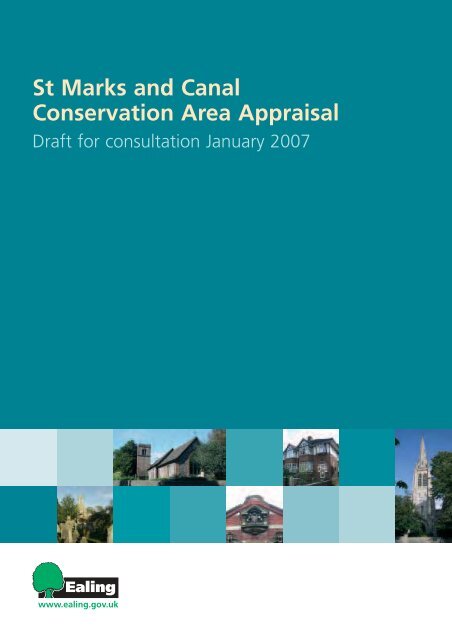
<strong>St</strong> <strong>Marks</strong> <strong>and</strong> <strong>Canal</strong><strong>Conservation</strong> <strong>Area</strong> <strong>Appraisal</strong>Draft for consultation January 2007
<strong>St</strong>. Mark’s <strong>and</strong> <strong>Canal</strong> <strong>Conservation</strong> <strong>Area</strong>Character <strong>Appraisal</strong>ST. MARK’S AND CANAL CONSERVATION AREACHARACTER APPRAISAL1. INTRODUCTION.................................................................................................................... 31.1. THE DEFINITION AND PURPOSE OF CONSERVATION AREAS.....................................................................31.2. THE PURPOSE AND STATUS OF THIS APPRAISAL ....................................................................................31.3. SUMMARY OF SPECIAL INTEREST .........................................................................................................52. LOCATION AND SETTING................................................................................................... 52.1. LOCATION AND CONTEXT.....................................................................................................................62.2. GENERAL CHARACTER AND PLAN FORM................................................................................................73. HISTORIC DEVELOPMENT AND ARCHAEOLOGY........................................................... 93.1. HISTORIC DEVELOPMENT.....................................................................................................................93.2. ARCHAEOLOGY.................................................................................................................................194. SPATIAL ANALYSIS .......................................................................................................... 204.1. THE CHARACTER AND INTERRELATIONSHIP OF SPACES WITHIN THE AREA .............................................204.2. KEY VIEWS AND VISTAS .....................................................................................................................225. THE CHARACTER OF THE CONSERVATION AREA ...................................................... 255.1. CHARACTER AREAS AND THE QUALITY OF ARCHITECTURE...................................................................255.1.1. Sub <strong>Area</strong> no 1: Lower Boston Road <strong>and</strong> Boston Place ........................................................265.1.2. Sub <strong>Area</strong> no 1 architectural interest ......................................................................................265.1.3. Sub <strong>Area</strong> no 2: The stretch of the River Brent from Hanwell Bridge to the <strong>Canal</strong>. ...............285.1.4. Sub <strong>Area</strong> no 2 architectural interest ......................................................................................285.1.5. Sub <strong>Area</strong> no 3: The <strong>Canal</strong> .....................................................................................................305.1.6. Sub <strong>Area</strong> no 3 architectural interest ......................................................................................305.2. KEY UNLISTED BUILDINGS..................................................................................................................325.3. BUILDING MATERIALS AND LOCAL DETAILS ..........................................................................................345.4. CONTRIBUTION OF OPEN SPACES, TREES AND LANDSCAPE..................................................................365.5. THE EXTENT OF INTRUSION OR DAMAGE (NEGATIVE FACTORS) ............................................................385.6. GENERAL CONDITION ........................................................................................................................395.7. PROBLEMS, PRESSURES AND CAPACITY FOR CHANGE.........................................................................396. SUGGESTED BOUNDARY CHANGES ............................................................................. 407. COMMUNITY INVOLVEMENT............................................................................................ 428. SUMMARY OF ISSUES ...................................................................................................... 429. PLANNING AND POLICY FRAMEWORK.......................................................................... 4310. GLOSSARY......................................................................................................................... 4611. BIBLIOGRAPHY .................................................................................................................5012. LIST OF MAPS.................................................................................................................... 5112.1. HISTORIC MAPS................................................................................................................................5112.2. ANALYSIS MAPS ...............................................................................................................................5113. APPENDIX - STAKEHOLDER CONSULTATION .............................................................. 5213.1. LIST OF STAKEHOLDERS CONSULTED .................................................................................................5213.2. ST. MARK’S AND CANAL CONSERVATION AREA APPRAISAL QUESTIONNAIRE .......................................53<strong>Ealing</strong> Borough <strong>Council</strong> 2006 2
<strong>St</strong>. Mark’s <strong>and</strong> <strong>Canal</strong> <strong>Conservation</strong> <strong>Area</strong>Character <strong>Appraisal</strong>1. Introduction1.1. The definition <strong>and</strong> purpose ofconservation areasAccording to Section 69 of the Town <strong>and</strong> CountryPlanning (Listed Buildings <strong>and</strong> <strong>Conservation</strong> <strong>Area</strong>s) Act1990, a <strong>Conservation</strong> <strong>Area</strong> (CA) is an “area of specialarchitectural or historic interest the character <strong>and</strong> theappearance of which is desirable to preserve orenhance”. It is the duty of Local Authorities to designatesuch areas <strong>and</strong> to use their legal powers to safeguard<strong>and</strong> enhance the special qualities of these areas withinthe framework of controlled <strong>and</strong> positive management ofchange.1.2. The purpose <strong>and</strong> status of thisappraisal<strong>St</strong>. Mark’s <strong>and</strong> <strong>Canal</strong> CA was first designated in 1982<strong>and</strong> extended to include part of <strong>St</strong> Bernard’s Hospital sitein 1991.The scope of this appraisal is summarised in thefollowing points:1. Assessment of the special interest of thearchitectural <strong>and</strong> natural heritage of <strong>St</strong>. Mark’s<strong>and</strong> <strong>Canal</strong> CA highlighting elements of specialmerit, which contribute to the character.2. Assessment of the action needed to protect<strong>and</strong> enhance the special qualities of the CA.3. Assessment of the need to revise theboundaries of the CAThis document replaces the existing appraisal publishedin 1999. However, it is not intended to be comprehensivein its scope <strong>and</strong> content. Omission of any specificbuilding, space or feature or aspect of its appearance orcharacter should not be taken to imply that they have nosignificance.The methodology of the CA Character <strong>Appraisal</strong> for <strong>St</strong>.Mark’s <strong>and</strong> <strong>Canal</strong> follows the guidance provided by thePlanning Policy guidelines 15: Planning <strong>and</strong> the HistoricEnvironment (1994); the Guidance on <strong>Conservation</strong> <strong>Area</strong><strong>Appraisal</strong>s by English Heritage (2005); <strong>and</strong> the Guidanceon Management of <strong>Conservation</strong> <strong>Area</strong>s by EnglishHeritage (2005).The analysis has been conducted on the basis of visits tothe area, the involvement of local associations, <strong>and</strong> withconsultation of primary <strong>and</strong> secondary sources on thelocal history <strong>and</strong> architecture.<strong>Ealing</strong> Borough <strong>Council</strong> 2006 3
<strong>St</strong>. Mark’s <strong>and</strong> <strong>Canal</strong> <strong>Conservation</strong> <strong>Area</strong>Character <strong>Appraisal</strong>1.3. Summary of special interest<strong>St</strong> <strong>Marks</strong> <strong>and</strong> <strong>Canal</strong> CA is situated in the formerhistoric County of Middlesex south west of <strong>Ealing</strong>Town Centre. <strong>St</strong> <strong>Marks</strong> <strong>and</strong> <strong>Canal</strong> CA is in theward of Elthorne in Hanwell district.The l<strong>and</strong>-form is strongly defined by the BrentRiver Valley to the east <strong>and</strong> by the Gr<strong>and</strong>Junction <strong>Canal</strong> to the south. The relationship ofthe built fabric with the natural surroundingsprovides the CA with its unspoiled atmosphere.The CA has a slightly varied topography due tothe descending l<strong>and</strong> towards the Brent Valley <strong>and</strong>towards the canal. The settlement has late 18 th century origins butmainly developed during Victorian times.Buildings are grouped along Lower Boston Road,Boston Place <strong>and</strong> Green Lane. Green Lanefunctions as the linkage between <strong>St</strong> <strong>Marks</strong> Village<strong>and</strong> the <strong>Canal</strong>.The CA has a rather homogeneous architecturalheritage with buildings mainly from the 19 thCentury <strong>and</strong> later. <strong>St</strong> <strong>Marks</strong> School (1855), <strong>St</strong><strong>Marks</strong> Church (1879), Cottages at Nos 5-11 (early19 th Century), the structures connected with <strong>St</strong>Bernard’s Hospital (1829), Windmill Bridge (1855-61) <strong>and</strong> the Keepers’ Cottages along the canal(early 19 th century), are amongst the most notablebuildings in the CA.The CA has a mainly residential use with a fewrecreational premises <strong>and</strong> a school.Three areas of Character are distinguishablewithin the CA.1. The developments along Lower BostonRoad <strong>and</strong> Boston Place.2. The stretch of the River Brent fromHanwell Bridge to the canal.3. The canal including Hanwell Flight ofLocks from the Top Lock to its junctionwith the River Brent.Mix of construction materials but mainly yellow<strong>and</strong> brown bricks with details in red brick <strong>and</strong>stone, a few Code stone keystones, slate or tiledroofs.Timber sash windows, angled bay-windows <strong>and</strong>multi-panel doorways constitute an importantelement in the pattern of early facades.<strong>Ealing</strong> Borough <strong>Council</strong> 2006 5
<strong>St</strong>. Mark’s <strong>and</strong> <strong>Canal</strong> <strong>Conservation</strong> <strong>Area</strong>Character <strong>Appraisal</strong>2. Location <strong>and</strong> setting2.1. Location <strong>and</strong> context<strong>St</strong> Mark’s <strong>and</strong> <strong>Canal</strong> CA is situated in the former historicCounty of Middlesex south west of <strong>Ealing</strong> Town Centre.The CA is in the south west part of Hanwell within theElthorne ward in the London Borough of <strong>Ealing</strong>.The CA is 3,47 km 2 in area <strong>and</strong> it is delimited by theGr<strong>and</strong> Union <strong>Canal</strong> on the south side, the River Brent onthe western side, Uxbridge Road to the northern side <strong>and</strong>Westminster Road <strong>and</strong> Green Lane to the eastern side.Viaduct Pub on Uxbridge RoadThe northern section of the CA includes part of LowerBoston Road as far as <strong>St</strong> <strong>Marks</strong> School <strong>and</strong> formerChurch. The central part of the CA includes the smallgreen, called Boston Place, <strong>and</strong> the propertiesimmediately surrounding it up to Westminster Road to theeast. The southern part of the CA includes a substantialstretch of the Gr<strong>and</strong> Union <strong>Canal</strong>, from Top Lock on thewestern extremity up to the confluence of the <strong>Canal</strong> withthe River Brent on the east. Along the northern side ofthe Gr<strong>and</strong> Union <strong>Canal</strong>, the CA includes parts of <strong>St</strong>Bernard’s Hospital.Elthorne ward, of which <strong>St</strong>. Mark’s <strong>and</strong> <strong>Canal</strong> CA is apart, has a population of 12,328 of which 55% is of nonBritish ethnic group Indian/ Pakistani being the largestethnic group constituting 20,2 % of the population (2001Census).Uxbridge Road looking eastwardUxbridge Road looking westward<strong>Ealing</strong> Borough <strong>Council</strong> 2006 6
<strong>St</strong>. Mark’s <strong>and</strong> <strong>Canal</strong> <strong>Conservation</strong> <strong>Area</strong>Character <strong>Appraisal</strong>2.2. General character <strong>and</strong> plan formThe physical character of <strong>St</strong>. Mark’s <strong>and</strong> <strong>Canal</strong> CA ismostly determined by the presence of the Gr<strong>and</strong> Union<strong>Canal</strong> to the south side <strong>and</strong> River Brent to the west. Theeastern side of the CA, west of the River Brent, has still avery open <strong>and</strong> unspoiled character as fields at the rear ofLower Boston Road <strong>and</strong> Green Lane are mainly free fromdevelopments (with the only exception of Walker Close)<strong>and</strong> offer wide views toward the Brent Valley.Lower Boston Road is the main northern approach to theCA. The road has a curvaceous line while descending agentle hill that reaches Boston Place. The small green isthe epicentre of this part of the CA <strong>and</strong> the bondingelement of the surviving features of the older part of thevillage with the former <strong>St</strong> Mark’s Church, the Dolphin Pub<strong>and</strong> <strong>St</strong> <strong>Marks</strong> School all grouped around it. From BostonPlace the CA runs southward along the side with GreenLane flanked by row of terraces or semidetachedcottages. Here the topography slightly descends a hilltowards the canal.The character of the CA changes quite radically from thenorth to the south.Lower Boston Road <strong>and</strong> the buildings around BostonPlace <strong>and</strong> along Green Lane still maintain the characterof a traditional English village. While the open viewsalong the <strong>Canal</strong> side on the south of the CA <strong>and</strong> viewsalong the Brent River reinforce the rural <strong>and</strong> unspoiledatmosphere of the CA. Although, along the westernmostsection of the canal within <strong>St</strong> <strong>Marks</strong> CA, industrialdevelopments transform the character of the area fromrural to industrial. Also, along the River Brent, views ofthe imposing structure of <strong>Ealing</strong> Hospital on the west sidecreate an abrupt visual disturbance of the gentleness ofthe natural environment.The River BrentThe Gr<strong>and</strong> Union <strong>Canal</strong>Lower Boston Road looking southwardBoston Place<strong>Ealing</strong> Borough <strong>Council</strong> 2006 7
<strong>St</strong>. Mark’s <strong>and</strong> <strong>Canal</strong> <strong>Conservation</strong> <strong>Area</strong>Character <strong>Appraisal</strong>2.3. L<strong>and</strong>scape settingThe geological setting of Hanwell is defined by heavyLondon Clay in the northern part <strong>and</strong> light loam <strong>and</strong>gravel with traces of brick-hearth, which predominatessouth of Uxbridge Road, around <strong>St</strong>. Mark’s <strong>and</strong> <strong>Canal</strong>CA 1 .Due to the presence of the Brent Valley, the l<strong>and</strong> aroundthe CA is rather hilly allowing wide views of the CA <strong>and</strong> ofits surroundings.In terms of its surroundings, three regions can beidentified:View of the Brent Meadows fromHanwell BridgeOn the eastern border of the CA is the l<strong>and</strong>occupied by the buildings related to <strong>Ealing</strong>Hospital (north east) <strong>and</strong> <strong>St</strong> Bernard’s Hospital(south west).On the north-eastern side the CA is boundedby Hanwell Clock Tower CA.On the south side the CA contains BlackberryCorner, Jubilee Meadow <strong>and</strong> Long Wood(Public Open Spaces) that blend with OsterleyPark further south.Meadows on the south bank of theGr<strong>and</strong> Union <strong>Canal</strong>Meadows on the south bank of theGr<strong>and</strong> Union <strong>Canal</strong>1 Baker, T. F. T., Cockburn, J. S., Pugh, R. B. (Editors), History of the Countyof Middlesex: Volume 4, 1971<strong>Ealing</strong> Borough <strong>Council</strong> 2006 8
<strong>St</strong>. Mark’s <strong>and</strong> <strong>Canal</strong> <strong>Conservation</strong> <strong>Area</strong>Character <strong>Appraisal</strong>3. Historic development <strong>and</strong>archaeology3.1. Historic developmentIn the 18 th Century much of this area was still part ofHanwell Heath, with small village settlements clusteredalong <strong>and</strong> around Uxbridge Road. The character of thearea was mainly rural <strong>and</strong> the principal activities werefarming <strong>and</strong> agriculture. (See Hanwell Map in 1800 Andthe Enclosure Map of 1837)Towards the end of the 18th Century <strong>and</strong> during the 19 thCentury, major changes to this area occurred, thusgradually transforming its rural nature into a moresuburban character.Firstly, the construction of the Gr<strong>and</strong> Junction <strong>Canal</strong>between 1793 <strong>and</strong> 1814 was a major event thatcontributed to this transition. The Gr<strong>and</strong> Junction <strong>Canal</strong>was London's principal link with the rest of the UK's canalsystem. It provided the transport infrastructure to bringgoods from the industrial conurbations of the north <strong>and</strong>midl<strong>and</strong>s to the capital. The Act of Parliament toauthorise its construction was passed in 1793 <strong>and</strong> workstarted in the same year. The construction of The Gr<strong>and</strong>Junction <strong>Canal</strong> brought labourers into the parish frommany parts of the country, leading to the intensification ofconstruction activity in the area <strong>and</strong> the building of workercottages as well as larger houses.The building of Middlesex County Asylum on thesouthern section of <strong>St</strong> <strong>Marks</strong> CA also contributed to thetransformation of the character of the area. Work on thenew asylum started in 1829 on l<strong>and</strong> to a major part (44acres) purchased from the Earl of Jersey. The architectwas William Alderson.The neo-classical design consisted of a central octagonalpanoramic tower with a basement <strong>and</strong> two floors. Thewindows have a tall aspect with semicircular bondedgauge brick arches at the top. The east side of thecentral tower was intended for the male <strong>and</strong> the westernfor the female patients. The newer extensions whichwere added in 1859 are readily identifiable by their flatbonded arches to the tops of the windows 2 . Hanwell waschosen for its position outside of centres of population,but not too far for the occasional visit from London.Brent Bridge in the 19 th CenturyUxbridge Road passing over BrentBridge (now Hanwell Bridge) in the early20 th CenturyBrent Bridge in the early 20 th Century2 Roberts, A; Cracknell, P.; Piddock, S.; Rutherford, S.(1981). Asylum architecture. The asylumsindex. Middlesex University, London, Engl<strong>and</strong>. Retrieved on 2006-09-26.<strong>Ealing</strong> Borough <strong>Council</strong> 2006 9Windmill portrayed by J.W.M Turner in1810
<strong>St</strong>. Mark’s <strong>and</strong> <strong>Canal</strong> <strong>Conservation</strong> <strong>Area</strong>Character <strong>Appraisal</strong>Hanwell “Lunatic Asylum” became a self sufficient“village” which contained a farm, gardens for freshproduce, a laundry, a brewery <strong>and</strong> a graveyard. Localartisans, for example, a tailor <strong>and</strong> a shoemaker worked atthe asylum which was supplied with goods from localworkshops. Many of the Victorian properties inWestminster Road are from this time <strong>and</strong> they wereprobably initially built in relation to the asylum.Layout of the Hospital, 19 th CenturyAerial view of <strong>St</strong> Bernard’s Hospital c. 1920<strong>Ealing</strong> Borough <strong>Council</strong> 2006 10
<strong>St</strong>. Mark’s <strong>and</strong> <strong>Canal</strong> <strong>Conservation</strong> <strong>Area</strong>Character <strong>Appraisal</strong>The Enclosure Act of 1814 was another event that greatlycontributed to the change of character of the area. TheAct put an end to the old method of strip-farming <strong>and</strong> theresulting increase in l<strong>and</strong> values encouraged morefarmers to give up their smallholdings on the slope <strong>and</strong>move further south.Larger l<strong>and</strong>owners were gaining control over most of thel<strong>and</strong> to grow hay to meet the ever-increasing dem<strong>and</strong>from London. Rows of terraces were built along UxbridgeRoad <strong>and</strong> around it <strong>and</strong> farmers were forced to seekwork elsewhere.But it was with the coming of the railways in the mid-19 thcentury, first the GWR at Hanwell <strong>St</strong>ation (1839) followedby the Southall to Brentford line (1859), that VictorianHanwell begun to engulf the villages <strong>and</strong> commons ofthis part of the Middlesex.In the 19 th century the northern part of the CA wasoriginally exploited for gravel extraction. Boston Place, infact, was once a gravel pit. Later in 1903, the <strong>Council</strong>bought <strong>and</strong> laid it out for the use of the children growingup in the newly developed “Olde Hanwell”. The Dolphinpublic house <strong>and</strong> a few of the dwellings around the smallgreen - Laurel Bank Villas <strong>and</strong> Frederick Villas - areVictorian but the Factory Yard area towards UxbridgeRoad was earlier <strong>and</strong> densely populated. A well knownactivity in the Factory Yard was a glove factory run by aJohn Fownes, recorded there since1795. The cottage atNo 11a was a Cart House. While Cottages at no 5-11 inBoston Place are early Victorian.The Parish of Hanwell in 1800Westminster Road on the north-easternmost end of theCA used to be the road chosen by middle-classprofessionals for their homes. Mid-Victorianprofessionals, in fact, found this road a convenient placeto set up residence. Always along Westminster Road, theschool of Non-Conformist Union Church of 1867 is now<strong>St</strong> Mary Assyrian Church.From 1870s onwards the l<strong>and</strong> between Lower BostonRoad <strong>and</strong> the canal was laid out in a rectangular streetpattern <strong>and</strong> the development of housing in the southernpart of the CA <strong>and</strong> along Green Lane for the growingpopulation commenced in earnest.Enclosure Map of 1837<strong>Ealing</strong> Borough <strong>Council</strong> 2006 11
<strong>St</strong>. Mark’s <strong>and</strong> <strong>Canal</strong> <strong>Conservation</strong> <strong>Area</strong>Character <strong>Appraisal</strong>All the small terrace houses <strong>and</strong> semidetached housesalong Green Lane <strong>and</strong> to the east of it were built between1887 <strong>and</strong> 1919. The only exception is the propertiesaround the Fox Inn known as Oak Cottages built before1875.The historic development of <strong>St</strong>. <strong>Marks</strong> CA is indissolublylinked to the <strong>St</strong> <strong>Marks</strong> School.<strong>St</strong> <strong>Marks</strong> School was built in 1855 on the corner of GreenLane <strong>and</strong> Lower Boston Road. Part of the school wassited on glebe l<strong>and</strong> to replace the Charity National Schoolin Halfacre Road. From about 1870 the school wasalways troubled with over-crowding. The building wasthen extended <strong>and</strong> altered on many occasions from 1870onwards. In 1895 it was enlarged <strong>and</strong> acquired itsextensive grounds when the adjoining market gardenwas closed down in the 1960s 3 .Opposite to <strong>St</strong> Mark School was <strong>St</strong> <strong>Marks</strong> Church, built in1879 by William White 4 as a daughter church of theParish Church sited on the high ground to the north. Thechurch became independent from the main parish churchin 1919 when the part of <strong>St</strong> Mellitus parish was assignedto it. Due to lack of attendance <strong>and</strong> financial support, <strong>St</strong><strong>Marks</strong> was declared redundant in 1980. The church waslater converted into private flats 5 .<strong>St</strong> <strong>Marks</strong> School in the 19 th Century<strong>St</strong> <strong>Marks</strong> Church before conversion intoaccommodationThe Fox public house in the late 19 thCentury during the fox hunt3 Johnson, M.K., The <strong>St</strong>ory of <strong>St</strong> <strong>Marks</strong> School, 19554 William White, F.S.A. (1825 - 1900) was an architect, famous for his part in the 19th CenturyGothic revival. A pupil of Sir George Gilbert Scott.5 A series of articles from 1972 to 1987 on The <strong>Ealing</strong> Gazette record the succession of eventsthat brought <strong>St</strong> <strong>Marks</strong> Church to redundancy first <strong>and</strong> to be finally converted into accommodation.Copies of the relevant issues of The <strong>Ealing</strong> Gazette are at <strong>Ealing</strong> Local History Library.The Fox public house in 1908<strong>Ealing</strong> Borough <strong>Council</strong> 2006 12
<strong>St</strong>. Mark’s <strong>and</strong> <strong>Canal</strong> <strong>Conservation</strong> <strong>Area</strong>Character <strong>Appraisal</strong>1870 OS MapOn the OS Map of 1870 The “Viaduct” public house <strong>and</strong>Brent Bridge are clearly marked at the junction ofUxbridge Road with Lower Boston Road. A fewstructures are shown either side of Lower Boston Road:on the east side is the “Heath Cottage”, while on the westside a few small cottages are named as “Kent Cottages”.Nos 5-11 Lower Boston Road are already shown on thisOS map. The open space now occupied by the greenwas already named as “Boston Place”. <strong>St</strong> <strong>Marks</strong> Schoolappears in its original configuration with an elongatedrectangular plan <strong>and</strong> an outside gymnasium - it is markedas “National School”. Westminster Road had not yetbeen opened at this time. But further east along LowerBoston Road terraces at Nos 67-73 seem to have beencompleted.Green Lane appears completely clear from constructions<strong>and</strong> the area between Green lane <strong>and</strong> the Brent Riveralso still appears to be fields.Along the canal the structures of Hanwell Asylum areclearly shown with the chapel <strong>and</strong> the burial ground.Keepers’ Cottages along the canal are shown up toWindmill Bridge <strong>and</strong> Norwood Top Lock. Around TopLock a few scattered small structures appear alongGlade Lane. The Sanitary <strong>St</strong>ation on the south bank ofthe canal is also shown.The little open space at the meeting point of the BrentRiver with the canal also seems to be still free ofconstructions by the time of the 1870 OS map.1890 OS MapOn the OS Map of 1890 the “Viaduct” pub (here onlymarked as “Inn” <strong>and</strong> Brent Bridge are clearly marked atthe crossing of Uxbridge Rod <strong>and</strong> Lower Boston Road.Terraces along the western side of Lower Boston Roadappear complete as well as the Laurel Bank Villas <strong>and</strong>Frederick Villas on Boston Place. No 17-10 on LowerBoston Road <strong>and</strong> the Dolphin public house are shown.The Factory Yard north of Boston Place is clearlymarked. By this time Westminster Road had beenopened, <strong>St</strong> <strong>Marks</strong> Church had been built <strong>and</strong> extensionworks to the front <strong>and</strong> rear of <strong>St</strong> <strong>Marks</strong> School areshown.Major changes are recorded along Green L<strong>and</strong> were theeastern side appears completely filled with cottages. Atthe southern end of Green Lane, at the meeting point ofthe River Brent with the canal, the Fox pub <strong>and</strong> OaksCottages had been built.No major changes can be recorded along the canal <strong>and</strong>the River Brent with the only exception of a few ancillarystructures around the Asylum <strong>and</strong> the nurseries along theeast bank of the Brent.<strong>Ealing</strong> Borough <strong>Council</strong> 2006 13
<strong>St</strong>. Mark’s <strong>and</strong> <strong>Canal</strong> <strong>Conservation</strong> <strong>Area</strong>Character <strong>Appraisal</strong>1910 OS MapIn the OS Map 1910 Terraces along Lower Boston Roadappear to have been completed. Boston Place is laid as“Recreational Ground” <strong>and</strong> it has the shape that it hasnow. Three cottages appear on the site that today isoccupied by Vine cottages. <strong>St</strong> <strong>Marks</strong> School showsfurther extensions. The western side of Green Lane alsoappears to have been filled with cottages. The CottageHospital appears on the western side of Green Lane setback from the streetline where today’s Mount Olive Courtst<strong>and</strong>s 6 . By 1910 the areas east of Green Lane appear allfully edified <strong>and</strong> <strong>St</strong>. George’s Field is marked as“allotment gardens”.Further plant nurseries had been placed along the Brent.1930 OS MapThree pairs of semidetached houses appear on GladeLane. No other major changes are recorded on the OSmap from 1930 apart from the further intensification ofnurseries along the Brent.6 The Cottage Hospital was closed in 1978 <strong>and</strong> was replaced with the 24 flatsof Mount Olive Court. A small clinic also in Green Lane, has been replacedwith houses.<strong>Ealing</strong> Borough <strong>Council</strong> 2006 14
OS 1870
OS 1890
OS 1910
OS 1930
<strong>St</strong>. Mark’s <strong>and</strong> <strong>Canal</strong> <strong>Conservation</strong> <strong>Area</strong>Character <strong>Appraisal</strong>3.2. Archaeology<strong>St</strong> <strong>Marks</strong> <strong>and</strong> <strong>Canal</strong> CA has a very strong archaeologicalsignificance.The UDP acknowledges the archaeological significanceof the area including <strong>St</strong> <strong>Marks</strong> <strong>and</strong> <strong>Canal</strong> CA amongstthe 23 <strong>Area</strong>s of Archaeological Interest within the LB of<strong>Ealing</strong> 7 . Along the River Brent the remains of cineraryurns <strong>and</strong> a variety of <strong>St</strong>one Age flint tools <strong>and</strong>implements were found. Between Osterley Park <strong>and</strong>Elthorne Park there is crop mark evidence from early fieldsystems <strong>and</strong> possible prehistoric barrows.In addition the CA contains important Scheduled AncientMonuments, such as Brunel’s Three Bridges, the brickboundary wall to <strong>St</strong> Bernard’s Hospital <strong>and</strong> the HanwellFlight of Locks.7 <strong>Ealing</strong> UDP 2004, See Policy 4.9 <strong>and</strong> Map Sheet 9<strong>Ealing</strong> Borough <strong>Council</strong> 2006 19
<strong>St</strong>. Mark’s <strong>and</strong> <strong>Canal</strong> <strong>Conservation</strong> <strong>Area</strong>Character <strong>Appraisal</strong>4. Spatial analysis4.1. The character <strong>and</strong> interrelationship ofspaces within the areaThe layout of the village core stayed unchanged over theyears <strong>and</strong> still consists of the buildings that evolvedaround Boston Place, along Lower Boston Road, around<strong>St</strong> <strong>Marks</strong> School <strong>and</strong> Church <strong>and</strong> only later it included thehouses along Green Lane. The built core of the CA issurrounded on the east <strong>and</strong> south by the more natural<strong>and</strong> open environment of the canal <strong>and</strong> of the RiverBrent.Two key points in the village street layout are thecrossing of Green Lane with Boston Place <strong>and</strong> the smallopen space at the southern end of Green Lane where thecanal <strong>and</strong> the River Brent meet.Along Lower Boston Road <strong>and</strong> around Boston Placeproperties are tightly arranged in compact rows ofterraces or semidetached houses with very narrowinterspaces between them. But at the rear they give wayto a much more open environment <strong>and</strong> they visuallyblend with the open situation of the Brent Valley. AroundBoston Place building size, detailing <strong>and</strong> roofscapevaries due to the fact that developments occurred atdifferent times <strong>and</strong> for a range of uses. The threel<strong>and</strong>mark buildings of <strong>St</strong> Mark’s Court, <strong>St</strong> <strong>Marks</strong> School<strong>and</strong> the Dolphin public house create punctuationelements around the small green producing anarticulated townscape.Buildings in the CA are mainly two storey arranged eitherin continuous rows or in pairs of semidetached housesthat form compact road fronts. Victorian houses alongLower Boston Road <strong>and</strong> around Boston Place have amore middle-class appearance; while Victorian cottagesalong Green Lane area are workers’ cottages <strong>and</strong> have amore compact appearance.In this part of the CA façade pattern are mainly definedby sash windows <strong>and</strong> have only a modest threedimensionalarticulation due to the recurrent use of baywindows on the ground floor.Green Lane is a straight track slightly descendingtowards the canal side. The lane is flanked by a denselydeveloped row of cottages. The slightly variedtopography of the l<strong>and</strong> allows a distant view of the treecovered hill that is part of the open l<strong>and</strong> preserved on thesouth side of the canal. At the southern end of GreenLane, before the canal, is a group of Victorian cottagesthat are loosely arranged around a small open space withthe Fox public house on its eastern side.Boston Place from northwestern cornerLower Boston Road looking eastwardGreen Lane looking southwardSmall bridge over the Brent at itsmeeting point with the canal<strong>Ealing</strong> Borough <strong>Council</strong> 2006 20
<strong>St</strong>. Mark’s <strong>and</strong> <strong>Canal</strong> <strong>Conservation</strong> <strong>Area</strong>Character <strong>Appraisal</strong>A narrow alleyway leads to the canal side at thesouthernmost end of the little square approximately at thepoint where the canal joins the River Brent. The keepercottages along the southern bank of the canal arepunctuations along the waterfront <strong>and</strong> create visualinterest <strong>and</strong> diversity in this part of the CA by producing agood balance between nature <strong>and</strong> manmade structures.<strong>St</strong> Bernard’s Hospital high boundary wall encloses thecanal area on the northern side of the walk <strong>and</strong> creates adistinctive contrast between the openness of thesouthern bank of the canal <strong>and</strong> its northern bank.Walking westward along the canal, a small path openingon the northern side leads to the Fitzherbert Walk thatflanks the River Brent up to Hanwell Bridge northward.Along Lower Boston Road <strong>and</strong> along the southern end ofGreen Lane it is possible to view the allotments <strong>and</strong> theriverside along the Brent. Along the portion of the RiverBrent contained in the CA there is less manmade activity.On the eastern side of the river the CA comprises viewsof open spaces <strong>and</strong> allotments up to the rear ofproperties along Lower Boston Road. On the westernside, the nearby district Hospital with its imposing <strong>and</strong>harsh massing has a dominant presence on the riverside,that, despite being outside the CA, contributes to create amore suburban <strong>and</strong> industrial atmosphere.Meeting point of the River Brent withthe Gr<strong>and</strong> Union <strong>Canal</strong>South bank of the canal with one of thekeepers’cottages <strong>and</strong> a narrow boatThe canal with Bernard’s Hospitaltowpath on the northern sideFootpath leading to the FitzherbertWalk<strong>Ealing</strong> Borough <strong>Council</strong> 2006 21
<strong>St</strong>. Mark’s <strong>and</strong> <strong>Canal</strong> <strong>Conservation</strong> <strong>Area</strong>Character <strong>Appraisal</strong>4.2. Key views <strong>and</strong> vistasThanks to natural lofty vantage points - within or outsidethe CA - it is possible to obtain rather inclusive views ofwide portions of the CA from various points.Long vistas: There are a number of significant longvistas along the major streets.Approaching the CA from northwest <strong>and</strong> lookingnorthwards from Lower Boston Road it is possible toattain a striking view of the imposing structure of Brunel’sWharncliffe Viaduct set in the greenery of the BrentMeadows. Lower Boston Road dips slightly as itapproaches the Uxbridge Road <strong>and</strong> the view is closed inthe foreground by the Viaduct public house – “a jolly tiledEdwardian pub” 8 .Thanks to the descending topography of Green Lanetowards the canal it is possible to gain a pleasant view ofthe compact frontage of the cottages flanking the lanefrom both ends of the street. In addition the view of thecompact stretch of the pitched roofs of the cottages alongGreen Lane – especially on the eastern side – with theirtall chimneystacks creates a very compelling roofscapeview. Again, the lofty topography of the northern end ofGreen Lane allows a view of the green hills on thesouthern side of the canal bank.Long views along the picturesque eastern section of thecanal included in the CA up to the Top Lock representone of the most attractive visual experiences enjoyablewithin the CA. The flight of six locks <strong>and</strong> keeper cottageson the south side <strong>and</strong> the compact surface of theboundary wall of <strong>St</strong> Bernard Hospital create a uniquearrangement of water, hard surfaces <strong>and</strong> greenery.From the higher level of Hanwell Bridge as well as fromWindmill Bridge, long <strong>and</strong> distant views of the narrowwater corridor of the canal <strong>and</strong> of the River Brent providea positive contrast to the urban <strong>and</strong> heavy traffic contextof Uxbridge Road <strong>and</strong> Windmill Lane.View of Wharncliffe Viaduct fromLower Boston RoadView of the eastern side of Green LaneView of the Brent from Hanwell Bridge8 Pevsner, N., Cherry, B, The Buildings of Engl<strong>and</strong>, London 3: North West, 1991View of Boston Place<strong>Ealing</strong> Borough <strong>Council</strong> 2006 22
<strong>St</strong>. Mark’s <strong>and</strong> <strong>Canal</strong> <strong>Conservation</strong> <strong>Area</strong>Character <strong>Appraisal</strong>Wide views: There are number of wide views thatcontain the small green of Boston Place or open spaceswithin or surrounding the CA. In the northern part of theCA one of the most significant wide views is of the wideexpanse of Boston Place green, obtainable from thecorners of its polygonal shape.Views of the open fields along the banks of the canal <strong>and</strong>wide views of the allotment fields at the rear of GreenLane Green seen from the River Brent are alsoevocative.View of <strong>St</strong> <strong>Marks</strong> SchoolClose views: A number of close views include significantarchitectural l<strong>and</strong>marks. Compelling views of <strong>St</strong> <strong>Marks</strong>School <strong>and</strong> of <strong>St</strong> <strong>Marks</strong> Court are obtainable from thevarious points of Boston Place. The two prominentbuildings framed by the small green <strong>and</strong> by mature trees,st<strong>and</strong> either side of the northern end of Green Lane <strong>and</strong>function as a gateway element to the southern section ofthe CA.Narrow views: A number of pleasant narrow views areachievable through small gaps between buildings alongGreen Lane that give partial visual access to secludedspaces at the rear. Another pleasant narrow view followsthe narrow footpath that connects the canal side to thesmall <strong>and</strong> sheltered square that is surrounded by theVictorian cottages <strong>and</strong> the Fox pub.View of <strong>St</strong> <strong>Marks</strong> CourtWide view of fields along the canalNarrow footpath connecting the canal with Oak Cottages<strong>Ealing</strong> Borough <strong>Council</strong> 2006 23Narrow view of the Factory Yard
<strong>St</strong>. Mark’s <strong>and</strong> <strong>Canal</strong> <strong>Conservation</strong> <strong>Area</strong>Character <strong>Appraisal</strong>5. The character of theconservation area5.1. Character <strong>Area</strong>s <strong>and</strong> the quality ofarchitectureThis section deals with the value <strong>and</strong> location ofprominent historical buildings within the boundary of theCA. It includes structures <strong>and</strong> areas that representimportant architectural <strong>and</strong> natural l<strong>and</strong>marks in <strong>St</strong>.Mark’s <strong>and</strong> <strong>Canal</strong> CA <strong>and</strong> that significantly contribute toits character. This section has been subdivided to reflectthe fact that the character of the CA changes significantlywithin its boundary.The CA breaks down into three sub-areas of character:1. The developments along Lower Boston Road <strong>and</strong>Boston Place2. The stretch of the River Brent from HanwellBridge to the canal.3. The canal including Hanwell Flight of Locks fromthe Top Lock to its junction with the River Brenteast of <strong>St</strong>. Bernard’s Hospital.Sub <strong>Area</strong> 1: LowerBoston Road <strong>and</strong>Boston PlaceSub <strong>Area</strong> 3: The<strong>Canal</strong>Sub <strong>Area</strong> 2: RiverBrent from HanwellBridge to the <strong>Canal</strong>Listed BuildingsLocally Listed Buildings<strong>Ealing</strong> Borough <strong>Council</strong> 2006 25
<strong>St</strong>. Mark’s <strong>and</strong> <strong>Canal</strong> <strong>Conservation</strong> <strong>Area</strong>Character <strong>Appraisal</strong>5.1.1. Sub <strong>Area</strong> no 1: Lower Boston Road<strong>and</strong> Boston PlaceBoston Place is a small open space with mature trees. Itis the geographical centre of the old settlementdeveloped during Victorian times around the <strong>St</strong> Mark’sSchool <strong>and</strong> the former church. The small green at thecore of <strong>St</strong>. <strong>Marks</strong> CA <strong>Area</strong> contributes strongly to its“traditional English village” atmosphere. Boston Roadfollows an undulating curve <strong>and</strong>, when approached fromthe south, it still has an unexpected open characterdespite the occasionally heavy traffic. Residentialbuildings are mixed with recreational <strong>and</strong> educationalpremises in this part of the CA. This mix of uses <strong>and</strong>building types reflects the traditional elements of ahistoric English village <strong>and</strong> offers a selection of significantpieces of townscape.5.1.2. Sub <strong>Area</strong> no 1 architectural interestApproaching the junction with Westminster Road, a widegrass verge on the left faces a small group of wellproportionate mid-Victorian houses at Nos 17-19. Thepair of semidetached houses is set back from the road.Elevations are in yellow stock brick <strong>and</strong> stucco withpitched roof in states. Both show signs of extensions <strong>and</strong>alterations. On the lower east side of the Boston Roadadjacent to Boston Place is the late-Victorian Dolphin pubwith elevations in red brick <strong>and</strong> a steeply pitched slateroof. Its massing, size <strong>and</strong> details relate very well with thebuilding of <strong>St</strong> <strong>Marks</strong> Court on the opposite side of theLower Boston Road.Boston Place itself is surrounded by white painted castiron bollards joined by a continuous single rail. Thebuildings around the green are a mix of Victorian <strong>and</strong>modern. Of note are the paired Victorian Villas on theeast side of the green, Laurel Bank Villas <strong>and</strong> FrederickVillas. An early-Victorian row of small cottages at Nos 5-11 (Locally Listed), punctuate the south east corner ofBoston Place. The yellow stock-brick, single-bay, twostoreycottages with shallow pitch roof, retain many oftheir original features <strong>and</strong> are one of the earlier example,of domestic architecture in the CA.A curved stock brick wall at No11a in the northwestcorner of the green is an interesting survival <strong>and</strong> possiblyincorporates an earlier stable <strong>and</strong> wagon block.Between these Victorian remains lies a moderndevelopment of Vine Cottages built in 1986 thatsympathetically blends with the historic context.Boston Place, viewed from the southVictorian terraces along Lower BostonRoadLower Boston Road Nos 17-19Cast iron bollards surrounding BostonPlace<strong>Ealing</strong> Borough <strong>Council</strong> 2006 26
<strong>St</strong>. Mark’s <strong>and</strong> <strong>Canal</strong> <strong>Conservation</strong> <strong>Area</strong>Character <strong>Appraisal</strong>Opposite of Boston Place, <strong>and</strong> on the eastern side ofGreen Lane, is the former Church of <strong>St</strong>. <strong>Marks</strong> (LocallyListed).<strong>St</strong> <strong>Marks</strong> Church was built in 1879 by William White inred brick with decorated stone detailing in the typical neo-Gothic style of the time.A steeply sloping roof of brown tiles covers the building<strong>and</strong> a wood bell-cote is placed in the south-easterncorner. The plan-form of the interior originally includednorth <strong>and</strong> south aisles <strong>and</strong> chancel. The church boasteda wood lectern carved at Oberammerg <strong>and</strong> a more recentstone altar register from 1883 9 . In 1980 the Church wasdeclared redundant <strong>and</strong> was sensitively converted intoflats, <strong>St</strong> <strong>Marks</strong> Court, in 1989 to form “a building ofinterest in its own right” 10 . The new attic dormers fit wellinto the steep tiled roof <strong>and</strong> the square-headed lowerwindows with moulded stone lintels sympatheticallycomplement the Dec tracery above.Next to the former church, on the corner of Green Lane,is <strong>St</strong> Mark’s School (Locally Listed).The earlier lower sections are in red brick with stonedetails all arranged in a simple neo-Gothic style. Lateradditions are in red <strong>and</strong> yellow bricks matching the scaleto the neighbouring church.Lower Boston Road Nos 5-11Lower Boston Road No 11aLaurel Bank Villas<strong>St</strong> <strong>Marks</strong> Court<strong>St</strong> <strong>Marks</strong> School9 <strong>Ealing</strong> Museum, Art <strong>and</strong> History Society, Art, Architecture <strong>and</strong> History of <strong>Ealing</strong> Churches.<strong>Ealing</strong> Borough <strong>Council</strong> 2006 27
<strong>St</strong>. Mark’s <strong>and</strong> <strong>Canal</strong> <strong>Conservation</strong> <strong>Area</strong>Character <strong>Appraisal</strong>5.1.3. Sub <strong>Area</strong> no 2: The stretch of theRiver Brent from Hanwell Bridge tothe <strong>Canal</strong>.The main interest of the second sub-area is the tranquil<strong>and</strong> unspoiled character of the short stretch of the RiverBrent, despite in parts being visually disturbed by moderndevelopments. The way the river curves adds to theheightened sense of interest, complexity <strong>and</strong> scale. Butas it moves beyond the Wharncliffe Viaduct <strong>and</strong> HanwellBridge, the new hospital is a prominent feature thatdominates the valley <strong>and</strong> eliminates the axial dynamismof the river curving around this part of Hanwell.Fitzherbert Walk running along the western bank of theRiver Brent is the link between this part of the CA withthe Flight of Locks on the southern side, thus offering theopportunity to enjoy two of the most pleasantlyconstructed <strong>and</strong> natural environments of the Brent RiverPark <strong>and</strong> <strong>St</strong>. <strong>Marks</strong> <strong>and</strong> <strong>Canal</strong> CA. Along the Fitzherbertfootpath it is possible to gain visual access to Billet Hartallotments that occupy a good portion of the eastern bankof the Brent. Further south, the walk leads to theattractive Fox public house neighbourhood.5.1.4. Sub <strong>Area</strong> no 2 architectural interestThe Fox public house (Locally Listed) originally built in1820 has strong connotations for Hanwell’s inhabitants.The pub – initially called The Fox <strong>and</strong> Goose – was stillused as the meeting place for the local fox hunt at theturn of the 20 th century.As it appears now the attractive yellow brick building withdetailing in red brick creates visual interest <strong>and</strong> diversityin this section of the CA where 14 early cottages arenicely arranged around it. The two-storey cottages inyellow bricks were originally known as Oak Cottages <strong>and</strong>were built sometime prior to 1875 which makes themprobably amongst the earliest in the area. Some of thecottages have been rendered <strong>and</strong> so create a pleasantcontrast with the yellow brick surfaces of the remainingunrendered ones. The cottages bear clear signs ofalterations <strong>and</strong> joinery replacements but in general thosechanges have been executed in a sensitive mannerreflecting the traditional context.The River BrentHanwell Bridge from Fitzherbert WalkAllotments at the rear of Green Laneseen from the Fitzherbert Walk10 Pevsner, N. op.cit. 1991<strong>Ealing</strong> Borough <strong>Council</strong> 2006 28
<strong>St</strong>. Mark’s <strong>and</strong> <strong>Canal</strong> <strong>Conservation</strong> <strong>Area</strong>Character <strong>Appraisal</strong>The Fox public houseOak Cottages (west side)Oak Cottages (south east of the Fox)Oak Cottages (south west side)Oak Cottages (south west side)Oak Cottages (south west side)<strong>Ealing</strong> Borough <strong>Council</strong> 2006 29
<strong>St</strong>. Mark’s <strong>and</strong> <strong>Canal</strong> <strong>Conservation</strong> <strong>Area</strong>Character <strong>Appraisal</strong>5.1.5. Sub <strong>Area</strong> no 3: The <strong>Canal</strong>The canal runs in a gentle loop from west to east. Themain feature of the eastern stretch of the canal up toWindmill Bridge is the flight of six locks which raise thecanal by over 53 feet. Surpassed the Windmill Bridge, inthe western stretch of the canal included in <strong>St</strong> <strong>Marks</strong> CA,the wonderful balance between water, greenery, hardsurfaces <strong>and</strong> change of ground level gives way to a moreurban/industrial <strong>and</strong> blunt character.5.1.6. Sub <strong>Area</strong> no 3 architectural interestAccessing the canal from the southern end of GreenLane <strong>and</strong> heading westward, immediately on the righth<strong>and</strong> side is the Lock Keeper’s Cottage at Lock 97(Listed, Grade II) of the Gr<strong>and</strong> Union <strong>Canal</strong>. This keepercottage, like the remaining five cottages, is now privatelyowned.The cottage at lock 97 is a two-bay, two-storey unit fromthe early 19 th C. The façade pattern is nicely defined bymulti-paned, double-hung, timber sashes <strong>and</strong> by a timberdoor with a simple hood. The building is covered by apitched slate roof fully hipped to the right up to thechimney stack on the left, indicating that this is half of amatching pair of houses of which one half has beeneither demolished or never built 11 .Further west on the south bank of the canal, is theKeeper’s Cottage at Lock 95 (Listed, Grade II). This isa two-bay, two-storey, early 19 th C house in stock bricks.The main elevation has a symmetrical configuration withmulti-paned sashes on either side of the central doorway.The original symmetry has been disrupted by the lateraddition of a small opening on the upper level. Thecottage is covered by a flat pitched hipped slate roof withend stacks. The setting of the well proportioned house ina wide plot of grass framed by good size mature treestogether with the narrow boats that line-up along thisportion of the bank provide this stretch of the canal with aunique rural <strong>and</strong> unspoiled atmosphere.At this point of the canal, the CA incorporates thesouthernmost part of <strong>St</strong>. Bernard’s Hospital site,including the hospital Brewery House <strong>and</strong> the quartermile long hospital wall which forms the northern boundaryof the canal (Scheduled Ancient Monument). Thetowing path wall was built in 1831 to secure residents ofthe Middlesex County Asylum. It is made of plum <strong>and</strong>yellow stock bricks in English <strong>and</strong> Flemish bonds.Eastern stretch of the canalKeeper’s Cottage at lock 97Keeper’s Cottage at lock 9511 www. imagesofengl<strong>and</strong>.org<strong>St</strong> Bernard’s Hospital wall <strong>and</strong> brewery<strong>Ealing</strong> Borough <strong>Council</strong> 2006 30
<strong>St</strong>. Mark’s <strong>and</strong> <strong>Canal</strong> <strong>Conservation</strong> <strong>Area</strong>Character <strong>Appraisal</strong>The highest part has triangular projecting piers <strong>and</strong>arched blind windows that create a distinctive patternwithin the solid surface of the wall. The beautiful wallalong the side of Hanwell Flight prevents the newdevelopment of the hospital nearby from compromisingthe unity <strong>and</strong> balance of the CA in this section.Another interesting early 19 th Keeper’s Cottage (Listed,Grade II) is located on the south bank at Lock 93. Theone storey building in stock bricks with later multi-paneddouble-hung sashes has a central brick porch with roundarches on three elevations. The cottage is covered by aflat pitched hipped slate roof with a central stack.The last Cottage on the south bank before WindmillBridge is at Lock 92 (Listed, Grade II). The early 19 thcentury two-storey, stock brick cottage has anasymmetric main elevation. On the upper level windowsare casements with glazing bars. On the ground floorthere is one angled bay-window with a hipped roof onone side, <strong>and</strong> two round headed windows on the otherside. The simple timber doorway is positioned in thecentre.Further west on the canal is the extraordinary WindmillBridge (Scheduled Ancient Monument), locally knownas “Three Bridges”. Designed by Isambard KingdomBrunel <strong>and</strong> built between 1855 <strong>and</strong> 1861, it is a uniquestructure at the meeting point of road, railway <strong>and</strong> canal.A cast iron trough carries the canal over the railway <strong>and</strong>a cast iron bridge carries the road over both.At the westernmost end of the CA, at Lock 90, isprobably one of the best preserved Keeper’s Cottagesof the canal (Listed, Grade II). Other structures ofinterest in the curtilage of the cottage are the walls,gates, sluices <strong>and</strong> brick bridge. The cottage dates backto 1855 <strong>and</strong> has the usual treatment <strong>and</strong> fittings. Thebridge dates to the early 19 th century <strong>and</strong> wasconstructed in local brown bricks that now have beenpainted in white. The segmental arch parapet walls are inunaltered condition.Triangular projecting piers <strong>and</strong> archedblind windows of <strong>St</strong> Bernard’s Hospitalbaundary wallKeeper’s Cottage at lock 93Windmill BridgeKeeper’s Cottage at lock 90Keeper’s Cottage at lock 92<strong>Ealing</strong> Borough <strong>Council</strong> 2006 31
<strong>St</strong>. Mark’s <strong>and</strong> <strong>Canal</strong> <strong>Conservation</strong> <strong>Area</strong>Character <strong>Appraisal</strong>5.2. Key unlisted buildingsA number of unlisted buildings in <strong>St</strong>. Mark’s <strong>and</strong> <strong>Canal</strong>CA contribute positively to the character of the areadespite not meeting the criteria for statutory or possiblylocal listing. They reflect the age, style <strong>and</strong> material of asubstantial number of buildings in the CA <strong>and</strong> are areminder of the gradual development of the settlement.The following buildings already mentioned in the previoussections are considered a positive contribution to thecharacter of the CA.The Dolphin public houseSub <strong>Area</strong> 1: The Dolphin public House Nos 17-19 Lower Boston Road Frederick Villas Laurel Bank VillasSub <strong>Area</strong> 3: Oak Cottages around the Fox PubAlso the early lampposts remaining in Green Lane (2)<strong>and</strong> Boston Place (3) are worthy of special protection.Early lamppost in Boston PlaceOak Cottages<strong>Ealing</strong> Borough <strong>Council</strong> 2006 32
<strong>St</strong>. Mark’s <strong>and</strong> <strong>Canal</strong> <strong>Conservation</strong> <strong>Area</strong>Character <strong>Appraisal</strong>Townscape Analysis for Sub <strong>Area</strong> No 1Locally Listed BuildingsPositive ContributionNeutral ContributionNegative Contribution<strong>Ealing</strong> Borough <strong>Council</strong> 2006 33
<strong>St</strong>. Mark’s <strong>and</strong> <strong>Canal</strong> <strong>Conservation</strong> <strong>Area</strong>Character <strong>Appraisal</strong>5.3. Building materials <strong>and</strong> local detailsA large number of the early buildings in the CA show theuse of yellow stock bricks <strong>and</strong> local brown bricks laid inFlemish bond or English bond. The use of stuccomouldings is common in mid-Victorian terraces, whilerenders or paint on brick walls is only evident on rareexamples <strong>and</strong> seem to have been applied always at alater stage. The use of reddish bricks is found only in thedetailing of prominent structures like <strong>St</strong> <strong>Marks</strong> School, <strong>St</strong><strong>Marks</strong> Court, the Fox <strong>and</strong> the Dolphin public houses. Theuse of stone detailing is found in <strong>St</strong> <strong>Marks</strong> Church <strong>and</strong>School. Also Coade stone keystone detailing is commonin mid-Victorian houses.Timber sash with Coadestone keystoneAn important early feature that has survived includes theportions of early boundary walls built with local brownbricks or stock bricks laid in Flemish bond or Englishbond with a variety of copings. Particularly interesting arethe early wall at no 11a of Lower Boston Road, the bricksegmented arched wall of the Top Lock Bridge <strong>and</strong>, ofcourse, the boundary wall of <strong>St</strong> Bernard’s Hospital.These walls also display different kinds of pointing suchas raised or flush mortar joints.Only a few late Victorian/Edwardian interventions bearmock Tudor embellishments.On mid-Victorian houses around Boston Place <strong>and</strong> onthe Keeper’s Cottages along the canal, roofing isgenerally hipped with low pitches covered with Welshslates. Pitched slate or flat tiles roofs are common in late-Victorian workers’ cottages along Green Lane, alongLower Boston Road <strong>and</strong> in the cottages around the Foxpub. Early tall chimneystacks still survive. They are inbricks with clay pots. Only the chimney stacks on theVictorian terraces along Lower Boston Road have beenrendered.The terraces along Lower Boston Road, opposite to theHeath development, have a basement level accessiblevia exterior staircases. The presence of this feature isdue to descending street level towards Boston Pace.Red brick <strong>and</strong> stonedetailing on yellow brickelevationMock Tudor detailing on the gable ofthe Fox public houseWith regard to windows, double-hung, multi-paned timbersash windows are the predominant type in Victorianbuildings in the CA. In later Victorian/Edwardian buildingstwo-pane sash windows are common. Casementwindows are to be found mainly in later replacements.Large pointed gothic windows are to be found in <strong>St</strong> <strong>Marks</strong>Church <strong>and</strong> School.Slate <strong>and</strong> flat tiles roofs<strong>Ealing</strong> Borough <strong>Council</strong> 2006 34
<strong>St</strong>. Mark’s <strong>and</strong> <strong>Canal</strong> <strong>Conservation</strong> <strong>Area</strong>Character <strong>Appraisal</strong>Many of the Victorian <strong>and</strong> late-Victorian cottages haveside, angled bay windows.Later windows have not always been executed inharmony with the context. Some are in metal ordetrimental uPVC <strong>and</strong> are of disparate shape <strong>and</strong>colours.There are still a few remaining examples of earlydoorways, in the form of simple painted timber doors.Very interesting white painted cast iron gas lamppostsremain in Boston Place <strong>and</strong> in Green Lane on the site ofthe entrance to the former cottage hospital.Angled bay-windowEarly timber doorwaysEarly lamppostLate Victorian pavingYellow brick chimneystack withlater clay pots<strong>Ealing</strong> Borough <strong>Council</strong> 2006 35
<strong>St</strong>. Mark’s <strong>and</strong> <strong>Canal</strong> <strong>Conservation</strong> <strong>Area</strong>Character <strong>Appraisal</strong>5.4. Contribution of open spaces, trees<strong>and</strong> l<strong>and</strong>scapeA fundamental contribution to the character of <strong>St</strong>. Mark’s<strong>and</strong> <strong>Canal</strong> CA is made by its natural setting, in particularby the Gr<strong>and</strong> Union <strong>Canal</strong> on the south side <strong>and</strong> by theopenness of the surrounding l<strong>and</strong>scape on the westernside of the Brent River Valley.Within the CA boundary a prime feature of the characteris provided by the small green designated Public OpenSpace 12 . The small green constitutes the bondingelements for architectural features around it. Trees <strong>and</strong>green fences around properties also constitute animportant part of the rustic character of <strong>St</strong>. Mark’s <strong>and</strong><strong>Canal</strong> CA. They provide a natural progression betweenspaces, <strong>and</strong> they enhance the streetscape as they helpto frame views into <strong>and</strong> out of the area <strong>and</strong> betweenbuildings.Equally, the CA benefits from its broad setting thatincludes a substantial portion of Brent River Park <strong>and</strong> theGr<strong>and</strong> Union <strong>Canal</strong>.Both the River Brent <strong>and</strong> the canal are Green Corridors 13 .The Brent <strong>and</strong> the canal are also defined as a GreenChain <strong>and</strong> as a Nature <strong>Conservation</strong> Site of MetropolitanImportance by the London Ecology Unit due to the veryprolific wildlife <strong>and</strong> flora 14 .The Brent River Valley has been transformed since theRiver Brent Park was instigated by <strong>Ealing</strong> in 1972. TheBrent River Park is a large green space which isdissected by the River Brent. This natural l<strong>and</strong>scape hasrecently been improved through the River Brent Project<strong>and</strong> further plans are proposed for future improvements 15 .The Brent River Park is a special area of MetropolitanOpen L<strong>and</strong> <strong>and</strong> Public Open Space, in the very heart ofthe borough. It acts not only as amenity l<strong>and</strong> but also asa flood plain assisting in flood control. 16Small green in Boston PlaceThe canal from Norwood LockFields along the canal12 <strong>Ealing</strong> UDP 2004, See Policy 3.4 <strong>and</strong> Map Sheets 2, 3 <strong>and</strong> 413 <strong>Ealing</strong> UDP 2004, See Policy 3.2 <strong>and</strong> Map Sheets 1, 2 <strong>and</strong> 1514 LBE, The Brent River Park – Report of L<strong>and</strong>scape Proposal, 1977; Brent River <strong>and</strong> <strong>Canal</strong>Society Newsletter, November 200615 http://www.brent.gov.uk/RiverBrent16 <strong>Ealing</strong> UDP 2004, See Policy 3.1 <strong>and</strong> Map Sheets 1, 2 <strong>and</strong> 15Brent River Park<strong>Ealing</strong> Borough <strong>Council</strong> 2006 36
<strong>St</strong>. Mark’s <strong>and</strong> <strong>Canal</strong> <strong>Conservation</strong> <strong>Area</strong>Character <strong>Appraisal</strong>Equally Hanwell Flight, on the Southall / Hanwell bordersis a Site of Importance for Nature <strong>Conservation</strong> (SINC).This includes the side-ponds of the keepers cottages, thevegetation at the Windmill Bridge, the grassl<strong>and</strong> atTrumpers Field, the embankments <strong>and</strong> wooded fringe at<strong>St</strong>. Bernard's Hospital, <strong>and</strong> Fitzherbert Walk along theRiver Brent to Hanwell Bridge. Trees in this area arepartially covered by a Tree Protection Order (TPO).Fitzherbert Walk (part of the Capital Ring footpathSystem) is a pleasant riverside walk through woodl<strong>and</strong>that follows the River Brent, connecting Brent Meadowwith the Gr<strong>and</strong> Union <strong>Canal</strong> towpath at the HanwellFlight. The Fitzherbert Walk <strong>and</strong> the canal towpathprovide an informal recreational space ideal for walking,picnicking <strong>and</strong> cycling.Bell Hart allotmentsFitzherbert Walk<strong>Ealing</strong> Borough <strong>Council</strong> 2006 37
<strong>St</strong>. Mark’s <strong>and</strong> <strong>Canal</strong> <strong>Conservation</strong> <strong>Area</strong>Character <strong>Appraisal</strong>5.5. The extent of intrusion or damage(negative factors)There are a few intrusions into the CA: The new <strong>Ealing</strong> District Hospital <strong>and</strong>accommodation blocks, exacerbated bymonolithic massing <strong>and</strong> the topping <strong>and</strong> croppingof trees on the hospital site create a verydisruptive element at a very narrow point of theriver.The dismissed plots <strong>and</strong> industrial premises alongthe canal west of Windmill Bridge contribute to theabrupt change in the character of the CA fromrural to industrial. The canal itself gave rise to theindustrial development of this area, <strong>and</strong> the visualquality which any such location has can only be akind of attraction if it was not for small scaleclutter <strong>and</strong> detritus. The state of ab<strong>and</strong>on <strong>and</strong>neglect of sections of the canal make the masses<strong>and</strong> colours of the sheds <strong>and</strong> the profile ofchimneys <strong>and</strong> boats become an unattractivemess.The loss of front garden trees <strong>and</strong> fences together withloss of garden walls constitutes a threat to the area’scharacter. Boundary walls between properties were animportant element of the character of the 19th Century.However, large portions of original boundary walls <strong>and</strong>fences have been demolished (see Lower Boston Roadclose to the junction with Uxbridge Road) <strong>and</strong> replacedinappropriately. This has resulted in a significant loss indefinition of the streetscape <strong>and</strong> a loss of the originalspatial hierarchy between public <strong>and</strong> private spaceswithin the CA.Later boundary walls have been executed with materials,design or technologies, which are inappropriate to theircontext. The thinning of trees <strong>and</strong> hedges along GreenLane, in front of the Victorian properties along LowerBoston Road <strong>and</strong> Westminster Road, but especiallyalong the western-most stretch of the canal betweenThree Bridges <strong>and</strong> the Top Lock is one of the threats tothe character of the CA.The CA is under a number of other threats that include: Extensions that are disrupting the traditionalspatial relationship between buildings Bulky dormers windows that disrupt the roofscape Continuous porches Loss of the traditional fenestration patternstogether with later doorways where material,design <strong>and</strong> decoration patterns are not in keepingwith the character of the CANew security unit of <strong>Ealing</strong> Hospitalseen from Fitzherbert WalkMonolithic massing of <strong>Ealing</strong> HospitalDismissed plots <strong>and</strong> structures alongthe western section of the canalHardst<strong>and</strong>ing in front of terraces alongLower Boston Road<strong>Ealing</strong> Borough <strong>Council</strong> 2006 38
<strong>St</strong>. Mark’s <strong>and</strong> <strong>Canal</strong> <strong>Conservation</strong> <strong>Area</strong>Character <strong>Appraisal</strong>5.6. General conditionThe overall condition of most of the fabric in the CA issound, although the state of neglect of some public openspaces <strong>and</strong> footpaths cluttered with fly tipping is aconcern for the CA. For example, the footpath that leadsto the Fitzherbert Walk from Hanwell Bridge, the smallgreen in Boston Place, or the slope to the rail tracks atThree Bridges are very often spoiled with disposals <strong>and</strong>rubbish; this detracts from their amenity significance.5.7. Problems, pressures <strong>and</strong> capacity forchangeThere is little capacity for major change within the CA. Inthe course of the years all plots have been developed ina reasonably sensitive manner. Further intensificationcould detract from the rather openness of the CA.Later boundary wall built withunsympathetic materialsRoof extension that disrupts theroofline of the street <strong>and</strong> the pleasantproportions of this Victorian houseLater fenestration <strong>and</strong> porchFly-tipping at WindmillBridge Graffity at Windmill Bridge Fly-tipping along the Brent<strong>Ealing</strong> Borough <strong>Council</strong> 2006 39
<strong>St</strong>. Mark’s <strong>and</strong> <strong>Canal</strong> <strong>Conservation</strong> <strong>Area</strong>Character <strong>Appraisal</strong>6. Suggested boundary changesThe appraisal of <strong>St</strong>. <strong>Marks</strong> <strong>and</strong> <strong>Canal</strong> CA <strong>and</strong> of itsimmediate surrounds has shown the need for theextension of the CA boundary. This action would applyfurther control to the preservation <strong>and</strong> enhancement ofareas that are an integral part of the historical <strong>and</strong> naturalsetting of the present CA. In particular Green Lane <strong>and</strong>the properties situated along it are an integral part of thehistory <strong>and</strong> character of the current CA. Cottages alongGreen Lane <strong>and</strong> located behind it along <strong>St</strong> Margaret’sRoad are part of the earliest domestic developments inthis area <strong>and</strong> are a document of the building activity thattook place to accommodate workers coming fromelsewhere to work in Hanwell. Properties on the easternside of Green Lane were built in between 1870-90, <strong>and</strong>they are not only are well preserved remains of theearlier grain of this area but are also visually blended withthe adjacent parts of CA.The boundaries of the CA are proposed to be extendedto the following areas:The properties either side of Green Lane up toproperties west of <strong>St</strong>. <strong>Marks</strong> Road including <strong>St</strong>.George Fields playground.<strong>Ealing</strong> Borough <strong>Council</strong> 2006 40
<strong>St</strong>. Mark’s <strong>and</strong> <strong>Canal</strong> <strong>Conservation</strong> <strong>Area</strong>Character <strong>Appraisal</strong>7. Community involvementIn accordance with English Heritage guidance, the<strong>Council</strong> has involved key stakeholders during theappraisal process, a list of which is appended. This initialconsultation process has been undertaken in a number ofon site meetings with representatives of local amenitygroups <strong>and</strong> in the form of a questionnaire sent to keystakeholders based in <strong>and</strong> around the CA. Thequestionnaire called for careful consideration <strong>and</strong> insome instances detailed responses. Due regard to thequestionnaire responses has been paid in this text. Asummary of the responses is included in the Appendix.There will be a further opportunity for dialogue throughthe next steps leading towards the adoption.8. Summary of issues Visual intrusion from developments in thesurroundings of the CA, e.g. <strong>Ealing</strong> Hospital’sstructures The state of neglect of some open/public spacesin the CA Loss of front yard trees <strong>and</strong> fences Loss of front yard walls to create parking for cars The poor condition of some of the buildings in theCA The general inappropriate design of recentdevelopments:1. New boundary walls with inappropriatematerial <strong>and</strong> design with the addition ofout of character decorative railings2. Changes to the fenestration3. Continuous porches4. Bulky dormers that disrupt the roofscape<strong>Ealing</strong> Borough <strong>Council</strong> 2006 42
<strong>St</strong>. Mark’s <strong>and</strong> <strong>Canal</strong> <strong>Conservation</strong> <strong>Area</strong>Character <strong>Appraisal</strong>9. Planning <strong>and</strong> Policy frameworkA summary of the principal legislation <strong>and</strong> policyguidance applicable to <strong>St</strong>. Mark’s <strong>and</strong> <strong>Canal</strong> CA is set outbelow:The Planning (Listed Buildings <strong>and</strong> <strong>Conservation</strong> <strong>Area</strong>s)Act 1990 sets out the process of assessment, definition,or revision of boundaries <strong>and</strong> formulation of proposals forCAs as well as the identification <strong>and</strong> protection of ListedBuildings. Authorities are required to pay specialattention to the desirability of preserving or enhancing thecharacter or appearance of the CA, or in case of ListedBuildings, to have special regard for their preservation inthe exercise of their powers under the Planning Acts.Planning Policy Guidance (PPG) Note 15, for local <strong>and</strong>other public authorities, property owners, developers,amenity bodies <strong>and</strong> public, sets out Government policesfor the identification <strong>and</strong> protection of historic buildings,CAs, <strong>and</strong> other elements of the historic environment.<strong>Ealing</strong> <strong>Council</strong>’s Unitary Development Plan (UDP) orLocal Development Framework (LDF) includes itsstatutory policies for implementing the Acts <strong>and</strong> apply thePPG. This <strong>Appraisal</strong> should be taken into account whenconsidering planning or listed building applications withinthe <strong>Conservation</strong> <strong>Area</strong>.The prime objective of the relevant legislation <strong>and</strong>guidance is the preservation <strong>and</strong>/or enhancement ofcharacter or appearance of CAs. Any proposeddevelopments which conflict with that objective should benormally expected to be refused. PPG 15 <strong>and</strong> local policyalso support a presumption in favour of preservation ofany buildings or objects which are considered to make apositive contribution to the character of a CA. At thesame time, it is recognised the need to accommodatechanges which respect or reinforce the character of thearea in order to maintain its vitality.Many local planning policies – not only those for design<strong>and</strong> conservation – can affect the developments in a CA.For instance polices on sustainable development,meeting housing needs, affordable housing, l<strong>and</strong>scape,biodiversity, energy efficiency, transport, people withdisabilities, employment <strong>and</strong> town centres can allinfluence development <strong>and</strong> the quality of the environmentin CA. However, policies concerned with design quality<strong>and</strong> character generally take greater importance in CAs.The adopted UDP’s section on Urban Design includespolicies dealing with:<strong>Ealing</strong> Borough <strong>Council</strong> 2006 43
<strong>St</strong>. Mark’s <strong>and</strong> <strong>Canal</strong> <strong>Conservation</strong> <strong>Area</strong>Character <strong>Appraisal</strong> Design of Development (4.1) Mixed Use (4.2) L<strong>and</strong>scaping, Tree Protection <strong>and</strong> Planting (4.5) <strong>St</strong>atutory Listed Buildings (4.7) <strong>Conservation</strong> <strong>Area</strong>s (4.8) Ancient Monuments <strong>and</strong> Archaeological Interest<strong>Area</strong>s (4.9) Commercial Frontage <strong>and</strong> Advertising Signs(4.10)Throughout the Urban Design section, references aremade after each policy to further relevant documents <strong>and</strong>policies, including: SPG 5: How to Prepare an Urban Design<strong>St</strong>atement SGP 12: Greening Your Home <strong>Ealing</strong> LA21: Keeping Your Front Garden Alive PPG 15: Listed Buildings <strong>and</strong> <strong>Conservation</strong> <strong>Area</strong>s PPG16: Archaeology <strong>and</strong> PlanningPPG 19: Outdoor Advertisement Control“By Design - Urban Design in the PlanningSystem: towards a better Practice”(CABE &DETR, 2000)“By Design – Better Places to Live: A CompanionGuide to PPG 3” (CABE, 2001) The London Plan, Policy 4B.5, 4B10, 4B11, 4B12,4B14Policy 4.8 for CA states:The <strong>Council</strong> will preserve or enhance the character<strong>and</strong> appearance of CAs <strong>and</strong> their setting.New developments, built or otherwise within oradjacent to the CA, will be permitted provided thatthey are well related to the existing character of thearea in terms of its historic <strong>and</strong> architectural quality<strong>and</strong> green setting. The <strong>Council</strong> requires that anydevelopment proposal adhere to the <strong>Council</strong>’sspecific CA guidelines.The council will refuse planning permission <strong>and</strong> CAconsent for development of existing buildings, unlessthe proposed replacement development will preserveor enhance the character of the CA. Whereappropriate, the <strong>Council</strong> will also make Article 4Directions that restrict development rights granted bythe General Permitted Development Order.It is the <strong>Council</strong>’s intention to create new <strong>and</strong>extended CAs in the Borough, in areas which meritthis status, having regard to the individual quality ofthe area as a whole.<strong>Ealing</strong> Borough <strong>Council</strong> 2006 44
<strong>St</strong>. Mark’s <strong>and</strong> <strong>Canal</strong> <strong>Conservation</strong> <strong>Area</strong>Character <strong>Appraisal</strong>The criteria for further designation or extension ofCAs are sets out as: The area concerned must be the setting forone or more of the following:1. Listed Buildings, or a group of buildings ofgood design from any period especially whenthey create an attractive townscape.2. Urban open spaces or historic village greens.3. Features of historic or archaeological interestincluding industrial or transport heritage.4. L<strong>and</strong>scape features including, water, trees,<strong>and</strong> gardens of value for their plant, wildlife ortheir amenity of the surrounding area.5. An historic street pattern. The area should have some cohesionof character worthy of preservation. The benefit of preserving thatcharacter must be considered to begreater than the loss of certainpermitted development rights havingregard to the financial <strong>and</strong> resourceimplications of such action.Detailed advice on policies contained in the UDP, onrestrictions on Listed Buildings, residential <strong>and</strong>commercial properties in <strong>Conservation</strong> <strong>Area</strong>s, <strong>and</strong> forguidance on the procedure to apply for permission,can be obtained from the London Borough of <strong>Ealing</strong>,Planning <strong>and</strong> Surveying Services, Perceval House,14-16 Uxbridge Road, London, W5 2HL, Tel 0208825 6600, email: planning@ealing.gov.uk, or,alternatively, from the <strong>Council</strong>’s website atwww.ealing.gov.uk.<strong>Ealing</strong> Borough <strong>Council</strong> 2006 45
<strong>St</strong>. Mark’s <strong>and</strong> <strong>Canal</strong> <strong>Conservation</strong> <strong>Area</strong>Character <strong>Appraisal</strong>10. GlossaryAshlar hewn blocks of masonry neatened <strong>and</strong> laid inhorizontal coursesArch the spanning of an opening by means other than alintel. Most commonly arches are curved <strong>and</strong> made up ofwedge shaped blocks. Numerous variations exist e.g.Blind, Triumphant, VernacularB<strong>and</strong> an unmoulded, projecting string course, oftendelineating a floor/storeyBargeboards projecting boards set against the incline ofthe gable of a buildingBay the vertical division of the exterior, (or interior) of abuilding marked by a window opening. They may beRound, (or Canted) orSquareBond style of laying Headers, (bricks laid with the longside at right angles to the face of a wall), <strong>and</strong> <strong>St</strong>retchers,(bricks laid with the long side along the face of the wall),within masonry courses. Flemish Bond is wherealternate Headers <strong>and</strong> <strong>St</strong>retchers are used in the face ofthe wall. English Bond is where alternate courses ofbricks in the facing wall are either Headers or <strong>St</strong>retchersButtress a mass of masonry or brickwork projecting fromor built against a wall to give additional strengthCapitals the top or head of a column, pier or pilaster,which relate to Classical architectureCasement window a window hinged vertically to openlike a doorCladding an external covering applied to a structure forprotective/aesthetic purposesCoade <strong>St</strong>one an artificial cast stone used from thesecond half of the 18 th Century for decorative keystonesColumn an upright, often supporting, structure either,round, square or rectangular in formCoping a capping or covering found on top of a wall.They can be flat or sloping to discharge waterCornice a projecting, decorative moulding found alongthe top of a building refers to a cornice made up of aseries of small square blocks Dentil Cornice<strong>Ealing</strong> Borough <strong>Council</strong> 2006 46
<strong>St</strong>. Mark’s <strong>and</strong> <strong>Canal</strong> <strong>Conservation</strong> <strong>Area</strong>Character <strong>Appraisal</strong>Corbel a projecting block, usually stone, supporting ahorizontal beamCourse a continuous layer of stones or bricks found in awall. Referred to as <strong>St</strong>ring, (horizontal) or Soldier(vertical)Cupola a dome that crowns a roof or turretCurtilage the available space attached to a propertywhich forms a singular enclosureDoor hood a projected moulding above an exterior doordesigned to through off the rainDormer window a projecting window placed vertically ina sloping roof with a roof of its ownDressings a decorative feature made of stones, mostcommonly set around windowsEaves the underpart of a sloping roof overhanging a wall,(Oversailing), or flush with itElevation the external wall or face of a buildingFaçade commonly the front face of a buildingFanlights a window, often semi-circular with radiatingglazing panels, found over a door in Georgian buildingsFenestration the arrangement of windows in a buildingFinial a formal ornament, (usually in Fleur-de-Lis) at thetop of a gable, pinnacle or canopyFootprint the total area over which a building is situatedGable the triangular upper part of a wall found at the endof a ridged roofGrain refers to the arrangement <strong>and</strong> size of buildings inthe urban contextHardst<strong>and</strong>ing an area of hard material used for parkingcars within the cartilage, (often front garden space) of ahouseHipped roof a shallowish pitch with sloping at the verticalendsKeystone central wedge-shaped stone at the crown ofan archMortar mixture of cement, (or lime), s<strong>and</strong> <strong>and</strong> water laidbetween bricks as an adhesive<strong>Ealing</strong> Borough <strong>Council</strong> 2006 47
<strong>St</strong>. Mark’s <strong>and</strong> <strong>Canal</strong> <strong>Conservation</strong> <strong>Area</strong>Character <strong>Appraisal</strong>Lintel a horizontal supporting element of timber, metal orstone found across the top of a door or windowMansard roof has a double slope where the lower part issteeper than the upper partMoulding a continuous projection or groove useddecoratively to throw shadow or rain water off a wallMullion a vertical element (glazing bar) that divides awindow into two or more lightsPantile a roofing tile with a curved S shape designed tointerlockParapet a low wall used as a safety device where a dropor edge existsPediment a low pitched Gable above a PorticoPier a solid vertical masonry support (or mass) found inbuildings <strong>and</strong> wallsPilaster a shallow pier projecting slightly from a wallPinnacle a small pyramidal or conical shaped crowingelementPitched roof the most common type. Gables exist ateach end of the pitchPlinth the projecting base of a wall or columnPointing the exposed mortar finish to brick or masonryjointsPolychromatic multi-coloured brickworkPortico a roofspace open or partly enclosedQuatrefoil a set of decorative openings, often leafshaped cut into an archQuoins dressed bricks found at the corners of buildings,usually laid so that the brick faces are alternately large<strong>and</strong> smallRagstone rubble masonry, rough building stones orflints, generally laid in irregular coursesRecess space set back in a wall, often the setting for anentrance porchRender plaster or stucco applied to a wall<strong>Ealing</strong> Borough <strong>Council</strong> 2006 48
<strong>St</strong>. Mark’s <strong>and</strong> <strong>Canal</strong> <strong>Conservation</strong> <strong>Area</strong>Character <strong>Appraisal</strong>Rooflight a window set flush into the slope of a roofRusticated masonry cut in huge blocks, often in itsoriginal hewn state, that is normally found on the lowerhalf of buildingsSash window a window that is double hung with woodenframes (sashes) that slide up <strong>and</strong> down with pulleysSepulchre a recess with Tombchest designed to receivean effigy of ChristSett paving slabsSills the horizontal element found at the base of awindow or door frame<strong>St</strong>ucco a form of plaster used internally or externally todecorate or protectTransom a horizontal bar of stone or wood across awindow<strong>Ealing</strong> Borough <strong>Council</strong> 2006 49
<strong>St</strong>. Mark’s <strong>and</strong> <strong>Canal</strong> <strong>Conservation</strong> <strong>Area</strong>Character <strong>Appraisal</strong>11. BibliographyEnglish Heritage, Guidance on <strong>Conservation</strong> <strong>Area</strong>Management Plans, 2005English Heritage, Guidance on <strong>Conservation</strong> <strong>Area</strong><strong>Appraisal</strong>s, 2005<strong>Ealing</strong> <strong>Council</strong>, Adopted 2004 Plan for the Environment,2004Pevsner, N., The Buildings of Engl<strong>and</strong>. London 3: NorthWest, 2002Hounsell, P., <strong>Ealing</strong> <strong>and</strong> Hanwell Past, 1991Mc Ewan, K., <strong>Ealing</strong> Walkabout, 1983Elwin, G.; King, C., Gr<strong>and</strong> Union <strong>Canal</strong>, 1981LBE, Revitalization in South Hanwell, 1969Reynolds, S., (Editor), History of the County ofMiddlesex: Volume 3, 1962Johnson, M.K., The <strong>St</strong>ory of S. <strong>Marks</strong> School, 1955Cranage, D. H. S., An Inventory of the HistoricalMonuments in Middlesex, 1937<strong>Ealing</strong> Museums, Art <strong>and</strong> History Society, Art,Architecture <strong>and</strong> History of <strong>Ealing</strong> Churches* Historic images are from: <strong>St</strong>. Mark’s <strong>and</strong> <strong>Canal</strong>Residents’ have been kindly provided by Hanwell HistorySociety, Hanwell <strong>St</strong>eering Group <strong>and</strong> <strong>Ealing</strong> LocalHistory Centre.<strong>Ealing</strong> Borough <strong>Council</strong> 2006 50
<strong>St</strong>. Mark’s <strong>and</strong> <strong>Canal</strong> <strong>Conservation</strong> <strong>Area</strong>Character <strong>Appraisal</strong>12. List of Maps12.1. Historic Maps1) Parish Map 18002) OS 18703) OS 18904) OS 19105) OS 193012.2. Analysis Maps6) CA Boundary <strong>and</strong> settings7) CA Key views <strong>and</strong> vistas8) Sub <strong>Area</strong> 1 - Townscape analysis (<strong>St</strong>atutorylisted, locally listed, key unlisted, negativebuildings)<strong>Ealing</strong> Borough <strong>Council</strong> 2006 51
<strong>St</strong>. Mark’s <strong>and</strong> <strong>Canal</strong> <strong>Conservation</strong> <strong>Area</strong>Character <strong>Appraisal</strong>13. Appendix - <strong>St</strong>akeholderconsultation13.1. List of stakeholders consulted<strong>Ealing</strong> Civic SocietyJudy HarrisRobert Gurd (Chairman <strong>Ealing</strong> Civic Society)60 Beaufort Road<strong>Ealing</strong> W5 3EASave <strong>Ealing</strong>’s Open SpacesMs V. Barns9 Oakely CloseHanwell W7 3BQ<strong>St</strong> <strong>Marks</strong> <strong>and</strong> <strong>Canal</strong> CA PanelMary Hall72 Half Acre RoadHanwellLondon W7 3BJLes WallisRectory Cottage135 Church RoadHanwellLondon W7 3BJMyrtle Gee2 The HeathLower Boston RoadHanwellLondon W7Beryl Pankhurst41 Manor Court RoadHanwellLondon W7 3EJDerek Smith70 <strong>St</strong> Dunstan’s RoadHanwellLondon W7 2HBHanwell History SocietyBarry Morgan25 Halfacre RoadHanwellLondon W7 3JHDavid Blackwell18 Cuckoo LaneHanwellLondon W7 3EY<strong>Ealing</strong> Borough <strong>Council</strong> 2006 52
<strong>St</strong>. Mark’s <strong>and</strong> <strong>Canal</strong> <strong>Conservation</strong> <strong>Area</strong>Character <strong>Appraisal</strong>13.2. <strong>St</strong>. Mark’s <strong>and</strong> <strong>Canal</strong> <strong>Conservation</strong><strong>Area</strong> <strong>Appraisal</strong> Questionnaire1. Please list any special qualities, distinctivefeatures or areas, which you consider a positivecontribution to the <strong>Conservation</strong> <strong>Area</strong>.Responses:The most important features are the River Brent, thecanal <strong>and</strong> Hanwell Flight of Locks, the bridge at TopLock <strong>and</strong> the Towpath Wall. The open spacealongside the canal <strong>and</strong> the Billett Harp Allotmentsare also contributing to the unspoiled character of theCA.The buildings that contribute to the character of theCA are: <strong>St</strong> <strong>Marks</strong> Church, <strong>St</strong> <strong>Marks</strong> School, HanwellBridge, <strong>St</strong> Bernard’s Hospital buildings, The Foxpublic house, the Oaks Cottages <strong>and</strong> the nearbyViaduct pub.2. Can you identify any key feature – within the builtor natural environment – that you feel have beeneroded over time?Responses:Hedges of the CA especially: Hanwell Flight of Locks where the secureunits <strong>and</strong> fencing are too close Fitzherbert Walk where the secure units<strong>and</strong> fencing are too close, also WalkerClose where its prominent lighting towersare too high over the river Site next to Windmill Lane, which hasbecome like a caravan site detracting fromthe Ancient Monument.3. Can you identify any development that has takenplace since designation, which you feel had anegative impact of the character of theconservation area? If yes, why?Responses: The new buildings on the <strong>Ealing</strong> Hospital sitewhich are visually intrusive, these being theRegional secure unit <strong>and</strong> the new women’ssecure unit which is currently underconstruction. These are modern buildings ofno architectural merit. The new women’s unitis especially intrusive <strong>and</strong> damaging to theCA.Work by Network Rail to remove trees on therailway embankment south of Windmill Bridge. The new housing along <strong>St</strong> Margaret’s Road –basically a housing estate with imitation<strong>Ealing</strong> Borough <strong>Council</strong> 2006 53
<strong>St</strong>. Mark’s <strong>and</strong> <strong>Canal</strong> <strong>Conservation</strong> <strong>Area</strong>Character <strong>Appraisal</strong>cottages. They have little architectural merit –they do not improve or enhance the CA.4. Can you identify any areas on the attached mapthat you consider should be included or excludedfrom the <strong>Conservation</strong> <strong>Area</strong>? Please give yourreason.Responses: Both sides of Green Lane which is historicallyinteresting providing a link between thevillage green <strong>and</strong> <strong>St</strong> <strong>Marks</strong> Church with theFox PH <strong>and</strong> Hanwell Flight of Locks First few houses in <strong>St</strong> Margaret Road on thesouth side - numbers 1-20 Some of the other older buildings on <strong>St</strong>Bernard’s Hospital site could be included. The two Victorian lampposts in Green Laneoutside the former Queen Victoria hospital siteshould be protected It would be desirable to exclude Walker Close<strong>and</strong> the new development between the canalon <strong>St</strong> Margaret’s Road (near the Fox)5. How effective do you consider the presentcontrols over development to be? Please explain.Responses:If used, current controls would be adequate but thecurrent planning service appears to be inconsistent<strong>and</strong> uninformed.6. Apart from the Listed Buildings within the<strong>Conservation</strong> <strong>Area</strong>, are there any buildings orstructures that you consider are of architectural orhistorical significance? Please give details.Responses: 1,3 <strong>St</strong> Margaret’s Rd <strong>and</strong> some of thecharming unaltered houses on the east side ofGreen Lane Two interesting lampposts by the flats inGreen Lane. Public Houses in the CA contribute to thecharacter <strong>and</strong> should be locally listed.7. Can you identify any open spaces, significanttrees or hedges that you feel make a significantcontribution to the special character of<strong>Conservation</strong> <strong>Area</strong>? Please listResponses: The Brent River Park including Billett HartAllotments The River Brent <strong>and</strong> adjoining open space Open space along the canal, The railway embankment at 3 Bridges.<strong>Ealing</strong> Borough <strong>Council</strong> 2006 54
<strong>St</strong>. Mark’s <strong>and</strong> <strong>Canal</strong> <strong>Conservation</strong> <strong>Area</strong>Character <strong>Appraisal</strong>8. What would you say were the most significantviews, vistas or panoramas, within, into or fromthe <strong>Conservation</strong> <strong>Area</strong>? Please give details.Responses: Along Fitzherbert walk both from HanwellBridge <strong>and</strong> from the other end. Up <strong>and</strong> down the Hanwell Flight, the View ofTop Lock <strong>and</strong> Three Bridges. The view down the towpath from 3 Bridges. The entrance to Green Lane – the <strong>St</strong> <strong>Marks</strong>School <strong>and</strong> Church. The view of the Fox pub as seen going downGreen Lane. View from the raised open space on the northside of the canal.9. In your opinion, what impact does road traffichave upon the <strong>Conservation</strong> <strong>Area</strong>?Responses:Little impact in general. Traffic mainly confined totraffic jams in Lower Boston Road <strong>and</strong> parkingdifficulties along Green Lane10. Do you think there are any areas that wouldbenefit from being car-free? If so please describe.Responses:No11. Are the streets <strong>and</strong> public areas generallyappealing <strong>and</strong> easy to use? Please comment.Responses:Fitzherbert Walk is muddy <strong>and</strong> should be resurfaced.The roadway west of Monorep at Top Lock Southallwhich provides access to their rear premises is oftenblocked by parked/unloading vehicles. This is animportant link <strong>and</strong> the route should be safe forpedestrians who have a right of way.12. Do you think that street furniture in character withthe <strong>Conservation</strong> <strong>Area</strong>? If not, whatimprovements could you suggest?Responses:Lampposts could be improved13. Do you have any concerns about personal safetywithin the area? Please give details.Responses:Walking along Fitzherbert Walk.14. Do you feel that sufficient <strong>Conservation</strong> <strong>Area</strong>direction exists to guide development proposals?Please give details.<strong>Ealing</strong> Borough <strong>Council</strong> 2006 55
<strong>St</strong>. Mark’s <strong>and</strong> <strong>Canal</strong> <strong>Conservation</strong> <strong>Area</strong>Character <strong>Appraisal</strong>Responses:Probably there is sufficient guidance, but planningofficers not always use it.<strong>Ealing</strong> Borough <strong>Council</strong> 2006 56
<strong>Ealing</strong> <strong>Council</strong>Perceval House14-16 Uxbridge RoadLondon W5 2HLwww.ealing.gov.uk