Employment Land Review 2012.indd - Calderdale Council
Employment Land Review 2012.indd - Calderdale Council
Employment Land Review 2012.indd - Calderdale Council

Create successful ePaper yourself
Turn your PDF publications into a flip-book with our unique Google optimized e-Paper software.
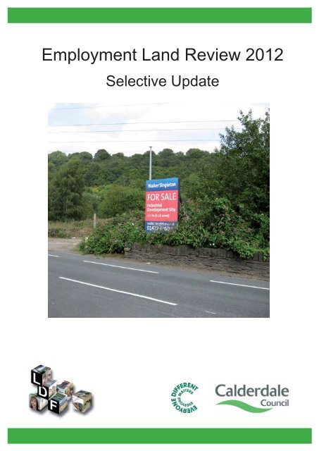
<strong>Employment</strong> <strong>Land</strong> <strong>Review</strong> 2012<br />
Selective Update
1 Introduction<br />
Need to Update<br />
Other Evidence<br />
2 Policy Context<br />
National Policy<br />
Regional Policy<br />
Local Policy<br />
3 The Local Economy<br />
4 The Property Market<br />
East <strong>Calderdale</strong><br />
Halifax<br />
West <strong>Calderdale</strong><br />
5 Audit of <strong>Employment</strong> Sites<br />
Assessment Method<br />
East <strong>Calderdale</strong><br />
Halifax<br />
West <strong>Calderdale</strong><br />
6 <strong>Land</strong> Demand and Supply<br />
7 Conclusions<br />
Appendix<br />
Baseline scenario<br />
Regaining 2007 levels by 2015<br />
Zero Job Growth<br />
Comparison of the scenarios<br />
Calculating Gross <strong>Employment</strong> <strong>Land</strong> Requirements<br />
Comparison of Supply and Demand<br />
A Detailed Assessment Method<br />
Suitability Assessment<br />
Availability Assessment<br />
Contents<br />
5<br />
6<br />
6<br />
7<br />
7<br />
8<br />
9<br />
10<br />
14<br />
14<br />
16<br />
17<br />
19<br />
19<br />
21<br />
30<br />
37<br />
42<br />
43<br />
44<br />
46<br />
46<br />
48<br />
50<br />
53<br />
55<br />
55<br />
56<br />
<strong>Employment</strong> <strong>Land</strong> <strong>Review</strong> 2012 - Selective Update <strong>Calderdale</strong> MBC
<strong>Calderdale</strong> MBC <strong>Employment</strong> <strong>Land</strong> <strong>Review</strong> 2012 - Selective Update<br />
Contents<br />
Viability Assessment 57<br />
Delivery Assessment<br />
B East <strong>Calderdale</strong> Site Assessments<br />
East <strong>Calderdale</strong> - Intensification<br />
East <strong>Calderdale</strong> - Allocations<br />
East <strong>Calderdale</strong> - New Sites<br />
C Halifax Site Assessments<br />
Halifax - Intensification<br />
Halifax - Allocations<br />
Halifax - New Sites<br />
D West <strong>Calderdale</strong> Site Assessments<br />
West <strong>Calderdale</strong> - Intensification<br />
West <strong>Calderdale</strong> - Allocations<br />
West <strong>Calderdale</strong> - New Sites<br />
Map 4.1 The three employment market areas<br />
Map B.1 ELR009 Brow Mills<br />
Map B.2 ELR010 Atlas Mills, Brighouse<br />
Map B.3 ELR011 Hipperholme Works, Halifax Road, Hipperholme<br />
Map B.4 ELR013 Burrwood Way Industrial Estate, Holywell Green<br />
Map B.5 ELR014 Black Brook Way, West Vale<br />
Map B.6 ELR016 Ainleys Industrial Estate, Huddersfield Road, Elland<br />
Map B.7 ELR019 Clough Mills, Halifax Road, Shelf<br />
Map B.8 ELR025 Lowfields Way/ Off Shaw Lane, Elland<br />
Map B.9 ELR101 (EM1) Birds Royd Lane, Brighouse<br />
Map B.10 ELR102 (EM11A) Atlas Works and Ainleys, Elland<br />
Map B.11 ELR103 (EM16) & ELR104 (EM17) Wistons Lane/ Century Road, Elland<br />
Map B.12 ELR107 (EM42) Wakefield Road, Clifton<br />
Map B.13 ELR108 (EM44) Southedge Quarry, Brighouse Road, Hipperholme<br />
Map B.14 ELR109 (EM46) Adjacent Surfachem, Huddersfield Road, Elland<br />
Map B.15 ELR110 (EM47) North of River, Stainland Road<br />
Map B.16 ELR119 (EM60) River Street, Brighouse<br />
Map B.17 ELR121 (EM62) Armytage Road, Brighouse<br />
Map B.18 ELR125 (EM67) Lowfields, Elland<br />
Map B.19 ELR126 (EM68) East of Brighouse Road, Hipperholme<br />
Map B.20 ELR131 (MU4) Sugdens Mill, Mill Royd Street, Brighouse<br />
58<br />
59<br />
60<br />
68<br />
80<br />
90<br />
91<br />
99<br />
111<br />
117<br />
118<br />
127<br />
131<br />
14<br />
60<br />
61<br />
62<br />
63<br />
64<br />
65<br />
66<br />
67<br />
68<br />
69<br />
70<br />
71<br />
72<br />
73<br />
74<br />
75<br />
76<br />
77<br />
78<br />
79
Map B.21 ELR205 <strong>Land</strong> adjacent Lowfields/ Wiston Lane, Elland<br />
Map B.22 ELR209 Rear 9A Birds Royd Lane, Brighouse<br />
Map B.23 ELR210 West of Anchor Place, Brighouse<br />
Map B.24 ELR222 Rear Ainleys Industrial Estate, Elland<br />
Map B.25 ELR223 <strong>Land</strong> at Brighouse Road, Ainley Top<br />
Map B.26 ELR224 Burrwood Way, Holywell Green<br />
Map B.27 ELR225 Blackley Brickworks, Blackley Road, Elland<br />
Map B.28 ELR226 <strong>Land</strong> North of Dewsbury Road, Rastrick<br />
Map B.29 ELR227 <strong>Land</strong> at Dewsbury Road, Old Earth<br />
Map B.30 ELR228 West Vale Works, Stainland Road, West Vale<br />
Map C.1 ELR017 Waterside, Water lane<br />
Map C.2 ELR018 Railway Cutting, Holmfield Industrial Estate<br />
Map C.3 ELR021 Asquith Bottom Mills, Sowerby Bridge<br />
Map C.4 ELR022 Lloyds Data Centre, Copley<br />
Map C.5 ELR023 Lee Bridge Industrial Estate, Halifax<br />
Map C.6 ELR026 Sewage Works, Huddersfield Road, Salterhebble<br />
Map C.7 ELR027Water Lane/ Sedbergh Road, Halifax<br />
Map C.8 ELR028 & ELR029 Bus depots, Skircoat Road/ Shaw Hill, Halifax<br />
Map C.9 ELR113 (EM52) West of Holmfield Industrial Estate<br />
Map C.10 ELR114 (EM53) Shroggs Road, Ovenden<br />
Map C.11 ELR116 (EM56) North of Holmfield Industrial Estate<br />
Map C.12 ELR117 (EM57) Adjacent Lloyds, Wakefield Road, Copley<br />
Map C.13 ELR122 (EM63) Adjacent Foseco, Holmfield Industrial Estate<br />
Map C.14 ELR123 (EM64) Hays Lane, Mixenden<br />
Map C.15 ELR127 (MU1) West of Boothtown Road, Boothtown<br />
Map C.16 ELR128 (MU2) Former Transco site, Mulcture Hall Road<br />
Map C.17 ELR129 (MU3) South Parade, Halifax<br />
Map C.18 ELR132 (MU6) Broad Street, Halifax<br />
Map C.19 ELR133 (MU8) Drakes Industrial Estate, Shay Lane<br />
Map C.20 ELR136 (E20) Wakefield Road, Copley<br />
Map C.21 ELR201 Clarence Mill, Pellon Lane, Halifax<br />
Map C.22 ELR217 Industrial Premises, Adelaide Street, Halifax<br />
Map C.23 ELR218 Haley/ Bankfield Works, Haley Hill, Halifax<br />
Map C.24 ELR219 Coal Drops, Berry Lane, Halifax<br />
Map C.25 ELR230 <strong>Land</strong> at Wakefield Road, Copley<br />
Map C.26 ELR231 Star Garage, Wakefield Road, Copley<br />
Map D.1 ELR001 Calderside Works, Off Burnley Road, Luddendenfoot<br />
Map D.2 ELR002 Station Industrial Park, Station Road, Luddendenfoot<br />
Map D.3 ELR003 Top <strong>Land</strong> Country Park, Cragg Road, Mytholmroyd<br />
Map D.4 ELR004 Dean Hey, Cragg Road, Mytholmroyd<br />
Map D.5 ELR005 Salford Industrial Estate, Todmorden<br />
Map D.6 ELR006 <strong>Land</strong> opposite Salford Industrial Estate, Todmorden<br />
Map D.7 ELR007 Bridge Royd House, Todmorden<br />
Contents<br />
80<br />
81<br />
82<br />
83<br />
84<br />
85<br />
86<br />
87<br />
88<br />
89<br />
91<br />
92<br />
93<br />
94<br />
95<br />
96<br />
97<br />
98<br />
99<br />
100<br />
101<br />
102<br />
103<br />
104<br />
105<br />
106<br />
107<br />
108<br />
109<br />
110<br />
111<br />
112<br />
113<br />
114<br />
115<br />
116<br />
118<br />
119<br />
120<br />
121<br />
122<br />
123<br />
124<br />
<strong>Employment</strong> <strong>Land</strong> <strong>Review</strong> 2012 - Selective Update <strong>Calderdale</strong> MBC
<strong>Calderdale</strong> MBC <strong>Employment</strong> <strong>Land</strong> <strong>Review</strong> 2012 - Selective Update<br />
Contents<br />
Map D.8 ELR008 Callis Mill, Charlestown, Todmorden<br />
Map D.9 ELR024 Tenterfields Business Park, Luddendenfoot<br />
Map D.10 ELR111 (EM50) Halifax Road, Ripponden<br />
Map D.11 ELR112 (EM51) Burnley Road, Luddendenfoot<br />
Map D.12 ELR115 (EM54) Bacup Road, Gauxholme<br />
Map D.13 ELR120 (EM61) Mytholm Works, King Street, Hebden Bridge<br />
125<br />
126<br />
127<br />
128<br />
129<br />
130
1 Introduction<br />
Disclaimer<br />
Introduction<br />
In relation to the information contained within this report (and any other report relating, or<br />
making reference to the findings of the <strong>Calderdale</strong> <strong>Employment</strong> <strong>Land</strong> <strong>Review</strong>) the <strong>Council</strong><br />
makes the the following disclaimer without prejudice:<br />
It should be noted that this selective review is purely a technical background<br />
document and does not allocate sites for development. That is the role of the<br />
new development plan and will require full public consultation at the relevant time.<br />
This document does not give any planning status to land and none of the sites<br />
have any commitment or support from the <strong>Council</strong>. This document also provides<br />
an assessment of some existing employment allocations from the adopted 2006<br />
Replacement <strong>Calderdale</strong> Unitary Development Plan. The assessments of those<br />
sites within this document does not change those allocations.<br />
The inclusion of potential employment sites within this document does not preclude<br />
them from being developed for other uses, likewise the non-inclusion of a site<br />
does not mean it cannot be developed for employment use.<br />
The deliverability categories used (short, medium and long term) are based upon<br />
judgements made on the best information available at the time of the assessment.<br />
Circumstances or assumptions may change meaning sites could either come<br />
forward sooner, later or never at all.<br />
The floorspace and employment capacity of each site is based upon evidence<br />
collected by Roger Tym & Partners (2010).These are only indicative assessments<br />
based upon judgements about the type and density of possible uses on site.<br />
Should the site be developed these are likely to change based upon individual<br />
users requirements.<br />
5<br />
1<br />
<strong>Employment</strong> <strong>Land</strong> <strong>Review</strong> 2012 - Selective Update <strong>Calderdale</strong> MBC
6<br />
1<br />
<strong>Calderdale</strong> MBC <strong>Employment</strong> <strong>Land</strong> <strong>Review</strong> 2012 - Selective Update<br />
Introduction<br />
Introduction<br />
1.1 This document is a selective review of the 2008 <strong>Employment</strong> <strong>Land</strong> <strong>Review</strong>. The aim<br />
of this document is to build upon the information and conclusions contained within<br />
the 2008 <strong>Employment</strong> <strong>Land</strong> <strong>Review</strong> (ELR) by;<br />
Need to Update<br />
Providing an up to date forecast of the future need for employment land within<br />
<strong>Calderdale</strong> until 2031;<br />
Identifying the suitability and deliverability of existing and submitted sites for<br />
employment; and<br />
Providing an up to date evidence base for the Local Development Framework<br />
(LDF) Core Strategy.<br />
1.2 The 2008 ELR provided a good analysis of future employment projections and land<br />
requirements in <strong>Calderdale</strong> until 2026.This ELR did not take account of the recession,<br />
the effects of which need to be taken into account through revised forecasts. The<br />
revised forecasts will have ‘knock-on’ effects for <strong>Calderdale</strong>’s future employment land<br />
requirements, particularly in the short to medium term, which need to be reflected. In<br />
addition a number of other factors such as the change in government, the localism<br />
agenda, the impending abolition of the Regional Spatial Strategy, publication of national<br />
Planning Policy Statement 4: Planning for Sustainable Economic Growth and the draft<br />
National Planning Policy Framework all need to be consideration.<br />
1.3 5 'Audit of <strong>Employment</strong> Sites' builds upon the 2008 ELR site assessments and takes<br />
account of relevant sites submitted as part of the LDF Call for Sites exercise as well<br />
as any new information about existing site allocations.<br />
1.4 6 '<strong>Land</strong> Demand and Supply' provides a number of evidence based scenarios for<br />
calculating the amount of land required for employment purposes (as defined by PPS4)<br />
within <strong>Calderdale</strong> over the plan period. The preferred scenario to be used to plan for<br />
future employment land requirements is an important element of this consultation.<br />
Other Evidence<br />
1.5 This selective review forms part of the wider evidence base for the Local Development<br />
Framework. It links closely with and draws data from other studies, particularly the<br />
<strong>Calderdale</strong> Local Economic Assessment and Strategic Housing <strong>Land</strong> Availability<br />
Assessment.
2 Policy Context<br />
National Policy<br />
Policy Context<br />
2.1 National planning policy for employment uses are currently embodied within Planning<br />
Policy Statement 4: Planning for Sustainable Economic Growth (PPS4).<br />
2.2 To achieve sustainable economic growth, the Government’s objectives are to:<br />
build prosperous communities by improving the economic performance of<br />
cities,towns, regions, sub-regions and local areas, both urban and rural;<br />
reduce the gap in economic growth rates between regions, promoting regeneration<br />
and tackling deprivation;<br />
deliver more sustainable patterns of development, reduce the need to travel,<br />
especially by car and respond to climate change;<br />
promote the vitality and viability of town and other centres as important places<br />
for communities. To do this, the Government wants:<br />
new economic growth and development of main town centre uses to be<br />
focused in existing centres, with the aim of offering a wide range of services<br />
to communities in an attractive and safe environment and remedying<br />
deficiencies in provision in areas with poor access to facilities;<br />
competition between retailers and enhanced consumer choice through the<br />
provision of innovative and efficient shopping, leisure, tourism and local<br />
services in town centres, which allow genuine choice to meet the needs of<br />
the entire community (particularly socially excluded groups);<br />
the historic, archaeological and architectural heritage of centres to be<br />
conserved and, where appropriate, enhanced to provide a sense of place<br />
and a focus for the community and for civic activity;<br />
raise the quality of life and the environment in rural areas by promoting thriving,<br />
inclusive and locally distinctive rural communities whilst continuing to protect the<br />
open countryside for the benefit of all<br />
2.3 PPS4 identifies <strong>Employment</strong> <strong>Land</strong> <strong>Review</strong>s as a key way to positively plan for current<br />
and future business needs.<br />
2.4 More recently (July 2011) the government published a draft National Planning Policy<br />
Framework which provides a strong indication of the Coalition Governments position<br />
on planning for employment uses.The draft NPPF states the government is committed<br />
to securing sustainable economic growth. In particular, there is an urgent need to<br />
restructure the economy, to build on the country’s inherent strengths and to meet the<br />
twin challenges of global competition and a low carbon future.<br />
2.5 The government are keen planning policies recognise and address potential barriers<br />
to investment, including poor environment or any lack of infrastructure, services or<br />
housing. The NPPF retains the emphasis upon town centres, set out within PPS4,<br />
but crucially removes office uses from the sequential test for town centre development.<br />
7<br />
2<br />
<strong>Employment</strong> <strong>Land</strong> <strong>Review</strong> 2012 - Selective Update <strong>Calderdale</strong> MBC
8<br />
2<br />
<strong>Calderdale</strong> MBC <strong>Employment</strong> <strong>Land</strong> <strong>Review</strong> 2012 - Selective Update<br />
Policy Context<br />
2.6 The draft NPPF also states planning policies should avoid the long term protection of<br />
employment land or floorspace, and applications for alternative uses of designated<br />
land or buildings should be treated on their merits having regard to market signals<br />
and the relative need for different land uses.<br />
Regional Policy<br />
2.7 Whilst the Coalition Government have begun the process of abolishing Regional<br />
Spatial Strategies until this process is completed <strong>Calderdale</strong>'s LDF is required to<br />
conform to the 2008 Yorkshire and Humber Plan. The Yorkshire and Humber plan<br />
aims to reverse the long-term trend towards dispersal of both housing and jobs, so<br />
that the main towns and cities of the region are transformed into attractive locations,<br />
where growth and investment are concentrated.<br />
2.8 As part of its core spatial strategy the Plan establishes a hierarchy of urban centres,<br />
comprising:<br />
4 Regional Cities, including Leeds and Bradford;<br />
11 Sub-Regional Cities and Towns, including Halifax;<br />
32 Principal Towns, including Brighouse<br />
The strategy aims to focus the majority of development and investment in the top two tiers<br />
with Principal Towns playing a local role.<br />
2.9 The plan provides potential annual job growth figures for all districts based upon<br />
forecasts from the Regional Econometric Model.This indicated relatively small growth<br />
in <strong>Calderdale</strong> compared to other West Yorkshire districts.<br />
Local Authority<br />
Bradford<br />
<strong>Calderdale</strong><br />
Kirklees<br />
Leeds<br />
Wakefield<br />
West Yorkshire<br />
Table 2.1 Potential Annual Job Growth in West Yorkshire (from 2006)<br />
Change per year (RSS 2008)<br />
4,720<br />
610<br />
1,550<br />
6,030<br />
1,140<br />
14,050<br />
2.10 <strong>Calderdale</strong> is also part of Leeds City Region but also borders Manchester and Central<br />
Lancashire City Regions. This provides quick and easy access to a population in<br />
excess of 5.5million providing significant economic opportunities for <strong>Calderdale</strong>'s<br />
businesses. It is therefore important that the district plays an active role in the<br />
development and implementation of the respective economic aims and strategies of<br />
the City Regions and relevant Local Enterprise Partnerships, particularly Leeds.
Local Policy<br />
Policy Context<br />
2.11 The Replacement <strong>Calderdale</strong> Unitary Development Plan (RCUDP), adopted 2006,<br />
provides the local planning policy context for the district. The RCUDP provided<br />
115.26ha of allocated employment land and a further 39.5ha of mixed-use allocations<br />
where employment may be appropriate.This selective review reconsiders the remaining<br />
undeveloped employment and mixed-use allocations from the RCUDP.<br />
2.12 The RCUDP also provides criteria based policies to safeguard employment land and<br />
buildings from other uses with the aim of retaining employment land for current and<br />
future users.<br />
2.13 The district's Sustainable Community Strategy covers the period 2006-2016 and seeks<br />
to deliver sustainable communities through economic growth by developing a resilient<br />
and competitive economy, increasing economic inclusion and participation and creating<br />
the conditions for sustainable economic growth.<br />
2.14 <strong>Calderdale</strong>'s Economy and Enterprise Strategy covers the period 2010 to 2020. This<br />
strategy adds detail to the aims of the Sustainable Community Strategy and provides<br />
initiatives and challenging targets for improving the overall performance of the districts<br />
economy. The targets include ambitions to achieve 2007 employment levels by 2105,<br />
reducing unemployment and increasing the number and types of businesses within<br />
<strong>Calderdale</strong>.<br />
9<br />
2<br />
<strong>Employment</strong> <strong>Land</strong> <strong>Review</strong> 2012 - Selective Update <strong>Calderdale</strong> MBC
10<br />
3<br />
<strong>Calderdale</strong> MBC <strong>Employment</strong> <strong>Land</strong> <strong>Review</strong> 2012 - Selective Update<br />
The Local Economy<br />
3 The Local Economy<br />
3.1 This sections provides an overview of the local economy. Further information can be<br />
found in the <strong>Employment</strong> <strong>Land</strong> <strong>Review</strong> (2008) and <strong>Calderdale</strong>'s Local Economic<br />
Assessment 2011.<br />
Population<br />
GVA per employee<br />
<strong>Employment</strong> Rate<br />
(16-64)<br />
Unemployment Rate<br />
Claimant Count<br />
Average Weekly<br />
Resident Earnings<br />
Average Weekly Worker<br />
Earnings (FTE)<br />
Skills<br />
Profile by<br />
NVQ<br />
NVQ4+<br />
NVQ3+<br />
NVQ2+<br />
Table 3.1 Key Economic Statistics<br />
<strong>Calderdale</strong><br />
201,600<br />
£41,699<br />
91,100<br />
(69.6%)<br />
8,200<br />
(8.2%)<br />
5992<br />
(4.6%)<br />
£462<br />
£442<br />
34,600<br />
(26.5%)<br />
60,700(46.5%)<br />
83,500(63.9%)<br />
Leeds City<br />
Region<br />
2,947,400<br />
£37,794<br />
1,337,800<br />
(69.4%)<br />
137,600<br />
(8.8%)<br />
79,859<br />
(4.1%)<br />
£467.42<br />
£457.53<br />
531,600<br />
(27.7%)<br />
928,400<br />
(48.4%)<br />
1,223,300<br />
(63.7%)<br />
Yorkshire<br />
and Humber<br />
5,258,100<br />
£36,617<br />
2,339,000<br />
(68.9%)<br />
230,300<br />
(9.0%)<br />
149,606<br />
(4.4%)<br />
£463<br />
£460.2<br />
900,400<br />
(26.6%)<br />
1,591,600<br />
(47.0%)<br />
2,148,900<br />
(63.5%)<br />
UK<br />
61,792,000<br />
£41,941<br />
28,020,000<br />
(70.2%)<br />
2,384,600<br />
(7.8%)<br />
1,505,068<br />
(3.7%)<br />
£498.8<br />
£498.8<br />
11,835,600<br />
(29.8%)<br />
19,599,400<br />
(49.3%)<br />
25,974,600<br />
(65.3%)
NVQ1+<br />
Self <strong>Employment</strong><br />
No<br />
Qualification<br />
<strong>Calderdale</strong><br />
104,000<br />
(79.7%)<br />
16,300<br />
(12.5%)<br />
11,800<br />
(9%)<br />
Leeds City<br />
Region<br />
1,507,900<br />
(78.6%)<br />
246,800<br />
(12.9%)<br />
165,600<br />
(8.6%)<br />
Sources: All from LEA (2011) (Primary sources include Regional Econometric Model and Nomis).<br />
Sub regional context<br />
Yorkshire<br />
and Humber<br />
2,661,800<br />
(78.6%)<br />
433,900<br />
(12.8%)<br />
265,000<br />
(7.8%)<br />
UK<br />
31,308,000<br />
(78.7%)<br />
5,012,400<br />
(12.6%)<br />
3,566,500<br />
(9%)<br />
3.2 An active member of the Leeds City Region <strong>Calderdale</strong> is also adjacent to, and<br />
functionally linked with, Manchester City Region. As such, the <strong>Calderdale</strong> economy<br />
must be considered within both sub-regional contexts, since business activity (clusters<br />
and supply chains), consumer and leisure patterns, and travel to learn and work cross<br />
local authority, and regional boundaries.<br />
3.3 Leeds City Region comprises the five West Yorkshire districts of <strong>Calderdale</strong>, Bradford,<br />
Kirklees, Leeds and Wakefield, as well as Barnsley, York, Selby, Craven and<br />
Harrogate. It has a population of just over 2.9 million, a working age population of<br />
approximately 1.8 million and approximately 100,000 businesses.<br />
3.4 The number of jobs in Leeds City Region expanded by 6% between 2000 and 2008,<br />
to a point where almost 60% of all jobs in Yorkshire and Humber were located in<br />
Leeds City Region. The majority of jobs in Leeds City Region were concentrated in<br />
three sectors: public administration, education and health; distribution, hotels and<br />
restaurants sectors; and banking, finance and insurance, as was the case regionally<br />
and nationally.<br />
3.5 Manchester City Region represents over one fifth of the North's economy and presents<br />
a significant opportunity for <strong>Calderdale</strong> businesses. The financial sector, business<br />
services and life sciences are set to develop, and Manchester Airport is due for<br />
continued investment which will be key to attracting and serving the area's<br />
knowledge-based industries.<br />
The <strong>Calderdale</strong> Business Agenda<br />
The Local Economy<br />
3.6 <strong>Calderdale</strong> has the highest levels of productivity in Leeds City Region with GVA per<br />
employee standing at £41,699. <strong>Calderdale</strong> has also seen the highest increase in<br />
productivity between 2007 and 2010 with a 1.6% increase.<br />
11<br />
3<br />
<strong>Employment</strong> <strong>Land</strong> <strong>Review</strong> 2012 - Selective Update <strong>Calderdale</strong> MBC
12<br />
3<br />
<strong>Calderdale</strong> MBC <strong>Employment</strong> <strong>Land</strong> <strong>Review</strong> 2012 - Selective Update<br />
The Local Economy<br />
3.7 Manufacturing accounted for 19% of employment in 2008, far above the regional<br />
(13%) and national (10%) figures. This figure has changed little since 2005, and whilst<br />
the decline since 1998 of 27.6% has been rapid, it has been slower than the rate of<br />
manufacturing decline regionally and nationally.<br />
3.8 Finance now accounts for 25% of employment in the borough (and 33% of output),<br />
above the national figure and far above the figures for Bradford, Kirklees and Wakefield.<br />
The local economy is closely linked with HBOS, now Lloyds who are the biggest<br />
private sector employer in <strong>Calderdale</strong> with over 6000 jobs.<br />
3.9 The dependence of the local economy on finance and manufacturing raises issues<br />
of vulnerability for the district moving forwards. This is due to the fact both finance<br />
and manufacturing have experienced employment decline in recent years and are<br />
likely to face more.<br />
3.10 Despite this, estimates suggest a continued growth in the financial sector in <strong>Calderdale</strong>,<br />
above the UK and regional rates. It is projected output in the financial sector will grow<br />
22% by 2018, compared to an overall growth of 12% in local economic output, and<br />
from an equal contribution to local economic output in 1998, by 2018 the Finance<br />
sector will contribute double that of manufacturing.<br />
3.11 Creative and Digital Businesses are becoming increasingly important in the <strong>Calderdale</strong><br />
economy, representing 18% of all businesses in the borough and 5% of employment.<br />
Developments in the creative and digital sectors in Manchester City Region also have<br />
enormous significance and potential for <strong>Calderdale</strong> businesses and residents. The<br />
creative industries and digital media sector in Greater Manchester alone includes over<br />
7,000 businesses employing around 53,000 people. The industry in Manchester is<br />
forecast to grow by almost 20% by 2021.The opportunities this offers to neighbouring<br />
authorities could be equally significant.<br />
3.12 Tourism and the unique built environment is particularly important to <strong>Calderdale</strong> due<br />
to its significant rural environment. Over 3 million people visit annually and the tourism<br />
industry is worth approximately £250m, contributing to 4,200 full time equivalent jobs.<br />
The <strong>Calderdale</strong> People Agenda<br />
3.13 <strong>Calderdale</strong> has a current population of 201,600. 2009 estimates show that <strong>Calderdale</strong><br />
has an under-16 population of 40,200. This is 20% of the population and above the<br />
sub-regional (19%), regional (18%) and national figures (19%). The older population<br />
(60+) of 44,300 (2009) represents 22% of the total which is the same as the regional<br />
figure, and similar to the UK rate of 22.4%, but slightly more than the sub regional<br />
figure of 21%.<br />
3.14 In 2008 the working-age group represented 61% of the population. By 2020 this is<br />
projected to have fallen to 56.5% which is a significant decrease which has the potential<br />
to significantly affect businesses ability to access local labour.<br />
3.15 Whilst 69.7% of <strong>Calderdale</strong> residents work in <strong>Calderdale</strong>, nearly 30,000 people<br />
commute out of the district and 26,000 people commute into <strong>Calderdale</strong> from other<br />
districts. Out-commuting is continuing to grow whilst in-commuting remains stable.
Overall, in-commuting is typified by somewhat shorter distances and lower average<br />
earnings, while those commuting out from <strong>Calderdale</strong> are typified by somewhat higher<br />
earners and longer distances. Indeed from 2006 resident earning have consistently<br />
outperformed earnings by workers commuting into the district.<br />
3.16 <strong>Calderdale</strong> has performed better than the Leeds City Region and its immediate<br />
neighbours in Key Stage 2 attainment. 82.01% of <strong>Calderdale</strong> pupils achieved KS2 in<br />
English compared to a Leeds City Region figure of 78.51%. Attainment in KS2 Maths<br />
and Science was also above the Leeds City Region and neighbouring authorities.<br />
3.17 In 2008/09, 72.30% of pupils received 5 A* - C GCSEs in <strong>Calderdale</strong>, behind only<br />
Harrogate (84.7%), Craven (82.7%), Wakefield (75.1%) and York (73%). <strong>Calderdale</strong><br />
outperforms its closest neighbours, including Leeds (67.70%) and Bradford (65.61%),<br />
and is higher than both the Leeds City Region figure (69.15%), and national figure<br />
(69.80%).<br />
The <strong>Calderdale</strong> Place Agenda<br />
The Local Economy<br />
3.18 Whilst <strong>Calderdale</strong>’s environment is a unique selling point which can be used to attract<br />
and retain businesses, residents and visitors alike, this same environment can also<br />
act as a significant constraint to economic growth due to the lack of developable land<br />
available.<br />
3.19 The topography in <strong>Calderdale</strong>, whilst providing distinct natural beauty, limits and<br />
constrains the expansion of the transport network. A recent transport study tested the<br />
strategic highway network against future housing and employment growth and<br />
concluded that most of the <strong>Calderdale</strong> network is close to or at capacity.<br />
3.20 Factories are still the largest B-class land-use in <strong>Calderdale</strong>; however this is starting<br />
to diminish in significance as offices and warehousing increase in significance.<br />
13<br />
3<br />
<strong>Employment</strong> <strong>Land</strong> <strong>Review</strong> 2012 - Selective Update <strong>Calderdale</strong> MBC
14<br />
4<br />
<strong>Calderdale</strong> MBC <strong>Employment</strong> <strong>Land</strong> <strong>Review</strong> 2012 - Selective Update<br />
The Property Market<br />
4 The Property Market<br />
4.1 The <strong>Employment</strong> <strong>Land</strong> <strong>Review</strong> (2008) identified three economic markets areas within<br />
<strong>Calderdale</strong>.This chapter provides a brief update of the Property Market section within<br />
the 2008 ELR.<br />
East <strong>Calderdale</strong><br />
Map 4.1 The three employment market areas<br />
4.2 The East <strong>Calderdale</strong> local area comprises the towns of Brighouse and Elland and<br />
borders Bradford, Cleckheaton and Huddersfield. Brighouse is a medium sized town<br />
closely located to the M62. Elland is a smaller town located south west of Brighouse,<br />
only four miles from Huddersfield, and easily accessed from junction 24 of the M62.<br />
The Office Market<br />
Profile<br />
4.3 East <strong>Calderdale</strong>'s proximity to the M62 provides good accessibility to Leeds,<br />
Manchester and the M1.The topography of the area is typically flatter than other parts<br />
of <strong>Calderdale</strong> allowing for the development of significant purpose built office<br />
accommodation. Lowfields attracts regional occupiers wanting good access to the<br />
road network but not requiring a town or city centre presence. Occupiers typically
include insurance providers and marketing and research companies who want modern<br />
units at lower rents with car parking.<br />
4.4 The majority of the remaining office accommodation in East <strong>Calderdale</strong> is located in<br />
Brighouse town centre and serves the professional market such as accountants,<br />
solicitors and financial services. Occupiers are generally local but regional, national<br />
and international companies are represented.<br />
Demand<br />
4.5 The table below indicates the average take up of office accommodation in East<br />
<strong>Calderdale</strong> over the last 8 years (excluding 2008) has been 1,590 sqm per annum.<br />
This is higher than in the 2008 ELR (1,110 sqm) and is largely due to a few large<br />
transactions such as Wilkin Royd Mills in Brighouse and Riverside House in Elland.<br />
Year<br />
Sqm<br />
Source: Focus<br />
2003<br />
2,016<br />
2004<br />
454<br />
Table 4.1 Office Take Up, East <strong>Calderdale</strong><br />
2005<br />
878<br />
2006<br />
1,125<br />
2007<br />
1,077<br />
The Industrial and Warehouse Market<br />
Profile<br />
2008<br />
Not<br />
available<br />
2009<br />
2,924<br />
2010<br />
3,682<br />
Average<br />
1,737<br />
4.6 East <strong>Calderdale</strong> has the strongest industrial/warehouse market in <strong>Calderdale</strong>. The<br />
area benefits from close proximity to the M62 and the availability of flat land. As an<br />
industrial location it competes with other areas along the motorway corridor such as<br />
Trident Business Park in Huddersfield. There are several international companies<br />
located in the area as well as some large local companies such as Marshalls.<br />
Demand<br />
4.7 The average take up of industrial and warehouse accommodation in East <strong>Calderdale</strong><br />
over the last 8 years (excluding 2003 and 2008) has been 10,986 sqm per annum.<br />
These figures are higher than those in the 2008 ELR.<br />
Year<br />
Sqm<br />
Source: Focus<br />
2003<br />
Not<br />
available<br />
Table 4.2 Industry and Warehousing Take Up, East <strong>Calderdale</strong><br />
2004<br />
19,092<br />
2005<br />
11,740<br />
2006<br />
8,866<br />
2007<br />
3,258<br />
The Property Market<br />
2008<br />
Not<br />
available<br />
2009<br />
12,602<br />
2010<br />
10,355<br />
Average<br />
10,986<br />
15<br />
4<br />
<strong>Employment</strong> <strong>Land</strong> <strong>Review</strong> 2012 - Selective Update <strong>Calderdale</strong> MBC
16<br />
4<br />
<strong>Calderdale</strong> MBC <strong>Employment</strong> <strong>Land</strong> <strong>Review</strong> 2012 - Selective Update<br />
The Property Market<br />
Conclusion<br />
4.8 East <strong>Calderdale</strong> continues to be an attractive location for businesses, competing<br />
successfully in the M62 market for high-value occupiers. There appears to be a good<br />
level of supply and demand within the market. However as noted in the 2008 ELR<br />
there does appear to be a few possible areas of shortage.The first is for large industrial<br />
units where supply is restricted by a lack of large flat sites. There also appears to be<br />
some shortage in smaller units for both industry and office accommodation.<br />
Halifax<br />
4.9 The Halifax area comprises the contiguous urban area of Halifax including Sowerby<br />
Bridge. Halifax, <strong>Calderdale</strong>'s largest settlement, is located approximately 5 miles north<br />
of the M62, accessed either via the A629 or A58. Both of these routes suffer from<br />
congestion at peak times with bottlenecks noted at Salterhebble on the A629 and at<br />
Hipperholme and Stump Cross on the A58.The 2008 ELR indicates these bottlenecks<br />
act as a deterrent to business from locating in Halifax, particularly if motorway access<br />
is important.<br />
4.10 The major employment sectors within the area are the public sector and the banking,<br />
finance and the insurance sector with Lloyds being the major private sector employer.<br />
The Office Market<br />
Profile<br />
4.11 The office stock is characterised by converted mill buildings, such as Dean Clough<br />
which attracts both regional and national occupiers. Holmfield Mills is another<br />
successful conversion providing accommodation for both office and industrial uses.<br />
4.12 Halifax town centre contains a lot of secondary office accommodation due to limited<br />
speculative developments over the recent past. This has resulted in a high proportion<br />
of office accommodation not meeting modern requirements.<br />
Demand<br />
4.13 The average take up of office accommodation in Halifax over the last 8 years (excluding<br />
2008) has been 3,250 sqm per annum. These figures are slightly lower than the<br />
average in the 2008 ELR, 3,297 sqm.<br />
Year<br />
Sqm<br />
Source: Focus<br />
2003<br />
3,984<br />
2004<br />
1,837<br />
2005<br />
377<br />
Table 4.3 Office Take Up, Halifax<br />
2006<br />
6,376<br />
2007<br />
3,909<br />
2008<br />
Not<br />
available<br />
2009<br />
4,016<br />
2010<br />
2,250<br />
Average<br />
3,250
The Industrial and Warehouse Market<br />
Profile<br />
4.14 The industrial/ warehouse market within Halifax is predominantly locally based firms.<br />
It is more suitable for manufacturing than warehousing uses due to its less favourable<br />
location to the motorway.<br />
Demand<br />
4.15 The average take up of industrial accommodation in Halifax over the last 8 years<br />
(excluding 2008) has been approximately 5,600 sqm per annum. These figures are<br />
slightly higher than the average in the 2008 ELR, however much of this is due to a<br />
few large transactions particularly in 2010.<br />
Year<br />
Sqm<br />
Source: Focus<br />
2003<br />
3,474<br />
Conclusion<br />
2004<br />
5,393<br />
Table 4.4 Industry and Warehousing Take Up, Halifax<br />
2005<br />
6,608<br />
2006<br />
6,091<br />
2007<br />
3,741<br />
2008<br />
Not<br />
available<br />
2009<br />
3,190<br />
2010<br />
10,451<br />
Average<br />
5,564<br />
4.16 The 2008 ELR noted Halifax is oversupplied in terms of office accommodation. Much<br />
of this supply is, however, older stock unsuited to modern working practises.<br />
Accommodation such as Dean Clough and Holmfield Mills do provide a good supply<br />
in the short-term. In terms of industrial premises the supply is qualitatively poor and<br />
new speculative development is often not financially viable without public sector<br />
support, partially due to poor accessibility. There is little evidence that the market has<br />
changed since the 2008 ELR. However, any significant redevelopments within the<br />
town centre could provide new modern accommodation. Edge and out of centre sites<br />
such as the new developments at Ladyship Mills, Boothtown and the forthcoming<br />
Copley Valley scheme will undoubtedly assist short-term needs.<br />
West <strong>Calderdale</strong><br />
4.17 West <strong>Calderdale</strong> is remotely located from the motorway network and employment<br />
development is restricted due to the lack of flat land which is not prone to issues of<br />
flood risk. The main settlements are Mytholmroyd, Hebden Bridge and Todmorden.<br />
The Office Market<br />
Profile<br />
The Property Market<br />
4.18 The area is most attractive to the local market due to its remoteness. The majority of<br />
the stock is located in and around Mytholmroyd. The new Ripponden Business Park<br />
of the A58 may be more appealing to a wider market due to its proximity to junction<br />
22 of the M62.<br />
17<br />
4<br />
<strong>Employment</strong> <strong>Land</strong> <strong>Review</strong> 2012 - Selective Update <strong>Calderdale</strong> MBC
18<br />
4<br />
<strong>Calderdale</strong> MBC <strong>Employment</strong> <strong>Land</strong> <strong>Review</strong> 2012 - Selective Update<br />
The Property Market<br />
Demand<br />
4.19 The average take up of industrial and warehouse accommodation in West <strong>Calderdale</strong><br />
over the last 8 years (excluding 2008) has been a relatively small 339 sqm per annum.<br />
These figures are higher than those in the 2008 ELR, mainly due to one sale in 2009.<br />
Year<br />
Sqm<br />
Source: Focus<br />
2003<br />
0<br />
2004<br />
656<br />
Table 4.5 Office Take Up, West <strong>Calderdale</strong><br />
2005<br />
0<br />
2006<br />
562<br />
2007<br />
195<br />
The Industrial and Warehouse Market<br />
Profile<br />
2008<br />
Not<br />
available<br />
2009<br />
810<br />
2010<br />
151<br />
Average<br />
4.20 Industrial accommodation in West <strong>Calderdale</strong> is largely light industrial, manufacturing<br />
or small workshops. The area is not generally suitable for large warehousing and<br />
distribution due to the long distance from the motorway and lack of large flat sites for<br />
such development.<br />
4.21 Many of the mills have been converted to housing as they are often considered<br />
unsuitable to modern working practises.<br />
Demand<br />
4.22 The average take up of industrial and warehouse accommodation in West <strong>Calderdale</strong><br />
over the last 8 years (excluding 2008) has been a relatively small 1,397 sqm per<br />
annum. These figures are higher than those in the 2008 ELR, mainly due to a few<br />
significant sales.<br />
Year<br />
Sqm<br />
Source: Focus<br />
2003<br />
215<br />
Conclusions<br />
Table 4.6 Office Industry and Warehousing, West <strong>Calderdale</strong><br />
2004<br />
1,548<br />
2005<br />
308<br />
2006<br />
2,254<br />
2007<br />
900<br />
2008<br />
Not<br />
available<br />
2009<br />
2,208<br />
2010<br />
2,347<br />
339<br />
Average<br />
1,397<br />
4.23 The market for both offices and industrial accommodation is small compared to the<br />
rest of <strong>Calderdale</strong>.There does appear to be a shortage of industrial space, particularly<br />
smaller units for light industry and workshops. Since 2008 there has not been any<br />
significant development within the area to relieve this shortage.
5 Audit of <strong>Employment</strong> Sites<br />
Assessment Method<br />
Audit of <strong>Employment</strong> Sites<br />
5.1 This chapter provides a qualitative assessment of existing and proposed employment<br />
sites within <strong>Calderdale</strong>. It builds upon the recommendations contained within the 2008<br />
ELR and aims to;<br />
1. Assess new sites submitted for employment or mixed-use as part of the ‘Call for<br />
Sites’ exercise;<br />
2. Assess sites filtered from the 2010 <strong>Review</strong> of the Strategic Housing <strong>Land</strong><br />
Availability Assessment (SHLAA) due to being unsuitable for housing often<br />
because of ‘bad neighbour’ uses such as other employment locations;<br />
3. Re-consider existing RCUDP allocations; and<br />
4. Consider the potential of existing RCUDP Primary <strong>Employment</strong> Areas identified<br />
in the 2008 ELR for intensified employment use.<br />
5. This update DOES NOT re-consider the recommendations for any other existing<br />
RCUDP Primary <strong>Employment</strong> Area as the recommendations to safeguard or<br />
release for other uses, contained within the 2008 ELR are still considered valid.<br />
5.2 When considering potential sites for intensification or allocation it is important that<br />
there is a reasonable prospect of the site being developed within the plan period. To<br />
aid these considerations and provide compatibility with the SHLAA the suitability,<br />
availability and viability of providing employment uses on each site has been<br />
considered.<br />
5.3 The likely timescale of delivery is an important consideration. To provide guidance<br />
upon delivery the following categories have been identified. Allocation to a category<br />
is based upon information gathered through the assessment criteria noted above.<br />
Short-term sites – sites which are likely to be brought forward in the first 6 years<br />
of the plan (2011-2017).<br />
Medium-term sites – sites which are likely to be brought forward in years<br />
2018-2023.<br />
Long-term sites – sites currently bound by constraints, suitability or availability<br />
issues but which could be reasonably expected to be overcome in the long-term<br />
(2024-2031).<br />
Held in Abeyance – sites which currently fail one or more of the assessments<br />
but where a change in circumstance may assist the site to come forward.<br />
Filter - sites which fail one or more of the assessments and where this position<br />
is unlikely to change in the foreseeable future.<br />
5.4 Some sites have already been filtered from this exercise. The reason for filtering sites<br />
at this early stage included;<br />
1. The site has already been developed;<br />
2. The site is not in a sustainable location (not attached to an existing urban area<br />
and distant from public transport); and/or<br />
3. The site is below the threshold of 0.25ha. (1)<br />
1 recommended by the DCLG guidance on <strong>Employment</strong> <strong>Land</strong> <strong>Review</strong>s, 2004<br />
19<br />
5<br />
<strong>Employment</strong> <strong>Land</strong> <strong>Review</strong> 2012 - Selective Update <strong>Calderdale</strong> MBC
20<br />
5<br />
<strong>Calderdale</strong> MBC <strong>Employment</strong> <strong>Land</strong> <strong>Review</strong> 2012 - Selective Update<br />
Audit of <strong>Employment</strong> Sites<br />
5.5 An overall site size of 0.25ha has been chosen as sites below this size would<br />
significantly limit the amount of employment space available. The exceptions to this<br />
are likely to be town centre sites and some small rural diversification sites. However,<br />
in both cases the Core Strategy will seek to promote such opportunities through<br />
relevant policies and in the case of town centres designations.<br />
5.6 To accord with the 2008 ELR the sites have been split between East <strong>Calderdale</strong>,<br />
Halifax and West <strong>Calderdale</strong>. Summaries of the site assessments are supplied for<br />
each area. Potential jobs and floorspaces have been calculated using officer<br />
assumptions about the most appropriate employment use (office or industry and<br />
warehousing) and are based upon the recommendations within the Roger Tym (2010)<br />
report, unless other information was available. Further details can be found in the<br />
appendicies.
East <strong>Calderdale</strong><br />
Table 5.1 Intensification Site Assessments - East <strong>Calderdale</strong><br />
Comment<br />
Potential<br />
Jobs<br />
Deliverability<br />
Potential<br />
floorspace<br />
(sqm)<br />
Developable<br />
area (ha)<br />
Site<br />
size<br />
(ha)<br />
Address<br />
Site<br />
ELR<br />
Reference<br />
Site largely occupied<br />
intensification would<br />
require demolition.<br />
Potential as part of a<br />
wider scheme.<br />
Not<br />
applicable<br />
Held<br />
Not<br />
applicable<br />
Not<br />
applicable<br />
3.86<br />
Brighouse<br />
Road,<br />
Hipperholme<br />
Brow Mills<br />
Industrial<br />
Estate<br />
ELR009<br />
Site appears largely<br />
occupied intensification<br />
would require relocation<br />
and demolition. Unlikely<br />
to be viable in current<br />
market.<br />
Not<br />
applicable<br />
Filtered<br />
Not<br />
applicable<br />
Not<br />
applicable<br />
3.08<br />
Atlas Mill<br />
Road,<br />
Brighouse<br />
Atlas Mills<br />
ELR010<br />
Audit of <strong>Employment</strong> Sites<br />
Site largely occupied<br />
intensification would<br />
require demolition.<br />
Potential as part of a<br />
wider scheme.<br />
Not<br />
applicable<br />
Held<br />
Not<br />
applicable<br />
Not<br />
applicable<br />
3.25<br />
Halifax Road,<br />
Hipperholme<br />
Hipperholme<br />
Works<br />
ELR011<br />
Filtered due to size<br />
threshold<br />
Not<br />
applicable<br />
Filtered<br />
Not<br />
applicable<br />
Not<br />
applicable<br />
0.13<br />
Birds Royd<br />
Lane<br />
Unit at<br />
Heywood's<br />
Industrial<br />
Park<br />
ELR012<br />
21<br />
5<br />
<strong>Employment</strong> <strong>Land</strong> <strong>Review</strong> 2012 - Selective Update <strong>Calderdale</strong> MBC
22<br />
5<br />
<strong>Calderdale</strong> MBC <strong>Employment</strong> <strong>Land</strong> <strong>Review</strong> 2012 - Selective Update<br />
Audit of <strong>Employment</strong> Sites<br />
Comment<br />
Potential<br />
Jobs<br />
Deliverability<br />
Potential<br />
floorspace<br />
(sqm)<br />
Developable<br />
area (ha)<br />
Site<br />
size<br />
(ha)<br />
Address<br />
Site<br />
ELR<br />
Reference<br />
Whilst some empty units<br />
little opportunity for<br />
additional new build.<br />
Not<br />
applicable<br />
Filtered<br />
Not<br />
applicable<br />
Not<br />
applicable<br />
0.94<br />
Rawroyds<br />
Road,<br />
Holywell<br />
Green<br />
Burrwood<br />
Way<br />
Industrial<br />
Estate<br />
ELR013<br />
Site fully occupied - no<br />
opportunity for additional<br />
units.<br />
Not<br />
applicable<br />
Filtered<br />
Not<br />
applicable<br />
Not<br />
applicable<br />
0.52<br />
Stainland<br />
Road, West<br />
Vale<br />
Black Brook<br />
Way<br />
ELR014<br />
Filtered due to size<br />
threshold<br />
Not<br />
applicable<br />
Filtered<br />
Not<br />
applicable<br />
Not<br />
applicable<br />
0.18<br />
Quebec<br />
Street, Elland<br />
Wellington<br />
Mills<br />
ELR015<br />
Site fully occupied by<br />
modern units little<br />
opportunity for expansion<br />
(see allocations section<br />
for other linked sites)<br />
Not<br />
applicable<br />
Filtered<br />
Not<br />
applicable<br />
Not<br />
applicable<br />
3.4<br />
Huddersfield<br />
Road, Elland<br />
Ainleys<br />
Industrial<br />
Estate<br />
ELR016<br />
Planning permission for<br />
918sqm of B1 office on<br />
0.26ha of site.<br />
95<br />
Short term<br />
1,540<br />
0.7<br />
2.13<br />
Halifax Road,<br />
Shelf<br />
Clough Mills<br />
ELR019<br />
Owner intends to bring<br />
forward.<br />
160<br />
Medium term<br />
10,600<br />
3.03<br />
3.03<br />
Off Shaw<br />
Lane, Elland<br />
Lowfields<br />
Way<br />
ELR025
Table 5.2 Allocations Site Assessments - East <strong>Calderdale</strong><br />
Comment<br />
Potential<br />
Jobs<br />
Deliverability<br />
Potential<br />
floorspace<br />
(sqm)<br />
Developable<br />
area for<br />
employment<br />
(ha)<br />
Site<br />
size<br />
(ha)<br />
Town<br />
Site<br />
ELR<br />
Reference<br />
(RCUDP<br />
Ref)<br />
Planning permission in<br />
2007 now lapsed. Flood<br />
risk issues<br />
70<br />
Medium term<br />
4,585<br />
1.31<br />
1.31<br />
Brighouse<br />
Birds Royd<br />
Lane<br />
ELR101<br />
(EM1)<br />
Large flat site on existing<br />
estate. Planning<br />
permission exists on half<br />
site but three time<br />
renewal. Highway access<br />
issues may need to be<br />
addressed.<br />
175<br />
Medium term<br />
11,690<br />
3.34 (2)<br />
6.36<br />
Elland<br />
Atlas Works<br />
and Ainleys<br />
ELR102<br />
(EM11A)<br />
Audit of <strong>Employment</strong> Sites<br />
Planning permission and<br />
agreement between Asda<br />
and Nuswift to develop<br />
site for supermarket and<br />
replace existing factory.<br />
Not<br />
applicable<br />
Filtered<br />
Not<br />
applicable<br />
1.25<br />
1.25<br />
Elland<br />
Wistons<br />
Lane<br />
ELR103<br />
(EM16)<br />
Filtered<br />
Not<br />
applicable<br />
1.67<br />
1.67<br />
Elland<br />
Century<br />
Road<br />
ELR104<br />
(EM17)<br />
Access issues, motorway<br />
junction and slight<br />
gradient. But good site for<br />
inward investment.<br />
5,580<br />
Medium term<br />
89,250<br />
25.5<br />
25.5<br />
Clifton<br />
Wakefield<br />
Road<br />
ELR107<br />
(EM42)<br />
Former quarry, now<br />
in-filled. Improvements to<br />
720<br />
Medium term<br />
11,550<br />
3.3<br />
13.09<br />
Hipperholme<br />
Southedge<br />
Quarry,<br />
ELR108<br />
(EM44)<br />
2 part removed due to valid planning permission to avoid double counting<br />
23<br />
5<br />
<strong>Employment</strong> <strong>Land</strong> <strong>Review</strong> 2012 - Selective Update <strong>Calderdale</strong> MBC
24<br />
5<br />
<strong>Calderdale</strong> MBC <strong>Employment</strong> <strong>Land</strong> <strong>Review</strong> 2012 - Selective Update<br />
Audit of <strong>Employment</strong> Sites<br />
Comment<br />
Potential<br />
Jobs<br />
Deliverability<br />
Potential<br />
floorspace<br />
(sqm)<br />
Developable<br />
area for<br />
employment<br />
(ha)<br />
Site<br />
size<br />
(ha)<br />
Town<br />
Site<br />
ELR<br />
Reference<br />
(RCUDP<br />
Ref)<br />
Hipperholme junction<br />
required creating viability<br />
issues unless mixed-use.<br />
Brighouse<br />
Road<br />
Planning permission for<br />
housing on this site.<br />
Not<br />
applicable<br />
Filtered<br />
Not<br />
applicable<br />
0<br />
3.73<br />
Elland<br />
Adj<br />
Surfachem,<br />
Huddersfield<br />
Road<br />
ELR109<br />
(EM46)<br />
0 Not Medium term Not Currently being actively<br />
applicable<br />
applicable marketed and valid<br />
(3)<br />
North of Elland 2.5<br />
River,<br />
Stainland<br />
planning permission.<br />
Road Flood issues and shape<br />
may create issues with<br />
viability.<br />
ELR110<br />
(EM47)<br />
Owned by Firth Steel for<br />
possible expansion.<br />
Attractive to open market<br />
but flood issues could<br />
effect viability.<br />
90<br />
Medium term<br />
5,915<br />
1.69<br />
1.69<br />
Brighouse<br />
River Street<br />
ELR119<br />
(EM60)<br />
Currently occupied for car<br />
storage by BCA.<br />
40<br />
Medium term<br />
2,555<br />
0.73<br />
0.73<br />
Brighouse<br />
Armytage<br />
Road<br />
ELR121<br />
(EM62)<br />
Part of site developed.<br />
Flood risk is an issue but<br />
180<br />
Short term<br />
11,900<br />
3.4<br />
5.07<br />
Elland<br />
Lowfields<br />
ELR125<br />
(EM67)<br />
3 removed due to valid planning permission to avoid double counting
Comment<br />
Potential<br />
Jobs<br />
Deliverability<br />
Potential<br />
floorspace<br />
(sqm)<br />
Developable<br />
area for<br />
employment<br />
(ha)<br />
Site<br />
size<br />
(ha)<br />
Town<br />
Site<br />
ELR<br />
Reference<br />
(RCUDP<br />
Ref)<br />
on a popular modern<br />
estate.<br />
Improvements to<br />
Hipperholme junction<br />
required. Interest<br />
expressed for housing on<br />
part but rest required for<br />
potential expansion.<br />
150<br />
Long term<br />
10,150<br />
2.9<br />
7.43<br />
Hipperholme<br />
East of<br />
Brighouse<br />
Road<br />
ELR126<br />
(EM68)<br />
Audit of <strong>Employment</strong> Sites<br />
Town centre site<br />
possibility for some<br />
employment uses but<br />
unlikely to be main focus.<br />
190<br />
Medium term<br />
3,000<br />
0.5 (nominal<br />
figure)<br />
3.28<br />
Brighouse<br />
Sugdens<br />
Mill, Mill<br />
Royd Street<br />
ELR130<br />
(MU4)<br />
Development of industrial<br />
units commenced 2011.<br />
Not<br />
applicable<br />
Filtered<br />
Not<br />
applicable<br />
0<br />
4.71<br />
Elland<br />
Dewsbury<br />
Road<br />
ELR131<br />
(MU5)<br />
Table 5.3 New Site Assessments - East <strong>Calderdale</strong><br />
Comment<br />
Potential<br />
Jobs<br />
Deliverability<br />
Potential<br />
floorspace<br />
(sqm)<br />
Developable<br />
area (ha)<br />
Site<br />
size<br />
(ha)<br />
Address<br />
Site<br />
ELR<br />
Reference<br />
Filtered due to size<br />
threshold<br />
Not<br />
applicable<br />
Filtered<br />
Not<br />
applicable<br />
N/A<br />
0.18<br />
Gas Works<br />
Lane, Elland<br />
Riverside<br />
Works<br />
ELR204<br />
Floodrisk issues, small<br />
size and triangular shape<br />
Not<br />
applicable<br />
Held<br />
Not<br />
applicable<br />
0.93<br />
0.93<br />
Wiston Lane,<br />
Elland<br />
<strong>Land</strong> Adj<br />
Lowfields<br />
ELR205<br />
25<br />
5<br />
<strong>Employment</strong> <strong>Land</strong> <strong>Review</strong> 2012 - Selective Update <strong>Calderdale</strong> MBC
26<br />
5<br />
<strong>Calderdale</strong> MBC <strong>Employment</strong> <strong>Land</strong> <strong>Review</strong> 2012 - Selective Update<br />
Audit of <strong>Employment</strong> Sites<br />
Comment<br />
Potential<br />
Jobs<br />
Deliverability<br />
Potential<br />
floorspace<br />
(sqm)<br />
Developable<br />
area (ha)<br />
Site<br />
size<br />
(ha)<br />
Address<br />
Site<br />
ELR<br />
Reference<br />
will limit viability. Held as<br />
may have potential in<br />
future.<br />
Filtered due to size<br />
threshold<br />
Not<br />
applicable<br />
Filtered<br />
Not<br />
applicable<br />
0.01<br />
0.01<br />
Bank Street,<br />
Brighouse<br />
<strong>Land</strong> to<br />
side of car<br />
park<br />
ELR206<br />
Filtered due to size<br />
threshold<br />
Not<br />
applicable<br />
Filtered<br />
Not<br />
applicable<br />
0.13<br />
0.13<br />
Mill Lane,<br />
Brighouse<br />
Opposite<br />
Wilkin<br />
Royd Mills<br />
ELR207<br />
Filtered due to size<br />
threshold<br />
Not<br />
applicable<br />
Filtered<br />
Not<br />
applicable<br />
0.17<br />
0.17<br />
Bradford<br />
Road,<br />
Brighouse<br />
Opposite<br />
333-339<br />
ELR208<br />
Difficult to access and<br />
sloping, site shape and<br />
flood risk likely to make<br />
unviable.<br />
Not<br />
applicable<br />
Held<br />
Not<br />
applicable<br />
0.35<br />
0.35<br />
Birds Royd<br />
Lane<br />
Rear 9A<br />
ELR209<br />
Difficult site access and<br />
flood risk likely to make<br />
unviable.<br />
Not<br />
applicable<br />
Held<br />
Not<br />
applicable<br />
0.61<br />
0.61<br />
Anchor Place,<br />
Brighouse<br />
West of<br />
ELR210<br />
Filtered due to size<br />
threshold<br />
Not<br />
applicable<br />
Filtered<br />
Not<br />
applicable<br />
0.11<br />
0.11<br />
Rastrick<br />
Common,<br />
Brighouse<br />
Adj 25<br />
ELR212
Comment<br />
Potential<br />
Jobs<br />
Deliverability<br />
Potential<br />
floorspace<br />
(sqm)<br />
Developable<br />
area (ha)<br />
Site<br />
size<br />
(ha)<br />
Address<br />
Site<br />
ELR<br />
Reference<br />
Small site difficult to<br />
access. Levelling and<br />
access would make<br />
unviable.<br />
Not<br />
applicable<br />
Filtered<br />
Not<br />
applicable<br />
0.33<br />
0.33<br />
Ainleys<br />
Industrial<br />
Estate, Elland<br />
Rear<br />
Ainleys<br />
Industrial<br />
Estate<br />
ELR222<br />
Submitted as part of a<br />
wider project including<br />
sites in Kirklees. Unlikely<br />
to be viable on its own.<br />
290<br />
Medium term<br />
4,950<br />
3.2<br />
6.98<br />
Brighouse<br />
Road, Ainley<br />
Top<br />
<strong>Land</strong> at<br />
ELR223<br />
Submitted as a mixed-use<br />
site with residential. Some<br />
units on Burrwood way<br />
currently vacant therefore<br />
currently unlikely to be<br />
viable.<br />
50<br />
Medium term<br />
3,500<br />
1<br />
2.04<br />
Holywell<br />
Green<br />
Burrwood<br />
Way<br />
ELR224<br />
Audit of <strong>Employment</strong> Sites<br />
Submitted for a mixed use<br />
scheme 50% office uses.<br />
Site is disconnected from<br />
Elland but constitutes a<br />
derelict site with good<br />
motorway access.<br />
590<br />
Long term<br />
9,450<br />
2.7<br />
5.4<br />
Blackley<br />
Road, Elland<br />
Blackley<br />
Brickworks<br />
ELR225<br />
Submitted for mixed-use.<br />
Indicative masterplan<br />
indicates 5.6ha. Some<br />
465 (4)<br />
Medium term<br />
12,000<br />
5.6<br />
27.25<br />
Dewsbury<br />
Road, Rastrick<br />
<strong>Land</strong> to<br />
North of<br />
ELR226<br />
4 basedupon an equal split between office and industry<br />
27<br />
5<br />
<strong>Employment</strong> <strong>Land</strong> <strong>Review</strong> 2012 - Selective Update <strong>Calderdale</strong> MBC
28<br />
5<br />
<strong>Calderdale</strong> MBC <strong>Employment</strong> <strong>Land</strong> <strong>Review</strong> 2012 - Selective Update<br />
Audit of <strong>Employment</strong> Sites<br />
Comment<br />
Potential<br />
Jobs<br />
Deliverability<br />
Potential<br />
floorspace<br />
(sqm)<br />
Developable<br />
area (ha)<br />
Site<br />
size<br />
(ha)<br />
Address<br />
Site<br />
ELR<br />
Reference<br />
ground conditions may<br />
need to be overcome.<br />
Site access and slope<br />
would make difficult to<br />
develop for B uses.<br />
Not<br />
applicable<br />
Filtered<br />
Not<br />
applicable<br />
3<br />
3<br />
Dewsbury<br />
Road, Old<br />
Earth<br />
<strong>Land</strong> at<br />
ELR227<br />
Existing mill currently<br />
occupied. Owner<br />
suggesting retail. Unlikely<br />
viable to demolish for new<br />
industrial.<br />
Not<br />
applicable<br />
Filtered<br />
Not<br />
applicable<br />
0<br />
0.8<br />
Stainalnd<br />
Road, West<br />
Vale<br />
West Vale<br />
Works<br />
ELR228
<strong>Land</strong> Availability<br />
5.7 The assessment of sites within East <strong>Calderdale</strong> indicates approximately 61ha of<br />
potentially available employment land (B1, B2 and B8 uses) which could be viable<br />
within the plan period. Using the methodology developed by Roger Tym Associates<br />
this could equate to approximately 190,000 sqm of new employment floorspace over<br />
the plan period. Many of the sites originally identified as having intensification potential<br />
were discounted because whilst the building or site was being under-utilised there<br />
was little or no opportunity to create more employment floorspace on the site other<br />
than through demolition and rebuild which is unlikely to be viable at present.<br />
5.8 The above figures do not include speculative town centre developments for office<br />
uses in Brighouse and Elland which may become viable as the economy recovers.<br />
Such sites could provide a valuable source of office accommodation for the local<br />
market.<br />
5.9 It is important to note that many of these sites may require changes to existing<br />
allocations within the RCUDP which will require formal consultation.<br />
Key Findings<br />
Audit of <strong>Employment</strong> Sites<br />
Number of sites: Potential for 15 sites to be developed, 2 intensification of an existing<br />
site, 9 existing RCUDP allocations and 4 new sites<br />
Approx area: The potential combined site areas is in excess of 61ha<br />
Approx floor space: There is over 190,000 sqm of new floorspace potentially available<br />
(excluding planning permissions). This may be higher if new town centre developments<br />
become viable.<br />
Potential jobs: Up to 8,850 new jobs could be created in office, industry and warehousing<br />
occupations in the area.<br />
29<br />
5<br />
<strong>Employment</strong> <strong>Land</strong> <strong>Review</strong> 2012 - Selective Update <strong>Calderdale</strong> MBC
30<br />
5<br />
<strong>Calderdale</strong> MBC <strong>Employment</strong> <strong>Land</strong> <strong>Review</strong> 2012 - Selective Update<br />
Audit of <strong>Employment</strong> Sites<br />
Halifax<br />
Table 5.4 Intensification Site Assessments - Halifax<br />
Comment<br />
Potential<br />
jobs<br />
(FTEs)<br />
Deliverability<br />
Potential<br />
floorspace<br />
(sqm)<br />
Developable<br />
area (ha)<br />
Site<br />
size<br />
(ha)<br />
Address<br />
Site<br />
ELR<br />
Reference<br />
Site fully occupied<br />
Not<br />
applicable<br />
Filtered<br />
Not<br />
applicable<br />
0<br />
0.34<br />
Water Lane<br />
Waterside<br />
ELR017<br />
Planning application<br />
approved. Removed to<br />
avoid double counting.<br />
Not<br />
applicable<br />
Short term<br />
Not<br />
applicable<br />
0<br />
5.2<br />
Holmfield<br />
Industrial<br />
Estate<br />
Railway<br />
Cutting<br />
ELR018<br />
Filtered due to size<br />
threshold<br />
Not<br />
applicable<br />
Filtered<br />
Not<br />
applicable<br />
0.01<br />
0.01<br />
43 Crown<br />
Street<br />
Above 43<br />
Crown<br />
Street<br />
ELR020<br />
Site fully occupied<br />
Not<br />
applicable<br />
Filtered<br />
Not<br />
applicable<br />
0<br />
0.34<br />
Asquith<br />
Bottom,<br />
Sowerby<br />
Bridge<br />
Asquith<br />
Bottom Mills<br />
ELR021<br />
Site fully occupied<br />
Not<br />
applicable<br />
Filtered<br />
Not<br />
applicable<br />
0<br />
0.32<br />
Wakefield<br />
Road<br />
Lloyds<br />
Copley<br />
ELR022<br />
Site fully occupied<br />
Not<br />
applicable<br />
Filtered<br />
Not<br />
applicable<br />
0<br />
2.02<br />
Lee Bridge<br />
Lee Bridge<br />
Industrial<br />
Estate<br />
ELR023<br />
Flood alleviation,<br />
contamination and<br />
clearance may create<br />
viability issues.<br />
150<br />
Medium term<br />
9,975<br />
2.85<br />
2.85<br />
Salterhebble<br />
Sewage<br />
Works<br />
ELR026
Comment<br />
Potential<br />
jobs<br />
(FTEs)<br />
Deliverability<br />
Potential<br />
floorspace<br />
(sqm)<br />
Developable<br />
area (ha)<br />
Site<br />
size<br />
(ha)<br />
Address<br />
Site<br />
ELR<br />
Reference<br />
Contamination, access<br />
and flood alleviation<br />
likely to create viability<br />
issues at least in short<br />
term.<br />
160<br />
Medium term<br />
10,465<br />
2.99<br />
2.99<br />
Sedbergh<br />
Road<br />
Water Lane<br />
ELR027<br />
Garages currently<br />
occupied by First Bus<br />
Company if they were to<br />
move would provide a<br />
good gateway site for<br />
office/ leisure uses but<br />
will require<br />
redevelopment.<br />
630<br />
Long term<br />
10,080<br />
2.88<br />
2.88<br />
Skircoat<br />
Road/ Shaw<br />
Hill<br />
Bus depots<br />
ELR028 &<br />
ELR029<br />
Audit of <strong>Employment</strong> Sites<br />
Table 5.5 Allocations Site Assessments - Halifax<br />
Comment<br />
Potential<br />
Jobs<br />
(FTEs)<br />
Deliverability<br />
Potential<br />
floorspace<br />
(sqm)<br />
Developable<br />
area for<br />
employment<br />
(ha)<br />
Site<br />
size<br />
(ha)<br />
Town<br />
Site<br />
ELR<br />
Reference<br />
(RCUDP<br />
Ref)<br />
Access if not for Siddal<br />
Group expansion would be<br />
problematic.<br />
320<br />
Long term<br />
21,350<br />
6.1<br />
6.1<br />
Halifax<br />
West of<br />
Holmfield<br />
Industrial Estate<br />
ELR113<br />
(EM52)<br />
Former tip may create<br />
viability issues.<br />
210<br />
Medium term<br />
14,000<br />
4 (limited due<br />
to trees/<br />
6.62<br />
Halifax<br />
Shroggs Road,<br />
Ovenden<br />
ELR114<br />
(EM53)<br />
31<br />
5<br />
<strong>Employment</strong> <strong>Land</strong> <strong>Review</strong> 2012 - Selective Update <strong>Calderdale</strong> MBC
32<br />
5<br />
<strong>Calderdale</strong> MBC <strong>Employment</strong> <strong>Land</strong> <strong>Review</strong> 2012 - Selective Update<br />
Audit of <strong>Employment</strong> Sites<br />
Comment<br />
Potential<br />
Jobs<br />
(FTEs)<br />
Deliverability<br />
Potential<br />
floorspace<br />
(sqm)<br />
Developable<br />
area for<br />
employment<br />
(ha)<br />
Site<br />
size<br />
(ha)<br />
Town<br />
Site<br />
ELR<br />
Reference<br />
(RCUDP<br />
Ref)<br />
tipping<br />
issues)<br />
Access is a considerable<br />
issue unless comes forward<br />
with ELR113 unlikely to be<br />
viable.<br />
355<br />
Long term<br />
23,800<br />
6.8<br />
6.8<br />
Halifax<br />
North of<br />
Holmfield<br />
Industrial Estate<br />
ELR116<br />
(EM56)<br />
Expansion land for Lloyds<br />
unlikely to become available<br />
unless Lloyds expand.<br />
880<br />
Long term<br />
14,070<br />
4.02<br />
4.02<br />
Copley<br />
Adj. Lloyds,<br />
Wakefield Rd<br />
ELR117<br />
(EM57)<br />
Likely to be attractive to<br />
local market in medium<br />
term. Was held by Foseco<br />
for expansion however<br />
Foseco now vacant.<br />
90<br />
Medium term<br />
6,055<br />
1.73<br />
1.73<br />
Halifax<br />
Adj Foseco,<br />
Holmfield<br />
Industrial Estate<br />
ELR122<br />
(EM63)<br />
Poor access in a remote<br />
location only usable if<br />
Swinton Insurance want to<br />
expand.<br />
Not<br />
applicable<br />
Held<br />
Not<br />
applicable<br />
0.57<br />
0.57<br />
Halifax<br />
Hays Lane,<br />
Mixenden<br />
ELR123<br />
(EM64)<br />
Site built out.<br />
Not<br />
applicable<br />
Filtered<br />
Not<br />
applicable<br />
0<br />
0.61<br />
Halifax<br />
Shay Lane,<br />
Illingworth<br />
ELR124<br />
(EM65)<br />
Mixed-use site with existing<br />
range of employment firms.<br />
Possibility of a limited<br />
110<br />
Long term<br />
1,750<br />
0.5 (nominal<br />
figure)<br />
15.35<br />
Halifax<br />
West of<br />
Boothtown<br />
ELR127<br />
(MU1)
Comment<br />
Potential<br />
Jobs<br />
(FTEs)<br />
Deliverability<br />
Potential<br />
floorspace<br />
(sqm)<br />
Developable<br />
area for<br />
employment<br />
(ha)<br />
Site<br />
size<br />
(ha)<br />
Town<br />
Site<br />
ELR<br />
Reference<br />
(RCUDP<br />
Ref)<br />
amount of B1 use on<br />
remainder of site but likely<br />
to be residential led.<br />
Road,<br />
Boothtown<br />
Flood risk and potential<br />
contamination will have a<br />
major implication upon<br />
viability. Would need to be<br />
predominantly retail/<br />
residential led scheme. Only<br />
minimal amounts of B uses<br />
expected.<br />
190<br />
Long term<br />
3,000<br />
0.5 (nominal<br />
figure)<br />
3.76<br />
Halifax<br />
Former Transco<br />
site, Mulcture<br />
Hall Road<br />
ELR128<br />
(MU2)<br />
Audit of <strong>Employment</strong> Sites<br />
Mixture of users on site<br />
including industrial and B1.<br />
Vacant sites likely to be<br />
attractive to range of uses.<br />
375<br />
Long term<br />
6,000<br />
1<br />
2.92<br />
Halifax<br />
Former Horses<br />
at Work, South<br />
Parade<br />
ELR129<br />
(MU3)<br />
Site under construction - no<br />
B uses.<br />
Not<br />
applicable<br />
Filtered<br />
Not<br />
applicable<br />
0<br />
1.96<br />
Halifax<br />
Broad Street<br />
ELR132<br />
(MU6)<br />
Drakes Halifax 3.65 2.3<br />
Not Held<br />
Not Partially developed for<br />
Industrial<br />
applicable<br />
applicable distribution warehouse. <strong>Land</strong><br />
Estate, Shay<br />
owner wanting residential on<br />
Lane other part of site. Unlikely<br />
will be available for B uses.<br />
ELR133<br />
(MU8)<br />
33<br />
5<br />
<strong>Employment</strong> <strong>Land</strong> <strong>Review</strong> 2012 - Selective Update <strong>Calderdale</strong> MBC
34<br />
5<br />
<strong>Calderdale</strong> MBC <strong>Employment</strong> <strong>Land</strong> <strong>Review</strong> 2012 - Selective Update<br />
Audit of <strong>Employment</strong> Sites<br />
Comment<br />
Potential<br />
Jobs<br />
(FTEs)<br />
Deliverability<br />
Potential<br />
floorspace<br />
(sqm)<br />
Developable<br />
area for<br />
employment<br />
(ha)<br />
Site<br />
size<br />
(ha)<br />
Town<br />
Site<br />
ELR<br />
Reference<br />
(RCUDP<br />
Ref)<br />
Location means B uses<br />
unlikely<br />
Not<br />
applicable<br />
Filtered<br />
Not<br />
applicable<br />
0<br />
0.4<br />
Halifax<br />
Parade of<br />
Shops,<br />
Mixenden Road<br />
ELR134<br />
(MU9)<br />
Location means B uses<br />
unlikely<br />
Not<br />
applicable<br />
Filtered<br />
Not<br />
applicable<br />
0<br />
3.47<br />
Halifax<br />
Furness Avenue<br />
ELR135<br />
(MU10)<br />
Development commenced -<br />
application approval post<br />
April 2011.<br />
580<br />
Short-term<br />
16,873<br />
-<br />
-<br />
Copley<br />
Wakefield Road<br />
ELR136<br />
(E20)<br />
Table 5.6 New Site Assessments - Halifax<br />
Comment<br />
Potential<br />
Jobs<br />
(FTEs)<br />
Deliverability<br />
Potential<br />
floorspace<br />
(sqm)<br />
Developable<br />
area (ha)<br />
Site<br />
size<br />
(ha)<br />
Address<br />
Site<br />
ELR<br />
Reference<br />
Re-development<br />
potential but costs may<br />
inhibit viability<br />
110<br />
Medium term<br />
1,750<br />
0.5<br />
0.5<br />
Pellon Lane,<br />
Halifax<br />
Clarence Mill<br />
ELR201<br />
Filtered due to size<br />
threshold<br />
Not<br />
applicable<br />
Filtered<br />
Not<br />
applicable<br />
0.15<br />
0.15<br />
New Bond<br />
Street, Halifax<br />
East side<br />
ELR202<br />
Filtered due to size<br />
threshold<br />
Not<br />
applicable<br />
Filtered<br />
Not<br />
applicable<br />
0.14<br />
0.14<br />
Bowling Dyke,<br />
Halifax<br />
<strong>Land</strong> under<br />
Bridge<br />
ELR203<br />
Part of site ELR018<br />
Not<br />
applicable<br />
Filtered<br />
Not<br />
applicable<br />
0.32<br />
0.32<br />
Halifax<br />
<strong>Land</strong> Adj.<br />
Brow Lane<br />
ELR211
Comment<br />
Potential<br />
Jobs<br />
(FTEs)<br />
Deliverability<br />
Potential<br />
floorspace<br />
(sqm)<br />
Developable<br />
area (ha)<br />
Site<br />
size<br />
(ha)<br />
Address<br />
Site<br />
ELR<br />
Reference<br />
Filtered due to size<br />
threshold<br />
Not<br />
applicable<br />
Filtered<br />
Not<br />
applicable<br />
0.14<br />
0.14<br />
Dean Clough,<br />
Halifax<br />
<strong>Land</strong> at<br />
Jemmy Lane<br />
ELR216<br />
<strong>Land</strong> to side available.<br />
Possibly attractive to<br />
local market but<br />
contamination may<br />
impact on viability<br />
10<br />
Medium term<br />
490<br />
0.14<br />
0.29<br />
Adelaide<br />
Street, Halifax<br />
Industrial<br />
premises<br />
east of<br />
ELR217<br />
Currently large mill area<br />
largely occupied.<br />
Not<br />
applicable<br />
Filtered<br />
Not<br />
applicable<br />
0<br />
1.49<br />
Haley Hill,<br />
Halifax<br />
Haley<br />
Works/<br />
Bankfield<br />
Works<br />
ELR218<br />
Audit of <strong>Employment</strong> Sites<br />
Important area of public<br />
open space. Small<br />
restricted site.<br />
Not<br />
applicable<br />
Filtered<br />
Not<br />
applicable<br />
0.28<br />
0.28<br />
Berry Lane,<br />
Halifax<br />
Coal Drops<br />
ELR219<br />
Planning application<br />
09/01681 filtered to<br />
avoid double counting<br />
Not<br />
applicable<br />
Filtered<br />
Not<br />
applicable<br />
0.45<br />
0.45<br />
Hopwood<br />
Lane, Halifax<br />
<strong>Land</strong> at<br />
ELR221<br />
Slope may create<br />
viability issues. Owner<br />
indicates market<br />
interest in site.<br />
110<br />
Medium term<br />
7,500<br />
2.66<br />
2.66<br />
Wakefield<br />
Road, Copley<br />
<strong>Land</strong> at<br />
ELR230<br />
Flat site adjacent other<br />
commercial uses.<br />
25<br />
Short term<br />
1,680<br />
0.48<br />
0.48<br />
Wakefield<br />
Road, Copley<br />
Star Garage<br />
ELR231<br />
35<br />
5<br />
<strong>Employment</strong> <strong>Land</strong> <strong>Review</strong> 2012 - Selective Update <strong>Calderdale</strong> MBC
36<br />
5<br />
<strong>Calderdale</strong> MBC <strong>Employment</strong> <strong>Land</strong> <strong>Review</strong> 2012 - Selective Update<br />
Audit of <strong>Employment</strong> Sites<br />
<strong>Land</strong> Availability<br />
5.10 In common with East <strong>Calderdale</strong> the majority of the sites identified as having<br />
intensification potential have been discounted. In most cases the building or site was<br />
being under-utilised but there was little or no opportunity to create more employment<br />
floorspace on the site other than through demolition and rebuild which is unlikely to<br />
be viable at present.<br />
5.11 The assessment of sites within Halifax indicates that there is approximately 51ha of<br />
employment land available for B1, B2 and B8 uses which is likely to be viable within<br />
the plan period. Using the methodology developed by Roger Tym Associates and<br />
information available from planning applications this could equate to approximately<br />
150,000 sqm of new employment floorspace over the plan period.<br />
5.12 The above figures do not reflect potential long-term developments within Halifax or<br />
Sowerby Bridge town centres. The ambitious proposals set out within Halifax: Streets<br />
Ahead and Halifax Masterplan as well as further development potential at Dean Clough<br />
could provide a significant office resource for both local and regional occupiers.<br />
Likewise the Holmes Road area of Sowerby Bridge was indicated within the RCUDP<br />
as having potential for new development which could provide valuable office space<br />
for the local market. Due to uncertainties of scale and opportunity this potential has<br />
not been reflected within this study.<br />
5.13 It is important to note that many of these sites may requires changes to existing<br />
allocations within the RCUDP which will require formal consultation.<br />
Key Findings<br />
Number of sites: Potential for 16 sites to be developed, 3 intensification of an existing<br />
site, 9 existing RCUDP allocations and 4 new sites<br />
Approx area: The approximate site area for development could be over 51ha<br />
Approx floor space: There is approximately 150,000 sqm of new floorspace potentially<br />
available (excluding planning permissions). This may be higher if new town centre<br />
developments become viable.<br />
Potential jobs: There could potentially be over 4300 new jobs in office, industry and<br />
warehousing occupations created in the area.
West <strong>Calderdale</strong><br />
Table 5.7 Intensification Site Assessments - West <strong>Calderdale</strong><br />
Comment<br />
Potential<br />
Jobs<br />
(FTEs)<br />
Deliverability<br />
Potential<br />
floorspace<br />
(sqm)<br />
Developable<br />
area (ha)<br />
Site<br />
size<br />
(ha)<br />
Address<br />
Site<br />
ELR<br />
Reference<br />
Opportunities for limited<br />
intensification of uses but<br />
restricted by existing<br />
users and poor access.<br />
50<br />
Long term<br />
3,500<br />
1<br />
3.17<br />
Off Burnley<br />
Road,<br />
Luddendenfoot<br />
Calderside<br />
Works<br />
ELR001<br />
Deliverability dependent<br />
upon availability of site<br />
given existing users.<br />
Minor flood risk issues.<br />
Only really suitable for<br />
local market.<br />
65<br />
Medium term<br />
4,200<br />
1.2<br />
2.16<br />
Station Road,<br />
Luddendenfoot<br />
Station<br />
Industrial<br />
Park<br />
ELR002<br />
Audit of <strong>Employment</strong> Sites<br />
Existing good quality site<br />
but remotely located.<br />
Expansion would have<br />
impacts upon countryside<br />
in this out of centre<br />
location.<br />
Not<br />
applicable<br />
Filtered<br />
Not<br />
applicable<br />
0<br />
1.74<br />
Cragg Road,<br />
Mytholmroyd<br />
Top <strong>Land</strong><br />
Country<br />
Park<br />
ELR003<br />
Existing good quality site<br />
but remotely located.<br />
Expansion would have<br />
impacts upon countryside<br />
in this out of centre<br />
location.<br />
Not<br />
applicable<br />
Filtered<br />
Not<br />
applicable<br />
0<br />
5.12<br />
Cragg Road,<br />
Mytholmroyd<br />
Dean Hey<br />
ELR004<br />
37<br />
5<br />
<strong>Employment</strong> <strong>Land</strong> <strong>Review</strong> 2012 - Selective Update <strong>Calderdale</strong> MBC
38<br />
5<br />
<strong>Calderdale</strong> MBC <strong>Employment</strong> <strong>Land</strong> <strong>Review</strong> 2012 - Selective Update<br />
Audit of <strong>Employment</strong> Sites<br />
Comment<br />
Potential<br />
Jobs<br />
(FTEs)<br />
Deliverability<br />
Potential<br />
floorspace<br />
(sqm)<br />
Developable<br />
area (ha)<br />
Site<br />
size<br />
(ha)<br />
Address<br />
Site<br />
ELR<br />
Reference<br />
Currently used as storage<br />
for flood alleviation<br />
works. Good site in an<br />
area of limited supply.<br />
10<br />
Medium term<br />
735<br />
0.21<br />
1.35<br />
Todmorden<br />
Salford<br />
Industrial<br />
Estate<br />
ELR005<br />
Currently used as a car<br />
park.<br />
Not<br />
applicable<br />
Filtered<br />
Not<br />
applicable<br />
0<br />
1.13<br />
Todmorden<br />
<strong>Land</strong><br />
opposite<br />
Salford<br />
Industrial<br />
Estate<br />
ELR006<br />
Existing users on site<br />
possible limited<br />
expansion. May appeal<br />
to local market.<br />
10<br />
Long term<br />
420<br />
0.12<br />
0.71<br />
Todmorden<br />
Bridge Royd<br />
House<br />
ELR007<br />
Clearance and possible<br />
flood alleviation works.<br />
May be attractive to local<br />
market.<br />
40<br />
Medium term<br />
2,625<br />
0.75<br />
0.75<br />
Todmorden<br />
Callis Mill,<br />
Charlestown<br />
ELR008<br />
Vacant flat site adjacent<br />
existing employment<br />
premises. May need flood<br />
alleviation works.<br />
50<br />
Medium term<br />
3,500<br />
1<br />
1<br />
Luddendenfoot<br />
Tenterfields<br />
Business<br />
Park<br />
ELR024
Table 5.8 Allocations Site Assessments - West <strong>Calderdale</strong><br />
Comment<br />
Potential<br />
Jobs<br />
(FTEs)<br />
Deliverability<br />
Potential<br />
floorspace<br />
(sqm)<br />
Developable<br />
area for<br />
employment<br />
(ha)<br />
Site<br />
size<br />
(ha)<br />
Town<br />
Site<br />
ELR<br />
Reference<br />
(RCUDP<br />
Ref)<br />
Site complete but<br />
unoccupied.<br />
Not<br />
applicable<br />
Filtered<br />
Not<br />
applicable<br />
0<br />
0.7<br />
Mytholmroyd<br />
Burnley<br />
Road<br />
ELR105<br />
(EM31)<br />
Possibly held by owners<br />
for expansion. Flood<br />
alleviation may limit<br />
viability. Could be<br />
attractive to office and<br />
industrial, warehousing<br />
markets.<br />
250<br />
Long term<br />
6,510<br />
1.86<br />
1.86<br />
Ripponden<br />
Halifax<br />
Road<br />
ELR111<br />
(EM50)<br />
Audit of <strong>Employment</strong> Sites<br />
Adjacent existing<br />
industrial site. Owners<br />
indicate sloping nature of<br />
site make employment<br />
unviable.<br />
120<br />
Medium term<br />
7,875<br />
2.25<br />
2.25<br />
Luddendenfoot<br />
Burnley<br />
Road<br />
ELR112<br />
(EM51)<br />
Good flat site suitable for<br />
local market although<br />
access and flood risk may<br />
create viability issues.<br />
30<br />
Medium term<br />
2,065<br />
0.59<br />
0.59<br />
Todmorden<br />
Bacup<br />
Road,<br />
Gauxholme<br />
ELR115<br />
(EM54)<br />
Site largely developed for<br />
housing - remainder of<br />
site unlikely to come<br />
forward for employment.<br />
Not<br />
applicable<br />
Filtered<br />
Not<br />
applicable<br />
0<br />
2.32<br />
Todmorden<br />
Mons Mill,<br />
Burnley<br />
Road<br />
ELR118<br />
(EM59)<br />
39<br />
5<br />
<strong>Employment</strong> <strong>Land</strong> <strong>Review</strong> 2012 - Selective Update <strong>Calderdale</strong> MBC
40<br />
5<br />
<strong>Calderdale</strong> MBC <strong>Employment</strong> <strong>Land</strong> <strong>Review</strong> 2012 - Selective Update<br />
Audit of <strong>Employment</strong> Sites<br />
Comment<br />
Potential<br />
Jobs<br />
(FTEs)<br />
Deliverability<br />
Potential<br />
floorspace<br />
(sqm)<br />
Developable<br />
area for<br />
employment<br />
(ha)<br />
Site<br />
size<br />
(ha)<br />
Town<br />
Site<br />
ELR<br />
Reference<br />
(RCUDP<br />
Ref)<br />
Renewal of permission,<br />
including B1, recently<br />
refused due to flood risk.<br />
This may impact upon<br />
overall site viability.<br />
175<br />
Medium term<br />
2,800<br />
0.8<br />
2.03<br />
Hebden Bridge<br />
Mytholm<br />
Works,<br />
King Street<br />
ELR120<br />
(EM61)<br />
Table 5.9 New Site Assessments - West <strong>Calderdale</strong><br />
Comment<br />
Potential<br />
Jobs (FTEs)<br />
Deliverability<br />
Potential<br />
floorspace<br />
(sqm)<br />
Developable<br />
area (ha)<br />
Site<br />
size<br />
(ha)<br />
Address<br />
Site<br />
ELR<br />
Reference<br />
Filtered due to<br />
size threshold<br />
Not<br />
applicable<br />
Filtered<br />
Not<br />
applicable<br />
0.15<br />
0.15<br />
Calder Brook,<br />
Mytholmroyd<br />
Opposite 2-7<br />
ELR213<br />
Filtered due to<br />
size threshold<br />
Not<br />
applicable<br />
Filtered<br />
Not<br />
applicable<br />
0.16<br />
0.16<br />
Station<br />
Approach,<br />
Mytholmroyd<br />
Station<br />
Embankment<br />
ELR214<br />
Filtered due to<br />
size threshold<br />
Not<br />
applicable<br />
Filtered<br />
Not<br />
applicable<br />
0.18<br />
0.18<br />
Edge Lane,<br />
Hebden Bridge<br />
<strong>Land</strong> at<br />
Crack Hill<br />
ELR215<br />
Filtered due to<br />
size threshold<br />
Not<br />
applicable<br />
Filtered<br />
Not<br />
applicable<br />
0.13<br />
0.13<br />
Hebble End,<br />
Hebden Bridge<br />
Hebble End<br />
Mill<br />
ELR229
<strong>Land</strong> Availability<br />
5.14 The majority of the sites identified as having intensification potential have been<br />
discounted. In most cases the building or site was being under-utilised but there was<br />
little or no opportunity to create more employment floorspace on the site other than<br />
through demolition and rebuild which is unlikely to be viable at present.<br />
5.15 The assessment of sites within West <strong>Calderdale</strong> indicates that there is nearly 10ha<br />
of employment land available for B1, B2 and B8 uses which could be viable within<br />
the plan period. Using the methodology developed by Roger Tym Associates and<br />
information available from planning applications this could equate to approximately<br />
34,000 sqm of potential new employment floorspace over the plan period.<br />
5.16 The above figures do not include potential Todmorden and Hebden Bridge town centre<br />
developments which could supply new office accommodation for the local market.<br />
5.17 It is important to note that many of these sites may require changes to existing<br />
allocations within the RCUDP which will require formal consultation.<br />
Key Findings<br />
Audit of <strong>Employment</strong> Sites<br />
Number of sites: Potential for 10 sites to be developed, 6 intensification of an existing<br />
site and 4 existing RCUDP allocations<br />
Approx area: The potential combined site areas is nearly 10ha<br />
Approx floor space: There is over 34,000 sqm of new floorspace potentially available<br />
(excluding planning permissions). This may be higher if new town centre developments<br />
become viable.<br />
Potential jobs: Up to 800 new jobs could be created in office, industry and warehousing<br />
occupations in the area.<br />
41<br />
5<br />
<strong>Employment</strong> <strong>Land</strong> <strong>Review</strong> 2012 - Selective Update <strong>Calderdale</strong> MBC
42<br />
6<br />
<strong>Calderdale</strong> MBC <strong>Employment</strong> <strong>Land</strong> <strong>Review</strong> 2012 - Selective Update<br />
<strong>Land</strong> Demand and Supply<br />
6 <strong>Land</strong> Demand and Supply<br />
6.1 To identify possible economic futures three scenarios have been created and tested<br />
using the Regional Econometric Model (REM) (5) . The REM has become the standard<br />
model used across the Yorkshire and Humber region to consider possible economic<br />
futures and model their impacts. In common with all forecasting the further away from<br />
the present the forecast is made the more inaccurate it is ultimately likely to be.<br />
Therefore the final employment land requirements will need to have in-build flexibility<br />
to deal with changing economic conditions. Regular monitoring is also required to<br />
ensure the plan can be responsive and amended to reflect changes in the economy.<br />
6.2 Whilst the ELR is primarily concerned with employment uses defined as B1, B2 or B8<br />
by the Use Classes Order 2005 other employment generating uses, such as retail are<br />
also included in the employment projections.These other uses are not included within<br />
the requirements for employment land set out within the remainder of this report.<br />
Scenarios<br />
6.3 To provide a range of possible economic futures three different economic scenarios<br />
have been tested. These three scenarios have been used to identify a realistic<br />
employment target and hence employment land requirement for <strong>Calderdale</strong>. This<br />
target and employment land requirement will form a fundamental part of the new<br />
development plan. The three scenarios were;<br />
1. REM Baseline;<br />
2. Regaining 2007 levels of employment by 2015; and<br />
3. Zero job growth<br />
6.4 All three scenarios make assumptions of sufficient skills being available within the<br />
district to fill the jobs created.They have been constructed using the September 2011<br />
REM and run from the period 2009 to 2026. The model only accounts for net<br />
employment floor space (6) requirements, however, a gross requirement is needed to<br />
account for losses of employment land to other uses. The gross requirement is<br />
discussed later in this report. There was also be a need to extrapolate from 2026 to<br />
2031, as 2026 is the current end point of the REM. This has been done by simply<br />
continuing the identified trends for each scenario.<br />
Discounted scenarios<br />
6.5 Before the above scenarios were chosen other alternatives were considered and<br />
discounted. These included;<br />
RSS growth - The potential annual job growth within the 2008 Yorkshire and<br />
Humber Regional Spatial Strategy (7) indicated an annual increase in jobs of 610<br />
5 The REM has been developed by Experian for Yorkshire Forward. The REM provides forecasts of key<br />
economic variables to 2026, it takes account of economic trends in 30 broad industrial classifications to<br />
forecast future growth trends in each sector, and allows local economic impacts to be tested.<br />
6 floor space requirements have been used instead of land requirements as densities will inevitably change<br />
from town or edge of centre developments to more rural locations, particularly for office uses<br />
7 the RSS still remains part of the development plan, although it is likely to be abolished in the near future
Baseline scenario<br />
<strong>Land</strong> Demand and Supply<br />
per year between 2006 and 2026.This figure was based upon a scenario derived<br />
from an older version of the REM and the assumption that the regional economy<br />
would perform well. This scenario has been discounted as the REM projections<br />
were derived prior to the most recent recession which was not predicted by the<br />
REM or many other economic models. In the five years since the baseline date<br />
of 2006 the economy of <strong>Calderdale</strong> has not performed as predicted.<br />
<strong>Calderdale</strong> <strong>Employment</strong> <strong>Land</strong> <strong>Review</strong> (2008) – The 2008 ELR provided<br />
predictions of future employment requirements. This study indicated up to 810<br />
new jobs per year could on average be created over the plan period. This figure<br />
was based upon Yorkshire Forward's Policy Plus scenario using the same baseline<br />
as the RSS but factoring in an additional 2,250 direct jobs in <strong>Calderdale</strong> between<br />
2006-2016 based upon a number of transformational projects such as South<br />
Edge Quarry, Broad Street, Halifax Renaissance, and Upper Calder Valley.Whilst<br />
some of these projects are still being actively progressed the scenario was<br />
constructed prior to the recession and therefore for similar reasons to the RSS<br />
scenario this scenario has been discounted.<br />
<strong>Land</strong> Availability – This scenario would consider utilising all employment<br />
allocations and <strong>Employment</strong> 'Call for Sites'. The sites would then be converted<br />
into jobs using the REM. This scenario was considered unrealistic due to the<br />
location and amount of public funding necessary to bring forward some of the<br />
sites. Given the current austerity measures the likelihood of achieving such a<br />
scenario in the short to medium term appears remote.<br />
Reduced out commuting – This scenario would aim to reduce out-commuting<br />
from <strong>Calderdale</strong> by 10% over the plan period.The scenario would retain the same<br />
rate of job growth as the REM baseline scenario but include an additional<br />
proportion of jobs to account for 10% less out-commuting. The out-commuting<br />
rate would have been based upon the 2001 census data until more up to date<br />
data became available. This scenario was considered impractical due to the<br />
difficulties of reducing out-commuting and the close connections between<br />
<strong>Calderdale</strong> and adjoining local authorities.<br />
Encouraging growth sectors – This scenario would utilise the REM baseline<br />
projections for jobs but actively enhance certain sectors within <strong>Calderdale</strong>’s<br />
economy based upon strategic aspirations. This scenario has been discounted<br />
due to the difficulties of accurately modelling the required growth sectors.<br />
6.6 This scenario is solely based upon the September 2011 REM baseline forecast of job<br />
growth within <strong>Calderdale</strong>. The new version of the REM takes account of the most up<br />
to date data for the performance of the district based upon projected changes in<br />
occupational structure. The REM also converts the jobs into land requirements for a<br />
variety of land-uses. This scenario does not, however, take account of any policy<br />
interventions to encourage greater rates of employment growth.<br />
6.7 The Full Time Equivalent (FTE) employment growth rate within the baseline scenario<br />
indicates a bottoming out of the <strong>Calderdale</strong> economy, in terms of employment, in 2010<br />
with a full recovery (in terms job numbers) expected by 2017 following this a steady<br />
increase to over 86,000 by 2026 is predicted.<br />
43<br />
6<br />
<strong>Employment</strong> <strong>Land</strong> <strong>Review</strong> 2012 - Selective Update <strong>Calderdale</strong> MBC
44<br />
6<br />
<strong>Calderdale</strong> MBC <strong>Employment</strong> <strong>Land</strong> <strong>Review</strong> 2012 - Selective Update<br />
<strong>Land</strong> Demand and Supply<br />
Figure 6.1 Scenario 1 Projected full time equivalents in <strong>Calderdale</strong><br />
Source: REM September 2011<br />
6.8 The REM does not project past 2026 so a final figure for the end of the plan period<br />
cannot be predicted using this method alone. However between 2009 (8) and 2026 the<br />
REM is predicting a further 8950 FTE jobs could be created over the 17 years. This<br />
equates to approximately 526 additional jobs per year. This annualised figure has<br />
been used to project forward to the end of the plan period for employment land<br />
purposes. It is, however, important to note that not all of these jobs will be in traditional<br />
employment land-use jobs (offices, industry and warehousing) as many will be within<br />
retail, restaurants, pubs, schools, hospitals and other services.<br />
Regaining 2007 levels by 2015<br />
6.9 The <strong>Calderdale</strong> Economy and Enterprise Strategy 2010 to 2020 includes an aspiration<br />
to return employment levels back to their March 2007 peak by 2015. This would be<br />
a quicker recovery from the recession, in terms of employment, than suggested by<br />
the REM baseline. This scenario has also be linked to the projected growth in the<br />
working age population and includes increases in economic activity of those aged 65<br />
and over to align with government plans to raise pensionable ages and the continued<br />
pressures on many people to supplement their pensions with income from employment.<br />
8 2009 has been used as the base year and not 2011 to account for the time lag in updating statistics within<br />
the REM model and this is also the base year within the REM for employment land.
<strong>Land</strong> Demand and Supply<br />
Figure 6.2 <strong>Calderdale</strong> working age population projections<br />
Source: ONS 2008 mid year estimates<br />
6.10 The scenario retains the 2007 peak of 74.7% people of working age in employment<br />
for the remainder of the plan period (2031). Between 2011 and 2015 the proportions<br />
of working age residents employed have been incrementally raised from the current<br />
REM baseline levels in 2011 to 74.7% in 2015. The scenario assumes a spread of<br />
growth across all sectors with proportions in line with those in the REM baseline and<br />
that the jobs are created within <strong>Calderdale</strong>. The scenario also includes a 50% overall<br />
increase in the employment levels of those of 65 and over the plan period through a<br />
gradual incremental increase until 2015. An incremental approach is applied to reflect<br />
the gradual impact of these employment factors.<br />
6.11 Scenario 2 indicates a far quicker climb out of recession than under scenario 1. It also<br />
indicates a higher overall growth in jobs between 2009 (9) and 2026 an additional<br />
14,570 jobs are predicted in this scenario equating to 857 FTE jobs per year. This<br />
annualised figure has been projected forward to the end of the plan period for<br />
employment land purposes. It is, however, important to note that not all of these jobs<br />
will be in traditional employment land-use jobs (offices, industry and warehousing) as<br />
many will be within retail, restaurants, pubs, schools, hospitals and other services.<br />
6.12 The continued effects of the economic downturn suggest this scenario is unlikely to<br />
be achieved. It seems this scenario is likely to be overly optimistic about job creation<br />
over the plan period.<br />
9 2009 has been used as the base year and not 2011 to account for the time lag in updating statistics within<br />
the REM model and this is also the base year within the REM for employment land.<br />
45<br />
6<br />
<strong>Employment</strong> <strong>Land</strong> <strong>Review</strong> 2012 - Selective Update <strong>Calderdale</strong> MBC
46<br />
6<br />
<strong>Calderdale</strong> MBC <strong>Employment</strong> <strong>Land</strong> <strong>Review</strong> 2012 - Selective Update<br />
<strong>Land</strong> Demand and Supply<br />
Zero Job Growth<br />
Figure 6.3 Scenario 2: Regaining 2007 levels by 2015<br />
Source: Modelled via REM September 11<br />
6.13 This scenario is an unlikely occurrence but is used to demonstrate a worst case<br />
scenario for <strong>Calderdale</strong>. In this scenario job numbers remain static over the plan period<br />
from 2011. Therefore the amount of jobs would still increase from the 'bottom out'<br />
position in 2010 but not increase above 2011 levels. Some sectors would still increase<br />
as others decrease (as per REM baseline), but this scenario assumes these are in<br />
balance.This effectively means an overall reduction in the percentage of the population<br />
employed and hence rising unemployment within the district over the plan period as<br />
the population is predicted to grow.<br />
Comparison of the scenarios<br />
6.14 A comparison of the scenarios is shown below; the difference between the three<br />
scenarios by 2026 is in excess of 9000 jobs. The zero job growth and regaining 2007<br />
levels by 2015 are likely to be the worst and best case scenarios respectively.<br />
6.15 The comparison of growth in FTE jobs within the three different scenarios indicates<br />
a significant difference in both the total and annual rate of jobs growth. Whilst many<br />
of these jobs will not be within office, industry or warehousing the impact is a significant<br />
additional requirement for employment floorspace within the scenario which aims to<br />
regain 2007 levels of employment by 2015. It is notable that even the zero job growth<br />
scenario will require new office floorspace, but this is countered by a significant<br />
reduction in floorspace requirements for industry and warehousing. These changes<br />
within this scenario are due to the forecast restructuring of the economy over the plan<br />
period.
Scenario<br />
Baseline<br />
Regaining 2007 by 2015<br />
Zero Job growth (10)<br />
Scenario<br />
Baseline<br />
Regaining 2007<br />
by 2015<br />
Zero Job growth<br />
Figure 6.4 Comparison of the scenarios<br />
Table 6.1 Comparison of scenario job growth (FTEs)<br />
2026<br />
8,950<br />
14,570<br />
-190<br />
2031<br />
11,580<br />
18,855<br />
-190<br />
Per annum total<br />
526<br />
857<br />
Table 6.2 Comparison of net employment floorspace requirements (sqm)<br />
Office to<br />
2026<br />
73,590<br />
95,130<br />
19,870<br />
Industry and<br />
warehousing to<br />
2026<br />
91,340<br />
156,200<br />
-109,000<br />
Office to<br />
2031<br />
95,234<br />
123,109<br />
25,714<br />
0<br />
Industry and<br />
warehousing to<br />
2031<br />
118,205<br />
202,141<br />
-141,059<br />
6.16 From the three scenarios tested it appears that the baseline scenario would be the<br />
most likely to reflect future employment growth within <strong>Calderdale</strong>. This scenario still<br />
provides an optimistic, yet potentially manageable, target to plan for. It is, however,<br />
important that this is kept under review to ensure there is enough land allocated for<br />
10 Using 2009 as baseline but zero growth from 2011<br />
<strong>Land</strong> Demand and Supply<br />
47<br />
6<br />
<strong>Employment</strong> <strong>Land</strong> <strong>Review</strong> 2012 - Selective Update <strong>Calderdale</strong> MBC
48<br />
6<br />
<strong>Calderdale</strong> MBC <strong>Employment</strong> <strong>Land</strong> <strong>Review</strong> 2012 - Selective Update<br />
<strong>Land</strong> Demand and Supply<br />
employment purposes to provide choice and flexibility but not to oversupply allowing<br />
'cherry-picking' of the prime sites early in the plan period. A significant oversupply<br />
could have the effect of undermining the viability of the less desirable sites and the<br />
strategic growth aspirations of the plan.<br />
Calculating Gross <strong>Employment</strong> <strong>Land</strong> Requirements<br />
6.17 In order to turn the net land requirement into proposed employment land allocations,<br />
a gross requirement, or gross gain (11) needs to be identified. To arrive at a gross<br />
requirement, the net requirement needs to be added to a further quantity of land equal<br />
to the expected future loss. If this adjustment is not made and significant amounts of<br />
existing employment land are lost in future, the planned land supply will fall significantly<br />
short of what is needed to accommodate the employment target for the area. The<br />
Roger Tym (2010) regional study (12) identified four different approaches to calculating<br />
future losses of employment land. These were;<br />
1. Confusing net and gross figures - this produces misleading results which are<br />
open to challenge, and risks under-supplying employment land, especially if large<br />
losses of existing space are occurring;<br />
2. Assuming a percentage will be replaced each year - this method would not<br />
produce satisfactory results due to the large variation in losses between areas<br />
and over time;<br />
3. Projection of past losses - this method is commonly used but it is open to the<br />
objection that the future may be very different from the past. In using this method<br />
a careful judgement using local knowledge of how the future might compare with<br />
the past is required; and<br />
4. Qualitative assessment of existing sites - this is considered the most robust<br />
of the methods as all sites are considered for their future viability. It is, however,<br />
not fool proof as it cannot account for all circumstances and a number of<br />
unforeseen losses will inevitably happen over the plan period.<br />
6.18 To determine the amount of future losses in this selective update both the qualitative<br />
assessment and projection of past losses methods have been utilised.The qualitative<br />
assessments are based upon the assessments of Primary <strong>Employment</strong> Areas<br />
undertaken as part of the 2008 ELR and this selective review. This indicates that from<br />
a 2009 baseline up to 6,800 sqm of existing Primary <strong>Employment</strong> Area floorspace is<br />
likely to be lost during the plan period. It is notable that the majority of these losses<br />
are predicted to be within older industry and warehousing premises which are often<br />
closely related to residential properties.<br />
Area<br />
East <strong>Calderdale</strong><br />
Table 6.3 Potential loss of PEA by area (sqm)<br />
Potential Office<br />
floorspace loss<br />
658<br />
Potential Industrial and<br />
Warehousing floorspace loss<br />
2,412<br />
11 estimate of the new land that should be identified for employment, including any existing land which will<br />
be lost to employment use<br />
12 Planning for employment land - translating jobs into land
Area<br />
Halifax<br />
West <strong>Calderdale</strong><br />
Total<br />
Source: ELR 2008<br />
Potential Office<br />
floorspace loss<br />
0<br />
0<br />
658<br />
Potential Industrial and<br />
Warehousing floorspace loss<br />
3,610<br />
120<br />
6,142<br />
6.19 Due to the fact that the 2008 ELR did not look at sites outside of the Primary<br />
<strong>Employment</strong> Areas a projection of past losses has also been considered. Unfortunately<br />
only three years of reliable data is currently available upon which to consider past<br />
losses of employment floorspace within the district.<br />
Year<br />
Within PEA: Office<br />
Within PEA: Industry &<br />
Warehousing<br />
Outside PEA: Office<br />
Outside PEA: Industry &<br />
Warehousing<br />
Total<br />
Source: <strong>Calderdale</strong> Economy <strong>Land</strong> Monitoring database<br />
Table 6.4 Past employment land losses (sqm)<br />
2008/9<br />
0<br />
1,895<br />
0<br />
2,819<br />
4,714<br />
2009/10<br />
1,135<br />
31,209<br />
223<br />
176<br />
32,743<br />
2010/11<br />
150<br />
529<br />
101<br />
2,336<br />
3,116<br />
Average<br />
428<br />
11,211<br />
108<br />
1,777<br />
13,524<br />
6.20 The monitoring information shows relatively low levels of losses over the last three<br />
monitoring years, except in 2009/10 which was high due to the loss of a single large<br />
site (almost 23,000 sqm) to a retail use. The loss of land outside PEA areas are<br />
generally low with most recorded losses being either unsuitable industrial premises<br />
located near residential premises or town centre offices being converted to other uses.<br />
6.21 A comparison of the quantitative assessments of PEA compared to actual losses over<br />
the last 3 monitoring years indicates the quantitative assessments appear too low.<br />
6.22 Recent government statements (13) regarding employment land indicates planning<br />
authorities will need to be more willing to release employment sites for other uses in<br />
the future. Given this fact and the difference between the quantitative assessments<br />
and monitoring data it appears reasonable that a higher rate of loss will be encountered<br />
than the qualitative assessments indicate. It is, therefore, considered a more<br />
appropriate method is to add the PEA losses from the qualitative assessments to the<br />
13 Draft National Planning Policy Framework<br />
<strong>Land</strong> Demand and Supply<br />
49<br />
6<br />
<strong>Employment</strong> <strong>Land</strong> <strong>Review</strong> 2012 - Selective Update <strong>Calderdale</strong> MBC
50<br />
6<br />
<strong>Calderdale</strong> MBC <strong>Employment</strong> <strong>Land</strong> <strong>Review</strong> 2012 - Selective Update<br />
<strong>Land</strong> Demand and Supply<br />
average rate of loss over the last three monitoring years minus the single large site<br />
loss in 2009/10 (14) . This would provide an average figure of;<br />
536 sqm per annum for office + 658 sqm additional over the plan period<br />
5,370 sqm per annum for Industry and warehousing + 6,142 sqm additional over<br />
the plan period<br />
This rate of loss would be higher than has generally be the case in the recent past, allowing<br />
for the combined effects of any future losses of large sites and the implications of changes<br />
in government policy. Future losses will continue to be monitored to ensure a flexible supply<br />
of appropriate employment land is provided throughout the plan period.<br />
Comparison of Supply and Demand<br />
6.23 The supply of employment land floorspace is made up of the following;<br />
Area<br />
East<br />
<strong>Calderdale</strong><br />
Halifax<br />
West<br />
<strong>Calderdale</strong><br />
Total<br />
Valid unimplemented planning permissions;<br />
Current RCUDP allocations;<br />
Existing RCUDP employment sites with potential for intensification; and<br />
New sites identified through the 'Call for Sites' or filtered from the SHLAA<br />
processes<br />
Type<br />
Office<br />
Industry &<br />
Warehousing<br />
Office<br />
Industry &<br />
Warehousing<br />
Office<br />
Industry &<br />
Warehousing<br />
Office<br />
Industry &<br />
Warehousing<br />
Table 6.5 Potential new employment floorspace (sqm)<br />
Planning<br />
Permissions<br />
5,814<br />
25,336<br />
12,277<br />
24,131<br />
1,365<br />
678<br />
19,456<br />
50,145<br />
Allocations<br />
100,800<br />
46,795<br />
32,298<br />
74,600<br />
0<br />
14,980<br />
133,098<br />
130,460<br />
Intensification<br />
1,540<br />
10,600<br />
10,080<br />
20,440<br />
6,055<br />
13,195<br />
17,675<br />
44,235<br />
New<br />
Sites<br />
15,450<br />
14,450<br />
1,750<br />
9,670<br />
0<br />
0<br />
17,200<br />
24,120<br />
Total<br />
123,604<br />
97,181<br />
56,405<br />
128,841<br />
7,420<br />
28,853<br />
187,429<br />
254,875<br />
6.24 There are wide disparities in potentially available employment land across <strong>Calderdale</strong>.<br />
This is particularly stark when comparing West <strong>Calderdale</strong> to the rest of the district.<br />
14 Experience indicates such large losses are unlikely to be regular features, particularly given the fact that<br />
many of the larger more marginal employment sites have already been lost
Whilst earlier chapters and the 2008 ELR have indicated there is less demand for<br />
new employment floorspace within West <strong>Calderdale</strong> the amount of potential new land<br />
is very limited. This enhances the need to utilise and protect existing and potential<br />
sites within this area. Elsewhere the amount of potential new floorspace is more<br />
buoyant but there are still threats to supply. This is particularly apparent in East<br />
<strong>Calderdale</strong>'s potentially available office accommodation as 90% of the supply is locked<br />
within the existing RCUDP allocation at Wakefield Road, Clifton (ELR107, EM42)<br />
which has development constraints.<br />
6.25 To identify if the available capacity fulfils the requirements of each of the three<br />
scenarios it is necessary to add the potential employment land losses identified in<br />
'Calculating Gross <strong>Employment</strong> <strong>Land</strong> Requirements' to the requirements identified in<br />
'Comparison of Supply and Demand'.<br />
Table 6.6 Matching scenario floorspace requirements (2031) to potential floorspace availability (sqm)<br />
Scenario<br />
Baseline<br />
2007<br />
levels by<br />
2015<br />
Zero job<br />
growth<br />
Type<br />
Office<br />
Industry &<br />
Warehousing<br />
Office<br />
Industry &<br />
Warehousing<br />
Office<br />
Industry &<br />
Warehousing<br />
Net new<br />
95,234<br />
118,205<br />
123,109<br />
202,141<br />
25,714<br />
-141,059<br />
Anticipated<br />
Loss<br />
12,457<br />
118,147<br />
12,457<br />
118,147<br />
12,457<br />
118,147<br />
Gross<br />
Requirement<br />
107,691<br />
236,352<br />
135,566<br />
320,288<br />
38,171<br />
-22,912<br />
Surplus<br />
79,738<br />
18,523<br />
51,863<br />
-65,413<br />
149,258<br />
277,787<br />
6.26 The above table indicates that this selective review has identified sufficient capacity<br />
for employment land within <strong>Calderdale</strong> up to 2031. The only exception to this is would<br />
be a shortfall of over 65,000sqm of floorspace for Industry and Warehousing<br />
development within the scenario which aims to regain 2007 levels of employment by<br />
2015. However, as discussed within 'Regaining 2007 levels by 2015' this scenario<br />
appears overly optimistic given recent economic trends.<br />
6.27 Therefore the sites identified as having development potential within this study would<br />
appear to provide a small but adequate supply of potentially available sites from which<br />
the most appropriate and deliverable could be chosen for land allocations.<br />
Other opportunities<br />
<strong>Land</strong> Demand and Supply<br />
6.28 It is likely that other sites will come forward as the development plan process<br />
progresses and identify more sites with employment potential. A significant source of<br />
office development is likely to be identified through town centre masterplanning work.<br />
51<br />
6<br />
<strong>Employment</strong> <strong>Land</strong> <strong>Review</strong> 2012 - Selective Update <strong>Calderdale</strong> MBC
52<br />
6<br />
<strong>Calderdale</strong> MBC <strong>Employment</strong> <strong>Land</strong> <strong>Review</strong> 2012 - Selective Update<br />
<strong>Land</strong> Demand and Supply<br />
This would include the ambitions within the draft Halifax Town Centre Masterplan and<br />
development ambitions at Dean Clough which are not identified in this study as they<br />
are currently unquantified. In addition the potential for improvements to existing<br />
buildings in Brighouse, Elland, Halifax, Sowerby Bridge, Hebden Bridge and Todmorden<br />
for modern office requirements could provide a significant resource should the economy<br />
allow. The potential for further industrial and warehouse space is more limited due to<br />
the availability of large flat sites within <strong>Calderdale</strong>. It is therefore important that the<br />
best of the existing sites and the new sites with highest potential are protected and<br />
pursued wherever possible.
7 Conclusions<br />
7.1 In setting the employment land policies for <strong>Calderdale</strong> it is essential the <strong>Council</strong><br />
determines the amount of employment land needed to support economic development<br />
within the district. To do this the Core Strategy of the LDF, or any subsequent plan,<br />
will need to establish a broad target, or benchmark, for job creation as a framework<br />
for more specific policies.<br />
7.2 As discussed in chapter 6 '<strong>Land</strong> Demand and Supply' a number of possible futures<br />
have been modelled, using the Regional Econometric Model. Given the recent<br />
economic conditions it would appear that a job creation rate in the region of 526 per<br />
year, as identified in the baseline scenario, would provide a realistic, yet positive,<br />
target which is most likely to match actual job growth in the short to medium term. It<br />
is, however, noted that this is dependent upon the current fragile recovery being<br />
experienced nationally continues and strengthens as predicted. This cannot be<br />
guaranteed and therefore it is important that the amount of employment land take-up<br />
and loss be closely monitored so that adjustments can be made as necessary.<br />
7.3 The baseline scenario would provide the following net and gross employment land<br />
floorspace requirements;<br />
Net<br />
requirement<br />
Gross<br />
requirement<br />
Table 7.1 Recommended net and gross employment floorspace requirements<br />
Office to<br />
2026<br />
73,590<br />
83,360<br />
Industry and<br />
warehousing to<br />
2026<br />
91,340<br />
188,772<br />
Office to<br />
2031<br />
95,234<br />
107,691<br />
Industry and<br />
warehousing to<br />
2031<br />
118,205<br />
236,352<br />
7.4 From the amount of land identified the indicative floorspace requirements provided<br />
above could be accommodated on the sites indicated as having development potential<br />
for employment uses. It is, however, important that this 'pool' of sites be increased<br />
with good viable sites in sustainable locations to provide a better range of sites which<br />
can be given due consideration during the consultation process on land allocations.<br />
A floorspace requirement is used rather than a site area requirement due to the large<br />
variation in floorspace to site area which can occur, particularly when considering<br />
town centre sites as opposed to out of centre sites. This has also been done so as<br />
not to prejudice future consultation or policy development within the plan.<br />
<strong>Employment</strong> Locations<br />
Conclusions<br />
7.5 The viability of identified sites is included in 5 'Audit of <strong>Employment</strong> Sites', with further<br />
detail on individual sites found in Appendix B 'East <strong>Calderdale</strong> Site Assessments'.<br />
The recommendation is that those sites not indicated as being viable during the plan<br />
period are either not allocated or released for other uses.<br />
53<br />
7<br />
<strong>Employment</strong> <strong>Land</strong> <strong>Review</strong> 2012 - Selective Update <strong>Calderdale</strong> MBC
54<br />
7<br />
<strong>Calderdale</strong> MBC <strong>Employment</strong> <strong>Land</strong> <strong>Review</strong> 2012 - Selective Update<br />
Conclusions<br />
East <strong>Calderdale</strong><br />
7.6 East <strong>Calderdale</strong> has a good supply of potential employment land for both office and<br />
industrial/ warehouse accommodation. The office market is, however, heavily reliant<br />
upon the development of the existing RCUDP allocation at Wakefield Road, Clifton.<br />
If this site were to be lost to other uses it would lead to a significant under supply<br />
within the area over the plan period. This site was identified within the 2008 ELR as<br />
a 'flagship' site for inward investment and could qualitatively improve <strong>Calderdale</strong>'s<br />
economy. Brighouse and to a lesser extent Elland town centres may provide<br />
opportunities for new office accommodation through redevelopments. Such<br />
opportunities are likely to be attractive to the local market wishing to expand or<br />
'upgrade' their current accommodation.<br />
7.7 In terms of industry and warehousing space both Brighouse and Elland remain<br />
attractive locations.Those sites located near existing employment areas and transport<br />
infrastructure are likely to remain attractive and have significant market potential.<br />
Halifax<br />
7.8 Halifax potentially has a good supply of both office and industrial/ warehousing<br />
employment land spread over a number of different sites. These include the Copley<br />
Valley site where work has recently commenced and sites in Holmfield. Halifax town<br />
centre and the nearby Dean Clough could continue to play a significant role in office<br />
development for the town. It is crucial that the office market is given due consideration<br />
during site allocation and master planning exercises within the town.<br />
7.9 The 2008 ELR identified transport improvements at bottle-necks would be required<br />
to improve the market potential of Halifax, and in particular North Halifax, for industrial<br />
locations. This is still considered to be the case and it is therefore important that the<br />
LDF considers how such infrastructure improvements could be achieved and facilitated.<br />
West <strong>Calderdale</strong><br />
7.10 There is a limited supply of viable employment land within West <strong>Calderdale</strong>. It is<br />
therefore important the best of the remaining land is retained for local employers. As<br />
elsewhere there may be some potential for small-scale office development within the<br />
town centres, particularly Todmorden.<br />
7.11 To encourage supply a flexible approach to economic activity may be required within<br />
the area. This could include encouraging the use of redundant agricultural buildings<br />
and promoting opportunities for home-working providing these do not produce<br />
unacceptable impacts. Improvements to public transport and broadband within this<br />
area will be key to improving the local economy and job opportunities.
Appendix A Detailed Assessment Method<br />
Suitability Assessment<br />
A.1 The 2004 DCLG <strong>Employment</strong> <strong>Land</strong> <strong>Review</strong>s Guidance Note, Planning Policy Statement<br />
4 and the draft National Planning Policy Framework provide the overall context for<br />
identifying the suitability of land for employment uses. Sites with planning permission<br />
and RCUDP allocations identified as good or very good in the 2008 ELR are generally<br />
considered suitable, unless a change in circumstance indicates otherwise (e.g. RCUDP<br />
allocation EM46 now being developed for housing).<br />
A.2 Other suitability criteria considered were;<br />
Previously developed/ green field - preference given to previously developed<br />
sites;<br />
Settlement size - greatest weight should be given to those sites which are situated<br />
in and around main towns to help minimise travel distances;<br />
Access to public transport;<br />
Town centre, edge of centre or out of centre.Town centre being the most desirable<br />
(particularly office use) and out of centre being the least;<br />
Neighbouring land-uses to minimise incompatibilities; and<br />
Location near areas of high unemployment (as per PPS4)<br />
A.3 Areas not suitable will included designations such as the South Pennines Special<br />
Protection Area, SSSIs and sites within flood zone 3b (functional flood plain). All of<br />
these are likely render any site unsuitable. However, local policies such as green belt<br />
and area around Todmorden, whilst noted, have not be considered at this stage as<br />
these will be considered during the plan making process. The assessment criteria<br />
and method of assessment for suitability are included in the table below;<br />
Criteria<br />
Previously Developed <strong>Land</strong> / Greenfield<br />
Settlement size<br />
Access to public transport<br />
30 min or better bus route (daytime)<br />
400m bus stop<br />
750m train station<br />
Location<br />
Town centre<br />
Edge of centre<br />
Out of centre<br />
Detailed Assessment Method<br />
Table A.1 Suitability Assessment Criteria<br />
Method of Assessment<br />
Site assessment<br />
Settlement Hierarchy classification<br />
Metro<br />
GIS analysis<br />
Site assessment<br />
Site assessment<br />
RCUDP urban area boundary<br />
55<br />
A<br />
<strong>Employment</strong> <strong>Land</strong> <strong>Review</strong> 2012 - Selective Update <strong>Calderdale</strong> MBC
56<br />
A<br />
<strong>Calderdale</strong> MBC <strong>Employment</strong> <strong>Land</strong> <strong>Review</strong> 2012 - Selective Update<br />
Detailed Assessment Method<br />
Criteria<br />
Neighbouring land-uses – need to consider if this<br />
may restrict uses<br />
Easily accessible from high unemployment areas<br />
Direct bus/rail access<br />
Walking distance (750m)<br />
Constraints<br />
Flooding<br />
Pylons<br />
Environmental designation<br />
Rights of way<br />
Method of Assessment<br />
Site assessment<br />
Metro<br />
Site assessment<br />
Site assessment<br />
RCUDP designations<br />
GIS files<br />
A.4 Suitability has been recorded as either “Yes”, “Possibly” or “No” based upon an<br />
assessment of the above criteria and the professional judgement of the officer<br />
concerned.<br />
Availability Assessment<br />
A.5 The factors considered for this assessment were the intentions of the land-owners. If<br />
the site is in single ownership and intended by the owner for either employment or<br />
mixed-use (including employment) the site has been considered available. However,<br />
issues such as multiple ownership, tenancies, ransom strips and operational<br />
requirements needed further consideration.<br />
A.6 The fact that a site has planning permission or is allocated does not necessarily mean<br />
the site is available. To investigate availability the information provided on the Call for<br />
Sites (CFS) form was used to assist investigations. In some instances further<br />
investigations were necessary through land registry and discussion with owners. The<br />
assessment criteria and method of assessment for availability are included in the table<br />
below;<br />
Criteria<br />
Owners intentions<br />
Single/ multiple ownership/ tenancies<br />
Ransom strips<br />
Table A.2 Availability Assessment Criteria<br />
Method of Assessment<br />
CFS form<br />
Contact with owner<br />
CFS form<br />
<strong>Land</strong> registry search<br />
Site assessment
Criteria<br />
Method of Assessment<br />
CFS form<br />
<strong>Land</strong> registry<br />
A.7 The availability of sites was considered on a four point scale of “Yes”, “High Possibility”,<br />
“Low Possibility” and “No”.<br />
Viability Assessment<br />
A.8 It is important that sites have a reasonable prospect of being developed within the<br />
lifetime of the plan. This assessment therefore judges the economic viability of a site<br />
and considers the following;<br />
Market factors such as the attractiveness of the existing buildings and/or external<br />
environment (including neighbouring uses), accessibility to public transport,<br />
accessibility to the national motorway network and local market evidence (including<br />
vicinity of other uses, site marketing etc.)<br />
Cost of development – infrastructure costs such as the need for highway<br />
improvements and access to utilities, clearance of old buildings/ structures, site<br />
remediation and overcoming flooding issues.<br />
Topography – steeply sloping sites which could be considered prohibitive to<br />
employment development.<br />
A.9 The 2008 ELR provided a lot of useful information on market factors for some sites<br />
which have informed the assessment. In some instances future allocation of a site for<br />
mixed-use may make employment viable on the site due to the higher land values<br />
which can be achieved. In such instances an indication of the possible area for<br />
employment has been provided. The Call for Sites submissions were also used to<br />
assist these considerations.<br />
Criteria<br />
Table A.3 Viability Assessment Criteria<br />
Market factors<br />
Ability to re-use existing buildings<br />
External environment<br />
Ease of access to motorway network/ other towns<br />
and cities<br />
Local Market evidence<br />
Lack of investment in other premises<br />
Empty premises/ fully occupied<br />
For sale boards<br />
Detailed Assessment Method<br />
Method of Assessment<br />
Site assessment<br />
GIS<br />
Site assessment<br />
Discussion with <strong>Council</strong>'s<br />
Business and Economy Section<br />
Discussion with local agents<br />
57<br />
A<br />
<strong>Employment</strong> <strong>Land</strong> <strong>Review</strong> 2012 - Selective Update <strong>Calderdale</strong> MBC
58<br />
A<br />
<strong>Calderdale</strong> MBC <strong>Employment</strong> <strong>Land</strong> <strong>Review</strong> 2012 - Selective Update<br />
Detailed Assessment Method<br />
Criteria<br />
Cost of Development<br />
Clearance of existing buildings<br />
Utilities infrastructure available<br />
Highway access<br />
Wider highway improvements<br />
Internal highway infrastructure available<br />
Within flood zone 3b, 3a, 2<br />
Contamination issues<br />
Site conditions<br />
Topography (identify on map if only part viable)<br />
Unstable land<br />
Method of Assessment<br />
Site assessment<br />
GIS files<br />
Site assessment<br />
RCUDP<br />
A.10 Viability was assessed as either “Viable”, “Possible” or “Unviable”.<br />
Delivery Assessment<br />
A.11 The likely timescale for the delivery of sites also needs consideration. Each site has<br />
been allocated to one of the categories identified below. The allocation to a category<br />
was based upon the information gathered through the assessment of suitability,<br />
availability and viability.<br />
Short-term – are those which are likely to be brought forward in the first 6 years<br />
of the plan (2011-2017). Six years has been chosen as the plan is unlikely to be<br />
adopted until 2012 at the earliest, therefore still giving 5 years from adoption.The<br />
sites included within this phase are likely to be those with planning permission<br />
or under construction, which are available now, are attractive to the market and<br />
have few if any constraints.<br />
Medium-term – are those sites which are likely to be brought forward in years<br />
2018-2023. These sites are likely to include allocations (without planning<br />
permission) or new sites which are available now or likely to be available in the<br />
near future, attractive to the market and with either no constraints or constraints<br />
which will be overcome in the medium term.<br />
Long-term sites – Are those sites which currently are bound by constraints,<br />
suitability or availability issues but which could be reasonably expected to be<br />
overcome in the long-term (2024-2031).<br />
Held in Abeyance – Sites which currently fail one or more of the assessments<br />
but where a change in circumstance may assist the site to come forward.<br />
Filter - Sites which fail one or more of the assessments and where this position<br />
is unlikely to change in the foreseeable future or sites which fall into the criteria<br />
in paragraph 5.4 (These sites will be retained on the database and may be<br />
re-assessed in the future should circumstances change).
East <strong>Calderdale</strong> Site Assessments<br />
Appendix B East <strong>Calderdale</strong> Site Assessments<br />
Lowfields Way, Elland<br />
59<br />
B<br />
<strong>Employment</strong> <strong>Land</strong> <strong>Review</strong> 2012 - Selective Update <strong>Calderdale</strong> MBC
60<br />
B<br />
<strong>Calderdale</strong> MBC <strong>Employment</strong> <strong>Land</strong> <strong>Review</strong> 2012 - Selective Update<br />
East <strong>Calderdale</strong> Site Assessments<br />
East <strong>Calderdale</strong> - Intensification<br />
Map B.1 ELR009 Brow Mills
Map B.2 ELR010 Atlas Mills, Brighouse<br />
East <strong>Calderdale</strong> Site Assessments<br />
61<br />
B<br />
<strong>Employment</strong> <strong>Land</strong> <strong>Review</strong> 2012 - Selective Update <strong>Calderdale</strong> MBC
62<br />
B<br />
<strong>Calderdale</strong> MBC <strong>Employment</strong> <strong>Land</strong> <strong>Review</strong> 2012 - Selective Update<br />
Map B.3 ELR011 Hipperholme Works, Halifax Road, Hipperholme East <strong>Calderdale</strong> Site Assessments
Map B.4 ELR013 Burrwood Way Industrial Estate, Holywell Green<br />
East <strong>Calderdale</strong> Site Assessments<br />
63<br />
B<br />
<strong>Employment</strong> <strong>Land</strong> <strong>Review</strong> 2012 - Selective Update <strong>Calderdale</strong> MBC
64<br />
B<br />
<strong>Calderdale</strong> MBC <strong>Employment</strong> <strong>Land</strong> <strong>Review</strong> 2012 - Selective Update<br />
Map B.5 ELR014 Black Brook Way, West Vale East <strong>Calderdale</strong> Site Assessments
Map B.6 ELR016 Ainleys Industrial Estate, Huddersfield Road, Elland<br />
East <strong>Calderdale</strong> Site Assessments<br />
65<br />
B<br />
<strong>Employment</strong> <strong>Land</strong> <strong>Review</strong> 2012 - Selective Update <strong>Calderdale</strong> MBC
66<br />
B<br />
<strong>Calderdale</strong> MBC <strong>Employment</strong> <strong>Land</strong> <strong>Review</strong> 2012 - Selective Update<br />
Map B.7 ELR019 Clough Mills, Halifax Road, Shelf East <strong>Calderdale</strong> Site Assessments
Map B.8 ELR025 Lowfields Way/ Off Shaw Lane, Elland<br />
East <strong>Calderdale</strong> Site Assessments<br />
67<br />
B<br />
<strong>Employment</strong> <strong>Land</strong> <strong>Review</strong> 2012 - Selective Update <strong>Calderdale</strong> MBC
68<br />
B<br />
<strong>Calderdale</strong> MBC <strong>Employment</strong> <strong>Land</strong> <strong>Review</strong> 2012 - Selective Update<br />
East <strong>Calderdale</strong> Site Assessments<br />
East <strong>Calderdale</strong> - Allocations<br />
Map B.9 ELR101 (EM1) Birds Royd Lane, Brighouse
Map B.10 ELR102 (EM11A) Atlas Works and Ainleys, Elland<br />
East <strong>Calderdale</strong> Site Assessments<br />
69<br />
B<br />
<strong>Employment</strong> <strong>Land</strong> <strong>Review</strong> 2012 - Selective Update <strong>Calderdale</strong> MBC
70<br />
B<br />
<strong>Calderdale</strong> MBC <strong>Employment</strong> <strong>Land</strong> <strong>Review</strong> 2012 - Selective Update<br />
Map B.11 ELR103 (EM16) & ELR104 (EM17) Wistons Lane/ Century Road, Elland East <strong>Calderdale</strong> Site Assessments
Map B.12 ELR107 (EM42) Wakefield Road, Clifton<br />
East <strong>Calderdale</strong> Site Assessments<br />
71<br />
B<br />
<strong>Employment</strong> <strong>Land</strong> <strong>Review</strong> 2012 - Selective Update <strong>Calderdale</strong> MBC
72<br />
B<br />
<strong>Calderdale</strong> MBC <strong>Employment</strong> <strong>Land</strong> <strong>Review</strong> 2012 - Selective Update<br />
Map B.13 ELR108 (EM44) Southedge Quarry, Brighouse Road, Hipperholme East <strong>Calderdale</strong> Site Assessments
Map B.14 ELR109 (EM46) Adjacent Surfachem, Huddersfield Road, Elland<br />
East <strong>Calderdale</strong> Site Assessments<br />
73<br />
B<br />
<strong>Employment</strong> <strong>Land</strong> <strong>Review</strong> 2012 - Selective Update <strong>Calderdale</strong> MBC
74<br />
B<br />
<strong>Calderdale</strong> MBC <strong>Employment</strong> <strong>Land</strong> <strong>Review</strong> 2012 - Selective Update<br />
Map B.15 ELR110 (EM47) North of River, Stainland Road East <strong>Calderdale</strong> Site Assessments
Map B.16 ELR119 (EM60) River Street, Brighouse<br />
East <strong>Calderdale</strong> Site Assessments<br />
75<br />
B<br />
<strong>Employment</strong> <strong>Land</strong> <strong>Review</strong> 2012 - Selective Update <strong>Calderdale</strong> MBC
76<br />
B<br />
<strong>Calderdale</strong> MBC <strong>Employment</strong> <strong>Land</strong> <strong>Review</strong> 2012 - Selective Update<br />
Map B.17 ELR121 (EM62) Armytage Road, Brighouse East <strong>Calderdale</strong> Site Assessments
Map B.18 ELR125 (EM67) Lowfields, Elland<br />
East <strong>Calderdale</strong> Site Assessments<br />
77<br />
B<br />
<strong>Employment</strong> <strong>Land</strong> <strong>Review</strong> 2012 - Selective Update <strong>Calderdale</strong> MBC
78<br />
B<br />
<strong>Calderdale</strong> MBC <strong>Employment</strong> <strong>Land</strong> <strong>Review</strong> 2012 - Selective Update<br />
Map B.19 ELR126 (EM68) East of Brighouse Road, Hipperholme East <strong>Calderdale</strong> Site Assessments
Map B.20 ELR131 (MU4) Sugdens Mill, Mill Royd Street, Brighouse<br />
East <strong>Calderdale</strong> Site Assessments<br />
79<br />
B<br />
<strong>Employment</strong> <strong>Land</strong> <strong>Review</strong> 2012 - Selective Update <strong>Calderdale</strong> MBC
80<br />
B<br />
<strong>Calderdale</strong> MBC <strong>Employment</strong> <strong>Land</strong> <strong>Review</strong> 2012 - Selective Update<br />
East <strong>Calderdale</strong> Site Assessments<br />
East <strong>Calderdale</strong> - New Sites<br />
Map B.21 ELR205 <strong>Land</strong> adjacent Lowfields/ Wiston Lane, Elland
Map B.22 ELR209 Rear 9A Birds Royd Lane, Brighouse<br />
East <strong>Calderdale</strong> Site Assessments<br />
81<br />
B<br />
<strong>Employment</strong> <strong>Land</strong> <strong>Review</strong> 2012 - Selective Update <strong>Calderdale</strong> MBC
82<br />
B<br />
<strong>Calderdale</strong> MBC <strong>Employment</strong> <strong>Land</strong> <strong>Review</strong> 2012 - Selective Update<br />
Map B.23 ELR210 West of Anchor Place, Brighouse East <strong>Calderdale</strong> Site Assessments
Map B.24 ELR222 Rear Ainleys Industrial Estate, Elland<br />
East <strong>Calderdale</strong> Site Assessments<br />
83<br />
B<br />
<strong>Employment</strong> <strong>Land</strong> <strong>Review</strong> 2012 - Selective Update <strong>Calderdale</strong> MBC
84<br />
B<br />
<strong>Calderdale</strong> MBC <strong>Employment</strong> <strong>Land</strong> <strong>Review</strong> 2012 - Selective Update<br />
Map B.25 ELR223 <strong>Land</strong> at Brighouse Road, Ainley Top East <strong>Calderdale</strong> Site Assessments
Map B.26 ELR224 Burrwood Way, Holywell Green<br />
East <strong>Calderdale</strong> Site Assessments<br />
85<br />
B<br />
<strong>Employment</strong> <strong>Land</strong> <strong>Review</strong> 2012 - Selective Update <strong>Calderdale</strong> MBC
86<br />
B<br />
<strong>Calderdale</strong> MBC <strong>Employment</strong> <strong>Land</strong> <strong>Review</strong> 2012 - Selective Update<br />
Map B.27 ELR225 Blackley Brickworks, Blackley Road, Elland East <strong>Calderdale</strong> Site Assessments
Map B.28 ELR226 <strong>Land</strong> North of Dewsbury Road, Rastrick<br />
East <strong>Calderdale</strong> Site Assessments<br />
87<br />
B<br />
<strong>Employment</strong> <strong>Land</strong> <strong>Review</strong> 2012 - Selective Update <strong>Calderdale</strong> MBC
88<br />
B<br />
<strong>Calderdale</strong> MBC <strong>Employment</strong> <strong>Land</strong> <strong>Review</strong> 2012 - Selective Update<br />
Map B.29 ELR227 <strong>Land</strong> at Dewsbury Road, Old Earth East <strong>Calderdale</strong> Site Assessments
Map B.30 ELR228 West Vale Works, Stainland Road, West Vale<br />
East <strong>Calderdale</strong> Site Assessments<br />
89<br />
B<br />
<strong>Employment</strong> <strong>Land</strong> <strong>Review</strong> 2012 - Selective Update <strong>Calderdale</strong> MBC
90<br />
C<br />
<strong>Calderdale</strong> MBC <strong>Employment</strong> <strong>Land</strong> <strong>Review</strong> 2012 - Selective Update<br />
Halifax Site Assessments<br />
Appendix C Halifax Site Assessments<br />
Dean Clough, Halifax
Halifax - Intensification<br />
Map C.1 ELR017 Waterside, Water lane<br />
Halifax Site Assessments<br />
91<br />
C<br />
<strong>Employment</strong> <strong>Land</strong> <strong>Review</strong> 2012 - Selective Update <strong>Calderdale</strong> MBC
92<br />
C<br />
<strong>Calderdale</strong> MBC <strong>Employment</strong> <strong>Land</strong> <strong>Review</strong> 2012 - Selective Update<br />
Map C.2 ELR018 Railway Cutting, Holmfield Industrial Estate Halifax Site Assessments
Map C.3 ELR021 Asquith Bottom Mills, Sowerby Bridge<br />
Halifax Site Assessments<br />
93<br />
C<br />
<strong>Employment</strong> <strong>Land</strong> <strong>Review</strong> 2012 - Selective Update <strong>Calderdale</strong> MBC
94<br />
C<br />
<strong>Calderdale</strong> MBC <strong>Employment</strong> <strong>Land</strong> <strong>Review</strong> 2012 - Selective Update<br />
Map C.4 ELR022 Lloyds Data Centre, Copley Halifax Site Assessments
Map C.5 ELR023 Lee Bridge Industrial Estate, Halifax<br />
Halifax Site Assessments<br />
95<br />
C<br />
<strong>Employment</strong> <strong>Land</strong> <strong>Review</strong> 2012 - Selective Update <strong>Calderdale</strong> MBC
96<br />
C<br />
<strong>Calderdale</strong> MBC <strong>Employment</strong> <strong>Land</strong> <strong>Review</strong> 2012 - Selective Update<br />
Map C.6 ELR026 Sewage Works, Huddersfield Road, Salterhebble Halifax Site Assessments
Map C.7 ELR027Water Lane/ Sedbergh Road, Halifax<br />
Halifax Site Assessments<br />
97<br />
C<br />
<strong>Employment</strong> <strong>Land</strong> <strong>Review</strong> 2012 - Selective Update <strong>Calderdale</strong> MBC
98<br />
C<br />
<strong>Calderdale</strong> MBC <strong>Employment</strong> <strong>Land</strong> <strong>Review</strong> 2012 - Selective Update<br />
Map C.8 ELR028 & ELR029 Bus depots, Skircoat Road/ Shaw Hill, Halifax Halifax Site Assessments
Halifax - Allocations<br />
Map C.9 ELR113 (EM52) West of Holmfield Industrial Estate<br />
Halifax Site Assessments<br />
99<br />
C<br />
<strong>Employment</strong> <strong>Land</strong> <strong>Review</strong> 2012 - Selective Update <strong>Calderdale</strong> MBC
100<br />
C<br />
<strong>Calderdale</strong> MBC <strong>Employment</strong> <strong>Land</strong> <strong>Review</strong> 2012 - Selective Update<br />
Map C.10 ELR114 (EM53) Shroggs Road, Ovenden Halifax Site Assessments
Map C.11 ELR116 (EM56) North of Holmfield Industrial Estate<br />
Halifax Site Assessments<br />
101<br />
C<br />
<strong>Employment</strong> <strong>Land</strong> <strong>Review</strong> 2012 - Selective Update <strong>Calderdale</strong> MBC
102<br />
C<br />
<strong>Calderdale</strong> MBC <strong>Employment</strong> <strong>Land</strong> <strong>Review</strong> 2012 - Selective Update<br />
Map C.12 ELR117 (EM57) Adjacent Lloyds, Wakefield Road, Copley Halifax Site Assessments
Map C.13 ELR122 (EM63) Adjacent Foseco, Holmfield Industrial Estate<br />
Halifax Site Assessments<br />
103<br />
C<br />
<strong>Employment</strong> <strong>Land</strong> <strong>Review</strong> 2012 - Selective Update <strong>Calderdale</strong> MBC
104<br />
C<br />
<strong>Calderdale</strong> MBC <strong>Employment</strong> <strong>Land</strong> <strong>Review</strong> 2012 - Selective Update<br />
Map C.14 ELR123 (EM64) Hays Lane, Mixenden Halifax Site Assessments
Map C.15 ELR127 (MU1) West of Boothtown Road, Boothtown<br />
Halifax Site Assessments<br />
105<br />
C<br />
<strong>Employment</strong> <strong>Land</strong> <strong>Review</strong> 2012 - Selective Update <strong>Calderdale</strong> MBC
106<br />
C<br />
<strong>Calderdale</strong> MBC <strong>Employment</strong> <strong>Land</strong> <strong>Review</strong> 2012 - Selective Update<br />
Map C.16 ELR128 (MU2) Former Transco site, Mulcture Hall Road Halifax Site Assessments
Map C.17 ELR129 (MU3) South Parade, Halifax<br />
Halifax Site Assessments<br />
107<br />
C<br />
<strong>Employment</strong> <strong>Land</strong> <strong>Review</strong> 2012 - Selective Update <strong>Calderdale</strong> MBC
108<br />
C<br />
<strong>Calderdale</strong> MBC <strong>Employment</strong> <strong>Land</strong> <strong>Review</strong> 2012 - Selective Update<br />
Map C.18 ELR132 (MU6) Broad Street, Halifax Halifax Site Assessments
Map C.19 ELR133 (MU8) Drakes Industrial Estate, Shay Lane<br />
Halifax Site Assessments<br />
109<br />
C<br />
<strong>Employment</strong> <strong>Land</strong> <strong>Review</strong> 2012 - Selective Update <strong>Calderdale</strong> MBC
110<br />
C<br />
<strong>Calderdale</strong> MBC <strong>Employment</strong> <strong>Land</strong> <strong>Review</strong> 2012 - Selective Update<br />
Map C.20 ELR136 (E20) Wakefield Road, Copley Halifax Site Assessments
Halifax - New Sites<br />
Map C.21 ELR201 Clarence Mill, Pellon Lane, Halifax<br />
Halifax Site Assessments<br />
111<br />
C<br />
<strong>Employment</strong> <strong>Land</strong> <strong>Review</strong> 2012 - Selective Update <strong>Calderdale</strong> MBC
112<br />
C<br />
<strong>Calderdale</strong> MBC <strong>Employment</strong> <strong>Land</strong> <strong>Review</strong> 2012 - Selective Update<br />
Map C.22 ELR217 Industrial Premises, Adelaide Street, Halifax Halifax Site Assessments
Map C.23 ELR218 Haley/ Bankfield Works, Haley Hill, Halifax<br />
Halifax Site Assessments<br />
113<br />
C<br />
<strong>Employment</strong> <strong>Land</strong> <strong>Review</strong> 2012 - Selective Update <strong>Calderdale</strong> MBC
114<br />
C<br />
<strong>Calderdale</strong> MBC <strong>Employment</strong> <strong>Land</strong> <strong>Review</strong> 2012 - Selective Update<br />
Map C.24 ELR219 Coal Drops, Berry Lane, Halifax Halifax Site Assessments
Map C.25 ELR230 <strong>Land</strong> at Wakefield Road, Copley<br />
Halifax Site Assessments<br />
115<br />
C<br />
<strong>Employment</strong> <strong>Land</strong> <strong>Review</strong> 2012 - Selective Update <strong>Calderdale</strong> MBC
116<br />
C<br />
<strong>Calderdale</strong> MBC <strong>Employment</strong> <strong>Land</strong> <strong>Review</strong> 2012 - Selective Update<br />
Map C.26 ELR231 Star Garage, Wakefield Road, Copley Halifax Site Assessments
West <strong>Calderdale</strong> Site Assessments<br />
Appendix D West <strong>Calderdale</strong> Site Assessments<br />
Top <strong>Land</strong> Country Business Park, Cragg Vale<br />
117<br />
D<br />
<strong>Employment</strong> <strong>Land</strong> <strong>Review</strong> 2012 - Selective Update <strong>Calderdale</strong> MBC
118<br />
D<br />
<strong>Calderdale</strong> MBC <strong>Employment</strong> <strong>Land</strong> <strong>Review</strong> 2012 - Selective Update<br />
West <strong>Calderdale</strong> Site Assessments<br />
West <strong>Calderdale</strong> - Intensification<br />
Map D.1 ELR001 Calderside Works, Off Burnley Road, Luddendenfoot
Map D.2 ELR002 Station Industrial Park, Station Road, Luddendenfoot<br />
West <strong>Calderdale</strong> Site Assessments<br />
119<br />
D<br />
<strong>Employment</strong> <strong>Land</strong> <strong>Review</strong> 2012 - Selective Update <strong>Calderdale</strong> MBC
120<br />
D<br />
<strong>Calderdale</strong> MBC <strong>Employment</strong> <strong>Land</strong> <strong>Review</strong> 2012 - Selective Update<br />
Map D.3 ELR003 Top <strong>Land</strong> Country Park, Cragg Road, Mytholmroyd West <strong>Calderdale</strong> Site Assessments
Map D.4 ELR004 Dean Hey, Cragg Road, Mytholmroyd<br />
West <strong>Calderdale</strong> Site Assessments<br />
121<br />
D<br />
<strong>Employment</strong> <strong>Land</strong> <strong>Review</strong> 2012 - Selective Update <strong>Calderdale</strong> MBC
122<br />
D<br />
<strong>Calderdale</strong> MBC <strong>Employment</strong> <strong>Land</strong> <strong>Review</strong> 2012 - Selective Update<br />
Map D.5 ELR005 Salford Industrial Estate, Todmorden West <strong>Calderdale</strong> Site Assessments
Map D.6 ELR006 <strong>Land</strong> opposite Salford Industrial Estate, Todmorden<br />
West <strong>Calderdale</strong> Site Assessments<br />
123<br />
D<br />
<strong>Employment</strong> <strong>Land</strong> <strong>Review</strong> 2012 - Selective Update <strong>Calderdale</strong> MBC
124<br />
D<br />
<strong>Calderdale</strong> MBC <strong>Employment</strong> <strong>Land</strong> <strong>Review</strong> 2012 - Selective Update<br />
Map D.7 ELR007 Bridge Royd House, Todmorden West <strong>Calderdale</strong> Site Assessments
Map D.8 ELR008 Callis Mill, Charlestown, Todmorden<br />
West <strong>Calderdale</strong> Site Assessments<br />
125<br />
D<br />
<strong>Employment</strong> <strong>Land</strong> <strong>Review</strong> 2012 - Selective Update <strong>Calderdale</strong> MBC
126<br />
D<br />
<strong>Calderdale</strong> MBC <strong>Employment</strong> <strong>Land</strong> <strong>Review</strong> 2012 - Selective Update<br />
Map D.9 ELR024 Tenterfields Business Park, Luddendenfoot West <strong>Calderdale</strong> Site Assessments
West <strong>Calderdale</strong> - Allocations<br />
Map D.10 ELR111 (EM50) Halifax Road, Ripponden<br />
West <strong>Calderdale</strong> Site Assessments<br />
127<br />
D<br />
<strong>Employment</strong> <strong>Land</strong> <strong>Review</strong> 2012 - Selective Update <strong>Calderdale</strong> MBC
128<br />
D<br />
<strong>Calderdale</strong> MBC <strong>Employment</strong> <strong>Land</strong> <strong>Review</strong> 2012 - Selective Update<br />
Map D.11 ELR112 (EM51) Burnley Road, Luddendenfoot West <strong>Calderdale</strong> Site Assessments
Map D.12 ELR115 (EM54) Bacup Road, Gauxholme<br />
West <strong>Calderdale</strong> Site Assessments<br />
129<br />
D<br />
<strong>Employment</strong> <strong>Land</strong> <strong>Review</strong> 2012 - Selective Update <strong>Calderdale</strong> MBC
130<br />
D<br />
<strong>Calderdale</strong> MBC <strong>Employment</strong> <strong>Land</strong> <strong>Review</strong> 2012 - Selective Update<br />
Map D.13 ELR120 (EM61) Mytholm Works, King Street, Hebden Bridge West <strong>Calderdale</strong> Site Assessments
West <strong>Calderdale</strong> - New Sites<br />
West <strong>Calderdale</strong> Site Assessments<br />
D.1 All new sites within this area have been filtered due to the size threshold.<br />
131<br />
D<br />
<strong>Employment</strong> <strong>Land</strong> <strong>Review</strong> 2012 - Selective Update <strong>Calderdale</strong> MBC