mapinfomag_spring200..
mapinfomag_spring200..
mapinfomag_spring200..

You also want an ePaper? Increase the reach of your titles
YUMPU automatically turns print PDFs into web optimized ePapers that Google loves.
Another new process added in v6.5<br />
is Snap/Thin, the automatic removal<br />
of nodes in polygons based on how<br />
close they are together or how colinear<br />
they are. This enables you to<br />
simplify complex geographical data<br />
so that MapInfo Professional can<br />
manipulate it more quickly.<br />
A disaggregate operation has also<br />
been added to complement the existing<br />
combine operation. Now complex<br />
objects can be broken down into their<br />
component objects.<br />
Finally, some significant performance<br />
improvements have been made by more<br />
carefully optimizing which objects are<br />
examined during an operation.<br />
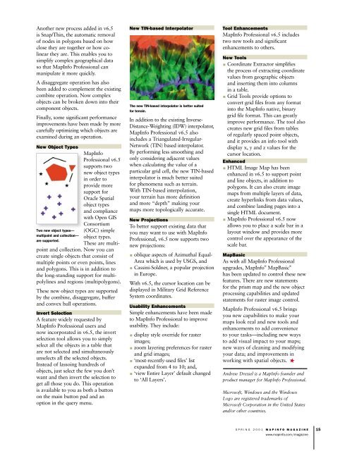
New Object Types<br />
Two new object types—<br />
multipoint and collection—<br />
are supported.<br />
MapInfo<br />
Professional v6.5<br />
supports two<br />
new object types<br />
in order to<br />
provide more<br />
support for<br />
Oracle Spatial<br />
object types<br />
and compliance<br />
with Open GIS<br />
Consortium<br />
(OGC) simple<br />
object types.<br />
These are multi-<br />
point and collection. Now you can<br />
create single objects that consist of<br />
multiple points or even points, lines<br />
and polygons. This is in addition to<br />
the long-standing support for multipolylines<br />
and regions (multipolygons).<br />
These new object types are supported<br />
by the combine, disaggregate, buffer<br />
and convex hull operations.<br />
Invert Selection<br />
A feature widely requested by<br />
MapInfo Professional users and<br />
now incorporated in v6.5, the invert<br />
selection tool allows you to simply<br />
select all the objects in a table that<br />
are not selected and simultaneously<br />
unselects all the selected objects.<br />
Instead of lassoing hundreds of<br />
objects, just select the few you don’t<br />
want and then invert the selection to<br />
get all those you do. This operation<br />
is available to you as both a button<br />
on the main button pad and an<br />
option in the query menu.<br />
New TIN-based Interpolator<br />
The new TIN-based interpolator is better suited<br />
for terrain.<br />
In addition to the existing Inverse-<br />
Distance-Weighting (IDW) interpolator,<br />
MapInfo Professional v6.5 also<br />
includes a Triangulated-Irregular-<br />
Network (TIN) based interpolator.<br />
By performing less smoothing and<br />
only considering adjacent values<br />
when calculating the value of a<br />
particular grid cell, the new TIN-based<br />
interpolator is much better suited<br />
for phenomena such as terrain.<br />
With TIN-based interpolation,<br />
your terrain has more definition<br />
and more “depth” making your<br />
maps more topologically accurate.<br />
New Projections<br />
To better support existing data that<br />
you may want to use with MapInfo<br />
Professional, v6.5 now supports two<br />
new projections:<br />
oblique aspects of Azimuthal Equal-<br />
Area which is used by USGS, and<br />
Cassini-Soldner, a popular projection<br />
in Europe.<br />
With v6.5, the cursor location can be<br />
displayed in Military Grid Reference<br />
System coordinates.<br />
Usability Enhancements<br />
Simple enhancements have been made<br />
to MapInfo Professional to improve<br />
usability. They include:<br />
display style override for raster<br />
images;<br />
zoom layering preferences for raster<br />
and grid images;<br />
‘most-recently-used files’ list<br />
expanded from 4 to 10; and,<br />
‘view Entire Layer’ default changed<br />
to ‘All Layers’.<br />
Tool Enhancements<br />
MapInfo Professional v6.5 includes<br />
two new tools and significant<br />
enhancements to others.<br />
New Tools<br />
Coordinate Extractor simplifies<br />
the process of extracting coordinate<br />
values from geographic objects<br />
and inserting them into columns<br />
in a table.<br />
Grid Tools provide options to<br />
convert grid files from any format<br />
into the MapInfo native, binary<br />
grid file format. This can greatly<br />
improve performance. The tool also<br />
creates new grid files from tables<br />
of regularly spaced point objects,<br />
and it provides an info tool with<br />
display x, y and z values for the<br />
cursor location.<br />
Enhanced<br />
HTML Image Map has been<br />
enhanced in v6.5 to support point<br />
and line objects, in addition to<br />
polygons. It can also create image<br />
maps from multiple layers of data,<br />
create hyperlinks from data values,<br />
and combine landing pages into a<br />
single HTML document.<br />
MapInfo Professional v6.5 now<br />
allows you to place a scale bar in a<br />
layout window and provides more<br />
control over the appearance of the<br />
scale bar.<br />
MapBasic<br />
As with all MapInfo Professional<br />
upgrades, MapInfo ® MapBasic ®<br />
has been updated to control these new<br />
features. There are new statements<br />
for the prism map and the new object<br />
processing capabilities and updated<br />
statements for raster image control.<br />
MapInfo Professional v6.5 brings<br />
you new capabilities to make your<br />
maps look real and new tools and<br />
enhancements to add convenience<br />
to your tasks—including new ways<br />
to add visual impact to your maps;<br />
new ways of cleaning and modifying<br />
your data; and improvements in<br />
working with spatial objects.<br />
Andrew Dressel is a MapInfo founder and<br />
product manager for MapInfo Professional.<br />
Microsoft, Windows and the Windows<br />
Logo are registered trademarks of<br />
Microsoft Corporation in the United States<br />
and/or other countries.<br />
SPRING 2001 MAPINFO MAGAZINE<br />
www.mapinfo.com/magazine<br />
15