Hydrological Study - Sovereign Base Areas Cyprus
Hydrological Study - Sovereign Base Areas Cyprus
Hydrological Study - Sovereign Base Areas Cyprus

You also want an ePaper? Increase the reach of your titles
YUMPU automatically turns print PDFs into web optimized ePapers that Google loves.
Consulting CYPRUS<br />
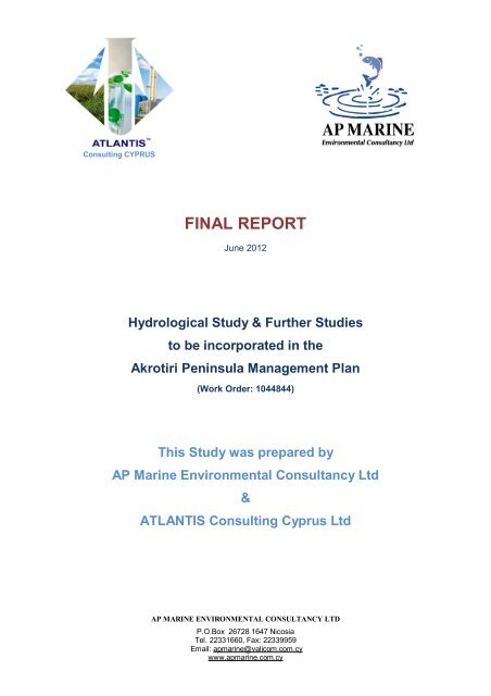
FINAL REPORT<br />
June 2012<br />
<strong>Hydrological</strong> <strong>Study</strong> & Further Studies<br />
to be incorporated in the<br />
Akrotiri Peninsula Management Plan<br />
(Work Order: 1044844)<br />
This <strong>Study</strong> was prepared by<br />
AP Marine Environmental Consultancy Ltd<br />
&<br />
ATLANTIS Consulting <strong>Cyprus</strong> Ltd<br />
AP MARINE ENVIRONMENTAL CONSULTANCY LTD<br />
P.O.Box 26728 1647 Nicosia<br />
Tel. 22331660, Fax: 22339959<br />
Email: apmarine@valicom.com.cy<br />
www.apmarine.com.cy
Consulting CYPRUS<br />
TABLE OF CONTENTS<br />
1 Introduction......................................................................................................10<br />
1.1 Structure of this Report.............................................................................11<br />
1.2 Project Team – Key Experts.....................................................................11<br />
2 Methodology.....................................................................................................12<br />
2.1 Site visits..................................................................................................12<br />
2.2 Desktop work............................................................................................13<br />
2.3 Field Surveys............................................................................................14<br />
2.3.1 Objectives of field surveys.....................................................................14<br />
2.3.2 Survey Area...........................................................................................15<br />
2.3.3 Overview of field surveys.......................................................................15<br />
2.3.4 <strong>Hydrological</strong> Conditions.........................................................................15<br />
2.3.5 Status of Phallocryptus (Branchinella) spinosa population at the Akrotiri<br />
Salt Lake 16<br />
2.3.6 Flora Conditions.....................................................................................16<br />
3 Legal requirements for monitoring....................................................................17<br />
4 Description of the project area..........................................................................20<br />
4.1 General Area Description.........................................................................20<br />
4.2 Hydrology / Geology.................................................................................20<br />
4.2.1 Hydrology...............................................................................................20<br />
4.2.2 Physical parameters..............................................................................25<br />
4.2.3 Land use, water users and pollutant sources.........................................27<br />
4.2.4 Geology.................................................................................................39<br />
4.3 Birds.........................................................................................................44<br />
4.3.1 Ramsar designation...............................................................................44<br />
4.3.2 Important Bird Area designation.............................................................45<br />
4.3.3 Special Protection <strong>Areas</strong> (SPA) designation..........................................46<br />
4.4 Phallocryptus (Branchinella) spinosa........................................................48<br />
4.4.1 Status of the taxonomy of Phallocryptus (Branchinella) spinosa............48<br />
4.4.2 Status of Phallocryptus (Branchinella) spinosa in the IUCN Red List.....48<br />
4.4.3 Status of Phallocryptus (Branchinella) spinosa in <strong>Cyprus</strong> and elsewhere<br />
48<br />
2
Consulting CYPRUS<br />
4.4.4 Status of Phallocryptus (Branchinella) spinosa population at the Akrotiri<br />
Salt Lake 49<br />
4.4.5 Other observations (flamingos, Aphanius fasciatus, dragonflies and diving<br />
beetles) 51<br />
4.4.6 Aphanius fasciatus.................................................................................56<br />
4.4.7 Revised Food Web - Phallocryptus’ perspective....................................57<br />
4.4.8 Aquatic biotic components.....................................................................59<br />
4.4.9 Aquatic Macrophytes.............................................................................59<br />
4.4.10 Benthic Macroinvertebrates...................................................................61<br />
4.5 Flora.........................................................................................................62<br />
4.5.1 Reference Conditions and Bioindicators................................................62<br />
4.5.2 Vegetation - Habitats.............................................................................62<br />
4.5.3 Halophytic Vegetation............................................................................66<br />
4.5.4 Fresh Water Wetlands...........................................................................68<br />
4.5.5 Sand Dune Vegetation...........................................................................70<br />
4.5.6 Thermo-Mediterranea Shrub Vegetation................................................73<br />
5 Model Conceptualization and Definition of Monitoring objectives......................89<br />
5.1 Geographic scope....................................................................................89<br />
5.2 <strong>Hydrological</strong> network / water sources.......................................................89<br />
5.3 Land use, water uses and pollutant sources to be considered..................90<br />
5.4 Management Goals and Objectives..........................................................91<br />
5.5 Proposed management objectives in relation to Branchinella and Aphanius<br />
94<br />
5.6 Proposed management objectives in relation to birds...............................94<br />
6 Reference Conditions.......................................................................................95<br />
6.1 Defining the Akrotiri wetland character......................................................95<br />
6.2 Setting of Reference conditions – Typological issues...............................97<br />
6.2.1 Hydrology...............................................................................................99<br />
6.2.2 Macrophytes Reference conditions........................................................99<br />
6.2.3 Macroinvertebrate Reference conditions..............................................101<br />
6.2.4 Characterization of the Salt Lake water properties and Phallocryptus<br />
(Branchinella) spinosa population........................................................................102<br />
6.2.5 Reference conditions for Phallocryptus (Branchinella) spinosa population<br />
105<br />
3
Consulting CYPRUS<br />
7 Proposed Monitoring Programme...................................................................109<br />
7.1 Hydrology...............................................................................................110<br />
7.1.1 Water balance......................................................................................110<br />
7.1.2 Water levels.........................................................................................114<br />
7.1.3 Water Quality.......................................................................................115<br />
7.2 Flora and habidats monitoring................................................................119<br />
7.2.1 Aims and objectives of Monitoring – General Methodology..................121<br />
7.2.2 Flora....................................................................................................124<br />
7.2.3 Monitoring plan - Habitat mapping.......................................................126<br />
7.2.4 Monitoring plan - Vegetation Transects................................................128<br />
7.2.5 Monitoring of abiotic parameters..........................................................135<br />
7.2.6 Distribution mapping of threatened species..........................................136<br />
7.2.7 Population size of species having a population lower than the MVP....136<br />
7.3 Fauna.....................................................................................................138<br />
7.3.1 Proposed monitoring objectives and indicators in relation to Phallocryptus<br />
138<br />
7.3.2 Proposed bird monitoring programme..................................................140<br />
7.4 Distribution studies.................................................................................141<br />
7.5 Population monitoring.............................................................................142<br />
7.6 Monitoring migrating and over-wintering birds.........................................143<br />
7.7 Monitoring breeding bird populations......................................................157<br />
7.7.1 Proposed Monitoring Programme for Aquatic biotic components.........177<br />
7.7.2 Proposed biotic monitoring indicators...................................................177<br />
7.7.3 Aquatic Macrophytes...........................................................................178<br />
7.7.4 Aquatic Macroinvertebrates.................................................................179<br />
7.8 Proposed additional studies....................................................................182<br />
7.8.1 Additional studies in relation to Phallocryptus, Aphanius, and aquatic<br />
insects 183<br />
8 References.....................................................................................................185<br />
9 APPENDICES................................................................................................192<br />
HABITAT IDENTIFICATION FORM ......................................................................224<br />
4
Consulting CYPRUS<br />
List of Figures<br />
Figure 1 – Water from Zakaki area and the port flowing towards Zakaki marsh...................................21<br />
Figure 2- Fasouri Marsh....................................................................................................................22<br />
Figure 3 – Zakaki drainage canal.......................................................................................................22<br />
Figure 4 – Bridge near Pluto project..................................................................................................23<br />
Figure 5 – Eucalyptus forest..............................................................................................................24<br />
Figure 6 – Stormwater drain pipes.....................................................................................................24<br />
Figure 7 – Main hydrological features of the Akrotiri Penynsula..........................................................25<br />
Figure 8: Locations of observations and monitoring stations...............................................................26<br />
Figure 9: Points 39 and 40 showing flooded areas of the Fasouri Marsh.............................................27<br />
Figure 10: Sample locations..............................................................................................................28<br />
Figure 11: Water Quality...................................................................................................................30<br />
Figure 12: Flow measurement on point 46 (measurements in metters - m)..........................................30<br />
Figure 13: Flow measurement at point 46..........................................................................................31<br />
Figure 14: Flow measurement at Zakaki Marsh (Bridge) ....................................................................31<br />
Figure 15: Flow measurement on Zakaki Marsh (bridge)....................................................................32<br />
Figure 16: Flow measurement on Zakaki Marsh (bridge)....................................................................32<br />
Figure 17: Flow measurements on Urban and Port flows. Combined outflow through Zakaki trench to<br />
Akrotiri Salt Lake.............................................................................................................34<br />
Figure 18: Regression between the salinity values measured with the optical refractometer and the<br />
digital conductometer. Even though there is an apparent strong correlation, it is not<br />
significant........................................................................................................................37<br />
Figure 19: Conditions of the water at the Salt Lake during the sampling: almost transparent, small pond,<br />
site #6 (A), stained red probably by tannins, small pond near the airstrip, site #9 (B), milky or<br />
cloudy due to resuspended sediments and disturbance of the bottom by feeding flamingos,<br />
site #19 (C). Extensive areas around the lake with thick biofilm layers, site #18 (D). Number<br />
of the sites according to Table 2.......................................................................................38<br />
Figure 20: View of the cross section..................................................................................................41<br />
Figure 21: Cross section...................................................................................................................41<br />
Figure 22: Top and middle soil layer.................................................................................................42<br />
Figure 23: Middle and lower soil layer................................................................................................43<br />
Figure 24: Lower Soil layer................................................................................................................43<br />
Figure 25: Underwater observations of the Phallocryptus (Branchinella) spinosa populations at the Salt<br />
Lake: underwater high definition video camera, GoPro, site #18 (A), snapshot of a female P.<br />
Spinosa with a full egg pouch visible in the upper part of the abdomen, site #17 (B), snapshot<br />
of an aggregation of numerous individuals (male and female) of P. spinosa near the<br />
submerged vegetation, site #18 (C), snapshot of a male P. spinosa feeding between the<br />
shoots of Ruppia maritima, site #18 (D). Number of the sites according to Table 2.............51<br />
Figure 26: General observations at the site #12, where flamingos tend to aggregate more often (A),<br />
bottom modification by the feeding activities of the flamingos (B), input of nutrients (e.g.<br />
feathers, droppings, carcasses) to the Salt Labe by the birds (C). At the same site, we<br />
5
Consulting CYPRUS<br />
confirmed the presence of two juveniles of the toothcarp (killifish) Aphanius fasciatus in the<br />
ponds formed by wheel tracks (D). The site (see Table 2 for coordinates) is near the<br />
drainage canal from the Zakaki Marsh..............................................................................54<br />
Figure 27: Reported and firsthand sightings of the Mediterranean toothcarp (killifish) Aphanius fasciatus<br />
in the Salt Lake in relation to rainfall monthly anomalies (Akrotiri Meteorological Station) and<br />
water salinity (data from the Fisheries Department). Arrows denote the conditions<br />
before/during the observations of the fish: algae bloom (green), rainy days (white), rainy days<br />
and firsthand report (orange). Rainfall monthly anomalies were produced by subtracting the<br />
long-term average (1966-2011) of a given month from the total rainfall for that month, and<br />
smoothed with an 11-point filter. Horizontal grey area denotes the salinity range of A.<br />
fasciatus in the Mediterranean area (Triantafyllidis et al. 2007)..........................................55<br />
Figure 28: Original food web proposed for the Akrotiri Salt Lake. Flamingos are the top consumers<br />
feeding exclusively on Phallocryptus................................................................................57<br />
Figure 29: Revised food web proposed for the Akrotiri Salt Lake. White arrows indicate possible<br />
interactions if the waterfowl consumes fry, eggs or small juveniles and adult aquatic insects<br />
and fish...........................................................................................................................58<br />
Figure 30: GLM model of species response graph for the environmental variable Fire. Acacia saligna<br />
trees (Acasalt) and seedlings (Acasall) have a positive response and the other species have<br />
a negative response........................................................................................................65<br />
Figure 31: GAM model of species response graph for the environmental variable Organic Matter.<br />
Juniperus phoenicea has a strong positive almost linear response, Zygophyllum album and<br />
Cakile maritima have negative response. Plantago maritima and Arthrocnemum<br />
macrostachyum present a unimodal response..................................................................65<br />
Figure 32: Vegetation of the habitat type 3170 with Juncus ambiguus and Isolepis cernua in Akrotiri<br />
(14/05/2011)....................................................................................................................70<br />
Figure 33: Distribution range of 5 threatend plants in Akrotiri Peninsula..............................................88<br />
Figure 34: Conceptual model of the hydrology of the project area.......................................................90<br />
Figure 35: Characterization of waterbodies according to WFD 2000/60/EC.........................................95<br />
Figure 33: Generalized model of aquatic communities in reference and impacted ponds (Coleman, 2009)<br />
.........................................................................................................................................1<br />
Figure 37: Monthly average and standard deviation of precipitation (Akrotiri Meteorological Station) and<br />
water salinity (data from the Fisheries Department) of the Salt Lake. Averages derived from<br />
the time period 1966-2011 (precipitation) and 1988-2011 (salinity)..................................104<br />
Figure 38: Monthly average and standard deviation of water temperature and pH of the Salt Lake.<br />
Averages derived from the time period 1988-2011 (data from the Fisheries Department). 104<br />
Figure 39: Abundance (individuals) of Phallocryptus (Branchinella) spinosa in one sampling station<br />
(“Lake-Recorder”, November 1991 to May 1992) at the Akrotiri Salt Lake (data from Ortal<br />
1992) in relation to water parameters (temperature, salinity, and pH)...............................105<br />
Figure 40: Abundance (mean and standard deviation) of Phallocryptus spinosa in six sampling stations<br />
(PLUTO II, March 2002) at the Akrotiri Salt Lake (data from Kerrison 2002). There are<br />
differences statistically significant between stations, Kruskal-Wallis P=0.0001698, Mann-<br />
Whitney pairwise comparisons (P
Consulting CYPRUS<br />
Figure 41: Periods (arrows) when the abundance of Phallocryptus spinosa was studied (Ortal 1992,<br />
Kerrison 2002) and monthly averages of water temperature, salinity, and pH of the Salt Lake<br />
(data from the Fisheries Department) and monthly precipitation (Akrotiri Meteorological<br />
Station). Averages derived from three to four monitoring stations during the time period<br />
1988-2011.....................................................................................................................107<br />
Figure 42: Periods (arrows) when the abundance of Phallocryptus spinosa was studied (Ortal 1992,<br />
Kerrison 2002) and monthly averages of water salinity of the Salt Lake (data from the<br />
Fisheries Department) and rainfall monthly anomalies (Akrotiri Meteorological Station).<br />
Salinity averages derived from three to four monitoring stations during the time period 1988-<br />
2011. Rainfall monthly anomalies were produced by subtracting the long-term average<br />
(1966-2011) of a given month from the total rainfall for that month...................................107<br />
Figure 43:Flow measurement locations............................................................................................111<br />
Figure 44:Zakaki and Port flow meters.............................................................................................111<br />
Figure 45: Flow measurement locations near Zakaki Marsh.............................................................112<br />
Figure 46: Flow measurement location near Fasouri Marsh..............................................................112<br />
Figure 47: Location of 35 transects (yellow lines). Black triangles: species with threat category EN, VU,<br />
DD, and NT. Blue stars: species with threat category CR................................................128<br />
Figure 48: Diagram of transect and quadrats...................................................................................132<br />
Figure 49: Orchis palustris, plant and habitat in Akrotiri (14/5/2011)..................................................137<br />
Figure 50: Standard deviation of monthly averages (three to four stations) of water salinity, pH and<br />
temperature of the Akrotiri Salt Lake (data from the Fisheries Department). Arrows indicate<br />
the sampling periods when the abundance of Phallocryptus was studied (Ortal 1992,<br />
Kerrison 2002)...............................................................................................................138<br />
7
Consulting CYPRUS<br />
List of tables<br />
Table 1: Synopsis of Monitoring Activities..........................................................................................12<br />
Table 2: Values of water salinity, conductivity, oxygen, pH at the sites visited during the fieldtrips of<br />
December 2011 and January 2012 in relation to the Phallocryptus (Branchinella) spinosa<br />
component of the study. Numbers represent sampling locations as per Table 2....................35<br />
Table 3: Information of the sites visited during the fieldtrips of December 2011 and January 2012 in<br />
relation to the Phallocryptus (Branchinella) spinosa component of the study..........................36<br />
Table 4: Description of the composition of the sediments in the three visible layers.............................40<br />
Table 5: Qualifying species for the identification of Akrotiri Peninsula – Episkopi Cliffs as an Important<br />
Bird Area (taken from Iezekiel et al. 2004)............................................................................45<br />
Table 6: Qualifying species, listed in Schedule 1 of the Game and Wild Birds Ordinance, for the SPA<br />
designation of Akrotiri Wetlands and Akrotiri Cliffs................................................................46<br />
Table 7: Submerged aquatic macrophyte species recorded in the Akrotiri peninsula (VU: Vulnerable, EN:<br />
Endangered, UN: Unknown)................................................................................................60<br />
Table 8: General Principles for the Reference Conditions of habitats..................................................66<br />
Table 9: Biological quality index values for the Halophytic habitats of the area of Akrotiri. The working<br />
reference conditions are illustrated by the values of the indices in the undisturbed communities<br />
(Impact=0)..........................................................................................................................77<br />
Table 10: Biological quality index values for the Sand Dune habitats of the area of Akrotiri. The working<br />
reference conditions are illustrated by the values of the indices in the undisturbed communities<br />
(Impact=0). Part I................................................................................................................78<br />
Table 11: Biological quality index values for the Sand Dune habitats of the area of Akrotiri. The working<br />
reference conditions are illustrated by the values of the indices in the undisturbed communities<br />
(Impact=0). Part II...............................................................................................................80<br />
Table 12: Minimum viable population assessment scheme (Primack 1996).........................................83<br />
Table 13: List and current data for 30 rare and threatened plants in Akrotiri Peninsula (Data Tsintides et<br />
al. 2007).............................................................................................................................85<br />
Table 14: Habitats identified in Akrotiri peninsula. Map 2000: Hadjikyriakou et al. 2000; Map 2009: Cox<br />
et al. 2009.........................................................................................................................120<br />
Table 15: Attributes of the proposed transects.................................................................................130<br />
Table 16: Bird Survey Schemes......................................................................................................140<br />
Table 17: Guidance on mandatory attributes for migrating raptors....................................................144<br />
Table 18: Guidance on mandatory attributes for the Red-footed Falcon............................................147<br />
Table 19: Guidance on mandatory attributes for the Demoiselle Crane.............................................150<br />
Table 20: Guidance on mandatory attributes for the Greater Flamingo..............................................152<br />
Table 21: Guidance on mandatory attributes for the Greater Sandplover ..........................................154<br />
Table 22: Guidance on mandatory attributes for the Kentish Plover..................................................155<br />
Table 23: Guidance on mandatory attributes for the Ferruginous Duck.............................................157<br />
Table 24: Guidance on mandatory attributes for the Black-winged Stilt.............................................160<br />
Table 25: Guidance on mandatory attributes for the Spur-winged Lapwing.......................................163<br />
Table 26: Guidance on mandatory attributes for the Kentish Plover..................................................165<br />
8
Consulting CYPRUS<br />
Table 27: The information that should be recorded to describe each colony or sub-division of a colony.<br />
.........................................................................................................................................170<br />
Table 28: Guidance on mandatory attributes for the Eleonora’s Falcon.............................................171<br />
Table 29: Guidance on mandatory attributes for the Peregrine Falcon..............................................172<br />
Table 30: Guidance on mandatory attributes for the Griffon Vulture..................................................174<br />
Table 31: Guidance on mandatory attributes for the Mediterranean Shag.........................................175<br />
Table 32: Proposed sampling locations for the monitoring of biotic components in Akrotiri waterbodies<br />
.........................................................................................................................................180<br />
9
Consulting CYPRUS<br />
1 Introduction<br />
In October 2011, A P Marine was commissioned by Interserve Defence Ltd to<br />
undertake the project “<strong>Hydrological</strong> <strong>Study</strong> & Further Studies to be incorporated<br />
in the Akrotiri Peninsula Management Plan, Work Order: 1044844”. For the<br />
implementation of the project, A.P Marine cooperated with Atlantis Consulting <strong>Cyprus</strong><br />
ltd.<br />
The monitoring plan was developed in response to the mandate for monitoring<br />
activioties that would be able toi inform, enrich and evaluate the effectiveness the<br />
Akrotiri Salt lake Management Plan.<br />
As per the Terms of Reference, the Method Statement covers the following Tasks:<br />
• <strong>Base</strong>line studies to identify the significant biotic parameters of the wetland<br />
ecosystems of Akrotiri Salt Lake, Fasouri Marsh and Zakaki Marsh and associate<br />
them with the abiotic parameters of the wetlands.<br />
• The definition of abiotic and biotic indicators for a healthy wetland ecosystem at<br />
each of the three sites in line with EU Water Framework Directive.<br />
• The establishment of a long-term monitoring system for these indicators to inform<br />
decision making under the management plan for the wetlands.<br />
During the course of the project, the consultants have studied the available<br />
bibliography and have implemented several site visits to the project area. In<br />
accordance with project objectives the following have been achieved:<br />
• Available bibliography and data were collected and studied in order to identify<br />
management objectives for the project area. Results were utilized in determining<br />
monitoting objectives.<br />
• The area’s key hydrological and ecological characteristics have been determined.<br />
• The issue of defining reference conditions was examined and a proposal for the<br />
selection of reference conditions has been prepared.<br />
• A monitoring plan has been prepared.<br />
10
Consulting CYPRUS<br />
1.1 Structure of this Report<br />
This report presents the draft proposed monitoring plan for the Akrotiri Peninsula. It is<br />
a working document intended to provide information regarding the final foreseen<br />
report structure and content as well as current progress. The report is divided into the<br />
following chapters:<br />
• Chapter 1 – Introduction<br />
• Chapter 2 – Methodology, Bibliographical and past report consulted,<br />
the information collected as well as data requested but<br />
not acquired<br />
• Chapter 3 – Legal framework for monitoring<br />
• Chapter 4 – Description of the project area<br />
• Chapter 5 – Environmental Setting and Conceptual Model<br />
• Chapter 6 – Reference Conditions<br />
• Chapter 7 – Monitoring Programme<br />
• Chapter 8 – References<br />
• Chapter 9 – Appendices<br />
1.2 Project Team – Key Experts<br />
• Antonis Petrou, Aquatic resource management: Project<br />
coordinator.<br />
• Charalambos Panayiotou, Environmental Science: Scientific coordinator,<br />
hydrology analysis, integration and<br />
interpretation of studies, editing of the report.<br />
• Iacovos Tziortzis, Aquatic Macroinvertebrates specialist: Studies<br />
of aquatic biotic parameters<br />
• Pinelopi Delipetrou, Biology: Flora and habitat studies<br />
• Iris Charalambidou, Ornithologist, Aquatic bird study<br />
• Carlos Jimenez, Aquatic Biologist<br />
Supporting Staff<br />
• Elias Eliades, Geotecnician MSc (Management of the<br />
• Ourania Tzoraki, Hydrologist<br />
Environment, Natural Resources and Forestry)<br />
MSc in Civil Engineering<br />
11
Consulting CYPRUS<br />
2 Methodology<br />
2.1 Site visits<br />
Table 1 summarizes the site visits that were undertaken during the project.<br />
Table 1: Synopsis of Monitoring Activities<br />
Date Objective Where Participants<br />
11-Nov-2011<br />
22-Nov.-2011<br />
18-Dec-2011<br />
27-Dec-2011<br />
04-Jan-2012<br />
Clarify the objectives<br />
of the study<br />
Elaborate key issues<br />
of concern<br />
Site tour<br />
Obtain GPS points of<br />
key features<br />
Map the hydrological<br />
network of the<br />
project area<br />
Limited water<br />
samping<br />
Record presence,<br />
distribution,<br />
abundance<br />
Phallocryptus<br />
spinosa<br />
Ditto. Collect live<br />
Phallocryptus<br />
spinosa specimens<br />
Ditto. Measure<br />
salinity and collect<br />
water samples<br />
Akrotiri Environmental<br />
Education and<br />
Information Centre,<br />
Project site<br />
Akrotiri Penynsoula<br />
Akrotiri Salt Lake: Small<br />
pond between the road<br />
and the Lake. Pond<br />
Agios Georgios Church<br />
Akrotiri Salt Lake: Small<br />
pond between the road<br />
and the Lake. Lake<br />
shore near Zakaki<br />
Marsh.<br />
Akrotiri Salt Lake: Pond<br />
Agios Georgios Church,<br />
Small ponds near<br />
airstrip. Lake shore<br />
across the<br />
environmental Centre.<br />
Present:<br />
Interserve Defences Ltd:<br />
P. Nicolaou, A. Perdiou<br />
Akrotiri Environmental<br />
Education and Information<br />
Centre:<br />
T. Hadjikyriakou<br />
Contractors:<br />
A. Petrou (A.P. Marine), C.<br />
Panayiotou, T. Toumazi &<br />
E.Eliades (Atlantis<br />
Consulting <strong>Cyprus</strong> Ltd),<br />
I.Charalambidou, C.<br />
Jimenez, I.Tziortzis,<br />
O.Tzoraki<br />
T.Toumazis<br />
O.Tzoraki<br />
C. Jimenez, M. Sour, I.<br />
Tziortzis, C. Thoma<br />
C. Jimenez, M. Sour, I.<br />
Charalambidou, S. Glucel,<br />
C. Thoma<br />
C. Jimenez, M. Sour<br />
12
Consulting CYPRUS<br />
Date Objective Where Participants<br />
05-Jan-2012<br />
08-Jan-2012<br />
Ditto, except water<br />
samples<br />
Ditto, except water<br />
samples. UW videos<br />
of Phallocryptus<br />
spinosa<br />
Vernal Ponds at<br />
Potamos to Liopetriou,<br />
Larnaka Salt Lake<br />
Akrotiri Salt Lake: Small<br />
ponds near airstrip,<br />
Pond Agios Georgios<br />
Church, Lake shore<br />
near end of airstrip.<br />
Phassouri Marsh<br />
C. Jimenez, M. Sour, R.<br />
Abu-Alhaija<br />
C. Jimenez, M. Sour, I.<br />
Tziortzis, G. Fyttis<br />
19-Jan-2012 Elias Eliades & T.Toumazis<br />
6-Apr-2012<br />
7-Apr-2012<br />
10-Apr-2012<br />
11-Apr-2012<br />
2.2 Desktop work<br />
Sampling and<br />
monitoring<br />
All water bodies of the<br />
project site and<br />
souurounding areas<br />
Penelope Delipetrou<br />
Elias Eliades<br />
The project team examined the bibliography provided by the client as well as<br />
additional bibliography and studies collected from Competent Authorities and through<br />
internet searches. These studies contributed further to the formulation of the project<br />
report. New information included:<br />
• Groundwater level data Salt lake water monitoring results (depth, pH,<br />
temperature and salinity)<br />
The description of the study area and the drafting of the monitoring plan have been<br />
based on bibliographical studies and field visits. In particular the project team took<br />
the following steps:<br />
• <strong>Study</strong> of current bibliography acquired from Interserve Defence Ltd.<br />
• <strong>Study</strong> of additional bibilography<br />
• Data collection from Competent Authorities<br />
• Field visits and monitoring<br />
• Contact and discussion with authorities in Salt Lake ecology and Taxonomy<br />
Interserve Defence Ltd. provided the contractor with all the available major studies<br />
undertaken in Akrotiri Peninsula, as well as with various other relevant reports.<br />
Additional reports and publications were collected from Competent Authorities,<br />
13
Consulting CYPRUS<br />
internet searches and other sources. A list of collected reports is provided in<br />
Bibliography of the monitoring plan.<br />
Relevant data were also requested from the <strong>Cyprus</strong> National Competent Authorities<br />
as follows:<br />
• Meteorological/ climate data, Meteorological Department, Ministry of<br />
Agriculture, Natural Resources and Environment.<br />
• Boreholes and water abstraction, Water Development Department, Ministry of<br />
Agriculture, Natural Resources and Environment. We haven’t received this<br />
data set of the bore holes, I requested it in December and I am still waiting.<br />
• Water levels and water quality data, Water Development Department, Ministry<br />
of Agriculture, Natural Resources and Environment<br />
• Geological and Geochemical data, Geological Survey Department, Ministry of<br />
Agriculture, Natural Resources and Environment.<br />
• Monthly waterbird bird counts from the <strong>Cyprus</strong> Game Fund, Ministry of<br />
Interior.<br />
• SBAA Environment Department.<br />
• Land use maps, Department of Environment<br />
• Temperature, salinity, depth and pH of the Salt Lake from the Fisheries<br />
Department<br />
2.3 Field Surveys<br />
2.3.1 Objectives of field surveys<br />
The surveys aim to produce baseline information regarding the key hydrological and<br />
ecological characteristics of the project are, and the ecological status of conservation.<br />
Through the collected information, key parameters pertaining to the physical and<br />
ecological characteristics of the area will be identified and will be considered in the<br />
drafting of the monitoring plan. In addition, suitable locations for monitoring activities<br />
will be selected.<br />
More precisely the objectives of the surveys are:<br />
Identify the key hydrological features and charateristics of the project area<br />
Describe the key ecological features and the habitat types of the area.<br />
Determine key hydrological indicators and suggest suitable baseline/<br />
14
Consulting CYPRUS<br />
reference values<br />
Determine key ecological parameters and suggest suitable baseline /<br />
reference values<br />
Identify indicator species<br />
Support the preparation of the monitoring plan for the key hydrological and<br />
ecological parameters and indicator species<br />
2.3.2 Survey Area<br />
The surveys extended to the three key wetlands of the Akrotiri salt lake, the Zakaki<br />
Marsh and the Fasouri Marsh. It also included surrounding areas which constitute a<br />
direct water source to the wetlands as well as the canals that link the two marshes<br />
with the salt lake. Upstream water sources are implicitly considered as boundary<br />
conditions through the monitoring of water inflows at the Zakaki Marsh.<br />
2.3.3 Overview of field surveys<br />
An initial field visit took place on November 11 th , 2011 which invlolved all partners as<br />
well as representatives from Interserve. During the meeting, the project team<br />
requested clarifications regarding the project objectives as well as information<br />
regarding the project area. The project team was subsequently toured around the<br />
project area, including the Salt Lake, Zakaki Marsh, Fasouri Marsh and the<br />
surrounding area.<br />
2.3.4 <strong>Hydrological</strong> Conditions<br />
The hydrological network of the project area has been initialy determined from<br />
existing data and maps. Additional field visits took place in order to complete the<br />
network and to gather data concerning the storm water runoff conditions. During the<br />
visits the team members took GPS points of the main areas where the water enters<br />
the salt lake and verified the linkage between the marshes and the salt lake. In<br />
particular the drainage system crossing the the Akrotiri road, which consists of a<br />
series of drainage pipes, and the channel between Zakaki Marsh and the salt lake<br />
were marked with the use of a GPS (Geographical Positioning System). The results<br />
are available in Chapters 3.2 and 4.2. Preliminary water flow rates were alsso taken<br />
with use of a mobile flow meter where possible. In addition, water samples were<br />
taken for chemical analysis in order to determined water quality parameters.<br />
15
Consulting CYPRUS<br />
Soil samples were taken from a cross section in a ditch in the salt lake that was<br />
recently open to a depth of approximately 1.5 meters and a width of about 4 meters.<br />
Sipping water was also collected from the ditch. The sediment profile analysis is<br />
available in Chapter 3.6.<br />
2.3.5 Status of Phallocryptus (Branchinella) spinosa population at the Akrotiri<br />
Salt Lake<br />
During December 2011 and January 2012, a total of four field trips were made to the<br />
Salt Lakes of Akrotiri, Larnaka and the vernal ponds of Potamos tou Liopetriou<br />
aiming to survey the emergence/hatching and abundance of Phallocryptus at<br />
particular sites. Additionally, water samples for nutrient analysis and measurements<br />
of several parameters were made as well as observations on the presence/absence<br />
of the toothcarp Aphanius fasciatus in the Agios Georgios Pond and at the Salt Lake.<br />
Results are shown in Chapter 4.<br />
2.3.6 Flora Conditions<br />
During November 2011 to May 2012, field surveys were made to the salt lakes area,<br />
covering all possible areas for flora species expansions, studying also Acacia saligna,<br />
Eucaliptus and Arundo donax intrusions. The entire study area is shown in figure,<br />
Physical Parameters, of chapter 4. Reference conditions or high ecological status is<br />
a state of a water body or other natural element where no or only minor changes can<br />
be found due to anthropogenic disturbance. The determination of the reference<br />
conditions of biological quality element, such as the vegetation, requires the<br />
determination of certain biological values of the element in undisturbed status.<br />
The determination of the reference conditions for the sclerophyllous shrub vegetation,<br />
phrygana (habitat type 5420), juniper matorral (habitat type 5210), and maquis (9320)<br />
as well as for the Mediterranean tall humid grasslands (habitat type 6420) was based<br />
not only to the pre mentioned field surveys but also on the published literature and<br />
expert knowledge of the attributes of these habitats in <strong>Cyprus</strong>.<br />
16
Consulting CYPRUS<br />
3 Legal requirements for monitoring<br />
Below is a brief account of monitoring requirements as the arise form National and<br />
EU legislation. These requirements we considered during the preparation of the<br />
monitoring plan in combination with the monitoring requirements that arise from the<br />
management objectives of the area.<br />
Water Framework Directive 2000/60/EC:<br />
European Water Framework Directive (WFD) 2000/60/EC establishes a common<br />
strategy for Community action in the field of water policy. The purpose of this<br />
Directive is to establish a framework for the protection of inland surface waters,<br />
transitional waters, coastal waters and groundwater. All member states are obliged to<br />
establish monitoring networks for all waterbodies in their vicinity and apply<br />
appropriate management measures in order to achieve at least ‘’Good Ecological<br />
Quality’’ by 2015. The most important innovation of WFD is the inclusion of Biological<br />
Quality Elements (BQE’s) in the monitoring plans. The directive prescribes four<br />
biological groups to be monitored im transitional waters: Aquatic Macrophytes,<br />
Phytoplankton, Benthic macro-invertebrates and Fish; depending each time by the<br />
communities flourishing. Monitoring of specific biological communities must be<br />
supported by monitoring of relevant hydromorphological, chemical and<br />
physicochemical elements, all prescribed by the directive (Annex V).<br />
Protection of groundwater against pollution and deterioration Directive<br />
2006/118/EC<br />
Water Framework Directive states that measures should be adopted to prevent and<br />
control groundwater pollution. These measures are set out in this Directive, which is<br />
why it is known as the "daughter Directive" to the Framework Directive. Furthermore,<br />
in 2013 the Water Framework Directive will repeal Directive 80/68/EEC on the<br />
protection of groundwater against pollution by certain dangerous substances.<br />
Groundwater’s Directive is designed to protect groundwater and fill the legislative gap<br />
following the repeal of Directive 80/68/EEC.<br />
The provisions of Directive 2006/118/EC include: criteria for assessing the chemical<br />
status of groundwater; criteria for identifying significant and sustained upward trends<br />
in groundwater pollution levels and for defining starting points for reversing these<br />
17
Consulting CYPRUS<br />
trends; preventing and limiting indirect discharges (after percolation through soil or<br />
subsoil) of pollutants into groundwater.<br />
The direct relationship of the aquifer with surface waters by feeding Fasouri marsh,<br />
intensifies the need for protection of groundwater quality. The construction of Kouris<br />
Dam, in combination with reduced precipitation and the ongoing intensive abstraction<br />
of water from Akrotiri aquifer have already resulted in significant degradation of the<br />
ecosystem in the past decades. All of the above in combination with the proximity to<br />
the sea have resulted in the sea intrusion and increase of salinity levels of<br />
groundwater. In addition, various activities taking place in the Akrotiri peninsula such<br />
as intense agriculture, various forms of development such as urbanisation, industry,<br />
infrastructure, quarrying etc, as well as military activities and installations, oppose<br />
additional threats for the underground waters and highlight the need for protection of<br />
the aquifer.<br />
Habitats Directive 92/43/EEC:<br />
The European Community Habitats Directive (together with the Birds Directive) forms<br />
the cornerstone of Europe's nature conservation policy. It is built around two pillars:<br />
the Natura 2000 network of protected sites and the strict system of species protection.<br />
The directive protects over 1.000 animals and plant species and over 200 so called<br />
"habitat types" (e.g. special types of forests, meadows, wetlands, etc.), which are of<br />
European importance. Among others, three habitat types associated with freshwater<br />
or brackish aquatic communities are found in Akrotiri wetlands: Lagoons (1150*),<br />
Mediterranean salt meadows (1410) and Hard oligo-mesotrophic waters with benthic<br />
vegetation of Chara formations (3140). These types are included in Annex I of the<br />
Habitats Directive (92/43/EC) and their conservation requires the designation of<br />
special areas of conservation (SAC’s), which is still pending for the area. Especially<br />
habitat type Lagoons-1150 which covers a major part of the study area is considered<br />
as priority habitat of European interest requiring strict protection through SAC<br />
designation. The characterisation of SAC’s and their restoration and protection<br />
through management plans is considered a priority.<br />
18
Consulting CYPRUS<br />
Urban Waste Water Treatment Directive 91/271/EEC:<br />
Directive 91/271/EEC concerns the collection, treatment and discharge of urban<br />
waste water (including run-off rain water) and the treatment and discharge of waste<br />
water from certain industrial sectors. Its aim is to protect the environment from any<br />
adverse effects caused by the discharge of such waters. Industrial waste water<br />
entering collecting systems and the disposal of waste water and sludge from urban<br />
waste water treatment plants are subject to regulations and/or specific authorization<br />
by the competent authorities. Sensitive areas, within the meaning of the directive,<br />
include:<br />
• freshwater bodies, estuaries and coastal waters which are eutrophic or which<br />
may become eutrophic if protective action is not taken<br />
• surface freshwaters intended for the abstraction of drinking water which<br />
contain or are likely to contain more than 50 mg/l of nitrates<br />
• areas where further treatment is necessary to comply with other directives,<br />
such as the directives on fish waters, on bathing waters, on shellfish waters,<br />
on the conservation of wild birds and natural habitats.<br />
The directive also provides derogations for areas designated as "less sensitive" and<br />
such derogations were approved for several countries.<br />
The unregulated inflow of untreated wastewaters in Zakaki marsh and concomitantly<br />
to the salt lake, as well as in other areas of the wetland, can cause severe<br />
degradation to the ecosystem, especially in cases were run-off becomes severely<br />
polluted.<br />
19
Consulting CYPRUS<br />
4 Description of the project area<br />
4.1 General Area Description<br />
Akrotiri Peninsula is the southernmost part of <strong>Cyprus</strong>, located 5km south-west of the<br />
city of Limassol (population 150,000). It also borders Akrotiri village to its southwest<br />
west (population 800), RAF Station Akrotiri to the south, and Asomatos village<br />
(population 350) to the north.<br />
The Akrotiri Ramsar site is composed of two distinct areas that are hydrologically<br />
connected. The first and largest area is the large salt lake and sand flats that are<br />
situated in the centre of the Akrotiri peninsula. Over the last three centuries, this<br />
former lagoon has been isolated from the sea and a number of saltmarsh vegetation<br />
communities have developed and now surround the lake. The lake and surrounding<br />
saltmarsh is important for a range of wetland birds, and in particular greater flamingo<br />
Phoenicopterus ruber. A eucalyptus forest borders the northern side of the lake and<br />
this is an important raptor roosting area. The second distinct area is the Fassouri<br />
marsh that lies to the northeast of the salt lake. This area is made up of a matrix of<br />
freshwater habitat types including grazing marsh and reed beds. Rain water is the<br />
key hydrological input for both areas, although the lake receives occasional input<br />
from the sea during storms. The two areas are hydraulically connected and the<br />
Fassouri marsh provides important water inputs to the seasonal salt lake. A small<br />
permanent lake is found to the west of the Akrotiri salt lake, which is hydraulically<br />
connected to the sea.<br />
4.2 Hydrology / Geology<br />
4.2.1 Hydrology<br />
<strong>Hydrological</strong>ly the Akrotiri wetlands area can be distinguished into three main water<br />
bodies.<br />
• The Zakaki Marsh to the north east<br />
The Zakaki marsh is a freshwater marsh located to the east of the Akrotiri salt lake. It<br />
receives storm water from the western urban areas of Limassol via two canals<br />
(Figure 1). The main canal flows from the Zakaki area and collects water from the<br />
western urban areas of Limassol. The second canal flows from the Limassol port. A<br />
20
Consulting CYPRUS<br />
new canal is under construction which will collect water from the areas north of the<br />
Zakaki Marsh.<br />
Figure 1 – Water from Zakaki area and the port flowing towards Zakaki marsh<br />
• The Fasouri Marsh.<br />
The marsh (Figure 2) is located to the northwest of the Akrotiri salt lake (See Fig.<br />
7). The overall area of the Marsh is about 60 hectares. The core section of the<br />
Marsh spreads over an area of 20 hectares and hosts reeds and marshy<br />
vegetation. The remaining area is covered by grassland.<br />
The Marsh is fed by rain water from a limited catchment of agricultural land to its<br />
north and west. It is also considered to be hydraulically connected to the Akritiri<br />
aquifer and can therefore receive water in periods when the aquifer water level is<br />
sufficiently high. In periods of high flooding, the Marsh drains southward towards<br />
the Akrotiri salt lake. After the Pluto project has been constructed, drainage has<br />
been preserved via a dirt road that channels the water along the western boarder<br />
of the Pluto project.<br />
21
Consulting CYPRUS<br />
• The Akrotiri Salt lake<br />
Figure 2- Fasouri Marsh<br />
o The salt lake is fed mainly by storm water collected by a) the surface area of<br />
the salt lake itself, inflows from the Zakaki Marsh via a connecting canal<br />
(Figure 3), from Akrotiri village via storm pipes, from the Phasouri Marsh<br />
and from the Eucalyptus forest located north of the salt lake.<br />
Figure 3 – Zakaki drainage canal<br />
22
Consulting CYPRUS<br />
o Water flows from the Fasouri Marsh. During rainy days the water coming from<br />
Fasouri Marsh flows through a canal with 4 meters width. The canal passes<br />
under the road (Figure 4) and flows directly onto Pluto project. Around the<br />
Pluto project, there is a dirt road with lower elevation thus serving as a<br />
drainage canal. The water firstly creates a small pond/marsh near the Pluto<br />
project and then slowly travels towards the salt lake.<br />
Figure 4 – Bridge near Pluto project<br />
o Water flows from the Eucalyptus forest area: <strong>Base</strong>d on site visits undertaken<br />
in January it is considered that considerable amounts of water flows into the<br />
salt lake from the north. The Eucalytus forest area is at a slightly higher<br />
elevation than the salt lake and has a steady small downward gradient<br />
towards the lake. Although there is no obvious hydrological network from<br />
the northern area, during rainy days water flows from the citrus plantations<br />
through the eucalyptus forest into the lake via a series of dispersed<br />
drainage routes including dirt roads (Figure 5).<br />
23
Consulting CYPRUS<br />
Figure 5 – Eucalyptus forest<br />
o Another important source of water is the Akrotiri village stormwater. There are<br />
18 drain pipes connecting the areas on both sides of the road leading the<br />
water towards the salt lake. (figure 6)<br />
Figure 6 – Stormwater drain pipes<br />
o Sea overflows: Occasionally flows from the sea have been witnessed. This is<br />
only observed high storm winds, when surge in combination with high waves<br />
24
Consulting CYPRUS<br />
overtake the sand dunes. Overflowing seawater then drains towards the salt<br />
lake.<br />
Figure 7, shows the three water bodies of the area. The three areas can be<br />
distinguished as the Akrotiri salt lake, the Zakaki and the Fasouri marshes. The<br />
maximum extent of each of the marshes is indicated by grey shading. Light blue<br />
shading indicates the area that is frequently flooded. Eighteen storm water drains<br />
have been located across the Akrotiri road.<br />
The blue-coloured lines represent the routes connecting the marshes with the salt<br />
lake, whereas to the northwest the orange line represents the occasional flow<br />
towards the salt lake.<br />
In addition, a small lake that is permanently flooded is found west of the Akrotiri salt<br />
lake (indicated by yellow arrow on Fig. 7). Given the fact that it is permanently<br />
flooded despite having a minimal catchment area and that its salinity is slightly higher<br />
than that of seawater, it is concluded that this lake is hydraulically connected with the<br />
sea and is directly fed by seawater.<br />
4.2.2 Physical parameters<br />
Figure 7 – Main hydrological features of the Akrotiri Penynsula<br />
Three field visits for the monitoring of hydrological and water quality parameters took<br />
place during the first four months of the project. Below is a brief description of<br />
25
Consulting CYPRUS<br />
observations made during the visits. The locations of various observations and of<br />
monitoting sites are shown on Fig. 8.<br />
Figure 8: Locations of observations and monitoring stations<br />
INDEX<br />
Point 33 Upper limits of acacia, reeds, crops (vines, cereals, olives) and Cypress<br />
Point 34 Western limits of acacia, reeds, Crops and Cypress<br />
Point 35 Acacia, reeds and shrubs<br />
Point 36 Fasouri marsh - sample 06<br />
Point 37 Acacias on the left of the road and eucalyptus on the right<br />
Point 38 Flooded on the right and left of the road and all over the region are installed<br />
antennas<br />
Point 39 Marsh Lakes – No water drainage (Fig. 9)<br />
Point 40 Area enclosed between points 37 – 39 – 40 – 41 – 42 – 45 and 38 was<br />
flooded (Fig. 9)<br />
Point 41 Fenced area - Acacias<br />
Point 42 Pond – Akrotiri Merra – Sample 05<br />
Point 43 Small salt lake – sample 04<br />
Point 44 Acacias, eucalyptus and crops<br />
Point 45 Acacia expansion inside salt lake area, in aproximately 5 meters.<br />
Point 46 Extensive expansions from Acacias<br />
Point 47 Salt lake sample 01<br />
26
Consulting CYPRUS<br />
Point 39<br />
Marsh Lakes – No water drainage<br />
Point 40<br />
Figure 9: Points 39 and 40 showing flooded areas of the Fasouri Marsh<br />
Key results of the monitoring are described below.<br />
4.2.3 Land use, water users and pollutant sources<br />
Area enclosed between points 37 – 39 –<br />
40 – 41 – 42 – 45 and 38 was flooded<br />
The surroundings of the project area are mainly used for agricultural purposes as<br />
also support a small number of farming units. It also has military uses and several<br />
military installations are preset with various projects (e.g. Pluto) being built inside the<br />
study area. During the third visit samples were collected and analysed. Sampling<br />
locations are shown on Figure 10. Results are shown on Figure 11.<br />
27
Consulting CYPRUS<br />
Figure 10: Sample locations<br />
• Sampling code on GPS and Figure 10: 01<br />
Location: Akrotiri salt lake<br />
Comments: The water collected was from inside the lake. Two samples were<br />
collected, one to analyze E-coli and one to analyze pH, conductivity, Chloride,<br />
Nitrates, Nitrite, Ammonium, Phosphates, Total P, Total N, BOD5, TOC, Cd, Ni,<br />
Pb and Hg. The water collected was analyzed for salinity also.<br />
• Sampling code on GPS and Figure 10: 02<br />
Location: Zakaki Marsh (Bridge).<br />
Comments: Flow measurements conducted. The water collected was from inside<br />
the salt. Two samples were collected for each point, one to analyze E-coli and<br />
one to analyze pH, conductivity, Chloride, Nitrates, Nitrite, Ammonium,<br />
Phosphates, Total P, Total N, BOD5, TOC, Cd, Ni, Pb and Hg. The water<br />
collected was analyzed for salinity also.<br />
• Sampling code on GPS and Figure 10: 03<br />
Location: Zakaki Marsh (Bridge).<br />
28
Consulting CYPRUS<br />
Comments: The water collected was from the urban inflows outlet. Two samples<br />
were collected for each point, one to analyze E-coli and one to analyze pH,<br />
conductivity, Chloride, Nitrates, Nitrite, Ammonium, Phosphates, Total P, Total N,<br />
BOD5, TOC, Cd, Ni, Pb and Hg. The water collected was analyzed for salinity<br />
also.<br />
• Sampling code on GPS and Figure 10: 04<br />
Location: Small salt lake.<br />
Comments: The water collected was from inside the salt lake. Two samples were<br />
collected for each point, one to analyze E-coli and one to analyze pH,<br />
conductivity, Chloride, Nitrates, Nitrite, Ammonium, Phosphates, Total P, Total N,<br />
BOD5, TOC, Cd, Ni, Pb and Hg. The water collected was analyzed for salinity<br />
also.<br />
• Sampling code on GPS and Figure 10: 05<br />
Location: Pond (Akrotiri Merra)<br />
Comments: The water collected was from inside the salt lake. The water<br />
collected was analyzed for salinity. Two samples were collected for each point,<br />
one to analyze E-coli and one to analyze pH, conductivity, Chloride, Nitrates,<br />
Nitrite, Ammonium, Phosphates, Total P, Total N, BOD5, TOC, Cd, Ni, Pb and<br />
Hg.<br />
• Sampling code on GPS and Figure 10: 06<br />
Location: Fasouri Marsh<br />
Comments: The water collected was from inside the salt lake. The water<br />
collected was analyzed for salinity. Two samples were collected for each point,<br />
one to analyze E-coli and one to analyze pH, conductivity, Chloride, Nitrates,<br />
Nitrite, Ammonium, Phosphates, Total P, Total N, BOD5, TOC, Cd, Ni, Pb and<br />
Hg.<br />
The results of the water analysis are shown below. It is noted that laboratory testing<br />
of the samples collected on the 19 th of January had not been made available in time<br />
to be considered in this report.<br />
29
Consulting CYPRUS<br />
Parameter<br />
Unit<br />
10/4/2012 10/4/2012 10/4/2012 10/4/2012 10/4/2012 10/4/2012<br />
Port - Urban Pond Fasouri Marsh Salt Lake - south Salt Lake - North Zakaki Bidge<br />
pH pH 7.90 8.11 7.36 8.17 8.20 7.99<br />
Conduct. mS/cm @ 20 oC 4.77 46.2 6.77 19.22 8.64 1.37<br />
Nitrates NO3 mg/L 189.00 13.00 3.08 20.00 5.70 155.00<br />
Nitrite NO2 mg/L 0.11 12 0.04 9.50 0.19 0.54<br />
Ammonium NH4+ mg/L 0.57 14 1.19 59 0.94 0.400<br />
Phosphates PO4^3- mg/L
Consulting CYPRUS<br />
Figure 13: Flow measurement at point 46.<br />
Zakaki Marsh (Bridge)<br />
Figure 14: Flow measurement at Zakaki Marsh (Bridge) .<br />
31
Consulting CYPRUS<br />
No Flow<br />
No Flow<br />
Figure 15: Flow measurement on Zakaki Marsh (bridge).<br />
Figure 16: Flow measurement on Zakaki Marsh (bridge).<br />
32
Consulting CYPRUS<br />
Port flows<br />
Port Water level (h) = 0.15m<br />
Port Flow = 0.8m/sec<br />
Urban (Zakaki) flows<br />
Urban Water level (h) = 0.25m<br />
Left flow = 0.0 m/sec<br />
Center flow = 0.1m/sec<br />
Right flow = 0.1m/sec<br />
Average Urban flows = 0.067m/sec<br />
Port and Urban (Zakaki) outflows<br />
Outflow water level (h) = 0.28m<br />
Maximum flow = 0.8m/sec<br />
Average flow = 0.7m/sec<br />
33
Consulting CYPRUS<br />
Figure 17: Flow measurements on Urban and Port flows. Combined outflow through Zakaki<br />
trench to Akrotiri Salt Lake.<br />
The values of water temperature, salinity, oxygen and pH during the visits in January<br />
2012 are presented on Table 2. The majority of the salinity measurements were<br />
made using an optical refractometer, and only during the last field trip, we were able<br />
to use a digital conductometer.<br />
Urban (Zakaki) flows<br />
Port flows<br />
34
Consulting CYPRUS<br />
Table 2: Values of water salinity, conductivity, oxygen, pH at the sites visited during the<br />
fieldtrips of December 2011 and January 2012 in relation to the Phallocryptus (Branchinella)<br />
spinosa component of the study. Numbers represent sampling locations as per Table 2<br />
No.<br />
Optical Refractometer<br />
Salinity<br />
[%]<br />
Surface<br />
Salinity<br />
[%]<br />
Depth<br />
Depth<br />
[cm]<br />
Chemical<br />
analysis<br />
Water<br />
sample<br />
5 2.7 2.7 10 1-P<br />
6 1.3 1.3 2<br />
7 3 3 10<br />
8 3 3.2 10 1-L<br />
9 1.2 1.6 10 2-P<br />
10 0.8 0.8 3<br />
11 0.5 0.8 20<br />
12 3 3 10 2-L<br />
13 2.4 2.4 3<br />
14 0 0 10 1-P<br />
15 0 0 10<br />
16 6.4 7 15<br />
Conductometer WTW<br />
Salinity<br />
[%]<br />
10cm<br />
depth<br />
Cond 3110<br />
Conductivity<br />
[mS/cm]<br />
Lovibond<br />
O2<br />
[mg/l]<br />
Oxi200<br />
WTW<br />
35<br />
pH<br />
330i<br />
O2 [%] pH<br />
17 1 1 10 0.79 13.99 9.01 92 7.86<br />
18 1.2 1.3 10 1.192 19.89 11.92 121 8.06<br />
19 3 3.3 10 2.74 43.2 11.39 116.7 7.82<br />
20 2.7 2.7 10 2.37 38.1 12.16 123.9 7.92
Consulting CYPRUS<br />
Table 3: Information of the sites visited during the fieldtrips of December 2011 and January<br />
2012 in relation to the Phallocryptus (Branchinella) spinosa component of the study.<br />
Number Date<br />
1<br />
2<br />
3<br />
4<br />
5<br />
6<br />
7<br />
8<br />
9<br />
10<br />
11<br />
12<br />
13<br />
14<br />
15<br />
16<br />
17<br />
18<br />
19<br />
20<br />
18-Dec-<br />
2011<br />
18-Dec-<br />
2011<br />
27-Dec-<br />
2011<br />
27-Dec-<br />
2011<br />
4-Jan-<br />
2012<br />
4-Jan-<br />
2012<br />
4-Jan-<br />
2012<br />
4-Jan-<br />
2012<br />
4-Jan-<br />
2012<br />
4-Jan-<br />
2012<br />
4-Jan-<br />
2012<br />
4-Jan-<br />
2012<br />
4-Jan-<br />
2012<br />
5-Jan-<br />
2012<br />
5-Jan-<br />
2012<br />
5-Jan-<br />
2012<br />
8-Jan-<br />
2012<br />
8-Jan-<br />
2012<br />
8-Jan-<br />
2012<br />
8-Jan-<br />
2012<br />
Time<br />
(hr)<br />
Coordinates<br />
E<br />
Coordinates<br />
N<br />
11:36 32° 57' 52.00" 34° 36' 12.08"<br />
Location<br />
In the small pond near the<br />
road/airstrip<br />
16:27 32°56'12.46" 34°36'23.67" Pond near Agios Georgios Church<br />
10:45 32° 57' 52.00" 34° 36' 12.08"<br />
15:19 32° 59' 9.62" 34° 40' 30.19"<br />
In the small pond near the<br />
road/airstrip<br />
Lake near Zakaki Marsh, where the<br />
flamingos were feeding<br />
9:10 32°56'12.46" 34°36'23.67" Pond near Agios Georgios Church<br />
9:53<br />
32° 57'<br />
40.9716"<br />
34° 36'<br />
10.7526"<br />
After small pond, on the way to lake<br />
10:36 32° 57' 42.64" 34° 36' 34.48" Lake, across Environmental Centre<br />
10:47<br />
32° 57'<br />
42.7644"<br />
34° 36'<br />
38.3184"<br />
12:27 32° 57' 52.00" 34° 36' 12.08"<br />
12:55 32° 57' 51.92" 34° 36' 6.11"<br />
Lake, area where the flamingos<br />
were feeding<br />
In the small pond near the<br />
road/airstrip<br />
Flooded plain between small pond<br />
and road<br />
13:30 32° 57' 48.75" 34° 36' 0.52" Pond near airstrip<br />
14:51 32° 59' 9.62" 34° 40' 30.19"<br />
15:22<br />
9:00<br />
9:47<br />
11:12<br />
32° 59'<br />
31.6026"<br />
33° 53'<br />
53.8074"<br />
33° 53'<br />
51.7992"<br />
33° 37'<br />
36.8934"<br />
Lake, near Zakaki Marsh, where the<br />
flamingos were feeding<br />
34° 37' 47.03" Flooded plain with tracks<br />
34° 58'<br />
11.406"<br />
34° 58'<br />
12.0072"<br />
33° 37'<br />
36.8934"<br />
Vernal pond Phallocryptus<br />
Vernal pond<br />
Near Water Tank (Artemidos Ave.)<br />
10:28 32° 57' 48.75" 34° 36' 0.52" Pond near airstrip<br />
12:13 32° 57' 52.00" 34° 36' 12.08"<br />
13:49 32° 58' 76.00" 34° 36' 40"<br />
In the small pond near the<br />
road/airstrip<br />
Lake, near Fisheries Department<br />
monitoring station<br />
14:27 32°56'12.46" 34°36'23.67" Pond near Agios Georgios Church<br />
A regression between values from the two instruments was high but not significant<br />
(Fig. 17), advising for caution when using only the optical refractometer.<br />
36
Consulting CYPRUS<br />
Figure 18: Regression between the salinity values measured with the optical refractometer and the digital<br />
conductometer. Even though there is an apparent strong correlation, it is not significant.<br />
The transparency or turbidity of the water at the ponds and Lake varied considerably<br />
between the dates of visit, the flamingos’ activities, the water reservoirs, and the<br />
predominant substrate. For example, the water was almost transparent at the small<br />
ponds between the road and the main body of the Lake (Fig. 18A), reddish or dark-<br />
brown at the pond between the road and the airstrip (Fig. 18B), murky or milky where<br />
the flamingos were actively feeding (Fig. 18C). While the reddish colour probably is<br />
the result of tannins in the water, the brownish to yellowish colour was only observed<br />
where extensive mats or crusts of biofilms were in contact with the water (Fig. 18D).<br />
37
Consulting CYPRUS<br />
Figure 19: Conditions of the water at the Salt Lake during the sampling: almost transparent, small pond,<br />
site #6 (A), stained red probably by tannins, small pond near the airstrip, site #9 (B), milky or cloudy due to<br />
resuspended sediments and disturbance of the bottom by feeding flamingos, site #19 (C). Extensive areas<br />
around the lake with thick biofilm layers, site #18 (D). Number of the sites according to Table 2.<br />
In addition to the site observations, ground level depth data were collected from the<br />
Water development department. In particular a series of measurements in the Akrotiri<br />
and Asomatos area have been collected covering the period btween 1961 and 2011.<br />
The collected timeseries (Appendix IV) include four to six depth measurements per<br />
year for each monitoring site.<br />
Initial analysis of the timeseries shows an increasing trend in depth with time which<br />
indicates a gradual lowering of the groundwater levels at all monitoring sites with the<br />
exception of the Asomtos 1935/006 location. Though the gradual decline can be<br />
attributed to a combination of climatic changes, increased water abstraction and the<br />
construction of the Kourris dam, no analysis can be made as to the relative<br />
contributions of these factors.<br />
38
Consulting CYPRUS<br />
4.2.4 Geology<br />
Geologic reports held by the <strong>Cyprus</strong> American Archaeological Research Institute<br />
(CAARI) in Nicosia describe the evolution of the Akrotiri Peninsula as consisting of<br />
three components: a former island of Late Miocene sandstone and marl cliffs, Plio-<br />
Pleistocene marine beach sediments, and Holocene lacustrine sediments (Wessel<br />
archaeology, 2002). The sequence of geological events can be summarised as<br />
follows (Table 4):<br />
• Sediments and the former island of Akrotiri were brought closer to their current<br />
position during severe tectonic uplift during the Pleistocene (Chapman 1989, 59).<br />
• Input from the Kouris River and long-shore transport of beach material caused<br />
spit development initially on the west side of the peninsula, southward to Akrotiri<br />
island (Stanley Price 1979, 8). This formed an embayment open to the east.<br />
• A physical link existed to Akrotiri island existed by at least 10,000 BC. as<br />
evidenced by pygmy hippo bones in the Aetokremnos rock-shelter at the<br />
southern cliffs of the peninsula (Simmons 1991).<br />
• Sand spit development on the east side of Akrotiri gradually closed off the<br />
opening to the sea, thereby forming the present Salt Lake. A visitor to the area in<br />
1589 (Villamont, in Heywood 1982) noted that, “fish entered the lake from the sea<br />
‘through one little entrance” implying that spit development was nearly complete<br />
by the end of the sixteenth century.<br />
• Lake processes contributed to sediment infilling and an increasingly paludal<br />
environment.<br />
The Akrotiri Peninsula forms a shallow north-south synclinal basin underlain by<br />
sedimentary Pliocene rocks of the Nicosia-Athalassa formation and Miocene rocks of<br />
the Pakhna formation. The respective formations consist of; i) calcareous<br />
sandstones, grits and conglomerates; and, ii) gypsum beds, chalk and chalk marls.<br />
On parts of the southern sea shore of Akrotiri the sedimentary sequence is broken by<br />
a volcanic intrusion which in places sub-crops at the foot of the sea cliffs.<br />
The Pliocene rocks are discontinuously overlain by Pleistocene deposits consisting of<br />
pebble beds, sandstone and marl and this deposit extends just north of Limassol.<br />
Much of the synclinal basin is covered by recent alluvium. This generally consists of<br />
fine grained sands, silts and clays in the main basin but flanking this, seawards on<br />
39
Consulting CYPRUS<br />
both sides, located within the relict spits the deposits comprise much coarser grained<br />
material, typically consisting of sands and gravels.<br />
During the field visit on 11 November 2011, soil samples were collected from the Salt<br />
Lake. At that time, due to the fact that a car got stuck in the lake, a bulldozer<br />
excavated an access road, giving us the opportunity to have a clear cross section of<br />
the salt lake (Figure 19 - 23).<br />
Table 4: Description of the composition of the sediments in the three visible layers.<br />
Depth below<br />
surface (cm)<br />
Description Interpretation<br />
0 – 7cm Silty fine grained sands Lacustrine deposit<br />
7 – 20cm Brown-grey Silty sands with shells<br />
and some clay<br />
Figure 11<br />
Lacustrine deposit<br />
Figures11 and 12<br />
20 - 150cm Light fey clays and dark grey silts Lacustrine deposit<br />
Figures 12 and 13<br />
These three layers are considered as recent alluvium. The top layer was obviously<br />
grey fine grained sands with the presence of a small percentage of silt. The middle<br />
layer can be described as brown-grey silty sands with the presence of shells and clay.<br />
This layer macroscopically is obvious due to its brown colour. The lower layer is<br />
characterized by layers of light grey clays and dark grey silts.<br />
From the boundary between these brown-grey sands and the lower layer which is<br />
consisted of silts and clays the team collected a water sample which was analyzed.<br />
This is due to the fact that water moves easily in the sand particles and flow above<br />
the clay-silt layer surface.<br />
40
Consulting CYPRUS<br />
Figure 20: View of the cross section<br />
Figure 21: Cross section<br />
41
Consulting CYPRUS<br />
Figure 22: Top and middle soil layer<br />
42
Consulting CYPRUS<br />
Figure 23: Middle and lower soil layer<br />
Figure 24: Lower Soil layer<br />
43
Consulting CYPRUS<br />
4.3 Birds<br />
More than 370 bird species have been recorded in <strong>Cyprus</strong> (Flint and Stewart 1992).<br />
At least 308 of these have been observed at Akrotiri Peninsula (Table 3, pages 10-15<br />
of Nature Conservation Component Plan). Akrotiri Salt Lake and the surrounding<br />
wetlands constitute the largest wetland complex in <strong>Cyprus</strong> (Iezekiel et al. 2004) and<br />
are of major importance as a staging area during spring and autumn passage for<br />
hundreds to thousands of waterbirds. Flocks numbering internationally important<br />
numbers of the Demoiselle Crane (Grus virgo) roost at the lake from mid-August to<br />
early September (Charalambidou et al. 2008, Kassinis et al. 2010, SBAA<br />
Environment Department), while hundreds to thousands of Red-footed Falcon (Falco<br />
vespertinus), European Honey Buzzard (Pernis apivorus), and Harriers (Circus spp.)<br />
stop over during migration (Iezekiel et al. 2004). In winter, many duck (Anas) and<br />
wader species use the area as feeding and roosting grounds, including internationally<br />
important numbers of Greater Flamingo (Phoenicopterus ruber roseus) and<br />
endangered species such as the Greater Sandplover (Charadrius leschenaultii)<br />
(Charalambidou et al. 2008, Kassinis et al. 2010) (Appendix I – Map 02).<br />
During spring and summer, the Peninsula supports important breeding populations<br />
(Appendix - Map 01) of Black-winged Stilt (Himantopus himantopus), Kentish Plover<br />
(Charadrius alexandrinus) and Ferruginous Duck (Aythya nyroca) (Kassinis 2007,<br />
2008). Moreover, Akrotiri and Episkopi sea cliffs are important breeding sites for the<br />
Eleonora’s Falcon (Falco eleonorae), Peregrine falcon (Falco peregrinus), and<br />
Mediterranean Shag (Phalacrocorax aristotelis desmarestii) while Episkopi cliffs is<br />
the most important breeding site for the Griffon Vulture (Gyps fulvus) in <strong>Cyprus</strong><br />
(Iezekiel et al. 2004). Designations at Akrotiri Peninsula relating to the ornithological<br />
importance of the area include:<br />
4.3.1 Ramsar designation<br />
Large parts of the wetlands at Akrotiri were designated in 2003 as the Akrotiri<br />
Ramsar Site, for which they qualified due to the wintering populations of the Greater<br />
Flamingo. These birds arrive in autumn as the Salt Lake fills with water to feed upon<br />
the abundant invertebrate biomass that rapidly colonises the water, in particular the<br />
brine shrimps. These crustaceans are able to tolerate the high salinity encountered in<br />
the lake during the summer as it dries and hatch from cyst-like eggs lying dormant in<br />
44
Consulting CYPRUS<br />
the lake bed as the water returns. It is noted that data collected since 2003 may<br />
support a revision of the Ramsar site boundaries.<br />
4.3.2 Important Bird Area designation<br />
The Akrotiri Peninsula has been identified as one of the Important Bird <strong>Areas</strong> (IBA) of<br />
<strong>Cyprus</strong>, according to the qualifying species listed in Table 4. It is noted that the<br />
Akrotiri IBA includes areas not included in the SPA designation and vice versa.<br />
Table 5: Qualifying species for the identification of Akrotiri Peninsula – Episkopi Cliffs as an<br />
Important Bird Area (taken from Iezekiel et al. 2004).<br />
Common name Scientific name Estimated<br />
Population<br />
Status<br />
Squacco heron Ardeola ralloides 100-250 Passage migrant<br />
Glossy ibis Plegadis falcinellus 250-500 Passage migrant<br />
Greater flamingo Phoenicopterus ruber 4000-10000 Winter visitor<br />
Passage migrant<br />
Eleonora’s falcon Falco eleonorae 50-65p Migrant breeder<br />
Red-footed falcon Falco vespertinus 1100-1500 Passage migrant<br />
Common crane Grus grus 3000-5000 Passage migrant<br />
Black-winged stilt Himantopus<br />
300-350ind<br />
Passage migrant<br />
himantopus<br />
5-10p<br />
Occasional breeder<br />
Collared pratincole Glareola pratincola 100-200 Passage migrant<br />
Kentish plover Charadrius<br />
300-500ind<br />
Migrant (resident?)<br />
alexandrinus<br />
20-40p<br />
breeder<br />
Slender-billed gull Larus genei 1200-1500<br />
Passage migrant<br />
Winter visitor<br />
Passage migrant<br />
Winter visitor<br />
Gull-billed tern Gelochelidon nilotica 80-100 Passage migrant<br />
Demoiselle crane Grus virgo 400-560 Passage migrant<br />
Shelduck Tadorna tadorna 800-2000 Passage migrant<br />
Winter visitor<br />
Greater Sandplover Charadrius<br />
5-10 Passage migrant<br />
leschenaultii<br />
Winter visitor<br />
Bee-eater Merops apiaster 20,000-30,000 Passage migrant<br />
Peregrine Falcon Falco peregrinus 4-6p Resident breeder<br />
Black-headed gull Larus ridibundus 5000-6000 Passage Migrant<br />
Winter visitor<br />
European Shag Phalacrocorax<br />
aristotelis desmarestii<br />
35-40p Resident breeder<br />
Griffon vulture Gyps fulvus 5-8p Resident breeder<br />
Eurasian thick-knee Burhinus oedicnemus 5-10p Passage breeder<br />
Passage migrant<br />
Spur-winged Lapwing Vanellus spinosus 5-10p Migrant breeder<br />
86 species of<br />
waterbirds<br />
30,000-70,000 Passage migrant<br />
13 species of raptors 3900-7300 Passage migrant<br />
45
Consulting CYPRUS<br />
4.3.3 Special Protection <strong>Areas</strong> (SPA) designation.<br />
Akrotiri Wetlands and Akrotiri Cliffs were designated as SPAs in 2011. Out of the 308<br />
bird species recorded at Akrotiri Peninsula (Table 3, pages 10-15 of Nature<br />
Conservation Component Plan), 100 species are listed in Schedule 1 to the Game<br />
and Wild Birds Ordinance, requiring protection through the designation of SPAs.<br />
From the Schedule 1 species, 28 have been identified as qualifying species for the<br />
SPA designation of Akrotiri Wetlands and Akrotiri Cliffs (Table 5). It is noted that<br />
further survey work is necessary to establish whether the SPA designation should<br />
cover two more Schedule 1 species, namely <strong>Cyprus</strong> Warbler (Sylvia melanothorax)<br />
and Eurasian Thick-knee (Burhinus oedicnemus). Besides individual species, the<br />
Akrotiri SPA designation includes the groups of raptors, cranes and waterbirds as<br />
qualifying features.<br />
Table 6: Qualifying species, listed in Schedule 1 of the Game and Wild Birds Ordinance, for the<br />
SPA designation of Akrotiri Wetlands and Akrotiri Cliffs.<br />
Common name Scientific name<br />
1 Demoiselle Crane Grus virgo<br />
2 Purple Heron Ardea purpurea<br />
3 Squacco Heron Ardeola ralloides<br />
4 Ferruginous Duck * Aythya nyroca<br />
5 Little Stint Calidris minuta<br />
6 Kentish Plover * Charadrius alexandrinus<br />
7 Greater Sandplover Charadrius leschenaultii<br />
8 White-winged (Black) Tern Chlidonias leucopterus<br />
9 Western Marsh-harrier Circus aeruginosus<br />
10 Pallid Harrier Circus macrourus<br />
11 Saker Falcon Falco cherrug<br />
12 Eleonora’s Falcon * Falco eleonorae<br />
13 Peregrine Falcon * Falco peregrinus<br />
14 Red-footed Falcon Falco vespertinus<br />
15 Collared Pratincole Glareola pratincola<br />
16 Common Crane Grus grus<br />
17 Black-winged Stilt * Himantopus himantopus<br />
18 Slender-billed Gull Larus genei<br />
19 European Bee-eater Merops apiaster<br />
20 Great White Pelican Pelecanus onocrotalus<br />
21 European Honey Buzzard Pernis apivorus<br />
22 European Shag * Phalacrocorax aristotelis desmarestii<br />
23 Ruff Philomachus pugnax<br />
24 Greater Flamingo Phoenicopterus ruber roseus<br />
25 Glossy Ibis Plegadis falcinellus<br />
26 Gull-billed Tern Sterna nilotica<br />
27 Shelduck Tadorna tadorna<br />
28 Spur-winged Lapwing * Vanellus spinosus<br />
46
Consulting CYPRUS<br />
The species marked with an asterisk (*) are important breeding species in the SPAs,<br />
some also in the general area of the Peninsula. The species not marked with an<br />
asterisk, are important non-breeding species in the SPAs and the general area of the<br />
Peninsula. These use Akrotiri Peninsula for wintering and migration, including<br />
roosting, resting, staging and thermalling to gain lift before flying offshore.<br />
Data on birds that frequent the terrestrial part of Akrotiri Peninsula and its wetlands is<br />
abundant. Detailed data is also available on bird species found in the coastal part of<br />
the site (see Table 1). For seabird species which are mostly pelagic and which have<br />
been recorded offshore in <strong>Cyprus</strong>, such as Cory’s Shearwater (Calonectris<br />
diomedea), Yelkouan Shearwater (Puffinus yelkouan), European Storm Petrel<br />
(Hydrobates pelagicus), and Northern Gannet (Morus bassanus) (Flint and Stewart<br />
1992), there are no data from this area.<br />
As a result of the above, the distribution ranges of most species, excluding the<br />
pelagic ones, are known. Additionally, the population status of many, but not all,<br />
species is also known. Waterbirds are fairly well monitored due to systematic,<br />
monthly, waterbird counts being carried out since 2003 by the Research Unit of the<br />
<strong>Cyprus</strong> Game Fund, Ministry of Interior of the Republic of <strong>Cyprus</strong>, in cooperation with<br />
the wardens at Akrotiri Environmental Education and Information Centre<br />
(Charalambidou et al. 2008, Kassinis et al. 2010). Further data is collected as part of<br />
species specific monitoring, which includes annual surveys of the breeding colonies<br />
of the Eleonora’s Falcon since 2002 (Wilson 2005), of migrating birds of prey, with<br />
detailed annual monitoring of migrating Red-footed Falcons, since 2006 (BirdLife<br />
<strong>Cyprus</strong> 2006-2009), of breeding Black-winged Stilt and Kentish Plover, with detailed<br />
annual surveys conducted by the Game Fund Service since 2003 (Kassinis et al.<br />
2010). Further data is available in publications by birdwatchers and the non-<br />
governmental organisation BirdLife <strong>Cyprus</strong> (Flint and Stewart 1992, BirdLife <strong>Cyprus</strong><br />
2003-2009, Gordon 2004, Iezekiel et al. 2004, Richardson 2005-2009).<br />
Special attention afforded to species that use Akroriti Peninsula in internationally<br />
important numbers, such as migrating Demoiselle Cranes and Red-footed Falcons,<br />
wintering Greater Flamingo, and breeding Ferruginous Duck and Kentish Plover,<br />
make it possible to estimate population sizes. For other species using the site in<br />
numbers that are important at a European level, such as migrating and wintering<br />
47
Consulting CYPRUS<br />
Greater Sandplover, and breeding Black-winged Stilt, Eleonora’s and Peregrine<br />
Falcons and Griffon Vulture, it is also possible to estimate population sizes.<br />
On the other hand, data on population sizes of other important species, such as<br />
breeding, wintering and migrating populations of Mediterranean Shag, <strong>Cyprus</strong><br />
Warbler and Eurasian Thick-knee are not sufficient.<br />
Overall, the majority of data from the area has focused on the presence / absence of<br />
bird species in the area, and on calculating population sizes. Information on bird use<br />
around the antennas has also been studied. However, ecological studies of the<br />
requirements of particular species, e.g. of their breeding and feeding biology, or of<br />
food-web structures in the area, are lacking, apart from one study investigating the<br />
bird-habitat relationship of the bird species occurring at Akrotiri Peninsula. In this<br />
study, thirteen habitat types representing all habitat types found in the area, were<br />
identified and mapped, and monitored regularly for one year. One hundred and<br />
fifteen bird species were recorded throughout the duration of the study (Hadjikyriakou<br />
2011).<br />
4.4 Phallocryptus (Branchinella) spinosa<br />
4.4.1 Status of the taxonomy of Phallocryptus (Branchinella) spinosa<br />
The anostracan family of crustaceans known as Thamnocephalidae, particularly the<br />
genus Branchinella, has long been a convenient drawer to keep fairy shrimps with<br />
dubious affinities. It is only recently that Rogers (2003, 2006) made a major revision<br />
of the Branchinella genus and changed to Phallocryptus. We collected live<br />
specimens and shipped them to C. Rogers (world specialist in anostracan taxonomy)<br />
for positive ID.<br />
4.4.2 Status of Phallocryptus (Branchinella) spinosa in the IUCN Red List<br />
P. spinosa appear to be broadly distributed and without immediate threats to their<br />
continued existence, and it is categorized under the IUCN criteria as “Species of<br />
Least Concern” (Rogers 2006, and http://www.iucnredlist.org/apps/redlist/search).<br />
4.4.3 Status of Phallocryptus (Branchinella) spinosa in <strong>Cyprus</strong> and elsewhere<br />
The general distribution of Phallocryptus spinosa is a disjunct mosaic of populations:<br />
west to the Iberian Peninsula, through the Mediterranean Basin, Ukraine,<br />
48
Consulting CYPRUS<br />
Afghanistan, Kazakhstan, Uzbekistan, Iran, south to Oman, north Africa, south to<br />
Botswana (Rogers 2003 and references therein).<br />
In <strong>Cyprus</strong>, P. Spinosa has been reported only for the Salt Lakes of Larnaka and<br />
Akrotiri (Mura & Hadjistephanou 1987), in the former coexisting with another<br />
anostracan species, Artemia salina. However, Phallocryptus can also be found<br />
coexisting with other species at smaller water bodies such as the vernal ponds at the<br />
Potamos tou Liopetri and Cape Greco areas (Jimenez and Sour, unpublished).<br />
4.4.4 Status of Phallocryptus (Branchinella) spinosa population at the Akrotiri<br />
Salt Lake<br />
During December 2011 and January 2012, a total of four field trips were made to the<br />
Salt Lakes of Akrotiri, Larnaka and the vernal ponds of Potamos tou Liopetriou (Table<br />
1), aiming to survey the emergence/hatching and abundance of Phallocryptus at<br />
particular sites (Table 2). Additionally, observations on the presence/absence of the<br />
toothcarp Aphanius fasciatus in the Agios Georgios Pond and at the Salt Lake.<br />
All the available information and our own field observations regarding Phallocryptus<br />
(Branchinella) spinosa in Akrotiri points out to its important role in the ecosystem,<br />
starting from the nutrient cycle (e.g. carcasses and faecal material) sustaining the<br />
primary production, and its contribution in the food chain by grazing phytoplankton<br />
and prey for waterfowl, aquatic insects and possibly fish.<br />
Such an important species is poorly adapted to fend off predation from fish or aquatic<br />
insect larvae, particularly during the filling and freshening of the Lake when the<br />
salinity is not extremely high. The toothcarp Aphanius fasciatus is already present in<br />
the aquatic environments around the Salt Lake and occasionally can be observed in<br />
the main body of the lake (see Other Observations). A. fasciatus is an active predator<br />
of aquatic invertebrates, has a high tolerance to salinity variations from fresh to hyper<br />
saline water and is suspected to be resistant to drought. Predatory insect larvae,<br />
such as dragonflies, are also present in the ponds around the Lake, together with<br />
voracious diving beetles (see Other Observations).<br />
The presence of several larval stages (e.g. metanauplii, post-metanauplii) and adult<br />
individuals of P. Spinosa during our first visit (Table 2), is indicative of an early<br />
hatching time. It also suggests that there is an asynchronous hatching of the cysts<br />
bank in Akrotiri. The erratic hatching pattern in most anostracan is thought to be an<br />
49
Consulting CYPRUS<br />
adaptation to the variable temporary habitat (Brendonck 1996). Hatching is generally<br />
spread over several days or even weeks even under favorable environmental<br />
conditions and not all cysts will terminate the diapauses (Hulsmans et al. 2006).<br />
Live specimens (sweep samples with a standard hand net, mesh 1mm) were<br />
collected at all visited localities in the Lake, except where the flamingos were actively<br />
feeding: the birds totally depleted the fairy shrimp populations at the feeding patches.<br />
Only one single specimen of Phallocryptus was captured in dozens of sweeps at the<br />
feeding patches.<br />
Individuals are kept alive in aquaria (Nicosia) in order to produce a cyst bank for<br />
future physiological and taxonomical studies and to record their longevity, at least in<br />
vitro. Additionally, an underwater high definition camera (GoPro) was used to record<br />
abundances and behaviour of P. spinosa at two ponds of the Lake (Fig. 25).<br />
The advantage of such method is the non-destructive evaluation of the populations.<br />
A limitation is the lack of a scale to measure the size of the individuals. However, the<br />
proportion of sexes (Fig. 25B), aggregations (Fig. 25C) and behaviour (Fig. 25D) are<br />
relatively easy to study. Densities can be determined if the observations are made at<br />
a specific place (e.g. camera stationed in one point and records made by time) or<br />
following a pre-determined distance and time.<br />
At one site (#19, Table 2), bottom sediments were collected with a hand held grab<br />
(15x20cm square frame) at the feeding patch of a large group of flamingos. The<br />
sediments were sorted to determine the presence and abundance of P. spinosa cysts.<br />
Only three cysts were found, indicating how efficient is the flamingos’ feeding<br />
mechanisms in removing particles (e.g. cysts, seeds) together with organic matter as<br />
biofilm and also mud.<br />
50
Consulting CYPRUS<br />
Figure 25: Underwater observations of the Phallocryptus (Branchinella) spinosa populations at<br />
the Salt Lake: underwater high definition video camera, GoPro, site #18 (A), snapshot of a<br />
female P. Spinosa with a full egg pouch visible in the upper part of the abdomen, site #17 (B),<br />
snapshot of an aggregation of numerous individuals (male and female) of P. spinosa near the<br />
submerged vegetation, site #18 (C), snapshot of a male P. spinosa feeding between the shoots of<br />
Ruppia maritima, site #18 (D). Number of the sites according to Table 2.<br />
4.4.5 Other observations (flamingos, Aphanius fasciatus, dragonflies and<br />
diving beetles)<br />
In relation to the P. Spinosa abundance and distribution in the Lake and ponds, we<br />
made realized direct observations where the flamingos were actively feeding (Fig.<br />
26A). It is notorious the impact of the feeding behaviour on the water transparency<br />
(Fig. 26C) and bottom sediments (Fig. 26B). The flamingos leave traces of their<br />
activities (trackways, crater-like depressions, foot-prints), which significantly modify<br />
the bottom sediments, to a degree that can be found in the fossil record of lakes<br />
(Melchor et al. 2012).<br />
Additionally, at the feeding patches, the flamingos depleted the Phallocryptus<br />
communities and the bank of cysts, as mentioned before.<br />
51
Consulting CYPRUS<br />
The bottom modification by flamingos (and perhaps other birds) at the feeding<br />
patches is made primarily by the actual feeding (ingestion of mud) and the trampling,<br />
as has been observed elsewhere (Johnson 1997, Rodríguez-Pérez et al. 2007). That<br />
flamingos ingest significant quantities of mud rich in organic matter and that their<br />
young can grow on this kind of diet, is well known since a long time (Allen 1956,<br />
Jenkin 1957, MacDonald 1980), activity that affects also macrophytes (Rodríguez-<br />
Pérez et al. 2007). In consequence, the impact on the cysts bank of Phallocryptus by<br />
the feeding activities of the fowl birds in the Lake is far from negligible and it needs to<br />
be considered in any attempt to study and to monitor this fairy shrimp populations at<br />
Akrotiri (see Monitoring Program). It is important to remember that the notion that<br />
flamingos are the only waterfowl preying on Phallocryptus at the Salt Lake is not<br />
correct. Phallocryptus is preyed upon by several other bird species such as<br />
shelducks, ibises and avocets (Akrotiri Peninsula Nature Conservation Component<br />
Plan v.1.1 2011).<br />
The influence of the waterfowl in the abundance and dispersal of Phallocryptus<br />
between water bodies (e.g. Larnaka, Akrotiri, Oroklini) is crucial to understand the<br />
population dynamics of this brine shrimp in an open system where assisted-dispersal<br />
contributes to the gene flow. Migrating birds such as flamingos, have the potential to<br />
transport viable eggs and cysts in their digestive track and feathers (Charalambidou<br />
& Santamaria 2002, Figuerola et al. 2005, McCullogh et al. 2008), a significant<br />
proportion of which might contribute to the colonization or repopulation of water<br />
bodies visited by the waterfowl during the annual migrations. These migrations might<br />
be the link between extremely disjunct distribution patterns of P. spinosa, such as the<br />
populations in <strong>Cyprus</strong> (Ketmeier et al. 2008) and South to Africa, in Botswana<br />
(Hulsmans et al. 2006).<br />
To conclude reviewing some of the most prominent interactions between<br />
Phallocryptus and the waterfowl, flamingos in this case, the transmission of parasites<br />
must be considered. Cestodes (parasitic worms) of at least 15 species are known to<br />
utilize anostracans as intermediate hosts in their life cycle (Georgiev et al. 2005,<br />
Sánchez et al. 2006), they all use flamingos and other waterfowl as final host.<br />
Cestoda in Phallocryptus spinosa was first reported by Bondarenko & Kontrimavicus<br />
(1976, cited in Mura 1995). Bacteria also attack brine and fairy shrimps producing the<br />
notorious “black disease” in commercially cultured specimens (Saejung et al. 2011).<br />
52
Consulting CYPRUS<br />
However, parasitic cestodes have attracted more research attention due to the effect<br />
on the behaviour and reproduction of the intermediate host. Parasitized individuals<br />
tend to be of larger size, live longer, have a higher lipid and carotenoid level<br />
(Amarouayache et al. 2009). The parasites also make the brine and fairy shrimps<br />
more buoyant making them more prone to predation by birds and reduce the fertility<br />
or castrate (Mura 1995, Georgiev et al. 2005, Sánchez et al. 2006).<br />
Given the important effect of cestodes on the anostracans, the dispersion of the<br />
parasites by the flamingos visiting different water bodies with brine and fairy shrimps,<br />
needs to be considered in any attempt to study Phallocryptus in the Salt Lake.<br />
Of particular interest is the nutrient influx to the Lake from the birds (Fig. 26C). For<br />
any study aiming to determine the flow of energy in the food web of the Lake, the<br />
contribution of the birds must be considered. Same care must be exercised with the<br />
terrestrial and atmospheric inputs such as litter, insects with aquatic larvae, African<br />
dust deposition, just to mention a few examples.<br />
At this same study site, during the second fieldtrip (Tables 1, 2), two juveniles of the<br />
toothcarp or killifish Aphanius fasciatus were observed inside small ponds of wheel-<br />
tracks (Fig. 24D). A. fasciatus is of particular interest since it is an endemic species<br />
of the Mediterranean (Leonardos 2008) and it is listed in Annex II (Strictly protected<br />
fauna species) of the Convention on the Conservation of European Wildlife and<br />
Natural Habitats (Bern Convention).<br />
Fish in what is now the Salt Lake is not an uncommon sight. The water body of the<br />
Lake had a substantial population of fish in late medieval times, during the Ottoman<br />
domination of the Island. Accounts published in the 16 th century by travellers visiting<br />
the area, indicate that there was no salt production from the lake. But it was used as<br />
a huge fishery for “dorade” (tsipoura) and water was brought into it from the sea by a<br />
channel.<br />
In relation to P. spinosa, it is traditionally considered the anostracan crustaceans as<br />
an easy prey for insects’ aquatic larvae and fish in particular (McCulloch et al. 2008).<br />
In consequence, the temporal presence of Aphanius during the periods of low salinity<br />
and high precipitation (see below), can be considered (together with the predation by<br />
flamingos) as a major disturbance or selective force for the Phallocryptus populations.<br />
53
Consulting CYPRUS<br />
Figure 26: General observations at the site #12, where flamingos tend to aggregate more often<br />
(A), bottom modification by the feeding activities of the flamingos (B), input of nutrients (e.g.<br />
feathers, droppings, carcasses) to the Salt Labe by the birds (C). At the same site, we confirmed<br />
the presence of two juveniles of the toothcarp (killifish) Aphanius fasciatus in the ponds formed<br />
by wheel tracks (D). The site (see Table 2 for coordinates) is near the drainage canal from the<br />
Zakaki Marsh.<br />
Our recent observation of Aphanius in the Lake is not the first one. There are three<br />
previous sightings of this fish in the logbook of the monitoring program of the Lake by<br />
the Fisheries Department. Interestingly, all sightings were made during longer-than-<br />
average rainy periods (Fig.27). Water salinity was low during the rainier-than-normal<br />
(indicated by positive anomalies) weeks/months, and the values were within the<br />
tolerance range of the fish (Fig. 27).<br />
Other sightings of the toothcarp in the ponds around the Lake during periods of<br />
heavy rain (P. Charilaou, com. pers. 2011) suggests that in principle, Aphanius is<br />
another important, although temporal, component of the fairy shrimp P. spinosa<br />
predation pressure.<br />
54
Consulting CYPRUS<br />
Figure 27: Reported and firsthand sightings of the Mediterranean toothcarp (killifish) Aphanius fasciatus in<br />
the Salt Lake in relation to rainfall monthly anomalies (Akrotiri Meteorological Station) and water salinity<br />
(data from the Fisheries Department). Arrows denote the conditions before/during the observations of the<br />
fish: algae bloom (green), rainy days (white), rainy days and firsthand report (orange). Rainfall monthly<br />
anomalies were produced by subtracting the long-term average (1966-2011) of a given month from the total<br />
rainfall for that month, and smoothed with an 11-point filter. Horizontal grey area denotes the salinity<br />
range of A. fasciatus in the Mediterranean area (Triantafyllidis et al. 2007).<br />
We could not capture the fish due to their evasive behavior: they swim extremely fast<br />
into the bottom sediments avoiding capture/predation. A similar evasive behavior was<br />
performed by an adult Aphanius in the Agios Georgios Pond, near the Salt Lake (S.<br />
Michaelides, com. pers. 2012). In order to capture this specimen after the evasive<br />
maneuver, it was necessary to dig a significant amount of the bottom sediments.<br />
Aquatic larvae of dragonflies (Odonata) and diving beetles are another potential, but<br />
important, predators of P. Spinosa. Carnivorous insects have been neglected on<br />
previous reports of predators of the fairy shrimp in Akrotiri and in consequence, a<br />
simplistic food chain is proposed for the Lake (see Revised Food Web-Phallocryptus’<br />
perspective). During three field trips, many Odonata of at least two species (Anax<br />
ephippiger and Sympetrum cf. fonscolombii), were observed coupling and laying<br />
eggs in the ponds with abundant Phallocryptus. Exuviae were observed in February<br />
confirming breeding in the ponds that eventually connected with the Lake at the peak<br />
of the rain period. Diving beetles were also observed in the ponds containing<br />
Phallocryptus. These kinds of beetles is known to prey avidly on small individuals of<br />
fairy shrimps and are also considered to be an agent of dispersal, though limited, for<br />
the anostracans (Beladjal & Mertens 2009).<br />
55
Consulting CYPRUS<br />
Even though the low biodiversity and the apparently simple food web of the Salt Lake,<br />
the feedback between the aquatic and terrestrial components of the ecosystem is<br />
significant. For example, we observed many diving or water beetles in the ponds<br />
associated to the main Lake. Diving beetles are voracious insects known to prey on<br />
fairy shrimps but also, assist in the anostracans’ dispersion by ingesting eggs which<br />
eventually would be defecated in the same or different water body as the insect<br />
emigrates (Beladjal & Mertens 2009). If the eggs are not damaged by the mandibles<br />
of the insect during mastication nor digested, hatching of viable eggs occurs after<br />
being for several days in the digestive tract of the water beetles.<br />
There are other examples in which the presence of the predator not necessarily<br />
means the automatic depletion or disappearance of the prey, fairy shrimps in the<br />
present case. The ingestion of ovigerous females and cysts by vertebrate predators,<br />
such as amphibians (Bohonak & Whiteman 1999), fish (Beladjal et al. 2007) and<br />
waterfowl (Green et al. 2005), facilitates the dispersal of anostracans, provided the<br />
eggs and cysts are not damaged. The relevance of such facilitated dispersal for the<br />
life history of the fairy shrimps (e.g. net gain by being predated) varies among<br />
species and successional environment of the pond/water body (e.g. changes in<br />
salinity) (Bohonak & Jenkins 2003, Herbst 2006).<br />
Insects with aquatic larvae link adjacent water bodies and ecosystems in general by<br />
transporting nutrients, energy and material as they migrate. An extreme example is<br />
the mass emergence of aquatic insects such as midgets as the move into the<br />
terrestrial habitats, making thus, an extraordinary pulse of energy flowing into<br />
different food pathways (Dreyer et al. 2012).<br />
4.4.6 Aphanius fasciatus<br />
The introduction (assisted or natural) of Aphanius to the Salt Lake during the months<br />
when the low salinity is triggering the hatching of the first generation of Phallocryptus,<br />
will eventually cause an unknown but most probably, significant impact on the Salt<br />
Lake’s food web. It could be a text book case of disruption and alteration of<br />
ecological webs. There is a precedent on the failure in 1991 of the hatching of<br />
another anostracan, the brine shrimp Artemia salina, and its consequences for the<br />
Larnaka Salt Lake’s ecosystem (Hadjichristophourou 2005). A more recent hatchling<br />
failure occurred during the 2008 severe drought (I. Tziortzis, com. Pers. 2011).<br />
56
Consulting CYPRUS<br />
Aphanius is an avid predator of aquatic larvae of insects, being thus an effective<br />
biocontrol of mosquitoes and other undesirable pests. It would be interesting to<br />
investigate in the archives of the mosquito control program of the Akrotiri Military<br />
<strong>Base</strong> to find out if aside from the use of Eucalyptus trees, Aphanius was intentionally<br />
introduced to control larvae in the marshes around the Salt Lake.<br />
4.4.7 Revised Food Web - Phallocryptus’ perspective<br />
The Salt Lake has been considered devoid of fish and carnivorous insect larvae by<br />
previous authors (Ortal 1992, Kerrison 2002). In consequence, a simple linear food<br />
web has been proposed (Fig. 28). In that model, the biofilm, which is sustained by the<br />
faecal and carcasses material from Phallocryptus, make nutrients available<br />
stimulating thus the primary production and phytoplankton growth. The latter will<br />
sustain the primary consumers (fairy shrimps) which in turn are consumed by the top<br />
predators, the flamingos. It is suggested that bottom-up influences dominate the food<br />
web: the abundance of Phallocryptus would control the flamingos’.<br />
Figure 28: Original food web proposed for the Akrotiri Salt Lake. Flamingos are the top consumers feeding<br />
exclusively on Phallocryptus.<br />
57
Consulting CYPRUS<br />
The proposed linear food web model would be correct only if the system is built on<br />
those few components and such clear cut energetical pathways. However, our field<br />
observations suggest that the food web pathways in the Salt Lake are more complex<br />
than expected. The interactions are diverse and may vary in complexity during the<br />
seasonal cycle of inundation and evaporation. <strong>Base</strong>d on the new data, a revised<br />
model of the food web pertaining Phallocryptus is proposed here (Fig. 29).<br />
Figure 29: Revised food web proposed for the Akrotiri Salt Lake. White arrows indicate possible<br />
interactions if the waterfowl consumes fry, eggs or small juveniles and adult aquatic insects and fish.<br />
Several observations can be drawn from this model with a higher complexity. Firstly,<br />
the presence of numerous potential predators (dragonfly nymphs, diving beetles and<br />
the toothcarp Aphanius) in the Lake and associated ponds where Phallocryptus<br />
thrives, suggests that these predators don’t necessarily drive to local extinction the<br />
populations of Phallocryptus as it is often suggested in the literature.<br />
Secondly, the position of the flamingos as the top consumers is redefined. Since<br />
flamingos, and other waterfowl, are also known to feed on mud, which is the biofilm<br />
(by gulping) and diatoms (by filtering), the flamingos should be positioned as<br />
secondary consumers together with Phallocryptus. As said before, flamingos are not<br />
58
Consulting CYPRUS<br />
the only bird species consuming Phallocryptus and biofilm; several other birds are<br />
known or suspected to share the same type of diet (e.g. Kuwae et al. 2012, see also<br />
Birds in this report).<br />
Thirdly, the waterfowl also shares the third trophic level in the model with the other<br />
predators of Phallocryptus, but it can be also placed in the top level, fourth, if the<br />
flamingos’ occasional ingestion of the small fry and eggs of Aphanius, and eggs and<br />
recently hatched larvae of dragonflies is considered. For other bird species, the<br />
ingestion of juveniles and adult individuals of fish and insects could be more often if<br />
not the norm.<br />
Additionally, the trophic dynamics in the Lake must be also strongly affected by the<br />
annual and interannual variations in the onset of the flooding (changes in salinity and<br />
nutrients) and the consequent algal blooming, hatching of Phallocryptus, and arrival<br />
of predators. Such complex variations have been observed elsewhere (e.g. Herbst<br />
2006) with seasonal changes of salinity producing strong influences in the<br />
dominating trophic levels and dynamics.<br />
4.4.8 Aquatic biotic components<br />
The aquatic ecosystems incorporated in Akrotiri wetlands have not been extensively<br />
studied in the past. Especially biotic components such as submerged macrophyte<br />
flora and benthic macro-invertebrate fauna have been neglected, despite the fact that<br />
wetland ecosystems are scarce in <strong>Cyprus</strong> and subsequently the species found in<br />
these wetlands should be considered as rare for <strong>Cyprus</strong> flora and fauna. Only limited<br />
records can be found related to benthic invertebrate fauna of Akrotiri wetlands (Ortal<br />
1992, Kerrison 2002) and despite the huge amount of work done for terrestrial and<br />
halophilous flora, the study of submerged aquatic macrophytes has been very<br />
restricted (Meikle 1985, Christia et al. 2011). A short review of the existing data is<br />
attempted, to highlight the most significant finding so far in the area.<br />
4.4.9 Aquatic Macrophytes<br />
The existing data on submerged aquatic macrophytes are limited to a few project<br />
reports and only two publications. Aquatic Macrophytes from Akrotiri peninsula had<br />
been first studied by Meikle. He only refers to the euryhaline angiosperm Ruppia<br />
maritima, which he recorded near the salt lake (Flora of <strong>Cyprus</strong> Vol.2, 1985). On the<br />
other hand, Ortal (1992) recorded only the less tolerant horned pondweed<br />
(Zannichellia palustris) in the salt lake. Moreover, in the list of natural habitats of<br />
59
Consulting CYPRUS<br />
European interest at the peninsula, habitat code 3140 (Hard oligo-mesotrophic<br />
waters with benthic vegetation of Chara formations) is present, suggesting the<br />
existence of Charophyte species in the area.<br />
A detailed study dated to the years 2007 and 2008, was published recently (Christia<br />
et al. 2011). According to this study extensive submerged macrophyte beds cover a<br />
major part of the wetland, especially areas with oligohaline or mesosaline waters,<br />
providing food and shelter to invertebrates and birds. The authors described among<br />
others, many macrophyte species from the Akrotiri salt lake and the adjacent<br />
Phasouri marsh and Zakaki lake. In total 13 aquatic macrophyte species were<br />
recorded, most of them described for the first time in <strong>Cyprus</strong> or in Akrotiri peninsula<br />
(Table 6). Only Najas marina ssp. armata is listed in the Red Data Book of <strong>Cyprus</strong>,<br />
since it is one of the few aquatic species that were previously recorded in <strong>Cyprus</strong><br />
wetlands. Another species, Althenia filiformis which shows fragmented distribution<br />
throughout the Mediterranean, North Africa and Eurasia is considered endangered<br />
due to the fragile ecosystems that it is met.<br />
Table 7: Submerged aquatic macrophyte species recorded in the Akrotiri peninsula (VU:<br />
Vulnerable, EN: Endangered, UN: Unknown)<br />
Species name Status First described in Akrotiri wetland<br />
Chaetomorpha sp. UN Christia et al. 2011<br />
Cladophora sp. UN Christia et al. 2011<br />
Chara aspera UN Christia et al. 2011<br />
Chara canescens UN Christia et al. 2011<br />
Chara vulgaris UN Christia et al. 2011<br />
Lamprothamnium papulosum UN Christia et al. 2011<br />
Spirogyra sp. UN Christia et al. 2011<br />
Najas marina subs. armata VU Christia et al. 2011<br />
Potamogeton pectinatus UN Christia et al. 2011<br />
Potamogeton pussilus UN Christia et al. 2011<br />
Ruppia maritima UN Meikle 1985<br />
Althenia filiformis EN Christia et al. 2011<br />
Zannichellia palustris L. ssp. UN Ortal 1992<br />
60
Consulting CYPRUS<br />
Species name Status First described in Akrotiri wetland<br />
pedicellata<br />
4.4.10 Benthic Macroinvertebrates<br />
Benthic macroinvertebrate communities have also been neglected by studies<br />
conducted in the wetlands, in favour of terrestrial invertebrates. In a study of possible<br />
impacts on Akrotiri salt lake and wetland ecosystems from damming on the Kouris<br />
river (Ortal 1992), biological samples were collected from the lake and the<br />
surrounding wetlands twice a month, with 0.5-mm and 0.2-mm mesh nets between<br />
November and April. According to those results, the wetland supports a restricted<br />
fauna, associated mainly with the water phase and comprising small crustaceans<br />
such as Ostracoda, Copepoda and Cladocera as well as the fairy shrimp<br />
Phallocryptus spinosa). This is a halophilic species typical of brackish continental<br />
waters and is an important component of the diet of migrating flamingo that visit the<br />
lake. Springtails (Collembola) which colonize the margins and emergent vegetation,<br />
were also recorded as were various fly larvae (Diptera). In the freshwater Phasouri<br />
marsh, faunal composition was found to be more diverse, with Ostracoda, Copepoda,<br />
Cladocera, Oligocheta Nematoda, Diptera, Coleoptera and Acarea (water mites)<br />
being found in several sampling surveys.<br />
In the same context, a macroinvertebrate study taking place strictly in the salt lake<br />
(Kerrison 2002), concluded that bivalve molluscs, gastropods, oligochaete worms<br />
and fly larvae often visible to the naked eye in the sediments of permanent lakes and<br />
saline water bodies, are largely absent from the Akrotiri salt lake. The most important<br />
species in the complex is considered to be the fairy shrimp (P. spinosa) which is the<br />
key component of the food wed in the Akrotiri salt lake. It is the main food source for<br />
the greater flamingo (Phoenicopterus ruber) and other migratory birds that visit the<br />
wetlands (Ortal 1992, Kerrison 2002, Hatzichristoforou 2004).<br />
61
Consulting CYPRUS<br />
4.5 Flora<br />
4.5.1 Reference Conditions and Bioindicators<br />
Reference conditions or high ecological status is a state of a water body or other<br />
natural element where no or only minor changes can be found due to anthropogenic<br />
disturbance. The determination of the reference conditions of biological quality<br />
element, such as the vegetation, requires the determination of certain biological<br />
values of the element in undisturbed status. These biological values, otherwise<br />
bioindicators, are selected so as to have a dose-response relationship with one or<br />
more disturbance factors. This dose-response relationship should be also determined<br />
based on the values of the bioindicator in various degrees of disturbance. The<br />
classification of the ecological status can then be based on an ecological quality ratio<br />
(EQR) of the observed biological value to the reference biological value. A relative<br />
ordinance scale of bad to poor, moderate, good and high can be constructed based<br />
on the deviation of the values of the bioindicator from the reference conditions in<br />
each case. This said, vegetation is better assessed by a combination of indicators,<br />
depending a lot on the community type, and this is the practice followed below.<br />
4.5.2 Vegetation - Habitats<br />
Methodology<br />
The determination of the reference conditions for the sclerophyllous shrub vegetation,<br />
phrygana (habitat type 5420), juniper matorral (habitat type 5210), and maquis (9320)<br />
as well as for the Mediterranean tall humid grasslands (habitat type 6420) was based<br />
on the published literature and expert knowledge of the attributes of these habitats in<br />
<strong>Cyprus</strong> (consise review in Delipetrou & Christodoulou 2010) and the proposed<br />
bioindicators are mainly qualitative.<br />
The determination of the reference conditions of the halophytic (habitat types 1310,<br />
1410, 1420, 1430, 92D0 and reed beds and sedges) and the sand dune habitats<br />
(habitat types 2110, 2190, 2250, 2260) was based on a preliminary review analysis<br />
of the datasets (vegetation quadrats or réleves) authored and compiled by<br />
Christodoulou (2003) and Hadjichambis (2005) by field work in the area of Akrotiri<br />
peninsula. It must be stressed that any reference on this data and of their analysis in<br />
the present project should also cite the above mentioned published works. It must<br />
also be noted that since the above samplings were not designed in order to establish<br />
62
Consulting CYPRUS<br />
the reference conditions and ecological quality ratio, the analysis was exploratory<br />
and the applicability and validity of each index remains to be proved by monitoring.<br />
The vegetation classification of the quadrats by the above authors is presented in<br />
Appendix II. The quadrats were also classified at a scale of disturbance of 0 (no<br />
disturbances) to 6, based on the data provided. The following bioindicators of<br />
vegetation quality were used:<br />
Species-indicators of disturbance and other environental variables. The datasets<br />
were combined and analysed for possible relationships of environmental variables to<br />
particular species by Principal Component Analysis (PCA), Redudancy Analysis<br />
(RDA), and Canonical Correspondece Analysis (CCA) by the software packages<br />
Canoco 4.5© ter Braak & Smilauer, 1997-2002 Biometris, Wageningen) and<br />
CanoDraw 4.0© (ter Braak & Smilauer, 1999-2002 Biometris, Wageningen). Only<br />
models deemed significant at the 0.05 % level by the Monte Carlo permutation test<br />
(unrestricted permuations) were further analysed. The determination of the<br />
explanatory environmental variables was made by automatic forward selection and<br />
again only variables important at the 0.05 % level were taken into account. The<br />
response of the species to these variables was analysed was explored by the<br />
General Linear Model (GLM, see example in Figure 27) and the Generalized Additive<br />
Model (GAM, see example in Figure 28). The species for which the response to an<br />
environmental variable was significant at the 0.05% level were selected as<br />
candidates for bioindicators for this variable. The environmental variables in both<br />
datasets explained significantly but not fully the species data. The environmental<br />
variables which explained significantly the species data were fire and disturbance<br />
(recorded as presence or absence of recent events) in the acacia invasion study<br />
dataset (Christodoulou 2003), and waste, disturbance by vehicles, and grazing in the<br />
halophytic and sand dune vegetation dataset recorder at a scale of 1 to 6<br />
(Hadjichambis 2005). The edaphologic parameters of organic matter, sand proportion,<br />
moisture, electric conductivity (EC), PO 3- , Cl - , which were provided only for the sand<br />
dune data (Hadjichambis 2005), were also significant. For further analysis (see below)<br />
each candidate bioindicator species was assigned a positive (1) or negative (-1)<br />
value depending on whether its abundance was positevely or negatively correlated to<br />
the increasing values of the variable (Appendix III).<br />
Biodiversity indices. Species diversity consists of two different aspects of species<br />
relative abundance: the actual number of species included in any particular sample,<br />
63
Consulting CYPRUS<br />
and the evenness of the distribution of individuals between the species encountered.<br />
The following metrics differ in the extent at which they are influenced by the above<br />
aspects. Diversity at species level was determined by the Shannon-Wiener index H'<br />
(H' = −Σ Pi ln Pi, where Pi is the relative abundance of each species the quadrate)<br />
and the related equatability or evenness index Rs = H’/lnN (where N=total species<br />
number in the quadrat), a parameter of species competition (Krebbs 1999, Mai-He &<br />
Kräuchi 2004). In addition, Hill’s indices (calculated by CanoDraw) were used. These<br />
are N 0 (species richness, i.e. number of species), N 1 (exponential of Shannon-Weiner<br />
Index) and N 2 (reciprocal of Simpson’s Index, D = 1− Σ Pi 2 ). N 1 is more sensitive to<br />
the number of species recorded in the sample, where as N 2 is more sensitive to the<br />
evenness of the distribution of individuals between species.<br />
Floristic composition indices. For each species recorded in the quadrats the following<br />
attributes were recorded (Appendix II): chorology (<strong>Cyprus</strong> endemics, native and<br />
introduced species), conservation and protection status, Ellenberg indicator values<br />
for Light (L), moisture (F), nutrients (N), and salt (S) (based largely on the indicators<br />
for plants of the Aegean Böhling et al., 2002). Species were also assigned to<br />
vegetation classes if they were characteristic of the class (and of the habitat types<br />
defined by these classes) mainly according to Mayer (1995), Mucina (1997), and<br />
Rivas-Martínez et al. (2002) and also based on expert opinion. <strong>Base</strong>d on this they<br />
were grouped as ammophilous, halophilous, wetland, dry grassland, shrub and<br />
woodland species, synanthropic vegetation species, and uknworn. The following<br />
indices were calculated per quadrat and per habitat: number and relative abundance<br />
of important (endemic and/or threatened and/or protected) and of introduced invasive<br />
species, number and relative abundance of the characteristic species of each broad<br />
vegetation group, number of positive or negative disturbance indicators, number of<br />
indicators of ecological parameters in sand dunes, and average Ellenberg indicator<br />
scores.<br />
64
Consulting CYPRUS<br />
-2.0 Response<br />
8.0<br />
ArtMac<br />
InuCri<br />
ElyElo<br />
LimVir<br />
PolMar<br />
PlaCor<br />
SarPer<br />
CenSpi<br />
LimMuc<br />
AcaSalt<br />
AcaSall<br />
-0.4 Fire<br />
1.4<br />
Figure 30: GLM model of species response graph for the environmental variable Fire.<br />
Acacia saligna trees (Acasalt) and seedlings (Acasall) have a positive response and the<br />
other species have a negative response<br />
-2 Response<br />
8<br />
Zygalb<br />
Cakmar<br />
Plamar<br />
Limvir<br />
Artmac<br />
ParmacPlaalb<br />
Junpho<br />
Urgmar<br />
Beltri<br />
-1 rovOrg<br />
7<br />
Figure 31: GAM model of species response graph for the environmental variable<br />
Organic Matter. Juniperus phoenicea has a strong positive almost linear response,<br />
Zygophyllum album and Cakile maritima have negative response. Plantago maritima<br />
and Arthrocnemum macrostachyum present a unimodal response<br />
65
Consulting CYPRUS<br />
The proposed bioindicators and their known values for communities at various impact<br />
categories are presented in Table 8.<br />
Table 8: General Principles for the Reference Conditions of habitats<br />
Index Reference condition<br />
Habitat area<br />
Number and relative cover<br />
of characteristic species<br />
Number and relative cover<br />
of alien and especially of<br />
invasive species<br />
Number and relative cover<br />
of synanthropic vegetation<br />
species<br />
Number and relative cover<br />
of disturbance indicator<br />
species<br />
4.5.3 Halophytic Vegetation<br />
No change or positive change of total habitat area<br />
No change or positive change of the ratio<br />
area/perimeter of the habitat polygons<br />
At least 1 species, dominant or co-dominant<br />
0 and 0%<br />
0 – 1 and 0 – 4 %<br />
0 – 1 and 0 – 1 %<br />
1. Habitat type 1310: Salicornia and other annuals colonizing mud and sand. There<br />
are two types of vegetation in this habitat. The first is vegetation of coastal salt<br />
marshes dominated by annual succulents of the class Thero-Salicornietea and<br />
occurs at the lowest levels of salt-marshes which dry up late bordering the<br />
transition to aquatic vegetation. The second type is characterised by pioneer<br />
usually dwarf annuals of the class Saginetea maritimae at loamy and sandy soils<br />
which may be only innundated for only small periods.<br />
Characteristic species: Thero-Salicornietea: Halopeplis amplexicaulis (tolerant<br />
to trumbling by vehicles), Salicornia europaea, Suaeda maritima. Saginetea<br />
maritimae: Polypogon maritimus, Hordeum marinum, Cressa cretica (a positive<br />
waste indicator) etc. (see Appendix III).<br />
Reference Conditions: This is a community with naturally low number of<br />
species, especially the Thero-Salicornietea type, which often include only one<br />
species. So the diversity index values should not be included in the reference<br />
conditions. Moreover, the community type of Saginetea maritimae naturaly<br />
establishes at disturbed site, so some of the characteristic species may be<br />
66
Consulting CYPRUS<br />
disturbance indicators. The important parameter is the comparative abundance<br />
of halophytic vegetation species and the high average of the salt indicator value.<br />
2. Habitat type 1410: Mediterranean salt meadows (Juncetalia maritimi). Perennial<br />
herb communities usually including tall rushes or grasses. The develop in<br />
periodically, often deep, wet brackish or saline sites.<br />
Characteristic species: Juncetea maritimi: Centaurium tenuiflorum, Elytrigia<br />
elongata subsp. haifensis, Imperata cylindrica, Limbarda crithmoides, Plantago<br />
maritima subsp. crassifolia, Saccharum ravennae, Schoenus nigricans,<br />
Triglochin bulbosa, the threatened species Linum maritimum and Juncus<br />
maritimus, etc. (see Appendix III).<br />
Reference Conditions: Biodiversity indices should remain high, but the quality<br />
of floritstic composition is of higher importance. The participation of synanthropic<br />
vegetation species in the “undisturbed” communities hint that the condition of the<br />
habitat in the area of Akrotiri may not be satisfactory as a whole. The protected<br />
Orchis fragrans may occur at less saline stations of this habitat.<br />
3. Habitat type 1420: Mediterranean and thermo-Atlantic halophilous scrubs<br />
(Sarcocrnietea fruticosi). Perennial communities of the class Salicornietea<br />
fruticosae mainly consisting of shrubs and subshrubs occurring at the drier parts<br />
of the salt marshes.<br />
Characteristic species: Salicornietea fruticosae: Arthrocnemum<br />
macrostachyum, Salicornia fruticosa, Salicornia perennis, Atriplex portulacoides,<br />
Halocnemum strobilaceum, Inula crithmoides, Spergularia marina, Suaeda vera,<br />
and Limonium meyeri.<br />
Reference Conditions: Biodiversity indices should remain high, but the quality<br />
of floritstic composition is of higher importance. The participation of synanthropic<br />
vegetation species in the “undisturbed” communities hint that the condition of the<br />
habitat in the area of Akrotiri may not be satisfactory as a whole. The threatened<br />
species Juncus maritimus occasionally occurs in this habitat.This community is<br />
the one most often invaded by Acacia saligna since it occurs at the margins of<br />
the salt marshes. The acacia communities recorded in the area have replaced<br />
halophytic scrub and reed beds.<br />
4. Reed beds and sedges (habitat code CY02). Tall herb communities of brackish<br />
and fresh water swamps of the class Phragmito-Magnocaricetea.<br />
67
Consulting CYPRUS<br />
Characteristic species: Phragmito-Magnocaricetea: Phragmites australis,<br />
Juncus subulatus, and the threatened Cladium mariscus and Scirpus lacustris<br />
subsp. tabernaemontani.<br />
Reference Conditions: Biodiversity indices should remain high, but the quality<br />
of floritstic composition is of higher importance. The acacia communities<br />
recorded in the area have replaced halophytic scrub and reed beds and Oxalis<br />
pes-caprae often invades this habitat, too. On the other hand, the threatened<br />
species Linum maritimum and Crypsis factorovskyi occasionally occur in this<br />
habitat. The characteristic species Phragmites australis has a large ecological<br />
niche regarding moisture and pH and high tolerance to pollutants and it is a<br />
negative indicator of disturbance.<br />
5. Habitat type 92D0: Southern riparian galleries and thickets (Nerio-Tamaricetea<br />
and Securinegion tinctoriae). In the area of Akrotiri this habitat occurs either<br />
sporadically along canals or at wet dunes, so it is not representative.<br />
Characteristic species: Nerio-Tamaricetea: Tamarix tetragyna, Polygonum<br />
equisetiforme.<br />
Reference Conditions: There was a single quadrat in this habitat type in<br />
Akrotiri, so only the general principles apply in this case.<br />
6. Habitat type 3170 (Halonitrophilous shrubs has been recorded in the coastal<br />
dune areas of Akrotiri, so it is included in the sand dune communities).<br />
4.5.4 Fresh Water Wetlands<br />
7. Habitat type 6420: Mediterranean tall humid grasslands of the Molinio-<br />
Holoschoenion. The habitat includes communities of fresh or brackish water, in<br />
meso- to eutrophic, basic soils reaching full bloom in summer. In <strong>Cyprus</strong> they<br />
almost always occur at the riparian zone, but in the area of Akrotiri there is a<br />
unique representative wet grassland at the Fasouri Marsh. These communities<br />
have not been studied adequately.<br />
Characteristic species: The characteristic species occurring at Fasouri marsh<br />
are: Scirpoides holoschoenus, Schoenus nigricans, Pulicaria dysenterica subsp.<br />
uliginosa, Teucrium scordium subsp. scordioides, Lotus corniculatus and the<br />
rare species: Mentha aquatica (threatened) and Euphorbia pubescens. Another<br />
three hygrophilous (emergent rhizophytes) species, Scirpus lacustris subsp.<br />
68
Consulting CYPRUS<br />
tabernaemontani (threatened), Orchis palustris, and Persicaria lapathifolia<br />
(=Polygonum lapathifolium) belong to different vegetation classes but can be<br />
considered as typical species of the habitat in <strong>Cyprus</strong>.<br />
The very rare and threatened in <strong>Cyprus</strong> Baldellia ranunculoides has also been<br />
found in the area of this habitat, but it most probably belongs to another<br />
vegetation unit of dwarf amphibious plants of the class Isoeto-Littorelletea which<br />
has never been recorded in <strong>Cyprus</strong> (possibly corresponding to Annex I habitat<br />
type 3130).<br />
In Fasouri marsh species indicating anthropogenic disturbance including grazing<br />
and such as Ononis spinosa, Trifolium fargiferum subsp. bonannii, and Centaura<br />
calcitrapa subsp. angusticeps. Also part of the area is dominated by Panicum<br />
repens and Saccharum spp. indicating increased drought.<br />
Reference Conditions: Due to the limited knowledge on the habitat, only the<br />
general principles apply in this case. In general, the wetlands of Fasouri Marsh<br />
need to be studied in more detail.<br />
8. Habitat type 7210*: Calcareous fens with Cladium mariscus and species of the<br />
Caricion davallianae. Helophytic communities with Cladium mariscus beds in the<br />
littoral zone of lakes or other wetlands in contact with reedbeds or other wetland<br />
communities. This habitat has not been recorded in <strong>Cyprus</strong> up to now and<br />
Cladium mariscus is a rare and threatened species. The habitat has been<br />
mapped at the only known extant location of Cladium mariscus north of the salt<br />
lake of Akrotiri within Phragmites beds (CY02). The locals used to make baskets<br />
with the plant and its area used to be ferquently burned. A phytosociological<br />
study of the community is needed in order to confirm the presence of the habitat<br />
in <strong>Cyprus</strong>.<br />
Characteristic species: Cladium maricscus.<br />
Reference Conditions: The presence and abundance of the typical species<br />
Cladium mariscus and the other the general principles.<br />
69
Consulting CYPRUS<br />
Figure 32: Vegetation of the habitat type 3170 with Juncus ambiguus and Isolepis cernua in<br />
Akrotiri (14/05/2011).<br />
4.5.5 Sand Dune Vegetation<br />
The proposed bioindicators and their known values for communities at various impact<br />
categories are presented in tables 9, 10 and 11.<br />
9. Habitat type 1210: Annual vegetation of drift lines. Nitrophilous, low cover<br />
communities on sand or shingle consisting the first zone of vegetation of the<br />
class Cakiletea maritimae. In <strong>Cyprus</strong> this habitat type includes one more<br />
vegetation type, which is the one occurring in Akrotiri, communities with the<br />
threatened endemic species Taraxacum aphrogenes on single and pebble.<br />
Characteristic species: Cakiletea maritimae: Cakile maritima, Salsola tragus<br />
(=Salsola kali), Matthiola tricuspidata. Unknown class (possibly Crithmo-<br />
Staticetea): Taraxacum aphrogenes.<br />
Reference Conditions: There was a single quadrat in this habitat type in<br />
Akrotiri, so only the general principles apply in this case.<br />
10. Habitat type 1430: Halo-nitrophilous scrubs (Pegano-Salsoletea). This is a semi-<br />
desert habitat, occurring very sporadically and not well known in <strong>Cyprus</strong><br />
70
Consulting CYPRUS<br />
Characteristic species: Pegano harmalae-Salsoletea vermiculatae: Atriplex<br />
halimus, Mesembryanthemum nodiflorum. In <strong>Cyprus</strong> the species Asparagus<br />
stipularis, Lycium schweinfurthii and Zygophyllum album are characteristic of<br />
this habitat.<br />
Reference Conditions: This is little known and possibly fragmentaty habitat in<br />
<strong>Cyprus</strong>.<br />
11. Habitat type 2110: Embryonic shifting dunes. Communities that form the first<br />
dune vegetation zone including sand binders such as Elytrigia juncea and<br />
Medicago marina. Some of the communities identified by Hadjichambis (2005)<br />
cannot be easily assigned to this habitat type, the rather approach habitat type<br />
2210 (grey dunes of the Crucianetallia maritimae, not recorded in <strong>Cyprus</strong>, yet) or<br />
are close to habitat types 2190 and 1430 (see below). This is the main habitat<br />
type of the sand sunes of <strong>Cyprus</strong>.<br />
Characteristic species: Ammophiletea: Elytrigia juncea, Medicago marina,<br />
Sporobolus virginicus, the near threatened Pancratium maritimum, the<br />
threatened Achillea maritima (=Otanthus maritimus), etc. (see I II). In <strong>Cyprus</strong><br />
Zygophyllum album is also a characteristic species and a sand binder.<br />
Reference Conditions: The most important parameter is the quality of the<br />
floristic composition, which should include ammophilous species of the<br />
Ammophiletea or of the class Thero-Brachypodietea (order Malcolmietalia) or at<br />
most clayey stations halophilous wetland species. The threatened species<br />
Juncus maritimus, Aegilops bicornis, and Lotus cytisoides also occur<br />
occasionally in this habitat.<br />
12. Habitat type 2230*: Malcolmietalia dune grasslands. Annual communities<br />
characterised of usually small ammophilous plants occurying vegetation<br />
openings of deep sands, especially among the habitats 2250, 2260.<br />
Characteristic species: Thero-Brachypodietea (order Malcolmietalia): the<br />
threatened Triplachne nitens and Coronilla repanda subsp. repanda, Medicago<br />
littoralis, Avellinia michellii, Corynephorus articulatus.<br />
Reference Conditions: This community has been recorded from the area of<br />
Akrotiri, but there are no avaialable quadrats, so the general reference<br />
conditions are applied.<br />
71
Consulting CYPRUS<br />
13. Habitat type 2240: Brachypodietalia dune grasslands. Annual communities<br />
characterised by the typical dry grassland plants occurying at vegetation<br />
openings of shallow sands, especially among the habitats 2250, 2260..<br />
Characteristic species: Thero-Brachypodietea (order Brachypodietalia):<br />
Trachynia distachya, Coronilla scorpioides, Trifolium spp., etc. (see Appendix<br />
III).<br />
Reference Conditions: The biodiversity indices are important in this<br />
community.<br />
14. Habitat type 2190: Humid dune slacks. Communities at humid depressions of<br />
the dunal systems, usually including tall grasses, rushes and sedges.<br />
Characteristic species: Juncetea maritimi (more saline stations): Schoenus<br />
nigricans, Plantago maritima subsp. crassifolia, and the threatened Juncus<br />
maritimus. Mollinio-Arrhenatheretea (less saline stations): Blackstonia perfoliata<br />
and the protected Orchis fragrans. Also the threatened Lotus cytisoides and the<br />
protected Serapias vomeracea.<br />
Reference Conditions: The threatened species Aegilops bicornis occurs<br />
occasionally in this habitat.<br />
15. Habitat type 2250*: Coastal dunes with Juniperus spp. A habitat of stabilised<br />
back dunes with Juniperus phoenicea.<br />
Characteristic species: The shrub Juniperus phoenicea and other tall shrubs of<br />
the class Quercetea ilicis (Pistacio-Rhamnetalia alaterni) (see 5210, 9320<br />
below), especially Pistacia lentiscus, Asparagus stipularis, Prasium majus,<br />
Ephedra phoeminea. Otherwise, the floristic composition is very similar to the<br />
one of habitat 2260 below.<br />
Reference Conditions: The biodiversity indices are particularly important. The<br />
threatened species Aegilops bicornis, Lotus cytysoides, and Coronilla repanda<br />
subsp. repanda occur occasionally in this habitat.<br />
16. Habitat type 2260: Dune sclerophyllous scrubs. In <strong>Cyprus</strong> this habitat includes<br />
low shrub (phrygana) of the class Cisto-Micromerietea or taller shrub (matorral,<br />
maquis) of the order Pistacio-Rhamnetalia alaterni. It is a back dune habitat on<br />
stabilised and occasianlly wetter dunes.<br />
72
Consulting CYPRUS<br />
Characteristic species: Cisto-Micromerietea: Coridothymus capitatus, the<br />
endemic species Teucrium micropodioides, Asperula cypria, Odontites liknii<br />
subsp. cypria and Anthemis tricolor, Helianthemum stipulatum (this is an<br />
ammophilous species in Greece and <strong>Cyprus</strong>), Cistus spp., Thymelaea hirsuta,<br />
Noaea mucronata, Phagnalon rupestre, Fumana thymifolia, Pistacio-<br />
Rhamnetalia alaterni: Pistacia lentiscus, Asparagus stipularis, Rhamnus<br />
oleoides ssp. graecus, Lycium schweinfurthii. The floristic composition is also<br />
characterised by the frequent participation of ammophilous species such as<br />
Achillea maritima.<br />
Reference Conditions: The biodiversity indices are particularly important. The<br />
threatened species Aegilops bicornis, Lotus cytysoides, and Coronilla repanda<br />
subsp. repanda occur occasionally in this habitat.<br />
17. Habitat type 2270*: Wooded dunes colonized by Pinus pinea and/or Pinus<br />
pinaster. This habitat was recorded in the area of Akrotiri (Agroktima Agiou<br />
Nikolaou, Fenced Area) based on the occurence of Pinus brutia and Pinus<br />
halepensis stands on sand dunes. The code 2270 is used in Tables 3 and 4 and<br />
in Appendix I to denote these communities. However, it is apparent that of these<br />
none stands is natural . Although the habitat type 2270 includes non-natural but<br />
established pine stands, we believe that Pinus brutia and Pinus halepensis<br />
represent a threat for the native communities of the dunes. In both cases these<br />
stands occur near Juiperus phoenicea communities on sand dunes. The stands<br />
of Pinus halepensis (aleppo pine) which is an alien species in <strong>Cyprus</strong> planted in<br />
the area of Akrotiri since 1900 certainly represent invasion of the pine in the<br />
juniper dune vegetation (habitat 2250*). Pinus brutia is native in <strong>Cyprus</strong> but it is<br />
a very aggressive species with post-fire regeneration mechanisms which is<br />
known to invade juniper sand dunes elsewhere (Thanos et al. 2011) and it<br />
seems that the stands in Akrotiri also represent an invasion to the habitat 2250*.<br />
4.5.6 Thermo-Mediterranea Shrub Vegetation<br />
18. Habitat type 5420: Aegean phrygana (Sarcopoterium spinosum). Low,<br />
hemisphaerical shrubs, usually spiny and aromatic belonging to the East<br />
Mediterrean class Cisto-Micromerietea.<br />
73
Consulting CYPRUS<br />
Characteristic species: Cisto-Micromerietea: Coridothymus capitatus, the<br />
endemic species Teucrium micropodioides, Asperula cypria and Odontites liknii<br />
subsp. cypria, Cistus spp., Thymelaea hirsuta, Noaea mucronata, Phagnalon<br />
rupestre, Fumana thymifolia. Thero-Brachypodietea dry grasslands usually form<br />
at large openings.<br />
Reference Conditions: The representative shrub communities have a woody<br />
vegetation cover of at least 40 %. Biodiversity indices are usually very high and<br />
the number of endemic, threatened and protected species (especially orchids) is<br />
also usually high. Invasions are rare if any and then restricted at the margins of<br />
the communities, hence the presence of aliens in this habitat is a sign of serious<br />
degradation. The communities are quite resistant to grazing and mild grazing<br />
may even favour them, but over-grazing causes the degradation of the floristic<br />
composition (increased number and abundance of synanthropic dry grassland<br />
species).<br />
19. Habitat type 5210: Arborescent matorral with Juniperus spp. In Akrotiri this<br />
habitat includes matorral with Juniperus phoenicea. Cisto-Micromerietea.<br />
Characteristic species: Tall shrub layer of Quercetea ilicis (Pistacio-<br />
Rhamnetalia alaterni): Juniperus phoenicea, Pistacia lentiscus, Rhamnus<br />
oleoides subsp. graecus, Prasium majus, Rubia tenuifolia, Olea europaea subsp.<br />
oleaster, Ephedra foeminea. Cisto-Micromerietea phrygana and Thero-<br />
Brachypodietea dry grassland understorey of the same series of species as in<br />
habitat 5420.<br />
Reference Conditions: The representative communities have a Juniperus<br />
phoenicea cover higher than 10 % and a total tall shrub cover of at least 20 %<br />
the the height of the heighest shrubs is at least 2 m. Nevertheless, in <strong>Cyprus</strong> the<br />
habitat also includes “wind-shaped” communities of a height of less than 1 m<br />
growing at exposed locations.<br />
Biodiversity indices are usually very high (this is maybe the habitat with the<br />
higher number of species per m 2 ) and the number of endemic, threatened and<br />
protected species (especially orchids) is also usually high. Invasions are rare if<br />
any and then restricted at the margins of the communities, hence the presence<br />
of aliens in this habitat is a sign of serious degradation. The communities are<br />
less resistant to grazing, although Juniperus phoenicea is not grazed. Over-<br />
74
Consulting CYPRUS<br />
grazing causes the degradation of the floristic composition (increased number<br />
and abundance of synanthropic dry grassland species). Juniperus phoenicea is<br />
not resistant to fire so this is a serious threat.<br />
20. Habitat type 6220*: Pseudo-steppe with grasses and annuals (Thero-<br />
Brachypodietea). The habitat includes dry grasslands with annuals and grasses<br />
which develop on oligotrophic, alkaline soils. They are considered as a precursor<br />
to the Mediterranean shrub vegetation and usually occur in large shrub openings<br />
or coulonize burned areas. In the area of Akrotiri they occur only in juniper shrub<br />
openings (habitat 5210).<br />
Characteristic species: Thero-Brachypodietea: Species occurring in Akrotiri<br />
are Trachynia distachya, Stipa capensis, Avena barbata, Bellevalia spp.,<br />
Biscutella didyma, Briza maxima, Catapodium rigidum, Psilurus incurvus,<br />
Hedysarum spinosissimum, Hedypnois rhagadioloides, Hyacynthella millingenii,<br />
Hypochaeris achyrophorus, Avellinia michelii, Lagurus ovatus, Onobrychis<br />
crista-galli, Poa bulbosa, Plantago afra, Plantago cretica, Silene spp., Trifolium<br />
campestre, T. scabrum., Valantia hispida, Linum strictum, Rostraria cristata,<br />
Biscutella diduma, Helianthemum salicifolium, Asterolinon linum<br />
stellatum.Lygeo-Stipetea tenasissimae: Hyparrhenia hirta, Dactylis glomerata.<br />
Reference Conditions: The representative communities have a plant cover of<br />
at least 30 %. Biodiversity indices are quite high and represent an important<br />
criterion for the habitat, especially the evenness indices. Floristic composition<br />
indices are also important, a large participation of synanthropic species usually<br />
indicates grazing or increased nutrient content due to other reasons (e.g. waste<br />
disposal).<br />
21. Habitat type 9540: Mediterranean pine forests with endemic Mesogean pines. In<br />
Akrotiri this habitat includes Pinus brutia forest. It does not include Pinus<br />
halepensis forests which originated from plantations.<br />
Characteristic species: Tall shrub layer of Quercetea ilicis (Pistacio-<br />
Rhamnetalia alaterni): Juniperus phoenicea, Pistacia lentiscus, Rhamnus<br />
oleoides subsp. graecus, Prasium majus, Rubia tenuifolia, Olea europaea subsp.<br />
oleaster, Ephedra foeminea. Cisto-Micromerietea phrygana understorey of the<br />
same series of species as in habitat 5420 but especially Cistus spp.<br />
75
Consulting CYPRUS<br />
Reference Conditions: The representative pine forests have a Pinus brutia<br />
cover of 50 – 100 %, a shrub undestorey cover of at least 20 % and a herb<br />
understorey cover of 5 – 25 %. Biodiversity indices may not be high, even at<br />
representative forests. The dominance of a single herb species in the herb<br />
understorey, especially of synanthropic grasses, indicates possible habitat<br />
degradation.<br />
Biological quality index values for the various habitats are presented on Tables<br />
8-10.<br />
76
Consulting CYPRUS<br />
Table 9: Biological quality index values for the Halophytic habitats of the area of Akrotiri. The working reference conditions are illustrated by the values of the indices in the undisturbed<br />
communities (Impact=0).<br />
Habitat<br />
Type<br />
impact<br />
N0 (Number of<br />
species)<br />
sp per m2<br />
H' Rs N1 N2<br />
Important<br />
species<br />
Introduced<br />
Invasive<br />
species<br />
min max min max min max min max No Cover No Cove<br />
r<br />
Indicators of<br />
Ellenberg Indicator Values<br />
Halophytic Wetland Synanthropic<br />
Disturbance (No) (average)<br />
Positive Negative<br />
No Cove<br />
r<br />
Cove<br />
No<br />
r<br />
No Cover<br />
1310 0 5.5 0.2 1.5 1.7 0.9 1.0 4.5 5.6 4.2 5.3 0.0 0.0 0.0 1.5 5.5 100.0 0.0 0.0 8.4 8.5 8.8 6.9 7.0<br />
1310 1 2.0 0.1 0.0 0.8 0.0 0.8 1.0 2.3 1.0 1.9 0.0 0.0 0.5 0.5 2.0 100.0 0.0 0.0 9.0 8.5 9.0 7.0 8.0<br />
1410 0 6.6 0.3 0.5 2.9 0.7 1.0 1.6 17.8 1.4 16.7 0.0 0.0 2.1 1.6 3.8 79.5 0.5 23.5 0.3 4.3 8.2 6.6 8.5 5.7 5.0<br />
1410 1 10.8 0.4 0.7 2.8 0.9 1.0 2.0 16.2 1.9 14.9 0.4 3.2 0.0 4.2 3.8 6.8 73.9 1.1 17.8 0.2 8.2 7.9 6.1 8.4 5.9 4.6<br />
1410 2 8.0 0.3 2.0 2.0 1.0 1.0 7.3 7.3 6.6 6.6 0.0 0.0 3.0 0.0 2.0 64.5 1.0 4.8 0.0 8.3 3.8 8.3 5.2 1.7<br />
1420 0 4.9 0.2 0.0 2.4 0.0 1.0 1.0 10.8 1.0 10.6 0.2 4.8 0.0 1.6 2.4 3.9 84.6 0.2 41.9 0.1 2.4 8.4 6.9 8.6 6.5 6.0<br />
1420 1 9.2 0.2 0.0 2.6 0.0 1.0 1.0 13.4 1.0 12.1 0.7 1.8 0.0 3.6 5.1 7.0 84.5 0.8 15.9 0.7 5.7 7.9 7.1 8.5 6.3 5.2<br />
1420 2 7.8 0.2 0.3 2.4 0.5 0.9 1.4 10.6 1.2 9.2 0.4 1.1 0.2 1.1 2.8 3.8 5.6 92.8 1.0 6.0 0.6 2.7 8.0 7.3 8.5 6.2 5.8<br />
1420 3 14.0 0.3 2.4 2.4 0.9 0.9 11.1 11.1 9.3 9.3 1.0 1.2 1.0 1.2 7.0 9.0 12.0 96.4 0.0 2.0 3.6 7.7 6.7 8.4 6.0 5.3<br />
1420 5 7.9 0.2 1.6 2.3 0.9 0.9 4.8 9.6 4.0 8.0 0.0 1.0 48.9 4.4 3.8 5.5 49.3 0.4 1.2 1.8 50.0 7.6 6.7 8.4 6.1 4.0<br />
92D0/<br />
2260<br />
1 7.5 0.3 1.9 2.0 0.9 1.0 6.5 7.1 6.1 6.5 0.0 0.0 2.5 3.5 4.5 49.5 2.0 48.6 0.5 2.3 8.3 6.9 8.4 6.6 4.8<br />
acacia<br />
invasion<br />
(1420)<br />
5 3.0 0.0 1.0 1.6 0.8 0.9 2.6 4.8 2.3 3.9 0.0 1.0 93.1 2.1 0.3 1.4 5.8 0.1 1.1 1.4 94.0 7.1 6.5 8.1 5.8 2.9<br />
CY02 0 10.6 0.2 1.9 2.4 0.8 0.9 6.7 11.3 5.1 9.4 0.6 1.3 0.3 1.6 2.3 5.3 6.1 29.7 2.9 66.9 1.1 4.3 7.5 6.8 8.2 5.8 4.5<br />
CY02 1 11.0 0.2 2.1 2.2 0.9 0.9 8.4 9.1 7.5 7.6 0.0 0.5 0.7 2.0 7.0 7.0 68.0 2.5 30.9 1.5 2.2 7.6 6.9 8.3 6.1 4.8<br />
CY02 2 10.0 0.2 2.1 2.1 0.9 0.9 8.5 8.5 7.8 7.8 0.0 1.0 1.0 4.0 7.0 7.0 88.5 2.0 10.4 1.0 1.0 7.8 6.7 8.3 6.0 5.6<br />
CY02 5 4.3 0.1 1.4 1.7 0.8 0.9 3.9 5.6 3.3 4.5 0.0 1.0 86.8 3.8 1.8 1.8 3.9 1.0 8.6 1.5 87.5 7.2 7.8 8.2 5.9 3.8<br />
Light (L)<br />
Moisture<br />
(F)<br />
Reaction<br />
(R)<br />
Nutrient<br />
(N)<br />
Salt (S)1
Habitat<br />
Type<br />
Consulting CYPRUS<br />
Table 10: Biological quality index values for the Sand Dune habitats of the area of Akrotiri. The working reference conditions are illustrated by the values of the indices in the undisturbed<br />
communities (Impact=0). Part I.<br />
impact<br />
N0 (Number<br />
of sp)<br />
sp per m2<br />
H' Rs N1 N2<br />
Important<br />
species<br />
min max min max min max min max No Cove<br />
r<br />
Introduced<br />
Invasive<br />
species<br />
No Cover Positiv<br />
e<br />
Indicators of<br />
Disturbance<br />
(No)<br />
Negativ<br />
e<br />
Ammophilou<br />
s<br />
Shrub Halophytic Wetland<br />
S<br />
ynanthropic<br />
No Cover No Cover No Cover No Cover No Cover<br />
1420/2190 0 8.5 0.2 1.8 2.2 0.9 1.0 5.9 9.1 5.3 8.1 0.0 0.0 2.0 2.5 1.0 6.1 1.5 8.2 5.0 90.9 0.0 1.0 2.0<br />
1420/2190 1-2 13.7 0.2 2.0 3.0 0.9 1.0 7.6 19.2 6.6 16.9 0.3 1.9 0.0 3.7 3.7 1.7 3.3 0.3 1.9 8.3 84.1 0.7 2.5 1.3 11.0<br />
1420/2190 3-4 14.0 0.1 2.4 2.4 0.9 0.9 11.5 11.5 9.9 9.9 1.0 2.1 0.0 5.0 4.0 1.0 2.1 1.0 1.1 8.0 84.2 0.0 3.0 11.6<br />
1430 1-2 9.5 0.1 1.8 2.4 0.9 1.0 6.0 11.1 5.4 10.0 0.0 0.0 2.0 1.5 4.5 27.4 1.5 7.8 3.0 62.5 0.0 0.5 4.5<br />
1430 3-4 9.0 0.1 1.6 2.4 0.9 1.0 4.8 11.0 4.6 9.7 0.0 0.0 0.3 1.3 5.0 36.6 1.3 32.4 2.5 30.5 0.0 0.0<br />
1430 5-6 7.0 0.1 1.8 1.8 0.9 0.9 6.2 6.2 5.7 5.7 0.0 0.0 0.0 0.0 4.0 20.9 1.0 41.9 2.0 37.2 0.0 0.0<br />
2110 0 5.4 0.2 0.0 2.4 0.0 1.0 1.0 10.7 1.0 9.7 0.3 14.6 0.0 0.7 0.2 3.1 63.7 0.5 13.0 0.9 46.7 0.0 0.1 29.7<br />
2110 1-2 7.1 0.2 0.0 2.6 0.0 1.0 1.0 13.6 1.0 12.3 0.4 9.1 0.0 0.5 0.1 4.4 70.7 0.4 3.5 0.8 39.8 0.1 4.9 0.3 8.9<br />
2110 3-4 5.3 0.1 1.4 1.7 0.9 1.0 4.0 5.5 3.4 5.1 0.0 0.0 0.0 0.0 4.0 40.6 0.0 1.0 57.2 0.0 0.0<br />
2110 5-6 7.7 0.1 1.7 2.2 0.9 0.9 5.3 8.7 4.9 7.5 0.3 5.4 0.0 0.3 1.0 4.7 49.1 0.0 2.3 47.3 0.3 5.4 0.0<br />
2110/1430 0 7.0 0.4 1.9 1.9 1.0 1.0 6.4 6.4 6.1 6.1 0.0 0.0 3.0 2.0 0.0 0.0 4.0 58.6 1.0 3.4 1.0 10.3<br />
2110/1430 1-2 10.0 0.1 2.2 2.2 1.0 1.0 9.3 9.3 8.7 8.7 1.0 6.4 1.0 6.4 0.0 2.0 3.0 17.0 0.0 4.0 66.0 1.0 6.4 1.0 6.4<br />
2110/1430 3-4 11.0 0.3 2.3 2.3 0.9 1.0 9.7 10.0 8.5 9.2 0.5 4.2 0.0 0.5 2.5 1.5 20.8 0.0 6.5 77.4 0.5 4.2 1.5 11.3<br />
2110/2210 0 6.6 0.3 1.0 2.2 0.8 1.0 2.8 9.0 2.7 8.2 0.2 4.1 0.0 0.5 0.0 3.4 69.1 1.1 7.2 0.4 18.9 0.0 0.2 3.6<br />
2110/2210 1-2 13.9 0.4 1.7 3.1 0.9 1.0 5.7 21.3 4.8 18.9 0.7 6.6 0.0 2.6 1.2 5.4 46.1 2.1 13.1 2.6 30.0 0.0 0.6 5.4<br />
2190 0 11.5 0.9 1.7 2.8 0.9 1.0 5.5 16.6 5.1 15.4 0.4 5.5 0.0 2.6 1.5 1.3 11.3 1.8 15.1 3.7 56.3 0.8 6.2 1.1 12.4<br />
2190 1-2 12.0 0.5 1.7 2.8 0.9 1.0 5.3 16.4 4.7 15.2 0.0 0.0 4.5 4.5 1.0 7.5 0.5 4.5 6.5 78.4 1.5 5.2 0.5 6.0<br />
2190/2240 0 14.9 0.8 2.3 2.9 0.9 1.0 9.9 18.8 8.2 17.2 0.8 3.1 0.0 2.6 1.7 1.5 8.5 3.2 40.3 3.5 37.3 0.4 3.9 2.4 9.7<br />
2190/2240 1-2 17.8 0.7 2.6 2.9 0.9 1.0 14.1 18.5 12.5 17.2 0.6 2.3 0.0 4.2 2.0 2.4 10.0 3.2 29.1 3.6 31.4 0.8 2.1 3.2 17.5<br />
2240 0 10.0 0.4 1.4 2.9 1.0 1.0 4.0 18.4 4.0 16.7 0.3 2.9 0.0 2.7 0.3 0.7 13.5 1.3 9.8 1.0 20.5 1.0 32.6 1.7 15.4<br />
2240 1-2 1.0 0.0 0.0 0.0 0.0 0.0 1.0 1.0 1.0 1.0 1.0 100.0 0.0 0.0 0.0 0.0 0.0 0.0 0.0 0.0<br />
2240/2230 1-2 17.8 0.8 2.7 3.0 1.0 1.0 15.2 19.6 13.8 18.3 1.3 6.6 0.0 3.5 0.5 2.0 18.1 4.5 24.7 2.8 14.3 0.0 1.0 11.3<br />
2250 0 9.1 0.4 0.0 2.8 0.0 1.0 1.0 16.1 1.0 15.1 0.4 4.1 0.0 1.2 0.3 1.3 11.9 5.0 82.9 0.8 10.0 0.2 13.4 0.5 3.4<br />
2250 1-2 19.1 0.7 2.3 3.2 1.0 1.0 9.9 25.1 9.0 22.9 1.3 7.4 0.0 1.6 0.0 2.4 11.4 10.0 75.8 0.5 1.6 0.1 3.3 1.8 4.1<br />
2260 0 11.5 0.5 1.3 3.0 0.9 1.0 3.6 19.6 3.3 18.2 1.0 9.0 0.0 2.1 0.3 2.4 15.8 4.8 56.9 1.5 21.6 0.2 14.3 0.8 7.4<br />
2260 1-2 14.7 0.5 2.2 2.8 0.9 1.0 9.3 17.1 7.7 15.9 0.8 12.6 0.0 2.3 0.8 4.5 17.9 4.0 45.1 2.0 12.2 0.5 2.9 0.8 7.3<br />
2260 3-4 25.0 1.0 3.1 3.1 1.0 1.0 22.5 22.5 20.2 20.2 2.0 2.0 0.0 1.0 1.0 3.0 5.3 6.0 19.2 0.0 0.0 2.0 4.0
Habitat<br />
Type<br />
Consulting CYPRUS<br />
impact<br />
N0 (Number<br />
of sp)<br />
sp per m2<br />
H' Rs N1 N2<br />
Important<br />
species<br />
min max min max min max min max No Cove<br />
r<br />
Introduced<br />
Invasive<br />
species<br />
No Cover Positiv<br />
e<br />
Indicators of<br />
Disturbance<br />
(No)<br />
Negativ<br />
e<br />
Ammophilou<br />
s<br />
Shrub Halophytic Wetland<br />
S<br />
ynanthropic<br />
No Cover No Cover No Cover No Cover No Cover<br />
2260/1430 0 20.8 0.8 2.8 3.0 1.0 1.0 16.4 20.5 14.9 18.8 0.5 2.2 0.0 5.5 2.0 2.5 9.1 5.0 45.6 4.8 16.3 1.0 4.8 4.3 16.7<br />
2260/1430 1-2 19.0 0.8 2.7 3.0 1.0 1.0 15.1 20.2 14.3 18.4 1.0 4.8 0.0 5.0 1.0 2.5 13.6 5.5 38.0 3.0 21.0 1.0 3.3 4.0 16.0<br />
2260/2190 0 17.0 0.7 2.7 2.7 1.0 1.0 15.3 15.3 13.8 13.8 1.0 1.9 0.0 3.0 0.0 2.0 4.8 4.0 25.0 1.0 36.5 1.0 1.9 4.0 14.4<br />
2260acacia 5-6 12.3 0.1 2.3 2.4 0.9 1.0 10.3 11.5 8.8 10.3 0.7 6.8 1.0 53.1 3.3 0.0 5.0 11.6 4.0 26.3 0.3 1.3 0.0 2.0 56.1<br />
2270 0 23.0 0.9 3.1 3.1 1.0 1.0 21.5 21.5 20.0 20.0 1.0 2.2 0.0 2.0 1.0 0.0 10.0 73.5 2.0 5.1 2.0 3.7 3.0 5.9<br />
2270 1-2 14.0 0.1 2.6 2.6 1.0 1.0 13.1 13.1 12.3 12.3 0.0 0.0 1.0 0.0 4.0 16.8 9.0 80.9 0.0 0.0 1.0 2.3<br />
2270<br />
aleppo<br />
1-2 20.7 0.8 2.2 3.4 1.0 1.0 9.4 29.4 8.7 26.5 1.7 4.1 1.0 27.6 0.3 0.0 3.7 13.7 10.3 75.5 0.0 0.0 1.7 4.2
Consulting CYPRUS<br />
Table 11: Biological quality index values for the Sand Dune habitats of the area of Akrotiri. The working reference conditions are illustrated by the values of the indices in the undisturbed communities (Impact=0).<br />
Part II.<br />
Habitat Type<br />
Impact<br />
Ellenberg Indicator Values (average) Indicators of<br />
Sand<br />
Content (No)<br />
Light (L) Moisture Reaction Nutrient Salt Positi Negat<br />
Indicators of<br />
Drainage<br />
(No)<br />
Positi Negat<br />
Indicators of<br />
Moisture<br />
(No)<br />
Positi Negat<br />
Indicators of<br />
Organic<br />
Matter(No)<br />
Positi Negat<br />
Indicators of<br />
EC(No)<br />
Indicators of Cl -<br />
(No)<br />
Indicators of PO3 -<br />
(No)<br />
Positi Negative Positive Negative Positive Negative<br />
(F) (R) (N) (S) ve ive ve ive ve ive ve ive ve<br />
1420/2190 0 8.1 4.4 8.4 6.0 4.2 0.5 0.0 0.5 5.0 4.0 0.5 0.0 0.5 4.0 0.0 4.5 0.5 0.5 3.0<br />
1420/2190 1-2 7.9 5.9 8.3 6.0 4.0 0.7 1.3 1.0 7.7 6.3 0.7 0.0 0.7 6.0 0.3 6.3 0.7 1.0 5.3<br />
1420/2190 3-4 7.8 4.4 8.2 5.5 3.9 1.0 1.0 1.0 9.0 7.0 1.0 0.0 2.0 7.0 0.0 8.0 1.0 1.0 6.0<br />
1430 1-2 8.5 3.5 8.4 6.5 3.9 4.5 0.5 3.0 1.5 2.5 3.5 0.0 3.5 3.5 1.0 4.0 0.5 1.5 2.0<br />
1430 3-4 8.6 3.4 8.5 6.9 4.3 4.3 0.3 3.5 1.3 2.3 3.8 0.0 3.8 3.0 1.3 3.8 0.8 1.3 1.8<br />
1430 5-6 8.4 3.2 8.3 6.9 4.6 3.0 0.0 4.0 0.0 1.0 3.0 0.0 3.0 2.0 1.0 2.0 1.0 1.0 1.0<br />
2110 0 8.5 3.4 8.5 6.5 4.1 2.8 0.0 2.9 0.5 0.5 2.8 0.0 2.0 1.5 1.5 1.5 1.1 0.9 0.6<br />
2110 1-2 8.4 3.1 8.5 6.5 3.9 3.1 0.0 2.9 0.8 0.3 3.1 0.0 3.0 1.5 2.3 1.5 1.5 0.6 1.1<br />
2110 3-4 8.3 3.3 8.6 6.5 4.4 3.7 0.0 3.3 0.0 0.3 4.3 0.0 4.3 2.3 2.0 2.3 1.0 0.3 2.0<br />
2110 5-6 8.2 3.9 8.5 6.3 4.5 3.7 0.3 4.0 1.0 2.0 3.7 0.0 4.0 2.7 2.0 3.0 1.3 0.7 2.3<br />
2110/1430 0 8.0 4.5 8.6 5.8 4.4 1.0 0.0 1.0 4.0 3.0 1.0 0.0 1.0 5.0 0.0 4.0 0.0 0.0 4.0<br />
2110/1430 1-2 8.6 4.8 8.3 6.7 5.1 3.0 0.0 4.0 2.0 4.0 3.0 0.0 4.0 3.0 1.0 4.0 1.0 1.0 3.0<br />
2110/1430 3-4 7.9 5.4 8.4 6.3 4.5 1.0 0.5 1.0 3.5 3.5 1.5 0.0 2.0 3.5 1.0 3.5 0.5 0.0 4.0<br />
2110/2210 0 8.3 3.5 8.3 6.1 2.9 2.4 0.1 2.6 0.4 0.3 2.3 0.1 1.5 0.7 2.7 0.7 1.6 0.8 0.7<br />
2110/2210 1-2 8.2 3.8 8.3 5.9 2.6 3.5 0.7 2.7 3.9 1.8 3.0 0.1 2.6 2.3 3.2 2.2 2.0 1.1 2.6<br />
2190 0 7.8 4.3 8.3 5.6 2.6 0.6 2.0 0.7 6.2 4.0 0.7 0.6 0.5 5.0 0.2 4.9 0.8 0.5 3.7<br />
2190 1-2 8.0 5.9 8.4 6.1 3.9 0.0 2.0 0.0 7.0 5.5 0.0 0.0 0.0 5.0 0.0 6.0 0.0 0.0 4.5<br />
2190/2240 0 7.9 3.6 8.2 5.5 2.4 0.4 2.4 0.5 8.2 3.5 0.4 0.8 0.5 4.8 0.2 5.2 1.1 0.5 5.3<br />
2190/2240 1-2 7.8 3.7 8.2 5.5 2.2 0.4 2.4 0.6 9.2 4.6 0.4 0.8 0.4 6.2 0.2 6.6 1.4 0.6 5.6<br />
2240 0 7.5 4.1 7.9 5.8 1.3 0.7 0.3 0.7 2.0 1.0 0.3 0.0 0.0 1.0 0.3 1.0 0.3 1.0 0.7<br />
2240 1-2 7.0 5.0 8.0 7.0 0.0 0.0 0.0 0.0 0.0 0.0 0.0 0.0 0.0 0.0 0.0 0.0 0.0 0.0 0.0<br />
2240/2230 1-2 7.9 3.7 8.0 5.4 1.7 0.8 1.5 1.3 2.3 1.5 0.3 0.5 0.0 1.3 1.0 1.3 2.3 1.5 1.3<br />
2250 0 7.7 3.0 8.1 5.5 1.7 0.5 1.4 1.9 1.4 1.1 0.7 2.5 0.3 0.5 2.1 0.7 2.6 0.7 0.5<br />
2250 1-2 7.8 2.8 8.0 5.1 1.5 0.8 2.9 1.9 1.8 0.8 0.5 3.6 0.1 0.5 2.4 0.3 2.8 1.0 0.4<br />
2260 0 7.9 3.4 8.2 5.4 1.7 0.8 0.8 1.3 2.3 0.9 1.0 0.8 0.4 1.0 1.4 0.8 2.0 1.0 0.8<br />
2260 1-2 8.1 3.5 8.2 5.7 2.4 1.9 1.1 2.1 3.7 2.3 1.6 0.6 1.2 2.5 1.5 2.3 2.2 1.6 1.9<br />
2260 3-4 7.6 3.0 8.1 5.9 1.4 0.0 2.0 0.0 2.0 0.0 0.0 3.0 0.0 0.0 0.0 1.0 1.0 1.0 0.0<br />
2260/1430 0 7.9 3.4 8.1 5.6 2.2 1.0 1.5 1.0 8.0 4.0 1.0 1.5 1.0 5.0 0.0 6.0 2.0 1.0 3.5<br />
2260/1430 1-2 7.8 3.3 8.0 5.4 1.7 0.5 2.0 0.5 6.5 2.0 0.5 1.0 0.5 3.5 0.5 3.5 2.0 1.0 2.0
Consulting CYPRUS<br />
Habitat Type<br />
Impact<br />
Ellenberg Indicator Values (average) Indicators of<br />
Sand<br />
Content (No)<br />
Light (L) Moisture Reaction Nutrient Salt Positi Negat<br />
Indicators of<br />
Drainage<br />
(No)<br />
Positi Negat<br />
Indicators of<br />
Moisture<br />
(No)<br />
Positi Negat<br />
Indicators of<br />
Organic<br />
Matter(No)<br />
Positi Negat<br />
Indicators of<br />
EC(No)<br />
Indicators of Cl -<br />
(No)<br />
Indicators of PO3 -<br />
(No)<br />
Positi Negative Positive Negative Positive Negative<br />
(F) (R) (N) (S) ve ive ve ive ve ive ve ive ve<br />
2260/2190 0 7.7 3.2 8.2 5.1 1.3 0.0 0.0 0.0 2.0 0.0 0.0 0.0 0.0 1.0 1.0 0.0 1.0 2.0 1.0<br />
2260acacia 5-6 8.1 2.6 8.2 5.5 2.4 1.3 1.7 3.0 0.7 1.3 1.7 2.3 1.0 1.0 2.3 1.0 3.3 2.0 0.3<br />
2270 0 7.6 3.6 8.0 5.2 1.4 0.0 3.0 1.0 3.0 3.0 0.0 4.0 0.0 3.0 1.0 2.0 3.0 1.0 2.0<br />
2270 1-2 7.5 2.8 8.0 4.3 1.3 1.0 0.0 2.0 1.0 0.0 1.0 1.0 0.0 0.0 2.0 0.0 3.0 2.0 0.0<br />
2270aleppo 1-2 7.7 3.1 8.0 5.0 1.6 0.7 3.0 2.0 1.0 1.0 1.0 4.7 0.7 0.3 2.7 0.3 2.7 1.0 1.0
Consulting CYPRUS<br />
The flora of Akrotiri peninsula has not been studied in detail, however there is a<br />
considerable amount of data in Meikle (1977, 1985), in the “Additions to the Flora of<br />
<strong>Cyprus</strong>” (Hand 2000-2006) and in the study of the orchid flora by Kreutz (2004).<br />
There has yet been no published comprehensive list of the flora.<br />
The ecological quality elements usually used for the evaluation of the flora of an area<br />
are:<br />
• biodiversity indices at the level of species (as those cited for the habitats) applied<br />
at the level of the whole region (γ-diversity), or estimated as mean diversity of<br />
habitat level (α-diversity) or as species turnover among habitats (β-diversity)<br />
• biodiversity indices at higher taxonomic levels (genus, family)<br />
• chorological spectra and numbers of endemic plants or native versus alien<br />
(introduced) plants<br />
• functional attribute spectra, using attributes such as the life cycle, growth form and<br />
life form (the most commonly used), Grime’s CSR strategy, dispersal mode etc.<br />
• numbers and conservation status of threatened plants<br />
The application of most of the above indices requires the knowledge of the total flora.<br />
While their interpretation and the study of their changes at large time spans provides<br />
valuable insights on the ecology of an area, it is difficult to establish reference<br />
conditions at regional level. Reference conditions at habitat level have accounted for<br />
at the section of the habitats.<br />
The numbers and conservation status of the rare and threatened plants provide a<br />
useful tool for the evaluation of the ecological status of the flora regarding the impact<br />
of anthropogenic disturbance. The conservation status of a species is considered<br />
favourable when:<br />
• The population dynamics of the species indicate that it will survive in its natural<br />
habitat in the long term.<br />
• The range is its natural distribution is not reduced and won’t be reduced in the<br />
foreseable future.<br />
• There is adequately large available habitat for the conervation of the population of<br />
the species in the long term<br />
82
Consulting CYPRUS<br />
<strong>Base</strong>d on the above, the general principles for the reference conditions of the<br />
plants are:<br />
Population size: stable or increasing, larger than the minimum<br />
viable population (MVP)<br />
Distribution range and number of locations and subpopulations:<br />
stable or increasing<br />
Habitat: stable or increasing, high or good ecological status<br />
A general scheme for the assessment of MVP (regarding the total population of a<br />
plant in a region) is presented in Table 11. However, a reliable determination of the<br />
MVP and of the population trends requires long-term or intense short term monitoring<br />
data (see Delipetrou & Andreou 2005). Thus, it is not possile to define definitive<br />
reference conditions neither for the population size nor for the number of locations<br />
without adequate monitoring data.<br />
Table 12: Minimum viable population assessment scheme (Primack 1996)<br />
MVP<br />
50 → 2500<br />
Life cycle: Perennial → Annual<br />
Reproduction system Self-pollination → Cross-pollination<br />
Growth form: Woody → Herb<br />
Fertility: High → Low<br />
Production of reproduction<br />
units:<br />
Frequent → Rare or none<br />
Survival: High → Low<br />
Seed longevity: High → Low<br />
Environmental fluctuation: Low → High<br />
Vegetation succession: Climax → Pioneer or not<br />
staged<br />
83
Consulting CYPRUS<br />
For the area of Akrotiri, Tsintides et al. (2007) identified 26 threatened plants (IUCN<br />
categories VU, EN, CR); 1 probaly regionally extinct plant (IUCN category RE?); 1<br />
nearly threatened plant (IUCN category NT) and one rare but of inadequate data for<br />
the characterisation of its conservation status plant (IUCN category DD). During a<br />
recent (2011) SBA survey, one more threatened in <strong>Cyprus</strong> plant was found in<br />
Akrotiri, Silene maritime var. kotschyi.<br />
The available data for these plants for the Peninsula of Akrotiri regarding the general<br />
reference conditions, i.e. population size, number of locations and habitat are<br />
presented in Table 13. An approximation of the possible minimum viable population<br />
(MVP) has been made by applying the standards of table 5 and the available data for<br />
the plants. According to this, a total of nine threatened plants currently have a<br />
regional population that is lower than the MVP in Akrotiri Peninsula: all the critically<br />
endangered plants and another three species, namely Herniaria hemistemon, Phyla<br />
nodiflora, and Serapias parviflora. It should however be stressed that this is not a<br />
definite estimation, all the more since the current population sizes are in most cases<br />
based on a single count.<br />
The distribution range is illustrated in Figure 4 for 5 plants and their locations are<br />
included in the attached shapefile Akrotiri_RDB plants.shp (source Forestry<br />
Department of <strong>Cyprus</strong>, data for Tsintides et al. 2007). New data for the distribution of<br />
some of these plants have been mapped by a recent (2011) SBA survey. Additional<br />
location data can be found in the releve database compiled by Christodoulou (2003)<br />
and Hadjichampis (2005) (under permission of the authors).<br />
The presented MVP, number of locations and distribution range can be<br />
considered as working reference conditions for the population of the 30 plants.<br />
Regarding their habitats, the reference conditions coincide with the reference<br />
conditions of the habitats (for the plants that occur in natural habitats).<br />
84
Consulting CYPRUS<br />
Table 13: List and current data for 30 rare and threatened plants in Akrotiri Peninsula (Data Tsintides et al. 2007).<br />
Taxon<br />
endemic<br />
IUCN<br />
cate gory<br />
No<br />
location<br />
s/<br />
stands<br />
Populatio<br />
n Size<br />
MVP Vegetation class<br />
Vegetatio<br />
n group<br />
Habitats in<br />
which<br />
Characteris<br />
tc<br />
Habitats in Akrotiri<br />
Peninsula<br />
Achillea maritima VU 1 >250 Ammophiletea ammophilous 2110 2110, 2110/2210, 2260<br />
subsp. maritima<br />
Aegilops bicornis VU 2 500 Thero-Brachypodietea: ammophilous 2240/2230 2110/2210, 2190, 2250,<br />
Malcolmietalia?<br />
2240/2230<br />
Baldellia<br />
ranunculoides<br />
RE? >250 Isoeto-Littoreletea wetland Fasouri<br />
Cistanche phelypaea CR 1 3 >250 Salicornietea fruticosae halophytic 1420 1420<br />
Cladium mariscus VU 8 5000-10000 5000- Phragmito-<br />
wetland CY02? CY02?<br />
10000 Magnocaricetea<br />
Convolvulus lineatus VU 8 2000 2000 Poetea bulbosae/Thero-<br />
Brachypodietea<br />
dry grassland 5420?<br />
Coronilla repanda VU 21 9000-12000 9000- Thero-Brachypodietea: ammophilous 2230 2230, 2240, 2260,<br />
subsp. repanda<br />
12000 Malcolmietalia<br />
2270aleppo<br />
Crypsis factorovskyi VU 17 5000 5000 Isoeto-Nanojuncetea? wetland 1310?, 1310?, 3170?, CY02 in<br />
3170 acacia invasion<br />
Herniaria hemistemon VU 1 100-150 >500 dry grassland 5420 very open and dry<br />
Ipomoea imperati EN 2 250 Ammophiletea ammophilous 2110 2110, 1210-Taraxacum<br />
Ipomoea sagittata CR 3 20 Galio-Urticetea:<br />
wetland/synan<br />
CY02 in acacia invasion,<br />
Calystegion sepium htropic<br />
6420?<br />
Isolepis cernua EN 11 >500 >500 Isoeto-Nanojuncetea wetland 3170 3170 in Eucalyptus plantation<br />
Juncus littoralis VU 4 >2000 2000 Juncetea maritimi halophilous 1410 1410<br />
Juncus maritimus VU 6 >500 500 Juncetea maritimi halophytic 1410 1410,<br />
2110<br />
1420, 1430, 2190,<br />
Linum maritimum VU 12 >2000 2000 Juncetea maritimi halophytic 1410 1410, CY02<br />
Lotus cytisoides EN 35 970 970 Crithmo-taticetea aerohaline 1240 2110, 1430, 2190,<br />
Mentha aquatica VU 4 700 700 Phragmito-<br />
Magnocaricetea/Molinio-<br />
Arrhenatheretea<br />
wetland 6420<br />
2190/2240, 2250, 2260<br />
6420, CY02?
Consulting CYPRUS<br />
Taxon<br />
endemic<br />
IUCN<br />
cate gory<br />
No<br />
location<br />
s/<br />
stands<br />
Populatio<br />
n Size<br />
MVP Vegetation class<br />
Vegetatio<br />
n group<br />
Habitats in<br />
which<br />
Characteris<br />
tc<br />
Habitats in Akrotiri<br />
Peninsula<br />
Ophrys kotschyi + VU 8 >500 500 5420, 5212 openings<br />
Orchis palustris* CR 2 10-20 >250 Molinio-Arrhenatheretea wetland 6420 6420<br />
Pancratium<br />
maritimum<br />
NT 4 >250 Ammophiletea ammophilous 2110 2110, 1430, 2260<br />
Phyla nodiflora VU 2 500 Isoeto-Nanojuncetea wetland 3170 6420?, 14010?, 2190?<br />
Saccharum strictum DD 14 >250 wetland 6420? 6420, ?92D0<br />
Scirpus lacustris EN 1 150-200 >250 Phragmito-<br />
wetland CY02 CY02 (Fasouri), 6420?<br />
subsp.<br />
Magnocaricetea<br />
tabernaemontani<br />
Serapias aphroditae + VU 1 52 >250 dry grassland Wetland?, olive grove?,<br />
Serapias parviflora CR 1 25 >250 dry to humid<br />
grassland<br />
5420?, thin 9540?<br />
Thin 9540<br />
Taraxacum<br />
aphrogenes<br />
+ VU 11 >250 Crithmo-Staticetea? aerohaline? 1210 1210 on single and pebble<br />
Triplachne nitens VU 5 500-1000 1000 Thero-Brachypodietea: ammophilous 2230, 2230, 2240, 2250, 2260<br />
Cutandietalia maritimae<br />
2240<br />
Urtica membranacea VU 4 2000-2300 2000 Galio-Urticetea synanthropic 6420 margins? (Fasouri)<br />
Vulpia brevis CR 1 150 Thero-Brachypodietea: ammophilous 2230?, 2230?, 2240?, 2250?<br />
Malcomietalia?/Cutandie<br />
talia?<br />
2240?<br />
*Data for the second location: Christodoulos Makris 2011, personall communication. The plant was rediscovered in May 2011, 1.5 km from the single<br />
previously known location (1-3 individuals).
Consulting CYPRUS
Consulting CYPRUS<br />
Figure 33: Distribution range of 5 threatend plants in Akrotiri Peninsula.
Consulting CYPRUS<br />
5 Model Conceptualization and Definition of<br />
Monitoring objectives<br />
Below is a brief description of the project area conceptualization which has been<br />
constructed for the purposes of defining the monitoring objectives. In particular the<br />
conceptualisation sets the geographic boundaries, the ecological characteristics and<br />
the physical parameters that should be monitored in order to provide relevant and<br />
timely information to the management plan of the area.<br />
5.1 Geographic scope<br />
The project concerns the formulation of a monitoring plan for the Akrotiri Peninsula<br />
wetland complex, which comprises of the Akrotiri salt lake, the Zakaki Marsh and the<br />
Fasouri Marsh (Figure 7, Chapter 3.2) As described below, land use within the<br />
Akrotiri Peninsula can affect the water balance of the wetlands but can also have a<br />
direct impact on the ecological status of the area and should be considered in the<br />
monitoring plan.<br />
At the same time it is noted that water practices concerning abstraction and irrigation<br />
within the Kourris river catchment and especially downstream of the Kourris dam can<br />
also affect the water balance and water quality in the Akrotiri Peninsula as river flows<br />
and the groundwater flows from the Akrotiri aquifer feed the wetlands. Water sources<br />
also include sections of the Western urban area of Limassol, the storm water of<br />
which drains to the Zakaki Marsh. Lastly, it is expected that urban sewerage flows<br />
from Akrotiri village may end up into the salt lake. As these sources, however, cannot<br />
be controlled through the Akrotiri Peninsula Management Plan they are treated in this<br />
study as boundary conditions.<br />
5.2 <strong>Hydrological</strong> network / water sources<br />
As described in chapter 4, the hydrological network is comprised by three main water<br />
bodies, with the Akrotiri salt lake, being the major one. It is also the final area to<br />
which the whole catchment of the area directs its water to.<br />
The following topological map (Figure 31) clearly represents the water flow.<br />
89
Consulting CYPRUS<br />
Figure 34: Conceptual model of the hydrology of the project area<br />
Key features of the Akrotyri Peneynsula are presented in Appendix I, Maps 03 & 04.<br />
5.3 Land use, water uses and pollutant sources to be considered<br />
The surroundings of the project area are mainly used for agricultural purposes as<br />
also support a small number of farming units. It also has military uses and several<br />
military installations are preset with various projects (e.g. the Pluto project) being built<br />
inside the study area.<br />
A detailed analysis of abstraction and recharge rates is outside the scope of this<br />
report. It must however be considered that the water balance of the Akrotiri aquifer is<br />
at present negative as a result of abstraction, reduced flows after the construction of<br />
the Kourris Dam, and a reduction in average annual rainfall over the last years. The<br />
aquifer is believed to be hydraulically connected to the Fasouri Marsh (SCP<br />
Feasibility report (Iakovides 1982). In this case, the groundwater level in the aquifer<br />
will be directly influencing the presence of water in the marsh. Maintaining<br />
appropriate water levels in the aquifer is therefore an important issue of concern. The<br />
Marsh also receives rain water runoff as well as irrigation return flows from upstream<br />
agricultural land.<br />
Sewerage flows from Akrotiri village as well as dispersed developments are disposed<br />
of in septic tanks and thus are a potential source of pollutant flows into the salt lake.<br />
In accordance with the Akrotiri Peninsula Environmental Management Plan (March<br />
90
Consulting CYPRUS<br />
2011) the restaurants situated at Lady’s Mile are equipped with sub-standard<br />
systems.<br />
Zakaki Marsh receives significant amounts of storm water from the western urban<br />
areas of Limassol, which in turn feeds into the Salt Lake. From the project research it<br />
was concluded that there are no historical data on the water quality of storm waters<br />
entering the salt lake. The project has undertaken monitoring of the water quality of<br />
the incoming water within the scope of the present project. Though limited in number<br />
the collected data can provide indications of water quality issues as well as can<br />
constitute a basis for future monitoring activities.<br />
In addition to the abovementioned human influences, the Peninsula supports a large<br />
range of activities including leisure visits, off road driving, dog walking, hunting and<br />
others. Such activities cause various types of disturbances and direct impacts on<br />
land such as habitat degradation, noise, dust and erosion/ siltation. The presence of<br />
a very dense network of dirt roads causes fragmentation of the area’s habitats.<br />
Vehicle movements on dirt roads also results in direct kills of reptiles (Akrotiri<br />
Peninsula Environmental Management Plan, March 2011). Off road racing is<br />
reported by the above study to have had a direct impact on habitats 2260, 5420,<br />
1420, 1210, 2110, 2250 and 2120.<br />
Harvesting of wild plants is a common occurrence in the Akrotiri area. As reported by<br />
the above study, picking of Cladium mariscus, Juncus littoralis and Juncus maritimus<br />
is common.<br />
5.4 Management Goals and Objectives<br />
Several parameters such as physical, chemical, hydromorphological or<br />
physicochemical can have an effect, positive or negative on aquatic communities.<br />
Some can have both positive and negative, depending on how intense the influence<br />
becomes. For instance nutrients such as nitrogen and phosphorus tend to be limiting<br />
resources in standing water bodies. Therefore, slight increase in concentrations,<br />
tends to result in positive effects such as increased productivity, abundance and<br />
diversity. However if nutrients are in excess, eutrophication effects occur with shifts in<br />
91
Consulting CYPRUS<br />
communities’ structure and dynamics, reduction of diversity and in extreme cases,<br />
anoxic events.<br />
Besides nutrients, a crucial factor in the case of Akrotiri wetlands is obviously the<br />
water regime. Water levels have decreased the last decades due to construction of<br />
dams but also due to intensive agriculture that results in over pumping of the aquifer.<br />
Decreased freshwater quantities flowing into the area, resolve in the reduction of<br />
waterbodies size and elevation of salinity values. The latter also occurs from the<br />
saline intrusion caused by aquifer overexploitation. Reduction of inflows and the<br />
subsequence lowering of water level increases suitable growth zones for reeds<br />
intensifying their aggressive expansion. Reedbeds expansion can limit free water<br />
surface and eventually cover the whole area.<br />
Agricultural activities, besides nutrients leakage, create adverse effects by excessive<br />
use of pesticides and insecticides which in turn have negative effects on biotic<br />
components. Furthermore, ABATE, an organophosphorous insecticide used by SBA<br />
to control mosquito populations, is reported to be non-selective and affecting aquatic<br />
communities (Sanders et al. 1981, Frost & Sinniah 1982). Therefore, a more<br />
selective method should be used for this purpose.<br />
Activities such as cattle grazing or inflow of untreated urban stormwater, increase<br />
organic loads in waterbodies. This can lead to eutrophic phenomena and<br />
accumulation of organic matter which in the long term results in anoxic sediment<br />
conditions and in some cases, dystrophic crises. Moreover such effects can increase<br />
water turbidity which also affects communities, by limiting light penetration in the<br />
water column and consequently reducing primary productivity.<br />
In addition to organic loads, untreated storm water can be a source of heavy metals.<br />
Military activities, illegal hunting, waste dumping and vehicle trespassing in the<br />
wetland can also be considered as potential sources of heavy metals. High<br />
concentrations in the aquatic environment can become a severe thread for aquatic<br />
life and if the problem insists, heavy metals can reach toxic levels and eventually<br />
affect the whole ecosystem. Such substances bioaccumulate in estuarine wetlands,<br />
causing deformities, cancers, and death in aquatic animals and their terrestrial<br />
predators. Heavy metal ingestion by benthic organisms (including many shellfish) in<br />
estuarine wetlands occurs because the metals bind to the sediments or the<br />
suspended solids that such organisms feed on or settle on the substrate where such<br />
organisms live. Therefore bioaccumulation or accumulation in the sediments<br />
92
Consulting CYPRUS<br />
introduces heavy metals in the food web and by this path, can become a thread for<br />
human life.<br />
Finally communities can be affected by habitat loss and degradation, caused by land<br />
reclamation. Wetlands close to areas under development are facing urbanization<br />
pressures that results in encroachment of the wetland and limitation in available<br />
natural resources for communities.<br />
In accordance with the Akrotiri Wetlands Water Level Management Plan (March,<br />
2009) the management objectives should be as follows:<br />
• Ground water flows to the Fasouri Marsh should be sufficient to create shallow<br />
surface water flooding in the Marsh area. Water depth at the sluice should be<br />
between defined limits throughout the autumn and winter November – April<br />
(dates and depths at sluice to be determined based on data obtained from the<br />
WDD/Sewage Board).<br />
• Ground water flows to the Zakaki marsh should be sufficient to maintain up to<br />
40cm of surface water in the vicinity of the saw-sedge fen throughout the winter.<br />
• Combined surface and ground water flows to the Salt Lake should be sufficient to<br />
ensure the Salt Lake contains open water by end October in any year (extent and<br />
limits of variation to be determined from existing data sources based upon flows<br />
over 10 year period 1990 - 2000).<br />
• Salinity levels in the Salt Lake should be maintained within limits (winter low and<br />
summer high levels) determined from data provided by the Forestry Service.<br />
• Information on surface and ground water levels and water quality should be<br />
regularly collated by the SBAA to monitor if objectives are being met.<br />
• Action should be taken in conjunction with the Republic of <strong>Cyprus</strong> to ensure water<br />
levels and quality are maintained within defined limits.<br />
In addition to the considering the above management goals, the project team<br />
considers vital that the mobnitoring plan can support the following additional<br />
management goals:<br />
93
Consulting CYPRUS<br />
5.5 Proposed management objectives in relation to Branchinella and<br />
Aphanius<br />
<strong>Base</strong>d on the information provided in the Nature Conservation Component Plan, the<br />
proposed management objectives in relation to Important Conservation Features [i.e.<br />
Important Invertebrates [Phallocryptus (Branchinella) spinosa], Important Fish<br />
(Aphanius fasciatus), and Important Ecological Role (both)] include:<br />
• Updating of available Phallocryptus and Aphanius data<br />
• Assessment of status Phallocryptus and Aphanius in the Salt Lake and marshes<br />
To retain a favourable conservation status of natural habitats (marshes for Aphanius,<br />
Salt Lake for Phallocryptus) and population size for Phallocryptus and Aphanius<br />
5.6 Proposed management objectives in relation to birds<br />
<strong>Base</strong>d on the information provided in the Nature Conservation Component Plan, the<br />
proposed management objectives in relation to birds include:<br />
• Updating of available bird data<br />
• Possible revision of designated (Ramsar and SPA) site boundaries<br />
• Assessment of status of <strong>Cyprus</strong> Warbler (Sylvia melanothorax) and Eurasian<br />
Thick-knee (Burhinus oedicnemus) in designated SPAs<br />
• To retain a favourable conservation status of natural habitats and population<br />
size for breeding bird species listed in Table 1, bearing in mind the possible<br />
future inclusion of <strong>Cyprus</strong> Warbler (Sylvia melanothorax) and Eurasian Thick-<br />
knee (Burhinus oedicnemus) in the species list.<br />
• To retain a favorable conservation status of natural habitats and population size<br />
for wintering and migrating groups of raptors, cranes and water birds, including<br />
species listed in Table 1, bearing in mind the possible future inclusion of <strong>Cyprus</strong><br />
Warbler (Sylvia melanothorax) and Eurasian Thick-knee (Burhinus oedicnemus)<br />
in the species list.<br />
94
Consulting CYPRUS<br />
6 Reference Conditions<br />
6.1 Defining the Akrotiri wetland character<br />
For many decades there has been a confusion concerning the coastal wetlands of<br />
<strong>Cyprus</strong> (Larnaca salt lake and Akrotiri wetland), whether they should be considered<br />
as saline lakes or transitional waters. Water Framework Directive 2000/60/EC<br />
defines transitional waters as ‘’bodies of surface water in the vicinity of river mouths<br />
which are partly saline in character as a result of their proximity to coastal waters but<br />
which are substantially influenced by freshwater flows’’ (figure 32).<br />
The definition of the main characteristics of Transitional water bodies is:<br />
1. "...in the vicinity of a river mouth" meaning close to the end of a river where it<br />
mixes with coastal waters;<br />
2. "...partly saline in character” meaning that there is an evident gradient in salinity<br />
values;<br />
3. "...substantially influenced by freshwater flow" meaning that freshwater flows<br />
occur, mixing with coastal waters.<br />
Figure 35: Characterization of waterbodies according to WFD 2000/60/EC<br />
95
Consulting CYPRUS<br />
Moreover Biodiversity Action Plans define lagoons as “areas of shallow, coastal salt<br />
water which are wholly or partially separated from the sea by sandbanks, shingle or,<br />
less frequently, rocks or other hard substrata. They retain a proportion of their water<br />
at low tide and may develop as brackish, fully saline or hyper-saline water bodies”.<br />
The term “Saline lake” was incorrectly used for the characterization of Akrotiri<br />
wetland complex, which mostly refers to athalassic salt lakes, met in dry, inland,<br />
closed watersheds (endorheic basins). On the other hand, characteristics of the<br />
wetland such as:<br />
• Its proximity and interaction with the sea,<br />
• Its shallow, coastal character<br />
• The dynamic sedimentary processes affecting the area<br />
• The freshwater inflows from the northern parts<br />
• The salinity gradient observed – despite today’s fractured nature - moving from<br />
the northern part towards the sea<br />
• The historical background of interconnection to the sea and alluvial depositions<br />
mostly from Kouris and Garyllis rivers,<br />
reveals the transitional character of the wetland. Moreover Akrotiri habitats, as well<br />
as Larnaca ¨salt lakes¨, have been declared as Coastal lagoons (1150*) for the<br />
implementation of several European Directives such as Habitats directive<br />
(92/43/EEC) and WFD (2000/60/EC).<br />
However, the construction of Kourris dam and in less degree Polemidia dam in<br />
Garyllis catchment, as well as urban development in the city of Limassol, have<br />
minimized freshwater flows to the lower parts of the rivers that supplied Akrotiri<br />
aquifer. As a consequence Phasouri marsh and the entire wetland accepts<br />
significantly lower quantities of freshwater than the past decades. These human<br />
interventions disrupted the sequence of natural processes taking place for thousands<br />
of years in the ecosystem. Therefore, according to WFD legislation the ecosystem<br />
could be considered as Heavily Modified.<br />
96
Consulting CYPRUS<br />
6.2 Setting of Reference conditions – Typological issues<br />
The ‘’biological reference condition’’ is a description of the biological quality elements<br />
that exist, or would exist, at high status; that is, with no or very minor disturbance<br />
from human activities. The objective of setting reference condition standards is to<br />
enable the assessment of ecological quality against these standards. In defining<br />
biological reference conditions, criteria for the physicochemical and<br />
hydromorphological quality elements at high status must also be established.<br />
Akrotiri wetland is a mosaic of habitats with different types of biotic communities. It is<br />
clear that salinity, ranging from slightly brackish to hypersaline, is the key factor<br />
controlling the biotic components of the waterbodies, acting as fine‐mesh filter in<br />
selecting potential colonizer species and therefore creating a peculiar ecosystem.<br />
This heterogeneity in water conditions generates multi-habitat biotopes with rare<br />
species and diverse species composition, in a relatively restricted area.<br />
Despite the fact that common typological descriptors have been defined for<br />
stream, lake and coastal areas, a typology for transitional waters has not yet<br />
been defined, and its implementation by the European countries is still under<br />
development (Lucena-Moya et al. 2009). Consequently, although this kind of<br />
wetlands should be fitted in ¨Transitional waters¨, the absence of a well<br />
defined and widely accepted typology for Transitional waters, results in areas<br />
such as Akrotiri wetland -as well as similar waterbodies such as Larnaca<br />
complex- remaining unclassified in any typological scheme. Therefore, no<br />
methods or indices of ecological classification have been developed referring<br />
to such waterbody type, for the implementation of WFD. Nevertheless, attempts<br />
for development of a typology framework are ongoing.<br />
Considering all of the above and since reference conditions are type-specific, no<br />
reference conditions have been established at Mediterranean scale or even<br />
European sale, for any BQE. In these terms no type specific reference<br />
conditions can be recalled or re-created for Akrotiri wetland; only general<br />
97
Consulting CYPRUS<br />
conclusions and suggestions can be made, based on the current knowledge<br />
and expertise.<br />
According to WFD, the approaches for establishing reference conditions include<br />
methods such as:<br />
• Existing undisturbed sites or sites with only very minor disturbance<br />
• Historical data and information<br />
• Use of models<br />
• Expert judgment<br />
Since there are no similar wetlands or sites in <strong>Cyprus</strong> such as Akrotiri that can be<br />
considered undisturbed, nor any historical data and information are available, the first<br />
two options are not under consideration. The use of a model can also not be used,<br />
since such models are currently unavailable and the development of such can be<br />
done after extensive and time consuming studies of relevant ecosystems. Therefore<br />
the last option is to use expertise in order to establish as realistic as possible,<br />
reference conditions. To do so, general species ecological preferences can be<br />
considered in relation to the prevailing local conditions.<br />
The wetland is characterized by a strong directional salinity gradient ranging from<br />
freshwater to hypersaline conditions. This highlights the need for classifying the<br />
wetland’s components in different types according to the salinity ranges which as<br />
already said, is the key factor for the ecosystem’s processes. This is considered<br />
necessary since changes in salinity affect spatial and temporal aquatic communities’<br />
composition. A similar approach has been already successfully investigated in other<br />
Mediterranean countries (Lucena-Moya et al. 2009).<br />
Such discrimination can well be applied between Fasouri marshes and Zakaki Lake<br />
on the one hand and Akrotiri Salt Lake on the other. According to the available data,<br />
as well as data recorded from field surveys in the context of the current project,<br />
salinity values differ significantly between these water bodies and aquatic<br />
communities’ composition is expected to differ as well.<br />
98
Consulting CYPRUS<br />
6.2.1 Hydrology<br />
The hydrological conditions of the Akrotiri area have been in constant change in<br />
response to the dynamic nature of its determining factors which are the<br />
meteorological and hydrogeological conditions and human activity. Several man<br />
made interventions have profoundly altered the hydrological conditions of the area in<br />
recent years. The construction of the Kourris dam in 1988 is most likely the most<br />
significant intervention. Other manmade inputs with significant impact include the<br />
prior drying out of the Marsh with the construction of drainage canals and the planting<br />
of Eucalyptus trees, increased storm water inputs to the zakaki Marsh from through<br />
the development of drainage works and increased water abstraction from the Akrotiri<br />
aquifer.<br />
Climate change is another significant factor as storm flows constitute the main source<br />
of water in the Akrotiri wetlands. Reduced annual average rainfall over the last<br />
decades as well changes to rainfall patterns such as rainfall frequency and intensity<br />
produce complex changes to storm water flows which may not be easily assessed or<br />
anticipated.<br />
Considering the above factors it is unclear at present what the appropriate reference<br />
hydrological conditions should be<br />
6.2.2 Macrophytes Reference conditions<br />
Benthic aquatic macrophytes (angiosperms and macroalgae) are key structural and<br />
functional components of some of the most productive ecosystems of the world,<br />
including transitional and coastal waters. As photosynthetic sessile organisms being<br />
at the base of food web, they are vulnerable and adaptive to human and<br />
environmental stress of water and sediment. They respond to aquatic environment<br />
representing reliable indicators of its changes. Extensive studies have provided<br />
mechanistic explanations of their community-environment interactions. For example,<br />
the excess of nutrients in shallow ecosystems shift the species composition from the<br />
angiosperms/late-successional to the dominance of opportunistic and often bloom<br />
forming seaweeds due to rapid growth and colonization ability of the latter, under<br />
abundant nutrient conditions.<br />
Angiosperms and different algal species or functional groups have different nutrient<br />
demands. Therefore changes in nutrient concentration affect dominance patterns of<br />
99
Consulting CYPRUS<br />
benthic vegetation as well as dominance pattern between opportunistic algae and<br />
benthic vegetation. Floating macroalgae (and phytoplankton) are generally favored<br />
by high nutrient concentration. When their biomass increases, depth distribution of<br />
angiosperms and perennial macroalgae decreases due to shading. Consequently,<br />
the absence of rooted angiosperms, turbidity increases creating a feedback effect.<br />
Ultimately benthic plants may completely disappear (Duarte 1995).<br />
The presence of angiosperms and charophytes in macrophyte aquatic communities<br />
as a trademark of good ecosystem quality has been well documented (Orfanidis et al.<br />
2001, Garcia et al. 2009, Falace et al. 2009). On the other hand, opportunistic free<br />
floating macroalgae, are known as rapid colonizers characterized by short life cycles<br />
and high net productivity, resulting in macroalgal blooms which are well known to<br />
reduce habitat quality (Krause Jensen et al. 2007, Odum 1985). These<br />
characteristics of macrophytes and shifts in their communities, from long live/late<br />
successional species to opportunistic species, have been used to develop several<br />
ecological quality indices dealing with water quality (Orfanidis et al. 2001, Falace et<br />
al. 2009, Sfriso et al. 2009).<br />
In this framework, the presence/absence of extended communities of soft sediment<br />
angiosperms/Charophytes and absence or restricted abundance of floating<br />
macroalgae (especially chlorophytes) and epiphyta on angiosperm leaves, can be<br />
used as an indication of healthy aquatic ecosystem in good or high status as<br />
prescribed by WFD 2000/60/EC. On the other hand if angiosperm/Charophyte<br />
communities in waterbodies, are restricted or completely absent and/or beds of<br />
floating macroalgae are extensively recorded, this is a severe indication of a<br />
degraded ecosystem with adverse effects that in extreme cases, could lead to anoxic<br />
events.<br />
As already mentioned, in the absence of pristine sites that could be compared /<br />
attributed as similar to Akrotiri waterbodies, only general considerations can be made<br />
in order to derive reference conditions. Therefore, in the case of Akrotiri wetland,<br />
reference conditions can be considered as the case of extended presence of soft<br />
bottom angiosperms and charophytes in the majority of the area covered with water<br />
and absence or very limited cover (less than 10%) of opportunistic macroalgae.<br />
100
Consulting CYPRUS<br />
6.2.3 Macroinvertebrate Reference conditions<br />
Τhe absence of sufficient data does not allow the derivation of reliable Reference<br />
conditions for macroinvertebrates that can be used as the ideal conditions for the<br />
wetland. In the absence of this information an attempt to re-construct the reference<br />
status can only be done in terms of general guidelines based on current knowledge.<br />
These guidelines have been exported from numerous studies in Europe and USA<br />
and have been applied as a part of indices in wetlands and rivers (Hilsenhoff 1988,<br />
Burton et al. 1999, Buffagni et al. 2006). The majority of invertebrate taxa have been<br />
attributed with tolerance values reflecting to their tolerance in human disturbance<br />
such as nutrient enrichment, organic pollution or habitat degradation. The presence<br />
of intolerant taxa such as Ephemeroptera, Plecoptera and Trichoptera, is of major<br />
importance in defining the ecosystem status. On the contrary, high proportions of<br />
tolerant taxa such as Chironomidae, Culicidae, Oligohaeta and Hirudinea, indicate<br />
severe habitat degradation and need for management measures.<br />
According to their ecological strategies, taxa characterized as filter feeding and<br />
collectors, are abundant in degraded sites based on the assumption that organic<br />
enrichment favorites their feeding habitats. On the other hand, shredders and<br />
scavengers are mostly found in high quality waters. Finally, community descriptors<br />
such as richness and diversity (i.e Shannon Diversity Index) can help in defining<br />
reference conditions. In such pristine sites high species richness and diversity is<br />
anticipated.<br />
In hypersaline waterbodies such as the salt lake, it is possible according to previous<br />
studies (Ortal 1992, Kerrison 2002), that invertebrate communities are depoverate,<br />
with low number of taxa and limited number of individuals. This is caused by high<br />
salinity values which act as environmental pressure creating harsh environment for<br />
invertebrates and do not allow the evaluation of the waterbody using common<br />
macroinvertebrate practices. In this perspective, if the above is finally confirmed,<br />
hypersaline waterbodies could be assessed by using fairy shrimp data in connection<br />
with bird populations.<br />
Macrophyte and Macroinvertebrate Reference Conditions as set can be used as a<br />
tool to briefly evaluate Akrotiri waterbodies status in a superficial way. Nevertheless<br />
it must be highlighted that these are again general remarks that are based on<br />
worldwide trends in aquatic ecosystems. Solid and site-specific reference conditions<br />
101
Consulting CYPRUS<br />
can be set only after detailed and time consuming studies in the area as well as in<br />
similar ecosystems with complete pressure gradient. These studies must include<br />
pressure analysis in the watershed, hydro-morphological alterations, hydrological<br />
state, physicochemical and substrate analysis. Figure 33 shows a generalized model<br />
of the impact status of aquatic communities.<br />
Figure 36: Generalized model of aquatic communities in reference and impacted ponds (Coleman,<br />
2009)<br />
6.2.4 Characterization of the Salt Lake water properties and Phallocryptus<br />
(Branchinella) spinosa population<br />
In order to understand the phenology (seasonal timing of life cycle events) in relation<br />
to of the cysts banks, hatching periods, development and maturation of P. spinosa in<br />
the Lake, it is necessary to characterize the seasonality of the water properties and<br />
to place them in context by comparing the Salt Lake with the one in Larnaka and the<br />
vernal ponds where Phallocryptus is present.<br />
102
Consulting CYPRUS<br />
Water samples for chemical analysis will give us an indication of how particular is the<br />
Akrotiri Salt Lake for the fairy shrimp. While at the vernal ponds of Potamos tou<br />
Liopetriou, Phallocryptus is under extremely different conditions (e.g. low salinity,<br />
abundant predators such as amphibians and possible turbellarians), at the Salt Lake<br />
in Larnaka, the shrimp is at the upper limit of its salinity tolerance. (At the Salt Lake of<br />
Larnaka, Phallocryptus co-occurs with another brine shrimp, Artemia salina [Mura &<br />
Hadjistephanou 1987]). Therefore, it is important to include in any monitoring<br />
program the connection between these environments and the potential exchange of<br />
Phallocryptus mediated by the dispersion from waterfowl (e.g. Charalambidou &<br />
Santamaria 2002, 2005, Ketmaier et al. 2008).<br />
Ketmaier et al. (2008) found that the migratory routes of the greater flamingo, a<br />
species bound to shallow lagoons and salt lakes, almost perfectly overlap with the<br />
distribution of a haplotype of Phallocryptus, including the population of shrimps at the<br />
Larnaka Salt Lake.<br />
Utilizing the data derived from the monitoring program of the Lake by the Fisheries<br />
Department and the information from the Akrotiri Meteorological Station<br />
(precipitation), we constructed graphics (Figs. 34, 35) of the seasonal changes in<br />
salinity, temperature and pH which will contribute to the study of the Phallocryptus<br />
populations in the Lake. Ideally, similar seasonal averages should be produced for<br />
the Larnaka Salt Lake in order to study, monitor and compare the anostracans of<br />
both lakes.<br />
103
Consulting CYPRUS<br />
Figure 37: Monthly average and standard deviation of precipitation (Akrotiri Meteorological<br />
Station) and water salinity (data from the Fisheries Department) of the Salt Lake. Averages<br />
derived from the time period 1966-2011 (precipitation) and 1988-2011 (salinity)<br />
Figure 38: Monthly average and standard deviation of water temperature and pH of the Salt<br />
Lake. Averages derived from the time period 1988-2011 (data from the Fisheries Department).<br />
104
Consulting CYPRUS<br />
6.2.5 Reference conditions for Phallocryptus (Branchinella) spinosa<br />
population<br />
In the absence of an adequate baseline data and a long-term time series of the<br />
abundance and phenology of P. Spinosa at the Salt Lake or anywhere in <strong>Cyprus</strong>, it is<br />
difficult to define what is natural, normal or optimal in relation to Phallocryptus.<br />
However, there are two previous descriptions in Ortal (1992) and Kerrison (2002) of<br />
the abundance of Phallocryptus which may serve as a starting point in the efforts to<br />
find realistic reference conditions.<br />
The monthly evaluation of Ortal (1992), even though is the only encompassing the<br />
flooding cycle, is inadequate due to poor description of the methodology and lack of<br />
consistency in the sampling effort (e.g. volume of water, quantity of sweep samples,<br />
duration of sampling). Such deficiency in the description of the methods utilized<br />
prevents any attempt to replicate the study to compare tendencies or temporal trends.<br />
However, it has important information on the environmental parameters during the<br />
Phallocryptus monitoring (Fig. 36).<br />
Figure 39: Abundance (individuals) of Phallocryptus (Branchinella) spinosa in one sampling<br />
station (“Lake-Recorder”, November 1991 to May 1992) at the Akrotiri Salt Lake (data from<br />
Ortal 1992) in relation to water parameters (temperature, salinity, and pH).<br />
On the other hand, the evaluation of Kerrison (2002) was carefully planned and<br />
performed at five stations; however, it was limited to one month. Since this data set<br />
was the result of a proper methodology, it is possible to analyze it statistically (Fig.37).<br />
105
Consulting CYPRUS<br />
An important message from this evaluation is the spatial variability of the abundance<br />
of Phallocryptus suggesting that for any monitoring program, an adequate number of<br />
replicates and stations must be considered in order to increase the robustness of the<br />
analysis.<br />
It is necessary to place both evaluations in a temporal context where the<br />
environmental variables during the studies can be related to the results (Fig. 38).<br />
Both sampling periods were quite distinct in relation to each other: one drier and<br />
more saline than the other (Fig. 39). When all the data is plotted together, the<br />
seasonal variability during the sampling periods and in the long term is evident.<br />
Figure 40: Abundance (mean and standard deviation) of Phallocryptus spinosa in six sampling<br />
stations (PLUTO II, March 2002) at the Akrotiri Salt Lake (data from Kerrison 2002). There are<br />
differences statistically significant between stations, Kruskal-Wallis P=0.0001698, Mann-Whitney<br />
pairwise comparisons (P
Consulting CYPRUS<br />
local habitat (Hulsmans et al. 2006). Failing to consider the relevance of the cysts<br />
bank as an important component of zooplankton communities of the Lake in Akrotiri,<br />
may lead to erroneous interpretations in the analysis of community and potential<br />
population genetic structure of Phallocryptus. For example, in a study comparing the<br />
resting community in the sediments with the active one in the water, the cysts bank<br />
contained more species even though a multi-year sampling project of the water<br />
column was conducted (Moscatello & Bellmonte 2009).<br />
Figure 41: Periods (arrows) when the abundance of Phallocryptus spinosa was studied (Ortal<br />
1992, Kerrison 2002) and monthly averages of water temperature, salinity, and pH of the Salt<br />
Lake (data from the Fisheries Department) and monthly precipitation (Akrotiri Meteorological<br />
Station). Averages derived from three to four monitoring stations during the time period 1988-<br />
2011.<br />
Figure 42: Periods (arrows) when the abundance of Phallocryptus spinosa was studied (Ortal<br />
1992, Kerrison 2002) and monthly averages of water salinity of the Salt Lake (data from the<br />
Fisheries Department) and rainfall monthly anomalies (Akrotiri Meteorological Station). Salinity<br />
averages derived from three to four monitoring stations during the time period 1988-2011.<br />
107
Consulting CYPRUS<br />
Rainfall monthly anomalies were produced by subtracting the long-term average (1966-2011) of a<br />
given month from the total rainfall for that month.<br />
108
Consulting CYPRUS<br />
7 Proposed Monitoring Programme<br />
The following monitoring programme has been structured in line with the predefined<br />
management targets for the Akrotiri Penynsoula wetlands and in accordance with the<br />
area characterisation as defined from the literature and visits undertaken within the<br />
scope of this study.<br />
The water balance and quality monitoring subgroup deals with the physical/abiotic<br />
variables and pollutants that have been found to be of relevance to the quality of the<br />
enbvironement and in particular to the viability of the wetalant ecosysetems and the<br />
preservation of wetland function.<br />
Sampling methodologies follow widely used methods and rely heavily on the use of<br />
specialised laboratories. Especially in the water quality monitoring subgroup, it is<br />
generally specified that filed sampling is undertaken and samples are analysed at<br />
approved laboratories. Sampling can be undertaken by trained technicials or other<br />
scientific personnel. The size of samples and method of storage is not specified in<br />
detail as such direction will be provided by the selected laboratories. Monitoring of<br />
biotic parameters need to be done by specialised and experienced personnel. Clear<br />
training and directions need to be provided personnel<br />
Monitoring of hydrological parameters will help to assess trends in the hydrological<br />
conditions and associated pressures. It is strongly suggested that the proposed<br />
monitored is complemented by modelling or specialised GIS applications. It is also<br />
important that monitoring methods are frequent and systematic in order to facilitate<br />
the identiofiction of trends. In order to enable future modelling activities it is also<br />
suggested that meteorlogical variables are tracked. An hourly temporal resolution is<br />
recommended. The main variables include precipitation, evaporation, wind speed<br />
and direction, water level, bathymetry and water inflows.<br />
Soil and sediments monitoring can help assess the impacts of current practices as<br />
well as provide indication of trends in sedimentation and pollutant buildup. As in the<br />
case of water quality, monitoring will include the analysis of samples at specialised<br />
laboratories.<br />
109
Consulting CYPRUS<br />
7.1 Hydrology<br />
7.1.1 Water balance<br />
In accordance to existing data and studies the water balance of the Akrotiri salt lake<br />
is determined by the following inputs:<br />
• Surface flows from the Zakaki Marsh<br />
• Surface flows from the Phasouri Marsh<br />
• Surface flows from the Eucalyptus forest are<br />
• Possible (but not verified) ground water flows from the Akrotiri aquifer<br />
• Surface flows from Akrotiri village<br />
• Direct rainfall on the salt lake area<br />
• Occasional seawater inflows<br />
Evaporation constitutes the main water loss mechanism. As already discussed it is<br />
possible that the lake is hydraulically linked to the Akrotiri aquifer. In this case,<br />
ground water outflow to the aquifer may occur in periods when the salt lake water<br />
level is higher than the aquifer water level and at the same time is sufficiently high to<br />
produce northward groundwater flows.<br />
After the evaluation of all the hydrological conditions, the project team members<br />
propose the installation of four flow meters (Figure 43). Note that the two<br />
northeasternmost measurement points are within close proximity and appear as one<br />
point on the following figure.<br />
110
Consulting CYPRUS<br />
Figure 43:Flow measurement locations<br />
Since Zakaki Marsh constantly receives water from the two sewage pipes coming<br />
from the Zakaki urban area as also from the Limassol port, the installation of two flow<br />
meters is proposed.<br />
Water from the Zakaki marsh flows west towards the salt lake. At the location viewed<br />
on figures 44 and 45, the installation of the third flow meter is proposed.<br />
Figure 44:Zakaki and Port flow meters<br />
111
Consulting CYPRUS<br />
Figure 45: Flow measurement locations near Zakaki Marsh<br />
The fourth and final location of a flow meter is proposed at the Pluto project under the<br />
old bridge (Fig 46). The flow meter can operate from Late August until early June,<br />
since during the visit no water was visible.<br />
Figure 46: Flow measurement location near Fasouri Marsh<br />
112
Consulting CYPRUS<br />
During the visit the team noticed that under the current road bridge, there is an<br />
elevation difference between the two road sides, which obstructs the water from<br />
freely flowing towards the salt lake and causes flooding of the area. This situation<br />
should be studied further to decide whether ground works should be undertaken to<br />
facilitate easier water drainage towards the salt lake, or whether the situation should<br />
remain as it is, thus providing another source of surface water to the area. Such<br />
ground works will be connected with the design and construction of a monitoring weir<br />
at the site.<br />
Complementary to water flows it is proposed that the following meteorological<br />
parameters will be monitored. It is suggested that data are collected via continuous<br />
measurement equipment and should provide hourly average values. Existing stations<br />
in the Akrotiri area can be considered to be sufficiently close to the project area and<br />
therefore representative.<br />
• Precipitation<br />
• Potential Evapotranspiration<br />
• Relative humidity<br />
• Air Temperature<br />
• Wind speed<br />
• Solar Radiation<br />
• Dew point temperature<br />
In addition, the following parameters are considered useful for the assessment of the<br />
water balance of the water bodies and to support hydrological modeling and water<br />
level management.<br />
• Surface water evaporation at the Akrotiri lake and the Zakaki and Phasouri<br />
marshes.<br />
• Soil evaporation rates in periods when the lakes are dry<br />
• Water temperature<br />
The above data can facilitate the assessment of climate change trends as well as<br />
enable the use of hydrological models.<br />
113
Consulting CYPRUS<br />
7.1.2 Water levels<br />
It is proposed that water levels are monitored as follows:<br />
• Water depth and flooding zone area at the salt lake and in the Fasouri and<br />
Zakaki Marshes<br />
• Seawater level<br />
• Ground water level at Akrotiri aquifer. The existing wells can be monitored for<br />
this purpose.<br />
It is proposed that monthly measurements are taken. Water depth should be taken at<br />
the deepest location of each water body. For this purpose it is suggested that<br />
permanent water level meters are installed. The flooding zone can be obtained from<br />
the processing of satellite images.<br />
Hydrology Monitoring Summary Table:<br />
Parameter Monitoring<br />
Monitoring locations Monitoring<br />
Method<br />
Frequency<br />
Groundwater level Well depth At all existing wells already Annual<br />
monitoring monitored<br />
Surface Water depth Fixed staff gauge • At the instream flow meter<br />
locations (Fig. 40)<br />
• At the deepest part of the salt<br />
lake<br />
• At the deepest part of the<br />
Fasouri Marsh<br />
• At the deepest part of the<br />
Zakaki Marsh<br />
• Seawater level<br />
Monthly<br />
Surface water extent GIS processing of • Akrotiri salt lake<br />
Monthly<br />
satellite imagery • Fasouri Marsh<br />
or field generated<br />
GPS locations of<br />
flooded<br />
boundaries<br />
• Zakaki Marsh<br />
Water flows Calibrated weirs As indicated on Fig. 40. Monthly<br />
• Precipitation<br />
Fixed<br />
Existing SBA Meteorlogical Hourly /<br />
• Potential<br />
Meteorological Stations<br />
daily<br />
Evapotranspiration station<br />
• Relative humidity<br />
• Air Temperature<br />
• Wind speed<br />
• Solar Radiation<br />
• Dew point temperature<br />
114
Consulting CYPRUS<br />
7.1.3 Water Quality<br />
It is suggested that the full range of the water quality parameters presented below<br />
are monitored in all four water bodies for a period of two years in order to establish a<br />
comparable database and common framework for interpretation. Monthly<br />
measurements of water quality parameters and annual measurements of sediment<br />
parameters are to be taken during this period. Sediment measurements should be<br />
taken in early April of each year. In accordance with the results, a more targeted set<br />
of monitoring parameters will be able to be determined for each water body.<br />
It is proposed that water quality monitoring is undertaken at the four locations where<br />
water flow monitoring is proposed. One measurement station should also be<br />
established in each of the Zakaki and Phasouri Marshes. It is proposed that sampling<br />
is undertaken in the vicinity of the deepest area. It is however noted that access<br />
difficulties may necessitate the sampling ad shallower locations. Lastly, a minimum of<br />
four measurement points are proposed for the Akrotiri salt lake. Three stations<br />
should be placed at the northwest, northeast and southeast sections to capture the<br />
influence of the inputs from the Zakaki marsh, Phasouri marsh and Akrotiri village,<br />
respectively. The stations should be at sufficient depths to enable sampling for the<br />
longest possible period of the year. An additional station will be placed at the deepest<br />
section of the salt lake.<br />
Samples should be kept cold (4 o C) and dark until processing is possible. Processing<br />
should be undertaken as soon as possible after sampling, on the same day as<br />
collection. Water samples should not be stored with other samples of high nutrient<br />
content e.g. sediments. With regard to analytical quality assurance, the laboratory<br />
should use techniques which are consistent with HMSO Blue Book methods (The<br />
Standing Committee of Analysts) or other proved methods and should have high<br />
standards of accuracy and precision, good sensitivity, and in the case of TP,<br />
preferably a limit of detection of 1.0 μg P l-1. Measurement of pH should be<br />
undertaken in the laboratory, with a calibrated and accurate bench-top meter and<br />
probe. Alkalinity should be measured by titration of the sample with hydrochloric acid,<br />
to a pH 4.5 end point, using an indicator solution.<br />
Sampling campaigns should be systematic and documented. At each sampling<br />
campaign standardized data should be collected. A sample field data form is<br />
presented below.<br />
115
Consulting CYPRUS<br />
Monitoring form<br />
Date of visit: ……………………………………………..<br />
Location Name : ……………………………………………………………………………..<br />
Name of Surveyor: …………………………………………………………………………..<br />
MAP indicating location of monitoring<br />
GPS location: ……………………………………<br />
Background information at time of monitoring (hour of day)<br />
Rainfall Intense, moderate to light, none<br />
Temperature _____ o C<br />
Wind Strong, light, none<br />
Cloudcover cloudy, partially cloudy, sunny<br />
Water depth (cm)<br />
Turbitity clear, turbit<br />
Level of activity of flamingos in<br />
the vicinity of the monitored area Heavy, light, none<br />
116
Consulting CYPRUS<br />
Water Quality Monitoring Summary Table<br />
Parameter Monitoring<br />
Method<br />
BOD, e-coli, enterococci<br />
Nutrients (NO2, NO3, NH4,<br />
PO4, Total P), NH3, TOC<br />
DO<br />
• Lead, Mercury, Nickel,<br />
Cadmium<br />
• pH, T<br />
• EC, Salinity<br />
• Pesticide residues:<br />
organophosphorous,<br />
organochlorine,<br />
carbamate, Sub-Urea,<br />
Triazine) Insecticides<br />
• Turbidity, suspended<br />
solids, dissolved solids<br />
• Alkalinity<br />
Chloride salinity<br />
Field<br />
sampling.<br />
Analysis at<br />
approved<br />
laboratory<br />
Field<br />
sampling.<br />
Analysis at<br />
approved<br />
laboratory<br />
At<br />
approved<br />
laboratory<br />
Monitoring locations Monitoring<br />
Frequency<br />
At the deepest section of the Akrotiri<br />
salt lake, Fasouri Marsh, Zakaki<br />
Marsh and Agios Georgios pond.<br />
At the stream flow monitoring<br />
locations (Gig. 40)<br />
Monthly<br />
Monthly<br />
Akrotiri Aquifer Anual<br />
117
Consulting CYPRUS<br />
Sediment Quality Monitoring Summary Table:<br />
Parameter Monitoring<br />
• Content of sand, clay and<br />
organic matter<br />
• Permeability 1<br />
• TP, TKN<br />
• Lead, Mercury,<br />
• pH<br />
Nickel,Cadmium<br />
• Pesticide residues<br />
Method<br />
Field<br />
sampling.<br />
Analysis at<br />
approved<br />
laboratory<br />
Monitoring locations Monitoring<br />
At the deepest section of the Akrotiri<br />
salt lake, Fasouri Marsh, Zakaki<br />
Marsh and Agios Georgios pond.<br />
At the stream flow monitoring<br />
locations (Gig. 40)<br />
Frequency<br />
3- Monthly<br />
1 Since the salt lake is characterized by the present of a marl substrate of depth in the order of 10m, the<br />
usefulness of monitoring this psrameter needs to be reassessed and perhaps replaced.<br />
118
Consulting CYPRUS<br />
7.2 Flora and habidats monitoring<br />
The vegetation and habitat types of the area of Akrotiri Peninsula were described and<br />
mapped at a scale of 1:50 000 in 1999-2000 (Hadjikyriakou et al. 2000) and in 2009<br />
by Cox et al. (Jonathan Cox 2009). In addition, the halophytic and sand dune<br />
vegetation were studied in the 1980s (Arnold et al. 1984, Costa et al. 1984) and later<br />
in more detail including an assessment of the conservation status by Hadjichambis<br />
(2005). The aquatic vegetation has been studied in the framework of the application<br />
of the Water Directive 2000/60 and there is data on the benthic vegetation of<br />
transitional waters (Christia et al. 2011). Finally, the impact of the invasion of Acacia<br />
saligna in the area of Akrotiri was studied by Christodoulou (2003).<br />
The first habitat map (Hadjikyriakou et al. 2000) was based on aerial photos and<br />
topographic maps, was constructed at a scale of 1:50,000 and then digitised. It was<br />
made after extensive field survey in 1998-2000 and is accompanied by a detailed<br />
description of the habitats. Habitat coding was made according to the Annex I Dir.<br />
92/43 habitat codes and, for those habitats not included in the Annex, according to<br />
the draft <strong>Cyprus</strong> codes used in the Bio<strong>Cyprus</strong> database for the Natura 2000 sites.<br />
The second map (Cox et al. 2009) is large scaled and was apparently based on a<br />
georeferenced satellite image and constructed by GIS. It was made after quite<br />
extensive field survey and is accompanied by a less detailed habitat description.<br />
Habitats were coded according to the EUNIS system and according to the Annex I<br />
habitat codes. Both studies and maps are of good quality. However, the datasets are<br />
not compatible, not only due to technical reasons and the different time of<br />
construction (2000-2009), but also apparently due to different habitat identification by<br />
the authors. Moreover, the detailed relevé survey data and community identification<br />
by Christodoulou (2003) and Hadjichambis (2005) have not been used in either study.<br />
A list of the habitats identified in the vegetation Akrotiri by the above sources and<br />
during field work is provided in Table 14.<br />
119
Consulting CYPRUS<br />
Table 14: Habitats identified in Akrotiri peninsula. Map 2000: Hadjikyriakou et al. 2000; Map<br />
2009: Cox et al. 2009.<br />
Vegetation Habitat name Annex I EUNIS Map Map Notes<br />
Group<br />
code code 2000 2009<br />
Salt Coastal lagoons 1150* C1.51, A2.2 + +<br />
lake/lagoon<br />
Annual vegetation of drift lines 1210 B1.1, B2.13 + +<br />
Vegetation of single or pebble beach<br />
with Taraxacum aphrogenes<br />
1210 B2.13, B2.3 + (as<br />
1210a)<br />
-<br />
Embryonic shifting dunes 2110 B1.31 + +<br />
White dunes 2120 B1.32 + +<br />
Dune-slack pools 2190 B1.81, ?B1. + +<br />
85<br />
Sand<br />
Dune &<br />
Shingle<br />
Grey dunes 2210 B1.4 - - The<br />
presence of<br />
the habitat<br />
needs<br />
confirmation<br />
Malcolmietalia dune grasslands 2230 B1.48 + -<br />
Brachypodietalia dune grasslands 2240 B1.47 + -<br />
Coastal dunes with Juniperus spp. 2250* B1.63 + + (including<br />
5210 invaded<br />
by pine)<br />
Dune sclerophyllous scrubs 2260 B1.6, B1.64 + +<br />
Coastal<br />
rocks<br />
Vegetated sea<br />
Mediterranean<br />
angiosperms<br />
cliffs<br />
coasts<br />
of the<br />
with<br />
1240 B3.331 + +<br />
Salicornia and other annuals 1310 A2.51, + -<br />
colonizing mud and sand<br />
A2.55<br />
Mediterranean salt meadows 1410 A2.532, + +<br />
(Juncetalia maritimi)<br />
A2.522<br />
Mediterranean and thermo-Atlantic 1420 A2.526 + +<br />
halophilous scrubs<br />
Halo-nitrophilous<br />
Salsoletea)<br />
Halophytic<br />
Wetland<br />
scrubs (Pegano- 1430 F6.82 - + The<br />
presence of<br />
the habitat<br />
needs<br />
confirmation<br />
Southern riparian galleries and 92D0 F9.31 + -<br />
thickets (Nerio-Tamaricetea)<br />
Reedbeds<br />
(Phragmition<br />
maritimi)<br />
and sedgebeds<br />
australis, Scirpion<br />
C3.21.<br />
C3.23<br />
+ + Bio<strong>Cyprus</strong><br />
code CY02<br />
Saccharum ravennae communties C3.31 - + Bio<strong>Cyprus</strong><br />
code CY17<br />
Arundo donax beds C3.32 - + Bio<strong>Cyprus</strong><br />
code CY17<br />
Hard oligo-mesotrophic waters with<br />
benthic vegetation of chara formations<br />
?3140 C1.14,<br />
C1.25<br />
+ - Doubtful<br />
presence of<br />
the habitat,<br />
Freshwater<br />
Wetland<br />
in Akrotiri it<br />
corresponds<br />
to Chara<br />
beds in<br />
Oligotrophic to mesotrophic standing<br />
waters withvegetation of the<br />
Littorelletea uniflorae<br />
?3130 C3.4, C3.5 - -<br />
saline water<br />
(C1.512)<br />
Doubtful<br />
presence of<br />
the habitat in<br />
Fasouri<br />
120
Consulting CYPRUS<br />
Vegetation Habitat name Annex I EUNIS Map Map Notes<br />
Group<br />
code code 2000 2009<br />
Mediterranean temporary ponds 3170 C3.42 - -<br />
Mediterranean tall humid herb 6420 E3.1 + +<br />
grasslands<br />
Holoschoenion<br />
of the Molinio-<br />
Calcareous fens with Cladium<br />
mariscus and species of the Caricion<br />
davallianae<br />
7210 C3.28 - + The<br />
presence of<br />
the habitat<br />
needs<br />
confirmation<br />
Arborescent matorral with Juniperus<br />
spp.<br />
5210 F5.1321 + +<br />
Thermo- Sarcopoterium spinosum phryganas<br />
Mediterran Olea and Ceratonia forests<br />
ean Shrub<br />
& Forest<br />
5420<br />
9320<br />
F7.34<br />
F5.1, F5.5<br />
+<br />
+<br />
+<br />
+ (as oleolentisc<br />
brush/matorral)<br />
Mediterranean pine forests with 9540 G3.75 + +<br />
endemic Mesogean pines<br />
East Mediterranean xeric grasslands 6220* E1.33 + +<br />
Asphodel fields<br />
Grassland<br />
E1.C1 - + Bio<strong>Cyprus</strong><br />
code CY08<br />
Subnitrophilous annual<br />
(synanthropic grassland)<br />
grassland<br />
E1.6 - + Bio<strong>Cyprus</strong><br />
code CY14<br />
Native pine plantations (Pinus brutia) G3.F12 ? -<br />
Highly<br />
artificial<br />
Exotic conifer plantations (including<br />
Pinus halepensis)<br />
G3.F2 ? + (mainly as<br />
pine forest<br />
9540)<br />
vegetation Other evergreen broadleaved tree<br />
plantations (Acacia saligna)<br />
G2.83 + +<br />
Eucalyptus plantations G2.81 + +<br />
7.2.1 Aims and objectives of Monitoring – General Methodology<br />
Habitats - Vegetation<br />
The main aim of habitat monitoring is the assessment of the ecological status in<br />
order to ensure that high and good quality status is retained where it has been<br />
recorded and in order to decide whether and what measures should be taken in the<br />
cases of less than good ecological status (surveillance monitoring). The available<br />
data on halophytic and dune habitats have allowed for the proposal of reference<br />
values, ecological quality indices, and bioindicator species. However, these values<br />
and indices need to be confirmed. Also, the deviations of the observed values from<br />
the reference values (EQR) for the characterisation of the status of a habitat as less<br />
than high quality need to be determined. On the other hand, there is a lack of data on<br />
the vulnerable fresh water habitats which, moreover, do not include species which<br />
are used as bioindicators in other European countries, except from Phragmites<br />
australis. Due to the above, an initial more intense monitoring scheme is<br />
121
Consulting CYPRUS<br />
recommended for at least two monitoring sessions. This scheme should incorporate<br />
the assessment of positive and negative impacts and of abiotic parameters,<br />
especially and in the fresh water ecosystems. In addition, all the ecosystems of the<br />
site offer habitat to a significant number of threatened plant species for the survival of<br />
which habitat conservation is essential. So habitat monitoring should incorporate, as<br />
much as possible, the particular habitats of these species.<br />
The landscape of the area of Akrotiri is complex and dominated by the wetlands and<br />
the transition from the wetland to the non-wetland habitats and from high to minor<br />
disturbance sites. The larger part of the site consists of an inner dunal ecosystem, an<br />
halophytic ecosystem and a fresh water ecosystem which are related by the factor of<br />
the water and their spatial distribution transition zones depend on annual and<br />
seasonal changes in water level and salinity. The coastal dunal ecosystem is<br />
apparently mostly influenced by the deposition of sand from the sea, related to winds,<br />
sea currents and topography but there are large areas of transition to the halophytic<br />
wetllands. Those ecosystems which include azonal habitats, i.e. not related to the<br />
altitudinal vegetation zonation, neighbour elevated areas with thermo-Mediterranean<br />
shrub ecosystems, and there is again a narrow transition zone. Agricultural<br />
ecosystems and cultivations are concentrated at the south of Alyki. However,<br />
anthropogenic disturbance is widespread throughout the site and there are also large<br />
areas with plantations of naturalised acacias, eucalypt and Pinus halepensis and<br />
semi-natural Pinus brutia forest interspersed within the natural ecosystems.<br />
Monitoring at landscape level requires monitoring of the distribution and range of the<br />
habitats and ecosystems and area is also a good indicator of the conservation status<br />
of a habitat. The existing habitat maps are either too small scaled (Hadjikyriakou et<br />
al. 2000) for the assessment of small area and small width habitats or missing<br />
habitats (Hadjikyriakou et al. 2000, Cox et al. 2009). Most importantly they are not<br />
compatible and differ in the identification of the plant communities and the<br />
interpretation of the coding systems. However, both contain important information.<br />
Thus, the construction of a large scale habitat map (e.g., 1:1000 or 1:5000) based<br />
on a revision of all the available data is necessary for monitoring the distribution and<br />
range of the habitat.<br />
The ecological status assessment requires collection of the data necessary to<br />
determine the biodiversity and floristic composistion indices, including the abundance<br />
122
Consulting CYPRUS<br />
of bioindicator species, which define the reference conditions. So, the assessment of<br />
the floristic composition of the habitats is the main monitoring parameter. This<br />
should be combined with recording of abiotic parameters and threats so as to<br />
enable the statistical evaluation of their influence on the plant community data. The<br />
selection of abiotic parameters for the halophytic and sand dune habitats is indicated<br />
by those factors that have been identified as significant for the determination of their<br />
floristic composition.<br />
The characteristics of the landscape indicate the method of monitoring for the<br />
collection of bioindicator data and for the in-depth assessment of the ecological<br />
status. Monitoring in transects is certainly indicated for all the habitats of the fresh<br />
water and halophytic wetlands and for the dunes since they develop in zones which<br />
depend on the abiotic factors of water and sea. Moreover, the patchy distribution of<br />
disturbances and especially of the impact of plantations, justify the method of<br />
transects for the thermo-Mediterranean shrub habitats as well. Separate quadrats<br />
would only be indicated for the extended and relatively undisturbed coastal juniper<br />
shrubs on the shoutheast and southwest part of the site. Further, the transects<br />
should be combined with quadrats in order to better illustrate the succession of plant<br />
communities and their quality. This combination obtains better results regarding the<br />
biodiversity indices and the floristic composition indices which are essential in habitat<br />
monitoring and define the reference conditions.<br />
The selection of the locations of the transects needs to be made so as to cover:<br />
• All the natural habitat types occurring in the area of Akrotiri, especially the<br />
protected and the wetland ones. The different community types recorded in each<br />
habitat and the need of more detailed study of certain fresh water communities<br />
should also be taken into account.<br />
• The variation range of the basic abiotic parameters influencing the habitats, that is<br />
water level, salinity, distance from sea, substrate.<br />
• The range of the degrees and types of the main anthropogenic disturbances, so<br />
as to monitor habitats in the whole range of ecological status classes.<br />
• The habitats of the threatened plants recorded in the area.<br />
123
Consulting CYPRUS<br />
Finally, regarding the frequency of monitoring, vegetation is a good but slow<br />
reacting index of environmental conditions. Annual monitoring is not necessary and a<br />
period of three years is the generally proposed minimum for vegetation assessment<br />
at habitat and ecosystem level. At landscape level, a decade should be adequate for<br />
the update of habitat mapping.<br />
7.2.2 Flora<br />
Monitoring of the total flora of Akrotiri Peninsula is incorporated in habitat monitoring,<br />
since the results will produce a measure of both á-diversity and â-diversity in the<br />
monitored habitats.<br />
The main aim of the monitoring of a threatened species is to assess whether its<br />
population in a region is viable. This entails population viability analysis (PVA) by:<br />
a) long-term(for at least 10 years, with indicative results in 6 years) monitoring using<br />
a diffusion approximation model or b) short term (for at least 3 years) intensive<br />
monitoring using modelling at stages or metapopulation models (Dennis et al. 1991,<br />
Brigham & Thomson 2003). Both approaches are time and resource demanding. The<br />
former approach is generally simpler. The latter approach is more complex and<br />
requires drawing up a separate study for each plant including the application of<br />
preliminary monitoring. In the framework of the monitoring of a region with 29<br />
threatened plant species such as Akrotiri Peninsula, maybe the effort is justified only<br />
for the 8 species identified as apparently having a population lower than the MVP<br />
(Table 6). Moreover, the use of the simpler diffusion approximation model which<br />
simply demands population counts of the species, not necessarily in consecutive<br />
years, is proposed as the monitoring method for the critically endangered species.<br />
The possibly extinct (status RE?) Baldellia ranunculoides which was last observed in<br />
Fasouri marsh in 1997, should be searched for.<br />
The distribution range of the species and the number of locations and<br />
subspopulations (sensu IUCN 2008) as well as the conservation status and area of<br />
its habitat are two important parameters. Their monitoring cannot produce a viability<br />
analysis but it can indicate whether the population of the species is faring well or not<br />
and whether measures for its conservation are demanded. So, operationally they can<br />
be used for the assessment of the conservation status of a species. Moreover, the<br />
distribution of all the threatened species has been recorded and can be used as a<br />
124
Consulting CYPRUS<br />
base for monitoring. The parameter of habitat status and area is largely covered by<br />
the general habitat monitoring. Thus, distribution mapping is proposed for the 27<br />
threatened species (status VU, EN, CR) and for the two not threatened but nearly or<br />
possibly so (status NT and DD). Further, the possibly regionally extinct species<br />
Baldellia ranunculoides and the endangered species Cynanchum acutum which may<br />
have gone extinct from the area of Akrotiri should be searched for annually.<br />
According to the above, the following general monitoring plan is proposed:<br />
Monitoring Objectives<br />
• Assessment of ecological status at landscape level<br />
• Assessment of ecological status at habitat level.<br />
• Developement of classification scheme for the ecological status at habitat<br />
level.<br />
• Assessment of the conservation status of threatened species<br />
• Assessment of the habitats of threatened species.<br />
Monitoring parameters<br />
1. Area of habitats (update of habitat map).<br />
2. Floristic composition of habitats at transects.<br />
3. Recording of threats at the locations of the transects.<br />
4. Assessment of abiotic parameters: water level, soil moisture and electric<br />
conductivity at transects. Additional parameters (optional: soil sand/silt/clay<br />
content, organic matter, total N, total P, CL - )<br />
5. Number of locations and distribution range of the threatened (status VU, EN,<br />
CR) and near or possibly threatened (status NT, DD) species.<br />
6. Population size of the species having a population lower than the MVP.<br />
Duration of monitoring: 6 years with the proposed scheme<br />
20 – 30 years in total<br />
Transects at 3 year intervals<br />
Mapping at 9 year intevals<br />
Analysis of Results: every 6 years<br />
Update of monitoring plan: 6 years<br />
125
Consulting CYPRUS<br />
7.2.3 Monitoring plan - Habitat mapping<br />
Mapping of all natural and artificial habitats (including various land uses, such as<br />
habitations, agricultural cultivations, roads) in the whole site of Akrotiri.<br />
Maps to be produced by Geographic Information System (GIS) technology with the<br />
use of satellite images and with the help of Global Positioning System (GPS). Map<br />
scale should be at least 1:5000 – 1:15000 for various land uses (agricultural areas,<br />
habitations etc.) and shrub and forest habitats and at least 1:1000 – 1:5000 for the<br />
halophytic and fresh water wetland , the sand dune habitats and grasslands.<br />
All habitats (including land uses) to be coded according to the EUNIS system<br />
(http://eunis.eea.europa.eu/habitats.jsp) and according to the Annex I habitat codes,<br />
where applicable. The identification of the vegetation type and the assignement to a<br />
particular code for each polygon or for a group of polygons with similar vegetation<br />
units will be supported by sampling, i.e. recording of the typical species or of all the<br />
species, as necessary for each habitat type. Mapping polygons may include only one<br />
habitat or two habitats (mixed polygons). The latter case may arise when mapping of<br />
two habitat types in separate polygons is not possible because they occur in a<br />
mosaic form, as it sometimes happens with the annual communities of habitat 1310<br />
among halophytic scrub (1420) or with dry grasslands (6220) in shrub openings<br />
(5420 or 5210). An Annex I habitat identification guide for <strong>Cyprus</strong> as well as detailed<br />
instructions for mixed polygons and for minimum size polygons for each habitat are<br />
provided in Delipetrou & Christodoulou (2010).<br />
The GIS database of the polygons will include at least the fields listed in Annex I.a.<br />
Samplings will be recorded in a customised TURBOVEG database (see data<br />
digitisation and analysis in vegetation transects below). Sampling points and other<br />
points of interest should be recorded in separate GIS files along with TURBOVEG<br />
releve numbers and notes, as necessary. The GPS coordinates of the sampling<br />
points and points of interest will be downloaded from the GPS to a PC and not written<br />
down during field work in order to avoid mistakes.<br />
Equipment<br />
• Printed satellite photo of the area to be surveyed (scale 1:2000 Þ 1:5000) with the<br />
borders of the polygons of the habitat map made by Cox et al. (2009).<br />
126
Consulting CYPRUS<br />
• It helpful for the field work to mark points for guidance and points of interest in the<br />
GIS map and download them to the GPS in order to check them on site.<br />
• Printed sampling forms (Annex I.b) and notes forms (Annex I.c). Alternatively the<br />
notes can be recorded in a digital recorder.<br />
• GPS device, fine highlight marker, photographic and/or video camera, binoculars,<br />
plastic bags and tags for plant samples.<br />
Field Survey<br />
The field team should include a habitat specialist for at least some of the visits. It is<br />
advisable to hold 1 – 2 training sessions for the personnel who will perform the<br />
mapping.<br />
On site habitat identification and confirmation or correction of the polygons of the<br />
existing map. The demarcation of new polygons and corrections should be drawn on<br />
the satellite image on site.<br />
For each polygon or group of neighbouring polygons, record the characteristic<br />
species and dominant species in the sampling form. Sampling should be made at all<br />
different vegetation units. Assignment of each vegetation unit to a habitat type is not<br />
necessary to be done on site. However, if there is doubt regarding the habitat type it<br />
is advisable to perform a full phytosociological sampling (recording of all species in<br />
appropriate sized quadrates).<br />
.Frequency Detailed mapping of land uses: once<br />
Update of natural habitat mapping: every 10 – 12 years<br />
Season: Late summer (July – August) for most of the halophytic, fresh water<br />
wetland and dune habitats. Visits in spring may be necessary for the<br />
identification of habitats 2230, 2240 and in autumn (October) for the<br />
identification of habitat 1310. Also, visits in late spring or early summer<br />
may be necessary for the identification of some fresh water wetland<br />
species and for 3170 species.<br />
Spring (April) for the shrub and forest habitats and for the dry<br />
grasslands.<br />
127
Consulting CYPRUS<br />
7.2.4 Monitoring plan - Vegetation Transects<br />
Subjective selection of the location of 20 – 30 permanent transects of a length of 100<br />
– 300 m. The specifications in section I should be taken into account. Proposed<br />
transect locations are shown in figure 5 (attached shapefile diatomes_1.shp).<br />
Additional transect locations may have to be selected based on the results of<br />
mapping.<br />
The selected transects include the habitat types 1210, 1310, 1410, 1420, 1430,<br />
2110, 2190, 2230, 2240, 2250, 2260, 3170, 5420, 5210, 6420, CY02 with<br />
representatives of 2 – 3 community types per habitat, at anthropogenic pressure level<br />
of none or minor to high, throughout the area of Akrotiri, but mainly in wetlands and<br />
sand dunes. They also cover 19 threatened plant species and several endemics, but<br />
not all the locations of these plants. The localisation of the transects was made using<br />
the existing mapping data (habitat map, threatened species’ maps, releve points,<br />
field work) and a satellite image. The locations of several of the transects were<br />
confirmed on site. The locations of the rest of the transects should be confirmed and<br />
re-adjasted on site. The attributes of each proposed transect are presented in Table<br />
8.The final number of transects should be decided upon after careful assessment of<br />
the feasibility of this work regarding the effort and expenses.<br />
Figure 47: Location of 35 transects (yellow lines). Black triangles: species with threat category<br />
EN, VU, DD, and NT. Blue stars: species with threat category CR.<br />
128
Consulting CYPRUS<br />
129
Consulting CYPRUS<br />
Table 15: Attributes of the proposed transects.<br />
name confirmed<br />
*<br />
Habitats Impacts/Threats Red Data Book Plants<br />
T1 yes CY02/6420 moderate to high Mentha aquatica<br />
T2 yes CY02/6420 moderate to high Mentha aquatica, Scirpus<br />
lacustris, Linum maritimum,<br />
Baldellia<br />
T3 CY02/6420, ?3140 moderate to high<br />
T4 1420/acacia high Juncus maritimus<br />
T5 acacia, CY02, ?7210 moderate to high Orchis palustris<br />
T6 CY02, acacia, 1420 moderate to high Linum maritimum<br />
T7 CY02/6420, Arundo beds moderate to high Saccharum strictum<br />
T8 CY02, acacia, 1420, 7210 moderate to high Cladium mariscus, Crypsis<br />
factorovskyi, Isolepis cernua<br />
T9 yes 3170, CY02/Saccharum beds moderate to high Isolepis cernua,<br />
T10 yes 1410, 5420, 5212 moderate Ophrys kotschyi, Coronilla<br />
repanda<br />
T11 ?1150, 1210a, ?1419,<br />
2260/5420<br />
moderate Taraxacum aphrogenes<br />
T12 yes 1210, 2110, 1420, ?1150 minor to high Achillea maritima<br />
T13 yes 1210, 2110, 1420, ?1410 minor to<br />
moderate<br />
T14 ?2110, 5420/2260, 2250 minor to Pancratium maritimum, Coronilla<br />
moderate repanda<br />
T15 5212, 9540 minor to<br />
moderate<br />
T16 2240, 2250, 5420, 6220 minor to<br />
moderate<br />
Coronilla repanda<br />
T17 5212, 6220 minor to<br />
moderate<br />
T18 5212, 6220 minor to none<br />
T19 5210, 5420 minor to<br />
moderate<br />
Vulpia brevis<br />
T20 5210, 6210 moderate to high Convolvulus lineatus<br />
T21 5420, 5212 moderate to high Herniaria hemistemon<br />
T22 1210, 2110, 2230, 2250 minor to<br />
moderate<br />
Pancratium maritimum<br />
T23 1210, 2110, 2250, acacia moderate to high Triplachne nitens<br />
T24 yes 1410, 1420, 5420, pine moderate to high Ophrys kotschyi, Serapias<br />
plantation<br />
aphroditae<br />
T25 yes ?1310, 1410, 1420, minor to Juncus littoralis<br />
2260/5420<br />
moderate<br />
T26 yes 1310, 1420 minor to<br />
moderate<br />
T27 1310, 1410, 1420 minor to none<br />
T28 ?1410, 1420, ?1430 moderate Lotus cytisoides, Aegilops<br />
(Lycium), 2240, 2260/5420<br />
bicornis<br />
T29 ?1410, 1420, 1430 (Lycium), minor to<br />
2260/5420<br />
moderate<br />
130
Consulting CYPRUS<br />
name confirmed<br />
*<br />
Habitats Impacts/Threats Red Data Book Plants<br />
T30 yes 1210, 1420, 2110, 2260 moderate to Cistanche phelipaea, Juncus<br />
high? to minor maritimus<br />
T31 yes 2110, 1430, 1410, 1420 minor to high Pancratium maritimum<br />
T32 yes 2110, 1150, 1420, 2260 moderate to high Silene maritima var. kotschyi,<br />
?Lotus cytisoides<br />
T33 1310, 1420, 2260? minor to high<br />
T34 1310, 1420 moderate to high<br />
T35 CY02, 1420 moderate to high<br />
* “yes” is noted for the transects whose exact locations have been confirmed in the field.<br />
Equipment<br />
• Printed sampling forms (Annex II.a). Lists of species encountered in similar<br />
habitats and/or of the most frequent species of the habitats may be included in<br />
printed forms after the first surveys.<br />
• GPS device, photographic and/or video camera, plastic bags and tags for plant<br />
samples<br />
• Wooden (or other material) poles, tape measure, rope for the establishment of<br />
transects<br />
Field survey<br />
The transects will be divided into zones of different habitat types. Square shaped<br />
quadrats 5 – 10 m 2 will be placed along the transects every 5 – 20 m 2 (figure 6). The<br />
distance between consecutive quadrats depends on the succesion of habitat zones<br />
and in general should not be larger than the width of the habitat with the narrowest<br />
zone. Quadrats should be spaced evenly at each habitat zone but the distance may<br />
change from one zone to another so as not to place one quadrate into two different<br />
zones<br />
131
Consulting CYPRUS<br />
Figure 48: Diagram of transect and quadrats.<br />
The size of the quadrats at each case depends on the habitat type but should remain<br />
stable for each transect. In general, a side of 5 m is adequate for habitats 1210,<br />
1310, 1410, 2190, 2230, 2240, 3170, 6420, CY02, and a side of 10 m is necessary<br />
for habitats 2110, 2250, 2260, 5420, 5210. It is necessary to keep the same size of<br />
quadrats at each transect and at each habitat type.<br />
On site establishment of transects will be made by locating the start and end of the<br />
transect by a GPS. The start and the end of the transects will be marked by<br />
permanent poles. During sampling, a line (rope or tape measure) between the poles<br />
will mark the transect. The first quadrat should be placed at the start of the transect.<br />
Use additional tape measures or wooden sticks for marking each quadrat. The first<br />
quadrat of transects in coastal dunes should be placed at the first vegetation zone<br />
from the sea (usually habitat type 1210 or 2110).<br />
At each quadrat the following should be recorded:<br />
• Total plant and plant cover and cover per vegetation layer.<br />
• All the plant species and their cover-abundance using the 9grade Braun-Blanquet<br />
scale.<br />
132
Consulting CYPRUS<br />
• All types of disturbance.<br />
• Altitude, slope, aspect, geological substrate. Altritude changes between quadrats<br />
should also be recorded.<br />
• Threats that can be identified by direct observation or by reliable information<br />
should be recorded. Such threats identified at the area of Akrotiri are waste<br />
disposal, foot and vehicle trumbling, habitat fragmentation by roads or buldings,<br />
grazing, intentional (management) or accidental fire, tar deposition, sand<br />
extraction, harvesting of plants. An objective scale of 1 – 3 or 1 – 5 should be<br />
devised for these threats, depending on their frequency and/or cover in the area of<br />
the transects. Alternatively, presence/absence can be recorded but this is fact<br />
weakens the use of this data in the subsequent analysis of the results.<br />
• Special notes for the status of threatened species (e.g., phenological stage, signs<br />
of consumption, etc.).<br />
Further instructions for sampling:<br />
• Printed forms for data recording.<br />
• The forms with the raw data must be stored (they can be scanned) even after<br />
digitisation of the data, at least until the analysis of the results.<br />
• Field teams should include at least 2 persons, at least one of them experienced in<br />
this work.<br />
• The correct season for sampling is very important so as not to miss the<br />
characteristic and indicator species of each habitat. Because transects include<br />
several different habitats, timing requirements may be reconciled with visits before<br />
or after the transect sampling for species survey and identification.<br />
Data digitisation and analysis<br />
The sampling data will be recorded in a customised TURBOVEG© 1998-2009<br />
Stephan Hennekens database. Data digitisation in word processor or spreadsheets is<br />
not suggested because it is bound to be plagued by high frequency of mistakes and it<br />
does not facilitate data analysis.<br />
133
Consulting CYPRUS<br />
GPS points of the transect locations will be downloaded from the GPS to a PC and<br />
stored in GIS files.<br />
Data analysis can be made by any statistical software. The use of software packages<br />
specially adapted for vegetation data such as CANOCO is suggested.<br />
Frequency Every 3 years.<br />
Season: Habitat types 5420, 5210: mid March to early April<br />
Habitat types 2230, 2240, 2250, 2260, 3170: May (visit may be<br />
necessary for species’ identification in April)<br />
Habitat types 1210, 2110: May to early June<br />
Habitat types 1410, 1420, 2190: late June to July<br />
Habitat type 6420: end July to August<br />
Habitat type 1310: October<br />
134
Consulting CYPRUS<br />
7.2.5 Monitoring of abiotic parameters<br />
The abiotic parameters that should be measured preferably at all transects of the<br />
halophytic and fresh water wetland habitats are water level (water depth), soil<br />
moisture and electric conductivity. The two latter parameters should also be<br />
measured at sand dune habitats. Additional parameters that can be estimated are<br />
soil , sand/silt/clay content content, organic matter, total N, total P, and Cl - .<br />
Samplings should be made as necessary when conditions along the transect change,<br />
so that these parameters will be known for each quadrat.<br />
The data will be recorded in sampling forms on site or downloaded, depending on the<br />
device type (form Annex II.b).<br />
These measurements can be combined with the general water monitoring<br />
measurements. In case measuring is not feasible for all transects, a selection should<br />
be made in order to cover adequately the variation of these parameters in the site.<br />
Water depth (WD)<br />
• Water level can be measured by installing a water level gauge (either purchased<br />
or made by hand) at the deepest point of the transect. Installation should be done<br />
by a topographer. Otherwise, there are permanent recording devices and also<br />
hand-held laser marked meters.<br />
• In case a gauge or a hand-held device are used, readings should be made at least<br />
monthly during the flooding period at most 2 days after rain. In any case, the<br />
length of the part of the transect which is flooded should be checked monthly.<br />
Soil moisture (SM)<br />
• A soil moisture probe is used. Since the transects are long, continuous<br />
measurement devices are not practical.<br />
• Ideally, measurements should be made monthly at the non-flooded part of the<br />
transects.<br />
Electric Conductivity (EC)<br />
• An electric conductivity sensor for water is used for flooded sites and a sensor for<br />
soil is used for non-flooded sites. There are sensors measuring simultaneously<br />
135
Consulting CYPRUS<br />
SM and EC.<br />
• Ideally, measurements should be made monthly at the non-flooded part of the<br />
transects.<br />
Frequency monthly (ideally) every 3 years for the first 6 years of monitoring<br />
Afterwards the measurements of the general water monitoring should<br />
be adequate.<br />
Season: WD and water EC are measured only during the flooding period and SM<br />
and soil EC are measured at the non-flooded parts of the transects.<br />
7.2.6 Distribution mapping of threatened species<br />
Distribution mapping consists in checking the known locations of the 30 species<br />
(Table 6) and recording the limits of the population at each location by GPS. The<br />
points will be used for producing occupation area polygons in GIS maps.<br />
The plants should also be searched for in neighbouring locations with suitable<br />
habitat.<br />
• On site data will be recorded in printed forms (Annex III.a)<br />
• The field team should include at least one person capable of identifying the plants<br />
with certainty.<br />
Frequency annualy (ideally) or every 3 – 6 years<br />
Season: flowering and/or fruiting season (depending on when the plant is<br />
identifiable).<br />
7.2.7 Population size of species having a population lower than the MVP<br />
The targeted species are: Cistanche phelypaea, Herniaria hemistemon, Ipomoea<br />
saggitata, Orchis palustris, Phyla nodiflora, Scirpus lacustris subsp.<br />
tabernaemontani, Serapias aphroditae, Serapias parviflora, Vulpia brevis.<br />
The population size of all these species is very small (Table 6) and direct population<br />
counts are indicated at all the known locations. The plants should also be searched<br />
for in neighbouring locations with suitable habitat.<br />
136
Consulting CYPRUS<br />
The population size unit is the number of adult individuals. This unit can be used in<br />
all the above species, except in Scirpus lacustris subsp. tabernaemontani. This<br />
species forms tufts and it may be difficult to separate individuals from clones, so the<br />
population unit can be the number of visibly separated tufts.<br />
• On site data will be recorded in printed forms (Annex III.b)<br />
• Wooden frames of 1x1 m 2 for short grasslands, i.e. grasslands with Herniaria<br />
hemistemon, Vulpia brevis, may be useful in counting the plants.<br />
• The delimitation of consecutive corridors with lines is helpful in all grasslands,<br />
especially for tall grassland species such as Scirpus lacustris subsp.<br />
tabernaemontani.<br />
• The field team should include at least one person capable of identifying the plants<br />
with certainty.<br />
Frequency annualy (ideally) for 10 years<br />
Season: flowering and/or fruiting season (depending on when the plant is<br />
identifiable).<br />
Figure 49: Orchis palustris, plant and habitat in Akrotiri (14/5/2011).<br />
137
Consulting CYPRUS<br />
7.3 Fauna<br />
7.3.1 Proposed monitoring objectives and indicators in relation to<br />
Phallocryptus<br />
Objective: To ensure the stability of the Phallocryptus population in the Salt Lake<br />
• Indicator 1: Weekly monitoring to study the phenology (e.g. abundance, size<br />
classes, proportion sexes, maturity) of Phallocryptus in relation to the Salt Lake’s<br />
seasonality.<br />
• Where: Ideally, the same four stations in the Lake used by the Fisheries<br />
Department. That will allow the comparison of the Phallocryptus data with the<br />
environmental variables. One station is not enough due to significant variations<br />
(standard deviations) of the measured parameters (Fig. 44). Alternatively, two<br />
stations of the Fisheries Department and stations 6-8 proposed in section 7.3.6<br />
Aquatic Macroinvertebrates, Table 16, to monitor biotic components.<br />
Figure 50: Standard deviation of monthly averages (three to four stations) of water<br />
salinity, pH and temperature of the Akrotiri Salt Lake (data from the Fisheries<br />
Department). Arrows indicate the sampling periods when the abundance of<br />
Phallocryptus was studied (Ortal 1992, Kerrison 2002).<br />
• How: Following the methods described in Kerrison (2002). Sweep samples<br />
collected with a standard hand net of 0.35m x 0.25m frame size, net depth 0.3m<br />
and mesh 1mm, five replicate samples per station with 1m sweeps, net mouth<br />
“just” below the water. Determine the water volume sampled according to the<br />
above specifications (net size and depth, 1m sweep), which should be 315 litres.<br />
138
Consulting CYPRUS<br />
Specimens should be preserved according to Ortal (1992): In the field with<br />
formalin (40% aqueous solution of formaldehyde). The formalin needs to be<br />
neutralized by using Sodium bicarbonate. In the laboratory, samples should be<br />
transferred to 70% alcohol solution.<br />
• Data format: Data base with (1) number of Phallocryptus in each sample, (2)<br />
mean for each station derived from the five replicates, (3) density of individuals<br />
calculated as the mean/water volume (individuals/l), (4) development and<br />
maturity stage of specimens by sample.<br />
• Samples for ID: Since different species of fairy shrimps can be present in the<br />
Lake and surrounding ponds and they might be active for a few weeks, a<br />
selection of collected individuals need to be sent to Anostracan taxonomists for<br />
further identification.<br />
• Indicator 2: Assessment of the cysts bank of Phallocryptus at the end of Spring<br />
or the flooding/evaporating cycle.<br />
• Where: Ideally, the same four stations in the Lake used by the Fisheries<br />
Department. Alternatively, two stations of the Fisheries Department and stations<br />
6-8 proposed in section 7.3.6 Aquatic Macroinvertebrates, Table 16, to monitor<br />
biotic components.<br />
• How: Following the methods described in Kerrison (2002), Moura et al. (2001)<br />
and Hulsmans et al. (2006). Bottom sediment should be collected when the Lake<br />
and ponds are dry using a simple core sampler made from PVC pipe (50cm long,<br />
internal diameter 10cm, two plugs or cups of the same material). The total<br />
surface sediment area would be 0.0079m 2 . Five replicate samples (cores) should<br />
be collected from each station, producing a total of 0.0393m 2 sampled surface.<br />
The core sampler should penetrate the sediment down to a depth of at least<br />
2.5cm (Mura et al. 2001, cited in Maffei et al. 2002). In the laboratory, cysts need<br />
to be isolated from the sediment by a series of sonification, centrifugation, sieving<br />
and filtration. The suggested protocol is a combination of methods discussed in<br />
Hulsmans et al. (2006): Initial filtration (48-50 μm sieve) followed by sonification<br />
(2-3min), second filtration (48-50 μm sieve), centrifugation (3000 rpm) in a 1:1<br />
sucrose distilled water solution for 3min, and final filtration of supernatant through<br />
139
Consulting CYPRUS<br />
a 50 μm sieve. The remaining material needs to be transferred to petri-dishes<br />
with tap water and the counting of cysts done under a microscope or high<br />
magnification stereoscope.<br />
• Data format: Data base with (1) number of Phallocryptus’ cysts in each sample,<br />
(2) mean for each station derived from the five replicates, (3) density of cysts per<br />
station calculated as the mean/area (cysts/m 2 ).<br />
• Samples for ID: Since different species of fairy shrimps can be present in the<br />
Lake and surrounding ponds and they might be active for a few weeks, a<br />
selection of collected cysts and other material, such as exuvia (e.g. Beladjal &<br />
Mertens 2003), needs to be sent to Anostracan taxonomists for further<br />
identification by means of scanning electronic microscopy (SEM).<br />
7.3.2 Proposed bird monitoring programme<br />
Whereas a number of surveys currently being carried out at Akrotiri Peninsula<br />
provide a wealth of information (Table 16), it is crucial that the methods being used<br />
and the recording of data become standardized. Standardization of data and<br />
calculation of indexes of breeding and non-breeding bird populations facilitates<br />
comparisons between years and sites. The following suggestions are based on two<br />
sets of guidelines. One is ‘Bird Census Techniques’ outlined by Bibby et al. (1992).<br />
The development of standard census forms for recording data for each type of bird<br />
survey would greatly enhance the standardization of data collection, and may also be<br />
used by volunteers. The second one is the ‘Common Standards Monitoring guidance<br />
for birds’ (JNCC 2004). This provides guidance on the identification of attributes,<br />
targets and methods of assessment for birds.<br />
Table 16: Bird Survey Schemes<br />
Scheme Organiser Data<br />
Wetland bird survey<br />
counts<br />
Migrating<br />
Demoiselle Crane<br />
Game Fund<br />
Game Fund<br />
Monthly counts of<br />
waterbirds at wetland<br />
areas<br />
Annual counts of<br />
migrating Demoiselle<br />
Geographical<br />
Scope<br />
Up to 20 wetlands<br />
in <strong>Cyprus</strong><br />
Akrotiri Peninsula<br />
140
Consulting CYPRUS<br />
Scheme Organiser Data<br />
Census<br />
Black-winged Stilt<br />
Breeding Survey<br />
Kentish Plover<br />
Breeding Survey<br />
Raptor Migration<br />
Census<br />
Eleonora’s Falcon<br />
Breeding Survey<br />
Griffon Vulture<br />
Breeding Survey<br />
Game Fund<br />
Game Fund<br />
BirdLife<br />
<strong>Cyprus</strong><br />
SBAA<br />
Forestry<br />
Department<br />
Cranes in August-<br />
September<br />
Annual breeding<br />
surveys<br />
Annual breeding<br />
surveys<br />
Annual counts of<br />
migrating raptors<br />
during autumn<br />
Annual breeding<br />
survey<br />
Annual breeding<br />
survey<br />
Geographical<br />
Scope<br />
Akrotiri Peninsula<br />
Oroklini Lake<br />
Akrotiri Peninsula<br />
Larnaca Salt Lake<br />
Akrotiri Peninsula<br />
Akrotiri and<br />
Episkopi sea cliffs<br />
Akrotiri and<br />
Episkopi sea cliffs<br />
When designing a monitoring programme, this should be based on the conservation<br />
objectives for birds at the designated sites. In our case, these should be outlined in<br />
the Management Plan for Akrotiri Peninsula.<br />
The attribute tables in this report targets that should be used to aid in monitoring<br />
whether conservation objectives are being met for particular bird species or bird<br />
assemblage at Akrotiri Peninsula. For each bird species or assemblage, the table<br />
identifies those attributes that must be measured, known as mandatory attributes, in<br />
order to gather the necessary information for judging the condition of the bird species<br />
or assemblage. Against each attribute are the details of targets to be met.<br />
7.4 Distribution studies<br />
Distribution studies specify where birds do and do not occur. As a result of available<br />
data on the birds that frequent the terrestrial part of Akrotiri Peninsula, including its<br />
wetlands and coastal area, the distribution ranges of most species found on the<br />
Peninsula are known. Distribution maps have been drawn both from systematic and<br />
casual records. However, it is possible that a lack of standardization of data<br />
collection over a number of years may result in the maps also reflecting the<br />
distribution of observer effort as much as the distribution of birds.<br />
141
Consulting CYPRUS<br />
Overall, more systematic and standardized data collection on distributions of species<br />
is necessary, particularly for species which are data deficient such as the <strong>Cyprus</strong><br />
Warbler and the Eurasian Thick-knee. The mapped presence or absence of species<br />
may be recorded in specified areas of equal size, e.g. by map units ranging between<br />
2 or 10 km squares. Various kinds of counts might be based on separate and<br />
recognized areas so that results can be expressed as maps of relative density as<br />
well as tabulation of numbers (Bibby et al. 1992).<br />
7.5 Population monitoring<br />
Trends in bird population numbers over time are of particular interest to nature<br />
conservation. Some bird species, for instance the Demoiselle Crane and the Red-<br />
Footed Falcon, are inherently rare and in need of surveillance. However, more<br />
detailed monitoring of common species such as the Common Coot and Common<br />
Moorhen is recommended as an integral part of a comprehensive monitoring<br />
programme for the area. Common birds are reliable candidates for recognizing<br />
trends and adverse effects on sites, such as pesticides, pollution or drought. The<br />
Spur-winged Lapwing for example, is a good candidate for monitoring habitats known<br />
to be changing, such as Zakaki and Fassouri wetlands.<br />
It is important to bear in mind that population numbers of birds also fluctuate<br />
naturally, usually because of the effects of weather on reproduction and survival, but<br />
also because of the density-dependent effects of population level itself. An essential<br />
attribute of a successful monitoring scheme is the ability to understand such<br />
fluctuations and to distinguish them with those attributable to human beings (Baillie<br />
1990). Therefore, the fluctuations due to weather or population level need to be<br />
measured with some confidence if they are to be recognized. Importantly, monitoring<br />
of populations and demographic rates provides information not only on the status of<br />
species but also on their response to management objectives. The study of various<br />
factors, such as the extent of habitat management, recreational disturbance,<br />
conservation management, effects of military training, etc, may identify improved<br />
conservation measures.<br />
142
Consulting CYPRUS<br />
In Tables, the targets for bird population size are set according to two approaches:<br />
known natural fluctuation at the site level for a species, and a generic threshold<br />
system. Wherever possible, known natural fluctuation should be adopted as the<br />
means for target setting as it will provide a more appropriate level of sensitivity for<br />
rarer species.<br />
• Known natural fluctuation – to derive population size targets from known<br />
fluctuation a minimum of five counts, each from a different relevant season, is<br />
required - these do not need to be from consecutive seasons, but should be from<br />
within a period of no more than 7 years. Ideally the counts should be from the<br />
time of designation of the feature – when the feature was known to be in<br />
favourable condition. If data are not available from the time of designation the first<br />
suitable series of good quality data should be used, or the generic threshold<br />
approach should be adopted. The minimum population size recorded during the<br />
five counts can be taken as the target for maintaining the population – if the<br />
population at assessment (taken from either a single count or a mean of counts)<br />
falls below this size then it is in unfavourable condition. When data from five<br />
years are not available to set the target the generic threshold approach must be<br />
used. Care should be taken in using natural fluctuation, as there may be cases<br />
where the fluctuation seen in a population is the result of non-natural phenomena,<br />
for example the effects of human disturbance. In cases where there is some<br />
doubt as to whether observed fluctuation is natural then the generic threshold<br />
approach should be used.<br />
• The generic threshold approach is widely used to assess the conservation<br />
status of individual bird species and to guide the setting of conservation priorities.<br />
The adoption of this system at the site level is a robust way of defining a common<br />
and easily used standard. A simple threshold system works by comparing<br />
population sizes at different times and deriving the change (expressed as a<br />
proportion of the initial population). If this change represents an absolute loss of<br />
25%, or more, of a breeding population or 50%, or more, of a non-breeding<br />
population then the feature will be in unfavourable condition.<br />
7.6 Monitoring migrating and over-wintering birds<br />
143
Consulting CYPRUS<br />
Migrating raptors<br />
Akrotiri Peninsula including ‘Akrotiri Salt Lake, Phasouri Marsh, citrus groves,<br />
vineyards and areas with high maquis’ has been identified as the only watch-site in<br />
<strong>Cyprus</strong> listed in the Raptor Watch Global Directory (Zalles and Bildstein 2000). The<br />
Directory includes 388 bird of prey-migration watch-sites or hot-spots globally, along<br />
corridors used by migratory birds of prey. Nineteen or 20 species of birds of prey are<br />
listed as regular migrants at Akrotiri Peninsula.<br />
Importantly, one-third of 3,722 raptors recorded in the area during 116 hours of<br />
counts from 21 September to 11 October 1996 appeared to be Red-footed Falcons<br />
(Zalles and Bildstein 2000). Large numbers of this species pass through the area<br />
during their autumn migration in September-October. This falcon uses Akrotiri<br />
Peninsula as a staging site, especially the citrus plantations at the north part of the<br />
peninsula for roosting and occasional hunting. Other than the citrus plantations, birds<br />
can be observed feeding in smaller numbers around Zakaki and Fassouri wetlands.<br />
Table 17: Guidance on mandatory attributes for migrating raptors<br />
Attributes Targets<br />
Bird<br />
population<br />
size<br />
Maintain population within<br />
acceptable limits (in this<br />
context population is the<br />
total population of an<br />
assemblage):<br />
♦ The limits of natural<br />
fluctuations are not known,<br />
maintain the population<br />
above 50% of that<br />
at designation - loss of<br />
50% or more<br />
unacceptable.<br />
Estimated at 3900-7300<br />
Method of<br />
assessment<br />
Counts or<br />
estimates of<br />
numbers of<br />
individuals<br />
Comments<br />
Existing data<br />
from Raptor<br />
Migration Census<br />
organized by<br />
BirdLife <strong>Cyprus</strong><br />
since 2006<br />
Also, counts<br />
made by<br />
birdwatchers<br />
144
Consulting CYPRUS<br />
Attributes Targets<br />
Variety of<br />
Species<br />
Habitat<br />
extent<br />
birds (Iezekiel et al. 2004)<br />
Maintain assemblage<br />
diversity:<br />
♦ If the number of passage<br />
species falls by 25% or<br />
more then the feature is in<br />
unfavourable condition<br />
(passage periods are<br />
August to October and<br />
March<br />
to April).<br />
Estimated at 13 species of<br />
raptors (Iezekiel et al.<br />
2004)<br />
Maintain the areas of<br />
Akrotiri Salt Lake, Phasouri<br />
Marsh, citrus groves,<br />
vineyards and areas with<br />
high maquis, that are used<br />
by migrating raptors in the<br />
site, within acceptable<br />
limits:<br />
♦ Extent of all habitats<br />
used by the migrating<br />
raptors should be<br />
maintained - losses of 5%<br />
or more of any relevant<br />
habitat type unacceptable.<br />
Method of<br />
assessment<br />
Record presence /<br />
absence of all<br />
species (not just<br />
waterbirds) within<br />
the site during the<br />
relevant periods.<br />
Record the extent<br />
of all habitat types<br />
used by<br />
the migrating<br />
raptors, preferably<br />
according to<br />
methods<br />
recommended in<br />
JNCC (2004).<br />
Comments<br />
Existing data<br />
from Raptor<br />
Migration Census<br />
organized by<br />
BirdLife <strong>Cyprus</strong><br />
since 2006<br />
Also, counts<br />
made by<br />
birdwatchers<br />
Some habitat<br />
mapping to date<br />
145
Consulting CYPRUS<br />
146
Consulting CYPRUS<br />
Table 18: Guidance on mandatory attributes for the Red-footed Falcon<br />
Attributes Targets<br />
Bird<br />
population<br />
size<br />
Variety of<br />
Species<br />
Habitat<br />
extent<br />
Maintain population within<br />
acceptable limits (in this<br />
context population is that<br />
of an individual species):<br />
♦ The limits of natural<br />
fluctuations are not known,<br />
maintain the population<br />
above 50% of that<br />
at designation - loss of<br />
50% or more<br />
unacceptable.<br />
Estimated at 1000-3000<br />
birds<br />
Maintain assemblage<br />
diversity:<br />
♦ If the number of passage<br />
species falls by 25% or<br />
more then the feature is in<br />
unfavourable condition<br />
(passage periods are<br />
August to October and<br />
March<br />
to April).<br />
Maintain the area of citrus<br />
plantations, Zakaki marsh<br />
and<br />
Fassouri wetland that are<br />
Method of<br />
assessment<br />
Counts or<br />
estimates of<br />
numbers of<br />
individuals<br />
Record presence /<br />
absence of all<br />
species (not just<br />
waterbirds) within<br />
the site during the<br />
relevant periods.<br />
Record the extent<br />
of all habitat types<br />
used by<br />
this species,<br />
Comments<br />
Existing data<br />
from Raptor<br />
Migration Census<br />
organized by<br />
BirdLife <strong>Cyprus</strong><br />
since 2006<br />
Also, counts<br />
made by<br />
birdwatchers<br />
N/A<br />
Some habitat<br />
mapping to date<br />
147
Consulting CYPRUS<br />
Attributes Targets<br />
used by this species in the<br />
site, within acceptable<br />
limits:<br />
♦ Extent of all habitats<br />
used by this species<br />
should be maintained -<br />
losses of 5% or more of<br />
any relevant habitat type<br />
unacceptable.<br />
Method of<br />
assessment<br />
preferably<br />
according to<br />
methods<br />
recommended in<br />
JNCC (2004).<br />
Comments<br />
In general, Akrotiri Peninsula is an ideal location for counting migrating raptors.<br />
Concerning the setting up of a systematic monitoring programme, the most complete<br />
migration-route counts are usually made over the entire migration period (Bibby et al.<br />
1992) which in <strong>Cyprus</strong> starts from the end of August and lasts until mid-November to<br />
the beginning of December (Flint and Stewart 1992). The guidance on mandatory<br />
attributes for migrating raptors and for the Red-footed Falcon are found in Tables 17<br />
and 18.<br />
As part of the Raptor Migration Census taking place in the area since 2006, and<br />
organized by BirdLife <strong>Cyprus</strong>, systematic data is collected every autumn and spring.<br />
All birds of prey observed from the roof observatory of Akrotiri Environmental<br />
Education and Information Centre, and during patrols to various locations throughout<br />
Akrotiri Peninsula are recorded. Counts are conducted by BirdLife <strong>Cyprus</strong> staff,<br />
wardens working at Akrotiri Environmental Education and Information Centre, Game<br />
Fund personnel and visiting birdwatchers. In general, the counts take place daily<br />
from the end of August to mid-November, from 8 am to 5 pm. From the vantage point<br />
on the roof observatory, the horizon is scanned from East to North and South and<br />
then vice versa, to locate individuals or flocks of birds of prey that are flying. When<br />
birds are seen to land in certain areas, an observer drives to those areas to record<br />
the exact location and behaviour of the birds. In addition, observers drive along roads<br />
148
Consulting CYPRUS<br />
throughout Akrotiri Peninsula to locate birds that are roosting, hunting or resting, and<br />
that are not observed from the roof observatory (Miltiadou 2008).<br />
The Raptor Migration Census provides a good basis for a long-term raptor monitoring<br />
programme in the area. As a general rule, it is important to consider that for raptor<br />
migration counts it is usually possible for 80-90% of birds to be recorded over 2-3<br />
week windows, when the dates are known for the most important passage times<br />
(Bibby et al. 1992). A suggested improvement on the current scheme is to include<br />
teams of observers consisting of one to three individuals counting birds, plus one<br />
identification checker and one transcriber. Ideally, one observer would count to the<br />
north, one to the south and one overhead, with counts recorded in specific time units.<br />
If there is a wide migration front, it is recommended that teams of observers are<br />
spaced 6-8 km apart, to avoid the likelihood of double counting birds. Suggested<br />
locations include Akrotiri Merra, the Salt Lake, and along the citrus plantations north<br />
of the Salt Lake, and Zakaki and Fassouri wetlands. The exact location of the<br />
counting sites should give the best available view of the centre of bird movement,<br />
and the best possible views of the birds (Bibby et al. 1992). While such locations are<br />
usually areas of higher ground, the roof observatory of Akrotiri Environmental<br />
Education and Information Centre does not necessarily provide the best possible<br />
views of the migrating birds.<br />
Additionally, populations of raptors may also be assessed by counting birds at their<br />
roosting sites (Bibby et al. 1992). A co-ordinated programme of watches of roosts is<br />
recommended at Akrotiri Peninsula, at the eucalyptus forest and citrus plantations<br />
north of the Salt Lake which are suitable roosting habitat for migrating raptors.<br />
Migrating Demoiselle Cranes<br />
Demoiselle Cranes are common passage migrants from late August to early<br />
September (Flint and Stewart 1992). Akrotiri Peninsula is their most important stop-<br />
over site in <strong>Cyprus</strong>, and one of the most important in Europe (BirdLife International<br />
2004). It is also a site of international importance for this species which has an<br />
international threshold of 1 to 7 individuals (Wetlands International 2006). The birds<br />
are observed predominantly at Akrotiri Salt Lake, but also at Akrotiri Merra, Fassouri<br />
wetland and Bishop’s pool where they tend to arrive at dusk, and leave early the next<br />
149
Consulting CYPRUS<br />
morning (Charalambidou et al. 2008, Kassinis et al. 2010, SBAA Environment<br />
Department). For this reason, this species is best counted as it flies to or from its<br />
roost sites at dawn or dusk, usually at times of high turnover, when large numbers<br />
occur for just a few days.<br />
The current scheme provides a good basis for a long-term monitoring programme. A<br />
suggested improvement on the scheme should aim for standardization of the census<br />
methods and recording of data. Ideally, teams of one to two observers should survey<br />
the sites with point counts and the ‘look-see’ methodology, whereby an observer<br />
stands in one place, surveys a predefined area with a spotting scope and binoculars<br />
and counts all birds seen and heard (Bibby et al. 1992). The counts should be<br />
conducted at dawn and dusk, on a daily basis, from the third week of August to the<br />
second week of September, to ensure adequate coverage of the migrating<br />
population. Suitable vantage points for the point counts should selected in<br />
cooperation with Game Fund personnel and marked on a map so that the counts are<br />
repeated annually from the same locations. The guidance on mandatory attributes for<br />
migrating Demoiselle Cranes is found in Table 19.<br />
Table 19: Guidance on mandatory attributes for the Demoiselle Crane<br />
Attributes Targets<br />
Bird<br />
population<br />
size<br />
Maintain population within<br />
acceptable limits (in this<br />
context population is that<br />
of an individual species):<br />
♦ The limits of natural<br />
fluctuations are not known,<br />
maintain the population<br />
above 50% of that<br />
at designation - loss of<br />
50% or more<br />
unacceptable.<br />
Method of<br />
assessment<br />
Counts or<br />
estimates of<br />
numbers of<br />
individuals<br />
Comments<br />
Existing data<br />
from annual<br />
counts organized<br />
by Game Fund<br />
Also, counts<br />
made by<br />
birdwatchers<br />
150
Consulting CYPRUS<br />
Attributes Targets<br />
Population<br />
density<br />
Habitat<br />
extent<br />
Estimated at up to 400<br />
individuals<br />
Maintain assemblage<br />
diversity:<br />
♦ If the number of passage<br />
species falls by 25% or<br />
more then the feature is in<br />
unfavourable condition<br />
(passage periods are<br />
August to October and<br />
March<br />
to April).<br />
Maintain the area of<br />
Akrotiri Merra, Akrotiri Salt<br />
Lake, Fassouri wetland<br />
and Bishop’s pool that are<br />
used by this species in the<br />
site within acceptable<br />
limits:<br />
♦ Extent of all habitats<br />
Wintering Greater Flamingo<br />
used by the feature should<br />
be maintained - losses of<br />
5% or more of any relevant<br />
habitat type unacceptable.<br />
Method of<br />
assessment<br />
Record presence /<br />
absence of all<br />
species (not just<br />
waterbirds) within<br />
the site during the<br />
relevant periods.<br />
Record the extent<br />
of all habitat types<br />
used by<br />
this species,<br />
preferably<br />
according to<br />
methods<br />
recommended in<br />
JNCC (2004).<br />
N/A<br />
Comments<br />
Some habitat<br />
mapping to date<br />
The populations of Greater Flamingo are fairly well documented, at least since the<br />
1990s, by Game Fund personnel and birdwatchers. The range of this species is well<br />
known at Akrotiri Peninsula and its whole population can be located with reasonable<br />
151
Consulting CYPRUS<br />
confidence. Systematic, monthly, waterbird counts being carried out since 2003 by<br />
the Game Fund, in cooperation with wardens at Akrotiri Environmental Education and<br />
Information Centre, BirdLife <strong>Cyprus</strong> and birdwatchers (Flint and Stewart 1992,<br />
BirdLife <strong>Cyprus</strong> 2003-2009, Gordon 2004, Iezekiel et al. 2004, Richardson 2005-<br />
2009, Charalambidou et al. 2008, Kassinis et al. 2010) have provided accurate<br />
population estimates of this species.<br />
Counts are made using point counts and the ‘look-see’ methodology (Bibby et al.<br />
1992). Suitable vantage points selected by Game Fund personnel are used, the<br />
whole surface of the water is scanned slowly and carefully from side to side and all<br />
visible birds are counted. This method is useful when all birds can be easily seen<br />
although there are several ways in which the results can become biased. The most<br />
important are a failure to ensure even effort and coverage between sites or years,<br />
resulting in data that are not comparable. Other factors such as the weather during<br />
the counting, the people undertaking the counts and whether the naked eye,<br />
binoculars or telescopes were used will all influence the accuracy and comparability<br />
of the counts (Bibby et al. 1992).<br />
The current scheme provides a solid basis for a long-term monitoring programme. A<br />
suggested improvement on the scheme should aim for standardization of the census<br />
methods and recording of data. This should include marking of the vantage points on<br />
a map so that the counts can be repeated monthly and annually from the same<br />
locations. The guidance on mandatory attributes for wintering Greater Flamingo is<br />
found in Table 20.<br />
Table 20: Guidance on mandatory attributes for the Greater Flamingo<br />
Attributes Targets<br />
Bird<br />
population<br />
size<br />
Maintain population within<br />
acceptable limits (in this<br />
context population is that<br />
of an individual species):<br />
♦ <strong>Base</strong>d on the known<br />
Method of<br />
assessment<br />
Counts or<br />
estimates of<br />
numbers of<br />
individuals<br />
Comments<br />
Existing data<br />
from monthly,<br />
waterbird counts<br />
organized by<br />
Game Fund<br />
152
Consulting CYPRUS<br />
Attributes Targets<br />
Population<br />
density<br />
Habitat<br />
extent<br />
natural fluctuations of the<br />
population in the site,<br />
maintain the population at<br />
or above the minimum for<br />
the site.<br />
Estimated at 5,000-12,000<br />
birds<br />
Maintain assemblage<br />
diversity:<br />
♦ If the number of wintering<br />
species falls by 25% or<br />
more then the feature is in<br />
unfavourable condition<br />
(winter is November to<br />
February).<br />
Maintain the area of the<br />
Salt Lake,<br />
saline pools by Lady’s Mile<br />
coast, and Zakaki marsh<br />
that are used by this<br />
species in the site, within<br />
acceptable limits:<br />
♦ Extent of all habitats<br />
used by the feature should<br />
be maintained - losses of<br />
5% or more of any relevant<br />
habitat type unacceptable.<br />
Wintering Greater Sandplover and Kentish Plover<br />
Method of<br />
assessment<br />
Record presence /<br />
absence of all<br />
species (not just<br />
waterbirds) within<br />
the site during the<br />
relevant periods.<br />
Record the extent<br />
of all habitat types<br />
used by<br />
this species,<br />
preferably<br />
according to<br />
methods<br />
recommended in<br />
JNCC (2004).<br />
Comments<br />
Also, counts<br />
made by<br />
birdwatchers<br />
N/A<br />
Some habitat<br />
mapping to date<br />
153
Consulting CYPRUS<br />
The Greater Sandplover uses Akrotiri Peninsula as a staging area during migration,<br />
while some birds choose to overwinter here. All fresh and salt water wetlands and<br />
pools in the area are used by the species as well as the two coasts of the peninsula.<br />
Kentish Plovers are found at Akrotiri Peninsula all year round, with larger numbers<br />
during the winter when birds from northern populations use the area as wintering<br />
grounds. Outside the breeding season, and especially during the summer and<br />
autumn months when the Salt Lake is dry, Kentish Plovers depend largely on small<br />
saline pools near the northern edge of Lady’s Mile coast for foraging.<br />
Table 21: Guidance on mandatory attributes for the Greater Sandplover<br />
Attributes Targets<br />
Bird<br />
population<br />
size<br />
Population<br />
density<br />
Maintain population within<br />
acceptable limits (in this<br />
context population is that<br />
of an individual species):<br />
♦ The limits of natural<br />
fluctuations are not known,<br />
maintain the population<br />
above 50% of that<br />
at designation - loss of<br />
50% or more<br />
unacceptable.<br />
Estimated at 5-10 birds<br />
Maintain assemblage<br />
diversity:<br />
♦ If the number of wintering<br />
species falls by 25% or<br />
more then the feature is in<br />
unfavourable condition<br />
(winter is November to<br />
Method of<br />
assessment<br />
Counts or<br />
estimates of<br />
numbers of<br />
individuals<br />
Record presence /<br />
absence of all<br />
species (not just<br />
waterbirds) within<br />
the site during the<br />
relevant periods.<br />
Comments<br />
Existing data<br />
from monthly,<br />
waterbird counts<br />
organized by<br />
Game Fund<br />
Also, counts<br />
made by<br />
birdwatchers<br />
N/A<br />
154
Consulting CYPRUS<br />
Attributes Targets<br />
Habitat<br />
extent<br />
February).<br />
Maintain the area of all<br />
fresh and salt water<br />
wetlands and pools that<br />
are used by this species in<br />
the site within acceptable<br />
limits:<br />
♦ Extent of all habitats<br />
used by this species<br />
should be maintained -<br />
losses of 5% or more of<br />
any relevant habitat type<br />
unacceptable.<br />
Method of<br />
assessment<br />
Record the extent<br />
of all habitat types<br />
used by<br />
this species,<br />
preferably<br />
according to<br />
methods<br />
recommended in<br />
JNCC (2004).<br />
Table 22: Guidance on mandatory attributes for the Kentish Plover<br />
Attributes Targets<br />
Bird<br />
population<br />
size<br />
Maintain population within<br />
acceptable limits (in this<br />
context population is that<br />
of an individual species):<br />
♦ The limits of natural<br />
fluctuations are not known,<br />
maintain the population<br />
above 50% of that<br />
at designation - loss of<br />
50% or more<br />
unacceptable.<br />
Method of<br />
assessment<br />
Counts or<br />
estimates of<br />
numbers of<br />
individuals<br />
Comments<br />
Some habitat<br />
mapping to date<br />
Comments<br />
Existing data<br />
from monthly,<br />
waterbird counts<br />
organized by<br />
Game Fund<br />
Also, counts<br />
made by<br />
birdwatchers<br />
155
Consulting CYPRUS<br />
Attributes Targets<br />
Population<br />
density<br />
Habitat<br />
extent<br />
Estimated at 100-150 birds<br />
Maintain assemblage<br />
diversity:<br />
♦ If the number of wintering<br />
species falls by 25% or<br />
more then the feature is in<br />
unfavourable condition<br />
(winter is November to<br />
February).<br />
Maintain the area of all<br />
fresh and salt water<br />
wetlands and pools that<br />
are used by this species in<br />
the site within acceptable<br />
limits:<br />
♦ Extent of all habitats<br />
used by this species<br />
should be maintained -<br />
losses of 5% or more of<br />
any relevant habitat type<br />
unacceptable.<br />
Method of<br />
assessment<br />
Record presence /<br />
absence of all<br />
species (not just<br />
waterbirds) within<br />
the site during the<br />
relevant periods.<br />
Record the extent<br />
of all habitat types<br />
used by<br />
this species,<br />
preferably<br />
according to<br />
methods<br />
recommended in<br />
JNCC (2004).<br />
N/A<br />
Comments<br />
Some habitat<br />
mapping to date<br />
The migrating and wintering populations of Greater Sandplover and Kentish Plover<br />
are monitored mainly through the monthly, waterbird counts of the Game Fund (Flint<br />
and Stewart 1992, BirdLife <strong>Cyprus</strong> 2003-2009, Gordon 2004, Iezekiel et al. 2004,<br />
Richardson 2005-2009, Charalambidou et al. 2008, Kassinis et al. 2010). Both these<br />
species, however, are widespread, with suitable habitat located at the fresh and salt-<br />
water wetlands and pools at Akrotiri Peninsula. In addition, they are not numerous,<br />
although much higher numbers of Kentish Plover are recorded compared to Greater<br />
156
Consulting CYPRUS<br />
Sandplover (Charalambidou et al. 2008, Kassinis et al. 2010). As a result, the current<br />
monitoring scheme does not ensure complete counting of the populations of either<br />
species despite their conservation status (Greater Sandplover: Endangered; Kentish<br />
Plover: Declining; BirdLife International 2004) requiring more careful and effective<br />
population monitoring.<br />
More accurate estimates of the population status of both species are necessary in<br />
order to adequately protect and conserve them. When complete counts of<br />
populations are not possible, samples are required which may then be extrapolated<br />
to estimate population sizes (Bibby et al. 1992). The habitat preferences for roosting<br />
and feeding of both the Greater Sandplover and the Kentish Plover throughout<br />
Akrotiri Peninsula are known. Therefore, random sampling of specified units within<br />
their known distribution range (i.e. 10 km squares) is possible. Proposed surveying<br />
methods are point counts and the ‘look-see’ methodology (Bibby et al. 1992).<br />
Suitable vantage points for the point counts should be selected in cooperation with<br />
Game Fund personnel and marked on a map so that the counts can be repeated<br />
from the same locations. The guidance on mandatory attributes for both these<br />
species are found in Tables 21 and 22.<br />
7.7 Monitoring breeding bird populations<br />
Ferruginous Duck<br />
The Ferruginous Duck is restricted to fresh-water wetlands with adequate<br />
surrounding vegetation. The species prefers fairly shallow expanses of water, rich in<br />
submerged vegetation, and fringed by dense stands of emergent plants. It nests on<br />
anchored floating vegetation or on islands and banks with immediate access to<br />
water. Zakaki and Fassouri wetlands are its two breeding sites. Fassouri is used<br />
when there is adequate standing water, while Zakaki has more availability of water<br />
from storm sewage. The guidance on mandatory attributes for this species is found in<br />
Table 23.<br />
Table 23: Guidance on mandatory attributes for the Ferruginous Duck<br />
Attributes Targets<br />
Method of<br />
assessment<br />
Comments<br />
157
Consulting CYPRUS<br />
Attributes Targets<br />
Bird<br />
population<br />
size<br />
Population<br />
density<br />
Habitat<br />
extent<br />
Maintain population of this<br />
species within acceptable<br />
limits<br />
♦ The limits of natural<br />
fluctuations are not known,<br />
maintain the population<br />
above 75% of that at<br />
designation - loss of 25%<br />
or more unacceptable.<br />
Population size estimated<br />
at up to 10 pairs.<br />
Maintain density of<br />
breeding birds within<br />
acceptable limits:<br />
♦ A decline in the breeding<br />
density of the relevant<br />
species of 25% or more is<br />
unacceptable.<br />
Population density of this<br />
species is unknown<br />
Maintain the areas of<br />
Zakaki marsh and Fassouri<br />
wetland that are used by<br />
this species within<br />
acceptable limits:<br />
Method of<br />
assessment<br />
Counts of nesting<br />
females.<br />
Counts of off-duty<br />
males.<br />
Counts of duck<br />
broods.<br />
At least every 7-14<br />
days during<br />
breeding season,<br />
March to June<br />
The total area of<br />
the relevant habitat<br />
should be mapped<br />
using one of or a<br />
combination of<br />
techniques<br />
Comments<br />
Data consists of<br />
counts of duck<br />
broods observed<br />
during monthly,<br />
waterbird counts<br />
by Game Fund<br />
Also, counts<br />
made by<br />
birdwatchers<br />
No estimates to<br />
date<br />
No detailed<br />
habitat mapping<br />
to date<br />
158
Consulting CYPRUS<br />
Attributes Targets<br />
The extent of all habitats<br />
used by this species<br />
should be maintained.<br />
Losses of 5% or more of<br />
any relevant habitat type<br />
unacceptable<br />
Method of<br />
assessment<br />
outlined in JNCC<br />
(2004).<br />
Comments<br />
Breeding populations of Aythya duck species are difficult to count as they nest in<br />
dense vegetation and often move their broods to other areas as soon as they hatch.<br />
According to Bibby et al. (1992), three counting methods are commonly used:<br />
(1) Counts of nesting females. The counting unit is the female with a nest. A<br />
disadvantage of this method is that locating nests involves rigorous searches in<br />
suitable habitat, which is extremely labour intensive and may result in nest<br />
desertion. Consequently it is best avoided unless an efficient line transect<br />
method is developed to count the number of flushed females per unit area.<br />
(2) Counts of off-duty males. The counting unit is the male duck. The number of<br />
males in small groups are counted just after the females have started to<br />
incubate their eggs and have become highly secretive. Groups of males<br />
counted should comprise fewer than five birds in order to exclude flocks of non-<br />
breeding or later wintering birds.<br />
(3) Counts of duck broods. The counting unit is the female duck with a young<br />
brood. Counts can be made by direct observation of a site over a designated<br />
period, or by flushing broods onto the open water by walking the banks (with<br />
dogs). Flush counts are generally more successful and quicker than<br />
observations, except on larger or more vegetated waterbodies.<br />
Information on breeding Ferruginous Ducks at Akrotiri Peninsula consists of counts of<br />
duck broods observed during the monthly, waterbird counts of the Game Fund<br />
(Charalambidou et al. 2008, Kassinis et al. 2010) and on other observations (Flint<br />
159
Consulting CYPRUS<br />
and Stewart 1992, BirdLife <strong>Cyprus</strong> 2003-2009, Gordon 2004, Iezekiel et al. 2004,<br />
Richardson 2005-2009). A suggested improvement on the current situation should<br />
aim for standardization of the census methods and recording of data, particularly<br />
when considering the conservation status of this species which is globally Near<br />
Threatened and in Europe evaluated as Vulnerable (BirdLife International 2004).<br />
Ideally, teams of observers should survey Zakaki and Fassouri wetlands at least<br />
every 7 to 14 days during the breeding season, from March to June, to ensure<br />
adequate coverage of the breeding population. The proposed survey method is to<br />
carry out point counts of duck broods from standard locations, as this method causes<br />
the least disturbance to the birds. Suitable vantage points for the point counts should<br />
be selected in cooperation with Game Fund personnel and marked on a map at the<br />
beginning of the breeding season.<br />
Black-winged Stilt and Spur-winged Lapwing<br />
The site is one of the five most important sites in <strong>Cyprus</strong> for breeding populations of<br />
Black-winged Stilts (Iezekiel et al. 2004). This species is a ground nester and has a<br />
confined breeding area within the peninsula. Its breeding depends on water level and<br />
in some dry years it will choose not to nest at all. Annual breeding surveys of Black-<br />
winged Stilt have been conducted by the Game Fund since 2003 (Kassinis et al.<br />
2010). The transect method, which is generally recommended for surveying breeding<br />
waders (Bibby et al. 1992) is used. Depending on time constraints of staff, one to two<br />
visits are usually organized per breeding season. A suggested improvement on this<br />
scheme should aim for standardization of the census methods and recording of data.<br />
This should include a large scale map of the study site, which is located at Zakaki<br />
wetlands, showing the site boundaries and the locations of nests every year. Suitable<br />
transect routes should be selected every breeding season, in cooperation with Game<br />
Fund personnel and marked on a map, to enable comparable counts to be conducted<br />
on all visits within the season. The monitoring scheme should also include any<br />
breeding Spur-winged Lapwing observed, either at Zakaki or Fassouri wetlands. The<br />
guidance on mandatory attributes for both species are in Tables 24 and 25.<br />
Table 24: Guidance on mandatory attributes for the Black-winged Stilt<br />
160
Consulting CYPRUS<br />
Attributes Targets<br />
Bird<br />
population<br />
size<br />
Population<br />
density<br />
Habitat<br />
extent<br />
Maintain population of this<br />
species within acceptable<br />
limits<br />
♦ The limits of natural<br />
fluctuations are not known,<br />
maintain the population<br />
above 75% of that at<br />
designation - loss of 25%<br />
or more unacceptable.<br />
Population size estimated<br />
at 100-150 pairs<br />
Maintain density of<br />
breeding birds within<br />
acceptable limits:<br />
♦ A decline in the breeding<br />
density of the relevant<br />
species of 25% or more is<br />
unacceptable.<br />
Population density of this<br />
species is unknown<br />
Maintain the areas of<br />
Zakaki marsh that are used<br />
by this species within<br />
acceptable limits:<br />
The extent of all habitats<br />
Proposed method<br />
of assessment<br />
Transect counts<br />
The total area of<br />
the relevant habitat<br />
should be mapped<br />
using one of or a<br />
combination of<br />
techniques<br />
Comments<br />
Annual breeding<br />
surveys<br />
conducted by<br />
Game Fund<br />
since 2003<br />
Counts of pairs<br />
and individuals<br />
observed during<br />
monthly,<br />
waterbird counts<br />
by Game Fund<br />
Counts made by<br />
birdwatchers<br />
No estimates to<br />
date<br />
No detailed<br />
habitat mapping<br />
to date<br />
161
Consulting CYPRUS<br />
Attributes Targets<br />
used by this species<br />
should be maintained.<br />
Losses of 5% or more of<br />
any relevant habitat type<br />
unacceptable<br />
Proposed method<br />
of assessment<br />
outlined in JNCC<br />
(2004).<br />
Comments<br />
162
Consulting CYPRUS<br />
Table 25: Guidance on mandatory attributes for the Spur-winged Lapwing<br />
Attributes Targets<br />
Bird<br />
population<br />
size<br />
Population<br />
density<br />
Habitat<br />
extent<br />
Maintain population of this<br />
species within acceptable<br />
limits<br />
♦ The limits of natural<br />
fluctuations are not known,<br />
maintain the population<br />
above 75% of that at<br />
designation - loss of 25%<br />
or more unacceptable.<br />
Population size estimated<br />
at up to 5 pairs<br />
Maintain density of<br />
breeding birds within<br />
acceptable limits:<br />
♦ A decline in the breeding<br />
density of the relevant<br />
species of 25% or more is<br />
unacceptable.<br />
Population density of this<br />
species is unknown<br />
Maintain the areas of<br />
Zakaki marsh and Fassouri<br />
wetland that are used by<br />
this species within<br />
acceptable limits:<br />
Method of<br />
assessment<br />
Transect counts<br />
The total area of<br />
the relevant habitat<br />
should be mapped<br />
using one of or a<br />
combination of<br />
techniques<br />
Comments<br />
Counts of pairs<br />
and individuals<br />
observed during<br />
monthly,<br />
waterbird counts<br />
by Game Fund<br />
Counts made by<br />
birdwatchers<br />
No estimates to<br />
date<br />
No detailed<br />
habitat mapping<br />
to date<br />
163
Consulting CYPRUS<br />
The extent of all habitats<br />
used by this species<br />
should be maintained.<br />
Losses of 5% or more of<br />
any relevant habitat type<br />
unacceptable<br />
outlined in JNCC<br />
(2004).<br />
Three counting visits are recommended, with successive visits conducted at least<br />
one week apart:<br />
Visit 1 – between 1 and 15 th April<br />
Visit 2 – between 16 th and 30 th April<br />
Visit 3 – between 1 and 21 st May<br />
Transects should be located between 50 and 200 m apart, depending on the<br />
‘anticipated’ density of breeding birds. All birds should be recorded and marked on<br />
maps. Counting should be conducted between 09.00 and 17.00 hours, as this avoids<br />
the confusing periods of maximal bird activity in the early morning and evening. The<br />
method can be modified either to cover larger areas by using one observer to<br />
traverse transects 200 m apart, and by having less visits during the breeding season<br />
from March to May. Ideally, the transect to be walked should come within 100m of all<br />
points, and scanned 200-400m ahead to check for displaying waders.<br />
The counting unit should be the incubating bird and/or the flying bird (parents)<br />
showing alarm. Counts are recommended when the birds are sitting on eggs, from<br />
late March to late April (Flint and Stewart 1992). At later dates, juveniles, finished and<br />
failed breeders flock and confuse the count (Bibby et al. 1992). Incubating birds are<br />
located by carefully scanning the study area. The mean number of birds recorded<br />
during the recommended period, equates to the maximum number of nests present.<br />
However, the population can be estimated by halving the number of flying birds<br />
recorded on a single survey visit. The maximum of a series of counts made during<br />
the period when most pairs are incubating gives a good estimate of the number of<br />
birds breeding (Green 1985).<br />
164
Consulting CYPRUS<br />
Kentish Plover<br />
The site is one of the two most important sites in <strong>Cyprus</strong> for breeding populations of<br />
Kentish Plover (Iezekiel et al. 2004). This species is a ground nester and has a<br />
confined breeding area within the peninsula. Salt meadows around the salt lake and<br />
gravel pits with proximity to saline lagoons are used as breeding sites. Annual<br />
breeding surveys of Kentish Plover have been conducted by the Game Fund since<br />
2003 (Kassinis et al. 2010). The transect method, which is generally recommended<br />
for surveying breeding waders (Bibby et al. 1992) is used. Depending on time<br />
constraints of staff, one to two visits are usually organized per breeding season. A<br />
suggested improvement on this scheme should aim for standardization of the census<br />
methods and recording of data. This should include a large scale map of the study<br />
site, which is located at Akrotiri Merra, showing the site boundaries and the locations<br />
of nests every year. Suitable transect routes should be selected every breeding<br />
season, in cooperation with Game Fund personnel and marked on a map, to enable<br />
comparable counts to be conducted on all visits within the season. The guidance on<br />
mandatory attributes for this species is in Table 26.<br />
Table 26: Guidance on mandatory attributes for the Kentish Plover<br />
Attributes Targets<br />
Bird<br />
population<br />
size<br />
Maintain population of this<br />
species within acceptable<br />
limits<br />
♦ The limits of natural<br />
fluctuations are not known,<br />
maintain the population<br />
above 75% of that at<br />
designation - loss of 25%<br />
or more unacceptable.<br />
Population size estimated<br />
Method of<br />
assessment<br />
Transect counts<br />
Comments<br />
Annual breeding<br />
surveys<br />
conducted by<br />
Game Fund<br />
since 2003<br />
Counts of pairs<br />
and individuals<br />
observed during<br />
monthly,<br />
waterbird counts<br />
by Game Fund<br />
165
Consulting CYPRUS<br />
Attributes Targets<br />
Population<br />
density<br />
Habitat<br />
extent<br />
at up to 150 pairs.<br />
Maintain density of<br />
breeding birds within<br />
acceptable limits:<br />
♦ A decline in the breeding<br />
density of the relevant<br />
species of 25% or more is<br />
unacceptable.<br />
Population density of this<br />
species is unknown<br />
Maintain the areas of<br />
Akrotiri Merra that are used<br />
by this species within<br />
acceptable limits:<br />
The extent of all habitats<br />
used by this species<br />
should be maintained.<br />
Losses of 5% or more of<br />
any relevant habitat type<br />
unacceptable<br />
Method of<br />
assessment<br />
The total area of<br />
the relevant habitat<br />
should be mapped<br />
using one of or a<br />
combination of<br />
techniques<br />
outlined in JNCC<br />
(2004).<br />
Comments<br />
Counts made by<br />
birdwatchers<br />
No estimates to<br />
date<br />
No detailed<br />
habitat mapping<br />
to date<br />
Three counting visits are recommended, with successive visits conducted at least<br />
one week apart:<br />
Visit 1 – between 1 and 15 th April<br />
Visit 2 – between 16 th and 30 th April<br />
Visit 3 – between 1 and 21 st May<br />
166
Consulting CYPRUS<br />
The counting unit is the territorial bird which is best counted when it is incubating<br />
(Parrinder 1989, Prater 1989). The recommended counting technique is to scan 50-<br />
100 m ahead and count all visible birds, then walk on rapidly and repeat the process.<br />
Because the birds are inconspicuous, careful scanning is important. Little attempt is<br />
generally made to prove breeding by finding nests or broods as this causes<br />
disturbance and is very time consuming. There are also problems with keeping track<br />
of all the birds during the count; individuals may undertake fast pursuit flights over<br />
large areas which can lead to overestimation (Bibby et al. 1992).<br />
Eurasian Thick-knee<br />
The Eurasian Thick-knee is a ground nesting bird of open arid areas, with low<br />
precipitation and vegetation. In general the species favours areas adjacent to<br />
wetlands or surface water. It is mainly nocturnal and crepuscular, therefore its<br />
observation and accurate population estimation is hard. There is no scheme currently<br />
in place to monitor possible breeding or wintering populations of Eurasian Thick-knee<br />
on Akrotiri Peninsula.<br />
Birds can be found in various areas of the peninsula including RAF Akrotiri, the salt<br />
meadows surrounding the salt lake and Akrotiri Merra.<br />
In monitoring of breeding populations, the counting unit is the incubating bird. Birds<br />
can be located by playing tapes of their call from a slowly moving vehicle, at dusk<br />
and during the night. If the taped call is within 500 m of an incubating bird it will<br />
answer and can be counted (Bibby et al. 1992). Alternatively, transects can be<br />
walked in daytime, in all potential habitats where this species may be found, to flush<br />
incubating birds (Bealey et al. 1999). In <strong>Cyprus</strong>, site visits during the breeding<br />
season should be made between April to August (Flint and Stewart 1992), and<br />
locations of all breeding and non-breeding pairs, singletons, and their nest sites<br />
recorded.<br />
To find nests, these can be located by watching the parents from a distant vantage<br />
point and then checked at intervals of 1-2 weeks to obtain information on the timing<br />
and success of breeding. If nests can be viewed from a distance, it is advisable not to<br />
disturb incubating adults. Nests should be marked on a map. At visits to the nest, the<br />
167
Consulting CYPRUS<br />
number of eggs and chicks and the presence and behaviour of adult birds can be<br />
recorded (Bealey et al. 1999).<br />
For nocturnal roost counts of Eurasian Thick-knees, the counting unit is the individual<br />
bird. These are counted as they fly to or from roost sites, at dusk or dawn. Counts<br />
can be undertaken throughout the year and allow indices of population level to be<br />
produced (Bibby et al. 1992).<br />
<strong>Cyprus</strong> Warbler<br />
The <strong>Cyprus</strong> Warbler is associated with areas covered with shrubs and scrub. It<br />
prefers maquis habitats vegetated with Pistacia lentiscus, Rhamnus, Cistus and<br />
Cypressus species, where it nests under the dense cover provided by such plants.<br />
The main areas used by this species at Akrotiri Peninsula are at its southern part,<br />
where Pistacia and juniper dominate the vegetation. There is no scheme currently in<br />
place to monitor the breeding populations of <strong>Cyprus</strong> Warbler in the area. A starting<br />
point for such a scheme should be based on information gathered during a study<br />
investigating the bird-habitat relationship of the bird species occurring at Akrotiri<br />
Peninsula (Hadjikyriakou 2011).<br />
Potential habitats in which this species may occur should be surveyed. In general,<br />
breeding populations of passerine birds are counted using mapping methods, point<br />
counts or transects (Bibby et al. 1992). During the breeding season, many species<br />
are territorial. Especially among passerines, territories are often marked by<br />
conspicuous song, display and periodic disputes with neighbours. Often, the area is<br />
not completely filled with territories because of low densities or gaps in suitable<br />
habitat. In such cases, mapped registrations of birds should fall into clusters<br />
approximately coinciding with territories. The mapping approach relies on locating all<br />
these signs on a series of visits and using them to estimate locations and numbers of<br />
clusters or territories. The mapping method is the most time consuming of the<br />
general bird count methods for a fixed number of birds finally counted.<br />
Eleonora’s Falcon, Peregrine Falcon, Griffon Vulture and Mediterranean Shag<br />
Counting breeding raptors and seabirds that use specialized nesting habitat in<br />
inaccessible areas, such as coastal cliffs and islets, pose special problems. Some<br />
168
Consulting CYPRUS<br />
species, e.g. Peregrine Falcons, are found at low densities. For colonially nesting<br />
species, difficulties include locating the colonies on rugged coastal sites, assessing<br />
the proportion of breeding and non-breeding birds, evaluating the proportion of birds<br />
that have left the nest to obtain food, and defining the effects of harsh weather on<br />
numbers of birds at the colony (Bibby et al. 1992).<br />
‘Look-see’ methods are commonly used to assess breeding populations. The<br />
counting unit is the Apparently Occupied Nest-site which is defined as an individual<br />
sitting tightly on a reasonably horizontal area large enough to hold an egg (Nettleship<br />
1976). Two birds on a site, apparently paired, count as one site. Proof of occupancy<br />
by a pair should be (1) seeing two birds together, (2) finding moulted feathers or<br />
droppings, or preferably (3) finding a nest containing eggs or young, or seeing adults<br />
carrying food or hearing the begging calls of young birds.<br />
Pairs of Peregrine Falcon and colonies of breeding Eleonora’s Falcon, Griffon Vulture<br />
and Mediterranean Shag are distributed along the extensive sea cliffs and shorelines<br />
of Akrotiri and Episkopi area. Current schemes provide information on the breeding<br />
populations of the raptors, with less detailed information relating to Mediterranean<br />
Shags. The current schemes can be used as a basis for long-term monitoring<br />
programmes. Suggested improvements on the schemes should aim for<br />
standardization of the census methods and recording of data. The guidance on<br />
mandatory attributes for these species are in Tables 28-31.<br />
As a first step, it is necessary to describe in more detail than previously, and mark on<br />
a map, the study area by dividing the cliff or shore into easily countable sections.<br />
These are best defined by the features of the area (e.g. vertical cliff, boulders, sandy<br />
beach, etc.), the availability of suitable vantage points from which the birds can be<br />
counted, and the ease with which each section can be counted. It is important that all<br />
sections and vantage points are marked on a base-map of the study area at 1:<br />
10.000 scale and the results of the counts are presented according to the various<br />
sections.<br />
169
Consulting CYPRUS<br />
In continuation, the breeding colonies should be described and kept on record. A<br />
colony is defined as a concentration of breeding birds separated from others by an<br />
area of cliff, sea or open space. If in doubt, it is usually best to sub-divide a colony,<br />
so long as this can be done unambiguously. Information to be recorded for each<br />
colony or sub-division of a colony is presented in Table 27.<br />
Table 27: The information that should be recorded to describe each colony or sub-division of a<br />
colony.<br />
Colony name<br />
Location Location<br />
Status Status<br />
Description Description<br />
Access Access<br />
History Counting history, with bibliography<br />
Counting problems Indicate approximately what percentage of the<br />
Other notes<br />
colony can be counted from land, how much can<br />
be seen from the sea and any particular counting<br />
problems, e.g. birds nesting in caves, counted<br />
whilst looking up, broad ledges hiding birds,<br />
restricted view of colony, disturbance of colony<br />
by observer<br />
Bibliography Any details of books, scientific papers, reports<br />
etc. that mention the colony<br />
To obtain the most accurate counts of birds at cliff-nesting colonies, the position of<br />
the observer is important. Ideally, observers should be at the same level, or slightly<br />
above, the birds and should be looking directly at the colony. If this preferred position<br />
cannot be obtained, the observer is forced to count the birds from available locations,<br />
which in the case of surveying Eleonora’s Falcon colonies includes counts from<br />
boats.<br />
Select a suitable vantage point and scan the study area using binoculars. Beware of<br />
counting paired birds standing apart as two territory holders, and of overlooking birds<br />
170
Consulting CYPRUS<br />
that blend against the background. The counts should be repeated on three separate<br />
days spread over the counting period, with all Apparently Occupied Territories<br />
marked on a map.<br />
Counts should be made in the late incubation to early nestling period when colony<br />
attendance is the greatest. Eleonora’s Falcons are summer – autumn visitors which<br />
stay in the area until mid-autumn when they fly back to Madagascar and Africa to<br />
their wintering grounds. Therefore, counts should take place from the end of July to<br />
mid-August. For the other three species nesting in the area, counts should take place<br />
from late March to mid-April for the Peregrine Falcon, and late-February to mid-<br />
March for the Griffon Vulture and the Mediterranean Shag. Ideally, several counts<br />
should be made over a period of 3-7 days to reduce problems with colony attendance<br />
varying between days, and a mean number of Apparently Occupied Nest-sites<br />
calculated (Bibby et al. 1992).<br />
The counts which are currently conducted are made from boats in mid-July to mid-<br />
August, for the Eleonora’s Falcon, during which all other species observed are also<br />
recorded. Information from these counts is combined with data collected from counts<br />
conducted from the land (Wilson 2005). It is necessary to standardize the count<br />
locations, both from the sea and the land, so that data collected may be comparable<br />
among years. Another option is to use photographs. Photographs are an easy<br />
method to assess the status of a colony as expanding colonies always increase in<br />
area, and declining ones decrease. Photographs can be taken from a boat or the air,<br />
and nest sites counted.<br />
Table 28: Guidance on mandatory attributes for the Eleonora’s Falcon<br />
Attributes Targets<br />
Bird<br />
population<br />
size<br />
Maintain population of this<br />
species within acceptable<br />
limits<br />
♦ The limits of natural<br />
fluctuations are not known,<br />
Method of<br />
assessment<br />
Comments<br />
Annual breeding<br />
surveys<br />
conducted by<br />
SBAA<br />
Counts made by<br />
171
Consulting CYPRUS<br />
Attributes Targets<br />
Population<br />
density<br />
Habitat<br />
extent<br />
maintain the population<br />
above 75% of that at<br />
designation - loss of 25%<br />
or more unacceptable.<br />
Population size estimated<br />
at 50-100 pairs.<br />
Maintain density of<br />
breeding birds within<br />
acceptable limits:<br />
♦ A decline in the breeding<br />
density of the relevant<br />
species of 25% or more is<br />
unacceptable.<br />
Population density of this<br />
species is unknown<br />
Maintain the areas of<br />
Akrotiri and Episkopi sea<br />
cliffs that are used by this<br />
species within acceptable<br />
limits:<br />
The extent of all habitats<br />
used by this species<br />
should be maintained.<br />
Losses of 5% or more of<br />
any relevant habitat type<br />
unacceptable<br />
Method of<br />
assessment<br />
The total area of<br />
the relevant habitat<br />
should be mapped<br />
using one of or a<br />
combination of<br />
techniques<br />
outlined in JNCC<br />
(2004).<br />
Table 29: Guidance on mandatory attributes for the Peregrine Falcon<br />
Comments<br />
birdwatchers<br />
No estimates to<br />
date<br />
No detailed<br />
habitat mapping<br />
to date<br />
172
Consulting CYPRUS<br />
Attributes Targets<br />
Bird<br />
population<br />
size<br />
Population<br />
density<br />
Habitat<br />
extent<br />
Maintain population of this<br />
species within acceptable<br />
limits<br />
♦ The limits of natural<br />
fluctuations are not known,<br />
maintain the population<br />
above 75% of that at<br />
designation - loss of 25%<br />
or more unacceptable.<br />
Population size estimated<br />
at 4 pairs.<br />
Maintain density of<br />
breeding birds within<br />
acceptable limits:<br />
♦ A decline in the breeding<br />
density of the relevant<br />
species of 25% or more is<br />
unacceptable.<br />
Population density of this<br />
species is unknown<br />
Maintain the areas of<br />
Akrotiri and Episkopi sea<br />
cliffs that are used by this<br />
species within acceptable<br />
limits:<br />
The extent of all habitats<br />
used by this species<br />
Method of<br />
assessment<br />
The total area of<br />
the relevant habitat<br />
should be mapped<br />
using one of or a<br />
combination of<br />
techniques<br />
outlined in JNCC<br />
(2004).<br />
Comments<br />
Counted during<br />
annual Eleonra’s<br />
Falcon breeding<br />
surveys<br />
conducted by<br />
SBAA<br />
Counts made by<br />
birdwatchers<br />
No estimates to<br />
date<br />
No detailed<br />
habitat mapping<br />
to date<br />
173
Consulting CYPRUS<br />
Attributes Targets<br />
should be maintained.<br />
Losses of 5% or more of<br />
any relevant habitat type<br />
unacceptable<br />
Method of<br />
assessment<br />
Table 30: Guidance on mandatory attributes for the Griffon Vulture<br />
Attributes Targets<br />
Bird<br />
population<br />
size<br />
Population<br />
density<br />
Maintain population of this<br />
species within acceptable<br />
limits<br />
♦ The limits of natural<br />
fluctuations are not known,<br />
maintain the population<br />
above 75% of that at<br />
designation - loss of 25%<br />
or more unacceptable.<br />
Population size estimated<br />
at 2 pairs.<br />
Maintain density of<br />
breeding birds within<br />
acceptable limits:<br />
♦ A decline in the breeding<br />
density of the relevant<br />
species of 25% or more is<br />
unacceptable.<br />
Population density of this<br />
species is unknown<br />
Method of<br />
assessment<br />
Comments<br />
Comments<br />
Annual breeding<br />
surveys<br />
conducted by<br />
Forestry<br />
Department<br />
Counts made by<br />
birdwatchers<br />
No estimates to<br />
date<br />
174
Consulting CYPRUS<br />
Attributes Targets<br />
Habitat<br />
extent<br />
Maintain the areas of<br />
Akrotiri and Episkopi sea<br />
cliffs that are used by this<br />
species within acceptable<br />
limits:<br />
The extent of all habitats<br />
used by this species<br />
should be maintained.<br />
Losses of 5% or more of<br />
any relevant habitat type<br />
unacceptable<br />
Method of<br />
assessment<br />
The total area of<br />
the relevant habitat<br />
should be mapped<br />
using one of or a<br />
combination of<br />
techniques<br />
outlined in JNCC<br />
(2004).<br />
Table 31: Guidance on mandatory attributes for the Mediterranean Shag<br />
Attributes Targets<br />
Bird<br />
population<br />
size<br />
Population<br />
density<br />
Maintain population of this<br />
species within acceptable<br />
limits<br />
♦ The limits of natural<br />
fluctuations are not known,<br />
maintain the population<br />
above 75% of that at<br />
designation - loss of 25%<br />
or more unacceptable.<br />
Population size estimated<br />
at 15-20 pairs.<br />
Maintain density of<br />
breeding birds within<br />
acceptable limits:<br />
Method of<br />
assessment<br />
Comments<br />
No detailed<br />
habitat mapping<br />
to date<br />
Comments<br />
Counted during<br />
annual Eleonra’s<br />
Falcon breeding<br />
surveys<br />
conducted by<br />
SBAA<br />
Counts made by<br />
birdwatchers<br />
No estimates to<br />
date<br />
175
Consulting CYPRUS<br />
Attributes Targets<br />
Habitat<br />
extent<br />
Pelagic seabirds<br />
♦ A decline in the breeding<br />
density of the relevant<br />
species of 25% or more is<br />
unacceptable.<br />
Population density of this<br />
species is unknown<br />
Maintain the areas of<br />
Akrotiri and Episkopi sea<br />
cliffs that are used by this<br />
species within acceptable<br />
limits:<br />
The extent of all habitats<br />
used by this species<br />
should be maintained.<br />
Losses of 5% or more of<br />
any relevant habitat type<br />
unacceptable<br />
Method of<br />
assessment<br />
The total area of<br />
the relevant habitat<br />
should be mapped<br />
using one of or a<br />
combination of<br />
techniques<br />
outlined in JNCC<br />
(2004).<br />
Comments<br />
No detailed<br />
habitat mapping<br />
to date<br />
As previously mentioned in this report, no data exist for offshore seabird species<br />
found in this area, such as Cory’s Shearwater, the Yelkouan Shearwater, the<br />
European Storm Petrel and the Northern Gannet (Flint and Stewart 1992). In general,<br />
population estimates are much more difficult with pelagic birds than breeding colony<br />
data. Pelagic seabird survey programs are generally difficult to incorporate into<br />
monitoring programmes, because such programs rely on 'ships of opportunity' rather<br />
than using dedicated ship time (e.g. Brown 1986). As a result, an ideal procedure<br />
such as selecting and repeating a sample of transects chosen to represent marine<br />
habitats in a region (using a randomised or stratified-random design) is unlikely to be<br />
practicable.<br />
176
Consulting CYPRUS<br />
Moreover, it is difficult to convert survey data into absolute populations by counting<br />
birds seen within a fixed-width transect (e.g. Tasker et al. 1984), or from transects of<br />
undefined width (Diamond et al. 1986). Therefore, monitoring programmes to identify<br />
trends rather than absolute numbers are proposed (Diamond 2011). For example,<br />
simple and consistent indexes are used in other parts of the world, e.g. using 'birds<br />
per linear kilometre' to indicate trends (Brown 1986); or counting all birds seen per 10<br />
minutes within a 300m transect either side of a vessel (Tasker et al. 1984). In any<br />
case, a ‘Protocol for Monitoring Seabirds’ which is used in Canada for pelagic<br />
seabird surveys (Diamond 2011) may also be adapted to local conditions and used<br />
as a basis for an offshore monitoring programme in the Akrotiri Peninsula area<br />
7.7.1 Proposed Monitoring Programme for Aquatic biotic components<br />
According to the Nature Conservation Component Plan the generic objective of the<br />
management plan is to maintain or restore all the important features at Akrotiri<br />
Peninsula at a favorable conservation status, taking into account economic, social<br />
and cultural requirements and local characteristics.<br />
In relation to waterbodies, this refers to their restoration in order to achieve at least<br />
Good status. Monitoring of submerged aquatic macrophytes and benthic<br />
macroinvertebrates assemblages is crucial in order to achieve this objective. These<br />
biological components can be used as an assessment tool for the evaluation of<br />
ecological quality of the waterbodies incorporated in Akrotiri peninsula. Long term<br />
monitoring of these quality elements will provide sufficient information for the<br />
ecological status and will guide wetland managers in which direction management<br />
measures should aim, in order to achieve favorable conditions as defined by the<br />
management objectives.<br />
7.7.2 Proposed biotic monitoring indicators<br />
The assessment of aquatic species and communities provides valuable information<br />
about wetlands health. The effects of human induced stressors on aquatic<br />
ecosystems involve a series of hierarchical responses of different biological<br />
organizational levels with the most ecologically relevant ones to occur at species,<br />
population and community level. Pressures on wetlands may lead to changes related<br />
to community attributes such as structure (i.e., species composition, richness, and<br />
abundance), function (i.e., feeding habits and density), and dynamics (i.e., presence<br />
177
Consulting CYPRUS<br />
or absence of sensitive organisms and contribution of dominant taxa), leading<br />
ultimately to changes in the functional integrity of ecosystem. Therefore, population<br />
shifts can be regarded as an early warning signal of the community and ecosystem<br />
impairment.<br />
The aquatic biotic components to be studied in Akrotiri peninsula are Macrophytes<br />
and Benthic Macroinvertebrates. Both groups are designated as Biological Quality<br />
Elements by the Water Framework Directive 2000/60/EC and are being monitored on<br />
European scale in both coastal and inland waters. Since very few data exist<br />
concerning the status of these components in Akrotiri, they will be studied from<br />
baseline level. Therefore samplings will focus among others, on collecting the most<br />
of all taxa present in the peninsula.<br />
7.7.3 Aquatic Macrophytes<br />
As photosynthetic sessile organisms, submerged aquatic macrophytes are<br />
vulnerable and respond rapidly to disturbance in the aquatic environment<br />
representing a reliable ecological bio-indicator. Macrophyte communities will be<br />
investigated in all waterbodies of the peninsula and the following indices will be<br />
addressed:<br />
• Species composition<br />
• Species richness<br />
• Shannon diversity<br />
• Presence/absence of sensitive taxa as well as other species, indicative of<br />
ecosystem degradation<br />
• Percentage of algae cover<br />
• Percentage of angiosperms cover<br />
The calculation of a macrophyte quality index such as EEI-c (Ecological Evaluation<br />
Index - continuous formula), an evolved version of the well established EEI (Orfanidis<br />
et al., 2001), will be also applied in order to assess the quality of the wetlands. The<br />
concept of the EEI is based on the obvious and universal pattern that anthropogenic<br />
disturbance, e.g. pollution-eutrophication, shifts the ecosystem from pristine to<br />
degraded state. Benthic macrophytes (macroalgae and angiosperms) are used as<br />
178
Consulting CYPRUS<br />
bio-indicators of ecosystem shifts, from the pristine state where late-successional<br />
species is dominant, to the degraded state where opportunistic species prevail. In<br />
moderately impacted areas slow growing, shade-adapted calcareous species and<br />
opportunistic macroalgae often co-dominate.<br />
7.7.4 Aquatic Macroinvertebrates<br />
Aquatic benthic macroinvertebrate populations will also be explored as a<br />
supplementary indicator. They are also considered as good bio-indicators of aquatic<br />
ecosystems health because of their low mobility rates and their high variability in<br />
pollution tolerance. In addition, invertebrates live most of their life in the water column<br />
and have adequate life span (a few weeks to a couple of years) which means that<br />
they can express the long term quality of the waterbody they are found in. Benthic<br />
macro-invertebrate communities will be investigated by means of:<br />
• Species richness<br />
• Absolute abundance<br />
• Population and taxa density,<br />
• Species richness<br />
• Presence/absence of sensitive taxa<br />
• Shannon diversity index<br />
• Richness of groups EPT (Ephemeroptera, Plecoptera , Trichoptera,)<br />
In addition metrics dealing with population dynamics such as percentage of Diptera,<br />
percentage of Trichoptera, percentage of Ephemeroptera, percentage of dominant<br />
taxa and presence/absence of sensitive/tolerant taxa will also be used were indicated.<br />
Finally the application of the Invertebrate Index of Biotic Integrity (IBI) which was<br />
developed for the assessment of coastal wetlands will be attempted. IBI is a<br />
multimetric index using macroinvertebrates as bioindicators which evaluates<br />
ecological condition by combining a series of empirically derived and tested curves<br />
representing species responses to disturbance.<br />
A first evaluation of macrophyte and macro-invertebrate communities will provide us<br />
a first view of the quality status of Akrotiri wetland waterbodies. This preliminary<br />
179
Consulting CYPRUS<br />
evaluation will provide basic information about the taxa present in the wetland, their<br />
distribution and abundance as well as their response to pressures. This information<br />
will set the basis for designing a monitoring plan for the long term monitoring and<br />
management of Akrotiri wetlands.<br />
Monitoring network<br />
Monitoring stations were selected in order to cover all major waterbodies in the<br />
peninsula and to be representative of the whole study area. In total eight (8) sampling<br />
stations were selected based on their location and characteristics (salinity range,<br />
vegetation, water regime). The proposed stations are shown on Table 16.<br />
Nevertheless, addition or removal of stations in the monitoring network is probable,<br />
due to on-spot practical difficulties, such as water scarcity, dense vegetation etc.<br />
Table 32: Proposed sampling locations for the monitoring of biotic components in Akrotiri<br />
waterbodies<br />
No Station Name Latitude Longditude<br />
1 Zakaki marsh 34° 38' 36.13"N 33° 00' 10.22"E<br />
2 Zakaki marsh canal 34° 38' 26.92"N 32° 59' 67.22"E<br />
3 Coastal ponds (Lady's mile) 34° 38' 23.33"N 33° 00' 29.71"E<br />
4 Phasouri marsh 34° 37' 52.73"N 32° 56' 01.53"E<br />
5 Phasouri marsh canal 34° 37' 30.46"N 32° 56' 16.76"E<br />
6 Salt lake 34° 36' 40.00"N 32° 58' 76.00"E<br />
7 Small pond in salt lake 34° 36' 12.08"N 32° 57' 52.00"E<br />
8 Small pond by the road 34° 36' 00.52"N 32° 57' 48.75"E<br />
Sampling frequency<br />
Submerged aquatic macrophytes<br />
Aquatic macrophytes growth depends mainly on hydrological status, temperature and<br />
light intensity (Barko & Smart 1981, Van den Berg et al. 1998). Therefore in a<br />
temporal ecosystem such as Akrotiri, macrophyte emergence is triggered in mid<br />
winter when water accumulates in the wetland, reaches maximum growth and<br />
biomass in late spring and decays during the mid-summer high temperatures or<br />
when eventually the wetland dries out. Therefore the best sampling period is mid- to<br />
late spring depending on the water regime, since in dry years the water bodies are<br />
180
Consulting CYPRUS<br />
expected to dry up earlier and high salinities during the evaporative loss period might<br />
also affect macrophyte growth.<br />
The abovementioned short wet period limits the lifecycle of macrophytes and<br />
consequently the period of macrophytes maximal growth. For this reason sampling<br />
can be conducted only once a year, in mid to late spring when macrophytes are at/or<br />
close to maximum growth, which is considered adequate for the long-term monitoring<br />
of the wetland status.<br />
Benthic macroinvertebrates<br />
In contrast to macrophytes, benthic invertebrates are characterized by rapid growth<br />
rates and short life cycles. Moreover, flying invertebrates lay their eggs as soon as<br />
the accumulation of water begins in the wetland and therefore they become available<br />
earlier than macrophytes. Therefore two sampling periods can be considered on an<br />
annual basis: first sampling period is proposed for the end of winter period (end of<br />
February - early March) and the second in mid - to late spring.<br />
Supporting elements<br />
Biological monitoring must be supported by physicochemical data for the<br />
interpretation of possible changes in aquatic communities. Therefore variation of<br />
several water parameters must be monitored during the period of water presence in<br />
the wetland. It is suggested that these parameters are monitored twice a month. In<br />
the cases when these proposals overlap with the ‘hydrology’ parameters it is<br />
suggested that the stations sites coincide to avoid duplication of effort.<br />
• Depth<br />
• Turbidity<br />
• Temperature<br />
• Salinity<br />
• pH<br />
• Nutrients (NO2, NO3, NH4, PO4, Total P)<br />
• BOD<br />
• TOC<br />
• Heavy metals<br />
181
Consulting CYPRUS<br />
• Pesticides<br />
• Insecticides<br />
• Chlorophyll-a<br />
Additional Monitoring Parameters<br />
• Habitat fragmentation<br />
• Rate of use by offroad vehicles<br />
• Number of recreational visitors<br />
• Correlation of groundwater levels to Akrotiri saltlake water depths<br />
• Correlation of groundwater levels to Fasouri Marsh water depths<br />
7.8 Proposed additional studies<br />
In addition to the monitoring of the above parameters it is suggested that the<br />
following studies are undertaken:<br />
• Determination of the Hydraulic Conductivity between the Fasouri Marsh and the<br />
Akrotiri Aquifer and and Akrotiri Salt Lake and the Akrotiri Aquifer. The study will<br />
require the following steps:<br />
• Collection, collation and analysis of all hydrogeological data and studies of the<br />
project area.<br />
• Geological mapping of the Akrotiri salt lake. Ephasis should be given to<br />
determining the presence of marl and the presence of permeable formations<br />
such as Pahna.<br />
• Gephysical suevey of the area between the salt lake and the krotiri aquifer.<br />
• Selection of locations and determination of required depths for boreholes<br />
designed to produce north-south profiles of geological formations.<br />
• Borehole investigation.<br />
• Preparing detailed profiles of geological formations.<br />
• Assessment of the environmental impacts of current pest control practices<br />
• Development of an Index of Biological Integrity<br />
182
Consulting CYPRUS<br />
7.8.1 Additional studies in relation to Phallocryptus, Aphanius, and aquatic<br />
insects<br />
The following suggestions for additional studies in relation to the fairy shrimps in the<br />
Lake all can be performed in the context of senior and graduate theses of students of<br />
Biology, Ecology and Environmental Chemistry.<br />
Objective: To ensure stability of the ecosystem that sustains the<br />
Phallocryptus/birds/nutrients dynamics<br />
• Indicator: Weekly monitoring of the water salinity, temperature, dissolved<br />
oxygen, pH, nutrients.<br />
• Indicator: Weekly monitoring of the primary producers (phytoplankton) in the<br />
water overlaying the benthic communities of the Lake.<br />
• Indicator: Weekly monitoring of the zooplankton grazing on the primary<br />
producers<br />
• Indicator: Weekly monitoring to determine the presence/absence of Aphanius<br />
and carnivorous arthropods (larvae, adults) in the Salt Lake.<br />
Objective: To ensure the stability of the Phallocryptus population in the Salt Lake<br />
• Indicator: Weekly observational study of the feeding habits of birds (flamingos,<br />
shelducks, avocets, glossy ibises) inside the Lake’s basin in relation to<br />
Phallocryptus.<br />
• Indicator: Assessment of the human impact by trampling on the cysts bank.<br />
• Indicator: Ex situ experiments (bioassays) to study the potential impact on<br />
Phallocryptus of the granular organophosphorus insecticide Abate, used in<br />
Akrotiri to control mosquito larvae.<br />
• Indicator: Experiments ex situ on the salinity tolerance of the local population of<br />
Phallocryptus and the cysts’ hatching response.<br />
• Indicator: Experiments ex situ on the salinity tolerance of Aphanius.<br />
183
Consulting CYPRUS<br />
• Indicator: Evaluation of different methods to study the cysts bank of<br />
Phallocryptus in the Lake and surrounding ponds.<br />
Objective: Ensure the stability of the food web (nutrients/plankton) that enables<br />
Phallocryptus to proliferate and provide food for birds<br />
• Indicator: Weekly monitoring to determine the initiation and progress of the<br />
primary production component (plankton) of the Salt Lake ecosystem.<br />
• Indicator: Weekly monitoring of the water chemistry and plankton in relation<br />
to other inputs of nutrients (e.g. birds’ faecal material, carcasses, atmospheric<br />
dust deposition) into the Lake.<br />
• Indicator: Experiments ex situ on the Phallocryptus tolerance to starvation<br />
periods.<br />
• Indicator: Ex situ experiments (bioassays) on the potential impact of the<br />
granular organophosphorus insecticide Abate, used in Akrotiri to control<br />
mosquito larvae, on the plankton.<br />
184
Consulting CYPRUS<br />
8 References<br />
Allen, R. P. 1956. The Flamingos: Their Life History and Survival with Special<br />
Reference to the American or West Indian Flamingo (Phoenicopterus ruber). New York,<br />
National Audubon Society<br />
Arnold N., Biondi E., Costa M., Géhu J.M., Peris J. B.1984. Donées sur la végétation<br />
maritime des cotes meridionales de l' île de Chypre (plages, dunes, lacs sales et falaises).<br />
Documents phytosociologiques VIII: 343-364<br />
Baillie, S.R. (1990). Integrated population monitoring of breeding birds in Britain and<br />
Ireland. Ibis 132: 151-166.<br />
Barko J., and R. Michael Smart, 1981. Comparative Influences of Light and<br />
Temperature on the Growth and Metabolism of Selected Submersed Freshwater<br />
Macrophytes. Ecological Monographs 51(2): 219-236<br />
Bealey, C.E., Green, R.E., Robson, R., Taylor, C.R. and Winspear, R. (1999). Factors<br />
affecting the numbers and breeding success of Stone Curlews Burhinus oedicnemus at<br />
Porton Down, Wiltshire, Bird <strong>Study</strong>, 46:2, 145-156<br />
Beladjal, L. & J. Mertens. 2003. Interstitial remains for fauna reconstruction of desert<br />
pools using fairy shrimps as example (Anostraca). J. Crust. Biol. 23: 60–68<br />
Beladjal, L. & J. Mertens. 2009. Diaspore dispersal of anostraca by flying insects. J.<br />
Crust. Biol. 29: 266–268<br />
Beladjal,L., K. Dierckens & J. Mertens. 2007. Dispersal of fairy shrimp Chirocephalus<br />
diaphanous (Branchiopoda: Anostraca) by the trout (Salmo trutta). J. Crust. Biol. 27: 71-73<br />
Press Limited.<br />
Bibby, C;J., Burgess, N.D. and Hill, D.A. (1992). Bird Census Techniques. Academic<br />
BirdLife <strong>Cyprus</strong> (2003-2009) Monthly Newsletters, Nicosia, <strong>Cyprus</strong>.<br />
BirdLife International. (2004). Birds in the European Union: a status assessment.<br />
BirdLife International, Wageningen, The Netherlands.<br />
Bohonak, A. J. & D. G. Jenkins. 2003. Ecological and evolutionary significance of<br />
dispersal by freshwater invertebrates. Ecol. Letters 6: 783-796<br />
Bohonak, A. J. & H. H. Whiteman. 1999. Dispersal of the fairy shrimp Branchinecta<br />
coloradensis (Anostraca): effects of hydroperiod and salamanders. Limnol. Oceanog. 44: 487-<br />
493.<br />
Brendonck, L. & L. De Meester. 2003. Egg banks in freshwater zooplankton:<br />
evolutionary and ecological archives in the sediment. Hydrobiologia 491: 65–84.<br />
185
Consulting CYPRUS<br />
Brendonck, L., 1996. Diapause, quiescence, hatching requirements: what we can<br />
learn from large freshwater branchiopods (Crustacea: Branchiopoda: Anostraca, Notostraca,<br />
Conchostraca). Hydrobiologia 320: 85–97.<br />
Brown, R.G.B. (1986). Revised atlas of eastern Canadian seabirds. I. Shipboard<br />
surveys. Canadian Wildlife Service, Ottawa. 111pp.<br />
Charalambidou, I. & L. Santamaria, 2002. Waterbirds as endozoochorous dispersers<br />
of aquatic organisms: a review of experimental evidence. Acta Oecologica 23: 165 – 176.<br />
Charalambidou, I. & Santamaria, L. 2005. Field evidence for the potential of<br />
waterbirds as dispersers of aquatic organisms. Wetlands, 25, 252-258.<br />
Charalambidou, I., S. Gücel, N. Kassinis, N. Turkseven, W. Fuller, A. Kuyucu, and H.<br />
Yorgancı (2008) Waterbirds in <strong>Cyprus</strong> 2007/08, UES-CCEIA/TCBA/CGF/, Nicosia, <strong>Cyprus</strong>.<br />
Christia Chrysoula, Tziortzis Iakovos, Fyttis Georgios, Kashta Lefter, Papastergiadou<br />
Eva (2011) A survey of the benthic aquatic flora in transitional water systems of Greece and<br />
<strong>Cyprus</strong> (Mediterranean Sea). Botanica Marina 54(2):169-178<br />
Christodoulou C.S. 2003. The impact of Acacia saligna invasion on the<br />
autochthonous communities of the Akrotiri salt marshes. BSc Thesis, Forest Management<br />
Department of Forestry, University of Central Lancashire, 96 +viii p.<br />
Coleman, 2009. Methods Manual for Salt Lake Studies. http: // en.wikibooks.org<br />
/wiki/Methods_Manual_for_Salt_Lake_Studies<br />
Costa M., Géhu J.M., Peris J.B., Biondi E., Arnold N. 1984. Sobre la vegetation<br />
thermomediterranea littoral le la Isla del Chipre. Doc. Phytosoc. 8 : 365-376<br />
Diamond, A.W. (2011). Marine Biodiversity Monitoring: Protocol for Monitoring<br />
Seabirds. Marine Biodiversity Monitoring Committee (Atlantic Maritime Ecological Science<br />
Cooperative, Huntsman Marine Science Center). Ecological Monitoring and Assessment<br />
Network of Environment, Canada.<br />
Diamond, A.W., Gaston, A.J. and Brown, R.G.B. (1986). Converting PIROP counts of<br />
seabirds at sea to absolute densities. Canadian Wildlife Service Progress Notes No. 164.<br />
21pp.<br />
Dreyer, J., D. Hoekman & C. Gratton. 2012. Lake-derived midges increase<br />
abundance of shoreline terrestrial arthropods via multiple trophic pathways. Oikos 121: 252–<br />
258.<br />
Earthmetrix Ltd. 1989, British <strong>Sovereign</strong> <strong>Base</strong>s, Salt Lake Akrotiri Subsurface<br />
Investigation. Gifford and Kalisperas, Episkopi, <strong>Cyprus</strong>.<br />
EC, 2000. Directive of the European parliament and of the Council 2000/60/EC<br />
establishing a framework for community action in the field of Water Policy. PE-CONS<br />
3639/1/00.<br />
186
Consulting CYPRUS<br />
EEC 1992. Council Directive 92/43/EEC of 21 May 1992 on the conservation of<br />
natural habitats and of wild fauna and flora<br />
Falace, A., Curiel,D., Sfriso, A., 2009. <strong>Study</strong> of the macrophyte assemblages and<br />
application of phytobenthic indices to assess the Ecological Status of the Marano-Grado<br />
Lagoon (Italy). Marine Ecology 30 (4):480-494.<br />
Figuerola, J., A. J. Green & T. C. Michot, 2005. Invertebrate eggs can fly: evidence of<br />
waterfowl-mediated gene flow in aquatic invertebrates. American Naturalist 165: 274–280<br />
Flint, P.R. and P.F. Stewart (1992) The Birds of <strong>Cyprus</strong>. 2nd ed., British<br />
Ornithologists Union, Zoological Museum, Tring, Herts HP23 6AP, UK.<br />
Frost S.& Sinniah L. B., 1982. Effect of particulate Abate insecticide on invertebrate<br />
stream drift communities in Newfoundland. International Journal of Environmental Studies<br />
19(3-4):231-243<br />
Georgiev B.B., Sánchez M.I., Vasileva G.P., Nikolov P.N., Green A.J. 2007. Cestode<br />
parasitism in invasive and native brine shrimps (Artemia spp.) as a possible factor promoting<br />
the rapid invasion of A. franciscana in the Mediterranean region. Parasitology Research, 101,<br />
1647–1655<br />
Gordon, J (2004) Annual Report 2003, BirdLife <strong>Cyprus</strong>, Nicosia, <strong>Cyprus</strong>.<br />
Green, A. J., M. I. Sanchez, F. Amat, J. Figuerola, F. Hontoria, O. Ruiz and F. Hortas,<br />
2005. Dispersal of invasive and native brine shrimps Artemia (Anostraca) via waterbirds.<br />
Limnol. Oceanogr. 50: 737 – 742.<br />
Green, R.E. (1985). The Management of Lowland Wet Grasslands for Breeding<br />
Waders. RSPB, Sandy, Beds.<br />
Hadjikyriakou T. (2011) A bird-habitat association study at Akrotiri Peninsula, <strong>Cyprus</strong>.<br />
MSc Dissertation. University of the West of England.<br />
Hilsenhoff, W.L. 1988. Rapid field assessment of organic pollution with a family-level<br />
biotic index. J. N. Am. Benthol. Soc. 7(1): 65-68.<br />
Hulsmans, A., S. Bracke, K. Moreau, B.J. Riddoch, L. De Meester & L. Brendonck.<br />
2006. Dormant egg bank characteristics and hatching pattern of the Phallocryptus spinosa<br />
(Anostraca) population in the Makgadikgadi Pans (Botswana). Hydrobiologia 571:123–132.<br />
Union<br />
Iezekiel, S., C. Makris, and A. Antoniou (2004) Important Bird <strong>Areas</strong> of European<br />
Jenkin, P.M. 1957. The Filter-Feeding and Food of Flamingoes (Phoenicopter). Philos.<br />
Trans. R. Soc. Lond. B. 240: 401-493.<br />
JNCC – Joint Nature Conservation Committee. (2004). Common Standards<br />
Monitoring Guidance for Birds. ISSN 1743-8160 (online).<br />
Jonathan Cox Associates LtD. 2009. Water level management plan for Akrotiri<br />
wetland complex: Contract No. 394857. Draft final report.<br />
187
Consulting CYPRUS<br />
Kassinis, N (2007) Game Fund Waterbird Breeding Survey 2007, BirdLife <strong>Cyprus</strong><br />
News, Summer 2007, Nicosia, <strong>Cyprus</strong>.<br />
Kassinis, N (2008) Game Fund Waterbird Survey 2008, BirdLife <strong>Cyprus</strong> Magazine,<br />
Autumn 2008, Nicosia, <strong>Cyprus</strong>.<br />
Kassinis, N., S. Gücel, I. Charalambidou, N. Turkseven, W. Fuller, A. Kuyucu, and H.<br />
Yorgancı (2010) Waterbirds in <strong>Cyprus</strong> 2008/09, UES-CCEIA/BA/CGF/, Nicosia, <strong>Cyprus</strong>.<br />
Kerrison P. (2002) Bentic macro-invertebrates. In: Project Pluto Supplementary<br />
Environmental Work. Final Report pp.74<br />
Ketmaier,V., D. Pirollo, E. De Matthaeis, R. Tiedemann & G. Mura. 2008. Large-scale<br />
mitochondrial phylogeography in the halophilic fairy shrimp Phallocryptus spinosa (Milne-<br />
Edwards, 1840) (Branchiopoda: Anostraca). Aquat. Sci. 70:65 – 76.<br />
Koskimies, P. and Väisänen, R.A. (1991). Monitoring Bird Populations: a Manual of<br />
methods applied in Finland. Finnish Museum of Natural History, Helsinki, Finland.<br />
Krause-Jensen, D., Carstensen, J., Dahl, K., 2007a. Total and opportunistic algal<br />
cover in relation to environmental variables. Mar. Pollut. Bull. 55, 114–125.<br />
Kreutz C.A.J. 2004. The Orchids of <strong>Cyprus</strong>. Landgraaf: C.A.J. Kreutz, pp. 68-69.<br />
Kuwae, T., Miyoshi, E., Hosokawa, S., Ichimi, K., Hosoya, J., Amano, T., Moriya, T.,<br />
Kondoh, M., Ydenberg, R.C., and Elner, R.W. 2012. Variable and complex food web<br />
structures revealed by exploring missing trophic links between birds and biofilm. Ecol. Lett. 15:<br />
347–356.<br />
Leonardos, I. 2008. The feeding ecology of Aphanius fasciatus (Valenciennes, 1821)<br />
in the lagoonal system of Messolongi (western Greece). Scientia Marina 72: 393-401.<br />
TCY/CY/172).<br />
TCY/CY/172).<br />
LIFE (1998) Special areas of conservation (Directive 92/43/EEC) in <strong>Cyprus</strong> (LIFE98<br />
LIFE (1998) Special areas of conservation (Directive 92/43/EEC) in <strong>Cyprus</strong> (LIFE98<br />
Lucena-Moya P, Pardo I, Álvarez M. 2009. Development of a typology for transitional<br />
waters in the Mediterranean ecoregion: the case of the islands. Estuarine, Coastal and Shelf<br />
Science 82: 61-72.<br />
MacDonald, G. H., 1980. The use of Artemia cysts as food by the flamingo<br />
(Phoenicopterus ruber roseus) and the shelduck (Tadorna tadorna). In: G. Persoone, P.<br />
Sorgeloos, O. Roels and E. Jaspers (eds.), The brine shrimp Artemia. Ecology, culturing, use<br />
in aquaculture, Wetteren, Universa Press, pp.97 – 104.<br />
Maffei, C., G. Mura & P. Zarattini. 2002. Assessing anostracan (Crustacea:<br />
Branchiopoda) cyst bank size: An attempt at a standardized method. Hydrobiologia 486: 255–<br />
261<br />
188
Consulting CYPRUS<br />
McCulloch, G G.P., P.K. Irvine, F.D. Eckardt & R. Bryant. 2008. Hydrochemical<br />
fluctuations and crustacean community composition in an ephemeral saline lake (Sua Pan,<br />
Makgadikgadi Botswana). Hydrobiologia 596:31–46<br />
Meikle, R.D. 1977. Flora of <strong>Cyprus</strong> Volume 1. Pinaceae to Thelogonaceae. London:<br />
Bentham-Moxon Trust, Royal Botanic Gardens, Kew.: 832 pp.<br />
Meikle, R.D. 1985. Flora of <strong>Cyprus</strong> Volume 2. Valerianaceae to Polypodiaceae.<br />
London: Bentham-Moxon Trust, Royal Botanic Gardens, Kew.: 1136 pp.<br />
Melchor, R., M. Cardonatto & G. Visconti, 2012. Palaeonvironmental and<br />
palaeoecological significance of flamingo-like footprints in shallow-lacustrine rocks: An<br />
example from the Oligocene–Miocene Vinchina Formation, Argentina. Palaeogeography,<br />
Palaeoclimatology, Palaeoecology 315-316: 181–198).<br />
Miltiadou, M. (2008). Summary results of the <strong>Cyprus</strong> autumn 2007 Raptor Migration<br />
Census. BirdLife <strong>Cyprus</strong> News, Winter 2008, Nicosia, <strong>Cyprus</strong>.<br />
Morel, S. W., 1960, The geology and mineral resources of the Agros-Akrotiri Area,<br />
Moscatello, S. & G. Belmonte. 2009. Egg banks in hypersaline lakes of the South-<br />
East Europe. Saline Systems 2009, 5:3-10<br />
Mura, G. 1995. Cestode parasitism (Flamingolepis liguloides Gervais, 1847 Spassky<br />
& Spasskaja 1954) in an Artemia population from south-western Sardinia. Int. J. Salt Lake<br />
Res. 3: 191-200<br />
Mura, G. and N. Hadjistephanou. 1987. First records of Branchinella spinosa Milne-<br />
Edwards (Crustacea, Anostraca) in <strong>Cyprus</strong>. Riv. Idrobiol. 26: 1-3.<br />
Nature Conservation Component Plan (2011) Akrotiri Peninsula Environmental<br />
Management Plan. Version 1.1 as at 15 March 2011.<br />
Nettleship, D.N. (1976). Census techniques for seabirds of Arctic and Eastern<br />
Canada. Canadian Wildlife Service Occasional Papers25: 1-33.<br />
422<br />
Odum,E.P. (1985) Trends expected in stressed ecosystems. BioScience, 35, 419–<br />
Orfanidis S., Panayotidis P., Stamatis N. (2001) Ecological evaluation of transitional<br />
and coastal waters: a marine benthic macrophytes model. Marine Mediterranean Science 2<br />
(2): 46-65<br />
Orfanidis S., Panayotidis P., Stamatis N. (2001) Ecological evaluation of transitional<br />
and coastal waters: a marine benthic macrophytes model. Marine Mediterranean Science 2<br />
(2): 46-65<br />
Ortal, R. 1992. Macrofauna of the Akrotiri peninsula and the three valleys under<br />
review– Inventory and expected changes. In: Environmental study and management plan for<br />
the Akrotiri salt lake and wetlands and assessment of the environmental impact of the<br />
proposed development works in the Limnatis Diarizos and Ezousa watersheds. Balasha<br />
Jalon, Phedonos consultants 1992.<br />
189
Consulting CYPRUS<br />
Parrinder, E.D. (1989). Little Ringed Plovers Charadrius dubius in Britain in 1984.<br />
Bird <strong>Study</strong> 36: 147-153.<br />
Part II, Geological Survey Department of <strong>Cyprus</strong>-Memoir No. 7<br />
Prater, A.J. (1989). Ringed Plover Charadrius hiaticula breeding population of the<br />
United Kingdom in 1984. Bird <strong>Study</strong> 36: 154-161.<br />
Ralph, C. J.; Geupel, G.R.; Pyle, P., Martin, T.E. and DeSante, D. F. (1993).<br />
Handbook of Field Methods for Monitoring Landbirds. USDA Forest Service / UNL Faculty<br />
Publications. Paper 105. http://digitalcommons.unl.edu/usdafsfacpub/105.<br />
Richardson, C (2005) <strong>Cyprus</strong> Bird Report 2004, BirdLife <strong>Cyprus</strong>, Nicosia, <strong>Cyprus</strong>.<br />
Richardson, C (2006) <strong>Cyprus</strong> Bird Report 2005, BirdLife <strong>Cyprus</strong>, Nicosia, <strong>Cyprus</strong>.<br />
Richardson, C (2007) <strong>Cyprus</strong> Bird Report 2006, BirdLife <strong>Cyprus</strong>, Nicosia, <strong>Cyprus</strong>.<br />
Richardson, C (2008) <strong>Cyprus</strong> Bird Report 2007, BirdLife <strong>Cyprus</strong>, Nicosia, <strong>Cyprus</strong>.<br />
Richardson, C (2009) <strong>Cyprus</strong> Bird Report 2008, BirdLife <strong>Cyprus</strong>, Nicosia, <strong>Cyprus</strong>.<br />
Rodríguez-Pérez, H., Green A.J., and Figuerola, J. 2007. Effects of Greater flamingo<br />
Phoenicopterus ruber on macrophytes, chironimds and turbidity in natural marshes in Doñana,<br />
SW Spain. Archiv für Hydrobiologie 172: 167-175.<br />
Rogers, D. C., 2003. Revision of the thamnocephalid genus Phallocryptus (Crustacea;<br />
Branchiopoda; Anostraca). Zootaxa 257: 1–14.<br />
Rogers, D. C., 2006. A genus level revision of the Thamnocephalidae (Crustacea:<br />
Branchiopoda: Anostraca). Zootaxa 1260: 1–25.<br />
Saejung. C, K Hatai, S Wada, O Kurata & L Sanoamuang. 2011. Clinical<br />
observations of black disease in fairy shrimps, Streptocephalus sirindhornae and Branchinella<br />
thailandensis, from Thailand and pathogen verification. J. Fish Diseases 34: 911–920<br />
Sánchez M.I., Georgiev B.B., Nikolov P.N., Vasileva G.P., Green A.J. 2006. Red and<br />
transparent brine shrimps (Artemia parthenogenetica): a comparative study of their cestode<br />
infections. Parasitology Research, 100, 111–114.<br />
Sanders, Herman O., David F. Walsh, and Robert Seymour Campbell. 1981. Abate -<br />
effects of the organophosphate insecticide on bluegills and invertebrates in ponds.<br />
Washington, D.C.: U.S. Dept. of the Interior, Fish and Wildlife Service.<br />
Sfriso A., Facca Ch., Getti P.F. Validation of the Macrophyte Quality Index (MaQI) set<br />
up to assess the ecological status of Italian marine transitional environments. Hydrobiologia<br />
617(1):117-141<br />
Tasker, M.L., Hope Jones, P., Dixon, T. and Blake, B.F. (1984). Counting seabirds at<br />
sea from ships: a review of methods and a suggestion for a standardized approach. Auk 101:<br />
567-577.<br />
The Red Data Book of the Flora of <strong>Cyprus</strong>, T. Tsintides, C.S. Christodoulou, P.<br />
Delipetrou, K. Georghiou – CYRPUS FORESTRY ASSOCIATION<br />
190
Consulting CYPRUS<br />
Trees and shrubs of <strong>Cyprus</strong> - T. Tsintides, G. Xatzikyriakou, C.S. Christodoulou –<br />
CYRPUS FORESTRY ASSOCIATION<br />
Triantafyllidis, A., Leonardos, I., Bista, I., Kyriazis, I., Stoumboudi, M., Kappas, I.,<br />
Amat, F., Abatzopoulos, T. 2007. Phylogeography and genetic structure of the Mediterranean<br />
killifish Aphanius fasciatus (Cyprinodontidae). Mar. Biol. 152:1159–1167.<br />
Van den Berg M, Coops H, Simons J, De Keizer A., 1998. Competition between<br />
Chara aspera and Potamogeton pectinatus as a function of temperature and light. Aquatic<br />
Botany 60: 241-250<br />
assessment.<br />
Wessel archaeology, 2002, Archaeological desk-based, geophysical and geological<br />
Wetlands International. (2006). Waterbird Population Estimates – Fourth Edition.<br />
Wetlands International, Wageningen, The Netherlands.<br />
Wilson, J (2005) Conservationists count Eleonora’s Falcons, BirdLife <strong>Cyprus</strong> News,<br />
Issue 3: 16. Nicosia, <strong>Cyprus</strong>.<br />
Zalles, J. I. and Bildstein, K. L. eds. (2000). Raptor Watch: A global directory of raptor<br />
migration sites. Cambridge, UK: BirdLife International; and Kempton, PA, USA: Hawk<br />
Mountain Sanctuary (BirdLife Conservation Series No. 9).<br />
Δεληπέτρου Π., Χριστοδούλου Χ.Σ. 2010. Οδηγός αναγνώρισης και χαρτογράφησης<br />
των οικοτόπων του Παραρτήματος I της Οδηγίας 92/43/ΕΟΚ στην Κύπρο. Τμήμα<br />
Περιβάλλοντος, Υπουργείο Γεωργίας, Φυσικών Πόρων και Περιβάλλοντος, Λευκωσία,<br />
Κύπρος, 118 σελ.<br />
191
Consulting CYPRUS<br />
9 APPENDICES<br />
192
Consulting CYPRUS<br />
Appendix I<br />
MAPS<br />
193
Consulting CYPRUS<br />
Appendix II<br />
Flora & Habitats<br />
194
Consulting CYPRUS<br />
A. Communities identified in the halophytic wetlands of Akrotiri Peninsula (Christodoulou 2003,<br />
Hadjichambis 2005)<br />
Habitat<br />
Type Code<br />
No releve<br />
1310 H10 3<br />
1310 H26 1<br />
1410 H02 4<br />
1410 H06a 4<br />
1410 H08 7<br />
1410 H19 2<br />
1410 H20a 2<br />
1410 H23b 4<br />
Vegetation Class Vegetation Community<br />
SALICORNIETEA FRUTICOSAE Br.-Bl.<br />
et Tx. ex A. de Bolos 1950<br />
THERO-SALICORNIETEA (Pignatti<br />
1953) Tx. in Tx. et Oberd. 1958<br />
SALICORNIETEA FRUTICOSAE Br.-Bl.<br />
et Tx. ex A. de Bolos 1950<br />
PUCCINELLIO-SALICORNIETEA Topa<br />
1939<br />
THERO-SALICORNIETEA (Pignatti<br />
1953) Tx. in Tx. et Oberd. 1958<br />
QUERCETEA ILICIS Br.-Bl. ex A. de<br />
Bolos 1950<br />
JUNCETEA MARITIMI Tx. et Oberd.<br />
1958<br />
JUNCETEA MARITIMI Tx. et Oberd.<br />
1958<br />
Arthrocnemetum macrostachi-<br />
Halocnemum<br />
europaea<br />
strobilacei-Salicornia<br />
Halopeplidetum<br />
1927<br />
amplexicaulis Burollet<br />
Juncus subulatus-Zygophyllum album L. fil.<br />
Community<br />
Agropyron elongatum-Aeluropus<br />
lagopoides Community<br />
Halocnemum strobilaceum – Halopeplis<br />
amplexicaulis community<br />
Asparagus stipularis Forsskal-Juncus<br />
subulati Community<br />
Juncus subulatus Community<br />
Schoeno - Plantaginetum crassifoliae<br />
Μεταβατική Ζώνη με Schoenus nigricans -<br />
Asparagus stipularis<br />
1410 H24<br />
JUNCETEA MARITIMI Tx. et Oberd.<br />
5<br />
1958<br />
Schoenus nigricans L. Community<br />
1420 A<br />
2<br />
0<br />
SALICORNIETEA FRUTICOSAE Br.-Bl.<br />
et Tx. ex A. de Bolos 1950<br />
Arthrocnemum<br />
crithmoides com.<br />
macrostachyum-Inula<br />
Acacia saligna (shrub)-Juncus<br />
1420 Bi 4<br />
heldreichianus<br />
community A<br />
com., transition to<br />
Acacia saligna (tree)-Juncus<br />
1420 Bii 2<br />
heldreichianus<br />
community A<br />
com., transition to<br />
1420 Biii 2<br />
Acacia saligna -Juncus heldreichianus<br />
com.<br />
1420 H03<br />
SALICORNIETEA FRUTICOSAE Br.-Bl.<br />
2<br />
et Tx. ex A. de Bolos 1950<br />
Zygophyllum album L. fil. Community<br />
variation with Plantago maritima ssp.<br />
crassifolia<br />
1420 H04<br />
SALICORNIETEA FRUTICOSAE Br.-Bl.<br />
5<br />
et Tx. ex A. de Bolos 1950<br />
Zygophyllum album L. fil. Community<br />
variation with Plantago maritima ssp.<br />
crassifolia<br />
1420 H05<br />
SALICORNIETEA FRUTICOSAE Br.-Bl.<br />
2<br />
et Tx. ex A. de Bolos 1950<br />
Arthrocnemum macrostachyum (Moric.)<br />
Moris & Delponte variation with Plantago<br />
maritima<br />
1420 H07<br />
JUNCETEA MARITIMI Tx. et Oberd.<br />
3<br />
1958<br />
Zygophyllum album L. fil. - Plantago<br />
maritime community [Schoenus nigricans -<br />
Inula crithmoides]<br />
1420 H11<br />
SALICORNIETEA FRUTICOSAE Br.-Bl.<br />
1<br />
et Tx. ex A. de Bolos 1950<br />
Arthrocnemetum<br />
verae<br />
fruticosi suaedosum<br />
1420 H12a<br />
SALICORNIETEA FRUTICOSAE Br.-Bl.<br />
2<br />
et Tx. ex A. de Bolos 1950<br />
Arthrocnemetum fruticosi variation with<br />
Salicornia europaea<br />
1420 H12b 1 SALICORNIETEA FRUTICOSAE Br.-Bl. Sarcocornia perennis-Arthrocnemum<br />
195
Consulting CYPRUS<br />
Habitat<br />
Type Code<br />
No releve<br />
Vegetation Class Vegetation Community<br />
et Tx. ex A. de Bolos 1950 macrostachyum comm.<br />
1420 H13<br />
SALICORNIETEA FRUTICOSAE Br.-Bl.<br />
5<br />
et Tx. ex A. de Bolos 1950<br />
Arthrocnemetum glauci - Halocnemetum<br />
strobilacei Oberd. 1952<br />
1420 H14<br />
SALICORNIETEA FRUTICOSAE Br.-Bl.<br />
2<br />
et Tx. ex A. de Bolos 1950<br />
Limonio virgati – Zygophylletum albi ?<br />
1420 H15<br />
SALICORNIETEA FRUTICOSAE Br.-Bl.<br />
3<br />
et Tx. ex A. de Bolos 1950<br />
Arthrocnemum macrostachyum (Moric.)<br />
Moris & Delponte - Parapholis incurva (L.)<br />
C. E. Hubbard Community<br />
1420 H16<br />
SALICORNIETEA FRUTICOSAE Br.-Bl.<br />
5<br />
et Tx. ex A. de Bolos 1950<br />
Arthrocnemetum macrostachyi<br />
1420 H17<br />
SALICORNIETEA FRUTICOSAE Br.-Bl.<br />
4<br />
et Tx. ex A. de Bolos 1950<br />
Arthrocnemo glauci – Juncetum subulati<br />
Brullo et Furnari 1976<br />
1420 H18<br />
SALICORNIETEA FRUTICOSAE Br.-Bl.<br />
4<br />
et Tx. ex A. de Bolos 1950<br />
Arthrocnemo – Juncetum subulati variation<br />
with Inula crithmoides & Limonium<br />
mucronulatum<br />
1420 H21<br />
SALICORNIETEA FRUTICOSAE Br.-Bl.<br />
3<br />
et Tx. ex A. de Bolos 1950<br />
Halocnemum strobilaceum Community<br />
1420 H22<br />
SALICORNIETEA FRUTICOSAE Br.-Bl.<br />
3<br />
et Tx. ex A. de Bolos 1950<br />
Arthrocnemum<br />
Community<br />
perenne (Miller) Moss<br />
1420 H25b<br />
SALICORNIETEA FRUTICOSAE Br.-Bl.<br />
1<br />
et Tx. ex A. de Bolos 1950<br />
Suaeda vera comm.<br />
1420 H27<br />
SALICORNIETEA FRUTICOSAE Br.-Bl.<br />
2<br />
et Tx. ex A. de Bolos 1950<br />
Puccinelio convolutae- Arthrocnemetum<br />
glauci, Gehu 1984. Variation with<br />
Limonium virgatum (Willd.) Fourr.<br />
92D0/<br />
2260<br />
H01<br />
Nerio-Tamaricetea Br.-Bl. et de Bolos<br />
2<br />
1958<br />
Tamarix tetragyna Community<br />
acacia B<br />
1<br />
6<br />
Acacia saligna-Juncus heldreichianus com.<br />
Invasion<br />
CY02 C<br />
PHRAGMITO - MAGNOCARICETEA<br />
7<br />
Klika in Klika et Novak 1941<br />
Phragmites<br />
heldreichianus com.<br />
australis-Juncus<br />
CY02 Ci<br />
PHRAGMITO - MAGNOCARICETEA<br />
4<br />
Klika in Klika et Novak 1941<br />
Phragmites<br />
heldreichianus<br />
community A<br />
com.,<br />
australis-Juncus<br />
transition to<br />
CY02 D<br />
PHRAGMITO - MAGNOCARICETEA<br />
4<br />
Klika in Klika et Novak 1941<br />
Phragmites australis-Acacia saligna com.<br />
196
Consulting CYPRUS<br />
B. Communities identified in the sand dunes of Akrotiri Peninsula (Hadjichambis 2005)<br />
Habitat Code No Vegetation Class Vegetation Community<br />
Type<br />
releve<br />
1430 S17a 7 PEGANO HARMALAE- Lycium schweinfurthii U. Dammer -<br />
SALSOLETEA VERMICULATAE Zygophyllum album L. fil. Community<br />
2110 S12 3<br />
Br.-Bl. et de Bolòs 1958<br />
AMMOPHILETEA Br.-Bl. et Tx. Ex Cyperus capitatus Vandelli – Eryngium<br />
Westhoff, Dijk et Passchier 1946 maritimum L. Plantago afra L. Community<br />
2110 S13b 7 AMMOPHILETEA Br.-Bl. et Tx. Ex Agropyron junceum (L.) Beauv.-Cakile<br />
Westhoff, Dijk et Passchier 1946 maritima Scop.-Medicago marina-<br />
Otanthus maritimus (L.) Hoffmanns. &<br />
Link Community<br />
2110 S14b 1 AMMOPHILETEA Br.-Bl. et Tx. Ex Agropyron junceum (L.) Beauv.<br />
Westhoff, Dijk et Passchier 1946 Community<br />
2110 S14c 2 AMMOPHILETEA Br.-Bl. et Tx. Ex Agropyron junceum (L.) Beauv. - Echium<br />
Westhoff, Dijk et Passchier 1946 angustifolium Miller Community<br />
2110 S15a 7 AMMOPHILETEA Br.-Bl. et Tx. Ex Agropyron junceum (L.) Beauv. – Cakile<br />
Westhoff, Dijk et Passchier 1946 maritima Scop.-Medicago marina L.-<br />
Zygophyllum album L. fil.<br />
2110 S16 7 AMMOPHILETEA Br.-Bl. et Tx. Ex Sporobolus virginicus (L.) Kunth -<br />
Westhoff, Dijk et Passchier 1946 Zygophyllum album L. fil. Community<br />
2110 S21a 4 AMMOPHILETEA Br.-Bl. et Tx. Ex Echium angustifolium Miller-Sporobolus<br />
Westhoff, Dijk et Passchier 1946 virginicus (L.) Kunth Degradation<br />
2110 S29 9 AMMOPHILETEA Br.-Bl. et Tx. Ex Zygophyllum album L. fil. - Cakile<br />
Westhoff, Dijk et Passchier 1946 maritima Scop. Community<br />
2110 S49 3 AMMOPHILETEA Br.-Bl. et Tx. Ex Sporobolus virginicus (L.) Kunth<br />
Westhoff, Dijk et Passchier 1946 Community<br />
2110/ S45 4 SALICORNIETEA FRUTICOSAE Arthrocnemum macrostachyum (Moric.)<br />
1430<br />
Br.-Bl. et Tx. ex A. de Bolos 1950 Moris & Delponte - Zygophyllum album L.<br />
fil. Community<br />
2110/ S10 5 AMMOPHILETEA Br.-Bl. et Tx. ex Hyparrhenia hirta (L.) Stapf.-Cyperus<br />
2210<br />
Westhoff, Dijk et Passchier 1946 capitatus Vandelli Community<br />
2110/ S14a 6 AMMOPHILETEA Br.-Bl. et Tx. Ex Agropyron junceum (L.) Beauv.-Launaea<br />
2210<br />
Westhoff, Dijk et Passchier 1946 resedifolia (L.) O. Kuntze -Echium<br />
2110/ S18 5 AMMOPHILETEA Br.-Bl. et Tx. Ex<br />
angustifolium Miller-Pseudorlaya pumila<br />
(L.) Grande<br />
Cyperus capitatus Vandelli – Centaurea<br />
2210<br />
Westhoff, Dijk et Passchier 1946 aegialophila Wagenitz - Medicago marina<br />
L. - Euphorbia cassia Boiss. subsp.<br />
Cassia – Helianthemum stipulatum<br />
(Forsskal) C. Chr. Community<br />
2110/ S19 5 AMMOPHILETEA Br.-Bl. et Tx. Ex Medicago marina L. - Centaurea<br />
2210<br />
Westhoff, Dijk et Passchier 1946 aegialophila Wagenitz Community<br />
2110/ S36 5 AMMOPHILETEA Br.-Bl. et Tx. Ex Imperata cylindrica (L.) Raeuschel –<br />
2210<br />
Westhoff, Dijk et Passchier 1946 Plantago maritima L. - Sporobolus<br />
2110/ S37 1 AMMOPHILETEA Br.-Bl. et Tx. Ex<br />
virginicus (L.) Kunth – Helianthemum<br />
stipulatum - Euphorbia cassia Boiss.<br />
subsp. cassia Community<br />
Imperata cylindrica (L.) Raeuschel -<br />
2210<br />
Westhoff, Dijk et Passchier 1946 Echium angustifolium Miller Community<br />
2190 S31 11 MOLINIO-ARRHENATHERETEA Schoenus nigricans L. - Plantago<br />
Tx. 1937 / JUNCETEA MARITIMI<br />
Tx. et Oberd. 1958<br />
maritima L. Community<br />
1420/ S30 6 SALICORNIETEA FRUTICOSAE Arthrocnemum macrostachyum (Moric.)<br />
197
Consulting CYPRUS<br />
Habitat Code No Vegetation Class Vegetation Community<br />
Type<br />
releve<br />
2190 Br.-Bl. et Tx. ex A. de Bolos 1950 Moris & Delponte - Parapholis incurva (L.)<br />
C. E. Hubbard – Inula crithmoides L.<br />
Community<br />
2190/ S32 18 MOLINIO-ARRHENATHERETEA Schoenus nigricans L. - Plantago<br />
2240<br />
Tx. 1937 / JUNCETEA MARITIMI<br />
Tx. et Oberd. 1958<br />
maritima L. – Bromus rubens Community<br />
2240/ S38 4 THERO-BRACHYPODIETEA Br.- Aegilops bicornis (Forsskal) Jaub. &<br />
2230<br />
Bl. ex A. de Bolos 1950<br />
Spach – Aegilops biuncialis Vis. –<br />
Imperata<br />
Community<br />
cylindrica (L.) Raeuschel<br />
2250 S01 1 QUERCETEA ILICIS Br.-Bl. ex A. Juniperus phoenicea Community<br />
de Bolos 1950 / THERO-<br />
2250 S02 2<br />
BRACHYPODIETEA Br.-Bl. ex A.<br />
de Bolos 1950<br />
QUERCETEA ILICIS Br.-Bl. ex A. Juniperus phoenicea – Myrtus communis<br />
de Bolos 1950<br />
– Olea europea Community<br />
2250 S04 4 QUERCETEA ILICIS Br.-Bl. ex A. Juniperus phoenicea L.– Pistacia<br />
de Bolos 1950<br />
lentiscus Community<br />
2250 S05 6 QUERCETEA ILICIS Br.-Bl. ex A. Juniperus phoenicea L. – Coridothymus<br />
de Bolos 1950<br />
capitatus – Paronychia macrosepala<br />
2250 S09 7 QUERCETEA ILICIS Br.-Bl. ex A. Pistacia lentiscus L.-Rhamnus oleoides–<br />
de Bolos 1950<br />
Prassium majus- με ή χωρίς Juniperus<br />
phoenicea L. Community<br />
2260 S02 1 QUERCETEA ILICIS Br.-Bl. ex A. Juniperus phoenicea – Myrtus communis<br />
de Bolos 1950<br />
– Olea europea Community<br />
2260 S07 9 CISTO-MICROMERIETEA Asparagus stipularis Forsskal-Pistacia<br />
JULIANAE Oberd. 1954<br />
lentiscus L.-Juniperus phoenicea L.<br />
2260 S11 2 QUERCETEA ILICIS Br.-Bl. ex A. Pistacia lentiscus L.–Asparagus stipularis<br />
de Bolos 1950<br />
Forsskal Degradation<br />
2260 S35 13 CISTO-MICROMERIETEA Thymus capitatus (L.) Hoffmanns. & Link<br />
JULIANAE Oberd. 1954<br />
- Helianthemum stipulatum - Schoenus<br />
nigricans L. Community<br />
2260 S40 8 CISTO-MICROMERIETEA Thymelaea hirsuta (L.) Endl. - Thymus<br />
JULIANAE Oberd. 1954<br />
capitatus (L.) Hoffmanns. & Link – Lotus<br />
cytisoides Community<br />
2260/ S08 6 CISTO-MICROMERIETEA Lycium schweinfurthii U. Dammer-<br />
1430<br />
JULIANAE Oberd. 1954<br />
Asparagus stipularis Forsskal-<br />
Zygophyllum album L. fil. Community<br />
2260 S46 3 / Acacia saligna (Labill.) Wendl. fil.<br />
acacia<br />
Community<br />
2270 S101 2 QUERCETEA ILICIS Br.-Bl. ex A. Juniperus phoenicea L.– Pinus brutia<br />
de Bolos 1950<br />
Tenore Community<br />
2270 S06 3 QUERCETEA ILICIS Br.-Bl. ex A. Pinus halepensis Miller – Juniperus<br />
aleppo<br />
de Bolos 1950<br />
phoenicea L. Community<br />
198
Consulting CYPRUS<br />
Attributes of the taxa of sand dune and halophytic vegetation recorded in the datasets of Christodoulou (2003) and Hadjichambis (2005).<br />
Taxon<br />
Vegetation<br />
group<br />
Acacia saligna synanthropic<br />
Vegetation class<br />
Synanthropic<br />
(mainly Artemisietea<br />
vulgaris, tellarietea<br />
mediae)<br />
Achillea<br />
maritima<br />
subsp.<br />
maritima<br />
ammophilous Ammophiletea<br />
Aegilops<br />
bicornis<br />
dry grassland<br />
Aegilops<br />
biuncialis<br />
UNKN<br />
Aegilops sp. UNKN<br />
Aeluropus<br />
lagopoides<br />
halophytic<br />
Salicornietea<br />
fruticosae<br />
Aetheorhiza<br />
bulbosa<br />
ammophilous<br />
Allium sp. UNKN<br />
Allium<br />
trifoliatum<br />
UNKN<br />
Anacamptis<br />
pyramidalis<br />
shrub/Woodland<br />
/Woodland<br />
Thero-<br />
Brachypodietea:<br />
Cutandietalia<br />
maritimae<br />
phrygana/maquis/ev<br />
ergreen woodland<br />
(Cisto-<br />
Micromerietea-<br />
status<br />
alien<br />
endemic<br />
threatened<br />
IUCN<br />
category<br />
IUCN<br />
criteria<br />
Protected<br />
Light (L)<br />
Ellenberg Indicator<br />
Values<br />
Moisture<br />
(F)<br />
Reaction<br />
(R)<br />
Nutrient<br />
(N)<br />
Salt (S)<br />
Grazing<br />
Halophytic Vegetation<br />
Indicators<br />
Vehicle<br />
Fire<br />
Recent<br />
Disturba<br />
nce<br />
Waste<br />
1 1<br />
Waste<br />
Vehicle<br />
Sand Dune Vegetation Indicators<br />
Grazing<br />
Moisture<br />
Content<br />
Organic<br />
matter<br />
PO3-<br />
Y VU A4c 9 4 8 7 3 -1 -1 1<br />
Y VU B1ab(iii,v)<br />
+2ab(iii,v)<br />
[8] [3] [7] [5] [1]<br />
7 5 7 5 0<br />
8 6 8 4 7 1<br />
5 x x 5 1 1 1 1<br />
7 6 9# 6 1<br />
Y 7 3 8# 4 0<br />
Anagallis synanthropic<br />
Quercetea ilicis)<br />
Synanthropic 6 x 8 5 1 -1 1<br />
Cl-<br />
EC<br />
Sand<br />
Content
Consulting CYPRUS<br />
Taxon<br />
Vegetation<br />
group<br />
Vegetation class<br />
arvensis (mainly Artemisietea<br />
vulgaris, tellarietea<br />
mediae)<br />
Anthemis sp. UNKN<br />
Anthemis<br />
tricolor<br />
Arisarum<br />
vulgare<br />
Arthrocnemum<br />
macrostachyu<br />
m<br />
Asparagus<br />
acutifolius<br />
Asparagus<br />
horridus<br />
Asperula<br />
cypria<br />
phrygana/maquis/ev<br />
ergreen woodland<br />
shrub/Woodland (Cisto-<br />
Micromerietea-<br />
Quercetea ilicis)<br />
phrygana/maquis/ev<br />
ergreen woodland<br />
shrub/Woodland (Cisto-<br />
Micromerietea-<br />
Quercetea ilicis)<br />
halophytic<br />
Salicornietea<br />
fruticosae<br />
phrygana/maquis/ev<br />
ergreen woodland<br />
shrub/Woodland (Cisto-<br />
Micromerietea-<br />
Quercetea ilicis)<br />
phrygana/maquis/ev<br />
ergreen woodland<br />
shrub/Woodland (Cisto-<br />
Micromerietea-<br />
Quercetea ilicis)<br />
phrygana/maquis/ev<br />
ergreen woodland<br />
shrub/Woodland<br />
(Cisto-<br />
Micromerietea-<br />
status<br />
endemic<br />
threatened<br />
Y LC<br />
Y LC<br />
IUCN<br />
category<br />
IUCN<br />
criteria<br />
Protected<br />
Light (L)<br />
Ellenberg Indicator<br />
Values<br />
Moisture<br />
(F)<br />
Reaction<br />
(R)<br />
Nutrient<br />
(N)<br />
Salt (S)<br />
Grazing<br />
x x x 6 1<br />
Halophytic Vegetation<br />
Indicators<br />
Vehicle<br />
Fire<br />
Recent<br />
Disturba<br />
nce<br />
Waste<br />
Waste<br />
Vehicle<br />
Sand Dune Vegetation Indicators<br />
Grazing<br />
Moisture<br />
Content<br />
Organic<br />
matter<br />
PO3-<br />
9 9° 9# 7 8 -1 1 1 -1 1 1<br />
[5] [2] [?] [?] [1]<br />
8 1 8 3 2 1 1 -1<br />
Cl-<br />
EC<br />
Sand<br />
Content
Consulting CYPRUS<br />
Taxon<br />
Asphodelus<br />
sp.<br />
Aster<br />
squamatus<br />
Vegetation<br />
UNKN<br />
group<br />
synanthropic<br />
Asterolinon<br />
dry grassland<br />
linum-stellatum<br />
Avellinia<br />
michelii<br />
Avena<br />
byzantina<br />
Bellardia<br />
trixago<br />
Bellevalia<br />
nivalis<br />
Bellevalia<br />
trifoliata<br />
ammophilous<br />
synanthropic<br />
synanthropic<br />
UNKN<br />
synanthropic<br />
Vegetation class<br />
Quercetea ilicis)<br />
Synanthropic<br />
(mainly Artemisietea<br />
vulgaris, tellarietea<br />
mediae)<br />
Thero-<br />
Brachypodietea<br />
Thero-<br />
Brachypodietea:<br />
Malcolmietalia<br />
Synanthropic<br />
(mainly Artemisietea<br />
vulgaris, tellarietea<br />
mediae)<br />
Synanthropic<br />
(mainly Artemisietea<br />
vulgaris, tellarietea<br />
mediae)<br />
Synanthropic<br />
(mainly Artemisietea<br />
vulgaris, tellarietea<br />
mediae)<br />
Thero-<br />
Brachypodietea<br />
status<br />
alien<br />
endemic<br />
threatened<br />
IUCN<br />
category<br />
IUCN<br />
criteria<br />
Protected<br />
Light (L)<br />
Ellenberg Indicator<br />
Values<br />
Moisture<br />
(F)<br />
Reaction<br />
(R)<br />
Nutrient<br />
(N)<br />
Salt (S)<br />
Grazing<br />
8 8 8 8 1<br />
7 4° x 2 1<br />
8 x 8 4 1<br />
8 x 8 7 0<br />
7 5 7 5 1<br />
Biscutella<br />
didyma<br />
dry grassland<br />
8 3 7 5 1<br />
Blackstonia wetland Isoeto-anojuncetea 7 7 8 6 4<br />
Halophytic Vegetation<br />
Indicators<br />
Vehicle<br />
Fire<br />
Recent<br />
Disturba<br />
nce<br />
Waste<br />
Waste<br />
Vehicle<br />
Sand Dune Vegetation Indicators<br />
Grazing<br />
Moisture<br />
Content<br />
Organic<br />
matter<br />
PO3-<br />
7 6 7 5 1 1 -1<br />
Cl-<br />
EC<br />
Sand<br />
Content
Consulting CYPRUS<br />
Taxon<br />
acuminata<br />
Blackstonia<br />
perfoliata<br />
Brassica<br />
tournefortii<br />
Vegetation<br />
wetland<br />
group<br />
synanthropic<br />
Briza maxima synanthropic<br />
Bromus<br />
arvensis<br />
Bromus<br />
diandrus<br />
Bromus<br />
fasciculatus<br />
Bromus<br />
rubens<br />
synanthropic<br />
synanthropic<br />
synanthropic<br />
synanthropic<br />
Bromus sp. UNKN<br />
Bupleurum UNKN<br />
Vegetation class<br />
Molinio-<br />
Arrhenatheretea:<br />
Holoschoenetalia<br />
vulgaris<br />
Synanthropic<br />
(mainly Artemisietea<br />
vulgaris, tellarietea<br />
mediae)<br />
Synanthropic<br />
(mainly Artemisietea<br />
vulgaris, tellarietea<br />
mediae)<br />
Synanthropic<br />
(mainly Artemisietea<br />
vulgaris, tellarietea<br />
mediae)<br />
Synanthropic<br />
(mainly Artemisietea<br />
vulgaris, tellarietea<br />
mediae)<br />
Synanthropic<br />
(mainly Artemisietea<br />
vulgaris, tellarietea<br />
mediae)<br />
Synanthropic<br />
(mainly Artemisietea<br />
vulgaris, tellarietea<br />
mediae)<br />
status<br />
endemic<br />
threatened<br />
IUCN<br />
category<br />
IUCN<br />
criteria<br />
Protected<br />
Light (L)<br />
Ellenberg Indicator<br />
Values<br />
Moisture<br />
(F)<br />
Reaction<br />
(R)<br />
Nutrient<br />
(N)<br />
Salt (S)<br />
Grazing<br />
Halophytic Vegetation<br />
Indicators<br />
Vehicle<br />
Fire<br />
Recent<br />
Disturba<br />
nce<br />
Waste<br />
Waste<br />
Vehicle<br />
Sand Dune Vegetation Indicators<br />
Grazing<br />
Moisture<br />
Content<br />
Organic<br />
matter<br />
PO3-<br />
7 x 8 4 1 1 1 1<br />
9 3 8 5 3<br />
6 x 7 3 0<br />
8 7 8 5 1 1<br />
7 5 8 8 1<br />
8 2° 8 4 2<br />
9 1 8 5 3 -1 1<br />
Cl-<br />
EC<br />
Sand<br />
Content
Consulting CYPRUS<br />
Taxon<br />
orientale<br />
Cakile<br />
maritima<br />
Calendula<br />
arvensis<br />
Vegetation<br />
group<br />
Vegetation class<br />
ammophilous Cakiletea maritimae<br />
synanthropic<br />
Cardopatium<br />
corymbosum synanthropic<br />
Carduus<br />
argentatus<br />
synanthropic<br />
Synanthropic<br />
(mainly Artemisietea<br />
vulgaris, tellarietea<br />
mediae)<br />
Synanthropic<br />
(mainly Artemisietea<br />
vulgaris, tellarietea<br />
mediae)<br />
Synanthropic<br />
(mainly Artemisietea<br />
vulgaris, tellarietea<br />
mediae)<br />
status<br />
endemic<br />
threatened<br />
IUCN<br />
category<br />
IUCN<br />
criteria<br />
Protected<br />
Light (L)<br />
Ellenberg Indicator<br />
Values<br />
Moisture<br />
(F)<br />
Reaction<br />
(R)<br />
Nutrient<br />
(N)<br />
Salt (S)<br />
Grazing<br />
Halophytic Vegetation<br />
Indicators<br />
Vehicle<br />
Fire<br />
Recent<br />
Disturba<br />
nce<br />
Waste<br />
Waste<br />
Vehicle<br />
Sand Dune Vegetation Indicators<br />
Grazing<br />
Moisture<br />
Content<br />
Organic<br />
matter<br />
PO3-<br />
8 5 9# 8 4 1 1 -1 -1 1 1 1<br />
7 4 8 7 0<br />
8 3 8 6 0<br />
8 4° 8 6 0<br />
Carex extensa halophytic Juncetea maritimi 8 8 8 6 6<br />
Carex flacca<br />
subsp. wetland<br />
serrulata<br />
Carex sp. wetland<br />
Carthamus sp. UNKN<br />
Centaurea<br />
aegialophila<br />
Centaurium<br />
pulchellum<br />
Centaurium<br />
halophytic<br />
spicatum<br />
Centaurium<br />
tenuiflorum<br />
Molinio-<br />
Arrhenatheretea<br />
ammophilous Ammophiletea<br />
wetland Isoeto-anojuncetea<br />
Saginetea<br />
maritimae<br />
halophytic Juncetea maritimi<br />
6 6 7 3 1<br />
9 3 9# 5 3 -1 1 -1 -1<br />
8 5 9# 4 1<br />
6 8 9# 5 6 -1<br />
Cistus creticus shrub/Woodland phrygana/maquis/ev 7 3 7 2 1<br />
8 7 8 4 x 1 1<br />
Cl-<br />
EC<br />
Sand<br />
Content
Consulting CYPRUS<br />
Taxon<br />
Vegetation<br />
group<br />
Vegetation class<br />
subsp. creticus ergreen<br />
(Cistowoodland<br />
Micromerietea-<br />
Quercetea ilicis)<br />
Cistus<br />
monspeliensis shrub/Woodland<br />
phrygana/maquis/ev<br />
ergreen woodland<br />
(Cisto-<br />
Micromerietea-<br />
Quercetea ilicis)<br />
phrygana/maquis/ev<br />
Cistus<br />
parviflorus<br />
ergreen woodland<br />
shrub/Woodland (Cisto-<br />
Micromerietea-<br />
Quercetea ilicis)<br />
phrygana/maquis/ev<br />
Cistus<br />
salviifolius<br />
ergreen woodland<br />
shrub/Woodland (Cisto-<br />
Micromerietea-<br />
Quercetea ilicis)<br />
Clypeola<br />
jonthlaspi<br />
dry grassland<br />
Thero-<br />
Brachypodietea<br />
Synanthropic<br />
Convolvulus<br />
althaeoides<br />
synanthropic<br />
(mainly Artemisietea<br />
vulgaris, tellarietea<br />
mediae)<br />
phrygana/maquis/ev<br />
Convolvulus<br />
oleifolius<br />
ergreen woodland<br />
shrub/Woodland (Cisto-<br />
Micromerietea-<br />
Quercetea ilicis)<br />
Convolvulus UNKN<br />
status<br />
endemic<br />
threatened<br />
IUCN<br />
category<br />
IUCN<br />
criteria<br />
Protected<br />
Light (L)<br />
Ellenberg Indicator<br />
Values<br />
Moisture<br />
(F)<br />
Reaction<br />
(R)<br />
Nutrient<br />
(N)<br />
Salt (S)<br />
Grazing<br />
7 4 8 3 1<br />
8 2 8 x 1<br />
7 3 7 1 1<br />
LC 8 3 8 6 0<br />
8 4° 8 8 1<br />
Halophytic Vegetation<br />
Indicators<br />
Vehicle<br />
Fire<br />
Recent<br />
Disturba<br />
nce<br />
Waste<br />
8 3° 8 4 1 1<br />
Waste<br />
Vehicle<br />
Sand Dune Vegetation Indicators<br />
Grazing<br />
Moisture<br />
Content<br />
Organic<br />
matter<br />
PO3-<br />
Cl-<br />
EC<br />
Sand<br />
Content
sp.<br />
Consulting CYPRUS<br />
Taxon<br />
Coridothymus<br />
capitatus<br />
Coronilla<br />
repanda<br />
subsp.<br />
repanda<br />
Coronilla<br />
scorpioides<br />
Corynephorus<br />
articulatus<br />
Vegetation<br />
group<br />
shrub/Woodland<br />
ammophilous<br />
shrub/Woodland<br />
ammo<br />
Crepis aspera dry grassland<br />
Cressa cretica halophytic<br />
Crucianella<br />
aegyptiaca<br />
Crupina<br />
crupinastrum<br />
Crypsis<br />
factorovskyi<br />
Cutandia<br />
dichotoma<br />
dry grassland<br />
dry grassland<br />
Vegetation class<br />
phrygana/maquis/ev<br />
ergreen woodland<br />
(Cisto-<br />
Micromerietea-<br />
Quercetea ilicis)<br />
Thero-<br />
Brachypodietea:<br />
Malcolmietalia<br />
phrygana/maquis/ev<br />
ergreen woodland<br />
(Cisto-<br />
Micromerietea-<br />
Quercetea ilicis)<br />
Thero-<br />
Brachypodietea:<br />
Malcolmietalia<br />
Thero-<br />
Brachypodietea?<br />
Saginetea<br />
maritimae<br />
Thero-<br />
Brachypodietea?<br />
Thero-<br />
Brachypodietea<br />
wetland Isoeto-anojuncetea?<br />
ammophilous<br />
Thero-<br />
Brachypodietea:<br />
Cutandietalia<br />
status<br />
endemic<br />
threatened<br />
IUCN<br />
category<br />
IUCN<br />
criteria<br />
Y VU D2<br />
LC<br />
Y VU D2<br />
Protected<br />
Light (L)<br />
Ellenberg Indicator<br />
Values<br />
Moisture<br />
(F)<br />
Reaction<br />
(R)<br />
Nutrient<br />
(N)<br />
Salt (S)<br />
Grazing<br />
8 3 8 3 1<br />
7 3 8# 5 1<br />
9 1 8 2 2<br />
Halophytic Vegetation<br />
Indicators<br />
Vehicle<br />
Fire<br />
Recent<br />
Disturba<br />
nce<br />
Waste<br />
8 7 9# 5 8 -1 1<br />
8 3 8 3 1<br />
[7] [2] [?] [?] [?]<br />
Waste<br />
Vehicle<br />
Sand Dune Vegetation Indicators<br />
Grazing<br />
Moisture<br />
Content<br />
Organic<br />
matter<br />
PO3-<br />
Cl-<br />
EC<br />
Sand<br />
Content
Consulting CYPRUS<br />
Taxon<br />
Cynodon<br />
dactylon<br />
Cyperus<br />
capitatus<br />
Dactylis<br />
glomerata<br />
Dittrichia<br />
viscosa<br />
Echium<br />
angustifolium<br />
Elytrigia<br />
elongata<br />
Elytrigia<br />
elongata<br />
subsp.<br />
haifensis<br />
Elytrigia<br />
juncea<br />
Ephedra<br />
fragilis<br />
Vegetation<br />
group<br />
synanthropic<br />
Vegetation class<br />
maritimae?<br />
Synanthropic<br />
(mainly Artemisietea<br />
vulgaris, tellarietea<br />
mediae)<br />
ammophilous Ammophiletea<br />
wetland<br />
synanthropic<br />
dry grassland<br />
Molinio-<br />
Arrhenatheretea/Ly<br />
geo sparti-tipetea<br />
tenacissimae<br />
Synanthropic<br />
(mainly Artemisietea<br />
vulgaris, tellarietea<br />
mediae)<br />
Lygeo sparti-tipetea<br />
tenacissimae?<br />
halophytic Juncetea maritimi<br />
halophytic Juncetea maritimi<br />
ammophilous Ammophiletea<br />
shrub/Woodland<br />
phrygana/maquis/ev<br />
ergreen woodland<br />
(Cisto-<br />
Micromerietea-<br />
Quercetea ilicis)<br />
status<br />
endemic<br />
threatened<br />
IUCN<br />
category<br />
IUCN<br />
criteria<br />
Protected<br />
Light (L)<br />
Ellenberg Indicator<br />
Values<br />
Moisture<br />
(F)<br />
Reaction<br />
(R)<br />
Nutrient<br />
(N)<br />
Salt (S)<br />
Grazing<br />
7 4 8 7 x<br />
Halophytic Vegetation<br />
Indicators<br />
Vehicle<br />
Fire<br />
Recent<br />
Disturba<br />
nce<br />
Waste<br />
Waste<br />
Vehicle<br />
Sand Dune Vegetation Indicators<br />
Grazing<br />
Moisture<br />
Content<br />
Organic<br />
matter<br />
PO3-<br />
9 4 8 5 3 1 -1 -1 1<br />
7 x x x x<br />
8 6 8 7 1<br />
8 2 8 7 2 -1 -1 1<br />
7 7<br />
7 7<br />
8 3 8 5 5 -1 -1 -1 -1 -1<br />
7 2 8 7 2<br />
Erodium synanthropic Synanthropic 8 4 8 8 1 1<br />
Cl-<br />
EC<br />
Sand<br />
Content
Consulting CYPRUS<br />
Taxon<br />
Vegetation<br />
group<br />
Vegetation class<br />
laciniatum (mainly Artemisietea<br />
vulgaris, tellarietea<br />
mediae)<br />
Eryngium<br />
maritimum<br />
ammophilous Ammophiletea<br />
phrygana/maquis/ev<br />
Euphorbia<br />
ergreen woodland<br />
cassia subsp. shrub/Woodland (Cistocassia<br />
Micromerietea-<br />
Quercetea ilicis)<br />
Euphorbia<br />
terracina<br />
ammophilous Ammophiletea?<br />
Filago<br />
contracta<br />
dry grassland<br />
Thero-<br />
Brachypodietea?<br />
Filago<br />
eriosphaera<br />
dry grassland<br />
Thero-<br />
Brachypodietea?<br />
Synanthropic<br />
Filago gallica synanthropic<br />
(mainly Artemisietea<br />
vulgaris, tellarietea<br />
mediae)<br />
Filago sp. UNKN<br />
Fumana<br />
arabica<br />
Fumana<br />
thymifolia<br />
phrygana/maquis/ev<br />
ergreen woodland<br />
shrub/Woodland (Cisto-<br />
Micromerietea-<br />
Quercetea ilicis)<br />
phrygana/maquis/ev<br />
ergreen woodland<br />
shrub/Woodland (Cisto-<br />
Micromerietea-<br />
Quercetea ilicis)<br />
status<br />
endemic<br />
threatened<br />
IUCN<br />
category<br />
IUCN<br />
criteria<br />
Protected<br />
Light (L)<br />
Ellenberg Indicator<br />
Values<br />
Moisture<br />
(F)<br />
Reaction<br />
(R)<br />
Nutrient<br />
(N)<br />
Salt (S)<br />
Grazing<br />
8 4 8 7 3<br />
8 x 8 7 1<br />
8 4 8 x 0<br />
7 3 8 3 0<br />
8 2 7 x 0<br />
8 2 8 2 0<br />
9 2 8 x 1<br />
Halophytic Vegetation<br />
Indicators<br />
Vehicle<br />
Fire<br />
Recent<br />
Disturba<br />
nce<br />
Waste<br />
Waste<br />
Vehicle<br />
Sand Dune Vegetation Indicators<br />
Grazing<br />
Moisture<br />
Content<br />
Organic<br />
matter<br />
PO3-<br />
Cl-<br />
EC<br />
Sand<br />
Content
Consulting CYPRUS<br />
Taxon<br />
Vegetation<br />
group<br />
Galium murale synanthropic<br />
Gastridium<br />
phleoides<br />
Geropogon<br />
hybridus<br />
Glebionis<br />
coronaria<br />
synanthropic<br />
synanthropic<br />
synanthropic<br />
Vegetation class<br />
Synanthropic<br />
(mainly Artemisietea<br />
vulgaris, tellarietea<br />
mediae)<br />
Synanthropic<br />
(mainly Artemisietea<br />
vulgaris, tellarietea<br />
mediae)<br />
Synanthropic<br />
(mainly Artemisietea<br />
vulgaris, tellarietea<br />
mediae)<br />
Synanthropic<br />
(mainly Artemisietea<br />
vulgaris, tellarietea<br />
mediae)<br />
Gynandriris<br />
sisyrinchium<br />
dry grassland Poetea bulbosae<br />
Halimione<br />
portulacoides halophytic<br />
Salicornietea<br />
fruticosae<br />
Halocnemum<br />
strobilaceum halophytic<br />
Salicornietea<br />
fruticosae<br />
Halopeplis<br />
halophytic<br />
amplexicaulis<br />
Thero-Salicomietea<br />
Hedypnois<br />
dry grassland<br />
rhagadioloides<br />
Thero-<br />
Brachypodietea<br />
Hedysarum<br />
dry grassland<br />
spinosissimum<br />
Thero-<br />
Brachypodietea<br />
Helianthemum<br />
dry grassland<br />
salicifolium<br />
Thero-<br />
Brachypodietea<br />
status<br />
endemic<br />
threatened<br />
IUCN<br />
category<br />
IUCN<br />
criteria<br />
Protected<br />
Light (L)<br />
Ellenberg Indicator<br />
Values<br />
Moisture<br />
(F)<br />
Reaction<br />
(R)<br />
Nutrient<br />
(N)<br />
Salt (S)<br />
Grazing<br />
7 x 7 4 0<br />
8 4 x 4 1<br />
8 5° 9# 6 1<br />
8 5 8 8 1<br />
8 4 8 6 1<br />
Halophytic Vegetation<br />
Indicators<br />
Vehicle<br />
Fire<br />
Recent<br />
Disturba<br />
nce<br />
Waste<br />
8 8 8 7 6 1<br />
8<br />
7 4° 8 7 1<br />
8 1<br />
8 2 9# 7 2 1<br />
7 3 x 6 1 1<br />
Waste<br />
Vehicle<br />
Sand Dune Vegetation Indicators<br />
Grazing<br />
Moisture<br />
Content<br />
Organic<br />
matter<br />
PO3-<br />
Cl-<br />
EC<br />
Sand<br />
Content
Consulting CYPRUS<br />
Taxon<br />
Helianthemum<br />
stipulatum<br />
Helianthemum<br />
syriacum<br />
Vegetation<br />
group<br />
Vegetation class<br />
ammophilous Ammophiletea?<br />
shrub/Woodland<br />
phrygana/maquis/ev<br />
ergreen woodland<br />
(Cisto-<br />
Micromerietea-<br />
Quercetea ilicis)<br />
Helichrysum<br />
conglobatum shrub/Woodland<br />
phrygana/maquis/ev<br />
ergreen woodland<br />
(Cisto-<br />
Micromerietea-<br />
Quercetea ilicis)<br />
Hippocrepis<br />
ciliata<br />
dry grassland<br />
Thero-<br />
Brachypodietea<br />
Hippocrepis<br />
unisiliquosa<br />
dry grassland<br />
Thero-<br />
Brachypodietea<br />
Hordeum<br />
geniculatum<br />
halophytic<br />
Saginetea<br />
maritimae<br />
Hordeum<br />
glaucum<br />
Hordeum<br />
marinum<br />
Hymenolobus<br />
procumbens<br />
Hyoseris<br />
scabra<br />
Hyparrhenia<br />
hirta<br />
synanthropic<br />
halophytic<br />
halophytic<br />
dry grassland<br />
dry grassland<br />
Synanthropic<br />
(mainly Artemisietea<br />
vulgaris, tellarietea<br />
mediae)<br />
Saginetea<br />
maritimae<br />
Saginetea<br />
maritimae<br />
Thero-<br />
Brachypodietea<br />
Lygeo sparti-tipetea<br />
tenacissimae<br />
status<br />
endemic<br />
threatened<br />
IUCN<br />
category<br />
IUCN<br />
criteria<br />
Protected<br />
Light (L)<br />
Ellenberg Indicator<br />
Values<br />
Moisture<br />
(F)<br />
Reaction<br />
(R)<br />
Nutrient<br />
(N)<br />
Salt (S)<br />
Grazing<br />
Halophytic Vegetation<br />
Indicators<br />
Vehicle<br />
Fire<br />
Recent<br />
Disturba<br />
nce<br />
Waste<br />
Waste<br />
Vehicle<br />
9 0 9# 6 2 1 -1<br />
9 1 8 1 0<br />
8 3 8 x 1 1<br />
7 3 8 6 1<br />
8 1 8 5 0<br />
9 8 x 6 x<br />
8 4 8 9 2<br />
9 8 8 7 6<br />
7 5 9# 8 4<br />
7 5° 8 7 1<br />
8 4 8 5 1 1<br />
Sand Dune Vegetation Indicators<br />
Grazing<br />
Moisture<br />
Content<br />
Organic<br />
matter<br />
PO3-<br />
Cl-<br />
EC<br />
Sand<br />
Content
Consulting CYPRUS<br />
Taxon<br />
Vegetation<br />
group<br />
Vegetation class<br />
status<br />
endemic<br />
threatened<br />
IUCN<br />
category<br />
IUCN<br />
criteria<br />
Protected<br />
Light (L)<br />
Ellenberg Indicator<br />
Values<br />
Moisture<br />
(F)<br />
Reaction<br />
(R)<br />
Nutrient<br />
(N)<br />
Salt (S)<br />
Grazing<br />
Halophytic Vegetation<br />
Indicators<br />
Vehicle<br />
Fire<br />
Recent<br />
Disturba<br />
nce<br />
Waste<br />
Waste<br />
Vehicle<br />
Sand Dune Vegetation Indicators<br />
Hypochaeris<br />
dry grassland<br />
achyrophorus<br />
Thero-<br />
Brachypodietea<br />
7 3 x 4 1<br />
Hypochaeris<br />
glabra<br />
dry grassland<br />
Thero-<br />
Brachypodietea<br />
8 4 x 3 1<br />
Imperata<br />
cylindrica<br />
halophytic Juncetea maritimi<br />
8 6 8 4 2 1<br />
Juncus acutus halophytic Juncetea maritimi 8 8 7 7 2<br />
Juncus<br />
bufonius<br />
wetland Isoeto-anojuncetea<br />
7 7 7 5 0<br />
Juncus<br />
halophytic<br />
heldreichianus<br />
Juncetea maritimi<br />
7 8° 8 6 x<br />
Juncus<br />
hybridus<br />
wetland Isoeto-anojuncetea<br />
8 7 8 7 0 1<br />
Juncus<br />
maritimus<br />
halophytic Juncetea maritimi<br />
Y VU D1+2 8 7 7 6 6 1 -1 -1<br />
Juncus sp. halophytic<br />
Juncus<br />
subulatus<br />
wetland<br />
Phragmito-<br />
Magnocaricetea<br />
phrygana/maquis/ev<br />
8 8 8 7 3<br />
Juniperus<br />
phoenicea<br />
ergreen woodland<br />
shrub/Woodland (Cisto-<br />
Micromerietea-<br />
Quercetea ilicis)<br />
Synanthropic<br />
{8} 2 8 x x 1 1 -1 -1 -1<br />
Lactuca<br />
serriola<br />
synanthropic<br />
(mainly Artemisietea<br />
vulgaris, tellarietea<br />
mediae)<br />
8 6 x 8 0<br />
Lactuca<br />
tuberosa<br />
dry grassland Poetea bulbosae?<br />
7 3 7 3 0<br />
Lagurus dry grassland Thero- 8 x 8 6 1<br />
Grazing<br />
Moisture<br />
Content<br />
Organic<br />
matter<br />
PO3-<br />
Cl-<br />
EC<br />
Sand<br />
Content
Consulting CYPRUS<br />
Taxon<br />
Vegetation<br />
group<br />
Vegetation class<br />
ovatus Brachypodietea<br />
Lathyrus<br />
blepharicarpus UNKN<br />
Launaea<br />
fragilis<br />
shrub/Woodland<br />
phrygana/maquis/ev<br />
ergreen woodland<br />
(Cisto-<br />
Micromerietea-<br />
Quercetea ilicis)<br />
Limbarda<br />
crithmoides<br />
halophytic Juncetea maritimi<br />
Limonium<br />
cyprium<br />
halophytic<br />
Saginetea<br />
maritimae?<br />
Limonium<br />
echioides<br />
dry grassland<br />
Thero-<br />
Brachypodietea<br />
Limonium<br />
meyeri<br />
halophytic<br />
Salicornietea<br />
fruticosae<br />
Limonium sp. halophytic<br />
Limonium<br />
virgatum<br />
halophytic<br />
Salicornietea<br />
fruticosae<br />
Linum bienne dry grassland<br />
Thero-<br />
Brachypodietea<br />
Linum<br />
maritimum<br />
halophytic Juncetea maritimi<br />
Linum sp. UNKN<br />
Linum strictum dry grassland<br />
Thero-<br />
Brachypodietea<br />
phrygana/maquis/ev<br />
Lithodora<br />
hispidula<br />
ergreen<br />
shrub/Woodland<br />
(Cistowoodland<br />
Micromerietea-<br />
status<br />
endemic<br />
threatened<br />
Y LC<br />
IUCN<br />
category<br />
IUCN<br />
criteria<br />
Y VU D2<br />
Protected<br />
Light (L)<br />
Ellenberg Indicator<br />
Values<br />
Moisture<br />
(F)<br />
Reaction<br />
(R)<br />
Nutrient<br />
(N)<br />
Salt (S)<br />
Grazing<br />
? ? ? ? 0<br />
Halophytic Vegetation<br />
Indicators<br />
Vehicle<br />
Fire<br />
Recent<br />
Disturba<br />
nce<br />
Waste<br />
Waste<br />
Vehicle<br />
Sand Dune Vegetation Indicators<br />
Grazing<br />
Moisture<br />
Content<br />
Organic<br />
matter<br />
PO3-<br />
9 2 9# 7 5 -1 1 1 1<br />
8 1 8 7 3<br />
7 6 8 -1<br />
8 x 8 6 6 -1 1 1 1 -1 1 1<br />
7 5 7 7 1<br />
7 x 8 5 1 1 1<br />
7 1 8 1 1<br />
Cl-<br />
EC<br />
-1<br />
Sand<br />
Content
Consulting CYPRUS<br />
Taxon<br />
Vegetation<br />
group<br />
Vegetation class<br />
status<br />
Lolium rigidum synanthropic<br />
Quercetea ilicis)<br />
Synanthropic<br />
(mainly Artemisietea<br />
vulgaris, tellarietea<br />
mediae)<br />
Lolium sp. UNKN<br />
Lotus<br />
corniculatus wetland<br />
var. tenuifolius<br />
Molinio-<br />
Arrhenatheretea<br />
Lotus<br />
cytisoides<br />
aerohaline Crithmo-taticetea<br />
Synanthropic<br />
Lotus edulis synanthropic<br />
(mainly Artemisietea<br />
vulgaris, tellarietea<br />
mediae)<br />
Lotus<br />
halophilus<br />
ammophilous<br />
Thero-<br />
Brachypodietea:<br />
Malcolmietalia?<br />
Lycium<br />
schweinfurthii shrub/halophytic<br />
shrub/Pegano<br />
harmalae-<br />
Salsoletea<br />
vermiculatae<br />
Synanthropic<br />
Malva<br />
parviflora<br />
synanthropic<br />
(mainly Artemisietea<br />
vulgaris, tellarietea<br />
mediae)<br />
Medicago<br />
constricta<br />
UNKN<br />
Medicago<br />
littoralis<br />
ammophilous<br />
Thero-<br />
Brachypodietea:<br />
Malcolmietalia<br />
endemic<br />
threatened<br />
IUCN<br />
category<br />
IUCN<br />
criteria<br />
Y EN B1ab(iii,v)<br />
+2ab(iii,v)<br />
Protected<br />
Light (L)<br />
Ellenberg Indicator<br />
Values<br />
Moisture<br />
(F)<br />
Reaction<br />
(R)<br />
Nutrient<br />
(N)<br />
Salt (S)<br />
Grazing<br />
7 5 8 8 1<br />
Halophytic Vegetation<br />
Indicators<br />
Vehicle<br />
Fire<br />
Recent<br />
Disturba<br />
nce<br />
Waste<br />
7 4 7 3 -1<br />
8 2 8 7 3<br />
7 4° 8 7 1<br />
8 2 9# 6 3<br />
Waste<br />
9 1 8 8 3 1<br />
7 5 8 8 0<br />
7 4 x 6 0<br />
8 2° 8 7 2<br />
Vehicle<br />
Sand Dune Vegetation Indicators<br />
Grazing<br />
Moisture<br />
Content<br />
Organic<br />
matter<br />
PO3-<br />
Cl-<br />
EC<br />
Sand<br />
Content
Consulting CYPRUS<br />
Taxon<br />
Medicago<br />
marina<br />
Medicago<br />
minima<br />
Medicago<br />
polymorpha<br />
Vegetation<br />
group<br />
Vegetation class<br />
ammophilous Ammophiletea<br />
synanthropic<br />
synanthropic<br />
Synanthropic<br />
(mainly Artemisietea<br />
vulgaris, tellarietea<br />
mediae)<br />
Synanthropic<br />
(mainly Artemisietea<br />
vulgaris, tellarietea<br />
mediae)<br />
Medicago sp. UNKN<br />
Medicago<br />
truncatula<br />
synanthropic<br />
Synanthropic<br />
(mainly Artemisietea<br />
vulgaris, tellarietea<br />
mediae)<br />
Molinio-<br />
Melilotus<br />
indicus<br />
wetland<br />
Arrhenatheretea:<br />
Holoschoenetalia<br />
vulgaris<br />
Synanthropic<br />
Melilotus<br />
sulcatus<br />
synanthropic<br />
(mainly Artemisietea<br />
vulgaris, tellarietea<br />
mediae)<br />
phrygana/maquis/ev<br />
Micromeria<br />
nervosa<br />
ergreen woodland<br />
shrub/Woodland (Cisto-<br />
Micromerietea-<br />
Quercetea ilicis)<br />
Myrtus<br />
communis<br />
phrygana/maquis/ev<br />
shrub/Woodland ergreen woodland<br />
(Cisto-<br />
status<br />
endemic<br />
threatened<br />
IUCN<br />
category<br />
IUCN<br />
criteria<br />
Protected<br />
Light (L)<br />
Ellenberg Indicator<br />
Values<br />
Moisture<br />
(F)<br />
Reaction<br />
(R)<br />
Nutrient<br />
(N)<br />
Salt (S)<br />
Grazing<br />
Halophytic Vegetation<br />
Indicators<br />
Vehicle<br />
Fire<br />
Recent<br />
Disturba<br />
nce<br />
Waste<br />
Waste<br />
Vehicle<br />
Sand Dune Vegetation Indicators<br />
Grazing<br />
Moisture<br />
Content<br />
Organic<br />
matter<br />
PO3-<br />
9 4 8 8 3 -1 -1 1 1 1<br />
7 3 8 7 1<br />
7 5° x 7 1<br />
7 3° x 6 1<br />
8 5 8 7 1<br />
8 6 8 7 2<br />
8 3° 8 4 1<br />
6 8 x x 1 1 -1<br />
Cl-<br />
EC<br />
Sand<br />
Content
Consulting CYPRUS<br />
Taxon<br />
Nerium<br />
oleander<br />
Noaea<br />
mucronata<br />
Vegetation<br />
group<br />
Vegetation class<br />
Micromerietea-<br />
Quercetea ilicis)<br />
wetland Nerio-Tamaricetea<br />
shrub/Woodland<br />
phrygana/maquis/ev<br />
ergreen woodland<br />
(Cisto-<br />
Micromerietea-<br />
Quercetea ilicis)<br />
Odontites linkii<br />
subsp. cyprius shrub/Woodland<br />
phrygana/maquis/ev<br />
ergreen woodland<br />
(Cisto-<br />
Micromerietea-<br />
Quercetea ilicis)<br />
phrygana/maquis/ev<br />
ergreen<br />
Olea europaea shrub/Woodland (Cistowoodland<br />
Ononis<br />
reclinata<br />
dry grassland<br />
Micromerietea-<br />
Quercetea ilicis)<br />
Thero-<br />
Brachypodietea<br />
Ononis serrata dry grassland<br />
Thero-<br />
Brachypodietea<br />
Ononis<br />
variegata<br />
Orchis<br />
fragrans<br />
Ornithogalum<br />
pedicellare<br />
ammophilous<br />
wetland<br />
Thero-<br />
Brachypodietea:<br />
Cutandietalia<br />
maritimae<br />
Molinio-<br />
Arrhenatheretea<br />
dry grassland Poetea bulbosae?<br />
status<br />
endemic<br />
threatened<br />
IUCN<br />
category<br />
IUCN<br />
criteria<br />
Protected<br />
Light (L)<br />
Ellenberg Indicator<br />
Values<br />
Moisture<br />
(F)<br />
Reaction<br />
(R)<br />
Nutrient<br />
(N)<br />
Salt (S)<br />
Grazing<br />
7 7 x 5 1<br />
8 1 9# 7 x<br />
Y LC 7 3 8# 4 0<br />
7 2° 8 4 1<br />
7 2 8 5 1<br />
9 1 8 5 3<br />
9 6 9# 7 3<br />
Y 7 6 7 5 1<br />
Y LC 7 5 8 7 0<br />
Halophytic Vegetation<br />
Indicators<br />
Vehicle<br />
Fire<br />
Recent<br />
Disturba<br />
nce<br />
Waste<br />
Waste<br />
Vehicle<br />
Sand Dune Vegetation Indicators<br />
Grazing<br />
Moisture<br />
Content<br />
Organic<br />
matter<br />
PO3-<br />
Cl-<br />
EC<br />
Sand<br />
Content
Consulting CYPRUS<br />
Taxon<br />
Vegetation<br />
group<br />
Vegetation class<br />
status<br />
Orobanche<br />
minor<br />
minor<br />
var. dry grassland Poetea bulbosae?<br />
Orobanche sp. UNKN<br />
Synanthropic ali<br />
Oxalis<br />
capraepes-<br />
synanthropic<br />
(mainly Artemisietea en<br />
vulgaris, tellarietea<br />
mediae)<br />
Pancratium<br />
maritimum<br />
ammophilous Ammophiletea<br />
Parapholis<br />
incurva<br />
halophytic<br />
Saginetea<br />
maritimae<br />
Parapholis<br />
marginata<br />
halophytic<br />
Saginetea<br />
maritimae?<br />
Parapholis sp. UNKN<br />
Parentucellia<br />
latifolia<br />
dry grassland Poetea bulbosae<br />
Paronychia<br />
argentea<br />
dry grassland Poetea bulbosae<br />
Paronychia<br />
macrosepala<br />
dry grassland<br />
Thero-<br />
Brachypodietea?<br />
Phagnalon<br />
rupestre<br />
subsp.<br />
rupestre<br />
phrygana/maquis/ev<br />
ergreen woodland<br />
shrub/Woodland (Cisto-<br />
Micromerietea-<br />
Quercetea ilicis)<br />
Phragmites<br />
australis<br />
wetland<br />
Phragmito-<br />
Magnocaricetea<br />
Pinus brutia shrub/Woodland phrygana/maquis/ev<br />
ergreen woodland<br />
endemic<br />
threatened<br />
IUCN<br />
category<br />
IUCN<br />
criteria<br />
Protected<br />
Light (L)<br />
Ellenberg Indicator<br />
Values<br />
Moisture<br />
(F)<br />
Reaction<br />
(R)<br />
Nutrient<br />
(N)<br />
Salt (S)<br />
Grazing<br />
? ? ? ? ?<br />
Halophytic Vegetation<br />
Indicators<br />
Vehicle<br />
Fire<br />
Recent<br />
Disturba<br />
nce<br />
Waste<br />
Waste<br />
Vehicle<br />
x 4 8 7 1 1<br />
Sand Dune Vegetation Indicators<br />
Grazing<br />
Moisture<br />
Content<br />
Organic<br />
matter<br />
PO3-<br />
NT 8 4 9# 5 3 -1 -1 -1 -1 1<br />
LC 8 6* 9# 6 7 1 1 -1 1 1<br />
8 6° 9# 6 8<br />
7 5 7 5 1 1<br />
7 2 8 ? 1<br />
8 x 8 5 x 1 -1<br />
9 2 8 8 1 1 -1<br />
7 10° 8 7 2 1 -1<br />
{7} 3 7 2 1 1<br />
Cl-<br />
EC<br />
Sand<br />
Content
Consulting CYPRUS<br />
Taxon<br />
Pinus<br />
halepensis<br />
Vegetation<br />
group<br />
shrub/Woodland<br />
Vegetation class<br />
(Cisto-<br />
Micromerietea-<br />
Quercetea ilicis)<br />
phrygana/maquis/ev<br />
ergreen woodland<br />
(Cisto-<br />
Micromerietea-<br />
Quercetea ilicis)<br />
Piptatherum<br />
miliaceum<br />
synanthropic<br />
Synanthropic<br />
(mainly Artemisietea<br />
vulgaris, tellarietea<br />
mediae)<br />
phrygana/maquis/ev<br />
Pistacia<br />
lentiscus<br />
ergreen woodland<br />
shrub/Woodland (Cisto-<br />
Micromerietea-<br />
Quercetea ilicis)<br />
Synanthropic<br />
Plantago afra synanthropic<br />
(mainly Artemisietea<br />
vulgaris, tellarietea<br />
mediae)<br />
Plantago<br />
albicans<br />
dry grassland Poetea bulbosae<br />
Plantago<br />
dry grassland<br />
amplexicaulis<br />
Thero-<br />
Brachypodietea<br />
Plantago<br />
bellardii<br />
Plantago<br />
dry grassland<br />
Thero-<br />
Brachypodietea<br />
coronopus<br />
subsp.<br />
commutata<br />
halophytic<br />
Saginetea<br />
maritimae<br />
status<br />
alien<br />
endemic<br />
threatened<br />
IUCN<br />
category<br />
IUCN<br />
criteria<br />
Protected<br />
Light (L)<br />
Ellenberg Indicator<br />
Values<br />
Moisture<br />
(F)<br />
Reaction<br />
(R)<br />
Nutrient<br />
(N)<br />
Salt (S)<br />
Grazing<br />
7 3 6 2 1<br />
7 4° 8 5 1<br />
Halophytic Vegetation<br />
Indicators<br />
Vehicle<br />
Fire<br />
Recent<br />
Disturba<br />
nce<br />
Waste<br />
Waste<br />
Vehicle<br />
Sand Dune Vegetation Indicators<br />
Grazing<br />
Moisture<br />
Content<br />
{7} x 8 x x 1 1<br />
7 3° 8 5 1 1<br />
8 2 8 4 2 1 1<br />
9 1 8 4 2<br />
7 3 8 4 1<br />
8 5° 8 6 2 -1 1<br />
Organic<br />
matter<br />
PO3-<br />
Cl-<br />
EC<br />
Sand<br />
Content
Consulting CYPRUS<br />
Taxon<br />
Vegetation<br />
group<br />
Vegetation class<br />
Plantago<br />
cretica<br />
dry grassland<br />
Thero-<br />
Brachypodietea?<br />
Plantago<br />
lagopus<br />
Plantago<br />
dry grassland<br />
Thero-<br />
Brachypodietea<br />
maritima<br />
subsp.<br />
crassifolia<br />
halophytic Juncetea maritimi<br />
Plantago<br />
sarcophylla<br />
ammophilous Ammophiletea?<br />
Polygonum<br />
wetland<br />
equisetiforme<br />
Nerio-Tamaricetea<br />
Polygonum<br />
maritimum<br />
ammophilous Ammophiletea<br />
Polypogon<br />
maritimus<br />
halophytic<br />
Saginetea<br />
maritimae<br />
phrygana/maquis/ev<br />
ergreen<br />
Prasium majus shrub/Woodland (Cistowoodland<br />
Pseudorlaya<br />
pumila<br />
ammophilous<br />
Micromerietea-<br />
Quercetea ilicis)<br />
Thero-<br />
Brachypodietea:<br />
Cutandietalia<br />
maritimae<br />
Synanthropic<br />
Psilurus<br />
incurvus<br />
synanthropic<br />
(mainly Artemisietea<br />
vulgaris, tellarietea<br />
mediae)<br />
Rhamnus<br />
oleoides<br />
shrub/Woodland phrygana/maquis/ev<br />
ergreen woodland<br />
status<br />
endemic<br />
threatened<br />
IUCN<br />
category<br />
IUCN<br />
criteria<br />
Protected<br />
Light (L)<br />
Ellenberg Indicator<br />
Values<br />
Moisture<br />
(F)<br />
Reaction<br />
(R)<br />
Nutrient<br />
(N)<br />
Salt (S)<br />
Grazing<br />
Halophytic Vegetation<br />
Indicators<br />
Vehicle<br />
Fire<br />
Recent<br />
Disturba<br />
nce<br />
Waste<br />
7 4 8 5 0 -1<br />
7 4 8 6 1<br />
Waste<br />
Vehicle<br />
Sand Dune Vegetation Indicators<br />
Grazing<br />
Moisture<br />
Content<br />
Organic<br />
matter<br />
PO3-<br />
9 7 8 7 5 -1 1 -1 1 1 -1<br />
9 7 8 7 6<br />
9 5 8 5 2<br />
7 6 x 6 x -1<br />
x 3 x 5 1 1 -1<br />
9 3 9# 5 3 -1 -1 1<br />
7 x x 3 1<br />
7 x 8# x 1 -1<br />
Cl-<br />
EC<br />
Sand<br />
Content
Consulting CYPRUS<br />
Taxon<br />
subsp.<br />
graecus<br />
Vegetation<br />
group<br />
Vegetation class<br />
(Cisto-<br />
Micromerietea-<br />
Quercetea ilicis)<br />
status<br />
endemic<br />
threatened<br />
IUCN<br />
category<br />
IUCN<br />
criteria<br />
Protected<br />
Light (L)<br />
Ellenberg Indicator<br />
Values<br />
Moisture<br />
(F)<br />
Reaction<br />
(R)<br />
Nutrient<br />
(N)<br />
Salt (S)<br />
Grazing<br />
Halophytic Vegetation<br />
Indicators<br />
Vehicle<br />
Fire<br />
Recent<br />
Disturba<br />
nce<br />
Waste<br />
Waste<br />
Vehicle<br />
Sand Dune Vegetation Indicators<br />
Romulea<br />
ramiflora<br />
dry grassland Poetea bulbosae<br />
Synanthropic<br />
8 7 8 6 1<br />
Rostraria<br />
cristata<br />
synanthropic<br />
(mainly Artemisietea<br />
vulgaris, tellarietea<br />
mediae)<br />
phrygana/maquis/ev<br />
8 4° 8 7 x 1<br />
Rubia<br />
tenuifolia<br />
ergreen woodland<br />
shrub/Woodland (Cisto-<br />
Micromerietea-<br />
Quercetea ilicis)<br />
6 x 8 x 1<br />
Saccharum<br />
ravennae<br />
halophytic Juncetea maritimi<br />
7 7 9# 6 1<br />
Salicornia<br />
europaea<br />
halophytic Thero-Salicomietea<br />
9 8 9# x 8<br />
Salsola tragus ammophilous Cakiletea maritimae 8 4 8 8 4 1<br />
Samolus<br />
valerandi<br />
wetland Adiantetea<br />
6 8 x 5 2<br />
Sarcocornia<br />
perennis<br />
halophytic<br />
Salicornietea<br />
fruticosae<br />
phrygana/maquis/ev<br />
8 8 9# 6 6 1 -1<br />
ergreen woodland<br />
Sarcopoterium<br />
shrub/Woodland (Cistospinosum<br />
Micromerietea-<br />
Quercetea ilicis)<br />
8 4 7 4 1<br />
Schoenus<br />
nigricans<br />
halophytic Juncetea maritimi<br />
8 8° 9# x x -1 1 -1 1 1 -1<br />
Grazing<br />
Moisture<br />
Content<br />
Organic<br />
matter<br />
PO3-<br />
Cl-<br />
EC<br />
Sand<br />
Content
Consulting CYPRUS<br />
Taxon<br />
Vegetation<br />
group<br />
Scirpoides<br />
holoschoenus halophytic<br />
Scorpiurus<br />
muricatus var. dry grassland<br />
subvillosus<br />
Senecio<br />
leucanthemifoli dry grassland<br />
us<br />
Senecio<br />
vulgaris<br />
Serapias<br />
vomeracea<br />
synanthropic<br />
wetland<br />
Vegetation class<br />
Juncetea<br />
maritimi/Molinio-<br />
Arrhenatheretea-<br />
Holoschoenetalia<br />
vulgaris<br />
Thero-<br />
Brachypodietea<br />
Thero-<br />
Brachypodietea/Crit<br />
hmo-taticetea<br />
Synanthropic<br />
(mainly Artemisietea<br />
vulgaris, tellarietea<br />
mediae)<br />
Molinio-<br />
Arrhenatheretea:<br />
Holoschoenetalia<br />
vulgaris<br />
status<br />
endemic<br />
threatened<br />
IUCN<br />
category<br />
IUCN<br />
criteria<br />
Protected<br />
Light (L)<br />
Ellenberg Indicator<br />
Values<br />
Moisture<br />
(F)<br />
Reaction<br />
(R)<br />
Nutrient<br />
(N)<br />
Salt (S)<br />
Grazing<br />
7 8 x x 1<br />
7 5° 8 6 1<br />
8 2 8 6 1<br />
7 4 x 7 1<br />
Y 7 5° 8 4 1<br />
Halophytic Vegetation<br />
Indicators<br />
Vehicle<br />
Fire<br />
Recent<br />
Disturba<br />
nce<br />
Waste<br />
Silene apetala dry grassland 9 4 8 7 1<br />
Silene colorata dry grassland<br />
Thero-<br />
Brachypodietea<br />
8 4 8 7 2 1<br />
Silene<br />
macrodonta<br />
dry grassland<br />
LC 7 4 8 x 2<br />
Silene<br />
sedoides<br />
aerohaline Crithmo-taticetea<br />
8 1 9# 7 7<br />
Silene sp. UNKN<br />
phrygana/maquis/ev<br />
ergreen<br />
Smilax aspera shrub/Woodland<br />
(Cistowoodland<br />
{4} 6° 7 2 0<br />
Micromerietea-<br />
Waste<br />
Vehicle<br />
Sand Dune Vegetation Indicators<br />
Grazing<br />
Moisture<br />
Content<br />
Organic<br />
matter<br />
PO3-<br />
Cl-<br />
EC<br />
Sand<br />
Content
Consulting CYPRUS<br />
Taxon<br />
Sonchus<br />
oleraceus<br />
Sonchus sp. UNKN<br />
Sonchus<br />
tenerrimus<br />
Vegetation<br />
group<br />
synanthropic<br />
synanthropic<br />
Vegetation class<br />
Quercetea ilicis)<br />
Synanthropic<br />
(mainly Artemisietea<br />
vulgaris, tellarietea<br />
mediae)<br />
Synanthropic<br />
(mainly Artemisietea<br />
vulgaris, tellarietea<br />
mediae)<br />
Saginetea<br />
maritimae<br />
Saginetea<br />
maritimae<br />
Spergularia<br />
marina<br />
halophytic<br />
Sphenopus<br />
divaricatus<br />
halophytic<br />
Sporobolus<br />
virginicus<br />
ammophilous Ammophiletea<br />
Stipa capensis dry grassland<br />
Thero-<br />
Brachypodietea<br />
Suaeda<br />
maritima<br />
halophytic Thero-Salicornietea<br />
Suaeda vera halophytic<br />
Salicornietea<br />
fruticosae<br />
Tamarix sp. wetland<br />
Tamarix<br />
tetragyna<br />
wetland Nerio-Tamaricetea?<br />
Teucrium<br />
divaricatum<br />
subsp.<br />
canescens<br />
phrygana/maquis/ev<br />
ergreen woodland<br />
shrub/Woodland (Cisto-<br />
Micromerietea-<br />
Quercetea ilicis)<br />
status<br />
endemic<br />
threatened<br />
IUCN<br />
category<br />
IUCN<br />
criteria<br />
Protected<br />
Light (L)<br />
Ellenberg Indicator<br />
Values<br />
Moisture<br />
(F)<br />
Reaction<br />
(R)<br />
Nutrient<br />
(N)<br />
Salt (S)<br />
Grazing<br />
7 5° 8 8 1<br />
8 5° 8 7 2<br />
8 7 9# 6 9<br />
Halophytic Vegetation<br />
Indicators<br />
Vehicle<br />
Fire<br />
Recent<br />
Disturba<br />
nce<br />
Waste<br />
Waste<br />
Vehicle<br />
Sand Dune Vegetation Indicators<br />
Grazing<br />
Moisture<br />
Content<br />
Organic<br />
matter<br />
PO3-<br />
9 6 8 6 5 1 1 1 1<br />
9 1 9# 7 1<br />
8 x 8 7 7<br />
Y LC 7 2 8 x 1<br />
8 x 8 6 5 1 1<br />
8<br />
Cl-<br />
EC<br />
Sand<br />
Content
Consulting CYPRUS<br />
Taxon<br />
Vegetation<br />
group<br />
Vegetation class<br />
Teucrium<br />
micropodioides shrub/Woodland<br />
phrygana/maquis/ev<br />
ergreen woodland<br />
(Cisto-<br />
Micromerietea-<br />
Quercetea ilicis)<br />
Teucrium<br />
scordium<br />
subsp.<br />
scordioides<br />
Thymelaea<br />
hirsuta<br />
Trachynia<br />
distachya<br />
wetland<br />
shrub/Woodland<br />
dry grassland<br />
Trifolium<br />
angustifolium synanthropic<br />
Molinio-<br />
Arrhenatheretea:<br />
Agrostion<br />
stoloniferae<br />
phrygana/maquis/ev<br />
ergreen woodland<br />
(Cisto-<br />
Micromerietea-<br />
Quercetea ilicis)<br />
Thero-<br />
Brachypodietea<br />
Synanthropic<br />
(mainly Artemisietea<br />
vulgaris, tellarietea<br />
mediae)<br />
Thero-<br />
Brachypodietea<br />
Trifolium<br />
campestre<br />
dry grassland<br />
Trifolium<br />
pamphylicum UNKN<br />
Trifolium<br />
scabrum<br />
dry grassland<br />
Thero-<br />
Brachypodietea<br />
Triglochin<br />
bulbosa<br />
halophytic Juncetea maritimi<br />
Triplachne<br />
nitens<br />
ammophilous<br />
Thero-<br />
Brachypodietea:<br />
Cutandietalia<br />
status<br />
endemic<br />
threatened<br />
Y LC<br />
IUCN<br />
category<br />
IUCN<br />
criteria<br />
Protected<br />
Light (L)<br />
Ellenberg Indicator<br />
Values<br />
Moisture<br />
(F)<br />
Reaction<br />
(R)<br />
Nutrient<br />
(N)<br />
Salt (S)<br />
Grazing<br />
7 8 7 6 1<br />
8 4 8 5 1 1<br />
6 x 8 x 1<br />
7 6 7 5 1<br />
7 4° x x 1<br />
7 2 8 5 1<br />
7 10 9# 7 5<br />
Y VU C2a(i) 8 1 8 6 2<br />
Halophytic Vegetation<br />
Indicators<br />
Vehicle<br />
Fire<br />
Recent<br />
Disturba<br />
nce<br />
Waste<br />
Waste<br />
Vehicle<br />
Sand Dune Vegetation Indicators<br />
Grazing<br />
Moisture<br />
Content<br />
Organic<br />
matter<br />
PO3-<br />
Cl-<br />
EC<br />
Sand<br />
Content
Consulting CYPRUS<br />
Taxon<br />
Vegetation<br />
group<br />
Vegetation class<br />
Urginea<br />
maritima<br />
maritimae<br />
phrygana/maquis/ev<br />
ergreen woodland<br />
shrub/Woodland (Cisto-<br />
Micromerietea-<br />
Quercetea ilicis)<br />
Valantia<br />
hispida<br />
dry grassland<br />
Thero-<br />
Brachypodietea<br />
Verbascum<br />
sinuatum<br />
dry grassland<br />
Lygeo sparti-tipetea<br />
tenacissimae<br />
Thero-<br />
Vulpia<br />
fasciculata<br />
ammophilous<br />
Brachypodietea:<br />
Cutandietalia<br />
maritimae<br />
Vulpia sp. UNKN<br />
Zygophyllum<br />
album<br />
halophytic<br />
Pegano harmalae-<br />
Salsoletea<br />
vermiculatae<br />
status<br />
endemic<br />
threatened<br />
IUCN<br />
category<br />
IUCN<br />
criteria<br />
Protected<br />
Light (L)<br />
Ellenberg Indicator<br />
Values<br />
Moisture<br />
(F)<br />
Reaction<br />
(R)<br />
Nutrient<br />
(N)<br />
Salt (S)<br />
Grazing<br />
Halophytic Vegetation<br />
Indicators<br />
Vehicle<br />
Fire<br />
Recent<br />
Disturba<br />
nce<br />
Waste<br />
Waste<br />
Vehicle<br />
Sand Dune Vegetation Indicators<br />
Grazing<br />
Moisture<br />
Content<br />
7 4° 8 7 1 1 1<br />
Organic<br />
matter<br />
PO3-<br />
7 4° 8 x 2 -1 1<br />
7 5 8 8 0 1<br />
8 3 8 6 2<br />
9 0 9# 7 6 1 1 -1 -1 -1 1 1 1<br />
Cl-<br />
EC<br />
Sand<br />
Content
Consulting CYPRUS<br />
Annex A.a: GIS database fields<br />
Annex A<br />
Habitat monitoring - Forms for habitat mapping<br />
Field Title Data Type Field Description<br />
ID Number Polygon Code<br />
Mixed Boolean YES = mixed polygon (2 habitat types), NO = simple polygon (1<br />
habitat type)<br />
HBCDAX_1 Text 4digit Annex I habitat type code (in mixed polygons it is the code of<br />
the first habitat, the one with the largest cover in the polygon)<br />
EUNIScode_1 Text EUNIS habitat code, at the highest level possible (in mixed polygons it<br />
is the code of the first habitat, the one with the largest cover in the<br />
polygon)<br />
HBCDAX_2 Text 4digit Annex I habitat type code (in mixed polygons it is the code of<br />
the second habitat, the one with the smallest cover in the polygon)<br />
EUNIScode_2 Text EUNIS habitat code, at the highest level possible (in mixed polygons it<br />
is the code of the second habitat, the one with the smallest cover in the<br />
polygon)<br />
Area Number Polygon area óå m 2<br />
Area_1 Number % cover of the first habitat (HBCDAX_1) in the polygon (if the<br />
polygon is simple, the value is 100)<br />
Area_2 Number % cover of the second habitat (HBCDAX_1) in the polygon<br />
ReleveNr_1 Number TURBOVEG releve number of the sample (HBCDAX_1) in the first<br />
habitat in the polygon<br />
ReleveNr_2 Number TURBOVEG releve number of the sample (HBCDAX_2) in the first<br />
habitat in the polygon<br />
Date Date Date when the mapping was performed<br />
Qualifier Boolean YES = any of the data of the polygon need confirmation or further<br />
work, NO = the data of the polygon do not need confirmation or further<br />
work<br />
Author Text Name of the author of the mapping data<br />
Comment Text Free text with comments and notes on the polygon<br />
223
Consulting CYPRUS<br />
Annex A.b: Sampling form for habitat identification (species list)<br />
HABITAT IDENTIFICATION FORM<br />
No Sample (Field) Habitat Code (Annex I)<br />
No Releve TW EUNIS Habitat Code<br />
Type of Sample P1 P2 R Location<br />
GPS point Author(s)<br />
Releve area (m 2 ) Date<br />
Altitude (m) Substrate<br />
Relief P S R D Vegetation Unit<br />
Exposition (°)<br />
Inclination (°) Photos<br />
Water depth (cm)<br />
Cover % Mean Height Cover %<br />
Tree layer (T) Total T+S<br />
Shrub layer (S1) Total H<br />
Shrub layer (S2) Total plant cover<br />
Herb layer (H1) Moss<br />
Herb layer (H2) Bare rock<br />
Bare stone/pebble<br />
Threat Cover % Intensity Threat Cover % Intensity/Freq Last<br />
Trampling (vehicle) Fire (recent)<br />
Trampling (foot) Fire (old)<br />
Inert material disposal Cultivation (recent)<br />
Waste disposal Cultivation (old)<br />
Building Grazing (current)<br />
Tar Grazing (old)<br />
Threats<br />
Notes<br />
Species Cover Layer Species Cover Layer<br />
224
Consulting CYPRUS<br />
Field Description of habitat identification form<br />
Field Explanation<br />
No Sample (Field) Number of field sample<br />
No Releve TW Releve number in TURBOVEG database (not to be filled on site)<br />
Type of Sample P1=only dominant and characteristic species in the polygon recorded, P2=all species in the polygon recorded,<br />
R=phytosociological relevé (all species recorded)<br />
GPS point Name of GPS point<br />
Releve area (m 2 ) Area of sampling quadrat (for phytosociological relevé only)<br />
Altitude (m) Altitude in m (can be retrieved from downloaded GPS points)<br />
Relief P=plane, S=slope, R=ridge, D=depression<br />
Exposition (°) Quadrat exposition in degrees (for phytosociological relevé only)<br />
Inclination (°) Quadrat inclination in degrees (for phytosociological relevé only)<br />
Water depth (cm) Water depth at the time of sampling (when relevent)<br />
Habitat Code (Annex I) Annex I habitat code for the polygon/releve<br />
EUNIS Habitat Code EUNIS habitat code for the polygon/releve<br />
Location Name or description of location of polygon<br />
Author(s) Field surveyors<br />
Date Field survey date<br />
Substrate Geological substrate<br />
Vegetation Unit Description of the vegetation unit<br />
Photos Name/Number of photo<br />
Tree layer (T) cover % and mean height of woody plants, including climbers, height > 5 m<br />
Shrub layer (S1) cover % and mean height of woody plants, including climbers, height < 5 m<br />
Shrub layer (S2) cover % and mean height of woody plants, including climbers < 1 m<br />
Herb layer (H1) cover % and mean height of herbs > 1 m<br />
Herb layer (H2) cover % and mean height of herbs < 1 m<br />
Total T+S Total cover % of woody plants (all layers)<br />
Total H Total cover % of herbs (all layers)<br />
Total plant cover Total cover % of vegetation<br />
Moss Total cover % of mosses<br />
Bare rock Total cover % of bare rock<br />
Bare stone/pebble Total cover % of stones and/or pebbles<br />
Trampling (vehicle) Area % of polygon affected by threat and intensity (in scale 1-5)<br />
Trampling (foot) Area % of polygon affected by threat and intensity (in scale 1-5)<br />
Inert material disposal Area % of polygon affected by threat and intensity (in scale 1-5)<br />
Waste disposal Area % of polygon affected by threat and intensity (in scale 1-5)<br />
Building Area % of polygon affected by threat and intensity (in scale 1-5)<br />
Tar Area % of polygon affected by threat and intensity (in scale 1-5)<br />
Fire (recent) Area % of polygon affected by previous year fire incident<br />
Fire (old) Area % of polygon affected by older fire incident, fire frequency, and year of last incident<br />
Cultivation (recent) Area % of polygon affected by previous year cultivation<br />
Cultivation (old) Area % of polygon affected by older cultivationand year of last incident<br />
Grazing (current) Area % of polygon affected by current grazing and intensity (in scale 1-5)<br />
Grazing (old) Area % of polygon affected by older grazing incident, intensity (in scale 1-5), and year of last incident<br />
Threats Free text with description or comments on threats<br />
Notes Free text with any additional notes<br />
Species Taxon name, cover abundance, and vegetation layer where it occurs<br />
225
Consulting CYPRUS<br />
Annex A.c: Mapping notes form<br />
GPS point Date Author Note<br />
FIELD NOTES<br />
226
Consulting CYPRUS<br />
227
Consulting CYPRUS<br />
Annex B.a: Vegetation transect forms<br />
Annex B<br />
Habitat monitoring - Forms for vegetation transects<br />
Field Description of vegetation transect forms<br />
Field Explanation<br />
Transect Name of Transect (e.g., T1)<br />
Length (m) Transect length<br />
Quadrat size (m 2 ) Size of quadrats in transect<br />
GPS point start Name of GPS point at the start of the transect<br />
GPS point end Name of GPS point at the end of the transect<br />
Author(s) Field surveyors<br />
Date Field survey date<br />
Notes Free text with any notes<br />
Vegetation zone Vegetation zone in which the quadrat is located, denoted by habitat code or other<br />
description if ncecessary<br />
Distance of quadrats Distance of quadrats in the zone (the first quadrat is located at the start of the zone )<br />
GPS zone start Name of GPS point where the vegetation zone starts<br />
Relief P=plane, S=slope, R=ridge, D=depression<br />
Exposition (°) Quadrat exposition in degrees<br />
Inclination (°) Quadrat inclination in degrees<br />
Substrate Geological substrate<br />
Water depth (cm) Water depth at the time of sampling<br />
Tree layer (T) cover % and mean height of woody plants, including climbers, height > 5 m<br />
Shrub layer (S1) cover % and mean height of woody plants, including climbers, height < 5 m<br />
Shrub layer (S2) cover % and mean height of woody plants, including climbers < 1 m<br />
Herb layer (H1) cover % and mean height of herbs > 1 m<br />
Herb layer (H2) cover % and mean height of herbs < 1 m<br />
Total T+S Total cover % of woody plants (all layers)<br />
Total H Total cover % of herbs (all layers)<br />
Total plant cover Total cover % of vegetation<br />
Moss Total cover % of mosses<br />
Bare rock Total cover % of bare rock<br />
Bare stone/pebble Total cover % of stones and/or pebbles<br />
Trampling (vehicle) Intensity of threat (in scale 1-5)<br />
Trampling (foot) Intensity of threat (in scale 1-5)<br />
Inert material disposal Intensity of threat (in scale 1-5)<br />
Waste disposal Intensity of threat (in scale 1-5)<br />
Building Intensity of threat (in scale 1-5)<br />
Tar Intensity of threat (in scale 1-5)<br />
Fire (recent) YES=fire incident the previous year, NO=no fire incident the previous year<br />
Fire (last) Year of the last fire in the quadrat<br />
Cultivation (last) Year in which the quadrat was last cultivated<br />
Grazing (current) Intensity of threat (in scale 1-5)<br />
Grazing (last) Year in which the quadrat was last grazed<br />
Other threat1 Intensity of other type threat (in scale 1-5) (specify the threat)<br />
Other threat1 Intensity of other type threat (in scale 1-5) (specify the threat<br />
Species Taxon name and cover abundance per transect<br />
228
Consulting CYPRUS<br />
Transect No: Length (m) Quadrat size (m)<br />
VEGETATION TRANSECT FORM 1 - HEADERS<br />
Author GPS point start Notes<br />
Date GPS point end<br />
Vegetation Zone<br />
Distance of quadrats<br />
GPS zone start<br />
Relief<br />
Exposition (°)<br />
Inclination (°)<br />
Water depth (cm)<br />
Substrate<br />
Tree layer (T) %<br />
Shrub layer (S1) %<br />
Shrub layer (S2) %<br />
Herb layer (H1) %<br />
Herb layer (H2) %<br />
Total T+S %<br />
Total H %<br />
Total plant cover %<br />
Moss %<br />
Bare rock %<br />
Bare stone/pebble %<br />
Trampling (vehicle)<br />
Trampling (foot)<br />
Inert material disposal<br />
Waste disposal<br />
Building<br />
Tar<br />
Q1 Q2 Q3 Q4 Q5 Q6 Q7 Q8 Q9 Q10
Consulting CYPRUS<br />
Fire (recent)<br />
Fire (last)<br />
Fire (frequency)<br />
Cultivation (last)<br />
Grazing (current)<br />
Grazing (last)<br />
Other threat1<br />
Other treat2
Consulting CYPRUS<br />
VEGETATION TRANSECT FORM 2 - SPECIES<br />
Transect No:<br />
Author Notes<br />
Date<br />
Species Q1 Q2 Q3 Q4 Q5 Q6 Q7 Q8 Q9 Q10
Consulting CYPRUS
Consulting CYPRUS<br />
Annex B.b: Abiotic parameters form<br />
Transect Quadrat Date Parameter Value Notes<br />
WD SM EC<br />
Description<br />
Transect Number of vegetation transect (i.e. T1)<br />
Quadrat Number of quadrat in transect (i.e. T2)<br />
Date Date of survey<br />
Parameter WD=water depth, SM=soil moisture, EC=electric conductivity<br />
Value Value of parameter<br />
Notes Free text with any notes on parameter measurement<br />
233
Consulting CYPRUS<br />
Annex C.a: Species mapping form<br />
Species Name<br />
Locality<br />
Author<br />
Date<br />
Threats<br />
Notes<br />
Annex C<br />
Forms for flora species monitoring<br />
FLORA SPECIES MAPPING FORM<br />
Polygon GPS point Habitat Photo<br />
234
Consulting CYPRUS<br />
Location and polygons scetch<br />
235
Consulting CYPRUS<br />
Annex C.b: Species population monitoring forms<br />
Species Name<br />
Locality<br />
Author<br />
Date<br />
Notes<br />
FLORA SPECIES POPULATION MONITORING FORM<br />
Polygon GPS point(s) Number of individuals Photo<br />
236
Consulting CYPRUS<br />
237
Consulting CYPRUS<br />
Field Description for species mapping form<br />
Field Description<br />
Species Name Name of the plant species<br />
Locality Name of description of locality of survey<br />
Author Author of survey data<br />
Date Date of survey<br />
Threats Free text regarding the threats for the plant in the locality<br />
Notes Free text regarding the plant<br />
Polygon Name or code of polygon delimiting the distribution of the plant (e.g. P1)<br />
GPS point Name of GPS point delimiting the polygon (3 or more points for each<br />
polygon, one row per point)<br />
Habitat Habita of the plant at point/points/polygon (detailed description)<br />
Photo Name/number of photo in the camera<br />
Field Description for species population monitoring form<br />
Field Description<br />
Species Name Name of the plant species<br />
Locality Name of description of locality of survey<br />
Author Author of survey data<br />
Date Date of survey<br />
Notes Free text regarding the plant<br />
Polygon Name or code of polygon delimiting the distribution of the plant (e.g.<br />
P1), according to the mapping form<br />
GPS point(s) Name of GPS point(s) delimiting a partial polygon in case the population<br />
size is estimated in a smaller polygon or point within the distribution<br />
polygon<br />
Number of individuals Number of adult individuals or tufts, depending on the population unit<br />
used for the plant<br />
Photo Name/number of photo in the camera<br />
238
Consulting CYPRUS<br />
Appendix III<br />
Groundwater level depth data<br />
239
Consulting CYPRUS<br />
240
Consulting CYPRUS<br />
241
Consulting CYPRUS<br />
242
Consulting CYPRUS<br />
243
Consulting CYPRUS<br />
244
Consulting CYPRUS<br />
245
Consulting CYPRUS<br />
246
Consulting CYPRUS<br />
247
Consulting CYPRUS<br />
248
884<br />
HRA Runway Lights
884<br />
HRA Runway Lights