WWF Guide to Building REDD+ Strategies
WWF Guide to Building REDD+ Strategies
WWF Guide to Building REDD+ Strategies

Create successful ePaper yourself
Turn your PDF publications into a flip-book with our unique Google optimized e-Paper software.
Under either a land-based or activity-based<br />
approach, parties should attempt <strong>to</strong> identify<br />
and include the major activities that are<br />
causing emissions reductions or removals<br />
and include these in the RL calculation.<br />
Emissions fac<strong>to</strong>rs<br />
Emissions fac<strong>to</strong>rs describe how much carbon<br />
is in a given unit of a particular forest type.<br />
These are generated by combinations of<br />
default values (IPCC Tier 1 default values for<br />
broad classes of land throughout the world)<br />
or more precise estimates that could be<br />
generated using plot data, field measurements<br />
and allometric equations that convert<br />
plot measurements <strong>to</strong> biomass or carbon<br />
estimates.<br />
The IPCC recognizes six carbon pools and<br />
three gases (IPCC, 2006). The six carbon<br />
pools are:<br />
n Above-ground biomass<br />
n Below-ground biomass<br />
n Deadwood<br />
n Litter<br />
n Soil organic matter<br />
n Harvested wood products<br />
The three greenhouse gases associated<br />
with land-use change are:<br />
n Carbon dioxide (CO2)<br />
n Methane (CH4)<br />
n Nitrous oxide (N2O)<br />
There are two fundamentally different and<br />
equally valid approaches <strong>to</strong> estimating s<strong>to</strong>ck<br />
changes in these pools: (1) the process-based<br />
approach called the “Gain-Loss Method”,<br />
which estimates the net balance of additions<br />
<strong>to</strong> and removals from a carbon s<strong>to</strong>ck, and<br />
(2) the “S<strong>to</strong>ck-Difference Method”, which<br />
estimates the difference in carbon s<strong>to</strong>cks<br />
at two points in time (see Box 3).<br />
Error reporting and transparency<br />
Given the uncertainty around forest-based<br />
emissions, RLs should be reported transparently<br />
and with indications of statistical<br />
uncertainty. UNFCCC decisions have<br />
repeatedly requested that developing countries<br />
use the IPCC Good Practice <strong>Guide</strong>lines<br />
(GPG) as the basis for developing RLs. While<br />
the IPCC GPG were not designed specifically<br />
for <strong>REDD+</strong>, they do provide a map for<br />
countries <strong>to</strong> evolve from simplified estimates<br />
of GHG inven<strong>to</strong>ries <strong>to</strong> more nuanced national<br />
and statistically robust descriptions of GHG<br />
emissions from various sec<strong>to</strong>rs. Finally,<br />
countries should, where possible, use statistics<br />
and error propagation <strong>to</strong> communicate not<br />
only mean estimates of emissions but also<br />
confidence intervals and descriptions of<br />
uncertainty within RLs.<br />
The Durban decisions also called for countries<br />
<strong>to</strong> create RLs in a way that makes the data,<br />
methods, models and calculations transparent<br />
and reproducible by others. While the Durban<br />
decision calls for transparency, it does not<br />
give clear guidance on how data, methods,<br />
maps and potentially many gigabytes of data<br />
can be publically shared for others <strong>to</strong> use and<br />
validate proposed RLs. Countries have many<br />
options, such as making supporting data<br />
available on government websites, public<br />
portals, peer-reviewed publications and<br />
supplementary materials. A more direct<br />
approach would be for countries <strong>to</strong> submit all<br />
the relevant files <strong>to</strong> the UNFCCC and request<br />
that the secretariat make all files available <strong>to</strong><br />
the international community.<br />
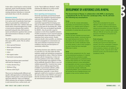
FoCuS<br />
develoPment oF a ReFeRenCe level in nePal<br />
The Government of Nepal, in collaboration with <strong>WWF</strong>, is developing<br />
a subnational RL for the Terai Arc Landscape (TAL). The RL will have<br />
the following key assumptions:<br />
Scope<br />
The RL for the TAL includes deforestation,<br />
degradation and enhancements using IPCC<br />
Approach 3 (i.e. spatially explicit changes in<br />
land area). Data has been derived from a<br />
combination of Landsat data with ground plots.<br />
Forest classification<br />
The TAL has been classified in<strong>to</strong> three forest<br />
classes (shorea robusta—commonly known as<br />
sal, mixed hardwood and riverine). The RL<br />
calculations will use a combination of these<br />
forest types with a further stratification based<br />
on canopy density in order <strong>to</strong> show changes in<br />
the area of strata that have meaningful<br />
differences in carbon.<br />
Scale<br />
The RL will be subnational for the TAL, based<br />
on the jurisdictional boundaries of 12 districts.<br />
The reason for this is primarily <strong>to</strong> enable<br />
<strong>REDD+</strong> implementation at a jurisdictional level,<br />
because these districts are in the best position<br />
<strong>to</strong> implement policies <strong>to</strong> control deforestation<br />
and degradation and also <strong>to</strong> ensure safeguards<br />
are respected and any distribution of benefits<br />
has appropriate oversight. Additionally,<br />
implementing <strong>REDD+</strong> at the jurisdictional level<br />
will minimize the risk of leakage because rural<br />
migration is less common between districts.<br />
Time frame<br />
The RL will be calculated for the period<br />
1999-2011 with an option <strong>to</strong> extend back <strong>to</strong><br />
1994. To maintain consistency with previous<br />
national communications, the period 1994-2011<br />
is preferred; however, Landsat images between<br />
1994 and 1999 will not have the same quality<br />
and level of consistency as the period from<br />
1999 <strong>to</strong> present day.<br />
Pools and gases<br />
The RL will include all the major pools,<br />
including above-ground and below-ground<br />
biomass. Due <strong>to</strong> the uncertainties in measurement<br />
and the relatively small fluctuations in<br />
carbon emissions, however, soil carbon will not<br />
be included in the RL. Given the lack of other<br />
dominant sources, only CO2 emissions will be<br />
considered in the RL.<br />
<strong>WWF</strong> FOREST AND CLIMATE INITIATIVE ReFeRenCe levelS // 67