
You also want an ePaper? Increase the reach of your titles
YUMPU automatically turns print PDFs into web optimized ePapers that Google loves.
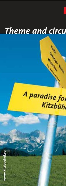
www.kitzbuehel.com <strong>Theme</strong> <strong>and</strong> <strong>circuit</strong> <strong>walking</strong> <strong>tours</strong>
<strong>Theme</strong> <strong>walking</strong> <strong>tours</strong> Kitzbühel<br />
Instructions on using this theme<br />
<strong>walking</strong> tour guide <strong>and</strong> the<br />
maps<br />
The region Kitzbühel-Reith-Aurach-<br />
Jochberg offers a number of extended<br />
<strong>and</strong> marked <strong>walking</strong> routes of different<br />
degrees of difficulty.The complete network<br />
of routes, which are tended to <strong>and</strong><br />
all of which are sign-posted, extends<br />
over an area of in all 500 km. In the<br />
map sections the tended <strong>walking</strong> routes<br />
are indicated in RED, the theme walks in<br />
YELLOW <strong>and</strong> the <strong>circuit</strong> <strong>tours</strong> in BLUE.<br />
For each suggested walk, the length of<br />
the route, the approximate <strong>walking</strong><br />
time <strong>and</strong> the degree of difficulty are<br />
indicated. The time indicated is a<br />
guideline <strong>and</strong> is shown without any<br />
breaks.We recommend planning a break<br />
after around one to two hours. When<br />
<strong>walking</strong> with little children please<br />
calculate double the time. The<br />
calculation of the times for <strong>walking</strong><br />
from the map is derived from st<strong>and</strong>ard<br />
times for average walkers: basically you<br />
should calculate approximately one<br />
hour for a 300 metre ascent, as well as<br />
for a 500 metre decline or 400 kilometres<br />
on flat routes.<br />
Explanation of signs:<br />
destination time<br />
degree of difficulty trail number<br />
On the sign posts you will find the<br />
respective symbol of the theme walk.<br />
The following theme walk pictograms<br />
identify the progress of the routes.<br />
The alpine flower trail<br />
The four seasons walk<br />
The farmhause museum route<br />
The Streif tour<br />
Way of the cross<br />
The ancestral estate trail<br />
Chapel path<br />
The 7 fountains route<br />
The museum trail<br />
The “Wilder Kaiser”<br />
panoramic trail<br />
Degree of difficulty of routes:<br />
The authority of the Tyrolean Provincial<br />
Government classifies <strong>walking</strong> <strong>and</strong><br />
mountain routes according to their<br />
degree of difficulty as red or black.<br />
What classifies RED is as follows:<br />
dem<strong>and</strong>s Alpine experience, a good<br />
physical constitution <strong>and</strong> the surefootedness<br />
of all those participating in<br />
the walk as well as minimum mountaineering<br />
equipment.<br />
BLACK routes dem<strong>and</strong> the following:<br />
in addition to the usual pre-requisites for<br />
red <strong>walking</strong> routes, hill-walkers<br />
undertaking these routes should not<br />
suffer from vertigo.<br />
Between the individual sign-posts you<br />
will find markings which are normally<br />
attached to stones or trees. These also<br />
serve as an orientation guide <strong>and</strong> are<br />
generally in red-white-red. Very often<br />
there are orientation or panorama<br />
boards or site boards at various points<br />
along the theme walks which provide<br />
additional information about the<br />
progress <strong>and</strong> content of the route itself.<br />
Example of a route marking<br />
www.kitzbuehel.com<br />
Important hill-<strong>walking</strong> tips:<br />
Make sure that you always have<br />
equipment suitable for hill-<strong>walking</strong>!<br />
The following are always recommended:<br />
solid hill-<strong>walking</strong> boots with a profiled<br />
sole, sun respectively rain protection,<br />
drinks, mobile phone <strong>and</strong> a first-aid set.<br />
Longer <strong>tours</strong> should be planned with<br />
care <strong>and</strong> in the case of any dangers,<br />
only undertake the tour with an<br />
experienced guide.To ensure optimum<br />
safety, you should always find about<br />
the route in advance as well as the<br />
weather conditions.<br />
Before starting on the walk, inform your<br />
l<strong>and</strong>lord or someone you know, where<br />
you are going to.<br />
Never leave the marked routes <strong>and</strong> in<br />
the event of the weather deteriorating<br />
or a danger, end the tour in good time.<br />
Eat <strong>and</strong> drink regularly during the walk<br />
<strong>and</strong> take a ten minute break every 2<br />
hours.<br />
ATTENTION: Alpine countryside should<br />
always be perceived as dangerous!<br />
Particularly when <strong>walking</strong> with children<br />
<strong>and</strong> older people, it should be<br />
remembered that the routes are not<br />
tended all the time. In case of an<br />
emergency, stay calm <strong>and</strong> contact the<br />
Alpine Search Team<br />
> Alpine rescue signal <<br />
> Euro emergency signal 112 <<br />
> Mountain Rescue 140
<strong>Theme</strong> walks Kitzbühel<br />
The Alpine Flower Trail<br />
Place: Kitzbühel<br />
Length of route: in all<br />
approx. 13.8 km.<br />
Difficulty: easy overall<br />
Walking time: approx.<br />
4 hours<br />
More than 300 types of plants from<br />
around the globe are what make this<br />
Alpine Flower Garden an unforgettable<br />
experience. According to experts, the<br />
garden is one of the most beautiful<br />
Alpine gardens in Europe. Covering 1,880<br />
metres it offers an impressive range of<br />
colours in a breath-taking Alpine panorama.<br />
Map progress:<br />
Hornbahn (cable car) – Alpine Flower<br />
Garden – cable car station Alpenhaus<br />
or from the Alpenhaus to the Horngipfel<br />
(peak) – Lämmerbühel mountain pasture<br />
– Kneipp pools – Bichlalm pasture – back<br />
the same route or descent via the old<br />
Sonnberg route to Kitzbühel.<br />
Sections of route of Alpine Flower trail:<br />
From the Hornbahn (cable car) to the<br />
Alpine Flower Garden <strong>and</strong> the Alpenhaus:<br />
1.7 km, 300 metres altitude, 40- 60 min<br />
From the Horngipfel (peak) via the Alpine<br />
Flower Garden,Hornköpfl,Lämmerbühelalm<br />
pasture,Kneipp pools to the Bichlalm<br />
pasture: 6.3 km, 450 altitude, 2.5 hours<br />
From the Alpenhaus to the Bichlalm<br />
pasture:4.9 km,200 m altitude,1.75 hours<br />
Wiesenschwang<br />
698 m<br />
The route in detail:<br />
From the cable car station on the<br />
HORNGIPFEL (2000 m) which can be<br />
reached using Hornbahn 1 <strong>and</strong> the Horn-<br />
Gipfelbahn,there is a slach descent to the Alpine<br />
780 m<br />
Flower Garden.Then the route continues<br />
to the cable car station ALPENHAUS (1670 m,<br />
possibility to make a stop here).This tour<br />
can also be undertaken Riesberg uphill from the<br />
Alpenhaus to the HORNGIPFEL or the<br />
HORNKÖPFL (1660 m, Hornbahn I <strong>and</strong><br />
Hornbahn II). tegen<br />
The Alpine Flower Garden is well signposted<br />
with information boards <strong>and</strong> it is<br />
not only native flowers which have begun<br />
to grow here. There are rare botanical<br />
Sinnesberg<br />
sights from all parts of the globe in this<br />
unique garden.The garden Höglern is the fruit of<br />
the labour of Eva <strong>and</strong> Toni Hofer Unterberg who have<br />
Hinter-<br />
tended the Alpine Garden grubsince<br />
1985.They<br />
have travelled around Obernau the globe to bring<br />
back rare plants from the Caucasus, Oberbarmthe<br />
Andes, the Pyrenees or the Himalayas.<br />
terbarm<br />
Barmleiten<br />
Sinneben<br />
The garden is embedded in the turf<br />
between natural cliff structures which<br />
were specially removed <strong>and</strong> converted for<br />
this purpose.In addition the Hofer family<br />
Griesenau<br />
created two artificial weirs.Prof Dr.Herbert<br />
Reisigl from the Botanic Bhf Institute Going in<br />
Innsbruck acts as the consultant <strong>and</strong> is<br />
responsible for the archiving work in the<br />
Alpine Flower Garden. Here science<br />
blossoms in the most enchanting manner. Zwicker<br />
You have the chance to admire it free Leiten of<br />
charge from spring to autumn.<br />
After riding to the summit <strong>and</strong> the<br />
colourful hike through the Alpine Schloß<br />
rach<br />
rg-<br />
Warnbach<br />
Panoramastraße Kitzbüheler Horn<br />
Mittelstation tion<br />
1266 66 m<br />
Obernaualm bernaualm<br />
Pletzeralm<br />
Adlernhütte<br />
H o r n b a h n I<br />
Kitzbüheler Horn<br />
1a<br />
34<br />
31<br />
Kitzbühel bühel<br />
761 m<br />
16<br />
Grünberg rünberg r nberg<br />
Goinger Alm<br />
31<br />
Hachlern<br />
Hachlern<br />
H o r n - G i p f e l b a H o r n - G i p f e l b a hh nn<br />
H o r n b a h n II<br />
H o r n b a h n II<br />
Grünberg<br />
Lahning<br />
16<br />
Alpenhaus<br />
1670<br />
TTrattalm r a t t a l m<br />
Reichern<br />
Hagstein<br />
1032<br />
Kitzbüheler Horn<br />
1996<br />
30<br />
Alpen- Alpen- Alpenblumengarten<br />
blumengarten<br />
1880 1880 m<br />
34<br />
Wilder Haag<br />
1639<br />
Schwent<br />
Sonnhoffeld<br />
Golfplatz<br />
Kitzbühel<br />
9 hole<br />
6<br />
Pfeifern 6<br />
Schleierwasserfall<br />
Schleierwasserfall<br />
Oberleiten<br />
Köglern<br />
Boden Boden 3 Waltenberg<br />
altenberg<br />
Zephirau<br />
Kaps<br />
Ebner-Kap.<br />
Eben<br />
Erb<br />
StockerdörflOberbrunn<br />
Henntal<br />
Unter-<br />
29<br />
Gipfelhaus<br />
32<br />
Obere Raintalalm<br />
1561<br />
Hornköpfl<br />
1773<br />
32a<br />
32<br />
Eggl<br />
1652<br />
Lugeck<br />
Sonnenstüberl<br />
H o f e r s c h n e i d<br />
H o f e r s c h n e i d<br />
Spathütte<br />
32<br />
Brunnhoferalm<br />
Oberaigenalm<br />
www.kitzbuehel.com<br />
Moorlacke<br />
Pfeiferkogel<br />
1669<br />
Hochetzkogel<br />
1738<br />
Bichlalm<br />
1670<br />
Untere Reintalalm<br />
1290 1290<br />
Gwindalm<br />
39<br />
37<br />
32<br />
AA ll pp bb aa cc hh<br />
Beerenbr<strong>and</strong>alm<br />
1553<br />
Lämmerbichla<br />
Lämmerb<br />
15<br />
Stuckkogel<br />
Stuckko<br />
1888 1<br />
Map section of Alpine Flower Trail
<strong>Theme</strong> hill walks Kitzbühel www.kitzbuehel.com<br />
Garden to the Hornköpfl, visitors will<br />
be delighted by the view of the Kitzbühel<br />
mountains.<br />
The longer walk via the Lämmerbühelalm<br />
pasture (possibility to take a break<br />
here) to the Bichlalm pasture (possible<br />
place for a break) features no strong<br />
inclines. In addition to the varied fauna,<br />
it is possible to enjoy a Kneipp bath on<br />
the way in the fresh mountain spring<br />
water.<br />
From the Bichlalm pasture it is possible<br />
to return the same way through the<br />
Alpine Flower garden or via the “old<br />
Sonnberg path” past the SONNBERG-<br />
STUB’N (possible place for a break) <strong>and</strong><br />
the singing l<strong>and</strong>lady Rosi, descending to<br />
Kitzbühel.<br />
When does what blossom?<br />
The Alpine Flower Garden is<br />
attractive in every season. Here is a<br />
small excerpt of what awaits you<br />
in the spring to autumn.<br />
Spring:<br />
Spring crocuses, alpine snowbell,<br />
mezeron, gentian, auricular, white<br />
Alpine buttercup, Campion, moss,<br />
alpine anemone, anemone<br />
narissiflore<br />
Summer:<br />
Aster Alpine, arnica, bellflower,<br />
bearded, pedicularis, Alpine rose,<br />
yellow gentian,Turk’s cap lily, orchids,<br />
gymnadenia conopsea<br />
Autumn:<br />
Hieracium villosum, calluna, German<br />
gentian, brown-violet gentian, thistle<br />
(cirsium eriophorum), blue monk’s<br />
hood, Alpine eryngo, high larkspur,<br />
carlina acaulis<br />
Guided <strong>tours</strong> <strong>and</strong> information<br />
Free guided <strong>tours</strong> in July <strong>and</strong> August,<br />
2 x daily. Trip up to the Alpine Flower<br />
Garden via the Kitzbühel Horn cable<br />
cars from May to September.Entrance<br />
to Alpine Flower Garden,reachable via<br />
the Hornbahn I <strong>and</strong> Horn Gipfelbahn.<br />
For those thirsty for knowledge there is<br />
a “guide book” through the Alpine<br />
Flower Garden on the Kitzbüheler Horn<br />
which is available at the lift stations of<br />
Bergbahn AG Kitzbühel <strong>and</strong> Kitzbühel<br />
Tourismus for Euro 3 (also available in<br />
English).
<strong>Theme</strong> hill walks Kitzbühel<br />
Four-seasons walk<br />
Place: Kitzbühel<br />
Length: approx. 2.5 km<br />
Difficulty: easy, for families,<br />
senior citizens, easy<br />
to manage with a pram,<br />
suitable forwheelchairs<br />
Walking time: approx.<br />
1 hour<br />
How much milk does a cow produce a<br />
day? What is the device with the strange<br />
sounding name of “Kardatsche” used<br />
for? What does freshly cut hay feel like?<br />
Exciting answers to these <strong>and</strong> numerous<br />
other questions are to be found on the<br />
interactive four-seasons walk on the<br />
Hahnenkamm.<br />
In this innovative project the agricultural<br />
year is at the centre of attention.<br />
Directly reachable with the Hahnenkamm<br />
cable car, a route has been put<br />
together which is easy to walk <strong>and</strong><br />
appeals to the senses.<br />
The four stations, each of which is devoted<br />
to one season, attract visitors to<br />
come <strong>and</strong> listen, look, smell <strong>and</strong> taste.<br />
The entrance is free of charge. You can<br />
either go there to discover things on<br />
your own or take part in one of the<br />
regular guided <strong>tours</strong> within the framework<br />
of the free Kitzbühel hill<strong>walking</strong><br />
programme.<br />
Information can be obtained from<br />
Kitzbühel Tourismus.<br />
Course of walk:<br />
The four-seasons walk continues along<br />
the panorama route on the Hahnenkamm<br />
starting at the Hahnenkamm<br />
cable car – STREIF start house – Bernhard<br />
chapel – Berghaus Tyrol – Hahnenkamm<br />
Stüberl – back to the mountain station.<br />
The route in detail:<br />
You take the world-famous Hahnenkamm<br />
cable car to the home mountain<br />
of Kitzbühel where you will find the first<br />
information board near the mountain<br />
station HOCHKITZBÜHEL (possibility to<br />
have a break here) of the theme walk.<br />
From here the route continues in the<br />
direction of the STREIF start house <strong>and</strong><br />
then on through the forest until the<br />
route reaches the first sign post to the<br />
BERNHARD chapel <strong>and</strong> the four-seasons<br />
walk.<br />
In the course of the route you will find<br />
four stations.The SPRING station has as<br />
its motto “Milk”. On the traces of the<br />
milk route, the milk walk will have you<br />
researching the cow itself through to<br />
the actual packaging material for the<br />
milk. At the milk st<strong>and</strong> you can test your<br />
own skills as a milk farmer. After<br />
approximately 100 metres you will reach<br />
the SUMMER station which is devoted in<br />
its entirety to “Hay”. Anyone who has<br />
made a man of hay with their own h<strong>and</strong>s<br />
can then let relax a bit on the hay bed in<br />
the Tyrolean world of sagas.<br />
This is followed by the AUTUMN station<br />
which is located underneath the<br />
BERGHAUS TYROL (possibility to stop for<br />
a break here).With “Wood” as its motto<br />
a presentation is given of how ingenious<br />
native wood actually is – something<br />
which our ancestors have known for a<br />
very long time. Apart from old wooden<br />
houses <strong>and</strong> shingle roofs, wooden fences<br />
for example are also part <strong>and</strong> parcel of a<br />
typical Tyrolean l<strong>and</strong>scape. The fourseasons<br />
walk has revived old methods of<br />
building fences <strong>and</strong> has erected some<br />
models for your inspection.<br />
On the last part of the walk you will<br />
come to the WINTER STATION underneath<br />
the BERNHARD chapel which is devoted<br />
to the subject of “Farmers’ H<strong>and</strong>icraft”.<br />
From basket-making, to spinning <strong>and</strong><br />
wood carving, the old techniques are<br />
explained to visitors <strong>and</strong> different kinds<br />
of materials invite you to touch them.<br />
From here the panorama route goes<br />
back in the direction of the HAHNEN-<br />
KAMMSTÜBERL (possibility to stop here<br />
for a break) to the mountain station<br />
HOCHKITZBÜHEL (possibility to stop here<br />
Obere<br />
Fleckalm<br />
1462<br />
Berghs.<br />
Bernhard- Bernhard- Tirol<br />
kapelle<br />
kapelle<br />
23<br />
öhe<br />
24<br />
22<br />
EhrenbachEhrenbachhöhenseehöhensee<br />
22<br />
23<br />
Sonnbühel<br />
21 21<br />
Waldeköpfl<br />
1712<br />
www.kitzbuehel.com<br />
for a break). For those who enjoy hill<strong>walking</strong><br />
<strong>and</strong> wish to continue the tour,<br />
there are numerous alternatives available:<br />
the hill-<strong>walking</strong> routes to HOCHBRUNN<br />
<strong>and</strong> further on to the PENGELSTEIN, to the<br />
EHRENBACHHÖHE lake with the Kneipp<br />
basins, to the FLECKALM (mountain<br />
pasture), MAIERL or the OCHSALM<br />
(mountain pasture) in the direction of<br />
Kirchberg.<br />
Picture above: view of the Speicher lake<br />
Picture below: section of map of<br />
four-season walk<br />
Bergbahnmuseum
<strong>Theme</strong> hill walks Kitzbühel<br />
The farmhouse museum route<br />
Place: Kitzbühel<br />
Length: approx. 4.9 km<br />
Degree of difficulty: easy,<br />
suitable for families +<br />
senior citizens<br />
Walking time: 1.5 h<br />
This walk will take you from the chic,<br />
touristy town centre to the in part<br />
farmhouse outskirts of the town of<br />
Kitzbühel. On this expedition „back<br />
through time“ you will experience the<br />
modernised medieval town centre, the<br />
birthplace of skiing at the foot of the<br />
Kitzbühel Horn, interesting pioneering<br />
tourist companies <strong>and</strong> at the end of the<br />
road, the farming roots of the town of<br />
Kitzbühel.<br />
Progress of route:<br />
Centre – Hornweg – hospital – Horn<br />
cable car – Tennerhof – Römerweg – the<br />
farmhouse museum - back via the<br />
Vordergrub - Achen promenade - the<br />
station - to the Horn cable car <strong>and</strong> the<br />
centre.<br />
The route in detail:<br />
From the centre this theme walk passes<br />
the HOSPITAL in the direction of the<br />
Kitzbüheler Horn.<br />
The architecture of the front <strong>and</strong> back<br />
parts of the town bear witness to this day<br />
of the fact that Kitzbühel was<br />
characterised for a long time by mining,<br />
trade <strong>and</strong> commerce. The trade guilds<br />
<strong>and</strong> medieval means of production<br />
predominated until 1850.The most decisive<br />
means of making a living was agriculture<br />
which was the main occupation of all the<br />
working people in this area.The way of life<br />
in this quiet country community was<br />
characterised by agriculture,in agreement<br />
with most of Austria.<br />
With the connection to the railroad at<br />
the end of the 19th Century, social <strong>and</strong><br />
economic changes began to gather<br />
momentum in Kitzbühel as well. This<br />
can be seen in particular at the next<br />
station on the Kitzbühel Horn cable car.<br />
It was here in 1892 that the snow-covered<br />
<strong>and</strong> completely euphoric Franz Reisch<br />
welcomed his friend Josef Herold who<br />
had nervously waited on him for hours at<br />
the edge of a field. In the year 1892 Franz<br />
Reisch was the first<br />
human to descend<br />
from the Kitzbüheler<br />
Horn on skis.<br />
Some years later in<br />
1929, the first cable<br />
car was started up<br />
on the Hahnenkamm,<br />
the cable car which conveyed<br />
people to the Kitzbüheler Horn was<br />
started in 1951.<br />
At this time Kitzbühel was already making<br />
a name for itself all over the world as a<br />
winter sports destination.This is mirrored<br />
in the next station. If one follows the<br />
Hornweg further in the direction of<br />
FREISENAUWEG, then on the right h<strong>and</strong><br />
side one comes across a shining example<br />
of the hotel pioneers of Kitzbühel of<br />
former days.The history of the luxurious<br />
5-star hotel TENNERHOF can be traced<br />
ee ee<br />
back to the year 1737. The greatgr<strong>and</strong>mother<br />
of today’s owner, Duchess<br />
Schall Riaucour, purchased the property<br />
<strong>and</strong> the farm belonging to this in the<br />
year 1927 thus laying the foundations for<br />
a hotel after World War II.<br />
Following a short stop, the walk leads<br />
onto the Römerweg (Way of the<br />
Romans) <strong>and</strong> at the same time in the<br />
direction of the edge of the town. If<br />
one glances from here back to the town<br />
centre it is still possible to make out<br />
some of the villas <strong>and</strong> the hotel<br />
architecture erected in the last century.<br />
The mode of construction given the name<br />
53<br />
7<br />
46a<br />
12<br />
53<br />
12<br />
Steuerberg<br />
Oberhaus<br />
11<br />
Kampen<br />
11a<br />
15<br />
12<br />
15<br />
11<br />
Lebenberg-<br />
LebenbergLebenbergkopf<br />
883<br />
Schloß<br />
Lebenberg<br />
Lebenberg<br />
10<br />
7<br />
Filzen<br />
9<br />
Ecking Ecking<br />
e<br />
10<br />
Siedlung Siedlung<br />
Frieden<br />
Höglern<br />
Vordergrub<br />
14<br />
Hintergrub<br />
15<br />
11<br />
14<br />
Unterbarm<br />
15<br />
12<br />
Obernau<br />
Bhf Bhf<br />
13<br />
www.kitzbuehel.com<br />
of “domestic revival”style is recognisable<br />
by the natural stone walls,medieval timber<br />
frame structures,spacious glass ver<strong>and</strong>as<br />
<strong>and</strong> balconies. Today these buildings are<br />
joined by modern hotel structures which<br />
are spreading more <strong>and</strong> more to the<br />
outskirts as is the case in other Alpine<br />
winter sports destinations.<br />
Likewise on the Way of the Romans you<br />
will find the next <strong>and</strong> last station of the<br />
theme walk, the farmhouse museum<br />
HINTEROBERNAU.<br />
The farmhouse from the year 1559 of the<br />
Salzburg-Tyrolean type with everything<br />
Unterberg<br />
Oberbarm<br />
14<br />
Griesenau Griesenau<br />
Sinnesberg<br />
Sinnesberg<br />
Barmleiten<br />
13<br />
16<br />
Sinneben<br />
Going<br />
Pletzeralm Pletzeralm<br />
HH oo rr nn bb aa hh nn II<br />
34<br />
16<br />
Zwicker<br />
Leiten<br />
Leiten<br />
Mittelst Mittelsta<br />
12<br />
Kitzb Kitz<br />
G<br />
in the same house<br />
(e.g. the stables,<br />
baking house, the<br />
laundry house) is<br />
decorated in the style<br />
of 100 years ago <strong>and</strong><br />
shows the farming<br />
way of life before<br />
tourism made inroads<br />
on the Kitzbühel<br />
region.<br />
The farmhouse is<br />
equipped with tools<br />
<strong>and</strong> equipment, a<br />
smoke-room, a parlour,<br />
a bed room<br />
<strong>and</strong> a barn.<br />
Map section of<br />
farmhouse museum<br />
route (yellow)
<strong>Theme</strong> hill walks Kitzbühel www.kitzbuehel.com<br />
Tennerhof:from agriculture to tourism<br />
The history of this luxurious 5-star<br />
hotel goes back to the year 1737 at<br />
which time the Tennerhof was still a<br />
farm. The great-gr<strong>and</strong>mother of the<br />
present owner, Countess Schall<br />
Riaucour, acquired the property<br />
together with the adjoining farm in<br />
1927.In the second half of the war,the<br />
house was seized by the Nazi regime,<br />
although the owners retained a<br />
modest right of abode. In 1945 or<br />
thereabouts some relatives <strong>and</strong> various<br />
friends of the family came from the<br />
east, from Vienna <strong>and</strong> Budapest<br />
seeking protection from the advancing<br />
Russian. Since it was not possible to<br />
provide board <strong>and</strong> lodging for all their<br />
friends on a long-term basis, the<br />
“paying guest” set-up was initiated,<br />
thus laying the foundation for the<br />
accommodation industry.Leopold von<br />
Pasquali, the heir, having returned<br />
from the war, attended a school of<br />
hotel management <strong>and</strong> shortly<br />
afterwards, seasonal trade began to<br />
thrive with visits from his society<br />
friends.Thus the nobility used to queue<br />
up in a disciplined manner every<br />
morning at the baths in the corridors<br />
with face cloths, soap <strong>and</strong><br />
toothbrushes under their arms. The<br />
special flair of the hotel can be<br />
attributed to its success in making<br />
constant improvements, such as<br />
refitting <strong>and</strong> extensions.<br />
The farmhouse museum<br />
Hinterobernau (figure above)<br />
Verein Bauernhausmuseum<br />
Herbert Jordan,<br />
Open July to September<br />
Monday – Saturday, 1 p.m. to 5 p.m.<br />
Closed on Sundays<br />
Change in the urban features of<br />
Kitzbühel<br />
From its comparatively modest<br />
beginnings as a summer resort, with<br />
the advent of winter sports at the<br />
end of the 19th Century, tourism<br />
began to thrive <strong>and</strong> very quickly<br />
became a decisive factor in the<br />
town’s economy.<br />
Its elevation to a fashionable<br />
summer resort <strong>and</strong> first class winter<br />
sports destination was not without<br />
its impact on the townscape of the<br />
small rural parishes. The area of<br />
settlement was developed on a large<br />
scale for the first time since its<br />
heyday as a mining centre some<br />
centuries before.<br />
Following rapid tourist development,<br />
the town centre, which had already<br />
been characterised by town houses<br />
rather than rural in design, together<br />
with the mostly very modest houses<br />
on the outskirts, was very soon<br />
surrounded by the internationally<br />
prevalent villa <strong>and</strong> hotel architecture,<br />
which kept spreading to the outskirts<br />
<strong>and</strong> is still evident today.<br />
Characteristic of this summer resort,<br />
Swiss or the domestic revival style of<br />
architecture, is the construction of<br />
bases <strong>and</strong> complete walls in local<br />
natural stone or the medieval timber<br />
frame construction as executed by<br />
carpenters.<br />
Roomy glass ver<strong>and</strong>as, balconies <strong>and</strong><br />
large protecting canopies are<br />
intended to ensure that nature is<br />
enjoyed without having to do<br />
without the amenities of life in a<br />
large town. Today one still finds<br />
many hotel buildings (e.g. the Gr<strong>and</strong><br />
Hotel) <strong>and</strong> second residences, such<br />
as the Villa Zurner (the building with<br />
a turret, below left in the picture<br />
with a view of the old town), which<br />
integrate harmoniously into the<br />
townscape of Kitzbühel.<br />
Romanticism has had an impact on<br />
the architecture, as well as the<br />
language of those times <strong>and</strong> one<br />
assumes that this was when the<br />
“Römerweg” (Way of the Romans)<br />
was given its name.<br />
(Source: Wido Sieberer,<br />
Kitzbühels Weg ins 20. Jahrhundert)<br />
Picture above: view of historic town
<strong>Theme</strong> hill walks Kitzbühel<br />
Streif walk<br />
Place: Kitzbühel<br />
Length: approx. 3.8 km,<br />
difference in altitude of<br />
900 metres<br />
Degree of difficulty:<br />
average to difficult<br />
Walking time: 2.5 hours<br />
The „Streif“ is known as the classic <strong>and</strong><br />
most difficult downhill racing course<br />
in the world. Every year it inspires<br />
thous<strong>and</strong>s of spectators <strong>and</strong> winter<br />
sports fans.The key places on the Streif<br />
walk are marked by goals each of which<br />
represents one stop or station.<br />
Progress of the route<br />
Ascent with the Hahnenkamm cable<br />
car – mountain railway museum –<br />
starting house – the mousetrap – steep<br />
slope – Gschöss – Alte Schneise –<br />
Seidlalm – Lärchenschuss – Hausberg –<br />
finishing line<br />
The route in detail<br />
After ascending with the Hahnenkamm<br />
cable car,it is possible to visit the mountain<br />
railway museum directly at the summit<br />
station (possibility to stop for a break<br />
here). Here you will discover some<br />
interesting <strong>and</strong> curious facts about the<br />
history of Kitzbühel as a pioneering region<br />
in Alpine winter sports in general as well<br />
as about the history of the Bergbahn AG<br />
Kitzbühel in particular. The museum is<br />
open daily in the summer.The route then<br />
continues to the actual start of the Streif<br />
walk, the starting house. From here it is<br />
3312 m to the finishing line. After passing<br />
the steep start section, the adventurous<br />
walk carries on to the world famous<br />
mousetrap.With an incline of 85% this is<br />
the steepest part of the downhill race.<br />
Anyone who has yet not had enough of<br />
these dizzy heights can continue to the<br />
next station on the steep slope.This stretch<br />
is the iciest during the winter.<br />
This is followed by the flattest <strong>and</strong> longest<br />
section known as the Gschöss.The skiers<br />
pass through this area at a speed of<br />
approx. 90 km/h.<br />
Now the ALTE SCHNEISE can no longer<br />
be missed. This is the least peaceful part<br />
of the race since the skiers are challenged<br />
here by the rapid change in the terrain<br />
<strong>and</strong> changing light conditions.From here<br />
it is now only another 536 metres to the<br />
finishing line <strong>and</strong> it is not far from the<br />
SEIDLALM (possibility to stop here for a<br />
break).<br />
This is the place where the idea for the<br />
world cup was born. Anyone who would<br />
like to have a longer break can continue to<br />
the SEIDLALM lake,a storage pond used for<br />
making snow.<br />
At the end of the Streif walk, the Lärchen<br />
slope, the Hausberg (final jump before<br />
finishing line) <strong>and</strong> the steep slope at the<br />
finishing line await you.<br />
The Hausberg is described by many experts<br />
as the most breath-taking part of the race<br />
but also the most dem<strong>and</strong>ing on the<br />
athletes <strong>and</strong> their equipment. In the<br />
finishing area, the skiers reach speeds of<br />
up to 140 km/h.<br />
The interfaces of the Streif<br />
downhill race<br />
Start<br />
Greatest acceleration: 160 m in 8.5<br />
seconds to the mousetrap,difference<br />
in altitude to the finish 860 m,length<br />
of stretch to finish 3,312 m,inclination<br />
51%, speed 100 km/h<br />
Mousetrap<br />
The steepest point:85%,furthest jump<br />
80 m,difference in altitude 3,152 metres,<br />
inclination 73%, speed 120 km/h<br />
Steep slope<br />
The iciest part: extremely high<br />
centrifugal forces,difference in altitude<br />
to finish 693 m, length of stretch to<br />
finish 2,800 m,inclination 62%,speed Koglern<br />
100 km/h<br />
Finish<br />
The fastest part,difference in altitude<br />
to finish 117 m, length of stretch to<br />
finish 406 m, inclination 68%, speed<br />
140 km/h<br />
Zenzern<br />
Ecking<br />
Gschöss<br />
Flattest part:2% longest gliding part:<br />
650 m, altitude difference Neuhausalm to finish<br />
581 m,length of stretch to finish 2,459<br />
m, inclination 14%, speed 90 km/h<br />
a<br />
Alte Schneise<br />
Least peaceful part: rapid change Zenzeralm in ralm<br />
terrain <strong>and</strong> light conditions, altitude<br />
difference to finish 526 m, length of Seidlalmkopf<br />
stretch to finish 2,020 m, inclination<br />
1391<br />
45%, speed 100 km/h<br />
Seidlalm<br />
Streifalm<br />
Half-way: 1,600 of 3,200 m, place<br />
1275<br />
where idea was born for the World<br />
48<br />
SeidlSeidlalmseealmsee 26<br />
Kampen<br />
46<br />
Seidlalm<br />
1206<br />
26<br />
7a<br />
7<br />
46<br />
48<br />
46<br />
25<br />
Golfpla<br />
Rasmush Rasmusho<br />
9 ho hol<br />
7<br />
8<br />
25<br />
26<br />
45<br />
47<br />
Scha<br />
siedl<br />
Cup in the year 1966, difference in<br />
altitude to finish 439 m, length of<br />
stretch to finish 1,703 m, inclination<br />
53%, speed 90 km/h<br />
Obere<br />
Fleckalm<br />
1462 Berghs.<br />
Bernhard- Tirol<br />
kapelle<br />
46<br />
Hocheck-H.<br />
25a<br />
21 Bergbahn- Bergbahnmuseum<br />
Figure above:<br />
map section of Streif Astenalm walk<br />
Waldeköpfl<br />
1712<br />
E<br />
b a h n<br />
hrenbachhöhe<br />
Ehrenbachhöhensee<br />
m m a k n e nn hh aa HH Sonnbühel<br />
www.kitzbuehel.com<br />
Lärchenschuss (steep slope)<br />
Second gliding part:102.5 km/h average<br />
speed, difference in altitude to<br />
finish 349 m,length of stretch to finish<br />
1,273 m, inclination 39%, speed 100<br />
km/h<br />
Hausberg<br />
A breath-taking part of the race <strong>and</strong><br />
the most dem<strong>and</strong>ing section on the<br />
athletes <strong>and</strong> their equipment,<br />
difference in altitude to finish 230 m,<br />
length of the stretch to finish 695 m,<br />
inclination 69%, speed 100 km/h<br />
HH aa hh nn ee nn kk aa mm mm bb aa hh nn<br />
aben<br />
G
<strong>Theme</strong> hill walks Kitzbühel<br />
Streif walk<br />
Place: Kitzbühel<br />
The mountain railway museum<br />
The first swings downhill on boards<br />
on the Kitzbühel Horn took place<br />
almost 100 years ago. Such was the<br />
pioneering spirit, stubbornness <strong>and</strong><br />
the visionary foresight of only a<br />
h<strong>and</strong>ful of people who at that time<br />
laid the basis for the international<br />
reputation Kitzbühel now enjoys as<br />
a skiing resort <strong>and</strong> today's modern<br />
tourism.<br />
An exciting trip back through time,<br />
brought to life by means of historic<br />
exhibits, photos <strong>and</strong> documents<br />
from the past. The virtual ski<br />
simulator is particularly popular.Try<br />
it out to experience a downhill run<br />
on the Streif at close h<strong>and</strong>!<br />
Open daily from June to October, 10<br />
a.m. to 4 p.m.. Every Friday nocturnal<br />
cable car trip – visit to the museum<br />
also possible in the evening.<br />
Entrance free!<br />
www.kitzbuehel.com<br />
“Ganslernhang” - slalom<br />
The high speed <strong>and</strong> changing conditions<br />
will represent a challenge<br />
to any skier.<br />
A perfect skiing technique includes<br />
the following: reducing your speed,<br />
letting your skis go, looking ahead<br />
<strong>and</strong> attacking.<br />
The slalom combination at<br />
"Hohenegg" becomes a true challenge<br />
when enthusiastic spectators<br />
accompany the racers to the finishing<br />
line applauding wildly.<br />
Kitzbühel Super-G<br />
After starting from the Seidlalmkopf,<br />
the steep starting slope of the<br />
“Streifalm” literally catapults the ski<br />
racers down the slopes, this is<br />
followed by a difficult right-left “S”<br />
combination in the direction of the<br />
Seidlalm jump.<br />
The run then continues along the<br />
Streif downhill track.The highlights<br />
of the Super-Gs are the<br />
Hausbergkante <strong>and</strong> Hausberg-<br />
Querfahrt which test the racing stars<br />
to the limit.<br />
The finishing line along the line of<br />
the slope gives the skiers the<br />
opportunity to demonstrate the<br />
elegance of their sport at high speed.
<strong>Theme</strong> hill walks Kitzbühel<br />
Kreuzweg (Way of the Cross)<br />
Place: Kitzbühel<br />
Length: approx. 6.3 km<br />
Degree of difficulty:<br />
average (final section<br />
gets steeper)<br />
Walking time: approx.<br />
2 hours (for slow<br />
walkers)<br />
When designing the Kreuzweg, the art<br />
designer <strong>and</strong> sculptor, Heinz Sohler,<br />
successfully created a symbiosis of<br />
simplicity <strong>and</strong> at the same time a<br />
symbolic portrayal. His figures which are<br />
made of iron allow the observer a lot of<br />
space for his or her own interpretation<br />
due to the formal openness. The 14<br />
stations which depict the scenes of the<br />
torture of Jesus Christ in an iron frame<br />
harmonise with the background which<br />
shows the forest as a backdrop depicted<br />
in all its perishability. The picture is<br />
designed to mirror the progress of human<br />
life itself - easy at the start, becoming<br />
more <strong>and</strong> more difficult <strong>and</strong> arduous<br />
until finally one enters the world of God<br />
from a Christian point of view.<br />
Progress of the route<br />
Centre – Hahnenkammstraße – Bergwerksweg<br />
– limits of settlement - direction<br />
of quarry road – start of the Kreuzweg<br />
– Einsiedeleikapelle – Seidlalm or<br />
the same way back.<br />
The route in detail<br />
Coming from the centre the route<br />
continues via the Hahnenkammstraße<br />
<strong>and</strong> the Bergwerksweg to the edges of<br />
the settlement of Kitzbühel.The Kreuzweg<br />
commences at the so-called “Third<br />
Schattberg”leading in the direction of the<br />
quarry.<br />
The goal of the Kreuzweg is the<br />
Einsiedleikapelle (hermitage chapel) which<br />
was donated by the hatter Franz Stitz in 1735<br />
<strong>and</strong> has since been a favourite place of<br />
pilgrimage.The route takes the same road<br />
back to the valley. However, anyone who<br />
has enough energy left for a longer walk<br />
can continue to the Seidlalm (possibility to<br />
stop for a break here) where they will<br />
discover an idyllic mountain lake.<br />
Attention: please always follow the redwhite-red<br />
markings. At station 4 the<br />
route continues to the right <strong>and</strong> after<br />
station 8 to the left in front of the forest<br />
road.<br />
History of the Kreuzweg<br />
As a result of constructing the forest<br />
roads in the forest at the Schattberg<br />
as of the 60’s, a large part of the<br />
route of the traditional path to the<br />
hermitage was no longer needed. At<br />
the same time the Kreuzweg on the<br />
old Wegstraße to this formerly<br />
significant place of pilgrimage fell<br />
into disuse.<br />
Thanks to the commitment <strong>and</strong> hard<br />
work of Peter Br<strong>and</strong>stätter, the<br />
renovation of the hermitage chapel<br />
was completed in 1995.<br />
Since then Dr. Vitus Grünwald has<br />
concentrated on reconstructing the<br />
Kreuzweg. The Kitzbühel mayor,<br />
Johanna Lidl, was brought on board<br />
lalm<br />
1206<br />
m<br />
gbahneum<br />
Ecking<br />
the “Einsiedelei”project”as a generous<br />
donator to the 14 stations.These were<br />
designed by the local artist Heinz<br />
Sohler.<br />
Kampen<br />
The footpath to the former town<br />
quarry was chosen as the site of the<br />
Kreuzweg past the attractive scenery<br />
of the “Palvei”.<br />
The Einsiedlerei chapel<br />
(hermitage chapel)<br />
(also known as the Maria chapel)<br />
The hermitage chapel “Visitation of<br />
Mary” was donated in 1735 by Franz<br />
Stitz. On a business trip to Carinthia<br />
he was attacked by down <strong>and</strong> outs<br />
<strong>and</strong> to say thank you for surviving he<br />
swore that he would undertake a<br />
pilgrimage to Mariazell <strong>and</strong> found a<br />
chapel. He acted on both of his vows<br />
<strong>and</strong> he took a picture of the Mother<br />
of God with him.<br />
In 1776 a Kreuzweg was used for the<br />
chapel for the first time. In 1884 the<br />
wooden church was newly erected<br />
by Christian Holzkirchlein in stone.<br />
In 1888 the Einsiedelei was converted<br />
into a restaurant <strong>and</strong> pub by the town<br />
council due to the bad experience the<br />
town had had with hermits.<br />
At the time of the “Einsiedelei Magd”<br />
the Einsiedelei was a popular place for<br />
an excursion.The names of numerous<br />
prominent guests can be found in the<br />
guest book (1896-1908).<br />
In 1920 <strong>and</strong> 1935 the chapel was the<br />
victim of heavy fires. Between 1990<br />
H a h n e n k a m m b a h n<br />
Golfplatz<br />
Rasmushof smushof<br />
9 hole<br />
25<br />
Astenalm<br />
8<br />
47<br />
7<br />
Maurach<br />
Schattberg-<br />
Schattbergsiedlung<br />
www.kitzbuehel.com<br />
<strong>and</strong> 1995 the Einsiedelei chapel was<br />
renovated <strong>and</strong> a picture of “Maria<br />
Heimsuchung” was hung up.<br />
Each year in July a procession advances<br />
along the Kreuzweg <strong>and</strong> a festive<br />
mass is held by the priest.<br />
Einsiedelei<br />
8<br />
Map section of Kreuzweg<br />
(Way of the Cross)
<strong>Theme</strong> hill walks Aurach<br />
Ancestral estate trail<br />
Place: Aurach<br />
Length:approx.4 to 5 km<br />
Degree of difficulty:<br />
average<br />
Walking time: approx.<br />
1.5 hours<br />
The ancestral estate trail in Aurach is a<br />
theme walk both full of variety <strong>and</strong><br />
history.The start of the walk is clear from<br />
a board which indicates the start <strong>and</strong><br />
leads you back to a time when farmhouse<br />
groups <strong>and</strong> lots of individual farmhouses<br />
characterised the face of the township of<br />
the Kitzbühel Alps. Information on the<br />
local culture, the architecture <strong>and</strong> the<br />
history of the Tyrolean ancestral estates<br />
will help to prepare you for the walk<br />
ahead of you.<br />
Progress of the route<br />
Bichln/Bichlhof (parking area) – Bachern –<br />
Filzerb – Filzen – Oberaurach – Hallerwirt<br />
– Niedernberg – same way back – Buchau<br />
direction Trategg – Wildpark (animal park)<br />
– Aurach/Br<strong>and</strong>(er)hof – back via<br />
Schlössw<strong>and</strong> – Schwendt – to Bichln<br />
parking area.<br />
The route in detail:<br />
The first part of the ancestral estate route<br />
leads from the parking area in BICHLN<br />
across what is at the beginning of a<br />
relatively flat piece of the road in the<br />
direction of BACHERN,FILZERB <strong>and</strong> FILZEN<br />
to OBERAURACH. On the way you pass by<br />
the HALLERWIRT (restaurant). It lies directly<br />
on the road <strong>and</strong> offers a good opportunity<br />
to take a break. The HALLERWIRT<br />
ancestral estate Niedernberg<br />
ancestral estate is built entirely of wood<br />
<strong>and</strong> decorated with generous balconies.<br />
From here the road leads to the ancestral<br />
estate on the NIEDERNBERG.The organic<br />
farm which was built in 1569 is owned by<br />
the seventh generation of the Erber family<br />
<strong>and</strong> was awarded the right of inheritance<br />
from the province of Tyrol in 1994. Until<br />
two years ago the farm cultivated<br />
potatoes <strong>and</strong> crops.The farm’s own milk<br />
products,bread <strong>and</strong> br<strong>and</strong>y can be bought<br />
from the farmers’ market which is held<br />
once a week. Back the same way, the<br />
route continues uphill to the luscious<br />
ancestral estate Buchau<br />
green mountains of the ancestral estate<br />
BUCHAU which has been owned by the<br />
Mitterer family since 1759. In former days<br />
the fields in the BUCHAU (direction<br />
Tratteg) had to be tended by h<strong>and</strong> as was<br />
the case on all the other farms.The crops<br />
cultivated included rye, oats <strong>and</strong> wheat.<br />
The first tractor was purchased in the<br />
1970’s <strong>and</strong> the road from Aurach to the<br />
farm was built as late as 1972. This road<br />
leads us to the next station.<br />
The ancestral estate TRATEGG constitutes<br />
another jewel <strong>and</strong> today it is still in a very<br />
good condition. If one passes the<br />
farmhouse one can see the farmhouse’s<br />
own “baking <strong>and</strong> smoking house”on the<br />
right-h<strong>and</strong> side.Today bread is still baked<br />
heim<br />
71<br />
72<br />
Bichln<br />
cc hh<br />
aa bb hh cc ss AA m<br />
71<br />
76<br />
5<br />
76<br />
4<br />
37a<br />
Brachofen<br />
71<br />
5<br />
Bichlhof<br />
i l F z e rr b bb aa cc hh<br />
Filzerb<br />
72<br />
78<br />
Filzen<br />
5<br />
76<br />
Niedernberg<br />
Bachern<br />
Bachern<br />
37a<br />
Oberaurach<br />
Schmalegg<br />
Schwent<br />
gg<br />
rr ee bb nn nn oo SS Schössw<strong>and</strong><br />
37a<br />
75<br />
77<br />
Buchau<br />
74 78<br />
75<br />
82<br />
85<br />
Ob b<br />
78<br />
77<br />
Imper<br />
Trategg<br />
77<br />
37a<br />
37<br />
Br<strong>and</strong>erhof<br />
www.kitzbuehel.com<br />
here regularly. In former days the bread<br />
was stored in the storage cupboard of<br />
the main house for months <strong>and</strong> dried. A<br />
few steps further on, on the left-h<strong>and</strong><br />
side,one can find a well preserved honing<br />
machine used to grind the scythes <strong>and</strong> the<br />
Ancestral estate Trategg with the<br />
baking <strong>and</strong> smoking house<br />
Brunnerhochalm<br />
1558<br />
Gaisbergsatte<br />
Gaisbergsatt<br />
16 168<br />
37<br />
Br<strong>and</strong>e Br<strong>and</strong><br />
Hochalm Hocha<br />
Map section ancestral estate trail
<strong>Theme</strong> hill walks Aurach<br />
Br<strong>and</strong>nerhof ancestral estate<br />
washing house which is now no longer in<br />
use. The latter is located directly next to<br />
the small mountain stream. On washing<br />
day,which was once every week,the water<br />
was diverted from the small spring into<br />
the house <strong>and</strong> heated. If one continues<br />
across the bridge,one finds a forest track<br />
in the direction of the BRANDNERHOF<br />
<strong>and</strong> Aurach animal park. In terms of size,<br />
this is the largest farmhouse in Aurach <strong>and</strong><br />
in times in which there was no machinery<br />
to help out it employed approximately 25<br />
people. The gr<strong>and</strong>-father of the owners<br />
was a pioneer in his day. He introduced<br />
Haflinger horse breeding,which he knew<br />
from Southern Tyrol, to this part of Austria<br />
<strong>and</strong> built a mountain pasture milk<br />
collection point with a collection basin.The<br />
fresh milk was conveyed daily via pipes<br />
into the small “house” next to the main<br />
building.<br />
The adjacent animal park which is worth<br />
a visit <strong>and</strong> also has a restaurant (possibility<br />
to stop for a break here) was erected by<br />
the founding family, the Pletzers, in 1927.<br />
The route then goes on via the SCHÖSS-<br />
WAND <strong>and</strong> SCHWENDT back to the<br />
BICHLN parking area. The road is well<br />
built <strong>and</strong> one passes a refreshing wild<br />
stream.<br />
Anecdotes on the way of life on<br />
Ancestral Estates<br />
Niedernberg:The youngest ancestral<br />
estate in Aurach was built in 1569 <strong>and</strong><br />
enlarged between 1840 <strong>and</strong> 1878.“At<br />
this time the Erbers were already a<br />
very sociable family. Musicians,<br />
firemen <strong>and</strong> animal breeders they<br />
took pleasure in playing an active role<br />
in the life of the local community,<br />
farmer Christian reports.<br />
Buchau:The Buchau ancestral estate<br />
was awarded the right of inheritance<br />
in 1980. The seal of the Tyrolean<br />
ancestral estates is displayed with<br />
pride on the front door. The farmhouse<br />
has been owned by the<br />
Mitterer family for many generations.<br />
As in former times, the favourite place<br />
of the Mitterers is at the dark-green<br />
tiled oven in the “farmers’ parlour”.<br />
With its cosy warmth it heats several<br />
rooms such as for example the room<br />
which was in the past the room for<br />
the nanny which was connected to<br />
the parlour via air shafts.<br />
Trategg:This Tyrolean farmhouse was<br />
awarded the right of inheritance in<br />
1980 just like the Buchau estate. For<br />
decades the owners, the Obernauer<br />
family,have specialised in the keeping<br />
of milk cattle. In the past the<br />
pinzgauer cows produced a lot of<br />
milk for the farm but these have since<br />
been replaced by Simmental cattle<br />
who do well on the market. In the<br />
house itself the cows’ bells of the<br />
cows who won prizes over the years<br />
in Aurach <strong>and</strong> Kitzbühel are displayed<br />
with pride.<br />
Br<strong>and</strong>(er)hof: The Br<strong>and</strong>(er)hof was<br />
built in 1723 <strong>and</strong> has born the title of<br />
“Tyrolean ancestral estate”since 1980.<br />
Since it was one of the largest in the<br />
area the children of the house also<br />
had to help out on the farm. They<br />
collected the fresh alpine pasture cow<br />
milk every day from the collection<br />
basin pouring it into the milk cans.<br />
The road to school was much more<br />
arduous than it is today. It led across<br />
a rough road which was frequently<br />
covered by a thick layer of snow <strong>and</strong><br />
which had to be traversed on sledges<br />
<strong>and</strong> horses.<br />
Hallerwirt:The Hallerwirt which was<br />
built in the year 1697 was awarded<br />
the right of inheritance in 1935. Peter<br />
Filzer who inherited the estate in 1765<br />
after paying an enormous sum to his<br />
brothers <strong>and</strong> sisters established a<br />
restaurant.With confidence he named<br />
himself “l<strong>and</strong>lord <strong>and</strong> host, as well as<br />
farmer”. The same family also<br />
introduced skiing to Aurach together<br />
with the teacher Martin Penz.Thanks<br />
to intervention from the Kitzbühel<br />
skiing pioneers Reisch <strong>and</strong> Herold,the<br />
Aurach farmers were given ten pairs of<br />
“real” skis in the winter of 1905.<br />
Hallerwirt ancestral estate<br />
www.kitzbuehel.com<br />
The architecture of the Aurach<br />
estate<br />
The main house, under whose broad<br />
flat sloping <strong>and</strong> broad projecting roof<br />
the “Feuer <strong>and</strong> Futterhaus” (room for<br />
firewood <strong>and</strong> animal feed) are combined,<br />
is a gable-ended, open-plan<br />
house linked by a central corridor.This<br />
division into three continues through<br />
roughly all the storeys of the square<br />
living quarter. The upper storey was<br />
nearly always extended by a wooden<br />
balcony.<br />
The strong rays of the sun on the sturdy<br />
wind-protected benches by the<br />
warmed wall of the house allows the<br />
stored heat to be used in diverse ways.<br />
The sturdy wind-protected benches of<br />
the ancestral estate in Niedernberg<br />
In addition a sturdy bench for resting<br />
on is found at the front of every house.<br />
A small window near the front door<br />
brings daylight into the passage. At<br />
the end a door leads into the stable<br />
<strong>and</strong> on the first floor into a hayloft.<br />
Both living levels are connected by a<br />
staircase.Other agricultural secondary<br />
buildings such as the wash house,<br />
baking oven <strong>and</strong> “Machkammer “ were<br />
often in the background. The wash<br />
house <strong>and</strong> baking oven were separated<br />
from the main house due to the danger<br />
of a fire breaking out.
<strong>Theme</strong> hill walks Aurach www.kitzbuehel.com<br />
The hierarchies on the Aurach<br />
ancestral estates:<br />
Whilst today large farms can only<br />
afford servants in individual cases<br />
due to the high social insurance<br />
contributions, in the past it would<br />
have been impossible to tend the<br />
farm without their help particularly<br />
if the estate also owned large mountain<br />
pastures.The man was responsible<br />
for the farm work <strong>and</strong> the wife<br />
for managing the home.<br />
The Klosterberg <strong>and</strong> its estates<br />
In the past the Aurach estates were<br />
full of children for example about 15<br />
children lived at Trategg <strong>and</strong> 16 at<br />
Buchau. Because the l<strong>and</strong> was fertile<br />
<strong>and</strong> there were so many children<br />
the mountain over which the farm<br />
was scattered was christened the<br />
Klosterberg (mountain monastery)<br />
by the locals. In the summer the<br />
farmers from the neighbourhood<br />
met at the little chapel, not far from<br />
the Trattberg estate to dance <strong>and</strong><br />
sing.They made music <strong>and</strong> listened<br />
to the sounds of the gramophone<br />
against the backdrop of the<br />
Kitzbühel Alps.<br />
The small chapel on the Klosterberg<br />
The Klosterberg in Aurach<br />
The official ancestral estate identification of the Province of Tyrol<br />
with the idyllic village of Aurach
<strong>Theme</strong> hill walks Aurach<br />
The chapel path<br />
Place: Aurach<br />
Length: approx. 9.3 km<br />
Degree of difficulty:<br />
average<br />
Walking time: approx.<br />
2.5 hours<br />
In the habitual language used for a place<br />
of worship for a non-denominational<br />
church a chapel is a small church structure<br />
respectively part of a larger one.The term<br />
chapel is taken from the typical meeting<br />
house of the “Low Church Movement”.<br />
Chapels were <strong>and</strong> are built to fulfil vows<br />
(promises). In the Kitzbühel area lots of<br />
chapels were constructed because the<br />
farmers wanted to thank God for keeping<br />
them <strong>and</strong> their families safe from the<br />
plague.<br />
Progress of the route:<br />
Tourist information office Aurach –<br />
Unteraurach – Auer chapel – Oberaurach<br />
– Forest chapel – Kochau- Götschen chapel-<br />
Grüntal – Pocher chapel – Hechenmoos –<br />
Zantberg/direction of Jochberg – Kleebichl<br />
chapel – back to the Zantberg or Jochberger<br />
Höhenweg Ober- und Unterberging.<br />
The route in detail:<br />
The chapel path begins in Aurach at the<br />
tourist information office.There is also an<br />
information board at the start. The way<br />
to UNTERAURACH to the first station,<br />
the Auer chapel, is a favourite of walkers<br />
<strong>and</strong> hill-walkers. They enjoy the village<br />
charm of the mountainous world. The<br />
Auer chapel lies next to the adjacent farm.<br />
It was built of wood in approx. 1700 <strong>and</strong><br />
this was followed by a stone building in<br />
1836. It once housed a cast stone figure of<br />
the Mother of God from the 15th Century<br />
which can now be found in the Provincial<br />
Museum in Innsbruck for safety reasons.<br />
The asphalt road now continues to<br />
Oberaurach where the next chapel is also<br />
located.The neo-Gothic forest chapel is a<br />
roomy building with a bell tower built in<br />
1862. If one walks quite a way further in<br />
the direction of KOCHEN /HECHENMOOS<br />
one reaches the Götschen chapel which<br />
lies on a hill between Wieseneggbach<br />
<strong>and</strong> the small flat area with the neigh-<br />
Götschen chapel<br />
bouring Grubenhöfen (several farmhouses).<br />
It is said that the picturesque chapel was<br />
built by miners around 1700.Today a small<br />
path leads to the church.<br />
There is a bench to take a rest which<br />
offers the best possibility to enjoy the<br />
panorama of the Kitzbühel Alps. If one<br />
now continues along the theme route<br />
down into the valley to the Grüntal one<br />
finds the next station after a short walk<br />
through the forest.The well maintained<br />
Pocher chapel is the best renovated chapel<br />
built of mortar. The interior was<br />
completely restored in 1969. From Aurach<br />
the road advances to the next chapel on<br />
the opposite side of the valley on the<br />
Zantberg. Past the Hechenmoos, the<br />
asphalt stretch of the road continues<br />
parallel to the Jochberg river, to a branch<br />
in the road.<br />
After a farmhouse the way continues to<br />
the left into a stretch of forest. Once you<br />
have arrived on the Zantberg, the way<br />
continues left again for some hundred<br />
meters to the Kleebichl chapel.<br />
Hidden in the middle of a cows’ pasture<br />
on the left h<strong>and</strong> side of the road the<br />
simple wooden construction from the<br />
year 1900,clad with boards,can be found.<br />
This is where the walk comes to an end.<br />
The way back can be either back across the<br />
Zantberg or the Jochberger Höhenweg<br />
past the Ober- und Unterberging.<br />
Kleebichl<br />
chapel<br />
Unteraurachaurach<br />
81<br />
Aurach<br />
70<br />
Unterberging 71<br />
Oberberging 72<br />
Zantberg<br />
80<br />
Traidler Traidler raidler<br />
73<br />
80<br />
Wimm Wimm<br />
Oberfeld<br />
Oberfeld<br />
80<br />
76<br />
5<br />
71<br />
www.kitzbuehel.com<br />
Brachofen<br />
71<br />
72<br />
72<br />
Steinerhof<br />
78<br />
Filzen<br />
76<br />
Niedernberg<br />
Untermoosberg<br />
Wiesenegg Wiesenegg -<br />
-<br />
Hechen- Hechenmoos<br />
Gr Grüntal<br />
73<br />
86<br />
87<br />
Bichl<br />
Jochberger Jochberger AA cc hh ee<br />
Pocher chapel<br />
oo<br />
SS 85<br />
74<br />
73<br />
Einathen<br />
Obermoos Obermoose<br />
83<br />
Sc S<br />
Oberaurach<br />
Obern<br />
ee ii ss WW ee nn ee hh<br />
gg gg bb cc aa Map section of path of chapels Aurach<br />
O
<strong>Theme</strong> hill walks Aurach www.kitzbuehel.com<br />
The various stations<br />
of the chapel path:<br />
The Auer chapel<br />
The Auer chapel was originally built of<br />
wood in the 17th Century. A stone<br />
building followed in 1836.It contained<br />
a stone-cast Madonna figure from the<br />
15th Century which was acquired by<br />
Auer farmers.<br />
Due to its value,the figure is now in the<br />
provincial museum in Innsbruck while<br />
a copy remains in the chapel. On the<br />
side walls of the chancel there are<br />
glass containers with a carved figure<br />
representing “The Flagellation of<br />
Christ” <strong>and</strong> a clothed figure of<br />
Notburga.<br />
The stations of the cross are represented<br />
by oleographs. According to<br />
legend, the chapel was built as a<br />
thanksgiving for the survival of the<br />
son of a farmer who fell from the roof<br />
of an adjacent house.<br />
Forest chapel<br />
The neo-gothic Forest chapel was built<br />
in 1862 by Georg Pletzer (Br<strong>and</strong>erbauer)<br />
as a result of a vow made because<br />
of family matters.In the eighties<br />
the chapel was restored.<br />
The roomy building has a 3/6 end on<br />
both the inside <strong>and</strong> outside. A bell<br />
tower is located above the entrance<br />
door.The erection of an image of the<br />
Virgin Mary turned the gothic chapel<br />
into a local place of pilgrimage in<br />
times gone by.<br />
Götschen chapel<br />
The picturesque Götschen chapel lies<br />
on a small spur between Wiesenegg<br />
<strong>and</strong> the small flat area with the<br />
Grubenhöfen (several farmhouses).<br />
According to tradition,the chapel was<br />
built by miners around 1700. In the<br />
past the chapel contained what was<br />
known as the Götschen cross <strong>and</strong><br />
torture instruments, which depicted<br />
the suffering of Jesus. In the interior<br />
you will find an altar with a wrought<br />
iron screen.The altarpiece represents<br />
a crucifixion with Mary, John the<br />
Baptist <strong>and</strong> Mary Magdalena with a<br />
figure of Pieta in front.<br />
Pocher chapel<br />
According to a verbal tradition, the<br />
Pocher chapel was erected as a result<br />
of a vow.Four miners who were buried<br />
in a tunnel vowed to build a chapel if<br />
they were saved. As regards the<br />
building time, we only have a date,<br />
namely 1774, carved into a roof beam<br />
to rely on. The Pocher chapel is the<br />
best renovated mortar built chapel,<br />
which was internally restored in 1969.<br />
The outer fresco depicts a coronation.<br />
Kleebichl chapel<br />
Across from Wiesenegg,on the other<br />
side of the Jochberg river on the<br />
Habersberg there is a privately owned<br />
wooden chapel.It is a simple wooden<br />
construction, clad with boards <strong>and</strong><br />
with a boarded roof. The year 1900 is<br />
carved into the roof beam. A votive<br />
picture "EX VOTO 1850" depicts a<br />
Jochbergwald Madonna floating on<br />
clouds,such as are frequently found in<br />
sacred buildings around Jochberg.<br />
Altar of Kleebichl chapel, Aurach
<strong>Theme</strong> hill walks Jochberg<br />
The 7 fountains route<br />
Place: Jochberg<br />
Degree of difficulty:<br />
very easy<br />
Length: approx. 9.8 km<br />
Walking time: approx. 2<br />
to 2.5 hours<br />
The 7-fountains route extends through<br />
the village of Jochberg <strong>and</strong> is a very<br />
popular area for <strong>walking</strong> due to the<br />
variety <strong>and</strong> many sights that it offers<br />
along the way.<br />
The progress of the route:<br />
Jochberg centre – Hausleiten restaurant<br />
– Schnaitlgasse – Saukasergraben –<br />
Maier mill/St<strong>and</strong>ern farm - Bärnbichlweg<br />
– Aubergweg – Angererhof –<br />
Schwerten – back to the main road – via<br />
the Jochberg river – Show Mine Copper<br />
Plate – Barbara fountain – Oberhausenberg<br />
– Künstler fountain – farmers’<br />
museum – down to the Achen bridge –<br />
Schradler-Askarn-Veitn – Achen bridge<br />
– Way of the Romans – Erlauweg – Kupfstattgasse<br />
– Neuhausfeld – Scheringweg<br />
– Nockweg – Antlass fountain – St.<br />
Wolfgang church in Jochberg.<br />
The route in detail:<br />
The village fountain in the centre of<br />
Jochberg is located in the Martengasse<br />
<strong>and</strong> is the starting point for the 7fountain<br />
route. In former times it was<br />
used for horse-carts <strong>and</strong> for driving the<br />
cows up to the mountain pastures from<br />
the valley (Almauftrieb) in the spring.<br />
From the village fountain in front of<br />
the parsonage, the road continues on<br />
Village fountain Jochberg<br />
the left h<strong>and</strong> side along the main road,<br />
past the Hausleiten restaurant <strong>and</strong> the<br />
adjacent parking area until the main<br />
road takes a right bend. At this junction<br />
one takes a turn to the let into the<br />
SCHNAITLGASSE in the direction of the<br />
SAUKASERGRABEN.<br />
This is where the fountain of the Maier<br />
mill <strong>and</strong> St<strong>and</strong>ern farmhouse was<br />
located in former days. In the winter<br />
up to 10 horse-carts together with<br />
workers with h<strong>and</strong>-drawn sleighs were<br />
busy transporting the wood that had<br />
been chopped in the summer from the<br />
Saukasergraben to the sawmill. At<br />
midday the horses had to be fed <strong>and</strong><br />
watered.This all took place here in front<br />
of this “Free” fountain.<br />
From the Saukasergraben the route<br />
continues straight along the<br />
Bärnbichlweg uphill until there is a<br />
sharp bend to the left, where one then<br />
turns right/straight ahead into the<br />
Aubergweg. Past the Aubergern ancestral<br />
estate one leaves the path to<br />
the right to the Angererhof. A bit further<br />
on the narrow grass path one has a<br />
magnificent view of the village <strong>and</strong> the<br />
Hohen Tauern mountains. On <strong>and</strong> down<br />
through the forest the path advances to<br />
the next fountain station of<br />
SCHWERTERN.<br />
The fountain on the Oberschwerter<br />
farm is mentioned in the old documents<br />
dating from the year 1498. “Schbertler<br />
zu Sberta am Jochperg”. The old farm<br />
was destroyed by the fire at Christmas<br />
of the year 2003 <strong>and</strong> now all that<br />
remains is the old TENN (hay barn)<br />
opposite this is the Schwertern fountain.<br />
From here one goes only a few steps<br />
down to a narrow asphalt road <strong>and</strong><br />
Schwertern fountain Jochberg<br />
from here to the right back to the main<br />
road which has to be crossed. Walking<br />
along the eastern side of the road the<br />
path continues in a right-h<strong>and</strong> bend<br />
<strong>and</strong> over the Jochberg river.<br />
You can already see the signboard with<br />
instructions for the “Show Room Copper<br />
ner er<br />
Bärenbichl<br />
12<br />
derreith derreith<br />
h<br />
Maierhofen<br />
6<br />
Ed<br />
Jochberg<br />
923 m<br />
m<br />
Hechenberg<br />
Filzen<br />
80 2<br />
Schnaitl<br />
1<br />
Schradler<br />
www.kitzbuehel.com<br />
Schaubergwerk<br />
Kupferplatte<br />
14<br />
14<br />
Hütte<br />
Parzen<br />
Haslinger K.<br />
1132<br />
14<br />
Taxen axen<br />
Hansler<br />
14<br />
Schlic<br />
14<br />
3<br />
Tax<br />
Burgstallal<br />
Perlberg<br />
Högeralm Section of map<br />
7 fountains’ route Jochberg<br />
3
<strong>Theme</strong> hill walks Jochberg<br />
Barbara fountain Jochberg<br />
Mine” where a very special kind of<br />
fountain is located.The Barbara fountain<br />
is around 100 m along the Bergwerksweg.<br />
It was erected in honour of Saint Barbara,<br />
the patron saint of miners. At this point<br />
it is also a good idea to visit the Show<br />
Room Copper Mine. After visiting the<br />
fountain, you can continue along the<br />
rails of the mine across a small bridge <strong>and</strong><br />
A sight worth visiting<br />
The copper mine show room in Jochberg<br />
then immediately to the left up a narrow<br />
forest track up to the Oberhausenweg.<br />
The asphalt road leads up to the right <strong>and</strong><br />
for a considerable time up <strong>and</strong> down<br />
until after some time one reaches the<br />
Künstler farm on the left h<strong>and</strong> side. In<br />
former days there used to be two farms<br />
here:Vorderkünstler <strong>and</strong> Hinterkünstler.<br />
In the water alley (an alley with a<br />
watering place for cattle) at this farmhouse<br />
you will find the only “free foun-<br />
The Vorderkünstler <strong>and</strong><br />
Hinterkünstler farms<br />
tain” still in operation, the so-called<br />
Künstler fountain. It was restored many<br />
times since a wooden trough has a<br />
shorter life than one made of concrete.<br />
On the right you can find the former<br />
Vorderkünstler farm which was<br />
reconstructed as a barn <strong>and</strong> thanks to<br />
the Krimbacher family <strong>and</strong> the Museum<br />
Association of Jochberg is used today<br />
as a farm museum. It is now only a few<br />
steps to the Künstler chapel which invites<br />
people to come to worship.<br />
The route continues on the<br />
OBERHAUSENWEG up into a right-h<strong>and</strong><br />
bend <strong>and</strong> back down to the Achen<br />
bridge. Directly in front of the bridge<br />
one turns to the left <strong>and</strong> the path<br />
advances over a cattle grid into a riverside<br />
woodl<strong>and</strong>.<br />
Once you have reached the asphalt road,<br />
you turn to the left <strong>and</strong> then follow the<br />
Erlauweg for some hundred metres.<br />
Across the wooden bridge the road then<br />
continues to the right into a small road<br />
way to the Askarn Schradler-Veitn<br />
fountain which is to be found among<br />
three very old farms.<br />
The farm fountain was reconstructed in<br />
1917. Situated in the middle of the two<br />
farms, Askarn <strong>and</strong> Veitn, on the “water<br />
alley”(the path to the watering place), the<br />
fountain was used for domestic purposes<br />
<strong>and</strong> as a watering place for cattle by all<br />
three properties. The water was also<br />
diverted from the fountain trough<br />
through a small mousehole <strong>and</strong> a<br />
wooden gully into the laundry room for<br />
washing.<br />
The road now continues to the right in<br />
the direction of the Achen bridge. After<br />
the bridge the Way of the Romans leads<br />
right into the Erlauweg <strong>and</strong> then straight<br />
ahead into the Kupfstattgasse. Here one<br />
crosses the main road <strong>and</strong> turns left into<br />
the NEUHAUSFELD road.<br />
At the upper end one goes to the right<br />
along a small path until one reaches the<br />
Scheringweg. This is crossed on the left<br />
<strong>and</strong> after only a few metres one turns to<br />
the right before the NOCKWEG. A little<br />
bit further one comes across the second<br />
last fountain of the theme walk.<br />
www.kitzbuehel.com<br />
Antlass fountain Jochberg<br />
The Antlass fountain offers an excellent<br />
opportunity to take a break since there<br />
is a refreshing mountain spring further<br />
up the slope.The Antlass track has been<br />
in existence for centuries for processions<br />
<strong>and</strong> used to lead all the way to the<br />
Marten farmhouse.<br />
To get to the last fountain one crosses the<br />
skiing slope. On a small path one reaches<br />
the upper part of the Martengasse where<br />
one now turns to the right.<br />
Past the parsonage one reaches the<br />
church of St. Wolfgang in Jochberg on<br />
the other side of the main road <strong>and</strong> the<br />
Wolfgang fountain. It is located in the<br />
altar room of the church <strong>and</strong> represents<br />
a highlight of the 7-fountains’ route.
<strong>Theme</strong> hill walks Jochberg www.kitzbuehel.com<br />
Domestic fountain<br />
In earlier times there was not always<br />
a spring available, so water had to be<br />
diverted from ditches (small streams).<br />
This was done using 3m long wooden<br />
pipes.The pipes were often bunged up<br />
with the roots of plants <strong>and</strong> had to be<br />
dug out <strong>and</strong> changed.<br />
A wooden box (Sechtrögel) was fitted<br />
at the place where the water was<br />
being diverted <strong>and</strong> the water ran from<br />
there into the wooden pipes. To<br />
prevent too much garbage, s<strong>and</strong> <strong>and</strong><br />
leaves,a mouse or a frog from getting<br />
into the system, a metal sheet with<br />
holes (a sieve) was nailed in front of<br />
the pipe. At the farm a 4m long tree<br />
trunk was then attached with a<br />
fountain pillar as a feeder.<br />
Water for domestic purposes had to be<br />
carried in pails from the farm fountain<br />
into the house. In winter the fountain<br />
pillar was covered with straw <strong>and</strong> old<br />
clothing to stop it freezing,but in very<br />
cold winters even that was useless.<br />
Then an iron rod was heated in the<br />
oven stokehole until it was smouldering,<br />
then with great effort <strong>and</strong><br />
many pails of boiling water the<br />
fountain would start flowing again.<br />
The water extracted in this way did<br />
pose some danger to humans:<br />
sometimes it contained poisonous<br />
bugs that could cause stomach ache<br />
<strong>and</strong> diarrhoea. And if older people<br />
read this they will say: “we know all<br />
about that from our own experience!”<br />
The free fountains in Jochberg<br />
Some house owners have access to a<br />
spring with an intact pipeline.<br />
However, today the water is mostly<br />
used for watering flowers.<br />
There are still “free” fountains on the<br />
mountain pastures which are mainly<br />
used to provide water for cattle. In<br />
some farmhouses <strong>and</strong> private houses<br />
there used to be a stone trough<br />
or a small “trough” of concrete to<br />
supply the family with water.<br />
Mining in Jochberg<br />
Copper was being dug 3000 years ago<br />
in the Jochberg district. Many<br />
ab<strong>and</strong>oned mines <strong>and</strong> primeval<br />
smelting sites,as well as waste tips <strong>and</strong><br />
tools,are evidence of an intensive use<br />
of mineral resources.<br />
In its heyday 160 miners extracted<br />
1800 tons of copper ore annually from<br />
a strip 30km long <strong>and</strong> until 1874 this<br />
was also smelted in Jochberg.<br />
In 1990 a show mine, “Kupferplatte”<br />
(Copper plate) was opened in the<br />
principal adit.You can drive along over<br />
150 m of cutter path on the restored<br />
mine railway.An ideal accompaniment<br />
to a trip on the mine railway is a visit<br />
to the mining <strong>and</strong> local history<br />
museum (below the church). Here<br />
there is a rebuilt entrance to the mine<br />
tunnel <strong>and</strong> many exhibits from<br />
Jochberg’s past.<br />
Farmers’ museum Künstler (pictures above <strong>and</strong> right)<br />
<strong>and</strong> the copper show mine in Jochberg (see pictures below left)<br />
The farmers’ museum Künstler<br />
The former “Vorderkünstler” farm<br />
was reconstructed <strong>and</strong> today it is<br />
used as the farmers’ museum.<br />
Barbarabrunnen All of the h<strong>and</strong>icrafts Jochberg are on display<br />
such as weaving, cheese making,<br />
saddle making <strong>and</strong> carpentry. For<br />
visitors there is even the possibility<br />
to grind flour themselves in an<br />
originally restored mill.<br />
Guided <strong>tours</strong> through the farmers’,<br />
mining <strong>and</strong> local history museum<br />
are possible if registering in advance:<br />
+43/5355/5416 Mr. Georg Jöchl.
<strong>Theme</strong> hill walks Jochberg<br />
Route of museums<br />
Place: Jochberg<br />
Length: approx. 3.2 km<br />
Degree of difficulty:<br />
easy<br />
Walking time:<br />
approx. 1 hour<br />
On this route you will walk from the<br />
Show Mine on to the local history<br />
museum <strong>and</strong> then to the farmers’<br />
museum. On the trail of the farmers<br />
<strong>and</strong> mines of the past you will be<br />
rewarded with an exciting historical<br />
look at Jochberg’s past<br />
Progress of the route:<br />
Jochberg St.Wolfgang’s church – mining<br />
<strong>and</strong> local history museum – Jochberg<br />
gorge – forest swimming pond –<br />
Künstler farmers’ museum<br />
The route in detail:<br />
Anyone who wishes to find out about<br />
the history of a typical Austrian alpine<br />
village on a walk has come to the right<br />
place on the museum route in Jochberg.<br />
From St.Wolfgang’s church dating from<br />
the 15th Century with its well known<br />
medicinal spring, the route continues in<br />
the direction of the mining <strong>and</strong> local<br />
history museum.<br />
The museum reveals some interesting<br />
details about the culture of a farmers’<br />
village: the history of mining, the tradition<br />
of riflemen <strong>and</strong> the development of<br />
skiing. Several rooms exhibit farming<br />
h<strong>and</strong> tools, regional costumes <strong>and</strong> the<br />
equipment used by riflemen <strong>and</strong> Tyrolean<br />
Look in farmers’ museum<br />
freedom fighters.The “Wilhelm Angerer<br />
Trust”is particularly worth mentioning.<br />
It is one of the largest <strong>and</strong> most<br />
interesting collections of fossils.<br />
After visiting the museum, the road then<br />
continues to the Jochberg gorge <strong>and</strong><br />
along the large river to the forest bathing<br />
pond. Anyone interested in agriculture<br />
will be happy to discover the Künstler<br />
farming museum a few steps away.The<br />
lovingly set-up museum shows typical<br />
crafts <strong>and</strong> agricultural equipment<br />
gathered painstakingly by the village<br />
chronicler Georg Jöchl with the help of<br />
the citizens of Jochberg. These include<br />
the following: wooden sledges, manure<br />
wagons, a cobbler’s workshop, a<br />
carpenter’s workshop, cheese-making,<br />
weaving, a cereal mill which still<br />
functions perfectly from the 18th Century<br />
<strong>and</strong> lots more. Experience the history<br />
of the agricultural way of life in an<br />
interactive way.<br />
The Künstler farmers’ museum<br />
In former times there were two<br />
farms in the location of the presentday<br />
farming museum: Vorder- und<br />
Hinterkünstler.The name Künstler is<br />
derived from “Künzlin”, Kunz, that<br />
is Konrad <strong>and</strong> has nothing to do<br />
with Künstler (artist).<br />
Ed<br />
Jochberg berg<br />
Schnaitl<br />
www.kitzbuehel.com<br />
14<br />
Taxen axen<br />
14<br />
Tax<br />
The property was first mentioned<br />
in the year 1464 in the Kitzbühel 923 m<br />
m<br />
provincial tax book. The Vorderkünstler<br />
farm was unfortunately<br />
destroyed by fire on 20 November<br />
Hansler 14<br />
1932. Today farming h<strong>and</strong>icraft derreith<br />
Map section<br />
professions as well as equipment<br />
ner<br />
Museum route Jochberg<br />
are on display.<br />
Guided <strong>tours</strong> through the farming, Show Mine Copper Plate<br />
mining <strong>and</strong> local history museum Copper was being dug 3000 years<br />
are possible if registering in advance ago in the Jochberg<br />
with Mr. Georg Jöchl +43/5355/5416<br />
Parzendistrict.<br />
Many<br />
Hechenberg ab<strong>and</strong>oned mines <strong>and</strong> primeval<br />
smelting sites, as well as waste tips<br />
<strong>and</strong> tools,bear witness of an intensive Burgstallal<br />
use of mineral resources.<br />
In its heyday 160 miners extracted<br />
1800 tons of copper annually from a<br />
strip of 30 km long <strong>and</strong> until 1874<br />
this was Haslinger also smelted K. in Jochberg. In<br />
1926 the mining activities, 1132 which had<br />
now become unprofitable, were<br />
discontinued. Since then<br />
Perlberg<br />
the tunnels<br />
with many branches <strong>and</strong> shafts have<br />
Schradler been left to their own devices. In 1990<br />
a show mine “Kupferplatte” (copper<br />
plate) was opened in the main adit.<br />
You can drive along over 150 m of<br />
cutter path in<br />
h<br />
Högeralm the restored mine<br />
railway. A reconstructed mining<br />
tunnel with equipment <strong>and</strong> minerals<br />
can also be seen in the mining <strong>and</strong><br />
Traditional flour making & processing in<br />
local history museum.<br />
the Künstler farming museum
<strong>Theme</strong> hill walks Reith<br />
The "Wilder Kaiser“ panoramic trail<br />
Place: Reith<br />
Length: approx. 15 km,<br />
difference in altitude of<br />
800 metres<br />
Degree of difficulty:<br />
average to difficult<br />
Walking time: 2.5 hours<br />
The “Wilder Kaiser” panoramic trail<br />
weaves its way through a geologically<br />
valuable region shrouded in legend.<br />
Moreover hill-walkers will be treated to<br />
a magnificent panorama on the two most<br />
prominent mountain chains in this region:<br />
the Wilder Kaiser <strong>and</strong> the Zahmer Kaiser.<br />
The mystical Kaiser mountain shrouded<br />
in legend is a northern limestone Alp<br />
mountain range in the Eastern Alps.The<br />
entire mountain range is in the federal<br />
province of the Tyrol <strong>and</strong> it is a very<br />
popular <strong>walking</strong> <strong>and</strong> climbing area.<br />
Progress of the route<br />
Kulturhaus Reith – church – ski lift – via<br />
the Wiesenweg to the Veitl chapel -<br />
Wirtsalm - via the Almweg to the Scharlw<strong>and</strong>alm<br />
– along wind tracks to the<br />
Höhenangeralm – direction Auer Niederalm<br />
– Kaiserblick – Rauher Kopf –<br />
mountain stream – forest track in the<br />
direction of Kirchberg – Hennleiten snackbar.<br />
The route in detail:<br />
From the Kulturhaus Reith one starts on<br />
the theme walk via the Dorfstraße to the<br />
church. If one continues straight ahead<br />
to the Reither ski lift, a path through the<br />
field continues to the Veitl chapel which<br />
The Wilder Kaiser – quite simply impressive<br />
then advances further via a wild stream to<br />
a mountain pasture.On the Wirtsalm one<br />
finds the first panorama sign-board.This<br />
represents the southern chain of the<br />
Kitzbühel Alps <strong>and</strong> the Lofer Stone<br />
Mountains.From here the “Wilder Kaiser”<br />
panoramic trail goes on to the<br />
Scharlw<strong>and</strong>alm, the stating point of the<br />
Reith high ridge path. A small sign-board<br />
opposite the mountain pasture hut shows<br />
the history of the ridge path.This leads to<br />
the left through stretches of forest,<br />
clearings <strong>and</strong> past fresh springs to<br />
Kirchberg.<br />
Following a short panoramic rest on the<br />
Schwarlw<strong>and</strong>alm with a splendid view<br />
over Reith, one now turns right into the<br />
forest track to the Höhenangeralm. A<br />
winding gravel road leads up to the<br />
Auer Niederalm<br />
1217<br />
Hochalm<br />
1325<br />
cker<br />
Höhen- 63<br />
angeralm<br />
1303<br />
Rauher Kopf<br />
Kaiser- 63 1580<br />
blick 8<br />
Tristall<br />
Gwirl<br />
Hölzlwinkl lzlwinkl<br />
Stangeralm<br />
1303<br />
Mühlbach<br />
1115<br />
summit cross at 1,303 m. Path number 11<br />
leads through a long stretch of the forest<br />
to the Auer Niederalm <strong>and</strong> the Rauher<br />
Kopf. Shortly before the ascent to the<br />
Rauher Kopf (approx. 10 minutes), which<br />
is located at 1,580 m, there is again the<br />
possibility to enjoy the mountain<br />
panorama of the Kaiser mountains.From<br />
the Kaiserblick resting place, which is<br />
located in a clearing,one can see the grey<br />
pointed tops of the crown of the Kaiser<br />
(Emperor) through the trees.A short detour<br />
(approx. 500 m ) from the Kaiserblick<br />
crossroads to the left will allow you to<br />
gaze at the magnificent limestone alp of<br />
this mountain range without any<br />
disturbances.<br />
8<br />
62<br />
Moosgrub<br />
Vordersonnberg<br />
ordersonnberg<br />
Scharlw<strong>and</strong>alm<br />
1213<br />
Wirtsalm<br />
1107<br />
8<br />
Filzerhof<br />
www.kitzbuehel.com<br />
62<br />
61<br />
54<br />
63 62 60<br />
63<br />
50<br />
51<br />
Hallerndorf<br />
54<br />
50<br />
55<br />
b. Kitzbühe Kitzb Kitzbüh<br />
762 m<br />
52 53 55 56<br />
Rummelsber<br />
Rummelsbe<br />
51<br />
63 52<br />
53<br />
62<br />
50<br />
Griesbach<br />
Griesbach<br />
Thainer<br />
Kramat<br />
Kramat<br />
769 m<br />
Reith<br />
Waching aching<br />
Mün Mü<br />
51 M<br />
62 Golfplatz<br />
Kitzbühel- Kitzbühel-<br />
Schwarzsee-Reith<br />
18 hole<br />
Hennleiten Gundh Gund<br />
Map section of Kaiserweg Reith<br />
blueberry fields to the RAUHER KOPF. On<br />
the summit benches invite walkers to<br />
enjoy the view of the Hohen Tauern <strong>and</strong><br />
the Zillertal Alps. On the way back down<br />
into the valley you will cross a mossy <strong>and</strong><br />
in part root-covered path on to a mountain<br />
fountain.From there you take a left in the<br />
direction of Kirchberg. A gravel path <strong>and</strong><br />
a romantic forest path take you further to<br />
the next road crossing. The paths are<br />
identified with yellow sign-posts <strong>and</strong> redwhite-red<br />
markings.<br />
Straight ahead <strong>and</strong> past the resting place<br />
the small track will take your through View from the Hahnenkamm
<strong>Theme</strong> hill walks Reith<br />
At this fork in the road, the “Kaiserblick”<br />
panoramic trail joins with several hill<strong>walking</strong><br />
routes.The Reith high ridge track<br />
is one of these. The last section leads<br />
through forests <strong>and</strong> fields into the valley<br />
where HENNLEITN snack-bar is located.<br />
This is a good place to end your <strong>walking</strong><br />
day with a cosy stop.<br />
History of the Reith high ridge path<br />
The “Kaiserblick” panoramic trail<br />
intercepts the Reith high ridge path,<br />
which is immersed in history, several<br />
times. The Reith high ridge path -<br />
also known as the market route – was<br />
used by farmers as a trading route<br />
(they drove cattle along it,visited fairs)<br />
to Kirchberg, Ellmau <strong>and</strong> Going.<br />
At that time the path was very narrow<br />
<strong>and</strong> according to the tales of some<br />
of the Reith farmers had been built by<br />
the Romans who were looking for a<br />
route through the mountains between<br />
Wörgl <strong>and</strong> Innsbruck. Since the<br />
valleys were liable to flooding <strong>and</strong><br />
often not easy to pass,so-called ridge<br />
paths were constructed.<br />
The geology of the Kaiser<br />
mountains<br />
200 million years ago, there was a<br />
warm sea on the site of the Kaiser<br />
mountain. Rivers <strong>and</strong> streams<br />
gradually filled it up:with s<strong>and</strong>,silt <strong>and</strong><br />
rock mass.<br />
The surf pulverised this material.<br />
S<strong>and</strong>stone, mixed with coarse<br />
constituents is consequently the<br />
oldest building material in the Kaiser<br />
mountains <strong>and</strong> can be found<br />
particularly on the southern side.<br />
Countless small creatures swam in<br />
the warm sea: mussels, snails <strong>and</strong><br />
other molluscs. They came into<br />
existence over many millions of years,<br />
died, sank to the seabed <strong>and</strong> formed<br />
hundreds of layers of so-called<br />
Wetterstein limestone. This is the<br />
solid <strong>and</strong> pale grey limestone which<br />
is particularly suited to climbing.<br />
These layers were still lying flat on<br />
top of each other. For the Kaiser<br />
mountains to form as they are today,<br />
these layers had to lift,break up,make<br />
themselves vertical <strong>and</strong> form the two<br />
chains of the Zahmer <strong>and</strong> Wilder<br />
Kaiser.<br />
In the Ice Age, about 500,000 years<br />
ago, the first people were already<br />
living on the earth. The streams in<br />
the ravines <strong>and</strong> valleys of the Kaiser<br />
had long been in existence.When the<br />
northern hemisphere cooled down,<br />
huge glaciers from the central<br />
mountain ranges swept through the<br />
river valleys into the Alpine Forel<strong>and</strong>.<br />
The metre-thick inn glacier even<br />
reached the south side of the Kaiser,<br />
filled up the Kaiser valley <strong>and</strong> covered<br />
the region north of the Kaiser mountains.The<br />
Walch lake in the north <strong>and</strong><br />
the Hintersteiner Lake in the south<br />
originate from this time. Legend says<br />
that the lakes were created in an<br />
entirely different way: ownership<br />
fights among farmers. Following a<br />
fight about ownership between two<br />
farmers the story goes that all of their<br />
property <strong>and</strong> belongings were covered<br />
by spring waters.<br />
www.kitzbuehel.com<br />
The Wilde Kaiser – one of the most impressive mountain ranges in the Alps
Regional <strong>walking</strong> route<br />
The Circular Route Kitzbühel<br />
Place: region of Kitzbühel<br />
Distance of route: in all 60 km<br />
Degree of difficulty: varies from<br />
section to section from easy to average<br />
The <strong>circuit</strong> walk is a regional walk in<br />
the region. Just <strong>walking</strong> along the<br />
main route you can cover a thous<strong>and</strong><br />
metres uphill <strong>and</strong> downhill in six<br />
stages. The Kitzbühel <strong>circuit</strong> walk<br />
which also leads through the surrounding<br />
holiday villages, is ideal for<br />
being climbed <strong>and</strong> descended in<br />
sections.<br />
The route runs over the Kitzbühel<br />
Horn, the Bichlalm, the Kelchalm <strong>and</strong><br />
the Thurn Pass through to the world<br />
famous Hahnenkamm.<br />
The route offers breath-taking panoramas<br />
<strong>and</strong> relaxing places to stop.<br />
Mountain huts, restaurants <strong>and</strong> hotels<br />
are scattered along the circular walk.<br />
You should not do without the Tyrolean<br />
hospitality when you are <strong>walking</strong>.<br />
Progress of the route<br />
Kitzbühel Horn (overnight stay +<br />
catering) – Bichlalm (overnight stay +<br />
catering) – Hochwildalm (overnight stay<br />
+ catering) – Kelchalm <strong>and</strong> Bochum Hut<br />
(overnight stay + catering) - Wildalm<br />
(catering) – Alte Wacht (overnight stay<br />
+ catering) Trattenbach mountain<br />
pasture (catering) – Melkalm (overnight<br />
stay + catering) – Hahnenkamm (overnight<br />
stay + catering)<br />
The circular walk can be undertaken in<br />
clockwise direction with a difference in<br />
altitude on the descent of 3,373 metres<br />
<strong>and</strong> 2,885 metres on the ascent.<br />
If as an alternative one decides to ascend<br />
by bus to the Alte Wacht – Pass Thurn<br />
<strong>and</strong> Breitmoos <strong>and</strong>/or via cable car from<br />
Breitmoos to the Resterhöhe one can<br />
shorten the distance to ascend to 1,971<br />
metres.<br />
ATTENTION:<br />
If one plans to go anti-clockwise then<br />
the altitudes indicated change.<br />
In six sections, the circular walk gives you<br />
a gentle <strong>and</strong> luscious green introduction<br />
to the Kitzbühel Alps.<br />
For bookings <strong>and</strong> further information on<br />
the round or circular walk:<br />
Kitzbühel Tourismus<br />
Hinterstadt 18, 6370 Kitzbühel<br />
T:+43(0)5356 777 F:+43(0)5356 777 -77<br />
info@kitzuehel.com<br />
www.kitzubuehel.com<br />
www.kitzbuehel.com<br />
Fantastic panoramas, unforgettable images – all of this awaits you!<br />
The sections in detail<br />
which have put out their roots here.<br />
Section 1<br />
Kitzbühel Horn peek (cable car) - Bichlalm,<br />
2.5 hours of <strong>walking</strong>, 6 km long.<br />
Descent 929 metres altitude difference.<br />
Ascent 311 metres altitude difference.<br />
Today this unique garden features rare<br />
botanic sights from all over the globe.<br />
After ascending by cable car, <strong>and</strong> the<br />
colourful walk through the Alpine Flower<br />
Garden to the Hornköpfl, visitors will be<br />
delighted by the magnificent view of<br />
From the cable car station on the<br />
Horngipfel (2,000 m) which can be<br />
the Kitzbühel mountains.<br />
reached via Hornbahn I <strong>and</strong> Horn- The route which continues via the<br />
gipfelbahn there is a descent to the Alpine Lämmerbühel alpine pasture (possibility<br />
Flower Garden. The trail then continues to take a break here) to the Bichlalm<br />
to the cable car station ALPENHAUS (possibility to take a break here) does not<br />
(possibility to take a break here). This<br />
round can also be undertaken uphill from<br />
have a strong incline.<br />
the Alpenhaus to the Horngipfel or In addition to the alternating fauna,<br />
Hornköpfl.<br />
you have the possibility to enjoy a<br />
Kneipp bath on the way in the fresh<br />
The Alpine Flower Garden is very well<br />
sign posted with lots of information<br />
boards. It is not only indigenous flowers<br />
mountain spring water.
Regional <strong>walking</strong> route<br />
Section 2<br />
Bichlalm alpine pasture –<br />
Hochwildalm alpine pasture<br />
Walking time: 2.5 hours Length: 6.2 km<br />
Descent: 242 m altitude difference<br />
Ascent: 180 m altitude difference<br />
A magnificent section leads via a<br />
panoramic route with a view of the<br />
Venediger <strong>and</strong> Hohe Tauern mountains<br />
in the direction of Aurach<br />
You can see mountain pastures, grassy<br />
areas, grazing cattle, damp stretches of<br />
grass, marmots, chamois, mountain<br />
lakes <strong>and</strong> mountain flora. Following the<br />
western side of the mountain crest to<br />
the Gaisbergsattel <strong>and</strong> the GEBRAJOCH<br />
at 1,779 meters above sea level the path<br />
continues to the HOCHWILDALM<br />
(possibility to take a break here)<br />
The Gebra chapel which lies along this<br />
route is definitely worth a visit. It lies<br />
directly on the steep north-eastern flank<br />
of the Großer Gebra which is practically<br />
covered all the way up by bushes. Some<br />
parts of the route are marsh l<strong>and</strong>.<br />
If you are so inclined you can take a<br />
detour to the Animal Park in Aurach<br />
(possibility to stop here for a break).<br />
The actual <strong>walking</strong> time from the<br />
Hochwildalm alpine pasture to the park<br />
equals 1.5 hours for one stretch. With<br />
over 200 animals, at a height above sea<br />
level of 1,100 metres <strong>and</strong> a total of 40 ha.<br />
this is the largest outdoor park in the<br />
Tyrol.<br />
On the circular walk through the park<br />
you will encounter red deer, lynxes, wild<br />
boar, yaks, zebus, marmots, wild ducks,<br />
pheasants, pea-cocks <strong>and</strong> ibexes. The<br />
animals are fed daily which is quite an<br />
impressive experience.<br />
Section 3<br />
Hochwildalm alpine pasture –<br />
Kelchalm alpine pasture<br />
Walking time: 3.5 hours Length: 7.5 km<br />
Descent: 481 m altitude difference<br />
Ascent: 354 m altitude difference<br />
This walk at the end of the valley leads<br />
from the Hochwildalm alpine pasture<br />
via the Stafflalm alpine pasture to the<br />
Bochum hut/Kelchalm (alpine pasture).<br />
This section is of average difficulty.<br />
At the goal, the Kelchalm, there is a<br />
former place of accommodation from<br />
the copper mine youth group from the<br />
year 1832. The mountain hut, Bochum<br />
Hütte, is among other things the<br />
starting point for numerous beautiful<br />
walks on the Großer <strong>and</strong> Kleiner Schütz,<br />
the Gamshag, Tristkogel, Saalkogel,<br />
Rauber <strong>and</strong> the Torsee Lake.<br />
Section 4<br />
Kelchalm – Wildalm – Alte Wacht<br />
Walking time: 5 hours, Kelchalm –<br />
Wildalm – 5.9 km long, Wildalm –<br />
Alte Wacht – 5.1 km long<br />
Descent: 680 metres altitude difference<br />
Ascent: 241 metres altitude difference<br />
This section has a backdrop well known<br />
from many of the paintings of the<br />
Kitzbühel artist Alfons Walde. The<br />
Tristkogel, the Gamshag <strong>and</strong> Schütz are<br />
only a few of his natural motives. Past<br />
the NIEDERKASERALM at 1,362 m the<br />
round walk runs over the Schlichtenalm<br />
<strong>and</strong> Obere Talalm to the Wildalm<br />
(possibility of stopping here for a break).<br />
Once the snow has melted <strong>and</strong> until<br />
the beginning of winter lots of marmots<br />
can be observed here.<br />
From the Wildalm the road continues in<br />
the direction of Sintersbach, a place<br />
which represents an ideal place for a<br />
rest at the waterfall. The remainder of<br />
the section leads past the BOGEN-<br />
PARCOURS which is located at the end<br />
point of the “Alte Wacht”.<br />
In Roman times, the Alte Wacht was an<br />
important customs point for what is<br />
now the province of Tyrol. Travellers<br />
who came to this place had to pay a<br />
toll.The Spitalerhof was a stopping point<br />
for ill people <strong>and</strong> the weary-footed – a<br />
welcome resting place which also<br />
offered the possibility to get supplies.<br />
Section 5:<br />
Alte Wacht – Pass Thurn – bus stretch (12<br />
minutes) – Breitmoos, 2 hours <strong>walking</strong><br />
time,distance 5.6 km,difference in altitude<br />
of descent 294 metres, difference in<br />
altitude of ascent 0 metres (by bus)<br />
Section 5 leads along the Ache <strong>and</strong> the old<br />
Way of the Romans to the Jochberger<br />
www.kitzbuehel.com<br />
Kitzbühel – the starting <strong>and</strong> final point of the large circular <strong>walking</strong> trail<br />
forest (possibility to take a break here)<br />
where the pilgrimage church “Visitation of<br />
Mary”is located.Past the oil pipe “Triest –<br />
Ingolstadt”,a pioneering project from the<br />
70’s,the road now continues to the borders<br />
of the province of Tyrol / Salzburg on Pass<br />
Thurn <strong>and</strong> further on to BREITMOOS.<br />
Likewise on this path you can find the<br />
spring of the Großache, which flows to<br />
the Chiem Lake in Germany. As an<br />
alternative it is possible to ascend by bus.<br />
The travelling time from the Alte Wacht to<br />
Pass Thurn <strong>and</strong> Breitmoos equals around<br />
12 minutes.
Regional <strong>walking</strong> route<br />
Section 6:<br />
Pass Thurn /Breitmoos – Resterhöhe –<br />
Panorama Alm – Trattenbachalm – Blaue<br />
Lacke – Pengelstein – Hahnenkamm,<br />
<strong>walking</strong> time 7 hours, distance 24.9 km<br />
(without the panorama cable car 9 hours)<br />
Descent 1,041 metres altitude difference<br />
Ascent 1,505 metres altitude difference<br />
Ascent via cable car Breitmoos –<br />
Resterhöhe 885 metres altitude difference<br />
The last stretch of the circular walk<br />
leads along several mountain crests to<br />
the hill-<strong>walking</strong> area around the<br />
Hahnenkamm <strong>and</strong> Pengelstein. Here<br />
you are already in the heart of the<br />
Kitzbühel skiing region which has a well<br />
developed road <strong>and</strong> cable car network.<br />
If one starts on the section by cable car<br />
Speicher Lake on the Ehrenbachhöhe<br />
from Breitmoos to Resterhöhe (1,894<br />
m) you can shorten the ascent to 885 m<br />
<strong>and</strong> the overall <strong>walking</strong> time to around<br />
7 hours.<br />
From the Resterhöhe the first part of<br />
the route crosses the magnificent<br />
panoramic high ridge path via the<br />
picturesque Storage Lake Resterhöhe to<br />
the HANGLHÖHE (1,941 m).<br />
At this point the Kitzbühel Alps <strong>and</strong><br />
Hohe Tauern Mountain will have the<br />
eyes of any walker riveted to them,<br />
particularly the Venediger & Glockner<br />
group of mountains.<br />
From the next saddle, the way continues<br />
on the road to the Hartkaserhöhe (1,901<br />
m) to the panoramic alpine pasture lying<br />
behind this (possibility to stop here for<br />
a break) <strong>and</strong> to the second two thous<strong>and</strong><br />
metre mountain (2,005 m). All of the<br />
stations offer an extensive view of the<br />
Roßgruberkogel <strong>and</strong> the small<br />
Rettenstein.<br />
Via the Trattenbach alpine pasture<br />
(possibility to stop here for a break) past<br />
the GAUXJOCH (1,738 m), the round walk<br />
continues to the BLAUE LACKE: the small<br />
mountain lake is hidden away between<br />
www.kitzbuehel.com<br />
cliffs <strong>and</strong> bumps covered in mountain<br />
pines <strong>and</strong> small ditches in a basin. Due<br />
to its purity, trout can be found<br />
swimming in the water of the Blaue<br />
Lacke.<br />
After stopping for a dip,the walk continues<br />
to the Schwarzkogel (2,030 m) <strong>and</strong> the<br />
Pengelstein (1,939 m, possibility to stop<br />
here for a break) where in December 2004<br />
the spectacular three-cable gondola was<br />
started up between the ski regions of<br />
Hahnenkamm/Pengelstein <strong>and</strong> Jochberg<br />
/Resterhöhe.<br />
For the first time it is now possible to ski<br />
through the whole region from Aschau<br />
to Pass Thurn, in both directions. Not<br />
far from the summit is the Pengelstein<br />
damn.<br />
The final part of the circular walk runs<br />
along the Jufenkamm past the Hochbrunn<br />
(possibility to stop here for a<br />
break) <strong>and</strong> the Ehrenbachhöhe to the<br />
Hahnenkamm. This stretch equals 11.3<br />
km, the <strong>walking</strong> time is 4 hours <strong>and</strong> the<br />
altitude difference is 250 m.<br />
On the Ehrenbachhöhe where among<br />
other things the highest hotel in the<br />
region invites you to take a break, the<br />
<strong>walking</strong> route around the Ehrenbachhöhe<br />
lake offers a unique view of the<br />
Wilder Kaiser mountain range. At the<br />
mountain station HOCHKITZBÜHEL<br />
(possibility to stop here for a break) it is<br />
worth visiting the mining museum, the<br />
Streif <strong>and</strong> the interactive four-season<br />
<strong>walking</strong> route.<br />
Have fun <strong>walking</strong>!!!
Overview of the theme walks around Kitzbühel,<br />
Reith <strong>and</strong> Jochberg, map number 1<br />
Rauher Kopf<br />
Kopf<br />
1580<br />
1580<br />
Kaiserblickweg<br />
Kaiserblickweg<br />
Kirchberg i.Tirol<br />
i.T<br />
837 m<br />
Reith<br />
b. Kitzb Kitzbühel<br />
hel<br />
Pengelstein<br />
1939<br />
Hahnenkamm<br />
Hahnenkamm<br />
Streifw<strong>and</strong>erung<br />
Streifw<strong>and</strong>erung<br />
Ehrenbachhöhe<br />
Ehrenbachh<br />
Ehrenbachhöhe he<br />
1842<br />
1842<br />
Melkalm<br />
1552<br />
4-Jahreszeit e n<br />
4-Jahreszeit e n<br />
W<strong>and</strong>erweg<br />
W<strong>and</strong>erweg<br />
Bauernhausmuseumsweg<br />
Bauernhausmuseumsweg<br />
K reuzw e g<br />
K reuzw e g<br />
Kitzbühel hel<br />
761 m<br />
Aurach<br />
Kitzb Kitzbüheler heler Horn<br />
Horn<br />
1996<br />
1996<br />
Kapellenweg<br />
Kapellenweg<br />
Kape llenwe g<br />
Kape llenwe g<br />
Alpen blumenw eg<br />
Alpen blumenw eg<br />
Erbhofweg<br />
Bichlalm<br />
Bichlalm<br />
Erbhofweg<br />
Erbhofweg<br />
Erbhofweg<br />
Run dw<strong>and</strong>erwe g<br />
Run dw<strong>and</strong>derwe g<br />
Hochwildalm<br />
Hochwildalm
Overview of the theme walks around Kitzbühel,<br />
Reith <strong>and</strong> Jochberg, map number 2<br />
Rundw<strong>and</strong>erweg<br />
Rundw<strong>and</strong>erweg<br />
Pengelstein<br />
1939<br />
Kleiner Rettenstein<br />
2217<br />
Roßgruberkogel<br />
Ro Roßgruberkogel<br />
gruberkogel<br />
2156<br />
Trattenbachalm<br />
Trattenbachalm<br />
rattenbachalm<br />
1628 1628<br />
Bärenbadkogel<br />
Bärenbadkogel<br />
1881<br />
Resterhöhe<br />
Resterh Resterhöhe he<br />
1894<br />
Jochberg Jochberg<br />
923 923 m<br />
Ru ndw a nderweg<br />
Ru ndw a nderweg<br />
7-Brunnenweg<br />
7-Brunnenweg<br />
Paß Thurn<br />
1274<br />
1274<br />
Alte Alte Wacht<br />
Kape llenwe g<br />
Kape llenwe g<br />
Museumsweg<br />
Museumsweg<br />
7-Brun nenweg<br />
7-Brun nenweg<br />
Wildalm<br />
Bochumer Bochumer Hütte/<br />
H tte/<br />
Kelchalm<br />
Kelchalm<br />
1430 1430<br />
Gamshag<br />
Gamshag<br />
2178<br />
Saalkogel<br />
2006
www.kitzbuehel.com<br />
Imprint:<br />
Kitzbühel Tourismus; Concept&Design: S+D Werbeagentur Salzburg;<br />
Photos: Joe Hölzl, Albin Niederstrasser, Hotel Tennerhof, Stadtarchiv Kitzbühel,<br />
Schaubergwerk Kupferplatte, Wildpark Aurach, Private, Archiv Kitzbühel Tourismus;<br />
Maps: Gloggnitzer; Errors <strong>and</strong> omissions excepted.<br />
Kitzbühel Tourismus<br />
Hinterstadt 18, 6370 Kitzbühel / Austria<br />
Tel.: +43 (0) 53 56 777, Fax: +43 (0) 53 56 777-77<br />
info@kitzbuehel.com, www.kitzbuehel.com<br />
© Kitzbuehel-Logo-Design: Alfons Walde 1933/VBK Wien