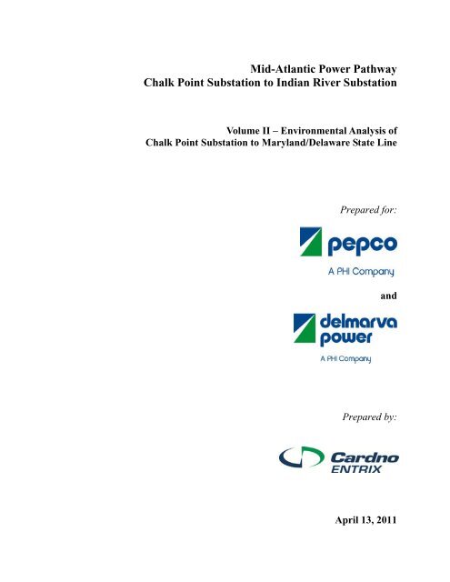
Mid-Atlantic Power Pathway Chalk Point Substation to Indian River ...
Mid-Atlantic Power Pathway Chalk Point Substation to Indian River ...
Mid-Atlantic Power Pathway Chalk Point Substation to Indian River ...

Create successful ePaper yourself
Turn your PDF publications into a flip-book with our unique Google optimized e-Paper software.
<strong>Mid</strong>-<strong>Atlantic</strong> <strong>Power</strong> <strong>Pathway</strong><br />
<strong>Chalk</strong> <strong>Point</strong> <strong>Substation</strong> <strong>to</strong> <strong>Indian</strong> <strong>River</strong> <strong>Substation</strong><br />
Volume II – Environmental Analysis of<br />
<strong>Chalk</strong> <strong>Point</strong> <strong>Substation</strong> <strong>to</strong> Maryland/Delaware State Line<br />
Prepared for:<br />
and<br />
Prepared by:<br />
April 13, 2011
<strong>Mid</strong>-<strong>Atlantic</strong> <strong>Power</strong> <strong>Pathway</strong> Environmental Review Document<br />
<strong>Chalk</strong> <strong>Point</strong> <strong>Substation</strong> <strong>to</strong> <strong>Indian</strong> <strong>River</strong> <strong>Substation</strong> Volume II – Environmental Analysis of<br />
April 13, 2011 <strong>Chalk</strong> <strong>Point</strong> <strong>Substation</strong> <strong>to</strong> MD/DE State Line<br />
This page intentionally left blank.
<strong>Mid</strong>-<strong>Atlantic</strong> <strong>Power</strong> <strong>Pathway</strong> Environmental Review Document<br />
<strong>Chalk</strong> <strong>Point</strong> <strong>Substation</strong> <strong>to</strong> <strong>Indian</strong> <strong>River</strong> <strong>Substation</strong> Volume II – Environmental Analysis of<br />
April 13, 2011 <strong>Chalk</strong> <strong>Point</strong> <strong>Substation</strong> <strong>to</strong> MD/DE State Line<br />
TABLE OF CONTENTS<br />
TABLE OF CONTENTS .............................................................................................................. i<br />
LIST OF TABLES ....................................................................................................................... xi<br />
LIST OF FIGURES ................................................................................................................... xiv<br />
ACRONYMS AND ABBREVIATIONS ....................................................................................xv<br />
1.0 ENVIRONMENTAL ANALYSIS ................................................................................ 1-1<br />
1.1 GEOLOGY ................................................................................................................... 1-2<br />
1.1.1 Existing Conditions .............................................................................................. 1-2<br />
1.1.1.1 Mineral Resources ......................................................................................... 1-5<br />
1.1.1.1.1 Oil and Natural Gas Fields ....................................................................... 1-5<br />
1.1.1.1.2 Coal Mines ............................................................................................... 1-5<br />
1.1.1.1.3 Sand and Gravel Mines ............................................................................ 1-5<br />
1.1.1.2 Paleon<strong>to</strong>logical Resources ............................................................................. 1-7<br />
1.1.1.3 Geologic Hazards ........................................................................................... 1-8<br />
1.1.1.3.1 Seismicity and Faults ............................................................................... 1-8<br />
1.1.1.3.2 Soil Liquefaction ...................................................................................... 1-8<br />
1.1.1.3.3 Slope Failures and Landslides ................................................................. 1-9<br />
1.1.1.3.4 Ground Subsidence .................................................................................. 1-9<br />
1.1.2 Potential Impacts and Mitigation ......................................................................... 1-9<br />
1.1.2.1 <strong>Chalk</strong> <strong>Point</strong> <strong>Substation</strong> <strong>to</strong> Chestnut Converter .............................................. 1-9<br />
1.1.2.1.1 Mineral Resources ................................................................................... 1-9<br />
1.1.2.1.2 Paleon<strong>to</strong>logical Resources ....................................................................... 1-9<br />
1.1.2.1.3 Geologic Hazards ................................................................................... 1-10<br />
1.1.2.2 Chestnut Converter ...................................................................................... 1-10<br />
1.1.2.2.1 Mineral Resources ................................................................................. 1-10<br />
1.1.2.2.2 Paleon<strong>to</strong>logical Resources ..................................................................... 1-10<br />
1.1.2.2.3 Geologic Hazards ................................................................................... 1-10<br />
1.1.2.3 Chestnut Converter <strong>to</strong> Western Shore Landing ........................................... 1-10<br />
1.1.2.3.1 Mineral Resources ................................................................................. 1-10<br />
1.1.2.3.2 Paleon<strong>to</strong>logical Resources ..................................................................... 1-11<br />
1.1.2.3.3 Geologic Hazards ................................................................................... 1-11<br />
1.1.2.4 Western Shore Landing <strong>to</strong> Gateway Converter ........................................... 1-11<br />
1.1.2.4.1 Mineral Resources ................................................................................. 1-11<br />
1.1.2.4.2 Paleon<strong>to</strong>logical Resources ..................................................................... 1-11<br />
1.1.2.4.3 Geologic Hazards ................................................................................... 1-12<br />
1.1.2.5 Gateway Converter ...................................................................................... 1-12<br />
1.1.2.5.1 Mineral Resources ................................................................................. 1-12<br />
1.1.2.5.2 Paleon<strong>to</strong>logical Resources ..................................................................... 1-12<br />
1.1.2.5.3 Geologic Hazards ................................................................................... 1-12<br />
1.1.2.6 Gateway Converter <strong>to</strong> Maryland/Delaware State Line ................................ 1-12<br />
1.1.2.6.1 Mineral Resources ................................................................................. 1-12<br />
i
<strong>Mid</strong>-<strong>Atlantic</strong> <strong>Power</strong> <strong>Pathway</strong> Environmental Review Document<br />
<strong>Chalk</strong> <strong>Point</strong> <strong>Substation</strong> <strong>to</strong> <strong>Indian</strong> <strong>River</strong> <strong>Substation</strong> Volume II – Environmental Analysis of<br />
April 13, 2011 <strong>Chalk</strong> <strong>Point</strong> <strong>Substation</strong> <strong>to</strong> MD/DE State Line<br />
1.1.2.6.2 Paleon<strong>to</strong>logical Resources ..................................................................... 1-13<br />
1.1.2.6.3 Geologic Hazards ................................................................................... 1-13<br />
1.1.3 References .......................................................................................................... 1-13<br />
1.2 SOILS AND SEDIMENTS ........................................................................................ 1-15<br />
1.2.1 Existing Conditions ............................................................................................ 1-15<br />
1.2.1.1 Description of Potential Soil Limitations .................................................... 1-28<br />
1.2.1.1.1 Erosion Potential .................................................................................... 1-29<br />
1.2.1.1.2 Compaction and Rutting Potential ......................................................... 1-29<br />
1.2.1.1.3 Prime Farmland ...................................................................................... 1-29<br />
1.2.1.1.4 Hydric Soils ........................................................................................... 1-30<br />
1.2.1.2 <strong>Chalk</strong> <strong>Point</strong> <strong>Substation</strong> <strong>to</strong> Chestnut Converter ............................................ 1-30<br />
1.2.1.2.1 Erosion Potential .................................................................................... 1-30<br />
1.2.1.2.2 Compaction and Rutting Potential ......................................................... 1-31<br />
1.2.1.2.3 Prime Farmland ...................................................................................... 1-31<br />
1.2.1.2.4 Hydric Soils ........................................................................................... 1-31<br />
1.2.1.3 Chestnut Converter ...................................................................................... 1-31<br />
1.2.1.3.1 Erosion Potential .................................................................................... 1-32<br />
1.2.1.3.2 Compaction and Rutting Potential ......................................................... 1-32<br />
1.2.1.3.3 Prime Farmland ...................................................................................... 1-32<br />
1.2.1.3.4 Hydric Soils ........................................................................................... 1-33<br />
1.2.1.4 Chestnut Converter <strong>to</strong> Western Shore Landing ........................................... 1-33<br />
1.2.1.4.1 Erosion Potential .................................................................................... 1-35<br />
1.2.1.4.2 Compaction and Rutting Potential ......................................................... 1-35<br />
1.2.1.4.3 Prime Farmland ...................................................................................... 1-35<br />
1.2.1.4.4 Hydric Soils ........................................................................................... 1-35<br />
1.2.1.5 Western Shore Landing <strong>to</strong> Gateway Converter ........................................... 1-35<br />
1.2.1.5.1 Erosion Potential .................................................................................... 1-38<br />
1.2.1.5.2 Compaction and Rutting Potential ......................................................... 1-38<br />
1.2.1.5.3 Prime Farmland ...................................................................................... 1-38<br />
1.2.1.5.4 Hydric Soils ........................................................................................... 1-38<br />
1.2.1.6 Gateway Converter ...................................................................................... 1-38<br />
1.2.1.6.1 Erosion Potential .................................................................................... 1-39<br />
1.2.1.6.2 Compaction and Rutting Potential ......................................................... 1-39<br />
1.2.1.6.3 Prime Farmland ...................................................................................... 1-40<br />
1.2.1.6.4 Hydric Soils ........................................................................................... 1-40<br />
1.2.1.7 Gateway Converter <strong>to</strong> Maryland/Delaware State Line Transmission<br />
Line .............................................................................................................. 1-40<br />
1.2.1.7.1 Erosion Potential .................................................................................... 1-41<br />
1.2.1.7.2 Compaction and Rutting Potential ......................................................... 1-41<br />
1.2.1.7.3 Prime Farmland ...................................................................................... 1-41<br />
1.2.1.7.4 Hydric Soils ........................................................................................... 1-41<br />
1.2.2 Potential Impacts and Mitigation ....................................................................... 1-41<br />
1.2.2.1 <strong>Chalk</strong> <strong>Point</strong> <strong>Substation</strong> <strong>to</strong> Chestnut Converter ............................................ 1-41<br />
1.2.2.2 Chestnut Converter ...................................................................................... 1-42<br />
1.2.2.3 Chestnut Converter <strong>to</strong> Western Shore Landing ........................................... 1-43<br />
1.2.2.4 Western Shore Landing <strong>to</strong> Gateway Converter ........................................... 1-43<br />
ii
<strong>Mid</strong>-<strong>Atlantic</strong> <strong>Power</strong> <strong>Pathway</strong> Environmental Review Document<br />
<strong>Chalk</strong> <strong>Point</strong> <strong>Substation</strong> <strong>to</strong> <strong>Indian</strong> <strong>River</strong> <strong>Substation</strong> Volume II – Environmental Analysis of<br />
April 13, 2011 <strong>Chalk</strong> <strong>Point</strong> <strong>Substation</strong> <strong>to</strong> MD/DE State Line<br />
1.2.2.4.1 Sediments (Chesapeake Bay and Choptank <strong>River</strong>) ............................... 1-43<br />
1.2.2.4.2 Soils (Onshore) ...................................................................................... 1-43<br />
1.2.2.5 Gateway Converter ...................................................................................... 1-44<br />
1.2.2.6 Gateway Converter <strong>to</strong> Maryland/Delaware State Line ................................ 1-44<br />
1.2.3 References .......................................................................................................... 1-45<br />
1.3 WATER RESOURCES .............................................................................................. 1-46<br />
1.3.1 Groundwater ...................................................................................................... 1-46<br />
1.3.2 Surface Water ..................................................................................................... 1-46<br />
1.3.3 Existing Conditions ............................................................................................ 1-47<br />
1.3.3.1 <strong>Chalk</strong> <strong>Point</strong> <strong>Substation</strong> <strong>to</strong> Chestnut Converter ............................................ 1-47<br />
1.3.3.1.1 Groundwater .......................................................................................... 1-47<br />
1.3.3.1.2 Surface Water ......................................................................................... 1-48<br />
1.3.3.1.3 Tributary Strategy Area ......................................................................... 1-51<br />
1.3.3.2 Chestnut Converter ...................................................................................... 1-51<br />
1.3.3.2.1 Groundwater .......................................................................................... 1-51<br />
1.3.3.2.2 Surface Water ......................................................................................... 1-51<br />
1.3.3.2.3 Tributary Strategy Area ......................................................................... 1-52<br />
1.3.3.3 Chestnut Converter <strong>to</strong> Western Shore Landing ........................................... 1-53<br />
1.3.3.3.1 Groundwater .......................................................................................... 1-53<br />
1.3.3.3.2 Surface Water ......................................................................................... 1-53<br />
1.3.3.3.3 Tributary Strategy Area ......................................................................... 1-54<br />
1.3.3.4 Western Shore Landing <strong>to</strong> Gateway Converter ........................................... 1-55<br />
1.3.3.4.1 Groundwater .......................................................................................... 1-55<br />
1.3.3.4.2 Surface Water ......................................................................................... 1-55<br />
1.3.3.4.3 Nationwide <strong>River</strong>s Inven<strong>to</strong>ry ................................................................. 1-59<br />
1.3.3.5 Gateway Converter ...................................................................................... 1-60<br />
1.3.3.5.1 Groundwater .......................................................................................... 1-60<br />
1.3.3.5.2 Surface Water ......................................................................................... 1-60<br />
1.3.3.5.3 Tributary Strategy Area ......................................................................... 1-60<br />
1.3.3.6 Gateway Converter <strong>to</strong> Maryland/Delaware State Line ................................ 1-61<br />
1.3.3.6.1 Groundwater .......................................................................................... 1-61<br />
1.3.3.6.2 Surface Water ......................................................................................... 1-61<br />
1.3.3.6.3 Tributary Strategy Area ......................................................................... 1-62<br />
1.3.4 Potential Impacts and Mitigation ....................................................................... 1-62<br />
1.3.4.1 <strong>Chalk</strong> <strong>Point</strong> <strong>Substation</strong> <strong>to</strong> Chestnut Converter ............................................ 1-63<br />
1.3.4.1.1 Groundwater .......................................................................................... 1-63<br />
1.3.4.1.2 Surface Water ......................................................................................... 1-63<br />
1.3.4.2 Chestnut Converter ...................................................................................... 1-66<br />
1.3.4.2.1 Groundwater .......................................................................................... 1-66<br />
1.3.4.2.2 Surface Water ......................................................................................... 1-66<br />
1.3.4.3 Chestnut Converter <strong>to</strong> Western Shore Landing ........................................... 1-67<br />
1.3.4.3.1 Groundwater .......................................................................................... 1-67<br />
1.3.4.3.2 Surface Water ......................................................................................... 1-67<br />
1.3.4.4 Western Shore Landing <strong>to</strong> Gateway Converter ........................................... 1-68<br />
1.3.4.4.1 Groundwater .......................................................................................... 1-68<br />
1.3.4.4.2 Surface Water ......................................................................................... 1-69<br />
iii
<strong>Mid</strong>-<strong>Atlantic</strong> <strong>Power</strong> <strong>Pathway</strong> Environmental Review Document<br />
<strong>Chalk</strong> <strong>Point</strong> <strong>Substation</strong> <strong>to</strong> <strong>Indian</strong> <strong>River</strong> <strong>Substation</strong> Volume II – Environmental Analysis of<br />
April 13, 2011 <strong>Chalk</strong> <strong>Point</strong> <strong>Substation</strong> <strong>to</strong> MD/DE State Line<br />
1.3.4.5 Gateway Converter ...................................................................................... 1-71<br />
1.3.4.5.1 Groundwater .......................................................................................... 1-71<br />
1.3.4.5.2 Surface Water ......................................................................................... 1-72<br />
1.3.4.6 Gateway Converter <strong>to</strong> Maryland/Delaware State Line ................................ 1-72<br />
1.3.4.6.1 Groundwater .......................................................................................... 1-72<br />
1.3.4.6.2 Surface Water ......................................................................................... 1-72<br />
1.3.5 References .......................................................................................................... 1-73<br />
1.4 WETLANDS............................................................................................................... 1-76<br />
1.4.1 Special Wetland Management Areas ................................................................. 1-76<br />
1.4.1.1 Wetlands of Special State Concern .............................................................. 1-77<br />
1.4.2 Existing Environment ........................................................................................ 1-77<br />
1.4.2.1 <strong>Chalk</strong> <strong>Point</strong> <strong>Substation</strong> <strong>to</strong> Chestnut Converter ............................................ 1-77<br />
1.4.2.2 Chestnut Converter ...................................................................................... 1-79<br />
1.4.2.3 Chestnut Converter <strong>to</strong> Western Shore Landing ........................................... 1-81<br />
1.4.2.4 Western Shore Landing <strong>to</strong> Gateway Converter ........................................... 1-83<br />
1.4.2.4.1 Wetlands of Special State Concern ........................................................ 1-85<br />
1.4.2.5 Gateway Converter ...................................................................................... 1-85<br />
1.4.2.6 Gateway Converter <strong>to</strong> Maryland/Delaware State Line ................................ 1-87<br />
1.4.3 Potential Impacts and Mitigation ....................................................................... 1-89<br />
1.4.3.1 <strong>Chalk</strong> <strong>Point</strong> <strong>Substation</strong> <strong>to</strong> Chestnut Converter ............................................ 1-89<br />
1.4.3.2 Chestnut Converter ...................................................................................... 1-90<br />
1.4.3.3 Chestnut Converter <strong>to</strong> Western Shore Landing ........................................... 1-90<br />
1.4.3.4 Western Shore Landing <strong>to</strong> Gateway Converter ........................................... 1-91<br />
1.4.3.4.1 Wetlands of Special State Concern ........................................................ 1-92<br />
1.4.3.5 Gateway Converter ...................................................................................... 1-92<br />
1.4.3.6 Gateway Converter <strong>to</strong> Maryland/Delaware State Line ................................ 1-92<br />
1.4.4 References .......................................................................................................... 1-93<br />
1.5 VEGETATION ........................................................................................................... 1-94<br />
1.5.1 Special Management Areas ................................................................................ 1-94<br />
1.5.1.1 Green Infrastructure ..................................................................................... 1-94<br />
1.5.1.2 Chesapeake Bay Critical Area ..................................................................... 1-95<br />
1.5.1.3 Rural Legacy Area and Rural Legacy Conservation Easements ................. 1-95<br />
1.5.1.4 Chesapeake Forest Lands ............................................................................. 1-95<br />
1.5.1.5 Conservation Reserve Enhancement Program ............................................. 1-96<br />
1.5.1.6 Agricultural Land Preservation Easements and Districts ............................ 1-96<br />
1.5.1.7 Forested Lands under the Maryland Forest Conservation Act .................... 1-96<br />
1.5.2 Existing Conditions ............................................................................................ 1-96<br />
1.5.2.1 <strong>Chalk</strong> <strong>Point</strong> <strong>Substation</strong> <strong>to</strong> Chestnut Converter ............................................ 1-97<br />
1.5.2.1.1 Special Management Areas .................................................................... 1-98<br />
1.5.2.2 Chestnut Converter ...................................................................................... 1-99<br />
1.5.2.2.1 Special Management Areas .................................................................. 1-100<br />
1.5.2.3 Chestnut Converter <strong>to</strong> Western Shore Landing ......................................... 1-100<br />
1.5.2.3.1 Special Management Areas .................................................................. 1-101<br />
1.5.2.4 Western Shore Landing <strong>to</strong> Gateway Converter ......................................... 1-101<br />
1.5.2.4.1 Special Management Areas .................................................................. 1-102<br />
1.5.2.5 Gateway Converter .................................................................................... 1-103<br />
iv
<strong>Mid</strong>-<strong>Atlantic</strong> <strong>Power</strong> <strong>Pathway</strong> Environmental Review Document<br />
<strong>Chalk</strong> <strong>Point</strong> <strong>Substation</strong> <strong>to</strong> <strong>Indian</strong> <strong>River</strong> <strong>Substation</strong> Volume II – Environmental Analysis of<br />
April 13, 2011 <strong>Chalk</strong> <strong>Point</strong> <strong>Substation</strong> <strong>to</strong> MD/DE State Line<br />
1.5.2.5.1 Special Management Areas .................................................................. 1-104<br />
1.5.2.6 Gateway Converter <strong>to</strong> Maryland/Delaware State Line .............................. 1-104<br />
1.5.2.6.1 Special Management Areas .................................................................. 1-105<br />
1.5.3 Potential Impacts and Mitigation ..................................................................... 1-105<br />
1.5.3.1 <strong>Chalk</strong> <strong>Point</strong> <strong>Substation</strong> <strong>to</strong> Chestnut Converter .......................................... 1-105<br />
1.5.3.1.1 Special Management Areas .................................................................. 1-107<br />
1.5.3.2 Chestnut Converter .................................................................................... 1-107<br />
1.5.3.2.1 Special Management Areas .................................................................. 1-109<br />
1.5.3.3 Chestnut Converter <strong>to</strong> Western Shore Landing ......................................... 1-109<br />
1.5.3.3.1 Special Management Areas .................................................................. 1-110<br />
1.5.3.4 Western Shore Landing <strong>to</strong> Gateway Converter ......................................... 1-111<br />
1.5.3.4.1 Special Management Areas .................................................................. 1-113<br />
1.5.3.5 Gateway Converter .................................................................................... 1-114<br />
1.5.3.5.1 Special Management Areas .................................................................. 1-115<br />
1.5.3.6 Gateway Converter <strong>to</strong> Maryland/Delaware State Line Transmission<br />
Line ............................................................................................................ 1-115<br />
1.5.3.6.1 Special Management Areas .................................................................. 1-116<br />
1.5.4 References ........................................................................................................ 1-116<br />
1.6 WILDLIFE ................................................................................................................ 1-118<br />
1.6.1 Special Management Areas, Habitat, or Species ............................................. 1-120<br />
1.6.1.1 Forest Interior Dwelling Bird Species ....................................................... 1-120<br />
1.6.1.1.1 Colonial Nesting Birds ......................................................................... 1-120<br />
1.6.1.1.2 Waterfowl Staging Areas ..................................................................... 1-120<br />
1.6.1.1.3 Bald Eagle Nest Sites ........................................................................... 1-120<br />
1.6.1.1.4 Sensitive Species Project Review Area ............................................... 1-121<br />
1.6.1.1.5 Targeted Ecological Area (TEA) ......................................................... 1-121<br />
1.6.1.1.6 MDNR-Chesapeake Forest .................................................................. 1-121<br />
1.6.2 Existing Environment ...................................................................................... 1-121<br />
1.6.2.1 <strong>Chalk</strong> <strong>Point</strong> <strong>Substation</strong> <strong>to</strong> Chestnut Converter .......................................... 1-121<br />
1.6.2.1.1 Special Habitat and Wildlife Species ................................................... 1-122<br />
1.6.2.2 Chestnut Converter .................................................................................... 1-123<br />
1.6.2.2.1 Special Habitat and Wildlife Species ................................................... 1-123<br />
1.6.2.3 Chestnut Converter <strong>to</strong> Western Shore Landing ......................................... 1-124<br />
1.6.2.3.1 Special Habitat and Wildlife Species ................................................... 1-124<br />
1.6.2.4 Western Shore Landing <strong>to</strong> Gateway Converter ......................................... 1-124<br />
1.6.2.4.1 Special Habitat and Wildlife Species ................................................... 1-125<br />
1.6.2.5 Gateway Converter .................................................................................... 1-126<br />
1.6.2.5.1 Special Habitat and Wildlife Species ................................................... 1-126<br />
1.6.2.6 Gateway Converter <strong>to</strong> Maryland/Delaware State Line .............................. 1-127<br />
1.6.2.6.1 Special Habitat and Wildlife Species ................................................... 1-127<br />
1.6.3 Potential Impacts and Mitigation ..................................................................... 1-128<br />
1.6.3.1 <strong>Chalk</strong> <strong>Point</strong> <strong>Substation</strong> <strong>to</strong> Chestnut Converter .......................................... 1-128<br />
1.6.3.1.1 Special Habitat and Wildlife Species ................................................... 1-128<br />
1.6.3.2 Chestnut Converter .................................................................................... 1-130<br />
1.6.3.2.1 Special Habitat and Wildlife Species ................................................... 1-130<br />
1.6.3.3 Chestnut Converter <strong>to</strong> Western Shore Landing ......................................... 1-131<br />
v
<strong>Mid</strong>-<strong>Atlantic</strong> <strong>Power</strong> <strong>Pathway</strong> Environmental Review Document<br />
<strong>Chalk</strong> <strong>Point</strong> <strong>Substation</strong> <strong>to</strong> <strong>Indian</strong> <strong>River</strong> <strong>Substation</strong> Volume II – Environmental Analysis of<br />
April 13, 2011 <strong>Chalk</strong> <strong>Point</strong> <strong>Substation</strong> <strong>to</strong> MD/DE State Line<br />
1.6.3.3.1 Special Habitat and Wildlife Species ................................................... 1-132<br />
1.6.3.4 Western Shore Landing <strong>to</strong> Gateway Converter ......................................... 1-132<br />
1.6.3.4.1 Special Habitat and Wildlife Species ................................................... 1-133<br />
1.6.3.5 Gateway Converter .................................................................................... 1-134<br />
1.6.3.5.1 Special Habitat and Wildlife Species ................................................... 1-135<br />
1.6.3.6 Gateway Converter <strong>to</strong> Maryland/Delaware State Line .............................. 1-136<br />
1.6.3.6.1 Special Habitat and Wildlife Species ................................................... 1-136<br />
1.6.4 References ........................................................................................................ 1-137<br />
1.7 FISHERIES ............................................................................................................... 1-139<br />
1.7.1 Existing Conditions .......................................................................................... 1-141<br />
1.7.1.1 <strong>Chalk</strong> <strong>Point</strong> <strong>Substation</strong> <strong>to</strong> Chestnut Converter .......................................... 1-141<br />
1.7.1.1.1 Oyster and Clam Bars .......................................................................... 1-141<br />
1.7.1.1.2 Commercial and Recreational Fish Species ......................................... 1-141<br />
1.7.1.1.3 Anadromous and Catadromous Fish Species ....................................... 1-142<br />
1.7.1.1.4 Essential Fish Habitat .......................................................................... 1-142<br />
1.7.1.2 Chestnut Converter .................................................................................... 1-142<br />
1.7.1.3 Chestnut Converter <strong>to</strong> Western Shore Landing ......................................... 1-142<br />
1.7.1.4 Western Shore Landing <strong>to</strong> Gateway Converter ......................................... 1-143<br />
1.7.1.4.1 Anadromous and Catadromous Fish Species ....................................... 1-143<br />
1.7.1.5 Gateway Converter .................................................................................... 1-143<br />
1.7.1.6 Gateway Converter <strong>to</strong> Maryland/Delaware State Line .............................. 1-143<br />
1.7.1.6.1 Anadromous and Catadromous Fish Species ....................................... 1-143<br />
1.7.2 Potential Impacts and Mitigation ..................................................................... 1-144<br />
1.7.2.1 <strong>Chalk</strong> <strong>Point</strong> <strong>Substation</strong> <strong>to</strong> Chestnut Converter .......................................... 1-144<br />
1.7.2.1.1 Oysters ................................................................................................. 1-145<br />
1.7.2.1.2 Commercial and Recreational Fish Species ......................................... 1-145<br />
1.7.2.1.3 Anadromous and Catadromous Fish Species ....................................... 1-145<br />
1.7.2.1.4 Essential Fish Habitat .......................................................................... 1-145<br />
1.7.2.2 Chestnut Converter .................................................................................... 1-146<br />
1.7.2.3 Chestnut Converter <strong>to</strong> Western Shore Landing ......................................... 1-146<br />
1.7.2.4 Western Shore Landing <strong>to</strong> Gateway Converter ......................................... 1-147<br />
1.7.2.4.1 Anadromous and Catadromous Fish Species ....................................... 1-148<br />
1.7.2.5 Gateway Converter .................................................................................... 1-148<br />
1.7.2.6 Gateway Converter <strong>to</strong> Maryland/Delaware State Line .............................. 1-149<br />
1.7.2.6.1 Anadromous and Catadromous Fish Species ....................................... 1-149<br />
1.7.3 References ........................................................................................................ 1-149<br />
1.8 THREATENED AND ENDANGERED SPECIES .................................................. 1-152<br />
1.8.1 Federally-Protected Species ............................................................................. 1-152<br />
1.8.1.1 Delmarva Fox Squirrel ............................................................................... 1-153<br />
1.8.1.1.1 Potential Impacts and Mitigation on Delmarva Fox Squirrel .............. 1-156<br />
1.8.1.2 Sturgeon ..................................................................................................... 1-158<br />
1.8.1.2.1 Potential Impacts and Mitigation on Sturgeon..................................... 1-159<br />
1.8.2 State-Protected Species .................................................................................... 1-161<br />
1.8.3 State-Protected Plant Species Summary .......................................................... 1-174<br />
1.8.4 <strong>Chalk</strong> <strong>Point</strong> <strong>to</strong> Chestnut Converter State-Protected Plant Species .................. 1-174<br />
1.8.5 Chestnut Converter State-Protected Plant Species. ......................................... 1-175<br />
vi
<strong>Mid</strong>-<strong>Atlantic</strong> <strong>Power</strong> <strong>Pathway</strong> Environmental Review Document<br />
<strong>Chalk</strong> <strong>Point</strong> <strong>Substation</strong> <strong>to</strong> <strong>Indian</strong> <strong>River</strong> <strong>Substation</strong> Volume II – Environmental Analysis of<br />
April 13, 2011 <strong>Chalk</strong> <strong>Point</strong> <strong>Substation</strong> <strong>to</strong> MD/DE State Line<br />
1.8.6 Chestnut Converter <strong>to</strong> Western Shore Landing State-Protected Plant<br />
Species ............................................................................................................. 1-175<br />
1.8.7 Western Shore Landing <strong>to</strong> Gateway Converter State-Protected Plant<br />
Species ............................................................................................................. 1-175<br />
1.8.8 Gateway Converter State-Protected Plant Species .......................................... 1-175<br />
1.8.9 Gateway Converter <strong>to</strong> State Line State-Protected Plant Species ..................... 1-175<br />
1.8.10 References ........................................................................................................ 1-176<br />
1.9 LAND USE ............................................................................................................... 1-178<br />
1.9.1 Existing Conditions .......................................................................................... 1-178<br />
1.9.1.1 Existing Land Cover Types ....................................................................... 1-178<br />
1.9.1.1.1 Transmission Lines .............................................................................. 1-178<br />
1.9.1.1.2 Open and Agricultural Lands ............................................................... 1-179<br />
1.9.1.1.3 Forested Land....................................................................................... 1-179<br />
1.9.1.1.4 Open Water .......................................................................................... 1-180<br />
1.9.1.1.5 Developed Lands ................................................................................. 1-180<br />
1.9.1.2 Recreational Boating .................................................................................. 1-180<br />
1.9.1.3 Recreational Fishing .................................................................................. 1-181<br />
1.9.1.4 Commercial Fishing ................................................................................... 1-186<br />
1.9.1.5 Residential and Planned Development ...................................................... 1-188<br />
1.9.1.6 Recreation and Special Interest Areas ....................................................... 1-190<br />
1.9.1.7 Maryland’s Smart Growth Program ........................................................... 1-193<br />
1.9.1.8 Visual Resources ........................................................................................ 1-193<br />
1.9.1.8.1 <strong>Chalk</strong> <strong>Point</strong> <strong>Substation</strong> <strong>to</strong> Chestnut Converter .................................... 1-194<br />
1.9.1.8.2 Chestnut Converter .............................................................................. 1-194<br />
1.9.1.8.3 Chestnut Converter <strong>to</strong> Western Shore Landing ................................... 1-195<br />
1.9.1.8.4 Western Shore Landing <strong>to</strong> Gateway Converter ................................... 1-195<br />
1.9.1.8.5 Gateway Converter .............................................................................. 1-195<br />
1.9.1.8.6 Gateway Converter <strong>to</strong> Maryland/Delaware State Line ........................ 1-195<br />
1.9.2 Potential Impacts and Mitigation ..................................................................... 1-195<br />
1.9.2.1 <strong>Chalk</strong> <strong>Point</strong> <strong>Substation</strong> <strong>to</strong> Chestnut Converter .......................................... 1-196<br />
1.9.2.1.1 General Land Use ................................................................................ 1-196<br />
1.9.2.1.2 Open and Agricultural Lands ............................................................... 1-196<br />
1.9.2.1.3 Forested Lands ..................................................................................... 1-197<br />
1.9.2.1.4 Open Water .......................................................................................... 1-197<br />
1.9.2.1.5 Developed Lands ................................................................................. 1-198<br />
1.9.2.1.6 Recreational Boating ............................................................................ 1-198<br />
1.9.2.1.7 Recreational Fishing ............................................................................ 1-198<br />
1.9.2.1.8 Commercial Fishing ............................................................................. 1-199<br />
1.9.2.1.9 Residential and Planned Development ................................................ 1-199<br />
1.9.2.1.10 Recreational and Special Interest Areas .............................................. 1-200<br />
1.9.2.1.11 Maryland’s Smart Growth Program ..................................................... 1-200<br />
1.9.2.1.12 Visual Resources .................................................................................. 1-200<br />
1.9.2.2 Chestnut Converter .................................................................................... 1-201<br />
1.9.2.2.1 General Land Use ................................................................................ 1-201<br />
1.9.2.2.2 Open and Agricultural Lands ............................................................... 1-203<br />
1.9.2.2.3 Forested Lands ..................................................................................... 1-203<br />
vii
<strong>Mid</strong>-<strong>Atlantic</strong> <strong>Power</strong> <strong>Pathway</strong> Environmental Review Document<br />
<strong>Chalk</strong> <strong>Point</strong> <strong>Substation</strong> <strong>to</strong> <strong>Indian</strong> <strong>River</strong> <strong>Substation</strong> Volume II – Environmental Analysis of<br />
April 13, 2011 <strong>Chalk</strong> <strong>Point</strong> <strong>Substation</strong> <strong>to</strong> MD/DE State Line<br />
1.9.2.2.4 Open Water .......................................................................................... 1-203<br />
1.9.2.2.5 Developed Lands ................................................................................. 1-204<br />
1.9.2.2.6 Maryland’s Smart Growth Program ..................................................... 1-204<br />
1.9.2.2.7 Visual Resources .................................................................................. 1-204<br />
1.9.2.3 Chestnut Converter <strong>to</strong> Western Shore Landing ......................................... 1-204<br />
1.9.2.3.1 Open and Agricultural Lands ............................................................... 1-205<br />
1.9.2.3.2 Forested Lands ..................................................................................... 1-205<br />
1.9.2.3.3 Open Water .......................................................................................... 1-205<br />
1.9.2.3.4 Developed Lands ................................................................................. 1-206<br />
1.9.2.3.5 Residential and Planned Development ................................................ 1-206<br />
1.9.2.3.6 Recreational and Special Interest Areas .............................................. 1-206<br />
1.9.2.3.7 Maryland’s Smart Growth Program ..................................................... 1-206<br />
1.9.2.3.8 Visual Resources .................................................................................. 1-206<br />
1.9.2.4 Western Shore Landing <strong>to</strong> Gateway Converter ......................................... 1-207<br />
1.9.2.4.1 General Land Use ................................................................................ 1-207<br />
1.9.2.4.2 Open and Agricultural Lands ............................................................... 1-207<br />
1.9.2.4.3 Forested Lands ..................................................................................... 1-208<br />
1.9.2.4.4 Open Water .......................................................................................... 1-208<br />
1.9.2.4.5 Developed Lands ................................................................................. 1-208<br />
1.9.2.4.6 Recreational Boating ............................................................................ 1-209<br />
1.9.2.4.7 Recreational Fishing ............................................................................ 1-209<br />
1.9.2.4.8 Commercial Fishing ............................................................................. 1-209<br />
1.9.2.4.9 Residential and Planned Developments ............................................... 1-210<br />
1.9.2.4.10 Recreational and Special Interest Areas .............................................. 1-210<br />
1.9.2.4.11 Maryland’s Smart Growth Program ..................................................... 1-211<br />
1.9.2.4.12 Visual Resources .................................................................................. 1-211<br />
1.9.2.5 Gateway Converter .................................................................................... 1-212<br />
1.9.2.5.1 General Land Use ................................................................................ 1-212<br />
1.9.2.5.2 Open and Agricultural Lands ............................................................... 1-213<br />
1.9.2.5.3 Forested Lands ..................................................................................... 1-213<br />
1.9.2.5.4 Open Water .......................................................................................... 1-213<br />
1.9.2.5.5 Developed Lands ................................................................................. 1-213<br />
1.9.2.5.6 Recreational and Special Interest Areas .............................................. 1-214<br />
1.9.2.5.7 Maryland’s Smart Growth Program ..................................................... 1-214<br />
1.9.2.5.8 Visual Resources .................................................................................. 1-214<br />
1.9.2.6 Gateway Converter <strong>to</strong> Maryland/Delaware State Line .............................. 1-214<br />
1.9.2.6.1 General Land Use ................................................................................ 1-214<br />
1.9.2.6.2 Open and Agricultural Lands ............................................................... 1-215<br />
1.9.2.6.3 Forested Lands ..................................................................................... 1-215<br />
1.9.2.6.4 Open Water .......................................................................................... 1-215<br />
1.9.2.6.5 Developed Lands ................................................................................. 1-216<br />
1.9.2.6.6 Residential and Planned Development ................................................ 1-216<br />
1.9.2.6.7 Recreational and Special Interest Areas .............................................. 1-216<br />
1.9.2.6.8 Maryland’s Smart Growth Program ..................................................... 1-216<br />
1.9.2.6.9 Visual Resources .................................................................................. 1-217<br />
1.9.3 References ........................................................................................................ 1-217<br />
viii
<strong>Mid</strong>-<strong>Atlantic</strong> <strong>Power</strong> <strong>Pathway</strong> Environmental Review Document<br />
<strong>Chalk</strong> <strong>Point</strong> <strong>Substation</strong> <strong>to</strong> <strong>Indian</strong> <strong>River</strong> <strong>Substation</strong> Volume II – Environmental Analysis of<br />
April 13, 2011 <strong>Chalk</strong> <strong>Point</strong> <strong>Substation</strong> <strong>to</strong> MD/DE State Line<br />
1.10 SOCIOECONOMICS ............................................................................................... 1-219<br />
1.10.1 Existing Conditions .......................................................................................... 1-219<br />
1.10.1.1 Population .................................................................................................. 1-219<br />
1.10.1.2 Employment ............................................................................................... 1-221<br />
1.10.1.3 Economy and Tax Revenues ...................................................................... 1-221<br />
1.10.1.4 Local Service Providers ............................................................................. 1-222<br />
1.10.1.5 Transportation ............................................................................................ 1-222<br />
1.10.1.5.1 Ground Transportation ......................................................................... 1-222<br />
1.10.1.5.2 Marine Transportation ......................................................................... 1-223<br />
1.10.1.6 Housing ...................................................................................................... 1-227<br />
1.10.1.7 Recreational Fisheries ................................................................................ 1-228<br />
1.10.1.8 Commercial Fisheries ................................................................................ 1-231<br />
1.10.1.9 Tourism ...................................................................................................... 1-236<br />
1.10.1.10 Environmental Justice ................................................................................ 1-237<br />
1.10.2 Potential Impacts and Mitigation ..................................................................... 1-239<br />
1.10.2.1 Employment ............................................................................................... 1-240<br />
1.10.2.2 Economy and Tax Revenues ...................................................................... 1-241<br />
1.10.2.3 Local Service Providers ............................................................................. 1-241<br />
1.10.2.4 Transportation ............................................................................................ 1-242<br />
1.10.2.4.1 Ground Transportation ......................................................................... 1-242<br />
1.10.2.4.2 Marine Transportation ......................................................................... 1-242<br />
1.10.2.5 Housing ...................................................................................................... 1-243<br />
1.10.2.6 Recreational Fisheries ................................................................................ 1-244<br />
1.10.2.7 Commercial Fisheries ................................................................................ 1-244<br />
1.10.2.8 Tourism ...................................................................................................... 1-244<br />
1.10.2.9 Environmental Justice ................................................................................ 1-244<br />
1.10.3 References ........................................................................................................ 1-245<br />
1.11 CULTURAL RESOURCES ..................................................................................... 1-248<br />
1.11.1 Agency Consultation and Scope of Work ........................................................ 1-248<br />
1.11.2 Study Area and Technical Reports for Cultural Resources ............................. 1-248<br />
1.11.3 His<strong>to</strong>ric Sites .................................................................................................... 1-251<br />
1.11.3.1 Maryland Inven<strong>to</strong>ry of His<strong>to</strong>ric Properties ................................................ 1-251<br />
1.11.3.2 National Register of His<strong>to</strong>ric Places .......................................................... 1-251<br />
1.11.3.3 Local (County) His<strong>to</strong>ric Preservation Ordinances ..................................... 1-252<br />
1.11.3.4 Maryland His<strong>to</strong>rical Trust Easements ........................................................ 1-252<br />
1.11.3.5 Captain John Smith Chesapeake National His<strong>to</strong>ric Trail .......................... 1-252<br />
1.11.3.6 Heart of Chesapeake Country, Lower Eastern Shore, and Southern<br />
Maryland Heritage Areas ........................................................................... 1-253<br />
1.11.4 Native American Sites of Religious and Cultural Significance and<br />
Consultation ..................................................................................................... 1-253<br />
1.11.5 Cultural Resource Survey Results ................................................................... 1-253<br />
1.11.5.1 Previously Identified Archaeological Resources ....................................... 1-253<br />
1.11.5.1.1 <strong>Chalk</strong> <strong>Point</strong> <strong>Substation</strong> <strong>to</strong> Chestnut Converter .................................... 1-253<br />
1.11.5.1.2 Chestnut Converter .............................................................................. 1-254<br />
1.11.5.1.3 Chestnut Converter <strong>to</strong> Western Shore Landing ................................... 1-254<br />
ix
<strong>Mid</strong>-<strong>Atlantic</strong> <strong>Power</strong> <strong>Pathway</strong> Environmental Review Document<br />
<strong>Chalk</strong> <strong>Point</strong> <strong>Substation</strong> <strong>to</strong> <strong>Indian</strong> <strong>River</strong> <strong>Substation</strong> Volume II – Environmental Analysis of<br />
April 13, 2011 <strong>Chalk</strong> <strong>Point</strong> <strong>Substation</strong> <strong>to</strong> MD/DE State Line<br />
1.11.5.1.4 Western Shore Landing <strong>to</strong> Gateway Converter Transmission<br />
Line ...................................................................................................... 1-254<br />
1.11.5.1.5 Gateway Converter .............................................................................. 1-255<br />
1.11.5.1.6 Gateway Converter <strong>to</strong> Maryland/Delaware State Line ........................ 1-256<br />
1.11.5.2 Previously Identified Architectural Resources .......................................... 1-256<br />
1.11.5.2.1 <strong>Chalk</strong> <strong>Point</strong> <strong>Substation</strong> <strong>to</strong> Chestnut Converter .................................... 1-256<br />
1.11.5.2.2 Chestnut Converter .............................................................................. 1-256<br />
1.11.5.2.3 Chestnut Converter <strong>to</strong> Western Shore Landing ................................... 1-256<br />
1.11.5.2.4 Western Shore Landing <strong>to</strong> Gateway Converter ................................... 1-257<br />
1.11.5.2.5 Gateway Converter .............................................................................. 1-257<br />
1.11.5.2.6 Gateway Converter <strong>to</strong> Maryland/Delaware State Line ........................ 1-257<br />
1.11.6 Potential Project Effects <strong>to</strong> His<strong>to</strong>ric Sites ........................................................ 1-257<br />
1.11.6.1 Effects <strong>to</strong> Archaeological Resources ......................................................... 1-257<br />
1.11.6.1.1 <strong>Chalk</strong> <strong>Point</strong> <strong>Substation</strong> <strong>to</strong> Chestnut Converter .................................... 1-257<br />
1.11.6.1.2 Chestnut Converter .............................................................................. 1-258<br />
1.11.6.1.3 Chestnut Converter <strong>to</strong> Western Shore Landing ................................... 1-258<br />
1.11.6.1.4 Western Shore Landing <strong>to</strong> Gateway Converter ................................... 1-258<br />
1.11.6.1.5 Gateway Converter .............................................................................. 1-259<br />
1.11.6.1.6 Gateway Converter <strong>to</strong> Maryland/Delaware State Line ........................ 1-259<br />
1.11.6.2 Effects <strong>to</strong> Architectural Resources ............................................................. 1-259<br />
1.11.6.2.1 <strong>Chalk</strong> <strong>Point</strong> <strong>Substation</strong> <strong>to</strong> Chestnut Converter Transmission Line ..... 1-259<br />
1.11.6.2.2 Chestnut Converter .............................................................................. 1-260<br />
1.11.6.2.3 Chestnut Converter <strong>to</strong> Western Shore Landing Transmission<br />
Line ...................................................................................................... 1-260<br />
1.11.6.2.4 Western Shore Landing <strong>to</strong> Gateway Converter Transmission<br />
Line ...................................................................................................... 1-260<br />
1.11.6.2.5 Gateway Converter .............................................................................. 1-260<br />
1.11.6.2.6 Gateway Converter <strong>to</strong> Maryland/Delaware Line ................................. 1-260<br />
1.11.7 Potential Impacts and Mitigation ..................................................................... 1-261<br />
1.11.8 References ........................................................................................................ 1-261<br />
1.12 AIR QUALITY ......................................................................................................... 1-264<br />
1.12.1 Existing Conditions .......................................................................................... 1-264<br />
1.12.1.1 <strong>Chalk</strong> <strong>Point</strong> <strong>Substation</strong> <strong>to</strong> Chestnut Converter .......................................... 1-265<br />
1.12.1.2 Chestnut Converter .................................................................................... 1-266<br />
1.12.1.3 Chestnut Converter <strong>to</strong> Western Shore Landing Transmission Line .......... 1-266<br />
1.12.1.4 Western Shore Landing <strong>to</strong> Gateway Converter Transmission Line .......... 1-266<br />
1.12.1.5 Gateway Converter .................................................................................... 1-266<br />
1.12.1.6 Gateway Converter <strong>to</strong> Maryland/Delaware State Line Transmission<br />
Line ............................................................................................................ 1-266<br />
1.12.2 Project Impacts and Mitigation ........................................................................ 1-267<br />
1.12.2.1 <strong>Chalk</strong> <strong>Point</strong> <strong>Substation</strong> <strong>to</strong> the Chestnut Converter .................................... 1-267<br />
1.12.2.2 Chestnut Converter .................................................................................... 1-267<br />
1.12.2.3 Chestnut Converter <strong>to</strong> Western Shore Landing ......................................... 1-268<br />
1.12.2.4 Western Shore Landing <strong>to</strong> Gateway Converter ......................................... 1-268<br />
1.12.2.5 Gateway Converter .................................................................................... 1-268<br />
1.12.2.6 Gateway Converter <strong>to</strong> Maryland/Delaware State Line .............................. 1-269<br />
x
<strong>Mid</strong>-<strong>Atlantic</strong> <strong>Power</strong> <strong>Pathway</strong> Environmental Review Document<br />
<strong>Chalk</strong> <strong>Point</strong> <strong>Substation</strong> <strong>to</strong> <strong>Indian</strong> <strong>River</strong> <strong>Substation</strong> Volume II – Environmental Analysis of<br />
April 13, 2011 <strong>Chalk</strong> <strong>Point</strong> <strong>Substation</strong> <strong>to</strong> MD/DE State Line<br />
1.12.3 References ........................................................................................................ 1-269<br />
1.13 NOISE ....................................................................................................................... 1-271<br />
1.13.1 Existing Conditions .......................................................................................... 1-271<br />
1.13.1.1 <strong>Chalk</strong> <strong>Point</strong> <strong>Substation</strong> <strong>to</strong> Chestnut Converter .......................................... 1-271<br />
1.13.1.2 Chestnut Converter .................................................................................... 1-271<br />
1.13.1.3 Chestnut Converter <strong>to</strong> Western Shore Landing ......................................... 1-271<br />
1.13.1.4 Western Shore Landing <strong>to</strong> Gateway Converter ......................................... 1-271<br />
1.13.1.5 Gateway Converter .................................................................................... 1-272<br />
1.13.1.6 Gateway Converter <strong>to</strong> Maryland/Delaware State Line .............................. 1-272<br />
1.13.2 Project Impacts and Mitigation ........................................................................ 1-272<br />
1.13.2.1 <strong>Chalk</strong> <strong>Point</strong> <strong>Substation</strong> <strong>to</strong> Chestnut Converter .......................................... 1-272<br />
1.13.2.2 Chestnut Converter .................................................................................... 1-272<br />
1.13.2.3 Chestnut Converter <strong>to</strong> Western Shore Landing ......................................... 1-273<br />
1.13.2.4 Western Shore Landing <strong>to</strong> Gateway Converter ......................................... 1-273<br />
1.13.2.5 Gateway Converter .................................................................................... 1-274<br />
1.13.2.6 Gateway Converter <strong>to</strong> Maryland/Delaware State Line .............................. 1-274<br />
1.13.2.7 Operational Noise ...................................................................................... 1-274<br />
1.14 ELECTRIC AND MAGNETIC FIELDS ................................................................. 1-276<br />
1.14.1 Available State, National and International Guidelines for EMF .................... 1-276<br />
1.14.2 Existing Conditions .......................................................................................... 1-276<br />
1.14.3 Potential Environmental Impacts ..................................................................... 1-276<br />
LIST OF TABLES<br />
Number Title Page<br />
Table 1.1-1 Physiographic Regions, Districts, and Areas Crossed by the<br />
Proposed Project Right-of-Way ..................................................................... 1-4<br />
Table 1.1-2 Mineral Resource Extraction Sites near the Project Area .............................. 1-7<br />
Table 1.2-1 Soil Series Within the Project Right-of-Way and Project Boundaries ........ 1-15<br />
Table 1.2-2 Soil Limitations of Soil Map Units <strong>to</strong> be Disturbed within the Project<br />
Right-of-Way Associated with the <strong>Chalk</strong> <strong>Point</strong> <strong>Substation</strong> <strong>to</strong><br />
Chestnut Converter ...................................................................................... 1-30<br />
Table 1.2-3 Soil Limitations of Soil Map Units <strong>to</strong> be Disturbed within the<br />
Vicinity of the Chestnut Converter .............................................................. 1-31<br />
Table 1.2-4 Soil Limitations of Soil Map Units <strong>to</strong> be Disturbed within the Project<br />
Right-of-Way Associated with the Chestnut Converter <strong>to</strong> Western<br />
Shore Landing .............................................................................................. 1-33<br />
Table 1.2-5 Soil Limitations of Soil Map Units <strong>to</strong> be Disturbed within the Project<br />
Right-of-Way Associated with the Western Shore Landing <strong>to</strong><br />
Gateway Converter ...................................................................................... 1-36<br />
Table 1.2-6 Soil Limitations of Soil Map Units <strong>to</strong> be Disturbed in the Vicinity of<br />
the Gateway Converter ................................................................................ 1-39<br />
Table 1.2-7 Soil Limitations of Soil Map Units <strong>to</strong> be Disturbed within the Project<br />
Right-of-Way Associated with the Gateway Converter <strong>to</strong><br />
Maryland/Delaware State Line .................................................................... 1-40<br />
xi
<strong>Mid</strong>-<strong>Atlantic</strong> <strong>Power</strong> <strong>Pathway</strong> Environmental Review Document<br />
<strong>Chalk</strong> <strong>Point</strong> <strong>Substation</strong> <strong>to</strong> <strong>Indian</strong> <strong>River</strong> <strong>Substation</strong> Volume II – Environmental Analysis of<br />
April 13, 2011 <strong>Chalk</strong> <strong>Point</strong> <strong>Substation</strong> <strong>to</strong> MD/DE State Line<br />
Table 1.3-1 Depth <strong>to</strong> Water for Aquifers Utilized near the Proposed Project Sites<br />
and Alignment (McGreevy and Wheeler 2010) ........................................... 1-47<br />
Table 1.3-2 <strong>Chalk</strong> <strong>Point</strong> <strong>Substation</strong> <strong>to</strong> Chestnut Converter Waterbodies Crossed<br />
by the Project Right-of-Way ........................................................................ 1-49<br />
Table 1.3-3 Waterbodies Present Within the Chestnut Converter Property<br />
Boundary ...................................................................................................... 1-52<br />
Table 1.3-4 Chestnut Converter <strong>to</strong> Western Shore Landing Waterbodies Crossed<br />
by the Project Right-of-Way ....................................................................... 1-54<br />
Table 1.3-5 Waterbodies Crossed by the Western Shore Landing <strong>to</strong> Gateway<br />
Converter...................................................................................................... 1-56<br />
Table 1.3-6 Gateway Converter <strong>to</strong> Maryland/Delaware State Line Waterbodies ........... 1-62<br />
Table 1.4-1 Summary of Wetland and Wetland Buffers Within the <strong>Chalk</strong> <strong>Point</strong><br />
<strong>Substation</strong> <strong>to</strong> Chestnut Converter Component ............................................. 1-78<br />
Table 1.4-2 Summary of Wetland and Wetland Buffers Within the Chestnut<br />
Converter Component .................................................................................. 1-80<br />
Table 1.4-3 Summary of Wetland and Wetland Buffers Within the Chestnut<br />
Converter <strong>to</strong> Western Shore Landing Component ....................................... 1-82<br />
Table 1.4-4 Summary of Wetland and Wetland Buffers Within the Western<br />
Shore Landing <strong>to</strong> Gateway Converter Component ...................................... 1-84<br />
Table 1.4-5 Summary of Wetland and Wetland Buffers Within the Gateway<br />
Converter Component .................................................................................. 1-86<br />
Table 1.4-6 Summary of Wetland and Wetland Buffers Within the Gateway<br />
Converter <strong>to</strong> Maryland/Delaware State Line Component ........................... 1-88<br />
Table 1.5-1 Vegetation Within the <strong>Chalk</strong> <strong>Point</strong> <strong>Substation</strong> <strong>to</strong> Chestnut Converter<br />
Component ................................................................................................... 1-97<br />
Table 1.5-2 Vegetation Within the Chestnut Converter Component .............................. 1-99<br />
Table 1.5-3 Vegetation Within the Chestnut Converter <strong>to</strong> Western Shore Landing<br />
Component ................................................................................................. 1-100<br />
Table 1.5-4 Vegetation Within the Western Shore Landing <strong>to</strong> Gateway Converter<br />
Component ................................................................................................. 1-102<br />
Table 1.5-5 Vegetation Within the Gateway Converter Component ............................ 1-103<br />
Table 1.5-6 Vegetation Within the Gateway Converter <strong>to</strong> Maryland/Delaware<br />
State Line Component................................................................................ 1-104<br />
Table 1.5-7 Size Classes of Forested Lands Cleared within the <strong>Chalk</strong> <strong>Point</strong> <strong>to</strong><br />
Chestnut Converter Component ................................................................. 1-106<br />
Table 1.5-8 Size Classes of Forested Lands Cleared within the Chestnut<br />
Converter Component ................................................................................ 1-108<br />
Table 1.5-9 Size Class of Forested Lands Cleared within the Chestnut Converter<br />
<strong>to</strong> Western Shore Landing Component ...................................................... 1-110<br />
Table 1.5-10 Size Class of Forested Lands Cleared within the Eastern Shore<br />
Landing <strong>to</strong> Gateway Converter Component .............................................. 1-112<br />
Table 1.6-1 Typical Wildlife Species Potentially Present in the Project Area<br />
and/or Project Components ........................................................................ 1-118<br />
Table 1.7-1 Typical Fish Species Potentially Present in the Proposed Project<br />
Area ............................................................................................................ 1-140<br />
xii
<strong>Mid</strong>-<strong>Atlantic</strong> <strong>Power</strong> <strong>Pathway</strong> Environmental Review Document<br />
<strong>Chalk</strong> <strong>Point</strong> <strong>Substation</strong> <strong>to</strong> <strong>Indian</strong> <strong>River</strong> <strong>Substation</strong> Volume II – Environmental Analysis of<br />
April 13, 2011 <strong>Chalk</strong> <strong>Point</strong> <strong>Substation</strong> <strong>to</strong> MD/DE State Line<br />
Table 1.8-1 Federally-Protected Species Identified as Potentially Occurring in<br />
the Project Area.......................................................................................... 1-154<br />
Table 1.8-2 State-Protected Species Potentially Occurring in the Project Area ........... 1-162<br />
Table 1.9-1 Maryland Annual Recreational Fishing License Statistics ........................ 1-182<br />
Table 1.9-2 Recreational Fishing Licenses in 2010 ...................................................... 1-183<br />
Table 1.9-3 Maryland Freshwater Recreational Fishermen Counts by County ............ 1-184<br />
Table 1.9-4 Maryland Saltwater Recreational Fishermen Counts by County ............... 1-184<br />
Table 1.9-5 Maryland Recreational Fishing Licenses by County and Type<br />
in 2010 ....................................................................................................... 1-185<br />
Table 1.9-6 Maryland Freshwater Recreational Fishermen Counts by County ............ 1-186<br />
Table 1.9-7 Maryland Saltwater Recreational Fishermen Counts by County ............... 1-186<br />
Table 1.9-8 Patuxent <strong>River</strong> Commercial Fishing Licenses ........................................... 1-187<br />
Table 1.9-9 Nanticoke <strong>River</strong> Commercial Fishing License Sales 2005-2009 .............. 1-188<br />
Table 1.9-10 Structures Near the Project Area ................................................................ 1-189<br />
Table 1.9-11 Special Interest Areas in the Project Area ................................................. 1-190<br />
Table 1.9-12 Impacts <strong>to</strong> Land Use Types in the <strong>Chalk</strong> <strong>Point</strong> <strong>Substation</strong> <strong>to</strong><br />
Chestnut Converter Component Area (Acres) ........................................... 1-196<br />
Table 1.9-13 Impacts <strong>to</strong> Land Use Types in the Chestnut Converter Component<br />
Area (Acres) ............................................................................................... 1-203<br />
Table 1.9-14 Impacts <strong>to</strong> Land Use Types in the Chestnut Converter <strong>to</strong> Western<br />
Shore Landing Component Area (Acres) .................................................. 1-205<br />
Table 1.9-15 Impacts <strong>to</strong> Land Use Types in the Western Shore Landing <strong>to</strong><br />
Gateway Converter Component Area (Acres) ........................................... 1-207<br />
Table 1.9-16 Impacts <strong>to</strong> Land Use Types in the Gateway Converter Component<br />
Area (Acres) ............................................................................................... 1-213<br />
Table 1.9-17 Impacts <strong>to</strong> Land Use Types in the Gateway Converter <strong>to</strong><br />
Maryland/Delaware State Line Component Area (Acres) ......................... 1-215<br />
Table 1.10-1 Existing Socioeconomic Conditions .......................................................... 1-220<br />
Table 1.10-2 Racial/Ethnic Estimates of Populations in Counties Crossed by the<br />
Proposed Project (in percent) ..................................................................... 1-220<br />
Table 1.10-3 AADT for Road Crossed by the Transmission Line .................................. 1-222<br />
Table 1.10-4 Patuxent <strong>River</strong> Commodities Shipped in Short Tons from 2006 <strong>to</strong><br />
2009............................................................................................................ 1-223<br />
Table 1.10-5 Patuxent <strong>River</strong> Trips by Draft from 2006 <strong>to</strong> 2008. .................................... 1-224<br />
Table 1.10-6 Patuxent <strong>River</strong> Trips by Month for 2008 ................................................... 1-225<br />
Table 1.10-7 Trips per Month on Nanticoke <strong>River</strong> 2008 ................................................ 1-226<br />
Table 1.10-8 Trips on Nanticoke <strong>River</strong> 2006-2008 ........................................................ 1-226<br />
Table 1.10-9 Commodities Shipped on Nanticoke <strong>River</strong> 2006-2009 ............................. 1-227<br />
Table 1.10-10 Temporary Accommodations Available in the Project Area ..................... 1-228<br />
Table 1.10-11 Value of Recreational Fishing Landings in and near the Patuxent<br />
<strong>River</strong> for 2009 in 2010 US Dollars ............................................................ 1-229<br />
Table 1.10-12 Detailed Recreational Landings Statistics for Areas in the Nanticoke<br />
<strong>River</strong> in 2009.............................................................................................. 1-232<br />
Table 1.10-13 2009 Monthly Commercial Harvest by Species for the Patuxent<br />
<strong>River</strong> ........................................................................................................... 1-233<br />
Table 1.10-14 Monthly Landings for the Nanticoke <strong>River</strong> in 2009 .................................. 1-235<br />
xiii
<strong>Mid</strong>-<strong>Atlantic</strong> <strong>Power</strong> <strong>Pathway</strong> Environmental Review Document<br />
<strong>Chalk</strong> <strong>Point</strong> <strong>Substation</strong> <strong>to</strong> <strong>Indian</strong> <strong>River</strong> <strong>Substation</strong> Volume II – Environmental Analysis of<br />
April 13, 2011 <strong>Chalk</strong> <strong>Point</strong> <strong>Substation</strong> <strong>to</strong> MD/DE State Line<br />
Table 1.10-15 Racial/Ethnic Estimates of Populations in Census Tracts Crossed by<br />
the Proposed Project (in percent) ............................................................... 1-238<br />
Table 1.10-16 Economic Statistics for Census Tracts Crossed by the Proposed<br />
Project ........................................................................................................ 1-239<br />
Table 1.10-17 Maximum Potential Population Increase ................................................... 1-240<br />
Table 1.12-1 Air Quality Pollutants for which Project Counties are Designated In<br />
Non Attainment .......................................................................................... 1-265<br />
Table 1.12-2 Air Quality Pollutants for which the Project County is Designated In<br />
Non Attainment .......................................................................................... 1-266<br />
Summary Table Summary of Impacts from Construction and Operation of the Proposed<br />
Project in Maryland.................................................................................... 1-277<br />
LIST OF FIGURES<br />
Number Title Page<br />
Figure 1.1-1 Physiographic Regions................................................................................... 1-3<br />
Figure 1.1-2 Approximate Locations of Mining Sites ........................................................ 1-6<br />
Figure 1.9-1 Current and Simulated Viewshed of the Patuxent <strong>River</strong> ........................... 1-202<br />
Figure 1.10-1 Recreational Fishing Data – NMFS Survey Locations for the <strong>Chalk</strong><br />
<strong>Point</strong> <strong>Substation</strong> <strong>to</strong> Chestnut Converter Project Component ..................... 1-230<br />
Figure 1.10-2 Recreational Fishing Data – NMFS Survey Locations for the<br />
Western Shore Landing <strong>to</strong> Gateway Converter Project Component ......... 1-233<br />
xiv
<strong>Mid</strong>-<strong>Atlantic</strong> <strong>Power</strong> <strong>Pathway</strong> Environmental Review Document<br />
<strong>Chalk</strong> <strong>Point</strong> <strong>Substation</strong> <strong>to</strong> <strong>Indian</strong> <strong>River</strong> <strong>Substation</strong> Volume II – Environmental Analysis of<br />
April 13, 2011 <strong>Chalk</strong> <strong>Point</strong> <strong>Substation</strong> <strong>to</strong> MD/DE State Line<br />
AADT annual average daily traffic<br />
ACRONYMS AND ABBREVIATIONS<br />
BGE Baltimore Gas and Electric Company<br />
BMP Best Management Practices<br />
CAC Citizens Advisory Council<br />
CBP Chesapeake Bay Program<br />
COMAR Code of Maryland Regulations<br />
Commission Maryland Public Service Commission<br />
Company Po<strong>to</strong>mac Electric <strong>Power</strong> Company, Delmarva <strong>Power</strong> & Light Company, and<br />
Baltimore Gas and Electric Company<br />
CPCN Certificate of Public Convenience and Necessity<br />
CREP Conservation Reserve Enhancement Program<br />
dBA decibels on the A-weighted scale<br />
DBH diameter at breast height<br />
DC direct current<br />
DOE Department of Energy<br />
DPL Delmarva <strong>Power</strong> & Light Company<br />
DPU Distinct Population Unit<br />
EFH essential fish habitat<br />
ELMRD Estuarine Living Marine Resources Database<br />
EMF electromagnetic fields<br />
ERD Environmental Review Document<br />
ESA Endangered Species Act<br />
FCA Forest Conservation Act<br />
FERC Federal Energy Regula<strong>to</strong>ry Commission<br />
FIDS Forest Interior Dwelling Species<br />
FMC Fishery Management Council<br />
FSD Forest Stand Delineation<br />
HAPC Habitats of Particular Concern<br />
HDD horizontal directional drilling<br />
HUC Hydrologic Unit Code<br />
ICNIRP International Committee on Non Ionizing Radiation Protection<br />
IDA Intensely Developed Area<br />
IVMP Integrated Vegetation Management Plan<br />
xv
<strong>Mid</strong>-<strong>Atlantic</strong> <strong>Power</strong> <strong>Pathway</strong> Environmental Review Document<br />
<strong>Chalk</strong> <strong>Point</strong> <strong>Substation</strong> <strong>to</strong> <strong>Indian</strong> <strong>River</strong> <strong>Substation</strong> Volume II – Environmental Analysis of<br />
April 13, 2011 <strong>Chalk</strong> <strong>Point</strong> <strong>Substation</strong> <strong>to</strong> MD/DE State Line<br />
LDA Limited Development Area<br />
MALPF Maryland Agricultural Land Preservation Foundation<br />
MAPP <strong>Mid</strong>-<strong>Atlantic</strong> <strong>Power</strong> <strong>Pathway</strong><br />
MBSS Maryland Biological Stream Survey<br />
MCL maximum contaminant level<br />
MDE Maryland Department of the Environment<br />
MDNR Maryland Department of Natural Resources<br />
MDP Maryland Department of Planning<br />
mG milligauss<br />
MGS Maryland Geological Survey<br />
MHT Maryland His<strong>to</strong>ric Trust<br />
MIHP Maryland Inven<strong>to</strong>ry of His<strong>to</strong>ric Properties<br />
MNCPPC Maryland-National Capi<strong>to</strong>l Park and Planning Commission<br />
MNHC Maryland Natural Heritage Commission<br />
MOT Maintenance of Traffic<br />
NAAQS National Ambient Air Quality Standards<br />
NERC North American Electric Reliability Corporation<br />
NHT National His<strong>to</strong>ric Trail<br />
NMFS National Marine Fisheries Service<br />
NNSR Non-Attainment New Source Review<br />
Nox nitrogen oxides<br />
NPS National Park Service<br />
NRHP National Register of His<strong>to</strong>ric Places<br />
NRI Nationwide <strong>River</strong>s Inven<strong>to</strong>ry<br />
NWI National Wetland Inven<strong>to</strong>ry<br />
ORV Outstandingly Remarkable Values<br />
PCE tetrachloroethylene<br />
PEL Probable Effects Level<br />
PEM palustrine emergent<br />
Pepco Po<strong>to</strong>mac Electric <strong>Power</strong> Company<br />
PFA Priority Funding Area<br />
PFO palustrine forested<br />
PM particulate matter<br />
PM2.5<br />
fine particulate matter<br />
xvi
<strong>Mid</strong>-<strong>Atlantic</strong> <strong>Power</strong> <strong>Pathway</strong> Environmental Review Document<br />
<strong>Chalk</strong> <strong>Point</strong> <strong>Substation</strong> <strong>to</strong> <strong>Indian</strong> <strong>River</strong> <strong>Substation</strong> Volume II – Environmental Analysis of<br />
April 13, 2011 <strong>Chalk</strong> <strong>Point</strong> <strong>Substation</strong> <strong>to</strong> MD/DE State Line<br />
PPRP <strong>Power</strong> Plant Research Program<br />
ppt parts per thousand<br />
Project <strong>Chalk</strong> <strong>Point</strong> <strong>Substation</strong> <strong>to</strong> Maryland/Delaware State Line Project<br />
PSC Public Service Commission<br />
PSD Prevention of Significant Deterioration<br />
PSS palustrine scrub-shrub<br />
RCA Resource Conservation Area<br />
Recovery Plan Shortnose Sturgeon Recovery Plan<br />
RTE rare, threatened, and endangered<br />
SAV submerged aquatic vegetation<br />
SHPO State His<strong>to</strong>ric Preservation Officer<br />
SO2 sulfur dioxide<br />
SSPRA Sensitive Species Project Review Areas<br />
SVOC semi-volatile organic compound<br />
TEA Targeted Ecological Area<br />
TMDL <strong>to</strong>tal maximum daily load<br />
TSS <strong>to</strong>tal suspended solids<br />
TVMP Transmission Vegetation Management Program<br />
USACE U.S. Army Corps of Engineers<br />
USDA-NRCS United States Department of Agriculture, Natural Resources Conservation<br />
Service<br />
USEPA U.S. Environmental Protection Agency<br />
USFWS U.S. Fish and Wildlife<br />
USGS United States Geological Survey<br />
VIMS Virginia Institute of Marine Sciences<br />
VOC volatile organic compounds<br />
WIP watershed implementation plan<br />
WSSC Wetland of Special State Concern<br />
xvii
<strong>Mid</strong>-<strong>Atlantic</strong> <strong>Power</strong> <strong>Pathway</strong> Environmental Review Document<br />
<strong>Chalk</strong> <strong>Point</strong> <strong>Substation</strong> <strong>to</strong> <strong>Indian</strong> <strong>River</strong> <strong>Substation</strong> Volume II – Environmental Analysis of<br />
April 13, 2011 <strong>Chalk</strong> <strong>Point</strong> <strong>Substation</strong> <strong>to</strong> MD/DE State Line<br />
This page intentionally left blank.
<strong>Mid</strong>-<strong>Atlantic</strong> <strong>Power</strong> <strong>Pathway</strong> Environmental Review Document<br />
<strong>Chalk</strong> <strong>Point</strong> <strong>Substation</strong> <strong>to</strong> <strong>Indian</strong> <strong>River</strong> <strong>Substation</strong> Volume II – Environmental Analysis of<br />
April 13, 2011 <strong>Chalk</strong> <strong>Point</strong> <strong>Substation</strong> <strong>to</strong> MD/DE State Line<br />
1.0 ENVIRONMENTAL ANALYSIS<br />
The discussion of the existing environment for the resources in Volume II is based on data collected from<br />
field surveys along all project landward components in Maryland (between <strong>Chalk</strong> <strong>Point</strong> <strong>Substation</strong> and<br />
the Maryland/Delaware State Line) and incorporates the latest modifications <strong>to</strong> the route and converter<br />
stations based on the results of the field surveys and modifications <strong>to</strong> engineering and design. A<br />
discussion of existing resources and impacts for the Chesapeake Bay Crossing and Maryland/Delaware<br />
State Line <strong>to</strong> <strong>Indian</strong> <strong>River</strong> are included in Volumes III and IV, respectively. As a result, the existing<br />
environment and impacts presented in Volume II differs slightly from those presented in the alternatives<br />
analysis in Volume I, Section 3.0. As discussed in Volume I, Section 3.2, the alternatives analysis is<br />
based on publically available information, impacts are defined as the resources present (i.e., existing<br />
environment), and the proposed right-of-way for the <strong>Chalk</strong> <strong>to</strong> Gateway portions reflects the alignment in<br />
Oc<strong>to</strong>ber 2010 when the alternatives analysis for these portions of the project was completed. This use of<br />
consistent environmental data, and comparable engineering information and component boundaries and<br />
elements, allow the Company <strong>to</strong> conduct relevant “apples <strong>to</strong> apples” comparisons between alternatives.<br />
1-1
<strong>Mid</strong>-<strong>Atlantic</strong> <strong>Power</strong> <strong>Pathway</strong> Environmental Review Document<br />
<strong>Chalk</strong> <strong>Point</strong> <strong>Substation</strong> <strong>to</strong> <strong>Indian</strong> <strong>River</strong> <strong>Substation</strong> Volume II – Environmental Analysis of<br />
April 13, 2011 <strong>Chalk</strong> <strong>Point</strong> <strong>Substation</strong> <strong>to</strong> MD/DE State Line<br />
1.1 GEOLOGY<br />
This section provides information on the geological resources associated with the installation and<br />
operation of the <strong>Chalk</strong> <strong>Point</strong> <strong>Substation</strong> <strong>to</strong> Maryland/Delaware State Line Project (Project) in Prince<br />
George’s, Calvert, Dorchester and Wicomico Counties, Maryland. Geological resources reviewed<br />
include the geologic and <strong>to</strong>pographic setting, mineral resources, and geologic hazards that might exist at<br />
the converter stations and along the transmission line route. Existing conditions are addressed first in<br />
Section 1.1.1 followed by an analysis of potential Project impacts <strong>to</strong> those resources in Section 1.1.2.<br />
1.1.1 Existing Conditions<br />
The Project is located within Maryland and is classified as within the Embayed Section of the Coastal<br />
Plain Physiographic Province. The Coastal Plain is a seaward sloping plain extending from Cape Cod,<br />
Massachusetts <strong>to</strong> the southern tip of Florida. In Maryland, it consists of a fairly flat <strong>to</strong> moderately rolling<br />
upland and a flatter lowland. The eastern boundary of the Coastal Plain is sea level, as it includes<br />
shorelines of the major estuaries and the <strong>Atlantic</strong> Ocean. The western boundary extends in<strong>to</strong> central<br />
Maryland well northwest of the proposed Project area. The Coastal Plain is underlain with an eastward<br />
thickening clastic wedge of gently southeast-dipping sediments overlying crystalline basement rocks.<br />
These sediments are mostly unconsolidated sand, gravel, silt, and clay of both terrigenous and marine<br />
origin. The Embayed Section of the Coastal Plain is characterized by estuaries and embayments<br />
attributed <strong>to</strong> the drowning of river mouths and formation of barrier islands associated with post-glacial<br />
sea-level rise.<br />
Within this physiographic province and section, the Project crosses four physiographic regions: Western<br />
Shore Lowland Region, Western Shore Upland Region, Delmarva Peninsula Region, and Chesapeake<br />
Bay Estuary Region (Figure 1.1-1). The Western Shore Lowland Region is comprised of a series of low<br />
(generally below 50 feet in elevation) and flat fluvial and estuarine terraces, beaches, and drowned river<br />
mouths that fringe the Western Shore Uplands. This Region extends some distance up the valley of the<br />
Patuxent <strong>River</strong>. Sediments underlying this region are generally quartzoses and, silt, clay, and gravel.<br />
Gravels may be quartz, quartzitic, or lithic (e.g., granitic rocks from the Piedmont). The Project is located<br />
within the Patuxent Estuaries and Lowlands District of this region, which is characterized as a broad, flatbot<strong>to</strong>med<br />
valley flanked by fluvial-estuarine terraces (Reger and Cleaves 2008). A summary of the<br />
physiographic regions, districts, and areas crossed by the existing Project right-of-way is provided in<br />
Table 1.1-1.<br />
The Western Shore Upland Region extends from the fall line <strong>to</strong>wards the estuary; the boundary is the<br />
base of the usually prominent slope transition <strong>to</strong> the Western Shore Lowlands (roughly at an elevation of<br />
40 feet). A flat <strong>to</strong> rolling upland surface underlain by Cretaceous <strong>to</strong> Pliocene sediments, the region has<br />
markedly higher elevations and greater relief than the Eastern Shore. Fluvial and estuarine terraces flank<br />
the major drainages, most notably the Patuxent <strong>River</strong>. The Project is located within the Prince Frederick<br />
Knobby Upland District of this region, which consists of moderately <strong>to</strong> well-dissected uplands with<br />
numerous hillocks between the Patuxent and Chesapeake watersheds. Within this district, the Project is<br />
in the vicinity of the Calvert Cliffs Area but the Project does not contain cliffs, characterized by high<br />
cliffs in an eroding shoreline made up of mainly Miocene strata. Cliff retreat here is primarily by mass<br />
wasting. There is little or no beach along nearly the entire length of the cliffs.<br />
1-2
Lowland<br />
Section<br />
FREDERICK<br />
FAIRFAX<br />
MONTGOMERY<br />
VIRGINIA<br />
KING GEORGE<br />
CARROLL HARFORD<br />
MARYLAND<br />
DISTRICT OF<br />
COLUMBIA<br />
CHARLES<br />
Upland Section<br />
HOWARD<br />
PRINCE GEORGE'S<br />
Western Shore<br />
Upland Region<br />
BALTIMORE<br />
ANNE ARUNDEL<br />
<strong>Chalk</strong> <strong>Point</strong><br />
<strong>Substation</strong><br />
")<br />
ST. MARY'S<br />
BALTIMORE CITY<br />
CALVERT<br />
CHESAPEAKE BAY<br />
(CHESAPEAKE<br />
ESTUARY REGION)<br />
"J<br />
Western Shore Lowlands Region<br />
Chestnut<br />
Converter<br />
TALBOT<br />
DORCHESTER<br />
KENT<br />
CECIL<br />
QUEEN ANNE'S<br />
Delmarva<br />
Peninsula<br />
Region<br />
0 10 20 30 40 50 Miles<br />
CAROLINE<br />
Choptank <strong>River</strong><br />
"S ")<br />
Station<br />
"J<br />
NEW CASTLE<br />
Gateway<br />
Converter WICOMICO<br />
0 10 20 30 40 50 Nautical Miles<br />
Legend<br />
Figure 1.1-1<br />
KENT<br />
DELAWARE<br />
"J Converter Station<br />
") Ê<br />
<strong>Mid</strong> <strong>Atlantic</strong> <strong>Power</strong><br />
<strong>Pathway</strong><br />
Physiographic<br />
Regions<br />
<strong>Substation</strong><br />
This map and all data contained<br />
within are supplied as is with no<br />
warranty. Cardno ENTRIX expressly<br />
disclaims responsibility for damages <strong>Chalk</strong> <strong>Point</strong> <strong>Substation</strong> <strong>to</strong> For Chestnut All Routes ConverterWestern<br />
Shore Lowlands Region<br />
or liability from any claims that may<br />
arise out of the use or misuse of this Chestnut Converter <strong>to</strong> Western Aerial Shore Segment Landing Western Shore Uplands Regions<br />
map. It is the sole responsibility of the<br />
user <strong>to</strong> determine if the data on this Western Shore Landing <strong>to</strong> Gateway Underground Converter Segment Upland Section<br />
map meets the user’s needs. This<br />
map was not created as survey "S Transition data, Station Gateway Converter <strong>to</strong> MD/DE Underwater State Line Segment Lowland Section<br />
nor should it be used as such. It is the<br />
user’s responsibility <strong>to</strong> obtain proper MD/DE State Line <strong>to</strong> Mission Converter<br />
Delmarva Peninsula Region<br />
survey data, prepared by a licensed<br />
surveyor, where required by law.<br />
Mission Converter <strong>to</strong> <strong>Indian</strong><br />
Note:<br />
<strong>River</strong><br />
The<br />
<strong>Substation</strong><br />
Chesapeake Estuary Physiographic Region<br />
boundary corresponds <strong>to</strong> the boundary of the Chesapeake Bay.<br />
SUSSEX<br />
SALEM<br />
NEW JERSEY<br />
"J<br />
CUMBERLAND<br />
DELAWARE<br />
BAY<br />
<strong>Indian</strong><br />
<strong>River</strong><br />
<strong>Substation</strong><br />
Mission<br />
Converter<br />
WORCESTER<br />
10 Corporate Circle, Suite 300<br />
New Castle, DE 19720<br />
www.cardnoentrix.com<br />
GLOUCESTER<br />
ph. (302) 395-1919<br />
fx (302) 395-1920<br />
Date: April 4, 2011
<strong>Mid</strong>-<strong>Atlantic</strong> <strong>Power</strong> <strong>Pathway</strong> Environmental Review Document<br />
<strong>Chalk</strong> <strong>Point</strong> <strong>Substation</strong> <strong>to</strong> <strong>Indian</strong> <strong>River</strong> <strong>Substation</strong> Volume II – Environmental Analysis of<br />
April 13, 2011 <strong>Chalk</strong> <strong>Point</strong> <strong>Substation</strong> <strong>to</strong> MD/DE State Line<br />
Table 1.1-1<br />
Physiographic Regions, Districts, and Areas Crossed by the<br />
Proposed Project Right-of-Way<br />
Physiographic Region Physiographic District Project Segment<br />
Western Shore Lowland<br />
Region<br />
Western Shore Upland<br />
Region<br />
Chesapeake Bay Estuary<br />
Region a<br />
Patuxent Estuaries and<br />
Lowlands<br />
Prince Frederick Knobby<br />
Upland District (including the<br />
Calvert Cliffs Area)<br />
Delmarva Peninsula Region Princess Anne Lowland<br />
District (including the<br />
Nanticoke <strong>River</strong> Area)<br />
Salisbury Plain District<br />
1-4<br />
<strong>Chalk</strong> <strong>Point</strong> <strong>Substation</strong> <strong>to</strong><br />
Chestnut Converter<br />
<strong>Chalk</strong> <strong>Point</strong> <strong>Substation</strong> <strong>to</strong><br />
Chestnut Converter, Calvert<br />
Converter Station, Calvert<br />
Converter Station <strong>to</strong> Western<br />
Shore Landing<br />
NA Western Shore Landing <strong>to</strong><br />
Gateway Converter<br />
a The Chesapeake Bay and Choptank <strong>River</strong> crossings are discussed in detail in Volume III.<br />
Western Shore Landing <strong>to</strong><br />
Gateway Converter, Gateway<br />
Converter, Choptank <strong>River</strong><br />
Landfall <strong>to</strong> MD/DE Stateline<br />
The Delmarva Peninsula Region’s northern boundary in Maryland is the Elk <strong>River</strong>; the boundary extends<br />
east and south in<strong>to</strong> Delaware and Virginia respectively with the remaining boundaries along the <strong>Atlantic</strong><br />
shoreline on the southeast and the Chesapeake Estuary Bay Region on the west. This large peninsula<br />
separates the Chesapeake Bay and the Delaware Bay <strong>Atlantic</strong> drainages and has grown southward by<br />
accretion during the Neocene period. Sediments underlying this region are generally unconsolidated<br />
sands, silts, clays, pebbles, and cobbles. Within this district, the Project crosses the Princess Anne<br />
Lowland District and the Salisbury Plain District. The Princess Anne Lowland District is a lowland plain<br />
of very low relief, including the Nanticoke <strong>River</strong> Area. The Nanticoke <strong>River</strong> Area is characterized as<br />
largely swamp and marsh occupying the Nanticoke <strong>River</strong> floodplain. The Salisbury Plain District is a<br />
broad lowland plain, little modified by erosion, with widespread Aeolian sand sheets and low-amplitude<br />
sand dunes, fluvial sands, and marine back-barrier and lagoon mud (Reger and Cleaves 2008).<br />
The Chesapeake Bay Estuary Region consists of drowned river valleys of the Susquehanna and Po<strong>to</strong>mac<br />
<strong>River</strong>s that resulted from the post-glacial sea-level rise and connects the Delmarva Peninsula region <strong>to</strong> the<br />
Western Shore Uplands Region. The boundary of the Chesapeake Estuary Region generally follows the<br />
shoreline of the mainland on both sides of the bay, and where islands and river mouths occur; the<br />
boundary is arbitrarily adjusted <strong>to</strong> exclude most islands, drowned river mouths, and sounds from this<br />
region. This region includes Chesapeake Bay as well as the sediments and features on the bay bot<strong>to</strong>m,<br />
which include unconsolidated sands, silts, and clays.<br />
The gravel, sand, and clay underlying the counties crossed by the existing Project right-of-way represent<br />
the primary mineral resources of the area, which are used as aggregate materials in the construction<br />
industry (Maryland Geological Survey [MGS] 1981). Small deposits of iron ore were of his<strong>to</strong>rical use.<br />
Numerous aquifers create a plentiful supply of groundwater (MGS 1981).
<strong>Mid</strong>-<strong>Atlantic</strong> <strong>Power</strong> <strong>Pathway</strong> Environmental Review Document<br />
<strong>Chalk</strong> <strong>Point</strong> <strong>Substation</strong> <strong>to</strong> <strong>Indian</strong> <strong>River</strong> <strong>Substation</strong> Volume II – Environmental Analysis of<br />
April 13, 2011 <strong>Chalk</strong> <strong>Point</strong> <strong>Substation</strong> <strong>to</strong> MD/DE State Line<br />
1.1.1.1 Mineral Resources<br />
1.1.1.1.1 Oil and Natural Gas Fields<br />
There are no oil fields in Maryland. Natural gas is present in western Maryland and there are multiple gas<br />
s<strong>to</strong>rage wells and gas production wells in this western region, specifically in Garrett and Allegany<br />
Counties (Maryland Department of the Environment [MDE] 2006a). No oil/natural gas fields or<br />
extraction sites were identified in Prince George’s, Calvert, Dorchester, or Wicomico Counties,<br />
Maryland, based on review of aerial pho<strong>to</strong>graphs, United States Geological Survey (USGS) <strong>to</strong>pographic<br />
maps, and state and federal online resources.<br />
1.1.1.1.2 Coal Mines<br />
Maryland’s western counties intercept the large coal fields in the Appalachian Mountains. No coal fields<br />
or mines are located in or near the Project in Prince George’s, Calvert, Dorchester, or Wicomico<br />
Counties, Maryland, based on review of aerial pho<strong>to</strong>graphs, USGS <strong>to</strong>pographic maps, and state and<br />
federal online resources. The nearest coal fields are located near Doswell, Virginia, approximately 65<br />
miles south-southwest of the nearest portion of the Project (National Atlas 2009).<br />
1.1.1.1.3 Sand and Gravel Mines<br />
Mineral resource mining in Prince George’s, Calvert, Dorchester, and Wicomico Counties Maryland<br />
primarily consists of sand and gravel mines (USGS 2005). There are several non-coal surface mines in<br />
Prince George’s, Calvert, Dorchester, and Wicomico Counties (MDE 2006b, 2006c, 2006d, 2010). Most<br />
of these are clustered in areas remote from the existing Project right-of way. However, one private sand<br />
and gravel mine is located adjacent <strong>to</strong> the existing Project right-of-way in Calvert County (Table 1.1-2,<br />
Figure 1.1-2). This mine is located <strong>to</strong> the northeast of the intersection of Bars<strong>to</strong>w Road and Buena Vista<br />
Road (near MP CPCC 4.4) (MDE 2006b). Based on publicly available permit information, the mine<br />
(permit #93-sp-0437) belongs <strong>to</strong> Morgan E. Russell, Inc. and extends <strong>to</strong> within approximately 180 feet<br />
from the southern boundary of the existing right-of-way that the Project proposes <strong>to</strong> use. The next closest<br />
mines located near the Project are two sand and gravel mines located approximately 0.7 mile from the<br />
Chestnut Converter location (Table 1.1-2, Figure 1.1-2). These mines are the Sixes Road Pit #2 mine<br />
(permit 90-sp-0357-A) and the Sixes Road Pit #3 (permit 01-sp-0578). The closest existing mine located<br />
in Wicomico County is approximately 0.8 mile away from the proposed Project right-of-way (Table 1.1-<br />
2, Figure 1.1-2). The mine is owned by Howard Sand and Gravel Inc. (Permit 77-sp-0094). These and<br />
any other permitted mines would not be accessed through the proposed Project right-of-way, which is<br />
owned by the Company, and should not be affected by construction or operation of the Project. No other<br />
active surface mining or quarry operations were identified within 1.0 mile of the existing Project area.<br />
1-5
XY<br />
XY<br />
XY<br />
PRINCE<br />
GEORGE'S<br />
")<br />
!(<br />
CHESAPEAKE BEACH<br />
CALVERT<br />
<strong>Chalk</strong> <strong>Point</strong><br />
<strong>Substation</strong><br />
CHARLES<br />
XY XY<br />
XY XYXYXY<br />
PATUXENT RIVER<br />
"J<br />
#*<br />
!(<br />
BROOMES ISLAND<br />
ST. MARY'S<br />
Chestnut<br />
Converter<br />
Western Shore<br />
Landing<br />
XY<br />
XY<br />
CHESAPEAKE<br />
BAY<br />
LITTLE CHOPTANK<br />
RIVER<br />
!(<br />
MADISON<br />
XY<br />
CHOPTANK<br />
!(<br />
CAMBRIDGE<br />
TALBOT<br />
RIVER<br />
DORCHESTER<br />
0 5 10 15 20 Miles<br />
0 5 10 15 20 Nautical Miles<br />
Legend<br />
This map and all data contained<br />
within are supplied as is with no<br />
warranty. Cardno ENTRIX expressly<br />
disclaims responsibility for damages<br />
or liability from any claims that may "J Converter Station<br />
arise out of the use or misuse of this<br />
map. It is the sole responsibility of the<br />
user <strong>to</strong> determine if the ") data on this<br />
map meets the user’s needs. This<br />
map was not created as survey data,<br />
nor should it be used as such. It is<br />
the user’s responsibility <strong>to</strong> obtain<br />
proper survey data, prepared by a<br />
licensed surveyor, where required by<br />
law.<br />
<strong>Substation</strong><br />
For All Routes<br />
#* Western Shore Landing<br />
Aerial Segment<br />
<strong>Chalk</strong> <strong>Point</strong> <strong>Substation</strong> <strong>to</strong> Chestnut Converter<br />
Underground Segment<br />
"S Transition Station Chestnut Converter <strong>to</strong> Western Shore Landing<br />
Underwater Segment<br />
XY Mine Site<br />
Western Shore Landing <strong>to</strong> Gateway Converter<br />
Gateway Converter <strong>to</strong> MD/DE State Line<br />
XY<br />
XY<br />
"S<br />
Figure 1.1-2<br />
XY<br />
!(<br />
HURLOCK<br />
<strong>Mid</strong> <strong>Atlantic</strong> <strong>Power</strong> <strong>Pathway</strong><br />
Approximate Locations of<br />
Mining Sites<br />
CAROLINE<br />
XY XY<br />
XY<br />
XY<br />
Choptank <strong>River</strong><br />
Station XYXY<br />
NANTICOKE<br />
RIVER<br />
!(<br />
VIENNA<br />
"J<br />
Gateway XY<br />
Converter<br />
WICOMICO<br />
SOMERSET<br />
Ê10 Corporate Circle, Suite 300<br />
New Castle, DE 19720<br />
DE<br />
XY XY XY<br />
www.cardnoentrix.com<br />
XY<br />
ph. (302) 395-1919<br />
fx (302) 395-1920<br />
Date: March 31, 2011<br />
XYXY
<strong>Mid</strong>-<strong>Atlantic</strong> <strong>Power</strong> <strong>Pathway</strong> Environmental Review Document<br />
<strong>Chalk</strong> <strong>Point</strong> <strong>Substation</strong> <strong>to</strong> <strong>Indian</strong> <strong>River</strong> <strong>Substation</strong> Volume II – Environmental Analysis of<br />
April 13, 2011 <strong>Chalk</strong> <strong>Point</strong> <strong>Substation</strong> <strong>to</strong> MD/DE State Line<br />
Table 1.1-2<br />
Mineral Resource Extraction Sites near the Project Area<br />
Facility Type County, State<br />
1-7<br />
Distance from<br />
Project (miles) Operational Status<br />
Sand and gravel mine Calvert, Maryland 0.03 Active<br />
Sand and gravel mine Calvert. Maryland 0.70 Active<br />
Sand and gravel mine Calvert, Maryland 0.70 Active<br />
Sand and gravel mine Wicomico, Maryland 0.80 Active<br />
Source: MDE 2006b, MDE 2006c, MDE 2006d<br />
1.1.1.2 Paleon<strong>to</strong>logical Resources<br />
Paleon<strong>to</strong>logical resources are the fossilized remains of prehis<strong>to</strong>ric plants and animals, as well as the<br />
impressions left in rock or other materials of the forms and activities of such organisms. Sediments<br />
deposited in post-Pleis<strong>to</strong>cene time (less than 10,000 years ago) are generally unlikely <strong>to</strong> contain fossils of<br />
paleon<strong>to</strong>logical interest and are considered non-sensitive areas. Older sediments and rock units vary<br />
considerably in fossil content with the probability of fossil presence and discovery defined by the<br />
geographic distribution and exposure of specific sedimentary units that have been uplifted, dis<strong>to</strong>rted,<br />
altered, and exposed during the course of geological his<strong>to</strong>ry.<br />
There are no known sensitive paleon<strong>to</strong>logical resource areas within the Project area. However, geologic<br />
formations similar <strong>to</strong> those being crossed by the Project are known <strong>to</strong> contain terrestrial and marine<br />
fossils. Vertebrate fossils are relatively rare and locations containing these fossils are more likely <strong>to</strong> be<br />
scientifically significant than those containing invertebrate or plant fossils. In areas where bedrock is<br />
exposed, fossils may be visible and/or accessible, especially in sedimentary rocks from the Cretaceous<br />
period. At least 12 species of dinosaurs are known <strong>to</strong> have occurred in Maryland, and their fossils are<br />
found in rocks of the Cretaceous period; however, these formations would not be crossed by the Project<br />
(MGS 2007a).<br />
Early Quaternary deposits, which would be crossed in eastern Prince George’s County, Maryland, have<br />
yielded fossils of mas<strong>to</strong>don teeth, clams, oysters, and snails (Paleon<strong>to</strong>logy Portal 2008a). Tertiary<br />
deposits, such as those which comprise most of the area that would be crossed by the Project in Calvert<br />
County are known <strong>to</strong> contain a high diversity (i.e., greater than 600 species) of invertebrates<br />
(Paleon<strong>to</strong>logy Portal 2008b). Vertebrate fossils are also common in formations from this period and<br />
include marine mammals, sharks, rays, sea birds, turtles, <strong>to</strong>r<strong>to</strong>ises, and crocodiles (Paleon<strong>to</strong>logy Portal<br />
2008b). The western shore of the Chesapeake Bay at Calvert Cliffs State Park is a well-known fossilbearing<br />
site with exposed Miocene marine sediments (MGS 2007b, Wallace no date). Over 600 species<br />
have been identified including mollusks, whales and other marine mammals, sharks and rays, birds,<br />
marine turtles, <strong>to</strong>r<strong>to</strong>ises, crocodiles, tapirs, mas<strong>to</strong>dons, rhinoceros, horses and dogs (MGS 2007b). This<br />
site is located approximately seven miles southeast relative <strong>to</strong> the nearest portion of the Project. Early<br />
Quaternary deposits, which would be crossed in Wicomico County, have yielded fossils of mas<strong>to</strong>don<br />
teeth, clams, oysters, and snails (Paleon<strong>to</strong>logy Portal 2008a).
<strong>Mid</strong>-<strong>Atlantic</strong> <strong>Power</strong> <strong>Pathway</strong> Environmental Review Document<br />
<strong>Chalk</strong> <strong>Point</strong> <strong>Substation</strong> <strong>to</strong> <strong>Indian</strong> <strong>River</strong> <strong>Substation</strong> Volume II – Environmental Analysis of<br />
April 13, 2011 <strong>Chalk</strong> <strong>Point</strong> <strong>Substation</strong> <strong>to</strong> MD/DE State Line<br />
1.1.1.3 Geologic Hazards<br />
Geologic hazards in the region crossed by the Project are minor and include areas of low <strong>to</strong> moderate<br />
seismic activity and low incidence of landslides. Karst terrain and areas with the potential for ground<br />
failure due <strong>to</strong> subsidence, slumping, and landslides are not common in the Project area. Volcanism is not<br />
relevant <strong>to</strong> the region surrounding the Project and is not evaluated here (National Atlas 2009).<br />
1.1.1.3.1 Seismicity and Faults<br />
Seismicity refers <strong>to</strong> the geographic and his<strong>to</strong>rical distribution of earthquakes. Faults are fractures in rock<br />
that provide evidence of past geologic movement. Earthquakes are caused by stress building up along a<br />
fault until a critical limit is reached and the stress is released through sudden movement along the fault,<br />
causing energy <strong>to</strong> radiate from the fault in traveling ground waves. Hazards associated with seismicity<br />
and faulting include ground shaking, surface rupture of faults, and offset along normal, reverse, or strikeslip<br />
faults. Faulting can be hazardous <strong>to</strong> linear, rigid structures such as bridges and pipelines, since the<br />
ground could move in differing distances or directions at the fault.<br />
Seismic activity can be described in terms of magnitude and intensity, where magnitude characterizes the<br />
<strong>to</strong>tal energy released, and intensity describes impacts on a site-specific basis. The magnitude of a seismic<br />
event is most commonly measured by the Richter Magnitude Scale, where the magnitude of the event is<br />
expressed in whole numbers and decimals. The scale runs from a 1.0 <strong>to</strong> 8.0+, with 5.0 being considered a<br />
moderate event; 6.0 a strong event; 7.0 a major earthquake; and a devastating earthquake exceeding 8.0.<br />
Events with a magnitude less than 3.5 are generally considered imperceptible <strong>to</strong> most persons and in most<br />
situations.<br />
Earthquakes do occur in Maryland; however, the seismic risk is considered low. The epicenter of 61<br />
earthquakes has been documented in Maryland from 1756 through 2003. All of these were low intensity,<br />
low magnitude earthquakes; the maximum magnitude was 3.7 on the Richter Magnitude Scale and most<br />
were less than 3.0. The most recent was a magnitude 3.6 on July 16, 2010 centered approximately 54<br />
miles north-northwest of the Project area near Rockville, Maryland. Additional earthquakes originating<br />
in neighboring states can also occasionally be felt in Maryland.<br />
In general, Maryland is part of a seismically quiet zone (MGS 2007c). Seismic risk maps by the USGS<br />
and the MGS indicated low seismic risk (MGS 2007c; Peterson et. al., 2008; USGS 2007). The MGS<br />
map characterizes “all but the northeastern corner of the state as a ‘region of negligible seismicity with<br />
very low probability of collapse of the structure.’” Similarly, the entire Project area is located in an area<br />
classified by the Uniform Building Code as Seismic Zone 1 where earthquake activity is considered <strong>to</strong> be<br />
minor (U.S. Army Corp of Engineers [USACE] 1995).<br />
Based on the linear distance from active fault zones and the overall geologic setting of the Project area in<br />
Maryland, the geologic hazard associated with seismicity and faulting is not considered <strong>to</strong> be a significant<br />
risk.<br />
1.1.1.3.2 Soil Liquefaction<br />
Soil liquefaction is a condition that occurs when loose, cohesionless, saturated soil (usually well-sorted<br />
sand) is subjected <strong>to</strong> vibration or shock waves. During liquefaction, pore water inhibits grain-<strong>to</strong>-grain<br />
contact, and the strength of the soil is greatly reduced such that the soil may act like a viscous liquid with<br />
the ability <strong>to</strong> move and flow. Soil liquefaction can lead <strong>to</strong> landslides and earthflows, movement or failure<br />
of foundations and footings, and mobility of buried objects.<br />
1-8
<strong>Mid</strong>-<strong>Atlantic</strong> <strong>Power</strong> <strong>Pathway</strong> Environmental Review Document<br />
<strong>Chalk</strong> <strong>Point</strong> <strong>Substation</strong> <strong>to</strong> <strong>Indian</strong> <strong>River</strong> <strong>Substation</strong> Volume II – Environmental Analysis of<br />
April 13, 2011 <strong>Chalk</strong> <strong>Point</strong> <strong>Substation</strong> <strong>to</strong> MD/DE State Line<br />
Upland soils in the Project area are generally sandy or silty loam (Section 1.3) and therefore are not a risk<br />
for liquefaction. This risk is decreased further because the seismic risk is low within the Project area.<br />
1.1.1.3.3 Slope Failures and Landslides<br />
Landslides are the movement of soil, rock, and/or vegetation down sloped terrain. Landslides are<br />
typically caused by or associated with earthquakes, heavy precipitation or floods. Landslides are rare in<br />
Maryland and those that do occur are generally in the mountainous regions of western portion of the state<br />
(MEMA 2008). Radbruch-Hall et al (1982) developed a map of the United States which depicts landslide<br />
incidence (number of landslides) as map units classified as high, moderate, and low landslide incidence<br />
through the evaluation of geologic formations or groups of formations. The entire Project area would<br />
cross areas of low incidence of landslides, where less than 1.5 percent of the area is involved in<br />
landsliding (Radbruch-Hall et al 1982).<br />
1.1.1.3.4 Ground Subsidence<br />
Ground subsidence is generally associated with karst formations. Karst features such as sinkholes, caves,<br />
and caverns can form as a result of the long term action of groundwater on soluble carbonate rocks (e.g.,<br />
limes<strong>to</strong>ne, marble, and dolomite), resulting in ground surface failure. No areas containing karst features<br />
or subsidence would be crossed by the Project (National Atlas 2009).<br />
1.1.2 Potential Impacts and Mitigation<br />
1.1.2.1 <strong>Chalk</strong> <strong>Point</strong> <strong>Substation</strong> <strong>to</strong> Chestnut Converter<br />
Construction and operation of this Project component would be completed on land within the existing<br />
cleared and maintained rights-of-way and the transmission line would replace existing structures with<br />
new structures as described in Volume I, Section 2.0.<br />
1.1.2.1.1 Mineral Resources<br />
One private sand and gravel mine is located adjacent <strong>to</strong> the existing Project right-of-way (approximately<br />
160 feet away); however, the mine is not accessed through the existing Project right-of-way and no<br />
temporary or permanent impacts are anticipated. The Company owns an existing right-of-way agreement<br />
in this area. All other surface mines are located far enough away that no impacts <strong>to</strong> their operations are<br />
expected. No oil, natural gas, or coal fields or extraction sites were identified within 0.25 mile of the<br />
Project site in Calvert County, based on review of aerial pho<strong>to</strong>graphs, USGS <strong>to</strong>pographic maps, and state<br />
and federal online resources. Therefore, the installation and operation of the aerial line for this segment is<br />
not expected <strong>to</strong> have any impact on exploitable fossil fuel resources or future field development.<br />
1.1.2.1.2 Paleon<strong>to</strong>logical Resources<br />
As discussed in Section 1.1.1.2, there are no known sensitive paleon<strong>to</strong>logical resource areas within the<br />
Project area; however, geologic formations similar <strong>to</strong> those being crossed by the Project are known <strong>to</strong><br />
contain terrestrial and marine fossils. Should paleon<strong>to</strong>logical resources be encountered during<br />
construction, a paleon<strong>to</strong>logist would be consulted <strong>to</strong> determine the nature and significance of the<br />
resources, and if warranted, <strong>to</strong> make recommendations for mitigation.<br />
1-9
<strong>Mid</strong>-<strong>Atlantic</strong> <strong>Power</strong> <strong>Pathway</strong> Environmental Review Document<br />
<strong>Chalk</strong> <strong>Point</strong> <strong>Substation</strong> <strong>to</strong> <strong>Indian</strong> <strong>River</strong> <strong>Substation</strong> Volume II – Environmental Analysis of<br />
April 13, 2011 <strong>Chalk</strong> <strong>Point</strong> <strong>Substation</strong> <strong>to</strong> MD/DE State Line<br />
1.1.2.1.3 Geologic Hazards<br />
Geologic hazards can present some risk <strong>to</strong> the integrity of electrical transmission lines. For the Project,<br />
geologic hazards (i.e., seismicity and faults, soil liquefaction, slope failures and landslides, and ground<br />
subsidence) are not expected <strong>to</strong> pose significant risks. Potential impacts <strong>to</strong> the Project from these risks<br />
would be minimized or avoided. The aerial transmission lines would be designed and constructed in<br />
accordance with the applicable industry, federal and state regulations, which take in<strong>to</strong> account these<br />
potential geologic hazards.<br />
1.1.2.2 Chestnut Converter<br />
Construction and operation of the proposed Chestnut Converter would be completed on land adjacent <strong>to</strong><br />
the existing Project right-of-way as described in Volume I, Section 2.0.<br />
1.1.2.2.1 Mineral Resources<br />
No sand and gravel mines were identified within 0.25 miles of the Project site. Additionally, no oil,<br />
natural gas, or coal fields or extraction sites were identified within 0.25 mile of the Project site, based on<br />
review of aerial pho<strong>to</strong>graphs, USGS <strong>to</strong>pographic maps, and state and federal online resources. Therefore,<br />
the Project is not expected <strong>to</strong> have any impact on exploitable mineral resources including fossil fuel<br />
resources or future field development.<br />
1.1.2.2.2 Paleon<strong>to</strong>logical Resources<br />
As discussed previously, there are no known sensitive paleon<strong>to</strong>logical resource areas within the Project<br />
area. Construction of the converter station and switching station could possibly encounter paleon<strong>to</strong>logical<br />
resources. Should paleon<strong>to</strong>logical resources be encountered during construction, a paleon<strong>to</strong>logist would<br />
be consulted <strong>to</strong> determine the nature and significance of the resources, and if warranted, <strong>to</strong> make<br />
recommendations for mitigation.<br />
1.1.2.2.3 Geologic Hazards<br />
The new converter station and switching station would be designed and constructed in accordance with<br />
the applicable industry, federal and state regulations. Under these regulations, the structure’s foundation<br />
would be designed and constructed <strong>to</strong> provide adequate protection from washouts, floods, unstable soils,<br />
landslides, or other geologic hazards that may cause structure foundations <strong>to</strong> move or <strong>to</strong> sustain abnormal<br />
loads.<br />
1.1.2.3 Chestnut Converter <strong>to</strong> Western Shore Landing<br />
Construction and operation of this Project component would be completed on land and installed<br />
underground as described in Volume I, Section 2.0.<br />
1.1.2.3.1 Mineral Resources<br />
As discussed previously, there are no sand or gravel mines; or oil, natural gas, or coal fields or extraction<br />
sites within 0.25 miles of the Project area. Impacts <strong>to</strong> mineral resources from the construction of the<br />
underground components would not be expected.<br />
1-10
<strong>Mid</strong>-<strong>Atlantic</strong> <strong>Power</strong> <strong>Pathway</strong> Environmental Review Document<br />
<strong>Chalk</strong> <strong>Point</strong> <strong>Substation</strong> <strong>to</strong> <strong>Indian</strong> <strong>River</strong> <strong>Substation</strong> Volume II – Environmental Analysis of<br />
April 13, 2011 <strong>Chalk</strong> <strong>Point</strong> <strong>Substation</strong> <strong>to</strong> MD/DE State Line<br />
1.1.2.3.2 Paleon<strong>to</strong>logical Resources<br />
As discussed for the previous Project components, no known sensitive paleon<strong>to</strong>logical resource areas are<br />
located within the Project area; however, geologic formations similar <strong>to</strong> those being crossed by the<br />
Project are known <strong>to</strong> contain terrestrial and marine fossils. It is possible but unlikely that the trenching or<br />
drilling associated with underground installation of the transmission lines could encounter paleon<strong>to</strong>logical<br />
resources. Should paleon<strong>to</strong>logical resources be encountered during construction, a paleon<strong>to</strong>logist would<br />
be consulted <strong>to</strong> determine the nature and significance of the resources, and if warranted, <strong>to</strong> make<br />
recommendations for mitigation.<br />
1.1.2.3.3 Geologic Hazards<br />
Geologic hazards can present some risk <strong>to</strong> the integrity of underground electrical transmission lines. For<br />
the Project, geologic hazards (i.e., seismicity and faults, soil liquefaction, slope failures and landslides,<br />
and ground subsidence) are not expected <strong>to</strong> pose significant risks. Potential impacts <strong>to</strong> the Project from<br />
these risks would be minimized or avoided. The underground transmission lines would be designed and<br />
constructed in accordance with the applicable industry, federal and state regulations, which take in<strong>to</strong><br />
account these potential geologic hazards.<br />
1.1.2.4 Western Shore Landing <strong>to</strong> Gateway Converter<br />
With the exception of the Chesapeake Bay and Choptank <strong>River</strong> crossings, construction and operation of<br />
the Western Shore Landing <strong>to</strong> Gateway Converter segment would be completed on land as described in<br />
Volume I, Section 2.0. This segment would also include construction of the Choptank <strong>River</strong> Station. The<br />
Chesapeake Bay and Choptank <strong>River</strong> crossings are discussed in detail in Volume III.<br />
1.1.2.4.1 Mineral Resources<br />
As discussed previously, there are no sand or gravel mines; or oil, natural gas, or coal fields or extraction<br />
sites within 0.25 miles of the Project area. Impacts <strong>to</strong> mineral resources from the construction of the<br />
underground transmission line, aerial transmission line, and the transition station would not be expected.<br />
1.1.2.4.2 Paleon<strong>to</strong>logical Resources<br />
As discussed in Section 1.1.1.2, there are no known sensitive paleon<strong>to</strong>logical resource areas within the<br />
Project area; however, geologic formations similar <strong>to</strong> those being crossed by the Project are known <strong>to</strong><br />
contain terrestrial and marine fossils. The depth of soil cover would generally preclude interaction with<br />
these formations during vegetation clearing and construction and maintenance of the Project right-of-way.<br />
However, a potential impact is associated with the submarine crossing of the Chesapeake Bay and<br />
Choptank <strong>River</strong>, underground installation of one mile of transmission line, construction of the Choptank<br />
<strong>River</strong> Station, and approximately 14 miles of aerial transmission line. Project-related disturbance of soils<br />
and/or sediments could encounter paleon<strong>to</strong>logical resources. Should paleon<strong>to</strong>logical resources be<br />
encountered during construction, a paleon<strong>to</strong>logist would be consulted <strong>to</strong> determine the nature and<br />
significance of the resources, and if warranted, <strong>to</strong> make recommendations for mitigation. The<br />
Chesapeake Bay and Choptank <strong>River</strong> crossings are discussed in detail in Volume III.<br />
1-11
<strong>Mid</strong>-<strong>Atlantic</strong> <strong>Power</strong> <strong>Pathway</strong> Environmental Review Document<br />
<strong>Chalk</strong> <strong>Point</strong> <strong>Substation</strong> <strong>to</strong> <strong>Indian</strong> <strong>River</strong> <strong>Substation</strong> Volume II – Environmental Analysis of<br />
April 13, 2011 <strong>Chalk</strong> <strong>Point</strong> <strong>Substation</strong> <strong>to</strong> MD/DE State Line<br />
1.1.2.4.3 Geologic Hazards<br />
The underwater transmission line crossing the Chesapeake Bay and Choptank <strong>River</strong> and the underground<br />
segment and new structures for aerial spans on land would be designed and constructed in accordance<br />
with the applicable industry federal and state regulations. Under these regulations, each structure<br />
foundation would be designed and constructed <strong>to</strong> provide adequate protection from washouts, floods,<br />
unstable soils, landslides, or other geologic hazards that may cause structure foundations <strong>to</strong> move or <strong>to</strong><br />
sustain abnormal loads. The Chesapeake Bay and Choptank <strong>River</strong> crossings are discussed in detail in<br />
Volume III.<br />
1.1.2.5 Gateway Converter<br />
Construction and operation of the Gateway Converter would be completed on land adjacent <strong>to</strong> the<br />
existing Project right-of-way as described in Volume I, Section 2.0.<br />
1.1.2.5.1 Mineral Resources<br />
As with the other Project components discussed previously, due <strong>to</strong> the lack of current exploitable mineral<br />
resources in the Project area, impacts <strong>to</strong> mineral resources from the construction of the Gateway<br />
Converter would not be expected.<br />
1.1.2.5.2 Paleon<strong>to</strong>logical Resources<br />
As discussed in Section 1.1.1.2, there are no known sensitive paleon<strong>to</strong>logical resource areas within the<br />
Project area. However, construction of the converter station and switching station would permanently<br />
impact an amount of soil, <strong>to</strong> be determined after the engineering design is complete. It is possible but<br />
unlikely that construction-related disturbance of soils would encounter paleon<strong>to</strong>logical resources. Should<br />
paleon<strong>to</strong>logical resources be encountered during construction, a paleon<strong>to</strong>logist would be consulted <strong>to</strong><br />
determine the nature and significance of the resources, and if warranted, <strong>to</strong> make recommendations for<br />
mitigation.<br />
1.1.2.5.3 Geologic Hazards<br />
The new converter station and switching station would be designed and constructed in accordance with<br />
the applicable industry, federal and state regulations. Under these regulations, the structure’s foundation<br />
would be designed and constructed <strong>to</strong> provide adequate protection from washouts, floods, unstable soils,<br />
landslides, or other geologic hazards that may cause structure foundations <strong>to</strong> move or <strong>to</strong> sustain abnormal<br />
loads.<br />
1.1.2.6 Gateway Converter <strong>to</strong> Maryland/Delaware State Line<br />
Construction and operation of this Project component would be completed on land within the existing<br />
cleared and maintained rights-of-way and the transmission line would replace existing structures with<br />
new structures as described in Volume I, Section 2.0.<br />
1.1.2.6.1 Mineral Resources<br />
No sand and gravel mines were identified within 0.25 miles of the Project area. Additionally, no oil,<br />
natural gas, or coal fields or extraction sites were identified within 0.25 mile of the Project area.<br />
1-12
<strong>Mid</strong>-<strong>Atlantic</strong> <strong>Power</strong> <strong>Pathway</strong> Environmental Review Document<br />
<strong>Chalk</strong> <strong>Point</strong> <strong>Substation</strong> <strong>to</strong> <strong>Indian</strong> <strong>River</strong> <strong>Substation</strong> Volume II – Environmental Analysis of<br />
April 13, 2011 <strong>Chalk</strong> <strong>Point</strong> <strong>Substation</strong> <strong>to</strong> MD/DE State Line<br />
Therefore, the Project is not expected <strong>to</strong> have any impact on exploitable mineral resources including fossil<br />
fuel resources or future field development.<br />
1.1.2.6.2 Paleon<strong>to</strong>logical Resources<br />
As discussed for the other Project components, there are no known sensitive paleon<strong>to</strong>logical resource<br />
areas within the Project area; however, geologic formations similar <strong>to</strong> those being crossed by the Project<br />
are known <strong>to</strong> contain terrestrial and marine fossils. The depth of soil cover would generally preclude<br />
interaction with these formations during vegetation clearing and maintenance of the existing Project righ<strong>to</strong>f-way.<br />
Therefore, it is unlikely that construction and operation of the Project would result in significant<br />
impacts <strong>to</strong> paleon<strong>to</strong>logical resources.<br />
Installation of new structures associated with the aerial transmission line would permanently impact<br />
sediment and soil. It is possible but unlikely that piles driven in<strong>to</strong> the soils and/or sediments could<br />
encounter paleon<strong>to</strong>logical resources. Should paleon<strong>to</strong>logical resources be encountered during<br />
construction, a paleon<strong>to</strong>logist would be consulted <strong>to</strong> determine the nature and significance of the<br />
resources, and if warranted, <strong>to</strong> make recommendations for mitigation.<br />
1.1.2.6.3 Geologic Hazards<br />
The new structures would be designed and constructed in accordance with the applicable industry, federal<br />
and state regulations. Under these regulations, each structure foundation would be designed and<br />
constructed <strong>to</strong> provide adequate protection from washouts, floods, unstable soils, landslides, or other<br />
geologic hazards that may cause structure foundations <strong>to</strong> move or <strong>to</strong> sustain abnormal loads.<br />
1.1.3 References<br />
Maryland Department of the Environment (MDE). 2006a. Mining in Maryland. Available at:<br />
http://www.mde.state.md.us/Programs/WaterPrograms/MiningInMaryland/mapping/index.asp.<br />
Maryland Department of the Environment (MDE). 2006b. Calvert County Surface Mines. Available at:<br />
http://www.mde.state.md.us/assets/document/mining/surfaceminelocations/Calvert_co.pdf.<br />
Maryland Department of the Environment (MDE). 2006c. Wicomico County Surface Mines. Available at:<br />
http://www.mde.state.md.us/assets/document/mining/surfaceminelocations/Wicomico_co.pdf.<br />
Maryland Department of the Environment (MDE). 2006d. Dorchester County Surface Mines. Available<br />
at:<br />
http://www.mde.state.md.us/assets/document/mining/surfaceminelocations/Dorchester_co.pdf.<br />
Maryland Department of the Environment (MDE). 2010. Prince George’s County Surface Mines.<br />
Available at:<br />
http://www.mde.state.md.us/assets/document/mining/surfaceminelocations/prince_georges_co.pd<br />
f.<br />
Maryland Emergency Management Agency (MEMA). 2008. Available at:<br />
http://www.mema.state.md.us/MEMA/content_page.jsp?TOPICID=othernds.<br />
Maryland Geological Survey (MGS). 1968. Generalized Geologic Map of Maryland. Available at:<br />
http://www.mgs.md.gov/coastal/maps/g2.html.<br />
1-13
<strong>Mid</strong>-<strong>Atlantic</strong> <strong>Power</strong> <strong>Pathway</strong> Environmental Review Document<br />
<strong>Chalk</strong> <strong>Point</strong> <strong>Substation</strong> <strong>to</strong> <strong>Indian</strong> <strong>River</strong> <strong>Substation</strong> Volume II – Environmental Analysis of<br />
April 13, 2011 <strong>Chalk</strong> <strong>Point</strong> <strong>Substation</strong> <strong>to</strong> MD/DE State Line<br />
Maryland Geological Survey (MGS). 1981. A Brief Description of the Geology of Maryland. Available<br />
at: http://www.mgs.md.gov/esic/brochures/mdgeology.html.<br />
Maryland Geological Survey (MGS). 2007a. Maryland’s Dinosaurs. Available at:<br />
http://www.mgs.md.gov/esic/features/mddino.html.<br />
Maryland Geological Survey (MGS). 2007b. Calvert Cliffs, Maryland. Available at:<br />
http://www.mgs.md.gov/esic/brochures/ccliffs.html.<br />
Maryland Geological Survey (MGS). 2007c. Earthquakes and Maryland. Available at:<br />
http://www.mgs.md.gov/esic/brochures/earthquake.html.<br />
National Atlas.gov. 2009. National Atlas of the United States. Available at:<br />
http://www.nationalatlas.gov/.<br />
Paleon<strong>to</strong>logy Portal. 2008a. The Quaternary in Maryland, US. Available at:<br />
http://www.paleoportal.org/index.php?globalnav=time_space§ionnav=state&state_id=27&pe<br />
riod_id=7.<br />
Paleon<strong>to</strong>logy Portal. 2008b. The Tertiary in Maryland, US. Available at:<br />
http://www.paleoportal.org/index.php?globalnav=time_space§ionnav=state&state_id=27&pe<br />
riod_id=8.<br />
Peterson, M.D., A.D. Frankel, S.C. Harmsen, C.S. Mueller, K.M. Haller, R.L, Wheeler, R.L. Wesson, Y.<br />
Zeng, O.S. Boyd, D.M. Perkins, N. Luco, E.H. Field, C.J. Wills, and K.S. Rukstales. 2008.<br />
Documentation for the 2008 Update of the United States National Seismic Hazard Maps. United<br />
States Geological Survey Open File Report 2008-1128. Available at:<br />
http://pubs.usgs.gov/of/2008/1128/.<br />
Radbruch-Hall, D.H, R.B. Col<strong>to</strong>n, W.E. Davies, I. Lucchitta, B.A. Skipp, and D.J. Varnes. 1982. United<br />
States Geological Survey Professional Paper 1183: Landslide Overview Map Of The<br />
Conterminous United States. Available at: http://pubs.usgs.gov/pp/p1183/pp1183.html.<br />
Reger, J.P. and E.T. Cleaves. 2008. Draft Physiographic Map of Maryland and Explana<strong>to</strong>ry Text for the<br />
Physiographic Map of Maryland. Maryland Geographic Society Open File Report 08-03-01.<br />
Available at: http://www.mgs.md.gov/esic/publications/internet.html.<br />
U.S. Army Corps of Engineers (USACE). 1995. Engineering and Design: Earthquake Design and<br />
Evaluation For Civil Works Projects. Available at: http://www.usace.army.mil/publications/engregs/er1110-2-1806/.<br />
U.S. Geological Survey (USGS). 2005. 2005 Minerals Yearbook: The Mineral Industry of Maryland.<br />
Available at: http://minerals.usgs.gov/minerals/pubs/state/2005/myb2-2005-md.pdf.<br />
U.S. Geological Survey (USGS). 2007. Maryland Earthquake Information.<br />
http://earthquake.usgs.gov/regional/states.php?region=Maryland.<br />
Wallace, L.A. No Date. Fossils of Calvert Cliffs. Available at: http://calvert-county.com/fossils.htm.<br />
1-14
<strong>Mid</strong>-<strong>Atlantic</strong> <strong>Power</strong> <strong>Pathway</strong> Environmental Review Document<br />
<strong>Chalk</strong> <strong>Point</strong> <strong>Substation</strong> <strong>to</strong> <strong>Indian</strong> <strong>River</strong> <strong>Substation</strong> Volume II – Environmental Analysis of<br />
April 13, 2011 <strong>Chalk</strong> <strong>Point</strong> <strong>Substation</strong> <strong>to</strong> MD/DE State Line<br />
1.2 SOILS AND SEDIMENTS<br />
This section provides information on the soil resources associated with the installation and operation of<br />
the Project in Prince George’s, Calvert, Dorchester and Wicomico Counties, Maryland. Soil resources<br />
reviewed include the existing conditions, soil types, and soil limitations occurring at the converter stations<br />
and along the transmission line route. Existing conditions are addressed first in Section 1.2.1 followed by<br />
an analysis of potential Project impacts <strong>to</strong> those resources in Section 1.2.2.<br />
1.2.1 Existing Conditions<br />
Fifty-five types of soil (soil series) and water are located within the Project boundaries and right-of-way.<br />
The Project soils information presented in this Environmental Review Document (ERD) is based<br />
primarily on Soils Data Mart data obtained from the Natural Resources Conservation Service, of the<br />
United States Department of Agriculture (USDA-NRCS 2010). Table 1.2-1 provides a summary<br />
description for each soil series that occurs within the Project components from the <strong>Chalk</strong> <strong>Point</strong> <strong>Substation</strong><br />
<strong>to</strong> the Maryland/Delaware state border. Note that soils are often mapped as combinations of multiple<br />
series (e.g., KgB – Klej-Galloway complex, 0 <strong>to</strong> 5 percent slopes). The composition of the specific soils<br />
within the extent of each of the six sub-Project components is provided following this initial summary.<br />
Actual soil conditions at any location may vary from the generalized soil types/complexes mapped.<br />
Table 1.2-1<br />
Soil Series Within the Project Right-of-Way and Project Boundaries<br />
Soil Series Description<br />
Adelphia The Adelphia series consists of deep moderately well drained or somewhat poorly<br />
drained soils on uplands. They formed in acid Coastal Plain deposits containing<br />
glauconite. Typically, they have a fine sandy loam surface layer 14 inches thick. The<br />
subsoil from 14 <strong>to</strong> 30 inches is mottled olive brown sandy clay loam. It contains 10 <strong>to</strong><br />
40 percent glauconite. The substratum from 30 <strong>to</strong> 60 inches is olive gray and yellowish<br />
brown sandy loam and loamy sand. The parent material consists of glauconite bearing<br />
loamy fluviomarine deposits. Depth <strong>to</strong> a root restrictive layer is greater than 60 inches.<br />
The natural drainage class is moderately well drained. Water movement in the most<br />
restrictive layer is moderately high. Available water <strong>to</strong> a depth of 60 inches is high.<br />
Shrink-swell potential is low. This soil is not flooded. It is not ponded. A seasonal zone<br />
of water saturation is at 24 inches during February. Organic matter content in the surface<br />
horizon is about 5 percent. This soil does not meet hydric criteria.<br />
Askecksy The Askecksy series consists of poorly drained, level soils of the <strong>Mid</strong>-<strong>Atlantic</strong> Coastal<br />
Plain. In a representative profile, the surface layer is very dark grayish brown and<br />
grayish brown loamy sand <strong>to</strong> a depth of 8 inches. The underlying layers are light gray<br />
and gray loamy sand or sand <strong>to</strong> a depth of 72 inches. This soil is poorly drained. The<br />
slowest permeability within 60 inches is rapid. Available water capacity is moderate and<br />
shrink swell potential is low. This soil is not flooded and is not ponded. The <strong>to</strong>p of the<br />
seasonal high water table is at 6 inches. There are no saline horizons. This component is<br />
a hydric soil.<br />
1-15
<strong>Mid</strong>-<strong>Atlantic</strong> <strong>Power</strong> <strong>Pathway</strong> Environmental Review Document<br />
<strong>Chalk</strong> <strong>Point</strong> <strong>Substation</strong> <strong>to</strong> <strong>Indian</strong> <strong>River</strong> <strong>Substation</strong> Volume II – Environmental Analysis of<br />
April 13, 2011 <strong>Chalk</strong> <strong>Point</strong> <strong>Substation</strong> <strong>to</strong> MD/DE State Line<br />
Table 1.2-1 (continued)<br />
Soil Series Within the Project Right-of-Way and Project Boundaries<br />
Soil Series Description<br />
Beltsville The Beltsville series consists of deep moderately well-drained soils on uplands. They<br />
formed in Coastal Plain sediments. Typically, these soils have grayish-brown and light<br />
olive brown silt loam surface layers <strong>to</strong> a depth of 9 inches. The subsoil from 9 <strong>to</strong> 25<br />
inches is yellowish-brown silt loam and silty clay loam. From 25 <strong>to</strong> 50 inches is a very<br />
firm and brittle silty clay loam fragipan. The substratum from 50 <strong>to</strong> 72 inches is very<br />
pale brown gravelly sandy loam. The parent material consists of silty eolian deposits<br />
over loamy fluviomarine deposits. Depth <strong>to</strong> a root restrictive layer, fragipan, is 20 <strong>to</strong> 40<br />
inches. The natural drainage class is moderately well drained. Water movement in the<br />
most restrictive layer is moderately low. Available water <strong>to</strong> a depth of 60 inches is low.<br />
Shrink-swell potential is low. This soil is not flooded. It is not ponded. A seasonal zone<br />
of water saturation is at 24 inches during January, February, March, April, and<br />
December. Organic matter content in the surface horizon is about 3 percent. This soil<br />
does not meet hydric criteria.<br />
Berryland The Berryland series consists of deep very poorly drained soils on uplands. They formed<br />
in Coastal Plain sediments. Typically these soils have a black sand surface layer 10<br />
inches thick over 2 inches of gray sand. The subsoil from 12 <strong>to</strong> 20 inches is firm and<br />
weakly cemented dark reddish brown loamy sand. From 20 <strong>to</strong> 30 inches the subsoil is<br />
dark gray loose sand. The substratum from 30 <strong>to</strong> 72 inches is grayish brown stratified<br />
loose sand. This soil is very poorly drained. The slowest permeability within 60 inches<br />
is moderately rapid <strong>to</strong> rapid. Available water capacity is very high and shrink swell<br />
potential is low. This soil is rarely flooded and is not ponded. The <strong>to</strong>p of the seasonal<br />
high water table is at 0 inches. There are no saline horizons. This component is a hydric<br />
soil. Berryland, drained – The soil is not flooded and is rarely ponded. The <strong>to</strong>p of the<br />
seasonal high water table is at 5 inches. Berryland, undrained – The soil is not flooded<br />
and is frequently ponded. The <strong>to</strong>p of the seasonal high water table is at 2 inches.<br />
Butler<strong>to</strong>wn The Butler<strong>to</strong>wn series consists of deep well drained <strong>to</strong> moderately well drained soils on<br />
uplands. They formed in Coastal Plain sediments. Typically these soils have a dark<br />
grayish brown silt loam surface layer 10 inches thick. The subsoil from 10 <strong>to</strong> 34 inches<br />
is light yellowish brown and yellowish brown silt loam. A firm and brittle fragipan from<br />
34 <strong>to</strong> 49 inches is mottled yellowish brown silt loam. The substratum from 49 <strong>to</strong> 60<br />
inches is mottled yellowish brown silt loam. Depth <strong>to</strong> a root restrictive layer is greater<br />
than 60 inches. Water movement in the most restrictive layer is moderately low.<br />
Available water <strong>to</strong> a depth of 60 inches is high. Shrink-swell potential is low. This soil is<br />
not flooded. It is not ponded. A seasonal zone of water saturation is at 36 inches during<br />
February and March. Organic matter content in the surface horizon is about 2 percent.<br />
This soil does not meet hydric criteria.<br />
Cedar<strong>to</strong>wn The Cedar<strong>to</strong>wn series consists of very deep somewhat excessively drained soils on<br />
uplands of the <strong>Mid</strong>-<strong>Atlantic</strong> Coastal Plain. They formed in sandy alluvial and marine<br />
sediments. Typically, these soils have a dark brown loamy sand surface from 0 <strong>to</strong> 6<br />
inches. The subsurface from 6 <strong>to</strong> 14 inches is light yellowish brown sand. The subsoil<br />
from 14 <strong>to</strong> 30 inches is strong brown loamy sand. The substratum from 30 <strong>to</strong> 42 inches<br />
is strong brown loamy sand, brownish yellow sand from 42 <strong>to</strong> 54 inches, mottled<br />
yellowish brown sand from 54 <strong>to</strong> 64 inches, and mottled gray fine sandy loam from 64<br />
<strong>to</strong> 72 inches. This soil is somewhat excessively drained. This soil is not flooded and is<br />
not ponded. The <strong>to</strong>p of the seasonal high water table is at 45 <strong>to</strong> 57 inches. There are no<br />
saline horizons. This component is not a hydric soil.<br />
1-16
<strong>Mid</strong>-<strong>Atlantic</strong> <strong>Power</strong> <strong>Pathway</strong> Environmental Review Document<br />
<strong>Chalk</strong> <strong>Point</strong> <strong>Substation</strong> <strong>to</strong> <strong>Indian</strong> <strong>River</strong> <strong>Substation</strong> Volume II – Environmental Analysis of<br />
April 13, 2011 <strong>Chalk</strong> <strong>Point</strong> <strong>Substation</strong> <strong>to</strong> MD/DE State Line<br />
Table 1.2-1 (continued)<br />
Soil Series Within the Project Right-of-Way and Project Boundaries<br />
Soil Series Description<br />
Colling<strong>to</strong>n The Colling<strong>to</strong>n series consists of deep well drained soils on uplands. They formed in<br />
coastal plain sediments containing moderate amounts of glauconite. Typically these<br />
soils have a dark brown sandy loam surface layer 11 inches thick over 2 inches of brown<br />
sandy loam. The dark brown subsoil from 13 <strong>to</strong> 29 inches is sandy clay loam and from<br />
29 <strong>to</strong> 32 inches is sandy loam. The dark brown substratum from 32 <strong>to</strong> 44 inches is sandy<br />
loam and from 44 <strong>to</strong> 80 inches is loose sand. The parent material consists of glauconite<br />
bearing loamy fluviomarine deposits. Depth <strong>to</strong> a root restrictive layer is greater than 60<br />
inches. The natural drainage class is well drained. Water movement in the most<br />
restrictive layer is moderately high. Available water <strong>to</strong> a depth of 60 inches is high.<br />
Shrink-swell potential is low. This soil is not flooded. It is not ponded. There is no zone<br />
of water saturation within a depth of 72 inches. Organic matter content in the surface<br />
horizon is about 1 percent. This soil does not meet hydric criteria.<br />
Dodon The Dodon series consists of very deep moderately well drained soils on dissected<br />
uplands. The formed in loamy marine deposits of Miocene age that contain<br />
dia<strong>to</strong>maceous earth. The sand fraction is predominantly very fine and fine sand. These<br />
soils have a very dark grayish brown very fine sandy loam surface layer and a light olive<br />
brown very fine sandy loam subsurface layer. The upper subsoil <strong>to</strong> a depth of 26 inches<br />
is dark yellowish brown sandy clay loam with strong brown iron masses and very pale<br />
brown iron depletions. The subsoil from 26 <strong>to</strong> 56 inches is yellowish brown and light<br />
olive brown loam with strong brown iron masses and light gray iron depletions. The<br />
subsoil from 56 <strong>to</strong> 73 inches is light gray loam with iron masses in shades of brown and<br />
iron depletions in shades of gray. The parent material consists of loamy fluviomarine<br />
deposits. Depth <strong>to</strong> a root restrictive layer is greater than 60 inches. The natural drainage<br />
class is moderately well drained. Water movement in the most restrictive layer is<br />
moderately high. Available water <strong>to</strong> a depth of 60 inches is high. Shrink-swell potential<br />
is low. This soil is not flooded. It is not ponded. A seasonal zone of water saturation is at<br />
24 inches during February. Organic matter content in the surface horizon is about 4<br />
percent. This soil does not meet hydric criteria.<br />
Elk<strong>to</strong>n The Elk<strong>to</strong>n series consists of very deep poorly drained soils formed in loamy (silty)/<br />
clayey deposits of the <strong>Mid</strong>-<strong>Atlantic</strong> Coastal Plain. They are on lowlands, depressions,<br />
and ancient floodplains. Typically the surface layer is dark olive gray silt loam 1 inch<br />
thick. The subsurface layer is gray silt loam 9 inches thick. The subsoil from 10 <strong>to</strong> 14<br />
inches is gray silty clay loam with prominent mottles. The substratum from 40 <strong>to</strong> 65<br />
inches is gray very fine sandy loam. This soil is poorly drained. The slowest<br />
permeability within 60 inches is slow. Available water capacity is very high and shrink<br />
swell potential is low. This soil is not flooded and is not ponded. The <strong>to</strong>p of the seasonal<br />
high water table is at 6 inches. There are no saline horizons. This component is a hydric<br />
soil.<br />
Eroded land Eroded land consists of very deep well-drained soils on uplands. They formed in marine<br />
or alluvial Coastal Plain sediments. Typically, these soils have a brown sandy loam<br />
surface layer, 9 inches thick. The subsoil, from 9 <strong>to</strong> 21 inches, is yellowish-brown loam,<br />
from 21 <strong>to</strong> 32 inches, is brown sandy clay loam, and, from 32 <strong>to</strong> 40 inches, is strong<br />
brown sandy loam. The substratum, from 40 <strong>to</strong> 52 inches, is strong brown gravelly<br />
sandy loam and, from 52 <strong>to</strong> 70 inches, is brownish-yellow loamy sand.<br />
1-17
<strong>Mid</strong>-<strong>Atlantic</strong> <strong>Power</strong> <strong>Pathway</strong> Environmental Review Document<br />
<strong>Chalk</strong> <strong>Point</strong> <strong>Substation</strong> <strong>to</strong> <strong>Indian</strong> <strong>River</strong> <strong>Substation</strong> Volume II – Environmental Analysis of<br />
April 13, 2011 <strong>Chalk</strong> <strong>Point</strong> <strong>Substation</strong> <strong>to</strong> MD/DE State Line<br />
Table 1.2-1 (continued)<br />
Soil Series Within the Project Right-of-Way and Project Boundaries<br />
Soil Series Description<br />
Evesboro The Evesboro series consists of very deep excessively drained soils on uplands. They<br />
formed in acid sandy Coastal Plain sediments. Typically these soils have a grayish<br />
brown sand surface layer 3 inches thick and a yellowish brown sand layer from 3 <strong>to</strong> 16<br />
inches. The subsoil between 16 <strong>to</strong> 30 inches is yellowish brown sand. The substratum<br />
from 30 <strong>to</strong> 72 inches is loose yellowish brown sand. This soil is excessively drained.<br />
The slowest permeability within 60 inches is moderately rapid. Available water capacity<br />
is very high and shrink swell potential is low. This soil is not flooded and is not ponded.<br />
The water table is deeper than 6 feet. There are no saline horizons. This component is<br />
not a hydric soil.<br />
Fallsing<strong>to</strong>n The Fallsing<strong>to</strong>n series consists of very deep poorly drained soils on upland flats and in<br />
depressions. They formed in stratified Coastal Plain sediments of marine or alluvial<br />
origin. Typically these soils have a dark gray sandy loam surface layer 10 inches thick.<br />
The subsoil, from 10 <strong>to</strong> 40 inches is mottled gray sandy clay loam <strong>to</strong> 32 inches and<br />
mottled light gray loamy sand <strong>to</strong> 40 inches. The substratum is stratified light gray sandy<br />
clay loam and sand. This soil is poorly drained. The slowest permeability within 60<br />
inches is moderately slow. Water movement in the most restrictive layer is moderately<br />
high for the ‘Fallsing<strong>to</strong>n, drained’ and ‘Fallsing<strong>to</strong>n, undrained’ components. Available<br />
water capacity is very high and shrink swell potential is low. This soil is not flooded and<br />
is not ponded. The <strong>to</strong>p of the seasonal high water table is at 6 inches. The soil for the<br />
‘Fallsing<strong>to</strong>n, drained’ component is rarely ponded, and the <strong>to</strong>p of the seasonal high<br />
water table is at 14 inches. The soil for the ‘Fallsing<strong>to</strong>n, undrained’ component is<br />
occasionally ponded, and the <strong>to</strong>p of the seasonal high water table is at 5 inches. There<br />
are no saline horizons. This component is a hydric soil.<br />
Fine-loamy Aquic<br />
Paleudults<br />
No information available.<br />
Fluvaquents The Fluvaquents series consists of very deep nearly level, poorly drained soils on long<br />
narrow floodplains. Depth <strong>to</strong> a root restrictive layer is greater than 60 inches.<br />
Permeability is moderate and available water holding capacity is low. Water movement<br />
in the most restrictive layer is moderately high. Available water <strong>to</strong> a depth of 60 inches<br />
is moderate. Shrink-swell potential is low. This soil is frequently flooded. It is not<br />
ponded. The <strong>to</strong>p of the seasonal high water table is at 6 inches. Organic matter content<br />
in the surface horizon is about 4 percent. This soil meets hydric criteria.<br />
Fort Mott The Fort Mott series consists of very deep well drained soils on uplands. They formed in<br />
acid moderately coarse textured Coastal Plain sediments. Typically these soils have a<br />
loamy sand surface layer about 30 inches thick. The <strong>to</strong>p 8 inches is dark grayish brown<br />
loose loamy sand and the lower part from 8 <strong>to</strong> 30 inches is yellowish brown loose loamy<br />
sand. The subsoil from 30 <strong>to</strong> 49 inches is yellowish brown sandy loam. The substratum<br />
from 49 <strong>to</strong> 65 inches is strong brown loose loamy sand. This component is greater than<br />
60 inches thick. Permeability is moderate, and available water holding capacity is<br />
medium. A water table when present is greater than 6 feet. This soil is not flooded and is<br />
not ponded. This component is not a hydric soil.<br />
1-18
<strong>Mid</strong>-<strong>Atlantic</strong> <strong>Power</strong> <strong>Pathway</strong> Environmental Review Document<br />
<strong>Chalk</strong> <strong>Point</strong> <strong>Substation</strong> <strong>to</strong> <strong>Indian</strong> <strong>River</strong> <strong>Substation</strong> Volume II – Environmental Analysis of<br />
April 13, 2011 <strong>Chalk</strong> <strong>Point</strong> <strong>Substation</strong> <strong>to</strong> MD/DE State Line<br />
Table 1.2-1 (continued)<br />
Soil Series Within the Project Right-of-Way and Project Boundaries<br />
Soil Series Description<br />
Gales<strong>to</strong>wn The Gales<strong>to</strong>wn series consists of very deep somewhat excessively drained soils on<br />
uplands. They formed in marine, eolian, and alluvial sediments. Typically these soils<br />
have a dark brown loamy sand surface layer 11 inches thick. The subsoil from 11 <strong>to</strong> 29<br />
inches is yellowish brown loamy sand, and from 29 <strong>to</strong> 40 inches is strong brown loamy<br />
sand. The substratum from 40 <strong>to</strong> 65 inches is brownish yellow sand. This component is<br />
greater than 60 inches thick. Permeability is rapid, and available water holding capacity<br />
is low. A water table when present is greater than 6 feet. This soil is not flooded and is<br />
not ponded. This component is not a hydric soil.<br />
Galloway This component is on flats, uplands. The parent material consists of sandy eolian<br />
deposits and/or fluviomarine sediments. Depth <strong>to</strong> a root restrictive layer is greater than<br />
60 inches. This soil is moderately well drained. The slowest permeability within 60<br />
inches is rapid. Available water capacity <strong>to</strong> a depth of 60 inches is low. Shrink-swell<br />
potential is low. This soil is not flooded and is not ponded. The <strong>to</strong>p of the seasonal high<br />
water table is at 24 inches. There are no saline horizons. This component is not a hydric<br />
soil.<br />
Gravel and borrow pits Gravel pits are open excavations from which soil and gravel have been removed,<br />
exposing the gravelly material.<br />
Hambrook This component is on flats, uplands. The parent material consists of loamy fluviomarine<br />
sediments. Depth <strong>to</strong> a root restrictive layer is greater than 60 inches. The natural<br />
drainage class is well drained. Water movement in the most restrictive layer is<br />
moderately high. Available water <strong>to</strong> a depth of 60 inches is moderate. Shrink-swell<br />
potential is low. This soil is not flooded. It is not ponded. A seasonal zone of water<br />
saturation is at 45 inches during January. Organic matter content in the surface horizon<br />
is about 2 percent. This soil does not meet hydric criteria.<br />
Hammon<strong>to</strong>n The Hammon<strong>to</strong>n series consists of very deep moderately well drained soils on uplands.<br />
They formed in acid moderately coarse textured Coastal Plain sediments. Typically<br />
these soils have a very dark grayish brown loamy sand surface layer 8 inches thick and a<br />
yellowish brown loamy sand subsurface layer from 8 <strong>to</strong> 18 inches. The subsoil between<br />
18 <strong>to</strong> 36 inches is mottled yellowish brown sandy loam. The substratum from 36 <strong>to</strong> 60<br />
inches is loose brownish yellow sand. This component is on flats, uplands. The parent<br />
material consists of loamy fluviomarine sediments. Depth <strong>to</strong> a root restrictive layer is<br />
greater than 60 inches. This soil is moderately well drained. The slowest permeability<br />
within 60 inches is moderate <strong>to</strong> moderately rapid. Available water capacity is very high<br />
and shrink swell potential is low. Available water <strong>to</strong> a depth of 60 inches is low. This<br />
soil is not flooded and is not ponded. The <strong>to</strong>p of the seasonal high water table is at 24 <strong>to</strong><br />
30 inches. There are no saline horizons. This component is not a hydric soil.<br />
1-19
<strong>Mid</strong>-<strong>Atlantic</strong> <strong>Power</strong> <strong>Pathway</strong> Environmental Review Document<br />
<strong>Chalk</strong> <strong>Point</strong> <strong>Substation</strong> <strong>to</strong> <strong>Indian</strong> <strong>River</strong> <strong>Substation</strong> Volume II – Environmental Analysis of<br />
April 13, 2011 <strong>Chalk</strong> <strong>Point</strong> <strong>Substation</strong> <strong>to</strong> MD/DE State Line<br />
Table 1.2-1 (continued)<br />
Soil Series Within the Project Right-of-Way and Project Boundaries<br />
Soil Series Description<br />
Howell The Howell series consists of deep well drained soils on uplands. They formed in<br />
Coastal Plain sediments. Typically, these soils have a dark yellowish-brown fine sandy<br />
loam surface layer 8 inches thick. The subsoil from 8 <strong>to</strong> 14 inches is strong brown sandy<br />
clay loam, from 14 <strong>to</strong> 24 inches is strong brown clay loam, from 24 <strong>to</strong> 37 inches is<br />
mottled strong brown clay, and from 37 <strong>to</strong> 46 inches is mottled pale olive clay. The<br />
substratum from 46 <strong>to</strong> 60 inches is pale olive clay. Depth <strong>to</strong> a root restrictive layer is<br />
greater than 60 inches. The natural drainage class is well drained. Water movement in<br />
the most restrictive layer is moderately high. Available water <strong>to</strong> a depth of 60 inches is<br />
high. Shrink-swell potential is moderate. This soil is not flooded. It is not ponded. A<br />
seasonal zone of water saturation is at 48 inches during January, February, March, April,<br />
May, November, and December. Organic matter content in the surface horizon is about<br />
2 percent. This soil does not meet hydric criteria.<br />
Hurlock The Hurlock series consists of very deep poorly drained soils formed in alluvial or<br />
marine sediments of the <strong>Atlantic</strong> Coastal Plain. They are on low-lying uplands and<br />
broad depressions. Typically the surface layer is black sandy loam 3 inches thick. The<br />
subsurface layer is gray sandy loam 7 inches thick. The subsoil from 10 <strong>to</strong> 25 inches is<br />
gray sandy loam and light brownish gray loamy sand. The substratum from 25 <strong>to</strong> 60<br />
inches is light gray sand and gray loamy sand. From 60 <strong>to</strong> 66 inches, it is stratified silt<br />
loam and very fine sandy loam. This soil is poorly drained. The slowest permeability<br />
within 60 inches is very slow. The slowest permeability within 60 inches for the<br />
‘Hurlock, drained’ and ‘Hurlock, undrained’ components is moderate. Available water<br />
capacity is very high and shrink swell potential is low. This soil is not flooded and is not<br />
ponded. The ‘Hurlock, drained’ component is rarely ponded, and the ‘Hurlock,<br />
undrained’ component is occasionally ponded. The <strong>to</strong>p of the seasonal high water table<br />
is at 6 inches (Hurlock), 5 inches (Hurlock, undrained), or 14 inches (Hurlock, drained).<br />
There are no saline horizons. This component is a hydric soil.<br />
<strong>Indian</strong><strong>to</strong>wn The <strong>Indian</strong><strong>to</strong>wn series consists of very deep very poorly drained soils on nearly level<br />
flood plains of the <strong>Mid</strong>-<strong>Atlantic</strong> Coastal Plain. They formed in loamy fluvial sediments<br />
overlying sandy alluvial and marine sediments. Typically, these soils have a very dark<br />
brown mucky silt loam surface from 0 <strong>to</strong> 13 inches, and black mucky loam subsurface<br />
from 13 <strong>to</strong> 25 inches. The substratum is a grayish-brown sand from 25 <strong>to</strong> 41 inches and<br />
dark grayish brown loamy sand and sand from 41 <strong>to</strong> 72 inches. The substratum has<br />
black organic stains. This soil is very poorly drained. The slowest permeability within<br />
60 inches is moderate. Available water capacity is very high and shrink swell potential<br />
is low. This soil is frequently flooded and is not ponded. The <strong>to</strong>p of the seasonal high<br />
water table is at 0 inches. There are no saline horizons. This component is a hydric soil.<br />
1-20
<strong>Mid</strong>-<strong>Atlantic</strong> <strong>Power</strong> <strong>Pathway</strong> Environmental Review Document<br />
<strong>Chalk</strong> <strong>Point</strong> <strong>Substation</strong> <strong>to</strong> <strong>Indian</strong> <strong>River</strong> <strong>Substation</strong> Volume II – Environmental Analysis of<br />
April 13, 2011 <strong>Chalk</strong> <strong>Point</strong> <strong>Substation</strong> <strong>to</strong> MD/DE State Line<br />
Table 1.2-1 (continued)<br />
Soil Series Within the Project Right-of-Way and Project Boundaries<br />
Soil Series Description<br />
Ingleside The Ingleside series consists of very deep well drained soils formed in alluvial or marine<br />
sediments of the <strong>Atlantic</strong> Coastal Plain. They are on uplands and slight depressions.<br />
Typically the surface layer is dark brown loamy sand 10 inches thick. The subsurface<br />
layer is brown sandy loam 5 inches thick. The subsoil from 15 <strong>to</strong> 43 inches is dark<br />
yellowish brown, strong brown sandy loam. The substratum from 43 <strong>to</strong> 56 inches is<br />
yellowish brown loamy sand and from 56 <strong>to</strong> 72 inches is mottled pale brown silt loam.<br />
The parent material consists of loamy eolian deposits and/or fluviomarine sediments.<br />
Depth <strong>to</strong> a root restrictive layer is greater than 60 inches. The natural drainage class is<br />
well drained. Water movement in the most restrictive layer is moderately low. Available<br />
water <strong>to</strong> a depth of 60 inches is moderate. Shrink-swell potential is low. This soil is not<br />
flooded. It is not ponded. A seasonal zone of water saturation is at 45 inches during<br />
January. Organic matter content in the surface horizon is about 1 percent. This soil does<br />
not meet hydric criteria.<br />
Issue The Issue series consists of deep moderately well drained nearly level soils on flood<br />
plains. In a representative profile the surface layer is a brown fine sandy loam 13 inches<br />
thick. The next layer, 9 inches thick, is a light yellowish brown fine sandy loam mottled<br />
with strong brown and grayish brown. This layer has thin strata of loamy sand. The next<br />
layer <strong>to</strong> 60 inches is a coarsely mottled gray and yellowish brown sandy loam with<br />
lenses of loamy sand and loam. The parent material consists of loamy alluvium. Depth<br />
<strong>to</strong> a root restrictive layer is greater than 60 inches. The natural drainage class is<br />
somewhat poorly drained. Water movement in the most restrictive layer is moderately<br />
high. Available water <strong>to</strong> a depth of 60 inches is high. Shrink-swell potential is low. This<br />
soil is occasionally flooded. It is not ponded. A seasonal zone of water saturation is at 14<br />
inches during January, February, March, April, and December. Organic matter content<br />
in the surface horizon is about 5 percent. This soil does not meet hydric criteria.<br />
Klej The Klej series consists of very deep moderately well and somewhat poorly drained<br />
soils on uplands. They formed in coarse-textured Coastal Plain sediments. Typically,<br />
these soils have a loamy sand surface layer, 9 inches thick, that is grayish-brown in the<br />
upper part and light brownish-gray in the lower part. The subsoil from 9 <strong>to</strong> 39 inches is<br />
olive yellow loamy sand. The substratum 39 <strong>to</strong> 47 inches is light brownish gray sand.<br />
The 2C horizon from 47 <strong>to</strong> 60 inches is light gray sandy loam. This soil is somewhat<br />
poorly drained. Available water capacity is high <strong>to</strong> very high and shrink swell potential<br />
is low. This soil is not flooded and is not ponded. The <strong>to</strong>p of the seasonal high water<br />
table is at 12 <strong>to</strong> 18 inches. There are no saline horizons. This component is not a hydric<br />
soil.<br />
Longmarsh This component is found on flood plains and coastal plains. The parent material consists<br />
of loamy alluvium. Depth <strong>to</strong> a root restrictive layer is greater than 60 inches. The natural<br />
drainage class is very poorly drained. Water movement in the most restrictive layer is<br />
moderately high. Available water <strong>to</strong> a depth of 60 inches is moderate. Shrink-swell<br />
potential is low. This soil is frequently flooded. It is frequently ponded. A seasonal zone<br />
of water saturation is at 5 inches year-round. Organic matter content in the surface<br />
horizon is about 68 percent. This soil meets hydric criteria.<br />
1-21
<strong>Mid</strong>-<strong>Atlantic</strong> <strong>Power</strong> <strong>Pathway</strong> Environmental Review Document<br />
<strong>Chalk</strong> <strong>Point</strong> <strong>Substation</strong> <strong>to</strong> <strong>Indian</strong> <strong>River</strong> <strong>Substation</strong> Volume II – Environmental Analysis of<br />
April 13, 2011 <strong>Chalk</strong> <strong>Point</strong> <strong>Substation</strong> <strong>to</strong> MD/DE State Line<br />
Table 1.2-1 (continued)<br />
Soil Series Within the Project Right-of-Way and Project Boundaries<br />
Soil Series Description<br />
Manahawkin The Manahawkin series consists of very deep very poorly drained soils formed in<br />
organic deposits, over sand and gravel. This component is on coastal plains and swamps.<br />
Typically, they have a black surface and subsurface layer of highly decomposed organic<br />
material, 39 inches thick. The substratum <strong>to</strong> a depth of 60 inches is gray sand.<br />
Manahawkin soils are in low positions in back swamps, lake basins, and along fresh<br />
water channels as they open <strong>to</strong> tide water. The parent material consists of organic,<br />
woody material over sandy alluvium. Depth <strong>to</strong> a root restrictive layer is greater than 60<br />
inches. The natural drainage class is very poorly drained. Water movement in the most<br />
restrictive layer is moderately high. Available water <strong>to</strong> a depth of 60 inches is very high.<br />
Shrink-swell potential is low. This soil is frequently flooded. It is frequently ponded. A<br />
seasonal zone of water saturation is at 2 inches during January, February, March, April,<br />
May, June, July, August, September, Oc<strong>to</strong>ber, November, and December. Organic<br />
matter content in the surface horizon is about 68 percent. Non-irrigated land capability<br />
classification is 7w. This soil meets hydric criteria.<br />
Marr The Marr series consists of deep well drained soils on uplands. They formed in Coastal<br />
Plain sediments. Typically, these soils have a dark brown fine sandy loam surface layer,<br />
6 inches thick. The subsoil from 6 <strong>to</strong> 12 inches is brown very fine sandy loam, from 12<br />
<strong>to</strong> 22 inches is strong brown sandy clay loam, and from 22 <strong>to</strong> 34 inches is strong brown<br />
heavy sandy clay loam. The substratum from 34 <strong>to</strong> 60 inches is brownish-yellow and<br />
reddish-yellow fine sandy loam. The parent material consists of loamy fluviomarine<br />
deposits. Depth <strong>to</strong> a root restrictive layer is greater than 60 inches. The natural drainage<br />
class is well drained. Water movement in the most restrictive layer is moderately high.<br />
Available water <strong>to</strong> a depth of 60 inches is high. Shrink-swell potential is low. This soil is<br />
not flooded. It is not ponded. There is no zone of water saturation within a depth of 72<br />
inches. Organic matter content in the surface horizon is about 4 percent. This soil does<br />
not meet hydric criteria.<br />
Matapeake The Matapeake series consists of very deep well-drained soils on Coastal Plain uplands.<br />
They formed in a silty mantle and the underlying sandy sediments. Typically, these soils<br />
have grayish-brown and light yellowish-brown silt loam surface layers <strong>to</strong> a depth of 11<br />
inches. The subsoil, from 11 <strong>to</strong> 34 inches, is yellowish-brown and strong brown silt<br />
loam. From 34 <strong>to</strong> 38 inches, the subsoil is strong brown sandy loam. The substratum<br />
layers, from 38 <strong>to</strong> 62 inches, are light yellowish-brown sandy loam and pale yellow<br />
loamy sand. Depth <strong>to</strong> a root restrictive layer is greater than 60 inches. Water movement<br />
in the most restrictive layer is moderately high. Available water <strong>to</strong> a depth of 60 inches<br />
is high. Shrink-swell potential is low. This soil is not flooded. It is not ponded. There is<br />
no zone of water saturation within a depth of 72 inches. Organic matter content in the<br />
surface horizon is about 2 percent. This soil does not meet hydric criteria.<br />
1-22
<strong>Mid</strong>-<strong>Atlantic</strong> <strong>Power</strong> <strong>Pathway</strong> Environmental Review Document<br />
<strong>Chalk</strong> <strong>Point</strong> <strong>Substation</strong> <strong>to</strong> <strong>Indian</strong> <strong>River</strong> <strong>Substation</strong> Volume II – Environmental Analysis of<br />
April 13, 2011 <strong>Chalk</strong> <strong>Point</strong> <strong>Substation</strong> <strong>to</strong> MD/DE State Line<br />
Table 1.2-1 (continued)<br />
Soil Series Within the Project Right-of-Way and Project Boundaries<br />
Soil Series Description<br />
Mattapex The Mattapex series consists of very deep moderately well drained soils formed in silty<br />
sediments overlying coarser sediments of marine or alluvial origin. Typically, these soils<br />
have a dark grayish-brown loam surface layer, 11 inches thick. The subsoil from 11 <strong>to</strong><br />
15 inches is brown loam, from 15 <strong>to</strong> 26 inches is yellowish-brown silty clay loam, and<br />
from 26 <strong>to</strong> 36 inches is mottled light live brown silty clay loam. The mottled substratum<br />
from 36 <strong>to</strong> 60 inches is yellowish-brown fine sandy loam. Depth <strong>to</strong> a root restrictive<br />
layer is greater than 60 inches. Water movement in the most restrictive layer is<br />
moderately high. Available water <strong>to</strong> a depth of 60 inches is high. Shrink-swell potential<br />
is low. This soil is not flooded. It is not ponded. A seasonal zone of water saturation is at<br />
27 inches during January, February, March, April. Organic matter content in the surface<br />
horizon is about 2 percent. This soil does not meet hydric criteria.<br />
Mispillion The Mispillion component is found on tidal marshes and coastal plains. The parent<br />
material consists of herbaceous organic material over silty estuarine sediments. Depth <strong>to</strong><br />
a root restrictive layer is greater than 60 inches. The natural drainage class is very poorly<br />
drained. Water movement in the most restrictive layer is moderately low. Available<br />
water <strong>to</strong> a depth of 60 inches is very high. Shrink-swell potential is low. This soil is very<br />
frequently flooded. It is not ponded. A seasonal zone of water saturation is at 2 inches<br />
year-round. Organic matter content in the surface horizon is about 77 percent. This soil<br />
meets hydric criteria. The soil has a strongly saline horizon within 30 inches of the soil<br />
surface. The soil has a moderately sodic horizon within 30 inches of the soil surface.<br />
Mixed alluvial land Mixed alluvial land consists of soil materials washed from uplands and deposited on<br />
flood plains and along drainageways. This material ranges from sand and gravel <strong>to</strong> silt<br />
and clay.<br />
Mullica The Mullica series consists of very deep very poorly drained soils on flats and in<br />
depressions. They formed in Coastal Plain sediments. Typically, these soils have a<br />
black sandy loam surface layer 10 inches thick. The subsoil from 18 <strong>to</strong> 28 inches is<br />
mottled gray sandy loam. The substratum from 28 <strong>to</strong> 60 inches is gray or grayish brown<br />
gravelly sand or sand. This component is on uplands, flats. The parent material consists<br />
of sandy and loamy fluviomarine sediments. This soil is very poorly drained. The<br />
slowest permeability within 60 inches is moderate <strong>to</strong> moderately rapid. Available water<br />
capacity is high <strong>to</strong> very high and shrink swell potential is low. This soil is rarely flooded<br />
and is not ponded. Mullica, drained component is not flooded and rarely ponded;<br />
Mullica, undrained component is not flooded and frequently ponded. The <strong>to</strong>p of the<br />
seasonal high water table is at 2 <strong>to</strong> 5 inches. There are no saline horizons. It is in<br />
nonirrigated land capability class 4w. This component is a hydric soil.<br />
Nanticoke The Nanticoke series consists of very deep very poorly drained soils formed in high n<br />
value loamy estuarine deposits of the <strong>Mid</strong>-<strong>Atlantic</strong> Coastal Plain. They are on fresh<br />
water marshes along tidally influenced rivers and creeks. Typically the surface layer is<br />
black silt loam 10 inches thick. The subsurface layer is dark greenish gray silt loam 14<br />
inches thick. The substratum from 24 <strong>to</strong> 80 inches is dark greenish gray silty clay loam.<br />
Water movement in the most restrictive layer is moderately high. Available water <strong>to</strong> a<br />
depth of 60 inches is high. Shrink-swell potential is low. This soil is frequently flooded.<br />
It is not ponded. A seasonal zone of water saturation is at 0 inches year-round. This soil<br />
meets hydric criteria.<br />
1-23
<strong>Mid</strong>-<strong>Atlantic</strong> <strong>Power</strong> <strong>Pathway</strong> Environmental Review Document<br />
<strong>Chalk</strong> <strong>Point</strong> <strong>Substation</strong> <strong>to</strong> <strong>Indian</strong> <strong>River</strong> <strong>Substation</strong> Volume II – Environmental Analysis of<br />
April 13, 2011 <strong>Chalk</strong> <strong>Point</strong> <strong>Substation</strong> <strong>to</strong> MD/DE State Line<br />
Table 1.2-1 (continued)<br />
Soil Series Within the Project Right-of-Way and Project Boundaries<br />
Soil Series Description<br />
Ochlockonee The Ochlocknee series consists of very deep well drained soils on flood plains.<br />
Typically, the surface layer is brown sandy loam about 6 inches thick. The substratum is<br />
a brown fine sandy loam layer about 31 inches thick. This in turn is over a dark brown<br />
very fine sandy loam layer about 7 inches thick which is over dark yellowish brown<br />
loamy fine sand about 18 inches thick. Depth <strong>to</strong> a root restrictive layer is greater than 60<br />
inches. Water movement in the most restrictive layer is moderately high. Available<br />
water <strong>to</strong> a depth of 60 inches is moderate. Shrink-swell potential is low. This soil is<br />
rarely flooded. It is not ponded. A seasonal zone of water saturation is at 48 inches<br />
during January, February, March, April, and December. This soil does not meet hydric<br />
criteria.<br />
Othello The Othello series consists of very deep poorly drained soils on uplands. They formed in<br />
silty material underlain by coarser sediment. Typically, these soils have a dark grayishbrown<br />
silt loam surface, 9 inches thick. The subsoil between 9 and 18 inches is light<br />
olive gray silty clay loam with prominent yellowish-brown mottles and between 18 and<br />
29 inches is light gray, silty clay loam with prominent yellowish-brown mottles. A<br />
mottled gray sandy loam substrata grades in<strong>to</strong> a light gray loamy sand below 29 inches.<br />
Depth <strong>to</strong> a root restrictive layer is greater than 60 inches. Water movement in the most<br />
restrictive layer is moderately high. Available water <strong>to</strong> a depth of 60 inches is moderate.<br />
Shrink-swell potential is low. This soil is not flooded. It is not ponded. A seasonal zone<br />
of water saturation is at 6 inches during January, February, March, April, and May.<br />
Organic matter content in the surface horizon is about 2 percent. This soil meets hydric<br />
criteria.<br />
Piccowaxen The Piccowaxen component is found on terraces, fluviomarine terraces. The parent<br />
material consists of silty and loamy fluviomarine deposits. Depth <strong>to</strong> a root restrictive<br />
layer is greater than 60 inches. The natural drainage class is somewhat poorly drained.<br />
Water movement in the most restrictive layer is moderately low. Available water <strong>to</strong> a<br />
depth of 60 inches is high. Shrink-swell potential is low. This soil is not flooded. It is<br />
rarely ponded. A seasonal zone of water saturation is at 12 inches during February.<br />
Organic matter content in the surface horizon is about 4 percent. This soil does not meet<br />
hydric criteria.<br />
Pone The Pone series consists of very deep, very poorly drained soils formed in organic<br />
deposits overlying alluvial or marine sediments of the <strong>Atlantic</strong> Coastal Plain. They are<br />
found on low-lying uplands and closed depressions. Typically the surface layer is black<br />
mucky loam 14 inches thick. The subsoil from 14 <strong>to</strong> 37 is grayish brown sandy loam<br />
and light gray loamy sand. The substratum from 37 <strong>to</strong> 47 is gray sand. From 47 <strong>to</strong> 69<br />
inches it is gray silt loam. Depth <strong>to</strong> a root restrictive layer is greater than 60 inches. The<br />
natural drainage class is very poorly drained. Water movement in the most restrictive<br />
layer is high. Available water <strong>to</strong> a depth of 60 inches is moderate. Shrink-swell potential<br />
is low. This soil is not flooded. It is not ponded. A seasonal zone of water saturation is at<br />
0 inches during January, February, March, April, May, June, and December. Organic<br />
matter content in the surface horizon is about 9 percent. This soil meets hydric criteria.<br />
1-24
<strong>Mid</strong>-<strong>Atlantic</strong> <strong>Power</strong> <strong>Pathway</strong> Environmental Review Document<br />
<strong>Chalk</strong> <strong>Point</strong> <strong>Substation</strong> <strong>to</strong> <strong>Indian</strong> <strong>River</strong> <strong>Substation</strong> Volume II – Environmental Analysis of<br />
April 13, 2011 <strong>Chalk</strong> <strong>Point</strong> <strong>Substation</strong> <strong>to</strong> MD/DE State Line<br />
Table 1.2-1 (continued)<br />
Soil Series Within the Project Right-of-Way and Project Boundaries<br />
Soil Series Description<br />
Po<strong>to</strong>bac The Po<strong>to</strong>bac series consists of very deep poorly drained soils located on flood plains of<br />
the <strong>Mid</strong>-<strong>Atlantic</strong> Coastal Plain. They formed in loamy fluvial sediments overlying sandy<br />
sediments. Typically these soils have dark brown silt loam surface 3 inches thick. The<br />
subsurface is mottled dark grayish brown silt loam 17 inches thick. The substratum is<br />
mottled and is dark gray and grayish brown sandy loam then stratified sand down <strong>to</strong> 72<br />
inches. Depth <strong>to</strong> a root restrictive layer is greater than 60 inches. Water movement in the<br />
most restrictive layer is moderately high. Available water <strong>to</strong> a depth of 60 inches is<br />
moderate. Shrink-swell potential is low. This soil is frequently flooded. It is frequently<br />
ponded. A seasonal zone of water saturation is at 5 inches during January, February,<br />
March, April, and December. Organic matter content in the surface horizon is about 5<br />
percent. This soil meets hydric criteria.<br />
Puckum The Puckum series consists of very deep very poorly drained soils formed in organic<br />
materials from woody deposits of the <strong>Mid</strong>-<strong>Atlantic</strong> Coastal Plain. They are on<br />
freshwater swamps of broad floodplains. Typically the surface layer is very dark brown<br />
mucky-peat four inches thick. The substratum <strong>to</strong> 80 inches is very dark brown and dark<br />
brown muck and mucky peat. Depth <strong>to</strong> a root restrictive layer is greater than 60 inches.<br />
Water movement in the most restrictive layer is high. Available water <strong>to</strong> a depth of 60<br />
inches is very high. Shrink-swell potential is low. This soil is frequently flooded. It is<br />
frequently ponded. A seasonal zone of water saturation is at 5 inches year-round.<br />
Organic matter content in the surface horizon is about 75 percent. This soil meets hydric<br />
criteria.<br />
Rosedale The Rosedale series consists of nearly level and gently sloping well drained soils on<br />
Coastal Plain uplands. In a representative profile the surface layer is grayish brown<br />
loamy sand about 8 inches thick. The subsurface layer is light yellowish brown loamy<br />
sand about 16 inches thick. The subsoil, <strong>to</strong> a depth of 54 inches, is yellowish brown<br />
sandy loam. The substratum is very pale brown sand or is stratified with finer textured<br />
layers. Gray, yellow and red mottles occur below a depth of 48 inches. This soil is well<br />
drained. The slowest permeability within 60 inches is moderately slow. Available water<br />
capacity is very high and shrink swell potential is low. This soil is not flooded and is not<br />
ponded. The <strong>to</strong>p of the seasonal high water table is at 60 inches. There are no saline<br />
horizons. This component is not a hydric soil.<br />
Rumford Soils of the Rumford series are very deep well drained or somewhat excessively drained.<br />
They are on Coastal Plain uplands and stream terraces and formed in stratified coastal<br />
plain sediments. Typically these soils have a loamy fine sand surface layer 17 inches<br />
thick. It is brown in the upper 8 inches and pale brown in lower 9 inches. The subsoil<br />
from 17 <strong>to</strong> 32 inches is brown fine sandy loam and from 32 <strong>to</strong> 37 inches is strong brown<br />
fine sandy loam. The substratum from 37 <strong>to</strong> 60 inches is mottled fine sand. Depth <strong>to</strong> a<br />
root restrictive layer is greater than 60 inches. Water movement in the most restrictive<br />
layer is high. Available water <strong>to</strong> a depth of 60 inches is low. Shrink-swell potential is<br />
low. This soil is not flooded. It is not ponded. There is no zone of water saturation<br />
within a depth of 72 inches. Organic matter content in the surface horizon is about 1<br />
percent. This soil does not meet hydric criteria.<br />
1-25
<strong>Mid</strong>-<strong>Atlantic</strong> <strong>Power</strong> <strong>Pathway</strong> Environmental Review Document<br />
<strong>Chalk</strong> <strong>Point</strong> <strong>Substation</strong> <strong>to</strong> <strong>Indian</strong> <strong>River</strong> <strong>Substation</strong> Volume II – Environmental Analysis of<br />
April 13, 2011 <strong>Chalk</strong> <strong>Point</strong> <strong>Substation</strong> <strong>to</strong> MD/DE State Line<br />
Table 1.2-1 (continued)<br />
Soil Series Within the Project Right-of-Way and Project Boundaries<br />
Soil Series Description<br />
Runclint The Runclint series consists of very deep excessively drained soils on uplands and<br />
alluvial terraces. They formed in unconsolidated sandy alluvial and marine sediments.<br />
Typically these soils have a dark brown surface layer 9 inches thick and a subsurface<br />
layer from 9 <strong>to</strong> 22 inches of yellowish brown sand. The subsoil between 22 and 40<br />
inches is yellowish red sand. The substratum from 40 <strong>to</strong> 60 inches is yellowish brown<br />
sand. From 60 <strong>to</strong> 72 inches it is mottled stratified sand through sandy clay loam. This<br />
soil is excessively drained. The slowest permeability within 60 inches is moderate.<br />
Available water capacity is moderate <strong>to</strong> high and shrink swell potential is low. This soil<br />
is not flooded and is not ponded. The <strong>to</strong>p of the seasonal high water table is at 45 <strong>to</strong> 60<br />
inches. There are no saline horizons. This component is not a hydric soil.<br />
Sassafras The Sassafras series consists of deep well-drained soils on uplands. They formed in<br />
marine or alluvial Coastal Plain sediments. Typically, these soils have a brown gravelly<br />
sandy loam surface layer, 9 inches thick. The subsoil, from 9 <strong>to</strong> 21 inches, is yellowishbrown<br />
loam, from 21 <strong>to</strong> 32 inches, is brown sandy clay loam, and, from 32 <strong>to</strong> 40 in., is<br />
strong brown sandy loam. The substratum, from 40 <strong>to</strong> 52 inches, is strong brown<br />
gravelly sandy loam and, from 52 <strong>to</strong> 70 in., is brownish-yellow loamy sand. Depth <strong>to</strong> a<br />
root restrictive layer is greater than 60 inches. Water movement in the most restrictive<br />
layer is moderately high. Available water <strong>to</strong> a depth of 60 inches is moderate. Shrinkswell<br />
potential is low. This soil is not flooded. It is not ponded. There is no zone of<br />
water saturation within a depth of 72 inches. Organic matter content in the surface<br />
horizon is about 2 percent. This soil does not meet hydric criteria.<br />
Sunken The Sunken series consists of very deep very poorly drained soils formed in loamy<br />
eolian or alluvial deposits overlying sandy sediments of the <strong>Mid</strong>-<strong>Atlantic</strong> Coastal Plain.<br />
They are on submerging uplands along tidal bays and rivers. Typically, the surface is<br />
dark brown mucky silt loam 6 inches thick. The subsurface layer is light gray silt loam<br />
<strong>to</strong> 18 inches. The subsoil is light gray silty clay loam <strong>to</strong> 38 inches. The substratum from<br />
38 <strong>to</strong> 72 inches is gray very fine sandy loam and light olive gray fine sand. This<br />
component is on flats, lowlands, submerged upland tidal marshes. The parent material<br />
consists of silty eolian deposits over fluviomarine sediments. Depth <strong>to</strong> a root restrictive<br />
layer is greater than 60 inches. Water movement in the most restrictive layer is<br />
moderately low. Available water <strong>to</strong> a depth of 60 inches is very high. Shrink-swell<br />
potential is low. This soil is occasionally flooded. It is occasionally ponded. A seasonal<br />
zone of water saturation is at 5 inches year-round. Organic matter content in the surface<br />
horizon is about 66 percent. This soil meets hydric criteria. The soil has a moderately<br />
saline horizon within 30 inches of the soil surface. The soil has a moderately sodic<br />
horizon within 30 inches of the soil surface.<br />
Tidal Marsh Tidal Marsh consists of very deep very poorly drained soils on tidal flats subject <strong>to</strong><br />
inundation by salt water twice daily. They formed in organic material 16 <strong>to</strong> 51 inches<br />
thick over loamy mineral deposits. Salt content in the soil ranges from 1,000 <strong>to</strong> 40,000<br />
parts per million. Typically, the layers from 0 <strong>to</strong> 48 inches are very dark gray and dark<br />
olive gray hemic materials. The substratum from 48 <strong>to</strong> 99 inches is very dark gray silt<br />
loam.<br />
1-26
<strong>Mid</strong>-<strong>Atlantic</strong> <strong>Power</strong> <strong>Pathway</strong> Environmental Review Document<br />
<strong>Chalk</strong> <strong>Point</strong> <strong>Substation</strong> <strong>to</strong> <strong>Indian</strong> <strong>River</strong> <strong>Substation</strong> Volume II – Environmental Analysis of<br />
April 13, 2011 <strong>Chalk</strong> <strong>Point</strong> <strong>Substation</strong> <strong>to</strong> MD/DE State Line<br />
Table 1.2-1 (continued)<br />
Soil Series Within the Project Right-of-Way and Project Boundaries<br />
Soil Series Description<br />
Transquaking The Transquaking series consists of very deep very poorly drained soils formed in thick<br />
organic deposits overlying high n value loamy mineral sediments of the <strong>Mid</strong>-<strong>Atlantic</strong><br />
Coastal Plain. They are on brackish estuarine marshes along tidally influenced rivers<br />
and creeks. Typically the surface layer is very dark brown peat 9 inches thick. The<br />
subsurface layer is black mucky peat <strong>to</strong> 22 inches. The upper substratum from 22 <strong>to</strong> 65<br />
inches is very dark gray mucky peat and muck. The lower substratum <strong>to</strong> 80 inches is<br />
very dark gray silty clay. The parent material consists of herbaceous organic material<br />
over estuarine sediments. Depth <strong>to</strong> a root restrictive layer is greater than 60 inches.<br />
Water movement in the most restrictive layer is moderately low. Available water <strong>to</strong> a<br />
depth of 60 inches is very high. Shrink-swell potential is low. This soil is very<br />
frequently flooded. It is not ponded. A seasonal zone of water saturation is at 2 inches<br />
year-round. Organic matter content in the surface horizon is about 68 percent. This soil<br />
meets hydric criteria. The soil has a strongly saline horizon within 30 inches of the soil<br />
surface. The soil has a moderately sodic horizon within 30 inches of the soil surface.<br />
Udorthents The Udorthents series soils are located very deep nearly level <strong>to</strong> steep areas of mostly<br />
loamy materials placed on soils <strong>to</strong> provide sites for buildings, roads, recreational<br />
facilities and other uses. The thickness of the fill material is quite variable but is always<br />
more than 20 inches. The drainage class of the soils is variable. The parent material<br />
consists of fluviomarine deposits. Depth <strong>to</strong> a root restrictive layer is greater than 60<br />
inches. The natural drainage class is well drained. Water movement in the most<br />
restrictive layer is moderately low. Available water <strong>to</strong> a depth of 60 inches is moderate.<br />
Shrink-swell potential is low. This soil is not flooded. It is not ponded. A seasonal zone<br />
of water saturation is at 45 inches during January. Organic matter content in the surface<br />
horizon is about 1 percent. This soil does not meet hydric criteria.<br />
Urban land Urban land is land mostly covered by streets, parking lots, buildings, and other<br />
structures of urban areas.<br />
Water Ponds or lakes, streams, reservoirs, bays or gulfs, and estuaries.<br />
Westphalia The Westphalia series consists of deep well drained soils on uplands. They formed in<br />
Coastal Plain sediments. Typically, these soils have a dark grayish-brown and<br />
yellowish-brown fine sandy loam surface layer, 10 inches thick. The subsoil from 10 <strong>to</strong><br />
18 inches is strong brown heavy fine sandy loam and from 18 <strong>to</strong> 28 inches is brownishyellow<br />
loamy fine sand. The substratum from 28 <strong>to</strong> 72 inches is pale yellow fine sand<br />
and loamy fine sand. Depth <strong>to</strong> a root restrictive layer is greater than 60 inches. Water<br />
movement in the most restrictive layer is moderately high. Available water <strong>to</strong> a depth of<br />
60 inches is moderate. Shrink-swell potential is low. This soil is not flooded. It is not<br />
ponded. There is no zone of water saturation within a depth of 72 inches. Organic matter<br />
content in the surface horizon is about 2 percent. This soil does not meet hydric criteria.<br />
1-27
<strong>Mid</strong>-<strong>Atlantic</strong> <strong>Power</strong> <strong>Pathway</strong> Environmental Review Document<br />
<strong>Chalk</strong> <strong>Point</strong> <strong>Substation</strong> <strong>to</strong> <strong>Indian</strong> <strong>River</strong> <strong>Substation</strong> Volume II – Environmental Analysis of<br />
April 13, 2011 <strong>Chalk</strong> <strong>Point</strong> <strong>Substation</strong> <strong>to</strong> MD/DE State Line<br />
Table 1.2-1 (continued)<br />
Soil Series Within the Project Right-of-Way and Project Boundaries<br />
Soil Series Description<br />
Wist The Wist series consists of deep well drained soils on uplands. They formed in Coastal<br />
Plain sediments containing moderate amounts of glauconite. Typically these soils have a<br />
dark brown sandy loam surface layer 11 inches thick over 2 inches of brown sandy<br />
loam. The dark brown subsoil from 13 <strong>to</strong> 29 inches is sandy clay loam and from 29 <strong>to</strong><br />
32 inches is sandy loam. The dark brown substratum from 32 <strong>to</strong> 44 inches is sandy loam<br />
and from 44 <strong>to</strong> 80 inches is loose sand. The parent material consists of glauconite<br />
bearing loamy fluviomarine deposits. Depth <strong>to</strong> a root restrictive layer is greater than 60<br />
inches. Water movement in the most restrictive layer is moderately high. Available<br />
water <strong>to</strong> a depth of 60 inches is moderate. Shrink-swell potential is low. This soil is not<br />
flooded. It is not ponded. A seasonal zone of water saturation is at 45 inches during<br />
January. Organic matter content in the surface horizon is about 4 percent. This soil does<br />
not meet hydric criteria.<br />
Woods<strong>to</strong>wn The Woods<strong>to</strong>wn series consists of deep, moderately well-drained soils on uplands and<br />
terraces. They formed in marine and alluvial Coastal Plain sediments. Typically, these<br />
soils have a dark grayish-brown sandy loam surface layer 7 inches thick and a<br />
subsurface layer from 7 <strong>to</strong> 11 inches of light yellowish-brown sandy loam. The light<br />
olive brown sandy clay loam subsoil, from 11 <strong>to</strong> 29 inches, is mottled in the lower part.<br />
The substratum layers from 29 <strong>to</strong> 70 inches are sandy loam and loamy sand. This soil is<br />
moderately well drained. The slowest permeability within 60 inches is moderately slow.<br />
Available water capacity is very high and shrink swell potential is low. This soil is not<br />
flooded and is not ponded. The <strong>to</strong>p of the seasonal high water table is at 30 inches.<br />
There are no saline horizons. This component is not a hydric soil.<br />
Zekiah The Zekiah series consists of very deep poorly drained soils located on flood plains of<br />
the <strong>Mid</strong>-<strong>Atlantic</strong> Coastal Plain. They formed in loamy fluvial sediments overlying sandy<br />
sediments. Typically these soils have dark brown silt loam surface 3 inches thick. The<br />
subsurface is mottled dark grayish brown silt loam 17 inches thick. The substratum is<br />
mottled and is dark gray and grayish brown sandy loam then stratified sand down <strong>to</strong> 72<br />
inches. The parent material consists of loamy alluvium. Depth <strong>to</strong> a root restrictive layer<br />
is greater than 60 inches. Water movement in the most restrictive layer is moderately<br />
high. Available water <strong>to</strong> a depth of 60 inches is high. Shrink-swell potential is low. This<br />
soil is frequently flooded. It is frequently ponded. A seasonal zone of water saturation is<br />
at 5 inches year-round. Organic matter content in the surface horizon is about 4 percent.<br />
This soil meets hydric criteria.<br />
1.2.1.1 Description of Potential Soil Limitations<br />
Some soil types have characteristics (e.g., erosion potential, hydric soils, compaction potential) that make<br />
them more susceptible <strong>to</strong> certain impacts or that make them valuable for specific purposes (e.g.,<br />
farmland). These various “soil limitations” are discussed for each of the Project components in the<br />
following sections. In addition, Tables 1.2-2 through 1.2-7, respectively, present the known soil<br />
limitations of the soil map units for each Project component. Note that the acreages presented in the<br />
tables below are estimates based on projected disturbance areas and available soil mapping data (USDA-<br />
NRCS 2010). The actual soil conditions at a given location might vary from the generalized soil mapping<br />
presented by this data. Potential impacts discussed below are limited only <strong>to</strong> those areas where there<br />
would be temporary and/or permanent ground disturbance [construction entrances, <strong>to</strong>wer foundations,<br />
1-28
<strong>Mid</strong>-<strong>Atlantic</strong> <strong>Power</strong> <strong>Pathway</strong> Environmental Review Document<br />
<strong>Chalk</strong> <strong>Point</strong> <strong>Substation</strong> <strong>to</strong> <strong>Indian</strong> <strong>River</strong> <strong>Substation</strong> Volume II – Environmental Analysis of<br />
April 13, 2011 <strong>Chalk</strong> <strong>Point</strong> <strong>Substation</strong> <strong>to</strong> MD/DE State Line<br />
buildings, trenching for underground installation (and the associated roads), manholes, etc.]. The<br />
subsections following the tables provide brief discussions of these soil limitations relevant <strong>to</strong> these<br />
portions of the Project right-of-way that would be disturbed. The “Soil Unit Composition” column in<br />
these tables lists the soil series which represent at least 10 percent of the indicated map unit; soil series<br />
which represent less than 10 percent of the map unit are not listed.<br />
1.2.1.1.1 Erosion Potential<br />
The potential erosion of soil can be a concern whenever vegetation is removed as a result of clearing and<br />
grading activities. Concern is increased further if the vegetation is slow <strong>to</strong> become re-established.<br />
However, leaving root systems in place as the Company has proposed, where practical, would tend <strong>to</strong><br />
limit erosion and promote revegetation along with re-seeding. The “Erosion Potential” column of Tables<br />
1.2-2 through 1.2-7 presents the water-related erosion potential and the wind-related erosion potential,<br />
respectively. The water-related erosion potential (“Slight”, “Moderate”, “Severe”, or “Very Severe”) is<br />
based on slope and on the soil erodibility. The wind erodibility group (1 <strong>to</strong> 8, with 1 indicating highly<br />
erodible soils and 8 indicating soils not susceptible <strong>to</strong> wind erosion) indicates the soil’s susceptibility <strong>to</strong><br />
blowing by wind in cultivated areas.<br />
1.2.1.1.2 Compaction and Rutting Potential<br />
Soil rutting and compaction can occur in response <strong>to</strong> the pressure exerted by the weight of the<br />
construction equipment that would be used <strong>to</strong> perform the underground or aerial installation of<br />
transmission lines and construction of new converter stations. Soil compaction increases soil density by<br />
packing the particles closer <strong>to</strong>gether, decreasing pore spaces in the soil, reducing soil porosity, and<br />
decreasing water and air movement in<strong>to</strong> and through the soil. The result is poor soil aeration, poor root<br />
penetration, limited water movement, and reduced activity of soil organisms involved in nutrient cycling.<br />
Soil compaction can also increase surface water runoff which may lead <strong>to</strong> soil erosion and increased<br />
sedimentation in the watershed. Rutting and compaction of soils is more likely when the soils are moist<br />
or wet. The potential risk for compaction is also influenced by soil texture, with fine texture soils having<br />
higher compaction potential than coarse textured soils; soils with greater than 70 percent fragments have<br />
very low potential for compaction.<br />
The information presented in the “Compaction Potential” column of Tables 1.2-2 through 1.2-7 is the<br />
USDA-NRCS soil rutting hazard, stated as “Slight” (the soil is subject <strong>to</strong> little or no rutting), “Moderate”<br />
(rutting is likely), or “Severe” (ruts form readily). The rutting hazard and compaction potential for soils<br />
correspond well with one another; therefore, the rutting hazard information presented there also indicates<br />
the degree <strong>to</strong> which soil compaction can be considered a potential limitation for the indicated soil map<br />
units.<br />
1.2.1.1.3 Prime Farmland<br />
There are four USDA-NRCS classifications for farmland soils: prime farmland, farmland of statewide<br />
importance, farmland of local importance, and unique farmland. USDA-NRCS defines prime farmland as<br />
“land that has the best combination of physical and chemical characteristics for producing food, feed,<br />
forage, fiber, and oilseed crops and that is available for these uses.” The designation of prime farmland is<br />
generally independent of the current land use, but it cannot be applied <strong>to</strong> areas of water or urban or builtup<br />
land. Areas designated as “farmland of statewide importance” are nearly prime farmland that<br />
economically produces high yields of crops when treated and managed according <strong>to</strong> acceptable farming<br />
methods. Farmland classifications for the soil map units in the Project area are listed in Tables 1.2-2<br />
through 1.2-7.<br />
1-29
<strong>Mid</strong>-<strong>Atlantic</strong> <strong>Power</strong> <strong>Pathway</strong> Environmental Review Document<br />
<strong>Chalk</strong> <strong>Point</strong> <strong>Substation</strong> <strong>to</strong> <strong>Indian</strong> <strong>River</strong> <strong>Substation</strong> Volume II – Environmental Analysis of<br />
April 13, 2011 <strong>Chalk</strong> <strong>Point</strong> <strong>Substation</strong> <strong>to</strong> MD/DE State Line<br />
1.2.1.1.4 Hydric Soils<br />
Hydric soils are defined as those that are sufficiently wet in the upper portion <strong>to</strong> develop anaerobic<br />
conditions during the growing season. The “Hydric Soils” column of Tables 1.2-2 through 1.2-7 indicates<br />
which soil series (if any) are associated with hydric soils in that map unit, or “None” if the map unit does<br />
not contain any significant area of hydric soils. The land formations associated with the identified hydric<br />
soils (e.g., depressions or flood plains) are also listed in the table. If the relevant soil series contributes<br />
less than 10 percent of the map unit (and is therefore not included in the “Soil Map Unit Composition”<br />
column), the appropriate percentage is also listed; otherwise, only the soil series name is provided since<br />
the relevant percentage was provided already. In general, the hydric soils are likely <strong>to</strong> be found in the<br />
delineated wetlands within the Project area. Wetlands are addressed in Section 1.4.<br />
1.2.1.2 <strong>Chalk</strong> <strong>Point</strong> <strong>Substation</strong> <strong>to</strong> Chestnut Converter<br />
Table 1.2-2 summarizes the relevant soil limitations for the portion of the Project right-of-way associated<br />
with the <strong>Chalk</strong> <strong>Point</strong> <strong>Substation</strong> <strong>to</strong> Chestnut Converter Transmission Line that would be disturbed.<br />
Table 1.2-2<br />
Soil Limitations of Soil Map Units <strong>to</strong> be Disturbed within the Project Right-of-Way Associated with<br />
the <strong>Chalk</strong> <strong>Point</strong> <strong>Substation</strong> <strong>to</strong> Chestnut Converter<br />
Map Unit<br />
ReD:<br />
Rumford-<br />
Evesboro<br />
gravelly<br />
loamy<br />
sands, 12 <strong>to</strong><br />
20% slopes<br />
SrE<br />
Sassafrass<br />
and<br />
Westphalia<br />
soils, steep<br />
a<br />
b<br />
c<br />
d<br />
e<br />
Extent<br />
(acres)<br />
Soil Map Unit<br />
Composition a<br />
0.01 components:<br />
Evesboro (50%)<br />
Rumford (50%)<br />
0.01 components:<br />
Sassafrass (60%)<br />
Westphalia (40%)<br />
Erosion<br />
Potential b<br />
components:<br />
Severe/2<br />
Severe/3<br />
components:<br />
Severe/2<br />
Severe/3<br />
Values represent the acreage within the estimated areas of disturbance.<br />
1-30<br />
Compaction<br />
Potential c<br />
components:<br />
Moderate<br />
Severe<br />
components:<br />
Moderate<br />
Severe<br />
Prime<br />
Farmland Hydric Soils d<br />
None None<br />
None None<br />
Only the soil series which represent at least 10 percent of the indicated map unit are presented; soil series which represent less than 10<br />
percent of that map unit are not listed.<br />
The water-related erosion potential is listed as ‘Slight’, ‘Moderate’, or ‘Severe’. The wind erodibility is listed as a number from 1 <strong>to</strong> 8 (1<br />
indicates highly erodible soils; 8 indicates soils not susceptible <strong>to</strong> wind erosion).<br />
Compaction potential is represented by the USDA-NRCS soil rutting hazard, listed as ‘Slight’, ‘Moderate’, or ‘Severe’.<br />
Any components indicated as hydric soils are listed, with the relevant land formation. Minor soils (those representing less than 10 percent<br />
of the map unit) are listed with the relevant component percentage.<br />
1.2.1.2.1 Erosion Potential<br />
As indicated in Table 1.2-2, approximately 0.1 acre of this segment of the Project right-of-way that is<br />
proposed for disturbance is estimated <strong>to</strong> have soils with high (severe) water-related erosion potential.
<strong>Mid</strong>-<strong>Atlantic</strong> <strong>Power</strong> <strong>Pathway</strong> Environmental Review Document<br />
<strong>Chalk</strong> <strong>Point</strong> <strong>Substation</strong> <strong>to</strong> <strong>Indian</strong> <strong>River</strong> <strong>Substation</strong> Volume II – Environmental Analysis of<br />
April 13, 2011 <strong>Chalk</strong> <strong>Point</strong> <strong>Substation</strong> <strong>to</strong> MD/DE State Line<br />
Approximately 0.1 acre has soil map units having a significant susceptibility <strong>to</strong> wind erosion if vegetation<br />
is removed (indicated by a low wind erodibility group number: 1 or 2).<br />
1.2.1.2.2 Compaction and Rutting Potential<br />
No areas of this segment of the Project right-of way that would be disturbed are associated with moderate<br />
(no severe component) compaction/rutting potential, and approximately 0.1 acre is associated with<br />
moderate <strong>to</strong> severe soil compaction/rutting potential.<br />
1.2.1.2.3 Prime Farmland<br />
No areas classified as prime farmland, farmland of statewide importance, or soils conditionally classified<br />
as prime farmland (if drained or irrigated) would be disturbed in this segment of the Project right-of way.<br />
1.2.1.2.4 Hydric Soils<br />
No soils classified as hydric soils would be disturbed in this segment of the Project right-of way.<br />
1.2.1.3 Chestnut Converter<br />
Table 1.2-3 summarizes the relevant soil limitations for the portion of the Project site that would be<br />
disturbed at the Chestnut Converter. The subsections following the table provide brief discussions of<br />
these soil limitations.<br />
Table 1.2-3<br />
Soil Limitations of Soil Map Units <strong>to</strong> be Disturbed within the Vicinity of the Chestnut Converter<br />
Map Unit<br />
ErE: Eroded<br />
land, steep<br />
MnA:<br />
Matapeake silt<br />
loam, 0 <strong>to</strong> 2%<br />
slopes<br />
MnB2:<br />
Matapeake silt<br />
loam, 2 <strong>to</strong> 5%<br />
slopes,<br />
moderately<br />
eroded<br />
MnC3:<br />
Matapeake silt<br />
loam, 5 <strong>to</strong><br />
10% slopes,<br />
severely<br />
eroded<br />
Extent<br />
(acres)<br />
Soil Map Unit<br />
Composition a<br />
7.53 components:<br />
Eroded land (100%)<br />
0.23 components:<br />
Matapeake (100%)<br />
23.58 components:<br />
Matapeake (100%)<br />
3.71 components:<br />
Matapeake (100%)<br />
Erosion<br />
Potential b<br />
components:<br />
Severe/3<br />
components:<br />
Slight/5<br />
components:<br />
Moderate/5<br />
components:<br />
Moderate/5<br />
1-31<br />
Compaction<br />
Potential c<br />
components:<br />
Moderate<br />
components:<br />
Severe<br />
components:<br />
Severe<br />
components:<br />
Severe<br />
Prime<br />
Farmland Hydric Soils d<br />
None None<br />
All areas<br />
are prime<br />
farmland<br />
All areas<br />
are prime<br />
farmland<br />
None<br />
None<br />
None None
<strong>Mid</strong>-<strong>Atlantic</strong> <strong>Power</strong> <strong>Pathway</strong> Environmental Review Document<br />
<strong>Chalk</strong> <strong>Point</strong> <strong>Substation</strong> <strong>to</strong> <strong>Indian</strong> <strong>River</strong> <strong>Substation</strong> Volume II – Environmental Analysis of<br />
April 13, 2011 <strong>Chalk</strong> <strong>Point</strong> <strong>Substation</strong> <strong>to</strong> MD/DE State Line<br />
Table 1.2-3 (continued)<br />
Soil Limitations of Soil Map Units <strong>to</strong> be Disturbed within the Vicinity of the Chestnut Converter<br />
Map Unit<br />
My: Mixed<br />
alluvial land<br />
ShC3:<br />
Sassafras fine<br />
sandy loam, 5<br />
<strong>to</strong> 10% slopes,<br />
severely<br />
eroded<br />
SrE: Sassafras<br />
and<br />
Westphalia<br />
soils, steep<br />
a<br />
b<br />
c<br />
d<br />
e<br />
Extent<br />
(acres)<br />
Soil Map Unit<br />
Composition a<br />
1.60 components:<br />
Mixed alluvial land<br />
(100%)<br />
0.12 components:<br />
Sassafras (100%)<br />
2.41 components:<br />
Sassafras (60%)<br />
Westphalia (40%)<br />
Erosion<br />
Potential b<br />
components:<br />
Slight/6<br />
components:<br />
Slight/3<br />
components:<br />
Severe/3<br />
Severe/3<br />
1-32<br />
Compaction<br />
Potential c<br />
components:<br />
Severe<br />
components:<br />
Moderate<br />
components:<br />
Moderate<br />
Moderate<br />
Prime<br />
Farmland Hydric Soils d<br />
None Mixed alluvial<br />
land (flood<br />
plains)<br />
None None<br />
None None<br />
Only the soil series which represent at least 10 percent of the indicated map unit are presented; soil series which represent less than 10<br />
percent of that map unit are not listed.<br />
The water-related erosion potential is listed as ‘Slight’, ‘Moderate’, or ‘Severe’. The wind erodibility is listed as a number from 1 <strong>to</strong> 8<br />
(1 indicates highly erodible soils; 8 indicates soils not susceptible <strong>to</strong> wind erosion).<br />
Compaction potential is represented by the USDA-NRCS soil rutting hazard, listed as ‘Slight’, ‘Moderate’, or ‘Severe’.<br />
Any components indicated as hydric soils are listed, with the relevant land formation. Minor soils (those representing less than 10 percent<br />
of the map unit) are listed with the relevant component percentage.<br />
NA – Not available. The final engineering and design has not been completed for this segment of the Project.<br />
1.2.1.3.1 Erosion Potential<br />
As indicated in Table 1.2-3, approximately 9.0 acres of area that would be disturbed are associated with<br />
high (severe) water-related erosion potential, and no areas are associated with significant susceptibility <strong>to</strong><br />
wind erosion if vegetation is removed (indicated by a low wind erodibility group number: 1 or 2).<br />
1.2.1.3.2 Compaction and Rutting Potential<br />
Table 1.2-3 indicates three soil map units <strong>to</strong>taling 9.1 acres located in the disturbed area of the Chestnut<br />
Converter are associated with moderate (no severe component) compaction/rutting potential and four<br />
units <strong>to</strong>taling 28.6 acres are associated with severe soil compaction/rutting potential.<br />
1.2.1.3.3 Prime Farmland<br />
Two soil map units <strong>to</strong>taling 23.5 acres that would be disturbed at the Chestnut Converter area are<br />
classified as prime farmland. There are no soils conditionally classified as prime farmland (if drained or<br />
irrigated), and no soils are classified as farmland of statewide importance at the proposed site.
<strong>Mid</strong>-<strong>Atlantic</strong> <strong>Power</strong> <strong>Pathway</strong> Environmental Review Document<br />
<strong>Chalk</strong> <strong>Point</strong> <strong>Substation</strong> <strong>to</strong> <strong>Indian</strong> <strong>River</strong> <strong>Substation</strong> Volume II – Environmental Analysis of<br />
April 13, 2011 <strong>Chalk</strong> <strong>Point</strong> <strong>Substation</strong> <strong>to</strong> MD/DE State Line<br />
1.2.1.3.4 Hydric Soils<br />
One soil map unit <strong>to</strong>taling 1.6 acres that would be disturbed at the Chestnut Converter is composed of<br />
hydric soils.<br />
1.2.1.4 Chestnut Converter <strong>to</strong> Western Shore Landing<br />
Table 1.2-4 summarizes the relevant soil limitations for the portion of the Project right-of-way that would<br />
be disturbed associated with the Chestnut Converter <strong>to</strong> Western Shore Landing. Note that the acreages<br />
presented in the table are estimates based on available soil mapping data (USDA-NRCS 2010). The<br />
actual soil conditions at a given location might vary from the generalized soil mapping presented by this<br />
data. The subsections following the table provide brief discussions of the soil limitations relevant <strong>to</strong> the<br />
disturbed portion of the Project right-of-way.<br />
Table 1.2-4<br />
Soil Limitations of Soil Map Units <strong>to</strong> be Disturbed within the Project Right-of-Way Associated with<br />
the Chestnut Converter <strong>to</strong> Western Shore Landing<br />
Map Unit<br />
Extent<br />
(acres) a<br />
Soil Map Unit<br />
Composition b<br />
Co: Coastal beaches 0.3 components:<br />
ErE: Eroded land,<br />
steep<br />
EvC: Evesboro loamy<br />
sand, 6 <strong>to</strong> 12% slopes<br />
EvE: Evesboro loamy<br />
sand, 12 <strong>to</strong> 35%<br />
slopes<br />
HoB2: Howell fine<br />
sandy loam, 2 <strong>to</strong> 6%<br />
slopes, moderately<br />
eroded<br />
HwB2: Howell silt<br />
loam, 2 <strong>to</strong> 6% slopes,<br />
moderately eroded<br />
MnB2: Matapeake silt<br />
loam, 2 <strong>to</strong> 5% slopes,<br />
moderately eroded<br />
Coastal<br />
beaches<br />
(100%)<br />
1.4 components:<br />
Eroded land<br />
(100%)<br />
1.1 components:<br />
Evesboro<br />
(100%)<br />
0.3 components:<br />
Evesboro<br />
(100%)<br />
0.1 components:<br />
Howell (100%)<br />
0.01 components:<br />
Howell (100%)<br />
0.4 components:<br />
Matapeake<br />
(100%)<br />
Erosion<br />
Potential c<br />
components:<br />
Slight/1<br />
components:<br />
Severe/3<br />
components:<br />
Moderate/2<br />
components:<br />
Severe/2<br />
components:<br />
Moderate/5<br />
components:<br />
Moderate/5<br />
components:<br />
Moderate/5<br />
1-33<br />
Compaction<br />
Potential d<br />
components:<br />
Moderate<br />
components:<br />
Moderate<br />
components:<br />
Moderate<br />
components:<br />
Moderate<br />
components:<br />
Moderate<br />
components:<br />
Severe<br />
components:<br />
Severe<br />
Prime<br />
Farmland<br />
Hydric<br />
Soils e<br />
None Coastal<br />
beaches<br />
(beaches)<br />
None None<br />
None None<br />
None None<br />
All areas<br />
are prime<br />
farmland<br />
All areas<br />
are prime<br />
farmland<br />
All areas<br />
are prime<br />
farmland<br />
None<br />
None<br />
None
<strong>Mid</strong>-<strong>Atlantic</strong> <strong>Power</strong> <strong>Pathway</strong> Environmental Review Document<br />
<strong>Chalk</strong> <strong>Point</strong> <strong>Substation</strong> <strong>to</strong> <strong>Indian</strong> <strong>River</strong> <strong>Substation</strong> Volume II – Environmental Analysis of<br />
April 13, 2011 <strong>Chalk</strong> <strong>Point</strong> <strong>Substation</strong> <strong>to</strong> MD/DE State Line<br />
Table 1.2-4 (continued)<br />
Soil Limitations of Soil Map Units <strong>to</strong> be Disturbed within the Project Right-of-Way Associated with<br />
the Chestnut Converter <strong>to</strong> Western Shore Landing<br />
Map Unit<br />
My: Mixed alluvial<br />
land<br />
OcB: Ochlockonee<br />
fine sandy loam, local<br />
alluvium, 2 <strong>to</strong> 5%<br />
slopes<br />
ReB: Rumford –<br />
Evesboro gravelly<br />
loamy sands, 2 <strong>to</strong> 6%<br />
slopes<br />
ReC: Rumford-<br />
Evesboro gravelly<br />
loamy sands, 6 <strong>to</strong><br />
12% slopes<br />
ReD: Rumford-<br />
Evesboro gravelly<br />
loamy sands, 12 <strong>to</strong><br />
20% slopes<br />
SaB2: Sassafras<br />
loamy fine sand, 2 <strong>to</strong><br />
5% slopes,<br />
moderately eroded<br />
ShB2: Sassafras fine<br />
sandy loam, 2 <strong>to</strong> 5%<br />
slopes, moderately<br />
eroded<br />
ShC3: Sassafras fine<br />
sandy loam, 5 <strong>to</strong> 10%<br />
slopes, severely<br />
eroded<br />
SrE: Sassafras and<br />
Westphalia soils,<br />
steep<br />
Extent<br />
(acres) a<br />
Soil Map Unit<br />
Composition b<br />
1.2 components:<br />
Mixed alluvial<br />
land (100%)<br />
0.01 components:<br />
Ochlockonee<br />
(100%)<br />
0.1 components:<br />
Rumford (70%)<br />
Evesboro<br />
(30%)<br />
0.3 components:<br />
Rumford (60%)<br />
Evesboro<br />
(40%)<br />
0.6 components:<br />
Evesboro<br />
(50%)<br />
Rumford (50%)<br />
0.1 components:<br />
Sassafras<br />
(100%)<br />
0.4 components:<br />
Sassafras<br />
(100%)<br />
0.8 components:<br />
Sassafras<br />
(10%)<br />
2.8 components:<br />
Sassafras<br />
(60%)<br />
Westphalia<br />
(40%)<br />
Erosion<br />
Potential c<br />
components:<br />
Slight/6<br />
components:<br />
Slight/3<br />
components:<br />
Slight/2<br />
Slight/not<br />
rated<br />
components:<br />
Moderate/3<br />
Moderate/2<br />
components:<br />
Severe/2<br />
Severe/3<br />
components:<br />
Moderate/2<br />
components:<br />
Moderate/3<br />
components:<br />
Moderate/3<br />
components:<br />
Severe/3<br />
Severe/3<br />
1-34<br />
Compaction<br />
Potential d<br />
components:<br />
Severe<br />
components:<br />
Moderate<br />
components:<br />
Moderate<br />
components:<br />
Severe<br />
Moderate<br />
components:<br />
Moderate<br />
Severe<br />
components:<br />
Severe<br />
components:<br />
Moderate<br />
components:<br />
Moderate<br />
components:<br />
Moderate<br />
Moderate<br />
Prime<br />
Farmland<br />
Hydric<br />
Soils e<br />
None Mixed<br />
alluvial land<br />
(flood<br />
plains)<br />
All areas<br />
are prime<br />
farmland<br />
Farmland<br />
of<br />
statewide<br />
importance<br />
None<br />
None<br />
None None<br />
None None<br />
Farmland<br />
of<br />
statewide<br />
importance<br />
All areas<br />
are prime<br />
farmland<br />
None<br />
None<br />
None None<br />
None None
<strong>Mid</strong>-<strong>Atlantic</strong> <strong>Power</strong> <strong>Pathway</strong> Environmental Review Document<br />
<strong>Chalk</strong> <strong>Point</strong> <strong>Substation</strong> <strong>to</strong> <strong>Indian</strong> <strong>River</strong> <strong>Substation</strong> Volume II – Environmental Analysis of<br />
April 13, 2011 <strong>Chalk</strong> <strong>Point</strong> <strong>Substation</strong> <strong>to</strong> MD/DE State Line<br />
Table 1.2-4 (continued)<br />
Soil Limitations of Soil Map Units <strong>to</strong> be Disturbed within the Project Right-of-Way Associated with<br />
the Chestnut Converter <strong>to</strong> Western Shore Landing<br />
Map Unit<br />
WaD3: Westphalia<br />
fine sandy loam, 12 <strong>to</strong><br />
20% slopes severely<br />
eroded<br />
a<br />
b<br />
c<br />
d<br />
e<br />
Extent<br />
(acres) a<br />
Soil Map Unit<br />
Composition b<br />
0.4 components:<br />
Westphalia<br />
(100%)<br />
Values represent only the disturbed area of the Project right-of-way.<br />
Erosion<br />
Potential c<br />
components:<br />
Severe/3<br />
1-35<br />
Compaction<br />
Potential d<br />
components:<br />
Moderate<br />
Prime<br />
Farmland<br />
None None<br />
Only the soil series which represent at least 10 percent of the indicated map unit are presented; soil series which represent less than 10<br />
percent of that map unit are not listed.<br />
The water-related erosion potential is listed as ‘Slight’, ‘Moderate’, or ‘Severe’. The wind erodibility is listed as a number from 1 <strong>to</strong> 8<br />
(1 indicates highly erodible soils; 8 indicates soils not susceptible <strong>to</strong> wind erosion).<br />
Compaction potential is represented by the USDA-NRCS soil rutting hazard, listed as ‘Slight’, ‘Moderate’, or ‘Severe’.<br />
Hydric<br />
Soils e<br />
Any components indicated as hydric soils are listed, with the relevant land formation. Minor soils (those representing less than 10 percent of<br />
the map unit) are listed with the relevant component percentage.<br />
1.2.1.4.1 Erosion Potential<br />
As indicated in Table 1.2-4, approximately 5.4 acres of the disturbed Project right-of-way associated with<br />
the Chestnut Converter <strong>to</strong> Western Shore Landing have soils with high (severe) water-related erosion<br />
potential. Approximately 2.9 acres of this same area have soil units which are significantly susceptible <strong>to</strong><br />
wind erosion if vegetation is removed (indicated by a low wind erodibility group number: 1 or 2).<br />
1.2.1.4.2 Compaction and Rutting Potential<br />
Approximately 7.6 acres of the disturbed Project right-of-way associated with the Chestnut Converter <strong>to</strong><br />
Western Shore Landing is associated with moderate (with no severe component) compaction/rutting<br />
potential, and approximately 2.6 acres are associated with moderate <strong>to</strong> severe soil compaction/rutting<br />
potential.<br />
1.2.1.4.3 Prime Farmland<br />
A <strong>to</strong>tal of approximately 0.8 acres of this portion of the disturbed Project right-of-way are classified as<br />
prime farmland, and 0.2 acres are classified as farmland of statewide importance.<br />
1.2.1.4.4 Hydric Soils<br />
A <strong>to</strong>tal of approximately 1.5 acres of this portion of the disturbed Project right-of-way soil map units are<br />
composed entirely or almost entirely of hydric soils (85 percent or more).<br />
1.2.1.5 Western Shore Landing <strong>to</strong> Gateway Converter<br />
Table 1.2-5 summarizes the relevant soil limitations for the portion of the Project right-of-way associated<br />
with the Western Shore Landing <strong>to</strong> Gateway Converter that would be disturbed. Note that the acreages<br />
presented in the table are estimates based on current Project design and available soil mapping data
<strong>Mid</strong>-<strong>Atlantic</strong> <strong>Power</strong> <strong>Pathway</strong> Environmental Review Document<br />
<strong>Chalk</strong> <strong>Point</strong> <strong>Substation</strong> <strong>to</strong> <strong>Indian</strong> <strong>River</strong> <strong>Substation</strong> Volume II – Environmental Analysis of<br />
April 13, 2011 <strong>Chalk</strong> <strong>Point</strong> <strong>Substation</strong> <strong>to</strong> MD/DE State Line<br />
(USDA-NRCS 2010). The actual soil conditions at a given location might vary from the generalized soil<br />
mapping presented by this data. The subsections following the table provide brief discussions of the soil<br />
limitations listed in Table 1.2-5. Sediments in the Chesapeake Bay and Choptank <strong>River</strong> are discussed in<br />
more detail in Volume III.<br />
Table 1.2-5<br />
Soil Limitations of Soil Map Units <strong>to</strong> be Disturbed within the Project Right-of-Way Associated with<br />
the Western Shore Landing <strong>to</strong> Gateway Converter<br />
Map Unit<br />
Extent<br />
(acres) a<br />
Soil Map Unit<br />
Composition b<br />
6: Elk<strong>to</strong>n loam 0.02 components:<br />
10: Fallsing<strong>to</strong>n<br />
sandy loam<br />
12A:Fort Mott<br />
loamy sand, 0 <strong>to</strong><br />
2% slopes<br />
12B: Fort Mott<br />
loamy sand, 2 <strong>to</strong><br />
5% slopes<br />
14B: Gales<strong>to</strong>wn<br />
loamy sand, 2 <strong>to</strong><br />
5% slopes<br />
16: Hammon<strong>to</strong>n<br />
sandy loam e<br />
18: Hurlock<br />
sandy loam e<br />
19A: Ingleside<br />
sandy loam, 0 <strong>to</strong><br />
2% slopes e<br />
19B: Ingleside<br />
sandy loam, 2 <strong>to</strong><br />
5% slopes e<br />
Elk<strong>to</strong>n (80%)<br />
0.3 components:<br />
Fallsing<strong>to</strong>n<br />
(80%)<br />
0.23 components:<br />
Fort Mott<br />
(100%)<br />
0.14 components:<br />
Fort Mott<br />
(100%)<br />
0.1 components:<br />
Gales<strong>to</strong>wn<br />
(100%)<br />
3.69 components:<br />
Hammon<strong>to</strong>n<br />
(100%)<br />
3.01 components:<br />
Hurlock (80%)<br />
0.05 components:<br />
Ingleside<br />
(100%)<br />
0.15 components:<br />
Ingleside<br />
(100%)<br />
Erosion<br />
Potential c<br />
components:<br />
Slight/5<br />
components:<br />
Slight/5<br />
components:<br />
Slight/2<br />
components:<br />
Slight/2<br />
components:<br />
Slight/2<br />
components:<br />
Slight/3<br />
components:<br />
Slight/3<br />
components:<br />
Slight/3<br />
components:<br />
Slight/3<br />
1-36<br />
Compaction<br />
Potential d<br />
components:<br />
Severe<br />
components:<br />
Severe<br />
components:<br />
Moderate<br />
components:<br />
Moderate<br />
components:<br />
Moderate<br />
components:<br />
Moderate<br />
components:<br />
Moderate<br />
components:<br />
Moderate<br />
components:<br />
Moderate<br />
Prime<br />
Farmland Hydric Soils e<br />
Farmland<br />
of<br />
statewide<br />
importance<br />
Farmland<br />
of<br />
statewide<br />
importance<br />
Prime<br />
farmland if<br />
irrigated<br />
Prime<br />
farmland if<br />
irrigated<br />
Farmland<br />
of<br />
statewide<br />
importance<br />
All areas<br />
are prime<br />
farmland<br />
Farmland<br />
of<br />
statewide<br />
importance<br />
All areas<br />
are prime<br />
farmland<br />
All areas<br />
are prime<br />
farmland<br />
Elk<strong>to</strong>n (flats);<br />
Fallsing<strong>to</strong>n (5%,<br />
flats); Othello<br />
(5%, flats)<br />
Fallsing<strong>to</strong>n<br />
(flats); Hurlock<br />
(5%, flats);<br />
Othello (5%,<br />
flats); Pone (5%,<br />
depressions)<br />
None<br />
None<br />
None<br />
None<br />
Hurlock (flats);<br />
Pone (5%, flats);<br />
Fallsing<strong>to</strong>n (3%,<br />
flats)<br />
None<br />
None
<strong>Mid</strong>-<strong>Atlantic</strong> <strong>Power</strong> <strong>Pathway</strong> Environmental Review Document<br />
<strong>Chalk</strong> <strong>Point</strong> <strong>Substation</strong> <strong>to</strong> <strong>Indian</strong> <strong>River</strong> <strong>Substation</strong> Volume II – Environmental Analysis of<br />
April 13, 2011 <strong>Chalk</strong> <strong>Point</strong> <strong>Substation</strong> <strong>to</strong> MD/DE State Line<br />
Table 1.2-5 (continued)<br />
Soil Limitations of Soil Map Units <strong>to</strong> be Disturbed within the Project Right-of-Way Associated with<br />
the Western Shore Landing <strong>to</strong> Gateway Converter<br />
Map Unit<br />
21: Klej-<br />
Hammon<strong>to</strong>n<br />
complex<br />
28: Pone mucky<br />
sandy loam<br />
29: Pone mucky<br />
loam<br />
Extent<br />
(acres) a<br />
Soil Map Unit<br />
Composition b<br />
0.26 components:<br />
Klej (40%)<br />
Hammon<strong>to</strong>n<br />
(30%)<br />
0.01 components:<br />
Pone (80%)<br />
0.11 components:<br />
Pone (80%)<br />
34: Udorthents 0.01 components:<br />
36A:<br />
Woods<strong>to</strong>wn<br />
sandy loam, 0 <strong>to</strong><br />
2% slopes<br />
36B:<br />
Woods<strong>to</strong>wn<br />
sandy loam, 2 <strong>to</strong><br />
5% slopes<br />
KgB: Klej-<br />
Galloway<br />
complex, 0 <strong>to</strong><br />
5% slopes<br />
Udorthents<br />
(90%)<br />
0.24 components:<br />
Woods<strong>to</strong>wn<br />
(80%)<br />
0.52 components:<br />
Woods<strong>to</strong>wn<br />
(80%)<br />
0.25 components:<br />
Klej (45%)<br />
Galloway<br />
(35%)<br />
W: Water 0.01 components:<br />
Water (100%)<br />
Erosion<br />
Potential c<br />
components:<br />
Slight/2<br />
Slight/2<br />
components:<br />
Slight/8<br />
components:<br />
Slight/5<br />
components:<br />
Moderate/2<br />
components:<br />
Slight/3<br />
components:<br />
Moderate/3<br />
components:<br />
Slight/2<br />
Slight/2<br />
components:<br />
Not rated/–<br />
1-37<br />
Compaction<br />
Potential d<br />
components:<br />
Moderate<br />
Moderate<br />
components:<br />
Moderate<br />
components:<br />
Moderate<br />
components:<br />
Moderate<br />
components:<br />
Moderate<br />
components:<br />
Severe<br />
components:<br />
Moderate<br />
Moderate<br />
components:<br />
Not rated<br />
Prime<br />
Farmland Hydric Soils e<br />
Farmland<br />
of<br />
statewide<br />
importance<br />
Farmland<br />
of<br />
statewide<br />
importance<br />
Farmland<br />
of<br />
statewide<br />
importance<br />
Fallsing<strong>to</strong>n (5%,<br />
flats); Hurlock<br />
(5%, flats); Pone<br />
(5%,<br />
depressions)<br />
Pone (flats);<br />
Fallsing<strong>to</strong>n (5%,<br />
flats); Hurlock<br />
(5%, flats)<br />
Pone (flats);<br />
Fallsing<strong>to</strong>n (5%,<br />
flats); Hurlock<br />
(5%, flats)<br />
None Unnamed soils<br />
(5%,<br />
depressions)<br />
All areas<br />
are prime<br />
farmland<br />
All areas<br />
are prime<br />
farmland<br />
Farmland<br />
of<br />
statewide<br />
importance<br />
None None<br />
Fallsing<strong>to</strong>n (5%,<br />
depressions);<br />
Hurlock (5%,<br />
depressions);<br />
Pone (5%,<br />
depressions)<br />
Fallsing<strong>to</strong>n (5%,<br />
depressions);<br />
Hurlock (5%,<br />
depressions);<br />
Pone (5%,<br />
depressions)<br />
Berryland (5%,<br />
depressions);<br />
Hurlock (5%,<br />
flats)
<strong>Mid</strong>-<strong>Atlantic</strong> <strong>Power</strong> <strong>Pathway</strong> Environmental Review Document<br />
<strong>Chalk</strong> <strong>Point</strong> <strong>Substation</strong> <strong>to</strong> <strong>Indian</strong> <strong>River</strong> <strong>Substation</strong> Volume II – Environmental Analysis of<br />
April 13, 2011 <strong>Chalk</strong> <strong>Point</strong> <strong>Substation</strong> <strong>to</strong> MD/DE State Line<br />
Table 1.2-5 (continued)<br />
Soil Limitations of Soil Map Units <strong>to</strong> be Disturbed within the Project Right-of-Way Associated with<br />
the Western Shore Landing <strong>to</strong> Gateway Converter<br />
a<br />
b<br />
c<br />
d<br />
e<br />
Values represent the acreage within the entire Project right-of-way.<br />
Only the soil series which represent at least 10 percent of the indicated map unit are presented; soil series which represent less than 10<br />
percent of that map unit are not listed.<br />
The water-related erosion potential is listed as ‘Slight’, ‘Moderate’, or ‘Severe’. The wind erodibility is listed as a number from 1 <strong>to</strong> 8 (1<br />
indicates highly erodible soils; 8 indicates soils not susceptible <strong>to</strong> wind erosion).<br />
Compaction potential is represented by the USDA-NRCS soil rutting hazard, listed as ‘Slight’, ‘Moderate’, or ‘Severe’.<br />
Any components indicated as hydric soils are listed, with the relevant land formation. Minor soils (those representing less than 10 percent of<br />
the map unit) are listed with the relevant component percentage.<br />
1.2.1.5.1 Erosion Potential<br />
As indicated in Table 1.2-5, no areas of this segment of the Project right-of-way that would be disturbed<br />
have soil map units with one or more major components associated with high (severe or very severe)<br />
water-related erosion potential. Approximately 1.0 acre have soil map units where at least 10 percent is a<br />
soil series having a significant susceptibility <strong>to</strong> wind erosion if vegetation is removed (indicated by a low<br />
wind erodibility group number: 1 or 2).<br />
1.2.1.5.2 Compaction and Rutting Potential<br />
Approximately 8.2 acres of this segment of the Project right-of-way that would be disturbed are<br />
associated with moderate (no severe component) compaction/rutting potential, and approximately 0.8 acre<br />
are associated with moderate <strong>to</strong> severe soil compaction/rutting potential.<br />
1.2.1.5.3 Prime Farmland<br />
A <strong>to</strong>tal of approximately 4.7 acres of this segment of the Project right-of-way that would be disturbed are<br />
classified as prime farmland, approximately 0.4 acre are conditionally classified as prime farmland (if<br />
drained or irrigated), and approximately 4.0 acres are classified as farmland of statewide importance.<br />
1.2.1.5.4 Hydric Soils<br />
A <strong>to</strong>tal of approximately 3.4 acres of the soil map units of this segment of the Project right-of-way that<br />
would be disturbed are composed entirely or almost entirely of areas classified as hydric soils (85 percent<br />
or more), and approximately 1.3 acres represents soil units which contain inclusions of hydric soils (i.e., 5<br />
<strong>to</strong> 15 percent hydric soils).<br />
1.2.1.6 Gateway Converter<br />
Table 1.2-6 summarizes the relevant soil limitations for soil units in the portion of the Project site at the<br />
Gateway Converter that would be disturbed. The subsections following the table provide brief<br />
discussions of the soil limitations associated with the listed soil units.<br />
1-38
<strong>Mid</strong>-<strong>Atlantic</strong> <strong>Power</strong> <strong>Pathway</strong> Environmental Review Document<br />
<strong>Chalk</strong> <strong>Point</strong> <strong>Substation</strong> <strong>to</strong> <strong>Indian</strong> <strong>River</strong> <strong>Substation</strong> Volume II – Environmental Analysis of<br />
April 13, 2011 <strong>Chalk</strong> <strong>Point</strong> <strong>Substation</strong> <strong>to</strong> MD/DE State Line<br />
Table 1.2-6<br />
Soil Limitations of Soil Map Units <strong>to</strong> be Disturbed in the Vicinity of the Gateway Converter<br />
Map Unit<br />
AsA:<br />
Askecky<br />
loamy sand,<br />
0 <strong>to</strong> 2%<br />
slopes<br />
KgB: Klej-<br />
Galloway<br />
complex, 0<br />
<strong>to</strong> 5% slopes<br />
RuA:<br />
Runclint<br />
loamy sand,<br />
0 <strong>to</strong> 2%<br />
slopes<br />
RwB:<br />
Runclint-<br />
Cedar<strong>to</strong>wn<br />
complex, 2<br />
<strong>to</strong> 5% slopes<br />
a<br />
b<br />
c<br />
d<br />
Extent<br />
(acres)<br />
Soil Unit<br />
Composition a<br />
1.4 components:<br />
Askecksy,<br />
undrained (45%)<br />
Askecksy,<br />
drained (30%)<br />
Hurlock (10%)<br />
6.6 components:<br />
Klej (45%)<br />
Galloway (35%)<br />
6.9 components:<br />
Runclint (75%)<br />
Evesboro (10%)<br />
0.1 components:<br />
Runclint (45%)<br />
Cedar<strong>to</strong>wn (40%)<br />
Erosion<br />
Potential b<br />
components:<br />
Slight/5<br />
Slight/2<br />
Not rated/–<br />
components:<br />
Slight/2<br />
Slight/2<br />
components:<br />
Slight/2<br />
Not rated/–<br />
components:<br />
Slight/1<br />
Slight/1<br />
1-39<br />
Compaction<br />
Potential c<br />
components:<br />
Moderate<br />
Moderate<br />
Not rated<br />
components:<br />
Moderate<br />
Moderate<br />
components:<br />
Moderate<br />
Not rated<br />
components:<br />
Moderate<br />
Moderate<br />
Prime<br />
Farmland Hydric Soils d<br />
None Askecksy,<br />
undrained<br />
(flats);<br />
Askecksy,<br />
drained (flats);<br />
Hurlock (flats);<br />
Mullica (5%,<br />
depressions)<br />
Farmland of<br />
statewide<br />
importance<br />
Berryland (5%,<br />
depressions);<br />
Hurlock (5%,<br />
flats)<br />
None Hurlock (5%)<br />
(depressions)<br />
None None<br />
Only the soil series which represent at least 10 percent of the indicated map unit are presented; soil series which represent less than 10<br />
percent of that map unit are not listed.<br />
The water-related erosion potential is listed as ‘Slight’, ‘Moderate’, or ‘Severe’. The wind erodibility is listed as a number from 1 <strong>to</strong> 8 (1<br />
indicates highly erodible soils; 8 indicates soils not susceptible <strong>to</strong> wind erosion).<br />
Compaction potential is represented by the USDA-NRCS soil rutting hazard, listed as ‘Slight’, ‘Moderate’, or ‘Severe’.<br />
Any components indicated as hydric soils are listed, with the relevant land formation. Minor soils (those representing less than 10 percent<br />
of the map unit) are listed with the relevant component percentage.<br />
1.2.1.6.1 Erosion Potential<br />
As indicated in Table 1.2-6, none of the map units occurring in this segment of the Project site that would<br />
be disturbed have soil map units with high (severe or very severe) water-related erosion potential. All<br />
four of the soil map units <strong>to</strong>taling 15.1 acres include a major constituent having a significant susceptibility<br />
<strong>to</strong> wind erosion if vegetation is removed (indicated by a low wind erodibility group number: 1 or 2).<br />
1.2.1.6.2 Compaction and Rutting Potential<br />
All four of the soil map units <strong>to</strong>taling 15.1 acres potentially affected by disturbance in this segment of the<br />
Project are associated with moderate compaction/rutting potential; none are associated with severe soil<br />
compaction/rutting potential.
<strong>Mid</strong>-<strong>Atlantic</strong> <strong>Power</strong> <strong>Pathway</strong> Environmental Review Document<br />
<strong>Chalk</strong> <strong>Point</strong> <strong>Substation</strong> <strong>to</strong> <strong>Indian</strong> <strong>River</strong> <strong>Substation</strong> Volume II – Environmental Analysis of<br />
April 13, 2011 <strong>Chalk</strong> <strong>Point</strong> <strong>Substation</strong> <strong>to</strong> MD/DE State Line<br />
1.2.1.6.3 Prime Farmland<br />
No soil map units within this segment of the Project site that would be disturbed are classified as either<br />
prime farmland or classified as prime farmland if drained. One unit <strong>to</strong>taling 6.6 acres is classified as<br />
farmland of statewide importance.<br />
1.2.1.6.4 Hydric Soils<br />
One soil map unit <strong>to</strong>taling 1.4 acres listed for this segment of the Project that would be disturbed is<br />
composed entirely or almost entirely of areas classified as hydric soils (85 percent or more), and two soil<br />
map units <strong>to</strong>taling 13.6 acres contain inclusions of hydric soils (i.e., 5 <strong>to</strong> 10 percent hydric soils).<br />
1.2.1.7 Gateway Converter <strong>to</strong> Maryland/Delaware State Line Transmission Line<br />
Table 1.2-7 summarizes the relevant soil limitations for the portion of the Project right-of-way associated<br />
with the transmission line from the Gateway Converter <strong>to</strong> the Maryland/Delaware state line. Note that the<br />
acreages presented in the table are estimates based on current Project design and available soil mapping<br />
data (USDA-NRCS 2010). The actual soil conditions at a given location might vary from the generalized<br />
soil mapping presented by this data. The subsections following the table provide brief discussions of the<br />
soil limitations associated with the soil units crossed in this segment of the Project.<br />
Table 1.2-7<br />
Soil Limitations of Soil Map Units <strong>to</strong> be Disturbed within the Project Right-of-Way Associated with<br />
the Gateway Converter <strong>to</strong> Maryland/Delaware State Line<br />
Map Unit<br />
AsA: Askecky<br />
loamy sand, 0 <strong>to</strong><br />
2% slopes<br />
HvA: Hurlock<br />
sandy loam, 0 <strong>to</strong><br />
2% slopes<br />
a<br />
b<br />
c<br />
d<br />
e<br />
Extent<br />
(acres) a<br />
Soil Map Unit<br />
Composition b<br />
0.01 components:<br />
Askecksy,<br />
undrained (45%)<br />
Askecksy,<br />
drained (30%)<br />
Hurlock (10%)<br />
0.01 components:<br />
Hurlock,<br />
undrained (40%)<br />
Hurlock, drained<br />
(40%)<br />
Erosion<br />
Potential c<br />
components:<br />
Slight/5<br />
Slight/2<br />
Not rated/–<br />
components:<br />
Slight/5<br />
Slight/3<br />
Values represent the acreage <strong>to</strong> be disturbed within the Project right-of-way.<br />
1-40<br />
Compaction<br />
Potential d<br />
components:<br />
Moderate<br />
Moderate<br />
Not rated<br />
components:<br />
Severe<br />
Moderate<br />
Prime<br />
Farmland Hydric Soils e<br />
None Askecksy,<br />
undrained<br />
(flats);<br />
Askecksy,<br />
drained (flats);<br />
Hurlock<br />
(flats);<br />
Mullica (5%,<br />
depressions)<br />
Farmland<br />
of<br />
statewide<br />
importance<br />
Hurlock,<br />
drained (flats);<br />
Hurlock,<br />
undrained<br />
(flats);<br />
Mullica (5%,<br />
depressions)<br />
Only the soil series which represent at least 10 percent of the indicated map unit are presented; soil series which represent less than 10<br />
percent of that map unit are not listed.<br />
The water-related erosion potential is listed as ‘Slight’, ‘Moderate’, or ‘Severe’. The wind erodibility is listed as a number from 1 <strong>to</strong> 8 (1<br />
indicates highly erodible soils; 8 indicates soils not susceptible <strong>to</strong> wind erosion).<br />
Compaction potential is represented by the USDA-NRCS soil rutting hazard, listed as ‘Slight’, ‘Moderate’, or ‘Severe’.<br />
Any components indicated as hydric soils are listed, with the relevant land formation. Minor soils (those representing less than 10 percent<br />
of the map unit) are listed with the relevant component percentage.
<strong>Mid</strong>-<strong>Atlantic</strong> <strong>Power</strong> <strong>Pathway</strong> Environmental Review Document<br />
<strong>Chalk</strong> <strong>Point</strong> <strong>Substation</strong> <strong>to</strong> <strong>Indian</strong> <strong>River</strong> <strong>Substation</strong> Volume II – Environmental Analysis of<br />
April 13, 2011 <strong>Chalk</strong> <strong>Point</strong> <strong>Substation</strong> <strong>to</strong> MD/DE State Line<br />
1.2.1.7.1 Erosion Potential<br />
As indicated in Table 1.2-7, no soil map units in this segment of the Project right-of-way that would be<br />
disturbed have major components associated with high (severe or very severe) water-related erosion<br />
potential. Approximately 0.01 acre has soil map units where at least 10 percent is a soil series having a<br />
significant susceptibility <strong>to</strong> wind erosion if vegetation is removed (indicated by a low wind erodibility<br />
group number: 1 or 2).<br />
1.2.1.7.2 Compaction and Rutting Potential<br />
Approximately 0.01 acre of this segment of the Project right-of-way that would be disturbed is associated<br />
with moderate (no severe component) compaction/rutting potential, and approximately 0.01 acre is<br />
associated with moderate <strong>to</strong> severe soil compaction/rutting potential.<br />
1.2.1.7.3 Prime Farmland<br />
No soil map units in this segment of the Project right-of-way that would be disturbed are classified as<br />
prime farmland or are conditionally classified as prime farmland (if drained or irrigated). Approximately<br />
0.01 acre is classified as farmland of statewide importance.<br />
1.2.1.7.4 Hydric Soils<br />
A <strong>to</strong>tal of approximately 0.01 acre of the soil map units of this segment of the Project right-of-way that<br />
would be disturbed are composed entirely or almost entirely of areas classified as hydric soils (85 percent<br />
or more). No other areas of soil units which contain inclusions of hydric soils (i.e., 5 <strong>to</strong> 10 percent hydric<br />
soils) would be affected.<br />
1.2.2 Potential Impacts and Mitigation<br />
This section summarizes the potential concerns of work-related impacts <strong>to</strong> the soils and sediments within<br />
the Project area. Construction activities associated with the proposed Project, such as clearing, grading,<br />
trenching, and backfilling, have the potential <strong>to</strong> affect soil resources through multiple mechanisms.<br />
During construction, the Company’s construction contrac<strong>to</strong>r would obtain applicable County approvals<br />
for Soil Erosion and Sediment Controls and implement Best Management Practices (BMPs) <strong>to</strong> minimize<br />
soil erosion and the potential for spills and manage the s<strong>to</strong>rage and use of materials for spill prevention.<br />
The Construction Management plan would include a section on the management of hazardous materials,<br />
such as fuels, lubricants, coolants, and herbicides that would be used during construction and<br />
maintenance.<br />
Specific mitigation measures that are designed <strong>to</strong> address potential work-related impacts for the six<br />
Project segments are discussed in the following sections.<br />
1.2.2.1 <strong>Chalk</strong> <strong>Point</strong> <strong>Substation</strong> <strong>to</strong> Chestnut Converter<br />
This segment of the Project involves the construction and maintenance in (based on current design;<br />
subject <strong>to</strong> change) existing right-of-way for the installation of 500 kV aerial transmission lines connecting<br />
the <strong>Chalk</strong> <strong>Point</strong> <strong>Substation</strong> <strong>to</strong> the Chestnut Converter as described in Volume I, Section 2.0.<br />
Transmission line installation would first require the clearing of incompatible vegetation (e.g., forested<br />
areas) in the area of the Project right-of-way and in the areas required for equipment staging. Vegetation<br />
removal in this segment of the Project (if needed) would be minimal since the expansion would occur<br />
1-41
<strong>Mid</strong>-<strong>Atlantic</strong> <strong>Power</strong> <strong>Pathway</strong> Environmental Review Document<br />
<strong>Chalk</strong> <strong>Point</strong> <strong>Substation</strong> <strong>to</strong> <strong>Indian</strong> <strong>River</strong> <strong>Substation</strong> Volume II – Environmental Analysis of<br />
April 13, 2011 <strong>Chalk</strong> <strong>Point</strong> <strong>Substation</strong> <strong>to</strong> MD/DE State Line<br />
within existing right-of-way. Details of the vegetation removal process and efforts <strong>to</strong> minimize impacts<br />
<strong>to</strong> the affected areas have been described previously in Volume I. West of the Patuxent <strong>River</strong>, vegetation<br />
would be cut above the soil surface in order <strong>to</strong> minimize disturbance of roots, minimize potential soil<br />
disturbance (thus minimizing erosion), and minimize the time required for natural re-growth of the<br />
vegetation after completion of the Project. Following construction, all disturbed areas would be finish<br />
graded as closely as possible <strong>to</strong> preconstruction con<strong>to</strong>urs. Re-vegetation, if needed, would use native,<br />
non-invasive plant species, in accordance with approved plans.<br />
Potential temporary and short term impacts <strong>to</strong> soils in this segment may include sediment mobilization<br />
from construction of the new structures and tree/vegetation clearing. However, these impacts would be<br />
minimized by the use of a variety of best management practices <strong>to</strong> limit soil disturbance and migration.<br />
Erosion from disturbed soil near the new structure footings would be minimized by the use of standard<br />
erosion control measures. Erosion from disturbed soil near the trenches would be minimized by the use<br />
of best management practices through Soil Erosion and Sediment Control or Forest Harvest Plans.<br />
Movement of loose soil spread across the existing Project right-of-way (limited <strong>to</strong> non-regulated areas)<br />
would be minimized by placement off of steep slopes; best management practices would be used as<br />
necessary <strong>to</strong> prevent movement of the loose soil off-site. Soils may also be transported off-site for<br />
disposal. Temporary mats for trucks and construction equipment would be used for wetland crossings <strong>to</strong><br />
minimize soil disturbance and compaction and maintain wetland and riparian root systems <strong>to</strong> promote<br />
regrowth or revegetation.<br />
In areas where tree/vegetation clearing would occur (west of the Patuxent <strong>River</strong>), the Company and its<br />
contrac<strong>to</strong>rs would utilize methods such as leaving cleared stumps and root systems in place <strong>to</strong> avoid soil<br />
disturbance, which would reduce the risks of erosion. Temporary matting will be utilized in equipment<br />
staging areas <strong>to</strong> minimize the potential for soil disturbance. Whenever an access road or entrance <strong>to</strong> the<br />
existing Project right-of-way intersects any paved public roadway, stabilized construction entrances or<br />
other measures would be implemented <strong>to</strong> prevent the tracking or flowing of soil or sediment on<strong>to</strong> the<br />
public road as necessary and as allowed. This would minimize any sediment effects that might elevate<br />
sediment levels in s<strong>to</strong>rmwater runoff.<br />
1.2.2.2 Chestnut Converter<br />
Construction activities at the Chestnut Converter would begin with the clearing of vegetation and other<br />
construction obstructions, followed by grading and reinforcement of the site <strong>to</strong> meet the engineering<br />
requirements of the converter station and switchyard construction. The description of the construction<br />
features and needed land (within a fenced area) is presented in Volume I, Section 2.0. There would be<br />
significant soil movement and temporary s<strong>to</strong>ck piling of soil associated with the construction activities.<br />
All construction and res<strong>to</strong>ration would be integrated in<strong>to</strong> the permanent s<strong>to</strong>rmwater management system<br />
as discussed in Volume I, Section 2.3.5.1. Erosion would be controlled through use of erosion control<br />
devices and standard best management practices in compliance with local and state requirements.<br />
Erosion from disturbed soil near the cable troughs would be minimized by the use of best management<br />
practices through Soil Erosion and Sediment Control or Forest Harvest Plans. Temporary and short-term<br />
indirect impacts <strong>to</strong> soils would result from land disturbance associated with construction of the new<br />
converter station and switching station and tree/vegetation clearing. However, these impacts would be<br />
minimized by the use of a variety of measures <strong>to</strong> limit soil disturbance and migration. Movement of loose<br />
soil spread across the existing Project site (limited <strong>to</strong> non-regulated areas) would be minimized by<br />
placement away from steep slopes; BMPs would be used as necessary <strong>to</strong> prevent movement of the loose<br />
soil. Soils may also be transported off-site for disposal. Some soils would be permanently impacted by<br />
the construction of buildings, roads, and other structures. Areas not affected by permanent structures or<br />
facilities would be stabilized by the re-establishment of vegetation.<br />
1-42
<strong>Mid</strong>-<strong>Atlantic</strong> <strong>Power</strong> <strong>Pathway</strong> Environmental Review Document<br />
<strong>Chalk</strong> <strong>Point</strong> <strong>Substation</strong> <strong>to</strong> <strong>Indian</strong> <strong>River</strong> <strong>Substation</strong> Volume II – Environmental Analysis of<br />
April 13, 2011 <strong>Chalk</strong> <strong>Point</strong> <strong>Substation</strong> <strong>to</strong> MD/DE State Line<br />
1.2.2.3 Chestnut Converter <strong>to</strong> Western Shore Landing<br />
Work in this segment would include installation of underground transmission line through HDD,<br />
trenching and in an underground duct bank. The construction methods and land requirements are<br />
described in Volume I, Section 2.0. Soils excavated during the trenching activities would be s<strong>to</strong>red<br />
temporarily and returned <strong>to</strong> the cable trough <strong>to</strong> surface level or slightly higher following placement of the<br />
conduit. Temporary and short term impacts <strong>to</strong> soils related <strong>to</strong> Project construction may result from<br />
sediment mobilization from construction of the underground transmission circuits and pre-cast concrete<br />
splicing vaults, tree/vegetation clearing, and road construction. However, these impacts would be<br />
minimized by the use of a variety of measures <strong>to</strong> limit soil disturbance and migration. Although they<br />
involve different underground installation techniques, both direct burial and installation within a duct<br />
bank involve excavation and backfill of soil and potential impacts would be prevented or minimized<br />
through similar means. Erosion from disturbed soil near the cable troughs would be minimized by the use<br />
of BMPs. Excess soils would be removed from the site. Movement of loose soil spread across the<br />
existing Project right-of-way (limited <strong>to</strong> non-regulated areas) would be minimized by placement away<br />
from steep slopes. Soils may also be transported off-site for disposal. The re-establishment of vegetation,<br />
where applicable, would stabilize soils in this segment following construction.<br />
1.2.2.4 Western Shore Landing <strong>to</strong> Gateway Converter<br />
1.2.2.4.1 Sediments (Chesapeake Bay and Choptank <strong>River</strong>)<br />
A portion of this segment of the Project involves the installation of two new submarine cable circuits<br />
within the bed of Chesapeake Bay and a portion of the Choptank <strong>River</strong>. This crossing is discussed in<br />
detail in Volume III.<br />
1.2.2.4.2 Soils (Onshore)<br />
The onshore portion of this segment would be composed of three distinct sections: underground, the<br />
Choptank <strong>River</strong> Station, and an aerially spanned segment as described in Volume I, Section 2.0.<br />
The point of landfall and initial passage across land following landfall would be accomplished using the<br />
duct bank method. Details of the underground transmission line installation are provided in Volume I.<br />
Soils excavated during the trenching activities would be s<strong>to</strong>red temporarily and returned <strong>to</strong> the cable<br />
trough <strong>to</strong> surface level or slightly higher following placement of the conduit. Excess soils would be<br />
removed from the site. Temporary and short term impacts <strong>to</strong> soils related <strong>to</strong> Project construction may<br />
include sediment mobilization from construction of the underground transmission circuits and<br />
tree/vegetation clearing. However, these impacts would be minimized by the use of a variety of measures<br />
<strong>to</strong> limit soil disturbance and migration. Erosion from disturbed soil near the cable trough would be<br />
minimized by the use of BMPs through Soil Erosion and Sediment Control or Forest Harvest Plans.<br />
Movement of loose soil spread across the existing Project right-of-way would be minimized by placement<br />
away from steep slopes. The re-establishment of vegetation, where applicable, would stabilize soils in<br />
this segment.<br />
The current Project design includes the construction of the Choptank <strong>River</strong> Station at the point of<br />
transition from underground conduit <strong>to</strong> aerial transmission line. Details of the station design and<br />
construction are provided in Volume I. The feature would be composed of a small, modular building <strong>to</strong><br />
house communication and control equipment within a fenced area. Construction activities in this area<br />
would begin with the clearing of vegetation and other construction obstructions, followed by grading and<br />
1-43
<strong>Mid</strong>-<strong>Atlantic</strong> <strong>Power</strong> <strong>Pathway</strong> Environmental Review Document<br />
<strong>Chalk</strong> <strong>Point</strong> <strong>Substation</strong> <strong>to</strong> <strong>Indian</strong> <strong>River</strong> <strong>Substation</strong> Volume II – Environmental Analysis of<br />
April 13, 2011 <strong>Chalk</strong> <strong>Point</strong> <strong>Substation</strong> <strong>to</strong> MD/DE State Line<br />
reinforcement of the site <strong>to</strong> meet the engineering requirements of the transition station. The soils in this<br />
area would be converted <strong>to</strong> industrial/commercial land.<br />
The remaining portion of this segment of the Project would be aerial transmission lines. Construction in<br />
this segment would begin with vegetation clearing for the structure foundations, transmission line righ<strong>to</strong>f-way,<br />
and temporary access roads and work staging areas. Potential temporary and short term impacts<br />
<strong>to</strong> soils in this segment may result from sediment mobilization from construction of the new structures<br />
and tree/vegetation clearing. However, these impacts would be minimized by the use of best management<br />
practices <strong>to</strong> limit soil disturbance and migration. Erosion from disturbed soil near the new structure<br />
footings would be minimized by the use of standard erosion control measures. Movement of loose soil<br />
spread across the existing Project right-of-way (limited <strong>to</strong> non-regulated areas) would be minimized by<br />
placement off of steep slopes; BMPs would be used as necessary <strong>to</strong> prevent movement of the loose soil<br />
off site. Soils may also be transported off-site for disposal. Temporary mats for trucks and construction<br />
equipment would be used for wetland crossings <strong>to</strong> minimize soil disturbance and compaction and<br />
maintain wetland and riparian root systems <strong>to</strong> promote regrowth or revegetation.<br />
In areas where tree/vegetation clearing would occur, the Company and its contrac<strong>to</strong>rs would utilize<br />
methods such as leaving cleared stumps and root systems in place <strong>to</strong> avoid soil disturbance, which would<br />
reduce the risks of erosion. Soil disturbance is not expected in staging areas for heavy materials.<br />
Whenever an access road or entrance <strong>to</strong> the existing Project right-of-way intersects any paved public<br />
roadway, measures would be taken <strong>to</strong> prevent the tracking or flowing of soil or sediment on<strong>to</strong> the public<br />
road as necessary and as allowed. This would minimize any sediment effects that would elevate sediment<br />
levels in s<strong>to</strong>rmwater runoff.<br />
1.2.2.5 Gateway Converter<br />
This component of the Project relates <strong>to</strong> construction and operation of the Gateway Converter.<br />
Construction activities would begin with the clearing of vegetation and other construction obstructions,<br />
followed by grading and reinforcement of the site <strong>to</strong> meet the engineering requirements of the converter<br />
station and switchyard construction as described in Volume I, Section 2.0. As much as possible,<br />
vegetation in areas not permanently affected by the Gateway Converter construction would be cut above<br />
the soil surface if needed in order <strong>to</strong> minimize disturbance of roots and <strong>to</strong> minimize potential soil erosion.<br />
Temporary and short term indirect impacts <strong>to</strong> soils from land disturbance would be associated with<br />
construction of the new converter station and switching station and tree/vegetation clearing. However,<br />
these impacts would be minimized by the use of a variety of measures <strong>to</strong> limit soil disturbance and<br />
migration. All construction and res<strong>to</strong>ration would be integrated in<strong>to</strong> the permanent s<strong>to</strong>rmwater<br />
management system. Erosion from disturbed soil near the new converter station would be minimized by<br />
the use of standard erosion control measures. Erosion from disturbed soil near the trenches would be<br />
minimized by the use of BMPs through Soil Erosion and Sediment Control or Forest Harvest Plans.<br />
Movement of loose soil spread across the existing Project site (limited <strong>to</strong> non-regulated areas) would be<br />
minimized by placement away from steep slopes; BMPs would be used as necessary <strong>to</strong> prevent movement<br />
of the loose soil. Soils may also be transported off-site for disposal. Some soils would be permanently<br />
impacted by the construction of buildings, roads, and other structures. Areas not affected by permanent<br />
structures or facilities would be stabilized by the re-establishment of vegetation.<br />
1.2.2.6 Gateway Converter <strong>to</strong> Maryland/Delaware State Line<br />
Work within this segment of the Project right-of-way would involve construction of aerial transmission<br />
lines as described in Volume I, Section 2.0. Construction in this segment would begin with grading of the<br />
transmission line right-of-way, temporary access roads, and work staging areas. Natural drainage patterns<br />
1-44
<strong>Mid</strong>-<strong>Atlantic</strong> <strong>Power</strong> <strong>Pathway</strong> Environmental Review Document<br />
<strong>Chalk</strong> <strong>Point</strong> <strong>Substation</strong> <strong>to</strong> <strong>Indian</strong> <strong>River</strong> <strong>Substation</strong> Volume II – Environmental Analysis of<br />
April 13, 2011 <strong>Chalk</strong> <strong>Point</strong> <strong>Substation</strong> <strong>to</strong> MD/DE State Line<br />
would be preserved <strong>to</strong> the maximum possible extent. Soils from new foundations will be used <strong>to</strong> backfill<br />
voids created from removing old pole structures, spread in non regulated areas of the project right of way<br />
or taken off site for disposal.<br />
Potential temporary and short term impacts <strong>to</strong> soils in this segment may include sediment mobilization<br />
from construction of the new structures. However, these impacts would be minimized by the use of a<br />
variety of best management practices <strong>to</strong> limit soil disturbance and migration. Erosion from disturbed soil<br />
near the new structure footings would be minimized by the use of standard erosion control measures.<br />
Erosion from disturbed soil near the trenches would be minimized by the use of BMPs through Soil<br />
Erosion and Sediment Control or Forest Harvest Plans. Movement of loose soil spread across the existing<br />
Project right-of-way (limited <strong>to</strong> non-regulated areas) would be minimized by placement off of steep<br />
slopes; BMPs would be used as necessary <strong>to</strong> prevent movement of the loose soil off site. Soils may also<br />
be transported off-site for disposal. Temporary mats for trucks and construction equipment would be<br />
used for wetland crossings <strong>to</strong> minimize soil disturbance and compaction and maintain wetland and<br />
riparian root systems <strong>to</strong> promote regrowth or revegetation.<br />
Soil disturbance is not expected in staging areas for heavy materials. Last, whenever an access road or<br />
entrance <strong>to</strong> the existing Project right-of-way intersects any paved public roadway, measures would be<br />
taken <strong>to</strong> prevent the tracking or flowing of soil or sediment on<strong>to</strong> the public road as necessary and as<br />
allowed. This would minimize any sediment effects that would elevate sediment levels in s<strong>to</strong>rmwater<br />
runoff.<br />
Following installation of the aerial transmission line, areas within the right-of-way of the aerial<br />
transmission line would be allowed <strong>to</strong> continue agricultural use or <strong>to</strong> return <strong>to</strong> the natural herbaceous and<br />
scrub-shrub communities.<br />
1.2.3 References<br />
United States Department of Agriculture, Natural Resources Conservation Service (USDA-NRCS). 2010.<br />
Soil Data Mart. Available at: http://soildatamart.nrcs.usda.gov/.<br />
1-45
<strong>Mid</strong>-<strong>Atlantic</strong> <strong>Power</strong> <strong>Pathway</strong> Environmental Review Document<br />
<strong>Chalk</strong> <strong>Point</strong> <strong>Substation</strong> <strong>to</strong> <strong>Indian</strong> <strong>River</strong> <strong>Substation</strong> Volume II – Environmental Analysis of<br />
April 13, 2011 <strong>Chalk</strong> <strong>Point</strong> <strong>Substation</strong> <strong>to</strong> MD/DE State Line<br />
1.3 WATER RESOURCES<br />
This section provides information on the water resources associated with the installation and operation of<br />
the Project in Prince George’s, Calvert, Dorchester and Wicomico Counties, Maryland. Water resources<br />
reviewed include the existing conditions for surface water and groundwater occurring at the converter<br />
stations and along the transmission line route. Existing conditions are addressed first in Section 1.3.3<br />
followed by an analysis of potential Project impacts <strong>to</strong> those resources in Section 1.3.4.<br />
1.3.1 Groundwater<br />
The Project is located in the Coastal Plain of Maryland. The Coastal Plain is a large flat, alluvial region<br />
extending from the <strong>Atlantic</strong> Ocean inland <strong>to</strong> the hilly piedmont region. The Project would be located in<br />
an area of the <strong>Atlantic</strong> Coastal Plain that is underlain by wedge-shaped layers of sand and gravel with silt<br />
and clay layers that form multiple confined aquifers. Sediments containing the aquifers tend <strong>to</strong> increase<br />
in depth as one moves south and east along the Coastal Plain, with sediment depths reaching 8,000 feet in<br />
southeastern Maryland (McGreevy and Wheeler 2010). On the Eastern Shore, community and individual<br />
wells commonly use the surficial unconfined Columbia aquifer.<br />
In Southern Maryland, groundwater supplies almost all of the population’s drinking water needs<br />
(MDEWSP 2008). The Maryland Department of the Environment’s 2007 Groundwater Protection<br />
Program Annual Report notes that “about half of the Marylanders using groundwater for drinking obtain<br />
water from a well that they own while the other half obtain their drinking water from public water<br />
supplies that use groundwater” (MDEWSP 2008).<br />
Groundwater quality in the State is considered generally good (MDEWSP 2007) and is the primary<br />
source of drinking water for the population living in the area around the Project (Soeder 2007). Table<br />
1.3-1 identifies the general depth <strong>to</strong> water for most of the aquifers used by communities near the Project<br />
alignment and the water quality issues associated with each (McGreevy and Wheeler 2010).<br />
The quantity of water in many of the Coastal Plain aquifers, especially the Aquia and Magothy, is<br />
currently being impacted due <strong>to</strong> groundwater withdrawals. The Maryland Water Supply Program notes<br />
that water levels have been steadily declining in the Aquia, Piney <strong>Point</strong>, Magothy and Patapsco aquifers<br />
that are used heavily on the Coastal Plain. In Wicomico County the Manokin Aquifer is being drawn<br />
down by withdrawals and some wells actually went dry in 2007 (City of Salisbury Comprehensive Plan<br />
2009). The USGS notes that “long-term water levels commonly show significant declines over several<br />
decades, which are attributed <strong>to</strong> groundwater withdrawals” (Soeder 2007). The MGS has begun a longterm<br />
study of groundwater levels in the coastal plain aquifers. The MGS is continuing <strong>to</strong> develop a model<br />
that can be used <strong>to</strong> predict and manage the effects of ongoing groundwater withdrawals on aquifer<br />
conditions over time.<br />
1.3.2 Surface Water<br />
The existing Project right-of-way crosses ephemeral, intermittent, or perennial surface waters in three<br />
major tributary basins: Lower Western Shore, Choptank <strong>River</strong>, and Lower Eastern Shore. Within these<br />
major basins the Project crosses through the West Chesapeake Bay, Lower Chesapeake Bay, Lower<br />
Choptank <strong>River</strong>, Transquaking <strong>River</strong>, and Nanticoke <strong>River</strong> watersheds. The waterbodies that would be<br />
crossed by the Project in each of these basins are listed in Tables 1.3-2 through 1.3-6.<br />
1-46
<strong>Mid</strong>-<strong>Atlantic</strong> <strong>Power</strong> <strong>Pathway</strong> Environmental Review Document<br />
<strong>Chalk</strong> <strong>Point</strong> <strong>Substation</strong> <strong>to</strong> <strong>Indian</strong> <strong>River</strong> <strong>Substation</strong> Volume II – Environmental Analysis of<br />
April 13, 2011 <strong>Chalk</strong> <strong>Point</strong> <strong>Substation</strong> <strong>to</strong> MD/DE State Line<br />
1.3.3 Existing Conditions<br />
1.3.3.1 <strong>Chalk</strong> <strong>Point</strong> <strong>Substation</strong> <strong>to</strong> Chestnut Converter<br />
1.3.3.1.1 Groundwater<br />
This portion of the Project extends from the western edge of the Patuxent <strong>River</strong> at <strong>Chalk</strong> <strong>Point</strong> in Prince<br />
George’s County, across the river, and then across Calvert County <strong>to</strong> the Chestnut Converter near Port<br />
Republic.<br />
Table 1.3-1<br />
Depth <strong>to</strong> Water for Aquifers Utilized near the Proposed Project Sites and Alignment<br />
(McGreevy and Wheeler 2010)<br />
Aquifer<br />
Columbia Aquifer (also called<br />
Salisbury Formation or<br />
Salisbury Aquifer) usually<br />
unconfined surficial aquifer in<br />
Project area<br />
Chesapeake Group Aquifers:<br />
Cheswold, Federalsburg,<br />
Frederica, Manokin, Ocean<br />
City, Pocomoke<br />
Depth <strong>to</strong> Aquifer<br />
(below land<br />
surface in feet) Remarks a<br />
20-150 (0 <strong>to</strong> 100<br />
on Eastern Shore)<br />
1-47<br />
Locally elevated iron<br />
concentrations >0.3 mg/l.<br />
Nitrate contamination in some<br />
areas<br />
90-500 Locally elevated iron<br />
concentrations >0.3 mg/l.<br />
Hard water (exceeds 120 mg/l of<br />
calcium)<br />
Aquia Aquifer 50-600 Iron >0.3 mg/l in some areas.<br />
Piney <strong>Point</strong> and Nanjemoy<br />
Aquifers<br />
Locally elevated levels of radon<br />
and arsenic.<br />
Areas of elevated salinities from<br />
Chesapeake Bay.<br />
150-550 Hard water (exceeds 120 mg/l of<br />
calcium)<br />
Magothy Aquifer 100-900 Iron concentration can be >0.3<br />
mg/l<br />
Po<strong>to</strong>mac Group Aquifers:<br />
Patapsco, Patuxent, and<br />
Po<strong>to</strong>mac<br />
pH 0.3<br />
mg/l<br />
a Elevated salinity can be present in all aquifers depending on local conditions and depth.<br />
pH
<strong>Mid</strong>-<strong>Atlantic</strong> <strong>Power</strong> <strong>Pathway</strong> Environmental Review Document<br />
<strong>Chalk</strong> <strong>Point</strong> <strong>Substation</strong> <strong>to</strong> <strong>Indian</strong> <strong>River</strong> <strong>Substation</strong> Volume II – Environmental Analysis of<br />
April 13, 2011 <strong>Chalk</strong> <strong>Point</strong> <strong>Substation</strong> <strong>to</strong> MD/DE State Line<br />
Based on publicly available information, water systems in Calvert County use wells installed in the<br />
Aquia, Piney <strong>Point</strong>, and Magothy Aquifers (MDEWSP 2005a). The <strong>to</strong>p of these aquifers is closest <strong>to</strong> the<br />
surface in the northern portion of the County and increases in distance from the surface as you move<br />
southward (MDEWSP 2005a).<br />
In the area near the Project, arsenic concentrations (naturally occurring) above the federal drinking water<br />
standard have been observed in the Aquia and Piney <strong>Point</strong> aquifers (MDEWSP 2007). Because of the<br />
elevated arsenic levels in the Aquia aquifer, Calvert County plans <strong>to</strong> begin withdrawing water from the<br />
deeper Patapsco aquifers (Drummond 2007). A water quality testing well was installed at the <strong>Chalk</strong> <strong>Point</strong><br />
power plant in 2006 <strong>to</strong> provide data for previously unsampled portions of the Patuxent aquifer (MDEWSP<br />
2007).<br />
1.3.3.1.2 Surface Water<br />
The proposed <strong>Chalk</strong> <strong>Point</strong> <strong>Substation</strong> <strong>to</strong> Chestnut Converter Project segment begins in the Patuxent <strong>River</strong><br />
lower watershed (MDE Hydrologic Unit Code [HUC] 02131101) within the Patuxent <strong>River</strong> tributary<br />
strategy area and extends in<strong>to</strong> the West Chesapeake Bay Watershed (MDE HUC 02131005) within the<br />
Lower Western Shore tributary strategy area. Waterbodies crossed by the proposed Project are listed in<br />
Table 1.3-2 based on field wetland delineations completed by the Company from 2009 <strong>to</strong> 2011.<br />
Water Quality<br />
Waterbodies in the Lower Patuxent <strong>River</strong> Basin crossed by the existing Project right-of-way and<br />
potentially affected by the proposed Project, as determined during wetland delineations completed by the<br />
Company in 2009 through 2011, are listed in Table 1.3-2. The table includes any special designations or<br />
impairments of these waterbodies as well. Impaired waters are those that do not meet water-quality<br />
standards for their designated uses, such as recreation, fishing, or aquatic habitat.<br />
The Patuxent <strong>River</strong> is a major tributary <strong>to</strong> the Chesapeake Bay that supports commercial and recreational<br />
fisheries. The Patuxent <strong>River</strong> is brackish at the location of the Project, with salinities generally ranging<br />
from 2 <strong>to</strong> 10 (parts per thousand) ppt depending upon the season. The Lower Patuxent <strong>River</strong> is currently<br />
considered impaired by elevated PCB, <strong>to</strong>tal phosphorus, <strong>to</strong>tal nitrogen, <strong>to</strong>tal suspended solids (TSS), and<br />
estuarine bioassessment results (MDE 2008a).<br />
All first through fourth order streams in the Western Chesapeake Bay watershed are considered impaired<br />
based on poor benthic and fish assessment results (MDE 2008b). The specific sources of the impairment<br />
have not been identified; however, conditions in the waterbodies are not adequately supporting aquatic<br />
life or fish.<br />
1-48
<strong>Mid</strong>-<strong>Atlantic</strong> <strong>Power</strong> <strong>Pathway</strong> Environmental Review Document<br />
<strong>Chalk</strong> <strong>Point</strong> <strong>Substation</strong> <strong>to</strong> <strong>Indian</strong> <strong>River</strong> <strong>Substation</strong> Volume II – Environmental Analysis of<br />
April 13, 2011 <strong>Chalk</strong> <strong>Point</strong> <strong>Substation</strong> <strong>to</strong> MD/DE State Line<br />
Table 1.3-2<br />
<strong>Chalk</strong> <strong>Point</strong> <strong>Substation</strong> <strong>to</strong> Chestnut Converter<br />
Waterbodies Crossed by the Project Right-of-Way<br />
Waterbody Special Designation Impact Type<br />
Lower Patuxent <strong>River</strong> Basin<br />
Patuxent <strong>River</strong>,<br />
(WC-004) Tidal<br />
Ramsey Creek<br />
(WC-007), Tidal<br />
Unnamed<br />
Tributary <strong>to</strong> Mill<br />
Creek (WC-014),<br />
Non-tidal<br />
Unnamed<br />
Tributary <strong>to</strong> Mill<br />
Creek (WC-015),<br />
Non-tidal<br />
Impaired by PCB in fish tissues.<br />
Elevated PCBs are impacting fish.<br />
Impaired by <strong>to</strong>tal nitrogen. Elevated<br />
nitrogen is impacting seasonal deep<br />
water fish and shellfish.<br />
Impaired by <strong>to</strong>tal phosphorus.<br />
Elevated phosphorus is impacting<br />
open water fish and shellfish and<br />
seasonal deep water fish and<br />
shellfish.<br />
Impaired by TSS. Elevated TSS is<br />
impacting seasonal shallow water<br />
submerged aquatic vegetation (SAV).<br />
Impaired designation due <strong>to</strong> estuarine<br />
bioassessments. Conditions are not<br />
adequately supporting aquatic life and<br />
wildlife.<br />
First through fourth order streams in<br />
this basin are considered water<br />
quality impaired due <strong>to</strong> poor benthic<br />
and fish assessments. Conditions are<br />
not adequately supporting aquatic life<br />
and wildlife.<br />
First through fourth order streams in<br />
this basin are considered water<br />
quality impaired due <strong>to</strong> poor benthic<br />
and fish assessments. Conditions are<br />
not adequately supporting aquatic life<br />
and wildlife.<br />
First through fourth order streams in<br />
this basin are considered water<br />
quality impaired due <strong>to</strong> poor benthic<br />
and fish assessments. Conditions are<br />
not adequately supporting aquatic life<br />
and wildlife.<br />
1-49<br />
Permanent – Four<br />
structure<br />
foundations<br />
Temporary -<br />
Bridging<br />
Temporary -<br />
Bridging<br />
Temporary -<br />
Bridging<br />
Width / Area<br />
Impacted<br />
0.0024 acre<br />
<strong>to</strong>tal<br />
6.4 feet / 0.002<br />
acre<br />
2.9 feet / 0.001<br />
acre<br />
3.2 feet / 0.001<br />
acre
<strong>Mid</strong>-<strong>Atlantic</strong> <strong>Power</strong> <strong>Pathway</strong> Environmental Review Document<br />
<strong>Chalk</strong> <strong>Point</strong> <strong>Substation</strong> <strong>to</strong> <strong>Indian</strong> <strong>River</strong> <strong>Substation</strong> Volume II – Environmental Analysis of<br />
April 13, 2011 <strong>Chalk</strong> <strong>Point</strong> <strong>Substation</strong> <strong>to</strong> MD/DE State Line<br />
Table 1.3-2 (continued)<br />
<strong>Chalk</strong> <strong>Point</strong> <strong>Substation</strong> <strong>to</strong> Chestnut Converter<br />
Waterbodies Crossed by the Project Right-of-Way<br />
Waterbody Special Designation Impact Type<br />
Lower Patuxent <strong>River</strong> Basin<br />
Unnamed<br />
Tributary <strong>to</strong> Mill<br />
Creek (WC-<br />
015B), Non-tidal<br />
Unnamed<br />
Tributary <strong>to</strong><br />
Ramsey Creek<br />
(WC-024), Nontidal<br />
West Chesapeake Bay<br />
Unnamed<br />
Tributary <strong>to</strong><br />
Sullivan Creek<br />
(WC-027), Nontidal<br />
Unnamed<br />
Tributary <strong>to</strong><br />
Parker’s Creek<br />
(WC-032), Nontidal<br />
Unnamed<br />
Tributary <strong>to</strong><br />
Parker’s Creek<br />
(WC-036), Nontidal<br />
First through fourth order streams in<br />
this basin are considered water<br />
quality impaired due <strong>to</strong> poor benthic<br />
and fish assessments. Conditions are<br />
not adequately supporting aquatic life<br />
and wildlife.<br />
First through fourth order streams in<br />
this basin are considered water<br />
quality impaired due <strong>to</strong> poor benthic<br />
and fish assessments. Conditions are<br />
not adequately supporting aquatic life<br />
and wildlife.<br />
First through fourth order streams in<br />
this basin are considered water<br />
quality impaired due <strong>to</strong> poor benthic<br />
and fish assessments. Conditions are<br />
not adequately supporting aquatic life<br />
and wildlife.<br />
First through fourth order streams in<br />
this basin are considered water<br />
quality impaired due <strong>to</strong> poor benthic<br />
and fish assessments. Conditions are<br />
not adequately supporting aquatic life<br />
and wildlife.<br />
First through fourth order streams in<br />
this basin are considered water<br />
quality impaired due <strong>to</strong> poor benthic<br />
and fish assessments. Conditions are<br />
not adequately supporting aquatic life<br />
and wildlife.<br />
Note:<br />
All of these streams would be crossed via aerial spanning.<br />
1-50<br />
Temporary -<br />
Bridging<br />
Temporary -<br />
Bridging<br />
Temporary -<br />
Bridging<br />
Temporary -<br />
Bridging<br />
Temporary -<br />
Bridging<br />
Width / Area<br />
Impacted<br />
4.8 feet / 0.002<br />
acre<br />
2.2 feet / 0.001<br />
acre<br />
6.3 feet / 0.002<br />
acre<br />
9.7 feet / 0.003<br />
acre<br />
6.4 feet / 0.002<br />
acre<br />
Maryland’s Antidegradation Policy designates and protects waterbodies with water quality that meets or<br />
exceeds the conditions necessary <strong>to</strong> support the waterbody’s designated uses (MDE 2010a). Waters are
<strong>Mid</strong>-<strong>Atlantic</strong> <strong>Power</strong> <strong>Pathway</strong> Environmental Review Document<br />
<strong>Chalk</strong> <strong>Point</strong> <strong>Substation</strong> <strong>to</strong> <strong>Indian</strong> <strong>River</strong> <strong>Substation</strong> Volume II – Environmental Analysis of<br />
April 13, 2011 <strong>Chalk</strong> <strong>Point</strong> <strong>Substation</strong> <strong>to</strong> MD/DE State Line<br />
considered “High Quality Waters/Tier II” when they exceed the conditions necessary <strong>to</strong> support their<br />
designated uses, but the proposed Project does not cross any of these designated waters. Code of<br />
Maryland Regulations (COMAR) 26.08.02.04-1A requires that an antidegradation review be performed<br />
for new or proposed amendments <strong>to</strong> county water and sewer plans and for new or amended discharge<br />
permits <strong>to</strong> assure consistency with antidegradation requirements. No Tier II waters are crossed by the<br />
Project right-of-way (MDE 2010b).<br />
According <strong>to</strong> the Maryland Stream Use Designations, COMAR 26.08.02.08, there are no public water<br />
supply surface waters near the Project area.<br />
1.3.3.1.3 Tributary Strategy Area<br />
The Patuxent <strong>River</strong> tributary strategy area is a watershed that drains approximately 900 square miles of<br />
land including portions of Anne Arundel, Calvert, Charles, Howard, Montgomery, Prince George’s, and<br />
St. Mary’s Counties. This watershed is impacted by nutrient pollution, and further contributes <strong>to</strong> nutrient<br />
pollution in the Chesapeake Bay. In this watershed, urban non-point and point sources contribute about<br />
33 percent of the nutrients and agriculture is responsible for about 20 percent of the nutrients (MDNR<br />
2010).<br />
The Lower Western Shore tributary strategy area is a watershed that drains approximately 270 square<br />
miles of land including portions of Anne Arundel and Calvert Counties on the western shore of the<br />
Chesapeake Bay. This watershed is impacted by nutrient pollution, and further contributes <strong>to</strong> nutrient<br />
pollution in the Chesapeake Bay. In this watershed, urban non-point sources are the largest contribu<strong>to</strong>rs<br />
of nutrients; with secondary contributions from point sources and septic systems (MDNR 2010).<br />
1.3.3.2 Chestnut Converter<br />
1.3.3.2.1 Groundwater<br />
This component of the proposed Project is located in southeast Calvert County near Port Republic.<br />
Groundwater is the primary source of drinking water for the population living in the area around the<br />
Project (Soeder 2007). In Calvert County, arsenic concentrations (naturally occurring) above the federal<br />
drinking water standard have been observed in the Aquia and Piney <strong>Point</strong> aquifers (MDEWSP 2004a).<br />
Naturally occurring radon levels above the maximum contaminant level (MCL) proposed by the U.S.<br />
Environmental Protection Agency (USEPA) have been observed in the Aquia, and Piney <strong>Point</strong> aquifers<br />
(MDEWSP 2004a, 2004b). The nearby Prince Frederick water system uses three wells in the Aquia<br />
aquifer (MDEWSP 2004a). These wells show elevated levels of naturally occurring arsenic and naturally<br />
occurring radon levels above the maximum MCL proposed by USEPA. The Saint Leonard water system,<br />
located approximately 2.5 miles southeast of the proposed converter station, utilizes two wells in the<br />
Aquia aquifer (MDEWSP 2004a). Arsenic levels are also elevated in these wells.<br />
1.3.3.2.2 Surface Water<br />
The proposed Chestnut Converter is located in the West Chesapeake Bay Watershed (MDE HUC<br />
02131005) within the Lower Western Shore tributary strategy area. Waterbodies located within the<br />
property boundaries or adjacent <strong>to</strong> the proposed Chestnut Converter are listed in Table 1.3-3 based on<br />
wetlands delineations conducted by the Company. The Chestnut Converter site drains <strong>to</strong> the northwest<br />
<strong>to</strong>wards Parker’s Creek. Parker’s Creek is located approximately 8,500 feet from the Converter property<br />
boundary.<br />
1-51
<strong>Mid</strong>-<strong>Atlantic</strong> <strong>Power</strong> <strong>Pathway</strong> Environmental Review Document<br />
<strong>Chalk</strong> <strong>Point</strong> <strong>Substation</strong> <strong>to</strong> <strong>Indian</strong> <strong>River</strong> <strong>Substation</strong> Volume II – Environmental Analysis of<br />
April 13, 2011 <strong>Chalk</strong> <strong>Point</strong> <strong>Substation</strong> <strong>to</strong> MD/DE State Line<br />
Table 1.3-3<br />
Waterbodies Present Within the Chestnut Converter Property Boundary<br />
Waterbody Special Designation Impact Type<br />
Western Chesapeake Bay Basin<br />
WC29/19-35,<br />
Non-tidal<br />
WC29/19-38,<br />
Non-tidal<br />
WC29/19-39,<br />
Non-tidal<br />
First through fourth order streams<br />
in this basin are considered water<br />
quality impaired due <strong>to</strong> poor<br />
benthic and fish assessments.<br />
Conditions are not adequately<br />
supporting aquatic life and<br />
wildlife.<br />
First through fourth order streams<br />
in this basin are considered water<br />
quality impaired due <strong>to</strong> poor<br />
benthic and fish assessments.<br />
Conditions are not adequately<br />
supporting aquatic life and<br />
wildlife.<br />
First through fourth order streams<br />
in this basin are considered water<br />
quality impaired due <strong>to</strong> poor<br />
benthic and fish assessments.<br />
Conditions are not adequately<br />
supporting aquatic life and<br />
wildlife.<br />
1-52<br />
Permanent - Station<br />
construction<br />
disturbance<br />
Permanent - Station<br />
construction<br />
disturbance<br />
Permanent - Station<br />
construction<br />
disturbance<br />
Linear Feet<br />
Impacted /<br />
Area<br />
Impacted<br />
775 feet / 0.16<br />
acre<br />
30 feet / 0.007<br />
acre<br />
75 feet / 0.013<br />
acre<br />
Note:<br />
The exact positioning of the Chestnut Converter within the site has not been determined. Its location relative <strong>to</strong> the streams would be<br />
determined following the completion of final engineering design.<br />
Water Quality<br />
All first through fourth order streams in the Western Chesapeake Bay watershed are considered impaired<br />
based on poor benthic and fish assessment results (MDE 2008b). The specific sources of the impairment<br />
have not been identified; however, conditions in the waterbodies are not adequately supporting aquatic<br />
life or fish.<br />
Parker Creek and its tributaries have not been classified as Tier II waters.<br />
1.3.3.2.3 Tributary Strategy Area<br />
The Lower Western Shore tributary strategy area is a watershed that drains approximately 270 square<br />
miles of land including portions of Anne Arundel and Calvert Counties on the western shore of the
<strong>Mid</strong>-<strong>Atlantic</strong> <strong>Power</strong> <strong>Pathway</strong> Environmental Review Document<br />
<strong>Chalk</strong> <strong>Point</strong> <strong>Substation</strong> <strong>to</strong> <strong>Indian</strong> <strong>River</strong> <strong>Substation</strong> Volume II – Environmental Analysis of<br />
April 13, 2011 <strong>Chalk</strong> <strong>Point</strong> <strong>Substation</strong> <strong>to</strong> MD/DE State Line<br />
Chesapeake Bay. This watershed is impacted by nutrient pollution, and further contributes <strong>to</strong> nutrient<br />
pollution in the Chesapeake Bay. In this watershed, urban non-point sources are the largest contribu<strong>to</strong>rs<br />
of nutrients; with secondary contributions from point sources and septic systems (MDNR 2010).<br />
1.3.3.3 Chestnut Converter <strong>to</strong> Western Shore Landing<br />
1.3.3.3.1 Groundwater<br />
This component of the proposed Project is located in southeast Calvert County and extends from the<br />
Chestnut Converter near Port Republic <strong>to</strong> the western shoreline of the Chesapeake Bay near Western<br />
Shores between Kenwood Beach and Calvert Beach. The proposed Project would be installed<br />
underground from the converter station <strong>to</strong> the Chesapeake Bay shoreline.<br />
Groundwater is the primary source of drinking water for the population living in the area around the<br />
Project (Soeder 2007). In Calvert County, arsenic concentrations (naturally occurring) above the federal<br />
drinking water standard have been observed in the Aquia and Piney <strong>Point</strong> aquifers (MDEWSP 2004a).<br />
Naturally occurring radon levels above the MCL proposed by USEPA have been observed in the Aquia<br />
and Piney <strong>Point</strong> aquifers (MDEWSP 2004a, 2004b). The nearby Prince Frederick water system uses<br />
three wells in the Aquia aquifer (MDEWSP 2004a). These wells show elevated levels of naturally<br />
occurring arsenic and radon above the MCL proposed by USEPA. The Saint Leonard water system south<br />
of the proposed converter station utilizes two wells in the Aquia aquifer (MDEWSP 2004a). Arsenic<br />
levels are also elevated in these wells. Communities along the shore of the Chesapeake Bay primarily<br />
provide drinking water from wells in the Piney <strong>Point</strong> aquifer. The Western Shores community has one<br />
well in the Piney <strong>Point</strong> aquifer (radon levels are elevated, depending on the final MCL) (MDEWSP<br />
2004a). The Calvert Beach Forest Trail and Decatur Street systems have a <strong>to</strong>tal of three wells in the<br />
Piney <strong>Point</strong> aquifer (with elevated radon levels, depending on the final MCL). Kenwood Beach uses two<br />
wells in the Piney <strong>Point</strong> aquifer (with elevated radon levels, depending on the final MCL). Scientist<br />
Cliffs uses two wells in the Aquia aquifer and two wells in the Nanjemoy aquifer (MDEWSP 2004a).<br />
1.3.3.3.2 Surface Water<br />
The Project would be located in the West Chesapeake Bay watershed (MDE HUC 02131005) within the<br />
Lower Western Shore Tributary Basin. Waterbodies crossed by the proposed Project include two<br />
unnamed tributaries <strong>to</strong> Governor’s Run.<br />
Water Quality<br />
Impaired waters are those waters that do not meet water-quality standards for their designated uses, such<br />
as recreation, fishing, or aquatic habitat. All first through fourth order streams in the West Chesapeake<br />
Bay watershed are considered impaired based on poor benthic and fish assessment results (MDE 2008b).<br />
The specific sources of the impairment have not been identified, however conditions in the waterbodies<br />
are not adequately supporting aquatic life or fish. Table 1.3-4 lists waterbodies crossed by the proposed<br />
Project based on field delineations conducted by the Company in 2011 and their water quality<br />
designations.<br />
1-53
<strong>Mid</strong>-<strong>Atlantic</strong> <strong>Power</strong> <strong>Pathway</strong> Environmental Review Document<br />
<strong>Chalk</strong> <strong>Point</strong> <strong>Substation</strong> <strong>to</strong> <strong>Indian</strong> <strong>River</strong> <strong>Substation</strong> Volume II – Environmental Analysis of<br />
April 13, 2011 <strong>Chalk</strong> <strong>Point</strong> <strong>Substation</strong> <strong>to</strong> MD/DE State Line<br />
Table 1.3-4<br />
Chestnut Converter <strong>to</strong> Western Shore Landing Waterbodies Crossed by the<br />
Project Right-of-Way<br />
Waterbody Special Designation Impact Type<br />
Western Chesapeake Bay Basin<br />
Unnamed<br />
Tributary <strong>to</strong><br />
Governor Run<br />
(BGE-WC43),<br />
Non-tidal<br />
Unnamed<br />
Tributary <strong>to</strong><br />
Governor Run<br />
(BGE-WC46),<br />
Non-tidal<br />
Unnamed<br />
Tributary <strong>to</strong><br />
Governor Run<br />
(BGE-WC47),<br />
Non-tidal<br />
First through fourth order streams<br />
in this basin are considered water<br />
quality impaired due <strong>to</strong> poor<br />
benthic and fish assessments.<br />
Conditions are not adequately<br />
supporting aquatic life and wildlife<br />
First through fourth order streams<br />
in this basin are considered water<br />
quality impaired due <strong>to</strong> poor<br />
benthic and fish assessments.<br />
Conditions are not adequately<br />
supporting aquatic life and wildlife.<br />
First through fourth order streams<br />
in this basin are considered water<br />
quality impaired due <strong>to</strong> poor<br />
benthic and fish assessments.<br />
Conditions are not adequately<br />
supporting aquatic life and wildlife.<br />
1-54<br />
Permanent -<br />
Underground<br />
Transmission<br />
Construction<br />
Permanent -<br />
Underground<br />
Transmission<br />
Construction<br />
Permanent -<br />
Underground<br />
Transmission<br />
Construction<br />
Note:<br />
All of these streams would be crossed by trenching and underground installation pending completion of engineering design.<br />
Linear Feet<br />
Impacted /<br />
Area Impacted<br />
365 feet / 0.09<br />
acre<br />
35 feet / 0.005<br />
acre<br />
275 feet / 0.05<br />
acre<br />
Maryland’s Antidegradation Policy designates and protects waterbodies with water quality that meets or<br />
exceeds the conditions necessary <strong>to</strong> support the waterbody’s designated uses (MDE 2010a). Waters are<br />
considered “High Quality Waters/Tier II” when they exceed the conditions necessary <strong>to</strong> support their<br />
designated uses. COMAR 26.08.02.04-1A requires that an antidegradation review be performed for new<br />
or proposed amendments <strong>to</strong> county water and sewer plans and for new or amended discharge permits <strong>to</strong><br />
assure consistency with antidegradation requirements. No Tier II stream waters are crossed by the Project<br />
right-of-way (MDE 2010b).<br />
According <strong>to</strong> the Maryland Stream Use Designations, COMAR 26.08.02.08, there are no public water<br />
supply surface waters near the Project area.<br />
1.3.3.3.3 Tributary Strategy Area<br />
The Lower Western Shore tributary strategy area is a watershed that drains approximately 270 square<br />
miles of land including portions of Anne Arundel and Calvert Counties on the western shore of the<br />
Chesapeake Bay. This watershed is impacted by nutrient pollution, and further contributes <strong>to</strong> nutrient
<strong>Mid</strong>-<strong>Atlantic</strong> <strong>Power</strong> <strong>Pathway</strong> Environmental Review Document<br />
<strong>Chalk</strong> <strong>Point</strong> <strong>Substation</strong> <strong>to</strong> <strong>Indian</strong> <strong>River</strong> <strong>Substation</strong> Volume II – Environmental Analysis of<br />
April 13, 2011 <strong>Chalk</strong> <strong>Point</strong> <strong>Substation</strong> <strong>to</strong> MD/DE State Line<br />
pollution in the Chesapeake Bay. In this watershed, urban non-point sources are the largest contribu<strong>to</strong>rs<br />
of nutrients; second <strong>to</strong> contributions from point sources and septic systems.<br />
1.3.3.4 Western Shore Landing <strong>to</strong> Gateway Converter<br />
1.3.3.4.1 Groundwater<br />
The proposed Project would include the installation of submarine transmission line beneath Chesapeake<br />
Bay and the Choptank <strong>River</strong> in Calvert and Dorchester Counties, which is discussed in Volume III.<br />
Additionally, the Project would include installation of underground electric transmission line in<br />
Dorchester County (under Goose Creek and Highway 16) <strong>to</strong> a new transition station and new aerial<br />
electric transmission line in Dorchester and Wicomico Counties, Maryland.<br />
Groundwater is an important source of drinking water throughout Maryland. On Maryland’s Eastern<br />
shore, including Dorchester and Wicomico Counties in the Project area, aquifers are the primary source of<br />
drinking water for both private wells and public water systems (Wicomico County 2009; MDEWSP<br />
2004b and 2005b). The aquifers on the Eastern shore have a long his<strong>to</strong>ry of providing high quality water<br />
in substantial volumes (Wicomico County 2009).<br />
Aquifers close <strong>to</strong> the surface beneath the proposed Project that are used for water supply include the<br />
Columbia, Aquia, Piney <strong>Point</strong>, Federalsburg, Patapsco, and Magothy. On the Dorchester County side of<br />
Chesapeake Bay the Salisbury formation (Columbia Aquifer) is the aquifer (unconfined) closest <strong>to</strong> the<br />
land surface and ranges from approximately zero <strong>to</strong> 100 feet below sea level (MDEWSP 2004b). The<br />
Aquia Aquifer is interconnected with the Chesapeake Bay in portions of Talbot County (McGreevy and<br />
Wheeler 2010).<br />
In Dorchester County, naturally occurring elevated levels of radon (Piney <strong>Point</strong>, Federalsburg, Patapsco,<br />
and Magothy aquifers), arsenic (Piney <strong>Point</strong> aquifer), and fluoride (Piney <strong>Point</strong> and Federalsburg<br />
aquifers) have been found in some public wells (MDEWSP 2004b).<br />
The ten community systems in Wicomico County serve about 4,000 of the County’s 84,644 people. Nine<br />
of the 24 community system wells are located within unconfined aquifers (Columbia aquifer) and 15 are<br />
located in confined aquifers (Manokin and Frederica aquifers) (MDEWSP 2005b).<br />
Near the proposed Project alignment in Wicomico County, the Hebron Woods community system<br />
provides water from the unconsolidated Columbia aquifer that is the uppermost hydrologic unit within the<br />
coastal plain of Maryland east of the Chesapeake Bay (MDEWSP 2005b). The City of Salisbury uses<br />
water from the Columbia surficial aquifer (MDEWSP 2003). Wells for the City of Salisbury have<br />
contained levels of nitrate greater than 50 percent of the MCL of 10 ppm since 1994. Tetrachloroethylene<br />
(PCE) concentrations greater than 50 percent of the MCL of 5 ppb were detected in wells between 1988<br />
and 1994. The wells with elevated PCE are no longer used by the City of Salisbury (MDEWSP 2003).<br />
Concentrations of a soil fumigant, 1,2-dibromo-3-chloropropane, greater than 50 percent of the MCL of<br />
0.2 ppb were found in City of Salisbury water in 2000.<br />
1.3.3.4.2 Surface Water<br />
The proposed Project would extend across the Chesapeake Bay (MDE HUC 02139998; Lower<br />
Chesapeake Bay watershed) and up the Choptank <strong>River</strong> (MDE HUC 02130403; Lower Choptank<br />
watershed). The Chesapeake Bay and Choptank <strong>River</strong> crossings are discussed in Volume III. The<br />
onshore portion of the Project would traverse the Lower Choptank watershed, the Transquaking <strong>River</strong><br />
1-55
<strong>Mid</strong>-<strong>Atlantic</strong> <strong>Power</strong> <strong>Pathway</strong> Environmental Review Document<br />
<strong>Chalk</strong> <strong>Point</strong> <strong>Substation</strong> <strong>to</strong> <strong>Indian</strong> <strong>River</strong> <strong>Substation</strong> Volume II – Environmental Analysis of<br />
April 13, 2011 <strong>Chalk</strong> <strong>Point</strong> <strong>Substation</strong> <strong>to</strong> MD/DE State Line<br />
watershed (MDE HUC 02130308) and the Nanticoke <strong>River</strong> watershed (MDE HUC 02130305) (MDE<br />
1998). Waterbodies crossed by the proposed Project include Lower Chesapeake Bay, Choptank <strong>River</strong>,<br />
Goose Creek, <strong>Indian</strong> Creek and an unnamed tributary <strong>to</strong> <strong>Indian</strong> Creek, Transquaking <strong>River</strong> and two<br />
unnamed tributaries <strong>to</strong> the Transquaking <strong>River</strong>, Chicamacomico <strong>River</strong> and two unnamed tributaries <strong>to</strong> the<br />
Chicamacomico <strong>River</strong>, and the Nanticoke <strong>River</strong>.<br />
Water Quality<br />
Impaired waters are those waters that do not meet water-quality standards for their designated uses, such<br />
as recreation, fishing, or aquatic habitat. Table 1.3-5 lists waterbodies crossed by the proposed Project<br />
based field delineations conducted by the Company in 2011 (Coastal Resources Inc. 2011), as well as<br />
their water quality designations.<br />
Table 1.3-5<br />
Waterbodies Crossed by the Western Shore Landing <strong>to</strong> Gateway Converter<br />
Waterbody Water Quality Designations Impact Type<br />
Lower Chesapeake Bay Watershed<br />
Lower<br />
Chesapeake Bay<br />
Choptank <strong>River</strong> Watershed<br />
Elevated TSS impairing seasonal<br />
shallow water vegetation.<br />
Elevated TP and TN causing low<br />
dissolved oxygen levels which are<br />
impairing seasonal deep-channel<br />
refuge use, seasonal deep water fish<br />
and shellfish, open water fish and<br />
shell fish, and seasonal deepchannel<br />
refuge use.<br />
Aquatic life and wildlife is<br />
considered impaired due <strong>to</strong> low<br />
benthic index of biotic integrity<br />
measurements.<br />
Choptank <strong>River</strong> First through fourth order streams<br />
in this basin are considered water<br />
quality impaired due <strong>to</strong> poor<br />
benthic and fish assessments.<br />
Conditions are not adequately<br />
supporting aquatic life and wildlife.<br />
1-56<br />
Length or<br />
Width<br />
Impacted /<br />
Area<br />
Impacted<br />
See Volume III See Volume<br />
III<br />
See Volume III See Volume<br />
III
<strong>Mid</strong>-<strong>Atlantic</strong> <strong>Power</strong> <strong>Pathway</strong> Environmental Review Document<br />
<strong>Chalk</strong> <strong>Point</strong> <strong>Substation</strong> <strong>to</strong> <strong>Indian</strong> <strong>River</strong> <strong>Substation</strong> Volume II – Environmental Analysis of<br />
April 13, 2011 <strong>Chalk</strong> <strong>Point</strong> <strong>Substation</strong> <strong>to</strong> MD/DE State Line<br />
Table 1.3-5 (continued)<br />
Waterbodies Crossed by the Western Shore Landing <strong>to</strong> Gateway Converter<br />
Waterbody Water Quality Designations Impact Type<br />
Choptank <strong>River</strong> Watershed (continued)<br />
Choptank <strong>River</strong><br />
(continued)<br />
Unnamed Ditch<br />
(WC56/12-10),<br />
Non-tidal<br />
The Choptank <strong>River</strong> mesohaline<br />
mouth 1 and 2 areas are considered<br />
impaired for aquatic life and<br />
wildlife due <strong>to</strong> benthic assessments,<br />
shellfishing is considered impaired<br />
due <strong>to</strong> elevated fecal coliform,<br />
fishing is considered impaired due<br />
<strong>to</strong> PCB in fish tissue, and open<br />
water fish and shellfish due <strong>to</strong> low<br />
dissolved oxygen concentrations<br />
associated with elevated TN and<br />
TP.<br />
The Choptank <strong>River</strong> mesohaline<br />
and oligohaline segments are<br />
impaired for open water fish<br />
resources and shellfish resources<br />
due <strong>to</strong> low dissolved oxygen<br />
concentrations associated with<br />
elevated TN and TP, and seasonal<br />
shallow water SAV due <strong>to</strong> elevated<br />
TSS.<br />
A fecal coliform TMDL was<br />
approved for the lower Choptank<br />
<strong>River</strong> in 2008.<br />
First through fourth order streams<br />
in this basin are considered water<br />
quality impaired due <strong>to</strong> poor<br />
benthic and fish assessments.<br />
Conditions are not adequately<br />
supporting aquatic life and wildlife.<br />
A fecal coliform TMDL was<br />
approved for <strong>Indian</strong> Creek in 2006.<br />
1-57<br />
Permanent –<br />
Stabilized<br />
Construction<br />
Entrance<br />
Length or<br />
Width<br />
Impacted /<br />
Area<br />
Impacted<br />
55 linear feet /<br />
0.004 acre
<strong>Mid</strong>-<strong>Atlantic</strong> <strong>Power</strong> <strong>Pathway</strong> Environmental Review Document<br />
<strong>Chalk</strong> <strong>Point</strong> <strong>Substation</strong> <strong>to</strong> <strong>Indian</strong> <strong>River</strong> <strong>Substation</strong> Volume II – Environmental Analysis of<br />
April 13, 2011 <strong>Chalk</strong> <strong>Point</strong> <strong>Substation</strong> <strong>to</strong> MD/DE State Line<br />
Table 1.3-5 (continued)<br />
Waterbodies Crossed by the Western Shore Landing <strong>to</strong> Gateway Converter<br />
Waterbody Water Quality Designations Impact Type<br />
Transquaking <strong>River</strong> Watershed<br />
Unnamed<br />
Tributary<br />
Transquaking<br />
<strong>River</strong> (WC32/12-<br />
3), Non-tidal<br />
Transquaking<br />
<strong>River</strong> (WC33/96-<br />
1), Non-tidal<br />
Chicamacomico<br />
<strong>River</strong> (WC44/19-<br />
1), Non-tidal<br />
Nanticoke <strong>River</strong> Watershed<br />
Unnamed Ditch<br />
(WC44/20-2),<br />
Non-tidal<br />
Nanticoke <strong>River</strong>,<br />
Tidal<br />
Note:<br />
First through fourth order streams<br />
in this basin are water quality<br />
impaired due <strong>to</strong> poor benthic and<br />
fish assessments. Conditions are<br />
not adequately supporting aquatic<br />
life and wildlife.<br />
A nutrient TMDL was approved for<br />
this watershed in 2000.<br />
A nutrient TMDL was approved for<br />
this watershed in 2001.<br />
A TMDL is in place for fecal<br />
coliform from lives<strong>to</strong>ck for the<br />
Lower Nanticoke <strong>River</strong> Mesohaline<br />
segment.<br />
A TMDL is in place for fecal<br />
coliform from lives<strong>to</strong>ck for the<br />
Lower Nanticoke <strong>River</strong> Mesohaline<br />
segment.<br />
1-58<br />
Temporary -<br />
Bridging<br />
Temporary -<br />
Bridging<br />
Temporary -<br />
Bridging<br />
Temporary -<br />
Bridging<br />
Permanent – Four<br />
structure foundations<br />
(estimated)<br />
Length or<br />
Width<br />
Impacted /<br />
Area<br />
Impacted<br />
10.5 feet<br />
(wide) / 0.003<br />
acre<br />
18 feet (wide)<br />
/ 0.006 acre<br />
36 feet (wide)<br />
/ 0.012 acre<br />
12 feet (wide)<br />
/ 0,004 acre<br />
0.0024 acre<br />
<strong>to</strong>tal<br />
(estimated)<br />
The Chesapeake Bay, Choptank <strong>River</strong>, and mouth of Goose Creek would be crossed using a jet plow and subsea cable installation with<br />
access <strong>to</strong> the western and eastern shorelines provided by horizontal directional drill (see Volume III). The remainder of the waterbodies<br />
listed would be crossed via aerial spanning.<br />
Maryland’s Antidegradation Policy designates and protects waterbodies with water quality that meets or<br />
exceeds the conditions necessary <strong>to</strong> support the waterbody’s designated uses (MDE 2010a). Waters are<br />
considered “High Quality Waters/Tier II” when they exceed the conditions necessary <strong>to</strong> support their<br />
designated uses. COMAR 26.08.02.04-1A requires that an antidegradation review be performed for new
<strong>Mid</strong>-<strong>Atlantic</strong> <strong>Power</strong> <strong>Pathway</strong> Environmental Review Document<br />
<strong>Chalk</strong> <strong>Point</strong> <strong>Substation</strong> <strong>to</strong> <strong>Indian</strong> <strong>River</strong> <strong>Substation</strong> Volume II – Environmental Analysis of<br />
April 13, 2011 <strong>Chalk</strong> <strong>Point</strong> <strong>Substation</strong> <strong>to</strong> MD/DE State Line<br />
or proposed amendments <strong>to</strong> county water and sewer plans and for new or amended discharge permits <strong>to</strong><br />
assure consistency with antidegradation requirements. No Tier II stream waters are crossed by the<br />
existing Project right-of-way (MDE 2010b).<br />
According <strong>to</strong> the Maryland Stream Use Designations, COMAR 26.08.02.08, there are no public water<br />
supply surface waters near the Project area.<br />
As discussed in more detail in Volume III, the Chesapeake Bay is a waterbody with regional and national<br />
significance. It is the largest estuary in the United States and one of the most biologically productive<br />
(MDE 2010c). Even after years of substantial pollution reduction efforts, the Bay does not attain water<br />
quality standards due <strong>to</strong> sediment loading and enrichment by nitrogen and phosphorus. For that reason,<br />
USEPA has developed a multi-state <strong>to</strong>tal maximum daily load (TMDL) for the Chesapeake Bay. The<br />
District of Columbia and the six states in the Chesapeake Bay watershed have developed Phase I<br />
watershed implementation plans (WIP) and will develop subsequent plans <strong>to</strong> ensure that all pollution<br />
control measures that are needed <strong>to</strong> fully res<strong>to</strong>re the Chesapeake Bay and its tidal rivers are in place by<br />
2025 (USEPA 2010).<br />
The proposed Project traverses the Choptank <strong>River</strong> and Lower Eastern Shore tributary strategy areas. The<br />
Choptank <strong>River</strong> Tributary Strategy Area drains approximately 700 square miles of land and supports over<br />
80 species of fish in freshwater streams and brackish rivers. The Lower Eastern Shore Tributary Strategy<br />
Area drains approximately 1,450 square miles. Both watersheds are impacted by nutrient pollution, and<br />
both further contribute <strong>to</strong> nutrient pollution in the Chesapeake Bay. Land uses in these watersheds are<br />
predominantly agricultural and forested, and nutrient pollution is derived primarily from agricultural<br />
sources.<br />
1.3.3.4.3 Nationwide <strong>River</strong>s Inven<strong>to</strong>ry<br />
The Nationwide <strong>River</strong>s Inven<strong>to</strong>ry (NRI) is a list of river segments in the United States that are believed <strong>to</strong><br />
possess one or more "outstandingly remarkable" natural or cultural values judged <strong>to</strong> be of more than local<br />
or regional significance. The NRI program is managed by the National Park Service (NPS). Under a<br />
1980 presidential directive, all federal agencies must seek <strong>to</strong> avoid or mitigate actions that would<br />
adversely affect one or more NRI segments. Typically, the lead federal agency or its designee would<br />
coordinate with the NPS regarding potential impacts <strong>to</strong> NRI-listed streams. In order <strong>to</strong> be listed on the<br />
NRI, a river must be free-flowing and possess one or more Outstandingly Remarkable Values (ORV).<br />
ORVs include: scenery, recreation, geology, fish, wildlife, prehis<strong>to</strong>ry, his<strong>to</strong>ry, cultural, and other values.<br />
The Nanticoke <strong>River</strong>, as part of the Chesapeake Bay-<strong>River</strong>s System, is included on the NRI that would be<br />
crossed by the Western Shore Landing <strong>to</strong> Gateway Converter segment. The Chesapeake Bay-<strong>River</strong>s<br />
System is considered “an excellent example of undeveloped rivers in a regionally unique estuarine area.<br />
The area in <strong>to</strong>tal is composed of several distinct subareas which in combination form a highly exemplary,<br />
productive and important river mouth estuarine system. The area is the most significant of 16 similar<br />
identified areas in the northeast” (NPS 2011). Its ORV values include specific qualities in the categories<br />
of: hydrologic, botanic, fish, wildlife, and recreation.<br />
1-59
<strong>Mid</strong>-<strong>Atlantic</strong> <strong>Power</strong> <strong>Pathway</strong> Environmental Review Document<br />
<strong>Chalk</strong> <strong>Point</strong> <strong>Substation</strong> <strong>to</strong> <strong>Indian</strong> <strong>River</strong> <strong>Substation</strong> Volume II – Environmental Analysis of<br />
April 13, 2011 <strong>Chalk</strong> <strong>Point</strong> <strong>Substation</strong> <strong>to</strong> MD/DE State Line<br />
1.3.3.5 Gateway Converter<br />
1.3.3.5.1 Groundwater<br />
This component of the proposed Project is located in northwestern Wicomico County between the<br />
Nanticoke <strong>River</strong> and Mardela Springs. Groundwater is the primary source of drinking water for<br />
individual homes and communities in Wicomico County (MDEWSP 2004b and 2005b).<br />
The ten community water systems in Wicomico County serve about 4,000 of the County’s 84,644 people.<br />
Nine of the 24 community system wells are within unconfined aquifers (Columbia aquifer) and 15 are in<br />
confined aquifers (Manokin and Frederica aquifers) (MDEWSP 2005b).<br />
Near the proposed Project converter station and switching station site, the Hebron Woods community<br />
system provides water from the unconsolidated Columbia aquifer that is the uppermost hydrologic unit<br />
within the coastal plain of Maryland east of the Chesapeake Bay (MDEWSP 2005b). The City of<br />
Salisbury uses water from the Columbia surficial aquifer (MDEWSP 2003). Wells for the City of<br />
Salisbury have contained levels of nitrate greater than 50% of the MCL of 10ppm since 1994. PCE<br />
concentrations greater than 50% of the MCL of 5 ppb were detected in wells between 1988 and 1994.<br />
The wells with elevated PCE are no longer used by the City of Salisbury (MDEWSP 2003).<br />
Concentrations of a soil fumigant, 1,2-dibromo-3-chloropropane, greater than 50% of the MCL of 0.2 ppb<br />
were found in City of Salisbury water in 2000.<br />
1.3.3.5.2 Surface Water<br />
The proposed Gateway Converter and switching station site would be located in the Nanticoke <strong>River</strong><br />
watershed (MDE HUC 02130305) (MDE 1998) in Wicomico County. There are no waterbodies located<br />
on the proposed Project location based on field delineation conducted by the Company in 2011 (Coastal<br />
Resources Inc. 2011).<br />
Water Quality<br />
Impaired waters are those waters that do not meet water-quality standards for their designated uses, such<br />
as recreation, fishing, or aquatic habitat. First through fourth order streams in this watershed are listed as<br />
impaired due <strong>to</strong> poor benthic and fish assessments.<br />
Maryland’s Antidegradation Policy designates and protects waterbodies with water quality that meets or<br />
exceeds the conditions necessary <strong>to</strong> support the waterbody’s designated uses (MDE 2010a). Waters are<br />
considered “High Quality Waters/Tier II” when they exceed the conditions necessary <strong>to</strong> support their<br />
designated uses. COMAR 26.08.02.04-1A requires that an antidegradation review be performed for new<br />
or proposed amendments <strong>to</strong> county water and sewer plans and for new or amended discharge permits <strong>to</strong><br />
assure consistency with antidegradation requirements. No Tier II stream waters are crossed by the<br />
existing Project right-of-way (MDE 2010b).<br />
According <strong>to</strong> the Maryland Stream Use Designations, COMAR 26.08.02.08, there are no public water<br />
supply surface waters near the Project area.<br />
1.3.3.5.3 Tributary Strategy Area<br />
The proposed Project is located in the Lower Eastern Shore tributary strategy area. The Lower Eastern<br />
Shore Tributary Strategy Area drains approximately 1,450 square miles. This watershed is impacted by<br />
1-60
<strong>Mid</strong>-<strong>Atlantic</strong> <strong>Power</strong> <strong>Pathway</strong> Environmental Review Document<br />
<strong>Chalk</strong> <strong>Point</strong> <strong>Substation</strong> <strong>to</strong> <strong>Indian</strong> <strong>River</strong> <strong>Substation</strong> Volume II – Environmental Analysis of<br />
April 13, 2011 <strong>Chalk</strong> <strong>Point</strong> <strong>Substation</strong> <strong>to</strong> MD/DE State Line<br />
nutrient pollution, and further contributes <strong>to</strong> nutrient pollution in the Chesapeake Bay. Land uses in the<br />
watershed are predominantly agricultural and forested, and nutrient pollution is derived primarily from<br />
agricultural sources.<br />
1.3.3.6 Gateway Converter <strong>to</strong> Maryland/Delaware State Line<br />
1.3.3.6.1 Groundwater<br />
This component of the proposed project extends from the Gateway Converter east <strong>to</strong> the Maryland/<br />
Delaware State line in northwest Wicomico County. Groundwater is the primary source of drinking water<br />
for individual homes and communities in Wicomico County (MDEWSP 2004b and 2005b).<br />
The ten community water systems in Wicomico County serve about 4,000 of the County’s 84,644 people.<br />
Nine of the 24 community system wells are within unconfined aquifers (Columbia aquifer) and 15 are in<br />
confined aquifers (Manokin and Frederica aquifers) (MDEWSP 2005b).<br />
Near the proposed Project alignment in Wicomico County, the Hebron Woods community system<br />
provides water from the unconsolidated Columbia aquifer that is the uppermost hydrologic unit within the<br />
coastal plain of Maryland east of the Chesapeake Bay (MDEWSP 2005b). The City of Salisbury uses<br />
water from the Columbia surficial aquifer (MDEWSP 2003). Wells for the City of Salisbury have<br />
contained levels of nitrate greater than 50 percent of the MCL of 10ppm since 1994. PCE concentrations<br />
greater than 50 percent of the MCL of 5 ppb were detected in wells between 1988 and 1994. The wells<br />
with elevated PCE are no longer used by the City of Salisbury (MDEWSP 2003). Concentrations of a<br />
soil fumigant, 1,2-dibromo-3-chloropropane, greater than 50% of the MCL of 0.2 ppb were found in City<br />
of Salisbury water in 2000.<br />
1.3.3.6.2 Surface Water<br />
The proposed Project would be constructed within the existing right-of-way from the Gateway Converter<br />
through Wicomico County <strong>to</strong> the Maryland/Delaware State line in the Nanticoke <strong>River</strong> watershed (MDE<br />
HUC 02130305) (MDE 1998). Waterbodies crossed by the proposed Project include three non-tidal<br />
streams based on field delineation conducted by the Company in 2011 (Coastal Resources Inc. 2011).<br />
Water Quality<br />
Impaired waters are those waters that do not meet water-quality standards for their designated uses, such<br />
as recreation, fishing, or aquatic habitat. Table 1.3-6 lists the waterbodies crossed by the proposed Project<br />
based on field delineation conducted by the Company in 2011 (Coastal Resources Inc. 2011) and their<br />
water quality status. First through fourth order streams in this watershed are listed as impaired due <strong>to</strong><br />
poor benthic and fish assessments.<br />
Maryland’s Antidegradation Policy designates and protects waterbodies with water quality that meets or<br />
exceeds the conditions necessary <strong>to</strong> support the waterbody’s designated uses (MDE 2010a). Waters are<br />
considered “High Quality Waters/Tier II” when they exceed the conditions necessary <strong>to</strong> support their<br />
designated uses. COMAR 26.08.02.04-1A requires that an antidegradation review be performed for new<br />
or proposed amendments <strong>to</strong> county water and sewer plans and for new or amended discharge permits <strong>to</strong><br />
assure consistency with antidegradation requirements. No Tier II stream watersheds are crossed by the<br />
existing Project right-of-way (MDE 2010b).<br />
1-61
<strong>Mid</strong>-<strong>Atlantic</strong> <strong>Power</strong> <strong>Pathway</strong> Environmental Review Document<br />
<strong>Chalk</strong> <strong>Point</strong> <strong>Substation</strong> <strong>to</strong> <strong>Indian</strong> <strong>River</strong> <strong>Substation</strong> Volume II – Environmental Analysis of<br />
April 13, 2011 <strong>Chalk</strong> <strong>Point</strong> <strong>Substation</strong> <strong>to</strong> MD/DE State Line<br />
According <strong>to</strong> the Maryland Stream Use Designations, COMAR 26.08.02.08, there are no public water<br />
supply surface waters near the Project area.<br />
Table 1.3-6<br />
Gateway Converter <strong>to</strong> Maryland/Delaware State Line Waterbodies<br />
Waterbody Special Designation Impact Type<br />
Nanticoke <strong>River</strong> Watershed<br />
Unnamed<br />
Tributary <strong>to</strong><br />
Barren Creek<br />
(VDL – 17), Nontidal<br />
Brat<strong>to</strong>n Creek<br />
(VDL – 22), Nontidal<br />
Mockingbird<br />
Creek (VDL –<br />
28), Non-tidal<br />
First through fourth order streams in<br />
this basin are considered water<br />
quality impaired due <strong>to</strong> poor benthic<br />
and fish assessments. Conditions<br />
are not adequately supporting<br />
aquatic life and wildlife.<br />
First through fourth order streams in<br />
this basin are considered water<br />
quality impaired due <strong>to</strong> poor benthic<br />
and fish assessments. Conditions<br />
are not adequately supporting<br />
aquatic life and wildlife.<br />
First through fourth order streams in<br />
this basin are considered water<br />
quality impaired due <strong>to</strong> poor benthic<br />
and fish assessments. Conditions<br />
are not adequately supporting<br />
aquatic life and wildlife.<br />
Note:<br />
All of these streams would be crossed via aerial spanning.<br />
1.3.3.6.3 Tributary Strategy Area<br />
1-62<br />
Temporary -<br />
Bridging<br />
Temporary -<br />
Bridging<br />
Temporary -<br />
Bridging<br />
Width / Area<br />
Impacted<br />
12 feet / 0.004<br />
acre<br />
12 feet / 0.004<br />
acre<br />
2 feet / 0.001<br />
acre<br />
The proposed Project is located in the Lower Eastern Shore tributary strategy area. The Lower Eastern<br />
Shore Tributary Strategy Area drains approximately 1,450 square miles. This watershed is impacted by<br />
nutrient pollution, and further contributes <strong>to</strong> nutrient pollution in the Chesapeake Bay. Land uses in the<br />
watershed are predominantly agricultural and forested, and nutrient pollution is derived primarily from<br />
agricultural sources.<br />
1.3.4 Potential Impacts and Mitigation<br />
Potential impacts <strong>to</strong> groundwater and surface water from the proposed projects are discussed in the<br />
following section.
<strong>Mid</strong>-<strong>Atlantic</strong> <strong>Power</strong> <strong>Pathway</strong> Environmental Review Document<br />
<strong>Chalk</strong> <strong>Point</strong> <strong>Substation</strong> <strong>to</strong> <strong>Indian</strong> <strong>River</strong> <strong>Substation</strong> Volume II – Environmental Analysis of<br />
April 13, 2011 <strong>Chalk</strong> <strong>Point</strong> <strong>Substation</strong> <strong>to</strong> MD/DE State Line<br />
1.3.4.1 <strong>Chalk</strong> <strong>Point</strong> <strong>Substation</strong> <strong>to</strong> Chestnut Converter<br />
1.3.4.1.1 Groundwater<br />
There are no potential impacts <strong>to</strong> utilized groundwater supplies resulting from construction and operation<br />
of the Project, which is described in Volume I, Section 2.0. Depending upon the specific configuration of<br />
the aquifers at the Project location, and the depth of the footers, shallow aquifers could be penetrated by<br />
the footers for the river and/or land structures. However, penetration of the shallow aquifers, should it<br />
occur, is not expected <strong>to</strong> impact the quality, level, or flow of groundwater. The relatively small size of<br />
the footers would have minimal effects on any surficial groundwater, and aquifers used by nearby<br />
communities are located at least 50 feet below the ground surface and would not be impacted by Projectrelated<br />
disturbance. No additional impervious surfaces other than the footers for the new transmission<br />
structures would be added as a part of this Project, so groundwater recharge would be minimally<br />
impacted. The Company would manage the small amount of tree/vegetation clearing and construction of<br />
the new structures with best management practices. Erosion from disturbed soil would be minimized by<br />
the use of best management practices through Soil Erosion and Sediment Control or Forest Harvest Plans.<br />
These measures, which may include hand clearing in wetland areas, leaving cleared stumps and root<br />
systems in place, or use of temporary matting or use of low impact tires, would help prevent soil<br />
compaction and any resulting impacts <strong>to</strong> groundwater recharge from soil compaction at the Project<br />
location. Matting at wetland crossings would further minimize soil disturbance and compaction. These<br />
measures would help prevent any impacts <strong>to</strong> groundwater recharge near the Project location. Since very<br />
little ground disturbance would occur during the construction of this segment of the Project, no domestic<br />
or community wells would be impacted by sedimentation.<br />
Accidental spills and leaks of potentially hazardous materials could cause impacts <strong>to</strong> groundwater<br />
resources through introduction of contaminants, if the spill material seeps in<strong>to</strong> the soil and groundwater.<br />
During construction, the Company would implement BMPs <strong>to</strong> minimize the potential for spills and<br />
manage the s<strong>to</strong>rage and use of materials for spill prevention. The Construction Management plan would<br />
include a section on the management of hazardous materials, such as fuels, lubricants, coolants, and<br />
herbicides that would be used during construction and maintenance.<br />
1.3.4.1.2 Surface Water<br />
Potential Patuxent <strong>River</strong> Crossing Impacts and Mitigation<br />
The Project includes a crossing of the Patuxent <strong>River</strong> from <strong>Chalk</strong> <strong>Point</strong> on the western bank in Prince<br />
George’s County <strong>to</strong> Leitch Wharf on the eastern bank in Calvert County. The Patuxent <strong>River</strong> crossing<br />
currently has four single circuit structures, and the Project involves the installation of new (additional)<br />
single-circuit structures located upstream and parallel <strong>to</strong> the existing crossing. The base or foundation for<br />
each structure is installed on six pilings (approximately 2 feet in diameter). The new structures would<br />
permanently encumber a <strong>to</strong>tal of approximately 0.002 acres of the river bot<strong>to</strong>m.<br />
As discussed in Volume I, Section 2.0, the foundations would be directly installed from barges. The<br />
foundations would consist of hollow, closed end piles that would be driven in<strong>to</strong> the river bot<strong>to</strong>ms. Once<br />
the piles are driven <strong>to</strong> the design depth, they would be cut off above the water line and filled with<br />
compacted sand up <strong>to</strong> about 30 feet from the <strong>to</strong>p of the pile. Reinforcing steel and concrete would be<br />
placed in the <strong>to</strong>p portion of each pile. The reinforcing steel would extend above the <strong>to</strong>p of the pile and<br />
would be embedded in the pile cap. Once all piles have been installed, wood and metal forms would be<br />
placed around the piles <strong>to</strong> tie them <strong>to</strong>gether. Reinforcing steel and anchor bolts would be placed in the<br />
1-63
<strong>Mid</strong>-<strong>Atlantic</strong> <strong>Power</strong> <strong>Pathway</strong> Environmental Review Document<br />
<strong>Chalk</strong> <strong>Point</strong> <strong>Substation</strong> <strong>to</strong> <strong>Indian</strong> <strong>River</strong> <strong>Substation</strong> Volume II – Environmental Analysis of<br />
April 13, 2011 <strong>Chalk</strong> <strong>Point</strong> <strong>Substation</strong> <strong>to</strong> MD/DE State Line<br />
formwork and then concrete would be pumped in<strong>to</strong> the form. The structure would then be bolted <strong>to</strong> the<br />
form.<br />
This construction technique would result in a limited and local disturbance of surface water sediments,<br />
causing a temporary and largely localized increase in TSS and turbidity. No submerged SAV cover was<br />
found at the location of the Patuxent <strong>River</strong> where new structures would be constructed (Virginia Institute<br />
of Marine Sciences [VIMS], 2009). No impacts <strong>to</strong> SAV from increased turbidity or suspended sediments<br />
are expected.<br />
Sediment samples obtained in 2008 from the north and south sides of the four existing structures in the<br />
Patuxent <strong>River</strong> indicated the presence of a variety of contaminants in the sediments. Contaminants<br />
detected in the sediments included multiple heavy metals and semi-volatile organic compounds (SVOCs)<br />
(e.g., polycyclic organic hydrocarbons). Although PCBs were not detected in these samples with the<br />
specified analytical method, they are a known contaminant in the Patuxent <strong>River</strong> sediments and may be<br />
present in this location at low concentrations.<br />
Pile driving of the type proposed for this project does not release significant amounts of sediment in<strong>to</strong> the<br />
water column. The primary source of sediment disturbance from pile driving operations is generally<br />
associated with pressure waves propagating from the pile driving head through the pile, which can<br />
causing a brief tap in lighter surface sediments upon each hit. This “bump” each time the head hammers<br />
the pile would, at worst, cause lighter, finer surficial particles or the largely organic “duff” – the <strong>to</strong>p<br />
organic detritus that lines the bot<strong>to</strong>m of many areas – in the <strong>to</strong>pmost surface sediment <strong>to</strong> become briefly<br />
re-suspended in the immediate vicinity of the pile being driven.<br />
Piles are typically designed for displacement of sediments, further limiting vertical movement (and<br />
potential re-suspension) of sediments. Such “displacement piles” are used <strong>to</strong> support structures by<br />
transmitting loads <strong>to</strong> the soils or sediments below. Displacement piles increase soil density and strength<br />
by consolidating soil. Sometimes the soil will heave at the surface, but not enough <strong>to</strong> suspend sediments.<br />
Driving piles using capped, hollow pipes do not disturb surface or deeper sediments except for that<br />
related <strong>to</strong> compressing the materials about the exterior circumference of the pipe which affords the piling<br />
its structural integrity. This type of piling construction also does not force deeper sediments <strong>to</strong> mix with<br />
surface sediments or the water column that may be associated with other piling construction techniques<br />
like drilled pilings might suspend sediments. Pepco is also investigating alternative pile installation<br />
methods through vibration or hydraulics that would further minimize the potential for suspension of<br />
sediments.<br />
Prior <strong>to</strong> commencement of construction activities in the Patuxent <strong>River</strong>, the Company will deploy bubble<br />
curtains around each of the proposed in-water structure foundations. Bubble curtains will be properly<br />
maintained during pile driving <strong>to</strong> protect fish from underwater pressure waves and <strong>to</strong> deter fish from<br />
approach the foundation piles as they are installed. Additionally, the Company may implement preinstallation<br />
“tapping” techniques as recommended by NOAA NMFS, <strong>to</strong> encourage fish <strong>to</strong> avoid the area.<br />
The Company is investigating alternative pile installation methods through vibration or hydraulics that<br />
further minimize the potential for resuspension of sediments and may eliminate the need for a turbidity<br />
curtain. Therefore, the use of a turbidity curtain or other similar device will be evaluated after selection<br />
of a construction contrac<strong>to</strong>r and construction method. The specific proposed construction method and<br />
best management practices will be provided <strong>to</strong> the <strong>Power</strong> Plant Research Program (PPRP) and MDE prior<br />
<strong>to</strong> construction for review once a contrac<strong>to</strong>r is selected.<br />
1-64
<strong>Mid</strong>-<strong>Atlantic</strong> <strong>Power</strong> <strong>Pathway</strong> Environmental Review Document<br />
<strong>Chalk</strong> <strong>Point</strong> <strong>Substation</strong> <strong>to</strong> <strong>Indian</strong> <strong>River</strong> <strong>Substation</strong> Volume II – Environmental Analysis of<br />
April 13, 2011 <strong>Chalk</strong> <strong>Point</strong> <strong>Substation</strong> <strong>to</strong> MD/DE State Line<br />
Because the Patuxent <strong>River</strong> is tidally influenced at the existing Project right-of-way crossing, temporary<br />
increases in turbidity, TSS, and other pollutants in the water column may occur both upstream and<br />
downstream of Project construction areas. Short term disruption of benthic inhabitants and fish would be<br />
expected at Project construction areas, including the areas where sediments are temporarily re-suspended.<br />
These matters are discussed in Section 1.7.2.<br />
Potential Onshore Impacts and Mitigation<br />
As discussed in Volume I, Section 2.0, the proposed plan on land includes adding new single circuit<br />
structures within the existing Project right-of-way west of the Patuxent <strong>River</strong>. Soils removed from the<br />
auger holes would be removed off-site or spread within the existing Project right-of-way. If spread within<br />
the existing Project right-of-way, soils would not be placed in waterbodies, or on steep slopes adjacent <strong>to</strong><br />
water resources. No new land-based structures would be located in stream channels<br />
Potential temporary and short-term impacts <strong>to</strong> the eight identified waterbodies (other than the Patuxent<br />
<strong>River</strong>) in this segment may include sediment influxes from construction of the new structures for aerial<br />
spans and tree/vegetation clearing. However, these impacts would be minimized by the use of a variety<br />
of best management practices <strong>to</strong> limit soil disturbance and migration. Erosion from disturbed soil near<br />
the new structure footings would be minimized by the use of standard erosion control measures.<br />
Movement of loose soil spread across the existing Project right-of-way (limited <strong>to</strong> non-regulated areas)<br />
would be minimized by placement off of steep slopes; BMPs would be used as necessary <strong>to</strong> prevent<br />
movement of the loose soil in<strong>to</strong> waterbodies and wetlands. Erosion from disturbed soil would be<br />
minimized by the use of best management practices through Soil Erosion and Sediment Control or Forest<br />
Harvest Plans. Temporary mats for trucks and construction equipment would be used for wetland<br />
crossings <strong>to</strong> minimize soil disturbance and compaction and maintain wetland and riparian root systems <strong>to</strong><br />
promote regrowth or revegetation. Bank <strong>to</strong> bank bridges would be used in all places where trucks or<br />
equipment cross stream beds resulting in temporary impacts as listed in Table 1.3-2. Impacts will be<br />
minimized <strong>to</strong> the extent practicable during the final engineering design and construction phases.<br />
In areas where tree/vegetation clearing would occur, the Company and its contrac<strong>to</strong>rs would utilize<br />
methods such as leaving cleared stumps and root systems in place <strong>to</strong> avoid soil disturbance, which would<br />
reduce the risks of erosion and associated sediment pollution in adjacent waterbodies. Soil disturbance is<br />
not expected in staging areas for heavy materials as these areas would be located away from streams <strong>to</strong><br />
avoid the potential for soil migration in<strong>to</strong> waterbodies. Last, whenever an access road or entrance <strong>to</strong> the<br />
existing Project right-of-way intersects any paved public roadway, a stabilized construction entrance<br />
would be installed <strong>to</strong> prevent the tracking or flowing of sediment on<strong>to</strong> the public road as necessary and as<br />
allowed.<br />
Accidental spills and leaks of potentially hazardous materials could cause impacts <strong>to</strong> groundwater or<br />
surface water resources. The Company and its contrac<strong>to</strong>rs would utilize measures and BMPs <strong>to</strong> minimize<br />
the likelihood of spills or accidental releases of hazardous materials, such as fuels, lubricants, coolants,<br />
and herbicides that would be used during construction of the structures and maintenance of the<br />
transmission line. In the event of a spill, BMPs would be used <strong>to</strong> contain and clean up the spill in order <strong>to</strong><br />
prevent or minimize environmental impacts.<br />
Right-of-way maintenance would be performed as described in Volume I, Section 2.4.1.<br />
1-65
<strong>Mid</strong>-<strong>Atlantic</strong> <strong>Power</strong> <strong>Pathway</strong> Environmental Review Document<br />
<strong>Chalk</strong> <strong>Point</strong> <strong>Substation</strong> <strong>to</strong> <strong>Indian</strong> <strong>River</strong> <strong>Substation</strong> Volume II – Environmental Analysis of<br />
April 13, 2011 <strong>Chalk</strong> <strong>Point</strong> <strong>Substation</strong> <strong>to</strong> MD/DE State Line<br />
1.3.4.2 Chestnut Converter<br />
1.3.4.2.1 Groundwater<br />
Potential impacts <strong>to</strong> groundwater from the Chestnut Converter would be minor and would be related <strong>to</strong><br />
Project construction, clearing and grading, and the permanent addition of impervious surfaces for the<br />
converter station itself. As described in Volume I, Section 2.0, the impervious surfaces added would be<br />
for the new converter and switching station structures and some paved access. These facilities would<br />
have minimal impacts on groundwater recharge.<br />
Accidental spills and leaks of potentially hazardous materials during construction could cause impacts <strong>to</strong><br />
groundwater resources through introduction of contaminants, if the spill material seeps in<strong>to</strong> the soil and<br />
groundwater. During construction, the Company would implement BMPs <strong>to</strong> minimize the potential for<br />
spills and manage the s<strong>to</strong>rage and use of materials for spill prevention. The Construction Management<br />
plan would include a section on the management of hazardous materials, such as fuels, lubricants,<br />
coolants, and herbicides that would be used during construction and maintenance. Erosion from disturbed<br />
soil would be minimized by the use of best management practices through Soil Erosion and Sediment<br />
Control or Forest Harvest Plans.<br />
The Company would manage tree/vegetation clearing and construction of the new converter site<br />
infrastructure with BMPs <strong>to</strong> help prevent soil compaction and any resulting impacts <strong>to</strong> groundwater<br />
recharge near the Project location. The level of ground disturbance during the construction of the Project<br />
is not expected <strong>to</strong> cause domestic or community wells <strong>to</strong> be impacted by sedimentation.<br />
1.3.4.2.2 Surface Water<br />
The construction of the Chestnut Converter, which is described in Volume I, Section 2.0, would<br />
permanently affect three waterbodies as described in Table 1.3-3. Impacts will be minimized <strong>to</strong> the extent<br />
practicable during the final engineering design and construction phases. Temporary and short term<br />
indirect impacts <strong>to</strong> this surface water could include sediment influxes from land disturbance associated<br />
with construction of the new converter station and switching station, stream bed disturbance, and<br />
tree/vegetation clearing. However, these impacts would be minimized by the use of a variety of measures<br />
<strong>to</strong> limit soil disturbance and migration. Erosion from disturbed soil would be minimized by the use of<br />
best management practices through Soil Erosion and Sediment Control or Forest Harvest Plans. Erosion<br />
from disturbed soil near the new converter station would be minimized by the use of standard erosion<br />
control and s<strong>to</strong>rmwater management measures. Movement of loose soil spread across the existing Project<br />
right-of-way (limited <strong>to</strong> non-regulated areas) would be minimized by placement away from steep slopes;<br />
BMPs would be used as necessary <strong>to</strong> prevent movement of the loose soil in<strong>to</strong> this waterbodies. Bank <strong>to</strong><br />
bank bridges would be used in all places where trucks would cross the stream bed. Pending final<br />
engineering design, there may be areas where permanent crossings will be needed and constructed.<br />
Accidental spills and leaks of potentially hazardous materials could cause impacts <strong>to</strong> surface water<br />
resources through introduction of contaminants. During construction, the Company would implement<br />
BMPs <strong>to</strong> minimize the potential for spills and manage the s<strong>to</strong>rage and use of materials for spill<br />
prevention. The Construction Management plan would include a section on the management of<br />
hazardous materials, such as fuels, lubricants, coolants, and herbicides that would be used during<br />
construction and maintenance.<br />
1-66
<strong>Mid</strong>-<strong>Atlantic</strong> <strong>Power</strong> <strong>Pathway</strong> Environmental Review Document<br />
<strong>Chalk</strong> <strong>Point</strong> <strong>Substation</strong> <strong>to</strong> <strong>Indian</strong> <strong>River</strong> <strong>Substation</strong> Volume II – Environmental Analysis of<br />
April 13, 2011 <strong>Chalk</strong> <strong>Point</strong> <strong>Substation</strong> <strong>to</strong> MD/DE State Line<br />
1.3.4.3 Chestnut Converter <strong>to</strong> Western Shore Landing<br />
1.3.4.3.1 Groundwater<br />
Minimal potential impacts <strong>to</strong> groundwater resulting from construction and operation of the Project, which<br />
is described in Volume I, Section 2.0, would be expected. Construction of the Project would include<br />
underground transmission line leaving the converter station leading <strong>to</strong> the (Baltimore Gas and Electric<br />
Company) BGE right-of-way as well as the direct current (DC) cables that would be direct buried in the<br />
BGE right-of-way, which would involve impacts <strong>to</strong> vegetation within the existing right-of-way. The<br />
cables would then be pulled in a duct bank under Western Shores Boulevard. Since this duct bank is<br />
under a roadway or adjacent <strong>to</strong> the roadway within the road right-of-way, no additional clearing would be<br />
necessary. Some excavation and soil disturbance would be associated with the HDD work areas as<br />
described in Volume I; however, the intent of the HDD is <strong>to</strong> minimize impacts <strong>to</strong> adjacent resources.<br />
Depending upon the specific configuration of the aquifers at the Project location, and the depth of the<br />
water table, the surficial aquifer could be penetrated by the underground trenches. However, penetration<br />
of the aquifers, should it occur, is not expected <strong>to</strong> impact the quality, level, or flow of groundwater. The<br />
surficial aquifer is rarely used for drinking water in Calvert County (Calvert County 2004).<br />
The dewatering of trenches, if necessary, during direct burial of underground transmission lines may<br />
temporarily lower surficial groundwater levels. Groundwater removed from the trench would be<br />
managed in accordance with regula<strong>to</strong>ry requirements. Removal techniques such as pumping filtered water<br />
in<strong>to</strong> a nearby s<strong>to</strong>rmwater management system or waterway are possible.<br />
New impervious surfaces added as part of this Project would include manholes or vaults installed as<br />
described in Volume I. Groundwater recharge would be minimally reduced.<br />
The Company would manage the small amount of tree/vegetation clearing and construction along the<br />
project area with BMPs. Erosion from disturbed soil would be minimized by the use of best management<br />
practices through Soil Erosion and Sediment Control or Forest Harvest Plans. These measures, which<br />
may include hand clearing in wetland areas, leaving cleared stumps and root systems in place except<br />
directly over the trench line, use of temporary matting or use of low impact tires would help prevent soil<br />
compaction and any resulting impacts <strong>to</strong> groundwater recharge near the Project location. Matting of<br />
wetland crossings would further minimize soil disturbance and compaction. These measures would help<br />
prevent any impacts <strong>to</strong> groundwater recharge near the Project location.<br />
Accidental spills and leaks of potentially hazardous materials during construction could cause impacts <strong>to</strong><br />
groundwater resources through introduction of contaminants, if the spill material seeps in<strong>to</strong> the soil and<br />
groundwater. During construction, the Company would implement BMPs <strong>to</strong> minimize the potential for<br />
spills and manage the s<strong>to</strong>rage and use of materials for spill prevention. The Construction Management<br />
Plan would include a section on the management of hazardous materials, such as fuels, lubricants,<br />
coolants, and herbicides that would be used during construction and maintenance.<br />
1.3.4.3.2 Surface Water<br />
For the transmission circuit that would be directly buried, which is described in Volume I, Section 2.0,<br />
transmission lines (cable) would be installed within an existing utility right-of-way in two trenches using<br />
open cut trenching as described in Volume I. Three waterbodies, listed in Table 1.3-4 would be crossed<br />
by trenching in this proposed underground segment. Impacts will be minimized <strong>to</strong> the extent practicable<br />
1-67
<strong>Mid</strong>-<strong>Atlantic</strong> <strong>Power</strong> <strong>Pathway</strong> Environmental Review Document<br />
<strong>Chalk</strong> <strong>Point</strong> <strong>Substation</strong> <strong>to</strong> <strong>Indian</strong> <strong>River</strong> <strong>Substation</strong> Volume II – Environmental Analysis of<br />
April 13, 2011 <strong>Chalk</strong> <strong>Point</strong> <strong>Substation</strong> <strong>to</strong> MD/DE State Line<br />
through the use of best management practices during the final engineering design and construction<br />
phases.<br />
Following installation of the underground transmission lines, streams that were trenched would be<br />
returned <strong>to</strong> their channel as applicable and the natural streambed bot<strong>to</strong>m (mud, sand, cobble) would be<br />
res<strong>to</strong>red or replaced.<br />
Temporary and short term impacts <strong>to</strong> surface waters related <strong>to</strong> Project construction may include sediment<br />
influxes from construction of the underground transmission circuits and pre-cast concrete splicing vaults,<br />
stream bed disturbance, tree/vegetation clearing, and road construction. However, these impacts would<br />
be minimized by the use of a variety of measures <strong>to</strong> limit soil disturbance and migration. Erosion from<br />
disturbed soil would be minimized by the use of best management practices through Forest Harvest Plans.<br />
Erosion from disturbed soil near the trenches would be minimized by the use of measures called for in the<br />
current version of the Maryland Standards and Specifications for Soil Erosion and Sediment Control.<br />
Movement of loose soil spread across the existing Project right-of-way (limited <strong>to</strong> non-regulated areas)<br />
would be minimized by placement away from steep slopes; BMPs would be used as necessary <strong>to</strong> prevent<br />
movement of the loose soil in<strong>to</strong> waterbodies. Bank <strong>to</strong> bank bridges would be used in all places, when<br />
applicable, where trucks would cross a stream bed.<br />
Accidental spills and leaks of potentially hazardous materials could cause impacts <strong>to</strong> surface water<br />
resources through introduction of contaminants. During construction, the Company would implement<br />
BMPs <strong>to</strong> minimize the potential for spills and manage the s<strong>to</strong>rage and use of materials for spill<br />
prevention. The Construction Management plan would include a section on the management of<br />
hazardous materials, such as fuels, lubricants, coolants, and herbicides that would be used during<br />
construction and maintenance.<br />
1.3.4.4 Western Shore Landing <strong>to</strong> Gateway Converter<br />
As discussed in detail in Volume III, the proposed Project would include the installation of two new DC<br />
submarine transmission circuits across the Chesapeake Bay and up the Choptank <strong>River</strong> <strong>to</strong> a landfall<br />
location in Dorchester County, Maryland (Eastern Shore Landing). From there, the transmission lines<br />
would continue underground <strong>to</strong> the southeast side of Route 16, and then continue overhead through a new<br />
200-foot right-of-way in Dorchester County, ending at a new converter station in Wicomico County. This<br />
segment would also include construction of the Choptank <strong>River</strong> Station where the underground<br />
transmission line would transition <strong>to</strong> an aerial line as discussed in Volume I.<br />
1.3.4.4.1 Groundwater<br />
There are minimal potential impacts <strong>to</strong> groundwater resulting from construction and operation of this<br />
proposed Project component, which is described in Volume I, Section 2.0.<br />
Depending upon the specific configuration of the aquifers at the Project location, and the depth of the<br />
water table, the surficial aquifer could be penetrated by the underground trenches east of the Choptank<br />
<strong>River</strong> landfall or by grading at the Choptank <strong>River</strong> Station. However, penetration of the aquifers, should<br />
it occur, is not expected <strong>to</strong> impact the quality, level, or flow of groundwater.<br />
The dewatering of trenches, if necessary, during direct burial of underground transmission lines may<br />
temporarily lower surficial groundwater levels. Groundwater removed from the trench would be<br />
managed in accordance with regula<strong>to</strong>ry requirements. Removal techniques such as pumping in<strong>to</strong> a nearby<br />
sewer system or waterway are possible.<br />
1-68
<strong>Mid</strong>-<strong>Atlantic</strong> <strong>Power</strong> <strong>Pathway</strong> Environmental Review Document<br />
<strong>Chalk</strong> <strong>Point</strong> <strong>Substation</strong> <strong>to</strong> <strong>Indian</strong> <strong>River</strong> <strong>Substation</strong> Volume II – Environmental Analysis of<br />
April 13, 2011 <strong>Chalk</strong> <strong>Point</strong> <strong>Substation</strong> <strong>to</strong> MD/DE State Line<br />
The Company would manage the tree/vegetation clearing and construction along the existing right-of-way<br />
with BMPs. Erosion from disturbed soil would be minimized by the use of best management practices<br />
through Soil Erosion and Sediment Control or Forest Harvest Plans. These measures, which may include<br />
hand clearing in wetland areas, leaving cleared stumps and root systems in place except directly over the<br />
trench line, or use of temporary matting or use of low impact equipment would help prevent soil<br />
compaction and any resulting impacts <strong>to</strong> groundwater recharge near the Project location. Matting of<br />
wetland crossings would further minimize soil disturbance and compaction. These measures would help<br />
prevent any impacts <strong>to</strong> groundwater recharge near the Project location.<br />
There are minimal potential impacts <strong>to</strong> utilized groundwater supplies resulting from construction and<br />
operation of the Project for the installation of the aerial structures or the Choptank <strong>River</strong> Station.<br />
Depending upon the specific configuration of the aquifers at the Project location, and the depth of the<br />
footers, shallow aquifers could be penetrated by the footers for the river and/or land structures. However,<br />
penetration of the shallow aquifers, should it occur, is not expected <strong>to</strong> impact the quality, level, or flow of<br />
groundwater. The relatively small size of the footers would have minimal effects on any surficial<br />
groundwater, and aquifers used by nearby communities are typically located at least 30 feet below the<br />
ground surface and likely would not be impacted by Project-related disturbance. No additional<br />
impervious surfaces other than the footers for the new transmission structures or the small structures of<br />
the Choptank <strong>River</strong> Station would be added as a part of this aerial segment, so groundwater recharge<br />
would be minimally impacted.<br />
Accidental spills and leaks of potentially hazardous materials during construction could cause impacts <strong>to</strong><br />
groundwater resources through introduction of contaminants, if the spill material seeps in<strong>to</strong> the soil and<br />
groundwater. During construction, the Company would implement BMPs <strong>to</strong> minimize the potential for<br />
spills and manage the s<strong>to</strong>rage and use of materials for spill prevention. The Construction Management<br />
Plan would include a section on the management of hazardous materials, such as fuels, lubricants,<br />
coolants, and herbicides that would be used during construction and maintenance.<br />
1.3.4.4.2 Surface Water<br />
Impacts and mitigation for the crossing of the Chesapeake Bay and Choptank <strong>River</strong> are discussed in<br />
Volume III.<br />
Potential Nanticoke <strong>River</strong> Crossing Impacts and Mitigation<br />
The Nanticoke <strong>River</strong> would be crossed aerially using three pairs of single-pole structures and associated<br />
footers, which is described in Volume I, Section 2.0. The crossing length of the <strong>River</strong> is approximately<br />
0.4-mile long. Pile driving of the type proposed for this project does not release significant amounts of<br />
sediment in<strong>to</strong> the water column. The primary source of sediment disturbance from pile driving operations<br />
is generally associated with pressure waves propagating from the pile driving head through the pile,<br />
which can causing a brief tap in lighter surface sediments upon each hit. This “bump” each time the head<br />
hammers the pile would, at worst, cause lighter, finer surficial particles or the largely organic “duff” – the<br />
<strong>to</strong>p organic detritus that lines the bot<strong>to</strong>m of many areas – in the <strong>to</strong>pmost surface sediment <strong>to</strong> become<br />
briefly re-suspended in the immediate vicinity of the pile being driven.<br />
Piles are typically designed for displacement of sediments, further limiting vertical movement (and<br />
potential re-suspension) of sediments. Such “displacement piles” are used <strong>to</strong> support structures by<br />
transmitting loads <strong>to</strong> the soils or sediments below. Displacement piles increase soil density and strength<br />
by consolidating soil. Sometimes the soil will heave at the surface, but not enough <strong>to</strong> suspend sediments.<br />
1-69
<strong>Mid</strong>-<strong>Atlantic</strong> <strong>Power</strong> <strong>Pathway</strong> Environmental Review Document<br />
<strong>Chalk</strong> <strong>Point</strong> <strong>Substation</strong> <strong>to</strong> <strong>Indian</strong> <strong>River</strong> <strong>Substation</strong> Volume II – Environmental Analysis of<br />
April 13, 2011 <strong>Chalk</strong> <strong>Point</strong> <strong>Substation</strong> <strong>to</strong> MD/DE State Line<br />
Driving piles using capped, hollow pipes do not disturb surface or deeper sediments except for that<br />
related <strong>to</strong> compressing the materials about the exterior circumference of the pipe which affords the piling<br />
its structural integrity. This type of piling construction also does not force deeper sediments <strong>to</strong> mix with<br />
surface sediments or the water column that may be associated with other piling construction techniques<br />
like drilled pilings might suspend sediments. Pepco is also investigating alternative pile installation<br />
methods through vibration or hydraulics that would further minimize the potential for suspension of<br />
sediments.<br />
Prior <strong>to</strong> commencement of construction activities in the Nanticoke <strong>River</strong>, the Company will deploy<br />
bubble curtains around each of the proposed in-water structure foundations. Bubble curtains will be<br />
properly maintained during pile driving <strong>to</strong> protect fish from underwater pressure waves and <strong>to</strong> deter fish<br />
from approach the foundation piles as they are installed. Additionally, the Company may implement preinstallation<br />
“tapping” techniques as recommended by NOAA NMFS, <strong>to</strong> encourage fish <strong>to</strong> avoid the area.<br />
The Company is investigating alternative pile installation methods through vibration or hydraulics that<br />
further minimize the potential for resuspension of sediments and may eliminate the need for a turbidity<br />
curtain. Therefore, the use of a turbidity curtain or other similar device will be evaluated after selection<br />
of a construction contrac<strong>to</strong>r and construction method. The specific proposed construction method and<br />
best management practices will be provided <strong>to</strong> PPRP and MDE prior <strong>to</strong> construction for review once a<br />
contrac<strong>to</strong>r is selected.<br />
Potential Onshore Impacts and Mitigation<br />
The transmission circuit located east of the Choptank <strong>River</strong> and mouth of Goose Creek would be installed<br />
underground in a duct bank as described in Volume I, Section 2.0. No streams would be disturbed during<br />
construction of the Choptank <strong>River</strong> Station.<br />
Following installation of the underground transmission lines, all disturbed areas would be res<strong>to</strong>red as<br />
closely as possible <strong>to</strong> pre-construction con<strong>to</strong>urs <strong>to</strong> allow for the agricultural use of the land. The<br />
maintenance of a permanent access road would not reduce groundwater discharge or increase s<strong>to</strong>rmwater<br />
runoff since it would not be a paved surface.<br />
Temporary and short term impacts <strong>to</strong> surface waters related <strong>to</strong> Project construction may include sediment<br />
influxes from construction of the underground transmission circuits and pre-cast concrete splicing vaults,<br />
stream bed disturbance, tree/vegetation clearing, and road construction. However, these impacts would<br />
be minimized by the use of a variety of measures <strong>to</strong> limit soil disturbance and migration. Erosion from<br />
disturbed soil near the trenches would be minimized by the use of. measures called for in the current<br />
version of the Maryland Standards and Specifications for Soil Erosion and Sediment Control Movement<br />
of loose soil spread across the existing Project right-of-way (limited <strong>to</strong> non-regulated areas) would be<br />
minimized by placement away from steep slopes; BMPs would be used as necessary <strong>to</strong> prevent movement<br />
of the loose soil in<strong>to</strong> waterbodies. Bank-<strong>to</strong>-bank bridges would be used in all places where trucks would<br />
cross a stream bed temporarily affecting four waterbodies as listed in Table 1.3-5. Impacts will be<br />
minimized <strong>to</strong> the extent practicable during the final engineering design and construction phases.<br />
Potential temporary and short term impacts <strong>to</strong> the onshore waterbodies other than the Nanticoke <strong>River</strong><br />
(Table 1.3-5) in the aerially spanned segment may include sediment influxes from construction of the new<br />
structures and tree/vegetation clearing. For the majority of aerial stream crossings, the transmission lines<br />
would cross above the stream channel and no construction in the channel itself would be required, and<br />
there would be no permanent impacts <strong>to</strong> the stream channels themselves. However, as applicable, these<br />
impacts would be minimized by the use of a variety of best management practices <strong>to</strong> limit soil disturbance<br />
and migration. Erosion from disturbed soil would be minimized by the use of best management practices<br />
1-70
<strong>Mid</strong>-<strong>Atlantic</strong> <strong>Power</strong> <strong>Pathway</strong> Environmental Review Document<br />
<strong>Chalk</strong> <strong>Point</strong> <strong>Substation</strong> <strong>to</strong> <strong>Indian</strong> <strong>River</strong> <strong>Substation</strong> Volume II – Environmental Analysis of<br />
April 13, 2011 <strong>Chalk</strong> <strong>Point</strong> <strong>Substation</strong> <strong>to</strong> MD/DE State Line<br />
through Soil Erosion and Sediment Control or Forest Harvest Plans. Erosion from disturbed soil near the<br />
new structure footings would be minimized by the use of standard erosion control measures. Movement<br />
of loose soil spread across the existing Project right-of-way (limited <strong>to</strong> non-regulated areas) would be<br />
minimized by placement off of steep slopes; BMPs would be used as necessary <strong>to</strong> prevent movement of<br />
the loose soil in<strong>to</strong> waterbodies and wetlands. Temporary mats for trucks and construction equipment<br />
would be used for wetland crossings <strong>to</strong> minimize soil disturbance and compaction and maintain wetland<br />
and riparian root systems <strong>to</strong> promote regrowth or revegetation. Bank <strong>to</strong> bank bridges would be used<br />
where possible in places where trucks cross stream beds, keeping equipment out of stream beds. The use<br />
of equipment bridges bank <strong>to</strong> bank would be further evaluated in Dorchester County, where site<br />
conditions and <strong>to</strong>pography may limit their feasibility.<br />
In areas where tree/vegetation clearing would occur, the Company and its contrac<strong>to</strong>rs would utilize<br />
methods such as leaving cleared stumps and root systems in place <strong>to</strong> avoid soil disturbance, which would<br />
reduce the risks of erosion and associated sediment pollution in adjacent waterbodies. Soil disturbance is<br />
not expected in staging areas for heavy materials as these areas would be located away from streams <strong>to</strong><br />
avoid the potential for soil migration in<strong>to</strong> waterbodies. Whenever an access road or entrance <strong>to</strong> the<br />
existing Project right-of-way intersects any paved public roadway, a stabilized construction entrance will<br />
be installed <strong>to</strong> prevent the tracking or flowing of sediment on<strong>to</strong> the public road as necessary and as<br />
allowed.<br />
Accidental spills and leaks of potentially hazardous materials could cause impacts <strong>to</strong> groundwater<br />
resources through introduction of contaminants, if the spill material seeps in<strong>to</strong> the soil and groundwater.<br />
During construction, the Company would implement BMPs <strong>to</strong> minimize the potential for spills and<br />
manage the s<strong>to</strong>rage and use of materials for spill prevention. The Construction Management plan would<br />
include a section on the management of hazardous materials, such as fuels, lubricants, coolants, and<br />
herbicides that would be used during construction and maintenance.<br />
1.3.4.5 Gateway Converter<br />
1.3.4.5.1 Groundwater<br />
Potential impacts <strong>to</strong> groundwater from the Gateway Converter would be minor and would be related <strong>to</strong><br />
Project construction, clearing and grading, and the permanent addition of impervious surfaces for the<br />
converter station itself. As described in Volume I, Section 2.0, the impervious surfaces added would be<br />
for the new converter and switching station structures and some paved access. These facilities would<br />
have minimal impacts on groundwater recharge.<br />
Accidental spills and leaks of potentially hazardous materials during construction could cause impacts <strong>to</strong><br />
groundwater resources through introduction of contaminants, if the spill material seeps in<strong>to</strong> the soil and<br />
groundwater. During construction, the Company would implement BMPs <strong>to</strong> minimize the potential for<br />
spills and manage the s<strong>to</strong>rage and use of materials for spill prevention. Erosion from disturbed soil would<br />
be minimized by the use of best management practices through Soil Erosion and Sediment Control or<br />
Forest Harvest Plans. The Construction Management plan would include a section on the management of<br />
hazardous materials, such as fuels, lubricants, coolants, and herbicides that would be used during<br />
construction and maintenance.<br />
The Company would manage tree/vegetation clearing and construction of the new converter site<br />
infrastructure with BMPs <strong>to</strong> help prevent soil compaction in applicable areas and any resulting impacts <strong>to</strong><br />
groundwater recharge near the Project location. The level of ground disturbance during the construction<br />
of the Project is not expected <strong>to</strong> cause domestic or community wells <strong>to</strong> be impacted by sedimentation.<br />
1-71
<strong>Mid</strong>-<strong>Atlantic</strong> <strong>Power</strong> <strong>Pathway</strong> Environmental Review Document<br />
<strong>Chalk</strong> <strong>Point</strong> <strong>Substation</strong> <strong>to</strong> <strong>Indian</strong> <strong>River</strong> <strong>Substation</strong> Volume II – Environmental Analysis of<br />
April 13, 2011 <strong>Chalk</strong> <strong>Point</strong> <strong>Substation</strong> <strong>to</strong> MD/DE State Line<br />
1.3.4.5.2 Surface Water<br />
As no waterbodies are located on the Gateway Converter project site, no direct impacts <strong>to</strong> water bodies<br />
would occur. Potential temporary and short term indirect impacts <strong>to</strong> any adjacent, off-site surface waters<br />
resulting from site runoff could include sediment influxes from construction of the new converter station,<br />
which is described in Volume I, Section 2.0. However, these impacts would be minimized by the use of a<br />
variety of measures <strong>to</strong> limit soil disturbance and migration. Erosion from disturbed soil would be<br />
minimized by the use of best management practices through Soil Erosion and Sediment Control or Forest<br />
Harvest Plans. Erosion from disturbed soil near the new converter station would be minimized by the use<br />
of standard erosion control and s<strong>to</strong>rmwater management measures. Movement of loose soil spread across<br />
the existing Project right-of-way (limited <strong>to</strong> non-regulated areas) would be minimized by placement away<br />
from steep slopes; BMPs would be used as necessary <strong>to</strong> prevent movement of the loose soil in<strong>to</strong><br />
waterbodies and wetlands.<br />
Accidental spills and leaks of potentially hazardous materials could cause impacts <strong>to</strong> surface water<br />
resources through introduction of contaminants. During construction, the Company would implement<br />
BMPs <strong>to</strong> minimize the potential for spills and manage the s<strong>to</strong>rage and use of materials for spill<br />
prevention. The Construction site plan would include a section on the management of hazardous<br />
materials, such as fuels, lubricants, coolants, and herbicides that would be used during construction and<br />
maintenance.<br />
1.3.4.6 Gateway Converter <strong>to</strong> Maryland/Delaware State Line<br />
1.3.4.6.1 Groundwater<br />
There are minimal potential impacts <strong>to</strong> groundwater resulting from construction and operation of the<br />
proposed Project component, which is described in Volume I, Section 2.0. For the new transmission<br />
lines, no additional impervious surfaces, other than the structure footings, would be added as a part of this<br />
Project, so groundwater recharge would be minimally impacted.<br />
The Company would manage the construction along the existing right-of-way with BMPs. Erosion from<br />
disturbed soil would be minimized by the use of best management practices through Soil Erosion and<br />
Sediment Control or Forest Harvest Plans. These measures, which may include the use of temporary<br />
matting or the use of low impact tires would help prevent soil compaction and any resulting impacts <strong>to</strong><br />
groundwater recharge near the Project location. Matting near wetland crossings would further minimize<br />
soil disturbance and compaction. These measures would help prevent any impacts <strong>to</strong> groundwater<br />
recharge near the Project location. Since very little ground disturbance would occur during the<br />
construction of the Project, no domestic or community wells would be impacted by sedimentation.<br />
Accidental spills and leaks of potentially hazardous materials could cause impacts <strong>to</strong> groundwater<br />
resources through introduction of contaminants, if the spill material seeps in<strong>to</strong> the soil and groundwater.<br />
During construction, the Company would implement BMPs <strong>to</strong> minimize the potential for spills and<br />
manage the s<strong>to</strong>rage and use of materials for spill prevention. The Construction Management plan would<br />
include a section on the management of hazardous materials, such as fuels, lubricants, coolants, and<br />
herbicides that would be used during construction and maintenance.<br />
1.3.4.6.2 Surface Water<br />
Three waterbodies would be crossed by this proposed Project segment and are listed in Table 1.3-6.<br />
Although the aerial transmission lines may cross above stream channels in the new Project right-of-way,<br />
1-72
<strong>Mid</strong>-<strong>Atlantic</strong> <strong>Power</strong> <strong>Pathway</strong> Environmental Review Document<br />
<strong>Chalk</strong> <strong>Point</strong> <strong>Substation</strong> <strong>to</strong> <strong>Indian</strong> <strong>River</strong> <strong>Substation</strong> Volume II – Environmental Analysis of<br />
April 13, 2011 <strong>Chalk</strong> <strong>Point</strong> <strong>Substation</strong> <strong>to</strong> MD/DE State Line<br />
which is described in Volume I, Section 2.0, there would be no construction within stream channels and<br />
therefore there would be no permanent impact <strong>to</strong> the channels themselves. No new land-based structures<br />
would be located in stream channels.<br />
Short-term temporary impacts <strong>to</strong> surface waters may include sediment influxes from transmission line<br />
installation. However, these impacts would be minimized by the use of a variety of measures <strong>to</strong> limit<br />
soil/sediment disturbance and migration. Erosion from disturbed soil would be minimized by the use of<br />
best management practices through Soil Erosion and Sediment Control or Forest Harvest Plans.<br />
Temporary mats for trucks and construction equipment would be used <strong>to</strong> minimize soil/sediment<br />
disturbance and compaction and maintain wetland and riparian root systems <strong>to</strong> promote regrowth or<br />
revegetation. The mats would be used in all places where trucks cross wetlands; bank-<strong>to</strong>-bank bridging<br />
would be used for stream crossings. Bank <strong>to</strong> bank bridges would be used in all places where trucks or<br />
equipment cross stream beds resulting in temporary impacts as listed in Table 1.3-6. Impacts will be<br />
minimized <strong>to</strong> the extent practicable during the final engineering design and construction phases.<br />
Soil disturbance is not expected in staging areas for heavy materials however as these areas would be<br />
located away from wetlands and streams <strong>to</strong> avoid the potential for soil migration in<strong>to</strong> waterbodies. Last,<br />
whenever an access road or entrance <strong>to</strong> the existing Project right-of-way intersects any paved public<br />
roadway, stabilized construction entrances would be used <strong>to</strong> prevent the tracking or flowing of sediment<br />
on<strong>to</strong> the public road as necessary and as allowed. .<br />
Accidental spills and leaks of potentially hazardous materials could cause impacts <strong>to</strong> groundwater or<br />
surface water resources. The Company and its contrac<strong>to</strong>rs would document measures <strong>to</strong> minimize the<br />
likelihood of spills or accidental releases of hazardous materials, such as fuels, lubricants, coolants, and<br />
herbicides that would be used during construction of the structures and maintenance of the transmission<br />
line.<br />
1.3.5 References<br />
Calvert County. 2004 Comprehensive Plan, Calvert County Maryland, December 2004. Available at:<br />
http://www.co.cal.md.us/references/documents/plan/.<br />
City of Salisbury, 2009. Draft 2009 Comprehensive Plan, Water Resources Chapter 5. Available at:<br />
http://www.ci.salisbury.md.us/Portals/0/Press/7Draft_CityCompPlan_Chapter5_WaterResources<br />
Element_April09.pdf.<br />
Coastal Resources, Inc., 2011. <strong>Mid</strong>-<strong>Atlantic</strong> <strong>Power</strong> <strong>Pathway</strong>, Wetland Delineation Report – Chestnut<br />
Converter <strong>to</strong> Maryland / Delaware Line. February 2011.<br />
Drummond, David. 2007. Water-Supply Potential of the Coastal Plain Aquifers in Calvert, Charles, and<br />
St. Mary’s Counties, Maryland, with Emphasis on the Upper Patapsco and Lower Patapsco<br />
Aquifers. Maryland Department of Natural Resources, Maryland Geological Survey Report of<br />
Investigations No. 76, 2007. Available at: http://www.mgs.md.gov/hydro/pub/ri76abs.html.<br />
Maryland Department of Natural Resources (MDNR). 2010. Chesapeake Bay Tributary Strategies.<br />
Available at: http://www.dnr.state.md.us/bay/tribstrat/patuxent/patuxent.html.<br />
Maryland Department of the Environment (MDE) 1998. swsub8 – Maryland’s Sub-Watersheds GIS data<br />
layer. Available online: www.msgic.state.md.us/tech<strong>to</strong>ol.<br />
1-73
<strong>Mid</strong>-<strong>Atlantic</strong> <strong>Power</strong> <strong>Pathway</strong> Environmental Review Document<br />
<strong>Chalk</strong> <strong>Point</strong> <strong>Substation</strong> <strong>to</strong> <strong>Indian</strong> <strong>River</strong> <strong>Substation</strong> Volume II – Environmental Analysis of<br />
April 13, 2011 <strong>Chalk</strong> <strong>Point</strong> <strong>Substation</strong> <strong>to</strong> MD/DE State Line<br />
Maryland Department of the Environment (MDE). 2008a. The 2008 Integrated Report of Surface Water<br />
Quality in Maryland. Draft Report. Available at:<br />
http://www.mde.state.md.us/Programs/WaterPrograms/TMDL/Maryland%20303%20dlist/2008_<br />
303d_pubnotice.asp.<br />
Maryland Department of the Environment (MDE). 2008b. Maryland’s High Quality Waters (Tier II).<br />
Available at:<br />
http://www.mde.state.md.us/ResearchCenter/Data/waterQualityStandards/Antidegradation/index.<br />
asp.<br />
Maryland Department of the Environment (MDE). 2010a. The 2010 Integrated Report of Surface Water<br />
Quality in Maryland. Draft Report. Available at:<br />
http://www.mde.state.md.us/Programs/WaterPrograms/TMDL/Pub_Notice/draft_2010_IR_for_p<br />
ubnotice.asp.<br />
Maryland Department of the Environment (MDE). 2010b. Maryland’s High Quality Waters (Tier II).<br />
Available at:<br />
http://www.mde.state.md.us/ResearchCenter/Data/waterQualityStandards/Antidegradation/index.<br />
asp.<br />
Maryland Department of the Environment (MDE). 2010c. Maryland’s Role in the Chesapeake Bay<br />
TMDL. Available at:<br />
http://www.mde.state.md.us/Programs/WaterPrograms/TMDL/cb_tmdl/index.asp.<br />
Maryland Department of the Environment Water Supply Program (MDEWSP). 2003. Source Water<br />
Assessment for City of Salisbury, Wicomico County, Maryland.<br />
Maryland Department of the Environment Water Supply Program (MDEWSP). 2004a. Source Water<br />
Assessment for Community Water Systems in Calvert County, Maryland.<br />
Maryland Department of the Environment Water Supply Program (MDEWSP). 2004b. Source Water<br />
Assessment for Community Water Systems in Dorchester County, Maryland.<br />
Maryland Department of the Environment Water Supply Program (MDEWSP). 2005a. Source Water<br />
Assessment for Calvert County, Maryland.<br />
Maryland Department of the Environment Water Supply Program (MDEWSP). 2005b. Source Water<br />
Assessment for Community Water Systems in Wicomico County, Maryland.<br />
Maryland Department of the Environment Water Supply Program (MDEWSP). 2007. Ground Water<br />
Protection Program Annual Report <strong>to</strong> the Maryland General Assembly. Available at:<br />
http://www.mde.state.md.us/assets/document/WSP-AGW2007.pdf.<br />
Maryland Department of the Environment Water Supply Program (MDEWSP). 2008. Ground Water<br />
Protection Program 2007 Annual Report <strong>to</strong> the Maryland General Assembly. Available at:<br />
http://www.mde.state.md.us/assets/document/WSP-AGW2007.pdf.<br />
McGreevy, L. J., and J.C. Wheeler. 2010. National Water Summary – Groundwater Resources, Maryland<br />
and the District of Columbia. United States Geological Survey Water Supply Paper 2275.<br />
http://md.water.usgs.gov/publications/wsp-2275/md-dc-html.html.<br />
1-74
<strong>Mid</strong>-<strong>Atlantic</strong> <strong>Power</strong> <strong>Pathway</strong> Environmental Review Document<br />
<strong>Chalk</strong> <strong>Point</strong> <strong>Substation</strong> <strong>to</strong> <strong>Indian</strong> <strong>River</strong> <strong>Substation</strong> Volume II – Environmental Analysis of<br />
April 13, 2011 <strong>Chalk</strong> <strong>Point</strong> <strong>Substation</strong> <strong>to</strong> MD/DE State Line<br />
National Park Service (NPS) 2011. National Center for Recreation and Conservation: Nationwise <strong>River</strong>s<br />
Inven<strong>to</strong>ry website. Available online: http://www.nps.gov/ncrc/programs/rtca/nri/index.html.<br />
Accessed March 11, 2011.<br />
Soeder, Daniel, Jeff Raffensperger, and Mark Nardi. 2007. Effects of Withdrawals on Ground-Water<br />
Levels in Southern Maryland and the Adjacent Eastern Shore, 1980-2005. United States<br />
Geological Survey and Maryland <strong>Power</strong> Plant Research Program. Scientific Investigations<br />
Report 2007-5249. Available at: http://pubs.usgs.gov/sir/2007/5249/.<br />
U.S. Environmental Protection Agency (USEPA), 2010, Chesapeake Bay TMDL Executive Summary.,<br />
Accessed on March 31, 2011. Available at:<br />
http://www.epa.gov/reg3wapd/pdf/pdf_chesbay/FinalBayTMDL/BayTMDLExecutiveSummaryF<br />
INAL122910_final.pdf<br />
Virginia Institute of Marine Science (VIMS). 2009. 2008 Distribution of Submerged Aquatic Vegetation<br />
in Chesapeake Bay and Coastal Bays. Available at:<br />
http://www.vims.edu/bio/sav/sav06/index.html.<br />
Wicomico County 2009. Wicomico County Comprehensive Plan Chapter 5: Water Resources Element.<br />
Available at:<br />
http://www.wicomicocounty.org/news/2009_news//2009_WRE/WRE_County_9152009_FINAL.<br />
pdf.<br />
1-75
<strong>Mid</strong>-<strong>Atlantic</strong> <strong>Power</strong> <strong>Pathway</strong> Environmental Review Document<br />
<strong>Chalk</strong> <strong>Point</strong> <strong>Substation</strong> <strong>to</strong> <strong>Indian</strong> <strong>River</strong> <strong>Substation</strong> Volume II – Environmental Analysis of<br />
April 13, 2011 <strong>Chalk</strong> <strong>Point</strong> <strong>Substation</strong> <strong>to</strong> MD/DE State Line<br />
1.4 WETLANDS<br />
This section provides information on the wetland resources associated with the installation and operation<br />
of the Project in Prince George’s, Calvert, Dorchester and Wicomico Counties, Maryland. Wetland<br />
resources reviewed include the wetlands, wetland buffers, and Wetlands of Special State Concern<br />
occurring at the converter stations and along the transmission line route. Special wetland management<br />
areas are described in Section 1.4.1. Existing conditions are addressed first in Section 1.4.2 followed by<br />
an analysis of potential Project impacts <strong>to</strong> those resources in Section 1.4.3.<br />
The state of Maryland classifies wetlands as tidal or nontidal and defines each type by their spatial<br />
distribution, hydrology, vegetation, and soils. Nontidal wetlands are those inundated or saturated by<br />
surface water or groundwater at a frequency that generally supports hydrophytic vegetation. Tidal<br />
wetlands include all marshes, submerged aquatic vegetation, lands, and open water affected by the tides<br />
within the Chesapeake Bay, its tributaries, and state waters (MDE 2003). Wetlands perform a number of<br />
valuable ecosystem functions. Among these are flood flow attenuation, sediment retention, nutrient<br />
retention, provision of wildlife habitat, groundwater recharge and discharge, recreation, and erosion<br />
control.<br />
The entire Project area is within the Coastal Plain physiographic region of Maryland. This province has<br />
the highest diversity of emergent estuarine and palustrine wetland communities in the state. Estuarine<br />
systems include tidal waters and contiguous wetlands with salinities that are occasionally diluted by<br />
freshwater runoff. Brackish marshes are the dominant estuarine wetland type in Maryland, and they can<br />
be found inshore along coastal rivers (MDE 2003). Palustrine wetland communities include nontidal<br />
wetlands dominated by trees, shrubs, persistent emergents, and emergent mosses or lichens, as well as<br />
tidal wetlands with salinities less than 0.5 percent (Cowardin et al 1979). Palustrine wetlands in the<br />
Coastal Plain are dominated by forested wetlands which are located within floodplains along the<br />
freshwater tidal and nontidal river and stream segments, in upland depressions, and flat areas between<br />
drainages (MDE 2003). Palustrine emergent (PEM) wetlands are characterized by erect, rooted,<br />
herbaceous hydrophytes, excluding mosses and lichens (Cowardin et al. 1979). Palustrine scrub-shrub<br />
(PSS) wetlands include all wetlands dominated by woody vegetation less than 20 feet tall. PSS wetlands<br />
are typically not as structurally diverse as forested wetlands due <strong>to</strong> the lack of trees comprising a canopy.<br />
In general, PSS wetlands supply an abundance of food and cover resources for mammals and birds<br />
(Cowardin et al. 1979). Palustrine forested (PFO) wetlands are dominated by woody vegetation that is at<br />
least 20 feet tall, and these wetlands provide a diverse assemblage of vegetation and an abundance of food<br />
and water sources for wildlife (Cowardin et al. 1979). <strong>River</strong>ine wetlands also occur in the Project area<br />
and include sparsely vegetated wetlands and deepwater habitats contained within a channel that have<br />
salinities less than 0.5 percent (Cowardin et al. 1979).<br />
The Company has completed wetland delineation surveys for areas that would be subject <strong>to</strong> disturbance<br />
from Project installation and operation. Wetland delineation reports for each Project component are<br />
included in Volume V. Further, all field delineated wetlands are depicted on the Project’s environmental<br />
feature mapping, which is also contained in Volume V.<br />
1.4.1 Special Wetland Management Areas<br />
Special management areas discussed in this section include those in which wetlands are managed or<br />
regulated pursuant <strong>to</strong> specific objectives. General management strategies for these areas are discussed<br />
below. Specific special management areas are discussed where they are located within specific<br />
components of the Project in Sections 1.4.2 and 1.4.3.<br />
1-76
<strong>Mid</strong>-<strong>Atlantic</strong> <strong>Power</strong> <strong>Pathway</strong> Environmental Review Document<br />
<strong>Chalk</strong> <strong>Point</strong> <strong>Substation</strong> <strong>to</strong> <strong>Indian</strong> <strong>River</strong> <strong>Substation</strong> Volume II – Environmental Analysis of<br />
April 13, 2011 <strong>Chalk</strong> <strong>Point</strong> <strong>Substation</strong> <strong>to</strong> MD/DE State Line<br />
1.4.1.1 Wetlands of Special State Concern<br />
In Maryland, Wetlands of Special State Concern (WSSC) with rare, threatened, or endangered species or<br />
unique habitat are identified through the Code of Maryland Regulations, and receive certain protections.<br />
The U.S. Fish and Wildlife’s (USFWS’s) National Wetland Inven<strong>to</strong>ry (NWI) provides the basis for<br />
identifying these WSSC (COMAR 26.23 [USFWS 2010]). WSSCs and a 100-foot upland buffer are<br />
regulated by the MDE (COMAR 26.23).<br />
1.4.2 Existing Environment<br />
1.4.2.1 <strong>Chalk</strong> <strong>Point</strong> <strong>Substation</strong> <strong>to</strong> Chestnut Converter<br />
Wetlands present within the <strong>Chalk</strong> <strong>Point</strong> <strong>Substation</strong> <strong>to</strong> Chestnut Converter Component were identified<br />
during wetland delineations completed by the Company’s consultants (Volume V). Field wetland<br />
delineation surveys identified approximately 43 delineated wetlands with unique nomenclature<br />
identification codes within this Project Component right-of-way, including tidal (1.4 acres) and non-tidal<br />
(35.8 acres) wetlands. The actual number of independent wetland systems could be smaller, since large<br />
wetland systems that cross multiple parcels were named according <strong>to</strong> each parcel studied. These wetlands<br />
were comprised of both forested and non-forested wetland vegetation (Table 1.4-1). None of these<br />
wetlands have been designated as a WSSC.<br />
Typical woody species observed in wetland areas included sweet gum (Liquidambar styraciflua),<br />
American black elderberry (Sambucus canadensis), black willow (Salix nigra), red maple (Acer rubrum),<br />
arrowwood viburnum (Viburnum dentatum), willow oak (Quercus phellos), slender lepedeza (Lepedeza<br />
virginica), sycamore maple (Acer pseudoplatanus), American holly (Ilex opaca), American elm (Ulmus<br />
Americana), Eusideroxylon spp., bayberry (Myrica pennsylvanica), devil’s walkingstick (Aralia spinosa),<br />
highbush blueberry (Vaccinum corymbosum), speckled alder (Alnus rugosa), spicebush (Lindera<br />
benzoin), sweet pepperbush (Clethra alnifolia), black willow (Salix nigra), green ash (Fraxinus<br />
pennsylvanica), and river birch (Betula nigra).<br />
Typical herbaceous plant species observed in wetland areas included common boneset (Eupa<strong>to</strong>rium<br />
perfoliatum), deer<strong>to</strong>ngue (Dichanthelium clandstinum), common reed (Phragmites australis), smallspike<br />
false nettle (Boehmeria cylindrical), yellow foxtail (Setaria glauca), smooth cordgrass (Spartina<br />
alternifolia), saltmeadow cordgrass (Spartina patens), sensitive fern (Onoclea sensibilis), cinnamon fern<br />
(Osmunda cinamomea), woolgrass (Scirpus cyperinus), broomsedge (Carex scoparia), arrowleaf<br />
tearthumb (Polygonum sagittatum), beggartick (Bidens frondosa), rice cutgrass (Leersia oryzoides),<br />
orange jewelweed (Impatiens capensis), arrow-arum, broom panic grass (Dicanthelium scoparium),<br />
cattail sedge (Carex typhina), clearweed (Pilea pumila), climbing hempvine (Mikania scandens),<br />
common greenbriar (Smilax rotundifolia), common smartweed (Polygonum hydropiper), dotted<br />
smartweed (Polygonum punctatum), foxtail grass (Setaria geniculata), grass-leaved goldenrod (Solidago<br />
gramnifolia), Nepalese brown<strong>to</strong>p (Microstegium vimineum), reed canary grass (Phalaris arundinacea),<br />
soft rush (Juncus effusus), switchgrass (Panicum virgatum), Virginia iris (Iris virginiana), and Virginia<br />
meadow-beauty (Rhexia virginica).<br />
1-77
<strong>Mid</strong>-<strong>Atlantic</strong> <strong>Power</strong> <strong>Pathway</strong> Environmental Review Document<br />
<strong>Chalk</strong> <strong>Point</strong> <strong>Substation</strong> <strong>to</strong> <strong>Indian</strong> <strong>River</strong> <strong>Substation</strong> Volume II – Environmental Analysis of<br />
April 13, 2011 <strong>Chalk</strong> <strong>Point</strong> <strong>Substation</strong> <strong>to</strong> MD/DE State Line<br />
Non-Tidal<br />
Forested Wetlands<br />
Table 1.4-1<br />
Summary of Wetland and Wetland Buffers<br />
Within the <strong>Chalk</strong> <strong>Point</strong> <strong>Substation</strong> <strong>to</strong> Chestnut Converter Component<br />
Total<br />
Wetland<br />
Area within<br />
Right-of-<br />
Way and<br />
Work Areas<br />
(Acres)<br />
Access and<br />
Work Area<br />
Matting<br />
(Acres) c<br />
1-78<br />
Forested<br />
Wetland<br />
Conversion<br />
(Clearing)<br />
(Acres) b<br />
Impacts a<br />
Scrub/Shrub<br />
Wetland<br />
Conversion<br />
(Clearing)<br />
(Acres) b<br />
Foundation/<br />
Trenching/Access<br />
Road/Construction<br />
Entrances/Manhole<br />
Impacts/Converter<br />
Station/<strong>Substation</strong><br />
Construction (acres)<br />
0.3 2.4 N/A 0.0 a<br />
Scrub-shrub Wetlands 35.8<br />
3.5 N/A 0.0 0.0<br />
Emergent Wetlands 9.5 N/A N/A 0.0 a<br />
Non-Tidal Sub<strong>to</strong>tal f 35.8 13.3 2.4 0.0 0.0 a<br />
Tidal<br />
Forested Wetlands<br />
0.0 a<br />
0.0 0.0 0.0<br />
Scrub-shrub Wetlands 1.4<br />
0.7 0.0 0.0 0.0<br />
Emergent Wetlands 0.0 a 0.0 0.0 0.0<br />
Tidal Sub<strong>to</strong>tal f 1.4 0.8 f<br />
Non-Tidal<br />
Forested Buffer d,e<br />
Wetlands Total f<br />
0.0 0.0 0.0<br />
37.2 14.1 2.4 0.0 0.0 a<br />
0.0 0.4 N/A 0.0<br />
Non-forested Buffer N/A<br />
d,e 0.0 a N/A 0.0 0.0 a<br />
Non-Tidal Sub<strong>to</strong>tal f 0.0 a 0.4 0.0 0.0 a<br />
Tidal<br />
Forested Buffer d,e<br />
0.0 0.0 a N/A 0.0<br />
Non-forested Buffer N/A<br />
d,e 0.0 N/A 0.0 0.0<br />
Tidal Sub<strong>to</strong>tal f 0.0 0.0 a 0.0 0.0<br />
Buffer Total f<br />
N/A 0.0 a<br />
0.4 0.0 0.0 a<br />
a Areas of less than 0.05 acre are shown as 0.0 acre. Wetland or vegetation types that do not occur are shown as not applicable (N/A).<br />
b All areas of forest clearing and scrub-shrub trimming in wetlands are matted.<br />
c Total temporary matting impacts do not include matting areas with forest or scrub shrub clearing. This avoids double counting <strong>to</strong>tal<br />
d<br />
e<br />
impacts.<br />
Buffers are normally 25 feet wide except in WSSC where the buffer width is increased <strong>to</strong> 100 feet.<br />
Total buffer does not include any buffers that fall within an adjacent wetland.<br />
f Individual entries may not sum <strong>to</strong> the sub<strong>to</strong>tal value due <strong>to</strong> rounding.
<strong>Mid</strong>-<strong>Atlantic</strong> <strong>Power</strong> <strong>Pathway</strong> Environmental Review Document<br />
<strong>Chalk</strong> <strong>Point</strong> <strong>Substation</strong> <strong>to</strong> <strong>Indian</strong> <strong>River</strong> <strong>Substation</strong> Volume II – Environmental Analysis of<br />
April 13, 2011 <strong>Chalk</strong> <strong>Point</strong> <strong>Substation</strong> <strong>to</strong> MD/DE State Line<br />
A buffer that is typically 25 feet wide around wetlands is regulated under COMAR 26.23. This buffer<br />
may be expanded in areas of erodible soil or steep slopes. In WSSC, this buffer is 100 feet wide. Buffer<br />
areas around impacted field delineated wetlands in this component were identified primarily as forested<br />
and <strong>to</strong> a lesser extent (less than 0.05 acre) non-forested wetland buffer. Wetland buffers are listed in<br />
Table 1.4-1.<br />
1.4.2.2 Chestnut Converter<br />
Wetlands present within the Chestnut Converter Component were determined during wetland delineations<br />
completed by the Company‘s consultants (Volume V). Field delineation surveys identified the presence<br />
of approximately 35 non-tidal delineated wetlands (with unique nomenclature identification codes) within<br />
the Chestnut Converter Component. The actual number of independent wetland systems could be<br />
smaller, since large wetland systems that cross multiple parcels were named according <strong>to</strong> each parcel<br />
studied. These resources were generally located in steep-sided forested ravines or broader stream valley<br />
floodplains associated with Parkers Creek (located approximately 1.6 miles from the property). The<br />
wetlands were hydrologically supported by hillside seeps that originated near the <strong>to</strong>e-of-slope and drained<br />
downslope <strong>to</strong> the wetlands. Approximately 6.1 acres of forested wetlands are located within the Chestnut<br />
Converter Component (Table 1.4-2). None of the wetlands in this Project component would be located in<br />
WSSC.<br />
Typical woody species observed in wetland areas included sweet gum, red maple, American holly,<br />
American elm, American hornbeam (Carpinus caroliniana), roundleaf greenbrier, American beech<br />
(Fagus grandifolia), green ash, Northern spicebush, blackgum (Nyssa sylvatica), American sycamore<br />
(Platanus occidentalis), devil’s walkingstick, highbush blueberry, papaw (asimina triloba), and tuliptree<br />
(Liriodendron tulipifera).<br />
Typical herbaceous plant species observed in wetland areas included Nepalese brown<strong>to</strong>p, Allegheny<br />
monkeyflower (Mimulus ringens), Virginia creeper (Parthenocissus quinquefolia), common smartweed,<br />
smallspike false nettle, New York fern (Thelypteris novaboracensis), and lizard’s tail.<br />
A buffer that is typically 25 feet wide around wetlands is regulated under COMAR 26.23. This buffer<br />
may be expanded in areas of erodible soil or steep slopes. In WSSC, this buffer is 100 feet wide. Forested<br />
buffers surround non-tidal field delineated wetlands that would be located within Chestnut Converter<br />
Component impact areas. Wetland buffers are listed in Table 1.4-2.<br />
1-79
<strong>Mid</strong>-<strong>Atlantic</strong> <strong>Power</strong> <strong>Pathway</strong> Environmental Review Document<br />
<strong>Chalk</strong> <strong>Point</strong> <strong>Substation</strong> <strong>to</strong> <strong>Indian</strong> <strong>River</strong> <strong>Substation</strong> Volume II – Environmental Analysis of<br />
April 13, 2011 <strong>Chalk</strong> <strong>Point</strong> <strong>Substation</strong> <strong>to</strong> MD/DE State Line<br />
Non-Tidal<br />
Forested Wetlands<br />
Table 1.4-2<br />
Summary of Wetland and Wetland Buffers<br />
Within the Chestnut Converter Component<br />
Total Wetland<br />
Area Within<br />
Parcels<br />
(Acres)<br />
Access and<br />
Work Area<br />
Matting<br />
(Acres) c<br />
0.0 a<br />
1-80<br />
Forested<br />
Wetland<br />
Conversion<br />
(Clearing)<br />
(Acres) b<br />
Impacts a<br />
Scrub/Shrub<br />
Wetland<br />
Conversion<br />
(Clearing)<br />
(Acres) b<br />
1.8 N/A 0.6<br />
Foundation/<br />
Trenching/ Access<br />
Road/<br />
Construction<br />
Entrances/<br />
Manhole Impacts/<br />
Converter Station/<br />
<strong>Substation</strong><br />
Construction<br />
(acres)<br />
Scrub-shrub Wetlands 6.1<br />
0.0 N/A 0.0 0.0<br />
Emergent Wetlands 0.0 N/A N/A 0.0<br />
Non-Tidal Sub<strong>to</strong>tal f 6.1 0.0 a<br />
Tidal<br />
Forested Wetlands<br />
0.0<br />
1.8 0.0 0.6<br />
0.0 0.0 0.0<br />
Scrub-shrub Wetlands 0.0<br />
0.0 0.0 0.0 0.0<br />
Emergent Wetlands 0.0 0.0 0.0 0.0<br />
Tidal Sub<strong>to</strong>tal f 0.0 0.0<br />
Non-Tidal<br />
Forested Buffer d,e<br />
Wetlands Total f<br />
0.0 0.0 0.0<br />
6.1 0.0 a 1.8 0.0 0.6<br />
0.0 1.9 N/A 1.3<br />
Non-forested Buffer N/A<br />
d,e 0.0 N/A 0.0 0.0<br />
Non-Tidal Sub<strong>to</strong>tal f 0.0 1.9 0.0 1.3<br />
Tidal<br />
Forested Buffer d,e<br />
0.0 0.0 0.0 0.0<br />
Non-forested Buffer N/A<br />
d,e 0.0 0.0 0.0 0.0<br />
Tidal Sub<strong>to</strong>tal f 0.0 0.0 0.0 0.0<br />
Buffer Total f<br />
N/A 0.0 1.9 0.0 1.3<br />
a Areas of less than 0.05 acre are shown as 0.0 acre. Wetland or vegetation types that do not occur are shown as not applicable (N/A).<br />
b All areas of forest clearing and scrub-shrub trimming in wetlands are matted.<br />
c Total temporary matting impacts do not include matting areas with forest or scrub shrub clearing. This avoids double counting <strong>to</strong>tal<br />
d<br />
e<br />
impacts.<br />
Buffers are normally 25 feet wide except in WSSC where the buffer width is increased <strong>to</strong> 100 feet.<br />
Total buffer does not include any buffers that fall within an adjacent wetland.<br />
f Individual entries may not sum <strong>to</strong> the sub<strong>to</strong>tal value due <strong>to</strong> rounding.
<strong>Mid</strong>-<strong>Atlantic</strong> <strong>Power</strong> <strong>Pathway</strong> Environmental Review Document<br />
<strong>Chalk</strong> <strong>Point</strong> <strong>Substation</strong> <strong>to</strong> <strong>Indian</strong> <strong>River</strong> <strong>Substation</strong> Volume II – Environmental Analysis of<br />
April 13, 2011 <strong>Chalk</strong> <strong>Point</strong> <strong>Substation</strong> <strong>to</strong> MD/DE State Line<br />
1.4.2.3 Chestnut Converter <strong>to</strong> Western Shore Landing<br />
Wetlands present within the Chestnut Converter <strong>to</strong> Western Shore Landing Component right-of-way were<br />
determined during wetland delineations completed by the Company’s consultants (Volume V). Field<br />
wetland delineation surveys identified approximately 7 non-tidal delineated wetlands with unique<br />
nomenclature identification codes within this Project Component right-of-way. The actual number of<br />
independent wetland systems could be smaller, since large wetland systems that cross multiple parcels<br />
were named according <strong>to</strong> each parcel studied. Wetland resources were generally located in steep-sided<br />
ravines or broader stream valleys that drain <strong>to</strong> Parker’s Creek and Governor’s Run. The majority of this<br />
Project component would be located within an existing transmission line right-of-way, and consequently<br />
many of the wetlands identified were maintained in a scrub-shrub or emergent vegetative cover. Overall,<br />
approximately 0.8 acre of non-tidal wetlands were delineated within this Project component (Table 1.4-3).<br />
Typical woody species observed in wetland areas included sweet gum, red maple, American hornbeam,<br />
tuliptree, green ash, multiflora rose, black elderberry, northern spicebush, black willow, eastern baccharis,<br />
black cherry (Prunus serotina), and black locust (Robinia pseudoacacia).<br />
Typical herbaceous plant species observed in wetland areas included deer<strong>to</strong>ngue (Dichanthelium<br />
clandestinum), Japanese honeysuckle (Lonicera japonica), shallow sedge, climbing hempvine, fowl<br />
mannagrass (Glyceria striata), smooth white oldfield aster (Symphyotrichum racemosum), awlfruit sedge<br />
(Carex stipata), common rush (Juncus effuses), switchgrass, scouringrush horsetail (Equisetum hyemale),<br />
and muscadine grape (Vitis rotundifolia).<br />
A buffer that is typically 25 feet wide around wetlands is regulated under COMAR 26.23. This buffer<br />
may be expanded in areas of erodible soil or steep slopes. In WSSC, this buffer is 100 feet wide. Buffer<br />
areas around non-tidal field delineated wetlands that would be located within impact areas in this Project<br />
component were identified as both forested and non-forested. Wetland buffers are listed in Table 1.4-3.<br />
1-81
<strong>Mid</strong>-<strong>Atlantic</strong> <strong>Power</strong> <strong>Pathway</strong> Environmental Review Document<br />
<strong>Chalk</strong> <strong>Point</strong> <strong>Substation</strong> <strong>to</strong> <strong>Indian</strong> <strong>River</strong> <strong>Substation</strong> Volume II – Environmental Analysis of<br />
April 13, 2011 <strong>Chalk</strong> <strong>Point</strong> <strong>Substation</strong> <strong>to</strong> MD/DE State Line<br />
Non-Tidal<br />
Forested Wetlands<br />
Table 1.4-3<br />
Summary of Wetland and Wetland Buffers<br />
Within the Chestnut Converter <strong>to</strong> Western Shore Landing Component<br />
Total Wetland<br />
Area Within<br />
Right-of-Way<br />
and Work<br />
Areas (Acres)<br />
Access and<br />
Work<br />
Area<br />
Matting<br />
(Acres) c<br />
1-82<br />
Forested<br />
Wetland<br />
Conversion<br />
(Clearing)<br />
(Acres) b<br />
Impacts a<br />
Scrub/<br />
Shrub<br />
Wetland<br />
Conversion<br />
(Clearing)<br />
(Acres) b<br />
Scrub-shrub Wetlands 0.8<br />
0.0 N/A 0.0 0.2<br />
0.0 a<br />
0.0 N/A 0.0 a<br />
Emergent Wetlands 0.0 N/A N/A 0.5<br />
Non-Tidal Sub<strong>to</strong>tal f<br />
Tidal<br />
Forested Wetlands<br />
0.8 0.0 0.0 0.0 0.8<br />
Scrub-shrub Wetlands 0.0<br />
0.0 0.0 0.0 0.0<br />
0.0<br />
0.0 0.0 0.0<br />
Emergent Wetlands 0.0 0.0 0.0 0.0<br />
Tidal Sub<strong>to</strong>tal f<br />
Non-Tidal<br />
Forested Buffer d,e<br />
Wetlands Total f<br />
0.0 0.0<br />
0.0 0.0 0.0<br />
0.8 0.0 0.0 0.0 0.8<br />
0.0 0.0 0.0 0.1<br />
Non-forested Buffer N/A<br />
d,e 0.0 0.0 0.0 0.6<br />
Non-Tidal Sub<strong>to</strong>tal f 0.0 0.0 0.0 0.7<br />
Tidal<br />
Forested Buffer d,e<br />
0.0 0.0 0.0 0.0<br />
Non-forested Buffer N/A<br />
d,e 0.0 0.0 0.0 0.0<br />
Tidal Sub<strong>to</strong>tal f 0.0 0.0 0.0 0.0<br />
Buffer Total f<br />
0.0<br />
0.0 0.0 0.7<br />
Foundation/<br />
Trenching/ Access<br />
Road/ Construction<br />
Entrances /Manhole<br />
Impacts/ Converter<br />
Station/ <strong>Substation</strong><br />
Construction (acres)<br />
a Areas of less than 0.05 acre are shown as 0.0 acre. Wetland or vegetation types that do not occur are shown as not applicable (N/A).<br />
b All areas of forest clearing and scrub-shrub trimming in wetlands are matted.<br />
c<br />
d<br />
e<br />
Total temporary matting impacts do not include matting areas with forest or scrub shrub clearing. This avoids double counting <strong>to</strong>tal<br />
impacts.<br />
Buffers are normally 25 feet wide except in WSSC where the buffer width is increased <strong>to</strong> 100 feet.<br />
Total buffer does not include any buffers that fall within an adjacent wetland.<br />
f Individual entries may not sum <strong>to</strong> the sub<strong>to</strong>tal value due <strong>to</strong> rounding.
<strong>Mid</strong>-<strong>Atlantic</strong> <strong>Power</strong> <strong>Pathway</strong> Environmental Review Document<br />
<strong>Chalk</strong> <strong>Point</strong> <strong>Substation</strong> <strong>to</strong> <strong>Indian</strong> <strong>River</strong> <strong>Substation</strong> Volume II – Environmental Analysis of<br />
April 13, 2011 <strong>Chalk</strong> <strong>Point</strong> <strong>Substation</strong> <strong>to</strong> MD/DE State Line<br />
1.4.2.4 Western Shore Landing <strong>to</strong> Gateway Converter<br />
Wetlands present within the Western Shore Landing <strong>to</strong> Gateway Converter Component were determined<br />
during wetland delineations completed by the Company (Volume V). The field wetland delineation<br />
surveys identified approximately 71 delineated wetlands (with unique nomenclature identification codes)<br />
within the Western Shore Landing <strong>to</strong> Gateway Converter Project Component right-of-way, associated<br />
equipment staging areas, and work areas. The actual number of independent wetland systems could be<br />
smaller, since large wetland systems that cross multiple parcels were named according <strong>to</strong> each parcel<br />
studied. The majority of the wetland resources in this component are part of extensive forested wetland<br />
systems resulting from the low-lying terrain and a seasonally high water table. Overall, approximately<br />
246.2 acres of tidal and non-tidal wetlands of forested, scrub shrub and emergent types would be located<br />
within the Project component right-of-way (Table 1.4-4).<br />
Typical woody species observed in wetland areas included red maple, blackgum, loblolly pine (Pinus<br />
taeda), black cherry, roundleaf greenbrier, southern bayberry (Morella cerifera), willow oak, sweetgum,<br />
winged sumac (Rhus copallinum), southern arrowwood, sweetbay magnolia, hazel alder (Alnus<br />
serrulata), coastal sweetpepperbush, American holly, white oak (Quercus alba), eastern baccharis<br />
(Baccharis halimifolia), cherrybark oak (Quercus pagoda), green ash, Allegheny blackberry (Rubus<br />
allegheniensis), Virginia pine, lowbush blueberry (Vaccinium angustifolia), common winterberry (Ilex<br />
verticillata), water oak (Quercus nigra), swamp chestnut oak (Quercus michauxii), black willow, and<br />
common persimmon (Diospyros virginiana).<br />
Typical herbaceous plant species observed in wetland areas included switchgrass, fall panicgrass<br />
(Panicum dicho<strong>to</strong>miflorum), common reed, Japanese honeysuckle, eastern poison ivy (Toxicodendron<br />
radicans), hairy crabgrass (Digitaria sanguinalis), Mexican tea (Chenopodium ambrosioides), biennial<br />
wormwood (Artemisia biennis), trumpet creeper, rice cutgrass, smallspike falsenettle, English ivy<br />
(Hedera helix), whitegrass (Leersia virginica), Tatarian honeysuckle (Lonicera tatarica), bearded<br />
beggarticks (Bidens aris<strong>to</strong>sa), common rush, woolgrass, slender woodoats (Chasmanthium laxum),<br />
lizards tail, deer<strong>to</strong>ngue, Virginia creeper, partridgeberry (Mitchella repens), broomsedge bluestem<br />
(Andropogon virginicus), cinnamon fern (Osmunda cinnamomea), rare clubmoss (Lycopodium<br />
obscurum), broadleaf cattail, American pokeweed (Phy<strong>to</strong>lacca americana), royal fern (Osmunda regalis),<br />
smooth cordgrass (Spartina alterniflora), swamp dock (Rumex verticillatus), annual wildrice (Zizania<br />
aquatica), and chairmaker’s bulrush (Schoenoplectus americanus).<br />
A buffer that is typically 25 feet wide around wetlands is regulated under COMAR 26.23. This buffer<br />
may be expanded in areas of erodible soils or steep slopes. Additionally, in a WSSC, the buffer is<br />
extended <strong>to</strong> 100 feet. Tidal and non-tidal forested and non-forested buffers would be located within the<br />
Western Shore Landing <strong>to</strong> Gateway Converter Component (Table 1.4-4).<br />
1-83
<strong>Mid</strong>-<strong>Atlantic</strong> <strong>Power</strong> <strong>Pathway</strong> Environmental Review Document<br />
<strong>Chalk</strong> <strong>Point</strong> <strong>Substation</strong> <strong>to</strong> <strong>Indian</strong> <strong>River</strong> <strong>Substation</strong> Volume II – Environmental Analysis of<br />
April 13, 2011 <strong>Chalk</strong> <strong>Point</strong> <strong>Substation</strong> <strong>to</strong> MD/DE State Line<br />
Non-Tidal<br />
Forested Wetlands<br />
Table 1.4-4<br />
Summary of Wetland and Wetland Buffers<br />
Within the Western Shore Landing <strong>to</strong> Gateway Converter Component<br />
Total Wetland<br />
Area Within<br />
Right-of-Way<br />
and Work<br />
Areas (Acres)<br />
Access and<br />
Work<br />
Area<br />
Matting<br />
(Acres) c<br />
1-84<br />
Forested<br />
Wetland<br />
Conversion<br />
(Clearing)<br />
(Acres) b<br />
Impacts a<br />
Scrub/Shrub<br />
Wetland<br />
Trimming<br />
Conversion<br />
(Clearing)<br />
(Acres) b<br />
0.4 203.0 N/A 0.7<br />
Scrub-shrub Wetlands 231.6 10.0 N/A 0.0 0.2<br />
Emergent Wetlands 9.0 N/A N/A 0.1<br />
Non-Tidal Sub<strong>to</strong>tal f<br />
Tidal<br />
Forested Wetlands<br />
231.6 19.4 203.0 0.0 1.0<br />
0.0 3.4 N/A 0.0<br />
Scrub-shrub Wetlands 14.6<br />
0.0 N/A 0.0 0.0<br />
Emergent Wetlands 5.5 N/A N/A 0.0 a<br />
Tidal Sub<strong>to</strong>tal f<br />
Non-Tidal<br />
Forested Buffer d,e<br />
Wetlands Total f<br />
Non-forested Buffer N/A<br />
d,e 0.0 a<br />
Non-Tidal Sub<strong>to</strong>tal f 0.0 a<br />
Tidal<br />
Forested Buffer d,e<br />
Foundation/<br />
Trenching/ Access<br />
Road/<br />
Construction<br />
Entrances/<br />
Manhole Impacts/<br />
Converter<br />
Station/<strong>Substation</strong><br />
Construction<br />
(acres)<br />
14.6 5.5 3.4 0.0 0.0 a<br />
246.2 24.9 206.4 0.0 1.0<br />
0.0 10.2 N/A 0.2<br />
N/A 3.2 0.4<br />
10.2 3.2 0.5<br />
0.0 a 0.3 N/A 0.0<br />
Non-forested Buffer N/A<br />
d,e 0.0 a N/A 0.0 0.0<br />
Tidal Sub<strong>to</strong>tal f 0.1 0.3 0.0 0.0<br />
Buffer Total f<br />
N/A 0.1<br />
10.5 3.2 0.5<br />
a Areas of less than 0.05 acre are shown as 0.0 acre. Wetland or vegetation types that do not occur are shown as not applicable (N/A).<br />
b All areas of forest clearing and scrub-shrub trimming in wetlands are matted.<br />
c<br />
d<br />
e<br />
Total temporary matting impacts do not include matting areas with forest or scrub shrub clearing. This avoids double counting <strong>to</strong>tal<br />
impacts.<br />
Buffers are normally 25 feet wide except in WSSC where the buffer width is increased <strong>to</strong> 100 feet.<br />
Total buffer does not include any buffers that fall within an adjacent wetland.<br />
f Individual entries may not sum <strong>to</strong> the sub<strong>to</strong>tal value due <strong>to</strong> rounding.
<strong>Mid</strong>-<strong>Atlantic</strong> <strong>Power</strong> <strong>Pathway</strong> Environmental Review Document<br />
<strong>Chalk</strong> <strong>Point</strong> <strong>Substation</strong> <strong>to</strong> <strong>Indian</strong> <strong>River</strong> <strong>Substation</strong> Volume II – Environmental Analysis of<br />
April 13, 2011 <strong>Chalk</strong> <strong>Point</strong> <strong>Substation</strong> <strong>to</strong> MD/DE State Line<br />
1.4.2.4.1 Wetlands of Special State Concern<br />
This Project component would cross one WSSC associated with the Chicamacomico <strong>River</strong> (MDNR<br />
2008). In <strong>to</strong>tal, the Project component right-of-way would cross approximately 6.6 acres of WSSC within<br />
the overhead transmission line right-of-way. A 100-foot buffer around WSSC wetlands is protected by<br />
MDNR. Approximately 3.4 acres of wetland buffer associated with a WSSC would be contained within<br />
the Project component overhead transmission line right-of-way.<br />
1.4.2.5 Gateway Converter<br />
Wetlands present within the Gateway Converter Component were determined during wetland delineations<br />
completed by the Company’s consultants (Volume V). The field wetland delineation surveys identified<br />
approximately 9 non-tidal delineated wetlands (with unique nomenclature identification codes) within the<br />
Gateway Converter Component and associated equipment staging areas. The actual number of<br />
independent wetland systems could be smaller, since large wetland systems that cross multiple parcels<br />
were named according <strong>to</strong> each parcel studied. A majority of the delineated wetlands consisted of forested<br />
or shrub-scrub types located within ditches or along the edges of agricultural fields. Approximately 47.2<br />
acres of wetlands were delineated within the overall Project component (Table 1.4-5). None of the<br />
wetlands in this Project component would be located in a WSSC.<br />
Typical woody species observed in wetland areas included sweetgum, coastal sweetpepperbush, sweetbay<br />
magnolia, loblolly pine, water oak, red maple, roundleaf greenbrier, Allegheny blackberry and black<br />
willow. Typical herbaceous species observed in wetland areas included broomsedge bluestem, roundleaf<br />
greenbrier, netted chainfern, velvet panicum (Dichanthelium scoparium), common rush, red<strong>to</strong>p panicgrass<br />
(Panicum rigidulum), Oriental lady’s thumb (Polygonum cespi<strong>to</strong>sum), woolgrass, warty panicgrass<br />
(Panicum verrucosum), woolgrass, and rough barnyard grass (Echinochloa muricata).<br />
Wetland buffers extend 25 feet from the perimeter of wetlands, except in Critical Areas where they<br />
extend 100 feet (CAC 2010). Buffers may also be extended in areas of steep slopes or highly erodible<br />
soils, at the discretion of MDNR. Non-tidal forested and non-forested buffers would be located within the<br />
Gateway Converter Component (Table 1.4-5).<br />
1-85
<strong>Mid</strong>-<strong>Atlantic</strong> <strong>Power</strong> <strong>Pathway</strong> Environmental Review Document<br />
<strong>Chalk</strong> <strong>Point</strong> <strong>Substation</strong> <strong>to</strong> <strong>Indian</strong> <strong>River</strong> <strong>Substation</strong> Volume II – Environmental Analysis of<br />
April 13, 2011 <strong>Chalk</strong> <strong>Point</strong> <strong>Substation</strong> <strong>to</strong> MD/DE State Line<br />
Non-Tidal<br />
Forested Wetlands<br />
Table 1.4-5<br />
Summary of Wetland and Wetland Buffers<br />
Within the Gateway Converter Component<br />
Total Wetland<br />
Area Within<br />
Parcels<br />
(Acres)<br />
Access and<br />
Work<br />
Area<br />
Matting<br />
(Acres) c<br />
0.0 a<br />
1-86<br />
Forested<br />
Wetland<br />
Conversion<br />
(Clearing)<br />
(Acres) b<br />
Impacts a<br />
Scrub/Shrub<br />
Wetland<br />
Conversion<br />
(Clearing)<br />
(Acres) b<br />
5.7 N/A 0.8<br />
Foundation/<br />
Trenching/ Access<br />
Road/<br />
Construction<br />
Entrances/<br />
Manhole Impacts/<br />
Converter<br />
Station/<strong>Substation</strong><br />
Construction<br />
(acres)<br />
Scrub-shrub Wetlands 47.2<br />
0.4 N/A 0.0 0.1<br />
Emergent Wetlands 0.0 a N/A N/A 0.7<br />
Non-Tidal Sub<strong>to</strong>tal f<br />
Tidal<br />
Forested Wetlands<br />
47.2 0.4 5.7 0.0 1.6<br />
0.0 0.0 N/A 0.0<br />
Scrub-shrub Wetlands 0.0<br />
0.0 N/A 0.0 0.0<br />
Emergent Wetlands 0.0 N/A N/A 0.0<br />
Tidal Sub<strong>to</strong>tal f<br />
Non-Tidal<br />
Forested Buffer d,e<br />
Wetlands Total f<br />
Non-forested Buffer N/A<br />
d,e 0.0<br />
Non-Tidal Sub<strong>to</strong>tal f 0.0<br />
Tidal<br />
Forested Buffer d,e<br />
0.0 0.0 0.0 0.0 0.0<br />
47.2 0.4 5.7 0.0 1.6<br />
0.0 2.1 N/A 0.5<br />
N/A 0.0 a<br />
2.1 0.0 a<br />
Non-forested Buffer N/A<br />
d,e 0.0 0.0 0.0 0.0<br />
0.8<br />
1.4<br />
0.0 0.0 0.0 0.0<br />
Tidal Sub<strong>to</strong>tal f 0.0 0.0 0.0 0.0<br />
Buffer Total f<br />
N/A 0.0 2.1 0.0 a<br />
a Areas of less than 0.05 acre are shown as 0.0 acre. Wetland or vegetation types that do not occur are shown as not applicable (N/A).<br />
b All areas of forest clearing and scrub-shrub trimming in wetlands are matted.<br />
c<br />
Total temporary matting impacts do not include matting areas with forest or scrub shrub clearing. This avoids double counting <strong>to</strong>tal<br />
impacts.<br />
d<br />
e<br />
Buffers are normally 25 feet wide except in WSSC where the buffer width is increased <strong>to</strong> 100 feet.<br />
Total buffer does not include any buffers that fall within an adjacent wetland.<br />
f Individual entries may not sum <strong>to</strong> the sub<strong>to</strong>tal value due <strong>to</strong> rounding.<br />
1.4
<strong>Mid</strong>-<strong>Atlantic</strong> <strong>Power</strong> <strong>Pathway</strong> Environmental Review Document<br />
<strong>Chalk</strong> <strong>Point</strong> <strong>Substation</strong> <strong>to</strong> <strong>Indian</strong> <strong>River</strong> <strong>Substation</strong> Volume II – Environmental Analysis of<br />
April 13, 2011 <strong>Chalk</strong> <strong>Point</strong> <strong>Substation</strong> <strong>to</strong> MD/DE State Line<br />
1.4.2.6 Gateway Converter <strong>to</strong> Maryland/Delaware State Line<br />
Wetlands present within the Gateway Converter <strong>to</strong> Maryland/Delaware State Line Component right-ofway<br />
were field delineated by the Company’s consultants (Volume V). The field wetland delineation<br />
surveys identified approximately 28 non-tidal delineated wetlands (with unique nomenclature<br />
identification codes) within this Project Component right-of-way and associated equipment staging areas<br />
(Table 1.4-6). The actual number of independent wetland systems could be smaller, since large wetland<br />
systems that cross multiple parcels were named according <strong>to</strong> each parcel studied. None of the wetlands in<br />
this Project component would be located in a WSSC.<br />
Typical woody species observed in wetland areas included sweetgum, red maple, water oak, roundleaf<br />
greenbrier, loblolly pine, Allegheny blackberry, black willow, multiflora rose, highbush blueberry,<br />
roundleaf greenbrier, black cherry, sassafras (Sassafras albidum), and willow oak.<br />
Typical herbaceous species observed in wetland areas included: tapered rosette grass (Dichanthelium<br />
acuminatum), velvet panicum, slender golden<strong>to</strong>p (Euthamia caroliniana), warty panicgrass, woolgrass,<br />
bushy bluestem (Andropogon glomeratus), broomsedge bluestem, inkberry (Ilex glabra), swamp<br />
doghobble, western brackenfern (Pteridium aquilinum), common rush, slender woodoats, deer<strong>to</strong>ngue,<br />
meadow fescue (Schedonorus pratensis), broadleaf cattail, marsh seedbox (Ludwigia palustris), sweet<br />
woodreed (Cinna arundinacea), Japanese honeysuckle, sensitive fern, and common reed.<br />
A buffer that is typically 25 feet wide around wetlands is regulated under COMAR 26.23. This buffer<br />
may be expanded in areas of erodible soils or steep slopes. Additionally, in a WSSC, the buffer is<br />
extended <strong>to</strong> 100 feet. Less than 0.05 acre of forested and non-forested buffers around field delineated<br />
wetlands were identified within Project component impact areas (Table 1.4-6).<br />
1-87
<strong>Mid</strong>-<strong>Atlantic</strong> <strong>Power</strong> <strong>Pathway</strong> Environmental Review Document<br />
<strong>Chalk</strong> <strong>Point</strong> <strong>Substation</strong> <strong>to</strong> <strong>Indian</strong> <strong>River</strong> <strong>Substation</strong> Volume II – Environmental Analysis of<br />
April 13, 2011 <strong>Chalk</strong> <strong>Point</strong> <strong>Substation</strong> <strong>to</strong> MD/DE State Line<br />
Non-Tidal<br />
Forested Wetlands<br />
Table 1.4-6<br />
Summary of Wetland and Wetland Buffers<br />
Within the Gateway Converter <strong>to</strong> Maryland/Delaware State Line Component<br />
Total Wetland<br />
Area Within<br />
Right-of-Way<br />
and Work<br />
Areas (Acres)<br />
Access and<br />
Work<br />
Area<br />
Matting<br />
(Acres) c<br />
1-88<br />
Forested<br />
Wetland<br />
Conversion<br />
(Clearing)<br />
(Acres) b<br />
Impacts a<br />
Scrub/Shrub<br />
Wetland<br />
Conversion<br />
(Clearing)<br />
(Acres) b<br />
0.7 0.0 N/A 0.0<br />
Scrub-shrub Wetlands 28.7<br />
12.9 N/A 0.0 0.0 a<br />
Emergent Wetlands 1.8 N/A N/A 0.0<br />
Non-Tidal Sub<strong>to</strong>tal f<br />
Tidal<br />
Forested Wetlands<br />
28.7 15.4 0.0 0.0 0.0 a<br />
0.0 0.0 N/A 0.0<br />
Scrub-shrub Wetlands 0.0<br />
0.0 N/A 0.0 0.0<br />
Emergent Wetlands 0.0 N/A N/A 0.0<br />
Tidal Sub<strong>to</strong>tal f<br />
Non-Tidal<br />
Forested Buffer d,e<br />
Wetlands Total f<br />
0.0 0.0 0.0 0.0 0.0<br />
28.7 15.4 0.0 0.0 0.0<br />
0.0 0.0 N/A 0.0<br />
Non-forested Buffer N/A<br />
d,e 0.0 a N/A 0.0 0.0 a<br />
Non-Tidal Sub<strong>to</strong>tal f 0.0 a<br />
Tidal<br />
Forested Buffer d,e<br />
0.0 0.0 0.0 a<br />
0.0 0.0 0.0 0.0<br />
Non-forested Buffer N/A<br />
d,e 0.0 0.0 0.0 0.0<br />
Tidal Sub<strong>to</strong>tal f 0.0 0.0 0.0 0.0<br />
Buffer Total f<br />
N/A 0.0 a 0.0 0.0<br />
Foundation/<br />
Trenching/ Access<br />
Road/<br />
Construction<br />
Entrances/<br />
Manhole<br />
Impacts/Converter<br />
Station/<strong>Substation</strong><br />
Construction<br />
(acres)<br />
a Areas of less than 0.05 acre are shown as 0.0 acre. Wetland or vegetation types that do not occur are shown as not applicable (N/A).<br />
b All areas of forest clearing and scrub-shrub trimming in wetlands are matted.<br />
c<br />
d<br />
e<br />
Total temporary matting impacts do not include matting areas with forest or scrub shrub clearing. This avoids double counting <strong>to</strong>tal<br />
impacts.<br />
Buffers are normally 25 feet wide except in WSSC where the buffer width is increased <strong>to</strong> 100 feet.<br />
Total buffer does not include any buffers that fall within an adjacent wetland.<br />
f Individual entries may not sum <strong>to</strong> the sub<strong>to</strong>tal value due <strong>to</strong> rounding.<br />
0.0 a
<strong>Mid</strong>-<strong>Atlantic</strong> <strong>Power</strong> <strong>Pathway</strong> Environmental Review Document<br />
<strong>Chalk</strong> <strong>Point</strong> <strong>Substation</strong> <strong>to</strong> <strong>Indian</strong> <strong>River</strong> <strong>Substation</strong> Volume II – Environmental Analysis of<br />
April 13, 2011 <strong>Chalk</strong> <strong>Point</strong> <strong>Substation</strong> <strong>to</strong> MD/DE State Line<br />
1.4.3 Potential Impacts and Mitigation<br />
Impacts <strong>to</strong> wetlands are subject <strong>to</strong> permits issued by the USACE and MDE, and will be based upon field<br />
delineation of wetlands. The wetland delineation data and reports contained in Volume V will be<br />
submitted <strong>to</strong> regula<strong>to</strong>ry agencies, as appropriate, in conjunction with the Joint Permit Application. The<br />
Company will apply for and accord with those permits. The information provided in this section<br />
addresses mitigation, including avoidance and minimization techniques, the Company expects <strong>to</strong> use.<br />
Compensa<strong>to</strong>ry mitigation would be addressed in the permit process and would be based upon the field<br />
data as contained in the Joint Permit Application.<br />
As described in Volume I, Section 2.0, the Company would minimize Project-related impacts <strong>to</strong> wetlands<br />
resources, <strong>to</strong> the extent practical. Some measures that would be implemented <strong>to</strong> minimize these Projectrelated<br />
impacts <strong>to</strong> wetlands would include the use of multiple construction access points <strong>to</strong> avoid crossing<br />
regulated resources, use of temporary matting <strong>to</strong> protect wetlands from impacts where access and work<br />
areas need <strong>to</strong> occur within wetlands, the prohibition of fueling or equipment maintenance within<br />
delineated wetlands, and the removal of cleared timber <strong>to</strong> upland areas. The Company fully intends <strong>to</strong><br />
further minimize potential temporary and permanent impacts <strong>to</strong> these resources during the final<br />
engineering design of project components, and during construction activities.<br />
The Company anticipates conducting wetland mitigation for all wetland conversion impacts that are<br />
unavoidable, as well as for any unavoidable permanent fill impacts <strong>to</strong> wetlands or other Waters of the<br />
United States. The Company currently owns (or has rights <strong>to</strong> purchase) a number of parcels identified<br />
that may be suitable for wetland mitigation. The Company will continue <strong>to</strong> coordinate with the<br />
appropriate agencies <strong>to</strong> review these and other identified parcels for mitigation suitability.<br />
1.4.3.1 <strong>Chalk</strong> <strong>Point</strong> <strong>Substation</strong> <strong>to</strong> Chestnut Converter<br />
Installation of the proposed <strong>Chalk</strong> <strong>Point</strong> <strong>Substation</strong> <strong>to</strong> Chestnut Converter Component is discussed in<br />
Volume I, Section 2.0.<br />
Table 1.4-1 contains a summary of the potential Project-related wetland and wetland buffer impacts in the<br />
<strong>Chalk</strong> <strong>Point</strong> <strong>Substation</strong> <strong>to</strong> Chestnut Converter Component. Project construction and operation would<br />
result in temporary and permanent disturbance of non-forested and forested wetlands located within the<br />
Project right-of-way. Due <strong>to</strong> the use of the previously-cleared right-of-way, a minimal amount of wetland<br />
tree clearing would occur. For the portion of this Project component where single-circuit structures<br />
would be added, vegetation would be cleared for the installation of new structures. Where forested<br />
wetlands are present within the clearing area, a permanent conversion of forested wetlands <strong>to</strong> emergent or<br />
scrub-shrub wetland types would occur. Minor quantities of forested and non-forested wetlands would be<br />
permanently lost by the installation of foundation footers for new transmission facilities. The <strong>to</strong>tal<br />
acreage of forested wetlands that would be permanently converted <strong>to</strong> scrub-shrub wetlands due <strong>to</strong> clearing<br />
would be approximately 2.4 acres. A <strong>to</strong>tal of approximately 0.4 acre of forested wetland buffer would<br />
also be converted <strong>to</strong> a non-forested land cover type. The <strong>to</strong>tal acreage of forested and non-forested<br />
wetlands permanently lost due <strong>to</strong> the installation of the single-circuit structures would be less than 0.01<br />
acres.<br />
Where it is necessary <strong>to</strong> cross portions of wetlands during installation, vehicle access via matting (see<br />
Volume I, Section 2.0) through wetlands contained within the existing right of-way would result in shortterm,<br />
temporary impacts. Further, matting in wetlands <strong>to</strong> facilitate Project activities, such as stringing<br />
sites for transmission line installation, would result in additional temporary wetland impacts. A <strong>to</strong>tal of<br />
1-89
<strong>Mid</strong>-<strong>Atlantic</strong> <strong>Power</strong> <strong>Pathway</strong> Environmental Review Document<br />
<strong>Chalk</strong> <strong>Point</strong> <strong>Substation</strong> <strong>to</strong> <strong>Indian</strong> <strong>River</strong> <strong>Substation</strong> Volume II – Environmental Analysis of<br />
April 13, 2011 <strong>Chalk</strong> <strong>Point</strong> <strong>Substation</strong> <strong>to</strong> MD/DE State Line<br />
approximately 14.1 acres of wetlands in this component would be temporarily impacted by access and<br />
work area matting.<br />
During installation of the overhead transmission line between <strong>Chalk</strong> <strong>Point</strong> <strong>Substation</strong> <strong>to</strong> Chestnut<br />
Converter, the Company would install BMPs, as appropriate, <strong>to</strong> limit erosion in<strong>to</strong> adjacent wetland areas.<br />
These BMPs would be included in the Project’s SESC or FHP, which would be developed based on the<br />
applicable regula<strong>to</strong>ry requirements. In areas of forested wetland conversion or temporary impact,<br />
appropriate actions would be developed in coordination with regula<strong>to</strong>ry agencies. Avoidance,<br />
minimization, and mitigation of wetland impacts would be implemented in accordance with USACE and<br />
MDE permitting requirements.<br />
1.4.3.2 Chestnut Converter<br />
Installation of the proposed Chestnut Converter Component is discussed in Volume I, Section 2.0.<br />
Table 1.4-2 contains a summary of the potential Project-related wetland and wetland buffer impacts in the<br />
Chestnut Converter Component. Construction of the Chestnut Converter would result in some permanent<br />
impacts (pervious and semipervious surfaces within the converter station sites) <strong>to</strong> forested wetlands<br />
associated with converter station, switching stations, access roads/entrances, parking, s<strong>to</strong>rmwater<br />
impoundments, and equipment s<strong>to</strong>rage. Vegetation clearing would also occur on portions of the converter<br />
station site <strong>to</strong> facilitate s<strong>to</strong>rage areas and other temporary features during construction. The <strong>to</strong>tal acreage<br />
of forested wetlands that would be permanently converted <strong>to</strong> a non-forested wetland type due <strong>to</strong> clearing<br />
would be approximately 1.8 acres. A <strong>to</strong>tal of approximately 1.9 acres of forested wetland buffer would<br />
also be converted <strong>to</strong> a non-forested land cover type. The <strong>to</strong>tal acreage of forested wetlands permanently<br />
lost due <strong>to</strong> the installation of the structures in the Project component would be less than 0.6 acres.<br />
Approximately 1.3 acres of wetland buffers would also be permanently lost. No wetlands within the<br />
Project component would be temporarily encumbered by matting.<br />
During installation of the facilities at the Chestnut Converter, the Company would install BMPs, as<br />
appropriate, <strong>to</strong> limit erosion in<strong>to</strong> adjacent wetland areas. These BMPs would be included in the Project’s<br />
SESC or FHP, which would be developed based on the applicable regula<strong>to</strong>ry requirements. Wetland<br />
construction techniques are discussed in Volume I, Section 2.0.<br />
In areas of permanent wetland impact, res<strong>to</strong>ration actions would be developed in coordination with<br />
regula<strong>to</strong>ry agencies and may include moni<strong>to</strong>ring natural attenuation, grading disturbed areas, seeding,<br />
mulching, and/or re-establishing native vegetation. Avoidance, minimization, and mitigation of wetland<br />
impacts would be implemented in accordance with USACE and MDE permitting requirements.<br />
1.4.3.3 Chestnut Converter <strong>to</strong> Western Shore Landing<br />
Installation of the proposed <strong>Chalk</strong> <strong>Point</strong> <strong>Substation</strong> <strong>to</strong> Chestnut Converter Component is discussed in<br />
Volume I, Section 2.0.<br />
Table 1.4-3 contains a summary of the potential Project-related wetland and wetland buffer impacts in the<br />
Chestnut Converter <strong>to</strong> Western Shore Landing Component. Project construction and operation would<br />
result in the permanent disturbance of non-forested wetlands located within the Project right-of-way. Due<br />
<strong>to</strong> the use of the previously-cleared right-of-way, no wetland tree or scrub-shrub clearing would occur<br />
outside of the permanent impact areas. The connecting transmission lines are discussed above. A small<br />
quantity of non-forested wetlands would be permanently lost by the installation of transmission line in<br />
areas with trenching, access roads, construction entrances, and/or manholes. The <strong>to</strong>tal acreage of non-<br />
1-90
<strong>Mid</strong>-<strong>Atlantic</strong> <strong>Power</strong> <strong>Pathway</strong> Environmental Review Document<br />
<strong>Chalk</strong> <strong>Point</strong> <strong>Substation</strong> <strong>to</strong> <strong>Indian</strong> <strong>River</strong> <strong>Substation</strong> Volume II – Environmental Analysis of<br />
April 13, 2011 <strong>Chalk</strong> <strong>Point</strong> <strong>Substation</strong> <strong>to</strong> MD/DE State Line<br />
forested wetlands permanently lost due <strong>to</strong> the installation of the Project component would be<br />
approximately 0.8 acres. Further, approximately 0.7 acre of wetland buffer would be permanently lost for<br />
the proposed Project.<br />
1.4.3.4 Western Shore Landing <strong>to</strong> Gateway Converter<br />
Installation of the proposed Western Shore Landing <strong>to</strong> Chestnut Converter Component is discussed in<br />
Volume I, Section 2.0.<br />
Table 1.4-3 contains a summary of the potential Project-related wetland and wetland buffer impacts in the<br />
Western Shore Landing <strong>to</strong> Gateway Converter Component. Project construction and operation would<br />
result in disturbance of non-forested and forested wetlands located within the proposed Western Shore<br />
Landing <strong>to</strong> Gateway Converter Component right-of-way. Further, both forested and non-forested<br />
wetlands would be temporarily or permanently disturbed by the installation of foundation footers, new<br />
transmission facilities, manholes, trenching for cable burial, and the access roads. .<br />
During the installation of the underground portions of the Project component, wetland vegetation would<br />
be removed and wetland soils would be disturbed along the trench and in installation work space. After<br />
underground transmission line installation, the placement of the access road and man holes would result<br />
in a permanent loss of any wetlands in which these facilities would be located. Underground right-of-way<br />
maintenance would result in the permanent conversion of forested <strong>to</strong> a vegetative state that would result<br />
from the Company stabilizing, seeding/moni<strong>to</strong>ring as appropriate, and allowing for natural revegetation.<br />
Vegetation maintenance in wetlands would be conducted in accordance with appropriate permitting and<br />
regula<strong>to</strong>ry requirements.<br />
Installation of the Choptank <strong>River</strong> Station would avoid all field delineated wetlands within the transition<br />
station footprint.<br />
Forested wetland vegetation clearing for the overhead transmission line would be conducted in<br />
accordance with procedures outlined in Volume I, Section 2.0. Forested wetlands cleared within the<br />
Project right-of-way would result in a permanent conversion of forested wetlands <strong>to</strong> a non-forested scrubshrub<br />
wetland type. Further, overhead transmission line installation would result in additional temporary<br />
impacts <strong>to</strong> wetlands associated with matting for uses such as access and stringing sites (see Volume I,<br />
Section 2.0). Following Project installation, the right-of-way would be maintained in accordance with the<br />
Company’s Transmission Vegetation Management Program (TVMP; Volume V), and in accordance with<br />
applicable regula<strong>to</strong>ry and permitting requirements.<br />
Overall, approximately 24.9 acres of tidal and non-tidal wetlands would be temporarily impacted through<br />
the use of matting in workspaces and <strong>to</strong> facilitate access. The <strong>to</strong>tal acreage of forested wetlands that<br />
would be permanently converted <strong>to</strong> non-forested wetland types due <strong>to</strong> clearing would be approximately<br />
206.4 acres. A <strong>to</strong>tal of approximately 10.5 acres of forested wetland buffer and 3.2 acres of scrub-shrub<br />
wetland buffer would also be cleared and/or converted <strong>to</strong> an herbaceous wetland vegetation. The <strong>to</strong>tal<br />
acreage of forested and non-forested wetlands permanently lost due <strong>to</strong> the installation of permanent<br />
facilities (i.e. structures, trenching, access road, construction entrances, and manholes) would be<br />
approximately 1.0 acre. Further, approximately 0.5 acre of wetland buffer would also be permanently<br />
encumbered by Project structures.<br />
During construction, the Company would install appropriate BMPs <strong>to</strong> limit erosion in<strong>to</strong> adjacent wetland<br />
areas. These BMPs would be included in the Project’s SESC or FHP, which would be developed based<br />
on the applicable regula<strong>to</strong>ry requirements. In areas of forested wetland conversion or temporary impact,<br />
1-91
<strong>Mid</strong>-<strong>Atlantic</strong> <strong>Power</strong> <strong>Pathway</strong> Environmental Review Document<br />
<strong>Chalk</strong> <strong>Point</strong> <strong>Substation</strong> <strong>to</strong> <strong>Indian</strong> <strong>River</strong> <strong>Substation</strong> Volume II – Environmental Analysis of<br />
April 13, 2011 <strong>Chalk</strong> <strong>Point</strong> <strong>Substation</strong> <strong>to</strong> MD/DE State Line<br />
appropriate actions would be developed in coordination with regula<strong>to</strong>ry agencies. Avoidance,<br />
minimization, and mitigation of wetland impacts would be implemented in accordance with USACE and<br />
MDE permitting requirements.<br />
1.4.3.4.1 Wetlands of Special State Concern<br />
The overhead portion of the Western Shore Landing <strong>to</strong> Gateway Converter Component right-of-way<br />
would cross two WSSCs. Impacts in WSSC would be similar <strong>to</strong> those described above. Approximately<br />
10.9 acres of forested wetlands and 1.6 acres of forested wetland buffer within designated WSSC would<br />
be permanently converted <strong>to</strong> scrub-shrub wetlands. Less than 0.05 acres of wetlands designated as WSSC<br />
would be permanently lost due <strong>to</strong> the Project’s permanent facilities. All temporary and permanent<br />
impacts <strong>to</strong> wetlands would be managed in accordance with techniques discussed in Volume I, Section 2.0,<br />
as well as the Company’s TVMP, and would comply with the conditions of any permits from USACE<br />
and MDE.<br />
1.4.3.5 Gateway Converter<br />
Installation of the proposed Gateway Converter Component is discussed in Volume I, Section 2.0.<br />
Wetland construction in the Gateway Converter station is discussed further in Volume I, Section 2.0.<br />
Table 1.4-5 contains a summary of the potential Project-related wetland and wetland buffer impacts in the<br />
Gateway Converter Component. Construction of the Gateway Converter would result in some permanent<br />
impacts (pervious and semi-pervious surfaces within the converter station sites) <strong>to</strong> forested wetlands<br />
associated with converter station, switching stations, access roads/entrances, parking, s<strong>to</strong>rmwater<br />
impoundments, and equipment s<strong>to</strong>rage. Vegetation clearing would also occur on portions of the converter<br />
station site <strong>to</strong> facilitate s<strong>to</strong>rage areas and other temporary features during construction.<br />
The <strong>to</strong>tal acreage of forested wetlands that would be permanently converted <strong>to</strong> a vegetative state that<br />
would result from the Company stabilizing, seeding/moni<strong>to</strong>ring as appropriate, and allowing for natural<br />
revegetation would be approximately 5.7 acres. A <strong>to</strong>tal of approximately 2.1 acres of forested wetland<br />
buffer would also be converted <strong>to</strong> a non-forested land cover type. The <strong>to</strong>tal acreage of forested and nonforested<br />
wetlands permanently lost due <strong>to</strong> the installation of the structures and facilities at the Gateway<br />
Converter would be approximately 1.6 acres. Approximately 1.4 acres of wetland buffer would also be<br />
permanently lost. Approximately 0.4 acres of wetlands within the Project component would be<br />
temporarily encumbered by matting.<br />
During construction, the Company would install appropriate BMPs <strong>to</strong> limit erosion in<strong>to</strong> adjacent wetland<br />
areas. These BMPs would be included in the Project’s SESC or FHP, which would be developed based<br />
on the applicable regula<strong>to</strong>ry requirements. In areas of forested wetland conversion or temporary impact,<br />
appropriate actions would be developed in coordination with regula<strong>to</strong>ry agencies. Avoidance,<br />
minimization, and mitigation of wetland impacts would be implemented in accordance with USACE and<br />
MDE permitting requirements.<br />
1.4.3.6 Gateway Converter <strong>to</strong> Maryland/Delaware State Line<br />
Installation and operation of the Gateway Converter <strong>to</strong> Maryland/Delaware State Line Component are<br />
described in Volume I, Section 2.0.<br />
Project construction and operation would result in temporary disturbance of approximately 15.4 acres of<br />
wetlands located within the existing and maintained right-of-way due <strong>to</strong> matting for access and stringing<br />
1-92
<strong>Mid</strong>-<strong>Atlantic</strong> <strong>Power</strong> <strong>Pathway</strong> Environmental Review Document<br />
<strong>Chalk</strong> <strong>Point</strong> <strong>Substation</strong> <strong>to</strong> <strong>Indian</strong> <strong>River</strong> <strong>Substation</strong> Volume II – Environmental Analysis of<br />
April 13, 2011 <strong>Chalk</strong> <strong>Point</strong> <strong>Substation</strong> <strong>to</strong> MD/DE State Line<br />
sites. Less than 0.05 acre of wetlands or wetland buffers would be permanently lost by the installation of<br />
new structures. Further, no forested wetlands or buffers would be converted <strong>to</strong> non-forested wetland<br />
vegetation. Where it is necessary <strong>to</strong> cross portions of wetlands during installation, matting would be<br />
installed in wetlands <strong>to</strong> facilitate activities such as vehicle access and stringing (see Volume I, Section<br />
2.0). Matting of approximately 15.4 acres of wetlands contained within the existing right of-way would<br />
result in short-term, temporary impact <strong>to</strong> wetland resources.<br />
During installation of the transmission line between Gateway Converter and the Maryland/Delaware State<br />
Line, the Company would install appropriate BMPs <strong>to</strong> limit erosion in<strong>to</strong> adjacent wetland areas. These<br />
BMPs would be included in the Project’s SESC or FHP, which would be developed based on the<br />
applicable regula<strong>to</strong>ry requirements. In areas of forested wetland conversion or temporary impact,<br />
appropriate actions would be developed in coordination with regula<strong>to</strong>ry agencies. Avoidance,<br />
minimization, and mitigation of wetland impacts would be implemented in accordance with USACE and<br />
MDE permitting requirements.<br />
Wetland vegetation within the existing right-of-way would continue <strong>to</strong> be managed using the Company’s<br />
TVMP and appropriate regula<strong>to</strong>ry and permitting requirements.<br />
1.4.4 References<br />
Critical Area Commission (CAC). 2010. Critical Areas – Frequently Asked Questions. Available online<br />
at: http://www.dnr.state.md.us/criticalarea/.<br />
Cowardin, L.M., V. Carter, F.C. Golet, and E.T. La Roe. 1979. Classification of Wetlands and Deepwater<br />
Habitats in the United States. Available at:<br />
http://www.fws.gov/nwi/Pubs_Reports/Class_Manual/class_titlepg.htm .<br />
Maryland Department of the Environment (MDE). 2003. Maryland State Wetland Conservation Plan.<br />
Available online at:<br />
http://www.mde.state.md.us/Programs/WaterPrograms/Wetlands_Waterways/wetland_conservati<br />
on/index.asp.<br />
Maryland Department of Natural Resources (MDNR). 2008. Wetlands of Special State Concern Polygon<br />
Geospatial Data. Available at: http://dnrweb.dnr.state.md.us/gis/data/data.asp.<br />
U.S. Fish and Wildlife Service (USFWS). 2010. US Fish and Wildlife Service, National Wetlands<br />
Inven<strong>to</strong>ry. Version 1.0. Available online: http://www.fws.gov/wetlands/Data/Products.html.<br />
1-93
<strong>Mid</strong>-<strong>Atlantic</strong> <strong>Power</strong> <strong>Pathway</strong> Environmental Review Document<br />
<strong>Chalk</strong> <strong>Point</strong> <strong>Substation</strong> <strong>to</strong> <strong>Indian</strong> <strong>River</strong> <strong>Substation</strong> Volume II – Environmental Analysis of<br />
April 13, 2011 <strong>Chalk</strong> <strong>Point</strong> <strong>Substation</strong> <strong>to</strong> MD/DE State Line<br />
1.5 VEGETATION<br />
This section provides information on the vegetation resources associated with the installation and<br />
operation of the proposed Project in Prince George’s, Calvert, Dorchester and Wicomico Counties,<br />
Maryland. Vegetation resources reviewed include the typical and sensitive species and habitat potentially<br />
occurring at the converter stations and along the transmission line route. Special management areas and<br />
species are first addressed in Section 1.5.1. Existing conditions are then addressed first in Section 1.5.2<br />
followed by an analysis of potential Project impacts <strong>to</strong> those resources in Section 1.5.3.<br />
The Project area would be located in the <strong>Mid</strong>dle <strong>Atlantic</strong> Coastal Plain ecoregion (USEPA 2010). The<br />
<strong>Mid</strong>dle <strong>Atlantic</strong> Coastal Plain is a flat plain, with extensive swamps and marshes. Forested areas in the<br />
ecoregion generally consist of loblolly-shortleaf pine with oak, gum, and cypress appearing in patches<br />
near major waterbodies. Aside from naturally occurring vegetation, Maryland has 35 invasive terrestrial<br />
plants that are of concern.<br />
The scrub-shrub vegetation within the general Project area consists of blackberry (Rubus allegheniensis),<br />
wild garlic (Allium vineale), Japanese honeysuckle (Lioncera japonica), broomsedge (Andropogon sp.),<br />
goldenrod (Solidago sp.), soft rush (Juncus effuses), Eastern red cedar (Juniperus virginiana), Southern<br />
red oak (Quercus falcata), sweet gum (Liquidambar styracuflua), and red maple (Acer rubrum) saplings.<br />
The herbaceous vegetation within the general Project area generally consists of grass and forb species.<br />
Forested vegetation within the Project area is predominantly mixed forest with coniferous and deciduous<br />
trees. Maryland forest lands are predominantly made up of combinations of 12 different tree species,<br />
including yellow poplar (Liriodendron tulipifera), red maple, loblolly pine (Pinus taeda), sweetgum<br />
(Liquidambar styraciflua), hickory (Carya spp.), Virginia pine (Pinus virginiana), blackgum (Nyssa<br />
sylvatica), and multiple oak species (Quercus spp.). Because of its location and soil characteristics,<br />
Maryland contains trees from both the northern and southern regions of the United States and the state<br />
recognizes the occurrence of approximately 160 native or naturalized trees (MDNR 2010a).<br />
Agricultural lands also occur throughout the Project area; the predominant crops in the counties crossed<br />
by the Project include small grains and soybeans (RESAC 2010). The Project area is also interspersed<br />
with emergent, scrub-shrub, and forested wetlands, which are discussed in Section 1.4.<br />
1.5.1 Special Management Areas<br />
Special management areas discussed in this section include those in which vegetation is managed or<br />
regulated pursuant <strong>to</strong> specific objectives. General management strategies for these areas are discussed<br />
below. Specific special management areas are discussed where they are located within specific<br />
components of the Project in Sections 1.5.2 and 1.5.3.<br />
1.5.1.1 Green Infrastructure<br />
The state of Maryland has mapped a green infrastructure network, defined as “a network of undeveloped<br />
lands that provide the bulk of the state's natural support system” (MDNR 2010c). Maryland recognizes<br />
that these areas provide ecosystem services, such as cleaning the air, filtering water, s<strong>to</strong>ring and cycling<br />
nutrients, conserving soils, regulating climate, and maintaining hydrologic function, and the areas are<br />
managed with the goal of retaining their value for these services, as well as habitat and other benefits they<br />
provide. Maryland describes green infrastructure as “hubs” which are large, contiguous areas with<br />
specific habitat values and “corridors” which are linear features that connect hubs. The state determined<br />
Green infrastructure hubs through GIS analysis based on a variety of criteria, some of which include the<br />
1-94
<strong>Mid</strong>-<strong>Atlantic</strong> <strong>Power</strong> <strong>Pathway</strong> Environmental Review Document<br />
<strong>Chalk</strong> <strong>Point</strong> <strong>Substation</strong> <strong>to</strong> <strong>Indian</strong> <strong>River</strong> <strong>Substation</strong> Volume II – Environmental Analysis of<br />
April 13, 2011 <strong>Chalk</strong> <strong>Point</strong> <strong>Substation</strong> <strong>to</strong> MD/DE State Line<br />
presence of large, contiguous tracts of unfragmented forest or wetlands, the presence of sensitive plant<br />
and animal species, streams and rivers with intact riparian areas, and current land protection status.<br />
Green infrastructure corridors were determined by GIS analysis based, at least partially, on <strong>to</strong>pography,<br />
waterbody and riparian location, and vegetative land cover. Depending on the features of the existing<br />
rights-of-way in the Project area, as described further below, a portion of the Project area has been<br />
identified through GIS analysis as green infrastructure hub or corridor. Utility corridors can be<br />
categorized by the state as a type of green infrastructure. Unprotected lands that are identified as green<br />
infrastructure are considered as a priority for acquisition and protection or for uses consistent with the<br />
ecosystem services.<br />
1.5.1.2 Chesapeake Bay Critical Area<br />
The Maryland Critical Area Act defines Critical Areas as areas within 1,000 feet of tidal waters or tidal<br />
wetlands. Further, absent mitigation or other determinations, the Maryland Critical Area Act requires a<br />
100-foot buffer around all tidal waters, tidal wetlands, and a tributary streams within the Critical Area.<br />
Within the Critical Area there are three land use classifications: Resource Conservation Areas (RCA),<br />
Limited Development Areas (LDA), and Intensely Developed Areas (IDA). RCAs have the most<br />
restrictive land-uses and are designated for resource protection and low-intensity residential development<br />
(CBF 2004). Areas designated for moderate-intensity residential development and some, limited,<br />
commercial development are classified as an LDA. IDAs have been designated for high-intensity<br />
development.<br />
Two of the goals set out in the Maryland Critical Area Act are <strong>to</strong> “minimize adverse impacts on water<br />
quality that result from pollutants that are discharged from structures or conveyances or that have run off<br />
from surrounding lands” and “<strong>to</strong> conserve fish, wildlife, and plant habitat” (Nat. Res. Art. §8-1808).<br />
Maryland recognizes that forests and developed woodlands not only provide habitat for wildlife, but are<br />
also important in maintaining water quality by trapping sediments, taking up nutrients, and immobilizing<br />
<strong>to</strong>xic substances (Chesapeake Bay Program 1995). Under state law, it is the CAC, and not local<br />
authorities, that reviews proposals for construction of transmission lines requiring Certificates of Public<br />
Convenience and Necessity (CPCNs) and that determines the appropriate mitigation for such projects<br />
(CAC 2010).<br />
1.5.1.3 Rural Legacy Area and Rural Legacy Conservation Easements<br />
The goals of the Rural Legacy Program are <strong>to</strong> establish greenbelts of forests and farms around rural<br />
communities in order <strong>to</strong> preserve their cultural heritage and sense of place; preserve critical habitat for<br />
native plant and wildlife species; support natural resources economies such as farming forestry, <strong>to</strong>urism,<br />
and outdoor recreation; and protect riparian forests, wetlands, and greenways <strong>to</strong> buffer the Chesapeake<br />
Bay and its tributaries from polluted runoff. The Rural Legacy Program identifies lands for conservation<br />
that produce food and provide scenic open space, wildlife habitat, and clean water in Maryland.<br />
Nanticoke and Calvert Creeks Rural Legacy Area lands occur within the Project area. The Calvert Creeks<br />
Rural Legacy Area protects sensitive habitats in four watersheds stretching from the Patuxent <strong>River</strong> <strong>to</strong> the<br />
Chesapeake Bay. The Nanticoke Rural Legacy Area is a greenbelt of important natural resources, forests,<br />
and farms co-managed by MDNR and The Nature Conservancy.<br />
1.5.1.4 Chesapeake Forest Lands<br />
The Chesapeake Forest Lands consist of more than 66,000 acres of discontinuous forested tracts managed<br />
by the MDNR Forest Service for natural resource protection, maintenance of regional character and water<br />
1-95
<strong>Mid</strong>-<strong>Atlantic</strong> <strong>Power</strong> <strong>Pathway</strong> Environmental Review Document<br />
<strong>Chalk</strong> <strong>Point</strong> <strong>Substation</strong> <strong>to</strong> <strong>Indian</strong> <strong>River</strong> <strong>Substation</strong> Volume II – Environmental Analysis of<br />
April 13, 2011 <strong>Chalk</strong> <strong>Point</strong> <strong>Substation</strong> <strong>to</strong> MD/DE State Line<br />
quality, and expansion of public access (MDNR 2010b). These properties have been acquired by the state<br />
<strong>to</strong> protect natural resources such as wetlands and forests.<br />
1.5.1.5 Conservation Reserve Enhancement Program<br />
The Conservation Reserve Enhancement Program (CREP) is a voluntary, incentive based federal program<br />
that pays farmland owners incentives for putting their lands in<strong>to</strong> conservation practices that benefit<br />
wildlife, improve water quality, and conserve soil. Under the CREP, farmers place a portion of their farm<br />
under a 10 or 15 year contract that requires the land <strong>to</strong> be put in<strong>to</strong> the conservation cover that the farmer<br />
chooses. Farmers can establish forest, native warm-season grasses, or cool season grasses. In return the<br />
farmer receives cost-share, annual rental payments, and bonus payments. In Maryland, the CREP<br />
program focuses on buffer establishment, wetland res<strong>to</strong>ration, and retiring highly erodible agricultural<br />
lands adjacent <strong>to</strong> waterbodies that drain in<strong>to</strong> the Chesapeake Bay. Maryland’s Chesapeake Bay<br />
res<strong>to</strong>ration strategy relies upon the establishment of stream buffers and the protection of wetlands <strong>to</strong><br />
achieve water quality improvements in the Bay. For a property <strong>to</strong> be eligible for enrollment in the CREP,<br />
the property must be currently used for agricultural purposes and must be within 150 feet of a waterbody.<br />
1.5.1.6 Agricultural Land Preservation Easements and Districts<br />
In 1977, the Maryland General Assembly established the Maryland Agricultural Land Preservation<br />
Foundation (MALPF) as part of the Maryland Department of Agriculture. The goal of the program is <strong>to</strong><br />
preserve productive agricultural land and woodland, <strong>to</strong> protect these lands as open space, and <strong>to</strong> provide<br />
for the continued production of food and fiber. The MALPF permanently restricts development in these<br />
areas by acquiring agricultural preservation easements. To create an easement, an interested, qualified<br />
landowner voluntarily creates an Agricultural Land Preservation District, containing one or more tracts of<br />
land. Easements within the Agricultural Land Preservation District may then be donated or purchased so<br />
that the land would perpetually remain in agricultural use. This accomplishes the mission of the MALPF<br />
by preserving farmland and woodland, curbing urban development expansion, protecting wildlife habitat,<br />
and enhancing the environmental quality of the Chesapeake Bay and its tributaries.<br />
1.5.1.7 Forested Lands under the Maryland Forest Conservation Act<br />
The Maryland Forest Conservation Act (Natural Resources Article Section 5-1601 through 5-1613; Forest<br />
Conservation Act [FCA]) was implemented <strong>to</strong> minimize the loss of forest resources through land<br />
development. Although transmission line projects (and facilities integral <strong>to</strong> them) requiring a CPCN are<br />
exempted from FCA requirements, the Maryland Public Service Commission (PSC) has authority <strong>to</strong><br />
impose FCA requirements regardless. Thus, the Company is conducting a Forest Stand Delineation<br />
(FSD), as described in the FCA, and would prepare a Forest Conservation Worksheet and Forest<br />
Conservation Plan, as described in the FCA, for portions of the Project, as directed by the PSC. The FSD<br />
would identify existing forest cover for the Project area. The Forest Conservation Plan would show the<br />
location of forest <strong>to</strong> be preserved or removed, in the course of the Project.<br />
1.5.2 Existing Conditions<br />
Field surveys were conducted along the proposed Project right-of-way and converter and substation<br />
parcels between 2008 and 2011. Further, an FSD was conducted for the Project components (Volume V).<br />
Common vegetation species observed during field surveys are summarized within the individual Project<br />
component discussions. In general, vegetation within the Project area consists of open land (herbaceous<br />
and scrub-shrub), mixed forest, and agricultural lands. Overall vegetation classifications of the proposed<br />
Project area were derived from field survey data and aerial pho<strong>to</strong> interpretation. Summaries of the<br />
1-96
<strong>Mid</strong>-<strong>Atlantic</strong> <strong>Power</strong> <strong>Pathway</strong> Environmental Review Document<br />
<strong>Chalk</strong> <strong>Point</strong> <strong>Substation</strong> <strong>to</strong> <strong>Indian</strong> <strong>River</strong> <strong>Substation</strong> Volume II – Environmental Analysis of<br />
April 13, 2011 <strong>Chalk</strong> <strong>Point</strong> <strong>Substation</strong> <strong>to</strong> MD/DE State Line<br />
vegetation classes in each Project component are summarized below in each Project component<br />
discussion.<br />
Invasive exotic species observed during the FSD include tree-of-heaven, white mulberry (Morus alba),<br />
Paulownia (Paulonia <strong>to</strong>men<strong>to</strong>sa), mimosa (Albizia julibrissin), and pear (Pyrus communis), which were<br />
dominant. Invasive vines such as English ivy (Hedera helix var.), and particularly Japanese honeysuckle<br />
and tearthumb were also often common. As necessary <strong>to</strong> manage invasive species, the Project right-ofway<br />
will be managed in accordance with the TVMP and Integrated Vegetation Management Plan (IVMP;<br />
Volume V).<br />
1.5.2.1 <strong>Chalk</strong> <strong>Point</strong> <strong>Substation</strong> <strong>to</strong> Chestnut Converter<br />
Proposed Project activities in the <strong>Chalk</strong> <strong>Point</strong> <strong>Substation</strong> <strong>to</strong> Chestnut Converter Component are discussed<br />
in Volume I, Section 2.0.<br />
Lands within the Project component right-of-way include approximately 231.9 acres of non-forested<br />
(open land and agricultural) vegetation types and approximately 21.5 acres of mixed forest vegetation, as<br />
determined through field surveys and aerial pho<strong>to</strong>graph interpretation (Table 1.5-1). Typical Maryland<br />
vegetative species would likely be contained within these areas. The existing right-of-way would also be<br />
interspersed with wetlands, which are discussed in Section 1.4. According <strong>to</strong> the VIMS 2004 <strong>to</strong> 2009<br />
SAV data, no SAV are located in the area where the Project component would cross the Patuxent <strong>River</strong><br />
(VIMS 2011).<br />
Table 1.5-1<br />
Vegetation Within the <strong>Chalk</strong> <strong>Point</strong> <strong>Substation</strong> <strong>to</strong> Chestnut Converter Component<br />
Mixed<br />
Forest c<br />
Herbaceous c<br />
1-97<br />
a, b, c<br />
Vegetation Cover (acres)<br />
Scrub-<br />
Shrub c Agricultural d Total b<br />
Total Right-of-Way 21.5 179.9 33.3 18.7 253.4<br />
Temporary Matting e 0.3 9.4 4.3 1.4 15.3<br />
Forest Conversion f 7.9 N/A N/A N/A 7.9<br />
Scrub-Shrub Clearing or<br />
Trimming g<br />
a<br />
N/A N/A 0.0 N/A 0.0<br />
Permanent Structures 0.0 0.0 a 0.0 0.0 0.0 a<br />
Areas of less than 0.05 acre are shown as 0.0 acre.<br />
b<br />
This <strong>to</strong>tal acreage does not account for those Project areas that do not cross vegetated areas, such as barren, paved, developed, or<br />
waterways.<br />
c<br />
d<br />
Upland and wetland vegetation types reported <strong>to</strong>gether.<br />
Includes row crops, pastures, and hay fields.<br />
e To avoid double counting impact acreages, temporary matting impacts are only reported for those areas that would not be subject <strong>to</strong><br />
permanent vegetation conversion or structure installation.<br />
f. Vegetation would be permanently converted from forest vegetation <strong>to</strong> an open vegetation type.<br />
g Scrub-shrub vegetation would be cleared in uplands and trimmed in wetlands. The Company expects that temporary impacts of<br />
construction would be stabilized and seeded/moni<strong>to</strong>red as appropriate and habitat would be allowed <strong>to</strong> naturally revegetate.
<strong>Mid</strong>-<strong>Atlantic</strong> <strong>Power</strong> <strong>Pathway</strong> Environmental Review Document<br />
<strong>Chalk</strong> <strong>Point</strong> <strong>Substation</strong> <strong>to</strong> <strong>Indian</strong> <strong>River</strong> <strong>Substation</strong> Volume II – Environmental Analysis of<br />
April 13, 2011 <strong>Chalk</strong> <strong>Point</strong> <strong>Substation</strong> <strong>to</strong> MD/DE State Line<br />
The majority of the existing Project component right-of-way consists of open land that is comprised of<br />
recently mowed scrub-shrub or herbaceous plants. Agricultural areas, including pasture and cropland,<br />
also occur throughout the right-of-way. During field surveys, the scrub-shrub vegetation within the<br />
unmaintained portion of the right-of-way consisted of Japanese honeysuckle (Lonicera japonica),<br />
pokeweed (Phy<strong>to</strong>lacca americana), Eastern red cedar, common mullein (Verbascum thapsus), Virginia<br />
broomsedge (Andropogon virginicus), blackberry, and black cherry (Prunus serotina). Areas within the<br />
existing maintained right-of-way were dominated by switchgrass (Panicum virgatum), sedge species<br />
(Carex spp), barnyard grass (Echinochloa crus-galli), joe-pye weed (Eupa<strong>to</strong>riadelphus spp.), and<br />
chickweed (Stellaria media). All of these species are common in Maryland.<br />
The vegetation within the un-maintained portion of the right-of-way (between the <strong>Chalk</strong> <strong>Point</strong> <strong>Substation</strong><br />
and the Patuxent <strong>River</strong>) that would be cleared is primarily forested land. Common species observed in<br />
this mixed forest area included Virginia pine, white oak (Quercus alba), Northern red oak (Quercus<br />
rubra), Southern red oak, American beech (Fagus grandifolia), and sweet gum. The unders<strong>to</strong>ry contained<br />
tulip poplar, red maple, and sweet gum. These stands vary from early successional <strong>to</strong> mature forest cover.<br />
In the younger areas the shrub layer was dense with American holly (Ilex opaca) and common greenbrier<br />
(Smilax rotundifolia), with little herbaceous cover in the more mature areas.<br />
Originally introduced as a cultivated plant, Japanese honeysuckle is considered an invasive species of<br />
concern in Maryland (Maryland Invasive Species Council 2008). This woody vine that invades a variety<br />
of habitats was identified within the existing Project right-of-way throughout the Project area. Wild garlic<br />
is also found throughout the Project component area and is considered an invasive species of concern, as<br />
it invades lawns, fields, and meadows (Maryland Invasive Species Council 2008). As necessary <strong>to</strong><br />
manage invasive species, the Project right-of-way will be managed in accordance with the TVMP and<br />
IVMP (Volume V).<br />
All of Prince George’s County is under quarantine for the Emerald Ash Borer, an exotic invasive insect.<br />
Under this quarantine, regulated articles may not be moved out of the infested area (including portions of<br />
Prince George’s County) <strong>to</strong> the rest of the quarantine area (MDNR 2008b). Regulated articles include all<br />
life stages of the emerald ash borer, non-coniferous fire wood, nursery s<strong>to</strong>ck, green lumber, and any<br />
materials of ash species.<br />
1.5.2.1.1 Special Management Areas<br />
Special management areas that exist within this Project component include green infrastructure, Critical<br />
Areas, CREPS, and the Calvert Creeks Rural Legacy Area. The Project component right-of-way would<br />
include the following:<br />
Approximately 156.7 acres of lands designated as a green infrastructure corridor (88.0 acres)<br />
or hub (68.7 acres);<br />
Approximately 2.1 acres of area identified as potentially eligible for CREP easements;<br />
Approximately 52.9 acres of the Project component would cross the Calvert Creek Rural<br />
Legacy Area and 11.7 of this area is held in easement; and<br />
Approximately 38.0 acres of Critical Areas categorized as RCA.<br />
1-98
<strong>Mid</strong>-<strong>Atlantic</strong> <strong>Power</strong> <strong>Pathway</strong> Environmental Review Document<br />
<strong>Chalk</strong> <strong>Point</strong> <strong>Substation</strong> <strong>to</strong> <strong>Indian</strong> <strong>River</strong> <strong>Substation</strong> Volume II – Environmental Analysis of<br />
April 13, 2011 <strong>Chalk</strong> <strong>Point</strong> <strong>Substation</strong> <strong>to</strong> MD/DE State Line<br />
1.5.2.2 Chestnut Converter<br />
Proposed Project activities in the Chestnut Converter Component are discussed in Volume I, Section 2.0.<br />
Based on the field assessments conducted by the Company in 2010 (Volume V), the Chestnut Converter<br />
site would be located in a mix of upland forest, forested and riparian wetlands, open herbaceous lands,<br />
and agricultural lands (both active and fallow). Specifically, lands within the Chestnut Converter<br />
Component include approximately 32.0 acres of non-forested (open land and agricultural) vegetation<br />
types and approximately 72.7 acres of mixed forest vegetation, as determined through field surveys and<br />
aerial pho<strong>to</strong>graph interpretation (Table 1.5-2). Forest stands within the Chestnut Converter station were<br />
highly variable in type (species) and size class, and included mostly deciduous hardwoods but also some<br />
pine. Exotic/invasive plants species were scarce in most of the site, but invasive species were heavy<br />
along wooded fringes. The Project’s FSD report that characterizes the forest vegetation in this component<br />
is included in Volume V. The Chestnut Converter parcel would also be interspersed with wetlands,<br />
which are discussed in Section 1.4.<br />
Table 1.5-2<br />
Vegetation Within the Chestnut Converter Component<br />
Mixed<br />
Forest c Herbaceous c<br />
1-99<br />
a, b, c<br />
Vegetation Cover (acres)<br />
Scrub-<br />
Shrub c Agricultural b Total c<br />
Total Component 72.7 0.2 1.8 30 104.7<br />
Temporary Matting e 0.0 0.0 0.0 0.0 0.0<br />
Forest Conversion f 12.2 N/A N/A N/A 12.2<br />
Scrub-Shrub Clearing or<br />
Trimming g<br />
a<br />
N/A N/A 0.0 N/A 0.0<br />
Permanent Structures 14.9 0.0 0.1 22.5 37.6<br />
Areas of less than 0.05 acre are shown as 0.0 acre.<br />
b<br />
This <strong>to</strong>tal acreage does not account for those Project areas that do not cross vegetated areas, such as barren, paved, developed, or<br />
waterways.<br />
c<br />
d<br />
Upland and wetland vegetation types reported <strong>to</strong>gether.<br />
Includes row crops, pastures, and hay fields.<br />
e To avoid double counting impact acreages, temporary matting impacts are only reported for those areas that would not be subject <strong>to</strong><br />
permanent vegetation conversion or structure installation.<br />
f. Vegetation would be permanently converted from forest or scrub-shrub vegetation <strong>to</strong> an open vegetation type.<br />
g Scrub-shrub vegetation would be cleared in uplands and trimmed in wetlands. The Company expects that temporary impacts of<br />
construction would be stabilized and seeded/moni<strong>to</strong>red as appropriate and habitat would be allowed <strong>to</strong> naturally revegetate.<br />
Typical vegetation species observed in upland forest areas included loblolly pine, Virginia pine, Chestnut<br />
oak (Quercus prinus), white oak, American beech, sweet gum, hickory (Carya spp.), flowering dogwood<br />
(Comus florida), American holly, sassafras (Sassafras albidum), American beech, lowbush blueberry<br />
(Vaccinium angustifolium), and mountain laurel (Kalmia latifolia).
<strong>Mid</strong>-<strong>Atlantic</strong> <strong>Power</strong> <strong>Pathway</strong> Environmental Review Document<br />
<strong>Chalk</strong> <strong>Point</strong> <strong>Substation</strong> <strong>to</strong> <strong>Indian</strong> <strong>River</strong> <strong>Substation</strong> Volume II – Environmental Analysis of<br />
April 13, 2011 <strong>Chalk</strong> <strong>Point</strong> <strong>Substation</strong> <strong>to</strong> MD/DE State Line<br />
Typical vegetation species observed in agricultural and herbaceous lands included various grasses and<br />
herbaceous vegetation. Jimsonweed (Datura stramonium) and horsenettle (Solanum carolinense) were<br />
particularly abundant. Other species noted include timothy (Phleum pratense), lye grasses (Lolium spp.),<br />
knottweed (Polygonum spp.), Queen Anne's lace (Daucus carota), deptford pink (Dianthus armeria),<br />
goldenrod (Solidago spp.), blackberry, catbriar (Smilax glauca) and marginal wood fern (Dryopteris<br />
marginalis). Corn and soybean were also encountered in agricultural areas.<br />
1.5.2.2.1 Special Management Areas<br />
Approximately 32.9 acres of lands designated as a green infrastructure hub and approximately 11.6 acres<br />
as green infrastructure corridor would be contained within the Chestnut Converter location.<br />
1.5.2.3 Chestnut Converter <strong>to</strong> Western Shore Landing<br />
Proposed Project activities in the Chestnut Converter <strong>to</strong> Western Shore Landing Component are discussed<br />
in Volume I, Section 2.0.<br />
The existing maintained right-of-way consists of approximately 9.9 acres of vegetation, of which 2.4<br />
acres is mixed forest and 7.5 acres is non-forested, as determined through field delineation and aerial<br />
pho<strong>to</strong> interpretation (Table 1.5-3). Based on field data collected by the Company in 2011 (Volume V),<br />
common woody species observed in this component include sweet gum, American holly, black oak<br />
(Quercus velutina), Eastern red cedar, mountain laurel, pine (Pinus spp.) and black locust (Robinia<br />
pseudoacacia). Sloped areas contain dense thickets of sumac (Rhus spp.), multiflora rose, round leaf<br />
greenbriar, and blackberry.<br />
Table 1.5-3<br />
Vegetation Within the Chestnut Converter <strong>to</strong> Western Shore Landing Component<br />
Mixed<br />
Forest c Herbaceous c<br />
1-100<br />
a, b, c<br />
Vegetation Cover (acres)<br />
Scrub-<br />
Shrub c Agricultural b Total c<br />
Total Right-of-Way 2.4 5.1 1.6 0.8 9.9<br />
Temporary Matting e<br />
Forest Conversion f<br />
Scrub-Shrub Clearing or<br />
Trimming g<br />
0.0 0.0 0.0 0.0 0.0<br />
0.0 N/A N/A N/A 0.0<br />
N/A N/A 0.0 N/A 0.0<br />
Permanent Structures 2.1 4.9 1.6 0.0 8.6<br />
a<br />
Areas of less than 0.05 acre are shown as 0.0 acre.<br />
b<br />
This <strong>to</strong>tal acreage does not account for those Project areas that do not cross vegetated areas, such as barren, paved, developed, or<br />
waterways.<br />
c<br />
Upland and wetland vegetation types reported <strong>to</strong>gether.<br />
d<br />
Includes row crops, pastures, and hay fields.<br />
e<br />
To avoid double counting impact acreages, temporary matting impacts are only reported for those areas that would not be subject <strong>to</strong><br />
permanent vegetation conversion or structure installation.<br />
f.<br />
Vegetation would be permanently converted from forest or scrub-shrub vegetation <strong>to</strong> an open vegetation type.<br />
g<br />
Scrub-shrub vegetation would be cleared in uplands and trimmed in wetlands. The Company expects that temporary impacts of<br />
construction would be stabilized and seeded/moni<strong>to</strong>red as appropriate and habitat would be allowed <strong>to</strong> naturally revegetate.
<strong>Mid</strong>-<strong>Atlantic</strong> <strong>Power</strong> <strong>Pathway</strong> Environmental Review Document<br />
<strong>Chalk</strong> <strong>Point</strong> <strong>Substation</strong> <strong>to</strong> <strong>Indian</strong> <strong>River</strong> <strong>Substation</strong> Volume II – Environmental Analysis of<br />
April 13, 2011 <strong>Chalk</strong> <strong>Point</strong> <strong>Substation</strong> <strong>to</strong> MD/DE State Line<br />
Herbaceous species commonly observed in the component included mullein, spreading dogbane<br />
(Apocynum androsaemifolium), yarrow (Achillea millefolium), thistle (Cirsium spp.), pokeweed,<br />
goldenrod (Solidago spp.) and knapweed (Centaurea s<strong>to</strong>ebe). Uniform areas of turf grasses were also<br />
observed. Some of these grasses included tall fescue (Festuca arundinacea), orchard grass (Dactylis<br />
glomerata), sweet vernal grass (Anthoxanthum odoratum), crabgrass (Digitaria filiformis) and giant<br />
foxtail (Setaria faberi), as well as switch grass, <strong>Indian</strong> grass (Sorghastrum nutans) and Dichanthelium<br />
spp.<br />
The invasive mile-a-minute (Polygonum perfoliatum) was observed <strong>to</strong> be prevalent within Chestnut<br />
Converter <strong>to</strong> Western Shore Landing plant survey areas (see Volume V). Mile-a-minute is an invasive<br />
species of concern in Maryland (Maryland Invasive Species Council 2011). This thorny vine rapidly<br />
overtakes shrubs and trees. The plant is an annual whose seeds are dispersed by water. As necessary <strong>to</strong><br />
manage invasive species, the Project right-of-way will be managed in accordance with the TVMP and<br />
IVMP (Volume V).<br />
The existing right-of-way would also be interspersed with wetlands, which are discussed in Section 1.4.<br />
The portion of the Project component located under Western Shores Boulevard would not contain any<br />
vegetation resources.<br />
1.5.2.3.1 Special Management Areas<br />
Special management areas that exist within this Project component include the Chesapeake Bay Critical<br />
Area, and green infrastructure. The Project component right-of-way would include the following:<br />
Approximately 6.3 acres of lands designated as a green infrastructure corridor (3.2 acres) or<br />
hub (3.1 acres); and<br />
Approximately 2.2 acres of Critical Areas categorized as LDA.<br />
1.5.2.4 Western Shore Landing <strong>to</strong> Gateway Converter<br />
Proposed Project activities in the Western Shore Landing <strong>to</strong> Gateway Converter Component are discussed<br />
in Volume I, Section 2.0.<br />
The right-of-way, including the Choptank <strong>River</strong> Transition Station, within the Western Shore Landing <strong>to</strong><br />
Gateway Converter Component generally consists of approximately 228.6 acres of mixed forest<br />
vegetation (both wetlands and uplands) and approximately 139,6 acres of non-forested vegetation, based<br />
on the field surveys and aerial pho<strong>to</strong> interpretation (Table 1.5-4).<br />
Typical woody species observed during field studies conducted by the Company in 2010 (Volume V)<br />
included sweetgum, blackgum, red maple, willow oak (Quercus phellos), tulip poplar, loblolly pine.<br />
American holly, post oak (Quercus palustris), red mulberry (Morus rubra), tree-of-heaven (Ailanthus<br />
altissima), black cherry, sassafras. highbush blueberry (Vaccinium corymbosum), roundleaf greenbriar,<br />
sweet pepperbush (Clethra alnifolia), and black huckleberry (Gaylussacia baccata).<br />
Typical herbaceous species observed included black-eyed susan (Rudbeckia hirta), big bluestem<br />
(Andropogon gerardii), rye grass (Lolium spp.), timothy, switch grass, Queen Anne's lace. purple passion<br />
flower (Passiflora incarnata), winged sumac (Rhus copallina), slender-leaved goldenrod (Solidago<br />
tenuifolia), common pokeweed, tickseed sunflower (Bidens coronata), Asiatic dayflower (Commelina<br />
communis), meadowbeauty (Rhexia mariana), soft rush, little bluestem (Andropogon scoparius), yellow<br />
goatsbeard (Tragopogon pratensis), pinweed (Lechea spp.), white boneset (Eupa<strong>to</strong>rium album), wild<br />
1-101
<strong>Mid</strong>-<strong>Atlantic</strong> <strong>Power</strong> <strong>Pathway</strong> Environmental Review Document<br />
<strong>Chalk</strong> <strong>Point</strong> <strong>Substation</strong> <strong>to</strong> <strong>Indian</strong> <strong>River</strong> <strong>Substation</strong> Volume II – Environmental Analysis of<br />
April 13, 2011 <strong>Chalk</strong> <strong>Point</strong> <strong>Substation</strong> <strong>to</strong> MD/DE State Line<br />
lettuce (Lactuca canadensis), multiflora rose (Rosa multiflora), common mullein, jimsonweed, horse<br />
nettle, curly dock (Rumex crispus), common reed (Phragmites australis), henbit (Lamium amplexicaule),<br />
ground ivy (Glechoma hederacea), goldenrod (Solidago spp.), yarrow, devil's walking stick (Aralia<br />
spinosa), netted chain fern (Woodwardia areolata), Virginia chain fern (Woodwardia virginica), trumpet<br />
creeper (Campsis radicans), grape (Vitis spp.), cinnamon fern (Osmunda cinnamomea), soft rush (Juncus<br />
effusus) sphagnum moss (Sphagnum spp.), partridge pea (Cassia fasciculata), and sessile-leaved tick<br />
trefoil (Desmodium sessilifolium). Agricultural crops observed included corn and soybeans.<br />
Table 1.5-4<br />
Vegetation Within the Western Shore Landing <strong>to</strong> Gateway Converter Component<br />
Mixed<br />
Forest c Herbaceous c<br />
1-102<br />
a, b, c<br />
Vegetation Cover (acres)<br />
Scrub-<br />
Shrub c Agricultural b Total c<br />
Total Right-of-Way 228.6 42.3 33.8 63.5 368.2<br />
Temporary Matting e<br />
Forest Conversion f<br />
Scrub-Shrub Clearing or<br />
Trimming g<br />
a<br />
b<br />
0.4 14.6 9.9 0.0 24.9<br />
224.6 N/A N/A N/A 224.6<br />
N/A N/A 20.2 N/A 20.2<br />
Permanent Structures 1.0 1.3 0.3 6.4 9.1<br />
Areas of less than 0.05 acre are shown as 0.0 acre.<br />
Includes row crops, pastures, and hay fields.<br />
c<br />
This <strong>to</strong>tal acreage does not account for those Project areas that do not cross vegetated areas, such as barren, paved, developed, or<br />
waterways.<br />
d<br />
Upland and wetland vegetation types reported <strong>to</strong>gether.<br />
e To avoid double counting impact acreages, temporary matting impacts are only reported for those areas that would not be subject <strong>to</strong><br />
permanent vegetation conversion or structure installation.<br />
f. Vegetation would be permanently converted from forest or scrub-shrub vegetation <strong>to</strong> an open vegetation type.<br />
g Scrub-shrub vegetation would be cleared in uplands and trimmed in wetlands. The Company expects that temporary impacts of<br />
construction would be stabilized and seeded/moni<strong>to</strong>red as appropriate and habitat would be allowed <strong>to</strong> naturally revegetate.<br />
The uncleared right-of-way would also be interspersed with wetlands, which are discussed in Section 1.4.<br />
SAV near the Chesapeake Bay and Choptank <strong>River</strong> are reported in Volume III.<br />
1.5.2.4.1 Special Management Areas<br />
Special management areas that exist within this Project component right-of-way include Critical Areas,<br />
Chesapeake Forest lands, the Nanticoke Rural Legacy Area, CREP lands, agricultural land preservation<br />
easements and districts, and green infrastructure. The Project component right-of-way would include the<br />
following:<br />
Approximately 303.4 acres of lands identified as green infrastructure hub (296.0 acres) or<br />
corridor (7.4 acres);<br />
Approximately 34.5 acres of Critical Area designated as RCA;
<strong>Mid</strong>-<strong>Atlantic</strong> <strong>Power</strong> <strong>Pathway</strong> Environmental Review Document<br />
<strong>Chalk</strong> <strong>Point</strong> <strong>Substation</strong> <strong>to</strong> <strong>Indian</strong> <strong>River</strong> <strong>Substation</strong> Volume II – Environmental Analysis of<br />
April 13, 2011 <strong>Chalk</strong> <strong>Point</strong> <strong>Substation</strong> <strong>to</strong> MD/DE State Line<br />
Approximately 40.8 acres of the overhead transmission line portion would cross the<br />
Nanticoke <strong>River</strong> Rural Legacy Area, but no Rural Legacy easements would be crossed by this<br />
Project component;<br />
Approximately 6.9 acre of lands managed by MDNR as Chesapeake Forest Lands;<br />
Approximately 23.6 acre of lands potentially eligible for CREP easements; and<br />
Approximately 22.2 acres of Agricultural Land Preservation Districts, but the Project<br />
component would not cross any Agricultural Land Preservation Easements.<br />
1.5.2.5 Gateway Converter<br />
Proposed Project activities in the Gateway Converter Component are discussed in Volume I, Section 2.0.<br />
The Gateway Converter Component primarily contains loblolly pine forestland, but also contains some<br />
active agricultural land. The pine on Gateway Converter Component site has been recently harvested,<br />
leaving a thin residual stand in some areas. Structure and retention priority on the pine forest are low.<br />
Overall, lands within the Gateway Converter Component include approximately 21.7 acres of nonforested<br />
(open land and agricultural) vegetation types and approximately 56.8 acres of mixed forest<br />
vegetation, as determined through field surveys and aerial pho<strong>to</strong>graph interpretation (Table 1.5-5).<br />
Typical Maryland vegetative species would likely be contained within these areas. The Gateway<br />
Converter parcel would also be interspersed with wetlands, which are discussed in Section 1.4.<br />
Table 1.5-5<br />
Vegetation Within the Gateway Converter Component<br />
Mixed<br />
Forest c Herbaceous c<br />
1-103<br />
a, b, c<br />
Vegetation Cover (acres)<br />
Scrub-<br />
Shrub c Agricultural b Total c<br />
Total Component 56.8 12.7 8.8 0.2 78.6<br />
Temporary Matting e<br />
Forest Conversion f<br />
Scrub-Shrub Clearing or<br />
Trimming g<br />
0.0 0.0 0.4 0.0 0.4<br />
12.5 N/A N/A N/A 12.5<br />
N/A N/A 0.0 N/A 0.0<br />
Permanent Structures 2.9 11.8 0.4 0.0 15.1<br />
a Areas of less than 0.05 acre are shown as 0.0 acre.<br />
b Includes row crops, pastures, and hay fields.<br />
c<br />
This <strong>to</strong>tal acreage does not account for those Project areas that do not cross vegetated areas, such as barren, paved, developed, or<br />
waterways.<br />
d Upland and wetland vegetation types reported <strong>to</strong>gether.<br />
e To avoid double counting impact acreages, temporary matting impacts are only reported for those areas that would not be subject <strong>to</strong><br />
permanent vegetation conversion or structure installation.<br />
f Vegetation would be permanently converted from forest or scrub-shrub vegetation <strong>to</strong> an open vegetation type.<br />
g Scrub-shrub vegetation would be cleared in uplands and trimmed in wetlands. The Company expects that temporary impacts of<br />
construction would be stabilized and seeded/moni<strong>to</strong>red as appropriate and habitat would be allowed <strong>to</strong> naturally revegetate.
<strong>Mid</strong>-<strong>Atlantic</strong> <strong>Power</strong> <strong>Pathway</strong> Environmental Review Document<br />
<strong>Chalk</strong> <strong>Point</strong> <strong>Substation</strong> <strong>to</strong> <strong>Indian</strong> <strong>River</strong> <strong>Substation</strong> Volume II – Environmental Analysis of<br />
April 13, 2011 <strong>Chalk</strong> <strong>Point</strong> <strong>Substation</strong> <strong>to</strong> MD/DE State Line<br />
Typical woody species observed during field studies conducted by the Company in 2010 (Volume V)<br />
included loblolly pine, black gum, swamp tupelo (Nyssa biflora), willow oak, post oak, southern red oak<br />
(Quercus falcata), sweet gum, red maple, American holly, sweetbay magnolia (Magnolia virginiana),<br />
winterberry (Ilex verticillata), and highbush blueberry.<br />
Typical herbaceous species observed included partridge pea, Asiatic dayflower, sweet goldenrod<br />
(Solidago odora), Maryland meadowbeauty, and common pokeweed, as well multiple thorough-worts<br />
including hyssop leaved (Eupa<strong>to</strong>rium hyssopifolium) and hairy boneset (Eupa<strong>to</strong>rium pilosum).<br />
1.5.2.5.1 Special Management Areas<br />
The proposed Gateway Converter Component contains approximately 76.8 acres of green infrastructure<br />
hub. Other special management areas include Critical Area.<br />
1.5.2.6 Gateway Converter <strong>to</strong> Maryland/Delaware State Line<br />
Proposed Project activities in the Gateway Converter <strong>to</strong> Maryland/Delaware State Line Component are<br />
discussed in Volume I, Section 2.0.<br />
The existing right-of-way within the Gateway Converter <strong>to</strong> Maryland/Delaware State Line Component<br />
generally consists of approximately 4.5 acres of forest vegetation and approximately 105.9 acres of nonforested<br />
vegetation, as identified through field surveys and interpretation of aerial pho<strong>to</strong>graphy (Table<br />
1.5-6).<br />
Table 1.5-6<br />
Vegetation Within the Gateway Converter <strong>to</strong> Maryland/Delaware State Line Component<br />
Mixed<br />
Forest c<br />
a, b, c<br />
Vegetation Cover (acres)<br />
Herbaceous c Scrub-Shrub c Agricultural b Total c<br />
Total Right-of-Way 4.5 20.8 40.6 44.5 110.4<br />
Temporary Matting e 0.7 1.8 12.9 0.0 15.4<br />
Forest Conversion f 0.0 N/A N/A N/A 0.0<br />
Scrub-Shrub Clearing or<br />
Trimming g<br />
N/A N/A 0.0 N/A 0.0<br />
Permanent Structures 0.0 0.0 0.0 0.0 0.0<br />
a<br />
Areas of less than 0.05 acre are shown as 0.0 acre.<br />
b<br />
Includes row crops, pastures, and hay fields.<br />
c<br />
This <strong>to</strong>tal acreage does not account for those Project areas that do not cross vegetated areas, such as barren, paved, developed, or<br />
waterways.<br />
d<br />
Upland and wetland vegetation types reported <strong>to</strong>gether.<br />
e<br />
To avoid double counting impact acreages, temporary matting impacts are only reported for those areas that would not be subject <strong>to</strong><br />
permanent vegetation conversion or structure installation.<br />
g<br />
Scrub-shrub vegetation would be cleared in uplands and trimmed in wetlands. The Company expects that temporary impacts of<br />
construction would be stabilized and seeded/moni<strong>to</strong>red as appropriate and habitat would be allowed <strong>to</strong> naturally revegetate.<br />
1-104
<strong>Mid</strong>-<strong>Atlantic</strong> <strong>Power</strong> <strong>Pathway</strong> Environmental Review Document<br />
<strong>Chalk</strong> <strong>Point</strong> <strong>Substation</strong> <strong>to</strong> <strong>Indian</strong> <strong>River</strong> <strong>Substation</strong> Volume II – Environmental Analysis of<br />
April 13, 2011 <strong>Chalk</strong> <strong>Point</strong> <strong>Substation</strong> <strong>to</strong> MD/DE State Line<br />
Typical woody species observed during field studies conducted by the Company in 2010 (Volume V)<br />
included sweetgum, red maple, loblolly pine. American holly, black cherry, Sweetbay, sassafras, black<br />
gum, water oak, scrub oak (Quercus ilicifolia), chicory (Cichorium intybus), Eastern red cedar, and<br />
blackberry.<br />
Typical herbaceous species observed included Long’s sedge (carex longii), mugwart (Artemisia vulgaris),<br />
rough-leaved goldenrod (Solidago rugosa), rice cutgrass (Leersia ericoides), soft rush, Southern long<br />
sedge (Carex lonchocarpa), tall morning-glory (Ipomea purpurea), trumpet vine, velvet panic grass<br />
(Dichanthelium scoparium), sensitive fern (Onoclea sensibilis), false nettle (Boehmeria cylindrica),<br />
broad-leaf cattail (Typha latifolia), Japanese honeysuckle, jewelweed (Impatiens capensis), and poison<br />
ivy (Toxicodendron radicans).<br />
The right-of-way would also be interspersed with wetlands, which are discussed in Section 1.4.<br />
1.5.2.6.1 Special Management Areas<br />
Special management areas that exist within this Project area include Chesapeake Forest lands, green<br />
infrastructure, and CREP. Specifically, the Project component right-of-way would include the following:<br />
Approximately 58.1 acres of lands designated as a green infrastructure corridor (4.0 acre) or<br />
hub (54.1 acre);<br />
Approximately 11.4 acres of parcels designated as Chesapeake Forest Lands; and<br />
Approximately 1.8 acres of lands potentially eligible for the CREP.<br />
1.5.3 Potential Impacts and Mitigation<br />
Potential impacts <strong>to</strong> vegetation resources from the proposed Project components are discussed in the<br />
following section. Note that only a portion of the right-of-way and property vegetation values reported in<br />
Section 1.5.2 would be impacted by Project construction and operation.<br />
1.5.3.1 <strong>Chalk</strong> <strong>Point</strong> <strong>Substation</strong> <strong>to</strong> Chestnut Converter<br />
Table 1.5-1 contains a summary of the potential Project component impacts <strong>to</strong> vegetative resources. For<br />
the portion of this Project component where single-circuit structures would be added, some vegetation<br />
clearing would be required for the installation of new structures. A majority of vegetation disturbance<br />
would occur within herbaceous or scrub-shrub vegetation types, but some forest clearing (approximately<br />
7.9 acres) would be required. All vegetation removal in Prince George’s County would comply with the<br />
Emerald Ash Borer quarantine rules that are currently under effect in that county. A description of<br />
vegetation clearing and res<strong>to</strong>ration is described in Volume I, Section 2.0.<br />
Of the forest clearing anticipated <strong>to</strong> occur within this Project component, the vast majority (approximately<br />
46 percent) would occur in forest stands classified as Size Class 1 (diameter at breast height [DBH] of 2<br />
<strong>to</strong> 5.9 inches), as determined during FSD studies conducted (see Volume V; Table 1.5-7). Other size<br />
classes being cleared in this Project component include approximately 18 percent of Size Class 2 (DBH 6<br />
<strong>to</strong> 11.9 inches), approximately 33 percent of Size Class 3 (DBH 12 <strong>to</strong> 19.9 inches), and approximately 3<br />
percent of Size Class 4 (DBH 20 <strong>to</strong> 22 inches).<br />
1-105
<strong>Mid</strong>-<strong>Atlantic</strong> <strong>Power</strong> <strong>Pathway</strong> Environmental Review Document<br />
<strong>Chalk</strong> <strong>Point</strong> <strong>Substation</strong> <strong>to</strong> <strong>Indian</strong> <strong>River</strong> <strong>Substation</strong> Volume II – Environmental Analysis of<br />
April 13, 2011 <strong>Chalk</strong> <strong>Point</strong> <strong>Substation</strong> <strong>to</strong> MD/DE State Line<br />
In locations where existing transmission line structures would be replaced, temporary matting in wetlands<br />
and use of upland open land and agricultural vegetation would likely occur. No forest clearing would be<br />
required in the Calvert County portion of this component due <strong>to</strong> the use of existing right-of-way.<br />
All Project-related impacts, other than new structure installation, <strong>to</strong> open land vegetation would be<br />
temporary. The approximately 7.9 acres of cleared forested areas within the Project right-of-way would<br />
be permanently converted <strong>to</strong> an open land vegetation cover. Vegetation within the footprint of the new<br />
structures in Prince George’s County would be permanently lost. Less than 0.05 acres of mixed forest<br />
and herbaceous vegetation would be lost due <strong>to</strong> structure installation.<br />
Table 1.5-7<br />
Size Classes of Forested Lands Cleared within the <strong>Chalk</strong><br />
<strong>Point</strong> <strong>to</strong> Chestnut Converter Component<br />
a<br />
Size Class<br />
(DBH)<br />
1-106<br />
Percent of Forest<br />
Clearing<br />
2”-5.9” 46%<br />
6”-11.9” 18%<br />
12”-19.9” 33%<br />
20”-29.9” 3%<br />
>30” 0%<br />
Tree Cover a 1%<br />
Tree cover type is individual trees that are not “forest” under FCA rules<br />
and/or the area does not have forest structure and ecological characteristics.<br />
Tree cover area species often mimic those in the nearest forest stand, but<br />
many areas have developed in primarily “pioneer” or early successional stage<br />
species such as honey locust, black cherry, sweetgum, yellow poplar, and red<br />
maple regardless of nearby seed sources. Sizes of the dominant and codominant<br />
trees often vary between the clusters of trees within a tree cover<br />
area, as does the species creating the shrub layer and groundcover.<br />
Vegetation res<strong>to</strong>ration actions for areas subject <strong>to</strong> vegetation disturbance during installation activities<br />
would be developed, as necessary, in coordination with regula<strong>to</strong>ry agencies. The Company expects that<br />
temporary impacts of construction would be stabilized and seeded/moni<strong>to</strong>red as appropriate and habitat<br />
would be allowed <strong>to</strong> naturally revegetate. Vegetation clearing, res<strong>to</strong>ration, and maintenance methods are<br />
discussed in Volume I, Section 2.0. All right-of-way maintenance would conform <strong>to</strong> the Company’s<br />
TVMP and would be performed <strong>to</strong> meet all existing guidelines and standards, including the North<br />
American Electric Reliability Corporation (NERC) and the Federal Energy Regula<strong>to</strong>ry Commission<br />
(FERC) guidelines.<br />
Project component structures in the Patuxent <strong>River</strong> would be located in areas containing soft bot<strong>to</strong>m<br />
substrates. According <strong>to</strong> the VIMS 2004 <strong>to</strong> 2008 SAV data, no SAV are located in the area that the<br />
Project component would cross the Patuxent <strong>River</strong> (VIMS 2011). While structure installation would<br />
result in temporary elevated TSS (see Section 1.3), due <strong>to</strong> the distance of Project activities from SAV, no<br />
SAV is expected <strong>to</strong> be impacted directly or indirectly by installation of the proposed Project component.
<strong>Mid</strong>-<strong>Atlantic</strong> <strong>Power</strong> <strong>Pathway</strong> Environmental Review Document<br />
<strong>Chalk</strong> <strong>Point</strong> <strong>Substation</strong> <strong>to</strong> <strong>Indian</strong> <strong>River</strong> <strong>Substation</strong> Volume II – Environmental Analysis of<br />
April 13, 2011 <strong>Chalk</strong> <strong>Point</strong> <strong>Substation</strong> <strong>to</strong> MD/DE State Line<br />
1.5.3.1.1 Special Management Areas<br />
Green Infrastructure, CREP, and Calvert Creek Rural Legacy Area<br />
Because the majority of the Project component would be located in existing, maintained right-of-way,<br />
nearly all of this land is currently covered in open vegetation. Therefore, installation of this Project<br />
component would largely result in only a short-term vegetation impact through matting and the temporary<br />
use of green infrastructure, CREP, and Calvert Creek Rural Legacy Area vegetation. After installation,<br />
the right-of-way would largely return <strong>to</strong> pre-construction condition. Impacts <strong>to</strong> vegetation in special<br />
management lands would be similar <strong>to</strong> those temporary vegetation impacts described in Section 1.5.3.1.<br />
In addition <strong>to</strong> the temporary impacts <strong>to</strong> these areas, as described above, approximately 6.3 acres of green<br />
infrastructure hub or corridor would be permanently converted from forest vegetation <strong>to</strong> an open<br />
vegetation type. Additionally, permanent loss of vegetation at the structure footings would occur in lands<br />
designated as green infrastructure, and rural legacy areas. No permanent loss of vegetation would be<br />
greater than 0.02 acres.<br />
The Company and its contrac<strong>to</strong>rs are currently consulting with MDNR, as needed, <strong>to</strong> identify impact<br />
minimization measures <strong>to</strong> sensitive species or habitats that may be impacted by Project installation and<br />
operation in this component.<br />
Critical Areas<br />
Approximately 7.6 acres of upland and wetland forest cleared for installation of the single circuit would<br />
occur in areas designated as RCA in the Critical Area in Prince George’s County. As described in<br />
Section 1.4, on July 8, 2009, the CAC approved, subject <strong>to</strong> the condition that the Company provide a<br />
finalized Forest Mitigation Plan, the Company’s proposal <strong>to</strong> install this Project component. The<br />
Company has obtained mitigation property and has submitted a draft forest mitigation and management<br />
plan <strong>to</strong> the CAC. The Company is currently consulting with the CAC <strong>to</strong> finalize mitigation planning.<br />
Forest Conservation Act<br />
Although transmission line projects (and facilities integral <strong>to</strong> them) requiring a CPCN are exempted from<br />
FCA requirements, the Maryland Public Service Commission (PSC) has authority <strong>to</strong> impose FCA<br />
requirements regardless. Thus, the Company is conducting a Forest Stand Delineation (FSD), as<br />
described in the FCA, and would prepare a Forest Conservation Worksheet and Forest Conservation Plan,<br />
as described in the FCA, for portions of the Project, as directed by the PSC. The FSD would identify<br />
existing forest cover for the Project area. The Forest Conservation Plan would show the location of forest<br />
<strong>to</strong> be preserved or removed, in the course of the Project. Potential forest clearing within the Chestnut<br />
Converter property was described in Section 1.5.3.1. The Company’s contrac<strong>to</strong>rs completed a FSD, as<br />
described in the FCA, as a basis for determining what further action is needed (Volume V).<br />
1.5.3.2 Chestnut Converter<br />
Table 1.5-2 contains a summary of the potential Project component impacts <strong>to</strong> vegetative resources. All<br />
vegetation located within the temporary workspaces and the permanent facility footprint of the Chestnut<br />
Converter would require clearing, grading, and other vegetation disturbing activities. A description of<br />
construction of the Chestnut Converter is provided in Volume I, Section 2.0. Forested vegetation located<br />
within the Chestnut Converter property would be cleared of trees and vegetation for Project component<br />
1-107
<strong>Mid</strong>-<strong>Atlantic</strong> <strong>Power</strong> <strong>Pathway</strong> Environmental Review Document<br />
<strong>Chalk</strong> <strong>Point</strong> <strong>Substation</strong> <strong>to</strong> <strong>Indian</strong> <strong>River</strong> <strong>Substation</strong> Volume II – Environmental Analysis of<br />
April 13, 2011 <strong>Chalk</strong> <strong>Point</strong> <strong>Substation</strong> <strong>to</strong> MD/DE State Line<br />
installation. Approximately 12.2 acres of forested lands would be converted <strong>to</strong> an herbaceous or scrubshrub<br />
vegetation cover.<br />
Forested (14.9 acres), scrub-shrub (0.1 acre), and agricultural (22.5 acres) vegetation within the<br />
permanent facility footprint would be permanently eliminated and converted <strong>to</strong> commercial/industrial<br />
land cover (i.e. no vegetation). The permanent facility footprint would also include a road <strong>to</strong> the entrance<br />
gate, as well as s<strong>to</strong>rmwater management features, which would be placed outside the fence around the<br />
switching station and converters. Vegetation areas not needed for the placement of structures would be<br />
returned <strong>to</strong> pre-construction conditions as applicable; therefore, the vegetation impacts in these areas<br />
would be temporary.<br />
Of the forested area that would be subject <strong>to</strong> clearing or would be permanently lost in this proposed<br />
Project component, the vast majority (approximately 78 percent) would occur in forest stands classified as<br />
Size Class 4 (DBH of 20 <strong>to</strong> 29.9 inches; Table 1.5-8), as determined during FSD studies (Volume V).<br />
Other size classes that would be cleared in this Project component include approximately 10 percent of<br />
Size Class 2 (DBH 6 <strong>to</strong> 11.9 inches) and approximately 11 percent of trees in the Size Class 3 (DBH 12 <strong>to</strong><br />
19.9 inches).<br />
Table 1.5-8<br />
Size Classes of Forested Lands Cleared within the<br />
Chestnut Converter Component<br />
Size Class<br />
(DBH)<br />
1-108<br />
Percent of Forest<br />
Clearing<br />
Class 1 (2”-5.9”) 0%<br />
Class 2 (6”-11.9”) 10%<br />
Class 3 (12”-19.9”) 11%<br />
Class 4 (20”-29.9”) 78%<br />
Class 5 (>30”) 0%<br />
Tree Cover a 1%<br />
a Tree Cover type is individual trees that are not “forest” under FCA<br />
rules and/or the area does not have forest structure and ecological<br />
characteristics. Tree cover area species often mimic those in the<br />
nearest forest stand, but many areas have developed in primarily<br />
“pioneer” or early successional stage species such as honey locust,<br />
black cherry, sweetgum, yellow poplar, and red maple regardless of<br />
nearby seed sources. Sizes of the dominant and co-dominant trees<br />
often vary between the clusters of trees within a tree cover area, as<br />
does the species creating the shrub layer and groundcover.<br />
Construction techniques and vegetation clearing techniques are discussed further in Volume I, Section<br />
2.0. All vegetation maintenance would conform <strong>to</strong> the Company’s TVMP.
<strong>Mid</strong>-<strong>Atlantic</strong> <strong>Power</strong> <strong>Pathway</strong> Environmental Review Document<br />
<strong>Chalk</strong> <strong>Point</strong> <strong>Substation</strong> <strong>to</strong> <strong>Indian</strong> <strong>River</strong> <strong>Substation</strong> Volume II – Environmental Analysis of<br />
April 13, 2011 <strong>Chalk</strong> <strong>Point</strong> <strong>Substation</strong> <strong>to</strong> MD/DE State Line<br />
1.5.3.2.1 Special Management Areas<br />
Green Infrastructure<br />
Approximately 7.9 acres of green infrastructure hub would be permanently converted from forest<br />
vegetation <strong>to</strong> open vegetation within the Chestnut Converter Component. Further, vegetation clearing<br />
and grading within the Chestnut Converter permanent facilities would result in permanent elimination of<br />
an additional 5.3 acres of green infrastructure hub vegetation within the converter station footprint. The<br />
Company and its contrac<strong>to</strong>rs would consult with MDNR, as needed, <strong>to</strong> identify impact minimization<br />
measures <strong>to</strong> sensitive species or habitats that may be impacted by Project component construction and<br />
operation.<br />
Forest Conservation Act<br />
Although transmission line projects (and facilities integral <strong>to</strong> them) requiring a CPCN are exempted from<br />
FCA requirements, the Maryland Public Service Commission (PSC) has authority <strong>to</strong> impose FCA<br />
requirements regardless. Thus, the Company is conducting a Forest Stand Delineation (FSD), as<br />
described in the FCA, and would prepare a Forest Conservation Worksheet and Forest Conservation Plan,<br />
as described in the FCA, for portions of the Project, as directed by the PSC. The FSD would identify<br />
existing forest cover for the Project area. The Forest Conservation Plan would show the location of forest<br />
<strong>to</strong> be preserved or removed, in the course of the Project. Potential forest clearing within the Chestnut<br />
Converter property was described in Section 1.5.3.2. The Company’s contrac<strong>to</strong>rs completed a FSD, as<br />
described in the FCA, as a basis for determining what further action is needed (Volume V).<br />
1.5.3.3 Chestnut Converter <strong>to</strong> Western Shore Landing<br />
Construction and operation of the Chestnut Converter <strong>to</strong> Western Shore Landing Component would be<br />
completed on land within existing road and transmission line rights-of-way and the transmission line<br />
would be installed underground via HDD, direct burial, and duct bank.<br />
Table 1.5-3 contains a summary of the potential Project component impacts <strong>to</strong> vegetative resources.<br />
Where the cable is directly buried, permanent vegetation loss would result from the installation of an<br />
access road that would be constructed between the two buried cables. Further permanent vegetation loss<br />
would result from man holes, installed at a frequency as necessitated by construction constraints, and<br />
access areas. Temporary impacts <strong>to</strong> herbaceous vegetation and scrub-shrub vegetation would occur in<br />
other areas that are cleared and/or trenched during construction. Because the proposed Project component<br />
would be located within existing rights-of-way, a majority of the vegetation disturbance would occur<br />
within herbaceous or scrub-shrub vegetation types. Approximately 2.1 acres of mixed forest, 4.9 acres of<br />
herbaceous, and 1.6 acres of scrub-shrub vegetation would be permanently lost for the installation of<br />
Project structures and facilities. Additionally, short term disturbance of open land vegetation would<br />
result during construction in matting, laydown, and stringing areas (see Volume I, Section 2.0).<br />
Of the approximately 2.1 acres of anticipated forest clearing for permanent pieces of this Project<br />
component, approximately 0.5 acres were delineated during FSDs (Volume V). The remaining areas of<br />
tree clearing in this Project component would occur along the existing maintained transmission and<br />
Western Shores Boulevard rights-of-way. Of the forest land delineated during FSDs, approximately 80<br />
percent of the cleared forest (occurring in the Western Shores Landing site) was classified as Size Class 3<br />
(DBH 12 <strong>to</strong> 19.9 inches) (Table 1.5-9).<br />
1-109
<strong>Mid</strong>-<strong>Atlantic</strong> <strong>Power</strong> <strong>Pathway</strong> Environmental Review Document<br />
<strong>Chalk</strong> <strong>Point</strong> <strong>Substation</strong> <strong>to</strong> <strong>Indian</strong> <strong>River</strong> <strong>Substation</strong> Volume II – Environmental Analysis of<br />
April 13, 2011 <strong>Chalk</strong> <strong>Point</strong> <strong>Substation</strong> <strong>to</strong> MD/DE State Line<br />
a<br />
Table 1.5-9<br />
Size Class of Forested Lands Cleared within the Chestnut<br />
Converter <strong>to</strong> Western Shore Landing Component<br />
Size Class<br />
(DBH)<br />
1-110<br />
Percent of Forest<br />
Clearing<br />
Class 1 (2”-5.9”) 0%<br />
Class 2 (6”-11.9”) 0%<br />
Class 3 (12”-19.9”) 80%<br />
Class 4 (20”-29.9”) 0%<br />
Class 5 (>30”) 0%<br />
Tree Cover a 20%<br />
Tree Cover type is individual trees that are not “forest” under FCA rules and/or the area<br />
does not have forest structure and ecological characteristics. Tree cover area species<br />
often mimic those in the nearest forest stand, but many areas have developed in<br />
primarily “pioneer” or early successional stage species such as honey locust, black<br />
cherry, sweetgum, yellow poplar, and red maple regardless of nearby seed sources.<br />
Sizes of the dominant and co-dominant trees often vary between the clusters of trees<br />
within a tree cover area, as does the species creating the shrub layer and groundcover.<br />
The Company expects that temporarily impacted vegetation would be stabilized and seeded/moni<strong>to</strong>red as<br />
appropriate and habitat would be allowed <strong>to</strong> naturally revegetate. Techniques utilized <strong>to</strong> minimize both<br />
long-term and short-term impacts from vegetation clearing are discussed in Volume I, Section 2.0.<br />
All right-of-way maintenance would conform <strong>to</strong> the Company’s TVMP. All right-of-way vegetation<br />
maintenance is performed <strong>to</strong> meet all existing guidelines and standards, including NERC and FERC<br />
guidelines.<br />
1.5.3.3.1 Special Management Areas<br />
Green Infrastructure<br />
Because nearly all of this land is currently held in open land vegetation, installation of this Project<br />
component would largely result in temporary impact <strong>to</strong> herbaceous green infrastructure vegetation. No<br />
scrub-shrub or forested vegetation within green infrastructure would be cleared or trimmed. A minor<br />
permanent loss of vegetation would occur due <strong>to</strong> installation of the access road and manholes.<br />
Approximately 5.9 acres of vegetation within green infrastructure hub and corridor would be permanently<br />
lost. Overall, impacts <strong>to</strong> lands identified as green infrastructure would be similar <strong>to</strong> those vegetation<br />
impacts described in Section 1.5.3.3. The Company and its contrac<strong>to</strong>rs would consult with MDNR, as<br />
needed, <strong>to</strong> identify impact minimization measures <strong>to</strong> sensitive species or habitats that may be impacted by<br />
Project construction and operation in this component.<br />
Forest Conservation Act<br />
Although transmission line projects (and facilities integral <strong>to</strong> them) requiring a CPCN are exempted from<br />
FCA requirements, the Maryland Public Service Commission (PSC) has authority <strong>to</strong> impose FCA<br />
requirements regardless. Thus, the Company is conducting a Forest Stand Delineation (FSD), as
<strong>Mid</strong>-<strong>Atlantic</strong> <strong>Power</strong> <strong>Pathway</strong> Environmental Review Document<br />
<strong>Chalk</strong> <strong>Point</strong> <strong>Substation</strong> <strong>to</strong> <strong>Indian</strong> <strong>River</strong> <strong>Substation</strong> Volume II – Environmental Analysis of<br />
April 13, 2011 <strong>Chalk</strong> <strong>Point</strong> <strong>Substation</strong> <strong>to</strong> MD/DE State Line<br />
described in the FCA, and would prepare a Forest Conservation Worksheet and Forest Conservation Plan,<br />
as described in the FCA, for portions of the Project, as directed by the PSC. The FSD would identify<br />
existing forest cover for the Project area. The Forest Conservation Plan would show the location of forest<br />
<strong>to</strong> be preserved or removed, in the course of the Project. Potential forest clearing within the Chestnut<br />
Converter property was described in Section 1.5.3.3. The Company’s contrac<strong>to</strong>rs completed a FSD, as<br />
described in the FCA, as a basis for determining what further action is needed (Volume V).<br />
Critical Areas<br />
Approximately 0.4 acres of Critical Area designated as LDA (Limited Development Areas) would be<br />
subject <strong>to</strong> upland and wetland forest clearing. As appropriate, the Company would provide a forest<br />
mitigation and management plan <strong>to</strong> the CAC.<br />
1.5.3.4 Western Shore Landing <strong>to</strong> Gateway Converter<br />
Table 1.5-4 contains a summary of the potential Project component impacts <strong>to</strong> vegetative resources.<br />
Transmission line installation would entail the removal and clearing of vegetation for the underground<br />
installation right-of-way, as well as the clearing of forest vegetation along the entire overhead<br />
transmission line right-of-way, and within the Choptank <strong>River</strong> Station footprint. Cleared forested<br />
vegetation along the overhead transmission line would be permanently converted <strong>to</strong> open land vegetation<br />
within the right of-way. Overall, approximately 224.6 acres of forest vegetation and approximately 20.0<br />
acres of scrub-shrub vegetation would be cleared, trimmed, and/or converted <strong>to</strong> open vegetation.<br />
Installation of the access road and the man holes along the underground portion of the Project component<br />
would result in a minor permanent loss of vegetation. A small permanent vegetation loss would also<br />
result from the installation of the Choptank <strong>River</strong> Station and footers for the new structures.<br />
Cumulatively, approximately 1.0 acres of forest, 1.3 acres of herbaceous, 0.3 acres of scrub-shrub, and<br />
6.4 acres of agricultural vegetation would be permanently lost.<br />
Of the <strong>to</strong>tal of approximately 225.6 acres of forest clearing anticipated <strong>to</strong> occur within this Project<br />
component, most (approximately 49 percent) of the forest clearing would occur in forest stands classified<br />
as Size Class 3 (DBH of 12 <strong>to</strong> 19.9 inches; Table 1.5-10), as determined through FSDs conducted<br />
(Volume V). Other size classes being cleared in this Project component include approximately 13 percent<br />
of Size Class 1 (DBH 2 <strong>to</strong> 5.9 inches), approximately 26 percent of Size Class 2 (DBH 6 <strong>to</strong> 11.9 inches),<br />
and approximately 1 percent of Size Class 4 (DBH 20 <strong>to</strong> 29.9 inches). Approximately 11 percent of the<br />
anticipated clearing area still requires FSDs conducted, which was prevented due <strong>to</strong> limited site access.<br />
1-111
<strong>Mid</strong>-<strong>Atlantic</strong> <strong>Power</strong> <strong>Pathway</strong> Environmental Review Document<br />
<strong>Chalk</strong> <strong>Point</strong> <strong>Substation</strong> <strong>to</strong> <strong>Indian</strong> <strong>River</strong> <strong>Substation</strong> Volume II – Environmental Analysis of<br />
April 13, 2011 <strong>Chalk</strong> <strong>Point</strong> <strong>Substation</strong> <strong>to</strong> MD/DE State Line<br />
Table 1.5-10<br />
Size Class of Forested Lands Cleared within the Eastern<br />
Shore Landing <strong>to</strong> Gateway Converter Component<br />
a<br />
Size Class<br />
(DBH)<br />
1-112<br />
Percent of Forest<br />
Clearing<br />
Class 1 (2”-5.9”) 13%<br />
Class 2 (6”-11.9”) 26%<br />
Class 3 (12”-19.9”) 49%<br />
Class 4 (20”-29.9”) 1%<br />
Class 5 (>30”) 0%<br />
Tree Cover a 2%<br />
To be Studied b 11%<br />
Tree Cover type is individual trees that are not “forest” under FCA rules<br />
and/or the area does not have forest structure and ecological characteristics.<br />
Tree cover area species often mimic those in the nearest forest stand, but<br />
many areas have developed in primarily “pioneer” or early successional stage<br />
species such as honey locust, black cherry, sweetgum, yellow poplar, and red<br />
maple regardless of nearby seed sources. Sizes of the dominant and codominant<br />
trees often vary between the clusters of trees within a tree cover<br />
area, as does the species creating the shrub layer and groundcover.<br />
b Approximately 24.2 acres of forest clearing areas require that a FSD be<br />
conducted due <strong>to</strong> restricted access.<br />
Beyond the forest and non-forest vegetation permanently cleared or lost, non-forested vegetation would<br />
be temporarily impacted during Project installation, such as matting in wetlands, stringing, and access<br />
areas. Additional installation and matting details are described in Volume I, Section 2.0.<br />
Vegetation res<strong>to</strong>ration actions for areas subject <strong>to</strong> vegetation disturbance during installation activities<br />
would be developed, as necessary, in coordination with regula<strong>to</strong>ry agencies. The Company expects that<br />
temporary impacts of construction would be stabilized and seeded/moni<strong>to</strong>red as appropriate and habitat<br />
would be allowed <strong>to</strong> naturally revegetate. Further, the Company would complete res<strong>to</strong>ration in wetlands,<br />
as determined through appropriate permitting requirements. Techniques utilized <strong>to</strong> minimize both longterm<br />
and short-term impacts from vegetation clearing are discussed in Volume I, Section 2.0.<br />
All right-of-way maintenance would conform <strong>to</strong> the Company’s TVMP. All right-of-way vegetation<br />
maintenance is performed <strong>to</strong> meet all existing guidelines and standards, including NERC and FERC<br />
guidelines.<br />
Volume III discusses the location of SAV relative <strong>to</strong> the proposed Project crossing of the Chesapeake Bay<br />
and Choptank <strong>River</strong>.
<strong>Mid</strong>-<strong>Atlantic</strong> <strong>Power</strong> <strong>Pathway</strong> Environmental Review Document<br />
<strong>Chalk</strong> <strong>Point</strong> <strong>Substation</strong> <strong>to</strong> <strong>Indian</strong> <strong>River</strong> <strong>Substation</strong> Volume II – Environmental Analysis of<br />
April 13, 2011 <strong>Chalk</strong> <strong>Point</strong> <strong>Substation</strong> <strong>to</strong> MD/DE State Line<br />
1.5.3.4.1 Special Management Areas<br />
Critical Areas<br />
This Project component is located within the Critical Area for the Chesapeake Bay and the Nanticoke<br />
<strong>River</strong>. The portion of these areas where the underground transmission line would be installed includes<br />
two areas that have been designated as Critical Area for the Chesapeake Bay. Both of these areas<br />
primarily contain agricultural and open vegetation. The Project component overhead transmission line<br />
would also cross the Nanticoke <strong>River</strong> Critical Area in Dorchester and Wicomico Counties. The portion of<br />
the Critical Area crossed in Dorchester County is primarily held in open agricultural land; therefore, there<br />
would be minimal vegetation clearing required. The Wicomico County portion of the Nanticoke <strong>River</strong><br />
Critical Area contains forest vegetation that would require clearing for Project component installation and<br />
operation. Overall, installation of the proposed Project component would result in the clearing of<br />
approximately 13.7 acres of forest vegetation in Critical Areas. Vegetation impacts in the Critical Area<br />
would be similar <strong>to</strong> those described in Section 1.5.3.4. The Company and its contrac<strong>to</strong>rs would consult<br />
with the CAC <strong>to</strong> determine the appropriate Project impact minimization measures and mitigation in<br />
Critical Areas.<br />
Forest Conservation Act<br />
Although transmission line projects (and facilities integral <strong>to</strong> them) requiring a CPCN are exempted from<br />
FCA requirements, the Maryland Public Service Commission (PSC) has authority <strong>to</strong> impose FCA<br />
requirements regardless. Thus, the Company is conducting a Forest Stand Delineation (FSD), as<br />
described in the FCA, and would prepare a Forest Conservation Worksheet and Forest Conservation Plan,<br />
as described in the FCA, for portions of the Project, as directed by the PSC. The FSD would identify<br />
existing forest cover for the Project area. The Forest Conservation Plan would show the location of forest<br />
<strong>to</strong> be preserved or removed, in the course of the Project. Potential forest clearing within the Chestnut<br />
Converter property was described in Section 1.5.3.4. The Company’s contrac<strong>to</strong>rs completed a FSD, as<br />
described in the FCA, as a basis for determining what further action is needed (Volume V).<br />
Agricultural Land Preservation Easement Districts<br />
The entire portion of this district crossed by the proposed Project component currently contains woodland<br />
vegetation cover. Approximately 13.3 acres of forest vegetation would be cleared and approximately 2.5<br />
acres of vegetation would be lost due <strong>to</strong> structures that would be installed along the right-of-way. After<br />
Project installation, the right-of-way could contain agricultural vegetation, but the reestablishment of<br />
woodland vegetation would not occur under the Company’s TVMP. Ongoing right-of-way maintenance<br />
activities (as described in Volume I, Section 2.0) would be compatible with agricultural uses.<br />
Nanticoke <strong>River</strong> Rural Legacy Area, Green Infrastructure, CREP, and Chesapeake Forest Lands<br />
Vegetation in the Project component right-of-way that would cross the Nanticoke <strong>River</strong> Rural Legacy<br />
Area includes mixed forest, open, and agricultural lands. Review of aerial imagery indicates that<br />
potential CREP areas are primarily held in forested vegetation. Further, a majority of Chesapeake Forest<br />
Lands, and green infrastructure currently contain mixed forest vegetation that would require clearing for<br />
Project component construction.<br />
Trenching would be conducted in agricultural lands that are identified as green infrastructure corridor<br />
areas where the Project component transitions from underwater (HDD) <strong>to</strong> underground terrestrial areas.<br />
Where overhead transmission lines would be constructed, forested vegetation would be permanently<br />
1-113
<strong>Mid</strong>-<strong>Atlantic</strong> <strong>Power</strong> <strong>Pathway</strong> Environmental Review Document<br />
<strong>Chalk</strong> <strong>Point</strong> <strong>Substation</strong> <strong>to</strong> <strong>Indian</strong> <strong>River</strong> <strong>Substation</strong> Volume II – Environmental Analysis of<br />
April 13, 2011 <strong>Chalk</strong> <strong>Point</strong> <strong>Substation</strong> <strong>to</strong> MD/DE State Line<br />
cleared and converted <strong>to</strong> non-forested vegetation within the Project component right-of-way. Vegetation<br />
impacts in these areas would be similar <strong>to</strong> those described in Section 1.5.3.4. The mixed forest and<br />
scrub-shrub lands in these special management areas would be subject <strong>to</strong> clearing, trimming, and/or<br />
permanent conversion <strong>to</strong> open vegetation types. Adjacent forested lands would likely have alterations of<br />
vegetation along the newly created forest edges. Open and agricultural lands within the Nanticoke <strong>River</strong><br />
Rural Legacy Area that would be subject <strong>to</strong> temporary Project installation activities would be maintained<br />
as open land covers. A small amount of permanent vegetation loss associated with structure installation<br />
would also occur within some special management areas.<br />
Overall, the following conversion or loss of vegetation would occur in special vegetation areas:<br />
Green infrastructure hub: approximately 217.2 acres of forest <strong>to</strong> open land vegetation<br />
conversion, 8.3 acres of scrub-shrub clearing/trimming, and 1.2 acres of permanent<br />
vegetation loss;<br />
Rural legacy area: 6.6 acres of forest <strong>to</strong> open land vegetation conversion, 1.9 acres of scrubshrub<br />
clearing/trimming, and 0.9 acres of vegetation loss. Project does not cross any rural<br />
legacy easements;<br />
Chesapeake Forest lands (MP ESLGC 10.4, MP ESLGC 14.0 <strong>to</strong> ESLGC 14.4): 6.9 acres of<br />
forest <strong>to</strong> open vegetation conversion; and<br />
Potential CREP areas (MP ESLGC 0.5 – ESLGC 0.8, MP ESLGC 2.0 – ESLGC 2.2, MP<br />
ESLGC 2.6, MP ESLGC 7.1 – ESLGC 8.1): 1.2 acres of forest <strong>to</strong> open land vegetation<br />
conversion and 0.4 acres of vegetation loss.<br />
The Company and its contrac<strong>to</strong>rs would determine any avoidance, minimization, or mitigation measures<br />
associated with the forest clearing in these areas through the permitting process.<br />
1.5.3.5 Gateway Converter<br />
Table 1.5-5 contains a summary of the potential Project component impacts <strong>to</strong> vegetative resources. All<br />
vegetation located within the temporary workspaces and the permanent facility footprint of the Gateway<br />
Converter would require clearing, grading, and other vegetation disturbing activities. A description of<br />
construction of the Gateway converter is provided in Volume I, Section 2.0. Forested vegetation located<br />
within the Gateway Converter property would be cleared of trees and vegetation for Project component<br />
installation. Approximately 12.5 acres of forest vegetation would be converted <strong>to</strong> herbaceous or scrubshrub<br />
vegetation. Further, approximately 15.1 acres of forested and open vegetation within the permanent<br />
facility footprint would be permanently eliminated and converted <strong>to</strong> commercial/industrial land cover (i.e.<br />
no vegetation).<br />
Of forest clearing anticipated <strong>to</strong> occur within this Project component, the vast majority (approximately 99<br />
percent) would occur in forest stands classified as Size Class 1 (DBH of 2 <strong>to</strong> 5.9 inches), as identified in<br />
FSDs conducted for the proposed Project (Volume V). Less than 1 percent of the remaining trees were<br />
Class 2 (DBH 6 <strong>to</strong> 11.9 inches).<br />
The permanent facility footprint would also include a road <strong>to</strong> the entrance gate, as well as s<strong>to</strong>rmwater<br />
management features, which would be placed outside the fence around the switching station and<br />
converters. Vegetation areas not needed for the placement of these structures and outside the fence line of<br />
the switching stations and converters would be returned <strong>to</strong> pre-construction conditions as much as<br />
1-114
<strong>Mid</strong>-<strong>Atlantic</strong> <strong>Power</strong> <strong>Pathway</strong> Environmental Review Document<br />
<strong>Chalk</strong> <strong>Point</strong> <strong>Substation</strong> <strong>to</strong> <strong>Indian</strong> <strong>River</strong> <strong>Substation</strong> Volume II – Environmental Analysis of<br />
April 13, 2011 <strong>Chalk</strong> <strong>Point</strong> <strong>Substation</strong> <strong>to</strong> MD/DE State Line<br />
practicable; therefore, the vegetation impacts in these areas would be temporary. Construction and<br />
vegetation clearing techniques are discussed in Volume I, Section 2.0.<br />
1.5.3.5.1 Special Management Areas<br />
Green Infrastructure<br />
Nearly the entire Gateway Converter site has been designated as hub or corridor green infrastructure.<br />
Approximately 12.2 acres of green infrastructure vegetation (open and forested) would be permanently<br />
converted <strong>to</strong> an industrial land cover within the converter station footprint. Approximately 11.8 acres of<br />
forest and 0.02 acres of scrub shrub vegetation in green infrastructure would be cleared, trimmed, and/or<br />
converted <strong>to</strong> an open vegetation type. Overall, impacts <strong>to</strong> green infrastructure would be similar <strong>to</strong> the<br />
general vegetation impacts described above. The Company and its contrac<strong>to</strong>rs would consult with<br />
MDNR, as needed, <strong>to</strong> identify impact minimization measures <strong>to</strong> sensitive species or habitats that may be<br />
impacted by Project component construction and operation.<br />
Forest Conservation Act<br />
Although transmission line projects (and facilities integral <strong>to</strong> them) requiring a CPCN are exempted from<br />
FCA requirements, the Maryland Public Service Commission (PSC) has authority <strong>to</strong> impose FCA<br />
requirements regardless. Thus, the Company is conducting a Forest Stand Delineation (FSD), as<br />
described in the FCA, and would prepare a Forest Conservation Worksheet and Forest Conservation Plan,<br />
as described in the FCA, for portions of the Project, as directed by the PSC. The FSD would identify<br />
existing forest cover for the Project area. The Forest Conservation Plan would show the location of forest<br />
<strong>to</strong> be preserved or removed, in the course of the Project. Potential forest clearing within the Chestnut<br />
Converter property was described in Section 1.5.3.5. The Company’s contrac<strong>to</strong>rs completed a FSD, as<br />
described in the FCA, as a basis for determining what further action is needed (Volume V).<br />
1.5.3.6 Gateway Converter <strong>to</strong> Maryland/Delaware State Line Transmission Line<br />
The Gateway Converter <strong>to</strong> Maryland/Delaware State Line would consist of an aerial transmission line that<br />
would be installed in an existing right-of-way. Project components are further described in Volume I,<br />
Section 2.0.<br />
Table 1.5-6 contains a summary of the potential Project component impacts <strong>to</strong> vegetative resources. A<br />
majority of vegetation disturbance would occur within herbaceous vegetation types. A minor quantity of<br />
forested or scrub-shrub vegetation would be cleared or trimmed for the construction of the Gateway<br />
Converter <strong>to</strong> Maryland/Delaware State Line component due <strong>to</strong> the extensive use of existing rights-of-way.<br />
All trees identified during FSDs conducted for this Project component were Size Class 1 (DBH 2 <strong>to</strong> 5.9<br />
inches; Volume V). Less than 0.05 acres of vegetation would be permanently lost due <strong>to</strong> the installation<br />
of Project structures. Short term, temporary disturbance of open land vegetation would result during<br />
construction in matting, laydown, and stringing areas. Construction techniques and disturbance areas are<br />
more fully discussed in Volume I, Section 2.0.<br />
If vegetation res<strong>to</strong>ration actions for areas subject <strong>to</strong> vegetation disturbance during installation activities<br />
are necessary, measures would be developed, as necessary, in coordination with regula<strong>to</strong>ry agencies. The<br />
Company expects that temporary impacts of construction would be stabilized and seeded/moni<strong>to</strong>red as<br />
appropriate and habitat would be allowed <strong>to</strong> naturally revegetate. The Company would complete<br />
res<strong>to</strong>ration in wetlands, as determined through appropriate permitting requirements. Techniques utilized<br />
1-115
<strong>Mid</strong>-<strong>Atlantic</strong> <strong>Power</strong> <strong>Pathway</strong> Environmental Review Document<br />
<strong>Chalk</strong> <strong>Point</strong> <strong>Substation</strong> <strong>to</strong> <strong>Indian</strong> <strong>River</strong> <strong>Substation</strong> Volume II – Environmental Analysis of<br />
April 13, 2011 <strong>Chalk</strong> <strong>Point</strong> <strong>Substation</strong> <strong>to</strong> MD/DE State Line<br />
<strong>to</strong> minimize both long-term and short-term impacts from vegetation clearing are discussed in Volume I,<br />
Section 2.0.<br />
All right-of-way maintenance would conform <strong>to</strong> the Company’s TVMP. All right-of-way vegetation<br />
maintenance is performed <strong>to</strong> meet all existing guidelines and standards, including NERC and FERC<br />
guidelines.<br />
1.5.3.6.1 Special Management Areas<br />
Green Infrastructure, Chesapeake Forest Lands, and CREP<br />
Impacts <strong>to</strong> lands identified as green infrastructure, Chesapeake Forest Lands, and CREP would be similar<br />
<strong>to</strong> those temporary vegetation impacts described in Section 1.5.3.6. Therefore, minimal impacts <strong>to</strong> the<br />
forest vegetation that are part of the green infrastructure, CREP would occur as part of the installation of<br />
the proposed Project component. No impacts <strong>to</strong> forest vegetation in Chesapeake Forest Lands would<br />
occur. Standard vegetative maintenance would be continued during Project component installation and<br />
operation following the existing easement agreements between the Company and MDNR, and the<br />
ongoing maintenance methods described in the Company’s TVMP. The Company and its contrac<strong>to</strong>rs<br />
would consult with MDNR, as needed, <strong>to</strong> identify impact minimization measures <strong>to</strong> sensitive species or<br />
habitats that may be impacted by Project component construction. Operation of this Project component<br />
would not represent a change in the current use of the existing right-of-way.<br />
1.5.4 References<br />
Chesapeake Bay Foundation (CBF). 2004. A Citizen’s Guide <strong>to</strong> the Critical Area Program of Maryland.<br />
Available online at: http://www.cbf.org/Document.Doc?id=149.<br />
Chesapeake Bay Program (CBP). 1995. Water Quality Functions of Riparian Forest Buffer Systems in the<br />
Chesapeake Bay Water-shed. U.S. Environmental Protection Agency. August 1995.<br />
Critical Area Commission (CAC). 2010. Critical Areas – Frequently Asked Questions. Available online<br />
at: http://www.dnr.state.md.us/criticalarea/.<br />
Maryland Department of Natural Resources (MDNR).. 2008a. TargetEcoArea - Targeted Ecological<br />
Areas. GIS data available at: http://www.dnr.state.md.us/greenways/gi/gi.html.<br />
Maryland Department of Natural Resources (MDNR).. 2008b. Emerald Ash Borer Quarantine FAQ's.<br />
Available at: http://www.mda.state.md.us/plants-pests/eab/faq.php.<br />
Maryland Department of Natural Resources (MDNR). 2010a. Forest Facts of Maryland. Available at:<br />
http://www.dnr.state.md.us/forests/forester/mdfacts.asp.<br />
Maryland Department of Natural Resources (MDNR).. 2010b. Maryland State Forests. Available online<br />
at: http://www.dnr.state.md.us/forests/mdforests.asp.<br />
Maryland Department of Natural Resources (MDNR).. 2010c. Maryland’s Green Infrastructure.<br />
Available online at: http://www.dnr.state.md.us/greenways/gi/gi.html.<br />
Maryland Invasive Species Council (MISC). 2008. Invasive Species of Concern in Maryland. Available<br />
at: http://www.mdinvasivesp.org/list_terrestrial_plants.html.<br />
1-116
<strong>Mid</strong>-<strong>Atlantic</strong> <strong>Power</strong> <strong>Pathway</strong> Environmental Review Document<br />
<strong>Chalk</strong> <strong>Point</strong> <strong>Substation</strong> <strong>to</strong> <strong>Indian</strong> <strong>River</strong> <strong>Substation</strong> Volume II – Environmental Analysis of<br />
April 13, 2011 <strong>Chalk</strong> <strong>Point</strong> <strong>Substation</strong> <strong>to</strong> MD/DE State Line<br />
Maryland Invasive Species Council (MISC). 2011. Invasive Species of Concern in Maryland: Terrestrial<br />
Plants- Mile-A-Minute. Available at:<br />
http://www.mdinvasivesp.org/species/terrestrial_plants/Mile-a-minute.html.<br />
<strong>Mid</strong>-<strong>Atlantic</strong> Regional Earth Science Applications Center (RESAC). 2010. Mapping USDA-NASS Crop<br />
Data. Available at: http://www.geog.umd.edu/resac/nass.htm.<br />
U.S. Environmental Protection Agency (USEPA). 2010. Ecoregions of EPA Region 3:<br />
Delaware, Maryland, Pennsylvania, Virginia, and West Virginia. Available online at:<br />
http://www.epa.gov/wed/pages/ecoregions/reg3_eco.htm#.<br />
Virginia Institute of Marine Science (VIMS). 2011. Chesapeake Bay Submerged Aquatic Vegetation. GIS<br />
Data available at: http://web.vims.edu/bio/sav/gis_data.html.<br />
1-117
<strong>Mid</strong>-<strong>Atlantic</strong> <strong>Power</strong> <strong>Pathway</strong> Environmental Review Document<br />
<strong>Chalk</strong> <strong>Point</strong> <strong>Substation</strong> <strong>to</strong> <strong>Indian</strong> <strong>River</strong> <strong>Substation</strong> Volume II – Environmental Analysis of<br />
April 13, 2011 <strong>Chalk</strong> <strong>Point</strong> <strong>Substation</strong> <strong>to</strong> MD/DE State Line<br />
1.6 WILDLIFE<br />
This section provides information on the wildlife resources associated with the installation and operation<br />
of the proposed Project in Prince George’s, Calvert, Dorchester and Wicomico Counties, Maryland.<br />
Wildlife resources reviewed include the typical and sensitive species and habitat potentially occurring at<br />
the converter stations and along the transmission line route. Special management areas and species are<br />
first addressed in Section 1.6.1. Existing conditions are then addressed first in Section 1.6.2 followed by<br />
an analysis of potential Project impacts <strong>to</strong> those resources in Section 1.6.3.<br />
Habitat within the Project area is comprised of upland and wetland forest communities; open land and<br />
scrub-shrub and emergent wetland communities; and managed wildlife areas. Terrestrial wildlife and<br />
their habitats are described in context of the vegetative community types discussed in Section 1.5.<br />
Forested uplands that include mixed forest types host a variety of mammal, bird, reptile, amphibian, and<br />
unique wildlife species. Open land upland habitats include areas of agriculture, range and pasture land,<br />
early successional habitats, and scrub-shrub uplands. These areas typically support smaller mammal<br />
species, edge habitat opportunists, and rap<strong>to</strong>r species that utilize forest edge perches <strong>to</strong> hunt for prey in<br />
open areas. Wetland areas include scrub-shrub, forested, and emergent wetlands that support a faunal<br />
assemblage including a range of wetland dependent species, as well as some species that can also be<br />
found in upland areas. Fully inundated wetlands within the Project area support many migra<strong>to</strong>ry and<br />
resident waterfowl such as wood ducks and black ducks. Species, including some species specially<br />
protected under state or federal law, potentially found in vegetative communities in Prince George’s,<br />
Calvert, Dorchester, and Wicomico Counties, Maryland that may be present in the Project area and/or<br />
within the Project right-of-way are listed in Table 1.6-1. Further, those wildlife species observed during<br />
field habitat surveys are included in Table 1.6-1.<br />
Table 1.6-1<br />
Typical Wildlife Species Potentially Present in the Project Area and/or Project Components<br />
Vegetative<br />
Habitat<br />
Community Wildlife Species Potentially Present in the Project Area<br />
red-winged blackbird (Agelaius phoeniceus), mallard (Anas platyrhynchos),<br />
great blue heron (Ardea herodias), American crow (Corvus brachyrhynchos),<br />
red-tailed hawk (Buteo jamaicensis), belted kingfisher (Ceryle alcyon), northern<br />
flicker (Colaptes auratus), Baltimore oriole (Icterus galbula), song sparrow<br />
(Melospiza melodia), mockingbird (Mimus polyglot<strong>to</strong>s), night heron<br />
(Nycticorax nycticorax), white-throated Sparrow (Zonotrichia albicollis ),<br />
osprey (Pandion haliaetus), Eastern <strong>to</strong>whee (Pipilo erythrophthalmus), Eastern<br />
bluebird (Sialia sialis), white breasted nithatch (Sitta carolinensis), brown<br />
thrasher (Toxos<strong>to</strong>ma rufum), barred owl (Strix varia), wild turkey (Meleagris<br />
Observed Species<br />
gallopavo), beaver (Cas<strong>to</strong>r canadensis), muskrat (Ondatra zibethica), eastern<br />
gray squirrel (Sciurus carolinensis), Northern flying squirrel (Glaucomys<br />
sabrinus), white footed mouse (Peromyscus leucopus), white-tailed deer<br />
(Odocoileus virginianus), sika deer (Cervus nippon), red fox (Vulpes fulva),<br />
raccoon (Procyon lo<strong>to</strong>r), Virginia opossum (Didelphis virginiana), eastern<br />
cot<strong>to</strong>ntail (Sylvilagus floridanus), spotted salamander (Ambys<strong>to</strong>ma maculatum),<br />
northern dusky salamander (Ambys<strong>to</strong>ma maculatum), American bullfrog<br />
(Lithobates catesbeianus), northern green frog (Lithobates clamitans melanota),<br />
northern spring peeper (Pseudacris c. crucifer) (Volume V).<br />
1-118
<strong>Mid</strong>-<strong>Atlantic</strong> <strong>Power</strong> <strong>Pathway</strong> Environmental Review Document<br />
<strong>Chalk</strong> <strong>Point</strong> <strong>Substation</strong> <strong>to</strong> <strong>Indian</strong> <strong>River</strong> <strong>Substation</strong> Volume II – Environmental Analysis of<br />
April 13, 2011 <strong>Chalk</strong> <strong>Point</strong> <strong>Substation</strong> <strong>to</strong> MD/DE State Line<br />
Table 1.6-1 (continued)<br />
Typical Wildlife Species Potentially Present in the Project Area and/or Project Components<br />
Vegetative<br />
Habitat<br />
Community Wildlife Species Potentially Present in the Project Area<br />
Upland Forest<br />
Open Land<br />
Wetland<br />
Communities<br />
Shoreline and Open<br />
Water<br />
Communities<br />
white-tailed deer, sika deer, raccoon, gray fox (Urocyon cinereoargenteus), red<br />
fox (Vulpes vulpes), Eastern gray squirrel, Southern flying squirrel (Glaucomys<br />
volans), fox squirrel (Sciurus niger), Northern flying squirrel, white footed<br />
mouse, eastern newt (No<strong>to</strong>phthalmus viridesens), common gray treefrog (Hyla<br />
versicolor), copperhead (Agkistrodon con<strong>to</strong>rtrix), common garter snake<br />
(Thamnophis sirtalis), rat snake (Elaphe obsolete), eastern box turtle<br />
(Terrapene carolina), tufted titmouse (Parus bicolor), blue jay (Cyanocitta<br />
cristata), pileated woodpecker (Dryocopus pileatus), ruby throated<br />
hummingbird (Archilochus colubris), barred owl (Strix varia), Bewick’s wren<br />
(Thryomanes bewickii ), black-and-white warbler (Mniotilta varia ), Carolina<br />
chickadee (Poecile carolinensis), coyote (Canis latrans), and many others.<br />
white-tailed deer, sika deer, European starling (Sturnus vulgaris), northern<br />
mockingbird (Mimus polyglot<strong>to</strong>s), American robin (Turdus migra<strong>to</strong>rius),<br />
mourning dove (Zenaida macroura), American crow, Virginia opossum, barn<br />
owl (Ty<strong>to</strong> alba) and eastern cot<strong>to</strong>ntail, woodchuck (Marmota monax), and<br />
white footed mouse.<br />
beaver (Cas<strong>to</strong>r canadensis), star-nosed mole (Condylura cristata), raccoon,<br />
Virginia oppossum, two-lined salamander (Eurycea bisliniata), four-<strong>to</strong>ed<br />
salamander (Hemidactylium scutatum), mud salamander (Pseudotri<strong>to</strong>n<br />
montanus), American bullfrog (Rana catesbeiana), northern watersnake<br />
(Nerodia sipedon), spotted turtle (Clemmys guttata), eastern painted turtle<br />
(Chrysemys picta), Northern Spring peeper (Pseudacris crucifer), and many<br />
others.<br />
bald eagle (Haliaeetus leucocephalus), osprey, (Pandion haliaetus), great blue<br />
heron (Ardea herodias), <strong>Atlantic</strong> yellow-nosed albatross (Thalassarche<br />
chlororhynchos), American white pelican (Pelecanus erythrorhynchos),<br />
Audubon's shearwater (Puffinus lherminieri), wood duck (Aix sponsa ),<br />
American black duck (Anas rubripes), gadwall (Anas strepera), mallard (Anas<br />
platyrhynchos ), pintail (Anas acuta ), American widgeon (Anas americana),<br />
Northern shoveler (Anas clypeata ), blue-wing teal (Anas discors), green-wing<br />
teal (Anas crecca ), American tundra swan (Cygnus columbianus), Canada<br />
goose (Branta canadensis), canvasback (Aythya valisineria), pintail (Anas<br />
acuta), scoter duck (Melanitta sp.), ruddy duck (Oxyura jamaicensis), osprey<br />
(Oxyura jamaicensis), ibis (Threskiornithidae), willet (Tringa semipalmata),<br />
oyster catcher (Haema<strong>to</strong>pus palliates), sandpiper (scolopacidae), ruddy<br />
turns<strong>to</strong>ne (Arenaria interpres), great blue heron (Ardena herodias), blackcrowned<br />
night heron (Nycticorax nycticorax), beaver (Cas<strong>to</strong>r canadensis),<br />
black skimmer (Rynchops niger), fish crow (Corvus ossifragus), river otter<br />
(Lontra canadensis), and the muskrat (Ondatra zibethicus).<br />
1-119
<strong>Mid</strong>-<strong>Atlantic</strong> <strong>Power</strong> <strong>Pathway</strong> Environmental Review Document<br />
<strong>Chalk</strong> <strong>Point</strong> <strong>Substation</strong> <strong>to</strong> <strong>Indian</strong> <strong>River</strong> <strong>Substation</strong> Volume II – Environmental Analysis of<br />
April 13, 2011 <strong>Chalk</strong> <strong>Point</strong> <strong>Substation</strong> <strong>to</strong> MD/DE State Line<br />
1.6.1 Special Management Areas, Habitat, or Species<br />
Special management areas or species discussed in this section include those in which wildlife species or<br />
habitat are managed or regulated pursuant <strong>to</strong> specific objectives. General management strategies for these<br />
areas are discussed below. Specific special management areas are discussed where they are located<br />
within specific components of the Project in Sections 1.6.2 and 1.6.3.<br />
1.6.1.1 Forest Interior Dwelling Bird Species<br />
Forest interior dwelling bird species (FIDS), such as certain hawks, thrushes, woodpeckers, warblers, and<br />
vireos, use large tracts of hardwood forests for breeding habitat (Jones et al. 2001). Twenty-five FIDS<br />
potentially breed in Maryland’s forest interior areas, of which the majority of species are small<br />
neotropical songbirds including warblers, vireos, and flycatcher (Jones et al. 2001). FIDS require large<br />
areas of mature forests for breeding and/or for microhabitats that do not exist in smaller tracts of forests<br />
due <strong>to</strong> changes in vegetation structure or environmental conditions (Jones et al. 2001). Permanent<br />
changes in the size, quality, and quantity of mature forests can result in declines in FIDS populations from<br />
the loss of habitat (Jones et al. 2001).<br />
MDNR produced a GIS model based upon National Land Cover Dataset (30 meter resolution; data from<br />
1992) that depicts the location of potential FIDS habitat based upon certain criteria (MDNR 2003a).<br />
Potential FIDS habitat that is outside of Maryland’s Critical Areas was identified if it met one of the<br />
following criteria:<br />
Contiguous forested area greater than 50 acres in size with at least 10 acres of forest interior;<br />
or<br />
Riparian forested area near a perennial stream, as depicted on a USGS 7.5 minute<br />
<strong>to</strong>pographic map that measures at least 300 feet in width and has more than 50 acres of<br />
forested area.<br />
These model outputs have not been field verified.<br />
1.6.1.1.1 Colonial Nesting Birds<br />
“Colonial nesting waterbirds” is a collective term used <strong>to</strong> refer <strong>to</strong> a variety of bird species that obtain all<br />
or most of their food from aquatic environments and gather in large colonies, or rookeries, during the<br />
nesting season. Colonial waterbird nesting areas are considered under Maryland’s Critical Area<br />
Protection Act regulations.<br />
1.6.1.1.2 Waterfowl Staging Areas<br />
Areas within the State of Maryland that are recognized as his<strong>to</strong>ric waterfowl staging areas can have<br />
significant numbers of waterfowl populations during the winter months. Waterfowl staging areas are<br />
considered under the Critical Area Protection Act regulations. Many counties, such as Dorchester<br />
County, crossed by the proposed Project contain a multitude of waterfowl hunting opportunities.<br />
1.6.1.1.3 Bald Eagle Nest Sites<br />
Bald eagles were removed from the Maryland state list of threatened and endangered species on April 5,<br />
2010, although they are still federally protected under the Bald and Golden Eagle Protection Act. Bald<br />
eagles inhabit Maryland year round. This species typically nests near open water areas, including river<br />
1-120
<strong>Mid</strong>-<strong>Atlantic</strong> <strong>Power</strong> <strong>Pathway</strong> Environmental Review Document<br />
<strong>Chalk</strong> <strong>Point</strong> <strong>Substation</strong> <strong>to</strong> <strong>Indian</strong> <strong>River</strong> <strong>Substation</strong> Volume II – Environmental Analysis of<br />
April 13, 2011 <strong>Chalk</strong> <strong>Point</strong> <strong>Substation</strong> <strong>to</strong> MD/DE State Line<br />
and lake shorelines, and large marshes. Nests are typically constructed in tall trees or cliffs where eagles<br />
are able <strong>to</strong> have a large field of view for hunting prey. Nests can also be found on man-made structures<br />
such as utility structure and poles. An aerial survey of potential bald eagle nests was conducted on March<br />
4, 2010 over the Project area that extended from <strong>Chalk</strong> <strong>Point</strong> <strong>Substation</strong> <strong>to</strong> the Maryland/Delaware State<br />
Line.<br />
1.6.1.1.4 Sensitive Species Project Review Area<br />
The Sensitive Species Project Review Area (SSPRA) incorporate various types of lands identified under<br />
the Critical Area Criteria and other areas of concern statewide, including: Natural Heritage Areas, Listed<br />
Species Sites, Other or Locally Significant Habitat Areas, Colonial Waterbird Sites, Waterfowl Staging<br />
and Concentration Areas, Nontidal Wetlands of Special State Concern, and Geographic Areas of<br />
Particular Concern. The SSPRAs are categorized in<strong>to</strong> three groups with Group 1 being federally-listed<br />
species, Group 2 being state-listed species, and Group 3 being species of concern with no listed status.<br />
(MDNR 2003b).<br />
1.6.1.1.5 Targeted Ecological Area (TEA)<br />
TEAs are lands of high ecological value targeted for protection by the state of Maryland. TEAs are a<br />
limited number of areas that rank exceptionally high (the <strong>to</strong>p 10 percent) for ecological criteria and that<br />
have a practical potential for preservation. TEAs were developed based on the compilation of several data<br />
layers and have a large-scale resolution (i.e. 30 meter by 30 meter grid); therefore, some areas identified<br />
as TEAs may not contain the targeted ecological features. Further, TEAs may include recently developed<br />
areas, where the loss of habitat may not be reflected in the TEA data because of the time lag in updating<br />
several databases (MDNR 2011). Therefore, TEAs coverages presented in this ERD are course resolution<br />
and may contain developed lands. TEAs are described further in vegetation, (Section 1.5).<br />
1.6.1.1.6 MDNR-Chesapeake Forest<br />
The Chesapeake Forest lands include approximately 66,700 acres that make up approximately 12 percent<br />
of the productive forests in the Chesapeake region. The acquisition of these forested lands by MDNR<br />
occurred <strong>to</strong> protect Maryland’s natural resources, <strong>to</strong> maintain the rural character, economy, and heritage<br />
of the region; and <strong>to</strong> maintain and enhance water quality while also establishing large areas of important<br />
habitat for FIDS, threatened and endangered species, and upland game (MDNR 2010a). These areas<br />
house both leased and public hunting opportunities.<br />
1.6.2 Existing Environment<br />
Below is a discussion of the existing wildlife habitat and species potentially present in each Project<br />
component.<br />
1.6.2.1 <strong>Chalk</strong> <strong>Point</strong> <strong>Substation</strong> <strong>to</strong> Chestnut Converter<br />
Volume I, Section 2.0 contains a description of the proposed Project activities within the <strong>Chalk</strong> <strong>Point</strong><br />
<strong>Substation</strong> <strong>to</strong> Chestnut Converter Component.<br />
As discussed in the Project’s protected species report contained in Volume V, the <strong>Chalk</strong> <strong>Point</strong> <strong>Substation</strong><br />
<strong>to</strong> Chestnut Converter Component primarily consists of existing, maintained right-of-way and some<br />
uncleared forest habitat. Approximately 21.5 acres of forested habitat (upland and wetland) and<br />
approximately 231.9 acres of non-forested habitat, as identified through field data collection and aerial<br />
1-121
<strong>Mid</strong>-<strong>Atlantic</strong> <strong>Power</strong> <strong>Pathway</strong> Environmental Review Document<br />
<strong>Chalk</strong> <strong>Point</strong> <strong>Substation</strong> <strong>to</strong> <strong>Indian</strong> <strong>River</strong> <strong>Substation</strong> Volume II – Environmental Analysis of<br />
April 13, 2011 <strong>Chalk</strong> <strong>Point</strong> <strong>Substation</strong> <strong>to</strong> MD/DE State Line<br />
pho<strong>to</strong> interpretation, are located within the <strong>Chalk</strong> <strong>Point</strong> <strong>Substation</strong> <strong>to</strong> Chestnut Converter Component<br />
right-of-way. These habitats would contain species typical of the Project area, as depicted in Table 1.6-1.<br />
During field surveys completed in 2008 through 2010, field biologists observed several wildlife species<br />
within the Project component area. Table 1.6-1 also contains wildlife species observed within the<br />
existing right-of-way.<br />
1.6.2.1.1 Special Habitat and Wildlife Species<br />
The existing right-of-way in which the Project component would be located crosses or abuts habitats<br />
potentially containing forest interior dwelling bird species, bald eagle nesting locations, colonial nesting<br />
birds, waterfowl staging areas, TEA, and SSPRA. As described above, TEA data are course resolution<br />
and may not absolutely contain the targeted environmental features. These sensitive wildlife species and<br />
habitats are discussed below and in Section 1.6.1.<br />
Forest Interior Dwelling Bird Species<br />
This Project component right-of-way would cross multiple areas identified as potentially containing FIDS<br />
habitat. Although the Project right of way is largely an existing cleared corridor, the model shows that the<br />
proposed right-of-way within the <strong>Chalk</strong> <strong>Point</strong> <strong>Substation</strong> <strong>to</strong> Chestnut Converter Component is within<br />
approximately 140.5 acres of FIDS habitat. Of that <strong>to</strong>tal, 55.8 acres are classified as Class 1 (high quality<br />
intact forest greater than 500 acres) and 84.7 acres are classified as Class 2 (high quality intact forest less<br />
than 500 acres). The proposed Project component would not cross any areas classified as Class 3 (not<br />
high quality or unknown). All of these areas identified as potentially containing FIDS habitat occur in<br />
existing right-of-way.<br />
Colonial Nesting Birds<br />
The Company field verified that double-crested cormorants (a colonial nesting waterbird) were nesting in<br />
several structures that would be adjacent <strong>to</strong> the new structures placed within the Patuxent <strong>River</strong> in this<br />
component. As recommended by MDNR, the Company would consult further with MDNR <strong>to</strong> remove the<br />
nests from the structures.<br />
Waterfowl Staging Areas<br />
Based on consultations with MDNR, the Patuxent <strong>River</strong> open waters, extending well beyond the Project<br />
area, have been identified as a known his<strong>to</strong>ric waterfowl concentration and staging area. However,<br />
MDNR has not identified any area within 0.25 mile of the Project as having current waterfowl<br />
concentrations (MDNR 2008).<br />
Bald Eagle Nest Sites<br />
Two potential bald eagle nesting sites were identified on structures located at MP CPCC 1.8 and MP<br />
CPCC 2.2, near the eastern bank of the Patuxent <strong>River</strong> within the existing right-of-way during field<br />
assessments in 2008 through 2010. Surveyors in 2008 were unable <strong>to</strong> determine if these nesting sites<br />
were or were not actively used during preliminary surveys. Subsequent moni<strong>to</strong>ring for bald eagle activity<br />
and nest occupation in the 2009 <strong>to</strong> 2010 bald eagle breeding season found that these nests were not<br />
actively occupied by breeding eagles. While these nests were not used during breeding, these nests were<br />
observed <strong>to</strong> have some non-breeding bald eagle activity during the observation period.<br />
1-122
<strong>Mid</strong>-<strong>Atlantic</strong> <strong>Power</strong> <strong>Pathway</strong> Environmental Review Document<br />
<strong>Chalk</strong> <strong>Point</strong> <strong>Substation</strong> <strong>to</strong> <strong>Indian</strong> <strong>River</strong> <strong>Substation</strong> Volume II – Environmental Analysis of<br />
April 13, 2011 <strong>Chalk</strong> <strong>Point</strong> <strong>Substation</strong> <strong>to</strong> MD/DE State Line<br />
Special Management Areas<br />
Identified special management areas crossed by the Project component include SSPRAs and TEAs. GIS<br />
review confirmed that approximately 115.3 acres of lands identified as SSPRAs would be located along<br />
the proposed right-of-way in this Project component. Approximately 111.5 acres have been classified as<br />
Group 1 and approximately 3.8 acres have been classified as Group 2. The publicly available data does<br />
not specify what species or habitats occur in these designated areas. Approximately 89.9 acres of the<br />
Project component would be located in lands identified as a TEA.<br />
1.6.2.2 Chestnut Converter<br />
Volume I, Section 2.0 contains a description of the proposed Project activities within the Chestnut<br />
Converter Component.<br />
As discussed in the Project’s protected species report contained in Volume V, the Chestnut Converter site<br />
is a mix of vacant forested uplands, vacant forested and riparian wetlands, actively managed cornfields<br />
and successional former arable lands. A majority (72.7 acres) of the Chestnut Converter consists of<br />
forested habitat and a lesser portion (32 acres) of the component would be comprised of non-forested<br />
habitat. These habitats would contain species typical of the Project area, as depicted in Table 1.6-1.<br />
Several special wildlife habitat areas have been identified within the Chestnut Converter Component<br />
property and these areas are discussed further below.<br />
1.6.2.2.1 Special Habitat and Wildlife Species<br />
The Chestnut Converter property would potentially contain FIDs bird species, SSPRA, and TEA. As<br />
described above, potential TEA and FIDS habitat data are course resolution and may not absolutely<br />
contain the targeted environmental features. These sensitive wildlife species and habitats are discussed<br />
below and in Section 1.6.1.<br />
Forest Interior Dwelling Bird Species<br />
The Chestnut Converter Component property would contain and occupy lands identified as potentially<br />
containing FIDS habitat. The FIDS habitat model shows that portions of the Chestnut Converter<br />
Component would contain approximately 55.7 acres of FIDS habitat. All of this area has been classified<br />
as Class 1 (high quality intact forest greater than 500 acres). The Chestnut Converter Component would<br />
not contain any areas classified as Class 2 or Class 3.<br />
Special Management Areas<br />
Identified special management areas crossed by the Project component include SSPRAs and TEAs. GIS<br />
review confirmed that approximately 96.7 acres of lands identified as SSPRAs would be located within<br />
the Chestnut Converter Project component property. All of this property has been classified as Group 1<br />
(federally-listed species); however, the publicly available data does not specify what species or habitats<br />
occur in these areas. Approximately 32.7 acres of the Chestnut Converter site would be located in lands<br />
identified as a TEA.<br />
1-123
<strong>Mid</strong>-<strong>Atlantic</strong> <strong>Power</strong> <strong>Pathway</strong> Environmental Review Document<br />
<strong>Chalk</strong> <strong>Point</strong> <strong>Substation</strong> <strong>to</strong> <strong>Indian</strong> <strong>River</strong> <strong>Substation</strong> Volume II – Environmental Analysis of<br />
April 13, 2011 <strong>Chalk</strong> <strong>Point</strong> <strong>Substation</strong> <strong>to</strong> MD/DE State Line<br />
1.6.2.3 Chestnut Converter <strong>to</strong> Western Shore Landing<br />
Volume I, Section 2.0 contains a description of the proposed Project activities within the Chestnut<br />
Converter <strong>to</strong> Western Shore Landing Component.<br />
As discussed in the Project’s protected species report contained in Volume V, the Chestnut Converter <strong>to</strong><br />
Western Shore Landing Component has largely been cleared of natural forest communities and currently<br />
exists in an early successional vegetative state. Approximately 2.4 acres of forested habitat (upland and<br />
wetland) and approximately 7.5 acres of non-forested habitat, as identified through field studies and aerial<br />
pho<strong>to</strong> interpretation, would be located within the Chestnut Converter <strong>to</strong> Western Shore Landing<br />
Component right-of-way. These habitats would contain species typical of the Project area, as depicted in<br />
Table 1.6-1. Several special wildlife habitat or areas managed for wildlife have been identified along the<br />
Chestnut Converter <strong>to</strong> Western Shore Landing Component and these areas are discussed further below.<br />
1.6.2.3.1 Special Habitat and Wildlife Species<br />
The Chestnut Convert <strong>to</strong> Western Shore Landing would potentially contain bald eagle nests, which are<br />
discussed in Section 1.6.1. Further, potential FIDS habitat, SSPRA, and TEA have been identified within<br />
this Project component. As described above, potential TEA and FIDS habitat data are course resolution<br />
and may not absolutely contain the targeted environmental features.<br />
Forest Interior Dwelling Bird Species<br />
The Chestnut Converter <strong>to</strong> Western Shore Landing Component right-of-way would cross multiple areas<br />
identified as potentially containing FIDS habitat. Although the Project is within an existing cleared righ<strong>to</strong>f-way,<br />
the FIDS habitat model shows that the Chestnut Converter <strong>to</strong> Western Shore Landing Component<br />
would cross approximately 1.8 acres of potential FIDS habitat. Of that <strong>to</strong>tal, 1.7 acres are classified as<br />
Class 2 (high quality intact forest less than 500 acres), and less than 0.1 acre is classified as Class 3 (not<br />
high quality or unknown). No Class 1 (high quality intact forest greater than 500 acres) would be crossed.<br />
Bald Eagle Nest Sites<br />
In 2009 through 2010, the Company completed sensitive wildlife, including bald eagle, surveys along the<br />
existing right-of-way, a portion of which the Chestnut Converter <strong>to</strong> Western Shore Landing Component<br />
would be located (Volume V). No bald eagle nests were identified within or near the Chestnut Converter<br />
<strong>to</strong> Western Shore Landing Component right-of-way during aerial and field surveys.<br />
Special Management Areas<br />
Identified special management areas crossed by the Project component include SSPRAs and TEAs. GIS<br />
review confirmed that approximately 14.6 acres of lands identified as SSPRAs would be located along the<br />
proposed Project component. Approximately 3.8 acres of this area has been classified as Class 1<br />
(federally-listed species) and 10.8 acres as Class 2 (state-listed species). The publicly available data does<br />
not specify what species or habitats occur in these designated areas. Approximately 3.2 acres of the<br />
Project component would be located in lands identified as a TEA.<br />
1.6.2.4 Western Shore Landing <strong>to</strong> Gateway Converter<br />
Volume I, Section 2.0 contains a description of the proposed Project activities within the Western Shore<br />
Landing <strong>to</strong> Gateway Converter Component.<br />
1-124
<strong>Mid</strong>-<strong>Atlantic</strong> <strong>Power</strong> <strong>Pathway</strong> Environmental Review Document<br />
<strong>Chalk</strong> <strong>Point</strong> <strong>Substation</strong> <strong>to</strong> <strong>Indian</strong> <strong>River</strong> <strong>Substation</strong> Volume II – Environmental Analysis of<br />
April 13, 2011 <strong>Chalk</strong> <strong>Point</strong> <strong>Substation</strong> <strong>to</strong> MD/DE State Line<br />
As discussed in the Project’s protected species report contained in Volume V, the Western Shore Landing<br />
<strong>to</strong> Gateway Converter Component is comprised of a mosaic of forested and non-forested wetlands and<br />
uplands. Approximately 228.6 acres of forested habitat (upland and wetland) and approximately 139.6<br />
acres of non-forested habitat would be located within the Western Shore Landing <strong>to</strong> Gateway Converter<br />
Component right-of-way. These habitats would contain species typical of the Project area, as depicted in<br />
Table 1.6-1. Several special wildlife habitat or wildlife management areas have been identified along the<br />
Western Shore Landing <strong>to</strong> Gateway Converter Component and these areas are discussed further below.<br />
1.6.2.4.1 Special Habitat and Wildlife Species<br />
Sensitive bird species or habitats including colonial nesting waterbirds, waterfowl staging areas, and bald<br />
eagle nests may be present within the Western Shore Landing <strong>to</strong> Gateway Converter component and are<br />
discussed in Section 1.6.1. Further, GIS data shows that the Project component would contain potential<br />
FIDS habitat, SSPRA, TEA, and Chesapeake Forest Lands. As described above, potential TEA and FIDS<br />
habitat data are course resolution and may not absolutely contain the targeted environmental features.<br />
Forest Interior Dwelling Bird Species<br />
The Western Shore Landing <strong>to</strong> Gateway Converter Component right-of-way would cross multiple areas<br />
identified as potentially containing FIDS habitat. The MDNR FIDS model shows that the proposed righ<strong>to</strong>f-way<br />
within the Western Shore Landing <strong>to</strong> Gateway Converter Component would cross approximately<br />
201.6 acres of potential FIDS habitat. Of that <strong>to</strong>tal, 162.6 acres are classified as Class 1 (high quality<br />
intact forest greater than 500 acres), 29.6 acres are classified as Class 2 (high quality intact forest less than<br />
500 acres), and the remaining 9.4 acres are classified as Class 3 (not high quality or unknown).<br />
Colonial Nesting Birds<br />
MDNR identified great blue heron colonies along the Warwick <strong>River</strong> and Whitehall Creek near the<br />
proposed Project component right-of-way (MDNR 2010b). The Warwick <strong>River</strong> and Whitehall Creek<br />
would be located a mile or more from the proposed Project area. No colonial nesting birds or their nests<br />
were observed in this Project component during 2008 <strong>to</strong> 2010 field observations.<br />
Waterfowl Staging Areas<br />
Based on consultations with MDNR, portions of the Choptank and Nanticoke <strong>River</strong>s open waters,<br />
extending well beyond the Project area, are known his<strong>to</strong>ric waterfowl concentration and staging areas<br />
(MDNR 2010b).<br />
Bald Eagle Nest Sites<br />
A <strong>to</strong>tal of 100 occupied or active nests were encountered in Wicomico and Dorchester Counties during<br />
state surveys in 2004. Sixteen bald eagle nests were identified in Wicomico County and 84 were located<br />
in Dorchester County. Although the exact locations of the nests encountered during the 2004 surveys are<br />
not publicly available, survey results conducted between 1977 and 2003 generally indicate that bald<br />
eagles typically nest in or near the Western Shore Landing <strong>to</strong> Gateway Converter Component. In 2009<br />
and 2010, the Company completed sensitive wildlife, including bald eagle, surveys along the proposed<br />
Project component right-of-way (Volume V). No bald eagle nests were identified during field or aerial<br />
surveys within or near the Western Shore Landing <strong>to</strong> Gateway Converter Component right-of-way.<br />
1-125
<strong>Mid</strong>-<strong>Atlantic</strong> <strong>Power</strong> <strong>Pathway</strong> Environmental Review Document<br />
<strong>Chalk</strong> <strong>Point</strong> <strong>Substation</strong> <strong>to</strong> <strong>Indian</strong> <strong>River</strong> <strong>Substation</strong> Volume II – Environmental Analysis of<br />
April 13, 2011 <strong>Chalk</strong> <strong>Point</strong> <strong>Substation</strong> <strong>to</strong> MD/DE State Line<br />
Special Management Areas<br />
Identified special management areas crossed by the Project component include SSPRAs, TEAs, and<br />
Chesapeake Forest land. All of these areas are described in Section 1.6.1. GIS review confirmed that<br />
approximately 208.1 acres of lands identified as SSPRAs would be located along the proposed right-ofway<br />
in this Project component. Approximately 151.6 acres classified as Group 1(federally-listed species)<br />
and 56.5 acres classified as Group 2 (state-listed species) would occur within the Project right-of-way;<br />
however, the publicly available data does not specify what species or habitats occur in these areas. The<br />
proposed Project component would also cross TEAs in multiple locations (over approximately 315.4<br />
acres).<br />
Multiple tracts managed by MDNR as Chesapeake Forest land would be near the proposed Project<br />
component and the proposed Project right-of-way would cross approximately 6.9 acres of Chesapeake<br />
Forest lands.<br />
1.6.2.5 Gateway Converter<br />
Volume I, Section 2.0 contains a description of the proposed Project activities within the Gateway<br />
Converter Component.<br />
As discussed in the Project’s protected species report contained in Volume V, the majority of the<br />
proposed Gateway Converter Component has been timbered in the past and exists in a regenerative state.<br />
Sub-climax woodlands and dense scrub vegetation are prevalent in the component and a portion of the<br />
land is maintained as an agricultural cornfield. A majority (56.8 acres) of the Gateway Converter would<br />
be located is comprised of forested habitat (upland and wetland) with lesser amounts (21.7 acres) of nonforested<br />
habitat. These habitats would contain species typical of the Project area, as depicted in Table<br />
1.6-1. Several special wildlife habitat or wildlife management areas have been identified within the<br />
Gateway Converter Component property and these areas are discussed further below.<br />
1.6.2.5.1 Special Habitat and Wildlife Species<br />
The Gateway Converter Station property would contain potential FIDS habitat, TEAs, and SSPRAs. As<br />
described above, potential TEA and FIDS habitat data are course resolution and may not absolutely<br />
contain the targeted environmental features. No sensitive bird species or habitats including colonial<br />
nesting waterbirds, waterfowl staging areas, and bald eagle nests have been identified within the Gateway<br />
Converter component.<br />
Forest Interior Dwelling Bird Species<br />
The Gateway Converter property would contain approximately 56.4 acres identified as potentially<br />
containing FIDS habitat. The MDNR FIDS model shows that all of this area is classified as Class 3 (not<br />
high quality or unknown).<br />
Special Management Areas<br />
Identified special management designations within the Project component property include SSPRAs and<br />
TEAs. GIS review indicated that approximately 33.4 acres of lands identified as SSPRAs would be<br />
located within the Gateway Converter Component. All of the SSPRAs identified within the Gateway<br />
Converter property are classified as Group 2 (state-listed species). The publicly available data does not<br />
1-126
<strong>Mid</strong>-<strong>Atlantic</strong> <strong>Power</strong> <strong>Pathway</strong> Environmental Review Document<br />
<strong>Chalk</strong> <strong>Point</strong> <strong>Substation</strong> <strong>to</strong> <strong>Indian</strong> <strong>River</strong> <strong>Substation</strong> Volume II – Environmental Analysis of<br />
April 13, 2011 <strong>Chalk</strong> <strong>Point</strong> <strong>Substation</strong> <strong>to</strong> MD/DE State Line<br />
specify what species or habitats occur in these areas. The entire Gateway Converter property has been<br />
identified as a TEA.<br />
1.6.2.6 Gateway Converter <strong>to</strong> Maryland/Delaware State Line<br />
Volume I, Section 2.0 contains a description of the proposed Project activities within the Gateway<br />
Converter <strong>to</strong> Maryland/Delaware State Line Component.<br />
As discussed in the Project’s protected species report contained in Volume V, the Gateway Converter <strong>to</strong><br />
Maryland/Delaware State Line Component has largely been cleared of natural forest communities and<br />
currently exists in a maintained right-of-way vegetative state. Approximately 4.5 acres of forested habitat<br />
(upland and wetland) and approximately 105.9 acres of non-forested habitat would be located within the<br />
Gateway Converter <strong>to</strong> Maryland/Delaware State Line Component. These habitats would contain species<br />
typical of the Project area, as depicted in Table 1.6-1. Several special wildlife habitat or wildlife<br />
management areas have been identified along the Gateway Converter <strong>to</strong> Maryland/Delaware State Line<br />
Component and these areas are discussed further below.<br />
1.6.2.6.1 Special Habitat and Wildlife Species<br />
Sensitive bird species or habitats including bald eagle nests and potential FIDS habitat may be present<br />
within the Gateway Convert <strong>to</strong> Maryland/Delaware State Line component and are discussed further in<br />
Section 1.6.1. Further, special management areas including SSPRAs, TEAs, and Chesapeake Forest lands<br />
have been identified in at least a portion of the Project component right-of-way. As described above,<br />
potential TEA and FIDS habitat data are course resolution and may not absolutely contain the targeted<br />
environmental features.<br />
Forest Interior Dwelling Bird Species<br />
The existing right-of-way used by Gateway Converter <strong>to</strong> the Maryland/Delaware State Line Component<br />
crosses multiple areas identified as potentially containing FIDS habitat. Although the Project is within a<br />
cleared and maintained right-of-way, the MDNR FIDS habitat model shows that the proposed Project<br />
component right-of-way would cross approximately 22.5 acres of potential FIDS habitat. All of this area<br />
has been classified as Class 3 (not high quality or unknown).<br />
Bald Eagle Nest Sites<br />
Section 1.6.1 describes general bald eagle habitat requirements. Sixteen bald eagle nests were identified<br />
in Wicomico County during state surveys in 2004. Although the exact locations of the nests encountered<br />
during the 2004 surveys are not publicly available, survey results conducted between 1977 and 2003<br />
generally indicate that bald eagles typically nest in or near the Gateway Converter <strong>to</strong> Maryland/Delaware<br />
Stateline Component. In 2009 and 2010, the Company completed sensitive wildlife, including bald eagle,<br />
surveys along the proposed Project component right-of-way (Volume V). No bald eagle nests were<br />
identified within or near the Gateway Converter <strong>to</strong> Maryland/Delaware State Line Component right-ofway<br />
during field and aerial surveys.<br />
Special Management Areas<br />
Identified special management areas crossed by the Project component include SSPRAs, TEAs, and<br />
Chesapeake Forest land. GIS review identified approximately 21.0 acres of lands identified as SSPRAs<br />
that would be located along the existing right-of-way in this Project component. All of the identified<br />
1-127
<strong>Mid</strong>-<strong>Atlantic</strong> <strong>Power</strong> <strong>Pathway</strong> Environmental Review Document<br />
<strong>Chalk</strong> <strong>Point</strong> <strong>Substation</strong> <strong>to</strong> <strong>Indian</strong> <strong>River</strong> <strong>Substation</strong> Volume II – Environmental Analysis of<br />
April 13, 2011 <strong>Chalk</strong> <strong>Point</strong> <strong>Substation</strong> <strong>to</strong> MD/DE State Line<br />
SSPRAs along the Project component have been classified as Group 3 (species of concern with no listed<br />
status). Approximately 113.2 acres of the existing right-of-way in which the Project component would be<br />
located has been designated as a TEA. Three tracts managed by MDNR as Chesapeake Forest land<br />
(approximately 11.4 acres) would be within the Project component right-of-way, for which the Company<br />
has existing easement for the right-of-way across these parcels.<br />
1.6.3 Potential Impacts and Mitigation<br />
Potential impacts <strong>to</strong> wildlife resources from the proposed Project components are discussed in the<br />
following section. Note that only a portion of the right-of-way and property’s wildlife habitat acreages<br />
reported in Section 1.6.1 would be impacted by Project construction and operation.<br />
1.6.3.1 <strong>Chalk</strong> <strong>Point</strong> <strong>Substation</strong> <strong>to</strong> Chestnut Converter<br />
There may be minor, temporary open wildlife habitat disturbances from vehicles over vegetation or due <strong>to</strong><br />
matting, where it is needed in open habitat areas within the right-of-way. The Company expects that<br />
temporary impacts of construction would be stabilized and seeded/moni<strong>to</strong>red as appropriate and habitat<br />
would be allowed <strong>to</strong> naturally revegetate. Impacts <strong>to</strong> existing open land habitats and emergent wetland<br />
habitats in the construction right-of-way and work spaces would be temporary and would revert quickly<br />
<strong>to</strong> a successional habitat condition. Clearing of approximately 10.0 acres of forest vegetation between the<br />
<strong>Chalk</strong> <strong>Point</strong> <strong>Substation</strong> and the Patuxent <strong>River</strong> for the Project right-of-way and permanent structures<br />
would result in the permanent conversion of forested habitat. Some nesting and tree cavity species and<br />
other resident wildlife species in the tree clearing limits that are dependent on trees for food, refuge, or<br />
nesting would be permanently displaced <strong>to</strong> adjacent forested habitats. Overall wildlife habitat impacts in<br />
this Project component would be minimized through the extensive use of existing rights-of-way along the<br />
<strong>Chalk</strong> <strong>Point</strong> <strong>Substation</strong> <strong>to</strong> Chestnut Converter Component.<br />
Some wildlife mortality would be expected for less mobile species that cannot avoid construction<br />
equipment during tree clearing and structure and circuit installation. Impacts due <strong>to</strong> noise from clearing<br />
and construction equipment may temporarily displace mobile wildlife species <strong>to</strong> adjacent habitat areas<br />
near the construction site.<br />
The Company and its contrac<strong>to</strong>rs would consult with MDNR and USFWS <strong>to</strong> identify and implement<br />
avian protection measures, as necessary, <strong>to</strong> minimize avian mortality and injury.<br />
1.6.3.1.1 Special Habitat and Wildlife Species<br />
Below is a discussion of special wildlife habitat and species impacts and minimization measures in the<br />
<strong>Chalk</strong> <strong>Point</strong> <strong>to</strong> Chestnut Converter Component.<br />
Forest Interior Dwelling Bird Species<br />
Overall, the proposed Project component would not result in any forest clearing in identified potential<br />
FIDS habitat. The portion of the existing right-of-way that would be cleared of forest vegetation between<br />
<strong>Chalk</strong> <strong>Point</strong> <strong>Substation</strong> and the west side of the Patuxent <strong>River</strong> has not been identified as potential FIDS<br />
habitat. The existing right-of-way on the east side of the Patuxent <strong>River</strong> would not be cleared of trees or<br />
scrub shrub vegetation, but this area is adjacent <strong>to</strong> multiple areas identified as potentially containing FIDS<br />
habitat. Direct impacts <strong>to</strong> FIDS habitats would be avoided by the use of currently maintained portions of<br />
the existing right-of-way. Noise associated with structure and line installation may result in the<br />
temporary disturbance <strong>to</strong> FIDS habitat that may abut the existing right-of-way, which may cause<br />
1-128
<strong>Mid</strong>-<strong>Atlantic</strong> <strong>Power</strong> <strong>Pathway</strong> Environmental Review Document<br />
<strong>Chalk</strong> <strong>Point</strong> <strong>Substation</strong> <strong>to</strong> <strong>Indian</strong> <strong>River</strong> <strong>Substation</strong> Volume II – Environmental Analysis of<br />
April 13, 2011 <strong>Chalk</strong> <strong>Point</strong> <strong>Substation</strong> <strong>to</strong> MD/DE State Line<br />
temporary abandonment of adjacent forest interior habitat. Because FIDS species typically avoid the<br />
edge of large forested areas, forest vegetation abutting the existing right-of-way would serve as a noise<br />
buffer.<br />
Due <strong>to</strong> the extensive use of existing right-of-way and the lack of disturbance <strong>to</strong> forest within areas<br />
identified as potential FIDS habitat, the impacts <strong>to</strong> FIDS and their habitat would be significantly<br />
minimized by the Project.<br />
Bald Eagle Nest Sites<br />
Bald eagle nests have been identified in the <strong>Chalk</strong> <strong>Point</strong> <strong>Substation</strong> <strong>to</strong> Chestnut Converter Component.<br />
The Company is currently consulting with MDNR and USFWS regarding appropriate minimization and<br />
other possible mitigation measures <strong>to</strong> minimize impacts <strong>to</strong> any active bald eagle nesting sites. There are<br />
two nest sites located in the existing right-of-way. The Company contrac<strong>to</strong>rs observed use of the bald<br />
eagle nests located near the Patuxent <strong>River</strong>. Because bald eagles were observed using these nests, the<br />
Company has obtained an eagle nest removal and depredation permit (Volume V) from the USFWS <strong>to</strong><br />
remove the identified bald eagle nests. The Company will continue <strong>to</strong> work with MDNR and USFWS <strong>to</strong><br />
determine appropriate avoidance, minimization measures, or permitting conditions.<br />
Waterfowl Staging Areas<br />
Time of year restrictions and buffers on construction activities may be required in waterfowl staging areas<br />
at the Patuxent <strong>River</strong> and smaller waterbodies <strong>to</strong> prevent impacts <strong>to</strong> these populations during<br />
construction. Permanent impacts associated with waterbody crossings could include minor encumbrance<br />
of waterfowl staging areas by new structures (Patuxent <strong>River</strong>). Other impacts may include noise<br />
disturbance during construction and increased barge traffic for construction that may temporarily displace<br />
waterbird staging areas. The Company is currently consulting with MDNR <strong>to</strong> minimize impacts <strong>to</strong><br />
waterfowl staging areas.<br />
Special Management Areas<br />
Vegetation clearing and other construction activities would primarily be limited <strong>to</strong> areas within the<br />
existing right-of-way. Although the character of the habitat within the existing right-of-way would not<br />
change as a result of the proposed Project activities, construction activities may cause species utilizing<br />
SSPRAs and TEAs <strong>to</strong> disperse during the construction as a result of the increased activity and noise<br />
disturbance.<br />
Because the SSPRAs incorporates the various types of regulated areas under the Critical Area Criteria and<br />
other areas of concern statewide, impacts <strong>to</strong> SSPRAs would also vary depending upon species or habitat<br />
sensitivity. As all the SSPRAs in this component are listed as Group 1 (federally-listed species) and<br />
Group 2 (state-listed species), impacts <strong>to</strong> federally-listed or state-listed species, if present, are discussed in<br />
Section 1.8. Overall the impacts would likely be limited through required state or federal consultations or<br />
permitting.<br />
No forest or scrub shrub clearing would occur within portions of the Project right-of-way listed as TEA.<br />
Further, only a minor quantity (
<strong>Mid</strong>-<strong>Atlantic</strong> <strong>Power</strong> <strong>Pathway</strong> Environmental Review Document<br />
<strong>Chalk</strong> <strong>Point</strong> <strong>Substation</strong> <strong>to</strong> <strong>Indian</strong> <strong>River</strong> <strong>Substation</strong> Volume II – Environmental Analysis of<br />
April 13, 2011 <strong>Chalk</strong> <strong>Point</strong> <strong>Substation</strong> <strong>to</strong> MD/DE State Line<br />
Overall, the extensive use of an existing right-of-way in this component would primarily result in modest,<br />
temporary impacts <strong>to</strong> wildlife and their habitat that may be located within the SSPRA and TEA that is<br />
crossed.<br />
1.6.3.2 Chestnut Converter<br />
Approximately 12.2 acres of upland and wetland forested habitat located within the Chestnut Converter<br />
property would be cleared of trees and vegetation for Project component installation; these areas would be<br />
converted <strong>to</strong> open habitat types. Further, approximately 37.6 acres of forested (14.9 acres) and open<br />
habitats (22.7 acres) within the permanent facility footprint would be permanently eliminated and<br />
converted <strong>to</strong> commercial/industrial land cover (i.e. a permanent habitat loss). Edge effects associated<br />
with the removal of forest habitat and the expansion of forest edges could result in forest habitat<br />
fragmentation. Habitat areas not needed for the establishment of right–of-way, placement of structures,<br />
and outside the fence line of the switching station and converters would be returned <strong>to</strong> pre-construction<br />
conditions; therefore, the habitat impacts in these areas would be temporary.<br />
Some nesting and tree cavity species and other resident wildlife species in the clearing limits that are<br />
dependent on trees for food, refuge, or nesting would be permanently displaced <strong>to</strong> adjacent forested<br />
habitats. Some wildlife mortality would be expected for less mobile species that cannot avoid<br />
construction equipment during vegetation removal, grading, and other installation activities. Impacts due<br />
<strong>to</strong> noise from construction equipment may temporarily displace mobile wildlife species <strong>to</strong> adjacent habitat<br />
areas near the construction site.<br />
1.6.3.2.1 Special Habitat and Wildlife Species<br />
Below is a discussion of special wildlife habitat impacts and minimization measures.<br />
Forest Interior Dwelling Bird Species<br />
Construction of the Project would require the clearing of approximately 10.5 acres, as determined through<br />
field surveys and aerial pho<strong>to</strong> interpretation, of forest habitat located within potential FIDS habitat in the<br />
Chestnut Converter Component facility footprint. Further, habitat clearing activities from the<br />
construction of permanent structures and facilities, some of which would be located through forest<br />
interiors, would occur. Approximately 9.1 acres of habitat converted <strong>to</strong> permanent facilities would be<br />
located in potential FIDS habitat. Changes in environmental conditions due <strong>to</strong> edge effects, such as<br />
humidity, light penetration, and temperature, can have an effect on important food and shelter resources<br />
for FIDS due <strong>to</strong> changes in microhabitat conditions that support plant and animal species important <strong>to</strong> the<br />
ecological stability of FIDS communities (Jones et al. 2001). Direct edge effects can include higher rates<br />
of nest predation, increases in avian preda<strong>to</strong>rs, and increases in brood parasitism, especially from cow<br />
birds (Jones et al. 2001).<br />
MDNR strongly encourages the conservation and protection of forest interior habitat. MDNR has<br />
previously outlined several minimization measures for similar projects that would reduce impacts <strong>to</strong><br />
FIDS. To minimize potential Project-related impacts <strong>to</strong> FIDS habitat, the Company may follow seasonal<br />
restrictions, such as avoiding forest clearing, if required, during the May <strong>to</strong> August, which is the breeding<br />
season for most FIDS. However, due <strong>to</strong> the presence of a Barred owl in the woodlands, if breeding, the<br />
seasonal restrictions may be expanded from February <strong>to</strong> August. .<br />
1-130
<strong>Mid</strong>-<strong>Atlantic</strong> <strong>Power</strong> <strong>Pathway</strong> Environmental Review Document<br />
<strong>Chalk</strong> <strong>Point</strong> <strong>Substation</strong> <strong>to</strong> <strong>Indian</strong> <strong>River</strong> <strong>Substation</strong> Volume II – Environmental Analysis of<br />
April 13, 2011 <strong>Chalk</strong> <strong>Point</strong> <strong>Substation</strong> <strong>to</strong> MD/DE State Line<br />
Special Management Areas<br />
Much of the land designated as a TEA and SSPRA within the Chestnut Converter property is currently<br />
forested; therefore, tree clearing would result in the conversion <strong>to</strong> developed land cover (i.e. permanent<br />
loss), which provides little wildlife habitat value, or <strong>to</strong> open land habitats. Approximately 8.9 acres of<br />
TEA would be subject <strong>to</strong> permanent conversion of forested vegetation <strong>to</strong> open habitats and approximately<br />
5.1 acres of TEA would be permanently converted <strong>to</strong> an industrial land cover. None of the TEA would be<br />
matted, but some of the open portions of the TEA may be temporarily accessed during Project<br />
installation.<br />
Because the SSPRAs incorporates the various types of regulated areas under the Critical Area Criteria and<br />
other areas of concern statewide, impacts <strong>to</strong> SSPRAs would vary depending upon sensitive species type<br />
and habitat requirements. As all the SSPRAs in this component are listed as Group 1 (federally-listed<br />
species) and no federally-listed species that would be present in this component (as discussed in Section<br />
1.8), there would be no impact.<br />
Vegetation clearing and other construction activities may cause mobile species utilizing SSPRAs and<br />
TEAs <strong>to</strong> disperse during the Chestnut Converter Component installation as a result of the increased<br />
activity and noise disturbance. Further, vegetation clearing of forested areas and construction of<br />
permanent structures may result in permanent habitat loss and edge effects for those sensitive species that<br />
use forested habitats.<br />
The Company and its contrac<strong>to</strong>rs are currently consulting with MDNR, as needed, <strong>to</strong> identify impact<br />
minimization measures <strong>to</strong> sensitive species or habitats that may be impacted by Project construction and<br />
operation in this component. Likely Project-related impacts <strong>to</strong> sensitive species would be limited through<br />
adherence <strong>to</strong> required state or federal consultations or permitting.<br />
1.6.3.3 Chestnut Converter <strong>to</strong> Western Shore Landing<br />
Where the cable is directly buried, permanent habitat loss would result from the installation of an access<br />
road that would be constructed between the two buried cables. Approximately 6.5 acres of permanent<br />
open habitat loss within the existing right-of-way would result from manholes, installed at a frequency as<br />
necessitated by construction constraints, and access areas. No upland or wetland forest or scrub-shrub<br />
habitat clearing or conversion would occur in this component. A further description of both direct burial<br />
and duct bank underground installation is provided in Volume I, Section 2.0. Additionally, short term<br />
disturbance of open habitat would result during construction in matting, laydown, and stringing areas (see<br />
Volume I, Section 2.0). Wildlife present within or adjacent <strong>to</strong> the component right-of-way during any<br />
construction activity would be temporarily disturbed through increased noise and activity. Portions of the<br />
habitat within the right-of-way would be permanently lost due <strong>to</strong> facility placement, but wildlife would<br />
likely return <strong>to</strong> a majority of the Project component area after installation activities had ceased. Overall<br />
wildlife habitat impacts of the proposed construction in the Chestnut Converter <strong>to</strong> Western Shore Landing<br />
Component would be minimized through the use of existing rights-of-way.<br />
Some wildlife mortality would be expected for less mobile species that cannot avoid construction and<br />
trenching equipment. Further, impacts due <strong>to</strong> noise from construction equipment may temporarily<br />
displace mobile wildlife species <strong>to</strong> adjacent habitat areas near the construction site. These wildlife<br />
impacts would be temporary and would not represent significant impacts at a population level.<br />
The Company and its contrac<strong>to</strong>rs would consult with MDNR and USFWS <strong>to</strong> identify and implement<br />
avian protection measures, as necessary, <strong>to</strong> minimize avian mortality and injury.<br />
1-131
<strong>Mid</strong>-<strong>Atlantic</strong> <strong>Power</strong> <strong>Pathway</strong> Environmental Review Document<br />
<strong>Chalk</strong> <strong>Point</strong> <strong>Substation</strong> <strong>to</strong> <strong>Indian</strong> <strong>River</strong> <strong>Substation</strong> Volume II – Environmental Analysis of<br />
April 13, 2011 <strong>Chalk</strong> <strong>Point</strong> <strong>Substation</strong> <strong>to</strong> MD/DE State Line<br />
1.6.3.3.1 Special Habitat and Wildlife Species<br />
Below is a discussion of additional special wildlife habitat impacts and minimization measures.<br />
Forest Interior Dwelling Bird Species<br />
The proposed construction activities in the Chestnut Converter <strong>to</strong> Western Shore Landing Component<br />
would not involve the clearing of mature trees as the existing right-of-way is maintained as open land.<br />
Therefore, no interior forest habitat would be directly affected by Project activities in this component.<br />
Even though forest clearing activities are not proposed as part of the installation of this Project<br />
component, the proposed construction activities could result in impacts <strong>to</strong> the edges of the FIDS habitat<br />
that are adjacent <strong>to</strong> the right-of-way. Edge effects associated with the construction activities would<br />
include a temporary increase in noise via construction vehicles. Due <strong>to</strong> the extensive use of existing righ<strong>to</strong>f-way<br />
and the lack of forest clearing, the impacts <strong>to</strong> FIDS and their habitat would be significantly<br />
minimized by the Project.<br />
Special Management Areas<br />
No temporary wetland matting, forest conversion, or upland scrub-shrub clearing would occur within<br />
SSPRAs or TEAs. Vegetation clearing and other construction activities would primarily be limited <strong>to</strong><br />
areas within the existing right-of-way that would be subject <strong>to</strong> new permanent facilities. Installation of<br />
these permanent facilities and the temporary use of open habitats during construction may cause species<br />
utilizing SSPRAs and TEAs <strong>to</strong> disperse as a result of the increased activity and noise disturbance.<br />
Overall, approximately 3.2 acres of lands designated as TEA would be lost <strong>to</strong> permanent Project<br />
component structures. As discussed above, the quality of lands designated as TEA are variable due <strong>to</strong> the<br />
dataset’s spatial resolution and changes in land use within the Project area.<br />
Because the SSPRAs incorporates the various types of regulated areas under the Critical Area Criteria and<br />
other areas of concern statewide, impacts <strong>to</strong> SSPRAs would also vary depending upon species or habitat<br />
sensitivity. As all the SSPRAs in this component are listed as Group 1 (federally-listed species) and<br />
Group 2 (state-listed species), impacts <strong>to</strong> federally-listed or state-listed species, if present, are discussed in<br />
Section 1.8. Overall, the impacts would likely be limited through required state or federal consultations<br />
or permitting.<br />
Further, as discussed above, the extensive use of an existing right-of-way in conjunction with the<br />
Company’s lack of tree clearing, and vegetation management program, the Project in this component<br />
would primarily result in temporary impacts and some minor permanent impacts <strong>to</strong> wildlife that may be<br />
located within the SSPRA and TEA that is crossed.<br />
1.6.3.4 Western Shore Landing <strong>to</strong> Gateway Converter<br />
Wildlife Habitat Impacts<br />
Forested habitat along the Western Shore Landing <strong>to</strong> Gateway Converter right-of-way for both<br />
underground and overhead transmission lines would be cleared of trees, which would result in a<br />
permanent conversion of approximately 224.6 acres of forest habitat <strong>to</strong> open habitats. Further,<br />
approximately 20.2 acres of scrub-shrub habitat in the underground installation area and overhead<br />
transmission line right-of-way would be cleared in upland areas and trimmed in wetland areas. Impacts <strong>to</strong><br />
existing open habitats along the aerial construction right-of-way and work spaces would be temporary and<br />
would revert quickly <strong>to</strong> pre-Project condition. Approximately 9.1 acres of upland and wetland open and<br />
1-132
<strong>Mid</strong>-<strong>Atlantic</strong> <strong>Power</strong> <strong>Pathway</strong> Environmental Review Document<br />
<strong>Chalk</strong> <strong>Point</strong> <strong>Substation</strong> <strong>to</strong> <strong>Indian</strong> <strong>River</strong> <strong>Substation</strong> Volume II – Environmental Analysis of<br />
April 13, 2011 <strong>Chalk</strong> <strong>Point</strong> <strong>Substation</strong> <strong>to</strong> MD/DE State Line<br />
forested habitats within the footprint of the access road and manholes associated with the underground<br />
installation, in the Choptank <strong>River</strong> Station, and footers for the new structures would be permanently lost.<br />
Wildlife Species Impacts<br />
Some nesting and tree cavity species and other resident wildlife species in the tree clearing limits that are<br />
dependent on trees for food, refuge, or nesting would be permanently displaced <strong>to</strong> adjacent forested<br />
habitats. Tree clearing activities would result in the creation of a new cleared right-of-way corridor, some<br />
of which would be located through forest interiors. Edge effects associated with the removal of forest<br />
habitat and the creation of forest edges could result in forest habitat fragmentation. Further, the creation<br />
of forest edge habitat can increase light and wind in cleared and forest edge areas, which can result in<br />
changes in environmental conditions, and encroachment of invasive plants or edge forest animal species.<br />
As necessary <strong>to</strong> manage invasive species, the Project right-of-way will be managed in accordance with<br />
the TVMP and IVMP (Volume V). Permanent conversion of forest habitat <strong>to</strong> open land and edge habitat<br />
would result in the reduction of habitat for some species, while creating additional habitat opportunities<br />
for other wildlife species. Similarly, the clearing and/or trimming of scrub-shrub habitat along the<br />
underground and overhead transmission line right-of-way would benefit some wildlife species, while<br />
decreasing available habitat for other species. Some wildlife mortality would be expected for less mobile<br />
species that cannot avoid construction equipment during tree clearing and structure, circuit, and transition<br />
station installation. Impacts due <strong>to</strong> noise from clearing and construction equipment may temporarily<br />
displace mobile wildlife species <strong>to</strong> adjacent habitat areas near the construction site.<br />
The Company and its contrac<strong>to</strong>rs would consult with MDNR and USFWS <strong>to</strong> identify and implement<br />
avian protection measures, as necessary, <strong>to</strong> minimize avian mortality and injury.<br />
1.6.3.4.1 Special Habitat and Wildlife Species<br />
Below is a discussion of additional special wildlife habitat impacts and minimization measures.<br />
Forest Interior Dwelling Species<br />
Construction of the Project would require the permanent clearing of forest habitat in the Project<br />
component right-of-way, but not all of this forested habitat would be considered FIDS habitat.<br />
Approximately 159.4 acres and 29.1 acres of forest conversion in potential FIDS class 1 and class 2<br />
habitat areas, respectively, would occur. The right-of-way clearing activities would result in the creation<br />
of a new cleared right-of-way corridor, some of which would be located through forest interiors. Only a<br />
small portion (approximately 0.5 acre) of land identified as potential FIDS habitat would be permanently<br />
converted <strong>to</strong> Project structures. Edge effects associated with the removal of forest and the creation of<br />
forest edges that abut FIDS habitat include an increase in light and wind, which can result in changes in<br />
environmental conditions, and encroachment of invasive plants or preda<strong>to</strong>ry edge forest animal species<br />
(Jones et al. 2001). Changes in environmental conditions, such as humidity, light penetration, and<br />
temperature, can have an effect on important food and shelter resources for FIDS due <strong>to</strong> changes in<br />
microhabitat conditions that support plant and animal species important <strong>to</strong> the ecological stability of FIDS<br />
communities (Jones et al. 2001). Direct edge effects can include higher rates of nest predation, increases<br />
in avian preda<strong>to</strong>rs, and increases in brood parasitism, especially from cow birds (Jones et al. 2001).<br />
FIDS habitat is protected under Maryland’s Critical Area Act within Critical Areas. Further, MDNR<br />
strongly encourages the conservation and protection of forest interior habitat both within and beyond<br />
Critical Areas. MDNR has previously outlined several minimization measures for similar projects that<br />
would reduce impacts <strong>to</strong> FIDS. To minimize potential Project-related impacts <strong>to</strong> FIDS habitat, The<br />
1-133
<strong>Mid</strong>-<strong>Atlantic</strong> <strong>Power</strong> <strong>Pathway</strong> Environmental Review Document<br />
<strong>Chalk</strong> <strong>Point</strong> <strong>Substation</strong> <strong>to</strong> <strong>Indian</strong> <strong>River</strong> <strong>Substation</strong> Volume II – Environmental Analysis of<br />
April 13, 2011 <strong>Chalk</strong> <strong>Point</strong> <strong>Substation</strong> <strong>to</strong> MD/DE State Line<br />
Company may follow seasonal restrictions, such as avoiding forest clearing, if required, during the May<br />
<strong>to</strong> August breeding season for most FIDS. However, due <strong>to</strong> the presence of a Barred owl in the<br />
woodlands, if breeding, the seasonal restrictions may be expanded from February <strong>to</strong> August. .<br />
Waterfowl Staging Areas<br />
Time of year restrictions and buffers on construction activities may be required in waterfowl staging areas<br />
at the Choptank and Nanticoke <strong>River</strong>s and smaller waterbodies <strong>to</strong> prevent impacts <strong>to</strong> these populations<br />
during construction. Permanent impacts associated with waterbody crossings could include minor<br />
encumbrance of waterfowl staging areas by new structures (Nanticoke <strong>River</strong>). Other impacts may include<br />
noise disturbance during construction and increased barge traffic for construction that may temporarily<br />
displace waterbird staging areas. The Company is currently consulting with MDNR <strong>to</strong> minimize impacts<br />
<strong>to</strong> waterfowl staging areas.<br />
Special Management Areas<br />
Impacts <strong>to</strong> wildlife in the special management areas would be similar <strong>to</strong> those described for general<br />
wildlife and habitats impacts in Section 1.6.3.4. Vegetation clearing and other construction activities may<br />
cause species utilizing TEAs and SSPRAs <strong>to</strong> disperse during the installation of the Western Shore<br />
Landing <strong>to</strong> Gateway Converter Component as a result of the increased activity and noise disturbance.<br />
Further, permanent vegetation clearing of forested and scrub-shrub areas may result in permanent habitat<br />
conversion and edge effects for those sensitive species that use forested habitats.<br />
Because the SSPRAs incorporates the various types of regulated areas under the Critical Area Criteria and<br />
other areas of concern statewide, impacts <strong>to</strong> SSPRAs would also vary depending upon species or habitat<br />
sensitivity. As all the SSPRAs in this component are listed as Group 1 (federally-listed species) and<br />
Group 2 (state-listed species), impacts <strong>to</strong> federally-listed or state-listed species, if present, are discussed in<br />
Section 1.8. Overall the impacts would likely be limited through required state or federal consultations or<br />
permitting.<br />
The Western Shore Landing <strong>to</strong> Gateway Converter Component right-of-way would cross MDNR owned<br />
Chesapeake Forest land and this Project component would also abut several tracts enrolled in the program<br />
(MP ESLGC 10.4 and MP ESLGC 14.0 <strong>to</strong> ESLGC 14.4). Construction activities could temporarily<br />
disrupt the migration of game species, including white tailed deer and wild turkey. Approximately 6.9<br />
acres of forest vegetative clearing and installation activities could also displace species near the right-ofway<br />
as a result of the increased noise and human presence. Further, those wildlife species that are<br />
dependent on forested habitat would be permanently displaced <strong>to</strong> adjacent forested habitat areas.<br />
The Company and its contrac<strong>to</strong>rs are currently consulting with MDNR, as needed, <strong>to</strong> identify impact<br />
minimization measures <strong>to</strong> sensitive species or habitats that may be impacted by Project construction and<br />
operation in this component.<br />
1.6.3.5 Gateway Converter<br />
Approximately 12.5 acres of previously cleared forested habitat located within the Gateway Converter<br />
property would be cleared of trees and vegetation for installation of the Project facilities. Further,<br />
approximately 15.1 acres of forested and open habitats within the permanent facility footprint would be<br />
permanently eliminated and converted <strong>to</strong> commercial/industrial land cover (i.e. a permanent habitat loss).<br />
Edge effects associated with the removal of forest habitat and the expansion of forest edges could result in<br />
forest habitat fragmentation. Habitat areas not needed for establishment of the project right-of-way,<br />
1-134
<strong>Mid</strong>-<strong>Atlantic</strong> <strong>Power</strong> <strong>Pathway</strong> Environmental Review Document<br />
<strong>Chalk</strong> <strong>Point</strong> <strong>Substation</strong> <strong>to</strong> <strong>Indian</strong> <strong>River</strong> <strong>Substation</strong> Volume II – Environmental Analysis of<br />
April 13, 2011 <strong>Chalk</strong> <strong>Point</strong> <strong>Substation</strong> <strong>to</strong> MD/DE State Line<br />
placement of structures and outside the fence line of the switching station and converters would be<br />
returned <strong>to</strong> pre-construction conditions; therefore, the habitat impacts in these areas would be temporary.<br />
Some nesting and tree cavity species and other resident wildlife species in the clearing limits that are<br />
dependent on trees for food, refuge, or nesting would be permanently displaced <strong>to</strong> adjacent forested<br />
habitats. Edge effects associated with the removal of forest habitat and the expansion of forest edges<br />
could result in forest habitat fragmentation. This conversion of forest habitat <strong>to</strong> open land and edge<br />
habitat would result in the reduction of habitat for some species, while creating additional habitat<br />
opportunities for other wildlife species. Some wildlife mortality would be expected for less mobile<br />
species that cannot avoid construction equipment during installation. Impacts due <strong>to</strong> noise from<br />
construction equipment may temporarily displace mobile wildlife species <strong>to</strong> adjacent habitat areas near<br />
the construction site. The Company and its contrac<strong>to</strong>rs would consult with MDNR and USFWS <strong>to</strong><br />
identify and implement avian protection measures, as necessary, <strong>to</strong> minimize avian mortality and injury.<br />
1.6.3.5.1 Special Habitat and Wildlife Species<br />
Below is a discussion of special wildlife habitat impacts and minimization measures.<br />
Forest Interior Dwelling Bird Species<br />
Construction of the Project would require the clearing of forest habitat in the Gateway Converter<br />
Component footprint, but not all of this forested habitat would be considered FIDS habitat. Only Class 3,<br />
which is not high quality or of unknown quality, potential FIDS habitat would be subject <strong>to</strong> forest<br />
clearing (9.5 acres) or loss due <strong>to</strong> permanent facilities (1.6 acres). Any FIDS habitat contained within the<br />
permanent converter station facilities would result in the permanent loss of FIDS habitat and edge effects.<br />
Changes in environmental conditions due <strong>to</strong> edge effects, such as humidity, light penetration, and<br />
temperature, can have an effect on important food and shelter resources for FIDS due <strong>to</strong> changes in<br />
microhabitat conditions that support plant and animal species important <strong>to</strong> the ecological stability of FIDS<br />
communities (Jones et al. 2001). Direct edge effects can include higher rates of nest predation, increases<br />
in avian preda<strong>to</strong>rs, and increases in brood parasitism, especially from cow birds (Jones et al. 2001).<br />
MDNR strongly encourages the conservation and protection of forest interior habitat. MDNR has<br />
previously outlined several minimization measures for similar projects that would reduce impacts <strong>to</strong><br />
FIDS. To minimize potential Project-related impacts <strong>to</strong> FIDS habitat, the Company may follow seasonal<br />
restrictions, such as avoiding forest clearing, if required, during the April <strong>to</strong> August breeding season.<br />
Special Management Areas<br />
Vegetation clearing and other construction activities may cause species utilizing SSPRAs and TEAs <strong>to</strong><br />
disperse during the Gateway Converter Component as a result of the increased activity and noise<br />
disturbance. Further, vegetation clearing may result in permanent habitat loss and edge effects for those<br />
sensitive species that use vegetated habitats. Overall, approximately 12.6 acres of forest vegetation<br />
within TEAs would be converted <strong>to</strong> open habitats and approximately 15.1 acres of TEA would be<br />
converted <strong>to</strong> developed land cover associated with permanent structures. As discussed above, the quality<br />
of lands designated at TEA are variable due <strong>to</strong> the dataset’s spatial resolution and changes in land use<br />
within the Project area.<br />
Because the SSPRAs incorporates the various types of regulated areas under the Critical Area Criteria and<br />
other areas of concern statewide, impacts <strong>to</strong> SSPRAs would also vary depending upon species or habitat<br />
sensitivity. All the SSPRAs in this component are listed as Group 2 (state-listed species). Impacts <strong>to</strong><br />
1-135
<strong>Mid</strong>-<strong>Atlantic</strong> <strong>Power</strong> <strong>Pathway</strong> Environmental Review Document<br />
<strong>Chalk</strong> <strong>Point</strong> <strong>Substation</strong> <strong>to</strong> <strong>Indian</strong> <strong>River</strong> <strong>Substation</strong> Volume II – Environmental Analysis of<br />
April 13, 2011 <strong>Chalk</strong> <strong>Point</strong> <strong>Substation</strong> <strong>to</strong> MD/DE State Line<br />
state-listed species, if present, are discussed in Section 1.8. Overall the impacts would likely be limited<br />
through required state consultations or permitting.<br />
Likely Project-related impacts <strong>to</strong> sensitive species would be limited through adherence <strong>to</strong> required state or<br />
federal consultations or permitting. The Company and its contrac<strong>to</strong>rs are currently consulting with<br />
MDNR, as needed, <strong>to</strong> identify impact minimization measures <strong>to</strong> sensitive species or habitats that may be<br />
impacted by Project construction and operation in this component.<br />
1.6.3.6 Gateway Converter <strong>to</strong> Maryland/Delaware State Line<br />
There may be minor, temporary open wildlife habitat disturbances from vehicles over vegetation or due <strong>to</strong><br />
matting, where it is needed. The Company expects that temporary impacts of construction would be<br />
stabilized and seeded/moni<strong>to</strong>red as appropriate and would be allowed <strong>to</strong> naturally revegetate.. Impacts <strong>to</strong><br />
existing open land habitats and emergent wetland habitats in the construction right-of-way and work<br />
spaces would be temporary and would revert quickly <strong>to</strong> pre Project condition. No new permanent<br />
structures would be placed in areas containing forest vegetation and no other tree clearing or scrub shrub<br />
clearing would occur in this component; therefore, no permanent conversion or loss of forested or open<br />
habitats would occur. Overall wildlife habitat impacts in this Project component would be minimized<br />
through the extensive use of existing rights-of-way along the Gateway Converter <strong>to</strong> Maryland/Delaware<br />
State Line Component.<br />
Some wildlife mortality would be expected for less mobile species that cannot avoid construction<br />
equipment. Further, impacts due <strong>to</strong> noise from construction equipment may temporarily displace mobile<br />
wildlife species <strong>to</strong> adjacent habitat areas near the construction site.<br />
The Company and its contrac<strong>to</strong>rs would consult with MDNR and USFWS <strong>to</strong> identify and implement<br />
avian protection measures, as necessary, <strong>to</strong> minimize avian mortality and injury.<br />
1.6.3.6.1 Special Habitat and Wildlife Species<br />
Below is a discussion of additional special wildlife habitat impacts and minimization measures.<br />
Forest Interior Dwelling Bird Species<br />
The proposed construction activities in the Gateway Converter <strong>to</strong> the Maryland/Delaware State Line<br />
Component would not involve the clearing of trees as the existing right-of-way is maintained as open<br />
land. No interior forest habitat would be directly affected by Project activities in this component. Even<br />
though clearing activities are not proposed as part of the installation of this Project component, the<br />
proposed construction activities could result in impacts <strong>to</strong> the edges of the FIDS habitat that are adjacent<br />
<strong>to</strong> the right-of-way. Edge effects associated with the construction activities would include a temporary<br />
increase in noise and potential encroachment of invasive plants relocated via construction vehicles. As<br />
necessary <strong>to</strong> manage invasive species, the Project right-of-way will be managed in accordance with the<br />
TVMP and IVMP (Volume V).<br />
Due <strong>to</strong> the use of the existing right-of-way and the resultant lack of disturbance <strong>to</strong> forest interior, the<br />
impacts <strong>to</strong> FIDS and their habitat would be significantly minimized by the Project.<br />
1-136
<strong>Mid</strong>-<strong>Atlantic</strong> <strong>Power</strong> <strong>Pathway</strong> Environmental Review Document<br />
<strong>Chalk</strong> <strong>Point</strong> <strong>Substation</strong> <strong>to</strong> <strong>Indian</strong> <strong>River</strong> <strong>Substation</strong> Volume II – Environmental Analysis of<br />
April 13, 2011 <strong>Chalk</strong> <strong>Point</strong> <strong>Substation</strong> <strong>to</strong> MD/DE State Line<br />
Special Management Areas<br />
Temporary wildlife displacement from Chesapeake Forest lands (MP GGSL 1.0 <strong>to</strong> GGSL 1.5), TEAs and<br />
SSPRAs within the existing right-of-way <strong>to</strong> adjacent habitat due <strong>to</strong> construction noise disturbance and<br />
clearing may occur.<br />
Approximately 15.3 acres of TEA would be subject <strong>to</strong> temporary matting and other TEA open land areas<br />
may be accessed temporarily during Project installation. As discussed above, the quality of lands<br />
designated at TEA are variable due <strong>to</strong> the dataset’s spatial resolution and constant changes in land use<br />
within the Project area.<br />
No forest or scrub-shrub clearing would occur on Chesapeake Forest lands. Although the character of the<br />
habitat within the existing right-of-way would not change as a result of the proposed Project activities,<br />
construction activities may cause species utilizing special management areas <strong>to</strong> disperse during the<br />
construction as a result of the increased activity and noise disturbance. Further, construction activities<br />
could temporarily disrupt the migration of game species, including white tailed deer and wild turkey.<br />
Because the SSPRAs incorporates the various types of regulated areas under the Critical Area Criteria and<br />
other areas of concern statewide, impacts <strong>to</strong> SSPRAs would also vary depending upon species or habitat<br />
sensitivity, but the impacts would likely be limited through required state or federal consultations or<br />
permitting.<br />
As discussed under other special wildlife management areas, the extensive use of an existing right-of-way<br />
in conjunction with the Company’s lack of tree clearing, and vegetation management program, the Project<br />
in this component would primarily result in temporary impacts <strong>to</strong> wildlife that may be located within the<br />
special management areas that are crossed.<br />
1.6.4 References<br />
Jones, C., McCann, J., and McConville S. 2001. A Guide <strong>to</strong> the Conservation of Forest Interior<br />
Dwelling Birds in the Chesapeake Bay Critical Area. Annapolis, Maryland. Critical Area<br />
Commission for the Chesapeake and <strong>Atlantic</strong> Coastal Bays.<br />
Maryland Department of Natural Resources (MDNR). 2003a. FIDS - Potential Habitat for Forest Interior<br />
Dwelling Species (FIDS). GIS Data available at: http://dnrweb.dnr.state.md.us/gis/data/data.asp.<br />
Maryland Department of Natural Resources (MDNR). 2003b. sspra - Sensitive Species Project Review<br />
Areas. GIS Data available at: http://dnrweb.dnr.state.md.us/gis/data/data.asp.<br />
Maryland Department of Natural Resources (MDNR). 2008. Letter dated May 8, 2008, from Lori A.<br />
Bryne (MDNR-Wildlife and Heritage Service) <strong>to</strong> William S. Twupack (JCM Environmental).<br />
Maryland Department of Natural Resources (MDNR). 2010a. Chesapeake Forest. Available at:<br />
http://www.dnr.state.md.us/forests/chesapeakeforestlands.asp.<br />
Maryland Department of Natural Resources (MDNR). 2010b. Letter dated August 6, 2010 from Lori<br />
Bryne (MDNR) <strong>to</strong> Art Saunders (ENTRIX) regarding Environmental Review for Pepco<br />
Holdings, Inc (PHI): <strong>Mid</strong>-<strong>Atlantic</strong> <strong>Power</strong> <strong>Pathway</strong> (MAPP) Transmission Line: Chestnut<br />
Converter <strong>to</strong> MD/DE State Line.<br />
1-137
<strong>Mid</strong>-<strong>Atlantic</strong> <strong>Power</strong> <strong>Pathway</strong> Environmental Review Document<br />
<strong>Chalk</strong> <strong>Point</strong> <strong>Substation</strong> <strong>to</strong> <strong>Indian</strong> <strong>River</strong> <strong>Substation</strong> Volume II – Environmental Analysis of<br />
April 13, 2011 <strong>Chalk</strong> <strong>Point</strong> <strong>Substation</strong> <strong>to</strong> MD/DE State Line<br />
Maryland Department of Natural Resources (MDNR). 2011. GreenPrint: Frequently Asked Questions.<br />
Available at: http://www.greenprint.maryland.gov/faq.asp.<br />
U.S. Fish and Wildlife Service (USFWS). 2007. National Bald Eagle Management Guidelines.<br />
1-138
<strong>Mid</strong>-<strong>Atlantic</strong> <strong>Power</strong> <strong>Pathway</strong> Environmental Review Document<br />
<strong>Chalk</strong> <strong>Point</strong> <strong>Substation</strong> <strong>to</strong> <strong>Indian</strong> <strong>River</strong> <strong>Substation</strong> Volume II – Environmental Analysis of<br />
April 13, 2011 <strong>Chalk</strong> <strong>Point</strong> <strong>Substation</strong> <strong>to</strong> MD/DE State Line<br />
1.7 FISHERIES<br />
This section provides information on the fisheries resources associated with the installation and operation<br />
of the proposed Project in Prince George’s, Calvert, Dorchester and Wicomico Counties, Maryland.<br />
Fisheries resources reviewed include the typical and sensitive species and habitat potentially occurring at<br />
the converter stations and along the transmission line route. Existing conditions are addressed first in<br />
Section 1.7.1 followed by an analysis of potential Project impacts <strong>to</strong> those resources in Section 1.7.2.<br />
Fisheries resources evaluated include commercial and recreationally important species, anadromous and<br />
catadromous species, Essential Fish Habitat (EFH), and shellfish resources.<br />
As described in Section 1.3, the proposed Project right-of-way would cross multiple ephemeral,<br />
intermittent, and perennial waterbodies. With the exception of the Choptank <strong>River</strong>, Chesapeake Bay,<br />
Nanticoke <strong>River</strong>, Patuxent <strong>River</strong>, and Ramsey Creek, the Project right-of-way typically crosses nontidally<br />
influenced freshwater portions of these waterbodies. A discussion of the resources and potential<br />
Project-related impacts <strong>to</strong> the Chesapeake Bay and Choptank <strong>River</strong> are discussed in Volume III. Further,<br />
EFH assessments for the Patuxent <strong>River</strong>, Choptank <strong>River</strong>, and Chesapeake Bay are included in Volume<br />
V.<br />
Salinities in the Nanticoke <strong>River</strong> at the Project crossing range from 0.6 and 5.0 ppt in the fall and winter<br />
and between 0.0 and 2.5 ppt in the summer and spring (CBP 2008a). The Project crossing would occur in<br />
the middle portion of the Patuxent <strong>River</strong> tidal zone that typically contains salinities between 2.5 and 7.5<br />
ppt in the winter and spring and 5.1 <strong>to</strong> 10.0 ppt in the summer and fall when there is less precipitation and<br />
less subsequent freshwater input (CBP 2008a). Typical salinities for the proposed Chesapeake Bay and<br />
Choptank <strong>River</strong> Project crossing location are discussed in Volume III. Tidal habitats support a variety of<br />
species and aquatic habitats that are used for both commercial and recreational fishing.<br />
Table 1.7-1 contains a list of fish species that are listed in the National Marine Fisheries Service (NMFS)<br />
Estuarine Living Marine Resources Database (ELMRD) as being common <strong>to</strong> highly abundant in the<br />
Patuxent <strong>River</strong> during at least one life stage (NOAA 2005). Further, common freshwater species<br />
identified during the Maryland Biological Stream Survey (MBSS) are included in Table 1.7-1.<br />
Representative fish species potentially present in the Chesapeake Bay and Choptank <strong>River</strong> are described<br />
in Volume III. Note that Table 1.7-1 is intended <strong>to</strong> be a representative list, not an exhaustive list, of fish<br />
species potentially present within the general proposed Project area. The estuarine species listed in Table<br />
1.7-1 are reflective of the range of salinities. Salinities in waterbodies crossed can depend on various<br />
fac<strong>to</strong>rs such as the season, rainfall, and currents. Seasonal shifts in salinity and life his<strong>to</strong>ry patterns would<br />
also influence the seasonal abundance of many of these species.<br />
1-139
<strong>Mid</strong>-<strong>Atlantic</strong> <strong>Power</strong> <strong>Pathway</strong> Environmental Review Document<br />
<strong>Chalk</strong> <strong>Point</strong> <strong>Substation</strong> <strong>to</strong> <strong>Indian</strong> <strong>River</strong> <strong>Substation</strong> Volume II – Environmental Analysis of<br />
April 13, 2011 <strong>Chalk</strong> <strong>Point</strong> <strong>Substation</strong> <strong>to</strong> MD/DE State Line<br />
Patuxent<br />
a, b<br />
<strong>River</strong><br />
Fresh c<br />
Table 1.7-1<br />
Typical Fish Species Potentially Present in the Proposed Project Area<br />
alewife (Alosa pseudoharengus), American eel (Anguilla rostrata),<br />
<strong>Atlantic</strong> croaker (Micropogonias undulates), <strong>Atlantic</strong> menhaden<br />
(Brevoortia tyrannus), bay anchovy (Anchoa mitchilli), blueback<br />
herring (Alosa aestivalis), bluefish (Poma<strong>to</strong>mus saltatrix), channel<br />
catfish (Ictalurus punctatus), cownose ray (Rhinoptera bonasus),<br />
gobies (Gobiidae spp.), hogchoker (Trinectes maculates), killifishes<br />
(Cyprinodontidea spp.), Northern pipefish (Syngnathus focus), oyster<br />
<strong>to</strong>adfish (Opsanus tau), sheepshead minnow (Cyprinodon variegates),<br />
silversides (Atherinidae spp.), spot (Leios<strong>to</strong>mus xanthurus), spotted<br />
seatrout (Cynoscion nebulosus), striped bass (Morone saxatilis),<br />
summer flounder (Paralichthys dentatus), weakfish (Cynoscion<br />
regalis), white perch (Morone Americana), and yellow perch (Perca<br />
flavescens).<br />
least brook lamprey (Lampetra aepyptera), American brook lamprey<br />
(Lampetra appendix), sea lamprey (Petromyzon marinus), American<br />
eel, chain pickerel (Esox niger), redfin pickerel (Esox americanus),<br />
Eastern mudminnow (Umbra pygmaea), warmouth (Lepomis<br />
gulosus), comely shiner (Notropis amoenus), Eastern silvery minnow<br />
(Hybognathus regius), fallfish (Semotilus corporalis), golden shiner<br />
(Notemigonus crysoleucas), ironcolor shiner (Notropis chalybaeus),<br />
rosyside dace (Clinos<strong>to</strong>mus funduloides), satinfin shiner (Cyprinella<br />
analostana), spotfin shiner (Cyprinella spiloptera), spottail shiner<br />
(Notropis hudsonius), blue ridge sculpin (Cottus caeruleomentum),<br />
swallowtail shiner (Notropis procne), creek chubsucker (Erimyzon<br />
oblongus), white sucker (Ca<strong>to</strong>s<strong>to</strong>mus commersonii), brown bullhead<br />
(Ameiurus nebulosus), margined mad<strong>to</strong>m (Noturus insignis), tadpole<br />
mad<strong>to</strong>m (Noturus gyrinus), yellow bullhead (Ameiurus natalis),<br />
pirate perch (Aphredoderus sayanus), rock bass (Ambloplites<br />
rupestris), banded killifish (Fundulus diaphanous), gizzard shad<br />
(Dorosoma cepedianum), mummichog (Fundulus heterocfitus),<br />
mosqui<strong>to</strong>fish (Gambusia affinis), white perch, banded sunfish<br />
(Enneacanthus obesus), black crappie (Pomoxis nigromaculatus),<br />
bluegill (Lepomis macrochirus), green sunfish (Lepomus cyanellus),<br />
largemouth bass (Micropterus salmoides), mud sunfish<br />
(Acantharchus pomotis), pumpkinseed (Lepomis gibbosus), redbreast<br />
sunfish (Lepomis auritus), smallmouth bass (Micropterus dolomieu),<br />
darters (Etheos<strong>to</strong>ma spp.), yellow perch.<br />
a<br />
Estuarine fish species listed as common or abundant in the ELMRD.<br />
b<br />
The species listed here are reflective of the range of salinities in the Patuxent <strong>River</strong>, ranging from freshwater<br />
conditions at the head of the tide <strong>to</strong> much more saline conditions at the mouth of the river. Species that prefer<br />
higher salinities would be more abundant in the lower reaches of the river, while species that prefer lower salinity<br />
water would be more likely <strong>to</strong> be abundant near the upper portion of the river. Seasonal shifts in salinity and life<br />
his<strong>to</strong>ry patterns would also influence the seasonal abundance of many of these species.<br />
c<br />
Fish species presented are those identified in the MBSS in fresh waterbodies within watersheds crossed by the<br />
proposed Project.<br />
Source: NOAA 2005, MDNR 2005a<br />
1-140
<strong>Mid</strong>-<strong>Atlantic</strong> <strong>Power</strong> <strong>Pathway</strong> Environmental Review Document<br />
<strong>Chalk</strong> <strong>Point</strong> <strong>Substation</strong> <strong>to</strong> <strong>Indian</strong> <strong>River</strong> <strong>Substation</strong> Volume II – Environmental Analysis of<br />
April 13, 2011 <strong>Chalk</strong> <strong>Point</strong> <strong>Substation</strong> <strong>to</strong> MD/DE State Line<br />
1.7.1 Existing Conditions<br />
1.7.1.1 <strong>Chalk</strong> <strong>Point</strong> <strong>Substation</strong> <strong>to</strong> Chestnut Converter<br />
As described in Section 1.3, several waterbodies would be crossed by the <strong>Chalk</strong> <strong>Point</strong> <strong>Substation</strong> <strong>to</strong><br />
Chestnut Converter Component. Crossed waterbodies would include the Patuxent <strong>River</strong>, where new<br />
structures would be placed, Ramsey Creek, and several unnamed tributaries, which would have the<br />
Project spanning over the waterbodies. Typical freshwater fish species that were recorded in freshwater<br />
tributaries <strong>to</strong> the Patuxent <strong>River</strong> and Chesapeake Bay during the MBSS and typical fish in the Patuxent<br />
<strong>River</strong> are listed in Table 1.7-1.<br />
In addition <strong>to</strong> the fish species listed in Table 1.7-1, the tidal portion of the Patuxent <strong>River</strong> near the Project<br />
area provides habitat for several invertebrate species, including blue crab (Callinectes sapidus),<br />
daggerblade grass shrimp (Palaemonetes pugio), eastern oyster (Crassostrea virginica), sevenspine bay<br />
shrimp (Crangon septemspinosa), and soft shell clam (Mya arenaria) (NOAA 2005).<br />
The general Patuxent <strong>River</strong> crossing area contains silty clay soft bot<strong>to</strong>m habitat. A preliminary risk<br />
evaluation was conducted for benthos inhabiting the Patuxent <strong>River</strong> in 2009 and surficial sediment<br />
collected from 13 locations (upstream and downstream of the existing crossing) in the river was assessed.<br />
Although these sediment samples contained a few chemicals above some of NOAA's biological effects<br />
levels, no chemical exceeded its Probable Effects Level (PEL).<br />
According <strong>to</strong> the VIMS 2004 <strong>to</strong> 2009 SAV data, no SAV is located within 0.8 mile of the Patuxent <strong>River</strong><br />
Project crossing area (VIMS 2011). MDNR, in coordination with the NOAA Chesapeake Bay Program<br />
Office, has implemented several large-scale eelgrass res<strong>to</strong>ration sites in the Patuxent <strong>River</strong><br />
(MDNR 2009). The Project would cross at a location that would be greater than 10 river miles upstream<br />
of the nearest eelgrass res<strong>to</strong>ration site.<br />
1.7.1.1.1 Oyster and Clam Bars<br />
The nearest Maryland oyster repletion sites and natural oyster bars are located approximately 2.5 river<br />
miles downstream of the Project component crossing of the Patuxent <strong>River</strong> (MDNR 2008a, MDNR<br />
2008b). His<strong>to</strong>ric oyster beds are located approximately one river mile downstream and 0.4 river mile<br />
upstream from the Project crossing (MDNR 2008a, MDNR 2008b). Oyster res<strong>to</strong>ration sites are made in<strong>to</strong><br />
oyster sanctuaries, which is an area where no shellfish harvest is allowed. An oyster sanctuary is located<br />
approximately 1.1 miles downstream of the proposed Project component crossing (MDNR 2008e, ORG<br />
2008). Oyster harvest reserve area has also been established in the Patuxent <strong>River</strong>. In oyster harvest<br />
reserve area, harvest would be allowable with restrictions such as timing, location, oyster size, and<br />
extraction limits.<br />
1.7.1.1.2 Commercial and Recreational Fish Species<br />
The Patuxent <strong>River</strong> is used for both recreational and commercial fishing. Fisheries for the following<br />
species potentially occur within the Patuxent <strong>River</strong>: American eel, <strong>Atlantic</strong> croaker and spot, <strong>Atlantic</strong><br />
menhaden, black drum, black sea bass, blue crab, bluefish, catfish, eastern oysters, red drum, striped bass,<br />
summer flounder, tau<strong>to</strong>g, weakfish, white perch, yellow perch, spotted sea trout, largemouth bass,<br />
smallmouth bass, soft shell clam, horseshoe crab, chain pickerel, and Spanish mackerel (NOAA 2005,<br />
MDNR 2008c, MDNR 2008d, NOAA 2005). Fishing-related livelihood, <strong>to</strong>urism, or socioeconomic<br />
conditions are discussed in Section 1.10.<br />
1-141
<strong>Mid</strong>-<strong>Atlantic</strong> <strong>Power</strong> <strong>Pathway</strong> Environmental Review Document<br />
<strong>Chalk</strong> <strong>Point</strong> <strong>Substation</strong> <strong>to</strong> <strong>Indian</strong> <strong>River</strong> <strong>Substation</strong> Volume II – Environmental Analysis of<br />
April 13, 2011 <strong>Chalk</strong> <strong>Point</strong> <strong>Substation</strong> <strong>to</strong> MD/DE State Line<br />
1.7.1.1.3 Anadromous and Catadromous Fish Species<br />
The Patuxent <strong>River</strong> and several of its tributaries provide migrational or spawning habitat for several<br />
anadromous (species that as adults migrate from saltwater <strong>to</strong> breed in freshwater) and catadromous<br />
(species that as adults migrate from freshwater <strong>to</strong> breed in saltwater) fish species. His<strong>to</strong>rically, freshwater<br />
spawning and rearing habitat for anadromous and catadromous fish species have been blocked or<br />
degraded by dams, culverts, and land use practices. MDNR in conjunction with the Chesapeake Bay<br />
Program have worked <strong>to</strong> open his<strong>to</strong>ric anadromous and catadromous fish habitat within tributaries <strong>to</strong> the<br />
Chesapeake Bay. Since 1989, several fish passage projects have been completed in the Project area (CBP<br />
2008b). To promote the recovery of these populations, several s<strong>to</strong>cking programs have been implemented<br />
<strong>to</strong> increase anadromous and catadromous fish abundance within the Patuxent <strong>River</strong> watershed (MDNR<br />
2004, MDNR 2005b, Richardson et al 2007).<br />
1.7.1.1.4 Essential Fish Habitat<br />
Fishery Management Councils (FMCs), with assistance from NMFS, are required <strong>to</strong> delineate EFH for all<br />
managed species. Managed species EFH and life his<strong>to</strong>ry stages in the Project area are identified in the<br />
NOAA Guide <strong>to</strong> Essential Fish Habitat Designations in the Northeastern United States (NOAA 2010).<br />
EFH has been designated for the portion of the Patuxent <strong>River</strong> at the Project crossing location. EFH has<br />
been designated in the Patuxent <strong>River</strong> for the juvenile and adult life stages of windowpane flounder,<br />
bluefish, and summer flounder (NMFS 2008). Habitat Areas of Particular Concern (HAPC) for summer<br />
flounder have been defined as all SAV areas containing macroalgae, seagrasses, and freshwater and tidal<br />
macrophytes (NMFS 2010). HAPC has not been designated for the bluefish or windowpane flounder.<br />
Forage fish that are prey for managed fish species also comprise a critical component of EFH. Alewife,<br />
blueback herring, American shad, white perch, bay anchovy, and <strong>Atlantic</strong> menhaden serve as important<br />
forage fish species for species with designated EFH. These forage fish may be present within the Project<br />
area. The full EFH assessment for the Patuxent <strong>River</strong> crossing is included in Volume V. This assessment<br />
was originally prepared for a previously proposed component route that extended from <strong>Chalk</strong> <strong>Point</strong><br />
<strong>Substation</strong> <strong>to</strong> Calvert Cliffs with the same crossing of the Patuxent <strong>River</strong>. While the proposed Project<br />
component no longer extends <strong>to</strong> Calvert Cliffs the proposed Project activities in the Patuxent <strong>River</strong> are the<br />
same; therefore, the conclusions of the EFH assessment have not changed.<br />
1.7.1.2 Chestnut Converter<br />
As discussed in Section 1.3, three unnamed waterbodies would be located within the Chestnut Converter<br />
parcel boundary. Due <strong>to</strong> the size of these waterbodies, significant numbers of fish are not likely <strong>to</strong> be<br />
present, but the waterbody may contribute water <strong>to</strong> fish bearing waterbodies downstream. Fish species<br />
potentially in downstream waterbodies <strong>to</strong> which the Chestnut Converter waterbody contributes water<br />
would be consistent with those presented in Table 1.7-1.<br />
1.7.1.3 Chestnut Converter <strong>to</strong> Western Shore Landing<br />
As discussed in Section 1.3, waterbodies crossed by the proposed Project component include three<br />
unnamed tributaries <strong>to</strong> Governor’s Run. Typical freshwater fish species that were recorded in freshwater<br />
tributaries <strong>to</strong> the Chesapeake Bay, in which the Chestnut Converter <strong>to</strong> Western Shore Landing<br />
Component lies, during the MBSS are listed in Table 1.7-1. All freshwater waterbodies crossed by the<br />
Project component containing fish species are primarily classified as warmwater fisheries.<br />
1-142
<strong>Mid</strong>-<strong>Atlantic</strong> <strong>Power</strong> <strong>Pathway</strong> Environmental Review Document<br />
<strong>Chalk</strong> <strong>Point</strong> <strong>Substation</strong> <strong>to</strong> <strong>Indian</strong> <strong>River</strong> <strong>Substation</strong> Volume II – Environmental Analysis of<br />
April 13, 2011 <strong>Chalk</strong> <strong>Point</strong> <strong>Substation</strong> <strong>to</strong> MD/DE State Line<br />
1.7.1.4 Western Shore Landing <strong>to</strong> Gateway Converter<br />
In addition <strong>to</strong> the Chesapeake Bay and Choptank <strong>River</strong>, as discussed in Volume III, waterbodies crossed<br />
by the proposed Project component include the Transquaking <strong>River</strong>, Chicamacomico <strong>River</strong>, Nanticoke<br />
<strong>River</strong>, and several unnamed tributaries. Section 1.3 provides further discussion of waterbodies within the<br />
Project area. The freshwater and estuarine fish species listed in Table 1.7-1 are representative of the fish<br />
species potentially encountered within and near the Project component.<br />
1.7.1.4.1 Anadromous and Catadromous Fish Species<br />
The Nanticoke <strong>River</strong> and several of its tributaries provide migrational or spawning habitat for several<br />
anadromous and catadromous fish species. His<strong>to</strong>rically, freshwater spawning and rearing habitat for<br />
anadromous and catadromous fish species have been blocked or degraded by dams, culverts, and land use<br />
practices for tributaries throughout the Chesapeake Bay watershed. MDNR with the Chesapeake Bay<br />
Program have worked <strong>to</strong> open his<strong>to</strong>ric anadromous and catadromous fish habitat within tributaries <strong>to</strong> the<br />
Chesapeake Bay. The Nanticoke <strong>River</strong> has been designated as migra<strong>to</strong>ry fish spawning and nursery use<br />
(CBP 2008b). Waters with this designation support important (economically, recreationally, and/or<br />
commercially) anadromous, semi-anadromous, and tidal-fresh resident fish species in the spawning and<br />
nursery grounds from February 1 through May 31.<br />
Several anadromous s<strong>to</strong>cking programs have been initiated in the Nanticoke <strong>River</strong> (DDFW 2006,<br />
Minkkinen 2008, MDNR 2010). For example, American and hickory shad are s<strong>to</strong>cked in the Nanticoke<br />
<strong>River</strong> (DDFW 2006, Minkkinen 2008). Further, <strong>Atlantic</strong> sturgeon s<strong>to</strong>cking programs (see Section 1.8)<br />
have occurred in the Nanticoke <strong>River</strong> (MDNR 2010).<br />
1.7.1.5 Gateway Converter<br />
As described in Section 1.3, no waterbodies are located near the Gateway Converter parcel boundaries.<br />
Fish species present within waterbodies in the general vicinity of the Gateway Converter would be<br />
consistent with those presented in Table 1.7-1.<br />
1.7.1.6 Gateway Converter <strong>to</strong> Maryland/Delaware State Line<br />
Typical fish species that were recorded in freshwater tributaries <strong>to</strong> the Chesapeake Bay, in which the<br />
Gateway Converter <strong>to</strong> Maryland/Delaware State Line Component lies, during the MBSS are listed in<br />
Table 1.7-1. Waterbodies crossed by the Gateway Converter <strong>to</strong> Maryland/Delaware State Line<br />
Component are included in Section 1.3 and include Brat<strong>to</strong>n Creek, Mockingbird Creek, and an unnamed<br />
tributary. All freshwater waterbodies crossed by the Gateway Converter <strong>to</strong> Maryland/Delaware State<br />
Line Component containing fish species are primarily classified as warmwater fisheries.<br />
1.7.1.6.1 Anadromous and Catadromous Fish Species<br />
As described in Section 1.7.1.4.3, habitat res<strong>to</strong>ration and anadromous fish s<strong>to</strong>cking programs are currently<br />
occurring in the Nanticoke <strong>River</strong>. Some of the tributaries <strong>to</strong> the Nanticoke <strong>River</strong> that would be crossed<br />
by the proposed Project component may contain migrating or spawning anadromous or catadromous fish<br />
species.<br />
1-143
<strong>Mid</strong>-<strong>Atlantic</strong> <strong>Power</strong> <strong>Pathway</strong> Environmental Review Document<br />
<strong>Chalk</strong> <strong>Point</strong> <strong>Substation</strong> <strong>to</strong> <strong>Indian</strong> <strong>River</strong> <strong>Substation</strong> Volume II – Environmental Analysis of<br />
April 13, 2011 <strong>Chalk</strong> <strong>Point</strong> <strong>Substation</strong> <strong>to</strong> MD/DE State Line<br />
1.7.2 Potential Impacts and Mitigation<br />
Potential impacts <strong>to</strong> fisheries resources from the proposed Project components are discussed in the<br />
following sections.<br />
1.7.2.1 <strong>Chalk</strong> <strong>Point</strong> <strong>Substation</strong> <strong>to</strong> Chestnut Converter<br />
Installation of the proposed <strong>Chalk</strong> <strong>Point</strong> <strong>Substation</strong> <strong>to</strong> Chestnut Converter Component is discussed in<br />
Volume I, Section 2.0.<br />
In general, direct impacts <strong>to</strong> fisheries could include temporarily degraded water quality, reduced<br />
reproductive potential due <strong>to</strong> increased stress and displacement during Project construction, removal or<br />
degradation of habitat, and, potentially, some minimal individual mortality. Direct impacts <strong>to</strong> fisheries<br />
habitats and species would either be avoided or limited <strong>to</strong> a localized area where the new transmission<br />
line structures would be placed in the Patuxent <strong>River</strong>.<br />
Construction of the proposed Project structures within the Patuxent <strong>River</strong> would cause short term, minor,<br />
and localized adverse impacts on benthic habitat within the immediate area of the structure, as well as on<br />
the mobile species that periodically use that habitat. Benthic habitat data collected by the Company<br />
indicates that the Project component structures would be located in areas containing soft bot<strong>to</strong>m<br />
substrates. Installation of new structures would result in minor alterations of aquatic habitat, through the<br />
addition of hard structures in these soft bot<strong>to</strong>m habitat areas. Less than 0.01 acres of soft river bot<strong>to</strong>m<br />
would be used for structure footers. While the Project would result in a minor decrease in soft bot<strong>to</strong>m<br />
habitat available <strong>to</strong> some species, other aquatic species would benefit from the addition of hard substrates<br />
in the Project area.<br />
Project construction would result in the temporary minor increase in turbidity due <strong>to</strong> seafloor disturbance<br />
at new structure installation sites in the Patuxent <strong>River</strong>. Because Project construction in the Patuxent<br />
<strong>River</strong> would be limited <strong>to</strong> the driving of closed-ended piles, turbidity associated with Project construction<br />
is anticipated <strong>to</strong> be minor, localized, decrease rapidly in the water column, and settle out quickly. Pile<br />
driving of the type proposed for this Project would not release significant amounts of sediment in<strong>to</strong> the<br />
water column. The primary source of sediment disturbance from pile driving operations is generally<br />
associated with pressure waves propagating from the pile driving head through the pile, which can<br />
causing a brief tap in lighter surface sediments upon each hit. This “bump” each time the head hammers<br />
the pile would, at worst, cause lighter, finer surficial particles or the largely organic “duff” – the <strong>to</strong>p<br />
organic detritus that lines the bot<strong>to</strong>m of many areas – in the <strong>to</strong>pmost surface sediment <strong>to</strong> become briefly<br />
re-suspended in the immediate vicinity of the pile being driven. Increases in turbidity and sedimentation<br />
would have a minor, temporary impact on benthic invertebrate communities.<br />
None of the sediment samples collected in 2009 sampling had chemicals that exceeded its PEL (as<br />
described in Section 1.7.1.1). Further, driving piles using capped, hollow pipes would not disturb surface<br />
or deeper sediments except for that related <strong>to</strong> compressing the materials about the exterior circumference<br />
of the pipe which affords the piling its structural integrity. This type of piling construction also does not<br />
force deeper sediments <strong>to</strong> mix with surface sediments or the water column that may be associated with<br />
other piling construction techniques like drilled pilings, which might suspend sediments.<br />
Further, the driving of piles in support of structure construction would result in temporary increases in<br />
underwater noise levels and the introduction of contaminants, if there are unmanaged spills, which could<br />
result in fish avoidance of the Project area and could result in the temporary displacement of these<br />
species. The Company would evaluate alternative methods of pile driving installation and other best<br />
1-144
<strong>Mid</strong>-<strong>Atlantic</strong> <strong>Power</strong> <strong>Pathway</strong> Environmental Review Document<br />
<strong>Chalk</strong> <strong>Point</strong> <strong>Substation</strong> <strong>to</strong> <strong>Indian</strong> <strong>River</strong> <strong>Substation</strong> Volume II – Environmental Analysis of<br />
April 13, 2011 <strong>Chalk</strong> <strong>Point</strong> <strong>Substation</strong> <strong>to</strong> MD/DE State Line<br />
management practices, such as bubble curtains, <strong>to</strong> minimize underwater noise levels. Some mobile<br />
species would likely avoid the Project area during construction due <strong>to</strong> increased noise or turbidity, but it is<br />
anticipated that these species would likely return upon completion of Project construction.<br />
Removal of riparian vegetation within the Project right-of-way adjacent <strong>to</strong> the western bank of the<br />
Patuxent <strong>River</strong> could, if not managed, cause an increase in surface runoff and erosion from the Project<br />
right-of-way. Turbidity resulting from erosion of work areas within the Project right-of-way could<br />
increase quantities of organic materials suspended in the water, which could reduce dissolved oxygen by<br />
increasing the biochemical oxygen demand; this could lead <strong>to</strong> stress or displacement of aquatic species<br />
near and downstream of clearing locations. These impacts, if they were <strong>to</strong> occur, would only occur at the<br />
Patuxent <strong>River</strong> and the unnamed tidal channel that is adjacent <strong>to</strong> the Patuxent <strong>River</strong>. Due <strong>to</strong> the size of<br />
these waterbodies, the minor amount of clearing, and the implementation of BMPs through SESC or FHP,<br />
which would be developed based on the applicable regula<strong>to</strong>ry requirements, these impacts would be<br />
minimized or avoided.<br />
All Project-related construction completed within waterbodies would be done in accordance with<br />
regula<strong>to</strong>ry permitting requirements and state water quality certification.<br />
1.7.2.1.1 Oysters<br />
No oyster beds or sanctuaries would be within one mile downstream of Project construction areas and<br />
would not be impacted by the Project. Other benthic invertebrates within the Project area would<br />
experience a minor, temporary impact during Project construction from pile driving.<br />
1.7.2.1.2 Commercial and Recreational Fish Species<br />
Impacts <strong>to</strong> commercial and recreational fish species would be similar <strong>to</strong> those described under 1.7.2.1.<br />
The Company is consulting with MDNR and NMFS <strong>to</strong> minimize Project impacts <strong>to</strong> commercially and<br />
recreationally important fish and shellfish species and their habitats in addition <strong>to</strong> protected species<br />
consultation, as described in Section 1.8. Potential impacts <strong>to</strong> fishing-related livelihood, <strong>to</strong>urism, or<br />
socioeconomic conditions are discussed in Section 1.10.<br />
1.7.2.1.3 Anadromous and Catadromous Fish Species<br />
Potential Project-related impacts <strong>to</strong> aquatic habitats in which anadromous and/or catadromous fish may be<br />
present would be similar <strong>to</strong> those impacts described in Section 1.7.2.1. Mobile anadromous and<br />
catadromous life stages would likely avoid the Project area during construction, but it is anticipated that<br />
these species would likely return upon completion of Project construction.<br />
1.7.2.1.4 Essential Fish Habitat<br />
The seasonal patterns of managed species abundance in areas designated as EFH suggests that at least one<br />
life stage for at least one of these species would be present year round in the mixing zones of the Patuxent<br />
<strong>River</strong> in the vicinity of Project construction. Because the Project would entail pile driving in a relatively<br />
small area over a short period of time, the Project is unlikely <strong>to</strong> have significant long-term effects on the<br />
EFH, regardless of the season during which installation is conducted. The Company would work with<br />
NMFS, as necessary, <strong>to</strong> address potential concerns of impacts <strong>to</strong> EFH. Volume V contains an EFH<br />
assessment for the Patuxent <strong>River</strong> crossing.<br />
1-145
<strong>Mid</strong>-<strong>Atlantic</strong> <strong>Power</strong> <strong>Pathway</strong> Environmental Review Document<br />
<strong>Chalk</strong> <strong>Point</strong> <strong>Substation</strong> <strong>to</strong> <strong>Indian</strong> <strong>River</strong> <strong>Substation</strong> Volume II – Environmental Analysis of<br />
April 13, 2011 <strong>Chalk</strong> <strong>Point</strong> <strong>Substation</strong> <strong>to</strong> MD/DE State Line<br />
1.7.2.2 Chestnut Converter<br />
Installation of the proposed Chestnut Converter Component is discussed in Volume I, Section 2.0. One<br />
small waterbody has been identified within the Chestnut Converter property. Facility construction<br />
activities would include clearing, grubbing, and grading, which may result in the introduction of sediment<br />
<strong>to</strong> nearby waterbodies. The impacts <strong>to</strong> aquatic fish species and habitat associated with the introduction of<br />
sediment or contaminants would be similar as those discussed under Section 1.7.2.1. As appropriate, the<br />
Company would develop and obtain permits <strong>to</strong> implement erosion control and BMPs in facility work<br />
areas if waterbodies are identified near construction work areas. These BMPs would be included in the<br />
Project’s SESC or FHP, which would be developed based on the applicable regula<strong>to</strong>ry requirements. The<br />
installation of erosion control BMPs, as appropriate, would minimize increases in water turbidity and<br />
siltation of stream substrate during and after completion of construction.<br />
As discussed further in Section 1.3, the Company has not determined final site layout, therefore, it is not<br />
known if the 800 linear feet of the waterbodies present within the Chestnut Converter property would be<br />
directly impacted. Permanent impacts <strong>to</strong> these waterbodies would be avoided and minimized as much as<br />
possible during final engineering. If the need for the installation of culverts or the redirection of<br />
waterbodies is determined during final engineering, potential impacts <strong>to</strong> aquatic resources could include<br />
decreased aquatic habitat quality due <strong>to</strong> the temporary increase in sediment due <strong>to</strong> instream installation<br />
and riparian vegetation disturbance. Overall impacts would be similar <strong>to</strong> those discussed in Section<br />
1.7.2.3 for the underground transmission line installation. If installation and operation of the Project<br />
component were <strong>to</strong> impact the waterbodies and the associated aquatic habitat, the Company would<br />
complete appropriate permitting and consultation.<br />
1.7.2.3 Chestnut Converter <strong>to</strong> Western Shore Landing<br />
Installation of the proposed <strong>Chalk</strong> <strong>Point</strong> <strong>Substation</strong> <strong>to</strong> Chestnut Converter Component is discussed in<br />
Volume I, Section 2.0. The underground portion of the Project component would cross three unnamed<br />
tributaries (see Section 1.3).<br />
In general, direct impacts <strong>to</strong> freshwater fisheries could include reduced reproductive potential due <strong>to</strong><br />
increased stress and displacement during Project installation, removal or degradation of habitat, and,<br />
potentially, some minimal individual mortality. Direct, in-channel disturbance associated with the<br />
waterbody crossings would result in temporary alterations of aquatic habitat, such as the physical<br />
disturbance or destruction of instream cover due <strong>to</strong> trenching. Further, water quality impacts, such as<br />
sedimentation, turbidity, and dissolved oxygen levels, and introduction of contaminants, could also<br />
temporarily degrade aquatic habitat. Direct impacts <strong>to</strong> aquatic habitats and species would be limited <strong>to</strong><br />
localized areas at the site of the Project crossing, and the area just downstream.<br />
Removal of vegetation and soil disturbance within the Project right-of-way in riparian areas could cause<br />
an increase in surface runoff and erosion from the underground installation areas. Increases in turbidity<br />
and sedimentation would have a minor, temporary impact on benthic invertebrate communities and could<br />
result in mobile aquatic species avoidance of the Project area during installation. Use of the existing<br />
roadway for the Chestnut Converter <strong>to</strong> Western Shore Landing Component would minimize vegetation<br />
clearing and the associated potential aquatic habitat impacts. To contain disturbed soils from underground<br />
transmission line installation and <strong>to</strong> minimize the potential for sediment loss from vegetative clearing and<br />
soil disturbance, temporary erosion controls would be installed prior <strong>to</strong> initial disturbance of soils and<br />
maintained throughout Project installation. These BMPs would be implemented through the Project’s<br />
SESC or FHP, which would be developed based on the applicable regula<strong>to</strong>ry requirements.<br />
1-146
<strong>Mid</strong>-<strong>Atlantic</strong> <strong>Power</strong> <strong>Pathway</strong> Environmental Review Document<br />
<strong>Chalk</strong> <strong>Point</strong> <strong>Substation</strong> <strong>to</strong> <strong>Indian</strong> <strong>River</strong> <strong>Substation</strong> Volume II – Environmental Analysis of<br />
April 13, 2011 <strong>Chalk</strong> <strong>Point</strong> <strong>Substation</strong> <strong>to</strong> MD/DE State Line<br />
The introduction of pollutants in<strong>to</strong> waterbodies and aquatic habitats could occur through the disturbance<br />
of contaminated soils or sediments and accidental spills. Such pollutants could affect fishes and other<br />
aquatic life through acute or chronic <strong>to</strong>xicity, and sub-lethal effects could affect reproduction, growth, and<br />
recruitment. The Company would implement BMPs <strong>to</strong> minimize the potential for spills and manage the<br />
s<strong>to</strong>rage and use of materials for spill prevention.<br />
The Company is consulting with MDNR, NMFS, and USFWS <strong>to</strong> minimize Project impacts <strong>to</strong> sensitive<br />
aquatic species and their habitats in addition <strong>to</strong> protected species consultation, as described in Section 1.8.<br />
All Project-related installation completed within waterbodies would be done in accordance with USACE<br />
permitting and state water quality certification.<br />
1.7.2.4 Western Shore Landing <strong>to</strong> Gateway Converter<br />
Installation of the proposed Western Shore Landing <strong>to</strong> Chestnut Converter Component is discussed in<br />
Volume I, Section 2.0. Structures would be placed in the Nanticoke <strong>River</strong> for an aerial crossing. The<br />
footings of the structures in the Nanticoke <strong>River</strong> are expected <strong>to</strong> encumber a similar portion of the river<br />
bot<strong>to</strong>m as those associated with the Patuxent <strong>River</strong> crossing (less than 0.01 acre), but final permanent<br />
impacts <strong>to</strong> Nanticoke <strong>River</strong> would be determined after final engineering.<br />
In general, direct impacts <strong>to</strong> freshwater fisheries could include temporarily degraded water quality,<br />
reduced reproductive potential due <strong>to</strong> increased stress and displacement during Project installation,<br />
removal or degradation of habitat, and, potentially, some individual mortality. Crossing of the Nanticoke<br />
<strong>River</strong> may result in temporary elevated turbidity and noise, which may result in temporary impacts <strong>to</strong><br />
fishery resources.<br />
Installation of the underground transmission line would require the crossing of <strong>Indian</strong> Creek. The<br />
Company would cross this waterbody via HDD; therefore, no surface impacts <strong>to</strong> this waterbody are likely<br />
<strong>to</strong> occur. No additional field delineated waterbodies would be crossed by the underground transmission<br />
line installation (see Section 1.3). Because of the Company’s proposed use of HDD in conjunction with<br />
the lack of other waterbodies within the underground transmission line right-of-way, no direct impacts <strong>to</strong><br />
aquatic species or their habitat is anticipated.<br />
Direct Project-related impacts associated with the overhead portion of the transmission line could include<br />
the temporary blockage of habitat within the Nanticoke <strong>River</strong> through the potential disruption of<br />
migration through the Project area by structure installation vessels, equipment, or pile driving. Further,<br />
there may also be a temporary change in habitat due <strong>to</strong> temporary increased turbidity and noise caused by<br />
the installation of in-water structures in the Nanticoke <strong>River</strong>. To minimize potential disturbance <strong>to</strong><br />
aquatic fish species from pile driving noise, the Company would deploy bubble curtains around each of<br />
the proposed in-water structure foundations. Bubble curtains would be properly maintained during pile<br />
driving <strong>to</strong> protect fish from underwater pressure waves and <strong>to</strong> deter fish from approach the foundation<br />
piles as they are installed. Additionally, the Company may implement pre-installation “tapping”<br />
techniques <strong>to</strong> encourage fish <strong>to</strong> avoid the area.<br />
Pile driving of the type proposed for the proposed Project would not release significant amounts of<br />
sediment in<strong>to</strong> the water column. The primary source of sediment disturbance from pile driving operations<br />
is generally associated with pressure waves propagating from the pile driving head through the pile,<br />
which can causing a brief tap in lighter surface sediments upon each hit. This “bump” each time the head<br />
hammers the pile would, at worst, cause lighter, finer surficial particles or the largely organic “duff” – the<br />
<strong>to</strong>p organic detritus that lines the bot<strong>to</strong>m of many areas – in the <strong>to</strong>pmost surface sediment <strong>to</strong> become<br />
briefly re-suspended in the immediate vicinity of the pile being driven. Driving piles using capped,<br />
1-147
<strong>Mid</strong>-<strong>Atlantic</strong> <strong>Power</strong> <strong>Pathway</strong> Environmental Review Document<br />
<strong>Chalk</strong> <strong>Point</strong> <strong>Substation</strong> <strong>to</strong> <strong>Indian</strong> <strong>River</strong> <strong>Substation</strong> Volume II – Environmental Analysis of<br />
April 13, 2011 <strong>Chalk</strong> <strong>Point</strong> <strong>Substation</strong> <strong>to</strong> MD/DE State Line<br />
hollow pipes would not disturb surface or deeper sediments except for that related <strong>to</strong> compressing the<br />
materials about the exterior circumference of the pipe which affords the piling its structural integrity.<br />
This type of piling construction also does not force deeper sediments <strong>to</strong> mix with surface sediments or the<br />
water column that may be associated with other piling construction techniques like drilled pilings might<br />
suspend sediments.<br />
For these reasons, potential Project-related direct impacts <strong>to</strong> mobile aquatic species in the Nanticoke<br />
<strong>River</strong> would be temporary and localized. It is anticipated that any mobile fish present near the work area<br />
would temporarily be displaced <strong>to</strong> adjacent habitat for the duration of construction. The structures placed<br />
in the Nanticoke <strong>River</strong> would represent a small quantity of river substrate (likely less than 0.01 acre)<br />
permanently encumbered; these structures would not result in a permanent migration blockage.<br />
The removal of riparian vegetation and the loss of associated shading at waterbody crossings other than<br />
the Nanticoke <strong>River</strong> could result in elevated water temperatures and alterations <strong>to</strong> in-stream aquatic<br />
habitat. Further, the removal of vegetation from riparian areas associated with the multiple waterbodies<br />
crossed by the overhead transmission line right-of-way could cause an increase in surface runoff and<br />
erosion from the right-of-way. Turbidity resulting from erosion from clearing work areas within the<br />
right-of-way could affect benthic communities, which would reduce fish feeding opportunities. Further,<br />
the increased quantities of organic materials suspended in the water could reduce dissolved oxygen which<br />
could lead <strong>to</strong> stress or displacement of aquatic species at clearing locations. These impacts would be<br />
minor due <strong>to</strong> the implementation of BMPs identified in the SESC and FHP, which would be developed<br />
based on applicable regula<strong>to</strong>ry requirements.<br />
To contain disturbed soils in upland areas and minimize the potential for sediment loss from vegetative<br />
clearing <strong>to</strong> waterbodies, temporary erosion controls would be installed prior <strong>to</strong> initial disturbance of soils<br />
and maintained throughout installation. Further, <strong>to</strong> minimize any potential impacts <strong>to</strong> aquatic habitats<br />
associated with the disturbance of contaminated soils or sediments and accidental spills, the Company<br />
would implement BMPs <strong>to</strong> minimize the potential for spills and manage the s<strong>to</strong>rage and use of materials<br />
for spill prevention.<br />
Any Project-related construction completed within the waterbodies would be done in accordance with<br />
USACE permitting and state water quality certification. Further, the Company is consulting with MDNR,<br />
NMFS, and USFWS <strong>to</strong> minimize Project impacts <strong>to</strong> sensitive aquatic species and their habitats in addition<br />
<strong>to</strong> protected species consultation, as described in Section 1.8.<br />
1.7.2.4.1 Anadromous and Catadromous Fish Species<br />
Potential Project-related impacts <strong>to</strong> aquatic habitats in which anadromous and/or catadromous fish that<br />
may be present within waterways crossed by the proposed Project would be similar <strong>to</strong> those impacts<br />
described in Sections 1.7.2.4.1 and 1.7.2.4.2. The structures placed in the Nanticoke <strong>River</strong> would not<br />
result in a permanent migration blockage for anadromous or catadromous fish species. The Company<br />
would consult with NMFS, as appropriate, <strong>to</strong> implement appropriate minimization measures <strong>to</strong> ensure<br />
that the proposed Project would not likely adversely affect anadromous and catadromous fish species.<br />
1.7.2.5 Gateway Converter<br />
Installation of the proposed Gateway Converter Component is discussed in Volume I, Section 2.0. No<br />
field delineated waterbodies are present within the Gateway Converter property.<br />
1-148
<strong>Mid</strong>-<strong>Atlantic</strong> <strong>Power</strong> <strong>Pathway</strong> Environmental Review Document<br />
<strong>Chalk</strong> <strong>Point</strong> <strong>Substation</strong> <strong>to</strong> <strong>Indian</strong> <strong>River</strong> <strong>Substation</strong> Volume II – Environmental Analysis of<br />
April 13, 2011 <strong>Chalk</strong> <strong>Point</strong> <strong>Substation</strong> <strong>to</strong> MD/DE State Line<br />
There would be no direct impacts <strong>to</strong> waterbodies, and associated fish species, from the construction or<br />
operation of the Gateway Converter. Facility construction activities would include clearing, grubbing,<br />
grading, and other site preparation and installation activities which may result in the introduction of<br />
sediment <strong>to</strong> nearby waterbodies that are located outside of the Gateway Converter property. The impacts<br />
<strong>to</strong> aquatic fish species and habitat associated with the introduction of sediment or contaminants would be<br />
similar as those discussed under Section 1.7.2.2.<br />
As required by the SESC and FHP plans, which would be developed based on applicable regula<strong>to</strong>ry<br />
requirements, the Company would implement erosion control BMPs in facility work areas. The<br />
installation of erosion control BMPs, as appropriate, would minimize aquatic habitat and species impacts<br />
associated with increases in water turbidity and siltation of stream substrate during and after completion<br />
of construction.<br />
1.7.2.6 Gateway Converter <strong>to</strong> Maryland/Delaware State Line<br />
Installation and operation of the Gateway Converter <strong>to</strong> Maryland/Delaware State Line Component are<br />
described in Volume I, Section 2.0.<br />
As described in Volume I, Section 2.0, locations within the right-of-way that would be disturbed as a<br />
result of structure installation are within the maintained, existing right-of-way, which would reduce or<br />
eliminate the impact <strong>to</strong> the riparian areas. Section 1.3.4.6.2 describes the potential Project-related impacts<br />
<strong>to</strong> water quality from installation in this Project component. If sediment or herbicides are transported <strong>to</strong><br />
waterbodies via s<strong>to</strong>rmwater, these could result in reduced dissolved oxygen by increasing the biochemical<br />
oxygen demand; this could lead <strong>to</strong> stress or displacement of aquatic species at clearing locations. Such<br />
events, if they occurred, would temporarily degrade habitat and may cause fish avoidance of the Project<br />
area. As appropriate, the Company would implement erosion control and BMPs in work areas near<br />
waterbodies <strong>to</strong> minimize aquatic impacts associated with increases in water turbidity and siltation of<br />
stream substrate during and after the completion of construction. These BMPs would be implemented<br />
through the Project’s SESC or FHP, which would be developed based on the applicable regula<strong>to</strong>ry<br />
requirements.<br />
1.7.2.6.1 Anadromous and Catadromous Fish Species<br />
As discussed above, Project component-related impacts <strong>to</strong> aquatic habitats would be limited due <strong>to</strong> the<br />
extensive use of existing right-of-way in conjunction with the implementation of BMPs <strong>to</strong> minimize the<br />
delivery of sediment <strong>to</strong> adjacent waterbodies. These BMPs would be implemented through the Project’s<br />
SESC or FHP, which would be developed based on the applicable regula<strong>to</strong>ry requirements. Further,<br />
overhead transmission line installation in the Project component would not require the installation of<br />
structures in waterbodies; therefore, Project component installation would not result in the blockage of<br />
migra<strong>to</strong>ry habitat. Due <strong>to</strong> the lack of in-stream installation, impacts <strong>to</strong> anadromous and catadromous fish<br />
species are not expected. Further, the Company would consult with relevant agencies, as necessary,<br />
regarding measures <strong>to</strong> minimize Project component-related impacts <strong>to</strong> anadromous and catadromous fish<br />
species that might be associated with on land construction.<br />
1.7.3 References<br />
Chesapeake Bay Program (CBP). 2008a. Chesapeake Bay Mean Surface Salinity. Available at:<br />
http://www.chesapeakebay.net/maps.aspx?menuitem=16828.<br />
1-149
<strong>Mid</strong>-<strong>Atlantic</strong> <strong>Power</strong> <strong>Pathway</strong> Environmental Review Document<br />
<strong>Chalk</strong> <strong>Point</strong> <strong>Substation</strong> <strong>to</strong> <strong>Indian</strong> <strong>River</strong> <strong>Substation</strong> Volume II – Environmental Analysis of<br />
April 13, 2011 <strong>Chalk</strong> <strong>Point</strong> <strong>Substation</strong> <strong>to</strong> MD/DE State Line<br />
Chesapeake Bay Program (CBP). 2008b. Migra<strong>to</strong>ry Fish Spawning and Nursery Designated Use.<br />
Available at: http://www.chesapeakebay.net/content/maps/cbp_19890.pdf.<br />
Delaware Department of Fish and Wildlife (DDFW). 2006. American and Hickory Shad Res<strong>to</strong>ration on<br />
the Nanticoke <strong>River</strong>. Available at:<br />
http://www.fw.delaware.gov/SiteCollectionDocuments/FW%20Gallery/Research/ShadRes<strong>to</strong>ratio<br />
n.pdf.<br />
Maryland Department of Natural Resources (MDNR). 2004. Tidal and Coastal Fisheries Management:<br />
Alosines. Available at:<br />
http://www.dnr.state.md.us/fisheries/management/FMP/FMPAlosines04.pdf.<br />
Maryland Department of Natural Resources (MDNR). 2005a. Maryland Biological Stream Survey.<br />
Available at: http://www.dnr.state.md.us/streams/pubs/ea05-6_biodiv.pdf.<br />
Maryland Department of Natural Resources (MDNR). 2005b. Shad Res<strong>to</strong>ration. Available at:<br />
http://www.dnr.state.md.us/fisheries/recreational/hatchery/shadres<strong>to</strong>ration.html.<br />
Maryland Department of Natural Resources (MDNR). 2008a. Maryland's His<strong>to</strong>ric Oyster Bot<strong>to</strong>m<br />
Geospatial Data. Available at: http://dnrweb.dnr.state.md.us/gis/data/data.asp.<br />
Maryland Department of Natural Resources (MDNR). 2008b. Oyster Repletion Data Geospatial Data.<br />
Available at: http://dnrweb.dnr.state.md.us/gis/data/data.asp.<br />
Maryland Department of Natural Resources (MDNR). 2008c. Summary of Maryland Commercial<br />
Fisheries Regulations. Available at:<br />
http://www.dnr.state.md.us/fisheries/regulations/commregs.html.<br />
Maryland Department of Natural Resources (MDNR). 2008d. Summary of Maryland Tidal Recreational<br />
Fisheries Regulations. Available at:<br />
http://www.dnr.state.md.us/fisheries/regulations/recregchrt.html.<br />
Maryland Department of Natural Resources (MDNR). 2008e. Oyster Res<strong>to</strong>ration in Maryland. Available<br />
at: http://www.dnr.state.md.us/fisheries/recreational/articles/oysterreservemap.html.<br />
Maryland Department of Natural Resources (MDNR). 2009. Large-scale res<strong>to</strong>ration of eelgrass (Zostera<br />
marina) in the Patuxent and Po<strong>to</strong>mac <strong>River</strong>s, Maryland. Available at:<br />
http://www.dnr.state.md.us/bay/sav/res<strong>to</strong>ration/award_NA03NMF4570470_finalreport.pdf.<br />
Maryland Department of Natural Resources (MDNR). 2010. Sturgeon Res<strong>to</strong>ration. Available at:<br />
http://www.dnr.state.md.us/fisheries/recreational/hatchery/hatsturgeon.html.<br />
Minkkinen. S. 2008. Anadromous Fish Res<strong>to</strong>ration in Chesapeake Bay. Available at:<br />
http://www.dnr.state.md.us/fisheries/recreational/anadromous.html.<br />
National Marine Fisheries Service (NMFS). 2008. Summary of Essential Fish Habitat (EFH)<br />
Designations: Patuxent <strong>River</strong>. Available at: http://www.nero.noaa.gov/hcd/md5.html.<br />
National Marine Fisheries Service (NMFS). 2010. Essential Fish Habitat (EFH) for Summer flounder.<br />
Available at: http://www.nero.noaa.gov/hcd/summerflounder.htm.<br />
1-150
<strong>Mid</strong>-<strong>Atlantic</strong> <strong>Power</strong> <strong>Pathway</strong> Environmental Review Document<br />
<strong>Chalk</strong> <strong>Point</strong> <strong>Substation</strong> <strong>to</strong> <strong>Indian</strong> <strong>River</strong> <strong>Substation</strong> Volume II – Environmental Analysis of<br />
April 13, 2011 <strong>Chalk</strong> <strong>Point</strong> <strong>Substation</strong> <strong>to</strong> MD/DE State Line<br />
National Oceanic and Atmospheric Administration (NOAA). 2005. Estuarine Marine Living Resources<br />
Database. Available at: http://www8.nos.noaa.gov/biogeo_public/elmr.aspx.<br />
National Oceanic and Atmospheric Administration (NOAA). 2010. Guide <strong>to</strong> Essential Fish Habitat<br />
Designations in the Northeastern United States. Available at:<br />
http://www.nero.noaa.gov/hcd/webintro.html.<br />
Oyster Recovery Group (ORG). 2008. Oyster Sanctuary Geospatial Data.<br />
Richardson, B.M, C.P. Stence, M.W. Baldwin, C.P. Mason. 2007. Res<strong>to</strong>ration of American Shad and<br />
Hickory Shad in Maryland’s Chesapeake Bay: 2007 Final Progress Report. Available at:<br />
http://www.dnr.state.md.us/fisheries/recreational/hatchery/2007F-57segment8Final.pdf.<br />
Virginia Institute of Marine Science (VIMS). 2011. Chesapeake Bay Submerged Aquatic Vegetation. GIS<br />
Data available at: http://web.vims.edu/bio/sav/gis_data.html.<br />
1-151
<strong>Mid</strong>-<strong>Atlantic</strong> <strong>Power</strong> <strong>Pathway</strong> Environmental Review Document<br />
<strong>Chalk</strong> <strong>Point</strong> <strong>Substation</strong> <strong>to</strong> <strong>Indian</strong> <strong>River</strong> <strong>Substation</strong> Volume II – Environmental Analysis of<br />
April 13, 2011 <strong>Chalk</strong> <strong>Point</strong> <strong>Substation</strong> <strong>to</strong> MD/DE State Line<br />
1.8 THREATENED AND ENDANGERED SPECIES<br />
This section provides information on the federal and state listed threatened and endangered species<br />
potentially associated with the installation and operation of the Project in Prince George’s, Calvert,<br />
Dorchester and Wicomico Counties, Maryland. Federally-listed species are described in Section 1.8.1<br />
and state-listed species are described in Section 1.8.2.<br />
The federal Endangered Species Act (ESA) and the Maryland Nongame and Endangered Species<br />
Conservation Act establish requirements for the protection of threatened and endangered species. The<br />
federal and state agencies have prepared lists identifying species as threatened, endangered or otherwise<br />
protected under these programs.<br />
The Company’s contrac<strong>to</strong>rs sent consultation letters between 2008 and 2010 <strong>to</strong> NMFS, MDNR, and the<br />
USFWS <strong>to</strong> identify potential protected species habitat and locations that protected species may inhabit<br />
(see Volume V for a complete list of agency correspondence). In addition, the Company’s contrac<strong>to</strong>rs<br />
reviewed the Maryland Natural Heritage Commission (MNHC) Rare, Threatened, and Endangered<br />
Species of Maryland-Plants and Animals Listed by County (MNHC 2010) and the USFWS’s Federally<br />
Listed Endangered and Threatened Species (USFWS 2010a) <strong>to</strong> identify state- and federally-listed<br />
threatened and endangered species potentially occurring within the counties crossed by the Project. The<br />
Company contrac<strong>to</strong>rs have completed the majority of species specific studies for the Project. Additional<br />
studies will occur <strong>to</strong> complete the assessment of the Project components prior <strong>to</strong> construction <strong>to</strong> identify<br />
protected species or their habitat. The results of these studies will be provided as supplemental<br />
submissions throughout the spring, summer and fall of 2011. All state-and federally-listed protected<br />
species and their habitats identified as potentially occurring within the Project counties have been<br />
included in these surveys. Prior <strong>to</strong>, during, and after field survey, the Company contrac<strong>to</strong>rs would<br />
coordinate with applicable regula<strong>to</strong>ry agencies, such as MDNR, USFWS, and NMFS, as necessary, <strong>to</strong><br />
minimize Project-related impacts <strong>to</strong> sensitive species.<br />
Based on consultations with NMFS and MDNR, 4 federally-listed endangered species, 4 federally-listed<br />
threatened species, and 1 candidate species were identified as potentially occurring within the counties<br />
that comprise the Project area between <strong>Chalk</strong> <strong>Point</strong> and the Maryland/Delaware State Line (NMFS 2010,<br />
MDNR 2010c). As of the date of this ERD, USFWS had not yet provided a response <strong>to</strong> the Project<br />
consultation letter. Volume V contains a summary of all relevant local, state, and federal agency<br />
correspondence. Tables 1.8-1 and 1.8-2 list the agency identified federally- and/or state-listed threatened<br />
and endangered species. Additional discussion of several species identified as potentially occurring in the<br />
Project area is also provided below.<br />
1.8.1 Federally-Protected Species<br />
Eight federally listed threatened or endangered species were identified by NMFS, MDNR, and/or MDNR<br />
and USFWS lists as potentially occurring within the proposed Project area within Prince George’s,<br />
Calvert, Dorchester, or Wicomico Counties. Delmarva fox squirrel (Sciurus niger cinereus), Loggerhead<br />
sea turtle (Caretta caretta), Kemp’s ridley sea turtle (Lepidochelys kempi), green sea turtle (Chelonia<br />
mydas), leatherback sea turtle (Dermochelys coriacea), shortnose sturgeon (Acipenser brevirostrum),<br />
Puritan tiger beetle (Cicindela puritana), and Northeastern beach tiger beetle (Cicindela dorsalis dorsalis)<br />
have been identified as potentially present within the proposed Project area (NMFS 2010, MDNR 2010).<br />
Further, NMFS identified the <strong>Atlantic</strong> sturgeon (Acipenser oxyrinchus), a candidate species, as potentially<br />
occurring within the proposed Project area (NMFS 2010). Possible habitat, occurrence of, and impacts <strong>to</strong><br />
sea turtles and tiger beetles are discussed in Volume III, and is not included in the discussion below.<br />
Potential Project-related impacts <strong>to</strong> the remaining species are included below. The Project’s threatened<br />
1-152
<strong>Mid</strong>-<strong>Atlantic</strong> <strong>Power</strong> <strong>Pathway</strong> Environmental Review Document<br />
<strong>Chalk</strong> <strong>Point</strong> <strong>Substation</strong> <strong>to</strong> <strong>Indian</strong> <strong>River</strong> <strong>Substation</strong> Volume II – Environmental Analysis of<br />
April 13, 2011 <strong>Chalk</strong> <strong>Point</strong> <strong>Substation</strong> <strong>to</strong> MD/DE State Line<br />
and endangered species reports discussing survey results for federally-protected species with a potential<br />
for occurrence within the Project area are included in Volume V. In addition, after consultation has been<br />
conducted, the Company would implement appropriate conservation measures recommended for federally<br />
listed threatened or endangered species by the regula<strong>to</strong>ry agencies.<br />
Table 1.8-1 contains a summary of the Project counties and Project components for those federallyidentified<br />
species potentially occurring within the proposed Project area. Further, the potential for these<br />
species <strong>to</strong> occur within the proposed Project area and the potential impacts of construction and operation<br />
of the transmission lines are discussed below.<br />
1.8.1.1 Delmarva Fox Squirrel<br />
Delmarva fox squirrels were federally listed as endangered in 1967 after early hunting and habitat loss<br />
caused a 90 percent decline in the population. At the time of listing, the species was extirpated in all but<br />
four counties of Maryland, including Kent, Queen Anne’s, Talbot, and Dorchester Counties. However,<br />
successful reintroduction activities between 1978 and 1992 resulted in current populations also inhabiting<br />
Somerset, Wicomico, and Worchester Counties (USFWS 2010b, MDNR 2010a). The Delmarva fox<br />
squirrel is found mostly in mixed stands of mature hardwoods and loblolly pines with relatively open<br />
unders<strong>to</strong>ry (USFWS 2009, USFWS 2007, MDNR 2010c). This species is also found in forested riparian<br />
areas along streams and bays, small woodlots near agricultural fields, and forests near salt marshes<br />
(USFWS 2010b). The species has been observed feeding in agricultural fields up <strong>to</strong> 330 feet from<br />
forested lots. Oaks, maples, hickories, beeches and pines are all important components of the forest<br />
where this species occurs because they provide food in the form of mast - that is, acorns, nuts and seeds<br />
(MDNR 2010a). The average home range of the Delmarva fox squirrel is approximately 40 acres, but<br />
home range size can vary substantially (USFWS 2010d). No critical habitat has been established or is<br />
being proposed for this species (USFWS 2010b). The most recent recovery plan (1993) for this species<br />
identified timber harvest, short-rotation pine forestry, and forest conversion <strong>to</strong> agriculture and/or<br />
structural development as the broad threats <strong>to</strong> the Delmarva fox squirrels and their habitat (USFWS<br />
2007). In August 2010, the USFWS initiated a five-year review for this species, but the updated review<br />
has not been completed as of the completion of this ERD.<br />
The largest remaining natural population of Delmarva fox squirrels is located in the Blackwater National<br />
Wildlife Refuge in Dorchester County (USFWS 2010c). As part of this species’ recovery effort,<br />
reintroduction of the species <strong>to</strong> multiple locations within their his<strong>to</strong>ric range has resulted in a successful<br />
establishment of this species in twelve locations (USFWS 2010d). Recently, the Delmarva fox squirrel<br />
has been identified in new areas and USFWS believes that these sightings could be attributed <strong>to</strong> increased<br />
distribution of this species on the edge of their range and through the reintroductions (USFWS 2010d).<br />
In the Delmarva Peninsula Fox Squirrel (Sciurus niger cinereus) 5-Year Review: Summary and<br />
Evaluation (USFWS 2007), the USFWS estimated a <strong>to</strong>tal of approximately 128,434 acres of occupied<br />
Delmarva fox squirrel habitat. Approximately 85,000 acres of this occupied habitat was identified as<br />
being located in Dorchester County (USFWS 2007). The average density of Delmarva fox squirrels was<br />
estimated at 0.3 fox squirrels per acre, but the density in Dorchester County is estimated <strong>to</strong> reach this<br />
average or higher (USFWS 2007). Delmarva fox squirrels located within Dorchester and Wicomico<br />
Counties are part of the Dorchester sub-population (USFWS 2007). USFWS conducted an analysis of<br />
likely development scenarios <strong>to</strong> estimate individual sub-population likelihood of survival (USFWS 2007).<br />
The Dorchester sub-population was rated as ‘likely <strong>to</strong> persist’ (the highest persistence rating) (USFWS<br />
2007).<br />
1-153
<strong>Mid</strong>-<strong>Atlantic</strong> <strong>Power</strong> <strong>Pathway</strong> Environmental Review Document<br />
<strong>Chalk</strong> <strong>Point</strong> <strong>Substation</strong> <strong>to</strong> <strong>Indian</strong> <strong>River</strong> <strong>Substation</strong> Volume II – Environmental Analysis of<br />
April 13, 2011 <strong>Chalk</strong> <strong>Point</strong> <strong>Substation</strong> <strong>to</strong> MD/DE State Line<br />
Table 1.8-1<br />
Federally-Protected Species Identified as Potentially Occurring in the Project Area<br />
Status a,b Listed County<br />
(portion of potential range<br />
Federal Maryland crossed by the Project) Potential Project Component Presence<br />
Species<br />
Mammals<br />
Eastern Shore Landing <strong>to</strong> Gateway Converter;<br />
Gateway Converter;<br />
Gateway Converter <strong>to</strong> Maryland/Delaware<br />
State Line<br />
E SE Dorchester and Wicomico<br />
County, MD c<br />
Delmarva fox squirrel<br />
(Sciurus niger cinereus)<br />
<strong>Chalk</strong> <strong>Point</strong> <strong>Substation</strong> <strong>to</strong> Chestnut Converter;<br />
Western Shore Landing <strong>to</strong> Gateway Converter<br />
E SE Calvert and Dorchester Counties,<br />
MD (Chesapeake Bay)<br />
Fish<br />
Shortnose sturgeon e<br />
(Acipenser brevirostrum)<br />
<strong>Chalk</strong> <strong>Point</strong> <strong>Substation</strong> <strong>to</strong> Chestnut Converter;<br />
Western Shore Landing <strong>to</strong> Gateway Converter<br />
C -- Calvert and Dorchester Counties,<br />
MD (Chesapeake Bay)<br />
<strong>Atlantic</strong> sturgeon e<br />
(Acipenser oxyrhinchus)<br />
Reptiles<br />
Western Shore Landing <strong>to</strong> Eastern Shore<br />
Landing<br />
E SE Calvert and Dorchester Counties,<br />
MD (Chesapeake Bay)<br />
Kemp’s Ridley sea turtle f<br />
(Lepidochelys kempi)<br />
Western Shore Landing <strong>to</strong> Eastern Shore<br />
Landing<br />
T ST d Calvert and Dorchester Counties,<br />
MD (Chesapeake Bay)<br />
Green sea turtle f<br />
(Chelonia mydas)<br />
Western Shore Landing <strong>to</strong> Eastern Shore<br />
Landing<br />
E SE d Calvert and Dorchester Counties,<br />
MD (Chesapeake Bay)<br />
Leatherback sea turtle f<br />
(Dermochelys coriacea)<br />
Western Shore Landing <strong>to</strong> Eastern Shore<br />
Landing<br />
T ST Calvert and Dorchester Counties,<br />
MD (Chesapeake Bay)<br />
Loggerhead sea turtle f<br />
(Caretta caretta)<br />
1-154
<strong>Mid</strong>-<strong>Atlantic</strong> <strong>Power</strong> <strong>Pathway</strong> Environmental Review Document<br />
<strong>Chalk</strong> <strong>Point</strong> <strong>Substation</strong> <strong>to</strong> <strong>Indian</strong> <strong>River</strong> <strong>Substation</strong> Volume II – Environmental Analysis of<br />
April 13, 2011 <strong>Chalk</strong> <strong>Point</strong> <strong>Substation</strong> <strong>to</strong> MD/DE State Line<br />
Table 1.8-1 (continued)<br />
Federally-Protected Species Identified as Potentially Occurring in the Project Area<br />
Status a,b Listed County<br />
(portion of potential range<br />
Federal Maryland crossed by the Project) Potential Project Component Presence<br />
Species<br />
Insects<br />
Chestnut Converter <strong>to</strong> Western Shore Landing<br />
T SE Calvert County, MD (Chesapeake<br />
Bay beaches)<br />
Puritan tiger beetle f (Cicindela<br />
puritana)<br />
Chestnut Converter <strong>to</strong> Western Shore Landing<br />
T SE Calvert County, MD<br />
(Chesapeake Bay beaches)<br />
Northeastern beach tiger beetle f<br />
(Cicindela dorsalis dorsalis)<br />
a E = endangered; T = threatened; C = candidate; SE = State listed endangered; ST = State listed threatened.<br />
b Source: MNHC 2010, MDNR 2010c, USFWS 2010a<br />
c<br />
USFWS (2010a) identifies this species as potentially present in Wicomico and Dorchester County, while MNHC (2010) and MDNR (2010c) only identifies this species as present in Dorchester<br />
County.<br />
This species is identified by NMFS as potentially occurring within the proposed Project area, but this species has not been identified in county lists maintained by USFWS (USFWS 2010a) or<br />
MNHC (2010).<br />
d<br />
This species is discussed in this section regarding its potential occurrence in the Nanticoke <strong>River</strong> and in Volume III regarding the potential occurrence in the Chesapeake Bay and the Choptank<br />
<strong>River</strong>.<br />
e<br />
This species is discussed in Volume III.<br />
f<br />
1-155
<strong>Mid</strong>-<strong>Atlantic</strong> <strong>Power</strong> <strong>Pathway</strong> Environmental Review Document<br />
<strong>Chalk</strong> <strong>Point</strong> <strong>Substation</strong> <strong>to</strong> <strong>Indian</strong> <strong>River</strong> <strong>Substation</strong> Volume II – Environmental Analysis of<br />
April 13, 2011 <strong>Chalk</strong> <strong>Point</strong> <strong>Substation</strong> <strong>to</strong> MD/DE State Line<br />
The Company conducted pho<strong>to</strong>moni<strong>to</strong>r presence/absence surveys for Delmarva fox squirrel during fall<br />
2009, spring 2010, and fall 2010 along tracts where biologists identified a potential for Delmarva fox<br />
squirrel occurrence. Additional surveys are scheduled <strong>to</strong> occur in the spring of 2011. The proposed<br />
Project’s Threatened and Endangered Species Report contained in Volume V provides details of the<br />
survey methods and parcel-specific survey results. Delmarva fox squirrels were observed during<br />
moni<strong>to</strong>ring of multiple forested tracts along the Dorchester County portion of the proposed Western Shore<br />
Landing <strong>to</strong> Gateway Converter Component. No Delmarva fox squirrels were observed within forested<br />
surveyed areas in Wicomico County. As negative occurrence results in Wicomico County were found<br />
through field surveys conducted over a one-year period, the Company is currently conducting additional<br />
field studies, as appropriate, <strong>to</strong> determine the potential presence of the Delmarva fox squirrel in the<br />
Wicomico County portion of the proposed Project area.<br />
1.8.1.1.1 Potential Impacts and Mitigation on Delmarva Fox Squirrel<br />
Western Shore Landing <strong>to</strong> Gateway Converter<br />
Construction of the Western Shore Landing <strong>to</strong> Gateway Converter Component are described in Volume I,<br />
Section 2.0.<br />
Project-related impacts <strong>to</strong> the Delmarva fox squirrel in the Western Shore Landing <strong>to</strong> Gateway Converter<br />
Project Component would consist primarily of permanent habitat conversion and some permanent habitat<br />
loss through the clearing of mature forest habitat within the right-of-way and the installation of permanent<br />
facilities (such as structures and permanent access points). Establishment of the new right-of-way would<br />
result in the permanent conversion of mature forested habitat <strong>to</strong> herbaceous and/or scrub-shrub habitat,<br />
depending on transmission line installation type (underground or overhead transmission line). The<br />
reduced foraging and shelter habitat from the conversion and loss of mature forest habitat within the righ<strong>to</strong>f-way<br />
could result in adverse impacts <strong>to</strong> the Delmarva fox squirrel. As described further below,<br />
approximately half of the forest clearing or conversion area along the Western Shore Landing <strong>to</strong> Gateway<br />
Converter Component would consist of tree size classes less than 12 inches in diameter.<br />
Construction of the Western Shore Landing <strong>to</strong> Gateway Converter would result in a temporary increase in<br />
vehicle traffic which could result in an increase in vehicle noise or the number of vehicle strikes.<br />
Potential noise and vehicle impacts would largely be limited <strong>to</strong> the construction period. Noise generated<br />
during vegetation clearing and Project component installation would result in the temporary disturbance<br />
of Delmarva fox squirrel habitat and any animals present. Studies of timber harvest in Dorchester County<br />
found that in those locations where timber harvest occurred, Delmarva fox squirrels moved in<strong>to</strong> adjacent<br />
forested habitat in response <strong>to</strong> timber harvest activities (USFWS 2007). It is anticipated that any<br />
Delmarva fox squirrel near timber clearing within the Project component right-of-way would shift in<strong>to</strong><br />
adjacent suitable habitats, if available.<br />
In addition <strong>to</strong> a temporary increase in noise, installation of the Project component could result in a<br />
temporary increase in traffic along Project access roads and the Project component right-of-way.<br />
Construction-related traffic may result in Delmarva fox squirrel vehicle strikes. The frequency of vehicle<br />
strikes would depend on the density of Delmarva fox squirrels in the area and the proximity of the access<br />
roads and the right-of-way <strong>to</strong> habitat (USFWS 2007). Access road locations are identified on the EFMs<br />
included in Volume V. If access roads cross occupied Delmarva fox squirrel habitat, the Company and<br />
its contrac<strong>to</strong>rs would consult, as necessary, with USFWS regarding appropriate vehicle strike<br />
minimization measures for access roads that may cross Delmarva fox squirrel habitat.<br />
1-156
<strong>Mid</strong>-<strong>Atlantic</strong> <strong>Power</strong> <strong>Pathway</strong> Environmental Review Document<br />
<strong>Chalk</strong> <strong>Point</strong> <strong>Substation</strong> <strong>to</strong> <strong>Indian</strong> <strong>River</strong> <strong>Substation</strong> Volume II – Environmental Analysis of<br />
April 13, 2011 <strong>Chalk</strong> <strong>Point</strong> <strong>Substation</strong> <strong>to</strong> MD/DE State Line<br />
Nearly all of the Western Shore Landing <strong>to</strong> Gateway Converter land component would cross current<br />
Delmarva fox squirrel habitat range (USFWS 2007) in Dorchester County. The reduced foraging and<br />
shelter habitat from the conversion and loss of mature forest habitat within the right-of-way could result<br />
in adverse impacts <strong>to</strong> the Delmarva fox squirrel. As described further in Section 1.6, approximately 18.3<br />
acres of forest upland and approximately 210.9 acres of forested wetland vegetation would be cleared in<br />
Dorchester County for the proposed Project right-of-way. Further, as described in Section 1.6,<br />
approximately 2.1 acres of forest upland and approximately 11.5 acres of forested wetland vegetation<br />
would also be cleared in Wicomico County for the proposed Project Component. Of the <strong>to</strong>tal of all forest<br />
clearing, approximately 13 percent would occur in forest stands classified as Size Class 1 (diameter at<br />
breast height [DBH] of 2 <strong>to</strong> 5.9 inches) in Forest Stand Delineation studies conducted (Volume V). Other<br />
size classes being cleared in this Project component include Size Class 2 (DBH of 6 <strong>to</strong> 11.9 inches):<br />
approximately 26 percent; Size Class 3 (DBH of 12 <strong>to</strong> 19.9 inches): approximately 49 percent; and Size<br />
Class 4 (DBH of 20 <strong>to</strong> 29.9 inches): 1 percent. Approximately 9 percent of the anticipated clearing area<br />
still needs <strong>to</strong> have a FSD conducted (due <strong>to</strong> limited site access).<br />
Due <strong>to</strong> the positive results of Delmarva fox squirrel field surveys, as discussed in Section 1.8.1.1, all of<br />
the mature forest clearing area in Dorchester County is conservatively being assumed <strong>to</strong> be Delmarva fox<br />
squirrel habitat. As described in Section 1.8.1.1, the Company has conducted studies with no findings of<br />
Delmarva fox squirrel and is continuing field studies in the Wicomico County portion of this Project<br />
Component. Upon completion of the 2011 Wicomico County field survey, the Company, in consultation<br />
with USFWS, would determine if the proposed Project Component would affect any Delmarva fox<br />
squirrel habitat in Wicomico County.<br />
The Company’s contrac<strong>to</strong>rs have initiated consultation with USFWS regarding Delmarva fox squirrel<br />
presence and habitat mitigation. The USFWS has identified a 3:1 mitigation ratio for any identified<br />
Delmarva fox squirrel habitat that would be impacted by construction and operation of the proposed<br />
Project. Mitigation areas could include the preservation of mature forests that Delmarva fox squirrels<br />
currently use. The Company has identified several and currently owns (or has rights <strong>to</strong> purchase) several<br />
parcels with forested tracts where Delmarva fox squirrel habitat has been documented <strong>to</strong> be present, for<br />
potential use as mitigation. One of these sites is a large, forested tract of land that lies between two nonadjacent<br />
sections of Blackwater National Wildlife Refuge. The Company has conducted studies that<br />
documented Delmarva fox squirrel presence throughout this over 500-acre site, and USFWS has reviewed<br />
the study results, inspected the site, and approved the use of this site for Delmarva fox squirrel mitigation.<br />
This site is anticipated <strong>to</strong> comprise the majority of required Project Delmarva fox squirrel mitigation. If<br />
additional mitigation acreage is required, the Company has several other forested parcels containing<br />
documented Delmarva fox squirrel habitat, which could also be used for mitigation.<br />
Gateway Converter<br />
Construction and operation of the Gateway Converter are described in Volume I, Section 2.0.<br />
The Gateway Converter would be located within currently identified Delmarva fox squirrel range<br />
(USFWS 2007). Except for approximately 1 acre of potential forested habitat identified within the<br />
Gateway Converter property during field surveys (Volume V), the Gateway Converter Component does<br />
not contain potential Delmarva fox squirrel habitat. While field investiga<strong>to</strong>rs largely did not identify<br />
potentially suitable habitat within the Component survey area, biologists did identify potential habitat<br />
near the south and west of the proposed Project component area (Volume V).<br />
The Company would continue follow up Delmarva fox squirrel surveys in the spring of 2011 in<br />
Wicomico County. If no occurrences of this species is identified, there would likely be no impacts <strong>to</strong> this<br />
1-157
<strong>Mid</strong>-<strong>Atlantic</strong> <strong>Power</strong> <strong>Pathway</strong> Environmental Review Document<br />
<strong>Chalk</strong> <strong>Point</strong> <strong>Substation</strong> <strong>to</strong> <strong>Indian</strong> <strong>River</strong> <strong>Substation</strong> Volume II – Environmental Analysis of<br />
April 13, 2011 <strong>Chalk</strong> <strong>Point</strong> <strong>Substation</strong> <strong>to</strong> MD/DE State Line<br />
species due <strong>to</strong> the construction of the Gateway Converter. If after the completion of field surveys,<br />
Delmarva fox squirrels are identified in this area, potential impacts could include temporary constructionrelated<br />
impacts, such as noise and an increased potential for vehicle strikes, which would be similar <strong>to</strong><br />
those described for the Western Shore Landing <strong>to</strong> Gateway Converter Component. Squirrels are<br />
anticipated <strong>to</strong> temporarily relocate <strong>to</strong> adjacent habitat as a result of temporary noise from timber clearing<br />
activities; therefore, noise is not anticipated <strong>to</strong> result in a significant impact on the species.<br />
As discussed above, the Company’s contrac<strong>to</strong>rs have initiated consultation with USFWS and field<br />
surveys <strong>to</strong> date have not identified the presence of Delmarva fox squirrel within the project area in<br />
Wicomico County. Additional surveys will continue through 2011 in Wicomico County. Because field<br />
surveys in Wicomico County are ongoing, final Delmarva fox squirrel impact acreages for this Project<br />
component have not yet been determined. After completion of field surveys, the Company would<br />
continue consultation with the USFWS and would mitigate any potential impacts <strong>to</strong> Delmarva fox<br />
squirrel habitat, as appropriate.<br />
Gateway Converter <strong>to</strong> Maryland/Delaware State Line Component<br />
Project components for the Gateway Converter <strong>to</strong> Maryland/Delaware State Line Component are further<br />
described in Volume I, Section 2.0.<br />
The Gateway Converter <strong>to</strong> Maryland/Delaware State Line Component would cross the currently<br />
identified Delmarva fox squirrel range; however, it is existing cleared right-of-way and impacts are not<br />
expected. Due <strong>to</strong> the use of existing rights-of-way in this Project component, limited <strong>to</strong> no tree clearing<br />
would occur. Therefore, Delmarva fox squirrel habitat would not likely be impacted due <strong>to</strong> permanent<br />
habitat conversion or loss in this component.<br />
1.8.1.2 Sturgeon<br />
The <strong>Atlantic</strong> sturgeon and the shortnose sturgeon are demersal, anadromous species that are distributed<br />
within the United States along the <strong>Atlantic</strong> coast between Florida and Maine (NMFS 2006). In general,<br />
both species migrate <strong>to</strong> freshwater for spawning during the late winter <strong>to</strong> early summer time period.<br />
During spawning, sturgeon eggs adhere <strong>to</strong> hard bot<strong>to</strong>m surfaces where they remain approximately 4 <strong>to</strong> 6<br />
days until hatching (NMFS 2006). For the first summer after hatching, juvenile sturgeon remain in<br />
freshwater and then migrate <strong>to</strong> estuaries in winter. Juveniles remain in estuaries for 3 <strong>to</strong> 5 years before<br />
migrating <strong>to</strong> the near-shore marine environment as adults (NMFS 2006).<br />
Adult shortnose sturgeon forage in estuaries and downstream areas prior <strong>to</strong> migrating upstream in the<br />
spring <strong>to</strong> spawn. Shortnose sturgeon are benthic feeders that forage in deeper waters containing soft<br />
bot<strong>to</strong>m substrate. Upstream spawning habitat typically consists of hardbot<strong>to</strong>m areas, such as cobble or<br />
limes<strong>to</strong>ne, in a variety of water depths (Friedland and Kynard 2004). Juveniles migrate upstream in the<br />
spring and summer months prior <strong>to</strong> traveling downstream (NMFS 1998). Both adults and juveniles<br />
congregate in deeper pools with cooler water temperatures that provide thermal refuge during summer<br />
months.<br />
Shortnose sturgeon found in the Chesapeake Bay and its tributaries comprise the Chesapeake Distinct<br />
Population Unit (DPU; NMFS 1998). There is little information about the Chesapeake DPU distribution<br />
and abundance (NMFS 1998). Recent shortnose sturgeon capture in the Chesapeake Bay and its<br />
tributaries have demonstrated that this species is present within the Chesapeake Bay and its tributaries,<br />
but directed sampling for shortnose sturgeon is needed <strong>to</strong> more definitively establish distribution and<br />
movement patterns (NMFS 1998). NMFS has indicated that based on tagging and capture data, it is<br />
1-158
<strong>Mid</strong>-<strong>Atlantic</strong> <strong>Power</strong> <strong>Pathway</strong> Environmental Review Document<br />
<strong>Chalk</strong> <strong>Point</strong> <strong>Substation</strong> <strong>to</strong> <strong>Indian</strong> <strong>River</strong> <strong>Substation</strong> Volume II – Environmental Analysis of<br />
April 13, 2011 <strong>Chalk</strong> <strong>Point</strong> <strong>Substation</strong> <strong>to</strong> MD/DE State Line<br />
believed that shortnose sturgeon may be present within the Chesapeake Bay year round (NMFS 2008).<br />
Through March of 2008, NMFS has indicated that 73 individual shortnose sturgeon have been captured in<br />
the Maryland portion of the Chesapeake Bay (NMFS 2010).<br />
There is little information about the Chesapeake DPU distribution and abundance in the Patuxent <strong>River</strong>,<br />
Nanticoke <strong>River</strong>, and Choptank <strong>River</strong>. None of these rivers are currently listed as a river system<br />
supporting the shortnose sturgeon in the Shortnose Sturgeon Recovery Plan (Recovery Plan) (NMFS<br />
1998). While these rivers are not listed as supporting shortnose sturgeon, the Recovery Plan<br />
acknowledges that additional research would be required <strong>to</strong> determine shortnose sturgeon distribution<br />
within the Chesapeake DPU. According <strong>to</strong> the ELMRD, no shortnose sturgeon, during any lifestage, has<br />
been recorded in the mixing zone of the Patuxent or Choptank <strong>River</strong>s in the Project area (NOAA 2005).<br />
<strong>Atlantic</strong> sturgeon spawning habitat is located in deep, fast flowing river channels with hard bot<strong>to</strong>m<br />
substrate (NMFS 2008; ASMFC 1990). Adults of this species then travel <strong>to</strong> coastal ocean waters in the<br />
fall <strong>to</strong> overwintering habitat (CBP 2010). ELMRD data indicate that adults of this species are rare in the<br />
Chesapeake mixing zone between March through June, and juveniles could be present year round (NOAA<br />
2005). ELMRD data indicate that no <strong>Atlantic</strong> sturgeon life his<strong>to</strong>ry stage is present within the Patuxent or<br />
Choptank <strong>River</strong>s (NOAA 2005). <strong>Atlantic</strong> sturgeon used <strong>to</strong> be common throughout the Chesapeake Bay<br />
and its tributaries, but the species is now rare and is most often found in Virginia waters (CBP 2010).<br />
NMFS (2010) indicated that there may be a reproducing <strong>Atlantic</strong> sturgeon population in the James <strong>River</strong>,<br />
Virginia, which would support <strong>Atlantic</strong> sturgeon present in the Chesapeake Bay. <strong>Atlantic</strong> sturgeon are<br />
reported <strong>to</strong> be found in the mainstem Chesapeake Bay and Nanticoke <strong>River</strong> (NMFS 2010, CBP 2010), but<br />
overall, NMFS has indicated that these populations are likely <strong>to</strong> be small (NMFS 2010) and this species is<br />
considered biologically extirpated or below the minimum viable population size (MDNR 2010b). No<br />
young of the year <strong>Atlantic</strong> sturgeon have been captured in Maryland’s juvenile finfish survey for the past<br />
45 years (MDNR 2010b).<br />
Although USFWS and MDNR s<strong>to</strong>cked approximately 3,000 <strong>Atlantic</strong> sturgeon in the Nanticoke <strong>River</strong>,<br />
subsequent recapture data indicates that there are currently no natural reproducing <strong>Atlantic</strong> sturgeon<br />
population in Maryland’s portion of the Chesapeake Bay (Bolinger and Minkkinen 2008). <strong>Atlantic</strong><br />
sturgeon res<strong>to</strong>ration via artificial propagation in Maryland waters is currently being developed (Bolinger<br />
and Minkkinen 2008).<br />
1.8.1.2.1 Potential Impacts and Mitigation on Sturgeon<br />
Note that impacts <strong>to</strong> sturgeon species potentially present in the Choptank <strong>River</strong> and/or Chesapeake Bay<br />
are discussed in Volume III. A discussion of potential Project-related impacts <strong>to</strong> sturgeon species in the<br />
Patuxent and Nanticoke <strong>River</strong>s are presented below.<br />
<strong>Chalk</strong> <strong>Point</strong> <strong>Substation</strong> <strong>to</strong> Chestnut Converter Component<br />
Volume I, Section 2.0, describes proposed Project-related activities in the <strong>Chalk</strong> <strong>Point</strong> <strong>Substation</strong> <strong>to</strong><br />
Chestnut Converter Component.<br />
The Project component would result in the construction of new transmission line structures within the<br />
Patuxent <strong>River</strong> in primarily soft bot<strong>to</strong>m substrate. Due <strong>to</strong> the lack of hardbot<strong>to</strong>m in the construction area,<br />
temporary construction-related impacts <strong>to</strong> sturgeon species would only occur <strong>to</strong> migrating or foraging<br />
adults and juveniles, if present in the Patuxent <strong>River</strong>. Project-related impacts would be similar for this<br />
Project component as described in Section 1.7. Potential impacts could include some temporary blockage<br />
of adult and juvenile migration routes through the potential disruption of migration through the Project<br />
1-159
<strong>Mid</strong>-<strong>Atlantic</strong> <strong>Power</strong> <strong>Pathway</strong> Environmental Review Document<br />
<strong>Chalk</strong> <strong>Point</strong> <strong>Substation</strong> <strong>to</strong> <strong>Indian</strong> <strong>River</strong> <strong>Substation</strong> Volume II – Environmental Analysis of<br />
April 13, 2011 <strong>Chalk</strong> <strong>Point</strong> <strong>Substation</strong> <strong>to</strong> MD/DE State Line<br />
area by structure installation vessels, equipment, or pile driving.. There may also be a temporary change<br />
(and a possible decrease) in foraging habitat due <strong>to</strong> sturgeon avoidance of the Project area due <strong>to</strong><br />
increased turbidity and the potential subsequent decrease in dissolved oxygen, and noise caused by pile<br />
driving and structure construction. As discussed in Section 1.7, <strong>to</strong> minimize potential disturbance <strong>to</strong><br />
aquatic fish species from pile driving noise, the Company would deploy bubble curtains around each of<br />
the proposed in-water structure foundations. Bubble curtains would be properly maintained during pile<br />
driving <strong>to</strong> protect fish from underwater pressure waves and <strong>to</strong> deter fish from approach the foundation<br />
piles as they are installed. Additionally, the Company may implement pre-installation “tapping”<br />
techniques <strong>to</strong> encourage fish <strong>to</strong> avoid the area.<br />
Pile driving of the type proposed for the proposed Project would not release significant amounts of<br />
sediment in<strong>to</strong> the water column. The primary source of sediment disturbance from pile driving operations<br />
is generally associated with pressure waves propagating from the pile driving head through the pile,<br />
which can causing a brief tap in lighter surface sediments upon each hit. This “bump” each time the head<br />
hammers the pile would, at worst, cause lighter, finer surficial particles or the largely organic “duff” – the<br />
<strong>to</strong>p organic detritus that lines the bot<strong>to</strong>m of many areas – in the <strong>to</strong>pmost surface sediment <strong>to</strong> become<br />
briefly re-suspended in the immediate vicinity of the pile being driven. Driving piles using capped,<br />
hollow pipes would not disturb surface or deeper sediments except for that related <strong>to</strong> compressing the<br />
materials about the exterior circumference of the pipe which affords the piling its structural integrity.<br />
This type of piling construction also does not force deeper sediments <strong>to</strong> mix with surface sediments or the<br />
water column that may be associated with other piling construction techniques like drilled pilings might<br />
suspend sediments.<br />
All of these impacts would be limited <strong>to</strong> the construction time period. No long-term Project-related<br />
impacts are anticipated <strong>to</strong> either sturgeon species due <strong>to</strong> the limited number of sturgeon potentially<br />
present in the Patuxent <strong>River</strong>, the temporary nature of the proposed construction activities, and the very<br />
small footprint (less than 0.01 acres) of the permanent structure footers within the Patuxent <strong>River</strong>.<br />
Western Shore Landing <strong>to</strong> Gateway Converter<br />
Potential impacts associated with the installation of the submarine transmission lines across the<br />
Chesapeake Bay and Choptank <strong>River</strong> on sturgeon species are discussed in Volume III. Below is a<br />
discussion of potential Project component-related impacts in the Nanticoke <strong>River</strong>.<br />
Because of potential shortnose and/or <strong>Atlantic</strong> sturgeon presence in the Chesapeake Bay estuary and its<br />
tributaries (such as the Nanticoke <strong>River</strong>), these species may be located near the Western Shore Landing <strong>to</strong><br />
Gateway Converter Component during transmission line structure installation. Juvenile sturgeon may<br />
potentially be present within the Project area year round, while adults may use the Project area as a<br />
migration corridor during the spring and summer months. If construction occurs during adult migration<br />
periods, Project-related impacts <strong>to</strong> adult sturgeon would be similar <strong>to</strong> those described for the Patuxent<br />
<strong>River</strong> and in Section 1.7. To minimize potential disturbance <strong>to</strong> aquatic fish species from pile driving<br />
noise, the Company would deploy bubble curtains around each of the proposed in-water structure<br />
foundations. Bubble curtains would be properly maintained during pile driving <strong>to</strong> protect fish from<br />
underwater pressure waves and <strong>to</strong> deter fish from approach the foundation piles as they are installed.<br />
Additionally, the Company may implement pre-installation “tapping” techniques <strong>to</strong> encourage fish <strong>to</strong><br />
avoid the area.<br />
Pile driving of the type proposed for the proposed Project would not release significant amounts of<br />
sediment in<strong>to</strong> the water column. The primary source of sediment disturbance from pile driving operations<br />
is generally associated with pressure waves propagating from the pile driving head through the pile,<br />
1-160
<strong>Mid</strong>-<strong>Atlantic</strong> <strong>Power</strong> <strong>Pathway</strong> Environmental Review Document<br />
<strong>Chalk</strong> <strong>Point</strong> <strong>Substation</strong> <strong>to</strong> <strong>Indian</strong> <strong>River</strong> <strong>Substation</strong> Volume II – Environmental Analysis of<br />
April 13, 2011 <strong>Chalk</strong> <strong>Point</strong> <strong>Substation</strong> <strong>to</strong> MD/DE State Line<br />
which can causing a brief tap in lighter surface sediments upon each hit. This “bump” each time the head<br />
hammers the pile would, at worst, cause lighter, finer surficial particles or the largely organic “duff” – the<br />
<strong>to</strong>p organic detritus that lines the bot<strong>to</strong>m of many areas – in the <strong>to</strong>pmost surface sediment <strong>to</strong> become<br />
briefly re-suspended in the immediate vicinity of the pile being driven. Driving piles using capped,<br />
hollow pipes would not disturb surface or deeper sediments except for that related <strong>to</strong> compressing the<br />
materials about the exterior circumference of the pipe which affords the piling its structural integrity.<br />
This type of piling construction also does not force deeper sediments <strong>to</strong> mix with surface sediments or the<br />
water column that may be associated with other piling construction techniques like drilled pilings might<br />
suspend sediments.<br />
Due <strong>to</strong> the short duration and localized nature of structure installation activities (see Volume I, Section<br />
2.0), it would be expected that adults typically would avoid the Nanticoke <strong>River</strong> Project area during<br />
construction.<br />
If shortnose or <strong>Atlantic</strong> sturgeon juveniles are present within the Project area during construction, Projectrelated<br />
impacts may include some temporary blockage of juvenile migration routes or foraging by<br />
construction vessels and structure installation in the Nanticoke <strong>River</strong>. Further, there may also be a<br />
temporary change (and possible decrease) in foraging habitat due <strong>to</strong> temporary increased turbidity and<br />
noise caused by the installation of in-water structures. Potential Project-related impacts <strong>to</strong> sturgeon<br />
species from these construction activities would be temporary and localized. Because shortnose and<br />
<strong>Atlantic</strong> sturgeon are mobile fish species, it is anticipated that any juvenile fish present near the<br />
installation areas would temporarily be displaced <strong>to</strong> adjacent habitat for the duration of construction. The<br />
six structures placed in the Nanticoke <strong>River</strong> would represent a small quantity (
<strong>Mid</strong>-<strong>Atlantic</strong> <strong>Power</strong> <strong>Pathway</strong> Environmental Review Document<br />
<strong>Chalk</strong> <strong>Point</strong> <strong>Substation</strong> <strong>to</strong> <strong>Indian</strong> <strong>River</strong> <strong>Substation</strong> Volume II – Environmental Analysis of<br />
April 13, 2011 <strong>Chalk</strong> <strong>Point</strong> <strong>Substation</strong> <strong>to</strong> MD/DE State Line<br />
Table 1.8-2<br />
State-Protected Species Potentially Occurring in the Project Area<br />
Potential Project Component<br />
Presence Habitat Availability and Species Presence<br />
County<br />
(portion of<br />
potential<br />
range<br />
crossed by<br />
Project)<br />
State<br />
a, b<br />
Status<br />
Species<br />
Plants<br />
The dark green sedge is typically found in swamp<br />
forests, bogs, wet places in pine forests, bays,<br />
hammocks, and roadside ditches. Field surveys<br />
identified this species in Dorchester County along the<br />
Western Shore Landing <strong>to</strong> Gateway Converter<br />
Component. Further, populations were identified at<br />
the Gateway Converter Component and along the<br />
existing right-of-way along the Gateway Converter <strong>to</strong><br />
State Line Component. Project MPs where this<br />
species was observed include MP ESLGC 3.1, MP<br />
ESLGC 3.8 <strong>to</strong> 4.7, MP GCSL 0.9, and MP GCSL 1.2<br />
<strong>to</strong> 1.4.<br />
Western Shore Landing <strong>to</strong> Gateway<br />
Converter; Gateway Converter;<br />
Gateway Converter <strong>to</strong> State Line<br />
ST Wicomico<br />
County,<br />
MD c<br />
Dark green sedge<br />
(Carex vanusta)<br />
1-162
<strong>Mid</strong>-<strong>Atlantic</strong> <strong>Power</strong> <strong>Pathway</strong> Environmental Review Document<br />
<strong>Chalk</strong> <strong>Point</strong> <strong>Substation</strong> <strong>to</strong> <strong>Indian</strong> <strong>River</strong> <strong>Substation</strong> Volume II – Environmental Analysis of<br />
April 13, 2011 <strong>Chalk</strong> <strong>Point</strong> <strong>Substation</strong> <strong>to</strong> MD/DE State Line<br />
Table 1.8-2 (continued)<br />
State-Protected Species Potentially Occurring in the Project Area<br />
Potential Project Component<br />
Presence Habitat Availability and Species Presence<br />
County<br />
(portion of<br />
potential<br />
range<br />
crossed by<br />
Project)<br />
State<br />
a, b<br />
Status<br />
Species<br />
Plants (continued)<br />
This species is typically found in wet areas with light<br />
conditions that range from shaded <strong>to</strong> open. The<br />
coppery St. John’s wort is also found in low woods,<br />
bogs, and marshes. Populations of this species were<br />
identified along the Gateway Converter <strong>to</strong> State Line<br />
Component. Project MPs where this species was<br />
observed include MP GCSL 0.9 and GCSL 1.2.<br />
Western Shore Landing <strong>to</strong> Gateway<br />
Converter; Gateway Converter;<br />
Gateway Converter <strong>to</strong> State Line<br />
ST Wicomico<br />
County,<br />
MD<br />
Coppery St.<br />
John’s wort<br />
(Hypericum<br />
denticulatum),<br />
The Torrey’s beaksedge is found in seasonally wet<br />
areas with full sun and few shrubs. This species was<br />
identified within the existing right-of-way in the<br />
Gateway Converter <strong>to</strong> State Line Component. Project<br />
MPs where this species was observed include MP<br />
GCSL 1.9 <strong>to</strong> 2.1.<br />
Western Shore Landing <strong>to</strong> Gateway<br />
Converter; Gateway Converter;<br />
Gateway Converter <strong>to</strong> State Line<br />
ST Dorchester<br />
and<br />
Wicomico<br />
County,<br />
MD<br />
Torrey’s<br />
beakdsedge<br />
(Rhynchospora<br />
<strong>to</strong>rreyana)<br />
1-163
<strong>Mid</strong>-<strong>Atlantic</strong> <strong>Power</strong> <strong>Pathway</strong> Environmental Review Document<br />
<strong>Chalk</strong> <strong>Point</strong> <strong>Substation</strong> <strong>to</strong> <strong>Indian</strong> <strong>River</strong> <strong>Substation</strong> Volume II – Environmental Analysis of<br />
April 13, 2011 <strong>Chalk</strong> <strong>Point</strong> <strong>Substation</strong> <strong>to</strong> MD/DE State Line<br />
Table 1.8-2 (continued)<br />
State-Protected Species Potentially Occurring in the Project Area<br />
Potential Project Component<br />
Presence Habitat Availability and Species Presence<br />
County<br />
(portion of<br />
potential<br />
range<br />
crossed by<br />
Project)<br />
State<br />
a, b<br />
Status<br />
Species<br />
Plants (continued)<br />
The showy goldenrod is found in thickets, fields, and<br />
along roadside cleared areas. MDNR identified lands<br />
within the Parkers Creek watershed as containing<br />
potential showy goldenrod habitat. This species can<br />
be present in prairies, abandoned fields, forested, and<br />
woodland areas. Field surveys identified populations<br />
of this species in the <strong>Chalk</strong> <strong>Point</strong> <strong>to</strong> Chestnut<br />
Converter Component, Chestnut Converter<br />
Component and multiple locations containing this<br />
species along the Chestnut Converter <strong>to</strong> Western<br />
Shore Landing Component. Project MPs where this<br />
species was observed include MP CCWSL 0.7 <strong>to</strong> 0.9,<br />
MP CPCC 10.0, MP CPCC 10.1, and MP CPCC 10.5.<br />
<strong>Chalk</strong> <strong>Point</strong> <strong>Substation</strong> <strong>to</strong> Chestnut<br />
Converter, Chestnut Converter,<br />
Chestnut Converter <strong>to</strong> Western Shore<br />
Landing<br />
ST Prince<br />
George’s<br />
and Calvert<br />
County,<br />
MD<br />
Showy<br />
goldenrod<br />
(Solidago<br />
speciosa)<br />
MDNR identified lands within the Parkers Creek<br />
watershed as containing potential long-beaked<br />
arrowhead habitat. Typically, this species is found in<br />
swamps and along ponds. Two small populations of<br />
long-beaked arrowhead were found in the vicinity of<br />
the Project right-of-way along the <strong>Chalk</strong> <strong>Point</strong><br />
<strong>Substation</strong> <strong>to</strong> Chestnut Converter during a speciesspecific<br />
field survey that was completed in August of<br />
2008. Project MPs where this species was observed<br />
include MP CPCC 7.8,<br />
<strong>Chalk</strong> <strong>Point</strong> <strong>Substation</strong> <strong>to</strong> Chestnut<br />
Converter, Chestnut Converter,<br />
Chestnut Converter <strong>to</strong> Western Shore<br />
Landing<br />
SU Prince<br />
George’s<br />
and Calvert<br />
County,<br />
MD<br />
Long-beaked<br />
arrowhead<br />
(Sagittaria<br />
longirostra)<br />
1-164
<strong>Mid</strong>-<strong>Atlantic</strong> <strong>Power</strong> <strong>Pathway</strong> Environmental Review Document<br />
<strong>Chalk</strong> <strong>Point</strong> <strong>Substation</strong> <strong>to</strong> <strong>Indian</strong> <strong>River</strong> <strong>Substation</strong> Volume II – Environmental Analysis of<br />
April 13, 2011 <strong>Chalk</strong> <strong>Point</strong> <strong>Substation</strong> <strong>to</strong> MD/DE State Line<br />
Table 1.8-2 (continued)<br />
State-Protected Species Potentially Occurring in the Project Area<br />
Potential Project Component<br />
Presence Habitat Availability and Species Presence<br />
County<br />
(portion of<br />
potential<br />
range<br />
crossed by<br />
Project)<br />
State<br />
a, b<br />
Status<br />
Species<br />
Plants (continued)<br />
MDNR identified lands within the <strong>Chalk</strong> <strong>Point</strong> area<br />
as containing habitat for the spurred butterfly-pea.<br />
This species grows in areas with full or partial sun.<br />
The spurred butterfly-pea and its habitat were found<br />
in the vicinity of the <strong>Chalk</strong> <strong>Point</strong> <strong>Substation</strong> <strong>to</strong><br />
Chestnut Converter Component right-of-way during a<br />
spurred butterfly-pea specific field survey that was<br />
completed in August of 2008. Approximately 20<br />
flowering stems of the spurred butterfly-pea were<br />
identified in three pockets near the <strong>Chalk</strong> <strong>Point</strong><br />
<strong>Substation</strong> in the vicinity of the right-of-way, but not<br />
directly within the right-of-way. While this species<br />
was identified within the general Project area, this<br />
species was identified outside of the proposed Project<br />
right-of-way near MP CPCC 0.5. Note that this<br />
species would not be impacted by the proposed<br />
Project.<br />
<strong>Chalk</strong> <strong>Point</strong> <strong>Substation</strong> <strong>to</strong> Chestnut<br />
Converter, Chestnut Converter,<br />
Chestnut Converter <strong>to</strong> Western Shore<br />
Landing, Western Shore Landing <strong>to</strong><br />
Gateway Converter Gateway<br />
Converter, Gateway Converter <strong>to</strong> State<br />
Line<br />
SR Prince<br />
George’s,<br />
Calvert<br />
County,<br />
Dorchester,<br />
and<br />
Wicomico<br />
Counties,<br />
MD<br />
Spurred<br />
butterfly-pea<br />
(Centrosema<br />
virginianum)<br />
1-165
<strong>Mid</strong>-<strong>Atlantic</strong> <strong>Power</strong> <strong>Pathway</strong> Environmental Review Document<br />
<strong>Chalk</strong> <strong>Point</strong> <strong>Substation</strong> <strong>to</strong> <strong>Indian</strong> <strong>River</strong> <strong>Substation</strong> Volume II – Environmental Analysis of<br />
April 13, 2011 <strong>Chalk</strong> <strong>Point</strong> <strong>Substation</strong> <strong>to</strong> MD/DE State Line<br />
Table 1.8-2 (continued)<br />
State-Protected Species Potentially Occurring in the Project Area<br />
Potential Project Component<br />
Presence Habitat Availability and Species Presence<br />
County<br />
(portion of<br />
potential<br />
range<br />
crossed by<br />
Project)<br />
State<br />
a, b<br />
Status<br />
Species<br />
Plants (continued)<br />
SR None d None d Barratt’s sedge typically occurs in wet swales, stream<br />
banks, and savannas, especially in pine barren<br />
swamps. This species also occurs in disturbed<br />
habitats such as ditches, abandoned cranberry bogs,<br />
and railroad, powerline, and road rights-of-way. This<br />
species was identified during field surveys between<br />
MP MP ESLGS 4.5 and 4.7.<br />
Barratt’s sedge<br />
(Carex barratti)<br />
MDNR identified lands within the Parkers Creek<br />
watershed as containing potential few-flowered<br />
tick-trefoil habitat. Habitat is woodlands; mature,<br />
rich, mesic mixed deciduous forest. This species was<br />
not observed during protected botanical species<br />
surveys.<br />
<strong>Chalk</strong> <strong>Point</strong> <strong>Substation</strong> <strong>to</strong> Chestnut<br />
Converter, Chestnut Converter,<br />
Chestnut Converter <strong>to</strong> Western Shore<br />
Landing<br />
SE Prince<br />
George’s<br />
and Calvert<br />
County,<br />
MD<br />
Few-flowered<br />
tick-trefoil<br />
(Desmodium<br />
pauciflorum)<br />
1-166
<strong>Mid</strong>-<strong>Atlantic</strong> <strong>Power</strong> <strong>Pathway</strong> Environmental Review Document<br />
<strong>Chalk</strong> <strong>Point</strong> <strong>Substation</strong> <strong>to</strong> <strong>Indian</strong> <strong>River</strong> <strong>Substation</strong> Volume II – Environmental Analysis of<br />
April 13, 2011 <strong>Chalk</strong> <strong>Point</strong> <strong>Substation</strong> <strong>to</strong> MD/DE State Line<br />
Table 1.8-2 (continued)<br />
State-Protected Species Potentially Occurring in the Project Area<br />
Potential Project Component<br />
Presence Habitat Availability and Species Presence<br />
County<br />
(portion of<br />
potential<br />
range<br />
crossed by<br />
Project)<br />
State<br />
a, b<br />
Status<br />
Species<br />
Plants (continued)<br />
MDNR identified lands within the Parkers Creek<br />
watershed as containing potential rigid tick-trefoil<br />
habitat. This species is typically found in savannahs<br />
and open woodlands. This species was not observed<br />
during protected botanical species surveys.<br />
<strong>Chalk</strong> <strong>Point</strong> <strong>Substation</strong> <strong>to</strong> Chestnut<br />
Converter, Chestnut Converter,<br />
Chestnut Converter <strong>to</strong> Western Shore<br />
Landing<br />
SE Prince<br />
George’s<br />
and Calvert<br />
County,<br />
MD<br />
Rigid tick-trefoil<br />
(Desmodium<br />
rigidum)<br />
MDNR identified lands within the Parkers Creek<br />
watershed as containing potential single-headed<br />
pussy<strong>to</strong>e habitat. Habitat for this species includes<br />
wooded or forested slopes or hillsides. This species<br />
was not observed during protected botanical species<br />
surveys.<br />
<strong>Chalk</strong> <strong>Point</strong> <strong>Substation</strong> <strong>to</strong> Chestnut<br />
Converter, Chestnut Converter,<br />
Chestnut Converter <strong>to</strong> Western Shore<br />
Landing<br />
ST Prince<br />
George’s<br />
and Calvert<br />
County,<br />
MD<br />
Single-headed<br />
pussy<strong>to</strong>es<br />
(Antennaria<br />
soliaria)<br />
MDNR identified an occurrence of the sweet pinesap<br />
on a land trust property near West Governor Run.<br />
This species is primarily found in forested habitat.<br />
This species was not observed during protected<br />
botanical species surveys.<br />
<strong>Chalk</strong> <strong>Point</strong> <strong>Substation</strong> <strong>to</strong> Chestnut<br />
Converter, Chestnut Converter,<br />
Chestnut Converter <strong>to</strong> Western Shore<br />
Landing<br />
SE Prince<br />
George’s<br />
and Calvert<br />
County,<br />
MD<br />
Sweet pinesap<br />
(Monotropsis<br />
odorata)<br />
1-167
<strong>Mid</strong>-<strong>Atlantic</strong> <strong>Power</strong> <strong>Pathway</strong> Environmental Review Document<br />
<strong>Chalk</strong> <strong>Point</strong> <strong>Substation</strong> <strong>to</strong> <strong>Indian</strong> <strong>River</strong> <strong>Substation</strong> Volume II – Environmental Analysis of<br />
April 13, 2011 <strong>Chalk</strong> <strong>Point</strong> <strong>Substation</strong> <strong>to</strong> MD/DE State Line<br />
Table 1.8-2 (continued)<br />
State-Protected Species Potentially Occurring in the Project Area<br />
Potential Project Component<br />
Presence Habitat Availability and Species Presence<br />
County<br />
(portion of<br />
potential<br />
range<br />
crossed by<br />
Project)<br />
State<br />
a, b<br />
Status<br />
Species<br />
Plants (continued)<br />
MDNR identified lands along Woodland Branch and<br />
within the Parkers Creek watershed as containing<br />
potential large-seeded forget-me-not habitat. This<br />
species is found in fallow and cultivated fields,<br />
woodlands, slopes, and roadsides. This species was<br />
not observed during protected botanical species<br />
surveys.<br />
<strong>Chalk</strong> <strong>Point</strong> <strong>Substation</strong> <strong>to</strong> Chestnut<br />
Converter, Chestnut Converter,<br />
Chestnut Converter <strong>to</strong> Western Shore<br />
Landing<br />
SR Prince<br />
George’s<br />
and Calvert<br />
County,<br />
MD<br />
Large-seeded<br />
forget-me-not<br />
(Myosotis<br />
macrosperma)<br />
MDNR identified lands within the Parkers Creek<br />
watershed as containing potential <strong>to</strong>baccoweed<br />
habitat. This species is found in dry open woods and<br />
thickets. This species was not observed during<br />
protected botanical species surveys.<br />
<strong>Chalk</strong> <strong>Point</strong> <strong>Substation</strong> <strong>to</strong> Chestnut<br />
Converter, Chestnut Converter,<br />
Chestnut Converter <strong>to</strong> Western Shore<br />
Landing<br />
SE Calvert<br />
County,<br />
MD<br />
Tobaccoweed<br />
(Elephan<strong>to</strong>pus<br />
<strong>to</strong>men<strong>to</strong>sus)<br />
MDNR identified lands in the Stump Gut Complex as<br />
containing potential white fringed orchid habitat.<br />
Suitable habitat includes spaghnum and other acidic<br />
moss, in open wet areas in black spruce or tamarack<br />
bogs or on the boggy shores of lakes and in open wet<br />
meadows. This species was not observed during<br />
protected botanical species surveys.<br />
Gateway Converter; Gateway<br />
Converter <strong>to</strong> State Line<br />
ST Wicomico<br />
County,<br />
MD<br />
White fringed<br />
orchid<br />
(Platanthera<br />
blephariglolttis)<br />
1-168
<strong>Mid</strong>-<strong>Atlantic</strong> <strong>Power</strong> <strong>Pathway</strong> Environmental Review Document<br />
<strong>Chalk</strong> <strong>Point</strong> <strong>Substation</strong> <strong>to</strong> <strong>Indian</strong> <strong>River</strong> <strong>Substation</strong> Volume II – Environmental Analysis of<br />
April 13, 2011 <strong>Chalk</strong> <strong>Point</strong> <strong>Substation</strong> <strong>to</strong> MD/DE State Line<br />
Table 1.8-2 (continued)<br />
State-Protected Species Potentially Occurring in the Project Area<br />
Potential Project Component<br />
Presence Habitat Availability and Species Presence<br />
County<br />
(portion of<br />
potential<br />
range<br />
crossed by<br />
Project)<br />
State<br />
a, b<br />
Status<br />
Species<br />
Plants (continued)<br />
MDNR identified known northern pitcher-plant<br />
habitat in the Stump Gut Complex. Suitable habitat<br />
for this species is found in peat bogs, thin moist and<br />
rich woods, and savannas. This species was not<br />
observed during protected botanical species surveys.<br />
Gateway Converter; Gateway<br />
Converter <strong>to</strong> State Line<br />
ST Wicomico<br />
County,<br />
MD<br />
Northern pitcherplant<br />
(Sarracenia<br />
purpurea)<br />
MDNR identified known evergreen bayberry habitat<br />
in the Stump Gut Complex. Suitable habitat for this<br />
species is found in dry <strong>to</strong> wet <strong>to</strong> moist areas. This<br />
species was not observed during protected botanical<br />
species surveys.<br />
Gateway Converter; Gateway<br />
Converter <strong>to</strong> State Line<br />
ST Wicomico<br />
County,<br />
MD<br />
Evergreen<br />
bayberry<br />
(Morella<br />
caroliniensis)<br />
Angelpod known habitat (woods and thickets) has<br />
been identified in the Chicone Creek Natural Heritage<br />
Area. This species was not observed during protected<br />
botanical species surveys.<br />
Western Shore Landing <strong>to</strong> Gateway<br />
Converter<br />
SE Dorchester<br />
County,<br />
MD<br />
Anglepod<br />
(Matelea<br />
carolinensis)<br />
MDNR identified potential Long’s bittercress habitat<br />
in the Stump Gut Complex. Suitable habitat for this<br />
species includes freshwater tidal mud flats. This<br />
species was not observed during protected botanical<br />
species surveys.<br />
Gateway Converter; Gateway<br />
Converter <strong>to</strong> State Line<br />
SE Wicomico<br />
County,<br />
MD<br />
Long’s<br />
bittercress<br />
(Cardamine<br />
longii)<br />
1-169
<strong>Mid</strong>-<strong>Atlantic</strong> <strong>Power</strong> <strong>Pathway</strong> Environmental Review Document<br />
<strong>Chalk</strong> <strong>Point</strong> <strong>Substation</strong> <strong>to</strong> <strong>Indian</strong> <strong>River</strong> <strong>Substation</strong> Volume II – Environmental Analysis of<br />
April 13, 2011 <strong>Chalk</strong> <strong>Point</strong> <strong>Substation</strong> <strong>to</strong> MD/DE State Line<br />
Table 1.8-2 (continued)<br />
State-Protected Species Potentially Occurring in the Project Area<br />
Potential Project Component<br />
Presence Habitat Availability and Species Presence<br />
County<br />
(portion of<br />
potential<br />
range<br />
crossed by<br />
Project)<br />
State<br />
a, b<br />
Status<br />
Species<br />
Plants (continued)<br />
MDNR identified potential Torrey’s beakrush habitat<br />
in the <strong>River</strong><strong>to</strong>n Road <strong>Power</strong>lines Site, which is near<br />
the Project area. Suitable habitat for this species<br />
includes ponds and bogs. This species was not<br />
observed during protected botanical species surveys.<br />
Gateway Converter; Gateway<br />
Converter <strong>to</strong> State Line<br />
ST Wicomico<br />
County,<br />
MD<br />
Torrey’s<br />
beakrush<br />
(Rhynchospora<br />
forreyana)<br />
MDNR identified known habitat (marshlands) for the<br />
marsh wild sienna in the Stump <strong>Point</strong> Marshes site.<br />
This site is located north of the confluence of Chicone<br />
Creek and the Nanticoke <strong>River</strong>. This species was not<br />
observed during protected botanical species surveys.<br />
Western Shore Landing <strong>to</strong> Gateway<br />
Converter; Gateway Converter;<br />
Gateway Converter <strong>to</strong> State Line<br />
SE Dorchester<br />
and<br />
Wicomico<br />
County,<br />
MD<br />
Marsh wild<br />
sienna<br />
(Chamaecrista<br />
fasciculate var.<br />
macrosperma)<br />
MDNR identified long-bristled <strong>Indian</strong>-grass habitat in<br />
the Chicone Creek Natural Heritage Area, but not<br />
directly within the Project area. This plant usually<br />
grows in dry, open woods on sandy terraces of<br />
lowlands, often over a clay subsoil. This species was<br />
not observed during protected botanical species<br />
surveys.<br />
Western Shore Landing <strong>to</strong> Gateway<br />
Converter<br />
SE Dorchester<br />
County,<br />
MD<br />
Long-bristled<br />
flat-grass<br />
(Sorghastrum<br />
elliottii)<br />
1-170
<strong>Mid</strong>-<strong>Atlantic</strong> <strong>Power</strong> <strong>Pathway</strong> Environmental Review Document<br />
<strong>Chalk</strong> <strong>Point</strong> <strong>Substation</strong> <strong>to</strong> <strong>Indian</strong> <strong>River</strong> <strong>Substation</strong> Volume II – Environmental Analysis of<br />
April 13, 2011 <strong>Chalk</strong> <strong>Point</strong> <strong>Substation</strong> <strong>to</strong> MD/DE State Line<br />
Table 1.8-2 (continued)<br />
State-Protected Species Potentially Occurring in the Project Area<br />
Potential Project Component<br />
Presence Habitat Availability and Species Presence<br />
County<br />
(portion of<br />
potential<br />
range<br />
crossed by<br />
Project)<br />
State<br />
a, b<br />
Status<br />
Species<br />
Plants (continued)<br />
MDNR identified cream-flowered tick-trefoil habitat<br />
in the Chicone Creek Natural Heritage Area, but not<br />
directly within the Project area. Habitat for this<br />
species includes limes<strong>to</strong>ne glades with red cedar,<br />
persimmon, and redbud and sunny openings in upland<br />
mixed hardwood forests with calcium-rich soil. This<br />
species was not observed during protected botanical<br />
species surveys.<br />
Western Shore Landing <strong>to</strong> Gateway<br />
Converter<br />
SE Dorchester<br />
County,<br />
MD<br />
Cream-flowered<br />
tick-trefoil<br />
(Desmodium<br />
ochroleucum)<br />
MDNR identified habitat for the wild lupine in the<br />
Chicone Creek Natural Heritage Area, but not<br />
directly within the Project area. Suitable habitat for<br />
this species includes open sunny areas of dry<br />
woodland glades, savannas, grasslands, and along<br />
roadsides. This species was not observed during<br />
protected botanical species surveys.<br />
Western Shore Landing <strong>to</strong> Gateway<br />
Converter<br />
ST Dorchester<br />
County,<br />
MD<br />
Wild lupine<br />
(Lupinus<br />
perennis)<br />
Small’s yellow eyed-grass occurs in the Ocean<br />
Gateway Ponds site. Suitable habitat for this species<br />
is wet sandy or peaty locations. This species was not<br />
observed during protected botanical species surveys.<br />
Western Shore Landing <strong>to</strong> Gateway<br />
Converter<br />
SE Dorchester<br />
County,<br />
MD<br />
Small’s yellow<br />
eyed-grass (Xyris<br />
smalliana)<br />
1-171
<strong>Mid</strong>-<strong>Atlantic</strong> <strong>Power</strong> <strong>Pathway</strong> Environmental Review Document<br />
<strong>Chalk</strong> <strong>Point</strong> <strong>Substation</strong> <strong>to</strong> <strong>Indian</strong> <strong>River</strong> <strong>Substation</strong> Volume II – Environmental Analysis of<br />
April 13, 2011 <strong>Chalk</strong> <strong>Point</strong> <strong>Substation</strong> <strong>to</strong> MD/DE State Line<br />
Table 1.8-2 (continued)<br />
State-Protected Species Potentially Occurring in the Project Area<br />
Potential Project Component<br />
Presence Habitat Availability and Species Presence<br />
County<br />
(portion of<br />
potential<br />
range<br />
crossed by<br />
Project)<br />
State<br />
a, b<br />
Status<br />
Species<br />
Plants (continued)<br />
MDNR identified known fringed yellow eyed grass<br />
habitat in the Ocean Gateway Ponds site. Habitat for<br />
this species includes bogs, meadows, floodplains, and<br />
seepage areas, especially in sites with damp, acid soil.<br />
This species was not observed during protected<br />
botanical species surveys.<br />
Western Shore Landing <strong>to</strong> Gateway<br />
Converter<br />
SE Dorchester<br />
County,<br />
MD<br />
Fringed yellow<br />
eyed-grass (Xyris<br />
fimbriata)<br />
MDNR identified the swollen bladderwort as being<br />
located in the Big Millpond WSSC site. Suitable<br />
habitat includes slow moving waters, including lakes,<br />
ponds, and rivers. This species was not observed<br />
during protected botanical species surveys.<br />
Western Shore Landing <strong>to</strong> Gateway<br />
Converter<br />
SE Dorchester<br />
County,<br />
MD<br />
Swollen<br />
bladderwort<br />
(Utricularia<br />
inflate)<br />
MDNR identified the prickly hornwort as being<br />
located in the Big Millpond WSSC site. Suitable<br />
habitat for this species includes soft-water lakes,<br />
ponds, and reservoirs. This species was not observed<br />
during protected botanical species surveys.<br />
Western Shore Landing <strong>to</strong> Gateway<br />
Converter<br />
SE Dorchester<br />
County,<br />
MD<br />
Prickly hornwort<br />
(Cera<strong>to</strong>phyllum<br />
echinatum)<br />
A record of occurrence for the great purple hairstreak<br />
exists in the <strong>Mid</strong>dle<strong>to</strong>n Branch. This species is found<br />
in swampy areas, and adults frequently use<br />
but<strong>to</strong>nbrush, milkweed and butterfly weed. This<br />
species was not observed during protected botanical<br />
species surveys.<br />
Western Shore Landing <strong>to</strong> Gateway<br />
Converter<br />
ST Dorchester<br />
County,<br />
MD<br />
Great purple<br />
hairstreak<br />
(Atlides halesus)<br />
1-172
<strong>Mid</strong>-<strong>Atlantic</strong> <strong>Power</strong> <strong>Pathway</strong> Environmental Review Document<br />
<strong>Chalk</strong> <strong>Point</strong> <strong>Substation</strong> <strong>to</strong> <strong>Indian</strong> <strong>River</strong> <strong>Substation</strong> Volume II – Environmental Analysis of<br />
April 13, 2011 <strong>Chalk</strong> <strong>Point</strong> <strong>Substation</strong> <strong>to</strong> MD/DE State Line<br />
Table 1.8-2 (continued)<br />
State-Protected Species Potentially Occurring in the Project Area<br />
Potential Project Component<br />
Presence Habitat Availability and Species Presence<br />
County<br />
(portion of<br />
potential<br />
range<br />
crossed by<br />
Project)<br />
State<br />
a, b<br />
Status<br />
Species<br />
Fish<br />
Barren Creek, which would be located downstream of<br />
the Project route, is known <strong>to</strong> support the ironcolor<br />
shiner. This species is found in deep pool areas of<br />
creeks and small rivers, as well as in bodies of water<br />
where a moderate current exists. They occur in areas<br />
with aquatic vegetation and potentially spawn in sand<br />
substrates.<br />
Gateway Converter, Gateway<br />
Converter <strong>to</strong> State Line<br />
SE Wicomico<br />
County,<br />
MD<br />
Ironcolor shiner<br />
(Notropos<br />
chalybaeus)<br />
a SE = endangered; ST = threatened; SR = rare; SU = possibly rare, but uncertain status<br />
b Source: MNHC 2010, MDNR 2010c<br />
c MNHC (2010) identifies dark green sedge as potentially occurring in Wicomico County, but field surveys identified this plant species in Dorchester County (see Volume V).<br />
d MNHC (2010) does not identify Barrett’s sedge as potentially occurring in any of the counties crossed by the proposed Project.<br />
1-173
<strong>Mid</strong>-<strong>Atlantic</strong> <strong>Power</strong> <strong>Pathway</strong> Environmental Review Document<br />
<strong>Chalk</strong> <strong>Point</strong> <strong>Substation</strong> <strong>to</strong> <strong>Indian</strong> <strong>River</strong> <strong>Substation</strong> Volume II – Environmental Analysis of<br />
April 13, 2011 <strong>Chalk</strong> <strong>Point</strong> <strong>Substation</strong> <strong>to</strong> MD/DE State Line<br />
1.8.3 State-Protected Plant Species Summary<br />
State-protected botanical survey reports are contained in Volume V and the location of sensitive plant<br />
species identified during field surveys are contained in the EFMs in Volume V. Note that three protected<br />
species reports were generated for the proposed Project and are included in Volume V. The report titled<br />
<strong>Mid</strong><strong>Atlantic</strong> <strong>Power</strong> <strong>Pathway</strong> Project Section 5: <strong>Chalk</strong> <strong>Point</strong> <strong>to</strong> Calvert Cliffs, Maryland: Threatened and<br />
Endangered Species and Habitat Assessment Report contains a description of protected resources that<br />
extend from the <strong>Chalk</strong> <strong>Point</strong> <strong>Substation</strong> <strong>to</strong> the Calvert Cliffs area. Note that this report contains<br />
information about protected resources that would no longer be located within the proposed Project area.<br />
For the purposes of the <strong>Chalk</strong> <strong>Point</strong> <strong>Substation</strong> <strong>to</strong> Chestnut Converter Component, the first 11 miles of the<br />
survey area reported (from <strong>Chalk</strong> <strong>Point</strong> <strong>Substation</strong> <strong>to</strong> the location where the Project right-of-way would<br />
cross Parkers Creek Road) contains the currently proposed Project component. Follow up botanical<br />
protected species surveys were conducted for this area in 2010. Results of follow up surveys along the<br />
<strong>Chalk</strong> <strong>Point</strong> <strong>Substation</strong> <strong>to</strong> Chestnut Converter Component are reported in Rare, Threatened, and<br />
Endangered Species Report: Pepco Holdings, Inc. <strong>Mid</strong>-<strong>Atlantic</strong> <strong>Power</strong> <strong>Pathway</strong> (MAPP) Project: <strong>Chalk</strong><br />
<strong>Point</strong> <strong>to</strong> Chestnut Converter dated March 21, 2011 which is also contained in Volume V. The report<br />
entitled Rare, Threatened, and Endangered Species Report: Pepco Holdings, Inc. <strong>Mid</strong>-<strong>Atlantic</strong> <strong>Power</strong><br />
<strong>Pathway</strong> (MAPP) Project: Chestnut Converter <strong>to</strong> Maryland/Delaware State Line dated March 15, 2011<br />
contains a description of protected species surveys and results for the Project components between the<br />
Chestnut Converter <strong>to</strong> the Maryland/Delaware state line.<br />
To minimize potential Project related impacts <strong>to</strong> these species, the Company would fence off and avoid<br />
direct impacts <strong>to</strong> these species wherever practicable. The primary mitigation measure for rare, threatened,<br />
and endangered (RTE) plant species is anticipated <strong>to</strong> be avoidance of impact, however some impacts <strong>to</strong><br />
individual plant may not be avoidable. Additional coordination with DNR regarding the construction<br />
techniques <strong>to</strong> be implemented and anticipated seasonal construction schedule may yield specific requests<br />
for avoidance and minimization (i.e. transplanting).<br />
As described above, the Company has initiated state-protected species assessments and will continue field<br />
assessments, as needed, through 2011. The Company has implemented construction measures <strong>to</strong><br />
minimize land and aquatic impacts, as described in Volume I, Section 2.0. Impacts <strong>to</strong> state-protected<br />
species would generally be consistent with those reported in Sections 1.5, 1.6, 1.7 and 1.8. To the extent<br />
feasible and practicable the Company will avoid and protect these state-protected species. The Company<br />
would continue consultation with MDNR during and after field assessments <strong>to</strong> determine the presence of<br />
sensitive species within the Project area and <strong>to</strong> ensure that such species are appropriately protected.<br />
Below is a summary of state-listed threatened or endangered species identified in each Project<br />
component.<br />
1.8.4 <strong>Chalk</strong> <strong>Point</strong> <strong>to</strong> Chestnut Converter State-Protected Plant Species<br />
The Company conducted field surveys of the <strong>Chalk</strong> <strong>Point</strong> <strong>to</strong> Chestnut Converter Component for statelisted<br />
protected species in 2008 through 2011. Biologists identified two isolated populations of longbeaked<br />
arrowhead (Sagittaria australis) (MP CPCC 7.8) and three populations of showy goldenrod<br />
(Solidago speciosa) (MPs CPCC 10.0, 10.1, and 10.5) in the existing right-of-way. None of these<br />
populations would be subject <strong>to</strong> vegetation clearing or matting during Project installation. Chestnut<br />
Converter State-Protected Plant Species.<br />
The Company conducted field surveys of the Chestnut Converter Component for state-listed protected<br />
species in the summer and fall of 2010. Biologists identified two isolated populations of showy<br />
1-174
<strong>Mid</strong>-<strong>Atlantic</strong> <strong>Power</strong> <strong>Pathway</strong> Environmental Review Document<br />
<strong>Chalk</strong> <strong>Point</strong> <strong>Substation</strong> <strong>to</strong> <strong>Indian</strong> <strong>River</strong> <strong>Substation</strong> Volume II – Environmental Analysis of<br />
April 13, 2011 <strong>Chalk</strong> <strong>Point</strong> <strong>Substation</strong> <strong>to</strong> MD/DE State Line<br />
goldenrod in or near fallow fields on the proposed Chestnut Converter Component site. Permanent<br />
impacts due <strong>to</strong> the installation of permanent converter station infrastructure <strong>to</strong> showy goldenrod would be<br />
approximately 0.05 acres. Additional botanical surveys would be conducted during the appropriate<br />
survey season(s) as applicable <strong>to</strong> assess potential protected plant species presence in portions of this<br />
Project component that were not accessible during the appropriate season.<br />
1.8.5 Chestnut Converter State-Protected Plant Species.<br />
The Company conducted field surveys of the Chestnut Converter Component for state-listed protected<br />
species in the summer and fall of 2010. Biologists identified two isolated populations of showy<br />
goldenrod in or near fallow fields on the proposed Chestnut Converter Component site. Permanent<br />
impacts due <strong>to</strong> the installation of permanent converter station infrastructure <strong>to</strong> showy goldenrod would be<br />
approximately 0.05 acres. Additional botanical surveys would be conducted during the appropriate<br />
survey season(s) as applicable <strong>to</strong> assess potential protected plant species presence in portions of this<br />
Project component that were not accessible during the appropriate season.<br />
1.8.6 Chestnut Converter <strong>to</strong> Western Shore Landing State-Protected Plant Species<br />
A spring, summer, and fall 2010 field survey along the Chestnut Converter <strong>to</strong> Western Shore Landing<br />
Component identified multiple areas containing non-flowering showy goldenrod. All of these plants were<br />
identified in the existing maintained right-of-way at MPs CCWSL 0.7 <strong>to</strong> 0.9. Permanent impacts <strong>to</strong><br />
showy goldenrod from permanent Project structures and facilities would be approximately 0.14 acres. No<br />
state- protected botanical species were identified along the portion of the Project component that would<br />
underlie Western Shores Boulevard or at the Western Shore Landing.<br />
1.8.7 Western Shore Landing <strong>to</strong> Gateway Converter State-Protected Plant Species<br />
Between the fall of 2009 and the fall of 2010, biologists conducted botanical surveys for state-protected<br />
species along the Western Shore Landing <strong>to</strong> Gateway Converter Component. Field surveys identified<br />
three occurrences of dark green sedge (Carex vanusta) at MPs ESLGC 3.1 and ESLGC 3.8 <strong>to</strong> 4.7.<br />
Further, biologists identified Barratt’s sedge (Carex barratti) between MPs ESLGC 4.5 and 4.7. Some of<br />
the dark green sedge and Barratt’s sedge populations would be located where general forest clearing<br />
would be conducted. Therefore, clearing in these areas would be conducted in a manner that would avoid<br />
or reduce impacts <strong>to</strong> this species <strong>to</strong> the maximum extent practical. Planned 2011 botanical field surveys<br />
would continue during the appropriate survey season(s) in 17 parcels in the Western Shore Landing <strong>to</strong><br />
Gateway Converter Component right-of-way.<br />
1.8.8 Gateway Converter State-Protected Plant Species<br />
Summer and fall 2010 surveys of the Gateway Converter Component identified three populations of dark<br />
green sedge. No additional state-listed threatened, endangered, or rare plant species were observed within<br />
the Gateway Converter Component survey area. These populations would not be impacted by<br />
construction of the proposed Project.<br />
1.8.9 Gateway Converter <strong>to</strong> State Line State-Protected Plant Species<br />
Coppery St. John’s wort (Hypericum denticulatum) (MPs GCSL 0.9 and GCSL 1.2), dark green sedge<br />
(MPs GCSL 0.9 and GCSL 1.2 <strong>to</strong> GCSL 1.4), and Torrey’s beaksedge (Rhynchospora <strong>to</strong>rreyana) (MPs<br />
GCSL 1.9 <strong>to</strong> 2.1) were identified within existing right-of-way along the Gateway Converter <strong>to</strong> State Line<br />
1-175
<strong>Mid</strong>-<strong>Atlantic</strong> <strong>Power</strong> <strong>Pathway</strong> Environmental Review Document<br />
<strong>Chalk</strong> <strong>Point</strong> <strong>Substation</strong> <strong>to</strong> <strong>Indian</strong> <strong>River</strong> <strong>Substation</strong> Volume II – Environmental Analysis of<br />
April 13, 2011 <strong>Chalk</strong> <strong>Point</strong> <strong>Substation</strong> <strong>to</strong> MD/DE State Line<br />
Component during spring and summer 2010 surveys. None of these plants would be impacted by Project<br />
construction.<br />
1.8.10 References<br />
<strong>Atlantic</strong> States Marine Fisheries Commission (ASMFC). 1990. Fishery Management Plan for <strong>Atlantic</strong><br />
Sturgeon. Available at: http://www.asmfc.org/.<br />
Bolinger, A, and S. Minkkinen. 2008. <strong>Atlantic</strong> Sturgeon, Acipenser oxyrhynchus, in Chesapeake Bay.<br />
Available at: http://www.dnr.state.md.us/fisheries/recreational/atlanticsturgeon.html.<br />
Chesapeake Bay Program (CBP). 2010. <strong>Atlantic</strong> Sturgeon. Available at:<br />
http://www.chesapeakebay.net/bfg_atlantic_sturgeon.aspx?menuitem=14388.<br />
Friedland, K.D. & Kynard, B. 2004. Acipenser brevirostrum. In: IUCN 2007. 2007 IUCN Red List of<br />
Threatened Species. Available at: www.iucnredlist.org.<br />
Maryland Department of Natural Resources (MDNR). 2010a. Delmarva Fox Squirrel: Shore Lore and<br />
Legacy. Available online at: http://www.dnr.state.md.us/wildlife/nhpdelfox.html.<br />
Maryland Department of Natural Resources (MDNR). 2010b. Sturgeon Res<strong>to</strong>ration. Available at:<br />
http://www.dnr.state.md.us/fisheries/recreational/hatchery/hatsturgeon.html.<br />
Maryland Department of Natural Resources (MDNR). 2010c. Letter dated August 6, 2010 from Lori<br />
Bryne (MDNR) <strong>to</strong> Art Saunders (ENTRIX) regarding Environmental Review for Pepco<br />
Holdings, Inc (PHI): <strong>Mid</strong>-<strong>Atlantic</strong> <strong>Power</strong> <strong>Pathway</strong> (MAPP) Transmission Line: Chestnut<br />
Converter <strong>to</strong> MD/DE State Line.<br />
Maryland Natural Heritage Commission (MNHC). 2010. Rare, Threatened and Endangered Species of<br />
Maryland - Plants & Animals Listed by County. Available at:<br />
http://www.dnr.state.md.us/wildlife/Plants_Wildlife/rte/rteplants.asp. Accessed on July 8, 2010.<br />
(NMFS). 1998. Final Recovery Plan for the Shortnose Sturgeon Acipenser brevirostrum. December<br />
1998. Available at: http://www.nmfs.noaa.gov/pr/pdfs/recovery/sturgeon_shortnose.pdf.<br />
National Marine Fisheries Service (NMFS). 2006. <strong>Atlantic</strong> and Shortnose sturgeons <strong>Atlantic</strong> (Acipenser<br />
oxyrhynchus) Shortnose (Acipenser brevirostrum). Available at:<br />
http://www.nefsc.noaa.gov/sos/spsyn/af/sturgeon/archives/42_<strong>Atlantic</strong>_ShortnoseSturgeons_200<br />
6.pdf.<br />
National Marine Fisheries Service (NMFS). 2008. Letter dated May 8, 2008, from John Nichols (NMFS-<br />
Habitat Conservation Division) <strong>to</strong> Arthur Sanders (ENTRIX).<br />
National Marine Fisheries Service NMFS. 2009. Letter dated November 4, 2009, from John Nichols<br />
(NMFS-Habitat Conservation Division) <strong>to</strong> Arthur Sanders (ENTRIX) regarding <strong>Mid</strong>-<strong>Atlantic</strong><br />
<strong>Power</strong> <strong>Pathway</strong>, Eastern Shore Alternatives.<br />
National Marine Fisheries Service (NMFS).2010. Letter dated June 21, 2010, from Mary Colligan<br />
(NMFS-Protected Resources Division) <strong>to</strong> Arthur Sanders (ENTRIX) regarding PHI <strong>Mid</strong>-<strong>Atlantic</strong><br />
<strong>Power</strong> <strong>Pathway</strong>.<br />
1-176
<strong>Mid</strong>-<strong>Atlantic</strong> <strong>Power</strong> <strong>Pathway</strong> Environmental Review Document<br />
<strong>Chalk</strong> <strong>Point</strong> <strong>Substation</strong> <strong>to</strong> <strong>Indian</strong> <strong>River</strong> <strong>Substation</strong> Volume II – Environmental Analysis of<br />
April 13, 2011 <strong>Chalk</strong> <strong>Point</strong> <strong>Substation</strong> <strong>to</strong> MD/DE State Line<br />
National Oceanic and Atmospheric Administration (NOAA). 2005. Estuarine Marine Resources<br />
Database. Available at: http://www8.nos.noaa.gov/biogeo_public/elmr.aspx.<br />
U.S. Fish and Wildlife Service (USFWS). 2007. Delmarva Peninsula Fox Squirrel (Sciurus niger<br />
cinereus) 5-Year Review: Summary and Evaluation. Summer 2007. Available at:<br />
http://ecos.fws.gov/docs/five_year_review/doc1119.pdf.<br />
U.S. Fish and Wildlife Service (USFWS). 2009. Letter from Leopoldo Miranda (USFWS) <strong>to</strong> Art<br />
Saunders (ENTRIX) regarding federally-listed threatened and endangered species within the<br />
Dorchester County portion of the proposed MAPP Project. Letter dated Oc<strong>to</strong>ber 6, 2009.<br />
U.S. Fish and Wildlife Service (USFWS). 2010a. Federally Listed Endangered and Threatened Species:<br />
Maryland. Available at: http://www.fws.gov/chesapeakebay/EndSppWeb/LISTS/specieslistmd.html.<br />
Accessed on July 8, 2010.<br />
U.S. Fish and Wildlife Service (USFWS). 2010b. Delmarva Peninsula Fox Squirrel Species Profile.<br />
Available at: http://ecos.fws.gov/speciesProfile/profile/speciesProfile.action?spcode=A00B.<br />
U.S. Fish and Wildlife Service (USFWS). 2010c. Blackwater National Wildlife Refuge: wildlife:<br />
mammals. Available at: http://www.fws.gov/blackwater/mammals.html.<br />
U.S. Fish and Wildlife Service (USFWS). 2010d. Delmarva Peninsula Fox Squirrel (Sciurus niger<br />
cinereus): Species Fact Sheet. Available at:<br />
http://www.fws.gov/chesapeakebay/EndSppWeb/dfs/dfsfacts.htm.<br />
Virginia Department of Conservation and Recreation (VDCR). 2008. Northeastern Beach Tiger Beetle<br />
Cicindela dorsalis dorsalis. Available at:<br />
http://www.dcr.virginia.gov/natural_heritage/documents/fsnebtigerbeetle.pdf.<br />
Virginia Institute of Marine Science (VIMS). 2010. Virginia’s Sea Turtles. Available at:<br />
http://www.vims.edu/research/units/programs/sea_turtle/va_sea_turtles/index.php.<br />
1-177
<strong>Mid</strong>-<strong>Atlantic</strong> <strong>Power</strong> <strong>Pathway</strong> Environmental Review Document<br />
<strong>Chalk</strong> <strong>Point</strong> <strong>Substation</strong> <strong>to</strong> <strong>Indian</strong> <strong>River</strong> <strong>Substation</strong> Volume II – Environmental Analysis of<br />
April 13, 2011 <strong>Chalk</strong> <strong>Point</strong> <strong>Substation</strong> <strong>to</strong> MD/DE State Line<br />
1.9 LAND USE<br />
This section provides information on the cultural resources associated with the installation and operation<br />
of the Project in Prince George’s, Calvert, Dorchester and Wicomico Counties, Maryland. As discussed<br />
in Volume I, Section 2.0, the proposed action would consist of electrical infrastructure construction and<br />
installation from Prince George’s County, Maryland <strong>to</strong> the Maryland/Delaware state line near Mission,<br />
Delaware.<br />
1.9.1 Existing Conditions<br />
This section examines the current uses of the land in the Project area, including descriptions of<br />
recreational and special interest areas, as well as visual resources. The Project area is defined as the<br />
counties crossed by the proposed transmission line and the sites of the converters. These counties are:<br />
Prince George’s County, Calvert County, Dorchester County, and Wicomico County, all of which are in<br />
Maryland. Detailed discussions of waterbodies, wetlands, and vegetation types are presented in Section<br />
1.3, Section 1.4, and Section 1.5, respectively.<br />
Volume III contains the analysis for the portion of the Project that crosses the Chesapeake Bay and<br />
Choptank <strong>River</strong>.<br />
1.9.1.1 Existing Land Cover Types<br />
1.9.1.1.1 Transmission Lines<br />
The proposed Project would extend approximately 33.9 miles 1 from the <strong>Chalk</strong> <strong>Point</strong> <strong>Substation</strong> <strong>to</strong> the<br />
Maryland/Delaware State Line. The Project would include crossings of the Patuxent <strong>River</strong> and Nanticoke<br />
<strong>River</strong>, in addition <strong>to</strong> other ephemeral, intermittent, or perennial surface waters as discussed in Section 1.3.<br />
Construction activities would include the building of river and land foundations and structures,<br />
installation activities (i.e. stringing, clipping-in, and sagging the wires) and also vegetation clearing,<br />
bridge or mat placement over waterbodies and wetlands as needed for access, activities in the staging<br />
areas, removal of existing transmission structures and post construction activities as necessary. Volume I,<br />
Section 2.0 provides a detailed discussion of construction methods for each of the six Project components.<br />
The land use types within the right-of-way for the transmission line, temporary workspaces, converter<br />
sites, and other proposed construction work areas, including access locations, are defined below. These<br />
land types are based on field delineations of wetland and forested resources combined with the<br />
interpretation and digitization of aerial imagery. The land use categories are classified according <strong>to</strong> the<br />
predominant land use, as follows:<br />
Open lands - barren, herbaceous and scrub-shrub lands and non-forested wetlands;<br />
Agricultural lands – active crop and pasture lands or hayfields;<br />
Forested lands – upland forested lands and forested wetlands;<br />
Open Water – surface waterbodies; and<br />
Developed lands - commercial/industrial developments such as utility stations, rock quarries,<br />
strip mines, gravel pits, and major railroad and road crossings.<br />
1 This Project length excludes the crossing of the Chesapeake Bay and Choptank <strong>River</strong>. Existing conditions and<br />
analysis of potential impacts for this portion of the proposed Project are presented in Volume III.<br />
1-178
<strong>Mid</strong>-<strong>Atlantic</strong> <strong>Power</strong> <strong>Pathway</strong> Environmental Review Document<br />
<strong>Chalk</strong> <strong>Point</strong> <strong>Substation</strong> <strong>to</strong> <strong>Indian</strong> <strong>River</strong> <strong>Substation</strong> Volume II – Environmental Analysis of<br />
April 13, 2011 <strong>Chalk</strong> <strong>Point</strong> <strong>Substation</strong> <strong>to</strong> MD/DE State Line<br />
1.9.1.1.2 Open and Agricultural Lands<br />
Agricultural lands are defined as areas that are actively cultivated or rotated croplands, pastures, or<br />
hayfields. Open lands include areas characterized by scrub-shrub and herbaceous vegetation, nonforested<br />
wetlands, and areas barren of vegetation.<br />
Prince George’s County encompasses almost 320,000 acres, with 37,005 acres of farmland. The<br />
harvested cropland as a percentage of land in farms is approximately 38 percent (City-Data 2010). In<br />
2007, 4,700 acres were harvested for corn, 1,000 acres of wheat, 3,000 acres of soybeans, 4,200 acres of<br />
hay, 1,100 acres for vegetables, and 45 acres of land in orchards (USDA Forest Service 2010).<br />
Calvert County is Maryland’s smallest county in land area with 136,320 acres, bounded by the<br />
Chesapeake Bay on the east, and the Patuxent <strong>River</strong> on the west (Calvert County Government 2010). As<br />
of 2007, there were approximately 26,443 acres of land in farms within the county, with about 3,600 acres<br />
harvested for corn, 2,200 acres of soybeans, and 3,200 acres for hay (USDA Forest Service 2010).<br />
Dorchester County encompasses over 629,000 acres, of which land area is 357,000 acres and 272,000<br />
acres is water (City-Data 2010). In 2007, there was a <strong>to</strong>tal of 133,188 acres of land in farms, of which<br />
85,033 acres were harvested cropland (USDA Forest Service 2010). The harvest cropland included corn,<br />
wheat, soybeans, vegetables, sorghum, barley, and hay.<br />
Wicomico County has a <strong>to</strong>tal land area of over 241,000 acres and a <strong>to</strong>tal water area of over 14,000 acres<br />
(City-Data 2010). Harvested cropland as a percentage of land in farms is approximately 46 percent<br />
(USDA Forest Service 2010). Harvested croplands included land harvested for corn, soybeans, wheat,<br />
hay, and vegetables (USDA Forest Service 2010).<br />
1.9.1.1.3 Forested Land<br />
Forested lands include upland forest lands and forested wetlands.<br />
Prince George’s County includes about 196,495 acres of forest lands based on 2005 data from the<br />
Northeastern Forest Inven<strong>to</strong>ry. About 37.8 percent of this area, or 74,300 acres, is publicly owned forest<br />
lands including state, county, municipal, and U.S. Fish and Wildlife Service lands. The remaining 62.2<br />
percent of forest lands are privately owned (USDA Forest Service 2005).<br />
Calvert County includes over 71,000 acres of forest lands based on 2008 survey data. Approximately 4.3<br />
percent of this area, or 3,058 acres, is publicly owned state forest lands, while the remaining 95.7 percent<br />
of forest lands are privately owned (USDA Forest Service 2010). Additional description of forested areas<br />
is provided in Section 1.5.<br />
Dorchester County includes over 139,600 acres of forest lands based on 2008 data. Approximately 14<br />
percent of this area, or 19,539 acres, is publicly owned state forest lands, 4.5 percent is forest land owned<br />
by USFWS, while the remaining 81.5 percent of forest lands are privately owned (USDA Forest<br />
Service 2010). Additional details on forest stand delineations are provided in Section 1.5.<br />
Wicomico County includes over 108,000 acres of forest lands. This includes about 23,765 acres (22<br />
percent) of publicly owned state forest lands, and does not include any national forests or national forest<br />
service lands. The remaining 78 percent of its forest lands are privately owned (USDA Forest Service<br />
2010).<br />
1-179
<strong>Mid</strong>-<strong>Atlantic</strong> <strong>Power</strong> <strong>Pathway</strong> Environmental Review Document<br />
<strong>Chalk</strong> <strong>Point</strong> <strong>Substation</strong> <strong>to</strong> <strong>Indian</strong> <strong>River</strong> <strong>Substation</strong> Volume II – Environmental Analysis of<br />
April 13, 2011 <strong>Chalk</strong> <strong>Point</strong> <strong>Substation</strong> <strong>to</strong> MD/DE State Line<br />
Forested lands are common within the Project right-of-way and in areas adjacent <strong>to</strong> the right-of-way.<br />
Additional description of forested areas is provided in Section 1.5.<br />
1.9.1.1.4 Open Water<br />
Open water areas are defined as surface waterbodies.<br />
Approximately 8,320 acres, 83,136 acres, 271,616 acres, and 14,464 acres of Prince George’s, Calvert,<br />
Dorchester, and Wicomico County lands, respectively, are water (City-Data 2010). This includes<br />
streams, rivers, lakes, and other waterways.<br />
In addition <strong>to</strong> other streams or smaller waterbodies, the Patuxent <strong>River</strong> would be crossed by the <strong>Chalk</strong><br />
<strong>Point</strong> <strong>Substation</strong> <strong>to</strong> Chestnut Converter component and the Nanticoke <strong>River</strong> would be crossed by the<br />
Western Shore Landing <strong>to</strong> Gateway Converter component. Detailed discussions of Surface Water<br />
Resources and Wetlands are provided in Section 1.3 and Section 1.4, respectively. Volume III provides<br />
the analysis for the crossings of the Chesapeake Bay and Choptank <strong>River</strong>.<br />
1.9.1.1.5 Developed Lands<br />
Developed lands include commercial/industrial developments such as utility stations, rock quarries, strip<br />
mines, gravel mines/pits, and major railroad and road crossings.<br />
Prince George’s County and Calvert County include approximately 132,610 acres and 22,203 acres,<br />
respectively, of developed lands. Wicomico County and Dorchester County include approximately<br />
28,802 acres and 20,626 acres, respectively, of developed lands.<br />
Developed lands within the Project area include portions of existing right-of-way, gravel pits, railroad and<br />
road crossings. Impacts <strong>to</strong> gravel mines/pits are discussed in Section 1.1, residential and planned<br />
developments are discussed below, and impacts <strong>to</strong> ground transportation are discussed in Section 1.10.<br />
1.9.1.2 Recreational Boating<br />
Patuxent <strong>River</strong><br />
In 2010, a <strong>to</strong>tal of 7,088 and 6,047 pleasure boats were registered <strong>to</strong> owners residing in Calvert and Prince<br />
George’s Counties, respectively. The <strong>to</strong>tal is about 8.1 percent of all non-commercial fishing vessels<br />
registered <strong>to</strong> Maryland residents (MDNR 2011a). A <strong>to</strong>tal of 6,657 had a homeport within Calvert or<br />
Prince George’s Counties in 2010. The <strong>to</strong>tal is about 3.5 percent of all Maryland registered boats with a<br />
homeport within Maryland in 2010 (MDNR 2011a). The closest public boat ramps <strong>to</strong> this Project<br />
component area are located at Chestnut and the George Watson boating areas, which are located<br />
approximately 2.3 miles south and 6.9 miles north, respectively of the proposed crossing location of the<br />
Patuxent <strong>River</strong>. Deso<strong>to</strong>’s Landing Marina and Benedict Marina are both located less than three miles<br />
from the Project component.<br />
The existing right-of-way for this Project component crosses various ephemeral, intermittent and<br />
perennial surface waterbodies. In addition, the mouth of two large perennial creeks which are tributaries<br />
<strong>to</strong> the Patuxent <strong>River</strong>, Hunting Creek and Swanson Creek, are within 1.5 miles of the Patuxent <strong>River</strong><br />
Crossing. These waterbodies support some recreational boating. Additional information regarding<br />
surface water resources is provided in Section 1.3.<br />
1-180
<strong>Mid</strong>-<strong>Atlantic</strong> <strong>Power</strong> <strong>Pathway</strong> Environmental Review Document<br />
<strong>Chalk</strong> <strong>Point</strong> <strong>Substation</strong> <strong>to</strong> <strong>Indian</strong> <strong>River</strong> <strong>Substation</strong> Volume II – Environmental Analysis of<br />
April 13, 2011 <strong>Chalk</strong> <strong>Point</strong> <strong>Substation</strong> <strong>to</strong> MD/DE State Line<br />
Nanticoke <strong>River</strong><br />
In 2010, a <strong>to</strong>tal of 2,787 pleasure boats were registered <strong>to</strong> residents of Dorchester County, excluding<br />
commercial fishing boats (MDNR 2011a). These boats may be utilized in a number of waterbodies,<br />
including the Chesapeake Bay, Choptank <strong>River</strong>, and Nanticoke <strong>River</strong>. The MDNR identifies a <strong>to</strong>tal of 20<br />
public boat ramps in Dorchester County. The only public boat ramp on the Nanticoke <strong>River</strong> in<br />
Dorchester County is the Vienna’s Race Street boat ramp (MDNR 2010a), which is less than 1 mile (by<br />
water) from this Project component area.<br />
In 2010, 3,607 boats were registered <strong>to</strong> owners residing in Wicomico County (MDNR 2011a). There are<br />
seven public boat ramps in Wicomico County (MDNR 2010a). The closest boat ramp <strong>to</strong> this Project<br />
component is the Mardela Springs ramp which is about 1.5 miles away (by water) (MDNR 2010a). The<br />
Cedar Hill Marina is located on the Nanticoke <strong>River</strong> but is several miles downstream from the Project<br />
component.<br />
1.9.1.3 Recreational Fishing<br />
Table 1.9-1 presents annual recreational fishing license statistics for the State of Maryland from 2007 <strong>to</strong><br />
2010. On average, resident non-tidal and resident bay sport licenses made up the majority of license sales<br />
during this period. During this period an average of 461,563 licenses were issued annually for the entire<br />
State of Maryland; however, the <strong>to</strong>tal number of recreational fishing licenses is not synonymous with the<br />
<strong>to</strong>tal number of recreational fishermen operating in the state because an individual may hold more than<br />
one license type.<br />
The Project right-of-way would also cross various ephemeral, intermittent and perennial surface<br />
waterbodies. Some of these waterbodies support recreational fishing. Additional information on<br />
recreational fishing is provided in Section 1.10.<br />
Patuxent <strong>River</strong><br />
The Patuxent <strong>River</strong> drains over 576 thousand acres of land in portions of seven counties including Prince<br />
George’s and Calvert Counties and is the largest river lying entirely within the State of Maryland. The<br />
water quality conditions of the Patuxent <strong>River</strong> are addressed in Section 1.3. The Patuxent <strong>River</strong><br />
watershed supports over 100 fish species in its fresh and brackish waters (MDNR 2003).<br />
1-181
<strong>Mid</strong>-<strong>Atlantic</strong> <strong>Power</strong> <strong>Pathway</strong> Environmental Review Document<br />
<strong>Chalk</strong> <strong>Point</strong> <strong>Substation</strong> <strong>to</strong> <strong>Indian</strong> <strong>River</strong> <strong>Substation</strong> Volume II – Environmental Analysis of<br />
April 13, 2011 <strong>Chalk</strong> <strong>Point</strong> <strong>Substation</strong> <strong>to</strong> MD/DE State Line<br />
Table 1.9-1<br />
Maryland Annual Recreational Fishing License Statistics<br />
License Type 2007 2008 2009 2010 Average<br />
Resident Non-tidal 139,632 118,737 120,093 111,241 122,426<br />
Nonresident Non-tidal 12,378 11,657 11,986 11,625 11,912<br />
3 Day Non-tidal 8,943 7,952 8,400 8,230 8,381<br />
5 Day Non-tidal 6,193 7,539 8,145 8,065 7,486<br />
Trout Stamp 63,897 58,103 59,839 56,247 59,522<br />
Non-tidal Blind 104 111 124 107 112<br />
Senior Consolidated License 19,317 20,168 21,884 22,147 20,879<br />
Resident Bay Sport a 107,251 91,607 94,688 89,985 95,883<br />
Nonresident Bay Sport a 21,504 21,242 23,373 22,471 22,148<br />
5 Day Bay Sport 13,558 15,469 17,344 15,352 15,431<br />
Pleasure Boat Decal 50,556 46,828 47,001 46,886 47,818<br />
Bay Sport Blind 258 217 205 158 210<br />
Recreational Crabbing b 41,277 36,702 39,059 42,186 39,806<br />
Nonresident Recreational Crabbing 5,475 5,134 5,625 7,181 5,854<br />
Recreational Crabbing Boat 3,204 3,446 3,847 4,297 3,699<br />
Total Licenses c 493,547 444,912 461,613 446,178 461,563<br />
MDNR 2010b, 2011a<br />
a Includes complimentary license from Pleasure Boat Decal<br />
b Does not include complimentary license from Pleasure Boat Decal<br />
c Total number of licenses is not equivalent <strong>to</strong> <strong>to</strong>tal commercial fishermen because an individual may hold more than one license type.<br />
Table 1.9-2 presents the recreational fishing license sales by license type for Calvert and Prince George’s<br />
counties in 2010. These counties accounted for approximately 8.1 percent of the <strong>to</strong>tal license sales in the<br />
state of Maryland.<br />
1-182
<strong>Mid</strong>-<strong>Atlantic</strong> <strong>Power</strong> <strong>Pathway</strong> Environmental Review Document<br />
<strong>Chalk</strong> <strong>Point</strong> <strong>Substation</strong> <strong>to</strong> <strong>Indian</strong> <strong>River</strong> <strong>Substation</strong> Volume II – Environmental Analysis of<br />
April 13, 2011 <strong>Chalk</strong> <strong>Point</strong> <strong>Substation</strong> <strong>to</strong> MD/DE State Line<br />
License Type<br />
Table 1.9-2<br />
Recreational Fishing Licenses in 2010 a<br />
1-183<br />
Calvert b<br />
County<br />
Prince<br />
George’s c<br />
State of<br />
Maryland c<br />
Resident Non-tidal 4,014 5,130 111,241<br />
Nonresident Non-tidal 5 12 11,625<br />
Short Term Non-tidal 78 183 16,295<br />
Trout Stamp 1,844 1,842 56,247<br />
Senior Consolidated License 776 1,815 22,147<br />
Consolidated Bay Sport Boat 1909 1830 N/A<br />
Resident Bay Sport 1,821 6,980 89,985<br />
Nonresident Bay Sport 9 83 22,471<br />
Short Term Bay Sport 81 504 15,352<br />
Recreational Crabbing 1,373 1780 42,186<br />
Nonresident Recreational Crabbing 7 6 7,181<br />
Recreational Crabbing Boat 95 65 4,297<br />
Natural Resources Magazine 36 60 N/A<br />
Other c 5 6 N/A<br />
Total 12,053 20,296 399,027<br />
MDNR 2011a<br />
N/A indicates that these licenses were not listed for the state wide data.<br />
a<br />
Excludes pleasure boat decal, Bay Sport Blind, and Non-tidal Blind.<br />
b<br />
Short term license included both 3 day and 5 day licenses for both bay sport and Non-Tidal.<br />
c Other includes Non-Tidal Blind Person and Bay Sport – Blind Person.<br />
Tables 1.9-3 and 1.9-4 present counts of freshwater and saltwater fishermen for the period from 2006 <strong>to</strong><br />
2010. On average over the period, fishermen from these counties accounted for about 7.5 percent of the<br />
freshwater fishermen in Maryland and about 7.7 percent of the saltwater fishermen in Maryland.<br />
Freshwater and saltwater fishermen from Prince George’s County account for a greater percentage of <strong>to</strong>tal<br />
fishermen relative <strong>to</strong> Calvert County.
<strong>Mid</strong>-<strong>Atlantic</strong> <strong>Power</strong> <strong>Pathway</strong> Environmental Review Document<br />
<strong>Chalk</strong> <strong>Point</strong> <strong>Substation</strong> <strong>to</strong> <strong>Indian</strong> <strong>River</strong> <strong>Substation</strong> Volume II – Environmental Analysis of<br />
April 13, 2011 <strong>Chalk</strong> <strong>Point</strong> <strong>Substation</strong> <strong>to</strong> MD/DE State Line<br />
Table 1.9-3<br />
Maryland Freshwater Recreational Fishermen Counts by County<br />
2006 2007 2008 2009 2010<br />
Prince George’s 6,690 6,552 5,584 5,299 4,801<br />
Calvert 12,219 12,539 8655 7,898 6,992<br />
Out of State 22,476 23,342 21,693 22,364 21,826<br />
Total Fishermen 181,489 183,407 161,908 167,521 158,233<br />
MDNR 2010b, 2011a<br />
Table 1.9-4<br />
Maryland Saltwater Recreational Fishermen Counts by County<br />
2006 2007 2008 2009 2010<br />
Prince George’s 6,710 6,844 5,472 5,213 5,069<br />
Calvert 17,318 18,640 13,138 12,510 11,225<br />
Out of State 41,523 43,785 42,505 46,047 45,884<br />
Total Fishermen 212,983 221,847 202,388 215,953 212,816<br />
MDNR 2010b, 2011a<br />
Nanticoke <strong>River</strong><br />
Table 1.9-5 presents the recreational fishing license sales by license type for Dorchester and Wicomico<br />
counties in 2010. In Dorchester County there were a <strong>to</strong>tal of 3,366 licenses and in Wicomico County<br />
there were a <strong>to</strong>tal of 6,367 licenses. These counties combined accounted for 1.5 percent of licenses in<br />
Maryland in 2010 (MDNR 2011a).<br />
1-184
<strong>Mid</strong>-<strong>Atlantic</strong> <strong>Power</strong> <strong>Pathway</strong> Environmental Review Document<br />
<strong>Chalk</strong> <strong>Point</strong> <strong>Substation</strong> <strong>to</strong> <strong>Indian</strong> <strong>River</strong> <strong>Substation</strong> Volume II – Environmental Analysis of<br />
April 13, 2011 <strong>Chalk</strong> <strong>Point</strong> <strong>Substation</strong> <strong>to</strong> MD/DE State Line<br />
Table 1.9-5<br />
Maryland Recreational Fishing Licenses by County and Type in 2010<br />
License Type Dorchester Wicomico<br />
1-185<br />
State of<br />
Maryland<br />
(2010)<br />
Resident Non-tidal 171 1,035 111,241<br />
Nonresident Non-tidal 2 3 11,625<br />
Short Term Non-tidal a 5 22 16,295<br />
Trout Stamp 52 154 56,247<br />
Senior Consolidated License 310 542 22,147<br />
Consolidated Bay Sport Boat 889 1238 N/A<br />
Resident Bay Sport 1,152 2,156 89,985<br />
Nonresident Bay Sport 3 5 22,471<br />
Short Term Bay Sport a 30 27 15,352<br />
Recreational Crabbing 712 1144 42,186<br />
Nonresident Recreational Crabbing 2 2 7,181<br />
Recreational Crabbing Boat 34 29 4,297<br />
Natural Resource Magazine 1 7 N/A<br />
Other b 3 3 N/A<br />
Total 3,366 6,367 399,027<br />
MDNR 2011a<br />
N/A indicates that these licenses were not listed for the state wide data.<br />
a<br />
Short term licenses included both 3 day and 5 day license types.<br />
b<br />
Other is comprised of special licenses for blind people.<br />
Tables 1.9-6 and 1.9-7 present counts of freshwater and saltwater fishermen in Dorchester and Wicomico<br />
counties for the period from 2006 <strong>to</strong> 2010. In 2010, fishermen from these counties accounted for about<br />
15.1 percent of the freshwater fishermen in Maryland and about 24.7 percent of the saltwater fishermen in<br />
Maryland. Additional information on recreational fisheries appears in Section 1.10.
<strong>Mid</strong>-<strong>Atlantic</strong> <strong>Power</strong> <strong>Pathway</strong> Environmental Review Document<br />
<strong>Chalk</strong> <strong>Point</strong> <strong>Substation</strong> <strong>to</strong> <strong>Indian</strong> <strong>River</strong> <strong>Substation</strong> Volume II – Environmental Analysis of<br />
April 13, 2011 <strong>Chalk</strong> <strong>Point</strong> <strong>Substation</strong> <strong>to</strong> MD/DE State Line<br />
Table 1.9-6<br />
Maryland Freshwater Recreational Fishermen Counts by County<br />
2006 2007 2008 2009 2010<br />
Dorchester 661 713 499 480 478<br />
Wicomico 2,545 2,452 1,909 1,697 1,584<br />
Out of State 22,476 23,342 21,693 22,364 21,826<br />
Total Fishermen 181,489 183,407 161,908 167,521 158,233<br />
MDNR 2010b, 2011a<br />
Table 1.9-7<br />
Maryland Saltwater Recreational Fishermen Counts by County<br />
2006 2007 2008 2009 2010<br />
Dorchester 3,152 3,468 2,737 2,579 2,482<br />
Wicomico 5,586 5,622 4,611 4,397 4,141<br />
Out of State 41,523 43,785 42,505 46,047 45,884<br />
Total Fishermen 212,983 221,847 202,388 215,953 212,816<br />
MDNR 2010b, 2011a.<br />
1.9.1.4 Commercial Fishing<br />
In Maryland commercially important target species include blue crabs, channel catfish, oysters, striped<br />
bass, menhaden, spot, and perch. Some fisheries (e.g., catfish) are essentially open-access fisheries, or<br />
have no limits, and others are highly regulated (e.g., striped bass) (MDNR 2008).<br />
Patuxent <strong>River</strong><br />
As presented in Table 1.9-8, commercial crabbing and unlimited tidal fishing respectively, accounted for<br />
67 and 25 percent of <strong>to</strong>tal licenses issued for the Patuxent <strong>River</strong> from 2005 <strong>to</strong> 2009 (MDNR 2011b).<br />
During this period approximately 451 licenses were issued annually. Note that the <strong>to</strong>tal number of<br />
commercial licenses is not synonymous with the <strong>to</strong>tal number of commercial fishermen operating in the<br />
Patuxent <strong>River</strong> because an individual may hold more than one license type. Commercially important<br />
target species include blue crabs, channel catfish, oysters, striped bass, menhaden, spot, and perch.<br />
1-186
<strong>Mid</strong>-<strong>Atlantic</strong> <strong>Power</strong> <strong>Pathway</strong> Environmental Review Document<br />
<strong>Chalk</strong> <strong>Point</strong> <strong>Substation</strong> <strong>to</strong> <strong>Indian</strong> <strong>River</strong> <strong>Substation</strong> Volume II – Environmental Analysis of<br />
April 13, 2011 <strong>Chalk</strong> <strong>Point</strong> <strong>Substation</strong> <strong>to</strong> MD/DE State Line<br />
Table 1.9-8<br />
Patuxent <strong>River</strong> Commercial Fishing Licenses<br />
License Types 2005 2006 2007 2008 2009 Average<br />
Crab Harvester - 300 pots 7 4 5 5 9 6<br />
Finfish - Hook and Line 10 5 7 8 12 8<br />
Ltd Crab Harvester - Active 266 248 261 312 420 301<br />
Oyster Harvester 10 21 14 10 12 13<br />
Unlimited Finfish Harvester 7 7 7 11 13 9<br />
Unlimited Tidal Fish a 121 123 89 110 122 113<br />
Grand Total 421 408 383 456 588 451<br />
MDNR 2011b<br />
2010 commercial license data with not be available until September 2011<br />
Total number of licenses is not equivalent <strong>to</strong> <strong>to</strong>tal commercial fishermen because an individual may hold more than one license type<br />
a<br />
An unlimited tidal fish license is a consolidated license for harvesting finfish and shellfish, including blue crabs with trotlines and up <strong>to</strong><br />
300 crab pots (ASMFC 2006)<br />
Nanticoke <strong>River</strong><br />
An average of approximately 76.6 commercial fishing licenses were sold for the Nanticoke <strong>River</strong> for the<br />
2005-2009 fishing seasons (Table 1.9-9) (MDNR 2011b). One hundred and four commercial fishing<br />
licenses were sold in 2009. Limited Crab Harvester and Unlimited Tidal fish are consistently sold in the<br />
highest numbers, with 31 and 46 respectively sold in 2009. Fewer Crab Harvester and Finfish – Hook<br />
and Line licenses are sold, with only 2 licenses sold in <strong>to</strong>tal over the five years (MDNR 2011b).<br />
Commercially important target species include Blue Crab, Catfish, Croaker, Common Eel, Gizzard Shad,<br />
Menhaden, Oysters, <strong>River</strong> herring, Striped Bass, Snapping Turtle, and White Perch.<br />
1-187
<strong>Mid</strong>-<strong>Atlantic</strong> <strong>Power</strong> <strong>Pathway</strong> Environmental Review Document<br />
<strong>Chalk</strong> <strong>Point</strong> <strong>Substation</strong> <strong>to</strong> <strong>Indian</strong> <strong>River</strong> <strong>Substation</strong> Volume II – Environmental Analysis of<br />
April 13, 2011 <strong>Chalk</strong> <strong>Point</strong> <strong>Substation</strong> <strong>to</strong> MD/DE State Line<br />
Table 1.9-9<br />
Nanticoke <strong>River</strong> Commercial Fishing License Sales 2005-2009<br />
License Type 2005 2006 2007 2008 2009 Average<br />
Crab Harvester - 300 pots 1 0 0 0 1 1<br />
Finfish - Hook and Line 1 0 0 1 1 1<br />
Ltd Crab Harvester - Active 18 20 21 24 31 23<br />
Oyster Harvester 9 6 7 9 16 9<br />
Unlimited Finfish Harvester 8 7 6 7 9 7<br />
Unlimited Tidal Fish 29 32 33 40 46 36<br />
Grand Total 66 65 67 81 104 77<br />
MDNR 2011b<br />
2010 commercial license data with not be available until September 2011<br />
1.9.1.5 Residential and Planned Development<br />
Existing Right-of-Way<br />
A review of mapping and aerial pho<strong>to</strong>graphy identified 134 existing residences or structures located<br />
within 300 feet of existing right-of-way for the proposed transmission line for areas from <strong>Chalk</strong> <strong>Point</strong><br />
<strong>Substation</strong> <strong>to</strong> Chestnut Converter and Gateway Converter <strong>to</strong> Maryland/Delaware State Line (Table 1.9-<br />
10). Twenty-four residences were identified <strong>to</strong> be within 100 feet of existing right-of-way for these<br />
Project components. In addition, one development, currently under construction, has been identified<br />
adjacent <strong>to</strong> existing right-of-way, in Calvert County just south of Route 231.<br />
1-188
<strong>Mid</strong>-<strong>Atlantic</strong> <strong>Power</strong> <strong>Pathway</strong> Environmental Review Document<br />
<strong>Chalk</strong> <strong>Point</strong> <strong>Substation</strong> <strong>to</strong> <strong>Indian</strong> <strong>River</strong> <strong>Substation</strong> Volume II – Environmental Analysis of<br />
April 13, 2011 <strong>Chalk</strong> <strong>Point</strong> <strong>Substation</strong> <strong>to</strong> MD/DE State Line<br />
Project Component<br />
<strong>Chalk</strong> <strong>Point</strong> <strong>Substation</strong> <strong>to</strong><br />
Chestnut Converter b<br />
Table 1.9-10<br />
Structures Near the Project Area<br />
1-189<br />
Within 300 feet (100 feet)<br />
Residences Other Structures a<br />
31 (6) 29 (11)<br />
Chestnut Converter c 16 (8) 22 (11)<br />
Chestnut Converter <strong>to</strong> WSL d 27 (10) 8 (2)<br />
WSL <strong>to</strong> Gateway Converter 3 e (0) 13 (5)<br />
Gateway Converter c 1 (0) 4 (2)<br />
Gateway Converter <strong>to</strong> MD/DE<br />
SL b<br />
45 (18) 29 (9)<br />
a Other structures are commercial properties, sheds, garages, or residential buildings that did not appear <strong>to</strong> be dwellings.<br />
b The Project component is located within existing right of way.<br />
c The analysis of residences and structures within proximity <strong>to</strong> the converters is based on the property boundary of the site<br />
rather than the specific location of the physical structure. In each case the siting of the physical structure of the<br />
converter would be located within the property boundary, as such the distance from the reported residences or structures<br />
would be greater.<br />
d While portions of this Project component would be constructed within existing rights-of-way as discussed in Volume I,<br />
Section 2.0, the rights-of-way are not owned by the Company. Therefore, this component is discussed under the heading<br />
of New Right-of-Way.<br />
e Two of these residences are within 300 feet of the property boundary of the proposed site of the Choptank <strong>River</strong> Station<br />
rather than the specific location of the physical structure itself. The physical structure of the station would be located<br />
within the property boundary, as such the distance from the reported residences or structures would be greater. The third<br />
residence is within 300 feet of a temporary workspace during construction. Following construction the area would<br />
revert <strong>to</strong> pre-construction conditions.<br />
New Right-of-Way<br />
Where portions of the proposed Project require new right-of-way, in Calvert and Dorchester counties, the<br />
siting of the transmission line route was selected <strong>to</strong> traverse primarily rural, unincorporated areas, thereby<br />
minimizing the presence of residential areas. As such, no planned developments were identified along the<br />
proposed new right-of-way. Similarly, no planned developments were identified near the proposed<br />
converters or the transition station. Approximately 30 residences would be within 300 feet of the<br />
proposed new right-of-way or temporary workspaces for use during construction. Ten residences were<br />
identified <strong>to</strong> be within 100 feet of the right-of-way within the Chestnut Converter <strong>to</strong> Western Shore<br />
Landing Project component.<br />
Converter Stations<br />
Similarly the locations of the Chestnut and Gateway Converters were selected in a manner <strong>to</strong> minimize<br />
the presence of residential areas. As such, no planned developments were identified near either of the<br />
proposed converters. Approximately 17 residences would be within 300 feet of the proposed Converter<br />
locations and eight residences would be within 100 feet.
<strong>Mid</strong>-<strong>Atlantic</strong> <strong>Power</strong> <strong>Pathway</strong> Environmental Review Document<br />
<strong>Chalk</strong> <strong>Point</strong> <strong>Substation</strong> <strong>to</strong> <strong>Indian</strong> <strong>River</strong> <strong>Substation</strong> Volume II – Environmental Analysis of<br />
April 13, 2011 <strong>Chalk</strong> <strong>Point</strong> <strong>Substation</strong> <strong>to</strong> MD/DE State Line<br />
1.9.1.6 Recreation and Special Interest Areas<br />
Several areas of special interest have been identified in or near the Project area (Table 1.9-11). Scenic<br />
State Routes would be crossed by the right-of-way in several locations. In addition, one state-designated<br />
Scenic <strong>River</strong> is crossed by the existing right-of-way. Due <strong>to</strong> the scenic nature of these byways they are<br />
discussed in the Visual Resources Section that follows below.<br />
Critical Areas a<br />
(21.7)<br />
Table 1.9-11<br />
Special Interest Areas in the Project Area<br />
Name<br />
(Total Acres) MP Acres Owned/managed by<br />
Maryland State Scenic <strong>River</strong> -<br />
Patuxent <strong>River</strong><br />
CREP Target Lands<br />
(27.5)<br />
Rural Legacy Area<br />
(93.7)<br />
Agricultural Land Preserve<br />
Districts<br />
(22.2)<br />
Chesapeake Forest Lands<br />
(18.3)<br />
CPCC 0.0 – CPCC 1.1<br />
CPCC 2.0 – CPCC 2.8<br />
1-190<br />
7.6<br />
CCWSL 2.1 – CCWSL 2.4 0.4<br />
ESLGC 0.0 – ESLGC 0.3<br />
ESLGC 0.6 – ESLGC 0.9<br />
ESLGC 12.8 – ESLGC 13.2<br />
ESLGC 14.0 – ESLGC 14.7<br />
13.6<br />
MDNR Critical Areas<br />
Commission<br />
CPCC 1.1 – CPCC 2.0 10.9 d MDNR<br />
CPCC 2.9 – CPCC 3.2 2.1<br />
ESLGC 0.5 – ESLGC 0.8 b<br />
ESLGC 2.0 – ESLGC 2.2<br />
ESLGC 2.6 c<br />
ESLGC 7.1 – ESLGC 8.1 d<br />
23.6<br />
GGSL 2.2 1.8<br />
MDNR<br />
CPCC 7.5 – CPCC 9.5 52.9 MDNR and The Nature<br />
Conservancy<br />
ESLGC 12.3 – ESLGC 13.3 40.8<br />
ESLGC 0.0 – ESLGC 0.5<br />
ESLGC 8.8 – ESLGC 9.4<br />
ESLGC 10.4<br />
ESLGC 14.0 – ESLGC 14.4<br />
22.2<br />
6.9<br />
GGSL 1.0 – GGSL 1.5 11.4<br />
Maryland Department of<br />
Agriculture<br />
Forest Service<br />
NRI <strong>River</strong> - Nanticoke <strong>River</strong> ESLGC 13.3 – ESLGC 13.7 4.8 d,e NPS<br />
a<br />
Acreages reported here are within and outside the 100-foot buffer around the mean high water line of tidal waters, tidal wetlands, and<br />
tributary streams. For a detailed breakdown of impacts by buffer area see Section 1.4.<br />
b<br />
There are two crossings within these mileposts.<br />
c<br />
There are four crossings within these mileposts.<br />
d<br />
Crossing of open water at this location would not be associated with acquisition of a right-of-way. As such the acreage reported is an<br />
estimate based on the crossing length and the width of the structures <strong>to</strong> be installed as detailed in Volume I, Section 2.0.
<strong>Mid</strong>-<strong>Atlantic</strong> <strong>Power</strong> <strong>Pathway</strong> Environmental Review Document<br />
<strong>Chalk</strong> <strong>Point</strong> <strong>Substation</strong> <strong>to</strong> <strong>Indian</strong> <strong>River</strong> <strong>Substation</strong> Volume II – Environmental Analysis of<br />
April 13, 2011 <strong>Chalk</strong> <strong>Point</strong> <strong>Substation</strong> <strong>to</strong> MD/DE State Line<br />
Maryland Critical Area<br />
The Maryland Critical Area Act defines Critical Areas as areas within 1,000 feet of tidal waters or tidal<br />
wetlands. Further, absent mitigation or other determinations, the Maryland Critical Area Act requires a<br />
minimum 100-foot buffer around all tidal waters, tidal wetlands, and tributary streams within the Critical<br />
Area. Within the Critical Area there are three land use classifications: Resource Conservation Areas<br />
(RCA), Limited Development Areas (LDA), and Intensely Developed Areas (IDA). RCAs have the most<br />
restrictive land-uses and are designated for resource protection and low-intensity residential development<br />
(CBF 2004). Areas designated for moderate-intensity residential development and some limited<br />
commercial development are classified as an LDA. IDAs have been designated for high-intensity<br />
development.<br />
Approximately 7.6 acres of the aerial transmission line from the <strong>Chalk</strong> <strong>Point</strong> <strong>Substation</strong> <strong>to</strong> Chestnut<br />
Converter would cross Critical Areas categorized as RCA. In a letter dated July 14, 2010, the CAC<br />
provided approval of the Company’s request <strong>to</strong> add a second transmission line along the existing right-ofway<br />
in this area.<br />
The underground transmission line of the Chestnut Converter <strong>to</strong> Western Shore Landing segment would<br />
cross approximately 0.4 acre of Critical Areas categorized as LDA. In addition, the Western Shore<br />
Landing <strong>to</strong> Gateway Converter Project component would cross approximately 13.6 acres categorized as<br />
RCA.<br />
Scenic <strong>River</strong>s<br />
The Patuxent <strong>River</strong> is a Maryland State Scenic <strong>River</strong>. The Maryland State Scenic <strong>River</strong>s act was passed<br />
in 1968 <strong>to</strong> recognize rivers or portions thereof that possess outstanding scenic, geologic, ecologic,<br />
his<strong>to</strong>ric, recreational, agricultural, fish, wildlife, cultural, or other resource values. Further, the Act<br />
mandates the preservation and protection of natural values associated with rivers designated as scenic<br />
and/or wild (MDNR 2011c). This scenic river is currently crossed by the existing transmission line, and<br />
an additional crossing is planned <strong>to</strong> occur upstream of the existing crossing between MP CPCC 1.1 <strong>to</strong> MP<br />
CPCC 2.0.<br />
Conservation Reserve Enhancement Program (CREP)<br />
The CREP in Maryland offers incentives <strong>to</strong> landowners <strong>to</strong> encourage practices which reduce sediment<br />
and nutrients in Chesapeake Bay and improve wildlife habitat. Lands enrolled within the program must<br />
meet criteria-based multiple fac<strong>to</strong>rs including erodibility, proximity <strong>to</strong> waterbodies, suitability for<br />
planting, and suitability for habitat res<strong>to</strong>ration (USDA 2010). Approximately 2.1 acres of land identified<br />
by MDNR as being potentially eligible <strong>to</strong> be enrolled in the CREP would be crossed by the existing righ<strong>to</strong>f-way<br />
for the transmission line from the <strong>Chalk</strong> <strong>Point</strong> <strong>Substation</strong> <strong>to</strong> Chestnut Converter. In addition, the<br />
proposed right-of-way for the Western Shore Landing <strong>to</strong> Gateway Converter Project component would<br />
cross approximately 23.6 acres of area identified as potentially eligible 2 for CREP easements. Finally,<br />
approximately 1.8 acres of CREP-eligible lands would be crossed by the existing right-of-way for the<br />
proposed Gateway Converter <strong>to</strong> Maryland/Delaware State Line Project component.<br />
2 For a property <strong>to</strong> be eligible for enrollment in the CREP, the property must be currently used for agricultural<br />
purposes and must be within 150 feet of a waterbody.<br />
1-191
<strong>Mid</strong>-<strong>Atlantic</strong> <strong>Power</strong> <strong>Pathway</strong> Environmental Review Document<br />
<strong>Chalk</strong> <strong>Point</strong> <strong>Substation</strong> <strong>to</strong> <strong>Indian</strong> <strong>River</strong> <strong>Substation</strong> Volume II – Environmental Analysis of<br />
April 13, 2011 <strong>Chalk</strong> <strong>Point</strong> <strong>Substation</strong> <strong>to</strong> MD/DE State Line<br />
Maryland Rural Legacy Program<br />
The Maryland Rural Legacy Program protects large contiguous tracts of lands with cultural and natural<br />
significance through grants made <strong>to</strong> local applicants (MDNR 2010c). The Calvert Creeks Rural legacy<br />
area is located in Calvert County and <strong>to</strong>tals 52.9 acres. This area is traversed by the existing right-of-way<br />
for the transmission line of the <strong>Chalk</strong> <strong>Point</strong> <strong>Substation</strong> <strong>to</strong> Chestnut Converter Project component. The<br />
Nanticoke Rural legacy area is located in Dorchester County and <strong>to</strong>tals 40.8 acres. This area would be<br />
crossed by the proposed right-of-way for the transmission line of the Western Shore Landing <strong>to</strong> Gateway<br />
Converter Project component.<br />
Agricultural Preservation Districts<br />
As discussed in Section 1.5, Agricultural Preservation Districts are lands, such as productive agricultural<br />
land and woodland, <strong>to</strong> be protected as open space and <strong>to</strong> provide for the continued production of food and<br />
fiber. These lands are established under the Maryland Agricultural Land Preservation Foundation<br />
(MALPF), which permanently restricts development in these areas by acquiring agricultural preservation<br />
easements. An interested, qualified landowner voluntarily creates an Agricultural Preservation District,<br />
containing one or more tracts of land. Easements within the district may then be donated or purchased so<br />
that the land would perpetually remain in agricultural use. This accomplishes the mission of the MALPF<br />
by preserving farmland and woodland, curbing urban development expansion, protecting wildlife habitat,<br />
and enhancing the environmental quality of the Chesapeake Bay and its tributaries. Approximately 22.2<br />
acres of these lands would be traversed by the underground portion of the Western Shore Landing <strong>to</strong><br />
Gateway Converter Project component. Alternatively, no Agricultural Land Preserve Easements would<br />
be crossed by the proposed Project.<br />
Chesapeake Forest Lands<br />
As discussed in Section 1.5, the Chesapeake Forest Lands consist of more than 66,000 acres of<br />
discontinuous forested tracts managed for natural resource protection, maintenance of regional character<br />
and water quality, and expansion of public access (MDNR 2010d). Approximately 6.9 acres of these<br />
lands would be traversed by the portion of the Western Shore Landing <strong>to</strong> Gateway Converter Project<br />
component between MP ESLGC 10.4 and MP ESLGC 14.4 (Table 1.9-11). In addition, the existing<br />
right-of-way for the Gateway Converter <strong>to</strong> Maryland/Delaware State Line Project component between<br />
MP GGSL 1.0 and MP GGSL 1.5 would cross approximately 11.4 acres of Chesapeake Forest Lands<br />
(Table 1.9-11).<br />
Nationwide <strong>River</strong>s Inven<strong>to</strong>ry<br />
Streams included in the NRI, which is managed by the NPS, are considered <strong>to</strong> possess “outstandingly<br />
remarkable natural or cultural values judged <strong>to</strong> be of more than local or regional significance” (NPS<br />
2011). The proposed Project component’s route would cross one NRI-listed stream 3 , the Nanticoke<br />
<strong>River</strong>.<br />
The proposed crossings of the Nanticoke <strong>River</strong> would be located just north of the Route 50 Bridge. No<br />
NPS permits are required for the crossing of NRI-listed waterways. Additional discussion of the<br />
proposed crossing of the Nanticoke <strong>River</strong> and its NRI-designation are discussed in Section 1.3.<br />
3 The NRI-listed reach of the Patuxent <strong>River</strong> does not extend north <strong>to</strong> the area of the proposed Project’s crossing.<br />
1-192
<strong>Mid</strong>-<strong>Atlantic</strong> <strong>Power</strong> <strong>Pathway</strong> Environmental Review Document<br />
<strong>Chalk</strong> <strong>Point</strong> <strong>Substation</strong> <strong>to</strong> <strong>Indian</strong> <strong>River</strong> <strong>Substation</strong> Volume II – Environmental Analysis of<br />
April 13, 2011 <strong>Chalk</strong> <strong>Point</strong> <strong>Substation</strong> <strong>to</strong> MD/DE State Line<br />
1.9.1.7 Maryland’s Smart Growth Program<br />
In 1997, the Maryland General Assembly passed five pieces of legislation and budget initiatives,<br />
collectively referred <strong>to</strong> as “Smart Growth”. Smart Growth directs the State of Maryland <strong>to</strong> target<br />
programs and funding <strong>to</strong> support established communities and locally designated growth areas, and <strong>to</strong><br />
protect rural areas. The Priority Funding Area (PFA) law provides a geographic focus for the State’s<br />
investment in growth-related infrastructure. The remaining four pieces of legislation - Brownfields, Live<br />
Near Your Work, Job Creation Tax Credits, and Rural Legacy - target specific State resources <strong>to</strong> preserve<br />
land outside of PFAs, <strong>to</strong> encourage growth inside PFAs, and <strong>to</strong> ensure that existing communities continue<br />
<strong>to</strong> provide a high quality of life for their residents (Maryland Department of Planning [MDP], 2008).<br />
The four primary goals for Smart Growth are:<br />
Save the State’s most valuable natural resources before they are lost;<br />
Support existing communities by targeting resources <strong>to</strong> support development in areas where<br />
infrastructure exists;<br />
Prevent public expenditures on unnecessary costs of building the infrastructure required <strong>to</strong><br />
support sprawl; and<br />
Provide State residents with a high quality of life, whether choosing <strong>to</strong> live in a rural<br />
community, suburb, small <strong>to</strong>wn or city (MDP 2008).<br />
Maryland has adopted the following principles of Smart Growth:<br />
Mixed land uses;<br />
Compact building design;<br />
Housing opportunities and choices;<br />
Walkable communities;<br />
Attractive communities;<br />
Open space, farmland, natural beauty, critical environmental areas;<br />
Transportation options;<br />
Predictable, fair, and cost effective development decisions; and<br />
Community and stakeholder collaboration in development decisions (MDP 2008).<br />
1.9.1.8 Visual Resources<br />
To assess potential visual impacts we consider how each Project component relates visually <strong>to</strong> the<br />
existing environment. Visual resources are a function of geology, climate, and his<strong>to</strong>rical processes, and<br />
are influenced by <strong>to</strong>pographic relief, vegetation, water, wildlife, land use, human uses, and development.<br />
Potential visual recep<strong>to</strong>rs within the Project area include nearby residents, passing mo<strong>to</strong>rists, commercial<br />
and recreational fishermen, recreational boaters, as well as users of other recreational and special use<br />
areas. The various recep<strong>to</strong>rs identified within the Project area are described above.<br />
The proposed Project could alter existing visual resources in three ways: (1) construction activity and<br />
equipment may temporarily alter viewscapes; (2) construction and right-of-way maintenance would alter<br />
1-193
<strong>Mid</strong>-<strong>Atlantic</strong> <strong>Power</strong> <strong>Pathway</strong> Environmental Review Document<br />
<strong>Chalk</strong> <strong>Point</strong> <strong>Substation</strong> <strong>to</strong> <strong>Indian</strong> <strong>River</strong> <strong>Substation</strong> Volume II – Environmental Analysis of<br />
April 13, 2011 <strong>Chalk</strong> <strong>Point</strong> <strong>Substation</strong> <strong>to</strong> MD/DE State Line<br />
existing vegetation patterns; and (3) aboveground facilities would represent permanent alterations <strong>to</strong> the<br />
viewscape.<br />
The State of Maryland has designated 19 scenic byways which include a <strong>to</strong>tal of 2,487 miles of roadways.<br />
Routes given this designation are generally characterized by areas of scenic beauty and areas of his<strong>to</strong>rical<br />
and cultural significance (Maryland Department of Transportation 2008). The proposed Project would<br />
cross or is within 0.1 mile of three existing scenic byways and one proposed scenic byway.<br />
1.9.1.8.1 <strong>Chalk</strong> <strong>Point</strong> <strong>Substation</strong> <strong>to</strong> Chestnut Converter<br />
The entire route of this Project component would occur within existing cleared rights-of-way comprised<br />
primarily of agricultural and forested lands 4 . In general, dense stands of deciduous trees on adjacent<br />
property greatly diminish the overall visibility of the existing transmission lines. Existing transmission<br />
structures are visible over treelines in some locations when viewed from elevated viewpoints or open<br />
lands and agricultural areas.<br />
The viewshed at the Patuxent <strong>River</strong> crossing is characterized by the Company’s existing four steel lattice<br />
transmission structures and a series of shorter steel lattice structures belonging <strong>to</strong> another company. The<br />
dominant visual features in the area of the crossing are cooling structures and smokestacks associated<br />
with the <strong>Chalk</strong> <strong>Point</strong> Generating Station which are taller than the existing transmission structures and<br />
visible from a wide area. Existing transmission line structures are visible from some nearby locations, but<br />
in other shoreline locations visibility is greatly restricted by wooded areas.<br />
As discussed above, the existing Project right-of-way crosses Maryland Route 2/4 which is part of Scenic<br />
Byway #13, “Star-Spangled Banner”. In general, existing transmission structures within this Project<br />
component’s right-of-way are set well back from public roads and the entire line of transmission<br />
structures is typically only evident at the point where the Company’s existing Project right-of-way<br />
traverses the public roadway.<br />
1.9.1.8.2 Chestnut Converter<br />
The properties identified for location of the Chestnut Converter are comprised primarily of agricultural<br />
and forested lands. Similar <strong>to</strong> the <strong>Chalk</strong> <strong>Point</strong> <strong>Substation</strong> <strong>to</strong> Chestnut Project component, nearby forest<br />
lands would diminish the overall visibility of the Chestnut Converter. However, the converter could be<br />
visible from elevated viewpoints, mo<strong>to</strong>rists on nearby roadways, or from nearby open lands and<br />
agricultural areas.<br />
This Project component would be located near Maryland Route 2/4 which is part of Scenic Byway #13,<br />
“Star-Spangled Banner”.<br />
4 Due <strong>to</strong> the methods used <strong>to</strong> determine land cover/vegetation for large-scale data sets (such as the NLCD); actual<br />
field conditions may differ from those reported. Areas within maintained rights-of-way specified as containing<br />
mixed forest vegetation may contain open vegetation that is not represented in the values reported in the NLCD<br />
data and this table. Therefore, the reported acres of forest land are an overestimate of the actual amount of<br />
forest lands in the Project area.<br />
1-194
<strong>Mid</strong>-<strong>Atlantic</strong> <strong>Power</strong> <strong>Pathway</strong> Environmental Review Document<br />
<strong>Chalk</strong> <strong>Point</strong> <strong>Substation</strong> <strong>to</strong> <strong>Indian</strong> <strong>River</strong> <strong>Substation</strong> Volume II – Environmental Analysis of<br />
April 13, 2011 <strong>Chalk</strong> <strong>Point</strong> <strong>Substation</strong> <strong>to</strong> MD/DE State Line<br />
1.9.1.8.3 Chestnut Converter <strong>to</strong> Western Shore Landing<br />
The entire route of this Project component is underground construction and would occur within existing<br />
cleared rights-of-way comprised primarily of open and agricultural lands and would not be visible.<br />
The Chestnut Converter <strong>to</strong> Western Shore Landing component does not cross and is not within 0.1 mile<br />
of any Maryland Scenic Byways.<br />
1.9.1.8.4 Western Shore Landing <strong>to</strong> Gateway Converter<br />
The upland portions of the proposed right-of-way for this Project component are primarily comprised of<br />
agricultural and forested lands. The siting of the transmission line route was selected <strong>to</strong> traverse primarily<br />
rural, unincorporated areas, thereby diminishing the overall visibility. This Project component also<br />
includes the construction of the Choptank <strong>River</strong> Station. The location proposed for this station is<br />
predominately agricultural lands.<br />
The Western Shore Landing <strong>to</strong> Gateway Converter component’s proposed right-of-way would cross<br />
Maryland Route 16 which is part of Scenic Byway #18, “Harriet Tubman”, and would parallel Maryland<br />
Route 50 which is part of Scenic Byway #17, “Chesapeake Country”. Currently, plans are under way <strong>to</strong><br />
establish the Michener’s Chesapeake Country Scenic Byway, which would span Talbot, Dorchester, and<br />
Caroline Counties <strong>to</strong> connect two existing byways: the Chesapeake Country Scenic Byway and the Blue<br />
Crab Scenic Byway. The route for this proposed State Scenic byway would be crossed by this Project<br />
component’s right-of-way in two locations.<br />
1.9.1.8.5 Gateway Converter<br />
The properties identified for location of the Gateway Converter are comprised primarily of agricultural<br />
and forested lands. Similar <strong>to</strong> the Chestnut Converter, nearby forest lands would diminish the overall<br />
visibility of the Gateway Converter. However, the converter could be visible from elevated viewpoints or<br />
from nearby open lands and agricultural areas.<br />
No Maryland Scenic Byways cross the Gateway Converter property or are located within 0.1 mile of the<br />
property.<br />
1.9.1.8.6 Gateway Converter <strong>to</strong> Maryland/Delaware State Line<br />
The entire route of this Project component would occur within existing cleared rights-of-way comprised<br />
primarily of open and agricultural lands. Along portions of the existing right-of-way, dense stands of<br />
deciduous trees on adjacent property greatly diminish the overall visibility of the existing transmission<br />
lines. Existing transmission structures are visible over treelines in some locations when viewed from<br />
elevated viewpoints or open lands and agricultural areas. New structures for this Project Component will<br />
be as high as 135 feet tall, which would be about 50 feet taller than the existing structures.<br />
The Gateway Converter <strong>to</strong> the Maryland/Delaware State Line component does not cross and is not within<br />
0.1 mile of any Maryland Scenic Byways.<br />
1.9.2 Potential Impacts and Mitigation<br />
This section discusses impacts <strong>to</strong> the previously described land types and uses within the Project area.<br />
Impacts are categorized as either temporary or permanent. Temporarily impacted areas would revert <strong>to</strong><br />
1-195
<strong>Mid</strong>-<strong>Atlantic</strong> <strong>Power</strong> <strong>Pathway</strong> Environmental Review Document<br />
<strong>Chalk</strong> <strong>Point</strong> <strong>Substation</strong> <strong>to</strong> <strong>Indian</strong> <strong>River</strong> <strong>Substation</strong> Volume II – Environmental Analysis of<br />
April 13, 2011 <strong>Chalk</strong> <strong>Point</strong> <strong>Substation</strong> <strong>to</strong> MD/DE State Line<br />
their preconstruction use and land cover type following construction, while permanent impacts would<br />
continue throughout the operational life of the Project.<br />
Potential impacts associated with the crossing of the Chesapeake Bay and Choptank <strong>River</strong> are analyzed in<br />
Volume III.<br />
1.9.2.1 <strong>Chalk</strong> <strong>Point</strong> <strong>Substation</strong> <strong>to</strong> Chestnut Converter<br />
1.9.2.1.1 General Land Use<br />
In general, land use impacts resulting from installation and operation of the <strong>Chalk</strong> <strong>Point</strong> <strong>Substation</strong> <strong>to</strong> the<br />
Chestnut Converter component would be minor. All of this Project component’s activities would occur<br />
within the existing right-of-way. Volume I, Section 2.0 provides a detailed discussion of construction<br />
methods. Aside from the installation of <strong>to</strong>wers for the Patuxent <strong>River</strong> crossing, impacts associated with<br />
changes in the land use of areas within the existing right-of-way resulting from installation activities<br />
would be temporary. These impacts include: areas needed as temporary work spaces; areas used for<br />
equipment and material s<strong>to</strong>rage; areas where shrubs and brush will be cleared for access reasons; and<br />
other areas where the designated land use will return <strong>to</strong> its original state after the Project is completed.<br />
Temporary impacts within this Project component occur over 2.5 acres of land in Prince George’s County<br />
and 12.8 acres of land in Calvert County (Table 1.9-12). The <strong>to</strong>tal area of temporarily impacted land over<br />
both counties would be 15.3 acres. Permanent impacts resulting from operation of this Project component<br />
are primarily associated with the conversion of forested lands. Permanent impacts within this Project<br />
component occur over 7.9 acres of land in Prince George’s County and 0.1 acre of land in Calvert County<br />
(Table 1.9-12). The <strong>to</strong>tal area of permanently impacted land over both counties is 8.0 acres.<br />
Maryland<br />
County<br />
Prince<br />
George’s<br />
Open Land<br />
Table 1.9-12<br />
Impacts <strong>to</strong> Land Use Types in the <strong>Chalk</strong> <strong>Point</strong> <strong>Substation</strong> <strong>to</strong><br />
Chestnut Converter Component Area (Acres) a<br />
Agricultural<br />
Land<br />
Forested<br />
Lands Open Water<br />
1-196<br />
Developed<br />
Lands Total<br />
Temp Perm Temp Perm Temp Perm Temp Perm Temp Perm Temp Perm<br />
2.5 0.0 0.0 0.0 0.0 7.9 0.0 0.0 0.0 0.0 2.5 7.9<br />
Calvert 11.1 0.0 1.4 0.0 0.3 0.0 0.0 0.0 0.0 0.0 12.8 0.1<br />
Total 13.6 0.1 1.4 0.0 0.3 7.9
<strong>Mid</strong>-<strong>Atlantic</strong> <strong>Power</strong> <strong>Pathway</strong> Environmental Review Document<br />
<strong>Chalk</strong> <strong>Point</strong> <strong>Substation</strong> <strong>to</strong> <strong>Indian</strong> <strong>River</strong> <strong>Substation</strong> Volume II – Environmental Analysis of<br />
April 13, 2011 <strong>Chalk</strong> <strong>Point</strong> <strong>Substation</strong> <strong>to</strong> MD/DE State Line<br />
line that contains a circuit. Therefore, the only additional clearing would be maintenance type clearing <strong>to</strong><br />
remove any undesirable species that have established within the existing right-of-way. This vegetation<br />
would need <strong>to</strong> be removed from the right-of-way in order <strong>to</strong> comply with safety and reliability standards,<br />
such as NERC and FERC for vegetation maintenance. Clearing of the un-maintained portion of the<br />
existing right-of-way would occur for about 1 mile between the <strong>Chalk</strong> <strong>Point</strong> Generating Station and the<br />
Patuxent <strong>River</strong>. As such, construction activities within the existing right-of-way would result in the<br />
temporary disturbance of 15.0 acres of agricultural and open lands (Table 1.9-12). These temporarily<br />
disturbed areas would be relatively small and natural revegetation would be expected <strong>to</strong> occur following<br />
construction activities.<br />
Installation of new structure foundations would result in a conversion of 0.1 acre of open land <strong>to</strong><br />
developed land. Similarly, the new structures in the Patuxent <strong>River</strong> would result in permanent impacts <strong>to</strong><br />
less than 0.1 acre of open water.<br />
1.9.2.1.3 Forested Lands<br />
As discussed in Volume I, Section 2.3, the existing right-of-way is currently managed in a cleared state<br />
for the portion that contains a transmission circuit. The <strong>to</strong>tal acreage of forest vegetation that would be<br />
disturbed during Project component installation is estimated at 8.2 acres. This <strong>to</strong>tal includes 5.5 acres of<br />
forest land that will be converted <strong>to</strong> open land and 2.4 acres of forested wetlands that will be converted <strong>to</strong><br />
emerging wetlands. All of these impacts occur within Prince George’s County. Temporary impacts are<br />
expected over approximately 0.3 acre in Calvert County. As described above, there are over 267,000<br />
acres of forest land in Prince George’s and Calvert Counties. As such, the limited amount of clearing<br />
within the existing right-of-way is not expected <strong>to</strong> result in significant impacts <strong>to</strong> forested lands within<br />
this Project component area.<br />
1.9.2.1.4 Open Water<br />
Construction and operation of this Project component would result in permanent and temporary impacts<br />
<strong>to</strong> areas of open water. Temporary impacts would be associated with construction work areas and righ<strong>to</strong>f-way<br />
access. The Patuxent <strong>River</strong> crossing would be single circuit lattice steel structures (matching the<br />
existing structures), <strong>to</strong> be installed adjacent <strong>to</strong> the existing single circuit structures. The centerline <strong>to</strong><br />
centerline spacing between the existing and new structures would be about 150 feet. The height of the<br />
structures would be about 162 feet. The structures are approximately 100 feet wide, and the overall width<br />
of both circuits is about 250 feet. Each transmission structure typically would consist of piles<br />
approximately 2 feet in diameter which would be driven in<strong>to</strong> the bot<strong>to</strong>m of the Patuxent <strong>River</strong> <strong>to</strong> a depth<br />
necessary <strong>to</strong> support the <strong>to</strong>wer loads. The piles would be <strong>to</strong>pped by concrete on which the transmission<br />
lattice <strong>to</strong>wer work would be bolted.<br />
Overall impacts <strong>to</strong> open water from construction and installation of this Project component would be<br />
negligible, temporarily impacting less than 0.1 acre. Similarly operation of the <strong>Chalk</strong> <strong>Point</strong> <strong>Substation</strong> <strong>to</strong><br />
Chestnut Converter Transmission Line would be negligible with less than 0.1 acre of open water impacts.<br />
1-197
<strong>Mid</strong>-<strong>Atlantic</strong> <strong>Power</strong> <strong>Pathway</strong> Environmental Review Document<br />
<strong>Chalk</strong> <strong>Point</strong> <strong>Substation</strong> <strong>to</strong> <strong>Indian</strong> <strong>River</strong> <strong>Substation</strong> Volume II – Environmental Analysis of<br />
April 13, 2011 <strong>Chalk</strong> <strong>Point</strong> <strong>Substation</strong> <strong>to</strong> MD/DE State Line<br />
1.9.2.1.5 Developed Lands<br />
Construction and operation of this Project component is not expected <strong>to</strong> impact the land use of any<br />
developed lands.<br />
1.9.2.1.6 Recreational Boating<br />
Potential Project-related impacts <strong>to</strong> recreational boaters include the diversion of recreational boaters en<br />
route <strong>to</strong> or from their destination and the diversion of recreational boating trips destined for areas nearby<br />
this Project component area during the construction period. Some navigable waters within the Patuxent<br />
<strong>River</strong> would be inaccessible during the four- <strong>to</strong> six-month construction period due <strong>to</strong> the presence of<br />
construction vessels. To reduce potential impacts during construction activities, the timing and<br />
implementation of construction and installation activities, such as travel lanes, standoff distances, and<br />
speed constraints, would be relayed <strong>to</strong> commercial and recreational vessels via a USCG Notice <strong>to</strong><br />
Mariners. It is expected that only a small number of recreational boating trips would be destined for areas<br />
occupied by construction equipment during the four- <strong>to</strong> six-month construction period and Project<br />
structures after construction activities are completed. Recreational boaters traversing this Project<br />
component area would also need <strong>to</strong> divert around the construction equipment and Project structures.<br />
Given the size of the area impacted relative <strong>to</strong> the <strong>to</strong>tal navigable waters in the area, impacts <strong>to</strong><br />
recreational boating associated with the navigation and destination of recreational vessels would be<br />
negligible.<br />
Recreational boating in other waterbodies within the existing right-of-way for this Project component<br />
would be temporarily impacted during the construction period. These waterbodies would be bridged or<br />
matted, as appropriate, for access as discussed in Section 1.3. Thus, disruptions <strong>to</strong> activities within any<br />
one waterbody would be short-term and temporary.<br />
Following construction, all recreational boating activities in the Patuxent <strong>River</strong> and the other waterbodies<br />
within the existing right-of-way would proceed as normal. For a discussion of recreational boating as it<br />
relates <strong>to</strong> <strong>to</strong>urism see Section 1.10.<br />
1.9.2.1.7 Recreational Fishing<br />
Impacts <strong>to</strong> recreational fishing in the Patuxent <strong>River</strong> resulting from this Project component would be<br />
associated with the construction of transmission structures within the river. As discussed in Section 1.7,<br />
construction-related impacts <strong>to</strong> s<strong>to</strong>cks of target species and <strong>to</strong> habitat degradation are not expected. This<br />
Project component would include the construction of four transmission structures which would occupy<br />
less than 0.01 acre of river bot<strong>to</strong>m fishing grounds. Additional recreational fishing grounds occupied by<br />
construction vessels would also be temporarily inaccessible during the four- <strong>to</strong> six-month construction<br />
period. It is expected that the recreational fishing activity that would have occurred in areas impacted by<br />
Project construction would be diverted <strong>to</strong> surrounding areas. This diversion may contribute <strong>to</strong> increased<br />
congestion at other nearby sites and/or lost recreational trips during construction. These impacts would<br />
be short-term and minor because construction within the Patuxent <strong>River</strong> would only occur for four- <strong>to</strong> six-<br />
months.<br />
Recreational fishing in other waterbodies within the existing Project right-of-way would be temporarily<br />
impacted during the construction period. These waterbodies would be bridged or matted, as appropriate,<br />
for access as discussed in Section 1.3. Disruptions <strong>to</strong> activities within any one waterbody would be<br />
short-term and temporary.<br />
1-198
<strong>Mid</strong>-<strong>Atlantic</strong> <strong>Power</strong> <strong>Pathway</strong> Environmental Review Document<br />
<strong>Chalk</strong> <strong>Point</strong> <strong>Substation</strong> <strong>to</strong> <strong>Indian</strong> <strong>River</strong> <strong>Substation</strong> Volume II – Environmental Analysis of<br />
April 13, 2011 <strong>Chalk</strong> <strong>Point</strong> <strong>Substation</strong> <strong>to</strong> MD/DE State Line<br />
Following construction, all recreational fishing activities in these waterbodies would be allowed <strong>to</strong><br />
proceed as normal. For a discussion of recreational fishing as it relates <strong>to</strong> <strong>to</strong>urism see Section 1.10.<br />
1.9.2.1.8 Commercial Fishing<br />
As discussed in Section 1.7, construction-related impacts <strong>to</strong> s<strong>to</strong>cks of target species and habitat<br />
degradation are not expected. This Project component includes the construction of four transmission<br />
structures in the Patuxent <strong>River</strong>, which would occupy less than 0.01 acre of river bot<strong>to</strong>m fishing grounds.<br />
Additional fishing grounds occupied by construction vessels would also be temporarily inaccessible<br />
during the four- <strong>to</strong> six- month construction period. It is expected that the commercial fishing activity that<br />
would have occurred in areas impacted by construction of this Project component would be diverted <strong>to</strong><br />
surrounding areas, resulting in a negligible increase in harvesting congestion. These impacts would be<br />
short-term and minor because construction within the Patuxent <strong>River</strong> would only occur for four- <strong>to</strong> sixmonths.<br />
Commercial fishing in other waterbodies within the existing right-of-way would be temporarily impacted<br />
during the construction period. These waterbodies would be bridged or matted, as appropriate, for access<br />
as discussed in Section 1.3. Thus disruptions <strong>to</strong> activities within any one waterbody would be short-term<br />
and temporary.<br />
Following construction, all commercial fishing activities in these waterbodies would proceed as normal.<br />
1.9.2.1.9 Residential and Planned Development<br />
Thirty-one existing residences are located along the existing right-of-way. For those residences adjacent<br />
<strong>to</strong> the existing Project right-of-way, the Company would institute the following impact minimization<br />
measures:<br />
Ensure that construction is completed as quickly as practicable <strong>to</strong> minimize the construction<br />
period in areas where residential areas are adjacent <strong>to</strong> the existing Project right-of-way;<br />
Repair any damages <strong>to</strong> residential property resulting from construction activities<br />
Moni<strong>to</strong>r and maintain safety controls <strong>to</strong> insure each site is left in a manner <strong>to</strong> not endanger<br />
the public, which may include temporary fencing, plating or barricading any open<br />
excavations; and<br />
Develop a Construction Moni<strong>to</strong>ring Manual <strong>to</strong> comply with environmental permit conditions,<br />
mitigation measures and identification of sensitive resources within this Project component<br />
area.<br />
The Company would attempt <strong>to</strong> maintain a safe distance between residences and any construction work<br />
area wherever feasible. Residences nearby the existing right-of-way would potentially be impacted by<br />
both dust and noise associated with construction activities and equipment. Potential impacts associated<br />
with air quality and noise are addressed in Section 1.12 and Section 1.13, respectively. Based on the<br />
Company’s implementation of the residential impact minimization measures described above in<br />
conjunction with the Company’s site-specific construction plans, impacts from construction activities<br />
would be temporary and minor. Visual impacts are addressed in a following discussion of visual<br />
resources.<br />
One planned development has been identified adjacent <strong>to</strong> the Company’s existing Project right-of-way.<br />
However, this Project component would not alter the land use of areas within any planned developments<br />
1-199
<strong>Mid</strong>-<strong>Atlantic</strong> <strong>Power</strong> <strong>Pathway</strong> Environmental Review Document<br />
<strong>Chalk</strong> <strong>Point</strong> <strong>Substation</strong> <strong>to</strong> <strong>Indian</strong> <strong>River</strong> <strong>Substation</strong> Volume II – Environmental Analysis of<br />
April 13, 2011 <strong>Chalk</strong> <strong>Point</strong> <strong>Substation</strong> <strong>to</strong> MD/DE State Line<br />
adjacent <strong>to</strong> the right-of-way and impacts resulting from dust and noise from construction activities would<br />
be temporary and minor.<br />
1.9.2.1.10 Recreational and Special Interest Areas<br />
Several areas of special interest have been identified as nearby the existing right-of-way within this<br />
Project component area. Construction and operation of this Project component would occur with the<br />
existing right-of-way and would not restrict access <strong>to</strong> recreational sites occurring outside of the right-ofway.<br />
Noise and dust associated with construction of this Project component would result in temporary,<br />
minor impacts <strong>to</strong> portions of recreational and special interest areas that abut the existing right-of-way (see<br />
Table 1.9-11). Impacts from this Project component associated with air quality and noise are discussed in<br />
Sections 1.12 and 1.13, respectively. In general, construction of this Project component could result in<br />
the temporary restriction of special interest areas in cases where it is collocated with existing right-ofway.<br />
This would represent a temporary, minor impact <strong>to</strong> the area, ending following the completion of<br />
construction activities.<br />
This Project component would cross CREP easements and Rural Legacy Areas along existing right-ofway<br />
in Calvert County where much of this land is currently classified as open land. As such, installation<br />
of this Project component would result in short-term, minor impact <strong>to</strong> vegetation from clearing. After<br />
installation, the cleared portion of right-of-way would revert back <strong>to</strong> the previous land type. Because this<br />
portion of this Project component is within existing right-of-way, there would be no change in land use of<br />
any existing CREP easements or Legacy Areas. CREP and Rural Legacy Areas are also discussed in<br />
Section 1.5.<br />
Approximately 7.6 acres of the aerial transmission line would cross Critical Areas categorized as RCA.<br />
As previously discussed, in a letter dated July 14, 2010, the Critical Area Commission provided approval<br />
of the Company’s request <strong>to</strong> add a second transmission line along the existing right-of-way for these<br />
Project components. Critical Areas are also discussed in Section 1.5.<br />
Impacts <strong>to</strong> special interest areas related <strong>to</strong> wildlife and water resources are addressed in Section 1.6 and<br />
Section 1.3, respectively. Impacts <strong>to</strong> special interest areas with cultural or his<strong>to</strong>rical significance are<br />
addressed in Section 1.11.<br />
1.9.2.1.11 Maryland’s Smart Growth Program<br />
This Project component is consistent with the goals of the Smart Growth Program by enhancing a critical<br />
element of public infrastructure in existing right-of-way.<br />
1.9.2.1.12 Visual Resources<br />
Visual impacts associated with this Project component would differ for the portion at the Patuxent <strong>River</strong><br />
crossing and the portion occurring on land within the existing right-of-way. Four transmission structures<br />
would be constructed in the Patuxent <strong>River</strong> parallel <strong>to</strong> the two sets of existing transmission structures at<br />
the crossing. The height of these new transmission structures in the river would be the same as existing<br />
structures which are approximately 162 feet in height. Construction vessels would be visible <strong>to</strong> nearby<br />
fishermen, recreational boaters and shoreline recep<strong>to</strong>rs during the anticipated four- <strong>to</strong> six-month<br />
construction period. This would result in temporary, minor visual impacts <strong>to</strong> these recep<strong>to</strong>rs.<br />
The operation of the new transmission structures and circuit within the Patuxent <strong>River</strong> would result in a<br />
permanent visual impact <strong>to</strong> nearby fishermen, recreational, boaters and shoreline recep<strong>to</strong>rs. However,<br />
1-200
<strong>Mid</strong>-<strong>Atlantic</strong> <strong>Power</strong> <strong>Pathway</strong> Environmental Review Document<br />
<strong>Chalk</strong> <strong>Point</strong> <strong>Substation</strong> <strong>to</strong> <strong>Indian</strong> <strong>River</strong> <strong>Substation</strong> Volume II – Environmental Analysis of<br />
April 13, 2011 <strong>Chalk</strong> <strong>Point</strong> <strong>Substation</strong> <strong>to</strong> MD/DE State Line<br />
visual impacts associated with the Patuxent <strong>River</strong> crossing are considered minor given the presence of<br />
existing transmission structures and industrial facilities within the existing viewshed (Figure 1.9-1).<br />
Densely wooded areas near the shoreline also diminish the visibility of the structures <strong>to</strong> inland areas.<br />
Project component construction activities in upland areas within the existing right-of-way would include<br />
vegetation clearing, the replacement of existing transmission structures, the installation of new<br />
transmission structures, and the installation of an additional circuit. While the majority of the existing<br />
right-of-way is already maintained for reduced vegetation heights, vegetation clearing would be necessary<br />
within a portion of the existing right-of-way. The <strong>to</strong>tal acreage of forest vegetation that would be<br />
disturbed during Project component installation will be 8.2 acres. Of the 8.2 acres, 7.9 acres will be<br />
permanently converted and 0.3 acre will be temporarily disturbed during construction.<br />
Thirty-one residences have currently been identified within 300 feet of the <strong>Chalk</strong> <strong>Point</strong> <strong>Substation</strong> <strong>to</strong><br />
Chestnut Converter Project Component. The Company’s mitigation measures associated with residences<br />
in proximity <strong>to</strong> the proposed Project are discussed in Section 1.9.2.1.8. In general, densely wooded areas<br />
border the existing right-of-way, thus vegetation clearing would not typically result in the full removal of<br />
vegetative screening of the existing transmission structures <strong>to</strong> nearby visual recep<strong>to</strong>rs. However, clearing<br />
in some locations could result in increased visibility of construction vehicles and equipment during the<br />
construction phase. The new and replacement land-based structures installed within the existing right-ofway<br />
would range in height between 125 feet and 195 feet. On average, the new and replacement<br />
structures would be 38 feet taller than the existing structures. As discussed in Volume I, Section 2.3,<br />
these structures would be offset from the existing structures generally 50 feet <strong>to</strong> 200 feet. The visibility<br />
of these new taller structures and the additional circuit would be diminished by densely wooded areas<br />
bordering and adjacent <strong>to</strong> the existing right-of-way.<br />
This Project component’s right-of-way crosses Scenic Byway #13. Since the right-of-way at this crossing<br />
is existing right-of-way, visual impacts <strong>to</strong> mo<strong>to</strong>rists on the byway would not be permanent. Given the<br />
expected progression of construction vehicles and equipment, along with the existing vegetative buffer<br />
bordering the existing right-of-way, visual impacts resulting from the presence of construction activities<br />
would be short term and minor.<br />
Following construction, the visibility of the replacement structures, the eight new structures, and the<br />
additional circuit would generally be diminished by the densely wooded areas bordering and adjacent <strong>to</strong><br />
the existing right-of-way. Given the presence of the existing structures and circuit within the right-of-way<br />
and of the existing vegetative buffer, visual impacts resulting from operation of this Project component<br />
would be long-term and minor. The Company is continuing <strong>to</strong> evaluate visual impacts of this Project<br />
component.<br />
1.9.2.2 Chestnut Converter<br />
1.9.2.2.1 General Land Use<br />
The Chestnut Converter Project Component would be constructed in Calvert County, Maryland on land<br />
adjacent <strong>to</strong> the existing right-of-way on a parcel of land approximately 131.3 acres in size. The primary<br />
impacts <strong>to</strong> land use will occur as a result of the construction of the two converter stations and the AC<br />
switching station. Additional acreage within the parcel would be needed for staging areas, equipment<br />
1-201
Current Viewshed<br />
This map and all data contained<br />
within are supplied as is with no<br />
warranty. Cardno ENTRIX expressly<br />
disclaims responsibility for damages<br />
or liability from any claims that may<br />
arise out of the use or misuse of this<br />
map. It is the sole responsibility of the<br />
user <strong>to</strong> determine if the data on this<br />
map meets the user’s needs. This<br />
map was not created as survey data,<br />
nor should it be used as such. It is<br />
the user’s responsibility <strong>to</strong> obtain<br />
proper survey data, prepared by a<br />
licensed surveyor, where required by<br />
law.<br />
Figure 1.9-1<br />
Current and Simulated Viewshed<br />
of the Patuxent <strong>River</strong><br />
Simulated Viewshed<br />
10 Corporate Circle, Suite 300<br />
New Castle, DE 19720<br />
www.cardnoentrix.com<br />
ph. (302) 395-1919<br />
fx (302) 395-1920<br />
Date: March 31, 2011
<strong>Mid</strong>-<strong>Atlantic</strong> <strong>Power</strong> <strong>Pathway</strong> Environmental Review Document<br />
<strong>Chalk</strong> <strong>Point</strong> <strong>Substation</strong> <strong>to</strong> <strong>Indian</strong> <strong>River</strong> <strong>Substation</strong> Volume II – Environmental Analysis of<br />
April 13, 2011 <strong>Chalk</strong> <strong>Point</strong> <strong>Substation</strong> <strong>to</strong> MD/DE State Line<br />
s<strong>to</strong>rage and parking areas. Those areas not being utilized during operations would be vegetated as<br />
appropriate following construction activities. Permanent impacts <strong>to</strong> the area will include developing<br />
lands currently classified as open, agricultural, or forested lands, and will also include the conversion of<br />
some forested land <strong>to</strong> open land or emerging wetlands. The <strong>to</strong>tal area expected <strong>to</strong> be permanently<br />
impacted by this Project component is 50.0 acres (Table 1.9-13). See Volume I, Section 2.0 for a more<br />
detailed description of the construction methods.<br />
Maryland<br />
County<br />
Table 1.9-13<br />
Impacts <strong>to</strong> Land Use Types in the Chestnut Converter Component Area (Acres) a<br />
Open Land<br />
Agricultural<br />
Land<br />
Forested<br />
Lands Open Water<br />
1-203<br />
Developed<br />
Lands Total<br />
Temp Perm Temp Perm Temp Perm Temp Perm Temp Perm Temp Perm<br />
Calvert 0.0 0.1 0.0 22.5 0.0 27.1 0.0 0.2 0.0 0.0 0.0 50.0<br />
Total 0.0 0.1 0.0 22.5 0.0 27.1 0.0 0.2 0.0 0.0 0.0 50.0<br />
a Values are rounded <strong>to</strong> the nearest tenth of an acre which may cause discrepancies in the <strong>to</strong>tals. Values less than 0.05 acres will show as 0.0.<br />
1.9.2.2.2 Open and Agricultural Lands<br />
More than 26 thousand acres of land in Calvert County are classified as farmlands. Construction<br />
activities will result in permanent impacts <strong>to</strong> approximately 22.5 acres of agricultural land and 0.1 acre of<br />
open land for a <strong>to</strong>tal of 22.6 acres (Table 1.9-13). This land will be permanently converted <strong>to</strong> developed<br />
land. Although this impact would be permanent, lasting for at least the life of the Project, the overall<br />
impact would not be significant given the limited acreage involved. Temporarily disturbed areas <strong>to</strong>tal less<br />
than 0.1 acres and would be of minor impact.<br />
1.9.2.2.3 Forested Lands<br />
Clearing would be required for construction of the Chestnut Converter. The <strong>to</strong>tal acreage of forest<br />
vegetation that would be disturbed during Project component installation will be approximately 27.1 acres<br />
(Table 1.9-13). Land cleared for construction of the converter would be permanently changed <strong>to</strong><br />
developed land. Of the 27.1 acres, 14.9 acres will be converted <strong>to</strong> developed land, as the site of the<br />
Chestnut Converter, the remaining 12.2 acres of clearing will be under or adjacent <strong>to</strong> the areas where the<br />
AC lines will enter the station from the existing right-of-way and where AC line will connect <strong>to</strong> the<br />
Chestnut Converter. The 12.2 acres of cleared land will be converted <strong>to</strong> 1.8 acres of emerging wetlands<br />
and 10.4 acres of open land.<br />
1.9.2.2.4 Open Water<br />
As discussed in Section 1.3, the Company has not determined final site layout, therefore, it is not known<br />
if the 800 linear feet of the waterbodies present within the Chestnut Converter property would be directly<br />
impacted; although the current analysis indicates 0.2 acre of permanent impact <strong>to</strong> open water. Permanent<br />
impacts <strong>to</strong> these waterbodies would be avoided and minimized as much as possible during final<br />
engineering. If the need for the installation of culverts or the redirection of waterbodies is determined<br />
during final engineering,
<strong>Mid</strong>-<strong>Atlantic</strong> <strong>Power</strong> <strong>Pathway</strong> Environmental Review Document<br />
<strong>Chalk</strong> <strong>Point</strong> <strong>Substation</strong> <strong>to</strong> <strong>Indian</strong> <strong>River</strong> <strong>Substation</strong> Volume II – Environmental Analysis of<br />
April 13, 2011 <strong>Chalk</strong> <strong>Point</strong> <strong>Substation</strong> <strong>to</strong> MD/DE State Line<br />
1.9.2.2.5 Developed Lands<br />
Construction and operation of this Project component is not expected <strong>to</strong> impact any areas of developed<br />
land.<br />
1.9.2.2.6 Maryland’s Smart Growth Program<br />
At present the siting of this Project component is generally consistent with the goals of the Smart Growth<br />
Program by enhancing a critical element of public infrastructure in a cost effective manner <strong>to</strong> connect<br />
existing infrastructure, while minimizing the need for new development <strong>to</strong> the extent practicable.<br />
1.9.2.2.7 Visual Resources<br />
Visual impacts associated with the Chestnut Converter would be associated with vegetation clearing, the<br />
presence of construction activities, and the presence of the new facilities. The <strong>to</strong>tal acreage of forest<br />
vegetation that would be disturbed during Project component installation will be 27.1 acres (Table 1.9-<br />
13). Cleared forested vegetation would be permanently converted <strong>to</strong> open land or developed land,<br />
resulting in a permanent impact <strong>to</strong> the viewshed.<br />
Sixteen residences have currently been identified within 300 feet of the property boundary selected for<br />
location of the Chestnut Converter. The physical structure of the converter would be located within the<br />
property boundary, as such the distance from the reported residences or structures would be greater. The<br />
Company’s mitigation measures associated with residences in proximity <strong>to</strong> the proposed Project are<br />
discussed in Section 1.9.2.1.8. No recreational or special interest areas have been identified near the<br />
proposed Chestnut Converter. However, Scenic Byway #13 is located near the proposed location of the<br />
converter. Given the brief construction period and limited amount of visual recep<strong>to</strong>rs in this Project<br />
component’s area, visual impacts resulting from the presence of construction activities would be shortterm<br />
and minor. Following construction, the visibility of the converter station, would generally be<br />
diminished by the densely wooded areas bordering and adjacent <strong>to</strong> the converter station, as well as, the<br />
construction of berms with vegetation <strong>to</strong> provide additional screening.<br />
1.9.2.3 Chestnut Converter <strong>to</strong> Western Shore Landing<br />
In general, land use impacts resulting from installation and operation of the Chestnut Converter <strong>to</strong><br />
Western Shore Landing component would be minor. This Project component would be installed<br />
underground within an existing right-of-way. The HDD method would be used <strong>to</strong> install the transmission<br />
line from the Chestnut Converter <strong>to</strong> the BGE right-of-way. The underground transmission line would be<br />
direct buried within a 35-foot-wide portion of the existing BGE right-of-way, and installed within a 40foot-wide<br />
right-of-way beneath Western Shores Boulevard within a duct bank. An HDD would be used<br />
<strong>to</strong> install the transmission line from the landfall location for a maximum of 2,000 feet <strong>to</strong> the bot<strong>to</strong>m of the<br />
Chesapeake Bay. Permanent impacts would result from the access roads within the right of way that will<br />
follow the transmission lines and from the installation of manholes for access points along the route.<br />
Approximately 10.2 acres within this Project component would be permanently impacted (Table 1.9-14).<br />
See Volume I, Section 2.0 for a more detailed description of the construction methods.<br />
1-204
<strong>Mid</strong>-<strong>Atlantic</strong> <strong>Power</strong> <strong>Pathway</strong> Environmental Review Document<br />
<strong>Chalk</strong> <strong>Point</strong> <strong>Substation</strong> <strong>to</strong> <strong>Indian</strong> <strong>River</strong> <strong>Substation</strong> Volume II – Environmental Analysis of<br />
April 13, 2011 <strong>Chalk</strong> <strong>Point</strong> <strong>Substation</strong> <strong>to</strong> MD/DE State Line<br />
Maryland<br />
County<br />
Open Land<br />
Table 1.9-14<br />
Impacts <strong>to</strong> Land Use Types in the Chestnut Converter <strong>to</strong><br />
Western Shore Landing Component Area (Acres) a<br />
Agricultural<br />
Land<br />
Forested<br />
Lands Open Water<br />
1-205<br />
Developed<br />
Lands Total<br />
Temp Perm Temp Perm Temp Perm Temp Perm Temp Perm Temp Perm<br />
Calvert 0.0 6.9 0.0 0.0 0.0 2.1 0.0 0.2 0.0 1.0 0.0 10.2<br />
Total 0.0 6.9 0.0 0.0 0.0 2.1 0.0 0.2 0.0 1.0 0.0 10.2<br />
a Values are rounded <strong>to</strong> the nearest tenth of an acre which may cause discrepancies in the <strong>to</strong>tals. Values less than .05 acres will show as 0.0.<br />
1.9.2.3.1 Open and Agricultural Lands<br />
Construction activities within the right-of-way could result in the temporary disturbance of these lands<br />
within the footprint of construction right-of-way. Impacts resulting from construction of this Project<br />
component would be temporary and minor. The existing Company right-of-way has been maintained in a<br />
cleared state for the portion of the line that contains a circuit. Installation of the underground lines would<br />
result in a permanent conversion, resulting from the installation of an access road that would be<br />
constructed between the two buried cables and from manholes, installed at a frequency as necessitated by<br />
construction constraints, and access areas. Approximately 6.9 acres of open land will be permanently<br />
impacted through a conversion <strong>to</strong> developed land (Table 1.9-14). Given the amount of open and<br />
agricultural lands existing in Calvert County, over 26 thousand acres, impacts <strong>to</strong> these lands from the<br />
installation of the transmission line would be minor.<br />
Agricultural lands located within the existing right-of-way would continue use for agriculture following<br />
the construction period.<br />
1.9.2.3.2 Forested Lands<br />
The existing right-of-way for this Project component is currently managed in a cleared state. As such the<br />
clearing of forested land within the existing right-of-way would be limited. A <strong>to</strong>tal of 2.1 acres of<br />
forested land would be converted <strong>to</strong> developed land as a result of the access road that would be<br />
constructed between the two buried cables and from the manholes as described in detail in Volume I,<br />
Section 2.0.<br />
1.9.2.3.3 Open Water<br />
Construction and operation of this Project component would result in approximately 0.2 acre of<br />
permanent impacts <strong>to</strong> lands classified as open water. There would be no temporary impacts <strong>to</strong> areas of<br />
open water. Overall impacts <strong>to</strong> open water from operation of the Chestnut Converter <strong>to</strong> Western Shore<br />
Landing Transmission Line would be negligible. Potential impacts <strong>to</strong> surface water resources are<br />
discussed in detail within Section 1.3.
<strong>Mid</strong>-<strong>Atlantic</strong> <strong>Power</strong> <strong>Pathway</strong> Environmental Review Document<br />
<strong>Chalk</strong> <strong>Point</strong> <strong>Substation</strong> <strong>to</strong> <strong>Indian</strong> <strong>River</strong> <strong>Substation</strong> Volume II – Environmental Analysis of<br />
April 13, 2011 <strong>Chalk</strong> <strong>Point</strong> <strong>Substation</strong> <strong>to</strong> MD/DE State Line<br />
1.9.2.3.4 Developed Lands<br />
Construction and operation of this Project component will result in a permanent impact <strong>to</strong> approximately<br />
1.0 acre of developed land (Table 1.9-14). Impacts are a result of the temporary disturbance associated<br />
with burying the cables and the permanent impacts associated with the access road and manholes<br />
described in Volume I, Section 2.0.<br />
1.9.2.3.5 Residential and Planned Development<br />
Twenty-seven residences have currently been identified within 300 feet of the Chestnut Converter <strong>to</strong><br />
Western Shore Landing Project Component. The Company’s mitigation measures associated with<br />
residences in proximity <strong>to</strong> the proposed Project are discussed in Section 1.9.2.1.8. At this time no<br />
planned developments have been identified adjacent <strong>to</strong> the right-of-way. However, in the event that a<br />
planned development becomes platted, this Project component would not alter the land use of areas within<br />
the planned development and impacts resulting from dust and noise construction activities within this<br />
Project component right-of-way would be temporary and minor. Potential permanent impacts <strong>to</strong> the<br />
planned development would be associated with visual resources and are addressed in a subsequent<br />
discussion of impacts <strong>to</strong> visual resources.<br />
1.9.2.3.6 Recreational and Special Interest Areas<br />
As discussed above, Critical Areas categorized as LDA have been identified along the proposed right-ofway<br />
for the Chestnut Converter <strong>to</strong> Western Shore Landing component. The proposed use of an HDD at<br />
the Western Shore Landing area would likely reduce Project-related impacts <strong>to</strong> critical areas. Critical<br />
Areas are also discussed in Section 1.5.<br />
1.9.2.3.7 Maryland’s Smart Growth Program<br />
The Chestnut Converter <strong>to</strong> Western Shore Landing component is consistent with the goals of the Smart<br />
Growth Program by enhancing a critical element of public infrastructure in existing Project right-of-way.<br />
1.9.2.3.8 Visual Resources<br />
Visual impacts associated with the Chestnut Converter <strong>to</strong> Western Shore Landing component would be<br />
associated with clearing and construction activities. While the majority of the existing transmission line<br />
right-of-way is already maintained for reduced vegetation heights, vegetation clearing may be necessary<br />
within a portion of the existing right-of-way. Clearing of herbaceous or scrub-shrub vegetation types in<br />
some locations could result in increased visibility of construction vehicles and equipment during the<br />
construction phase. Given the expected progression of construction vehicles and equipment, along with<br />
the existing vegetative buffer bordering the existing right-of-way, visual impacts resulting from the<br />
presence of construction activities would be short-term and minor.<br />
Twenty-seven residences have currently been identified within 300 feet of the Chestnut Converter <strong>to</strong><br />
Western Shore Landing Project Component. This Project component would be installed underground;<br />
therefore, it would not be visible during operation. The installation of an access road and manholes<br />
would result in a permanent conversion of 9.2 acres <strong>to</strong> developed lands (Table 1.9-14), but given the<br />
location within an existing right-of-way, visual impacts resulting from these features would be negligible.<br />
1-206
<strong>Mid</strong>-<strong>Atlantic</strong> <strong>Power</strong> <strong>Pathway</strong> Environmental Review Document<br />
<strong>Chalk</strong> <strong>Point</strong> <strong>Substation</strong> <strong>to</strong> <strong>Indian</strong> <strong>River</strong> <strong>Substation</strong> Volume II – Environmental Analysis of<br />
April 13, 2011 <strong>Chalk</strong> <strong>Point</strong> <strong>Substation</strong> <strong>to</strong> MD/DE State Line<br />
1.9.2.4 Western Shore Landing <strong>to</strong> Gateway Converter<br />
1.9.2.4.1 General Land Use<br />
In general, land use impacts resulting from installation and construction of the transmission line<br />
associated with the Western Shore Landing <strong>to</strong> Gateway Converter component would be variable,<br />
depending on the location and type of construction. Installation activities across the Chesapeake Bay and<br />
Choptank <strong>River</strong> would occur below the surface of the water. Discussion of the impacts associated with<br />
the crossing of the Bay and the Choptank <strong>River</strong> are found in Volume III and Volume V. The land-based<br />
portion of this Project component has impacts in two counties, Dorchester and Wicomico. Existing righ<strong>to</strong>f-way<br />
would be used for underground cable installation approximately one mile from the Eastern Shore<br />
landing <strong>to</strong> the Choptank <strong>River</strong> Station. Land-based construction of this Project component would require<br />
about 14 miles of new transmission line right-of-way, including a new crossing of the Nanticoke <strong>River</strong>,<br />
which would result in some permanent land use conversions. Permanent impacts resulting from this<br />
Project component are also associated with visual resources.<br />
A <strong>to</strong>tal of 233.7 acres of land are expected <strong>to</strong> be permanently impacted by construction and operation of<br />
this Project component (Table 9.1-15). Of those, 218.6 acres are in Dorchester County and the remaining<br />
15.1 acres are in Wicomico County (Table 1.9-15). The permanent impacts are primarily associated with<br />
the clearing of forest lands for the new transmission line right of way. Temporary impacts resulting from<br />
this Project component are primarily a result of matting in wetland areas and of clearing brush and shrubs<br />
in open land for the new right of way. After construction and revegetation, this land is expected <strong>to</strong><br />
quickly return <strong>to</strong> its previous state as open land. A <strong>to</strong>tal of 45.1 acres of land will be temporarily affected<br />
by this Project component (Table 1.9-15). Temporary impacts <strong>to</strong>tal 22.9 acres in Dorchester County and<br />
22.3 acres in Wicomico County (Table 1.9-15).<br />
Maryland<br />
County<br />
Open Land<br />
Table 1.9-15<br />
Impacts <strong>to</strong> Land Use Types in the Western Shore Landing <strong>to</strong><br />
Gateway Converter Component Area (Acres) a<br />
Agricultural<br />
Land<br />
Forested<br />
Lands Open Water<br />
1-207<br />
Developed<br />
Lands Total<br />
Temp Perm Temp Perm Temp Perm Temp Perm Temp Perm Temp Perm<br />
Dorchester 22.5 1.6 0.0 6.4 0.4 210.6 0.0 0.0 0.0 0.1 22.9 218.6<br />
Wicomico 22.3 0.1 0.0 0.0 0.0 15.0 0.0 0.0 0.0 0.0 22.3 15.1<br />
Total 44.7 1.7 0.0 6.4 0.4 225.6
<strong>Mid</strong>-<strong>Atlantic</strong> <strong>Power</strong> <strong>Pathway</strong> Environmental Review Document<br />
<strong>Chalk</strong> <strong>Point</strong> <strong>Substation</strong> <strong>to</strong> <strong>Indian</strong> <strong>River</strong> <strong>Substation</strong> Volume II – Environmental Analysis of<br />
April 13, 2011 <strong>Chalk</strong> <strong>Point</strong> <strong>Substation</strong> <strong>to</strong> MD/DE State Line<br />
Of the 22.5 acres of open land temporarily impacted in Dorchester County, 18.3 acres will be associated<br />
with matting in wetland areas and 4.2 acres of scrub-shrub uplands and wetlands will be cleared. Of the<br />
22.3 acres temporarily impacted in Wicomico County, 6.2 acres of wetlands will be impacted by matting<br />
and 16.0 acres of scrub-shrub upland and wetlands will be cleared. Permanent impacts will also occur as<br />
a result of the construction of transmission <strong>to</strong>wers and the construction of the Choptank <strong>River</strong> Station. A<br />
<strong>to</strong>tal of 8.1 acres of open and agricultural land will be permanently impacted through the construction of<br />
this Project component (Table 1.9-15). Dorchester County will have 1.6 acres of open land permanently<br />
impacted and 6.4 acres of agricultural land permanently impacted. Wicomico County will have 0.1 acre<br />
of open land permanently impacted. These impacts are the result of converting the current land use type<br />
<strong>to</strong> developed land.<br />
1.9.2.4.3 Forested Lands<br />
Clearing would be required for construction of the Western Shore Landing <strong>to</strong> Gateway Converter<br />
component. The <strong>to</strong>tal acreage of forest vegetation that would be disturbed during Project component<br />
installation is approximately 226.0 acres. Of the 226.0 acres impacted, 0.4 acre of forested wetlands in<br />
Dorchester County will be temporarily impacted from matting and the rest will be permanently impacted<br />
(Table 1.9-15). Most of the remaining 225.6 acres are permanently impacted as a result of clearing.<br />
While, a portion of the cleared area would be able <strong>to</strong> revert back <strong>to</strong> the previous land type, this would<br />
occur over a period of years. Therefore, impacts <strong>to</strong> forest lands would be long term. Lands under the<br />
new transmission lines would be maintained with low vegetation. In Dorchester County, 191.4 acres of<br />
forested wetlands and 18.3 acres of upland forest would be cleared, for a <strong>to</strong>tal of 209.7 acres. In<br />
Wicomico County, 1.2 acres of tidal forested wetlands, 11.5 acres of forested wetlands, and 2.1 acres of<br />
upland forest would be cleared, for a <strong>to</strong>tal of 14.8 acres. Also, in Dorchester County and Wicomico<br />
County, 0.9 acre and 0.2 acre respectively, are permanently impacted by a conversion <strong>to</strong> developed land.<br />
The clearing is a result of creating the new transmission line right of way and the conversion <strong>to</strong> developed<br />
land is a result of constructing the new transmission <strong>to</strong>wers.<br />
1.9.2.4.4 Open Water<br />
Project construction and operation would result in temporary impacts <strong>to</strong> surface waterbodies. Temporary<br />
impacts would be associated with construction work areas and right-of-way access. The Nanticoke <strong>River</strong><br />
crossing would consist of three pairs of single-pole tubular support structures located in the water. Each<br />
transmission structure typically would consist of piles which would be driven in<strong>to</strong> the bot<strong>to</strong>m of the<br />
Nanticoke <strong>River</strong> <strong>to</strong> a depth necessary <strong>to</strong> support the <strong>to</strong>wer loads. While final design is pending the results<br />
of soil borings, impacts associated with this water crossing are expected <strong>to</strong> be similar <strong>to</strong> those at the<br />
Patuxent <strong>River</strong> crossing, impacting less than 0.1 acre of open water. Potential impacts <strong>to</strong> surface water<br />
resources are discussed in detail within Section 1.3. Further detailed discussion of the Nanticoke <strong>River</strong><br />
crossing is provided in Volume V.<br />
1.9.2.4.5 Developed Lands<br />
Construction and operation of this Project component will result in a permanent impact <strong>to</strong> approximately<br />
0.1 acre of developed land (Table 1.9-15). Impacts in the Project component are a result of the<br />
construction of the Choptank <strong>River</strong> Station and the installation of new transmission <strong>to</strong>wers as described<br />
above.<br />
1-208
<strong>Mid</strong>-<strong>Atlantic</strong> <strong>Power</strong> <strong>Pathway</strong> Environmental Review Document<br />
<strong>Chalk</strong> <strong>Point</strong> <strong>Substation</strong> <strong>to</strong> <strong>Indian</strong> <strong>River</strong> <strong>Substation</strong> Volume II – Environmental Analysis of<br />
April 13, 2011 <strong>Chalk</strong> <strong>Point</strong> <strong>Substation</strong> <strong>to</strong> MD/DE State Line<br />
1.9.2.4.6 Recreational Boating<br />
Potential Project-related impacts <strong>to</strong> recreational boaters include the diversion of recreational boaters en<br />
route <strong>to</strong> or from their destination and the diversion of recreational boating trips destined for areas nearby<br />
this Project component area during the construction period. To reduce potential impacts during<br />
construction activities, the timing and implementation of construction and installation activities, such as<br />
travel lanes, standoff distances, and speed constraints, would be relayed <strong>to</strong> commercial and recreational<br />
vessels via a USCG Notice <strong>to</strong> Mariners. It is expected that only a small number of recreational boating<br />
trips would be destined for areas occupied by construction equipment during the brief construction period.<br />
Recreational boaters traversing this Project component area would also need <strong>to</strong> divert around the<br />
construction equipment and installation procedures. Given the size of the area impacted within the river<br />
relative <strong>to</strong> the <strong>to</strong>tal navigable waters in the area, impacts <strong>to</strong> recreational boating associated with the<br />
navigation and destination of recreational vessels would be negligible.<br />
Recreational boating in other waterbodies within the proposed right-of-way for this Project component<br />
would be temporarily impacted during the construction period. These waterbodies would be bridged or<br />
matted for access as discussed in Section 1.3. Construction vehicles and equipment would progress along<br />
this Project component right-of-way resulting in short-term and temporary disruptions <strong>to</strong> activities within<br />
any one waterbody.<br />
Following construction, all recreational boating activities in the Nanticoke <strong>River</strong> and the other<br />
waterbodies within the right-of-way would proceed as normal. For a discussion of recreational boating as<br />
it relates <strong>to</strong> <strong>to</strong>urism see Section 1.10.<br />
1.9.2.4.7 Recreational Fishing<br />
Impacts <strong>to</strong> recreational fishing in the Nanticoke <strong>River</strong> resulting from this Project component would be<br />
associated with the construction of transmission structures within the Nanticoke <strong>River</strong>. As discussed in<br />
Section 1.7, construction-related impacts <strong>to</strong> s<strong>to</strong>cks of target species and habitat degradation are not<br />
expected. Additional recreational fishing grounds occupied by construction vessels would also be<br />
temporarily inaccessible during the brief construction period. It is expected that the recreational fishing<br />
activity that would have occurred in areas impacted by construction of this Project component would be<br />
diverted <strong>to</strong> surrounding areas. This diversion may contribute <strong>to</strong> increased congestion at other nearby sites<br />
and/or lost recreational trips during construction. These impacts would be short-term and minor because<br />
construction within the Nanticoke <strong>River</strong> would occur over a brief construction period.<br />
Recreational fishing in other waterbodies within the proposed right-of-way would be temporarily<br />
impacted during the construction period. These waterbodies would be bridged or matted for access as<br />
discussed in Section 1.3. Construction vehicles and equipment would progress along this Project<br />
component right-of-way resulting in short-term and temporary disruptions <strong>to</strong> activities within any one<br />
waterbody.<br />
Following construction, all recreational fishing activities in these waterbodies would proceed as normal.<br />
For a discussion of recreational fishing as it relates <strong>to</strong> <strong>to</strong>urism see Section 1.10.<br />
1.9.2.4.8 Commercial Fishing<br />
As discussed in Section 1.7, construction-related impacts <strong>to</strong> s<strong>to</strong>cks of target species and habitat<br />
degradation are not expected. Additional fishing grounds occupied by construction vessels would also be<br />
temporarily inaccessible during the brief construction period. It is expected that the commercial fishing<br />
1-209
<strong>Mid</strong>-<strong>Atlantic</strong> <strong>Power</strong> <strong>Pathway</strong> Environmental Review Document<br />
<strong>Chalk</strong> <strong>Point</strong> <strong>Substation</strong> <strong>to</strong> <strong>Indian</strong> <strong>River</strong> <strong>Substation</strong> Volume II – Environmental Analysis of<br />
April 13, 2011 <strong>Chalk</strong> <strong>Point</strong> <strong>Substation</strong> <strong>to</strong> MD/DE State Line<br />
activity that would have occurred in areas impacted by Project construction would be diverted <strong>to</strong><br />
surrounding areas. It is expected that commercial fishers would be displaced <strong>to</strong> nearby areas, resulting in<br />
a negligible increase in harvesting congestion. These impacts would be short-term and minor because<br />
construction within the Nanticoke <strong>River</strong>s would only occur over a brief construction period.<br />
Commercial fishing in other waterbodies within this Project component right-of-way would be<br />
temporarily impacted during the construction period. These waterbodies would be bridged or matted for<br />
access as discussed in Section 1.3. Construction vehicles and equipment would progress along this<br />
Project component right-of-way resulting in short-term and temporary disruptions <strong>to</strong> activities within any<br />
one waterbody would be short-term and temporary.<br />
Following construction, all commercial fishing activities in these waterbodies would proceed as normal.<br />
1.9.2.4.9 Residential and Planned Developments<br />
Three residences have currently been identified within 300 feet of the Western Shore Landing <strong>to</strong> Gateway<br />
Converter Project Component. Two of these residences are within 300 feet of the property boundary of<br />
the proposed site of the Choptank <strong>River</strong> Station rather than the specific location of the physical structure<br />
itself. The physical structure of the station would be located within the property boundary, as such the<br />
distance from the reported residences or structures would be greater. The third residence is within 300<br />
feet of a temporary workspace during construction. Following construction the area would revert <strong>to</strong> preconstruction<br />
conditions. The Company’s mitigation measures associated with residences in proximity <strong>to</strong><br />
the proposed Project are discussed in Section 1.9.2.1.8. At this time no planned developments have been<br />
identified adjacent <strong>to</strong> the right-of-way. However, in the event that a planned development becomes<br />
platted, this Project component would not alter the land use of areas within the planned development and<br />
impacts resulting from dust and noise construction activities within this Project component right-of-way<br />
would be temporary and minor. Potential permanent impacts <strong>to</strong> the planned development would be<br />
associated with visual resources and are addressed in a subsequent discussion of impacts <strong>to</strong> visual<br />
resources.<br />
1.9.2.4.10 Recreational and Special Interest Areas<br />
Several recreation and special interest areas have been identified as near the proposed right-of-way for the<br />
Western Shore Landing <strong>to</strong> Gateway Converter component. Noise and dust associated with construction<br />
would result in temporary, minor impacts <strong>to</strong> portions of recreational and special interest areas that abut<br />
the right-of-way (see Table 1.9-11). Impacts from construction associated with air quality and noise are<br />
discussed in Sections 1.12 and 1.13, respectively. In general, construction could result in the temporary<br />
restriction of use of these areas. This would represent a temporary, minor impact <strong>to</strong> the area during<br />
construction period.<br />
This Project component would cross CREP easements, Rural Legacy Areas, and Chesapeake Forest<br />
Lands. Land types within these areas are comprised of a mix of open and agricultural lands, along with<br />
portions that are forested lands. In general, installation of this Project component would result in shortterm,<br />
minor impact <strong>to</strong> vegetation from clearing. After installation, the open and agricultural lands would<br />
revert back <strong>to</strong> the previous land type. Forested lands within the Project right-of-way would be<br />
permanently converted <strong>to</strong> developed or open lands. CREP and Rural Legacy Areas are also discussed in<br />
Section 1.5.<br />
Approximately 13.6 acres of the aerial transmission line would cross Critical Areas categorized as RCA.<br />
The Nanticoke <strong>River</strong> Critical Area in Dorchester and Wicomico Counties would be crossed by the aerial<br />
1-210
<strong>Mid</strong>-<strong>Atlantic</strong> <strong>Power</strong> <strong>Pathway</strong> Environmental Review Document<br />
<strong>Chalk</strong> <strong>Point</strong> <strong>Substation</strong> <strong>to</strong> <strong>Indian</strong> <strong>River</strong> <strong>Substation</strong> Volume II – Environmental Analysis of<br />
April 13, 2011 <strong>Chalk</strong> <strong>Point</strong> <strong>Substation</strong> <strong>to</strong> MD/DE State Line<br />
transmission line. However, the water-based structures proposed at the Nanticoke <strong>River</strong> crossing would<br />
occupy less than 0.1 acre of lands under Maryland Tidal waters classified as Critical Area. The landbased<br />
portions of the Critical Area crossed in Dorchester County are primarily held in open agricultural<br />
land; therefore, there would be minimal vegetation clearing required. The Wicomico County land-based<br />
portions of the Nanticoke <strong>River</strong> Critical Area contains forest vegetation that would require clearing for<br />
Project component installation and operation. The Company would install new structures at the<br />
appropriate distance from the Nanticoke <strong>River</strong>, which would be determined during final Project design.<br />
Impacts <strong>to</strong> these areas would be similar <strong>to</strong> those above. Open and agricultural lands would revert <strong>to</strong> the<br />
previous land type, forested lands would be permanently converted <strong>to</strong> open land, and the small areas<br />
within the footprint of the structures would be permanently converted <strong>to</strong> developed land. Critical Areas<br />
are also discussed in Section 1.5.<br />
Impacts <strong>to</strong> special interest areas related <strong>to</strong> water and wildlife resources are addressed in Section 1.3 and<br />
Section 1.6, respectively. Impacts <strong>to</strong> special interest areas with cultural or his<strong>to</strong>rical significance are<br />
addressed in Section 1.11.<br />
1.9.2.4.11 Maryland’s Smart Growth Program<br />
This Project component is generally consistent with the goals of the Smart Growth Program by enhancing<br />
a critical element of public infrastructure in existing Project right-of-way. While portions of this Project<br />
component do require new right-of-way, the siting of transmission line route was selected in a cost<br />
effective manner <strong>to</strong> connect existing infrastructure while minimizing new right-of-way <strong>to</strong> the extent<br />
practicable.<br />
1.9.2.4.12 Visual Resources<br />
Visual impacts associated with this Project component would differ for the portion that crosses the<br />
Nanticoke <strong>River</strong> and the portion occurring on land within Dorchester and Wicomico counties.<br />
During installation of transmission line across the Nanticoke <strong>River</strong>, construction vessels would be visible<br />
<strong>to</strong> nearby fishermen,, recreational boaters and shoreline recep<strong>to</strong>rs during the brief construction period of<br />
4-<strong>to</strong>-6 months. This would result in temporary, minor visual impacts <strong>to</strong> these recep<strong>to</strong>rs.<br />
As discussed in Volume I, Section 2.0, the Choptank <strong>River</strong> Station would be sited on an approximate 4.0<br />
acre site where the underground transmission lines transition from underground <strong>to</strong> aerial transmission<br />
structures. This transition station would include a small modular building enclosed within a perimeter<br />
fence. The Choptank <strong>River</strong> Station would also include a 70 <strong>to</strong> 110 foot structure for two outgoing aerial<br />
circuits. Given the brief construction period, visual impacts resulting from the presence of construction<br />
activities would be short-term and minor.<br />
Two of the three residences identified within 300 feet of the Western Shore Landing <strong>to</strong> Gateway<br />
Converter Project Component were near the Choptank <strong>River</strong> Station. Following construction, the<br />
visibility of the transition station would generally be diminished by the densely wooded areas bordering<br />
and adjacent <strong>to</strong> the transition station. The third residence was found <strong>to</strong> be within 300 feet of a temporary<br />
workspace located in an agricultural field. As such these lands would require no clearing and overall<br />
visual impacts at this location would be temporary.<br />
Within Dorchester County, construction and installation of the new transmission structures and lines<br />
would require new right-of-way which would be cleared. As discussed above, in general, the new righ<strong>to</strong>f-way<br />
would cross forested and agricultural lands through Dorchester County. The <strong>to</strong>tal acreage of<br />
1-211
<strong>Mid</strong>-<strong>Atlantic</strong> <strong>Power</strong> <strong>Pathway</strong> Environmental Review Document<br />
<strong>Chalk</strong> <strong>Point</strong> <strong>Substation</strong> <strong>to</strong> <strong>Indian</strong> <strong>River</strong> <strong>Substation</strong> Volume II – Environmental Analysis of<br />
April 13, 2011 <strong>Chalk</strong> <strong>Point</strong> <strong>Substation</strong> <strong>to</strong> MD/DE State Line<br />
forest vegetation that would be disturbed during Project component installation will be calculated when<br />
Project engineering and designs are complete. Clearing would result in a permanent change in the<br />
viewshed. The new structures in the right-of-way would range in height between 70 feet and 195 feet.<br />
The visibility of these structures may be diminished by densely wooded areas bordering and adjacent <strong>to</strong><br />
the new right-of-way for the Project component.<br />
The crossing at the Nanticoke <strong>River</strong> would involve installation of aerial transmission lines of about 195<br />
feet in height. The crossing location would be north of Route 50 and the structures would be located <strong>to</strong><br />
align with the bridge supports for Route 50. The setting at this crossing location is a mix of industrial<br />
areas and agricultural lands so while the transmission line would generally be visible <strong>to</strong> nearby recep<strong>to</strong>rs<br />
it would not significantly alter the existing industrial setting.<br />
This Project component’s right-of-way would cross the Scenic Byway #18 and the proposed expansion of<br />
the Michener’s Chesapeake Country Scenic Byway. In addition, a portion of the right-of-way would<br />
parallel Scenic Byway #17. The crossing at Scenic Byway #18 would be underground, which would not<br />
require road closures or open cutting of the roadways. Impacts would be limited <strong>to</strong> potential short-term<br />
traffic disruptions associated with the construction equipment and alterations <strong>to</strong> the viewshed. Given the<br />
expected progression of construction vehicles and equipment, along with the existing vegetative buffer<br />
bordering the proposed right-of-way, visual impacts resulting from the presence of construction activities<br />
would be short-term and minor.<br />
The conversion of forest lands <strong>to</strong> open land (i.e. scrub-shrub) and use as a utility corridor would be a<br />
permanent change <strong>to</strong> the existing viewshed.<br />
Following construction, the visibility of the structures would generally be diminished by the densely<br />
wooded areas bordering and adjacent <strong>to</strong> the proposed right-of-way. Given that the majority of the<br />
Western Shore Landing <strong>to</strong> Gateway Converter component would require new right-of-way; this would<br />
represent a minor, permanent impact <strong>to</strong> the viewshed.<br />
1.9.2.5 Gateway Converter<br />
1.9.2.5.1 General Land Use<br />
In general, land use impacts resulting from construction and operation of the Gateway Converter would<br />
be minor. Permanent impacts resulting from operation would be primarily associated with impacts <strong>to</strong><br />
visual resources. Other permanent impacts would <strong>to</strong>tal 27.6 acres in this Project component (Table 1.9-<br />
16). Temporary impacts would <strong>to</strong>tal 0.4 acre (Table 1.9-16). Impacts would result from the construction<br />
of the AC switchyard, AC/DC converter station and other support buildings. The land would have <strong>to</strong> be<br />
cleared for the construction of the buildings, access roads, and parking areas.<br />
1-212
<strong>Mid</strong>-<strong>Atlantic</strong> <strong>Power</strong> <strong>Pathway</strong> Environmental Review Document<br />
<strong>Chalk</strong> <strong>Point</strong> <strong>Substation</strong> <strong>to</strong> <strong>Indian</strong> <strong>River</strong> <strong>Substation</strong> Volume II – Environmental Analysis of<br />
April 13, 2011 <strong>Chalk</strong> <strong>Point</strong> <strong>Substation</strong> <strong>to</strong> MD/DE State Line<br />
Maryland<br />
County<br />
Table 1.9-16<br />
Impacts <strong>to</strong> Land Use Types in the Gateway Converter Component Area (Acres) a<br />
Open Land<br />
Agricultural<br />
Land<br />
Forested<br />
Lands Open Water<br />
1-213<br />
Developed<br />
Lands Total<br />
Temp Perm Temp Perm Temp Perm Temp Perm Temp Perm Temp Perm<br />
Wicomico 0.4 12.2 0.0 0.0 0.0 15.5 0.0 0.0 0.0 0.0 0.4 27.6<br />
Total 0.4 12.2 0.0 0.0 0.0 15.5 0.0 0.0 0.0 0.0 0.4 27.6<br />
a Values are rounded <strong>to</strong> the nearest tenth of an acre which may cause discrepancies in the <strong>to</strong>tals. Values less than .05 acres will show as 0.0.<br />
1.9.2.5.2 Open and Agricultural Lands<br />
Portions of the property boundary of the converter station are classified as open and agricultural lands.<br />
Construction activities could result in temporary and permanent impacts of these lands within the<br />
footprint of construction work areas. The temporarily disturbed areas would be minor and revegetation<br />
would be expected <strong>to</strong> occur following construction activities. Temporary impacts would <strong>to</strong>tal<br />
approximately 0.4 acre as a result of matting in a wetland area (Table 1.9-16).<br />
Permanent changes <strong>to</strong> land cover would also be associated with the proposed Gateway Converter, as the<br />
acreage required for this Project component would be permanently converted <strong>to</strong> a developed land.<br />
Permanent impacts <strong>to</strong> open and agricultural lands would <strong>to</strong>tal 12.2 acres (Table 1.9-16). Although this<br />
impact would be permanent, lasting for at least the life of the Project, the overall impact would not be<br />
significant given the limited acreage involved.<br />
1.9.2.5.3 Forested Lands<br />
Clearing would be required for construction of the Gateway Converter. The <strong>to</strong>tal acreage of forest<br />
vegetation that would be disturbed during Project component installation is 15.5 acres (Table 1.9-16).<br />
Approximately 6.9 acres of upland forest and 5.6 acres of forested wetlands would be cleared during the<br />
Project component construction. Another 2.9 acres of forest land would be converted <strong>to</strong> developed land<br />
for the construction of the site. While a portion of the cleared area would be able <strong>to</strong> revert back <strong>to</strong> the<br />
previous land type or be landscaped, as appropriate, this would occur over a period of years. Therefore,<br />
impacts <strong>to</strong> forest lands would be long term. Impacts <strong>to</strong> forested wetlands are further discussed in Section<br />
1.4.<br />
1.9.2.5.4 Open Water<br />
Construction and operation of this Project component is not expected <strong>to</strong> impact any areas of open water.<br />
Potential impacts <strong>to</strong> surface water are discussed in detail within Section 1.3.<br />
1.9.2.5.5 Developed Lands<br />
Construction and operation of this Project component is not expected <strong>to</strong> impact any areas of developed<br />
land.
<strong>Mid</strong>-<strong>Atlantic</strong> <strong>Power</strong> <strong>Pathway</strong> Environmental Review Document<br />
<strong>Chalk</strong> <strong>Point</strong> <strong>Substation</strong> <strong>to</strong> <strong>Indian</strong> <strong>River</strong> <strong>Substation</strong> Volume II – Environmental Analysis of<br />
April 13, 2011 <strong>Chalk</strong> <strong>Point</strong> <strong>Substation</strong> <strong>to</strong> MD/DE State Line<br />
1.9.2.5.6 Recreational and Special Interest Areas<br />
As discussed above Critical Areas classified as RCA fall within this Project component site. Where<br />
needed, the Company would coordinated with the Critical Area Commission and install the appropriate<br />
BMPs, such as installation of straw bales or biologs, <strong>to</strong> limit erosion from vegetation clearing in the<br />
adjacent tidal waterbodies. Maintenance of this Project component right-of-way would be implemented<br />
in accordance with the on-going maintenance methods described in the Company’s TVMP. Critical<br />
Areas are also discussed in Section 1.5.<br />
1.9.2.5.7 Maryland’s Smart Growth Program<br />
The Gateway Converter is generally consistent with the goals of the Smart Growth Program by enhancing<br />
a critical element of public infrastructure in a cost effective manner <strong>to</strong> connect existing infrastructure<br />
while minimizing new right-of-way <strong>to</strong> the extent practicable.<br />
1.9.2.5.8 Visual Resources<br />
Visual impacts associated with the Gateway Converter would be associated with vegetation clearing, the<br />
presence of construction activities and the presence of the new facilities. The <strong>to</strong>tal acreage of forest<br />
vegetation that would be disturbed during Project component installation is 15.5 acres (Table 1.9-16).<br />
Cleared forested vegetation would be permanently converted <strong>to</strong> open land or developed land resulting in a<br />
permanent impact <strong>to</strong> the viewshed.<br />
One residence has been identified within 300 feet of the property boundary selected for location of the<br />
Gateway Converter. The physical structure of the converter would be located within the property<br />
boundary, as such the distance from the reported residences or structures would be greater. The<br />
Company’s mitigation measures associated with residences in proximity <strong>to</strong> the proposed Project are<br />
discussed in Section 1.9.2.1.8. Currently no recreational or special interest areas have been identified<br />
near the proposed Gateway Converter. Given the brief construction period, visual impacts resulting from<br />
the presence of construction activities would be short-term and minor. Following construction, the<br />
visibility of the converter station, would generally be diminished by the densely wooded areas bordering<br />
and adjacent <strong>to</strong> the converter station.<br />
1.9.2.6 Gateway Converter <strong>to</strong> Maryland/Delaware State Line<br />
1.9.2.6.1 General Land Use<br />
In general, land use impacts resulting from installation and operation of transmission lines associated with<br />
the Gateway Converter <strong>to</strong> Maryland/Delaware State Line would be minor. All Project activities would<br />
occur within an existing Project right-of-way. Volume I, Section 2.0 provides a detailed discussion of<br />
construction methods. Impacts associated with changes in the land use of areas within the existing righ<strong>to</strong>f-way<br />
resulting from installation activities would be temporary. A <strong>to</strong>tal of 15.4 acres of land within the<br />
Project component are expected <strong>to</strong> have temporary impacts (Table 1.9-17). Permanent impacts resulting<br />
from operation of this Project component are associated with impacts of new transmission line structures<br />
and also <strong>to</strong> visual resources as discussed below. Permanent impacts are expected on approximately 0.1<br />
acre within this project component (Table 1.9-17).<br />
1-214
<strong>Mid</strong>-<strong>Atlantic</strong> <strong>Power</strong> <strong>Pathway</strong> Environmental Review Document<br />
<strong>Chalk</strong> <strong>Point</strong> <strong>Substation</strong> <strong>to</strong> <strong>Indian</strong> <strong>River</strong> <strong>Substation</strong> Volume II – Environmental Analysis of<br />
April 13, 2011 <strong>Chalk</strong> <strong>Point</strong> <strong>Substation</strong> <strong>to</strong> MD/DE State Line<br />
Maryland<br />
County<br />
Open Land<br />
Table 1.9-17<br />
Impacts <strong>to</strong> Land Use Types in the Gateway Converter <strong>to</strong><br />
Maryland/Delaware State Line Component Area (Acres) a<br />
Agricultural<br />
Land<br />
Forested<br />
Lands Open Water<br />
1-215<br />
Developed<br />
Lands Total<br />
Temp Perm Temp Perm Temp Perm Temp Perm Temp Perm Temp Perm<br />
Wicomico 14.7 0.0 0.0 0.0 0.7 0.0 0.0 0.0 0.0 0.0 15.4 0.1<br />
Total 14.7 0.0 0.0 0.0 0.7 0.0
<strong>Mid</strong>-<strong>Atlantic</strong> <strong>Power</strong> <strong>Pathway</strong> Environmental Review Document<br />
<strong>Chalk</strong> <strong>Point</strong> <strong>Substation</strong> <strong>to</strong> <strong>Indian</strong> <strong>River</strong> <strong>Substation</strong> Volume II – Environmental Analysis of<br />
April 13, 2011 <strong>Chalk</strong> <strong>Point</strong> <strong>Substation</strong> <strong>to</strong> MD/DE State Line<br />
1.9.2.6.5 Developed Lands<br />
Construction and operation of this Project component is not expected <strong>to</strong> impact any areas of developed<br />
land.<br />
1.9.2.6.6 Residential and Planned Development<br />
Forty-five residences have currently been identified within 300 feet of the existing right-of-way, of which<br />
18 are within 100 feet. For these residences and any other residences that may be identified as adjacent <strong>to</strong><br />
this Project component right-of-way, the Company would institute the impact minimization measures<br />
described in Section 1.9.2.1.8.<br />
At this time no planned developments have been identified adjacent <strong>to</strong> the right-of-way. However, in the<br />
event that a planned development becomes platted, this Project component would not alter the land use of<br />
areas within the planned development and impacts resulting from dust and noise construction activities<br />
within the right-of-way would be temporary and minor. Potential permanent impacts <strong>to</strong> the planned<br />
development would be associated with visual resources and are addressed in a subsequent discussion of<br />
impacts <strong>to</strong> visual resources.<br />
1.9.2.6.7 Recreational and Special Interest Areas<br />
Several areas of special interest have been identified as nearby the existing right-of-way within this<br />
Project component area. Construction and operation of this Project component would occur with the<br />
existing right-of-way and would not restrict access <strong>to</strong> recreational sites occurring outside of the right-ofway.<br />
Noise and dust associated with construction of this Project component would result in temporary,<br />
minor impacts <strong>to</strong> portions of recreational and special interest areas that abut the existing right-of-way, see<br />
Table 1.9-11. Impacts from this Project component associated with air quality and noise are discussed in<br />
Sections 1.12 and 1.13, respectively. In general, construction of this Project component could result in<br />
the temporary restriction of use a special interest area in cases where it is collocated with existing righ<strong>to</strong>f-way.<br />
This would represent a temporary, minor impact <strong>to</strong> the area, ending following the completion of<br />
construction activities.<br />
This Project component’s existing right-of-way crosses CREP easements and Chesapeake Forest Lands.<br />
In general, the existing right-of-way is maintained as open land, although trees adjacent <strong>to</strong> the right-ofway<br />
may encroach upon the right-of-way. After installation, the cleared portion of right-of-way would be<br />
able <strong>to</strong> revert back <strong>to</strong> the previous land type. Since this portion of this Project component is within<br />
existing right-of-way, there would be no change in land use of any existing CREP easements or Legacy<br />
Areas. CREP and Chesapeake Forest Lands are also discussed in Section 1.5.<br />
Impacts <strong>to</strong> special interest areas related <strong>to</strong> wildlife and water resources are addressed in Section 1.6.2 and<br />
Section 1.3.2, respectively. Impacts <strong>to</strong> special interest areas with cultural or his<strong>to</strong>rical significance are<br />
addressed in Section 1.11.2.<br />
1.9.2.6.8 Maryland’s Smart Growth Program<br />
This Project component is consistent with the goals of the Smart Growth Program by enhancing a critical<br />
element of public infrastructure in existing right-of-way.<br />
1-216
<strong>Mid</strong>-<strong>Atlantic</strong> <strong>Power</strong> <strong>Pathway</strong> Environmental Review Document<br />
<strong>Chalk</strong> <strong>Point</strong> <strong>Substation</strong> <strong>to</strong> <strong>Indian</strong> <strong>River</strong> <strong>Substation</strong> Volume II – Environmental Analysis of<br />
April 13, 2011 <strong>Chalk</strong> <strong>Point</strong> <strong>Substation</strong> <strong>to</strong> MD/DE State Line<br />
1.9.2.6.9 Visual Resources<br />
Visual impacts associated with the Gateway Converter <strong>to</strong> Maryland/Delaware State Line component<br />
would be associated with clearing and construction activities. While the majority of the existing right-ofway<br />
is already maintained for reduced vegetation heights, vegetation clearing may be necessary within a<br />
portion of the existing right-of-way. Less than an acre, or 0.7 acre, of forest vegetation would be cleared<br />
for installation purposes. Clearing in these locations could result in increased visibility of construction<br />
vehicles and equipment during the brief construction phase.<br />
Forty-five residences have currently been identified within 300 feet of the Gateway Converter <strong>to</strong><br />
Maryland/Delaware State Line Project Component, which utilizes existing right-of-way. Given the<br />
expected progression of construction vehicles and equipment, along with the existing vegetative buffer<br />
bordering the existing right-of-way, visual impacts resulting from the presence of construction activities<br />
would be short-term and minor.<br />
Since this Project component would be located within an existing right-of-way, there would only be a<br />
minor change in the viewshed due <strong>to</strong> operation of this Project component.<br />
1.9.3 References<br />
<strong>Atlantic</strong> States Marine Fisheries Commission (ASMFC). 2006. Maryland Trawl Gear Characterization.<br />
Available at: http://www.nmfs.noaa.gov/pr/pdfs/strategy/md_trawl_gear.pdf.<br />
Calvert County Government. 2010. Welcome <strong>to</strong> Calvert County. Available at: http://www.co.cal.md.us.<br />
Chesapeake Bay Foundation (CBF). 2004. A Citizen’s Guide <strong>to</strong> the Critical Area Program of Maryland.<br />
Available online at: http://www.cbf.org/Document.Doc?id=149.<br />
City-Data. 2010. City Data. Available at: http://www.city-data.com/.<br />
Maryland Department of Natural Resources (MDNR). 2003. Patuxent <strong>River</strong>: Basin Overview November<br />
2003. Available at: http://www.dnr.state.md.us/bay/tribstrat/patuxent/patuxent.pdf.<br />
Maryland Department of Natural Resources (MDNR). 2008. Commercial Fisheries Data. Personal<br />
Communication with Connie Lewis. Email dated July 21, 2008.<br />
Maryland Department of Natural Resources (MDNR). 2010a. Online Boating Access Guide. Available at:<br />
http://mddnr.chesapeakebay.net/fish/state2.html.<br />
Maryland Department of Natural Resources (MDNR). 2010b. Fishing, Boating, and Fisherman Count<br />
Statistics by License Year. Personal Communications via fax with Vicki Johns<strong>to</strong>n, MDNR, May<br />
7, 2010 and November 30, 2010.<br />
Maryland Department of Natural Resources (MDNR). 2010c. Maryland Rural Legacy Program. Available<br />
at: http://www.dnr.state.md.us/land/rurallegacy/index.asp.<br />
Maryland Department of Natural Resources (MDNR). 2010d. Maryland State Forests. Available online<br />
at: http://www.dnr.state.md.us/forests/mdforests.asp.<br />
1-217
<strong>Mid</strong>-<strong>Atlantic</strong> <strong>Power</strong> <strong>Pathway</strong> Environmental Review Document<br />
<strong>Chalk</strong> <strong>Point</strong> <strong>Substation</strong> <strong>to</strong> <strong>Indian</strong> <strong>River</strong> <strong>Substation</strong> Volume II – Environmental Analysis of<br />
April 13, 2011 <strong>Chalk</strong> <strong>Point</strong> <strong>Substation</strong> <strong>to</strong> MD/DE State Line<br />
Maryland Department of Natural Resources (MDNR). 2011a. Fishing Statistics by License Year and<br />
Boating information.. Personal Communications via fax with Vicki Johns<strong>to</strong>n, MDNR, March 28 th<br />
2011.<br />
Maryland Department of Natural Resources (MDNR). 2011b. Commercial Fisheries Data Nanticoke and<br />
Patuxent <strong>River</strong>s. Personal Communication with Connie Lewis. Email dated January 12, 2011.<br />
Maryland Department of Natural Resources (MDNR). 2011c. Land Acquisition and Planning,<br />
Stewardship Scenic and Wild <strong>River</strong>s Planning. Available at:<br />
http://www.dnr.state.md.us/land/stewardship/scenicrivers.asp<br />
Maryland Department of Planning. 2008. Smart Growth Background. Available at:<br />
http://www.mdp.state.md.us/smartintro.htm.<br />
Maryland Department of Transportation. 2008. Maryland Scenic Byways. Available at:<br />
http://www.sha.state.md.us/exploremd/oed/scenicbyways/scenicbyways.asp.<br />
National Park Service (NPS). 2011. National Center for Recreation & Conservation: Nationwide <strong>River</strong>s<br />
Inven<strong>to</strong>ry. Available at: http://www.nps.gov/ncrc/programs/rtca/nri/<br />
U.S. Department of Agriculture (USDA). 2010. 2007 Census of Agriculture. Available at:<br />
http://www.agcensus.usda.gov.<br />
U.S. Department of Agriculture (USDA) Forest Service. 2005. Northeastern Forest Inven<strong>to</strong>ry and<br />
Analysis GIS and Spatial Stastistics: FIA Map Maker. Available at:<br />
http://www.fs.fed.us/ne/fia/gis/index.html.<br />
U.S. Department of Agriculture (USDA) Forest Service. 2010. FIDO Cus<strong>to</strong>m Reports. Available at<br />
http://fia<strong>to</strong>ols.fs.fed.us/fido/cus<strong>to</strong>mrpt.html.<br />
1-218
<strong>Mid</strong>-<strong>Atlantic</strong> <strong>Power</strong> <strong>Pathway</strong> Environmental Review Document<br />
<strong>Chalk</strong> <strong>Point</strong> <strong>Substation</strong> <strong>to</strong> <strong>Indian</strong> <strong>River</strong> <strong>Substation</strong> Volume II – Environmental Analysis of<br />
April 13, 2011 <strong>Chalk</strong> <strong>Point</strong> <strong>Substation</strong> <strong>to</strong> MD/DE State Line<br />
1.10 SOCIOECONOMICS<br />
As discussed in Volume I, Section 2.0, the proposed action in Maryland would consist of electrical<br />
infrastructure construction and installation from Prince George’s County, Maryland <strong>to</strong> the<br />
Maryland/Delaware state line near Mission, Delaware.<br />
The construction of all Project components would occur over a two <strong>to</strong> three year period. The Project<br />
would require the hiring of construction workers for the following: underground and submarine<br />
installation; site preparation and construction at converter station and switching station sites; site<br />
preparation and construction of a transition station; the erection of land structures; and the installation of<br />
the transmission wires. Construction activities for the Project would include installation activities (i.e.<br />
burying, stringing, clipping-in, and sagging the wires), site preparation, vegetation clearing, mat<br />
placement over waterbodies and wetlands, installation of other BMPs, preparation activities in the staging<br />
areas, removal of existing land structures, installation of new land structures, and post construction<br />
res<strong>to</strong>ration activities including mitigation. See Volume I, Section 2.3 for a detailed discussion on<br />
construction procedures. It is estimated that the potential workforce would be comprised of a few<br />
hundred construction workers that specialize in the construction of transmission lines. A limited number<br />
of permanent workers would be required for operation and maintenance of this Project component.<br />
For analysis of the crossing of the Chesapeake Bay and Choptank <strong>River</strong> see Volume III.<br />
1.10.1 Existing Conditions<br />
This section examines the existing socioeconomic conditions in the Project area, which is defined as the<br />
counties crossed by the proposed transmission line and sites of the stations. These counties are: Prince<br />
George’s County, Calvert County, Dorchester County, and Wicomico County, all of which are in<br />
Maryland.<br />
1.10.1.1 Population<br />
Table 1.10-1 summarizes selected socioeconomic statistics for the Project area. Between 2000 and 2010,<br />
the overall population of Prince George’s, Calvert, Dorchester, and Wicomico counties has increased by<br />
approximately 7.7, 19.0, 6.3, and 16.6 percent respectively (Table 1.10-1) (U.S. Census Bureau 2011a, c).<br />
Prince George’s County has a rapidly evolving and ethnically diverse population (Table 1.10-2).<br />
According <strong>to</strong> 5-year estimates (2005-2009 American Community Survey), 23.3 percent of the Prince<br />
George’s County population is white, 63.8 percent is African American, 0.3 percent is American <strong>Indian</strong><br />
or Alaska Native, 3.9 percent is Asian, 0.1 percent is Native Hawaiian or Pacific Islander, and the<br />
remaining population is comprised of individuals of some other race or two or more races (U.S. Census<br />
Bureau 2011b). The median age of Prince George’s County's population is 34.8 years old, and 8.9<br />
percent of the county's population is 65 years old and over (U.S. Census Bureau 2011a).<br />
Estimates for Calvert County show 81.8 percent of the county population is white, 14.1 percent is African<br />
American, 0.2 percent is American <strong>Indian</strong> or Alaska Native, 1.4 percent is Asian, and the remaining<br />
population is comprised of individuals of some other race or two or more races (Table 1.10-2) (U.S.<br />
Census Bureau 2011b). The median age of Calvert County's population is 38.7 years old, and 9.8 percent<br />
of the county's population is 65 years old and over (U.S. Census Bureau 2011a).<br />
1-219
<strong>Mid</strong>-<strong>Atlantic</strong> <strong>Power</strong> <strong>Pathway</strong> Environmental Review Document<br />
<strong>Chalk</strong> <strong>Point</strong> <strong>Substation</strong> <strong>to</strong> <strong>Indian</strong> <strong>River</strong> <strong>Substation</strong> Volume II – Environmental Analysis of<br />
April 13, 2011 <strong>Chalk</strong> <strong>Point</strong> <strong>Substation</strong> <strong>to</strong> MD/DE State Line<br />
Location<br />
Prince George’s<br />
County<br />
Population<br />
2010 a<br />
Population<br />
Change between<br />
2000 & 2010<br />
(Percent) ab<br />
Table 1.10-1<br />
Existing Socioeconomic Conditions<br />
Persons per<br />
Square Mile of<br />
Land Area<br />
2010 ab<br />
1-220<br />
Per Capita<br />
Income<br />
(Dollars) c<br />
Civilian<br />
Labor<br />
Force c<br />
Unemployment<br />
Rate (Percent) d<br />
Major<br />
Industry c<br />
863,420 7.7 1,778.7 30,917 474,100 7.2 Education,<br />
health and<br />
social<br />
services<br />
Calvert County 88,737 19.0 412.4 35,898 47,482 5.9 Education,<br />
health and<br />
social<br />
services<br />
Dorchester<br />
County<br />
Wicomico<br />
County<br />
32,618 6.3 58.5 25,047 16,799 11.7 Education,<br />
health and<br />
social<br />
services<br />
98,733 16.6 261.8 25,935 49,877 9.8 Education,<br />
health and<br />
social<br />
service<br />
a U.S. Census Bureau, U.S. Census Fact Sheets (U.S. Census Bureau 2011a)<br />
b U.S. Census Bureau, U.S Census Data Sets (U.S. Census Bureau 2011c)<br />
c U.S. Census Bureau, 2005-2009 American Community Survey (U.S. Census Bureau 2011b)<br />
d<br />
Bureau of Labor and Statistics, Unemployment Rates by County in Maryland January 2011 (BLS 2011)<br />
State/County White<br />
Table 1.10-2<br />
Racial/Ethnic Estimates of Populations in Counties Crossed by the<br />
Proposed Project (in percent) a<br />
Black or<br />
African<br />
American<br />
American<br />
<strong>Indian</strong><br />
and<br />
Alaska<br />
Native Asian<br />
Native<br />
Hawaiian<br />
and Pacific<br />
Islander<br />
Persons<br />
Reporting Two<br />
or More Races<br />
Persons of<br />
Hispanic or<br />
Latino<br />
Origins b<br />
MARYLAND 60.9 28.8 0.3 4.9 0.1 2.0 6.6<br />
Prince<br />
George’s<br />
23.3 63.8 0.3 3.9 0.1 2.3 12.4<br />
Calvert 81.8 14.1 0.2 1.4 0.0 1.8 2.5<br />
Dorchester 69.2 27.7 0.2 0.8 0.0 1.3 2.2<br />
Wicomico 71.6 23.3 0.1 1.9 0.0 1.5 3.4<br />
Notes:<br />
a<br />
b<br />
Source: U.S. Census Bureau, 2005-2009 American Community Survey (U.S. Census Bureau, 2011b)<br />
People who identify their origin as Hispanic or Latino may be of any race. Thus, the percent Hispanic or Latino should not be added<br />
<strong>to</strong> the race as percentage of population categories.
<strong>Mid</strong>-<strong>Atlantic</strong> <strong>Power</strong> <strong>Pathway</strong> Environmental Review Document<br />
<strong>Chalk</strong> <strong>Point</strong> <strong>Substation</strong> <strong>to</strong> <strong>Indian</strong> <strong>River</strong> <strong>Substation</strong> Volume II – Environmental Analysis of<br />
April 13, 2011 <strong>Chalk</strong> <strong>Point</strong> <strong>Substation</strong> <strong>to</strong> MD/DE State Line<br />
Estimates for Dorchester County show 69.2 percent of the county population is white, 27.7 percent is<br />
African American, 0.2 percent is American <strong>Indian</strong> or Alaska Native, 0.8 percent is Asian, and the<br />
remaining population is comprised of individuals of some other race or two or more races (U.S. Census<br />
Bureau 2011b). The median age of Dorchester County's population is 42.9 years old, and 17.8 percent of<br />
the county's population is 65 years old and over (U.S. Census Bureau 2011a).<br />
Finally, in Wicomico County 5-year estimates show that 71.6 percent of the population is white, 23.3<br />
percent is African American, 0.1 percent is American <strong>Indian</strong> or Alaska Native, 1.9 percent is Asian, and<br />
the remaining population is comprised of individuals of some other race or two or more races (U.S.<br />
Census Bureau 2011b). The median age of Wicomico County's population is 35.9 years old, and 13.1<br />
percent of the county's population was 65 years old and over (U.S. Census Bureau 2011a).<br />
1.10.1.2 Employment<br />
The Prince George’s County civilian labor force exceeds 474,000 and is concentrated in the educational,<br />
health and social services, and public administration sec<strong>to</strong>rs (Table 1.10-1) (U.S. Census Bureau 2011b).<br />
According <strong>to</strong> the Bureau of Labor and Statistics (2011), unemployment in Prince George’s County was<br />
estimated at 7.2 percent in January of 2011, and according <strong>to</strong> the 2005-2009 American Community<br />
Survey, the per capita income is estimated at $30,917 (U.S. Census Bureau 2011b).<br />
The Calvert County civilian labor force exceeds 47,400 and is concentrated in the educational, health and<br />
social services, and public administration sec<strong>to</strong>rs (Table 1.10-1) (U.S. Census Bureau 2011b). According<br />
<strong>to</strong> the Bureau of Labor and Statistics (2011), unemployment in Calvert County was estimated at 5.9<br />
percent in January of 2011, and according <strong>to</strong> the 2005-2009 American Community Survey, the per capita<br />
income is estimated at $35,898 (U.S. Census Bureau 2011b).<br />
The Dorchester County civilian labor force exceeds 16,700 and is concentrated in the educational, health<br />
and social services and the manufacturing sec<strong>to</strong>rs (Table 1.10-1) (U.S. Census Bureau 2011b). According<br />
<strong>to</strong> the Bureau of Labor and Statistics (2011), unemployment in Dorchester County was estimated at 11.7<br />
percent in January of 2011, and according <strong>to</strong> the 2005-2009 American Community Survey, the per capita<br />
income is estimated at $25,047 (U.S. Census Bureau 2011b).<br />
The Wicomico County civilian labor force exceeds 49,800 and is concentrated in the educational, health<br />
and social services and manufacturing sec<strong>to</strong>rs (Table 1.10-1) (U.S. Census Bureau 2011b). The Bureau<br />
of Labor and Statistics (2011) estimates that the unemployment rate in Wicomico County was at 9.8<br />
percent in January of 2011, and according <strong>to</strong> the 2005-2009 American Community Survey the per capita<br />
income is estimated at $29,935 (U.S. Census Bureau 2011b).<br />
1.10.1.3 Economy and Tax Revenues<br />
In 2010, Maryland income tax rates ranged from 1.25 percent <strong>to</strong> 3.20 percent depending on taxable net<br />
income. Maryland counties also levy a local income tax, calculated as a percentage of taxable income. In<br />
2010 local income tax rates were 0.0320, 0.0280, 0.0262, and 0.0310 percent for Prince George’s County,<br />
Calvert County, Dorchester County, and Wicomico County residents, respectively (Comptroller of<br />
Maryland 2011). In addition, a sales and use tax of six percent is applied <strong>to</strong> all taxable sales. A majority<br />
of food sales, medicine, energy for residential use, manufacturing machinery and equipment, and certain<br />
vehicle rentals and mobile home sales are exempt from sales tax. A rate of 8.0% is applied on rental<br />
trucks, while passenger car and recreational vehicle rentals are taxed at a rate of 11.5 percent. Property<br />
taxes for properties owned by public utilities for the year starting on July 1, 2010 are 2.4, 2.23, 2.24, and<br />
1-221
<strong>Mid</strong>-<strong>Atlantic</strong> <strong>Power</strong> <strong>Pathway</strong> Environmental Review Document<br />
<strong>Chalk</strong> <strong>Point</strong> <strong>Substation</strong> <strong>to</strong> <strong>Indian</strong> <strong>River</strong> <strong>Substation</strong> Volume II – Environmental Analysis of<br />
April 13, 2011 <strong>Chalk</strong> <strong>Point</strong> <strong>Substation</strong> <strong>to</strong> MD/DE State Line<br />
1.9 percent for Prince George’s, Calvert, Dorchester, and Wicomico Counties, respectively (Maryland<br />
State Department of Assessments and Taxation 2011) 5 .<br />
1.10.1.4 Local Service Providers<br />
According <strong>to</strong> the U.S Census Bureau, the number of fire, police, and health full-time equivalent positions<br />
in Prince George’s, Calvert, Dorchester, and Wicomico Counties were over 3,258, 142, 94, and 294,<br />
respectively (U.S Census Bureau 2009). The level of community services available in Prince George’s,<br />
Calvert, Dorchester, and Wicomico Counties is about 96.4 percent, 4.2 percent, 2.8 percent and 8.7<br />
percent, respectively, of those available in Baltimore County.<br />
1.10.1.5 Transportation<br />
This Project could also potentially impact transportation in the Project area during construction. The<br />
proposed Project area is predominately comprised of low-density rural and suburban areas. As such,<br />
existing transportation infrastructure in the area traversed by the proposed Project includes mostly rural<br />
roads and highways. The existing conditions for ground and marine transportation are reviewed in the<br />
following sections.<br />
1.10.1.5.1 Ground Transportation<br />
Construction activities could result in temporary impacts <strong>to</strong> surface transportation infrastructure. These<br />
impacts could include disruption <strong>to</strong> traffic flow due <strong>to</strong> the movement of construction equipment,<br />
materials, and crew members and construction of the facility itself at road crossings. The existing<br />
conditions for ground transportation were reviewed and the annual average daily traffic (AADT) volumes<br />
for major roads crossed by the Project are presented in Table 1.10-3.<br />
Table 1.10-3<br />
AADT for Road Crossed by the Transmission Line a,b<br />
Road County<br />
1-222<br />
AADT c<br />
State Highway 2 Calvert 25,871<br />
State Highway 231 Calvert 17,230<br />
State Highway 765 Calvert 33,471<br />
State Highway 509 Calvert 791<br />
State Highway 331 Dorchester 2,280<br />
State Highway 16 Dorchester 6,912<br />
U.S. Highway 50 Wicomico 24,661<br />
State Highway 313 Wicomico 4,390<br />
a<br />
The portion of the transmission line within Prince George’s County would not cross any major or minor<br />
roadways.<br />
b The proposed Chestnut Converter property is not adjacent <strong>to</strong> any major roadways; however, major roads<br />
in the vicinity of this Project component include State Highway 2 and State Highway 231<br />
c Maryland Department of Transportation (2010)<br />
5 Residents in special taxing areas within Prince George’s County may be subject <strong>to</strong> additional property taxes.
<strong>Mid</strong>-<strong>Atlantic</strong> <strong>Power</strong> <strong>Pathway</strong> Environmental Review Document<br />
<strong>Chalk</strong> <strong>Point</strong> <strong>Substation</strong> <strong>to</strong> <strong>Indian</strong> <strong>River</strong> <strong>Substation</strong> Volume II – Environmental Analysis of<br />
April 13, 2011 <strong>Chalk</strong> <strong>Point</strong> <strong>Substation</strong> <strong>to</strong> MD/DE State Line<br />
Maryland & Delaware Railroad Company operates and maintains track in the state of Maryland, and a<br />
portion of its Seaford line (Cambridge, Maryland <strong>to</strong> Seaford, Maryland) intersects existing right-of-way<br />
near Cambridge, Maryland (about 5 miles south of the Choptank <strong>River</strong> Landfall location). Maryland &<br />
Delaware Railroad Company freight transport includes grain-related commodities, fertilizer, gluten,<br />
canola, lumber, drywall, paper products, wax, steel, propane and other chemicals. The Maryland &<br />
Delaware Railroad Company Seaford rail line is also used for <strong>to</strong>urism operation.<br />
1.10.1.5.2 Marine Transportation<br />
Patuxent <strong>River</strong><br />
Marine shipping activities within the <strong>Chalk</strong> <strong>Point</strong> <strong>Substation</strong> <strong>to</strong> Chestnut Converter Project component<br />
area are limited <strong>to</strong> the Patuxent <strong>River</strong>, which the proposed line would cross between Prince George’s and<br />
Calvert Counties. Marine shipping traffic on the Patuxent <strong>River</strong> primarily consists of vessels transporting<br />
sand, gravel, and petroleum products (Table 1.10-4). The drafts from these vessels are typically fourteen<br />
feet or less and rarely have a draft larger than this (Table 1.10-5). Most, if not all, of the commercial<br />
vessel traffic on the Patuxent <strong>River</strong> consist of domestic goods (USACE 2010; AAPA 2008). Hamill<br />
(2008) of the Association of Maryland Pilots confirmed that there is no ship traffic on the Patuxent <strong>River</strong><br />
requiring pilots. 6 Hamill (2008) did note that some minor barge traffic is present on the Patuxent <strong>River</strong>.<br />
One <strong>to</strong> two naval vessels also use the river each year; however, these vessels only go as far north as<br />
Solomons, Maryland, which is about 20 miles south of the proposed river crossing (Hamill 2008). There<br />
is no ship traffic associated with the Patuxent Naval Air Testing Center on the Patuxent <strong>River</strong> (Roamer<br />
2008). 7<br />
Table 1.10-4<br />
Patuxent <strong>River</strong> Commodities Shipped in Short Tons from 2006 <strong>to</strong> 2009<br />
2006 2007 2008 2009<br />
Total Goods 49,215 64,325 82,719 42,795<br />
Total Petroleum and Petroleum<br />
Products 49,215 48,292 38,497 36,532<br />
Total Crude Materials 0 16,033 43,472 6,263<br />
Manufactured Equipment 0 0 750 0<br />
USACE 2011<br />
Values are given in Short Tons<br />
2010 data was not available at the time of analysis.<br />
6<br />
Ships carrying foreign goods are required <strong>to</strong> have a licensed pilot on board when navigating U.S. waters.<br />
7<br />
This facility does not have a marine component. The Patuxent Naval Air Testing Center is located on the water <strong>to</strong> enable<br />
aircraft <strong>to</strong> be tested under the appropriate atmospheric conditions (Roamer 2008).<br />
1-223
<strong>Mid</strong>-<strong>Atlantic</strong> <strong>Power</strong> <strong>Pathway</strong> Environmental Review Document<br />
<strong>Chalk</strong> <strong>Point</strong> <strong>Substation</strong> <strong>to</strong> <strong>Indian</strong> <strong>River</strong> <strong>Substation</strong> Volume II – Environmental Analysis of<br />
April 13, 2011 <strong>Chalk</strong> <strong>Point</strong> <strong>Substation</strong> <strong>to</strong> MD/DE State Line<br />
Table 1.10-5<br />
Patuxent <strong>River</strong> Trips by Draft from 2006 <strong>to</strong> 2008.<br />
1-224<br />
2006 2007 2008<br />
All Drafts 77 101 163<br />
0-5 ft. 22 31 30<br />
6-9 ft. 13 20 61<br />
10-12 ft. 41 23 26<br />
13-14 ft. 0 25 45<br />
15-17 ft 1 2 1<br />
USACE 2010<br />
USACE WCUS 2009 trip data will not be available until April or May 2011.<br />
According <strong>to</strong> the USCG commercial traffic on the Patuxent <strong>River</strong> is minimal in comparison <strong>to</strong> the<br />
Po<strong>to</strong>mac <strong>River</strong> (Hahn 2008). This is confirmed by data from the USACE. Cargo vessel traffic data from<br />
the USACE (2011) revealed only 163 <strong>to</strong>tal shipping trips up and down the Patuxent <strong>River</strong> compared <strong>to</strong><br />
3,139 <strong>to</strong>tal trips on the Po<strong>to</strong>mac <strong>River</strong> in 2008 (Table 1.10-6). Based on the literature available and<br />
personal communication (USACE 2011; AAPA 2008; Hahn 2008), on average approximately 13 trips are<br />
made by one <strong>to</strong> two commercial vessels on the Patuxent <strong>River</strong> each month. There are eighteen ports or<br />
docking areas listed on the Patuxent <strong>River</strong>, only two of which are north of the proposed crossing site<br />
(USACE 2011). As such, potentially effects <strong>to</strong> shipping at the proposed crossing are expected <strong>to</strong> be minor<br />
and temporary.
<strong>Mid</strong>-<strong>Atlantic</strong> <strong>Power</strong> <strong>Pathway</strong> Environmental Review Document<br />
<strong>Chalk</strong> <strong>Point</strong> <strong>Substation</strong> <strong>to</strong> <strong>Indian</strong> <strong>River</strong> <strong>Substation</strong> Volume II – Environmental Analysis of<br />
April 13, 2011 <strong>Chalk</strong> <strong>Point</strong> <strong>Substation</strong> <strong>to</strong> MD/DE State Line<br />
Nanticoke <strong>River</strong><br />
Table 1.10-6<br />
Patuxent <strong>River</strong> Trips by Month for 2008<br />
Month<br />
1-225<br />
Patuxent <strong>River</strong><br />
Foreign Domestic<br />
January 0 6<br />
February 0 6<br />
March 0 4<br />
April 0 13<br />
May 0 9<br />
June 0 32<br />
July 0 27<br />
August 0 34<br />
September 0 8<br />
Oc<strong>to</strong>ber 0 13<br />
November 0 5<br />
December 0 6<br />
Totals 0 163<br />
Tujaque 2010<br />
USACE WCUS 2009 trip data will not be available until April or May<br />
2011.<br />
Marine shipping traffic on the Nanticoke <strong>River</strong> primarily consists of vessels carrying petroleum products,<br />
chemical products, sand, gravel, farm products and food, (USACE 2011). All of the commercial vessel<br />
traffic recorded by the USACE on the Nanticoke <strong>River</strong> consists of domestic goods (Table 1.10-7). Cargo<br />
vessel traffic data from the U.S. Army Corps of Engineers indicates only 692 cargo shipments occurred<br />
on the Nanticoke in 2008 a significant decrease in shipping when in 2007, 804 trips occurred. The drafts<br />
of vessels on the river typically do not exceed 12 feet with the majority of vessels having a draft less than<br />
9 feet (Table 1.10-8). Total commodities shipped on the Nanticoke have been steadily declining since<br />
2006 (Table 1.10-9). There are 40 ports or docking areas listed on the Nanticoke <strong>River</strong>, 24 of which are<br />
north of the proposed crossing site (USACE 2011). As such, potentially effects <strong>to</strong> shipping at the<br />
proposed crossing are expected <strong>to</strong> be minor and temporary.
<strong>Mid</strong>-<strong>Atlantic</strong> <strong>Power</strong> <strong>Pathway</strong> Environmental Review Document<br />
<strong>Chalk</strong> <strong>Point</strong> <strong>Substation</strong> <strong>to</strong> <strong>Indian</strong> <strong>River</strong> <strong>Substation</strong> Volume II – Environmental Analysis of<br />
April 13, 2011 <strong>Chalk</strong> <strong>Point</strong> <strong>Substation</strong> <strong>to</strong> MD/DE State Line<br />
Month<br />
Table 1.10-7<br />
Trips per Month on Nanticoke <strong>River</strong> 2008<br />
1-226<br />
Nanticoke <strong>River</strong><br />
Foreign Domestic<br />
January 0 39<br />
February 0 71<br />
March 0 78<br />
April 0 57<br />
May 0 54<br />
June 0 83<br />
July 0 54<br />
August 0 69<br />
September 0 62<br />
Oc<strong>to</strong>ber 0 31<br />
November 0 38<br />
December 0 56<br />
Totals 0 692<br />
Total trips 692<br />
Tujaque 2010<br />
USACE WCUS 2009 trip data will not be available until April or May 2011.<br />
Table 1.10-8<br />
Trips on Nanticoke <strong>River</strong> 2006-2008<br />
Draft CY2006 CY2007 CY2008<br />
All Drafts 1,372 804 692<br />
0-5 ft. 338 195 131<br />
6-9 ft. 785 402 307<br />
10-12 ft. 249 207 251<br />
USACE 2010<br />
USACE WCUS 2009 trip data will not be available until April or May 2011.
<strong>Mid</strong>-<strong>Atlantic</strong> <strong>Power</strong> <strong>Pathway</strong> Environmental Review Document<br />
<strong>Chalk</strong> <strong>Point</strong> <strong>Substation</strong> <strong>to</strong> <strong>Indian</strong> <strong>River</strong> <strong>Substation</strong> Volume II – Environmental Analysis of<br />
April 13, 2011 <strong>Chalk</strong> <strong>Point</strong> <strong>Substation</strong> <strong>to</strong> MD/DE State Line<br />
Table 1.10-9<br />
Commodities Shipped on Nanticoke <strong>River</strong> 2006-2009<br />
Commodity in Short Tons 2006 2007 2008 2009<br />
Total Goods 1,245,736 826,412 771,878 496,446<br />
Total Petroleum and<br />
Petroleum Products<br />
Total Chemicals and Related<br />
Products<br />
Sub<strong>to</strong>tal Soil, Sand, Gravel,<br />
Rock and S<strong>to</strong>ne<br />
Total Food and Farm<br />
Products<br />
10,529 11,578 20,511 3,910<br />
0 5,476 9,594 32,182<br />
1,081,107 630,758 530,773 238,080<br />
154,100 178,600 211,000 218,900<br />
Manufactured goods 0 0 0 3,374<br />
USACE 2011<br />
1.10.1.6 Housing<br />
During construction, the counties within the Project area could experience a temporary increase in<br />
housing demand. Most non-local workers would likely use temporary housing such as hotels, motels, and<br />
apartments within commuting distance of the work areas. Others may use campsites and recreational<br />
vehicle sites. A large number of temporary rental units, hotel rooms, and motel rooms are available in<br />
these counties (Table 1.10-10).<br />
1-227
<strong>Mid</strong>-<strong>Atlantic</strong> <strong>Power</strong> <strong>Pathway</strong> Environmental Review Document<br />
<strong>Chalk</strong> <strong>Point</strong> <strong>Substation</strong> <strong>to</strong> <strong>Indian</strong> <strong>River</strong> <strong>Substation</strong> Volume II – Environmental Analysis of<br />
April 13, 2011 <strong>Chalk</strong> <strong>Point</strong> <strong>Substation</strong> <strong>to</strong> MD/DE State Line<br />
Location<br />
Prince<br />
George’s<br />
County<br />
Table 1.10-10<br />
Temporary Accommodations Available in the Project Area<br />
Rental<br />
Units a<br />
Motel/Hotel<br />
Rooms b,c,d Campsites b,c,d<br />
1-228<br />
Total<br />
Units<br />
Rental<br />
Vacancy Rate<br />
(Percent) e<br />
114,951 3,739 0 118,690 7.8<br />
Calvert County 4,117 772 117 5,006 3.8<br />
Dorchester<br />
County<br />
Wicomico<br />
County<br />
a<br />
b<br />
c<br />
Census 2000 (U.S. Census Bureau 2010)<br />
3,378 681 171 4,230 4.4<br />
10,799 1,704 671 13,174 5.2<br />
Calvert County (2010) The number of motel/hotel rooms listed may not be all inclusive.<br />
Dorchester County (2010) The number of motel/hotel rooms listed may not be all inclusive.<br />
d Wicomico County (2010) The number of motel/hotel rooms listed may not be all inclusive.<br />
e<br />
2005-2009 American Community Survey (U.S. Census Bureau 2011b).<br />
1.10.1.7 Recreational Fisheries<br />
Patuxent <strong>River</strong><br />
The recreational harvest data for the areas in the Patuxent <strong>River</strong>, presented in Section 1.9.1, were<br />
analyzed <strong>to</strong> assess the recreational importance of the <strong>River</strong>. The 2009 harvest data were estimated by<br />
NMFS based on the NMFS access-point intercept survey, which is conducted at public marine fishing<br />
access points 8 . Table 1.10-11 shows the value of recreational finfish landings by species in the vicinity of<br />
this Project component as shown in Figure 1.10-1. The busiest months for recreational fishing in the<br />
Patuxent <strong>River</strong> are July and August. These values are a product of the recreational finfish landings (by<br />
number of fish) in Table 1.10-11 and marginal per fish consumer surplus values given by USEPA<br />
(2006) 9 . The USEPA derived these values for different regions and species groups through a metaanalysis<br />
of recreational fishing studies. This meta-analysis was designed <strong>to</strong> estimate average consumer<br />
surplus values for relatively broad groups of commonly harvested fishes. USEPA (2006) guidance and<br />
professional judgment were used <strong>to</strong> the assign the species in Table 1.10-11 <strong>to</strong> the appropriate species<br />
group. Recreational fishing landings were valued at over $2,542,000 in and near the Patuxent <strong>River</strong> for<br />
2009. Values from USEPA (2006) were adjusted <strong>to</strong> 2010 U.S. dollars.<br />
8<br />
For details on potential limitations of this data and weighting procedures see:<br />
http://www.st.nmfs.noaa.gov/st1/recreational/queries/glossary.html.<br />
9<br />
Consumer surplus measures the benefit, or enjoyment, that fishermen derive from catching fish, net of opportunity costs of<br />
catching the fish.
<strong>Mid</strong>-<strong>Atlantic</strong> <strong>Power</strong> <strong>Pathway</strong> Environmental Review Document<br />
<strong>Chalk</strong> <strong>Point</strong> <strong>Substation</strong> <strong>to</strong> <strong>Indian</strong> <strong>River</strong> <strong>Substation</strong> Volume II – Environmental Analysis of<br />
April 13, 2011 <strong>Chalk</strong> <strong>Point</strong> <strong>Substation</strong> <strong>to</strong> MD/DE State Line<br />
Table 1.10-11<br />
Value of Recreational Fishing Landings in and near the Patuxent <strong>River</strong> for 2009 in 2010 US Dollars a<br />
March/April May/June July/Aug Sept/Oct Nov/Dec 2009 Total<br />
Number Value Number Value Number Value Number Value Number Value Number Value<br />
Species<br />
<strong>Atlantic</strong> Croaker NR NR 613 $3,534 90,291 $520,546 6,637 $38,264 NR NR 97,541 $562,343<br />
Bluefish NR NR NR NR 94,666 $270,139 12,414 $35,425 NR NR 107,080 $305,563<br />
Channel Catfish NR NR NR NR 22,246 $25,289 NR NR NR NR 22,246 $25,289<br />
Spanish Mackerel NR NR NR NR 19,629 $113,165 NR NR NR NR 19,629 $113,165<br />
Spot NR NR 57,516 $164,128 238,880 $681,668 124,590 $355,530 NR NR 420,986 $1,201,326<br />
Striped Bass 31,926 $91,104 12,278 $35,037 17,188 $49,048 11,646 $33,233 25,990 $74,165 99,028 $282,586<br />
Summer Flounder NR NR NR NR 4,738 $25,996 NR NR NR NR 4,738 $25,996<br />
White Perch NR NR 613 $1,749 1,309 $3,735 7,253 $20,697 NR NR 9,175 $26,182<br />
Total 31,926 $91,104 71,020 $204,447 488,947 $1,689,586 162,540 $483,148 25,990 $74,165 780,423 $2,542,451<br />
NMFS only collects recreational fishing data for finfish<br />
NR indicates that no landings were reported<br />
a Source: NMFS (2010)<br />
1-229
PRINCE<br />
GEORGE'S<br />
COUNTY<br />
CHARLES<br />
COUNTY<br />
MD<br />
VA<br />
MD<br />
!(<br />
!(<br />
!(<br />
!(<br />
!(<br />
ANNE ARUNDEL<br />
COUNTY<br />
CALVERT<br />
COUNTY<br />
PATUXENT RIVER<br />
= Main map extent<br />
!(<br />
ST. MARY'S<br />
DE COUNTY<br />
VA<br />
This map and all data contained<br />
within are supplied as is with no<br />
warranty. Cardno ENTRIX expressly<br />
disclaims responsibility for damages<br />
or liability from any claims that may<br />
arise out of the use or misuse of this<br />
map. It is the sole responsibility of the<br />
user <strong>to</strong> determine if the data on this<br />
map meets the user’s needs. This<br />
map was not created as survey data,<br />
nor should it be used as such. It is<br />
the user’s responsibility <strong>to</strong> obtain<br />
proper survey data, prepared by a<br />
licensed surveyor, where required by<br />
law.<br />
!(<br />
!(<br />
CHESAPEAKE<br />
BAY<br />
!( !(!(!(!(<br />
!(<br />
LITTLE CHOPTANK<br />
RIVER<br />
CHOPTANK RIVER<br />
0 5 10 15 20 Miles<br />
0 5 10 15 20 Nautical Miles<br />
Legend<br />
!( NOAA Survey Sites<br />
<strong>Chalk</strong> <strong>Point</strong> <strong>Substation</strong> <strong>to</strong> Chestnut Converter<br />
TALBOT<br />
COUNTY<br />
DORCHESTER<br />
COUNTY<br />
Figure 1.10-1<br />
<strong>Mid</strong> <strong>Atlantic</strong> <strong>Power</strong> <strong>Pathway</strong><br />
Recreational Fishing Data – NMFS<br />
Survey Locations for the <strong>Chalk</strong><br />
<strong>Point</strong> <strong>Substation</strong> <strong>to</strong> Chestnut<br />
Converter Project Component<br />
CAROLINE<br />
COUNTY<br />
NANTICOKE<br />
RIVER<br />
Ê10 Corporate Circle, Suite 300<br />
New Castle, DE 19720<br />
www.cardnoentrix.com<br />
ph. (302) 395-1919<br />
fx (302) 395-1920<br />
WI<br />
CO<br />
Date: March 31, 2011
<strong>Mid</strong>-<strong>Atlantic</strong> <strong>Power</strong> <strong>Pathway</strong> Environmental Review Document<br />
<strong>Chalk</strong> <strong>Point</strong> <strong>Substation</strong> <strong>to</strong> <strong>Indian</strong> <strong>River</strong> <strong>Substation</strong> Volume II – Environmental Analysis of<br />
April 13, 2011 <strong>Chalk</strong> <strong>Point</strong> <strong>Substation</strong> <strong>to</strong> MD/DE State Line<br />
Nanticoke <strong>River</strong><br />
The recreational harvest data for the Nanticoke <strong>River</strong>, were analyzed <strong>to</strong> assess the recreational importance<br />
of the waterway. These harvest data were estimated by NMFS (2010) based on the NMFS access-point<br />
intercept survey, which is conducted at public marine fishing access points 10 . Table 1.10-12 shows the<br />
value of recreational finfish landings in the vicinity of this Project component as shown in Figure 1.10-2.<br />
These values are a product of the recreational finfish landings (by number of fish) in Table 1.10-12 and<br />
marginal per fish consumer surplus values given by USEPA (2006) 11 . The USEPA derived these values<br />
for different regions and species groups through a meta-analysis of recreational fishing studies. This<br />
meta-analysis was designed <strong>to</strong> estimate average consumer surplus values for relatively broad groups of<br />
commonly harvested fishes. USEPA (2006) guidance and professional judgment were used <strong>to</strong> assign the<br />
species in Table 1.10-12 <strong>to</strong> the appropriate species group. The majority of recreational fishing value for<br />
the Nanticoke <strong>River</strong> is harvested in the months of May and June. Recreational fishing landings on the<br />
Nanticoke <strong>River</strong> were valued at over $383,000 in 2009. Total Values from USEPA (2006) were adjusted<br />
<strong>to</strong> 2009 U.S. dollars.<br />
1.10.1.8 Commercial Fisheries<br />
Patuxent <strong>River</strong><br />
Commercial harvest data for the Patuxent <strong>River</strong> was analyzed <strong>to</strong> assess the commercial importance of the<br />
river (Section 1.9). The commercial landings for the entire Patuxent <strong>River</strong> were compiled by MDNR<br />
from trip level logbooks, where the lower boundary is roughly the mouth of the river at Drum <strong>Point</strong>. The<br />
monthly profit associated with commercial harvest in the Patuxent <strong>River</strong> was estimated for 2009, based<br />
on the commercial harvest given by MDNR (2011) and the average profit per pound of commercial<br />
harvest, and is shown in Table 4.10-13. We assumed that profits associated with commercial fishing were<br />
20 percent of the commercial landings value per pound based on USEPA (2004) estimates. 12 The value<br />
per pound of commercial landings for each species was estimated based on 2007 data from<br />
NOAA (NMFS 2008). 13<br />
10<br />
For details on potential limitations of this data and weighting procedures see:<br />
http://www.st.nmfs.noaa.gov/st1/recreational/queries/glossary.html.<br />
11<br />
Consumer surplus measures the benefit, or enjoyment, that fishermen derive from catching fish, net of opportunity costs of<br />
catching the fish.<br />
12<br />
EPA (2004) indicated that producer surplus (i.e., profit) could range between zero and 40 percent, depending upon if the<br />
fishery is open access (zero percent) or restricted (40 percent or less). Commercial fisheries in the Patuxent <strong>River</strong> are<br />
mixture of open access and restricted access fisheries. Therefore, the midpoint producer surplus (20 percent) was used for<br />
all commercial fish values in this analysis.<br />
13<br />
NMFS (2008b) provides the weight and value of monthly commercial landings by species. Landings data specific <strong>to</strong><br />
Maryland were used when available.<br />
1-231
<strong>Mid</strong>-<strong>Atlantic</strong> <strong>Power</strong> <strong>Pathway</strong> Environmental Review Document<br />
<strong>Chalk</strong> <strong>Point</strong> <strong>Substation</strong> <strong>to</strong> <strong>Indian</strong> <strong>River</strong> <strong>Substation</strong> Volume II – Environmental Analysis of<br />
April 13, 2011 <strong>Chalk</strong> <strong>Point</strong> <strong>Substation</strong> <strong>to</strong> MD/DE State Line<br />
Table 1.10-12<br />
Detailed Recreational Landings Statistics for Areas in the Nanticoke <strong>River</strong> in 2009 a<br />
March/April May/June July/Aug Sept/Oct Nov/Dec 2009 Total<br />
Number Value Number Value Number Value Number Value Number Value Number Value<br />
Species<br />
<strong>Atlantic</strong> Croaker NR NR 56,748 $296,139 NR NR 1,269 $6,622 NR NR 58,017 $302,762<br />
Brown Bullhead NR NR NR NR NR NR 1,904 $1,959 NR NR 1,904 $1,959<br />
Channel Catfish NR NR 3,783 $3,893 NR NR NR NR NR NR 3,783 $3,893<br />
Spot NR NR NR NR NR NR 2,221 $5,737 NR NR 2,221 $5,737<br />
Striped Bass 18,556 $47,930 NR NR NR NR 317 $819 NR NR 18,873 $48,749<br />
White Perch NR NR 5,675 $14,659 NR NR 2,221 $5,737 NR NR 7,896 $20,395<br />
Total 18,556 $47,930 66,206 $314,691 NR NR 7,932 $20,874 NR NR 92,694 $383,495<br />
NMFS only collects recreational fishing data for finfish<br />
NR indicates that no landings were reported<br />
a Source: (NMFS 2010; USEPA 2006)<br />
1-232
CHESAPEAKE<br />
BAY<br />
MD<br />
VA<br />
LITTLE CHOPTANK<br />
RIVER<br />
MD<br />
CHOPTANK RIVER<br />
This map and all data contained<br />
within are supplied as is with no<br />
warranty. Cardno ENTRIX expressly<br />
disclaims responsibility for damages<br />
or liability from any claims that may<br />
arise out of the use or misuse of this<br />
map. It is the sole responsibility of the<br />
user <strong>to</strong> determine if the data on this<br />
map meets the user’s needs. This<br />
map was not created as survey data,<br />
nor should it be used as such. It is<br />
the user’s responsibility <strong>to</strong> obtain<br />
proper survey data, prepared by a<br />
licensed surveyor, where required by<br />
law.<br />
= Main map extent<br />
DE<br />
VA<br />
TALBOT<br />
COUNTY<br />
DORCHESTER<br />
COUNTY<br />
NANTICOKE<br />
RIVER<br />
0 5 10 15 20 Miles<br />
!( !(<br />
!(<br />
!(<br />
!(<br />
WICOMICO<br />
COUNTY<br />
SOMERSET<br />
COUNTY<br />
0 5 10 15 20 Nautical Miles<br />
Legend<br />
!( NOAA Survey Sites<br />
Western Shore Landing <strong>to</strong> Gateway Converter<br />
DE<br />
Figure 1.10-2<br />
<strong>Mid</strong> <strong>Atlantic</strong> <strong>Power</strong> <strong>Pathway</strong><br />
Recreational Fishing Data – NMFS<br />
Survey Locations for the Western<br />
Shore Landing <strong>to</strong> Gateway<br />
Converter Project Component<br />
Ê10 Corporate Circle, Suite 300<br />
New Castle, DE 19720<br />
www.cardnoentrix.com<br />
ph. (302) 395-1919<br />
fx (302) 395-1920<br />
Date: April 4, 2011
<strong>Mid</strong>-<strong>Atlantic</strong> <strong>Power</strong> <strong>Pathway</strong> Environmental Review Document<br />
<strong>Chalk</strong> <strong>Point</strong> <strong>Substation</strong> <strong>to</strong> <strong>Indian</strong> <strong>River</strong> <strong>Substation</strong> Volume II – Environmental Analysis of<br />
April 13, 2011 <strong>Chalk</strong> <strong>Point</strong> <strong>Substation</strong> <strong>to</strong> MD/DE State Line<br />
Table 1.10-13<br />
2009 Monthly Commercial Harvest by Species for the Patuxent <strong>River</strong> a<br />
Month Blue Crab b<br />
Channel<br />
Catfish<br />
Common<br />
Eel Oysters c<br />
1-234<br />
Striped<br />
Bass Other d Total<br />
January NR $13,522 NR $1,446 $2,946 N/A $17,914<br />
February NR $19,662 NR $697 $3,367 N/A $23,726<br />
March NR $22,361 NR $207 NR N/A $22,568<br />
April $6,667 $2,810 $3,559 NR NR N/A $13,036<br />
May $82,765 $296 $10,267 NR NR N/A $93,328<br />
June $251,901 NR $289 NR $8,446 N/A $260,636<br />
July $255,913 $89 $632 NR $3,696 N/A $260,330<br />
August $250,732 $91 $65 NR $704 N/A $251,592<br />
September $376,370 $508 $36 NR $5,007 N/A $381,921<br />
Oc<strong>to</strong>ber $118,760 $125 $257 $5,167 $6,912 N/A $131,221<br />
November $4,974 $258 $109 $2,517 $3,266 N/A $11,124<br />
December NR $5,103 NR $2,246 $2,020 N/A $9,369<br />
Species Total $1,348,082 $64,825 $15,215 $12,280 $36,364 N/A $1,476,766<br />
NR indicates that no landings were reported<br />
a Source: MDNR (2011) , USEPA (2004)<br />
b Blue Crabs Includes Soft and Hard Crabs<br />
c Oysters includes summer and fall<br />
d Other includes Bullhead, Carp, Catfish - white, Gizzard Shad, Hickory Shad, Menhaden, Spot, Yellow Perch, White Perch,<br />
Snapping Turtle, Croaker.<br />
Nanticoke <strong>River</strong><br />
The Nanticoke <strong>River</strong>, a major tributary <strong>to</strong> the Chesapeake Bay, also supports commercial fishing.<br />
Additional discussion regarding the fisheries of this waterbody can be found in Section 1.7. Commercial<br />
harvest data for the Nanticoke <strong>River</strong> was analyzed <strong>to</strong> assess the commercial importance of this waterway<br />
(Table 1.10-14). The commercial landings for the Nanticoke <strong>River</strong> were compiled by MDNR from trip<br />
level logbooks. The annual profit associated with commercial harvest in the Nanticoke <strong>River</strong> was<br />
estimated for 2009, based on the commercial harvest given by MDNR (2010) and the average profit per<br />
pound of commercial harvest.
<strong>Mid</strong>-<strong>Atlantic</strong> <strong>Power</strong> <strong>Pathway</strong> Environmental Review Document<br />
<strong>Chalk</strong> <strong>Point</strong> <strong>Substation</strong> <strong>to</strong> <strong>Indian</strong> <strong>River</strong> <strong>Substation</strong> Volume II – Environmental Analysis of<br />
April 13, 2011 <strong>Chalk</strong> <strong>Point</strong> <strong>Substation</strong> <strong>to</strong> MD/DE State Line<br />
Table 1.10-14<br />
Monthly Landings for the Nanticoke <strong>River</strong> in 2009<br />
White<br />
b, c, d<br />
Perch Other<br />
Striped<br />
Bass<br />
Oysters,<br />
Fall<br />
Gizzard<br />
Shad Menhaden<br />
Eel<br />
Common<br />
Catfish -<br />
Channel Croaker<br />
Catfish<br />
White<br />
Blue<br />
Crab a<br />
Value Value Value Value Value Value Value Value Value Value Pounds<br />
Month<br />
January NR $268 $7,838 NR $0 $102 NR NR $6,997 $9,045 376<br />
February NR $365 $494 NR NR $42 NR NR $8,282 $10,730 727<br />
March NR $5,814 $1,579 NR NR $972 $71 NR NR $12,122 2,227<br />
April $2,006 $14,934 $1,936 $1,002 $10,361 $715 $770 NR NR $2,425 14,994<br />
May $13,415 $1,254 $2,176 $1,124 $8,209 $203 $914 NR NR $582 14,632<br />
June $43,131 $4,275 $1,957 $227 $1 $122 $407 NR $8,020 $130 6,900<br />
July $62,501 NR $1 $110 NR $45 $127 NR $428 $62 436<br />
August $72,952 NR $32 $146 NR $21 $62 NR $133 $11 299<br />
September $57,559 NR $250 $4 $1 NR $448 NR $1,484 $169 511<br />
Oc<strong>to</strong>ber $21,318 $771 $1,176 $2 $2 $43 $6 $5,293 $8,978 $270 107<br />
November $187 $3,249 $1,105 $1 $1 $237 $3 $6,591 $14,096 $895 93<br />
December NR $929 $565 NR NR $125 NR $1,994 $3,875 $1,187 255<br />
Grand<br />
Total $273,069 $31,858 $19,109 $2,615 $18,577 $2,626 $2,807 $13,877 $52,293 $37,628 41,557<br />
MDNR 2011<br />
a Blue Crab <strong>to</strong>tals are made up of soft and hard crab landings.<br />
b Other includes Bluefish, Carp, Common Eel, Gizzard Shad, Horseshoe Crabs, <strong>River</strong> Herring, Sea Bass, Sea Trout, Dogfish, Spanish Mackerel, Snapping Turtle, and Yellow Perch.<br />
c Other makes up less than two percent of <strong>to</strong>tal commercial landings.<br />
d Other shows pounds landed because a value cannot be given <strong>to</strong> the assorted species.<br />
1-235
<strong>Mid</strong>-<strong>Atlantic</strong> <strong>Power</strong> <strong>Pathway</strong> Environmental Review Document<br />
<strong>Chalk</strong> <strong>Point</strong> <strong>Substation</strong> <strong>to</strong> <strong>Indian</strong> <strong>River</strong> <strong>Substation</strong> Volume II – Environmental Analysis of<br />
April 13, 2011 <strong>Chalk</strong> <strong>Point</strong> <strong>Substation</strong> <strong>to</strong> MD/DE State Line<br />
1.10.1.9 Tourism<br />
The <strong>to</strong>urism industry in Prince George’s, Calvert, Dorchester, and Wicomico Counties primarily consists<br />
of attractions associated with outdoor recreation along with heritage sites and museums. Counties that<br />
border the Chesapeake Bay are <strong>to</strong>urist destinations for recreational beaches, boating, lighthouses, and<br />
fishing. The Chesapeake Bay also provides waterfowl hunting opportunities that contribute <strong>to</strong> the <strong>to</strong>urism<br />
industry.<br />
In recent years the <strong>to</strong>urism industry in Prince George’s County has drawn in as many as 2,508,000<br />
<strong>to</strong>urists (Smith 2008). The county is located just east of Washing<strong>to</strong>n, D.C. and therefore may generate<br />
revenues from <strong>to</strong>urists visiting the nation’s capital. Visi<strong>to</strong>rs <strong>to</strong> Prince George’s County have spent more<br />
than $971 million in recent years with $6,957,471 in local hotel/bed tax and $14,146,810 in local<br />
admission and amusement tax (Smith 2008). The County is home <strong>to</strong> multiple aerospace attractions,<br />
including the NASA/Goddard Space Flight Visi<strong>to</strong>r Center and Andrews Air Force Base, as well as Fort<br />
Washing<strong>to</strong>n and Six Flags America in Largo.<br />
Calvert County had 396,092 visi<strong>to</strong>rs at 14 key visi<strong>to</strong>r sites throughout the County in 2009, an increase of<br />
34 percent over 2006 (Calvert County 2009). Between 2008 and 2009 Calvert County tax collections on<br />
<strong>to</strong>urism increased 29.2 percent (Calvert County 2009). Sales tax collected between 2005 and 2009 from<br />
hotels increased by 51.4 percent, while restaurants increased by 27.2 percent and shopping and<br />
amusements increased 57 percent (Calvert County 2009). Tourism expenditures increased 4.5 percent<br />
from 2006 <strong>to</strong> 2008 (Calvert County 2009). According <strong>to</strong> Calvert County’s 2009 State of the Economy,<br />
<strong>to</strong>urism employed 2,364 people in 2008 (Calvert County 2009). In addition, <strong>to</strong>urism expenditure<br />
exceeded $140 million in 2008.<br />
The <strong>to</strong>urism industry in Dorchester County consists of ten key attractions which includes museums and<br />
other sites such as the Blackwater National Wildlife Refuge, the Harriet Tubman Underground Rail Road<br />
Museum and the John Smith Trail & Discovery Center. These ten attractions alone drew 86,856 visi<strong>to</strong>rs<br />
in 2008 (Fenstermaker 2009). It is estimated that these attractions provide a direct economic benefit of<br />
$43-$58 million per year <strong>to</strong> Dorchester County (Fenstermaker 2009). In 2006, the <strong>to</strong>urism industry<br />
directly employed 100 people in the County, about 0.6 percent of <strong>to</strong>tal employment (Maryland Tourism<br />
Development Board 2008). This industry sec<strong>to</strong>r resulted in a direct <strong>to</strong>urism payroll of $4,270,000<br />
(Maryland Tourism Development Board 2008). According <strong>to</strong> the Maryland Department of Tourism,<br />
Dorchester County generated $2.5 million in tax revenues from <strong>to</strong>urism related purchases in 2008. In<br />
2009, about $2.2 million was generated in <strong>to</strong>urism tax revenue, a 16.3 percent decrease in revenue<br />
(Maryland Tourism Development Board 2009). 14<br />
Wicomico County <strong>to</strong>urism attractions include 75 regional parks, a large number of heritage sites, and a<br />
zoo. Wicomico County’s direct <strong>to</strong>urism employment was 1,990 employees, which accounted for 3.9<br />
percent of the <strong>to</strong>tal employment within the county (Maryland Tourism Development Board 2008). As of<br />
2006, the County had a direct <strong>to</strong>urism payroll of $65.0 million (Maryland Tourism Development Board<br />
2008). According <strong>to</strong> the Maryland Department of Tourism, Wicomico County generated $4.9 million in<br />
tax revenues from <strong>to</strong>urism related purchases in 2008, and $4.6 million in 2009, indicating a 6.6 percent<br />
decrease from 2008 (Maryland Tourism Development Board 2009).<br />
14 These taxes include: restaurants, lunchrooms, delicatessens, hotels and motels selling food, restaurants and night clubs,<br />
general merchandise, au<strong>to</strong>mobile/bus and truck rentals, commercial airlines, recreation and amusement places, hotels,<br />
motels, apartments, and cottages.<br />
1-236
<strong>Mid</strong>-<strong>Atlantic</strong> <strong>Power</strong> <strong>Pathway</strong> Environmental Review Document<br />
<strong>Chalk</strong> <strong>Point</strong> <strong>Substation</strong> <strong>to</strong> <strong>Indian</strong> <strong>River</strong> <strong>Substation</strong> Volume II – Environmental Analysis of<br />
April 13, 2011 <strong>Chalk</strong> <strong>Point</strong> <strong>Substation</strong> <strong>to</strong> MD/DE State Line<br />
1.10.1.10 Environmental Justice<br />
Environmental Justice considerations the demographic characteristics in the region of influence <strong>to</strong><br />
identify and address, as appropriate, any disproportionately high and adverse health or environmental<br />
effects of programs, policies, or activities on minority populations and low-income groups. Under<br />
governing guidance, it is appropriate <strong>to</strong> go through the following steps <strong>to</strong> assess environmental justice<br />
considerations (CEQ 1997):<br />
Is there a protected community: assess the racial and economic composition of affected<br />
communities;<br />
Would a protected community face unique effects: evaluate any health-related issues that<br />
may amplify project effects <strong>to</strong> minority or low-income individuals; and<br />
If there is a protected community, assure full participation: consider enhanced or different p-<br />
Public participation strategies, including community or tribal participation in the permitting<br />
process.<br />
The USEPA provides guidance on determining whether there is a minority or low-income community <strong>to</strong><br />
be addressed. According <strong>to</strong> this guidance, minority population issues should be addressed when they<br />
comprise over 50 percent of an affected area or when the minority population percentage of the affected<br />
area is substantially greater than the minority percentage in the larger area of the general population.<br />
Low-income populations are those that fall within the annual statistical poverty thresholds from the U.S.<br />
Department of Commerce, Bureau of the Census Population Reports, Series P-60 on Income and Poverty.<br />
Minority populations comprise less than 50 percent of the population in all of the census tracts traversed<br />
by the proposed Project (Table 1.10-15). In the case of an Environmental Justice evaluation, an effort is<br />
made <strong>to</strong> correlate the demographic analysis <strong>to</strong> the area most likely <strong>to</strong> bear environmental effects. For this<br />
Project any minor effects will be focused around the construction area and the census tract data offers a<br />
more localized representation of the affected community. To further assess whether the minority<br />
population in the affected community is substantially greater than the minority population in surrounding<br />
areas, we compared census tract demographics <strong>to</strong> the respective state and county proportions. The<br />
proportion of individual minority populations is greater than respective state-level statistics in one of the<br />
seven census tracts that make up the region of influence for the Project. Census tract 8009.00 has a<br />
minority population higher than the state proportions; however, when compared <strong>to</strong> the respective countylevel<br />
statistics, that census tract has a lower proportion of minority populations (Table 1.10-15).<br />
Guidance from the CEQ states that “minority populations should be identified where either: (a) the<br />
minority population of the affected area exceeds 50 percent or (b) the minority population percentage of<br />
the affected area is meaningfully greater than the minority population percentage in the general<br />
population or other appropriate unit of geographic analysis” (CEQ 1997). These statistics indicate that a<br />
disproportionate effect on minority populations is unlikely.<br />
1-237
<strong>Mid</strong>-<strong>Atlantic</strong> <strong>Power</strong> <strong>Pathway</strong> Environmental Review Document<br />
<strong>Chalk</strong> <strong>Point</strong> <strong>Substation</strong> <strong>to</strong> <strong>Indian</strong> <strong>River</strong> <strong>Substation</strong> Volume II – Environmental Analysis of<br />
April 13, 2011 <strong>Chalk</strong> <strong>Point</strong> <strong>Substation</strong> <strong>to</strong> MD/DE State Line<br />
State/County/<br />
Tract White<br />
Table 1.10-15<br />
Racial/Ethnic Estimates of Populations in Census Tracts Crossed by the<br />
Proposed Project (in percent) a<br />
Black or<br />
African<br />
American<br />
American<br />
<strong>Indian</strong><br />
and<br />
Alaska<br />
Native Asian<br />
1-238<br />
Native<br />
Hawaiian<br />
and Pacific<br />
Islander<br />
Persons<br />
Reporting Two<br />
or More Races<br />
Persons of<br />
Hispanic or<br />
Latino<br />
Origins b<br />
MARYLAND 60.9 28.8 0.3 4.9 0.1 2.0 6.6<br />
Prince<br />
George’s<br />
23.3 63.8 0.3 3.9 0.1 2.3 12.4<br />
8009.00 54.1 41.8 0.0 0.0 0.0 4.1 3.0<br />
Calvert 81.8 14.1 0.2 1.4 0.0 1.8 2.5<br />
8607.01 74.5 13.9 0.6 8.7 0.0 2.3 0.0<br />
8607.03 74.5 20.2 0.0 0.7 0.0 2.9 2.1<br />
8608.02 84.1 12.7 0.4 0.8 0.0 0.6 6.8<br />
Dorchester 69.2 27.7 0.2 0.8 0.0 1.3 2.2<br />
9703.00 89.4 7.1 0.0 0.5 0.0 0.9 4.6<br />
9701.00 82.0 17.8 0.3 0.0 0.0 0.0 1.0<br />
Wicomico 71.6 23.3 0.1 1.9 0.0 1.5 3.4<br />
Notes:<br />
a<br />
b<br />
0107.01 79.6 16.3 0.0 1.1 0.0 2.4 1.8<br />
Source: U.S. Census Bureau, 2005-2009 American Community Survey (U.S. Census Bureau 2011b)<br />
People who identify their origin as Hispanic or Latino may be of any race. Thus, the percent Hispanic or Latino should not be added<br />
<strong>to</strong> the race as percentage of population categories.<br />
Low-income populations are defined as those living below the established poverty level. The U.S.<br />
Census Bureau also reports the percentage of populations with an income below the poverty level of<br />
$10,991 in 2008, as summarized in Table 1.10-16. In order <strong>to</strong> evaluate the potential for a low-income<br />
population <strong>to</strong> be impacted disproportionately, we compared the poverty level rates for the census tracts<br />
within the region of influence <strong>to</strong> those of their respective state and county levels.
<strong>Mid</strong>-<strong>Atlantic</strong> <strong>Power</strong> <strong>Pathway</strong> Environmental Review Document<br />
<strong>Chalk</strong> <strong>Point</strong> <strong>Substation</strong> <strong>to</strong> <strong>Indian</strong> <strong>River</strong> <strong>Substation</strong> Volume II – Environmental Analysis of<br />
April 13, 2011 <strong>Chalk</strong> <strong>Point</strong> <strong>Substation</strong> <strong>to</strong> MD/DE State Line<br />
Table 1.10-16<br />
Economic Statistics for Census Tracts Crossed by the<br />
Proposed Project a<br />
State / County /<br />
Census Tract<br />
Median Household<br />
Income in Dollars<br />
1-239<br />
Percentage of<br />
Persons below<br />
Poverty<br />
MARYLAND 69,475 8.2<br />
Prince<br />
George’s<br />
Notes:<br />
a<br />
70,753 7.4<br />
8009.00 61,786 2.4<br />
Calvert 90,621 4.8<br />
8607.01 88,459 4.9<br />
8607.03 64,740 11.9<br />
8608.02 86,452 2.9<br />
Dorchester 45,095 13.3<br />
9703.00 58,141 8.2<br />
9701.00 40,893 13.8<br />
Wicomico 51,352 12.4<br />
0107.01 52,589 12.5<br />
Source: U.S. Census Bureau, 2005-2009 American Community Survey (U.S. Census<br />
Bureau 2011b)<br />
Six of the seven census tracts crossed by the proposed Project have poverty rates that are lower than, or<br />
within a half of a percentage point of, their respective county levels (Table 1.10-16). One of the census<br />
tracts within the region of influence has a poverty rate that is significantly higher than the respective<br />
county level. Census tract 8607.03 has a poverty rate of 11.9 percent while Calvert County has a poverty<br />
rate of 4.8 percent. However, the impact <strong>to</strong> the area is expected <strong>to</strong> be minor. The portion of the Project<br />
crossing this census tract involves replacing existing transmission structures and will occur entirely within<br />
an existing right of way. Impacts are expected <strong>to</strong> be temporary. Also, the portion of the census tract <strong>to</strong> be<br />
crossed is largely rural and the only major road crossings occur at the boundaries of the tract. The<br />
impacts involved with this portion of the Project are similar <strong>to</strong> other areas of the Project along existing<br />
right of way and further, these impacts are not shown <strong>to</strong> affect lower income populations<br />
disproportionately.<br />
1.10.2 Potential Impacts and Mitigation<br />
Construction of the Project would result in a minor, short-term population increase in the vicinity of the<br />
Project. When available, local workers would be employed for construction. However, non-local,
<strong>Mid</strong>-<strong>Atlantic</strong> <strong>Power</strong> <strong>Pathway</strong> Environmental Review Document<br />
<strong>Chalk</strong> <strong>Point</strong> <strong>Substation</strong> <strong>to</strong> <strong>Indian</strong> <strong>River</strong> <strong>Substation</strong> Volume II – Environmental Analysis of<br />
April 13, 2011 <strong>Chalk</strong> <strong>Point</strong> <strong>Substation</strong> <strong>to</strong> MD/DE State Line<br />
specialized workers typically comprise about 70 percent of a linear utility construction workforce (FERC<br />
2004).<br />
Table 1.10-17 uses estimates from Charles <strong>River</strong> Associates’ (2010) report on the economic impacts of<br />
the project and provides the maximum expected transmission line-related migration in<strong>to</strong> the Project area.<br />
The maximum potential peak workforce is assumed <strong>to</strong> be distributed evenly throughout the four counties.<br />
If all non-local construction workers and their families in-migrated <strong>to</strong> the region at one time, the regional<br />
population would increase by approximately 70 percent. This population increase would potentially exist<br />
for the entire construction time frame of between two and three years.<br />
Location<br />
Prince<br />
George’s<br />
County<br />
Calvert<br />
County<br />
Dorchester<br />
County<br />
Wicomico<br />
County<br />
a<br />
b<br />
c<br />
d<br />
2010<br />
Population b<br />
Table 1.10-17<br />
Maximum Potential Population Increase a<br />
Maximum<br />
Potential<br />
Peak<br />
Workforce c<br />
Local<br />
Workers<br />
1-240<br />
Non-<br />
Local<br />
Workers<br />
Non-Local<br />
Family<br />
Members d<br />
Total In-<br />
Migration<br />
Maximum<br />
Population<br />
Increase<br />
Percent<br />
863,420 139 42 97 78 175 0.02%<br />
88,737 139 42 97 78 175 0.20%<br />
32,618 139 42 97 78 175 0.54%<br />
98,733 139 42 97 78 175 0.18%<br />
Table based on estimates from “Economic Impacts of the <strong>Mid</strong>-<strong>Atlantic</strong> <strong>Power</strong> <strong>Pathway</strong> (MAPP) Project on Local Economies in Maryland<br />
and Delaware” by Charles <strong>River</strong> Associates. 2010.<br />
Census 2010 (U.S. Census Bureau 2011a)<br />
Assumes all workers are distributed evenly throughout all four locations.<br />
Based on FERC (2003), assume 0.8 non-workers accompany each non-local worker.<br />
Within the region, anticipated population impacts for the individual counties vary from between 0.02 <strong>to</strong><br />
0.55 percent. The greatest percent change in population will occur in Dorchester County; its population of<br />
just over 30,000 will increase about half a percent if all non-local workers and their families in-migrated<br />
<strong>to</strong> the county at the same time. In all four counties, the demographic impact will be negligible.<br />
1.10.2.1 Employment<br />
Installation of the transmission line and construction of the converters and transition station is estimated<br />
<strong>to</strong> result in a moderate increase in employment during the construction period. When available, local<br />
workers would be employed for construction. It is assumed that 70 percent of the construction workforce<br />
would be non-local workers (FERC 2004). Therefore, construction would create new, temporary<br />
employment opportunities for approximately 42 local residents in each county, <strong>to</strong>taling 168 employment<br />
opportunities regionally (Table 1.10-17). The direct effect of the Project would be an increase in area<br />
employment and per capita income during the construction period.
<strong>Mid</strong>-<strong>Atlantic</strong> <strong>Power</strong> <strong>Pathway</strong> Environmental Review Document<br />
<strong>Chalk</strong> <strong>Point</strong> <strong>Substation</strong> <strong>to</strong> <strong>Indian</strong> <strong>River</strong> <strong>Substation</strong> Volume II – Environmental Analysis of<br />
April 13, 2011 <strong>Chalk</strong> <strong>Point</strong> <strong>Substation</strong> <strong>to</strong> MD/DE State Line<br />
Some additional full-time positions may be required for operation and maintenance across all six Project<br />
components, resulting in a permanent impact on employment and per capita income in the area.<br />
1.10.2.2 Economy and Tax Revenues<br />
The Project would likely have direct and indirect economic effects in the Project area, including an<br />
increase in the local economic activity and in sales tax revenues during construction. These activities<br />
would include investments associated with environmental mitigation from construction of the Project,<br />
including the tidal wetlands compensation fund; taxes paid by the Company; and rights-of-way and land<br />
acquisition investments associated with the Project right-of-way. Estimated construction and<br />
environmental mitigation expenditures within the Project area are estimated at over $154 million (Charles<br />
<strong>River</strong> Associates 2010).<br />
The construction and environmental mitigation activities of the six Project components are also likely <strong>to</strong><br />
provide a short-term increase in employment through approximately 168 additional job opportunities in<br />
the local economies. During construction, a portion of the Project’s construction payroll would be spent<br />
locally for the purchase of housing, food, gasoline, and entertainment. In addition, the majority of the<br />
estimated $154 million Project-related expenditures would be subject <strong>to</strong> Maryland’s six percent sales tax.<br />
The subsequent increase in sales tax revenue would likely represent a significant increase in the local<br />
counties’ revenues.<br />
Following construction, the transmission lines, transition station, and converter stations would be<br />
classified as operating personal property and subject <strong>to</strong> state, county, and/or local taxation <strong>to</strong> be paid by<br />
the Company. Thus, operation of the six Project components would provide a permanent increase in<br />
government revenues. The annual property (ad valorem) taxes generated as a result of the Project are<br />
expected <strong>to</strong> lead <strong>to</strong> significant economic benefits in the form of government spending of increased tax<br />
revenues. In addition, operations and maintenance activities associated with the six Project components<br />
and subsequent environmental mitigation would likely result in a small, ongoing annual increase in local<br />
revenues.<br />
The Company does not expect that the completion of the Project would impact the assessed value of real<br />
estate for property owners along the right-of-way or near the transition station or converters. The<br />
expectation that property values would not be impacted is based on research presented by Chalmers and<br />
Voorvaart in the Summer 2009 Appraisal Journal. The article examines the impact of proximity,<br />
visibility and encumbrance effects of high-voltage transmission lines on property values. The result of<br />
their research is that “…even though the direction of effect on real estate value is generally negative, the<br />
presence of transmission lines is…not given sufficient weight by buyers and sellers of real estate <strong>to</strong> have<br />
had any consistent, material effect on property values.” (Chalmers 2009, 230).<br />
1.10.2.3 Local Service Providers<br />
There could be minor, temporary impacts on local service providers, including requests for permits for<br />
daily transport of oversized or overweight vehicles, temporary law enforcement needs, and possible<br />
injuries <strong>to</strong> workers, requiring local emergency medical services. The presence of 175 non-local<br />
construction personnel and their families could also result in a minor and short-term increase in the need<br />
for other social services. However, the construction workforce would not be in the area for an extended<br />
period of time. Furthermore, due <strong>to</strong> the temporary nature of construction activities, we do not anticipate<br />
that many school-age children would accompany the workforce; there should be little or no increased<br />
demand for education. We anticipate that the existing fire, police, and medical professionals would be<br />
capable of handling any increase in demand during the construction period.<br />
1-241
<strong>Mid</strong>-<strong>Atlantic</strong> <strong>Power</strong> <strong>Pathway</strong> Environmental Review Document<br />
<strong>Chalk</strong> <strong>Point</strong> <strong>Substation</strong> <strong>to</strong> <strong>Indian</strong> <strong>River</strong> <strong>Substation</strong> Volume II – Environmental Analysis of<br />
April 13, 2011 <strong>Chalk</strong> <strong>Point</strong> <strong>Substation</strong> <strong>to</strong> MD/DE State Line<br />
The Project’s long-term impact on demand for community services would primarily be limited <strong>to</strong> fire,<br />
police, and emergency responders during transmission line maintenance activities. During operation, the<br />
probability that these agencies would be required <strong>to</strong> respond <strong>to</strong> an industrial incident would increase<br />
minimally.<br />
1.10.2.4 Transportation<br />
Potential impacts <strong>to</strong> area transportation include disruption <strong>to</strong> ground and/or marine transportation and<br />
disruption <strong>to</strong> commercial and/or recreational fisheries. Potential impacts <strong>to</strong> transportation are discussed<br />
below. Based on preliminary and ongoing consultations with Federal Aviation Administration this<br />
Project component would not affect airborne traffic.<br />
1.10.2.4.1 Ground Transportation<br />
The movement of construction equipment and materials <strong>to</strong> work areas may result in a minor, temporary<br />
increase in traffic volume on roads in the Project vicinity. It may also temporarily require increased<br />
transportation permitting and enforcement activity. Several construction-related trips would be made<br />
each day (<strong>to</strong> and from the job site). This level of traffic would remain consistent throughout the<br />
construction period and typically would occur during the early morning and evening hours. To maintain<br />
safe conditions, the Company would work with state and local road authorities <strong>to</strong> manage impacts of its<br />
construction vehicles and equipment. For example, it may be necessary <strong>to</strong> use mats or other appropriate<br />
measures <strong>to</strong> reduce the deposition of dust, soil, or mud on road surfaces.<br />
The daily commuting of construction workers <strong>to</strong> the work area could also moderately increase traffic<br />
volume; however, given the size of construction workforce, we believe additional traffic volume<br />
associated with the Project would have minor and temporary impacts on local ground transportation.<br />
Further, because construction would move sequentially along the utility corridor, traffic flow impacts that<br />
do arise would be temporary on any given section of roadway.<br />
In certain areas, individual lanes of traffic may have temporary closures, but no <strong>to</strong>tal road closures are<br />
anticipated. In areas where traffic would be affected, the Company would file appropriate Maintenance<br />
of Traffic (MOT) Plans with the proper road authority.<br />
Given the size of the construction workforce, the nature of construction and the proposed measures <strong>to</strong><br />
reduce impacts on local transportation, we believe the Project would have minor and temporary impacts<br />
on local ground transportation.<br />
1.10.2.4.2 Marine Transportation<br />
Patuxent <strong>River</strong><br />
The Project would require the construction of four new structures in the Patuxent <strong>River</strong> and installation of<br />
a 500 kV transmission line through these structures. Construction traffic would consist of anchored or<br />
spudded barges that would carry construction materials (pilings, concrete, and structure construction<br />
materials) as well as construction equipment, including pile-driving rigs. See Volume I, Section 2.0 for a<br />
description of anticipated construction measures within the Patuxent <strong>River</strong>. Construction of new<br />
structures would be completed within a period of four-<strong>to</strong>-six months. This construction may involve<br />
some temporary, minor disruption <strong>to</strong> river traffic as vessels may be required <strong>to</strong> divert around construction<br />
activities. Specific impacts <strong>to</strong> marine transportation would be characterized once design engineering for<br />
the Project is complete. Information regarding travel lanes, standoff distances, and speed constraints due<br />
1-242
<strong>Mid</strong>-<strong>Atlantic</strong> <strong>Power</strong> <strong>Pathway</strong> Environmental Review Document<br />
<strong>Chalk</strong> <strong>Point</strong> <strong>Substation</strong> <strong>to</strong> <strong>Indian</strong> <strong>River</strong> <strong>Substation</strong> Volume II – Environmental Analysis of<br />
April 13, 2011 <strong>Chalk</strong> <strong>Point</strong> <strong>Substation</strong> <strong>to</strong> MD/DE State Line<br />
<strong>to</strong> the timing and implementation of construction and installation activities would be relayed <strong>to</strong><br />
commercial and recreational vessels via a USCG Notice <strong>to</strong> Mariners. Specific maintenance of river<br />
traffic plans would be developed in coordination with the USCG. A letter has been provided <strong>to</strong> the Coast<br />
Guard regarding the Project and the Coast Guard would also provide comments <strong>to</strong> the USACE during the<br />
permitting process. The four new structures would run parallel <strong>to</strong> four existing structures, and be of<br />
similar type and height, including any painting or lighting currently present on the existing structures.<br />
After construction, the new structures would be marked for navigation.<br />
Potential socioeconomic impacts associated with marine shipping include those associated with revenue<br />
and employment. As discussed above, only one or two shipping vessels would be expected <strong>to</strong> traverse the<br />
Patuxent <strong>River</strong> near the Project area each month. No major ports are expected <strong>to</strong> be impacted by<br />
construction-related vessels in transit or anchored. Therefore, the partial closure of the navigational<br />
channel is expected <strong>to</strong> result in temporary and negligible impacts on marine shipping.<br />
Nanticoke <strong>River</strong><br />
The Nanticoke <strong>River</strong> crossing would consist of three pairs of single-pole tubular support structures<br />
located in the water. Each transmission structure typically would be constructed of piles which would be<br />
driven in<strong>to</strong> the bot<strong>to</strong>m of the Nanticoke <strong>River</strong> <strong>to</strong> a depth necessary <strong>to</strong> support the <strong>to</strong>wer loads. Large<br />
barges are used <strong>to</strong> transport cranes and other equipment <strong>to</strong> each structure site in the river.<br />
Potential socioeconomic impacts associated with marine shipping include those associated with revenue<br />
and employment. Impacts <strong>to</strong> marine shipping in the Nanticoke <strong>River</strong> could occur if construction-related<br />
activities preclude or delay shipping as a result of restrictions <strong>to</strong> portions of the existing navigational<br />
channel. During the construction period portions of the Nanticoke <strong>River</strong> crossings could be partially<br />
blocked due <strong>to</strong> the presence of construction vessels. Vessels may be required <strong>to</strong> divert around the<br />
construction activities. However, this waterway would not be entirely closed <strong>to</strong> marine shipping traffic at<br />
any time due <strong>to</strong> these construction activities. Information regarding travel lanes, standoff distances, and<br />
speed constraints due <strong>to</strong> the timing and implementation of construction and installation activities, would<br />
be relayed <strong>to</strong> commercial and recreational vessels via a USCG Notice <strong>to</strong> Mariners. The partial closure of<br />
any one of the navigational channels is expected <strong>to</strong> result in temporary and negligible impacts on marine<br />
shipping. No major ports are expected <strong>to</strong> be impacted by construction related vessels in transit or<br />
anchored.<br />
1.10.2.5 Housing<br />
Due <strong>to</strong> the temporary increase in non-local employees, a short term increase in the demand for temporary<br />
housing is expected. Table 1.10-10 reports selected housing statistics for the region of influence. Within<br />
this region, there are approximately 133,245 rental units supplemented by approximately 6,896 hotel or<br />
motel rooms. An additional 959 campsites exist within the region. Assuming each non-local worker<br />
requires individual housing; about 0.3% percent of the available temporary housing in the region would<br />
be occupied. Thus, existing temporary housing appears capable of meeting the temporary and slightly<br />
increased housing demand resulting from construction on the Project.<br />
Housing demand for the few permanent positions generated by operation of the Project would represent a<br />
permanent but negligible increase in housing demand.<br />
1-243
<strong>Mid</strong>-<strong>Atlantic</strong> <strong>Power</strong> <strong>Pathway</strong> Environmental Review Document<br />
<strong>Chalk</strong> <strong>Point</strong> <strong>Substation</strong> <strong>to</strong> <strong>Indian</strong> <strong>River</strong> <strong>Substation</strong> Volume II – Environmental Analysis of<br />
April 13, 2011 <strong>Chalk</strong> <strong>Point</strong> <strong>Substation</strong> <strong>to</strong> MD/DE State Line<br />
1.10.2.6 Recreational Fisheries<br />
Potential socioeconomic impacts associated with recreational fishing include those associated with<br />
revenue and employment related <strong>to</strong> recreational fishing in the Project area. As described in Sections 1.7<br />
and 1.9, construction is not expected <strong>to</strong> result in significant impacts <strong>to</strong> targeted fish s<strong>to</strong>cks or <strong>to</strong><br />
recreational fishing in the Patuxent <strong>River</strong> and Nanticoke <strong>River</strong>, or other fishable waters within the Project<br />
area. Navigational restrictions would not be expected <strong>to</strong> result in significant increases <strong>to</strong> the variable<br />
costs of recreational fishermen and boaters. In general, no significant impacts <strong>to</strong> revenue and<br />
employment associated with these activities in the Project area would be expected during construction and<br />
operation of the Project. In addition, new structures in the Patuxent and Nanticoke <strong>River</strong>s could serve as<br />
localized fish attrac<strong>to</strong>rs.<br />
1.10.2.7 Commercial Fisheries<br />
Impacts <strong>to</strong> commercial fishermen are expected <strong>to</strong> be temporary and minimal. Potential socioeconomic<br />
impacts associated with commercial fishing include those associated with revenue and employment. As<br />
described in Sections 1.7 and 1.9, construction of the Project is not expected <strong>to</strong> result in significant<br />
impacts <strong>to</strong> harvestable fish s<strong>to</strong>cks or <strong>to</strong> commercial fishing in the Patuxent <strong>River</strong> or Nanticoke <strong>River</strong>, or<br />
other fishable waters within the Project area. In some cases, commercial fishermen may face additional<br />
costs resulting from navigational restrictions during construction, but in general, significant impacts <strong>to</strong><br />
revenue and employment associated with commercial fishing in the Project area would be not be expected<br />
during construction and operation of this Project component. If the construction of the transmission lines<br />
in these waterbodies occurred during the summer when a majority of commercially important species are<br />
present, there may be minor impacts <strong>to</strong> commercial fishermen related <strong>to</strong> area closures or restricted<br />
passage through the construction area.<br />
1.10.2.8 Tourism<br />
Impacts <strong>to</strong> <strong>to</strong>urism are considered <strong>to</strong> be those which directly impact revenue generated from <strong>to</strong>urism<br />
activities. For portions of the Project that would be located in existing right-of-way, including the<br />
transmission lines from <strong>Chalk</strong> <strong>Point</strong> <strong>Substation</strong> <strong>to</strong> Western Shore Landing and Gateway Converter <strong>to</strong><br />
Maryland State Line, no foreseeable direct impacts <strong>to</strong> <strong>to</strong>urism are expected.<br />
The proposed actions associated the construction of the transition station and converters do not impede<br />
any major <strong>to</strong>urism locations, such as heritage sites or public recreation areas. Therefore, there are no<br />
foreseeable direct impacts <strong>to</strong> <strong>to</strong>urism as a result of these Project components.<br />
The proposed actions associated the construction of the Western Shoreline <strong>to</strong> Gateway Converter<br />
transmission line does not impede any <strong>to</strong>urism sites, such as major heritage sites or land-based public<br />
recreation areas. Some navigable waters would be inaccessible <strong>to</strong> recreational boats and <strong>to</strong>urism charter<br />
cruises during the construction period of the crossing due <strong>to</strong> the presence of construction vessels.<br />
However, the river would not be entirely closed at any time <strong>to</strong> boat traffic. Information regarding travel<br />
lanes, standoff distances, and speed constraints due <strong>to</strong> the timing and implementation of construction and<br />
installation activities, would be relayed <strong>to</strong> commercial and recreational vessels via a USCG Notice <strong>to</strong><br />
Mariners. The impacts of construction on marine traffic would be temporary and negligible.<br />
1.10.2.9 Environmental Justice<br />
Impacts related <strong>to</strong> Environmental Justice would occur if any adverse health or environmental effects of<br />
the Project were found <strong>to</strong> be disproportionately high for minority populations or low-income groups. Our<br />
1-244
<strong>Mid</strong>-<strong>Atlantic</strong> <strong>Power</strong> <strong>Pathway</strong> Environmental Review Document<br />
<strong>Chalk</strong> <strong>Point</strong> <strong>Substation</strong> <strong>to</strong> <strong>Indian</strong> <strong>River</strong> <strong>Substation</strong> Volume II – Environmental Analysis of<br />
April 13, 2011 <strong>Chalk</strong> <strong>Point</strong> <strong>Substation</strong> <strong>to</strong> MD/DE State Line<br />
analysis of the Project route and census tract data identified one area with a poverty rate significantly<br />
higher than the overall population, however, the expected impacts <strong>to</strong> this portion of the Project are similar<br />
<strong>to</strong> other areas of the Project and further, these impacts are not shown <strong>to</strong> affect lower income populations<br />
disproportionately.<br />
As discussed in the above Sections, the impacts of the Project are expected <strong>to</strong> be minor and will mostly<br />
occur during the temporary construction of the Project. Any minor negative effects have not been found<br />
<strong>to</strong> disproportionately affect minority populations or low income groups.<br />
Since there is not expected <strong>to</strong> be a disproportionately adverse effect on any environmental justice<br />
community, there is no need <strong>to</strong> develop additional or special public participation systems. The Project<br />
already involves many public participation opportunities. Extensive public involvement has occurred as<br />
part of the development of the proposed Project. These activities are described in detail in Volume I,<br />
Section 3.0 (Alternatives). Public involvement will continue as a part of the permitting process with the<br />
Department of Energy (DOE), the U.S. Army Corps of Engineers, Maryland state agencies and as a part<br />
of the Maryland Public Service Commission’s (Commission) Certificate of Public Convenience and<br />
Necessity (CPCN).<br />
1.10.3 References<br />
American Association of Port Authorities (AAPA). 2008. AAPA Map of U.S. Member Ports. Available<br />
at: http://www.aapa-ports.org/files/PDFs/US_ports.pdf?navItemNumber=987.<br />
Bureau of Labor and Statistics. 2011. Unemployment Rates by County in Maryland, January 2011.<br />
Available at: http://www.bls.gov/ro3/mdlaus.htm. Last Modified: March 22, 2011.Calvert<br />
County. 2009. Calvert County Department of Economic Development. State of the Economy<br />
2009. Available at: http://www.ecalvert.com/content/aboutcced/stateoftheeconomy/index.asp.<br />
Calvert County. 2010. Calvert County Tourism Office. Available at: http://www.ecalvert.com/index.asp.<br />
Chalmers, James and Frank Voorvaart. High-Voltage Transmission Lines: Proximity, Visibility, and<br />
Encumbrance Effects. The Appraisal Journal, Summer 2009, 227-245.<br />
Charles <strong>River</strong> Associates. 2010. Economic Impacts of the <strong>Mid</strong>-<strong>Atlantic</strong> <strong>Power</strong> <strong>Pathway</strong> (MAPP) Project<br />
on Local Economies in Maryland and Delaware. Oc<strong>to</strong>ber 13, 2010.<br />
Comptroller of Maryland. 2011. Available at: http://www.marylandtaxes.com/default.asp.<br />
Council on Environmental Quality (CEQ). 1997. Environmental Justice: Guidance Under the National<br />
Environmental Policy Act. Available at:<br />
http://www.epa.gov/environmentaljustice/resources/policy/ej_guidance_nepa_ceq1297.pdf<br />
Dorchester County. 2010. Dorchester County Department of Tourism, Lodging. Available at:<br />
http://www.<strong>to</strong>urdorchester.org/category.php?category=7&last_clicked=12.<br />
Environmental Protection Agency (USEPA). 2004. The Regional Benefits Assessment for the Proposed<br />
Section 316(b) Rule for Phase III Facilities. Available at:<br />
http://www.epa.gov/waterscience/316b/phase3/ph3docs/p3_rba_fullreport.pdf.<br />
1-245
<strong>Mid</strong>-<strong>Atlantic</strong> <strong>Power</strong> <strong>Pathway</strong> Environmental Review Document<br />
<strong>Chalk</strong> <strong>Point</strong> <strong>Substation</strong> <strong>to</strong> <strong>Indian</strong> <strong>River</strong> <strong>Substation</strong> Volume II – Environmental Analysis of<br />
April 13, 2011 <strong>Chalk</strong> <strong>Point</strong> <strong>Substation</strong> <strong>to</strong> MD/DE State Line<br />
Environmental Protection Agency (USEPA). 2006. Regional Benefits Analysis for the Final Section<br />
316(b) Existing Facilities Rule. Available at:<br />
http://www.epa.gov/waterscience/316b/phase3/ph3docs/p3-rba-final-part1.pdf.<br />
Federal Energy Regula<strong>to</strong>ry Commission (FERC). 2003. Greenbrier Pipeline Project Final Environmental<br />
Impact Statement. (Docket Nos. PF01-1-000 and CP02-396-000.) Vol. 1. Washing<strong>to</strong>n, DC.<br />
Federal Energy Regula<strong>to</strong>ry Commission (FERC). 2004. Tractebel Calypso Pipeline Project – Final<br />
Environmental Impact Statement. Tractebel Calypso Pipeline, LLC. January. (FERC/FEIS-<br />
0163F).<br />
Fenstermaker, Amanda. 2009. Dorchester County Department of Tourism. “Potential Economic Benefits<br />
of Nature & His<strong>to</strong>ric Tourism for Dorchester County.” Prepared at Request of Dorchester<br />
Citizens for Safe Energy Community & Environmental Defense Services.<br />
Hahn, Jason. 2008. Personal Communication. United States Coast Guard: ANT Po<strong>to</strong>mac. September 2,<br />
2008.<br />
Hamill, Captain John. 2008. Personal Communication. Association of Maryland Pilots, First Vice<br />
President, Operations Management. Oc<strong>to</strong>ber 9, 2008.<br />
Maryland Department of Natural Resources (MDNR). 2011. Commercial Fisheries Data Nanticoke and<br />
Patuxent <strong>River</strong>s. Personal Communication with Connie Lewis. Email dated January 12, 2011.<br />
Maryland Department of Transportation. 2010. Maryland's Traffic Volume Maps by County: 2009.<br />
Available at: http://www.sha.maryland.gov/index.aspx?PageId=792.<br />
Maryland State Department of Assessments and Taxation. 2011. Available at:<br />
http://www.dat.state.md.us/sdatweb/taxrate.html. Revised: 2/18/2011.<br />
Maryland Tourism Development Board. 2008. Maryland Office of Tourism. Fast Facts 2008. Available<br />
at: http://visitmaryland.org/ABOUTMDTOURISM/Pages/TourismNewsAndReports.aspx.<br />
Maryland Tourism Development Board. 2009. Maryland Office of Tourism. 2009 Annual Report.<br />
Available at:<br />
http://visitmaryland.org/ABOUTMDTOURISM/Pages/TourismNewsAndReports.aspx.<br />
National Marine Fisheries Service (NMFS), Fisheries Statistics Division. 2008. Monthly Commercial<br />
Landing Statistics. Available at:<br />
http://www.st.nmfs.noaa.gov/st1/commercial/landings/monthly_landings.html.<br />
National Marine Fisheries Service (NMFS). 2010. Maryland Recreational Fishing Data. Personal<br />
Communications via email with Tom Sminkey, NOAA NMFS, July 14, 2010.<br />
Roamer, John. 2008. Personal Communication. Patuxent Naval Air Testing Center, Public Affairs.<br />
August 19, 2008.<br />
Smith, Carl. 2008. Personal Communication. Prince George’s County Conference and Visi<strong>to</strong>rs Bureau,<br />
Marketing Manager. Email dated September 19, 2008.<br />
1-246
<strong>Mid</strong>-<strong>Atlantic</strong> <strong>Power</strong> <strong>Pathway</strong> Environmental Review Document<br />
<strong>Chalk</strong> <strong>Point</strong> <strong>Substation</strong> <strong>to</strong> <strong>Indian</strong> <strong>River</strong> <strong>Substation</strong> Volume II – Environmental Analysis of<br />
April 13, 2011 <strong>Chalk</strong> <strong>Point</strong> <strong>Substation</strong> <strong>to</strong> MD/DE State Line<br />
Tujaque, Amy. 2010. Personal communication. United States Army Corps of Engineers Waterborne<br />
Commerce of the United States. Oc<strong>to</strong>ber 7 th, 2010.<br />
U.S. Army Corps of Engineers (USACE). Waterborne Commerce Statistics Center. 2010. U.S.<br />
Waterway Data: Waterborne Commerce of the United States. New Orleans, LA. Available at:<br />
http://www.iwr.usace.army.mil/ndc/data/datawcus.htm.<br />
U.S. Army Corps of Engineers (USACE). Waterborne Commerce Statistics Center. 2011. U.S.<br />
Waterway Data: Waterborne Commerce of the United States, Cargo Reports. New Orleans, LA.<br />
Available at: http://www.ndc.iwr.usace.army.mil/wcsc/webpub09/webpubpart-1.htm.<br />
U.S. Census Bureau. 2009. County Area Employment. Access Database. Available at:<br />
ftp://ftp2.census.gov/pub/outgoing/govs/special60/.<br />
U.S. Census Bureau. 2010. Fact Sheet from the U.S. Census. Available at:<br />
http://factfinder.census.gov/home/saff/main.html?_lang=en.<br />
U.S. Census Bureau. 2011a. Fact Sheet from the U.S. Census. Available at:<br />
http://factfinder.census.gov/home/saff/main.html?_lang=en.<br />
U.S. Census Bureau. 2011b. Data Sets from the 2005-2009 American Community Survey 5 year<br />
estimates. Available at:<br />
http://factfinder.census.gov/servlet/DatasetMainPageServlet?_program=ACS&_submenuId=datas<br />
ets_1&_lang=en&_ts=<br />
U.S. Census Bureau. 2011c. Data Sets from the U.S. Census. Available at:<br />
http://factfinder.census.gov/servlet/DatasetMainPageServlet?_program=DEC&_submenuId=data<br />
sets_0&_lang=en<br />
Wicomico County. 2010. Wicomico County Tourism Department. Available at:<br />
http://www.wicomico<strong>to</strong>urism.org/.<br />
1-247
<strong>Mid</strong>-<strong>Atlantic</strong> <strong>Power</strong> <strong>Pathway</strong> Environmental Review Document<br />
<strong>Chalk</strong> <strong>Point</strong> <strong>Substation</strong> <strong>to</strong> <strong>Indian</strong> <strong>River</strong> <strong>Substation</strong> Volume II – Environmental Analysis of<br />
April 13, 2011 <strong>Chalk</strong> <strong>Point</strong> <strong>Substation</strong> <strong>to</strong> MD/DE State Line<br />
1.11 CULTURAL RESOURCES<br />
This section provides information on the cultural resources associated with the installation and operation<br />
of the Project in Prince George’s, Calvert, Dorchester and Wicomico Counties, Maryland. This section<br />
describes agency consultation efforts, identifies previously and newly recorded his<strong>to</strong>ric sites within the<br />
landward Project area in Maryland, and assesses the Project’s potential <strong>to</strong> affect these sites.<br />
1.11.1 Agency Consultation and Scope of Work<br />
The Company is consulting with the Maryland His<strong>to</strong>rical Trust (MHT) <strong>to</strong> identify and evaluate cultural<br />
and his<strong>to</strong>ric resources. MHT is also the State His<strong>to</strong>ric Preservation Officer (SHPO), as designated under<br />
the National His<strong>to</strong>ric Preservation Act. In consultation with MHT, a scope of work was prepared for the<br />
identification of cultural resources within the Project area and assessment of potential direct (i.e.,<br />
construction) and indirect (i.e., visual) effects potentially caused by the Project. The scope of work<br />
includes the completion of Phase IA, Phase I, and Phase II cultural resources studies that identify or,<br />
when necessary, evaluate NRHP eligibility of previously recorded and newly recorded cultural resources<br />
and areas with a high potential for cultural resources. In addition, the scope of work includes preparation<br />
of viewshed studies that record previously identified, and newly identified his<strong>to</strong>ric built resources and<br />
assess potential Project visibility from these his<strong>to</strong>ric sites through the use of computer modeling and field<br />
verification. The methods used in these studies follow guidelines set forth in MHT's Standards and<br />
Guidelines for Archaeological Investigations in Maryland (Shaffer and Cole 1994) and Standards and<br />
Guidelines for Architectural and His<strong>to</strong>rical Investigations in Maryland (2000), and have been refined<br />
through discussions with MHT.<br />
1.11.2 Study Area and Technical Reports for Cultural Resources<br />
The Phase IA and Phase I study areas for cultural resources for the Project are divided in<strong>to</strong> six<br />
components defined as follows:<br />
1. <strong>Chalk</strong> <strong>Point</strong> <strong>Substation</strong> <strong>to</strong> Chestnut Converter Transmission Line – This Project component<br />
extends from the <strong>Chalk</strong> <strong>Point</strong> <strong>Substation</strong> in Prince George’s County <strong>to</strong> the Chestnut<br />
Converter in Calvert County. The terrestrial Phase IA cultural resources study area is 0.5<br />
mile on either side of the centerline of the transmission line. Phase I studies were limited <strong>to</strong><br />
the planned project area. The study area in the Patuxent <strong>River</strong> is 700 feet wide (350 feet on<br />
either side of the Project centerline);<br />
2. Chestnut Converter – The station site would be located on a parcel north of Solomon’s Island<br />
Road in the vicinity of Port Republic, Calvert County. The Phase IA study area included a<br />
0.5 mile radius around the planned converter. The Phase I study incorporated the entirety of<br />
the planned project area;<br />
3. Chestnut Converter <strong>to</strong> Western Shore Landing Transmission Line – This Project component<br />
extends from the Chestnut Converter <strong>to</strong> the Western Shore Landing. The Phase IA study area<br />
is 0.5 mile on either side of the centerline of the transmission line, and the Phase I was<br />
limited <strong>to</strong> the planned Project area;<br />
4. Western Shore Landing <strong>to</strong> Gateway Converter Transmission Line – This Project component<br />
comprises submarine cable extending from the Western Shore Landing in Calvert County <strong>to</strong><br />
the landing in Dorchester County, an underground cable would extend from landfall <strong>to</strong> the<br />
new Choptank <strong>River</strong> Station, and then an aerial line would extend from the station <strong>to</strong> the<br />
Gateway Converter in Wicomico County. The area of the terrestrial Phase IA study area is<br />
0.5 mile on either side of the Project centerline, while the Phase I study is limited <strong>to</strong> the<br />
1-248
<strong>Mid</strong>-<strong>Atlantic</strong> <strong>Power</strong> <strong>Pathway</strong> Environmental Review Document<br />
<strong>Chalk</strong> <strong>Point</strong> <strong>Substation</strong> <strong>to</strong> <strong>Indian</strong> <strong>River</strong> <strong>Substation</strong> Volume II – Environmental Analysis of<br />
April 13, 2011 <strong>Chalk</strong> <strong>Point</strong> <strong>Substation</strong> <strong>to</strong> MD/DE State Line<br />
planned Project area. This Project component also includes the Choptank <strong>River</strong> Station. An<br />
analysis of the submarine portion across the Chesapeake Bay and the Choptank <strong>River</strong> is<br />
provided in Volume III;<br />
5. Gateway Converter – The station site would be located on a parcel in Wicomico County; and<br />
6. Gateway Converter <strong>to</strong> Maryland/Delaware Line – This Project component extends from the<br />
Gateway Converter in Dorchester County <strong>to</strong> the Maryland/Delaware Line in Wicomico<br />
County. The Phase IA study area is 0.5 mile on either side of the centerline, while the Phase<br />
I study is limited <strong>to</strong> the planned project area.<br />
Four Phase IA Cultural Resource Investigation reports, five Phase I Cultural Resource Investigation<br />
reports, one combined Phase I and Phase II Cultural Resource Investigation report, two Submerged<br />
Cultural Resource reports 15 and three Preliminary Viewshed Analysis reports for the Maryland portion of<br />
MAPP have been prepared as of this submittal and identify previously recorded and newly recorded<br />
his<strong>to</strong>ric sites situated within the study area. The analysis in this section is based upon the findings of<br />
these studies. In addition, fieldwork was conducted previously for the <strong>Chalk</strong> <strong>Point</strong> <strong>Substation</strong> <strong>to</strong> Chestnut<br />
Converter Project component. Data from the Patuxent <strong>River</strong> and Nanticoke <strong>River</strong> also was analyzed <strong>to</strong><br />
identify submerged cultural resources. The previously prepared reports are referenced as follows:<br />
Markell, A.B., K.M. Child, J.S. Roth, and M. R. Williams. Draft Phase IA Cultural<br />
Resources Investigations for the Terrestrial Portion of the Proposed <strong>Mid</strong>-<strong>Atlantic</strong> <strong>Power</strong><br />
<strong>Pathway</strong> Between the Hallowing <strong>Point</strong> Converter (now called the Chestnut Converter) and<br />
the Eastern Shore Converter Station in Calvert, Dorchester, and Wicomico Counties,<br />
Maryland. Prepared by R. Chris<strong>to</strong>pher Goodwin & Associates for ENTRIX, Inc., New<br />
Castle, Delaware. May 11, 2010.<br />
Grandine, K.E., Slemmer, C., and A.B. Markell. Preliminary Viewshed Analysis for the<br />
Proposed <strong>Mid</strong>-<strong>Atlantic</strong> <strong>Power</strong> <strong>Pathway</strong> in Charles, Prince George’s and Calvert Counties,<br />
Maryland. Prepared by R. Chris<strong>to</strong>pher Goodwin & Associates, Inc. for ENTRIX, Inc., New<br />
Castle, Delaware.<br />
Markell, A.B., Godwin, P.L., and M.R. Williams. Phase IA Cultural Resource Investigations<br />
for the <strong>Chalk</strong> <strong>Point</strong> <strong>to</strong> Calvert Cliffs Segment of the Proposed PHI <strong>Mid</strong>-<strong>Atlantic</strong> <strong>Power</strong><br />
<strong>Pathway</strong> in Prince George’s and Calvert Counties, Maryland. Prepared by R. Chris<strong>to</strong>pher<br />
Goodwin & Associates, Inc. for ENTRIX, Inc., New Castle, Delaware. June 10, 2009.<br />
Markell, A.B., Williams, M.R., and K.E. Grandine. Phase IA Cultural Resources<br />
Investigations for the Proposed <strong>Mid</strong>-<strong>Atlantic</strong> <strong>Power</strong> <strong>Pathway</strong> in Charles, Prince George’s and<br />
Calvert Counties, Maryland. Prepared by R. Chris<strong>to</strong>pher Goodwin & Associates, Inc. for<br />
ENTRIX, Inc., New Castle, Delaware.<br />
Nowak, T.J., Ryberg, K.A., Friedman, A., and M.R. Williams. Submerged Cultural<br />
Resources Investigations of the <strong>Mid</strong> <strong>Atlantic</strong> <strong>Power</strong> <strong>Pathway</strong> Patuxent and Po<strong>to</strong>mac <strong>River</strong><br />
Crossings. Prepared by R. Chris<strong>to</strong>pher Goodwin & Associates, Inc. for ENTRIX, Inc., New<br />
Castle, Delaware. September 2008.<br />
Nowak, T., K. Ryberg, and A.B. Markell. Summary Report: Submerged Cultural Resources<br />
Assessment for PHI <strong>Mid</strong>-<strong>Atlantic</strong> <strong>Power</strong> <strong>Pathway</strong> Chesapeake Bay Crossing and Choptank<br />
15 Submerged resources associated with the crossing of the Nanticoke <strong>River</strong> are identified in the January 2011<br />
Archaeological Resource Survey and Cultural Resources Assessment.<br />
1-249
<strong>Mid</strong>-<strong>Atlantic</strong> <strong>Power</strong> <strong>Pathway</strong> Environmental Review Document<br />
<strong>Chalk</strong> <strong>Point</strong> <strong>Substation</strong> <strong>to</strong> <strong>Indian</strong> <strong>River</strong> <strong>Substation</strong> Volume II – Environmental Analysis of<br />
April 13, 2011 <strong>Chalk</strong> <strong>Point</strong> <strong>Substation</strong> <strong>to</strong> MD/DE State Line<br />
<strong>River</strong> Survey Areas. Prepared by R. Chris<strong>to</strong>pher Goodwin & Associates, Inc. for ENTRIX,<br />
Inc., New Castle, Delaware. June 2, 2010 (Revised June 4, 2010).<br />
Markell, A.B., Williams, M.R., and W. Barse. Draft Phase IA Cultural Resources<br />
Investigations for the Proposed <strong>Mid</strong>-<strong>Atlantic</strong> <strong>Power</strong> <strong>Pathway</strong> between Vienna, Maryland and<br />
the Maryland/Delaware State Line in Dorchester and Wicomico Counties, Maryland.<br />
Prepared by R. Chris<strong>to</strong>pher Goodwin & Associates, Inc. for ENTRIX, Inc., New Castle,<br />
Delaware. November 2009.<br />
Roth, J.S., Godwin, P.L., R. Ciuffo, M.R. Williams, A.B. Markell. Phase I Cultural<br />
Resources Investigations of the Chestnut Converter Component of the Proposed Pepco<br />
Holdings, Inc. <strong>Mid</strong>-<strong>Atlantic</strong> <strong>Power</strong> <strong>Pathway</strong> Project in Calvert County, Maryland. Prepared<br />
by R. Chris<strong>to</strong>pher Goodwin & Associates, Inc. for Cardno ENTRIX, New Castle, Delaware.<br />
December 2010.<br />
Roth, J.S., Child K.M., R. Ciuffo, M.R. Williams, A.B. Markell, P.L. Godwin. Phase I<br />
Cultural Resources Investigations of the Chestnut Converter <strong>to</strong> Western Shore Landing<br />
Segment of the Proposed Pepco Holdings, Inc. <strong>Mid</strong>-<strong>Atlantic</strong> <strong>Power</strong> <strong>Pathway</strong> Project in<br />
Calvert County, Maryland. Prepared by R. Chris<strong>to</strong>pher Goodwin & Associates, Inc. for<br />
Cardno ENTRIX, New Castle, Delaware. December 2010.<br />
Kuranda, K. M., Ciuffo R. L., Riggle, B., May, K.F. Preliminary Viewshed Analysis for the<br />
Proposed Pepco Holdings, Inc. <strong>Mid</strong>-<strong>Atlantic</strong> <strong>Power</strong> <strong>Pathway</strong> Project Between the Choptank<br />
<strong>River</strong> and the Gateway Converter Station in Dorchester and Wicomico Counties, Maryland.<br />
Prepared by R. Chris<strong>to</strong>pher Goodwin & Associates, Inc. for Cardno ENTRIX, New Castle,<br />
Delaware. December 2010.<br />
Roth, J.S., Godwin P.L., A.B. Markell, R.C. Ciuffo, M.R. Williams. Phase I Cultural<br />
Resources Investigations of the Gateway Converter Station for the Pepco Holdings, Inc.<br />
Proposed <strong>Mid</strong>-<strong>Atlantic</strong> <strong>Power</strong> <strong>Pathway</strong> Project in Wicomico County, Maryland. Prepared by<br />
R. Chris<strong>to</strong>pher Goodwin & Associates, Inc. for Cardno ENTRIX, New Castle, Delaware.<br />
December 2010.<br />
Roth, J.S., Godwin, P.L., A.B. Markell, M.R. Williams. Phase I Cultural Resources<br />
Investigations of the Gateway Converter <strong>to</strong> Maryland/Delaware State Line Segment of the<br />
Proposed Pepco Holdings, Inc <strong>Mid</strong>-<strong>Atlantic</strong> <strong>Power</strong> <strong>Pathway</strong> Project in Wicomico County,<br />
Maryland. Prepared by R. Chris<strong>to</strong>pher Goodwin & Associates, Inc. for Cardno ENTRIX,<br />
New Castle, Delaware. December 2010.<br />
Kuranda, K.M., Ciuffo, R.L., K.F. May. Preliminary Viewshed Analysis for the Proposed<br />
Pepco Holdings, Inc. <strong>Mid</strong>-<strong>Atlantic</strong> <strong>Power</strong> <strong>Pathway</strong> Project Between the Gateway Converter<br />
Station and the Maryland/Delaware State Line in Wicomico County, Maryland. Prepared by<br />
R. Chris<strong>to</strong>pher Goodwin & Associates, Inc. for Cardno ENTRIX, New Castle, Delaware.<br />
December 2010.<br />
Markell, A.B., Roth, J.S., P.L. Godwin, M.R. Williams. Phase I Archaeological Survey in<br />
Map 21 Parcel 19 and Phase II Archaeological Evaluations for Sites 18DO122 and 18DO154<br />
for Pepco Holdings Inc., Proposed <strong>Mid</strong>-<strong>Atlantic</strong> <strong>Power</strong> <strong>Pathway</strong> Project, Dorchester County,<br />
Maryland. Prepared by R. Chris<strong>to</strong>pher Goodwin & Associates, Inc. for Cardno ENTRIX,<br />
New Castle, Delaware. December 2010.<br />
Schmidt, J., McCullough, D, K. Ryberg, M. Williams, J.S. Roth, R.C. Goodwin.<br />
Archaeological Resource Survey and Cultural Resources Assessment for the <strong>Mid</strong>-<strong>Atlantic</strong><br />
<strong>Power</strong> <strong>Pathway</strong> (MAPP) Western Shore Landing <strong>to</strong> Gateway Converter, Chesapeake Bay,<br />
1-250
<strong>Mid</strong>-<strong>Atlantic</strong> <strong>Power</strong> <strong>Pathway</strong> Environmental Review Document<br />
<strong>Chalk</strong> <strong>Point</strong> <strong>Substation</strong> <strong>to</strong> <strong>Indian</strong> <strong>River</strong> <strong>Substation</strong> Volume II – Environmental Analysis of<br />
April 13, 2011 <strong>Chalk</strong> <strong>Point</strong> <strong>Substation</strong> <strong>to</strong> MD/DE State Line<br />
Choptank, and Nanticoke <strong>River</strong> Crossing, Maryland. Prepared by R. Chris<strong>to</strong>pher Goodwin<br />
& Associates, Inc. for Cardno ENTRIX, New Castle, Delaware. January 2011.<br />
Roth, J.S., Godwin, P.L., K.R. West, K.M. Child, M.R. Williams, A.B. Markell. Phase I and<br />
Phase II Cultural Resources Investigations (Terrestrial) of the Western Shore Landing <strong>to</strong><br />
Gateway Converter Segment of the Proposed Pepco Holdings, Inc. <strong>Mid</strong>-<strong>Atlantic</strong> <strong>Power</strong><br />
<strong>Pathway</strong> Project in Dorchester and Wicomico Counties, Maryland. Prepared by R.<br />
Chris<strong>to</strong>pher Goodwin & Associates, Inc. for Cardno ENTRIX, New Castle, Delaware.<br />
December 2010.<br />
The following cultural resource studies will be completed as engineering design progresses and will be a<br />
supplemental submission:<br />
Addendum <strong>to</strong>: Roth, J.S., Godwin, P.L., R. Ciuffo, M.R. Williams, A.B. Markell. Phase I<br />
Cultural Resources Investigations of the Chestnut Converter Component of the Proposed<br />
Pepco Holdings, Inc. <strong>Mid</strong>-<strong>Atlantic</strong> <strong>Power</strong> <strong>Pathway</strong> Project in Calvert County, Maryland.<br />
Prepared by R. Chris<strong>to</strong>pher Goodwin & Associates, Inc. for Cardno ENTRIX, New Castle,<br />
Delaware. December 2010.<br />
Addendum <strong>to</strong>: Roth, J.S., Godwin, P.L., K.R. West, K.M. Child, M.R. Williams, A.B.<br />
Markell. Phase I and Phase II Cultural Resources Investigations (Terrestrial) of the Western<br />
Shore Landing <strong>to</strong> Gateway Converter Segment of the Proposed Pepco Holdings, Inc. <strong>Mid</strong>-<br />
<strong>Atlantic</strong> <strong>Power</strong> <strong>Pathway</strong> Project in Dorchester and Wicomico Counties, Maryland. Prepared<br />
by R. Chris<strong>to</strong>pher Goodwin & Associates, Inc. for Cardno ENTRIX, New Castle, Delaware.<br />
December 2010.<br />
Section 1.9 addresses Project Visual Impacts.<br />
1.11.3 His<strong>to</strong>ric Sites<br />
His<strong>to</strong>ric sites considered in this analysis include cultural resources (i.e., archaeological sites, architectural<br />
properties, his<strong>to</strong>ric districts) that have been listed in, or determined eligible for listing in, the National<br />
Register of His<strong>to</strong>ric Places (NRHP) as well as resources that are recorded at the MHT or are included on<br />
the Maryland Inven<strong>to</strong>ry of His<strong>to</strong>ric Properties (MIHP) but have not yet had formal determinations of<br />
NRHP eligibility. In addition <strong>to</strong> MHT, the Prince George’s, Calvert, Dorchester, and Wicomico County<br />
Governments were consulted <strong>to</strong> determine if any properties near the Project area that were not listed in<br />
either the NRHP or the MIHP were locally designated and/or protected. Only Prince George’s County<br />
and Calvert County maintain a separate list of locally designated properties, and no locally designated<br />
properties, not also listed on the MIHP, were located within the study area. The evaluation of impacts <strong>to</strong><br />
cultural resources identified in the following sources is outlined below.<br />
1.11.3.1 Maryland Inven<strong>to</strong>ry of His<strong>to</strong>ric Properties<br />
MHT is responsible for compiling the MIHP. The MIHP consists of “districts, sites, buildings, structures,<br />
and other objects of known or potential value <strong>to</strong> prehis<strong>to</strong>ry, his<strong>to</strong>ry, upland and underwater archaeology,<br />
architecture, engineering, and culture of the State” (Annotated Code of Maryland, State Finance and<br />
Procurement Article, § 5A 323(a)).<br />
1.11.3.2 National Register of His<strong>to</strong>ric Places<br />
The NRHP, created under the National His<strong>to</strong>ric Preservation Act of 1966, is the federal list of his<strong>to</strong>ric<br />
properties of local, state, and national significance in American his<strong>to</strong>ry, architecture, archeology,<br />
1-251
<strong>Mid</strong>-<strong>Atlantic</strong> <strong>Power</strong> <strong>Pathway</strong> Environmental Review Document<br />
<strong>Chalk</strong> <strong>Point</strong> <strong>Substation</strong> <strong>to</strong> <strong>Indian</strong> <strong>River</strong> <strong>Substation</strong> Volume II – Environmental Analysis of<br />
April 13, 2011 <strong>Chalk</strong> <strong>Point</strong> <strong>Substation</strong> <strong>to</strong> MD/DE State Line<br />
engineering, and culture, and worthy of preservation. The NRHP is maintained and expanded by the<br />
National Park Service on behalf of the Secretary of the U.S. Department of the Interior. MHT administers<br />
Maryland’s NRHP program, but the final evaluation and listing of properties is the responsibility of the<br />
Keeper of the National Register 36 C.F.R. §60.3(f). The National Park Service has developed the NRHP<br />
Criteria for Evaluation (NPS 2002), which are the standards by which every property nominated <strong>to</strong> the<br />
NRHP is evaluated. The quality of significance in American his<strong>to</strong>ry, architecture, archaeology, and<br />
culture is present in districts, sites, buildings, structures, and objects that possess integrity of location,<br />
design, setting, material, workmanship, feeling, and association, and meet at least one of the four<br />
evalua<strong>to</strong>r criteria.<br />
1.11.3.3 Local (County) His<strong>to</strong>ric Preservation Ordinances<br />
Prince George’s County currently implements an his<strong>to</strong>ric preservation ordinance that protects locally<br />
designated his<strong>to</strong>ric properties. Subtitle 29 of the Prince George’s County Code is designed <strong>to</strong> protect<br />
his<strong>to</strong>ric properties from alterations and also typically requires a His<strong>to</strong>ric Area Work Permit prior <strong>to</strong> such<br />
alterations. No properties that are locally designated by Prince George’s County are within the study<br />
area.<br />
Calvert County currently implements an his<strong>to</strong>ric preservation ordinance that protects locally designated<br />
his<strong>to</strong>ric properties. Chapter 57 “His<strong>to</strong>ric Districts” of the Calvert County Code provides a regula<strong>to</strong>ry<br />
process for designating an his<strong>to</strong>ric district and also protecting the district through its requirements for a<br />
His<strong>to</strong>ric Area Work Permit. One site, Cedar Hill (CT-0035, HD #92-1) is a locally designated his<strong>to</strong>ric<br />
district that is subject <strong>to</strong> Chapter 57 of the Calvert County Code. While it falls within the larger study<br />
area, Cedar Hill lies outside the Company’s existing transmission corridor. Any clearing that would<br />
occur for this Project would be minor, and distance and the intervening location of large vegetation would<br />
limit any indirect effects <strong>to</strong> Cedar Hill.<br />
Wicomico and Dorchester Counties do not have local county his<strong>to</strong>ric preservation ordinances.<br />
1.11.3.4 Maryland His<strong>to</strong>rical Trust Easements<br />
MHT may be a recipient of a term or perpetual easement from property owners who wish <strong>to</strong> protect their<br />
his<strong>to</strong>ric properties. In order <strong>to</strong> qualify, a property must be listed in or eligible for listing in, the NRHP or<br />
located within a locally certified or NRHP-listed his<strong>to</strong>ric district. These protective easements typically<br />
require property owners <strong>to</strong> consult with MHT prior <strong>to</strong> any modifications <strong>to</strong> any his<strong>to</strong>ric building or <strong>to</strong> the<br />
larger property. One property, the Plumer Cranford Barn (CT-1028A), is within the larger study area for<br />
the Chestnut Converter <strong>to</strong> Western Shore Landing component of the Project area. Another easement<br />
property, Cedar Hill (CT-0035) is located in the <strong>Chalk</strong> <strong>Point</strong> <strong>Substation</strong> <strong>to</strong> Chestnut Converter<br />
component. The Handsell House (D-127) and the Vienna Cus<strong>to</strong>ms House (D-147) are located in the<br />
Western Shore Landing <strong>to</strong> Gateway Converter Phase IA study area, but outside of the Project right-ofway.<br />
1.11.3.5 Captain John Smith Chesapeake National His<strong>to</strong>ric Trail<br />
In December 2006, the Captain John Smith Chesapeake National His<strong>to</strong>ric Trail (NHT) was authorized by<br />
the U.S. Congress. This new trail is still under development, and is administered by the National Park<br />
Service in coordination with the Chesapeake Bay Gateways and Watertrails Network. The trail comprises<br />
3,000 miles of water trails based on the explorations of Captain John Smith in 1607 and 1608 and links<br />
over 150 parks, refuges, museums, as well as land and water trails. Current mapping indicates that the<br />
1-252
<strong>Mid</strong>-<strong>Atlantic</strong> <strong>Power</strong> <strong>Pathway</strong> Environmental Review Document<br />
<strong>Chalk</strong> <strong>Point</strong> <strong>Substation</strong> <strong>to</strong> <strong>Indian</strong> <strong>River</strong> <strong>Substation</strong> Volume II – Environmental Analysis of<br />
April 13, 2011 <strong>Chalk</strong> <strong>Point</strong> <strong>Substation</strong> <strong>to</strong> MD/DE State Line<br />
Gateway Converter <strong>to</strong> Maryland/Delaware Line component of the Project would intersect the trail as it<br />
crosses the Nanticoke <strong>River</strong>.<br />
1.11.3.6 Heart of Chesapeake Country, Lower Eastern Shore, and Southern Maryland Heritage<br />
Areas<br />
Maryland Heritage Areas are locally designated and State certified regions focused on preservation of<br />
his<strong>to</strong>rical, cultural and natural resources for the purpose of encouraging sustainable development and<br />
<strong>to</strong>urism. Three Heritage Areas have been certified by the Maryland Heritage Areas Authority in the<br />
region, including: (1) the Heart of the Chesapeake Country Heritage Area, which includes a significant<br />
portion of Dorchester County; (2) the Lower Eastern Shore Heritage Area located in Somerset, Worcester,<br />
and Wicomico Counties; and (3) the Southern Maryland Heritage Area in Calvert, Charles, and St.<br />
Mary’s Counties. These three Heritage Areas are governed by individual management plans that provide<br />
the strategies, projects, programs, actions, and partnerships that are necessary <strong>to</strong> promote heritage<br />
conservation. The Heritage Area designation, while encouraging the preservation of his<strong>to</strong>ric sites through<br />
grants, program support, and heritage enterprise zones, is non-regula<strong>to</strong>ry in nature in that it does not<br />
specifically endow protection upon individual his<strong>to</strong>ric sites or landscapes.<br />
1.11.4 Native American Sites of Religious and Cultural Significance and Consultation<br />
In order <strong>to</strong> identify and consider effects <strong>to</strong> his<strong>to</strong>ric sites of value <strong>to</strong> Native American Tribes, such as sites<br />
of religious and cultural significance, the Company forwarded a letter dated July 22, 2010 describing the<br />
Project <strong>to</strong> the Maryland Commission on <strong>Indian</strong> Affairs. The State of Maryland does not have any<br />
federally recognized <strong>Indian</strong> tribes within its borders. A response from the Maryland Commission on<br />
<strong>Indian</strong> Affairs has not yet been received. The Company also held meetings with the Nause – Waiwash<br />
Band of <strong>Indian</strong>s <strong>to</strong> update them on the project and request input on potential cultural resource sites<br />
although no information was provided.<br />
1.11.5 Cultural Resource Survey Results<br />
1.11.5.1 Previously Identified Archaeological Resources<br />
Archaeological models for the Project area indicate that floodplains and terraces adjacent <strong>to</strong> wetlands and<br />
along stream drainages, as well as coastal areas would be particularly sensitive for prehis<strong>to</strong>ric<br />
archeological sites; some portions of Dorchester County with significant aeolian deposition also could<br />
contain early prehis<strong>to</strong>ric evidence. Other areas along the corridor would have a more moderate potential<br />
for prehis<strong>to</strong>ric period sites. Potential for his<strong>to</strong>ric period sites is highest in areas along the various<br />
roadways and along the major and minor drainages that cross the Project corridor. Other portions of the<br />
corridor may contain evidence of agricultural or other activity associated with seventeenth through<br />
twentieth century occupation. Contact period sites are possible throughout the Project area but the areas<br />
adjacent <strong>to</strong> the Choptank and Nanticoke <strong>River</strong>s are particularly sensitive.<br />
1.11.5.1.1 <strong>Chalk</strong> <strong>Point</strong> <strong>Substation</strong> <strong>to</strong> Chestnut Converter<br />
Volume I, Section 2.0 provides details on the proposed construction and operation of this Project<br />
component. Based on the results of Phase IA cultural resources studies, a <strong>to</strong>tal of 26 previously identified<br />
archaeological sites are within 0.5 mile of the surveyed corridor for the <strong>Chalk</strong> <strong>Point</strong> <strong>Substation</strong> <strong>to</strong><br />
Chestnut Converter Project area. In addition, Phase I archaeological testing has been completed for the<br />
planned structure locations within the corridor. No additional cultural resources were identified within<br />
the corridor. One previously recorded site (18CV61) within the existing corridor is eligible for listing in<br />
1-253
<strong>Mid</strong>-<strong>Atlantic</strong> <strong>Power</strong> <strong>Pathway</strong> Environmental Review Document<br />
<strong>Chalk</strong> <strong>Point</strong> <strong>Substation</strong> <strong>to</strong> <strong>Indian</strong> <strong>River</strong> <strong>Substation</strong> Volume II – Environmental Analysis of<br />
April 13, 2011 <strong>Chalk</strong> <strong>Point</strong> <strong>Substation</strong> <strong>to</strong> MD/DE State Line<br />
the NRHP and has the potential <strong>to</strong> be impacted by the new structure installation. Consultation has been<br />
initiated with the MHT on methods <strong>to</strong> avoid impacts <strong>to</strong> this site through the use of temporary matting. No<br />
impacts are expected <strong>to</strong> other archeological sites.<br />
Submerged Archaeological Resources<br />
The Project includes a crossing of the Patuxent <strong>River</strong>. The <strong>River</strong> is a his<strong>to</strong>rically significant waterway<br />
with potential for submerged archaeological resources. Some of the potential submerged resources may<br />
represent prehis<strong>to</strong>ric or his<strong>to</strong>ric materials that have eroded from adjacent banks or have been carried<br />
downstream from other locations. The location of a his<strong>to</strong>ric wharf/ferry terminus has also been identified<br />
in the vicinity of the Patuxent crossing. Site 18CV399, Leitch’s Wharf, lies on the east bank of the<br />
Patuxent <strong>River</strong>, approximately 1,047 feet from the Project. Other types of structures (e.g., fish weirs,<br />
pound net fencing) may be associated with fin and shellfish harvesting.<br />
Vessel wrecks comprise the other major category of submerged sites, but no previously recorded vessel<br />
wrecks have been identified. Submerged cultural resources remote sensing data analyses have identified<br />
one potential cultural resource, “Target 4”, in the Patuxent <strong>River</strong> crossing, approximately 800 feet from a<br />
Project structure location. A 200-foot circumference avoidance zone around Target 4 has been<br />
established in consultation with MHT. The zone was established in anticipation of boring activities that<br />
would occur at prospective structure sites in the Patuxent <strong>River</strong>.<br />
1.11.5.1.2 Chestnut Converter<br />
Volume I, Section 2.0 provides details on the proposed construction and operation of this Project<br />
component. The Chestnut Converter lies within the study areas of the 2009/2010 Phase IA and the 2010<br />
Phase I cultural resources surveys for Calvert County. Those studies indicate that no previously recorded<br />
archeological sites or built resources are present within the property boundary, although built resources<br />
recorded with the MIHP are present just outside of the property boundaries in Port Republic. Phase I<br />
archeological testing for the Chestnut Converter has been completed in all but a small extension at the<br />
southwestern edge of the property; the results of survey in that area will be presented in an addendum <strong>to</strong><br />
the Phase I study. No archeological sites were recorded in the areas already surveyed. Consultation with<br />
MHT will continue through the permitting process.<br />
1.11.5.1.3 Chestnut Converter <strong>to</strong> Western Shore Landing<br />
Volume I, Section 2.0 provides details on the proposed construction and operation of this Project<br />
component. The Phase I Cultural Resources Report for this component identified five previously<br />
recorded archaeological sites within the study area but outside of the Project right-of-way. Only one site<br />
is located in close proximity <strong>to</strong> the proposed Project (18CV319). Site 18CV319, an 18th century<br />
farmstead site, is located <strong>to</strong> the south of the Project corridor. Phase I Archaeological testing indicates that<br />
the site does not extend in<strong>to</strong> the Project right-of-way. An architectural resource located on the property at<br />
Western Shore Landing has been evaluated and recommended not eligible for the NRHP. No other<br />
cultural resources were identified during the Phase I survey. Consultation with MHT is ongoing.<br />
1.11.5.1.4 Western Shore Landing <strong>to</strong> Gateway Converter Transmission Line<br />
Volume I, Section 2.0 provides details on the proposed construction and operation of this Project<br />
component. The terrestrial portion of the Project extends from landfall along the Choptank <strong>River</strong> in<br />
Dorchester County <strong>to</strong> the Gateway Converter. The archaeological potential for his<strong>to</strong>ric and prehis<strong>to</strong>ric<br />
sites is relatively high in portions of this Project component, particularly in the vicinity of Nanticoke<br />
1-254
<strong>Mid</strong>-<strong>Atlantic</strong> <strong>Power</strong> <strong>Pathway</strong> Environmental Review Document<br />
<strong>Chalk</strong> <strong>Point</strong> <strong>Substation</strong> <strong>to</strong> <strong>Indian</strong> <strong>River</strong> <strong>Substation</strong> Volume II – Environmental Analysis of<br />
April 13, 2011 <strong>Chalk</strong> <strong>Point</strong> <strong>Substation</strong> <strong>to</strong> MD/DE State Line<br />
<strong>River</strong> and along the Transquaking <strong>River</strong> and its tributaries. His<strong>to</strong>ric sites are likely in many of the upland<br />
settings. Within this study area (0.5 miles from the centerline), there are 71 previously identified<br />
archaeological sites, including 29 his<strong>to</strong>ric sites, 15 prehis<strong>to</strong>ric sites, 22 sites with both his<strong>to</strong>ric and<br />
prehis<strong>to</strong>ric components, and five sites consisting of shell or other deposits with unknown cultural or<br />
temporal affiliation. None of these sites have been formally determined eligible for listing in the NRHP,<br />
but three sites have been determined not eligible for listing.<br />
The Phase IA study indicated that five sites were located either within the Project corridor or immediately<br />
adjacent <strong>to</strong> the route. Sites 18DO122 and 18DO154 are located at the head of <strong>Indian</strong> Creek and are<br />
associated with 18th and early 19th century occupation of the Choptank <strong>Indian</strong> Reservation; these sites<br />
also contain evidence of late prehis<strong>to</strong>ric occupation. Sites 18DO193 and 18DO194 were recorded as sites<br />
with both his<strong>to</strong>ric and prehis<strong>to</strong>ric components. His<strong>to</strong>ric materials indicate occupation during the 18th and<br />
early 19th centuries, and the prehis<strong>to</strong>ric component may date from the Late Archaic and Early Woodland<br />
Periods. Site 18DO193 appears <strong>to</strong> be located within the Project corridor, while 18DO194 is located a<br />
short distance away. Finally, Site 18DO064 was located near the mouth of Chicone Creek, in the<br />
floodplain of the Nanticoke <strong>River</strong>. It was identified as oyster shell deposits with no clear temporal<br />
association, but it was believed <strong>to</strong> have a possible association with the Chicacoan (Nanticoke)<br />
Reservation located here in the 17th and 18th centuries. Phase I and Phase II investigations of sites<br />
18DO122 and 18DO154 were carried out. Both sites were relocated, and evaluation excavations have<br />
indicated that portion of site 18DO122 within the project corridor meets the eligibility criteria for listing<br />
in the NRHP, and the site has been recommended as eligible. The portion of site 18DO154 that lies<br />
within the Project easement also was evaluated for NRHP eligibility, but that portion of the site lacks<br />
sufficient integrity <strong>to</strong> meet the criteria for NRHP eligibility; it has been recommended as not eligible for<br />
the NRHP. Phase I investigations could not re-locate two sites originally mapped within the corridor<br />
(18DO193 and 18DO64). One site was located outside of the Project easement (18DO194). Two new<br />
sites were identified during the Phase I investigations (18DO483 and 18DO484). Site 18DO484 is<br />
associated with the former built resource MIHP #D-98. Neither of the sites (or portions thereof that lie<br />
within the Project easement) appear eligible for the NRHP. Consultation with MHT concerning the<br />
eligibility of all newly identified and evaluated sites, and acceptable methods of avoidance for site<br />
18DO122 are ongoing. The Company proposes <strong>to</strong> avoid impacts <strong>to</strong> these resources through the use of a<br />
Horizontal Directional Drill (HDD) <strong>to</strong> bore underneath these sites and the watercourse at this location.<br />
Submerged Archaeological Resources<br />
The submerged portion of this Project component would lie beneath the Chesapeake Bay and the<br />
Choptank <strong>River</strong>. This area is discussed in Volume III.<br />
Archival data, geomorphologic data, and an array of remote sensing data were collected for the Nanticoke<br />
<strong>River</strong> Crossing. Review of these data sources indicated an absence of potential cultural resources.<br />
Consultation with MHT concerning submerged archaeological resources is ongoing.<br />
1.11.5.1.5 Gateway Converter<br />
The Phase I Cultural Resources Report identified two newly identified archaeological resources and three<br />
isolates within the Gateway Converter study area. Site 18WC 199 is a late-nineteenth century domestic<br />
and agricultural site and site 18WC198 is a late nineteenth <strong>to</strong> early twentieth century domestic site. Based<br />
primarily on lack of depositional integrity and the inability <strong>to</strong> meet any of the NRHP criteria for<br />
evaluation, neither of the sites was recommended as eligible for NRHP listing. Consultation with MHT<br />
concerning the recommendations in the report is ongoing.<br />
1-255
<strong>Mid</strong>-<strong>Atlantic</strong> <strong>Power</strong> <strong>Pathway</strong> Environmental Review Document<br />
<strong>Chalk</strong> <strong>Point</strong> <strong>Substation</strong> <strong>to</strong> <strong>Indian</strong> <strong>River</strong> <strong>Substation</strong> Volume II – Environmental Analysis of<br />
April 13, 2011 <strong>Chalk</strong> <strong>Point</strong> <strong>Substation</strong> <strong>to</strong> MD/DE State Line<br />
1.11.5.1.6 Gateway Converter <strong>to</strong> Maryland/Delaware State Line<br />
The Phase I Cultural Resources Report did not identify any archaeological sites along this segment of the<br />
Project. Consultation with MHT concerning the recommendations in the report is ongoing.<br />
1.11.5.2 Previously Identified Architectural Resources<br />
The following analysis is based upon the Draft Phase I Cultural Resources Reports and Viewshed Reports<br />
for each of the components.<br />
1.11.5.2.1 <strong>Chalk</strong> <strong>Point</strong> <strong>Substation</strong> <strong>to</strong> Chestnut Converter<br />
The Phase IA Cultural Resources Report identified 59 previously recorded architectural resources listed<br />
in the MIHP within 0.5 mile of the transmission line corridor between <strong>Chalk</strong> <strong>Point</strong> <strong>Substation</strong> and the<br />
Chestnut Converter. In Calvert County, one architectural resource within the 0.5 mile study area has been<br />
determined eligible for the NRHP but has not yet been listed (CT-0856). Two eighteenth century<br />
architectural resources are listed on the NRHP; Willow Glen (CT-0034A) and Cedar Hill (CT-0035).<br />
Cedar Hill is also protected by a MHT easement. The Patuxent <strong>River</strong> (Benedict) Bridge (Bridge #4008;<br />
CT-1214) is two miles from the Project centerline but would have views of the Patuxent <strong>River</strong> crossing.<br />
In Prince George’s County, at least one previously recorded architectural resource and a potential his<strong>to</strong>ric<br />
district are close <strong>to</strong> the 0.5 mile study area. Neither Trueman <strong>Point</strong> (PG: 87B-28), a landing for plantation<br />
shipping, or the Town of Eagle Harbor have been evaluated for NRHP eligibility. Eagle Harbor was<br />
identified by the Maryland-National Capital Park and Planning Commission (MNCPPC) in<br />
correspondence dated April 25, 2008 as possessing his<strong>to</strong>ric significance as an early twentieth-century<br />
African-American resort along the Patuxent <strong>River</strong>. The Phase IA cultural resource survey and the<br />
viewshed analysis that includes this component have been reviewed by MHT and they have concurred<br />
with the results and recommendations in those reports. Consultation with MHT is ongoing.<br />
1.11.5.2.2 Chestnut Converter<br />
A preliminary viewshed analysis for architectural resources has been completed for this Project<br />
component. The analysis determined that there are 18 previously documented architectural resources<br />
located within 1 mile of the Station. Based on the conceptual design for the proposed Chestnut Converter<br />
Station, parts of the Chestnut Converter facility would be potentially visible from architectural resources<br />
located near Solomons Island Road. Once the design of the converter station has been finalized, an<br />
additional review should confirm this preliminary assessment. Consultation with MHT is ongoing.<br />
1.11.5.2.3 Chestnut Converter <strong>to</strong> Western Shore Landing<br />
Twenty six architectural resources have been previously recorded in the MIHP within 0.5 mile of the<br />
Project centerline. None of these resources lies within the Project right-of-way. Of the twenty six<br />
architectural resources only one, Christ Episcopal Church (CT-0040/NR-343), was determined eligible<br />
and is listed in the NRHP. Bridge #4020 (CT-1186) over Governor’s Run has been determined <strong>to</strong> be not<br />
eligible for the NRHP. No determinations of eligibility have been recorded for 24 properties. One<br />
architectural resource was identified at the Western Shore Landing. The residence is not 50 years of age<br />
and is not currently eligible for listing in the NRHP. Because the route between the Chestnut Converter<br />
and the Western Shore Landing will be installed underground, it is not expected <strong>to</strong> have any direct or<br />
indirect visual impact on any his<strong>to</strong>ric resources, and no viewshed analysis of this section is planned.<br />
1-256
<strong>Mid</strong>-<strong>Atlantic</strong> <strong>Power</strong> <strong>Pathway</strong> Environmental Review Document<br />
<strong>Chalk</strong> <strong>Point</strong> <strong>Substation</strong> <strong>to</strong> <strong>Indian</strong> <strong>River</strong> <strong>Substation</strong> Volume II – Environmental Analysis of<br />
April 13, 2011 <strong>Chalk</strong> <strong>Point</strong> <strong>Substation</strong> <strong>to</strong> MD/DE State Line<br />
1.11.5.2.4 Western Shore Landing <strong>to</strong> Gateway Converter<br />
A preliminary viewshed analysis for architectural resources has been completed for this Project<br />
component. The analysis determined that there are 110 architectural resources over 50 years of age<br />
located within the area of potential visual effects (1.5 miles on either side of the existing power line<br />
corridor). Most of these resources are dwellings, farmsteads, churches, barns, commercial buildings, the<br />
rural community of Mardela Springs, and the rural village of Vienna consisting of houses, s<strong>to</strong>res, and<br />
government buildings. Of the 110 resources, approximately 85 could have possible views <strong>to</strong> the proposed<br />
transmission line corridor and/or above ground structures. Field survey determined that 25 architectural<br />
resources would not have any views of the proposed transmission corridor due <strong>to</strong> distance and <strong>to</strong>pography<br />
of the landscape. Only two properties, D-127 Handsell House and D-99, Little Mill Farm/Vinecroft and<br />
the Vienna His<strong>to</strong>ric District (D-652) have been previously determined eligible for listing in the NRHP.<br />
There will be no view <strong>to</strong> the proposed transmission line from these resources. Consultation with MHT is<br />
ongoing <strong>to</strong> confirm the area of potential visual effect of the project and the results of the preliminary<br />
viewshed analysis.<br />
1.11.5.2.5 Gateway Converter<br />
The Phase I Cultural Resources Report and preliminary viewshed analysis did not identify any previously<br />
recorded architectural resources within the property containing the Gateway Converter site. In addition,<br />
no architectural resources older than fifty years of age are located in the immediate vicinity of the<br />
proposed converter station location.<br />
1.11.5.2.6 Gateway Converter <strong>to</strong> Maryland/Delaware State Line<br />
The Preliminary Viewshed Analysis identified 161 architectural resources over 50 years of age were<br />
identified through a review of the MIHP and through a windshield survey. Most of the resources are<br />
dwellings, farmsteads, churches, barns, commercial buildings, in addition <strong>to</strong> the Mardela Springs survey<br />
district. Of the 161 resources, 39 currently have views <strong>to</strong> the transmission corridor and will have views of<br />
the proposed new structures. Another 26 architectural resources that currently do not have views of the<br />
transmission corridor may have views of the proposed new structures. Two of these resources, the<br />
Snethen Methodist Church (WI-385) and the <strong>Mid</strong>dle <strong>Point</strong> Monument (WI-70) may have views of the<br />
new structures, but they would be limited by existing screening vegetation. Field surveying confirmed<br />
that the remaining 96 resources would likely not have views of the new structures due <strong>to</strong> tree cover,<br />
intervening tree lines or intervening buildings. Consultation with MHT is ongoing <strong>to</strong> confirm the area of<br />
potential visual effect of the project and the results of the preliminary viewshed analysis.<br />
1.11.6 Potential Project Effects <strong>to</strong> His<strong>to</strong>ric Sites<br />
1.11.6.1 Effects <strong>to</strong> Archaeological Resources<br />
Construction methods for each component of the Project are described in Volume I, Section 2.0.<br />
Anticipated soil disturbance during construction and installation of the Project components are merely<br />
summarized here.<br />
1.11.6.1.1 <strong>Chalk</strong> <strong>Point</strong> <strong>Substation</strong> <strong>to</strong> Chestnut Converter<br />
Existing single circuit structures in the terrestrial portion of this Project component would be<br />
removed and replaced with new dual circuit structures. The foundations for the existing<br />
1-257
<strong>Mid</strong>-<strong>Atlantic</strong> <strong>Power</strong> <strong>Pathway</strong> Environmental Review Document<br />
<strong>Chalk</strong> <strong>Point</strong> <strong>Substation</strong> <strong>to</strong> <strong>Indian</strong> <strong>River</strong> <strong>Substation</strong> Volume II – Environmental Analysis of<br />
April 13, 2011 <strong>Chalk</strong> <strong>Point</strong> <strong>Substation</strong> <strong>to</strong> MD/DE State Line<br />
structures would remain in place <strong>to</strong> minimize soil disturbance. New foundations and<br />
structures would be constructed.<br />
Some vegetation clearing would occur between <strong>Chalk</strong> <strong>Point</strong> substation and the west bank of<br />
the Patuxent <strong>River</strong>.<br />
Four additional structures would be constructed for the Patuxent <strong>River</strong> crossing and would<br />
involve minimal river bot<strong>to</strong>m disturbance.<br />
A number of construction work areas would be required for stringing new transmission lines.<br />
These would measure approximately 200 feet by 600 feet or smaller in size; mats would be<br />
used in wetland areas <strong>to</strong> protect the ground surface.<br />
1.11.6.1.2 Chestnut Converter<br />
Construction at the Chestnut Converter site would involve vegetation clearing and associated<br />
soil disturbance. Details on the Project engineering and design of this Project component are<br />
pending. Volume I, Section 2.0 provides additional details on the facilities that would be<br />
built at this site.<br />
A number of construction work areas would be required for stringing new transmission lines.<br />
These would measure approximately 200 feet by 600 feet or smaller in size; mats would be<br />
used in wetland areas <strong>to</strong> protect the ground surface.<br />
1.11.6.1.3 Chestnut Converter <strong>to</strong> Western Shore Landing<br />
Parallel cable troughing about five feet in depth related <strong>to</strong> the installation of two underground<br />
transmission circuits for approximately 2 miles along an existing right-of-way. An additional<br />
one mile would be underground via a duct bank beneath the existing Western Shores<br />
Boulevard.<br />
A number of construction work areas would be required for stringing new transmission lines.<br />
These would measure approximately 200 feet by 600 feet or smaller in size; mats would be<br />
used in wetland areas <strong>to</strong> protect the ground surface.<br />
1.11.6.1.4 Western Shore Landing <strong>to</strong> Gateway Converter<br />
Parallel cable troughing related <strong>to</strong> the installation of two underground transmission lines for<br />
approximately one mile.<br />
As needed, vegetation removal will occur for the creation of a 35-foot-wide right-of-way for<br />
the underground portion (1.0 mile) and 300 feet for the aboveground portion that extends for<br />
approximately 14 miles.<br />
Construction would include a new crossing of the Nanticoke <strong>River</strong> north of the Route 50<br />
Bridge comprised of new structures being placed in the water with minimal river bot<strong>to</strong>m<br />
disturbance.<br />
A number of construction work areas would be required for stringing new transmission lines.<br />
These would measure approximately 200 feet by 600 feet or smaller in size; mats would be<br />
used in wetland areas <strong>to</strong> protect the ground surface.<br />
1-258
<strong>Mid</strong>-<strong>Atlantic</strong> <strong>Power</strong> <strong>Pathway</strong> Environmental Review Document<br />
<strong>Chalk</strong> <strong>Point</strong> <strong>Substation</strong> <strong>to</strong> <strong>Indian</strong> <strong>River</strong> <strong>Substation</strong> Volume II – Environmental Analysis of<br />
April 13, 2011 <strong>Chalk</strong> <strong>Point</strong> <strong>Substation</strong> <strong>to</strong> MD/DE State Line<br />
1.11.6.1.5 Gateway Converter<br />
Construction at the Gateway Converter site could involve vegetation clearing and associated<br />
soil disturbance. Details on the Project engineering and design of this Project component are<br />
pending. Volume I, Section 2.0 provides additional details on the facilities that would be<br />
built at this site.<br />
A number of construction work areas would be required for stringing new transmission lines.<br />
These would measure approximately 200 feet by 600 feet or smaller in size; mats would be<br />
used in wetland areas <strong>to</strong> protect the ground surface.<br />
1.11.6.1.6 Gateway Converter <strong>to</strong> Maryland/Delaware State Line<br />
Subsurface ground disturbance related <strong>to</strong> construction of new structures within the existing<br />
right-of-way. Additional subsurface disturbance may be caused by the subsequent removal of<br />
the existing H-frame structures.<br />
A number of construction work areas would be required for stringing new transmission lines.<br />
These would measure approximately 200 feet by 600 feet or smaller in size; mats would be<br />
used in wetland areas <strong>to</strong> protect the ground surface.<br />
1.11.6.2 Effects <strong>to</strong> Architectural Resources<br />
For all Project components, there are no architectural resources situated within the Project right-of-way.<br />
The principal effects <strong>to</strong> architectural resources from Project-related construction and operation would be<br />
potential short-term changes in the visual settings caused by the construction activities and potential<br />
limited long-term changes <strong>to</strong> the viewshed where new structures are constructed. The height of the new<br />
structures along the terrestrial portion of the Project and the Patuxent and Nanticoke <strong>River</strong> crossings<br />
would range from 70 <strong>to</strong> 195 feet in height and would result in potentially visible lines. Construction of<br />
converter stations and substations would also introduce transmission infrastructure that may also be<br />
visible from his<strong>to</strong>ric architectural resources.<br />
1.11.6.2.1 <strong>Chalk</strong> <strong>Point</strong> <strong>Substation</strong> <strong>to</strong> Chestnut Converter Transmission Line<br />
A preliminary viewshed model for the Patuxent crossing reveals that two NRHP listed properties, Willow<br />
Glen (CT-0034A) and Cedar Hill (CT-0035) would have limited and/or partially obscured views of the<br />
transmission line. The crossing would also be visible from the NRHP eligible Bridge #4008 (CT-1214)<br />
that carries MD 231 over the Patuxent <strong>River</strong>. The bridge lies outside the 0.5 mile study area and views of<br />
the corridor’s Patuxent <strong>River</strong> crossing would be minimal.<br />
At Willow Glen, the house is set back from Bars<strong>to</strong>w Road and surrounded by tall trees; only the chimneys<br />
of the house were visible from the public road. Barns are located on the west side of the road. The<br />
existing structures in the transmission corridor are not visible from Bars<strong>to</strong>w Road in front of the house.<br />
Since the new structures would be constructed <strong>to</strong> the same height as the existing structures it is unlikely<br />
that the new structures would be visible from the property.<br />
Cedar Hill is not visible from the public road that passes in front of the building. A dense tree buffer<br />
separates the house from the transmission corridor. However, the existing corridor was visible over open<br />
agricultural fields from the southwestern corner of the property and behind the H.E. Hutchins S<strong>to</strong>re and<br />
House (CT-125).<br />
1-259
<strong>Mid</strong>-<strong>Atlantic</strong> <strong>Power</strong> <strong>Pathway</strong> Environmental Review Document<br />
<strong>Chalk</strong> <strong>Point</strong> <strong>Substation</strong> <strong>to</strong> <strong>Indian</strong> <strong>River</strong> <strong>Substation</strong> Volume II – Environmental Analysis of<br />
April 13, 2011 <strong>Chalk</strong> <strong>Point</strong> <strong>Substation</strong> <strong>to</strong> MD/DE State Line<br />
The community of Eagle Harbor overlooks a small cove. The houses visible from the beach are oriented<br />
<strong>to</strong> face northeast and would not have direct views <strong>to</strong>wards the Patuxent Crossing. It may be anticipated<br />
that some houses near the shore may have oblique views <strong>to</strong>wards the crossing, but any houses within the<br />
community would have no view due <strong>to</strong> the dense tree cover on house lots throughout the community.<br />
From St. Leonard Road (MD 765), the transmission corridor was generally glimpsed only through gaps in<br />
treelines or at intersections with public roads. A node of older farm complexes and houses located near<br />
the intersection of St. Leonard Road and Parkers Creek Road have views of the existing transmission<br />
corridor. These older farm complexes and houses have not been evaluated for eligibility <strong>to</strong> the NRHP.<br />
While the transmission line would be visible from a number of his<strong>to</strong>ric sites, the distance from these sites<br />
is significant enough such that the new structures and line would not add a substantial level of visual<br />
intrusion. Furthermore, the visual environment already includes a pair of transmission line crossings as<br />
well as a power plan. It is unlikely that Patuxent crossing and terrestrial portions of Project, therefore,<br />
would affect the qualities or integrity of properties that might be eligible for or listed in the NRHP.<br />
1.11.6.2.2 Chestnut Converter<br />
Based on the conceptual design for the proposed Chestnut Converter Station, and if the existing tree cover<br />
facing Solomons Island Road and Parkers Creek Road remain intact, the new converter station is not<br />
likely <strong>to</strong> affect architectural resources. Once the design of the converter station has been finalized, an<br />
additional review should confirm this preliminary assessment.<br />
1.11.6.2.3 Chestnut Converter <strong>to</strong> Western Shore Landing Transmission Line<br />
Long term visual effects <strong>to</strong> architectural resources are not anticipated for the Chestnut Converter <strong>to</strong><br />
Western Shore Landing Transmission Line component of the Project due <strong>to</strong> the Project specifications that<br />
call for underground circuits.<br />
1.11.6.2.4 Western Shore Landing <strong>to</strong> Gateway Converter Transmission Line<br />
Along the Western Shore Landing <strong>to</strong> Gateway Converter segment, approximately 85 architectural<br />
resources may have possible views <strong>to</strong> the proposed transmission line corridor and/or above ground<br />
structures. Only two properties, D-127 Handsell House and D-99, Little Mill Farm/Vinecroft and the<br />
Vienna His<strong>to</strong>ric District (D-652) have been previously determined eligible for listing in the NRHP. There<br />
will be no view of the proposed transmission line from these resources.<br />
1.11.6.2.5 Gateway Converter<br />
No long term or short term visual effects <strong>to</strong> architectural resources are anticipated for the Gateway<br />
Converter segment. No built resources older than fifty years of age are located in the immediate vicinity<br />
of the proposed converter station location. Furthermore, trees surrounding the property are anticipated <strong>to</strong><br />
block views of the converter station.<br />
1.11.6.2.6 Gateway Converter <strong>to</strong> Maryland/Delaware Line<br />
Along the Gateway Converter <strong>to</strong> Maryland/Delaware Stateline segment, 39 architectural resources<br />
currently have views <strong>to</strong> the transmission corridor and will have views of the proposed new structures.<br />
Another 26 architectural resources that currently do not have views of the existing transmission corridor<br />
may have views of the proposed new structures. Two of these resources, the Snethen Methodist Church<br />
1-260
<strong>Mid</strong>-<strong>Atlantic</strong> <strong>Power</strong> <strong>Pathway</strong> Environmental Review Document<br />
<strong>Chalk</strong> <strong>Point</strong> <strong>Substation</strong> <strong>to</strong> <strong>Indian</strong> <strong>River</strong> <strong>Substation</strong> Volume II – Environmental Analysis of<br />
April 13, 2011 <strong>Chalk</strong> <strong>Point</strong> <strong>Substation</strong> <strong>to</strong> MD/DE State Line<br />
(WI-385) and the <strong>Mid</strong>dle <strong>Point</strong> Monument (WI-70) may have views of the new structures, but the long<br />
term visual effects are anticipated <strong>to</strong> be limited by existing screening vegetation.<br />
No long term visual effects are anticipated for the Chestnut Converter provided that vegetation situated<br />
between the project structures and neighboring roads is not removed. No long term visual effects are<br />
anticipated at the Gateway Converter.<br />
1.11.7 Potential Impacts and Mitigation<br />
The Project has the potential for effects <strong>to</strong> archaeological resources within the Project corridor and <strong>to</strong> the<br />
viewsheds of architectural resources situated near the Project corridor. Phase I archaeological testing has<br />
been completed along the Project corridor <strong>to</strong> identify any additional archaeological sites that could be<br />
impacted and Phase II testing has been completed at two sites <strong>to</strong> evaluate their NRHP eligibility. The<br />
portion of Site 18DO122 located within the project area was recommended eligible for the NRHP.<br />
Consultation with MHT concerning the eligibility of all newly identified and evaluated sites and<br />
acceptable methods of avoidance for site 18DO122 is ongoing.<br />
Preliminary viewshed analyses identified a potential for impacts <strong>to</strong> the viewsheds of architectural<br />
resources. Consultation with MHT is ongoing <strong>to</strong> confirm the area of potential visual effect of the Project<br />
and the results of the preliminary viewshed analysis.. The Company will continue <strong>to</strong> consult with MHT<br />
<strong>to</strong> ensure that impacts <strong>to</strong> cultural resources are avoided, minimized, and/or mitigated during Project<br />
construction.<br />
1.11.8 References<br />
Grandine, K.E., C. Slemmer, and A.B. Markell. Preliminary Viewshed Analysis for the Proposed <strong>Mid</strong>-<br />
<strong>Atlantic</strong> <strong>Power</strong> <strong>Pathway</strong> in Charles, Prince George’s and Calvert Counties, Maryland. Prepared<br />
for ENTRIX, Inc., New Castle, Delaware. September 2008.<br />
Kuranda, K. M., Ciuffo R. L., Riggle, B., May, K.F. Preliminary Viewshed Analysis for the Proposed<br />
Pepco Holdings, Inc. <strong>Mid</strong>-<strong>Atlantic</strong> <strong>Power</strong> <strong>Pathway</strong> Project Between the Choptank <strong>River</strong> and the<br />
Gateway Converter Station in Dorchester and Wicomico Counties, Maryland. Prepared by R.<br />
Chris<strong>to</strong>pher Goodwin & Associates, Inc. for Cardno ENTRIX, New Castle, Delaware. December<br />
2010.<br />
Kuranda, K.M., Ciuffo, R.L., K.F. May. Preliminary Viewshed Analysis for the Proposed Pepco<br />
Holdings, Inc. <strong>Mid</strong>-<strong>Atlantic</strong> <strong>Power</strong> <strong>Pathway</strong> Project Between the Gateway Converter Station and<br />
the Maryland/Delaware State Line in Wicomico County, Maryland. Prepared by R. Chris<strong>to</strong>pher<br />
Goodwin & Associates, Inc. for Cardno ENTRIX, New Castle, Delaware. December 2010.<br />
Markell, A.B., Godwin, P.L., and Williams, M.R. Phase I Cultural Resource Investigations for the <strong>Chalk</strong><br />
<strong>Point</strong> <strong>to</strong> Calvert Cliffs Segment of the Proposed PHI <strong>Mid</strong>-<strong>Atlantic</strong> <strong>Power</strong> <strong>Pathway</strong> in Prince<br />
George’s and Calvert Counties, Maryland. June 10, 2009.<br />
Markell, A.B., K.M. Child, J.S. Roth, and M. R. Williams. Draft Phase IA Cultural Resources<br />
Investigations for the Terrestrial Portion of the Proposed <strong>Mid</strong>-<strong>Atlantic</strong> <strong>Power</strong> <strong>Pathway</strong> Between<br />
the Hallowing <strong>Point</strong> Converter and the Eastern Shore Converter Station in Calvert, Dorchester,<br />
and Wicomico Counties, Maryland. Prepared for ENTRIX, Inc., New Castle, Delaware. May 11,<br />
2010.<br />
1-261
<strong>Mid</strong>-<strong>Atlantic</strong> <strong>Power</strong> <strong>Pathway</strong> Environmental Review Document<br />
<strong>Chalk</strong> <strong>Point</strong> <strong>Substation</strong> <strong>to</strong> <strong>Indian</strong> <strong>River</strong> <strong>Substation</strong> Volume II – Environmental Analysis of<br />
April 13, 2011 <strong>Chalk</strong> <strong>Point</strong> <strong>Substation</strong> <strong>to</strong> MD/DE State Line<br />
Markell, A.B., M. Williams, and W. Barse. Draft Phase IA Cultural Resources Investigations for the<br />
Proposed <strong>Mid</strong>-<strong>Atlantic</strong> <strong>Power</strong> <strong>Pathway</strong> between Vienna, Maryland and the Maryland/Delaware<br />
State Line in Dorchester and Wicomico Counties, Maryland. Prepared for ENTRIX, Inc., New<br />
Castle, Delaware. November 2009.<br />
Markell, A.B., M.R. Williams, and K.E. Grandine. Phase IA Cultural Resources Investigations for the<br />
Proposed <strong>Mid</strong>-<strong>Atlantic</strong> <strong>Power</strong> <strong>Pathway</strong> in Charles, Prince George’s and Calvert Counties,<br />
Maryland. Prepared for ENTRIX, Inc., New Castle, Delaware. September 2008.<br />
Markell, A.B., Roth, J.S., P.L. Godwin, M.R. Williams. Phase I Archaeological Survey in Map 21 Parcel<br />
19 and Phase II Archaeological Evaluations for Sites 18DO122 and 18DO154 for Pepco Holdings<br />
Inc., Proposed <strong>Mid</strong>-<strong>Atlantic</strong> <strong>Power</strong> <strong>Pathway</strong> Project, Dorchester County, Maryland. Prepared by<br />
R. Chris<strong>to</strong>pher Goodwin & Associates, Inc. for Cardno ENTRIX, New Castle, Delaware.<br />
December 2010.<br />
Maryland His<strong>to</strong>rical Trust (MHT). 2000. Standards and Guidelines for Architectural and His<strong>to</strong>rical<br />
Investigations in Maryland. Maryland Department of Planning. Available online at:<br />
http://mht.maryland.gov/documents/PDF/Survey_standards_architecture_web.pdf.<br />
Nowak, T., K. Ryberg, and A.B. Markell. Summary Report: Submerged Cultural Resources Assessment<br />
for PHI <strong>Mid</strong>-<strong>Atlantic</strong> <strong>Power</strong> <strong>Pathway</strong> Chesapeake Bay Crossing and Choptank <strong>River</strong> Survey<br />
Areas. Prepared by R. Chris<strong>to</strong>pher Goodwin & Associates, Inc. for ENTRIX, Inc., New Castle,<br />
Delaware. June 2, 2010 (Revised June 4, 2010).<br />
Nowak, T.J., Ryberg, K.A., Friedman, A., and M.R. Williams. Submerged Cultural Resources<br />
Investigations of the <strong>Mid</strong> <strong>Atlantic</strong> <strong>Power</strong> <strong>Pathway</strong> Patuxent and Po<strong>to</strong>mac <strong>River</strong> Crossings.<br />
Prepared for ENTRIX, Inc., New Castle, Delaware. September 2008.<br />
Roth, J.S., Child K.M., R. Ciuffo, M.R. Williams, A.B. Markell, P.L. Godwin. Phase I Cultural<br />
Resources Investigations of the Chestnut Converter <strong>to</strong> Western Shore Landing Segment of the<br />
Proposed Pepco Holdings, Inc. <strong>Mid</strong>-<strong>Atlantic</strong> <strong>Power</strong> <strong>Pathway</strong> Project in Calvert County,<br />
Maryland. Prepared by R. Chris<strong>to</strong>pher Goodwin & Associates, Inc. for Cardno ENTRIX, New<br />
Castle, Delaware. December 2010.<br />
Roth, J.S., Godwin P.L., A.B. Markell, R.C. Ciuffo, M.R. Williams. Phase I Cultural Resources<br />
Investigations of the Gateway Converter Station for the Pepco Holdings, Inc. Proposed <strong>Mid</strong>-<br />
<strong>Atlantic</strong> <strong>Power</strong> <strong>Pathway</strong> Project in Wicomico County, Maryland. Prepared by R. Chris<strong>to</strong>pher<br />
Goodwin & Associates, Inc. for Cardno ENTRIX, New Castle, Delaware. December 2010.<br />
Roth, J.S., Godwin, P.L., A.B. Markell, M.R. Williams. Phase I Cultural Resources Investigations of the<br />
Gateway Converter <strong>to</strong> Maryland/Delaware State Line Segment of the Proposed Pepco Holdings,<br />
Inc <strong>Mid</strong>-<strong>Atlantic</strong> <strong>Power</strong> <strong>Pathway</strong> Project in Wicomico County, Maryland. Prepared by R.<br />
Chris<strong>to</strong>pher Goodwin & Associates, Inc. for Cardno ENTRIX, New Castle, Delaware. December<br />
2010.<br />
Roth, J.S., Godwin, P.L., K.R. West, K.M. Child, M.R. Williams, A.B. Markell. Phase I and Phase II<br />
Cultural Resources Investigations (Terrestrial) of the Western Shore Landing <strong>to</strong> Gateway<br />
Converter Segment of the Proposed Pepco Holdings, Inc. <strong>Mid</strong>-<strong>Atlantic</strong> <strong>Power</strong> <strong>Pathway</strong> Project in<br />
Dorchester and Wicomico Counties, Maryland. Prepared by R. Chris<strong>to</strong>pher Goodwin &<br />
Associates, Inc. for Cardno ENTRIX, New Castle, Delaware. December 2010.<br />
1-262
<strong>Mid</strong>-<strong>Atlantic</strong> <strong>Power</strong> <strong>Pathway</strong> Environmental Review Document<br />
<strong>Chalk</strong> <strong>Point</strong> <strong>Substation</strong> <strong>to</strong> <strong>Indian</strong> <strong>River</strong> <strong>Substation</strong> Volume II – Environmental Analysis of<br />
April 13, 2011 <strong>Chalk</strong> <strong>Point</strong> <strong>Substation</strong> <strong>to</strong> MD/DE State Line<br />
Roth, J.S., Godwin, P.L., R. Ciuffo, M.R. Williams, A.B. Markell. Phase I Cultural Resources<br />
Investigations of the Chestnut Converter Component of the Proposed Pepco Holdings, Inc. <strong>Mid</strong>-<br />
<strong>Atlantic</strong> <strong>Power</strong> <strong>Pathway</strong> Project in Calvert County, Maryland. Prepared by R. Chris<strong>to</strong>pher<br />
Goodwin & Associates, Inc. for Cardno ENTRIX, New Castle, Delaware. December 2010.<br />
Schmidt, J., McCullough, D, K. Ryberg, M. Williams, J.S. Roth, R.C. Goodwin. Archaeological<br />
Resource Survey and Cultural Resources Assessment for the <strong>Mid</strong>-<strong>Atlantic</strong> <strong>Power</strong> <strong>Pathway</strong><br />
(MAPP) Western Shore Landing <strong>to</strong> Gateway Converter, Chesapeake Bay, Choptank, and<br />
Nanticoke <strong>River</strong> Crossing, Maryland. Prepared by R. Chris<strong>to</strong>pher Goodwin & Associates, Inc.<br />
for Cardno ENTRIX, New Castle, Delaware. January 2011.<br />
Shaffer, Gary D., Cole, Elizabeth J. 1994. Standards and Guidelines for Archaeological Investigations in<br />
Maryland. Maryland His<strong>to</strong>rical Trust Technical Report No. 2. Available online at:<br />
http://mht.maryland.gov/documents/PDF/Archeology_standards_investigations.pdf.<br />
1-263
<strong>Mid</strong>-<strong>Atlantic</strong> <strong>Power</strong> <strong>Pathway</strong> Environmental Review Document<br />
<strong>Chalk</strong> <strong>Point</strong> <strong>Substation</strong> <strong>to</strong> <strong>Indian</strong> <strong>River</strong> <strong>Substation</strong> Volume II – Environmental Analysis of<br />
April 13, 2011 <strong>Chalk</strong> <strong>Point</strong> <strong>Substation</strong> <strong>to</strong> MD/DE State Line<br />
1.12 AIR QUALITY<br />
This section provides information on the air quality resources associated with the installation and<br />
operation of the Project in Prince George’s, Calvert, Dorchester and Wicomico Counties, Maryland. Air<br />
quality resources reviewed include the existing conditions and attainment status that exist at the converter<br />
stations and along the transmission line route. Existing conditions are addressed first in Section 1.12.1<br />
followed by an analysis of potential Project impacts and mitigation for those resources in Section 1.12.2.<br />
1.12.1 Existing Conditions<br />
The USEPA uses six "criteria pollutants" (ground level ozone, carbon monoxide, nitrogen dioxide, sulfur<br />
dioxide, particulate matter (PM), and lead) as indica<strong>to</strong>rs of air quality, and has established for each of<br />
them maximum concentrations above which adverse effects on human health or general welfare may<br />
occur. These threshold concentrations are called National Ambient Air Quality Standards (NAAQS).<br />
The USEPA also moni<strong>to</strong>rs air quality nationwide and classifies areas on a county-level as one of three<br />
designations:<br />
Non-Attainment: Any area that does not meet (or that contributes <strong>to</strong> ambient air quality in a<br />
nearby area that does not meet) the national primary or secondary ambient air quality<br />
standards for the pollutant.<br />
Attainment: Any area (other than an area identified above) that meets the national primary or<br />
secondary ambient air quality standards for the pollutant.<br />
Unclassifiable: Any area that cannot be classified on the basis of available information as<br />
meeting or not meeting the national primary or secondary ambient air quality standard for the<br />
pollutant (USEPA 2010a).<br />
Two criteria pollutants are relevant <strong>to</strong> air quality in the counties in which the Project would be located:<br />
ground level ozone and PM 2.5. Ground-level ozone is the primary component of smog. Ozone is found<br />
in two regions of the Earth’s atmosphere, at ground level and in the upper regions of the atmosphere.<br />
While upper atmospheric ozone forms a protective layer from the sun’s harmful rays, ground level ozone<br />
is the primary component of smog. Ground level ozone is not emitted directly in<strong>to</strong> the air, but forms<br />
through a reaction of nitrogen oxides (NOx) and volatile organic compounds (VOCs) in the presence of<br />
sunlight. Emissions from industrial facilities and electric generation utilities, mo<strong>to</strong>r vehicle exhaust,<br />
gasoline vapors, and chemical solvents are the major man-made source of NOx and VOCs. Because<br />
sunlight and hot weather accelerate its formation, ozone is mainly a summertime air pollutant. Both<br />
urban and rural areas can have high ozone levels, often due <strong>to</strong> transport of ozone or its precursors (NOx<br />
and VOCs) from hundreds of miles away. Breathing air containing ozone can reduce lung function and<br />
increase respira<strong>to</strong>ry symp<strong>to</strong>ms (USEPA 2008a). On September 16, 2009, the USEPA announced it would<br />
reconsider the 2008 NAAQS for ground-level ozone. USEPA proposed revisions <strong>to</strong> the national<br />
standards for ground-level ozone on January 6, 2010. USEPA plans <strong>to</strong> complete designations for ozone<br />
NAAQS by March 12, 2011 (USEPA 2010b). Until the new standards are approved, the 1997<br />
designations are being used for ground-level ozone, and the 8-hour ozone standard is in effect.<br />
PM2.5 consists of tiny airborne particles that result from direct particulate emissions, the condensation of<br />
emitted sulfates, nitrates, ammonia, and organics from the gas phase, the coagulation of smaller particles<br />
and particles formed in the atmosphere due <strong>to</strong> chemical reactions involving emissions of sulfur dioxide<br />
(SO2), NOx, VOCs and ammonia precursors. Sources of PM2.5 include all types of combustion activities,<br />
including mo<strong>to</strong>r vehicle emissions, coal power plants, wood and vegetation burning, and many industrial<br />
processes involving emitting particulates, condensibles and precursors. There are two NAAQS for annual<br />
1-264
<strong>Mid</strong>-<strong>Atlantic</strong> <strong>Power</strong> <strong>Pathway</strong> Environmental Review Document<br />
<strong>Chalk</strong> <strong>Point</strong> <strong>Substation</strong> <strong>to</strong> <strong>Indian</strong> <strong>River</strong> <strong>Substation</strong> Volume II – Environmental Analysis of<br />
April 13, 2011 <strong>Chalk</strong> <strong>Point</strong> <strong>Substation</strong> <strong>to</strong> MD/DE State Line<br />
PM2.5 (fine particulate matter): 1997 standards and 2006 standards (USEPA 2008b). EPA expects<br />
designations based on the 2006 NAAQS and 2007-2009 data <strong>to</strong> take effect in 2010 (USEPA 2010c).<br />
The federal Clean Air Act requires review under the Non-Attainment New Source Review (NNSR)<br />
program of any new or significantly modified major emission source of pollutants for which the area in<br />
which the source is located has been classified as non-attainment. The Act also requires review under the<br />
Prevention of Significant Deterioration (PSD) program of any new or significantly modified major source<br />
of those pollutants for which the area where it is located is in attainment or not classified. Under the<br />
NNSR program, a covered source must demonstrate that it has installed emission controls that are<br />
as effective as any required for its type of source in the emission control regulations of any state, or as<br />
effective as the most stringent limit achieved in practice by similar sources. It must also show that its<br />
emissions will not interfere with the scheduled attainment of the air quality standards. A PSD-affected<br />
source must show that it will install the best available control technology, and that its emissions will not<br />
cause a violation of air quality standards, or cause good air quality <strong>to</strong> deteriorate by more than designated<br />
"significant" amounts.<br />
1.12.1.1 <strong>Chalk</strong> <strong>Point</strong> <strong>Substation</strong> <strong>to</strong> Chestnut Converter<br />
This segment of transmission line would be located in Prince George’s and Calvert Counties, Maryland as<br />
described in Volume I, Section 2.0. Prince George’s County is currently in attainment for four criteria<br />
pollutants - carbon monoxide, nitrogen dioxide, sulfur dioxide, and lead, but is in non-attainment for 8hour<br />
ozone and annual PM2.5. Calvert County is in attainment with all of the NAAQS except 8-hour<br />
ozone based on the 1997 standard.<br />
Prince George’s County is in non-attainment for the 1997 PM2.5 standards and is not classified for the<br />
2006 standards (USEPA 2010a; USEPA 2008b). A summary of the pollutants for which these counties<br />
are currently in non-attainment is provided in the Table 1.12-1 (USEPA 2010a; USEPA 2009a).<br />
Table 1.12-1<br />
Air Quality Pollutants for which Project Counties are Designated In Non Attainment<br />
County Pollutant (standard) Current Classification<br />
Prince George’s 8-Hour Ozone (1997) Moderate (Non-attainment)<br />
Prince George’s Annual PM 2.5 (1997) Non-attainment<br />
Calvert 8-Hour Ozone (1997) Moderate (Non-attainment)<br />
The attainment designation for Prince George’s County for the 1997 24-hour PM2.5 NAAQS is recent. In<br />
2005, the Washing<strong>to</strong>n DC area (including Prince George’s County) was designated as in non-attainment<br />
under this standard. This designation was changed <strong>to</strong> attainment on January 12, 2009 (USEPA 2009b).<br />
However, because of the 2005 non-attainment rating for 24-hour PM2.5, Maryland was required <strong>to</strong><br />
develop a plan demonstrating that the area would attain the federal air quality standards as quickly as<br />
possible. This change occurred because, although air quality moni<strong>to</strong>ring data in Prince George’s County<br />
meet 24-hour PM2.5 NAAQS, they have been determined <strong>to</strong> be contributing <strong>to</strong> exceedances of the standard<br />
in Baltimore (USEPA 2008c)<br />
1-265
<strong>Mid</strong>-<strong>Atlantic</strong> <strong>Power</strong> <strong>Pathway</strong> Environmental Review Document<br />
<strong>Chalk</strong> <strong>Point</strong> <strong>Substation</strong> <strong>to</strong> <strong>Indian</strong> <strong>River</strong> <strong>Substation</strong> Volume II – Environmental Analysis of<br />
April 13, 2011 <strong>Chalk</strong> <strong>Point</strong> <strong>Substation</strong> <strong>to</strong> MD/DE State Line<br />
1.12.1.2 Chestnut Converter<br />
The Chestnut Converter would be located in Calvert County, which is currently in non-attainment for<br />
ground-level ozone based on the 1997 standards (USEPA 2009a). Calvert County is in attainment for the<br />
five other criteria pollutants.<br />
A summary of the pollutants for which Calvert County is currently in non-attainment is provided in Table<br />
1.12-2 (USEPA 2009a).<br />
Table 1.12-2<br />
Air Quality Pollutants for which the Project County is Designated In Non Attainment<br />
County Pollutant (standard) Current Classification<br />
Calvert 8-Hour Ozone (1997) Moderate (Non-attainment)<br />
1.12.1.3 Chestnut Converter <strong>to</strong> Western Shore Landing Transmission Line<br />
This segment of underground transmission line would be located entirely in Calvert County. Current<br />
conditions in Calvert County are described above in Section 1.12.1.2.<br />
1.12.1.4 Western Shore Landing <strong>to</strong> Gateway Converter Transmission Line<br />
This segment of transmission line would be located in Calvert, Dorchester, and Wicomico Counties,<br />
Maryland. The proposed Choptank <strong>River</strong> Station would also be located in Dorchester County.<br />
Dorchester and Wicomico Counties meet all national primary and secondary ambient air quality standards<br />
and are in attainment for all six criteria pollutants (ozone, carbon monoxide, nitrogen dioxide, sulfur<br />
dioxide, fine particulate matter [PM2.5] and lead).<br />
Current conditions in Calvert County are described above in Section 1.12.1.2.<br />
1.12.1.5 Gateway Converter<br />
The Gateway Converter would be located in Wicomico County, Maryland. Wicomico County meets all<br />
national primary and secondary ambient air quality standards and is in attainment for all six criteria<br />
pollutants (ozone, carbon monoxide, nitrogen dioxide, sulfur dioxide, fine particulate matter [PM2.5] and<br />
lead).<br />
1.12.1.6 Gateway Converter <strong>to</strong> Maryland/Delaware State Line Transmission Line<br />
This segment of transmission line would be located in Wicomico County, Maryland. Wicomico County<br />
meets all national primary and secondary ambient air quality standards and is in attainment for all six<br />
criteria pollutants (ozone, carbon monoxide, nitrogen dioxide, sulfur dioxide, fine particulate matter<br />
[PM2.5] and lead).<br />
1-266
<strong>Mid</strong>-<strong>Atlantic</strong> <strong>Power</strong> <strong>Pathway</strong> Environmental Review Document<br />
<strong>Chalk</strong> <strong>Point</strong> <strong>Substation</strong> <strong>to</strong> <strong>Indian</strong> <strong>River</strong> <strong>Substation</strong> Volume II – Environmental Analysis of<br />
April 13, 2011 <strong>Chalk</strong> <strong>Point</strong> <strong>Substation</strong> <strong>to</strong> MD/DE State Line<br />
1.12.2 Project Impacts and Mitigation<br />
1.12.2.1 <strong>Chalk</strong> <strong>Point</strong> <strong>Substation</strong> <strong>to</strong> the Chestnut Converter<br />
Project construction activities would temporarily generate certain air emissions. Fueled vessels and<br />
barges would be used <strong>to</strong> install proposed new structures in the Patuxent <strong>River</strong>. On land, activities include<br />
vehicle traffic and construction equipment. During on land construction, air emissions would result from<br />
the driving of trucks and other mobile fossil-fueled machinery during tree clearing, installation of the new<br />
structures, and installation of the new transmission line on the structures. The construction practices are<br />
described in more detail in Volume I, Section 2.3. At the new structures on land, limited, temporary soil<br />
disturbance would be expected during construction. These construction practices would be expected <strong>to</strong><br />
result in temporary dust and engine emissions impacts. The Company would work with State and local<br />
road authorities <strong>to</strong> manage vehicular use <strong>to</strong> minimize and control dust, mud, and other emissions. Overall<br />
dust emissions would be expected <strong>to</strong> be minimal. Emissions from vehicles or equipment would be<br />
minimized by adherence <strong>to</strong> the manufacturers’ specifications.<br />
The proposed Project would not be a source of permanent air emissions and therefore no permanent<br />
impacts <strong>to</strong> air quality are anticipated from this Project.<br />
1.12.2.2 Chestnut Converter<br />
Project construction activities would temporarily generate certain air emissions. Construction of the<br />
Chestnut Converter and switching station includes clearing of vegetation and grading of the site, and<br />
construction of permanent facilities within a fenced area. Volume I, Section 2.3.5 describes these<br />
facilities and construction methods more fully. Additionally, air emissions would result from the driving<br />
of trucks and other mobile fossil-fueled machinery such as bulldozers, track hoes, and dump trucks during<br />
vegetation clearing and construction of the converter and switching station.<br />
The Company would work with State and local road authorities <strong>to</strong> manage vehicular use <strong>to</strong> minimize and<br />
control dust, mud, or other emissions. The building of new access roads or modifications <strong>to</strong> existing<br />
access roads may be required <strong>to</strong> support construction. The scope of access roads needed for the Project<br />
would be determined once engineering and design studies are completed. Further, emissions would be<br />
minimized by maintaining equipment <strong>to</strong> the manufacturers’ specifications.<br />
The Chestnut Converter transforms AC power <strong>to</strong> DC. It does not manufacture or utilize any products or<br />
raw materials. As a result, it is not normally a source of air emissions. The converter station does utilize<br />
the local electric distribution grid <strong>to</strong> supply normal lighting, heating, and control system power <strong>to</strong> the<br />
station. As a back-up, the station can provide its own back-up power from the main transformer. As a<br />
last resort, emergency backup diesel genera<strong>to</strong>rs would be located at the Chestnut Converter and switching<br />
station. The genera<strong>to</strong>rs would only run during an emergency situation, if both the primary and backup<br />
station service power supplies were lost, and they would only run until one of the other power sources<br />
returned. Therefore, during normal operations the genera<strong>to</strong>rs would not be used. Any permits required<br />
for the operation of the emergency genera<strong>to</strong>rs will be applied for and obtained prior <strong>to</strong> commencement of<br />
facility operations.<br />
The proposed Project would not be source of permanent air emissions and therefore no permanent<br />
impacts <strong>to</strong> air quality are anticipated from this Project.<br />
1-267
<strong>Mid</strong>-<strong>Atlantic</strong> <strong>Power</strong> <strong>Pathway</strong> Environmental Review Document<br />
<strong>Chalk</strong> <strong>Point</strong> <strong>Substation</strong> <strong>to</strong> <strong>Indian</strong> <strong>River</strong> <strong>Substation</strong> Volume II – Environmental Analysis of<br />
April 13, 2011 <strong>Chalk</strong> <strong>Point</strong> <strong>Substation</strong> <strong>to</strong> MD/DE State Line<br />
1.12.2.3 Chestnut Converter <strong>to</strong> Western Shore Landing<br />
Project construction activities would generate certain temporary emissions from trenching and placement<br />
of underground cable for this Project segment. Additionally, air emissions would result from the driving<br />
of trucks and other mobile fossil-fueled machinery during vegetation clearing and installation of the new<br />
underground transmission line. Construction methods are described more fully in Volume I, Section 2.3.<br />
These construction practices would be expected <strong>to</strong> result in temporary dust and engine emissions. The<br />
Company would work with State and local road authorities <strong>to</strong> manage vehicular use <strong>to</strong> minimize and<br />
control dust, mud, or other emissions. The building of new access roads or modifications <strong>to</strong> existing<br />
access roads may be required <strong>to</strong> support construction. The scope of access roads needed for the Project<br />
would be determined once engineering and design studies are completed. Further, emissions would be<br />
minimized by maintaining equipment <strong>to</strong> the manufacturers’ specifications.<br />
The proposed Project would not be a source of permanent air emissions and therefore no permanent<br />
impacts <strong>to</strong> air quality are anticipated from this Project.<br />
1.12.2.4 Western Shore Landing <strong>to</strong> Gateway Converter<br />
Project construction activities as described in Volume I, Section 2.0 for both onshore and offshore<br />
segments would generate certain emissions. Onshore, air emissions would result from the driving of<br />
trucks and other mobile fossil-fueled machinery during vegetation clearing and installation of the new<br />
transmission line both underground (duct bank) and aerially, as well as at the Choptank <strong>River</strong> Station. At<br />
the sites of installation of underground lines via duct bank or new aerial structures, limited, temporary soil<br />
disturbance would be expected during construction. Onshore activities related <strong>to</strong> the Chesapeake Bay and<br />
Choptank <strong>River</strong> crossings would include vehicle traffic and construction equipment near the landfall sites,<br />
as well as use of horizontal directional drill equipment linking the onshore and offshore portions of the<br />
proposed segment.<br />
A discussion of air quality for the Chesapeake Bay and Choptank <strong>River</strong> crossings are discussed in detail<br />
in Volume III.<br />
The Company would work with State and local road authorities <strong>to</strong> manage vehicular use <strong>to</strong> minimize and<br />
control dust, mud, or other emissions. The building of new access roads or modifications <strong>to</strong> existing<br />
access roads may be required <strong>to</strong> support construction. The scope of access roads needed for the Project<br />
would be determined once engineering and design studies are completed. Further, emissions would be<br />
minimized by maintaining equipment <strong>to</strong> the manufacturers’ specifications.<br />
The proposed Project would not be a source of permanent air emissions and therefore no permanent<br />
impacts <strong>to</strong> air quality are anticipated from this Project.<br />
1.12.2.5 Gateway Converter<br />
Project construction activities would generate certain emissions. Construction of the new Gateway<br />
Converter and switching station would involve use of heavy equipment such as bulldozers, track hoes,<br />
and dump trucks. Volume I, Section 2.3.5 describes these facilities and construction methods more fully.<br />
Use of construction vehicles and heavy equipment would also result in local and temporarily increased air<br />
emissions. This disturbance would be expected <strong>to</strong> be limited and temporary.<br />
1-268
<strong>Mid</strong>-<strong>Atlantic</strong> <strong>Power</strong> <strong>Pathway</strong> Environmental Review Document<br />
<strong>Chalk</strong> <strong>Point</strong> <strong>Substation</strong> <strong>to</strong> <strong>Indian</strong> <strong>River</strong> <strong>Substation</strong> Volume II – Environmental Analysis of<br />
April 13, 2011 <strong>Chalk</strong> <strong>Point</strong> <strong>Substation</strong> <strong>to</strong> MD/DE State Line<br />
The Company would work with State and local road authorities <strong>to</strong> manage vehicular use <strong>to</strong> minimize and<br />
control dust, mud, or other emissions. The building of new access roads or modifications <strong>to</strong> existing<br />
access roads may be required <strong>to</strong> support construction. The scope of access roads needed for the Project<br />
would be determined once engineering and design studies are completed. Further, emissions would be<br />
minimized by maintaining equipment <strong>to</strong> the manufacturers’ specifications.<br />
The Gateway Converter transforms AC power <strong>to</strong> DC power. It does not manufacture or utilize any<br />
products or raw materials. As a result, it is not normally a source of air emissions. The converter station<br />
does utilize the local electric distribution grid <strong>to</strong> supply normal lighting, heating, and control system<br />
power <strong>to</strong> the station. As a back-up, the station can provide its own back-up power from the main<br />
transformer. As a last resort, emergency backup diesel genera<strong>to</strong>rs would be located at the Gateway<br />
Converter and switching station. The genera<strong>to</strong>rs would only run during an emergency situation, if both<br />
the primary and backup station service power supplies were lost, and they would only run until one of the<br />
other power sources returned. Therefore, during normal operations the genera<strong>to</strong>rs would not be used.<br />
Any permits required for the operation of the emergency genera<strong>to</strong>rs will be applied for and obtained prior<br />
<strong>to</strong> commencement of facility operations.<br />
The proposed Project would not be a source of permanent air emissions and therefore no permanent<br />
impacts <strong>to</strong> air quality are anticipated from this Project.<br />
1.12.2.6 Gateway Converter <strong>to</strong> Maryland/Delaware State Line<br />
Project construction activities would generate certain temporary emissions. Air emissions would result<br />
from the driving of trucks and other mobile fossil-fueled machinery during vegetation clearing and<br />
installation of the new aerial transmission line. At the sites of installation of new structures, limited,<br />
temporary soil disturbance would be expected during construction. Volume I, Section 2.3 describes the<br />
construction methods more fully.<br />
These construction practices would be expected <strong>to</strong> result in temporary dust and engine emissions impacts.<br />
The Company would work with State and local road authorities <strong>to</strong> manage vehicular use <strong>to</strong> minimize and<br />
control dust, mud, or other emissions. The building of new access roads or modifications <strong>to</strong> existing<br />
access roads may be required <strong>to</strong> support construction. The scope of access roads needed for the Project<br />
would be determined once engineering and design studies are completed. Further, emissions would be<br />
minimized by maintaining equipment <strong>to</strong> the manufacturers’ specifications.<br />
The proposed Project would not be a source of permanent air emissions and therefore no permanent<br />
impacts <strong>to</strong> air quality are anticipated from this Project.<br />
1.12.3 References<br />
U.S. Environmental Protection Agency (USEPA). 2008a. Fact Sheet – Final Revisions <strong>to</strong> the NAAQS for<br />
Ozone. Available at: http://www.epa.gov/groundlevelozone/pdfs/2008_03_factsheet.pdf.<br />
U.S. Environmental Protection Agency (USEPA). 2008b. Air Quality Designations for the 2006 24-Hour<br />
Fine Particle (PM2.5) National Ambient Air Quality Standards. Available at:<br />
http://www.epa.gov/pmdesignations/2006standards/documents/2008-12-<br />
22/FR_Final_24hr_PM2.5_Designations_010609.pdf.<br />
U.S. Environmental Protection Agency (USEPA). 2008c. December 5 letter from Donald S. Welsh<br />
(USEPA) <strong>to</strong> Honorable Martin O’Malley (Governor of Maryland), regarding Nonattainment areas<br />
1-269
<strong>Mid</strong>-<strong>Atlantic</strong> <strong>Power</strong> <strong>Pathway</strong> Environmental Review Document<br />
<strong>Chalk</strong> <strong>Point</strong> <strong>Substation</strong> <strong>to</strong> <strong>Indian</strong> <strong>River</strong> <strong>Substation</strong> Volume II – Environmental Analysis of<br />
April 13, 2011 <strong>Chalk</strong> <strong>Point</strong> <strong>Substation</strong> <strong>to</strong> MD/DE State Line<br />
for PM2.5. Available at: http://www.mwcog.org/uploads/committeedocuments/ZV5dWVZY20081208081927.pdf.<br />
U.S. Environmental Protection Agency (USEPA). 2009a. Letter from State of Maryland <strong>to</strong> USEPA<br />
Region 3 dated March 10, 2009. Available at:<br />
http://www.epa.gov/air/ozonepollution/designations/2008standards/rec/letters/03_MD_rec.pdf.<br />
U.S. Environmental Protection Agency (USEPA). 2009b. Fact Sheet – EPA <strong>to</strong> Reconsider Ozone<br />
pollution Standards. http://www.epa.gov/air/ozonepollution/pdfs/O3_Reconsideration_<br />
FACT%20SHEET_091609.pdf.<br />
U.S. Environmental Protection Agency (USEPA). 2010a. The Green Book Nonattainment Areas for<br />
Criteria Pollutants. Published by the U.S. Environmental Protection Agency as of June 15, 2010.<br />
U.S. Environmental Protection Agency (USEPA). 2010b. FACT SHEET - EXTENSION OF<br />
DEADLINE FOR PROMULGATING DESIGNATIONS FOR THE 2008 OZONE NATIONAL<br />
AMBIENT AIR QUALITY STANDARDS. Available at:<br />
http://www.epa.gov/air/ozonepollution/pdfs/fs20100106des.pdf.<br />
U.S. Environmental Protection Agency (USEPA). 2010c. PM Standards Revision – 2006. Available at:<br />
http://www.epa.gov/oar/particlepollution/naaqsrev2006.html<br />
1-270
<strong>Mid</strong>-<strong>Atlantic</strong> <strong>Power</strong> <strong>Pathway</strong> Environmental Review Document<br />
<strong>Chalk</strong> <strong>Point</strong> <strong>Substation</strong> <strong>to</strong> <strong>Indian</strong> <strong>River</strong> <strong>Substation</strong> Volume II – Environmental Analysis of<br />
April 13, 2011 <strong>Chalk</strong> <strong>Point</strong> <strong>Substation</strong> <strong>to</strong> MD/DE State Line<br />
1.13 NOISE<br />
This section provides information on the noise environment associated with the installation and operation<br />
of the Project in Prince George’s, Calvert, Dorchester and Wicomico Counties, Maryland. Noise<br />
resources reviewed include the existing conditions that exist at the converter stations and along the<br />
transmission line route. Existing conditions are addressed first in Section 1.13.1 followed by an analysis<br />
of potential Project impacts and mitigation for those resources in Section 1.13.2.<br />
1.13.1 Existing Conditions<br />
The ambient sound level of a region is defined by the <strong>to</strong>tal noise generated, including sounds from both<br />
natural and artificial sources. Land use in the Project area is described in Section 1.9, which provides<br />
additional information about the existing land use at each project segment. The magnitude and frequency<br />
of environmental noise may vary considerably over the course of the day and throughout the week, in part<br />
due <strong>to</strong> changing weather conditions and the effects of seasonal vegetative cover. Noise quality would be<br />
temporarily affected during construction and very minimally during operation of this Project.<br />
1.13.1.1 <strong>Chalk</strong> <strong>Point</strong> <strong>Substation</strong> <strong>to</strong> Chestnut Converter<br />
This Project segment would be located approximately 30 <strong>to</strong> 35 miles southeast of suburban Washing<strong>to</strong>n,<br />
D.C., in an area of Prince George’s and Calvert Counties, Maryland that is primarily suburban and mixed<br />
forest, with some pasture/agriculture. Existing noise along the Project route is due <strong>to</strong> its general<br />
proximity <strong>to</strong> the <strong>Chalk</strong> <strong>Point</strong> <strong>Substation</strong>, a power plant, existing transmission right-of-way and suburban,<br />
rural, and agriculturally developed areas and roads.<br />
1.13.1.2 Chestnut Converter<br />
The Project site would be located approximately 35 miles southeast of suburban Washing<strong>to</strong>n, D.C., in an<br />
area of Calvert County, Maryland that is primarily suburban and forested. Existing noise along the<br />
Project route is due <strong>to</strong> its general proximity <strong>to</strong> and existing transmission right-of-way, suburban, rural,<br />
and agriculturally developed areas and roads.<br />
1.13.1.3 Chestnut Converter <strong>to</strong> Western Shore Landing<br />
The Project segment would be located approximately 35 <strong>to</strong> 38 miles southeast of suburban Washing<strong>to</strong>n,<br />
D.C., in an area of Calvert County, Maryland that is primarily suburban and forested. Existing noise<br />
along the Project route is due <strong>to</strong> its general proximity <strong>to</strong> suburban and rural areas and roads.<br />
1.13.1.4 Western Shore Landing <strong>to</strong> Gateway Converter<br />
The Project’s Western Shore Landing is located approximately 38 miles southeast of suburban<br />
Washing<strong>to</strong>n, D.C., in an area of Calvert County that is largely suburban for the onshore landfall portion of<br />
the route. The Chesapeake Bay and Choptank <strong>River</strong> crossings are discussed in detail in Volume III. The<br />
eastern onshore portion of the Project, which traverses Dorchester County <strong>to</strong> a new Gateway Converter<br />
and switching station in Wicomico County, is located approximately 55 <strong>to</strong> 70 miles southeast of suburban<br />
Washing<strong>to</strong>n, D.C. in an area that is largely agricultural/pasture and forested. The proposed Choptank<br />
<strong>River</strong> Station would also be located in Dorchester County.<br />
1-271
<strong>Mid</strong>-<strong>Atlantic</strong> <strong>Power</strong> <strong>Pathway</strong> Environmental Review Document<br />
<strong>Chalk</strong> <strong>Point</strong> <strong>Substation</strong> <strong>to</strong> <strong>Indian</strong> <strong>River</strong> <strong>Substation</strong> Volume II – Environmental Analysis of<br />
April 13, 2011 <strong>Chalk</strong> <strong>Point</strong> <strong>Substation</strong> <strong>to</strong> MD/DE State Line<br />
1.13.1.5 Gateway Converter<br />
The Gateway Converter and switching station site is located approximately 70 miles southeast of<br />
suburban Washing<strong>to</strong>n, D.C., in an area of Wicomico County that is largely agricultural with forests,<br />
marshes, and some homes. The existing noise environment along the Project route is due <strong>to</strong> its general<br />
proximity <strong>to</strong> suburban, industrial, and agriculturally developed areas.<br />
1.13.1.6 Gateway Converter <strong>to</strong> Maryland/Delaware State Line<br />
This Project segment is located approximately 70 <strong>to</strong> 75 miles southeast of suburban Washing<strong>to</strong>n, D.C., in<br />
an area of Wicomico County that is largely agricultural. Existing noise along the Project route is due <strong>to</strong><br />
its general proximity <strong>to</strong> suburban and agriculturally developed areas.<br />
1.13.2 Project Impacts and Mitigation<br />
During Project construction, adjacent locations would hear construction noise at various levels, depending<br />
upon the construction phase. The effect of construction noise would depend on the particular type,<br />
number, and duration of use of various pieces of construction equipment. The State of Maryland has a<br />
Noise Control Program found at COMAR 26.02.03. Under this program, construction noise is subject <strong>to</strong><br />
a 90 decibels on the A-weighted scale (dBA) limit during daylight hours, and may not cause exceedances<br />
of a 55 dBA limit on residential properties during nighttime hours, according <strong>to</strong> COMAR<br />
26.02.03.03(A)(2).<br />
1.13.2.1 <strong>Chalk</strong> <strong>Point</strong> <strong>Substation</strong> <strong>to</strong> Chestnut Converter<br />
During construction, noises along the right-of-way would generally be due <strong>to</strong> the driving of trucks and<br />
other heavy equipment and clearing of vegetation <strong>to</strong> support installation of the new aerial transmission<br />
line, which is described in Volume I, Section 2.0. Where vegetation would be cleared, noise impacts<br />
would be associated with the clearing, hauling, and/or chipping of vegetation, and installation of new<br />
structures for this segment. Construction noises would be intermittent and would likely extend over a<br />
period of several months. All construction activities would follow the State’s Noise Control Program,<br />
including time of day limitations. Construction equipment would be maintained <strong>to</strong> manufacturers’<br />
specifications <strong>to</strong> minimize noise impacts. Although individuals in the immediate vicinity of the<br />
construction activities could hear the activities, the impact on the noise environment at any specific<br />
location along the proposed route would be temporary and short-term.<br />
Based on visual interpretation of 2010 satellite imagery, approximately 60 potentially habitable buildings<br />
that may be homes, residences, or other habitable structures would be located within approximately 300<br />
feet of the proposed Project route. The inhabitants of these buildings may be noise sensitive recep<strong>to</strong>rs.<br />
1.13.2.2 Chestnut Converter<br />
There would be temporary noise impacts in the area of the site during construction procedures, which are<br />
described in Volume I, Section 2.0. Noise impacts at the Chestnut Converter would generally be due <strong>to</strong><br />
the driving of trucks and other heavy equipment and clearing of vegetation. Where vegetation would be<br />
cleared, noise impacts would be associated with the clearing, hauling, and/or chipping of vegetation and<br />
site construction. Construction noises would be intermittent and would likely extend over a period of<br />
several months. All construction activities would follow the State’s Noise Control Program, including<br />
time of day limitations. Construction equipment would be maintained <strong>to</strong> manufacturers’ specifications <strong>to</strong><br />
1-272
<strong>Mid</strong>-<strong>Atlantic</strong> <strong>Power</strong> <strong>Pathway</strong> Environmental Review Document<br />
<strong>Chalk</strong> <strong>Point</strong> <strong>Substation</strong> <strong>to</strong> <strong>Indian</strong> <strong>River</strong> <strong>Substation</strong> Volume II – Environmental Analysis of<br />
April 13, 2011 <strong>Chalk</strong> <strong>Point</strong> <strong>Substation</strong> <strong>to</strong> MD/DE State Line<br />
minimize noise impacts. Although individuals in the immediate vicinity of the construction activities<br />
could hear the activities, the impact on the noise environment would be temporary and short-term.<br />
Based on visual interpretation of 2010 satellite imagery, approximately 38 potentially habitable buildings<br />
that may be homes, residences, or other habitable structures are located within approximately 300 feet of<br />
the proposed Project site. The inhabitants of these buildings would be the nearest noise sensitive<br />
recep<strong>to</strong>rs. Long-term maintenance of the site would involve routine vegetation and station maintenance.<br />
These activities would comply with noise ordinances.<br />
1.13.2.3 Chestnut Converter <strong>to</strong> Western Shore Landing<br />
During construction procedures, which are described in Volume I, Section 2.0, noises along the right-ofway<br />
would generally be due <strong>to</strong> the driving of trucks and other heavy equipment and clearing of<br />
vegetation. This Project segment involves placement of underground cable using trenching equipment.<br />
Volume I, Section 2.3.3 describes these construction practices. Construction noises would be intermittent<br />
and likely would be extended over a period of several months. All construction activities would follow<br />
the State’s Noise Control Program, including time of day limitations. Construction equipment would be<br />
operated on an as-needed basis during those periods and would be maintained <strong>to</strong> manufacturers’<br />
specifications <strong>to</strong> minimize noise impacts. Although individuals in the immediate vicinity of the<br />
construction activities could hear the activities, the impact on the noise environment at any specific<br />
location along the proposed route would be temporary and short-term.<br />
Based on interpretation of 2010 satellite imagery, approximately 35 potentially habitable buildings that<br />
may be homes, residences, or other habitable structures were observed within approximately 300 feet of<br />
the proposed Project. The inhabitants of these buildings would be the nearest noise sensitive recep<strong>to</strong>rs.<br />
1.13.2.4 Western Shore Landing <strong>to</strong> Gateway Converter<br />
There would be temporary noise impacts in the area of the Project during construction procedures, which<br />
are described in Volume I, Section 2.0. Onshore, noise impacts during construction would result from the<br />
driving of trucks and other heavy equipment, clearing of vegetation, and installation of the new<br />
transmission line for both underground and aerial segments, as well as construction at the proposed<br />
Choptank <strong>River</strong> Station. Where vegetation would be cleared, noise impacts would be associated with the<br />
clearing, hauling, and/or chipping of vegetation. Trucks would be used <strong>to</strong> install poles, install insula<strong>to</strong>rs<br />
on each pole, and pull the new line for aerial crossings. Onshore activities related <strong>to</strong> the Chesapeake Bay<br />
and Choptank <strong>River</strong> crossing would include vehicle traffic as well as use of horizontal directional drill<br />
equipment linking the onshore and offshore portions of the proposed segment.<br />
Noise associated with the Chesapeake Bay and Choptank <strong>River</strong> crossings are discussed in detail in<br />
Volume III.<br />
Construction activities would follow the State’s Noise Control Program, including time of day limitations.<br />
Construction equipment would be operated on an as-needed basis during those periods and would be<br />
maintained <strong>to</strong> manufacturers’ specifications <strong>to</strong> minimize noise impacts. Although individuals in the<br />
immediate vicinity of the construction activities could hear the activities, the impact on the noise<br />
environment at any specific location along the proposed route would be temporary and short-term.<br />
Based on interpretation of 2010 satellite imagery, there were 16 potentially habitable buildings that may<br />
be homes, residences, or other habitable observed within approximately 300 feet of the onshore portion of<br />
proposed Project. The inhabitants of these buildings would be the nearest noise sensitive recep<strong>to</strong>rs.<br />
1-273
<strong>Mid</strong>-<strong>Atlantic</strong> <strong>Power</strong> <strong>Pathway</strong> Environmental Review Document<br />
<strong>Chalk</strong> <strong>Point</strong> <strong>Substation</strong> <strong>to</strong> <strong>Indian</strong> <strong>River</strong> <strong>Substation</strong> Volume II – Environmental Analysis of<br />
April 13, 2011 <strong>Chalk</strong> <strong>Point</strong> <strong>Substation</strong> <strong>to</strong> MD/DE State Line<br />
1.13.2.5 Gateway Converter<br />
There would be temporary noise impacts in the area of the site during construction procedures, which are<br />
described in Volume I, Section 2.0. Noises at the Gateway Converter would generally be due <strong>to</strong> the<br />
driving of trucks and other heavy equipment and clearing of vegetation. Where vegetation would be<br />
cleared, noise impacts would be associated with the clearing, hauling, and/or chipping of vegetation, and<br />
structure installation.<br />
Construction noises would be intermittent and would likely extend over a period of several months. All<br />
construction activities would follow the State’s Noise Control Program, including time of day limitations.<br />
Construction equipment would be operated on an as-needed basis during those periods and would be<br />
maintained <strong>to</strong> manufacturers’ specifications <strong>to</strong> minimize noise impacts. Although individuals in the<br />
immediate vicinity of the construction activities could hear the activities, the impact on the noise<br />
environment would be temporary and short-term.<br />
Based on interpretation of 2010 satellite imagery, approximately six potentially habitable buildings that<br />
may be homes, residences, or other habitable structures were observed within approximately 300 feet of<br />
the proposed Project site. The inhabitants of these buildings would be the nearest noise sensitive<br />
recep<strong>to</strong>rs.<br />
1.13.2.6 Gateway Converter <strong>to</strong> Maryland/Delaware State Line<br />
There would be temporary noise impacts in the area of the Project during construction procedures, which<br />
are described in Volume I, Section 2.0. Noises would generally be due <strong>to</strong> the driving of trucks and other<br />
heavy equipment and clearing of vegetation. Where vegetation would be cleared, noise impacts would be<br />
associated with the clearing, hauling, and/or chipping of vegetation. Trucks would be used <strong>to</strong> install<br />
poles, install insula<strong>to</strong>rs on each pole and pull the new line.<br />
Construction noises would be intermittent and would likely extend over a period of several months. All<br />
construction activities would follow the State’s Noise Control Program, including time of day limitations.<br />
Construction equipment would be operated on an as-needed basis during those periods and would be<br />
maintained <strong>to</strong> manufacturers’ specifications <strong>to</strong> minimize noise impacts. Although individuals in the<br />
immediate vicinity of the construction activities could hear the activities, the impact on the noise<br />
environment at any specific location along the proposed route would be temporary and short-term.<br />
This segment would be constructed on existing right-of-way. Based on interpretation of 2010 satellite<br />
imagery, approximately 74 potentially habitable buildings that may be homes, residences, or other<br />
habitable structures were counted within approximately 300 feet of the proposed Project. The inhabitants<br />
of these buildings would be the nearest noise sensitive recep<strong>to</strong>rs.<br />
1.13.2.7 Operational Noise<br />
Long-term maintenance of the right-of-way during operations would involve routine vegetation and<br />
transmission line maintenance. These activities would comply with applicable noise ordinances. All DC<br />
equipment at the converter stations is housed within a building so there will be no audible noise produced<br />
from the DC equipment. The only other equipment located at either the converter stations or switching<br />
stations that would produce any noise are the AC transformers. The noise produced from these will meet<br />
all applicable federal, state and local guidelines. Transmission lines are also capable of producing both<br />
radio and audible noise from a phenomenon known as corona. This varies with weather and other<br />
ambient conditions. All transmission lines being constructed as part of this project meet all applicable<br />
1-274
<strong>Mid</strong>-<strong>Atlantic</strong> <strong>Power</strong> <strong>Pathway</strong> Environmental Review Document<br />
<strong>Chalk</strong> <strong>Point</strong> <strong>Substation</strong> <strong>to</strong> <strong>Indian</strong> <strong>River</strong> <strong>Substation</strong> Volume II – Environmental Analysis of<br />
April 13, 2011 <strong>Chalk</strong> <strong>Point</strong> <strong>Substation</strong> <strong>to</strong> MD/DE State Line<br />
standards. Two detailed reports, titled “Electric & Magnetic Fields, Corona Phenomena, and Assessment,<br />
<strong>Mid</strong>-<strong>Atlantic</strong> <strong>Power</strong> <strong>Pathway</strong> Direct Current and Alternating Current Transmission Lines, Choptank<br />
<strong>River</strong> Station <strong>to</strong> Mission Converter” and “EMF, Audible and Radio Noise Assessment: Possum <strong>Point</strong> <strong>to</strong><br />
Calvert Cliffs 500kV Lines”, produced by Exponent are attached in Volume V, Appendix E.<br />
1-275
<strong>Mid</strong>-<strong>Atlantic</strong> <strong>Power</strong> <strong>Pathway</strong> Environmental Review Document<br />
<strong>Chalk</strong> <strong>Point</strong> <strong>Substation</strong> <strong>to</strong> <strong>Indian</strong> <strong>River</strong> <strong>Substation</strong> Volume II – Environmental Analysis of<br />
April 13, 2011 <strong>Chalk</strong> <strong>Point</strong> <strong>Substation</strong> <strong>to</strong> MD/DE State Line<br />
1.14 ELECTRIC AND MAGNETIC FIELDS<br />
This section assesses electromagnetic fields (EMF) associated with the operation of the transmission<br />
lines. A complete report analyzing potential EMF and impacts is provided in Volume V, Appendix E.<br />
1.14.1 Available State, National and International Guidelines for EMF<br />
There are no federal standards for EMF for power lines nor are there state standards in Maryland.<br />
Guidelines for exposure of the public and workers <strong>to</strong> AC EMF and DC magnetic fields have been<br />
recommended by the International Committee on Non Ionizing Radiation Protection (ICNIRP) and other<br />
agencies. These guidelines are applicable <strong>to</strong> the on land portions of the route and pertain <strong>to</strong> human health<br />
that would be in the proximity of the transmission lines. See Appendix E7 for further details.<br />
1.14.2 Existing Conditions<br />
Magnetic fields are produced by the flow of electric currents. The background geomagnetic field at the<br />
earth’s surface is a static field that largely originates from DC flow in the liquid part of the earth’s core<br />
and from metallic elements in the crust of the earth. Exponent, 2010 evaluates naturally occurring<br />
magnetic fields in the Project Area. The strength of project-related magnetic fields in this report is<br />
expressed as magnetic flux density in units of milligauss (mG). As described in that report, the highest<br />
geomagnetic field strengths are measured at the magnetic poles (~700 mG) and lowest values are<br />
measured at the equa<strong>to</strong>r (~300 mG), i.e. 0.7 -0.3 G. In the Project Area, the estimated geomagnetic field<br />
is about 518 mG. Local variations in the geomagnetic field (magnetic field anomalies) may be produced<br />
by the presence of a wide variety of ferromagnetic sources, including shore-based structures (docks and<br />
jetties), sunken ships, pipelines, and ferromagnetic mineral deposits. The field intensity produced by such<br />
sources varies with distance; near some sources, the background magnetic field could be perturbed by up<br />
<strong>to</strong> hundreds of mG or more (Exponent, 2010).<br />
1.14.3 Potential Environmental Impacts<br />
The analysis of potential EMF impacts from the operating transmission lines found that the potential<br />
impact is minimal. The assessment in Appendix E7 concludes that there is no evidence in the literature<br />
that variations in the geomagnetic field, including magnetic anomalies, are harmful <strong>to</strong> humans or animals.<br />
There will be no impact <strong>to</strong> the human environment because exposures <strong>to</strong> DC magnetic fields that the<br />
general public might encounter even directly over the buried Upland and Submarine Cables will be<br />
approximately 4,000 times or more below the ICNIRP recommended exposure limit. Further discussions<br />
of the potential environmental impacts associated with EMF exposure can be found in Volume V,<br />
Appendix E.<br />
1-276
<strong>Mid</strong>-<strong>Atlantic</strong> <strong>Power</strong> <strong>Pathway</strong> Environmental Review Document<br />
<strong>Chalk</strong> <strong>Point</strong> <strong>Substation</strong> <strong>to</strong> <strong>Indian</strong> <strong>River</strong> <strong>Substation</strong> Volume II – Environmental Analysis of<br />
April 13, 2011 <strong>Chalk</strong> <strong>Point</strong> <strong>Substation</strong> <strong>to</strong> MD/DE State Line<br />
Summary of Impacts from Construction and Operation of the Proposed Project in Maryland a<br />
Gateway <strong>to</strong><br />
State Line<br />
WSL <strong>to</strong><br />
Gateway Gateway<br />
Chestnut<br />
<strong>to</strong> WSL<br />
<strong>Chalk</strong> <strong>to</strong><br />
Chestnut Chestnut<br />
Temporary Tidal Waterbody Impacts (acres) 0.0020 0.0000 0.0000 0.0000 0.0000 0.0000<br />
Permanent Tidal Waterbody Impacts (acres) 0.0024 0.0000 0.0000 TBD b 0.0000 0.0000<br />
Temporary Non-tidal Waterbody Impacts (acres) 0.0110 0.0000 0.0000 0.0250 0.0000 0.0080<br />
Permanent Non-tidal Waterbody Impacts (acres) 0.0000 0.1780 0.1470 0.0040 0.0000 0.0000<br />
Temporary Agricultural Lands 1.4 0.0 0.0 0.0 0.0 0.0<br />
Permanent Agricultural Lands 0.0 22.5 0.0 6.4 0.0 0.0<br />
Temporary Open Lands c 13.6 0.0 0.0 44.7 0.4 14.7<br />
Permanent Open Lands c 0.1 0.1 6.9 1.7 12.2 0.0<br />
Temporary Forest Lands d 0.3 0.0 0.0 0.4 0.0 0.7<br />
Permanent Forest Lands d 7.9 27.1 2.1 225.6 15.5 0.0<br />
Temporary Open Water e
<strong>Mid</strong>-<strong>Atlantic</strong> <strong>Power</strong> <strong>Pathway</strong> Environmental Review Document<br />
<strong>Chalk</strong> <strong>Point</strong> <strong>Substation</strong> <strong>to</strong> <strong>Indian</strong> <strong>River</strong> <strong>Substation</strong> Volume II – Environmental Analysis of<br />
April 13, 2011 <strong>Chalk</strong> <strong>Point</strong> <strong>Substation</strong> <strong>to</strong> MD/DE State Line<br />
Summary of Impacts from Construction and Operation of the Proposed Project in Maryland a (continued)<br />
Gateway <strong>to</strong><br />
State Line<br />
WSL <strong>to</strong><br />
Gateway Gateway<br />
Chestnut<br />
<strong>to</strong> WSL<br />
<strong>Chalk</strong> <strong>to</strong><br />
Chestnut Chestnut<br />
Emergent Wetlands 0.0 0 0 5.5 0 0<br />
Non-Tidal Wetlands Forested Wetland Conversion<br />
2.4 1.8 0 203.0 5.7 0<br />
g, h, i<br />
(Clearing) (Acres)<br />
Tidal Wetlands Forested Wetland Conversion (Clearing) (Acres) g, h, i 0.0 0.0 0 3.4 0 0<br />
Non-Tidal Scrub/Shrub Wetland Conversion (Clearing) (Acres) g, h, i 0.0 0.0 0 0 0 0<br />
Tidal Scrub/Shrub Wetland Conversion (Clearing) (Acres) g, h, i 0.0 0.0 0 0 0 0<br />
Non-Tidal Wetlands Permanent Foundation/Trenching/Access<br />
Road/Construction Entrances/Manhole Impacts (Acres) g<br />
Forested Wetlands g 0.0 0.6 0 0.7 0.8 0<br />
Scrub-shrub Wetlands g 0.0 0 0.2 0.2 0.1 0<br />
Emergent Wetlands g 0.0 0 0.5 0.1 0.7 0<br />
Tidal Wetlands Permanent Foundation/Trenching/Access<br />
Road/Construction Entrances/Manhole Impacts (Acres) g<br />
Forested Wetlands g 0.0 0.0 0.0 0.0 0 0<br />
Scrub-shrub Wetlands g 0.0 0.0 0.0 0.0 0 0<br />
Emergent Wetlands g 0.0 0.0 0.0 0.0 0 0<br />
Non-Tidal Wetland buffer Access and Work Area Matting<br />
(Acres) g<br />
Forested Buffer g, j, k 0.0 0.0 0.0 0.0 0 0<br />
Non-forested Buffer g, j, k 0.0 0.0 0.0 0.0 0 0<br />
g, j, k<br />
Tidal Wetland buffer Access and Work Area Matting (Acres)<br />
Forested Buffer g, j, k 0.0 0.0 0.0 0.0 0 0<br />
Non-forested Buffer g, j, k 0.0 0.0 0.0 0.0 0 0<br />
1-278
<strong>Mid</strong>-<strong>Atlantic</strong> <strong>Power</strong> <strong>Pathway</strong> Environmental Review Document<br />
<strong>Chalk</strong> <strong>Point</strong> <strong>Substation</strong> <strong>to</strong> <strong>Indian</strong> <strong>River</strong> <strong>Substation</strong> Volume II – Environmental Analysis of<br />
April 13, 2011 <strong>Chalk</strong> <strong>Point</strong> <strong>Substation</strong> <strong>to</strong> MD/DE State Line<br />
Summary of Impacts from Construction and Operation of the Proposed Project in Maryland a (continued)<br />
Gateway <strong>to</strong><br />
State Line<br />
WSL <strong>to</strong><br />
Gateway Gateway<br />
Chestnut<br />
<strong>to</strong> WSL<br />
<strong>Chalk</strong> <strong>to</strong><br />
Chestnut Chestnut<br />
Non-Tidal Wetland Buffer Forest Conversion (Clearing) (Acres) g, j, k 0.4 1.9 0.0 10.2 2.1 0<br />
Tidal Wetland Buffer Forest Conversion (Clearing) (Acres) g, j, k 0.0 0.0 0.0 0.3 0 0<br />
0.0 0.0 0.0 3.2 0 0<br />
Non-Tidal Wetland Buffer Scrub/Shrub Conversion (Clearing) (Acres)<br />
g, j, k<br />
Tidal Wetland Buffer Scrub/Shrub Conversion (Clearing) (Acres) g, j, k 0.0 0.0 0.0 0.0 0 0<br />
Non-Tidal Wetland Buffer Permanent<br />
Foundation/Trenching/Access Road/Construction<br />
g, j, k<br />
Entrances/Manhole Impacts (Acres)<br />
Forested Buffer g, j, k 0.0 1.3 0.1 0.2 0.5 0<br />
Non-forested Buffer g, j, k 0.0 0.0 0.6 0.4 0.8 0<br />
Tidal Wetland Buffer Permanent Foundation/Trenching/Access<br />
g, j, k<br />
Road/Construction Entrances/Manhole Impacts (acres)<br />
Forested Buffer g, j, k 0.0 0.0 0 0 0 0<br />
Non-forested Buffer g, j, k 0.0 0.0 0 0 0 0<br />
0.0 0.0 0.0
<strong>Mid</strong>-<strong>Atlantic</strong> <strong>Power</strong> <strong>Pathway</strong> Environmental Review Document<br />
<strong>Chalk</strong> <strong>Point</strong> <strong>Substation</strong> <strong>to</strong> <strong>Indian</strong> <strong>River</strong> <strong>Substation</strong> Volume II – Environmental Analysis of<br />
April 13, 2011 <strong>Chalk</strong> <strong>Point</strong> <strong>Substation</strong> <strong>to</strong> MD/DE State Line<br />
Summary of Impacts from Construction and Operation of the Proposed Project in Maryland a (continued)<br />
Gateway <strong>to</strong><br />
State Line<br />
WSL <strong>to</strong><br />
Gateway Gateway<br />
Chestnut<br />
<strong>to</strong> WSL<br />
<strong>Chalk</strong> <strong>to</strong><br />
Chestnut Chestnut<br />
Potential FIDS habitats - Class 1 Matting (Acres) 1.6 0.0 0.0 0.9 0.0 0.0<br />
Potential FIDS habitats - Class 2 Matting (Acres) 4.6 0.0 0.0 0.0 0.0 0.0<br />
Potential FIDS habitats - Class 3 Matting (Acres) 0.0 0.0 0.00 0.0 0.4 5.2<br />
Sensitive species Project Review Areas - Group 1 Matting (Acres) 2.5 0.0 0.0 0.8 0.0 0.0<br />
Sensitive species Project Review Areas - Group 2 Matting (Acres) 0.0 0.0 0.0 5.8 0.4 0.0<br />
Sensitive species Project Review Areas - Group 3 Matting (Acres) 0.0 0.0 0.0 0.0 0.0 1.4<br />
Green Infrastructure Hubs Forest Conversion (Acres) 2.8 7.9 0.0 217.2 11.8 0.0<br />
Green Infrastructure Corridors Forest Conversion (Acres) 3.5 0.0 0.0 0.0 0.0 0.0<br />
Rural Legacy Areas Forest Conversion (Acres) 0.0 0.0 0.0 6.6 0.0 0.0<br />
Rural Legacy Easements Forest Conversion (Acres) 0.0 0.0 0.0 0.0 0.0 0.0<br />
Chesapeake Forest Lands Forest Conversion (Acres) 0.0 0.0 0.0 6.9 0.0 0.0<br />
CREP targeted acreages Forest Conversion (Acres) 0.0 0.0 0.0 1.2 0.0 0.0<br />
Targeted ecological areas Forest Conversion (Acres) 0.0 8.9 0.0 224.0 12.6 0.0<br />
Agricultural land preservation easements Forest Conversion (Acres) 0.0 0.0 0.0 0.0 0.0 0.0<br />
Agricultural land preservation districts Forest Conversion (Acres) 0.0 0.0 0.0 13.3 0.0 0.0<br />
Potential FIDS habitats - Class 1 Forest Conversion (Acres) 0.0 10.5 0.0 159.4 0.0 0.0<br />
Potential FIDS habitats - Class 2 Forest Conversion (Acres) 0.0 0.0 0.0 29.1 0.0 0.0<br />
Potential FIDS habitats - Class 3 Forest Conversion (Acres) 0.0 0.0 0.00 8.9 9.5 0.0<br />
0.0 12.2 0.0 148.3 0.0 0.0<br />
Sensitive species Project Review Areas - Group 1 Forest Conversion<br />
(Acres)<br />
0.0 0.0 0.0 23.3 6.9 0.0<br />
Sensitive species Project Review Areas - Group 2 Forest Conversion<br />
(Acres)<br />
1-280
<strong>Mid</strong>-<strong>Atlantic</strong> <strong>Power</strong> <strong>Pathway</strong> Environmental Review Document<br />
<strong>Chalk</strong> <strong>Point</strong> <strong>Substation</strong> <strong>to</strong> <strong>Indian</strong> <strong>River</strong> <strong>Substation</strong> Volume II – Environmental Analysis of<br />
April 13, 2011 <strong>Chalk</strong> <strong>Point</strong> <strong>Substation</strong> <strong>to</strong> MD/DE State Line<br />
Summary of Impacts from Construction and Operation of the Proposed Project in Maryland a (continued)<br />
Gateway <strong>to</strong><br />
State Line<br />
WSL <strong>to</strong><br />
Gateway Gateway<br />
Chestnut<br />
<strong>to</strong> WSL<br />
<strong>Chalk</strong> <strong>to</strong><br />
Chestnut Chestnut<br />
Green Infrastructure - Hubs Scrub-Shrub Clearing (Acres) 0.0 0.0 0.0 8.3 0.0 0.0<br />
Rural Legacy Areas Scrub-Shrub Clearing (Acres) 0.0 0.0 0.0 1.9 0.0 0.0<br />
CREP targeted acreages Scrub-Shrub Clearing (Acres) 0.0 0.0 0.0 0.0 0.0 0.0<br />
Targeted ecological areas Scrub-Shrub Clearing (Acres) 0.0 0.0 0.0 16.2 0.0 0.0<br />
Potential FIDS habitats - Class 3 Scrub-Shrub Clearing (Acres) 0.0 0.0 0.0 0.1 0.0 0.0<br />
0.0 0.0 0.0 11.4 0.0 0.0<br />
Sensitive species Project Review Areas - Group 2 Scrub-Shrub<br />
Clearing (Acres)<br />
Green Infrastructure Hubs Permanent (Acres) 0.016 5.324 3.076 1.201 12.239 0.226<br />
Green Infrastructure - Corridors Permanent (Acres) 0.018 0.000 2.826 0.008 0.000 0.001<br />
Rural Legacy Areas Permanent (Acres) 0.010 0.000 0.000 0.868 0.000 0.000<br />
Rural Legacy Easements Permanent (Acres) 0.001 0.000 0.000 0.000 0.000 0.000<br />
CREP targeted acreages Permanent (Acres) 0.000 0.000 0.000 0.436 0.000 0.001<br />
Targeted ecological areas Permanent (Acres) 0.016 5.055 3.202 1.484 15.095 0.047<br />
Agricultural land preservation districts Permanent (Acres) 0.000 0.000 0.000 2.540 0.000 0.000<br />
Potential FIDS habitats - Class 1 Permanent (Acres) 0.013 9.124 0.000 0.177 0.000 0.000<br />
Potential FIDS habitats - Class 2 Permanent (Acres) 0.015 0.000 1.656 0.276 0.000 0.000<br />
Potential FIDS habitats - Class 3 Permanent (Acres) 0.000 0.000 0.037 0.057 1.590 0.079<br />
Sensitive species Project Review Areas - Group 1 Permanent (Acres) 0.024 37.732 2.059 0.580 0.000 0.000<br />
Sensitive species Project Review Areas - Group 2 Permanent (Acres) 0.001 0.000 6.255 0.510 1.967 0.000<br />
Sensitive species Project Review Areas - Group 3 Permanent (Acres) 0.000 0.000 0.000 0.000 0.000 0.010<br />
Bald Eagle Nests (Number) 2 0 0 0 0 0<br />
1-281
<strong>Mid</strong>-<strong>Atlantic</strong> <strong>Power</strong> <strong>Pathway</strong> Environmental Review Document<br />
<strong>Chalk</strong> <strong>Point</strong> <strong>Substation</strong> <strong>to</strong> <strong>Indian</strong> <strong>River</strong> <strong>Substation</strong> Volume II – Environmental Analysis of<br />
April 13, 2011 <strong>Chalk</strong> <strong>Point</strong> <strong>Substation</strong> <strong>to</strong> MD/DE State Line<br />
Summary of Impacts from Construction and Operation of the Proposed Project in Maryland a (continued)<br />
Gateway <strong>to</strong><br />
State Line<br />
WSL <strong>to</strong><br />
Gateway Gateway<br />
Chestnut<br />
<strong>to</strong> WSL<br />
<strong>Chalk</strong> <strong>to</strong><br />
Chestnut Chestnut<br />
0.000 0.050 0.140 0.000 0.000 0.000<br />
State-Listed Threatened or Endangered Plant Species Permanent<br />
(Acres)<br />
Critical Areas Forest Conversion (acres) 7.600 0.000 0.400 13.700 0.000 0.000<br />
Archaeological Resources (within Study Area) l 26 0 5 71 5 0<br />
Archaeological Resources (within Project right-of-way) 1 0 0 5 5 0<br />
Architectural Resources (currently within view) 59 18 0 0 0 39<br />
Architectural Resources (potential view following installation) 0 0 0 85 0 26<br />
Architectural Resources (within Project right-of-way) 0 0 0 0 0 0<br />
a Impacts associated with the crossing of the Chesapeake Bay and Choptank <strong>River</strong> are presented in Volume III<br />
b<br />
TBD – To Be Determined: Permanent impacts <strong>to</strong> Nanticoke <strong>River</strong> will be determined, anticipated <strong>to</strong> be similar <strong>to</strong> Patuxent Crossing impacts. Does not include impacts <strong>to</strong> Chesapeake Bay or<br />
Choptank <strong>River</strong> (see Volume III).<br />
c Open land is a land type applied in the Land Use analysis and is defined by lands classified as barren land, herbaceous and scrub-shrub lands and non-forested wetlands.<br />
d Forest land is a land type applied in the Land Use analysis and is defined by lands classified as upland forested lands and forested wetlands.<br />
e Open water is a land type applied in the Land Use analysis and is defined by lands classified as surface water.<br />
f<br />
Developed Land is a land type applied in the Land Use analysis and is defined by lands classified as industrial or developed such as utility stations, rock quarries, strip mines, gravel pits, and<br />
major railroad and road crossings)<br />
g Areas of less than 0.05 acre are shown as 0.0 acre.<br />
h All areas of forest clearing and scrub-shrub trimming in wetlands are matted.<br />
i Total temporary matting impacts do not include matting areas with forest or scrub shrub clearing. This avoids double counting <strong>to</strong>tal impacts.<br />
j Buffers are normally 25 feet wide except in WSSC where the buffer width is increased <strong>to</strong> 100 feet.<br />
k Total buffer does not include any buffers that fall within an adjacent wetland.<br />
l<br />
Section 1.11.2 provides details on the Project Component specific study areas but in general the study area is 0.5 mile on either side of the centerline of the transmission line or 0.5 mile radius<br />
around the planned converter.<br />
1-282