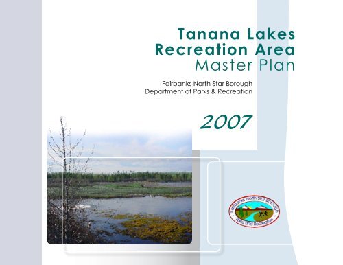
Tanana Lakes Recreation Area Master Plan - Fairbanks North Star ...
Tanana Lakes Recreation Area Master Plan - Fairbanks North Star ...
Tanana Lakes Recreation Area Master Plan - Fairbanks North Star ...

Create successful ePaper yourself
Turn your PDF publications into a flip-book with our unique Google optimized e-Paper software.
<strong>Tanana</strong> <strong>Lakes</strong><br />
<strong>Recreation</strong> <strong>Area</strong><br />
<strong>Master</strong> <strong>Plan</strong><br />
<strong>Fairbanks</strong> <strong>North</strong> <strong>Star</strong> Borough<br />
Department of Parks & <strong>Recreation</strong>
FNSB - Department of Parks and <strong>Recreation</strong><br />
<strong>Tanana</strong> <strong>Lakes</strong><br />
<strong>Recreation</strong> <strong>Area</strong><br />
<strong>Master</strong> <strong>Plan</strong><br />
2007<br />
<strong>Plan</strong>ning Team:<br />
<strong>Fairbanks</strong> <strong>North</strong> <strong>Star</strong> Borough,<br />
Department of Parks & <strong>Recreation</strong><br />
USKH, Inc.
Executive Summary<br />
This <strong>Master</strong> <strong>Plan</strong> outlines the <strong>Fairbanks</strong> <strong>North</strong> <strong>Star</strong> Borough’s (FNSB’s) plan<br />
for the future development and use of the <strong>Tanana</strong> <strong>Lakes</strong> <strong>Recreation</strong> <strong>Area</strong>, a<br />
750-acre multi-use park south of the City of <strong>Fairbanks</strong> along the <strong>Tanana</strong> River.<br />
The purpose of the <strong>Master</strong> <strong>Plan</strong> is to provide the FNSB with a long-term,<br />
planning guide for gravel extraction and development of the recreation area<br />
based on resource opportunities and constraints, development opportunities<br />
and constraints, and public needs. The <strong>Master</strong> <strong>Plan</strong> details the planning<br />
purpose and process, existing site conditions and land use, resources<br />
assessment, public process and demand, development plan, maintenance<br />
and operations considerations, and permits and authorizations required for<br />
development of the recreation area.<br />
The project concept originated approximately 15 years ago by the FNSB<br />
and its need to extract gravel for use at the South Cushman Landfill. The<br />
unsecured site has historically been a common place for illegal dumping of<br />
junk or abandoned vehicles and other refuse, as well as other unauthorized<br />
and criminal activities. Passing years have brought to<br />
the forefront the desire to clean up the site in order to<br />
enhance the wildlife habitat and natural features of the<br />
area in conjunction with the FNSB’s plan to extract gravel.<br />
As a result, this <strong>Master</strong> <strong>Plan</strong> has become a priority driven<br />
by both public safety and the importance of establishing<br />
this area for the community’s use and enjoyment.<br />
FNSB - Department of Parks and <strong>Recreation</strong><br />
TANANA LAKES MASTER PLAN - i
FNSB - Department of Parks and <strong>Recreation</strong>
The development concept presented in this <strong>Master</strong> <strong>Plan</strong> includes both<br />
summer and winter recreational uses, which were largely motivated by<br />
public and agency input. An intensive scoping process was conducted<br />
during development of the <strong>Master</strong> <strong>Plan</strong> to identify and involve agencies<br />
early in the process; include the public in the development of the <strong>Master</strong><br />
<strong>Plan</strong>; solicit agency and public comments to be considered and addressed<br />
in the <strong>Master</strong> <strong>Plan</strong>; and determine the need for special studies. The scoping<br />
process included distribution of an agency scoping letter, a public meeting,<br />
and an online project questionnaire. The results of the scoping process were<br />
summarized in the Agency and Public Scoping Summary Report – January<br />
2007, attached as Appendix A to this <strong>Master</strong> <strong>Plan</strong>. The agency and public<br />
comments received were used to form the Draft <strong>Master</strong> <strong>Plan</strong>, which was<br />
presented by the FNSB to the public in February 2007. The <strong>Master</strong> <strong>Plan</strong><br />
considers all input received from the scoping process and public meetings.<br />
Additionally, the <strong>Master</strong> <strong>Plan</strong> examines maintaining existing land uses,<br />
mitigating wetlands impacts, preserving areas of high wildlife habitat value,<br />
avoiding user conflicts, sequencing gravel extraction, and securing the site to<br />
help deter illegal activities.<br />
Once development of the <strong>Tanana</strong> <strong>Lakes</strong> <strong>Recreation</strong> <strong>Area</strong> is complete,<br />
visitation is assumed to exceed 100,000 visitors per year. Preliminary<br />
estimates also suggest there is enough gravel to support operations at the<br />
South Cushman Landfill for at least 15 to 20 years.<br />
FNSB - Department of Parks and <strong>Recreation</strong> TANANA LAKES MASTER PLAN - ii
Table of Contents<br />
Table of Contents<br />
Executive Summary .............................................................................................. i<br />
Table of Contents ................................................................................................. ii<br />
Acronyms and Abbreviations ............................................................................. v<br />
1 Introduction<br />
Project Overview............................................................................................1-1<br />
Purpose of the <strong>Master</strong> <strong>Plan</strong> ...........................................................................1-2<br />
General Parameters.......................................................................................1-3<br />
<strong>Master</strong> <strong>Plan</strong> Process......................................................................................1-3<br />
<strong>Master</strong> <strong>Plan</strong> Implementation ..........................................................................1-4<br />
Why <strong>Master</strong> <strong>Plan</strong> the <strong>Tanana</strong> <strong>Lakes</strong> <strong>Recreation</strong> <strong>Area</strong> Now? ........................1-5<br />
2 Existing Conditions and Land Use<br />
Site Location ..................................................................................................2-1<br />
Project Boundary ...........................................................................................2-1<br />
Landscape .....................................................................................................2-2<br />
Neighborhood ................................................................................................2-2<br />
Zoning ............................................................................................................2-2<br />
Existing Land Use and Facilities....................................................................2-6<br />
<strong>Recreation</strong>al Use ......................................................................................2-6<br />
Gravel Extraction ......................................................................................2-6<br />
Utilities and Easements............................................................................2-7<br />
South Cushman Rifle Range....................................................................2-8<br />
Bonnifield Trail and 100-Mile Loop Trail...................................................2-8<br />
Goose Island Off-Road Vehicle <strong>Area</strong> .......................................................2-9<br />
Adjacent Properties ..................................................................................2-9<br />
FNSB - Department of Parks and <strong>Recreation</strong><br />
TANANA LAKES MASTER PLAN - iii
Table of Contents-continued<br />
3 Resource Assessment<br />
Floodplain Setting ..........................................................................................3-1<br />
Topography ..............................................................................................3-2<br />
Geology & Soils ........................................................................................3-3<br />
Hydrology .................................................................................................3-3<br />
Wetlands ........................................................................................................3-4<br />
Climate...........................................................................................................3-6<br />
Vegetation......................................................................................................3-6<br />
Fish and Wildlife.............................................................................................3-7<br />
Fish...........................................................................................................3-7<br />
Birds..........................................................................................................3-7<br />
Other Wildlife ............................................................................................3-8<br />
Threatened and Endangered Species ...........................................................3-8<br />
<strong>Recreation</strong> Resources ...................................................................................3-8<br />
Gravel Resources ..........................................................................................3-9<br />
Scenic Resources ..........................................................................................3-9<br />
FNSB - Department of Parks and <strong>Recreation</strong><br />
TANANA LAKES MASTER PLAN - iv
Table of Contents-continued<br />
4 Public Process and Demand<br />
Population and Growth ..................................................................................4-1<br />
Other Local <strong>Recreation</strong> <strong>Area</strong>s .......................................................................4-1<br />
Public Input ....................................................................................................4-3<br />
Agency and Organization Input .....................................................................4-7<br />
5 Development <strong>Plan</strong><br />
Opportunities and Constraints Affecting Development of the <strong>Area</strong> ...............5-1<br />
Habitat Preservation ......................................................................................5-2<br />
Proposed Facilities and Infrastructure ...........................................................5-6<br />
Site Security .............................................................................................5-6<br />
Site Access and Circulation......................................................................5-6<br />
Proposed <strong>Recreation</strong>al Uses<br />
Summer Use...........................................................................................5-10<br />
Winter Use..............................................................................................5-18<br />
Gravel Extraction .........................................................................................5-20<br />
Sequencing/Phasing ....................................................................................5-28<br />
6 Maintenance and Operations......................................................................6-1<br />
Staffing...........................................................................................................6-1<br />
Public Safety ..................................................................................................6-2<br />
Utilities............................................................................................................6-2<br />
Funding and Revenue....................................................................................6-3<br />
7 Summary of Estimated Costs.....................................................................7-1<br />
8 Permits and Authorizations ........................................................................8-1<br />
9 References....................................................................................................9-1<br />
FNSB - Department of Parks and <strong>Recreation</strong><br />
TANANA LAKES MASTER PLAN - v
Table of Contents-continued<br />
Figures<br />
Location and Vicinity Map ...................................................................................2-4<br />
Existing Conditions..............................................................................................2-5<br />
Wetlands Map .....................................................................................................3-5<br />
Preserved <strong>Area</strong>s..................................................................................................5-4<br />
“Motorized” and “Non-Motorized” Use Zones......................................................5-5<br />
Site Concept – Summer Use...............................................................................5-9<br />
Site Concept – Winter Use................................................................................5-19<br />
Gravel Extraction <strong>Area</strong>s ....................................................................................5-27<br />
Appendices<br />
Agency and Public Scoping Summary Report ...................................................... A<br />
Summary of Site Amenity Quantities/Calculations................................................ B<br />
FNSB - Department of Parks and <strong>Recreation</strong><br />
TANANA LAKES MASTER PLAN - vi
Acronyms and Abbreviations<br />
°F degrees Fahrenheit<br />
ADA Americans with Disabilities Act<br />
ADEC Alaska Department of Environmental Conservation<br />
ADF&G Alaska Department of Fish and Game<br />
ADNR Alaska Department of Natural Resources<br />
ARRC Alaska Railroad Corporation<br />
EFH Essential Fish Habitat<br />
EPA U.S. Environmental Protection Agency<br />
FEMA Federal Emergency Management Agency<br />
FITA International Archery Association<br />
FNSB <strong>Fairbanks</strong> <strong>North</strong> <strong>Star</strong> Borough<br />
GVEA Golden Valley Electric Association<br />
NFAA National Field Archery Association<br />
NMFS National Marine Fisheries Service<br />
NPS National Park Service<br />
OHMP Office of Habitat Management and Permitting<br />
OPMP Office of Project Management and Permitting<br />
ORV Off Road Vehicle<br />
ppm parts per million<br />
SHPO State Historic Preservation Office<br />
TESS Threatened and Endangered Species System<br />
USA Utility Services of Alaska, Inc.<br />
USACE U.S. Army Corps of Engineers<br />
USAR-AK U.S. Army Alaska<br />
USFWS U.S. Fish and Wildlife Service<br />
FNSB - Department of Parks and <strong>Recreation</strong><br />
TANANA LAKES MASTER PLAN - vii
Introduction 1<br />
<strong>Fairbanks</strong> <strong>North</strong> <strong>Star</strong> Borough<br />
Department of Parks and <strong>Recreation</strong><br />
2007
1 Introduction<br />
Project Overview<br />
This <strong>Master</strong> <strong>Plan</strong> outlines the <strong>Fairbanks</strong> <strong>North</strong> <strong>Star</strong> Borough’s (FNSB’s)<br />
plan for the future development of the <strong>Tanana</strong> <strong>Lakes</strong> <strong>Recreation</strong> <strong>Area</strong>, a<br />
750-acre multi-use park south of the City of <strong>Fairbanks</strong> along the <strong>Tanana</strong><br />
River. The recreation area would offer year-round, convenient access to a<br />
variety of recreational and educational opportunities. The location is ideal<br />
for a community recreation area given its proximity to <strong>Fairbanks</strong> and Fort<br />
Wainwright. The site is also well situated for expansion, as the adjacent<br />
lands are owned by the FNSB and/or the State of Alaska. In addition to<br />
the multiple recreational opportunities the area will offer, the <strong>Tanana</strong> <strong>Lakes</strong><br />
<strong>Recreation</strong> <strong>Area</strong> will enhance the integrity of the area’s natural assets and<br />
unique wildlife and bird habitat.<br />
The project concept originated approximately 15 years ago by the FNSB<br />
and its need to extract gravel for use at the South Cushman Landfill. The<br />
unsecured site has become a common place for dumping stolen and<br />
abandoned vehicles, hosting drug users and parties, indiscriminate shooting,<br />
joyriding, homicides, and other unauthorized and criminal activities. Passing<br />
years have brought to the forefront the desire to clean up the site in order to<br />
enhance the wildlife habitat and natural features of the area in conjunction<br />
with the FNSB’s intent to extract gravel. Considering the size and locality of<br />
the site, and its natural setting and resources, its potential as a recreational<br />
area was also realized.<br />
The project is a long-range, multi-phased effort, with gravel extraction and park<br />
development spanning the course of 15-20 years or more. In June 2006, the<br />
FNSB was permitted by the U.S. Army Corps of Engineers (USACE) to begin<br />
gravel extraction from a portion of the site and began dredging in August.<br />
FNSB - Department of Parks and <strong>Recreation</strong><br />
TANANA LAKES MASTER PLAN 1-1
In September 2006, the FNSB hired a local contractor to remove approximately<br />
400 tons of debris, and launched a volunteer clean-up effort to remove other<br />
refuse. In October 2006, the FNSB contracted with USKH, Inc., an Alaskabased<br />
architecture, engineering, surveying, and planning firm, to prepare this<br />
<strong>Master</strong> <strong>Plan</strong>.<br />
Purpose of the <strong>Master</strong> <strong>Plan</strong><br />
The purpose of master planning is to identify the most appropriate uses based<br />
on resource opportunities and constraints, development opportunities and<br />
constraints, and public needs. A master plan serves as a basis for preparing<br />
budget and management priorities, and development and management<br />
guidelines, and for requesting land use approval and/or permits from affected<br />
agencies for planned projects.<br />
The <strong>Tanana</strong> <strong>Lakes</strong> <strong>Recreation</strong> <strong>Area</strong> <strong>Master</strong> <strong>Plan</strong> is a written and illustrated<br />
development plan for the proposed gravel extraction, natural habitat<br />
preservation, and recreational facility construction. Specifically this <strong>Master</strong><br />
<strong>Plan</strong> provides:<br />
•<br />
•<br />
•<br />
•<br />
•<br />
•<br />
TANANA LAKES MASTER PLAN 1-2<br />
An analysis of the existing site conditions and natural resources<br />
Recommendations on how to preserve, restore, or enhance the existing<br />
natural resources in the area<br />
Explanations of the planning framework, including public participation and<br />
demands<br />
Proposed recreational facilities, including size and location<br />
Recommended phasing of gravel extraction, park development, and facility<br />
construction to meet ongoing community needs and funding<br />
A prioritized projects list to help guide the process of implementation over<br />
the next 20 years<br />
Estimated cost and funding, including recommendations to maximize<br />
development efficiency and construction and maintenance funding<br />
Operations and maintenance considerations<br />
FNSB - Department of Parks and <strong>Recreation</strong>
General Parameters<br />
Development concepts in the <strong>Tanana</strong> <strong>Lakes</strong> <strong>Recreation</strong> <strong>Area</strong> <strong>Master</strong> <strong>Plan</strong><br />
describe the appropriate sizes, types, and locations for the planned facilities<br />
and land uses. Thoughtful consideration was given to the issues identified<br />
in the planning process. Understanding the resource opportunities and<br />
constraints determined how the proposed facilities best fit into the area. The<br />
following general parameters guided the development of the concept:<br />
•<br />
•<br />
•<br />
Avoid or minimize conflict between recreation types<br />
Provide navigable and understandable site access for both vehicles and<br />
pedestrians<br />
Avoid significant impacts to important natural and scenic resources within<br />
and adjacent to the area<br />
Comply with regulatory requirements<br />
Provide access and opportunities for visitors with disabilities<br />
Provide a variety of recreation opportunities<br />
Develop the area in harmony with the natural setting<br />
<strong>Master</strong> <strong>Plan</strong> Process<br />
The purpose of the master planning process is to plan for the protection<br />
and public enjoyment of existing resources in the area. The first step to<br />
developing the <strong>Tanana</strong> <strong>Lakes</strong> <strong>Recreation</strong> <strong>Area</strong> <strong>Master</strong> <strong>Plan</strong> was to assess<br />
the resources; inventory the existing facilities and land uses in and adjacent<br />
to the area; and inform the public and affected agencies about the process.<br />
Next, issues involving the use, development, and management of the area<br />
were identified through meetings with the FNSB staff, an agency scoping<br />
letter, a project questionnaire, and two public meetings. This scoping<br />
process helped establish the goals and priorities of the <strong>Master</strong> <strong>Plan</strong>,<br />
including resource management guidelines and development concepts.<br />
FNSB - Department of Parks and <strong>Recreation</strong><br />
TANANA LAKES MASTER PLAN 1-3
TANANA LAKES MASTER PLAN 1-4<br />
This information was compiled into a Draft <strong>Master</strong> <strong>Plan</strong> that was presented<br />
to and reviewed by the FNSB Parks and <strong>Recreation</strong> Commission, and by the<br />
interested public and affected agencies. The following flow chart illustrates the<br />
process used to develop the <strong>Tanana</strong> <strong>Lakes</strong> <strong>Recreation</strong> <strong>Area</strong> <strong>Master</strong> <strong>Plan</strong>.<br />
<strong>Master</strong> <strong>Plan</strong> Implementation<br />
Once the <strong>Tanana</strong> <strong>Lakes</strong> <strong>Recreation</strong> <strong>Area</strong> <strong>Master</strong> <strong>Plan</strong> is adopted by the<br />
FNSB, any development in the area must be consistent with the <strong>Master</strong> <strong>Plan</strong>.<br />
Minor variations from the adopted <strong>Master</strong> <strong>Plan</strong> may be allowed if the FNSB<br />
and affected agencies determine them to be consistent with the <strong>Master</strong> <strong>Plan</strong>.<br />
Special attention and adherence shall also be provided to the conditions of<br />
any project permits or authorizations acquired, as well as the requirements of<br />
funding sources, pursuant to the development of the site<br />
in coordination with the <strong>Master</strong> <strong>Plan</strong>. Any use that is not<br />
consistent with the <strong>Master</strong> <strong>Plan</strong> will require an amendment<br />
to the <strong>Master</strong> <strong>Plan</strong>.<br />
FNSB - Department of Parks and <strong>Recreation</strong>
Why <strong>Master</strong> <strong>Plan</strong> the <strong>Tanana</strong> <strong>Lakes</strong> <strong>Recreation</strong> <strong>Area</strong> Now?<br />
The concept for the <strong>Tanana</strong> <strong>Lakes</strong> <strong>Recreation</strong> <strong>Area</strong> was originally developed<br />
about 15 years ago by the FNSB and their need to extract gravel for use at the<br />
South Cushman Landfill. There is a financial benefit linked to extracting gravel<br />
from within the proposed recreation area. The State of Alaska Department of<br />
Natural Resources (ADNR) owns lands within the project area.<br />
As of January 1, 2007, ADNR charges the FNSB a royalty fee of $3.00 per<br />
cubic yard for gravel extracted from these lands. However, this fee would<br />
be waived if the extracted lands were reclaimed to contribute to a public use<br />
area, such as a recreation area or park.<br />
Aside from the economic benefit, there is a more critical benefit to be realized:<br />
public safety. Today the area is host to a variety of illicit and criminal activities,<br />
making it difficult, even impossible at times, for the community to enjoy the<br />
scenic views, wildlife, and other resources the area has to offer. While gravel<br />
extraction remains a key component of planning and developing the site, the<br />
FNSB also recognizes the need to reclaim this deteriorating area and launched<br />
a restoration effort in the fall of 2006 to begin cleaning up the area.<br />
As with many <strong>Master</strong> <strong>Plan</strong>s, there is strong public demand to add recreational<br />
resources for the community and preserve existing natural resources in the<br />
<strong>Tanana</strong> <strong>Lakes</strong> area. The <strong>Tanana</strong> <strong>Lakes</strong> <strong>Recreation</strong> <strong>Area</strong> <strong>Master</strong> <strong>Plan</strong> has<br />
become a priority, not only driven by recreation and preservation, but also by<br />
public safety, and the importance of establishing this area for the community’s<br />
use and enjoyment.<br />
FNSB - Department of Parks and <strong>Recreation</strong><br />
TANANA LAKES MASTER PLAN 1-5
Existing Conditions and Land Use 2<br />
<strong>Fairbanks</strong> <strong>North</strong> <strong>Star</strong> Borough<br />
Department of Parks and <strong>Recreation</strong><br />
2007
2 Existing Conditions and Land Use<br />
Site Location<br />
The <strong>Tanana</strong> <strong>Lakes</strong> area is located in the FNSB just 10 minutes south of<br />
downtown <strong>Fairbanks</strong>. The area is conveniently located, approximately<br />
14 miles northwest of the City of <strong>North</strong> Pole, and approximately 3 miles<br />
southwest of Fort Wainwright’s main post. The Location and Vicinity Map<br />
(Figure 1) illustrates the general location of the area relative to the surrounding<br />
communities, roadways, and major water bodies.<br />
Project Boundary<br />
The project area is comprised of approximately 750 acres. It is located at<br />
Latitude 64.797°N and Longitude -147.737°W, and is within Sections 26, 27,<br />
28, and 34, Township 1 South, Range 1 West, <strong>Fairbanks</strong> Meridian. This site<br />
is generally bound on the north by the <strong>Tanana</strong> River Levee, south by the<br />
<strong>Tanana</strong> River, west by Groin 8 of the <strong>Tanana</strong> River Levee, and east by the<br />
Goose Island Causeway, an extension of South Cushman Street. An outline<br />
of the project boundary is shown on Figure 2.<br />
FNSB - Department of Parks and <strong>Recreation</strong><br />
TANANA LAKES MASTER PLAN 2-1
TANANA LAKES MASTER PLAN 2-2<br />
Landscape<br />
The landscape of the area is a reflection of the fluvial activity on the floodplain<br />
of the <strong>Tanana</strong> River and of the gravel extraction activity common to the site.<br />
The terrain is flat to undulating, consisting of flood deposited silts, sands, and<br />
gravels, and is marked by abandoned river channels, depressions, levees,<br />
and gravel pits. The east end of the area is characterized by permanent and<br />
seasonal wetlands. Higher floodplain terraces exist along the north edge and<br />
the south tip of the project area, which are a mix of forested wetlands and<br />
uplands.<br />
Neighborhood<br />
The majority of the lands directly adjacent to the north, northeast, and<br />
northwest of the area are privately owned industrial lands. All property within<br />
the project site is publicly owned by the FNSB or the State of Alaska. Parcels<br />
owned by the FNSB and State of Alaska are identified on Figure 2.<br />
Zoning<br />
The project site is currently zoned as Heavy Industrial and General Use-1 by<br />
the FNSB. Once gravel extraction is completed, the lots within the project<br />
site will be rezoned to Outdoor <strong>Recreation</strong>. The rezoning process will require<br />
public involvement and opportunity for testimony, and exclusively<br />
involve properties owned by the FNSB. Properties owned by the<br />
State of Alaska would not be involved in this process.<br />
FNSB - Department of Parks and <strong>Recreation</strong>
FNSB - Department of Parks and <strong>Recreation</strong> TANANA LAKES MASTER PLAN 2-3
<strong>Tanana</strong> <strong>Lakes</strong> <strong>Recreation</strong> <strong>Area</strong> <strong>Master</strong> <strong>Plan</strong><br />
<strong>Fairbanks</strong>, Alaska<br />
<strong>Fairbanks</strong> <strong>North</strong> <strong>Star</strong> Borough<br />
TANANA LAKES MASTER PLAN 2-4<br />
Location & Vicinity Map<br />
Map Credit: www.google.com/maps<br />
FNSB - Department of Parks and <strong>Recreation</strong><br />
1
LEGEND<br />
Property Owned by <strong>Fairbanks</strong><br />
<strong>North</strong> <strong>Star</strong> Borough (FNSB)<br />
Property Owned by Alaska Dept.<br />
of Natural Resources (ADNR)<br />
250-ft Buffer from <strong>Tanana</strong><br />
River Levee & Groins<br />
Gravel Extraction <strong>Area</strong>s<br />
Preserved <strong>Area</strong><br />
Project Boundary<br />
<strong>Tanana</strong> <strong>Lakes</strong> <strong>Recreation</strong> <strong>Area</strong> <strong>Master</strong> <strong>Plan</strong><br />
<strong>Fairbanks</strong>, Alaska<br />
<strong>Fairbanks</strong> <strong>North</strong> <strong>Star</strong> Borough<br />
Existing Conditions<br />
FNSB - Department of Parks and <strong>Recreation</strong> TANANA LAKES MASTER PLAN 2-5<br />
2
TANANA LAKES MASTER PLAN 2-6<br />
Existing Land Use and Facilities<br />
<strong>Recreation</strong> Use<br />
<strong>Recreation</strong>al activities in the area currently include bird watching/wildlife<br />
viewing, dog walking/training, waterfowl hunting, walking/hiking, fishing,<br />
horseback riding, biking, picnicking, camping, swimming, off-road vehicle<br />
use, motorized and non-motorized boating, and skiing. Additionally, there is<br />
a rifle range east of the project area.<br />
Gravel Extraction<br />
Gravel extraction has occurred within the project area for a number of<br />
years under permits issued by the USACE. The State of Alaska, through<br />
the ADNR, regulates gravel mining and handles the sale of gravel extraction<br />
rights to private companies. All privately held rights within the project site<br />
are gravel extraction contracts between ADNR and the private companies.<br />
These leases will soon expire and will not be renewed.<br />
FNSB - Department of Parks and <strong>Recreation</strong>
Between 1998 and 2006, the FNSB extracted<br />
gravel from a 28-acre portion of the project area<br />
south of the <strong>Tanana</strong> River Levee and west of<br />
Groin 9. In June 2006, the FNSB was permitted<br />
to begin gravel extraction from an 80-acre portion<br />
of the project area south of the <strong>Tanana</strong> River<br />
Levee and east of Groin 9, as shown on Figure 2.<br />
Remaining gravel extraction activities will occur<br />
in the north-central and northwest portions of the<br />
project area. Gravel from these areas will be used<br />
for daily cover material and cell construction at<br />
the FNSB landfill, and as needed for construction<br />
of the proposed recreation area.<br />
Utilities and Easements<br />
Utility Services of Alaska, Inc. (USA) operates and<br />
maintains the water and sanitary sewer systems<br />
within the <strong>Fairbanks</strong> area. Water and sanitary<br />
sewer mains are located nearby along Lathrop<br />
Street and South Cushman Street. These systems<br />
terminate before reaching the project area and<br />
currently do not serve the project area.<br />
Golden Valley Electric Association (GVEA) owns<br />
and maintains most overhead and underground<br />
electrical systems within the <strong>Fairbanks</strong> area.<br />
There is a northeast-southwest trending GVEA<br />
power line approximately 150 feet east of the<br />
gravel extraction pond east of the Goose Island<br />
Causeway.<br />
There are no other utilities within or currently<br />
serving the project area.<br />
FNSB - Department of Parks and <strong>Recreation</strong> TANANA LAKES MASTER PLAN 2-7
TANANA LAKES MASTER PLAN 2-8<br />
South Cushman Rifle Range<br />
The South Cushman Rifle Range, managed by the FNSB, is located east of<br />
and accessed through the project site. Amenities include a 25-yard pistol<br />
range and a 300-yard rifle range. The rifle range is open 8 a.m. to 10 p.m.,<br />
and closed Wednesdays 8:00 a.m. to noon for maintenance.<br />
Bonnifield Trail and 100-Mile Loop Trail<br />
The Bonnifield Trail is a winter access route to the <strong>Tanana</strong> Flats. The trail<br />
begins at the south end of Cushman Street, runs along the Goose Island<br />
Causeway (South Cushman Street) through the eastern portion of the project<br />
area and across the <strong>Tanana</strong> River by way of an ice bridge. After crossing the<br />
<strong>Tanana</strong> River, the Bonnifield Trail heads south through the U.S. Army Alaska<br />
(USAR-AK) <strong>Tanana</strong> Flats training area. The trail is estimated to have been<br />
constructed in 1908 as a winter sled route to the mines of the Bonnifield mining<br />
district located along Bonnifield Creek, a tributary to the Wood River. The<br />
Bonnifield trail is one of the longest routes in Interior Alaska that was privately<br />
constructed and maintained. The trail is still used today by snowmachines<br />
accessing hunting areas and trap lines. The USAR-AK currently uses the<br />
trail as vehicle access to training areas. Frequent winter snowmachine use<br />
keeps vegetation from growing back over the trail. The USAR-AK constructs<br />
and maintains the ice bridge every winter, and civilian access is authorized<br />
by recreation permit.<br />
The FNSB has allocated funds to map portions of the 100-Mile Loop Trail.<br />
The 100-Mile Loop Trail, an idea first conceived years ago, would connect<br />
six or seven existing historic trails to create a loop encircling <strong>Fairbanks</strong>. As<br />
proposed, the loop would include a trail running along the <strong>Tanana</strong> River Levee<br />
on the north boundary of the proposed <strong>Tanana</strong> <strong>Lakes</strong> <strong>Recreation</strong> <strong>Area</strong>. The<br />
trail is currently classified in the FNSB Comprehensive <strong>Recreation</strong>al Trail<br />
<strong>Plan</strong> as a multi-use facility; therefore it would permit motorized uses along<br />
its corridor. Currently, the FNSB is working to acquire easements to connect<br />
the existing trails.<br />
FNSB - Department of Parks and <strong>Recreation</strong>
Goose Island Off-Road Vehicle <strong>Area</strong><br />
A portion of the project site has been used in the past by the <strong>Fairbanks</strong><br />
Motorcycle Racing Association for off-road vehicle practice and competition<br />
under a use permit granted by the FNSB Division of Land Management.<br />
However, the FNSB soon realized the area actually used by the racing<br />
association was ADNR property and discontinued issuing of the permit in<br />
1996/1997. Since then, the FNSB offered the uplands north of the gravel<br />
pit between Groins 8 and 9 for use by the association. However, the<br />
racing association decided they were not interested due to the insurance<br />
requirements of the FNSB, and have since relocated to the Dennis Road<br />
area in <strong>North</strong> Pole.<br />
This land north of the gravel pit between Groins 8 and 9 is owned by the<br />
FNSB and remains an ideal site for this particular type of trail recreation. It<br />
is recommended that the FNSB work with the <strong>Fairbanks</strong> Motorcycle Racing<br />
Club and or other interested organizations to more permanently establish<br />
this area for motorized recreational use.<br />
Adjacent Properties<br />
USA, Metro Company, Greater <strong>Fairbanks</strong> Racing Association, Killion Land<br />
Company, Alaska West Express, <strong>North</strong>land Wood Products, and other<br />
private landowners own properties north of the project site. These properties,<br />
separated from the project site by the <strong>Tanana</strong> River Levee, include the Golden<br />
Heart Utilities Wastewater Treatment Facility, Mitchell Raceway, Alaska West<br />
Express operations, and <strong>North</strong>land Wood Products retail facility.<br />
FNSB - Department of Parks and <strong>Recreation</strong><br />
TANANA LAKES MASTER PLAN 2-9
Resource Assessment 3<br />
<strong>Fairbanks</strong> <strong>North</strong> <strong>Star</strong> Borough<br />
Department of Parks and <strong>Recreation</strong><br />
2007
3 Resource Assessment<br />
The <strong>Tanana</strong> <strong>Lakes</strong> is an ideal location for developing a recreation area. The<br />
scenic area is conveniently located, offers great potential for expansion;<br />
complements gravel extraction, is a habitat for migratory birds and other<br />
wildlife, and is along the shoreline of the <strong>Tanana</strong> River.<br />
This section summarizes the assessment of key resources used to prepare<br />
the <strong>Master</strong> <strong>Plan</strong>. The resource management guidelines recommended in the<br />
<strong>Master</strong> <strong>Plan</strong> were based on the inventories of key resources of the area.<br />
Floodplain Setting<br />
The project area is located along the north bank of the <strong>Tanana</strong> River. The<br />
<strong>Tanana</strong> River flows generally northward for 531 river miles through a broad<br />
alluvial valley. The channel pattern of the <strong>Tanana</strong> River changes near <strong>Fairbanks</strong><br />
from a more open braiding to a narrower braiding. Upstream of <strong>Fairbanks</strong><br />
the river is strongly braided, characterized by unstable, unvegetated gravel<br />
bars and multiple channels; downstream of <strong>Fairbanks</strong> the river meanders<br />
across the floodplain with one or more major channels and stable, vegetated<br />
islands.<br />
A 1992 Federal Emergency Management Agency (FEMA) map identifies that<br />
the project area is within Flood Zone A, a special flood hazard area inundated<br />
by 100-year flood events. Major, destructive flooding of the <strong>Tanana</strong> River<br />
may occur every 50 to 100 years. The project area is located on the riverside<br />
of a flood control levee, protected by a series of groins extending from the<br />
levee to the shoreline of the <strong>Tanana</strong> River. The <strong>Tanana</strong> River floods annually<br />
and often inundates the project area, but the groins restrict floodwater from<br />
flowing over the project site and eroding the landscape.<br />
FNSB - Department of Parks and <strong>Recreation</strong><br />
TANANA LAKES MASTER PLAN 3-1
TANANA LAKES MASTER PLAN 3-2<br />
Minor flooding occurs frequently, depositing sediment and raising the height of<br />
terraces. The entire project area is subject to biannual flooding: in the spring<br />
during snowmelt, and in the fall during high precipitation. Old slough beds fill<br />
up with water and much of the area fills with shallow water. Approximately<br />
half of the project area is inundated by high water events in the spring, but the<br />
water quickly recedes and the area dries out in early summer.<br />
Based on studies measuring erosion rates of the <strong>Tanana</strong> River near <strong>Fairbanks</strong>,<br />
average bank recession rates were determined to vary from 12 to 33 feet<br />
per year per lineal feet of riverbank. The flood control levee and associated<br />
groins, however, have proven to fully protect lands from erosion on the dry<br />
side of the levee.<br />
Topography<br />
The terrain is flat to undulating consisting of flood deposited silts, sands, and<br />
gravels, and marked by abandoned river channels, depressions, levees, and<br />
gravel pits. The elevation difference between the highest and lowest locations<br />
within the project area is no more than 20 feet, ranging from 420 feet to 440<br />
feet in elevation.<br />
FNSB - Department of Parks and <strong>Recreation</strong>
Geology & Soils<br />
Climactic fluctuations during the Quaternary Period caused glacial expansion<br />
and recession throughout Alaska. Interior Alaska was not glaciated during<br />
this period; however, glaciers surrounded the area during glacial advances.<br />
Rivers flowing from surrounding glaciers deposited several hundred feet<br />
of silt, sand, and gravel in the <strong>Tanana</strong> Valley. A layer of loess ranging<br />
from several inches to more than 128 feet thick covers most of the <strong>Tanana</strong><br />
Valley. Gravel deposits along the <strong>Tanana</strong> River occur up to 154 feet thick<br />
and are significant reservoirs for groundwater. Soils within the project area<br />
are classified by the U.S. Department of Agriculture Natural Resources<br />
Conservation Service as a mosaic of Eielson fine sandy loam, Eielson/<br />
Piledriver complex, <strong>Tanana</strong> mucky silt loam, <strong>Tanana</strong>/Mosquito complex, and<br />
riverwash.<br />
Hydrology<br />
The alluvial plain between the <strong>Tanana</strong> and Chena Rivers near <strong>Fairbanks</strong><br />
generally consists of highly transmissive sands and gravels in below-watertable<br />
conditions. Depending on topography, depths to groundwater in the<br />
<strong>Fairbanks</strong> area range from 0 feet (surface water) to 21 feet below the ground<br />
surface. Depths to groundwater in the alluvial plain are within 10 feet of<br />
the ground surface in most areas, and within 5 feet of the ground surface in<br />
low-lying areas. The project area is a low-lying area in the alluvial plain and<br />
depths to groundwater are estimated at 0 feet to 5 feet below the ground<br />
surface. The FNSB estimates the Maximum High Water Elevation of the<br />
project site to be 432 feet.<br />
FNSB - Department of Parks and <strong>Recreation</strong><br />
TANANA LAKES MASTER PLAN 3-3
TANANA LAKES MASTER PLAN 3-4<br />
Wetlands<br />
A Wetland Delineation and Functional Assessment Report analyzing the<br />
project site was completed and submitted to the USACE for a Preliminary<br />
Jurisdictional Determination in April 2007. The study area encompassed<br />
approximately 830 acres, and was classified into 13 different wetland habitat<br />
types. Wetlands account for approximately 660 acres (80 percent) of the<br />
project area. All wetlands in the project area appear to have a downstream<br />
connection to the <strong>Tanana</strong> River, which is a Navigable Water according to the<br />
USACE regulatory web site. All wetlands within the project area are therefore<br />
considered jurisdictional. There are no isolated, non-navigable, intra-state<br />
waters or wetlands within the project area. The only uplands identified within<br />
the project area are the <strong>Tanana</strong> River Levee and associated groins; the<br />
southern portion of Goose Island; and a small upland (~10 acres) west of<br />
Groin 9. A Wetlands Map is included as Figure 3.<br />
In June 2007, a field verification of the wetland delineation report will be<br />
conducted. Fieldwork will involve verifying vegetation types, digging soil pits<br />
to verify hydrology and soil types, and completing Alaska Region Wetland<br />
Determination forms. Upon completion, a letter report of the findings will be<br />
delivered to the USACE for concurrence and final approval of the Jurisdictional<br />
Determination.<br />
FNSB - Department of Parks and <strong>Recreation</strong>
LEGEND<br />
Wetlands<br />
Wetlands & Historic Channel<br />
of the <strong>Tanana</strong> River<br />
Uplands<br />
Project Boundary<br />
<strong>Tanana</strong> <strong>Lakes</strong> <strong>Recreation</strong> <strong>Area</strong> <strong>Master</strong> <strong>Plan</strong><br />
<strong>Fairbanks</strong>, Alaska<br />
<strong>Fairbanks</strong> <strong>North</strong> <strong>Star</strong> Borough<br />
Wetlands Map<br />
FNSB - Department of Parks and <strong>Recreation</strong> TANANA LAKES MASTER PLAN 3-5<br />
3
TANANA LAKES MASTER PLAN 3-6<br />
Climate<br />
Located in Interior Alaska, <strong>Fairbanks</strong> has a continental climate characterized<br />
by warm summers and cold winters. Average January temperatures range<br />
from -19 degrees Fahrenheit (°F) to -2°F, and average July temperatures<br />
range from 52°F to 72°F. Average annual precipitation is 10.5 inches, and<br />
average annual snowfall is 67.1 inches. Snow cover is persistent in the area<br />
from October through April, and the transition between winter and summer<br />
seasons is rapid. Precipitation is typically heaviest in late July and August.<br />
Blizzard conditions are rare, as winds in <strong>Fairbanks</strong> exceed 20 miles per hour<br />
less than one percent of the year.<br />
Vegetation<br />
Native vegetation in the project area is typical of wetland plant communities<br />
in Interior Alaska. The project area primarily consists of saturated deciduous<br />
and evergreen scrub-shrub, and forests composed of willow, alder, cottonwood,<br />
tamarack, and black and white spruce, with underlying native grasses and<br />
sedges.<br />
FNSB - Department of Parks and <strong>Recreation</strong>
Fish and Wildlife<br />
Fish<br />
According to the Alaska Department of Fish and Game (ADF&G) Anadromous<br />
Waters Catalog, chinook, coho, and chum salmon are present in the <strong>Tanana</strong><br />
River (ADF&G No. 334-40-11000-2490), which borders the southern project<br />
area boundary. The <strong>Tanana</strong> River also supports populations of arctic grayling,<br />
whitefish, northern pike, burbot, blackfish, and longnose sucker.<br />
The project area is hydrologically-connected to the <strong>Tanana</strong> River during high<br />
water events, and northern pike have been observed in the project area.<br />
Nearby mudflats and deeper water may support fish, but fish appear to be<br />
incidental to the project area due to limited over-wintering habitat.<br />
Figure 3: Wetlands Map<br />
Birds<br />
The <strong>Tanana</strong> River is a migratory corridor for birds during the spring and<br />
fall for feeding, resting, and nesting activities. Over 115 bird species have<br />
been documented within the project area comprising a variety of songbirds,<br />
shorebirds, ducks, grebes, geese, and swans. The U.S. Fish & Wildlife<br />
Service (USFWS) conducted brood surveys of ducks and grebes in 30<br />
distinct wetland areas near <strong>Fairbanks</strong> between 1994 and 1995. Based on<br />
data collected, the wetland complex within the project area was ranked as<br />
the highest avian waterbird production site near <strong>Fairbanks</strong>, with nearly twice<br />
as many duck and grebe offspring as Creamer’s Field. Notable waterfowl<br />
species nesting in the wetland complex include mallard, northern pintail,<br />
American widgeon, green-winged teal, northern shovelor, horned grebes,<br />
and red-necked grebes. Canada geese, trumpeter and mute swans, ringneck<br />
ducks, greater and lesser scaup, canvasback, and bufflehead also frequent<br />
the area during migratory periods. One bald eagle nest also exists within the<br />
project area in the southeast corner of Goose Island.<br />
FNSB - Department of Parks and <strong>Recreation</strong> TANANA LAKES MASTER PLAN 3-7
TANANA LAKES MASTER PLAN 3-8<br />
Other Wildlife<br />
The following wildlife are present in the <strong>Fairbanks</strong> area and may inhabit or<br />
travel through the project area: moose, red fox, lynx, snowshoe hare, marten,<br />
weasels, voles, shrews, mice, river otter, woodchuck, black bear, grizzly bear,<br />
wolf, coyote, and lemmings. The wood frog is the only amphibian species<br />
present.<br />
Threatened and Endangered Species<br />
The USFWS Threatened & Endangered Species System (TESS) identifies<br />
11 threatened or endangered animal species and one endangered plant<br />
species listed and occurring in Alaska. The T&E species are primarily<br />
distributed along the coast of Alaska. Jim Zelenak of the USFWS reported<br />
there are no threatened or endangered species in the project area.<br />
<strong>Recreation</strong> Resources<br />
There are no existing recreation facilities within the project area, except<br />
the South Cushman Rifle Range, which is west of and accessed through<br />
the project area. Though there are no existing facilities to accommodate<br />
recreation, current activities within the project area include bird watching/<br />
wildlife viewing, dog walking/training, waterfowl hunting, walking/hiking,<br />
fishing, horseback riding, biking, picnicking, camping, swimming, off-road<br />
vehicle use, non-motorized boating, and skiing.<br />
The Bonnifield Trail, a winter access route to the<br />
<strong>Tanana</strong> Flats, is also accessed through the project<br />
area. Civilian recreational use of this trail is permitted<br />
by the USAR-AK by recreation permit. Typical<br />
recreational activities south of the <strong>Tanana</strong> River<br />
include snowmachining, hunting, and trapping.<br />
FNSB - Department of Parks and <strong>Recreation</strong>
Gravel Resources<br />
Braided rivers such as the <strong>Tanana</strong> River move tremendous amounts of<br />
gravel; this fluvial process leads to the deposits of sand and gravel along the<br />
river. Therefore, floodplains are generally a good source of unconsolidated<br />
sediments such as sand and gravel.<br />
The deposits along the portion of the <strong>Tanana</strong> River within and near the project<br />
area are an ideal site for extraction. Gravels previously extracted from this<br />
area have been characterized by a grain-size distribution suitable for daily<br />
cover or cell construction material, have been generally “clean” or free of<br />
contaminants, and relatively inexpensive to extract, due to the close proximity<br />
to the landfill.<br />
Scenic Resources<br />
The scenic qualities of the project area include landscape patterns and<br />
features that are visually and aesthetically pleasing to the recreation<br />
experience of the visitors. The project area is located on the northern edge<br />
of the <strong>Tanana</strong>-Kuskokwim Lowland on the northern bank of the <strong>Tanana</strong> River,<br />
a scenic riparian corridor in Interior Alaska. The project area additionally<br />
consists of a mosaic of surface water bodies and land, which makes the area<br />
well suited for both water-based recreation and land-based recreation.<br />
FNSB - Department of Parks and <strong>Recreation</strong> TANANA LAKES MASTER PLAN 3-9
Public Process and Demand 4<br />
<strong>Fairbanks</strong> <strong>North</strong> <strong>Star</strong> Borough<br />
Department of Parks and <strong>Recreation</strong><br />
2007
4 Public Process and Demand<br />
Population and Growth<br />
The revised 2005 U.S. Census estimates indicate the FNSB population is<br />
87,560; while 31,324 people live in the city of <strong>Fairbanks</strong>, and 1,778 people<br />
live in <strong>North</strong> Pole. The population estimate for the city of <strong>Fairbanks</strong> includes<br />
the military population living on Fort Wainwright, which was approximately<br />
4,050 in 2001. FNSB populations include the cities of <strong>Fairbanks</strong> and <strong>North</strong><br />
Pole, Fort Wainwright Army Base, Eielson Air Force Base, and surrounding<br />
communities.<br />
Data developed in 1998 by the State of Alaska indicates the population of the<br />
FNSB is expected to exceed 100,000 by the year 2018. In comparison to<br />
statewide population growth, the FNSB population grew at an annual rate of<br />
about 0.6 percent between 1990 and 2005, which is slower than the statewide<br />
average annual growth rate of one percent.<br />
Other Local <strong>Recreation</strong> <strong>Area</strong>s<br />
Other local recreation areas of similar size and amenities offered within<br />
50 miles of the project area are the Chena Lake <strong>Recreation</strong> <strong>Area</strong>, Chena<br />
River State <strong>Recreation</strong> <strong>Area</strong>, and Harding Lake State <strong>Recreation</strong> <strong>Area</strong>.<br />
The Chena Lake <strong>Recreation</strong> <strong>Area</strong>, managed by the FNSB, covers 2,100 acres<br />
approximately 23 miles east of <strong>Fairbanks</strong> and approximately 5 miles northeast<br />
of <strong>North</strong> Pole. The area includes two distinct parts – a Lake Park and a River<br />
Park. The Lake Park is centered about the 260-acre Chena Lake, which is<br />
stocked annually by ADF&G with rainbow trout, coho salmon, and arctic char.<br />
No motorized boats or aircraft are permitted on the lake. The area offers<br />
several day-use picnic sites, fire rings, covered pavilions, changing rooms/<br />
warming buildings, designated swim areas with sand beaches, bicycle trails,<br />
nature trails, boat rentals, fishing docks, boat launch, playground, volleyball<br />
courts, horseshoe pit, restroom facilities, and drinking water stations.<br />
FNSB - Department of Parks and <strong>Recreation</strong><br />
TANANA LAKES MASTER PLAN 4-1
TANANA LAKES MASTER PLAN 4-2<br />
The Lake and River Park areas each contain a campground, for a combined<br />
total of 80 campsites. Each camping area contains potable water and<br />
restrooms that are available during the summer and early fall seasons. A<br />
third campground on an island on Chena Lake is accessed only by boat and<br />
contains five tent sites, a restroom and a picnic site. During the winter months,<br />
Chena Lake offers ice-fishing, groomed classical cross-country ski trails and<br />
multi-use trail loops for snowmachining, skijoring, dog mushing, and hiking.<br />
The Chena River State <strong>Recreation</strong> <strong>Area</strong>, managed by the ADNR Division<br />
of Parks & Outdoor <strong>Recreation</strong>, is almost 400 square miles (254,000 acres)<br />
in size and located east of <strong>Fairbanks</strong>. The recreation area is accessed by<br />
Chena Hot Springs Road, which parallels the river, providing users many<br />
entry and exit points for fishing, boating, camping, and access to the large<br />
trail system. There are four stocked fish ponds, and three campgrounds<br />
with a combined total of 73 campsites. Each camping area is accessible<br />
by road and offers access to fishing, picnic sites, restrooms, and drinking<br />
water. There are additional opportunities for camping in undeveloped areas<br />
along gravel bars and river access roads. ADNR also rents seven public<br />
use cabins, all of which are accessible from trailheads<br />
located along the road. Four backcountry first-come,<br />
first-serve shelters also exist with the recreation area.<br />
The largest facility within the recreation area, Twin Bears<br />
Camp, is located at Milepost 30 on the road, about 35<br />
miles east of <strong>Fairbanks</strong>. It is operated year-round by the<br />
Twin Bears Outdoor Education Association and offers<br />
facilities for individuals or groups to rent. The camp<br />
contains 12 rustic cabins and two handicap accessible<br />
buildings with electricity, heat, and cooking facilities.<br />
FNSB - Department of Parks and <strong>Recreation</strong>
The camp also features a volleyball court, baseball field, horseshoe pit,<br />
basketball hoop, picnic tables, and a fire ring. In the winter, there is a 5kilometer<br />
cross country ski trail loop and access to the Chena Hot Springs<br />
Winter trail for snowmachiners.<br />
The Harding Lake State <strong>Recreation</strong> <strong>Area</strong>, managed by the ADNR Division<br />
of Parks & Outdoor <strong>Recreation</strong>, is located 45 miles south of <strong>Fairbanks</strong><br />
along the Richardson Highway. Facilities include picnic sites, two picnic<br />
shelters, camping areas, nature trails, and areas for baseball, volleyball, and<br />
horseshoe. There is a boat launch that provides access to Harding Lake<br />
for motorized and non-motorized watercraft, and fishing opportunities are<br />
provided for lake trout, arctic char, and burbot. The main campground, located<br />
in a spruce-birch forest, has 78 vehicle and 5 walk-in campsites. Each site<br />
has a picnic table and a fire ring, and the campground has a sanitary dump<br />
station. There are additional camping units available at the day-use area and<br />
camp lot areas by the lake.<br />
Public Input<br />
The project team conducted a public meeting on December 6, 2006, at<br />
the Alaska Centennial Center for the Arts at Pioneer Park in <strong>Fairbanks</strong>,<br />
Alaska. The public comment period for this project was open from November<br />
21 to December 31, 2006. Public comments were solicited during and<br />
subsequent to the public meeting, as well as through an online project<br />
questionnaire. The most prevalent comments received during and after the<br />
public meeting, and results of the project questionnaire, are presented on<br />
the following page. Copies of all public comments, including the results of the<br />
online project questionnaire, are provided in the Agency and Public Scoping<br />
Summary Report located in Appendix A.<br />
FNSB - Department of Parks and <strong>Recreation</strong><br />
TANANA LAKES MASTER PLAN 4-3
Public Input (continued)<br />
<strong>Plan</strong>ning and Design<br />
• Include the Bonnifield and 100-mile Trails in <strong>Master</strong> <strong>Plan</strong><br />
• Consider expanding project area<br />
• Litter and illegal dumping remains a problem in the area<br />
• How will FNSB determine “appropriate uses” of the area?<br />
• Survey does not reflect desires of tourists or a balanced cross-section of recreational users<br />
Ensure gravel extraction plan is concurrent with development of the recreation area<br />
•<br />
User Accommodations<br />
• Conflicts between uses can be addressed through separation in space or time<br />
• Include horse trails and facilities in the recreation area<br />
• Camping and RVs are not a good fit for the area<br />
• Include an archery range in the plan<br />
• <strong>Area</strong> does not seem suitable for swimming (i.e. leeches and swimmer’s itch)<br />
• Closing access to the recreation area at Cushman Street would affect users of the rifle<br />
range<br />
•<br />
•<br />
Fish and Wildlife<br />
Walkways and viewing platforms in “preserved area” may be counterproductive to bird<br />
nesting<br />
Gravel extraction activities may diminish habitat value<br />
Pike are present in project area<br />
The FNSB received a total of 173 completed project questionnaires during the public comment<br />
period. The following summarizes the results of the questionnaire.<br />
•<br />
70% of the questionnaire respondents currently visit the area.<br />
TANANA LAKES MASTER PLAN 4-4<br />
FNSB - Department of Parks and <strong>Recreation</strong>
•<br />
»<br />
»<br />
»<br />
»<br />
»<br />
»<br />
•<br />
»<br />
»<br />
»<br />
»<br />
»<br />
»<br />
»<br />
»<br />
•<br />
•<br />
•<br />
The most common activities respondents currently participate in during their visits are:<br />
Bird Watching/Wildlife Viewing – 32%<br />
Dog Walking/Training – 15%<br />
Waterfowl Hunting – 10%<br />
Walking/Hiking – 9%<br />
Use of Rifle Range – 8%<br />
Other activities listed – 5% or less, each<br />
The most common facilities respondents would like to see at the recreation area are:<br />
Walking/Hiking Trails – 12%<br />
Bird Watching/Wildlife Viewing Platforms – 10%<br />
Restrooms – 9%<br />
Picnic/Open <strong>Area</strong>s – 8%<br />
Cross Country Skiing Trails – 8%<br />
Non-motorized Boating – 7%<br />
Biking Trails – 7%<br />
Other facilities listed – 5% or less, each<br />
The top three facility priorities (listed in order of priority) are:<br />
1) Bird Watching/Wildlife Viewing Platforms<br />
2) Walking/Hiking Trails<br />
3) Cross Country Skiing Trails<br />
Respondents felt Preservation and <strong>Recreation</strong> were equally important for the recreation<br />
area. 50% of the respondents chose Preservation to be more important than <strong>Recreation</strong>,<br />
and 50% of the respondents chose <strong>Recreation</strong> to be more important than Preservation.<br />
• »<br />
»<br />
»<br />
93% or respondents felt preservation and recreation can coexist in the area.<br />
The most common activities respondents indicated as a potential conflict between users are:<br />
Motorized Use Wildlife Viewing/Habitat Preservation – 33%<br />
Motorized Use Non-motorized Use – 24%<br />
Other activities listed – 10% or less, each<br />
FNSB - Department of Parks and <strong>Recreation</strong><br />
TANANA LAKES MASTER PLAN 4-5
Public Input (continued)<br />
• »<br />
»<br />
»<br />
•<br />
•<br />
•<br />
The most common activities respondents indicated they did not want to see on site are:<br />
Motorized Use – 59%<br />
Discharge of Firearms – 19%<br />
Other activities listed – 5% or less, each<br />
55% of respondents indicated motorized and non-motorized activities should be<br />
separated from each other; 34% indicated motorized activities should not be allowed in<br />
the area; and 11% indicated they do not see a potential user conflict between motorized<br />
and non-motorized activities.<br />
If the recreation area were developed in line with their priorities, respondents said they<br />
would visit the area during:<br />
» Year-round – 56%<br />
» Summer only – 43%<br />
» Winter only – 1%<br />
If the recreation area were developed in line with their priorities, respondents said they<br />
would visit the area the following number of times per year:<br />
» Over 20 times – 41%<br />
» 10-20 times – 31%<br />
» 6-10 times – 22%<br />
» 1-5 times – 6%<br />
• »<br />
»<br />
»<br />
»<br />
»<br />
Respondents indicated they would support the following entrance fee:<br />
TANANA LAKES MASTER PLAN 4-6<br />
Up to $50 per household per year – 11%<br />
Up to $25 per household per year – 25%<br />
Up to $10 per vehicle per day – 8%<br />
Up to $5 per vehicle per day – 40%<br />
No entrance fee – 16%<br />
FNSB - Department of Parks and <strong>Recreation</strong>
Agency and Organization Input<br />
Federal, state, tribal, and local organizations were informed of the<br />
development of the <strong>Master</strong> <strong>Plan</strong> in November 2006, and their comments<br />
were solicited. Scoping comments were received from eight agencies and<br />
one local organization – USFWS, FNSB Department of Community <strong>Plan</strong>ning,<br />
FNSB Department of Land Management, FNSB Department of Public<br />
Works, National Marine Fisheries Service (NMFS), City of <strong>Fairbanks</strong>, Alaska<br />
Department of Environmental Conservation (ADEC) Division of Water, ADNR<br />
Office of Project Management and Permitting (OPMP), ADNR State Historic<br />
Preservation Office (SHPO), and The Wildlife Society. Copies of all comments<br />
are provided in the Agency and Public Scoping Summary Report located<br />
in Appendix A. Their comments are summarized by resource category as<br />
follows:<br />
•<br />
Fish and Wildlife<br />
•<br />
•<br />
•<br />
•<br />
A bald eagle nest exists within the project boundaries in the southeast<br />
corner of Goose Island, along an old slough channel, and near a proposed<br />
multi-use trail. Care will be needed in managing the area and activities<br />
around this nest.<br />
The value of the area to water birds will be diminished wherever shallow<br />
edge habitat is replaced by deep pits. Reclamation of the shorelines<br />
surrounding the extraction areas should be a high priority.<br />
Stocking of fish, or increased access by northern pike, can diminish the<br />
value of the area to waterfowl through competition for food and direct<br />
predation.<br />
The described action will not result in any adverse effect to Essential Fish<br />
Habitat (EFH).<br />
The portion of the project area designated as a natural area will provide<br />
for the conservation of birds, fish, mammals, amphibians, invertebrates,<br />
and native plant species over time if recreational use and gravel extraction<br />
are managed to minimize disturbance to wildlife and prevent degradation<br />
of habitat.<br />
FNSB - Department of Parks and <strong>Recreation</strong><br />
TANANA LAKES MASTER PLAN 4-7
•<br />
•<br />
•<br />
•<br />
TANANA LAKES MASTER PLAN 4-8<br />
Fish and Wildlife (cont’d)<br />
•<br />
•<br />
•<br />
The FNSB should seek out methods to maintain current habitat values to<br />
the greatest extent possible.<br />
The FNSB should consider habitat manipulations that will enhance benefits<br />
to birds and mammals.<br />
Shorelines with dense vegetation should be preserved because of their<br />
value as nesting and brood-rearing habitat.<br />
Maintaining wetland values in the designated natural area may help reduce<br />
aircraft strike hazard by attracting waterfowl away from the <strong>Fairbanks</strong><br />
International Airport during migration periods.<br />
Fisherman walking along pond shores could disturb birds during the<br />
nesting and brood-rearing seasons. The FNSB should consider stocking<br />
fish only outside the designated natural area.<br />
The FNSB should recognize the benefits amphibians and insects provide<br />
to birds, mammals, fish, and plant species and consider impacts of<br />
proposed uses on these taxa.<br />
Vegetation<br />
The designated natural area should be managed for native plant species<br />
and strive to keep invasive or non-native plant species from becoming<br />
established in the area.<br />
•<br />
Land Use<br />
More thought will be needed regarding what constitutes multi-use,<br />
motorized, and non-motorized recreation. Care will be needed to separate<br />
incompatible activities in time and/or space.<br />
• Phasing of the gravel mining operation will likely result in many years of<br />
disturbance to wildlife and users. The timing of gravel extraction should<br />
be considered a tool for minimizing conflicts.<br />
FNSB - Department of Parks and <strong>Recreation</strong>
•<br />
•<br />
•<br />
•<br />
•<br />
•<br />
•<br />
Currently the zoning of this area is Heavy Industrial and General Use-1. It<br />
is recommended this area be rezoned to Outdoor <strong>Recreation</strong> after gravel<br />
extraction is completed.<br />
Sequence of development must consider minimizing conflict between<br />
patron activities within the park and gravel extraction and hauling activities<br />
to the landfill.<br />
Allow adequate space for gravel storage stockpiles and establish truck<br />
routes to the landfill facility.<br />
A traffic analysis is recommended to project traffic flow generated by this<br />
new facility. Necessary upgrades to Lathrop Street should be projected.<br />
A cul-de-sac needs to be added to South Cushman Street if this street is<br />
going to be dead-ended.<br />
The FNSB should manage the designated natural area for uses that are<br />
compatible with species conservation and wildlife-dependent recreation.<br />
The proposed area has great potential for recreation development<br />
including access to the <strong>Tanana</strong> River. Over time, development will also<br />
discourage unwanted dumping and shooting which are instrumental to<br />
public health and safety.<br />
Floodplains<br />
The 1992 FEMA Map identifies this area as being within Flood<br />
Zone A, a special flood hazard area inundated by a 100-year flood.<br />
•<br />
Water Quality<br />
The development is not within an identified drinking water protection<br />
area and will not impact any known public drinking water sources.<br />
•<br />
Cultural and Historic Resources<br />
The Alaska Heritage Resources Survey database does not list any<br />
reported archeological or historic sites within the proposed project<br />
boundaries. Additionally, the proposed project is in an area of relatively<br />
low archeological potential.<br />
FNSB - Department of Parks and <strong>Recreation</strong><br />
TANANA LAKES MASTER PLAN 4-9
Development <strong>Plan</strong> 5<br />
<strong>Fairbanks</strong> <strong>North</strong> <strong>Star</strong> Borough<br />
Department of Parks and <strong>Recreation</strong><br />
2007
5 Development <strong>Plan</strong><br />
Opportunities and Constraints Affecting Development<br />
of the <strong>Area</strong><br />
Opportunities are those site characteristics that may encourage certain types<br />
of use or development. For example, a site that provides scenic vistas would<br />
be a desirable destination for both picnickers and hikers. Constraints are<br />
those characteristics that might limit or restrict use. Examples include steep<br />
slopes or sensitive wildlife habitat.<br />
There are some inherent conflicts between opportunities and constraints.<br />
For example, creeks, which are sensitive ecosystems, are also desirable<br />
locations for trails and other recreational pursuits. These potential conflicts<br />
have been evaluated with the intent of balancing recreational opportunities<br />
with the need to protect valuable resources.<br />
An overview of the opportunities and constraints affecting the development of<br />
the recreation area is shown below.<br />
Opportunities<br />
• Close proximity to <strong>Fairbanks</strong> and Fort Wainwright<br />
• Scenic<br />
• Habitat for migratory birds and other wildlife<br />
• <strong>Tanana</strong> River Shoreline<br />
• Complements gravel extraction for FNSB landfill<br />
Potential for expansion<br />
•<br />
FNSB - Department of Parks and <strong>Recreation</strong><br />
TANANA LAKES MASTER PLAN 5-1
Constraints<br />
•<br />
•<br />
•<br />
TANANA LAKES MASTER PLAN 5-2<br />
Development restrictions within the 250-foot buffer from <strong>Tanana</strong> River<br />
Levee<br />
Project area highly susceptible to flooding in spring during snowmelt and<br />
in the fall during high precipitation events<br />
Alaska Rail Road Corporation (ARRC) South <strong>Fairbanks</strong> Rail Alignment<br />
project on the <strong>Tanana</strong> River Levee<br />
Habitat Preservation<br />
Two habitat areas totaling 188 acres within the project boundary will be<br />
preserved as shown on Figure 4. One habitat area adjoins the east side<br />
of Groin 9, and is a condition under the June 2006 USACE permit (POA-<br />
2006-442-4) for gravel extraction. The habitat area totals 7.5 acres and is<br />
separated by a gravel roadway into two similar size areas. The FNSB has<br />
proposed to remove the section of roadway separating the areas to combine<br />
the preserved habitat area into a 9-acre area.<br />
FNSB - Department of Parks and <strong>Recreation</strong>
The second habitat area encompasses 179 acres, and was supported by<br />
the USFWS early in the <strong>Master</strong> <strong>Plan</strong> process to preserve the highest value<br />
habitat for migratory birds and other wildlife within the project limits. This<br />
habitat area was originally negotiated by the USFWS with the FNSB to set<br />
aside 150 acres of the project site’s prime habitat. Since that negotiation,<br />
the FNSB has expanded the area to 179 acres to better align the recreation<br />
amenities with the natural setting.<br />
Both habitat areas will be in a designated “Non-Motorized” Use Zone to<br />
help protect the integrity of the areas’ habitat values. Motorized use will be<br />
permitted outside of this zone as shown on Figure 5.<br />
The intent of the “Motorized” versus “Non-Motorized” Use Zones is to divide<br />
the project area into passive and active regions to accommodate the diversity<br />
of, and prevent conflicts between, recreation uses.<br />
FNSB - Department of Parks and <strong>Recreation</strong><br />
TANANA LAKES MASTER PLAN 5-3
<strong>Tanana</strong> <strong>Lakes</strong> <strong>Recreation</strong> <strong>Area</strong> <strong>Master</strong> <strong>Plan</strong><br />
<strong>Fairbanks</strong>, Alaska<br />
<strong>Fairbanks</strong> <strong>North</strong> <strong>Star</strong> Borough<br />
TANANA LAKES MASTER PLAN 5-4<br />
Preserved <strong>Area</strong>s<br />
FNSB - Department of Parks and <strong>Recreation</strong><br />
4
<strong>Tanana</strong> <strong>Lakes</strong> <strong>Recreation</strong> <strong>Area</strong> <strong>Master</strong> <strong>Plan</strong><br />
<strong>Fairbanks</strong>, Alaska<br />
<strong>Fairbanks</strong> <strong>North</strong> <strong>Star</strong> Borough<br />
"Motorized" and "Non-Motorized" Use Zones<br />
FNSB - Department of Parks and <strong>Recreation</strong> TANANA LAKES MASTER PLAN 5-5<br />
5
TANANA LAKES MASTER PLAN 5-6<br />
Proposed Facilities and Infrastructure<br />
Site Security<br />
Securing the site will be key to providing recreational opportunities, as<br />
well as perpetuating recent and future efforts to enhance the area’s<br />
natural assets. To provide oversight and an enforcement presence in<br />
the area, a single entrance/exit access road to the recreation area with<br />
a staffed entrance station is planned. This will help deter illegal activities<br />
such as vandalism and illicit dumping of junk or abandoned vehicles and<br />
other refuse.<br />
Entrance Station<br />
The entrance station will be constructed on the river-side of the levee on<br />
the entrance/exit access road, which will ultimately be an extension of<br />
Lathrop Street. The entrance station is planned to be staffed 24 hours/<br />
day during the summer months, and during daylight hours during the<br />
winter months. General architectural, structural, and mechanical<br />
design considerations should include building structure, electrical,<br />
and heating and cooling needs. General civil design considerations<br />
should provide up to five parking stalls and restroom facilities for<br />
station staff.<br />
Site Access and Circulation<br />
Due to the site’s close proximity to <strong>Fairbanks</strong> and Fort Wainwright,<br />
it is assumed visitation will exceed that of the Chena Lake<br />
<strong>Recreation</strong> <strong>Area</strong>. The FNSB recorded 108,117 visitors for the<br />
fiscal year of 2003/2004 at the Chena Lake <strong>Recreation</strong> <strong>Area</strong>, and<br />
92,389 visitors for the fiscal year 2004/2005. Once development<br />
of the <strong>Tanana</strong> <strong>Lakes</strong> <strong>Recreation</strong> <strong>Area</strong> is complete, visitation is<br />
assumed to greatly exceed these values.<br />
FNSB - Department of Parks and <strong>Recreation</strong>
Traffic will be directed to enter and exit the site from a single access road.<br />
Currently, the site can be accessed from South Cushman Street and Lathrop<br />
Street by way of the Goose Island Causeway (Groin 10) and Groin 9,<br />
respectively. To secure the site and limit traffic to a single access road, a<br />
gate would be placed on the river-side of the levee at its intersection with<br />
Groin 9 and 10 to block traffic from accessing the site at these locations. As<br />
shown on Figure 6, Lathrop Street would be extended and become the single<br />
access road to the site.<br />
Road System<br />
Nearly 4 miles of new or improved road systems will provide vehicular<br />
access throughout the recreation area. The Lathrop Street extension will<br />
require approximately 1,600 linear feet of roadway improvements. New and<br />
improved roads within the recreation area will serve as access to the various<br />
amenities across the site and terminate at three locations – the Equestrian<br />
Park and trail (0.7 miles), Rifle Range (1.2 miles), and Bonnifield Trail (1.7<br />
miles). A section of the Goose Island Causeway is also planned to be gated<br />
off, between the south side of the rifle range road and the access road to the<br />
Bonnifield Trail, to limit traffic circulation near the preserved area.<br />
It is recommended that improved roads be constructed to<br />
accommodate design loads for H-20 rated traffic loads. Fill<br />
material should consist of fast draining, non-frost susceptible<br />
material. Groundwater elevation in relation to the structural<br />
section should be evaluated to determine adequate structural<br />
thicknesses, and/or subbase applications that will provide<br />
a stable, long-lasting roadbed. The roadway should be<br />
crowned to accommodate surface drainage to ditches along<br />
the roadside. Existing drainages will need to be evaluated to<br />
determine where proper culverts and ditching will be required.<br />
FNSB - Department of Parks and <strong>Recreation</strong><br />
TANANA LAKES MASTER PLAN 5-7
TANANA LAKES MASTER PLAN 5-8<br />
Examination of site runoff for the new roadway will need to address runoff<br />
treatment prior to outfall to wetlands and water bodies. Consideration<br />
of initial and life-cycle costs of gravel surfacing and/or asphalt surfacing<br />
should be evaluated as well.<br />
This <strong>Master</strong> <strong>Plan</strong> assumes the use of gravel for roadways with a typical<br />
roadway section comprised of a 4-foot depth, 30-foot width, and 3:1<br />
sloped shoulders.<br />
Parking <strong>Area</strong>s<br />
Ten parking areas are planned to serve various amenities throughout<br />
the recreation area as shown on Figure 6. Parking lot sizes and the total<br />
number of spaces will be determined during the final design; however<br />
at this stage of the planning, approximately 21 acres have been allotted<br />
as parking areas.<br />
All parking areas should be constructed to accommodate H-20 rated<br />
traffic loads. Fill material should consist of fast draining, non-frost<br />
susceptible material. Groundwater elevation in relation to the structural<br />
section should be evaluated for determination of adequate structural<br />
thicknesses, and/or subbase applications to ensure a stable, longlasting<br />
parking surface. Proper grading of the parking areas will need<br />
to accommodate and properly treat site runoff prior to outfall to wetlands<br />
and water bodies. Consideration of initial and life-cycle costs of gravel<br />
surfacing and/or asphalt surfacing should be evaluated as well.<br />
This <strong>Master</strong> <strong>Plan</strong> assumes the use of gravel for parking lots having a<br />
typical depth of 3 feet with 3:1 sloped edges.<br />
FNSB - Department of Parks and <strong>Recreation</strong>
LEGEND<br />
Picnic / Camping <strong>Area</strong>s<br />
Gravel Extraction <strong>Area</strong>s<br />
Swim Beaches<br />
Parking <strong>Area</strong>s<br />
Non-Motorized Trails<br />
Multi-Use Trails<br />
Nature Trails<br />
Improved Roads<br />
Maintenance Roads<br />
Site Concept - Summer Use<br />
FNSB - Department of Parks and <strong>Recreation</strong> TANANA LAKES MASTER PLAN 5-9<br />
6
TANANA LAKES MASTER PLAN 5-10<br />
Proposed <strong>Recreation</strong>al Uses<br />
Summer Use<br />
Predominant use of the recreation area will occur during the summer. For<br />
planning purposes, this section defines summer as the spring, summer, and<br />
fall months when snow cover is absent. The following recreation amenities<br />
are included on the Summer Use Site Concept (Figure 6).<br />
Trail System<br />
The trail system within the recreation area will consist of 2.7 miles of nonmotorized<br />
trail in the central portion of the site, a 1.5-mile multi-use trail in the<br />
southern portion of Goose Island, and an equestrian trail extending west of<br />
Groin 8. Approximately 0.7 miles of nature trails will also be provided within<br />
the preserved area for wildlife viewing.<br />
All trails within the park, regardless of classification of use, should be<br />
constructed to accommodate their respective design loads using fast draining,<br />
non-frost susceptible material. Groundwater elevation in relation to the<br />
trail elevation should be evaluated for determination of adequate structural<br />
thicknesses, and/or subbase applications to ensure a stable, long-lasting trail.<br />
The nature trails should also consider the use of “foot traffic only,” particularly<br />
in wetland areas where the use of fill material may be prohibitive. Boardwalk<br />
design should consider the proper selection of structural and foundation<br />
elements. These elements may include combinations of timber or metal<br />
decking and railing. Foundation design of boardwalks will need to consider<br />
the underlying soil conditions for the proper use of post and pad foundations,<br />
pile foundations, helical pier anchor foundations, or a combination of all three.<br />
Water level fluctuation and elevations should also be considered during the<br />
design of the boardwalk(s).<br />
FNSB - Department of Parks and <strong>Recreation</strong>
The following criteria should be followed for designated trails:<br />
•<br />
•<br />
•<br />
Trail tread should be reasonably free of logs, brush, rocks, man-made<br />
hazards, and other obstructions<br />
Trail should be well signed so that an average user can follow the trail in<br />
any kind of weather during its normal season of use<br />
Sufficient map information should be available so that an average user<br />
can find the trailhead and know where the trail leads<br />
Picnic and Open <strong>Area</strong>s<br />
Nearly 36 acres has been set aside for picnic and open areas that will be<br />
available during the spring, summer, and fall. Each of the six picnic and open<br />
areas are located on a shoreline close to the summer recreation facilities<br />
including the two swim beaches, a fishing and retriever training pond, a<br />
motorized-use lake, and the <strong>Tanana</strong> River. At a minimum, the picnic areas<br />
will offer picnic tables and restroom facilities. Some picnic areas may also<br />
include playgrounds, volleyball courts, horseshoe pits, fire rings, and/or<br />
covered pavilions.<br />
Picnic and open areas should be offset, yet easily accessible from trails and<br />
parking areas. This would allow ease of user accessibility, and keep primary<br />
trail and vehicle traffic outside of these areas. Design of picnic and open<br />
spaces, especially those in close proximity to bodies of water, should consider<br />
water level fluctuations and adequate fill to keep these areas as “high and<br />
dry” as possible. Proper grading of the areas will need to accommodate site<br />
runoff and proper treatment prior to outfall to wetlands and water bodies.<br />
Use of a proper seed mix and accompanying vegetation should be examined<br />
for fast establishment and hardiness, particularly in relation to high summer<br />
use and mitigation as an animal food source. Consideration of furniture (i.e.<br />
picnic tables) in the picnic areas should examine high use versus long-term<br />
durability, and anti-theft and vandalism measures.<br />
FNSB - Department of Parks and <strong>Recreation</strong><br />
TANANA LAKES MASTER PLAN 5-11
TANANA LAKES MASTER PLAN 5-12<br />
Campgrounds<br />
Camping facilities are planned at three locations within the recreation area.<br />
The largest planned camping area, consisting of approximately 26 acres,<br />
lies north of Groin 10 and will be connected to the improved road system.<br />
Camping in this area, and the 6-acre camping area near the Equestrian<br />
Park, is intended for both RV and tent campers. The camping area near<br />
the Equestrian Park will provide campground guests immediate access to<br />
equestrian activities, the motorized lake, and to a picnic area to the south.<br />
The approximate 5-acre camping area on Goose Island will be for walk-in<br />
campers only.<br />
For all vehicle-accessible camping areas, general layout considerations will<br />
include layout and vehicle circulation, vehicle parking, and campsite layout<br />
considerations. Individual campsites may include a fire ring, picnic table,<br />
and tent area. Vehicle parking areas should be constructed similar to the<br />
requirements for the general parking areas and should consider fill materials,<br />
underlying soils, groundwater elevations and water level fluctuations. Walkin<br />
camping facilities should be located within reasonable proximity to the trail<br />
system and nearby parking areas.<br />
Restroom Facilities<br />
Restroom facilities should be included at all parking areas, vehicleaccessible<br />
camping areas, and the entrance station. Cost benefit analysis<br />
and wastewater regulations should be examined to determine if permanent<br />
structures with self-contained above ground tanks, or portable/serviceable<br />
systems should be used. Proper location and placement of the facilities<br />
should be considered for traffic and ease of accessibility. Proper containment<br />
measures for wastewater spills should be included in the design of the<br />
facilities to protect the environment. Maintenance of either type of facility<br />
should include pumping, service, and cleaning on both a regular schedule<br />
and increased service during peak use.<br />
FNSB - Department of Parks and <strong>Recreation</strong>
Swim Beaches<br />
Two swim beaches are planned for the <strong>Tanana</strong> <strong>Lakes</strong> <strong>Recreation</strong> <strong>Area</strong> –<br />
one in the non-motorized area and one in the motorized area. Swim beach<br />
locations were chosen so that they receive maximum sun exposure. Swim<br />
beaches should include placement of a properly screened material to use<br />
for the beach, higher than the high water mark, yet lower in elevation than<br />
the low water mark. The material selected should discourage vegetation<br />
growth along the beach so that maintenance is limited. Construction of the<br />
swim beaches should consider the flow of water along the beachfront to<br />
characterize the rate of erosion and/or sedimentation. Ideally, the beach<br />
should be located so that flows along the beachfront will be such that erosion<br />
and sedimentation is minimized. For safety, it is proposed that finish grades<br />
of shoreline areas have 6:1 slopes to a minimum depth of 5 feet off shore.<br />
This will allow safe access for swimming as well as launching canoes and<br />
kayaks and landing personal watercraft such as jet skis.<br />
Motorized and Non-Motorized Boating<br />
Motorized boating will be limited to the west gravel pit and river access.<br />
A parking area, dock, and boat launch is planned to serve the motorized<br />
boating area. Each of these facilities should consider a common<br />
maximum boat size for both design and future use. The<br />
planned parking area should be designed and constructed with<br />
considerations previously discussed, and to provide adequate<br />
circulation and parking for vehicles with boat trailers. Dock<br />
facilities should consider proper location to separate boat mooring<br />
and launch activities. In regards to the appropriate type of dock<br />
facility, considerations should include shoreline topography,<br />
water level fluctuations, general accessibility, and maintenance.<br />
The boat launch facility should consider location with respect to<br />
boat traffic circulation in the water and vehicle traffic circulation<br />
performing launch activities. The facility should consider water<br />
level fluctuation and usability related to the water level.<br />
FNSB - Department of Parks and <strong>Recreation</strong><br />
TANANA LAKES MASTER PLAN 5-13
TANANA LAKES MASTER PLAN 5-14<br />
To accommodate river access for boaters, a channel may be excavated<br />
between the pit and the <strong>Tanana</strong> River. The construction of this channel should<br />
consider the proper installation of an appropriate “river training structure”<br />
such as a riprap spur dike or similar protruding dike to divert river flow. Such<br />
diversion may be required to mitigate bank erosion and sedimentation that<br />
could result from the stream bank modification associated with construction<br />
of the channel. Construction of the structure and the final operating structure<br />
should properly accommodate fish passage.<br />
Non-motorized boating will be offered in the central and east gravel pit areas.<br />
Parking areas, picnic areas, and dock facilities will serve the area. Parking<br />
areas should be designed and constructed with considerations previously<br />
discussed and to provide adequate circulation and vehicle parking. Easy<br />
access to picnic areas and dock facilities should be considered with the design<br />
of the parking layout. An appropriate type of dock facility and location should<br />
consider ease of mooring for common non-motorized boats such as<br />
canoes, kayaks, rowboats, and paddle boats. Other considerations<br />
related to appropriate dock facilities should include shoreline<br />
topography, water level fluctuations, and general accessibility and<br />
maintenance.<br />
Fishing<br />
The ADF&G is currently constructing a new fish hatchery in <strong>Fairbanks</strong>,<br />
but annually stocks ponds throughout the FNSB with fish produced<br />
in Anchorage. To provide fishing opportunities during the summer<br />
and winter, the gravel pit east of the Goose Island Causeway (Groin<br />
10) was selected for stocking. Due to the geometry and depth of<br />
this gravel pit, it is currently not aesthetically pleasing as a fishing<br />
pond or suitable for fish habitat. Modification of this gravel pit will be<br />
necessary for stocking and public use.<br />
FNSB - Department of Parks and <strong>Recreation</strong>
Some recommendations from the ADF&G are as follows:<br />
•<br />
•<br />
•<br />
•<br />
•<br />
•<br />
•<br />
•<br />
Maintain a substantial portion of the water volume with a depth greater<br />
than 20 feet for overwintering habitat. Expected ice thickness in <strong>Tanana</strong><br />
Valley gravel pits is 26 to 48 inches.<br />
Shoreline configuration should be irregular where possible, creating large<br />
and small bays, peninsulas, and islands where possible.<br />
Construct littoral zones (out to 10 feet from shore) with slopes 5:1 to 7:1<br />
out to a maximum depth of 6 feet.<br />
To the extent possible, place an approximately 4-inch layer of overburden<br />
onto the littoral zone out to a depth of ten feet. <strong>Plan</strong>t colonization of the<br />
littoral zone at depths greater than three feet is beneficial.<br />
Submerged or partially submerged large woody debris should be installed<br />
in the littoral zone if possible.<br />
Deepest littoral and benthic (six feet deep and deeper) lake bottom should<br />
be rough with structures (i.e. drop-offs, mounds, trenches, and ridges).<br />
Dissolved oxygen levels above 2.0 parts per million (ppm) are necessary;<br />
10.0 ppm is ideal.<br />
Summer water temperature should not exceed 65ºF.<br />
To contain stocked fish in this pond during high water events, a containment<br />
berm around the pond will need to be constructed above the high water<br />
elevation. This berm will need to be traversable and accessible to the trail<br />
and road system. Considerations of the construction of the berm should<br />
address traversable slopes for fishermen, stability against erosion, and<br />
aesthetically pleasing vegetation. Footpaths up and along the berm slopes<br />
should examine and tie to a perimeter footpath, which would encompass the<br />
perimeter of pond. Proper design considerations of the berm should also<br />
include evaluation and analysis of the underlying soils and design footprint<br />
for stability, as well as proper berm dimensions, materials and construction<br />
to ensure stability during flood events, and prevent a “blow-out” due to high<br />
water pressures.<br />
FNSB - Department of Parks and <strong>Recreation</strong><br />
TANANA LAKES MASTER PLAN 5-15
TANANA LAKES MASTER PLAN 5-16<br />
Archery Range<br />
The archery range will be developed north of the Rifle Range access road and<br />
east of Groin 10. It will include an open range and 3-D target field range, as<br />
well as a parking area to accommodate approximately 30 vehicles. Design of<br />
the open range should adhere to National Field Archery Association (NFAA)<br />
or International Archery Association (FITA) guidelines, and include proper<br />
grading for site runoff and stormwater treatment. Typical open range layouts<br />
are designed with groups of 14 targets. One 14-target course would likely<br />
be sufficient for the open range, with target distances varying from 10 to 80<br />
yards. Shooting lane widths are recommended to be at least 10 feet with a<br />
safety buffer greater than 15 yards on either side of the range. Installation of<br />
benches or workstations at the open range is also recommended.<br />
The 3-D target field range will be attached and accessible to the open range,<br />
and will consist of a winding loop with approximately 14 shooting lanes<br />
perpendicular to the outside of the loop. By adding a gravel access road inside<br />
the winding loop, target placement and pick-up before and after scheduled/<br />
supervised shoots may be facilitated. Preservation of existing vegetation to<br />
define the shooting lanes by minimizing the clearing of trees and brush to<br />
construct alleyways should also be considered.<br />
Prior to the design of the 3-D target field range and open range, local archery<br />
associations in <strong>Fairbanks</strong> and <strong>North</strong> Pole should be consulted on the layout<br />
of the facilities and selection of NFAA and/or FITA design guidelines.<br />
Equestrian Accommodations<br />
An area for an equestrian park and trail system has been allocated at the<br />
park’s west edge. Design and construction of this facility will be user-group<br />
driven.<br />
FNSB - Department of Parks and <strong>Recreation</strong>
Frisbee Golf Park<br />
An 18-hole frisbee golf park will be developed on 6.6 acres on the north<br />
shoreline of the <strong>Tanana</strong> River and south of Groin 9. Design of the park should<br />
consider water level fluctuations and adequate fill where needed to keep this<br />
area as “high and dry” as possible. Proper grading of the areas will need<br />
to accommodate site runoff and proper stormwater treatment prior to outfall<br />
to wetlands and water bodies. Use of proper seed mix and accompanying<br />
vegetation should be examined for fast establishment and hardiness.<br />
Consideration of proper furnishing selection for the park (i.e. frisbee golf<br />
baskets) should be examined for long-term durability, and anti-theft and<br />
vandalism protection measures. Preservation of existing vegetation may be<br />
possible on the park grounds provided the seasonal high water elevation is<br />
low enough. Stream bank protection considerations along the south and<br />
west sides of the park area may also be needed.<br />
ORV Park<br />
An area for an Off-Road-Vehicle (ORV) Park has been allocated to north of the<br />
west gravel pit between Groins 8 and 9. The ORV Park will take advantage<br />
of its close proximity to the largest planned gravel extraction area by using<br />
overburden from the development of the excavation site for development of<br />
ORV obstacles. Design and construction of this facility will be user-group<br />
driven.<br />
FNSB - Department of Parks and <strong>Recreation</strong><br />
TANANA LAKES MASTER PLAN 5-17
TANANA LAKES MASTER PLAN 5-18<br />
Winter Use<br />
This section defines winter as the months when snow cover is present.<br />
The following recreation amenities are included on the Winter Use Site<br />
Concept (Figure 7).<br />
Trail System<br />
During the winter, the non-motorized trail identified on the Summer Use Site<br />
Concept will become a 2.7-mile ski loop trail. The ski loop trail will connect<br />
with the multi-use trail in the motorized, southern portion of Goose Island,<br />
adding 1.5 miles of trail to the ski loop. Parking areas adjacent to the trails will<br />
be plowed in the winter to serve as trailheads for the ski trail network.<br />
Ice Skating<br />
Ice skating will be offered at an existing body of water adjacent to and east<br />
of Groin 9, as shown on Figure 7. Opportunity for ice skating may be offered<br />
in the future at the two swim beach locations.<br />
Ice Fishing<br />
Fish are incidental to most of the water bodies on site in the winter due to<br />
shallow waters, which limits over-wintering habitat for fish. However, all of<br />
the water bodies on site will remain open to ice fishing. Ice fishing will be<br />
promoted at the gravel pit east of the Goose Island Causeway (Groin 10),<br />
which has been selected for stocking. The existing depth of this gravel pit<br />
provides suitable over-wintering habitat.<br />
Motorized Activities<br />
Motorized activities on site during the winter months would primarily include<br />
snowmachine use and ice-racing. Snowmachine use will be allowed across<br />
the entire site with the exception of the non-motorized area. Access to the<br />
Bonnifield Trail, the ice bridge and winter route to the <strong>Tanana</strong> Flats, will be<br />
maintained. The USAR-AK constructs and maintains the ice bridge every<br />
winter, and civilian access is authorized by recreation permit. The parking<br />
lot south and east of the Goose Island Causeway will be plowed to serve as<br />
a parking and staging area for access to the Bonnifield Trail. Organized iceracing<br />
will also be available west of Groin 9 as shown on Figure 7.<br />
FNSB - Department of Parks and <strong>Recreation</strong>
LEGEND<br />
Ice Skating / Fishing<br />
Parking <strong>Area</strong>s<br />
Non-Motorized Trails<br />
Multi-Use Trails<br />
Improved Roads<br />
Maintenance Roads<br />
Site Concept - Winter Use<br />
FNSB - Department of Parks and <strong>Recreation</strong> TANANA LAKES MASTER PLAN 5-19<br />
7
TANANA LAKES MASTER PLAN 5-20<br />
Gravel Extraction<br />
The schedule for developing the recreation area is largely dependent on the<br />
gravel requirements of the landfill. Although gravel extraction operations<br />
within the project area must complement the development and use of the<br />
recreation area, extraction must also correspond with the landfill’s gravel<br />
needs for cell construction and daily cover operations.<br />
FNSB Landfill Background<br />
The FNSB municipal solid waste landfill is comprised of a series of 9 lined<br />
cells. Construction of the first cell, Cell 1, began in April 1998. At the time cell<br />
construction began, it was estimated that a total of 5.8 million cubic yards of<br />
gravel would be needed to complete cell construction and daily operations.<br />
In 2006, the ADEC, at the request of the FNSB, permitted raising the closure<br />
height of the landfill cells an additional 50 feet. Based on the revised closure<br />
height, the FNSB estimates a remaining 10.7 million cubic yards is required to<br />
construct and operate the landfill through 2047, when the cells are expected<br />
to reach closure capacity.<br />
According to FNSB Department of Public Works, approximately 150 to 200<br />
cubic yards of gravel is delivered to the landfill daily for use as cover material.<br />
Historically, the landfill uses 80,000 to 100,000 cubic yards of gravel for daily<br />
cover material on an annual basis.<br />
Cell construction is typically performed in two, four-month phases, generally<br />
from mid-May through mid-September. During this period, approximately<br />
400,000 cubic yards of gravel is required for cell construction, in addition<br />
to the gravel needed for daily cover material. Each of the nine cells has an<br />
estimated life span of five to six years. In the fall of 2006, the FNSB opened<br />
Cell 2 and began placing solid waste there. The FNSB expects construction<br />
of Cells 3 and 4 to begin in approximately 2014.<br />
FNSB - Department of Parks and <strong>Recreation</strong>
The information in Table 1 was provided by the FNSB Public Works Department<br />
in February 2007. The table summarizes the development schedule for the<br />
South Cushman Landfill and the estimated amounts of gravel needed for<br />
both daily cover operations and cell construction.<br />
Table 1. South Cushman Landfill Development Schedule<br />
Table 1. South Cushman Landfill Development Schedule<br />
Year<br />
Year<br />
2007<br />
Cells<br />
Cells<br />
1/2<br />
Volume of Gravel<br />
Annual Daily<br />
Needed for Daily Cover<br />
Volume of Gravel Cover<br />
Annual Daily<br />
Needed for Daily Cover Needed<br />
Cells CD Landfill Cover<br />
Needed<br />
46,069 Cells CD 33,000 Landfill 79,069<br />
Cumulative<br />
Daily Cover<br />
Cumulative<br />
Needed<br />
Daily Cover<br />
Needed<br />
79,069<br />
Gravel<br />
Needed for<br />
Gravel<br />
Cell<br />
Needed for<br />
Construction<br />
Cell<br />
Construction<br />
Total Annual<br />
Gravel<br />
Total Annual<br />
Needed<br />
Gravel<br />
Needed<br />
79,069<br />
Cumulative<br />
Volume of<br />
Cumulative<br />
Gravel<br />
Volume of<br />
Needed<br />
Gravel<br />
Needed 79,069<br />
2007 2008 1/2 46,069 48,003 33,000 34,320 79,069 82,323 161,392 79,069 79,069 82,323 161,392 79,069<br />
2008 2009 48,003 50,020 34,320 35,693 82,323 85,713 161,392 247,105 82,323 85,713 161,392 247,105<br />
2009 2010 50,020 52,120 35,693 37,121 85,713 89,241 247,105 336,346 85,713 89,241 247,105 336,346<br />
2010 2011 52,120 54,309 37,121 38,605 89,241 92,914 336,346 429,260 89,241 92,914 336,346 429,260<br />
2011 2012 54,309 56,590 38,605 40,150 92,914 96,740 429,260 526,000 92,914 96,740 429,260 526,000<br />
2012 2013 56,590 58,967 40,150 41,756 100,723 96,740 526,000 626,723 100,723 96,740 526,000 626,723<br />
2013 2014 58,967 61,444 41,756 43,426 100,723 104,870 626,723 731,593 400,000 100,723 504,870 1,131,593 626,723<br />
2014 2015 61,444 64,024 43,426 45,163 104,870 109,187 731,593 840,780 400,000 350,000 504,870 459,187 1,131,593 1,590,780<br />
2015 2016 2/3/4 64,024 66,714 45,163 46,969 109,187 113,683 840,780 954,463 350,000 459,187 113,683 1,590,780 1,704,463<br />
2016 2017 2/3/4 66,714 69,515 46,969 48,848 113,683 118,363 1,072,826 954,463 113,683 118,363 1,704,463 1,822,826<br />
2017 2018 69,515 72,435 48,848 50,802 118,363 123,237 1,072,826 1,196,063 118,363 123,237 1,822,826 1,946,063<br />
2018 2019 72,435 75,477 50,802 52,834 123,237 128,311 1,196,063 1,324,374 123,237 128,311 1,946,063 2,074,374<br />
2019 2020 75,477 78,647 52,834 54,947 128,311 133,594 1,324,374 1,457,968 128,311 133,594 2,074,374 2,207,968<br />
2020 2021 3/4 78,647 81,951 54,947 57,145 133,594 139,096 1,457,968 1,597,064 133,594 139,096 2,207,968 2,347,064<br />
2021 2022 3/4 81,951 85,393 57,145 59,431 139,096 144,824 1,597,064 1,741,888 139,096 144,824 2,347,064 2,491,888<br />
2022 2023 85,393 88,979 59,431 61,808 144,824 150,787 1,741,888 1,892,675 400,000 144,824 550,787 2,491,888 3,042,675<br />
2023 2024 88,979 92,716 61,808 64,281 150,787 156,997 1,892,675 2,049,672 400,000 350,000 550,787 506,997 3,042,675 3,549,672<br />
2024 2025 4/5/6 92,716 96,610 64,281 66,852 156,997 163,462 2,049,672 2,213,134 350,000 506,997 163,462 3,549,672 3,713,134<br />
2025 2026 4/5/6 100,668 96,610 66,852 69,526 163,462 170,194 2,213,134 2,383,328 163,462 170,194 3,713,134 3,883,328<br />
2026 2027 100,668 104,896 69,526 72,307 170,194 177,203 2,383,328 2,560,531 170,194 177,203 3,883,328 4,060,531<br />
2027 2028 104,896 109,302 72,307 75,199 177,203 184,501 2,560,531 2,745,032 177,203 184,501 4,060,531 4,245,032<br />
2028 2029 109,302 113,892 75,199 78,207 184,501 192,099 2,745,032 2,937,131 184,501 192,099 4,245,032 4,437,131<br />
2029 113,892 78,207 192,099 2,937,131 192,099 4,437,131<br />
FNSB - Department of Parks and <strong>Recreation</strong> TANANA LAKES MASTER PLAN 5-21
Table 1. South Cushman Landfill Development Schedule (continued)<br />
Volume of Gravel<br />
Gravel<br />
Cumulative<br />
Annual Daily Cumulative<br />
Total Annual<br />
Needed for Daily Cover<br />
Needed for<br />
Volume of<br />
Year Cells<br />
Cover Daily Cover<br />
Gravel<br />
Volume of Gravel<br />
GravelCell<br />
Cumulative Gravel<br />
Annual Needed Daily Cumulative Needed<br />
Total Annual Needed<br />
Needed Cells for Daily CD Cover Landfill<br />
Needed Construction for<br />
Volume Needed of<br />
Year Cells<br />
Cover Daily Cover<br />
Gravel<br />
Cell<br />
Gravel<br />
2030 5/6<br />
Needed Needed<br />
Needed<br />
Cells 118,676 CD Landfill 81,336 200,012 3,137,143 Construction 200,012 Needed 4,637,143<br />
2031 123,660 84,589 208,249 3,345,392<br />
2007<br />
2032<br />
1/2 46,069<br />
128,854<br />
33,000<br />
87,973<br />
79,069<br />
216,827<br />
79,069<br />
3,562,219<br />
2008<br />
2033<br />
48,003<br />
134,266<br />
34,320<br />
91,492<br />
82,323<br />
225,758<br />
161,392<br />
3,787,977 600,000<br />
2009<br />
2034<br />
50,020<br />
139,905<br />
35,693<br />
95,151<br />
85,713<br />
235,056<br />
247,105<br />
4,023,033 525,000<br />
2010<br />
2035 6/7/8/9<br />
52,120<br />
145,781<br />
37,121<br />
98,957<br />
89,241<br />
244,738<br />
336,346<br />
4,267,771<br />
2011<br />
2036<br />
54,309<br />
151,904<br />
38,605<br />
102,915<br />
92,914<br />
254,819<br />
429,260<br />
4,522,590<br />
2012<br />
2037<br />
56,590<br />
158,284<br />
40,150<br />
107,032<br />
96,740<br />
265,316<br />
526,000<br />
4,787,906<br />
2013<br />
2038<br />
58,967<br />
164,932<br />
41,756<br />
111,313<br />
100,723<br />
276,245<br />
626,723<br />
5,064,151<br />
2014<br />
2039<br />
61,444<br />
171,859<br />
43,426<br />
115,766<br />
104,870<br />
287,625<br />
731,593<br />
5,351,776<br />
400,000<br />
2015<br />
2040 7/8<br />
64,024<br />
179,077<br />
45,163<br />
120,397<br />
109,187<br />
299,474<br />
840,780<br />
5,651,250<br />
350,000<br />
2016<br />
2041<br />
2/3/4 66,714<br />
186,598<br />
46,969<br />
125,212<br />
113,683<br />
311,810<br />
954,463<br />
5,963,060<br />
2017<br />
2042<br />
69,515<br />
194,435<br />
48,848<br />
130,221<br />
118,363<br />
324,656<br />
1,072,826<br />
6,287,716<br />
2018<br />
2043<br />
72,435<br />
202,601<br />
50,802<br />
135,430<br />
123,237<br />
338,031<br />
1,196,063<br />
6,625,747<br />
2019<br />
2044 8/9<br />
75,477<br />
211,111<br />
52,834<br />
140,847<br />
128,311<br />
351,958<br />
1,324,374<br />
6,977,705<br />
2020<br />
2045<br />
78,647<br />
219,977<br />
54,947<br />
146,481<br />
133,594<br />
366,458<br />
1,457,968<br />
7,344,163<br />
2021<br />
2046<br />
3/4 81,951<br />
229,216<br />
57,145<br />
152,340<br />
139,096<br />
381,556<br />
1,597,064<br />
7,725,719<br />
2022 85,393 59,431 144,824 1,741,888<br />
2047 238,843 158,434 397,277 8,122,996<br />
2023 88,979 61,808 150,787 1,892,675 400,000<br />
208,249 4,845,392<br />
79,069<br />
216,827<br />
79,069<br />
5,062,219<br />
82,323<br />
825,758<br />
161,392<br />
5,887,977<br />
85,713<br />
760,056<br />
247,105<br />
6,648,033<br />
89,241<br />
244,738<br />
336,346<br />
6,892,771<br />
92,914<br />
254,819<br />
429,260<br />
7,147,590<br />
96,740<br />
265,316<br />
526,000<br />
7,412,906<br />
100,723<br />
276,245<br />
626,723<br />
7,689,151<br />
504,870<br />
287,625<br />
1,131,593<br />
7,976,776<br />
459,187<br />
299,474<br />
1,590,780<br />
8,276,250<br />
113,683<br />
311,810<br />
1,704,463<br />
8,588,060<br />
118,363<br />
324,656<br />
1,822,826<br />
8,912,716<br />
123,237<br />
338,031<br />
1,946,063<br />
9,250,747<br />
128,311<br />
351,958<br />
2,074,374<br />
9,602,705<br />
133,594<br />
366,458<br />
2,207,968<br />
9,969,163<br />
139,096<br />
381,556<br />
2,347,064<br />
10,350,719<br />
144,824 2,491,888<br />
397,277 10,747,996<br />
550,787 3,042,675<br />
2024 92,716 64,281 156,997 2,049,672 350,000 506,997 3,549,672<br />
2025 4/5/6 96,610 66,852 163,462 2,213,134 163,462 3,713,134<br />
2026 100,668 69,526 170,194 2,383,328 170,194 3,883,328<br />
2027 104,896 72,307 177,203 2,560,531 177,203 4,060,531<br />
2028 109,302 75,199 184,501 2,745,032 184,501 4,245,032<br />
2029 113,892 78,207 192,099 2,937,131 192,099 4,437,131<br />
TANANA LAKES MASTER PLAN 5-22<br />
FNSB - Department of Parks and <strong>Recreation</strong>
<strong>Tanana</strong> <strong>Lakes</strong> Gravel Source <strong>Area</strong>s<br />
Figure 8, Gravel Extraction <strong>Area</strong>s, identifies four gravel source areas within the<br />
project area from which the FNSB intends to extract gravel for use at the landfill.<br />
Gravel Extraction <strong>Area</strong>s A, B, and C are located in the proposed non-motorized<br />
area of the site, south of the levee, west of Groin 8, east of the preservation<br />
area. Gravel Extraction <strong>Area</strong> D is located within the motorized area of the<br />
site, south of the levee, between Groins 8 and 9, and would eventually tie into<br />
the existing gravel pond to the south. (Note: The gravel extraction areas are<br />
referred to as areas A, B, C, and D; however this is for identification purposes<br />
only and is not an indication of the extraction sequencing/phasing.)<br />
Gravel Extraction <strong>Area</strong> A<br />
In the summer of 2006, the USACE issued the FNSB a permit to extract<br />
gravel from <strong>Area</strong> A. It was estimated that <strong>Area</strong> A would provide about 700,000<br />
cubic yards of gravel material. Figure 2, Existing Conditions, identifies two<br />
dredge areas associated with Gravel Extraction <strong>Area</strong> A. The first area to be<br />
dredged, Dredge <strong>Area</strong> 1, is the east-west trending dredge; Dredge <strong>Area</strong> 2 is<br />
the north-south trending dredge. According to the general conditions of the<br />
permit, extraction from Dredge <strong>Area</strong> 2 cannot begin until dredging from Dredge<br />
<strong>Area</strong> 1 is at least 85% complete.<br />
The FNSB began extraction from Dredge <strong>Area</strong> 1 in the fall of 2006. Once<br />
all gravels have been removed from Gravel Extraction <strong>Area</strong> A, the remaining<br />
pond will become part of the waters of the non-motorized use area, serving<br />
kayaks, canoes, and paddle boats. <strong>Recreation</strong> area amenities to be developed<br />
in or around Gravel Extraction <strong>Area</strong> A include:<br />
•<br />
A picnic area to the south<br />
A picnic area to the northwest<br />
A dock to the south, providing access for non-motorized boaters<br />
Preserved areas along the east shore<br />
Preserved areas to the west<br />
FNSB - Department of Parks and <strong>Recreation</strong> TANANA LAKES MASTER PLAN 5-23
TANANA LAKES MASTER PLAN 5-24<br />
Gravel Extraction <strong>Area</strong>s B, C, and D<br />
Gravel Extraction <strong>Area</strong> B consists of approximately 12 acres located in the<br />
northwest portion of the non-motorized area. <strong>Recreation</strong> area amenities to<br />
be developed in or around Gravel Extraction <strong>Area</strong> B include:<br />
•<br />
•<br />
A swim beach along the northeast shore, including two beach volleyball<br />
courts<br />
Two picnic areas, one each to the southwest and southeast<br />
Three parking lots, one each to the west, north, and east<br />
A dock to the northwest, providing access for non-motorized boaters<br />
The northwest portion of the non-motorized trail loop<br />
Gravel Extraction <strong>Area</strong> C is also located in the non-motorized area, to the<br />
west/southwest, and consists of approximately 12 acres. <strong>Recreation</strong> area<br />
amenities to be developed in or around Gravel Extraction <strong>Area</strong> C include:<br />
•<br />
A picnic area to the north<br />
A parking lot to the west<br />
A camping area to the south<br />
Preserved areas along the east shore<br />
Portions of the non-motorized trail along the west and south shores<br />
Gravel Extraction <strong>Area</strong> D consists of 35 acres located in the central portion of<br />
the motorized area. <strong>Recreation</strong> area amenities to be developed in or around<br />
Gravel Extraction <strong>Area</strong> D include:<br />
•<br />
•<br />
A swim beach along the northeast shore<br />
Two picnic areas, one each to the southwest and along the northeast<br />
shoreline<br />
Three parking lots, one each to the northwest, north, and southeast<br />
A camping area to the west<br />
Two beach volleyball courts to the northwest<br />
FNSB - Department of Parks and <strong>Recreation</strong>
northeast shoreline<br />
Three parking lots, one each to the northwest, north, and southeast<br />
A camping area to the west<br />
Two beach volleyball courts to the northwest<br />
Gravel<br />
Gravel<br />
Extraction<br />
Extraction<br />
Volumes<br />
Volumes<br />
Gravel extraction volumes for each area were estimated based on an<br />
Gravel extraction volumes for each area were estimated based on an<br />
excavation excavation<br />
depth depth<br />
of 40 of 40<br />
feet feet<br />
and and<br />
80 80<br />
feet. feet.<br />
Volumes for for<br />
each area were<br />
estimated<br />
estimated based<br />
based on shorelines<br />
on shorelines having<br />
having a finished<br />
a finished grade<br />
grade of 6:1<br />
of to<br />
6:1 a minimum<br />
to a minimum depth of 5<br />
depth feet of off 5 feet shore off and shore 2:1 and side 2:1 slopes side in slopes open waters. in open Table waters. 2 provides Table 2 a provides summary<br />
a summary of the areas of the and areas estimated and estimated volumes volumes of gravel of available gravel available from each from area. each<br />
area.<br />
Table 2. Gravel Extraction Volumes<br />
Gravel<br />
Extraction<br />
<strong>Area</strong><br />
<strong>Area</strong><br />
(acres)<br />
Estimated Gravel Volume (cy)<br />
Based on 40' Depth Based on 80' Depth<br />
B 12 508,836 676,090<br />
C 12 524,872 701,735<br />
D 35 1,764,911 2,752,698<br />
TOTAL<br />
2,798,619 4,130,523<br />
The volumes shown are preliminary estimates. Gravel extraction volumes<br />
were estimated based on an assumed existing grade elevation of zero and<br />
assume the entire volume of material excavated is available for use. It is<br />
recommended that a topographic survey and geotechnical investigation<br />
of the area be performed in order to produce a more accurate estimate.<br />
A topographic survey would provide surface elevation data, and the<br />
geotechnical investigation would determine if material requires processing<br />
prior to use and whether material exists that is not suitable for use in landfill<br />
cell construction or daily cover operations.<br />
FNSB - Department of Parks and <strong>Recreation</strong> TANANA LAKES MASTER PLAN 5-25
TANANA LAKES MASTER PLAN 5-26<br />
topographic<br />
topographic<br />
survey<br />
survey<br />
would<br />
would<br />
provide<br />
provide<br />
surface<br />
surface<br />
elevation<br />
elevation<br />
data;<br />
data;<br />
and<br />
and<br />
the<br />
the<br />
geotechnical<br />
geotechnical<br />
investigation<br />
investigation<br />
would<br />
would<br />
determine<br />
determine<br />
if<br />
if<br />
material<br />
material<br />
requires<br />
requires<br />
processing<br />
processing<br />
prior<br />
prior<br />
to<br />
to<br />
use<br />
use<br />
and<br />
and<br />
if<br />
if<br />
material<br />
material<br />
exists<br />
exists<br />
that<br />
that<br />
is<br />
is<br />
not<br />
not<br />
suitable<br />
suitable<br />
for<br />
for<br />
use<br />
use<br />
in<br />
in<br />
landfill<br />
landfill<br />
cell<br />
cell<br />
construction<br />
construction<br />
or<br />
or<br />
daily<br />
daily<br />
cover<br />
cover<br />
operations.<br />
operations.<br />
2030 5/6 118,676 81,336 200,012 3,137,143 200,012 4,637,143<br />
2031 123,660 84,589 208,249 3,345,392 208,249 4,845,392<br />
2032 128,854 87,973 216,827 3,562,219 216,827 5,062,219<br />
2033 134,266 91,492 225,758 3,787,977 600,000 825,758 5,887,977<br />
2034 139,905 95,151 235,056 4,023,033 525,000 760,056 6,648,033<br />
2035 6/7/8/9 145,781 98,957 244,738 4,267,771 244,738 6,892,771<br />
2036 151,904 102,915 254,819 4,522,590 254,819 7,147,590<br />
2037 158,284 107,032 265,316 4,787,906 265,316 7,412,906<br />
2038 164,932 111,313 276,245 5,064,151 276,245 7,689,151<br />
2039 171,859 115,766 287,625 5,351,776 287,625 7,976,776<br />
2040 7/8 179,077 120,397 299,474 5,651,250 299,474 8,276,250<br />
2041 186,598 125,212 311,810 5,963,060 311,810 8,588,060<br />
2042 194,435 130,221 324,656 6,287,716 324,656 8,912,716<br />
2043 202,601 135,430 338,031 6,625,747 338,031 9,250,747<br />
2044 8/9 211,111 140,847 351,958 6,977,705 351,958 9,602,705<br />
2045 219,977 146,481 366,458 7,344,163 366,458 9,969,163<br />
2046 229,216 152,340 381,556 7,725,719 381,556 10,350,719<br />
2047 238,843 158,434 397,277 8,122,996 397,277 10,747,996<br />
Assuming<br />
Assuming<br />
all<br />
Assuming all<br />
of<br />
all of<br />
the<br />
the<br />
gravel<br />
of the gravel<br />
material<br />
gravel material<br />
is<br />
material is<br />
suitable<br />
suitable<br />
for<br />
is suitable for<br />
use,<br />
use,<br />
there<br />
for use, there<br />
is<br />
there is<br />
potentially<br />
potentially<br />
enough<br />
is potentially<br />
enough<br />
gravel<br />
enough gravel<br />
to<br />
gravel to<br />
support<br />
to support<br />
landfill<br />
support landfill<br />
operations<br />
landfill operations<br />
for<br />
operations for<br />
at<br />
for at<br />
least<br />
least<br />
15<br />
at least 15<br />
years<br />
years<br />
(based<br />
15 years (based<br />
on<br />
(based on<br />
a<br />
40-feet on<br />
40-feet<br />
deep<br />
a 40-feet deep<br />
excavation).<br />
deep excavation).<br />
Based<br />
excavation). Based<br />
on<br />
Based on<br />
an<br />
an<br />
80-feet<br />
on 80-feet<br />
deep<br />
an 80-feet deep<br />
excavation,<br />
excavation,<br />
there<br />
deep excavation, there<br />
could<br />
could<br />
be there<br />
be<br />
enough<br />
could<br />
enough<br />
gravel<br />
be enough<br />
gravel<br />
to<br />
to<br />
support<br />
gravel<br />
support<br />
the<br />
to support<br />
the<br />
landfill<br />
landfill<br />
for<br />
the<br />
for<br />
an<br />
landfill<br />
an<br />
additional<br />
additional<br />
five<br />
for an additional<br />
five<br />
years,<br />
years,<br />
until<br />
five years,<br />
until<br />
approximately until<br />
approximately<br />
the<br />
approximately<br />
the<br />
years<br />
the<br />
years<br />
2027-2028.<br />
years<br />
2027-2028.<br />
2027-2028.<br />
It<br />
It<br />
is<br />
is<br />
likely<br />
likely<br />
that<br />
that<br />
some<br />
some<br />
of<br />
of<br />
the<br />
the<br />
gravel<br />
gravel<br />
extracted<br />
extracted<br />
from<br />
from<br />
the<br />
the<br />
<strong>Tanana</strong><br />
<strong>Tanana</strong><br />
<strong>Lakes</strong><br />
<strong>Lakes</strong><br />
area<br />
area<br />
would<br />
would<br />
It is be<br />
be<br />
likely used<br />
used<br />
that to<br />
to<br />
construct some<br />
construct<br />
of the the<br />
permanent gravel<br />
permanent<br />
extracted access<br />
access<br />
from roads<br />
roads<br />
the and<br />
and<br />
<strong>Tanana</strong> parking<br />
parking<br />
<strong>Lakes</strong> lots.<br />
lots.<br />
area<br />
Table<br />
Table would 3 provides<br />
provides be used a to summary<br />
summary construct of<br />
of the<br />
the<br />
area permanent area<br />
and<br />
and<br />
volumes<br />
volumes access of<br />
of roads gravel<br />
gravel and fill<br />
fill<br />
required parking required lots. to<br />
to<br />
construct<br />
construct Table 3 access<br />
access provides roads<br />
roads a summary and<br />
and<br />
parking<br />
parking of the lots.<br />
lots. area A more and more volumes detailed<br />
detailed of breakdown<br />
breakdown gravel fill of<br />
of required these<br />
these<br />
quantities<br />
quantities to construct is<br />
is<br />
attached<br />
attached access in<br />
in roads Appendix<br />
Appendix and parking C.<br />
C. lots. A more detailed breakdown of<br />
these quantities is attached in Appendix B.<br />
Table<br />
Table<br />
3.<br />
3.<br />
Gravel<br />
Gravel<br />
Volumes<br />
Volumes<br />
Required<br />
Required<br />
for<br />
for<br />
Road<br />
Road<br />
Systems<br />
Systems<br />
and<br />
and<br />
Parking<br />
Parking<br />
Lots<br />
Lots<br />
Estimated<br />
Estimated<br />
Gravel<br />
Gravel<br />
Volume<br />
Site Volume<br />
Site<br />
Amenity<br />
Amenity<br />
Quantity<br />
Quantity<br />
Required<br />
Required<br />
Road<br />
Road<br />
Systems<br />
Systems<br />
21,117<br />
21,117<br />
LF<br />
LF<br />
131,395<br />
131,395<br />
CY<br />
CY<br />
Parking<br />
Parking<br />
Lots<br />
Lots<br />
913,895<br />
913,895<br />
SF<br />
SF<br />
95,269<br />
95,269<br />
CY<br />
CY<br />
Entrance<br />
Entrance<br />
Station<br />
Station<br />
<strong>Area</strong><br />
<strong>Area</strong><br />
1<br />
1<br />
Each<br />
Each<br />
556<br />
556<br />
CY<br />
CY<br />
TOTAL<br />
TOTAL<br />
-<br />
-<br />
227,219<br />
227,219<br />
CY<br />
CY<br />
The gravel required for constructing site amenities was estimated based<br />
The<br />
The<br />
gravel<br />
gravel<br />
required<br />
required<br />
for<br />
for<br />
constructing<br />
constructing<br />
site<br />
site<br />
amenities<br />
amenities<br />
was<br />
was<br />
estimated<br />
estimated<br />
based<br />
based<br />
on<br />
on the guidelines previously outlined (i.e. roads being 30 feet wide on and<br />
the<br />
the<br />
guidelines<br />
guidelines<br />
previously<br />
previously<br />
outlined<br />
outlined<br />
(i.e.<br />
(i.e.<br />
roads<br />
roads<br />
being<br />
being<br />
30<br />
30<br />
feet<br />
feet<br />
wide<br />
wide<br />
and<br />
and<br />
4 feet<br />
4 feet deep with 3:1 shoulders). The amount of gravel estimated feet for<br />
deep<br />
deep<br />
with<br />
with<br />
3:1<br />
3:1<br />
shoulders).<br />
shoulders).<br />
The<br />
The<br />
amount<br />
amount<br />
of<br />
of<br />
gravel<br />
gravel<br />
estimated<br />
constructing the park roads and parking lots is relatively estimated<br />
for<br />
minimal for<br />
constructing<br />
constructing with respect<br />
the<br />
the<br />
park<br />
to park<br />
roads<br />
the roads<br />
and<br />
amount and<br />
parking<br />
of parking<br />
lots<br />
gravel lots<br />
is<br />
available is<br />
relatively<br />
relatively<br />
minimal<br />
and minimal<br />
with<br />
should with<br />
respect<br />
not respect<br />
to<br />
significantly to<br />
the<br />
the<br />
amount<br />
deter or<br />
amount<br />
of<br />
impact of<br />
gravel<br />
the gravel<br />
available<br />
landfill available<br />
and<br />
development and<br />
should<br />
should<br />
not<br />
schedule not<br />
significantly<br />
significantly<br />
deter<br />
if planned appropriately.<br />
deter<br />
or<br />
or<br />
impact<br />
impact<br />
the<br />
the<br />
landfill<br />
landfill<br />
development<br />
development<br />
schedule<br />
schedule<br />
if<br />
if<br />
planned<br />
planned<br />
appropriately.<br />
appropriately.<br />
FNSB - Department of Parks and <strong>Recreation</strong>
LEGEND<br />
Current Gravel Extraction <strong>Area</strong>s<br />
Future Gravel Extraction <strong>Area</strong>s<br />
Gravel Extraction <strong>Area</strong>s<br />
FNSB - Department of Parks and <strong>Recreation</strong> TANANA LAKES MASTER PLAN 5-27<br />
8
TANANA LAKES MASTER PLAN 5-28<br />
Sequencing/Phasing<br />
Sequencing and phasing of the recreation area development is dependent<br />
on many factors including but not limited to funding; user group interest, and<br />
gravel extraction operations.<br />
Extraction Operations<br />
Sequencing of development and gravel extraction must consider minimizing<br />
conflicts between user activities within the recreation area and gravel<br />
extraction and hauling operations. Hauling operations should be planned<br />
such that truck traffic is routed on roads not used by park patrons. Gravel<br />
extraction operations should also be separated from recreational areas as<br />
much as possible for the park patrons’ safety. Development planning also<br />
needs to account for gravel stockpile storage areas and haul<br />
routes to the landfill. For example, in the summer months the<br />
landfill may run as many as three trucks per day. On average the<br />
trucks make two trips per hour from the <strong>Tanana</strong> <strong>Lakes</strong> area to the<br />
landfill, which means there could be as many as six trucks per<br />
hour traveling back and forth throughout the recreation area.<br />
FNSB Funded Development<br />
The FNSB will be responsible for the development of the<br />
main infrastructure, including roadways, parking lots, and the<br />
entrance station. In addition, the FNSB will construct the swim<br />
beaches, picnic areas, camping areas, restrooms, and the<br />
non-motorized and multi-use trails. Although this <strong>Master</strong> <strong>Plan</strong><br />
does not establish a sequence for development, the FNSB<br />
has identified several areas of development that are priority.<br />
FNSB - Department of Parks and <strong>Recreation</strong>
The first priority would be the non-motorized swim beach including<br />
the east-west trending road north of the proposed swim beach from<br />
Cushman Street along with the parking lot(s) north and/or east of the<br />
swim beach. The next priority would be to develop the boat launch and<br />
associated parking lot and picnic area for access to the <strong>Tanana</strong> River.<br />
The swim beach in the motorized area is also a high priority, which could<br />
be preliminarily located on the existing gravel pond between Groins 7 and<br />
8 until Gravel Extraction <strong>Area</strong> D is excavated. It is further a priority for<br />
the FNSB to construct the entrance station to secure the site and prevent<br />
further vandalism and other illegal activities from continuing in the area.<br />
User Group Driven Development<br />
User group driven development includes:<br />
•<br />
Equestrian Park and Trail<br />
ORV Park<br />
Nature Trails and Viewing Platforms<br />
Frisbee Golf Park<br />
Archery Range<br />
The FNSB has allocated sufficient land for these uses; however, it is intended<br />
to be the responsibility of the user groups to fund and construct these<br />
amenities.<br />
FNSB - Department of Parks and <strong>Recreation</strong> TANANA LAKES MASTER PLAN 5-29
Maintenance and Operations<br />
6<br />
<strong>Fairbanks</strong> <strong>North</strong> <strong>Star</strong> Borough<br />
Department of Parks and <strong>Recreation</strong><br />
2007
6 Maintenance and Operations<br />
The <strong>Tanana</strong> <strong>Lakes</strong> <strong>Recreation</strong> <strong>Area</strong> will be maintained and operated by the<br />
FNSB Department of Parks and <strong>Recreation</strong>. Several recommendations were<br />
made regarding the maintenance and operations of the recreation area during<br />
the <strong>Master</strong> <strong>Plan</strong> process. This section of the <strong>Master</strong> <strong>Plan</strong> discusses those<br />
recommendations.<br />
Staffing<br />
Management and operation of the <strong>Tanana</strong> <strong>Lakes</strong> <strong>Recreation</strong> <strong>Area</strong> will<br />
likely require two full-time Park Rangers with one or more part-time Park<br />
Aides to provide basic day-to-day service and maintenance functions for<br />
a recreation area of this size. The primary duties of these staff will include<br />
visitor information, fee collections, emergency response, trail and swim beach<br />
maintenance, and routine facility maintenance. The FNSB Department<br />
of Parks and <strong>Recreation</strong> will provide both administrative support, and<br />
personnel for large-scale maintenance projects on an as-needed basis.<br />
The FNSB may also rely on volunteers for maintenance and operations of<br />
user-group driven facilities such as the equestrian park and trail, ORV park,<br />
nature trails and viewing platforms, frisbee golf park, and archery range,<br />
as these facilities will likely be designed and constructed by local<br />
organizations. Additional volunteer groups may include scouts, churches,<br />
school organizations, work program participants, and environmental support<br />
groups. Such groups could provide a wide range of assistance including<br />
clean-up efforts, habitat restoration, special events, and general park<br />
maintenance. Under the direction of Park staff, volunteers could potentially<br />
supplement Park staff at times.<br />
FNSB - Department of Parks and <strong>Recreation</strong><br />
TANANA LAKES MASTER PLAN 6-1
TANANA LAKES MASTER PLAN 6-2<br />
Public Safety<br />
Public safety was a common concern expressed by the public during the<br />
<strong>Master</strong> <strong>Plan</strong> process. Primary concerns included illicit activities such as<br />
vandalism and illegal dumping of junk or abandoned vehicles and other<br />
refuse. Securing the site is essential to protecting the recent and future<br />
efforts to clean up and improve the area. To provide oversight and an<br />
enforcement presence in the area, a single entrance/exit access road to the<br />
recreation area with a staffed entrance station is planned. The Park Rangers<br />
may assist with traffic flow and the Alaska State Troopers would provide<br />
law enforcement. The Park Rangers should be trained to handle minor<br />
incidents of fire and emergency response, and work closely with the Alaska<br />
State Troopers to ensure public safety at the recreation area.<br />
The recreation area is within both the <strong>North</strong> <strong>Star</strong> and University Ambulance<br />
Service <strong>Area</strong>s. The University Fire Service <strong>Area</strong> serves several parcels<br />
directly north of the recreation area’s boundary and fire protection could be<br />
obtained from this service area<br />
Utilities<br />
There are currently no utilities serving the project area. Water, sanitary sewer,<br />
and electric services are available to the north of the recreation area, and<br />
will be made available for use in the recreation area when needed. These<br />
needs will be dictated by development and operations of the recreation area.<br />
FNSB - Department of Parks and <strong>Recreation</strong>
Funding and Revenue<br />
The FNSB will be responsible for allocating funds for the development of the<br />
main infrastructure of the recreation area. However, since this development<br />
has a direct benefit to the residents of <strong>Fairbanks</strong>, Fort Wainwright, and other<br />
surrounding communities, supporting part of the development through grant<br />
monies and other local funding sources should be pursued. The FNSB<br />
should additionally consider seeking corporate or private sponsors for<br />
the development of specific facilities such as the nature trails and viewing<br />
platforms, where the FNSB can participate in a public/private partnership.<br />
As described earlier, this <strong>Master</strong> <strong>Plan</strong> also includes some user-group driven<br />
development. The FNSB has allocated sufficient land for these uses; however,<br />
it is intended to be the responsibility of the user groups to fund, design, and<br />
construct these amenities.<br />
For all amenities on site, preventative maintenance and attentive operations<br />
of the recreation area will help keep operating costs low. As part of the online<br />
project questionnaire during the <strong>Master</strong> <strong>Plan</strong> process, an entrance fee to the<br />
recreation area was proposed to help cover a portion of the operating costs.<br />
Most respondents indicated they would support a $5 fee per day per vehicle,<br />
or a $25 fee per household per year. This fee would support the maintenance<br />
and operations of the recreation area.<br />
Additional revenue may be generated through the receipt of donations.<br />
These funds could be applied directly to maintenance and operations of the<br />
recreation area, and/or specific projects at the recreation area.<br />
FNSB - Department of Parks and <strong>Recreation</strong><br />
TANANA LAKES MASTER PLAN 6-3
Summary of Estimated Costs<br />
7<br />
<strong>Fairbanks</strong> <strong>North</strong> <strong>Star</strong> Borough<br />
Department of Parks and <strong>Recreation</strong><br />
2007
7 Summary of Estimated Costs<br />
<strong>Fairbanks</strong> <strong>North</strong> <strong>Star</strong> Borough USKH<br />
<strong>Tanana</strong> <strong>Lakes</strong> <strong>Recreation</strong> <strong>Area</strong> <strong>Master</strong> <strong>Plan</strong> 544 4th Avenue, Suite 102<br />
April 9, 2007 <strong>Fairbanks</strong>, Alaska 99701<br />
<strong>Plan</strong>ning Level Cost Estimate WO 926402<br />
Project Description<br />
2007 Recommended<br />
Allowance<br />
Remarks<br />
1 Road System<br />
A Lathrop Street Improvements $280,527<br />
B Lathrop Street Extension & Central Access Road to Bonnifield Trail $1,776,937<br />
C <strong>North</strong>west Access Road to Equestrian Park $711,286<br />
D <strong>North</strong>east Access Road to Rifle Range $1,265,824<br />
E Auxiliary Roads (leading to parking lots, camp grounds, etc) $184,048<br />
2 Parking Accommodations<br />
A Equestrian Park Parking Lot $499,345<br />
B ORV Park & West Swim Beach Parking Lot $271,960<br />
C Boat Launch Parking Lot $1,220,811<br />
D Frisbee Golf Parking Lot $432,449<br />
E East Swim Beach Parking Lot - West $144,621<br />
F East Swim Beach Parking Lot - <strong>North</strong> $142,588<br />
G East Swim Beach Parking Lot - East $108,966<br />
H East Trail Head Parking Lot $168,513<br />
I Archery Range Parking Lot $410,933<br />
J Fishing/Retriever Pond & Bonnifield Trail Access Parking Lot $711,259<br />
3 Other Site Amenities<br />
A Entrance Station $261,508<br />
B Docks & Boat Launch $184,653<br />
C Gates $36,288<br />
4 Trail Systems<br />
A Nature Trail (by FNSB) $42,922<br />
B Nature Trails (by Others) $87,013 3<br />
C Non-Motorized Trails $399,995<br />
D Multi-Use Trails $226,302<br />
5 Camping <strong>Area</strong>s<br />
A West of Motorized Lake $541,741<br />
B South of Non-Motorized Lake $1,842,987<br />
C Goose Island $438,583<br />
FNSB - Department Revised 4/10/2007 of Parks and <strong>Recreation</strong><br />
Page 1 of 2 TANANA LAKES MASTER PLAN 7-1926402_<strong>Master</strong><strong>Plan</strong>Estimate2007_040907<br />
Sum
<strong>Fairbanks</strong> <strong>North</strong> <strong>Star</strong> Borough USKH<br />
<strong>Tanana</strong> <strong>Lakes</strong> <strong>Recreation</strong> <strong>Area</strong> <strong>Master</strong> <strong>Plan</strong> 544 4th Avenue, Suite 102<br />
April 9, 2007 <strong>Fairbanks</strong>, Alaska 99701<br />
<strong>Plan</strong>ning Level Cost Estimate WO 926402<br />
Project Description<br />
2007 Recommended<br />
Allowance<br />
Remarks<br />
6 Picnic <strong>Area</strong>s<br />
A West of Motorized Lake $371,087<br />
B Motorized Lake Swim Beach $1,835,607<br />
C Southwest of Non-Motorized Swim Beach $288,677<br />
D East of Non-Motorized Swim Beach $282,830<br />
E East of Frisbee Golf Park $489,211<br />
F South of Fishing/Retriever Pond $304,125<br />
FNSB - Department of Parks and <strong>Recreation</strong><br />
Total Project Costs $15,963,597<br />
Notes<br />
Notes:<br />
1 Estimate based on 2007 costs. Escalation to actual project date is not included.<br />
1 - Estimate<br />
2 Estimates<br />
based on<br />
are<br />
2007<br />
based<br />
costs.<br />
on<br />
Escalation<br />
conceptual<br />
to<br />
information<br />
actual project<br />
only.<br />
date is not included.<br />
2 - Estimates 3 Potentially are based funded on conceptual fully or partially information by private only. sector.<br />
3 - Potentially 4 Private funded sector fully funding or partially in addition by private to amount sector. indicated is anticipated for full project development.<br />
4 - Private 5 sector This table funding was in developed addition to from amount the 'Cost indicated Summary' is anticipated sheet of for the full <strong>Plan</strong>ning project Level development. Cost<br />
5 - This table Estimate was developed completed from on the April ‘Cost 9, 2007. Summary’ The <strong>Plan</strong>ning sheet of Level the <strong>Plan</strong>ning Cost Estimate Level Cost includes Estimate an<br />
completed additional on April 31 9, pages 2007. of The cost <strong>Plan</strong>ning details, Level and is Cost available Estimate by request includes from an additional the FNSB 31 pages of<br />
cost details, Department and is available of Parks by & <strong>Recreation</strong>. request from the FNSB Department of Parks & <strong>Recreation</strong>.<br />
TANANA LAKES MASTER PLAN 7-2<br />
Revised 4/10/2007 Page 2 of 2 926402_<strong>Master</strong><strong>Plan</strong>Estimate2007_040907 Sum
Permits and Authorizations 8<br />
<strong>Fairbanks</strong> <strong>North</strong> <strong>Star</strong> Borough<br />
Department of Parks and <strong>Recreation</strong><br />
2007
8 Permits and Authorizations<br />
The following permits and authorizations were identified by agencies as required for<br />
this project:<br />
•<br />
•<br />
•<br />
USACE Department of the Army (DOA) Section 404 & 10 Permit (Clean Water Act<br />
and Rivers & Harbors Act)<br />
FNSB Floodplain Permit<br />
ADNR SHPO Section 106 Consultation (National Historic Preservation Act)<br />
ADNR <strong>Tanana</strong> Basin <strong>Area</strong> Riparian Management Zone (RMZ) Easement Vacation<br />
FNSB - Department of Parks and <strong>Recreation</strong><br />
TANANA LAKES MASTER PLAN 8-1
References 9<br />
<strong>Fairbanks</strong> <strong>North</strong> <strong>Star</strong> Borough<br />
Department of Parks and <strong>Recreation</strong><br />
2007
9 References<br />
Alaska Department of Natural Resources, Division of Parks and Outdoor<br />
<strong>Recreation</strong>. 2005. Chena River State <strong>Recreation</strong> <strong>Area</strong>. URL http://www.dnr.state.<br />
ak.us/parks/units/chena.htm. Accessed 03 February 2007.<br />
Alaska Department of Natural Resources, Division of Parks and Outdoor<br />
<strong>Recreation</strong>. 2006. Harding Lake State <strong>Recreation</strong> <strong>Area</strong>. URL http://www.dnr.<br />
state.ak.us/parks/units/harding.htm. Accessed 03 February 2007.<br />
Alaska Railroad Corporation. 2006. <strong>Fairbanks</strong> Projects Matrix. URL http://www.<br />
akrr.com/pdf/08_2006 SFRR Alternatives - est costs.pdf. Accessed 02 February<br />
2007.<br />
Alaska Railroad Corporation. 2007. <strong>Fairbanks</strong> <strong>Area</strong> Rail Realignment. URL http://<br />
www.akrr.com/pdf/2007 <strong>Fairbanks</strong> <strong>Area</strong> Rail Realignment1.pdf. Accessed 02<br />
February 2007.<br />
Alaska Trails. 2006. Alaska Trails Newsletter, December 2006. URL http://www.<br />
alaska-trails.org/about_us/Documents/Newsletters/Dec06.pdf. Accessed 02<br />
February 2007.<br />
Design Alaska. 2006. Isberg <strong>Recreation</strong> <strong>Area</strong> Investigation Report. <strong>Fairbanks</strong><br />
<strong>North</strong> <strong>Star</strong> Borough, Alaska.<br />
<strong>Fairbanks</strong> <strong>North</strong> <strong>Star</strong> Borough. 1985. FNSB Comprehensive <strong>Recreation</strong>al Trail<br />
<strong>Plan</strong>, adopted 13 June 1985 by Ordinance 85-053. Updated 05 May 2006.<br />
<strong>Fairbanks</strong> <strong>North</strong> <strong>Star</strong> Borough. 2005. Comprehensive Economic Development<br />
Strategy, adopted 23 June 2005.<br />
<strong>Fairbanks</strong> <strong>North</strong> <strong>Star</strong> Borough. 2006. Community Research Quarterly, Volume<br />
XXIX, No. 3, Fall.<br />
FNSB - Department of Parks and <strong>Recreation</strong><br />
TANANA LAKES MASTER PLAN 9-1
TANANA LAKES MASTER PLAN 9-2<br />
FNSB - Department of Parks and <strong>Recreation</strong>
Formoso, Daniel. 2005. Draft Real Property <strong>Master</strong> <strong>Plan</strong>, U.S. Army Garrison,<br />
Alaska. S&K Technologies, St. Ignatius, Montana.<br />
Glass, R.L., Lilly, M.R., and Meyer, D.F., 1996, Ground-water Levels in an Alluvial<br />
Plain between the <strong>Tanana</strong> and Chena Rivers near <strong>Fairbanks</strong>, Alaska, 1986-93:<br />
U.S. Geological Survey Water-Resources Investigations Report 96-4060, 39 p. +<br />
2 appendixes.<br />
Johnson, J., and E. Weiss. Special Publication No. 06-15: Catalog of Waters<br />
Important for Spawning, Rearing, or Migration of Anadromous Fishes – Interior<br />
Region, Effective September 15, 2006. Alaska Department of Fish and Game.<br />
U.S. Army Alaska Natural Resources Branch. 2002. Integrated Natural Resources<br />
Management <strong>Plan</strong> 2002-2006. U.S. Army Alaska, Fort Wainwright.<br />
U.S. Army Garrison Alaska. 2003. Early Transportation Routes, Fort Wainwright,<br />
Alaska. U.S. Army Alaska, Center for Environmental Management of Military<br />
Lands, Fort Wainwright.<br />
U.S. Army Garrison Alaska. 2006. Draft 2007 –2011 Integrated Natural Resource<br />
Management <strong>Plan</strong>, Volume II, Appendix E, Outdoor <strong>Recreation</strong> Management.<br />
U.S. Army Alaska, Fort Wainwright.<br />
U.S. Department of Agriculture. 2004. National Resource Conservation Service.<br />
Soil Survey of Greater <strong>Fairbanks</strong> <strong>Area</strong>, Alaska.<br />
U.S. Fish & Wildlife Service. Threatened and Endangered Species System.<br />
URL http://ecos.fws.gov/tess_public/SpeciesReport.do?lead=7&listingType=L.<br />
Accessed 03 January 2007.<br />
Western Regional Climate Center online database. <strong>Fairbanks</strong> WSO Airport,<br />
Alaska, Monthyl Climate Summary 090/1/1949 thru 12/31/2005. URL http://www.<br />
wrcc.dri.edu/cgi-bin/cliMAIN.pl?ak2968. Accessed 03 January 2007.<br />
FNSB - Department of Parks and <strong>Recreation</strong><br />
TANANA LAKES MASTER PLAN 9-3
Appendix A<br />
<strong>Fairbanks</strong> <strong>North</strong> <strong>Star</strong> Borough<br />
Department of Parks and <strong>Recreation</strong><br />
2007
Appendix A – Agency and Public Scoping Summary Report<br />
FNSB - Department of Parks and <strong>Recreation</strong><br />
TANANA LAKES MASTER PLAN - Appendix A-1
Appendix B<br />
<strong>Fairbanks</strong> <strong>North</strong> <strong>Star</strong> Borough<br />
Department of Parks and <strong>Recreation</strong><br />
2007
Appendix B – Summary of Site Amenity Quantities/Calculations<br />
Appendix C – Summary of Site Amenity Quantities/Calculations<br />
Road Systems<br />
Quantity Units Estimated Gravel<br />
Volume Required (CY)<br />
Lathrop Street Improvements 1,581 LF 9,837<br />
Lathrop Street Extension & Central Access Road to Bonnifield Trail 8,801 LF 54,762<br />
<strong>North</strong>west Access Road to Equestrian Park 3,523 LF 21,921<br />
<strong>North</strong>east Access Road to Rifle Range 6,313 LF 39,281<br />
Auxiliary Roads (leading to parking lots, camp grounds, etc) 899 LF 5,594<br />
Parking Accommodations<br />
Total 21,117 LF 131,395<br />
Quantity Units<br />
Estimated Gravel<br />
Volume Required (CY)<br />
Equestrian Park Parking Lot 106,353 SF 11,186<br />
ORV Park & West Swim Beach Parking Lot 54,184 SF 5,470<br />
Boat Launch Parking Lot 309,684 SF 32,936<br />
Frisbee Golf Park Parking Lot 91,923 SF 9,647<br />
East Swim Beach Parking Lot - West 28,918 SF 2,847<br />
East Swim Beach Parking Lot - <strong>North</strong> 28,422 SF 2,720<br />
East Swim Beach Parking Lot - East 22,082 SF 2,073<br />
East Trail Head Parking Lot 35,098 SF 3,552<br />
Archery Range Parking Lot 86,695 SF 9,008<br />
Fishing/Retriever Pond & Bonnifield Trail Access Parking Lot 150,536 SF 15,831<br />
Total 913,895 SF 95,269<br />
FNSB - Department of Parks and <strong>Recreation</strong> TANANA LAKES MASTER PLAN - Appendix B-1
Appendix B – Summary of Site Amenity Quantities/Calculations (continued)<br />
Other Site Amenities<br />
TANANA LAKES MASTER PLAN - Appendix B-2<br />
Quantity Units<br />
Estimated Gravel<br />
Volume Required (CY)<br />
Entrance Station 1 Each 556<br />
Docks 3 Each 0<br />
Gates 4 Each 0<br />
Total N/A 556<br />
Estimated Total Gravel Volume (CY) Required for Park Construction 227,219<br />
Trail Systems Quantity Units<br />
Nature Trail (by FNSB) 934 LF<br />
Nature Trails (by Others) 2,605 LF<br />
Non-Motorized Trails 14,360 LF<br />
Multi-Use Trails 7,939 LF<br />
Total 25,838 LF<br />
Camping <strong>Area</strong>s Quantity Units<br />
West of Motorized Lake 6.2 Acres<br />
South of Non-Motorized Lake 26.1 Acres<br />
Goose Island 4.9 Acres<br />
Total 37 Acres<br />
FNSB - Department of Parks and <strong>Recreation</strong>
Appendix B – Summary of Site Amenity Quantities/Calculations (continued)<br />
Picnic <strong>Area</strong>s Quantity Units<br />
West of Motorized Lake 3.4 Acres<br />
Motorized Lake Swim Beach 20.3 Acres<br />
Southwest of Non-Motorized Swim Beach 2.2 Acres<br />
East of Non-Motorized Swim Beach 2.1 Acres<br />
East of Frisbee Golf Park 5.6 Acres<br />
South of Fishing/Retriever Pond 2.3 Acres<br />
Total 36 Acres<br />
Other Site <strong>Recreation</strong> Quantity Units<br />
Boat Launch 1 Each<br />
Beach Volleyball Courts 4 Each<br />
Equestrian Park 5.3 Acres<br />
Equestrian Trails 531.0 LF<br />
ORV Park 5.9 Acres<br />
Frisbee Golf Park 6.6 Acres<br />
Archery Range 6.8 Acres<br />
Total N/A<br />
FNSB - Department of Parks and <strong>Recreation</strong> TANANA LAKES MASTER PLAN - Appendix B-3
<strong>Fairbanks</strong> <strong>North</strong> <strong>Star</strong> Borough Department of Parks and <strong>Recreation</strong><br />
2007