- Page 1 and 2: 9 The Land Resources of North East
- Page 3 and 4: ' -\* •ï /Ti' -»4, W 'JL "•
- Page 5 and 6: THE LAND RESOURCES DIVISION The Lan
- Page 7 and 8: LIST OF PLATES Frontispiece. Nomadi
- Page 9 and 10: INTRODUCTION TO VOLUMES 1- 5
- Page 11 and 12: HISTORY OF THE STUDY PREFACE TO VOL
- Page 13 and 14: United States Agency for Internatio
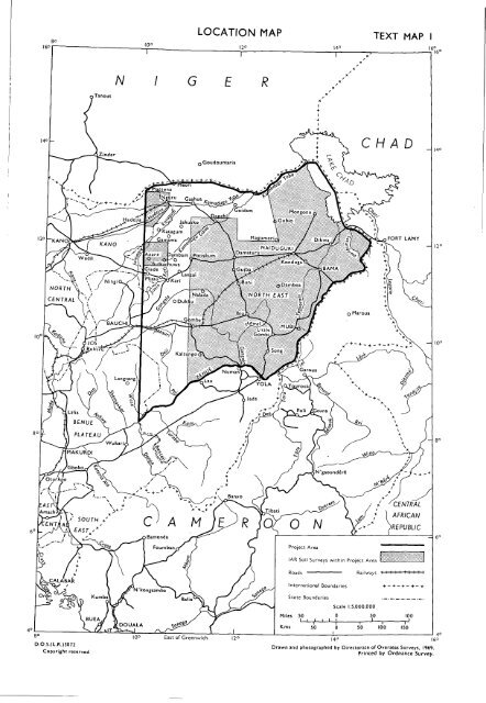
- Page 15 and 16: ACKNOWLEDGEMENTS PART 1. INTRODUCTI
- Page 17: GENERAL CIRCULATION CLIMATE by P Tu
- Page 21 and 22: 1 015 mm (40 in) and 890 mm (35 in)
- Page 23 and 24: Potential Evapotranspiration Discus
- Page 26 and 27: Omm Oin l-25mm (O-l-lin) 25-50mm (l
- Page 28 and 29: P 5-1 O 2- D.O.S. 3099 A Distributi
- Page 31 and 32: 20 l°-22-5°C (68 l°-72-5°F) 22-
- Page 33 and 34: D.O.S.(L.R.)3064M Copyright reserve
- Page 35 and 36: MONTHLY ANALYSIS OF WIND DIRECTION
- Page 37 and 38: Mean daily hours of bright sunshine
- Page 39 and 40: mm in 300 12 -l Moist Period * Humi
- Page 41 and 42: PHYSIOGRAPHY by M G Bawden The rang
- Page 43 and 44: the more gentle Plateau slopes. In
- Page 45 and 46: 10° ^rr: Outside project area /,/
- Page 47 and 48: and the Gongola. They do not howeve
- Page 49 and 50: en to DOS. 3099 F Geological Sectio
- Page 51 and 52: spm,^ PLATE 1/1 Song. View from bas
- Page 53 and 54: Group IV. Tertiary to Recent Volcan
- Page 55 and 56: Type 17. Ancient alluvium (Chad) In
- Page 57 and 58: GEOMORPHOLOGY by M G Bawden Over mo
- Page 59 and 60: In some areas the Plateau is bounde
- Page 61 and 62: apart. They have an asymmetrical cr
- Page 63 and 64: Pediments are formed on Basement Co
- Page 65 and 66: The characteristics of the sands fo
- Page 67 and 68: 70 CO JS 5 o tl •o -t> co 0) * e
- Page 69 and 70:
TABLE 3 Mean monthly and mean annua
- Page 71 and 72:
10° l4 'IT- 12° ,\ Mv / MILES 0 i
- Page 73 and 74:
The Yedseram and the Ngadda flow no
- Page 75 and 76:
Groundwater occurs in these igneous
- Page 77 and 78:
assess the recharge potential more
- Page 79 and 80:
10" NgUTl D.O.S.(L.R.)3064Y Copyrig
- Page 81 and 82:
Figure 7 Generalised soil pattern 0
- Page 83 and 84:
of clay becomes very small. In the
- Page 85 and 86:
Soils. Local alluvium is found thro
- Page 87 and 88:
Two major groups of Ferruginous Tro
- Page 89 and 90:
capacity is below 30 meq. These soi
- Page 91 and 92:
Category (Map 3) Wd E Fn PI Fp Pc F
- Page 93 and 94:
degrees. In the Doksa Plain (Land S
- Page 95 and 96:
Mapping Units Mapping Units Mapping
- Page 97 and 98:
30 meq per cent soil. Where limesto
- Page 99 and 100:
Soil unit (see footnote) 1 2 3 4 Cl
- Page 101 and 102:
This kind of soil is dominant throu
- Page 103 and 104:
Mapping Units Mapping Units EWe Map
- Page 105 and 106:
The soils of the Bama and Ngelewa R
- Page 107 and 108:
The clay content of the soils is ne
- Page 109 and 110:
Soil patterns on sandy facies of Ch
- Page 111 and 112:
Most of the alluvial areas are repr
- Page 113 and 114:
American system and the Luvisols of
- Page 115 and 116:
^Ä~--«dß Ä'i;'?£^!&JE2 ^Js-j£
- Page 117 and 118:
direct impedence to root growth by
- Page 119 and 120:
Edaphic Factors LITHOSOLS DEEP, FRE
- Page 121 and 122:
The Species List * The species list
- Page 123 and 124:
1 APRORMOSIA/DETARIUM WOODLAND/TREE
- Page 125 and 126:
4 TERMINALIA spp./COMBRETUM spp. SH
- Page 127 and 128:
6 ACACIA HOCKII TREE AND SHRUB SAVA
- Page 129 and 130:
9 ANOGEISSUS/DETARIUM SAVANNA WOODL
- Page 131 and 132:
12 COMBRETUM spp. SHRUB SAVANNA Phy
- Page 133 and 134:
16 ANOGEISSÜS/ACACIA SEYAL SAVANNA
- Page 135 and 136:
SPECIES LIST Table 20 Community Num
- Page 137 and 138:
19 ANOGEISSUS WOODLAND/TREE SAVANNA
- Page 139 and 140:
22 ACACIA SENEGAL/COMBRETUM GLUTINO
- Page 141 and 142:
25 ADANSONIA PARKLAND Physiognomy F
- Page 143 and 144:
29 ZIZIPHÜS/ACACIA spp. TREE AND S
- Page 145 and 146:
33 LEPTADENIA SHRUB SAVANNA Physiog
- Page 147 and 148:
37 SOUTHERN ALLUVIAL COMPLEX 37a BO
- Page 149 and 150:
38 DEJI VALLEYS COMPLEX The plant c
- Page 151 and 152:
FAUNA by P J Aitchison and P E Glov
- Page 153 and 154:
available. Cattle, sheep and goats
- Page 155 and 156:
TABLE 27 Mammals recorded in the Sa
- Page 157 and 158:
TABLE 31 Mammals recorded in the Gu
- Page 159 and 160:
POPULATION by P Tuley The distribut
- Page 161 and 162:
COMMUNICATIONS by P Tuley The major
- Page 163 and 164:
10* ETHNIC GROUPS 12* 14° TEXT MAP
- Page 165 and 166:
14" 10" 10° . • * • • + •*
- Page 167 and 168:
CHEVALIER M A CHRISTIAN C S and STE
- Page 169 and 170:
GROVE A T 1958 The ancient erg of H
- Page 171 and 172:
McKEOWN H P J MILLER R E JOHNSTON R
- Page 173 and 174:
TOMLINSON P R 1965 Soils of norther