9 The Land Resources of North East Nigeria A/blume1 The ...
9 The Land Resources of North East Nigeria A/blume1 The ...
9 The Land Resources of North East Nigeria A/blume1 The ...
Create successful ePaper yourself
Turn your PDF publications into a flip-book with our unique Google optimized e-Paper software.
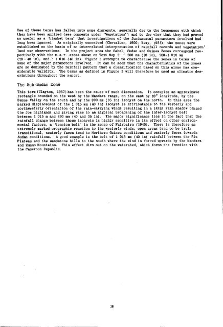
Use <strong>of</strong> these terms has fallen into some disrepute, generally due to the looseness with which<br />
they have been applied (see comments under 'Vegetation') and to the view that they had proved<br />
so useful as a "blanket term' that investigations <strong>of</strong> the fundamental parameters involved had<br />
long been ignored. As originally conceived (Chevalier, 1900; Keay, 1953), the zones were<br />
established on the basis <strong>of</strong> an interrelated interpretation <strong>of</strong> rainfall records and vegetation/<br />
land use observations. In the project area the Sahel, Sudan and Guinea Zones correspond respectively<br />
with the m.a.r. areas shown on Text Map 3: < 508 mm (20 in), 508-1 016 mm<br />
(20- 40 in), and > 1 016 (40 in). Figure 5 attempts to characterise the zones in terms <strong>of</strong><br />
some <strong>of</strong> the major parameters involved. It can be seen that the characteristics <strong>of</strong> the zones<br />
are so dominated by the rainfall pattern that a classification based on this alone has considerable<br />
validity. <strong>The</strong> terms as defined in Figure 5 will therefore be used as climatic descriptions<br />
throughout the report.<br />
<strong>The</strong> Sub-Sudan Zone<br />
This term (Clayton, 1957) has been the cause <strong>of</strong> much discussion. It occupies an approximate<br />
rectangle bounded on the west by the Mandara range, on the east by 10° longitude, by the<br />
Benue Valley on the south and by the 890 mm (35 in) isohyet on the north- In this area the<br />
marked displacement <strong>of</strong> the 1 015 mm (40 in) isohyet is attributable to the westerly and<br />
northwesterly orientation <strong>of</strong> the rain-carrying winds resulting in a large rain shadow behind<br />
the Jos highlands and giving rise to an atypical broadening <strong>of</strong> the inter-isohyet belt<br />
between 1 015 m and 890 mm (40 and 35 in). <strong>The</strong> major significance lies in the fact that the<br />
rainfall change between these isohyets is highly sensitive in its effect on other environmental<br />
factors, a tension belt' in the sense <strong>of</strong> Fairbairn (1945). <strong>The</strong>re is therefore an<br />
extremely marked orographic reaction to the westerly winds; open areas tend to be truly<br />
transitional, westerly faces tend to <strong>North</strong>ern Guinea conditions and easterly faces towards<br />
Sudan conditions. A good example is the belt <strong>of</strong> 1 015 mm (40 in) rainfall between the Biu<br />
Plateau and the sandstone hills to the south where the wind is forced upwards by the Mandara<br />
and Zummo Mountains. This effect dies out on the watershed, which forms the frontier with<br />
the Cameroon Republic.<br />
16


