2009 - USDA Forest Service
2009 - USDA Forest Service
2009 - USDA Forest Service

Create successful ePaper yourself
Turn your PDF publications into a flip-book with our unique Google optimized e-Paper software.
January <strong>2009</strong> Interpretation and Conservation Education Master Plan<br />
Wild river segments are free of impoundments (reservoirs, etc.);<br />
shorelines should be primitive with no evidence of human activity. River<br />
area should be inaccessible except by trail. Water quality must meet or<br />
exceeds criteria for federal and state approved standard for propagation of<br />
fish and wildlife normally adapted to the river.<br />
Scenic River segments should also be free impoundments; shoreline<br />
should be largely primitive and undeveloped with no evidence of human<br />
activity. The river area may be accessible in places by roads or trails.<br />
Water quality does not require classification but is monitored.<br />
Recreation river segments may have some development with substantial<br />
evidence of human activity. The river area may be readily accessible by<br />
roads or trails. Water quality does not require classification but is<br />
monitored.<br />
The specific classification details for El Yunque’s three designated rivers<br />
are shown in the table below:<br />
Table 2 - Wild, Scenic and Recreational River Designations at El Yunque NF<br />
Wild river<br />
segment<br />
Scenic river<br />
segment<br />
Recreational<br />
segment<br />
Río Mameyes Río Icacos Río de la Mina<br />
2.1 miles –<br />
headwaters in Baño<br />
de Oro Natural Area<br />
to Río de la Mina<br />
crossing<br />
1.4 miles –<br />
Río de la Mina<br />
crossing to Angelito<br />
trail access<br />
Angelito trail to EYNF<br />
north boundary.<br />
2.3 miles –<br />
headwaters to<br />
EYNF south<br />
boundary.<br />
1.2 miles –<br />
La Mina Falls to<br />
confluence with Río<br />
Mameyes.<br />
0.9 miles – headwaters<br />
to La Mina Falls.<br />
El Toro Wilderness Area<br />
The Caribbean National <strong>Forest</strong> Act of 2005 designated 10,000 acres within<br />
the El Yunque National <strong>Forest</strong> (EYNF) – Luquillo Experimental <strong>Forest</strong> (LEF)<br />
as a wilderness area. This area is on the western portion of the forest along<br />
the Luquillo mountain range and comprises almost one-third of the forest’s<br />
28,000 acres. The area is named after El Toro, the highest peak (3,524 feet<br />
/ 1074 meters) in the forest. In addition to being the first federally<br />
designated wilderness area in a tropical rain forest, it is also the first<br />
designated wilderness area on the island of Puerto Rico.<br />
15 El Yunque National <strong>Forest</strong><br />
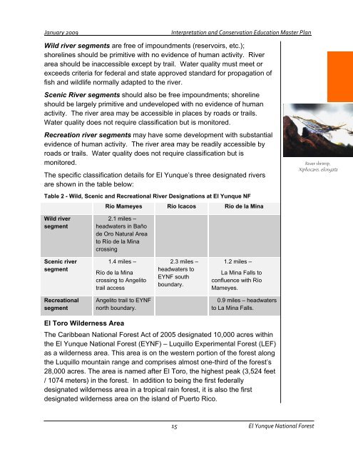
River shrimp,<br />
Xiphocaris, elongata