

Maps of the lowland river Sava
Maps of the lowland river Sava
Maps of the lowland river Sava

You also want an ePaper? Increase the reach of your titles
YUMPU automatically turns print PDFs into web optimized ePapers that Google loves.
& '<br />
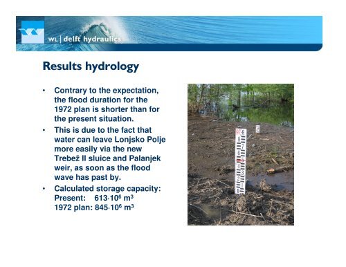
• Contrary to <strong>the</strong> expectation,<br />
<strong>the</strong> flood duration for <strong>the</strong><br />
1972 plan is shorter than for<br />
<strong>the</strong> present situation.<br />
• This is due to <strong>the</strong> fact that<br />
water can leave Lonjsko Polje<br />
more easily via <strong>the</strong> new<br />
Trebež II sluice and Palanjek<br />
weir, as soon as <strong>the</strong> flood<br />
wave has past by.<br />
• Calculated storage capacity:<br />
Present: 613·10 6 m 3<br />
1972 plan: 845·10 6 m 3


![CynefinFramework final [Read-Only]](https://img.yumpu.com/19017304/1/190x135/cynefinframework-final-read-only.jpg?quality=85)