Final Report Historical Structures Assessment Report for the Muddy ...
Final Report Historical Structures Assessment Report for the Muddy ...
Final Report Historical Structures Assessment Report for the Muddy ...

Create successful ePaper yourself
Turn your PDF publications into a flip-book with our unique Google optimized e-Paper software.
Legend<br />
Holtwood Dam<br />
Road<br />
Hydroelectric Project<br />
Water Body<br />
County Boundary<br />
State Boundary<br />
Project Boundary<br />
YORK<br />
COUNTY<br />
PENNSYLVANIA<br />
MARYLAND<br />
HARFORD<br />
COUNTY<br />
C o n o w i n g o P o o l<br />
CUMBERLAND<br />
County<br />
<strong>Muddy</strong> Run Pumped Storage Project<br />
LANCASTER<br />
COUNTY<br />
CECIL<br />
COUNTY<br />
³<br />
EXELON GENERATION COMPANY, LLC<br />
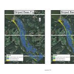
Entrainment and Impingement <strong>Assessment</strong><br />
MUDDY RUN PUMPED STORAGE PROJECT Figure 1-1:<br />
PROJECT NO. 2355<br />
Location of <strong>the</strong> <strong>Muddy</strong> Run Project Area<br />
1 inch = 2 miles<br />
0 1<br />
2 4 along <strong>the</strong> Susquehanna River<br />
Miles in Pennsylvania<br />
Data Source: ESRI; Exelon; PA Chesapeake Bay Program; PA State University -<br />
Environmental Resources Research Institute; USGS National Hydrography Dataset.<br />
Copyright © 2012 Exelon Generation Company, LLC. All rights reserved.<br />
ADAMS<br />
County<br />
DAUPHINLEBANON<br />
County County<br />
YORK<br />
County<br />
LANCASTER<br />
County<br />
BERKS<br />
County<br />
CARROLL HARFORD<br />
CECIL<br />
County<br />
County<br />
County<br />
BALTIMORE<br />
County<br />
Index Map<br />
CHESTER<br />
County<br />
Path: X:\GISMaps\project_maps\study_plan\muddy_run\rsp_study_3.14\fig_1-1_location_map.mxd<br />
Conowing