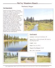
Download Property Brochure - Farm & Ranch
Download Property Brochure - Farm & Ranch
Download Property Brochure - Farm & Ranch

Create successful ePaper yourself
Turn your PDF publications into a flip-book with our unique Google optimized e-Paper software.
PHYSICAL DESCRIPTION<br />
The topography of the Broken O <strong>Ranch</strong> can generally be<br />
described as a Great Plains setting with strong water<br />
influences throughout. The Sun River is a significant<br />
geographical attraction as it flows from west to east through<br />
the center of the Main <strong>Ranch</strong> Unit. Much of the <strong>Ranch</strong><br />
contains hills and valleys providing a diverse landscape.<br />
The Broken O <strong>Ranch</strong> encompasses approximately 108,571<br />
deeded acres plus an additional 15,270 acres of State<br />
lease land and 160 acres of Bureau of Land Management<br />
(BLM) lease land.<br />
The deeded land is generally classified as follows:<br />
• 85,454 ± Acres of Native Range and Pasture<br />
• 11,600 ± Acres of Pivot Irrigated Crop Ground<br />
• 6,000 ± Acres of Improved Pasture Ground;<br />
• 3,000 ± Acres of Dryland Crop Ground<br />
• 2,000 ± Acres of Sun River Riparian Corridor<br />
• 1,317 ± Acres of Wheel-Line Irrigated Ground<br />
• 200 ± Acres of Flood Irrigated Hay Ground<br />
108,571 ± Total Estimated Deeded Acres<br />
The irrigated acreage is part of existing change applications<br />
which have been submitted to the Department of Natural<br />
Resources and Conservation by the Seller.<br />
The leased land is generally classified as the following:<br />
State of Montana Lease Land<br />
• 14,608 ± Acres of Native Range and Pasture<br />
• 662 ± Acres of Pivot Irrigated Crop Ground<br />
15,270 ± Total State of Montana Lease Land<br />
(4,403 AUMs)<br />
BLM Lease Land<br />
• 160 ± Acres of Native Range and Pasture<br />
15,430 ± Total Leased Acres<br />
PHYSICAL DESCRIPTION<br />
HARRIS UNIT<br />
The <strong>Ranch</strong> is divided into two units, the Main <strong>Ranch</strong> Unit<br />
and the Harris Unit. The Harris Unit lies about one mile<br />
due north of the Main <strong>Ranch</strong> Unit boundary. This Unit is a<br />
summer grazing pasture consisting of native range with the<br />
following approximate acreages. These acreages and AUMs<br />
are included in, not in addition to, the above calculations.<br />
Deeded Land<br />
• 8,364 ± Acres of Native Range and Pasture<br />
State of Montana Lease Land<br />
• 1,480 ± Acres of Native Range and Pasture<br />
(381 AUMs)<br />
4<br />
The Harris Unit is watered from Roundup Coulee and<br />
from several springs which serve stock ponds. There are two<br />
stock wells on the Harris Unit which can serve several stock<br />
tanks and are for backup purposes only. It is utilized as one<br />
pasture for spring and summer grazing of heifer pairs.<br />
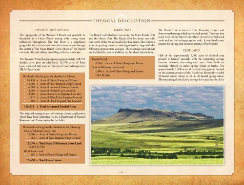
CROP LAND<br />
Half of the approximately 3,000 acres of dryland crop<br />
ground is farmed annually with the remaining acreage<br />
summer fallowed, alternating each year. These fields are<br />
normally planted in either spring wheat or barley. The<br />
approximately 1,500 acres of dryland crop ground located<br />
on the western portion of the <strong>Ranch</strong> has historically yielded<br />
50-bushel winter wheat or 35- to 40-bushel spring wheat.<br />
The remaining dryland crop acreage is located north of the