Report submitted to FAMSI:
Report submitted to FAMSI:
Report submitted to FAMSI:

Create successful ePaper yourself
Turn your PDF publications into a flip-book with our unique Google optimized e-Paper software.
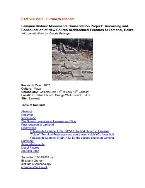
<strong>FAMSI</strong> © 2008: Elizabeth Graham<br />
Lamanai His<strong>to</strong>ric Monuments Conservation Project: Recording and<br />
Consolidation of New Church Architectural Features at Lamanai, Belize<br />
With contributions by: Claude Belanger<br />
Research Year: 2007<br />
Culture: Maya<br />
Chronology: Colonial, Mid-16 th <strong>to</strong> Early 17 th Century<br />
Location: Indian Church, Orange Walk District, Belize<br />
Site: Lamanai<br />
Table of Contents<br />
Abstract<br />
Resumen<br />
Introduction<br />
The Spanish missions at Lamanai and Tipu<br />
Past research at Lamanai<br />
Discoveries<br />
Yglesias de Lamanai I, Str. N12-11, the first church at Lamanai<br />
"Tulum" (Terminal Postclassic) structure over which YDL I was built<br />
Yglesias de Lamanai II, Str. N12-13, the second church at Lamanai<br />
Summary<br />
Acknowledgments<br />
List of Figures<br />
Sources Cited<br />
Submitted 10/18/2007 by:<br />
Elizabeth Graham<br />
Institute of Archaeology<br />
e.graham@ucl.ac.uk
Abstract<br />
Archaeological investigations at Lamanai, situated along the New River Lagoon<br />
in northern Belize, have revealed two highly important churches from the Spanish<br />
Colonial period. During excavations and survey otherwise focused on <strong>to</strong>urism<br />
development in 2003 and 2004, new features of the earlier church were<br />
uncovered. In 2007, the National Institute for Culture and His<strong>to</strong>ry in Belize<br />
(NICH)—through the Belize Institute of Archaeology (IoA) and under the direction<br />
of Jaime Awe and John Morris as part of the Lamanai His<strong>to</strong>ric Monuments<br />
Conservation Project (LHMCP)—began consolidation and partial reconstruction<br />
of Spanish and British colonial period structures at Lamanai. Support was<br />
provided by the U.S. State Department's Ambassador's Fund for Cultural<br />
Preservation. Expertise from the Institute was also provided by Brian Woodye,<br />
George Thompson, and Jorge Can, all of whom played pivotal roles in the<br />
coordination, execution and ultimate success of the project. The project's focus<br />
included the two Spanish churches as well as the 19 th century British sugar mill.<br />
The emergency funds received from <strong>FAMSI</strong> facilitated expanded investigation<br />
and recording of the new church features under the direction of Claude Belanger,<br />
which complemented the Belize government's consolidation program at the site.<br />
Results comprise the discovery of a new courtyard or atrio associated with the<br />
first church along with caches dating <strong>to</strong> the colonial period. In addition, discovery<br />
of holes for posts supporting the perishable nave of the second church—the<br />
evidence for which has thus far been elusive—provided us with the dimensions<br />
of the original colonial structure.<br />
Resumen<br />
Investigaciones arqueológicas en el sitio de Lamanai, situado al lado de la<br />
Laguna Río Nuevo en la parte septentrional del país de Belice, han revelado dos<br />
iglesias de suma importancia del período Hispanocolonial. En el curso de<br />
excavaciones y exploraciones enfocadas primariamente en desarrollo turístico<br />
durante los años 2003 y 2004, se descubrieron nuevos elemen<strong>to</strong>s de la iglesia<br />
más temprana. En el año 2007, el Institu<strong>to</strong> Nacional para Cultura e His<strong>to</strong>ria en<br />
Belice (NICH), por medio del Institu<strong>to</strong> Beliceño de Arqueología (IoA) y dirigidbajo<br />
la dirección de los Drs. Jaime Awe y John Morris, empezó la consolidación y la<br />
reconstrucción parcial de estructuras hispanocoloniales y britanocoloniales en<br />
Lamanai, apoyado por el Fondo del Embajador para Preservación Cultural del<br />
Departamen<strong>to</strong> de Estado de los EE.UU. Conocimien<strong>to</strong>s exper<strong>to</strong>s provinientes<br />
del Institu<strong>to</strong> fueron proveídos también por los Srs. Brian Woodye, George<br />
Thompson, y Jorge Can, <strong>to</strong>dos de los cuales jugaron papeles fundamentales en<br />
cuan<strong>to</strong> a la coordinación, la ejecución, y ultimadamente el éxi<strong>to</strong> del proyec<strong>to</strong>. El<br />
enfoque del proyec<strong>to</strong> abarcaba las dos iglesias hispánicas igual como el trapiche<br />
británico del siglo XIX. Los fondos de emergencia proveidos por <strong>FAMSI</strong><br />
facilitaron una investigación ampliada y la planificación de nuevos elemen<strong>to</strong>s de<br />
las iglesias, dirigido por el Sr. Claude Bélanger, un esfuerzo que complementó el<br />
programa de consolidación del gobierno de Belice en el sitio. Los resultados el
trabajo comprenden el descubrimien<strong>to</strong> de un atrio nuevo, asociado con la<br />
primera iglesia, jun<strong>to</strong> con ofrendas que datan del período colonial. Fuera de<br />
es<strong>to</strong>, el descubrimien<strong>to</strong> de hoyos que indican las posiciones de los postes que<br />
sostuvieron el techo perecedero de la nave de la segunda iglesia―evidencia de<br />
los cuales ha quedado hasta ahora esquiva―nos ha proveido con las<br />
dimensiones de la estructura colonial original.<br />
Figure 1. Map of Belize showing Lamanai and Tipu.
Introduction<br />
Evidence for colonial-period occupation of Maya sites in Belize is apt <strong>to</strong> be<br />
overlooked, both because late occupation is believed <strong>to</strong> be rare and because<br />
detection requires approaches that differ from those used in the excavation of<br />
Classic or even Postclassic Maya sites (Pendergast et al. 1993). Partly as the<br />
result of the excavation discoveries at the Spanish colonial-period sites of Tipu<br />
and Lamanai (Figure 1), and partly owing <strong>to</strong> Grant Jones’s (1989, 1998)<br />
synthesis of documentary information on the Maya of Belize and Petén,<br />
archaeological investigations are turning <strong>to</strong>ward the his<strong>to</strong>ric Maya, and projects<br />
in recent years have included recognition of the presence of his<strong>to</strong>ric components<br />
(e.g., Oland and Masson 2005; Morandi, 2005; Yaeger et al. 2005).<br />
Figure 2. Ruins of the British 19 th century sugar mill.<br />
The interest of both local Belizeans and foreign <strong>to</strong>urists in the remains of the<br />
colonial period in Belize is also increasing. The efforts of the Belize Institute of<br />
Archaeology (IoA) <strong>to</strong> clear and consolidate the ruins of the British 19 th century<br />
sugar mill (Figure 2) as well as the two Spanish colonial-period churches at<br />
Lamanai (Figure 3) reflects this rise in interest in phenomena that bridge the<br />
Maya past and present. The work undertaken in 2007 was part of the Belize<br />
Institute of Archaeology's (IoA) Lamanai His<strong>to</strong>ric Monuments Conservation<br />
Project, directed by Jaime Awe and John Morris with support from the U.S. State<br />
Department's Ambassador's Fund for Cultural Preservation. Brian Woodye and<br />
George Thompson played an important role in the project's execution, and Jorge<br />
Can coordinated consolidation and excavation efforts in the field along with<br />
Claude Belanger. Research funds from <strong>FAMSI</strong> permitted extensive recording of a
suite of features of the two churches that were first revealed during clearing<br />
operations of an earlier <strong>to</strong>urism development project. Further information from<br />
the "rec<strong>to</strong>ry" adjoining the second church was also recorded. The results have<br />
added significantly <strong>to</strong> our knowledge of the colonial encounter at Lamanai (Awe<br />
2007: 24-28).<br />
Figure 3. Ruins of the two Spanish churches. The s<strong>to</strong>ne chancel-chapel of<br />
YDL II is in the background. In the foreground is the central part of YDL I.<br />
Visible are the south stair of YDL I, the razed Tulum-style temple over<br />
which YDL I was built; and <strong>to</strong> the right, the steps leading up <strong>to</strong> the<br />
altar/sanctuary. The pho<strong>to</strong> looks north-northeast.<br />
The Spanish missions at Lamanai and Tipu<br />
Lamanai and Tipu were among the Maya communities in which missions<br />
established in the humid lowlands of Yucatán and Belize by Spanish religious<br />
proselytizers based in Mérida. The plans of the churches of both communities<br />
conform <strong>to</strong> the medieval Christian norm in which the altar lies at the east end.<br />
The church at Tipu and the later of the two churches at Lamanai (YDL or<br />
Yglesias de Lamanai II) also conform <strong>to</strong> the norm by having 'rec<strong>to</strong>ries' or<br />
residences abutting them on their north sides at the altar (east) ends (Figure 4,<br />
Figure 9).
Figure 4. "Rec<strong>to</strong>ry," Str. N12-12, with the s<strong>to</strong>ne chancel-chapel of YDL II in<br />
the background (upper right). The pho<strong>to</strong> looks southeast.<br />
Figure 5. YDL I. The pho<strong>to</strong> looks southeast. Steps leading up <strong>to</strong> the<br />
sanctuary can be seen in the pho<strong>to</strong>'s upper left. Also visible are the line of<br />
s<strong>to</strong>nes on which the (portable) altar pedestal and altar s<strong>to</strong>ne were once<br />
placed. This line of s<strong>to</strong>nes abuts a wall—the only remaining course of the<br />
wall can be seen in the pho<strong>to</strong>—that divided the sanctuary from the sacristy.
Figure 6. S<strong>to</strong>ne chancel-chapel of YDL II. Not <strong>to</strong>o far from the entrance<br />
in<strong>to</strong> the sanctuary stands a stela that was erected in the nave sometime<br />
after 1641. The pho<strong>to</strong> looks southeast.<br />
YDL I, the first and earlier church at Lamanai, was constructed sometime<br />
between 1544 and 1550; it was built over a razed Precolumbian structure similar<br />
<strong>to</strong> many of the temples at Tulum (Figure 5). YDL II, the second and larger<br />
church, was probably built in the 1560s or possibly as late as the early 17 th<br />
century (Figure 6). It had a masonry chancel-chapel—which enclosed the<br />
sanctuary, sacristy, and probably baptistry—and a perishable nave. The church<br />
at Tipu could have been built at any point between 1550 and the 1560s (Figure<br />
7). It was built in stages and seems <strong>to</strong> have been used for an extended period.
Figure 7. The church at Tipu. The pho<strong>to</strong> looks northeast.<br />
Although church plans show common themes, particularly in the case of the early<br />
churches, Lamanai’s <strong>to</strong>wn plan differs from that of Tipu. Perhaps not<br />
surprisingly, the Lamanai community was strung out along the edge of the<br />
lagoon. The churches were built on a ridge overlooking the lagoon, with the<br />
colonial residential structures (e.g., Str. N11-18) lying about 350-400m north of<br />
the church zone (Figure 8), whereas Tipu's plan was more concentrated with the<br />
church bordering one of the sides of the community's main plaza (Figure 9).
Figure 8. Map of church zone and colonial residential structure <strong>to</strong> the<br />
north of the church zone at Lamanai (see Str. N11-18).
Figure 9. Reconstruction of Tipu's community center.<br />
(Painting by Marianna Hus<strong>to</strong>n.) Looks south-southeast.<br />
Past research at Lamanai<br />
The excavations at Lamanai were directed by David Pendergast of the Royal<br />
Ontario Museum from 1974 <strong>to</strong> 1986 (Pendergast 1981, 1982a&b, 1986, 1988,<br />
1991, 1993, 2002) and by me from 1998 onward (Graham 2004, 2006). In 2003,<br />
Scott Simmons, who is directing the Lamanai Archaeometallurgy Project,<br />
became co-Principal Investiga<strong>to</strong>r at Lamanai.<br />
I first joined the research team at Lamanai in 1980. From 1983 <strong>to</strong> 1986 I<br />
collaborated with Pendergast on excavations of the Spanish colonial community<br />
centre (Graham 1987; Pendergast and Graham 1993), which included the two<br />
mission churches as well as a residential structure that yielded European<br />
artifacts and evidence of Maya metallurgy (Simmons 2005). British colonialperiod<br />
remains were also recovered from one of the Spanish churches.<br />
In 1997 I began a new program of excavations at Lamanai, and in 2003 we<br />
completed investigations of a Classic-period palace-courtyard group that bridged<br />
the time of the Maya collapse and yielded evidence of use during the Spanish
colonial period (Graham 2004). Nearby, our excavations of a massive midden<br />
abutting an abandoned temple also revealed a late component that bridges the<br />
Terminal Postclassic and colonial periods. In addition <strong>to</strong> these unexpected<br />
discoveries of colonial remains, we investigated a structure which adjoins the<br />
second Spanish-period church, and which probably served as the administrative<br />
and residential locus for those who ministered <strong>to</strong> the Maya communities in and<br />
around Lamanai in the 16 th and early 17 th centuries (the "Rec<strong>to</strong>ry"). The same<br />
structure also produced evidence dating <strong>to</strong> the British colonial period. Thus the<br />
picture of colonial interaction has gradually become increasingly complex and<br />
multi-faceted.<br />
As it turns out, Lamanai's evidence of colonial occupation is both a blessing and<br />
a curse. The positive aspect is our increased knowledge of Maya his<strong>to</strong>ry in<br />
Belize. The negative aspect is that later occupation invariably disturbed<br />
evidence of earlier occupation. Because British activity intruded extensively<br />
upon the area where the churches s<strong>to</strong>od (the masonry chancel-chapel of the<br />
second church was used as a smithy, and a small camp was plunked down<br />
amidst the remains of the patio-atrio south of YDL I), masonry walls were<br />
dismantled, s<strong>to</strong>nes were borrowed, and evidence for Spanish colonial occupation<br />
was generally heavily disturbed and often obscured.<br />
In addition <strong>to</strong> the enigmas presented by mixed Spanish and British colonial<br />
remains, there is the fact that we did not really know what a Maya community of<br />
the Spanish colonial period would have looked like in Belize. The demands of<br />
maintaining a Christian community among the Maya in Yucatán, for example,<br />
were not the same as those in a Christian community in the highlands of Central<br />
México. Not only is Yucatán much wetter than Central México, but the Maya<br />
reacted <strong>to</strong> the European presence in rather different ways than did the Mexica<br />
and other Central Mexican groups. For one thing, the Maya were inclined <strong>to</strong> flee<br />
<strong>to</strong> remote forests in areas outside of Spanish control (Jones 1989). Also, by the<br />
17 th century, and indeed by the late 16 th century, heavy demands were placed on<br />
a relatively small number of religious personnel in Yucatán. When we consider<br />
Belize, we find that conditions were even more challenging in Spanish eyes than<br />
conditions in Yucatán. Belize is even more humid and tropical, and as resources<br />
and personnel became stretched in the north, Belize missions were moved <strong>to</strong> the<br />
peripheries of people's vision.<br />
These conditions, along with the minimal documentary evidence on Belize in<br />
comparison with other regions under Spanish control, suggested that we should<br />
expect a rather skeletal framework for Spanish operations, and our excavations<br />
over the years have seemed <strong>to</strong> confirm this expectation. Both at Lamanai and at<br />
Tipu, the original focus comprised the Spanish churches (e.g., Graham 1991;<br />
Graham et al. 1989; Pendergast 1991, 1993; Pendergast and Graham 1993).<br />
Excavations eventually expanded <strong>to</strong> include parts of the his<strong>to</strong>ric residential<br />
community, but the full extent of the his<strong>to</strong>ric communities has not yet been<br />
determined at either site. In addition, the church buildings were originally
excavated as if they s<strong>to</strong>od alone as the instruments of Christian conversion.<br />
However, evidence from the final year of excavation at Tipu of a churchyard or<br />
patio lying north of the church, as well as comparison with Christianization efforts<br />
in México and Yucatán, suggests that the church was only part of a larger<br />
religious complex that could have included a churchyard (or courtyard), an atrio<br />
or plaza, a cemetery, and smaller and often localized features (thatched platform<br />
areas, pozos or small chapel-like features) that served as foci of religious<br />
festivals and processions. Masses were indeed held inside churches but many<br />
activities conveniently expanded in<strong>to</strong> the outdoors.<br />
As a result, when clearing that was related <strong>to</strong> landscaping for <strong>to</strong>urism<br />
development in 2003 and 2004 revealed more evidence of the eastern limits of<br />
the first church at Lamanai, as well as lines of s<strong>to</strong>ne extending south of the<br />
church, it became clear that we probably had a more extensive church complex<br />
at Lamanai. The Belize IoA's His<strong>to</strong>ric Monument and Conservation Project at<br />
Lamanai (2006-2007) provided a unique opportunity <strong>to</strong> explore these features.<br />
Discoveries<br />
The leading discoveries that resulted from the 2006-2007 cooperative effort<br />
between the Belize government and <strong>FAMSI</strong>-sponsored investigations can be<br />
itemized as follows:<br />
Yglesias de Lamanai I, Str. N12-11, the first church at Lamanai<br />
1) Apsidal/polygonal east end of church: Very little collapse debris from<br />
the partial-height s<strong>to</strong>ne walls of the church superstructure remained.<br />
However, a polygonal section forming the base of the wall was<br />
recovered at the northeast "corner" (Figure 10, Figure 11). A remnant<br />
of the wall had been cleared in earlier years by Pendergast on the<br />
south side of the church, west of the entrance approached by the south<br />
side stair (Figure 10, Figure 11). It is not clear whether the church<br />
superstructure at Lamanai had a polygonal west end. The church at<br />
Tipu was polygonal at both its east and west ends (Figure 12).<br />
2) Blind sanctuary? At Tipu, the remains of full-height masonry walls<br />
were uncovered at the church's east end, thus confirming the presence<br />
of a blind sanctuary, consistent with Franciscan ideals of a primitive,<br />
apos<strong>to</strong>lic church (Figure 13). At Lamanai, the bajo mud used for the<br />
platform core on the church's east side was far <strong>to</strong>o unstable <strong>to</strong> support<br />
full-height masonry walls at the east end (refer <strong>to</strong> plan in Figure 11). In<br />
this respect, the first church at Lamanai differed from that at Tipu in<br />
having partial-height masonry walls on all sides. However, it is<br />
probable that the east or sanctuary end had solid pole walls set in<strong>to</strong>
the masonry base, although the remainder of the church walls could<br />
have been open, as suggested for Tipu (Figure 13), <strong>to</strong> allow<br />
ventilation. Because church paraphernalia would have been kept in<br />
the sacristy and used in the sanctuary during mass, and also because<br />
very strong breezes blow off the New River Lagoon from the east, it is<br />
likely that YDL I's east end would have been built with full-height walls<br />
(lower part s<strong>to</strong>ne, upper part poles).<br />
Figure 10. Plan of church zone.
Figure 11. Plan of YDL I and part of the patio-atrio <strong>to</strong> the south.
Figure 12. Plan of the church at Tipu. East is <strong>to</strong> the viewer's right.<br />
Figure 13. Reconstruction of the Tipu church, looking north-northeast. The<br />
blind sanctuary is at the east end. (Painting and reconstruction by Claude<br />
and Louise Belanger.)
3) YDL I a very early construction effort: Clearing of the YDL I platform<br />
and partial-height masonry walls of the nave revealed that problems<br />
must have arisen as the church was being built. Lines are not straight,<br />
and the builders were forced <strong>to</strong> make adjustments <strong>to</strong> alignment<br />
(Figure 11). This strongly suggests that YDL I was an early attempt at<br />
cooperation between European (probably Franciscan) supervisors and<br />
builders, some of whom may not have been from Lamanai. YDL I<br />
could have been built as early as initial contact in 1544 (Jones 1989),<br />
but probably no later than 1550, when administration of many<br />
communities was regularized in Belize and Yucatán (Chamberlain<br />
1948: 317-329).<br />
4) Bad planning by Franciscans? Clearing on the east side of YDL I<br />
revealed considerable slumping and instability of the church platform<br />
and walls at this end—so much so that the platform faces had<br />
repeatedly <strong>to</strong> be shored up by the Maya on this side (Figure 14, Figure<br />
15). If local advice had been provided concerning the limits of the<br />
limes<strong>to</strong>ne bedrock that would satisfac<strong>to</strong>rily have supported the<br />
church's foundations, then this advice was ignored by the Spaniards.<br />
The s<strong>to</strong>ne chancel-chapel of YDL II was situated largely on supporting<br />
bedrock, but its north end also s<strong>to</strong>od over bajo mud. However, the<br />
north wall of the s<strong>to</strong>ne chancel-chapel on this end was supported by<br />
the remains of a Precolumbian platform (used as the foundations for<br />
the Rec<strong>to</strong>ry), which added stability, but there was nonetheless some<br />
slumping in the area of the nave on the north side.
Figure 14. East end of YDL I showing a section of the shoring of slumping<br />
platform face on this side. The pho<strong>to</strong> looks north.<br />
Figure 15. East end of YDL I, looking west, showing part of the remaining<br />
platform face on this side and the shoring <strong>to</strong> the viewer's left.
Figure 16. East end of YDL I, looking west. The space at this end defines<br />
what was probably the sacristy—a small room entered through a door in<br />
the rear wall of the sanctuary. The rectangular low s<strong>to</strong>ne bench (just<br />
<strong>to</strong>uched by the tree shadow) abuts the remains of the wall that once<br />
divided the sacristy from the sanctuary. In the upper part of the pho<strong>to</strong> can<br />
be seen the uppermost line of steps leading <strong>to</strong> the sanctuary from the nave.<br />
The s<strong>to</strong>nes that define where the portable altar was placed are more easily<br />
seen in Figure 5, in the upper left of the pho<strong>to</strong>.<br />
5) Identities with Tipu church: Full clearing of the altar and sanctuary end<br />
of YDL I revealed that it was almost identical <strong>to</strong> the altar and sanctuary<br />
of the Tipu church:<br />
a. A single room existed <strong>to</strong> the east of the sanctuary and probably<br />
served as the sacristy (Figure 16).<br />
b. Lines of s<strong>to</strong>ne abutting the wall that divided the sanctuary from<br />
the sacristy served <strong>to</strong> guide the placement of what was probably<br />
a wooden and portable altar (Figure 11).<br />
c. The doorway leading from the sanctuary in<strong>to</strong> the sacristy was<br />
south of the altar.<br />
d. Excavation of the east end of the YDL I platform revealed<br />
evidence of a polygonal form, suggesting that the platform that<br />
supported the church was also polygonal (as was the church<br />
superstructure itself) at its east end (Figure 17, Figure 18).
Figure 17. North and east sides of church platform showing the remains of<br />
the polygonal facet.<br />
Figure 18. Same view as Figure 17 with more exposure of the east end,<br />
showing the remains of the polygonal facet of the church platform.
Figure 19. Clearing the south stair of YDL I. The pho<strong>to</strong> looks west.<br />
Figure 20. Burial in s<strong>to</strong>ne crypt at the junction of the west stairside of the<br />
south stair and the church platform. Pho<strong>to</strong> looks northeast.
6) Clearing of the areas around YDL I revealed the full extent of the stair<br />
on the south side (Figure 19), and that a burial (of an adult) had been<br />
placed in a s<strong>to</strong>ne-lined unit abutting the stair at the junction between<br />
the west stairside and the church platform face (Figure 20). The burial<br />
was left in situ.<br />
7) Just inside the south entrance, slightly <strong>to</strong> one's left as one enters the<br />
church, s<strong>to</strong>od a small, low s<strong>to</strong>ne feature, possibly a platform, about<br />
1.5m on a side (Figure 11; see also Figure 19). It originally would<br />
have s<strong>to</strong>od higher than the level of the church floor. Three adult and<br />
one infant burial―laid out with head <strong>to</strong> the west in Christian<br />
fashion―were found beneath the feature, but they covered an area<br />
larger than the feature and are not clearly associated with it. They do<br />
indicate, however, that the feature was built after the burials were in<br />
place. The feature could have supported a font or a statue or internal<br />
church furniture of some kind.<br />
8) Clearing of the area south of YDL I revealed a series of low, broad,<br />
s<strong>to</strong>ne-bordered, descending terraces that formed a patio or atrio<br />
(Figure 21, Figure 10, Figure 11). This patio-atrio was probably the<br />
site for fiestas, masses and other rituals and ceremonies related <strong>to</strong> the<br />
church (McAndrew 1965: 202-231). It would also have been the area<br />
used for teaching Christian doctrine or catechism <strong>to</strong> converts. Patios<br />
were sometimes set at different levels <strong>to</strong> facilitate teaching, with trees<br />
planted <strong>to</strong> shade those who listened, usually groups of children<br />
(McAndrew 1965: 211). People would also come <strong>to</strong> the patios <strong>to</strong> pray<br />
and would kneel there in front of the church door in rows (McAndrew<br />
1965: 209-210 from Mendieta, Tomo III, 156-157). Presumably the<br />
friar or priest would stand on the highest level, at the church door.<br />
9) There is also evidence of low, curved platforms faced with single lines<br />
of s<strong>to</strong>ne that s<strong>to</strong>od <strong>to</strong> either side of the southside stair and served <strong>to</strong><br />
connect the stairsides <strong>to</strong> the church platform. The low platform west of<br />
the stairside is better preserved (Figure 10, Figure 11, Figure 21).<br />
10) A cache of an effigy vessel (Cache N12-11/3 [LA 3035/1]) was<br />
encountered 1.10m north of the NE corner of the north stair of YDL I<br />
(Figure 10, A). The effigy—a centipede or lobster-like creature—is<br />
hollow and s<strong>to</strong>ppered and has a forked tail. There is a human head<br />
inside the creature's mouth. The vessel contained 2 small chert<br />
bifaces or points with rounded bases (LA 3035/2,3); a stingray spine<br />
in two fragments (LA 3035/4,5); and 3 shark teeth (LA 3035/5,6,7).<br />
The effigy is 21 cm in length; the fired clay is reddish in color and has<br />
traces of grey-blue stucco paint (Figure 22a, Figure 22b, Figure 22c,<br />
Figure 22d).
Figure 21. Patio-atrio on the south side of YDL I. The pho<strong>to</strong> looks east<br />
<strong>to</strong>ward the lagoon.<br />
Figure 22a. Cache N12-11/3, ceramic centipede-lobster effigy. Effigy in situ<br />
just north of the north stair of YDL I, head <strong>to</strong> the north. The trowel points<br />
south.
Figure 22b. Cache N12-11/3, ceramic centipede-lobster effigy.<br />
Effigy from the side, ca. 21 cm in length.<br />
Figure 22c. Cache N12-11/3, ceramic centipede-lobster effigy.<br />
View from the <strong>to</strong>p.
Figure 22d. Cache N12-11/3, ceramic centipede-lobster effigy.<br />
Effigy contents of chert points, stingray spine and shark's teeth.<br />
"Tulum" (Terminal Postclassic) structure over which YDL I was built<br />
1) A figurine was found which represents a male perforating his penis (LA<br />
3048/1) (Figure 23a, Figure 23b). It was recovered from the west end<br />
of the north side of the platform of the Tulum-like structure that had<br />
been razed for the construction of YDL I (Figure 10, B). The head is<br />
missing. The figurine's deposition probably dates <strong>to</strong> the pre-church<br />
period.<br />
Figure 23a. Figurine in situ.
Figure 23b. Figurine reconstructed, minus the head.<br />
Yglesias de Lamanai II, Str. N12-13, the second church at Lamanai<br />
1) Clearing in the area of the nave (west of the s<strong>to</strong>ne chancel-chapel)<br />
revealed three postholes. One represents a post that supported the<br />
thatched roof on the church's south side (Figure 10, P.H. 2); one is for<br />
a centerline post (Figure 10, P.H. 1); and one supported the roof at the<br />
southwest corner (Figure 10, P.H. 3) Based on post locations, the<br />
dimensions of the church nave are projected at 17m x 19m (Figure 10,<br />
Figure 24a, Figure 24b, Figure 24c).<br />
2) Also uncovered was a rectangular feature, a small platform,<br />
approximately 1m on a side. It was found in what would have been the<br />
southwest corner of the interior of the nave (Figure 10, Figure 24c).<br />
The platform comprises some sort of church element and could have<br />
supported something like a holy water font or saint's image. One<br />
majolica fragment was recovered from the feature.
3) Fragments of a Precolumbian-style censer were found associated with<br />
the centerline posthole (see P.H. No. 1, Figure 10; Figure 25), about<br />
20 cm below the surface. The censer is believed <strong>to</strong> have been<br />
deposited after the church had fallen in<strong>to</strong> disuse, probably after the<br />
rebellion of 1638-41.<br />
4) A larger platform-like feature, ca. 2m on a side, was found ca. 22m<br />
west of the s<strong>to</strong>ne chancel-chapel (about 16m due west of the central<br />
posthole, P.H. No. 1) (Figure 10). This feature is believed <strong>to</strong> pre-date<br />
the construction of the church and may well be associated with the<br />
Precolumbian structures that were either built over (in the case of YDL<br />
I) or intruded upon (in the case of YDL II) by the churches.<br />
Figure 24a. YDL II, clearing the nave. The pho<strong>to</strong> looks south.
Figure 24b. YDL II, center-line posthole. S<strong>to</strong>ne chancel/sanctuary is at the<br />
<strong>to</strong>p of the pho<strong>to</strong>. The pho<strong>to</strong> looks east-northeast.<br />
Figure 24c. YDL II, view of the nave looking east. The center-line posthole<br />
can be seen at the pho<strong>to</strong>'s <strong>to</strong>p left, just west of the entranceway <strong>to</strong> the<br />
s<strong>to</strong>ne chancel-chapel; the south-line posthole is in the <strong>to</strong>p right of the<br />
pho<strong>to</strong> just west of the corner of the s<strong>to</strong>ne chancel-chapel; the platform<br />
feature that once s<strong>to</strong>od inside the nave at its southwest corner is in the<br />
bot<strong>to</strong>m right of the pho<strong>to</strong>.
Summary<br />
Figure 25. Censer fragments found in the<br />
fill of the centerline posthole of YDL II.<br />
The impact of the discoveries made in 2007 remains <strong>to</strong> be completely assessed.<br />
The Lamanai Spanish colonial community comes across, however, not as the<br />
result of a one-shot attempt at Christianization but as having received repeated, if<br />
intermittent, input over time. Both churches display features that were probably<br />
additions over time, and the patio-atrio found south of YDL I suggests that the<br />
building may have continued in use, even after YDL II was built, as the focus for<br />
open-air gatherings, catechism lessons, and possibly fiestas. Given the size of<br />
the church zone and the orientation of the buildings and the patio-atrio, it is likely<br />
that much of the community active during the Spanish colonial period remains <strong>to</strong><br />
be discovered south of the church zone. It also became clear that the area <strong>to</strong> the<br />
east of the church zone, extending down <strong>to</strong> the lagoon shore, must have been<br />
kept clear of vegetation, and that the churches were visible from the lagoon.<br />
There are features along this slope that remain <strong>to</strong> be investigated that suggest<br />
the existence of a shrine or church-related features of some kind. Unfortunately,<br />
the British in the 19th century made heavy use of the church zone and the slope<br />
extending <strong>to</strong> the lagoon, and much has been disturbed. Belanger has concluded<br />
in fact that the present state of the masonry chancel-chapel of YDL II reflects<br />
British modification of the then-standing s<strong>to</strong>ne walls <strong>to</strong> support a thatched roof,<br />
whereas the original roof was vaulted.
Future investigation of both the Spanish colonial and British colonial occupation<br />
at Lamanai would undoubtedly reveal unexpected and exciting developments.<br />
Perhaps most important of all is the continuity with the past that it reveals.<br />
Acknowledgments<br />
Our thanks go <strong>to</strong> the Belize Institute of Archaeology for supporting work at<br />
Lamanai by enabling the excavations and by providing logistical and moral<br />
support. We are indebted <strong>to</strong> Dr. Jaime Awe, Direc<strong>to</strong>r of the Institute of<br />
Archaeology; Dr. John Morris, IoA Associate Direc<strong>to</strong>r, Research and Education;<br />
and Sherilyne Jones, Research and Education Officer. In addition <strong>to</strong> the input of<br />
Dr. Awe and Dr. Morris, the LHMCP project would not have run so smoothly and<br />
effectively without the efforts and expertise of Brian Woodye, IoA Associate<br />
Direc<strong>to</strong>r, Parks Management; George Thompson, IoA Associate Direc<strong>to</strong>r of<br />
Planning, Policy & Marketing; and Jorge Can, Conservation Technician. We are<br />
also indebted <strong>to</strong> Fernando Obando and Lis<strong>to</strong>n Armstrong, the Park Rangers on<br />
the ground at Lamanai, and <strong>to</strong> the people of Indian Church for their support.<br />
Field research at Lamanai over the years has been funded by the Social<br />
Sciences and Humanities Research Council of Canada, the Royal Ontario<br />
Museum, the National Geographic Society and the British Academy. Special<br />
projects have been supported by <strong>FAMSI</strong>; York University (Canada); University<br />
College London through the Institute of Archaeology and the Graduate School;<br />
and the Lamanai Field Research Center (LFRC). Development funding has<br />
come from the Canadian International Development Agency (CIDA) through the<br />
Canadian Fund for Local Initiatives (CFLI) and the British High Commission's<br />
Small Grants Scheme.<br />
List of Figures<br />
Figure 1. Map of Belize showing Lamanai and Tipu.<br />
Figure 2. Ruins of the British 19 th century sugar mill.<br />
Figure 3. Ruins of the two Spanish churches. The s<strong>to</strong>ne chancel-chapel of YDL<br />
II is in the background. In the foreground is the central part of YDL I. Visible are<br />
the south stair of YDL I, the razed Tulum-style temple over which YDL I was built;<br />
and <strong>to</strong> the right, the steps leading up <strong>to</strong> the altar/sanctuary. The pho<strong>to</strong> looks<br />
north-northeast.<br />
Figure 4. "Rec<strong>to</strong>ry," Str. N12-12, with the s<strong>to</strong>ne chancel-chapel of YDL II in the<br />
background (upper right). The pho<strong>to</strong> looks southeast.
Figure 5. YDL I. The pho<strong>to</strong> looks southeast. Steps leading up <strong>to</strong> the sanctuary<br />
can be seen in the pho<strong>to</strong>'s upper left. Also visible are the line of s<strong>to</strong>nes on which<br />
the (portable) altar pedestal and altar s<strong>to</strong>ne were once placed. This line of<br />
s<strong>to</strong>nes abuts a wall—the only remaining course of the wall can be seen in the<br />
pho<strong>to</strong>—that divided the sanctuary from the sacristy.<br />
Figure 6. S<strong>to</strong>ne chancel-chapel of YDL II. Not <strong>to</strong>o far from the entrance in<strong>to</strong> the<br />
sanctuary stands a stela that was erected in the nave sometime after 1641. The<br />
pho<strong>to</strong> looks southeast.<br />
Figure 7. The church at Tipu. The pho<strong>to</strong> looks northeast.<br />
Figure 8. Map of church zone and colonial residential structure <strong>to</strong> the north of<br />
the church zone at Lamanai (see Str. N11-18).<br />
Figure 9. Reconstruction of Tipu's community center. (Painting by Marianna<br />
Hus<strong>to</strong>n.) Looks south-southeast.<br />
Figure 10. Plan of church zone.<br />
Figure 11. Plan of YDL I and part of the patio-atrio <strong>to</strong> the south.<br />
Figure 12. Plan of the church at Tipu. East is <strong>to</strong> the viewer's right.<br />
Figure 13. Reconstruction of the Tipu church, looking north-northeast. The blind<br />
sanctuary is at the east end. (Painting and reconstruction by Claude and Louise<br />
Belanger.)<br />
Figure 14. East end of YDL I showing a section of the shoring of slumping<br />
platform face on this side. The pho<strong>to</strong> looks north.<br />
Figure 15. East end of YDL I, looking west, showing part of the remaining<br />
platform face on this side and the shoring <strong>to</strong> the viewer's left.<br />
Figure 16. East end of YDL I, looking west. The space at this end defines what<br />
was probably the sacristy—a small room entered through a door in the rear wall<br />
of the sanctuary. The rectangular low s<strong>to</strong>ne bench (just <strong>to</strong>uched by the tree<br />
shadow) abuts the remains of the wall that once divided the sacristy from the<br />
sanctuary. In the upper part of the pho<strong>to</strong> can be seen the uppermost line of<br />
steps leading <strong>to</strong> the sanctuary from the nave. The s<strong>to</strong>nes that define where the<br />
portable altar was placed are more easily seen in Figure 5, in the upper left of the<br />
pho<strong>to</strong>.<br />
Figure 17. North and east sides of church platform showing the remains of the<br />
polygonal facet.
Figure 18. Same view as Figure 17 with more exposure of the east end, showing<br />
the remains of the polygonal facet of the church platform.<br />
Figure 19. Clearing the south stair of YDL I. The pho<strong>to</strong> looks west.<br />
Figure 20. Burial in s<strong>to</strong>ne crypt at the junction of the west stairside of the south<br />
stair and the church platform. Pho<strong>to</strong> looks northeast.<br />
Figure 21. Patio-atrio on the south side of YDL I. The pho<strong>to</strong> looks east <strong>to</strong>ward<br />
the lagoon.<br />
Figure 22a. Cache N12-11/3, ceramic centipede-lobster effigy. Effigy in situ just<br />
north of the north stair of YDL I, head <strong>to</strong> the north. The trowel points south.<br />
Figure 22b. Cache N12-11/3, ceramic centipede-lobster effigy. Effigy from the<br />
side, ca. 21 cm in length.<br />
Figure 22c. Cache N12-11/3, ceramic centipede-lobster effigy. View from the<br />
<strong>to</strong>p.<br />
Figure 22d. Cache N12-11/3, ceramic centipede-lobster effigy. Effigy contents of<br />
chert points, stingray spine and shark's teeth.<br />
Figure 23a. Figurine in situ.<br />
Figure 23b. Figurine reconstructed, minus the head.<br />
Figure 24a. YDL II, clearing the nave. The pho<strong>to</strong> looks south.<br />
Figure 24b. YDL II, center-line posthole. S<strong>to</strong>ne chancel/sanctuary is at the <strong>to</strong>p of<br />
the pho<strong>to</strong>. The pho<strong>to</strong> looks east-northeast.<br />
Figure 24c. YDL II, view of the nave looking east. The center-line posthole can<br />
be seen at the pho<strong>to</strong>'s <strong>to</strong>p left, just west of the entranceway <strong>to</strong> the s<strong>to</strong>ne chancelchapel;<br />
the south-line posthole is in the <strong>to</strong>p right of the pho<strong>to</strong> just west of the<br />
corner of the s<strong>to</strong>ne chancel-chapel; the platform feature that once s<strong>to</strong>od inside<br />
the nave at its southwest corner is in the bot<strong>to</strong>m right of the pho<strong>to</strong>.<br />
Figure 25. Censer fragments found in the fill of the centerline posthole of YDL II.
Sources Cited<br />
Awe, Jaime<br />
2007 Of Burnt Churches and a Buried Sugar Mill: The Lamanai His<strong>to</strong>ric<br />
Monuments Conservation Project. BelizeToday.org 3 (17) (March/April):<br />
24-28.<br />
Chamberlain, Robert S.<br />
1948 The Conquest and Colonization of Yucatán, 1517-1550. Publication<br />
582. Carnegie Institution of Washing<strong>to</strong>n, Washing<strong>to</strong>n, D.C.<br />
Graham, Elizabeth<br />
1987 Terminal Classic <strong>to</strong> His<strong>to</strong>ric-Period Vessel Forms from Belize. In Maya<br />
Ceramics: Papers from the 1985 Maya Ceramic Conference, ed.<br />
Prudence M. Rice and Robert J. Sharer, pp. 73-98. BAR International<br />
Series 345(i):73-98.<br />
1991 Archeological Insights in<strong>to</strong> Colonial Period Maya Life at Tipu, Belize. In<br />
Columbian Consequences Volume 3: The Spanish Borderlands in Pan-<br />
American Perspective, ed. David H. Thomas, pp. 319-335. Smithsonian<br />
Institution, Washing<strong>to</strong>n, D.C.<br />
2004 Lamanai Reloaded: Alive and Well in the Early Postclassic. In<br />
Archaeological Investigations in the Eastern Maya Lowlands, ed. Jaime<br />
Awe, John Morris, and Sherilyne Jones, pp.223-241. Research <strong>Report</strong>s<br />
in Belizean Archaeology, Volume 1. Institute of Archaeology, NICH,<br />
Belize.<br />
2006 An Ethnicity <strong>to</strong> Know. In Maya Ethnicity: The Construction of Ethnic<br />
Identity from Preclassic <strong>to</strong> Modern Times, ed. Frauke Sachse, pp. 109-<br />
124. Acta Mesoamerica, Vol. 19. Verlag An<strong>to</strong>n Saurwein, Markt<br />
Schwaben.<br />
Graham, Elizabeth, David M. Pendergast, and Grant D. Jones<br />
1989 On the Fringes of Conquest: Maya-Spanish Contact in Early Belize.<br />
Science 246:1254-1259.<br />
Jones, Grant D.<br />
1989 Maya Resistance <strong>to</strong> Spanish Rule. University of New Mexico Press,<br />
Albuquerque.<br />
1998 The Conquest of the Last Maya Kingdom. Stanford University Press,<br />
Stanford, California.
McAndrew, John<br />
1965 The Open-Air Churches of Sixteenth-Century México. Harvard University<br />
Press, Cambridge.<br />
Morandi, Steven<br />
2005 Investigating the Spanish Colonial Frontier in the Sibun River Valley. In<br />
Archaeological Investigations in the Eastern Maya Lowlands: Papers of<br />
the 2004 Belize Archaeology Symposium, ed. by Jaime Awe, John<br />
Morris, Sherilyne Jones and Chris<strong>to</strong>phe Helmke, pp. 241-246. Research<br />
<strong>Report</strong>s in Belizean Archaeology Volume 2. Institute of Archaeology,<br />
National Institute of Culture and His<strong>to</strong>ry, Belmopan, Belize.<br />
Oland, Maxine H. and Marilyn A. Masson<br />
2005 Late Postclassic-Colonial Period Maya Settlement on the West Shore of<br />
Progresso Lagoon. In Archaeological Investigations in the Eastern Maya<br />
Lowlands: Papers of the 2004 Belize Archaeology Symposium, ed. by<br />
Jaime Awe, John Morris, Sherilyne Jones and Chris<strong>to</strong>phe Helmke, pp.<br />
223-230. Research <strong>Report</strong>s in Belizean Archaeology Volume 2. Institute<br />
of Archaeology, National Institute of Culture and His<strong>to</strong>ry, Belmopan,<br />
Belize.<br />
Pendergast, David M.<br />
1981 Lamanai, Belize: Summary of Excavation Results, 1974-1980. Journal<br />
of Field Archaeology 8:29-53.<br />
1982a Lamanai, Belice, durante el Post-Clásico. Estudios de Cultura Maya<br />
XIV:19-58.<br />
1982b The 19 th -Century Sugar Mill at Indian Church, Belize. Industrial<br />
Archaeology 8(1):57-66.<br />
1986 Stability through Change: Lamanai, Belize, from the Ninth <strong>to</strong> the<br />
Seventeenth Century. In Late Lowland Maya Civilization: Classic <strong>to</strong><br />
Postclassic, ed. Jeremy .A. Sabloff and E. Wyllys Andrews V, pp. 223-<br />
249. University of New Mexico Press, Albuquerque.<br />
1988 Lamanai Stela 9: The Archaeological Context. Research <strong>Report</strong>s on<br />
Ancient Maya Writing 20. Center for Maya Research, Washing<strong>to</strong>n, D.C.<br />
1991 The Southern Maya Lowlands Contact Experience: The View from<br />
Lamanai, Belize. In Columbian Consequences Volume 3: The Spanish<br />
Borderlands in Pan-American Perspective, ed. David H. Thomas, pp.<br />
336-354. Smithsonian Institution, Washing<strong>to</strong>n.
1993 Worlds in Collision: The Maya/Spanish Encounter in Sixteenth and<br />
Seventeenth Century Belize. In The Meeting of Two Worlds: Europe<br />
and the Americas, 1492-1650, ed. Warwick Bray, pp. 105-143.<br />
Proceedings of the British Academy No. 81. Oxford University Press,<br />
Oxford.<br />
2002 Intercessions with the Gods: Caches and Their Significance at Altun Ha<br />
and Lamanai, Belize. In The Sowing and the Dawning: Termination,<br />
Dedication, and Transformation in the Archaeological and Ethnographic<br />
Record of Mesoamerica, ed. S.B. Mock, pp. 55-63.<br />
Pendergast, David M. and Elizabeth Graham<br />
1993 La Mezcla de Arqueología y Etnohis<strong>to</strong>ria: El Estudio del Período<br />
Hispánico en los Sitios de Tipu y Lamanai, Belice. In Perspectivas<br />
Antropológicas en el Mundo Maya, ed. María Josefa Iglesias Ponce de<br />
León y Francesc Ligorred Perramon, pp. 331-353. Sociedad Española<br />
de Estudios Mayas e Institu<strong>to</strong> de Cooperación Iberoamericana, Madrid.<br />
Pendergast, David M., Grant D. Jones and Elizabeth Graham<br />
1993 Locating Spanish Colonial Towns in the Maya Lowlands: A Case Study<br />
from Belize. Latin American Antiquity 4:59-73.<br />
Simmons, Scott E.<br />
2005 Investigations in the Church Zone: Maya Archaeometallurgy at Spanish<br />
Colonial Lamanai, Belize. In Archaeological Investigations in the Eastern<br />
Maya Lowlands: Papers of the 2004 Belize Archaeology Symposium, ed.<br />
by Jaime Awe, John Morris, Sherilyne Jones and Chris<strong>to</strong>phe Helmke,<br />
pp. 231-239. Research <strong>Report</strong>s in Belizean Archaeology Volume 2.<br />
Institute of Archaeology, National Institute of Culture and His<strong>to</strong>ry,<br />
Belmopan, Belize.<br />
Yaeger, Jason, Minette C. Church, Jennifer Dornan and Richard M. Leventhal.<br />
2005 Investigating His<strong>to</strong>ric Households: The 2003 Season of the San Pedro<br />
Maya Project. In Archaeological Investigations in the Eastern Maya<br />
Lowlands: Papers of the 2004 Belize Archaeology Symposium, ed. by<br />
Jaime Awe, John Morris, Sherilyne Jones and Chris<strong>to</strong>phe Helmke, pp.<br />
257-267. Research <strong>Report</strong>s in Belizean Archaeology Volume 2. Institute<br />
of Archaeology, National Institute of Culture and His<strong>to</strong>ry, Belmopan,<br />
Belize.