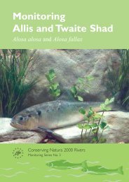
Groundwater HIA post edit - FreshwaterLife
Groundwater HIA post edit - FreshwaterLife
Groundwater HIA post edit - FreshwaterLife

You also want an ePaper? Increase the reach of your titles
YUMPU automatically turns print PDFs into web optimized ePapers that Google loves.
should match the required level of confidence. Further guidance on sources of<br />
information and data, and useful methods of processing, interpreting and displaying<br />
information during the development of a conceptual model can be found in<br />
Environment Agency (2002a).<br />
The outline regional conceptual model should now be refined by adding more detail<br />
about the local area around the proposed abstraction, to form a local conceptual<br />
model. The information in the local conceptual model should of course be consistent<br />
with that in the regional conceptual model. Information should be collected on, and an<br />
understanding gained of, local factors including:<br />
• Geology: use borehole lithological logs and large-scale geological maps<br />
(1:10,000 for example), to build up a three-dimensional picture of the local<br />
geology. Useful information can be obtained from site investigation,<br />
geotechnical, mineral exploration, and abstraction boreholes. At the local<br />
level, it is important to include drift and other superficial deposits, as they<br />
may have considerable significance. Try to construct several crosssectional<br />
diagrams of the local geology, to refine your understanding of the<br />
structure of the aquifer.<br />
• Hydrogeology: refine your understanding of the location and nature of<br />
hydrogeological boundaries (vertically and horizontally), local groundwater<br />
flow directions, the hydraulic properties of the aquifer and surrounding<br />
formations, and interaction with surface water features. Look for reports of<br />
test pumping already carried out in the area, and examine hydrographs<br />
from observation boreholes to gain information on local trends in<br />
groundwater level. Comparison of the hydrographs with annual recharge<br />
estimates or abstraction records from nearby boreholes may help identify<br />
whether the trends are natural or artificial.<br />
• Hydrology: refine your understanding of the local surface water system,<br />
including catchment boundaries, losing and gaining stretches of streams<br />
and rivers, seasonal flow variations, behaviour of springs, and relationships<br />
to wetlands, lakes, meres, etc.<br />
• <strong>Groundwater</strong> quality: collect information on local groundwater quality<br />
(including trends over time), and historical, existing and potential sources of<br />
groundwater pollution.<br />
At this point, readers may be asking the question, for what area should the local<br />
conceptual model be developed, as the zone of influence of the abstraction has not yet<br />
been defined? Unfortunately, this is a chicken-and-egg situation, in that the zone of<br />
influence cannot be defined without a conceptual model, but the area for the<br />
conceptual model is not yet clear. This is where the cyclical approach to conceptual<br />
modelling comes into its own. An educated guess should be made of the area over<br />
which to collect information for the first attempt at the conceptual model, with the area<br />
being revised at the start of each cycle. If the abstraction is from a karstic aquifer or<br />
fractured crystalline rock, the shape and size of the zone of influence is likely to be<br />
highly uncertain, and will need careful consideration (see Appendices 3 and 4 for<br />
further information).<br />
4.2.3 Step 3: Identify water features susceptible to flow impacts<br />
The starting point for this step is the question: Which water features are likely to be<br />
deprived of water by the abstraction? In other words, at which places will quantities of<br />
water (totalling the abstraction quantity) eventually be stopped from leaving the aquifer<br />
(or additional flows induced), when the system has eventually achieved a new<br />
24 Science Report – Hydrogeological impact appraisal for groundwater abstractions