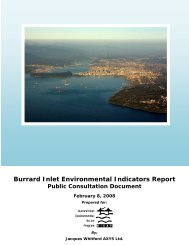
Consolidated Environmental Management Plan for Burrard Inlet ...
Consolidated Environmental Management Plan for Burrard Inlet ...
Consolidated Environmental Management Plan for Burrard Inlet ...

You also want an ePaper? Increase the reach of your titles
YUMPU automatically turns print PDFs into web optimized ePapers that Google loves.
20<br />
<strong>Consolidated</strong> <strong>Environmental</strong> <strong>Management</strong> <strong>Plan</strong> <strong>for</strong> <strong>Burrard</strong> <strong>Inlet</strong> / Existing Policy and <strong>Plan</strong>ning Initiatives in <strong>Burrard</strong> <strong>Inlet</strong><br />
In 1988, the Province designated the uplands<br />
surrounding Indian Arm as a protected area under the<br />
Environment and Land Use Act. Known as Say-Nuth-<br />
Khawyum Heritage Park and as Indian Arm Provincial<br />
Park, the lands are co-managed with the Tsleil-Waututh<br />
Nation through a memorandum of understanding.<br />
The Biodiversity Conservation Strategy (BCS) <strong>for</strong> the<br />
Metro Vancouver Region was a partnership initiative<br />
under the Georgia Basin Action <strong>Plan</strong> involving Metro<br />
Vancouver, Environment Canada, BC Ministry of<br />
Environment and BIEAP-FREMP working in conjunction<br />
with municipalities, non-governmental organizations<br />
(NGOs), stewardship groups and post-secondary<br />
institutions. The purpose of the project was to assess<br />
the network of areas contributing to the region’s<br />
biodiversity and develop and implement coordinated<br />
strategies and actions to conserve biodiversity.<br />
In 2009, The Biodiversity Conservation Strategy<br />
Partnership released Strategic Directions <strong>for</strong><br />
Biodiversity Conservation <strong>for</strong> the Metro Vancouver<br />
Region, which outlines specifi c strategies and<br />
implementation measures. Following release of the<br />
document, BIEAP-FREMP hosted a Forum to promote<br />
collaborative implementation of the Strategic Directions<br />
and identify next steps. Forum proceedings outlining<br />
ideas <strong>for</strong> future program development are available on<br />
the BIEAP website.<br />
Marine Protected Areas<br />
Federal and provincial governments create marine<br />
protected areas intended to protect marine biodiversity<br />
and/or cultural heritage areas. These areas are set aside<br />
to encourage scientifi c research, public appreciation and<br />
awareness, and recreation. Designated marine protected<br />
areas are representative of important ecosystems and<br />
are protected from certain development activities. There<br />
is a marine protected area off Lighthouse Park in West<br />
Vancouver, and there are Rockfi sh Conservation Areas in<br />
east <strong>Burrard</strong> <strong>Inlet</strong> and Indian Arm.<br />
Local Government Initiatives<br />
In addition to the work of the BIEAP partners, the local<br />
governments within <strong>Burrard</strong> <strong>Inlet</strong> play an important<br />
and active role in the maintenance and enhancement<br />
of <strong>Burrard</strong> <strong>Inlet</strong>’s entire ecosystem. Within <strong>Burrard</strong> <strong>Inlet</strong><br />
there are eight municipalities bordering the basin, and<br />
one Electoral Area administered by Metro Vancouver.<br />
The municipalities in <strong>Burrard</strong> <strong>Inlet</strong> include the cities of<br />
Burnaby, North Vancouver, Port Moody, and Vancouver,<br />
the districts of North Vancouver and West Vancouver<br />
and the villages of Anmore and Belcarra.<br />
These municipalities provide services and regulate<br />
land use within their boundaries in accordance with the<br />
Local Government Act through Offi cial Community <strong>Plan</strong>s<br />
(OCPs) and other zoning and planning mechanisms. All<br />
municipalities in <strong>Burrard</strong> <strong>Inlet</strong> have adopted the Regional<br />
Growth Strategy (RGS) which provides the framework<br />
<strong>for</strong> municipal growth and development decisions in<br />
the <strong>Burrard</strong> basin. Most municipal OCPs contain broad<br />
policy statements respecting the environmental<br />
management of lands within their boundaries. These<br />
policy statements emphasize sustainability within<br />
urban and rural contexts and provide the basis <strong>for</strong> many<br />
innovative municipal environmental management<br />
systems. Municipal environmental management<br />
strategies address such issues as the acquisition of<br />
parkland, environmentally sensitive areas and green<br />
space, the identifi cation of wildlife ecological corridors<br />
and greenway trail systems, and the classifi cation<br />
and prioritization of urban streams <strong>for</strong> protection and<br />
renewal. Many municipalities are examining alternate<br />
<strong>for</strong>ms of housing and urban infrastructure that make<br />
more effi cient use of land and energy resources and<br />
contribute to a healthier environment.<br />
The RGS is based on fi ve goals: Create a compact urban<br />
area, support a sustainable economy, protect the<br />
environment and respond to climate change impacts,<br />
develop complete communities and support sustainable<br />
transportation choices.<br />
Many of the municipalities within the <strong>Burrard</strong> <strong>Inlet</strong><br />
watershed are currently mapping its characteristics<br />
and prioritizing watershed features <strong>for</strong> protection and<br />
enhancement. For example, the Cities of Burnaby,<br />
Port Moody and North Vancouver are implementing